

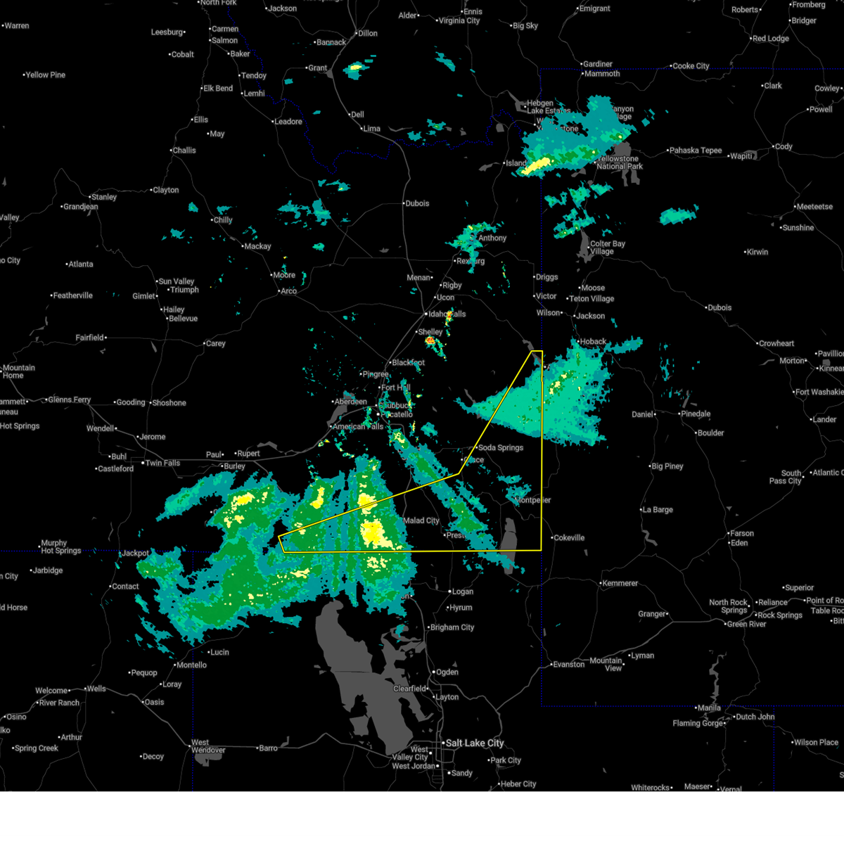
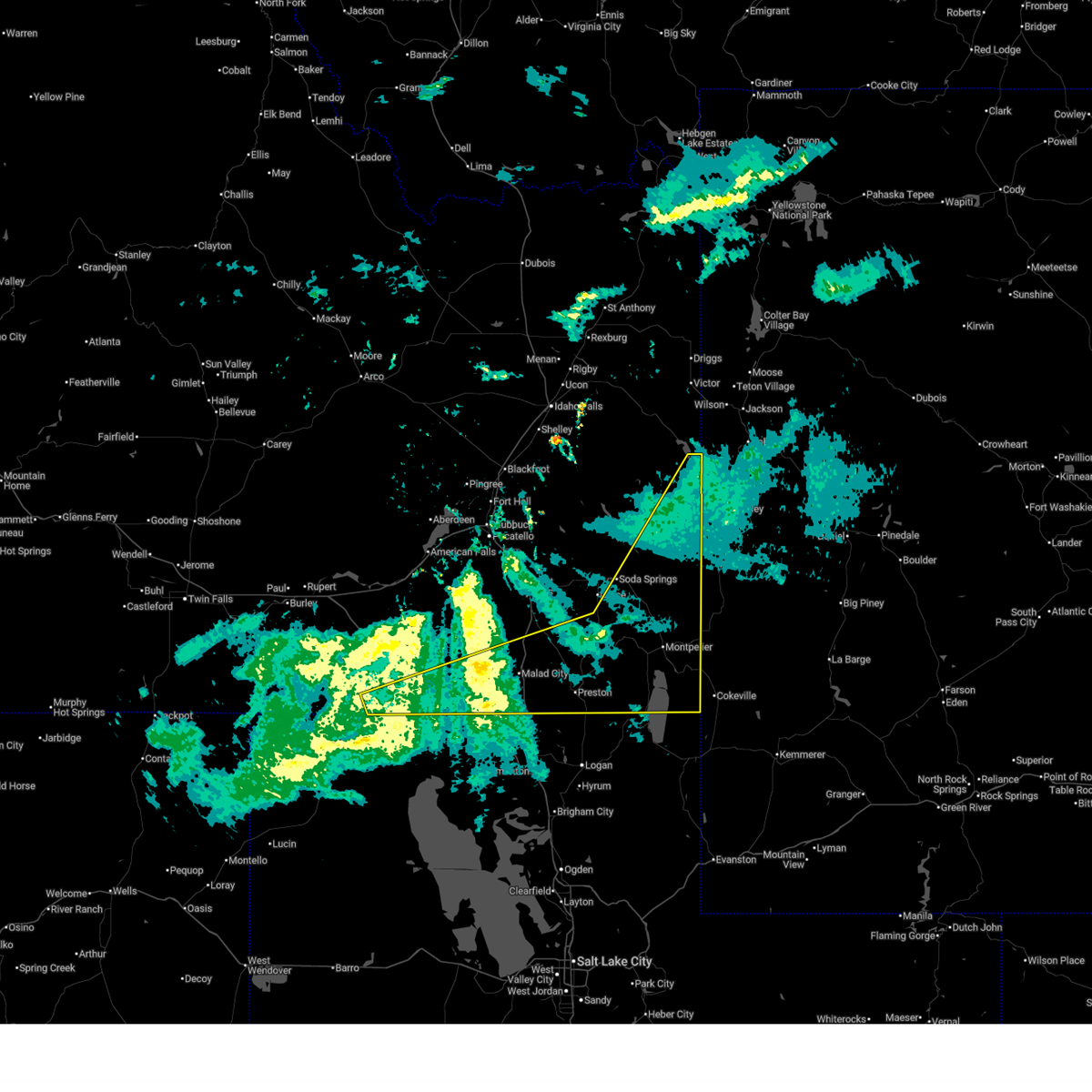
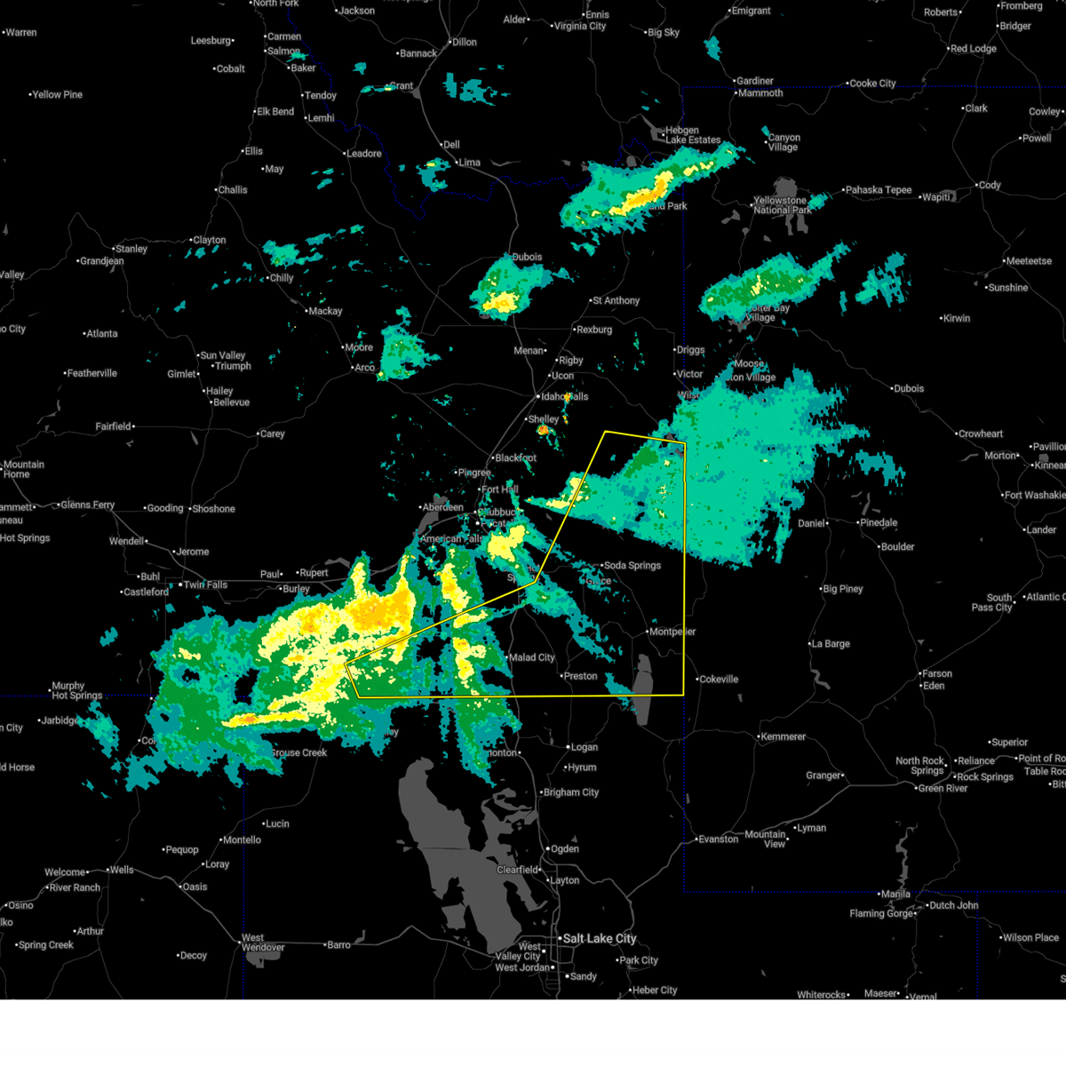
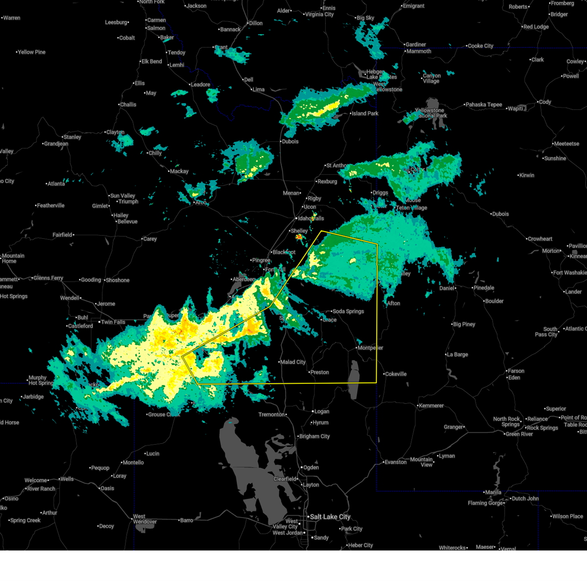
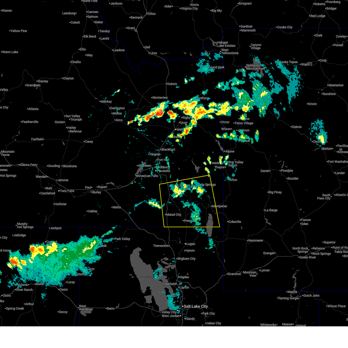
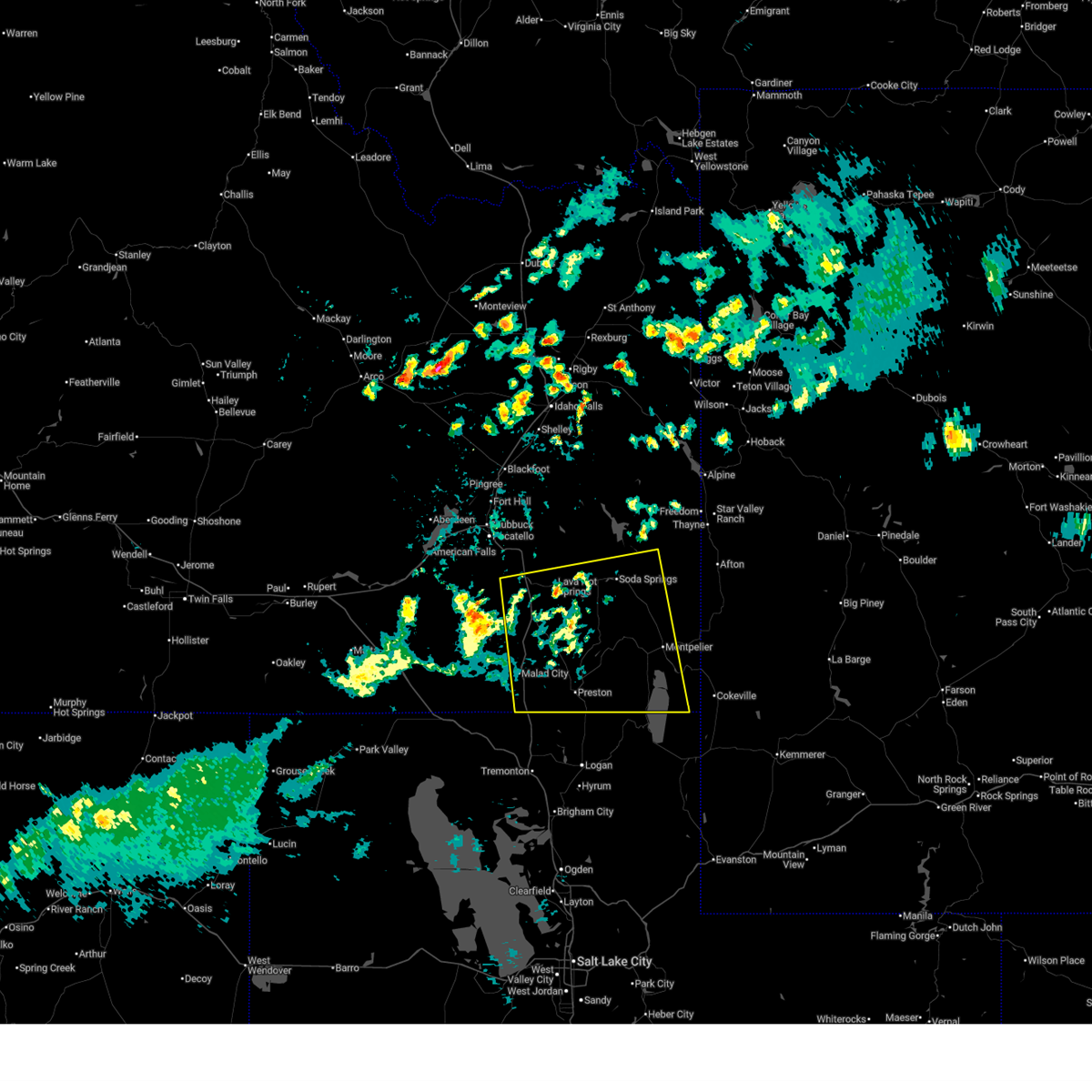
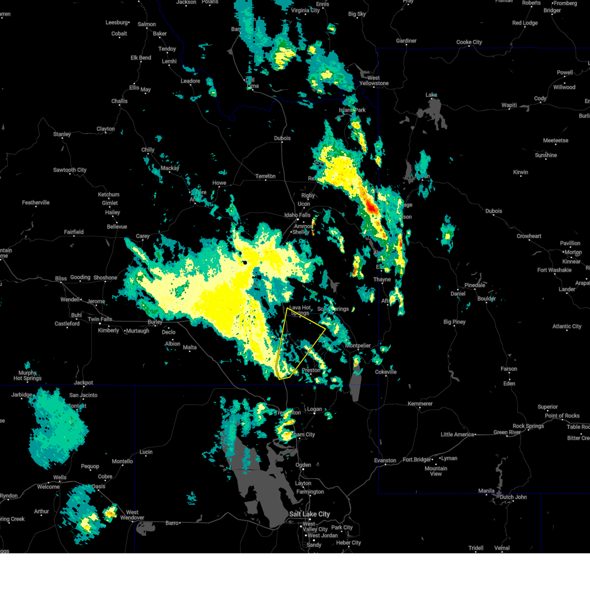
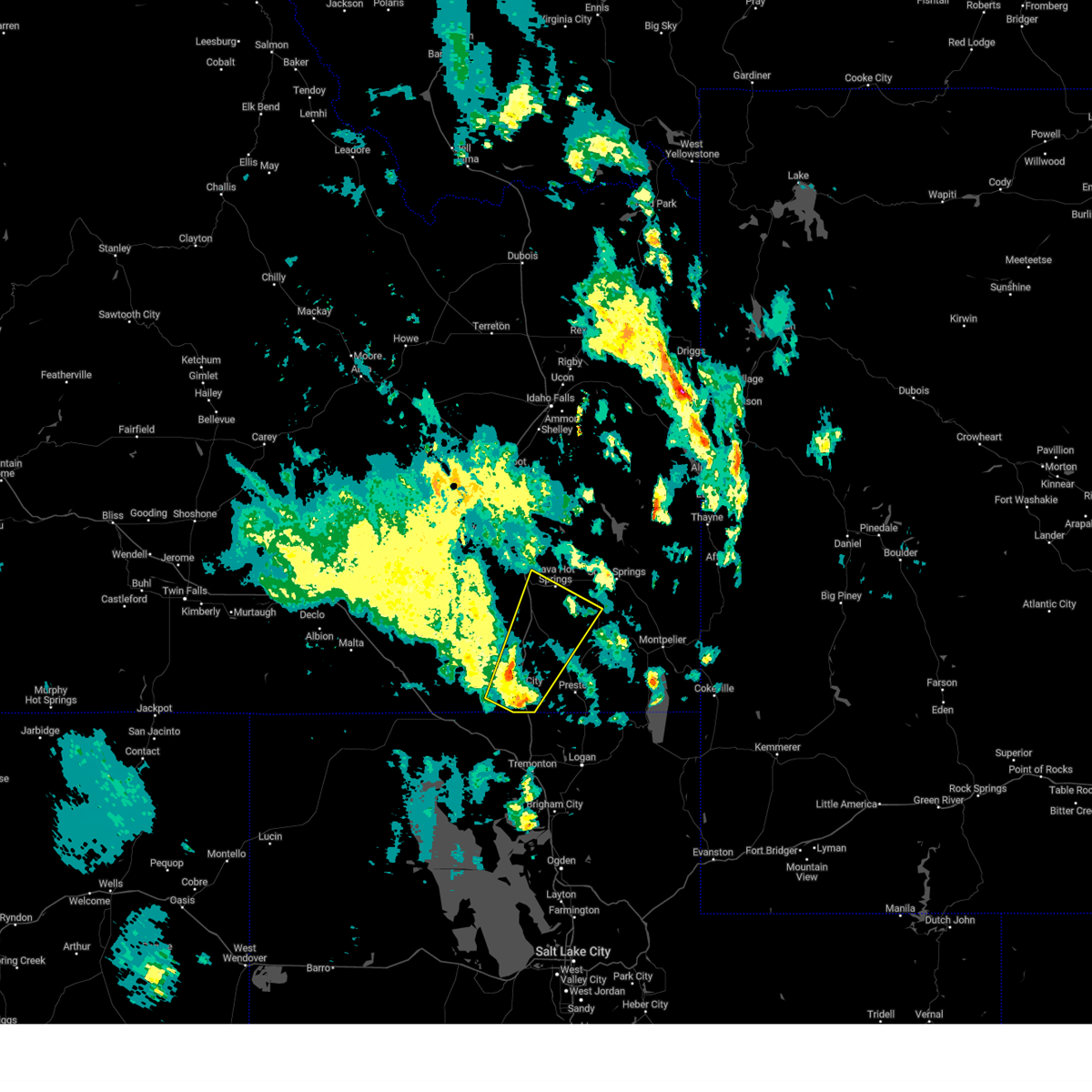
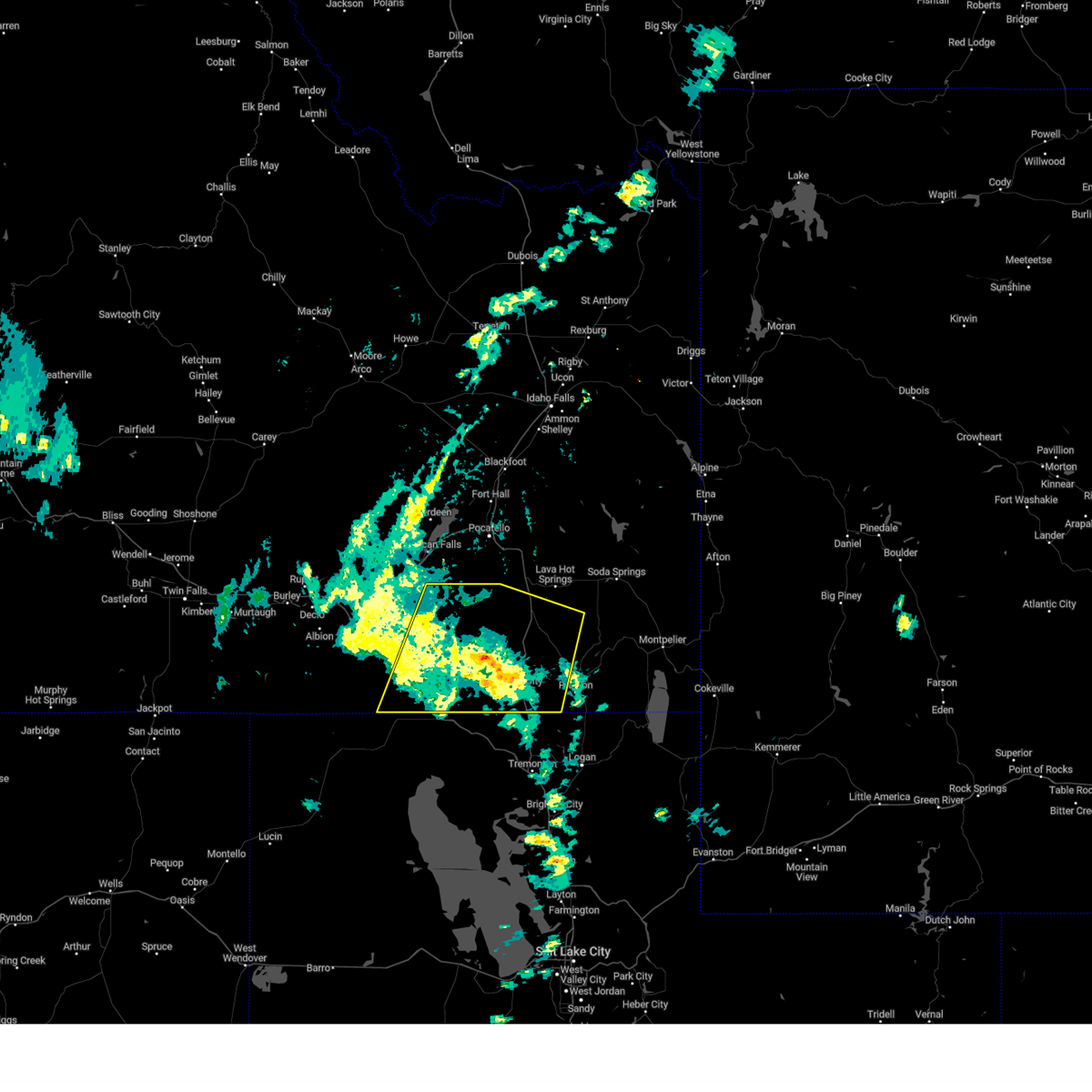
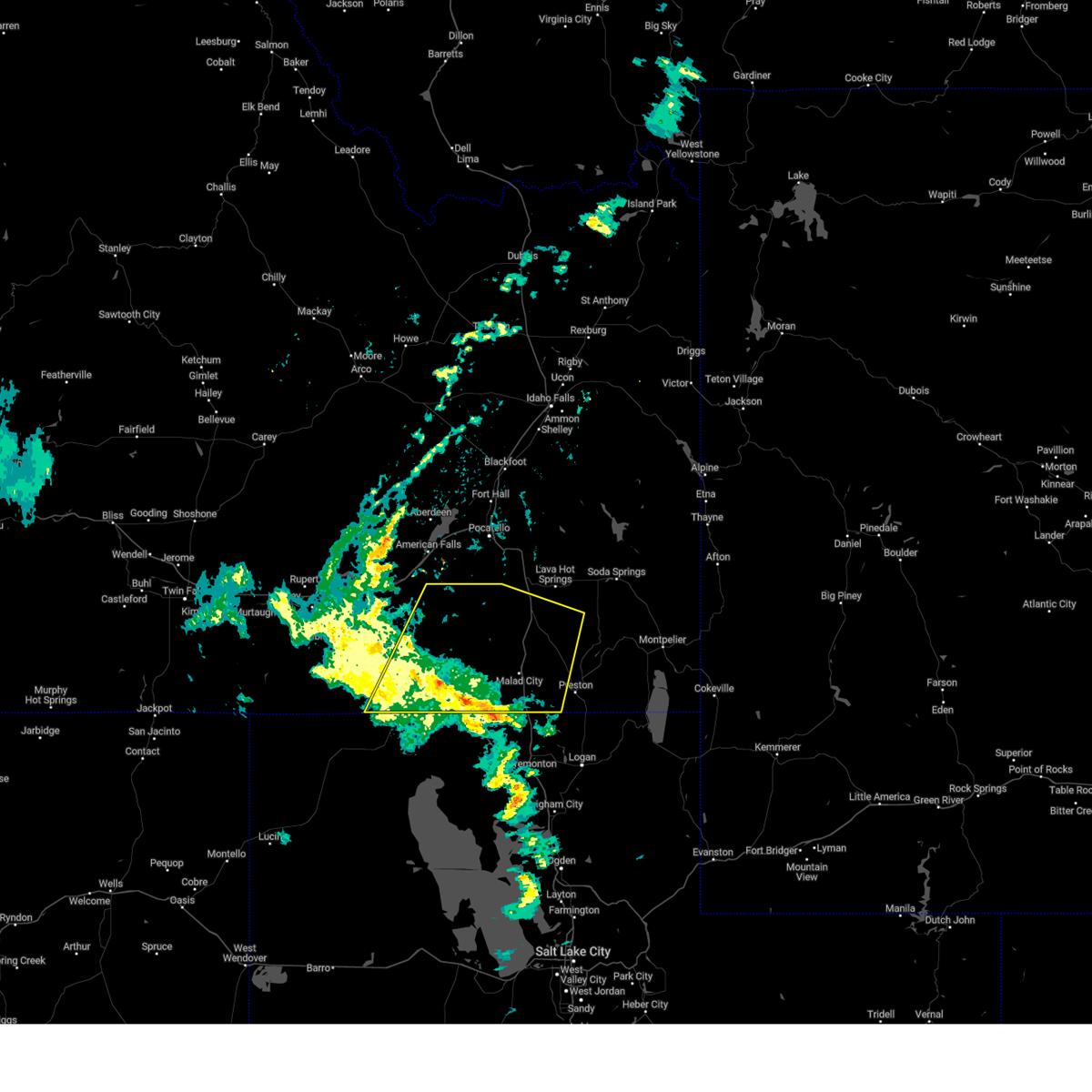
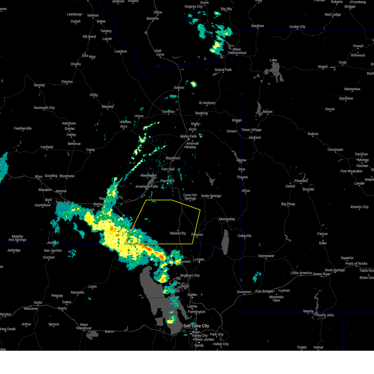
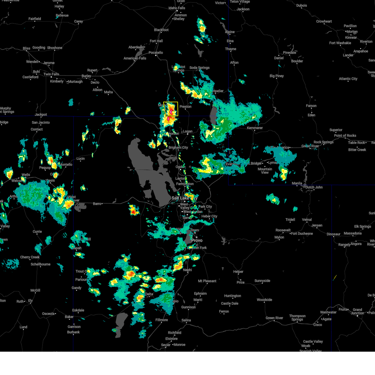
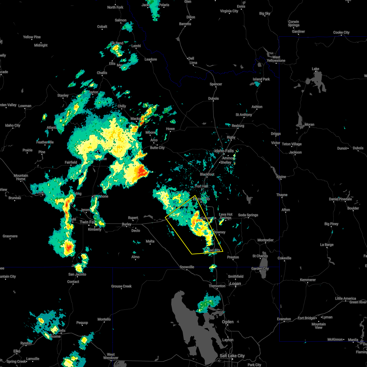
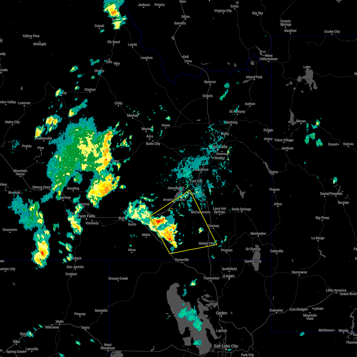
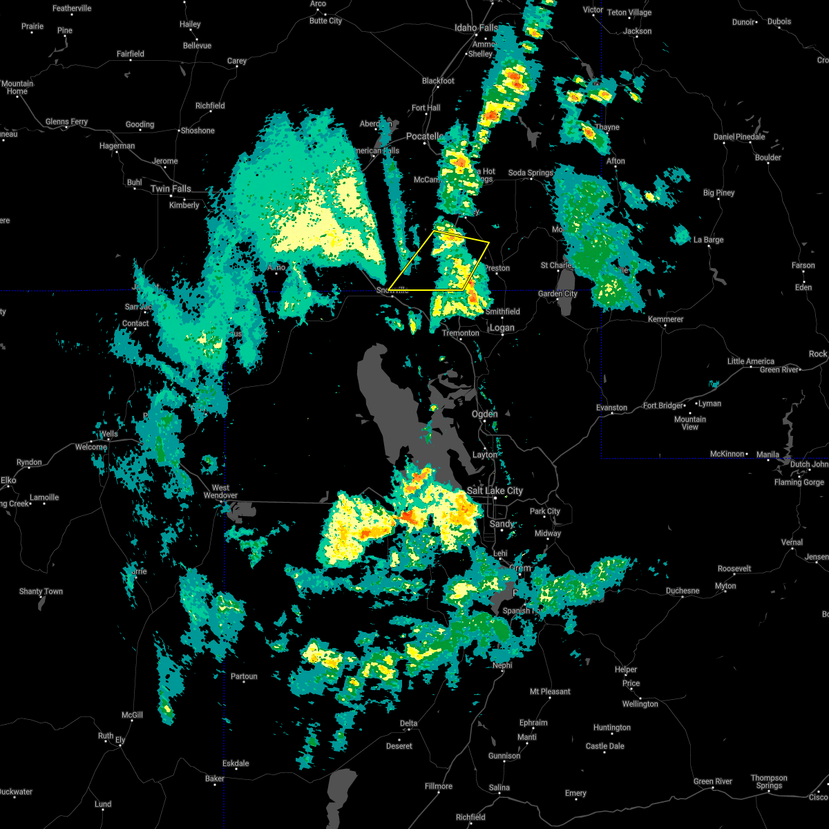
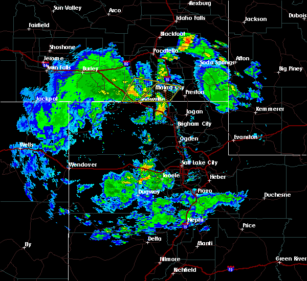
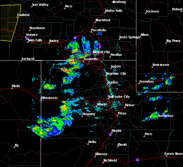
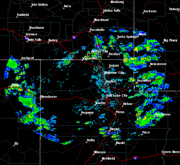
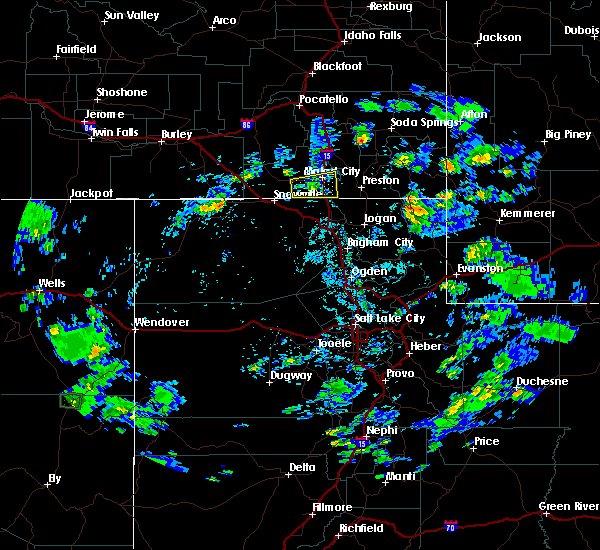
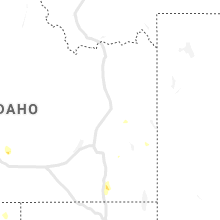
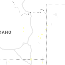
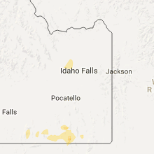
Hail Map for Malad City, ID
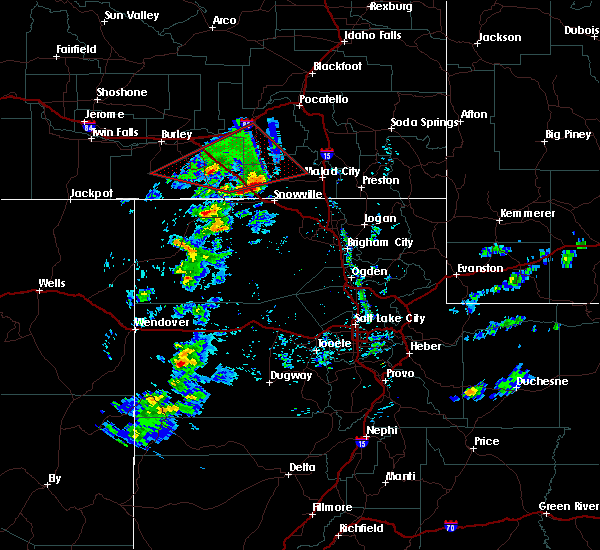
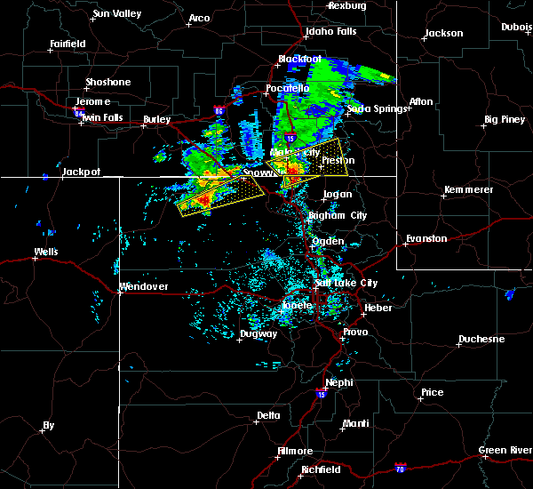
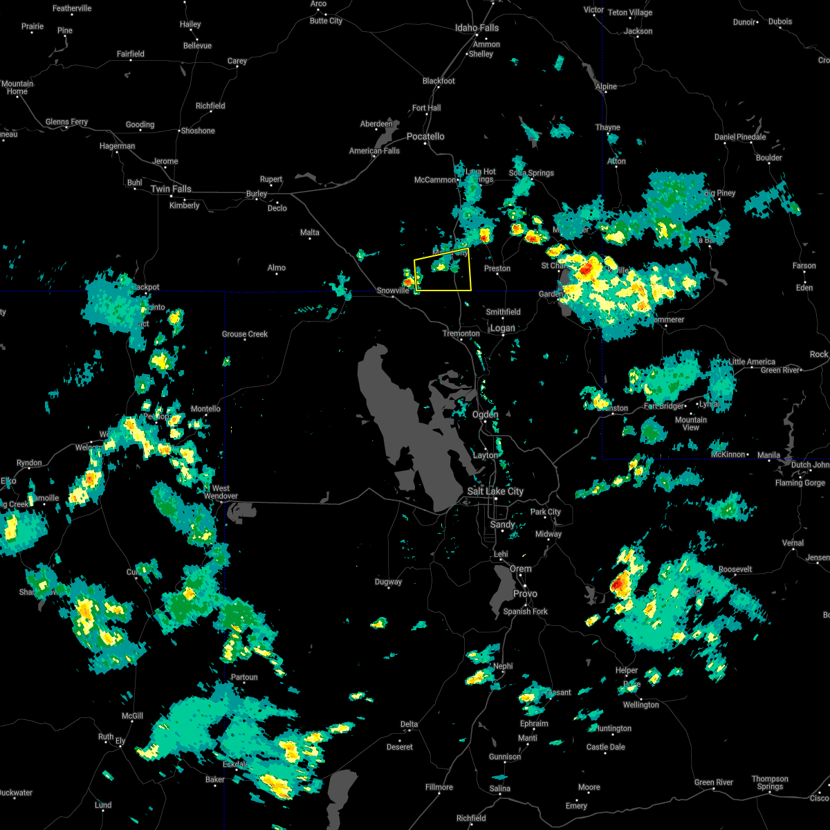
The Malad City, ID area has had 1 report of on-the-ground hail by trained spotters, and has been under severe weather warnings 8 times during the past 12 months. Doppler radar has detected hail at or near Malad City, ID on 11 occasions.
| Name: | Malad City, ID |
| Where Located: | 90.6 miles S of Idaho Falls, ID |
| Map: | Google Map for Malad City, ID |
| Population: | 2095 |
| Housing Units: | 893 |
| More Info: | Search Google for Malad City, ID |
0
The Top Recent Hail Date for Malad City, ID is Tuesday, August 13, 2024 (3rd out of 11)

Hail and Wind Damage Spotted near Malad City, ID
| Date / Time | Report Details |
|---|---|
| 5/13/2026 4:10 PM MDT | Mesonet station pc497 station canyo in oneida county ID, 8.4 miles S of Malad City, ID |
| 5/13/2026 4:00 PM MDT | Mesonet station itdd9 d5 holbrook id-3 in oneida county ID, 21.1 miles E of Malad City, ID |
| 5/13/2026 3:37 PM MDT | Power outage in oneida county ID, 2.8 miles NE of Malad City, ID |
| 5/13/2026 3:37 PM MDT | Power outage in oneida county ID, 0.1 miles SSW of Malad City, ID |
| 12/17/2025 11:32 AM MST |
 The storms which prompted the warning have moved out of the area. therefore, this warning has been allowed to expire. a new severe thunderstorm warning has been issued to replace this warning as the line moves to the southeast. The storms which prompted the warning have moved out of the area. therefore, this warning has been allowed to expire. a new severe thunderstorm warning has been issued to replace this warning as the line moves to the southeast.
|
| 12/17/2025 11:30 AM MST |
 Svrpih the national weather service in pocatello has issued a * severe thunderstorm warning for, southeastern caribou county in southeastern idaho, southern oneida county in southeastern idaho, southeastern bannock county in southeastern idaho, franklin county in southeastern idaho, bear lake county in southeastern idaho, southeastern cassia county in southeastern idaho, * until noon mst. * at 1129 am mst, a line of severe thunderstorms was located from freedom, wyoming to near bridge, moving southeast at 50 mph (radar indicated). Hazards include 70 mph wind gusts. Expect considerable tree damage. Damage is likely to mobile homes, roofs, and outbuildings. Svrpih the national weather service in pocatello has issued a * severe thunderstorm warning for, southeastern caribou county in southeastern idaho, southern oneida county in southeastern idaho, southeastern bannock county in southeastern idaho, franklin county in southeastern idaho, bear lake county in southeastern idaho, southeastern cassia county in southeastern idaho, * until noon mst. * at 1129 am mst, a line of severe thunderstorms was located from freedom, wyoming to near bridge, moving southeast at 50 mph (radar indicated). Hazards include 70 mph wind gusts. Expect considerable tree damage. Damage is likely to mobile homes, roofs, and outbuildings.
|
| 12/17/2025 11:21 AM MST |
 At 1119 am mst, a line of severe thunderstorms was located from palisades reservoir to near bridge, moving southeast at 45 mph (radar indicated). Hazards include 70 mph wind gusts. Expect considerable tree damage. damage is likely to mobile homes, roofs, and outbuildings. Locations impacted include, preston, soda springs, montpelier, malad, swanlake, southern palisades reservoir, bear lake idaho portion, franklin, georgetown, saint charles, juniper, dingle, thatcher, oneida narrows reservoir, cherry creek rest area, holbrook summit, pleasantview, paris, dayton, and weston. At 1119 am mst, a line of severe thunderstorms was located from palisades reservoir to near bridge, moving southeast at 45 mph (radar indicated). Hazards include 70 mph wind gusts. Expect considerable tree damage. damage is likely to mobile homes, roofs, and outbuildings. Locations impacted include, preston, soda springs, montpelier, malad, swanlake, southern palisades reservoir, bear lake idaho portion, franklin, georgetown, saint charles, juniper, dingle, thatcher, oneida narrows reservoir, cherry creek rest area, holbrook summit, pleasantview, paris, dayton, and weston.
|
| 12/17/2025 11:21 AM MST |
 the severe thunderstorm warning has been cancelled and is no longer in effect the severe thunderstorm warning has been cancelled and is no longer in effect
|
| 12/17/2025 11:03 AM MST |
 At 1101 am mst, a line of severe thunderstorms was located from just east of bone to near bridge, moving southeast at 45 mph (radar indicated. this storm has a history of producing gusts from 60 to 85 mph). Hazards include 80 mph wind gusts. Flying debris will be dangerous to those caught without shelter. mobile homes will be heavily damaged. expect considerable damage to roofs, windows, and vehicles. extensive tree damage and power outages are likely. Locations impacted include, preston, soda springs, montpelier, malad, lava hot springs, swanlake, blackfoot reservoir, wayan, palisades reservoir, bear lake idaho portion, grace, franklin, downey, georgetown, saint charles, juniper, dingle, thatcher, oneida narrows reservoir, and cherry creek rest area. At 1101 am mst, a line of severe thunderstorms was located from just east of bone to near bridge, moving southeast at 45 mph (radar indicated. this storm has a history of producing gusts from 60 to 85 mph). Hazards include 80 mph wind gusts. Flying debris will be dangerous to those caught without shelter. mobile homes will be heavily damaged. expect considerable damage to roofs, windows, and vehicles. extensive tree damage and power outages are likely. Locations impacted include, preston, soda springs, montpelier, malad, lava hot springs, swanlake, blackfoot reservoir, wayan, palisades reservoir, bear lake idaho portion, grace, franklin, downey, georgetown, saint charles, juniper, dingle, thatcher, oneida narrows reservoir, and cherry creek rest area.
|
| 12/17/2025 10:43 AM MST |
 Svrpih the national weather service in pocatello has issued a * severe thunderstorm warning for, caribou county in southeastern idaho, oneida county in southeastern idaho, bannock county in southeastern idaho, southeastern power county in southeastern idaho, southeastern bonneville county in southeastern idaho, franklin county in southeastern idaho, bear lake county in southeastern idaho, southeastern bingham county in southeastern idaho, southeastern cassia county in southeastern idaho, * until 1130 am mst. * at 1042 am mst, a line of severe thunderstorm was located from near bone to malta, moving southeast at 40 mph (radar indicated. this line of storms has a history of producing gusts from 60 to 85 mph). Hazards include 80 mph wind gusts. Flying debris will be dangerous to those caught without shelter. mobile homes will be heavily damaged. expect considerable damage to roofs, windows, and vehicles. Extensive tree damage and power outages are likely. Svrpih the national weather service in pocatello has issued a * severe thunderstorm warning for, caribou county in southeastern idaho, oneida county in southeastern idaho, bannock county in southeastern idaho, southeastern power county in southeastern idaho, southeastern bonneville county in southeastern idaho, franklin county in southeastern idaho, bear lake county in southeastern idaho, southeastern bingham county in southeastern idaho, southeastern cassia county in southeastern idaho, * until 1130 am mst. * at 1042 am mst, a line of severe thunderstorm was located from near bone to malta, moving southeast at 40 mph (radar indicated. this line of storms has a history of producing gusts from 60 to 85 mph). Hazards include 80 mph wind gusts. Flying debris will be dangerous to those caught without shelter. mobile homes will be heavily damaged. expect considerable damage to roofs, windows, and vehicles. Extensive tree damage and power outages are likely.
|
| 7/17/2025 7:30 PM MDT | Mesonet station itdd9 d5 holbrook id-3 in oneida county ID, 21.1 miles E of Malad City, ID |
| 7/15/2025 6:44 PM MDT |
 The storms which prompted the warning have moved out of the original warning area. therefore, the warning will be allowed to expire. however, gusty winds are still possible with these thunderstorms. remember, a severe thunderstorm warning still remains in effect for areas east of the original warning, or portions of caribou, bannock, franklin, and bear lake counties until 730 pm mdt. The storms which prompted the warning have moved out of the original warning area. therefore, the warning will be allowed to expire. however, gusty winds are still possible with these thunderstorms. remember, a severe thunderstorm warning still remains in effect for areas east of the original warning, or portions of caribou, bannock, franklin, and bear lake counties until 730 pm mdt.
|
| 7/15/2025 6:09 PM MDT |
 Svrpih the national weather service in pocatello has issued a * severe thunderstorm warning for, southern caribou county in southeastern idaho, eastern oneida county in southeastern idaho, southeastern bannock county in southeastern idaho, franklin county in southeastern idaho, bear lake county in southeastern idaho, * until 645 pm mdt. * at 608 pm mdt, severe thunderstorms were located along a line extending from near lava hot springs to franklin, moving east at 50 mph (radar indicated). Hazards include 70 mph wind gusts and penny size hail. Expect considerable tree damage. Damage is likely to mobile homes, roofs, and outbuildings. Svrpih the national weather service in pocatello has issued a * severe thunderstorm warning for, southern caribou county in southeastern idaho, eastern oneida county in southeastern idaho, southeastern bannock county in southeastern idaho, franklin county in southeastern idaho, bear lake county in southeastern idaho, * until 645 pm mdt. * at 608 pm mdt, severe thunderstorms were located along a line extending from near lava hot springs to franklin, moving east at 50 mph (radar indicated). Hazards include 70 mph wind gusts and penny size hail. Expect considerable tree damage. Damage is likely to mobile homes, roofs, and outbuildings.
|
| 7/15/2025 6:00 PM MDT | Mesonet station 3010 d5 malad summit i-1 in oneida county ID, 10.5 miles S of Malad City, ID |
| 7/15/2025 6:00 PM MDT | Mesonet station pc497 station canyo in oneida county ID, 8.4 miles S of Malad City, ID |
| 6/11/2025 3:30 PM MDT | Station canyon pacficorp mesonet on malad summi in oneida county ID, 8.4 miles S of Malad City, ID |
| 5/13/2024 6:05 PM MDT |
 Svrpih the national weather service in pocatello has issued a * severe thunderstorm warning for, western caribou county in southeastern idaho, eastern oneida county in southeastern idaho, bannock county in southeastern idaho, central bonneville county in southeastern idaho, franklin county in southeastern idaho, southeastern bingham county in southeastern idaho, * until 715 pm mdt. * at 604 pm mdt, severe thunderstorms were located along a line extending from rockford to near portneuf gap to 12 miles southwest of pleasantview, moving east at 35 mph (radar indicated). Hazards include 60 mph wind gusts. expect damage to roofs, siding, and trees Svrpih the national weather service in pocatello has issued a * severe thunderstorm warning for, western caribou county in southeastern idaho, eastern oneida county in southeastern idaho, bannock county in southeastern idaho, central bonneville county in southeastern idaho, franklin county in southeastern idaho, southeastern bingham county in southeastern idaho, * until 715 pm mdt. * at 604 pm mdt, severe thunderstorms were located along a line extending from rockford to near portneuf gap to 12 miles southwest of pleasantview, moving east at 35 mph (radar indicated). Hazards include 60 mph wind gusts. expect damage to roofs, siding, and trees
|
| 9/3/2023 6:32 PM MDT |
 At 631 pm mdt, a severe thunderstorm was located 7 miles west of swanlake, moving northeast at 50 mph (radar indicated and mesonet. this storm has a history of producing 50 to 60 mph winds). Hazards include 60 mph wind gusts. Expect damage to roofs, siding, and trees. locations impacted include, malad, mccammon, lava hot springs, swanlake, downey, arimo, cherry creek rest area, virginia, clifton, oxford, niter, and malad pass. hail threat, radar indicated max hail size, <. 75 in wind threat, observed max wind gust, 60 mph. At 631 pm mdt, a severe thunderstorm was located 7 miles west of swanlake, moving northeast at 50 mph (radar indicated and mesonet. this storm has a history of producing 50 to 60 mph winds). Hazards include 60 mph wind gusts. Expect damage to roofs, siding, and trees. locations impacted include, malad, mccammon, lava hot springs, swanlake, downey, arimo, cherry creek rest area, virginia, clifton, oxford, niter, and malad pass. hail threat, radar indicated max hail size, <. 75 in wind threat, observed max wind gust, 60 mph.
|
| 9/3/2023 6:20 PM MDT |
 At 619 pm mdt, a severe thunderstorm was located over malad, moving northeast at 35 mph (radar indicated and mesonet. at 615 pm mdt, 57 mph winds were reported near samaria). Hazards include 60 mph wind gusts. expect damage to roofs, siding, and trees At 619 pm mdt, a severe thunderstorm was located over malad, moving northeast at 35 mph (radar indicated and mesonet. at 615 pm mdt, 57 mph winds were reported near samaria). Hazards include 60 mph wind gusts. expect damage to roofs, siding, and trees
|
| 7/24/2023 7:39 PM MDT |
 At 739 pm mdt, severe thunderstorms were located along a line extending from 15 miles northeast of juniper to 11 miles northeast of holbrook summit to 8 miles east of malad, moving northeast at 40 mph (radar indicated). Hazards include 60 mph wind gusts. Expect damage to roofs, siding, and trees. locations impacted include, malad, swanlake, downey, arimo, rockland, juniper, holbrook summit, pleasantview, fort hall bannock peak, cherry creek rest area, virginia, dayton, weston, clifton, oxford, stone, sweetzer summit, hawkins reservoir, samaria, and arbon. hail threat, radar indicated max hail size, <. 75 in wind threat, radar indicated max wind gust, 60 mph. At 739 pm mdt, severe thunderstorms were located along a line extending from 15 miles northeast of juniper to 11 miles northeast of holbrook summit to 8 miles east of malad, moving northeast at 40 mph (radar indicated). Hazards include 60 mph wind gusts. Expect damage to roofs, siding, and trees. locations impacted include, malad, swanlake, downey, arimo, rockland, juniper, holbrook summit, pleasantview, fort hall bannock peak, cherry creek rest area, virginia, dayton, weston, clifton, oxford, stone, sweetzer summit, hawkins reservoir, samaria, and arbon. hail threat, radar indicated max hail size, <. 75 in wind threat, radar indicated max wind gust, 60 mph.
|
| 7/24/2023 7:17 PM MDT |
 At 716 pm mdt, severe thunderstorms were located along a line extending from 8 miles west of juniper to 7 miles west of holbrook summit to 8 miles southwest of cherry creek rest area, moving northeast at 40 mph (radar indicated). Hazards include 60 mph wind gusts. Expect damage to roofs, siding, and trees. locations impacted include, malad, swanlake, downey, arimo, rockland, juniper, holbrook summit, pleasantview, fort hall bannock peak, cherry creek rest area, virginia, dayton, weston, clifton, oxford, stone, sweetzer summit, hawkins reservoir, samaria, and arbon. hail threat, radar indicated max hail size, <. 75 in wind threat, radar indicated max wind gust, 60 mph. At 716 pm mdt, severe thunderstorms were located along a line extending from 8 miles west of juniper to 7 miles west of holbrook summit to 8 miles southwest of cherry creek rest area, moving northeast at 40 mph (radar indicated). Hazards include 60 mph wind gusts. Expect damage to roofs, siding, and trees. locations impacted include, malad, swanlake, downey, arimo, rockland, juniper, holbrook summit, pleasantview, fort hall bannock peak, cherry creek rest area, virginia, dayton, weston, clifton, oxford, stone, sweetzer summit, hawkins reservoir, samaria, and arbon. hail threat, radar indicated max hail size, <. 75 in wind threat, radar indicated max wind gust, 60 mph.
|
| 7/24/2023 7:00 PM MDT |
 At 659 pm mdt, severe thunderstorms were located along a line extending from 10 miles west of juniper to 6 miles northwest of snowville to 10 miles north of howell, moving northeast at 45 mph (radar indicated). Hazards include 60 mph wind gusts. expect damage to roofs, siding, and trees At 659 pm mdt, severe thunderstorms were located along a line extending from 10 miles west of juniper to 6 miles northwest of snowville to 10 miles north of howell, moving northeast at 45 mph (radar indicated). Hazards include 60 mph wind gusts. expect damage to roofs, siding, and trees
|
| 6/1/2023 4:40 PM MDT |
 The severe thunderstorm warning for southeastern oneida and southwestern franklin counties will expire at 445 pm mdt, the storm which prompted the warning has weakened below severe limits, and no longer poses an immediate threat to life or property. therefore, the warning will be allowed to expire. however heavy rain is still possible with this thunderstorm. The severe thunderstorm warning for southeastern oneida and southwestern franklin counties will expire at 445 pm mdt, the storm which prompted the warning has weakened below severe limits, and no longer poses an immediate threat to life or property. therefore, the warning will be allowed to expire. however heavy rain is still possible with this thunderstorm.
|
| 6/1/2023 4:26 PM MDT | Quarter sized hail reported 3.7 miles NNW of Malad City, ID |
| 6/1/2023 4:16 PM MDT |
 At 416 pm mdt, a severe thunderstorm was located near cherry creek rest area, or 11 miles southeast of malad. the storm is nearly stationary (radar indicated). Hazards include quarter size hail. damage to vehicles is expected At 416 pm mdt, a severe thunderstorm was located near cherry creek rest area, or 11 miles southeast of malad. the storm is nearly stationary (radar indicated). Hazards include quarter size hail. damage to vehicles is expected
|
| 9/21/2022 5:00 PM MDT | Pilot gold i in oneida county ID, 38.6 miles ENE of Malad City, ID |
| 8/26/2022 3:28 PM MDT | At 328 pm mdt, a severe thunderstorm was located 9 miles northwest of pleasantview, or 11 miles northwest of malad, moving east at 10 mph (radar indicated). Hazards include quarter size hail. damage to vehicles is expected |
| 8/26/2022 2:58 PM MDT | At 258 pm mdt, a severe thunderstorm was located 9 miles northwest of malad, moving east at 15 mph (radar indicated). Hazards include quarter size hail. damage to vehicles is expected |
| 5/16/2021 6:17 PM MDT | Around 5 pm... roof and tree damag in oneida county ID, 20.6 miles E of Malad City, ID |
| 8/25/2020 4:42 PM MDT |
 The severe thunderstorm warning for central oneida, central bannock, southeastern power, northwestern franklin and northeastern cassia counties will expire at 445 pm mdt, the storms which prompted the warning have weakened below severe limits, and no longer pose an immediate threat to life or property. therefore, the warning will be allowed to expire. however gusty winds are still possible with these thunderstorms. the storms in this line may still re-strengthen and bear watching. The severe thunderstorm warning for central oneida, central bannock, southeastern power, northwestern franklin and northeastern cassia counties will expire at 445 pm mdt, the storms which prompted the warning have weakened below severe limits, and no longer pose an immediate threat to life or property. therefore, the warning will be allowed to expire. however gusty winds are still possible with these thunderstorms. the storms in this line may still re-strengthen and bear watching.
|
| 8/25/2020 4:20 PM MDT |
 At 418 pm mdt, severe thunderstorms were located along a line extending from fort hall bannock peak to near pleasantview, moving east at 40 mph (radar indicated). Hazards include 60 mph wind gusts and penny size hail. Expect damage to roofs, siding, and trees. Locations impacted include, american falls, malad, neeley, rockland, fort hall bannock peak, fort hall bannock creek lodge, pocatello airport, pauline, massacre rocks, mink creek pass, daniels reservoir, arbon, malad pass and hawkins reservoir. At 418 pm mdt, severe thunderstorms were located along a line extending from fort hall bannock peak to near pleasantview, moving east at 40 mph (radar indicated). Hazards include 60 mph wind gusts and penny size hail. Expect damage to roofs, siding, and trees. Locations impacted include, american falls, malad, neeley, rockland, fort hall bannock peak, fort hall bannock creek lodge, pocatello airport, pauline, massacre rocks, mink creek pass, daniels reservoir, arbon, malad pass and hawkins reservoir.
|
| 8/25/2020 3:55 PM MDT |
 At 354 pm mdt, severe thunderstorms were located along a line extending from 7 miles southwest of cold water rest area to 10 miles north of juniper, moving east at 50 mph (radar indicated). Hazards include 60 mph wind gusts and penny size hail. expect damage to roofs, siding, and trees At 354 pm mdt, severe thunderstorms were located along a line extending from 7 miles southwest of cold water rest area to 10 miles north of juniper, moving east at 50 mph (radar indicated). Hazards include 60 mph wind gusts and penny size hail. expect damage to roofs, siding, and trees
|
| 6/6/2020 4:42 PM MDT |
 The severe thunderstorm warning for southeastern oneida, south central bannock and west central franklin counties will expire at 445 pm mdt, the storm which prompted the warning has weakened below severe limits, and no longer poses an immediate threat to life or property. therefore, the warning will be allowed to expire. The severe thunderstorm warning for southeastern oneida, south central bannock and west central franklin counties will expire at 445 pm mdt, the storm which prompted the warning has weakened below severe limits, and no longer poses an immediate threat to life or property. therefore, the warning will be allowed to expire.
|
| 6/6/2020 4:20 PM MDT | Between the towns of pleasantview and malad city numerous uprooted trees... one damaging a house... and numerous power lines damaged and dow in oneida county ID, 4.1 miles ENE of Malad City, ID |
| 6/6/2020 4:20 PM MDT |
 At 419 pm mdt, a severe thunderstorm was located near pleasantview, or 10 miles west of malad, moving northeast at 45 mph (radar indicated). Hazards include 60 mph wind gusts and quarter size hail. Hail damage to vehicles is expected. expect wind damage to roofs, siding, and trees. Locations impacted include, malad, cherry creek rest area, pleasantview, holbrook summit, clifton, oxford, samaria and stone. At 419 pm mdt, a severe thunderstorm was located near pleasantview, or 10 miles west of malad, moving northeast at 45 mph (radar indicated). Hazards include 60 mph wind gusts and quarter size hail. Hail damage to vehicles is expected. expect wind damage to roofs, siding, and trees. Locations impacted include, malad, cherry creek rest area, pleasantview, holbrook summit, clifton, oxford, samaria and stone.
|
| 6/6/2020 4:03 PM MDT |
 At 402 pm mdt, a severe thunderstorm was located near snowville, moving northeast at 45 mph (radar indicated). Hazards include 60 mph wind gusts and quarter size hail. Hail damage to vehicles is expected. Expect wind damage to roofs, siding, and trees. At 402 pm mdt, a severe thunderstorm was located near snowville, moving northeast at 45 mph (radar indicated). Hazards include 60 mph wind gusts and quarter size hail. Hail damage to vehicles is expected. Expect wind damage to roofs, siding, and trees.
|
| 5/30/2020 7:01 PM MDT | 71 mph wind gust measured on a personal weather station. roof damage to outbuildings in the area. tree limbs dow in oneida county ID, 21.1 miles E of Malad City, ID |
| 4/30/2020 4:26 PM MDT |
 The severe thunderstorm warning for southeastern oneida and southwestern franklin counties will expire at 430 pm mdt, the storm which prompted the warning has weakened below severe limits, and no longer poses an immediate threat to life or property. therefore, the warning will be allowed to expire. however gusty winds are still possible with this thunderstorm. to report severe weather, contact your nearest law enforcement agency. they will relay your report to the national weather service pocatello. The severe thunderstorm warning for southeastern oneida and southwestern franklin counties will expire at 430 pm mdt, the storm which prompted the warning has weakened below severe limits, and no longer poses an immediate threat to life or property. therefore, the warning will be allowed to expire. however gusty winds are still possible with this thunderstorm. to report severe weather, contact your nearest law enforcement agency. they will relay your report to the national weather service pocatello.
|
| 4/30/2020 4:12 PM MDT |
 At 412 pm mdt, a severe thunderstorm was located over northeastern bear lake idaho portion, moving east at 35 mph (radar indicated). Hazards include 60 mph wind gusts and quarter size hail. Hail damage to vehicles is expected. expect wind damage to roofs, siding, and trees. Locations impacted include, preston, malad, franklin, pleasantview, cherry creek rest area, dayton, weston, clifton, mapleton, samaria, whitney, riverdale and mink creek. At 412 pm mdt, a severe thunderstorm was located over northeastern bear lake idaho portion, moving east at 35 mph (radar indicated). Hazards include 60 mph wind gusts and quarter size hail. Hail damage to vehicles is expected. expect wind damage to roofs, siding, and trees. Locations impacted include, preston, malad, franklin, pleasantview, cherry creek rest area, dayton, weston, clifton, mapleton, samaria, whitney, riverdale and mink creek.
|
| 4/30/2020 3:44 PM MDT |
 At 344 pm mdt, a severe thunderstorm was located near pleasantview, or near malad, moving east at 35 mph (radar indicated). Hazards include ping pong ball size hail and 60 mph wind gusts. People and animals outdoors will be injured. expect hail damage to roofs, siding, windows, and vehicles. Expect wind damage to roofs, siding, and trees. At 344 pm mdt, a severe thunderstorm was located near pleasantview, or near malad, moving east at 35 mph (radar indicated). Hazards include ping pong ball size hail and 60 mph wind gusts. People and animals outdoors will be injured. expect hail damage to roofs, siding, windows, and vehicles. Expect wind damage to roofs, siding, and trees.
|
| 4/30/2020 3:19 PM MDT |
 At 318 pm mdt, a severe thunderstorm capable of producing a tornado was located 10 miles southeast of holbrook summit, or 11 miles northeast of snowville, moving east at 45 mph (radar indicated rotation). Hazards include tornado and ping pong ball size hail. Flying debris will be dangerous to those caught without shelter. mobile homes will be damaged or destroyed. damage to roofs, windows, and vehicles will occur. tree damage is likely. this dangerous storm will be near, cherry creek rest area around 340 pm mdt. Other locations impacted by this tornadic thunderstorm include holbrook, stone and samaria. At 318 pm mdt, a severe thunderstorm capable of producing a tornado was located 10 miles southeast of holbrook summit, or 11 miles northeast of snowville, moving east at 45 mph (radar indicated rotation). Hazards include tornado and ping pong ball size hail. Flying debris will be dangerous to those caught without shelter. mobile homes will be damaged or destroyed. damage to roofs, windows, and vehicles will occur. tree damage is likely. this dangerous storm will be near, cherry creek rest area around 340 pm mdt. Other locations impacted by this tornadic thunderstorm include holbrook, stone and samaria.
|
| 4/30/2020 2:55 PM MDT |
 At 255 pm mdt, a severe thunderstorm capable of producing a tornado was located 7 miles northeast of juniper, or 10 miles northwest of snowville, moving east at 45 mph (radar indicated rotation). Hazards include tornado and hail up to two inches in diameter. Flying debris will be dangerous to those caught without shelter. mobile homes will be damaged or destroyed. damage to roofs, windows, and vehicles will occur. tree damage is likely. this dangerous storm will be near, holbrook summit around 315 pm mdt. cherry creek rest area around 340 pm mdt. Other locations impacted by this tornadic thunderstorm include holbrook, stone and samaria. At 255 pm mdt, a severe thunderstorm capable of producing a tornado was located 7 miles northeast of juniper, or 10 miles northwest of snowville, moving east at 45 mph (radar indicated rotation). Hazards include tornado and hail up to two inches in diameter. Flying debris will be dangerous to those caught without shelter. mobile homes will be damaged or destroyed. damage to roofs, windows, and vehicles will occur. tree damage is likely. this dangerous storm will be near, holbrook summit around 315 pm mdt. cherry creek rest area around 340 pm mdt. Other locations impacted by this tornadic thunderstorm include holbrook, stone and samaria.
|
| 4/26/2019 1:12 PM MDT |
 At 112 pm mdt, a severe thunderstorm was located 7 miles southwest of pleasantview or 12 miles southwest of malad, moving east at 25 mph (radar indicated). Hazards include 60 mph wind gusts and quarter size hail. Hail damage to vehicles is expected. Expect wind damage to roofs, siding, and trees. At 112 pm mdt, a severe thunderstorm was located 7 miles southwest of pleasantview or 12 miles southwest of malad, moving east at 25 mph (radar indicated). Hazards include 60 mph wind gusts and quarter size hail. Hail damage to vehicles is expected. Expect wind damage to roofs, siding, and trees.
|
| 8/22/2018 8:30 AM MDT |
 At 830 am mdt, a severe thunderstorm was located over cherry creek rest area or near malad, moving east at 30 mph (radar indicated). Hazards include 60 mph wind gusts and quarter size hail. Hail damage to vehicles is expected. expect wind damage to roofs, siding, and trees. Locations impacted include, preston, malad, franklin, oneida narrows reservoir, pleasantview, cherry creek rest area, dayton, weston, clifton, oxford, mapleton, mink creek, samaria, whitney and riverdale. At 830 am mdt, a severe thunderstorm was located over cherry creek rest area or near malad, moving east at 30 mph (radar indicated). Hazards include 60 mph wind gusts and quarter size hail. Hail damage to vehicles is expected. expect wind damage to roofs, siding, and trees. Locations impacted include, preston, malad, franklin, oneida narrows reservoir, pleasantview, cherry creek rest area, dayton, weston, clifton, oxford, mapleton, mink creek, samaria, whitney and riverdale.
|
| 8/22/2018 8:12 AM MDT |
 At 811 am mdt, a severe thunderstorm was located 10 miles southeast of holbrook summit or 11 miles northeast of snowville, moving east at 15 mph (radar indicated). Hazards include 60 mph wind gusts and quarter size hail. Hail damage to vehicles is expected. Expect wind damage to roofs, siding, and trees. At 811 am mdt, a severe thunderstorm was located 10 miles southeast of holbrook summit or 11 miles northeast of snowville, moving east at 15 mph (radar indicated). Hazards include 60 mph wind gusts and quarter size hail. Hail damage to vehicles is expected. Expect wind damage to roofs, siding, and trees.
|
| 8/7/2017 5:11 PM MDT |
 The severe thunderstorm warning for southeastern oneida and southwestern franklin counties will expire at 515 pm mdt, the storm which prompted the warning has weakened below severe limits, and no longer poses an immediate threat to life or property. therefore the warning will be allowed to expire. however small hail is still possible with thunderstorms moving through southern oneida county. The severe thunderstorm warning for southeastern oneida and southwestern franklin counties will expire at 515 pm mdt, the storm which prompted the warning has weakened below severe limits, and no longer poses an immediate threat to life or property. therefore the warning will be allowed to expire. however small hail is still possible with thunderstorms moving through southern oneida county.
|
| 8/7/2017 4:53 PM MDT |
 At 452 pm mdt, a severe thunderstorm was located near pleasantview or 10 miles southwest of malad, moving east at 10 mph (radar indicated). Hazards include quarter size hail. Damage to vehicles is expected. Locations impacted include, malad, pleasantview, cherry creek rest area and samaria. At 452 pm mdt, a severe thunderstorm was located near pleasantview or 10 miles southwest of malad, moving east at 10 mph (radar indicated). Hazards include quarter size hail. Damage to vehicles is expected. Locations impacted include, malad, pleasantview, cherry creek rest area and samaria.
|
| 8/7/2017 4:25 PM MDT |
 At 425 pm mdt, a severe thunderstorm was located near pleasantview or 11 miles southwest of malad, moving east at 15 mph (radar indicated). Hazards include quarter size hail. damage to vehicles is expected At 425 pm mdt, a severe thunderstorm was located near pleasantview or 11 miles southwest of malad, moving east at 15 mph (radar indicated). Hazards include quarter size hail. damage to vehicles is expected
|
| 8/4/2015 5:27 PM MDT |
 At 526 pm mdt, doppler radar indicated a severe thunderstorm capable of producing quarter size hail. this storm was located over malad, and moving east at 10 mph. weak rotation was also indicated with this storm to the west of malad. At 526 pm mdt, doppler radar indicated a severe thunderstorm capable of producing quarter size hail. this storm was located over malad, and moving east at 10 mph. weak rotation was also indicated with this storm to the west of malad.
|
| 6/3/2015 8:43 PM MDT | The severe thunderstorm warning for southern bannock, southeastern power and central oneida counties will expire at 845 pm mdt, the storms which prompted the warning have weakened below severe limits, and no longer poses an immediate threat to life or property. therefore the warning will be allowed to expire. however gusty winds and locally heavy rainfall are still possible with these thunderstorms. |
| 6/3/2015 8:23 PM MDT | At 822 pm mdt, doppler radar indicated a line of severe thunderstorms capable of producing damaging winds in excess of 60 mph. these storms were located along a line extending from 14 miles north of holbrook summit to near cherry creek rest area, moving east at 40 mph. locations impacted include, malad, pleasantview, cherry creek rest area, holbrook summit, holbrook, samaria and daniels reservoir. |
| 6/3/2015 7:59 PM MDT | At 757 pm mdt, doppler radar indicated a line of severe thunderstorms capable of producing damaging winds in excess of 60 mph. these storms were located along a line extending from 13 miles northwest of holbrook summit to near snowville, and moving northeast at 40 mph. |
| 6/1/2015 4:53 PM MDT | At 453 pm mdt, doppler radar indicated a severe thunderstorm capable of producing quarter size hail and damaging winds in excess of 60 mph. this storm was located 7 miles northeast of cherry creek rest area, or 8 miles east of malad, moving east at 45 mph. locations impacted include, preston, malad, swanlake, franklin, oneida narrows reservoir, pleasantview, cherry creek rest area, dayton, weston, clifton, oxford, riverdale, whitney, samaria, mapleton and mink creek. |
| 6/1/2015 4:35 PM MDT | At 434 pm mdt, doppler radar indicated a severe thunderstorm capable of producing quarter size hail and damaging winds in excess of 60 mph. this storm was located near cherry creek rest area, or 9 miles southwest of malad, and moving east at 45 mph. |
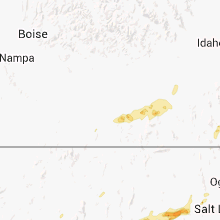
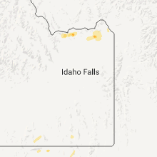
Hail Maps for Malad City, ID


Connect with Interactive Hail Maps