

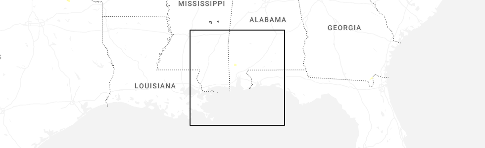
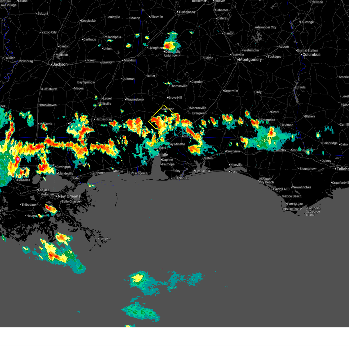
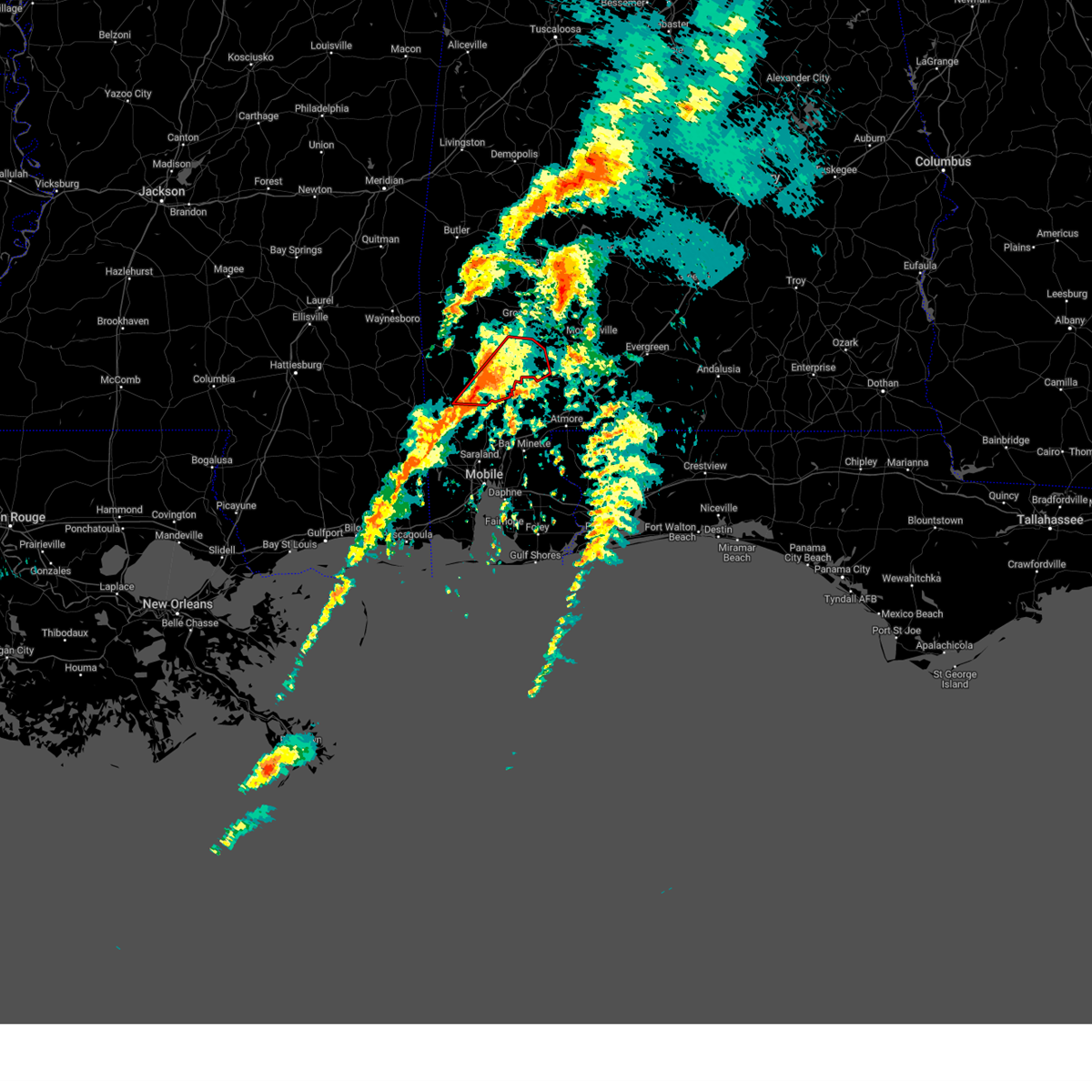
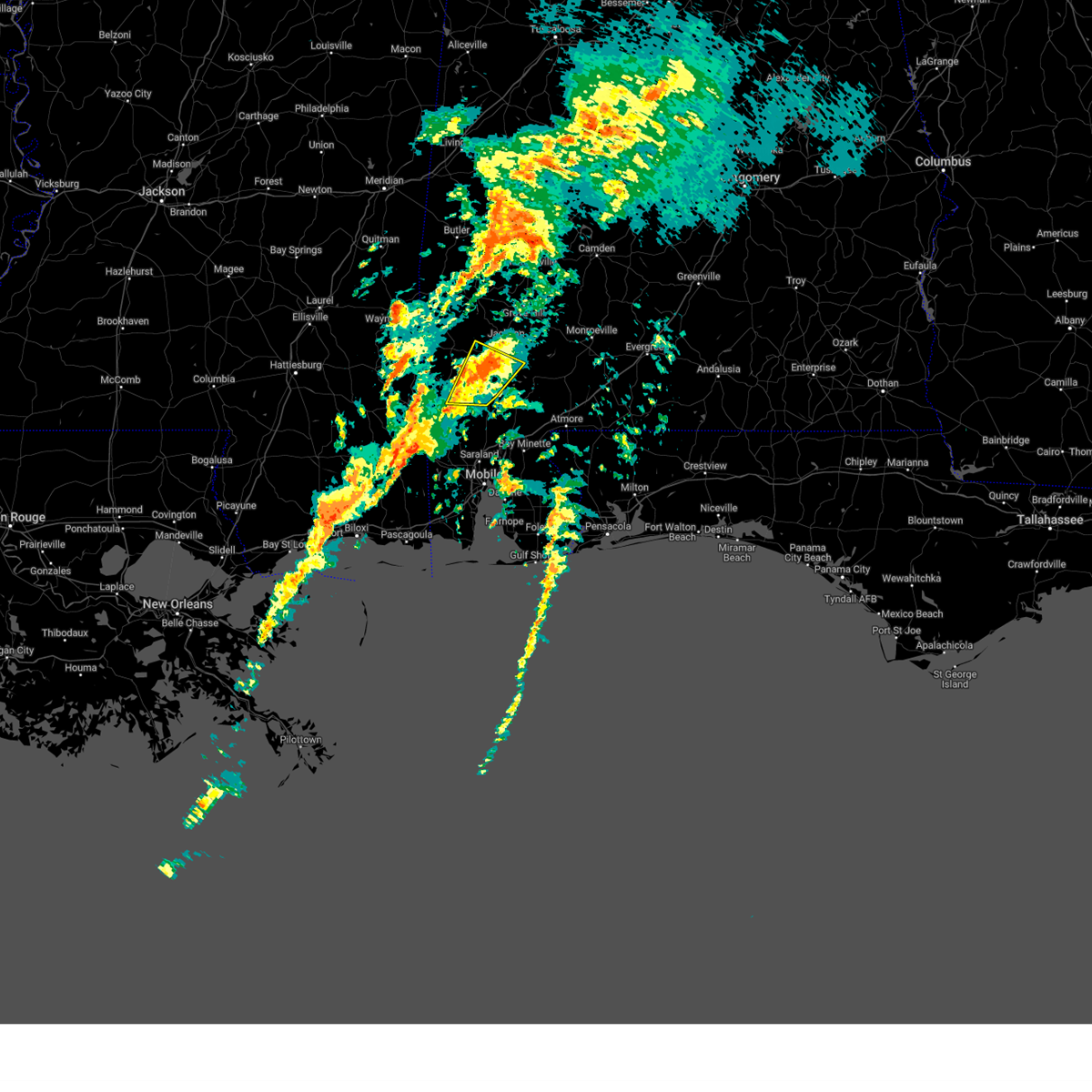
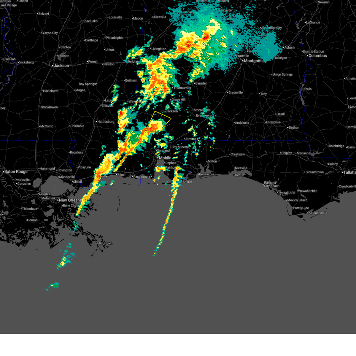
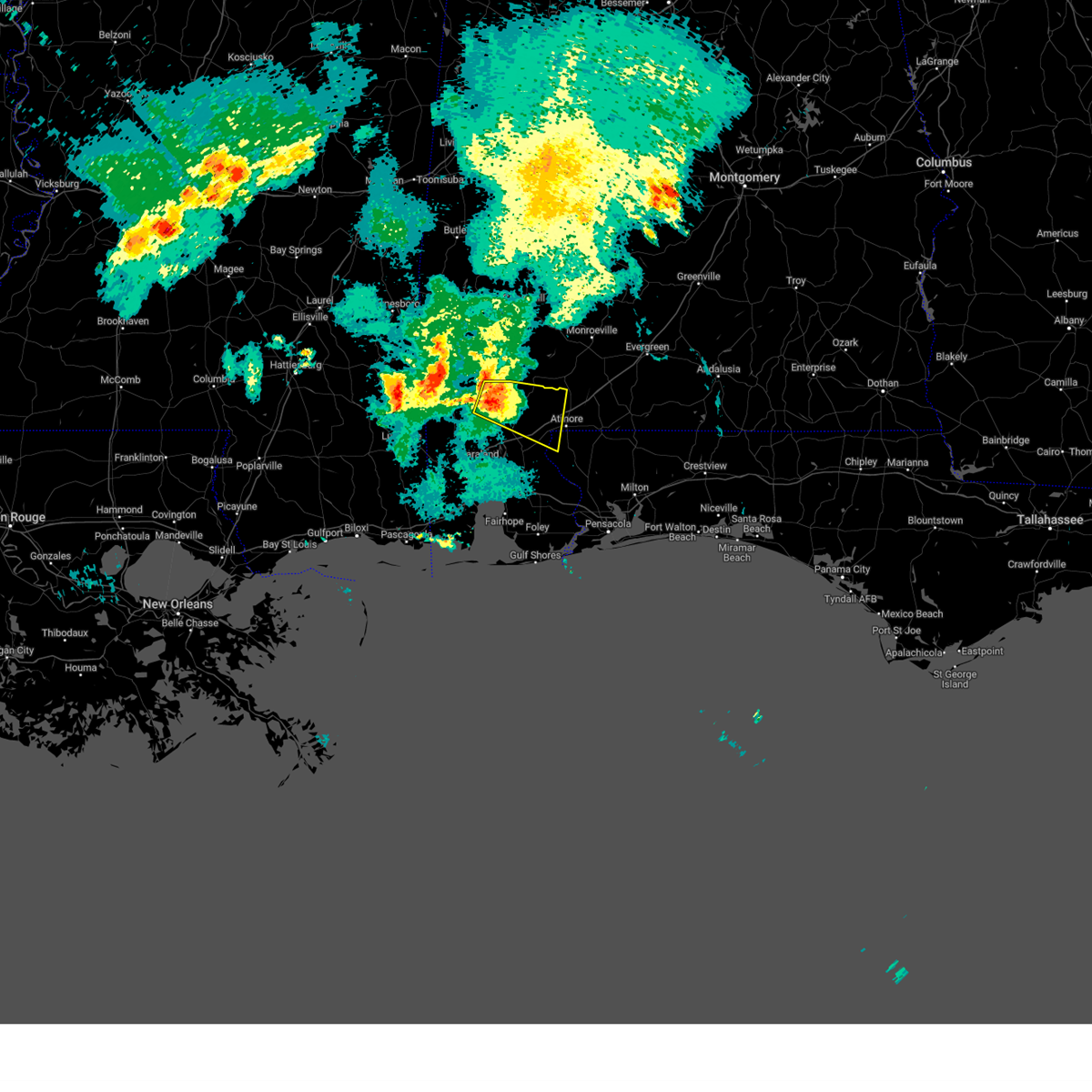
Hail Map for Malcolm, AL
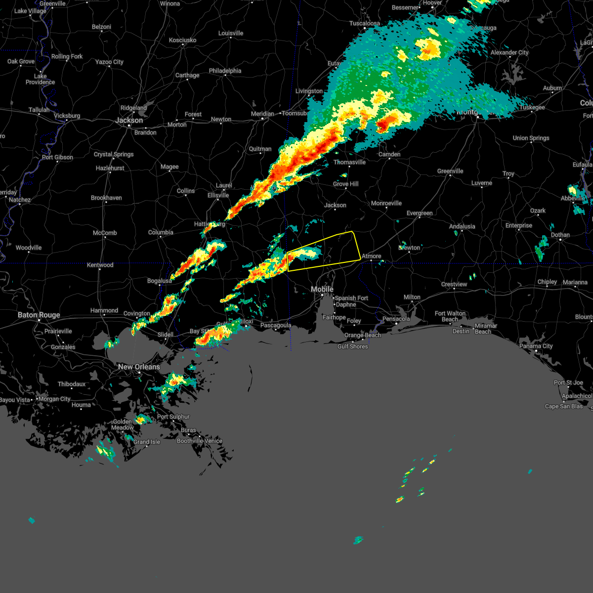
The Malcolm, AL area has had 0 reports of on-the-ground hail by trained spotters, and has been under severe weather warnings 9 times during the past 12 months. Doppler radar has detected hail at or near Malcolm, AL on 31 occasions, including 1 occasion during the past year.
| Name: | Malcolm, AL |
| Where Located: | 35.2 miles N of Mobile, AL |
| Map: | Google Map for Malcolm, AL |
| Population: | 187 |
| Housing Units: | 77 |
| More Info: | Search Google for Malcolm, AL |
0
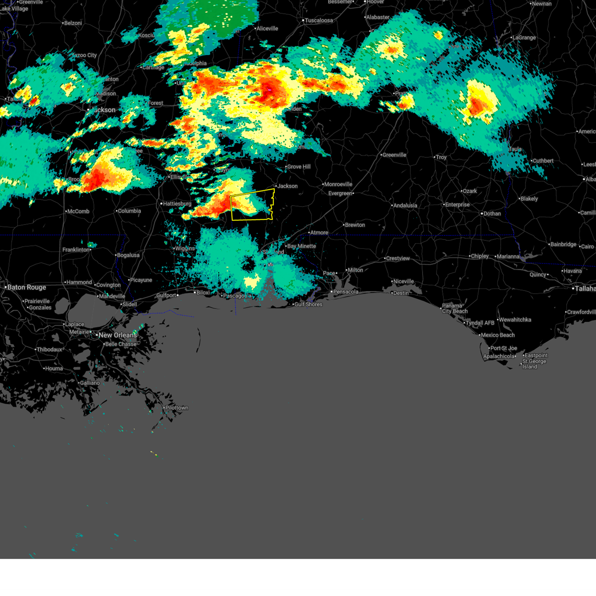
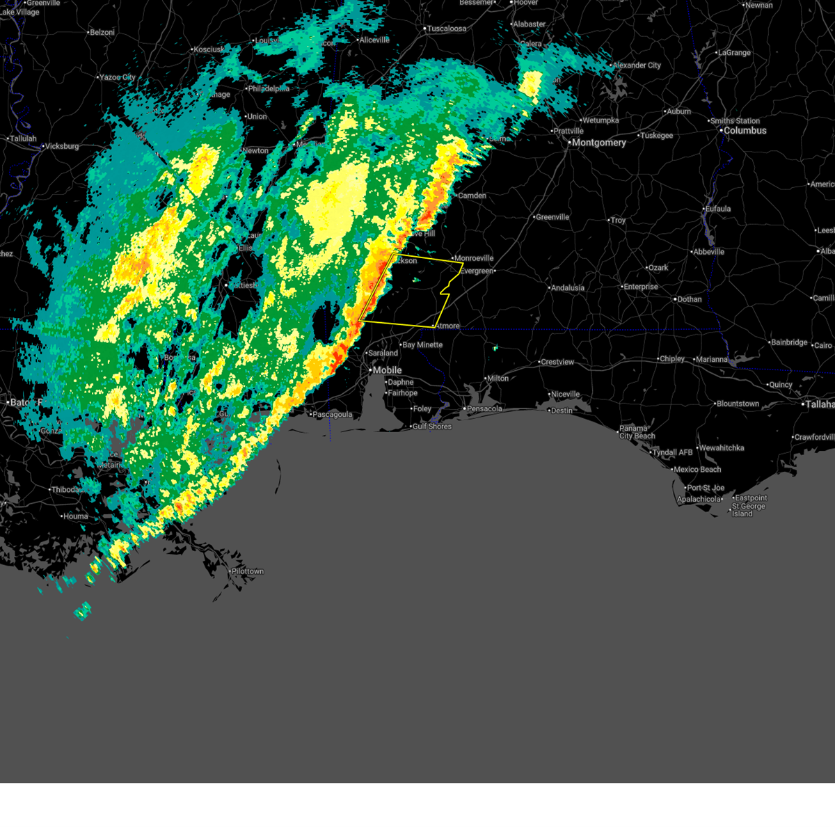
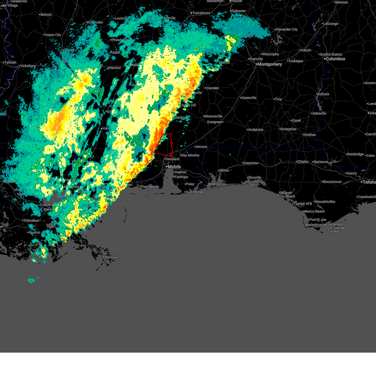
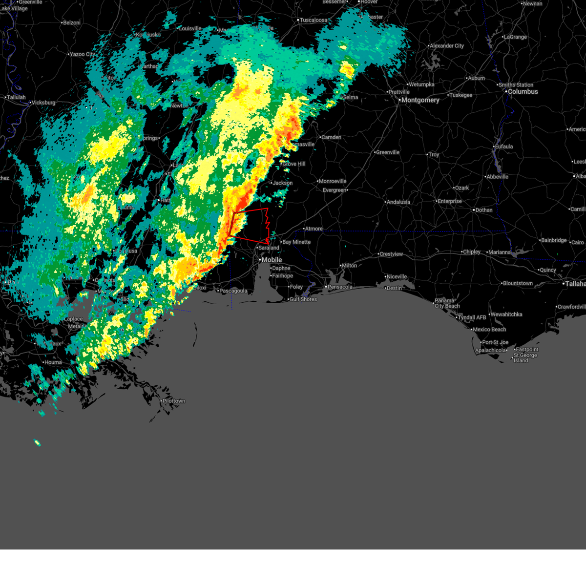
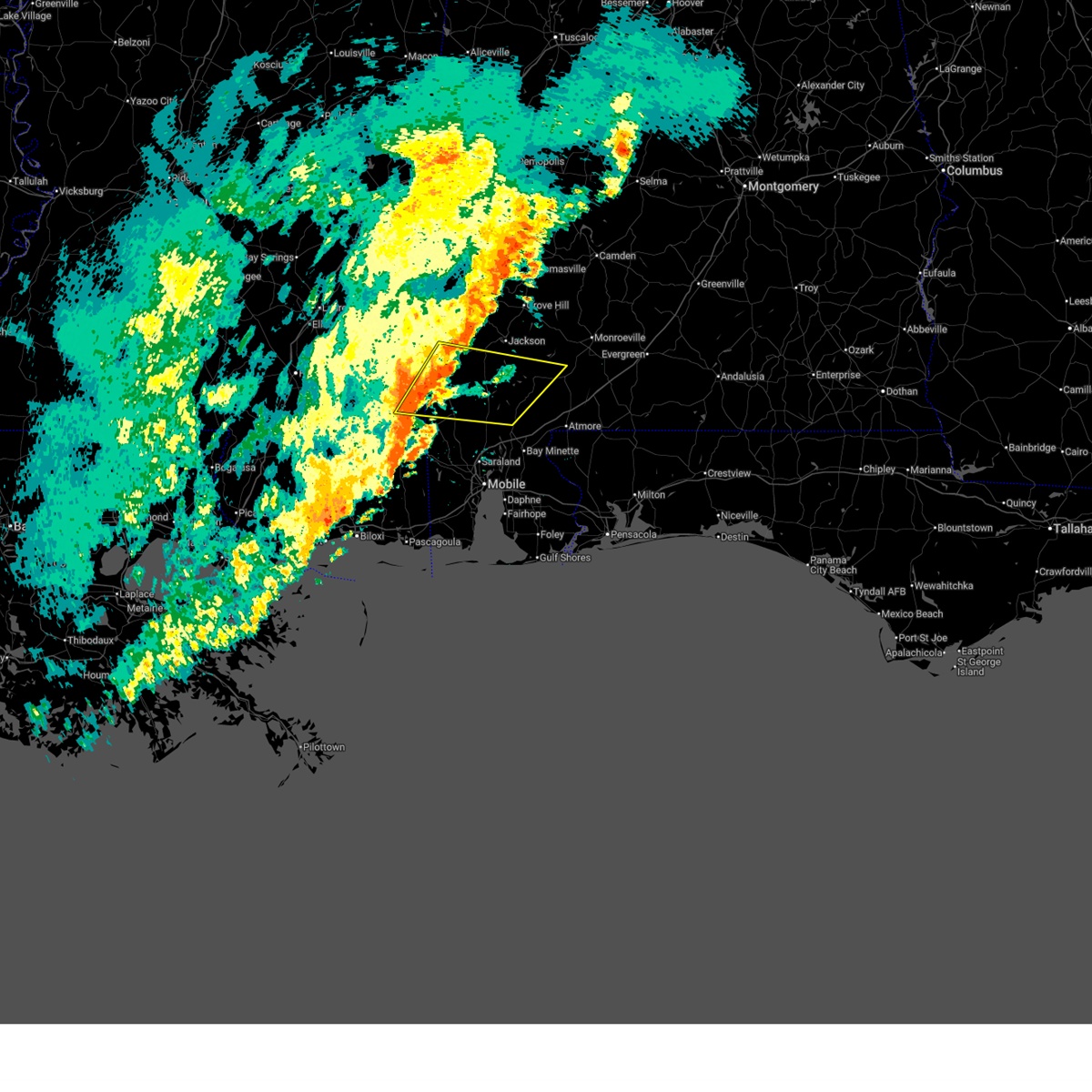
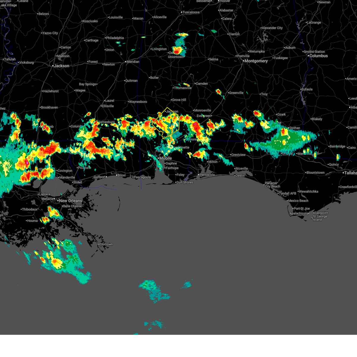
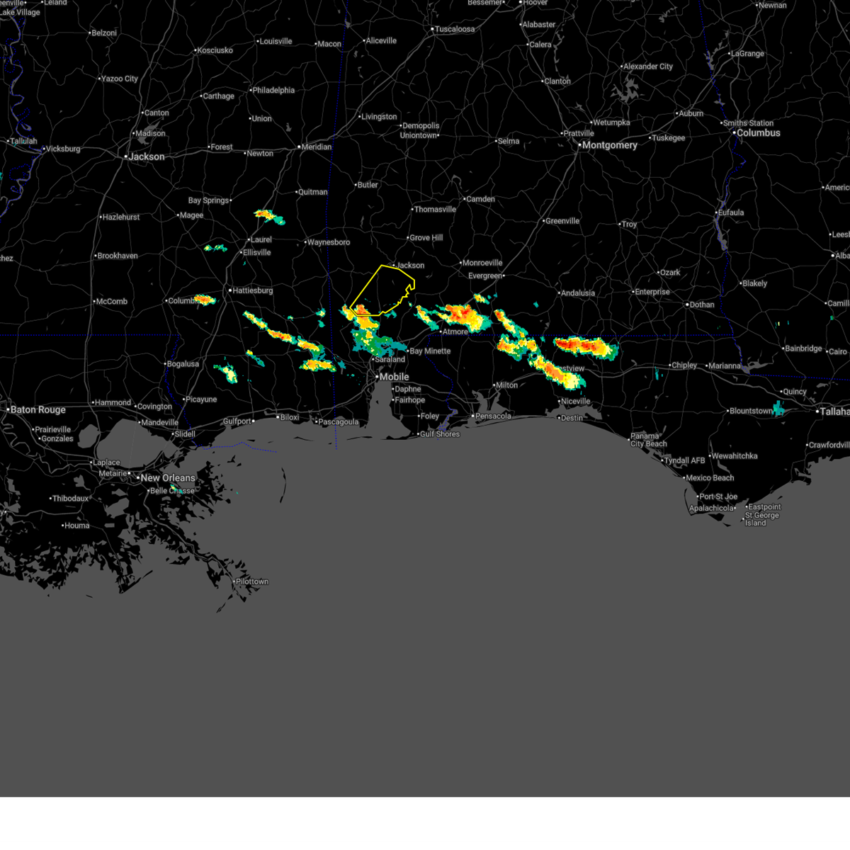
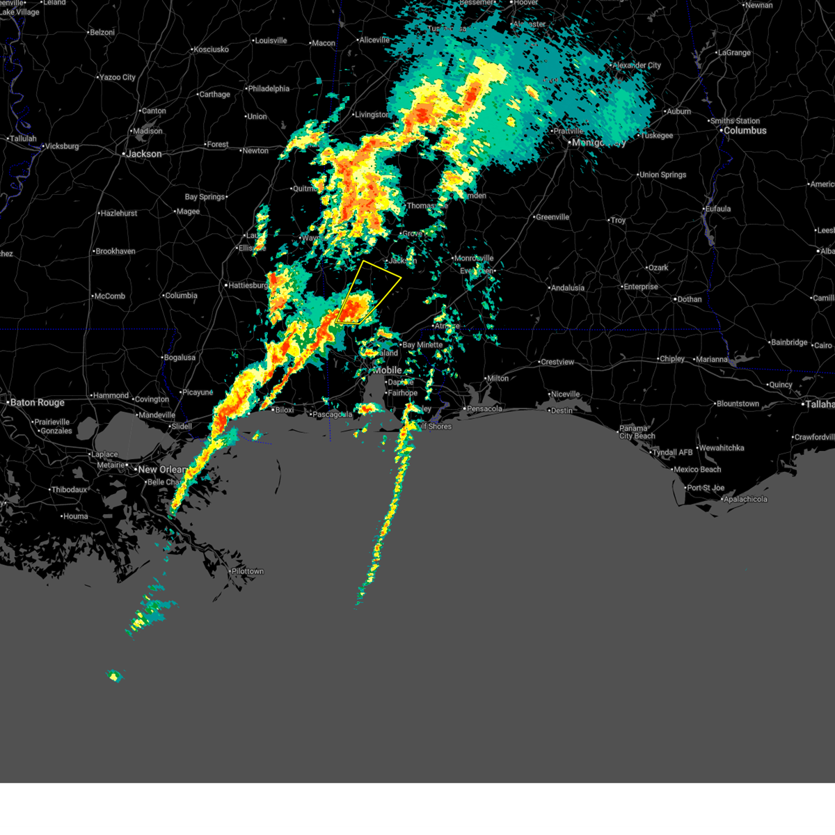
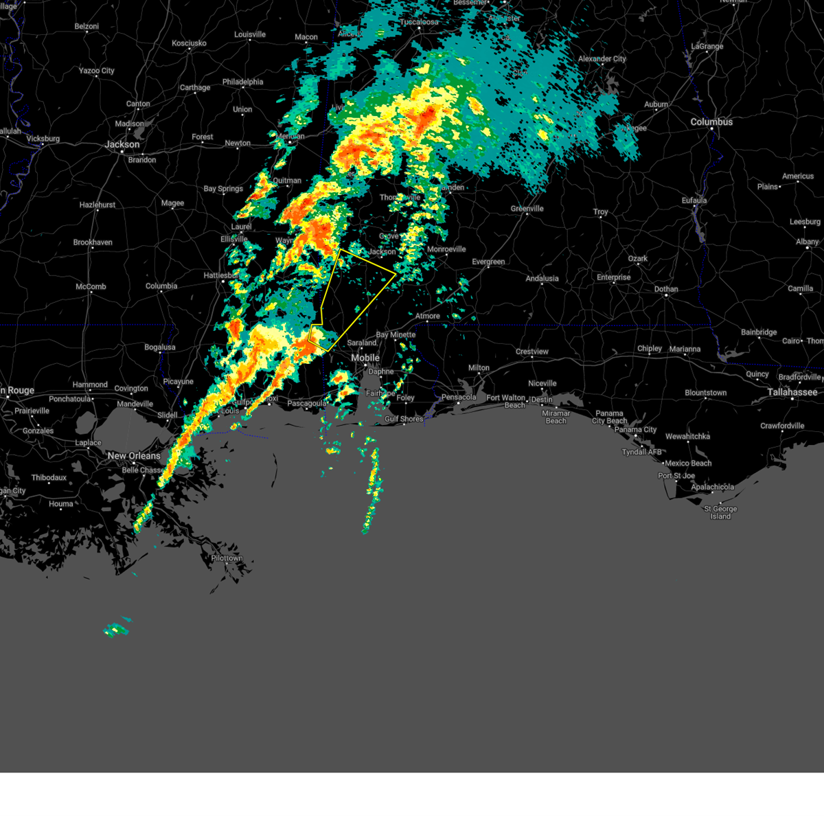
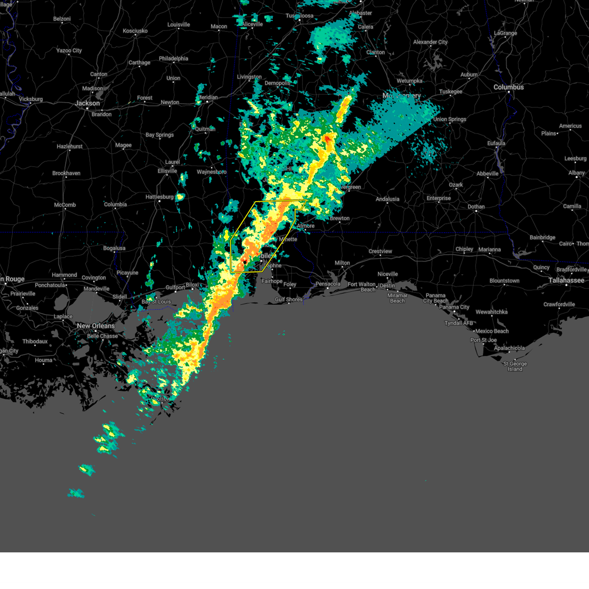
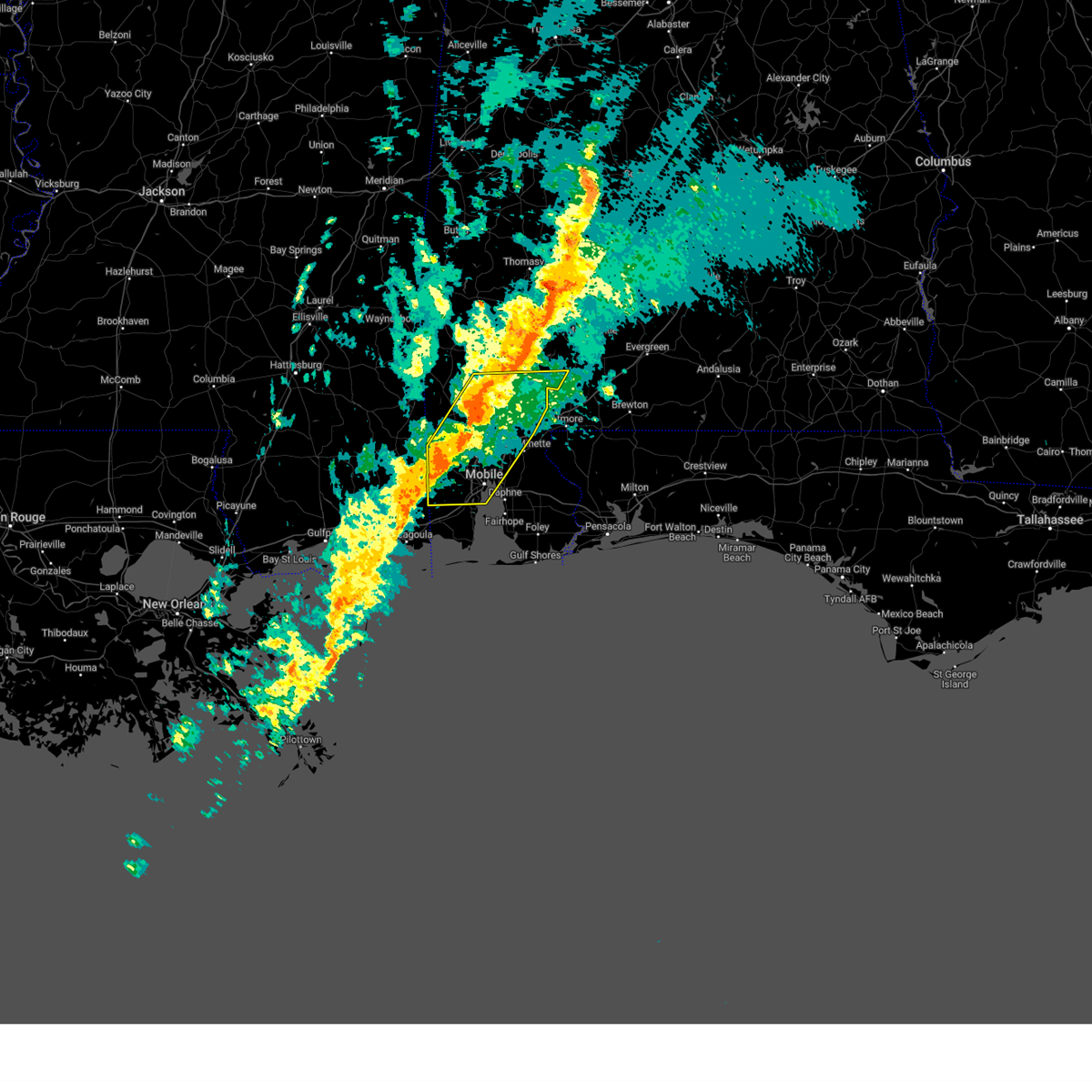
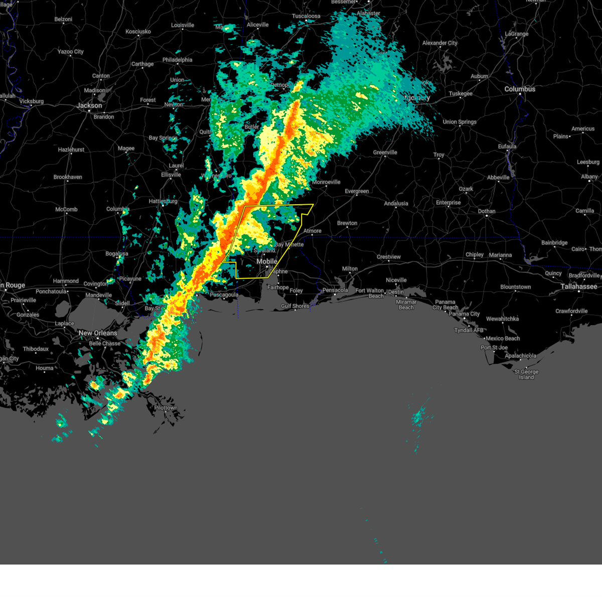
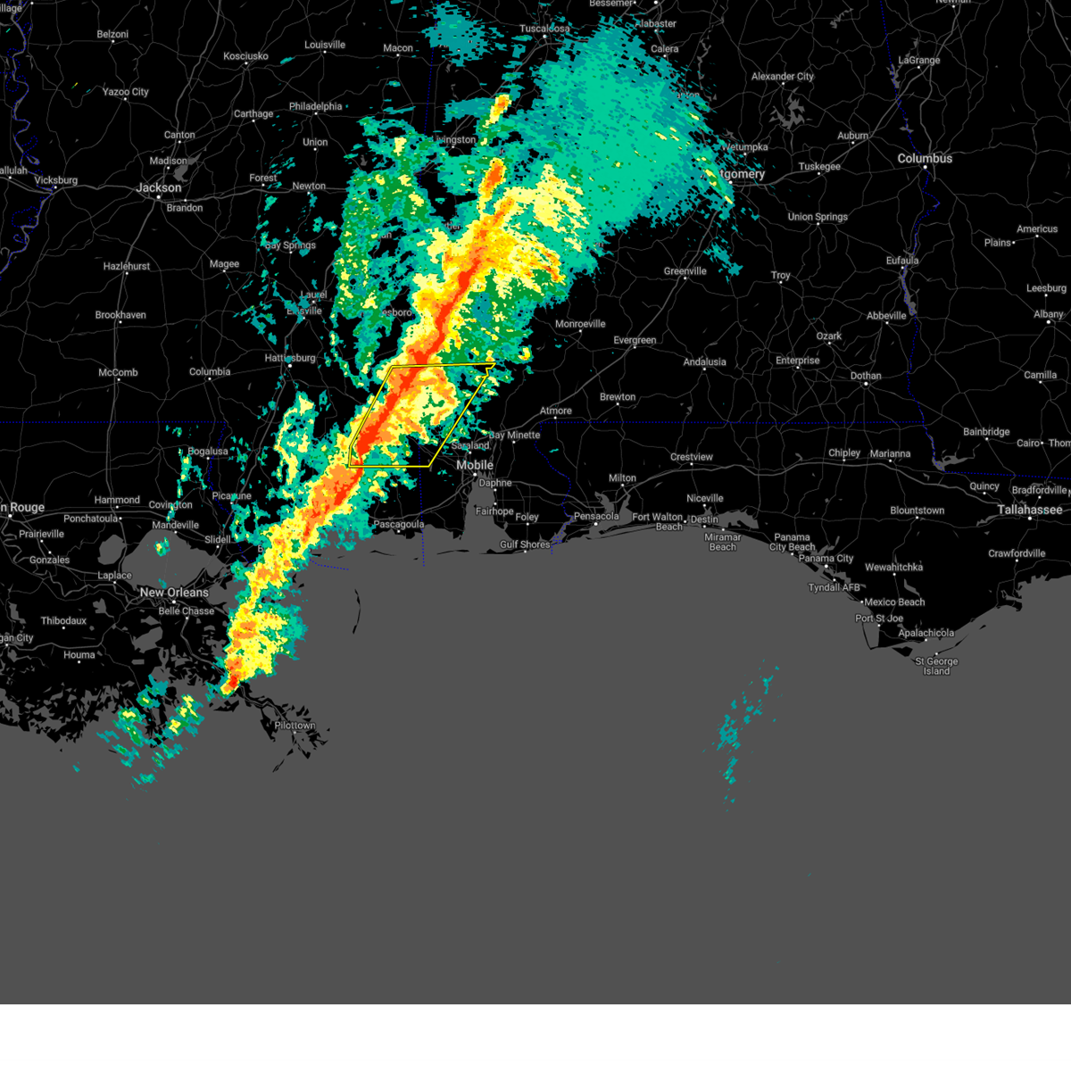
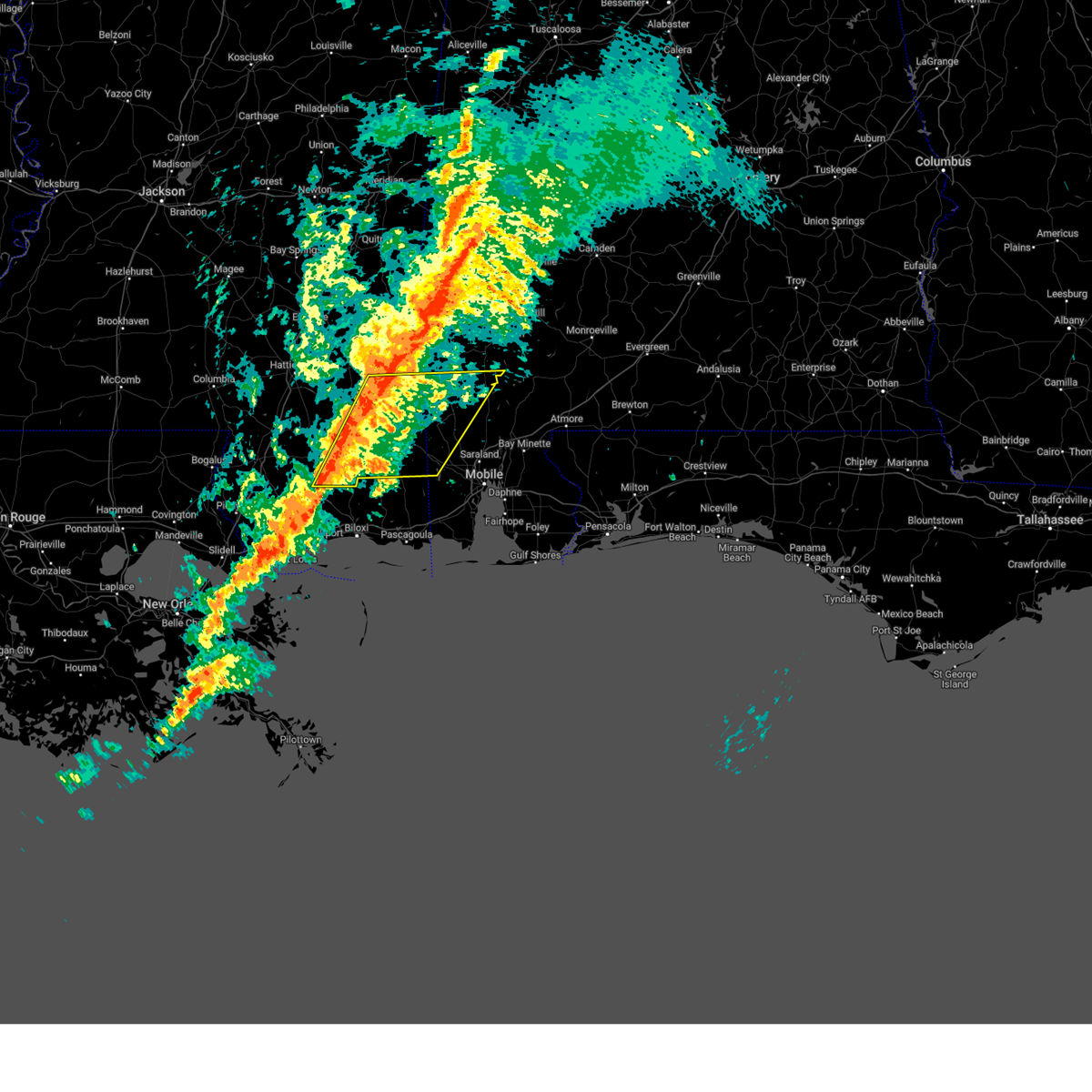
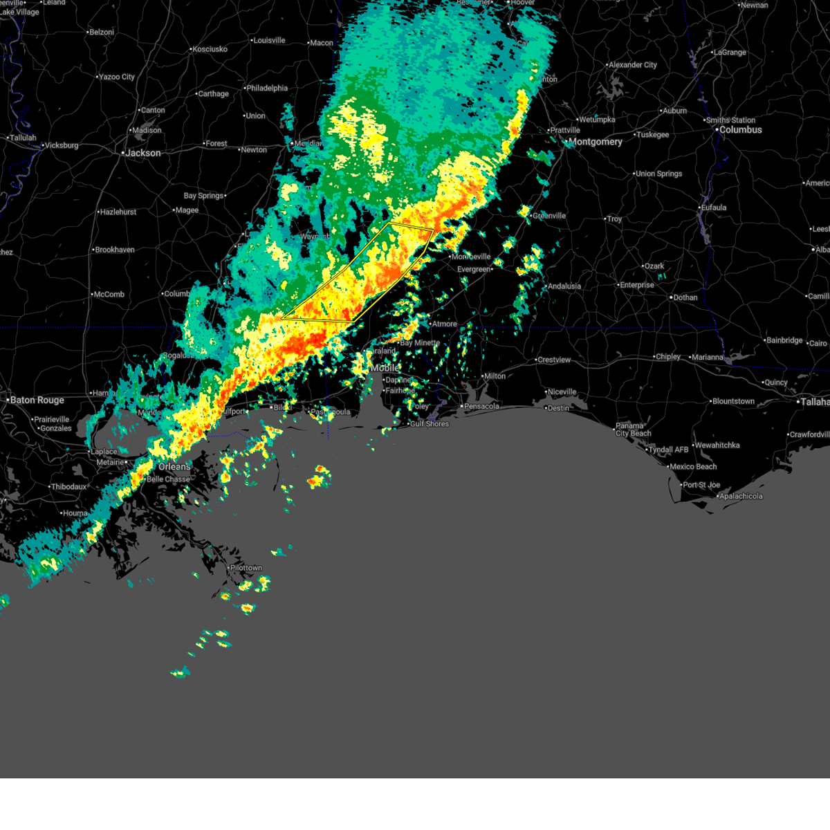
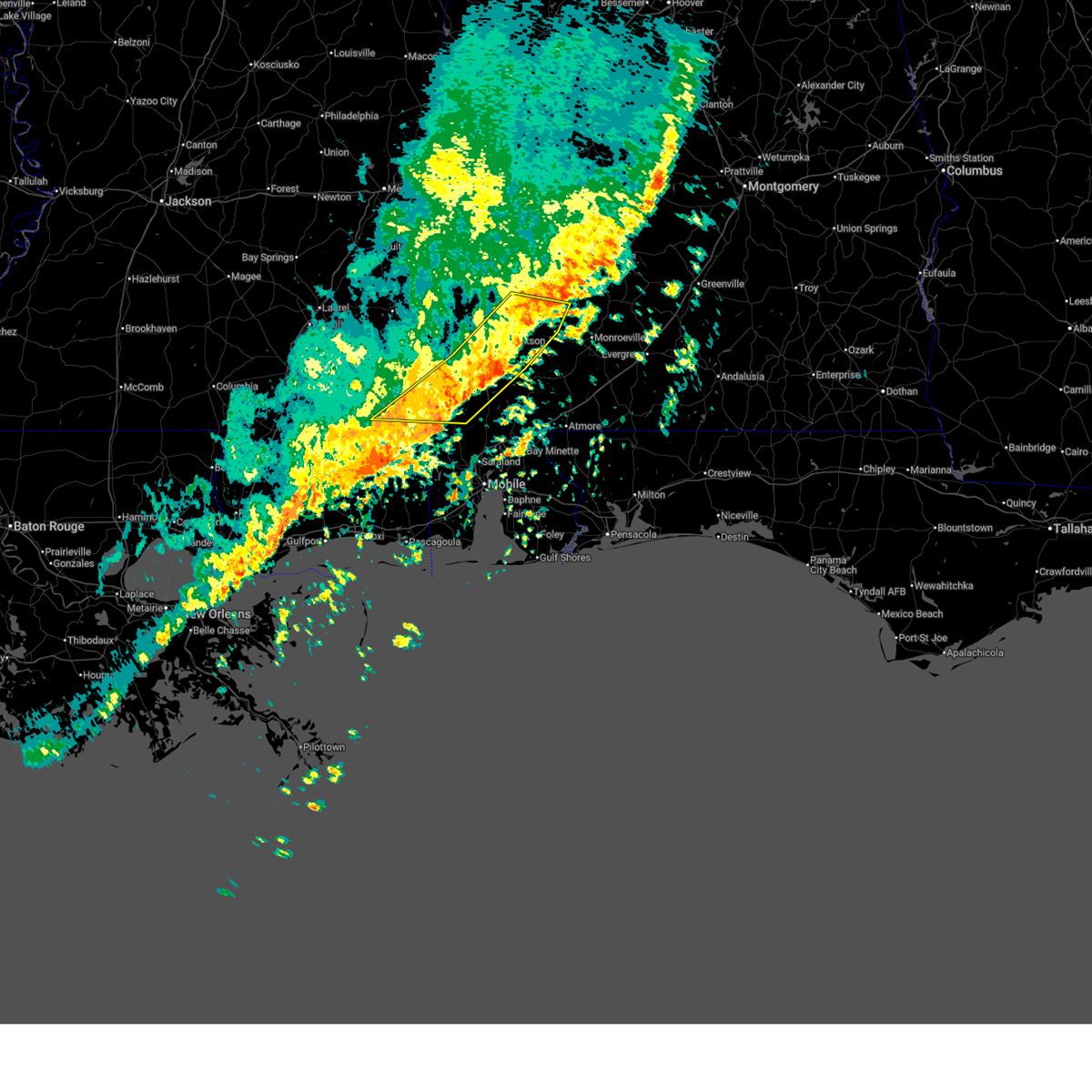
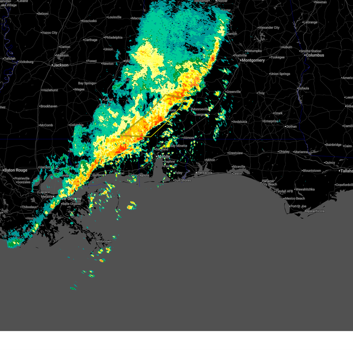
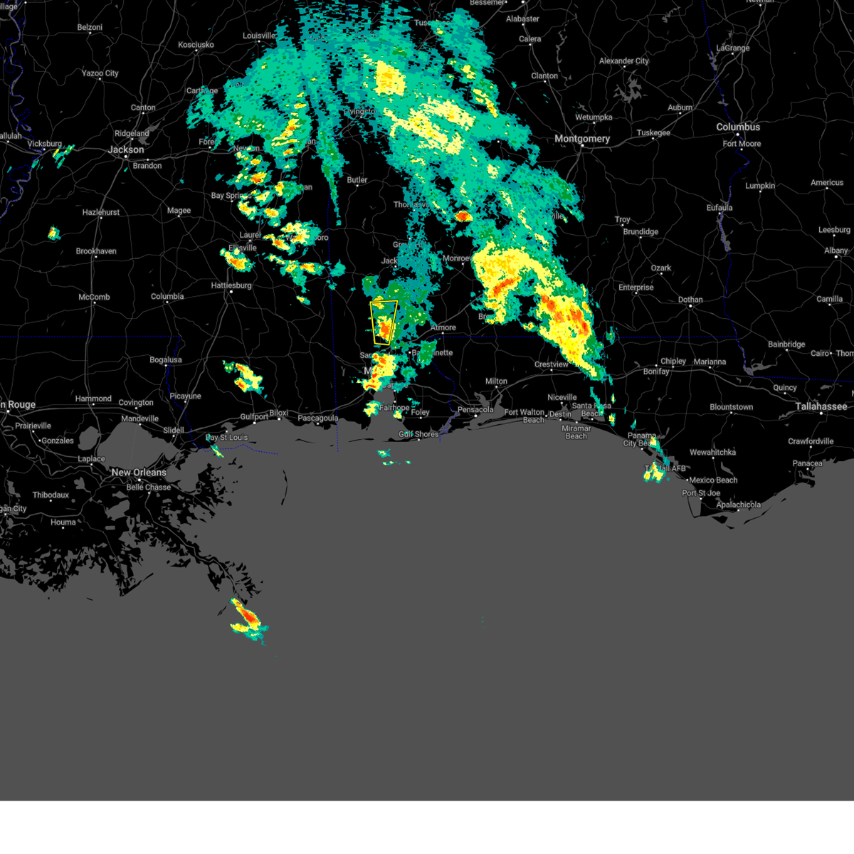
The Top Recent Hail Date for Malcolm, AL is Tuesday, June 23, 2026 (27th out of 31)
Hail and Wind Damage Spotted near Malcolm, AL
| Date / Time | Report Details |
|---|---|
| 6/23/2026 4:01 PM CDT |
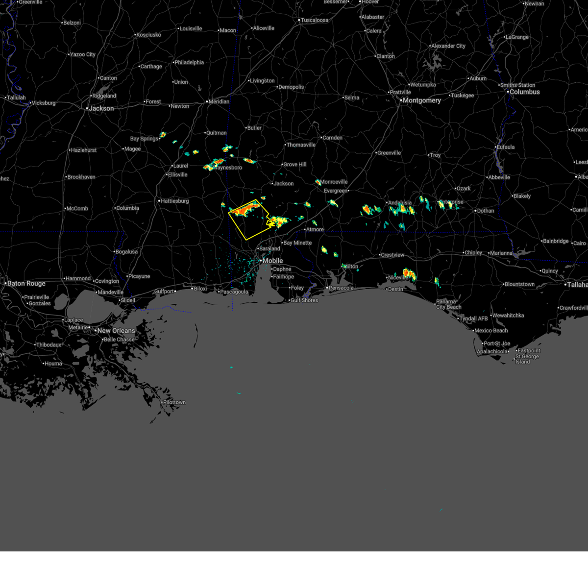 Svrmob the national weather service in mobile has issued a * severe thunderstorm warning for, northeastern mobile county in southwestern alabama, southern washington county in southwestern alabama, * until 445 pm cdt. * at 400 pm cdt, a severe thunderstorm was located 6 miles east of deer park, or 7 miles north of citronelle, moving southeast at 20 mph (radar indicated). Hazards include 60 mph wind gusts and quarter size hail. Hail damage to vehicles is expected. Expect wind damage to roofs, siding, and trees. Svrmob the national weather service in mobile has issued a * severe thunderstorm warning for, northeastern mobile county in southwestern alabama, southern washington county in southwestern alabama, * until 445 pm cdt. * at 400 pm cdt, a severe thunderstorm was located 6 miles east of deer park, or 7 miles north of citronelle, moving southeast at 20 mph (radar indicated). Hazards include 60 mph wind gusts and quarter size hail. Hail damage to vehicles is expected. Expect wind damage to roofs, siding, and trees.
|
| 5/6/2026 8:26 PM CDT |
 Svrmob the national weather service in mobile has issued a * severe thunderstorm warning for, southern washington county in southwestern alabama, * until 915 pm cdt. * at 825 pm cdt, a severe thunderstorm was located 5 miles southwest of fruitdale, or 10 miles northeast of leakesville, moving east at 70 mph (radar indicated). Hazards include 60 mph wind gusts and half dollar size hail. Hail damage to vehicles is expected. Expect wind damage to roofs, siding, and trees. Svrmob the national weather service in mobile has issued a * severe thunderstorm warning for, southern washington county in southwestern alabama, * until 915 pm cdt. * at 825 pm cdt, a severe thunderstorm was located 5 miles southwest of fruitdale, or 10 miles northeast of leakesville, moving east at 70 mph (radar indicated). Hazards include 60 mph wind gusts and half dollar size hail. Hail damage to vehicles is expected. Expect wind damage to roofs, siding, and trees.
|
| 3/12/2026 12:08 AM CDT |
 Svrmob the national weather service in mobile has issued a * severe thunderstorm warning for, southwestern monroe county in south central alabama, northeastern mobile county in southwestern alabama, northwestern baldwin county in southwestern alabama, southeastern washington county in southwestern alabama, western escambia county in south central alabama, southeastern clarke county in southwestern alabama, * until 100 am cdt. * at 1208 am cdt, severe thunderstorms were located along a line extending from 4 miles east of jackson to 3 miles northwest of movico, moving east at 35 mph (radar indicated). Hazards include 70 mph wind gusts. Expect considerable tree damage. Damage is likely to mobile homes, roofs, and outbuildings. Svrmob the national weather service in mobile has issued a * severe thunderstorm warning for, southwestern monroe county in south central alabama, northeastern mobile county in southwestern alabama, northwestern baldwin county in southwestern alabama, southeastern washington county in southwestern alabama, western escambia county in south central alabama, southeastern clarke county in southwestern alabama, * until 100 am cdt. * at 1208 am cdt, severe thunderstorms were located along a line extending from 4 miles east of jackson to 3 miles northwest of movico, moving east at 35 mph (radar indicated). Hazards include 70 mph wind gusts. Expect considerable tree damage. Damage is likely to mobile homes, roofs, and outbuildings.
|
| 3/12/2026 12:03 AM CDT |
 At 1203 am cdt, severe thunderstorms capable of producing tornadoes were located along a line extending from 5 miles northwest of mount vernon to 4 miles east of gulfcrest, moving east at 35 mph (radar indicated rotation). Hazards include tornado. Flying debris will be dangerous to those caught without shelter. mobile homes will be damaged or destroyed. damage to roofs, windows, and vehicles will occur. tree damage is likely. these dangerous storms will be near, calvert, mount vernon, and movico around 1210 am cdt. Axis around 1215 am cdt. At 1203 am cdt, severe thunderstorms capable of producing tornadoes were located along a line extending from 5 miles northwest of mount vernon to 4 miles east of gulfcrest, moving east at 35 mph (radar indicated rotation). Hazards include tornado. Flying debris will be dangerous to those caught without shelter. mobile homes will be damaged or destroyed. damage to roofs, windows, and vehicles will occur. tree damage is likely. these dangerous storms will be near, calvert, mount vernon, and movico around 1210 am cdt. Axis around 1215 am cdt.
|
| 3/11/2026 11:55 PM CDT |
 At 1154 pm cdt, severe thunderstorms were located along a line extending from 5 miles east of wagarville to near gulfcrest, moving east at 30 mph (radar indicated). Hazards include 70 mph wind gusts. Expect considerable tree damage. damage is likely to mobile homes, roofs, and outbuildings. Locations impacted include, citronelle, wagarville, deer park, tibbie, mount vernon, calvert, mcintosh, and movico. At 1154 pm cdt, severe thunderstorms were located along a line extending from 5 miles east of wagarville to near gulfcrest, moving east at 30 mph (radar indicated). Hazards include 70 mph wind gusts. Expect considerable tree damage. damage is likely to mobile homes, roofs, and outbuildings. Locations impacted include, citronelle, wagarville, deer park, tibbie, mount vernon, calvert, mcintosh, and movico.
|
| 3/11/2026 11:55 PM CDT |
 the severe thunderstorm warning has been cancelled and is no longer in effect the severe thunderstorm warning has been cancelled and is no longer in effect
|
| 3/11/2026 11:40 PM CDT |
 Tormob the national weather service in mobile has issued a * tornado warning for, northern mobile county in southwestern alabama, southeastern washington county in southwestern alabama, * until 1230 am cdt. * at 1140 pm cdt, severe thunderstorms capable of producing a tornado were located along a line extending from 4 miles south of deer park to 8 miles west of gulfcrest, moving east at 40 mph (radar indicated rotation). Hazards include tornado. Flying debris will be dangerous to those caught without shelter. mobile homes will be damaged or destroyed. damage to roofs, windows, and vehicles will occur. tree damage is likely. these dangerous storms will be near, citronelle and gulfcrest around 1145 pm cdt. calvert, mount vernon, and movico around 1200 am cdt. Axis around 1210 am cdt. Tormob the national weather service in mobile has issued a * tornado warning for, northern mobile county in southwestern alabama, southeastern washington county in southwestern alabama, * until 1230 am cdt. * at 1140 pm cdt, severe thunderstorms capable of producing a tornado were located along a line extending from 4 miles south of deer park to 8 miles west of gulfcrest, moving east at 40 mph (radar indicated rotation). Hazards include tornado. Flying debris will be dangerous to those caught without shelter. mobile homes will be damaged or destroyed. damage to roofs, windows, and vehicles will occur. tree damage is likely. these dangerous storms will be near, citronelle and gulfcrest around 1145 pm cdt. calvert, mount vernon, and movico around 1200 am cdt. Axis around 1210 am cdt.
|
| 3/11/2026 11:40 PM CDT |
 At 1140 pm cdt, severe thunderstorms were located along a line extending from wagarville to 8 miles northwest of gulfcrest, moving east at 40 mph (radar indicated). Hazards include 70 mph wind gusts. Expect considerable tree damage. damage is likely to mobile homes, roofs, and outbuildings. Locations impacted include, citronelle, chatom, leakesville, wagarville, deer park, tibbie, mount vernon, calvert, fruitdale, mcintosh, and movico. At 1140 pm cdt, severe thunderstorms were located along a line extending from wagarville to 8 miles northwest of gulfcrest, moving east at 40 mph (radar indicated). Hazards include 70 mph wind gusts. Expect considerable tree damage. damage is likely to mobile homes, roofs, and outbuildings. Locations impacted include, citronelle, chatom, leakesville, wagarville, deer park, tibbie, mount vernon, calvert, fruitdale, mcintosh, and movico.
|
| 3/11/2026 11:24 PM CDT |
 Svrmob the national weather service in mobile has issued a * severe thunderstorm warning for, southwestern monroe county in south central alabama, northern mobile county in southwestern alabama, northwestern baldwin county in southwestern alabama, washington county in southwestern alabama, south central clarke county in southwestern alabama, southeastern greene county in southeastern mississippi, * until 1215 am cdt. * at 1124 pm cdt, severe thunderstorms were located along a line extending from 4 miles east of chatom to 4 miles southeast of leakesville, moving southeast at 40 mph (radar indicated). Hazards include 60 mph wind gusts. expect damage to roofs, siding, and trees Svrmob the national weather service in mobile has issued a * severe thunderstorm warning for, southwestern monroe county in south central alabama, northern mobile county in southwestern alabama, northwestern baldwin county in southwestern alabama, washington county in southwestern alabama, south central clarke county in southwestern alabama, southeastern greene county in southeastern mississippi, * until 1215 am cdt. * at 1124 pm cdt, severe thunderstorms were located along a line extending from 4 miles east of chatom to 4 miles southeast of leakesville, moving southeast at 40 mph (radar indicated). Hazards include 60 mph wind gusts. expect damage to roofs, siding, and trees
|
| 6/10/2025 3:32 PM CDT |
 The storms which prompted the warning have weakened below severe limits, and no longer pose an immediate threat to life or property. therefore, the warning has been allowed to expire. The storms which prompted the warning have weakened below severe limits, and no longer pose an immediate threat to life or property. therefore, the warning has been allowed to expire.
|
| 6/10/2025 3:11 PM CDT |
 the severe thunderstorm warning has been cancelled and is no longer in effect the severe thunderstorm warning has been cancelled and is no longer in effect
|
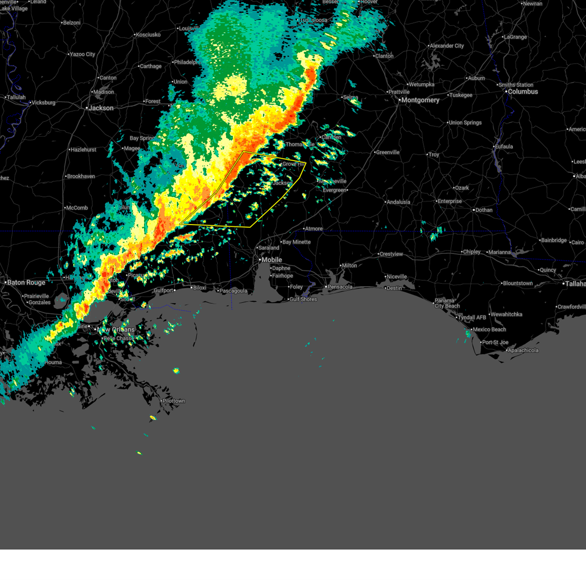
| 6/10/2025 3:11 PM CDT |
 At 311 pm cdt, severe thunderstorms were located along a line extending from 3 miles northwest of mcintosh to 4 miles northeast of calvert to 4 miles east of mount vernon, moving northeast at 45 mph (radar indicated). Hazards include 60 mph wind gusts and quarter size hail. Hail damage to vehicles is expected. expect wind damage to roofs, siding, and trees. Locations impacted include, jackson, calvert, and mcintosh. At 311 pm cdt, severe thunderstorms were located along a line extending from 3 miles northwest of mcintosh to 4 miles northeast of calvert to 4 miles east of mount vernon, moving northeast at 45 mph (radar indicated). Hazards include 60 mph wind gusts and quarter size hail. Hail damage to vehicles is expected. expect wind damage to roofs, siding, and trees. Locations impacted include, jackson, calvert, and mcintosh.
|
| 6/10/2025 2:51 PM CDT |
 Svrmob the national weather service in mobile has issued a * severe thunderstorm warning for, southwestern monroe county in south central alabama, northeastern mobile county in southwestern alabama, northwestern baldwin county in southwestern alabama, southeastern washington county in southwestern alabama, southeastern clarke county in southwestern alabama, * until 330 pm cdt. * at 251 pm cdt, severe thunderstorms were located along a line extending from 4 miles northeast of citronelle to 3 miles west of movico to near axis, moving northeast at 40 mph (radar indicated). Hazards include 60 mph wind gusts and quarter size hail. Hail damage to vehicles is expected. Expect wind damage to roofs, siding, and trees. Svrmob the national weather service in mobile has issued a * severe thunderstorm warning for, southwestern monroe county in south central alabama, northeastern mobile county in southwestern alabama, northwestern baldwin county in southwestern alabama, southeastern washington county in southwestern alabama, southeastern clarke county in southwestern alabama, * until 330 pm cdt. * at 251 pm cdt, severe thunderstorms were located along a line extending from 4 miles northeast of citronelle to 3 miles west of movico to near axis, moving northeast at 40 mph (radar indicated). Hazards include 60 mph wind gusts and quarter size hail. Hail damage to vehicles is expected. Expect wind damage to roofs, siding, and trees.
|
| 6/8/2025 6:47 PM CDT |
 At 646 pm cdt, a severe thunderstorm was located 5 miles east of mcintosh, or 15 miles south of jackson, moving northeast at 40 mph (radar indicated). Hazards include 60 mph wind gusts and quarter size hail. Hail damage to vehicles is expected. expect wind damage to roofs, siding, and trees. Locations impacted include, mcintosh. At 646 pm cdt, a severe thunderstorm was located 5 miles east of mcintosh, or 15 miles south of jackson, moving northeast at 40 mph (radar indicated). Hazards include 60 mph wind gusts and quarter size hail. Hail damage to vehicles is expected. expect wind damage to roofs, siding, and trees. Locations impacted include, mcintosh.
|
| 6/8/2025 6:36 PM CDT |
 At 636 pm cdt, a severe thunderstorm was located over mcintosh, or 14 miles northeast of citronelle, moving northeast at 40 mph (radar indicated). Hazards include 60 mph wind gusts and quarter size hail. Hail damage to vehicles is expected. expect wind damage to roofs, siding, and trees. Locations impacted include, calvert and mcintosh. At 636 pm cdt, a severe thunderstorm was located over mcintosh, or 14 miles northeast of citronelle, moving northeast at 40 mph (radar indicated). Hazards include 60 mph wind gusts and quarter size hail. Hail damage to vehicles is expected. expect wind damage to roofs, siding, and trees. Locations impacted include, calvert and mcintosh.
|
| 6/8/2025 6:26 PM CDT |
 Svrmob the national weather service in mobile has issued a * severe thunderstorm warning for, southeastern washington county in southwestern alabama, south central clarke county in southwestern alabama, * until 700 pm cdt. * at 625 pm cdt, a severe thunderstorm was located 7 miles southwest of mcintosh, or 9 miles northeast of citronelle, moving northeast at 40 mph (radar indicated). Hazards include 60 mph wind gusts and quarter size hail. Hail damage to vehicles is expected. Expect wind damage to roofs, siding, and trees. Svrmob the national weather service in mobile has issued a * severe thunderstorm warning for, southeastern washington county in southwestern alabama, south central clarke county in southwestern alabama, * until 700 pm cdt. * at 625 pm cdt, a severe thunderstorm was located 7 miles southwest of mcintosh, or 9 miles northeast of citronelle, moving northeast at 40 mph (radar indicated). Hazards include 60 mph wind gusts and quarter size hail. Hail damage to vehicles is expected. Expect wind damage to roofs, siding, and trees.
|
| 5/3/2025 6:14 PM CDT |
 the severe thunderstorm warning has been cancelled and is no longer in effect the severe thunderstorm warning has been cancelled and is no longer in effect
|
| 5/3/2025 5:53 PM CDT |
 Svrmob the national weather service in mobile has issued a * severe thunderstorm warning for, northeastern mobile county in southwestern alabama, southeastern washington county in southwestern alabama, * until 645 pm cdt. * at 553 pm cdt, a severe thunderstorm was located near citronelle, moving east at 30 mph (radar indicated). Hazards include quarter size hail. damage to vehicles is expected Svrmob the national weather service in mobile has issued a * severe thunderstorm warning for, northeastern mobile county in southwestern alabama, southeastern washington county in southwestern alabama, * until 645 pm cdt. * at 553 pm cdt, a severe thunderstorm was located near citronelle, moving east at 30 mph (radar indicated). Hazards include quarter size hail. damage to vehicles is expected
|
| 3/15/2025 8:40 PM CDT |
 At 840 pm cdt, a severe thunderstorm capable of producing a tornado was located 4 miles east of mcintosh, or 17 miles south of jackson, moving northeast at 50 mph (radar indicated rotation). Hazards include tornado. Flying debris will be dangerous to those caught without shelter. mobile homes will be damaged or destroyed. damage to roofs, windows, and vehicles will occur. tree damage is likely. This tornadic thunderstorm will remain over mainly rural areas of southwestern monroe, southeastern washington and southeastern clarke counties. At 840 pm cdt, a severe thunderstorm capable of producing a tornado was located 4 miles east of mcintosh, or 17 miles south of jackson, moving northeast at 50 mph (radar indicated rotation). Hazards include tornado. Flying debris will be dangerous to those caught without shelter. mobile homes will be damaged or destroyed. damage to roofs, windows, and vehicles will occur. tree damage is likely. This tornadic thunderstorm will remain over mainly rural areas of southwestern monroe, southeastern washington and southeastern clarke counties.
|
| 3/15/2025 8:26 PM CDT |
 At 825 pm cdt, a confirmed tornado was located 6 miles west of calvert, or 7 miles northeast of citronelle, moving northeast at 40 mph (radar confirmed tornado). Hazards include damaging tornado. Flying debris will be dangerous to those caught without shelter. mobile homes will be damaged or destroyed. damage to roofs, windows, and vehicles will occur. tree damage is likely. This tornado will be near, mcintosh around 835 pm cdt. At 825 pm cdt, a confirmed tornado was located 6 miles west of calvert, or 7 miles northeast of citronelle, moving northeast at 40 mph (radar confirmed tornado). Hazards include damaging tornado. Flying debris will be dangerous to those caught without shelter. mobile homes will be damaged or destroyed. damage to roofs, windows, and vehicles will occur. tree damage is likely. This tornado will be near, mcintosh around 835 pm cdt.
|
| 3/15/2025 8:26 PM CDT |
 the tornado warning has been cancelled and is no longer in effect the tornado warning has been cancelled and is no longer in effect
|
| 3/15/2025 8:23 PM CDT |
 Tormob the national weather service in mobile has issued a * tornado warning for, southwestern monroe county in south central alabama, north central mobile county in southwestern alabama, southeastern washington county in southwestern alabama, southeastern clarke county in southwestern alabama, * until 915 pm cdt. * at 823 pm cdt, a severe thunderstorm capable of producing a tornado was located 6 miles northeast of citronelle, moving northeast at 45 mph (radar indicated rotation). Hazards include tornado. Flying debris will be dangerous to those caught without shelter. mobile homes will be damaged or destroyed. damage to roofs, windows, and vehicles will occur. tree damage is likely. This dangerous storm will be near, mcintosh around 830 pm cdt. Tormob the national weather service in mobile has issued a * tornado warning for, southwestern monroe county in south central alabama, north central mobile county in southwestern alabama, southeastern washington county in southwestern alabama, southeastern clarke county in southwestern alabama, * until 915 pm cdt. * at 823 pm cdt, a severe thunderstorm capable of producing a tornado was located 6 miles northeast of citronelle, moving northeast at 45 mph (radar indicated rotation). Hazards include tornado. Flying debris will be dangerous to those caught without shelter. mobile homes will be damaged or destroyed. damage to roofs, windows, and vehicles will occur. tree damage is likely. This dangerous storm will be near, mcintosh around 830 pm cdt.
|
| 3/15/2025 7:41 PM CDT |
 The storm which prompted the warning has weakened below severe limits, and no longer poses an immediate threat to life or property. therefore, the warning will be allowed to expire. a tornado watch remains in effect until 800 pm cdt for southwestern alabama. The storm which prompted the warning has weakened below severe limits, and no longer poses an immediate threat to life or property. therefore, the warning will be allowed to expire. a tornado watch remains in effect until 800 pm cdt for southwestern alabama.
|
| 3/15/2025 7:31 PM CDT |
 At 730 pm cdt, a severe thunderstorm was located 4 miles west of mcintosh, or 14 miles northeast of citronelle, moving northeast at 55 mph (radar indicated). Hazards include 60 mph wind gusts and quarter size hail. Hail damage to vehicles is expected. expect wind damage to roofs, siding, and trees. Locations impacted include, wagarville, mcintosh, and calvert. At 730 pm cdt, a severe thunderstorm was located 4 miles west of mcintosh, or 14 miles northeast of citronelle, moving northeast at 55 mph (radar indicated). Hazards include 60 mph wind gusts and quarter size hail. Hail damage to vehicles is expected. expect wind damage to roofs, siding, and trees. Locations impacted include, wagarville, mcintosh, and calvert.
|
| 3/15/2025 7:31 PM CDT |
 the severe thunderstorm warning has been cancelled and is no longer in effect the severe thunderstorm warning has been cancelled and is no longer in effect
|
| 3/15/2025 7:22 PM CDT |
 the severe thunderstorm warning has been cancelled and is no longer in effect the severe thunderstorm warning has been cancelled and is no longer in effect
|
| 3/15/2025 7:22 PM CDT |
 At 721 pm cdt, a severe thunderstorm was located 5 miles northeast of citronelle, moving northeast at 50 mph (radar indicated). Hazards include 60 mph wind gusts and quarter size hail. Hail damage to vehicles is expected. expect wind damage to roofs, siding, and trees. Locations impacted include, mcintosh, citronelle, wagarville, and calvert. At 721 pm cdt, a severe thunderstorm was located 5 miles northeast of citronelle, moving northeast at 50 mph (radar indicated). Hazards include 60 mph wind gusts and quarter size hail. Hail damage to vehicles is expected. expect wind damage to roofs, siding, and trees. Locations impacted include, mcintosh, citronelle, wagarville, and calvert.
|
| 3/15/2025 7:04 PM CDT |
 Svrmob the national weather service in mobile has issued a * severe thunderstorm warning for, northwestern mobile county in southwestern alabama, washington county in southwestern alabama, south central clarke county in southwestern alabama, northeastern george county in southeastern mississippi, * until 745 pm cdt. * at 704 pm cdt, a severe thunderstorm was located 5 miles north of wilmer, or 12 miles east of lucedale, moving northeast at 55 mph (radar indicated). Hazards include 60 mph wind gusts and quarter size hail. Hail damage to vehicles is expected. Expect wind damage to roofs, siding, and trees. Svrmob the national weather service in mobile has issued a * severe thunderstorm warning for, northwestern mobile county in southwestern alabama, washington county in southwestern alabama, south central clarke county in southwestern alabama, northeastern george county in southeastern mississippi, * until 745 pm cdt. * at 704 pm cdt, a severe thunderstorm was located 5 miles north of wilmer, or 12 miles east of lucedale, moving northeast at 55 mph (radar indicated). Hazards include 60 mph wind gusts and quarter size hail. Hail damage to vehicles is expected. Expect wind damage to roofs, siding, and trees.
|
| 3/4/2025 8:59 PM CST |
 The storms which prompted the warning have weakened below severe limits. therefore, the warning will be allowed to expire. however, gusty winds are still possible with these thunderstorms. a tornado watch remains in effect until 100 am cst for south central and southwestern alabama. The storms which prompted the warning have weakened below severe limits. therefore, the warning will be allowed to expire. however, gusty winds are still possible with these thunderstorms. a tornado watch remains in effect until 100 am cst for south central and southwestern alabama.
|
| 3/4/2025 8:31 PM CST |
 At 830 pm cst, severe thunderstorms were located along a line extending from 11 miles south of jackson to 3 miles southeast of chunchula to big point, moving east at 40 mph (radar indicated). Hazards include 60 mph wind gusts. Expect damage to roofs, siding, and trees. Locations impacted include, citronelle, chickasaw, saraland, wilmer, uriah, i65 and al 225, mcintosh, prichard, gulfcrest, mount vernon, movico, i10 and i65, axis, tanner williams, i65 and i165, creola, semmes, mobile regional airport, calvert, and midtown mobile. At 830 pm cst, severe thunderstorms were located along a line extending from 11 miles south of jackson to 3 miles southeast of chunchula to big point, moving east at 40 mph (radar indicated). Hazards include 60 mph wind gusts. Expect damage to roofs, siding, and trees. Locations impacted include, citronelle, chickasaw, saraland, wilmer, uriah, i65 and al 225, mcintosh, prichard, gulfcrest, mount vernon, movico, i10 and i65, axis, tanner williams, i65 and i165, creola, semmes, mobile regional airport, calvert, and midtown mobile.
|
| 3/4/2025 8:31 PM CST |
 the severe thunderstorm warning has been cancelled and is no longer in effect the severe thunderstorm warning has been cancelled and is no longer in effect
|
| 3/4/2025 8:07 PM CST |
 Svrmob the national weather service in mobile has issued a * severe thunderstorm warning for, southwestern monroe county in south central alabama, mobile county in southwestern alabama, northwestern baldwin county in southwestern alabama, southern washington county in southwestern alabama, south central clarke county in southwestern alabama, eastern george county in southeastern mississippi, * until 900 pm cst. * at 807 pm cst, severe thunderstorms were located along a line extending from 6 miles northwest of mcintosh to 3 miles northwest of wilmer to near vancleave, moving east at 40 mph (radar indicated). Hazards include 60 mph wind gusts. expect damage to roofs, siding, and trees Svrmob the national weather service in mobile has issued a * severe thunderstorm warning for, southwestern monroe county in south central alabama, mobile county in southwestern alabama, northwestern baldwin county in southwestern alabama, southern washington county in southwestern alabama, south central clarke county in southwestern alabama, eastern george county in southeastern mississippi, * until 900 pm cst. * at 807 pm cst, severe thunderstorms were located along a line extending from 6 miles northwest of mcintosh to 3 miles northwest of wilmer to near vancleave, moving east at 40 mph (radar indicated). Hazards include 60 mph wind gusts. expect damage to roofs, siding, and trees
|
| 3/4/2025 7:38 PM CST |
 At 737 pm cst, severe thunderstorms were located along a line extending from near fruitdale to 6 miles northwest of lucedale to 13 miles north of latimer, moving east at 35 mph (radar indicated). Hazards include 60 mph wind gusts. Expect damage to roofs, siding, and trees. Locations impacted include, lucedale, mcintosh, citronelle, gulfcrest, deer park, leakesville, and wilmer. At 737 pm cst, severe thunderstorms were located along a line extending from near fruitdale to 6 miles northwest of lucedale to 13 miles north of latimer, moving east at 35 mph (radar indicated). Hazards include 60 mph wind gusts. Expect damage to roofs, siding, and trees. Locations impacted include, lucedale, mcintosh, citronelle, gulfcrest, deer park, leakesville, and wilmer.
|
| 3/4/2025 7:38 PM CST |
 the severe thunderstorm warning has been cancelled and is no longer in effect the severe thunderstorm warning has been cancelled and is no longer in effect
|
| 3/4/2025 7:14 PM CST |
 Svrmob the national weather service in mobile has issued a * severe thunderstorm warning for, northwestern mobile county in southwestern alabama, southern washington county in southwestern alabama, george county in southeastern mississippi, southeastern perry county in southeastern mississippi, greene county in southeastern mississippi, eastern stone county in southeastern mississippi, * until 815 pm cst. * at 714 pm cst, severe thunderstorms were located along a line extending from 10 miles northwest of leakesville to 11 miles southwest of mclain to 6 miles southwest of lyman, moving east at 40 mph (radar indicated). Hazards include 60 mph wind gusts. expect damage to roofs, siding, and trees Svrmob the national weather service in mobile has issued a * severe thunderstorm warning for, northwestern mobile county in southwestern alabama, southern washington county in southwestern alabama, george county in southeastern mississippi, southeastern perry county in southeastern mississippi, greene county in southeastern mississippi, eastern stone county in southeastern mississippi, * until 815 pm cst. * at 714 pm cst, severe thunderstorms were located along a line extending from 10 miles northwest of leakesville to 11 miles southwest of mclain to 6 miles southwest of lyman, moving east at 40 mph (radar indicated). Hazards include 60 mph wind gusts. expect damage to roofs, siding, and trees
|
| 2/16/2025 2:00 AM CST |
 The storms which prompted the warning have weakened below severe limits, and no longer pose an immediate threat to life or property. therefore, the warning has been allowed to expire. a tornado watch remains in effect until 600 am cst for south central and southwestern alabama, and southeastern mississippi. The storms which prompted the warning have weakened below severe limits, and no longer pose an immediate threat to life or property. therefore, the warning has been allowed to expire. a tornado watch remains in effect until 600 am cst for south central and southwestern alabama, and southeastern mississippi.
|
| 2/16/2025 1:47 AM CST |
 At 147 am cst, severe thunderstorms were located along a line extending from 3 miles east of fulton to 3 miles east of wagarville to 4 miles southwest of deer park, moving east at 50 mph (radar indicated). Hazards include 60 mph wind gusts. Expect damage to roofs, siding, and trees. Locations impacted include, saint stephens, mcintosh, citronelle, wagarville, grove hill, deer park, jackson, leakesville, tibbie, leroy, and whatley. At 147 am cst, severe thunderstorms were located along a line extending from 3 miles east of fulton to 3 miles east of wagarville to 4 miles southwest of deer park, moving east at 50 mph (radar indicated). Hazards include 60 mph wind gusts. Expect damage to roofs, siding, and trees. Locations impacted include, saint stephens, mcintosh, citronelle, wagarville, grove hill, deer park, jackson, leakesville, tibbie, leroy, and whatley.
|
| 2/16/2025 1:47 AM CST |
 the severe thunderstorm warning has been cancelled and is no longer in effect the severe thunderstorm warning has been cancelled and is no longer in effect
|
| 2/16/2025 1:10 AM CST |
 Svrmob the national weather service in mobile has issued a * severe thunderstorm warning for, northwestern monroe county in south central alabama, south central choctaw county in southwestern alabama, northwestern mobile county in southwestern alabama, washington county in southwestern alabama, central clarke county in southwestern alabama, east central perry county in southeastern mississippi, southeastern wayne county in southeastern mississippi, greene county in southeastern mississippi, * until 200 am cst. * at 109 am cst, severe thunderstorms were located along a line extending from 6 miles west of coffeeville to state line to near beaumont, moving east at 50 mph (radar indicated). Hazards include 60 mph wind gusts. expect damage to roofs, siding, and trees Svrmob the national weather service in mobile has issued a * severe thunderstorm warning for, northwestern monroe county in south central alabama, south central choctaw county in southwestern alabama, northwestern mobile county in southwestern alabama, washington county in southwestern alabama, central clarke county in southwestern alabama, east central perry county in southeastern mississippi, southeastern wayne county in southeastern mississippi, greene county in southeastern mississippi, * until 200 am cst. * at 109 am cst, severe thunderstorms were located along a line extending from 6 miles west of coffeeville to state line to near beaumont, moving east at 50 mph (radar indicated). Hazards include 60 mph wind gusts. expect damage to roofs, siding, and trees
|
| 12/28/2024 10:28 PM CST |
 Svrmob the national weather service in mobile has issued a * severe thunderstorm warning for, southwestern monroe county in south central alabama, mobile county in southwestern alabama, northwestern baldwin county in southwestern alabama, southern washington county in southwestern alabama, southeastern clarke county in southwestern alabama, eastern george county in southeastern mississippi, southeastern greene county in southeastern mississippi, * until 1130 pm cst. * at 1028 pm cst, severe thunderstorms were located along a line extending from near tibbie to 6 miles south of deer park to 8 miles east of lucedale to 7 miles northwest of hurley, moving east at 30 mph (radar indicated). Hazards include 60 mph wind gusts. expect damage to roofs, siding, and trees Svrmob the national weather service in mobile has issued a * severe thunderstorm warning for, southwestern monroe county in south central alabama, mobile county in southwestern alabama, northwestern baldwin county in southwestern alabama, southern washington county in southwestern alabama, southeastern clarke county in southwestern alabama, eastern george county in southeastern mississippi, southeastern greene county in southeastern mississippi, * until 1130 pm cst. * at 1028 pm cst, severe thunderstorms were located along a line extending from near tibbie to 6 miles south of deer park to 8 miles east of lucedale to 7 miles northwest of hurley, moving east at 30 mph (radar indicated). Hazards include 60 mph wind gusts. expect damage to roofs, siding, and trees
|
| 6/1/2024 1:10 AM CDT |
 the severe thunderstorm warning has been cancelled and is no longer in effect the severe thunderstorm warning has been cancelled and is no longer in effect
|
| 6/1/2024 1:02 AM CDT |
 At 102 am cdt, a severe thunderstorm was located 4 miles north of axis, or 6 miles north of creola, moving north at 20 mph (radar indicated). Hazards include 60 mph wind gusts. Expect damage to roofs, siding, and trees. Locations impacted include, mount vernon, calvert, and movico. At 102 am cdt, a severe thunderstorm was located 4 miles north of axis, or 6 miles north of creola, moving north at 20 mph (radar indicated). Hazards include 60 mph wind gusts. Expect damage to roofs, siding, and trees. Locations impacted include, mount vernon, calvert, and movico.
|
| 6/1/2024 12:49 AM CDT |
 Svrmob the national weather service in mobile has issued a * severe thunderstorm warning for, northeastern mobile county in southwestern alabama, northwestern baldwin county in southwestern alabama, southeastern washington county in southwestern alabama, southern clarke county in southwestern alabama, * until 130 am cdt. * at 1248 am cdt, a severe thunderstorm was located over axis, or 4 miles north of creola, moving north at 20 mph (radar indicated). Hazards include 60 mph wind gusts and quarter size hail. Hail damage to vehicles is expected. Expect wind damage to roofs, siding, and trees. Svrmob the national weather service in mobile has issued a * severe thunderstorm warning for, northeastern mobile county in southwestern alabama, northwestern baldwin county in southwestern alabama, southeastern washington county in southwestern alabama, southern clarke county in southwestern alabama, * until 130 am cdt. * at 1248 am cdt, a severe thunderstorm was located over axis, or 4 miles north of creola, moving north at 20 mph (radar indicated). Hazards include 60 mph wind gusts and quarter size hail. Hail damage to vehicles is expected. Expect wind damage to roofs, siding, and trees.
|
| 5/13/2024 8:52 AM CDT |
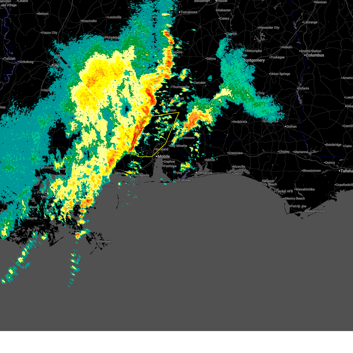
 Svrmob the national weather service in mobile has issued a * severe thunderstorm warning for, northern mobile county in southwestern alabama, central baldwin county in southwestern alabama, southeastern washington county in southwestern alabama, southwestern escambia county in south central alabama, southern clarke county in southwestern alabama, northwestern escambia county in northwestern florida, * until 930 am cdt. * at 850 am cdt, severe thunderstorms were located along a line extending from 3 miles east of calvert to 3 miles northwest of satsuma to 3 miles west of i65 and al 158 to 3 miles west of semmes, moving east at 60 mph. these are destructive storms for much of northern mobile county (radar indicated). Hazards include 80 mph wind gusts and ping pong ball size hail. Flying debris will be dangerous to those caught without shelter. mobile homes will be heavily damaged. expect considerable damage to roofs, windows, and vehicles. Extensive tree damage and power outages are likely. Svrmob the national weather service in mobile has issued a * severe thunderstorm warning for, northern mobile county in southwestern alabama, central baldwin county in southwestern alabama, southeastern washington county in southwestern alabama, southwestern escambia county in south central alabama, southern clarke county in southwestern alabama, northwestern escambia county in northwestern florida, * until 930 am cdt. * at 850 am cdt, severe thunderstorms were located along a line extending from 3 miles east of calvert to 3 miles northwest of satsuma to 3 miles west of i65 and al 158 to 3 miles west of semmes, moving east at 60 mph. these are destructive storms for much of northern mobile county (radar indicated). Hazards include 80 mph wind gusts and ping pong ball size hail. Flying debris will be dangerous to those caught without shelter. mobile homes will be heavily damaged. expect considerable damage to roofs, windows, and vehicles. Extensive tree damage and power outages are likely.
|
| 5/13/2024 5:38 AM CDT |
 At 538 am cdt, a severe thunderstorm was located 5 miles northeast of fruitdale, or 6 miles southwest of chatom, moving east at 55 mph (radar indicated). Hazards include golf ball size hail and 60 mph wind gusts. People and animals outdoors will be injured. expect hail damage to roofs, siding, windows, and vehicles. expect wind damage to roofs, siding, and trees. Locations impacted include, chatom, saint stephens, wagarville, leroy, deer park, tibbie, state line, fruitdale, and mcintosh. At 538 am cdt, a severe thunderstorm was located 5 miles northeast of fruitdale, or 6 miles southwest of chatom, moving east at 55 mph (radar indicated). Hazards include golf ball size hail and 60 mph wind gusts. People and animals outdoors will be injured. expect hail damage to roofs, siding, windows, and vehicles. expect wind damage to roofs, siding, and trees. Locations impacted include, chatom, saint stephens, wagarville, leroy, deer park, tibbie, state line, fruitdale, and mcintosh.
|
| 5/13/2024 5:23 AM CDT |
 Svrmob the national weather service in mobile has issued a * severe thunderstorm warning for, washington county in southwestern alabama, southeastern wayne county in southeastern mississippi, northeastern greene county in southeastern mississippi, * until 615 am cdt. * at 522 am cdt, a severe thunderstorm was located 7 miles west of state line, or 17 miles north of leakesville, moving east at 55 mph (radar indicated). Hazards include 60 mph wind gusts and quarter size hail. Hail damage to vehicles is expected. Expect wind damage to roofs, siding, and trees. Svrmob the national weather service in mobile has issued a * severe thunderstorm warning for, washington county in southwestern alabama, southeastern wayne county in southeastern mississippi, northeastern greene county in southeastern mississippi, * until 615 am cdt. * at 522 am cdt, a severe thunderstorm was located 7 miles west of state line, or 17 miles north of leakesville, moving east at 55 mph (radar indicated). Hazards include 60 mph wind gusts and quarter size hail. Hail damage to vehicles is expected. Expect wind damage to roofs, siding, and trees.
|
| 4/10/2024 11:23 AM CDT |
 Svrmob the national weather service in mobile has issued a * severe thunderstorm warning for, mobile county in southwestern alabama, southern washington county in southwestern alabama, george county in southeastern mississippi, southern greene county in southeastern mississippi, * until 1215 pm cdt. * at 1123 am cdt, severe thunderstorms were located along a line extending from near mclain to 11 miles southwest of lucedale to vancleave to 5 miles southwest of gulf park estates, moving east at 50 mph (radar indicated). Hazards include 70 mph wind gusts. Expect considerable tree damage. Damage is likely to mobile homes, roofs, and outbuildings. Svrmob the national weather service in mobile has issued a * severe thunderstorm warning for, mobile county in southwestern alabama, southern washington county in southwestern alabama, george county in southeastern mississippi, southern greene county in southeastern mississippi, * until 1215 pm cdt. * at 1123 am cdt, severe thunderstorms were located along a line extending from near mclain to 11 miles southwest of lucedale to vancleave to 5 miles southwest of gulf park estates, moving east at 50 mph (radar indicated). Hazards include 70 mph wind gusts. Expect considerable tree damage. Damage is likely to mobile homes, roofs, and outbuildings.
|
| 1/9/2024 4:00 AM CST |
 At 359 am cst, severe thunderstorms were located along a line extending from calvert to 10 miles west of coden, moving east at 40 mph (radar indicated). Hazards include 70 mph wind gusts. Expect considerable tree damage. Damage is likely to mobile homes, roofs, and outbuildings. At 359 am cst, severe thunderstorms were located along a line extending from calvert to 10 miles west of coden, moving east at 40 mph (radar indicated). Hazards include 70 mph wind gusts. Expect considerable tree damage. Damage is likely to mobile homes, roofs, and outbuildings.
|
| 1/9/2024 4:00 AM CST |
 The national weather service in mobile has issued a * severe thunderstorm warning for. central mobile county in southwestern alabama. baldwin county in southwestern alabama. southeastern washington county in southwestern alabama. Southern clarke county in southwestern alabama. The national weather service in mobile has issued a * severe thunderstorm warning for. central mobile county in southwestern alabama. baldwin county in southwestern alabama. southeastern washington county in southwestern alabama. Southern clarke county in southwestern alabama.
|
| 7/22/2023 3:20 PM CDT |
 At 319 pm cdt, a severe thunderstorm was located over calvert, or 13 miles east of citronelle, moving southeast at 20 mph (radar indicated). Hazards include 60 mph wind gusts and quarter size hail. Hail damage to vehicles is expected. expect wind damage to roofs, siding, and trees. locations impacted include, mount vernon, calvert, and movico. hail threat, radar indicated max hail size, 1. 00 in wind threat, radar indicated max wind gust, 60 mph. At 319 pm cdt, a severe thunderstorm was located over calvert, or 13 miles east of citronelle, moving southeast at 20 mph (radar indicated). Hazards include 60 mph wind gusts and quarter size hail. Hail damage to vehicles is expected. expect wind damage to roofs, siding, and trees. locations impacted include, mount vernon, calvert, and movico. hail threat, radar indicated max hail size, 1. 00 in wind threat, radar indicated max wind gust, 60 mph.
|
| 7/22/2023 2:59 PM CDT |
 At 259 pm cdt, a severe thunderstorm was located 6 miles west of calvert, or 9 miles northeast of citronelle, moving southeast at 20 mph (radar indicated). Hazards include 60 mph wind gusts and half dollar size hail. Hail damage to vehicles is expected. Expect wind damage to roofs, siding, and trees. At 259 pm cdt, a severe thunderstorm was located 6 miles west of calvert, or 9 miles northeast of citronelle, moving southeast at 20 mph (radar indicated). Hazards include 60 mph wind gusts and half dollar size hail. Hail damage to vehicles is expected. Expect wind damage to roofs, siding, and trees.
|
| 6/26/2023 1:40 AM CDT |
 At 140 am cdt, severe thunderstorms were located along a line extending from 6 miles east of tibbie to 5 miles northwest of citronelle to 4 miles east of lucedale to 17 miles south of mclain, moving southeast at 50 mph (radar indicated). Hazards include 60 mph wind gusts. Expect damage to roofs, siding, and trees. locations impacted include, citronelle, lucedale, chatom, leakesville, chunchula, gulfcrest, deer park, tibbie, calvert, mount vernon, tanner williams, fruitdale, mcintosh, wilmer and movico. hail threat, radar indicated max hail size, <. 75 in wind threat, radar indicated max wind gust, 60 mph. At 140 am cdt, severe thunderstorms were located along a line extending from 6 miles east of tibbie to 5 miles northwest of citronelle to 4 miles east of lucedale to 17 miles south of mclain, moving southeast at 50 mph (radar indicated). Hazards include 60 mph wind gusts. Expect damage to roofs, siding, and trees. locations impacted include, citronelle, lucedale, chatom, leakesville, chunchula, gulfcrest, deer park, tibbie, calvert, mount vernon, tanner williams, fruitdale, mcintosh, wilmer and movico. hail threat, radar indicated max hail size, <. 75 in wind threat, radar indicated max wind gust, 60 mph.
|
| 6/26/2023 1:14 AM CDT |
 At 113 am cdt, severe thunderstorms were located along a line extending from 7 miles southwest of millry to 7 miles southwest of state line to 4 miles northeast of mclain to 7 miles east of brooklyn, moving southeast at 50 mph (radar indicated). Hazards include 60 mph wind gusts. expect damage to roofs, siding, and trees At 113 am cdt, severe thunderstorms were located along a line extending from 7 miles southwest of millry to 7 miles southwest of state line to 4 miles northeast of mclain to 7 miles east of brooklyn, moving southeast at 50 mph (radar indicated). Hazards include 60 mph wind gusts. expect damage to roofs, siding, and trees
|
| 6/18/2023 10:10 AM CDT |
 The severe thunderstorm warning for northeastern mobile, northwestern baldwin and southern washington counties will expire at 1015 am cdt, the storms which prompted the warning have moved out of the area. therefore, the warning will be allowed to expire. a severe thunderstorm watch remains in effect until noon cdt for southwestern alabama. The severe thunderstorm warning for northeastern mobile, northwestern baldwin and southern washington counties will expire at 1015 am cdt, the storms which prompted the warning have moved out of the area. therefore, the warning will be allowed to expire. a severe thunderstorm watch remains in effect until noon cdt for southwestern alabama.
|
| 6/18/2023 9:57 AM CDT |
 At 957 am cdt, severe thunderstorms were located along a line extending from 12 miles east of calvert to gulfcrest, moving southeast at 40 mph (radar indicated). Hazards include 60 mph wind gusts and quarter size hail. Hail damage to vehicles is expected. expect wind damage to roofs, siding, and trees. locations impacted include, citronelle, creola, axis, mount vernon, calvert and movico. hail threat, radar indicated max hail size, 1. 00 in wind threat, radar indicated max wind gust, 60 mph. At 957 am cdt, severe thunderstorms were located along a line extending from 12 miles east of calvert to gulfcrest, moving southeast at 40 mph (radar indicated). Hazards include 60 mph wind gusts and quarter size hail. Hail damage to vehicles is expected. expect wind damage to roofs, siding, and trees. locations impacted include, citronelle, creola, axis, mount vernon, calvert and movico. hail threat, radar indicated max hail size, 1. 00 in wind threat, radar indicated max wind gust, 60 mph.
|
| 6/18/2023 9:32 AM CDT |
 At 932 am cdt, severe thunderstorms were located along a line extending from 4 miles northeast of fruitdale to 7 miles northeast of leakesville, moving east at 30 mph (radar indicated). Hazards include 60 mph wind gusts and quarter size hail. Hail damage to vehicles is expected. Expect wind damage to roofs, siding, and trees. At 932 am cdt, severe thunderstorms were located along a line extending from 4 miles northeast of fruitdale to 7 miles northeast of leakesville, moving east at 30 mph (radar indicated). Hazards include 60 mph wind gusts and quarter size hail. Hail damage to vehicles is expected. Expect wind damage to roofs, siding, and trees.
|
| 6/18/2023 9:29 AM CDT |
 At 929 am cdt, a severe thunderstorm was located over calvert, or 14 miles east of citronelle, moving east at 30 mph (radar indicated). Hazards include 60 mph wind gusts and quarter size hail. Hail damage to vehicles is expected. Expect wind damage to roofs, siding, and trees. At 929 am cdt, a severe thunderstorm was located over calvert, or 14 miles east of citronelle, moving east at 30 mph (radar indicated). Hazards include 60 mph wind gusts and quarter size hail. Hail damage to vehicles is expected. Expect wind damage to roofs, siding, and trees.
|
| 6/16/2023 10:46 PM CDT |
 At 1045 pm cdt, severe thunderstorms were located along a line extending from 4 miles southwest of tibbie to 4 miles northwest of calvert to 11 miles west of mccullough to 6 miles west of i65 and al 113, moving south at 35 mph (radar indicated). Hazards include 60 mph wind gusts. Expect damage to roofs, siding, and trees. Locations impacted include, citronelle, mccullough, deer park, uriah, mount vernon, calvert, fruitdale, mcintosh, i65 and cr 1, movico, i65 and al 21 and poarch creek reservation. At 1045 pm cdt, severe thunderstorms were located along a line extending from 4 miles southwest of tibbie to 4 miles northwest of calvert to 11 miles west of mccullough to 6 miles west of i65 and al 113, moving south at 35 mph (radar indicated). Hazards include 60 mph wind gusts. Expect damage to roofs, siding, and trees. Locations impacted include, citronelle, mccullough, deer park, uriah, mount vernon, calvert, fruitdale, mcintosh, i65 and cr 1, movico, i65 and al 21 and poarch creek reservation.
|
| 6/16/2023 10:20 PM CDT |
 At 1019 pm cdt, severe thunderstorms were located along a line extending from 7 miles northwest of chatom to 5 miles east of tibbie to 10 miles southeast of jackson to 4 miles west of frisco city, moving south at 35 mph (radar indicated). Hazards include 70 mph wind gusts. Expect considerable tree damage. damage is likely to mobile homes, roofs, and outbuildings. Locations impacted include, jackson, citronelle, chatom, mccullough, saint stephens, wagarville, leroy, deer park, uriah, tibbie, calvert, mount vernon, fruitdale, mcintosh, i65 and cr 1, i65 and al 21, movico and poarch creek reservation. At 1019 pm cdt, severe thunderstorms were located along a line extending from 7 miles northwest of chatom to 5 miles east of tibbie to 10 miles southeast of jackson to 4 miles west of frisco city, moving south at 35 mph (radar indicated). Hazards include 70 mph wind gusts. Expect considerable tree damage. damage is likely to mobile homes, roofs, and outbuildings. Locations impacted include, jackson, citronelle, chatom, mccullough, saint stephens, wagarville, leroy, deer park, uriah, tibbie, calvert, mount vernon, fruitdale, mcintosh, i65 and cr 1, i65 and al 21, movico and poarch creek reservation.
|
| 6/16/2023 9:56 PM CDT |
 At 955 pm cdt, severe thunderstorms were located along a line extending from 7 miles southwest of silas to 7 miles northeast of chatom to 5 miles northeast of jackson to 10 miles east of whatley, moving south at 35 mph (radar indicated). Hazards include 60 mph wind gusts. expect damage to roofs, siding, and trees At 955 pm cdt, severe thunderstorms were located along a line extending from 7 miles southwest of silas to 7 miles northeast of chatom to 5 miles northeast of jackson to 10 miles east of whatley, moving south at 35 mph (radar indicated). Hazards include 60 mph wind gusts. expect damage to roofs, siding, and trees
|
| 6/16/2023 8:04 AM CDT |
 At 802 am cdt, severe thunderstorms were located along a line extending from 12 miles northwest of mccullough to near stockton to saraland to near i10 and i65, moving east at 55 mph (radar indicated). Hazards include 70 mph wind gusts and quarter size hail. Hail damage to vehicles is expected. expect considerable tree damage. wind damage is also likely to mobile homes, roofs, and outbuildings. locations impacted include, midtown mobile, downtown mobile, prichard, daphne, tillmans corner, saraland, chickasaw, satsuma, spanish fort, citronelle, creola, chunchula, stockton, gulfcrest, deer park, axis, tibbie, mount vernon, calvert and tanner williams. thunderstorm damage threat, considerable hail threat, radar indicated max hail size, 1. 00 in wind threat, radar indicated max wind gust, 70 mph. At 802 am cdt, severe thunderstorms were located along a line extending from 12 miles northwest of mccullough to near stockton to saraland to near i10 and i65, moving east at 55 mph (radar indicated). Hazards include 70 mph wind gusts and quarter size hail. Hail damage to vehicles is expected. expect considerable tree damage. wind damage is also likely to mobile homes, roofs, and outbuildings. locations impacted include, midtown mobile, downtown mobile, prichard, daphne, tillmans corner, saraland, chickasaw, satsuma, spanish fort, citronelle, creola, chunchula, stockton, gulfcrest, deer park, axis, tibbie, mount vernon, calvert and tanner williams. thunderstorm damage threat, considerable hail threat, radar indicated max hail size, 1. 00 in wind threat, radar indicated max wind gust, 70 mph.
|
| 6/16/2023 8:03 AM CDT |
 At 802 am cdt, severe thunderstorms were located along a line extending from near yellow bluff to 10 miles west of uriah to 3 miles southeast of creola, moving east at 55 mph (radar indicated). Hazards include 70 mph wind gusts and quarter size hail. Hail damage to vehicles is expected. expect considerable tree damage. Wind damage is also likely to mobile homes, roofs, and outbuildings. At 802 am cdt, severe thunderstorms were located along a line extending from near yellow bluff to 10 miles west of uriah to 3 miles southeast of creola, moving east at 55 mph (radar indicated). Hazards include 70 mph wind gusts and quarter size hail. Hail damage to vehicles is expected. expect considerable tree damage. Wind damage is also likely to mobile homes, roofs, and outbuildings.
|
| 6/16/2023 7:34 AM CDT |
 At 731 am cdt, severe thunderstorms were located along a line extending from 5 miles east of tibbie to 8 miles east of leakesville to 5 miles east of lucedale to 4 miles north of hurley, moving southeast at 60 mph (radar indicated). Hazards include 70 mph wind gusts and quarter size hail. Hail damage to vehicles is expected. expect considerable tree damage. wind damage is also likely to mobile homes, roofs, and outbuildings. locations impacted include, midtown mobile, downtown mobile, prichard, daphne, tillmans corner, saraland, chickasaw, satsuma, spanish fort, citronelle, lucedale, creola, leakesville, chunchula, stockton, gulfcrest, deer park, axis, tibbie and mount vernon. thunderstorm damage threat, considerable hail threat, radar indicated max hail size, 1. 00 in wind threat, radar indicated max wind gust, 70 mph. At 731 am cdt, severe thunderstorms were located along a line extending from 5 miles east of tibbie to 8 miles east of leakesville to 5 miles east of lucedale to 4 miles north of hurley, moving southeast at 60 mph (radar indicated). Hazards include 70 mph wind gusts and quarter size hail. Hail damage to vehicles is expected. expect considerable tree damage. wind damage is also likely to mobile homes, roofs, and outbuildings. locations impacted include, midtown mobile, downtown mobile, prichard, daphne, tillmans corner, saraland, chickasaw, satsuma, spanish fort, citronelle, lucedale, creola, leakesville, chunchula, stockton, gulfcrest, deer park, axis, tibbie and mount vernon. thunderstorm damage threat, considerable hail threat, radar indicated max hail size, 1. 00 in wind threat, radar indicated max wind gust, 70 mph.
|
| 6/16/2023 7:12 AM CDT |
 At 710 am cdt, severe thunderstorms were located along a line extending from 3 miles west of state line to 9 miles northeast of mclain to 15 miles north of latimer, moving east at 50 mph. other severe thunderstorms were developing in the vicinity of wilmer, semmes, and mobile regional airport, moving east at around 40 mph (radar indicated). Hazards include 60 mph wind gusts and quarter size hail. Hail damage to vehicles is expected. Expect wind damage to roofs, siding, and trees. At 710 am cdt, severe thunderstorms were located along a line extending from 3 miles west of state line to 9 miles northeast of mclain to 15 miles north of latimer, moving east at 50 mph. other severe thunderstorms were developing in the vicinity of wilmer, semmes, and mobile regional airport, moving east at around 40 mph (radar indicated). Hazards include 60 mph wind gusts and quarter size hail. Hail damage to vehicles is expected. Expect wind damage to roofs, siding, and trees.
|
| 6/14/2023 8:21 PM CDT |
 At 821 pm cdt, severe thunderstorms were located along a line extending from mcintosh to near calvert to 3 miles south of citronelle, moving east at 80 mph (radar indicated). Hazards include 60 mph wind gusts and penny size hail. expect damage to roofs, siding, and trees At 821 pm cdt, severe thunderstorms were located along a line extending from mcintosh to near calvert to 3 miles south of citronelle, moving east at 80 mph (radar indicated). Hazards include 60 mph wind gusts and penny size hail. expect damage to roofs, siding, and trees
|
| 6/14/2023 8:14 PM CDT |
 At 814 pm cdt, severe thunderstorms were located along a line extending from 6 miles southeast of tibbie to near deer park to 3 miles northwest of lucedale, moving east at 65 mph (radar indicated). Hazards include 70 mph wind gusts and penny size hail. Expect considerable tree damage. damage is likely to mobile homes, roofs, and outbuildings. locations impacted include, citronelle, gulfcrest, deer park, tibbie and mcintosh. thunderstorm damage threat, considerable hail threat, radar indicated max hail size, 0. 75 in wind threat, radar indicated max wind gust, 70 mph. At 814 pm cdt, severe thunderstorms were located along a line extending from 6 miles southeast of tibbie to near deer park to 3 miles northwest of lucedale, moving east at 65 mph (radar indicated). Hazards include 70 mph wind gusts and penny size hail. Expect considerable tree damage. damage is likely to mobile homes, roofs, and outbuildings. locations impacted include, citronelle, gulfcrest, deer park, tibbie and mcintosh. thunderstorm damage threat, considerable hail threat, radar indicated max hail size, 0. 75 in wind threat, radar indicated max wind gust, 70 mph.
|
| 6/14/2023 7:51 PM CDT |
 At 751 pm cdt, severe thunderstorms were located along a line extending from 6 miles west of state line to 8 miles northwest of leakesville to 6 miles southwest of mclain, moving east at 45 mph (radar indicated). Hazards include 70 mph wind gusts and penny size hail. Expect considerable tree damage. Damage is likely to mobile homes, roofs, and outbuildings. At 751 pm cdt, severe thunderstorms were located along a line extending from 6 miles west of state line to 8 miles northwest of leakesville to 6 miles southwest of mclain, moving east at 45 mph (radar indicated). Hazards include 70 mph wind gusts and penny size hail. Expect considerable tree damage. Damage is likely to mobile homes, roofs, and outbuildings.
|
| 4/15/2023 2:18 PM CDT |
 At 217 pm cdt, severe thunderstorms were located along a line extending from 5 miles southwest of deer park to 6 miles west of wilmer to 6 miles west of vancleave, moving east at 40 mph (radar indicated). Hazards include 60 mph wind gusts and penny size hail. Expect damage to roofs, siding, and trees. locations impacted include, midtown mobile, downtown mobile, prichard, saraland, chickasaw, satsuma, citronelle, lucedale, creola, leakesville, chunchula, gulfcrest, deer park, axis, calvert, mount vernon, semmes, tanner williams, i65 and i165 and mobile regional airport. hail threat, radar indicated max hail size, 0. 75 in wind threat, radar indicated max wind gust, 60 mph. At 217 pm cdt, severe thunderstorms were located along a line extending from 5 miles southwest of deer park to 6 miles west of wilmer to 6 miles west of vancleave, moving east at 40 mph (radar indicated). Hazards include 60 mph wind gusts and penny size hail. Expect damage to roofs, siding, and trees. locations impacted include, midtown mobile, downtown mobile, prichard, saraland, chickasaw, satsuma, citronelle, lucedale, creola, leakesville, chunchula, gulfcrest, deer park, axis, calvert, mount vernon, semmes, tanner williams, i65 and i165 and mobile regional airport. hail threat, radar indicated max hail size, 0. 75 in wind threat, radar indicated max wind gust, 60 mph.
|
| 4/15/2023 1:59 PM CDT |
 At 159 pm cdt, severe thunderstorms were located along a line extending from 3 miles north of leakesville to 5 miles southwest of lucedale to 7 miles east of saucier, moving east at 50 mph (radar indicated). Hazards include 60 mph wind gusts and penny size hail. expect damage to roofs, siding, and trees At 159 pm cdt, severe thunderstorms were located along a line extending from 3 miles north of leakesville to 5 miles southwest of lucedale to 7 miles east of saucier, moving east at 50 mph (radar indicated). Hazards include 60 mph wind gusts and penny size hail. expect damage to roofs, siding, and trees
|
| 1/12/2023 12:05 PM CST |
 At 1205 pm cst, a severe thunderstorm was located 5 miles northwest of gulfcrest, or 6 miles southwest of citronelle, moving east at 45 mph (radar indicated). Hazards include 60 mph wind gusts and quarter size hail. Hail damage to vehicles is expected. Expect wind damage to roofs, siding, and trees. At 1205 pm cst, a severe thunderstorm was located 5 miles northwest of gulfcrest, or 6 miles southwest of citronelle, moving east at 45 mph (radar indicated). Hazards include 60 mph wind gusts and quarter size hail. Hail damage to vehicles is expected. Expect wind damage to roofs, siding, and trees.
|
| 1/4/2023 2:11 AM CST |
 At 211 am cst, severe thunderstorms were located along a line extending from leroy to 3 miles south of jackson to 9 miles southeast of wagarville to 3 miles east of mcintosh, moving northeast at 50 mph (radar indicated). Hazards include 60 mph wind gusts. Expect damage to roofs, siding, and trees. locations impacted include, jackson, grove hill, saint stephens, wagarville, leroy, whatley and mcintosh. hail threat, radar indicated max hail size, <. 75 in wind threat, radar indicated max wind gust, 60 mph. At 211 am cst, severe thunderstorms were located along a line extending from leroy to 3 miles south of jackson to 9 miles southeast of wagarville to 3 miles east of mcintosh, moving northeast at 50 mph (radar indicated). Hazards include 60 mph wind gusts. Expect damage to roofs, siding, and trees. locations impacted include, jackson, grove hill, saint stephens, wagarville, leroy, whatley and mcintosh. hail threat, radar indicated max hail size, <. 75 in wind threat, radar indicated max wind gust, 60 mph.
|
| 1/4/2023 1:48 AM CST |
 At 148 am cst, severe thunderstorms were located along a line extending from tibbie to 9 miles southeast of chatom to 7 miles east of deer park to 3 miles north of citronelle, moving northeast at 50 mph (radar indicated). Hazards include 60 mph wind gusts. expect damage to roofs, siding, and trees At 148 am cst, severe thunderstorms were located along a line extending from tibbie to 9 miles southeast of chatom to 7 miles east of deer park to 3 miles north of citronelle, moving northeast at 50 mph (radar indicated). Hazards include 60 mph wind gusts. expect damage to roofs, siding, and trees
|
| 12/30/2022 11:29 AM CST |
 At 1128 am cst, severe thunderstorms were located along a line extending from 4 miles east of deer park to prichard to grand bay, moving east at 50 mph (radar indicated). Hazards include 60 mph wind gusts. expect damage to roofs, siding, and trees At 1128 am cst, severe thunderstorms were located along a line extending from 4 miles east of deer park to prichard to grand bay, moving east at 50 mph (radar indicated). Hazards include 60 mph wind gusts. expect damage to roofs, siding, and trees
|
| 12/14/2022 7:28 PM CST |
 At 728 pm cst, severe thunderstorms were located along a line extending from 3 miles northwest of mcintosh to 3 miles south of theodore, moving northeast at 45 mph (radar indicated). Hazards include 60 mph wind gusts. expect damage to roofs, siding, and trees At 728 pm cst, severe thunderstorms were located along a line extending from 3 miles northwest of mcintosh to 3 miles south of theodore, moving northeast at 45 mph (radar indicated). Hazards include 60 mph wind gusts. expect damage to roofs, siding, and trees
|
| 11/30/2022 4:18 AM CST |
 At 417 am cst, severe thunderstorms were located along a line extending from 8 miles southeast of jackson to calvert, moving east at 50 mph (radar indicated). Hazards include 60 mph wind gusts. Expect damage to roofs, siding, and trees. Locations impacted include, frisco city, mccullough, uriah, calvert, excel and mcintosh. At 417 am cst, severe thunderstorms were located along a line extending from 8 miles southeast of jackson to calvert, moving east at 50 mph (radar indicated). Hazards include 60 mph wind gusts. Expect damage to roofs, siding, and trees. Locations impacted include, frisco city, mccullough, uriah, calvert, excel and mcintosh.
|
| 11/30/2022 3:58 AM CST |
 At 357 am cst, severe thunderstorms were located along a line extending from 6 miles west of wagarville to 4 miles south of deer park, moving east at 40 mph (radar indicated). Hazards include 60 mph wind gusts. expect damage to roofs, siding, and trees At 357 am cst, severe thunderstorms were located along a line extending from 6 miles west of wagarville to 4 miles south of deer park, moving east at 40 mph (radar indicated). Hazards include 60 mph wind gusts. expect damage to roofs, siding, and trees
|
| 11/30/2022 3:44 AM CST |
 At 343 am cst, severe thunderstorms were located along a line extending from near wagarville to 5 miles southwest of fruitdale to 3 miles west of leakesville to 5 miles southeast of mclain, moving east at 30 mph (radar indicated). Hazards include 60 mph wind gusts. Expect damage to roofs, siding, and trees. locations impacted include, jackson, chatom, leakesville, saint stephens, wagarville, leroy, deer park, tibbie, beaumont, new augusta, mclain, state line, fruitdale and mcintosh. hail threat, radar indicated max hail size, <. 75 in wind threat, radar indicated max wind gust, 60 mph. At 343 am cst, severe thunderstorms were located along a line extending from near wagarville to 5 miles southwest of fruitdale to 3 miles west of leakesville to 5 miles southeast of mclain, moving east at 30 mph (radar indicated). Hazards include 60 mph wind gusts. Expect damage to roofs, siding, and trees. locations impacted include, jackson, chatom, leakesville, saint stephens, wagarville, leroy, deer park, tibbie, beaumont, new augusta, mclain, state line, fruitdale and mcintosh. hail threat, radar indicated max hail size, <. 75 in wind threat, radar indicated max wind gust, 60 mph.
|
| 11/30/2022 3:04 AM CST |
 At 304 am cst, severe thunderstorms were located along a line extending from 6 miles west of chatom to 8 miles east of richton to 3 miles north of beaumont to 5 miles northeast of brooklyn, moving east at 30 mph (radar indicated). Hazards include 60 mph wind gusts. expect damage to roofs, siding, and trees At 304 am cst, severe thunderstorms were located along a line extending from 6 miles west of chatom to 8 miles east of richton to 3 miles north of beaumont to 5 miles northeast of brooklyn, moving east at 30 mph (radar indicated). Hazards include 60 mph wind gusts. expect damage to roofs, siding, and trees
|
| 11/26/2022 6:32 PM CST |
 The national weather service in mobile has issued a * severe thunderstorm warning for. northwestern mobile county in southwestern alabama. southeastern washington county in southwestern alabama. until 715 pm cst. At 632 pm cst, a severe thunderstorm was located 7 miles northwest. The national weather service in mobile has issued a * severe thunderstorm warning for. northwestern mobile county in southwestern alabama. southeastern washington county in southwestern alabama. until 715 pm cst. At 632 pm cst, a severe thunderstorm was located 7 miles northwest.
|
| 7/9/2022 3:33 PM CDT |
 At 333 pm cdt, a severe thunderstorm was located 5 miles east of mcintosh, or 15 miles south of jackson, and is nearly stationary (radar indicated). Hazards include 60 mph wind gusts and quarter size hail. Hail damage to vehicles is expected. Expect wind damage to roofs, siding, and trees. At 333 pm cdt, a severe thunderstorm was located 5 miles east of mcintosh, or 15 miles south of jackson, and is nearly stationary (radar indicated). Hazards include 60 mph wind gusts and quarter size hail. Hail damage to vehicles is expected. Expect wind damage to roofs, siding, and trees.
|
| 6/10/2022 3:01 PM CDT |
 At 301 pm cdt, severe thunderstorms were located along a line extending from 5 miles north of toxey to 7 miles northwest of saint stephens to 3 miles southwest of tibbie to 7 miles west of leakesville, moving east at 35 mph (radar indicated). Hazards include 60 mph wind gusts and quarter size hail. Hail damage to vehicles is expected. expect wind damage to roofs, siding, and trees. locations impacted include, jackson, butler, chatom, saint stephens, wagarville, leroy, deer park, tibbie, millry, state line, buckatunna, silas, fruitdale, coffeeville, mcintosh, gilbertown and toxey. hail threat, radar indicated max hail size, 1. 00 in wind threat, radar indicated max wind gust, 60 mph. At 301 pm cdt, severe thunderstorms were located along a line extending from 5 miles north of toxey to 7 miles northwest of saint stephens to 3 miles southwest of tibbie to 7 miles west of leakesville, moving east at 35 mph (radar indicated). Hazards include 60 mph wind gusts and quarter size hail. Hail damage to vehicles is expected. expect wind damage to roofs, siding, and trees. locations impacted include, jackson, butler, chatom, saint stephens, wagarville, leroy, deer park, tibbie, millry, state line, buckatunna, silas, fruitdale, coffeeville, mcintosh, gilbertown and toxey. hail threat, radar indicated max hail size, 1. 00 in wind threat, radar indicated max wind gust, 60 mph.
|
| 6/10/2022 2:25 PM CDT |
 At 224 pm cdt, severe thunderstorms were located along a line extending from 4 miles southwest of stonewall to near waynesboro to 9 miles northeast of richton to 4 miles northeast of mclaurin, moving east at 40 mph (radar indicated). Hazards include 60 mph wind gusts and quarter size hail. Hail damage to vehicles is expected. Expect wind damage to roofs, siding, and trees. At 224 pm cdt, severe thunderstorms were located along a line extending from 4 miles southwest of stonewall to near waynesboro to 9 miles northeast of richton to 4 miles northeast of mclaurin, moving east at 40 mph (radar indicated). Hazards include 60 mph wind gusts and quarter size hail. Hail damage to vehicles is expected. Expect wind damage to roofs, siding, and trees.
|
| 4/17/2022 9:47 PM CDT |
 At 947 pm cdt, severe thunderstorms were located along a line extending from 7 miles southwest of mcintosh to 4 miles northwest of mount vernon to 6 miles southwest of movico to 4 miles southwest of chunchula to 4 miles west of tanner williams, moving east at 55 mph (radar indicated). Hazards include 60 mph wind gusts and quarter size hail. Hail damage to vehicles is expected. expect wind damage to roofs, siding, and trees. Locations impacted include, midtown mobile, downtown mobile, prichard, tillmans corner, saraland, chickasaw, satsuma, citronelle, creola, chunchula, gulfcrest, deer park, axis, tibbie, mount vernon, calvert, tanner williams, semmes, mcintosh and wilmer. At 947 pm cdt, severe thunderstorms were located along a line extending from 7 miles southwest of mcintosh to 4 miles northwest of mount vernon to 6 miles southwest of movico to 4 miles southwest of chunchula to 4 miles west of tanner williams, moving east at 55 mph (radar indicated). Hazards include 60 mph wind gusts and quarter size hail. Hail damage to vehicles is expected. expect wind damage to roofs, siding, and trees. Locations impacted include, midtown mobile, downtown mobile, prichard, tillmans corner, saraland, chickasaw, satsuma, citronelle, creola, chunchula, gulfcrest, deer park, axis, tibbie, mount vernon, calvert, tanner williams, semmes, mcintosh and wilmer.
|
| 4/17/2022 9:07 PM CDT |
 At 906 pm cdt, severe thunderstorms were located along a line extending from 3 miles southeast of ovett to richton to 5 miles northwest of beaumont to new augusta, moving southeast at 50 mph (radar indicated). Hazards include 70 mph wind gusts and quarter size hail. tornadoes will also be possible as this line moves through the warned area. Hail damage to vehicles is expected. expect considerable tree damage. Wind damage is also likely to mobile homes, roofs, and outbuildings. At 906 pm cdt, severe thunderstorms were located along a line extending from 3 miles southeast of ovett to richton to 5 miles northwest of beaumont to new augusta, moving southeast at 50 mph (radar indicated). Hazards include 70 mph wind gusts and quarter size hail. tornadoes will also be possible as this line moves through the warned area. Hail damage to vehicles is expected. expect considerable tree damage. Wind damage is also likely to mobile homes, roofs, and outbuildings.
|
| 4/13/2022 10:55 PM CDT |
 At 1054 pm cdt, severe thunderstorms were located along a line extending from 3 miles northwest of leakesville to 5 miles west of mchenry, moving east at 40 mph (radar indicated). Hazards include 60 mph wind gusts. expect damage to roofs, siding, and trees At 1054 pm cdt, severe thunderstorms were located along a line extending from 3 miles northwest of leakesville to 5 miles west of mchenry, moving east at 40 mph (radar indicated). Hazards include 60 mph wind gusts. expect damage to roofs, siding, and trees
|
| 4/5/2022 9:53 AM CDT |
 At 952 am cdt, severe thunderstorms were located along a line extending from 5 miles east of state line to 3 miles east of fruitdale to 7 miles north of leakesville, moving east at 70 mph (radar indicated). Hazards include 70 mph wind gusts and nickel size hail. Expect considerable tree damage. Damage is likely to mobile homes, roofs, and outbuildings. At 952 am cdt, severe thunderstorms were located along a line extending from 5 miles east of state line to 3 miles east of fruitdale to 7 miles north of leakesville, moving east at 70 mph (radar indicated). Hazards include 70 mph wind gusts and nickel size hail. Expect considerable tree damage. Damage is likely to mobile homes, roofs, and outbuildings.
|
| 3/30/2022 10:36 PM CDT |
 At 1036 pm cdt, severe thunderstorms were located along a line extending from 6 miles south of yellow bluff to 11 miles southeast of whatley to 3 miles west of calvert, moving east at 35 mph (radar indicated). Hazards include 70 mph wind gusts. Expect considerable tree damage. Damage is likely to mobile homes, roofs, and outbuildings. At 1036 pm cdt, severe thunderstorms were located along a line extending from 6 miles south of yellow bluff to 11 miles southeast of whatley to 3 miles west of calvert, moving east at 35 mph (radar indicated). Hazards include 70 mph wind gusts. Expect considerable tree damage. Damage is likely to mobile homes, roofs, and outbuildings.
|
| 3/30/2022 9:53 PM CDT |
 At 951 pm cdt, severe thunderstorms were located along a line extending from mcintosh to 4 miles east of lucedale to 5 miles northwest of vancleave, moving east at 55 mph. these are destructive storms for agricola, citronelle, west mobile, (radar indicated). Hazards include 80 mph wind gusts. Flying debris will be dangerous to those caught without shelter. mobile homes will be heavily damaged. expect considerable damage to roofs, windows, and vehicles. Extensive tree damage and power outages are likely. At 951 pm cdt, severe thunderstorms were located along a line extending from mcintosh to 4 miles east of lucedale to 5 miles northwest of vancleave, moving east at 55 mph. these are destructive storms for agricola, citronelle, west mobile, (radar indicated). Hazards include 80 mph wind gusts. Flying debris will be dangerous to those caught without shelter. mobile homes will be heavily damaged. expect considerable damage to roofs, windows, and vehicles. Extensive tree damage and power outages are likely.
|
| 3/30/2022 9:48 PM CDT |
 At 946 pm cdt, a severe thunderstorm was located 4 miles southwest of wagarville, or 12 miles southeast of chatom, moving northeast at 50 mph. this is a destructive storm for mcintosh, hawthorn, wagarville, (radar indicated). Hazards include 80 mph wind gusts. Flying debris will be dangerous to those caught without shelter. mobile homes will be heavily damaged. expect considerable damage to roofs, windows, and vehicles. Extensive tree damage and power outages are likely. At 946 pm cdt, a severe thunderstorm was located 4 miles southwest of wagarville, or 12 miles southeast of chatom, moving northeast at 50 mph. this is a destructive storm for mcintosh, hawthorn, wagarville, (radar indicated). Hazards include 80 mph wind gusts. Flying debris will be dangerous to those caught without shelter. mobile homes will be heavily damaged. expect considerable damage to roofs, windows, and vehicles. Extensive tree damage and power outages are likely.
|
| 3/30/2022 9:25 PM CDT |
 At 923 pm cdt, severe thunderstorms were located along a line extending from 6 miles east of millry to near fruitdale to 8 miles southeast of leakesville to 10 miles west of lucedale to 10 miles east of mchenry, moving east at 30 mph. these are destructive storms for chatom, fruitdale, vinegar bend, locaitons near leakesville (radar indicated). Hazards include 80 mph wind gusts. Flying debris will be dangerous to those caught without shelter. mobile homes will be heavily damaged. expect considerable damage to roofs, windows, and vehicles. Extensive tree damage and power outages are likely. At 923 pm cdt, severe thunderstorms were located along a line extending from 6 miles east of millry to near fruitdale to 8 miles southeast of leakesville to 10 miles west of lucedale to 10 miles east of mchenry, moving east at 30 mph. these are destructive storms for chatom, fruitdale, vinegar bend, locaitons near leakesville (radar indicated). Hazards include 80 mph wind gusts. Flying debris will be dangerous to those caught without shelter. mobile homes will be heavily damaged. expect considerable damage to roofs, windows, and vehicles. Extensive tree damage and power outages are likely.
|
| 3/30/2022 8:46 PM CDT |
 At 845 pm cdt, severe thunderstorms were located along a line extending from clara to 6 miles southwest of buckatunna to 12 miles northeast of beaumont to 4 miles south of mclain to 13 miles east of wiggins, moving northeast at 50 mph. these are destructive storms for mclain, avent, jonathan, (radar indicated). Hazards include 80 mph wind gusts. Flying debris will be dangerous to those caught without shelter. mobile homes will be heavily damaged. expect considerable damage to roofs, windows, and vehicles. extensive tree damage and power outages are likely. Locations impacted include, wiggins, citronelle, lucedale, chatom, richton, leakesville, saint stephens, wagarville, clara, perkinston, mchenry, gulfcrest, deer park, tibbie, beaumont, calvert, mount vernon, new augusta, millry and mclain. At 845 pm cdt, severe thunderstorms were located along a line extending from clara to 6 miles southwest of buckatunna to 12 miles northeast of beaumont to 4 miles south of mclain to 13 miles east of wiggins, moving northeast at 50 mph. these are destructive storms for mclain, avent, jonathan, (radar indicated). Hazards include 80 mph wind gusts. Flying debris will be dangerous to those caught without shelter. mobile homes will be heavily damaged. expect considerable damage to roofs, windows, and vehicles. extensive tree damage and power outages are likely. Locations impacted include, wiggins, citronelle, lucedale, chatom, richton, leakesville, saint stephens, wagarville, clara, perkinston, mchenry, gulfcrest, deer park, tibbie, beaumont, calvert, mount vernon, new augusta, millry and mclain.
|
| 3/30/2022 8:39 PM CDT |
 At 838 pm cdt, severe thunderstorms were located along a line extending from near clara to 7 miles southwest of mclain to 9 miles north of kiln, moving northeast at 60 mph (radar indicated). Hazards include 70 mph wind gusts. Expect considerable tree damage. Damage is likely to mobile homes, roofs, and outbuildings. At 838 pm cdt, severe thunderstorms were located along a line extending from near clara to 7 miles southwest of mclain to 9 miles north of kiln, moving northeast at 60 mph (radar indicated). Hazards include 70 mph wind gusts. Expect considerable tree damage. Damage is likely to mobile homes, roofs, and outbuildings.
|
| 3/18/2022 11:06 AM CDT |
 At 1106 am cdt, a severe thunderstorm was located over calvert, or 12 miles east of citronelle, moving east at 65 mph (radar indicated). Hazards include 60 mph wind gusts. expect damage to roofs, siding, and trees At 1106 am cdt, a severe thunderstorm was located over calvert, or 12 miles east of citronelle, moving east at 65 mph (radar indicated). Hazards include 60 mph wind gusts. expect damage to roofs, siding, and trees
|
| 2/3/2022 3:33 PM CST |
 At 332 pm cst, severe thunderstorms were located along a line extending from 17 miles southwest of lucedale to 9 miles west of gulfcrest to 6 miles northeast of citronelle to 3 miles south of leroy, moving east at 45 mph (radar indicated). Hazards include 60 mph wind gusts. Expect damage to roofs, siding, and trees. locations impacted include, jackson, citronelle, lucedale, gulfcrest, calvert and mcintosh. hail threat, radar indicated max hail size, <. 75 in wind threat, radar indicated max wind gust, 60 mph. At 332 pm cst, severe thunderstorms were located along a line extending from 17 miles southwest of lucedale to 9 miles west of gulfcrest to 6 miles northeast of citronelle to 3 miles south of leroy, moving east at 45 mph (radar indicated). Hazards include 60 mph wind gusts. Expect damage to roofs, siding, and trees. locations impacted include, jackson, citronelle, lucedale, gulfcrest, calvert and mcintosh. hail threat, radar indicated max hail size, <. 75 in wind threat, radar indicated max wind gust, 60 mph.
|
| 2/3/2022 3:00 PM CST |
 At 259 pm cst, severe thunderstorms were located along a line extending from 3 miles southeast of mchenry to 9 miles south of mclain to 5 miles southeast of leakesville to 4 miles west of tibbie, moving northeast at 35 mph (radar indicated). Hazards include 60 mph wind gusts. expect damage to roofs, siding, and trees At 259 pm cst, severe thunderstorms were located along a line extending from 3 miles southeast of mchenry to 9 miles south of mclain to 5 miles southeast of leakesville to 4 miles west of tibbie, moving northeast at 35 mph (radar indicated). Hazards include 60 mph wind gusts. expect damage to roofs, siding, and trees
|
| 8/30/2021 12:52 PM CDT |
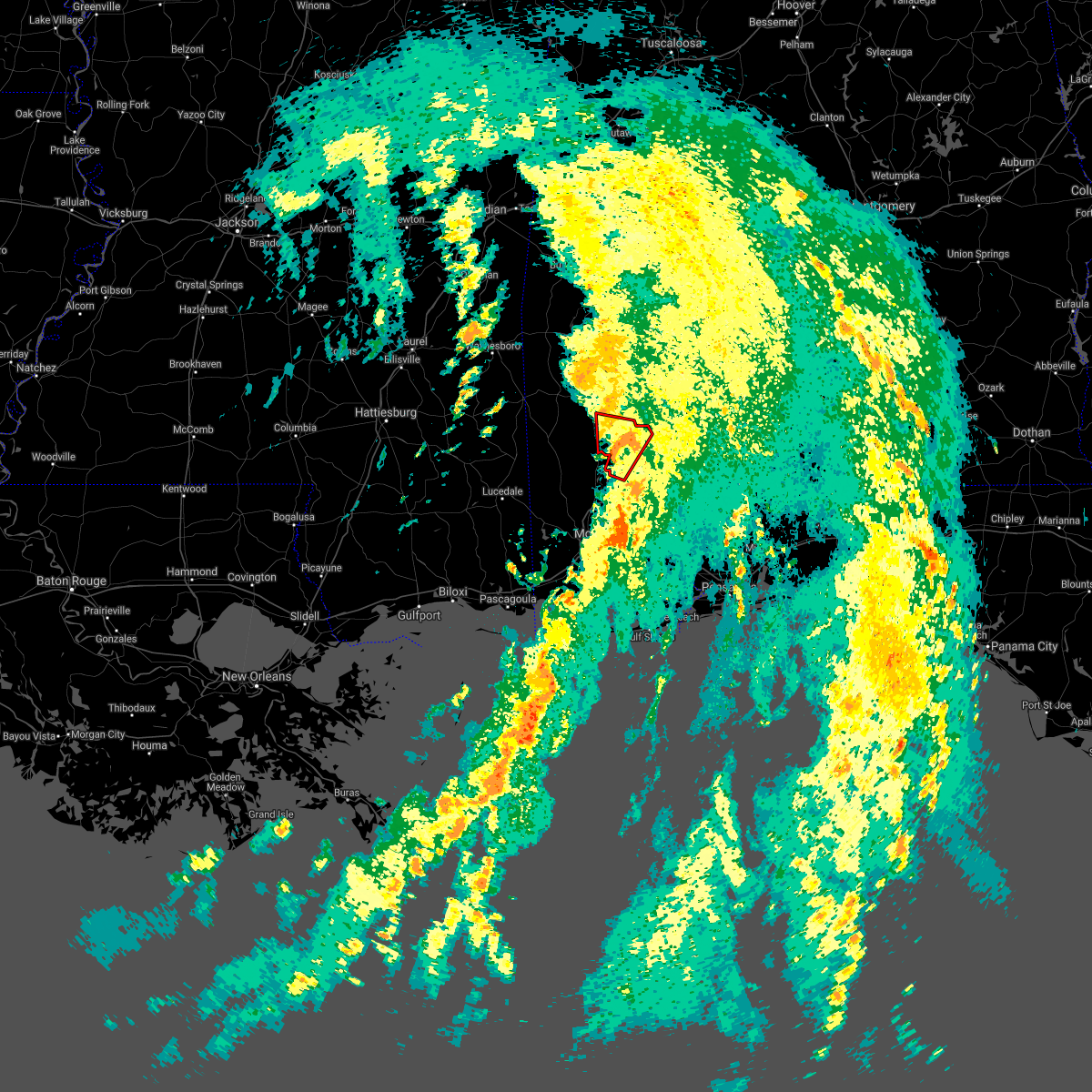 At 1252 pm cdt, a confirmed tornado was located 7 miles east of mount vernon, or 16 miles northwest of bay minette, moving northeast at 25 mph (radar confirmed tornado). Hazards include damaging tornado. Flying debris will be dangerous to those caught without shelter. mobile homes will be damaged or destroyed. damage to roofs, windows, and vehicles will occur. tree damage is likely. This tornadic thunderstorm will remain over mainly rural areas of northwestern baldwin, southeastern washington and south central clarke counties. At 1252 pm cdt, a confirmed tornado was located 7 miles east of mount vernon, or 16 miles northwest of bay minette, moving northeast at 25 mph (radar confirmed tornado). Hazards include damaging tornado. Flying debris will be dangerous to those caught without shelter. mobile homes will be damaged or destroyed. damage to roofs, windows, and vehicles will occur. tree damage is likely. This tornadic thunderstorm will remain over mainly rural areas of northwestern baldwin, southeastern washington and south central clarke counties.
|
| 8/30/2021 12:43 PM CDT |
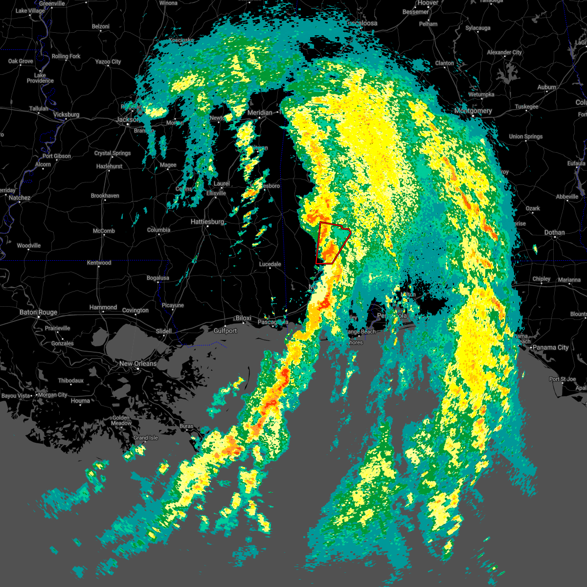 At 1242 pm cdt, a confirmed tornado was located 4 miles southeast of movico, or 9 miles northeast of creola, moving north at 40 mph (radar confirmed tornado). Hazards include damaging tornado. Flying debris will be dangerous to those caught without shelter. mobile homes will be damaged or destroyed. damage to roofs, windows, and vehicles will occur. tree damage is likely. this tornado will be near, calvert around 1255 pm cdt. Mcintosh around 105 pm cdt. At 1242 pm cdt, a confirmed tornado was located 4 miles southeast of movico, or 9 miles northeast of creola, moving north at 40 mph (radar confirmed tornado). Hazards include damaging tornado. Flying debris will be dangerous to those caught without shelter. mobile homes will be damaged or destroyed. damage to roofs, windows, and vehicles will occur. tree damage is likely. this tornado will be near, calvert around 1255 pm cdt. Mcintosh around 105 pm cdt.
|
| 8/30/2021 12:30 PM CDT |
 At 1230 pm cdt, a confirmed tornado was located over creola, moving northeast at 45 mph (law enforcement confirmed tornado). Hazards include damaging tornado. Flying debris will be dangerous to those caught without shelter. mobile homes will be damaged or destroyed. damage to roofs, windows, and vehicles will occur. tree damage is likely. the tornado will be near, stockton, mount vernon and movico around 1245 pm cdt. Calvert around 1250 pm cdt. At 1230 pm cdt, a confirmed tornado was located over creola, moving northeast at 45 mph (law enforcement confirmed tornado). Hazards include damaging tornado. Flying debris will be dangerous to those caught without shelter. mobile homes will be damaged or destroyed. damage to roofs, windows, and vehicles will occur. tree damage is likely. the tornado will be near, stockton, mount vernon and movico around 1245 pm cdt. Calvert around 1250 pm cdt.
|
| 7/12/2021 1:47 PM CDT |
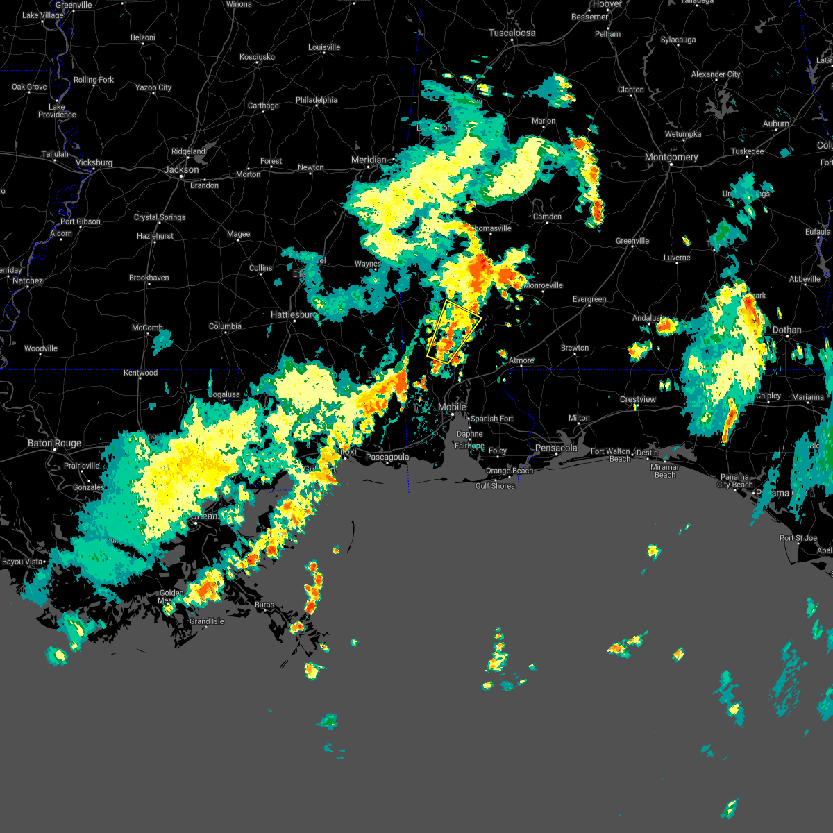 At 147 pm cdt, a severe thunderstorm was located 5 miles northwest of calvert, or 10 miles northeast of citronelle, moving northeast at 25 mph (radar indicated). Hazards include 60 mph wind gusts and quarter size hail. Hail damage to vehicles is expected. expect wind damage to roofs, siding, and trees. Locations impacted include, citronelle, wagarville, calvert and mcintosh. At 147 pm cdt, a severe thunderstorm was located 5 miles northwest of calvert, or 10 miles northeast of citronelle, moving northeast at 25 mph (radar indicated). Hazards include 60 mph wind gusts and quarter size hail. Hail damage to vehicles is expected. expect wind damage to roofs, siding, and trees. Locations impacted include, citronelle, wagarville, calvert and mcintosh.
|
| 7/12/2021 1:32 PM CDT |
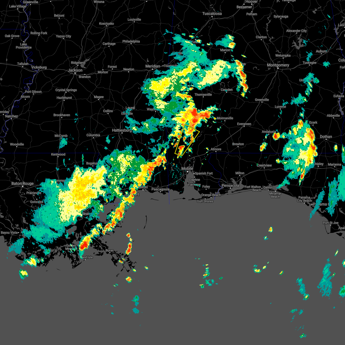 At 131 pm cdt, a severe thunderstorm was located 5 miles east of citronelle, moving northeast at 25 mph (radar indicated). Hazards include 60 mph wind gusts and quarter size hail. Hail damage to vehicles is expected. Expect wind damage to roofs, siding, and trees. At 131 pm cdt, a severe thunderstorm was located 5 miles east of citronelle, moving northeast at 25 mph (radar indicated). Hazards include 60 mph wind gusts and quarter size hail. Hail damage to vehicles is expected. Expect wind damage to roofs, siding, and trees.
|
| 5/4/2021 6:02 PM CDT |
 At 602 pm cdt, severe thunderstorms were located along a line extending from near leroy to 5 miles east of mclain, moving east at 45 mph (radar indicated). Hazards include 60 mph wind gusts. Expect damage to roofs, siding, and trees. Locations impacted include, monroeville, jackson, citronelle, lucedale, frisco city, leakesville, chunchula, stockton, saint stephens, wagarville, leroy, gulfcrest, deer park, axis, uriah, tibbie, calvert, mount vernon, mclain and excel. At 602 pm cdt, severe thunderstorms were located along a line extending from near leroy to 5 miles east of mclain, moving east at 45 mph (radar indicated). Hazards include 60 mph wind gusts. Expect damage to roofs, siding, and trees. Locations impacted include, monroeville, jackson, citronelle, lucedale, frisco city, leakesville, chunchula, stockton, saint stephens, wagarville, leroy, gulfcrest, deer park, axis, uriah, tibbie, calvert, mount vernon, mclain and excel.
|
| 5/4/2021 5:44 PM CDT |
 At 543 pm cdt, severe thunderstorms were located along a line extending from 6 miles west of saint stephens to near beaumont, moving east at 45 mph (radar indicated). Hazards include 60 mph wind gusts. expect damage to roofs, siding, and trees At 543 pm cdt, severe thunderstorms were located along a line extending from 6 miles west of saint stephens to near beaumont, moving east at 45 mph (radar indicated). Hazards include 60 mph wind gusts. expect damage to roofs, siding, and trees
|
| 5/4/2021 5:13 PM CDT |
 At 513 pm cdt, severe thunderstorms were located along a line extending from 4 miles west of silas to 3 miles east of clara to 8 miles northeast of richton to sunrise, moving east at 45 mph (radar indicated). Hazards include 60 mph wind gusts. Expect damage to roofs, siding, and trees. Locations impacted include, citronelle, chatom, richton, leakesville, wagarville, gulfcrest, deer park, tibbie, beaumont, calvert, mount vernon, new augusta, mclain, state line, fruitdale, mcintosh and movico. At 513 pm cdt, severe thunderstorms were located along a line extending from 4 miles west of silas to 3 miles east of clara to 8 miles northeast of richton to sunrise, moving east at 45 mph (radar indicated). Hazards include 60 mph wind gusts. Expect damage to roofs, siding, and trees. Locations impacted include, citronelle, chatom, richton, leakesville, wagarville, gulfcrest, deer park, tibbie, beaumont, calvert, mount vernon, new augusta, mclain, state line, fruitdale, mcintosh and movico.
|
| 5/4/2021 4:50 PM CDT |
 At 449 pm cdt, severe thunderstorms were located along a line extending from 7 miles northwest of waynesboro to 6 miles southeast of mill creek to 3 miles west of ovett to rawls springs, moving east at 45 mph (radar indicated). Hazards include 60 mph wind gusts. Expect damage to roofs, siding, and trees. Locations impacted include, citronelle, lucedale, frisco city, chatom, richton, leakesville, chunchula, wagarville, gulfcrest, deer park, uriah, tibbie, beaumont, calvert, mount vernon, new augusta, mclain, excel, state line and fruitdale. At 449 pm cdt, severe thunderstorms were located along a line extending from 7 miles northwest of waynesboro to 6 miles southeast of mill creek to 3 miles west of ovett to rawls springs, moving east at 45 mph (radar indicated). Hazards include 60 mph wind gusts. Expect damage to roofs, siding, and trees. Locations impacted include, citronelle, lucedale, frisco city, chatom, richton, leakesville, chunchula, wagarville, gulfcrest, deer park, uriah, tibbie, beaumont, calvert, mount vernon, new augusta, mclain, excel, state line and fruitdale.
|
| 5/4/2021 4:44 PM CDT |
 At 444 pm cdt, severe thunderstorms were located along a line extending from 7 miles north of waynesboro to 9 miles southeast of mill creek to 3 miles west of ovett to west hattiesburg, moving east at 75 mph (radar indicated). Hazards include 60 mph wind gusts. expect damage to roofs, siding, and trees At 444 pm cdt, severe thunderstorms were located along a line extending from 7 miles north of waynesboro to 9 miles southeast of mill creek to 3 miles west of ovett to west hattiesburg, moving east at 75 mph (radar indicated). Hazards include 60 mph wind gusts. expect damage to roofs, siding, and trees
|
| 4/24/2021 12:56 PM CDT |
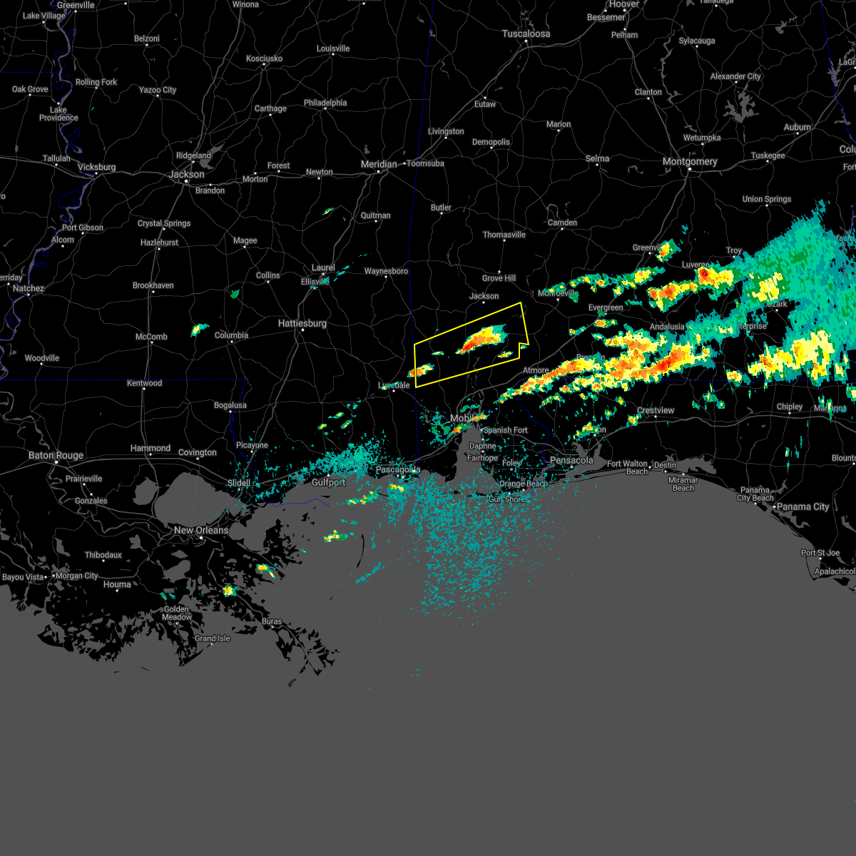 At 1255 pm cdt, a severe thunderstorm was located 7 miles west of calvert, or 7 miles northeast of citronelle, moving east around 40 mph (radar indicated). Hazards include golf ball size hail and 60 mph wind gusts. People and animals outdoors will be injured. expect hail damage to roofs, siding, windows, and vehicles. Expect wind damage to roofs, siding, and trees. At 1255 pm cdt, a severe thunderstorm was located 7 miles west of calvert, or 7 miles northeast of citronelle, moving east around 40 mph (radar indicated). Hazards include golf ball size hail and 60 mph wind gusts. People and animals outdoors will be injured. expect hail damage to roofs, siding, windows, and vehicles. Expect wind damage to roofs, siding, and trees.
|
| 4/24/2021 12:37 PM CDT |
 At 1236 pm cdt, a severe thunderstorm was located 4 miles northwest of citronelle, moving east at 65 mph (radar indicated). Hazards include golf ball size hail and 60 mph wind gusts. People and animals outdoors will be injured. expect hail damage to roofs, siding, windows, and vehicles. Expect wind damage to roofs, siding, and trees. At 1236 pm cdt, a severe thunderstorm was located 4 miles northwest of citronelle, moving east at 65 mph (radar indicated). Hazards include golf ball size hail and 60 mph wind gusts. People and animals outdoors will be injured. expect hail damage to roofs, siding, windows, and vehicles. Expect wind damage to roofs, siding, and trees.
|
| 4/24/2021 4:55 AM CDT |
 At 455 am cdt, severe thunderstorms were located along a line extending from 6 miles north of jackson to 3 miles southwest of mcintosh to near tanner williams, moving east at 60 mph (radar indicated). Hazards include 60 mph wind gusts. Expect damage to roofs, siding, and trees. Locations impacted include, midtown mobile, downtown mobile, prichard, saraland, chickasaw, satsuma, spanish fort, jackson, citronelle, lucedale, creola, chunchula, stockton, wagarville, saint stephens, leroy, gulfcrest, deer park, axis and whatley. At 455 am cdt, severe thunderstorms were located along a line extending from 6 miles north of jackson to 3 miles southwest of mcintosh to near tanner williams, moving east at 60 mph (radar indicated). Hazards include 60 mph wind gusts. Expect damage to roofs, siding, and trees. Locations impacted include, midtown mobile, downtown mobile, prichard, saraland, chickasaw, satsuma, spanish fort, jackson, citronelle, lucedale, creola, chunchula, stockton, wagarville, saint stephens, leroy, gulfcrest, deer park, axis and whatley.
|
| 4/24/2021 4:27 AM CDT |
 At 427 am cdt, a severe thunderstorm capable of producing a tornado was located 4 miles southeast of leakesville, moving east at 80 mph (radar indicated rotation). Hazards include tornado. Flying debris will be dangerous to those caught without shelter. mobile homes will be damaged or destroyed. damage to roofs, windows, and vehicles will occur. tree damage is likely. this dangerous storm will be near, deer park around 440 am cdt. Mcintosh around 450 am cdt. At 427 am cdt, a severe thunderstorm capable of producing a tornado was located 4 miles southeast of leakesville, moving east at 80 mph (radar indicated rotation). Hazards include tornado. Flying debris will be dangerous to those caught without shelter. mobile homes will be damaged or destroyed. damage to roofs, windows, and vehicles will occur. tree damage is likely. this dangerous storm will be near, deer park around 440 am cdt. Mcintosh around 450 am cdt.
|
| 4/24/2021 4:27 AM CDT |
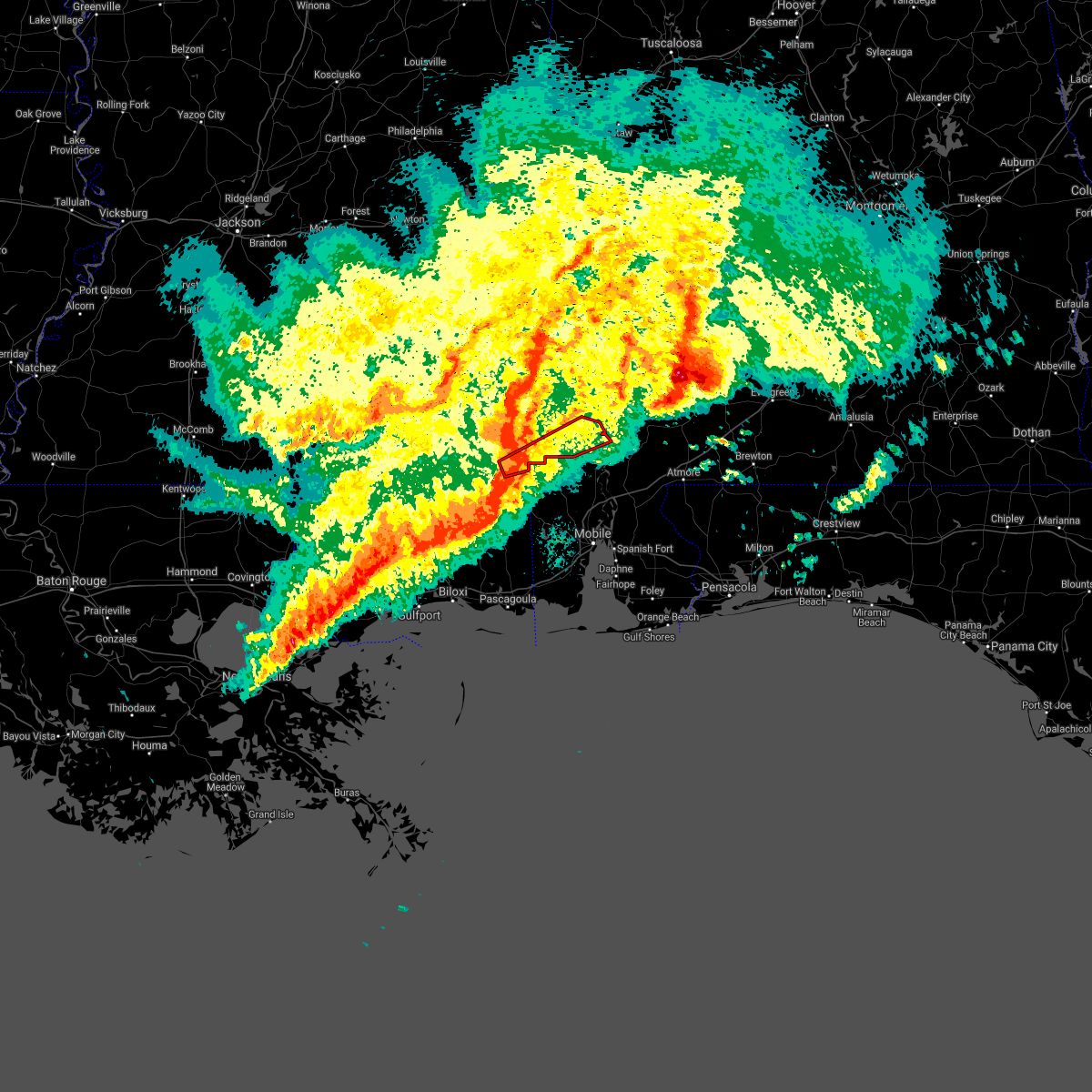 At 427 am cdt, a severe thunderstorm capable of producing a tornado was located 4 miles southeast of leakesville, moving east at 80 mph (radar indicated rotation). Hazards include tornado. Flying debris will be dangerous to those caught without shelter. mobile homes will be damaged or destroyed. damage to roofs, windows, and vehicles will occur. tree damage is likely. this dangerous storm will be near, deer park around 440 am cdt. Mcintosh around 450 am cdt. At 427 am cdt, a severe thunderstorm capable of producing a tornado was located 4 miles southeast of leakesville, moving east at 80 mph (radar indicated rotation). Hazards include tornado. Flying debris will be dangerous to those caught without shelter. mobile homes will be damaged or destroyed. damage to roofs, windows, and vehicles will occur. tree damage is likely. this dangerous storm will be near, deer park around 440 am cdt. Mcintosh around 450 am cdt.
|
| 4/24/2021 4:25 AM CDT |
 At 425 am cdt, severe thunderstorms were located along a line extending from 7 miles east of buckatunna to leakesville to 13 miles north of latimer, moving east at 60 mph (radar indicated). Hazards include 60 mph wind gusts. expect damage to roofs, siding, and trees At 425 am cdt, severe thunderstorms were located along a line extending from 7 miles east of buckatunna to leakesville to 13 miles north of latimer, moving east at 60 mph (radar indicated). Hazards include 60 mph wind gusts. expect damage to roofs, siding, and trees
|
| 4/13/2021 4:57 PM CDT |
 At 455 pm cdt, a severe thunderstorm capable of producing damaging winds was located 7 miles northeast of citronelle, moving east at 30 mph. multiple reports of high winds have been received in greene county near leakesville (radar indicated). Hazards include 60 mph wind gusts. expect damage to roofs, siding, and trees At 455 pm cdt, a severe thunderstorm capable of producing damaging winds was located 7 miles northeast of citronelle, moving east at 30 mph. multiple reports of high winds have been received in greene county near leakesville (radar indicated). Hazards include 60 mph wind gusts. expect damage to roofs, siding, and trees
|
| 4/13/2021 4:57 PM CDT |
 The national weather service in mobile has issued a * severe thunderstorm warning for. northern mobile county in southwestern alabama. northwestern baldwin county in southwestern alabama. southern washington county in southwestern alabama. South central clarke county in southwestern alabama. The national weather service in mobile has issued a * severe thunderstorm warning for. northern mobile county in southwestern alabama. northwestern baldwin county in southwestern alabama. southern washington county in southwestern alabama. South central clarke county in southwestern alabama.
|
| 4/10/2021 2:59 AM CDT |
 At 259 am cdt, severe thunderstorms were located along a line extending from near magnolia to 9 miles east of whatley to near mount vernon to 4 miles northwest of wade, moving east at 70 mph (radar indicated). Hazards include 60 mph wind gusts. expect damage to roofs, siding, and trees At 259 am cdt, severe thunderstorms were located along a line extending from near magnolia to 9 miles east of whatley to near mount vernon to 4 miles northwest of wade, moving east at 70 mph (radar indicated). Hazards include 60 mph wind gusts. expect damage to roofs, siding, and trees
|
| 4/10/2021 2:44 AM CDT |
 At 244 am cdt, severe thunderstorms were located along a line extending from 3 miles north of thomasville to 5 miles southeast of wagarville to 5 miles south of deer park, moving east at 65 mph (radar indicated). Hazards include 60 mph wind gusts. Expect damage to roofs, siding, and trees. Locations impacted include, jackson, thomasville, grove hill, chatom, saint stephens, wagarville, leroy, deer park, whatley, tibbie, pine hill, calvert, fulton, mcintosh and yellow bluff. At 244 am cdt, severe thunderstorms were located along a line extending from 3 miles north of thomasville to 5 miles southeast of wagarville to 5 miles south of deer park, moving east at 65 mph (radar indicated). Hazards include 60 mph wind gusts. Expect damage to roofs, siding, and trees. Locations impacted include, jackson, thomasville, grove hill, chatom, saint stephens, wagarville, leroy, deer park, whatley, tibbie, pine hill, calvert, fulton, mcintosh and yellow bluff.
|
| 4/10/2021 2:25 AM CDT |
 At 224 am cdt, severe thunderstorms were located along a line extending from 4 miles east of putnam to 4 miles east of fruitdale to 7 miles southwest of leakesville, moving east at 60 mph (radar indicated). Hazards include 60 mph wind gusts. Expect damage to roofs, siding, and trees. Locations impacted include, jackson, thomasville, grove hill, chatom, leakesville, saint stephens, wagarville, leroy, deer park, whatley, tibbie, pine hill, calvert, millry, state line, fruitdale, coffeeville, fulton, mcintosh and yellow bluff. At 224 am cdt, severe thunderstorms were located along a line extending from 4 miles east of putnam to 4 miles east of fruitdale to 7 miles southwest of leakesville, moving east at 60 mph (radar indicated). Hazards include 60 mph wind gusts. Expect damage to roofs, siding, and trees. Locations impacted include, jackson, thomasville, grove hill, chatom, leakesville, saint stephens, wagarville, leroy, deer park, whatley, tibbie, pine hill, calvert, millry, state line, fruitdale, coffeeville, fulton, mcintosh and yellow bluff.
|
| 4/10/2021 1:58 AM CDT |
 At 157 am cdt, severe thunderstorms were located along a line extending from 8 miles northwest of pennington to beaumont, moving east at 65 mph (radar indicated). Hazards include 70 mph wind gusts and quarter size hail. Hail damage to vehicles is expected. expect considerable tree damage. Wind damage is also likely to mobile homes, roofs, and outbuildings. At 157 am cdt, severe thunderstorms were located along a line extending from 8 miles northwest of pennington to beaumont, moving east at 65 mph (radar indicated). Hazards include 70 mph wind gusts and quarter size hail. Hail damage to vehicles is expected. expect considerable tree damage. Wind damage is also likely to mobile homes, roofs, and outbuildings.
|
| 3/24/2021 11:15 PM CDT |
 At 1114 pm cdt, a severe thunderstorm was located 8 miles east of mcintosh, or 18 miles south of jackson, moving northeast at 40 mph (radar indicated). Hazards include 60 mph wind gusts and quarter size hail. Hail damage to vehicles is expected. expect wind damage to roofs, siding, and trees. Locations impacted include, calvert and mcintosh. At 1114 pm cdt, a severe thunderstorm was located 8 miles east of mcintosh, or 18 miles south of jackson, moving northeast at 40 mph (radar indicated). Hazards include 60 mph wind gusts and quarter size hail. Hail damage to vehicles is expected. expect wind damage to roofs, siding, and trees. Locations impacted include, calvert and mcintosh.
|
| 3/24/2021 10:59 PM CDT |
 At 1059 pm cdt, a severe thunderstorm was located 5 miles east of citronelle, moving east at 30 mph (radar indicated). Hazards include 60 mph wind gusts and nickel size hail. expect damage to roofs, siding, and trees At 1059 pm cdt, a severe thunderstorm was located 5 miles east of citronelle, moving east at 30 mph (radar indicated). Hazards include 60 mph wind gusts and nickel size hail. expect damage to roofs, siding, and trees
|
| 3/17/2021 11:10 PM CDT |
 The severe thunderstorm warning for monroe, northwestern mobile, northwestern baldwin, southeastern washington and central clarke counties will expire at 1115 pm cdt, the storms which prompted the warning have weakened. therefore, the warning will be allowed to expire. a tornado watch remains in effect until 300 am cdt for south central and southwestern alabama. The severe thunderstorm warning for monroe, northwestern mobile, northwestern baldwin, southeastern washington and central clarke counties will expire at 1115 pm cdt, the storms which prompted the warning have weakened. therefore, the warning will be allowed to expire. a tornado watch remains in effect until 300 am cdt for south central and southwestern alabama.
|
| 3/17/2021 10:31 PM CDT |
 At 1030 pm cdt, severe thunderstorms were located along a line extending from 5 miles southeast of wagarville to near mcintosh to 3 miles south of citronelle, moving northeast at 60 mph (radar indicated). Hazards include 60 mph wind gusts. expect damage to roofs, siding, and trees At 1030 pm cdt, severe thunderstorms were located along a line extending from 5 miles southeast of wagarville to near mcintosh to 3 miles south of citronelle, moving northeast at 60 mph (radar indicated). Hazards include 60 mph wind gusts. expect damage to roofs, siding, and trees
|
| 10/10/2020 5:57 AM CDT |
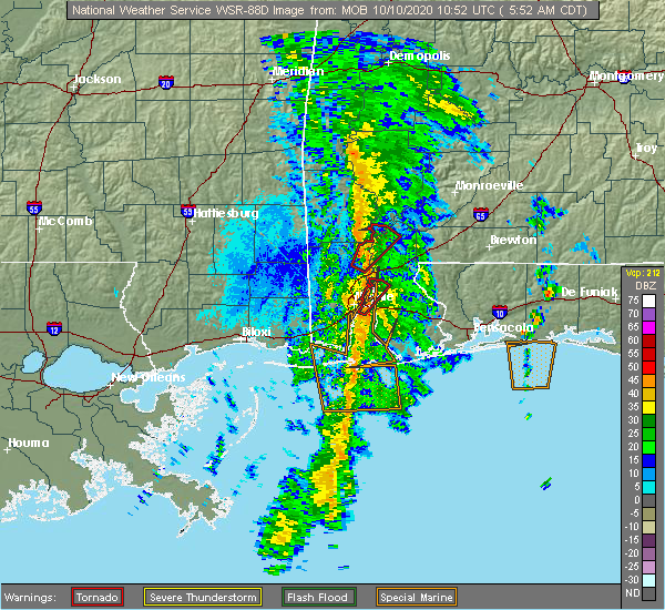 At 557 am cdt, a severe thunderstorm capable of producing a tornado was located over movico, or 11 miles east of citronelle, moving north at 40 mph (radar indicated rotation). Hazards include tornado. Flying debris will be dangerous to those caught without shelter. mobile homes will be damaged or destroyed. damage to roofs, windows, and vehicles will occur. tree damage is likely. this dangerous storm will be near, calvert around 605 am cdt. Mcintosh around 615 am cdt. At 557 am cdt, a severe thunderstorm capable of producing a tornado was located over movico, or 11 miles east of citronelle, moving north at 40 mph (radar indicated rotation). Hazards include tornado. Flying debris will be dangerous to those caught without shelter. mobile homes will be damaged or destroyed. damage to roofs, windows, and vehicles will occur. tree damage is likely. this dangerous storm will be near, calvert around 605 am cdt. Mcintosh around 615 am cdt.
|
| 7/12/2020 7:53 PM CDT |
 The severe thunderstorm warning for northern mobile, northwestern baldwin, southern washington, northeastern george and southeastern greene counties will expire at 800 pm cdt, the storms which prompted the warning are moving out of the area. therefore, the warning will be allowed to expire. however, gusty winds and heavy rain are still possible. a severe thunderstorm watch remains in effect until 1000 pm cdt for southwestern alabama, and southeastern mississippi. remember, a severe thunderstorm warning still remains in effect for mobile county, southwestern baldwin county, and southeastern george county until 845 pm cdt. The severe thunderstorm warning for northern mobile, northwestern baldwin, southern washington, northeastern george and southeastern greene counties will expire at 800 pm cdt, the storms which prompted the warning are moving out of the area. therefore, the warning will be allowed to expire. however, gusty winds and heavy rain are still possible. a severe thunderstorm watch remains in effect until 1000 pm cdt for southwestern alabama, and southeastern mississippi. remember, a severe thunderstorm warning still remains in effect for mobile county, southwestern baldwin county, and southeastern george county until 845 pm cdt.
|
| 7/12/2020 7:30 PM CDT |
 At 729 pm cdt, a severe thunderstorm was located over gulfcrest, or 5 miles south of citronelle, moving south at 35 mph (radar indicated). Hazards include 60 mph wind gusts and penny size hail. Expect damage to roofs, siding, and trees. Locations impacted include, citronelle, lucedale, creola, leakesville, chunchula, stockton, gulfcrest, deer park, axis, calvert, mount vernon, i65 and al 225 and movico. At 729 pm cdt, a severe thunderstorm was located over gulfcrest, or 5 miles south of citronelle, moving south at 35 mph (radar indicated). Hazards include 60 mph wind gusts and penny size hail. Expect damage to roofs, siding, and trees. Locations impacted include, citronelle, lucedale, creola, leakesville, chunchula, stockton, gulfcrest, deer park, axis, calvert, mount vernon, i65 and al 225 and movico.
|
| 7/12/2020 7:07 PM CDT |
 At 706 pm cdt, a cluster of severe thunderstorms was located over deer park, or 8 miles northwest of citronelle, moving south at 35 mph (radar indicated). Hazards include 60 mph wind gusts and penny size hail. expect damage to roofs, siding, and trees At 706 pm cdt, a cluster of severe thunderstorms was located over deer park, or 8 miles northwest of citronelle, moving south at 35 mph (radar indicated). Hazards include 60 mph wind gusts and penny size hail. expect damage to roofs, siding, and trees
|
| 7/1/2020 3:05 PM CDT |
 At 305 pm cdt, a severe thunderstorm was located 6 miles west of calvert, or 9 miles northeast of citronelle, moving southeast at 20 mph (radar indicated). Hazards include 60 mph wind gusts. expect damage to roofs, siding, and trees At 305 pm cdt, a severe thunderstorm was located 6 miles west of calvert, or 9 miles northeast of citronelle, moving southeast at 20 mph (radar indicated). Hazards include 60 mph wind gusts. expect damage to roofs, siding, and trees
|
| 6/24/2020 2:23 PM CDT |
 The severe thunderstorm warning for northern mobile, northwestern baldwin, southwestern washington, southern clarke, northeastern george and southeastern greene counties will expire at 230 pm cdt, the severe thunderstorm which prompted the warning has weakened and moved out of the warned area. therefore, the warning will be allowed to expire. a severe thunderstorm watch remains in effect until 900 pm cdt for southwestern alabama. The severe thunderstorm warning for northern mobile, northwestern baldwin, southwestern washington, southern clarke, northeastern george and southeastern greene counties will expire at 230 pm cdt, the severe thunderstorm which prompted the warning has weakened and moved out of the warned area. therefore, the warning will be allowed to expire. a severe thunderstorm watch remains in effect until 900 pm cdt for southwestern alabama.
|
| 6/24/2020 2:18 PM CDT |
 At 218 pm cdt, severe thunderstorms were located along a line extending from 4 miles north of chatom to 5 miles northeast of stockton, moving northeast at 30 mph (radar indicated). Hazards include 60 mph wind gusts. expect damage to roofs, siding, and trees At 218 pm cdt, severe thunderstorms were located along a line extending from 4 miles north of chatom to 5 miles northeast of stockton, moving northeast at 30 mph (radar indicated). Hazards include 60 mph wind gusts. expect damage to roofs, siding, and trees
|
| 6/24/2020 1:45 PM CDT |
 At 145 pm cdt, a tornado producing storm was located 5 miles west of gulfcrest, or 10 miles southwest of citronelle, moving northeast at 40 mph (radar confirmed tornado). Hazards include damaging tornado. Flying debris will be dangerous to those caught without shelter. mobile homes will be damaged or destroyed. damage to roofs, windows, and vehicles will occur. tree damage is likely. this tornadic storm will be near, gulfcrest around 155 pm cdt. citronelle around 200 pm cdt. calvert around 220 pm cdt. Mcintosh around 225 pm cdt. At 145 pm cdt, a tornado producing storm was located 5 miles west of gulfcrest, or 10 miles southwest of citronelle, moving northeast at 40 mph (radar confirmed tornado). Hazards include damaging tornado. Flying debris will be dangerous to those caught without shelter. mobile homes will be damaged or destroyed. damage to roofs, windows, and vehicles will occur. tree damage is likely. this tornadic storm will be near, gulfcrest around 155 pm cdt. citronelle around 200 pm cdt. calvert around 220 pm cdt. Mcintosh around 225 pm cdt.
|
| 6/24/2020 1:34 PM CDT |
 At 134 pm cdt, a severe thunderstorm was located 10 miles east of lucedale, moving northeast at 45 mph (radar indicated). Hazards include 60 mph wind gusts. expect damage to roofs, siding, and trees At 134 pm cdt, a severe thunderstorm was located 10 miles east of lucedale, moving northeast at 45 mph (radar indicated). Hazards include 60 mph wind gusts. expect damage to roofs, siding, and trees
|
| 4/23/2020 6:27 AM CDT |
 At 627 am cdt, severe thunderstorms were located along a line extending from 8 miles southeast of leakesville to 6 miles east of lucedale to 14 miles northwest of wade, moving east at 60 mph (radar indicated). Hazards include 70 mph wind gusts and nickel size hail. Expect considerable tree damage. damage is likely to mobile homes, roofs, and outbuildings. Locations impacted include, citronelle, lucedale, chunchula, gulfcrest, axis, mount vernon, calvert, movico and wilmer. At 627 am cdt, severe thunderstorms were located along a line extending from 8 miles southeast of leakesville to 6 miles east of lucedale to 14 miles northwest of wade, moving east at 60 mph (radar indicated). Hazards include 70 mph wind gusts and nickel size hail. Expect considerable tree damage. damage is likely to mobile homes, roofs, and outbuildings. Locations impacted include, citronelle, lucedale, chunchula, gulfcrest, axis, mount vernon, calvert, movico and wilmer.
|
| 4/23/2020 6:03 AM CDT |
 At 602 am cdt, severe thunderstorms were located along a line extending from 7 miles south of mclain to 15 miles east of wiggins to near perkinston, moving east at 70 mph (radar indicated). Hazards include 60 mph wind gusts. expect damage to roofs, siding, and trees At 602 am cdt, severe thunderstorms were located along a line extending from 7 miles south of mclain to 15 miles east of wiggins to near perkinston, moving east at 70 mph (radar indicated). Hazards include 60 mph wind gusts. expect damage to roofs, siding, and trees
|
| 4/19/2020 9:23 PM CDT |
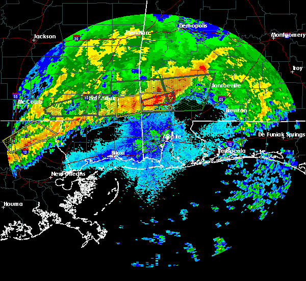 At 923 pm cdt, a severe thunderstorm capable of producing a tornado was located 7 miles southeast of tibbie, or 13 miles north of citronelle, moving east at 55 mph (radar indicated rotation). Hazards include tornado and quarter size hail. Flying debris will be dangerous to those caught without shelter. mobile homes will be damaged or destroyed. damage to roofs, windows, and vehicles will occur. tree damage is likely. This dangerous storm will be near, mcintosh around 930 pm cdt. At 923 pm cdt, a severe thunderstorm capable of producing a tornado was located 7 miles southeast of tibbie, or 13 miles north of citronelle, moving east at 55 mph (radar indicated rotation). Hazards include tornado and quarter size hail. Flying debris will be dangerous to those caught without shelter. mobile homes will be damaged or destroyed. damage to roofs, windows, and vehicles will occur. tree damage is likely. This dangerous storm will be near, mcintosh around 930 pm cdt.
|
| 4/19/2020 8:50 PM CDT |
 At 849 pm cdt, a severe thunderstorm was located 10 miles west of fruitdale, or 10 miles north of leakesville, moving east at 45 mph (radar indicated). Hazards include 60 mph wind gusts and penny size hail. expect damage to roofs, siding, and trees At 849 pm cdt, a severe thunderstorm was located 10 miles west of fruitdale, or 10 miles north of leakesville, moving east at 45 mph (radar indicated). Hazards include 60 mph wind gusts and penny size hail. expect damage to roofs, siding, and trees
|
| 4/12/2020 10:32 PM CDT |
 At 1031 pm cdt, severe thunderstorms were located along a line extending from 6 miles northeast of mcintosh to 3 miles southwest of calvert to 5 miles east of gulfcrest, moving east at 55 mph (radar indicated). Hazards include 60 mph wind gusts. expect damage to roofs, siding, and trees At 1031 pm cdt, severe thunderstorms were located along a line extending from 6 miles northeast of mcintosh to 3 miles southwest of calvert to 5 miles east of gulfcrest, moving east at 55 mph (radar indicated). Hazards include 60 mph wind gusts. expect damage to roofs, siding, and trees
|
| 4/12/2020 10:24 PM CDT |
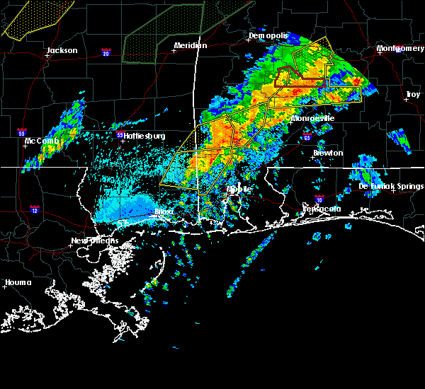 At 1023 pm cdt, severe thunderstorms were located along a line extending from 4 miles southeast of tibbie to citronelle to 9 miles north of wilmer, moving northeast at 55 mph (radar indicated). Hazards include 60 mph wind gusts and nickel size hail. Expect damage to roofs, siding, and trees. Locations impacted include, citronelle and gulfcrest. At 1023 pm cdt, severe thunderstorms were located along a line extending from 4 miles southeast of tibbie to citronelle to 9 miles north of wilmer, moving northeast at 55 mph (radar indicated). Hazards include 60 mph wind gusts and nickel size hail. Expect damage to roofs, siding, and trees. Locations impacted include, citronelle and gulfcrest.
|
| 4/12/2020 9:59 PM CDT |
 A severe thunderstorm warning remains in effect until 1030 pm cdt for northwestern mobile. southwestern washington. george and southeastern greene counties. At 958 pm cdt, severe thunderstorms were located along a line extending from near leakesville to 4 miles northeast of lucedale to 15 miles northwest of wade, moving northeast at 85 mph. A severe thunderstorm warning remains in effect until 1030 pm cdt for northwestern mobile. southwestern washington. george and southeastern greene counties. At 958 pm cdt, severe thunderstorms were located along a line extending from near leakesville to 4 miles northeast of lucedale to 15 miles northwest of wade, moving northeast at 85 mph.
|
| 4/12/2020 9:59 PM CDT |
 At 946 pm cdt, severe thunderstorms were located along a line extending from 6 miles east of mclain to 13 miles southwest of lucedale to 8 miles east of saucier, moving northeast at 55 mph (radar indicated). Hazards include 60 mph wind gusts and nickel size hail. expect damage to roofs, siding, and trees At 946 pm cdt, severe thunderstorms were located along a line extending from 6 miles east of mclain to 13 miles southwest of lucedale to 8 miles east of saucier, moving northeast at 55 mph (radar indicated). Hazards include 60 mph wind gusts and nickel size hail. expect damage to roofs, siding, and trees
|
| 4/12/2020 9:47 PM CDT |
 At 946 pm cdt, severe thunderstorms were located along a line extending from 6 miles east of mclain to 13 miles southwest of lucedale to 8 miles east of saucier, moving northeast at 55 mph (radar indicated). Hazards include 60 mph wind gusts and nickel size hail. expect damage to roofs, siding, and trees At 946 pm cdt, severe thunderstorms were located along a line extending from 6 miles east of mclain to 13 miles southwest of lucedale to 8 miles east of saucier, moving northeast at 55 mph (radar indicated). Hazards include 60 mph wind gusts and nickel size hail. expect damage to roofs, siding, and trees
|
| 3/31/2020 9:46 AM CDT |
 At 946 am cdt, a severe thunderstorm was located near uriah, or 13 miles southwest of frisco city, moving east at 50 mph (radar indicated). Hazards include 70 mph wind gusts and quarter size hail. Hail damage to vehicles is expected. expect considerable tree damage. wind damage is also likely to mobile homes, roofs, and outbuildings. Locations impacted include, greenville, monroeville, evergreen, frisco city, mccullough, peterman, georgiana, uriah, calvert, mount vernon, mckenzie, castleberry, excel, repton, mcintosh, i65 and us 84, i65 and cr 1, highland home, i65 and al 113 and i65 and al 21. At 946 am cdt, a severe thunderstorm was located near uriah, or 13 miles southwest of frisco city, moving east at 50 mph (radar indicated). Hazards include 70 mph wind gusts and quarter size hail. Hail damage to vehicles is expected. expect considerable tree damage. wind damage is also likely to mobile homes, roofs, and outbuildings. Locations impacted include, greenville, monroeville, evergreen, frisco city, mccullough, peterman, georgiana, uriah, calvert, mount vernon, mckenzie, castleberry, excel, repton, mcintosh, i65 and us 84, i65 and cr 1, highland home, i65 and al 113 and i65 and al 21.
|
| 3/31/2020 9:20 AM CDT |
 At 919 am cdt, severe thunderstorms were located along a line extending from 3 miles southeast of deer park to 7 miles east of mcintosh to monroeville to 4 miles northwest of pine apple, moving east at 55 mph (radar indicated). Hazards include 60 mph wind gusts. expect damage to roofs, siding, and trees At 919 am cdt, severe thunderstorms were located along a line extending from 3 miles southeast of deer park to 7 miles east of mcintosh to monroeville to 4 miles northwest of pine apple, moving east at 55 mph (radar indicated). Hazards include 60 mph wind gusts. expect damage to roofs, siding, and trees
|
| 3/4/2020 6:49 AM CST |
 At 648 am cst, severe thunderstorms were located along a line extending from saint stephens to 5 miles northwest of mcintosh to 10 miles northwest of calvert, moving east at 50 mph (radar indicated). Hazards include 60 mph wind gusts. Expect damage to roofs, siding, and trees. Locations impacted include, saint stephens, wagarville, leroy and mcintosh. At 648 am cst, severe thunderstorms were located along a line extending from saint stephens to 5 miles northwest of mcintosh to 10 miles northwest of calvert, moving east at 50 mph (radar indicated). Hazards include 60 mph wind gusts. Expect damage to roofs, siding, and trees. Locations impacted include, saint stephens, wagarville, leroy and mcintosh.
|
| 3/4/2020 6:14 AM CST |
 At 613 am cst, severe thunderstorms were located along a line extending from 7 miles east of waynesboro to 3 miles northwest of state line to 11 miles west of fruitdale, moving east at 50 mph (radar indicated). Hazards include 60 mph wind gusts and quarter size hail. Hail damage to vehicles is expected. Expect wind damage to roofs, siding, and trees. At 613 am cst, severe thunderstorms were located along a line extending from 7 miles east of waynesboro to 3 miles northwest of state line to 11 miles west of fruitdale, moving east at 50 mph (radar indicated). Hazards include 60 mph wind gusts and quarter size hail. Hail damage to vehicles is expected. Expect wind damage to roofs, siding, and trees.
|
| 1/11/2020 12:24 PM CST |
 At 1224 pm cst, severe thunderstorms were located along a line extending from saint stephens to 4 miles southeast of wagarville to creola, moving east at 50 mph (radar indicated). Hazards include 60 mph wind gusts. expect damage to roofs, siding, and trees At 1224 pm cst, severe thunderstorms were located along a line extending from saint stephens to 4 miles southeast of wagarville to creola, moving east at 50 mph (radar indicated). Hazards include 60 mph wind gusts. expect damage to roofs, siding, and trees
|
| 1/11/2020 11:54 AM CST |
 At 1154 am cst, severe thunderstorms were located along a line extending from 5 miles southwest of fruitdale to 10 miles southeast of leakesville to 4 miles northwest of tanner williams, moving northeast at 55 mph (radar indicated). Hazards include 60 mph wind gusts. expect damage to roofs, siding, and trees At 1154 am cst, severe thunderstorms were located along a line extending from 5 miles southwest of fruitdale to 10 miles southeast of leakesville to 4 miles northwest of tanner williams, moving northeast at 55 mph (radar indicated). Hazards include 60 mph wind gusts. expect damage to roofs, siding, and trees
|
| 12/17/2019 2:34 AM CST |
 At 233 am cst, a severe thunderstorm was located 7 miles north of citronelle, moving east at 50 mph (radar indicated). Hazards include 60 mph wind gusts and penny size hail. Expect damage to roofs, siding, and trees. Locations impacted include, citronelle, deer park, calvert and mcintosh. At 233 am cst, a severe thunderstorm was located 7 miles north of citronelle, moving east at 50 mph (radar indicated). Hazards include 60 mph wind gusts and penny size hail. Expect damage to roofs, siding, and trees. Locations impacted include, citronelle, deer park, calvert and mcintosh.
|
| 12/17/2019 2:18 AM CST |
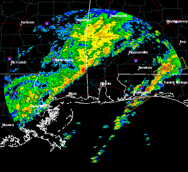 At 218 am cst, a severe thunderstorm was located 8 miles southwest of deer park, or 9 miles east of leakesville, moving east at 50 mph (radar indicated). Hazards include 60 mph wind gusts and penny size hail. expect damage to roofs, siding, and trees At 218 am cst, a severe thunderstorm was located 8 miles southwest of deer park, or 9 miles east of leakesville, moving east at 50 mph (radar indicated). Hazards include 60 mph wind gusts and penny size hail. expect damage to roofs, siding, and trees
|
| 10/25/2019 5:40 PM CDT |
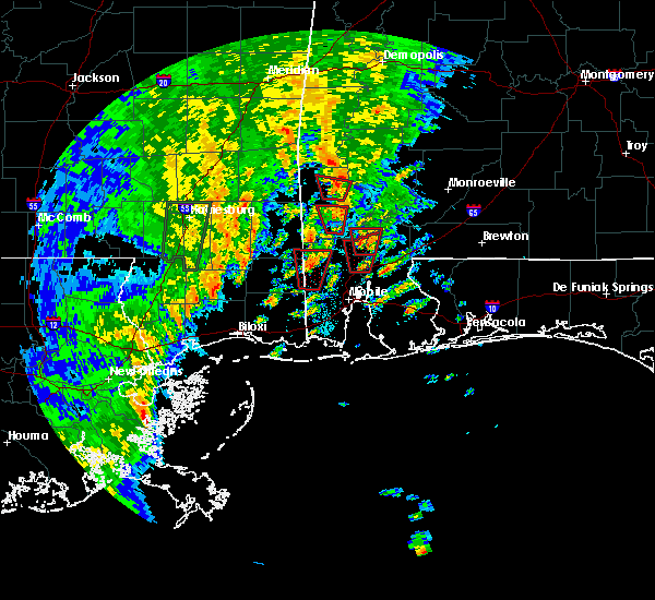 At 540 pm cdt, a severe thunderstorm capable of producing a tornado was located over mount vernon, or 13 miles north of creola, moving north at 25 mph (radar indicated rotation). Hazards include tornado. Flying debris will be dangerous to those caught without shelter. mobile homes will be damaged or destroyed. damage to roofs, windows, and vehicles will occur. tree damage is likely. This dangerous storm will be near, calvert around 555 pm cdt. At 540 pm cdt, a severe thunderstorm capable of producing a tornado was located over mount vernon, or 13 miles north of creola, moving north at 25 mph (radar indicated rotation). Hazards include tornado. Flying debris will be dangerous to those caught without shelter. mobile homes will be damaged or destroyed. damage to roofs, windows, and vehicles will occur. tree damage is likely. This dangerous storm will be near, calvert around 555 pm cdt.
|
| 8/19/2019 6:21 PM CDT |
 At 543 pm cdt, severe thunderstorms were located along a line extending from 7 miles southwest of buckatunna to 3 miles northwest of tibbie to 4 miles south of mcintosh, moving southwest at 10 mph (radar indicated). Hazards include 60 mph wind gusts. expect damage to roofs, siding, and trees At 543 pm cdt, severe thunderstorms were located along a line extending from 7 miles southwest of buckatunna to 3 miles northwest of tibbie to 4 miles south of mcintosh, moving southwest at 10 mph (radar indicated). Hazards include 60 mph wind gusts. expect damage to roofs, siding, and trees
|
| 8/19/2019 6:10 PM CDT |
 At 610 pm cdt, severe thunderstorms were located along a line extending from 10 miles south of clara to 7 miles southwest of fruitdale to 6 miles west of calvert, moving southwest at 15 mph (radar indicated). Hazards include 60 mph wind gusts. Expect damage to roofs, siding, and trees. Locations impacted include, deer park, calvert and mcintosh. At 610 pm cdt, severe thunderstorms were located along a line extending from 10 miles south of clara to 7 miles southwest of fruitdale to 6 miles west of calvert, moving southwest at 15 mph (radar indicated). Hazards include 60 mph wind gusts. Expect damage to roofs, siding, and trees. Locations impacted include, deer park, calvert and mcintosh.
|
| 8/19/2019 5:43 PM CDT |
 At 543 pm cdt, severe thunderstorms were located along a line extending from 7 miles southwest of buckatunna to 3 miles northwest of tibbie to 4 miles south of mcintosh, moving southwest at 10 mph (radar indicated). Hazards include 60 mph wind gusts. expect damage to roofs, siding, and trees At 543 pm cdt, severe thunderstorms were located along a line extending from 7 miles southwest of buckatunna to 3 miles northwest of tibbie to 4 miles south of mcintosh, moving southwest at 10 mph (radar indicated). Hazards include 60 mph wind gusts. expect damage to roofs, siding, and trees
|
| 6/27/2019 6:16 PM CDT |
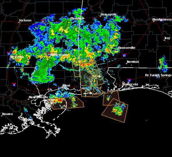 At 616 pm cdt, slow moving severe thunderstorms were located along a line extending from 4 miles west of calvert to 7 miles southwest of deer park (radar indicated). Hazards include 60 mph wind gusts. Expect damage to roofs, siding, and trees. Locations impacted include, leakesville and deer park. At 616 pm cdt, slow moving severe thunderstorms were located along a line extending from 4 miles west of calvert to 7 miles southwest of deer park (radar indicated). Hazards include 60 mph wind gusts. Expect damage to roofs, siding, and trees. Locations impacted include, leakesville and deer park.
|
| 6/27/2019 5:43 PM CDT |
 At 543 pm cdt, severe thunderstorms were located along a line extending from 4 miles west of chatom to 9 miles southwest of buckatunna, moving southeast at 20 mph (radar indicated). Hazards include 60 mph wind gusts. expect damage to roofs, siding, and trees At 543 pm cdt, severe thunderstorms were located along a line extending from 4 miles west of chatom to 9 miles southwest of buckatunna, moving southeast at 20 mph (radar indicated). Hazards include 60 mph wind gusts. expect damage to roofs, siding, and trees
|
| 6/7/2019 5:24 PM CDT |
 The severe thunderstorm warning for northern mobile, southern washington and south central clarke counties will expire at 530 pm cdt, the severe thunderstorm which prompted the warning has weakened. therefore, the warning will be allowed to expire. The severe thunderstorm warning for northern mobile, southern washington and south central clarke counties will expire at 530 pm cdt, the severe thunderstorm which prompted the warning has weakened. therefore, the warning will be allowed to expire.
|
| 6/7/2019 4:48 PM CDT |
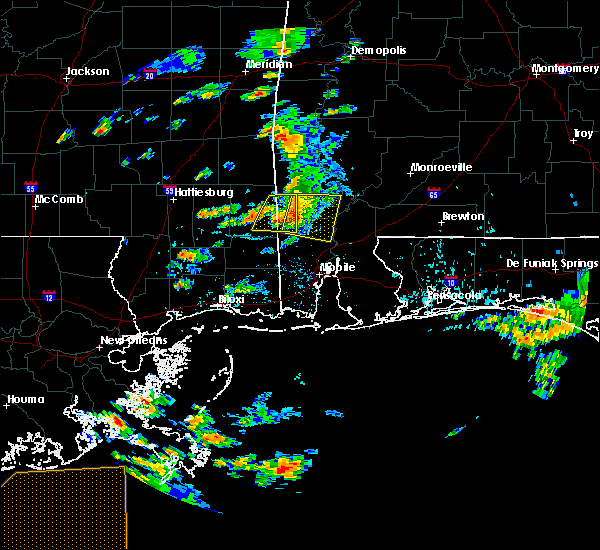 At 447 pm cdt, a severe thunderstorm was located near citronelle, moving east at 35 mph (radar indicated). Hazards include 60 mph wind gusts and quarter size hail. Hail damage to vehicles is expected. Expect wind damage to roofs, siding, and trees. At 447 pm cdt, a severe thunderstorm was located near citronelle, moving east at 35 mph (radar indicated). Hazards include 60 mph wind gusts and quarter size hail. Hail damage to vehicles is expected. Expect wind damage to roofs, siding, and trees.
|
| 4/25/2019 2:09 PM CDT |
 The severe thunderstorm warning for southwestern monroe, northeastern mobile, northwestern baldwin, southeastern washington and south central clarke counties will expire at 215 pm cdt, the storm which prompted the warning has weakened below severe limits, and no longer poses an immediate threat to life or property. therefore, the warning will be allowed to expire. however gusty winds and heavy rain are still possible with this thunderstorm. a tornado watch remains in effect until 800 pm cdt for south central and southwestern alabama. The severe thunderstorm warning for southwestern monroe, northeastern mobile, northwestern baldwin, southeastern washington and south central clarke counties will expire at 215 pm cdt, the storm which prompted the warning has weakened below severe limits, and no longer poses an immediate threat to life or property. therefore, the warning will be allowed to expire. however gusty winds and heavy rain are still possible with this thunderstorm. a tornado watch remains in effect until 800 pm cdt for south central and southwestern alabama.
|
| 4/25/2019 1:51 PM CDT |
 At 150 pm cdt, a severe thunderstorm was located 8 miles east of calvert, or 21 miles north of bay minette, moving east at 40 mph (radar indicated). Hazards include 60 mph wind gusts. Expect damage to roofs, siding, and trees. Locations impacted include, mount vernon, calvert, mcintosh and movico. At 150 pm cdt, a severe thunderstorm was located 8 miles east of calvert, or 21 miles north of bay minette, moving east at 40 mph (radar indicated). Hazards include 60 mph wind gusts. Expect damage to roofs, siding, and trees. Locations impacted include, mount vernon, calvert, mcintosh and movico.
|
| 4/25/2019 1:24 PM CDT |
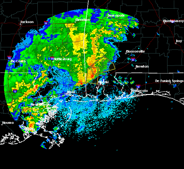 At 123 pm cdt, a severe thunderstorm was located over citronelle, moving northeast at 30 mph (radar indicated). Hazards include 60 mph wind gusts. expect damage to roofs, siding, and trees At 123 pm cdt, a severe thunderstorm was located over citronelle, moving northeast at 30 mph (radar indicated). Hazards include 60 mph wind gusts. expect damage to roofs, siding, and trees
|
| 4/18/2019 7:08 PM CDT |
 At 708 pm cdt, severe thunderstorms were located along a line extending from 7 miles southeast of jackson to 6 miles southwest of coden, moving east at 30 mph (radar indicated). Hazards include 60 mph wind gusts. expect damage to roofs, siding, and trees At 708 pm cdt, severe thunderstorms were located along a line extending from 7 miles southeast of jackson to 6 miles southwest of coden, moving east at 30 mph (radar indicated). Hazards include 60 mph wind gusts. expect damage to roofs, siding, and trees
|
| 4/18/2019 6:36 PM CDT |
 At 636 pm cdt, severe thunderstorms were located along a line extending from 6 miles west of wagarville to near moss point, moving east at 25 mph (radar indicated). Hazards include 60 mph wind gusts. expect damage to roofs, siding, and trees At 636 pm cdt, severe thunderstorms were located along a line extending from 6 miles west of wagarville to near moss point, moving east at 25 mph (radar indicated). Hazards include 60 mph wind gusts. expect damage to roofs, siding, and trees
|
| 3/3/2019 1:58 PM CST |
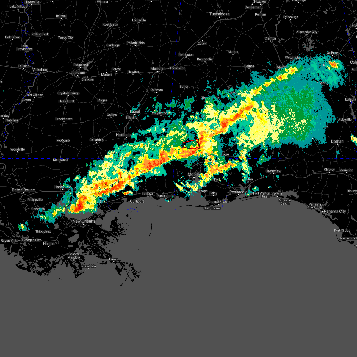 The tornado warning for southeastern washington county will expire at 200 pm cst. the storm which prompted the warning has moved out of the area. therefore, the warning will be allowed to expire. however hail and strong winds are still possible with this thunderstorm. A tornado watch remains in effect until 600 pm cst for southwestern. The tornado warning for southeastern washington county will expire at 200 pm cst. the storm which prompted the warning has moved out of the area. therefore, the warning will be allowed to expire. however hail and strong winds are still possible with this thunderstorm. A tornado watch remains in effect until 600 pm cst for southwestern.
|
| 3/3/2019 1:37 PM CST |
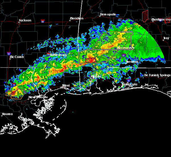 At 137 pm cst, a confirmed tornado was located 8 miles southwest of mcintosh, or 8 miles northeast of citronelle, moving east at 40 mph (radar confirmed tornado). Hazards include damaging tornado and quarter size hail. Flying debris will be dangerous to those caught without shelter. mobile homes will be damaged or destroyed. damage to roofs, windows, and vehicles will occur. tree damage is likely. This tornado will be near, mcintosh around 150 pm cst. At 137 pm cst, a confirmed tornado was located 8 miles southwest of mcintosh, or 8 miles northeast of citronelle, moving east at 40 mph (radar confirmed tornado). Hazards include damaging tornado and quarter size hail. Flying debris will be dangerous to those caught without shelter. mobile homes will be damaged or destroyed. damage to roofs, windows, and vehicles will occur. tree damage is likely. This tornado will be near, mcintosh around 150 pm cst.
|
| 3/3/2019 1:33 PM CST |
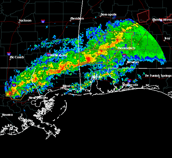 At 133 pm cst, a severe thunderstorm capable of producing a tornado was located 6 miles east of deer park, or 7 miles north of citronelle, moving east at 40 mph (radar indicated rotation). Hazards include tornado and quarter size hail. Flying debris will be dangerous to those caught without shelter. mobile homes will be damaged or destroyed. damage to roofs, windows, and vehicles will occur. tree damage is likely. This dangerous storm will be near, mcintosh around 150 pm cst. At 133 pm cst, a severe thunderstorm capable of producing a tornado was located 6 miles east of deer park, or 7 miles north of citronelle, moving east at 40 mph (radar indicated rotation). Hazards include tornado and quarter size hail. Flying debris will be dangerous to those caught without shelter. mobile homes will be damaged or destroyed. damage to roofs, windows, and vehicles will occur. tree damage is likely. This dangerous storm will be near, mcintosh around 150 pm cst.
|
| 3/3/2019 1:12 PM CST |
 At 112 pm cst, a severe thunderstorm was located over wagarville, or 11 miles southwest of jackson, moving east at 50 mph (radar indicated). Hazards include 60 mph wind gusts and penny size hail. expect damage to roofs, siding, and trees At 112 pm cst, a severe thunderstorm was located over wagarville, or 11 miles southwest of jackson, moving east at 50 mph (radar indicated). Hazards include 60 mph wind gusts and penny size hail. expect damage to roofs, siding, and trees
|
| 12/28/2018 5:21 AM CST |
 The severe thunderstorm warning for northwestern mobile, southwestern washington and eastern george counties will expire at 530 am cst, the storms which prompted the warning have weakened below severe limits, and no longer pose an immediate threat to life or property. therefore, the warning will be allowed to expire. however gusty winds and heavy rain are still possible with these thunderstorms. The severe thunderstorm warning for northwestern mobile, southwestern washington and eastern george counties will expire at 530 am cst, the storms which prompted the warning have weakened below severe limits, and no longer pose an immediate threat to life or property. therefore, the warning will be allowed to expire. however gusty winds and heavy rain are still possible with these thunderstorms.
|
| 12/28/2018 5:05 AM CST |
 At 505 am cst, severe thunderstorms were located along a line extending from 8 miles west of gulfcrest to 7 miles west of wade, moving northeast at 35 mph (radar indicated). Hazards include 60 mph wind gusts. Expect damage to roofs, siding, and trees. Locations impacted include, citronelle, gulfcrest and wilmer. At 505 am cst, severe thunderstorms were located along a line extending from 8 miles west of gulfcrest to 7 miles west of wade, moving northeast at 35 mph (radar indicated). Hazards include 60 mph wind gusts. Expect damage to roofs, siding, and trees. Locations impacted include, citronelle, gulfcrest and wilmer.
|
| 12/28/2018 4:45 AM CST |
 At 445 am cst, severe thunderstorms were located along a line extending from 4 miles northeast of lucedale to 6 miles north of latimer, moving northeast at 35 mph (radar indicated). Hazards include 60 mph wind gusts. expect damage to roofs, siding, and trees At 445 am cst, severe thunderstorms were located along a line extending from 4 miles northeast of lucedale to 6 miles north of latimer, moving northeast at 35 mph (radar indicated). Hazards include 60 mph wind gusts. expect damage to roofs, siding, and trees
|
| 11/1/2018 6:50 AM CDT |
 At 649 am cdt, severe thunderstorms were located along a line extending from 5 miles northwest of citronelle to near moss point, moving northeast at 45 mph (radar indicated). Hazards include 60 mph wind gusts. expect damage to roofs, siding, and trees At 649 am cdt, severe thunderstorms were located along a line extending from 5 miles northwest of citronelle to near moss point, moving northeast at 45 mph (radar indicated). Hazards include 60 mph wind gusts. expect damage to roofs, siding, and trees
|
| 6/28/2018 7:15 PM CDT |
 At 715 pm cdt, severe thunderstorms were located along a line extending from fruitdale to 6 miles north of stockton, moving south at 25 mph (radar indicated). Hazards include 60 mph wind gusts. expect damage to roofs, siding, and trees At 715 pm cdt, severe thunderstorms were located along a line extending from fruitdale to 6 miles north of stockton, moving south at 25 mph (radar indicated). Hazards include 60 mph wind gusts. expect damage to roofs, siding, and trees
|
| 6/3/2018 6:18 PM CDT |
 At 618 pm cdt, a severe thunderstorm was located 11 miles south of jackson, moving southeast at 30 mph (radar indicated). Hazards include 60 mph wind gusts and nickel size hail. Expect damage to roofs, siding, and trees. This severe thunderstorm will remain over mainly rural areas of southwestern monroe, northeastern mobile, northwestern baldwin, southeastern washington and south central clarke counties. At 618 pm cdt, a severe thunderstorm was located 11 miles south of jackson, moving southeast at 30 mph (radar indicated). Hazards include 60 mph wind gusts and nickel size hail. Expect damage to roofs, siding, and trees. This severe thunderstorm will remain over mainly rural areas of southwestern monroe, northeastern mobile, northwestern baldwin, southeastern washington and south central clarke counties.
|
| 5/17/2018 2:42 PM CDT |
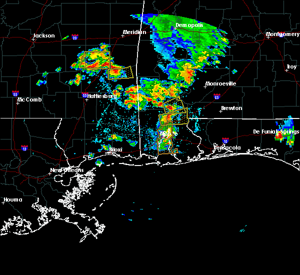 At 241 pm cdt, a severe thunderstorm was located 6 miles east of calvert, or 20 miles east of citronelle, moving east at 10 mph (radar indicated). Hazards include 60 mph wind gusts and quarter size hail. Hail damage to vehicles is expected. expect wind damage to roofs, siding, and trees. This severe thunderstorm will remain over mainly rural areas of northeastern mobile, northwestern baldwin, southeastern washington and south central clarke counties. At 241 pm cdt, a severe thunderstorm was located 6 miles east of calvert, or 20 miles east of citronelle, moving east at 10 mph (radar indicated). Hazards include 60 mph wind gusts and quarter size hail. Hail damage to vehicles is expected. expect wind damage to roofs, siding, and trees. This severe thunderstorm will remain over mainly rural areas of northeastern mobile, northwestern baldwin, southeastern washington and south central clarke counties.
|
| 10/7/2017 8:11 PM CDT |
 At 810 pm cdt, a severe thunderstorm capable of producing a tornado was located 4 miles southwest of mcintosh, or 13 miles northeast of citronelle, moving northwest at 25 mph (radar indicated rotation). Hazards include tornado. Flying debris will be dangerous to those caught without shelter. mobile homes will be damaged or destroyed. damage to roofs, windows, and vehicles will occur. tree damage is likely. This dangerous storm will be near, tibbie around 840 pm cdt. At 810 pm cdt, a severe thunderstorm capable of producing a tornado was located 4 miles southwest of mcintosh, or 13 miles northeast of citronelle, moving northwest at 25 mph (radar indicated rotation). Hazards include tornado. Flying debris will be dangerous to those caught without shelter. mobile homes will be damaged or destroyed. damage to roofs, windows, and vehicles will occur. tree damage is likely. This dangerous storm will be near, tibbie around 840 pm cdt.
|
| 10/7/2017 7:58 PM CDT |
 At 758 pm cdt, a severe thunderstorm capable of producing a tornado was located over calvert, or 12 miles northeast of citronelle, moving northwest at 25 mph (radar indicated rotation). Hazards include tornado. Flying debris will be dangerous to those caught without shelter. mobile homes will be damaged or destroyed. damage to roofs, windows, and vehicles will occur. tree damage is likely. This dangerous storm will be near, mcintosh around 810 pm cdt. At 758 pm cdt, a severe thunderstorm capable of producing a tornado was located over calvert, or 12 miles northeast of citronelle, moving northwest at 25 mph (radar indicated rotation). Hazards include tornado. Flying debris will be dangerous to those caught without shelter. mobile homes will be damaged or destroyed. damage to roofs, windows, and vehicles will occur. tree damage is likely. This dangerous storm will be near, mcintosh around 810 pm cdt.
|
| 10/7/2017 7:44 PM CDT |
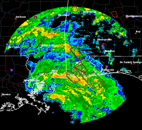 At 743 pm cdt, a severe thunderstorm capable of producing a tornado was located over mount vernon, or 13 miles north of creola, moving northwest at 30 mph (radar indicated rotation). Hazards include tornado. Flying debris will be dangerous to those caught without shelter. mobile homes will be damaged or destroyed. damage to roofs, windows, and vehicles will occur. tree damage is likely. this dangerous storm will be near, calvert around 755 pm cdt. Mcintosh around 810 pm cdt. At 743 pm cdt, a severe thunderstorm capable of producing a tornado was located over mount vernon, or 13 miles north of creola, moving northwest at 30 mph (radar indicated rotation). Hazards include tornado. Flying debris will be dangerous to those caught without shelter. mobile homes will be damaged or destroyed. damage to roofs, windows, and vehicles will occur. tree damage is likely. this dangerous storm will be near, calvert around 755 pm cdt. Mcintosh around 810 pm cdt.
|
| 10/7/2017 7:28 PM CDT |
 At 727 pm cdt, a severe thunderstorm capable of producing a tornado was located over i65 and al 225, or 9 miles northwest of bay minette, moving northwest at 30 mph (radar indicated rotation). Hazards include tornado. Flying debris will be dangerous to those caught without shelter. mobile homes will be damaged or destroyed. damage to roofs, windows, and vehicles will occur. tree damage is likely. this dangerous storm will be near, mount vernon and movico around 750 pm cdt. calvert around 800 pm cdt. Mcintosh around 815 pm cdt. At 727 pm cdt, a severe thunderstorm capable of producing a tornado was located over i65 and al 225, or 9 miles northwest of bay minette, moving northwest at 30 mph (radar indicated rotation). Hazards include tornado. Flying debris will be dangerous to those caught without shelter. mobile homes will be damaged or destroyed. damage to roofs, windows, and vehicles will occur. tree damage is likely. this dangerous storm will be near, mount vernon and movico around 750 pm cdt. calvert around 800 pm cdt. Mcintosh around 815 pm cdt.
|
| 8/30/2017 1:24 PM CDT |
 At 122 pm cdt, severe thunderstorms were located along a line extending from near deer park, to 6 miles north of citronelle to gulfcrest, moving northeast at 35 mph (radar indicated). Hazards include 60 mph wind gusts. Expect damage to roofs, siding, and trees. locations impacted include, citronelle, chatom, chunchula, saint stephens, wagarville, leroy, gulfcrest, deer park, tibbie, calvert, mount vernon, mcintosh and movico. A tornado watch remains in effect until 600 pm cdt for southwestern alabama, and southeastern mississippi. At 122 pm cdt, severe thunderstorms were located along a line extending from near deer park, to 6 miles north of citronelle to gulfcrest, moving northeast at 35 mph (radar indicated). Hazards include 60 mph wind gusts. Expect damage to roofs, siding, and trees. locations impacted include, citronelle, chatom, chunchula, saint stephens, wagarville, leroy, gulfcrest, deer park, tibbie, calvert, mount vernon, mcintosh and movico. A tornado watch remains in effect until 600 pm cdt for southwestern alabama, and southeastern mississippi.
|
| 8/30/2017 1:06 PM CDT |
 At 104 pm cdt, severe thunderstorms were located along a line extending from 6 miles east of leakesville to just west of citronelle to near wilmer, moving north at 50 mph (radar indicated). Hazards include 60 mph wind gusts. expect damage to roofs, siding, and trees At 104 pm cdt, severe thunderstorms were located along a line extending from 6 miles east of leakesville to just west of citronelle to near wilmer, moving north at 50 mph (radar indicated). Hazards include 60 mph wind gusts. expect damage to roofs, siding, and trees
|
| 5/12/2017 12:08 PM CDT |
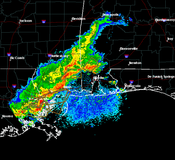 At 1208 pm cdt, a severe thunderstorm was located over gulfcrest, or near citronelle, moving northeast at 25 mph (radar indicated). Hazards include 60 mph wind gusts. Expect damage to roofs, siding, and trees. Locations impacted include, citronelle, gulfcrest, mount vernon, calvert and movico. At 1208 pm cdt, a severe thunderstorm was located over gulfcrest, or near citronelle, moving northeast at 25 mph (radar indicated). Hazards include 60 mph wind gusts. Expect damage to roofs, siding, and trees. Locations impacted include, citronelle, gulfcrest, mount vernon, calvert and movico.
|
| 5/12/2017 11:59 AM CDT |
 At 1159 am cdt, a severe thunderstorm was located over gulfcrest, or 7 miles south of citronelle, moving northeast at 25 mph (radar indicated). Hazards include 60 mph wind gusts. expect damage to roofs, siding, and trees At 1159 am cdt, a severe thunderstorm was located over gulfcrest, or 7 miles south of citronelle, moving northeast at 25 mph (radar indicated). Hazards include 60 mph wind gusts. expect damage to roofs, siding, and trees
|
| 4/30/2017 2:58 PM CDT |
 The severe thunderstorm warning for northwestern mobile, southern washington, south central clarke, george and southeastern greene counties will expire at 300 pm cdt, the storms which prompted the warning have weakened below severe limits, and no longer pose an immediate threat to life or property. therefore the warning will be allowed to expire. however gusty winds and heavy rain are still possible with these thunderstorms. a tornado watch remains in effect until 300 pm cdt for southeastern mississippi. a tornado watch also remains in effect until 700 pm cdt for southwestern alabama. additional statements will be issued as conditions warrant. The severe thunderstorm warning for northwestern mobile, southern washington, south central clarke, george and southeastern greene counties will expire at 300 pm cdt, the storms which prompted the warning have weakened below severe limits, and no longer pose an immediate threat to life or property. therefore the warning will be allowed to expire. however gusty winds and heavy rain are still possible with these thunderstorms. a tornado watch remains in effect until 300 pm cdt for southeastern mississippi. a tornado watch also remains in effect until 700 pm cdt for southwestern alabama. additional statements will be issued as conditions warrant.
|
| 4/30/2017 2:41 PM CDT |
 At 240 pm cdt, severe thunderstorms were located along a line extending from 6 miles west of mcintosh to 8 miles north of wilmer to 11 miles northwest of wade to latimer, moving east at 20 mph (radar indicated). Hazards include 60 mph wind gusts. Expect damage to roofs, siding, and trees. locations impacted include, citronelle, lucedale, chunchula, gulfcrest, deer park, mount vernon, calvert, semmes, mcintosh, movico and wilmer. a tornado watch remains in effect until 300 pm cdt for southeastern mississippi. A tornado watch also remains in effect until 700 pm cdt for southwestern alabama. At 240 pm cdt, severe thunderstorms were located along a line extending from 6 miles west of mcintosh to 8 miles north of wilmer to 11 miles northwest of wade to latimer, moving east at 20 mph (radar indicated). Hazards include 60 mph wind gusts. Expect damage to roofs, siding, and trees. locations impacted include, citronelle, lucedale, chunchula, gulfcrest, deer park, mount vernon, calvert, semmes, mcintosh, movico and wilmer. a tornado watch remains in effect until 300 pm cdt for southeastern mississippi. A tornado watch also remains in effect until 700 pm cdt for southwestern alabama.
|
| 4/30/2017 2:27 PM CDT |
 At 226 pm cdt, severe thunderstorms were located along a line extending from 6 miles east of deer park to 8 miles east of lucedale to 14 miles northwest of wade to near d`iberville, moving northeast at 40 mph (radar indicated). Hazards include 60 mph wind gusts. Expect damage to roofs, siding, and trees. locations impacted include, citronelle, lucedale, leakesville, chunchula, gulfcrest, deer park, mount vernon, calvert, semmes, mcintosh, movico and wilmer. a tornado watch remains in effect until 300 pm cdt for southeastern mississippi. A tornado watch also remains in effect until 700 pm cdt for southwestern alabama. At 226 pm cdt, severe thunderstorms were located along a line extending from 6 miles east of deer park to 8 miles east of lucedale to 14 miles northwest of wade to near d`iberville, moving northeast at 40 mph (radar indicated). Hazards include 60 mph wind gusts. Expect damage to roofs, siding, and trees. locations impacted include, citronelle, lucedale, leakesville, chunchula, gulfcrest, deer park, mount vernon, calvert, semmes, mcintosh, movico and wilmer. a tornado watch remains in effect until 300 pm cdt for southeastern mississippi. A tornado watch also remains in effect until 700 pm cdt for southwestern alabama.
|
| 4/30/2017 2:00 PM CDT |
 At 159 pm cdt, severe thunderstorms were located along a line extending from near deer park to 12 miles southwest of lucedale to 6 miles east of saucier to near long beach, moving east at 20 mph (radar indicated). Hazards include 60 mph wind gusts and penny size hail. expect damage to roofs, siding, and trees At 159 pm cdt, severe thunderstorms were located along a line extending from near deer park to 12 miles southwest of lucedale to 6 miles east of saucier to near long beach, moving east at 20 mph (radar indicated). Hazards include 60 mph wind gusts and penny size hail. expect damage to roofs, siding, and trees
|
| 4/5/2017 8:42 AM CDT |
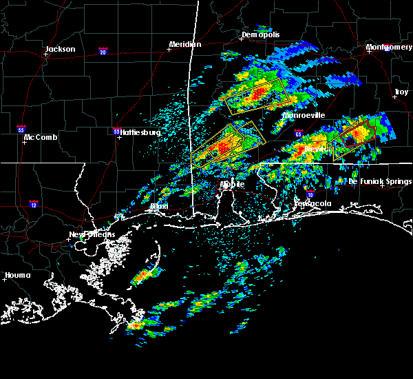 At 842 am cdt, a severe thunderstorm was located over calvert, or 12 miles east of citronelle, moving northeast at 40 mph (radar indicated). Hazards include 60 mph wind gusts and half dollar size hail. Hail damage to vehicles is expected. Expect wind damage to roofs, siding, and trees. At 842 am cdt, a severe thunderstorm was located over calvert, or 12 miles east of citronelle, moving northeast at 40 mph (radar indicated). Hazards include 60 mph wind gusts and half dollar size hail. Hail damage to vehicles is expected. Expect wind damage to roofs, siding, and trees.
|
| 4/5/2017 8:21 AM CDT |
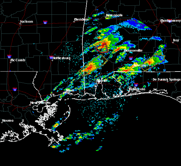 At 821 am cdt, a severe thunderstorm was located over citronelle, moving northeast at 50 mph (radar indicated). Hazards include ping pong ball size hail and 60 mph wind gusts. People and animals outdoors will be injured. expect hail damage to roofs, siding, windows, and vehicles. expect wind damage to roofs, siding, and trees. locations impacted include, citronelle, gulfcrest, calvert and mcintosh. A tornado watch remains in effect until noon cdt for southwestern alabama, and southeastern mississippi. At 821 am cdt, a severe thunderstorm was located over citronelle, moving northeast at 50 mph (radar indicated). Hazards include ping pong ball size hail and 60 mph wind gusts. People and animals outdoors will be injured. expect hail damage to roofs, siding, windows, and vehicles. expect wind damage to roofs, siding, and trees. locations impacted include, citronelle, gulfcrest, calvert and mcintosh. A tornado watch remains in effect until noon cdt for southwestern alabama, and southeastern mississippi.
|
| 4/5/2017 8:05 AM CDT |
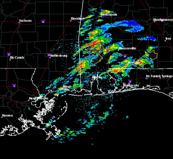 At 805 am cdt, a severe thunderstorm was located 9 miles northeast of lucedale, moving northeast at 50 mph (radar indicated). Hazards include 60 mph wind gusts and quarter size hail. Hail damage to vehicles is expected. Expect wind damage to roofs, siding, and trees. At 805 am cdt, a severe thunderstorm was located 9 miles northeast of lucedale, moving northeast at 50 mph (radar indicated). Hazards include 60 mph wind gusts and quarter size hail. Hail damage to vehicles is expected. Expect wind damage to roofs, siding, and trees.
|
| 4/5/2017 7:14 AM CDT |
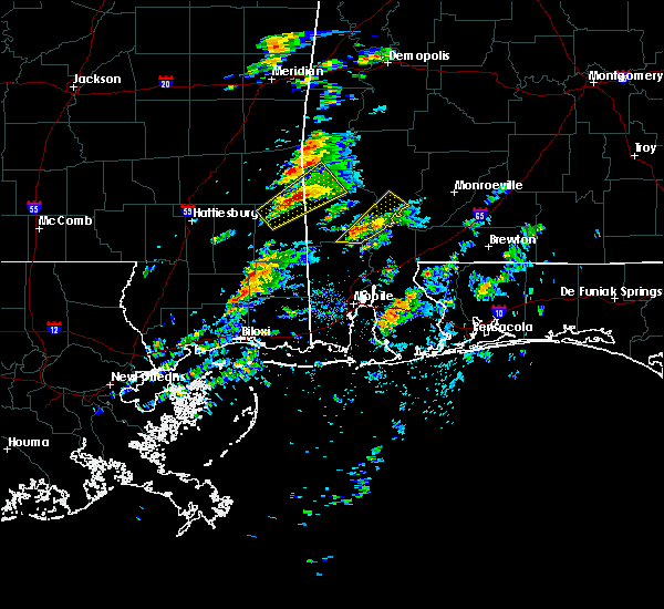 At 713 am cdt, a severe thunderstorm was located near calvert, or 11 miles northeast of citronelle, moving northeast at 35 mph (radar indicated). Hazards include 60 mph wind gusts and quarter size hail. Hail damage to vehicles is expected. expect wind damage to roofs, siding, and trees. locations impacted include, calvert and mcintosh. A tornado watch remains in effect until noon cdt for south central and southwestern alabama. At 713 am cdt, a severe thunderstorm was located near calvert, or 11 miles northeast of citronelle, moving northeast at 35 mph (radar indicated). Hazards include 60 mph wind gusts and quarter size hail. Hail damage to vehicles is expected. expect wind damage to roofs, siding, and trees. locations impacted include, calvert and mcintosh. A tornado watch remains in effect until noon cdt for south central and southwestern alabama.
|
| 4/5/2017 7:01 AM CDT |
 At 700 am cdt, a severe thunderstorm was located near citronelle, moving northeast at 40 mph (radar indicated). Hazards include 60 mph wind gusts and quarter size hail. Hail damage to vehicles is expected. Expect wind damage to roofs, siding, and trees. At 700 am cdt, a severe thunderstorm was located near citronelle, moving northeast at 40 mph (radar indicated). Hazards include 60 mph wind gusts and quarter size hail. Hail damage to vehicles is expected. Expect wind damage to roofs, siding, and trees.
|
| 4/3/2017 7:26 AM CDT |
 At 725 am cdt, severe thunderstorms were located along a line extending from 7 miles west of frisco city to 8 miles northeast of latimer, moving east at 40 mph (radar indicated). Hazards include 60 mph wind gusts and quarter size hail. Hail damage to vehicles is expected. Expect wind damage to roofs, siding, and trees. At 725 am cdt, severe thunderstorms were located along a line extending from 7 miles west of frisco city to 8 miles northeast of latimer, moving east at 40 mph (radar indicated). Hazards include 60 mph wind gusts and quarter size hail. Hail damage to vehicles is expected. Expect wind damage to roofs, siding, and trees.
|
| 4/3/2017 7:20 AM CDT |
 At 719 am cdt, a severe thunderstorm was located near wilmer, or 10 miles east of lucedale, moving northeast at 50 mph (radar indicated). Hazards include 60 mph wind gusts and quarter size hail. Hail damage to vehicles is expected. expect wind damage to roofs, siding, and trees. locations impacted include, midtown mobile, downtown mobile, prichard, tillmans corner, saraland, bay minette, theodore, chickasaw, satsuma, jackson, citronelle, lucedale, creola, frisco city, chunchula, stockton, mccullough, wagarville, leroy and gulfcrest. a tornado watch remains in effect until 900 am cdt for southwestern alabama, and southeastern mississippi. A tornado watch also remains in effect until 100 pm cdt for south central alabama. At 719 am cdt, a severe thunderstorm was located near wilmer, or 10 miles east of lucedale, moving northeast at 50 mph (radar indicated). Hazards include 60 mph wind gusts and quarter size hail. Hail damage to vehicles is expected. expect wind damage to roofs, siding, and trees. locations impacted include, midtown mobile, downtown mobile, prichard, tillmans corner, saraland, bay minette, theodore, chickasaw, satsuma, jackson, citronelle, lucedale, creola, frisco city, chunchula, stockton, mccullough, wagarville, leroy and gulfcrest. a tornado watch remains in effect until 900 am cdt for southwestern alabama, and southeastern mississippi. A tornado watch also remains in effect until 100 pm cdt for south central alabama.
|
| 4/3/2017 7:12 AM CDT |
 At 712 am cdt, a severe thunderstorm was located 8 miles west of wilmer, or 8 miles southeast of lucedale, moving northeast at 35 mph (radar indicated). Hazards include 60 mph wind gusts and quarter size hail. Hail damage to vehicles is expected. expect wind damage to roofs, siding, and trees. locations impacted include, midtown mobile, downtown mobile, prichard, tillmans corner, saraland, bay minette, theodore, chickasaw, satsuma, jackson, citronelle, lucedale, creola, frisco city, chunchula, stockton, mccullough, wagarville, leroy and mchenry. a tornado watch remains in effect until 900 am cdt for southwestern alabama, and southeastern mississippi. A tornado watch also remains in effect until 100 pm cdt for south central alabama. At 712 am cdt, a severe thunderstorm was located 8 miles west of wilmer, or 8 miles southeast of lucedale, moving northeast at 35 mph (radar indicated). Hazards include 60 mph wind gusts and quarter size hail. Hail damage to vehicles is expected. expect wind damage to roofs, siding, and trees. locations impacted include, midtown mobile, downtown mobile, prichard, tillmans corner, saraland, bay minette, theodore, chickasaw, satsuma, jackson, citronelle, lucedale, creola, frisco city, chunchula, stockton, mccullough, wagarville, leroy and mchenry. a tornado watch remains in effect until 900 am cdt for southwestern alabama, and southeastern mississippi. A tornado watch also remains in effect until 100 pm cdt for south central alabama.
|
| 4/3/2017 6:43 AM CDT |
 At 642 am cdt, severe thunderstorms were located along a line extending from near jackson to near mount vernon to near latimer, moving east at 25 mph (radar indicated). Hazards include 60 mph wind gusts. expect damage to roofs, siding, and trees At 642 am cdt, severe thunderstorms were located along a line extending from near jackson to near mount vernon to near latimer, moving east at 25 mph (radar indicated). Hazards include 60 mph wind gusts. expect damage to roofs, siding, and trees
|
| 4/3/2017 6:36 AM CDT |
 At 635 am cdt, severe thunderstorms were located along a line extending from jackson to near gulfcrest to 10 miles north of latimer, moving east at 40 mph. a new severe thunderstorm warning may soon be issued for this general area (radar indicated). Hazards include 60 mph wind gusts. Expect damage to roofs, siding, and trees. locations impacted include, jackson, citronelle, lucedale, chunchula, wagarville, leroy, mchenry, gulfcrest, deer park, tibbie, calvert, mount vernon, tanner williams, mcintosh, wilmer, movico and saucier. A tornado watch remains in effect until 900 am cdt for southwestern alabama, and southeastern mississippi. At 635 am cdt, severe thunderstorms were located along a line extending from jackson to near gulfcrest to 10 miles north of latimer, moving east at 40 mph. a new severe thunderstorm warning may soon be issued for this general area (radar indicated). Hazards include 60 mph wind gusts. Expect damage to roofs, siding, and trees. locations impacted include, jackson, citronelle, lucedale, chunchula, wagarville, leroy, mchenry, gulfcrest, deer park, tibbie, calvert, mount vernon, tanner williams, mcintosh, wilmer, movico and saucier. A tornado watch remains in effect until 900 am cdt for southwestern alabama, and southeastern mississippi.
|
| 4/3/2017 5:57 AM CDT |
 At 556 am cdt, severe thunderstorms were located along a line extending from near chatom to 6 miles north of lucedale to 6 miles west of saucier, moving east at 40 mph (radar indicated). Hazards include 60 mph wind gusts. expect damage to roofs, siding, and trees At 556 am cdt, severe thunderstorms were located along a line extending from near chatom to 6 miles north of lucedale to 6 miles west of saucier, moving east at 40 mph (radar indicated). Hazards include 60 mph wind gusts. expect damage to roofs, siding, and trees
|
| 1/22/2017 10:52 AM CST |
 At 1052 am cst, a severe thunderstorm was located near mcintosh, or 15 miles northeast of citronelle, moving northeast at 65 mph (radar indicated). Hazards include 60 mph wind gusts and quarter size hail. Hail damage to vehicles is expected. Expect wind damage to roofs, siding, and trees. At 1052 am cst, a severe thunderstorm was located near mcintosh, or 15 miles northeast of citronelle, moving northeast at 65 mph (radar indicated). Hazards include 60 mph wind gusts and quarter size hail. Hail damage to vehicles is expected. Expect wind damage to roofs, siding, and trees.
|
| 1/22/2017 10:47 AM CST |
 At 1047 am cst, a severe thunderstorm was located near tibbie, or 10 miles southeast of chatom, moving northeast at 70 mph (radar indicated). Hazards include 60 mph wind gusts and quarter size hail. Hail damage to vehicles is expected. expect wind damage to roofs, siding, and trees. locations impacted include, deer park, tibbie, fruitdale and mcintosh. A tornado watch remains in effect until 200 pm cst for southwestern alabama. At 1047 am cst, a severe thunderstorm was located near tibbie, or 10 miles southeast of chatom, moving northeast at 70 mph (radar indicated). Hazards include 60 mph wind gusts and quarter size hail. Hail damage to vehicles is expected. expect wind damage to roofs, siding, and trees. locations impacted include, deer park, tibbie, fruitdale and mcintosh. A tornado watch remains in effect until 200 pm cst for southwestern alabama.
|
| 1/21/2017 7:14 PM CST |
 At 714 pm cst, a severe thunderstorm was located over citronelle, moving north at 45 mph (radar indicated). Hazards include 60 mph wind gusts and quarter size hail. Hail damage to vehicles is expected. expect wind damage to roofs, siding, and trees. locations impacted include, citronelle, wagarville, gulfcrest, tibbie and mcintosh. A tornado watch remains in effect until 300 am cst for southwestern alabama. At 714 pm cst, a severe thunderstorm was located over citronelle, moving north at 45 mph (radar indicated). Hazards include 60 mph wind gusts and quarter size hail. Hail damage to vehicles is expected. expect wind damage to roofs, siding, and trees. locations impacted include, citronelle, wagarville, gulfcrest, tibbie and mcintosh. A tornado watch remains in effect until 300 am cst for southwestern alabama.
|
| 1/21/2017 7:03 PM CST |
 At 703 pm cst, a severe thunderstorm was located over gulfcrest, or 7 miles south of citronelle, moving north at 45 mph (radar indicated). Hazards include 60 mph wind gusts and quarter size hail. Hail damage to vehicles is expected. Expect wind damage to roofs, siding, and trees. At 703 pm cst, a severe thunderstorm was located over gulfcrest, or 7 miles south of citronelle, moving north at 45 mph (radar indicated). Hazards include 60 mph wind gusts and quarter size hail. Hail damage to vehicles is expected. Expect wind damage to roofs, siding, and trees.
|
| 1/2/2017 4:32 PM CST |
 At 430 pm cst, severe thunderstorms were located along a line extending from linden to near thomasville to 6 miles southeast of wagarville to calvert to semmes, moving east at 60 mph (radar indicated). Hazards include 70 mph wind gusts and quarter size hail. Hail damage to vehicles is expected. expect considerable tree damage. wind damage is also likely to mobile homes, roofs, and outbuildings. locations impacted include, jackson, thomasville, citronelle, creola, grove hill, chunchula, stockton, saint stephens, wagarville, leroy, gulfcrest, deer park, axis, whatley, tibbie, pine hill, mount vernon, calvert, fulton and mcintosh. A tornado watch remains in effect until 800 pm cst for south central and southwestern alabama. At 430 pm cst, severe thunderstorms were located along a line extending from linden to near thomasville to 6 miles southeast of wagarville to calvert to semmes, moving east at 60 mph (radar indicated). Hazards include 70 mph wind gusts and quarter size hail. Hail damage to vehicles is expected. expect considerable tree damage. wind damage is also likely to mobile homes, roofs, and outbuildings. locations impacted include, jackson, thomasville, citronelle, creola, grove hill, chunchula, stockton, saint stephens, wagarville, leroy, gulfcrest, deer park, axis, whatley, tibbie, pine hill, mount vernon, calvert, fulton and mcintosh. A tornado watch remains in effect until 800 pm cst for south central and southwestern alabama.
|
| 1/2/2017 3:59 PM CST |
 At 358 pm cst, severe thunderstorms were located along a line extending from kinterbish to 7 miles east of toxey to near fruitdale to near leakesville to 12 miles northwest of wade, moving northeast at 55 mph. damage has been reported from this line of thunderstorms as it moved through new augusta mississippi (radar indicated). Hazards include 70 mph wind gusts and quarter size hail. Hail damage to vehicles is expected. expect considerable tree damage. Wind damage is also likely to mobile homes, roofs, and outbuildings. At 358 pm cst, severe thunderstorms were located along a line extending from kinterbish to 7 miles east of toxey to near fruitdale to near leakesville to 12 miles northwest of wade, moving northeast at 55 mph. damage has been reported from this line of thunderstorms as it moved through new augusta mississippi (radar indicated). Hazards include 70 mph wind gusts and quarter size hail. Hail damage to vehicles is expected. expect considerable tree damage. Wind damage is also likely to mobile homes, roofs, and outbuildings.
|
| 6/17/2016 6:46 PM CDT |
 At 645 pm cdt, severe thunderstorms were located along a line extending from near macedonia to near citronelle to 16 miles north of baker to 9 miles north of new brockton, moving southeast at 45 mph (radar indicated). Hazards include 60 mph wind gusts and nickel size hail. Expect damage to roofs. siding. and trees. Locations impacted include, andalusia, atmore, opp, brewton, citronelle, florala, richton, leakesville, mccullough, deer park, east brewton, uriah, beaumont, brantley, mount vernon, calvert, new augusta, river falls, mclain and castleberry. At 645 pm cdt, severe thunderstorms were located along a line extending from near macedonia to near citronelle to 16 miles north of baker to 9 miles north of new brockton, moving southeast at 45 mph (radar indicated). Hazards include 60 mph wind gusts and nickel size hail. Expect damage to roofs. siding. and trees. Locations impacted include, andalusia, atmore, opp, brewton, citronelle, florala, richton, leakesville, mccullough, deer park, east brewton, uriah, beaumont, brantley, mount vernon, calvert, new augusta, river falls, mclain and castleberry.
|
| 6/17/2016 6:11 PM CDT |
 At 610 pm cdt, severe thunderstorms were located along a line extending from near moss to 6 miles southwest of state line to near castleberry to near goshen, moving southeast at 50 mph (radar indicated). Hazards include 60 mph wind gusts and quarter size hail. Hail damage to vehicles is expected. expect wind damage to roofs, siding, and trees. Locations impacted include, andalusia, atmore, greenville, monroeville, opp, brewton, jackson, waynesboro, citronelle, evergreen, luverne, florala, frisco city, chatom, richton, leakesville, mccullough, peterman, saint stephens and wagarville. At 610 pm cdt, severe thunderstorms were located along a line extending from near moss to 6 miles southwest of state line to near castleberry to near goshen, moving southeast at 50 mph (radar indicated). Hazards include 60 mph wind gusts and quarter size hail. Hail damage to vehicles is expected. expect wind damage to roofs, siding, and trees. Locations impacted include, andalusia, atmore, greenville, monroeville, opp, brewton, jackson, waynesboro, citronelle, evergreen, luverne, florala, frisco city, chatom, richton, leakesville, mccullough, peterman, saint stephens and wagarville.
|
| 6/17/2016 6:00 PM CDT |
 At 559 pm cdt, severe thunderstorms were located along a line extending from bay springs to near buckatunna to near i65 and us 84 to near lapine, moving southeast at 50 mph (radar indicated). Hazards include 60 mph wind gusts and nickel size hail. Expect damage to roofs. siding. And trees. At 559 pm cdt, severe thunderstorms were located along a line extending from bay springs to near buckatunna to near i65 and us 84 to near lapine, moving southeast at 50 mph (radar indicated). Hazards include 60 mph wind gusts and nickel size hail. Expect damage to roofs. siding. And trees.
|
| 4/28/2016 6:33 AM CDT |
 At 633 am cdt, a severe thunderstorm was located near tibbie, or 10 miles south of chatom, moving northeast at 45 mph (radar indicated). Hazards include 60 mph wind gusts and quarter size hail. Hail damage to vehicles is expected. Expect wind damage to roofs, siding, and trees. At 633 am cdt, a severe thunderstorm was located near tibbie, or 10 miles south of chatom, moving northeast at 45 mph (radar indicated). Hazards include 60 mph wind gusts and quarter size hail. Hail damage to vehicles is expected. Expect wind damage to roofs, siding, and trees.
|
| 3/31/2016 10:40 AM CDT |
 At 1040 am cdt, severe thunderstorms were located along a line extending from 13 miles west of uriah to 7 miles northeast of calvert to malcolm to mowa choctaw reservation to near citronelle, moving east at 35 mph (radar indicated). Hazards include 60 mph wind gusts and quarter size hail. Hail damage to vehicles is expected. expect wind damage to roofs, siding, and trees. locations impacted include, atmore, mount vernon, mcintosh, i65 and cr 1, poarch creek reservation, calvert, mccullough, mowa choctaw reservation, i65 and cr 47, malcolm and uriah. A tornado watch remains in effect until 200 pm cdt for southwestern alabama. At 1040 am cdt, severe thunderstorms were located along a line extending from 13 miles west of uriah to 7 miles northeast of calvert to malcolm to mowa choctaw reservation to near citronelle, moving east at 35 mph (radar indicated). Hazards include 60 mph wind gusts and quarter size hail. Hail damage to vehicles is expected. expect wind damage to roofs, siding, and trees. locations impacted include, atmore, mount vernon, mcintosh, i65 and cr 1, poarch creek reservation, calvert, mccullough, mowa choctaw reservation, i65 and cr 47, malcolm and uriah. A tornado watch remains in effect until 200 pm cdt for southwestern alabama.
|
| 3/31/2016 10:24 AM CDT |
 At 1023 am cdt, a severe thunderstorm was located over mcintosh, or 14 miles northeast of citronelle, moving east at 35 mph (radar indicated). Hazards include 70 mph wind gusts and half dollar size hail. Hail damage to vehicles is expected. expect considerable tree damage. wind damage is also likely to mobile homes, roofs, and outbuildings. locations impacted include, atmore, mount vernon, mcintosh, i65 and cr 1, poarch creek reservation, calvert, mccullough, mowa choctaw reservation, i65 and cr 47, malcolm and uriah. A tornado watch remains in effect until 200 pm cdt for southwestern alabama. At 1023 am cdt, a severe thunderstorm was located over mcintosh, or 14 miles northeast of citronelle, moving east at 35 mph (radar indicated). Hazards include 70 mph wind gusts and half dollar size hail. Hail damage to vehicles is expected. expect considerable tree damage. wind damage is also likely to mobile homes, roofs, and outbuildings. locations impacted include, atmore, mount vernon, mcintosh, i65 and cr 1, poarch creek reservation, calvert, mccullough, mowa choctaw reservation, i65 and cr 47, malcolm and uriah. A tornado watch remains in effect until 200 pm cdt for southwestern alabama.
|
| 3/31/2016 10:06 AM CDT |
 At 1005 am cdt, a severe thunderstorm was located near deer park, or 7 miles north of citronelle, moving east at 35 mph (radar indicated). Hazards include 70 mph wind gusts and half dollar size hail. Hail damage to vehicles is expected. expect considerable tree damage. Wind damage is also likely to mobile homes, roofs, and outbuildings. At 1005 am cdt, a severe thunderstorm was located near deer park, or 7 miles north of citronelle, moving east at 35 mph (radar indicated). Hazards include 70 mph wind gusts and half dollar size hail. Hail damage to vehicles is expected. expect considerable tree damage. Wind damage is also likely to mobile homes, roofs, and outbuildings.
|
| 2/23/2016 8:35 PM CST |
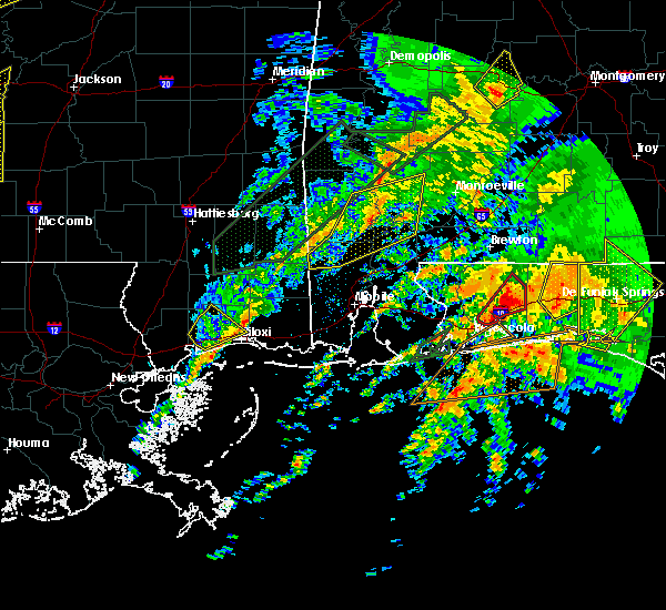 At 833 pm cst, severe thunderstorms were located along a line extending from near jackson to malcolm to near gulfcrest, moving east at 20 mph (radar indicated). Hazards include 60 mph wind gusts and quarter size hail. Hail damage to vehicles is expected. expect wind damage to roofs, siding, and trees. locations impacted include, jackson, mcintosh, calvert, mowa choctaw reservation, wagarville, malcolm and leroy. A tornado watch remains in effect until 1000 pm cst for southwestern alabama. At 833 pm cst, severe thunderstorms were located along a line extending from near jackson to malcolm to near gulfcrest, moving east at 20 mph (radar indicated). Hazards include 60 mph wind gusts and quarter size hail. Hail damage to vehicles is expected. expect wind damage to roofs, siding, and trees. locations impacted include, jackson, mcintosh, calvert, mowa choctaw reservation, wagarville, malcolm and leroy. A tornado watch remains in effect until 1000 pm cst for southwestern alabama.
|
| 2/23/2016 8:09 PM CST |
 At 809 pm cst, severe thunderstorms were located along a line extending from near wagarville to near mowa choctaw reservation to 10 miles northeast of lucedale, moving east at 20 mph (radar indicated). Hazards include 60 mph wind gusts and quarter size hail. Hail damage to vehicles is expected. Expect wind damage to roofs, siding, and trees. At 809 pm cst, severe thunderstorms were located along a line extending from near wagarville to near mowa choctaw reservation to 10 miles northeast of lucedale, moving east at 20 mph (radar indicated). Hazards include 60 mph wind gusts and quarter size hail. Hail damage to vehicles is expected. Expect wind damage to roofs, siding, and trees.
|
| 2/23/2016 7:54 PM CST |
 At 754 pm cst, severe thunderstorms were located along a line extending from 7 miles southeast of coffeeville to 6 miles west of mcintosh to near lucedale, moving east at 35 mph (radar indicated). Hazards include 70 mph wind gusts and quarter size hail. Hail damage to vehicles is expected. expect considerable tree damage. wind damage is also likely to mobile homes, roofs, and outbuildings. locations impacted include, mobile, saraland, satsuma, citronelle, lucedale, creola, chatom, mount vernon, mcintosh, gulfcrest, axis, mowa choctaw reservation, saint stephens, deer park, bucks, i65 and us 43, chunchula, semmes, movico and calvert. A tornado watch remains in effect until 1000 pm cst for southwestern alabama and southeastern mississippi. At 754 pm cst, severe thunderstorms were located along a line extending from 7 miles southeast of coffeeville to 6 miles west of mcintosh to near lucedale, moving east at 35 mph (radar indicated). Hazards include 70 mph wind gusts and quarter size hail. Hail damage to vehicles is expected. expect considerable tree damage. wind damage is also likely to mobile homes, roofs, and outbuildings. locations impacted include, mobile, saraland, satsuma, citronelle, lucedale, creola, chatom, mount vernon, mcintosh, gulfcrest, axis, mowa choctaw reservation, saint stephens, deer park, bucks, i65 and us 43, chunchula, semmes, movico and calvert. A tornado watch remains in effect until 1000 pm cst for southwestern alabama and southeastern mississippi.
|
| 2/23/2016 7:37 PM CST |
 At 736 pm cst, severe thunderstorms were located along a line extending from 7 miles northwest of saint stephens to 6 miles south of tibbie to near lucedale, moving northeast at 45 mph (radar indicated). Hazards include 70 mph wind gusts and quarter size hail. Hail damage to vehicles is expected. expect considerable tree damage. wind damage is also likely to mobile homes, roofs, and outbuildings. locations impacted include, mobile, saraland, satsuma, citronelle, lucedale, creola, chatom, mount vernon, state line, mcintosh, mowa choctaw reservation, saint stephens, chunchula, tibbie, gulfcrest, axis, deer park, bucks, i65 and us 43 and semmes. A tornado watch remains in effect until 1000 pm cst for southwestern alabama and southeastern mississippi. At 736 pm cst, severe thunderstorms were located along a line extending from 7 miles northwest of saint stephens to 6 miles south of tibbie to near lucedale, moving northeast at 45 mph (radar indicated). Hazards include 70 mph wind gusts and quarter size hail. Hail damage to vehicles is expected. expect considerable tree damage. wind damage is also likely to mobile homes, roofs, and outbuildings. locations impacted include, mobile, saraland, satsuma, citronelle, lucedale, creola, chatom, mount vernon, state line, mcintosh, mowa choctaw reservation, saint stephens, chunchula, tibbie, gulfcrest, axis, deer park, bucks, i65 and us 43 and semmes. A tornado watch remains in effect until 1000 pm cst for southwestern alabama and southeastern mississippi.
|
| 2/23/2016 7:17 PM CST |
 At 716 pm cst, severe thunderstorms were located along a line extending from 6 miles northwest of chatom to 7 miles southwest of deer park to 13 miles northwest of wade, moving east at 50 mph (radar indicated). Hazards include 70 mph wind gusts and penny size hail. Expect considerable tree damage. Damage is likely to mobile homes, roofs, and outbuildings. At 716 pm cst, severe thunderstorms were located along a line extending from 6 miles northwest of chatom to 7 miles southwest of deer park to 13 miles northwest of wade, moving east at 50 mph (radar indicated). Hazards include 70 mph wind gusts and penny size hail. Expect considerable tree damage. Damage is likely to mobile homes, roofs, and outbuildings.
|
| 2/23/2016 6:56 PM CST |
 At 655 pm cst, severe thunderstorms were located along a line extending from near pine hill to near fulton to near tibbie, moving northeast at 50 mph (radar indicated). Hazards include 70 mph wind gusts and penny size hail. Expect considerable tree damage. damage is likely to mobile homes, roofs, and outbuildings. locations impacted include, jackson, thomasville, camden, grove hill, chatom, pine hill, vredenburgh, fulton, mcintosh, yellow bluff, mowa choctaw reservation, saint stephens, deer park, whatley, wagarville, calvert, vinegar bend, boykin, fruitdale and malcolm. A tornado watch remains in effect until 1000 pm cst for southwestern alabama. At 655 pm cst, severe thunderstorms were located along a line extending from near pine hill to near fulton to near tibbie, moving northeast at 50 mph (radar indicated). Hazards include 70 mph wind gusts and penny size hail. Expect considerable tree damage. damage is likely to mobile homes, roofs, and outbuildings. locations impacted include, jackson, thomasville, camden, grove hill, chatom, pine hill, vredenburgh, fulton, mcintosh, yellow bluff, mowa choctaw reservation, saint stephens, deer park, whatley, wagarville, calvert, vinegar bend, boykin, fruitdale and malcolm. A tornado watch remains in effect until 1000 pm cst for southwestern alabama.
|
| 2/23/2016 6:31 PM CST |
 At 630 pm cst, severe thunderstorms were located along a line extending from 6 miles southwest of thomasville to 8 miles northeast of saint stephens to near fruitdale, moving northeast at 55 mph (radar indicated). Hazards include 70 mph wind gusts and quarter size hail. Hail damage to vehicles is expected. expect considerable tree damage. Wind damage is also likely to mobile homes, roofs, and outbuildings. At 630 pm cst, severe thunderstorms were located along a line extending from 6 miles southwest of thomasville to 8 miles northeast of saint stephens to near fruitdale, moving northeast at 55 mph (radar indicated). Hazards include 70 mph wind gusts and quarter size hail. Hail damage to vehicles is expected. expect considerable tree damage. Wind damage is also likely to mobile homes, roofs, and outbuildings.
|
| 2/23/2016 6:29 PM CST |
 At 627 pm cst, a severe thunderstorm capable of producing a tornado was located near chunchula, or 12 miles west of saraland, moving northeast at 45 mph (radar indicated rotation). Hazards include tornado and quarter size hail. Flying debris will be dangerous to those caught without shelter. mobile homes will be damaged or destroyed. damage to roofs, windows, and vehicles will occur. tree damage is likely. this dangerous storm will be near, gulfcrest around 640 pm cst. citronelle around 645 pm cst. bucks around 650 pm cst. mount vernon, and movico around 655 pm cst. calvert and malcolm around 700 pm cst. Mcintosh around 705 pm cst. At 627 pm cst, a severe thunderstorm capable of producing a tornado was located near chunchula, or 12 miles west of saraland, moving northeast at 45 mph (radar indicated rotation). Hazards include tornado and quarter size hail. Flying debris will be dangerous to those caught without shelter. mobile homes will be damaged or destroyed. damage to roofs, windows, and vehicles will occur. tree damage is likely. this dangerous storm will be near, gulfcrest around 640 pm cst. citronelle around 645 pm cst. bucks around 650 pm cst. mount vernon, and movico around 655 pm cst. calvert and malcolm around 700 pm cst. Mcintosh around 705 pm cst.
|
| 2/15/2016 4:28 PM CST |
 At 428 pm cst, severe thunderstorms were located along a line extending from near beatrice to uriah to near i65 and al 225 to near gulf park estates, moving southeast at 30 mph (radar indicated). Hazards include 60 mph wind gusts. Expect damage to roofs. siding. And trees. At 428 pm cst, severe thunderstorms were located along a line extending from near beatrice to uriah to near i65 and al 225 to near gulf park estates, moving southeast at 30 mph (radar indicated). Hazards include 60 mph wind gusts. Expect damage to roofs. siding. And trees.
|
| 2/15/2016 4:20 PM CST |
 At 419 pm cst, severe thunderstorms were located along a line extending from 8 miles southeast of whatley to near mount vernon to near hickory hills, moving east at 50 mph (radar indicated). Hazards include 60 mph wind gusts and quarter size hail. Hail damage to vehicles is expected. expect wind damage to roofs, siding, and trees. locations impacted include, mobile, prichard, daphne, saraland, bay minette, spanish fort, monroeville, satsuma, chickasaw, jackson, citronelle and bayou la batre. a tornado watch remains in effect until 600 pm cst for southeastern mississippi. A tornado watch also remains in effect until 900 pm cst for southwestern alabama. At 419 pm cst, severe thunderstorms were located along a line extending from 8 miles southeast of whatley to near mount vernon to near hickory hills, moving east at 50 mph (radar indicated). Hazards include 60 mph wind gusts and quarter size hail. Hail damage to vehicles is expected. expect wind damage to roofs, siding, and trees. locations impacted include, mobile, prichard, daphne, saraland, bay minette, spanish fort, monroeville, satsuma, chickasaw, jackson, citronelle and bayou la batre. a tornado watch remains in effect until 600 pm cst for southeastern mississippi. A tornado watch also remains in effect until 900 pm cst for southwestern alabama.
|
| 2/15/2016 3:59 PM CST |
 At 358 pm cst, severe thunderstorms were located along a line extending from 8 miles northeast of mcintosh to gulfport, moving southeast at 35 mph (radar indicated). Hazards include 60 mph wind gusts and quarter size hail. Hail damage to vehicles is expected. Expect wind damage to roofs, siding, and trees. At 358 pm cst, severe thunderstorms were located along a line extending from 8 miles northeast of mcintosh to gulfport, moving southeast at 35 mph (radar indicated). Hazards include 60 mph wind gusts and quarter size hail. Hail damage to vehicles is expected. Expect wind damage to roofs, siding, and trees.
|
| 2/15/2016 3:19 PM CST |
 At 319 pm cst, severe thunderstorms were located along a line extending from near lisman to 6 miles southwest of fruitdale to 10 miles south of mclain to saucier, moving east at 50 mph (radar indicated). Hazards include 70 mph wind gusts and quarter size hail. Hail damage to vehicles is expected. expect considerable tree damage. Wind damage is also likely to mobile homes, roofs, and outbuildings. At 319 pm cst, severe thunderstorms were located along a line extending from near lisman to 6 miles southwest of fruitdale to 10 miles south of mclain to saucier, moving east at 50 mph (radar indicated). Hazards include 70 mph wind gusts and quarter size hail. Hail damage to vehicles is expected. expect considerable tree damage. Wind damage is also likely to mobile homes, roofs, and outbuildings.
|
| 12/28/2015 8:46 AM CST |
 At 845 am cst, severe thunderstorms were located along a line extending from near coffeeville to near tibbie to near chunchula to near tillmans corner, moving northeast at 30 mph (radar indicated). Hazards include 60 mph wind gusts. Expect damage to roofs. siding and trees. locations impacted include, mobile, prichard, saraland, satsuma, chickasaw, jackson, thomasville, citronelle, bayou la batre, creola, grove hill and chatom. A tornado watch remains in effect until noon cst for southwestern alabama. At 845 am cst, severe thunderstorms were located along a line extending from near coffeeville to near tibbie to near chunchula to near tillmans corner, moving northeast at 30 mph (radar indicated). Hazards include 60 mph wind gusts. Expect damage to roofs. siding and trees. locations impacted include, mobile, prichard, saraland, satsuma, chickasaw, jackson, thomasville, citronelle, bayou la batre, creola, grove hill and chatom. A tornado watch remains in effect until noon cst for southwestern alabama.
|
| 12/28/2015 8:13 AM CST |
 At 812 am cst, a line of severe thunderstorms capable of producing damaging winds over 60 mph was located along a line extending from near buckatunna to 8 miles southeast of leakesville to near hurley to 6 miles east of pascagoula, and moving northeast at 65 mph. At 812 am cst, a line of severe thunderstorms capable of producing damaging winds over 60 mph was located along a line extending from near buckatunna to 8 miles southeast of leakesville to near hurley to 6 miles east of pascagoula, and moving northeast at 65 mph.
|
| 10/31/2015 5:26 PM CDT |
 At 525 pm cdt, severe thunderstorms were located along a line extending from 7 miles southwest of crandall to beaumont, moving east at 20 mph (radar indicated). Hazards include 60 mph wind gusts. Expect damage to roofs. Siding and trees. At 525 pm cdt, severe thunderstorms were located along a line extending from 7 miles southwest of crandall to beaumont, moving east at 20 mph (radar indicated). Hazards include 60 mph wind gusts. Expect damage to roofs. Siding and trees.
|
| 8/20/2015 4:54 PM CDT |
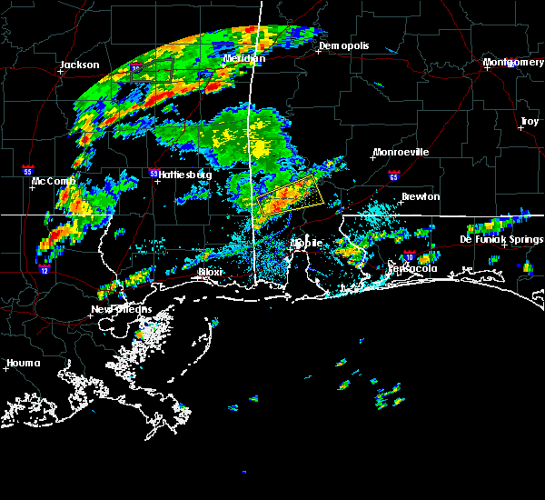 At 454 pm cdt, the storm that prompted the warning for northwestern baldwin, northern mobile, southeastern washington and south central clarke counties has weakened below severe limits thus the severe thunderstorm warning will be allowed to expire at 500 pm cdt. winds gusting to 50 mph are still possible with this storm. please remain inside until the storm has passed. At 454 pm cdt, the storm that prompted the warning for northwestern baldwin, northern mobile, southeastern washington and south central clarke counties has weakened below severe limits thus the severe thunderstorm warning will be allowed to expire at 500 pm cdt. winds gusting to 50 mph are still possible with this storm. please remain inside until the storm has passed.
|
| 8/20/2015 4:22 PM CDT |
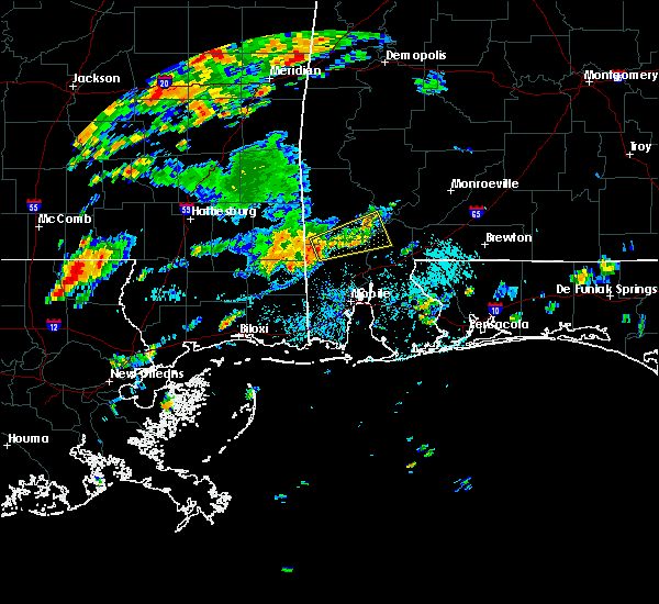 At 421 pm cdt, a severe thunderstorm capable of producing damaging winds over 60 mph was located near citronelle, and moving east at 30 mph. At 421 pm cdt, a severe thunderstorm capable of producing damaging winds over 60 mph was located near citronelle, and moving east at 30 mph.
|
| 8/8/2015 5:06 PM CDT |
 At 505 pm cdt, a line of severe thunderstorms capable of producing damaging winds over 60 mph was located along a line extending from 11 miles east of mcintosh to near deer park, and moving south at 70 mph. At 505 pm cdt, a line of severe thunderstorms capable of producing damaging winds over 60 mph was located along a line extending from 11 miles east of mcintosh to near deer park, and moving south at 70 mph.
|
| 7/5/2015 2:01 PM CDT |
 At 201 pm cdt, a line of severe thunderstorms capable of producing damaging winds over 60 mph was located along a line extending from near putnam to near saint stephens to near deer park, and moving east at 35 mph. At 201 pm cdt, a line of severe thunderstorms capable of producing damaging winds over 60 mph was located along a line extending from near putnam to near saint stephens to near deer park, and moving east at 35 mph.
|
| 7/4/2015 4:12 PM CDT |
 At 411 pm cdt, a line of severe thunderstorms capable of producing damaging winds over 60 mph were located along a line extending from 10 miles east of coffeeville to near mcintosh, moving east at 40 mph. At 411 pm cdt, a line of severe thunderstorms capable of producing damaging winds over 60 mph were located along a line extending from 10 miles east of coffeeville to near mcintosh, moving east at 40 mph.
|
| 7/4/2015 3:46 PM CDT |
 At 345 pm cdt, a line of severe thunderstorms capable of producing damaging winds over 60 mph was located along a line extending from silas to 7 miles northeast of leakesville, and moving east at 35 mph. At 345 pm cdt, a line of severe thunderstorms capable of producing damaging winds over 60 mph was located along a line extending from silas to 7 miles northeast of leakesville, and moving east at 35 mph.
|
| 6/9/2015 7:52 AM CDT | At 752 am cdt, a line of severe thunderstorms capable of producing quarter size hail and damaging winds over 60 mph was located along a line extending from wagarville to tibbie to near state line, and moving south at 20 mph. |
| 4/25/2015 1:57 PM CDT | At 155 pm cdt, a severe thunderstorm capable of producing quarter size hail and damaging winds over 60 mph was located over fruitdale, or 13 miles southwest of chatom, moving east at 35 mph. |
| 4/25/2015 1:28 PM CDT | At 127 pm cdt, a severe thunderstorm capable of producing quarter size hail and damaging winds over 60 mph was located 8 miles northwest of leakesville, and moving east at 35 mph. |
| 4/25/2015 1:28 PM CDT | At 127 pm cdt, a severe thunderstorm capable of producing quarter size hail and damaging winds over 60 mph was located 8 miles northwest of leakesville, and moving east at 35 mph. |
Hail Maps for Malcolm, AL
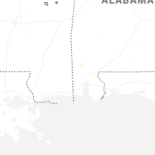
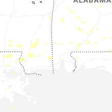
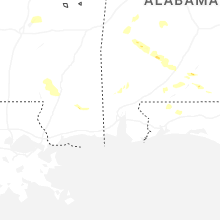


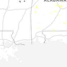


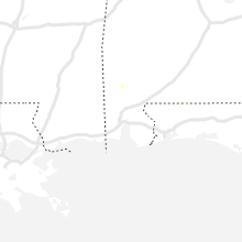


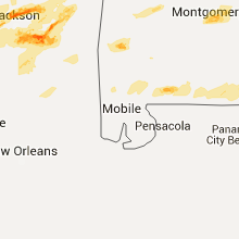


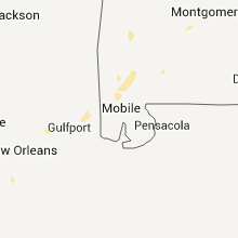
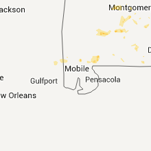

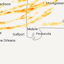
Connect with Interactive Hail Maps