

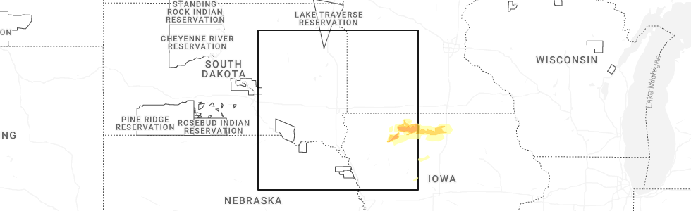
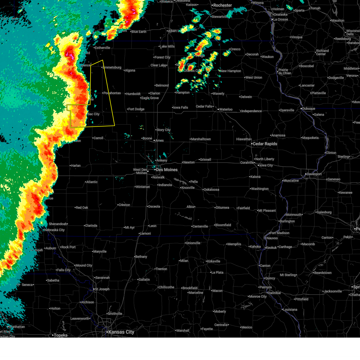
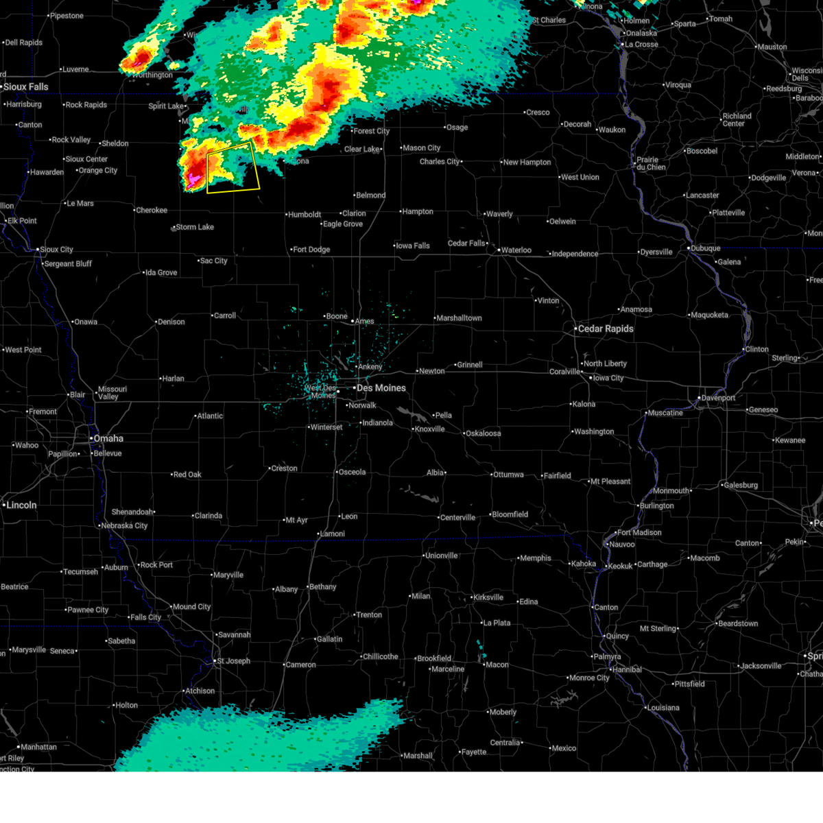
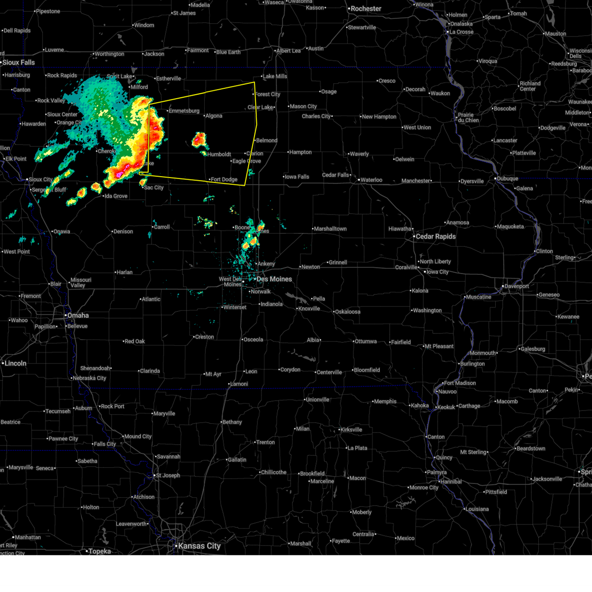
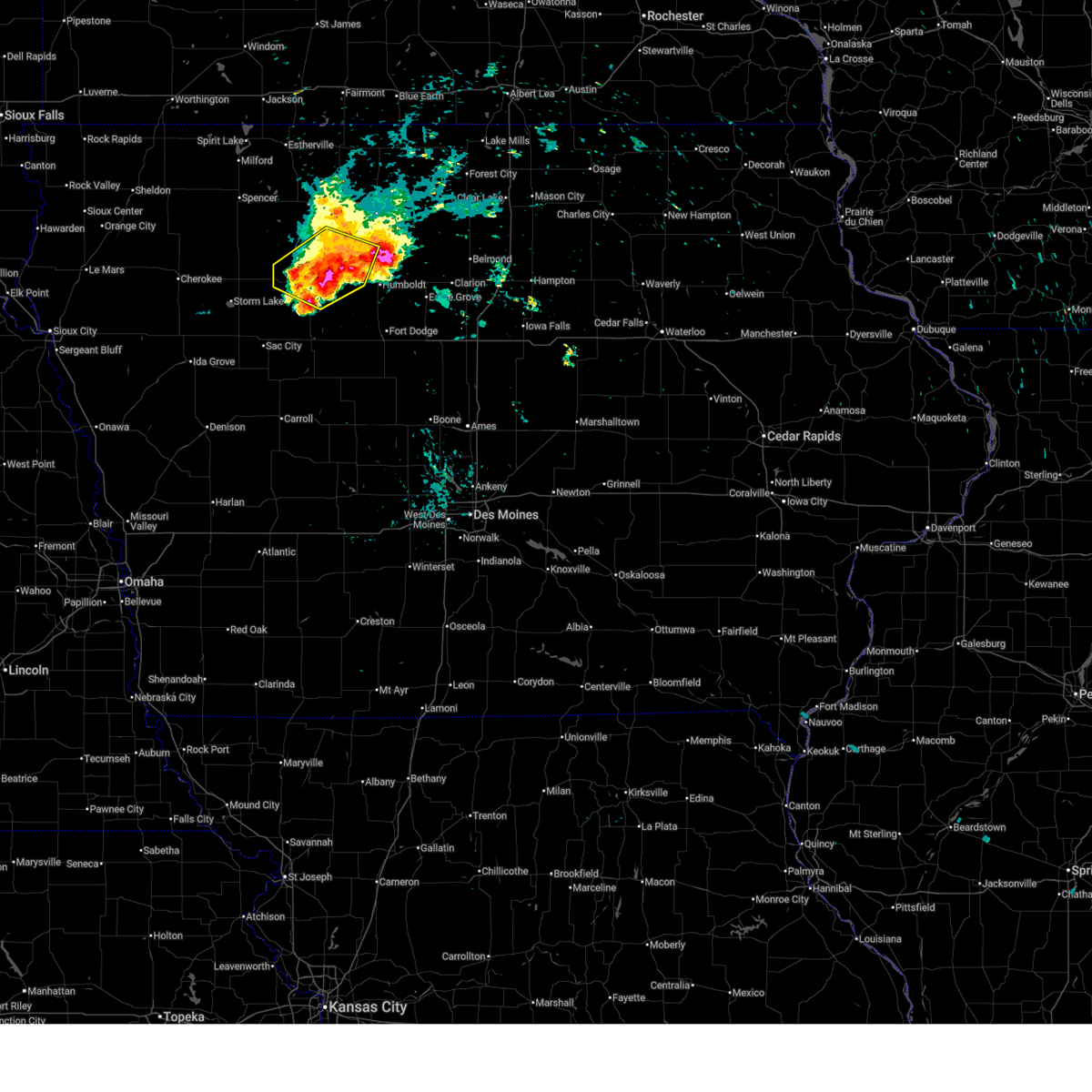
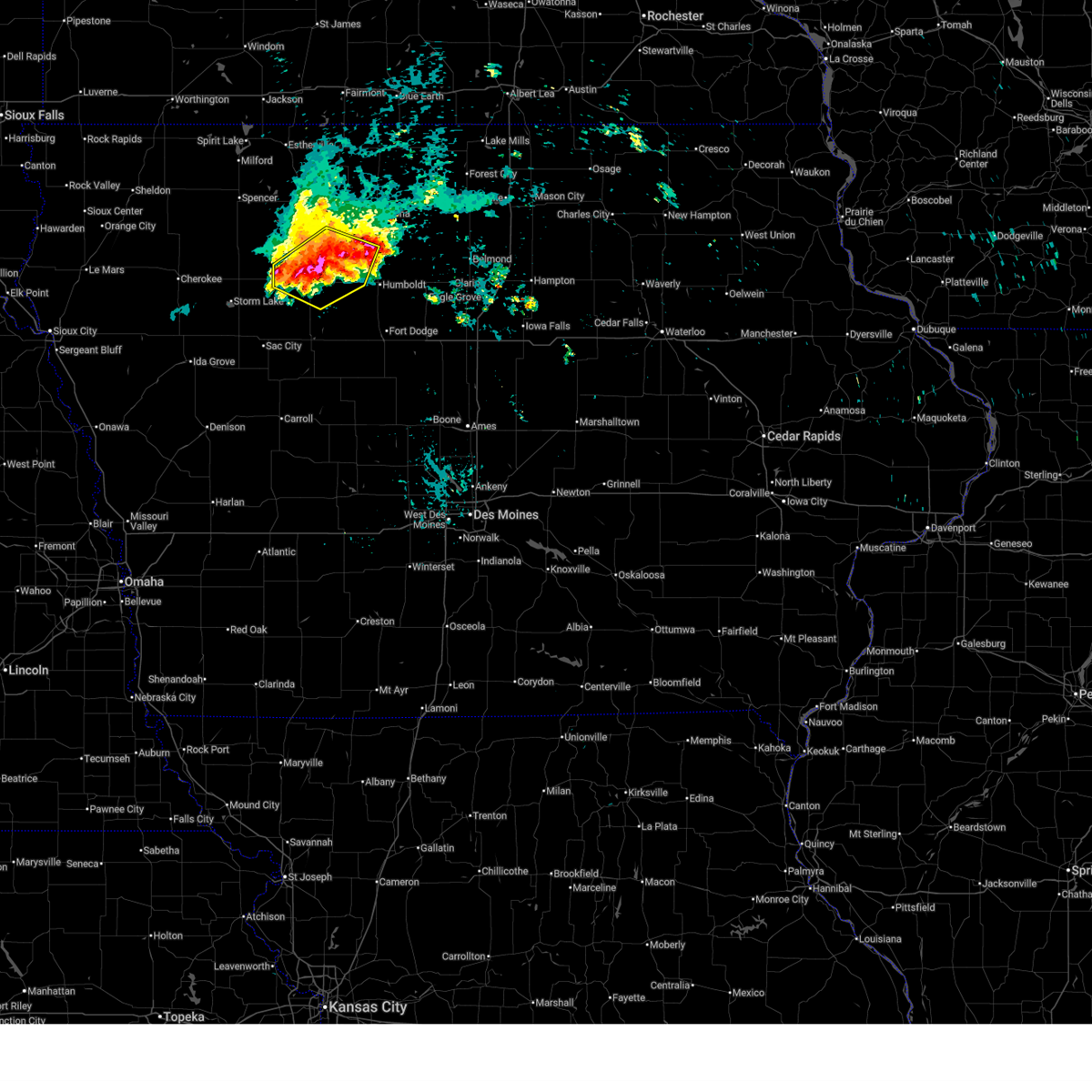
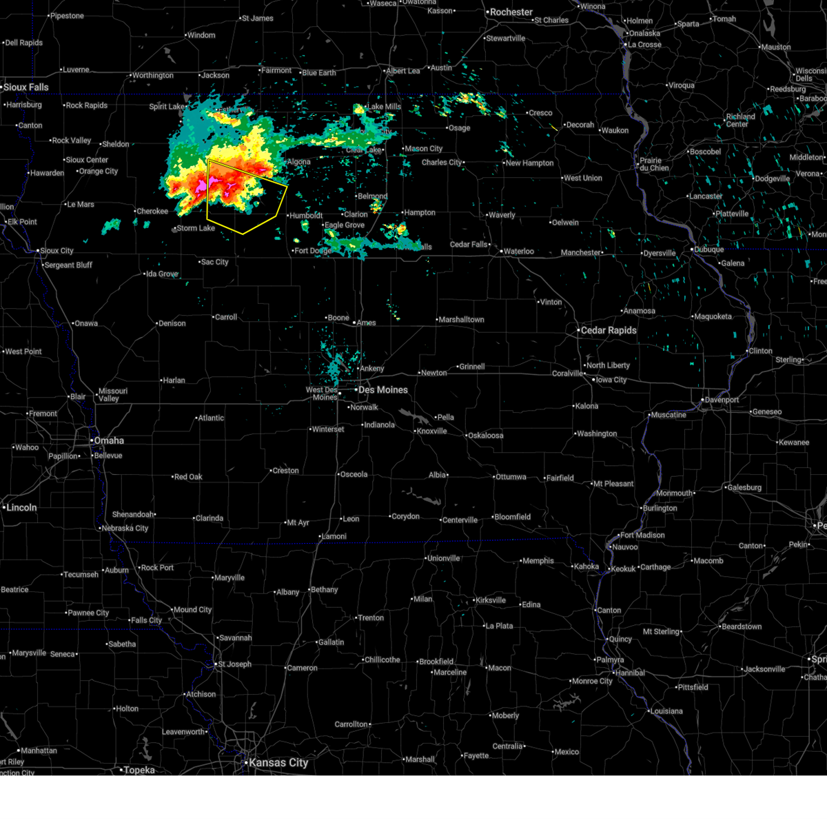
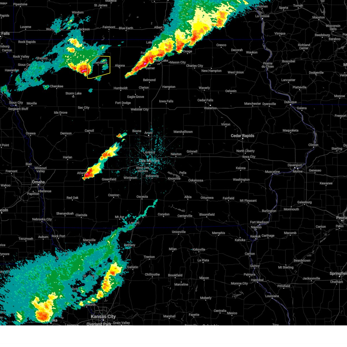
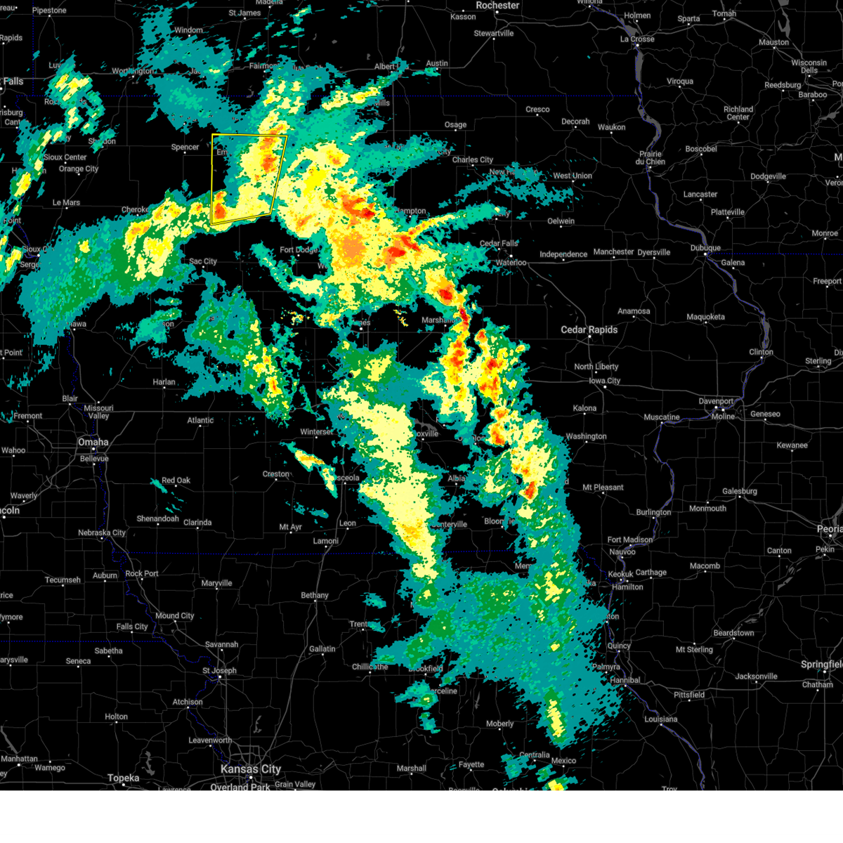
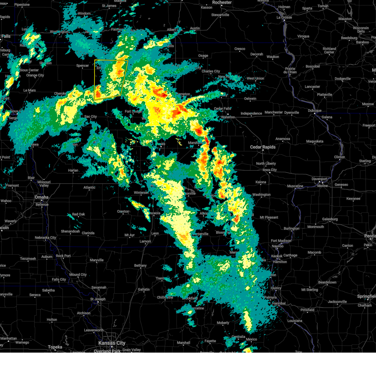
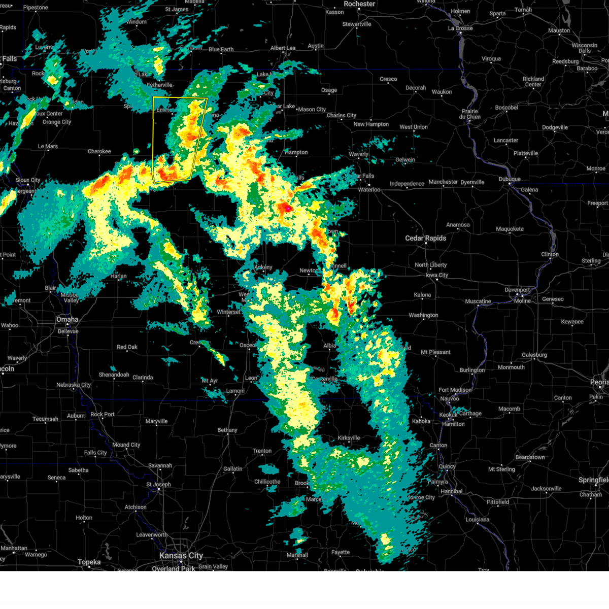
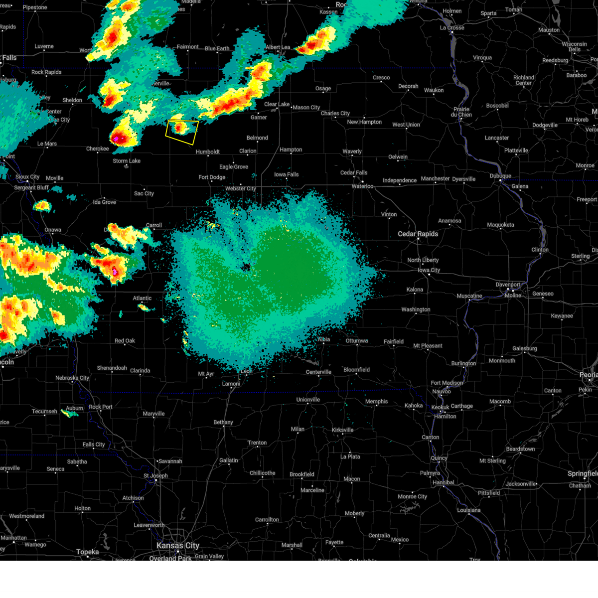
Hail Map for Mallard, IA
The Mallard, IA area has had 4 reports of on-the-ground hail by trained spotters, and has been under severe weather warnings 22 times during the past 12 months. Doppler radar has detected hail at or near Mallard, IA on 71 occasions, including 4 occasions during the past year.
| Name: | Mallard, IA |
| Where Located: | 33.1 miles NE of Storm Lake, IA |
| Map: | Google Map for Mallard, IA |
| Population: | 274 |
| Housing Units: | 137 |
| More Info: | Search Google for Mallard, IA |
1
The Top Recent Hail Date for Mallard, IA is Sunday, June 28, 2026 (15th out of 71)
Hail and Wind Damage Spotted near Mallard, IA
| Date / Time | Report Details |
|---|---|
| 7/4/2026 12:45 PM CDT |
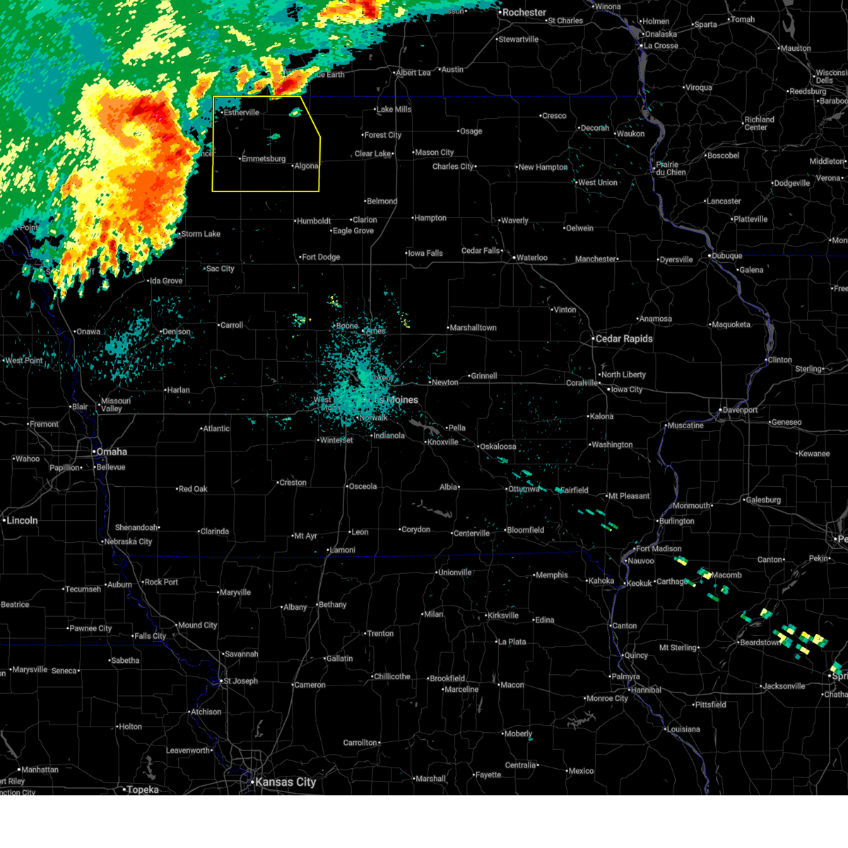
 Svrdmx the national weather service in des moines has issued a * severe thunderstorm warning for, north central pocahontas county in northwestern iowa, southern palo alto county in northwestern iowa, * until 115 pm cdt. * at 1244 pm cdt, a severe thunderstorm was located near curlew, or 6 miles southwest of emmetsburg, moving southeast at 15 mph (radar indicated). Hazards include 60 mph wind gusts. expect damage to roofs, siding, and trees Svrdmx the national weather service in des moines has issued a * severe thunderstorm warning for, north central pocahontas county in northwestern iowa, southern palo alto county in northwestern iowa, * until 115 pm cdt. * at 1244 pm cdt, a severe thunderstorm was located near curlew, or 6 miles southwest of emmetsburg, moving southeast at 15 mph (radar indicated). Hazards include 60 mph wind gusts. expect damage to roofs, siding, and trees
|
| 6/28/2026 7:41 AM CDT |
 At 740 am cdt, severe thunderstorms were located along a line extending from near elmore to irvington to havelock, moving east at 40 mph (radar indicated. at 735 am, a 52 mph wind gust was observed at the algona airport ). Hazards include 60 mph wind gusts and quarter size hail. Hail damage to vehicles is expected. expect wind damage to roofs, siding, and trees. Locations impacted include, algona, emmetsburg, laurens, five island lake, silver lake, rush lake, union slogh, buffalo center, west bend, bancroft, swea city, burt, whittemore, thompson, titonka, wesley, livermore, corwith, bode, and fenton. At 740 am cdt, severe thunderstorms were located along a line extending from near elmore to irvington to havelock, moving east at 40 mph (radar indicated. at 735 am, a 52 mph wind gust was observed at the algona airport ). Hazards include 60 mph wind gusts and quarter size hail. Hail damage to vehicles is expected. expect wind damage to roofs, siding, and trees. Locations impacted include, algona, emmetsburg, laurens, five island lake, silver lake, rush lake, union slogh, buffalo center, west bend, bancroft, swea city, burt, whittemore, thompson, titonka, wesley, livermore, corwith, bode, and fenton.
|
| 6/28/2026 7:16 AM CDT |
 Svrdmx the national weather service in des moines has issued a * severe thunderstorm warning for, eastern emmet county in northwestern iowa, northern pocahontas county in northwestern iowa, kossuth county in north central iowa, northern humboldt county in north central iowa, western hancock county in north central iowa, winnebago county in north central iowa, palo alto county in northwestern iowa, * until 800 am cdt. * at 715 am cdt, severe thunderstorms were located along a line extending from near east chain to 4 miles east of five island lake to near rush lake, moving east at 35 mph (radar indicated). Hazards include 60 mph wind gusts and quarter size hail. Hail damage to vehicles is expected. Expect wind damage to roofs, siding, and trees. Svrdmx the national weather service in des moines has issued a * severe thunderstorm warning for, eastern emmet county in northwestern iowa, northern pocahontas county in northwestern iowa, kossuth county in north central iowa, northern humboldt county in north central iowa, western hancock county in north central iowa, winnebago county in north central iowa, palo alto county in northwestern iowa, * until 800 am cdt. * at 715 am cdt, severe thunderstorms were located along a line extending from near east chain to 4 miles east of five island lake to near rush lake, moving east at 35 mph (radar indicated). Hazards include 60 mph wind gusts and quarter size hail. Hail damage to vehicles is expected. Expect wind damage to roofs, siding, and trees.
|
| 5/17/2026 9:08 PM CDT |
 Tordmx the national weather service in des moines has issued a * tornado warning for, northeastern pocahontas county in northwestern iowa, kossuth county in north central iowa, northern humboldt county in north central iowa, eastern palo alto county in northwestern iowa, * until 1000 pm cdt. * at 908 pm cdt, a severe thunderstorm capable of producing a tornado was located over plover, or 10 miles northeast of pocahontas, moving northeast at 60 mph (radar indicated rotation). Hazards include tornado. Flying debris will be dangerous to those caught without shelter. mobile homes will be damaged or destroyed. damage to roofs, windows, and vehicles will occur. tree damage is likely. this dangerous storm will be near, west bend and ottosen around 915 pm cdt. st. joseph and irvington around 925 pm cdt. st. benedict and sexton around 930 pm cdt. other locations impacted by this tornadic thunderstorm include curlew, whittemore, stinson prairie state park, ottosen, st. joseph, west bend, st. Benedict, emmetsburg municipal airport, bradgate, and plover. Tordmx the national weather service in des moines has issued a * tornado warning for, northeastern pocahontas county in northwestern iowa, kossuth county in north central iowa, northern humboldt county in north central iowa, eastern palo alto county in northwestern iowa, * until 1000 pm cdt. * at 908 pm cdt, a severe thunderstorm capable of producing a tornado was located over plover, or 10 miles northeast of pocahontas, moving northeast at 60 mph (radar indicated rotation). Hazards include tornado. Flying debris will be dangerous to those caught without shelter. mobile homes will be damaged or destroyed. damage to roofs, windows, and vehicles will occur. tree damage is likely. this dangerous storm will be near, west bend and ottosen around 915 pm cdt. st. joseph and irvington around 925 pm cdt. st. benedict and sexton around 930 pm cdt. other locations impacted by this tornadic thunderstorm include curlew, whittemore, stinson prairie state park, ottosen, st. joseph, west bend, st. Benedict, emmetsburg municipal airport, bradgate, and plover.
|
| 5/17/2026 8:48 PM CDT |
 At 847 pm cdt, severe thunderstorms were located along a line extending from near royal to near albert city to lake view, moving northeast at 65 mph. these are destructive storms (radar indicated). Hazards include 80 mph wind gusts and nickel size hail. Flying debris will be dangerous to those caught without shelter. mobile homes will be heavily damaged. expect considerable damage to roofs, windows, and vehicles. extensive tree damage and power outages are likely. Locations impacted include, emmetsburg, sac city, pocahontas, rockwell city, lake city, manson, laurens, lake view, odebolt, five island lake, black hawk lake, north twin lake, south twin lake, silver lake, rush lake, wall lake, schaller, ruthven, pomeroy, and fonda. At 847 pm cdt, severe thunderstorms were located along a line extending from near royal to near albert city to lake view, moving northeast at 65 mph. these are destructive storms (radar indicated). Hazards include 80 mph wind gusts and nickel size hail. Flying debris will be dangerous to those caught without shelter. mobile homes will be heavily damaged. expect considerable damage to roofs, windows, and vehicles. extensive tree damage and power outages are likely. Locations impacted include, emmetsburg, sac city, pocahontas, rockwell city, lake city, manson, laurens, lake view, odebolt, five island lake, black hawk lake, north twin lake, south twin lake, silver lake, rush lake, wall lake, schaller, ruthven, pomeroy, and fonda.
|
| 5/17/2026 8:26 PM CDT |
 At 825 pm cdt, a severe thunderstorm was located near galva, or 11 miles southwest of storm lake, and is nearly stationary. this is a destructive storm! (radar indicated). Hazards include 80 mph wind gusts and nickel size hail. Flying debris will be dangerous to those caught without shelter. mobile homes will be heavily damaged. expect considerable damage to roofs, windows, and vehicles. extensive tree damage and power outages are likely. Locations impacted include, emmetsburg, sac city, pocahontas, rockwell city, lake city, manson, laurens, lake view, odebolt, five island lake, black hawk lake, north twin lake, south twin lake, silver lake, rush lake, wall lake, schaller, ruthven, pomeroy, and fonda. At 825 pm cdt, a severe thunderstorm was located near galva, or 11 miles southwest of storm lake, and is nearly stationary. this is a destructive storm! (radar indicated). Hazards include 80 mph wind gusts and nickel size hail. Flying debris will be dangerous to those caught without shelter. mobile homes will be heavily damaged. expect considerable damage to roofs, windows, and vehicles. extensive tree damage and power outages are likely. Locations impacted include, emmetsburg, sac city, pocahontas, rockwell city, lake city, manson, laurens, lake view, odebolt, five island lake, black hawk lake, north twin lake, south twin lake, silver lake, rush lake, wall lake, schaller, ruthven, pomeroy, and fonda.
|
| 5/17/2026 8:19 PM CDT |
 Svrdmx the national weather service in des moines has issued a * severe thunderstorm warning for, pocahontas county in northwestern iowa, sac county in west central iowa, calhoun county in west central iowa, western palo alto county in northwestern iowa, * until 915 pm cdt. * at 818 pm cdt, a severe thunderstorm was located over holstein, or 11 miles north of ida grove, moving northeast at 55 mph (radar indicated). Hazards include 70 mph wind gusts and nickel size hail. Expect considerable tree damage. Damage is likely to mobile homes, roofs, and outbuildings. Svrdmx the national weather service in des moines has issued a * severe thunderstorm warning for, pocahontas county in northwestern iowa, sac county in west central iowa, calhoun county in west central iowa, western palo alto county in northwestern iowa, * until 915 pm cdt. * at 818 pm cdt, a severe thunderstorm was located over holstein, or 11 miles north of ida grove, moving northeast at 55 mph (radar indicated). Hazards include 70 mph wind gusts and nickel size hail. Expect considerable tree damage. Damage is likely to mobile homes, roofs, and outbuildings.
|
| 4/13/2026 8:22 PM CDT |
 The storm which prompted the warning has weakened below severe limits, and no longer poses an immediate threat to life or property. therefore, the warning will be allowed to expire. a tornado watch remains in effect until 1000 pm cdt for northwestern iowa. The storm which prompted the warning has weakened below severe limits, and no longer poses an immediate threat to life or property. therefore, the warning will be allowed to expire. a tornado watch remains in effect until 1000 pm cdt for northwestern iowa.
|
| 4/13/2026 8:21 PM CDT |
 The storm which prompted the warning has weakened below severe limits, and no longer appears capable of producing a tornado. therefore, the warning will be allowed to expire. a tornado watch remains in effect until 1000 pm cdt for northwestern iowa. The storm which prompted the warning has weakened below severe limits, and no longer appears capable of producing a tornado. therefore, the warning will be allowed to expire. a tornado watch remains in effect until 1000 pm cdt for northwestern iowa.
|
| 4/13/2026 7:52 PM CDT |
 Tordmx the national weather service in des moines has issued a * tornado warning for, southwestern palo alto county in northwestern iowa, * until 830 pm cdt. * at 752 pm cdt, a confirmed tornado was located over webb, or 14 miles southeast of spencer in clay county, moving east at 35 mph (emergency management confirmed tornado north of webb at 750 pm). Hazards include damaging tornado and ping pong ball size hail. Flying debris will be dangerous to those caught without shelter. mobile homes will be damaged or destroyed. damage to roofs, windows, and vehicles will occur. tree damage is likely. the tornado will be near, rush lake, silver lake, and ayrshire around 800 pm cdt. curlew around 810 pm cdt. Other locations impacted by this tornadic thunderstorm include ayrshire, curlew, mallard, and emmetsburg municipal airport. Tordmx the national weather service in des moines has issued a * tornado warning for, southwestern palo alto county in northwestern iowa, * until 830 pm cdt. * at 752 pm cdt, a confirmed tornado was located over webb, or 14 miles southeast of spencer in clay county, moving east at 35 mph (emergency management confirmed tornado north of webb at 750 pm). Hazards include damaging tornado and ping pong ball size hail. Flying debris will be dangerous to those caught without shelter. mobile homes will be damaged or destroyed. damage to roofs, windows, and vehicles will occur. tree damage is likely. the tornado will be near, rush lake, silver lake, and ayrshire around 800 pm cdt. curlew around 810 pm cdt. Other locations impacted by this tornadic thunderstorm include ayrshire, curlew, mallard, and emmetsburg municipal airport.
|
| 4/13/2026 7:50 PM CDT |
 Svrdmx the national weather service in des moines has issued a * severe thunderstorm warning for, northern pocahontas county in northwestern iowa, palo alto county in northwestern iowa, * until 830 pm cdt. * at 750 pm cdt, a severe thunderstorm was located near webb, or 14 miles south of spencer in clay county, moving east at 40 mph (radar indicated). Hazards include ping pong ball size hail and 60 mph wind gusts. People and animals outdoors will be injured. expect hail damage to roofs, siding, windows, and vehicles. Expect wind damage to roofs, siding, and trees. Svrdmx the national weather service in des moines has issued a * severe thunderstorm warning for, northern pocahontas county in northwestern iowa, palo alto county in northwestern iowa, * until 830 pm cdt. * at 750 pm cdt, a severe thunderstorm was located near webb, or 14 miles south of spencer in clay county, moving east at 40 mph (radar indicated). Hazards include ping pong ball size hail and 60 mph wind gusts. People and animals outdoors will be injured. expect hail damage to roofs, siding, windows, and vehicles. Expect wind damage to roofs, siding, and trees.
|
| 8/15/2025 12:50 PM CDT |
 Svrdmx the national weather service in des moines has issued a * severe thunderstorm warning for, northern webster county in central iowa, pocahontas county in northwestern iowa, wright county in north central iowa, northeastern sac county in west central iowa, kossuth county in north central iowa, northern calhoun county in west central iowa, humboldt county in north central iowa, hancock county in north central iowa, northwestern hamilton county in central iowa, southwestern winnebago county in north central iowa, palo alto county in northwestern iowa, * until 130 pm cdt. * at 1250 pm cdt, severe thunderstorms were located along a line extending from near cylinder to plover to near fonda, moving east at 55 mph (radar indicated). Hazards include 60 mph wind gusts and nickel size hail. expect damage to roofs, siding, and trees Svrdmx the national weather service in des moines has issued a * severe thunderstorm warning for, northern webster county in central iowa, pocahontas county in northwestern iowa, wright county in north central iowa, northeastern sac county in west central iowa, kossuth county in north central iowa, northern calhoun county in west central iowa, humboldt county in north central iowa, hancock county in north central iowa, northwestern hamilton county in central iowa, southwestern winnebago county in north central iowa, palo alto county in northwestern iowa, * until 130 pm cdt. * at 1250 pm cdt, severe thunderstorms were located along a line extending from near cylinder to plover to near fonda, moving east at 55 mph (radar indicated). Hazards include 60 mph wind gusts and nickel size hail. expect damage to roofs, siding, and trees
|
| 7/29/2025 10:18 AM CDT |
 the severe thunderstorm warning has been cancelled and is no longer in effect the severe thunderstorm warning has been cancelled and is no longer in effect
|
| 7/29/2025 10:04 AM CDT |
 At 1003 am cdt, severe thunderstorms were located along a line extending from near plover to near havelock to 5 miles north of varina, moving southeast at 35 mph (radar indicated). Hazards include 60 mph wind gusts and nickel size hail. Expect damage to roofs, siding, and trees. locations impacted include, pocahontas, laurens, west bend, rolfe, gilmore city, bode, mallard, palmer, havelock, rutland, bradgate, plover, st. Joseph, ottosen, and pocahontas municipal airport. At 1003 am cdt, severe thunderstorms were located along a line extending from near plover to near havelock to 5 miles north of varina, moving southeast at 35 mph (radar indicated). Hazards include 60 mph wind gusts and nickel size hail. Expect damage to roofs, siding, and trees. locations impacted include, pocahontas, laurens, west bend, rolfe, gilmore city, bode, mallard, palmer, havelock, rutland, bradgate, plover, st. Joseph, ottosen, and pocahontas municipal airport.
|
| 7/29/2025 9:44 AM CDT |
 Svrdmx the national weather service in des moines has issued a * severe thunderstorm warning for, pocahontas county in northwestern iowa, southwestern kossuth county in north central iowa, northwestern humboldt county in north central iowa, southern palo alto county in northwestern iowa, * until 1030 am cdt. * at 943 am cdt, severe thunderstorms were located along a line extending from near curlew to laurens to 5 miles southeast of rembrandt, moving east at 40 mph (radar indicated). Hazards include 60 mph wind gusts and nickel size hail. expect damage to roofs, siding, and trees Svrdmx the national weather service in des moines has issued a * severe thunderstorm warning for, pocahontas county in northwestern iowa, southwestern kossuth county in north central iowa, northwestern humboldt county in north central iowa, southern palo alto county in northwestern iowa, * until 1030 am cdt. * at 943 am cdt, severe thunderstorms were located along a line extending from near curlew to laurens to 5 miles southeast of rembrandt, moving east at 40 mph (radar indicated). Hazards include 60 mph wind gusts and nickel size hail. expect damage to roofs, siding, and trees
|
| 7/28/2025 11:33 PM CDT |
 At 1131 pm cdt, severe thunderstorms were located along a line extending from near iowa lake to near bancroft to near irvington, moving east at 50 mph. these are destructive storms for parts of southern emmet, northern palo alto, and central kossuth counties including algona (automated and personal weather stations. emergency management reported a 75 mph wind gust around 1130 pm near algona). Hazards include 80 mph wind gusts and quarter size hail. Flying debris will be dangerous to those caught without shelter. mobile homes will be heavily damaged. expect considerable damage to roofs, windows, and vehicles. extensive tree damage and power outages are likely. Locations impacted include, estherville, algona, emmetsburg, swan lake, five island lake, ingham lake, iowa lake, union slogh, high lake, lost island lake, okamanpedan lake, silver lake, rush lake, armstrong, graettinger, west bend, ruthven, bancroft, swea city, and burt. At 1131 pm cdt, severe thunderstorms were located along a line extending from near iowa lake to near bancroft to near irvington, moving east at 50 mph. these are destructive storms for parts of southern emmet, northern palo alto, and central kossuth counties including algona (automated and personal weather stations. emergency management reported a 75 mph wind gust around 1130 pm near algona). Hazards include 80 mph wind gusts and quarter size hail. Flying debris will be dangerous to those caught without shelter. mobile homes will be heavily damaged. expect considerable damage to roofs, windows, and vehicles. extensive tree damage and power outages are likely. Locations impacted include, estherville, algona, emmetsburg, swan lake, five island lake, ingham lake, iowa lake, union slogh, high lake, lost island lake, okamanpedan lake, silver lake, rush lake, armstrong, graettinger, west bend, ruthven, bancroft, swea city, and burt.
|
| 7/28/2025 11:09 PM CDT |
 At 1108 pm cdt, severe thunderstorms were located along a line extending from near estherville municipal airport to 5 miles southeast of high lake to near west bend, moving east at 50 mph. these are destructive storms for emmet, palo alto, and kossuth counties (automated and personal weather stations. spencer airport reported a 92 mph wind gust at 1042pm. additionally, wind gusts of 60 to 90 mph have been observed over portions of northwest iowa as well). Hazards include 80 mph wind gusts and quarter size hail. Flying debris will be dangerous to those caught without shelter. mobile homes will be heavily damaged. expect considerable damage to roofs, windows, and vehicles. extensive tree damage and power outages are likely. Locations impacted include, estherville, algona, emmetsburg, swan lake, five island lake, ingham lake, iowa lake, union slogh, high lake, lost island lake, okamanpedan lake, silver lake, rush lake, armstrong, graettinger, west bend, ruthven, bancroft, swea city, and burt. At 1108 pm cdt, severe thunderstorms were located along a line extending from near estherville municipal airport to 5 miles southeast of high lake to near west bend, moving east at 50 mph. these are destructive storms for emmet, palo alto, and kossuth counties (automated and personal weather stations. spencer airport reported a 92 mph wind gust at 1042pm. additionally, wind gusts of 60 to 90 mph have been observed over portions of northwest iowa as well). Hazards include 80 mph wind gusts and quarter size hail. Flying debris will be dangerous to those caught without shelter. mobile homes will be heavily damaged. expect considerable damage to roofs, windows, and vehicles. extensive tree damage and power outages are likely. Locations impacted include, estherville, algona, emmetsburg, swan lake, five island lake, ingham lake, iowa lake, union slogh, high lake, lost island lake, okamanpedan lake, silver lake, rush lake, armstrong, graettinger, west bend, ruthven, bancroft, swea city, and burt.
|
| 7/28/2025 10:49 PM CDT |
 At 1046 pm cdt, severe thunderstorms were located along a line extending from orleans to 4 miles south of terril to near webb, moving east at 50 mph. these are destructive storms for emmet, palo alto, and kossuth counties (automated and personal weather stations. spencer airport reported an 87 mph wind gust at 1039pm. additionally, wind gusts of 60 to 90 mph have been observed over portions of northwest iowa as well). Hazards include 80 mph wind gusts. Flying debris will be dangerous to those caught without shelter. mobile homes will be heavily damaged. expect considerable damage to roofs, windows, and vehicles. extensive tree damage and power outages are likely. Locations impacted include, estherville, algona, emmetsburg, swan lake, five island lake, ingham lake, iowa lake, union slogh, high lake, lost island lake, okamanpedan lake, silver lake, rush lake, armstrong, graettinger, west bend, ruthven, bancroft, swea city, and burt. At 1046 pm cdt, severe thunderstorms were located along a line extending from orleans to 4 miles south of terril to near webb, moving east at 50 mph. these are destructive storms for emmet, palo alto, and kossuth counties (automated and personal weather stations. spencer airport reported an 87 mph wind gust at 1039pm. additionally, wind gusts of 60 to 90 mph have been observed over portions of northwest iowa as well). Hazards include 80 mph wind gusts. Flying debris will be dangerous to those caught without shelter. mobile homes will be heavily damaged. expect considerable damage to roofs, windows, and vehicles. extensive tree damage and power outages are likely. Locations impacted include, estherville, algona, emmetsburg, swan lake, five island lake, ingham lake, iowa lake, union slogh, high lake, lost island lake, okamanpedan lake, silver lake, rush lake, armstrong, graettinger, west bend, ruthven, bancroft, swea city, and burt.
|
| 7/28/2025 10:29 PM CDT |
 Svrdmx the national weather service in des moines has issued a * severe thunderstorm warning for, emmet county in northwestern iowa, kossuth county in north central iowa, palo alto county in northwestern iowa, * until 1145 pm cdt. * at 1027 pm cdt, severe thunderstorms were located along a line extending from near lake park to 4 miles west of fostoria to near linn grove, moving east at 50 mph. these are destructive storms for emmet, palo alto, and kossuth counties (automated and personal weather stations. wind gusts of 60 to 90 mph have been observed over portions of northwest iowa). Hazards include 80 mph wind gusts. Flying debris will be dangerous to those caught without shelter. mobile homes will be heavily damaged. expect considerable damage to roofs, windows, and vehicles. Extensive tree damage and power outages are likely. Svrdmx the national weather service in des moines has issued a * severe thunderstorm warning for, emmet county in northwestern iowa, kossuth county in north central iowa, palo alto county in northwestern iowa, * until 1145 pm cdt. * at 1027 pm cdt, severe thunderstorms were located along a line extending from near lake park to 4 miles west of fostoria to near linn grove, moving east at 50 mph. these are destructive storms for emmet, palo alto, and kossuth counties (automated and personal weather stations. wind gusts of 60 to 90 mph have been observed over portions of northwest iowa). Hazards include 80 mph wind gusts. Flying debris will be dangerous to those caught without shelter. mobile homes will be heavily damaged. expect considerable damage to roofs, windows, and vehicles. Extensive tree damage and power outages are likely.
|
| 7/27/2025 11:59 PM CDT |
 the severe thunderstorm warning has been cancelled and is no longer in effect the severe thunderstorm warning has been cancelled and is no longer in effect
|
| 7/27/2025 11:59 PM CDT |
 At 1158 pm cdt, severe thunderstorms were located along a line extending from 4 miles west of aredale to near dows to badger to near pocahontas, moving south at 40 mph (public). Hazards include 60 mph wind gusts. Expect damage to roofs, siding, and trees. locations impacted include, mason city, fort dodge, algona, hampton, forest city, emmetsburg, garner, clarion, pocahontas, dakota city, humboldt, eagle grove, belmond, britt, nora springs, laurens, sheffield, rockwell, fort dodge regional airport, and big wall lake. This includes interstate 35 between mile markers 147 and 202. At 1158 pm cdt, severe thunderstorms were located along a line extending from 4 miles west of aredale to near dows to badger to near pocahontas, moving south at 40 mph (public). Hazards include 60 mph wind gusts. Expect damage to roofs, siding, and trees. locations impacted include, mason city, fort dodge, algona, hampton, forest city, emmetsburg, garner, clarion, pocahontas, dakota city, humboldt, eagle grove, belmond, britt, nora springs, laurens, sheffield, rockwell, fort dodge regional airport, and big wall lake. This includes interstate 35 between mile markers 147 and 202.
|
| 7/27/2025 11:23 PM CDT |
 Svrdmx the national weather service in des moines has issued a * severe thunderstorm warning for, northern webster county in central iowa, pocahontas county in northwestern iowa, wright county in north central iowa, hancock county in north central iowa, northern hamilton county in central iowa, palo alto county in northwestern iowa, northwestern hardin county in central iowa, worth county in north central iowa, franklin county in north central iowa, southern kossuth county in north central iowa, humboldt county in north central iowa, cerro gordo county in north central iowa, southern winnebago county in north central iowa, * until 1215 am cdt. * at 1123 pm cdt, severe thunderstorms were located along a line extending from mason city to near goodell to near st. joseph to ayrshire, moving south at 40 mph (public). Hazards include 60 mph wind gusts. expect damage to roofs, siding, and trees Svrdmx the national weather service in des moines has issued a * severe thunderstorm warning for, northern webster county in central iowa, pocahontas county in northwestern iowa, wright county in north central iowa, hancock county in north central iowa, northern hamilton county in central iowa, palo alto county in northwestern iowa, northwestern hardin county in central iowa, worth county in north central iowa, franklin county in north central iowa, southern kossuth county in north central iowa, humboldt county in north central iowa, cerro gordo county in north central iowa, southern winnebago county in north central iowa, * until 1215 am cdt. * at 1123 pm cdt, severe thunderstorms were located along a line extending from mason city to near goodell to near st. joseph to ayrshire, moving south at 40 mph (public). Hazards include 60 mph wind gusts. expect damage to roofs, siding, and trees
|
| 6/16/2025 6:15 PM CDT |
 Svrdmx the national weather service in des moines has issued a * severe thunderstorm warning for, pocahontas county in northwestern iowa, northern calhoun county in west central iowa, palo alto county in northwestern iowa, * until 715 pm cdt. * at 615 pm cdt, severe thunderstorms were located along a line extending from near silver lake to 4 miles east of rembrandt to 4 miles southwest of lakeside, moving east at 35 mph (radar indicated). Hazards include 60 mph wind gusts and half dollar size hail. Hail damage to vehicles is expected. Expect wind damage to roofs, siding, and trees. Svrdmx the national weather service in des moines has issued a * severe thunderstorm warning for, pocahontas county in northwestern iowa, northern calhoun county in west central iowa, palo alto county in northwestern iowa, * until 715 pm cdt. * at 615 pm cdt, severe thunderstorms were located along a line extending from near silver lake to 4 miles east of rembrandt to 4 miles southwest of lakeside, moving east at 35 mph (radar indicated). Hazards include 60 mph wind gusts and half dollar size hail. Hail damage to vehicles is expected. Expect wind damage to roofs, siding, and trees.
|
| 4/28/2025 8:51 PM CDT |
 Svrdmx the national weather service in des moines has issued a * severe thunderstorm warning for, palo alto county in northwestern iowa, * until 915 pm cdt. * at 851 pm cdt, a severe thunderstorm was located over silver lake, or 12 miles southwest of emmetsburg, moving northeast at 50 mph (radar indicated). Hazards include 60 mph wind gusts and quarter size hail. Hail damage to vehicles is expected. Expect wind damage to roofs, siding, and trees. Svrdmx the national weather service in des moines has issued a * severe thunderstorm warning for, palo alto county in northwestern iowa, * until 915 pm cdt. * at 851 pm cdt, a severe thunderstorm was located over silver lake, or 12 miles southwest of emmetsburg, moving northeast at 50 mph (radar indicated). Hazards include 60 mph wind gusts and quarter size hail. Hail damage to vehicles is expected. Expect wind damage to roofs, siding, and trees.
|
| 4/18/2025 2:00 AM CDT |
 the severe thunderstorm warning has been cancelled and is no longer in effect the severe thunderstorm warning has been cancelled and is no longer in effect
|
| 4/18/2025 1:28 AM CDT |
 Svrdmx the national weather service in des moines has issued a * severe thunderstorm warning for, northern pocahontas county in northwestern iowa, southeastern palo alto county in northwestern iowa, * until 215 am cdt. * at 128 am cdt, a severe thunderstorm was located near albert city, or 14 miles northeast of storm lake, moving northeast at 50 mph (radar indicated). Hazards include golf ball size hail and 60 mph wind gusts. People and animals outdoors will be injured. expect hail damage to roofs, siding, windows, and vehicles. Expect wind damage to roofs, siding, and trees. Svrdmx the national weather service in des moines has issued a * severe thunderstorm warning for, northern pocahontas county in northwestern iowa, southeastern palo alto county in northwestern iowa, * until 215 am cdt. * at 128 am cdt, a severe thunderstorm was located near albert city, or 14 miles northeast of storm lake, moving northeast at 50 mph (radar indicated). Hazards include golf ball size hail and 60 mph wind gusts. People and animals outdoors will be injured. expect hail damage to roofs, siding, windows, and vehicles. Expect wind damage to roofs, siding, and trees.
|
| 3/14/2025 7:18 PM CDT |
 the severe thunderstorm warning has been cancelled and is no longer in effect the severe thunderstorm warning has been cancelled and is no longer in effect
|
| 3/14/2025 7:02 PM CDT |
 the severe thunderstorm warning has been cancelled and is no longer in effect the severe thunderstorm warning has been cancelled and is no longer in effect
|
| 3/14/2025 7:02 PM CDT |
 At 701 pm cdt, a severe thunderstorm was located over laurens, or 11 miles northwest of pocahontas, moving north at 55 mph (radar indicated). Hazards include 60 mph wind gusts and penny size hail. Expect damage to roofs, siding, and trees. Locations impacted include, ayrshire, kearney state park, pocahontas, curlew, whittemore, ottosen, five island lake, ruthven, west bend, emmetsburg municipal airport, bradgate, plover, rolfe, lost island lake, havelock, graettinger, pocahontas municipal airport, rodman, lost island lake state park, and lone rock. At 701 pm cdt, a severe thunderstorm was located over laurens, or 11 miles northwest of pocahontas, moving north at 55 mph (radar indicated). Hazards include 60 mph wind gusts and penny size hail. Expect damage to roofs, siding, and trees. Locations impacted include, ayrshire, kearney state park, pocahontas, curlew, whittemore, ottosen, five island lake, ruthven, west bend, emmetsburg municipal airport, bradgate, plover, rolfe, lost island lake, havelock, graettinger, pocahontas municipal airport, rodman, lost island lake state park, and lone rock.
|
| 3/14/2025 6:42 PM CDT |
 Svrdmx the national weather service in des moines has issued a * severe thunderstorm warning for, pocahontas county in northwestern iowa, southwestern kossuth county in north central iowa, northwestern calhoun county in west central iowa, northwestern humboldt county in north central iowa, palo alto county in northwestern iowa, * until 745 pm cdt. * at 642 pm cdt, a severe thunderstorm was located 5 miles northwest of pomeroy, or 8 miles southwest of pocahontas, moving north at 55 mph (radar indicated). Hazards include 60 mph wind gusts and nickel size hail. expect damage to roofs, siding, and trees Svrdmx the national weather service in des moines has issued a * severe thunderstorm warning for, pocahontas county in northwestern iowa, southwestern kossuth county in north central iowa, northwestern calhoun county in west central iowa, northwestern humboldt county in north central iowa, palo alto county in northwestern iowa, * until 745 pm cdt. * at 642 pm cdt, a severe thunderstorm was located 5 miles northwest of pomeroy, or 8 miles southwest of pocahontas, moving north at 55 mph (radar indicated). Hazards include 60 mph wind gusts and nickel size hail. expect damage to roofs, siding, and trees
|
| 3/14/2025 6:03 PM CDT |
 At 603 pm cdt, severe thunderstorms were located along a line extending from 6 miles northeast of varina to pioneer to near fort dodge regional airport to 6 miles north of ellsworth, moving north at 55 mph (radar indicated). Hazards include 60 mph wind gusts and quarter size hail. Hail damage to vehicles is expected. expect wind damage to roofs, siding, and trees. locations impacted include, ayrshire, curlew, corwith, whittemore, pomeroy, rinard, bradgate, brushy creek st recreation area, belmond, rolfe, havelock, galt, goodell, rutland, frank a gotch state park, eagle grove municipal airport, varina, coalville, laurens, and emmetsburg. This includes interstate 35 between mile markers 131 and 154. At 603 pm cdt, severe thunderstorms were located along a line extending from 6 miles northeast of varina to pioneer to near fort dodge regional airport to 6 miles north of ellsworth, moving north at 55 mph (radar indicated). Hazards include 60 mph wind gusts and quarter size hail. Hail damage to vehicles is expected. expect wind damage to roofs, siding, and trees. locations impacted include, ayrshire, curlew, corwith, whittemore, pomeroy, rinard, bradgate, brushy creek st recreation area, belmond, rolfe, havelock, galt, goodell, rutland, frank a gotch state park, eagle grove municipal airport, varina, coalville, laurens, and emmetsburg. This includes interstate 35 between mile markers 131 and 154.
|
| 3/14/2025 5:49 PM CDT |
 Svrdmx the national weather service in des moines has issued a * severe thunderstorm warning for, webster county in central iowa, pocahontas county in northwestern iowa, wright county in north central iowa, southern kossuth county in north central iowa, calhoun county in west central iowa, humboldt county in north central iowa, southern hancock county in north central iowa, hamilton county in central iowa, palo alto county in northwestern iowa, * until 645 pm cdt. * at 549 pm cdt, severe thunderstorms were located along a line extending from fonda to near knierim to near otho to randall, moving north at 55 mph (radar indicated). Hazards include 60 mph wind gusts and quarter size hail. Hail damage to vehicles is expected. Expect wind damage to roofs, siding, and trees. Svrdmx the national weather service in des moines has issued a * severe thunderstorm warning for, webster county in central iowa, pocahontas county in northwestern iowa, wright county in north central iowa, southern kossuth county in north central iowa, calhoun county in west central iowa, humboldt county in north central iowa, southern hancock county in north central iowa, hamilton county in central iowa, palo alto county in northwestern iowa, * until 645 pm cdt. * at 549 pm cdt, severe thunderstorms were located along a line extending from fonda to near knierim to near otho to randall, moving north at 55 mph (radar indicated). Hazards include 60 mph wind gusts and quarter size hail. Hail damage to vehicles is expected. Expect wind damage to roofs, siding, and trees.
|
| 6/21/2024 5:05 PM CDT |
 The storm which prompted the warning has weakened below severe limits, and no longer poses an immediate threat to life or property. therefore, the warning will be allowed to expire. however, gusty winds and heavy rain are still possible with this thunderstorm. The storm which prompted the warning has weakened below severe limits, and no longer poses an immediate threat to life or property. therefore, the warning will be allowed to expire. however, gusty winds and heavy rain are still possible with this thunderstorm.
|
| 6/21/2024 4:42 PM CDT |
 Svrdmx the national weather service in des moines has issued a * severe thunderstorm warning for, southwestern kossuth county in north central iowa, eastern palo alto county in northwestern iowa, * until 515 pm cdt. * at 441 pm cdt, a severe thunderstorm was located near mallard, or 10 miles south of emmetsburg, moving northeast at 35 mph (radar indicated). Hazards include 60 mph wind gusts and quarter size hail. Hail damage to vehicles is expected. Expect wind damage to roofs, siding, and trees. Svrdmx the national weather service in des moines has issued a * severe thunderstorm warning for, southwestern kossuth county in north central iowa, eastern palo alto county in northwestern iowa, * until 515 pm cdt. * at 441 pm cdt, a severe thunderstorm was located near mallard, or 10 miles south of emmetsburg, moving northeast at 35 mph (radar indicated). Hazards include 60 mph wind gusts and quarter size hail. Hail damage to vehicles is expected. Expect wind damage to roofs, siding, and trees.
|
| 5/24/2024 4:47 AM CDT |
 At 447 am cdt, a severe thunderstorm was located 5 miles southeast of ingham lake, or 11 miles north of emmetsburg, moving northeast at 65 mph (radar indicated). Hazards include 60 mph wind gusts and quarter size hail. Hail damage to vehicles is expected. expect wind damage to roofs, siding, and trees. Locations impacted include, estherville, emmetsburg, okamanpedan lake, swan lake, five island lake, ingham lake, high lake, armstrong, graettinger, mallard, wallingford, gruver, dolliver, kearney state park, fort defiance state park, okamanpedan state park, wolden county park, emmetsburg municipal airport, and estherville municipal airport. At 447 am cdt, a severe thunderstorm was located 5 miles southeast of ingham lake, or 11 miles north of emmetsburg, moving northeast at 65 mph (radar indicated). Hazards include 60 mph wind gusts and quarter size hail. Hail damage to vehicles is expected. expect wind damage to roofs, siding, and trees. Locations impacted include, estherville, emmetsburg, okamanpedan lake, swan lake, five island lake, ingham lake, high lake, armstrong, graettinger, mallard, wallingford, gruver, dolliver, kearney state park, fort defiance state park, okamanpedan state park, wolden county park, emmetsburg municipal airport, and estherville municipal airport.
|
| 5/24/2024 4:36 AM CDT |
 At 436 am cdt, a severe thunderstorm was located near wallingford, or 7 miles south of estherville, moving north at 65 mph (radar indicated). Hazards include 60 mph wind gusts and quarter size hail. Hail damage to vehicles is expected. expect wind damage to roofs, siding, and trees. Locations impacted include, estherville, emmetsburg, pocahontas, swan lake, five island lake, ingham lake, high lake, lost island lake, okamanpedan lake, silver lake, rush lake, armstrong, graettinger, ruthven, mallard, wallingford, ayrshire, havelock, gruver, and dolliver. At 436 am cdt, a severe thunderstorm was located near wallingford, or 7 miles south of estherville, moving north at 65 mph (radar indicated). Hazards include 60 mph wind gusts and quarter size hail. Hail damage to vehicles is expected. expect wind damage to roofs, siding, and trees. Locations impacted include, estherville, emmetsburg, pocahontas, swan lake, five island lake, ingham lake, high lake, lost island lake, okamanpedan lake, silver lake, rush lake, armstrong, graettinger, ruthven, mallard, wallingford, ayrshire, havelock, gruver, and dolliver.
|
| 5/24/2024 4:18 AM CDT |
 Svrdmx the national weather service in des moines has issued a * severe thunderstorm warning for, emmet county in northwestern iowa, western pocahontas county in northwestern iowa, palo alto county in northwestern iowa, * until 500 am cdt. * at 418 am cdt, a severe thunderstorm was located over silver lake, or 12 miles southwest of emmetsburg, moving north at 65 mph (radar indicated). Hazards include 60 mph wind gusts and quarter size hail. Hail damage to vehicles is expected. Expect wind damage to roofs, siding, and trees. Svrdmx the national weather service in des moines has issued a * severe thunderstorm warning for, emmet county in northwestern iowa, western pocahontas county in northwestern iowa, palo alto county in northwestern iowa, * until 500 am cdt. * at 418 am cdt, a severe thunderstorm was located over silver lake, or 12 miles southwest of emmetsburg, moving north at 65 mph (radar indicated). Hazards include 60 mph wind gusts and quarter size hail. Hail damage to vehicles is expected. Expect wind damage to roofs, siding, and trees.
|
| 5/20/2024 11:26 PM CDT |
 The storm which prompted the warning has weakened below severe limits, and no longer poses an immediate threat to life or property. therefore, the warning will be allowed to expire. however, heavy rain is still possible with this thunderstorm. a severe thunderstorm watch remains in effect until midnight cdt for north central and northwestern iowa. The storm which prompted the warning has weakened below severe limits, and no longer poses an immediate threat to life or property. therefore, the warning will be allowed to expire. however, heavy rain is still possible with this thunderstorm. a severe thunderstorm watch remains in effect until midnight cdt for north central and northwestern iowa.
|
| 5/20/2024 11:20 PM CDT |
 At 1119 pm cdt, a severe thunderstorm was located 5 miles south of laurens, or 8 miles west of pocahontas, moving east at 15 mph (radar indicated). Hazards include quarter size hail and winds up to 40mph. Damage to vehicles is expected. Locations impacted include, pocahontas, laurens, rolfe, mallard, havelock, plover, and pocahontas municipal airport. At 1119 pm cdt, a severe thunderstorm was located 5 miles south of laurens, or 8 miles west of pocahontas, moving east at 15 mph (radar indicated). Hazards include quarter size hail and winds up to 40mph. Damage to vehicles is expected. Locations impacted include, pocahontas, laurens, rolfe, mallard, havelock, plover, and pocahontas municipal airport.
|
| 5/20/2024 11:02 PM CDT |
 Svrdmx the national weather service in des moines has issued a * severe thunderstorm warning for, northern pocahontas county in northwestern iowa, south central palo alto county in northwestern iowa, * until 1130 pm cdt. * at 1102 pm cdt, a severe thunderstorm was located over albert city, or 11 miles west of pocahontas, moving northeast at 25 mph (radar indicated). Hazards include quarter size hail. damage to vehicles is expected Svrdmx the national weather service in des moines has issued a * severe thunderstorm warning for, northern pocahontas county in northwestern iowa, south central palo alto county in northwestern iowa, * until 1130 pm cdt. * at 1102 pm cdt, a severe thunderstorm was located over albert city, or 11 miles west of pocahontas, moving northeast at 25 mph (radar indicated). Hazards include quarter size hail. damage to vehicles is expected
|
| 5/20/2024 9:50 PM CDT |
 the severe thunderstorm warning has been cancelled and is no longer in effect the severe thunderstorm warning has been cancelled and is no longer in effect
|
| 5/20/2024 9:36 PM CDT |
 At 935 pm cdt, a severe thunderstorm was located near mallard, or 12 miles south of emmetsburg, moving east at 15 mph (radar indicated). Hazards include quarter size hail. Damage to vehicles is expected. Locations impacted include, west bend, mallard, plover, ottosen, and rodman. At 935 pm cdt, a severe thunderstorm was located near mallard, or 12 miles south of emmetsburg, moving east at 15 mph (radar indicated). Hazards include quarter size hail. Damage to vehicles is expected. Locations impacted include, west bend, mallard, plover, ottosen, and rodman.
|
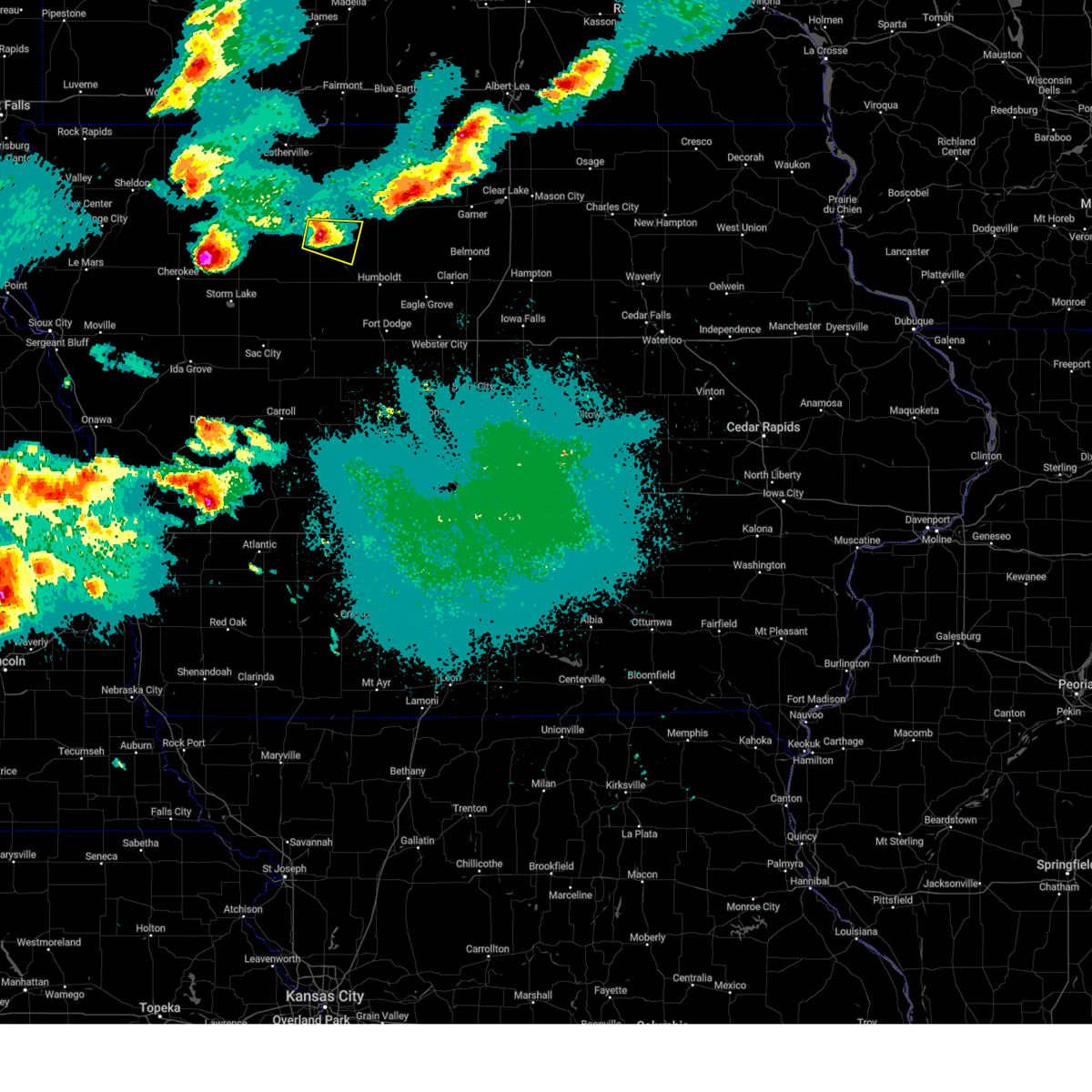
| 5/20/2024 9:21 PM CDT | Golf Ball sized hail reported 0.2 miles SW of Mallard, IA, slightly larger than golfball size. time estimated from radar. |
| 5/20/2024 9:21 PM CDT | Hen Egg sized hail reported 0.2 miles SW of Mallard, IA, corrects previous hail report from mallard. slightly larger than golfball size. time estimated from radar. |
| 5/20/2024 9:16 PM CDT |
 The warning has expired. however, large hail is still possible with this thunderstorm. a severe thunderstorm watch remains in effect until midnight cdt for northwestern iowa. remember, a severe thunderstorm warning still remains in effect for palo alto, pocahontas, humboldt, and kossuth counties. The warning has expired. however, large hail is still possible with this thunderstorm. a severe thunderstorm watch remains in effect until midnight cdt for northwestern iowa. remember, a severe thunderstorm warning still remains in effect for palo alto, pocahontas, humboldt, and kossuth counties.
|
| 5/20/2024 9:13 PM CDT |
 Svrdmx the national weather service in des moines has issued a * severe thunderstorm warning for, northern pocahontas county in northwestern iowa, southwestern kossuth county in north central iowa, northwestern humboldt county in north central iowa, southern palo alto county in northwestern iowa, * until 1000 pm cdt. * at 913 pm cdt, a severe thunderstorm was located over mallard, or 12 miles south of emmetsburg, moving east at 20 mph (radar indicated). Hazards include two inch hail and 60 mph wind gusts. People and animals outdoors will be injured. expect hail damage to roofs, siding, windows, and vehicles. Expect wind damage to roofs, siding, and trees. Svrdmx the national weather service in des moines has issued a * severe thunderstorm warning for, northern pocahontas county in northwestern iowa, southwestern kossuth county in north central iowa, northwestern humboldt county in north central iowa, southern palo alto county in northwestern iowa, * until 1000 pm cdt. * at 913 pm cdt, a severe thunderstorm was located over mallard, or 12 miles south of emmetsburg, moving east at 20 mph (radar indicated). Hazards include two inch hail and 60 mph wind gusts. People and animals outdoors will be injured. expect hail damage to roofs, siding, windows, and vehicles. Expect wind damage to roofs, siding, and trees.
|
| 5/20/2024 9:05 PM CDT |
 At 904 pm cdt, a severe thunderstorm was located near curlew, or 13 miles southwest of emmetsburg, moving east at 25 mph (radar indicated). Hazards include two inch hail and 60 mph wind gusts. People and animals outdoors will be injured. expect hail damage to roofs, siding, windows, and vehicles. expect wind damage to roofs, siding, and trees. Locations impacted include, laurens, silver lake, rush lake, mallard, ayrshire, havelock, plover, and curlew. At 904 pm cdt, a severe thunderstorm was located near curlew, or 13 miles southwest of emmetsburg, moving east at 25 mph (radar indicated). Hazards include two inch hail and 60 mph wind gusts. People and animals outdoors will be injured. expect hail damage to roofs, siding, windows, and vehicles. expect wind damage to roofs, siding, and trees. Locations impacted include, laurens, silver lake, rush lake, mallard, ayrshire, havelock, plover, and curlew.
|
| 5/20/2024 8:54 PM CDT |
 At 852 pm cdt, a severe thunderstorm was located over rush lake, or 14 miles southwest of emmetsburg, moving east at 25 mph. this is a destructive storm for palo alto and pocahontas counties (trained weather spotters reported baseball sized hail near royal). Hazards include baseball size hail and 60 mph wind gusts. People and animals outdoors will be severely injured. expect shattered windows, extensive damage to roofs, siding, and vehicles. Locations impacted include, pocahontas, laurens, silver lake, rush lake, mallard, ayrshire, havelock, plover, curlew, and pocahontas municipal airport. At 852 pm cdt, a severe thunderstorm was located over rush lake, or 14 miles southwest of emmetsburg, moving east at 25 mph. this is a destructive storm for palo alto and pocahontas counties (trained weather spotters reported baseball sized hail near royal). Hazards include baseball size hail and 60 mph wind gusts. People and animals outdoors will be severely injured. expect shattered windows, extensive damage to roofs, siding, and vehicles. Locations impacted include, pocahontas, laurens, silver lake, rush lake, mallard, ayrshire, havelock, plover, curlew, and pocahontas municipal airport.
|
| 5/20/2024 8:41 PM CDT |
 At 840 pm cdt, a severe thunderstorm was located over rush lake, or 16 miles southwest of emmetsburg, moving southeast at 25 mph. this is a destructive storm for palo alto and pocahontas counties (trained weather spotters reported baseball sized hail near royal). Hazards include baseball size hail and 60 mph wind gusts. People and animals outdoors will be severely injured. expect shattered windows, extensive damage to roofs, siding, and vehicles. Locations impacted include, emmetsburg, pocahontas, laurens, silver lake, rush lake, mallard, ayrshire, havelock, cylinder, plover, curlew, pocahontas municipal airport, and emmetsburg municipal airport. At 840 pm cdt, a severe thunderstorm was located over rush lake, or 16 miles southwest of emmetsburg, moving southeast at 25 mph. this is a destructive storm for palo alto and pocahontas counties (trained weather spotters reported baseball sized hail near royal). Hazards include baseball size hail and 60 mph wind gusts. People and animals outdoors will be severely injured. expect shattered windows, extensive damage to roofs, siding, and vehicles. Locations impacted include, emmetsburg, pocahontas, laurens, silver lake, rush lake, mallard, ayrshire, havelock, cylinder, plover, curlew, pocahontas municipal airport, and emmetsburg municipal airport.
|
| 5/20/2024 8:25 PM CDT |
 Svrdmx the national weather service in des moines has issued a * severe thunderstorm warning for, northwestern pocahontas county in northwestern iowa, southern palo alto county in northwestern iowa, * until 915 pm cdt. * at 824 pm cdt, a severe thunderstorm was located over gillett grove, or 11 miles southeast of spencer in clay county, moving east at 25 mph (radar indicated). Hazards include two inch hail and 60 mph wind gusts. People and animals outdoors will be injured. expect hail damage to roofs, siding, windows, and vehicles. Expect wind damage to roofs, siding, and trees. Svrdmx the national weather service in des moines has issued a * severe thunderstorm warning for, northwestern pocahontas county in northwestern iowa, southern palo alto county in northwestern iowa, * until 915 pm cdt. * at 824 pm cdt, a severe thunderstorm was located over gillett grove, or 11 miles southeast of spencer in clay county, moving east at 25 mph (radar indicated). Hazards include two inch hail and 60 mph wind gusts. People and animals outdoors will be injured. expect hail damage to roofs, siding, windows, and vehicles. Expect wind damage to roofs, siding, and trees.
|
| 8/11/2023 8:58 PM CDT | Quarter sized hail reported 0.2 miles SW of Mallard, IA |
| 8/11/2023 8:41 PM CDT |
 At 841 pm cdt, a severe thunderstorm was located near webb, or 18 miles southeast of spencer in clay county, moving east at 50 mph (radar indicated). Hazards include 60 mph wind gusts and quarter size hail. Hail damage to vehicles is expected. Expect wind damage to roofs, siding, and trees. At 841 pm cdt, a severe thunderstorm was located near webb, or 18 miles southeast of spencer in clay county, moving east at 50 mph (radar indicated). Hazards include 60 mph wind gusts and quarter size hail. Hail damage to vehicles is expected. Expect wind damage to roofs, siding, and trees.
|
| 5/13/2023 7:39 PM CDT |
 At 739 pm cdt, a severe thunderstorm capable of producing a tornado was located near mallard, or 12 miles south of emmetsburg, moving north at 15 mph (radar indicated rotation). Hazards include tornado. Flying debris will be dangerous to those caught without shelter. mobile homes will be damaged or destroyed. damage to roofs, windows, and vehicles will occur. tree damage is likely. This dangerous storm will be near, curlew around 750 pm cdt. At 739 pm cdt, a severe thunderstorm capable of producing a tornado was located near mallard, or 12 miles south of emmetsburg, moving north at 15 mph (radar indicated rotation). Hazards include tornado. Flying debris will be dangerous to those caught without shelter. mobile homes will be damaged or destroyed. damage to roofs, windows, and vehicles will occur. tree damage is likely. This dangerous storm will be near, curlew around 750 pm cdt.
|
| 5/13/2023 7:33 PM CDT |
 At 733 pm cdt, a severe thunderstorm capable of producing a tornado was located near mallard, or 12 miles north of pocahontas, moving north at 15 mph (radar indicated rotation). Hazards include tornado. Flying debris will be dangerous to those caught without shelter. mobile homes will be damaged or destroyed. damage to roofs, windows, and vehicles will occur. tree damage is likely. this dangerous storm will be near, mallard around 740 pm cdt. Other locations in the path of this tornadic thunderstorm include curlew. At 733 pm cdt, a severe thunderstorm capable of producing a tornado was located near mallard, or 12 miles north of pocahontas, moving north at 15 mph (radar indicated rotation). Hazards include tornado. Flying debris will be dangerous to those caught without shelter. mobile homes will be damaged or destroyed. damage to roofs, windows, and vehicles will occur. tree damage is likely. this dangerous storm will be near, mallard around 740 pm cdt. Other locations in the path of this tornadic thunderstorm include curlew.
|
| 5/13/2023 7:26 PM CDT |
 At 726 pm cdt, a confirmed tornado was located 4 miles south of mallard, or 9 miles north of pocahontas, moving north at 15 mph (law enforcement confirmed tornado). Hazards include damaging tornado. Flying debris will be dangerous to those caught without shelter. mobile homes will be damaged or destroyed. damage to roofs, windows, and vehicles will occur. tree damage is likely. the tornado will be near, mallard around 740 pm cdt. Other locations in the path of this tornadic thunderstorm include curlew. At 726 pm cdt, a confirmed tornado was located 4 miles south of mallard, or 9 miles north of pocahontas, moving north at 15 mph (law enforcement confirmed tornado). Hazards include damaging tornado. Flying debris will be dangerous to those caught without shelter. mobile homes will be damaged or destroyed. damage to roofs, windows, and vehicles will occur. tree damage is likely. the tornado will be near, mallard around 740 pm cdt. Other locations in the path of this tornadic thunderstorm include curlew.
|
| 8/27/2022 9:35 PM CDT | The severe thunderstorm warning for northern pocahontas and southwestern palo alto counties will expire at 945 pm cdt, the storm which prompted the warning has weakened below severe limits, and has exited the warned area. therefore, the warning will be allowed to expire. however heavy rain is still possible with this thunderstorm. |
| 8/27/2022 9:29 PM CDT | At 929 pm cdt, a severe thunderstorm was located over laurens, or 12 miles northwest of pocahontas, moving northeast at 30 mph (radar indicated). Hazards include 60 mph wind gusts. Expect damage to roofs, siding, and trees. locations impacted include, mallard, ayrshire and curlew. hail threat, radar indicated max hail size, <. 75 in wind threat, radar indicated max wind gust, 60 mph. |
| 8/27/2022 9:06 PM CDT | At 906 pm cdt, a severe thunderstorm was located near albert city, or 14 miles northeast of storm lake, moving northeast at 30 mph (radar indicated). Hazards include 60 mph wind gusts. Expect damage to roofs, siding, and trees. this severe thunderstorm will be near, laurens around 925 pm cdt. other locations in the path of this severe thunderstorm include havelock, rush lake, mallard, ayrshire and curlew. hail threat, radar indicated max hail size, <. 75 in wind threat, radar indicated max wind gust, 60 mph. |
| 8/24/2022 5:11 PM CDT | At 510 pm cdt, a severe thunderstorm was located near pocahontas, moving southeast at 15 mph (radar indicated). Hazards include 60 mph wind gusts and half dollar size hail. Hail damage to vehicles is expected. expect wind damage to roofs, siding, and trees. this severe storm will be near, plover around 515 pm cdt. other locations in the path of this severe thunderstorm include pocahontas, rolfe, pocahontas municipal airport, gilmore city and palmer. hail threat, radar indicated max hail size, 1. 25 in wind threat, radar indicated max wind gust, 60 mph. |
| 8/24/2022 5:06 PM CDT | At 506 pm cdt, a severe thunderstorm was located near laurens, or 7 miles north of pocahontas, moving southeast at 15 mph (radar indicated). Hazards include 60 mph wind gusts and quarter size hail. Hail damage to vehicles is expected. expect wind damage to roofs, siding, and trees. this severe thunderstorm will be near, havelock around 510 pm cdt. plover around 515 pm cdt. other locations in the path of this severe thunderstorm include pocahontas, rolfe, pocahontas municipal airport, gilmore city and palmer. hail threat, radar indicated max hail size, 1. 00 in wind threat, radar indicated max wind gust, 60 mph. |
| 8/6/2022 5:24 PM CDT |
 At 524 pm cdt, a severe thunderstorm was located 9 miles southeast of five island lake, or 9 miles east of emmetsburg, moving east at 30 mph (radar indicated). Hazards include 60 mph wind gusts and quarter size hail. Hail damage to vehicles is expected. expect wind damage to roofs, siding, and trees. this severe storm will be near, whittemore around 530 pm cdt. other locations in the path of this severe thunderstorm include stinson prairie state park. hail threat, radar indicated max hail size, 1. 00 in wind threat, radar indicated max wind gust, 60 mph. At 524 pm cdt, a severe thunderstorm was located 9 miles southeast of five island lake, or 9 miles east of emmetsburg, moving east at 30 mph (radar indicated). Hazards include 60 mph wind gusts and quarter size hail. Hail damage to vehicles is expected. expect wind damage to roofs, siding, and trees. this severe storm will be near, whittemore around 530 pm cdt. other locations in the path of this severe thunderstorm include stinson prairie state park. hail threat, radar indicated max hail size, 1. 00 in wind threat, radar indicated max wind gust, 60 mph.
|
| 8/6/2022 5:11 PM CDT |
 At 511 pm cdt, a severe thunderstorm was located near emmetsburg, moving east at 30 mph (radar indicated). Hazards include 60 mph wind gusts and quarter size hail. Hail damage to vehicles is expected. expect wind damage to roofs, siding, and trees. locations impacted include, cylinder, rodman, west bend, whittemore and stinson prairie state park. hail threat, radar indicated max hail size, 1. 00 in wind threat, radar indicated max wind gust, 60 mph. At 511 pm cdt, a severe thunderstorm was located near emmetsburg, moving east at 30 mph (radar indicated). Hazards include 60 mph wind gusts and quarter size hail. Hail damage to vehicles is expected. expect wind damage to roofs, siding, and trees. locations impacted include, cylinder, rodman, west bend, whittemore and stinson prairie state park. hail threat, radar indicated max hail size, 1. 00 in wind threat, radar indicated max wind gust, 60 mph.
|
| 8/6/2022 4:57 PM CDT |
 At 457 pm cdt, a severe thunderstorm was located near emmetsburg, moving east at 30 mph (radar indicated). Hazards include 60 mph wind gusts and nickel size hail. Expect damage to roofs, siding, and trees. this severe thunderstorm will be near, mallard around 500 pm cdt. emmetsburg municipal airport around 505 pm cdt. emmetsburg and kearney state park around 510 pm cdt. other locations in the path of this severe thunderstorm include cylinder, rodman, west bend, whittemore and stinson prairie state park. hail threat, radar indicated max hail size, 0. 88 in wind threat, radar indicated max wind gust, 60 mph. At 457 pm cdt, a severe thunderstorm was located near emmetsburg, moving east at 30 mph (radar indicated). Hazards include 60 mph wind gusts and nickel size hail. Expect damage to roofs, siding, and trees. this severe thunderstorm will be near, mallard around 500 pm cdt. emmetsburg municipal airport around 505 pm cdt. emmetsburg and kearney state park around 510 pm cdt. other locations in the path of this severe thunderstorm include cylinder, rodman, west bend, whittemore and stinson prairie state park. hail threat, radar indicated max hail size, 0. 88 in wind threat, radar indicated max wind gust, 60 mph.
|
| 7/5/2022 6:00 PM CDT |
 At 600 pm cdt, severe thunderstorms were located along a line extending from near five island lake to near pocahontas to 9 miles northwest of north twin lake to 6 miles northeast of sac city, moving east at 45 mph (radar indicated). Hazards include 60 mph wind gusts. Expect damage to roofs, siding, and trees. locations impacted include, estherville, emmetsburg, sac city, pocahontas, rockwell city, manson, laurens, swan lake, five island lake, ingham lake, iowa lake, north twin lake, high lake, lost island lake, south twin lake, okamanpedan lake, silver lake, rush lake, armstrong and graettinger. hail threat, radar indicated max hail size, <. 75 in wind threat, radar indicated max wind gust, 60 mph. At 600 pm cdt, severe thunderstorms were located along a line extending from near five island lake to near pocahontas to 9 miles northwest of north twin lake to 6 miles northeast of sac city, moving east at 45 mph (radar indicated). Hazards include 60 mph wind gusts. Expect damage to roofs, siding, and trees. locations impacted include, estherville, emmetsburg, sac city, pocahontas, rockwell city, manson, laurens, swan lake, five island lake, ingham lake, iowa lake, north twin lake, high lake, lost island lake, south twin lake, okamanpedan lake, silver lake, rush lake, armstrong and graettinger. hail threat, radar indicated max hail size, <. 75 in wind threat, radar indicated max wind gust, 60 mph.
|
| 7/5/2022 5:31 PM CDT |
 At 530 pm cdt, severe thunderstorms were located along a line extending from near spencer in clay county to near sioux rapids to storm lake to near galva, moving east at 45 mph (radar indicated). Hazards include 60 mph wind gusts. expect damage to roofs, siding, and trees At 530 pm cdt, severe thunderstorms were located along a line extending from near spencer in clay county to near sioux rapids to storm lake to near galva, moving east at 45 mph (radar indicated). Hazards include 60 mph wind gusts. expect damage to roofs, siding, and trees
|
| 5/12/2022 9:06 PM CDT |
 The severe thunderstorm warning for emmet, northern pocahontas, western kossuth, northwestern humboldt and palo alto counties will expire at 915 pm cdt, the storms which prompted the warning have weakened below severe limits, and no longer pose an immediate threat to life or property. therefore, the warning will be allowed to expire. a severe thunderstorm watch remains in effect until midnight cdt for north central and northwestern iowa. The severe thunderstorm warning for emmet, northern pocahontas, western kossuth, northwestern humboldt and palo alto counties will expire at 915 pm cdt, the storms which prompted the warning have weakened below severe limits, and no longer pose an immediate threat to life or property. therefore, the warning will be allowed to expire. a severe thunderstorm watch remains in effect until midnight cdt for north central and northwestern iowa.
|
| 5/12/2022 8:48 PM CDT |
 At 848 pm cdt, severe thunderstorms were located along a line extending from near jackson in jackson county to 8 miles east of five island lake to 8 miles north of manson, moving northeast at 70 mph (radar indicated). Hazards include 60 mph wind gusts. Expect damage to roofs, siding, and trees. locations impacted include, ringsted, lone rock, swea city, bode, ottosen, stinson prairie state park and algona municipal airport. hail threat, radar indicated max hail size, <. 75 in wind threat, radar indicated max wind gust, 60 mph. At 848 pm cdt, severe thunderstorms were located along a line extending from near jackson in jackson county to 8 miles east of five island lake to 8 miles north of manson, moving northeast at 70 mph (radar indicated). Hazards include 60 mph wind gusts. Expect damage to roofs, siding, and trees. locations impacted include, ringsted, lone rock, swea city, bode, ottosen, stinson prairie state park and algona municipal airport. hail threat, radar indicated max hail size, <. 75 in wind threat, radar indicated max wind gust, 60 mph.
|
| 5/12/2022 8:34 PM CDT |
 At 833 pm cdt, severe thunderstorms were located along a line extending from orleans to 10 miles east of rush lake to near south twin lake, moving northeast at 70 mph. this storm is producing a lot of blowing dust and possible gustnadoes (radar indicated). Hazards include 60 mph wind gusts. Expect damage to roofs, siding, and trees. severe thunderstorms will be near, rodman and emmetsburg municipal airport around 840 pm cdt. emmetsburg, five island lake, whittemore, cylinder and kearney state park around 845 pm cdt. fenton around 850 pm cdt. other locations in the path of these severe thunderstorms include rolfe, gilmore city, ringsted, lone rock, rutland, bradgate, swea city, bode, ottosen, stinson prairie state park and algona municipal airport. hail threat, radar indicated max hail size, <. 75 in wind threat, radar indicated max wind gust, 60 mph. At 833 pm cdt, severe thunderstorms were located along a line extending from orleans to 10 miles east of rush lake to near south twin lake, moving northeast at 70 mph. this storm is producing a lot of blowing dust and possible gustnadoes (radar indicated). Hazards include 60 mph wind gusts. Expect damage to roofs, siding, and trees. severe thunderstorms will be near, rodman and emmetsburg municipal airport around 840 pm cdt. emmetsburg, five island lake, whittemore, cylinder and kearney state park around 845 pm cdt. fenton around 850 pm cdt. other locations in the path of these severe thunderstorms include rolfe, gilmore city, ringsted, lone rock, rutland, bradgate, swea city, bode, ottosen, stinson prairie state park and algona municipal airport. hail threat, radar indicated max hail size, <. 75 in wind threat, radar indicated max wind gust, 60 mph.
|
| 5/12/2022 6:15 PM CDT |
 At 614 pm cdt, severe thunderstorms were located along a line extending from near heron lake to near orleans to near greenville, moving east at 45 mph (radar indicated). Hazards include 60 mph wind gusts. expect damage to roofs, siding, and trees At 614 pm cdt, severe thunderstorms were located along a line extending from near heron lake to near orleans to near greenville, moving east at 45 mph (radar indicated). Hazards include 60 mph wind gusts. expect damage to roofs, siding, and trees
|
| 4/12/2022 6:38 PM CDT |
 At 638 pm cdt, a severe thunderstorm was located over rush lake, or 14 miles southwest of emmetsburg, moving northeast at 80 mph (radar indicated). Hazards include 60 mph wind gusts and half dollar size hail. Hail damage to vehicles is expected. expect wind damage to roofs, siding, and trees. This severe thunderstorm will be near, emmetsburg and five island lake around 650 pm cdt. At 638 pm cdt, a severe thunderstorm was located over rush lake, or 14 miles southwest of emmetsburg, moving northeast at 80 mph (radar indicated). Hazards include 60 mph wind gusts and half dollar size hail. Hail damage to vehicles is expected. expect wind damage to roofs, siding, and trees. This severe thunderstorm will be near, emmetsburg and five island lake around 650 pm cdt.
|
| 4/12/2022 5:46 PM CDT |
 At 545 pm cdt, the leading edge of a cluster of severe thunderstorms was located 8 miles east of pocahontas, moving northeast at 60 mph (radar indicated). Hazards include 60 mph wind gusts and quarter size hail. Hail damage to vehicles is expected. Expect wind damage to roofs, siding, and trees. At 545 pm cdt, the leading edge of a cluster of severe thunderstorms was located 8 miles east of pocahontas, moving northeast at 60 mph (radar indicated). Hazards include 60 mph wind gusts and quarter size hail. Hail damage to vehicles is expected. Expect wind damage to roofs, siding, and trees.
|
| 12/15/2021 6:02 PM CST |
 At 601 pm cst, severe thunderstorms were located along a line extending from 6 miles north of union slogh to near webster city, moving northeast at 80 mph. these are destructive storms for portions of central and northern iowa (radar indicated). Hazards include 80 mph wind gusts. Flying debris will be dangerous to those caught without shelter. mobile homes will be heavily damaged. expect considerable damage to roofs, windows, and vehicles. extensive tree damage and power outages are likely. Locations impacted include, fort dodge, boone, algona, emmetsburg, dakota city, humboldt, madrid, ogden, gowrie, swan lake, five island lake, ingham lake, iowa lake, fort dodge regional airport, high lake, okamanpedan lake, boone speedway, armstrong, graettinger and dayton. At 601 pm cst, severe thunderstorms were located along a line extending from 6 miles north of union slogh to near webster city, moving northeast at 80 mph. these are destructive storms for portions of central and northern iowa (radar indicated). Hazards include 80 mph wind gusts. Flying debris will be dangerous to those caught without shelter. mobile homes will be heavily damaged. expect considerable damage to roofs, windows, and vehicles. extensive tree damage and power outages are likely. Locations impacted include, fort dodge, boone, algona, emmetsburg, dakota city, humboldt, madrid, ogden, gowrie, swan lake, five island lake, ingham lake, iowa lake, fort dodge regional airport, high lake, okamanpedan lake, boone speedway, armstrong, graettinger and dayton.
|
| 12/15/2021 5:48 PM CST |
 At 547 pm cst, severe thunderstorms were located along a line extending from 9 miles east of five island lake to 10 miles east of gowrie, moving northeast at 80 mph. these are destructive storms for portions of central and northern iowa (radar indicated). Hazards include 80 mph wind gusts. Flying debris will be dangerous to those caught without shelter. mobile homes will be heavily damaged. expect considerable damage to roofs, windows, and vehicles. extensive tree damage and power outages are likely. These severe thunderstorms will remain over mainly rural areas of greene, emmet, webster, pocahontas, kossuth, eastern calhoun, humboldt, boone and palo alto counties, including the following locations, ayrshire, woodman hollow state park, kearney state park, curlew, whittemore, ottosen, pomeroy, jolley, jefferson municipal airport and swea city. At 547 pm cst, severe thunderstorms were located along a line extending from 9 miles east of five island lake to 10 miles east of gowrie, moving northeast at 80 mph. these are destructive storms for portions of central and northern iowa (radar indicated). Hazards include 80 mph wind gusts. Flying debris will be dangerous to those caught without shelter. mobile homes will be heavily damaged. expect considerable damage to roofs, windows, and vehicles. extensive tree damage and power outages are likely. These severe thunderstorms will remain over mainly rural areas of greene, emmet, webster, pocahontas, kossuth, eastern calhoun, humboldt, boone and palo alto counties, including the following locations, ayrshire, woodman hollow state park, kearney state park, curlew, whittemore, ottosen, pomeroy, jolley, jefferson municipal airport and swea city.
|
| 12/15/2021 5:19 PM CST |
 At 518 pm cst, severe thunderstorms were located along a line extending from sioux rapids to near coon rapids, moving northeast at 80 mph. these are destructive storms for portions of central iowa (radar indicated). Hazards include 80 mph wind gusts. Flying debris will be dangerous to those caught without shelter. mobile homes will be heavily damaged. expect considerable damage to roofs, windows, and vehicles. extensive tree damage and power outages are likely. severe thunderstorms will be near, silver lake and rush lake around 530 pm cst. jefferson around 535 pm cst. Other locations in the path of these severe thunderstorms include emmetsburg and five island lake. At 518 pm cst, severe thunderstorms were located along a line extending from sioux rapids to near coon rapids, moving northeast at 80 mph. these are destructive storms for portions of central iowa (radar indicated). Hazards include 80 mph wind gusts. Flying debris will be dangerous to those caught without shelter. mobile homes will be heavily damaged. expect considerable damage to roofs, windows, and vehicles. extensive tree damage and power outages are likely. severe thunderstorms will be near, silver lake and rush lake around 530 pm cst. jefferson around 535 pm cst. Other locations in the path of these severe thunderstorms include emmetsburg and five island lake.
|
| 7/11/2020 3:57 PM CDT |
 The severe thunderstorm warning for eastern pocahontas, west central humboldt and south central palo alto counties will expire at 400 pm cdt, the storm which prompted the warning has weakened below severe limits, and no longer poses an immediate threat to life or property. therefore, the warning will be allowed to expire. however small hail and heavy rain are still possible with this thunderstorm. a severe thunderstorm watch remains in effect until 800 pm cdt for north central and northwestern iowa. The severe thunderstorm warning for eastern pocahontas, west central humboldt and south central palo alto counties will expire at 400 pm cdt, the storm which prompted the warning has weakened below severe limits, and no longer poses an immediate threat to life or property. therefore, the warning will be allowed to expire. however small hail and heavy rain are still possible with this thunderstorm. a severe thunderstorm watch remains in effect until 800 pm cdt for north central and northwestern iowa.
|
| 7/11/2020 3:38 PM CDT |
 At 338 pm cdt, a severe thunderstorm was located near pocahontas, moving southeast at 30 mph (radar indicated). Hazards include 60 mph wind gusts and quarter size hail. Hail damage to vehicles is expected. expect wind damage to roofs, siding, and trees. Locations impacted include, pocahontas, rolfe, gilmore city, mallard, palmer, havelock, bradgate, plover and pocahontas municipal airport. At 338 pm cdt, a severe thunderstorm was located near pocahontas, moving southeast at 30 mph (radar indicated). Hazards include 60 mph wind gusts and quarter size hail. Hail damage to vehicles is expected. expect wind damage to roofs, siding, and trees. Locations impacted include, pocahontas, rolfe, gilmore city, mallard, palmer, havelock, bradgate, plover and pocahontas municipal airport.
|
| 7/11/2020 3:20 PM CDT |
 At 320 pm cdt, a severe thunderstorm was located 7 miles east of rush lake, or 13 miles south of emmetsburg, moving southeast at 30 mph (radar indicated). Hazards include ping pong ball size hail and 60 mph wind gusts. People and animals outdoors will be injured. expect hail damage to roofs, siding, windows, and vehicles. Expect wind damage to roofs, siding, and trees. At 320 pm cdt, a severe thunderstorm was located 7 miles east of rush lake, or 13 miles south of emmetsburg, moving southeast at 30 mph (radar indicated). Hazards include ping pong ball size hail and 60 mph wind gusts. People and animals outdoors will be injured. expect hail damage to roofs, siding, windows, and vehicles. Expect wind damage to roofs, siding, and trees.
|
| 7/11/2020 3:14 PM CDT |
 At 314 pm cdt, a severe thunderstorm was located near silver lake, or near emmetsburg, moving southeast at 35 mph (radar indicated). Hazards include 60 mph wind gusts and quarter size hail. Hail damage to vehicles is expected. expect wind damage to roofs, siding, and trees. Locations impacted include, emmetsburg, five island lake, mallard, ayrshire, cylinder, curlew, rodman and emmetsburg municipal airport. At 314 pm cdt, a severe thunderstorm was located near silver lake, or near emmetsburg, moving southeast at 35 mph (radar indicated). Hazards include 60 mph wind gusts and quarter size hail. Hail damage to vehicles is expected. expect wind damage to roofs, siding, and trees. Locations impacted include, emmetsburg, five island lake, mallard, ayrshire, cylinder, curlew, rodman and emmetsburg municipal airport.
|
| 7/11/2020 3:04 PM CDT |
 At 304 pm cdt, a severe thunderstorm was located near silver lake, or 8 miles west of emmetsburg, moving southeast at 35 mph (radar indicated). Hazards include 60 mph wind gusts and quarter size hail. Hail damage to vehicles is expected. expect wind damage to roofs, siding, and trees. Locations impacted include, emmetsburg, silver lake, five island lake, ruthven, mallard, ayrshire, cylinder, curlew, rodman, kearney state park and emmetsburg municipal airport. At 304 pm cdt, a severe thunderstorm was located near silver lake, or 8 miles west of emmetsburg, moving southeast at 35 mph (radar indicated). Hazards include 60 mph wind gusts and quarter size hail. Hail damage to vehicles is expected. expect wind damage to roofs, siding, and trees. Locations impacted include, emmetsburg, silver lake, five island lake, ruthven, mallard, ayrshire, cylinder, curlew, rodman, kearney state park and emmetsburg municipal airport.
|
| 7/11/2020 2:48 PM CDT |
 At 248 pm cdt, a severe thunderstorm was located near lost island lake, or 8 miles northeast of spencer in clay county, moving southeast at 35 mph (radar indicated). Hazards include ping pong ball size hail and 60 mph wind gusts. People and animals outdoors will be injured. expect hail damage to roofs, siding, windows, and vehicles. Expect wind damage to roofs, siding, and trees. At 248 pm cdt, a severe thunderstorm was located near lost island lake, or 8 miles northeast of spencer in clay county, moving southeast at 35 mph (radar indicated). Hazards include ping pong ball size hail and 60 mph wind gusts. People and animals outdoors will be injured. expect hail damage to roofs, siding, windows, and vehicles. Expect wind damage to roofs, siding, and trees.
|
| 6/9/2020 8:57 PM CDT |
 The severe thunderstorm warning for southwestern emmet, northern pocahontas and palo alto counties will expire at 900 pm cdt, the storms which prompted the warning have weakened below severe limits, and no longer pose an immediate threat to life or property. therefore, the warning will be allowed to expire. however, gusty winds are still possible with these thunderstorms. The severe thunderstorm warning for southwestern emmet, northern pocahontas and palo alto counties will expire at 900 pm cdt, the storms which prompted the warning have weakened below severe limits, and no longer pose an immediate threat to life or property. therefore, the warning will be allowed to expire. however, gusty winds are still possible with these thunderstorms.
|
| 6/9/2020 8:48 PM CDT |
 At 848 pm cdt, severe thunderstorms were located along a line extending from superior to near emmetsburg to near laurens, moving east at 30 mph (radar indicated). Hazards include 60 mph wind gusts. Expect damage to roofs, siding, and trees. Locations impacted include, estherville, emmetsburg, laurens, five island lake, ingham lake, high lake, lost island lake, silver lake, rush lake, swan lake, graettinger, ruthven, rolfe, mallard, wallingford, ayrshire, havelock, cylinder, plover and curlew. At 848 pm cdt, severe thunderstorms were located along a line extending from superior to near emmetsburg to near laurens, moving east at 30 mph (radar indicated). Hazards include 60 mph wind gusts. Expect damage to roofs, siding, and trees. Locations impacted include, estherville, emmetsburg, laurens, five island lake, ingham lake, high lake, lost island lake, silver lake, rush lake, swan lake, graettinger, ruthven, rolfe, mallard, wallingford, ayrshire, havelock, cylinder, plover and curlew.
|
| 6/9/2020 8:29 PM CDT |
 At 829 pm cdt, severe thunderstorms were located along a line extending from near spirit lake to silver lake to laurens, moving east at 35 mph (radar indicated). Hazards include 70 mph wind gusts. Expect considerable tree damage. damage is likely to mobile homes, roofs, and outbuildings. Locations impacted include, estherville, emmetsburg, laurens, five island lake, ingham lake, high lake, lost island lake, silver lake, rush lake, swan lake, graettinger, ruthven, rolfe, mallard, wallingford, ayrshire, havelock, gruver, cylinder and plover. At 829 pm cdt, severe thunderstorms were located along a line extending from near spirit lake to silver lake to laurens, moving east at 35 mph (radar indicated). Hazards include 70 mph wind gusts. Expect considerable tree damage. damage is likely to mobile homes, roofs, and outbuildings. Locations impacted include, estherville, emmetsburg, laurens, five island lake, ingham lake, high lake, lost island lake, silver lake, rush lake, swan lake, graettinger, ruthven, rolfe, mallard, wallingford, ayrshire, havelock, gruver, cylinder and plover.
|
| 6/9/2020 8:09 PM CDT |
 At 808 pm cdt, severe thunderstorms were located along a line extending from wahpeton to near silver lake to near laurens, moving east at 35 mph (radar indicated). Hazards include 70 mph wind gusts. the spencer airport reported a 63 mph wind gust at 8:03pm. Expect considerable tree damage. Damage is likely to mobile homes, roofs, and outbuildings. At 808 pm cdt, severe thunderstorms were located along a line extending from wahpeton to near silver lake to near laurens, moving east at 35 mph (radar indicated). Hazards include 70 mph wind gusts. the spencer airport reported a 63 mph wind gust at 8:03pm. Expect considerable tree damage. Damage is likely to mobile homes, roofs, and outbuildings.
|
| 6/5/2020 1:48 AM CDT |
 At 148 am cdt, a severe thunderstorm was located 11 miles southwest of algona, moving southeast at 35 mph (radar indicated). Hazards include 60 mph wind gusts and quarter size hail. Hail damage to vehicles is expected. expect wind damage to roofs, siding, and trees. locations impacted include, emmetsburg, humboldt, west bend, rolfe, whittemore, livermore, bode, mallard, lu verne, rutland, cylinder, bradgate, plover, st. Joseph, curlew, ottosen, rodman, irvington, stinson prairie state park and humboldt municipal airport. At 148 am cdt, a severe thunderstorm was located 11 miles southwest of algona, moving southeast at 35 mph (radar indicated). Hazards include 60 mph wind gusts and quarter size hail. Hail damage to vehicles is expected. expect wind damage to roofs, siding, and trees. locations impacted include, emmetsburg, humboldt, west bend, rolfe, whittemore, livermore, bode, mallard, lu verne, rutland, cylinder, bradgate, plover, st. Joseph, curlew, ottosen, rodman, irvington, stinson prairie state park and humboldt municipal airport.
|
| 6/5/2020 1:15 AM CDT |
 At 115 am cdt, a severe thunderstorm was located near emmetsburg, moving southeast at 35 mph (radar indicated). Hazards include 60 mph wind gusts and quarter size hail. Hail damage to vehicles is expected. Expect wind damage to roofs, siding, and trees. At 115 am cdt, a severe thunderstorm was located near emmetsburg, moving southeast at 35 mph (radar indicated). Hazards include 60 mph wind gusts and quarter size hail. Hail damage to vehicles is expected. Expect wind damage to roofs, siding, and trees.
|
| 6/5/2020 12:58 AM CDT |
 At 1258 am cdt, severe thunderstorms were located along a line extending from 8 miles south of elmore to silver lake, moving southeast at 30 mph (radar indicated). Hazards include 60 mph wind gusts and quarter size hail. Hail damage to vehicles is expected. expect wind damage to roofs, siding, and trees. Locations impacted include, algona, emmetsburg, swan lake, five island lake, ingham lake, high lake, lost island lake, silver lake, rush lake, union slogh, armstrong, graettinger, west bend, ruthven, bancroft, swea city, burt, whittemore, titonka and ringsted. At 1258 am cdt, severe thunderstorms were located along a line extending from 8 miles south of elmore to silver lake, moving southeast at 30 mph (radar indicated). Hazards include 60 mph wind gusts and quarter size hail. Hail damage to vehicles is expected. expect wind damage to roofs, siding, and trees. Locations impacted include, algona, emmetsburg, swan lake, five island lake, ingham lake, high lake, lost island lake, silver lake, rush lake, union slogh, armstrong, graettinger, west bend, ruthven, bancroft, swea city, burt, whittemore, titonka and ringsted.
|
| 6/5/2020 12:30 AM CDT |
 At 1230 am cdt, a severe thunderstorm was located over swan lake, or 10 miles east of estherville, moving southeast at 50 mph (radar indicated). Hazards include 60 mph wind gusts and quarter size hail. Hail damage to vehicles is expected. Expect wind damage to roofs, siding, and trees. At 1230 am cdt, a severe thunderstorm was located over swan lake, or 10 miles east of estherville, moving southeast at 50 mph (radar indicated). Hazards include 60 mph wind gusts and quarter size hail. Hail damage to vehicles is expected. Expect wind damage to roofs, siding, and trees.
|
| 10/1/2019 2:38 AM CDT |
 At 237 am cdt, a severe thunderstorm was located over albert city, or 14 miles northeast of storm lake, moving northeast at 50 mph (radar indicated). Hazards include 60 mph wind gusts and quarter size hail. Hail damage to vehicles is expected. Expect wind damage to roofs, siding, and trees. At 237 am cdt, a severe thunderstorm was located over albert city, or 14 miles northeast of storm lake, moving northeast at 50 mph (radar indicated). Hazards include 60 mph wind gusts and quarter size hail. Hail damage to vehicles is expected. Expect wind damage to roofs, siding, and trees.
|
| 7/20/2019 11:12 AM CDT |
 The severe thunderstorm warning for pocahontas, kossuth, northern humboldt and southeastern palo alto counties will expire at 1115 am cdt, the storms which prompted the warning have weakened below severe limits, and have exited the warned area. therefore, the warning will be allowed to expire. however gusty winds are still possible with these thunderstorms. a severe thunderstorm watch remains in effect until 400 pm cdt for north central and northwestern iowa. The severe thunderstorm warning for pocahontas, kossuth, northern humboldt and southeastern palo alto counties will expire at 1115 am cdt, the storms which prompted the warning have weakened below severe limits, and have exited the warned area. therefore, the warning will be allowed to expire. however gusty winds are still possible with these thunderstorms. a severe thunderstorm watch remains in effect until 400 pm cdt for north central and northwestern iowa.
|
| 7/20/2019 10:41 AM CDT |
 At 1014 am cdt, severe thunderstorms were located along a line extending from near iowa lake to 6 miles east of five island lake to near albert city, moving east at 55 mph (radar indicated. at 1001am a 64 mph wind gust was reported at the estherville airport). Hazards include 60 mph wind gusts. expect damage to roofs, siding, and trees At 1014 am cdt, severe thunderstorms were located along a line extending from near iowa lake to 6 miles east of five island lake to near albert city, moving east at 55 mph (radar indicated. at 1001am a 64 mph wind gust was reported at the estherville airport). Hazards include 60 mph wind gusts. expect damage to roofs, siding, and trees
|
| 7/20/2019 10:15 AM CDT |
 At 1014 am cdt, severe thunderstorms were located along a line extending from near iowa lake to 6 miles east of five island lake to near albert city, moving east at 55 mph (radar indicated. at 1001am a 64 mph wind gust was reported at the estherville airport). Hazards include 60 mph wind gusts. expect damage to roofs, siding, and trees At 1014 am cdt, severe thunderstorms were located along a line extending from near iowa lake to 6 miles east of five island lake to near albert city, moving east at 55 mph (radar indicated. at 1001am a 64 mph wind gust was reported at the estherville airport). Hazards include 60 mph wind gusts. expect damage to roofs, siding, and trees
|
| 7/20/2019 9:42 AM CDT |
 At 942 am cdt, severe thunderstorms were located along a line extending from 6 miles north of superior to near royal, moving east at 60 mph (radar indicated). Hazards include 60 mph wind gusts. expect damage to roofs, siding, and trees At 942 am cdt, severe thunderstorms were located along a line extending from 6 miles north of superior to near royal, moving east at 60 mph (radar indicated). Hazards include 60 mph wind gusts. expect damage to roofs, siding, and trees
|
| 6/27/2019 1:31 PM CDT |
 At 131 pm cdt, a severe thunderstorm was located 7 miles northwest of algona, moving east at 50 mph (radar indicated). Hazards include 60 mph wind gusts and quarter size hail. Hail damage to vehicles is expected. expect wind damage to roofs, siding, and trees. Locations impacted include, algona, emmetsburg, five island lake, west bend, swea city, whittemore, ringsted, bode, fenton, mallard, lone rock, cylinder, plover, ottosen, rodman, kearney state park, stinson prairie state park, algona municipal airport and aa call state park. At 131 pm cdt, a severe thunderstorm was located 7 miles northwest of algona, moving east at 50 mph (radar indicated). Hazards include 60 mph wind gusts and quarter size hail. Hail damage to vehicles is expected. expect wind damage to roofs, siding, and trees. Locations impacted include, algona, emmetsburg, five island lake, west bend, swea city, whittemore, ringsted, bode, fenton, mallard, lone rock, cylinder, plover, ottosen, rodman, kearney state park, stinson prairie state park, algona municipal airport and aa call state park.
|
| 6/27/2019 1:19 PM CDT |
 At 1255 pm cdt, a severe thunderstorm was located over lost island lake, or 11 miles west of emmetsburg, moving east at 50 mph. a 74 mph gust was reported at spencer at 12:42 pm (trained weather spotters). Hazards include 70 mph wind gusts and ping pong ball size hail. People and animals outdoors will be injured. expect hail damage to roofs, siding, windows, and vehicles. expect considerable tree damage. Wind damage is also likely to mobile homes, roofs, and outbuildings. At 1255 pm cdt, a severe thunderstorm was located over lost island lake, or 11 miles west of emmetsburg, moving east at 50 mph. a 74 mph gust was reported at spencer at 12:42 pm (trained weather spotters). Hazards include 70 mph wind gusts and ping pong ball size hail. People and animals outdoors will be injured. expect hail damage to roofs, siding, windows, and vehicles. expect considerable tree damage. Wind damage is also likely to mobile homes, roofs, and outbuildings.
|
| 6/27/2019 12:56 PM CDT |
 At 1255 pm cdt, a severe thunderstorm was located over lost island lake, or 11 miles west of emmetsburg, moving east at 50 mph. a 74 mph gust was reported at spencer at 12:42 pm (trained weather spotters). Hazards include 70 mph wind gusts and ping pong ball size hail. People and animals outdoors will be injured. expect hail damage to roofs, siding, windows, and vehicles. expect considerable tree damage. Wind damage is also likely to mobile homes, roofs, and outbuildings. At 1255 pm cdt, a severe thunderstorm was located over lost island lake, or 11 miles west of emmetsburg, moving east at 50 mph. a 74 mph gust was reported at spencer at 12:42 pm (trained weather spotters). Hazards include 70 mph wind gusts and ping pong ball size hail. People and animals outdoors will be injured. expect hail damage to roofs, siding, windows, and vehicles. expect considerable tree damage. Wind damage is also likely to mobile homes, roofs, and outbuildings.
|
| 9/20/2018 6:03 PM CDT |
 At 603 pm cdt, severe thunderstorms were located along a line extending from 11 miles southeast of five island lake to 12 miles northeast of pocahontas, moving northeast at 65 mph (radar indicated). Hazards include 60 mph wind gusts. Expect damage to roofs, siding, and trees. locations impacted include, pocahontas, humboldt, west bend, rolfe, gilmore city, bode, mallard, palmer, havelock, rutland, bradgate, plover, st. Joseph, ottosen, irvington, pocahontas municipal airport, aa call state park and humboldt municipal airport. At 603 pm cdt, severe thunderstorms were located along a line extending from 11 miles southeast of five island lake to 12 miles northeast of pocahontas, moving northeast at 65 mph (radar indicated). Hazards include 60 mph wind gusts. Expect damage to roofs, siding, and trees. locations impacted include, pocahontas, humboldt, west bend, rolfe, gilmore city, bode, mallard, palmer, havelock, rutland, bradgate, plover, st. Joseph, ottosen, irvington, pocahontas municipal airport, aa call state park and humboldt municipal airport.
|
| 9/20/2018 5:49 PM CDT |
 At 549 pm cdt, severe thunderstorms were located along a line extending from 9 miles east of rush lake to near pocahontas, moving northeast at 65 mph (radar indicated). Hazards include 60 mph wind gusts. expect damage to roofs, siding, and trees At 549 pm cdt, severe thunderstorms were located along a line extending from 9 miles east of rush lake to near pocahontas, moving northeast at 65 mph (radar indicated). Hazards include 60 mph wind gusts. expect damage to roofs, siding, and trees
|
| 9/20/2018 5:41 PM CDT |
 At 540 pm cdt, severe thunderstorms were located along a line extending from 6 miles south of okamanpedan lake to 6 miles east of silver lake, moving northeast at 50 mph (radar indicated). Hazards include 60 mph wind gusts. expect damage to roofs, siding, and trees At 540 pm cdt, severe thunderstorms were located along a line extending from 6 miles south of okamanpedan lake to 6 miles east of silver lake, moving northeast at 50 mph (radar indicated). Hazards include 60 mph wind gusts. expect damage to roofs, siding, and trees
|
| 9/19/2018 8:56 PM CDT |
 At 854 pm cdt, a severe thunderstorm was located over silver lake, or 12 miles southwest of emmetsburg, moving east at 30 mph (radar indicated). Hazards include 60 mph wind gusts and quarter size hail. rainfall to up to 3 inches is possible as well. Hail damage to vehicles is expected. expect wind damage to roofs, siding, and trees. Locations impacted include, emmetsburg, five island lake, silver lake, rush lake, lost island lake, west bend, ruthven, mallard, ayrshire, cylinder, plover, curlew, rodman, kearney state park, lost island lake state park and emmetsburg municipal airport. At 854 pm cdt, a severe thunderstorm was located over silver lake, or 12 miles southwest of emmetsburg, moving east at 30 mph (radar indicated). Hazards include 60 mph wind gusts and quarter size hail. rainfall to up to 3 inches is possible as well. Hail damage to vehicles is expected. expect wind damage to roofs, siding, and trees. Locations impacted include, emmetsburg, five island lake, silver lake, rush lake, lost island lake, west bend, ruthven, mallard, ayrshire, cylinder, plover, curlew, rodman, kearney state park, lost island lake state park and emmetsburg municipal airport.
|
| 9/19/2018 8:49 PM CDT |
 At 848 pm cdt, a severe thunderstorm was located near silver lake, or 13 miles southeast of spencer in clay county, moving east at 30 mph (radar indicated). Hazards include 60 mph wind gusts and quarter size hail. rainfall to up to 3 inches per hour is possible as well. Hail damage to vehicles is expected. Expect wind damage to roofs, siding, and trees. At 848 pm cdt, a severe thunderstorm was located near silver lake, or 13 miles southeast of spencer in clay county, moving east at 30 mph (radar indicated). Hazards include 60 mph wind gusts and quarter size hail. rainfall to up to 3 inches per hour is possible as well. Hail damage to vehicles is expected. Expect wind damage to roofs, siding, and trees.
|
| 9/4/2018 2:21 PM CDT |
 At 221 pm cdt, a severe thunderstorm was located near pocahontas, moving northeast at 30 mph (radar indicated). Hazards include 60 mph wind gusts and quarter size hail. Hail damage to vehicles is expected. Expect wind damage to roofs, siding, and trees. At 221 pm cdt, a severe thunderstorm was located near pocahontas, moving northeast at 30 mph (radar indicated). Hazards include 60 mph wind gusts and quarter size hail. Hail damage to vehicles is expected. Expect wind damage to roofs, siding, and trees.
|
| 8/28/2018 7:04 AM CDT |
 At 704 am cdt, severe thunderstorms were located along a line extending from 7 miles southeast of emmetsburg to 13 miles north of pocahontas, moving east at 40 mph (radar indicated). Hazards include golf ball size hail and 60 mph wind gusts. People and animals outdoors will be injured. expect hail damage to roofs, siding, windows, and vehicles. expect wind damage to roofs, siding, and trees. Locations impacted include, west bend, rolfe, mallard, cylinder, plover, curlew and rodman. At 704 am cdt, severe thunderstorms were located along a line extending from 7 miles southeast of emmetsburg to 13 miles north of pocahontas, moving east at 40 mph (radar indicated). Hazards include golf ball size hail and 60 mph wind gusts. People and animals outdoors will be injured. expect hail damage to roofs, siding, windows, and vehicles. expect wind damage to roofs, siding, and trees. Locations impacted include, west bend, rolfe, mallard, cylinder, plover, curlew and rodman.
|
| 8/28/2018 6:50 AM CDT |
 At 650 am cdt, severe thunderstorms were located along a line extending from 6 miles southwest of emmetsburg to near rush lake, moving east at 40 mph (trained weather spotters). Hazards include golf ball size hail and 60 mph wind gusts. People and animals outdoors will be injured. expect hail damage to roofs, siding, windows, and vehicles. expect wind damage to roofs, siding, and trees. Locations impacted include, emmetsburg, silver lake, rush lake, five island lake, west bend, mallard, ayrshire, cylinder, plover, curlew, rodman and emmetsburg municipal airport. At 650 am cdt, severe thunderstorms were located along a line extending from 6 miles southwest of emmetsburg to near rush lake, moving east at 40 mph (trained weather spotters). Hazards include golf ball size hail and 60 mph wind gusts. People and animals outdoors will be injured. expect hail damage to roofs, siding, windows, and vehicles. expect wind damage to roofs, siding, and trees. Locations impacted include, emmetsburg, silver lake, rush lake, five island lake, west bend, mallard, ayrshire, cylinder, plover, curlew, rodman and emmetsburg municipal airport.
|
| 8/28/2018 6:43 AM CDT |
 At 642 am cdt, severe thunderstorms were located along a line extending from near silver lake to near rush lake, moving east at 40 mph (trained weather spotters). Hazards include golf ball size hail and 60 mph wind gusts. People and animals outdoors will be injured. expect hail damage to roofs, siding, windows, and vehicles. expect wind damage to roofs, siding, and trees. Locations impacted include, emmetsburg, five island lake, silver lake, rush lake, west bend, ruthven, mallard, ayrshire, cylinder, plover, curlew, rodman, kearney state park and emmetsburg municipal airport. At 642 am cdt, severe thunderstorms were located along a line extending from near silver lake to near rush lake, moving east at 40 mph (trained weather spotters). Hazards include golf ball size hail and 60 mph wind gusts. People and animals outdoors will be injured. expect hail damage to roofs, siding, windows, and vehicles. expect wind damage to roofs, siding, and trees. Locations impacted include, emmetsburg, five island lake, silver lake, rush lake, west bend, ruthven, mallard, ayrshire, cylinder, plover, curlew, rodman, kearney state park and emmetsburg municipal airport.
|
| 8/28/2018 6:24 AM CDT |
 At 623 am cdt, a severe thunderstorm was located near silver lake, or 10 miles southeast of spencer in clay county, moving east at 40 mph (radar indicated. at 619 am cdt, trained spotters reported golf ball size hail 3 miles east of greenville in clay county). Hazards include golf ball size hail and 60 mph wind gusts. People and animals outdoors will be injured. expect hail damage to roofs, siding, windows, and vehicles. Expect wind damage to roofs, siding, and trees. At 623 am cdt, a severe thunderstorm was located near silver lake, or 10 miles southeast of spencer in clay county, moving east at 40 mph (radar indicated. at 619 am cdt, trained spotters reported golf ball size hail 3 miles east of greenville in clay county). Hazards include golf ball size hail and 60 mph wind gusts. People and animals outdoors will be injured. expect hail damage to roofs, siding, windows, and vehicles. Expect wind damage to roofs, siding, and trees.
|
| 8/28/2018 6:21 AM CDT |
 At 620 am cdt, a severe thunderstorm was located near webb, or 10 miles southeast of spencer in clay county, moving east at 40 mph (radar indicated). Hazards include 60 mph wind gusts and quarter size hail. Hail damage to vehicles is expected. Expect wind damage to roofs, siding, and trees. At 620 am cdt, a severe thunderstorm was located near webb, or 10 miles southeast of spencer in clay county, moving east at 40 mph (radar indicated). Hazards include 60 mph wind gusts and quarter size hail. Hail damage to vehicles is expected. Expect wind damage to roofs, siding, and trees.
|
| 8/5/2018 4:58 AM CDT |
 The severe thunderstorm warning for pocahontas, sac, calhoun and eastern palo alto counties will expire at 500 am cdt, the storms which prompted the warning have moved out of the warned area. therefore, the warning will be allowed to expire. however gusty winds are still possible with these thunderstorms. a severe thunderstorm watch remains in effect until 1000 am cdt for central, north central, northwestern and west central iowa. The severe thunderstorm warning for pocahontas, sac, calhoun and eastern palo alto counties will expire at 500 am cdt, the storms which prompted the warning have moved out of the warned area. therefore, the warning will be allowed to expire. however gusty winds are still possible with these thunderstorms. a severe thunderstorm watch remains in effect until 1000 am cdt for central, north central, northwestern and west central iowa.
|
| 8/5/2018 4:40 AM CDT |
 At 440 am cdt, severe thunderstorms were located along a line extending from 8 miles southwest of algona to 7 miles east of manson to 7 miles southeast of odebolt, moving east at 60 mph (trained weather spotters). Hazards include 70 mph wind gusts. Expect considerable tree damage. damage is likely to mobile homes, roofs, and outbuildings. Locations impacted include, emmetsburg, sac city, pocahontas, rockwell city, lake city, manson, lake view, odebolt, five island lake, north twin lake, black hawk lake, south twin lake, wall lake, west bend, pomeroy, fonda, rolfe, early, gilmore city and farnhamville. At 440 am cdt, severe thunderstorms were located along a line extending from 8 miles southwest of algona to 7 miles east of manson to 7 miles southeast of odebolt, moving east at 60 mph (trained weather spotters). Hazards include 70 mph wind gusts. Expect considerable tree damage. damage is likely to mobile homes, roofs, and outbuildings. Locations impacted include, emmetsburg, sac city, pocahontas, rockwell city, lake city, manson, lake view, odebolt, five island lake, north twin lake, black hawk lake, south twin lake, wall lake, west bend, pomeroy, fonda, rolfe, early, gilmore city and farnhamville.
|
| 8/5/2018 4:07 AM CDT |
 At 406 am cdt, severe thunderstorms were located along a line extending from near lost island lake to near newell to galva, moving east at 60 mph. these are very dangerous storms (trained weather spotters). Hazards include 80 mph wind gusts and nickel size hail. Flying debris will be dangerous to those caught without shelter. mobile homes will be heavily damaged. expect considerable damage to roofs, windows, and vehicles. extensive tree damage and power outages are likely. Locations impacted include, emmetsburg, sac city, pocahontas, rockwell city, lake city, manson, laurens, lake view, odebolt, five island lake, black hawk lake, north twin lake, lost island lake, south twin lake, silver lake, rush lake, graettinger, wall lake, west bend and schaller. At 406 am cdt, severe thunderstorms were located along a line extending from near lost island lake to near newell to galva, moving east at 60 mph. these are very dangerous storms (trained weather spotters). Hazards include 80 mph wind gusts and nickel size hail. Flying debris will be dangerous to those caught without shelter. mobile homes will be heavily damaged. expect considerable damage to roofs, windows, and vehicles. extensive tree damage and power outages are likely. Locations impacted include, emmetsburg, sac city, pocahontas, rockwell city, lake city, manson, laurens, lake view, odebolt, five island lake, black hawk lake, north twin lake, lost island lake, south twin lake, silver lake, rush lake, graettinger, wall lake, west bend and schaller.
|
| 8/5/2018 3:53 AM CDT |
 At 352 am cdt, severe thunderstorms were located along a line extending from near spencer in clay county to near alta to near washta, moving southeast at 60 mph (radar indicated). Hazards include 60 mph wind gusts and nickel size hail. expect damage to roofs, siding, and trees At 352 am cdt, severe thunderstorms were located along a line extending from near spencer in clay county to near alta to near washta, moving southeast at 60 mph (radar indicated). Hazards include 60 mph wind gusts and nickel size hail. expect damage to roofs, siding, and trees
|
| 7/10/2018 11:44 AM CDT |
 At 1144 am cdt, a severe thunderstorm was located over rush lake, or 15 miles southwest of emmetsburg, moving southeast at 25 mph (radar indicated). Hazards include 60 mph wind gusts and half dollar size hail. Hail damage to vehicles is expected. Expect wind damage to roofs, siding, and trees. At 1144 am cdt, a severe thunderstorm was located over rush lake, or 15 miles southwest of emmetsburg, moving southeast at 25 mph (radar indicated). Hazards include 60 mph wind gusts and half dollar size hail. Hail damage to vehicles is expected. Expect wind damage to roofs, siding, and trees.
|
| 7/10/2018 11:32 AM CDT |
 At 1132 am cdt, a severe thunderstorm was located over silver lake, or 13 miles southwest of emmetsburg, moving southeast at 25 mph (radar indicated). Hazards include ping pong ball size hail and 60 mph wind gusts. People and animals outdoors will be injured. expect hail damage to roofs, siding, windows, and vehicles. expect wind damage to roofs, siding, and trees. Locations impacted include, laurens, silver lake, rush lake, lost island lake, ruthven, mallard, ayrshire, havelock, plover, curlew and lost island lake state park. At 1132 am cdt, a severe thunderstorm was located over silver lake, or 13 miles southwest of emmetsburg, moving southeast at 25 mph (radar indicated). Hazards include ping pong ball size hail and 60 mph wind gusts. People and animals outdoors will be injured. expect hail damage to roofs, siding, windows, and vehicles. expect wind damage to roofs, siding, and trees. Locations impacted include, laurens, silver lake, rush lake, lost island lake, ruthven, mallard, ayrshire, havelock, plover, curlew and lost island lake state park.
|
| 7/10/2018 11:07 AM CDT |
 At 1106 am cdt, a severe thunderstorm was located near lost island lake, or 8 miles east of spencer in clay county, moving southeast at 45 mph (radar indicated). Hazards include 60 mph wind gusts and quarter size hail. Hail damage to vehicles is expected. Expect wind damage to roofs, siding, and trees. At 1106 am cdt, a severe thunderstorm was located near lost island lake, or 8 miles east of spencer in clay county, moving southeast at 45 mph (radar indicated). Hazards include 60 mph wind gusts and quarter size hail. Hail damage to vehicles is expected. Expect wind damage to roofs, siding, and trees.
|
| 6/30/2018 1:32 PM CDT |
 At 132 pm cdt, a severe thunderstorm was located 7 miles northeast of pocahontas, moving northeast at 35 mph (radar indicated). Hazards include 60 mph wind gusts and nickel size hail. Expect damage to roofs, siding, and trees. Locations impacted include, west bend, mallard, havelock and plover. At 132 pm cdt, a severe thunderstorm was located 7 miles northeast of pocahontas, moving northeast at 35 mph (radar indicated). Hazards include 60 mph wind gusts and nickel size hail. Expect damage to roofs, siding, and trees. Locations impacted include, west bend, mallard, havelock and plover.
|
| 6/30/2018 1:21 PM CDT |
 At 121 pm cdt, a severe thunderstorm was located 11 miles north of pocahontas, moving northeast at 45 mph (radar indicated). Hazards include 60 mph wind gusts and nickel size hail. Expect damage to roofs, siding, and trees. Locations impacted include, laurens, west bend, mallard, havelock, plover and rodman. At 121 pm cdt, a severe thunderstorm was located 11 miles north of pocahontas, moving northeast at 45 mph (radar indicated). Hazards include 60 mph wind gusts and nickel size hail. Expect damage to roofs, siding, and trees. Locations impacted include, laurens, west bend, mallard, havelock, plover and rodman.
|
| 6/30/2018 1:05 PM CDT |
 At 104 pm cdt, a severe thunderstorm was located near laurens, or 8 miles northwest of pocahontas, moving northeast at 40 mph (radar indicated). Hazards include 60 mph wind gusts and nickel size hail. expect damage to roofs, siding, and trees At 104 pm cdt, a severe thunderstorm was located near laurens, or 8 miles northwest of pocahontas, moving northeast at 40 mph (radar indicated). Hazards include 60 mph wind gusts and nickel size hail. expect damage to roofs, siding, and trees
|
| 5/1/2018 6:12 PM CDT |
 The severe thunderstorm warning for northern pocahontas and southern palo alto counties will expire at 615 pm cdt, the storm which prompted the original warning has moved out of the area. therefore this warning will be allowed to expire. however hail is still possible with this thunderstorm. remember, a severe thunderstorm warning still remains in effect for portions of northeastern pocahontas and southeast palo alto counties until 645 pm. a severe thunderstorm watch also remains in effect until 200 am cdt for north central and northwestern iowa. The severe thunderstorm warning for northern pocahontas and southern palo alto counties will expire at 615 pm cdt, the storm which prompted the original warning has moved out of the area. therefore this warning will be allowed to expire. however hail is still possible with this thunderstorm. remember, a severe thunderstorm warning still remains in effect for portions of northeastern pocahontas and southeast palo alto counties until 645 pm. a severe thunderstorm watch also remains in effect until 200 am cdt for north central and northwestern iowa.
|
| 5/1/2018 5:48 PM CDT |
 At 548 pm cdt, a severe thunderstorm was located 7 miles northeast of laurens, or 10 miles north of pocahontas, moving east at 35 mph (radar indicated). Hazards include golf ball size hail and 60 mph wind gusts. People and animals outdoors will be injured. expect hail damage to roofs, siding, windows, and vehicles. expect wind damage to roofs, siding, and trees. Locations impacted include, laurens, rush lake, west bend, mallard, havelock, plover, curlew and rodman. At 548 pm cdt, a severe thunderstorm was located 7 miles northeast of laurens, or 10 miles north of pocahontas, moving east at 35 mph (radar indicated). Hazards include golf ball size hail and 60 mph wind gusts. People and animals outdoors will be injured. expect hail damage to roofs, siding, windows, and vehicles. expect wind damage to roofs, siding, and trees. Locations impacted include, laurens, rush lake, west bend, mallard, havelock, plover, curlew and rodman.
|
| 5/1/2018 5:39 PM CDT |
 At 539 pm cdt, a severe thunderstorm was located near rush lake, or 14 miles southwest of emmetsburg, moving northeast at 25 mph (radar indicated). Hazards include golf ball size hail and 60 mph wind gusts. People and animals outdoors will be injured. expect hail damage to roofs, siding, windows, and vehicles. expect wind damage to roofs, siding, and trees. Locations impacted include, emmetsburg, laurens, rush lake, west bend, mallard, havelock, cylinder, plover, curlew, rodman and emmetsburg municipal airport. At 539 pm cdt, a severe thunderstorm was located near rush lake, or 14 miles southwest of emmetsburg, moving northeast at 25 mph (radar indicated). Hazards include golf ball size hail and 60 mph wind gusts. People and animals outdoors will be injured. expect hail damage to roofs, siding, windows, and vehicles. expect wind damage to roofs, siding, and trees. Locations impacted include, emmetsburg, laurens, rush lake, west bend, mallard, havelock, cylinder, plover, curlew, rodman and emmetsburg municipal airport.
|
| 5/1/2018 5:29 PM CDT |
 At 529 pm cdt, a severe thunderstorm was located over rush lake, or 15 miles northwest of pocahontas, moving northeast at 35 mph (radar indicated). Hazards include 60 mph wind gusts and half dollar size hail. Hail damage to vehicles is expected. Expect wind damage to roofs, siding, and trees. At 529 pm cdt, a severe thunderstorm was located over rush lake, or 15 miles northwest of pocahontas, moving northeast at 35 mph (radar indicated). Hazards include 60 mph wind gusts and half dollar size hail. Hail damage to vehicles is expected. Expect wind damage to roofs, siding, and trees.
|
| 8/18/2017 9:50 PM CDT |
 At 950 pm cdt, a severe thunderstorm was located near emmetsburg, moving southeast at 40 mph (radar indicated). Hazards include 60 mph wind gusts and quarter size hail. Hail damage to vehicles is expected. expect wind damage to roofs, siding, and trees. Locations impacted include, emmetsburg, five island lake, silver lake, rush lake, lost island lake, graettinger, ruthven, mallard, ayrshire, cylinder, curlew, kearney state park, lost island lake state park and emmetsburg municipal airport. At 950 pm cdt, a severe thunderstorm was located near emmetsburg, moving southeast at 40 mph (radar indicated). Hazards include 60 mph wind gusts and quarter size hail. Hail damage to vehicles is expected. expect wind damage to roofs, siding, and trees. Locations impacted include, emmetsburg, five island lake, silver lake, rush lake, lost island lake, graettinger, ruthven, mallard, ayrshire, cylinder, curlew, kearney state park, lost island lake state park and emmetsburg municipal airport.
|
| 8/18/2017 9:27 PM CDT |
 At 926 pm cdt, a severe thunderstorm was located over lost island lake, or 12 miles east of spencer in clay county, moving southeast at 40 mph (radar indicated). Hazards include 60 mph wind gusts and quarter size hail. Hail damage to vehicles is expected. Expect wind damage to roofs, siding, and trees. At 926 pm cdt, a severe thunderstorm was located over lost island lake, or 12 miles east of spencer in clay county, moving southeast at 40 mph (radar indicated). Hazards include 60 mph wind gusts and quarter size hail. Hail damage to vehicles is expected. Expect wind damage to roofs, siding, and trees.
|
| 6/29/2017 1:36 PM CDT |
 At 636 pm cdt, a severe thunderstorm was located over silver lake, or 10 miles southwest of emmetsburg, moving east at 20 mph (radar indicated). Hazards include 60 mph wind gusts and quarter size hail. Hail damage to vehicles is expected. Expect wind damage to roofs, siding, and trees. At 636 pm cdt, a severe thunderstorm was located over silver lake, or 10 miles southwest of emmetsburg, moving east at 20 mph (radar indicated). Hazards include 60 mph wind gusts and quarter size hail. Hail damage to vehicles is expected. Expect wind damage to roofs, siding, and trees.
|
| 6/29/2017 1:23 PM CDT |
 At 623 pm cdt, a severe thunderstorm was located over silver lake, or 11 miles southwest of emmetsburg, moving east at 30 mph (radar indicated). Hazards include 60 mph wind gusts and quarter size hail. Hail damage to vehicles is expected. Expect wind damage to roofs, siding, and trees. At 623 pm cdt, a severe thunderstorm was located over silver lake, or 11 miles southwest of emmetsburg, moving east at 30 mph (radar indicated). Hazards include 60 mph wind gusts and quarter size hail. Hail damage to vehicles is expected. Expect wind damage to roofs, siding, and trees.
|
| 3/6/2017 4:04 PM CST |
 At 403 pm cst, a severe thunderstorm was located near emmetsburg, moving northeast at 45 mph (radar indicated). Hazards include 60 mph wind gusts and quarter size hail. Hail damage to vehicles is expected. Expect wind damage to roofs, siding, and trees. At 403 pm cst, a severe thunderstorm was located near emmetsburg, moving northeast at 45 mph (radar indicated). Hazards include 60 mph wind gusts and quarter size hail. Hail damage to vehicles is expected. Expect wind damage to roofs, siding, and trees.
|
| 8/23/2016 3:34 PM CDT |
 At 333 pm cdt, a severe thunderstorm was located 8 miles east of rush lake, or 12 miles south of emmetsburg, moving east at 45 mph (radar indicated). Hazards include 60 mph wind gusts. Expect damage to roofs. siding. And trees. At 333 pm cdt, a severe thunderstorm was located 8 miles east of rush lake, or 12 miles south of emmetsburg, moving east at 45 mph (radar indicated). Hazards include 60 mph wind gusts. Expect damage to roofs. siding. And trees.
|
| 8/10/2016 5:09 PM CDT |
 At 508 pm cdt, a severe thunderstorm was located 7 miles east of rush lake, or 9 miles south of emmetsburg, moving north at 20 mph (radar indicated). Hazards include 60 mph wind gusts. Expect damage to roofs. siding. and trees. Locations impacted include, emmetsburg, silver lake, five island lake, ruthven, mallard, ayrshire, curlew and emmetsburg municipal airport. At 508 pm cdt, a severe thunderstorm was located 7 miles east of rush lake, or 9 miles south of emmetsburg, moving north at 20 mph (radar indicated). Hazards include 60 mph wind gusts. Expect damage to roofs. siding. and trees. Locations impacted include, emmetsburg, silver lake, five island lake, ruthven, mallard, ayrshire, curlew and emmetsburg municipal airport.
|
| 8/10/2016 4:55 PM CDT |
 At 455 pm cdt, a severe thunderstorm was located 8 miles northeast of laurens, or 12 miles north of pocahontas, moving north at 20 mph (radar indicated). Hazards include 60 mph wind gusts. Expect damage to roofs. siding. And trees. At 455 pm cdt, a severe thunderstorm was located 8 miles northeast of laurens, or 12 miles north of pocahontas, moving north at 20 mph (radar indicated). Hazards include 60 mph wind gusts. Expect damage to roofs. siding. And trees.
|
| 7/17/2016 2:35 AM CDT |
 At 235 am cdt, a severe thunderstorm was located 15 miles northeast of pocahontas, moving southeast at 60 mph (radar indicated). Hazards include 60 mph wind gusts. Expect damage to roofs. siding. and trees. locations impacted include, pocahontas, laurens, west bend, rolfe, gilmore city, bode, mallard, havelock, bradgate, plover, st. Joseph, curlew, ottosen, rodman, irvington and pocahontas municipal airport. At 235 am cdt, a severe thunderstorm was located 15 miles northeast of pocahontas, moving southeast at 60 mph (radar indicated). Hazards include 60 mph wind gusts. Expect damage to roofs. siding. and trees. locations impacted include, pocahontas, laurens, west bend, rolfe, gilmore city, bode, mallard, havelock, bradgate, plover, st. Joseph, curlew, ottosen, rodman, irvington and pocahontas municipal airport.
|
| 7/17/2016 2:21 AM CDT |
 At 221 am cdt, a severe thunderstorm was located near rush lake, or 11 miles southwest of emmetsburg, moving southeast at 50 mph (radar indicated). Hazards include 60 mph wind gusts. Expect damage to roofs. siding. And trees. At 221 am cdt, a severe thunderstorm was located near rush lake, or 11 miles southwest of emmetsburg, moving southeast at 50 mph (radar indicated). Hazards include 60 mph wind gusts. Expect damage to roofs. siding. And trees.
|
| 7/7/2016 1:16 AM CDT | Measured by home weather statio in palo alto county IA, 0.2 miles SW of Mallard, IA |
| 6/22/2016 2:14 AM CDT |
 At 213 am cdt, severe thunderstorms were located along a line extending from 13 miles west of smith pool to near marathon, moving southeast at 25 mph (public. at 206 am cdt...public reported a large tree branch down in webb. additionally, the algona awos measured a 59 mph wind gust). Hazards include 60 mph wind gusts and penny size hail. Expect damage to roofs. siding. and trees. Locations impacted include, algona, emmetsburg, pocahontas, laurens, five island lake, silver lake, rush lake, lost island lake, armstrong, graettinger, west bend, ruthven, rolfe, burt, whittemore, gilmore city, ringsted, wesley, livermore and bode. At 213 am cdt, severe thunderstorms were located along a line extending from 13 miles west of smith pool to near marathon, moving southeast at 25 mph (public. at 206 am cdt...public reported a large tree branch down in webb. additionally, the algona awos measured a 59 mph wind gust). Hazards include 60 mph wind gusts and penny size hail. Expect damage to roofs. siding. and trees. Locations impacted include, algona, emmetsburg, pocahontas, laurens, five island lake, silver lake, rush lake, lost island lake, armstrong, graettinger, west bend, ruthven, rolfe, burt, whittemore, gilmore city, ringsted, wesley, livermore and bode.
|
| 6/22/2016 2:02 AM CDT |
 At 201 am cdt, severe thunderstorms were located along a line extending from 6 miles east of swan lake to near marathon, moving southeast at 35 mph (radar indicated). Hazards include 60 mph wind gusts and penny size hail. Expect damage to roofs. siding. And trees. At 201 am cdt, severe thunderstorms were located along a line extending from 6 miles east of swan lake to near marathon, moving southeast at 35 mph (radar indicated). Hazards include 60 mph wind gusts and penny size hail. Expect damage to roofs. siding. And trees.
|
| 6/11/2016 4:56 PM CDT | The severe thunderstorm warning for southeastern palo alto, southwestern kossuth, northeastern pocahontas and northwestern humboldt counties will expire at 500 pm cdt, the severe thunderstorms which prompted the warning have weakened. therefore the warning will be allowed to expire. however heavy rain is still possible with these thunderstorms. |
| 6/11/2016 4:36 PM CDT |
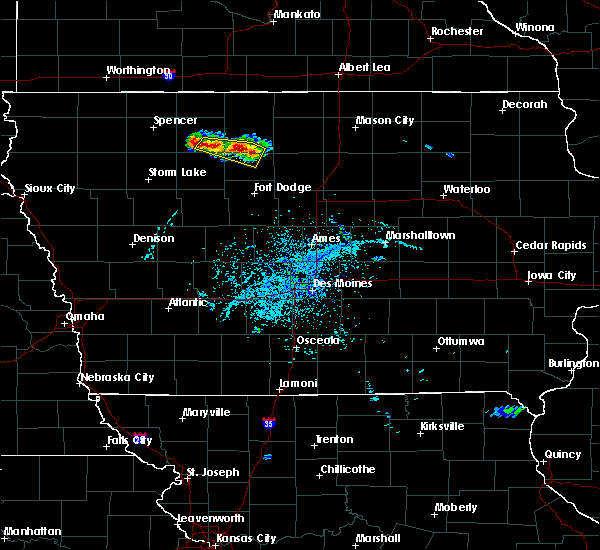 At 436 pm cdt, a severe thunderstorm was located 10 miles south of algona, moving south at 10 mph (radar indicated). Hazards include 60 mph wind gusts and quarter size hail. Hail damage to vehicles is expected. expect wind damage to roofs, siding, and trees. locations impacted include, west bend, livermore, bode, mallard, lu verne, st. Joseph, ottosen, rodman and irvington. At 436 pm cdt, a severe thunderstorm was located 10 miles south of algona, moving south at 10 mph (radar indicated). Hazards include 60 mph wind gusts and quarter size hail. Hail damage to vehicles is expected. expect wind damage to roofs, siding, and trees. locations impacted include, west bend, livermore, bode, mallard, lu verne, st. Joseph, ottosen, rodman and irvington.
|
| 6/11/2016 4:22 PM CDT |
 At 422 pm cdt, a severe thunderstorm was located 7 miles southwest of algona, moving south at 5 mph (radar indicated). Hazards include 60 mph wind gusts and quarter size hail. Hail damage to vehicles is expected. expect wind damage to roofs, siding, and trees. locations impacted include, west bend, whittemore, livermore, bode, mallard, lu verne, cylinder, st. Joseph, ottosen, rodman, irvington, stinson prairie state park and aa call state park. At 422 pm cdt, a severe thunderstorm was located 7 miles southwest of algona, moving south at 5 mph (radar indicated). Hazards include 60 mph wind gusts and quarter size hail. Hail damage to vehicles is expected. expect wind damage to roofs, siding, and trees. locations impacted include, west bend, whittemore, livermore, bode, mallard, lu verne, cylinder, st. Joseph, ottosen, rodman, irvington, stinson prairie state park and aa call state park.
|
| 6/11/2016 4:09 PM CDT |
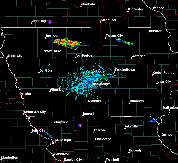 At 409 pm cdt, a severe thunderstorm was located 7 miles southwest of algona, moving southeast at 10 mph. additional storms further west are also strong and pose a severe risk (radar indicated). Hazards include 60 mph wind gusts and quarter size hail. Hail damage to vehicles is expected. Expect wind damage to roofs, siding, and trees. At 409 pm cdt, a severe thunderstorm was located 7 miles southwest of algona, moving southeast at 10 mph. additional storms further west are also strong and pose a severe risk (radar indicated). Hazards include 60 mph wind gusts and quarter size hail. Hail damage to vehicles is expected. Expect wind damage to roofs, siding, and trees.
|
| 5/26/2016 1:18 AM CDT |
 At 117 am cdt, severe thunderstorms were located along a line extending from 8 miles east of iowa lake to 13 miles southeast of emmetsburg, moving east at 45 mph (trained weather spotters. at 1256 am...estherville asos measured 77 mph wind gusts. at 105 am, law enforcement reported several 3 to 5 inch tree limbs down in estherville). Hazards include 60 mph wind gusts and nickel size hail. Expect damage to roofs. siding. and trees. Locations impacted include, algona, emmetsburg, five island lake, ingham lake, iowa lake, smith pool, high lake, swan lake, armstrong, graettinger, west bend, bancroft, swea city, burt, whittemore, titonka, ringsted, fenton, mallard and lu verne. At 117 am cdt, severe thunderstorms were located along a line extending from 8 miles east of iowa lake to 13 miles southeast of emmetsburg, moving east at 45 mph (trained weather spotters. at 1256 am...estherville asos measured 77 mph wind gusts. at 105 am, law enforcement reported several 3 to 5 inch tree limbs down in estherville). Hazards include 60 mph wind gusts and nickel size hail. Expect damage to roofs. siding. and trees. Locations impacted include, algona, emmetsburg, five island lake, ingham lake, iowa lake, smith pool, high lake, swan lake, armstrong, graettinger, west bend, bancroft, swea city, burt, whittemore, titonka, ringsted, fenton, mallard and lu verne.
|
| 5/26/2016 1:00 AM CDT |
 At 1259 am cdt, severe thunderstorms were located along a line extending from 3 miles southwest of ceylon to 7 miles east of rush lake, moving east at 50 mph (radar indicated. at 1252 am cdt the estherville asos reported 65 mph winds). Hazards include 60 mph wind gusts. Expect damage to roofs. siding. And trees. At 1259 am cdt, severe thunderstorms were located along a line extending from 3 miles southwest of ceylon to 7 miles east of rush lake, moving east at 50 mph (radar indicated. at 1252 am cdt the estherville asos reported 65 mph winds). Hazards include 60 mph wind gusts. Expect damage to roofs. siding. And trees.
|
| 6/22/2015 6:43 AM CDT |
 At 642 am cdt, severe thunderstorms were located along a line extending from 9 miles south of blue earth to 9 miles northeast of pocahontas to 4 miles west of sac city, moving east at 60 mph (emergency management). Hazards include 60 mph wind gusts and penny size hail. Expect damage to roofs. Siding and trees. At 642 am cdt, severe thunderstorms were located along a line extending from 9 miles south of blue earth to 9 miles northeast of pocahontas to 4 miles west of sac city, moving east at 60 mph (emergency management). Hazards include 60 mph wind gusts and penny size hail. Expect damage to roofs. Siding and trees.
|
| 6/22/2015 6:28 AM CDT |
 At 628 am cdt, severe thunderstorms were located along a line extending from 15 miles southeast of blue earth to 6 miles south of smith pool to 13 miles southwest of algona, moving east at 60 mph (trained weather spotters). Hazards include 60 mph wind gusts. Expect damage to roofs. siding and trees. Locations impacted include, estherville, algona, emmetsburg, pocahontas, dakota city, humboldt, laurens, iowa lake, swan lake, smith pool, ingham lake, okamanpedan lake, lost island lake, five island lake, high lake, silver lake, rush lake, armstrong, graettinger and west bend. At 628 am cdt, severe thunderstorms were located along a line extending from 15 miles southeast of blue earth to 6 miles south of smith pool to 13 miles southwest of algona, moving east at 60 mph (trained weather spotters). Hazards include 60 mph wind gusts. Expect damage to roofs. siding and trees. Locations impacted include, estherville, algona, emmetsburg, pocahontas, dakota city, humboldt, laurens, iowa lake, swan lake, smith pool, ingham lake, okamanpedan lake, lost island lake, five island lake, high lake, silver lake, rush lake, armstrong, graettinger and west bend.
|
| 6/22/2015 5:58 AM CDT |
 At 558 am cdt, severe thunderstorms were located along a line extending from 3 miles west of iowa lake to 3 miles northwest of five island lake to near webb, moving east at 60 mph (radar indicated). Hazards include 70 mph wind gusts. Expect considerable tree damage. Damage is likely to mobile homes, roofs and outbuildings. At 558 am cdt, severe thunderstorms were located along a line extending from 3 miles west of iowa lake to 3 miles northwest of five island lake to near webb, moving east at 60 mph (radar indicated). Hazards include 70 mph wind gusts. Expect considerable tree damage. Damage is likely to mobile homes, roofs and outbuildings.
|
| 9/2/2011 4:31 AM CDT | Ping Pong Ball sized hail reported 2.1 miles NNW of Mallard, IA, trained spotter reports quarter to ping pong ball sized hail. |
Hail Maps for Mallard, IA
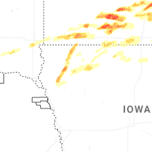
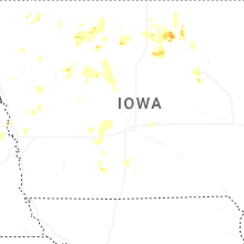
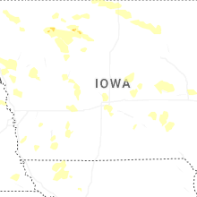
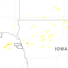

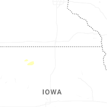


Connect with Interactive Hail Maps