

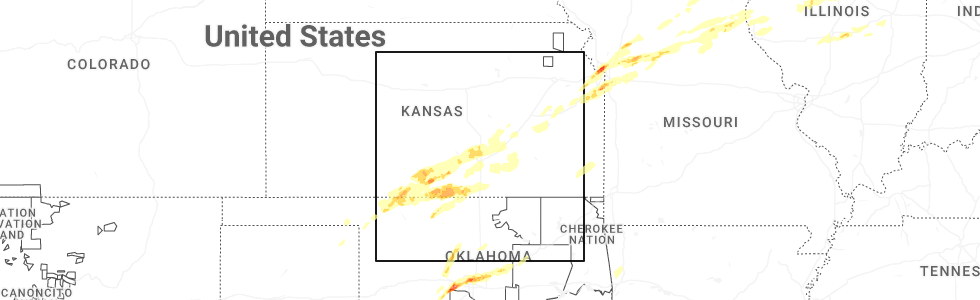
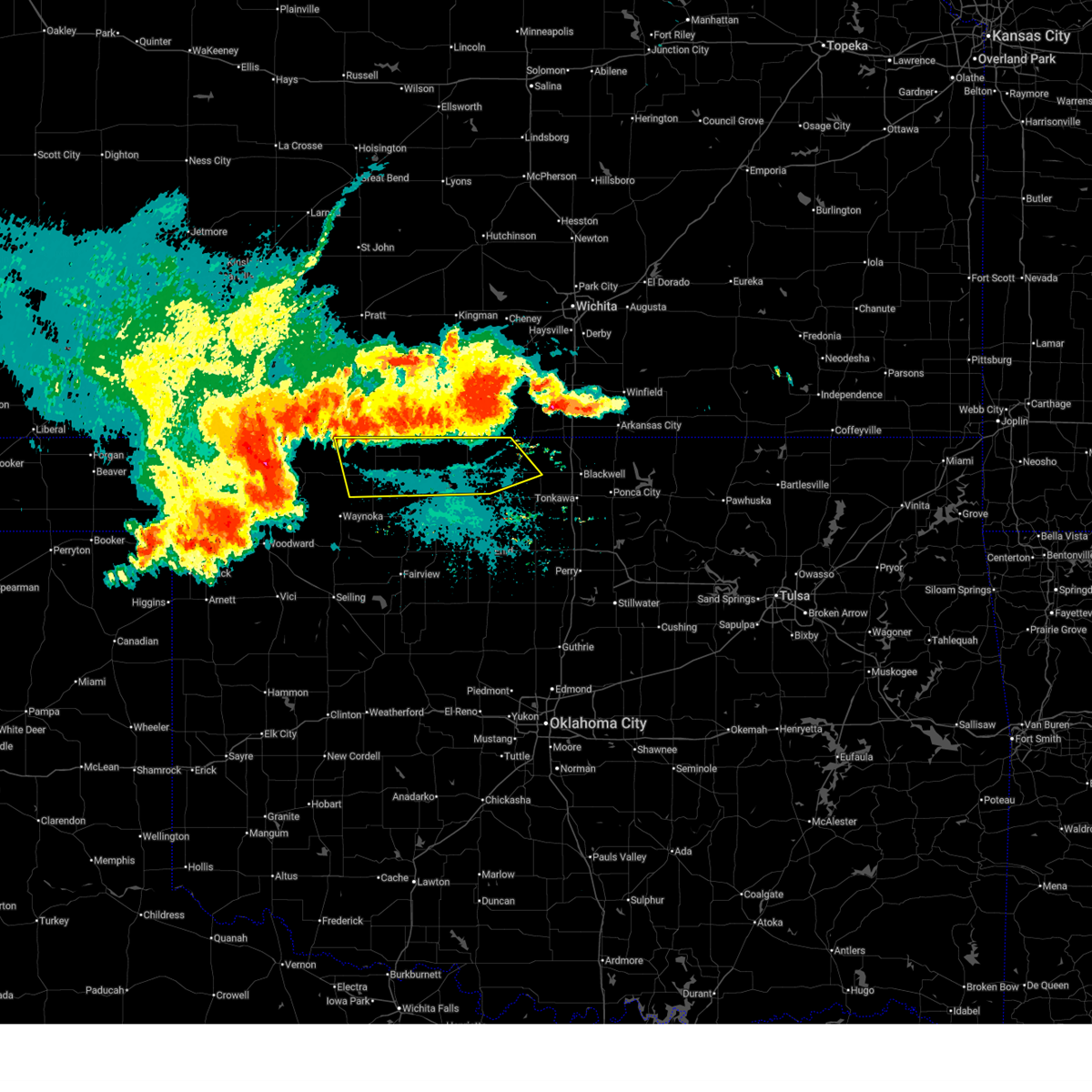
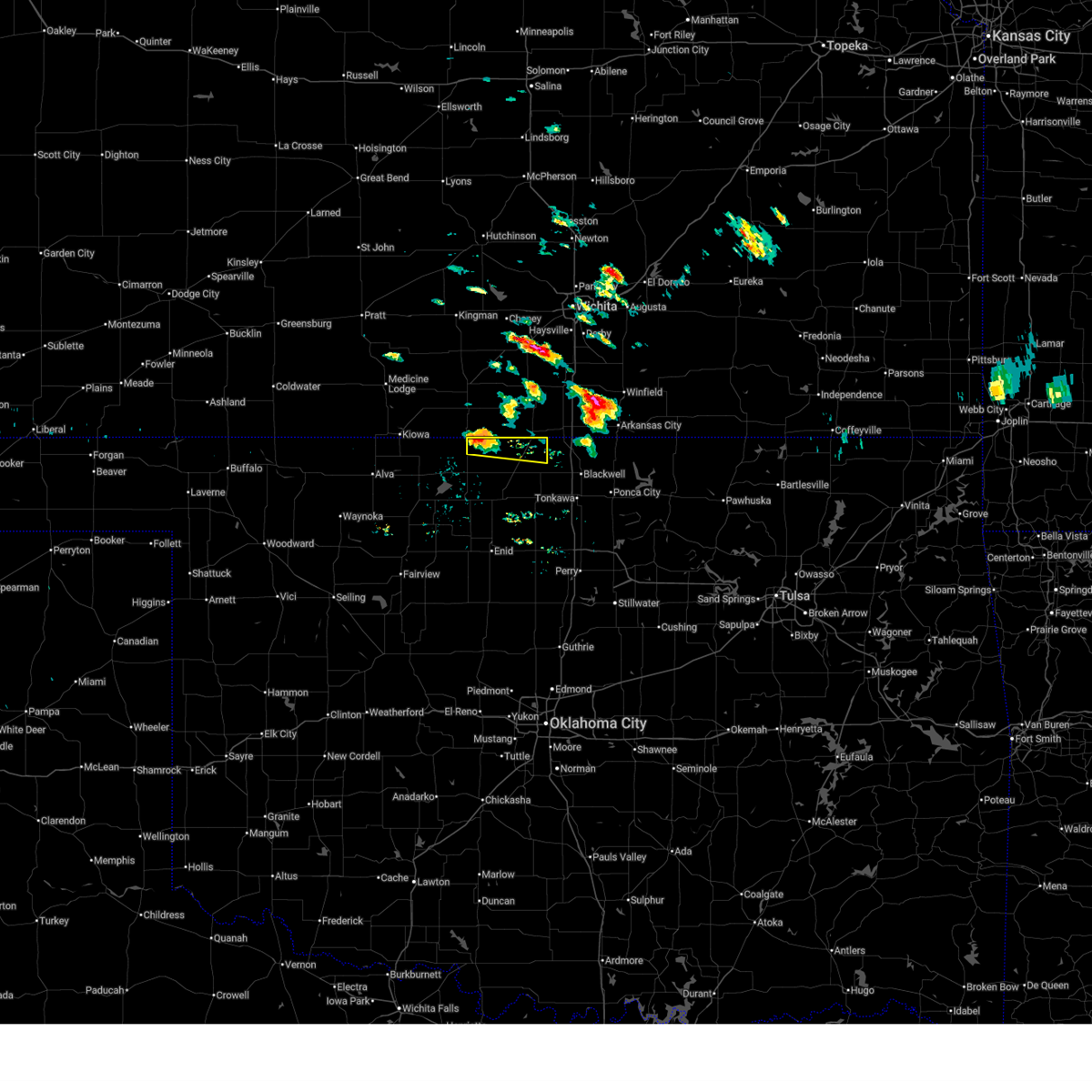
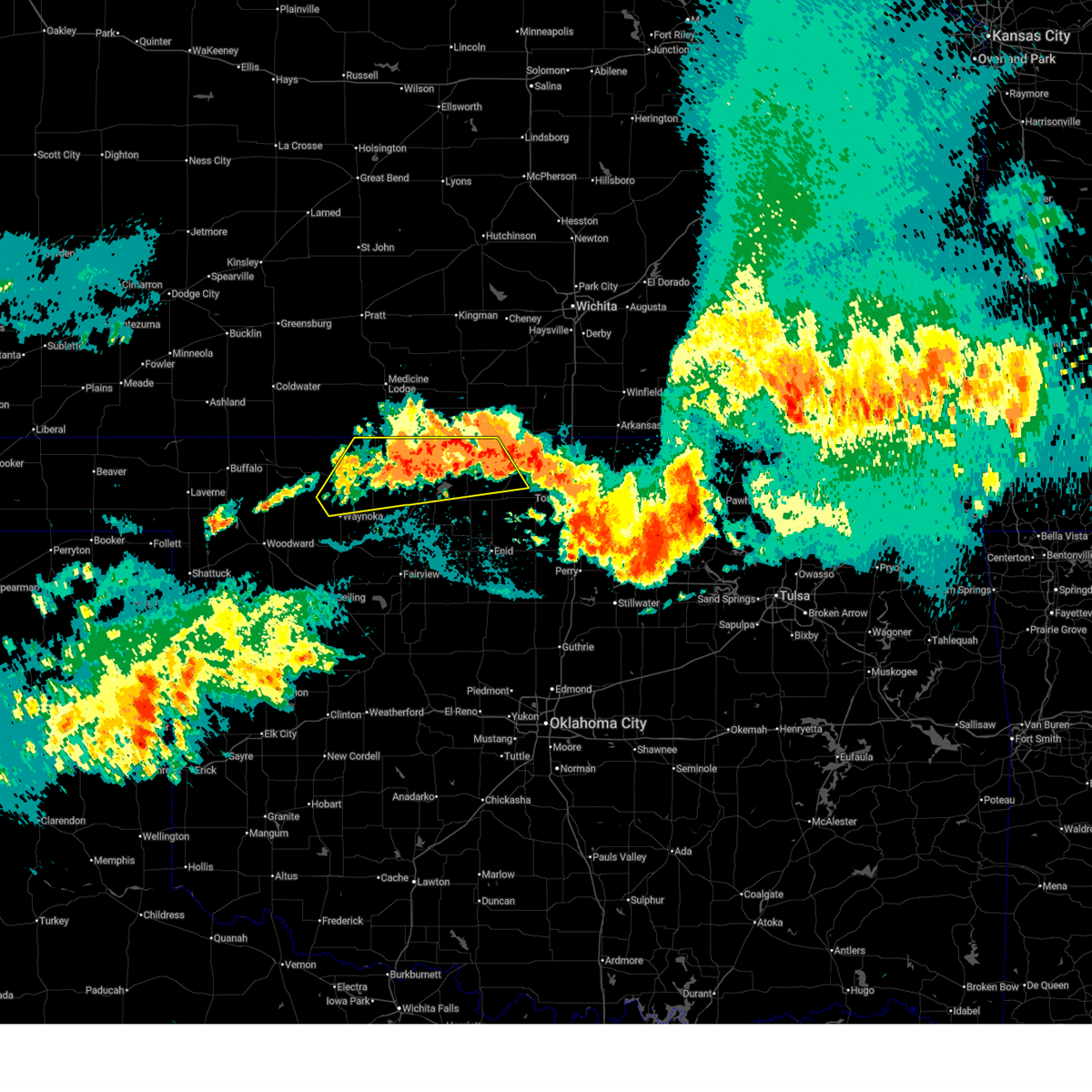
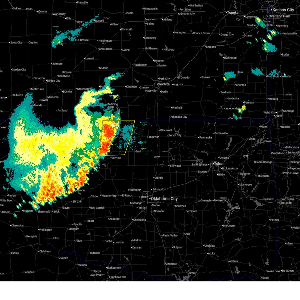
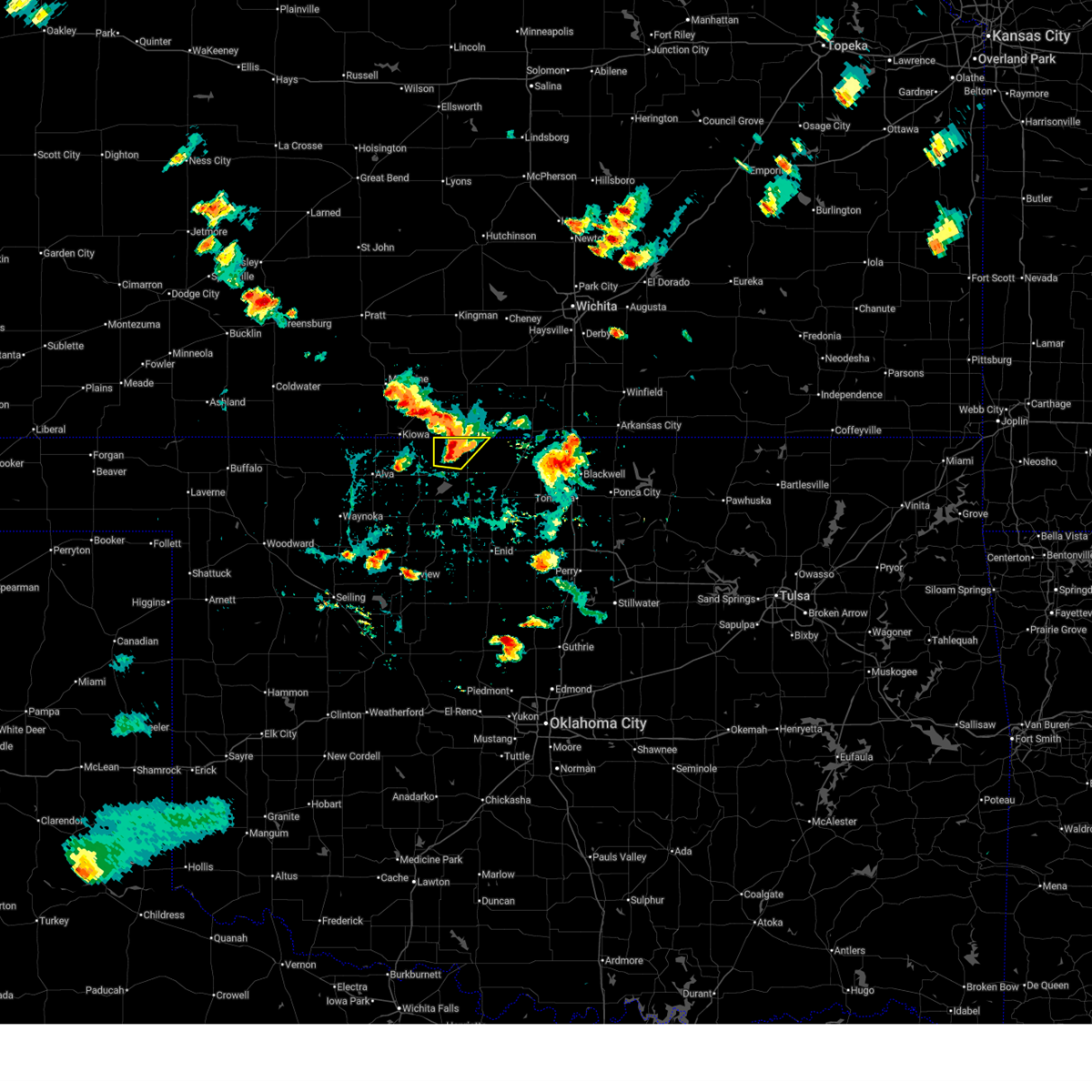
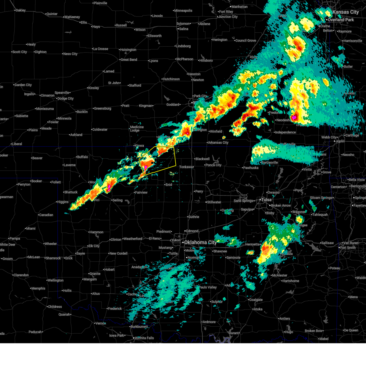
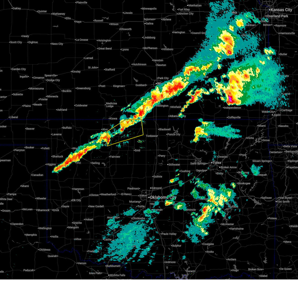
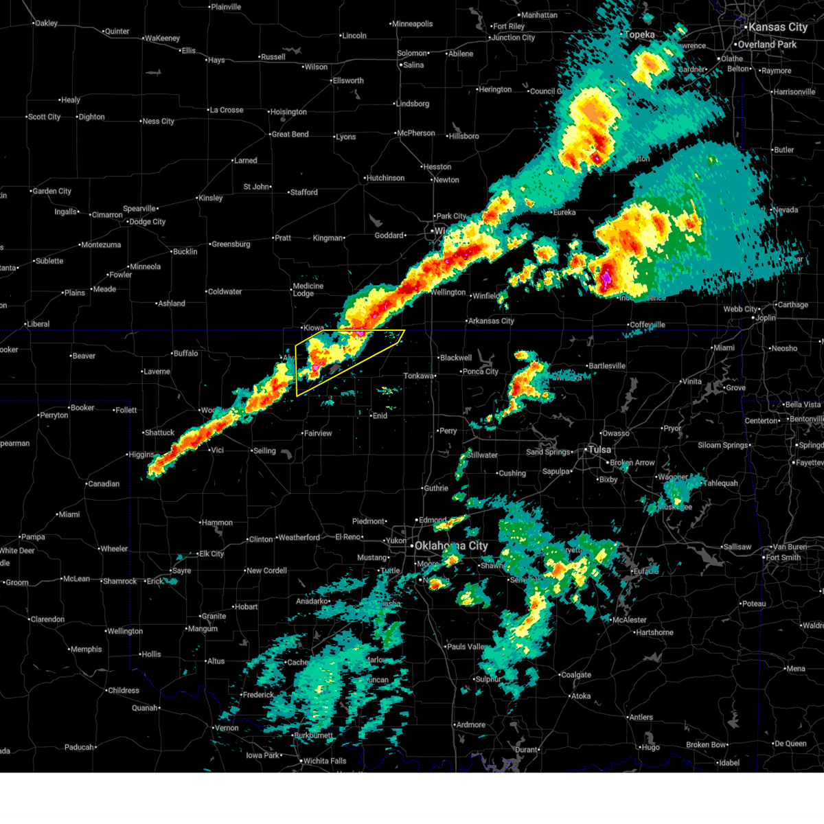
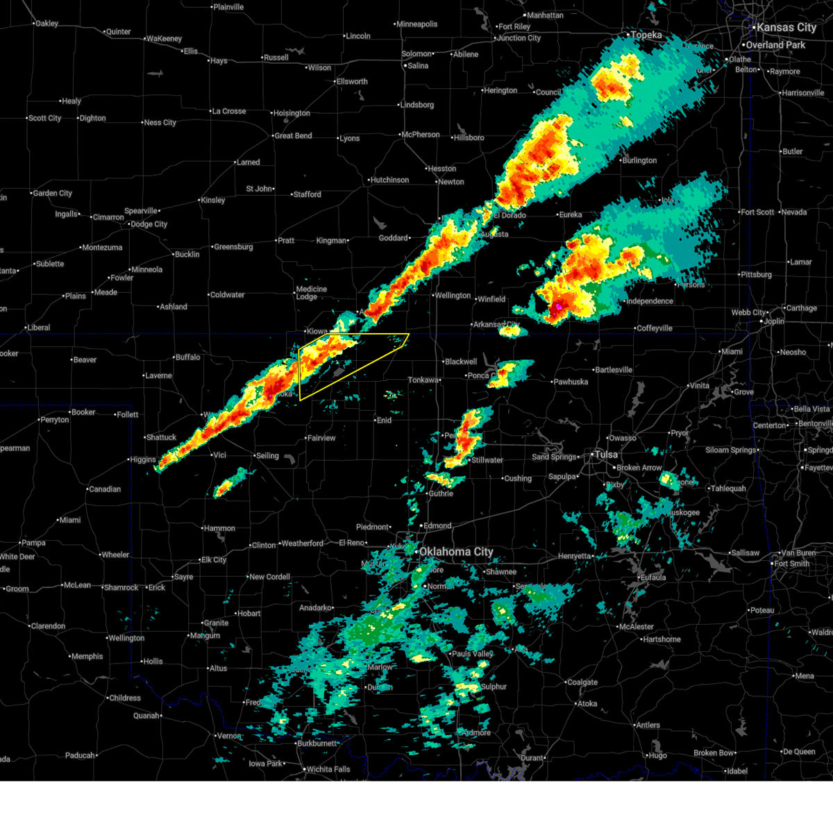
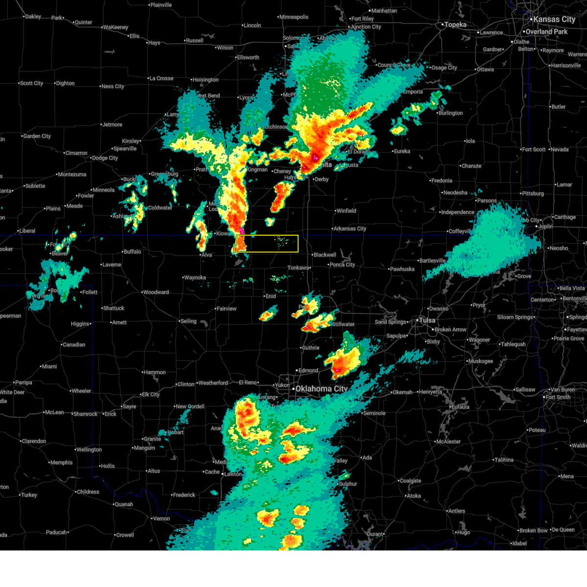
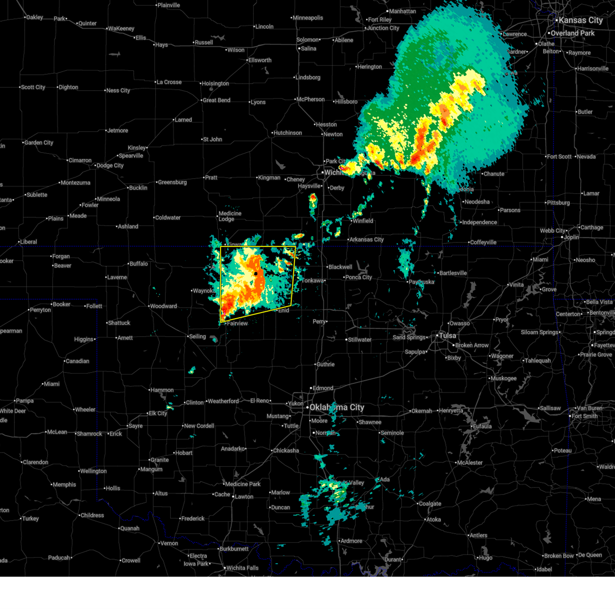
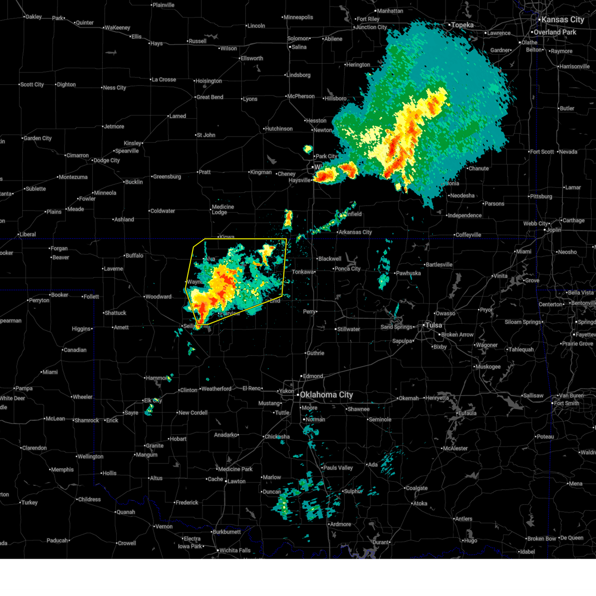
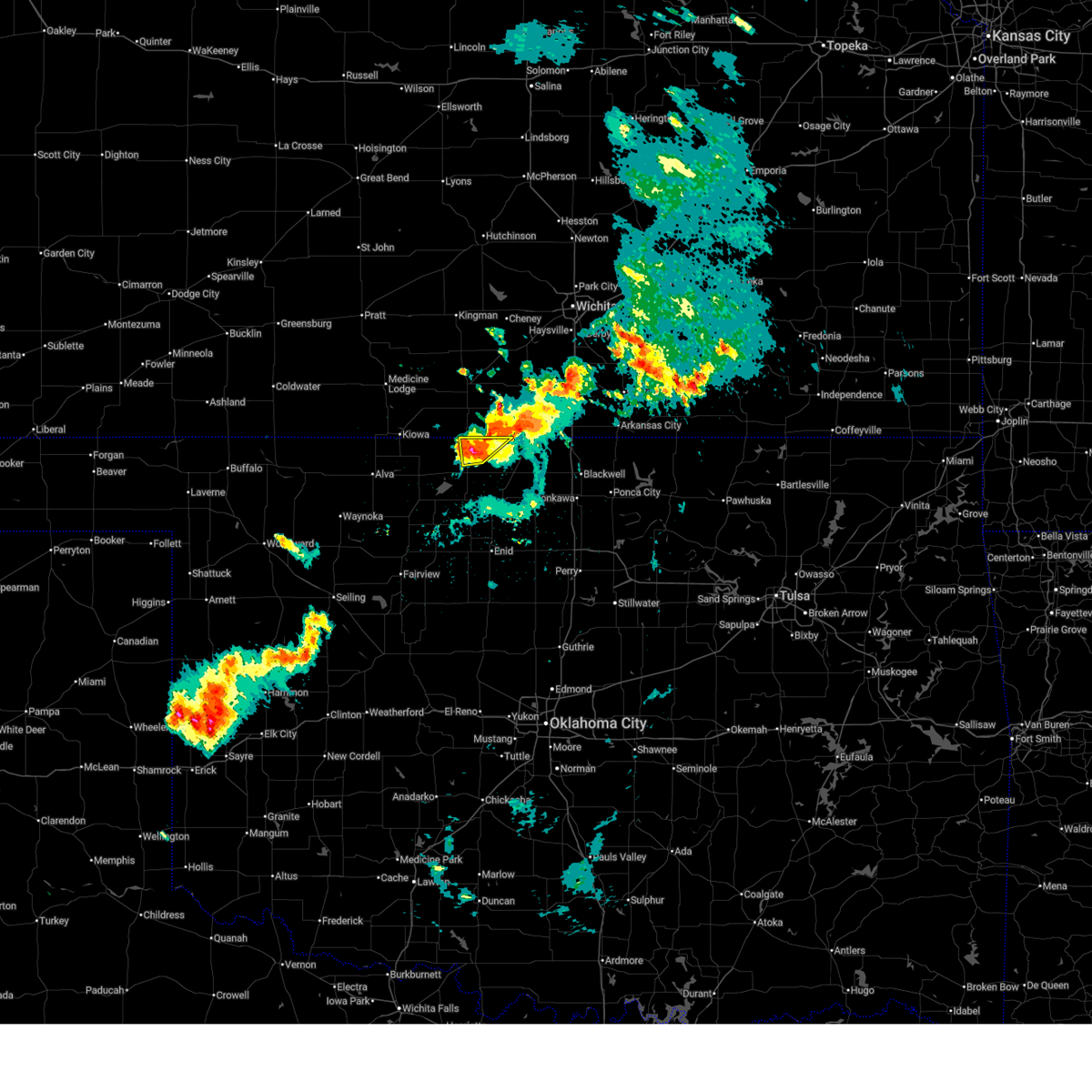
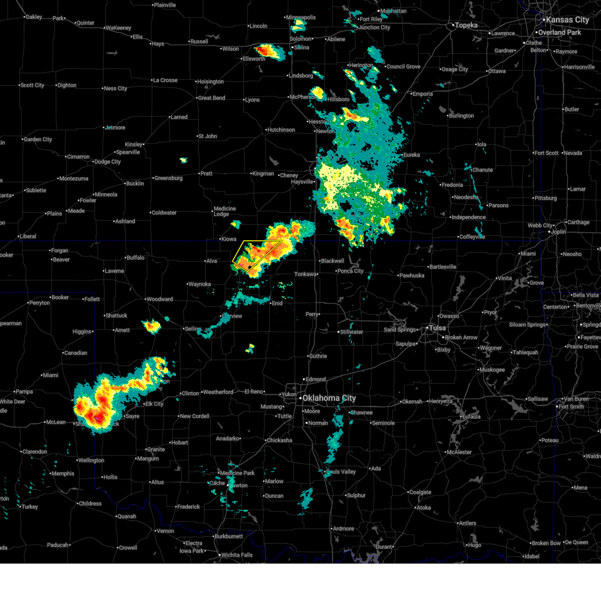
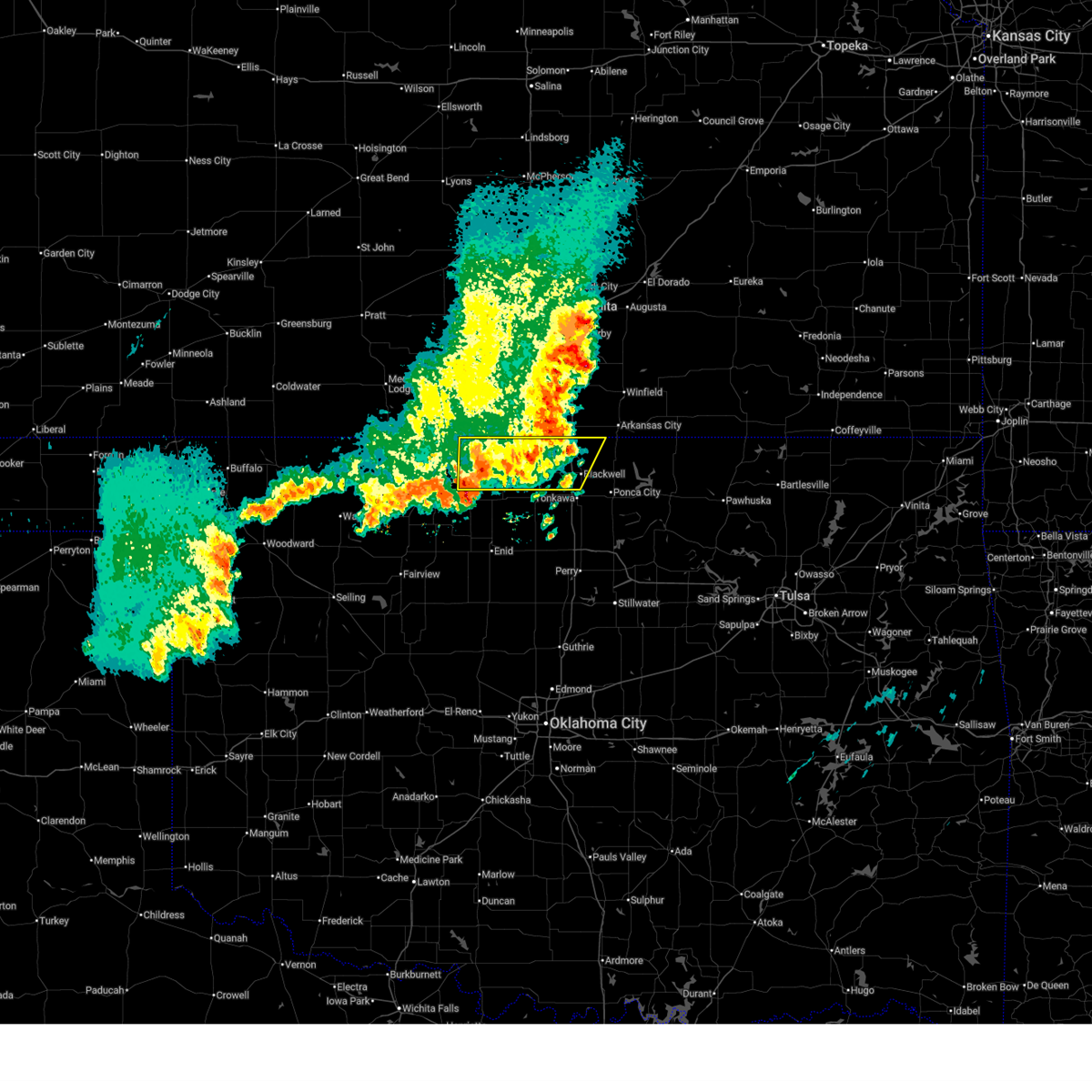
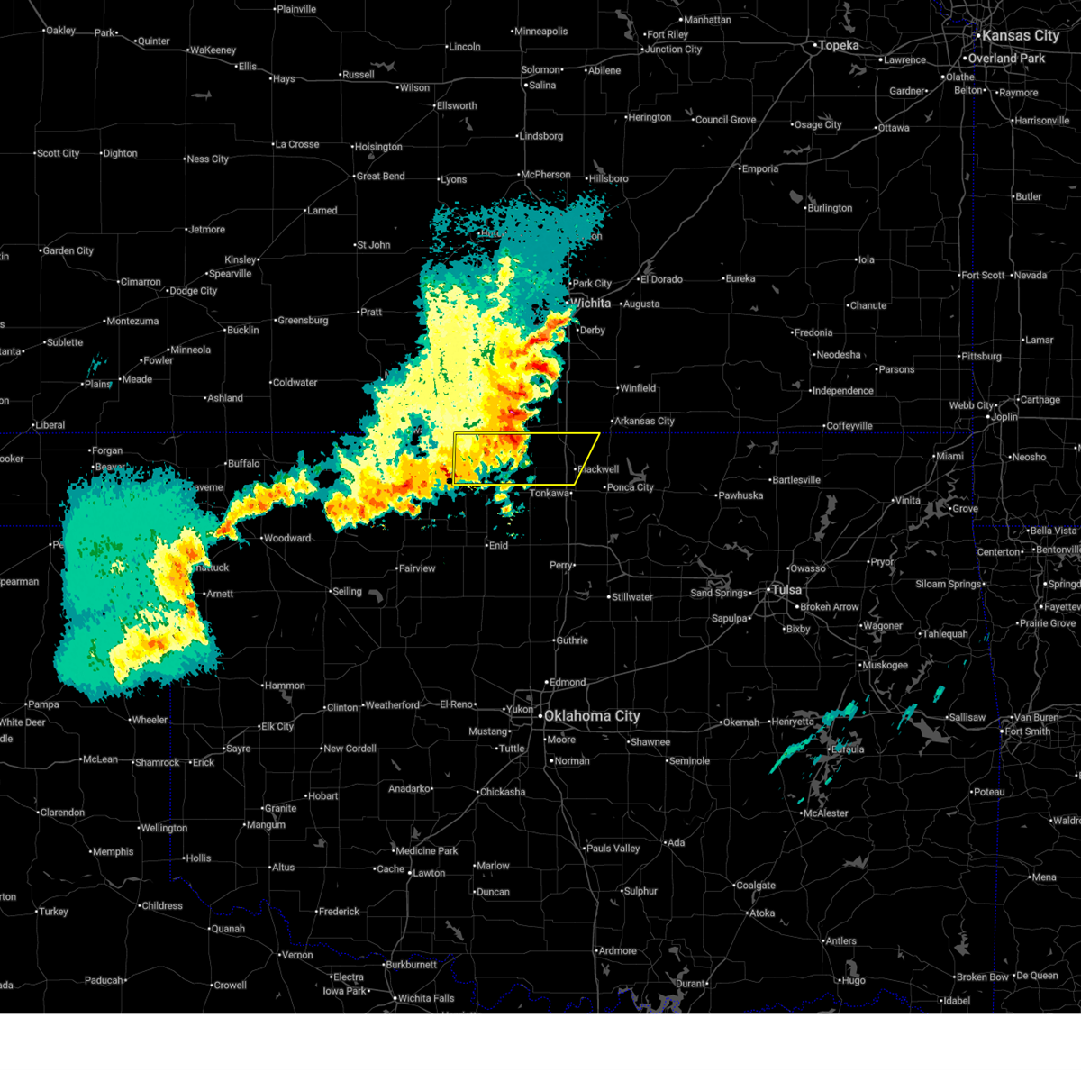
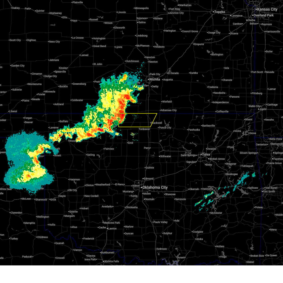
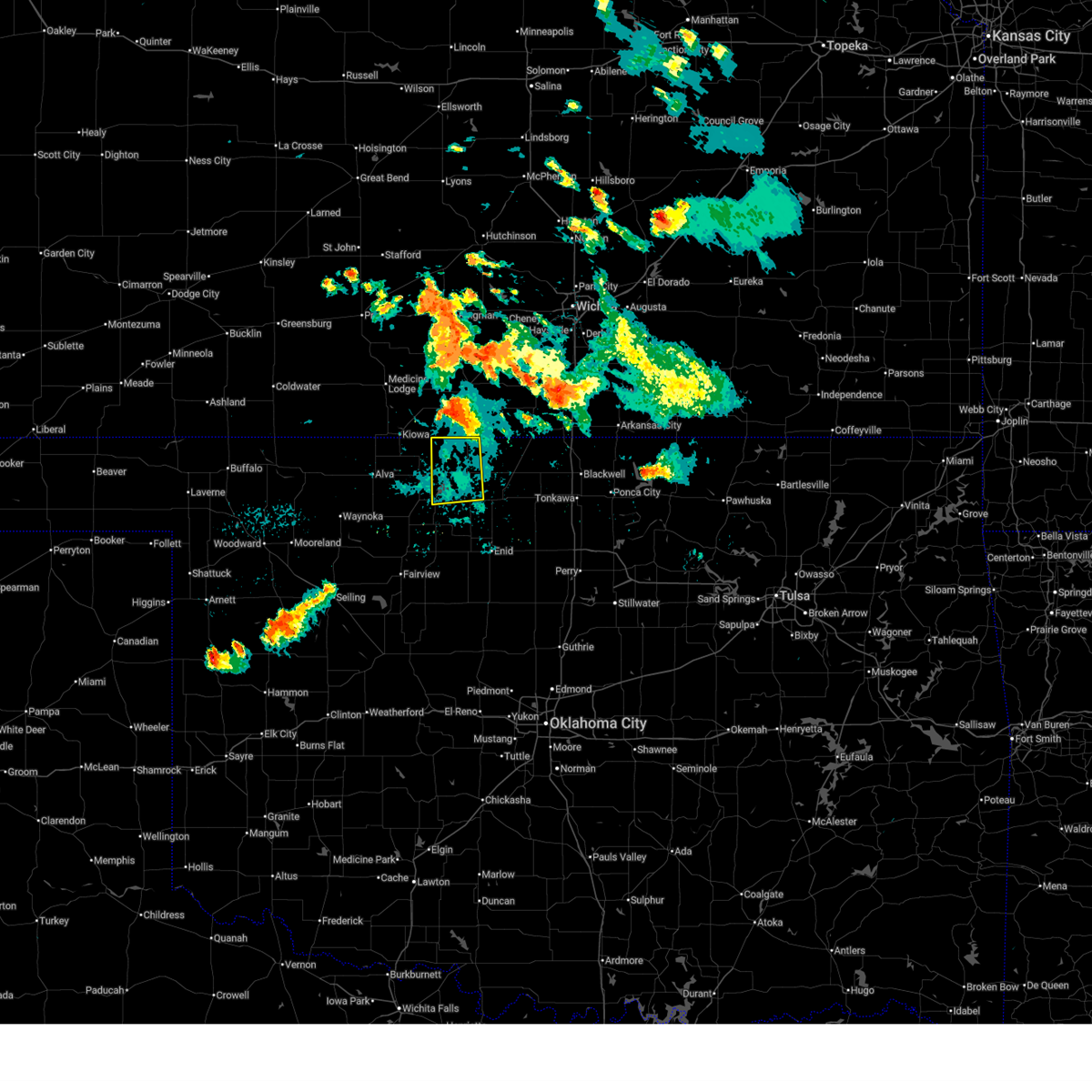
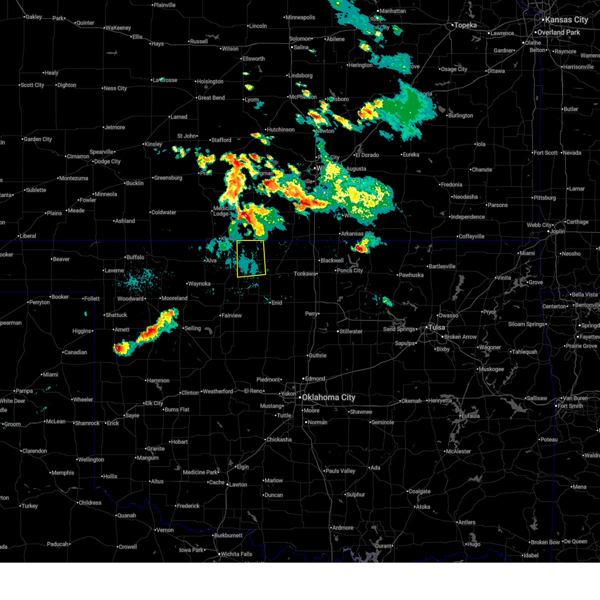
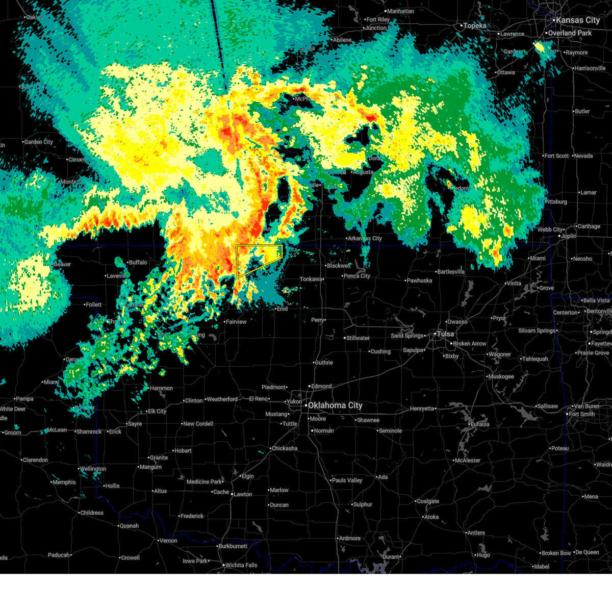
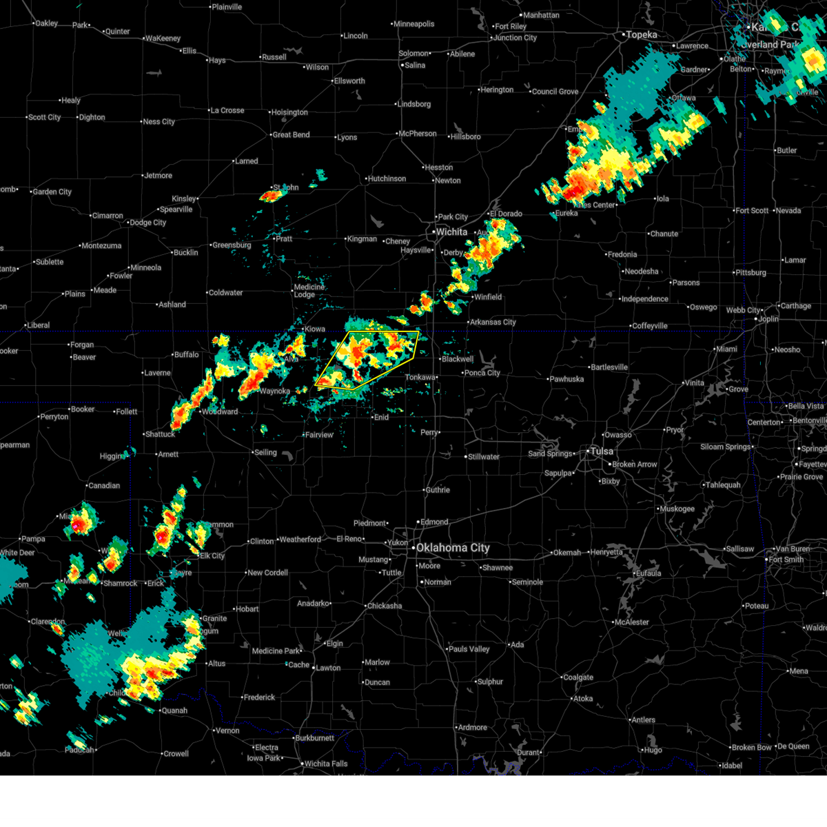
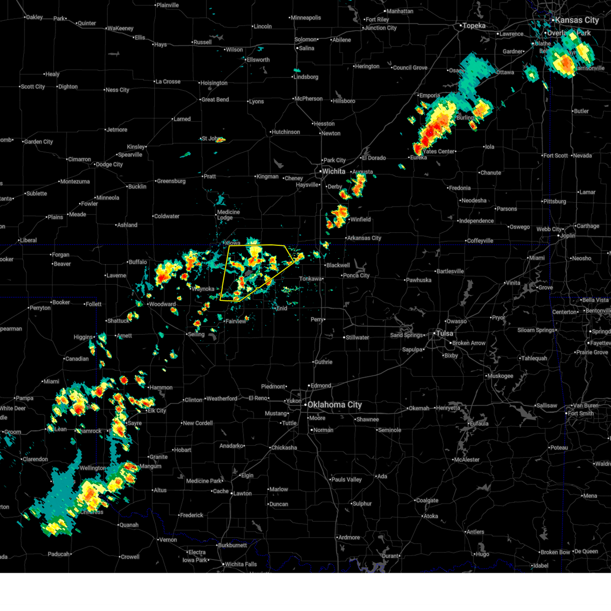
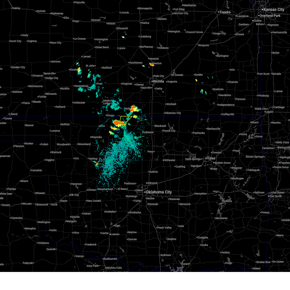
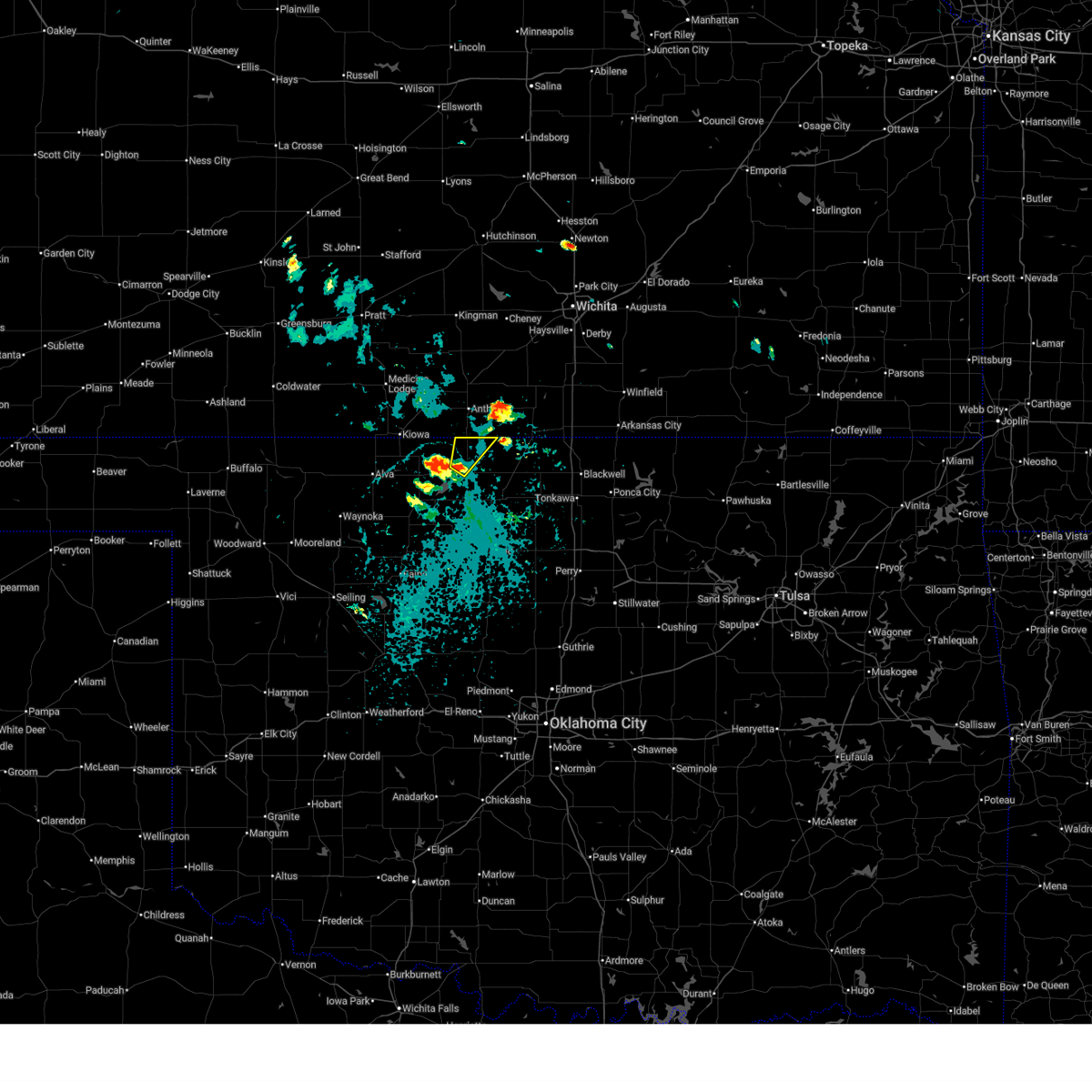
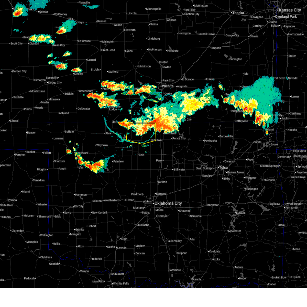
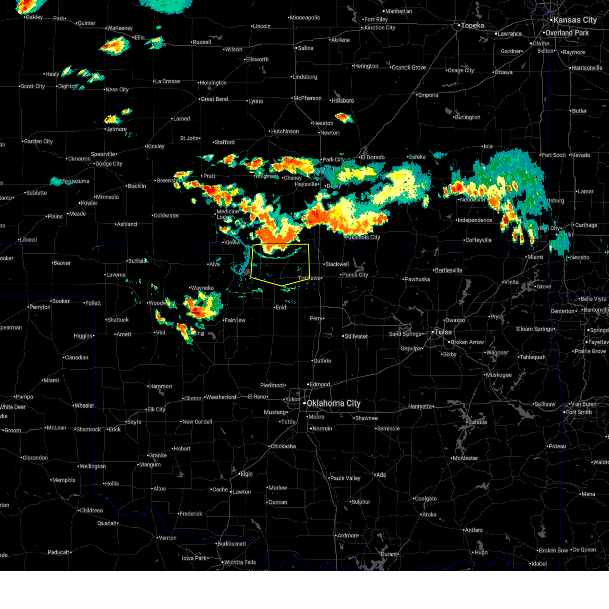
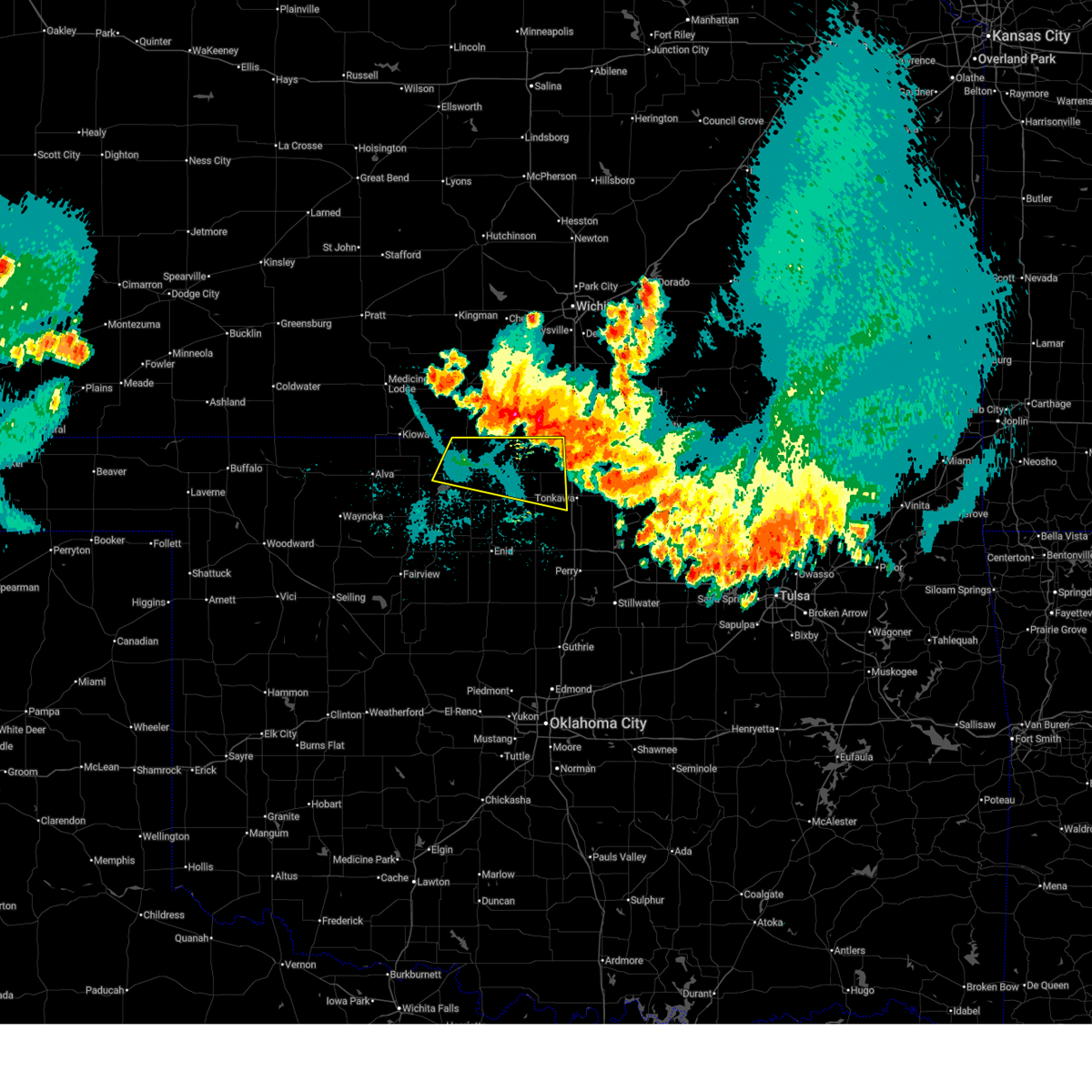
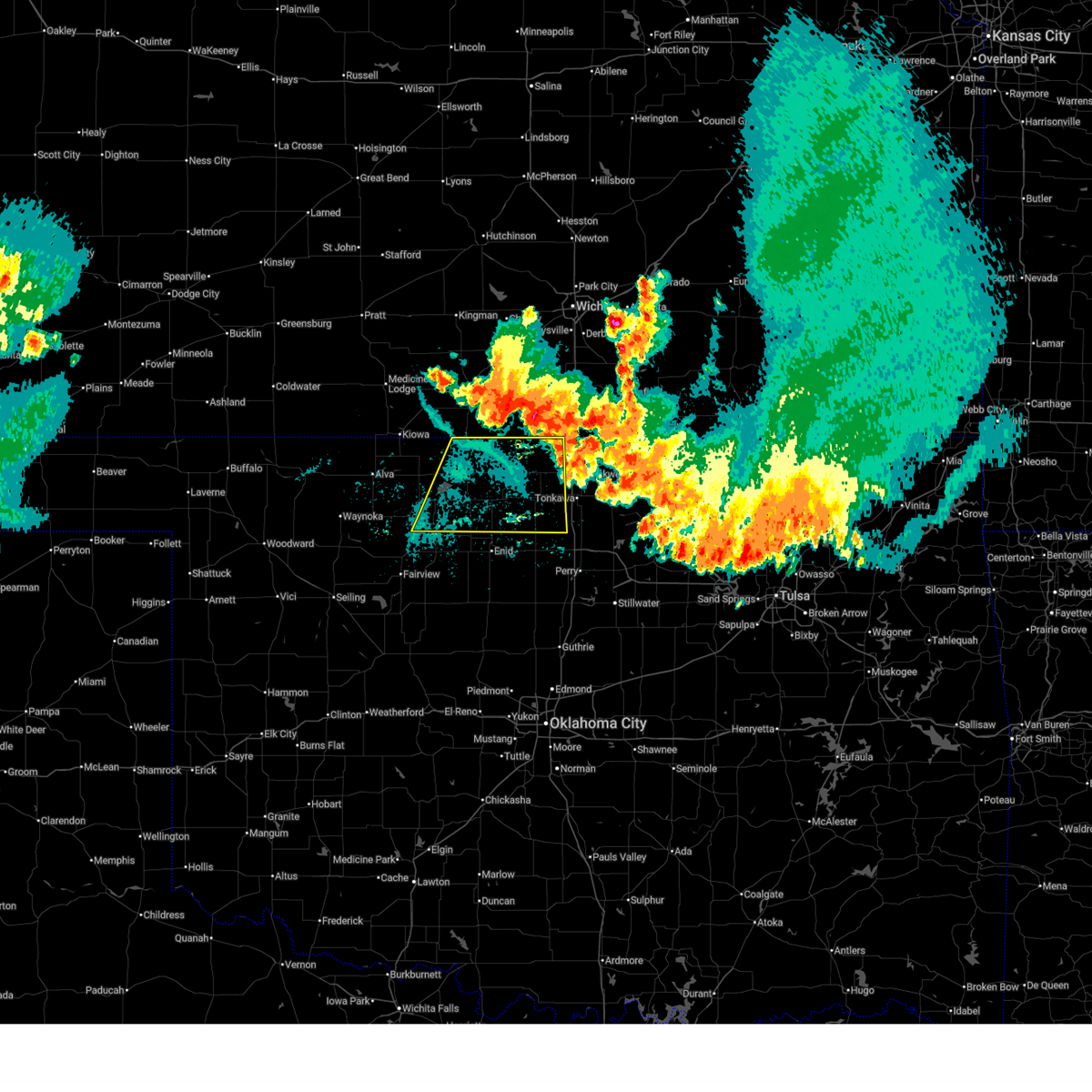
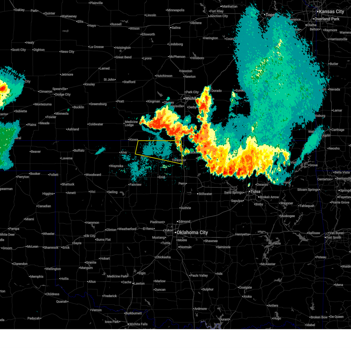
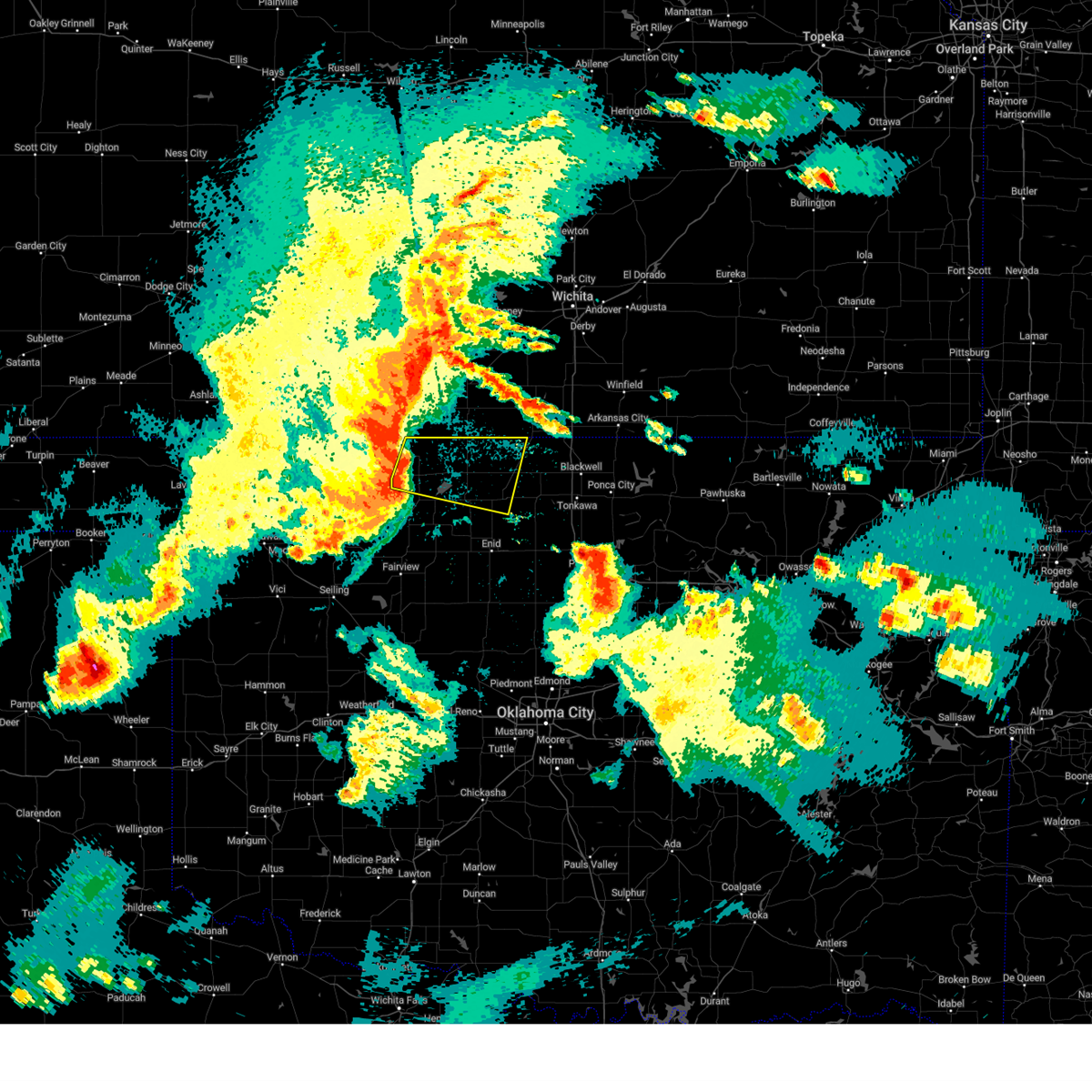
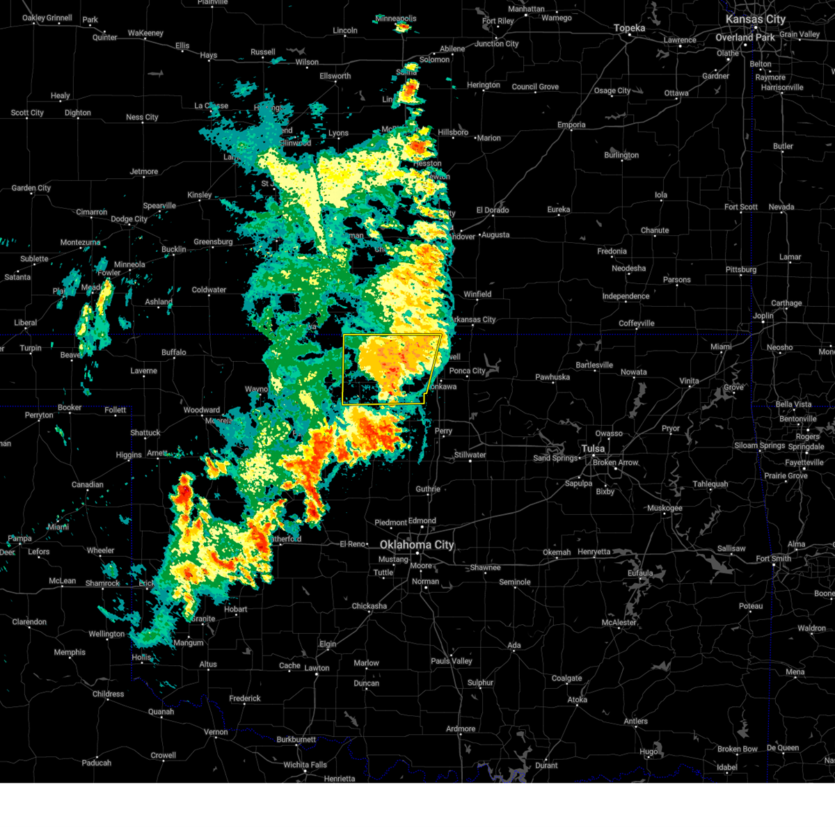
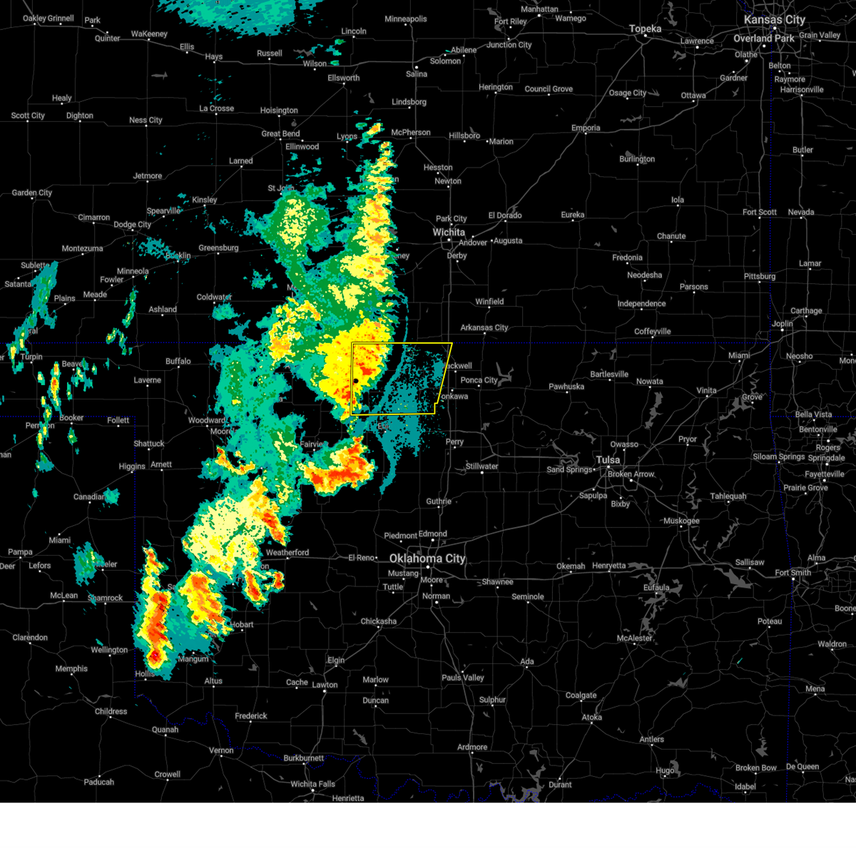
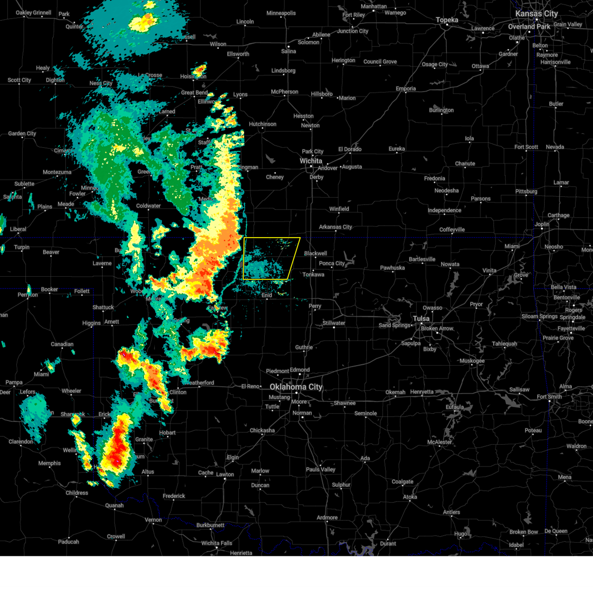
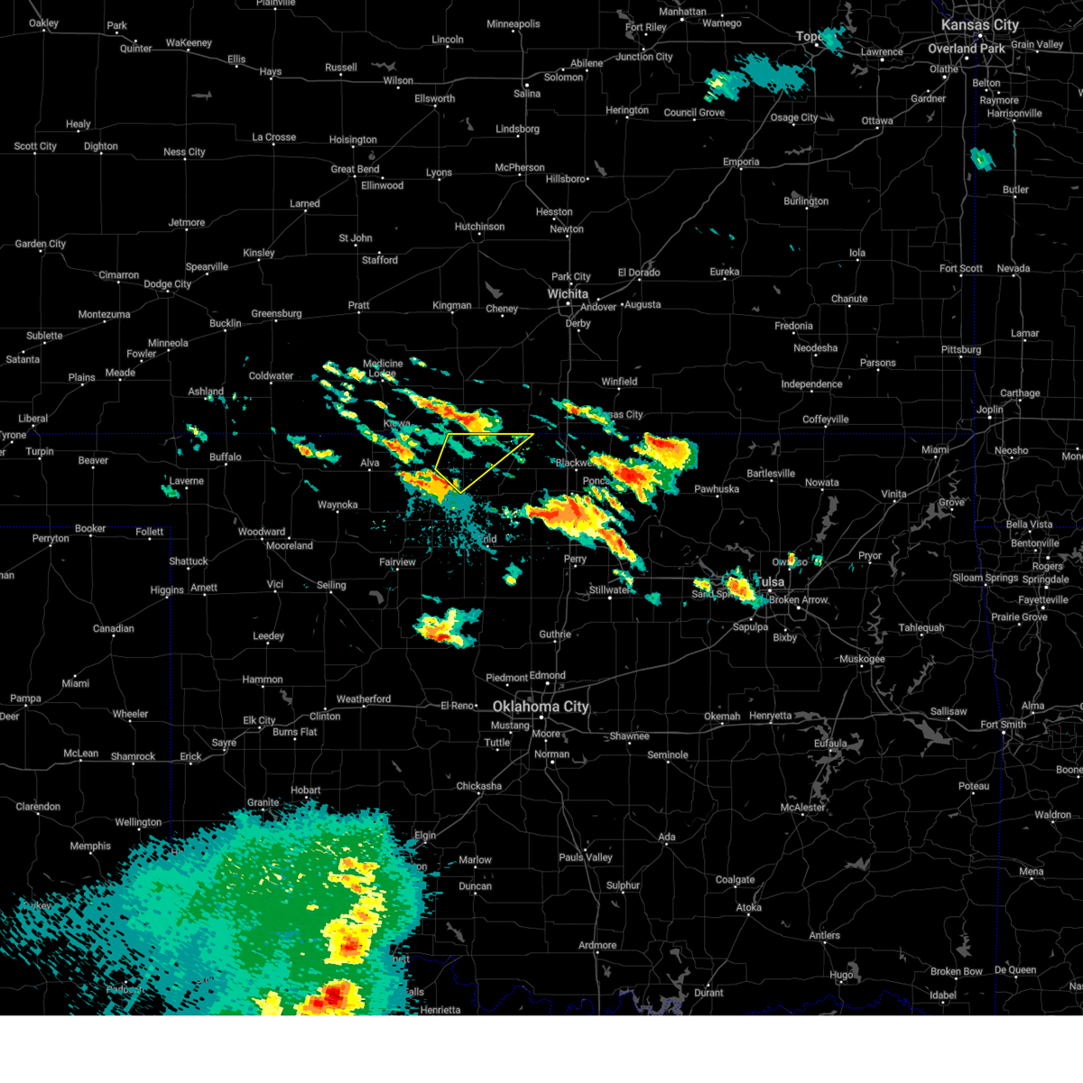
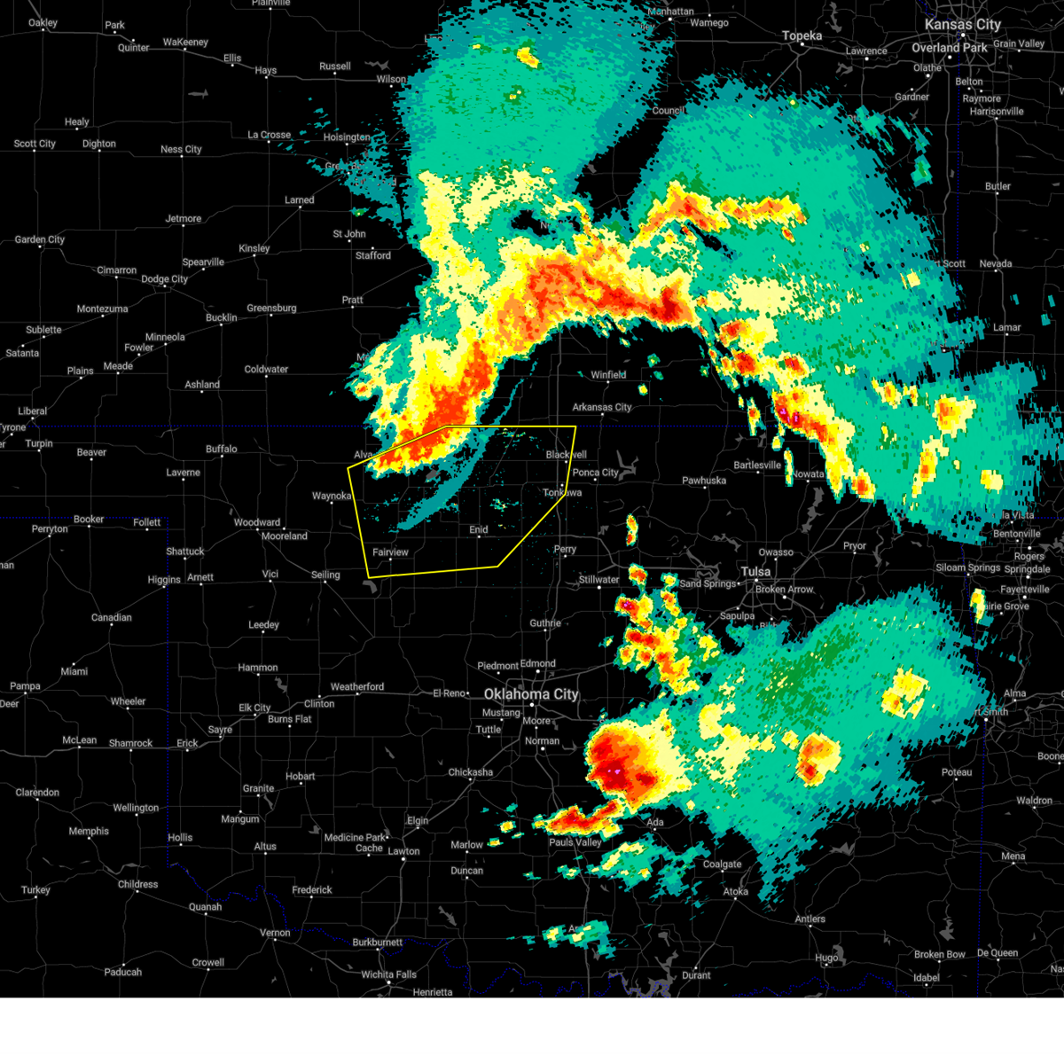
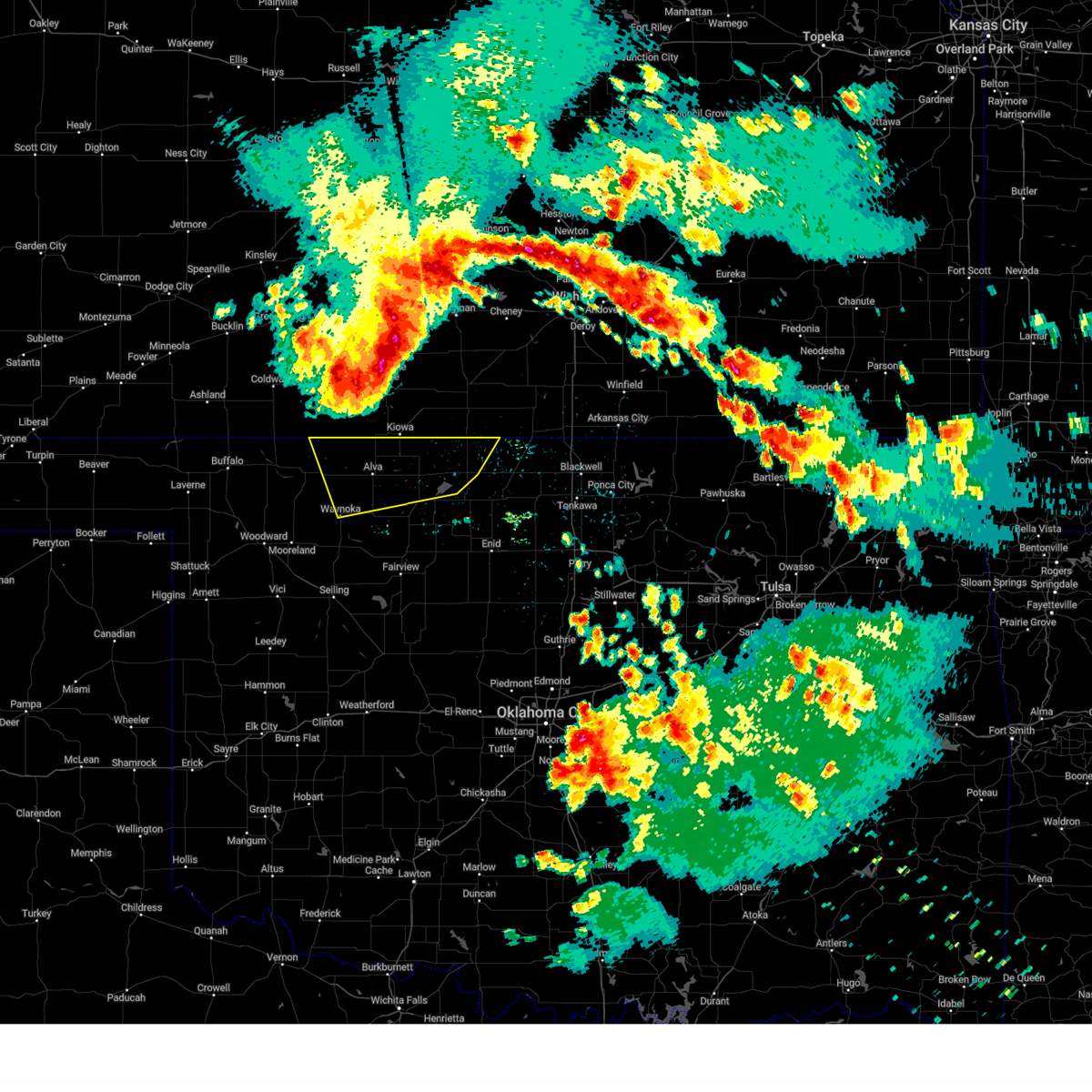
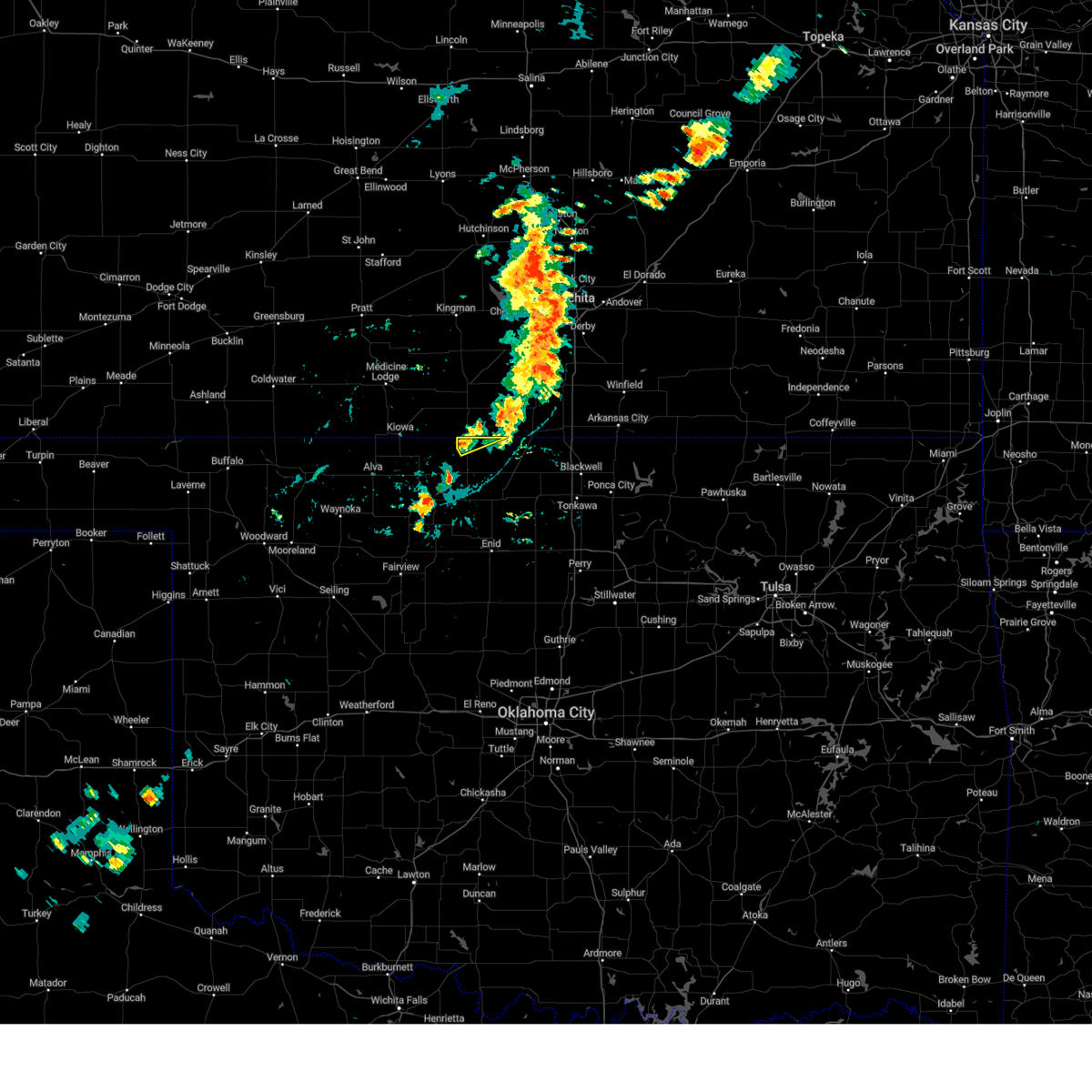
Hail Map for Manchester, OK
The Manchester, OK area has had 3 reports of on-the-ground hail by trained spotters, and has been under severe weather warnings 47 times during the past 12 months. Doppler radar has detected hail at or near Manchester, OK on 86 occasions, including 8 occasions during the past year.
| Name: | Manchester, OK |
| Where Located: | 61.4 miles SW of Wichita, KS |
| Map: | Google Map for Manchester, OK |
| Population: | 103 |
| Housing Units: | 59 |
| More Info: | Search Google for Manchester, OK |
2
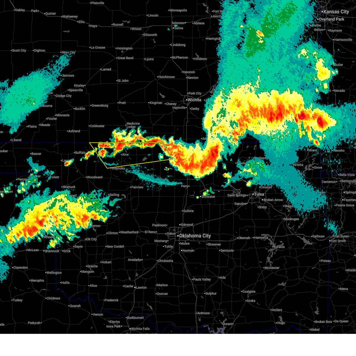
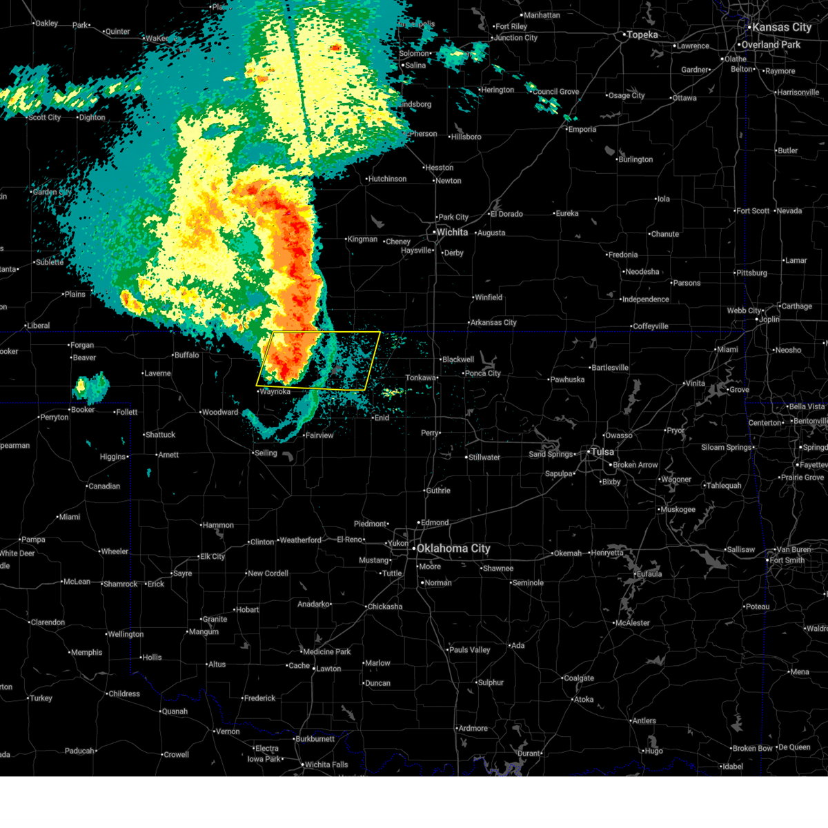
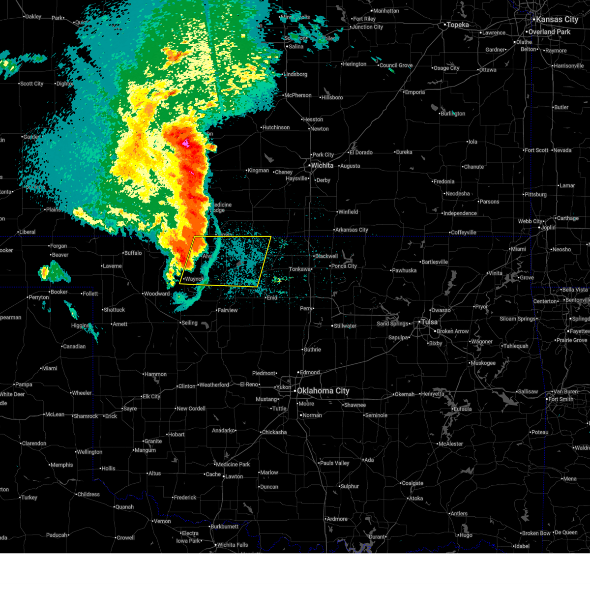
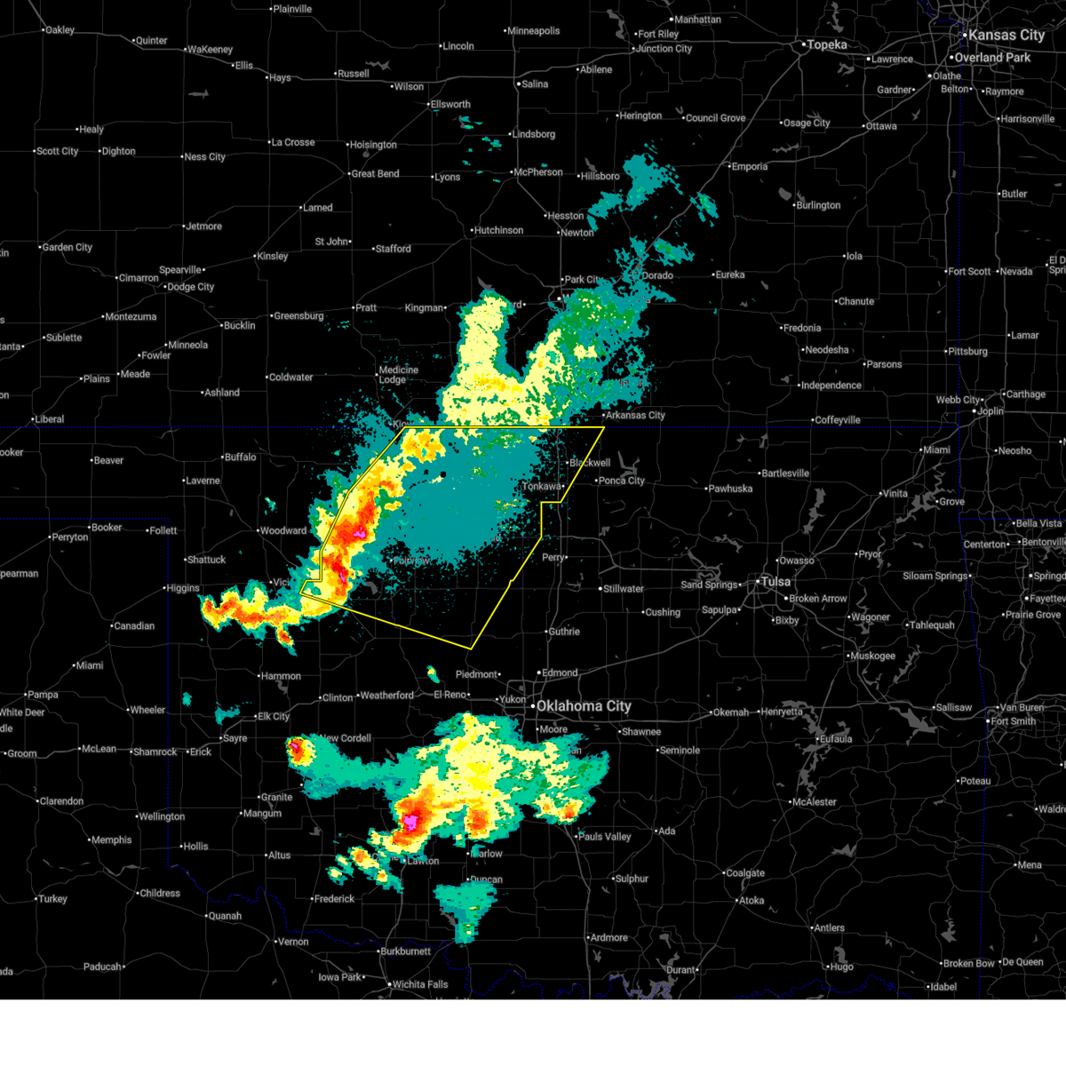
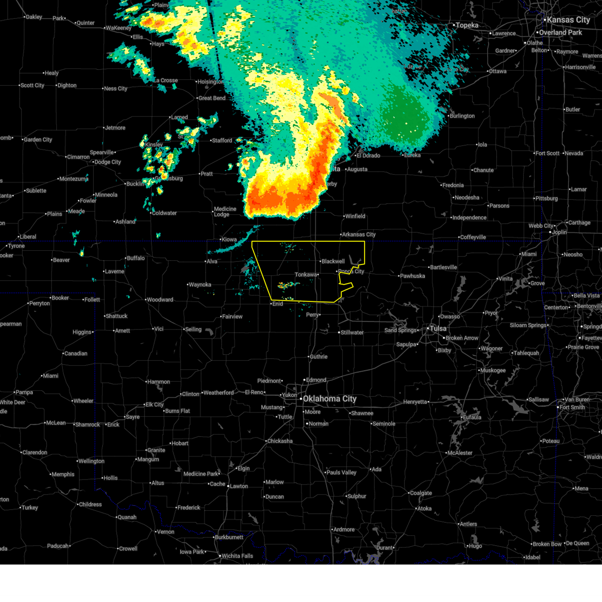
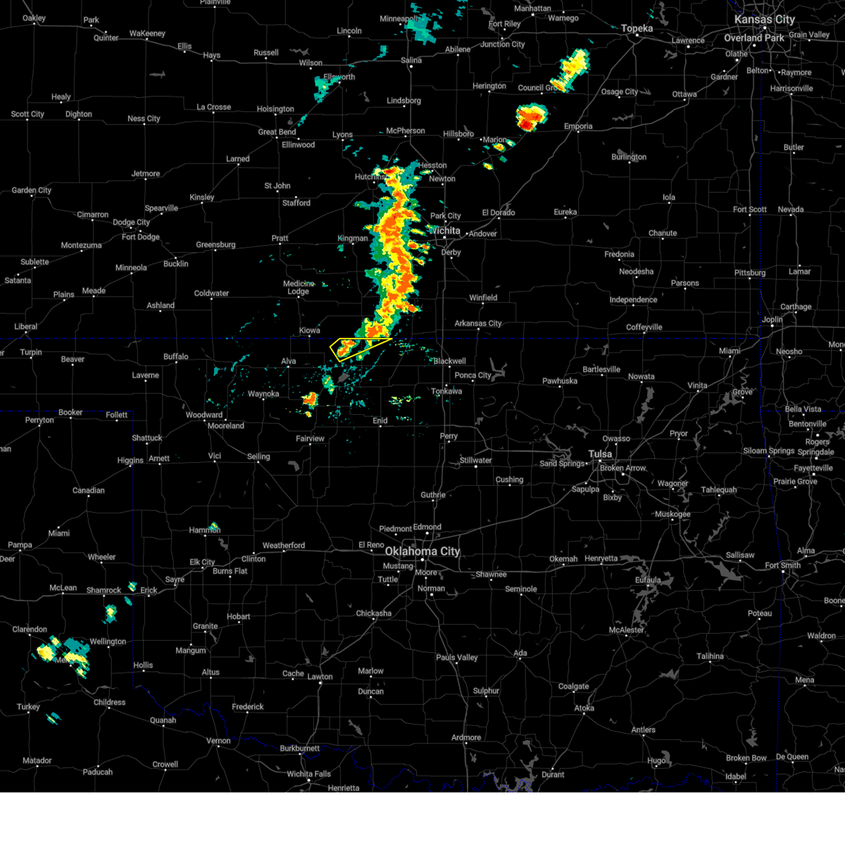
The Top Recent Hail Date for Manchester, OK is Tuesday, March 10, 2026 (4th out of 86)
Hail and Wind Damage Spotted near Manchester, OK
| Date / Time | Report Details |
|---|---|
| 6/21/2026 11:26 PM CDT |
 Svroun the national weather service in norman has issued a * severe thunderstorm warning for, northeastern woods county in northwestern oklahoma, northern alfalfa county in northwestern oklahoma, northern grant county in northern oklahoma, * until 1215 am cdt. * at 1126 pm cdt, severe thunderstorms were located along a line extending from 6 miles southwest of hardtner to 7 miles northeast of amorita to 10 miles west of caldwell, moving southeast at 25 mph (radar indicated). Hazards include 60 mph wind gusts. expect damage to roofs, siding, and trees Svroun the national weather service in norman has issued a * severe thunderstorm warning for, northeastern woods county in northwestern oklahoma, northern alfalfa county in northwestern oklahoma, northern grant county in northern oklahoma, * until 1215 am cdt. * at 1126 pm cdt, severe thunderstorms were located along a line extending from 6 miles southwest of hardtner to 7 miles northeast of amorita to 10 miles west of caldwell, moving southeast at 25 mph (radar indicated). Hazards include 60 mph wind gusts. expect damage to roofs, siding, and trees
|
| 6/18/2026 5:54 AM CDT |
 Svroun the national weather service in norman has issued a * severe thunderstorm warning for, northern grant county in northern oklahoma, * until 645 am cdt. * at 554 am cdt, a severe thunderstorm was located 6 miles north of wakita, moving east at 25 mph (radar indicated). Hazards include quarter size hail. damage to vehicles is expected Svroun the national weather service in norman has issued a * severe thunderstorm warning for, northern grant county in northern oklahoma, * until 645 am cdt. * at 554 am cdt, a severe thunderstorm was located 6 miles north of wakita, moving east at 25 mph (radar indicated). Hazards include quarter size hail. damage to vehicles is expected
|
| 6/13/2026 10:46 PM CDT |
 At 1045 pm cdt, severe thunderstorms were located along a line extending from near medford to near avard, moving southeast at 35 mph (radar indicated). Hazards include 60 mph wind gusts. Expect damage to roofs, siding, and trees. Locations impacted include, alva, cherokee, medford, waynoka, wakita, jet, burlington, dacoma, manchester, amorita, byron, jefferson, lambert, avard, ingersoll, great salt plains lake, driftwood, capron, waldron, and hopeton. At 1045 pm cdt, severe thunderstorms were located along a line extending from near medford to near avard, moving southeast at 35 mph (radar indicated). Hazards include 60 mph wind gusts. Expect damage to roofs, siding, and trees. Locations impacted include, alva, cherokee, medford, waynoka, wakita, jet, burlington, dacoma, manchester, amorita, byron, jefferson, lambert, avard, ingersoll, great salt plains lake, driftwood, capron, waldron, and hopeton.
|
| 6/13/2026 10:21 PM CDT |
 Svroun the national weather service in norman has issued a * severe thunderstorm warning for, woods county in northwestern oklahoma, alfalfa county in northwestern oklahoma, northwestern grant county in northern oklahoma, * until 1100 pm cdt. * at 1021 pm cdt, severe thunderstorms were located along a line extending from 3 miles north of wakita to 6 miles east of freedom, moving southeast at 35 mph (radar indicated). Hazards include 60 mph wind gusts. expect damage to roofs, siding, and trees Svroun the national weather service in norman has issued a * severe thunderstorm warning for, woods county in northwestern oklahoma, alfalfa county in northwestern oklahoma, northwestern grant county in northern oklahoma, * until 1100 pm cdt. * at 1021 pm cdt, severe thunderstorms were located along a line extending from 3 miles north of wakita to 6 miles east of freedom, moving southeast at 35 mph (radar indicated). Hazards include 60 mph wind gusts. expect damage to roofs, siding, and trees
|
| 6/13/2026 9:34 PM CDT |
 At 934 pm cdt, the leading edge of winds from severe thunderstorms was located along a line extending from near lambert to near jefferson to 7 miles west of newkirk, moving southeast at 45 mph (radar indicated). Hazards include 60 mph wind gusts. Expect damage to roofs, siding, and trees. Locations impacted include, blackwell, cherokee, medford, newkirk, pond creek, lamont, wakita, braman, jet, nash, burlington, deer creek, manchester, amorita, byron, jefferson, renfrow, nardin, ingersoll, and great salt plains lake. At 934 pm cdt, the leading edge of winds from severe thunderstorms was located along a line extending from near lambert to near jefferson to 7 miles west of newkirk, moving southeast at 45 mph (radar indicated). Hazards include 60 mph wind gusts. Expect damage to roofs, siding, and trees. Locations impacted include, blackwell, cherokee, medford, newkirk, pond creek, lamont, wakita, braman, jet, nash, burlington, deer creek, manchester, amorita, byron, jefferson, renfrow, nardin, ingersoll, and great salt plains lake.
|
| 6/13/2026 9:11 PM CDT |
 At 911 pm cdt, the leading edge of winds from severe thunderstorms was located along a line extending from near burlington to 8 miles northeast of wakita to near south haven, moving southeast at 45 mph (a 68 mph wind gust was recently reported in anthony, kansas). Hazards include 70 mph wind gusts. Expect considerable tree damage. damage is likely to mobile homes, roofs, and outbuildings. Locations impacted include, blackwell, cherokee, medford, newkirk, pond creek, lamont, wakita, braman, jet, nash, burlington, deer creek, manchester, amorita, byron, jefferson, renfrow, nardin, ingersoll, and great salt plains lake. At 911 pm cdt, the leading edge of winds from severe thunderstorms was located along a line extending from near burlington to 8 miles northeast of wakita to near south haven, moving southeast at 45 mph (a 68 mph wind gust was recently reported in anthony, kansas). Hazards include 70 mph wind gusts. Expect considerable tree damage. damage is likely to mobile homes, roofs, and outbuildings. Locations impacted include, blackwell, cherokee, medford, newkirk, pond creek, lamont, wakita, braman, jet, nash, burlington, deer creek, manchester, amorita, byron, jefferson, renfrow, nardin, ingersoll, and great salt plains lake.
|
| 6/13/2026 8:54 PM CDT |
 Svroun the national weather service in norman has issued a * severe thunderstorm warning for, northwestern kay county in northern oklahoma, northern alfalfa county in northwestern oklahoma, grant county in northern oklahoma, * until 945 pm cdt. * at 854 pm cdt, the leading edge of winds from a line of severe thunderstorms was located along a line extending from 3 miles northeast of hardtner to 6 miles southeast of anthony to 7 miles southwest of wellington, moving southeast at 45 mph (radar indicated). Hazards include 60 mph wind gusts. expect damage to roofs, siding, and trees Svroun the national weather service in norman has issued a * severe thunderstorm warning for, northwestern kay county in northern oklahoma, northern alfalfa county in northwestern oklahoma, grant county in northern oklahoma, * until 945 pm cdt. * at 854 pm cdt, the leading edge of winds from a line of severe thunderstorms was located along a line extending from 3 miles northeast of hardtner to 6 miles southeast of anthony to 7 miles southwest of wellington, moving southeast at 45 mph (radar indicated). Hazards include 60 mph wind gusts. expect damage to roofs, siding, and trees
|
| 6/13/2026 1:54 AM CDT |
 Svroun the national weather service in norman has issued a * severe thunderstorm warning for, eastern woods county in northwestern oklahoma, alfalfa county in northwestern oklahoma, western grant county in northern oklahoma, northeastern major county in northwestern oklahoma, northwestern garfield county in northern oklahoma, * until 245 am cdt. * at 154 am cdt, severe thunderstorms were located along a line extending from near driftwood to near carmen to 6 miles west of orienta, moving east at 40 mph (radar indicated). Hazards include 60 mph wind gusts and quarter size hail. Hail damage to vehicles is expected. Expect wind damage to roofs, siding, and trees. Svroun the national weather service in norman has issued a * severe thunderstorm warning for, eastern woods county in northwestern oklahoma, alfalfa county in northwestern oklahoma, western grant county in northern oklahoma, northeastern major county in northwestern oklahoma, northwestern garfield county in northern oklahoma, * until 245 am cdt. * at 154 am cdt, severe thunderstorms were located along a line extending from near driftwood to near carmen to 6 miles west of orienta, moving east at 40 mph (radar indicated). Hazards include 60 mph wind gusts and quarter size hail. Hail damage to vehicles is expected. Expect wind damage to roofs, siding, and trees.
|
| 6/2/2026 1:19 AM CDT |
 At 118 am cdt, severe thunderstorms were located along a line extending from 5 miles east of caldwell to 3 miles northeast of deer creek to 4 miles southeast of hunter, moving east at 40 mph. a recent gust of 74 mph was measured at the medford mesonet site (public). Hazards include 70 mph wind gusts and quarter size hail. Hail damage to vehicles is expected. expect considerable tree damage. wind damage is also likely to mobile homes, roofs, and outbuildings. Locations impacted include, enid, blackwell, tonkawa, medford, pond creek, garber, billings, lamont, wakita, kremlin, breckenridge, braman, nash, hunter, deer creek, hillsdale, manchester, carrier, jefferson, and renfrow. At 118 am cdt, severe thunderstorms were located along a line extending from 5 miles east of caldwell to 3 miles northeast of deer creek to 4 miles southeast of hunter, moving east at 40 mph. a recent gust of 74 mph was measured at the medford mesonet site (public). Hazards include 70 mph wind gusts and quarter size hail. Hail damage to vehicles is expected. expect considerable tree damage. wind damage is also likely to mobile homes, roofs, and outbuildings. Locations impacted include, enid, blackwell, tonkawa, medford, pond creek, garber, billings, lamont, wakita, kremlin, breckenridge, braman, nash, hunter, deer creek, hillsdale, manchester, carrier, jefferson, and renfrow.
|
| 6/2/2026 12:52 AM CDT |
 Svroun the national weather service in norman has issued a * severe thunderstorm warning for, western kay county in northern oklahoma, northwestern noble county in northern oklahoma, eastern alfalfa county in northwestern oklahoma, grant county in northern oklahoma, northeastern major county in northwestern oklahoma, northern garfield county in northern oklahoma, * until 145 am cdt. * at 1252 am cdt, severe thunderstorms were located along a line extending from 10 miles northwest of renfrow to 3 miles northwest of medford to 5 miles east of carrier, moving east at 40 mph (radar indicated). Hazards include 60 mph wind gusts and quarter size hail. Hail damage to vehicles is expected. Expect wind damage to roofs, siding, and trees. Svroun the national weather service in norman has issued a * severe thunderstorm warning for, western kay county in northern oklahoma, northwestern noble county in northern oklahoma, eastern alfalfa county in northwestern oklahoma, grant county in northern oklahoma, northeastern major county in northwestern oklahoma, northern garfield county in northern oklahoma, * until 145 am cdt. * at 1252 am cdt, severe thunderstorms were located along a line extending from 10 miles northwest of renfrow to 3 miles northwest of medford to 5 miles east of carrier, moving east at 40 mph (radar indicated). Hazards include 60 mph wind gusts and quarter size hail. Hail damage to vehicles is expected. Expect wind damage to roofs, siding, and trees.
|
| 6/2/2026 12:25 AM CDT |
 Svroun the national weather service in norman has issued a * severe thunderstorm warning for, east central woods county in northwestern oklahoma, alfalfa county in northwestern oklahoma, grant county in northern oklahoma, northwestern garfield county in northern oklahoma, * until 115 am cdt. * at 1225 am cdt, severe thunderstorms were located along a line extending from 5 miles northeast of amorita to near lambert, moving east at 40 mph (radar indicated). Hazards include 60 mph wind gusts and quarter size hail. Hail damage to vehicles is expected. Expect wind damage to roofs, siding, and trees. Svroun the national weather service in norman has issued a * severe thunderstorm warning for, east central woods county in northwestern oklahoma, alfalfa county in northwestern oklahoma, grant county in northern oklahoma, northwestern garfield county in northern oklahoma, * until 115 am cdt. * at 1225 am cdt, severe thunderstorms were located along a line extending from 5 miles northeast of amorita to near lambert, moving east at 40 mph (radar indicated). Hazards include 60 mph wind gusts and quarter size hail. Hail damage to vehicles is expected. Expect wind damage to roofs, siding, and trees.
|
| 6/2/2026 12:13 AM CDT |
 At 1212 am cdt, severe thunderstorms were located along a line extending from 6 miles northeast of amorita to 3 miles northeast of aline, moving east at 40 mph (radar indicated). Hazards include 60 mph wind gusts and quarter size hail. Hail damage to vehicles is expected. expect wind damage to roofs, siding, and trees. Locations impacted include, alva, cherokee, wakita, jet, nash, burlington, dacoma, manchester, amorita, byron, lambert, avard, ingersoll, great salt plains lake, driftwood, capron, waldron, and hopeton. At 1212 am cdt, severe thunderstorms were located along a line extending from 6 miles northeast of amorita to 3 miles northeast of aline, moving east at 40 mph (radar indicated). Hazards include 60 mph wind gusts and quarter size hail. Hail damage to vehicles is expected. expect wind damage to roofs, siding, and trees. Locations impacted include, alva, cherokee, wakita, jet, nash, burlington, dacoma, manchester, amorita, byron, lambert, avard, ingersoll, great salt plains lake, driftwood, capron, waldron, and hopeton.
|
| 6/1/2026 11:52 PM CDT |
 Svroun the national weather service in norman has issued a * severe thunderstorm warning for, eastern woods county in northwestern oklahoma, alfalfa county in northwestern oklahoma, western grant county in northern oklahoma, northwestern garfield county in northern oklahoma, * until 1230 am cdt. * at 1151 pm cdt, severe thunderstorms were located along a line extending from near kiowa to 8 miles south of dacoma, moving east at 40 mph (radar indicated). Hazards include 60 mph wind gusts and quarter size hail. Hail damage to vehicles is expected. Expect wind damage to roofs, siding, and trees. Svroun the national weather service in norman has issued a * severe thunderstorm warning for, eastern woods county in northwestern oklahoma, alfalfa county in northwestern oklahoma, western grant county in northern oklahoma, northwestern garfield county in northern oklahoma, * until 1230 am cdt. * at 1151 pm cdt, severe thunderstorms were located along a line extending from near kiowa to 8 miles south of dacoma, moving east at 40 mph (radar indicated). Hazards include 60 mph wind gusts and quarter size hail. Hail damage to vehicles is expected. Expect wind damage to roofs, siding, and trees.
|
| 5/29/2026 6:51 PM CDT |
 At 650 pm cdt, a severe thunderstorm was located 4 miles west of wakita, moving east at 20 mph (radar indicated). Hazards include 60 mph wind gusts. Expect damage to roofs, siding, and trees. Locations impacted include, wakita and manchester. At 650 pm cdt, a severe thunderstorm was located 4 miles west of wakita, moving east at 20 mph (radar indicated). Hazards include 60 mph wind gusts. Expect damage to roofs, siding, and trees. Locations impacted include, wakita and manchester.
|
| 5/29/2026 6:51 PM CDT |
 the severe thunderstorm warning has been cancelled and is no longer in effect the severe thunderstorm warning has been cancelled and is no longer in effect
|
| 5/29/2026 6:41 PM CDT |
 Svroun the national weather service in norman has issued a * severe thunderstorm warning for, northeastern alfalfa county in northwestern oklahoma, northwestern grant county in northern oklahoma, * until 715 pm cdt. * at 641 pm cdt, a severe thunderstorm was located 6 miles south of manchester, moving east at 20 mph (radar indicated). Hazards include 60 mph wind gusts and quarter size hail. Hail damage to vehicles is expected. Expect wind damage to roofs, siding, and trees. Svroun the national weather service in norman has issued a * severe thunderstorm warning for, northeastern alfalfa county in northwestern oklahoma, northwestern grant county in northern oklahoma, * until 715 pm cdt. * at 641 pm cdt, a severe thunderstorm was located 6 miles south of manchester, moving east at 20 mph (radar indicated). Hazards include 60 mph wind gusts and quarter size hail. Hail damage to vehicles is expected. Expect wind damage to roofs, siding, and trees.
|
| 5/29/2026 6:34 PM CDT |
 At 634 pm cdt, a severe thunderstorm was located 8 miles southwest of manchester, moving east at 15 mph (radar indicated). Hazards include 60 mph wind gusts and quarter size hail. Hail damage to vehicles is expected. expect wind damage to roofs, siding, and trees. Locations impacted include, manchester and waldron. At 634 pm cdt, a severe thunderstorm was located 8 miles southwest of manchester, moving east at 15 mph (radar indicated). Hazards include 60 mph wind gusts and quarter size hail. Hail damage to vehicles is expected. expect wind damage to roofs, siding, and trees. Locations impacted include, manchester and waldron.
|
| 5/29/2026 6:22 PM CDT |
 At 622 pm cdt, a severe thunderstorm was located 5 miles east of byron, moving east at 15 mph (radar indicated). Hazards include 60 mph wind gusts and quarter size hail. Hail damage to vehicles is expected. expect wind damage to roofs, siding, and trees. Locations impacted include, manchester, amorita, byron, driftwood, and waldron. At 622 pm cdt, a severe thunderstorm was located 5 miles east of byron, moving east at 15 mph (radar indicated). Hazards include 60 mph wind gusts and quarter size hail. Hail damage to vehicles is expected. expect wind damage to roofs, siding, and trees. Locations impacted include, manchester, amorita, byron, driftwood, and waldron.
|
| 5/29/2026 6:14 PM CDT |
 Svroun the national weather service in norman has issued a * severe thunderstorm warning for, northern alfalfa county in northwestern oklahoma, northwestern grant county in northern oklahoma, * until 645 pm cdt. * at 613 pm cdt, severe thunderstorms were located along a line extending from near kiowa to 6 miles east of byron, moving northeast at 15 mph (radar indicated). Hazards include 60 mph wind gusts and quarter size hail. Hail damage to vehicles is expected. Expect wind damage to roofs, siding, and trees. Svroun the national weather service in norman has issued a * severe thunderstorm warning for, northern alfalfa county in northwestern oklahoma, northwestern grant county in northern oklahoma, * until 645 pm cdt. * at 613 pm cdt, severe thunderstorms were located along a line extending from near kiowa to 6 miles east of byron, moving northeast at 15 mph (radar indicated). Hazards include 60 mph wind gusts and quarter size hail. Hail damage to vehicles is expected. Expect wind damage to roofs, siding, and trees.
|
| 5/9/2026 9:13 PM CDT |
 Svroun the national weather service in norman has issued a * severe thunderstorm warning for, western kay county in northern oklahoma, kingfisher county in central oklahoma, southeastern woods county in northwestern oklahoma, alfalfa county in northwestern oklahoma, northern blaine county in northwestern oklahoma, grant county in northern oklahoma, northeastern dewey county in northwestern oklahoma, major county in northwestern oklahoma, garfield county in northern oklahoma, * until 1000 pm cdt. * at 912 pm cdt, severe thunderstorms were located along a line extending from 5 miles north of wakita to 5 miles east of aline to 6 miles southwest of canton lake, moving east at 40 mph (radar indicated). Hazards include 60 mph wind gusts and penny size hail. expect damage to roofs, siding, and trees Svroun the national weather service in norman has issued a * severe thunderstorm warning for, western kay county in northern oklahoma, kingfisher county in central oklahoma, southeastern woods county in northwestern oklahoma, alfalfa county in northwestern oklahoma, northern blaine county in northwestern oklahoma, grant county in northern oklahoma, northeastern dewey county in northwestern oklahoma, major county in northwestern oklahoma, garfield county in northern oklahoma, * until 1000 pm cdt. * at 912 pm cdt, severe thunderstorms were located along a line extending from 5 miles north of wakita to 5 miles east of aline to 6 miles southwest of canton lake, moving east at 40 mph (radar indicated). Hazards include 60 mph wind gusts and penny size hail. expect damage to roofs, siding, and trees
|
| 4/17/2026 4:39 PM CDT |
 At 438 pm cdt, severe thunderstorms were located 3 miles west of jet and near wakita, moving northeast at 55 mph. the storm near jet is capable of producing golf ball size hail (radar indicated). Hazards include golf ball size hail and 60 mph wind gusts. People and animals outdoors will be injured. expect hail damage to roofs, siding, windows, and vehicles. expect wind damage to roofs, siding, and trees. Locations impacted include, cherokee, medford, helena, pond creek, wakita, jet, nash, manchester, jefferson, and great salt plains lake. At 438 pm cdt, severe thunderstorms were located 3 miles west of jet and near wakita, moving northeast at 55 mph. the storm near jet is capable of producing golf ball size hail (radar indicated). Hazards include golf ball size hail and 60 mph wind gusts. People and animals outdoors will be injured. expect hail damage to roofs, siding, windows, and vehicles. expect wind damage to roofs, siding, and trees. Locations impacted include, cherokee, medford, helena, pond creek, wakita, jet, nash, manchester, jefferson, and great salt plains lake.
|
| 4/17/2026 4:23 PM CDT |
 Svroun the national weather service in norman has issued a * severe thunderstorm warning for, alfalfa county in northwestern oklahoma, western grant county in northern oklahoma, * until 515 pm cdt. * at 423 pm cdt, severe thunderstorms were located 4 miles northeast of great salt plains lake and near carmen, moving east- northeast at 35 mph (radar indicated). Hazards include 60 mph wind gusts and quarter size hail. Hail damage to vehicles is expected. Expect wind damage to roofs, siding, and trees. Svroun the national weather service in norman has issued a * severe thunderstorm warning for, alfalfa county in northwestern oklahoma, western grant county in northern oklahoma, * until 515 pm cdt. * at 423 pm cdt, severe thunderstorms were located 4 miles northeast of great salt plains lake and near carmen, moving east- northeast at 35 mph (radar indicated). Hazards include 60 mph wind gusts and quarter size hail. Hail damage to vehicles is expected. Expect wind damage to roofs, siding, and trees.
|
| 4/17/2026 4:05 PM CDT |
 At 405 pm cdt, a severe thunderstorm was located near cherokee, moving northeast at 40 mph. another severe thunderstorm was located near manchester (radar indicated). Hazards include ping pong ball size hail and 60 mph wind gusts. People and animals outdoors will be injured. expect hail damage to roofs, siding, windows, and vehicles. expect wind damage to roofs, siding, and trees. Locations impacted include, cherokee, carmen, wakita, burlington, manchester, amorita, byron, renfrow, lambert, ingersoll, great salt plains lake, driftwood, and waldron. At 405 pm cdt, a severe thunderstorm was located near cherokee, moving northeast at 40 mph. another severe thunderstorm was located near manchester (radar indicated). Hazards include ping pong ball size hail and 60 mph wind gusts. People and animals outdoors will be injured. expect hail damage to roofs, siding, windows, and vehicles. expect wind damage to roofs, siding, and trees. Locations impacted include, cherokee, carmen, wakita, burlington, manchester, amorita, byron, renfrow, lambert, ingersoll, great salt plains lake, driftwood, and waldron.
|
| 4/17/2026 3:26 PM CDT |
 Svroun the national weather service in norman has issued a * severe thunderstorm warning for, alfalfa county in northwestern oklahoma, northwestern grant county in northern oklahoma, * until 415 pm cdt. * at 326 pm cdt, severe thunderstorms were located along a line extending from 6 miles east of amorita to near ingersoll, moving east-northeast at 45 mph (radar indicated). Hazards include 60 mph wind gusts and quarter size hail. Hail damage to vehicles is expected. Expect wind damage to roofs, siding, and trees. Svroun the national weather service in norman has issued a * severe thunderstorm warning for, alfalfa county in northwestern oklahoma, northwestern grant county in northern oklahoma, * until 415 pm cdt. * at 326 pm cdt, severe thunderstorms were located along a line extending from 6 miles east of amorita to near ingersoll, moving east-northeast at 45 mph (radar indicated). Hazards include 60 mph wind gusts and quarter size hail. Hail damage to vehicles is expected. Expect wind damage to roofs, siding, and trees.
|
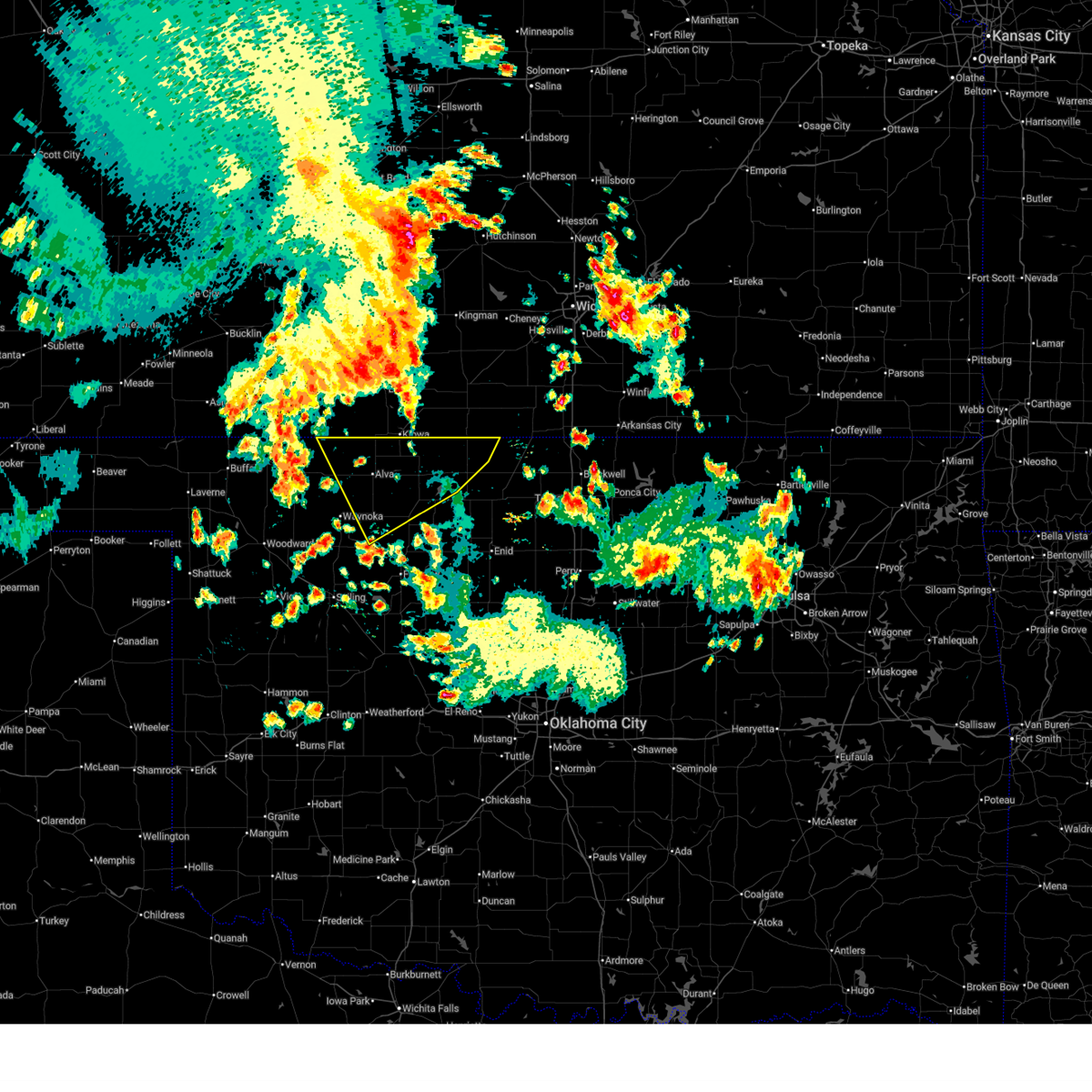
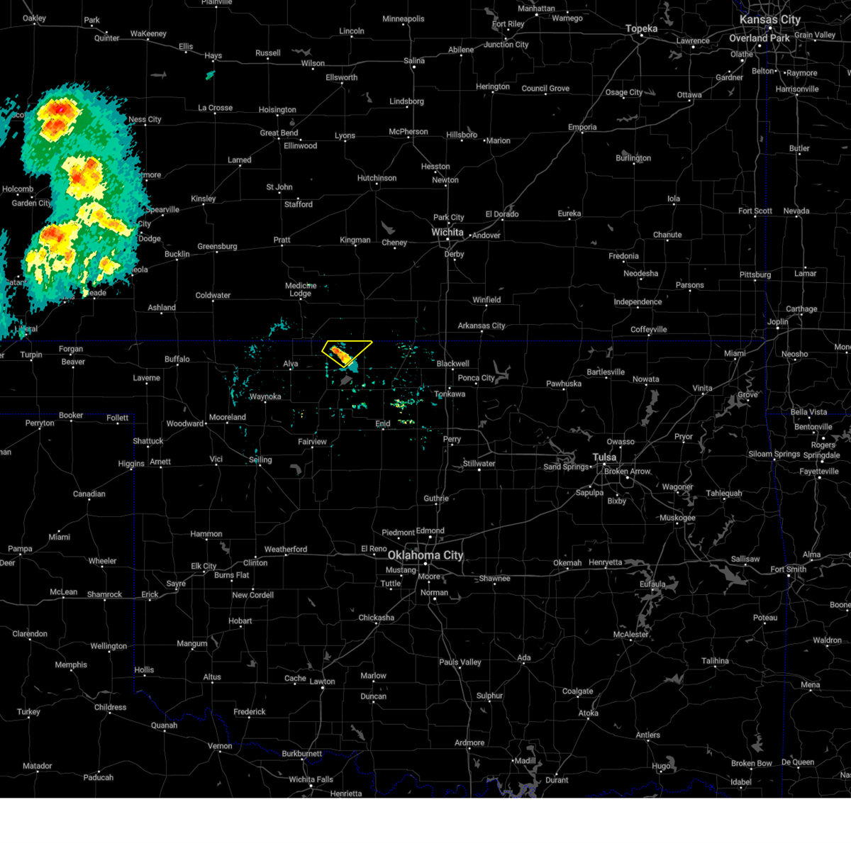
| 3/10/2026 8:37 PM CDT |
 Svroun the national weather service in norman has issued a * severe thunderstorm warning for, northeastern alfalfa county in northwestern oklahoma, northern grant county in northern oklahoma, * until 915 pm cdt. * at 837 pm cdt, a severe thunderstorm was located 5 miles southwest of manchester, moving east at 40 mph (radar indicated). Hazards include ping pong ball size hail and 60 mph wind gusts. People and animals outdoors will be injured. expect hail damage to roofs, siding, windows, and vehicles. Expect wind damage to roofs, siding, and trees. Svroun the national weather service in norman has issued a * severe thunderstorm warning for, northeastern alfalfa county in northwestern oklahoma, northern grant county in northern oklahoma, * until 915 pm cdt. * at 837 pm cdt, a severe thunderstorm was located 5 miles southwest of manchester, moving east at 40 mph (radar indicated). Hazards include ping pong ball size hail and 60 mph wind gusts. People and animals outdoors will be injured. expect hail damage to roofs, siding, windows, and vehicles. Expect wind damage to roofs, siding, and trees.
|
| 3/6/2026 1:14 AM CST |
 At 114 am cst, severe thunderstorms were located along a line extending from 6 miles northeast of hazelton to 7 miles northeast of nash to near carrier, moving northeast at 55 mph (radar indicated). Hazards include 60 mph wind gusts. Expect damage to roofs, siding, and trees. Locations impacted include, enid, fairview, cherokee, medford, helena, pond creek, lahoma, ringwood, carmen, wakita, cleo springs, kremlin, goltry, breckenridge, meno, jet, aline, nash, burlington, and hillsdale. At 114 am cst, severe thunderstorms were located along a line extending from 6 miles northeast of hazelton to 7 miles northeast of nash to near carrier, moving northeast at 55 mph (radar indicated). Hazards include 60 mph wind gusts. Expect damage to roofs, siding, and trees. Locations impacted include, enid, fairview, cherokee, medford, helena, pond creek, lahoma, ringwood, carmen, wakita, cleo springs, kremlin, goltry, breckenridge, meno, jet, aline, nash, burlington, and hillsdale.
|
| 3/6/2026 1:14 AM CST |
 the severe thunderstorm warning has been cancelled and is no longer in effect the severe thunderstorm warning has been cancelled and is no longer in effect
|
| 3/6/2026 12:54 AM CST |
 Svroun the national weather service in norman has issued a * severe thunderstorm warning for, eastern woods county in northwestern oklahoma, alfalfa county in northwestern oklahoma, grant county in northern oklahoma, northwestern garfield county in northern oklahoma, major county in northwestern oklahoma, * until 145 am cst. * at 1253 am cst, severe thunderstorms were located along a line extending from 4 miles north of capron to near helena to 3 miles southwest of ringwood, moving northeast at 55 mph (the alva mesonet measured a 65 mph wind gust). Hazards include 60 mph wind gusts. expect damage to roofs, siding, and trees Svroun the national weather service in norman has issued a * severe thunderstorm warning for, eastern woods county in northwestern oklahoma, alfalfa county in northwestern oklahoma, grant county in northern oklahoma, northwestern garfield county in northern oklahoma, major county in northwestern oklahoma, * until 145 am cst. * at 1253 am cst, severe thunderstorms were located along a line extending from 4 miles north of capron to near helena to 3 miles southwest of ringwood, moving northeast at 55 mph (the alva mesonet measured a 65 mph wind gust). Hazards include 60 mph wind gusts. expect damage to roofs, siding, and trees
|
| 3/5/2026 11:14 PM CST |
 The storm which prompted the warning has moved into kansas. therefore, the warning will be allowed to expire for grant county. The storm which prompted the warning has moved into kansas. therefore, the warning will be allowed to expire for grant county.
|
| 3/5/2026 11:05 PM CST |
 At 1105 pm cst, a severe thunderstorm was located 5 miles east of manchester, moving northeast at 20 mph (radar indicated). Hazards include 60 mph wind gusts and half dollar size hail. Hail damage to vehicles is expected. expect wind damage to roofs, siding, and trees. Locations impacted include, wakita and manchester. At 1105 pm cst, a severe thunderstorm was located 5 miles east of manchester, moving northeast at 20 mph (radar indicated). Hazards include 60 mph wind gusts and half dollar size hail. Hail damage to vehicles is expected. expect wind damage to roofs, siding, and trees. Locations impacted include, wakita and manchester.
|
| 3/5/2026 11:05 PM CST |
 the severe thunderstorm warning has been cancelled and is no longer in effect the severe thunderstorm warning has been cancelled and is no longer in effect
|
| 3/5/2026 10:32 PM CST |
 Svroun the national weather service in norman has issued a * severe thunderstorm warning for, northeastern alfalfa county in northwestern oklahoma, northwestern grant county in northern oklahoma, * until 1115 pm cst. * at 1032 pm cst, a severe thunderstorm was located 5 miles north of great salt plains lake, moving northeast at 30 mph (radar indicated). Hazards include 60 mph wind gusts and half dollar size hail. Hail damage to vehicles is expected. Expect wind damage to roofs, siding, and trees. Svroun the national weather service in norman has issued a * severe thunderstorm warning for, northeastern alfalfa county in northwestern oklahoma, northwestern grant county in northern oklahoma, * until 1115 pm cst. * at 1032 pm cst, a severe thunderstorm was located 5 miles north of great salt plains lake, moving northeast at 30 mph (radar indicated). Hazards include 60 mph wind gusts and half dollar size hail. Hail damage to vehicles is expected. Expect wind damage to roofs, siding, and trees.
|
| 3/4/2026 3:27 AM CST |
 The storms which prompted the warning have weakened below severe limits, therefore the warning will be allowed to expire. however, gusty winds are still possible with these thunderstorms. The storms which prompted the warning have weakened below severe limits, therefore the warning will be allowed to expire. however, gusty winds are still possible with these thunderstorms.
|
| 3/4/2026 3:09 AM CST |
 At 309 am cst, severe thunderstorms were located along a line extending from 5 miles north of caldwell to 3 miles east of renfrow to near jefferson, moving east at 50 mph (radar indicated). Hazards include 60 mph wind gusts. Expect damage to roofs, siding, and trees. Locations impacted include, blackwell, medford, wakita, braman, deer creek, manchester, renfrow, jefferson, nardin, and blackwell lake. At 309 am cst, severe thunderstorms were located along a line extending from 5 miles north of caldwell to 3 miles east of renfrow to near jefferson, moving east at 50 mph (radar indicated). Hazards include 60 mph wind gusts. Expect damage to roofs, siding, and trees. Locations impacted include, blackwell, medford, wakita, braman, deer creek, manchester, renfrow, jefferson, nardin, and blackwell lake.
|
| 3/4/2026 2:51 AM CST |
 Svroun the national weather service in norman has issued a * severe thunderstorm warning for, northwestern kay county in northern oklahoma, grant county in northern oklahoma, * until 330 am cst. * at 251 am cst, severe thunderstorms were located along a line extending from 9 miles east of anthony to 5 miles northeast of wakita to 9 miles northeast of nash, moving east at 50 mph (radar indicated). Hazards include 60 mph wind gusts. expect damage to roofs, siding, and trees Svroun the national weather service in norman has issued a * severe thunderstorm warning for, northwestern kay county in northern oklahoma, grant county in northern oklahoma, * until 330 am cst. * at 251 am cst, severe thunderstorms were located along a line extending from 9 miles east of anthony to 5 miles northeast of wakita to 9 miles northeast of nash, moving east at 50 mph (radar indicated). Hazards include 60 mph wind gusts. expect damage to roofs, siding, and trees
|
| 9/23/2025 2:04 AM CDT | Svroun the national weather service in norman has issued a * severe thunderstorm warning for, northwestern kay county in northern oklahoma, northern grant county in northern oklahoma, * until 245 am cdt. * at 203 am cdt, severe thunderstorms were located along a line extending from 8 miles northwest of renfrow to near medford, moving east at 35 mph (radar indicated). Hazards include 60 mph wind gusts and penny size hail. expect damage to roofs, siding, and trees |
| 9/20/2025 2:24 AM CDT | At 224 am cdt, severe thunderstorms were located along a line extending from 4 miles west of caldwell to 9 miles southwest of manchester, moving southeast at 30 mph (radar indicated). Hazards include 60 mph wind gusts. Expect damage to roofs, siding, and trees. Locations impacted include, medford, wakita, manchester, amorita, byron, renfrow, jefferson, and waldron. |
| 9/20/2025 1:56 AM CDT | Svroun the national weather service in norman has issued a * severe thunderstorm warning for, northeastern alfalfa county in northwestern oklahoma, northern grant county in northern oklahoma, * until 245 am cdt. * at 155 am cdt, severe thunderstorms were located along a line extending from 7 miles east of anthony to 3 miles north of amorita, moving southeast at 30 mph (radar indicated). Hazards include 60 mph wind gusts. expect damage to roofs, siding, and trees |
| 9/8/2025 6:07 PM CDT | Svroun the national weather service in norman has issued a * severe thunderstorm warning for, northeastern alfalfa county in northwestern oklahoma, northwestern grant county in northern oklahoma, * until 645 pm cdt. * at 607 pm cdt, a severe thunderstorm was located 9 miles northwest of manchester, moving south at 30 mph (radar indicated). Hazards include 60 mph wind gusts and quarter size hail. Hail damage to vehicles is expected. Expect wind damage to roofs, siding, and trees. |
| 9/1/2025 7:10 PM CDT |
 the severe thunderstorm warning has been cancelled and is no longer in effect the severe thunderstorm warning has been cancelled and is no longer in effect
|
| 9/1/2025 6:38 PM CDT |
 Svroun the national weather service in norman has issued a * severe thunderstorm warning for, northeastern alfalfa county in northwestern oklahoma, western grant county in northern oklahoma, * until 730 pm cdt. * at 638 pm cdt, a severe thunderstorm was located 7 miles northwest of manchester, moving south at 25 mph (radar indicated). Hazards include ping pong ball size hail and 60 mph wind gusts. People and animals outdoors will be injured. expect hail damage to roofs, siding, windows, and vehicles. Expect wind damage to roofs, siding, and trees. Svroun the national weather service in norman has issued a * severe thunderstorm warning for, northeastern alfalfa county in northwestern oklahoma, western grant county in northern oklahoma, * until 730 pm cdt. * at 638 pm cdt, a severe thunderstorm was located 7 miles northwest of manchester, moving south at 25 mph (radar indicated). Hazards include ping pong ball size hail and 60 mph wind gusts. People and animals outdoors will be injured. expect hail damage to roofs, siding, windows, and vehicles. Expect wind damage to roofs, siding, and trees.
|
| 8/11/2025 3:04 AM CDT |
 Svroun the national weather service in norman has issued a * severe thunderstorm warning for, northeastern alfalfa county in northwestern oklahoma, northwestern grant county in northern oklahoma, * until 345 am cdt. * at 304 am cdt, a severe thunderstorm was located near burlington, moving northeast at 30 mph (radar indicated). Hazards include 60 mph wind gusts. expect damage to roofs, siding, and trees Svroun the national weather service in norman has issued a * severe thunderstorm warning for, northeastern alfalfa county in northwestern oklahoma, northwestern grant county in northern oklahoma, * until 345 am cdt. * at 304 am cdt, a severe thunderstorm was located near burlington, moving northeast at 30 mph (radar indicated). Hazards include 60 mph wind gusts. expect damage to roofs, siding, and trees
|
| 7/24/2025 5:40 PM CDT |
 Svroun the national weather service in norman has issued a * severe thunderstorm warning for, east central alfalfa county in northwestern oklahoma, grant county in northern oklahoma, * until 630 pm cdt. * at 539 pm cdt, a severe thunderstorm was located 7 miles northeast of nash, moving east at 20 mph. other strong to severe thunderstorms were near jet, wakita, medford and renfrow (radar indicated). Hazards include 60 mph wind gusts and penny size hail. expect damage to roofs, siding, and trees Svroun the national weather service in norman has issued a * severe thunderstorm warning for, east central alfalfa county in northwestern oklahoma, grant county in northern oklahoma, * until 630 pm cdt. * at 539 pm cdt, a severe thunderstorm was located 7 miles northeast of nash, moving east at 20 mph. other strong to severe thunderstorms were near jet, wakita, medford and renfrow (radar indicated). Hazards include 60 mph wind gusts and penny size hail. expect damage to roofs, siding, and trees
|
| 7/24/2025 5:03 PM CDT |
 At 501 pm cdt, a severe thunderstorm was located near helena, moving northeast at 5 to 10 mph. several other strong to severe storms were located across alfalfa and grant counties. wind gusts to 60 mph are possible with these storms (radar indicated). Hazards include 60 to 65 mph wind gusts and penny size hail. Expect damage to roofs, siding, and trees. Locations impacted include, cherokee, medford, helena, carmen, wakita, jet, aline, nash, burlington, manchester, amorita, byron, lambert, ingersoll, great salt plains lake, and driftwood. At 501 pm cdt, a severe thunderstorm was located near helena, moving northeast at 5 to 10 mph. several other strong to severe storms were located across alfalfa and grant counties. wind gusts to 60 mph are possible with these storms (radar indicated). Hazards include 60 to 65 mph wind gusts and penny size hail. Expect damage to roofs, siding, and trees. Locations impacted include, cherokee, medford, helena, carmen, wakita, jet, aline, nash, burlington, manchester, amorita, byron, lambert, ingersoll, great salt plains lake, and driftwood.
|
| 7/24/2025 4:56 PM CDT |
 Svroun the national weather service in norman has issued a * severe thunderstorm warning for, alfalfa county in northwestern oklahoma, western grant county in northern oklahoma, * until 545 pm cdt. * at 454 pm cdt, a severe thunderstorm was located near helena, moving northeast at 10 mph. other strong to severe thunderstorms were located across eastern alfalfa county and western and northern grant counties (radar indicated). Hazards include 60 mph wind gusts and penny size hail. expect damage to roofs, siding, and trees Svroun the national weather service in norman has issued a * severe thunderstorm warning for, alfalfa county in northwestern oklahoma, western grant county in northern oklahoma, * until 545 pm cdt. * at 454 pm cdt, a severe thunderstorm was located near helena, moving northeast at 10 mph. other strong to severe thunderstorms were located across eastern alfalfa county and western and northern grant counties (radar indicated). Hazards include 60 mph wind gusts and penny size hail. expect damage to roofs, siding, and trees
|
| 7/18/2025 3:58 PM CDT |
 At 358 pm cdt, the leading edge of winds from a severe thunderstorm was located 7 miles southwest of manchester, moving northeast at 25 mph (radar indicated). Hazards include 70 mph wind gusts. Expect considerable tree damage. damage is likely to mobile homes, roofs, and outbuildings. Locations impacted include, manchester. At 358 pm cdt, the leading edge of winds from a severe thunderstorm was located 7 miles southwest of manchester, moving northeast at 25 mph (radar indicated). Hazards include 70 mph wind gusts. Expect considerable tree damage. damage is likely to mobile homes, roofs, and outbuildings. Locations impacted include, manchester.
|
| 7/18/2025 3:54 PM CDT |
 Svroun the national weather service in norman has issued a * severe thunderstorm warning for, northeastern alfalfa county in northwestern oklahoma, northwestern grant county in northern oklahoma, * until 415 pm cdt. * at 354 pm cdt, a severe thunderstorm was located 9 miles south of manchester, moving northeast at 25 mph (radar indicated). Hazards include 60 mph wind gusts. expect damage to roofs, siding, and trees Svroun the national weather service in norman has issued a * severe thunderstorm warning for, northeastern alfalfa county in northwestern oklahoma, northwestern grant county in northern oklahoma, * until 415 pm cdt. * at 354 pm cdt, a severe thunderstorm was located 9 miles south of manchester, moving northeast at 25 mph (radar indicated). Hazards include 60 mph wind gusts. expect damage to roofs, siding, and trees
|
| 7/6/2025 7:26 PM CDT |
 The storms which prompted the warning have weakened below severe limits, therefore the warning will be allowed to expire. however, gusty winds and heavy rain are still possible with these thunderstorms. The storms which prompted the warning have weakened below severe limits, therefore the warning will be allowed to expire. however, gusty winds and heavy rain are still possible with these thunderstorms.
|
| 7/6/2025 6:52 PM CDT |
 Svroun the national weather service in norman has issued a * severe thunderstorm warning for, northeastern alfalfa county in northwestern oklahoma, grant county in northern oklahoma, * until 730 pm cdt. * at 652 pm cdt, severe thunderstorms were located along a line extending from 5 miles southeast of caldwell to 4 miles east of wakita to 5 miles southwest of manchester, moving south at 25 mph (radar indicated). Hazards include 60 mph wind gusts. expect damage to roofs, siding, and trees Svroun the national weather service in norman has issued a * severe thunderstorm warning for, northeastern alfalfa county in northwestern oklahoma, grant county in northern oklahoma, * until 730 pm cdt. * at 652 pm cdt, severe thunderstorms were located along a line extending from 5 miles southeast of caldwell to 4 miles east of wakita to 5 miles southwest of manchester, moving south at 25 mph (radar indicated). Hazards include 60 mph wind gusts. expect damage to roofs, siding, and trees
|
| 6/29/2025 11:19 PM CDT |
 At 1119 pm cdt, severe thunderstorms were located along a line extending from 4 miles east of great salt plains lake to 5 miles southeast of caldwell, moving southwest at 40 mph (radar indicated). Hazards include 60 mph wind gusts and penny size hail. Expect damage to roofs, siding, and trees. Locations impacted include, medford, lamont, wakita, deer creek, manchester, jefferson, renfrow, nardin, northeastern great salt plains lake, and blackwell lake. At 1119 pm cdt, severe thunderstorms were located along a line extending from 4 miles east of great salt plains lake to 5 miles southeast of caldwell, moving southwest at 40 mph (radar indicated). Hazards include 60 mph wind gusts and penny size hail. Expect damage to roofs, siding, and trees. Locations impacted include, medford, lamont, wakita, deer creek, manchester, jefferson, renfrow, nardin, northeastern great salt plains lake, and blackwell lake.
|
| 6/29/2025 11:18 PM CDT |
 Svroun the national weather service in norman has issued a * severe thunderstorm warning for, western kay county in northern oklahoma, northwestern noble county in northern oklahoma, eastern alfalfa county in northwestern oklahoma, grant county in northern oklahoma, northern garfield county in northern oklahoma, * until midnight cdt. * at 1118 pm cdt, severe thunderstorms were located along a line extending from 6 miles northeast of great salt plains lake to 4 miles southeast of caldwell, moving southwest at 40 mph (radar indicated). Hazards include 60 mph wind gusts and penny size hail. expect damage to roofs, siding, and trees Svroun the national weather service in norman has issued a * severe thunderstorm warning for, western kay county in northern oklahoma, northwestern noble county in northern oklahoma, eastern alfalfa county in northwestern oklahoma, grant county in northern oklahoma, northern garfield county in northern oklahoma, * until midnight cdt. * at 1118 pm cdt, severe thunderstorms were located along a line extending from 6 miles northeast of great salt plains lake to 4 miles southeast of caldwell, moving southwest at 40 mph (radar indicated). Hazards include 60 mph wind gusts and penny size hail. expect damage to roofs, siding, and trees
|
| 6/29/2025 10:45 PM CDT |
 Svroun the national weather service in norman has issued a * severe thunderstorm warning for, western kay county in northern oklahoma, northeastern alfalfa county in northwestern oklahoma, grant county in northern oklahoma, * until 1130 pm cdt. * at 1045 pm cdt, severe thunderstorms were located along a line extending from 6 miles southwest of anthony to 4 miles southeast of caldwell, moving south at 30 mph (radar indicated). Hazards include 60 mph wind gusts and penny size hail. expect damage to roofs, siding, and trees Svroun the national weather service in norman has issued a * severe thunderstorm warning for, western kay county in northern oklahoma, northeastern alfalfa county in northwestern oklahoma, grant county in northern oklahoma, * until 1130 pm cdt. * at 1045 pm cdt, severe thunderstorms were located along a line extending from 6 miles southwest of anthony to 4 miles southeast of caldwell, moving south at 30 mph (radar indicated). Hazards include 60 mph wind gusts and penny size hail. expect damage to roofs, siding, and trees
|
| 6/17/2025 4:54 AM CDT |
 Svroun the national weather service in norman has issued a * severe thunderstorm warning for, kay county in northern oklahoma, northern noble county in northern oklahoma, grant county in northern oklahoma, northeastern garfield county in northern oklahoma, * until 545 am cdt. * at 453 am cdt, severe thunderstorms were located along a line extending from near douglass to 4 miles south of oxford to 5 miles west of south haven to near manchester, moving southeast at 50 mph (radar indicated). Hazards include 70 mph wind gusts and penny size hail. Expect considerable tree damage. Damage is likely to mobile homes, roofs, and outbuildings. Svroun the national weather service in norman has issued a * severe thunderstorm warning for, kay county in northern oklahoma, northern noble county in northern oklahoma, grant county in northern oklahoma, northeastern garfield county in northern oklahoma, * until 545 am cdt. * at 453 am cdt, severe thunderstorms were located along a line extending from near douglass to 4 miles south of oxford to 5 miles west of south haven to near manchester, moving southeast at 50 mph (radar indicated). Hazards include 70 mph wind gusts and penny size hail. Expect considerable tree damage. Damage is likely to mobile homes, roofs, and outbuildings.
|
| 6/14/2025 8:28 AM CDT |
 The storms which prompted the warning have weakened below severe limits, therefore the warning will be allowed to expire. however, gusty winds are still possible with these thunderstorms. The storms which prompted the warning have weakened below severe limits, therefore the warning will be allowed to expire. however, gusty winds are still possible with these thunderstorms.
|
| 6/14/2025 8:06 AM CDT |
 At 806 am cdt, severe thunderstorms were located along a line extending from near argonia to 7 miles northeast of great salt plains lake to 8 miles southwest of dacoma, moving southeast at 35 mph (radar indicated). Hazards include 60 mph wind gusts. Expect damage to roofs, siding, and trees. Locations impacted include, alva, cherokee, medford, helena, carmen, wakita, cleo springs, goltry, jet, aline, nash, burlington, hillsdale, dacoma, manchester, amorita, byron, jefferson, renfrow, and lambert. At 806 am cdt, severe thunderstorms were located along a line extending from near argonia to 7 miles northeast of great salt plains lake to 8 miles southwest of dacoma, moving southeast at 35 mph (radar indicated). Hazards include 60 mph wind gusts. Expect damage to roofs, siding, and trees. Locations impacted include, alva, cherokee, medford, helena, carmen, wakita, cleo springs, goltry, jet, aline, nash, burlington, hillsdale, dacoma, manchester, amorita, byron, jefferson, renfrow, and lambert.
|
| 6/14/2025 7:44 AM CDT |
 Svroun the national weather service in norman has issued a * severe thunderstorm warning for, eastern woods county in northwestern oklahoma, alfalfa county in northwestern oklahoma, grant county in northern oklahoma, northwestern garfield county in northern oklahoma, north central major county in northwestern oklahoma, * until 830 am cdt. * at 743 am cdt, severe thunderstorms were located along a line extending from 5 miles southwest of norwich to 3 miles northeast of amorita to 4 miles west of avard, moving southeast at 35 mph (radar indicated). Hazards include 60 mph wind gusts and penny size hail. expect damage to roofs, siding, and trees Svroun the national weather service in norman has issued a * severe thunderstorm warning for, eastern woods county in northwestern oklahoma, alfalfa county in northwestern oklahoma, grant county in northern oklahoma, northwestern garfield county in northern oklahoma, north central major county in northwestern oklahoma, * until 830 am cdt. * at 743 am cdt, severe thunderstorms were located along a line extending from 5 miles southwest of norwich to 3 miles northeast of amorita to 4 miles west of avard, moving southeast at 35 mph (radar indicated). Hazards include 60 mph wind gusts and penny size hail. expect damage to roofs, siding, and trees
|
| 6/14/2025 7:07 AM CDT |
 Svroun the national weather service in norman has issued a * severe thunderstorm warning for, eastern woods county in northwestern oklahoma, alfalfa county in northwestern oklahoma, northwestern grant county in northern oklahoma, * until 745 am cdt. * at 706 am cdt, severe thunderstorms were located along a line extending from 6 miles southwest of kingman to 6 miles southeast of nashville to 4 miles southeast of medicine lodge to 6 miles south of aetna, moving southeast at 40 mph (radar indicated). Hazards include 60 to 70 mph wind gusts and penny size hail. Expect considerable tree damage. Damage is likely to mobile homes, roofs, and outbuildings. Svroun the national weather service in norman has issued a * severe thunderstorm warning for, eastern woods county in northwestern oklahoma, alfalfa county in northwestern oklahoma, northwestern grant county in northern oklahoma, * until 745 am cdt. * at 706 am cdt, severe thunderstorms were located along a line extending from 6 miles southwest of kingman to 6 miles southeast of nashville to 4 miles southeast of medicine lodge to 6 miles south of aetna, moving southeast at 40 mph (radar indicated). Hazards include 60 to 70 mph wind gusts and penny size hail. Expect considerable tree damage. Damage is likely to mobile homes, roofs, and outbuildings.
|
| 6/8/2025 4:11 PM CDT |
 At 411 pm cdt, a severe thunderstorm was located 5 miles southeast of caldwell, moving east at 30 mph (emergency management reported 70 mph winds 2 miles north of blackwell). Hazards include golf ball size hail and 70 mph wind gusts. People and animals outdoors will be injured. expect hail damage to roofs, siding, windows, and vehicles. expect considerable tree damage. wind damage is also likely to mobile homes, roofs, and outbuildings. Locations impacted include, ponca city, blackwell, tonkawa, medford, newkirk, kaw city, wakita, braman, deer creek, manchester, kildare, jefferson, renfrow, chilocco, kaw lake, hardy, nardin, eastern great salt plains lake, blackwell lake, and peckham. At 411 pm cdt, a severe thunderstorm was located 5 miles southeast of caldwell, moving east at 30 mph (emergency management reported 70 mph winds 2 miles north of blackwell). Hazards include golf ball size hail and 70 mph wind gusts. People and animals outdoors will be injured. expect hail damage to roofs, siding, windows, and vehicles. expect considerable tree damage. wind damage is also likely to mobile homes, roofs, and outbuildings. Locations impacted include, ponca city, blackwell, tonkawa, medford, newkirk, kaw city, wakita, braman, deer creek, manchester, kildare, jefferson, renfrow, chilocco, kaw lake, hardy, nardin, eastern great salt plains lake, blackwell lake, and peckham.
|
| 6/8/2025 4:08 PM CDT |
 the severe thunderstorm warning has been cancelled and is no longer in effect the severe thunderstorm warning has been cancelled and is no longer in effect
|
| 6/8/2025 4:08 PM CDT |
 At 408 pm cdt, a severe thunderstorm was located 5 miles southeast of caldwell, moving northeast at 20 mph (radar indicated). Hazards include golf ball size hail and 60 mph wind gusts. People and animals outdoors will be injured. expect hail damage to roofs, siding, windows, and vehicles. expect wind damage to roofs, siding, and trees. Locations impacted include, ponca city, blackwell, tonkawa, medford, newkirk, kaw city, wakita, braman, deer creek, manchester, kildare, jefferson, renfrow, chilocco, kaw lake, hardy, nardin, eastern great salt plains lake, blackwell lake, and peckham. At 408 pm cdt, a severe thunderstorm was located 5 miles southeast of caldwell, moving northeast at 20 mph (radar indicated). Hazards include golf ball size hail and 60 mph wind gusts. People and animals outdoors will be injured. expect hail damage to roofs, siding, windows, and vehicles. expect wind damage to roofs, siding, and trees. Locations impacted include, ponca city, blackwell, tonkawa, medford, newkirk, kaw city, wakita, braman, deer creek, manchester, kildare, jefferson, renfrow, chilocco, kaw lake, hardy, nardin, eastern great salt plains lake, blackwell lake, and peckham.
|
| 6/8/2025 3:54 PM CDT |
 Svroun the national weather service in norman has issued a * severe thunderstorm warning for, kay county in northern oklahoma, northern noble county in northern oklahoma, southeastern alfalfa county in northwestern oklahoma, grant county in northern oklahoma, northern garfield county in northern oklahoma, * until 445 pm cdt. * at 353 pm cdt, severe thunderstorms were located along a line extending from near braman to near blackwell to 3 miles west of enid, moving east at 35 mph (radar indicated). Hazards include 70 mph wind gusts and half dollar size hail. Hail damage to vehicles is expected. expect considerable tree damage. Wind damage is also likely to mobile homes, roofs, and outbuildings. Svroun the national weather service in norman has issued a * severe thunderstorm warning for, kay county in northern oklahoma, northern noble county in northern oklahoma, southeastern alfalfa county in northwestern oklahoma, grant county in northern oklahoma, northern garfield county in northern oklahoma, * until 445 pm cdt. * at 353 pm cdt, severe thunderstorms were located along a line extending from near braman to near blackwell to 3 miles west of enid, moving east at 35 mph (radar indicated). Hazards include 70 mph wind gusts and half dollar size hail. Hail damage to vehicles is expected. expect considerable tree damage. Wind damage is also likely to mobile homes, roofs, and outbuildings.
|
| 6/8/2025 3:07 PM CDT |
 Svroun the national weather service in norman has issued a * severe thunderstorm warning for, western kay county in northern oklahoma, southeastern woods county in northwestern oklahoma, northwestern noble county in northern oklahoma, alfalfa county in northwestern oklahoma, grant county in northern oklahoma, northern garfield county in northern oklahoma, northern major county in northwestern oklahoma, * until 330 pm cdt. * at 306 pm cdt, severe thunderstorms were located along a line extending from 5 miles northeast of wakita to 4 miles west of pond creek to near helena to 9 miles southeast of waynoka, moving east at 25 mph (trained weather spotters reported 63 mph wind gust north of nash). Hazards include 70 mph wind gusts and quarter size hail. Hail damage to vehicles is expected. expect considerable tree damage. Wind damage is also likely to mobile homes, roofs, and outbuildings. Svroun the national weather service in norman has issued a * severe thunderstorm warning for, western kay county in northern oklahoma, southeastern woods county in northwestern oklahoma, northwestern noble county in northern oklahoma, alfalfa county in northwestern oklahoma, grant county in northern oklahoma, northern garfield county in northern oklahoma, northern major county in northwestern oklahoma, * until 330 pm cdt. * at 306 pm cdt, severe thunderstorms were located along a line extending from 5 miles northeast of wakita to 4 miles west of pond creek to near helena to 9 miles southeast of waynoka, moving east at 25 mph (trained weather spotters reported 63 mph wind gust north of nash). Hazards include 70 mph wind gusts and quarter size hail. Hail damage to vehicles is expected. expect considerable tree damage. Wind damage is also likely to mobile homes, roofs, and outbuildings.
|
| 6/7/2025 1:25 AM CDT |
 Svroun the national weather service in norman has issued a * severe thunderstorm warning for, northern alfalfa county in northwestern oklahoma, western grant county in northern oklahoma, * until 215 am cdt. * at 124 am cdt, a severe thunderstorm was located near driftwood, moving east at 55 mph. this is a destructive storm for northern alfalfa and grant counties (radar indicated). Hazards include 80 mph wind gusts and quarter size hail. Flying debris will be dangerous to those caught without shelter. mobile homes will be heavily damaged. expect considerable damage to roofs, windows, and vehicles. Extensive tree damage and power outages are likely. Svroun the national weather service in norman has issued a * severe thunderstorm warning for, northern alfalfa county in northwestern oklahoma, western grant county in northern oklahoma, * until 215 am cdt. * at 124 am cdt, a severe thunderstorm was located near driftwood, moving east at 55 mph. this is a destructive storm for northern alfalfa and grant counties (radar indicated). Hazards include 80 mph wind gusts and quarter size hail. Flying debris will be dangerous to those caught without shelter. mobile homes will be heavily damaged. expect considerable damage to roofs, windows, and vehicles. Extensive tree damage and power outages are likely.
|
| 6/2/2025 10:41 PM CDT |
 The storms which prompted the warning have weakened below severe limits, therefore the warning will be allowed to expire. however, gusty winds are still possible with these thunderstorms. The storms which prompted the warning have weakened below severe limits, therefore the warning will be allowed to expire. however, gusty winds are still possible with these thunderstorms.
|
| 6/2/2025 9:58 PM CDT |
 Svroun the national weather service in norman has issued a * severe thunderstorm warning for, western kay county in northern oklahoma, eastern alfalfa county in northwestern oklahoma, grant county in northern oklahoma, northern garfield county in northern oklahoma, * until 1045 pm cdt. * at 958 pm cdt, severe thunderstorms were located along a line extending from near manchester to 4 miles northwest of goltry, moving east at 25 mph (radar indicated). Hazards include 60 mph wind gusts. expect damage to roofs, siding, and trees Svroun the national weather service in norman has issued a * severe thunderstorm warning for, western kay county in northern oklahoma, eastern alfalfa county in northwestern oklahoma, grant county in northern oklahoma, northern garfield county in northern oklahoma, * until 1045 pm cdt. * at 958 pm cdt, severe thunderstorms were located along a line extending from near manchester to 4 miles northwest of goltry, moving east at 25 mph (radar indicated). Hazards include 60 mph wind gusts. expect damage to roofs, siding, and trees
|
| 6/2/2025 9:17 PM CDT |
 Svroun the national weather service in norman has issued a * severe thunderstorm warning for, northeastern alfalfa county in northwestern oklahoma, grant county in northern oklahoma, * until 1000 pm cdt. * at 917 pm cdt, severe thunderstorms were located along a line extending from 5 miles north of amorita to 3 miles east of lambert, moving east at 30 mph (radar indicated). Hazards include 60 mph wind gusts and quarter size hail. Hail damage to vehicles is expected. Expect wind damage to roofs, siding, and trees. Svroun the national weather service in norman has issued a * severe thunderstorm warning for, northeastern alfalfa county in northwestern oklahoma, grant county in northern oklahoma, * until 1000 pm cdt. * at 917 pm cdt, severe thunderstorms were located along a line extending from 5 miles north of amorita to 3 miles east of lambert, moving east at 30 mph (radar indicated). Hazards include 60 mph wind gusts and quarter size hail. Hail damage to vehicles is expected. Expect wind damage to roofs, siding, and trees.
|
| 5/25/2025 12:07 AM CDT |
 Svroun the national weather service in norman has issued a * severe thunderstorm warning for, northeastern alfalfa county in northwestern oklahoma, northwestern grant county in northern oklahoma, * until 100 am cdt. * at 1207 am cdt, a severe thunderstorm was located 7 miles southwest of wakita, moving northeast at 30 mph (radar indicated). Hazards include 60 mph wind gusts and quarter size hail. Hail damage to vehicles is expected. Expect wind damage to roofs, siding, and trees. Svroun the national weather service in norman has issued a * severe thunderstorm warning for, northeastern alfalfa county in northwestern oklahoma, northwestern grant county in northern oklahoma, * until 100 am cdt. * at 1207 am cdt, a severe thunderstorm was located 7 miles southwest of wakita, moving northeast at 30 mph (radar indicated). Hazards include 60 mph wind gusts and quarter size hail. Hail damage to vehicles is expected. Expect wind damage to roofs, siding, and trees.
|
| 5/24/2025 3:33 AM CDT |
 Svroun the national weather service in norman has issued a * severe thunderstorm warning for, western kay county in northern oklahoma, southeastern woods county in northwestern oklahoma, northwestern noble county in northern oklahoma, alfalfa county in northwestern oklahoma, grant county in northern oklahoma, garfield county in northern oklahoma, eastern major county in northwestern oklahoma, * until 430 am cdt. * at 332 am cdt, severe thunderstorms were located along a line extending from 4 miles southeast of manchester to 4 miles west of ingersoll, moving southeast at 40 mph (radar indicated). Hazards include 60 mph wind gusts and penny size hail. expect damage to roofs, siding, and trees Svroun the national weather service in norman has issued a * severe thunderstorm warning for, western kay county in northern oklahoma, southeastern woods county in northwestern oklahoma, northwestern noble county in northern oklahoma, alfalfa county in northwestern oklahoma, grant county in northern oklahoma, garfield county in northern oklahoma, eastern major county in northwestern oklahoma, * until 430 am cdt. * at 332 am cdt, severe thunderstorms were located along a line extending from 4 miles southeast of manchester to 4 miles west of ingersoll, moving southeast at 40 mph (radar indicated). Hazards include 60 mph wind gusts and penny size hail. expect damage to roofs, siding, and trees
|
| 5/24/2025 2:38 AM CDT |
 Svroun the national weather service in norman has issued a * severe thunderstorm warning for, northeastern woods county in northwestern oklahoma, alfalfa county in northwestern oklahoma, northwestern grant county in northern oklahoma, * until 345 am cdt. * at 237 am cdt, severe thunderstorms were located along a line extending from 6 miles northeast of nashville to 3 miles south of medicine lodge to 8 miles northwest of hardtner to near aetna, moving southeast at 35 mph (radar indicated). Hazards include 60 mph wind gusts and quarter size hail. Hail damage to vehicles is expected. Expect wind damage to roofs, siding, and trees. Svroun the national weather service in norman has issued a * severe thunderstorm warning for, northeastern woods county in northwestern oklahoma, alfalfa county in northwestern oklahoma, northwestern grant county in northern oklahoma, * until 345 am cdt. * at 237 am cdt, severe thunderstorms were located along a line extending from 6 miles northeast of nashville to 3 miles south of medicine lodge to 8 miles northwest of hardtner to near aetna, moving southeast at 35 mph (radar indicated). Hazards include 60 mph wind gusts and quarter size hail. Hail damage to vehicles is expected. Expect wind damage to roofs, siding, and trees.
|
| 7/2/2024 5:38 PM CDT |
 the severe thunderstorm warning has been cancelled and is no longer in effect the severe thunderstorm warning has been cancelled and is no longer in effect
|
| 7/2/2024 5:38 PM CDT |
 At 538 pm cdt, a severe thunderstorm was located over manchester, moving northeast at 35 mph (radar indicated). Hazards include 60 mph wind gusts. Expect damage to roofs, siding, and trees. Locations impacted include, manchester. At 538 pm cdt, a severe thunderstorm was located over manchester, moving northeast at 35 mph (radar indicated). Hazards include 60 mph wind gusts. Expect damage to roofs, siding, and trees. Locations impacted include, manchester.
|
| 7/2/2024 5:24 PM CDT |
 Svroun the national weather service in norman has issued a * severe thunderstorm warning for, northeastern alfalfa county in northwestern oklahoma, northwestern grant county in northern oklahoma, * until 600 pm cdt. * at 524 pm cdt, a severe thunderstorm was located 7 miles east of amorita, moving northeast at 35 mph (radar indicated). Hazards include 60 mph wind gusts and nickel size hail. expect damage to roofs, siding, and trees Svroun the national weather service in norman has issued a * severe thunderstorm warning for, northeastern alfalfa county in northwestern oklahoma, northwestern grant county in northern oklahoma, * until 600 pm cdt. * at 524 pm cdt, a severe thunderstorm was located 7 miles east of amorita, moving northeast at 35 mph (radar indicated). Hazards include 60 mph wind gusts and nickel size hail. expect damage to roofs, siding, and trees
|
| 6/3/2024 6:55 AM CDT |
 The storms which prompted the warning have weakened below severe limits, therefore the warning will be allowed to expire. The storms which prompted the warning have weakened below severe limits, therefore the warning will be allowed to expire.
|
| 6/3/2024 6:30 AM CDT |
 At 629 am cdt, severe thunderstorms were located along a line extending from 6 miles east of hazelton to near driftwood to 5 miles west of dacoma, moving southeast at 50 mph (radar indicated). Hazards include 60 mph wind gusts. Expect damage to roofs, siding, and trees. Locations impacted include, cherokee, carmen, wakita, jet, nash, burlington, manchester, amorita, byron, lambert, ingersoll, great salt plains lake, driftwood, and waldron. At 629 am cdt, severe thunderstorms were located along a line extending from 6 miles east of hazelton to near driftwood to 5 miles west of dacoma, moving southeast at 50 mph (radar indicated). Hazards include 60 mph wind gusts. Expect damage to roofs, siding, and trees. Locations impacted include, cherokee, carmen, wakita, jet, nash, burlington, manchester, amorita, byron, lambert, ingersoll, great salt plains lake, driftwood, and waldron.
|
| 6/3/2024 6:30 AM CDT |
 the severe thunderstorm warning has been cancelled and is no longer in effect the severe thunderstorm warning has been cancelled and is no longer in effect
|
| 6/3/2024 6:08 AM CDT |
 Svroun the national weather service in norman has issued a * severe thunderstorm warning for, northeastern woods county in northwestern oklahoma, alfalfa county in northwestern oklahoma, western grant county in northern oklahoma, * until 700 am cdt. * at 608 am cdt, severe thunderstorms were located along a line extending from 7 miles southeast of medicine lodge to 4 miles southeast of hardtner to 7 miles northwest of avard, moving southeast at 50 mph (radar indicated). Hazards include 60 mph wind gusts. expect damage to roofs, siding, and trees Svroun the national weather service in norman has issued a * severe thunderstorm warning for, northeastern woods county in northwestern oklahoma, alfalfa county in northwestern oklahoma, western grant county in northern oklahoma, * until 700 am cdt. * at 608 am cdt, severe thunderstorms were located along a line extending from 7 miles southeast of medicine lodge to 4 miles southeast of hardtner to 7 miles northwest of avard, moving southeast at 50 mph (radar indicated). Hazards include 60 mph wind gusts. expect damage to roofs, siding, and trees
|
| 6/1/2024 7:54 PM CDT |
 The storm which prompted the warning has weakened below severe limits, therefore the warning will be allowed to expire. however, small hail and gusty winds are still possible with this thunderstorm. The storm which prompted the warning has weakened below severe limits, therefore the warning will be allowed to expire. however, small hail and gusty winds are still possible with this thunderstorm.
|
| 6/1/2024 7:46 PM CDT |
 At 746 pm cdt, a severe thunderstorm was located 5 miles east of byron, and is nearly stationary (radar indicated). Hazards include 60 mph wind gusts and quarter size hail. Hail damage to vehicles is expected. expect wind damage to roofs, siding, and trees. Locations impacted include, manchester and waldron. At 746 pm cdt, a severe thunderstorm was located 5 miles east of byron, and is nearly stationary (radar indicated). Hazards include 60 mph wind gusts and quarter size hail. Hail damage to vehicles is expected. expect wind damage to roofs, siding, and trees. Locations impacted include, manchester and waldron.
|
| 6/1/2024 7:32 PM CDT |
 At 732 pm cdt, a severe thunderstorm was located near amorita, and is nearly stationary (radar indicated). Hazards include 60 mph wind gusts and half dollar size hail. Hail damage to vehicles is expected. expect wind damage to roofs, siding, and trees. Locations impacted include, manchester, amorita, byron, and waldron. At 732 pm cdt, a severe thunderstorm was located near amorita, and is nearly stationary (radar indicated). Hazards include 60 mph wind gusts and half dollar size hail. Hail damage to vehicles is expected. expect wind damage to roofs, siding, and trees. Locations impacted include, manchester, amorita, byron, and waldron.
|
| 6/1/2024 7:16 PM CDT |
 Svroun the national weather service in norman has issued a * severe thunderstorm warning for, northeastern alfalfa county in northwestern oklahoma, northwestern grant county in northern oklahoma, * until 800 pm cdt. * at 715 pm cdt, a severe thunderstorm was located near amorita, moving northeast at 10 mph (radar indicated). Hazards include 60 mph wind gusts and quarter size hail. Hail damage to vehicles is expected. Expect wind damage to roofs, siding, and trees. Svroun the national weather service in norman has issued a * severe thunderstorm warning for, northeastern alfalfa county in northwestern oklahoma, northwestern grant county in northern oklahoma, * until 800 pm cdt. * at 715 pm cdt, a severe thunderstorm was located near amorita, moving northeast at 10 mph (radar indicated). Hazards include 60 mph wind gusts and quarter size hail. Hail damage to vehicles is expected. Expect wind damage to roofs, siding, and trees.
|
| 5/20/2024 12:06 AM CDT |
 Svroun the national weather service in norman has issued a * severe thunderstorm warning for, northeastern woods county in northwestern oklahoma, alfalfa county in northwestern oklahoma, western grant county in northern oklahoma, * until 1245 am cdt. * at 1206 am cdt, severe thunderstorms were located along a line extending from near alva to near cherokee, moving east at 30 mph (radar indicated). Hazards include ping pong ball size hail and 60 mph wind gusts. People and animals outdoors will be injured. expect hail damage to roofs, siding, windows, and vehicles. Expect wind damage to roofs, siding, and trees. Svroun the national weather service in norman has issued a * severe thunderstorm warning for, northeastern woods county in northwestern oklahoma, alfalfa county in northwestern oklahoma, western grant county in northern oklahoma, * until 1245 am cdt. * at 1206 am cdt, severe thunderstorms were located along a line extending from near alva to near cherokee, moving east at 30 mph (radar indicated). Hazards include ping pong ball size hail and 60 mph wind gusts. People and animals outdoors will be injured. expect hail damage to roofs, siding, windows, and vehicles. Expect wind damage to roofs, siding, and trees.
|
| 5/4/2024 12:52 AM CDT |
 The storm which prompted the warning has weakened below severe limits, therefore the warning will be allowed to expire. however, gusty winds are still possible with this thunderstorm. The storm which prompted the warning has weakened below severe limits, therefore the warning will be allowed to expire. however, gusty winds are still possible with this thunderstorm.
|
| 5/4/2024 12:26 AM CDT |
 At 1226 am cdt, a severe thunderstorm was located 4 miles south of byron, moving northeast at 30 mph (radar indicated). Hazards include 60 mph wind gusts and penny size hail. Expect damage to roofs, siding, and trees. Locations impacted include, wakita, manchester, amorita, and byron. At 1226 am cdt, a severe thunderstorm was located 4 miles south of byron, moving northeast at 30 mph (radar indicated). Hazards include 60 mph wind gusts and penny size hail. Expect damage to roofs, siding, and trees. Locations impacted include, wakita, manchester, amorita, and byron.
|
| 5/4/2024 12:06 AM CDT |
 Svroun the national weather service in norman has issued a * severe thunderstorm warning for, alfalfa county in northwestern oklahoma, northwestern grant county in northern oklahoma, * until 100 am cdt. * at 1206 am cdt, severe thunderstorms were located along a line extending from 6 miles southeast of capron to 3 miles southwest of lambert, moving east at 25 mph (radar indicated). Hazards include 60 mph wind gusts and penny size hail. expect damage to roofs, siding, and trees Svroun the national weather service in norman has issued a * severe thunderstorm warning for, alfalfa county in northwestern oklahoma, northwestern grant county in northern oklahoma, * until 100 am cdt. * at 1206 am cdt, severe thunderstorms were located along a line extending from 6 miles southeast of capron to 3 miles southwest of lambert, moving east at 25 mph (radar indicated). Hazards include 60 mph wind gusts and penny size hail. expect damage to roofs, siding, and trees
|
| 4/30/2024 9:10 PM CDT |
 Svroun the national weather service in norman has issued a * severe thunderstorm warning for, western kay county in northern oklahoma, northeastern alfalfa county in northwestern oklahoma, grant county in northern oklahoma, * until 1000 pm cdt. * at 910 pm cdt, severe thunderstorms were located along a line extending from 5 miles northwest of newkirk to near medford to 5 miles southeast of byron, moving southeast at 10 mph (radar indicated). Hazards include 60 mph wind gusts and quarter size hail. Hail damage to vehicles is expected. Expect wind damage to roofs, siding, and trees. Svroun the national weather service in norman has issued a * severe thunderstorm warning for, western kay county in northern oklahoma, northeastern alfalfa county in northwestern oklahoma, grant county in northern oklahoma, * until 1000 pm cdt. * at 910 pm cdt, severe thunderstorms were located along a line extending from 5 miles northwest of newkirk to near medford to 5 miles southeast of byron, moving southeast at 10 mph (radar indicated). Hazards include 60 mph wind gusts and quarter size hail. Hail damage to vehicles is expected. Expect wind damage to roofs, siding, and trees.
|
| 4/30/2024 8:08 PM CDT |
 At 808 pm cdt, severe thunderstorms were located along a line extending from 3 miles west of caldwell to 7 miles west of wakita, moving east at 25 mph (radar indicated). Hazards include 70 mph wind gusts and half dollar size hail. Hail damage to vehicles is expected. expect considerable tree damage. wind damage is also likely to mobile homes, roofs, and outbuildings. Locations impacted include, wakita, manchester, amorita, byron, renfrow, driftwood, northeastern great salt plains lake, and waldron. At 808 pm cdt, severe thunderstorms were located along a line extending from 3 miles west of caldwell to 7 miles west of wakita, moving east at 25 mph (radar indicated). Hazards include 70 mph wind gusts and half dollar size hail. Hail damage to vehicles is expected. expect considerable tree damage. wind damage is also likely to mobile homes, roofs, and outbuildings. Locations impacted include, wakita, manchester, amorita, byron, renfrow, driftwood, northeastern great salt plains lake, and waldron.
|
| 4/30/2024 7:51 PM CDT |
 Svroun the national weather service in norman has issued a * severe thunderstorm warning for, northern alfalfa county in northwestern oklahoma, northwestern grant county in northern oklahoma, * until 830 pm cdt. * at 751 pm cdt, severe thunderstorms were located along a line extending from 8 miles northeast of caldwell to 9 miles east of byron, moving east at 30 mph (radar indicated). Hazards include 70 mph wind gusts and half dollar size hail. Hail damage to vehicles is expected. expect considerable tree damage. Wind damage is also likely to mobile homes, roofs, and outbuildings. Svroun the national weather service in norman has issued a * severe thunderstorm warning for, northern alfalfa county in northwestern oklahoma, northwestern grant county in northern oklahoma, * until 830 pm cdt. * at 751 pm cdt, severe thunderstorms were located along a line extending from 8 miles northeast of caldwell to 9 miles east of byron, moving east at 30 mph (radar indicated). Hazards include 70 mph wind gusts and half dollar size hail. Hail damage to vehicles is expected. expect considerable tree damage. Wind damage is also likely to mobile homes, roofs, and outbuildings.
|
| 8/6/2023 2:57 AM CDT |
 At 256 am cdt, a severe thunderstorm was located 4 miles west of pond creek, moving east at 60 mph (radar indicated). Hazards include 60 mph wind gusts and penny size hail. Expect damage to roofs, siding, and trees. locations impacted include, enid, cherokee, medford, helena, pond creek, garber, lahoma, lamont, carmen, wakita, kremlin, goltry, breckenridge, jet, aline, nash, hunter, fairmont, deer creek, and hillsdale. hail threat, radar indicated max hail size, 0. 75 in wind threat, radar indicated max wind gust, 60 mph. At 256 am cdt, a severe thunderstorm was located 4 miles west of pond creek, moving east at 60 mph (radar indicated). Hazards include 60 mph wind gusts and penny size hail. Expect damage to roofs, siding, and trees. locations impacted include, enid, cherokee, medford, helena, pond creek, garber, lahoma, lamont, carmen, wakita, kremlin, goltry, breckenridge, jet, aline, nash, hunter, fairmont, deer creek, and hillsdale. hail threat, radar indicated max hail size, 0. 75 in wind threat, radar indicated max wind gust, 60 mph.
|
| 8/6/2023 2:27 AM CDT |
 At 226 am cdt, a severe thunderstorm was located near ingersoll, moving east at 60 mph (radar indicated). Hazards include 60 mph wind gusts and quarter size hail. Hail damage to vehicles is expected. Expect wind damage to roofs, siding, and trees. At 226 am cdt, a severe thunderstorm was located near ingersoll, moving east at 60 mph (radar indicated). Hazards include 60 mph wind gusts and quarter size hail. Hail damage to vehicles is expected. Expect wind damage to roofs, siding, and trees.
|
| 8/5/2023 4:38 AM CDT |
 At 438 am cdt, a severe thunderstorm was located 4 miles southeast of cherokee, moving east at 50 mph (radar indicated). Hazards include 60 mph wind gusts and penny size hail. expect damage to roofs, siding, and trees At 438 am cdt, a severe thunderstorm was located 4 miles southeast of cherokee, moving east at 50 mph (radar indicated). Hazards include 60 mph wind gusts and penny size hail. expect damage to roofs, siding, and trees
|
| 7/21/2023 3:45 AM CDT |
 At 344 am cdt, severe thunderstorms were located along a line extending from near manchester to 4 miles southwest of pond creek to 3 miles southeast of drummond, moving east at 45 mph. the strongest winds are most likely near enid (radar indicated). Hazards include 70 mph wind gusts. Expect considerable tree damage. damage is likely to mobile homes, roofs, and outbuildings. Locations impacted include, enid, medford, waukomis, pond creek, lahoma, drummond, wakita, kremlin, goltry, breckenridge, ames, meno, jet, nash, hunter, fairmont, hillsdale, manchester, carrier, and jefferson. At 344 am cdt, severe thunderstorms were located along a line extending from near manchester to 4 miles southwest of pond creek to 3 miles southeast of drummond, moving east at 45 mph. the strongest winds are most likely near enid (radar indicated). Hazards include 70 mph wind gusts. Expect considerable tree damage. damage is likely to mobile homes, roofs, and outbuildings. Locations impacted include, enid, medford, waukomis, pond creek, lahoma, drummond, wakita, kremlin, goltry, breckenridge, ames, meno, jet, nash, hunter, fairmont, hillsdale, manchester, carrier, and jefferson.
|
| 7/21/2023 3:18 AM CDT |
 At 318 am cdt, severe thunderstorms were located along a line extending from 5 miles north of burlington to 5 miles north of helena to near isabella, moving east at 45 mph (radar indicated). Hazards include 60 mph wind gusts. expect damage to roofs, siding, and trees At 318 am cdt, severe thunderstorms were located along a line extending from 5 miles north of burlington to 5 miles north of helena to near isabella, moving east at 45 mph (radar indicated). Hazards include 60 mph wind gusts. expect damage to roofs, siding, and trees
|
| 7/14/2023 5:58 PM CDT |
 At 557 pm cdt, severe thunderstorms were located along a line extending from 3 miles south of manchester to 3 miles southeast of renfrow to near chilocco, moving southeast at 30 mph (radar indicated). Hazards include 70 mph wind gusts and quarter size hail. Hail damage to vehicles is expected. expect considerable tree damage. wind damage is also likely to mobile homes, roofs, and outbuildings. locations impacted include, blackwell, medford, newkirk, wakita, braman, deer creek, manchester, renfrow, chilocco, hardy, nardin, northwestern kaw lake, blackwell lake, and peckham. thunderstorm damage threat, considerable hail threat, radar indicated max hail size, 1. 00 in wind threat, radar indicated max wind gust, 70 mph. At 557 pm cdt, severe thunderstorms were located along a line extending from 3 miles south of manchester to 3 miles southeast of renfrow to near chilocco, moving southeast at 30 mph (radar indicated). Hazards include 70 mph wind gusts and quarter size hail. Hail damage to vehicles is expected. expect considerable tree damage. wind damage is also likely to mobile homes, roofs, and outbuildings. locations impacted include, blackwell, medford, newkirk, wakita, braman, deer creek, manchester, renfrow, chilocco, hardy, nardin, northwestern kaw lake, blackwell lake, and peckham. thunderstorm damage threat, considerable hail threat, radar indicated max hail size, 1. 00 in wind threat, radar indicated max wind gust, 70 mph.
|
| 7/14/2023 5:47 PM CDT |
 At 547 pm cdt, severe thunderstorms were located along a line extending from 6 miles east of amorita to near renfrow to 6 miles west of chilocco, moving east at 45 mph (radar indicated). Hazards include 70 mph wind gusts and half dollar size hail. Hail damage to vehicles is expected. expect considerable tree damage. wind damage is also likely to mobile homes, roofs, and outbuildings. locations impacted include, blackwell, cherokee, medford, newkirk, wakita, braman, burlington, deer creek, manchester, amorita, byron, jefferson, renfrow, lambert, chilocco, hardy, nardin, ingersoll, great salt plains lake, and driftwood. thunderstorm damage threat, considerable hail threat, radar indicated max hail size, 1. 25 in wind threat, radar indicated max wind gust, 70 mph. At 547 pm cdt, severe thunderstorms were located along a line extending from 6 miles east of amorita to near renfrow to 6 miles west of chilocco, moving east at 45 mph (radar indicated). Hazards include 70 mph wind gusts and half dollar size hail. Hail damage to vehicles is expected. expect considerable tree damage. wind damage is also likely to mobile homes, roofs, and outbuildings. locations impacted include, blackwell, cherokee, medford, newkirk, wakita, braman, burlington, deer creek, manchester, amorita, byron, jefferson, renfrow, lambert, chilocco, hardy, nardin, ingersoll, great salt plains lake, and driftwood. thunderstorm damage threat, considerable hail threat, radar indicated max hail size, 1. 25 in wind threat, radar indicated max wind gust, 70 mph.
|
| 7/14/2023 5:16 PM CDT |
 At 515 pm cdt, severe thunderstorms were located along a line extending from 6 miles east of kiowa to 5 miles northeast of manchester to 4 miles southwest of wellington, moving southeast at 30 mph (radar indicated). Hazards include 70 mph wind gusts and half dollar size hail. Hail damage to vehicles is expected. expect considerable tree damage. Wind damage is also likely to mobile homes, roofs, and outbuildings. At 515 pm cdt, severe thunderstorms were located along a line extending from 6 miles east of kiowa to 5 miles northeast of manchester to 4 miles southwest of wellington, moving southeast at 30 mph (radar indicated). Hazards include 70 mph wind gusts and half dollar size hail. Hail damage to vehicles is expected. expect considerable tree damage. Wind damage is also likely to mobile homes, roofs, and outbuildings.
|
| 6/27/2023 10:57 PM CDT |
 At 1057 pm cdt, severe thunderstorms were located along a line extending from near renfrow to near medford to 3 miles northeast of kremlin, moving east at 45 mph (radar indicated). Hazards include 60 mph wind gusts. Expect damage to roofs, siding, and trees. locations impacted include, medford, pond creek, lamont, wakita, jet, nash, deer creek, manchester, jefferson, renfrow, great salt plains lake, and waldron. hail threat, radar indicated max hail size, <. 75 in wind threat, radar indicated max wind gust, 60 mph. At 1057 pm cdt, severe thunderstorms were located along a line extending from near renfrow to near medford to 3 miles northeast of kremlin, moving east at 45 mph (radar indicated). Hazards include 60 mph wind gusts. Expect damage to roofs, siding, and trees. locations impacted include, medford, pond creek, lamont, wakita, jet, nash, deer creek, manchester, jefferson, renfrow, great salt plains lake, and waldron. hail threat, radar indicated max hail size, <. 75 in wind threat, radar indicated max wind gust, 60 mph.
|
| 6/27/2023 10:39 PM CDT |
 At 1039 pm cdt, severe thunderstorms were located along a line extending from 3 miles east of manchester to 5 miles south of wakita to near hillsdale, moving east at 55 mph (radar indicated). Hazards include 60 mph wind gusts and penny size hail. Expect damage to roofs, siding, and trees. locations impacted include, cherokee, medford, pond creek, lamont, wakita, jet, nash, burlington, deer creek, manchester, amorita, byron, jefferson, renfrow, lambert, ingersoll, great salt plains lake, driftwood, and waldron. hail threat, radar indicated max hail size, 0. 75 in wind threat, radar indicated max wind gust, 60 mph. At 1039 pm cdt, severe thunderstorms were located along a line extending from 3 miles east of manchester to 5 miles south of wakita to near hillsdale, moving east at 55 mph (radar indicated). Hazards include 60 mph wind gusts and penny size hail. Expect damage to roofs, siding, and trees. locations impacted include, cherokee, medford, pond creek, lamont, wakita, jet, nash, burlington, deer creek, manchester, amorita, byron, jefferson, renfrow, lambert, ingersoll, great salt plains lake, driftwood, and waldron. hail threat, radar indicated max hail size, 0. 75 in wind threat, radar indicated max wind gust, 60 mph.
|
| 6/27/2023 10:25 PM CDT |
 At 1024 pm cdt, severe thunderstorms were located along a line extending from 6 miles northeast of amorita to 5 miles northeast of great salt plains lake to near helena, moving east at 45 mph (radar indicated). Hazards include 60 mph wind gusts and penny size hail. expect damage to roofs, siding, and trees At 1024 pm cdt, severe thunderstorms were located along a line extending from 6 miles northeast of amorita to 5 miles northeast of great salt plains lake to near helena, moving east at 45 mph (radar indicated). Hazards include 60 mph wind gusts and penny size hail. expect damage to roofs, siding, and trees
|
| 6/27/2023 10:16 PM CDT |
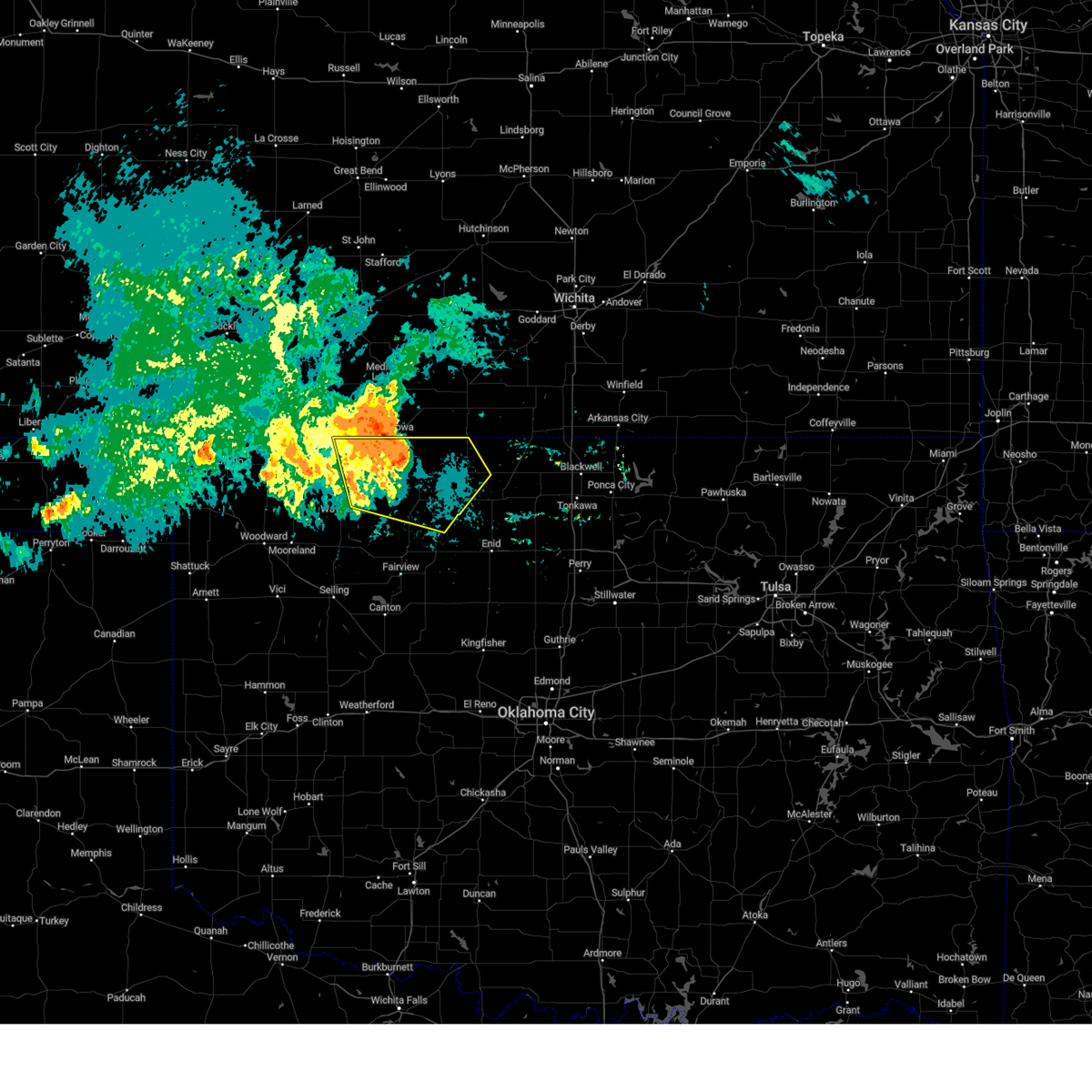 At 1016 pm cdt, severe thunderstorms were located along a line extending from 5 miles north of amorita to 4 miles east of cherokee to 3 miles northeast of aline, moving east at 45 mph (radar indicated). Hazards include 60 mph wind gusts and penny size hail. Expect damage to roofs, siding, and trees. locations impacted include, alva, cherokee, helena, carmen, goltry, jet, nash, burlington, dacoma, manchester, amorita, byron, lambert, avard, ingersoll, great salt plains lake, driftwood, capron, waldron, and hopeton. hail threat, radar indicated max hail size, 0. 75 in wind threat, observed max wind gust, 60 mph. At 1016 pm cdt, severe thunderstorms were located along a line extending from 5 miles north of amorita to 4 miles east of cherokee to 3 miles northeast of aline, moving east at 45 mph (radar indicated). Hazards include 60 mph wind gusts and penny size hail. Expect damage to roofs, siding, and trees. locations impacted include, alva, cherokee, helena, carmen, goltry, jet, nash, burlington, dacoma, manchester, amorita, byron, lambert, avard, ingersoll, great salt plains lake, driftwood, capron, waldron, and hopeton. hail threat, radar indicated max hail size, 0. 75 in wind threat, observed max wind gust, 60 mph.
|
| 6/27/2023 9:58 PM CDT |
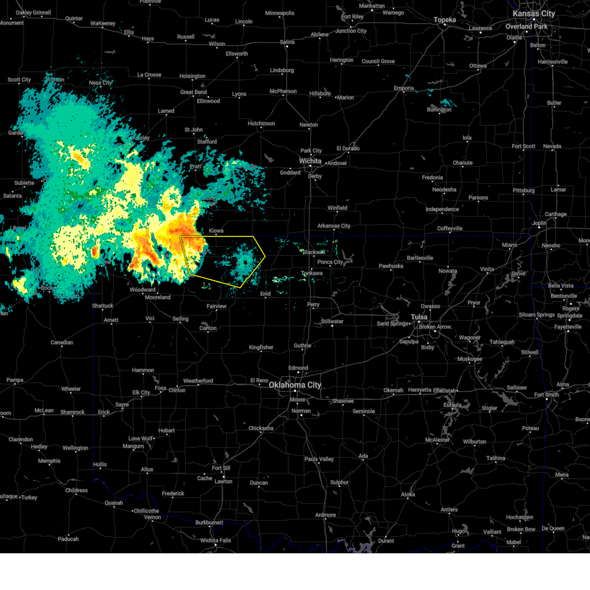 At 957 pm cdt, severe thunderstorms were located along a line extending from near hardtner to near capron to 5 miles southeast of avard, moving east at 50 mph (at 9:50 pm cdt, a 58 mph wind gust was measured near may ranch). Hazards include 60 mph wind gusts and penny size hail. expect damage to roofs, siding, and trees At 957 pm cdt, severe thunderstorms were located along a line extending from near hardtner to near capron to 5 miles southeast of avard, moving east at 50 mph (at 9:50 pm cdt, a 58 mph wind gust was measured near may ranch). Hazards include 60 mph wind gusts and penny size hail. expect damage to roofs, siding, and trees
|
| 6/21/2023 8:20 AM CDT |
 At 820 am cdt, severe thunderstorms were located along a line extending from 10 miles southeast of anthony to 3 miles north of manchester to 8 miles northeast of amorita, moving southeast at 25 mph (radar indicated). Hazards include 60 mph wind gusts and penny size hail. expect damage to roofs, siding, and trees At 820 am cdt, severe thunderstorms were located along a line extending from 10 miles southeast of anthony to 3 miles north of manchester to 8 miles northeast of amorita, moving southeast at 25 mph (radar indicated). Hazards include 60 mph wind gusts and penny size hail. expect damage to roofs, siding, and trees
|
| 6/17/2023 9:30 PM CDT |
 At 929 pm cdt, severe thunderstorms were located along a line extending from 5 miles northwest of amorita to 3 miles south of aline to 3 miles east of canton, moving east at 50 mph (radar indicated). Hazards include 70 mph wind gusts and quarter size hail. Hail damage to vehicles is expected. expect considerable tree damage. Wind damage is also likely to mobile homes, roofs, and outbuildings. At 929 pm cdt, severe thunderstorms were located along a line extending from 5 miles northwest of amorita to 3 miles south of aline to 3 miles east of canton, moving east at 50 mph (radar indicated). Hazards include 70 mph wind gusts and quarter size hail. Hail damage to vehicles is expected. expect considerable tree damage. Wind damage is also likely to mobile homes, roofs, and outbuildings.
|
| 6/15/2023 7:43 PM CDT |
 At 743 pm cdt, severe thunderstorms were located along a line extending from 5 miles north of amorita to 5 miles southwest of aline, moving east at 45 mph (radar indicated). Hazards include 60 mph wind gusts and quarter size hail. Hail damage to vehicles is expected. Expect wind damage to roofs, siding, and trees. At 743 pm cdt, severe thunderstorms were located along a line extending from 5 miles north of amorita to 5 miles southwest of aline, moving east at 45 mph (radar indicated). Hazards include 60 mph wind gusts and quarter size hail. Hail damage to vehicles is expected. Expect wind damage to roofs, siding, and trees.
|
| 2/26/2023 9:06 PM CST |
 At 906 pm cst, severe thunderstorms were located along a line extending from 6 miles north of wakita to 7 miles northeast of nash to 3 miles southwest of drummond to 3 miles south of watonga, moving northeast at 70 mph (radar indicated). Hazards include 60 mph wind gusts and penny size hail. expect damage to roofs, siding, and trees At 906 pm cst, severe thunderstorms were located along a line extending from 6 miles north of wakita to 7 miles northeast of nash to 3 miles southwest of drummond to 3 miles south of watonga, moving northeast at 70 mph (radar indicated). Hazards include 60 mph wind gusts and penny size hail. expect damage to roofs, siding, and trees
|
| 2/26/2023 8:37 PM CST |
 At 837 pm cst, severe thunderstorms were located along a line extending from near amorita to 5 miles southeast of cherokee to 4 miles southeast of eagle city, moving east at 50 mph (radar indicated). Hazards include 60 mph wind gusts and penny size hail. Expect damage to roofs, siding, and trees. Locations impacted include, enid, fairview, cherokee, helena, waukomis, okeene, canton, lahoma, ringwood, drummond, carmen, wakita, cleo springs, longdale, goltry, ames, meno, jet, aline and nash. At 837 pm cst, severe thunderstorms were located along a line extending from near amorita to 5 miles southeast of cherokee to 4 miles southeast of eagle city, moving east at 50 mph (radar indicated). Hazards include 60 mph wind gusts and penny size hail. Expect damage to roofs, siding, and trees. Locations impacted include, enid, fairview, cherokee, helena, waukomis, okeene, canton, lahoma, ringwood, drummond, carmen, wakita, cleo springs, longdale, goltry, ames, meno, jet, aline and nash.
|
| 2/26/2023 8:35 PM CST |
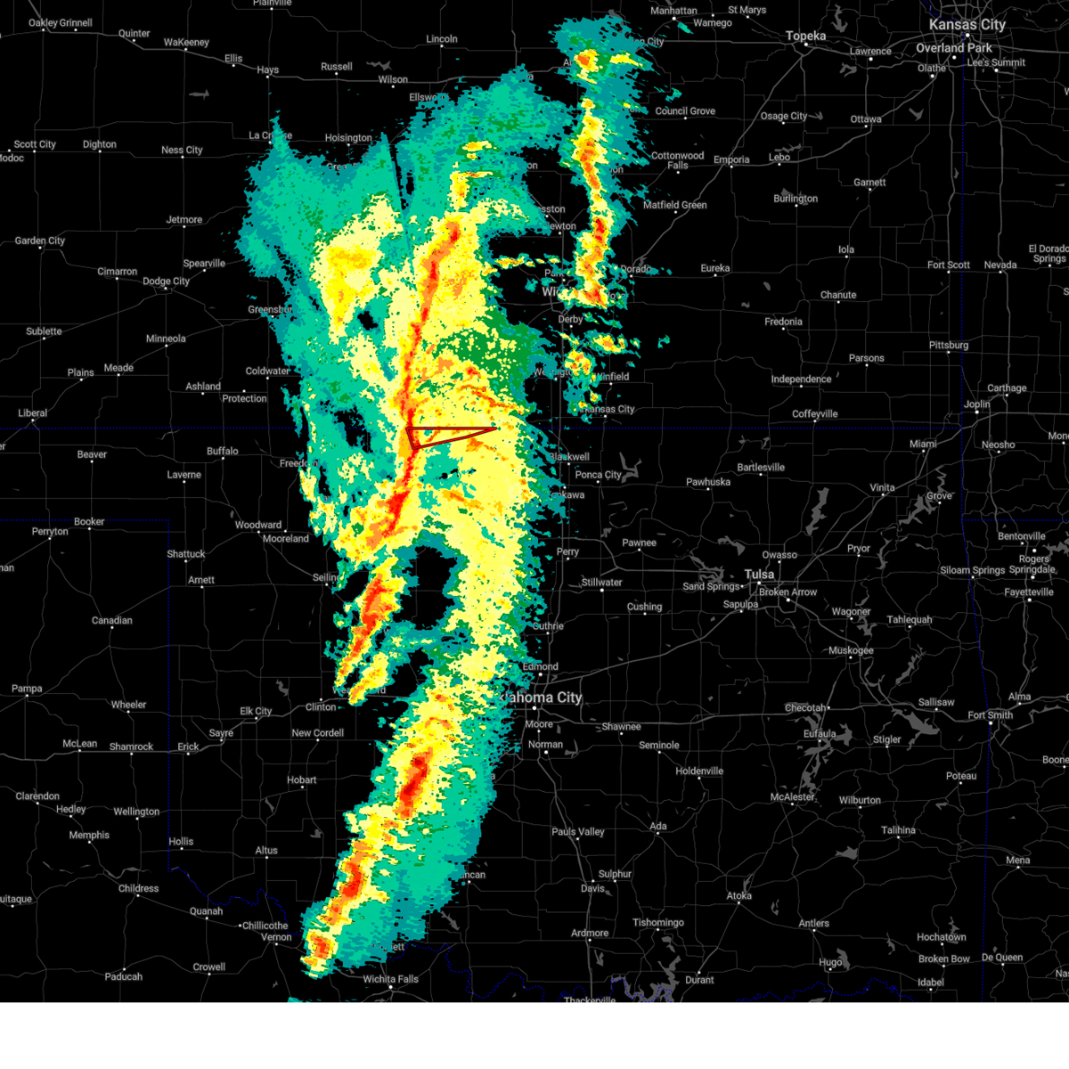 At 834 pm cst, a severe thunderstorm capable of producing a tornado was located near amorita, moving northeast at 50 mph (radar indicated rotation). Hazards include tornado. Flying debris will be dangerous to those caught without shelter. mobile homes will be damaged or destroyed. damage to roofs, windows, and vehicles will occur. tree damage is likely. Locations impacted include, manchester, amorita, byron and waldron. At 834 pm cst, a severe thunderstorm capable of producing a tornado was located near amorita, moving northeast at 50 mph (radar indicated rotation). Hazards include tornado. Flying debris will be dangerous to those caught without shelter. mobile homes will be damaged or destroyed. damage to roofs, windows, and vehicles will occur. tree damage is likely. Locations impacted include, manchester, amorita, byron and waldron.
|
| 2/26/2023 8:29 PM CST |
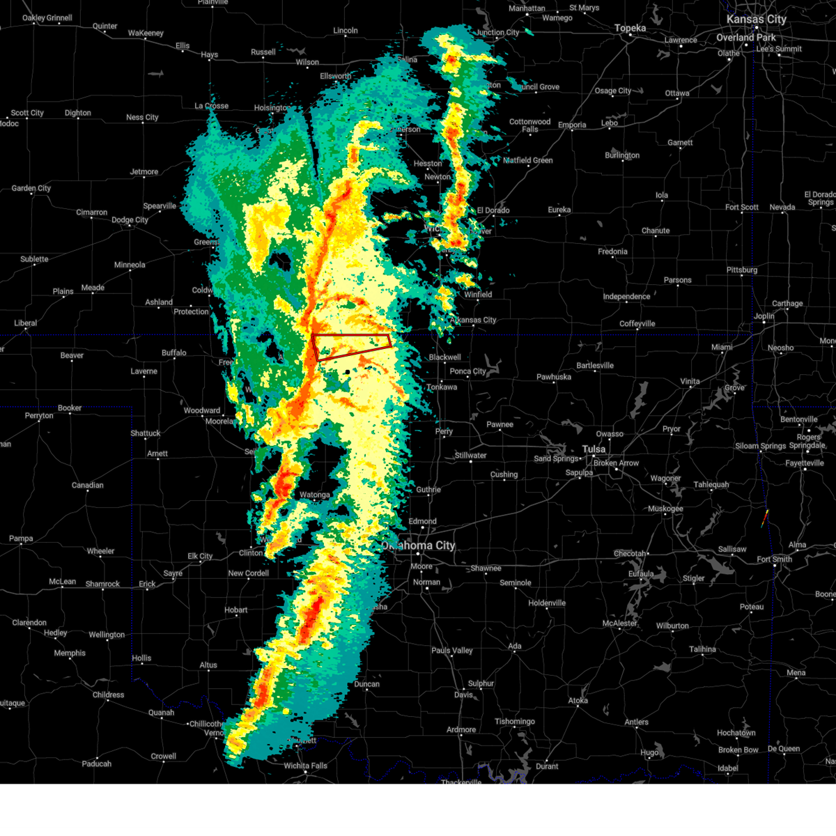 At 829 pm cst, a severe thunderstorm capable of producing a tornado was located near amorita, moving east at 65 mph (radar indicated rotation). Hazards include tornado. Flying debris will be dangerous to those caught without shelter. mobile homes will be damaged or destroyed. damage to roofs, windows, and vehicles will occur. Tree damage is likely. At 829 pm cst, a severe thunderstorm capable of producing a tornado was located near amorita, moving east at 65 mph (radar indicated rotation). Hazards include tornado. Flying debris will be dangerous to those caught without shelter. mobile homes will be damaged or destroyed. damage to roofs, windows, and vehicles will occur. Tree damage is likely.
|
| 2/26/2023 8:24 PM CST |
 At 823 pm cst, severe thunderstorms were located along a line extending from near burlington to 3 miles east of dacoma to 4 miles west of fay, moving east at 55 mph (radar indicated). Hazards include 60 mph wind gusts and penny size hail. Expect damage to roofs, siding, and trees. Locations impacted include, enid, alva, fairview, cherokee, helena, waukomis, okeene, canton, lahoma, ringwood, drummond, carmen, wakita, cleo springs, longdale, goltry, ames, meno, jet and aline. At 823 pm cst, severe thunderstorms were located along a line extending from near burlington to 3 miles east of dacoma to 4 miles west of fay, moving east at 55 mph (radar indicated). Hazards include 60 mph wind gusts and penny size hail. Expect damage to roofs, siding, and trees. Locations impacted include, enid, alva, fairview, cherokee, helena, waukomis, okeene, canton, lahoma, ringwood, drummond, carmen, wakita, cleo springs, longdale, goltry, ames, meno, jet and aline.
|
| 2/26/2023 8:12 PM CST |
 At 811 pm cst, severe thunderstorms were located along a line extending from 3 miles northeast of alva to 10 miles southwest of dacoma to 3 miles northwest of custer city, moving east at 50 mph (radar indicated). Hazards include 60 mph wind gusts and penny size hail. expect damage to roofs, siding, and trees At 811 pm cst, severe thunderstorms were located along a line extending from 3 miles northeast of alva to 10 miles southwest of dacoma to 3 miles northwest of custer city, moving east at 50 mph (radar indicated). Hazards include 60 mph wind gusts and penny size hail. expect damage to roofs, siding, and trees
|
| 8/28/2022 8:37 PM CDT | The severe thunderstorm warning for northeastern alfalfa and northwestern grant counties will expire at 845 pm cdt, the storm which prompted the warning has weakened below severe limits, therefore the warning will be allowed to expire. however gusty winds are still possible with this thunderstorm. |
| 8/28/2022 7:56 PM CDT | At 756 pm cdt, a severe thunderstorm was located 4 miles northeast of amorita, moving east at 15 mph (radar indicated). Hazards include 60 mph wind gusts and quarter size hail. Hail damage to vehicles is expected. Expect wind damage to roofs, siding, and trees. |
| 8/28/2022 7:14 PM CDT | At 713 pm cdt, a severe thunderstorm was located near byron, moving east at 15 mph. another severe storm was located 8 miles north of the great salt plains lake (radar indicated). Hazards include 60 mph wind gusts and quarter size hail. Hail damage to vehicles is expected. Expect wind damage to roofs, siding, and trees. |
| 5/31/2022 5:52 PM CDT |
 The severe thunderstorm warning for northwestern grant county will expire at 600 pm cdt, the storm which prompted the warning has weakened below severe limits, therefore the warning will be allowed to expire. however small hail and gusty winds are still possible with this thunderstorm. The severe thunderstorm warning for northwestern grant county will expire at 600 pm cdt, the storm which prompted the warning has weakened below severe limits, therefore the warning will be allowed to expire. however small hail and gusty winds are still possible with this thunderstorm.
|
| 5/31/2022 5:27 PM CDT |
 At 527 pm cdt, a severe thunderstorm was located 4 miles north of wakita, moving northeast at 25 mph (radar indicated). Hazards include 60 mph wind gusts and quarter size hail. Hail damage to vehicles is expected. expect wind damage to roofs, siding, and trees. locations impacted include, wakita and manchester. hail threat, radar indicated max hail size, 1. 00 in wind threat, radar indicated max wind gust, 60 mph. At 527 pm cdt, a severe thunderstorm was located 4 miles north of wakita, moving northeast at 25 mph (radar indicated). Hazards include 60 mph wind gusts and quarter size hail. Hail damage to vehicles is expected. expect wind damage to roofs, siding, and trees. locations impacted include, wakita and manchester. hail threat, radar indicated max hail size, 1. 00 in wind threat, radar indicated max wind gust, 60 mph.
|
| 5/31/2022 5:11 PM CDT |
 At 511 pm cdt, a severe thunderstorm was located 4 miles west of wakita, moving northeast at 25 mph (radar indicated). Hazards include 60 mph wind gusts and quarter size hail. Hail damage to vehicles is expected. Expect wind damage to roofs, siding, and trees. At 511 pm cdt, a severe thunderstorm was located 4 miles west of wakita, moving northeast at 25 mph (radar indicated). Hazards include 60 mph wind gusts and quarter size hail. Hail damage to vehicles is expected. Expect wind damage to roofs, siding, and trees.
|
| 5/19/2022 3:57 AM CDT |
 The severe thunderstorm warning for kay, noble, central grant and northwestern payne counties will expire at 400 am cdt, the storms which prompted the warning have moved out of the area. therefore, the warning will be allowed to expire. however gusty winds and heavy rain are still possible with these thunderstorms. The severe thunderstorm warning for kay, noble, central grant and northwestern payne counties will expire at 400 am cdt, the storms which prompted the warning have moved out of the area. therefore, the warning will be allowed to expire. however gusty winds and heavy rain are still possible with these thunderstorms.
|
| 5/19/2022 3:28 AM CDT |
 At 327 am cdt, severe thunderstorms were located along a line extending from near caldwell to 5 miles east of braman to 9 miles northeast of sooner lake to near glencoe, moving east at 75 mph (emergency management). Hazards include 70 mph wind gusts and quarter size hail. Hail damage to vehicles is expected. expect considerable tree damage. wind damage is also likely to mobile homes, roofs, and outbuildings. locations impacted include, stillwater, ponca city, blackwell, perry, tonkawa, medford, newkirk, morrison, glencoe, billings, lamont, kaw city, wakita, red rock, marland, braman, deer creek, manchester, kildare and jefferson. thunderstorm damage threat, considerable hail threat, radar indicated max hail size, 1. 00 in wind threat, observed max wind gust, 70 mph. At 327 am cdt, severe thunderstorms were located along a line extending from near caldwell to 5 miles east of braman to 9 miles northeast of sooner lake to near glencoe, moving east at 75 mph (emergency management). Hazards include 70 mph wind gusts and quarter size hail. Hail damage to vehicles is expected. expect considerable tree damage. wind damage is also likely to mobile homes, roofs, and outbuildings. locations impacted include, stillwater, ponca city, blackwell, perry, tonkawa, medford, newkirk, morrison, glencoe, billings, lamont, kaw city, wakita, red rock, marland, braman, deer creek, manchester, kildare and jefferson. thunderstorm damage threat, considerable hail threat, radar indicated max hail size, 1. 00 in wind threat, observed max wind gust, 70 mph.
|
| 5/19/2022 3:10 AM CDT |
 At 310 am cdt, severe thunderstorms were located along a line extending from 4 miles north of wakita to near deer creek to 5 miles west of red rock to near lake carl blackwell, moving northeast at 55 mph (radar indicated). Hazards include 70 mph wind gusts and quarter size hail. Hail damage to vehicles is expected. expect considerable tree damage. wind damage is also likely to mobile homes, roofs, and outbuildings. locations impacted include, enid, stillwater, ponca city, blackwell, perry, tonkawa, medford, newkirk, pond creek, garber, morrison, glencoe, covington, billings, lamont, kaw city, wakita, red rock, marshall and kremlin. thunderstorm damage threat, considerable hail threat, radar indicated max hail size, 1. 00 in wind threat, radar indicated max wind gust, 70 mph. At 310 am cdt, severe thunderstorms were located along a line extending from 4 miles north of wakita to near deer creek to 5 miles west of red rock to near lake carl blackwell, moving northeast at 55 mph (radar indicated). Hazards include 70 mph wind gusts and quarter size hail. Hail damage to vehicles is expected. expect considerable tree damage. wind damage is also likely to mobile homes, roofs, and outbuildings. locations impacted include, enid, stillwater, ponca city, blackwell, perry, tonkawa, medford, newkirk, pond creek, garber, morrison, glencoe, covington, billings, lamont, kaw city, wakita, red rock, marshall and kremlin. thunderstorm damage threat, considerable hail threat, radar indicated max hail size, 1. 00 in wind threat, radar indicated max wind gust, 70 mph.
|
| 5/19/2022 2:53 AM CDT |
 At 253 am cdt, severe thunderstorms were located along a line extending from 4 miles northwest of amorita to 4 miles east of nash to near fairmont to 4 miles southwest of lovell, moving northeast at 75 mph (radar indicated). Hazards include 70 mph wind gusts and quarter size hail. Hail damage to vehicles is expected. expect considerable tree damage. Wind damage is also likely to mobile homes, roofs, and outbuildings. At 253 am cdt, severe thunderstorms were located along a line extending from 4 miles northwest of amorita to 4 miles east of nash to near fairmont to 4 miles southwest of lovell, moving northeast at 75 mph (radar indicated). Hazards include 70 mph wind gusts and quarter size hail. Hail damage to vehicles is expected. expect considerable tree damage. Wind damage is also likely to mobile homes, roofs, and outbuildings.
|
| 5/19/2022 2:36 AM CDT |
 At 236 am cdt, severe thunderstorms were located along a line extending from 4 miles northwest of burlington to near jet to 4 miles northwest of vance air force base to near hennessey, moving northeast at 45 mph. these are destructive storms near the jet and great salt plains lake areas! (radar indicated). Hazards include 80 mph wind gusts and quarter size hail. Flying debris will be dangerous to those caught without shelter. mobile homes will be heavily damaged. expect considerable damage to roofs, windows, and vehicles. extensive tree damage and power outages are likely. locations impacted include, enid, cherokee, medford, hennessey, helena, waukomis, pond creek, garber, lahoma, covington, ringwood, dover, drummond, lamont, carmen, wakita, cleo springs, marshall, kremlin and goltry. thunderstorm damage threat, destructive hail threat, radar indicated max hail size, 1. 00 in wind threat, radar indicated max wind gust, 80 mph. At 236 am cdt, severe thunderstorms were located along a line extending from 4 miles northwest of burlington to near jet to 4 miles northwest of vance air force base to near hennessey, moving northeast at 45 mph. these are destructive storms near the jet and great salt plains lake areas! (radar indicated). Hazards include 80 mph wind gusts and quarter size hail. Flying debris will be dangerous to those caught without shelter. mobile homes will be heavily damaged. expect considerable damage to roofs, windows, and vehicles. extensive tree damage and power outages are likely. locations impacted include, enid, cherokee, medford, hennessey, helena, waukomis, pond creek, garber, lahoma, covington, ringwood, dover, drummond, lamont, carmen, wakita, cleo springs, marshall, kremlin and goltry. thunderstorm damage threat, destructive hail threat, radar indicated max hail size, 1. 00 in wind threat, radar indicated max wind gust, 80 mph.
|
| 5/19/2022 2:29 AM CDT |
 At 229 am cdt, severe thunderstorms were located along a line extending from near capron to 5 miles northwest of goltry to 3 miles southeast of lahoma to 4 miles southwest of hennessey, moving east at 40 mph (radar indicated). Hazards include 70 mph wind gusts and quarter size hail. Hail damage to vehicles is expected. expect considerable tree damage. wind damage is also likely to mobile homes, roofs, and outbuildings. locations impacted include, enid, cherokee, medford, hennessey, helena, waukomis, pond creek, garber, lahoma, covington, ringwood, dover, drummond, lamont, carmen, wakita, cleo springs, marshall, kremlin and goltry. thunderstorm damage threat, considerable hail threat, radar indicated max hail size, 1. 00 in wind threat, radar indicated max wind gust, 70 mph. At 229 am cdt, severe thunderstorms were located along a line extending from near capron to 5 miles northwest of goltry to 3 miles southeast of lahoma to 4 miles southwest of hennessey, moving east at 40 mph (radar indicated). Hazards include 70 mph wind gusts and quarter size hail. Hail damage to vehicles is expected. expect considerable tree damage. wind damage is also likely to mobile homes, roofs, and outbuildings. locations impacted include, enid, cherokee, medford, hennessey, helena, waukomis, pond creek, garber, lahoma, covington, ringwood, dover, drummond, lamont, carmen, wakita, cleo springs, marshall, kremlin and goltry. thunderstorm damage threat, considerable hail threat, radar indicated max hail size, 1. 00 in wind threat, radar indicated max wind gust, 70 mph.
|
| 5/19/2022 2:05 AM CDT | At 205 am cdt, the leading edge of severe thunderstorms were located along a line extending from 4 miles southwest of kiowa to near carmen to 4 miles west of ames to 4 miles west of loyal, moving northeast at 50 mph (radar indicated). Hazards include 70 mph wind gusts and quarter size hail. Hail damage to vehicles is expected. expect considerable tree damage. Wind damage is also likely to mobile homes, roofs, and outbuildings. |
| 5/13/2022 8:46 PM CDT | Quarter sized hail reported 8.6 miles NE of Manchester, OK |
| 5/13/2022 8:44 PM CDT |
 At 844 pm cdt, a severe thunderstorm was located 7 miles southwest of manchester, moving south at 15 mph (trained weather spotters reported half dollar size hail southwest of manchester). Hazards include ping pong ball size hail and 60 mph wind gusts. People and animals outdoors will be injured. expect hail damage to roofs, siding, windows, and vehicles. expect wind damage to roofs, siding, and trees. locations impacted include, wakita, manchester and waldron. hail threat, observed max hail size, 1. 50 in wind threat, radar indicated max wind gust, 60 mph. At 844 pm cdt, a severe thunderstorm was located 7 miles southwest of manchester, moving south at 15 mph (trained weather spotters reported half dollar size hail southwest of manchester). Hazards include ping pong ball size hail and 60 mph wind gusts. People and animals outdoors will be injured. expect hail damage to roofs, siding, windows, and vehicles. expect wind damage to roofs, siding, and trees. locations impacted include, wakita, manchester and waldron. hail threat, observed max hail size, 1. 50 in wind threat, radar indicated max wind gust, 60 mph.
|
| 5/13/2022 8:40 PM CDT |
 At 839 pm cdt, a severe thunderstorm was located 6 miles southwest of manchester, moving south at 15 mph (radar indicated). Hazards include 60 mph wind gusts and quarter size hail. Hail damage to vehicles is expected. Expect wind damage to roofs, siding, and trees. At 839 pm cdt, a severe thunderstorm was located 6 miles southwest of manchester, moving south at 15 mph (radar indicated). Hazards include 60 mph wind gusts and quarter size hail. Hail damage to vehicles is expected. Expect wind damage to roofs, siding, and trees.
|
| 5/13/2022 8:39 PM CDT | Half Dollar sized hail reported 6 miles NE of Manchester, OK |
| 5/13/2022 8:32 PM CDT | Half Dollar sized hail reported 8.6 miles NNE of Manchester, OK |
| 5/13/2022 8:02 PM CDT |
 At 802 pm cdt, a severe thunderstorm was located 4 miles west of manchester, moving south at 10 mph (radar indicated). Hazards include golf ball size hail and 60 mph wind gusts. People and animals outdoors will be injured. expect hail damage to roofs, siding, windows, and vehicles. Expect wind damage to roofs, siding, and trees. At 802 pm cdt, a severe thunderstorm was located 4 miles west of manchester, moving south at 10 mph (radar indicated). Hazards include golf ball size hail and 60 mph wind gusts. People and animals outdoors will be injured. expect hail damage to roofs, siding, windows, and vehicles. Expect wind damage to roofs, siding, and trees.
|
| 5/2/2022 4:16 PM CDT |
 At 415 pm cdt, severe thunderstorms were located along a line extending from 7 miles southwest of manchester to 4 miles north of helena, moving northeast at 30 mph (radar indicated). Hazards include 60 mph wind gusts and quarter size hail. Hail damage to vehicles is expected. expect wind damage to roofs, siding, and trees. locations impacted include, wakita, jet, nash, manchester and great salt plains lake. hail threat, radar indicated max hail size, 1. 00 in wind threat, radar indicated max wind gust, 60 mph. At 415 pm cdt, severe thunderstorms were located along a line extending from 7 miles southwest of manchester to 4 miles north of helena, moving northeast at 30 mph (radar indicated). Hazards include 60 mph wind gusts and quarter size hail. Hail damage to vehicles is expected. expect wind damage to roofs, siding, and trees. locations impacted include, wakita, jet, nash, manchester and great salt plains lake. hail threat, radar indicated max hail size, 1. 00 in wind threat, radar indicated max wind gust, 60 mph.
|
| 5/2/2022 3:45 PM CDT |
 At 344 pm cdt, severe thunderstorms were located along a line extending from near ingersoll to 3 miles west of aline, moving northeast at 30 mph (radar indicated). Hazards include 60 mph wind gusts and quarter size hail. Hail damage to vehicles is expected. Expect wind damage to roofs, siding, and trees. At 344 pm cdt, severe thunderstorms were located along a line extending from near ingersoll to 3 miles west of aline, moving northeast at 30 mph (radar indicated). Hazards include 60 mph wind gusts and quarter size hail. Hail damage to vehicles is expected. Expect wind damage to roofs, siding, and trees.
|
| 3/29/2022 8:53 PM CDT |
 At 853 pm cdt, severe thunderstorms were located along a line extending from 7 miles northeast of amorita to 3 miles south of byron, moving east at 40 mph (radar indicated). Hazards include 60 mph wind gusts and quarter size hail. Hail damage to vehicles is expected. expect wind damage to roofs, siding, and trees. locations impacted include, wakita, manchester, amorita, byron, driftwood and waldron. hail threat, radar indicated max hail size, 1. 00 in wind threat, radar indicated max wind gust, 60 mph. At 853 pm cdt, severe thunderstorms were located along a line extending from 7 miles northeast of amorita to 3 miles south of byron, moving east at 40 mph (radar indicated). Hazards include 60 mph wind gusts and quarter size hail. Hail damage to vehicles is expected. expect wind damage to roofs, siding, and trees. locations impacted include, wakita, manchester, amorita, byron, driftwood and waldron. hail threat, radar indicated max hail size, 1. 00 in wind threat, radar indicated max wind gust, 60 mph.
|
| 3/29/2022 8:40 PM CDT |
 At 840 pm cdt, severe thunderstorms were located along a line extending from 4 miles north of amorita to near ingersoll, moving east at 40 mph (radar indicated). Hazards include 60 mph wind gusts and quarter size hail. Hail damage to vehicles is expected. expect wind damage to roofs, siding, and trees. locations impacted include, wakita, burlington, manchester, amorita, byron, ingersoll, driftwood and waldron. hail threat, radar indicated max hail size, 1. 00 in wind threat, radar indicated max wind gust, 60 mph. At 840 pm cdt, severe thunderstorms were located along a line extending from 4 miles north of amorita to near ingersoll, moving east at 40 mph (radar indicated). Hazards include 60 mph wind gusts and quarter size hail. Hail damage to vehicles is expected. expect wind damage to roofs, siding, and trees. locations impacted include, wakita, burlington, manchester, amorita, byron, ingersoll, driftwood and waldron. hail threat, radar indicated max hail size, 1. 00 in wind threat, radar indicated max wind gust, 60 mph.
|
| 3/29/2022 8:24 PM CDT |
 At 824 pm cdt, severe thunderstorms were located along a line extending from 3 miles southeast of kiowa to 6 miles southeast of alva, moving east at 40 mph (radar indicated). Hazards include ping pong ball size hail and 60 mph wind gusts. accumulating small hail is also possible. People and animals outdoors will be injured. expect hail damage to roofs, siding, windows, and vehicles. Expect wind damage to roofs, siding, and trees. At 824 pm cdt, severe thunderstorms were located along a line extending from 3 miles southeast of kiowa to 6 miles southeast of alva, moving east at 40 mph (radar indicated). Hazards include ping pong ball size hail and 60 mph wind gusts. accumulating small hail is also possible. People and animals outdoors will be injured. expect hail damage to roofs, siding, windows, and vehicles. Expect wind damage to roofs, siding, and trees.
|
| 6/11/2021 10:48 PM CDT |
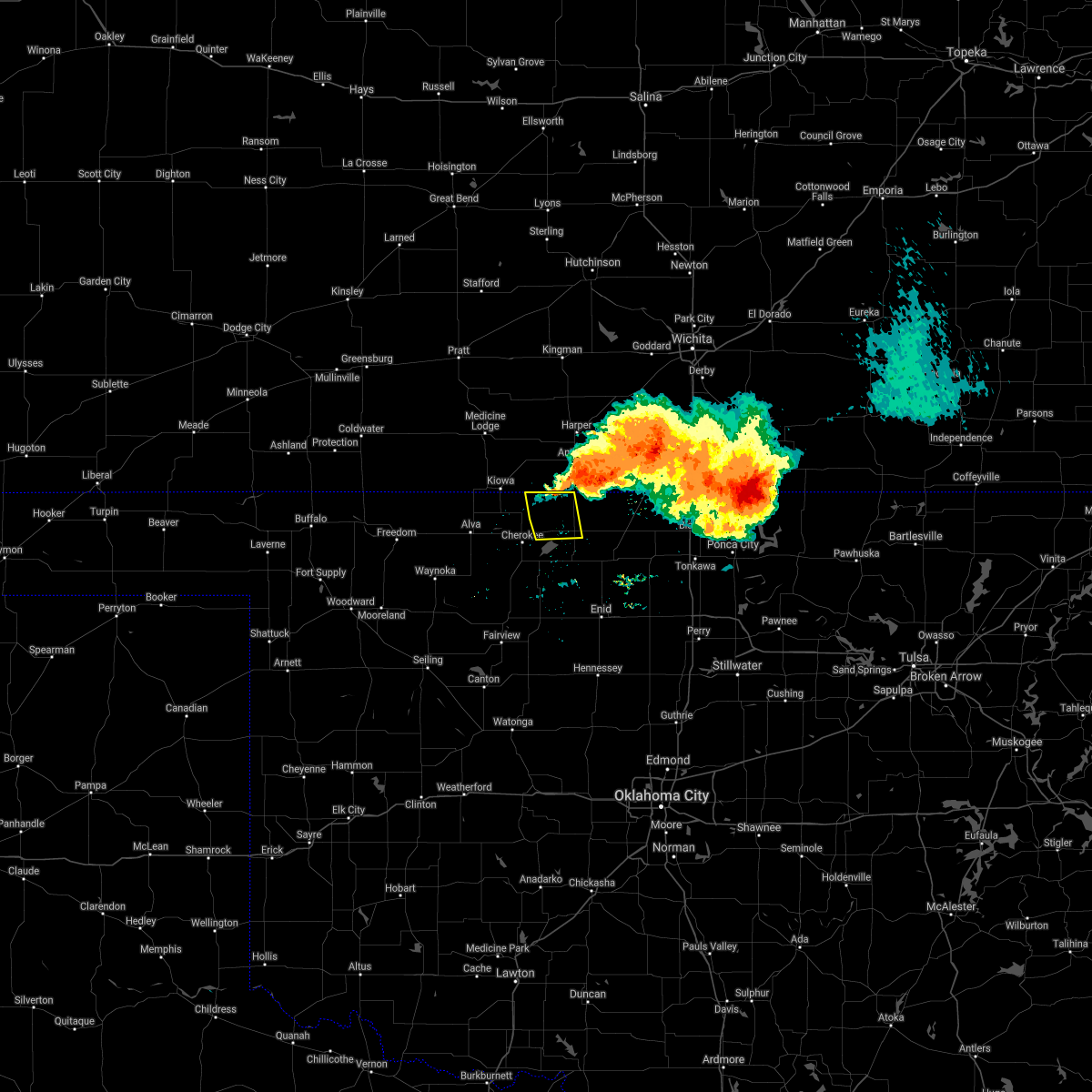 At 1048 pm cdt, a severe thunderstorm was located 6 miles west of manchester, moving south at 20 mph (radar indicated). Hazards include two inch hail and 70 mph wind gusts. People and animals outdoors will be injured. expect hail damage to roofs, siding, windows, and vehicles. expect considerable tree damage. Wind damage is also likely to mobile homes, roofs, and outbuildings. At 1048 pm cdt, a severe thunderstorm was located 6 miles west of manchester, moving south at 20 mph (radar indicated). Hazards include two inch hail and 70 mph wind gusts. People and animals outdoors will be injured. expect hail damage to roofs, siding, windows, and vehicles. expect considerable tree damage. Wind damage is also likely to mobile homes, roofs, and outbuildings.
|
| 6/11/2021 10:35 PM CDT |
 At 1035 pm cdt, a severe thunderstorm was located 7 miles north of wakita, moving south at 30 mph (radar indicated). Hazards include 70 mph wind gusts and ping pong ball size hail. People and animals outdoors will be injured. expect hail damage to roofs, siding, windows, and vehicles. expect considerable tree damage. Wind damage is also likely to mobile homes, roofs, and outbuildings. At 1035 pm cdt, a severe thunderstorm was located 7 miles north of wakita, moving south at 30 mph (radar indicated). Hazards include 70 mph wind gusts and ping pong ball size hail. People and animals outdoors will be injured. expect hail damage to roofs, siding, windows, and vehicles. expect considerable tree damage. Wind damage is also likely to mobile homes, roofs, and outbuildings.
|
| 5/26/2021 11:24 PM CDT |
 At 1123 pm cdt, severe thunderstorms were located along a line extending from 4 miles northeast of wakita to 7 miles northwest of jefferson to 5 miles northeast of hillsdale, moving east at 45 mph (radar indicated). Hazards include 60 mph wind gusts and penny size hail. expect damage to roofs, siding, and trees At 1123 pm cdt, severe thunderstorms were located along a line extending from 4 miles northeast of wakita to 7 miles northwest of jefferson to 5 miles northeast of hillsdale, moving east at 45 mph (radar indicated). Hazards include 60 mph wind gusts and penny size hail. expect damage to roofs, siding, and trees
|
| 5/26/2021 11:08 PM CDT |
 At 1108 pm cdt, severe thunderstorms were located along a line extending from 3 miles southeast of manchester to 6 miles west of wakita to 5 miles northeast of great salt plains lake to 4 miles south of jet, moving east at 80 mph (radar indicated). Hazards include 60 mph wind gusts. Expect damage to roofs, siding, and trees. Locations impacted include, cherokee, carmen, wakita, jet, nash, burlington, manchester, amorita, byron, lambert, ingersoll, great salt plains lake, driftwood and waldron. At 1108 pm cdt, severe thunderstorms were located along a line extending from 3 miles southeast of manchester to 6 miles west of wakita to 5 miles northeast of great salt plains lake to 4 miles south of jet, moving east at 80 mph (radar indicated). Hazards include 60 mph wind gusts. Expect damage to roofs, siding, and trees. Locations impacted include, cherokee, carmen, wakita, jet, nash, burlington, manchester, amorita, byron, lambert, ingersoll, great salt plains lake, driftwood and waldron.
|
| 5/26/2021 10:41 PM CDT |
 At 1041 pm cdt, severe thunderstorms were located along a line extending from near amorita to 3 miles northwest of lambert to 6 miles east of freedom to 8 miles north of mooreland, moving east at 45 mph (radar indicated). Hazards include 60 mph wind gusts and quarter size hail. Hail damage to vehicles is expected. Expect wind damage to roofs, siding, and trees. At 1041 pm cdt, severe thunderstorms were located along a line extending from near amorita to 3 miles northwest of lambert to 6 miles east of freedom to 8 miles north of mooreland, moving east at 45 mph (radar indicated). Hazards include 60 mph wind gusts and quarter size hail. Hail damage to vehicles is expected. Expect wind damage to roofs, siding, and trees.
|
| 7/16/2020 5:57 AM CDT |
 At 556 am cdt, severe thunderstorms were located along a line extending from near manchester to 4 miles west of medford to 6 miles southwest of douglas, moving northeast at 40 mph (radar indicated). Hazards include 60 mph wind gusts and quarter size hail. Hail damage to vehicles is expected. expect wind damage to roofs, siding, and trees. Locations impacted include, enid, cherokee, medford, waukomis, pond creek, garber, lahoma, covington, drummond, lamont, wakita, kremlin, breckenridge, jet, nash, hunter, burlington, fairmont, deer creek and hillsdale. At 556 am cdt, severe thunderstorms were located along a line extending from near manchester to 4 miles west of medford to 6 miles southwest of douglas, moving northeast at 40 mph (radar indicated). Hazards include 60 mph wind gusts and quarter size hail. Hail damage to vehicles is expected. expect wind damage to roofs, siding, and trees. Locations impacted include, enid, cherokee, medford, waukomis, pond creek, garber, lahoma, covington, drummond, lamont, wakita, kremlin, breckenridge, jet, nash, hunter, burlington, fairmont, deer creek and hillsdale.
|
| 7/16/2020 5:23 AM CDT |
 At 523 am cdt, severe thunderstorms were located along a line extending from 4 miles east of hardtner to near jet to 8 miles southeast of ames, moving northeast at 40 mph (radar indicated). Hazards include 60 mph wind gusts and quarter size hail. Hail damage to vehicles is expected. Expect wind damage to roofs, siding, and trees. At 523 am cdt, severe thunderstorms were located along a line extending from 4 miles east of hardtner to near jet to 8 miles southeast of ames, moving northeast at 40 mph (radar indicated). Hazards include 60 mph wind gusts and quarter size hail. Hail damage to vehicles is expected. Expect wind damage to roofs, siding, and trees.
|
| 7/11/2020 9:43 PM CDT |
 At 943 pm cdt, severe thunderstorms were located along a line extending from near wakita to near medford to near garber, moving east at 25 mph (radar indicated). Hazards include 70 mph wind gusts and nickel size hail. Expect considerable tree damage. Damage is likely to mobile homes, roofs, and outbuildings. At 943 pm cdt, severe thunderstorms were located along a line extending from near wakita to near medford to near garber, moving east at 25 mph (radar indicated). Hazards include 70 mph wind gusts and nickel size hail. Expect considerable tree damage. Damage is likely to mobile homes, roofs, and outbuildings.
|
| 7/11/2020 8:49 PM CDT |
 The national weather service in norman has issued a * severe thunderstorm warning for. grant county in northern oklahoma. until 915 pm cdt. At 849 pm cdt, a severe thunderstorm was located 6 miles northeast of nash, moving east at 30 mph. The national weather service in norman has issued a * severe thunderstorm warning for. grant county in northern oklahoma. until 915 pm cdt. At 849 pm cdt, a severe thunderstorm was located 6 miles northeast of nash, moving east at 30 mph.
|
| 7/10/2020 7:35 AM CDT |
 At 735 am cdt, a severe thunderstorm was located 4 miles north of hunter, moving south at 40 mph. this is a very dangerous storm (radar indicated). Hazards include up to 80 mph wind gusts and golf ball size hail. Flying debris will be dangerous to those caught without shelter. mobile homes will be heavily damaged. expect considerable damage to roofs, windows, and vehicles. extensive tree damage and power outages are likely. Locations impacted include, enid, blackwell, tonkawa, medford, pond creek, garber, billings, lamont, wakita, kremlin, breckenridge, nash, hunter, deer creek, hillsdale, manchester, carrier, jefferson, renfrow and nardin. At 735 am cdt, a severe thunderstorm was located 4 miles north of hunter, moving south at 40 mph. this is a very dangerous storm (radar indicated). Hazards include up to 80 mph wind gusts and golf ball size hail. Flying debris will be dangerous to those caught without shelter. mobile homes will be heavily damaged. expect considerable damage to roofs, windows, and vehicles. extensive tree damage and power outages are likely. Locations impacted include, enid, blackwell, tonkawa, medford, pond creek, garber, billings, lamont, wakita, kremlin, breckenridge, nash, hunter, deer creek, hillsdale, manchester, carrier, jefferson, renfrow and nardin.
|
| 7/10/2020 7:13 AM CDT |
 At 712 am cdt, a large severe thunderstorm was centered near medford, moving south at 40 mph. this is a very dangerous storm (radar indicated). Hazards include 80 mph wind gusts and golf ball size hail. Flying debris will be dangerous to those caught without shelter. mobile homes will be heavily damaged. expect considerable damage to roofs, windows, and vehicles. Extensive tree damage and power outages are likely. At 712 am cdt, a large severe thunderstorm was centered near medford, moving south at 40 mph. this is a very dangerous storm (radar indicated). Hazards include 80 mph wind gusts and golf ball size hail. Flying debris will be dangerous to those caught without shelter. mobile homes will be heavily damaged. expect considerable damage to roofs, windows, and vehicles. Extensive tree damage and power outages are likely.
|
| 7/10/2020 7:03 AM CDT |
 At 702 am cdt, a severe thunderstorm was located 6 miles west of caldwell, kansas moving southeast at 15 mph. winds ahead of the storm were across northern grant county, oklahoma. radar indicates that this storm likely has a large amount of small hail, with a few much larger hailstones possible. this is a very dangerous storm (radar indicated). Hazards include 80 mph wind gusts and tennis ball size hail. Flying debris will be dangerous to those caught without shelter. mobile homes will be heavily damaged. expect considerable damage to roofs, windows, and vehicles. extensive tree damage and power outages are likely. Locations impacted include, medford, pond creek, lamont, wakita, braman, deer creek, manchester, jefferson, renfrow, nardin and blackwell lake. At 702 am cdt, a severe thunderstorm was located 6 miles west of caldwell, kansas moving southeast at 15 mph. winds ahead of the storm were across northern grant county, oklahoma. radar indicates that this storm likely has a large amount of small hail, with a few much larger hailstones possible. this is a very dangerous storm (radar indicated). Hazards include 80 mph wind gusts and tennis ball size hail. Flying debris will be dangerous to those caught without shelter. mobile homes will be heavily damaged. expect considerable damage to roofs, windows, and vehicles. extensive tree damage and power outages are likely. Locations impacted include, medford, pond creek, lamont, wakita, braman, deer creek, manchester, jefferson, renfrow, nardin and blackwell lake.
|
| 7/10/2020 6:39 AM CDT |
 At 637 am cdt, a severe thunderstorm was located 10 miles south of argonia, kansas, moving southeast at 15 mph (trained weather spotters. at 630 am cdt, 60 mph winds were reported in freeport, kansas). Hazards include 70 mph wind gusts and ping pong ball size hail. People and animals outdoors will be injured. expect hail damage to roofs, siding, windows, and vehicles. expect considerable tree damage. Wind damage is also likely to mobile homes, roofs, and outbuildings. At 637 am cdt, a severe thunderstorm was located 10 miles south of argonia, kansas, moving southeast at 15 mph (trained weather spotters. at 630 am cdt, 60 mph winds were reported in freeport, kansas). Hazards include 70 mph wind gusts and ping pong ball size hail. People and animals outdoors will be injured. expect hail damage to roofs, siding, windows, and vehicles. expect considerable tree damage. Wind damage is also likely to mobile homes, roofs, and outbuildings.
|
| 6/21/2020 8:31 PM CDT |
 At 830 pm cdt, severe thunderstorms were located along a line extending from 10 miles northwest of caldwell to 4 miles east of amorita to 9 miles west of alva, moving southeast at 40 mph (radar indicated). Hazards include 70 mph wind gusts. Expect considerable tree damage. damage is likely to mobile homes, roofs, and outbuildings. Locations impacted include, alva, cherokee, medford, carmen, wakita, jet, burlington, dacoma, manchester, amorita, byron, renfrow, lambert, avard, ingersoll, great salt plains lake, driftwood, capron and hopeton. At 830 pm cdt, severe thunderstorms were located along a line extending from 10 miles northwest of caldwell to 4 miles east of amorita to 9 miles west of alva, moving southeast at 40 mph (radar indicated). Hazards include 70 mph wind gusts. Expect considerable tree damage. damage is likely to mobile homes, roofs, and outbuildings. Locations impacted include, alva, cherokee, medford, carmen, wakita, jet, burlington, dacoma, manchester, amorita, byron, renfrow, lambert, avard, ingersoll, great salt plains lake, driftwood, capron and hopeton.
|
| 6/21/2020 8:06 PM CDT |
 At 806 pm cdt, severe thunderstorms were located along a line extending from 3 miles southeast of harper to near hazelton to 7 miles southwest of aetna, moving southeast at 35 mph (radar indicated). Hazards include 70 mph wind gusts and quarter size hail. Hail damage to vehicles is expected. expect considerable tree damage. Wind damage is also likely to mobile homes, roofs, and outbuildings. At 806 pm cdt, severe thunderstorms were located along a line extending from 3 miles southeast of harper to near hazelton to 7 miles southwest of aetna, moving southeast at 35 mph (radar indicated). Hazards include 70 mph wind gusts and quarter size hail. Hail damage to vehicles is expected. expect considerable tree damage. Wind damage is also likely to mobile homes, roofs, and outbuildings.
|
| 4/22/2020 5:50 AM CDT |
 At 548 am cdt, severe thunderstorms were located along a line extending from 5 miles north of great salt plains lake to 3 miles northeast of kremlin to 3 miles west of garber to 3 miles northwest of orlando to near mulhall, moving east at 40 mph. the strongest storm near mulhall could have hail up to the size of golf balls, with most other storms producing quarter to half dollar size hail (radar indicated). Hazards include golf ball size hail. People and animals outdoors will be injured. expect damage to roofs, siding, windows, and vehicles. Locations impacted include, enid, stillwater, cushing, blackwell, perry, tonkawa, cherokee, medford, perkins, langston, crescent, helena, pond creek, garber, morrison, glencoe, covington, billings, lamont and ripley. At 548 am cdt, severe thunderstorms were located along a line extending from 5 miles north of great salt plains lake to 3 miles northeast of kremlin to 3 miles west of garber to 3 miles northwest of orlando to near mulhall, moving east at 40 mph. the strongest storm near mulhall could have hail up to the size of golf balls, with most other storms producing quarter to half dollar size hail (radar indicated). Hazards include golf ball size hail. People and animals outdoors will be injured. expect damage to roofs, siding, windows, and vehicles. Locations impacted include, enid, stillwater, cushing, blackwell, perry, tonkawa, cherokee, medford, perkins, langston, crescent, helena, pond creek, garber, morrison, glencoe, covington, billings, lamont and ripley.
|
| 4/22/2020 5:41 AM CDT |
 At 541 am cdt, severe thunderstorms were located along a line extending from 4 miles northwest of great salt plains lake to near kremlin to near breckenridge to 6 miles east of marshall to 5 miles northwest of langston, moving east at 40 mph (radar indicated). Hazards include quarter size hail. damage to vehicles is expected At 541 am cdt, severe thunderstorms were located along a line extending from 4 miles northwest of great salt plains lake to near kremlin to near breckenridge to 6 miles east of marshall to 5 miles northwest of langston, moving east at 40 mph (radar indicated). Hazards include quarter size hail. damage to vehicles is expected
|
| 10/10/2019 12:13 AM CDT |
 The severe thunderstorm warning for northeastern alfalfa and northwestern grant counties will expire at 1215 am cdt, the storm which prompted the warning has moved out of the area. therefore, the warning will be allowed to expire. The severe thunderstorm warning for northeastern alfalfa and northwestern grant counties will expire at 1215 am cdt, the storm which prompted the warning has moved out of the area. therefore, the warning will be allowed to expire.
|
| 10/9/2019 11:45 PM CDT |
 At 1145 pm cdt, a severe thunderstorm was located near wakita, moving northeast at 25 mph (radar indicated). Hazards include 60 mph wind gusts and quarter size hail. Hail damage to vehicles is expected. expect wind damage to roofs, siding, and trees. Locations impacted include, wakita, manchester, amorita, byron, renfrow, driftwood and waldron. At 1145 pm cdt, a severe thunderstorm was located near wakita, moving northeast at 25 mph (radar indicated). Hazards include 60 mph wind gusts and quarter size hail. Hail damage to vehicles is expected. expect wind damage to roofs, siding, and trees. Locations impacted include, wakita, manchester, amorita, byron, renfrow, driftwood and waldron.
|
| 10/9/2019 11:27 PM CDT |
 At 1127 pm cdt, a severe thunderstorm was located 7 miles southwest of wakita, moving northeast at 30 mph (radar indicated). Hazards include 60 mph wind gusts and quarter size hail. Hail damage to vehicles is expected. Expect wind damage to roofs, siding, and trees. At 1127 pm cdt, a severe thunderstorm was located 7 miles southwest of wakita, moving northeast at 30 mph (radar indicated). Hazards include 60 mph wind gusts and quarter size hail. Hail damage to vehicles is expected. Expect wind damage to roofs, siding, and trees.
|
| 8/30/2019 12:54 AM CDT |
 At 1253 am cdt, severe thunderstorms were located along a line extending from 7 miles east of byron to near cherokee to 5 miles southeast of alva, moving southeast at 35 mph (radar indicated). Hazards include 60 mph wind gusts and nickel size hail. Expect damage to roofs, siding, and trees. Locations impacted include, cherokee, jet, burlington, manchester, amorita, byron, lambert, ingersoll, great salt plains lake, driftwood, capron and waldron. At 1253 am cdt, severe thunderstorms were located along a line extending from 7 miles east of byron to near cherokee to 5 miles southeast of alva, moving southeast at 35 mph (radar indicated). Hazards include 60 mph wind gusts and nickel size hail. Expect damage to roofs, siding, and trees. Locations impacted include, cherokee, jet, burlington, manchester, amorita, byron, lambert, ingersoll, great salt plains lake, driftwood, capron and waldron.
|
| 8/30/2019 12:35 AM CDT |
 At 1234 am cdt, severe thunderstorms were located along a line extending from 4 miles north of amorita to 4 miles southeast of capron to 6 miles west of alva, moving southeast at 35 mph (radar indicated). Hazards include 70 mph wind gusts and nickel size hail. Expect considerable tree damage. Damage is likely to mobile homes, roofs, and outbuildings. At 1234 am cdt, severe thunderstorms were located along a line extending from 4 miles north of amorita to 4 miles southeast of capron to 6 miles west of alva, moving southeast at 35 mph (radar indicated). Hazards include 70 mph wind gusts and nickel size hail. Expect considerable tree damage. Damage is likely to mobile homes, roofs, and outbuildings.
|
| 8/13/2019 10:39 PM CDT |
 At 1039 pm cdt, severe thunderstorms were located along a line extending from 4 miles south of attica to near burlington, moving east at 60 mph (radar indicated). Hazards include 60 mph wind gusts. expect damage to roofs, siding, and trees At 1039 pm cdt, severe thunderstorms were located along a line extending from 4 miles south of attica to near burlington, moving east at 60 mph (radar indicated). Hazards include 60 mph wind gusts. expect damage to roofs, siding, and trees
|
| 7/6/2019 1:07 AM CDT |
 At 107 am cdt, severe thunderstorms were located along a line extending from 6 miles east of byron to 3 miles southeast of lambert to 5 miles south of dacoma to 4 miles southeast of waynoka, moving southeast at 25 mph (radar indicated). Hazards include 60 mph wind gusts and nickel size hail. Expect damage to roofs, siding, and trees. Locations impacted include, alva, cherokee, helena, waynoka, lahoma, ringwood, carmen, wakita, cleo springs, goltry, meno, jet, aline, nash, burlington, hillsdale, dacoma, manchester, carrier and amorita. At 107 am cdt, severe thunderstorms were located along a line extending from 6 miles east of byron to 3 miles southeast of lambert to 5 miles south of dacoma to 4 miles southeast of waynoka, moving southeast at 25 mph (radar indicated). Hazards include 60 mph wind gusts and nickel size hail. Expect damage to roofs, siding, and trees. Locations impacted include, alva, cherokee, helena, waynoka, lahoma, ringwood, carmen, wakita, cleo springs, goltry, meno, jet, aline, nash, burlington, hillsdale, dacoma, manchester, carrier and amorita.
|
| 7/6/2019 12:43 AM CDT |
 At 1242 am cdt, the leading edge of winds from a line of severe thunderstorms was located along a line extending from 4 miles southwest of wakita to 4 miles west of jet to near dacoma to near waynoka, moving southeast at 40 mph (radar indicated). Hazards include 60 mph wind gusts and nickel size hail. expect damage to roofs, siding, and trees At 1242 am cdt, the leading edge of winds from a line of severe thunderstorms was located along a line extending from 4 miles southwest of wakita to 4 miles west of jet to near dacoma to near waynoka, moving southeast at 40 mph (radar indicated). Hazards include 60 mph wind gusts and nickel size hail. expect damage to roofs, siding, and trees
|
| 7/6/2019 12:07 AM CDT |
 At 1207 am cdt, the leading edge of winds from a line of severe thunderstorms was located along a line extending from 9 miles south of attica to near kiowa to 6 miles south of aetna, moving southeast at 50 mph (radar indicated). Hazards include 60 mph wind gusts and quarter size hail. Hail damage to vehicles is expected. Expect wind damage to roofs, siding, and trees. At 1207 am cdt, the leading edge of winds from a line of severe thunderstorms was located along a line extending from 9 miles south of attica to near kiowa to 6 miles south of aetna, moving southeast at 50 mph (radar indicated). Hazards include 60 mph wind gusts and quarter size hail. Hail damage to vehicles is expected. Expect wind damage to roofs, siding, and trees.
|
| 6/22/2019 7:52 PM CDT |
 At 752 pm cdt, severe thunderstorms were located along a line extending from near manchester to 8 miles east of amorita, moving northeast at 20 mph (radar indicated). Hazards include ping pong ball size hail and 60 mph wind gusts. People and animals outdoors will be injured. expect hail damage to roofs, siding, windows, and vehicles. expect wind damage to roofs, siding, and trees. Locations impacted include, manchester and waldron. At 752 pm cdt, severe thunderstorms were located along a line extending from near manchester to 8 miles east of amorita, moving northeast at 20 mph (radar indicated). Hazards include ping pong ball size hail and 60 mph wind gusts. People and animals outdoors will be injured. expect hail damage to roofs, siding, windows, and vehicles. expect wind damage to roofs, siding, and trees. Locations impacted include, manchester and waldron.
|
| 6/22/2019 7:37 PM CDT |
 At 737 pm cdt, severe thunderstorms were located along a line extending from 3 miles west of manchester to near byron, moving northeast at 25 mph (radar indicated). Hazards include ping pong ball size hail and 60 mph wind gusts. People and animals outdoors will be injured. expect hail damage to roofs, siding, windows, and vehicles. expect wind damage to roofs, siding, and trees. Locations impacted include, manchester, amorita, byron, driftwood and waldron. At 737 pm cdt, severe thunderstorms were located along a line extending from 3 miles west of manchester to near byron, moving northeast at 25 mph (radar indicated). Hazards include ping pong ball size hail and 60 mph wind gusts. People and animals outdoors will be injured. expect hail damage to roofs, siding, windows, and vehicles. expect wind damage to roofs, siding, and trees. Locations impacted include, manchester, amorita, byron, driftwood and waldron.
|
| 6/22/2019 7:17 PM CDT |
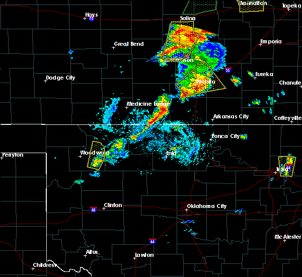 At 716 pm cdt, severe thunderstorms were located 6 miles northeast of amorita and 3 miles southwest of ingersoll, moving northeast at 30 mph (radar indicated). Hazards include ping pong ball size hail and 60 mph wind gusts. People and animals outdoors will be injured. expect hail damage to roofs, siding, windows, and vehicles. Expect wind damage to roofs, siding, and trees. At 716 pm cdt, severe thunderstorms were located 6 miles northeast of amorita and 3 miles southwest of ingersoll, moving northeast at 30 mph (radar indicated). Hazards include ping pong ball size hail and 60 mph wind gusts. People and animals outdoors will be injured. expect hail damage to roofs, siding, windows, and vehicles. Expect wind damage to roofs, siding, and trees.
|
| 6/15/2019 10:35 PM CDT |
 At 1034 pm cdt, severe thunderstorms were located along a line extending from 4 miles south of byron to 5 miles northwest of waynoka to 3 miles south of woodward, and are drifting slowly north (radar indicated). Hazards include ping pong ball size hail and 60 mph wind gusts. People and animals outdoors will be injured. expect hail damage to roofs, siding, windows, and vehicles. expect wind damage to roofs, siding, and trees. Locations impacted include, woodward, alva, cherokee, mooreland, waynoka, wakita, freedom, burlington, sharon, dacoma, manchester, amorita, byron, lambert, alabaster caverns state park, avard, great salt plains lake, quinlan, ingersoll and driftwood. At 1034 pm cdt, severe thunderstorms were located along a line extending from 4 miles south of byron to 5 miles northwest of waynoka to 3 miles south of woodward, and are drifting slowly north (radar indicated). Hazards include ping pong ball size hail and 60 mph wind gusts. People and animals outdoors will be injured. expect hail damage to roofs, siding, windows, and vehicles. expect wind damage to roofs, siding, and trees. Locations impacted include, woodward, alva, cherokee, mooreland, waynoka, wakita, freedom, burlington, sharon, dacoma, manchester, amorita, byron, lambert, alabaster caverns state park, avard, great salt plains lake, quinlan, ingersoll and driftwood.
|
| 6/15/2019 9:56 PM CDT |
 At 956 pm cdt, severe thunderstorms were located along a line extending from 5 miles southwest of manchester to 3 miles northeast of waynoka to 6 miles northwest of sharon, moving west at 10 mph (radar indicated). Hazards include golf ball size hail and 70 mph wind gusts. People and animals outdoors will be injured. expect hail damage to roofs, siding, windows, and vehicles. expect considerable tree damage. Wind damage is also likely to mobile homes, roofs, and outbuildings. At 956 pm cdt, severe thunderstorms were located along a line extending from 5 miles southwest of manchester to 3 miles northeast of waynoka to 6 miles northwest of sharon, moving west at 10 mph (radar indicated). Hazards include golf ball size hail and 70 mph wind gusts. People and animals outdoors will be injured. expect hail damage to roofs, siding, windows, and vehicles. expect considerable tree damage. Wind damage is also likely to mobile homes, roofs, and outbuildings.
|
| 6/15/2019 5:03 AM CDT |
 At 503 am cdt, a severe thunderstorm was located 4 miles southeast of manchester, moving east at 40 mph (radar indicated). Hazards include 60 mph wind gusts and quarter size hail. Hail damage to vehicles is expected. Expect wind damage to roofs, siding, and trees. At 503 am cdt, a severe thunderstorm was located 4 miles southeast of manchester, moving east at 40 mph (radar indicated). Hazards include 60 mph wind gusts and quarter size hail. Hail damage to vehicles is expected. Expect wind damage to roofs, siding, and trees.
|
| 6/15/2019 1:54 AM CDT |
 At 154 am cdt, severe thunderstorms were located along a line extending from 3 miles south of hardy to 4 miles southeast of medford to 6 miles west of alva, moving east at 45 mph (radar indicated). Hazards include 60 mph wind gusts and quarter size hail. Hail damage to vehicles is expected. Expect wind damage to roofs, siding, and trees. At 154 am cdt, severe thunderstorms were located along a line extending from 3 miles south of hardy to 4 miles southeast of medford to 6 miles west of alva, moving east at 45 mph (radar indicated). Hazards include 60 mph wind gusts and quarter size hail. Hail damage to vehicles is expected. Expect wind damage to roofs, siding, and trees.
|
| 6/15/2019 12:56 AM CDT |
 At 1255 am cdt, severe thunderstorms were located along a line extending from 5 miles northeast of south haven to 3 miles northwest of renfrow to 4 miles southwest of burlington to 4 miles west of waynoka, moving east at 40 mph (radar indicated). Hazards include 60 mph wind gusts and quarter size hail. Hail damage to vehicles is expected. Expect wind damage to roofs, siding, and trees. At 1255 am cdt, severe thunderstorms were located along a line extending from 5 miles northeast of south haven to 3 miles northwest of renfrow to 4 miles southwest of burlington to 4 miles west of waynoka, moving east at 40 mph (radar indicated). Hazards include 60 mph wind gusts and quarter size hail. Hail damage to vehicles is expected. Expect wind damage to roofs, siding, and trees.
|
| 6/15/2019 12:29 AM CDT |
 At 1229 am cdt, the leading edge of winds from severe thunderstorms was located along a line extending from 9 miles northwest of renfrow to 4 miles south of wakita to 3 miles west of jet, moving southeast at 50 mph (radar indicated). Hazards include 60 mph wind gusts. Expect damage to roofs, siding, and trees. Locations impacted include, cherokee, medford, pond creek, wakita, jet, nash, burlington, dacoma, manchester, amorita, byron, jefferson, renfrow, lambert, ingersoll, great salt plains lake, driftwood, waldron and hopeton. At 1229 am cdt, the leading edge of winds from severe thunderstorms was located along a line extending from 9 miles northwest of renfrow to 4 miles south of wakita to 3 miles west of jet, moving southeast at 50 mph (radar indicated). Hazards include 60 mph wind gusts. Expect damage to roofs, siding, and trees. Locations impacted include, cherokee, medford, pond creek, wakita, jet, nash, burlington, dacoma, manchester, amorita, byron, jefferson, renfrow, lambert, ingersoll, great salt plains lake, driftwood, waldron and hopeton.
|
| 6/14/2019 11:58 PM CDT |
 At 1157 pm cdt, the leading edge of winds from a line of severe thunderstorms was located along a line extending from 5 miles south of attica to 6 miles south of hazelton to 4 miles southeast of capron, moving southeast at 65 mph. damaging wind gusts will arrive well before any rainfall (radar indicated). Hazards include 70 mph wind gusts. Expect considerable tree damage. Damage is likely to mobile homes, roofs, and outbuildings. At 1157 pm cdt, the leading edge of winds from a line of severe thunderstorms was located along a line extending from 5 miles south of attica to 6 miles south of hazelton to 4 miles southeast of capron, moving southeast at 65 mph. damaging wind gusts will arrive well before any rainfall (radar indicated). Hazards include 70 mph wind gusts. Expect considerable tree damage. Damage is likely to mobile homes, roofs, and outbuildings.
|
| 5/27/2019 12:56 AM CDT |
 At 1256 am cdt, severe thunderstorms were located along a line extending from near amorita to near dacoma to 3 miles southeast of quinlan, moving east at 50 mph (radar indicated). Hazards include 60 mph wind gusts and penny size hail. expect damage to roofs, siding, and trees At 1256 am cdt, severe thunderstorms were located along a line extending from near amorita to near dacoma to 3 miles southeast of quinlan, moving east at 50 mph (radar indicated). Hazards include 60 mph wind gusts and penny size hail. expect damage to roofs, siding, and trees
|
| 5/25/2019 8:24 PM CDT |
 At 823 pm cdt, severe thunderstorms were located along a line extending from 7 miles west of renfrow to near pond creek to 3 miles northeast of enid to near bison, moving east at 45 mph (radar indicated). Hazards include 70 mph wind gusts and nickel size hail. Expect considerable tree damage. Damage is likely to mobile homes, roofs, and outbuildings. At 823 pm cdt, severe thunderstorms were located along a line extending from 7 miles west of renfrow to near pond creek to 3 miles northeast of enid to near bison, moving east at 45 mph (radar indicated). Hazards include 70 mph wind gusts and nickel size hail. Expect considerable tree damage. Damage is likely to mobile homes, roofs, and outbuildings.
|
| 5/25/2019 8:09 PM CDT |
 At 809 pm cdt, severe thunderstorms were located along a line extending from 5 miles east of manchester to near wakita to 3 miles southeast of goltry, moving east at 35 mph (radar indicated). Hazards include 70 mph wind gusts and nickel size hail. Expect considerable tree damage. damage is likely to mobile homes, roofs, and outbuildings. Locations impacted include, cherokee, medford, helena, pond creek, carmen, wakita, kremlin, goltry, jet, aline, nash, hillsdale, manchester, carrier, amorita, byron, jefferson, renfrow, lambert and ingersoll. At 809 pm cdt, severe thunderstorms were located along a line extending from 5 miles east of manchester to near wakita to 3 miles southeast of goltry, moving east at 35 mph (radar indicated). Hazards include 70 mph wind gusts and nickel size hail. Expect considerable tree damage. damage is likely to mobile homes, roofs, and outbuildings. Locations impacted include, cherokee, medford, helena, pond creek, carmen, wakita, kremlin, goltry, jet, aline, nash, hillsdale, manchester, carrier, amorita, byron, jefferson, renfrow, lambert and ingersoll.
|
| 5/25/2019 7:40 PM CDT |
 At 740 pm cdt, severe thunderstorms were located along a line extending from 6 miles west of manchester to 7 miles southeast of byron to 4 miles southwest of helena, moving east at 40 mph (radar indicated). Hazards include 70 mph wind gusts and nickel size hail. Expect considerable tree damage. Damage is likely to mobile homes, roofs, and outbuildings. At 740 pm cdt, severe thunderstorms were located along a line extending from 6 miles west of manchester to 7 miles southeast of byron to 4 miles southwest of helena, moving east at 40 mph (radar indicated). Hazards include 70 mph wind gusts and nickel size hail. Expect considerable tree damage. Damage is likely to mobile homes, roofs, and outbuildings.
|
| 5/7/2019 10:09 PM CDT |
 At 959 pm cdt, a severe thunderstorm was located near wakita, moving east at 25 mph (radar indicated). Hazards include 60 mph wind gusts and nickel size hail. expect damage to roofs, siding, and trees At 959 pm cdt, a severe thunderstorm was located near wakita, moving east at 25 mph (radar indicated). Hazards include 60 mph wind gusts and nickel size hail. expect damage to roofs, siding, and trees
|
| 5/7/2019 10:00 PM CDT |
 At 959 pm cdt, a severe thunderstorm was located near wakita, moving east at 25 mph (radar indicated). Hazards include 60 mph wind gusts and nickel size hail. expect damage to roofs, siding, and trees At 959 pm cdt, a severe thunderstorm was located near wakita, moving east at 25 mph (radar indicated). Hazards include 60 mph wind gusts and nickel size hail. expect damage to roofs, siding, and trees
|
| 5/7/2019 9:33 PM CDT |
 At 932 pm cdt, severe thunderstorms were located along a line extending from 6 miles west of manchester to 7 miles east of byron to near lambert, moving east at 25 mph (radar indicated). Hazards include 70 mph wind gusts and nickel size hail. Expect considerable tree damage. damage is likely to mobile homes, roofs, and outbuildings. Locations impacted include, cherokee, medford, pond creek, wakita, jet, nash, burlington, manchester, amorita, byron, jefferson, renfrow, lambert, ingersoll, great salt plains lake, driftwood and waldron. At 932 pm cdt, severe thunderstorms were located along a line extending from 6 miles west of manchester to 7 miles east of byron to near lambert, moving east at 25 mph (radar indicated). Hazards include 70 mph wind gusts and nickel size hail. Expect considerable tree damage. damage is likely to mobile homes, roofs, and outbuildings. Locations impacted include, cherokee, medford, pond creek, wakita, jet, nash, burlington, manchester, amorita, byron, jefferson, renfrow, lambert, ingersoll, great salt plains lake, driftwood and waldron.
|
| 5/7/2019 9:15 PM CDT |
 At 914 pm cdt, severe thunderstorms were located along a line extending from near amorita to 4 miles southeast of cherokee, moving east at 25 mph (radar indicated). Hazards include 70 mph wind gusts and nickel size hail. Expect considerable tree damage. Damage is likely to mobile homes, roofs, and outbuildings. At 914 pm cdt, severe thunderstorms were located along a line extending from near amorita to 4 miles southeast of cherokee, moving east at 25 mph (radar indicated). Hazards include 70 mph wind gusts and nickel size hail. Expect considerable tree damage. Damage is likely to mobile homes, roofs, and outbuildings.
|
| 5/7/2019 8:25 AM CDT |
 At 825 am cdt, a severe thunderstorm was located 4 miles west of wakita, moving east at 20 mph (radar indicated). Hazards include ping pong ball size hail and 60 mph wind gusts. People and animals outdoors will be injured. expect hail damage to roofs, siding, windows, and vehicles. expect wind damage to roofs, siding, and trees. Locations impacted include, medford, wakita and manchester. At 825 am cdt, a severe thunderstorm was located 4 miles west of wakita, moving east at 20 mph (radar indicated). Hazards include ping pong ball size hail and 60 mph wind gusts. People and animals outdoors will be injured. expect hail damage to roofs, siding, windows, and vehicles. expect wind damage to roofs, siding, and trees. Locations impacted include, medford, wakita and manchester.
|
| 5/7/2019 8:10 AM CDT |
 At 810 am cdt, a severe thunderstorm was located 7 miles southwest of manchester, moving east at 25 mph (radar indicated). Hazards include 70 mph wind gusts and quarter size hail. Hail damage to vehicles is expected. expect considerable tree damage. Wind damage is also likely to mobile homes, roofs, and outbuildings. At 810 am cdt, a severe thunderstorm was located 7 miles southwest of manchester, moving east at 25 mph (radar indicated). Hazards include 70 mph wind gusts and quarter size hail. Hail damage to vehicles is expected. expect considerable tree damage. Wind damage is also likely to mobile homes, roofs, and outbuildings.
|
| 5/5/2019 9:59 PM CDT |
 At 958 pm cdt, severe thunderstorms were located along a line extending from 12 miles south of aetna to near jet to 4 miles west of billings, moving east at 10 mph (radar indicated). Hazards include 60 mph wind gusts and quarter size hail. Hail damage to vehicles is expected. expect wind damage to roofs, siding, and trees. Locations impacted include, alva, cherokee, medford, helena, pond creek, lamont, carmen, wakita, kremlin, goltry, jet, nash, hunter, burlington, deer creek, hillsdale, dacoma, manchester, amorita and byron. At 958 pm cdt, severe thunderstorms were located along a line extending from 12 miles south of aetna to near jet to 4 miles west of billings, moving east at 10 mph (radar indicated). Hazards include 60 mph wind gusts and quarter size hail. Hail damage to vehicles is expected. expect wind damage to roofs, siding, and trees. Locations impacted include, alva, cherokee, medford, helena, pond creek, lamont, carmen, wakita, kremlin, goltry, jet, nash, hunter, burlington, deer creek, hillsdale, dacoma, manchester, amorita and byron.
|
| 5/5/2019 9:34 PM CDT |
 At 934 pm cdt, severe thunderstorms were located along a line extending from 6 miles south of aetna to 3 miles northeast of billings, moving northeast at 30 mph (radar indicated). Hazards include 60 mph wind gusts and quarter size hail. Hail damage to vehicles is expected. Expect wind damage to roofs, siding, and trees. At 934 pm cdt, severe thunderstorms were located along a line extending from 6 miles south of aetna to 3 miles northeast of billings, moving northeast at 30 mph (radar indicated). Hazards include 60 mph wind gusts and quarter size hail. Hail damage to vehicles is expected. Expect wind damage to roofs, siding, and trees.
|
| 7/29/2018 3:23 AM CDT |
 At 323 am cdt, severe thunderstorms were located along a line extending from 7 miles southwest of manchester to near jet to near ringwood, moving east at 40 mph (radar indicated). Hazards include 60 mph wind gusts. expect damage to roofs, siding, and trees At 323 am cdt, severe thunderstorms were located along a line extending from 7 miles southwest of manchester to near jet to near ringwood, moving east at 40 mph (radar indicated). Hazards include 60 mph wind gusts. expect damage to roofs, siding, and trees
|
| 7/17/2018 11:18 PM CDT |
 At 1117 pm cdt, the leading edge of winds from a line of severe thunderstorms was located along a line extending from near manchester to near nash to near goltry, moving east-southeast at 30 mph (radar indicated). Hazards include 60 mph wind gusts and nickel size hail. expect damage to roofs, siding, and trees At 1117 pm cdt, the leading edge of winds from a line of severe thunderstorms was located along a line extending from near manchester to near nash to near goltry, moving east-southeast at 30 mph (radar indicated). Hazards include 60 mph wind gusts and nickel size hail. expect damage to roofs, siding, and trees
|
| 6/30/2018 5:25 PM CDT |
 The national weather service in norman has issued a * severe thunderstorm warning for. grant county in northern oklahoma. until 615 pm cdt. At 525 pm cdt, severe thunderstorms were located along a line extending from near wakita to near hunter, moving north at 30 mph. The national weather service in norman has issued a * severe thunderstorm warning for. grant county in northern oklahoma. until 615 pm cdt. At 525 pm cdt, severe thunderstorms were located along a line extending from near wakita to near hunter, moving north at 30 mph.
|
| 6/25/2018 1:16 AM CDT |
 At 116 am cdt, severe thunderstorms were located along a line extending from 7 miles east of renfrow to near meno to 9 miles northeast of greenfield to 5 miles northeast of hydro, moving east at 50 mph. these are very dangerous storms (radar indicated). Hazards include 80 mph wind gusts and quarter size hail. Flying debris will be dangerous to those caught without shelter. mobile homes will be heavily damaged. expect considerable damage to roofs, windows, and vehicles. extensive tree damage and power outages are likely. locations impacted include, enid, weatherford, blackwell, watonga, fairview, cherokee, medford, hinton, hennessey, helena, waukomis, geary, okeene, thomas, hydro, pond creek, garber, canton, lahoma and calumet. this includes the following highways, interstate 35 between mile markers 215 and 235. Interstate 40 between mile markers 75 and 111. At 116 am cdt, severe thunderstorms were located along a line extending from 7 miles east of renfrow to near meno to 9 miles northeast of greenfield to 5 miles northeast of hydro, moving east at 50 mph. these are very dangerous storms (radar indicated). Hazards include 80 mph wind gusts and quarter size hail. Flying debris will be dangerous to those caught without shelter. mobile homes will be heavily damaged. expect considerable damage to roofs, windows, and vehicles. extensive tree damage and power outages are likely. locations impacted include, enid, weatherford, blackwell, watonga, fairview, cherokee, medford, hinton, hennessey, helena, waukomis, geary, okeene, thomas, hydro, pond creek, garber, canton, lahoma and calumet. this includes the following highways, interstate 35 between mile markers 215 and 235. Interstate 40 between mile markers 75 and 111.
|
| 6/25/2018 1:09 AM CDT |
 At 1241 am cdt, severe thunderstorms were located along a line extending from 4 miles southwest of manchester to 12 miles west of orienta to 5 miles north of oakwood to 9 miles southwest of putnam, moving southeast at 55 mph. these are very dangerous storms (radar indicated). Hazards include 80 mph wind gusts and ping pong ball size hail. Flying debris will be dangerous to those caught without shelter. mobile homes will be heavily damaged. expect considerable damage to roofs, windows, and vehicles. Extensive tree damage and power outages are likely. At 1241 am cdt, severe thunderstorms were located along a line extending from 4 miles southwest of manchester to 12 miles west of orienta to 5 miles north of oakwood to 9 miles southwest of putnam, moving southeast at 55 mph. these are very dangerous storms (radar indicated). Hazards include 80 mph wind gusts and ping pong ball size hail. Flying debris will be dangerous to those caught without shelter. mobile homes will be heavily damaged. expect considerable damage to roofs, windows, and vehicles. Extensive tree damage and power outages are likely.
|
| 6/25/2018 12:41 AM CDT |
 At 1241 am cdt, severe thunderstorms were located along a line extending from 4 miles southwest of manchester to 12 miles west of orienta to 5 miles north of oakwood to 9 miles southwest of putnam, moving southeast at 55 mph. these are very dangerous storms (radar indicated). Hazards include 80 mph wind gusts and ping pong ball size hail. Flying debris will be dangerous to those caught without shelter. mobile homes will be heavily damaged. expect considerable damage to roofs, windows, and vehicles. Extensive tree damage and power outages are likely. At 1241 am cdt, severe thunderstorms were located along a line extending from 4 miles southwest of manchester to 12 miles west of orienta to 5 miles north of oakwood to 9 miles southwest of putnam, moving southeast at 55 mph. these are very dangerous storms (radar indicated). Hazards include 80 mph wind gusts and ping pong ball size hail. Flying debris will be dangerous to those caught without shelter. mobile homes will be heavily damaged. expect considerable damage to roofs, windows, and vehicles. Extensive tree damage and power outages are likely.
|
| 6/24/2018 2:24 AM CDT |
 At 223 am cdt, severe thunderstorms were located along a line extending from 4 miles southeast of manchester to near nash to 3 miles southwest of goltry, moving east at 45 mph (radar indicated). Hazards include 60 mph wind gusts and quarter size hail. Hail damage to vehicles is expected. Expect wind damage to roofs, siding, and trees. At 223 am cdt, severe thunderstorms were located along a line extending from 4 miles southeast of manchester to near nash to 3 miles southwest of goltry, moving east at 45 mph (radar indicated). Hazards include 60 mph wind gusts and quarter size hail. Hail damage to vehicles is expected. Expect wind damage to roofs, siding, and trees.
|
| 6/24/2018 2:16 AM CDT |
 At 216 am cdt, severe thunderstorms were located along a line extending from 5 miles southwest of manchester to 4 miles west of jet to near aline, moving east at 45 mph (radar indicated). Hazards include 70 mph wind gusts and ping pong ball size hail. People and animals outdoors will be injured. expect hail damage to roofs, siding, windows, and vehicles. expect considerable tree damage. wind damage is also likely to mobile homes, roofs, and outbuildings. Locations impacted include, cherokee, helena, carmen, wakita, goltry, jet, aline, nash, burlington, hillsdale, manchester, amorita, byron, lambert, ingersoll, great salt plains lake, driftwood and waldron. At 216 am cdt, severe thunderstorms were located along a line extending from 5 miles southwest of manchester to 4 miles west of jet to near aline, moving east at 45 mph (radar indicated). Hazards include 70 mph wind gusts and ping pong ball size hail. People and animals outdoors will be injured. expect hail damage to roofs, siding, windows, and vehicles. expect considerable tree damage. wind damage is also likely to mobile homes, roofs, and outbuildings. Locations impacted include, cherokee, helena, carmen, wakita, goltry, jet, aline, nash, burlington, hillsdale, manchester, amorita, byron, lambert, ingersoll, great salt plains lake, driftwood and waldron.
|
| 6/24/2018 2:11 AM CDT |
 At 211 am cdt, severe thunderstorms were located along a line extending from 7 miles southwest of manchester to 6 miles southeast of cherokee to 4 miles west of aline, moving east at 45 mph. these are very dangerous storms (radar indicated). Hazards include 80 mph wind gusts and ping pong ball size hail. Flying debris will be dangerous to those caught without shelter. mobile homes will be heavily damaged. expect considerable damage to roofs, windows, and vehicles. extensive tree damage and power outages are likely. Locations impacted include, cherokee, helena, carmen, wakita, goltry, jet, aline, nash, burlington, hillsdale, dacoma, manchester, amorita, byron, lambert, ingersoll, great salt plains lake, driftwood and waldron. At 211 am cdt, severe thunderstorms were located along a line extending from 7 miles southwest of manchester to 6 miles southeast of cherokee to 4 miles west of aline, moving east at 45 mph. these are very dangerous storms (radar indicated). Hazards include 80 mph wind gusts and ping pong ball size hail. Flying debris will be dangerous to those caught without shelter. mobile homes will be heavily damaged. expect considerable damage to roofs, windows, and vehicles. extensive tree damage and power outages are likely. Locations impacted include, cherokee, helena, carmen, wakita, goltry, jet, aline, nash, burlington, hillsdale, dacoma, manchester, amorita, byron, lambert, ingersoll, great salt plains lake, driftwood and waldron.
|
| 6/24/2018 2:01 AM CDT |
 At 148 am cdt, severe thunderstorms were located along a line extending from 6 miles northwest of amorita to 3 miles northeast of dacoma to 4 miles southeast of waynoka, moving east at 45 mph (radar indicated). Hazards include 70 mph wind gusts and ping pong ball size hail. People and animals outdoors will be injured. expect hail damage to roofs, siding, windows, and vehicles. expect considerable tree damage. Wind damage is also likely to mobile homes, roofs, and outbuildings. At 148 am cdt, severe thunderstorms were located along a line extending from 6 miles northwest of amorita to 3 miles northeast of dacoma to 4 miles southeast of waynoka, moving east at 45 mph (radar indicated). Hazards include 70 mph wind gusts and ping pong ball size hail. People and animals outdoors will be injured. expect hail damage to roofs, siding, windows, and vehicles. expect considerable tree damage. Wind damage is also likely to mobile homes, roofs, and outbuildings.
|
| 6/24/2018 1:49 AM CDT |
 At 148 am cdt, severe thunderstorms were located along a line extending from 6 miles northwest of amorita to 3 miles northeast of dacoma to 4 miles southeast of waynoka, moving east at 45 mph (radar indicated). Hazards include 70 mph wind gusts and ping pong ball size hail. People and animals outdoors will be injured. expect hail damage to roofs, siding, windows, and vehicles. expect considerable tree damage. Wind damage is also likely to mobile homes, roofs, and outbuildings. At 148 am cdt, severe thunderstorms were located along a line extending from 6 miles northwest of amorita to 3 miles northeast of dacoma to 4 miles southeast of waynoka, moving east at 45 mph (radar indicated). Hazards include 70 mph wind gusts and ping pong ball size hail. People and animals outdoors will be injured. expect hail damage to roofs, siding, windows, and vehicles. expect considerable tree damage. Wind damage is also likely to mobile homes, roofs, and outbuildings.
|
| 6/22/2018 9:07 PM CDT |
 At 907 pm cdt, severe thunderstorms were located along a line extending from near amorita to 7 miles northeast of mutual, moving southeast at 45 mph. these are very dangerous storms (radar indicated). Hazards include 80 mph wind gusts and quarter size hail. Flying debris will be dangerous to those caught without shelter. mobile homes will be heavily damaged. expect considerable damage to roofs, windows, and vehicles. extensive tree damage and power outages are likely. Locations impacted include, alva, fairview, cherokee, helena, waynoka, ringwood, carmen, wakita, cleo springs, longdale, goltry, meno, jet, aline, nash, burlington, hillsdale, dacoma, manchester and amorita. At 907 pm cdt, severe thunderstorms were located along a line extending from near amorita to 7 miles northeast of mutual, moving southeast at 45 mph. these are very dangerous storms (radar indicated). Hazards include 80 mph wind gusts and quarter size hail. Flying debris will be dangerous to those caught without shelter. mobile homes will be heavily damaged. expect considerable damage to roofs, windows, and vehicles. extensive tree damage and power outages are likely. Locations impacted include, alva, fairview, cherokee, helena, waynoka, ringwood, carmen, wakita, cleo springs, longdale, goltry, meno, jet, aline, nash, burlington, hillsdale, dacoma, manchester and amorita.
|
| 6/22/2018 8:56 PM CDT |
 At 855 pm cdt, severe thunderstorms were located along a line extending from 3 miles north of burlington to 5 miles south of mooreland, moving southeast at 45 mph. these are very dangerous storms (radar indicated). Hazards include 80 mph wind gusts and quarter size hail. Flying debris will be dangerous to those caught without shelter. mobile homes will be heavily damaged. expect considerable damage to roofs, windows, and vehicles. Extensive tree damage and power outages are likely. At 855 pm cdt, severe thunderstorms were located along a line extending from 3 miles north of burlington to 5 miles south of mooreland, moving southeast at 45 mph. these are very dangerous storms (radar indicated). Hazards include 80 mph wind gusts and quarter size hail. Flying debris will be dangerous to those caught without shelter. mobile homes will be heavily damaged. expect considerable damage to roofs, windows, and vehicles. Extensive tree damage and power outages are likely.
|
| 5/31/2018 12:46 AM CDT |
 At 1245 am cdt, severe thunderstorms were located along a line extending from near medford to 5 miles southwest of hennessey to 5 miles southeast of hitchcock to near taloga, moving east at 45 mph. these are very dangerous storms (radar indicated). Hazards include 80 mph wind gusts and quarter size hail. Flying debris will be dangerous to those caught without shelter. mobile homes will be heavily damaged. expect considerable damage to roofs, windows, and vehicles. extensive tree damage and power outages are likely. Locations impacted include, enid, watonga, kingfisher, fairview, medford, taloga, hennessey, waukomis, okeene, seiling, pond creek, garber, canton, lahoma, covington, dover, drummond, lamont, wakita and marshall. At 1245 am cdt, severe thunderstorms were located along a line extending from near medford to 5 miles southwest of hennessey to 5 miles southeast of hitchcock to near taloga, moving east at 45 mph. these are very dangerous storms (radar indicated). Hazards include 80 mph wind gusts and quarter size hail. Flying debris will be dangerous to those caught without shelter. mobile homes will be heavily damaged. expect considerable damage to roofs, windows, and vehicles. extensive tree damage and power outages are likely. Locations impacted include, enid, watonga, kingfisher, fairview, medford, taloga, hennessey, waukomis, okeene, seiling, pond creek, garber, canton, lahoma, covington, dover, drummond, lamont, wakita and marshall.
|
| 5/31/2018 12:29 AM CDT |
 At 1229 am cdt, severe thunderstorms were located along a line extending from 7 miles northeast of nash to 7 miles southeast of ames to 5 miles southwest of hitchcock to 5 miles east of camargo, moving east at 60 mph (radar indicated). Hazards include 70 mph wind gusts and quarter size hail. Hail damage to vehicles is expected. expect considerable tree damage. wind damage is also likely to mobile homes, roofs, and outbuildings. Locations impacted include, enid, watonga, kingfisher, fairview, cherokee, medford, taloga, hennessey, helena, waukomis, okeene, seiling, pond creek, garber, canton, lahoma, covington, ringwood, dover and drummond. At 1229 am cdt, severe thunderstorms were located along a line extending from 7 miles northeast of nash to 7 miles southeast of ames to 5 miles southwest of hitchcock to 5 miles east of camargo, moving east at 60 mph (radar indicated). Hazards include 70 mph wind gusts and quarter size hail. Hail damage to vehicles is expected. expect considerable tree damage. wind damage is also likely to mobile homes, roofs, and outbuildings. Locations impacted include, enid, watonga, kingfisher, fairview, cherokee, medford, taloga, hennessey, helena, waukomis, okeene, seiling, pond creek, garber, canton, lahoma, covington, ringwood, dover and drummond.
|
| 5/31/2018 12:16 AM CDT |
 At 1216 am cdt, severe thunderstorms were located along a line extending from near nash to 4 miles northeast of okeene to 7 miles west of oakwood to 8 miles northwest of leedey, moving east at 45 mph. these are very dangerous storms (radar indicated). Hazards include 80 mph wind gusts and golf ball size hail. Flying debris will be dangerous to those caught without shelter. mobile homes will be heavily damaged. expect considerable damage to roofs, windows, and vehicles. extensive tree damage and power outages are likely. Locations impacted include, enid, watonga, alva, kingfisher, fairview, cherokee, medford, taloga, hennessey, helena, waukomis, okeene, waynoka, seiling, pond creek, garber, canton, lahoma, covington and ringwood. At 1216 am cdt, severe thunderstorms were located along a line extending from near nash to 4 miles northeast of okeene to 7 miles west of oakwood to 8 miles northwest of leedey, moving east at 45 mph. these are very dangerous storms (radar indicated). Hazards include 80 mph wind gusts and golf ball size hail. Flying debris will be dangerous to those caught without shelter. mobile homes will be heavily damaged. expect considerable damage to roofs, windows, and vehicles. extensive tree damage and power outages are likely. Locations impacted include, enid, watonga, alva, kingfisher, fairview, cherokee, medford, taloga, hennessey, helena, waukomis, okeene, waynoka, seiling, pond creek, garber, canton, lahoma, covington and ringwood.
|
| 5/30/2018 11:56 PM CDT |
 The national weather service in norman has issued a * severe thunderstorm warning for. kingfisher county in central oklahoma. eastern woods county in northwestern oklahoma. northeastern roger mills county in western oklahoma. Alfalfa county in northwestern oklahoma. The national weather service in norman has issued a * severe thunderstorm warning for. kingfisher county in central oklahoma. eastern woods county in northwestern oklahoma. northeastern roger mills county in western oklahoma. Alfalfa county in northwestern oklahoma.
|
| 5/18/2018 11:26 PM CDT |
 At 1126 pm cdt, severe thunderstorms were located along a line extending from 8 miles northeast of wakita to 3 miles east of pond creek to 3 miles north of fairmont to near marshall, moving northeast at 25 mph (radar indicated). Hazards include 70 mph wind gusts and quarter size hail. Hail damage to vehicles is expected. expect considerable tree damage. Wind damage is also likely to mobile homes, roofs, and outbuildings. At 1126 pm cdt, severe thunderstorms were located along a line extending from 8 miles northeast of wakita to 3 miles east of pond creek to 3 miles north of fairmont to near marshall, moving northeast at 25 mph (radar indicated). Hazards include 70 mph wind gusts and quarter size hail. Hail damage to vehicles is expected. expect considerable tree damage. Wind damage is also likely to mobile homes, roofs, and outbuildings.
|
| 5/18/2018 11:11 PM CDT |
 The severe thunderstorm warning for northern alfalfa and northwestern grant counties will expire at 1115 pm cdt, the storms which prompted the warning have weakened below severe limits, and no longer pose an immediate threat to life or property. therefore the warning will be allowed to expire. however small hail and gusty winds are still possible with these thunderstorms. The severe thunderstorm warning for northern alfalfa and northwestern grant counties will expire at 1115 pm cdt, the storms which prompted the warning have weakened below severe limits, and no longer pose an immediate threat to life or property. therefore the warning will be allowed to expire. however small hail and gusty winds are still possible with these thunderstorms.
|
| 5/18/2018 10:44 PM CDT |
 At 1044 pm cdt, severe thunderstorms were located along a line extending from near manchester to near byron to near ingersoll, moving northeast at 35 mph (radar indicated). Hazards include ping pong ball size hail and 60 mph wind gusts. People and animals outdoors will be injured. expect hail damage to roofs, siding, windows, and vehicles. expect wind damage to roofs, siding, and trees. Locations impacted include, cherokee, wakita, burlington, manchester, amorita, byron, ingersoll, driftwood and northern great salt plains lake. At 1044 pm cdt, severe thunderstorms were located along a line extending from near manchester to near byron to near ingersoll, moving northeast at 35 mph (radar indicated). Hazards include ping pong ball size hail and 60 mph wind gusts. People and animals outdoors will be injured. expect hail damage to roofs, siding, windows, and vehicles. expect wind damage to roofs, siding, and trees. Locations impacted include, cherokee, wakita, burlington, manchester, amorita, byron, ingersoll, driftwood and northern great salt plains lake.
|
| 5/18/2018 10:33 PM CDT |
 At 1033 pm cdt, severe thunderstorms were located along a line extending from 6 miles west of manchester to near driftwood to 5 miles west of ingersoll, moving northeast at 45 mph (radar indicated). Hazards include ping pong ball size hail and 60 mph wind gusts. People and animals outdoors will be injured. expect hail damage to roofs, siding, windows, and vehicles. Expect wind damage to roofs, siding, and trees. At 1033 pm cdt, severe thunderstorms were located along a line extending from 6 miles west of manchester to near driftwood to 5 miles west of ingersoll, moving northeast at 45 mph (radar indicated). Hazards include ping pong ball size hail and 60 mph wind gusts. People and animals outdoors will be injured. expect hail damage to roofs, siding, windows, and vehicles. Expect wind damage to roofs, siding, and trees.
|
| 5/14/2018 8:42 PM CDT |
 At 841 pm cdt, a severe thunderstorm was located near wakita, moving east at 35 mph (radar indicated). Hazards include 70 mph wind gusts and ping pong ball size hail. People and animals outdoors will be injured. expect hail damage to roofs, siding, windows, and vehicles. expect considerable tree damage. wind damage is also likely to mobile homes, roofs, and outbuildings. Locations impacted include, medford, wakita, deer creek, manchester and renfrow. At 841 pm cdt, a severe thunderstorm was located near wakita, moving east at 35 mph (radar indicated). Hazards include 70 mph wind gusts and ping pong ball size hail. People and animals outdoors will be injured. expect hail damage to roofs, siding, windows, and vehicles. expect considerable tree damage. wind damage is also likely to mobile homes, roofs, and outbuildings. Locations impacted include, medford, wakita, deer creek, manchester and renfrow.
|
| 5/14/2018 8:34 PM CDT |
 At 833 pm cdt, a severe thunderstorm was located 8 miles southwest of wakita, moving east at 40 mph. this is a very dangerous storm (radar indicated. this storm produced wind damage in cherokee). Hazards include 80 mph wind gusts and ping pong ball size hail. Flying debris will be dangerous to those caught without shelter. mobile homes will be heavily damaged. expect considerable damage to roofs, windows, and vehicles. extensive tree damage and power outages are likely. Locations impacted include, medford, wakita, deer creek, manchester and renfrow. At 833 pm cdt, a severe thunderstorm was located 8 miles southwest of wakita, moving east at 40 mph. this is a very dangerous storm (radar indicated. this storm produced wind damage in cherokee). Hazards include 80 mph wind gusts and ping pong ball size hail. Flying debris will be dangerous to those caught without shelter. mobile homes will be heavily damaged. expect considerable damage to roofs, windows, and vehicles. extensive tree damage and power outages are likely. Locations impacted include, medford, wakita, deer creek, manchester and renfrow.
|
| 5/14/2018 8:16 PM CDT |
 At 815 pm cdt, severe thunderstorms were located along a line extending from 4 miles northeast of cherokee to 5 miles west of wakita, moving east at 35 mph (radar indicated. a 64 mph wind gust was measured in cherokee). Hazards include 70 mph wind gusts and ping pong ball size hail. People and animals outdoors will be injured. expect hail damage to roofs, siding, windows, and vehicles. expect considerable tree damage. Wind damage is also likely to mobile homes, roofs, and outbuildings. At 815 pm cdt, severe thunderstorms were located along a line extending from 4 miles northeast of cherokee to 5 miles west of wakita, moving east at 35 mph (radar indicated. a 64 mph wind gust was measured in cherokee). Hazards include 70 mph wind gusts and ping pong ball size hail. People and animals outdoors will be injured. expect hail damage to roofs, siding, windows, and vehicles. expect considerable tree damage. Wind damage is also likely to mobile homes, roofs, and outbuildings.
|
| 10/6/2017 10:30 PM CDT |
 At 1030 pm cdt, severe thunderstorms were located along a line extending from 3 miles northwest of burlington to 8 miles southeast of alabaster caverns state park to near fargo to 4 miles southwest of durham, moving northeast at 60 mph (radar indicated). Hazards include 60 mph wind gusts and quarter size hail. Hail damage to vehicles is expected. Expect wind damage to roofs, siding, and trees. At 1030 pm cdt, severe thunderstorms were located along a line extending from 3 miles northwest of burlington to 8 miles southeast of alabaster caverns state park to near fargo to 4 miles southwest of durham, moving northeast at 60 mph (radar indicated). Hazards include 60 mph wind gusts and quarter size hail. Hail damage to vehicles is expected. Expect wind damage to roofs, siding, and trees.
|
| 8/5/2017 7:26 PM CDT |
 At 726 pm cdt, a severe thunderstorm was located near wakita, moving east at 30 mph (radar indicated). Hazards include 60 mph wind gusts and penny size hail. Expect damage to roofs, siding, and trees. Locations impacted include, medford, wakita, manchester and renfrow. At 726 pm cdt, a severe thunderstorm was located near wakita, moving east at 30 mph (radar indicated). Hazards include 60 mph wind gusts and penny size hail. Expect damage to roofs, siding, and trees. Locations impacted include, medford, wakita, manchester and renfrow.
|
| 8/5/2017 7:11 PM CDT |
 At 710 pm cdt, a severe thunderstorm was located 6 miles southwest of manchester, moving east at 30 mph (radar indicated. this storm has a history of producing wind damage). Hazards include 60 mph wind gusts and quarter size hail. Hail damage to vehicles is expected. Expect wind damage to roofs, siding, and trees. At 710 pm cdt, a severe thunderstorm was located 6 miles southwest of manchester, moving east at 30 mph (radar indicated. this storm has a history of producing wind damage). Hazards include 60 mph wind gusts and quarter size hail. Hail damage to vehicles is expected. Expect wind damage to roofs, siding, and trees.
|
| 7/3/2017 8:36 PM CDT |
 At 834 pm cdt, severe thunderstorms were located along a line extending from 7 miles east of renfrow to 5 miles east of lamont to 4 miles south of billings to 5 miles south of lucien, moving east at 45 mph (a weather observation station reported a 73 mph gust at medford. widespread 60 to 70 mph wind gusts are expected in the warning). Hazards include 70 mph wind gusts and nickel size hail. Expect considerable tree damage. damage is likely to mobile homes, roofs, and outbuildings. locations impacted include, enid, ponca city, blackwell, perry, tonkawa, medford, newkirk, waukomis, pond creek, garber, lahoma, covington, billings, drummond, lamont, kaw city, wakita, red rock, kremlin and breckenridge. This includes interstate 35 between mile markers 178 and 235. At 834 pm cdt, severe thunderstorms were located along a line extending from 7 miles east of renfrow to 5 miles east of lamont to 4 miles south of billings to 5 miles south of lucien, moving east at 45 mph (a weather observation station reported a 73 mph gust at medford. widespread 60 to 70 mph wind gusts are expected in the warning). Hazards include 70 mph wind gusts and nickel size hail. Expect considerable tree damage. damage is likely to mobile homes, roofs, and outbuildings. locations impacted include, enid, ponca city, blackwell, perry, tonkawa, medford, newkirk, waukomis, pond creek, garber, lahoma, covington, billings, drummond, lamont, kaw city, wakita, red rock, kremlin and breckenridge. This includes interstate 35 between mile markers 178 and 235.
|
| 7/3/2017 8:17 PM CDT |
 At 817 pm cdt, severe thunderstorms were located along a line extending from 3 miles south of renfrow to 4 miles southwest of lamont to near breckenridge to 3 miles northwest of marshall, moving east at 20 mph (numerous trained weather spotters have reported 60 mph wind gusts with this large area of storms). Hazards include 60 mph wind gusts and quarter size hail. Hail damage to vehicles is expected. expect wind damage to roofs, siding, and trees. locations impacted include, enid, ponca city, blackwell, perry, tonkawa, medford, newkirk, waukomis, pond creek, garber, lahoma, covington, billings, drummond, lamont, kaw city, wakita, red rock, kremlin and breckenridge. This includes interstate 35 between mile markers 178 and 235. At 817 pm cdt, severe thunderstorms were located along a line extending from 3 miles south of renfrow to 4 miles southwest of lamont to near breckenridge to 3 miles northwest of marshall, moving east at 20 mph (numerous trained weather spotters have reported 60 mph wind gusts with this large area of storms). Hazards include 60 mph wind gusts and quarter size hail. Hail damage to vehicles is expected. expect wind damage to roofs, siding, and trees. locations impacted include, enid, ponca city, blackwell, perry, tonkawa, medford, newkirk, waukomis, pond creek, garber, lahoma, covington, billings, drummond, lamont, kaw city, wakita, red rock, kremlin and breckenridge. This includes interstate 35 between mile markers 178 and 235.
|
| 7/3/2017 7:58 PM CDT |
 At 758 pm cdt, severe thunderstorms were located along a line extending from 5 miles west of renfrow to near pond creek to 3 miles southwest of garber to near douglas, moving east at 55 mph (radar indicated). Hazards include 60 mph wind gusts and quarter size hail. Hail damage to vehicles is expected. Expect wind damage to roofs, siding, and trees. At 758 pm cdt, severe thunderstorms were located along a line extending from 5 miles west of renfrow to near pond creek to 3 miles southwest of garber to near douglas, moving east at 55 mph (radar indicated). Hazards include 60 mph wind gusts and quarter size hail. Hail damage to vehicles is expected. Expect wind damage to roofs, siding, and trees.
|
| 7/3/2017 7:48 PM CDT |
 At 748 pm cdt, a severe thunderstorm was located near drummond, moving northeast at 35 mph. another severe thunderstorm was located near cherokee moving east at 35 mph. tree damage has been reported near cherokee with this storm (trained weather spotters). Hazards include 60 mph wind gusts and quarter size hail. Hail damage to vehicles is expected. expect wind damage to roofs, siding, and trees. Locations impacted include, enid, cherokee, helena, waukomis, pond creek, lahoma, ringwood, drummond, carmen, wakita, kremlin, goltry, breckenridge, ames, meno, jet, aline, nash, hunter and burlington. At 748 pm cdt, a severe thunderstorm was located near drummond, moving northeast at 35 mph. another severe thunderstorm was located near cherokee moving east at 35 mph. tree damage has been reported near cherokee with this storm (trained weather spotters). Hazards include 60 mph wind gusts and quarter size hail. Hail damage to vehicles is expected. expect wind damage to roofs, siding, and trees. Locations impacted include, enid, cherokee, helena, waukomis, pond creek, lahoma, ringwood, drummond, carmen, wakita, kremlin, goltry, breckenridge, ames, meno, jet, aline, nash, hunter and burlington.
|
| 7/3/2017 6:53 PM CDT |
 At 653 pm cdt, a severe thunderstorm was located near lahoma, moving northeast at 30 mph (radar indicated). Hazards include 60 mph wind gusts and quarter size hail. Hail damage to vehicles is expected. Expect wind damage to roofs, siding, and trees. At 653 pm cdt, a severe thunderstorm was located near lahoma, moving northeast at 30 mph (radar indicated). Hazards include 60 mph wind gusts and quarter size hail. Hail damage to vehicles is expected. Expect wind damage to roofs, siding, and trees.
|
| 7/2/2017 3:17 PM CDT |
 At 317 pm cdt, severe thunderstorms were located along a line extending from 5 miles northwest of jefferson to near lamont to 3 miles northwest of tonkawa, moving north at 20 mph (radar indicated). Hazards include 60 mph wind gusts and quarter size hail. Hail damage to vehicles is expected. Expect wind damage to roofs, siding, and trees. At 317 pm cdt, severe thunderstorms were located along a line extending from 5 miles northwest of jefferson to near lamont to 3 miles northwest of tonkawa, moving north at 20 mph (radar indicated). Hazards include 60 mph wind gusts and quarter size hail. Hail damage to vehicles is expected. Expect wind damage to roofs, siding, and trees.
|
| 6/29/2017 8:43 PM CDT |
 At 142 am cdt, a severe thunderstorm was located 4 miles southwest of deer creek, moving east at 55 mph (radar indicated. numerous weather observations have also recorded wind speeds around 60 to 70 mph with this storm). Hazards include 70 mph wind gusts and quarter size hail. Hail damage to vehicles is expected. expect considerable tree damage. wind damage is also likely to mobile homes, roofs, and outbuildings. locations impacted include, blackwell, tonkawa, cherokee, medford, pond creek, lamont, wakita, braman, jet, nash, deer creek, manchester, amorita, byron, jefferson, renfrow, lambert, nardin, great salt plains lake and waldron. This includes interstate 35 between mile markers 208 and 236. At 142 am cdt, a severe thunderstorm was located 4 miles southwest of deer creek, moving east at 55 mph (radar indicated. numerous weather observations have also recorded wind speeds around 60 to 70 mph with this storm). Hazards include 70 mph wind gusts and quarter size hail. Hail damage to vehicles is expected. expect considerable tree damage. wind damage is also likely to mobile homes, roofs, and outbuildings. locations impacted include, blackwell, tonkawa, cherokee, medford, pond creek, lamont, wakita, braman, jet, nash, deer creek, manchester, amorita, byron, jefferson, renfrow, lambert, nardin, great salt plains lake and waldron. This includes interstate 35 between mile markers 208 and 236.
|
| 6/29/2017 8:04 PM CDT |
 At 103 am cdt, a severe thunderstorm was located 5 miles northwest of great salt plains lake, moving east at 55 mph. this is a very dangerous storm (radar indicated. numerous weather observations have recorded 60 to 70 mph wind gusts with this storm. winds up to 80 mph will be possible). Hazards include 80 mph wind gusts and quarter size hail. Flying debris will be dangerous to those caught without shelter. mobile homes will be heavily damaged. expect considerable damage to roofs, windows, and vehicles. Extensive tree damage and power outages are likely. At 103 am cdt, a severe thunderstorm was located 5 miles northwest of great salt plains lake, moving east at 55 mph. this is a very dangerous storm (radar indicated. numerous weather observations have recorded 60 to 70 mph wind gusts with this storm. winds up to 80 mph will be possible). Hazards include 80 mph wind gusts and quarter size hail. Flying debris will be dangerous to those caught without shelter. mobile homes will be heavily damaged. expect considerable damage to roofs, windows, and vehicles. Extensive tree damage and power outages are likely.
|
| 6/29/2017 7:33 PM CDT |
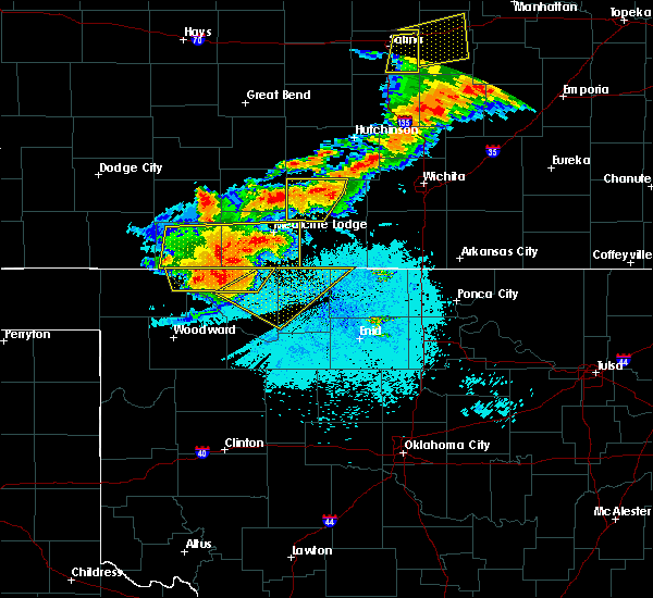 At 1232 am cdt, a severe thunderstorm was located 7 miles south of aetna, moving east at 50 mph. this is a very dangerous storm (radar indicated. the may ranch mesonet in northern woods county recorded a 74 mph wind gust with this storm). Hazards include 80 mph wind gusts and quarter size hail. Flying debris will be dangerous to those caught without shelter. mobile homes will be heavily damaged. expect considerable damage to roofs, windows, and vehicles. Extensive tree damage and power outages are likely. At 1232 am cdt, a severe thunderstorm was located 7 miles south of aetna, moving east at 50 mph. this is a very dangerous storm (radar indicated. the may ranch mesonet in northern woods county recorded a 74 mph wind gust with this storm). Hazards include 80 mph wind gusts and quarter size hail. Flying debris will be dangerous to those caught without shelter. mobile homes will be heavily damaged. expect considerable damage to roofs, windows, and vehicles. Extensive tree damage and power outages are likely.
|
| 6/15/2017 9:25 PM CDT |
 At 925 pm cdt, the leading edge of winds from a line of severe thunderstorms was located along a line extending from 3 miles south of manchester to 5 miles south of lamont, moving southwest at 35 mph (radar indicated). Hazards include 60 mph wind gusts. expect damage to roofs, siding, and trees At 925 pm cdt, the leading edge of winds from a line of severe thunderstorms was located along a line extending from 3 miles south of manchester to 5 miles south of lamont, moving southwest at 35 mph (radar indicated). Hazards include 60 mph wind gusts. expect damage to roofs, siding, and trees
|
| 6/15/2017 8:11 PM CDT |
 At 811 pm cdt, severe thunderstorms were located along a line extending from 3 miles northeast of dexter to 5 miles east of wellington to 6 miles northwest of argonia, moving south at 40 mph (radar indicated). Hazards include 70 mph wind gusts. Expect considerable tree damage. Damage is likely to mobile homes, roofs, and outbuildings. At 811 pm cdt, severe thunderstorms were located along a line extending from 3 miles northeast of dexter to 5 miles east of wellington to 6 miles northwest of argonia, moving south at 40 mph (radar indicated). Hazards include 70 mph wind gusts. Expect considerable tree damage. Damage is likely to mobile homes, roofs, and outbuildings.
|
| 6/14/2017 2:50 AM CDT |
 The severe thunderstorm warning for northwestern grant county will expire at 300 am cdt, the storm which prompted the warning has weakened below severe limits, and no longer poses an immediate threat to life or property. therefore, the warning will be allowed to expire. however, small hail up to the size of nickels, gusty winds up to 50 mph, and heavy rain are still possible with this thunderstorm. The severe thunderstorm warning for northwestern grant county will expire at 300 am cdt, the storm which prompted the warning has weakened below severe limits, and no longer poses an immediate threat to life or property. therefore, the warning will be allowed to expire. however, small hail up to the size of nickels, gusty winds up to 50 mph, and heavy rain are still possible with this thunderstorm.
|
| 6/14/2017 2:29 AM CDT |
 At 229 am cdt, a severe thunderstorm was located 5 miles east of manchester, moving east at 50 mph (radar indicated). Hazards include 60 mph wind gusts and quarter size hail. Hail damage to vehicles is expected. expect wind damage to roofs, siding, and trees. Locations impacted include, wakita and manchester. At 229 am cdt, a severe thunderstorm was located 5 miles east of manchester, moving east at 50 mph (radar indicated). Hazards include 60 mph wind gusts and quarter size hail. Hail damage to vehicles is expected. expect wind damage to roofs, siding, and trees. Locations impacted include, wakita and manchester.
|
| 6/14/2017 2:13 AM CDT |
 At 213 am cdt, a severe thunderstorm was located 6 miles northeast of amorita, moving east at 40 mph (radar indicated). Hazards include 60 mph wind gusts and quarter size hail. Hail damage to vehicles is expected. Expect wind damage to roofs, siding, and trees. At 213 am cdt, a severe thunderstorm was located 6 miles northeast of amorita, moving east at 40 mph (radar indicated). Hazards include 60 mph wind gusts and quarter size hail. Hail damage to vehicles is expected. Expect wind damage to roofs, siding, and trees.
|
| 5/18/2017 8:32 PM CDT |
 At 832 pm cdt, severe thunderstorms were located along a line extending from 5 miles east of manchester to near medford to 3 miles southeast of nash, moving east at 50 mph (radar indicated). Hazards include 70 mph wind gusts and nickel size hail. Expect considerable tree damage. damage is likely to mobile homes, roofs, and outbuildings. Locations impacted include, medford, wakita, deer creek, manchester, renfrow and jefferson. At 832 pm cdt, severe thunderstorms were located along a line extending from 5 miles east of manchester to near medford to 3 miles southeast of nash, moving east at 50 mph (radar indicated). Hazards include 70 mph wind gusts and nickel size hail. Expect considerable tree damage. damage is likely to mobile homes, roofs, and outbuildings. Locations impacted include, medford, wakita, deer creek, manchester, renfrow and jefferson.
|
| 5/18/2017 8:15 PM CDT |
 At 814 pm cdt, severe thunderstorms were located along a line extending from 4 miles west of manchester to near goltry, moving east at 35 mph (radar indicated). Hazards include 70 mph wind gusts and nickel size hail. Expect considerable tree damage. damage is likely to mobile homes, roofs, and outbuildings. Locations impacted include, medford, wakita, jet, deer creek, manchester, jefferson, renfrow and great salt plains lake. At 814 pm cdt, severe thunderstorms were located along a line extending from 4 miles west of manchester to near goltry, moving east at 35 mph (radar indicated). Hazards include 70 mph wind gusts and nickel size hail. Expect considerable tree damage. damage is likely to mobile homes, roofs, and outbuildings. Locations impacted include, medford, wakita, jet, deer creek, manchester, jefferson, renfrow and great salt plains lake.
|
| 5/18/2017 8:02 PM CDT |
 At 801 pm cdt, severe thunderstorms were located along a line extending from 4 miles northeast of amorita to near great salt plains lake, moving east at 30 mph (radar indicated). Hazards include 70 mph wind gusts and nickel size hail. Expect considerable tree damage. damage is likely to mobile homes, roofs, and outbuildings. Locations impacted include, cherokee, medford, wakita, jet, deer creek, manchester, amorita, byron, jefferson, renfrow, lambert, great salt plains lake, ingersoll and waldron. At 801 pm cdt, severe thunderstorms were located along a line extending from 4 miles northeast of amorita to near great salt plains lake, moving east at 30 mph (radar indicated). Hazards include 70 mph wind gusts and nickel size hail. Expect considerable tree damage. damage is likely to mobile homes, roofs, and outbuildings. Locations impacted include, cherokee, medford, wakita, jet, deer creek, manchester, amorita, byron, jefferson, renfrow, lambert, great salt plains lake, ingersoll and waldron.
|
| 5/18/2017 7:40 PM CDT |
 At 739 pm cdt, a severe thunderstorm was located near cherokee, moving east at 40 mph (radar indicated). Hazards include 70 mph wind gusts and half dollar size hail. Expect considerable tree damage. Wind damage is also likely to mobile homes, roofs, and outbuildings. At 739 pm cdt, a severe thunderstorm was located near cherokee, moving east at 40 mph (radar indicated). Hazards include 70 mph wind gusts and half dollar size hail. Expect considerable tree damage. Wind damage is also likely to mobile homes, roofs, and outbuildings.
|
| 5/10/2017 2:24 PM CDT |
 At 224 pm cdt, a severe thunderstorm was located 7 miles northeast of great salt plains lake, moving northeast at 45 mph (radar indicated). Hazards include 60 mph wind gusts and half dollar size hail. Hail damage to vehicles is expected. Expect wind damage to roofs, siding, and trees. At 224 pm cdt, a severe thunderstorm was located 7 miles northeast of great salt plains lake, moving northeast at 45 mph (radar indicated). Hazards include 60 mph wind gusts and half dollar size hail. Hail damage to vehicles is expected. Expect wind damage to roofs, siding, and trees.
|
| 5/3/2017 1:56 AM CDT |
 At 156 am cdt, severe thunderstorms were located along a line extending from 4 miles southeast of manchester to 3 miles southeast of wakita to near enid, moving east at 30 mph (radar indicated). Hazards include 60 mph wind gusts and nickel size hail. expect damage to roofs, siding, and trees At 156 am cdt, severe thunderstorms were located along a line extending from 4 miles southeast of manchester to 3 miles southeast of wakita to near enid, moving east at 30 mph (radar indicated). Hazards include 60 mph wind gusts and nickel size hail. expect damage to roofs, siding, and trees
|
| 5/3/2017 1:27 AM CDT |
 At 126 am cdt, severe thunderstorms were located along a line extending from near burlington to 4 miles east of ingersoll to near helena to near ringwood, moving northeast at 40 mph (radar indicated). Hazards include 70 mph wind gusts and nickel size hail. Expect considerable tree damage. damage is likely to mobile homes, roofs, and outbuildings. Locations impacted include, cherokee, medford, helena, pond creek, carmen, wakita, cleo springs, kremlin, goltry, jet, aline, nash, burlington, hillsdale, manchester, carrier, amorita, byron, jefferson and lambert. At 126 am cdt, severe thunderstorms were located along a line extending from near burlington to 4 miles east of ingersoll to near helena to near ringwood, moving northeast at 40 mph (radar indicated). Hazards include 70 mph wind gusts and nickel size hail. Expect considerable tree damage. damage is likely to mobile homes, roofs, and outbuildings. Locations impacted include, cherokee, medford, helena, pond creek, carmen, wakita, cleo springs, kremlin, goltry, jet, aline, nash, burlington, hillsdale, manchester, carrier, amorita, byron, jefferson and lambert.
|
| 5/3/2017 1:04 AM CDT |
 At 104 am cdt, severe thunderstorms were located along a line extending from 3 miles northeast of alva to near dacoma to 8 miles northwest of orienta, moving northeast at 45 mph (radar indicated). Hazards include 60 mph wind gusts and quarter size hail. Hail damage to vehicles is expected. Expect wind damage to roofs, siding, and trees. At 104 am cdt, severe thunderstorms were located along a line extending from 3 miles northeast of alva to near dacoma to 8 miles northwest of orienta, moving northeast at 45 mph (radar indicated). Hazards include 60 mph wind gusts and quarter size hail. Hail damage to vehicles is expected. Expect wind damage to roofs, siding, and trees.
|
| 3/26/2017 7:29 PM CDT |
 At 729 pm cdt, a severe thunderstorm was located 4 miles southeast of manchester, moving east at 25 mph (radar indicated). Hazards include 60 mph wind gusts and quarter size hail. Hail damage to vehicles is expected. expect wind damage to roofs, siding, and trees. Locations impacted include, wakita, manchester and renfrow. At 729 pm cdt, a severe thunderstorm was located 4 miles southeast of manchester, moving east at 25 mph (radar indicated). Hazards include 60 mph wind gusts and quarter size hail. Hail damage to vehicles is expected. expect wind damage to roofs, siding, and trees. Locations impacted include, wakita, manchester and renfrow.
|
| 3/26/2017 7:21 PM CDT |
 At 721 pm cdt, a severe thunderstorm was located over manchester, moving east at 25 mph (radar indicated). Hazards include 60 mph wind gusts and quarter size hail. Hail damage to vehicles is expected. Expect wind damage to roofs, siding, and trees. At 721 pm cdt, a severe thunderstorm was located over manchester, moving east at 25 mph (radar indicated). Hazards include 60 mph wind gusts and quarter size hail. Hail damage to vehicles is expected. Expect wind damage to roofs, siding, and trees.
|
| 10/6/2016 6:53 PM CDT |
 At 652 pm cdt, severe thunderstorms were located along a line extending from 7 miles northeast of great salt plains lake to 4 miles northeast of aline to 5 miles northwest of chester, moving east at 30 mph. the strongest storms will affect areas near the great salt plains lake and helena (radar indicated). Hazards include ping pong ball size hail and 60 mph wind gusts. People and animals outdoors will be injured. expect hail damage to roofs, siding, windows, and vehicles. expect wind damage to roofs, siding, and trees. Locations impacted include, fairview, cherokee, helena, carmen, wakita, cleo springs, goltry, jet, aline, nash, manchester, mutual, lambert, orienta, great salt plains lake, chester, orion and bouse junction. At 652 pm cdt, severe thunderstorms were located along a line extending from 7 miles northeast of great salt plains lake to 4 miles northeast of aline to 5 miles northwest of chester, moving east at 30 mph. the strongest storms will affect areas near the great salt plains lake and helena (radar indicated). Hazards include ping pong ball size hail and 60 mph wind gusts. People and animals outdoors will be injured. expect hail damage to roofs, siding, windows, and vehicles. expect wind damage to roofs, siding, and trees. Locations impacted include, fairview, cherokee, helena, carmen, wakita, cleo springs, goltry, jet, aline, nash, manchester, mutual, lambert, orienta, great salt plains lake, chester, orion and bouse junction.
|
| 10/6/2016 6:09 PM CDT |
 At 608 pm cdt, severe thunderstorms were located along a line extending from near driftwood to near dacoma to 3 miles southeast of quinlan, moving southeast at 20 mph. the strongest storm is will affect locations near cherokee (radar indicated). Hazards include golf ball size hail and 60 mph wind gusts. People and animals outdoors will be injured. expect hail damage to roofs, siding, windows, and vehicles. Expect wind damage to roofs, siding, and trees. At 608 pm cdt, severe thunderstorms were located along a line extending from near driftwood to near dacoma to 3 miles southeast of quinlan, moving southeast at 20 mph. the strongest storm is will affect locations near cherokee (radar indicated). Hazards include golf ball size hail and 60 mph wind gusts. People and animals outdoors will be injured. expect hail damage to roofs, siding, windows, and vehicles. Expect wind damage to roofs, siding, and trees.
|
| 10/4/2016 6:52 PM CDT |
 At 652 pm cdt, a severe thunderstorm was located 4 miles south of wakita, moving northeast at 35 mph (radar indicated). Hazards include 60 mph wind gusts and half dollar size hail. Hail damage to vehicles is expected. expect wind damage to roofs, siding, and trees. Locations impacted include, wakita, manchester and renfrow. At 652 pm cdt, a severe thunderstorm was located 4 miles south of wakita, moving northeast at 35 mph (radar indicated). Hazards include 60 mph wind gusts and half dollar size hail. Hail damage to vehicles is expected. expect wind damage to roofs, siding, and trees. Locations impacted include, wakita, manchester and renfrow.
|
| 10/4/2016 6:32 PM CDT |
 At 631 pm cdt, a severe thunderstorm was located near great salt plains lake, moving northeast at 35 mph. this is a very dangerous storm (radar indicated). Hazards include 80 mph wind gusts and ping pong ball size hail. Flying debris will be dangerous to those caught without shelter. mobile homes will be heavily damaged. expect considerable damage to roofs, windows, and vehicles. extensive tree damage and power outages are likely. Locations impacted include, wakita, jet, manchester, renfrow and great salt plains lake. At 631 pm cdt, a severe thunderstorm was located near great salt plains lake, moving northeast at 35 mph. this is a very dangerous storm (radar indicated). Hazards include 80 mph wind gusts and ping pong ball size hail. Flying debris will be dangerous to those caught without shelter. mobile homes will be heavily damaged. expect considerable damage to roofs, windows, and vehicles. extensive tree damage and power outages are likely. Locations impacted include, wakita, jet, manchester, renfrow and great salt plains lake.
|
| 10/4/2016 6:27 PM CDT |
 At 627 pm cdt, a severe thunderstorm was located over northeastern great salt plains lake, moving northeast at 35 mph. this is a very dangerous storm (radar indicated). Hazards include 80 mph wind gusts and quarter size hail. Flying debris will be dangerous to those caught without shelter. mobile homes will be heavily damaged. expect considerable damage to roofs, windows, and vehicles. extensive tree damage and power outages are likely. Locations impacted include, wakita, jet, manchester, renfrow and great salt plains lake. At 627 pm cdt, a severe thunderstorm was located over northeastern great salt plains lake, moving northeast at 35 mph. this is a very dangerous storm (radar indicated). Hazards include 80 mph wind gusts and quarter size hail. Flying debris will be dangerous to those caught without shelter. mobile homes will be heavily damaged. expect considerable damage to roofs, windows, and vehicles. extensive tree damage and power outages are likely. Locations impacted include, wakita, jet, manchester, renfrow and great salt plains lake.
|
| 10/4/2016 6:21 PM CDT |
 At 620 pm cdt, a severe thunderstorm was located over southwestern great salt plains lake, moving northeast at 35 mph (radar indicated). Hazards include 60 mph wind gusts and quarter size hail. Hail damage to vehicles is expected. Expect wind damage to roofs, siding, and trees. At 620 pm cdt, a severe thunderstorm was located over southwestern great salt plains lake, moving northeast at 35 mph (radar indicated). Hazards include 60 mph wind gusts and quarter size hail. Hail damage to vehicles is expected. Expect wind damage to roofs, siding, and trees.
|
| 9/9/2016 8:24 PM CDT |
 At 824 pm cdt, the leading edge of winds from a line of severe thunderstorms was located along a line extending from 6 miles northeast of wakita to near helena, moving east at 40 mph (radar indicated). Hazards include 60 mph wind gusts and penny size hail. Expect damage to roofs. siding. And trees. At 824 pm cdt, the leading edge of winds from a line of severe thunderstorms was located along a line extending from 6 miles northeast of wakita to near helena, moving east at 40 mph (radar indicated). Hazards include 60 mph wind gusts and penny size hail. Expect damage to roofs. siding. And trees.
|
| 9/9/2016 8:18 PM CDT |
 At 818 pm cdt, the leading edge of winds from severe thunderstorms was located along a line extending from 7 miles northeast of wakita to near jet, moving east at 50 mph (radar indicated). Hazards include 60 mph wind gusts and nickel size hail. Expect damage to roofs. siding. and trees. Locations impacted include, alva, cherokee, helena, carmen, wakita, goltry, jet, nash, burlington, dacoma, manchester, amorita, byron, lambert, ingersoll, driftwood, great salt plains lake, capron, avard and waldron. At 818 pm cdt, the leading edge of winds from severe thunderstorms was located along a line extending from 7 miles northeast of wakita to near jet, moving east at 50 mph (radar indicated). Hazards include 60 mph wind gusts and nickel size hail. Expect damage to roofs. siding. and trees. Locations impacted include, alva, cherokee, helena, carmen, wakita, goltry, jet, nash, burlington, dacoma, manchester, amorita, byron, lambert, ingersoll, driftwood, great salt plains lake, capron, avard and waldron.
|
| 9/9/2016 7:47 PM CDT |
 At 747 pm cdt, the leading edge of winds from a line of severe thunderstorms was located along a line extending from 3 miles north of amorita to 6 miles east of alva, moving east at 50 mph (radar indicated). Hazards include 70 mph wind gusts and quarter size hail. Hail damage to vehicles is expected. expect considerable tree damage. Wind damage is also likely to mobile homes, roofs, and outbuildings. At 747 pm cdt, the leading edge of winds from a line of severe thunderstorms was located along a line extending from 3 miles north of amorita to 6 miles east of alva, moving east at 50 mph (radar indicated). Hazards include 70 mph wind gusts and quarter size hail. Hail damage to vehicles is expected. expect considerable tree damage. Wind damage is also likely to mobile homes, roofs, and outbuildings.
|
| 8/7/2016 10:54 PM CDT |
 At 1053 pm cdt, severe thunderstorms were located along a line extending from 5 miles north of great salt plains lake to 7 miles south of wakita to near jefferson, moving north at 25 mph (radar indicated). Hazards include 60 mph wind gusts. Expect damage to roofs. siding. and trees. Locations impacted include, medford, pond creek, wakita, jet, nash, manchester, jefferson, great salt plains lake and waldron. At 1053 pm cdt, severe thunderstorms were located along a line extending from 5 miles north of great salt plains lake to 7 miles south of wakita to near jefferson, moving north at 25 mph (radar indicated). Hazards include 60 mph wind gusts. Expect damage to roofs. siding. and trees. Locations impacted include, medford, pond creek, wakita, jet, nash, manchester, jefferson, great salt plains lake and waldron.
|
| 8/7/2016 10:21 PM CDT |
 At 1021 pm cdt, severe thunderstorms were located along a line extending from near jet to 3 miles south of nash to 4 miles west of kremlin, moving north at 25 mph (radar indicated). Hazards include 60 mph wind gusts. Expect damage to roofs. siding. And trees. At 1021 pm cdt, severe thunderstorms were located along a line extending from near jet to 3 miles south of nash to 4 miles west of kremlin, moving north at 25 mph (radar indicated). Hazards include 60 mph wind gusts. Expect damage to roofs. siding. And trees.
|
| 7/29/2016 4:20 AM CDT |
 At 420 am cdt, a severe thunderstorm was located 5 miles south of wakita, moving south at 25 mph (radar indicated). Hazards include 60 mph wind gusts and penny size hail. Expect damage to roofs. siding. and trees. Locations impacted include, medford, lamont, wakita, deer creek, manchester, renfrow and jefferson. At 420 am cdt, a severe thunderstorm was located 5 miles south of wakita, moving south at 25 mph (radar indicated). Hazards include 60 mph wind gusts and penny size hail. Expect damage to roofs. siding. and trees. Locations impacted include, medford, lamont, wakita, deer creek, manchester, renfrow and jefferson.
|
| 7/29/2016 4:02 AM CDT |
 At 402 am cdt, a severe thunderstorm was located near wakita, moving south at 25 mph (radar indicated). Hazards include 70 mph wind gusts and nickel size hail. Expect considerable tree damage. Damage is likely to mobile homes, roofs, and outbuildings. At 402 am cdt, a severe thunderstorm was located near wakita, moving south at 25 mph (radar indicated). Hazards include 70 mph wind gusts and nickel size hail. Expect considerable tree damage. Damage is likely to mobile homes, roofs, and outbuildings.
|
| 7/13/2016 9:26 PM CDT |
 At 925 pm cdt, the leading edge of severe thunderstorms were located along a line extending from 4 miles southwest of newkirk to near wakita, moving southeast at 10 mph (radar indicated). Hazards include golf ball size hail and 70 mph wind gusts. People and animals outdoors will be injured. expect hail damage to roofs, siding, windows, and vehicles. expect considerable tree damage. Wind damage is also likely to mobile homes, roofs, and outbuildings. At 925 pm cdt, the leading edge of severe thunderstorms were located along a line extending from 4 miles southwest of newkirk to near wakita, moving southeast at 10 mph (radar indicated). Hazards include golf ball size hail and 70 mph wind gusts. People and animals outdoors will be injured. expect hail damage to roofs, siding, windows, and vehicles. expect considerable tree damage. Wind damage is also likely to mobile homes, roofs, and outbuildings.
|
| 5/31/2016 6:36 AM CDT |
 The severe thunderstorm warning for east central alfalfa, western kay, western noble, grant and garfield counties will expire at 645 am cdt, the storms which prompted the warning have weakened below severe limits, and no longer pose an immediate threat to life or property. therefore the warning will be allowed to expire. however, gusty winds and heavy rain are still possible with these thunderstorms. The severe thunderstorm warning for east central alfalfa, western kay, western noble, grant and garfield counties will expire at 645 am cdt, the storms which prompted the warning have weakened below severe limits, and no longer pose an immediate threat to life or property. therefore the warning will be allowed to expire. however, gusty winds and heavy rain are still possible with these thunderstorms.
|
| 5/31/2016 6:19 AM CDT |
 At 618 am cdt, severe thunderstorms were located along a line extending from 4 miles northeast of wakita to 3 miles south of medford to 3 miles north of hunter to near breckenridge to near bison, moving east at 35 mph (radar indicated). Hazards include 60 mph wind gusts and penny size hail. Expect damage to roofs. siding. and trees. locations impacted include, enid, blackwell, perry, tonkawa, medford, waukomis, pond creek, garber, lahoma, covington, billings, drummond, lamont, wakita, kremlin, breckenridge, braman, nash, hunter and fairmont. This includes interstate 35 between mile markers 179 and 235. At 618 am cdt, severe thunderstorms were located along a line extending from 4 miles northeast of wakita to 3 miles south of medford to 3 miles north of hunter to near breckenridge to near bison, moving east at 35 mph (radar indicated). Hazards include 60 mph wind gusts and penny size hail. Expect damage to roofs. siding. and trees. locations impacted include, enid, blackwell, perry, tonkawa, medford, waukomis, pond creek, garber, lahoma, covington, billings, drummond, lamont, wakita, kremlin, breckenridge, braman, nash, hunter and fairmont. This includes interstate 35 between mile markers 179 and 235.
|
| 5/31/2016 5:43 AM CDT |
 At 542 am cdt, severe thunderstorms were located along a line extending from 8 miles southwest of manchester to 6 miles northeast of nash to 5 miles northeast of hillsdale to 4 miles northwest of vance air force base to 6 miles southeast of ames, moving east at 40 mph (radar indicated). Hazards include 60 mph wind gusts and quarter size hail. Hail damage to vehicles is expected. Expect wind damage to roofs, siding, and trees. At 542 am cdt, severe thunderstorms were located along a line extending from 8 miles southwest of manchester to 6 miles northeast of nash to 5 miles northeast of hillsdale to 4 miles northwest of vance air force base to 6 miles southeast of ames, moving east at 40 mph (radar indicated). Hazards include 60 mph wind gusts and quarter size hail. Hail damage to vehicles is expected. Expect wind damage to roofs, siding, and trees.
|
| 5/31/2016 5:26 AM CDT |
 At 525 am cdt, severe thunderstorms were located along a line extending from near driftwood to 3 miles west of jet to 3 miles southwest of ringwood to 5 miles northwest of okeene to near canton, moving east at 45 mph (radar indicated). Hazards include 60 mph wind gusts and quarter size hail. Hail damage to vehicles is expected. expect wind damage to roofs, siding, and trees. Locations impacted include, enid, fairview, cherokee, medford, helena, okeene, pond creek, canton, lahoma, ringwood, drummond, carmen, wakita, cleo springs, longdale, kremlin, goltry, ames, meno and jet. At 525 am cdt, severe thunderstorms were located along a line extending from near driftwood to 3 miles west of jet to 3 miles southwest of ringwood to 5 miles northwest of okeene to near canton, moving east at 45 mph (radar indicated). Hazards include 60 mph wind gusts and quarter size hail. Hail damage to vehicles is expected. expect wind damage to roofs, siding, and trees. Locations impacted include, enid, fairview, cherokee, medford, helena, okeene, pond creek, canton, lahoma, ringwood, drummond, carmen, wakita, cleo springs, longdale, kremlin, goltry, ames, meno and jet.
|
| 5/31/2016 5:01 AM CDT |
 At 501 am cdt, severe thunderstorms were located along a line extending from near amorita to 8 miles west of orienta to 4 miles east of seiling, moving east at 45 mph (radar indicated). Hazards include 60 mph wind gusts and quarter size hail. Hail damage to vehicles is expected. Expect wind damage to roofs, siding, and trees. At 501 am cdt, severe thunderstorms were located along a line extending from near amorita to 8 miles west of orienta to 4 miles east of seiling, moving east at 45 mph (radar indicated). Hazards include 60 mph wind gusts and quarter size hail. Hail damage to vehicles is expected. Expect wind damage to roofs, siding, and trees.
|
| 5/9/2016 5:44 PM CDT |
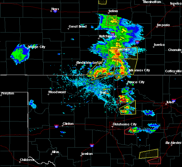 At 544 pm cdt, a severe thunderstorm was located 4 miles south of manchester, moving northeast at 20 mph (radar indicated). Hazards include ping pong ball size hail and 60 mph wind gusts. People and animals outdoors will be injured. expect hail damage to roofs, siding, windows, and vehicles. Expect wind damage to roofs, siding, and trees. At 544 pm cdt, a severe thunderstorm was located 4 miles south of manchester, moving northeast at 20 mph (radar indicated). Hazards include ping pong ball size hail and 60 mph wind gusts. People and animals outdoors will be injured. expect hail damage to roofs, siding, windows, and vehicles. Expect wind damage to roofs, siding, and trees.
|
| 5/9/2016 4:55 PM CDT |
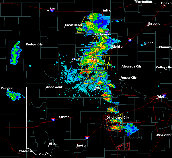 At 454 pm cdt, a severe thunderstorm was located near amorita, moving northeast at 20 mph (radar indicated). Hazards include ping pong ball size hail and 60 mph wind gusts. People and animals outdoors will be injured. expect hail damage to roofs, siding, windows, and vehicles. Expect wind damage to roofs, siding, and trees. At 454 pm cdt, a severe thunderstorm was located near amorita, moving northeast at 20 mph (radar indicated). Hazards include ping pong ball size hail and 60 mph wind gusts. People and animals outdoors will be injured. expect hail damage to roofs, siding, windows, and vehicles. Expect wind damage to roofs, siding, and trees.
|
| 4/26/2016 7:43 PM CDT |
 At 742 pm cdt, a severe thunderstorm was located 6 miles south of wakita, moving northeast at 50 mph. another severe thunderstorm was located near amorita (radar indicated). Hazards include 70 mph wind gusts and nickel size hail. Expect considerable tree damage. Damage is likely to mobile homes, roofs, and outbuildings. At 742 pm cdt, a severe thunderstorm was located 6 miles south of wakita, moving northeast at 50 mph. another severe thunderstorm was located near amorita (radar indicated). Hazards include 70 mph wind gusts and nickel size hail. Expect considerable tree damage. Damage is likely to mobile homes, roofs, and outbuildings.
|
| 4/26/2016 7:35 PM CDT |
 At 734 pm cdt, a severe thunderstorm was located 5 miles northwest of great salt plains lake, moving northeast at 50 mph (the cherokee mesonet site recently reported 73 mph wind gusts with this storm). Hazards include 70 mph wind gusts and nickel size hail. Expect considerable tree damage. damage is likely to mobile homes, roofs, and outbuildings. Locations impacted include, enid, cherokee, helena, kremlin, goltry, jet, nash, burlington, hillsdale, manchester, carrier, amorita, byron, lambert, ingersoll, driftwood, great salt plains lake, north enid and waldron. At 734 pm cdt, a severe thunderstorm was located 5 miles northwest of great salt plains lake, moving northeast at 50 mph (the cherokee mesonet site recently reported 73 mph wind gusts with this storm). Hazards include 70 mph wind gusts and nickel size hail. Expect considerable tree damage. damage is likely to mobile homes, roofs, and outbuildings. Locations impacted include, enid, cherokee, helena, kremlin, goltry, jet, nash, burlington, hillsdale, manchester, carrier, amorita, byron, lambert, ingersoll, driftwood, great salt plains lake, north enid and waldron.
|
| 4/26/2016 7:30 PM CDT |
 At 729 pm cdt, a severe thunderstorm was located near great salt plains lake, moving east at 55 mph. the strongest winds associated with this storm were located near great salt plains lake (radar indicated). Hazards include 60 mph wind gusts and nickel size hail. Expect damage to roofs. siding. and trees. Locations impacted include, enid, alva, cherokee, helena, carmen, kremlin, goltry, jet, nash, burlington, hillsdale, dacoma, manchester, carrier, amorita, byron, lambert, ingersoll, driftwood and great salt plains lake. At 729 pm cdt, a severe thunderstorm was located near great salt plains lake, moving east at 55 mph. the strongest winds associated with this storm were located near great salt plains lake (radar indicated). Hazards include 60 mph wind gusts and nickel size hail. Expect damage to roofs. siding. and trees. Locations impacted include, enid, alva, cherokee, helena, carmen, kremlin, goltry, jet, nash, burlington, hillsdale, dacoma, manchester, carrier, amorita, byron, lambert, ingersoll, driftwood and great salt plains lake.
|
| 4/26/2016 6:54 PM CDT |
 At 652 pm cdt, an area of severe thunderstorms was located from 4 miles northwest of cleo springs, to near avard, to alva, and capron. these storms were moving east northeast at 50 mph (radar indicated). Hazards include 60 mph wind gusts and quarter size hail. Hail damage to vehicles is expected. Expect wind damage to roofs, siding, and trees. At 652 pm cdt, an area of severe thunderstorms was located from 4 miles northwest of cleo springs, to near avard, to alva, and capron. these storms were moving east northeast at 50 mph (radar indicated). Hazards include 60 mph wind gusts and quarter size hail. Hail damage to vehicles is expected. Expect wind damage to roofs, siding, and trees.
|
| 4/26/2016 6:03 PM CDT |
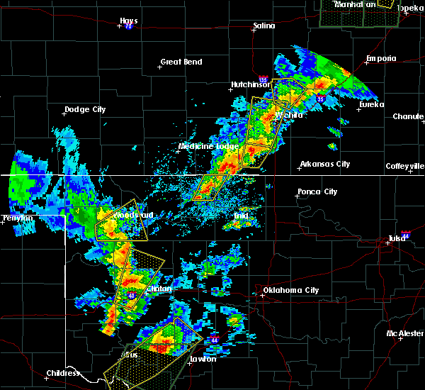 At 603 pm cdt, a severe thunderstorm was located 4 miles north of great salt plains lake, moving northeast at 55 mph (radar indicated). Hazards include 60 mph wind gusts and quarter size hail. Hail damage to vehicles is expected. Expect wind damage to roofs, siding, and trees. At 603 pm cdt, a severe thunderstorm was located 4 miles north of great salt plains lake, moving northeast at 55 mph (radar indicated). Hazards include 60 mph wind gusts and quarter size hail. Hail damage to vehicles is expected. Expect wind damage to roofs, siding, and trees.
|
| 4/26/2016 5:53 PM CDT |
 At 552 pm cdt, a severe thunderstorm was located 6 miles southeast of cherokee, moving northeast at 35 mph (radar indicated). Hazards include 60 mph wind gusts and quarter size hail. Hail damage to vehicles is expected. expect wind damage to roofs, siding, and trees. Locations impacted include, cherokee, helena, carmen, jet, aline, manchester, great salt plains lake and waldron. At 552 pm cdt, a severe thunderstorm was located 6 miles southeast of cherokee, moving northeast at 35 mph (radar indicated). Hazards include 60 mph wind gusts and quarter size hail. Hail damage to vehicles is expected. expect wind damage to roofs, siding, and trees. Locations impacted include, cherokee, helena, carmen, jet, aline, manchester, great salt plains lake and waldron.
|
| 4/26/2016 5:36 PM CDT |
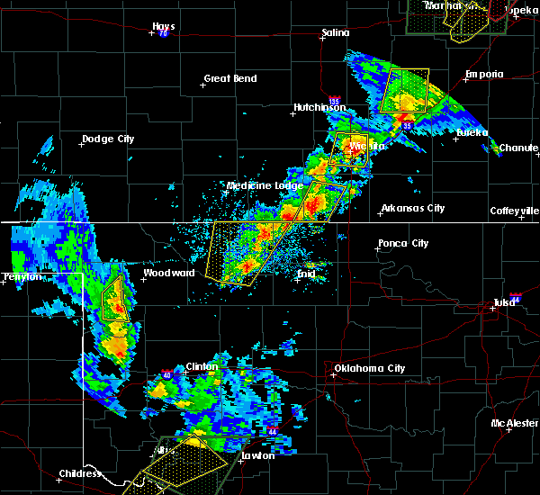 At 535 pm cdt, a severe thunderstorm was located 4 miles northeast of aline, moving northeast at 55 mph. another severe thunderstorm was located 4 miles north northwest of wakita moving northeast at 50 mph (radar indicated). Hazards include 60 mph wind gusts and half dollar size hail. Hail damage to vehicles is expected. expect wind damage to roofs, siding, and trees. Locations impacted include, alva, cherokee, helena, carmen, cleo springs, jet, aline, burlington, dacoma, manchester, amorita, byron, lambert, ingersoll, driftwood, great salt plains lake, capron, waldron and hopeton. At 535 pm cdt, a severe thunderstorm was located 4 miles northeast of aline, moving northeast at 55 mph. another severe thunderstorm was located 4 miles north northwest of wakita moving northeast at 50 mph (radar indicated). Hazards include 60 mph wind gusts and half dollar size hail. Hail damage to vehicles is expected. expect wind damage to roofs, siding, and trees. Locations impacted include, alva, cherokee, helena, carmen, cleo springs, jet, aline, burlington, dacoma, manchester, amorita, byron, lambert, ingersoll, driftwood, great salt plains lake, capron, waldron and hopeton.
|
| 4/26/2016 4:56 PM CDT |
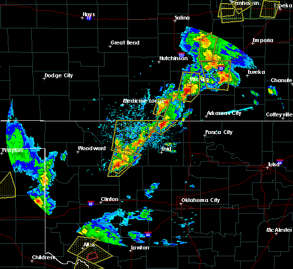 At 455 pm cdt, a severe thunderstorm was located 11 miles west of aline, moving northeast at 35 mph. other severe storms were located near helena and were also moving northeast at 35 mph (radar indicated). Hazards include 60 mph wind gusts and half dollar size hail. Hail damage to vehicles is expected. Expect wind damage to roofs, siding, and trees. At 455 pm cdt, a severe thunderstorm was located 11 miles west of aline, moving northeast at 35 mph. other severe storms were located near helena and were also moving northeast at 35 mph (radar indicated). Hazards include 60 mph wind gusts and half dollar size hail. Hail damage to vehicles is expected. Expect wind damage to roofs, siding, and trees.
|
| 4/26/2016 2:29 PM CDT |
 At 229 pm cdt, a severe thunderstorm was located near wakita, moving northeast at 35 mph (radar indicated). Hazards include golf ball size hail and 60 mph wind gusts. People and animals outdoors will be injured. expect hail damage to roofs, siding, windows, and vehicles. expect wind damage to roofs, siding, and trees. Locations impacted include, wakita and manchester. At 229 pm cdt, a severe thunderstorm was located near wakita, moving northeast at 35 mph (radar indicated). Hazards include golf ball size hail and 60 mph wind gusts. People and animals outdoors will be injured. expect hail damage to roofs, siding, windows, and vehicles. expect wind damage to roofs, siding, and trees. Locations impacted include, wakita and manchester.
|
| 4/26/2016 2:18 PM CDT |
 At 217 pm cdt, a severe thunderstorm was located 5 miles west of wakita, moving northeast at 45 mph (radar indicated). Hazards include 60 mph wind gusts and half dollar size hail. Hail damage to vehicles is expected. Expect wind damage to roofs, siding, and trees. At 217 pm cdt, a severe thunderstorm was located 5 miles west of wakita, moving northeast at 45 mph (radar indicated). Hazards include 60 mph wind gusts and half dollar size hail. Hail damage to vehicles is expected. Expect wind damage to roofs, siding, and trees.
|
| 11/17/2015 12:59 AM CST |
 At 1258 am cst, severe thunderstorms were located along a line extending from near medford to 7 miles west of cashion, moving northeast at 65 mph (radar indicated). Hazards include 60 mph wind gusts. Expect damage to roofs. Siding and trees. At 1258 am cst, severe thunderstorms were located along a line extending from near medford to 7 miles west of cashion, moving northeast at 65 mph (radar indicated). Hazards include 60 mph wind gusts. Expect damage to roofs. Siding and trees.
|
| 11/17/2015 12:30 AM CST |
 At 1230 am cst, severe thunderstorms were located along a line extending from near great salt plains lake to 5 miles southeast of ames, moving northeast at 40 mph (radar indicated). Hazards include 60 mph wind gusts. Expect damage to roofs. Siding and trees. At 1230 am cst, severe thunderstorms were located along a line extending from near great salt plains lake to 5 miles southeast of ames, moving northeast at 40 mph (radar indicated). Hazards include 60 mph wind gusts. Expect damage to roofs. Siding and trees.
|
| 8/21/2015 9:47 PM CDT |
 At 947 pm cdt, severe thunderstorms were located along a line extending from 6 miles northwest of renfrow to near nash, moving southeast at 20 mph (radar indicated). Hazards include 70 mph wind gusts and quarter size hail. Hail damage to vehicles is expected. expect considerable tree damage. wind damage is also likely to mobile homes, roofs and outbuildings. Locations impacted include, medford, pond creek, wakita, jet, nash, manchester, renfrow, jefferson and great salt plains lake. At 947 pm cdt, severe thunderstorms were located along a line extending from 6 miles northwest of renfrow to near nash, moving southeast at 20 mph (radar indicated). Hazards include 70 mph wind gusts and quarter size hail. Hail damage to vehicles is expected. expect considerable tree damage. wind damage is also likely to mobile homes, roofs and outbuildings. Locations impacted include, medford, pond creek, wakita, jet, nash, manchester, renfrow, jefferson and great salt plains lake.
|
| 8/21/2015 9:20 PM CDT |
 At 920 pm cdt, severe thunderstorms were located along a line extending from 6 miles north of wakita to near great salt plains lake, moving east at 35 mph (radar indicated). Hazards include 60 mph wind gusts and quarter size hail. Hail damage to vehicles is expected. Expect wind damage to roofs, siding and trees. At 920 pm cdt, severe thunderstorms were located along a line extending from 6 miles north of wakita to near great salt plains lake, moving east at 35 mph (radar indicated). Hazards include 60 mph wind gusts and quarter size hail. Hail damage to vehicles is expected. Expect wind damage to roofs, siding and trees.
|
| 7/6/2015 6:42 PM CDT | The severe thunderstorm warning for northwestern grant and east central alfalfa counties will expire at 645 pm cdt, the storms which prompted the warning have weakened below severe limits, and no longer pose an immediate threat to life or property. therefore the warning will be allowed to expire. however gusty winds and heavy rain are still possible with these thunderstorms. |
| 7/6/2015 6:15 PM CDT |
 At 615 pm cdt, severe thunderstorms were located along a line extending from 7 miles east of manchester to near great salt plains lake, moving east at 25 mph (radar indicated). Hazards include 60 mph wind gusts and penny size hail. Expect damage to roofs. siding and trees. Locations impacted include, wakita, manchester, renfrow and great salt plains lake. At 615 pm cdt, severe thunderstorms were located along a line extending from 7 miles east of manchester to near great salt plains lake, moving east at 25 mph (radar indicated). Hazards include 60 mph wind gusts and penny size hail. Expect damage to roofs. siding and trees. Locations impacted include, wakita, manchester, renfrow and great salt plains lake.
|
| 7/6/2015 5:57 PM CDT |
 At 556 pm cdt, severe thunderstorms were located along a line extending from near manchester to 3 miles northeast of ingersoll, moving east at 30 mph (radar indicated). Hazards include 60 mph wind gusts and nickel size hail. Expect damage to roofs. Siding and trees. At 556 pm cdt, severe thunderstorms were located along a line extending from near manchester to 3 miles northeast of ingersoll, moving east at 30 mph (radar indicated). Hazards include 60 mph wind gusts and nickel size hail. Expect damage to roofs. Siding and trees.
|
| 5/16/2015 7:36 PM CDT | At 736 pm cdt, severe thunderstorms were located along a line extending from 8 miles northeast of wakita to 6 miles west of lamont, moving northeast at 55 mph (radar indicated). Hazards include 60 mph wind gusts and quarter size hail. Hail damage to vehicles is expected. expect wind damage to roofs, siding and trees. locations impacted include, medford, pond creek, wakita, deer creek, manchester, renfrow and jefferson. 1. 00in. |
| 5/16/2015 7:25 PM CDT | At 725 pm cdt, severe thunderstorms were located along a line extending from 4 miles east of manchester to 3 miles south of pond creek, moving northeast at 45 mph (radar indicated). Hazards include 60 mph wind gusts and quarter size hail. Hail damage to vehicles is expected. expect wind damage to roofs, siding and trees. locations impacted include, medford, pond creek, wakita, nash, deer creek, manchester, renfrow and jefferson. 1. 00in. |
| 5/16/2015 7:11 PM CDT | At 710 pm cdt, severe thunderstorms were located along a line extending from 5 miles northeast of amorita to near hillsdale, moving northeast at 60 mph (radar indicated). Hazards include 60 mph wind gusts and quarter size hail. Hail damage to vehicles is expected. Expect wind damage to roofs, siding and trees. |
| 5/6/2015 11:16 PM CDT | At 1116 pm cdt, a severe thunderstorm was located over great salt plains lake, moving northeast at 25 mph (radar indicated). Hazards include ping pong ball size hail and 60 mph wind gusts. People and animals outdoors will be injured. expect hail damage to roofs, siding, windows and vehicles. Expect wind damage to roofs, siding and trees. |
| 5/6/2015 10:28 PM CDT | At 1028 pm cdt, severe thunderstorms were located 8 miles southwest of dacoma and 4 miles north of helena, moving northeast at 30 mph (radar indicated). Hazards include ping pong ball size hail and 60 mph wind gusts. People and animals outdoors will be injured. expect hail damage to roofs, siding, windows and vehicles. Expect wind damage to roofs, siding and trees. |
| 5/6/2015 9:44 PM CDT | At 944 pm cdt, severe thunderstorms were located along a line extending from 4 miles northwest of nash to 4 miles east of carmen, moving northeast at 40 mph. another severe storm was located 8 miles west of cherokee (radar indicated). Hazards include tennis ball size hail and 60 mph wind gusts. People and animals outdoors will be injured. expect hail damage to roofs, siding, windows and vehicles. Expect wind damage to roofs, siding and trees. |
| 5/6/2015 9:36 PM CDT | At 935 pm cdt, severe thunderstorms were located along a line extending from near carmen to near jet, moving northeast at 20 mph (radar indicated). Hazards include golf ball size hail and 60 mph wind gusts. People and animals outdoors will be injured. expect hail damage to roofs, siding, windows and vehicles. expect wind damage to roofs, siding and trees. locations impacted include, cherokee, medford, helena, pond creek, carmen, wakita, goltry, jet, aline, nash, hillsdale, dacoma, manchester, amorita, byron, jefferson, lambert, ingersoll, driftwood and great salt plains lake. 1. 75in. |
| 5/6/2015 8:56 PM CDT | At 856 pm cdt, severe thunderstorms were located along a line extending from 4 miles south of dacoma to near helena, moving northeast at 35 mph. another strong to severe storm was located just north of great salt plains lake state park (radar indicated). Hazards include tennis ball size hail and 60 mph wind gusts. People and animals outdoors will be injured. expect hail damage to roofs, siding, windows and vehicles. Expect wind damage to roofs, siding and trees. |
| 5/6/2015 6:43 PM CDT | At 643 pm cdt, severe thunderstorms were located near byron, 4 miles southwest of wakita and 3 miles north of medford, moving north at 25 mph (radar indicated). Hazards include ping pong ball size hail and 60 mph wind gusts. People and animals outdoors will be injured. expect hail damage to roofs, siding, windows and vehicles. Expect wind damage to roofs, siding and trees. |
| 5/6/2015 6:04 PM CDT | At 603 pm cdt, a severe thunderstorm was located near jet, moving northeast at 35 mph (radar indicated). Hazards include ping pong ball size hail and 60 mph wind gusts. People and animals outdoors will be injured. expect hail damage to roofs, siding, windows and vehicles. Expect wind damage to roofs, siding and trees. |
| 4/18/2015 6:11 PM CDT | At 611 pm cdt, a severe thunderstorm was located 4 miles south of manchester, moving northeast at 35 mph (radar indicated). Hazards include 60 mph wind gusts and half dollar size hail. Hail damage to vehicles is expected. Expect wind damage to roofs, siding and trees. |
| 4/18/2015 5:56 PM CDT | At 556 pm cdt, a severe thunderstorm was located 8 miles east of byron, moving northeast at 15 mph (radar indicated). Hazards include 60 mph wind gusts and half dollar size hail. Hail damage to vehicles is expected. expect wind damage to roofs, siding and trees. locations impacted include, wakita, manchester and waldron. a tornado watch remains in effect until 900 pm cdt for northwestern oklahoma. 1. 25in. |
| 4/18/2015 5:26 PM CDT | At 525 pm cdt, a severe thunderstorm was located near great salt plains lake, moving northeast at 30 mph (radar indicated). Hazards include golf ball size hail and 60 mph wind gusts. People and animals outdoors will be injured. expect hail damage to roofs, siding, windows and vehicles. Expect wind damage to roofs, siding and trees. |
| 4/12/2015 11:08 PM CDT | A severe thunderstorm warning remains in effect until 1115 pm cdt for western grant and northeastern alfalfa counties. at 1107 pm cdt. severe thunderstorms were located along a line extending from 5 miles northwest of wakita to 7 miles northeast of great salt plains lake to near ingersoll. Moving southeast at 35 mph. |
| 4/12/2015 10:49 PM CDT | A severe thunderstorm warning remains in effect until 1115 pm cdt for northeastern woods. western grant and alfalfa counties. at 1049 pm cdt. severe thunderstorms were located along a line extending from 5 miles northeast of amorita to near driftwood to near capron. moving east at 25 mph. hazard. 70 mph wind gusts and quarter size hail. |
| 4/12/2015 10:27 PM CDT | The national weather service in norman has issued a * severe thunderstorm warning for. northeastern woods county in northwestern oklahoma. western grant county in northern oklahoma. alfalfa county in northwestern oklahoma. Until 1115 pm cdt. |
| 4/30/2012 9:12 PM CDT | 1 power pole downed with reports of tree damage in harper county KS, 2.6 miles SSE of Manchester, OK |
| 1/1/0001 12:00 AM | Storm damage reported in grant county OK, 3.4 miles NNW of Manchester, OK |
Hail Maps for Manchester, OK
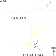
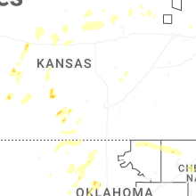


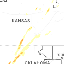
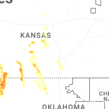


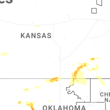


Connect with Interactive Hail Maps