

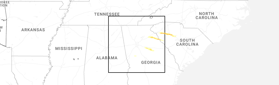
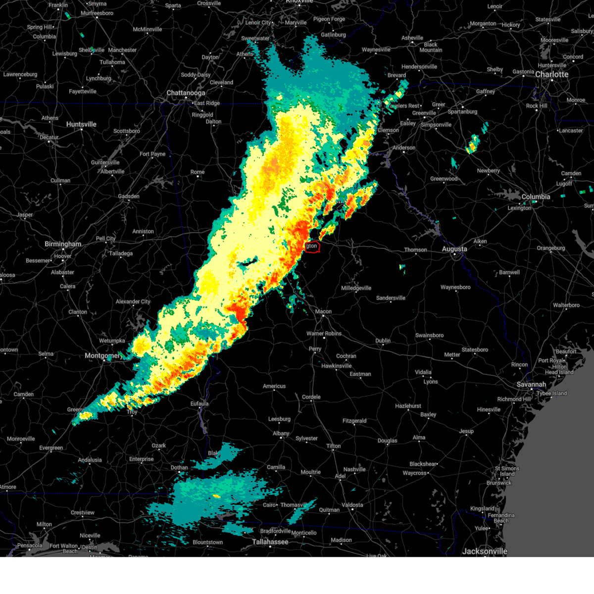
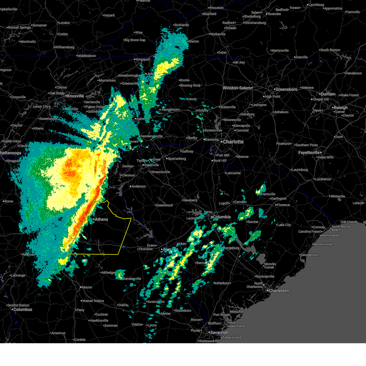
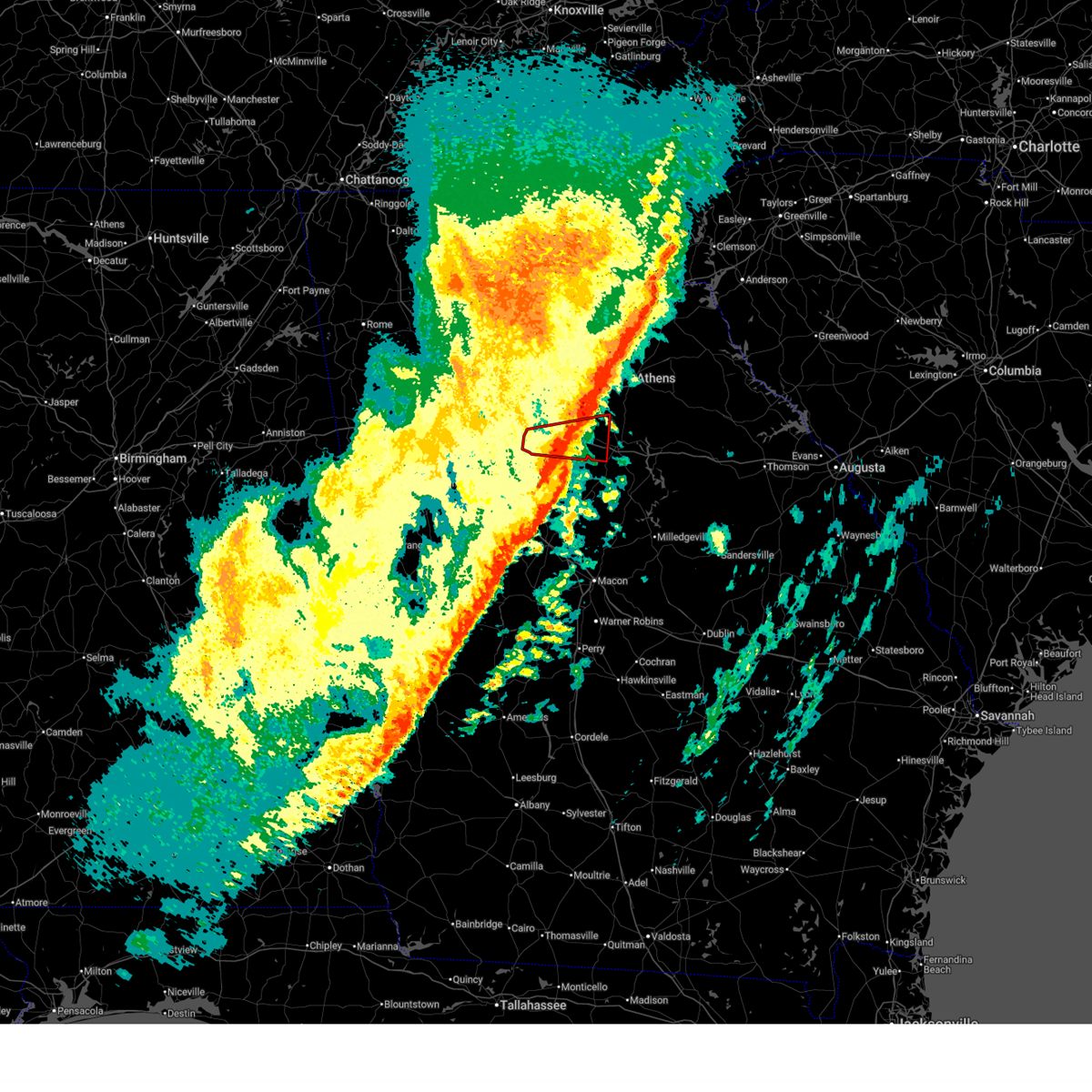
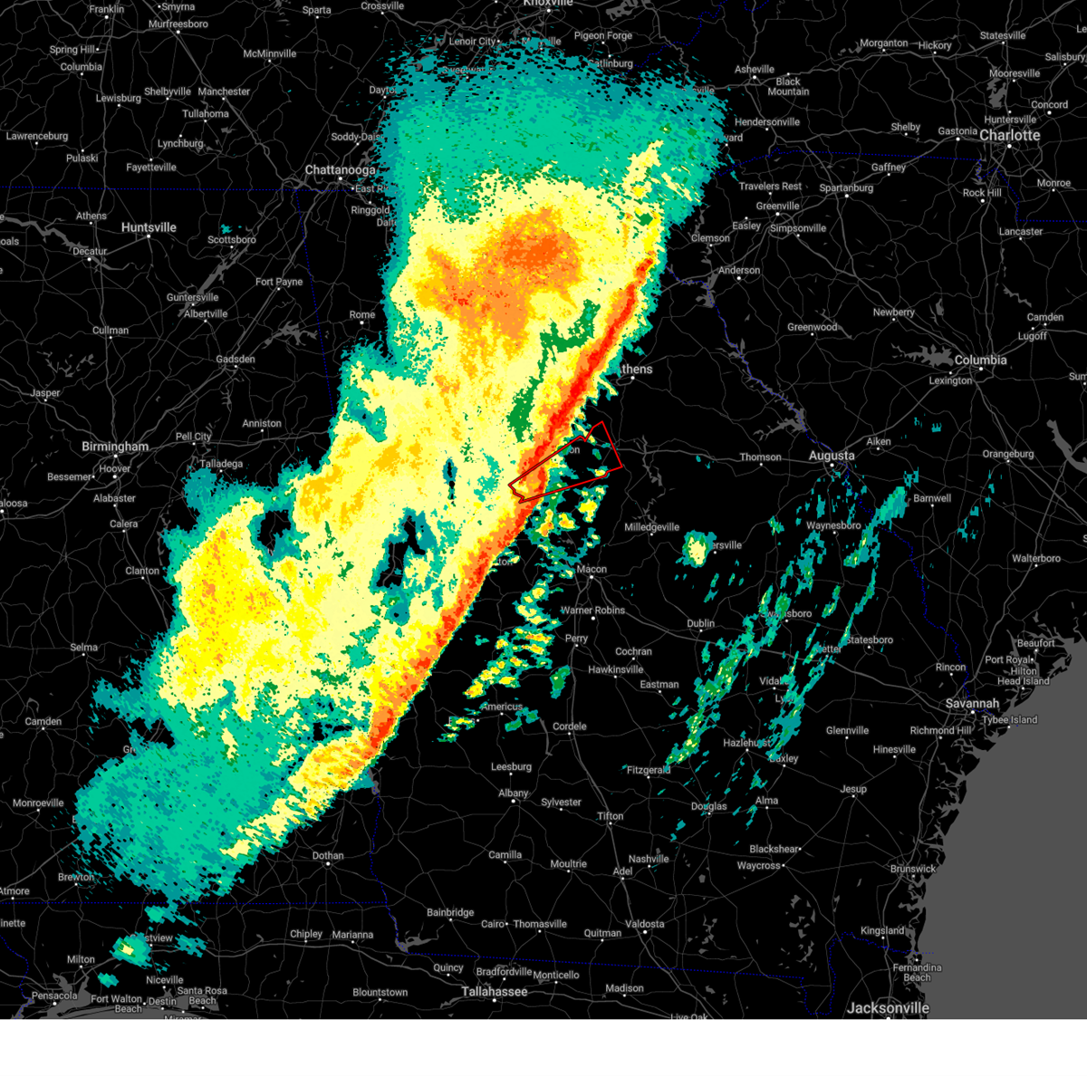
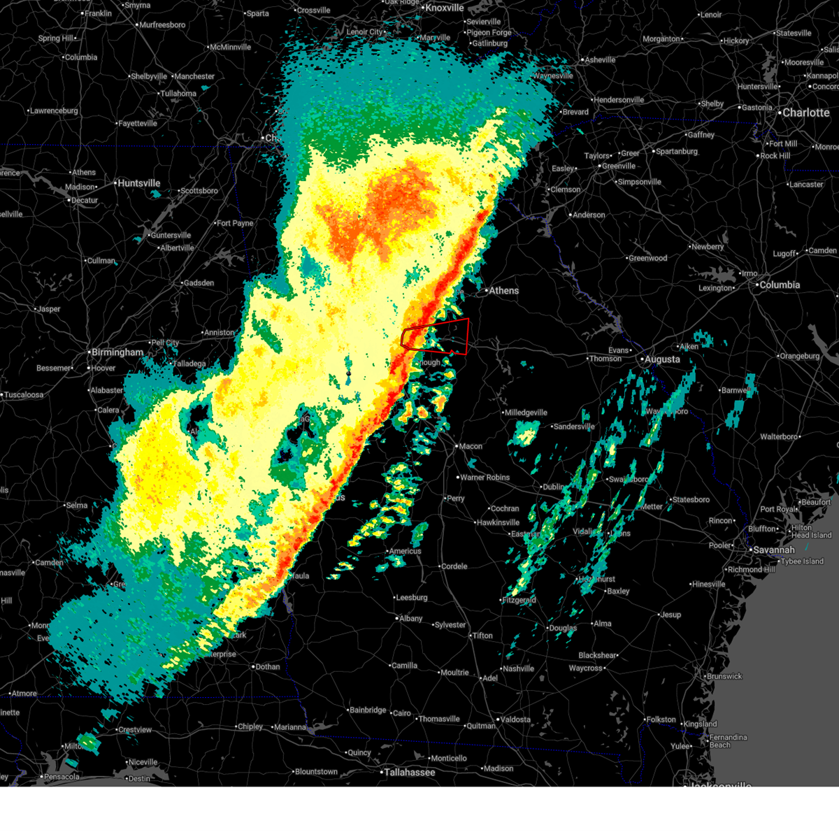
Hail Map for Mansfield, GA
The Mansfield, GA area has had 1 report of on-the-ground hail by trained spotters, and has been under severe weather warnings 18 times during the past 12 months. Doppler radar has detected hail at or near Mansfield, GA on 38 occasions, including 2 occasions during the past year.
| Name: | Mansfield, GA |
| Where Located: | 41 miles ESE of Atlanta, GA |
| Map: | Google Map for Mansfield, GA |
| Population: | 410 |
| Housing Units: | 159 |
| More Info: | Search Google for Mansfield, GA |
3
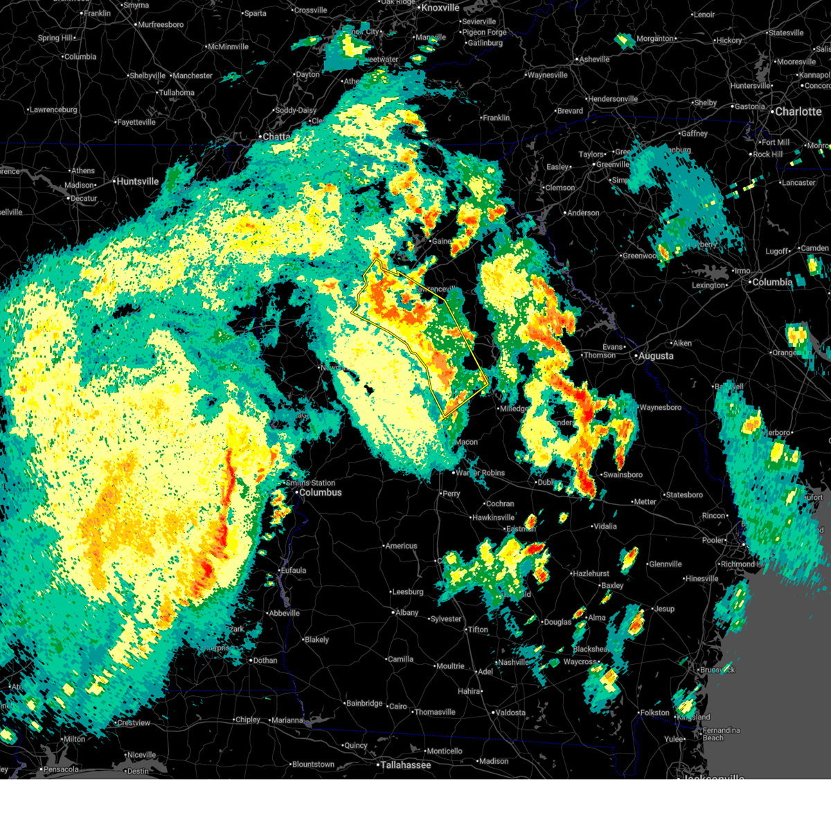
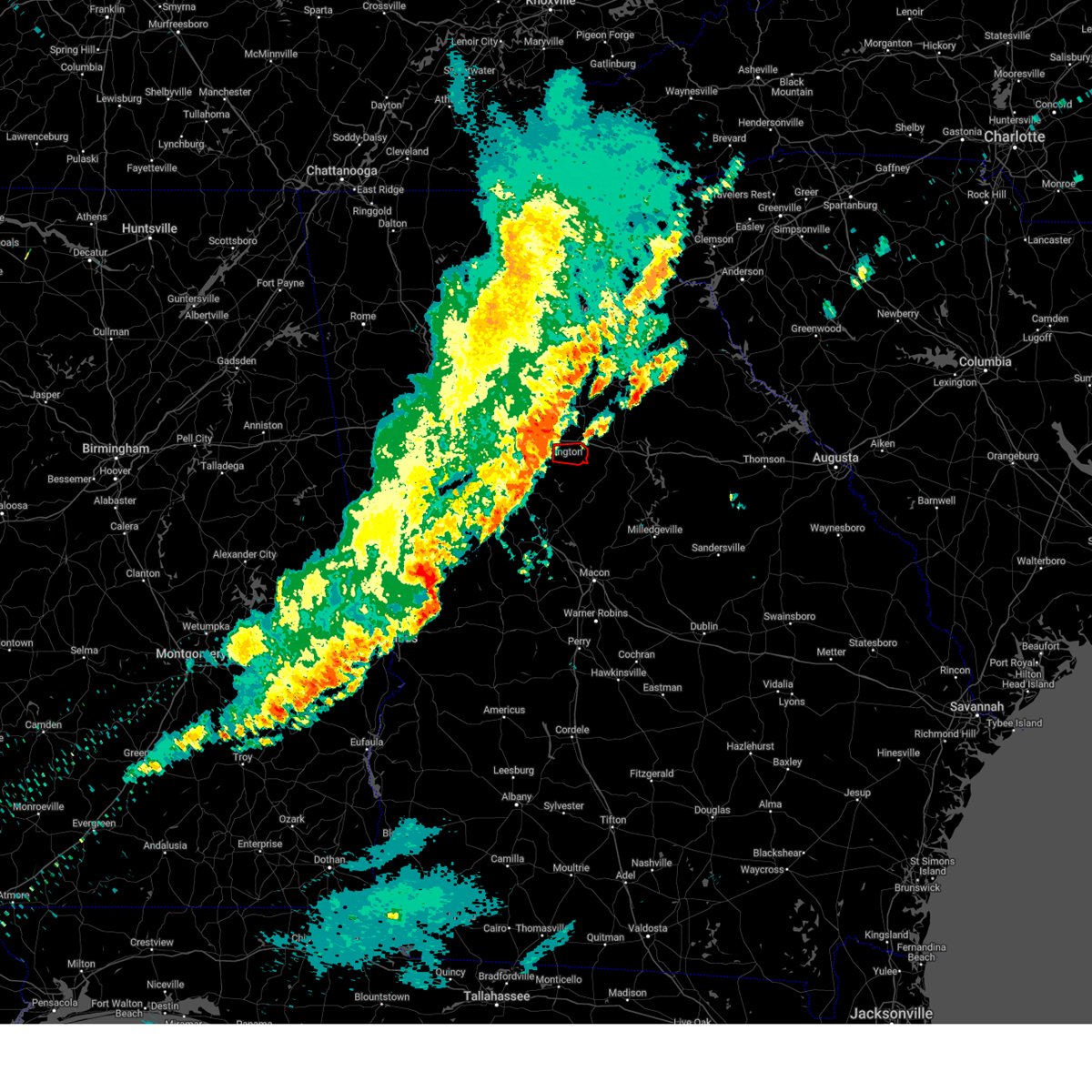
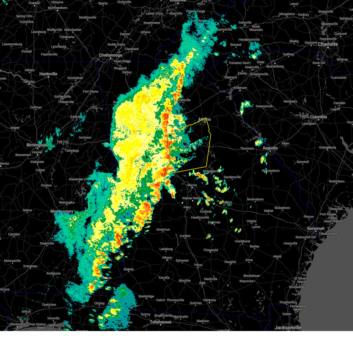
The Top Recent Hail Date for Mansfield, GA is Saturday, November 8, 2025 (6th out of 38)
Hail and Wind Damage Spotted near Mansfield, GA
| Date / Time | Report Details |
|---|---|
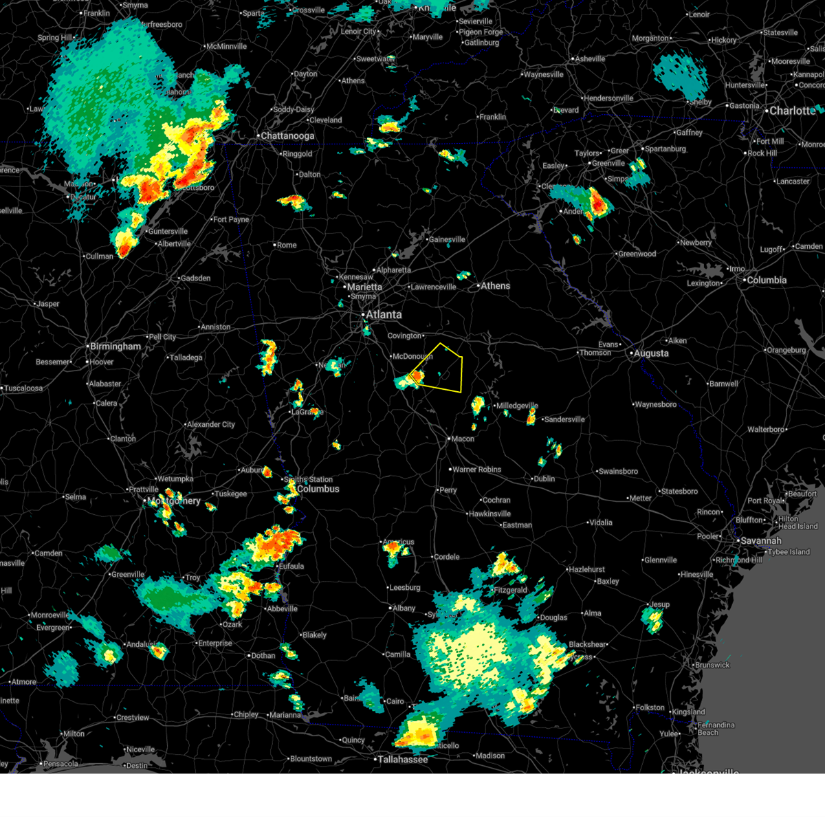
| 7/10/2026 5:27 PM EDT |
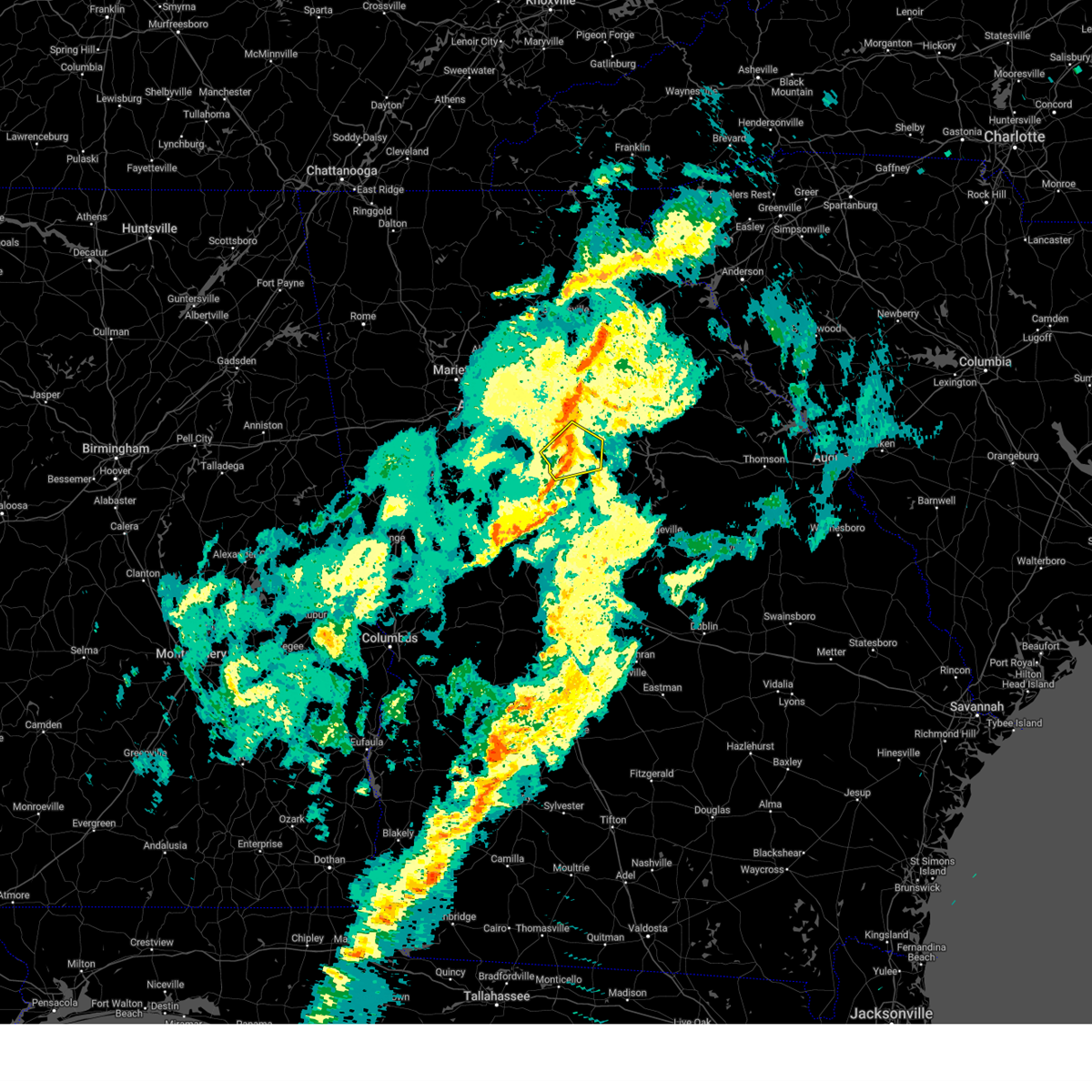
 Svrffc the national weather service in peachtree city has issued a * severe thunderstorm warning for, morgan county in north central georgia, northwestern putnam county in central georgia, northwestern greene county in east central georgia, northern jasper county in central georgia, southeastern newton county in north central georgia, * until 600 pm edt. * at 527 pm edt, severe thunderstorms were located along a line extending from near apalachee to near mansfield, moving east at 25 mph (radar indicated). Hazards include 60 mph wind gusts. expect damage to roofs, siding, and trees Svrffc the national weather service in peachtree city has issued a * severe thunderstorm warning for, morgan county in north central georgia, northwestern putnam county in central georgia, northwestern greene county in east central georgia, northern jasper county in central georgia, southeastern newton county in north central georgia, * until 600 pm edt. * at 527 pm edt, severe thunderstorms were located along a line extending from near apalachee to near mansfield, moving east at 25 mph (radar indicated). Hazards include 60 mph wind gusts. expect damage to roofs, siding, and trees
|
| 6/22/2026 5:47 PM EDT |
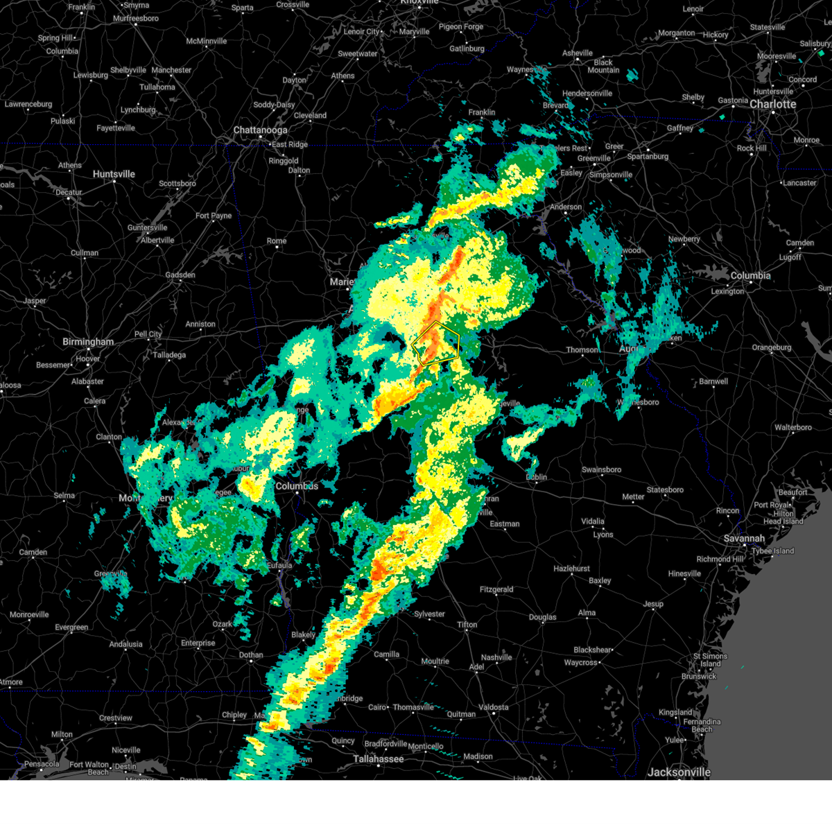
 At 547 pm edt, a severe thunderstorm was located near eudora, or near monticello, moving east at 40 mph (radar indicated). Hazards include 60 mph wind gusts. Expect damage to roofs, siding, and trees. Locations impacted include, jackson, monticello, newborn, flovilla, mansfield, shady dale, turtle cove, calvin, farrar, eudora, north alcovy, mcelheneys crossroads, adgateville, and stark. At 547 pm edt, a severe thunderstorm was located near eudora, or near monticello, moving east at 40 mph (radar indicated). Hazards include 60 mph wind gusts. Expect damage to roofs, siding, and trees. Locations impacted include, jackson, monticello, newborn, flovilla, mansfield, shady dale, turtle cove, calvin, farrar, eudora, north alcovy, mcelheneys crossroads, adgateville, and stark.
|
| 6/22/2026 5:26 PM EDT |
 Svrffc the national weather service in peachtree city has issued a * severe thunderstorm warning for, east central spalding county in west central georgia, southwestern putnam county in central georgia, butts county in central georgia, jasper county in central georgia, southeastern newton county in north central georgia, * until 615 pm edt. * at 526 pm edt, a severe thunderstorm was located over jackson, moving east at 40 mph (radar indicated). Hazards include 60 mph wind gusts. expect damage to roofs, siding, and trees Svrffc the national weather service in peachtree city has issued a * severe thunderstorm warning for, east central spalding county in west central georgia, southwestern putnam county in central georgia, butts county in central georgia, jasper county in central georgia, southeastern newton county in north central georgia, * until 615 pm edt. * at 526 pm edt, a severe thunderstorm was located over jackson, moving east at 40 mph (radar indicated). Hazards include 60 mph wind gusts. expect damage to roofs, siding, and trees
|
| 6/18/2026 5:11 PM EDT |
 At 510 pm edt, severe thunderstorms were located along a line extending from sandy springs to milstead to monticello, moving east at 55 mph (radar indicated). Hazards include 60 mph wind gusts. Expect damage to roofs, siding, and trees. Locations impacted include, atlanta, lawrenceville, decatur, conyers, monroe, covington, eatonton, madison, monticello, peachtree corners, sandy springs, roswell, johns creek, alpharetta, dunwoody, milton, duluth, snellville, suwanee, and lilburn. At 510 pm edt, severe thunderstorms were located along a line extending from sandy springs to milstead to monticello, moving east at 55 mph (radar indicated). Hazards include 60 mph wind gusts. Expect damage to roofs, siding, and trees. Locations impacted include, atlanta, lawrenceville, decatur, conyers, monroe, covington, eatonton, madison, monticello, peachtree corners, sandy springs, roswell, johns creek, alpharetta, dunwoody, milton, duluth, snellville, suwanee, and lilburn.
|
| 6/18/2026 4:47 PM EDT |
 Svrffc the national weather service in peachtree city has issued a * severe thunderstorm warning for, dekalb county in north central georgia, gwinnett county in north central georgia, northeastern monroe county in central georgia, butts county in central georgia, northwestern jones county in central georgia, newton county in north central georgia, rockdale county in north central georgia, southwestern morgan county in north central georgia, western putnam county in central georgia, southeastern cobb county in north central georgia, central henry county in north central georgia, walton county in north central georgia, northern clayton county in north central georgia, central fulton county in north central georgia, jasper county in central georgia, * until 530 pm edt. * at 446 pm edt, severe thunderstorms were located along a line extending from sandtown to flippen to near forsyth, moving northeast at 45 mph (radar indicated). Hazards include 60 mph wind gusts. expect damage to roofs, siding, and trees Svrffc the national weather service in peachtree city has issued a * severe thunderstorm warning for, dekalb county in north central georgia, gwinnett county in north central georgia, northeastern monroe county in central georgia, butts county in central georgia, northwestern jones county in central georgia, newton county in north central georgia, rockdale county in north central georgia, southwestern morgan county in north central georgia, western putnam county in central georgia, southeastern cobb county in north central georgia, central henry county in north central georgia, walton county in north central georgia, northern clayton county in north central georgia, central fulton county in north central georgia, jasper county in central georgia, * until 530 pm edt. * at 446 pm edt, severe thunderstorms were located along a line extending from sandtown to flippen to near forsyth, moving northeast at 45 mph (radar indicated). Hazards include 60 mph wind gusts. expect damage to roofs, siding, and trees
|
| 6/18/2026 3:54 PM EDT |
 Svrffc the national weather service in peachtree city has issued a * severe thunderstorm warning for, southeastern oconee county in northeastern georgia, northwestern baldwin county in central georgia, morgan county in north central georgia, putnam county in central georgia, northwestern hancock county in east central georgia, western greene county in east central georgia, jones county in central georgia, jasper county in central georgia, southeastern newton county in north central georgia, * until 445 pm edt. * at 353 pm edt, severe thunderstorms were located along a line extending from near calvin to near postell, moving northeast at 30 mph (radar indicated). Hazards include 60 mph wind gusts. expect damage to roofs, siding, and trees Svrffc the national weather service in peachtree city has issued a * severe thunderstorm warning for, southeastern oconee county in northeastern georgia, northwestern baldwin county in central georgia, morgan county in north central georgia, putnam county in central georgia, northwestern hancock county in east central georgia, western greene county in east central georgia, jones county in central georgia, jasper county in central georgia, southeastern newton county in north central georgia, * until 445 pm edt. * at 353 pm edt, severe thunderstorms were located along a line extending from near calvin to near postell, moving northeast at 30 mph (radar indicated). Hazards include 60 mph wind gusts. expect damage to roofs, siding, and trees
|
| 3/16/2026 7:45 AM EDT |
 The storms which prompted the warning have moved out of the area. therefore, the warning has been allowed to expire. a tornado watch remains in effect until 1000 am edt for central, north central, west central and east central georgia. to report severe weather, contact your nearest law enforcement agency. they will relay your report to the national weather service peachtree city. remember, a severe thunderstorm warning still remains in effect for portions of morgan, jasper, and monroe counties until 830 am edt. The storms which prompted the warning have moved out of the area. therefore, the warning has been allowed to expire. a tornado watch remains in effect until 1000 am edt for central, north central, west central and east central georgia. to report severe weather, contact your nearest law enforcement agency. they will relay your report to the national weather service peachtree city. remember, a severe thunderstorm warning still remains in effect for portions of morgan, jasper, and monroe counties until 830 am edt.
|
| 3/16/2026 7:21 AM EDT |
 The storms which prompted the warning have moved out of the area. therefore, the warning has been allowed to expire. a tornado watch remains in effect until 1000 am edt for central, north central and west central georgia. to report severe weather, contact your nearest law enforcement agency. they will relay your report to the national weather service peachtree city. remember, a severe thunderstorm warning still remains in effect for lamar, butts, and southeastern newtorn counties until 745 am edt. The storms which prompted the warning have moved out of the area. therefore, the warning has been allowed to expire. a tornado watch remains in effect until 1000 am edt for central, north central and west central georgia. to report severe weather, contact your nearest law enforcement agency. they will relay your report to the national weather service peachtree city. remember, a severe thunderstorm warning still remains in effect for lamar, butts, and southeastern newtorn counties until 745 am edt.
|
| 3/16/2026 7:16 AM EDT |
 The storms which prompted the warning have moved out of the area. therefore, the warning has been allowed to expire. a tornado watch remains in effect until 1000 am edt for central, north central and northeastern georgia. to report severe weather, contact your nearest law enforcement agency. they will relay your report to the national weather service peachtree city. remember, a severe thunderstorm warning still remains in effect for madison, clarke, oconee, and morgan counties until 745 am edt. The storms which prompted the warning have moved out of the area. therefore, the warning has been allowed to expire. a tornado watch remains in effect until 1000 am edt for central, north central and northeastern georgia. to report severe weather, contact your nearest law enforcement agency. they will relay your report to the national weather service peachtree city. remember, a severe thunderstorm warning still remains in effect for madison, clarke, oconee, and morgan counties until 745 am edt.
|
| 3/16/2026 7:10 AM EDT |
 Svrffc the national weather service in peachtree city has issued a * severe thunderstorm warning for, southern morgan county in north central georgia, northwestern putnam county in central georgia, northern monroe county in central georgia, butts county in central georgia, jasper county in central georgia, northeastern lamar county in west central georgia, southeastern newton county in north central georgia, * until 745 am edt. * at 710 am edt, severe thunderstorms were located along a line extending from newborn to near liberty hill, moving east at 35 mph (radar indicated). Hazards include 60 mph wind gusts. expect damage to roofs, siding, and trees Svrffc the national weather service in peachtree city has issued a * severe thunderstorm warning for, southern morgan county in north central georgia, northwestern putnam county in central georgia, northern monroe county in central georgia, butts county in central georgia, jasper county in central georgia, northeastern lamar county in west central georgia, southeastern newton county in north central georgia, * until 745 am edt. * at 710 am edt, severe thunderstorms were located along a line extending from newborn to near liberty hill, moving east at 35 mph (radar indicated). Hazards include 60 mph wind gusts. expect damage to roofs, siding, and trees
|
| 3/16/2026 6:41 AM EDT |
 At 640 am edt, severe thunderstorms were located along a line extending from maysville to near bethlehem to porterdale, moving east at 45 mph (radar indicated). Hazards include 60 mph wind gusts. Expect damage to roofs, siding, and trees. Locations impacted include, conyers, winder, monroe, covington, jefferson, commerce, watkinsville, athens, loganville, social circle, statham, oxford, maysville, arcade, nicholson, porterdale, hoschton, walnut grove, winterville, and bogart. At 640 am edt, severe thunderstorms were located along a line extending from maysville to near bethlehem to porterdale, moving east at 45 mph (radar indicated). Hazards include 60 mph wind gusts. Expect damage to roofs, siding, and trees. Locations impacted include, conyers, winder, monroe, covington, jefferson, commerce, watkinsville, athens, loganville, social circle, statham, oxford, maysville, arcade, nicholson, porterdale, hoschton, walnut grove, winterville, and bogart.
|
| 3/16/2026 6:41 AM EDT |
 the severe thunderstorm warning has been cancelled and is no longer in effect the severe thunderstorm warning has been cancelled and is no longer in effect
|
| 3/16/2026 6:35 AM EDT |
 Svrffc the national weather service in peachtree city has issued a * severe thunderstorm warning for, spalding county in west central georgia, southeastern fayette county in north central georgia, northeastern meriwether county in west central georgia, northern pike county in west central georgia, henry county in north central georgia, butts county in central georgia, northern lamar county in west central georgia, southern newton county in north central georgia, * until 715 am edt. * at 634 am edt, severe thunderstorms were located along a line extending from near flippen to gay, moving east at 45 mph (radar indicated). Hazards include 60 mph wind gusts. expect damage to roofs, siding, and trees Svrffc the national weather service in peachtree city has issued a * severe thunderstorm warning for, spalding county in west central georgia, southeastern fayette county in north central georgia, northeastern meriwether county in west central georgia, northern pike county in west central georgia, henry county in north central georgia, butts county in central georgia, northern lamar county in west central georgia, southern newton county in north central georgia, * until 715 am edt. * at 634 am edt, severe thunderstorms were located along a line extending from near flippen to gay, moving east at 45 mph (radar indicated). Hazards include 60 mph wind gusts. expect damage to roofs, siding, and trees
|
| 3/16/2026 6:27 AM EDT |
 Svrffc the national weather service in peachtree city has issued a * severe thunderstorm warning for, rockdale county in north central georgia, oconee county in northeastern georgia, barrow county in north central georgia, northwestern morgan county in north central georgia, southeastern gwinnett county in north central georgia, southern banks county in northeastern georgia, clarke county in northeastern georgia, walton county in north central georgia, southeastern hall county in north central georgia, jackson county in northeastern georgia, western madison county in northeastern georgia, newton county in north central georgia, * until 715 am edt. * at 627 am edt, severe thunderstorms were located along a line extending from near candler to near bold springs to near magnet, moving east at 45 mph (radar indicated). Hazards include 60 mph wind gusts. expect damage to roofs, siding, and trees Svrffc the national weather service in peachtree city has issued a * severe thunderstorm warning for, rockdale county in north central georgia, oconee county in northeastern georgia, barrow county in north central georgia, northwestern morgan county in north central georgia, southeastern gwinnett county in north central georgia, southern banks county in northeastern georgia, clarke county in northeastern georgia, walton county in north central georgia, southeastern hall county in north central georgia, jackson county in northeastern georgia, western madison county in northeastern georgia, newton county in north central georgia, * until 715 am edt. * at 627 am edt, severe thunderstorms were located along a line extending from near candler to near bold springs to near magnet, moving east at 45 mph (radar indicated). Hazards include 60 mph wind gusts. expect damage to roofs, siding, and trees
|
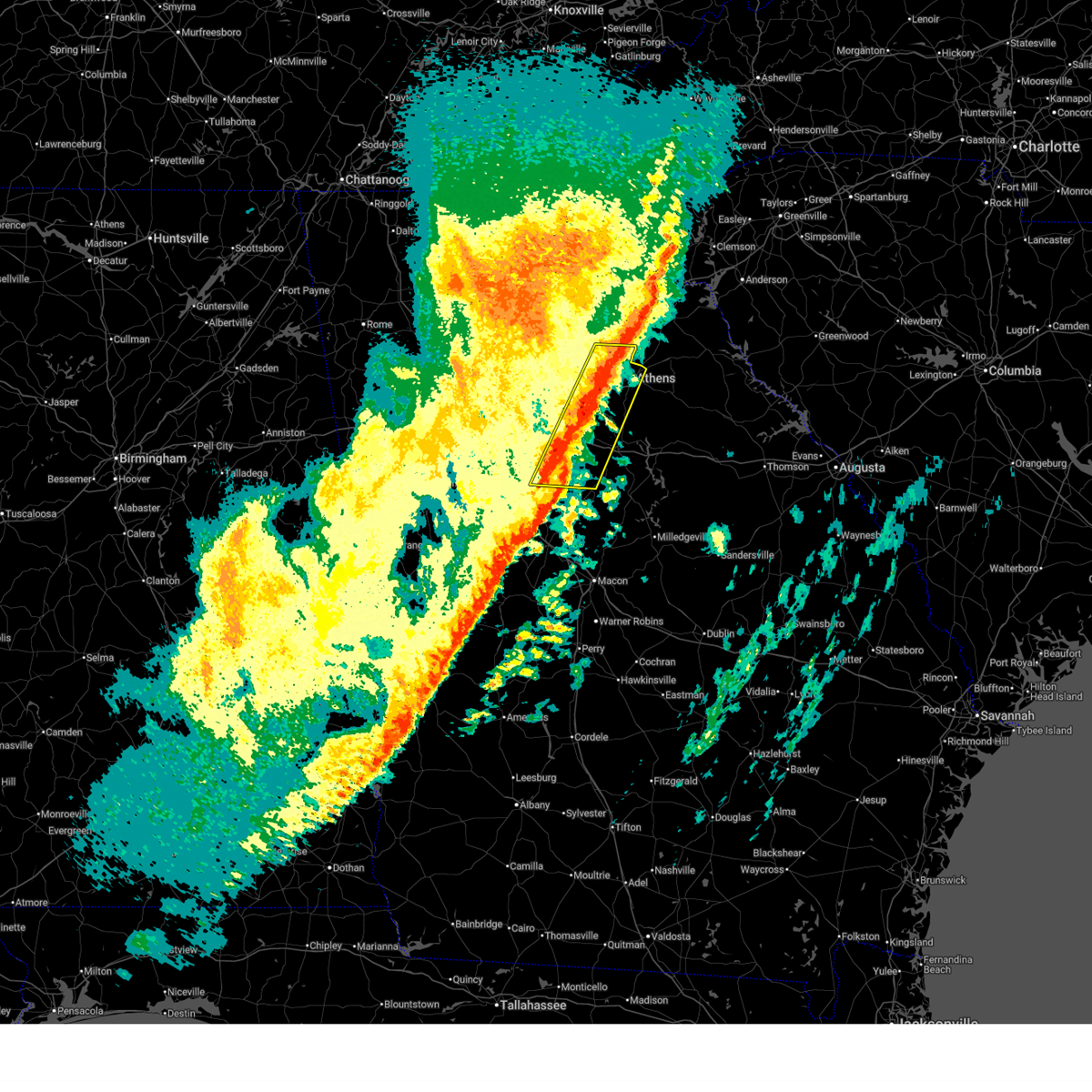
| 11/8/2025 5:22 PM EST | The storm which prompted the warning has moved out of the area. therefore, the warning will be allowed to expire. remember, a severe thunderstorm warning still remains in effect for southern morgan and northeastern jasper counties until 545 pm. |
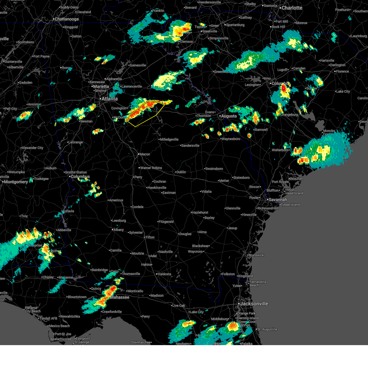
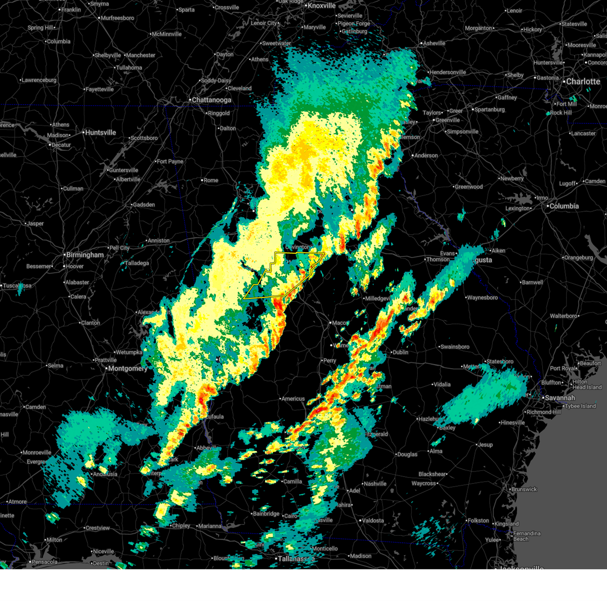
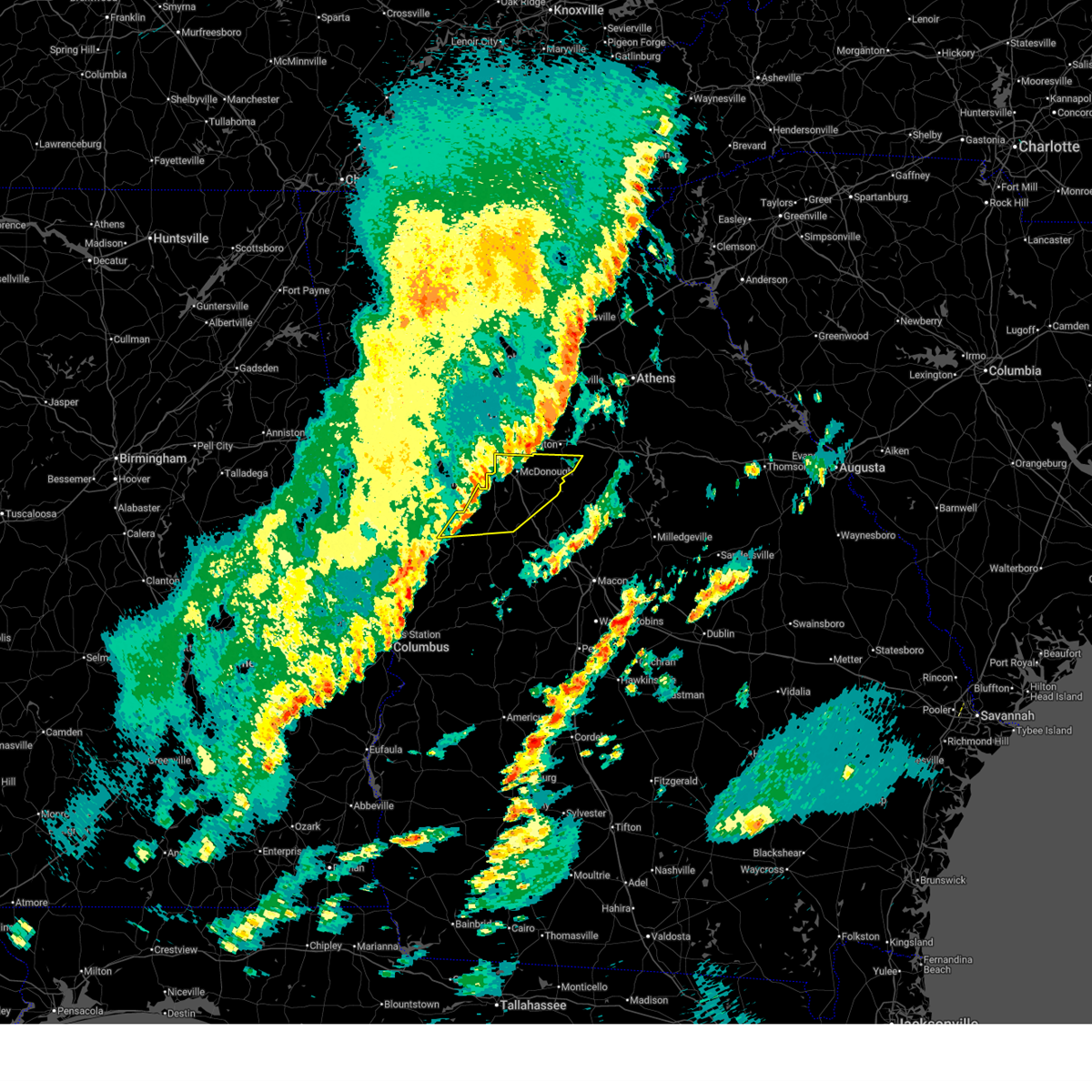
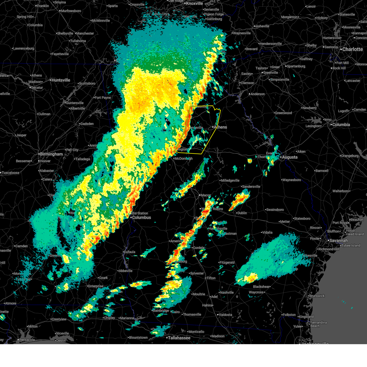
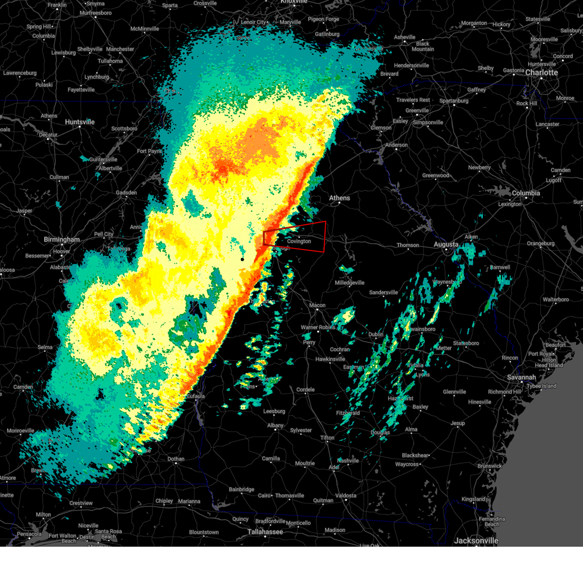
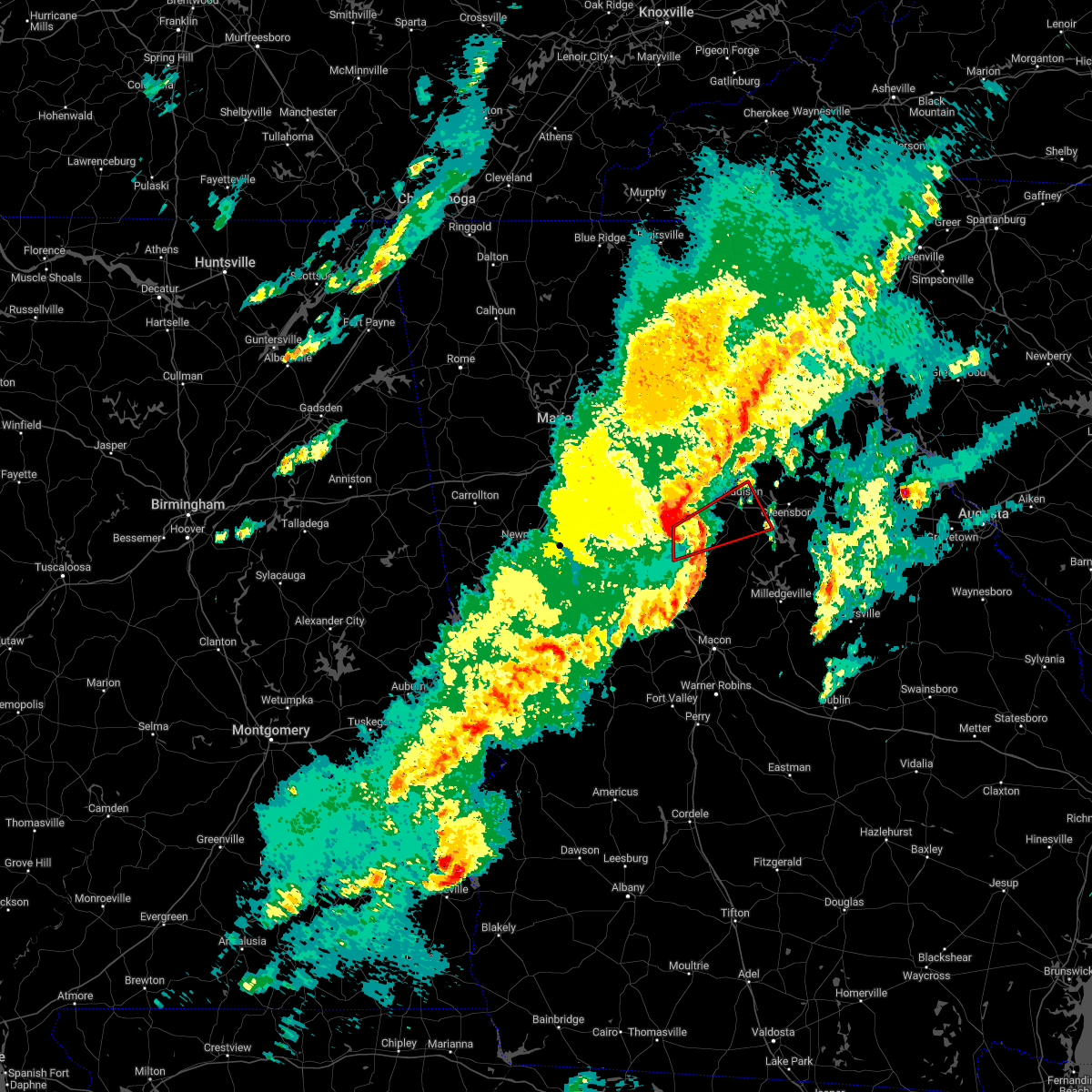
| 11/8/2025 5:06 PM EST | Svrffc the national weather service in peachtree city has issued a * severe thunderstorm warning for, southern morgan county in north central georgia, northwestern putnam county in central georgia, south central greene county in east central georgia, northeastern jasper county in central georgia, southeastern newton county in north central georgia, * until 545 pm est. * at 506 pm est, a severe thunderstorm was located over newborn, or 11 miles southeast of covington, moving east at 30 mph (radar indicated). Hazards include ping pong ball size hail and 60 mph wind gusts. People and animals outdoors will be injured. expect hail damage to roofs, siding, windows, and vehicles. Expect wind damage to roofs, siding, and trees. |
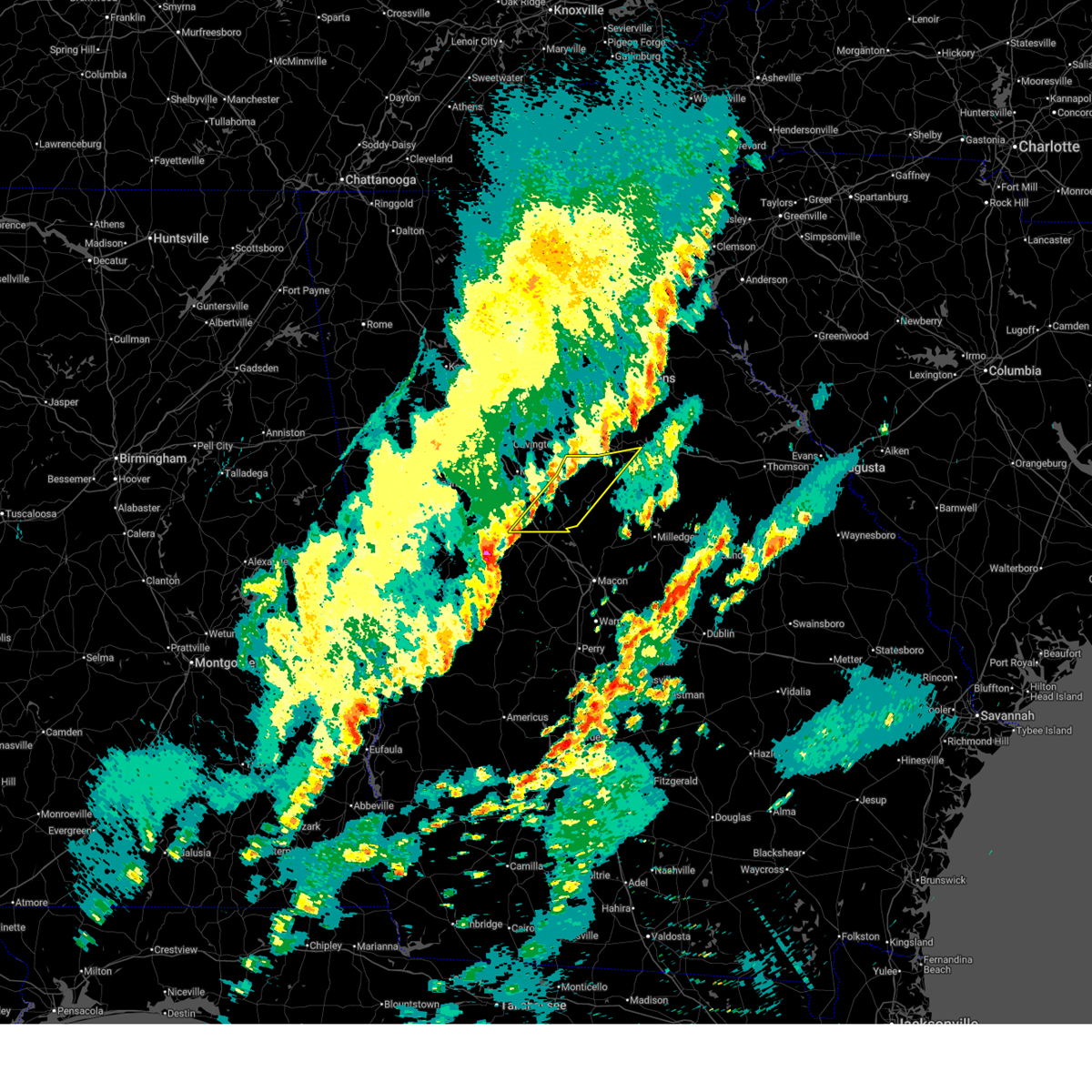
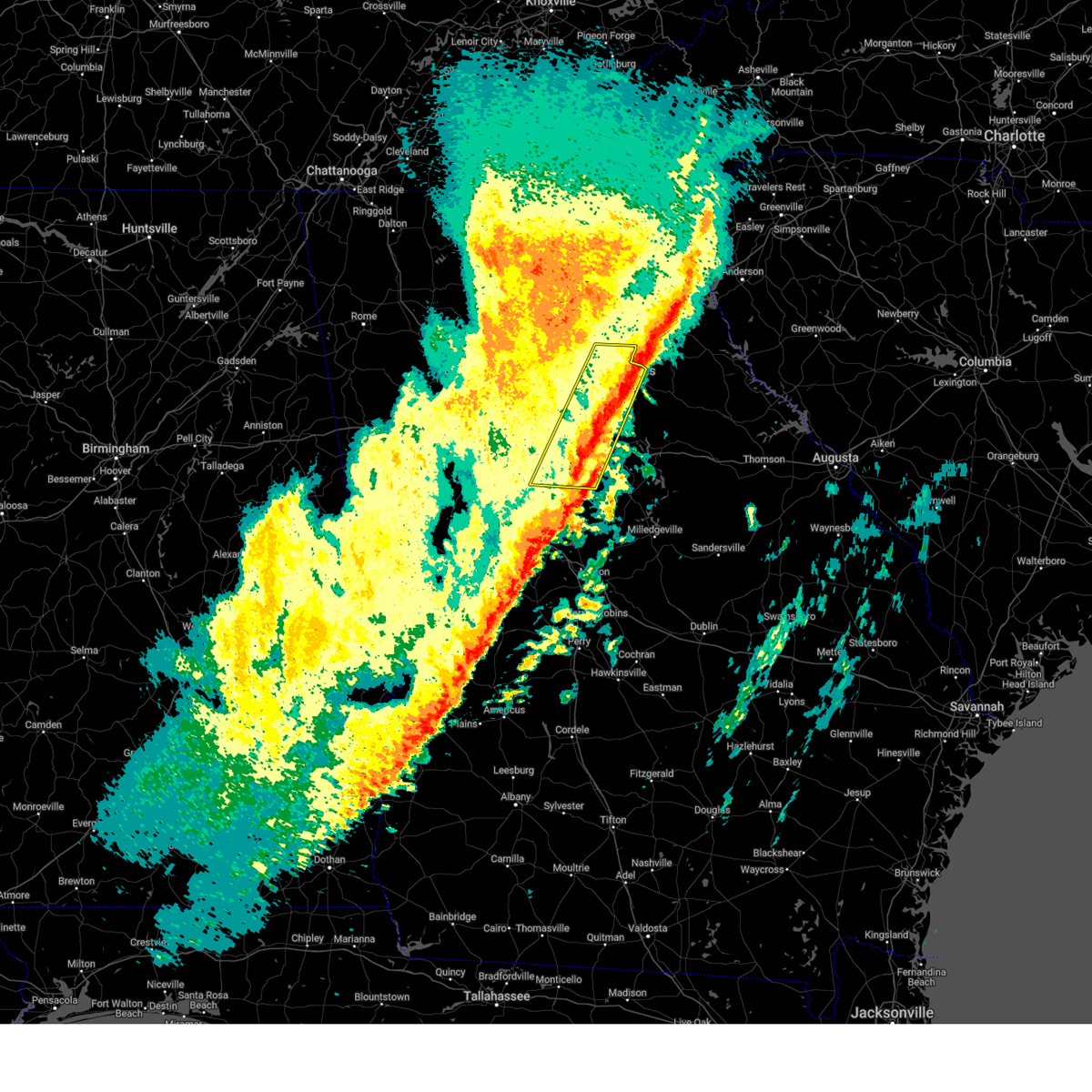
| 11/8/2025 4:57 PM EST | At 457 pm est, a severe thunderstorm was located over newborn, or 8 miles southeast of covington, moving east at 35 mph (radar indicated). Hazards include 60 mph wind gusts and quarter size hail. Hail damage to vehicles is expected. expect wind damage to roofs, siding, and trees. Locations impacted include, covington, madison, social circle, rutledge, newborn, mansfield, farrar, starrsville, hard labor creek state park, and brick store. |
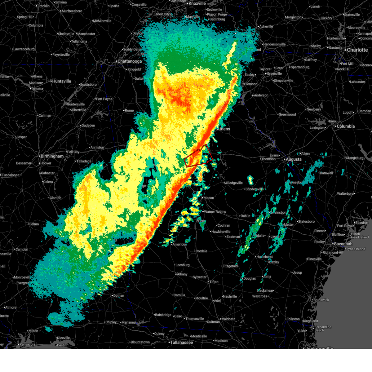
| 11/8/2025 4:41 PM EST | Svrffc the national weather service in peachtree city has issued a * severe thunderstorm warning for, southwestern morgan county in north central georgia, south central walton county in north central georgia, north central jasper county in central georgia, newton county in north central georgia, * until 530 pm est. * at 441 pm est, a severe thunderstorm was located over porterdale, or near covington, moving east at 35 mph (radar indicated). Hazards include 60 mph wind gusts and quarter size hail. Hail damage to vehicles is expected. Expect wind damage to roofs, siding, and trees. |
| 6/8/2025 8:07 AM EDT |
 At 807 am edt, a severe thunderstorm was located over hard labor creek state park, or 8 miles northwest of madison, moving east at 50 mph (radar indicated). Hazards include 60 mph wind gusts. Expect damage to roofs, siding, and trees. Locations impacted include, monroe, covington, madison, social circle, rutledge, newborn, mansfield, bostwick, good hope, jersey, ebenezer, starrsville, hard labor creek state park, brick store, pannell, herndonville, and apalachee. At 807 am edt, a severe thunderstorm was located over hard labor creek state park, or 8 miles northwest of madison, moving east at 50 mph (radar indicated). Hazards include 60 mph wind gusts. Expect damage to roofs, siding, and trees. Locations impacted include, monroe, covington, madison, social circle, rutledge, newborn, mansfield, bostwick, good hope, jersey, ebenezer, starrsville, hard labor creek state park, brick store, pannell, herndonville, and apalachee.
|
| 6/8/2025 8:07 AM EDT |
 the severe thunderstorm warning has been cancelled and is no longer in effect the severe thunderstorm warning has been cancelled and is no longer in effect
|
| 6/8/2025 8:00 AM EDT | the severe thunderstorm warning has been cancelled and is no longer in effect |
| 6/8/2025 8:00 AM EDT | At 759 am edt, a severe thunderstorm was located over social circle, or 8 miles east of covington, moving east at 50 mph (radar indicated). Hazards include 60 mph wind gusts. Expect damage to roofs, siding, and trees. Locations impacted include, conyers, monroe, covington, madison, social circle, oxford, porterdale, walnut grove, rutledge, newborn, mansfield, bostwick, good hope, jersey, georgia international horse park, ebenezer, almon, starrsville, hard labor creek state park, and brick store. |
| 6/8/2025 7:40 AM EDT |
 Svrffc the national weather service in peachtree city has issued a * severe thunderstorm warning for, rockdale county in north central georgia, south central oconee county in northeastern georgia, southeastern dekalb county in north central georgia, morgan county in north central georgia, north central henry county in north central georgia, southern walton county in north central georgia, newton county in north central georgia, * until 830 am edt. * at 739 am edt, a severe thunderstorm was located over conyers, moving east at 50 mph (radar indicated). Hazards include 60 mph wind gusts. expect damage to roofs, siding, and trees Svrffc the national weather service in peachtree city has issued a * severe thunderstorm warning for, rockdale county in north central georgia, south central oconee county in northeastern georgia, southeastern dekalb county in north central georgia, morgan county in north central georgia, north central henry county in north central georgia, southern walton county in north central georgia, newton county in north central georgia, * until 830 am edt. * at 739 am edt, a severe thunderstorm was located over conyers, moving east at 50 mph (radar indicated). Hazards include 60 mph wind gusts. expect damage to roofs, siding, and trees
|
| 5/3/2025 9:26 PM EDT |
 At 926 pm edt, a severe thunderstorm capable of producing a tornado was located over starrsville, or near covington, moving east at 30 mph (radar indicated rotation). Hazards include tornado. Flying debris will be dangerous to those caught without shelter. mobile homes will be damaged or destroyed. damage to roofs, windows, and vehicles will occur. tree damage is likely. Locations impacted include, covington, newborn, mansfield, and starrsville. At 926 pm edt, a severe thunderstorm capable of producing a tornado was located over starrsville, or near covington, moving east at 30 mph (radar indicated rotation). Hazards include tornado. Flying debris will be dangerous to those caught without shelter. mobile homes will be damaged or destroyed. damage to roofs, windows, and vehicles will occur. tree damage is likely. Locations impacted include, covington, newborn, mansfield, and starrsville.
|
| 5/3/2025 9:18 PM EDT |
 Torffc the national weather service in peachtree city has issued a * tornado warning for, east central newton county in north central georgia, * until 945 pm edt. * at 918 pm edt, a severe thunderstorm capable of producing a tornado was located over porterdale, or near covington, moving east at 30 mph (radar indicated rotation). Hazards include tornado. Flying debris will be dangerous to those caught without shelter. mobile homes will be damaged or destroyed. damage to roofs, windows, and vehicles will occur. Tree damage is likely. Torffc the national weather service in peachtree city has issued a * tornado warning for, east central newton county in north central georgia, * until 945 pm edt. * at 918 pm edt, a severe thunderstorm capable of producing a tornado was located over porterdale, or near covington, moving east at 30 mph (radar indicated rotation). Hazards include tornado. Flying debris will be dangerous to those caught without shelter. mobile homes will be damaged or destroyed. damage to roofs, windows, and vehicles will occur. Tree damage is likely.
|
| 4/7/2025 8:41 AM EDT |
 The storm which prompted the warning has moved out of the area. therefore, the warning will be allowed to expire. however, gusty winds are still possible with this thunderstorm. The storm which prompted the warning has moved out of the area. therefore, the warning will be allowed to expire. however, gusty winds are still possible with this thunderstorm.
|
| 4/7/2025 8:32 AM EDT |
 At 832 am edt, a severe thunderstorm was located over rutledge, or 7 miles west of madison, moving northeast at 45 mph (radar indicated). Hazards include 60 mph wind gusts. Expect damage to roofs, siding, and trees. Locations impacted include, mansfield, social circle, newborn, farrar, rutledge, and brick store. At 832 am edt, a severe thunderstorm was located over rutledge, or 7 miles west of madison, moving northeast at 45 mph (radar indicated). Hazards include 60 mph wind gusts. Expect damage to roofs, siding, and trees. Locations impacted include, mansfield, social circle, newborn, farrar, rutledge, and brick store.
|
| 4/7/2025 8:11 AM EDT |
 the severe thunderstorm warning has been cancelled and is no longer in effect the severe thunderstorm warning has been cancelled and is no longer in effect
|
| 4/7/2025 8:11 AM EDT |
 At 810 am edt, a severe thunderstorm was located near rocky plains, or near covington, moving northeast at 45 mph (radar indicated). Hazards include 60 mph wind gusts. Expect damage to roofs, siding, and trees. Locations impacted include, mansfield, porterdale, starrsville, brick store, covington, stewart, newborn, farrar, rutledge, north alcovy, social circle, oxford, and rocky plains. At 810 am edt, a severe thunderstorm was located near rocky plains, or near covington, moving northeast at 45 mph (radar indicated). Hazards include 60 mph wind gusts. Expect damage to roofs, siding, and trees. Locations impacted include, mansfield, porterdale, starrsville, brick store, covington, stewart, newborn, farrar, rutledge, north alcovy, social circle, oxford, and rocky plains.
|
| 4/7/2025 8:02 AM EDT | Svrffc the national weather service in peachtree city has issued a * severe thunderstorm warning for, southwestern morgan county in north central georgia, east central henry county in north central georgia, south central walton county in north central georgia, north central butts county in central georgia, northwestern jasper county in central georgia, newton county in north central georgia, * until 845 am edt. * at 802 am edt, a severe thunderstorm was located near rocky plains, or 11 miles east of mcdonough, moving northeast at 45 mph (radar indicated). Hazards include 60 mph wind gusts. expect damage to roofs, siding, and trees |
| 3/31/2025 1:38 PM EDT |
 At 138 pm edt, severe thunderstorms were located along a line extending from youth to near starrsville to near berner, moving east at 55 mph (radar indicated). Hazards include 60 mph wind gusts. Expect damage to roofs, siding, and trees. Locations impacted include, beechwood hills, turtle cove, oconee heights, eastville, nicholasville, jackson, big haynes creek park, greshamville, barretts mill, covington, eudora, mcelheneys crossroads, jersey, watkinsville, whitehall, james holland youth sports cmpx, ebenezer, harmony, almon, and between. At 138 pm edt, severe thunderstorms were located along a line extending from youth to near starrsville to near berner, moving east at 55 mph (radar indicated). Hazards include 60 mph wind gusts. Expect damage to roofs, siding, and trees. Locations impacted include, beechwood hills, turtle cove, oconee heights, eastville, nicholasville, jackson, big haynes creek park, greshamville, barretts mill, covington, eudora, mcelheneys crossroads, jersey, watkinsville, whitehall, james holland youth sports cmpx, ebenezer, harmony, almon, and between.
|
| 3/31/2025 1:38 PM EDT |
 the severe thunderstorm warning has been cancelled and is no longer in effect the severe thunderstorm warning has been cancelled and is no longer in effect
|
| 3/31/2025 1:23 PM EDT |
 Svrffc the national weather service in peachtree city has issued a * severe thunderstorm warning for, southeastern dekalb county in north central georgia, clarke county in northeastern georgia, northwestern monroe county in central georgia, butts county in central georgia, newton county in north central georgia, rockdale county in north central georgia, oconee county in northeastern georgia, morgan county in north central georgia, putnam county in central georgia, southeastern henry county in north central georgia, walton county in north central georgia, northwestern greene county in east central georgia, jasper county in central georgia, northeastern lamar county in west central georgia, * until 215 pm edt. * at 123 pm edt, severe thunderstorms were located along a line extending from near lithonia to oak hill to jenkinsburg, moving east at 65 mph (radar indicated). Hazards include 60 mph wind gusts. expect damage to roofs, siding, and trees Svrffc the national weather service in peachtree city has issued a * severe thunderstorm warning for, southeastern dekalb county in north central georgia, clarke county in northeastern georgia, northwestern monroe county in central georgia, butts county in central georgia, newton county in north central georgia, rockdale county in north central georgia, oconee county in northeastern georgia, morgan county in north central georgia, putnam county in central georgia, southeastern henry county in north central georgia, walton county in north central georgia, northwestern greene county in east central georgia, jasper county in central georgia, northeastern lamar county in west central georgia, * until 215 pm edt. * at 123 pm edt, severe thunderstorms were located along a line extending from near lithonia to oak hill to jenkinsburg, moving east at 65 mph (radar indicated). Hazards include 60 mph wind gusts. expect damage to roofs, siding, and trees
|
| 2/16/2025 5:29 AM EST |
 The storms which prompted the warning have moved out of the area. therefore, the warning will be allowed to expire. a tornado watch remains in effect until 900 am est for central and north central georgia. remember, a severe thunderstorm warning still remains in effect for clarke, oconee, morgan, and jasper counties. The storms which prompted the warning have moved out of the area. therefore, the warning will be allowed to expire. a tornado watch remains in effect until 900 am est for central and north central georgia. remember, a severe thunderstorm warning still remains in effect for clarke, oconee, morgan, and jasper counties.
|
| 2/16/2025 5:23 AM EST |
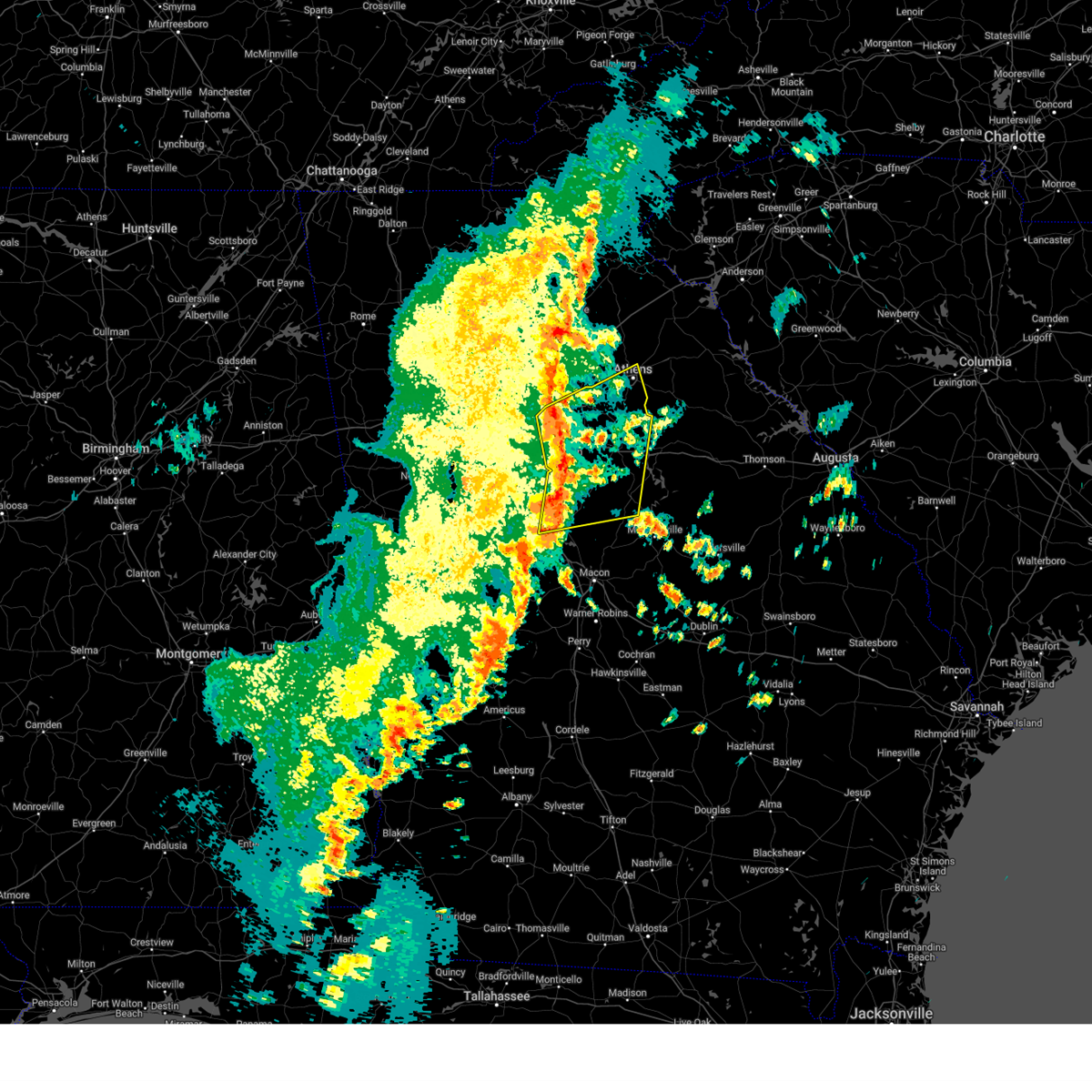
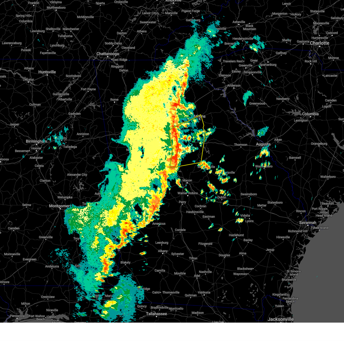
 At 523 am est, a confirmed tornado was located over north alcovy, or 11 miles northwest of monticello, moving northeast at 65 mph (radar confirmed tornado). Hazards include damaging tornado. Flying debris will be dangerous to those caught without shelter. mobile homes will be damaged or destroyed. damage to roofs, windows, and vehicles will occur. tree damage is likely. Locations impacted include, madison, rutledge, newborn, mansfield, shady dale, stewart, turtle cove, worthville, godfrey, starrsville, hard labor creek state park, brick store, calvin, farrar, eudora, north alcovy, fincherville, and rocky plains. At 523 am est, a confirmed tornado was located over north alcovy, or 11 miles northwest of monticello, moving northeast at 65 mph (radar confirmed tornado). Hazards include damaging tornado. Flying debris will be dangerous to those caught without shelter. mobile homes will be damaged or destroyed. damage to roofs, windows, and vehicles will occur. tree damage is likely. Locations impacted include, madison, rutledge, newborn, mansfield, shady dale, stewart, turtle cove, worthville, godfrey, starrsville, hard labor creek state park, brick store, calvin, farrar, eudora, north alcovy, fincherville, and rocky plains.
|
| 2/16/2025 5:20 AM EST |
 At 519 am est, a severe thunderstorm capable of producing a tornado was located over stewart, or 9 miles northeast of jackson, moving east at 65 mph (radar indicated rotation). Hazards include tornado. Flying debris will be dangerous to those caught without shelter. mobile homes will be damaged or destroyed. damage to roofs, windows, and vehicles will occur. tree damage is likely. Locations impacted include, madison, rutledge, newborn, mansfield, shady dale, stewart, turtle cove, worthville, godfrey, starrsville, hard labor creek state park, brick store, calvin, farrar, eudora, north alcovy, fincherville, and rocky plains. At 519 am est, a severe thunderstorm capable of producing a tornado was located over stewart, or 9 miles northeast of jackson, moving east at 65 mph (radar indicated rotation). Hazards include tornado. Flying debris will be dangerous to those caught without shelter. mobile homes will be damaged or destroyed. damage to roofs, windows, and vehicles will occur. tree damage is likely. Locations impacted include, madison, rutledge, newborn, mansfield, shady dale, stewart, turtle cove, worthville, godfrey, starrsville, hard labor creek state park, brick store, calvin, farrar, eudora, north alcovy, fincherville, and rocky plains.
|
| 2/16/2025 5:18 AM EST |
 the severe thunderstorm warning has been cancelled and is no longer in effect the severe thunderstorm warning has been cancelled and is no longer in effect
|
| 2/16/2025 5:18 AM EST |
 At 518 am est, severe thunderstorms were located along a line extending from near neese to turtle cove, moving east at 65 mph (radar indicated). Hazards include 60 mph wind gusts. Expect damage to roofs, siding, and trees. Locations impacted include, winder, monroe, covington, jefferson, watkinsville, athens, social circle, statham, oxford, arcade, nicholson, porterdale, walnut grove, bogart, rutledge, newborn, north high shoals, bethlehem, mansfield, and bostwick. At 518 am est, severe thunderstorms were located along a line extending from near neese to turtle cove, moving east at 65 mph (radar indicated). Hazards include 60 mph wind gusts. Expect damage to roofs, siding, and trees. Locations impacted include, winder, monroe, covington, jefferson, watkinsville, athens, social circle, statham, oxford, arcade, nicholson, porterdale, walnut grove, bogart, rutledge, newborn, north high shoals, bethlehem, mansfield, and bostwick.
|
| 2/16/2025 5:16 AM EST |
 Svrffc the national weather service in peachtree city has issued a * severe thunderstorm warning for, north central hancock county in east central georgia, clarke county in northeastern georgia, taliaferro county in east central georgia, southeastern jackson county in northeastern georgia, western wilkes county in east central georgia, madison county in northeastern georgia, southeastern newton county in north central georgia, oconee county in northeastern georgia, morgan county in north central georgia, northern putnam county in central georgia, southeastern banks county in northeastern georgia, eastern walton county in north central georgia, greene county in east central georgia, oglethorpe county in northeastern georgia, northern jasper county in central georgia, * until 600 am est. * at 516 am est, severe thunderstorms were located along a line extending from near westgate park to turtle cove, moving east at 60 mph (radar indicated). Hazards include 60 mph wind gusts. expect damage to roofs, siding, and trees Svrffc the national weather service in peachtree city has issued a * severe thunderstorm warning for, north central hancock county in east central georgia, clarke county in northeastern georgia, taliaferro county in east central georgia, southeastern jackson county in northeastern georgia, western wilkes county in east central georgia, madison county in northeastern georgia, southeastern newton county in north central georgia, oconee county in northeastern georgia, morgan county in north central georgia, northern putnam county in central georgia, southeastern banks county in northeastern georgia, eastern walton county in north central georgia, greene county in east central georgia, oglethorpe county in northeastern georgia, northern jasper county in central georgia, * until 600 am est. * at 516 am est, severe thunderstorms were located along a line extending from near westgate park to turtle cove, moving east at 60 mph (radar indicated). Hazards include 60 mph wind gusts. expect damage to roofs, siding, and trees
|
| 2/16/2025 5:14 AM EST |
 The tornado threat has diminished and the tornado warning has been cancelled. however, large hail and damaging winds remain likely and a severe thunderstorm warning remains in effect for the area. a tornado watch remains in effect until 900 am est for central and north central georgia. remember, a tornado warning still remains in effect for southern newton and western morgan counties. The tornado threat has diminished and the tornado warning has been cancelled. however, large hail and damaging winds remain likely and a severe thunderstorm warning remains in effect for the area. a tornado watch remains in effect until 900 am est for central and north central georgia. remember, a tornado warning still remains in effect for southern newton and western morgan counties.
|
| 2/16/2025 5:07 AM EST |
 Torffc the national weather service in peachtree city has issued a * tornado warning for, southwestern morgan county in north central georgia, southeastern henry county in north central georgia, central butts county in central georgia, northern jasper county in central georgia, southeastern newton county in north central georgia, * until 545 am est. * at 507 am est, a severe thunderstorm capable of producing a tornado was located over locust grove, or 8 miles west of jackson, moving northeast at 65 mph (radar indicated rotation). Hazards include tornado. Flying debris will be dangerous to those caught without shelter. mobile homes will be damaged or destroyed. damage to roofs, windows, and vehicles will occur. Tree damage is likely. Torffc the national weather service in peachtree city has issued a * tornado warning for, southwestern morgan county in north central georgia, southeastern henry county in north central georgia, central butts county in central georgia, northern jasper county in central georgia, southeastern newton county in north central georgia, * until 545 am est. * at 507 am est, a severe thunderstorm capable of producing a tornado was located over locust grove, or 8 miles west of jackson, moving northeast at 65 mph (radar indicated rotation). Hazards include tornado. Flying debris will be dangerous to those caught without shelter. mobile homes will be damaged or destroyed. damage to roofs, windows, and vehicles will occur. Tree damage is likely.
|
| 2/16/2025 5:05 AM EST |
 the tornado warning has been cancelled and is no longer in effect the tornado warning has been cancelled and is no longer in effect
|
| 2/16/2025 5:05 AM EST |
 At 505 am est, a severe thunderstorm capable of producing a tornado was located over oak hill, or 8 miles southwest of covington, moving east at 65 mph (radar indicated rotation). Hazards include tornado. Flying debris will be dangerous to those caught without shelter. mobile homes will be damaged or destroyed. damage to roofs, windows, and vehicles will occur. tree damage is likely. Locations impacted include, conyers, covington, social circle, oxford, porterdale, rutledge, newborn, mansfield, jersey, georgia international horse park, ebenezer, magnet, almon, milstead, starrsville, hard labor creek state park, brick store, herndonville, and oak hill. At 505 am est, a severe thunderstorm capable of producing a tornado was located over oak hill, or 8 miles southwest of covington, moving east at 65 mph (radar indicated rotation). Hazards include tornado. Flying debris will be dangerous to those caught without shelter. mobile homes will be damaged or destroyed. damage to roofs, windows, and vehicles will occur. tree damage is likely. Locations impacted include, conyers, covington, social circle, oxford, porterdale, rutledge, newborn, mansfield, jersey, georgia international horse park, ebenezer, magnet, almon, milstead, starrsville, hard labor creek state park, brick store, herndonville, and oak hill.
|
| 2/16/2025 4:52 AM EST |
 Torffc the national weather service in peachtree city has issued a * tornado warning for, rockdale county in north central georgia, southeastern dekalb county in north central georgia, western morgan county in north central georgia, northern henry county in north central georgia, southeastern walton county in north central georgia, northeastern clayton county in north central georgia, northeastern jasper county in central georgia, newton county in north central georgia, * until 515 am est. * at 452 am est, a severe thunderstorm capable of producing a tornado was located over stockbridge, or 8 miles east of jonesboro, moving east at 65 mph (radar indicated rotation). Hazards include tornado. Flying debris will be dangerous to those caught without shelter. mobile homes will be damaged or destroyed. damage to roofs, windows, and vehicles will occur. Tree damage is likely. Torffc the national weather service in peachtree city has issued a * tornado warning for, rockdale county in north central georgia, southeastern dekalb county in north central georgia, western morgan county in north central georgia, northern henry county in north central georgia, southeastern walton county in north central georgia, northeastern clayton county in north central georgia, northeastern jasper county in central georgia, newton county in north central georgia, * until 515 am est. * at 452 am est, a severe thunderstorm capable of producing a tornado was located over stockbridge, or 8 miles east of jonesboro, moving east at 65 mph (radar indicated rotation). Hazards include tornado. Flying debris will be dangerous to those caught without shelter. mobile homes will be damaged or destroyed. damage to roofs, windows, and vehicles will occur. Tree damage is likely.
|
| 2/16/2025 4:48 AM EST |
 Svrffc the national weather service in peachtree city has issued a * severe thunderstorm warning for, southeastern dekalb county in north central georgia, gwinnett county in north central georgia, clarke county in northeastern georgia, northeastern butts county in central georgia, southwestern hall county in north central georgia, southern jackson county in northeastern georgia, newton county in north central georgia, rockdale county in north central georgia, oconee county in northeastern georgia, barrow county in north central georgia, western morgan county in north central georgia, henry county in north central georgia, walton county in north central georgia, eastern clayton county in north central georgia, northern jasper county in central georgia, * until 530 am est. * at 447 am est, severe thunderstorms were located along a line extending from near hog mountain to atlanta motor speedway, moving east at 65 mph (radar indicated). Hazards include 60 mph wind gusts. expect damage to roofs, siding, and trees Svrffc the national weather service in peachtree city has issued a * severe thunderstorm warning for, southeastern dekalb county in north central georgia, gwinnett county in north central georgia, clarke county in northeastern georgia, northeastern butts county in central georgia, southwestern hall county in north central georgia, southern jackson county in northeastern georgia, newton county in north central georgia, rockdale county in north central georgia, oconee county in northeastern georgia, barrow county in north central georgia, western morgan county in north central georgia, henry county in north central georgia, walton county in north central georgia, eastern clayton county in north central georgia, northern jasper county in central georgia, * until 530 am est. * at 447 am est, severe thunderstorms were located along a line extending from near hog mountain to atlanta motor speedway, moving east at 65 mph (radar indicated). Hazards include 60 mph wind gusts. expect damage to roofs, siding, and trees
|
| 12/29/2024 5:18 AM EST |
 the severe thunderstorm warning has been cancelled and is no longer in effect the severe thunderstorm warning has been cancelled and is no longer in effect
|
| 12/29/2024 5:18 AM EST |
 At 518 am est, severe thunderstorms were located along a line extending from conyers to calvin to near monticello to near jarrell plantation to fort valley, moving northeast at 75 mph (radar indicated). Hazards include 60 mph wind gusts. Expect damage to roofs, siding, and trees. Locations impacted include, macon, milledgeville, conyers, monroe, covington, fort valley, eatonton, madison, gray, monticello, jeffersonville, warner robins, centerville, byron, social circle, oxford, gordon, porterdale, walnut grove, and ivey. At 518 am est, severe thunderstorms were located along a line extending from conyers to calvin to near monticello to near jarrell plantation to fort valley, moving northeast at 75 mph (radar indicated). Hazards include 60 mph wind gusts. Expect damage to roofs, siding, and trees. Locations impacted include, macon, milledgeville, conyers, monroe, covington, fort valley, eatonton, madison, gray, monticello, jeffersonville, warner robins, centerville, byron, social circle, oxford, gordon, porterdale, walnut grove, and ivey.
|
| 12/29/2024 4:53 AM EST |
 Svrffc the national weather service in peachtree city has issued a * severe thunderstorm warning for, bibb county in central georgia, monroe county in central georgia, northeastern houston county in central georgia, butts county in central georgia, jones county in central georgia, newton county in north central georgia, rockdale county in north central georgia, northwestern wilkinson county in central georgia, western baldwin county in central georgia, morgan county in north central georgia, twiggs county in central georgia, putnam county in central georgia, henry county in north central georgia, walton county in north central georgia, peach county in central georgia, crawford county in central georgia, jasper county in central georgia, northeastern taylor county in west central georgia, northeastern lamar county in west central georgia, * until 600 am est. * at 452 am est, severe thunderstorms were located along a line extending from stockbridge to high falls state park to brent to near reynolds, moving east at 50 mph (radar indicated). Hazards include 60 mph wind gusts. expect damage to roofs, siding, and trees Svrffc the national weather service in peachtree city has issued a * severe thunderstorm warning for, bibb county in central georgia, monroe county in central georgia, northeastern houston county in central georgia, butts county in central georgia, jones county in central georgia, newton county in north central georgia, rockdale county in north central georgia, northwestern wilkinson county in central georgia, western baldwin county in central georgia, morgan county in north central georgia, twiggs county in central georgia, putnam county in central georgia, henry county in north central georgia, walton county in north central georgia, peach county in central georgia, crawford county in central georgia, jasper county in central georgia, northeastern taylor county in west central georgia, northeastern lamar county in west central georgia, * until 600 am est. * at 452 am est, severe thunderstorms were located along a line extending from stockbridge to high falls state park to brent to near reynolds, moving east at 50 mph (radar indicated). Hazards include 60 mph wind gusts. expect damage to roofs, siding, and trees
|
| 8/18/2024 5:04 PM EDT |
 Svrffc the national weather service in peachtree city has issued a * severe thunderstorm warning for, north central monroe county in central georgia, butts county in central georgia, jasper county in central georgia, southeastern newton county in north central georgia, * until 545 pm edt. * at 504 pm edt, severe thunderstorms were located along a line extending from calvin to near mcelheneys crossroads to near mckibben, moving southeast at 30 mph (radar indicated). Hazards include 60 mph wind gusts. expect damage to roofs, siding, and trees Svrffc the national weather service in peachtree city has issued a * severe thunderstorm warning for, north central monroe county in central georgia, butts county in central georgia, jasper county in central georgia, southeastern newton county in north central georgia, * until 545 pm edt. * at 504 pm edt, severe thunderstorms were located along a line extending from calvin to near mcelheneys crossroads to near mckibben, moving southeast at 30 mph (radar indicated). Hazards include 60 mph wind gusts. expect damage to roofs, siding, and trees
|
| 8/18/2024 4:43 PM EDT |
 Svrffc the national weather service in peachtree city has issued a * severe thunderstorm warning for, southwestern morgan county in north central georgia, northwestern putnam county in central georgia, northeastern jasper county in central georgia, east central newton county in north central georgia, * until 530 pm edt. * at 443 pm edt, a severe thunderstorm was located over newborn, or 10 miles southeast of covington, moving southeast at 20 mph (radar indicated). Hazards include 60 mph wind gusts and penny size hail. expect damage to roofs, siding, and trees Svrffc the national weather service in peachtree city has issued a * severe thunderstorm warning for, southwestern morgan county in north central georgia, northwestern putnam county in central georgia, northeastern jasper county in central georgia, east central newton county in north central georgia, * until 530 pm edt. * at 443 pm edt, a severe thunderstorm was located over newborn, or 10 miles southeast of covington, moving southeast at 20 mph (radar indicated). Hazards include 60 mph wind gusts and penny size hail. expect damage to roofs, siding, and trees
|
| 5/27/2024 9:22 AM EDT |
 the severe thunderstorm warning has been cancelled and is no longer in effect the severe thunderstorm warning has been cancelled and is no longer in effect
|
| 5/27/2024 9:22 AM EDT |
 At 921 am edt, severe thunderstorms were located along a line extending from near windsor to near jersey to near stewart, moving east at 60 mph (radar indicated). Hazards include 60 mph wind gusts. Expect damage to roofs, siding, and trees. Locations impacted include, winder, monroe, covington, loganville, auburn, social circle, oxford, porterdale, walnut grove, bethlehem, mansfield, between, carl, jersey, fort yargo state park, windsor, harbin, nicholasville, pannell, and bold springs. At 921 am edt, severe thunderstorms were located along a line extending from near windsor to near jersey to near stewart, moving east at 60 mph (radar indicated). Hazards include 60 mph wind gusts. Expect damage to roofs, siding, and trees. Locations impacted include, winder, monroe, covington, loganville, auburn, social circle, oxford, porterdale, walnut grove, bethlehem, mansfield, between, carl, jersey, fort yargo state park, windsor, harbin, nicholasville, pannell, and bold springs.
|
| 5/27/2024 9:09 AM EDT |
 Svrffc the national weather service in peachtree city has issued a * severe thunderstorm warning for, rockdale county in north central georgia, southwestern barrow county in north central georgia, southeastern dekalb county in north central georgia, southern gwinnett county in north central georgia, southeastern henry county in north central georgia, walton county in north central georgia, newton county in north central georgia, * until 945 am edt. * at 908 am edt, severe thunderstorms were located along a line extending from near stone mountain to near magnet to near locust grove, moving northeast at 55 mph (radar indicated). Hazards include 60 mph wind gusts. expect damage to roofs, siding, and trees Svrffc the national weather service in peachtree city has issued a * severe thunderstorm warning for, rockdale county in north central georgia, southwestern barrow county in north central georgia, southeastern dekalb county in north central georgia, southern gwinnett county in north central georgia, southeastern henry county in north central georgia, walton county in north central georgia, newton county in north central georgia, * until 945 am edt. * at 908 am edt, severe thunderstorms were located along a line extending from near stone mountain to near magnet to near locust grove, moving northeast at 55 mph (radar indicated). Hazards include 60 mph wind gusts. expect damage to roofs, siding, and trees
|
| 4/3/2024 2:28 AM EDT | Svrffc the national weather service in peachtree city has issued a * severe thunderstorm warning for, western morgan county in north central georgia, southeastern walton county in north central georgia, east central newton county in north central georgia, * until 315 am edt. * at 228 am edt, a severe thunderstorm was located over starrsville, or near covington, moving northeast at 50 mph (radar indicated). Hazards include 60 mph wind gusts. expect damage to roofs, siding, and trees |
| 2/28/2024 4:37 PM EST |
 At 437 pm est, severe thunderstorms were located along a line extending from hard labor creek state park to newborn to near fincherville, moving east at 45 mph (radar indicated). Hazards include 60 mph wind gusts. Expect damage to roofs, siding, and trees. Locations impacted include, mcdonough, covington, madison, social circle, porterdale, rutledge, newborn, mansfield, shady dale, buckhead, stewart, turtle cove, ola, worthville, godfrey, starrsville, hard labor creek state park, brick store, calvin, and farrar. At 437 pm est, severe thunderstorms were located along a line extending from hard labor creek state park to newborn to near fincherville, moving east at 45 mph (radar indicated). Hazards include 60 mph wind gusts. Expect damage to roofs, siding, and trees. Locations impacted include, mcdonough, covington, madison, social circle, porterdale, rutledge, newborn, mansfield, shady dale, buckhead, stewart, turtle cove, ola, worthville, godfrey, starrsville, hard labor creek state park, brick store, calvin, and farrar.
|
| 2/28/2024 4:12 PM EST |
 Svrffc the national weather service in peachtree city has issued a * severe thunderstorm warning for, southeastern rockdale county in north central georgia, morgan county in north central georgia, central henry county in north central georgia, southern walton county in north central georgia, northeastern butts county in central georgia, northern jasper county in central georgia, newton county in north central georgia, * until 500 pm est. * at 412 pm est, severe thunderstorms were located along a line extending from gum creek to magnet to eagles landing, moving east at 45 mph (radar indicated). Hazards include 60 mph wind gusts. expect damage to roofs, siding, and trees Svrffc the national weather service in peachtree city has issued a * severe thunderstorm warning for, southeastern rockdale county in north central georgia, morgan county in north central georgia, central henry county in north central georgia, southern walton county in north central georgia, northeastern butts county in central georgia, northern jasper county in central georgia, newton county in north central georgia, * until 500 pm est. * at 412 pm est, severe thunderstorms were located along a line extending from gum creek to magnet to eagles landing, moving east at 45 mph (radar indicated). Hazards include 60 mph wind gusts. expect damage to roofs, siding, and trees
|
| 8/15/2023 3:52 PM EDT |
 At 352 pm edt, a severe thunderstorm was located over eudora, or 10 miles northwest of monticello, moving east at 35 mph (radar indicated). Hazards include 60 mph wind gusts and penny size hail. Expect damage to roofs, siding, and trees. locations impacted include, newborn, mansfield, stewart, calvin, farrar, eudora, turtle cove, and north alcovy. hail threat, radar indicated max hail size, 0. 75 in wind threat, radar indicated max wind gust, 60 mph. At 352 pm edt, a severe thunderstorm was located over eudora, or 10 miles northwest of monticello, moving east at 35 mph (radar indicated). Hazards include 60 mph wind gusts and penny size hail. Expect damage to roofs, siding, and trees. locations impacted include, newborn, mansfield, stewart, calvin, farrar, eudora, turtle cove, and north alcovy. hail threat, radar indicated max hail size, 0. 75 in wind threat, radar indicated max wind gust, 60 mph.
|
| 8/15/2023 3:51 PM EDT |
 At 350 pm edt, a severe thunderstorm was located near godfrey, or near madison, moving east at 40 mph (radar indicated). Hazards include 60 mph wind gusts and penny size hail. expect damage to roofs, siding, and trees At 350 pm edt, a severe thunderstorm was located near godfrey, or near madison, moving east at 40 mph (radar indicated). Hazards include 60 mph wind gusts and penny size hail. expect damage to roofs, siding, and trees
|
| 8/15/2023 3:23 PM EDT |
 At 323 pm edt, a severe thunderstorm was located over ola, or 7 miles east of mcdonough, moving east at 35 mph (radar indicated). Hazards include 60 mph wind gusts and penny size hail. expect damage to roofs, siding, and trees At 323 pm edt, a severe thunderstorm was located over ola, or 7 miles east of mcdonough, moving east at 35 mph (radar indicated). Hazards include 60 mph wind gusts and penny size hail. expect damage to roofs, siding, and trees
|
| 8/12/2023 5:36 PM EDT |
 At 536 pm edt, severe thunderstorms were located along a line extending from monroe to ola, moving southeast at 15 mph (radar indicated). Hazards include 60 mph wind gusts. expect damage to roofs, siding, and trees At 536 pm edt, severe thunderstorms were located along a line extending from monroe to ola, moving southeast at 15 mph (radar indicated). Hazards include 60 mph wind gusts. expect damage to roofs, siding, and trees
|
| 8/3/2023 5:23 PM EDT |
 At 523 pm edt, severe thunderstorms were located along a line extending from near greensboro to near farrar to worthville, moving southeast at 35 mph (radar indicated). Hazards include 60 mph wind gusts. expect damage to roofs, siding, and trees At 523 pm edt, severe thunderstorms were located along a line extending from near greensboro to near farrar to worthville, moving southeast at 35 mph (radar indicated). Hazards include 60 mph wind gusts. expect damage to roofs, siding, and trees
|
| 7/20/2023 6:56 PM EDT |
 The severe thunderstorm warning for southern rockdale, southern dekalb, northern henry, south central fulton, northern clayton and central newton counties will expire at 700 pm edt, the storm which prompted the warning has weakened below severe limits, and has exited the warned area. therefore, the warning will be allowed to expire. however gusty winds and heavy rain are still possible with this thunderstorm. a severe thunderstorm watch remains in effect until 1000 pm edt for north central georgia. a severe thunderstorm watch also remains in effect until 100 am edt for north central georgia. The severe thunderstorm warning for southern rockdale, southern dekalb, northern henry, south central fulton, northern clayton and central newton counties will expire at 700 pm edt, the storm which prompted the warning has weakened below severe limits, and has exited the warned area. therefore, the warning will be allowed to expire. however gusty winds and heavy rain are still possible with this thunderstorm. a severe thunderstorm watch remains in effect until 1000 pm edt for north central georgia. a severe thunderstorm watch also remains in effect until 100 am edt for north central georgia.
|
| 7/20/2023 6:49 PM EDT |
 At 649 pm edt, a severe thunderstorm was located over redan, or 7 miles east of decatur, moving east at 50 mph (radar indicated). Hazards include 60 mph wind gusts and penny size hail. Expect damage to roofs, siding, and trees. locations impacted include, atlanta, mcdonough, decatur, conyers, covington, east point, stockbridge, forest park, college park, morrow, hapeville, lake city, oxford, porterdale, mansfield, hartsfield-jackson airport, midtown, grant park-zoo atlanta, candler-mcafee and belvedere park. hail threat, radar indicated max hail size, 0. 75 in wind threat, radar indicated max wind gust, 60 mph. At 649 pm edt, a severe thunderstorm was located over redan, or 7 miles east of decatur, moving east at 50 mph (radar indicated). Hazards include 60 mph wind gusts and penny size hail. Expect damage to roofs, siding, and trees. locations impacted include, atlanta, mcdonough, decatur, conyers, covington, east point, stockbridge, forest park, college park, morrow, hapeville, lake city, oxford, porterdale, mansfield, hartsfield-jackson airport, midtown, grant park-zoo atlanta, candler-mcafee and belvedere park. hail threat, radar indicated max hail size, 0. 75 in wind threat, radar indicated max wind gust, 60 mph.
|
| 7/20/2023 6:46 PM EDT |
 At 646 pm edt, severe thunderstorms were located along a line extending from near carlton to conyers, moving southeast at 50 mph (radar indicated). Hazards include 60 mph wind gusts and nickel size hail. expect damage to roofs, siding, and trees At 646 pm edt, severe thunderstorms were located along a line extending from near carlton to conyers, moving southeast at 50 mph (radar indicated). Hazards include 60 mph wind gusts and nickel size hail. expect damage to roofs, siding, and trees
|
| 7/20/2023 6:35 PM EDT |
 At 634 pm edt, a severe thunderstorm was located over la vista, or near atlanta, moving southeast at 50 mph (radar indicated). Hazards include 60 mph wind gusts and penny size hail. expect damage to roofs, siding, and trees At 634 pm edt, a severe thunderstorm was located over la vista, or near atlanta, moving southeast at 50 mph (radar indicated). Hazards include 60 mph wind gusts and penny size hail. expect damage to roofs, siding, and trees
|
| 7/1/2023 5:07 PM EDT |
 At 506 pm edt, a severe thunderstorm was located near eudora, or 10 miles southeast of covington, moving south at 5 mph (radar indicated). Hazards include 60 mph wind gusts and quarter size hail. Hail damage to vehicles is expected. Expect wind damage to roofs, siding, and trees. At 506 pm edt, a severe thunderstorm was located near eudora, or 10 miles southeast of covington, moving south at 5 mph (radar indicated). Hazards include 60 mph wind gusts and quarter size hail. Hail damage to vehicles is expected. Expect wind damage to roofs, siding, and trees.
|
| 6/25/2023 7:10 PM EDT |
 At 710 pm edt, severe thunderstorms were located along a line extending from near digbey to monticello, moving southeast at 45 mph (radar indicated). Hazards include 60 mph wind gusts. expect damage to roofs, siding, and trees At 710 pm edt, severe thunderstorms were located along a line extending from near digbey to monticello, moving southeast at 45 mph (radar indicated). Hazards include 60 mph wind gusts. expect damage to roofs, siding, and trees
|
| 6/25/2023 6:32 PM EDT |
 At 631 pm edt, severe thunderstorms were located along a line extending from near gum creek to near ellenwood to near city of south fulton, moving southeast at 45 mph (radar indicated). Hazards include 60 mph wind gusts. expect damage to roofs, siding, and trees At 631 pm edt, severe thunderstorms were located along a line extending from near gum creek to near ellenwood to near city of south fulton, moving southeast at 45 mph (radar indicated). Hazards include 60 mph wind gusts. expect damage to roofs, siding, and trees
|
| 3/27/2023 12:12 AM EDT |
 At 1212 am edt, severe thunderstorms were located along a line extending from starrsville to near mckibben, moving east at 40 mph (radar indicated). Hazards include 60 mph wind gusts and penny size hail. expect damage to roofs, siding, and trees At 1212 am edt, severe thunderstorms were located along a line extending from starrsville to near mckibben, moving east at 40 mph (radar indicated). Hazards include 60 mph wind gusts and penny size hail. expect damage to roofs, siding, and trees
|
| 3/26/2023 6:34 AM EDT |
 At 634 am edt, a severe thunderstorm was located over eudora, or 11 miles northwest of monticello, moving east at 40 mph (radar indicated). Hazards include 60 mph wind gusts and quarter size hail. Hail damage to vehicles is expected. Expect wind damage to roofs, siding, and trees. At 634 am edt, a severe thunderstorm was located over eudora, or 11 miles northwest of monticello, moving east at 40 mph (radar indicated). Hazards include 60 mph wind gusts and quarter size hail. Hail damage to vehicles is expected. Expect wind damage to roofs, siding, and trees.
|
| 1/12/2023 4:55 PM EST |
 At 454 pm est, a severe thunderstorm capable of producing a tornado was located over stewart, or 11 miles northeast of jackson, moving northeast at 55 mph (radar indicated rotation). Hazards include tornado. Flying debris will be dangerous to those caught without shelter. mobile homes will be damaged or destroyed. damage to roofs, windows, and vehicles will occur. Tree damage is likely. At 454 pm est, a severe thunderstorm capable of producing a tornado was located over stewart, or 11 miles northeast of jackson, moving northeast at 55 mph (radar indicated rotation). Hazards include tornado. Flying debris will be dangerous to those caught without shelter. mobile homes will be damaged or destroyed. damage to roofs, windows, and vehicles will occur. Tree damage is likely.
|
| 1/12/2023 4:22 PM EST |
 At 422 pm est, severe thunderstorms were located along a line extending from near arabia mountain to near rex to near atlanta motor speedway to near zetella, moving northeast at 65 mph (radar indicated). Hazards include 60 mph wind gusts. expect damage to roofs, siding, and trees At 422 pm est, severe thunderstorms were located along a line extending from near arabia mountain to near rex to near atlanta motor speedway to near zetella, moving northeast at 65 mph (radar indicated). Hazards include 60 mph wind gusts. expect damage to roofs, siding, and trees
|
| 6/17/2022 7:05 PM EDT |
 At 704 pm edt, a severe thunderstorm was located over farrar, or 9 miles north of monticello, moving southeast at 30 mph (radar indicated). Hazards include 60 mph wind gusts and quarter size hail. Hail damage to vehicles is expected. expect wind damage to roofs, siding, and trees. locations impacted include, newborn, mansfield, stewart, calvin, farrar, eudora, turtle cove and north alcovy. hail threat, radar indicated max hail size, 1. 00 in wind threat, radar indicated max wind gust, 60 mph. At 704 pm edt, a severe thunderstorm was located over farrar, or 9 miles north of monticello, moving southeast at 30 mph (radar indicated). Hazards include 60 mph wind gusts and quarter size hail. Hail damage to vehicles is expected. expect wind damage to roofs, siding, and trees. locations impacted include, newborn, mansfield, stewart, calvin, farrar, eudora, turtle cove and north alcovy. hail threat, radar indicated max hail size, 1. 00 in wind threat, radar indicated max wind gust, 60 mph.
|
| 6/17/2022 6:38 PM EDT |
 At 637 pm edt, a severe thunderstorm was located near porterdale, or near covington, moving southeast at 25 mph (radar indicated). Hazards include 60 mph wind gusts and quarter size hail. Hail damage to vehicles is expected. Expect wind damage to roofs, siding, and trees. At 637 pm edt, a severe thunderstorm was located near porterdale, or near covington, moving southeast at 25 mph (radar indicated). Hazards include 60 mph wind gusts and quarter size hail. Hail damage to vehicles is expected. Expect wind damage to roofs, siding, and trees.
|
| 1/9/2022 5:41 PM EST |
 At 541 pm est, a severe thunderstorm was located over eudora, or 8 miles northwest of monticello, moving east at 50 mph (radar indicated). Hazards include 60 mph wind gusts. expect damage to roofs, siding, and trees At 541 pm est, a severe thunderstorm was located over eudora, or 8 miles northwest of monticello, moving east at 50 mph (radar indicated). Hazards include 60 mph wind gusts. expect damage to roofs, siding, and trees
|
| 6/14/2021 4:52 PM EDT |
 At 452 pm edt, a severe thunderstorm was located over youth, or 10 miles west of monroe, moving south at 15 mph (radar indicated). Hazards include 60 mph wind gusts and half dollar size hail. Hail damage to vehicles is expected. Expect wind damage to roofs, siding, and trees. At 452 pm edt, a severe thunderstorm was located over youth, or 10 miles west of monroe, moving south at 15 mph (radar indicated). Hazards include 60 mph wind gusts and half dollar size hail. Hail damage to vehicles is expected. Expect wind damage to roofs, siding, and trees.
|
| 4/24/2021 9:21 PM EDT |
 At 921 pm edt, severe thunderstorms were located along a line extending from near gratis to mansfield to east griffin, moving east at 65 mph (radar indicated). Hazards include 60 mph wind gusts and quarter size hail. Hail damage to vehicles is expected. expect wind damage to roofs, siding, and trees. Locations impacted include, griffin, monroe, covington, jackson, madison, watkinsville, monticello, locust grove, social circle, oxford, walnut grove, rutledge, newborn, flovilla, north high shoals, mansfield, jenkinsburg, bostwick, between and good hope. At 921 pm edt, severe thunderstorms were located along a line extending from near gratis to mansfield to east griffin, moving east at 65 mph (radar indicated). Hazards include 60 mph wind gusts and quarter size hail. Hail damage to vehicles is expected. expect wind damage to roofs, siding, and trees. Locations impacted include, griffin, monroe, covington, jackson, madison, watkinsville, monticello, locust grove, social circle, oxford, walnut grove, rutledge, newborn, flovilla, north high shoals, mansfield, jenkinsburg, bostwick, between and good hope.
|
| 4/24/2021 9:03 PM EDT |
 At 903 pm edt, severe thunderstorms were located along a line extending from near rosebud to near oak hill to near digbey, moving east at 65 mph (radar indicated). Hazards include 60 mph wind gusts and quarter size hail. Hail damage to vehicles is expected. Expect wind damage to roofs, siding, and trees. At 903 pm edt, severe thunderstorms were located along a line extending from near rosebud to near oak hill to near digbey, moving east at 65 mph (radar indicated). Hazards include 60 mph wind gusts and quarter size hail. Hail damage to vehicles is expected. Expect wind damage to roofs, siding, and trees.
|
| 8/10/2020 4:21 PM EDT |
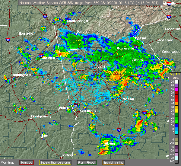 The severe thunderstorm warning for southeastern henry, northeastern butts, northwestern jasper and newton counties will expire at 430 pm edt, the storms which prompted the warning are weakening below severe limits, and will no longer pose an immediate threat to life or property, therefore, the warning will be allowed to expire at 430 pm edt. however, gusty winds and heavy rain are still likely with these thunderstorms. The severe thunderstorm warning for southeastern henry, northeastern butts, northwestern jasper and newton counties will expire at 430 pm edt, the storms which prompted the warning are weakening below severe limits, and will no longer pose an immediate threat to life or property, therefore, the warning will be allowed to expire at 430 pm edt. however, gusty winds and heavy rain are still likely with these thunderstorms.
|
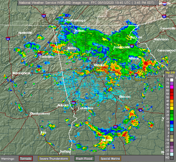
| 8/10/2020 4:13 PM EDT |
 At 413 pm edt, severe thunderstorms were located along a line extending from brick store to near rocky plains to ola, moving southeast at 15 mph (radar indicated). Hazards include 60 mph wind gusts and nickel size hail. Expect damage to roofs, siding, and trees. Locations impacted include, covington, oxford, porterdale, mansfield, jenkinsburg, stewart, turtle cove, ola, worthville, almon, starrsville, brick store, eudora, north alcovy, fincherville, kelleytown, oak hill, stark and rocky plains. At 413 pm edt, severe thunderstorms were located along a line extending from brick store to near rocky plains to ola, moving southeast at 15 mph (radar indicated). Hazards include 60 mph wind gusts and nickel size hail. Expect damage to roofs, siding, and trees. Locations impacted include, covington, oxford, porterdale, mansfield, jenkinsburg, stewart, turtle cove, ola, worthville, almon, starrsville, brick store, eudora, north alcovy, fincherville, kelleytown, oak hill, stark and rocky plains.
|
| 8/10/2020 3:46 PM EDT |
 At 346 pm edt, a severe thunderstorm was located over magnet, moving southeast at 30 mph (radar indicated). Hazards include 60 mph wind gusts and quarter size hail. Hail damage to vehicles is expected. Expect wind damage to roofs, siding, and trees. At 346 pm edt, a severe thunderstorm was located over magnet, moving southeast at 30 mph (radar indicated). Hazards include 60 mph wind gusts and quarter size hail. Hail damage to vehicles is expected. Expect wind damage to roofs, siding, and trees.
|
| 8/9/2020 9:25 PM EDT |
 At 922 pm edt, a severe thunderstorm was located over hard labor creek state park, northwest of madison, moving east at 10 mph (radar indicated). Hazards include 60 mph wind gusts and quarter size hail. Hail damage to vehicles is expected. Expect wind damage to roofs, siding, and trees. At 922 pm edt, a severe thunderstorm was located over hard labor creek state park, northwest of madison, moving east at 10 mph (radar indicated). Hazards include 60 mph wind gusts and quarter size hail. Hail damage to vehicles is expected. Expect wind damage to roofs, siding, and trees.
|
| 8/9/2020 8:56 PM EDT |
 At 855 pm edt, a severe thunderstorm was located over social circle, and is nearly stationary (radar indicated). Hazards include 60 mph wind gusts and quarter size hail. Hail damage to vehicles is expected. Expect wind damage to roofs, siding, and trees. At 855 pm edt, a severe thunderstorm was located over social circle, and is nearly stationary (radar indicated). Hazards include 60 mph wind gusts and quarter size hail. Hail damage to vehicles is expected. Expect wind damage to roofs, siding, and trees.
|
| 7/25/2020 3:32 PM EDT |
 At 332 pm edt, a severe thunderstorm was located near brick store, or near covington, moving northeast at 5 mph (radar indicated). Hazards include 60 mph wind gusts and quarter size hail. Hail damage to vehicles is expected. Expect wind damage to roofs, siding, and trees. At 332 pm edt, a severe thunderstorm was located near brick store, or near covington, moving northeast at 5 mph (radar indicated). Hazards include 60 mph wind gusts and quarter size hail. Hail damage to vehicles is expected. Expect wind damage to roofs, siding, and trees.
|
| 7/10/2020 8:40 PM EDT | Several trees reported down along county line rd between hwy 11 and s henderson mill roa in jasper county GA, 3.5 miles NNE of Mansfield, GA |
| 7/10/2020 7:09 PM EDT |
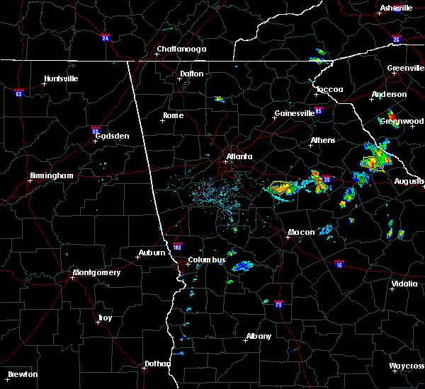 The severe thunderstorm warning for northwestern jasper and southeastern newton counties will expire at 715 pm edt, the storm which prompted the warning has weakened below severe limits, and no longer poses an immediate threat to life or property. therefore, the warning will be allowed to expire. however gusty winds and heavy rain are still possible with this thunderstorm. The severe thunderstorm warning for northwestern jasper and southeastern newton counties will expire at 715 pm edt, the storm which prompted the warning has weakened below severe limits, and no longer poses an immediate threat to life or property. therefore, the warning will be allowed to expire. however gusty winds and heavy rain are still possible with this thunderstorm.
|
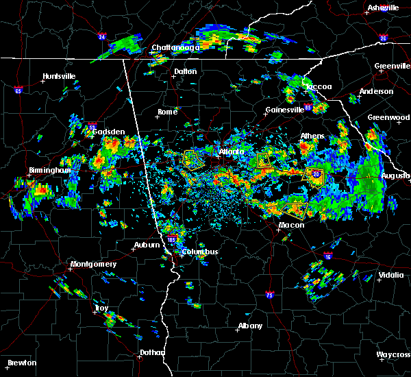
| 7/10/2020 6:48 PM EDT |
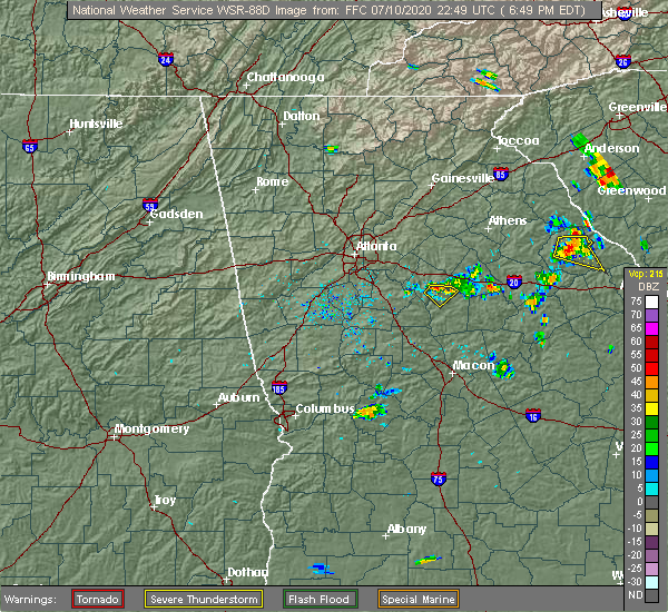 At 648 pm edt, a severe thunderstorm was located over starrsville, or 7 miles southeast of covington, moving southeast at 10 mph (radar indicated). Hazards include 60 mph wind gusts and nickel size hail. expect damage to roofs, siding, and trees At 648 pm edt, a severe thunderstorm was located over starrsville, or 7 miles southeast of covington, moving southeast at 10 mph (radar indicated). Hazards include 60 mph wind gusts and nickel size hail. expect damage to roofs, siding, and trees
|
| 6/15/2020 4:58 PM EDT |
 At 457 pm edt, a severe thunderstorm was located over starrsville, or near covington, moving south at 35 mph (radar indicated). Hazards include 60 mph wind gusts and quarter size hail. Hail damage to vehicles is expected. Expect wind damage to roofs, siding, and trees. At 457 pm edt, a severe thunderstorm was located over starrsville, or near covington, moving south at 35 mph (radar indicated). Hazards include 60 mph wind gusts and quarter size hail. Hail damage to vehicles is expected. Expect wind damage to roofs, siding, and trees.
|
| 6/9/2020 3:56 PM EDT |
 At 355 pm edt, a severe thunderstorm was located over mansfield, moving northeast at 30 mph (radar indicated). Hazards include 60 mph wind gusts. expect damage to roofs, siding, and trees At 355 pm edt, a severe thunderstorm was located over mansfield, moving northeast at 30 mph (radar indicated). Hazards include 60 mph wind gusts. expect damage to roofs, siding, and trees
|
| 4/13/2020 2:58 AM EDT |
 At 258 am edt, a severe thunderstorm was located near newborn, or 11 miles north of monticello, moving east at 95 mph (radar indicated). Hazards include 60 mph wind gusts. expect damage to roofs, siding, and trees At 258 am edt, a severe thunderstorm was located near newborn, or 11 miles north of monticello, moving east at 95 mph (radar indicated). Hazards include 60 mph wind gusts. expect damage to roofs, siding, and trees
|
| 3/31/2020 12:11 PM EDT |
 At 1210 pm edt, severe thunderstorms were located along a line extending from walnut grove to near worthville, moving east at 60 mph (radar indicated). Hazards include 70 mph wind gusts. Expect considerable tree damage. damage is likely to mobile homes, roofs, and outbuildings. Locations impacted include, monroe, covington, madison, social circle, oxford, porterdale, walnut grove, rutledge, newborn, mansfield, bostwick, between, good hope, shady dale, jersey, stewart, turtle cove, worthville, pannell and eudora. At 1210 pm edt, severe thunderstorms were located along a line extending from walnut grove to near worthville, moving east at 60 mph (radar indicated). Hazards include 70 mph wind gusts. Expect considerable tree damage. damage is likely to mobile homes, roofs, and outbuildings. Locations impacted include, monroe, covington, madison, social circle, oxford, porterdale, walnut grove, rutledge, newborn, mansfield, bostwick, between, good hope, shady dale, jersey, stewart, turtle cove, worthville, pannell and eudora.
|
| 3/31/2020 11:52 AM EDT |
 At 1152 am edt, severe thunderstorms were located along a line extending from near arabia mountain to luella, moving east at 60 mph (radar indicated). Hazards include 70 mph wind gusts. Expect considerable tree damage. Damage is likely to mobile homes, roofs, and outbuildings. At 1152 am edt, severe thunderstorms were located along a line extending from near arabia mountain to luella, moving east at 60 mph (radar indicated). Hazards include 70 mph wind gusts. Expect considerable tree damage. Damage is likely to mobile homes, roofs, and outbuildings.
|
| 1/11/2020 6:46 PM EST |
 At 646 pm est, severe thunderstorms were located along a line extending from jersey to juliette, moving east at 40 mph (radar indicated). Hazards include 60 mph wind gusts. Expect damage to roofs, siding, and trees. Locations impacted include, jackson, flovilla, mansfield, stewart, eudora, turtle cove, north alcovy, starrsville, indian springs state park, brick store and stark. At 646 pm est, severe thunderstorms were located along a line extending from jersey to juliette, moving east at 40 mph (radar indicated). Hazards include 60 mph wind gusts. Expect damage to roofs, siding, and trees. Locations impacted include, jackson, flovilla, mansfield, stewart, eudora, turtle cove, north alcovy, starrsville, indian springs state park, brick store and stark.
|
| 1/11/2020 6:31 PM EST |
 At 631 pm est, severe thunderstorms were located along a line extending from big haynes creek park to near blount, moving east at 40 mph (radar indicated). Hazards include 60 mph wind gusts. Expect damage to roofs, siding, and trees. Locations impacted include, conyers, covington, jackson, stone mountain, social circle, oxford, lithonia, porterdale, newborn, flovilla, mansfield, jenkinsburg, lakeview estates, georgia international horse park, stewart, mountain park, turtle cove, worthville, belmont and arabia mountain. At 631 pm est, severe thunderstorms were located along a line extending from big haynes creek park to near blount, moving east at 40 mph (radar indicated). Hazards include 60 mph wind gusts. Expect damage to roofs, siding, and trees. Locations impacted include, conyers, covington, jackson, stone mountain, social circle, oxford, lithonia, porterdale, newborn, flovilla, mansfield, jenkinsburg, lakeview estates, georgia international horse park, stewart, mountain park, turtle cove, worthville, belmont and arabia mountain.
|
| 1/11/2020 6:12 PM EST |
 At 612 pm est, severe thunderstorms were located along a line extending from near stone mountain to orchard hill, moving east at 40 mph (radar indicated). Hazards include 60 mph wind gusts. expect damage to roofs, siding, and trees At 612 pm est, severe thunderstorms were located along a line extending from near stone mountain to orchard hill, moving east at 40 mph (radar indicated). Hazards include 60 mph wind gusts. expect damage to roofs, siding, and trees
|
| 6/24/2019 8:44 PM EDT | Report of a large oak tree blown down on mill pond rd about 1 mile off of ga hwy 11 in newton county GA, 2 miles N of Mansfield, GA |
| 6/22/2019 4:21 PM EDT |
 At 421 pm edt, a severe thunderstorm was located over mansfield, or 7 miles southeast of covington, moving southeast at 25 mph (radar indicated). Hazards include 60 mph wind gusts and quarter size hail. Hail damage to vehicles is expected. Expect wind damage to roofs, siding, and trees. At 421 pm edt, a severe thunderstorm was located over mansfield, or 7 miles southeast of covington, moving southeast at 25 mph (radar indicated). Hazards include 60 mph wind gusts and quarter size hail. Hail damage to vehicles is expected. Expect wind damage to roofs, siding, and trees.
|
| 4/9/2019 10:41 AM EDT |
 The severe thunderstorm warning for west central morgan and newton counties will expire at 1045 am edt, the storm which prompted the warning is weakening below severe limits. therefore, the warning will be allowed to expire. however small hail, gusty winds and heavy rain are still possible with this thunderstorm across northern newton and western morgan counties. to report severe weather, contact your nearest law enforcement agency. they will relay your report to the national weather service peachtree city. The severe thunderstorm warning for west central morgan and newton counties will expire at 1045 am edt, the storm which prompted the warning is weakening below severe limits. therefore, the warning will be allowed to expire. however small hail, gusty winds and heavy rain are still possible with this thunderstorm across northern newton and western morgan counties. to report severe weather, contact your nearest law enforcement agency. they will relay your report to the national weather service peachtree city.
|
| 4/9/2019 10:29 AM EDT |
 At 1028 am edt, a severe thunderstorm was located over starrsville, or near covington, moving north at 30 mph (radar indicated). Hazards include 60 mph wind gusts and quarter size hail. Hail damage to vehicles is expected. expect wind damage to roofs, siding, and trees. Locations impacted include, covington, oxford, porterdale, newborn, mansfield, almon, starrsville, brick store and rocky plains. At 1028 am edt, a severe thunderstorm was located over starrsville, or near covington, moving north at 30 mph (radar indicated). Hazards include 60 mph wind gusts and quarter size hail. Hail damage to vehicles is expected. expect wind damage to roofs, siding, and trees. Locations impacted include, covington, oxford, porterdale, newborn, mansfield, almon, starrsville, brick store and rocky plains.
|
| 4/9/2019 10:15 AM EDT |
 At 1014 am edt, a severe thunderstorm was located over north alcovy, moving north at 30 mph (radar indicated). Hazards include 60 mph wind gusts and quarter size hail. Hail damage to vehicles is expected. Expect wind damage to roofs, siding, and trees. At 1014 am edt, a severe thunderstorm was located over north alcovy, moving north at 30 mph (radar indicated). Hazards include 60 mph wind gusts and quarter size hail. Hail damage to vehicles is expected. Expect wind damage to roofs, siding, and trees.
|
| 4/9/2019 10:06 AM EDT |
 At 1005 am edt, a severe thunderstorm was located over flovilla, or near jackson, moving north at 30 mph (radar indicated). Hazards include 60 mph wind gusts and half dollar size hail. Hail damage to vehicles is expected. expect wind damage to roofs, siding, and trees. Locations impacted include, jackson, porterdale, newborn, mansfield, stewart, turtle cove, worthville, calvin, eudora, north alcovy, fincherville, stark, rocky plains and starrsville. At 1005 am edt, a severe thunderstorm was located over flovilla, or near jackson, moving north at 30 mph (radar indicated). Hazards include 60 mph wind gusts and half dollar size hail. Hail damage to vehicles is expected. expect wind damage to roofs, siding, and trees. Locations impacted include, jackson, porterdale, newborn, mansfield, stewart, turtle cove, worthville, calvin, eudora, north alcovy, fincherville, stark, rocky plains and starrsville.
|
| 4/9/2019 9:53 AM EDT |
 At 952 am edt, a severe thunderstorm was located over flovilla, or near jackson, moving north at 30 mph (radar indicated). Hazards include 60 mph wind gusts and half dollar size hail. Hail damage to vehicles is expected. expect wind damage to roofs, siding, and trees. Locations impacted include, jackson, porterdale, newborn, flovilla, mansfield, stewart, turtle cove, worthville, berner, calvin, blount, eudora, north alcovy, indian springs state park, fincherville, stark, rocky plains and starrsville. At 952 am edt, a severe thunderstorm was located over flovilla, or near jackson, moving north at 30 mph (radar indicated). Hazards include 60 mph wind gusts and half dollar size hail. Hail damage to vehicles is expected. expect wind damage to roofs, siding, and trees. Locations impacted include, jackson, porterdale, newborn, flovilla, mansfield, stewart, turtle cove, worthville, berner, calvin, blount, eudora, north alcovy, indian springs state park, fincherville, stark, rocky plains and starrsville.
|
| 4/9/2019 9:45 AM EDT |
 At 945 am edt, a severe thunderstorm was located over flovilla, or near jackson, moving north at 30 mph (radar indicated). Hazards include 60 mph wind gusts and quarter size hail. Hail damage to vehicles is expected. Expect wind damage to roofs, siding, and trees. At 945 am edt, a severe thunderstorm was located over flovilla, or near jackson, moving north at 30 mph (radar indicated). Hazards include 60 mph wind gusts and quarter size hail. Hail damage to vehicles is expected. Expect wind damage to roofs, siding, and trees.
|
| 9/27/2018 5:02 PM EDT |
 At 502 pm edt, severe thunderstorms were located along a line extending from gum creek to near social circle to farrar, moving northeast at 50 mph (radar indicated. multiple trees were reported down near the covington area). Hazards include 70 mph wind gusts and quarter size hail. Hail damage to vehicles is expected. expect considerable tree damage. wind damage is also likely to mobile homes, roofs, and outbuildings. Locations impacted include, monroe, covington, snellville, loganville, social circle, oxford, walnut grove, rutledge, newborn, mansfield, between, jersey, ebenezer, youth, hard labor creek state park, big haynes creek park, brick store, rosebud, herndonville and farrar. At 502 pm edt, severe thunderstorms were located along a line extending from gum creek to near social circle to farrar, moving northeast at 50 mph (radar indicated. multiple trees were reported down near the covington area). Hazards include 70 mph wind gusts and quarter size hail. Hail damage to vehicles is expected. expect considerable tree damage. wind damage is also likely to mobile homes, roofs, and outbuildings. Locations impacted include, monroe, covington, snellville, loganville, social circle, oxford, walnut grove, rutledge, newborn, mansfield, between, jersey, ebenezer, youth, hard labor creek state park, big haynes creek park, brick store, rosebud, herndonville and farrar.
|
| 9/27/2018 4:50 PM EDT |
 At 449 pm edt, severe thunderstorms were located along a line extending from conyers to starrsville to near calvin, moving northeast at 40 mph (radar indicated). Hazards include 70 mph wind gusts and quarter size hail. Hail damage to vehicles is expected. expect considerable tree damage. wind damage is also likely to mobile homes, roofs, and outbuildings. Locations impacted include, conyers, monroe, covington, monticello, snellville, loganville, social circle, oxford, lithonia, porterdale, walnut grove, rutledge, newborn, mansfield, between, jersey, lakeview estates, georgia international horse park, stewart and turtle cove. At 449 pm edt, severe thunderstorms were located along a line extending from conyers to starrsville to near calvin, moving northeast at 40 mph (radar indicated). Hazards include 70 mph wind gusts and quarter size hail. Hail damage to vehicles is expected. expect considerable tree damage. wind damage is also likely to mobile homes, roofs, and outbuildings. Locations impacted include, conyers, monroe, covington, monticello, snellville, loganville, social circle, oxford, lithonia, porterdale, walnut grove, rutledge, newborn, mansfield, between, jersey, lakeview estates, georgia international horse park, stewart and turtle cove.
|
| 9/27/2018 4:45 PM EDT |
 At 432 pm edt, severe thunderstorms were located along a line extending from lovejoy to locust grove to near high falls state park, moving northeast at 40 mph (radar indicated). Hazards include 60 mph wind gusts. expect damage to roofs, siding, and trees At 432 pm edt, severe thunderstorms were located along a line extending from lovejoy to locust grove to near high falls state park, moving northeast at 40 mph (radar indicated). Hazards include 60 mph wind gusts. expect damage to roofs, siding, and trees
|
| 9/27/2018 4:32 PM EDT |
 The national weather service in peachtree city has issued a * severe thunderstorm warning for. rockdale county in north central georgia. southeastern dekalb county in north central georgia. southwestern morgan county in north central georgia. South central gwinnett county in north central georgia. The national weather service in peachtree city has issued a * severe thunderstorm warning for. rockdale county in north central georgia. southeastern dekalb county in north central georgia. southwestern morgan county in north central georgia. South central gwinnett county in north central georgia.
|
| 8/18/2018 6:05 PM EDT |
 At 605 pm edt, a severe thunderstorm was located near covington, moving east at 35 mph (radar indicated). Hazards include 60 mph wind gusts. expect damage to roofs, siding, and trees At 605 pm edt, a severe thunderstorm was located near covington, moving east at 35 mph (radar indicated). Hazards include 60 mph wind gusts. expect damage to roofs, siding, and trees
|
| 8/2/2018 5:41 PM EDT |
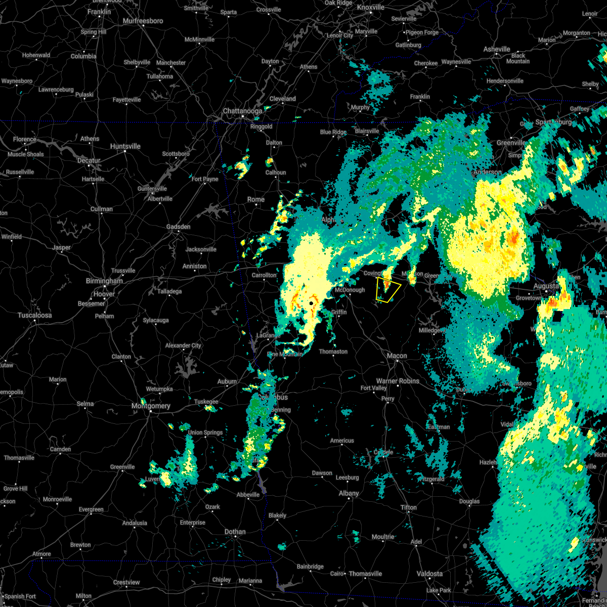 The severe thunderstorm warning for southwestern morgan, north central jasper and east central newton counties will expire at 545 pm edt, the storm which prompted the warning has weakened below severe limits, and no longer poses an immediate threat to life or property. therefore, the warning will be allowed to expire. however gusty winds and heavy rain are still possible with this thunderstorm. The severe thunderstorm warning for southwestern morgan, north central jasper and east central newton counties will expire at 545 pm edt, the storm which prompted the warning has weakened below severe limits, and no longer poses an immediate threat to life or property. therefore, the warning will be allowed to expire. however gusty winds and heavy rain are still possible with this thunderstorm.
|
| 8/2/2018 5:12 PM EDT |
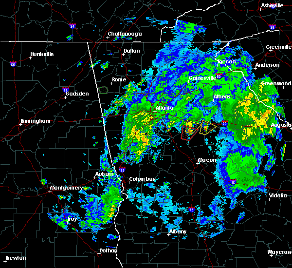 At 512 pm edt, a severe thunderstorm was located over north alcovy, or 10 miles northwest of monticello, moving northeast at 20 mph (radar indicated). Hazards include 60 mph wind gusts. expect damage to roofs, siding, and trees At 512 pm edt, a severe thunderstorm was located over north alcovy, or 10 miles northwest of monticello, moving northeast at 20 mph (radar indicated). Hazards include 60 mph wind gusts. expect damage to roofs, siding, and trees
|
| 7/21/2018 7:39 AM EDT |
 The severe thunderstorm warning for morgan, northwestern putnam, west central greene, northeastern jasper and southeastern newton counties will expire at 745 am edt, the storms which prompted the warning have weakened below severe limits, and no longer pose an immediate threat to life or property. therefore, the warning will be allowed to expire. however gusty winds are still possible with these thunderstorms. a severe thunderstorm watch remains in effect until 1000 am edt for central, north central, northeastern and east central georgia. The severe thunderstorm warning for morgan, northwestern putnam, west central greene, northeastern jasper and southeastern newton counties will expire at 745 am edt, the storms which prompted the warning have weakened below severe limits, and no longer pose an immediate threat to life or property. therefore, the warning will be allowed to expire. however gusty winds are still possible with these thunderstorms. a severe thunderstorm watch remains in effect until 1000 am edt for central, north central, northeastern and east central georgia.
|
| 7/21/2018 7:31 AM EDT |
 At 730 am edt, severe thunderstorms were located along a line extending from near apalachee to near madison to near farrar, moving southeast at 40 mph (radar indicated). Hazards include 60 mph wind gusts. Expect damage to roofs, siding, and trees. Locations impacted include, madison, newborn, mansfield, bostwick, shady dale, buckhead, harmony, godfrey, greshamville, rock eagle 4-h center, central georgia experiment stn, farrar, swords and apalachee. At 730 am edt, severe thunderstorms were located along a line extending from near apalachee to near madison to near farrar, moving southeast at 40 mph (radar indicated). Hazards include 60 mph wind gusts. Expect damage to roofs, siding, and trees. Locations impacted include, madison, newborn, mansfield, bostwick, shady dale, buckhead, harmony, godfrey, greshamville, rock eagle 4-h center, central georgia experiment stn, farrar, swords and apalachee.
|
| 7/21/2018 7:03 AM EDT |
 At 702 am edt, severe thunderstorms were located along a line extending from campton to jersey to georgia international horse park, moving southeast at 45 mph (radar indicated). Hazards include 60 mph wind gusts and quarter size hail. Hail damage to vehicles is expected. Expect wind damage to roofs, siding, and trees. At 702 am edt, severe thunderstorms were located along a line extending from campton to jersey to georgia international horse park, moving southeast at 45 mph (radar indicated). Hazards include 60 mph wind gusts and quarter size hail. Hail damage to vehicles is expected. Expect wind damage to roofs, siding, and trees.
|
| 6/25/2018 3:58 PM EDT |
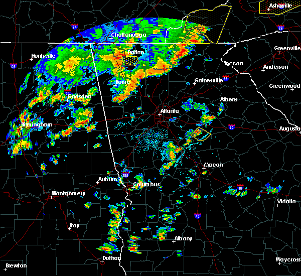 At 357 pm edt, a severe thunderstorm was located over eudora, or 10 miles north of monticello, moving southeast at 15 mph (radar indicated). Hazards include 60 mph wind gusts and quarter size hail. Hail damage to vehicles is expected. Expect wind damage to roofs, siding, and trees. At 357 pm edt, a severe thunderstorm was located over eudora, or 10 miles north of monticello, moving southeast at 15 mph (radar indicated). Hazards include 60 mph wind gusts and quarter size hail. Hail damage to vehicles is expected. Expect wind damage to roofs, siding, and trees.
|
| 6/3/2018 7:20 PM EDT |
 At 720 pm edt, a severe thunderstorm was located over turtle cove, or 8 miles northeast of jackson, moving southeast at 35 mph (radar indicated). Hazards include 60 mph wind gusts and quarter size hail. Hail damage to vehicles is expected. Expect wind damage to roofs, siding, and trees. At 720 pm edt, a severe thunderstorm was located over turtle cove, or 8 miles northeast of jackson, moving southeast at 35 mph (radar indicated). Hazards include 60 mph wind gusts and quarter size hail. Hail damage to vehicles is expected. Expect wind damage to roofs, siding, and trees.
|
| 3/20/2018 12:32 AM EDT |
 At 1231 am edt, a severe thunderstorm was located over shady dale, or 8 miles northeast of monticello, moving east at 45 mph (radar indicated). Hazards include 60 mph wind gusts and quarter size hail. Hail damage to vehicles is expected. expect wind damage to roofs, siding, and trees. locations impacted include, griffin, jackson, madison, monticello, newborn, flovilla, mansfield, jenkinsburg, shady dale, east griffin, stewart, turtle cove, worthville, mckibben, calvin, farrar, eudora, north alcovy, mcelheneys crossroads and indian springs state park. A tornado watch remains in effect until 400 am edt for central, north central and west central georgia. At 1231 am edt, a severe thunderstorm was located over shady dale, or 8 miles northeast of monticello, moving east at 45 mph (radar indicated). Hazards include 60 mph wind gusts and quarter size hail. Hail damage to vehicles is expected. expect wind damage to roofs, siding, and trees. locations impacted include, griffin, jackson, madison, monticello, newborn, flovilla, mansfield, jenkinsburg, shady dale, east griffin, stewart, turtle cove, worthville, mckibben, calvin, farrar, eudora, north alcovy, mcelheneys crossroads and indian springs state park. A tornado watch remains in effect until 400 am edt for central, north central and west central georgia.
|
| 3/20/2018 12:20 AM EDT |
 At 1218 am edt, a severe thunderstorm was located over north alcovy, or 10 miles southeast of covington, moving east at 45 mph (radar indicated). Hazards include 60 mph wind gusts and quarter size hail. Hail damage to vehicles is expected. expect wind damage to roofs, siding, and trees. locations impacted include, griffin, mcdonough, covington, jackson, madison, monticello, hampton, locust grove, oxford, porterdale, newborn, flovilla, mansfield, jenkinsburg, shady dale, sunny side, east griffin, stewart, blacksville and ola. A tornado watch remains in effect until 400 am edt for central, north central and west central georgia. At 1218 am edt, a severe thunderstorm was located over north alcovy, or 10 miles southeast of covington, moving east at 45 mph (radar indicated). Hazards include 60 mph wind gusts and quarter size hail. Hail damage to vehicles is expected. expect wind damage to roofs, siding, and trees. locations impacted include, griffin, mcdonough, covington, jackson, madison, monticello, hampton, locust grove, oxford, porterdale, newborn, flovilla, mansfield, jenkinsburg, shady dale, sunny side, east griffin, stewart, blacksville and ola. A tornado watch remains in effect until 400 am edt for central, north central and west central georgia.
|
| 3/19/2018 11:58 PM EDT |
 At 1158 pm edt, a severe thunderstorm was located near oak hill, or 7 miles northeast of mcdonough, moving east at 40 mph (radar indicated). Hazards include 60 mph wind gusts and quarter size hail. Hail damage to vehicles is expected. Expect wind damage to roofs, siding, and trees. At 1158 pm edt, a severe thunderstorm was located near oak hill, or 7 miles northeast of mcdonough, moving east at 40 mph (radar indicated). Hazards include 60 mph wind gusts and quarter size hail. Hail damage to vehicles is expected. Expect wind damage to roofs, siding, and trees.
|
| 3/19/2018 11:31 PM EDT |
 At 1130 pm edt, severe thunderstorms were located along a line extending from big haynes creek park to near alvaton, moving southeast at 50 mph (radar indicated). Hazards include ping pong ball size hail and 60 mph wind gusts. People and animals outdoors will be injured. expect hail damage to roofs, siding, windows, and vehicles. Expect wind damage to roofs, siding, and trees. At 1130 pm edt, severe thunderstorms were located along a line extending from big haynes creek park to near alvaton, moving southeast at 50 mph (radar indicated). Hazards include ping pong ball size hail and 60 mph wind gusts. People and animals outdoors will be injured. expect hail damage to roofs, siding, windows, and vehicles. Expect wind damage to roofs, siding, and trees.
|
| 7/26/2017 6:52 PM EDT |
 The severe thunderstorm warning for southeastern henry, northeastern butts, central jasper and newton counties will expire at 700 pm edt, the storms which prompted the warning have weakened below severe limits, and no longer pose an immediate threat to life or property. therefore the warning will be allowed to expire. however gusty winds are still possible with these thunderstorms. The severe thunderstorm warning for southeastern henry, northeastern butts, central jasper and newton counties will expire at 700 pm edt, the storms which prompted the warning have weakened below severe limits, and no longer pose an immediate threat to life or property. therefore the warning will be allowed to expire. however gusty winds are still possible with these thunderstorms.
|
| 7/26/2017 6:37 PM EDT |
 At 636 pm edt, severe thunderstorms were located along a line extending from near starrsville to near calvin, moving south at 20 mph (radar indicated). Hazards include 60 mph wind gusts. Expect damage to roofs, siding, and trees. Locations impacted include, mcdonough, covington, monticello, oxford, porterdale, newborn, mansfield, stewart, ola, turtle cove, worthville, almon, starrsville, calvin, eudora, north alcovy, mcelheneys crossroads, fincherville, adgateville and oak hill. At 636 pm edt, severe thunderstorms were located along a line extending from near starrsville to near calvin, moving south at 20 mph (radar indicated). Hazards include 60 mph wind gusts. Expect damage to roofs, siding, and trees. Locations impacted include, mcdonough, covington, monticello, oxford, porterdale, newborn, mansfield, stewart, ola, turtle cove, worthville, almon, starrsville, calvin, eudora, north alcovy, mcelheneys crossroads, fincherville, adgateville and oak hill.
|
| 7/26/2017 6:16 PM EDT |
 At 616 pm edt, severe thunderstorms were located along a line extending from near covington to farrar, moving southwest at 20 mph (radar indicated). Hazards include 60 mph wind gusts and penny size hail. expect damage to roofs, siding, and trees At 616 pm edt, severe thunderstorms were located along a line extending from near covington to farrar, moving southwest at 20 mph (radar indicated). Hazards include 60 mph wind gusts and penny size hail. expect damage to roofs, siding, and trees
|
| 7/7/2017 6:36 PM EDT |
 At 636 pm edt, a severe thunderstorm was located over newborn, or 11 miles southeast of covington, moving southeast at 10 mph (radar indicated). Hazards include 60 mph wind gusts and quarter size hail. Hail damage to vehicles is expected. Expect wind damage to roofs, siding, and trees. At 636 pm edt, a severe thunderstorm was located over newborn, or 11 miles southeast of covington, moving southeast at 10 mph (radar indicated). Hazards include 60 mph wind gusts and quarter size hail. Hail damage to vehicles is expected. Expect wind damage to roofs, siding, and trees.
|
| 6/22/2017 8:21 PM EDT |
 At 821 pm edt, severe thunderstorms were located along a line extending from gratis to near buckhead, moving northeast at 45 mph (radar indicated). Hazards include 60 mph wind gusts. Expect damage to roofs, siding, and trees. Locations impacted include, monroe, covington, eatonton, monticello, social circle, oxford, porterdale, rutledge, newborn, mansfield, shady dale, godfrey, starrsville, warfield, brick store, willard, central georgia experiment stn, herndonville, calvin and farrar. At 821 pm edt, severe thunderstorms were located along a line extending from gratis to near buckhead, moving northeast at 45 mph (radar indicated). Hazards include 60 mph wind gusts. Expect damage to roofs, siding, and trees. Locations impacted include, monroe, covington, eatonton, monticello, social circle, oxford, porterdale, rutledge, newborn, mansfield, shady dale, godfrey, starrsville, warfield, brick store, willard, central georgia experiment stn, herndonville, calvin and farrar.
|
| 6/22/2017 7:41 PM EDT |
 At 741 pm edt, severe thunderstorms were located along a line extending from oak hill to near mcelheneys crossroads, moving northeast at 45 mph (radar indicated). Hazards include 60 mph wind gusts. expect damage to roofs, siding, and trees At 741 pm edt, severe thunderstorms were located along a line extending from oak hill to near mcelheneys crossroads, moving northeast at 45 mph (radar indicated). Hazards include 60 mph wind gusts. expect damage to roofs, siding, and trees
|
| 4/5/2017 11:55 PM EDT |
 At 1154 pm edt, a severe thunderstorm was located over brick store, or 7 miles east of covington, moving east at 40 mph (radar indicated). Hazards include 60 mph wind gusts and quarter size hail. Hail damage to vehicles is expected. Expect wind damage to roofs, siding, and trees. At 1154 pm edt, a severe thunderstorm was located over brick store, or 7 miles east of covington, moving east at 40 mph (radar indicated). Hazards include 60 mph wind gusts and quarter size hail. Hail damage to vehicles is expected. Expect wind damage to roofs, siding, and trees.
|
| 4/5/2017 12:36 PM EDT |
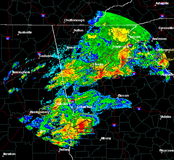 At 1235 pm edt, a severe thunderstorm capable of producing a tornado was located near eudora, or 11 miles north of monticello, moving east at 45 mph (radar indicated rotation). Hazards include tornado. Flying debris will be dangerous to those caught without shelter. mobile homes will be damaged or destroyed. damage to roofs, windows, and vehicles will occur. tree damage is likely. Locations impacted include, newborn, mansfield, farrar and eudora. At 1235 pm edt, a severe thunderstorm capable of producing a tornado was located near eudora, or 11 miles north of monticello, moving east at 45 mph (radar indicated rotation). Hazards include tornado. Flying debris will be dangerous to those caught without shelter. mobile homes will be damaged or destroyed. damage to roofs, windows, and vehicles will occur. tree damage is likely. Locations impacted include, newborn, mansfield, farrar and eudora.
|
| 4/5/2017 12:12 PM EDT |
 At 1212 pm edt, a severe thunderstorm capable of producing a tornado was located near jenkinsburg, or near jackson, moving northeast at 35 mph (radar indicated rotation). Hazards include tornado. Flying debris will be dangerous to those caught without shelter. mobile homes will be damaged or destroyed. damage to roofs, windows, and vehicles will occur. Tree damage is likely. At 1212 pm edt, a severe thunderstorm capable of producing a tornado was located near jenkinsburg, or near jackson, moving northeast at 35 mph (radar indicated rotation). Hazards include tornado. Flying debris will be dangerous to those caught without shelter. mobile homes will be damaged or destroyed. damage to roofs, windows, and vehicles will occur. Tree damage is likely.
|
| 4/3/2017 1:21 PM EDT | Heavy damage occured to hays tractor and equipment inc. power lines were also reported down at the car lot and at city hal in newton county GA, 0.3 miles ESE of Mansfield, GA |
| 4/3/2017 12:23 PM EDT | Multiple structures with damage and partial building collapse reported near the intersection of county road 213 and 11 in newton county GA, 0.3 miles ESE of Mansfield, GA |
| 11/30/2016 3:21 PM EST |
 At 321 pm est, severe thunderstorms were located along a line extending from near blacksville to jenkinsburg to near chappel mill, moving northeast at 70 mph (radar indicated). Hazards include 60 mph wind gusts. Expect damage to roofs. siding. And trees. At 321 pm est, severe thunderstorms were located along a line extending from near blacksville to jenkinsburg to near chappel mill, moving northeast at 70 mph (radar indicated). Hazards include 60 mph wind gusts. Expect damage to roofs. siding. And trees.
|
| 7/21/2016 5:50 PM EDT |
 At 549 pm edt, a severe thunderstorm was located near monroe, moving south at 10 mph (radar indicated). Hazards include 60 mph wind gusts and quarter size hail. Hail damage to vehicles is expected. expect wind damage to roofs, siding, and trees. Other locations in the warning include but are not limited to monroe, madison, social circle, rutledge, newborn, mansfield, between, good hope, jersey, ebenezer, starrsville, hard labor creek state park, brick store, pannell and herndonville. At 549 pm edt, a severe thunderstorm was located near monroe, moving south at 10 mph (radar indicated). Hazards include 60 mph wind gusts and quarter size hail. Hail damage to vehicles is expected. expect wind damage to roofs, siding, and trees. Other locations in the warning include but are not limited to monroe, madison, social circle, rutledge, newborn, mansfield, between, good hope, jersey, ebenezer, starrsville, hard labor creek state park, brick store, pannell and herndonville.
|
| 6/17/2016 2:48 PM EDT |
 At 248 pm edt, a severe thunderstorm was located near mansfield, or near covington, moving southeast at 35 mph (radar indicated). Hazards include 60 mph wind gusts. Expect damage to roofs. siding. and trees. Other locations in the warning include but are not limited to newborn, mansfield, starrsville, rocky plains and brick store. At 248 pm edt, a severe thunderstorm was located near mansfield, or near covington, moving southeast at 35 mph (radar indicated). Hazards include 60 mph wind gusts. Expect damage to roofs. siding. and trees. Other locations in the warning include but are not limited to newborn, mansfield, starrsville, rocky plains and brick store.
|
| 6/17/2016 2:39 PM EDT |
 At 239 pm edt, a severe thunderstorm was located over porterdale, or over covington, moving southeast at 35 mph (radar indicated). Hazards include 60 mph wind gusts. Expect damage to roofs. siding. and trees. other locations in the warning include but are not limited to covington, oxford, porterdale, newborn, mansfield, starrsville. Brick store, oak hill, almon and rocky plains. At 239 pm edt, a severe thunderstorm was located over porterdale, or over covington, moving southeast at 35 mph (radar indicated). Hazards include 60 mph wind gusts. Expect damage to roofs. siding. and trees. other locations in the warning include but are not limited to covington, oxford, porterdale, newborn, mansfield, starrsville. Brick store, oak hill, almon and rocky plains.
|
| 6/17/2016 2:26 PM EDT |
 At 226 pm edt, a severe thunderstorm was located near conyers, moving southeast at 35 mph (radar indicated). Hazards include 60 mph wind gusts. Expect damage to roofs. siding. and trees. Other locations in the warning include but are not limited to conyers, covington, oxford, porterdale, newborn, mansfield, g eorgia international horse park, lakeview estates, oak hill, almon, rocky plains, magnet, starrsville, milstead and brick store. At 226 pm edt, a severe thunderstorm was located near conyers, moving southeast at 35 mph (radar indicated). Hazards include 60 mph wind gusts. Expect damage to roofs. siding. and trees. Other locations in the warning include but are not limited to conyers, covington, oxford, porterdale, newborn, mansfield, g eorgia international horse park, lakeview estates, oak hill, almon, rocky plains, magnet, starrsville, milstead and brick store.
|
| 6/14/2016 3:00 PM EDT |
 At 300 pm edt, a severe thunderstorm was located near porterdale, or near covington, moving northeast at 15 mph (radar indicated). Hazards include 60 mph wind gusts and quarter size hail. Hail damage to vehicles is expected. expect wind damage to roofs, siding, and trees. Other locations in the warning include but are not limited to covington, social circle, oxford, porterdale, newborn, mansfield, starrsville and brick store. At 300 pm edt, a severe thunderstorm was located near porterdale, or near covington, moving northeast at 15 mph (radar indicated). Hazards include 60 mph wind gusts and quarter size hail. Hail damage to vehicles is expected. expect wind damage to roofs, siding, and trees. Other locations in the warning include but are not limited to covington, social circle, oxford, porterdale, newborn, mansfield, starrsville and brick store.
|
| 6/2/2016 8:57 PM EDT |
 At 857 pm edt, a severe thunderstorm was located near mansfield, or 8 miles south of covington, and is nearly stationary (radar indicated). Hazards include 60 mph wind gusts. Expect damage to roofs. siding. and trees. Other locations in the warning include but are not limited to covington, newborn, mansfield, stewart, starrsville, brick store, eudora, rocky plains, farrar, north alcovy and calvin. At 857 pm edt, a severe thunderstorm was located near mansfield, or 8 miles south of covington, and is nearly stationary (radar indicated). Hazards include 60 mph wind gusts. Expect damage to roofs. siding. and trees. Other locations in the warning include but are not limited to covington, newborn, mansfield, stewart, starrsville, brick store, eudora, rocky plains, farrar, north alcovy and calvin.
|
| 4/7/2016 12:27 AM EDT |
 At 1226 am edt, severe thunderstorms were located along a line extending from buford to near lithonia to near sunny side, moving east at 50 mph (radar indicated. damaging winds have already been reported with this line). Hazards include 60 mph wind gusts and nickel size hail. Expect damage to roofs. siding. and trees. Other locations in the warning include but are not limited to lawrenceville, mcdonough, conyers, winder, monroe, covington, jefferson, watkinsville, snellville, buford, loganville, braselton, auburn, locust grove, dacula, social circle, grayson, statham, oxford and arcade. At 1226 am edt, severe thunderstorms were located along a line extending from buford to near lithonia to near sunny side, moving east at 50 mph (radar indicated. damaging winds have already been reported with this line). Hazards include 60 mph wind gusts and nickel size hail. Expect damage to roofs. siding. and trees. Other locations in the warning include but are not limited to lawrenceville, mcdonough, conyers, winder, monroe, covington, jefferson, watkinsville, snellville, buford, loganville, braselton, auburn, locust grove, dacula, social circle, grayson, statham, oxford and arcade.
|
| 3/1/2016 9:24 PM EST |
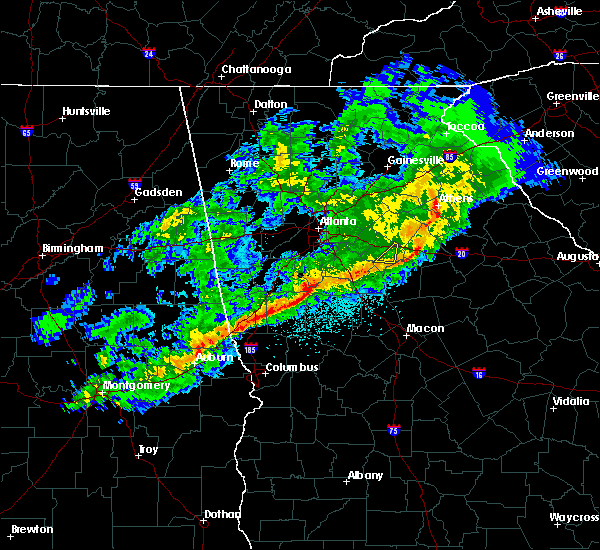 The severe thunderstorm warning for east central newton county will expire at 930 pm est, the storm which prompted the warning has weakened below severe limits and exited the warned area. therefore the warning will be allowed to expire. a severe thunderstorm watch remains in effect until 200 am est for north central georgia. to report severe weather, contact your nearest law enforcement agency. they will relay your report to the national weather service peachtree city. The severe thunderstorm warning for east central newton county will expire at 930 pm est, the storm which prompted the warning has weakened below severe limits and exited the warned area. therefore the warning will be allowed to expire. a severe thunderstorm watch remains in effect until 200 am est for north central georgia. to report severe weather, contact your nearest law enforcement agency. they will relay your report to the national weather service peachtree city.
|
| 3/1/2016 9:17 PM EST |
 At 917 pm est, a severe thunderstorm was located over mansfield, or 8 miles southeast of covington, moving east at 50 mph (radar indicated). Hazards include 60 mph wind gusts. Expect damage to roofs. siding. and trees. Other locations in the warning include but are not limited to brick store and starrsville. At 917 pm est, a severe thunderstorm was located over mansfield, or 8 miles southeast of covington, moving east at 50 mph (radar indicated). Hazards include 60 mph wind gusts. Expect damage to roofs. siding. and trees. Other locations in the warning include but are not limited to brick store and starrsville.
|
| 3/1/2016 9:01 PM EST |
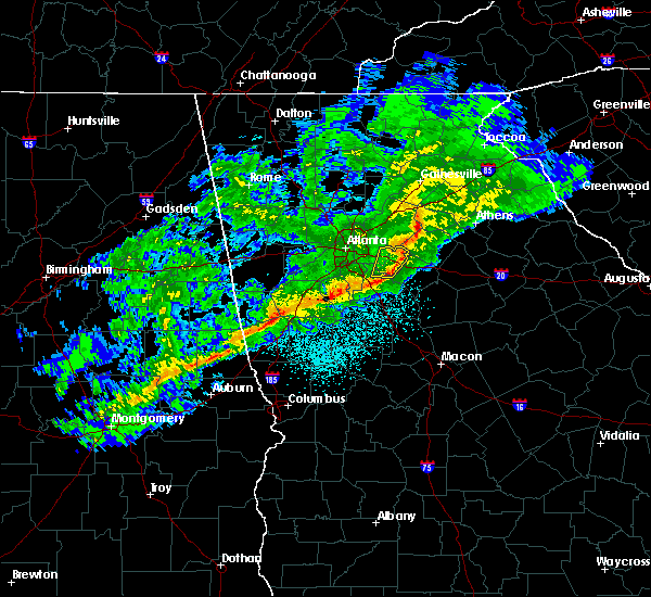 At 900 pm est, a severe thunderstorm was located near porterdale, or near conyers, moving east at 55 mph (radar indicated). Hazards include 60 mph wind gusts. Expect damage to roofs. siding. and trees. Other locations in the warning include but are not limited to covington, social circle, oxford, porterdale, starrsville, brick store, oak hill, almon and rocky plains. At 900 pm est, a severe thunderstorm was located near porterdale, or near conyers, moving east at 55 mph (radar indicated). Hazards include 60 mph wind gusts. Expect damage to roofs. siding. and trees. Other locations in the warning include but are not limited to covington, social circle, oxford, porterdale, starrsville, brick store, oak hill, almon and rocky plains.
|
| 8/6/2015 3:25 PM EDT |
 The severe thunderstorm warning for northeastern butts, northwestern jasper, southern newton and east central henry counties will expire at 330 pm edt, the storm which prompted the warning has weakened below severe limits, and no longer pose an immediate threat to life or property. therefore the warning will be allowed to expire. however gusty winds are still possible with this thunderstorm. a severe thunderstorm watch remains in effect until 1000 pm edt for north central georgia. to report severe weather, contact your nearest law enforcement agency. they will relay your report to the national weather service peachtree city. The severe thunderstorm warning for northeastern butts, northwestern jasper, southern newton and east central henry counties will expire at 330 pm edt, the storm which prompted the warning has weakened below severe limits, and no longer pose an immediate threat to life or property. therefore the warning will be allowed to expire. however gusty winds are still possible with this thunderstorm. a severe thunderstorm watch remains in effect until 1000 pm edt for north central georgia. to report severe weather, contact your nearest law enforcement agency. they will relay your report to the national weather service peachtree city.
|
| 8/6/2015 3:18 PM EDT | A tree was blown down on county rd 21 in newton county GA, 1.1 miles ENE of Mansfield, GA |
| 8/6/2015 3:18 PM EDT | A tree was blown down on mill pond r in newton county GA, 1.5 miles NNW of Mansfield, GA |
| 8/6/2015 2:53 PM EDT |
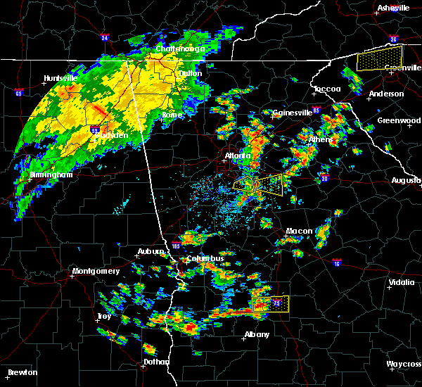 At 253 pm edt, a severe thunderstorm was located 8 miles southwest of porterdale, or 9 miles east of mcdonough, moving east at 35 mph (radar indicated). Hazards include 60 mph wind gusts. Expect damage to roofs. siding and trees. Other locations in the warning include but are not limited to newborn, mansfield, stewart, starrsville, worthville, calvin, eudora, rocky plains, turtle cove, north alcovy and fincherville. At 253 pm edt, a severe thunderstorm was located 8 miles southwest of porterdale, or 9 miles east of mcdonough, moving east at 35 mph (radar indicated). Hazards include 60 mph wind gusts. Expect damage to roofs. siding and trees. Other locations in the warning include but are not limited to newborn, mansfield, stewart, starrsville, worthville, calvin, eudora, rocky plains, turtle cove, north alcovy and fincherville.
|
| 7/24/2015 9:25 PM EDT |
 At 924 pm edt, a severe thunderstorm was located over oxford, or near covington, moving south at 35 mph (radar indicated). Hazards include 60 mph wind gusts and quarter size hail. Hail damage to vehicles is expected. expect wind damage to roofs, siding and trees. Other locations in the warning include but are not limited to conyers, monroe, covington, social circle, oxford, porterdale, walnut grove, rutledge, newborn, mansfield, between, jersey, stewart, gum creek, almon, campton, ebenezer, hard labor creek state park, brick store and pannell. At 924 pm edt, a severe thunderstorm was located over oxford, or near covington, moving south at 35 mph (radar indicated). Hazards include 60 mph wind gusts and quarter size hail. Hail damage to vehicles is expected. expect wind damage to roofs, siding and trees. Other locations in the warning include but are not limited to conyers, monroe, covington, social circle, oxford, porterdale, walnut grove, rutledge, newborn, mansfield, between, jersey, stewart, gum creek, almon, campton, ebenezer, hard labor creek state park, brick store and pannell.
|
| 7/3/2015 10:07 AM EDT |
 At 1006 am edt, a severe thunderstorm was located over hampton, or 8 miles southwest of mcdonough, moving southeast at 45 mph (radar indicated). Hazards include 60 mph wind gusts. Expect damage to roofs. siding and trees. Other locations in the warning include but are not limited to griffin, mcdonough, jackson, forsyth, monticello, stockbridge, hampton, lovejoy, locust grove, porterdale, newborn, flovilla, mansfield, jenkinsburg, shady dale, woolsey, sunny side, east griffin, stewart and chappel mill. At 1006 am edt, a severe thunderstorm was located over hampton, or 8 miles southwest of mcdonough, moving southeast at 45 mph (radar indicated). Hazards include 60 mph wind gusts. Expect damage to roofs. siding and trees. Other locations in the warning include but are not limited to griffin, mcdonough, jackson, forsyth, monticello, stockbridge, hampton, lovejoy, locust grove, porterdale, newborn, flovilla, mansfield, jenkinsburg, shady dale, woolsey, sunny side, east griffin, stewart and chappel mill.
|
| 6/30/2015 1:38 PM EDT |
 The severe thunderstorm warning for southeastern rockdale, south central walton and central newton counties will expire at 145 pm edt, the severe thunderstorm which prompted the warning has weakened. therefore the warning will be allowed to expire. The severe thunderstorm warning for southeastern rockdale, south central walton and central newton counties will expire at 145 pm edt, the severe thunderstorm which prompted the warning has weakened. therefore the warning will be allowed to expire.
|
| 6/30/2015 1:08 PM EDT |
 At 108 pm edt, a severe thunderstorm was located over georgia international horse park, or near covington, moving east at 40 mph (radar indicated). Hazards include 60 mph wind gusts and nickel size hail. Expect damage to roofs. siding and trees. Other locations in the warning include but are not limited to conyers, covington, social circle, oxford, porterdale, newborn, mansfield, jersey, georgia international horse park, starrsville, brick store, almon and herndonville. At 108 pm edt, a severe thunderstorm was located over georgia international horse park, or near covington, moving east at 40 mph (radar indicated). Hazards include 60 mph wind gusts and nickel size hail. Expect damage to roofs. siding and trees. Other locations in the warning include but are not limited to conyers, covington, social circle, oxford, porterdale, newborn, mansfield, jersey, georgia international horse park, starrsville, brick store, almon and herndonville.
|
| 6/24/2015 4:32 PM EDT |
 At 432 pm edt, a severe thunderstorm was located over rutledge, or 11 miles west of madison, moving south at 25 mph (radar indicated). Hazards include 60 mph wind gusts and quarter size hail. Hail damage to vehicles is expected. expect wind damage to roofs, siding and trees. Other locations in the warning include but are not limited to madison, social circle, rutledge, newborn, mansfield, hard labor creek state park, herndonville, ebenezer and godfrey. At 432 pm edt, a severe thunderstorm was located over rutledge, or 11 miles west of madison, moving south at 25 mph (radar indicated). Hazards include 60 mph wind gusts and quarter size hail. Hail damage to vehicles is expected. expect wind damage to roofs, siding and trees. Other locations in the warning include but are not limited to madison, social circle, rutledge, newborn, mansfield, hard labor creek state park, herndonville, ebenezer and godfrey.
|
| 6/18/2015 6:06 PM EDT | At 605 pm edt, a severe thunderstorm was located near mansfield, or 10 miles north of monticello, moving north at 15 mph (radar indicated). Hazards include 60 mph wind gusts. Expect downed trees and powerlines. along with minor damage to roofs and siding. Other locations in the warning include but are not limited to social circle, rutledge, newborn, mansfield, stewart, starrsville, calvin, brick store, eudora, farrar and north alcovy. |
| 5/26/2015 5:20 PM EDT | At 520 pm edt, severe thunderstorms were located along a line extending from near oxford to near mansfield, moving northeast at 40 mph (radar indicated). Hazards include 60 mph wind gusts. Expect damage to roofs. siding and trees. Other locations in the warning include but are not limited to covington, social circle, oxford, porterdale, newborn, mansfield, starrsville, brick store and almon. |
| 5/26/2015 5:03 PM EDT | At 503 pm edt, severe thunderstorms were located along a line extending from near porterdale to 10 miles south of covington, moving northeast at 45 mph (radar indicated). Hazards include 60 mph wind gusts and quarter size hail. Hail damage to vehicles is expected. expect wind damage to roofs, siding and trees. Other locations in the warning include but are not limited to covington, jackson, social circle, oxford, porterdale, newborn, mansfield, stewart, oak hill, almon, eudora, rocky plains, starrsville, worthville, brick store, stark, ola, turtle cove, north alcovy and fincherville. |
| 5/26/2015 4:39 PM EDT | At 439 pm edt, severe thunderstorms were located along a line extending from near locust grove to 6 miles east of east griffin, moving northeast at 40 mph (radar indicated). Hazards include 60 mph wind gusts and quarter size hail. Hail damage to vehicles is expected. expect wind damage to roofs, siding and trees. Other locations in the warning include but are not limited to mcdonough, covington, jackson, locust grove, social circle, oxford, porterdale, newborn, mansfield, jenkinsburg, stewart, oak hill, almon, eudora, worthville, brick store, walker mill, ola, north alcovy and fincherville. |
| 4/19/2013 1:10 PM EDT | Several reports of damage...homes moved off their foundation...power poles dow in newton county GA, 0.3 miles WSW of Mansfield, GA |
| 4/19/2013 1:10 AM EDT | Several reports of damage...homes moved off their foundation...power poles dow in newton county GA, 0.3 miles WSW of Mansfield, GA |
| 3/18/2013 7:15 PM EDT | Golf Ball sized hail reported 0.3 miles WSW of Mansfield, GA, golfball sized hail reported in the mansfield area. |
| 1/1/0001 12:00 AM | 2 trees down and 1 power line down in north alcovy are in jasper county GA, 8.4 miles NE of Mansfield, GA |
Hail Maps for Mansfield, GA
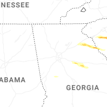


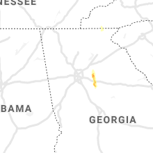


Connect with Interactive Hail Maps