

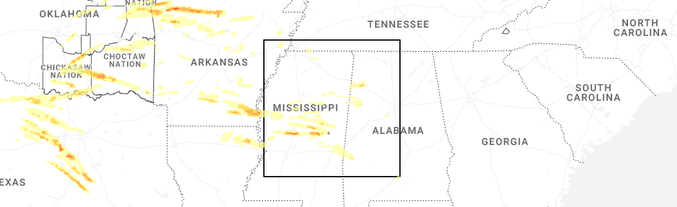
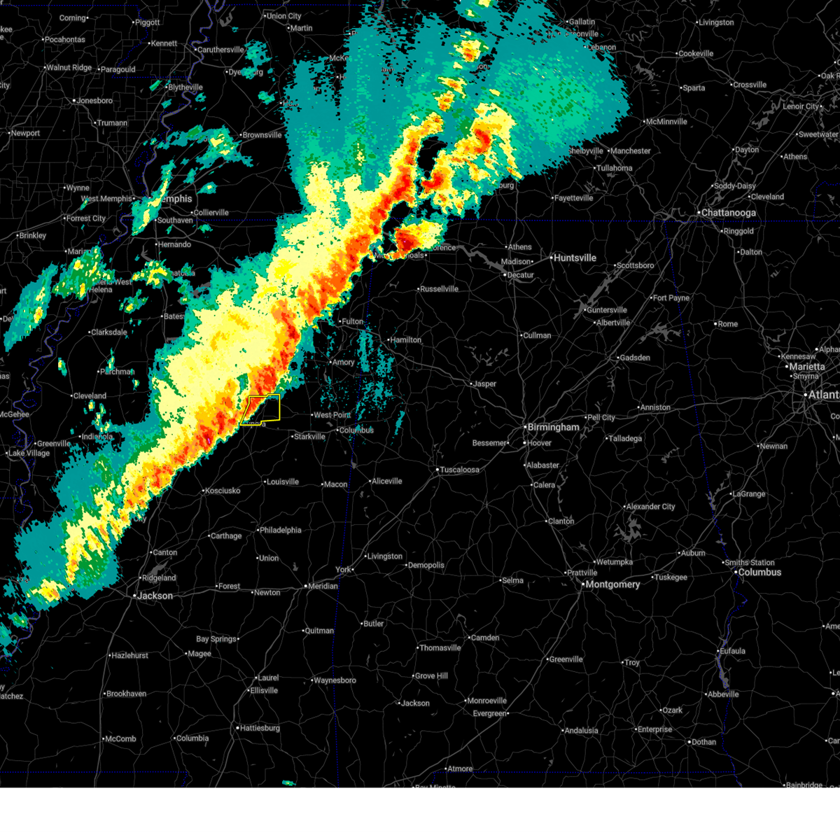
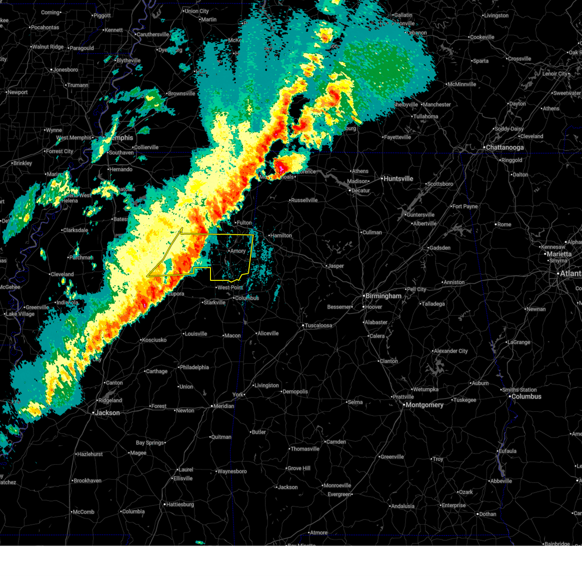
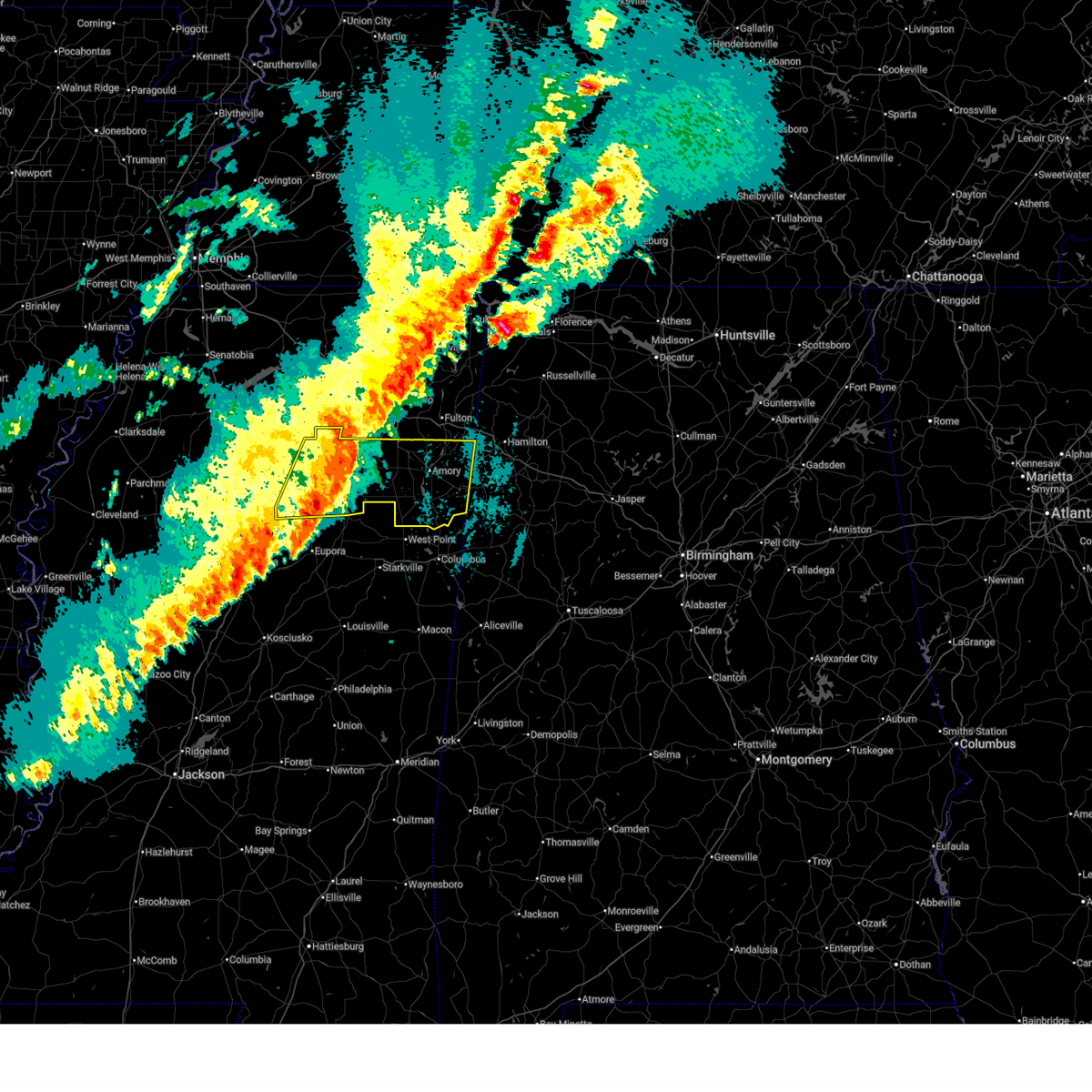
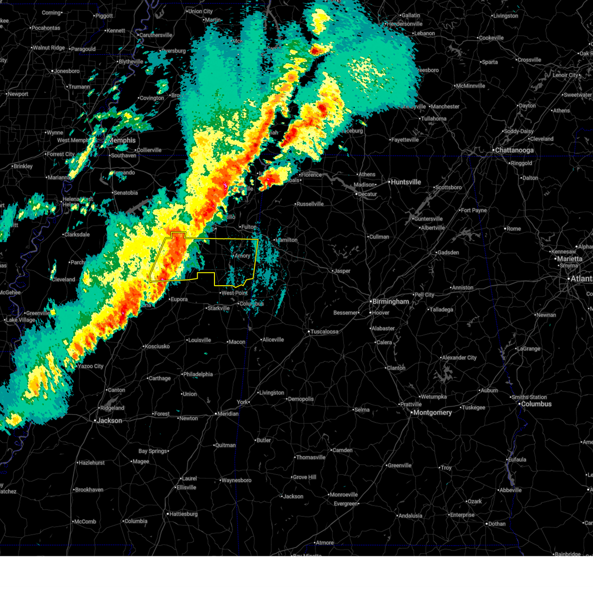
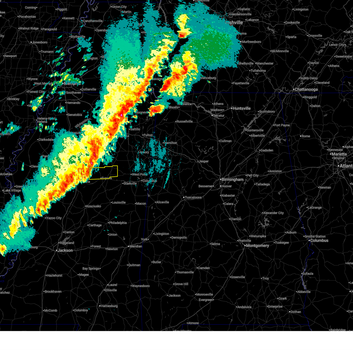
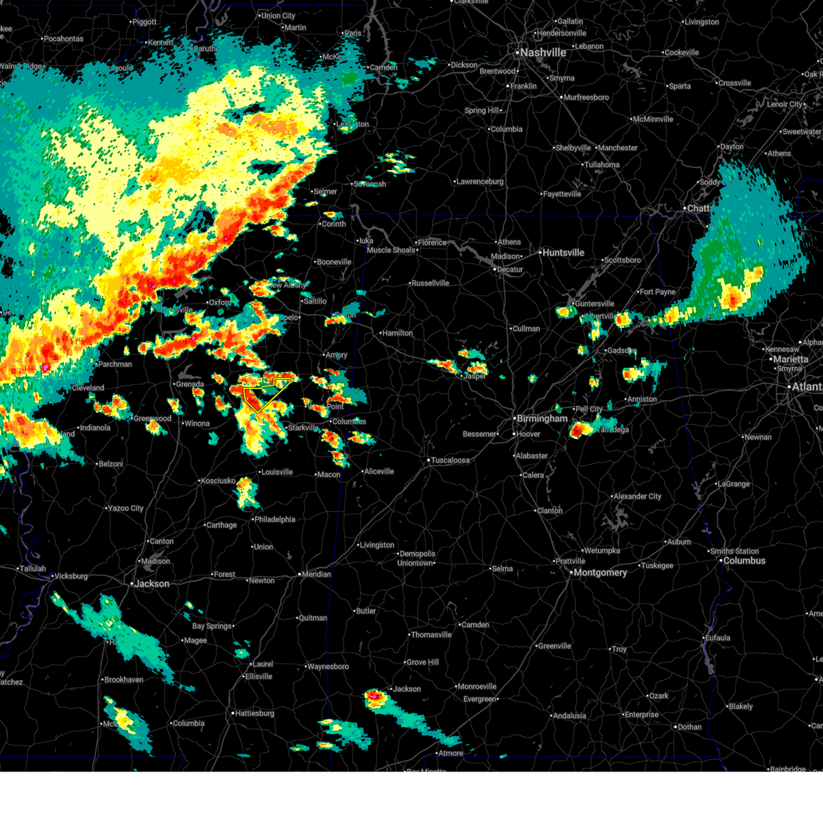
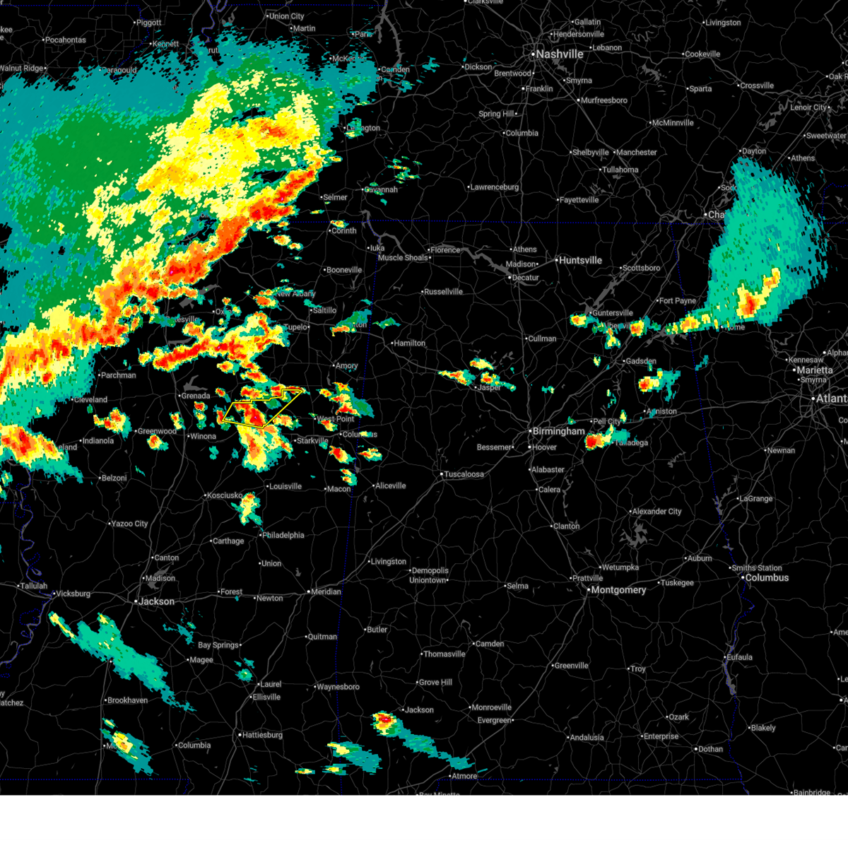
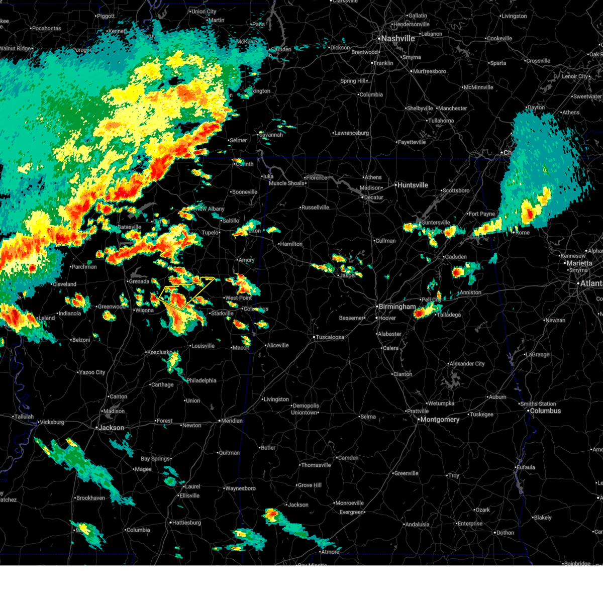
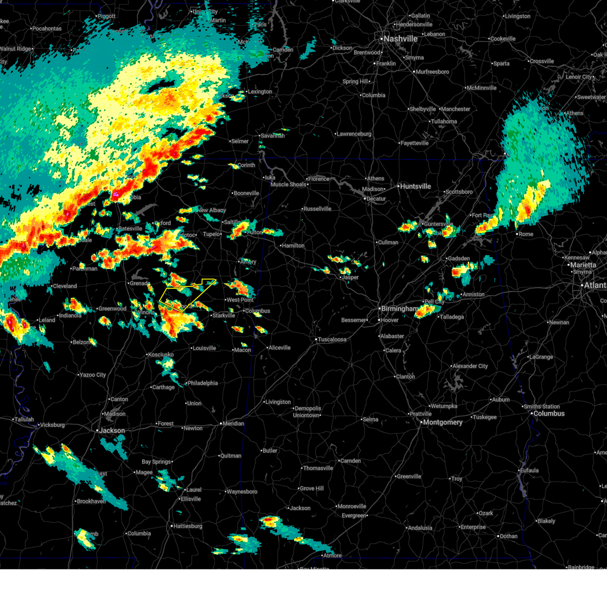
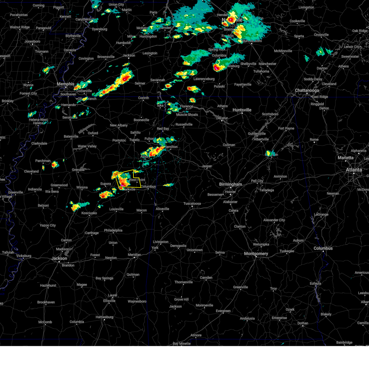
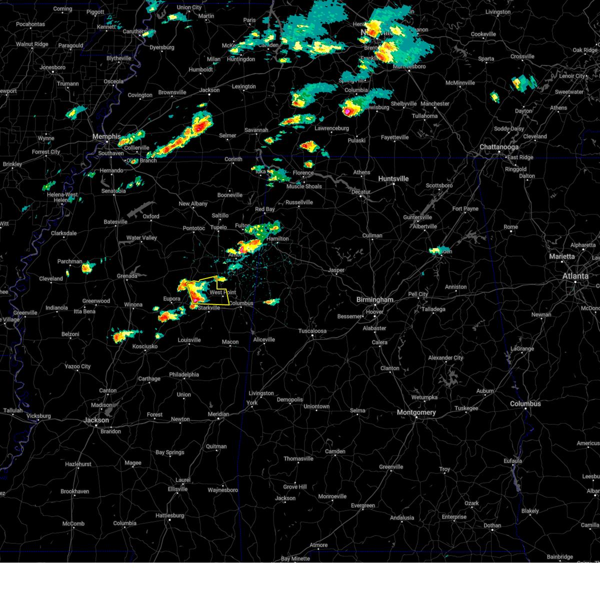
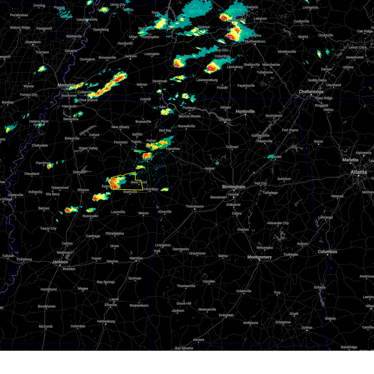
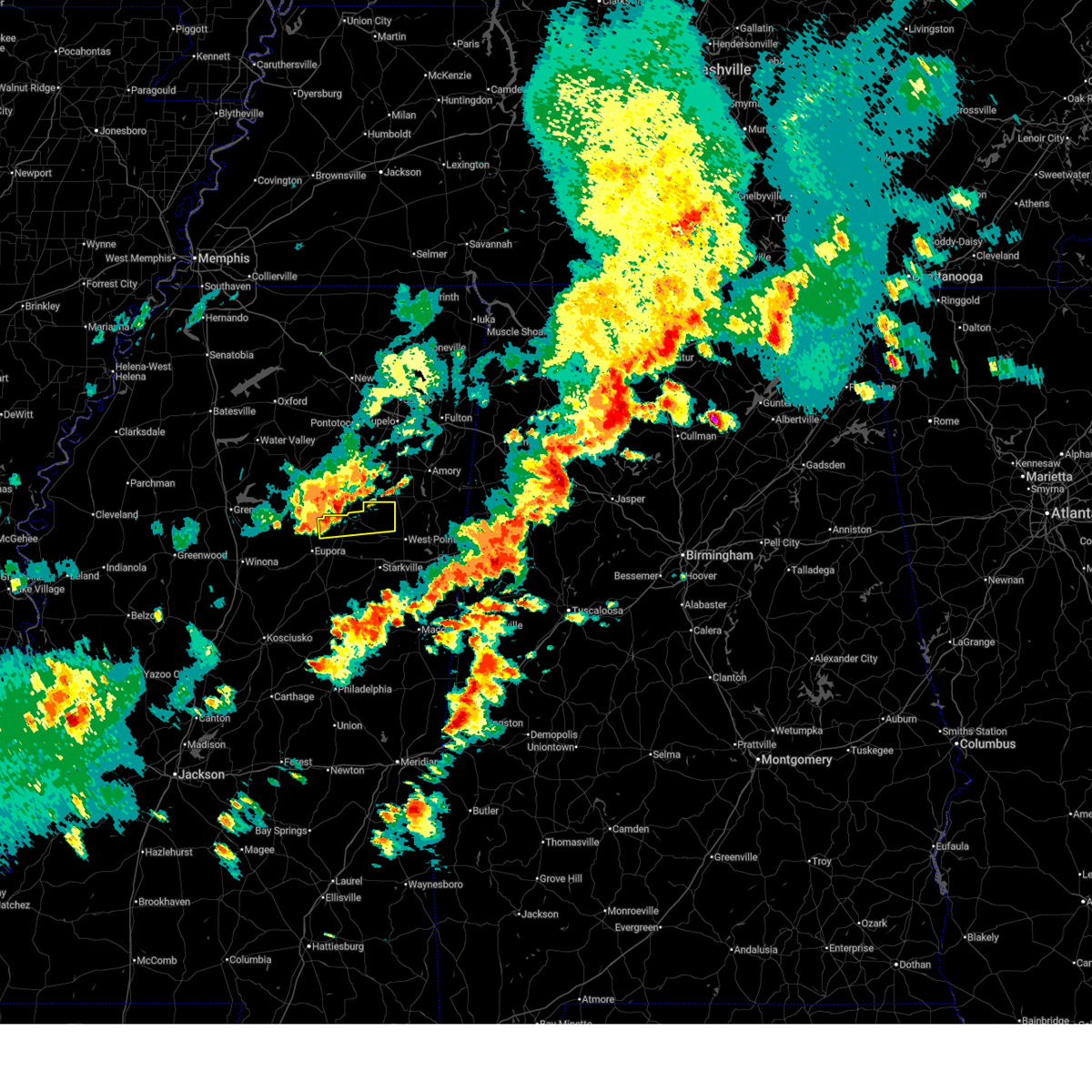
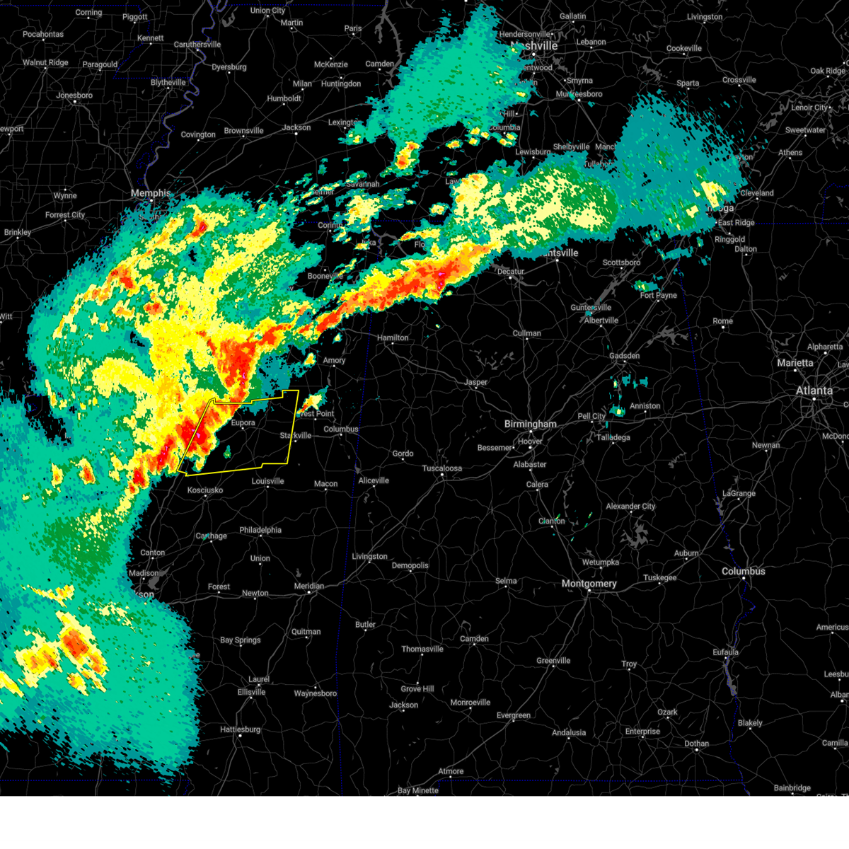
Hail Map for Mantee, MS
The Mantee, MS area has had 6 reports of on-the-ground hail by trained spotters, and has been under severe weather warnings 14 times during the past 12 months. Doppler radar has detected hail at or near Mantee, MS on 80 occasions, including 2 occasions during the past year.
| Name: | Mantee, MS |
| Where Located: | 22.7 miles NW of Starkville, MS |
| Map: | Google Map for Mantee, MS |
| Population: | 232 |
| Housing Units: | 115 |
| More Info: | Search Google for Mantee, MS |
0
The Top Recent Hail Date for Mantee, MS is Tuesday, April 28, 2026 (38th out of 80)
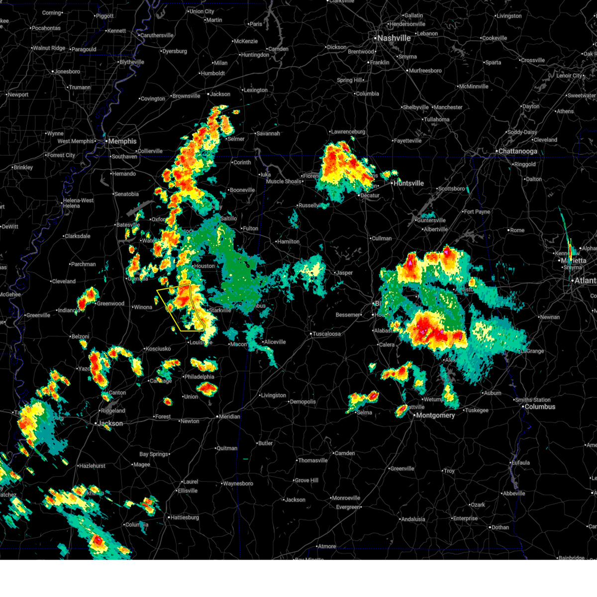
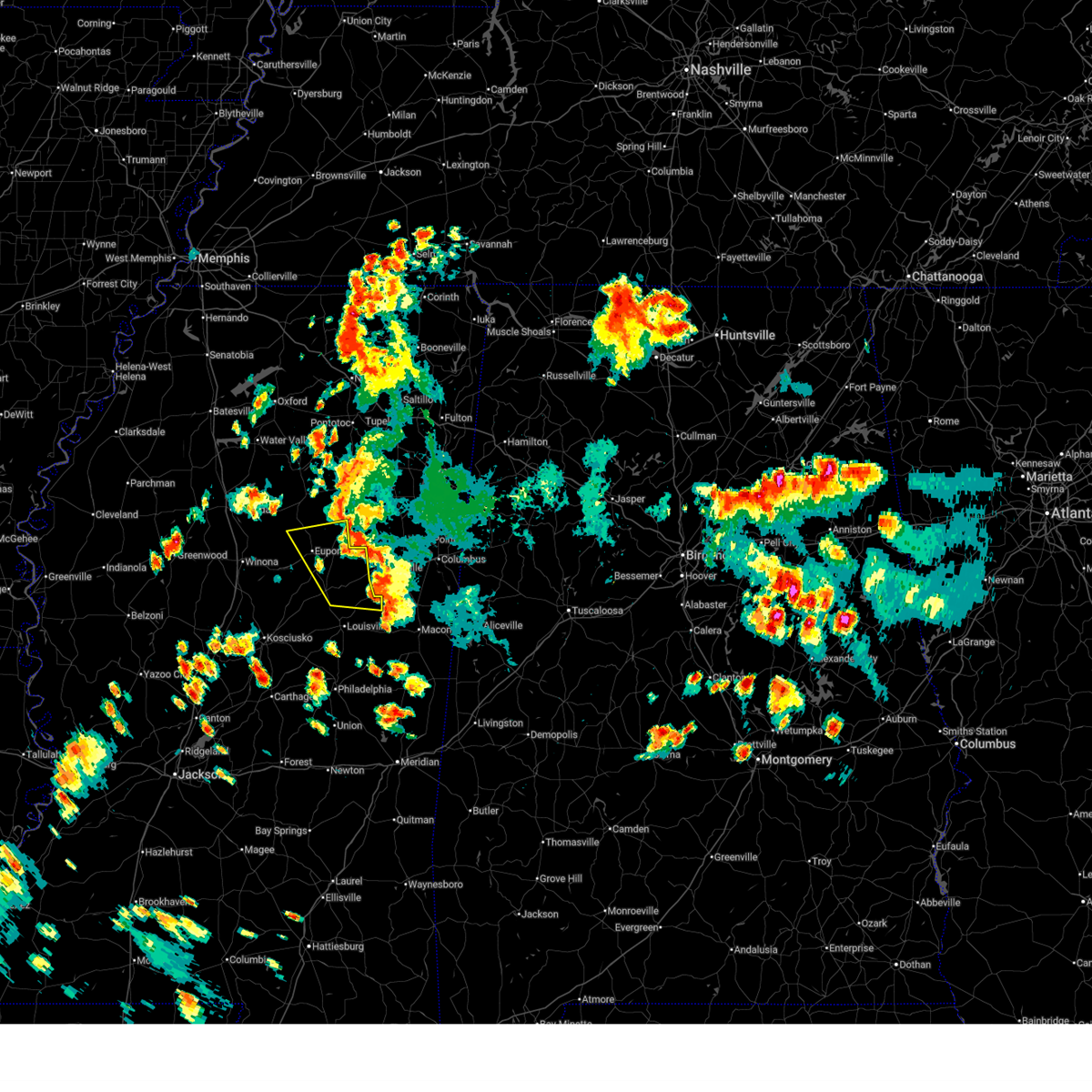
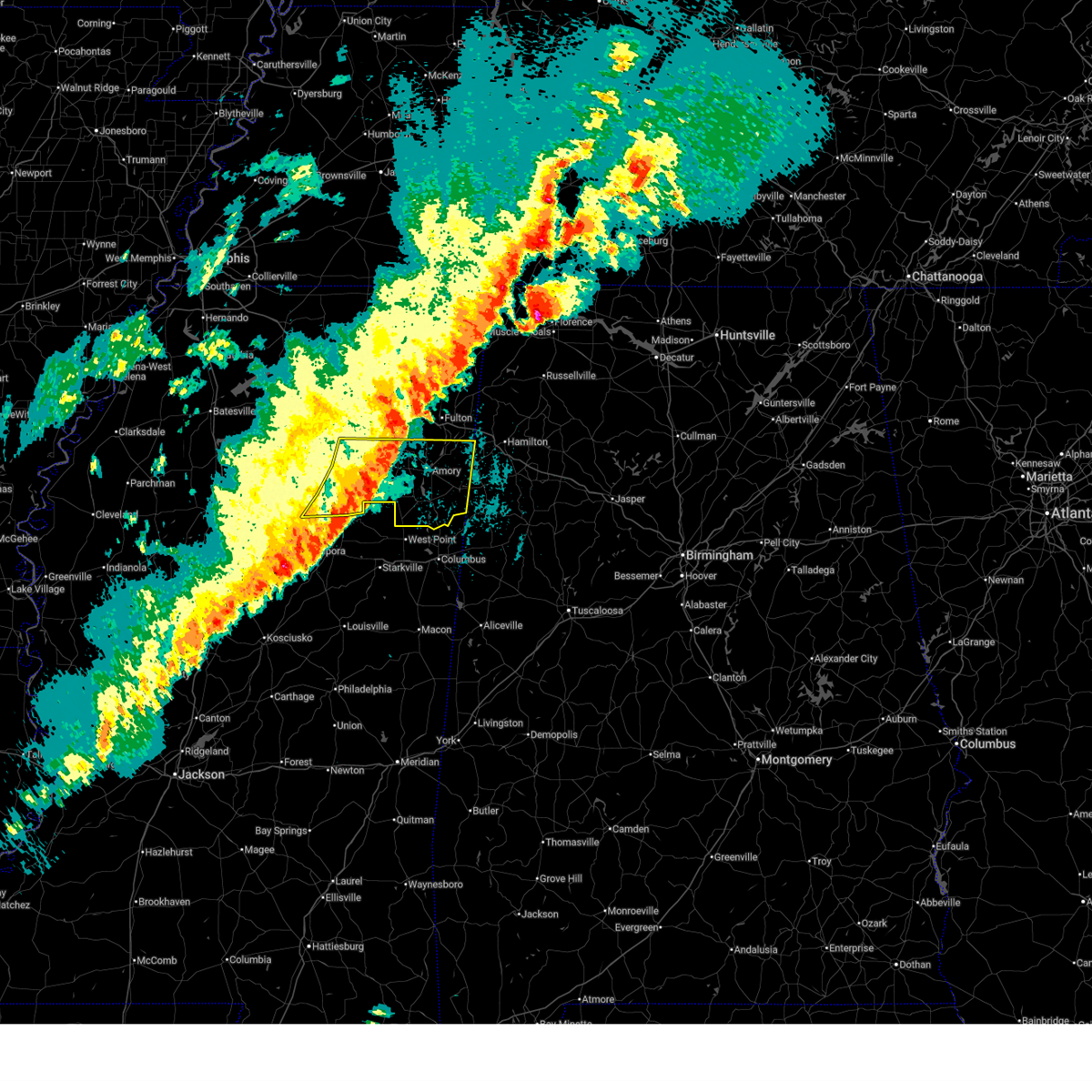
Hail and Wind Damage Spotted near Mantee, MS
| Date / Time | Report Details |
|---|---|
| 7/1/2026 5:59 PM CDT |
 At 559 pm cdt, severe thunderstorms were located along a line extending from bellefontaine to near reform to near sturgis, moving west at 25 mph (radar indicated). Hazards include 60 mph wind gusts. Expect damage to roofs, siding, and trees. Locations impacted include, eupora, ackerman, maben, mathiston, sturgis, walthall, craig springs, cumberland, sherwood, clarkson, bellefontaine, reform, and embry. At 559 pm cdt, severe thunderstorms were located along a line extending from bellefontaine to near reform to near sturgis, moving west at 25 mph (radar indicated). Hazards include 60 mph wind gusts. Expect damage to roofs, siding, and trees. Locations impacted include, eupora, ackerman, maben, mathiston, sturgis, walthall, craig springs, cumberland, sherwood, clarkson, bellefontaine, reform, and embry.
|
| 7/1/2026 5:41 PM CDT |
 Svrjan the national weather service in jackson has issued a * severe thunderstorm warning for, northeastern choctaw county in central mississippi, western oktibbeha county in northeastern mississippi, northeastern winston county in east central mississippi, central webster county in north central mississippi, * until 630 pm cdt. * at 540 pm cdt, severe thunderstorms were located along a line extending from near clarkson to near betheden, moving west at 20 mph (radar indicated). Hazards include 60 mph wind gusts. expect damage to roofs, siding, and trees Svrjan the national weather service in jackson has issued a * severe thunderstorm warning for, northeastern choctaw county in central mississippi, western oktibbeha county in northeastern mississippi, northeastern winston county in east central mississippi, central webster county in north central mississippi, * until 630 pm cdt. * at 540 pm cdt, severe thunderstorms were located along a line extending from near clarkson to near betheden, moving west at 20 mph (radar indicated). Hazards include 60 mph wind gusts. expect damage to roofs, siding, and trees
|
| 3/15/2026 10:14 PM CDT |
 At 1013 pm cdt, severe thunderstorms were located along a line extending from near verona to okolona to near montpelier, moving east at 45 mph (trained weather spotters). Hazards include 70 mph wind gusts and nickel size hail. Expect considerable tree damage. damage is likely to mobile homes, roofs, and outbuildings. Locations impacted include, amory, aberdeen, houston, okolona, shannon, vardaman, smithville, prairie, pyland, new salem, new wren, trebloc, houlka, nettleton, new houlka, algoma, hatley, woodland, gattman, and thorn. At 1013 pm cdt, severe thunderstorms were located along a line extending from near verona to okolona to near montpelier, moving east at 45 mph (trained weather spotters). Hazards include 70 mph wind gusts and nickel size hail. Expect considerable tree damage. damage is likely to mobile homes, roofs, and outbuildings. Locations impacted include, amory, aberdeen, houston, okolona, shannon, vardaman, smithville, prairie, pyland, new salem, new wren, trebloc, houlka, nettleton, new houlka, algoma, hatley, woodland, gattman, and thorn.
|
| 3/15/2026 10:11 PM CDT |
 At 1011 pm cdt, a severe thunderstorm was located over mantee, or 14 miles south of houston, moving east at 35 mph (radar indicated). Hazards include 60 mph wind gusts. Expect damage to roofs, siding, and trees. Locations impacted include, mathiston, mantee, pheba, cumberland, montpelier, and clarkson. At 1011 pm cdt, a severe thunderstorm was located over mantee, or 14 miles south of houston, moving east at 35 mph (radar indicated). Hazards include 60 mph wind gusts. Expect damage to roofs, siding, and trees. Locations impacted include, mathiston, mantee, pheba, cumberland, montpelier, and clarkson.
|
| 3/15/2026 10:05 PM CDT |
 At 1005 pm cdt, severe thunderstorms were located along a line extending from near troy to 6 miles west of okolona to mantee, moving east at 65 mph (trained weather spotters). Hazards include 70 mph wind gusts and nickel size hail. Expect considerable tree damage. damage is likely to mobile homes, roofs, and outbuildings. Locations impacted include, amory, aberdeen, houston, okolona, calhoun city, shannon, vardaman, derma, smithville, slate springs, prairie, pyland, new salem, new wren, trebloc, houlka, nettleton, new houlka, algoma, and hatley. At 1005 pm cdt, severe thunderstorms were located along a line extending from near troy to 6 miles west of okolona to mantee, moving east at 65 mph (trained weather spotters). Hazards include 70 mph wind gusts and nickel size hail. Expect considerable tree damage. damage is likely to mobile homes, roofs, and outbuildings. Locations impacted include, amory, aberdeen, houston, okolona, calhoun city, shannon, vardaman, derma, smithville, slate springs, prairie, pyland, new salem, new wren, trebloc, houlka, nettleton, new houlka, algoma, and hatley.
|
| 3/15/2026 9:57 PM CDT |
 Svrmeg the national weather service in memphis has issued a * severe thunderstorm warning for, chickasaw county in northeastern mississippi, calhoun county in northeastern mississippi, southern pontotoc county in northeastern mississippi, southern itawamba county in northeastern mississippi, southern lee county in northeastern mississippi, monroe county in northeastern mississippi, * until 1045 pm cdt. * at 957 pm cdt, severe thunderstorms were located along a line extending from near pontotoc to 7 miles west of mantee, moving east at 50 mph (radar indicated). Hazards include 70 mph wind gusts and nickel size hail. Expect considerable tree damage. Damage is likely to mobile homes, roofs, and outbuildings. Svrmeg the national weather service in memphis has issued a * severe thunderstorm warning for, chickasaw county in northeastern mississippi, calhoun county in northeastern mississippi, southern pontotoc county in northeastern mississippi, southern itawamba county in northeastern mississippi, southern lee county in northeastern mississippi, monroe county in northeastern mississippi, * until 1045 pm cdt. * at 957 pm cdt, severe thunderstorms were located along a line extending from near pontotoc to 7 miles west of mantee, moving east at 50 mph (radar indicated). Hazards include 70 mph wind gusts and nickel size hail. Expect considerable tree damage. Damage is likely to mobile homes, roofs, and outbuildings.
|
| 3/15/2026 9:48 PM CDT |
 Svrmeg the national weather service in memphis has issued a * severe thunderstorm warning for, chickasaw county in northeastern mississippi, calhoun county in northeastern mississippi, southern pontotoc county in northeastern mississippi, southern itawamba county in northeastern mississippi, southern lee county in northeastern mississippi, monroe county in northeastern mississippi, * until 1045 pm cdt. * at 947 pm cdt, severe thunderstorms were located along a line extending from near pontotoc to near slate springs, moving east at 50 mph (radar indicated). Hazards include 60 mph wind gusts and nickel size hail. expect damage to roofs, siding, and trees Svrmeg the national weather service in memphis has issued a * severe thunderstorm warning for, chickasaw county in northeastern mississippi, calhoun county in northeastern mississippi, southern pontotoc county in northeastern mississippi, southern itawamba county in northeastern mississippi, southern lee county in northeastern mississippi, monroe county in northeastern mississippi, * until 1045 pm cdt. * at 947 pm cdt, severe thunderstorms were located along a line extending from near pontotoc to near slate springs, moving east at 50 mph (radar indicated). Hazards include 60 mph wind gusts and nickel size hail. expect damage to roofs, siding, and trees
|
| 3/15/2026 9:43 PM CDT |
 Svrjan the national weather service in jackson has issued a * severe thunderstorm warning for, webster county in north central mississippi, west central clay county in northeastern mississippi, * until 1030 pm cdt. * at 943 pm cdt, a severe thunderstorm was located over embry, or 10 miles northwest of eupora, moving east at 45 mph (radar indicated). Hazards include 60 mph wind gusts. expect damage to roofs, siding, and trees Svrjan the national weather service in jackson has issued a * severe thunderstorm warning for, webster county in north central mississippi, west central clay county in northeastern mississippi, * until 1030 pm cdt. * at 943 pm cdt, a severe thunderstorm was located over embry, or 10 miles northwest of eupora, moving east at 45 mph (radar indicated). Hazards include 60 mph wind gusts. expect damage to roofs, siding, and trees
|
| 3/15/2026 9:30 PM CDT |
 the severe thunderstorm warning has been cancelled and is no longer in effect the severe thunderstorm warning has been cancelled and is no longer in effect
|
| 3/15/2026 9:30 PM CDT |
 At 930 pm cdt, severe thunderstorms were located along a line extending from new albany to randolph to 7 miles west of calhoun city, moving east at 45 mph (radar indicated). Hazards include 60 mph wind gusts and nickel size hail. Expect damage to roofs, siding, and trees. locations impacted include, new albany, pontotoc, houston, water valley, trace state park, bruce, calhoun city, vardaman, derma, coffeeville, ecru, pittsboro, slate springs, sabougla, new harmony, randolph, troy, velma, pyland, and etta. this includes the following highways, interstate 22 in mississipppi between mile markers 64 and 79. Interstate 55 in mississippi between mile markers 215 and 218. At 930 pm cdt, severe thunderstorms were located along a line extending from new albany to randolph to 7 miles west of calhoun city, moving east at 45 mph (radar indicated). Hazards include 60 mph wind gusts and nickel size hail. Expect damage to roofs, siding, and trees. locations impacted include, new albany, pontotoc, houston, water valley, trace state park, bruce, calhoun city, vardaman, derma, coffeeville, ecru, pittsboro, slate springs, sabougla, new harmony, randolph, troy, velma, pyland, and etta. this includes the following highways, interstate 22 in mississipppi between mile markers 64 and 79. Interstate 55 in mississippi between mile markers 215 and 218.
|
| 3/15/2026 9:13 PM CDT |
 At 912 pm cdt, severe thunderstorms were located along a line extending from near cambridge to near tula to 7 miles north of gore springs, moving east at 50 mph (radar indicated). Hazards include 70 mph wind gusts and nickel size hail. Expect considerable tree damage. damage is likely to mobile homes, roofs, and outbuildings. locations impacted include, oxford, new albany, pontotoc, houston, water valley, trace state park, holly springs national forest, bruce, calhoun city, vardaman, derma, coffeeville, ecru, pittsboro, slate springs, cambridge, new harmony, troy, velma, and etta. this includes the following highways, interstate 22 in mississipppi between mile markers 64 and 79. Interstate 55 in mississippi between mile markers 215 and 227. At 912 pm cdt, severe thunderstorms were located along a line extending from near cambridge to near tula to 7 miles north of gore springs, moving east at 50 mph (radar indicated). Hazards include 70 mph wind gusts and nickel size hail. Expect considerable tree damage. damage is likely to mobile homes, roofs, and outbuildings. locations impacted include, oxford, new albany, pontotoc, houston, water valley, trace state park, holly springs national forest, bruce, calhoun city, vardaman, derma, coffeeville, ecru, pittsboro, slate springs, cambridge, new harmony, troy, velma, and etta. this includes the following highways, interstate 22 in mississipppi between mile markers 64 and 79. Interstate 55 in mississippi between mile markers 215 and 227.
|
| 3/15/2026 9:08 PM CDT |
 Svrmeg the national weather service in memphis has issued a * severe thunderstorm warning for, lafayette county in northwestern mississippi, western chickasaw county in northeastern mississippi, yalobusha county in northwestern mississippi, calhoun county in northeastern mississippi, southern union county in northeastern mississippi, pontotoc county in northeastern mississippi, east central tallahatchie county in northwestern mississippi, southeastern panola county in northwestern mississippi, * until 945 pm cdt. * at 907 pm cdt, severe thunderstorms were located along a line extending from cambridge to near paris to 7 miles northwest of gore springs, moving east at 45 mph (radar indicated). Hazards include 60 mph wind gusts and nickel size hail. expect damage to roofs, siding, and trees Svrmeg the national weather service in memphis has issued a * severe thunderstorm warning for, lafayette county in northwestern mississippi, western chickasaw county in northeastern mississippi, yalobusha county in northwestern mississippi, calhoun county in northeastern mississippi, southern union county in northeastern mississippi, pontotoc county in northeastern mississippi, east central tallahatchie county in northwestern mississippi, southeastern panola county in northwestern mississippi, * until 945 pm cdt. * at 907 pm cdt, severe thunderstorms were located along a line extending from cambridge to near paris to 7 miles northwest of gore springs, moving east at 45 mph (radar indicated). Hazards include 60 mph wind gusts and nickel size hail. expect damage to roofs, siding, and trees
|
| 8/14/2025 6:19 PM CDT |
 Svrjan the national weather service in jackson has issued a * severe thunderstorm warning for, choctaw county in central mississippi, northwestern oktibbeha county in northeastern mississippi, northeastern attala county in central mississippi, webster county in north central mississippi, southeastern montgomery county in north central mississippi, southwestern clay county in northeastern mississippi, * until 715 pm cdt. * at 619 pm cdt, a severe thunderstorm was located near chester, or 8 miles south of eupora, moving northeast at 30 mph (radar indicated). Hazards include 60 mph wind gusts. Expect damage to roofs, siding, and trees. this severe thunderstorm will be near, eupora, sherwood, and reform around 625 pm cdt. mathiston around 630 pm cdt. maben and walthall around 635 pm cdt. cumberland and clarkson around 640 pm cdt. Mantee around 655 pm cdt. Svrjan the national weather service in jackson has issued a * severe thunderstorm warning for, choctaw county in central mississippi, northwestern oktibbeha county in northeastern mississippi, northeastern attala county in central mississippi, webster county in north central mississippi, southeastern montgomery county in north central mississippi, southwestern clay county in northeastern mississippi, * until 715 pm cdt. * at 619 pm cdt, a severe thunderstorm was located near chester, or 8 miles south of eupora, moving northeast at 30 mph (radar indicated). Hazards include 60 mph wind gusts. Expect damage to roofs, siding, and trees. this severe thunderstorm will be near, eupora, sherwood, and reform around 625 pm cdt. mathiston around 630 pm cdt. maben and walthall around 635 pm cdt. cumberland and clarkson around 640 pm cdt. Mantee around 655 pm cdt.
|
| 8/13/2025 1:30 PM CDT |
 Svrjan the national weather service in jackson has issued a * severe thunderstorm warning for, northeastern oktibbeha county in northeastern mississippi, northeastern webster county in north central mississippi, clay county in northeastern mississippi, * until 215 pm cdt. * at 129 pm cdt, a severe thunderstorm was located over montpelier, or 12 miles south of houston, moving east at 20 mph (radar indicated). Hazards include 60 mph wind gusts and penny size hail. Expect damage to roofs, siding, and trees. This severe thunderstorm will be near, griffith and pala alto around 135 pm cdt. Svrjan the national weather service in jackson has issued a * severe thunderstorm warning for, northeastern oktibbeha county in northeastern mississippi, northeastern webster county in north central mississippi, clay county in northeastern mississippi, * until 215 pm cdt. * at 129 pm cdt, a severe thunderstorm was located over montpelier, or 12 miles south of houston, moving east at 20 mph (radar indicated). Hazards include 60 mph wind gusts and penny size hail. Expect damage to roofs, siding, and trees. This severe thunderstorm will be near, griffith and pala alto around 135 pm cdt.
|
| 5/25/2025 8:12 PM CDT |
 At 811 pm cdt, severe thunderstorms were located along a line extending from near chester to near ethel to brozville, moving southeast at 50 mph (radar indicated). Hazards include 60 mph wind gusts and penny size hail. Expect damage to roofs, siding, and trees. Locations impacted include, durant, belzoni, eupora, lexington, vaiden, tchula, kilmichael, mathiston, weir, silver city, mantee, west, french camp, walthall, tolarville, poplar creek, clarkson, emory, thornton, and howard. At 811 pm cdt, severe thunderstorms were located along a line extending from near chester to near ethel to brozville, moving southeast at 50 mph (radar indicated). Hazards include 60 mph wind gusts and penny size hail. Expect damage to roofs, siding, and trees. Locations impacted include, durant, belzoni, eupora, lexington, vaiden, tchula, kilmichael, mathiston, weir, silver city, mantee, west, french camp, walthall, tolarville, poplar creek, clarkson, emory, thornton, and howard.
|
| 5/25/2025 8:12 PM CDT |
 the severe thunderstorm warning has been cancelled and is no longer in effect the severe thunderstorm warning has been cancelled and is no longer in effect
|
| 5/25/2025 7:11 PM CDT |
 Svrjan the national weather service in jackson has issued a * severe thunderstorm warning for, southern sunflower county in northwestern mississippi, choctaw county in central mississippi, holmes county in central mississippi, carroll county in north central mississippi, southeastern grenada county in north central mississippi, southern leflore county in north central mississippi, northern attala county in central mississippi, webster county in north central mississippi, montgomery county in north central mississippi, eastern humphreys county in central mississippi, * until 830 pm cdt. * at 711 pm cdt, severe thunderstorms were located along a line extending from 6 miles north of grenada to near avalon to near shaw, moving southeast at 50 mph (radar indicated). Hazards include 60 mph wind gusts and quarter size hail. Hail damage to vehicles is expected. Expect wind damage to roofs, siding, and trees. Svrjan the national weather service in jackson has issued a * severe thunderstorm warning for, southern sunflower county in northwestern mississippi, choctaw county in central mississippi, holmes county in central mississippi, carroll county in north central mississippi, southeastern grenada county in north central mississippi, southern leflore county in north central mississippi, northern attala county in central mississippi, webster county in north central mississippi, montgomery county in north central mississippi, eastern humphreys county in central mississippi, * until 830 pm cdt. * at 711 pm cdt, severe thunderstorms were located along a line extending from 6 miles north of grenada to near avalon to near shaw, moving southeast at 50 mph (radar indicated). Hazards include 60 mph wind gusts and quarter size hail. Hail damage to vehicles is expected. Expect wind damage to roofs, siding, and trees.
|
| 5/25/2025 6:30 PM CDT |
 At 630 pm cdt, a severe thunderstorm was located over mantee, or 13 miles south of houston, moving northeast at 35 mph (radar indicated). Hazards include 70 mph wind gusts and ping pong ball size hail. People and animals outdoors will be injured. expect hail damage to roofs, siding, windows, and vehicles. expect considerable tree damage. wind damage is also likely to mobile homes, roofs, and outbuildings. Locations impacted include, mantee, cumberland, montpelier, and clarkson. At 630 pm cdt, a severe thunderstorm was located over mantee, or 13 miles south of houston, moving northeast at 35 mph (radar indicated). Hazards include 70 mph wind gusts and ping pong ball size hail. People and animals outdoors will be injured. expect hail damage to roofs, siding, windows, and vehicles. expect considerable tree damage. wind damage is also likely to mobile homes, roofs, and outbuildings. Locations impacted include, mantee, cumberland, montpelier, and clarkson.
|
| 5/25/2025 6:20 PM CDT |
 At 620 pm cdt, a severe thunderstorm was located over clarkson, or 12 miles northeast of eupora, moving northeast at 35 mph (radar indicated). Hazards include 70 mph wind gusts and ping pong ball size hail. People and animals outdoors will be injured. expect hail damage to roofs, siding, windows, and vehicles. expect considerable tree damage. wind damage is also likely to mobile homes, roofs, and outbuildings. Locations impacted include, mantee, walthall, bellefontaine, cumberland, embry, montpelier, and clarkson. At 620 pm cdt, a severe thunderstorm was located over clarkson, or 12 miles northeast of eupora, moving northeast at 35 mph (radar indicated). Hazards include 70 mph wind gusts and ping pong ball size hail. People and animals outdoors will be injured. expect hail damage to roofs, siding, windows, and vehicles. expect considerable tree damage. wind damage is also likely to mobile homes, roofs, and outbuildings. Locations impacted include, mantee, walthall, bellefontaine, cumberland, embry, montpelier, and clarkson.
|
| 5/25/2025 6:20 PM CDT |
 the severe thunderstorm warning has been cancelled and is no longer in effect the severe thunderstorm warning has been cancelled and is no longer in effect
|
| 5/25/2025 6:19 PM CDT |
 At 618 pm cdt, a severe thunderstorm was located over clarkson, or 10 miles northeast of eupora, moving northeast at 35 mph (radar indicated). Hazards include 70 mph wind gusts and ping pong ball size hail. People and animals outdoors will be injured. expect hail damage to roofs, siding, windows, and vehicles. expect considerable tree damage. wind damage is also likely to mobile homes, roofs, and outbuildings. Locations impacted include, eupora, mathiston, mantee, walthall, bellefontaine, cumberland, embry, montpelier, and clarkson. At 618 pm cdt, a severe thunderstorm was located over clarkson, or 10 miles northeast of eupora, moving northeast at 35 mph (radar indicated). Hazards include 70 mph wind gusts and ping pong ball size hail. People and animals outdoors will be injured. expect hail damage to roofs, siding, windows, and vehicles. expect considerable tree damage. wind damage is also likely to mobile homes, roofs, and outbuildings. Locations impacted include, eupora, mathiston, mantee, walthall, bellefontaine, cumberland, embry, montpelier, and clarkson.
|
| 5/25/2025 6:04 PM CDT |
 Svrjan the national weather service in jackson has issued a * severe thunderstorm warning for, north central choctaw county in central mississippi, webster county in north central mississippi, northwestern clay county in northeastern mississippi, * until 700 pm cdt. * at 604 pm cdt, a severe thunderstorm was located over eupora, moving northeast at 35 mph (radar indicated). Hazards include 60 mph wind gusts and quarter size hail. Hail damage to vehicles is expected. Expect wind damage to roofs, siding, and trees. Svrjan the national weather service in jackson has issued a * severe thunderstorm warning for, north central choctaw county in central mississippi, webster county in north central mississippi, northwestern clay county in northeastern mississippi, * until 700 pm cdt. * at 604 pm cdt, a severe thunderstorm was located over eupora, moving northeast at 35 mph (radar indicated). Hazards include 60 mph wind gusts and quarter size hail. Hail damage to vehicles is expected. Expect wind damage to roofs, siding, and trees.
|
| 5/18/2025 11:00 AM CDT | 1 tree down across natchez trace parkway just north of highway 4 in clay county MS, 1.7 miles WSW of Mantee, MS |
| 5/8/2025 3:56 PM CDT |
 the severe thunderstorm warning has been cancelled and is no longer in effect the severe thunderstorm warning has been cancelled and is no longer in effect
|
| 5/8/2025 3:47 PM CDT |
 At 347 pm cdt, a severe thunderstorm was located near pheba, or 8 miles northwest of starkville, moving east at 20 mph (radar indicated). Hazards include golf ball size hail and 60 mph wind gusts. People and animals outdoors will be injured. expect hail damage to roofs, siding, windows, and vehicles. expect wind damage to roofs, siding, and trees. this severe storm will be near, griffith around 355 pm cdt. muldrow around 400 pm cdt. west point around 405 pm cdt. Tibbee around 410 pm cdt. At 347 pm cdt, a severe thunderstorm was located near pheba, or 8 miles northwest of starkville, moving east at 20 mph (radar indicated). Hazards include golf ball size hail and 60 mph wind gusts. People and animals outdoors will be injured. expect hail damage to roofs, siding, windows, and vehicles. expect wind damage to roofs, siding, and trees. this severe storm will be near, griffith around 355 pm cdt. muldrow around 400 pm cdt. west point around 405 pm cdt. Tibbee around 410 pm cdt.
|
| 5/8/2025 3:28 PM CDT |
 Svrjan the national weather service in jackson has issued a * severe thunderstorm warning for, northern oktibbeha county in northeastern mississippi, northeastern webster county in north central mississippi, clay county in northeastern mississippi, * until 430 pm cdt. * at 327 pm cdt, severe thunderstorms were located along a line extending from near mantee to maben, moving east at 25 mph (radar indicated). Hazards include ping pong ball size hail and 60 mph wind gusts. People and animals outdoors will be injured. expect hail damage to roofs, siding, windows, and vehicles. expect wind damage to roofs, siding, and trees. severe thunderstorms will be near, montpelier and pheba around 335 pm cdt. griffith around 350 pm cdt. pala alto around 355 pm cdt. Muldrow and west point around 405 pm cdt. Svrjan the national weather service in jackson has issued a * severe thunderstorm warning for, northern oktibbeha county in northeastern mississippi, northeastern webster county in north central mississippi, clay county in northeastern mississippi, * until 430 pm cdt. * at 327 pm cdt, severe thunderstorms were located along a line extending from near mantee to maben, moving east at 25 mph (radar indicated). Hazards include ping pong ball size hail and 60 mph wind gusts. People and animals outdoors will be injured. expect hail damage to roofs, siding, windows, and vehicles. expect wind damage to roofs, siding, and trees. severe thunderstorms will be near, montpelier and pheba around 335 pm cdt. griffith around 350 pm cdt. pala alto around 355 pm cdt. Muldrow and west point around 405 pm cdt.
|
| 5/2/2025 3:59 PM CDT |
 Svrjan the national weather service in jackson has issued a * severe thunderstorm warning for, northeastern webster county in north central mississippi, northwestern clay county in northeastern mississippi, * until 445 pm cdt. * at 359 pm cdt, a severe thunderstorm was located over mantee, or 12 miles south of houston, moving east at 30 mph (radar indicated). Hazards include 60 mph wind gusts and quarter size hail. Hail damage to vehicles is expected. Expect wind damage to roofs, siding, and trees. Svrjan the national weather service in jackson has issued a * severe thunderstorm warning for, northeastern webster county in north central mississippi, northwestern clay county in northeastern mississippi, * until 445 pm cdt. * at 359 pm cdt, a severe thunderstorm was located over mantee, or 12 miles south of houston, moving east at 30 mph (radar indicated). Hazards include 60 mph wind gusts and quarter size hail. Hail damage to vehicles is expected. Expect wind damage to roofs, siding, and trees.
|
| 3/31/2025 4:45 AM CDT |
 Svrjan the national weather service in jackson has issued a * severe thunderstorm warning for, choctaw county in central mississippi, southeastern carroll county in north central mississippi, southeastern grenada county in north central mississippi, western oktibbeha county in northeastern mississippi, northeastern attala county in central mississippi, webster county in north central mississippi, montgomery county in north central mississippi, western clay county in northeastern mississippi, * until 545 am cdt. * at 445 am cdt, a severe thunderstorm was located near lodi, or 12 miles west of eupora, moving east at 45 mph (radar indicated). Hazards include 60 mph wind gusts and quarter size hail. Hail damage to vehicles is expected. expect wind damage to roofs, siding, and trees. this severe thunderstorm will be near, eupora, walthall, bellefontaine, and embry around 450 am cdt. clarkson around 500 am cdt. cumberland, maben, sherwood, and mathiston around 505 am cdt. pheba around 515 am cdt. Griffith around 525 am cdt. Svrjan the national weather service in jackson has issued a * severe thunderstorm warning for, choctaw county in central mississippi, southeastern carroll county in north central mississippi, southeastern grenada county in north central mississippi, western oktibbeha county in northeastern mississippi, northeastern attala county in central mississippi, webster county in north central mississippi, montgomery county in north central mississippi, western clay county in northeastern mississippi, * until 545 am cdt. * at 445 am cdt, a severe thunderstorm was located near lodi, or 12 miles west of eupora, moving east at 45 mph (radar indicated). Hazards include 60 mph wind gusts and quarter size hail. Hail damage to vehicles is expected. expect wind damage to roofs, siding, and trees. this severe thunderstorm will be near, eupora, walthall, bellefontaine, and embry around 450 am cdt. clarkson around 500 am cdt. cumberland, maben, sherwood, and mathiston around 505 am cdt. pheba around 515 am cdt. Griffith around 525 am cdt.
|
| 3/15/2025 2:51 PM CDT |
 the severe thunderstorm warning has been cancelled and is no longer in effect the severe thunderstorm warning has been cancelled and is no longer in effect
|
| 3/15/2025 2:51 PM CDT |
 At 250 pm cdt, severe thunderstorms were located along a line extending from near eupora to near ethel, moving northeast at 35 mph (radar indicated). Hazards include 60 mph wind gusts and quarter size hail. Hail damage to vehicles is expected. expect wind damage to roofs, siding, and trees. these severe storms will be near, eupora, french camp, and walthall around 255 pm cdt. chester, weir, mccool, clarkson, and mathiston around 305 pm cdt. Cumberland, sherwood, and reform around 310 pm cdt. At 250 pm cdt, severe thunderstorms were located along a line extending from near eupora to near ethel, moving northeast at 35 mph (radar indicated). Hazards include 60 mph wind gusts and quarter size hail. Hail damage to vehicles is expected. expect wind damage to roofs, siding, and trees. these severe storms will be near, eupora, french camp, and walthall around 255 pm cdt. chester, weir, mccool, clarkson, and mathiston around 305 pm cdt. Cumberland, sherwood, and reform around 310 pm cdt.
|
| 3/15/2025 2:14 PM CDT |
 Svrjan the national weather service in jackson has issued a * severe thunderstorm warning for, choctaw county in central mississippi, east central holmes county in central mississippi, southeastern carroll county in north central mississippi, northern attala county in central mississippi, webster county in north central mississippi, montgomery county in north central mississippi, * until 300 pm cdt. * at 214 pm cdt, severe thunderstorms were located along a line extending from near calhoun city to possumneck, moving east at 40 mph (radar indicated). Hazards include 60 mph wind gusts and quarter size hail. Hail damage to vehicles is expected. expect wind damage to roofs, siding, and trees. severe thunderstorms will be near, hesterville, kilmichael, bellefontaine, embry, lodi, and poplar creek around 220 pm cdt. eupora and walthall around 230 pm cdt. french camp around 235 pm cdt. clarkson around 240 pm cdt. chester, mantee, and weir around 245 pm cdt. Cumberland and mathiston around 250 pm cdt. Svrjan the national weather service in jackson has issued a * severe thunderstorm warning for, choctaw county in central mississippi, east central holmes county in central mississippi, southeastern carroll county in north central mississippi, northern attala county in central mississippi, webster county in north central mississippi, montgomery county in north central mississippi, * until 300 pm cdt. * at 214 pm cdt, severe thunderstorms were located along a line extending from near calhoun city to possumneck, moving east at 40 mph (radar indicated). Hazards include 60 mph wind gusts and quarter size hail. Hail damage to vehicles is expected. expect wind damage to roofs, siding, and trees. severe thunderstorms will be near, hesterville, kilmichael, bellefontaine, embry, lodi, and poplar creek around 220 pm cdt. eupora and walthall around 230 pm cdt. french camp around 235 pm cdt. clarkson around 240 pm cdt. chester, mantee, and weir around 245 pm cdt. Cumberland and mathiston around 250 pm cdt.
|
| 2/15/2025 10:13 PM CST |
 At 1012 pm cst, severe thunderstorms were located along a line extending from bellefontaine to near pickens, moving east at 50 mph (radar indicated). Hazards include 70 mph wind gusts. Expect considerable tree damage. damage is likely to mobile homes, roofs, and outbuildings. these severe storms will be near, eupora, hesterville, french camp, kosciusko, walthall, mcadams, newport, sallis, and clarkson around 1020 pm cst. cumberland and mathiston around 1025 pm cst. chester, mantee, weir, ethel, sherwood, and reform around 1030 pm cst. mccool and smyrna around 1035 pm cst. ackerman around 1040 pm cst. Zama around 1045 pm cst. At 1012 pm cst, severe thunderstorms were located along a line extending from bellefontaine to near pickens, moving east at 50 mph (radar indicated). Hazards include 70 mph wind gusts. Expect considerable tree damage. damage is likely to mobile homes, roofs, and outbuildings. these severe storms will be near, eupora, hesterville, french camp, kosciusko, walthall, mcadams, newport, sallis, and clarkson around 1020 pm cst. cumberland and mathiston around 1025 pm cst. chester, mantee, weir, ethel, sherwood, and reform around 1030 pm cst. mccool and smyrna around 1035 pm cst. ackerman around 1040 pm cst. Zama around 1045 pm cst.
|
| 2/15/2025 10:13 PM CST |
 the severe thunderstorm warning has been cancelled and is no longer in effect the severe thunderstorm warning has been cancelled and is no longer in effect
|
| 2/15/2025 9:55 PM CST |
 Svrjan the national weather service in jackson has issued a * severe thunderstorm warning for, choctaw county in central mississippi, eastern holmes county in central mississippi, eastern carroll county in north central mississippi, attala county in central mississippi, western winston county in east central mississippi, webster county in north central mississippi, montgomery county in north central mississippi, * until 1045 pm cst. * at 955 pm cst, severe thunderstorms were located along a line extending from near slate springs to franklin, moving northeast at 70 mph (radar indicated). Hazards include 70 mph wind gusts. Expect considerable tree damage. damage is likely to mobile homes, roofs, and outbuildings. severe thunderstorms will be near, west, durant, kilmichael, bellefontaine, embry, lodi, poplar creek, possumneck, vaiden, and bowling green around 1000 pm cst. hesterville and walthall around 1005 pm cst. eupora around 1010 pm cst. mantee and clarkson around 1015 pm cst. french camp and cumberland around 1020 pm cst. chester, sherwood, and mathiston around 1025 pm cst. weir and reform around 1030 pm cst. Ackerman around 1035 pm cst. Svrjan the national weather service in jackson has issued a * severe thunderstorm warning for, choctaw county in central mississippi, eastern holmes county in central mississippi, eastern carroll county in north central mississippi, attala county in central mississippi, western winston county in east central mississippi, webster county in north central mississippi, montgomery county in north central mississippi, * until 1045 pm cst. * at 955 pm cst, severe thunderstorms were located along a line extending from near slate springs to franklin, moving northeast at 70 mph (radar indicated). Hazards include 70 mph wind gusts. Expect considerable tree damage. damage is likely to mobile homes, roofs, and outbuildings. severe thunderstorms will be near, west, durant, kilmichael, bellefontaine, embry, lodi, poplar creek, possumneck, vaiden, and bowling green around 1000 pm cst. hesterville and walthall around 1005 pm cst. eupora around 1010 pm cst. mantee and clarkson around 1015 pm cst. french camp and cumberland around 1020 pm cst. chester, sherwood, and mathiston around 1025 pm cst. weir and reform around 1030 pm cst. Ackerman around 1035 pm cst.
|
| 1/5/2025 6:34 PM CST |
 Svrjan the national weather service in jackson has issued a * severe thunderstorm warning for, northeastern webster county in north central mississippi, northwestern clay county in northeastern mississippi, * until 715 pm cst. * at 633 pm cst, a severe thunderstorm was located near cumberland, or 14 miles northeast of eupora, moving northeast at 60 mph (radar indicated). Hazards include 60 mph wind gusts. Expect damage to roofs, siding, and trees. This severe thunderstorm will be near, montpelier around 640 pm cst. Svrjan the national weather service in jackson has issued a * severe thunderstorm warning for, northeastern webster county in north central mississippi, northwestern clay county in northeastern mississippi, * until 715 pm cst. * at 633 pm cst, a severe thunderstorm was located near cumberland, or 14 miles northeast of eupora, moving northeast at 60 mph (radar indicated). Hazards include 60 mph wind gusts. Expect damage to roofs, siding, and trees. This severe thunderstorm will be near, montpelier around 640 pm cst.
|
| 12/28/2024 7:31 PM CST |
 Svrjan the national weather service in jackson has issued a * severe thunderstorm warning for, northwestern choctaw county in central mississippi, northeastern carroll county in north central mississippi, eastern grenada county in north central mississippi, webster county in north central mississippi, montgomery county in north central mississippi, * until 830 pm cst. * at 731 pm cst, a severe thunderstorm was located over winona, moving northeast at 60 mph (radar indicated). Hazards include 60 mph wind gusts and penny size hail. Expect damage to roofs, siding, and trees. this severe thunderstorm will be near, winona, sweatman, and duck hill around 735 pm cst. misterton and lodi around 740 pm cst. embry around 750 pm cst. Bellefontaine around 755 pm cst. Svrjan the national weather service in jackson has issued a * severe thunderstorm warning for, northwestern choctaw county in central mississippi, northeastern carroll county in north central mississippi, eastern grenada county in north central mississippi, webster county in north central mississippi, montgomery county in north central mississippi, * until 830 pm cst. * at 731 pm cst, a severe thunderstorm was located over winona, moving northeast at 60 mph (radar indicated). Hazards include 60 mph wind gusts and penny size hail. Expect damage to roofs, siding, and trees. this severe thunderstorm will be near, winona, sweatman, and duck hill around 735 pm cst. misterton and lodi around 740 pm cst. embry around 750 pm cst. Bellefontaine around 755 pm cst.
|
| 8/2/2024 4:50 PM CDT |
 Svrjan the national weather service in jackson has issued a * severe thunderstorm warning for, northern oktibbeha county in northeastern mississippi, northeastern webster county in north central mississippi, clay county in northeastern mississippi, * until 545 pm cdt. * at 449 pm cdt, a severe thunderstorm was located near pheba, or 16 miles northwest of starkville, moving east at 25 mph (radar indicated). Hazards include 60 mph wind gusts and penny size hail. Expect damage to roofs, siding, and trees. this severe thunderstorm will be near, pheba, griffith, and montpelier around 455 pm cdt. pala alto around 500 pm cdt. west point and muldrow around 515 pm cdt. Tibbee around 530 pm cdt. Svrjan the national weather service in jackson has issued a * severe thunderstorm warning for, northern oktibbeha county in northeastern mississippi, northeastern webster county in north central mississippi, clay county in northeastern mississippi, * until 545 pm cdt. * at 449 pm cdt, a severe thunderstorm was located near pheba, or 16 miles northwest of starkville, moving east at 25 mph (radar indicated). Hazards include 60 mph wind gusts and penny size hail. Expect damage to roofs, siding, and trees. this severe thunderstorm will be near, pheba, griffith, and montpelier around 455 pm cdt. pala alto around 500 pm cdt. west point and muldrow around 515 pm cdt. Tibbee around 530 pm cdt.
|
| 7/15/2024 12:18 PM CDT |
 Svrjan the national weather service in jackson has issued a * severe thunderstorm warning for, north central oktibbeha county in northeastern mississippi, northeastern webster county in north central mississippi, western clay county in northeastern mississippi, * until 100 pm cdt. * at 1218 pm cdt, a severe thunderstorm was located over mantee, or 11 miles south of houston, moving east at 15 mph (radar indicated). Hazards include 60 mph wind gusts and quarter size hail. Hail damage to vehicles is expected. expect wind damage to roofs, siding, and trees. this severe thunderstorm will be near, cumberland and montpelier around 1225 pm cdt. Pheba around 1250 pm cdt. Svrjan the national weather service in jackson has issued a * severe thunderstorm warning for, north central oktibbeha county in northeastern mississippi, northeastern webster county in north central mississippi, western clay county in northeastern mississippi, * until 100 pm cdt. * at 1218 pm cdt, a severe thunderstorm was located over mantee, or 11 miles south of houston, moving east at 15 mph (radar indicated). Hazards include 60 mph wind gusts and quarter size hail. Hail damage to vehicles is expected. expect wind damage to roofs, siding, and trees. this severe thunderstorm will be near, cumberland and montpelier around 1225 pm cdt. Pheba around 1250 pm cdt.
|
| 6/26/2024 4:36 PM CDT |
 The storms which prompted the warning have weakened below severe limits, and no longer pose an immediate threat to life or property. therefore, the warning will be allowed to expire. a severe thunderstorm watch remains in effect until 900 pm cdt for central, north central and northeastern mississippi. The storms which prompted the warning have weakened below severe limits, and no longer pose an immediate threat to life or property. therefore, the warning will be allowed to expire. a severe thunderstorm watch remains in effect until 900 pm cdt for central, north central and northeastern mississippi.
|
| 6/26/2024 3:38 PM CDT |
 Svrjan the national weather service in jackson has issued a * severe thunderstorm warning for, webster county in north central mississippi, * until 445 pm cdt. * at 338 pm cdt, severe thunderstorms were located along a line extending from 8 miles west of calhoun city to near sabougla to near elliott, moving east at 35 mph (radar indicated). Hazards include 60 mph wind gusts. Expect damage to roofs, siding, and trees. severe thunderstorms will be near, embry around 355 pm cdt. bellefontaine around 400 pm cdt. mantee and walthall around 415 pm cdt. clarkson around 420 pm cdt. Eupora and cumberland around 430 pm cdt. Svrjan the national weather service in jackson has issued a * severe thunderstorm warning for, webster county in north central mississippi, * until 445 pm cdt. * at 338 pm cdt, severe thunderstorms were located along a line extending from 8 miles west of calhoun city to near sabougla to near elliott, moving east at 35 mph (radar indicated). Hazards include 60 mph wind gusts. Expect damage to roofs, siding, and trees. severe thunderstorms will be near, embry around 355 pm cdt. bellefontaine around 400 pm cdt. mantee and walthall around 415 pm cdt. clarkson around 420 pm cdt. Eupora and cumberland around 430 pm cdt.
|
| 1/12/2024 8:51 AM CST |
 At 850 am cst, a severe thunderstorm was located over cumberland, or 12 miles east of eupora, moving northeast at 60 mph (radar indicated). Hazards include 60 mph wind gusts. Expect damage to roofs, siding, and trees. this severe storm will be near, mantee around 855 am cst. hail threat, radar indicated max hail size, <. 75 in wind threat, radar indicated max wind gust, 60 mph. At 850 am cst, a severe thunderstorm was located over cumberland, or 12 miles east of eupora, moving northeast at 60 mph (radar indicated). Hazards include 60 mph wind gusts. Expect damage to roofs, siding, and trees. this severe storm will be near, mantee around 855 am cst. hail threat, radar indicated max hail size, <. 75 in wind threat, radar indicated max wind gust, 60 mph.
|
| 1/12/2024 8:27 AM CST |
 At 827 am cst, a severe thunderstorm was located 7 miles north of french camp, or 12 miles southwest of eupora, moving northeast at 60 mph (radar indicated). Hazards include 60 mph wind gusts. Expect damage to roofs, siding, and trees. this severe storm will be near, eupora and sherwood around 835 am cst. mathiston, walthall, and clarkson around 840 am cst. cumberland around 845 am cst. mantee around 850 am cst. hail threat, radar indicated max hail size, <. 75 in wind threat, radar indicated max wind gust, 60 mph. At 827 am cst, a severe thunderstorm was located 7 miles north of french camp, or 12 miles southwest of eupora, moving northeast at 60 mph (radar indicated). Hazards include 60 mph wind gusts. Expect damage to roofs, siding, and trees. this severe storm will be near, eupora and sherwood around 835 am cst. mathiston, walthall, and clarkson around 840 am cst. cumberland around 845 am cst. mantee around 850 am cst. hail threat, radar indicated max hail size, <. 75 in wind threat, radar indicated max wind gust, 60 mph.
|
| 1/12/2024 8:07 AM CST |
 At 807 am cst, a severe thunderstorm was located near west, or near vaiden, moving northeast at 60 mph (radar indicated). Hazards include 60 mph wind gusts. Expect damage to roofs, siding, and trees. this severe thunderstorm will be near, poplar creek around 810 am cst. kilmichael and french camp around 820 am cst. eupora around 835 am cst. mathiston, walthall, and sherwood around 840 am cst. cumberland and clarkson around 845 am cst. mantee around 855 am cst. hail threat, radar indicated max hail size, <. 75 in wind threat, radar indicated max wind gust, 60 mph. At 807 am cst, a severe thunderstorm was located near west, or near vaiden, moving northeast at 60 mph (radar indicated). Hazards include 60 mph wind gusts. Expect damage to roofs, siding, and trees. this severe thunderstorm will be near, poplar creek around 810 am cst. kilmichael and french camp around 820 am cst. eupora around 835 am cst. mathiston, walthall, and sherwood around 840 am cst. cumberland and clarkson around 845 am cst. mantee around 855 am cst. hail threat, radar indicated max hail size, <. 75 in wind threat, radar indicated max wind gust, 60 mph.
|
| 12/9/2023 6:44 PM CST |
 At 644 pm cst, a severe thunderstorm was located near montpelier, or 8 miles south of houston, moving east at 50 mph (radar indicated). Hazards include 60 mph wind gusts and nickel size hail. Expect damage to roofs, siding, and trees. this severe thunderstorm will remain over mainly rural areas of northeastern webster county. hail threat, radar indicated max hail size, 0. 88 in wind threat, radar indicated max wind gust, 60 mph. At 644 pm cst, a severe thunderstorm was located near montpelier, or 8 miles south of houston, moving east at 50 mph (radar indicated). Hazards include 60 mph wind gusts and nickel size hail. Expect damage to roofs, siding, and trees. this severe thunderstorm will remain over mainly rural areas of northeastern webster county. hail threat, radar indicated max hail size, 0. 88 in wind threat, radar indicated max wind gust, 60 mph.
|
| 12/9/2023 6:08 PM CST |
 At 608 pm cst, a severe thunderstorm was located near sabougla, or 17 miles northwest of eupora, moving east at 50 mph (radar indicated). Hazards include 60 mph wind gusts and quarter size hail. Hail damage to vehicles is expected. expect wind damage to roofs, siding, and trees. this severe thunderstorm will be near, bellefontaine and embry around 615 pm cst. mantee around 630 pm cst. hail threat, radar indicated max hail size, 1. 00 in wind threat, radar indicated max wind gust, 60 mph. At 608 pm cst, a severe thunderstorm was located near sabougla, or 17 miles northwest of eupora, moving east at 50 mph (radar indicated). Hazards include 60 mph wind gusts and quarter size hail. Hail damage to vehicles is expected. expect wind damage to roofs, siding, and trees. this severe thunderstorm will be near, bellefontaine and embry around 615 pm cst. mantee around 630 pm cst. hail threat, radar indicated max hail size, 1. 00 in wind threat, radar indicated max wind gust, 60 mph.
|
| 9/6/2023 8:01 PM CDT |
 At 800 pm cdt, severe thunderstorms were located along a line extending from 7 miles east of houlka to near houston to derma, moving southeast at 40 mph (radar indicated). Hazards include 60 mph wind gusts. Expect damage to roofs, siding, and trees. locations impacted include, pontotoc, aberdeen, houston, okolona, bruce, calhoun city, vardaman, derma, pittsboro, slate springs, prairie, pyland, randolph, trebloc, houlka, new houlka, algoma, big creek, woodland and robbs. hail threat, radar indicated max hail size, <. 75 in wind threat, radar indicated max wind gust, 60 mph. At 800 pm cdt, severe thunderstorms were located along a line extending from 7 miles east of houlka to near houston to derma, moving southeast at 40 mph (radar indicated). Hazards include 60 mph wind gusts. Expect damage to roofs, siding, and trees. locations impacted include, pontotoc, aberdeen, houston, okolona, bruce, calhoun city, vardaman, derma, pittsboro, slate springs, prairie, pyland, randolph, trebloc, houlka, new houlka, algoma, big creek, woodland and robbs. hail threat, radar indicated max hail size, <. 75 in wind threat, radar indicated max wind gust, 60 mph.
|
| 9/6/2023 7:36 PM CDT |
 At 736 pm cdt, severe thunderstorms were located along a line extending from near houlka to 9 miles northeast of pittsboro to near bruce, moving southeast at 40 mph (radar indicated). Hazards include 70 mph wind gusts and quarter size hail. Hail damage to vehicles is expected. expect considerable tree damage. wind damage is also likely to mobile homes, roofs, and outbuildings. locations impacted include, pontotoc, aberdeen, houston, okolona, bruce, calhoun city, vardaman, derma, pittsboro, slate springs, prairie, randolph, pyland, banner, tula, trebloc, houlka, paris, thaxton and new houlka. thunderstorm damage threat, considerable hail threat, radar indicated max hail size, 1. 00 in wind threat, radar indicated max wind gust, 70 mph. At 736 pm cdt, severe thunderstorms were located along a line extending from near houlka to 9 miles northeast of pittsboro to near bruce, moving southeast at 40 mph (radar indicated). Hazards include 70 mph wind gusts and quarter size hail. Hail damage to vehicles is expected. expect considerable tree damage. wind damage is also likely to mobile homes, roofs, and outbuildings. locations impacted include, pontotoc, aberdeen, houston, okolona, bruce, calhoun city, vardaman, derma, pittsboro, slate springs, prairie, randolph, pyland, banner, tula, trebloc, houlka, paris, thaxton and new houlka. thunderstorm damage threat, considerable hail threat, radar indicated max hail size, 1. 00 in wind threat, radar indicated max wind gust, 70 mph.
|
| 9/6/2023 7:15 PM CDT |
 At 715 pm cdt, severe thunderstorms were located along a line extending from 7 miles southwest of ecru to near tula to 6 miles northeast of george payne state park, moving southeast at 40 mph (radar indicated). Hazards include 60 mph wind gusts and penny size hail. expect damage to roofs, siding, and trees At 715 pm cdt, severe thunderstorms were located along a line extending from 7 miles southwest of ecru to near tula to 6 miles northeast of george payne state park, moving southeast at 40 mph (radar indicated). Hazards include 60 mph wind gusts and penny size hail. expect damage to roofs, siding, and trees
|
| 7/4/2023 3:49 PM CDT |
 At 349 pm cdt, a severe thunderstorm was located over cumberland, or 12 miles east of eupora, moving east at 25 mph (radar indicated). Hazards include 60 mph wind gusts and quarter size hail. Hail damage to vehicles is expected. expect wind damage to roofs, siding, and trees. this severe thunderstorm will remain over mainly rural areas of northeastern webster county. hail threat, radar indicated max hail size, 1. 00 in wind threat, radar indicated max wind gust, 60 mph. At 349 pm cdt, a severe thunderstorm was located over cumberland, or 12 miles east of eupora, moving east at 25 mph (radar indicated). Hazards include 60 mph wind gusts and quarter size hail. Hail damage to vehicles is expected. expect wind damage to roofs, siding, and trees. this severe thunderstorm will remain over mainly rural areas of northeastern webster county. hail threat, radar indicated max hail size, 1. 00 in wind threat, radar indicated max wind gust, 60 mph.
|
| 7/4/2023 3:09 PM CDT |
 At 309 pm cdt, a severe thunderstorm was located over eupora, moving east at 25 mph (radar indicated). Hazards include 60 mph wind gusts and quarter size hail. Hail damage to vehicles is expected. expect wind damage to roofs, siding, and trees. this severe thunderstorm will be near, eupora around 315 pm cdt. walthall and bellefontaine around 320 pm cdt. mathiston around 335 pm cdt. clarkson around 340 pm cdt. cumberland around 350 pm cdt. hail threat, radar indicated max hail size, 1. 00 in wind threat, radar indicated max wind gust, 60 mph. At 309 pm cdt, a severe thunderstorm was located over eupora, moving east at 25 mph (radar indicated). Hazards include 60 mph wind gusts and quarter size hail. Hail damage to vehicles is expected. expect wind damage to roofs, siding, and trees. this severe thunderstorm will be near, eupora around 315 pm cdt. walthall and bellefontaine around 320 pm cdt. mathiston around 335 pm cdt. clarkson around 340 pm cdt. cumberland around 350 pm cdt. hail threat, radar indicated max hail size, 1. 00 in wind threat, radar indicated max wind gust, 60 mph.
|
| 6/16/2023 5:44 PM CDT |
 At 544 pm cdt, severe thunderstorms were located along a line extending from near pyland to near trebloc to prairie, moving south at 20 mph (radar indicated). Hazards include 60 mph wind gusts and quarter size hail. Hail damage to vehicles is expected. expect wind damage to roofs, siding, and trees. severe thunderstorms will be near, montpelier around 605 pm cdt. west point, mantee and pala alto around 620 pm cdt. griffith around 625 pm cdt. pheba around 630 pm cdt. waverly and clarkson around 640 pm cdt. cumberland and tibbee around 645 pm cdt. hail threat, radar indicated max hail size, 1. 00 in wind threat, radar indicated max wind gust, 60 mph. At 544 pm cdt, severe thunderstorms were located along a line extending from near pyland to near trebloc to prairie, moving south at 20 mph (radar indicated). Hazards include 60 mph wind gusts and quarter size hail. Hail damage to vehicles is expected. expect wind damage to roofs, siding, and trees. severe thunderstorms will be near, montpelier around 605 pm cdt. west point, mantee and pala alto around 620 pm cdt. griffith around 625 pm cdt. pheba around 630 pm cdt. waverly and clarkson around 640 pm cdt. cumberland and tibbee around 645 pm cdt. hail threat, radar indicated max hail size, 1. 00 in wind threat, radar indicated max wind gust, 60 mph.
|
| 6/14/2023 12:03 PM CDT |
 At 1203 pm cdt, a severe thunderstorm was located over pheba, or 13 miles northwest of starkville, moving east at 45 mph (radar indicated). Hazards include 60 mph wind gusts and half dollar size hail. Hail damage to vehicles is expected. expect wind damage to roofs, siding, and trees. this severe thunderstorm will remain over mainly rural areas of northwestern oktibbeha, northern webster and west central clay counties. hail threat, radar indicated max hail size, 1. 25 in wind threat, radar indicated max wind gust, 60 mph. At 1203 pm cdt, a severe thunderstorm was located over pheba, or 13 miles northwest of starkville, moving east at 45 mph (radar indicated). Hazards include 60 mph wind gusts and half dollar size hail. Hail damage to vehicles is expected. expect wind damage to roofs, siding, and trees. this severe thunderstorm will remain over mainly rural areas of northwestern oktibbeha, northern webster and west central clay counties. hail threat, radar indicated max hail size, 1. 25 in wind threat, radar indicated max wind gust, 60 mph.
|
| 6/14/2023 11:56 AM CDT |
 At 1155 am cdt, a severe thunderstorm was located over pheba, or 11 miles northwest of starkville, moving east at 50 mph (radar indicated). Hazards include 60 mph wind gusts and quarter size hail. Hail damage to vehicles is expected. expect wind damage to roofs, siding, and trees. this severe thunderstorm will be near, starkville around 1205 pm cdt. sessums and muldrow around 1215 pm cdt. artesia and tibbee around 1220 pm cdt. bent oak around 1225 pm cdt. hail threat, radar indicated max hail size, 1. 00 in wind threat, radar indicated max wind gust, 60 mph. At 1155 am cdt, a severe thunderstorm was located over pheba, or 11 miles northwest of starkville, moving east at 50 mph (radar indicated). Hazards include 60 mph wind gusts and quarter size hail. Hail damage to vehicles is expected. expect wind damage to roofs, siding, and trees. this severe thunderstorm will be near, starkville around 1205 pm cdt. sessums and muldrow around 1215 pm cdt. artesia and tibbee around 1220 pm cdt. bent oak around 1225 pm cdt. hail threat, radar indicated max hail size, 1. 00 in wind threat, radar indicated max wind gust, 60 mph.
|
| 6/14/2023 11:46 AM CDT |
 At 1145 am cdt, a severe thunderstorm was located over clarkson, or 8 miles northeast of eupora, moving east at 45 mph (radar indicated). Hazards include 60 mph wind gusts and half dollar size hail. Hail damage to vehicles is expected. expect wind damage to roofs, siding, and trees. this severe storm will be near, maben, mathiston, mantee and cumberland around 1155 am cdt. hail threat, radar indicated max hail size, 1. 25 in wind threat, radar indicated max wind gust, 60 mph. At 1145 am cdt, a severe thunderstorm was located over clarkson, or 8 miles northeast of eupora, moving east at 45 mph (radar indicated). Hazards include 60 mph wind gusts and half dollar size hail. Hail damage to vehicles is expected. expect wind damage to roofs, siding, and trees. this severe storm will be near, maben, mathiston, mantee and cumberland around 1155 am cdt. hail threat, radar indicated max hail size, 1. 25 in wind threat, radar indicated max wind gust, 60 mph.
|
| 6/14/2023 11:13 AM CDT |
 At 1113 am cdt, a severe thunderstorm was located over misterton, or 13 miles east of grenada, moving east at 40 mph (radar indicated). Hazards include 60 mph wind gusts and half dollar size hail. Hail damage to vehicles is expected. expect wind damage to roofs, siding, and trees. this severe thunderstorm will be near, embry around 1130 am cdt. bellefontaine around 1135 am cdt. walthall around 1140 am cdt. clarkson around 1150 am cdt. maben, mathiston, mantee and cumberland around 1155 am cdt. hail threat, radar indicated max hail size, 1. 25 in wind threat, radar indicated max wind gust, 60 mph. At 1113 am cdt, a severe thunderstorm was located over misterton, or 13 miles east of grenada, moving east at 40 mph (radar indicated). Hazards include 60 mph wind gusts and half dollar size hail. Hail damage to vehicles is expected. expect wind damage to roofs, siding, and trees. this severe thunderstorm will be near, embry around 1130 am cdt. bellefontaine around 1135 am cdt. walthall around 1140 am cdt. clarkson around 1150 am cdt. maben, mathiston, mantee and cumberland around 1155 am cdt. hail threat, radar indicated max hail size, 1. 25 in wind threat, radar indicated max wind gust, 60 mph.
|
| 6/11/2023 9:59 PM CDT |
 At 959 pm cdt, a severe thunderstorm was located near montpelier, or 15 miles west of west point, moving southeast at 45 mph (radar indicated). Hazards include 60 mph wind gusts and quarter size hail. Hail damage to vehicles is expected. expect wind damage to roofs, siding, and trees. this severe storm will be near, griffith and pala alto around 1005 pm cdt. muldrow around 1020 pm cdt. Tibbee around 1025 pm cdt. At 959 pm cdt, a severe thunderstorm was located near montpelier, or 15 miles west of west point, moving southeast at 45 mph (radar indicated). Hazards include 60 mph wind gusts and quarter size hail. Hail damage to vehicles is expected. expect wind damage to roofs, siding, and trees. this severe storm will be near, griffith and pala alto around 1005 pm cdt. muldrow around 1020 pm cdt. Tibbee around 1025 pm cdt.
|
| 6/11/2023 9:50 PM CDT | Clay county dispatch reported multiple trees down along natchez trace pkw in clay county MS, 2 miles SW of Mantee, MS |
| 6/11/2023 9:43 PM CDT |
 At 943 pm cdt, a severe thunderstorm was located near mantee, or 7 miles southwest of houston, moving southeast at 45 mph (radar indicated). Hazards include 60 mph wind gusts and quarter size hail. Hail damage to vehicles is expected. expect wind damage to roofs, siding, and trees. this severe thunderstorm will be near, montpelier around 955 pm cdt. pheba, griffith and pala alto around 1005 pm cdt. muldrow around 1020 pm cdt. tibbee around 1025 pm cdt. hail threat, radar indicated max hail size, 1. 00 in wind threat, radar indicated max wind gust, 60 mph. At 943 pm cdt, a severe thunderstorm was located near mantee, or 7 miles southwest of houston, moving southeast at 45 mph (radar indicated). Hazards include 60 mph wind gusts and quarter size hail. Hail damage to vehicles is expected. expect wind damage to roofs, siding, and trees. this severe thunderstorm will be near, montpelier around 955 pm cdt. pheba, griffith and pala alto around 1005 pm cdt. muldrow around 1020 pm cdt. tibbee around 1025 pm cdt. hail threat, radar indicated max hail size, 1. 00 in wind threat, radar indicated max wind gust, 60 mph.
|
| 5/11/2023 4:19 PM CDT |
 At 419 pm cdt, severe thunderstorms were located along a line extending from mantee to near longview to near mashulaville, moving northeast at 45 mph (radar indicated). Hazards include 60 mph wind gusts. Expect damage to roofs, siding, and trees. these severe thunderstorms will remain over mainly rural areas of northeastern webster county. hail threat, radar indicated max hail size, <. 75 in wind threat, radar indicated max wind gust, 60 mph. At 419 pm cdt, severe thunderstorms were located along a line extending from mantee to near longview to near mashulaville, moving northeast at 45 mph (radar indicated). Hazards include 60 mph wind gusts. Expect damage to roofs, siding, and trees. these severe thunderstorms will remain over mainly rural areas of northeastern webster county. hail threat, radar indicated max hail size, <. 75 in wind threat, radar indicated max wind gust, 60 mph.
|
| 5/11/2023 4:00 PM CDT |
 At 359 pm cdt, severe thunderstorms were located along a line extending from near slate springs to near ackerman to near noxapater, moving northeast at 25 mph (radar indicated. at 320 pm, downed trees were reported in winona. at 330 pm, a tree was downed near kilmichael). Hazards include 60 mph wind gusts. Expect damage to roofs, siding, and trees. these severe storms will be near, reform around 405 pm cdt. mantee around 440 pm cdt. hail threat, radar indicated max hail size, <. 75 in wind threat, observed max wind gust, 60 mph. At 359 pm cdt, severe thunderstorms were located along a line extending from near slate springs to near ackerman to near noxapater, moving northeast at 25 mph (radar indicated. at 320 pm, downed trees were reported in winona. at 330 pm, a tree was downed near kilmichael). Hazards include 60 mph wind gusts. Expect damage to roofs, siding, and trees. these severe storms will be near, reform around 405 pm cdt. mantee around 440 pm cdt. hail threat, radar indicated max hail size, <. 75 in wind threat, observed max wind gust, 60 mph.
|
| 5/11/2023 3:44 PM CDT |
 At 344 pm cdt, severe thunderstorms were located along a line extending from near scobey to near chester to near stallo, moving east at 55 mph (radar indicated). Hazards include 60 mph wind gusts. Expect damage to roofs, siding, and trees. these severe storms will be near, ackerman, noxapater, reform and chester around 350 pm cdt. hail threat, radar indicated max hail size, <. 75 in wind threat, observed max wind gust, 60 mph. At 344 pm cdt, severe thunderstorms were located along a line extending from near scobey to near chester to near stallo, moving east at 55 mph (radar indicated). Hazards include 60 mph wind gusts. Expect damage to roofs, siding, and trees. these severe storms will be near, ackerman, noxapater, reform and chester around 350 pm cdt. hail threat, radar indicated max hail size, <. 75 in wind threat, observed max wind gust, 60 mph.
|
| 5/11/2023 3:22 PM CDT |
 At 322 pm cdt, severe thunderstorms were located along a line extending from leflore to near kilmichael to zama, moving northeast at 45 mph (radar indicated). Hazards include 60 mph wind gusts. Expect damage to roofs, siding, and trees. severe thunderstorms will be near, kilmichael around 325 pm cdt. bew springs and lodi around 335 pm cdt. grenada around 340 pm cdt. eupora and embry around 350 pm cdt. louisville, walthall, bellefontaine and mcmillan around 355 pm cdt. millcreek around 400 pm cdt. clarkson around 405 pm cdt. mantee around 415 pm cdt. hail threat, radar indicated max hail size, <. 75 in wind threat, radar indicated max wind gust, 60 mph. At 322 pm cdt, severe thunderstorms were located along a line extending from leflore to near kilmichael to zama, moving northeast at 45 mph (radar indicated). Hazards include 60 mph wind gusts. Expect damage to roofs, siding, and trees. severe thunderstorms will be near, kilmichael around 325 pm cdt. bew springs and lodi around 335 pm cdt. grenada around 340 pm cdt. eupora and embry around 350 pm cdt. louisville, walthall, bellefontaine and mcmillan around 355 pm cdt. millcreek around 400 pm cdt. clarkson around 405 pm cdt. mantee around 415 pm cdt. hail threat, radar indicated max hail size, <. 75 in wind threat, radar indicated max wind gust, 60 mph.
|
| 5/9/2023 9:01 PM CDT |
 At 900 pm cdt, a severe thunderstorm was located near montpelier, or 16 miles northwest of starkville, moving north at 10 mph (radar indicated). Hazards include 60 mph wind gusts. Expect damage to roofs, siding, and trees. locations impacted include, mantee, cumberland, montpelier and clarkson. hail threat, radar indicated max hail size, <. 75 in wind threat, radar indicated max wind gust, 60 mph. At 900 pm cdt, a severe thunderstorm was located near montpelier, or 16 miles northwest of starkville, moving north at 10 mph (radar indicated). Hazards include 60 mph wind gusts. Expect damage to roofs, siding, and trees. locations impacted include, mantee, cumberland, montpelier and clarkson. hail threat, radar indicated max hail size, <. 75 in wind threat, radar indicated max wind gust, 60 mph.
|
| 5/9/2023 8:42 PM CDT |
 At 842 pm cdt, a severe thunderstorm was located near cumberland, or 16 miles northeast of eupora, moving north at 10 mph (radar indicated). Hazards include 60 mph wind gusts. Expect damage to roofs, siding, and trees. this severe storm will be near, clarkson around 850 pm cdt. montpelier around 920 pm cdt. mantee around 930 pm cdt. hail threat, radar indicated max hail size, <. 75 in wind threat, radar indicated max wind gust, 60 mph. At 842 pm cdt, a severe thunderstorm was located near cumberland, or 16 miles northeast of eupora, moving north at 10 mph (radar indicated). Hazards include 60 mph wind gusts. Expect damage to roofs, siding, and trees. this severe storm will be near, clarkson around 850 pm cdt. montpelier around 920 pm cdt. mantee around 930 pm cdt. hail threat, radar indicated max hail size, <. 75 in wind threat, radar indicated max wind gust, 60 mph.
|
| 5/9/2023 8:26 PM CDT |
 At 826 pm cdt, a severe thunderstorm was located near pheba, or 14 miles northwest of starkville, moving north at 10 mph (radar indicated). Hazards include 60 mph wind gusts and quarter size hail. Hail damage to vehicles is expected. expect wind damage to roofs, siding, and trees. this severe thunderstorm will be near, cumberland around 845 pm cdt. clarkson around 855 pm cdt. mantee and montpelier around 915 pm cdt. hail threat, radar indicated max hail size, 1. 00 in wind threat, radar indicated max wind gust, 60 mph. At 826 pm cdt, a severe thunderstorm was located near pheba, or 14 miles northwest of starkville, moving north at 10 mph (radar indicated). Hazards include 60 mph wind gusts and quarter size hail. Hail damage to vehicles is expected. expect wind damage to roofs, siding, and trees. this severe thunderstorm will be near, cumberland around 845 pm cdt. clarkson around 855 pm cdt. mantee and montpelier around 915 pm cdt. hail threat, radar indicated max hail size, 1. 00 in wind threat, radar indicated max wind gust, 60 mph.
|
| 4/27/2023 6:04 PM CDT |
 At 604 pm cdt, a severe thunderstorm was located near cumberland, or 16 miles east of eupora, moving east at 25 mph (radar indicated). Hazards include 60 mph wind gusts and quarter size hail. Hail damage to vehicles is expected. expect wind damage to roofs, siding, and trees. this severe thunderstorm will be near, montpelier around 610 pm cdt. pheba around 615 pm cdt. griffith around 630 pm cdt. pala alto around 640 pm cdt. west point and muldrow around 655 pm cdt. hail threat, radar indicated max hail size, 1. 00 in wind threat, radar indicated max wind gust, 60 mph. At 604 pm cdt, a severe thunderstorm was located near cumberland, or 16 miles east of eupora, moving east at 25 mph (radar indicated). Hazards include 60 mph wind gusts and quarter size hail. Hail damage to vehicles is expected. expect wind damage to roofs, siding, and trees. this severe thunderstorm will be near, montpelier around 610 pm cdt. pheba around 615 pm cdt. griffith around 630 pm cdt. pala alto around 640 pm cdt. west point and muldrow around 655 pm cdt. hail threat, radar indicated max hail size, 1. 00 in wind threat, radar indicated max wind gust, 60 mph.
|
| 4/5/2023 4:14 PM CDT |
 At 414 pm cdt, a severe thunderstorm was located near lodi, or 17 miles east of winona, moving northeast at 40 mph (radar indicated). Hazards include 60 mph wind gusts and quarter size hail. Hail damage to vehicles is expected. expect wind damage to roofs, siding, and trees. this severe storm will be near, eupora, bellefontaine and embry around 430 pm cdt. clarkson and cumberland around 445 pm cdt. other locations impacted by this severe thunderstorm include mantee and walthall. hail threat, radar indicated max hail size, 1. 00 in wind threat, radar indicated max wind gust, 60 mph. At 414 pm cdt, a severe thunderstorm was located near lodi, or 17 miles east of winona, moving northeast at 40 mph (radar indicated). Hazards include 60 mph wind gusts and quarter size hail. Hail damage to vehicles is expected. expect wind damage to roofs, siding, and trees. this severe storm will be near, eupora, bellefontaine and embry around 430 pm cdt. clarkson and cumberland around 445 pm cdt. other locations impacted by this severe thunderstorm include mantee and walthall. hail threat, radar indicated max hail size, 1. 00 in wind threat, radar indicated max wind gust, 60 mph.
|
| 4/5/2023 4:08 PM CDT |
 At 408 pm cdt, a severe thunderstorm was located near kilmichael, or 14 miles east of winona, moving northeast at 40 mph (radar indicated). Hazards include ping pong ball size hail and 60 mph wind gusts. People and animals outdoors will be injured. expect hail damage to roofs, siding, windows, and vehicles. expect wind damage to roofs, siding, and trees. this severe thunderstorm will be near, eupora, bellefontaine and embry around 430 pm cdt. clarkson and cumberland around 445 pm cdt. other locations impacted by this severe thunderstorm include mantee and walthall. hail threat, radar indicated max hail size, 1. 50 in wind threat, radar indicated max wind gust, 60 mph. At 408 pm cdt, a severe thunderstorm was located near kilmichael, or 14 miles east of winona, moving northeast at 40 mph (radar indicated). Hazards include ping pong ball size hail and 60 mph wind gusts. People and animals outdoors will be injured. expect hail damage to roofs, siding, windows, and vehicles. expect wind damage to roofs, siding, and trees. this severe thunderstorm will be near, eupora, bellefontaine and embry around 430 pm cdt. clarkson and cumberland around 445 pm cdt. other locations impacted by this severe thunderstorm include mantee and walthall. hail threat, radar indicated max hail size, 1. 50 in wind threat, radar indicated max wind gust, 60 mph.
|
| 3/24/2023 10:19 PM CDT |
 At 1019 pm cdt, a severe thunderstorm capable of producing a tornado was located near montpelier, moving east at 60 mph (radar indicated rotation). Hazards include tornado and quarter size hail. Flying debris will be dangerous to those caught without shelter. mobile homes will be damaged or destroyed. damage to roofs, windows, and vehicles will occur. tree damage is likely. This tornadic thunderstorm will remain over mainly rural areas of northeastern webster and northwestern clay counties, including the following locations, mantee. At 1019 pm cdt, a severe thunderstorm capable of producing a tornado was located near montpelier, moving east at 60 mph (radar indicated rotation). Hazards include tornado and quarter size hail. Flying debris will be dangerous to those caught without shelter. mobile homes will be damaged or destroyed. damage to roofs, windows, and vehicles will occur. tree damage is likely. This tornadic thunderstorm will remain over mainly rural areas of northeastern webster and northwestern clay counties, including the following locations, mantee.
|
| 3/24/2023 10:10 PM CDT |
 At 1010 pm cdt, a severe thunderstorm capable of producing a tornado was located near clarkson, or 14 miles west of montpelier, moving northeast at 60 mph (radar indicated rotation). Hazards include tornado and quarter size hail. Flying debris will be dangerous to those caught without shelter. mobile homes will be damaged or destroyed. damage to roofs, windows, and vehicles will occur. tree damage is likely. this dangerous storm will be near, montpelier around 1025 pm cdt. Other locations impacted by this tornadic thunderstorm include mantee. At 1010 pm cdt, a severe thunderstorm capable of producing a tornado was located near clarkson, or 14 miles west of montpelier, moving northeast at 60 mph (radar indicated rotation). Hazards include tornado and quarter size hail. Flying debris will be dangerous to those caught without shelter. mobile homes will be damaged or destroyed. damage to roofs, windows, and vehicles will occur. tree damage is likely. this dangerous storm will be near, montpelier around 1025 pm cdt. Other locations impacted by this tornadic thunderstorm include mantee.
|
| 3/24/2023 9:56 PM CDT |
 At 956 pm cdt, a severe thunderstorm capable of producing a tornado was located over embry, or 22 miles northeast of winona, moving northeast at 50 mph (radar indicated rotation). Hazards include tornado. Flying debris will be dangerous to those caught without shelter. mobile homes will be damaged or destroyed. damage to roofs, windows, and vehicles will occur. tree damage is likely. this dangerous storm will be near, clarkson around 1010 pm cdt. montpelier around 1025 pm cdt. Other locations impacted by this tornadic thunderstorm include mantee. At 956 pm cdt, a severe thunderstorm capable of producing a tornado was located over embry, or 22 miles northeast of winona, moving northeast at 50 mph (radar indicated rotation). Hazards include tornado. Flying debris will be dangerous to those caught without shelter. mobile homes will be damaged or destroyed. damage to roofs, windows, and vehicles will occur. tree damage is likely. this dangerous storm will be near, clarkson around 1010 pm cdt. montpelier around 1025 pm cdt. Other locations impacted by this tornadic thunderstorm include mantee.
|
| 1/3/2023 10:39 AM CST |
 At 1039 am cst, a severe thunderstorm was located near sherwood, or 20 miles southwest of montpelier, moving northeast at 50 mph (radar indicated). Hazards include 60 mph wind gusts. Expect damage to roofs, siding, and trees. this severe thunderstorm will be near, mathiston around 1045 am cst. maben, cumberland and clarkson around 1050 am cst. pheba around 1100 am cst. montpelier and griffith around 1105 am cst. pala alto around 1110 am cst. other locations impacted by this severe thunderstorm include mantee and walthall. hail threat, radar indicated max hail size, <. 75 in wind threat, radar indicated max wind gust, 60 mph. At 1039 am cst, a severe thunderstorm was located near sherwood, or 20 miles southwest of montpelier, moving northeast at 50 mph (radar indicated). Hazards include 60 mph wind gusts. Expect damage to roofs, siding, and trees. this severe thunderstorm will be near, mathiston around 1045 am cst. maben, cumberland and clarkson around 1050 am cst. pheba around 1100 am cst. montpelier and griffith around 1105 am cst. pala alto around 1110 am cst. other locations impacted by this severe thunderstorm include mantee and walthall. hail threat, radar indicated max hail size, <. 75 in wind threat, radar indicated max wind gust, 60 mph.
|
| 1/3/2023 10:30 AM CST |
 At 1029 am cst, a severe thunderstorm was located near eupora, or 21 miles east of winona, moving northeast at 65 mph (radar indicated). Hazards include 60 mph wind gusts. Expect damage to roofs, siding, and trees. this severe storm will be near, clarkson around 1040 am cst. cumberland around 1045 am cst. other locations impacted by this severe thunderstorm include mantee and walthall. hail threat, radar indicated max hail size, <. 75 in wind threat, radar indicated max wind gust, 60 mph. At 1029 am cst, a severe thunderstorm was located near eupora, or 21 miles east of winona, moving northeast at 65 mph (radar indicated). Hazards include 60 mph wind gusts. Expect damage to roofs, siding, and trees. this severe storm will be near, clarkson around 1040 am cst. cumberland around 1045 am cst. other locations impacted by this severe thunderstorm include mantee and walthall. hail threat, radar indicated max hail size, <. 75 in wind threat, radar indicated max wind gust, 60 mph.
|
| 1/3/2023 10:08 AM CST |
 At 1008 am cst, a severe thunderstorm was located over kilmichael, or 7 miles east of winona, moving northeast at 35 mph (radar indicated). Hazards include 60 mph wind gusts and nickel size hail. Expect damage to roofs, siding, and trees. this severe storm will be near, lodi around 1020 am cst. eupora, bellefontaine and embry around 1040 am cst. mathiston around 1050 am cst. clarkson around 1055 am cst. cumberland around 1100 am cst. other locations impacted by this severe thunderstorm include mantee and walthall. hail threat, radar indicated max hail size, 0. 88 in wind threat, radar indicated max wind gust, 60 mph. At 1008 am cst, a severe thunderstorm was located over kilmichael, or 7 miles east of winona, moving northeast at 35 mph (radar indicated). Hazards include 60 mph wind gusts and nickel size hail. Expect damage to roofs, siding, and trees. this severe storm will be near, lodi around 1020 am cst. eupora, bellefontaine and embry around 1040 am cst. mathiston around 1050 am cst. clarkson around 1055 am cst. cumberland around 1100 am cst. other locations impacted by this severe thunderstorm include mantee and walthall. hail threat, radar indicated max hail size, 0. 88 in wind threat, radar indicated max wind gust, 60 mph.
|
| 1/3/2023 9:42 AM CST |
 At 942 am cst, a severe thunderstorm was located near winona, moving northeast at 60 mph (radar indicated). Hazards include 60 mph wind gusts. Expect damage to roofs, siding, and trees. this severe thunderstorm will be near, sweatman and lodi around 955 am cst. misterton around 1000 am cst. embry around 1005 am cst. other locations impacted by this severe thunderstorm include mantee and walthall. hail threat, radar indicated max hail size, <. 75 in wind threat, radar indicated max wind gust, 60 mph. At 942 am cst, a severe thunderstorm was located near winona, moving northeast at 60 mph (radar indicated). Hazards include 60 mph wind gusts. Expect damage to roofs, siding, and trees. this severe thunderstorm will be near, sweatman and lodi around 955 am cst. misterton around 1000 am cst. embry around 1005 am cst. other locations impacted by this severe thunderstorm include mantee and walthall. hail threat, radar indicated max hail size, <. 75 in wind threat, radar indicated max wind gust, 60 mph.
|
| 1/3/2023 9:28 AM CST |
 At 927 am cst, severe thunderstorms were located along a line extending from near new harmony to near houlka to near sabougla, moving east at 45 mph (radar indicated). Hazards include 60 mph wind gusts. expect damage to roofs, siding, and trees At 927 am cst, severe thunderstorms were located along a line extending from near new harmony to near houlka to near sabougla, moving east at 45 mph (radar indicated). Hazards include 60 mph wind gusts. expect damage to roofs, siding, and trees
|
| 11/29/2022 4:03 PM CST |
 At 403 pm cst, a severe thunderstorm capable of producing a tornado was located near chester, or 24 miles east of winona, moving northeast at 45 mph (radar indicated rotation). Hazards include tornado and half dollar size hail. Flying debris will be dangerous to those caught without shelter. mobile homes will be damaged or destroyed. damage to roofs, windows, and vehicles will occur. tree damage is likely. this dangerous storm will be near, eupora around 410 pm cst. reform around 415 pm cst. mathiston and sherwood around 420 pm cst. maben and clarkson around 425 pm cst. cumberland around 430 pm cst. Other locations impacted by this tornadic thunderstorm include walthall and mantee. At 403 pm cst, a severe thunderstorm capable of producing a tornado was located near chester, or 24 miles east of winona, moving northeast at 45 mph (radar indicated rotation). Hazards include tornado and half dollar size hail. Flying debris will be dangerous to those caught without shelter. mobile homes will be damaged or destroyed. damage to roofs, windows, and vehicles will occur. tree damage is likely. this dangerous storm will be near, eupora around 410 pm cst. reform around 415 pm cst. mathiston and sherwood around 420 pm cst. maben and clarkson around 425 pm cst. cumberland around 430 pm cst. Other locations impacted by this tornadic thunderstorm include walthall and mantee.
|
| 11/29/2022 3:51 PM CST |
 At 350 pm cst, a severe thunderstorm capable of producing a tornado was located 8 miles southwest of eupora, or 20 miles east of winona, moving northeast at 50 mph (radar indicated rotation). Hazards include tornado and quarter size hail. Flying debris will be dangerous to those caught without shelter. mobile homes will be damaged or destroyed. damage to roofs, windows, and vehicles will occur. tree damage is likely. this dangerous storm will be near, eupora around 400 pm cst. sherwood around 405 pm cst. mathiston and clarkson around 410 pm cst. maben and cumberland around 415 pm cst. Other locations impacted by this tornadic thunderstorm include mantee and walthall. At 350 pm cst, a severe thunderstorm capable of producing a tornado was located 8 miles southwest of eupora, or 20 miles east of winona, moving northeast at 50 mph (radar indicated rotation). Hazards include tornado and quarter size hail. Flying debris will be dangerous to those caught without shelter. mobile homes will be damaged or destroyed. damage to roofs, windows, and vehicles will occur. tree damage is likely. this dangerous storm will be near, eupora around 400 pm cst. sherwood around 405 pm cst. mathiston and clarkson around 410 pm cst. maben and cumberland around 415 pm cst. Other locations impacted by this tornadic thunderstorm include mantee and walthall.
|
| 11/29/2022 3:44 PM CST |
 At 344 pm cst, a severe thunderstorm capable of producing a tornado was located 7 miles east of kilmichael, or 17 miles east of winona, moving northeast at 50 mph (radar indicated rotation). Hazards include tornado and tennis ball size hail. Flying debris will be dangerous to those caught without shelter. mobile homes will be damaged or destroyed. damage to roofs, windows, and vehicles will occur. tree damage is likely. this dangerous storm will be near, eupora and reform around 400 pm cst. sherwood around 405 pm cst. maben, mathiston and clarkson around 410 pm cst. cumberland around 415 pm cst. Other locations impacted by this tornadic thunderstorm include mantee and walthall. At 344 pm cst, a severe thunderstorm capable of producing a tornado was located 7 miles east of kilmichael, or 17 miles east of winona, moving northeast at 50 mph (radar indicated rotation). Hazards include tornado and tennis ball size hail. Flying debris will be dangerous to those caught without shelter. mobile homes will be damaged or destroyed. damage to roofs, windows, and vehicles will occur. tree damage is likely. this dangerous storm will be near, eupora and reform around 400 pm cst. sherwood around 405 pm cst. maben, mathiston and clarkson around 410 pm cst. cumberland around 415 pm cst. Other locations impacted by this tornadic thunderstorm include mantee and walthall.
|
| 11/29/2022 3:33 PM CST |
 At 332 pm cst, a confirmed tornado was located near poplar creek, or 12 miles southeast of winona, moving northeast at 50 mph (weather spotters confirmed tornado). Hazards include damaging tornado and tennis ball size hail. Flying debris will be dangerous to those caught without shelter. mobile homes will be damaged or destroyed. damage to roofs, windows, and vehicles will occur. tree damage is likely. the tornado will be near, eupora around 400 pm cst. sherwood and reform around 405 pm cst. maben, mathiston and clarkson around 410 pm cst. cumberland around 415 pm cst. Other locations impacted by this tornadic thunderstorm include mantee and walthall. At 332 pm cst, a confirmed tornado was located near poplar creek, or 12 miles southeast of winona, moving northeast at 50 mph (weather spotters confirmed tornado). Hazards include damaging tornado and tennis ball size hail. Flying debris will be dangerous to those caught without shelter. mobile homes will be damaged or destroyed. damage to roofs, windows, and vehicles will occur. tree damage is likely. the tornado will be near, eupora around 400 pm cst. sherwood and reform around 405 pm cst. maben, mathiston and clarkson around 410 pm cst. cumberland around 415 pm cst. Other locations impacted by this tornadic thunderstorm include mantee and walthall.
|
| 5/25/2022 1:59 PM CDT |
 At 158 pm cdt, severe thunderstorms were located along a line extending from near montpelier to near longview, moving northeast at 45 mph (radar indicated). Hazards include 60 mph wind gusts. Expect damage to roofs, siding, and trees. these severe storms will be near, montpelier around 205 pm cdt. griffith around 225 pm cdt. pala alto around 230 pm cdt. other locations impacted by these severe thunderstorms include mantee and sturgis. hail threat, radar indicated max hail size, <. 75 in wind threat, radar indicated max wind gust, 60 mph. At 158 pm cdt, severe thunderstorms were located along a line extending from near montpelier to near longview, moving northeast at 45 mph (radar indicated). Hazards include 60 mph wind gusts. Expect damage to roofs, siding, and trees. these severe storms will be near, montpelier around 205 pm cdt. griffith around 225 pm cdt. pala alto around 230 pm cdt. other locations impacted by these severe thunderstorms include mantee and sturgis. hail threat, radar indicated max hail size, <. 75 in wind threat, radar indicated max wind gust, 60 mph.
|
| 5/25/2022 1:48 PM CDT |
 At 148 pm cdt, severe thunderstorms were located along a line extending from clarkson to near ackerman, moving northeast at 40 mph (radar indicated). Hazards include 60 mph wind gusts. Expect damage to roofs, siding, and trees. these severe storms will be near, cumberland around 155 pm cdt. montpelier around 205 pm cdt. pheba around 215 pm cdt. griffith around 225 pm cdt. pala alto around 230 pm cdt. other locations impacted by these severe thunderstorms include mantee and sturgis. hail threat, radar indicated max hail size, <. 75 in wind threat, radar indicated max wind gust, 60 mph. At 148 pm cdt, severe thunderstorms were located along a line extending from clarkson to near ackerman, moving northeast at 40 mph (radar indicated). Hazards include 60 mph wind gusts. Expect damage to roofs, siding, and trees. these severe storms will be near, cumberland around 155 pm cdt. montpelier around 205 pm cdt. pheba around 215 pm cdt. griffith around 225 pm cdt. pala alto around 230 pm cdt. other locations impacted by these severe thunderstorms include mantee and sturgis. hail threat, radar indicated max hail size, <. 75 in wind threat, radar indicated max wind gust, 60 mph.
|
| 5/25/2022 1:34 PM CDT |
 At 134 pm cdt, a severe thunderstorm was located near sherwood, or 22 miles southwest of montpelier, moving northeast at 45 mph (radar indicated). Hazards include 60 mph wind gusts. Expect damage to roofs, siding, and trees. this severe thunderstorm will be near, maben and mathiston around 145 pm cdt. cumberland and clarkson around 150 pm cdt. pheba around 155 pm cdt. montpelier around 205 pm cdt. other locations impacted by this severe thunderstorm include mantee, sturgis and walthall. hail threat, radar indicated max hail size, <. 75 in wind threat, radar indicated max wind gust, 60 mph. At 134 pm cdt, a severe thunderstorm was located near sherwood, or 22 miles southwest of montpelier, moving northeast at 45 mph (radar indicated). Hazards include 60 mph wind gusts. Expect damage to roofs, siding, and trees. this severe thunderstorm will be near, maben and mathiston around 145 pm cdt. cumberland and clarkson around 150 pm cdt. pheba around 155 pm cdt. montpelier around 205 pm cdt. other locations impacted by this severe thunderstorm include mantee, sturgis and walthall. hail threat, radar indicated max hail size, <. 75 in wind threat, radar indicated max wind gust, 60 mph.
|
| 4/13/2022 8:36 PM CDT |
 The severe thunderstorm warning for choctaw and southeastern webster counties will expire at 845 pm cdt, the storm which prompted the warning is moving out of the area. therefore, the warning will be allowed to expire. however, gusty winds are still possible with this thunderstorm. a tornado watch remains in effect until 1000 pm cdt for central, north central, northeastern and east central mississippi. The severe thunderstorm warning for choctaw and southeastern webster counties will expire at 845 pm cdt, the storm which prompted the warning is moving out of the area. therefore, the warning will be allowed to expire. however, gusty winds are still possible with this thunderstorm. a tornado watch remains in effect until 1000 pm cdt for central, north central, northeastern and east central mississippi.
|
| 4/13/2022 8:19 PM CDT |
 At 819 pm cdt, severe thunderstorms were located along a line extending from montpelier to near maben to 9 miles southwest of chester, moving east at 50 mph (radar indicated). Hazards include 60 mph wind gusts. Expect damage to roofs, siding, and trees. these severe thunderstorms will remain over mainly rural areas of choctaw and southeastern webster counties, including the following locations, french camp, mantee and walthall. hail threat, radar indicated max hail size, <. 75 in wind threat, radar indicated max wind gust, 60 mph. At 819 pm cdt, severe thunderstorms were located along a line extending from montpelier to near maben to 9 miles southwest of chester, moving east at 50 mph (radar indicated). Hazards include 60 mph wind gusts. Expect damage to roofs, siding, and trees. these severe thunderstorms will remain over mainly rural areas of choctaw and southeastern webster counties, including the following locations, french camp, mantee and walthall. hail threat, radar indicated max hail size, <. 75 in wind threat, radar indicated max wind gust, 60 mph.
|
| 4/13/2022 8:06 PM CDT |
 At 806 pm cdt, severe thunderstorms were located along a line extending from 6 miles northwest of cumberland to near clarkson to near poplar creek, moving east at 50 mph (radar indicated). Hazards include 60 mph wind gusts. Expect damage to roofs, siding, and trees. these severe storms will be near, mathiston, clarkson and sherwood around 810 pm cdt. cumberland around 815 pm cdt. ackerman and chester around 830 pm cdt. other locations impacted by these severe thunderstorms include french camp, mantee and walthall. hail threat, radar indicated max hail size, <. 75 in wind threat, radar indicated max wind gust, 60 mph. At 806 pm cdt, severe thunderstorms were located along a line extending from 6 miles northwest of cumberland to near clarkson to near poplar creek, moving east at 50 mph (radar indicated). Hazards include 60 mph wind gusts. Expect damage to roofs, siding, and trees. these severe storms will be near, mathiston, clarkson and sherwood around 810 pm cdt. cumberland around 815 pm cdt. ackerman and chester around 830 pm cdt. other locations impacted by these severe thunderstorms include french camp, mantee and walthall. hail threat, radar indicated max hail size, <. 75 in wind threat, radar indicated max wind gust, 60 mph.
|
| 4/13/2022 7:50 PM CDT |
 At 749 pm cdt, severe thunderstorms were located along a line extending from near slate springs to near lodi to near vaiden, moving east at 50 mph (radar indicated). Hazards include 60 mph wind gusts. Expect damage to roofs, siding, and trees. these severe storms will be near, bellefontaine and embry around 755 pm cdt. eupora around 800 pm cdt. poplar creek around 805 pm cdt. mathiston, clarkson and sherwood around 810 pm cdt. cumberland around 815 pm cdt. ackerman and chester around 830 pm cdt. other locations impacted by these severe thunderstorms include french camp, mantee and walthall. hail threat, radar indicated max hail size, <. 75 in wind threat, radar indicated max wind gust, 60 mph. At 749 pm cdt, severe thunderstorms were located along a line extending from near slate springs to near lodi to near vaiden, moving east at 50 mph (radar indicated). Hazards include 60 mph wind gusts. Expect damage to roofs, siding, and trees. these severe storms will be near, bellefontaine and embry around 755 pm cdt. eupora around 800 pm cdt. poplar creek around 805 pm cdt. mathiston, clarkson and sherwood around 810 pm cdt. cumberland around 815 pm cdt. ackerman and chester around 830 pm cdt. other locations impacted by these severe thunderstorms include french camp, mantee and walthall. hail threat, radar indicated max hail size, <. 75 in wind threat, radar indicated max wind gust, 60 mph.
|
| 4/13/2022 7:39 PM CDT |
 At 739 pm cdt, severe thunderstorms were located along a line extending from near sabougla to near lodi to near emory, moving east at 30 mph (radar indicated). Hazards include 60 mph wind gusts. Expect damage to roofs, siding, and trees. these severe storms will be near, lodi and sweatman around 745 pm cdt. embry around 800 pm cdt. bellefontaine around 805 pm cdt. eupora around 810 pm cdt. poplar creek around 820 pm cdt. clarkson and sherwood around 825 pm cdt. mathiston and cumberland around 830 pm cdt. chester around 855 pm cdt. other locations impacted by these severe thunderstorms include french camp, mantee and walthall. hail threat, radar indicated max hail size, <. 75 in wind threat, radar indicated max wind gust, 60 mph. At 739 pm cdt, severe thunderstorms were located along a line extending from near sabougla to near lodi to near emory, moving east at 30 mph (radar indicated). Hazards include 60 mph wind gusts. Expect damage to roofs, siding, and trees. these severe storms will be near, lodi and sweatman around 745 pm cdt. embry around 800 pm cdt. bellefontaine around 805 pm cdt. eupora around 810 pm cdt. poplar creek around 820 pm cdt. clarkson and sherwood around 825 pm cdt. mathiston and cumberland around 830 pm cdt. chester around 855 pm cdt. other locations impacted by these severe thunderstorms include french camp, mantee and walthall. hail threat, radar indicated max hail size, <. 75 in wind threat, radar indicated max wind gust, 60 mph.
|
| 4/13/2022 7:25 PM CDT |
 At 724 pm cdt, severe thunderstorms were located along a line extending from 7 miles north of sabougla to near vaiden, moving east at 50 mph (radar indicated). Hazards include 60 mph wind gusts. Expect damage to roofs, siding, and trees. severe thunderstorms will be near, poplar creek around 740 pm cdt. chester around 805 pm cdt. ackerman around 810 pm cdt. other locations impacted by these severe thunderstorms include french camp, mantee and walthall. hail threat, radar indicated max hail size, <. 75 in wind threat, radar indicated max wind gust, 60 mph. At 724 pm cdt, severe thunderstorms were located along a line extending from 7 miles north of sabougla to near vaiden, moving east at 50 mph (radar indicated). Hazards include 60 mph wind gusts. Expect damage to roofs, siding, and trees. severe thunderstorms will be near, poplar creek around 740 pm cdt. chester around 805 pm cdt. ackerman around 810 pm cdt. other locations impacted by these severe thunderstorms include french camp, mantee and walthall. hail threat, radar indicated max hail size, <. 75 in wind threat, radar indicated max wind gust, 60 mph.
|
| 4/5/2022 5:08 AM CDT |
 At 508 am cdt, a severe thunderstorm was located over eupora, or 20 miles southwest of montpelier, moving northeast at 50 mph (radar indicated). Hazards include quarter size hail. Damage to vehicles is expected. this severe storm will be near, mathiston around 515 am cdt. maben, cumberland and clarkson around 520 am cdt. pheba around 530 am cdt. montpelier and griffith around 535 am cdt. pala alto around 540 am cdt. other locations impacted by this severe thunderstorm include mantee and walthall. hail threat, radar indicated max hail size, 1. 00 in wind threat, radar indicated max wind gust, <50 mph. At 508 am cdt, a severe thunderstorm was located over eupora, or 20 miles southwest of montpelier, moving northeast at 50 mph (radar indicated). Hazards include quarter size hail. Damage to vehicles is expected. this severe storm will be near, mathiston around 515 am cdt. maben, cumberland and clarkson around 520 am cdt. pheba around 530 am cdt. montpelier and griffith around 535 am cdt. pala alto around 540 am cdt. other locations impacted by this severe thunderstorm include mantee and walthall. hail threat, radar indicated max hail size, 1. 00 in wind threat, radar indicated max wind gust, <50 mph.
|
| 4/5/2022 4:57 AM CDT |
 At 457 am cdt, a severe thunderstorm was located 7 miles southwest of eupora, or 19 miles east of winona, moving northeast at 50 mph (radar indicated). Hazards include quarter size hail. Damage to vehicles is expected. this severe storm will be near, eupora around 505 am cdt. mathiston and sherwood around 515 am cdt. maben, cumberland and clarkson around 520 am cdt. pheba around 530 am cdt. montpelier around 535 am cdt. griffith around 540 am cdt. pala alto around 545 am cdt. other locations impacted by this severe thunderstorm include mantee and walthall. hail threat, radar indicated max hail size, 1. 00 in wind threat, radar indicated max wind gust, <50 mph. At 457 am cdt, a severe thunderstorm was located 7 miles southwest of eupora, or 19 miles east of winona, moving northeast at 50 mph (radar indicated). Hazards include quarter size hail. Damage to vehicles is expected. this severe storm will be near, eupora around 505 am cdt. mathiston and sherwood around 515 am cdt. maben, cumberland and clarkson around 520 am cdt. pheba around 530 am cdt. montpelier around 535 am cdt. griffith around 540 am cdt. pala alto around 545 am cdt. other locations impacted by this severe thunderstorm include mantee and walthall. hail threat, radar indicated max hail size, 1. 00 in wind threat, radar indicated max wind gust, <50 mph.
|
| 4/5/2022 4:50 AM CDT |
 At 450 am cdt, a severe thunderstorm was located near kilmichael, or 15 miles east of winona, moving northeast at 50 mph (radar indicated). Hazards include quarter size hail. Damage to vehicles is expected. this severe thunderstorm will be near, eupora around 505 am cdt. mathiston and sherwood around 515 am cdt. maben, cumberland and clarkson around 520 am cdt. pheba around 530 am cdt. montpelier around 535 am cdt. griffith around 540 am cdt. pala alto around 545 am cdt. other locations impacted by this severe thunderstorm include mantee and walthall. hail threat, radar indicated max hail size, 1. 00 in wind threat, radar indicated max wind gust, <50 mph. At 450 am cdt, a severe thunderstorm was located near kilmichael, or 15 miles east of winona, moving northeast at 50 mph (radar indicated). Hazards include quarter size hail. Damage to vehicles is expected. this severe thunderstorm will be near, eupora around 505 am cdt. mathiston and sherwood around 515 am cdt. maben, cumberland and clarkson around 520 am cdt. pheba around 530 am cdt. montpelier around 535 am cdt. griffith around 540 am cdt. pala alto around 545 am cdt. other locations impacted by this severe thunderstorm include mantee and walthall. hail threat, radar indicated max hail size, 1. 00 in wind threat, radar indicated max wind gust, <50 mph.
|
| 3/30/2022 6:05 PM CDT |
 The tornado warning for northeastern choctaw, northwestern oktibbeha, eastern webster and southwestern clay counties will expire at 615 pm cdt, the tornado threat has diminished and the tornado warning has been cancelled. however, large hail and damaging winds remain likely and a severe thunderstorm warning remains in effect for the area. a tornado watch remains in effect until 800 pm cdt for central, north central and northeastern mississippi. The tornado warning for northeastern choctaw, northwestern oktibbeha, eastern webster and southwestern clay counties will expire at 615 pm cdt, the tornado threat has diminished and the tornado warning has been cancelled. however, large hail and damaging winds remain likely and a severe thunderstorm warning remains in effect for the area. a tornado watch remains in effect until 800 pm cdt for central, north central and northeastern mississippi.
|
| 3/30/2022 6:05 PM CDT |
 At 605 pm cdt, severe thunderstorms were located along a line extending from near houston to 7 miles west of center ridge, moving northeast at 60 mph (radar indicated). Hazards include 60 mph wind gusts. Expect damage to roofs, siding, and trees. severe thunderstorms will be near, millcreek around 620 pm cdt. betheden around 625 pm cdt. craig springs around 630 pm cdt. oktoc and longview around 635 pm cdt. starkville around 640 pm cdt. sessums around 645 pm cdt. tibbee and muldrow around 650 pm cdt. west point around 655 pm cdt. Other locations impacted by these severe thunderstorms include mantee and sturgis. At 605 pm cdt, severe thunderstorms were located along a line extending from near houston to 7 miles west of center ridge, moving northeast at 60 mph (radar indicated). Hazards include 60 mph wind gusts. Expect damage to roofs, siding, and trees. severe thunderstorms will be near, millcreek around 620 pm cdt. betheden around 625 pm cdt. craig springs around 630 pm cdt. oktoc and longview around 635 pm cdt. starkville around 640 pm cdt. sessums around 645 pm cdt. tibbee and muldrow around 650 pm cdt. west point around 655 pm cdt. Other locations impacted by these severe thunderstorms include mantee and sturgis.
|
| 3/30/2022 6:00 PM CDT |
 At 600 pm cdt, severe thunderstorms capable of producing tornadoes were located along a line extending from near houlka to near houston to near maben, moving northeast at 50 mph (radar indicated rotation). Hazards include tornado. Flying debris will be dangerous to those caught without shelter. mobile homes will be damaged or destroyed. damage to roofs, windows, and vehicles will occur. tree damage is likely. these dangerous storms will be near, griffith around 615 pm cdt. Other locations impacted by these tornadic storms include mantee. At 600 pm cdt, severe thunderstorms capable of producing tornadoes were located along a line extending from near houlka to near houston to near maben, moving northeast at 50 mph (radar indicated rotation). Hazards include tornado. Flying debris will be dangerous to those caught without shelter. mobile homes will be damaged or destroyed. damage to roofs, windows, and vehicles will occur. tree damage is likely. these dangerous storms will be near, griffith around 615 pm cdt. Other locations impacted by these tornadic storms include mantee.
|
| 3/30/2022 5:44 PM CDT |
 At 544 pm cdt, severe thunderstorms capable of producing tornadoes were located along a line extending from near pittsboro to 8 miles south of vardaman to near sherwood, moving northeast at 50 mph (radar indicated rotation). Hazards include tornado. Flying debris will be dangerous to those caught without shelter. mobile homes will be damaged or destroyed. damage to roofs, windows, and vehicles will occur. tree damage is likely. these dangerous storms will be near, pheba around 605 pm cdt. montpelier around 610 pm cdt. griffith around 615 pm cdt. Other locations impacted by these tornadic storms include mantee and walthall. At 544 pm cdt, severe thunderstorms capable of producing tornadoes were located along a line extending from near pittsboro to 8 miles south of vardaman to near sherwood, moving northeast at 50 mph (radar indicated rotation). Hazards include tornado. Flying debris will be dangerous to those caught without shelter. mobile homes will be damaged or destroyed. damage to roofs, windows, and vehicles will occur. tree damage is likely. these dangerous storms will be near, pheba around 605 pm cdt. montpelier around 610 pm cdt. griffith around 615 pm cdt. Other locations impacted by these tornadic storms include mantee and walthall.
|
| 3/30/2022 5:21 PM CDT |
 At 520 pm cdt, severe thunderstorms were located along a line extending from near wall doxey state park to near denmark to 7 miles west of pittsboro, moving northeast at 60 mph (radar indicated). Hazards include 70 mph wind gusts. Expect considerable tree damage. Damage is likely to mobile homes, roofs, and outbuildings. At 520 pm cdt, severe thunderstorms were located along a line extending from near wall doxey state park to near denmark to 7 miles west of pittsboro, moving northeast at 60 mph (radar indicated). Hazards include 70 mph wind gusts. Expect considerable tree damage. Damage is likely to mobile homes, roofs, and outbuildings.
|
| 3/30/2022 5:20 PM CDT |
 At 520 pm cdt, severe thunderstorms capable of producing a tornado were located along a line extending from near sabougla to near embry to near poplar creek, moving northeast at 50 mph (radar indicated rotation). Hazards include tornado. Flying debris will be dangerous to those caught without shelter. mobile homes will be damaged or destroyed. damage to roofs, windows, and vehicles will occur. tree damage is likely. these dangerous storms will be near, embry around 525 pm cdt. bellefontaine around 530 pm cdt. chester around 535 pm cdt. eupora around 540 pm cdt. sherwood and reform around 545 pm cdt. mathiston around 550 pm cdt. maben, cumberland and clarkson around 555 pm cdt. pheba around 605 pm cdt. Other locations impacted by these tornadic storms include mantee and walthall. At 520 pm cdt, severe thunderstorms capable of producing a tornado were located along a line extending from near sabougla to near embry to near poplar creek, moving northeast at 50 mph (radar indicated rotation). Hazards include tornado. Flying debris will be dangerous to those caught without shelter. mobile homes will be damaged or destroyed. damage to roofs, windows, and vehicles will occur. tree damage is likely. these dangerous storms will be near, embry around 525 pm cdt. bellefontaine around 530 pm cdt. chester around 535 pm cdt. eupora around 540 pm cdt. sherwood and reform around 545 pm cdt. mathiston around 550 pm cdt. maben, cumberland and clarkson around 555 pm cdt. pheba around 605 pm cdt. Other locations impacted by these tornadic storms include mantee and walthall.
|
| 3/22/2022 2:12 PM CDT |
 At 212 pm cdt, severe thunderstorms were located along a line extending from vardaman to cumberland to near ackerman to 7 miles west of center ridge, moving northeast at 50 mph (radar indicated). Hazards include 60 mph wind gusts and penny size hail. Expect damage to roofs, siding, and trees. severe thunderstorms will be near, pheba and cumberland around 220 pm cdt. montpelier and longview around 225 pm cdt. starkville and griffith around 230 pm cdt. pala alto around 235 pm cdt. sessums around 240 pm cdt. muldrow around 245 pm cdt. west point and tibbee around 250 pm cdt. oktoc around 255 pm cdt. Other locations impacted by these severe thunderstorms include mantee and artesia. At 212 pm cdt, severe thunderstorms were located along a line extending from vardaman to cumberland to near ackerman to 7 miles west of center ridge, moving northeast at 50 mph (radar indicated). Hazards include 60 mph wind gusts and penny size hail. Expect damage to roofs, siding, and trees. severe thunderstorms will be near, pheba and cumberland around 220 pm cdt. montpelier and longview around 225 pm cdt. starkville and griffith around 230 pm cdt. pala alto around 235 pm cdt. sessums around 240 pm cdt. muldrow around 245 pm cdt. west point and tibbee around 250 pm cdt. oktoc around 255 pm cdt. Other locations impacted by these severe thunderstorms include mantee and artesia.
|
| 2/17/2022 2:13 PM CST |
 At 213 pm cst, severe thunderstorms were located along a line extending from near montpelier to near maben, moving east at 40 mph (radar indicated). Hazards include 60 mph wind gusts. Expect damage to roofs, siding, and trees. severe thunderstorms will be near, montpelier around 230 pm cst. griffith around 235 pm cst. pala alto around 240 pm cst. Other locations impacted by these severe thunderstorms include mantee. At 213 pm cst, severe thunderstorms were located along a line extending from near montpelier to near maben, moving east at 40 mph (radar indicated). Hazards include 60 mph wind gusts. Expect damage to roofs, siding, and trees. severe thunderstorms will be near, montpelier around 230 pm cst. griffith around 235 pm cst. pala alto around 240 pm cst. Other locations impacted by these severe thunderstorms include mantee.
|
| 2/17/2022 1:53 PM CST |
 At 153 pm cst, a severe thunderstorm was located over clarkson, or 14 miles southwest of montpelier, moving northeast at 55 mph (radar indicated). Hazards include 60 mph wind gusts. Expect damage to roofs, siding, and trees. this severe storm will be near, montpelier around 210 pm cst. Other locations impacted by this severe thunderstorm include mantee and walthall. At 153 pm cst, a severe thunderstorm was located over clarkson, or 14 miles southwest of montpelier, moving northeast at 55 mph (radar indicated). Hazards include 60 mph wind gusts. Expect damage to roofs, siding, and trees. this severe storm will be near, montpelier around 210 pm cst. Other locations impacted by this severe thunderstorm include mantee and walthall.
|
| 2/17/2022 1:36 PM CST |
 At 136 pm cst, a severe thunderstorm was located near lodi, or 17 miles east of winona, moving northeast at 65 mph (radar indicated). Hazards include 60 mph wind gusts. Expect damage to roofs, siding, and trees. this severe thunderstorm will be near, eupora, bellefontaine and embry around 145 pm cst. clarkson and cumberland around 155 pm cst. montpelier around 205 pm cst. Other locations impacted by this severe thunderstorm include mantee and walthall. At 136 pm cst, a severe thunderstorm was located near lodi, or 17 miles east of winona, moving northeast at 65 mph (radar indicated). Hazards include 60 mph wind gusts. Expect damage to roofs, siding, and trees. this severe thunderstorm will be near, eupora, bellefontaine and embry around 145 pm cst. clarkson and cumberland around 155 pm cst. montpelier around 205 pm cst. Other locations impacted by this severe thunderstorm include mantee and walthall.
|
| 12/29/2021 5:24 PM CST |
 At 523 pm cst, a severe thunderstorm capable of producing a tornado was located near pyland, or 8 miles southwest of houston, moving northeast at 40 mph (radar indicated rotation). Hazards include tornado. Flying debris will be dangerous to those caught without shelter. mobile homes will be damaged or destroyed. damage to roofs, windows, and vehicles will occur. tree damage is likely. This tornadic thunderstorm will remain over mainly rural areas of northeastern webster and northwestern clay counties, including the following locations, mantee and walthall. At 523 pm cst, a severe thunderstorm capable of producing a tornado was located near pyland, or 8 miles southwest of houston, moving northeast at 40 mph (radar indicated rotation). Hazards include tornado. Flying debris will be dangerous to those caught without shelter. mobile homes will be damaged or destroyed. damage to roofs, windows, and vehicles will occur. tree damage is likely. This tornadic thunderstorm will remain over mainly rural areas of northeastern webster and northwestern clay counties, including the following locations, mantee and walthall.
|
| 12/29/2021 4:55 PM CST |
 At 454 pm cst, a severe thunderstorm capable of producing a tornado was located over embry, or 22 miles northeast of winona, moving northeast at 40 mph (radar indicated rotation). Hazards include tornado. Flying debris will be dangerous to those caught without shelter. mobile homes will be damaged or destroyed. damage to roofs, windows, and vehicles will occur. tree damage is likely. this dangerous storm will be near, bellefontaine around 500 pm cst. Other locations impacted by this tornadic thunderstorm include mantee and walthall. At 454 pm cst, a severe thunderstorm capable of producing a tornado was located over embry, or 22 miles northeast of winona, moving northeast at 40 mph (radar indicated rotation). Hazards include tornado. Flying debris will be dangerous to those caught without shelter. mobile homes will be damaged or destroyed. damage to roofs, windows, and vehicles will occur. tree damage is likely. this dangerous storm will be near, bellefontaine around 500 pm cst. Other locations impacted by this tornadic thunderstorm include mantee and walthall.
|
| 12/29/2021 4:25 PM CST |
 At 425 pm cst, a severe thunderstorm was located near duck hill, or near winona, moving east at 40 mph (radar indicated). Hazards include 60 mph wind gusts. Expect damage to roofs, siding, and trees. this severe thunderstorm will be near, sweatman around 435 pm cst. lodi around 440 pm cst. embry around 455 pm cst. eupora and bellefontaine around 500 pm cst. clarkson around 510 pm cst. cumberland around 515 pm cst. Other locations impacted by this severe thunderstorm include walthall. At 425 pm cst, a severe thunderstorm was located near duck hill, or near winona, moving east at 40 mph (radar indicated). Hazards include 60 mph wind gusts. Expect damage to roofs, siding, and trees. this severe thunderstorm will be near, sweatman around 435 pm cst. lodi around 440 pm cst. embry around 455 pm cst. eupora and bellefontaine around 500 pm cst. clarkson around 510 pm cst. cumberland around 515 pm cst. Other locations impacted by this severe thunderstorm include walthall.
|
| 6/13/2021 3:38 PM CDT |
 At 338 pm cdt, a severe thunderstorm was located near cumberland, or 7 miles west of montpelier, moving southwest at 20 mph (radar indicated). Hazards include 60 mph wind gusts and quarter size hail. Hail damage to vehicles is expected. expect wind damage to roofs, siding, and trees. this severe thunderstorm will be near, cumberland around 350 pm cdt. clarkson around 355 pm cdt. mathiston around 405 pm cdt. bellefontaine around 415 pm cdt. eupora around 425 pm cdt. Other locations impacted by this severe thunderstorm include mantee and walthall. At 338 pm cdt, a severe thunderstorm was located near cumberland, or 7 miles west of montpelier, moving southwest at 20 mph (radar indicated). Hazards include 60 mph wind gusts and quarter size hail. Hail damage to vehicles is expected. expect wind damage to roofs, siding, and trees. this severe thunderstorm will be near, cumberland around 350 pm cdt. clarkson around 355 pm cdt. mathiston around 405 pm cdt. bellefontaine around 415 pm cdt. eupora around 425 pm cdt. Other locations impacted by this severe thunderstorm include mantee and walthall.
|
| 5/9/2021 7:57 PM CDT |
 At 756 pm cdt, severe thunderstorms were located along a line extending from 6 miles southwest of okolona to 6 miles southeast of pyland, moving southeast at 30 mph (radar indicated). Hazards include 60 mph wind gusts and penny size hail. Expect damage to roofs, siding, and trees. severe thunderstorms will be near, montpelier around 815 pm cdt. griffith and pala alto around 835 pm cdt. west point around 850 pm cdt. tibbee and waverly around 900 pm cdt. Other locations impacted by these severe thunderstorms include mantee and walthall. At 756 pm cdt, severe thunderstorms were located along a line extending from 6 miles southwest of okolona to 6 miles southeast of pyland, moving southeast at 30 mph (radar indicated). Hazards include 60 mph wind gusts and penny size hail. Expect damage to roofs, siding, and trees. severe thunderstorms will be near, montpelier around 815 pm cdt. griffith and pala alto around 835 pm cdt. west point around 850 pm cdt. tibbee and waverly around 900 pm cdt. Other locations impacted by these severe thunderstorms include mantee and walthall.
|
| 5/6/2021 6:30 PM CDT |
 At 629 pm cdt, severe thunderstorms were located along a line extending from near sulligent to near trebloc to near pittsboro, moving south at 35 mph (radar indicated). Hazards include 60 mph wind gusts. Expect damage to roofs, siding, and trees. severe thunderstorms will be near, montpelier around 645 pm cdt. griffith and pala alto around 655 pm cdt. west point around 700 pm cdt. clarkson around 705 pm cdt. cumberland and muldrow around 710 pm cdt. maben and tibbee around 715 pm cdt. sessums around 720 pm cdt. crawford, oktoc and longview around 730 pm cdt. Other locations impacted by these severe thunderstorms include mantee, sturgis and artesia. At 629 pm cdt, severe thunderstorms were located along a line extending from near sulligent to near trebloc to near pittsboro, moving south at 35 mph (radar indicated). Hazards include 60 mph wind gusts. Expect damage to roofs, siding, and trees. severe thunderstorms will be near, montpelier around 645 pm cdt. griffith and pala alto around 655 pm cdt. west point around 700 pm cdt. clarkson around 705 pm cdt. cumberland and muldrow around 710 pm cdt. maben and tibbee around 715 pm cdt. sessums around 720 pm cdt. crawford, oktoc and longview around 730 pm cdt. Other locations impacted by these severe thunderstorms include mantee, sturgis and artesia.
|
| 5/6/2021 6:02 PM CDT |
 At 559 pm cdt, severe thunderstorms were located along a line extending from near haleyville to near amory to 6 miles west of houlka, moving southeast at 70 mph (radar indicated). Hazards include 60 mph wind gusts. Expect damage to roofs, siding, and trees. wind gust of 60 mph reported at the tupelo airport. Locations impacted include, tupelo, oxford, amory, pontotoc, aberdeen, fulton, houston, water valley, verona, okolona, trace state park, holly springs national forest, tombigbee state park, saltillo, guntown, bruce, calhoun city, shannon, vardaman and plantersville. At 559 pm cdt, severe thunderstorms were located along a line extending from near haleyville to near amory to 6 miles west of houlka, moving southeast at 70 mph (radar indicated). Hazards include 60 mph wind gusts. Expect damage to roofs, siding, and trees. wind gust of 60 mph reported at the tupelo airport. Locations impacted include, tupelo, oxford, amory, pontotoc, aberdeen, fulton, houston, water valley, verona, okolona, trace state park, holly springs national forest, tombigbee state park, saltillo, guntown, bruce, calhoun city, shannon, vardaman and plantersville.
|
| 5/6/2021 5:24 PM CDT |
 At 523 pm cdt, severe thunderstorms were located along a line extending from near cherokee to near keownville to near harmontown, moving southeast at 70 mph (radar indicated). Hazards include 60 mph wind gusts. expect damage to roofs, siding, and trees At 523 pm cdt, severe thunderstorms were located along a line extending from near cherokee to near keownville to near harmontown, moving southeast at 70 mph (radar indicated). Hazards include 60 mph wind gusts. expect damage to roofs, siding, and trees
|
| 5/4/2021 3:24 PM CDT |
 The severe thunderstorm warning for webster county will expire at 330 pm cdt, the storm which prompted the warning has moved out of the area. therefore, the warning will be allowed to expire. a tornado watch remains in effect until 400 pm cdt for central, north central and northeastern mississippi. The severe thunderstorm warning for webster county will expire at 330 pm cdt, the storm which prompted the warning has moved out of the area. therefore, the warning will be allowed to expire. a tornado watch remains in effect until 400 pm cdt for central, north central and northeastern mississippi.
|
| 5/4/2021 2:30 PM CDT |
 At 229 pm cdt, a severe thunderstorm was located near duck hill, or 11 miles north of winona, moving east at 55 mph (radar indicated). Hazards include 60 mph wind gusts and nickel size hail. Expect damage to roofs, siding, and trees. this severe thunderstorm will be near, embry and bellefontaine around 250 pm cdt. clarkson around 300 pm cdt. cumberland around 305 pm cdt. other locations impacted by this severe thunderstorm include mantee and walthall. a tornado watch remains in effect until 400 pm cdt for central, north central and northeastern mississippi. A tornado watch also remains in effect until 600 pm cdt for north central mississippi. At 229 pm cdt, a severe thunderstorm was located near duck hill, or 11 miles north of winona, moving east at 55 mph (radar indicated). Hazards include 60 mph wind gusts and nickel size hail. Expect damage to roofs, siding, and trees. this severe thunderstorm will be near, embry and bellefontaine around 250 pm cdt. clarkson around 300 pm cdt. cumberland around 305 pm cdt. other locations impacted by this severe thunderstorm include mantee and walthall. a tornado watch remains in effect until 400 pm cdt for central, north central and northeastern mississippi. A tornado watch also remains in effect until 600 pm cdt for north central mississippi.
|
| 5/4/2021 2:29 PM CDT |
 At 229 pm cdt, a severe thunderstorm was located near duck hill, or 11 miles north of winona, moving east at 55 mph (radar indicated). Hazards include 60 mph wind gusts and nickel size hail. Expect damage to roofs, siding, and trees. this severe thunderstorm will be near, embry and bellefontaine around 250 pm cdt. clarkson around 300 pm cdt. cumberland around 305 pm cdt. other locations impacted by this severe thunderstorm include mantee and walthall. a tornado watch remains in effect until 400 pm cdt for central, north central and northeastern mississippi. A tornado watch also remains in effect until 600 pm cdt for north central mississippi. At 229 pm cdt, a severe thunderstorm was located near duck hill, or 11 miles north of winona, moving east at 55 mph (radar indicated). Hazards include 60 mph wind gusts and nickel size hail. Expect damage to roofs, siding, and trees. this severe thunderstorm will be near, embry and bellefontaine around 250 pm cdt. clarkson around 300 pm cdt. cumberland around 305 pm cdt. other locations impacted by this severe thunderstorm include mantee and walthall. a tornado watch remains in effect until 400 pm cdt for central, north central and northeastern mississippi. A tornado watch also remains in effect until 600 pm cdt for north central mississippi.
|
| 5/2/2021 8:43 PM CDT |
 At 842 pm cdt, a severe thunderstorm capable of producing a tornado was located over eupora, or 21 miles southwest of montpelier, moving northeast at 35 mph (radar indicated rotation). Hazards include tornado. Flying debris will be dangerous to those caught without shelter. mobile homes will be damaged or destroyed. damage to roofs, windows, and vehicles will occur. tree damage is likely. this dangerous storm will be near, clarkson around 855 pm cdt. cumberland around 900 pm cdt. Other locations impacted by this tornadic thunderstorm include mantee and walthall. At 842 pm cdt, a severe thunderstorm capable of producing a tornado was located over eupora, or 21 miles southwest of montpelier, moving northeast at 35 mph (radar indicated rotation). Hazards include tornado. Flying debris will be dangerous to those caught without shelter. mobile homes will be damaged or destroyed. damage to roofs, windows, and vehicles will occur. tree damage is likely. this dangerous storm will be near, clarkson around 855 pm cdt. cumberland around 900 pm cdt. Other locations impacted by this tornadic thunderstorm include mantee and walthall.
|
| 5/2/2021 8:32 PM CDT |
 At 832 pm cdt, a confirmed tornado was located near eupora, or 21 miles east of winona, moving northeast at 35 mph (radar confirmed tornado). Hazards include damaging tornado. Flying debris will be dangerous to those caught without shelter. mobile homes will be damaged or destroyed. damage to roofs, windows, and vehicles will occur. tree damage is likely. this tornado will be near, eupora around 840 pm cdt. mathiston and bellefontaine around 850 pm cdt. clarkson around 855 pm cdt. cumberland around 900 pm cdt. Other locations impacted by this tornadic thunderstorm include mantee and walthall. At 832 pm cdt, a confirmed tornado was located near eupora, or 21 miles east of winona, moving northeast at 35 mph (radar confirmed tornado). Hazards include damaging tornado. Flying debris will be dangerous to those caught without shelter. mobile homes will be damaged or destroyed. damage to roofs, windows, and vehicles will occur. tree damage is likely. this tornado will be near, eupora around 840 pm cdt. mathiston and bellefontaine around 850 pm cdt. clarkson around 855 pm cdt. cumberland around 900 pm cdt. Other locations impacted by this tornadic thunderstorm include mantee and walthall.
|
| 5/2/2021 8:26 PM CDT |
 At 826 pm cdt, a confirmed tornado was located 9 miles southwest of eupora, or 18 miles east of winona, moving northeast at 35 mph (radar confirmed tornado). Hazards include damaging tornado. Flying debris will be dangerous to those caught without shelter. mobile homes will be damaged or destroyed. damage to roofs, windows, and vehicles will occur. tree damage is likely. this tornado will be near, eupora around 840 pm cdt. mathiston and bellefontaine around 850 pm cdt. clarkson and cumberland around 900 pm cdt. Other locations impacted by this tornadic thunderstorm include mantee and walthall. At 826 pm cdt, a confirmed tornado was located 9 miles southwest of eupora, or 18 miles east of winona, moving northeast at 35 mph (radar confirmed tornado). Hazards include damaging tornado. Flying debris will be dangerous to those caught without shelter. mobile homes will be damaged or destroyed. damage to roofs, windows, and vehicles will occur. tree damage is likely. this tornado will be near, eupora around 840 pm cdt. mathiston and bellefontaine around 850 pm cdt. clarkson and cumberland around 900 pm cdt. Other locations impacted by this tornadic thunderstorm include mantee and walthall.
|
| 5/2/2021 8:18 PM CDT |
 At 818 pm cdt, a severe thunderstorm capable of producing a tornado was located near kilmichael, or 16 miles east of winona, moving northeast at 35 mph (radar indicated rotation). Hazards include tornado. Flying debris will be dangerous to those caught without shelter. mobile homes will be damaged or destroyed. damage to roofs, windows, and vehicles will occur. tree damage is likely. this dangerous storm will be near, eupora around 840 pm cdt. mathiston and bellefontaine around 850 pm cdt. clarkson and cumberland around 900 pm cdt. Other locations impacted by this tornadic thunderstorm include mantee and walthall. At 818 pm cdt, a severe thunderstorm capable of producing a tornado was located near kilmichael, or 16 miles east of winona, moving northeast at 35 mph (radar indicated rotation). Hazards include tornado. Flying debris will be dangerous to those caught without shelter. mobile homes will be damaged or destroyed. damage to roofs, windows, and vehicles will occur. tree damage is likely. this dangerous storm will be near, eupora around 840 pm cdt. mathiston and bellefontaine around 850 pm cdt. clarkson and cumberland around 900 pm cdt. Other locations impacted by this tornadic thunderstorm include mantee and walthall.
|
| 4/9/2021 9:47 PM CDT | Tree fell on a house in clay county at webster/chickasaw lin in webster county MS, 1.7 miles WSW of Mantee, MS |
| 4/9/2021 8:38 PM CDT |
 At 838 pm cdt, a severe thunderstorm was located 8 miles south of pyland, or 9 miles west of montpelier, moving northeast at 30 mph (radar indicated). Hazards include 60 mph wind gusts and quarter size hail. Hail damage to vehicles is expected. expect wind damage to roofs, siding, and trees. This severe thunderstorm will remain over mainly rural areas of northeastern webster county, including the following locations, mantee. At 838 pm cdt, a severe thunderstorm was located 8 miles south of pyland, or 9 miles west of montpelier, moving northeast at 30 mph (radar indicated). Hazards include 60 mph wind gusts and quarter size hail. Hail damage to vehicles is expected. expect wind damage to roofs, siding, and trees. This severe thunderstorm will remain over mainly rural areas of northeastern webster county, including the following locations, mantee.
|
| 4/9/2021 8:33 PM CDT | Corrects previous tstm wnd dmg report from 1 e mantee. tree fell on a house in clay county at webster/chickasaw lin in webster county MS, 1.7 miles WSW of Mantee, MS |
| 4/9/2021 8:19 PM CDT |
 At 819 pm cdt, a severe thunderstorm was located near embry, or 20 miles east of winona, moving east at 40 mph (radar indicated). Hazards include ping pong ball size hail and 60 mph wind gusts. People and animals outdoors will be injured. expect hail damage to roofs, siding, windows, and vehicles. expect wind damage to roofs, siding, and trees. this severe storm will be near, bellefontaine around 825 pm cdt. clarkson around 840 pm cdt. cumberland around 845 pm cdt. Other locations impacted by this severe thunderstorm include mantee and walthall. At 819 pm cdt, a severe thunderstorm was located near embry, or 20 miles east of winona, moving east at 40 mph (radar indicated). Hazards include ping pong ball size hail and 60 mph wind gusts. People and animals outdoors will be injured. expect hail damage to roofs, siding, windows, and vehicles. expect wind damage to roofs, siding, and trees. this severe storm will be near, bellefontaine around 825 pm cdt. clarkson around 840 pm cdt. cumberland around 845 pm cdt. Other locations impacted by this severe thunderstorm include mantee and walthall.
|
| 4/9/2021 7:57 PM CDT |
 At 757 pm cdt, a severe thunderstorm was located near misterton, or 17 miles northeast of winona, moving east at 45 mph (radar indicated). Hazards include 60 mph wind gusts and quarter size hail. Hail damage to vehicles is expected. expect wind damage to roofs, siding, and trees. this severe thunderstorm will be near, embry around 810 pm cdt. bellefontaine around 815 pm cdt. clarkson around 825 pm cdt. cumberland around 830 pm cdt. Other locations impacted by this severe thunderstorm include mantee and walthall. At 757 pm cdt, a severe thunderstorm was located near misterton, or 17 miles northeast of winona, moving east at 45 mph (radar indicated). Hazards include 60 mph wind gusts and quarter size hail. Hail damage to vehicles is expected. expect wind damage to roofs, siding, and trees. this severe thunderstorm will be near, embry around 810 pm cdt. bellefontaine around 815 pm cdt. clarkson around 825 pm cdt. cumberland around 830 pm cdt. Other locations impacted by this severe thunderstorm include mantee and walthall.
|
| 3/28/2021 3:37 AM CDT |
 At 337 am cdt, a severe thunderstorm was located over griffith, or 7 miles southeast of montpelier, moving east at 40 mph (radar indicated). Hazards include 60 mph wind gusts and penny size hail. Expect damage to roofs, siding, and trees. this severe thunderstorm will remain over mainly rural areas of northeastern webster and clay counties, including the following locations, mantee. A tornado watch remains in effect until 400 am cdt for north central and northeastern mississippi. At 337 am cdt, a severe thunderstorm was located over griffith, or 7 miles southeast of montpelier, moving east at 40 mph (radar indicated). Hazards include 60 mph wind gusts and penny size hail. Expect damage to roofs, siding, and trees. this severe thunderstorm will remain over mainly rural areas of northeastern webster and clay counties, including the following locations, mantee. A tornado watch remains in effect until 400 am cdt for north central and northeastern mississippi.
|
| 3/28/2021 3:08 AM CDT |
 At 308 am cdt, a severe thunderstorm was located over cumberland, or 8 miles southwest of montpelier, moving east at 50 mph (radar indicated). Hazards include 60 mph wind gusts and penny size hail. Expect damage to roofs, siding, and trees. this severe thunderstorm will be near, montpelier around 320 am cdt. griffith around 325 am cdt. pala alto around 330 am cdt. other locations impacted by this severe thunderstorm include mantee. A tornado watch remains in effect until 400 am cdt for north central and northeastern mississippi. At 308 am cdt, a severe thunderstorm was located over cumberland, or 8 miles southwest of montpelier, moving east at 50 mph (radar indicated). Hazards include 60 mph wind gusts and penny size hail. Expect damage to roofs, siding, and trees. this severe thunderstorm will be near, montpelier around 320 am cdt. griffith around 325 am cdt. pala alto around 330 am cdt. other locations impacted by this severe thunderstorm include mantee. A tornado watch remains in effect until 400 am cdt for north central and northeastern mississippi.
|
| 3/28/2021 3:02 AM CDT |
 At 301 am cdt, a severe thunderstorm was located near mathiston, or 17 miles southwest of montpelier, moving east at 45 mph. in addition, strong storms that could become severe were moving near kilmichael into southwest webster county (radar indicated). Hazards include 60 mph wind gusts and quarter size hail. Hail damage to vehicles is expected. expect wind damage to roofs, siding, and trees. this severe storm will be near, clarkson around 305 am cdt. other locations impacted by this severe thunderstorm include walthall. A tornado watch remains in effect until 400 am cdt for central and north central mississippi. At 301 am cdt, a severe thunderstorm was located near mathiston, or 17 miles southwest of montpelier, moving east at 45 mph. in addition, strong storms that could become severe were moving near kilmichael into southwest webster county (radar indicated). Hazards include 60 mph wind gusts and quarter size hail. Hail damage to vehicles is expected. expect wind damage to roofs, siding, and trees. this severe storm will be near, clarkson around 305 am cdt. other locations impacted by this severe thunderstorm include walthall. A tornado watch remains in effect until 400 am cdt for central and north central mississippi.
|
| 3/28/2021 2:39 AM CDT |
 At 238 am cdt, a severe thunderstorm was located near lodi, or 14 miles east of winona, moving east at 50 mph (radar indicated). Hazards include 60 mph wind gusts and quarter size hail. Hail damage to vehicles is expected. expect wind damage to roofs, siding, and trees. this severe thunderstorm will be near, eupora around 255 am cdt. sherwood around 300 am cdt. mathiston and clarkson around 305 am cdt. other locations impacted by this severe thunderstorm include walthall. A tornado watch remains in effect until 400 am cdt for central and north central mississippi. At 238 am cdt, a severe thunderstorm was located near lodi, or 14 miles east of winona, moving east at 50 mph (radar indicated). Hazards include 60 mph wind gusts and quarter size hail. Hail damage to vehicles is expected. expect wind damage to roofs, siding, and trees. this severe thunderstorm will be near, eupora around 255 am cdt. sherwood around 300 am cdt. mathiston and clarkson around 305 am cdt. other locations impacted by this severe thunderstorm include walthall. A tornado watch remains in effect until 400 am cdt for central and north central mississippi.
|
| 3/17/2021 6:42 PM CDT |
 At 642 pm cdt, severe thunderstorms were located along a line extending from 7 miles southeast of lodi to 6 miles south of ackerman to near burnside, moving northeast at 55 mph (radar indicated). Hazards include 60 mph wind gusts. Expect damage to roofs, siding, and trees. severe thunderstorms will be near, eupora around 650 pm cdt. nanih waiya and betheden around 655 pm cdt. mathiston, craig springs, clarkson and sherwood around 700 pm cdt. preston, maben, cumberland and longview around 705 pm cdt. starkville, oktoc, gholson and pheba around 710 pm cdt. montpelier, sessums and mashulaville around 715 pm cdt. griffith around 720 pm cdt. macon, bent oak, pala alto and tibbee around 725 pm cdt. other locations impacted by these severe thunderstorms include shuqualak, sturgis and artesia. a tornado watch remains in effect until 700 pm cdt for central, northeastern and east central mississippi. A tornado watch also remains in effect until 700 pm cdt for north central mississippi. At 642 pm cdt, severe thunderstorms were located along a line extending from 7 miles southeast of lodi to 6 miles south of ackerman to near burnside, moving northeast at 55 mph (radar indicated). Hazards include 60 mph wind gusts. Expect damage to roofs, siding, and trees. severe thunderstorms will be near, eupora around 650 pm cdt. nanih waiya and betheden around 655 pm cdt. mathiston, craig springs, clarkson and sherwood around 700 pm cdt. preston, maben, cumberland and longview around 705 pm cdt. starkville, oktoc, gholson and pheba around 710 pm cdt. montpelier, sessums and mashulaville around 715 pm cdt. griffith around 720 pm cdt. macon, bent oak, pala alto and tibbee around 725 pm cdt. other locations impacted by these severe thunderstorms include shuqualak, sturgis and artesia. a tornado watch remains in effect until 700 pm cdt for central, northeastern and east central mississippi. A tornado watch also remains in effect until 700 pm cdt for north central mississippi.
|
| 8/11/2020 6:46 PM CDT |
 The national weather service in jackson has issued a * severe thunderstorm warning for. northeastern webster county in north central mississippi. northwestern clay county in northeastern mississippi. until 730 pm cdt. At 646 pm cdt, a severe thunderstorm was located near montpelier,. The national weather service in jackson has issued a * severe thunderstorm warning for. northeastern webster county in north central mississippi. northwestern clay county in northeastern mississippi. until 730 pm cdt. At 646 pm cdt, a severe thunderstorm was located near montpelier,.
|
| 7/31/2020 5:11 PM CDT |
 At 510 pm cdt, a severe thunderstorm was located near reform, or 15 miles west of starkville, moving east at 55 mph (radar indicated). Hazards include 60 mph wind gusts. Expect damage to roofs, siding, and trees. this severe thunderstorm will be near, longview around 520 pm cdt. starkville around 525 pm cdt. sessums around 535 pm cdt. tibbee and muldrow around 540 pm cdt. west point around 545 pm cdt. waverly around 550 pm cdt. Other locations impacted by this severe thunderstorm include sturgis. At 510 pm cdt, a severe thunderstorm was located near reform, or 15 miles west of starkville, moving east at 55 mph (radar indicated). Hazards include 60 mph wind gusts. Expect damage to roofs, siding, and trees. this severe thunderstorm will be near, longview around 520 pm cdt. starkville around 525 pm cdt. sessums around 535 pm cdt. tibbee and muldrow around 540 pm cdt. west point around 545 pm cdt. waverly around 550 pm cdt. Other locations impacted by this severe thunderstorm include sturgis.
|
| 7/31/2020 5:02 PM CDT |
 At 501 pm cdt, a severe thunderstorm was located over chester, or 21 miles northwest of louisville, moving northeast at 50 mph (radar indicated). Hazards include 60 mph wind gusts and penny size hail. Expect damage to roofs, siding, and trees. this severe storm will be near, reform and sherwood around 510 pm cdt. mathiston around 515 pm cdt. Other locations impacted by this severe thunderstorm include mantee, walthall and weir. At 501 pm cdt, a severe thunderstorm was located over chester, or 21 miles northwest of louisville, moving northeast at 50 mph (radar indicated). Hazards include 60 mph wind gusts and penny size hail. Expect damage to roofs, siding, and trees. this severe storm will be near, reform and sherwood around 510 pm cdt. mathiston around 515 pm cdt. Other locations impacted by this severe thunderstorm include mantee, walthall and weir.
|
| 7/31/2020 4:36 PM CDT |
 At 436 pm cdt, a severe thunderstorm was located over poplar creek, or 13 miles southeast of winona, moving northeast at 55 mph (radar indicated). Hazards include 60 mph wind gusts and penny size hail. Expect damage to roofs, siding, and trees. this severe thunderstorm will be near, kilmichael around 440 pm cdt. eupora around 500 pm cdt. sherwood around 505 pm cdt. mathiston and clarkson around 510 pm cdt. cumberland around 515 pm cdt. Other locations impacted by this severe thunderstorm include walthall, french camp, mantee and weir. At 436 pm cdt, a severe thunderstorm was located over poplar creek, or 13 miles southeast of winona, moving northeast at 55 mph (radar indicated). Hazards include 60 mph wind gusts and penny size hail. Expect damage to roofs, siding, and trees. this severe thunderstorm will be near, kilmichael around 440 pm cdt. eupora around 500 pm cdt. sherwood around 505 pm cdt. mathiston and clarkson around 510 pm cdt. cumberland around 515 pm cdt. Other locations impacted by this severe thunderstorm include walthall, french camp, mantee and weir.
|
| 6/23/2020 4:03 PM CDT |
 At 403 pm cdt, severe thunderstorms were located along a line extending from near prairie to griffith to near pheba, moving southeast at 50 mph (radar indicated). Hazards include 60 mph wind gusts. Expect damage to roofs, siding, and trees. these severe storms will be near, west point around 410 pm cdt. Other locations impacted by these severe thunderstorms include mantee. At 403 pm cdt, severe thunderstorms were located along a line extending from near prairie to griffith to near pheba, moving southeast at 50 mph (radar indicated). Hazards include 60 mph wind gusts. Expect damage to roofs, siding, and trees. these severe storms will be near, west point around 410 pm cdt. Other locations impacted by these severe thunderstorms include mantee.
|
| 6/23/2020 3:37 PM CDT |
 At 336 pm cdt, severe thunderstorms were located along a line extending from houston to near pyland to near derma, moving southeast at 50 mph (radar indicated). Hazards include 60 mph wind gusts. Expect damage to roofs, siding, and trees. severe thunderstorms will be near, clarkson around 350 pm cdt. montpelier and cumberland around 355 pm cdt. pala alto and pheba around 400 pm cdt. west point and griffith around 405 pm cdt. muldrow, waverly and tibbee around 415 pm cdt. Other locations impacted by these severe thunderstorms include mantee. At 336 pm cdt, severe thunderstorms were located along a line extending from houston to near pyland to near derma, moving southeast at 50 mph (radar indicated). Hazards include 60 mph wind gusts. Expect damage to roofs, siding, and trees. severe thunderstorms will be near, clarkson around 350 pm cdt. montpelier and cumberland around 355 pm cdt. pala alto and pheba around 400 pm cdt. west point and griffith around 405 pm cdt. muldrow, waverly and tibbee around 415 pm cdt. Other locations impacted by these severe thunderstorms include mantee.
|
| 6/5/2020 3:42 PM CDT |
 At 342 pm cdt, severe thunderstorms were located along a line extending from near fulton to 6 miles northeast of houston to 6 miles west of pittsboro, moving southeast at 35 mph (radar indicated). Hazards include 70 mph wind gusts and quarter size hail. Hail damage to vehicles is expected. expect considerable tree damage. wind damage is also likely to mobile homes, roofs, and outbuildings. severe thunderstorms will be near, bellefontaine, pala alto and embry around 415 pm cdt. griffith around 420 pm cdt. west point and clarkson around 425 pm cdt. eupora around 430 pm cdt. mathiston and muldrow around 435 pm cdt. tibbee and sherwood around 440 pm cdt. reform and sessums around 445 pm cdt. chester and bent oak around 450 pm cdt. Other locations impacted by these severe thunderstorms include walthall, french camp, mantee, sturgis and artesia. At 342 pm cdt, severe thunderstorms were located along a line extending from near fulton to 6 miles northeast of houston to 6 miles west of pittsboro, moving southeast at 35 mph (radar indicated). Hazards include 70 mph wind gusts and quarter size hail. Hail damage to vehicles is expected. expect considerable tree damage. wind damage is also likely to mobile homes, roofs, and outbuildings. severe thunderstorms will be near, bellefontaine, pala alto and embry around 415 pm cdt. griffith around 420 pm cdt. west point and clarkson around 425 pm cdt. eupora around 430 pm cdt. mathiston and muldrow around 435 pm cdt. tibbee and sherwood around 440 pm cdt. reform and sessums around 445 pm cdt. chester and bent oak around 450 pm cdt. Other locations impacted by these severe thunderstorms include walthall, french camp, mantee, sturgis and artesia.
|
| 4/12/2020 10:55 PM CDT |
 The severe thunderstorm warning for northern choctaw, webster and southeastern montgomery counties will expire at 1100 pm cdt, the storms which prompted the warning have moved out of the area. therefore, the warning will be allowed to expire. however, gusty winds are still possible. a severe thunderstorm watch remains in effect until 100 am cdt for north central mississippi. The severe thunderstorm warning for northern choctaw, webster and southeastern montgomery counties will expire at 1100 pm cdt, the storms which prompted the warning have moved out of the area. therefore, the warning will be allowed to expire. however, gusty winds are still possible. a severe thunderstorm watch remains in effect until 100 am cdt for north central mississippi.
|
| 4/12/2020 10:42 PM CDT |
 At 1042 pm cdt, severe thunderstorms were located along a line extending from near pontotoc to near clarkson to 6 miles east of poplar creek, moving east at 70 mph (radar indicated). Hazards include 60 mph wind gusts. Expect damage to roofs, siding, and trees. these severe storms will be near, mathiston and cumberland around 1045 pm cdt. chester around 1050 pm cdt. reform around 1055 pm cdt. Other locations impacted by these severe thunderstorms include french camp, mantee and walthall. At 1042 pm cdt, severe thunderstorms were located along a line extending from near pontotoc to near clarkson to 6 miles east of poplar creek, moving east at 70 mph (radar indicated). Hazards include 60 mph wind gusts. Expect damage to roofs, siding, and trees. these severe storms will be near, mathiston and cumberland around 1045 pm cdt. chester around 1050 pm cdt. reform around 1055 pm cdt. Other locations impacted by these severe thunderstorms include french camp, mantee and walthall.
|
| 4/12/2020 10:05 PM CDT |
 At 1004 pm cdt, severe thunderstorms were located along a line extending from near george payne state park to near jefferson to near sidon, moving east at 70 mph (radar indicated). Hazards include 60 mph wind gusts. Expect damage to roofs, siding, and trees. severe thunderstorms will be near, winona, duck hill and elliott around 1015 pm cdt. sweatman around 1020 pm cdt. vaiden and lodi around 1025 pm cdt. embry around 1030 pm cdt. eupora, kilmichael, poplar creek and bellefontaine around 1035 pm cdt. mathiston, cumberland, clarkson and sherwood around 1045 pm cdt. chester around 1050 pm cdt. reform around 1055 pm cdt. Other locations impacted by these severe thunderstorms include french camp, mantee and walthall. At 1004 pm cdt, severe thunderstorms were located along a line extending from near george payne state park to near jefferson to near sidon, moving east at 70 mph (radar indicated). Hazards include 60 mph wind gusts. Expect damage to roofs, siding, and trees. severe thunderstorms will be near, winona, duck hill and elliott around 1015 pm cdt. sweatman around 1020 pm cdt. vaiden and lodi around 1025 pm cdt. embry around 1030 pm cdt. eupora, kilmichael, poplar creek and bellefontaine around 1035 pm cdt. mathiston, cumberland, clarkson and sherwood around 1045 pm cdt. chester around 1050 pm cdt. reform around 1055 pm cdt. Other locations impacted by these severe thunderstorms include french camp, mantee and walthall.
|
| 4/9/2020 4:25 AM CDT |
 At 425 am cdt, severe thunderstorms were located along a line extending from near prairie to near trebloc to near montpelier, moving southeast at 60 mph (radar indicated). Hazards include 60 mph wind gusts and half dollar size hail. Hail damage to vehicles is expected. expect wind damage to roofs, siding, and trees. severe thunderstorms will be near, pala alto and griffith around 430 am cdt. west point and muldrow around 440 am cdt. starkville, columbus afb, waverly, tibbee and kolola springs around 445 am cdt. columbus and sessums around 450 am cdt. bent oak, oktoc and steens around 455 am cdt. crawford around 500 am cdt. Other locations impacted by these severe thunderstorms include mantee and artesia. At 425 am cdt, severe thunderstorms were located along a line extending from near prairie to near trebloc to near montpelier, moving southeast at 60 mph (radar indicated). Hazards include 60 mph wind gusts and half dollar size hail. Hail damage to vehicles is expected. expect wind damage to roofs, siding, and trees. severe thunderstorms will be near, pala alto and griffith around 430 am cdt. west point and muldrow around 440 am cdt. starkville, columbus afb, waverly, tibbee and kolola springs around 445 am cdt. columbus and sessums around 450 am cdt. bent oak, oktoc and steens around 455 am cdt. crawford around 500 am cdt. Other locations impacted by these severe thunderstorms include mantee and artesia.
|
| 3/23/2020 3:14 AM CDT |
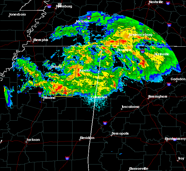 At 313 am cdt, a severe thunderstorm was located near cumberland, or 7 miles west of montpelier, moving east at 45 mph (radar indicated). Hazards include 60 mph wind gusts and quarter size hail. Hail damage to vehicles is expected. expect wind damage to roofs, siding, and trees. this severe storm will be near, montpelier around 325 am cdt. Other locations impacted by this severe thunderstorm include mantee. At 313 am cdt, a severe thunderstorm was located near cumberland, or 7 miles west of montpelier, moving east at 45 mph (radar indicated). Hazards include 60 mph wind gusts and quarter size hail. Hail damage to vehicles is expected. expect wind damage to roofs, siding, and trees. this severe storm will be near, montpelier around 325 am cdt. Other locations impacted by this severe thunderstorm include mantee.
|
| 3/23/2020 2:58 AM CDT |
 At 258 am cdt, a severe thunderstorm was located near bellefontaine, or 18 miles west of montpelier, moving east at 45 mph (radar indicated). Hazards include 60 mph wind gusts and quarter size hail. Hail damage to vehicles is expected. expect wind damage to roofs, siding, and trees. this severe thunderstorm will be near, clarkson around 305 am cdt. cumberland around 310 am cdt. montpelier around 325 am cdt. Other locations impacted by this severe thunderstorm include mantee and walthall. At 258 am cdt, a severe thunderstorm was located near bellefontaine, or 18 miles west of montpelier, moving east at 45 mph (radar indicated). Hazards include 60 mph wind gusts and quarter size hail. Hail damage to vehicles is expected. expect wind damage to roofs, siding, and trees. this severe thunderstorm will be near, clarkson around 305 am cdt. cumberland around 310 am cdt. montpelier around 325 am cdt. Other locations impacted by this severe thunderstorm include mantee and walthall.
|
| 1/11/2020 8:20 AM CST |
 At 819 am cst, severe thunderstorms were located along a line extending from near montpelier to near sherwood, moving east at 40 mph (radar indicated). Hazards include 60 mph wind gusts. Expect damage to roofs, siding, and trees. severe thunderstorms will be near, montpelier around 825 am cst. starkville and griffith around 835 am cst. pala alto around 840 am cst. west point and muldrow around 850 am cst. tibbee around 855 am cst. bent oak around 905 am cst. columbus afb and kolola springs around 910 am cst. columbus and caledonia around 915 am cst. other locations impacted by these severe thunderstorms include mantee. a tornado watch remains in effect until 900 am cst for central and north central mississippi. A tornado watch also remains in effect until 400 pm cst for northeastern mississippi. At 819 am cst, severe thunderstorms were located along a line extending from near montpelier to near sherwood, moving east at 40 mph (radar indicated). Hazards include 60 mph wind gusts. Expect damage to roofs, siding, and trees. severe thunderstorms will be near, montpelier around 825 am cst. starkville and griffith around 835 am cst. pala alto around 840 am cst. west point and muldrow around 850 am cst. tibbee around 855 am cst. bent oak around 905 am cst. columbus afb and kolola springs around 910 am cst. columbus and caledonia around 915 am cst. other locations impacted by these severe thunderstorms include mantee. a tornado watch remains in effect until 900 am cst for central and north central mississippi. A tornado watch also remains in effect until 400 pm cst for northeastern mississippi.
|
| 12/29/2019 4:20 PM CST |
 At 420 pm cst, severe thunderstorms were located along a line extending from clarkson to near ackerman, moving northeast at 50 mph (radar indicated). Hazards include 60 mph wind gusts and quarter size hail. Hail damage to vehicles is expected. expect wind damage to roofs, siding, and trees. these severe storms will be near, clarkson and cumberland around 425 pm cst. other locations impacted by these severe thunderstorms include mantee, walthall and weir. A tornado watch remains in effect until 900 pm cst for central, north central, northeastern and east central mississippi. At 420 pm cst, severe thunderstorms were located along a line extending from clarkson to near ackerman, moving northeast at 50 mph (radar indicated). Hazards include 60 mph wind gusts and quarter size hail. Hail damage to vehicles is expected. expect wind damage to roofs, siding, and trees. these severe storms will be near, clarkson and cumberland around 425 pm cst. other locations impacted by these severe thunderstorms include mantee, walthall and weir. A tornado watch remains in effect until 900 pm cst for central, north central, northeastern and east central mississippi.
|
| 12/29/2019 4:09 PM CST |
 At 408 pm cst, severe thunderstorms were located along a line extending from near eupora to 11 miles southwest of chester, moving northeast at 50 mph (radar indicated). Hazards include 60 mph wind gusts and quarter size hail. Hail damage to vehicles is expected. expect wind damage to roofs, siding, and trees. these severe storms will be near, eupora and bellefontaine around 415 pm cst. mathiston and clarkson around 420 pm cst. ackerman and cumberland around 425 pm cst. reform around 430 pm cst. other locations impacted by these severe thunderstorms include mccool, walthall, french camp, mantee and weir. A tornado watch remains in effect until 900 pm cst for central, north central, northeastern and east central mississippi. At 408 pm cst, severe thunderstorms were located along a line extending from near eupora to 11 miles southwest of chester, moving northeast at 50 mph (radar indicated). Hazards include 60 mph wind gusts and quarter size hail. Hail damage to vehicles is expected. expect wind damage to roofs, siding, and trees. these severe storms will be near, eupora and bellefontaine around 415 pm cst. mathiston and clarkson around 420 pm cst. ackerman and cumberland around 425 pm cst. reform around 430 pm cst. other locations impacted by these severe thunderstorms include mccool, walthall, french camp, mantee and weir. A tornado watch remains in effect until 900 pm cst for central, north central, northeastern and east central mississippi.
|
| 12/29/2019 3:46 PM CST |
 At 346 pm cst, severe thunderstorms were located along a line extending from near kilmichael to near hesterville, moving northeast at 50 mph (radar indicated). Hazards include 60 mph wind gusts and quarter size hail. Hail damage to vehicles is expected. expect wind damage to roofs, siding, and trees. severe thunderstorms will be near, kilmichael around 350 pm cst. eupora around 410 pm cst. ackerman, chester and bellefontaine around 415 pm cst. mathiston, reform and clarkson around 420 pm cst. cumberland and sherwood around 425 pm cst. other locations impacted by these severe thunderstorms include mccool, walthall, french camp, mantee and weir. A tornado watch remains in effect until 900 pm cst for central, north central, northeastern and east central mississippi. At 346 pm cst, severe thunderstorms were located along a line extending from near kilmichael to near hesterville, moving northeast at 50 mph (radar indicated). Hazards include 60 mph wind gusts and quarter size hail. Hail damage to vehicles is expected. expect wind damage to roofs, siding, and trees. severe thunderstorms will be near, kilmichael around 350 pm cst. eupora around 410 pm cst. ackerman, chester and bellefontaine around 415 pm cst. mathiston, reform and clarkson around 420 pm cst. cumberland and sherwood around 425 pm cst. other locations impacted by these severe thunderstorms include mccool, walthall, french camp, mantee and weir. A tornado watch remains in effect until 900 pm cst for central, north central, northeastern and east central mississippi.
|
| 10/26/2019 10:05 AM CDT |
 At 1005 am cdt, a severe thunderstorm was located 8 miles south of pyland, or 10 miles west of montpelier, moving north at 60 mph (radar indicated). Hazards include 60 mph wind gusts. Expect damage to roofs, siding, and trees. This severe thunderstorm will remain over mainly rural areas of choctaw, western oktibbeha, webster, southeastern montgomery and western clay counties, including the following locations, walthall, mantee, sturgis and weir. At 1005 am cdt, a severe thunderstorm was located 8 miles south of pyland, or 10 miles west of montpelier, moving north at 60 mph (radar indicated). Hazards include 60 mph wind gusts. Expect damage to roofs, siding, and trees. This severe thunderstorm will remain over mainly rural areas of choctaw, western oktibbeha, webster, southeastern montgomery and western clay counties, including the following locations, walthall, mantee, sturgis and weir.
|
| 10/26/2019 9:38 AM CDT |
 At 938 am cdt, a severe thunderstorm was located near chester, or 23 miles northwest of louisville, moving north at 60 mph (radar indicated). Hazards include 60 mph wind gusts. Expect damage to roofs, siding, and trees. this severe thunderstorm will be near, sherwood around 945 am cdt. eupora and mathiston around 950 am cdt. maben, clarkson, cumberland and bellefontaine around 955 am cdt. Other locations impacted by this severe thunderstorm include mccool, walthall, french camp, mantee, sturgis and weir. At 938 am cdt, a severe thunderstorm was located near chester, or 23 miles northwest of louisville, moving north at 60 mph (radar indicated). Hazards include 60 mph wind gusts. Expect damage to roofs, siding, and trees. this severe thunderstorm will be near, sherwood around 945 am cdt. eupora and mathiston around 950 am cdt. maben, clarkson, cumberland and bellefontaine around 955 am cdt. Other locations impacted by this severe thunderstorm include mccool, walthall, french camp, mantee, sturgis and weir.
|
| 7/15/2019 5:12 PM CDT |
 At 512 pm cdt, a severe thunderstorm was located near clarkson, or 15 miles southwest of montpelier, moving northeast at 40 mph (radar indicated). Hazards include 60 mph wind gusts. Expect damage to roofs, siding, and trees. this severe thunderstorm will be near, clarkson around 515 pm cdt. cumberland around 520 pm cdt. montpelier around 535 pm cdt. Other locations impacted by this severe thunderstorm include mantee and walthall. At 512 pm cdt, a severe thunderstorm was located near clarkson, or 15 miles southwest of montpelier, moving northeast at 40 mph (radar indicated). Hazards include 60 mph wind gusts. Expect damage to roofs, siding, and trees. this severe thunderstorm will be near, clarkson around 515 pm cdt. cumberland around 520 pm cdt. montpelier around 535 pm cdt. Other locations impacted by this severe thunderstorm include mantee and walthall.
|
| 7/7/2019 3:28 PM CDT | Large tree on a house on main st. numerous large limbs also down across tow in webster county MS, 0.7 miles SW of Mantee, MS |
| 7/7/2019 3:24 PM CDT |
 At 323 pm cdt, a severe thunderstorm was located over montpelier, moving southeast at 10 mph (radar indicated). Hazards include 60 mph wind gusts and quarter size hail. Hail damage to vehicles is expected. expect wind damage to roofs, siding, and trees. this severe thunderstorm will be near, griffith around 405 pm cdt. pheba around 410 pm cdt. Other locations impacted by this severe thunderstorm include mantee. At 323 pm cdt, a severe thunderstorm was located over montpelier, moving southeast at 10 mph (radar indicated). Hazards include 60 mph wind gusts and quarter size hail. Hail damage to vehicles is expected. expect wind damage to roofs, siding, and trees. this severe thunderstorm will be near, griffith around 405 pm cdt. pheba around 410 pm cdt. Other locations impacted by this severe thunderstorm include mantee.
|
| 6/20/2019 1:05 AM CDT |
 The severe thunderstorm warning for eastern choctaw, western oktibbeha, east central attala, central winston, northeastern webster and western clay counties will expire at 115 am cdt, the storms which prompted the warning have moved out of the area. therefore, the warning will be allowed to expire. a severe thunderstorm watch remains in effect until 600 am cdt for central, north central, northeastern and east central mississippi. The severe thunderstorm warning for eastern choctaw, western oktibbeha, east central attala, central winston, northeastern webster and western clay counties will expire at 115 am cdt, the storms which prompted the warning have moved out of the area. therefore, the warning will be allowed to expire. a severe thunderstorm watch remains in effect until 600 am cdt for central, north central, northeastern and east central mississippi.
|
| 6/20/2019 12:43 AM CDT |
 At 1242 am cdt, severe thunderstorms were located along a line extending from near montpelier to near craig springs to 6 miles northeast of zama, moving east at 45 mph (radar indicated). Hazards include 60 mph wind gusts and quarter size hail. Hail damage to vehicles is expected. expect wind damage to roofs, siding, and trees. these severe storms will be near, starkville, montpelier, craig springs and longview around 1250 am cdt. louisville around 100 am cdt. Other locations impacted by these severe thunderstorms include sturgis. At 1242 am cdt, severe thunderstorms were located along a line extending from near montpelier to near craig springs to 6 miles northeast of zama, moving east at 45 mph (radar indicated). Hazards include 60 mph wind gusts and quarter size hail. Hail damage to vehicles is expected. expect wind damage to roofs, siding, and trees. these severe storms will be near, starkville, montpelier, craig springs and longview around 1250 am cdt. louisville around 100 am cdt. Other locations impacted by these severe thunderstorms include sturgis.
|
| 6/20/2019 12:30 AM CDT |
 At 1229 am cdt, severe thunderstorms were located along a line extending from pinedale to 7 miles north of clarkson, moving east at 60 mph (radar indicated). Hazards include 60 mph wind gusts. Expect damage to roofs, siding, and trees. Locations impacted include, tupelo, new albany, pontotoc, houston, verona, okolona, trace state park, bruce, calhoun city, shannon, vardaman, derma, ecru, pittsboro, cambridge, new harmony, troy, etta, trebloc and pinedale. At 1229 am cdt, severe thunderstorms were located along a line extending from pinedale to 7 miles north of clarkson, moving east at 60 mph (radar indicated). Hazards include 60 mph wind gusts. Expect damage to roofs, siding, and trees. Locations impacted include, tupelo, new albany, pontotoc, houston, verona, okolona, trace state park, bruce, calhoun city, shannon, vardaman, derma, ecru, pittsboro, cambridge, new harmony, troy, etta, trebloc and pinedale.
|
| 6/20/2019 12:11 AM CDT |
 At 1210 am cdt, severe thunderstorms were located along a line extending from near sabougla to 8 miles southeast of poplar creek to near mcadams, moving east at 45 mph (radar indicated). Hazards include 60 mph wind gusts and quarter size hail. Hail damage to vehicles is expected. expect wind damage to roofs, siding, and trees. severe thunderstorms will be near, embry around 1215 am cdt. bellefontaine around 1220 am cdt. chester around 1225 am cdt. ackerman and clarkson around 1230 am cdt. montpelier and betheden around 1245 am cdt. craig springs and longview around 1250 am cdt. starkville around 1255 am cdt. louisville around 100 am cdt. Other locations impacted by these severe thunderstorms include ethel, sallis, french camp, mantee, mccool, walthall, sturgis and weir. At 1210 am cdt, severe thunderstorms were located along a line extending from near sabougla to 8 miles southeast of poplar creek to near mcadams, moving east at 45 mph (radar indicated). Hazards include 60 mph wind gusts and quarter size hail. Hail damage to vehicles is expected. expect wind damage to roofs, siding, and trees. severe thunderstorms will be near, embry around 1215 am cdt. bellefontaine around 1220 am cdt. chester around 1225 am cdt. ackerman and clarkson around 1230 am cdt. montpelier and betheden around 1245 am cdt. craig springs and longview around 1250 am cdt. starkville around 1255 am cdt. louisville around 100 am cdt. Other locations impacted by these severe thunderstorms include ethel, sallis, french camp, mantee, mccool, walthall, sturgis and weir.
|
| 6/20/2019 12:10 AM CDT |
 At 1209 am cdt, severe thunderstorms were located along a line extending from holly springs national forest to near embry, moving east at 60 mph (radar indicated). Hazards include 60 mph wind gusts. expect damage to roofs, siding, and trees At 1209 am cdt, severe thunderstorms were located along a line extending from holly springs national forest to near embry, moving east at 60 mph (radar indicated). Hazards include 60 mph wind gusts. expect damage to roofs, siding, and trees
|
| 5/8/2019 10:56 PM CDT |
 The severe thunderstorm warning for northern choctaw and webster counties will expire at 1100 pm cdt, the storms which prompted the warning have weakened below severe limits, and no longer pose an immediate threat to life or property. therefore, the warning will be allowed to expire. however, gusty winds are still possible with these thunderstorms. a tornado watch remains in effect until midnight cdt for central and north central mississippi. The severe thunderstorm warning for northern choctaw and webster counties will expire at 1100 pm cdt, the storms which prompted the warning have weakened below severe limits, and no longer pose an immediate threat to life or property. therefore, the warning will be allowed to expire. however, gusty winds are still possible with these thunderstorms. a tornado watch remains in effect until midnight cdt for central and north central mississippi.
|
| 5/8/2019 10:47 PM CDT |
 At 1047 pm cdt, severe thunderstorms were located along a line extending from near bellefontaine to near sherwood to chester, moving northeast at 30 mph (radar indicated). Hazards include 60 mph wind gusts. Expect damage to roofs, siding, and trees. these severe storms will be near, sherwood around 1050 pm cdt. mathiston and clarkson around 1055 pm cdt. cumberland around 1100 pm cdt. other locations impacted by these severe thunderstorms include mantee and walthall. A tornado watch remains in effect until midnight cdt for central and north central mississippi. At 1047 pm cdt, severe thunderstorms were located along a line extending from near bellefontaine to near sherwood to chester, moving northeast at 30 mph (radar indicated). Hazards include 60 mph wind gusts. Expect damage to roofs, siding, and trees. these severe storms will be near, sherwood around 1050 pm cdt. mathiston and clarkson around 1055 pm cdt. cumberland around 1100 pm cdt. other locations impacted by these severe thunderstorms include mantee and walthall. A tornado watch remains in effect until midnight cdt for central and north central mississippi.
|
| 5/8/2019 10:03 PM CDT |
 At 1002 pm cdt, severe thunderstorms were located along a line extending from near sabougla, to 6 miles east of lodi, to 6 miles east of kilmichael, to 6 miles southwest of poplar creek, moving northeast at 55 mph (radar indicated). Hazards include 60 mph wind gusts. Expect damage to roofs, siding, and trees. these severe storms will be near, embry around 1010 pm cdt. eupora around 1015 pm cdt. lodi around 1020 pm cdt. clarkson around 1025 pm cdt. bellefontaine around 1035 pm cdt. other locations impacted by these severe thunderstorms include mantee and walthall. A tornado watch remains in effect until midnight cdt for central and north central mississippi. At 1002 pm cdt, severe thunderstorms were located along a line extending from near sabougla, to 6 miles east of lodi, to 6 miles east of kilmichael, to 6 miles southwest of poplar creek, moving northeast at 55 mph (radar indicated). Hazards include 60 mph wind gusts. Expect damage to roofs, siding, and trees. these severe storms will be near, embry around 1010 pm cdt. eupora around 1015 pm cdt. lodi around 1020 pm cdt. clarkson around 1025 pm cdt. bellefontaine around 1035 pm cdt. other locations impacted by these severe thunderstorms include mantee and walthall. A tornado watch remains in effect until midnight cdt for central and north central mississippi.
|
| 5/8/2019 9:45 PM CDT |
 At 945 pm cdt, severe thunderstorms were located along a line extending from 7 miles southeast of coffeeville, to near misterton, to near lodi, to near vaiden, moving northeast at 40 mph (radar indicated). Hazards include 60 mph wind gusts. Expect damage to roofs, siding, and trees. severe thunderstorms will be near, embry around 1005 pm cdt. bellefontaine around 1010 pm cdt. clarkson around 1020 pm cdt. eupora around 1025 pm cdt. sherwood and reform around 1030 pm cdt. mathiston around 1035 pm cdt. cumberland around 1040 pm cdt. other locations impacted by these severe thunderstorms include mantee and walthall. A tornado watch remains in effect until midnight cdt for central and north central mississippi. At 945 pm cdt, severe thunderstorms were located along a line extending from 7 miles southeast of coffeeville, to near misterton, to near lodi, to near vaiden, moving northeast at 40 mph (radar indicated). Hazards include 60 mph wind gusts. Expect damage to roofs, siding, and trees. severe thunderstorms will be near, embry around 1005 pm cdt. bellefontaine around 1010 pm cdt. clarkson around 1020 pm cdt. eupora around 1025 pm cdt. sherwood and reform around 1030 pm cdt. mathiston around 1035 pm cdt. cumberland around 1040 pm cdt. other locations impacted by these severe thunderstorms include mantee and walthall. A tornado watch remains in effect until midnight cdt for central and north central mississippi.
|
| 4/13/2019 9:28 PM CDT |
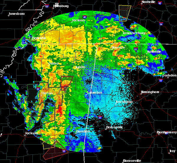 At 928 pm cdt, a confirmed tornado was located near cumberland, or near montpelier, moving north at 45 mph (radar confirmed tornado). Hazards include damaging tornado. Flying debris will be dangerous to those caught without shelter. mobile homes will be damaged or destroyed. damage to roofs, windows, and vehicles will occur. tree damage is likely. This tornadic thunderstorm will remain over mainly rural areas of northeastern webster and west central clay counties, including the following locations, mantee. At 928 pm cdt, a confirmed tornado was located near cumberland, or near montpelier, moving north at 45 mph (radar confirmed tornado). Hazards include damaging tornado. Flying debris will be dangerous to those caught without shelter. mobile homes will be damaged or destroyed. damage to roofs, windows, and vehicles will occur. tree damage is likely. This tornadic thunderstorm will remain over mainly rural areas of northeastern webster and west central clay counties, including the following locations, mantee.
|
| 4/13/2019 9:22 PM CDT |
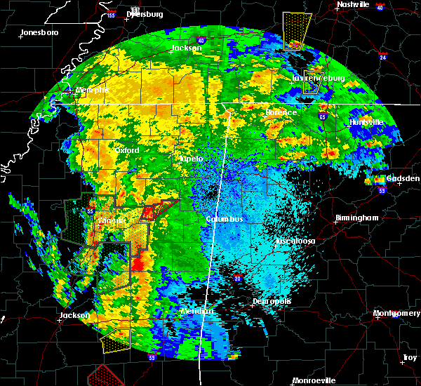 At 922 pm cdt, a severe thunderstorm capable of producing a tornado was located over cumberland, or 9 miles southwest of montpelier, moving northeast at 35 mph (radar indicated rotation). Hazards include tornado. Flying debris will be dangerous to those caught without shelter. mobile homes will be damaged or destroyed. damage to roofs, windows, and vehicles will occur. tree damage is likely. this dangerous storm will be near, montpelier around 940 pm cdt. Other locations impacted by this tornadic thunderstorm include mantee. At 922 pm cdt, a severe thunderstorm capable of producing a tornado was located over cumberland, or 9 miles southwest of montpelier, moving northeast at 35 mph (radar indicated rotation). Hazards include tornado. Flying debris will be dangerous to those caught without shelter. mobile homes will be damaged or destroyed. damage to roofs, windows, and vehicles will occur. tree damage is likely. this dangerous storm will be near, montpelier around 940 pm cdt. Other locations impacted by this tornadic thunderstorm include mantee.
|
| 4/13/2019 9:21 PM CDT |
 At 921 pm cdt, a severe thunderstorm was located over cumberland, or 8 miles southwest of montpelier, moving northeast at 45 mph (radar indicated). Hazards include 60 mph wind gusts and nickel size hail. Expect damage to roofs, siding, and trees. this severe storm will be near, montpelier around 930 pm cdt. other locations impacted by this severe thunderstorm include mantee. A tornado watch remains in effect until 300 am cdt for central, north central and northeastern mississippi. At 921 pm cdt, a severe thunderstorm was located over cumberland, or 8 miles southwest of montpelier, moving northeast at 45 mph (radar indicated). Hazards include 60 mph wind gusts and nickel size hail. Expect damage to roofs, siding, and trees. this severe storm will be near, montpelier around 930 pm cdt. other locations impacted by this severe thunderstorm include mantee. A tornado watch remains in effect until 300 am cdt for central, north central and northeastern mississippi.
|
| 4/13/2019 9:13 PM CDT |
 At 913 pm cdt, a confirmed tornado was located over mathiston, or 15 miles southwest of montpelier, moving northeast at 35 mph (radar confirmed tornado). Hazards include damaging tornado. Flying debris will be dangerous to those caught without shelter. mobile homes will be damaged or destroyed. damage to roofs, windows, and vehicles will occur. tree damage is likely. this tornado will be near, clarkson around 920 pm cdt. cumberland around 925 pm cdt. montpelier around 940 pm cdt. Other locations impacted by this tornadic thunderstorm include mantee. At 913 pm cdt, a confirmed tornado was located over mathiston, or 15 miles southwest of montpelier, moving northeast at 35 mph (radar confirmed tornado). Hazards include damaging tornado. Flying debris will be dangerous to those caught without shelter. mobile homes will be damaged or destroyed. damage to roofs, windows, and vehicles will occur. tree damage is likely. this tornado will be near, clarkson around 920 pm cdt. cumberland around 925 pm cdt. montpelier around 940 pm cdt. Other locations impacted by this tornadic thunderstorm include mantee.
|
| 4/13/2019 9:09 PM CDT |
 At 909 pm cdt, a severe thunderstorm was located over maben, or 13 miles southwest of montpelier, moving northeast at 50 mph (radar indicated). Hazards include 60 mph wind gusts and nickel size hail. Expect damage to roofs, siding, and trees. this severe storm will be near, pheba around 915 pm cdt. montpelier around 925 pm cdt. other locations impacted by this severe thunderstorm include mantee. A tornado watch remains in effect until 300 am cdt for central, north central and northeastern mississippi. At 909 pm cdt, a severe thunderstorm was located over maben, or 13 miles southwest of montpelier, moving northeast at 50 mph (radar indicated). Hazards include 60 mph wind gusts and nickel size hail. Expect damage to roofs, siding, and trees. this severe storm will be near, pheba around 915 pm cdt. montpelier around 925 pm cdt. other locations impacted by this severe thunderstorm include mantee. A tornado watch remains in effect until 300 am cdt for central, north central and northeastern mississippi.
|
| 4/13/2019 8:58 PM CDT |
 At 858 pm cdt, a severe thunderstorm was located over reform, or 19 miles west of starkville, moving northeast at 50 mph (radar indicated). Hazards include 60 mph wind gusts and nickel size hail. Expect damage to roofs, siding, and trees. this severe storm will be near, mathiston around 905 pm cdt. maben and clarkson around 910 pm cdt. cumberland and pheba around 915 pm cdt. montpelier around 925 pm cdt. other locations impacted by this severe thunderstorm include mantee and sturgis. A tornado watch remains in effect until 300 am cdt for central, north central, northeastern and east central mississippi. At 858 pm cdt, a severe thunderstorm was located over reform, or 19 miles west of starkville, moving northeast at 50 mph (radar indicated). Hazards include 60 mph wind gusts and nickel size hail. Expect damage to roofs, siding, and trees. this severe storm will be near, mathiston around 905 pm cdt. maben and clarkson around 910 pm cdt. cumberland and pheba around 915 pm cdt. montpelier around 925 pm cdt. other locations impacted by this severe thunderstorm include mantee and sturgis. A tornado watch remains in effect until 300 am cdt for central, north central, northeastern and east central mississippi.
|
| 4/13/2019 8:56 PM CDT |
 At 855 pm cdt, a severe thunderstorm capable of producing a tornado was located near chester, or 21 miles northwest of louisville, moving northeast at 35 mph (radar indicated rotation). Hazards include tornado. Flying debris will be dangerous to those caught without shelter. mobile homes will be damaged or destroyed. damage to roofs, windows, and vehicles will occur. tree damage is likely. this dangerous storm will be near, reform around 900 pm cdt. sherwood around 910 pm cdt. maben and mathiston around 915 pm cdt. clarkson around 920 pm cdt. cumberland and pheba around 925 pm cdt. montpelier around 940 pm cdt. Other locations impacted by this tornadic thunderstorm include mantee. At 855 pm cdt, a severe thunderstorm capable of producing a tornado was located near chester, or 21 miles northwest of louisville, moving northeast at 35 mph (radar indicated rotation). Hazards include tornado. Flying debris will be dangerous to those caught without shelter. mobile homes will be damaged or destroyed. damage to roofs, windows, and vehicles will occur. tree damage is likely. this dangerous storm will be near, reform around 900 pm cdt. sherwood around 910 pm cdt. maben and mathiston around 915 pm cdt. clarkson around 920 pm cdt. cumberland and pheba around 925 pm cdt. montpelier around 940 pm cdt. Other locations impacted by this tornadic thunderstorm include mantee.
|
| 4/13/2019 8:40 PM CDT |
 At 840 pm cdt, a severe thunderstorm was located 7 miles southwest of chester, or 17 miles northwest of louisville, moving northeast at 50 mph (radar indicated). Hazards include 60 mph wind gusts and nickel size hail. Expect damage to roofs, siding, and trees. this severe thunderstorm will be near, ackerman and chester around 850 pm cdt. reform around 900 pm cdt. mathiston and sherwood around 905 pm cdt. maben around 910 pm cdt. cumberland, pheba and clarkson around 915 pm cdt. montpelier around 925 pm cdt. other locations impacted by this severe thunderstorm include french camp, mantee, sturgis and weir. a tornado watch remains in effect until midnight cdt for central mississippi. A tornado watch also remains in effect until 300 am cdt for central, north central, northeastern and east central mississippi. At 840 pm cdt, a severe thunderstorm was located 7 miles southwest of chester, or 17 miles northwest of louisville, moving northeast at 50 mph (radar indicated). Hazards include 60 mph wind gusts and nickel size hail. Expect damage to roofs, siding, and trees. this severe thunderstorm will be near, ackerman and chester around 850 pm cdt. reform around 900 pm cdt. mathiston and sherwood around 905 pm cdt. maben around 910 pm cdt. cumberland, pheba and clarkson around 915 pm cdt. montpelier around 925 pm cdt. other locations impacted by this severe thunderstorm include french camp, mantee, sturgis and weir. a tornado watch remains in effect until midnight cdt for central mississippi. A tornado watch also remains in effect until 300 am cdt for central, north central, northeastern and east central mississippi.
|
| 4/8/2019 7:46 PM CDT |
 At 746 pm cdt, a severe thunderstorm was located over clarkson, or 14 miles southwest of montpelier, moving northeast at 30 mph (radar indicated). Hazards include 60 mph wind gusts and quarter size hail. Hail damage to vehicles is expected. expect wind damage to roofs, siding, and trees. this severe storm will be near, clarkson and cumberland around 750 pm cdt. montpelier around 810 pm cdt. Other locations impacted by this severe thunderstorm include mantee. At 746 pm cdt, a severe thunderstorm was located over clarkson, or 14 miles southwest of montpelier, moving northeast at 30 mph (radar indicated). Hazards include 60 mph wind gusts and quarter size hail. Hail damage to vehicles is expected. expect wind damage to roofs, siding, and trees. this severe storm will be near, clarkson and cumberland around 750 pm cdt. montpelier around 810 pm cdt. Other locations impacted by this severe thunderstorm include mantee.
|
| 4/8/2019 7:25 PM CDT |
 At 725 pm cdt, a severe thunderstorm was located near eupora, or 25 miles west of starkville, moving northeast at 30 mph (radar indicated). Hazards include 60 mph wind gusts and half dollar size hail. Hail damage to vehicles is expected. expect wind damage to roofs, siding, and trees. this severe thunderstorm will be near, eupora and sherwood around 735 pm cdt. mathiston around 740 pm cdt. clarkson around 750 pm cdt. cumberland around 755 pm cdt. montpelier around 810 pm cdt. Other locations impacted by this severe thunderstorm include mantee and walthall. At 725 pm cdt, a severe thunderstorm was located near eupora, or 25 miles west of starkville, moving northeast at 30 mph (radar indicated). Hazards include 60 mph wind gusts and half dollar size hail. Hail damage to vehicles is expected. expect wind damage to roofs, siding, and trees. this severe thunderstorm will be near, eupora and sherwood around 735 pm cdt. mathiston around 740 pm cdt. clarkson around 750 pm cdt. cumberland around 755 pm cdt. montpelier around 810 pm cdt. Other locations impacted by this severe thunderstorm include mantee and walthall.
|
| 4/6/2019 6:37 PM CDT |
 The severe thunderstorm warning for northwestern oktibbeha, northeastern webster and southwestern clay counties will expire at 645 pm cdt, the storms which prompted the warning have moved out of the area. therefore, the warning will be allowed to expire. The severe thunderstorm warning for northwestern oktibbeha, northeastern webster and southwestern clay counties will expire at 645 pm cdt, the storms which prompted the warning have moved out of the area. therefore, the warning will be allowed to expire.
|
| 4/6/2019 6:25 PM CDT |
 At 625 pm cdt, severe thunderstorms were located along a line extending from near pyland to near montpelier to near muldrow, moving northeast at 60 mph (radar indicated). Hazards include 60 mph wind gusts and quarter size hail. Hail damage to vehicles is expected. expect wind damage to roofs, siding, and trees. These severe thunderstorms will remain over mainly rural areas of northwestern oktibbeha, northeastern webster and southwestern clay counties, including the following locations, mantee. At 625 pm cdt, severe thunderstorms were located along a line extending from near pyland to near montpelier to near muldrow, moving northeast at 60 mph (radar indicated). Hazards include 60 mph wind gusts and quarter size hail. Hail damage to vehicles is expected. expect wind damage to roofs, siding, and trees. These severe thunderstorms will remain over mainly rural areas of northwestern oktibbeha, northeastern webster and southwestern clay counties, including the following locations, mantee.
|
| 4/6/2019 6:00 PM CDT |
 At 600 pm cdt, severe thunderstorms were located along a line extending from near embry to near sherwood to 7 miles east of ackerman, moving northeast at 60 mph (radar indicated). Hazards include 60 mph wind gusts and quarter size hail. Hail damage to vehicles is expected. expect wind damage to roofs, siding, and trees. these severe storms will be near, maben and mathiston around 605 pm cdt. cumberland and clarkson around 610 pm cdt. pheba around 615 pm cdt. montpelier around 620 pm cdt. Other locations impacted by these severe thunderstorms include mantee, sturgis and walthall. At 600 pm cdt, severe thunderstorms were located along a line extending from near embry to near sherwood to 7 miles east of ackerman, moving northeast at 60 mph (radar indicated). Hazards include 60 mph wind gusts and quarter size hail. Hail damage to vehicles is expected. expect wind damage to roofs, siding, and trees. these severe storms will be near, maben and mathiston around 605 pm cdt. cumberland and clarkson around 610 pm cdt. pheba around 615 pm cdt. montpelier around 620 pm cdt. Other locations impacted by these severe thunderstorms include mantee, sturgis and walthall.
|
| 4/6/2019 5:38 PM CDT |
 At 538 pm cdt, severe thunderstorms were located along a line extending from near kilmichael to 9 miles southeast of poplar creek to 9 miles northeast of zama, moving northeast at 60 mph (radar indicated). Hazards include 60 mph wind gusts and quarter size hail. Hail damage to vehicles is expected. expect wind damage to roofs, siding, and trees. severe thunderstorms will be near, lodi and chester around 550 pm cdt. eupora, ackerman and reform around 555 pm cdt. mathiston, embry and sherwood around 600 pm cdt. maben, bellefontaine and clarkson around 605 pm cdt. cumberland and pheba around 610 pm cdt. montpelier around 620 pm cdt. Other locations impacted by these severe thunderstorms include mccool, walthall, french camp, mantee, sturgis and weir. At 538 pm cdt, severe thunderstorms were located along a line extending from near kilmichael to 9 miles southeast of poplar creek to 9 miles northeast of zama, moving northeast at 60 mph (radar indicated). Hazards include 60 mph wind gusts and quarter size hail. Hail damage to vehicles is expected. expect wind damage to roofs, siding, and trees. severe thunderstorms will be near, lodi and chester around 550 pm cdt. eupora, ackerman and reform around 555 pm cdt. mathiston, embry and sherwood around 600 pm cdt. maben, bellefontaine and clarkson around 605 pm cdt. cumberland and pheba around 610 pm cdt. montpelier around 620 pm cdt. Other locations impacted by these severe thunderstorms include mccool, walthall, french camp, mantee, sturgis and weir.
|
| 2/23/2019 3:55 PM CST |
 At 354 pm cst, a severe thunderstorm was located over cumberland, or 9 miles southwest of montpelier, moving east at 50 mph (radar indicated). Hazards include 60 mph wind gusts and quarter size hail. Hail damage to vehicles is expected. expect wind damage to roofs, siding, and trees. this severe thunderstorm will be near, pheba around 400 pm cst. montpelier around 405 pm cst. griffith around 410 pm cst. pala alto around 415 pm cst. other locations impacted by this severe thunderstorm include mantee. A tornado watch remains in effect until 800 pm cst for central, north central and northeastern mississippi. At 354 pm cst, a severe thunderstorm was located over cumberland, or 9 miles southwest of montpelier, moving east at 50 mph (radar indicated). Hazards include 60 mph wind gusts and quarter size hail. Hail damage to vehicles is expected. expect wind damage to roofs, siding, and trees. this severe thunderstorm will be near, pheba around 400 pm cst. montpelier around 405 pm cst. griffith around 410 pm cst. pala alto around 415 pm cst. other locations impacted by this severe thunderstorm include mantee. A tornado watch remains in effect until 800 pm cst for central, north central and northeastern mississippi.
|
| 12/31/2018 12:44 PM CST |
 At 1244 pm cst, a severe thunderstorm was located near clarkson, or 10 miles west of montpelier, moving northeast at 55 mph (radar indicated). Hazards include 60 mph wind gusts. Expect damage to roofs, siding, and trees. this severe thunderstorm will remain over mainly rural areas of northeastern webster county, including the following locations, mantee. A tornado watch remains in effect until 700 pm cst for central, north central and northeastern mississippi. At 1244 pm cst, a severe thunderstorm was located near clarkson, or 10 miles west of montpelier, moving northeast at 55 mph (radar indicated). Hazards include 60 mph wind gusts. Expect damage to roofs, siding, and trees. this severe thunderstorm will remain over mainly rural areas of northeastern webster county, including the following locations, mantee. A tornado watch remains in effect until 700 pm cst for central, north central and northeastern mississippi.
|
| 12/31/2018 12:28 PM CST |
 At 1227 pm cst, a severe thunderstorm was located over eupora, or 23 miles southwest of montpelier, moving northeast at 55 mph (radar indicated). Hazards include 60 mph wind gusts. Expect damage to roofs, siding, and trees. this severe storm will be near, mathiston around 1235 pm cst. clarkson and cumberland around 1240 pm cst. other locations impacted by this severe thunderstorm include mantee and walthall. A tornado watch remains in effect until 700 pm cst for central, north central and northeastern mississippi. At 1227 pm cst, a severe thunderstorm was located over eupora, or 23 miles southwest of montpelier, moving northeast at 55 mph (radar indicated). Hazards include 60 mph wind gusts. Expect damage to roofs, siding, and trees. this severe storm will be near, mathiston around 1235 pm cst. clarkson and cumberland around 1240 pm cst. other locations impacted by this severe thunderstorm include mantee and walthall. A tornado watch remains in effect until 700 pm cst for central, north central and northeastern mississippi.
|
| 12/31/2018 12:16 PM CST |
 At 1216 pm cst, a severe thunderstorm was located 7 miles east of kilmichael, or 16 miles east of winona, moving northeast at 55 mph (radar indicated). Hazards include 60 mph wind gusts. Expect damage to roofs, siding, and trees. this severe storm will be near, eupora and bellefontaine around 1230 pm cst. mathiston around 1235 pm cst. clarkson and cumberland around 1240 pm cst. other locations impacted by this severe thunderstorm include mantee and walthall. A tornado watch remains in effect until 700 pm cst for central, north central and northeastern mississippi. At 1216 pm cst, a severe thunderstorm was located 7 miles east of kilmichael, or 16 miles east of winona, moving northeast at 55 mph (radar indicated). Hazards include 60 mph wind gusts. Expect damage to roofs, siding, and trees. this severe storm will be near, eupora and bellefontaine around 1230 pm cst. mathiston around 1235 pm cst. clarkson and cumberland around 1240 pm cst. other locations impacted by this severe thunderstorm include mantee and walthall. A tornado watch remains in effect until 700 pm cst for central, north central and northeastern mississippi.
|
| 12/31/2018 12:04 PM CST |
 At 1203 pm cst, a severe thunderstorm was located near poplar creek, or 11 miles southeast of winona, moving northeast at 55 mph (radar indicated). Hazards include 60 mph wind gusts. Expect damage to roofs, siding, and trees. this severe thunderstorm will be near, eupora around 1230 pm cst. mathiston and bellefontaine around 1235 pm cst. clarkson around 1240 pm cst. cumberland around 1245 pm cst. other locations impacted by this severe thunderstorm include mantee and walthall. A tornado watch remains in effect until 700 pm cst for central, north central and northeastern mississippi. At 1203 pm cst, a severe thunderstorm was located near poplar creek, or 11 miles southeast of winona, moving northeast at 55 mph (radar indicated). Hazards include 60 mph wind gusts. Expect damage to roofs, siding, and trees. this severe thunderstorm will be near, eupora around 1230 pm cst. mathiston and bellefontaine around 1235 pm cst. clarkson around 1240 pm cst. cumberland around 1245 pm cst. other locations impacted by this severe thunderstorm include mantee and walthall. A tornado watch remains in effect until 700 pm cst for central, north central and northeastern mississippi.
|
| 11/1/2018 4:47 AM CDT |
 At 447 am cdt, severe thunderstorms were located along a line extending from near pyland to near sherwood, moving northeast at 40 mph (radar indicated). Hazards include 60 mph wind gusts. Expect damage to roofs, siding, and trees. these severe thunderstorms will remain over mainly rural areas of northeastern choctaw, western oktibbeha, northeastern webster and west central clay counties, including the following locations, mantee. A tornado watch remains in effect until 700 am cdt for central, north central and northeastern mississippi. At 447 am cdt, severe thunderstorms were located along a line extending from near pyland to near sherwood, moving northeast at 40 mph (radar indicated). Hazards include 60 mph wind gusts. Expect damage to roofs, siding, and trees. these severe thunderstorms will remain over mainly rural areas of northeastern choctaw, western oktibbeha, northeastern webster and west central clay counties, including the following locations, mantee. A tornado watch remains in effect until 700 am cdt for central, north central and northeastern mississippi.
|
| 11/1/2018 4:26 AM CDT |
 At 425 am cdt, severe thunderstorms were located along a line extending from near bellefontaine to 6 miles west of chester, moving northeast at 40 mph (radar indicated). Hazards include 60 mph wind gusts. Expect damage to roofs, siding, and trees. severe thunderstorms will be near, eupora and reform around 440 am cdt. sherwood around 445 am cdt. mathiston around 450 am cdt. maben and clarkson around 455 am cdt. cumberland around 500 am cdt. other locations impacted by these severe thunderstorms include french camp, mantee and walthall. A tornado watch remains in effect until 700 am cdt for central, north central and northeastern mississippi. At 425 am cdt, severe thunderstorms were located along a line extending from near bellefontaine to 6 miles west of chester, moving northeast at 40 mph (radar indicated). Hazards include 60 mph wind gusts. Expect damage to roofs, siding, and trees. severe thunderstorms will be near, eupora and reform around 440 am cdt. sherwood around 445 am cdt. mathiston around 450 am cdt. maben and clarkson around 455 am cdt. cumberland around 500 am cdt. other locations impacted by these severe thunderstorms include french camp, mantee and walthall. A tornado watch remains in effect until 700 am cdt for central, north central and northeastern mississippi.
|
| 7/6/2018 4:49 PM CDT |
 At 448 pm cdt, severe thunderstorms were located along a line extending from mathiston to near pheba, moving southwest at 45 mph (radar indicated). Hazards include 60 mph wind gusts and quarter size hail. Hail damage to vehicles is expected. expect wind damage to roofs, siding, and trees. these severe storms will be near, mathiston and sherwood around 455 pm cdt. eupora around 500 pm cdt. Other locations impacted by these severe thunderstorms include mantee and walthall. At 448 pm cdt, severe thunderstorms were located along a line extending from mathiston to near pheba, moving southwest at 45 mph (radar indicated). Hazards include 60 mph wind gusts and quarter size hail. Hail damage to vehicles is expected. expect wind damage to roofs, siding, and trees. these severe storms will be near, mathiston and sherwood around 455 pm cdt. eupora around 500 pm cdt. Other locations impacted by these severe thunderstorms include mantee and walthall.
|
| 7/6/2018 4:32 PM CDT |
 At 431 pm cdt, severe thunderstorms were located along a line extending from near montpelier to near west point, moving southwest at 45 mph (radar indicated). Hazards include 60 mph wind gusts. Expect damage to roofs, siding, and trees. these severe storms will be near, cumberland around 440 pm cdt. maben and clarkson around 445 pm cdt. mathiston around 450 pm cdt. starkville, eupora and sherwood around 455 pm cdt. Other locations impacted by these severe thunderstorms include mantee and walthall. At 431 pm cdt, severe thunderstorms were located along a line extending from near montpelier to near west point, moving southwest at 45 mph (radar indicated). Hazards include 60 mph wind gusts. Expect damage to roofs, siding, and trees. these severe storms will be near, cumberland around 440 pm cdt. maben and clarkson around 445 pm cdt. mathiston around 450 pm cdt. starkville, eupora and sherwood around 455 pm cdt. Other locations impacted by these severe thunderstorms include mantee and walthall.
|
| 7/6/2018 4:30 PM CDT | A few trees down near highway 389 and highway 46. reported by em in clay county MS, 5.7 miles W of Mantee, MS |
| 7/6/2018 4:18 PM CDT |
 At 418 pm cdt, severe thunderstorms were located along a line extending from near houston to near prairie, moving southwest at 45 mph (radar indicated). Hazards include 60 mph wind gusts. Expect damage to roofs, siding, and trees. severe thunderstorms will be near, montpelier around 425 pm cdt. griffith, cumberland and muldrow around 435 pm cdt. clarkson around 440 pm cdt. pheba and bellefontaine around 445 pm cdt. starkville, eupora and embry around 450 pm cdt. maben around 455 pm cdt. sherwood around 500 pm cdt. Other locations impacted by these severe thunderstorms include mantee and walthall. At 418 pm cdt, severe thunderstorms were located along a line extending from near houston to near prairie, moving southwest at 45 mph (radar indicated). Hazards include 60 mph wind gusts. Expect damage to roofs, siding, and trees. severe thunderstorms will be near, montpelier around 425 pm cdt. griffith, cumberland and muldrow around 435 pm cdt. clarkson around 440 pm cdt. pheba and bellefontaine around 445 pm cdt. starkville, eupora and embry around 450 pm cdt. maben around 455 pm cdt. sherwood around 500 pm cdt. Other locations impacted by these severe thunderstorms include mantee and walthall.
|
| 6/22/2018 1:32 AM CDT |
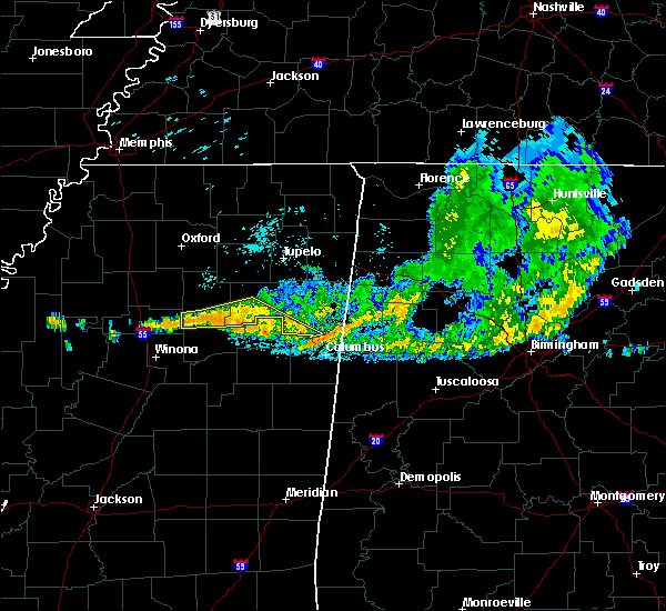 At 132 am cdt, a severe thunderstorm was located 8 miles north of clarkson, or 11 miles west of montpelier, moving southeast at 30 mph (radar indicated). Hazards include 60 mph wind gusts. Expect damage to roofs, siding, and trees. Locations impacted include, houston, calhoun city, vardaman, derma, slate springs, prairie, sabougla, pyland, trebloc, big creek, woodland, sparta, binford, strong, tabbville, mccondy, anchor, atlanta, muldon and dentontown. At 132 am cdt, a severe thunderstorm was located 8 miles north of clarkson, or 11 miles west of montpelier, moving southeast at 30 mph (radar indicated). Hazards include 60 mph wind gusts. Expect damage to roofs, siding, and trees. Locations impacted include, houston, calhoun city, vardaman, derma, slate springs, prairie, sabougla, pyland, trebloc, big creek, woodland, sparta, binford, strong, tabbville, mccondy, anchor, atlanta, muldon and dentontown.
|
| 6/22/2018 1:09 AM CDT |
 At 109 am cdt, a severe thunderstorm was located near vardaman, or 12 miles southwest of houston, moving southeast at 30 mph (radar indicated). Hazards include 60 mph wind gusts. Expect damage to roofs, siding, and trees. Locations impacted include, houston, calhoun city, vardaman, derma, pittsboro, slate springs, prairie, sabougla, pyland, trebloc, big creek, woodland, thorn, loyd, strong, thelma, mccondy, atlanta, muldon and retreat. At 109 am cdt, a severe thunderstorm was located near vardaman, or 12 miles southwest of houston, moving southeast at 30 mph (radar indicated). Hazards include 60 mph wind gusts. Expect damage to roofs, siding, and trees. Locations impacted include, houston, calhoun city, vardaman, derma, pittsboro, slate springs, prairie, sabougla, pyland, trebloc, big creek, woodland, thorn, loyd, strong, thelma, mccondy, atlanta, muldon and retreat.
|
| 6/22/2018 12:39 AM CDT |
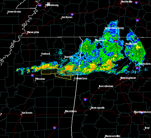 At 1239 am cdt, a severe thunderstorm was located over calhoun city, or 17 miles west of houston, moving southeast at 40 mph (radar indicated). Hazards include 60 mph wind gusts. expect damage to roofs, siding, and trees At 1239 am cdt, a severe thunderstorm was located over calhoun city, or 17 miles west of houston, moving southeast at 40 mph (radar indicated). Hazards include 60 mph wind gusts. expect damage to roofs, siding, and trees
|
| 4/3/2018 9:17 PM CDT |
 At 916 pm cdt, severe thunderstorms were located along a line extending from near una to just west of louisville, moving east at 55 mph (emergency management. multiple trees were downed in webster county). Hazards include 60 mph wind gusts. Expect damage to roofs, siding, and trees. Locations impacted include, ackerman, mathiston, chester, zama, cumberland, reform, smyrna, sherwood, clarkson, weir, mantee and mccool. At 916 pm cdt, severe thunderstorms were located along a line extending from near una to just west of louisville, moving east at 55 mph (emergency management. multiple trees were downed in webster county). Hazards include 60 mph wind gusts. Expect damage to roofs, siding, and trees. Locations impacted include, ackerman, mathiston, chester, zama, cumberland, reform, smyrna, sherwood, clarkson, weir, mantee and mccool.
|
| 4/3/2018 9:06 PM CDT |
 At 904 pm cdt, severe thunderstorms were located along a line extending from near montpelier to near mccool, moving east at 45 mph (emergency management. at 849 pm, a tree was blown down on a house in eupora). Hazards include 60 mph wind gusts. Expect damage to roofs, siding, and trees. Locations impacted include, kosciusko, eupora, ackerman, mathiston, cumberland, sherwood, clarkson, chester, zama, reform, smyrna, weir, ethel, mantee, french camp and mccool. At 904 pm cdt, severe thunderstorms were located along a line extending from near montpelier to near mccool, moving east at 45 mph (emergency management. at 849 pm, a tree was blown down on a house in eupora). Hazards include 60 mph wind gusts. Expect damage to roofs, siding, and trees. Locations impacted include, kosciusko, eupora, ackerman, mathiston, cumberland, sherwood, clarkson, chester, zama, reform, smyrna, weir, ethel, mantee, french camp and mccool.
|
| 4/3/2018 9:03 PM CDT |
 At 902 pm cdt, severe thunderstorms were located along a line extending from near mantee to near kosciusko, moving east at 55 mph (radar indicated). Hazards include 60 mph wind gusts. Expect damage to roofs, siding, and trees. Locations impacted include, kosciusko, eupora, ackerman, mathiston, cumberland, sherwood, clarkson, chester, zama, reform, smyrna, weir, ethel, mantee, french camp and mccool. At 902 pm cdt, severe thunderstorms were located along a line extending from near mantee to near kosciusko, moving east at 55 mph (radar indicated). Hazards include 60 mph wind gusts. Expect damage to roofs, siding, and trees. Locations impacted include, kosciusko, eupora, ackerman, mathiston, cumberland, sherwood, clarkson, chester, zama, reform, smyrna, weir, ethel, mantee, french camp and mccool.
|
| 4/3/2018 8:50 PM CDT |
 At 850 pm cdt, severe thunderstorms were located along a line extending from 6 miles south of pontotoc to near houston to near clarkson, moving east at 55 mph (radar indicated). Hazards include 60 mph wind gusts. expect damage to roofs, siding, and trees At 850 pm cdt, severe thunderstorms were located along a line extending from 6 miles south of pontotoc to near houston to near clarkson, moving east at 55 mph (radar indicated). Hazards include 60 mph wind gusts. expect damage to roofs, siding, and trees
|
| 4/3/2018 8:47 PM CDT |
 At 847 pm cdt, severe thunderstorms were located along a line extending from near slate springs to near mcadams, moving east at 45 mph (radar indicated). Hazards include 60 mph wind gusts. Expect damage to roofs, siding, and trees. Locations impacted include, kosciusko, eupora, ackerman, mathiston, newport, hesterville, cumberland, sherwood, clarkson, chester, zama, bellefontaine, mcadams, reform, possumneck, smyrna, embry, weir, ethel and mantee. At 847 pm cdt, severe thunderstorms were located along a line extending from near slate springs to near mcadams, moving east at 45 mph (radar indicated). Hazards include 60 mph wind gusts. Expect damage to roofs, siding, and trees. Locations impacted include, kosciusko, eupora, ackerman, mathiston, newport, hesterville, cumberland, sherwood, clarkson, chester, zama, bellefontaine, mcadams, reform, possumneck, smyrna, embry, weir, ethel and mantee.
|
| 4/3/2018 8:19 PM CDT |
 At 819 pm cdt, severe thunderstorms were located along a line extending from near gore springs to near ebenezer, moving east at 45 mph (radar indicated). Hazards include 60 mph wind gusts. expect damage to roofs, siding, and trees At 819 pm cdt, severe thunderstorms were located along a line extending from near gore springs to near ebenezer, moving east at 45 mph (radar indicated). Hazards include 60 mph wind gusts. expect damage to roofs, siding, and trees
|
| 3/28/2018 9:22 PM CDT |
 At 922 pm cdt, a severe thunderstorm capable of producing a tornado was located near pala alto, or 10 miles east of montpelier, moving northeast at 50 mph (radar indicated rotation). Hazards include tornado. Flying debris will be dangerous to those caught without shelter. mobile homes will be damaged or destroyed. damage to roofs, windows, and vehicles will occur. tree damage is likely. This tornadic thunderstorm will remain over mainly rural areas of northern choctaw, northwestern oktibbeha, eastern webster and clay counties, including the following locations: mantee and walthall. At 922 pm cdt, a severe thunderstorm capable of producing a tornado was located near pala alto, or 10 miles east of montpelier, moving northeast at 50 mph (radar indicated rotation). Hazards include tornado. Flying debris will be dangerous to those caught without shelter. mobile homes will be damaged or destroyed. damage to roofs, windows, and vehicles will occur. tree damage is likely. This tornadic thunderstorm will remain over mainly rural areas of northern choctaw, northwestern oktibbeha, eastern webster and clay counties, including the following locations: mantee and walthall.
|
| 3/28/2018 8:58 PM CDT | Few trees dow in webster county MS, 7.3 miles NE of Mantee, MS |
| 3/28/2018 8:43 PM CDT |
 At 842 pm cdt, a severe thunderstorm capable of producing a tornado was located near eupora, or 25 miles east of winona, moving northeast at 55 mph (radar indicated rotation). Hazards include tornado and quarter size hail. Flying debris will be dangerous to those caught without shelter. mobile homes will be damaged or destroyed. damage to roofs, windows, and vehicles will occur. tree damage is likely. this dangerous storm will be near, sherwood around 850 pm cdt. maben and mathiston around 855 pm cdt. cumberland and clarkson around 900 pm cdt. pheba around 905 pm cdt. montpelier around 910 pm cdt. Other locations impacted by this tornadic thunderstorm include mantee and walthall. At 842 pm cdt, a severe thunderstorm capable of producing a tornado was located near eupora, or 25 miles east of winona, moving northeast at 55 mph (radar indicated rotation). Hazards include tornado and quarter size hail. Flying debris will be dangerous to those caught without shelter. mobile homes will be damaged or destroyed. damage to roofs, windows, and vehicles will occur. tree damage is likely. this dangerous storm will be near, sherwood around 850 pm cdt. maben and mathiston around 855 pm cdt. cumberland and clarkson around 900 pm cdt. pheba around 905 pm cdt. montpelier around 910 pm cdt. Other locations impacted by this tornadic thunderstorm include mantee and walthall.
|
| 8/6/2017 5:03 PM CDT |
 At 502 pm cdt, a severe thunderstorm was located near clarkson, or 10 miles west of montpelier, moving northeast at 30 mph (radar indicated). Hazards include 60 mph wind gusts. Expect damage to roofs, siding, and trees. This severe thunderstorm will remain over mainly rural areas of northeastern webster county, including the following locations: mantee and walthall. At 502 pm cdt, a severe thunderstorm was located near clarkson, or 10 miles west of montpelier, moving northeast at 30 mph (radar indicated). Hazards include 60 mph wind gusts. Expect damage to roofs, siding, and trees. This severe thunderstorm will remain over mainly rural areas of northeastern webster county, including the following locations: mantee and walthall.
|
| 8/6/2017 4:53 PM CDT |
 At 452 pm cdt, a severe thunderstorm was located over clarkson, or 14 miles west of montpelier, moving northeast at 30 mph (radar indicated). Hazards include 60 mph wind gusts. Expect damage to roofs, siding, and trees. this severe thunderstorm will be near, cumberland around 500 pm cdt. Other locations impacted by this severe thunderstorm include mantee and walthall. At 452 pm cdt, a severe thunderstorm was located over clarkson, or 14 miles west of montpelier, moving northeast at 30 mph (radar indicated). Hazards include 60 mph wind gusts. Expect damage to roofs, siding, and trees. this severe thunderstorm will be near, cumberland around 500 pm cdt. Other locations impacted by this severe thunderstorm include mantee and walthall.
|
| 6/16/2017 4:34 PM CDT |
 At 432 pm cdt, a severe thunderstorm was located over cumberland, or 9 miles southwest of montpelier, moving southeast at 25 mph (radar indicated). Hazards include 60 mph wind gusts. Expect damage to roofs, siding, and trees. Locations impacted include, rural sections of eastern webster county. At 432 pm cdt, a severe thunderstorm was located over cumberland, or 9 miles southwest of montpelier, moving southeast at 25 mph (radar indicated). Hazards include 60 mph wind gusts. Expect damage to roofs, siding, and trees. Locations impacted include, rural sections of eastern webster county.
|
| 6/16/2017 4:19 PM CDT | A few trees down across hwy 1 in webster county MS, 0.7 miles SW of Mantee, MS |
| 6/16/2017 4:16 PM CDT |
 At 416 pm cdt, a severe thunderstorm was located near clarkson, or 11 miles west of montpelier, moving east at 25 mph (radar indicated). Hazards include 60 mph wind gusts and quarter size hail. Hail damage to vehicles is expected. expect wind damage to roofs, siding, and trees. this severe storm will be near, cumberland around 430 pm cdt. Other locations impacted by this severe thunderstorm include mantee and walthall. At 416 pm cdt, a severe thunderstorm was located near clarkson, or 11 miles west of montpelier, moving east at 25 mph (radar indicated). Hazards include 60 mph wind gusts and quarter size hail. Hail damage to vehicles is expected. expect wind damage to roofs, siding, and trees. this severe storm will be near, cumberland around 430 pm cdt. Other locations impacted by this severe thunderstorm include mantee and walthall.
|
| 6/16/2017 3:50 PM CDT |
 At 349 pm cdt, a severe thunderstorm was located near slate springs, or 21 miles west of montpelier, moving east at 20 mph (radar indicated). Hazards include 60 mph wind gusts and quarter size hail. Hail damage to vehicles is expected. expect wind damage to roofs, siding, and trees. this severe thunderstorm will be near, clarkson around 420 pm cdt. cumberland around 430 pm cdt. Other locations impacted by this severe thunderstorm include mantee and walthall. At 349 pm cdt, a severe thunderstorm was located near slate springs, or 21 miles west of montpelier, moving east at 20 mph (radar indicated). Hazards include 60 mph wind gusts and quarter size hail. Hail damage to vehicles is expected. expect wind damage to roofs, siding, and trees. this severe thunderstorm will be near, clarkson around 420 pm cdt. cumberland around 430 pm cdt. Other locations impacted by this severe thunderstorm include mantee and walthall.
|
| 6/15/2017 2:35 PM CDT |
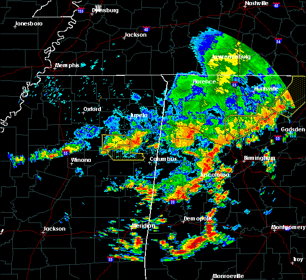 At 234 pm cdt, severe thunderstorms were located along a line extending from near prairie to 8 miles south of vardaman, moving southeast at 20 mph (radar indicated). Hazards include 60 mph wind gusts and nickel size hail. Expect damage to roofs, siding, and trees. these severe storms will be near, montpelier around 305 pm cdt. west point and pheba around 315 pm cdt. Other locations impacted by these severe thunderstorms include mantee. At 234 pm cdt, severe thunderstorms were located along a line extending from near prairie to 8 miles south of vardaman, moving southeast at 20 mph (radar indicated). Hazards include 60 mph wind gusts and nickel size hail. Expect damage to roofs, siding, and trees. these severe storms will be near, montpelier around 305 pm cdt. west point and pheba around 315 pm cdt. Other locations impacted by these severe thunderstorms include mantee.
|
| 6/15/2017 2:15 PM CDT |
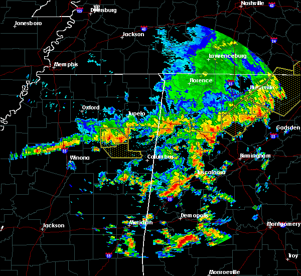 At 215 pm cdt, severe thunderstorms were located along a line extending from near trebloc to near pyland, moving southeast at 25 mph (radar indicated). Hazards include 60 mph wind gusts and quarter size hail. Hail damage to vehicles is expected. expect wind damage to roofs, siding, and trees. severe thunderstorms will be near, montpelier around 245 pm cdt. pala alto and griffith around 305 pm cdt. west point around 315 pm cdt. Other locations impacted by these severe thunderstorms include mantee. At 215 pm cdt, severe thunderstorms were located along a line extending from near trebloc to near pyland, moving southeast at 25 mph (radar indicated). Hazards include 60 mph wind gusts and quarter size hail. Hail damage to vehicles is expected. expect wind damage to roofs, siding, and trees. severe thunderstorms will be near, montpelier around 245 pm cdt. pala alto and griffith around 305 pm cdt. west point around 315 pm cdt. Other locations impacted by these severe thunderstorms include mantee.
|
| 3/9/2017 6:21 PM CST |
 At 620 pm cst, a severe thunderstorm was located over bellefontaine, or 20 miles west of montpelier, moving east at 25 mph (radar indicated). Hazards include ping pong ball size hail and 60 mph wind gusts. People and animals outdoors will be injured. expect hail damage to roofs, siding, windows, and vehicles. expect wind damage to roofs, siding, and trees. this severe storm will be near, mathiston and clarkson around 640 pm cst. maben and cumberland around 650 pm cst. Other locations impacted by this severe thunderstorm include mantee and walthall. At 620 pm cst, a severe thunderstorm was located over bellefontaine, or 20 miles west of montpelier, moving east at 25 mph (radar indicated). Hazards include ping pong ball size hail and 60 mph wind gusts. People and animals outdoors will be injured. expect hail damage to roofs, siding, windows, and vehicles. expect wind damage to roofs, siding, and trees. this severe storm will be near, mathiston and clarkson around 640 pm cst. maben and cumberland around 650 pm cst. Other locations impacted by this severe thunderstorm include mantee and walthall.
|
| 3/9/2017 6:09 PM CST |
 At 608 pm cst, a severe thunderstorm was located over embry, or 22 miles northeast of winona, moving east at 25 mph (radar indicated). Hazards include 60 mph wind gusts and quarter size hail. Hail damage to vehicles is expected. expect wind damage to roofs, siding, and trees. this severe thunderstorm will be near, bellefontaine around 615 pm cst. eupora around 620 pm cst. mathiston and clarkson around 640 pm cst. cumberland around 645 pm cst. maben around 650 pm cst. Other locations impacted by this severe thunderstorm include mantee and walthall. At 608 pm cst, a severe thunderstorm was located over embry, or 22 miles northeast of winona, moving east at 25 mph (radar indicated). Hazards include 60 mph wind gusts and quarter size hail. Hail damage to vehicles is expected. expect wind damage to roofs, siding, and trees. this severe thunderstorm will be near, bellefontaine around 615 pm cst. eupora around 620 pm cst. mathiston and clarkson around 640 pm cst. cumberland around 645 pm cst. maben around 650 pm cst. Other locations impacted by this severe thunderstorm include mantee and walthall.
|
| 3/1/2017 12:47 PM CST |
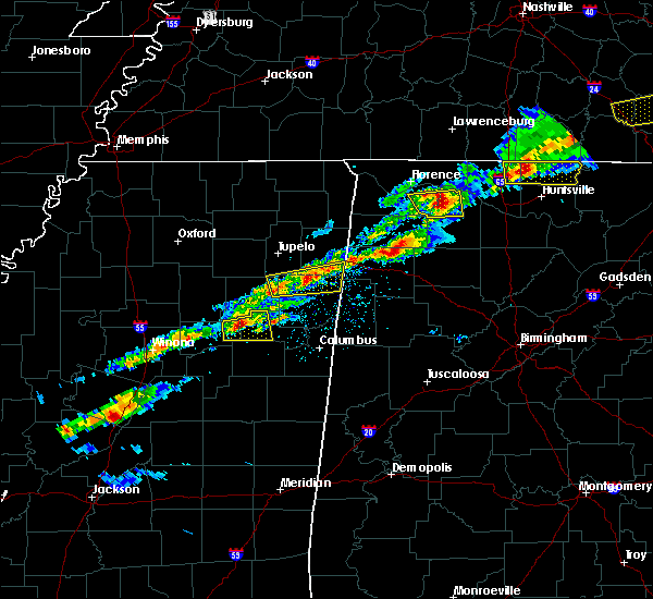 At 1247 pm cst, a severe thunderstorm was located near montpelier, moving east at 50 mph (radar indicated). Hazards include 60 mph wind gusts and quarter size hail. Hail damage to vehicles is expected. expect wind damage to roofs, siding, and trees. this severe storm will be near, montpelier around 1250 pm cst. griffith around 100 pm cst. other locations impacted by this severe thunderstorm include mantee. A tornado watch remains in effect until 600 pm cst for north central and northeastern mississippi. At 1247 pm cst, a severe thunderstorm was located near montpelier, moving east at 50 mph (radar indicated). Hazards include 60 mph wind gusts and quarter size hail. Hail damage to vehicles is expected. expect wind damage to roofs, siding, and trees. this severe storm will be near, montpelier around 1250 pm cst. griffith around 100 pm cst. other locations impacted by this severe thunderstorm include mantee. A tornado watch remains in effect until 600 pm cst for north central and northeastern mississippi.
|
| 3/1/2017 12:46 PM CST | Quarter sized hail reported 3.8 miles WNW of Mantee, MS |
| 3/1/2017 12:45 PM CST | Golf Ball sized hail reported 2.3 miles N of Mantee, MS |
| 3/1/2017 12:44 PM CST | Quarter sized hail reported 2.3 miles N of Mantee, MS, in the dancy community. |
| 3/1/2017 12:38 PM CST |
 At 1238 pm cst, a severe thunderstorm was located near clarkson, or 15 miles west of montpelier, moving east at 40 mph (radar indicated). Hazards include quarter size hail. Damage to vehicles is expected. this severe thunderstorm will be near, cumberland around 1250 pm cst. montpelier around 100 pm cst. griffith around 110 pm cst. other locations impacted by this severe thunderstorm include mantee and walthall. A tornado watch remains in effect until 600 pm cst for north central and northeastern mississippi. At 1238 pm cst, a severe thunderstorm was located near clarkson, or 15 miles west of montpelier, moving east at 40 mph (radar indicated). Hazards include quarter size hail. Damage to vehicles is expected. this severe thunderstorm will be near, cumberland around 1250 pm cst. montpelier around 100 pm cst. griffith around 110 pm cst. other locations impacted by this severe thunderstorm include mantee and walthall. A tornado watch remains in effect until 600 pm cst for north central and northeastern mississippi.
|
| 11/29/2016 5:50 PM CST | Golf Ball sized hail reported 5.8 miles W of Mantee, MS |
| 11/29/2016 5:37 PM CST |
 At 537 pm cst, a severe thunderstorm capable of producing a tornado was located near mathiston, or 14 miles southwest of montpelier, moving northeast at 45 mph (radar indicated rotation). Hazards include tornado and golf ball size hail. Flying debris will be dangerous to those caught without shelter. mobile homes will be damaged or destroyed. damage to roofs, windows, and vehicles will occur. Tree damage is likely. At 537 pm cst, a severe thunderstorm capable of producing a tornado was located near mathiston, or 14 miles southwest of montpelier, moving northeast at 45 mph (radar indicated rotation). Hazards include tornado and golf ball size hail. Flying debris will be dangerous to those caught without shelter. mobile homes will be damaged or destroyed. damage to roofs, windows, and vehicles will occur. Tree damage is likely.
|
| 6/17/2016 2:14 PM CDT |
 At 213 pm cdt, severe thunderstorms were located along a line extending from near calhoun city to near montpelier to near prairie, moving southeast at 30 mph (radar indicated). Hazards include 60 mph wind gusts and quarter size hail. Hail damage to vehicles is expected. expect wind damage to roofs, siding, and trees. these severe storms will be near, montpelier around 220 pm cdt. cumberland around 225 pm cdt. west point around 230 pm cdt. pheba around 235 pm cdt. bellefontaine and clarkson around 245 pm cdt. Other locations impacted by these severe thunderstorms include mantee and walthall. At 213 pm cdt, severe thunderstorms were located along a line extending from near calhoun city to near montpelier to near prairie, moving southeast at 30 mph (radar indicated). Hazards include 60 mph wind gusts and quarter size hail. Hail damage to vehicles is expected. expect wind damage to roofs, siding, and trees. these severe storms will be near, montpelier around 220 pm cdt. cumberland around 225 pm cdt. west point around 230 pm cdt. pheba around 235 pm cdt. bellefontaine and clarkson around 245 pm cdt. Other locations impacted by these severe thunderstorms include mantee and walthall.
|
| 6/17/2016 1:53 PM CDT |
 At 152 pm cdt, severe thunderstorms were located along a line extending from 7 miles west of bruce to near prairie, moving southeast at 40 mph (radar indicated). Hazards include 60 mph wind gusts and quarter size hail. Hail damage to vehicles is expected. expect wind damage to roofs, siding, and trees. severe thunderstorms will be near, pala alto around 200 pm cdt. west point around 205 pm cdt. embry around 225 pm cdt. bellefontaine around 230 pm cdt. Other locations impacted by these severe thunderstorms include mantee and walthall. At 152 pm cdt, severe thunderstorms were located along a line extending from 7 miles west of bruce to near prairie, moving southeast at 40 mph (radar indicated). Hazards include 60 mph wind gusts and quarter size hail. Hail damage to vehicles is expected. expect wind damage to roofs, siding, and trees. severe thunderstorms will be near, pala alto around 200 pm cdt. west point around 205 pm cdt. embry around 225 pm cdt. bellefontaine around 230 pm cdt. Other locations impacted by these severe thunderstorms include mantee and walthall.
|
| 4/29/2016 3:25 PM CDT |
 At 325 pm cdt, a severe thunderstorm was located over clarkson, or 14 miles southwest of montpelier, moving east at 40 mph (radar indicated). Hazards include 60 mph wind gusts. Expect damage to roofs. siding. and trees. this severe storm will be near, cumberland around 335 pm cdt. Other locations impacted by this severe thunderstorm include mantee and walthall. At 325 pm cdt, a severe thunderstorm was located over clarkson, or 14 miles southwest of montpelier, moving east at 40 mph (radar indicated). Hazards include 60 mph wind gusts. Expect damage to roofs. siding. and trees. this severe storm will be near, cumberland around 335 pm cdt. Other locations impacted by this severe thunderstorm include mantee and walthall.
|
| 4/29/2016 3:09 PM CDT |
 At 308 pm cdt, a severe thunderstorm was located near embry, or 21 miles east of winona, moving east at 30 mph (radar indicated). Hazards include 60 mph wind gusts. Expect damage to roofs. siding. and trees. this severe thunderstorm will be near, eupora around 315 pm cdt. bellefontaine around 320 pm cdt. clarkson around 335 pm cdt. cumberland around 340 pm cdt. Other locations impacted by this severe thunderstorm include mantee and walthall. At 308 pm cdt, a severe thunderstorm was located near embry, or 21 miles east of winona, moving east at 30 mph (radar indicated). Hazards include 60 mph wind gusts. Expect damage to roofs. siding. and trees. this severe thunderstorm will be near, eupora around 315 pm cdt. bellefontaine around 320 pm cdt. clarkson around 335 pm cdt. cumberland around 340 pm cdt. Other locations impacted by this severe thunderstorm include mantee and walthall.
|
| 3/31/2016 5:48 PM CDT | Ping Pong Ball sized hail reported 9.6 miles WNW of Mantee, MS, near montpelier |
| 3/31/2016 5:06 PM CDT |
 At 506 pm cdt, a severe thunderstorm was located over chester, or 19 miles northwest of louisville, moving northeast at 40 mph (radar indicated). Hazards include 60 mph wind gusts and quarter size hail. Hail damage to vehicles is expected. expect wind damage to roofs, siding and trees. this severe thunderstorm will be near, reform around 515 pm cdt. mathiston and sherwood around 525 pm cdt. maben around 530 pm cdt. cumberland around 535 pm cdt. pheba around 540 pm cdt. montpelier and griffith around 555 pm cdt. pala alto around 600 pm cdt. other locations impacted by this severe thunderstorm include mantee and sturgis. A tornado watch remains in effect until 1000 pm cdt for northeastern mississippi. At 506 pm cdt, a severe thunderstorm was located over chester, or 19 miles northwest of louisville, moving northeast at 40 mph (radar indicated). Hazards include 60 mph wind gusts and quarter size hail. Hail damage to vehicles is expected. expect wind damage to roofs, siding and trees. this severe thunderstorm will be near, reform around 515 pm cdt. mathiston and sherwood around 525 pm cdt. maben around 530 pm cdt. cumberland around 535 pm cdt. pheba around 540 pm cdt. montpelier and griffith around 555 pm cdt. pala alto around 600 pm cdt. other locations impacted by this severe thunderstorm include mantee and sturgis. A tornado watch remains in effect until 1000 pm cdt for northeastern mississippi.
|
| 12/28/2015 7:40 AM CST |
 At 740 am cst, severe thunderstorms were located along a line extending from clarkson to near ackerman, moving north at 45 mph (radar indicated). Hazards include 60 mph wind gusts. Expect damage to roofs. siding and trees. these severe storms will be near, clarkson around 745 am cst. mathiston around 755 am cst. cumberland around 800 am cst. other locations impacted by these severe thunderstorms include mantee. A tornado watch remains in effect until 1000 am cst for northeastern mississippi. At 740 am cst, severe thunderstorms were located along a line extending from clarkson to near ackerman, moving north at 45 mph (radar indicated). Hazards include 60 mph wind gusts. Expect damage to roofs. siding and trees. these severe storms will be near, clarkson around 745 am cst. mathiston around 755 am cst. cumberland around 800 am cst. other locations impacted by these severe thunderstorms include mantee. A tornado watch remains in effect until 1000 am cst for northeastern mississippi.
|
| 12/28/2015 6:38 AM CST |
 At 637 am cst, severe thunderstorms were located along a line extending from near coffeeville to 12 miles southeast of poplar creek, moving northeast at 45 mph (radar indicated). Hazards include 60 mph wind gusts. Expect damage to roofs. siding and trees. severe thunderstorms will be near, ackerman and chester around 700 am cst. reform around 715 am cst. sherwood around 720 am cst. mathiston around 725 am cst. cumberland and clarkson around 730 am cst. other locations impacted by these severe thunderstorms include french camp, mantee and walthall. A tornado watch remains in effect until 800 am cst for northeastern mississippi. At 637 am cst, severe thunderstorms were located along a line extending from near coffeeville to 12 miles southeast of poplar creek, moving northeast at 45 mph (radar indicated). Hazards include 60 mph wind gusts. Expect damage to roofs. siding and trees. severe thunderstorms will be near, ackerman and chester around 700 am cst. reform around 715 am cst. sherwood around 720 am cst. mathiston around 725 am cst. cumberland and clarkson around 730 am cst. other locations impacted by these severe thunderstorms include french camp, mantee and walthall. A tornado watch remains in effect until 800 am cst for northeastern mississippi.
|
| 11/18/2015 12:49 AM CST |
 At 1249 am cst, a severe thunderstorm was located near montpelier, moving northeast at 40 mph (radar indicated). Hazards include 60 mph wind gusts. Expect damage to roofs. siding and trees. this severe storm will be near, montpelier around 1255 am cst. other locations impacted by this severe thunderstorm include mantee. A tornado watch remains in effect until 300 am cst for northeastern mississippi. At 1249 am cst, a severe thunderstorm was located near montpelier, moving northeast at 40 mph (radar indicated). Hazards include 60 mph wind gusts. Expect damage to roofs. siding and trees. this severe storm will be near, montpelier around 1255 am cst. other locations impacted by this severe thunderstorm include mantee. A tornado watch remains in effect until 300 am cst for northeastern mississippi.
|
| 11/18/2015 12:36 AM CST |
 At 1235 am cst, a severe thunderstorm was located over clarkson, or 13 miles west of montpelier, moving northeast at 40 mph (radar indicated). Hazards include 60 mph wind gusts. Expect damage to roofs. siding and trees. this severe thunderstorm will be near, montpelier around 1250 am cst. other locations impacted by this severe thunderstorm include mantee. A tornado watch remains in effect until 300 am cst for northeastern mississippi. At 1235 am cst, a severe thunderstorm was located over clarkson, or 13 miles west of montpelier, moving northeast at 40 mph (radar indicated). Hazards include 60 mph wind gusts. Expect damage to roofs. siding and trees. this severe thunderstorm will be near, montpelier around 1250 am cst. other locations impacted by this severe thunderstorm include mantee. A tornado watch remains in effect until 300 am cst for northeastern mississippi.
|
| 8/19/2015 2:57 PM CDT |
 At 256 pm cdt, a severe thunderstorm was located near clarkson, or 15 miles west of montpelier, moving northeast at 40 mph (radar indicated). Hazards include 60 mph wind gusts. Expect damage to roofs. siding and trees. this severe storm will be near, clarkson around 300 pm cdt. cumberland around 305 pm cdt. Other locations impacted by this severe thunderstorm include mantee and walthall. At 256 pm cdt, a severe thunderstorm was located near clarkson, or 15 miles west of montpelier, moving northeast at 40 mph (radar indicated). Hazards include 60 mph wind gusts. Expect damage to roofs. siding and trees. this severe storm will be near, clarkson around 300 pm cdt. cumberland around 305 pm cdt. Other locations impacted by this severe thunderstorm include mantee and walthall.
|
| 8/19/2015 2:51 PM CDT |
 At 251 pm cdt, a severe thunderstorm was located near bellefontaine, or 18 miles west of montpelier, moving northeast at 45 mph (radar indicated). Hazards include 60 mph wind gusts. Expect damage to roofs. siding and trees. this severe storm will be near, clarkson and cumberland around 300 pm cdt. Other locations impacted by this severe thunderstorm include mantee and walthall. At 251 pm cdt, a severe thunderstorm was located near bellefontaine, or 18 miles west of montpelier, moving northeast at 45 mph (radar indicated). Hazards include 60 mph wind gusts. Expect damage to roofs. siding and trees. this severe storm will be near, clarkson and cumberland around 300 pm cdt. Other locations impacted by this severe thunderstorm include mantee and walthall.
|
| 8/19/2015 2:36 PM CDT |
 At 236 pm cdt, a severe thunderstorm was located 7 miles southwest of eupora, or 18 miles east of winona, moving northeast at 45 mph (radar indicated). Hazards include 60 mph wind gusts. Expect damage to roofs. siding and trees. this severe thunderstorm will be near, eupora around 245 pm cdt. bellefontaine around 250 pm cdt. mathiston around 255 pm cdt. clarkson around 300 pm cdt. cumberland around 305 pm cdt. Other locations impacted by this severe thunderstorm include mantee and walthall. At 236 pm cdt, a severe thunderstorm was located 7 miles southwest of eupora, or 18 miles east of winona, moving northeast at 45 mph (radar indicated). Hazards include 60 mph wind gusts. Expect damage to roofs. siding and trees. this severe thunderstorm will be near, eupora around 245 pm cdt. bellefontaine around 250 pm cdt. mathiston around 255 pm cdt. clarkson around 300 pm cdt. cumberland around 305 pm cdt. Other locations impacted by this severe thunderstorm include mantee and walthall.
|
| 7/15/2015 6:06 PM CDT |
 At 605 pm cdt, a severe thunderstorm was located over cumberland, or 12 miles southwest of montpelier, moving south at 45 mph (radar indicated). Hazards include 60 mph wind gusts and nickel size hail. Expect damage to roofs. siding and trees. this severe thunderstorm will be near, mathiston around 610 pm cdt. sherwood around 615 pm cdt. reform around 620 pm cdt. ackerman and chester around 630 pm cdt. Other locations impacted by this severe thunderstorm include weir, french camp and sturgis. At 605 pm cdt, a severe thunderstorm was located over cumberland, or 12 miles southwest of montpelier, moving south at 45 mph (radar indicated). Hazards include 60 mph wind gusts and nickel size hail. Expect damage to roofs. siding and trees. this severe thunderstorm will be near, mathiston around 610 pm cdt. sherwood around 615 pm cdt. reform around 620 pm cdt. ackerman and chester around 630 pm cdt. Other locations impacted by this severe thunderstorm include weir, french camp and sturgis.
|
| 6/24/2015 4:31 PM CDT |
 At 430 pm cdt, a severe thunderstorm was located near cumberland, or 8 miles west of montpelier, moving north at 10 mph (radar indicated). Hazards include 60 mph wind gusts. Expect damage to roofs. siding and trees. Locations impacted include, clarkson, cumberland and mantee. At 430 pm cdt, a severe thunderstorm was located near cumberland, or 8 miles west of montpelier, moving north at 10 mph (radar indicated). Hazards include 60 mph wind gusts. Expect damage to roofs. siding and trees. Locations impacted include, clarkson, cumberland and mantee.
|
| 6/24/2015 4:04 PM CDT |
 At 402 pm cdt, a severe thunderstorm was located 7 miles southeast of lodi, or 18 miles east of winona, and is nearly stationary (radar indicated). Hazards include 60 mph wind gusts and quarter size hail. Hail damage to vehicles is expected. expect wind damage to roofs, siding and trees. this severe storm will be near, kilmichael and lodi around 445 pm cdt. Other locations impacted by this severe thunderstorm include french camp, mantee and walthall. At 402 pm cdt, a severe thunderstorm was located 7 miles southeast of lodi, or 18 miles east of winona, and is nearly stationary (radar indicated). Hazards include 60 mph wind gusts and quarter size hail. Hail damage to vehicles is expected. expect wind damage to roofs, siding and trees. this severe storm will be near, kilmichael and lodi around 445 pm cdt. Other locations impacted by this severe thunderstorm include french camp, mantee and walthall.
|
| 6/24/2015 3:42 PM CDT |
 At 341 pm cdt, a severe thunderstorm was located near lodi, or 16 miles east of winona, moving southwest at 15 mph (radar indicated). Hazards include 60 mph wind gusts and quarter size hail. Hail damage to vehicles is expected. expect wind damage to roofs, siding and trees. this severe thunderstorm will be near, lodi around 355 pm cdt. kilmichael around 420 pm cdt. poplar creek around 425 pm cdt. Other locations impacted by this severe thunderstorm include french camp, mantee and walthall. At 341 pm cdt, a severe thunderstorm was located near lodi, or 16 miles east of winona, moving southwest at 15 mph (radar indicated). Hazards include 60 mph wind gusts and quarter size hail. Hail damage to vehicles is expected. expect wind damage to roofs, siding and trees. this severe thunderstorm will be near, lodi around 355 pm cdt. kilmichael around 420 pm cdt. poplar creek around 425 pm cdt. Other locations impacted by this severe thunderstorm include french camp, mantee and walthall.
|
| 4/25/2015 1:48 AM CDT | At 148 am cdt, severe thunderstorms were located along a line extending from near clarkson to 6 miles south of eupora to near poplar creek, moving southeast at 45 mph (radar indicated). Hazards include 60 mph wind gusts and quarter size hail. Hail damage to vehicles is expected. expect wind damage to roofs, siding and trees. these severe storms will be near, cumberland, chester, reform and sherwood around 155 am cdt. mathiston around 200 am cdt. other locations impacted by these severe thunderstorms include mantee. a tornado watch remains in effect until 800 am cdt for northeastern mississippi. 1. 00in. |
| 4/25/2015 1:28 AM CDT | At 128 am cdt, severe thunderstorms were located along a line extending from near slate springs to 6 miles west of kilmichael, moving east at 45 mph (radar indicated). Hazards include 60 mph wind gusts and quarter size hail. Hail damage to vehicles is expected. expect wind damage to roofs, siding and trees. severe thunderstorms will be near, eupora and chester around 200 am cdt. mathiston, sherwood and reform around 210 am cdt. other locations impacted by these severe thunderstorms include mantee and walthall. a tornado watch remains in effect until 800 am cdt for northeastern mississippi. 1. 00in. |
| 4/19/2015 11:52 PM CDT | Power line down in webster county MS, 0.4 miles S of Mantee, MS |
| 4/19/2015 11:50 PM CDT | At 1150 pm cdt, a severe thunderstorm was located near cumberland, or 9 miles west of montpelier, moving east at 50 mph (radar indicated). Hazards include 60 mph wind gusts. Expect damage to roofs. siding and trees. this severe thunderstorm will remain over mainly rural areas of northeastern webster county, including the following locations, mantee. a tornado watch remains in effect until 300 am cdt for northeastern mississippi. 75in. |
| 4/19/2015 11:39 PM CDT | At 1139 pm cdt, a severe thunderstorm was located near bellefontaine, or 18 miles west of montpelier, moving east at 55 mph (radar indicated). Hazards include 60 mph wind gusts and penny size hail. Expect damage to roofs. siding and trees. this severe storm will be near, clarkson around 1145 pm cdt. cumberland around 1150 pm cdt. other locations impacted by this severe thunderstorm include mantee and walthall. a tornado watch remains in effect until 300 am cdt for northeastern mississippi. 0. 75in. |
| 4/19/2015 11:29 PM CDT | At 1128 pm cdt, a severe thunderstorm was located near embry, or 18 miles northeast of winona, moving east at 50 mph (radar indicated). Hazards include 60 mph wind gusts and penny size hail. Expect damage to roofs. siding and trees. this severe storm will be near, eupora around 1135 pm cdt. bellefontaine around 1140 pm cdt. clarkson and cumberland around 1150 pm cdt. other locations impacted by this severe thunderstorm include mantee and walthall. a tornado watch remains in effect until 300 am cdt for northeastern mississippi. 0. 75in. |
| 4/19/2015 11:13 PM CDT | At 1112 pm cdt, a severe thunderstorm was located near sweatman, or 16 miles northeast of winona, moving east at 50 mph (radar indicated). Hazards include 60 mph wind gusts and quarter size hail. Hail damage to vehicles is expected. expect wind damage to roofs, siding and trees. this severe thunderstorm will be near, embry and bellefontaine around 1125 pm cdt. clarkson around 1135 pm cdt. cumberland around 1140 pm cdt. other locations impacted by this severe thunderstorm include mantee and walthall. a tornado watch remains in effect until 300 am cdt for northeastern mississippi. 1. 00in. |
| 12/10/2012 1:20 AM CST | Several trees down in the west part of the county...one large tree was down across hwy 4 in clay county MS, 2.2 miles W of Mantee, MS |
| 8/1/2012 4:00 PM CDT | Tree on powerline around highway 50 and berry road. this has resulted in numerous power outages around the are in clay county MS, 9 miles NW of Mantee, MS |
| 7/6/2012 5:40 PM CDT | Tree and limbs down north of dancy in webster county MS, 1.7 miles NNW of Mantee, MS |
| 3/2/2012 5:28 PM CST | Golf Ball sized hail reported 0.4 miles S of Mantee, MS, quarter to golf ball sized hail |
| 1/1/0001 12:00 AM | A roof was blown off a shed in clay county MS, 2.2 miles W of Mantee, MS |
| 1/1/0001 12:00 AM | Trees down in the mantee and montevista communities in webster county MS, 0.4 miles S of Mantee, MS |
| 1/1/0001 12:00 AM | A few trees were blown down across ne webster c in webster county MS, 0.7 miles ENE of Mantee, MS |
| 1/1/0001 12:00 AM | A small tree and tree branches were downed...partially blocking highway 4 in clay county MS, 5.1 miles W of Mantee, MS |
| 1/1/0001 12:00 AM | Update...numerous trees and power poles blown over in the monterey area and along state highway 129. a shed was blown across the roadway...hitting a moving vehicle. ear in clay county MS, 6.3 miles W of Mantee, MS |
| 1/1/0001 12:00 AM | Trees down. one fell on a truck and person is now trapped in truc in clay county MS, 6.3 miles W of Mantee, MS |
| 1/1/0001 12:00 AM | Several trees were blown dow in clay county MS, 6.3 miles W of Mantee, MS |
Hail Maps for Mantee, MS


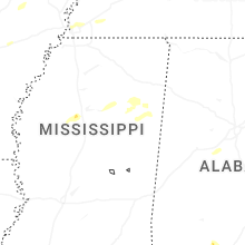
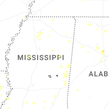
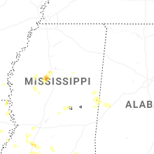


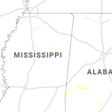


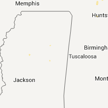


Connect with Interactive Hail Maps