

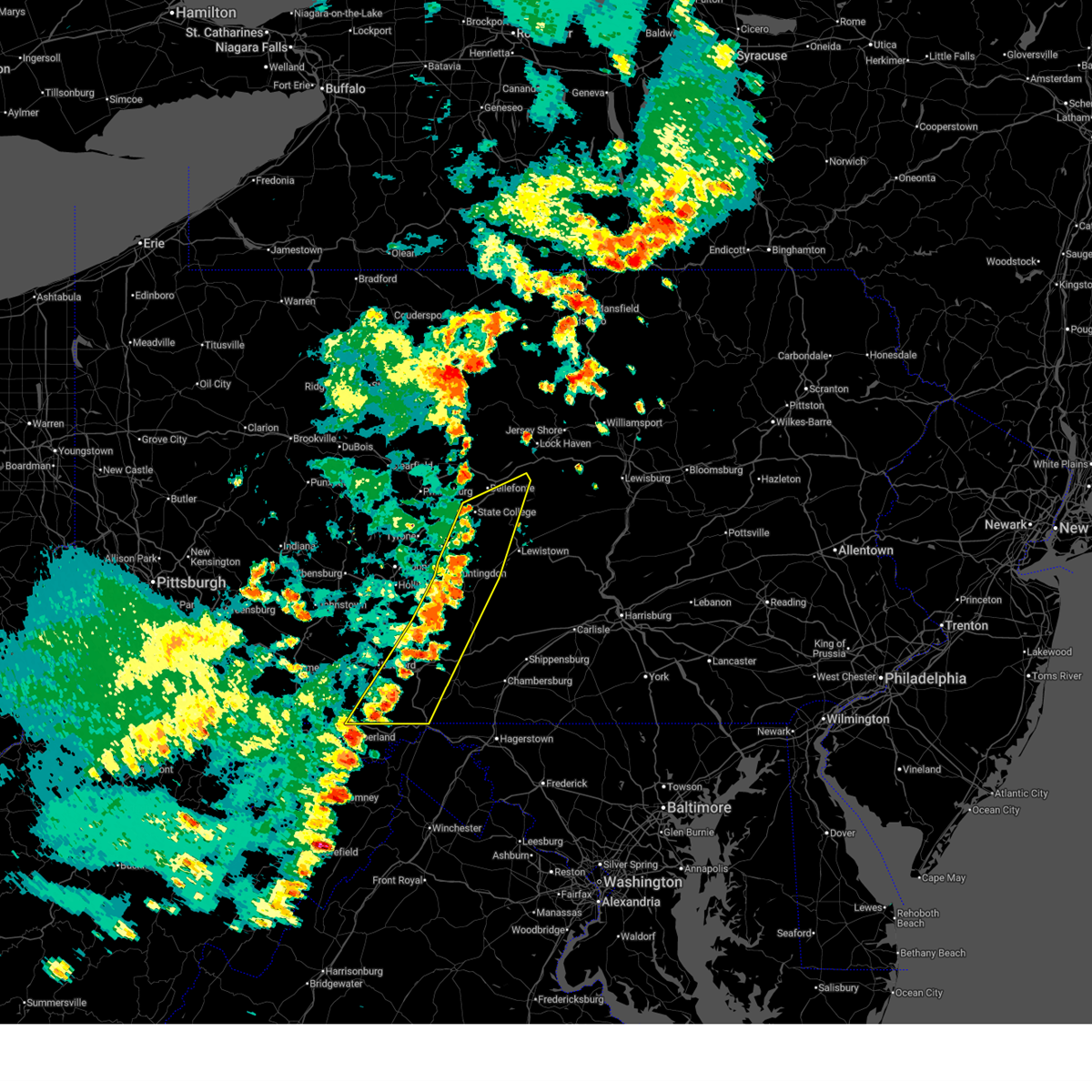
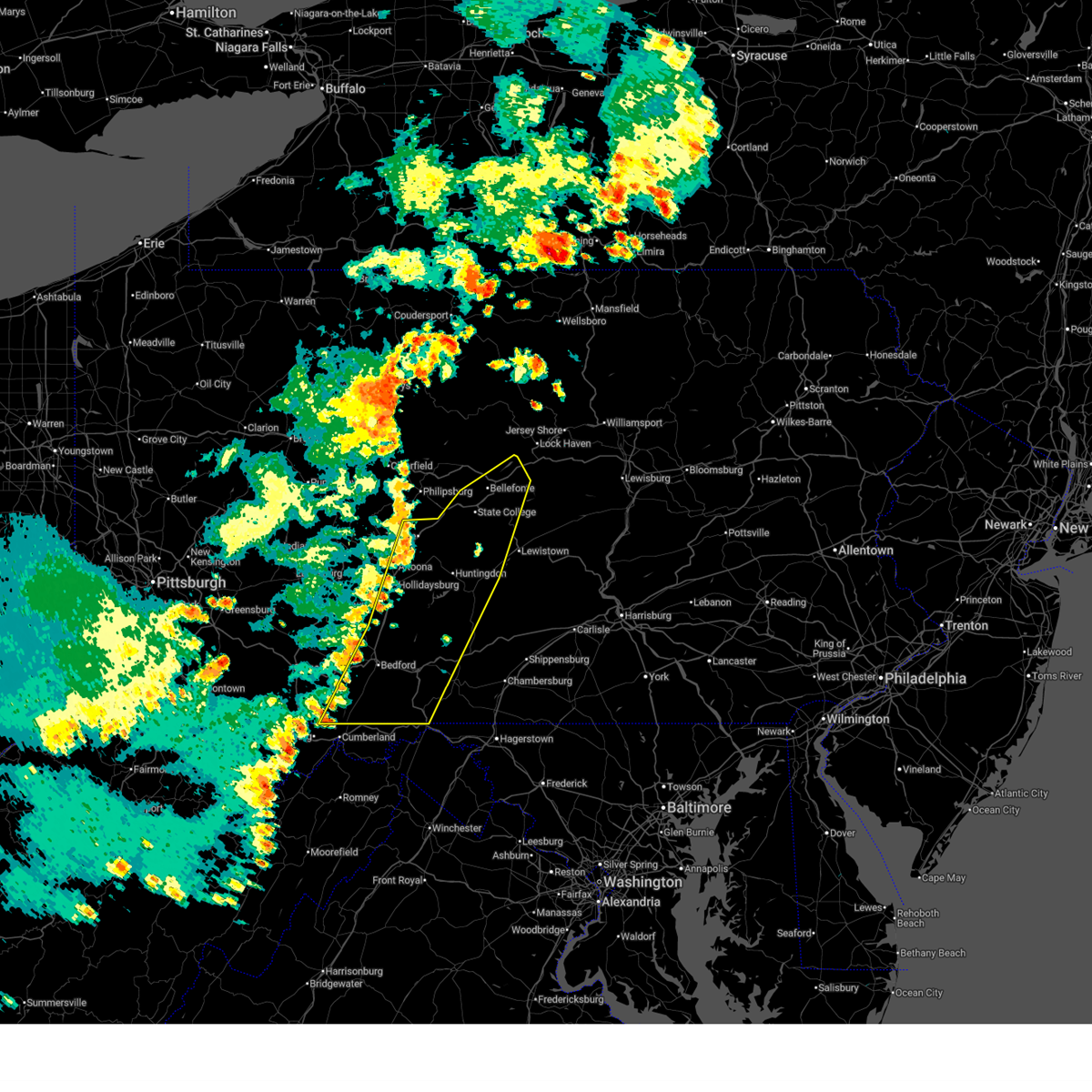
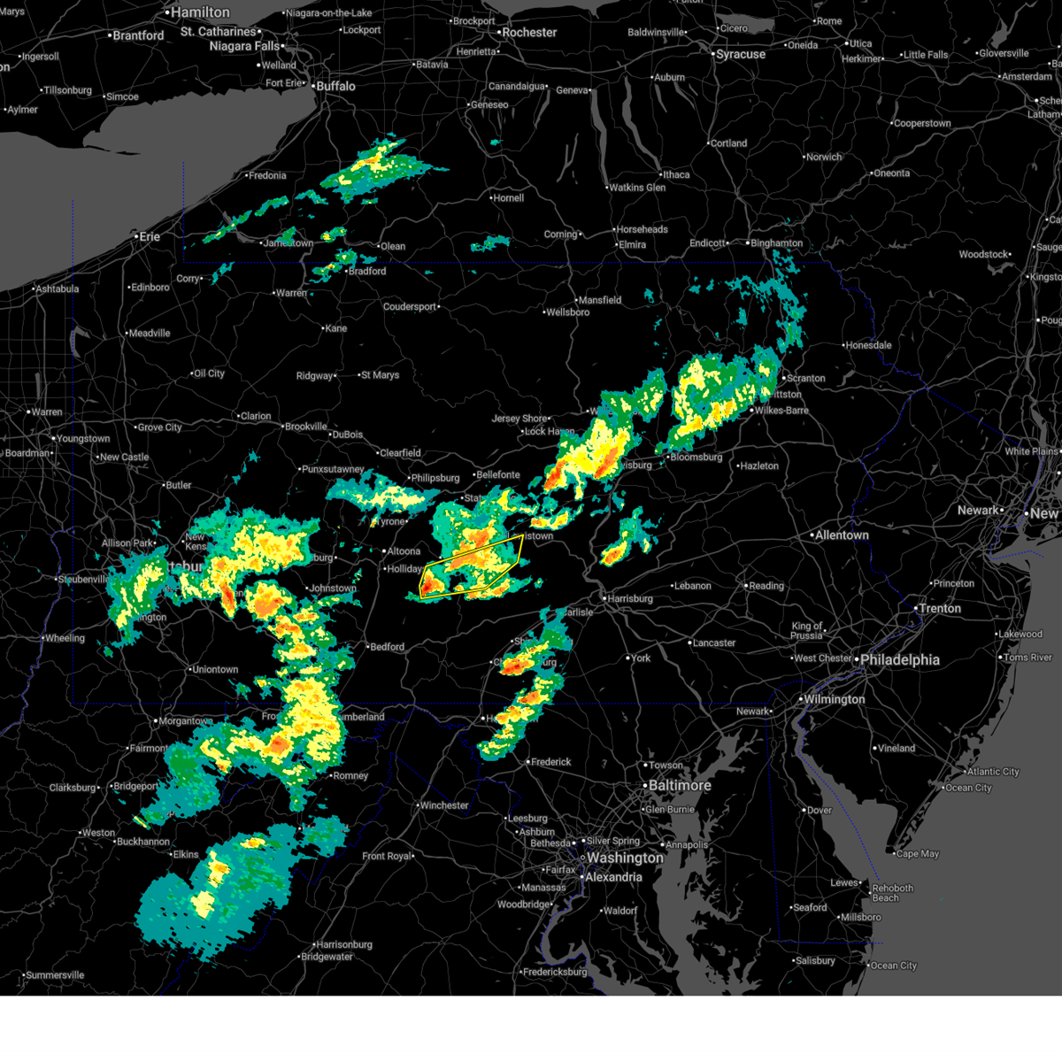
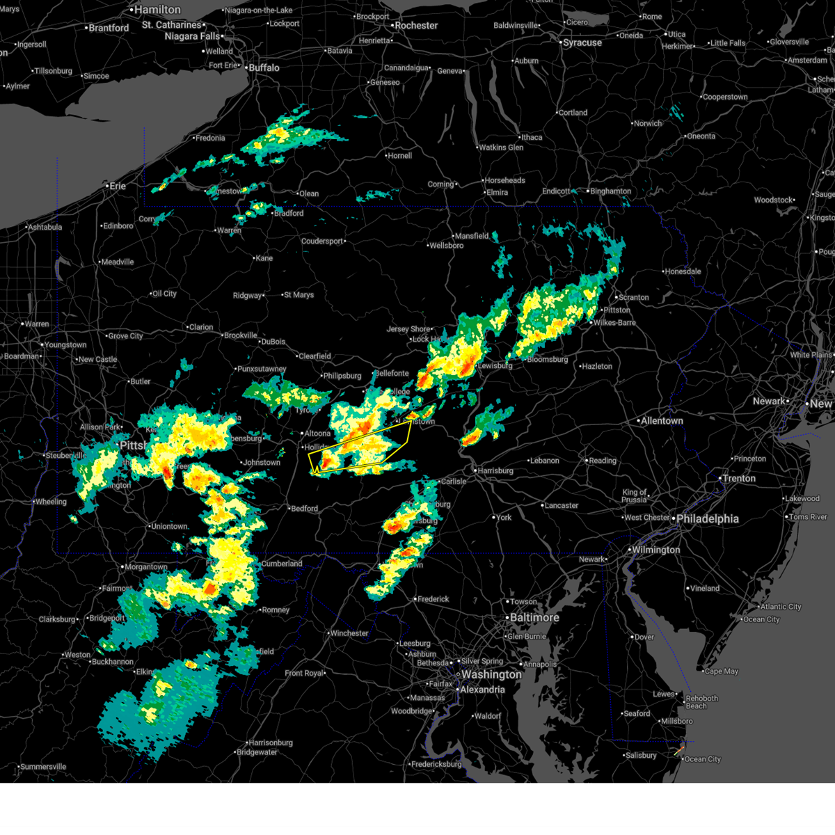
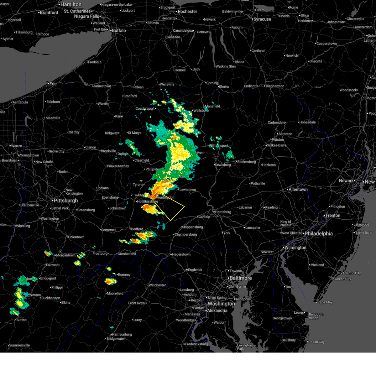
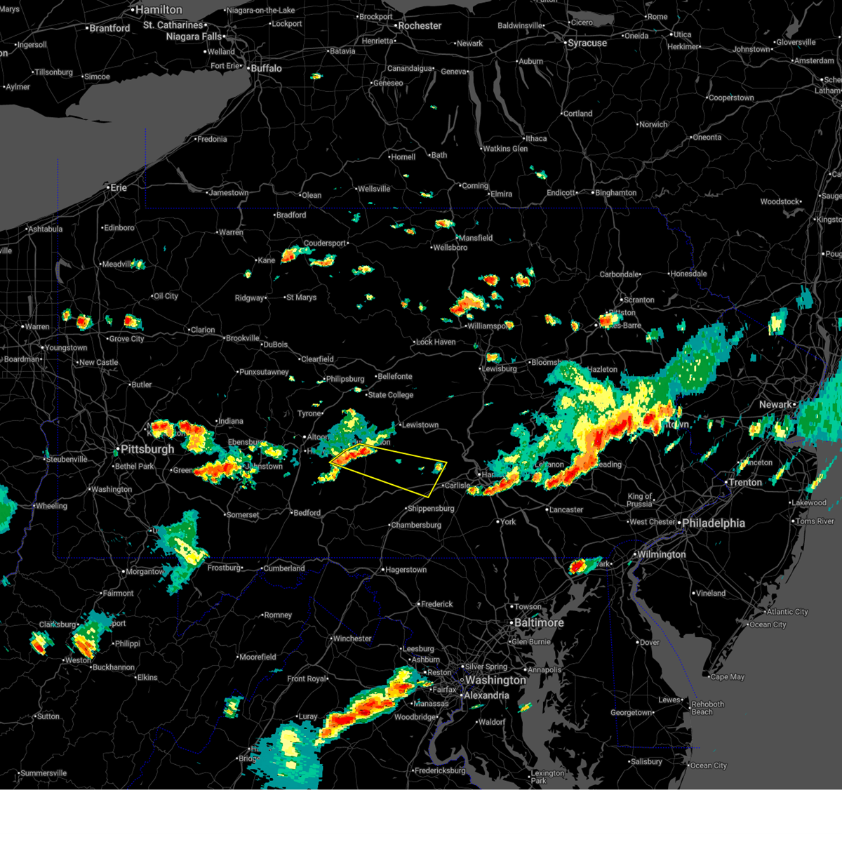
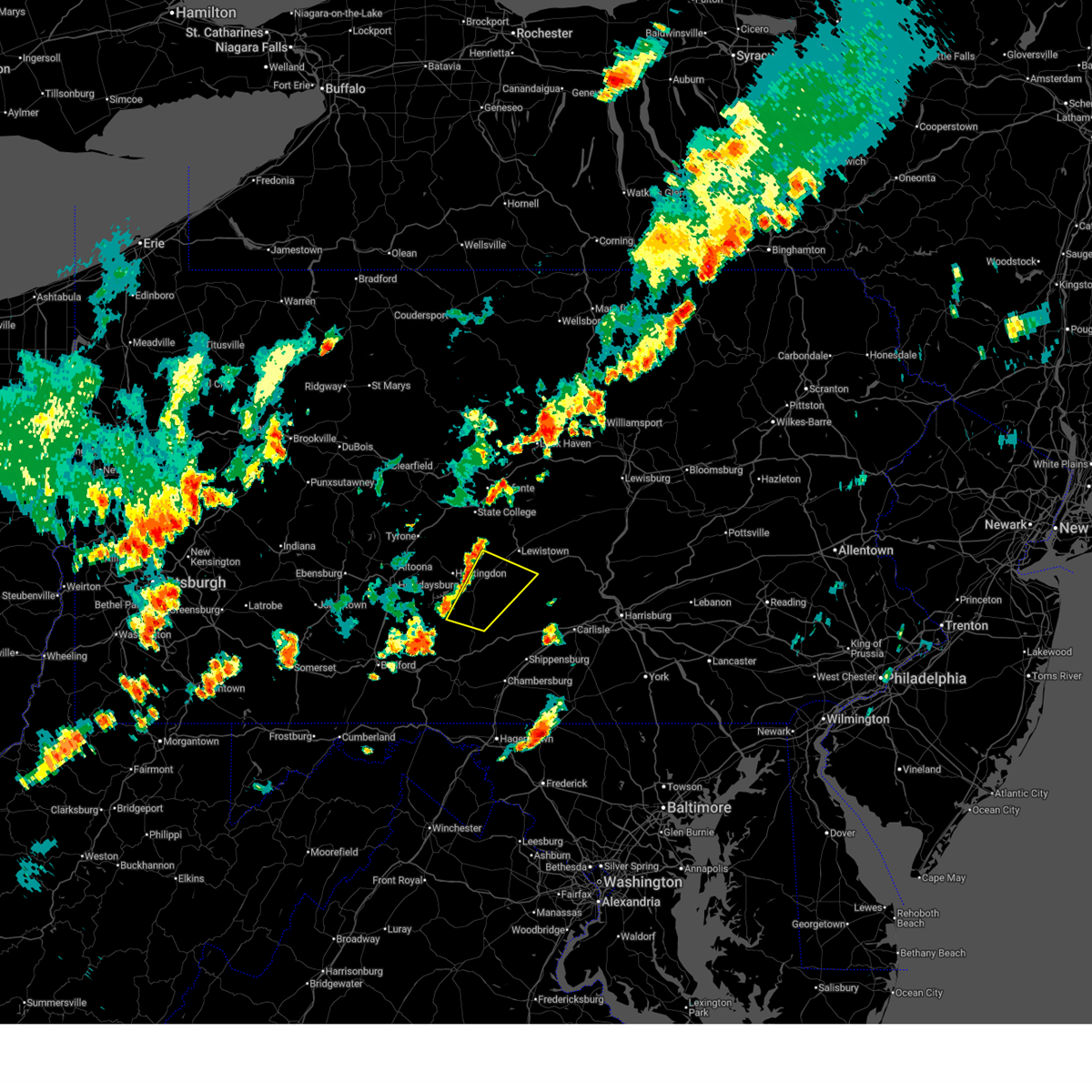
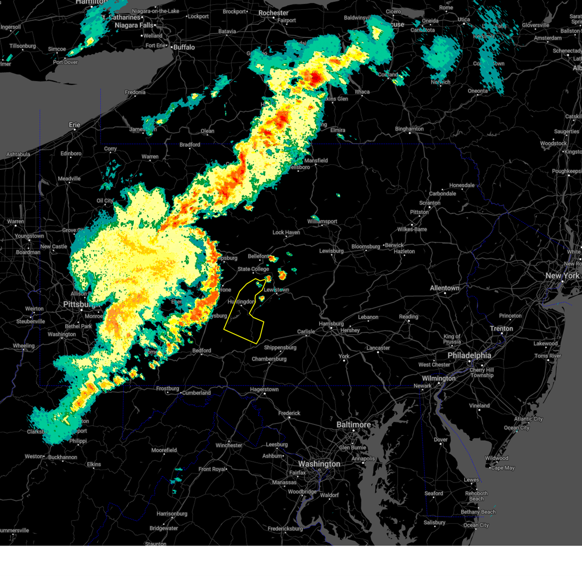
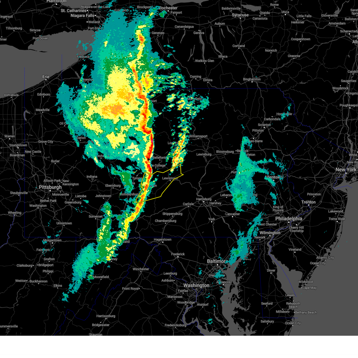
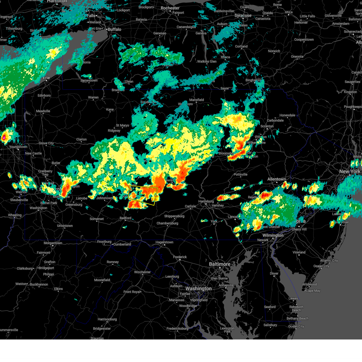
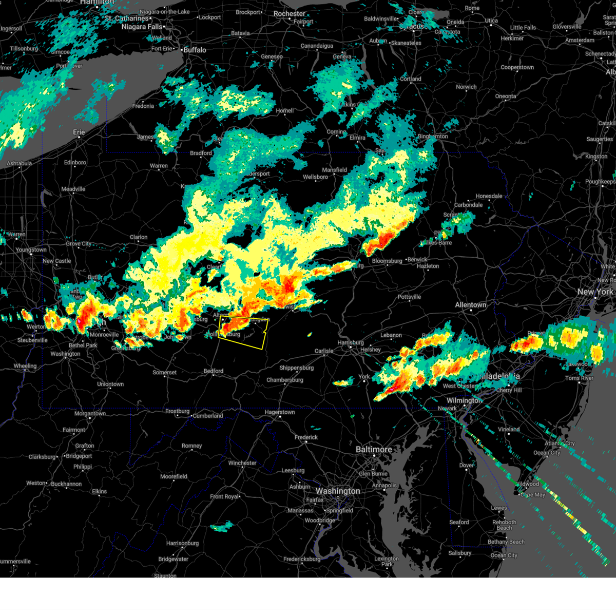
Hail Map for Mapleton, PA
The Mapleton, PA area has had 1 report of on-the-ground hail by trained spotters, and has been under severe weather warnings 9 times during the past 12 months. Doppler radar has detected hail at or near Mapleton, PA on 26 occasions, including 1 occasion during the past year.
| Name: | Mapleton, PA |
| Where Located: | 27.9 miles S of State College, PA |
| Map: | Google Map for Mapleton, PA |
| Population: | 441 |
| Housing Units: | 195 |
| More Info: | Search Google for Mapleton, PA |
0
The Top Recent Hail Date for Mapleton, PA is Monday, July 7, 2025 (26th out of 26)

Hail and Wind Damage Spotted near Mapleton, PA
| Date / Time | Report Details |
|---|---|
| 6/11/2026 5:59 PM EDT |
 the severe thunderstorm warning has been cancelled and is no longer in effect the severe thunderstorm warning has been cancelled and is no longer in effect
|
| 6/11/2026 5:59 PM EDT |
 At 559 pm edt, severe thunderstorms were located along a line extending from houserville to raystown dam to clearville, moving east at 45 mph (radar indicated). Hazards include 60 mph wind gusts. Expect damage to roofs, siding, and trees. locations impacted include, state college, huntingdon, breezewood, park forest village, boalsburg, pleasant gap, warfordsburg, mount union, lemont, clearville, zion, and everett. this includes the following interstates, interstate 70 from mile markers 147 to 170. the pennsylvania turnpike from mile markers 149 to 179. Interstate 99 from mile markers 69 to 83. At 559 pm edt, severe thunderstorms were located along a line extending from houserville to raystown dam to clearville, moving east at 45 mph (radar indicated). Hazards include 60 mph wind gusts. Expect damage to roofs, siding, and trees. locations impacted include, state college, huntingdon, breezewood, park forest village, boalsburg, pleasant gap, warfordsburg, mount union, lemont, clearville, zion, and everett. this includes the following interstates, interstate 70 from mile markers 147 to 170. the pennsylvania turnpike from mile markers 149 to 179. Interstate 99 from mile markers 69 to 83.
|
| 6/11/2026 5:22 PM EDT |
 Svrctp the national weather service in state college pa has issued a * severe thunderstorm warning for, bedford county in south central pennsylvania, blair county in central pennsylvania, southwestern centre county in central pennsylvania, fulton county in south central pennsylvania, huntingdon county in central pennsylvania, western mifflin county in central pennsylvania, southeastern somerset county in south central pennsylvania, * until 615 pm edt. * at 522 pm edt, severe thunderstorms were located along a line extending from tyrone to queen to near la vale, moving east at 45 mph (radar indicated). Hazards include 60 mph wind gusts. expect damage to roofs, siding, and trees Svrctp the national weather service in state college pa has issued a * severe thunderstorm warning for, bedford county in south central pennsylvania, blair county in central pennsylvania, southwestern centre county in central pennsylvania, fulton county in south central pennsylvania, huntingdon county in central pennsylvania, western mifflin county in central pennsylvania, southeastern somerset county in south central pennsylvania, * until 615 pm edt. * at 522 pm edt, severe thunderstorms were located along a line extending from tyrone to queen to near la vale, moving east at 45 mph (radar indicated). Hazards include 60 mph wind gusts. expect damage to roofs, siding, and trees
|
| 3/11/2026 4:48 PM EDT |
 At 447 pm edt, a severe thunderstorm was located over trough creek state park, moving east at 50 mph (asos weather station. at 4:30 pm 60 mph winds was reported at kaoo in altoona). Hazards include 60 mph wind gusts. Expect damage to roofs, siding, and trees. Locations impacted include, mount union, raystown dam, walnut, trough creek state park, blacklog, mapleton, mcveytown, mill creek, kistler, longfellow, newton hamilton, and atkinson mills. At 447 pm edt, a severe thunderstorm was located over trough creek state park, moving east at 50 mph (asos weather station. at 4:30 pm 60 mph winds was reported at kaoo in altoona). Hazards include 60 mph wind gusts. Expect damage to roofs, siding, and trees. Locations impacted include, mount union, raystown dam, walnut, trough creek state park, blacklog, mapleton, mcveytown, mill creek, kistler, longfellow, newton hamilton, and atkinson mills.
|
| 3/11/2026 4:48 PM EDT |
 the severe thunderstorm warning has been cancelled and is no longer in effect the severe thunderstorm warning has been cancelled and is no longer in effect
|
| 3/11/2026 4:39 PM EDT |
 Svrctp the national weather service in state college pa has issued a * severe thunderstorm warning for, southeastern blair county in central pennsylvania, central huntingdon county in central pennsylvania, west central juniata county in central pennsylvania, southwestern mifflin county in central pennsylvania, * until 515 pm edt. * at 437 pm edt, a severe thunderstorm was located over entriken, moving east at 50 mph (asos weather station. at 4:30 pm 60 mph winds was reported at kaoo in altoona). Hazards include 60 mph wind gusts. expect damage to roofs, siding, and trees Svrctp the national weather service in state college pa has issued a * severe thunderstorm warning for, southeastern blair county in central pennsylvania, central huntingdon county in central pennsylvania, west central juniata county in central pennsylvania, southwestern mifflin county in central pennsylvania, * until 515 pm edt. * at 437 pm edt, a severe thunderstorm was located over entriken, moving east at 50 mph (asos weather station. at 4:30 pm 60 mph winds was reported at kaoo in altoona). Hazards include 60 mph wind gusts. expect damage to roofs, siding, and trees
|
| 7/26/2025 1:00 PM EDT |
 Svrctp the national weather service in state college pa has issued a * severe thunderstorm warning for, north central franklin county in south central pennsylvania, central huntingdon county in central pennsylvania, southwestern juniata county in central pennsylvania, southwestern mifflin county in central pennsylvania, west central perry county in south central pennsylvania, * until 145 pm edt. * at 100 pm edt, a severe thunderstorm was located over raystown dam, moving southeast at 25 mph (radar indicated). Hazards include 60 mph wind gusts. expect damage to roofs, siding, and trees Svrctp the national weather service in state college pa has issued a * severe thunderstorm warning for, north central franklin county in south central pennsylvania, central huntingdon county in central pennsylvania, southwestern juniata county in central pennsylvania, southwestern mifflin county in central pennsylvania, west central perry county in south central pennsylvania, * until 145 pm edt. * at 100 pm edt, a severe thunderstorm was located over raystown dam, moving southeast at 25 mph (radar indicated). Hazards include 60 mph wind gusts. expect damage to roofs, siding, and trees
|
| 7/25/2025 4:22 PM EDT | Treed down blocking one lane of roadway on smith valley rd at boot hill lan in huntingdon county PA, 3.5 miles NE of Mapleton, PA |
| 7/25/2025 4:19 PM EDT |
 Svrctp the national weather service in state college pa has issued a * severe thunderstorm warning for, northwestern cumberland county in south central pennsylvania, north central franklin county in south central pennsylvania, central huntingdon county in central pennsylvania, southwestern juniata county in central pennsylvania, southwestern mifflin county in central pennsylvania, southwestern perry county in south central pennsylvania, * until 500 pm edt. * at 418 pm edt, a severe thunderstorm was located over mount union, moving east at 55 mph (radar indicated). Hazards include 60 mph wind gusts and penny size hail. expect damage to roofs, siding, and trees Svrctp the national weather service in state college pa has issued a * severe thunderstorm warning for, northwestern cumberland county in south central pennsylvania, north central franklin county in south central pennsylvania, central huntingdon county in central pennsylvania, southwestern juniata county in central pennsylvania, southwestern mifflin county in central pennsylvania, southwestern perry county in south central pennsylvania, * until 500 pm edt. * at 418 pm edt, a severe thunderstorm was located over mount union, moving east at 55 mph (radar indicated). Hazards include 60 mph wind gusts and penny size hail. expect damage to roofs, siding, and trees
|
| 7/7/2025 6:57 PM EDT |
 Svrctp the national weather service in state college pa has issued a * severe thunderstorm warning for, southeastern huntingdon county in central pennsylvania, southwestern juniata county in central pennsylvania, southwestern mifflin county in central pennsylvania, * until 745 pm edt. * at 656 pm edt, a severe thunderstorm was located over mount union, moving east at 20 mph (radar indicated). Hazards include 60 mph wind gusts. expect damage to roofs, siding, and trees Svrctp the national weather service in state college pa has issued a * severe thunderstorm warning for, southeastern huntingdon county in central pennsylvania, southwestern juniata county in central pennsylvania, southwestern mifflin county in central pennsylvania, * until 745 pm edt. * at 656 pm edt, a severe thunderstorm was located over mount union, moving east at 20 mph (radar indicated). Hazards include 60 mph wind gusts. expect damage to roofs, siding, and trees
|
| 6/26/2025 7:16 PM EDT |
 Svrctp the national weather service in state college pa has issued a * severe thunderstorm warning for, central huntingdon county in central pennsylvania, southwestern mifflin county in central pennsylvania, * until 800 pm edt. * at 716 pm edt, a severe thunderstorm was located over raystown dam, moving southeast at 15 mph (radar indicated). Hazards include 60 mph wind gusts. expect damage to roofs, siding, and trees Svrctp the national weather service in state college pa has issued a * severe thunderstorm warning for, central huntingdon county in central pennsylvania, southwestern mifflin county in central pennsylvania, * until 800 pm edt. * at 716 pm edt, a severe thunderstorm was located over raystown dam, moving southeast at 15 mph (radar indicated). Hazards include 60 mph wind gusts. expect damage to roofs, siding, and trees
|
| 4/29/2025 6:33 PM EDT |
 Svrctp the national weather service in state college pa has issued a * severe thunderstorm warning for, huntingdon county in central pennsylvania, * until 715 pm edt. * at 632 pm edt, severe thunderstorms were located along a line extending from osceola mills to sinking valley to roaring spring, moving east at 65 mph (radar indicated). Hazards include 60 mph wind gusts. expect damage to roofs, siding, and trees Svrctp the national weather service in state college pa has issued a * severe thunderstorm warning for, huntingdon county in central pennsylvania, * until 715 pm edt. * at 632 pm edt, severe thunderstorms were located along a line extending from osceola mills to sinking valley to roaring spring, moving east at 65 mph (radar indicated). Hazards include 60 mph wind gusts. expect damage to roofs, siding, and trees
|
| 3/16/2025 2:50 PM EDT |
 At 250 pm edt, severe thunderstorms were located along a line extending from rock springs to trough creek state park, moving east at 45 mph (trained weather spotters). Hazards include 60 mph wind gusts and quarter size hail. Hail damage to vehicles is expected. expect wind damage to roofs, siding, and trees. Locations impacted include, franklinville, whipple dam state park, yeagertown, wagner, alfarata, raystown dam, reedsville, mapleton, juniata terrace, atkinson mills, mcconnellstown, and siglerville. At 250 pm edt, severe thunderstorms were located along a line extending from rock springs to trough creek state park, moving east at 45 mph (trained weather spotters). Hazards include 60 mph wind gusts and quarter size hail. Hail damage to vehicles is expected. expect wind damage to roofs, siding, and trees. Locations impacted include, franklinville, whipple dam state park, yeagertown, wagner, alfarata, raystown dam, reedsville, mapleton, juniata terrace, atkinson mills, mcconnellstown, and siglerville.
|
| 3/16/2025 2:50 PM EDT |
 the severe thunderstorm warning has been cancelled and is no longer in effect the severe thunderstorm warning has been cancelled and is no longer in effect
|
| 3/16/2025 2:27 PM EDT |
 Svrctp the national weather service in state college pa has issued a * severe thunderstorm warning for, blair county in central pennsylvania, huntingdon county in central pennsylvania, mifflin county in central pennsylvania, * until 345 pm edt. * at 226 pm edt, severe thunderstorms were located along a line extending from blandburg to lakemont to claysburg, moving northeast at 65 mph (trained weather spotters). Hazards include 60 mph wind gusts and quarter size hail. Hail damage to vehicles is expected. Expect wind damage to roofs, siding, and trees. Svrctp the national weather service in state college pa has issued a * severe thunderstorm warning for, blair county in central pennsylvania, huntingdon county in central pennsylvania, mifflin county in central pennsylvania, * until 345 pm edt. * at 226 pm edt, severe thunderstorms were located along a line extending from blandburg to lakemont to claysburg, moving northeast at 65 mph (trained weather spotters). Hazards include 60 mph wind gusts and quarter size hail. Hail damage to vehicles is expected. Expect wind damage to roofs, siding, and trees.
|
| 8/6/2024 4:52 PM EDT |
 Svrctp the national weather service in state college pa has issued a * severe thunderstorm warning for, northeastern bedford county in south central pennsylvania, southeastern blair county in central pennsylvania, north central franklin county in south central pennsylvania, huntingdon county in central pennsylvania, southwestern juniata county in central pennsylvania, southwestern mifflin county in central pennsylvania, perry county in south central pennsylvania, * until 530 pm edt. * at 452 pm edt, severe thunderstorms were located along a line extending from mexico to blacklog to mount union to dudley, moving southeast at 20 mph (radar indicated). Hazards include 60 mph wind gusts and quarter size hail. Hail damage to vehicles is expected. Expect wind damage to roofs, siding, and trees. Svrctp the national weather service in state college pa has issued a * severe thunderstorm warning for, northeastern bedford county in south central pennsylvania, southeastern blair county in central pennsylvania, north central franklin county in south central pennsylvania, huntingdon county in central pennsylvania, southwestern juniata county in central pennsylvania, southwestern mifflin county in central pennsylvania, perry county in south central pennsylvania, * until 530 pm edt. * at 452 pm edt, severe thunderstorms were located along a line extending from mexico to blacklog to mount union to dudley, moving southeast at 20 mph (radar indicated). Hazards include 60 mph wind gusts and quarter size hail. Hail damage to vehicles is expected. Expect wind damage to roofs, siding, and trees.
|
| 8/6/2024 4:43 PM EDT |
 The storm which prompted the warning has weakened below severe limits, and no longer poses an immediate threat to life or property. therefore, the warning will be allowed to expire. however, gusty winds and heavy rain are still possible with this thunderstorm. a severe thunderstorm watch remains in effect until 700 pm edt for central pennsylvania. to report severe weather, contact your nearest law enforcement agency. they will relay your report to the national weather service state college pa. The storm which prompted the warning has weakened below severe limits, and no longer poses an immediate threat to life or property. therefore, the warning will be allowed to expire. however, gusty winds and heavy rain are still possible with this thunderstorm. a severe thunderstorm watch remains in effect until 700 pm edt for central pennsylvania. to report severe weather, contact your nearest law enforcement agency. they will relay your report to the national weather service state college pa.
|
| 8/6/2024 4:06 PM EDT |
 Svrctp the national weather service in state college pa has issued a * severe thunderstorm warning for, central blair county in central pennsylvania, central huntingdon county in central pennsylvania, * until 445 pm edt. * at 406 pm edt, a severe thunderstorm was located over lakemont, moving east at 25 mph (radar indicated). Hazards include 60 mph wind gusts and quarter size hail. Hail damage to vehicles is expected. Expect wind damage to roofs, siding, and trees. Svrctp the national weather service in state college pa has issued a * severe thunderstorm warning for, central blair county in central pennsylvania, central huntingdon county in central pennsylvania, * until 445 pm edt. * at 406 pm edt, a severe thunderstorm was located over lakemont, moving east at 25 mph (radar indicated). Hazards include 60 mph wind gusts and quarter size hail. Hail damage to vehicles is expected. Expect wind damage to roofs, siding, and trees.
|
| 6/29/2024 4:49 PM EDT |
 At 448 pm edt, severe thunderstorms were located along a line extending from belltown to juniata terrace to allensville to mount union, moving east at 40 mph (radar indicated). Hazards include 70 mph wind gusts. Expect considerable tree damage. damage is likely to mobile homes, roofs, and outbuildings. Locations impacted include, lewistown, mount union, burnham, belleville, highland park, yeagertown, mcalisterville, spruce hill, strodes mills, reedsville, juniata terrace, and allensville. At 448 pm edt, severe thunderstorms were located along a line extending from belltown to juniata terrace to allensville to mount union, moving east at 40 mph (radar indicated). Hazards include 70 mph wind gusts. Expect considerable tree damage. damage is likely to mobile homes, roofs, and outbuildings. Locations impacted include, lewistown, mount union, burnham, belleville, highland park, yeagertown, mcalisterville, spruce hill, strodes mills, reedsville, juniata terrace, and allensville.
|
| 6/29/2024 4:49 PM EDT |
 the severe thunderstorm warning has been cancelled and is no longer in effect the severe thunderstorm warning has been cancelled and is no longer in effect
|
| 6/29/2024 4:28 PM EDT |
 Svrctp the national weather service in state college pa has issued a * severe thunderstorm warning for, east central blair county in central pennsylvania, central huntingdon county in central pennsylvania, juniata county in central pennsylvania, mifflin county in central pennsylvania, * until 515 pm edt. * at 428 pm edt, severe thunderstorms were located along a line extending from reedsville to allensville to huntingdon to entriken, moving east at 40 mph (radar indicated). Hazards include 60 mph wind gusts. expect damage to roofs, siding, and trees Svrctp the national weather service in state college pa has issued a * severe thunderstorm warning for, east central blair county in central pennsylvania, central huntingdon county in central pennsylvania, juniata county in central pennsylvania, mifflin county in central pennsylvania, * until 515 pm edt. * at 428 pm edt, severe thunderstorms were located along a line extending from reedsville to allensville to huntingdon to entriken, moving east at 40 mph (radar indicated). Hazards include 60 mph wind gusts. expect damage to roofs, siding, and trees
|
| 6/26/2024 9:52 PM EDT |
 Svrctp the national weather service in state college pa has issued a * severe thunderstorm warning for, east central bedford county in south central pennsylvania, northwestern cumberland county in south central pennsylvania, central franklin county in south central pennsylvania, northeastern fulton county in south central pennsylvania, southeastern huntingdon county in central pennsylvania, juniata county in central pennsylvania, mifflin county in central pennsylvania, perry county in south central pennsylvania, * until 1030 pm edt. * at 951 pm edt, severe thunderstorms were located along a line extending from belleville to mount union to wells tannery, moving east at 40 mph (radar indicated). Hazards include 60 mph wind gusts. expect damage to roofs, siding, and trees Svrctp the national weather service in state college pa has issued a * severe thunderstorm warning for, east central bedford county in south central pennsylvania, northwestern cumberland county in south central pennsylvania, central franklin county in south central pennsylvania, northeastern fulton county in south central pennsylvania, southeastern huntingdon county in central pennsylvania, juniata county in central pennsylvania, mifflin county in central pennsylvania, perry county in south central pennsylvania, * until 1030 pm edt. * at 951 pm edt, severe thunderstorms were located along a line extending from belleville to mount union to wells tannery, moving east at 40 mph (radar indicated). Hazards include 60 mph wind gusts. expect damage to roofs, siding, and trees
|
| 6/26/2024 9:35 PM EDT |
 At 935 pm edt, severe thunderstorms were located along a line extending from altoona to royer to claysburg, moving east at 40 mph (radar indicated). Hazards include 60 mph wind gusts. Expect damage to roofs, siding, and trees. locations impacted include, altoona, huntingdon, hollidaysburg, roaring spring, martinsburg, lakemont, williamsburg, dudley, raystown dam, entriken, royer, and shy beaver. This includes interstate 99 from mile markers 31 to 36. At 935 pm edt, severe thunderstorms were located along a line extending from altoona to royer to claysburg, moving east at 40 mph (radar indicated). Hazards include 60 mph wind gusts. Expect damage to roofs, siding, and trees. locations impacted include, altoona, huntingdon, hollidaysburg, roaring spring, martinsburg, lakemont, williamsburg, dudley, raystown dam, entriken, royer, and shy beaver. This includes interstate 99 from mile markers 31 to 36.
|
| 6/26/2024 9:13 PM EDT |
 Svrctp the national weather service in state college pa has issued a * severe thunderstorm warning for, northeastern bedford county in south central pennsylvania, blair county in central pennsylvania, southwestern huntingdon county in central pennsylvania, * until 1000 pm edt. * at 913 pm edt, severe thunderstorms were located along a line extending from loretto to lilly to ogletown, moving east at 40 mph (radar indicated). Hazards include 60 mph wind gusts. expect damage to roofs, siding, and trees Svrctp the national weather service in state college pa has issued a * severe thunderstorm warning for, northeastern bedford county in south central pennsylvania, blair county in central pennsylvania, southwestern huntingdon county in central pennsylvania, * until 1000 pm edt. * at 913 pm edt, severe thunderstorms were located along a line extending from loretto to lilly to ogletown, moving east at 40 mph (radar indicated). Hazards include 60 mph wind gusts. expect damage to roofs, siding, and trees
|
| 6/17/2024 7:09 PM EDT |
 Svrctp the national weather service in state college pa has issued a * severe thunderstorm warning for, blair county in central pennsylvania, northeastern cambria county in central pennsylvania, southwestern centre county in central pennsylvania, south central clearfield county in central pennsylvania, northern huntingdon county in central pennsylvania, * until 800 pm edt. * at 707 pm edt, severe thunderstorms were located along a line extending from osceola mills to tipton to horseshoe curve, moving east at 45 mph (radar indicated). Hazards include 60 mph wind gusts and quarter size hail. Hail damage to vehicles is expected. Expect wind damage to roofs, siding, and trees. Svrctp the national weather service in state college pa has issued a * severe thunderstorm warning for, blair county in central pennsylvania, northeastern cambria county in central pennsylvania, southwestern centre county in central pennsylvania, south central clearfield county in central pennsylvania, northern huntingdon county in central pennsylvania, * until 800 pm edt. * at 707 pm edt, severe thunderstorms were located along a line extending from osceola mills to tipton to horseshoe curve, moving east at 45 mph (radar indicated). Hazards include 60 mph wind gusts and quarter size hail. Hail damage to vehicles is expected. Expect wind damage to roofs, siding, and trees.
|
| 4/14/2024 7:55 PM EDT |
 The storm which prompted the warning has weakened below severe limits, and has exited the warned area. therefore, the warning will be allowed to expire. a severe thunderstorm watch remains in effect until 1100 pm edt for central pennsylvania. The storm which prompted the warning has weakened below severe limits, and has exited the warned area. therefore, the warning will be allowed to expire. a severe thunderstorm watch remains in effect until 1100 pm edt for central pennsylvania.
|
| 4/14/2024 7:48 PM EDT |
 At 748 pm edt, a severe thunderstorm was located over huntingdon, moving southeast at 50 mph (radar indicated). Hazards include 60 mph wind gusts and quarter size hail. Hail damage to vehicles is expected. expect wind damage to roofs, siding, and trees. Locations impacted include, lewistown, huntingdon, belleville, strodes mills, allensville, mcalevys fort, mapleton, mcveytown, mill creek, and juniata college. At 748 pm edt, a severe thunderstorm was located over huntingdon, moving southeast at 50 mph (radar indicated). Hazards include 60 mph wind gusts and quarter size hail. Hail damage to vehicles is expected. expect wind damage to roofs, siding, and trees. Locations impacted include, lewistown, huntingdon, belleville, strodes mills, allensville, mcalevys fort, mapleton, mcveytown, mill creek, and juniata college.
|
| 4/14/2024 7:48 PM EDT |
 the severe thunderstorm warning has been cancelled and is no longer in effect the severe thunderstorm warning has been cancelled and is no longer in effect
|
| 4/14/2024 7:29 PM EDT |
 Svrctp the national weather service in state college pa has issued a * severe thunderstorm warning for, northeastern blair county in central pennsylvania, northern huntingdon county in central pennsylvania, west central mifflin county in central pennsylvania, * until 800 pm edt. * at 729 pm edt, a severe thunderstorm was located over birmingham, moving southeast at 50 mph (radar indicated). Hazards include 60 mph wind gusts and quarter size hail. Hail damage to vehicles is expected. Expect wind damage to roofs, siding, and trees. Svrctp the national weather service in state college pa has issued a * severe thunderstorm warning for, northeastern blair county in central pennsylvania, northern huntingdon county in central pennsylvania, west central mifflin county in central pennsylvania, * until 800 pm edt. * at 729 pm edt, a severe thunderstorm was located over birmingham, moving southeast at 50 mph (radar indicated). Hazards include 60 mph wind gusts and quarter size hail. Hail damage to vehicles is expected. Expect wind damage to roofs, siding, and trees.
|
| 9/7/2023 1:10 PM EDT | Tree down on roadwa in huntingdon county PA, 1.1 miles NNE of Mapleton, PA |
| 9/7/2023 12:57 PM EDT |
 At 1256 pm edt, a severe thunderstorm was located near raystown dam, moving northeast at 30 mph (radar indicated). Hazards include 60 mph wind gusts and penny size hail. expect damage to roofs, siding, and trees At 1256 pm edt, a severe thunderstorm was located near raystown dam, moving northeast at 30 mph (radar indicated). Hazards include 60 mph wind gusts and penny size hail. expect damage to roofs, siding, and trees
|
| 8/4/2023 7:01 PM EDT |
 At 700 pm edt, a severe thunderstorm was located over doylesburg, moving southeast at 30 mph (radar indicated). Hazards include 60 mph wind gusts and quarter size hail. Hail damage to vehicles is expected. expect wind damage to roofs, siding, and trees. locations impacted include, shippensburg, mount union, newville, rockhill furnace, roxbury, big spring state park, doylesburg, mapleton, orbisonia, orrstown, shirleysburg and shippensburg university. this includes the following roadways, the pennsylvania turnpike from mile markers 194 to 216. interstate 81 from mile markers 23 to 30. route 11 from south of chambersburg to shippensburg. route 522 from orbisonia to south of mount union. hail threat, radar indicated max hail size, 1. 00 in wind threat, radar indicated max wind gust, 60 mph. At 700 pm edt, a severe thunderstorm was located over doylesburg, moving southeast at 30 mph (radar indicated). Hazards include 60 mph wind gusts and quarter size hail. Hail damage to vehicles is expected. expect wind damage to roofs, siding, and trees. locations impacted include, shippensburg, mount union, newville, rockhill furnace, roxbury, big spring state park, doylesburg, mapleton, orbisonia, orrstown, shirleysburg and shippensburg university. this includes the following roadways, the pennsylvania turnpike from mile markers 194 to 216. interstate 81 from mile markers 23 to 30. route 11 from south of chambersburg to shippensburg. route 522 from orbisonia to south of mount union. hail threat, radar indicated max hail size, 1. 00 in wind threat, radar indicated max wind gust, 60 mph.
|
| 8/4/2023 6:43 PM EDT |
 At 641 pm edt, a severe thunderstorm was located near mount union, moving southeast at 35 mph (radar indicated). Hazards include 60 mph wind gusts and quarter size hail. Hail damage to vehicles is expected. expect wind damage to roofs, siding, and trees. locations impacted include, shippensburg, mount union, newville, rockhill furnace, roxbury, big spring state park, doylesburg, mapleton, orbisonia, mill creek, kistler and orrstown. this includes the following interstates, the pennsylvania turnpike from mile markers 194 to 216. interstate 81 from mile markers 23 to 30. hail threat, radar indicated max hail size, 1. 00 in wind threat, radar indicated max wind gust, 60 mph. At 641 pm edt, a severe thunderstorm was located near mount union, moving southeast at 35 mph (radar indicated). Hazards include 60 mph wind gusts and quarter size hail. Hail damage to vehicles is expected. expect wind damage to roofs, siding, and trees. locations impacted include, shippensburg, mount union, newville, rockhill furnace, roxbury, big spring state park, doylesburg, mapleton, orbisonia, mill creek, kistler and orrstown. this includes the following interstates, the pennsylvania turnpike from mile markers 194 to 216. interstate 81 from mile markers 23 to 30. hail threat, radar indicated max hail size, 1. 00 in wind threat, radar indicated max wind gust, 60 mph.
|
| 8/4/2023 6:32 PM EDT | Ping Pong Ball sized hail reported 0.3 miles N of Mapleton, PA, report from mping: ping pong ball (1.50 in.). |
| 8/4/2023 6:27 PM EDT |
 At 627 pm edt, a severe thunderstorm was located over mount union, moving southeast at 35 mph (radar indicated). Hazards include 60 mph wind gusts and quarter size hail. Hail damage to vehicles is expected. Expect wind damage to roofs, siding, and trees. At 627 pm edt, a severe thunderstorm was located over mount union, moving southeast at 35 mph (radar indicated). Hazards include 60 mph wind gusts and quarter size hail. Hail damage to vehicles is expected. Expect wind damage to roofs, siding, and trees.
|
| 7/20/2023 11:46 PM EDT |
 At 1145 pm edt, severe thunderstorms were located along a line extending from sunbury to alfarata to raystown dam to shy beaver to near buffalo mills, moving east at 40 mph (radar indicated). Hazards include 60 mph wind gusts and penny size hail. expect damage to roofs, siding, and trees At 1145 pm edt, severe thunderstorms were located along a line extending from sunbury to alfarata to raystown dam to shy beaver to near buffalo mills, moving east at 40 mph (radar indicated). Hazards include 60 mph wind gusts and penny size hail. expect damage to roofs, siding, and trees
|
| 7/20/2023 10:57 PM EDT |
 At 1055 pm edt, severe thunderstorms were located along a line extending from mcalevys fort to franklinville to canoe creek state park to horseshoe curve, moving southeast at 15 mph (radar indicated). Hazards include 60 mph wind gusts. expect damage to roofs, siding, and trees At 1055 pm edt, severe thunderstorms were located along a line extending from mcalevys fort to franklinville to canoe creek state park to horseshoe curve, moving southeast at 15 mph (radar indicated). Hazards include 60 mph wind gusts. expect damage to roofs, siding, and trees
|
| 4/5/2023 11:13 PM EDT |
 The severe thunderstorm warning for east central blair and northwestern huntingdon counties will expire at 1115 pm edt, the storm which prompted the warning has weakened below severe limits, and no longer poses an immediate threat to life or property. therefore, the warning will be allowed to expire. however, gusty winds are still possible with this thunderstorm. The severe thunderstorm warning for east central blair and northwestern huntingdon counties will expire at 1115 pm edt, the storm which prompted the warning has weakened below severe limits, and no longer poses an immediate threat to life or property. therefore, the warning will be allowed to expire. however, gusty winds are still possible with this thunderstorm.
|
| 4/5/2023 11:01 PM EDT |
 At 1101 pm edt, a severe thunderstorm was located over allensville, moving east at 45 mph (radar indicated). Hazards include 60 mph wind gusts and nickel size hail. Expect damage to roofs, siding, and trees. locations impacted include, huntingdon, mcalevys fort, raystown dam, mcconnellstown, petersburg, mapleton, alexandria, mill creek, marklesburg and juniata college. hail threat, radar indicated max hail size, 0. 88 in wind threat, radar indicated max wind gust, 60 mph. At 1101 pm edt, a severe thunderstorm was located over allensville, moving east at 45 mph (radar indicated). Hazards include 60 mph wind gusts and nickel size hail. Expect damage to roofs, siding, and trees. locations impacted include, huntingdon, mcalevys fort, raystown dam, mcconnellstown, petersburg, mapleton, alexandria, mill creek, marklesburg and juniata college. hail threat, radar indicated max hail size, 0. 88 in wind threat, radar indicated max wind gust, 60 mph.
|
| 4/5/2023 10:45 PM EDT |
 At 1044 pm edt, a severe thunderstorm was located over spruce creek, moving east at 50 mph (radar indicated). Hazards include 60 mph wind gusts and nickel size hail. Expect damage to roofs, siding, and trees. locations impacted include, huntingdon, tyrone, williamsburg, tipton, spruce creek, birmingham, franklinville, mcalevys fort, raystown dam, sinking valley, canoe creek state park and royer. this includes interstate 99 from mile markers 39 to 47. hail threat, radar indicated max hail size, 0. 88 in wind threat, radar indicated max wind gust, 60 mph. At 1044 pm edt, a severe thunderstorm was located over spruce creek, moving east at 50 mph (radar indicated). Hazards include 60 mph wind gusts and nickel size hail. Expect damage to roofs, siding, and trees. locations impacted include, huntingdon, tyrone, williamsburg, tipton, spruce creek, birmingham, franklinville, mcalevys fort, raystown dam, sinking valley, canoe creek state park and royer. this includes interstate 99 from mile markers 39 to 47. hail threat, radar indicated max hail size, 0. 88 in wind threat, radar indicated max wind gust, 60 mph.
|
| 4/5/2023 10:25 PM EDT |
 At 1025 pm edt, a severe thunderstorm was located just west of altoona, moving east at 50 mph (radar indicated). Hazards include 60 mph wind gusts and nickel size hail. expect damage to roofs, siding, and trees At 1025 pm edt, a severe thunderstorm was located just west of altoona, moving east at 50 mph (radar indicated). Hazards include 60 mph wind gusts and nickel size hail. expect damage to roofs, siding, and trees
|
| 8/4/2022 1:18 PM EDT |
 At 118 pm edt, a severe thunderstorm was located over trough creek state park, moving east at 35 mph (radar indicated). Hazards include 60 mph wind gusts and nickel size hail. expect damage to roofs, siding, and trees At 118 pm edt, a severe thunderstorm was located over trough creek state park, moving east at 35 mph (radar indicated). Hazards include 60 mph wind gusts and nickel size hail. expect damage to roofs, siding, and trees
|
| 7/1/2022 1:03 PM EDT |
 At 103 pm edt, a severe thunderstorm was located over lilly, moving east at 40 mph (radar indicated). Hazards include 60 mph wind gusts and quarter size hail. Hail damage to vehicles is expected. expect wind damage to roofs, siding, and trees. this severe thunderstorm will be near, claysburg around 110 pm edt. hollidaysburg, roaring spring and duncansville around 120 pm edt. royer, entriken and williamsburg around 130 pm edt. trough creek state park and raystown dam around 140 pm edt. other locations impacted by this severe thunderstorm include cassville, cassandra, marklesburg, mapleton and mcconnellstown. this includes interstate 99 from mile markers 16 to 32. hail threat, radar indicated max hail size, 1. 00 in wind threat, radar indicated max wind gust, 60 mph. At 103 pm edt, a severe thunderstorm was located over lilly, moving east at 40 mph (radar indicated). Hazards include 60 mph wind gusts and quarter size hail. Hail damage to vehicles is expected. expect wind damage to roofs, siding, and trees. this severe thunderstorm will be near, claysburg around 110 pm edt. hollidaysburg, roaring spring and duncansville around 120 pm edt. royer, entriken and williamsburg around 130 pm edt. trough creek state park and raystown dam around 140 pm edt. other locations impacted by this severe thunderstorm include cassville, cassandra, marklesburg, mapleton and mcconnellstown. this includes interstate 99 from mile markers 16 to 32. hail threat, radar indicated max hail size, 1. 00 in wind threat, radar indicated max wind gust, 60 mph.
|
| 3/31/2022 4:06 PM EDT |
 At 404 pm edt, severe thunderstorms were located along a line extending from mount union to waterfall to fort littleton to mcconnellsburg to needmore to warfordsburg, moving northeast at 80 mph. the strongest winds in the line of storms will be from fort littleton to willow hill (radar indicated). Hazards include 70 mph wind gusts. Expect considerable tree damage. damage is likely to mobile homes, roofs, and outbuildings. locations impacted include, mcconnellsburg, breezewood, warfordsburg, mount union, clearville, everett, harrisonville, fort loudon, big cove tannery, crystal springs, waterfall and rockhill furnace. this includes the following interstates, interstate 70 from mile markers 147 to 170. the pennsylvania turnpike from mile markers 155 to 200. thunderstorm damage threat, considerable hail threat, radar indicated max hail size, <. 75 in wind threat, radar indicated max wind gust, 70 mph. At 404 pm edt, severe thunderstorms were located along a line extending from mount union to waterfall to fort littleton to mcconnellsburg to needmore to warfordsburg, moving northeast at 80 mph. the strongest winds in the line of storms will be from fort littleton to willow hill (radar indicated). Hazards include 70 mph wind gusts. Expect considerable tree damage. damage is likely to mobile homes, roofs, and outbuildings. locations impacted include, mcconnellsburg, breezewood, warfordsburg, mount union, clearville, everett, harrisonville, fort loudon, big cove tannery, crystal springs, waterfall and rockhill furnace. this includes the following interstates, interstate 70 from mile markers 147 to 170. the pennsylvania turnpike from mile markers 155 to 200. thunderstorm damage threat, considerable hail threat, radar indicated max hail size, <. 75 in wind threat, radar indicated max wind gust, 70 mph.
|
| 3/31/2022 3:48 PM EDT |
 At 348 pm edt, severe thunderstorms were located along a line extending from valley-hi to crystal springs to locust grove to inglesmith to near barnes gap, moving northeast at 50 mph (radar indicated). Hazards include 60 mph wind gusts. expect damage to roofs, siding, and trees At 348 pm edt, severe thunderstorms were located along a line extending from valley-hi to crystal springs to locust grove to inglesmith to near barnes gap, moving northeast at 50 mph (radar indicated). Hazards include 60 mph wind gusts. expect damage to roofs, siding, and trees
|
| 3/31/2022 3:31 PM EDT | Wires down on a hous in huntingdon county PA, 0.3 miles N of Mapleton, PA |
| 3/31/2022 3:14 PM EDT |
 At 313 pm edt, severe thunderstorms were located along a line extending from whipple dam state park to raystown dam to dudley, moving northeast at 65 mph (radar indicated). Hazards include 60 mph wind gusts and penny size hail. expect damage to roofs, siding, and trees At 313 pm edt, severe thunderstorms were located along a line extending from whipple dam state park to raystown dam to dudley, moving northeast at 65 mph (radar indicated). Hazards include 60 mph wind gusts and penny size hail. expect damage to roofs, siding, and trees
|
| 3/7/2022 6:12 PM EST |
 The severe thunderstorm warning for bedford, huntingdon and eastern blair counties will expire at 615 pm est, the storms which prompted the warning have weakened below severe limits, and have exited the warned area. therefore, the warning will be allowed to expire. however gusty winds are still possible with this line of showers. a severe thunderstorm watch remains in effect until 900 pm est for south central and central pennsylvania. The severe thunderstorm warning for bedford, huntingdon and eastern blair counties will expire at 615 pm est, the storms which prompted the warning have weakened below severe limits, and have exited the warned area. therefore, the warning will be allowed to expire. however gusty winds are still possible with this line of showers. a severe thunderstorm watch remains in effect until 900 pm est for south central and central pennsylvania.
|
| 3/7/2022 6:10 PM EST |
 At 609 pm est, severe thunderstorms were located along a line extending from whipple dam state park to raystown dam, moving east at 55 mph (trained weather spotters). Hazards include 60 mph wind gusts. expect damage to roofs, siding, and trees At 609 pm est, severe thunderstorms were located along a line extending from whipple dam state park to raystown dam, moving east at 55 mph (trained weather spotters). Hazards include 60 mph wind gusts. expect damage to roofs, siding, and trees
|
| 3/7/2022 5:51 PM EST |
 At 550 pm est, severe thunderstorms were located along a line extending from port matilda to martinsburg to buffalo mills, moving east at 60 mph (trained weather spotters). Hazards include 60 mph wind gusts. Expect damage to roofs, siding, and trees. locations impacted include, huntingdon, hollidaysburg, tyrone, bedford, breezewood, roaring spring, mount union, clearville, bald eagle, new enterprise, martinsburg, everett, bellwood, warriors mark, williamsburg, osterburg, tipton, buffalo mills, allensville and spruce creek. this includes the following interstates, interstate 70 from mile markers 147 to 150. the pennsylvania turnpike from mile markers 136 to 165. interstate 99 between mile markers 0 and 14, and from mile markers 38 to 55. hail threat, radar indicated max hail size, <. 75 in wind threat, radar indicated max wind gust, 60 mph. At 550 pm est, severe thunderstorms were located along a line extending from port matilda to martinsburg to buffalo mills, moving east at 60 mph (trained weather spotters). Hazards include 60 mph wind gusts. Expect damage to roofs, siding, and trees. locations impacted include, huntingdon, hollidaysburg, tyrone, bedford, breezewood, roaring spring, mount union, clearville, bald eagle, new enterprise, martinsburg, everett, bellwood, warriors mark, williamsburg, osterburg, tipton, buffalo mills, allensville and spruce creek. this includes the following interstates, interstate 70 from mile markers 147 to 150. the pennsylvania turnpike from mile markers 136 to 165. interstate 99 between mile markers 0 and 14, and from mile markers 38 to 55. hail threat, radar indicated max hail size, <. 75 in wind threat, radar indicated max wind gust, 60 mph.
|
| 3/7/2022 5:27 PM EST |
 At 527 pm est, severe thunderstorms were located along a line extending from prince gallitzin state park to ogletown to meyersdale, moving east at 60 mph (trained weather spotters). Hazards include 60 mph wind gusts. expect damage to roofs, siding, and trees At 527 pm est, severe thunderstorms were located along a line extending from prince gallitzin state park to ogletown to meyersdale, moving east at 60 mph (trained weather spotters). Hazards include 60 mph wind gusts. expect damage to roofs, siding, and trees
|
| 8/11/2021 3:43 PM EDT |
 At 343 pm edt, severe thunderstorms were located along a line extending from whipple dam state park to near dudley, moving east at 25 mph (radar indicated). Hazards include 60 mph wind gusts. Expect damage to roofs, siding, and trees. locations impacted include, huntingdon, dudley, mcalevys fort, raystown dam, trough creek state park, mcconnellstown, broad top city, three springs, mapleton, saltillo, mill creek, cassville and juniata college. hail threat, radar indicated max hail size, <. 75 in wind threat, radar indicated max wind gust, 60 mph. At 343 pm edt, severe thunderstorms were located along a line extending from whipple dam state park to near dudley, moving east at 25 mph (radar indicated). Hazards include 60 mph wind gusts. Expect damage to roofs, siding, and trees. locations impacted include, huntingdon, dudley, mcalevys fort, raystown dam, trough creek state park, mcconnellstown, broad top city, three springs, mapleton, saltillo, mill creek, cassville and juniata college. hail threat, radar indicated max hail size, <. 75 in wind threat, radar indicated max wind gust, 60 mph.
|
| 8/11/2021 3:21 PM EDT |
 At 320 pm edt, severe thunderstorms were located along a line extending from near rock springs to near new enterprise, moving east at 25 mph (radar indicated). Hazards include 60 mph wind gusts. expect damage to roofs, siding, and trees At 320 pm edt, severe thunderstorms were located along a line extending from near rock springs to near new enterprise, moving east at 25 mph (radar indicated). Hazards include 60 mph wind gusts. expect damage to roofs, siding, and trees
|
| 8/11/2021 3:13 PM EDT |
 At 313 pm edt, severe thunderstorms were located along a line extending from near rock springs to near new enterprise, moving east at 25 mph (radar indicated). Hazards include 60 mph wind gusts. expect damage to roofs, siding, and trees At 313 pm edt, severe thunderstorms were located along a line extending from near rock springs to near new enterprise, moving east at 25 mph (radar indicated). Hazards include 60 mph wind gusts. expect damage to roofs, siding, and trees
|
| 7/17/2021 4:37 PM EDT |
 At 436 pm edt, severe thunderstorms were located along a line extending from seven mountains to near blacklog, moving northeast at 35 mph (radar indicated). Hazards include 60 mph wind gusts. Expect damage to roofs, siding, and trees. Locations impacted include, lewistown, woodward, mount union, burnham, belleville, milroy, highland park, honey grove, yeagertown, millheim, spruce hill, strodes mills, reedsville, aaronsburg, juniata terrace, mexico, coburn, east waterford, alfarata and reeds gap state park. At 436 pm edt, severe thunderstorms were located along a line extending from seven mountains to near blacklog, moving northeast at 35 mph (radar indicated). Hazards include 60 mph wind gusts. Expect damage to roofs, siding, and trees. Locations impacted include, lewistown, woodward, mount union, burnham, belleville, milroy, highland park, honey grove, yeagertown, millheim, spruce hill, strodes mills, reedsville, aaronsburg, juniata terrace, mexico, coburn, east waterford, alfarata and reeds gap state park.
|
| 7/17/2021 4:05 PM EDT |
 At 405 pm edt, severe thunderstorms were located along a line extending from near allensville to near rockhill furnace, moving northeast at 30 mph (radar indicated). Hazards include 60 mph wind gusts. expect damage to roofs, siding, and trees At 405 pm edt, severe thunderstorms were located along a line extending from near allensville to near rockhill furnace, moving northeast at 30 mph (radar indicated). Hazards include 60 mph wind gusts. expect damage to roofs, siding, and trees
|
| 7/11/2021 6:57 PM EDT |
 At 655 pm edt, severe thunderstorms were located along a line extending from near julian to near huntingdon to near trough creek state park to near everett to near lake gordon, moving east at 40 mph (radar indicated). Hazards include 70 mph wind gusts. Expect considerable tree damage. Damage is likely to mobile homes, roofs, and outbuildings. At 655 pm edt, severe thunderstorms were located along a line extending from near julian to near huntingdon to near trough creek state park to near everett to near lake gordon, moving east at 40 mph (radar indicated). Hazards include 70 mph wind gusts. Expect considerable tree damage. Damage is likely to mobile homes, roofs, and outbuildings.
|
| 8/28/2020 1:29 PM EDT |
 At 127 pm edt, severe thunderstorms were located along a line extending from near huntingdon to dudley to near ogletown, moving east at 45 mph (radar indicated). Hazards include 60 mph wind gusts and penny size hail. expect damage to trees, roofs, and siding At 127 pm edt, severe thunderstorms were located along a line extending from near huntingdon to dudley to near ogletown, moving east at 45 mph (radar indicated). Hazards include 60 mph wind gusts and penny size hail. expect damage to trees, roofs, and siding
|
| 6/4/2020 6:55 PM EDT |
 At 654 pm edt, severe thunderstorms were located along a line extending from near trough creek state park to 7 miles northeast of roxbury, moving northeast at 35 mph (radar indicated). Hazards include 60 mph wind gusts. expect damage to trees, roofs, and siding At 654 pm edt, severe thunderstorms were located along a line extending from near trough creek state park to 7 miles northeast of roxbury, moving northeast at 35 mph (radar indicated). Hazards include 60 mph wind gusts. expect damage to trees, roofs, and siding
|
| 9/11/2019 7:30 PM EDT |
 At 729 pm edt, severe thunderstorms were located along a line extending from near prince gallitzin state park to gallitzin to near beaverdale-lloydell, moving east at 25 mph (radar indicated). Hazards include 60 mph wind gusts. expect damage to trees, roofs, and siding At 729 pm edt, severe thunderstorms were located along a line extending from near prince gallitzin state park to gallitzin to near beaverdale-lloydell, moving east at 25 mph (radar indicated). Hazards include 60 mph wind gusts. expect damage to trees, roofs, and siding
|
| 8/22/2019 4:27 PM EDT |
 At 426 pm edt, a severe thunderstorm was located over horseshoe curve, moving east at 40 mph (radar indicated). Hazards include 60 mph wind gusts. Expect damage to trees, roofs, and siding. this severe thunderstorm will be near, hollidaysburg, lakemont and duncansville around 430 pm edt. altoona, canoe creek state park and sinking valley around 440 pm edt. williamsburg around 450 pm edt. huntingdon and raystown dam around 510 pm edt. other locations impacted by this severe thunderstorm include tunnelhill, mapleton, mcconnellstown, mill creek, petersburg, alexandria, ashville, peoples natural gas field, allegheny portage railroad national historic site and penn state altoona. This includes interstate 99 from mile markers 27 to 40. At 426 pm edt, a severe thunderstorm was located over horseshoe curve, moving east at 40 mph (radar indicated). Hazards include 60 mph wind gusts. Expect damage to trees, roofs, and siding. this severe thunderstorm will be near, hollidaysburg, lakemont and duncansville around 430 pm edt. altoona, canoe creek state park and sinking valley around 440 pm edt. williamsburg around 450 pm edt. huntingdon and raystown dam around 510 pm edt. other locations impacted by this severe thunderstorm include tunnelhill, mapleton, mcconnellstown, mill creek, petersburg, alexandria, ashville, peoples natural gas field, allegheny portage railroad national historic site and penn state altoona. This includes interstate 99 from mile markers 27 to 40.
|
| 8/15/2019 5:22 PM EDT |
 At 522 pm edt, a severe thunderstorm was located over canoe creek state park, moving east at 30 mph (radar indicated). Hazards include 60 mph wind gusts and quarter size hail. Hail damage to vehicles is expected. Expect wind damage to trees, roofs, and siding. At 522 pm edt, a severe thunderstorm was located over canoe creek state park, moving east at 30 mph (radar indicated). Hazards include 60 mph wind gusts and quarter size hail. Hail damage to vehicles is expected. Expect wind damage to trees, roofs, and siding.
|
| 6/29/2019 1:22 PM EDT |
 At 120 pm edt, a severe thunderstorm was located near rockhill furnace, moving southeast at 45 mph. this storm was part of a band of storms that extended to the west and south (radar indicated). Hazards include 60 mph wind gusts and quarter size hail. Hail damage to vehicles is expected. expect wind damage to trees, roofs, and siding. locations impacted include, chambersburg, shippensburg, guilford, mount union, scotland, newville, rockhill furnace, roxbury, big spring state park, doylesburg, upper strasburg, trough creek state park, willow hill, fannettsburg, three springs, mapleton, orbisonia, saltillo, kistler and orrstown. this includes the following interstates, the pennsylvania turnpike from mile markers 184 to 215. Interstate 81 from mile markers 13 to 29. At 120 pm edt, a severe thunderstorm was located near rockhill furnace, moving southeast at 45 mph. this storm was part of a band of storms that extended to the west and south (radar indicated). Hazards include 60 mph wind gusts and quarter size hail. Hail damage to vehicles is expected. expect wind damage to trees, roofs, and siding. locations impacted include, chambersburg, shippensburg, guilford, mount union, scotland, newville, rockhill furnace, roxbury, big spring state park, doylesburg, upper strasburg, trough creek state park, willow hill, fannettsburg, three springs, mapleton, orbisonia, saltillo, kistler and orrstown. this includes the following interstates, the pennsylvania turnpike from mile markers 184 to 215. Interstate 81 from mile markers 13 to 29.
|
| 6/29/2019 12:59 PM EDT |
 At 1258 pm edt, a severe thunderstorm was located near trough creek state park, moving southeast at 35 mph (radar indicated). Hazards include 60 mph wind gusts and quarter size hail. Hail damage to vehicles is expected. Expect wind damage to trees, roofs, and siding. At 1258 pm edt, a severe thunderstorm was located near trough creek state park, moving southeast at 35 mph (radar indicated). Hazards include 60 mph wind gusts and quarter size hail. Hail damage to vehicles is expected. Expect wind damage to trees, roofs, and siding.
|
| 5/29/2019 4:30 PM EDT |
 At 429 pm edt, a severe thunderstorm was located over waterfall, moving east at 60 mph (radar indicated). Hazards include ping pong ball size hail and 60 mph wind gusts. People and animals outdoors will be injured. expect hail damage to roofs, siding, windows, and vehicles. Expect wind damage to trees, roofs, and siding. At 429 pm edt, a severe thunderstorm was located over waterfall, moving east at 60 mph (radar indicated). Hazards include ping pong ball size hail and 60 mph wind gusts. People and animals outdoors will be injured. expect hail damage to roofs, siding, windows, and vehicles. Expect wind damage to trees, roofs, and siding.
|
| 5/29/2019 4:12 PM EDT |
 At 412 pm edt, severe thunderstorms were located along a line extending from near strodes mills to near allensville to roaring spring, moving east at 25 mph (radar indicated). Hazards include 60 mph wind gusts and quarter size hail. Hail damage to vehicles is expected. expect wind damage to trees, roofs, and siding. locations impacted include, huntingdon, roaring spring, mount union, martinsburg, claysburg, williamsburg, allensville, dudley, raystown dam, entriken, royer, shy beaver, trough creek state park, mcconnellstown, east freedom, broad top city, mapleton, mcveytown, mill creek and kistler. This includes interstate 99 from mile markers 18 to 22. At 412 pm edt, severe thunderstorms were located along a line extending from near strodes mills to near allensville to roaring spring, moving east at 25 mph (radar indicated). Hazards include 60 mph wind gusts and quarter size hail. Hail damage to vehicles is expected. expect wind damage to trees, roofs, and siding. locations impacted include, huntingdon, roaring spring, mount union, martinsburg, claysburg, williamsburg, allensville, dudley, raystown dam, entriken, royer, shy beaver, trough creek state park, mcconnellstown, east freedom, broad top city, mapleton, mcveytown, mill creek and kistler. This includes interstate 99 from mile markers 18 to 22.
|
| 5/29/2019 3:57 PM EDT |
 At 356 pm edt, severe thunderstorms were located along a line extending from near mackeyville to near belleville to williamsburg, moving east at 40 mph (radar indicated). Hazards include 60 mph wind gusts and quarter size hail. Hail damage to vehicles is expected. expect wind damage to trees, roofs, and siding. locations impacted include, lewistown, huntingdon, hollidaysburg, roaring spring, mount union, burnham, martinsburg, belleville, claysburg, milroy, highland park, williamsburg, yeagertown, strodes mills, reedsville, juniata terrace, allensville, spruce creek, dudley and whipple dam state park. This includes interstate 99 from mile markers 18 to 23. At 356 pm edt, severe thunderstorms were located along a line extending from near mackeyville to near belleville to williamsburg, moving east at 40 mph (radar indicated). Hazards include 60 mph wind gusts and quarter size hail. Hail damage to vehicles is expected. expect wind damage to trees, roofs, and siding. locations impacted include, lewistown, huntingdon, hollidaysburg, roaring spring, mount union, burnham, martinsburg, belleville, claysburg, milroy, highland park, williamsburg, yeagertown, strodes mills, reedsville, juniata terrace, allensville, spruce creek, dudley and whipple dam state park. This includes interstate 99 from mile markers 18 to 23.
|
| 5/29/2019 3:30 PM EDT |
 At 330 pm edt, severe thunderstorms were located along a line extending from near milesburg to 6 miles north of huntingdon to near cresson, moving east at 40 mph (radar indicated). Hazards include 60 mph wind gusts and quarter size hail. Hail damage to vehicles is expected. Expect wind damage to trees, roofs, and siding. At 330 pm edt, severe thunderstorms were located along a line extending from near milesburg to 6 miles north of huntingdon to near cresson, moving east at 40 mph (radar indicated). Hazards include 60 mph wind gusts and quarter size hail. Hail damage to vehicles is expected. Expect wind damage to trees, roofs, and siding.
|
| 5/29/2019 3:19 PM EDT |
 At 319 pm edt, a severe thunderstorm was located over raystown dam, moving east at 25 mph (radar indicated). Hazards include 60 mph wind gusts and quarter size hail. Hail damage to vehicles is expected. expect wind damage to trees, roofs, and siding. this severe thunderstorm will be near, mount union around 330 pm edt. allensville around 340 pm edt. Other locations impacted by this severe thunderstorm include mill creek, kistler, mapleton, newton hamilton, mcveytown, atkinson mills, longfellow, mcconnellstown and juniata college. At 319 pm edt, a severe thunderstorm was located over raystown dam, moving east at 25 mph (radar indicated). Hazards include 60 mph wind gusts and quarter size hail. Hail damage to vehicles is expected. expect wind damage to trees, roofs, and siding. this severe thunderstorm will be near, mount union around 330 pm edt. allensville around 340 pm edt. Other locations impacted by this severe thunderstorm include mill creek, kistler, mapleton, newton hamilton, mcveytown, atkinson mills, longfellow, mcconnellstown and juniata college.
|
| 5/28/2019 4:27 PM EDT |
 At 427 pm edt, a severe thunderstorm was located near huntingdon, moving southeast at 40 mph (radar indicated). Hazards include ping pong ball size hail and 60 mph wind gusts. People and animals outdoors will be injured. expect hail damage to roofs, siding, windows, and vehicles. Expect wind damage to trees, roofs, and siding. At 427 pm edt, a severe thunderstorm was located near huntingdon, moving southeast at 40 mph (radar indicated). Hazards include ping pong ball size hail and 60 mph wind gusts. People and animals outdoors will be injured. expect hail damage to roofs, siding, windows, and vehicles. Expect wind damage to trees, roofs, and siding.
|
| 4/19/2019 7:12 PM EDT |
 At 712 pm edt, a severe thunderstorm was located over fort littleton, moving northeast at 50 mph (radar indicated). Hazards include 60 mph wind gusts. expect damage to roofs, siding, and trees At 712 pm edt, a severe thunderstorm was located over fort littleton, moving northeast at 50 mph (radar indicated). Hazards include 60 mph wind gusts. expect damage to roofs, siding, and trees
|
| 4/14/2019 11:34 PM EDT |
 At 1134 pm edt, severe thunderstorms were located along a line extending from near south renovo to near lemont to mount union, moving east at 50 mph (radar indicated). Hazards include 60 mph wind gusts and penny size hail. expect damage to roofs, siding, and trees At 1134 pm edt, severe thunderstorms were located along a line extending from near south renovo to near lemont to mount union, moving east at 50 mph (radar indicated). Hazards include 60 mph wind gusts and penny size hail. expect damage to roofs, siding, and trees
|
| 4/14/2019 11:28 PM EDT |
 At 1128 pm edt, severe thunderstorms were located along a line extending from near julian to near rockhill furnace to near needmore, moving northeast at 55 mph (radar indicated). Hazards include 60 mph wind gusts and penny size hail. Expect damage to roofs, siding, and trees. locations impacted include, state college, huntingdon, bellefonte, park forest village, boalsburg, warfordsburg, mount union, stormstown, lemont, houserville, mercersburg, pine grove mills, mcconnellsburg, harrisonville, milesburg, fort loudon, ramblewood, big cove tannery, port matilda and allensville. for those driving on interstate 80, this includes areas between the snow shoe and milesburg exits, specifically from mile markers 149 to 157. this includes the following interstates, interstate 70 from mile markers 162 to 170. the pennsylvania turnpike from mile markers 167 to 190. interstate 99 from mile markers 58 to 79. A tornado watch remains in effect until 300 am edt for central and south central pennsylvania. At 1128 pm edt, severe thunderstorms were located along a line extending from near julian to near rockhill furnace to near needmore, moving northeast at 55 mph (radar indicated). Hazards include 60 mph wind gusts and penny size hail. Expect damage to roofs, siding, and trees. locations impacted include, state college, huntingdon, bellefonte, park forest village, boalsburg, warfordsburg, mount union, stormstown, lemont, houserville, mercersburg, pine grove mills, mcconnellsburg, harrisonville, milesburg, fort loudon, ramblewood, big cove tannery, port matilda and allensville. for those driving on interstate 80, this includes areas between the snow shoe and milesburg exits, specifically from mile markers 149 to 157. this includes the following interstates, interstate 70 from mile markers 162 to 170. the pennsylvania turnpike from mile markers 167 to 190. interstate 99 from mile markers 58 to 79. A tornado watch remains in effect until 300 am edt for central and south central pennsylvania.
|
| 4/14/2019 10:58 PM EDT |
 At 1058 pm edt, severe thunderstorms were located along a line extending from near blandburg to near everett to 6 miles west of inglesmith, moving northeast at 55 mph (radar indicated). Hazards include 60 mph wind gusts and penny size hail. expect damage to roofs, siding, and trees At 1058 pm edt, severe thunderstorms were located along a line extending from near blandburg to near everett to 6 miles west of inglesmith, moving northeast at 55 mph (radar indicated). Hazards include 60 mph wind gusts and penny size hail. expect damage to roofs, siding, and trees
|
| 5/15/2018 3:04 PM EDT |
 At 303 pm edt, severe thunderstorms were located along a line extending from mcalisterville to near honey grove to near rockhill furnace, moving east at 40 mph (radar indicated). Hazards include 60 mph wind gusts. Expect damage to trees and power lines. Locations impacted include, lewistown, newport, loysville, ickesburg, juniata terrace, east waterford, new bloomfield, honey grove, blacklog and perulack. At 303 pm edt, severe thunderstorms were located along a line extending from mcalisterville to near honey grove to near rockhill furnace, moving east at 40 mph (radar indicated). Hazards include 60 mph wind gusts. Expect damage to trees and power lines. Locations impacted include, lewistown, newport, loysville, ickesburg, juniata terrace, east waterford, new bloomfield, honey grove, blacklog and perulack.
|
| 5/15/2018 2:53 PM EDT |
 At 253 pm edt, severe thunderstorms were located along a line extending from near allensville to near raystown dam to near entriken, moving southeast at 35 mph (radar indicated). Hazards include 70 mph wind gusts. Expect considerable tree damage. damage is likely to mobile homes, roofs, and outbuildings. Locations impacted include, huntingdon, trough creek state park, raystown dam, entriken, mill creek, marklesburg and mapleton. At 253 pm edt, severe thunderstorms were located along a line extending from near allensville to near raystown dam to near entriken, moving southeast at 35 mph (radar indicated). Hazards include 70 mph wind gusts. Expect considerable tree damage. damage is likely to mobile homes, roofs, and outbuildings. Locations impacted include, huntingdon, trough creek state park, raystown dam, entriken, mill creek, marklesburg and mapleton.
|
| 5/15/2018 2:34 PM EDT |
 At 233 pm edt, severe thunderstorms were located along a line extending from near belleville to near allensville to martinsburg, moving east at 50 mph (radar indicated). Hazards include 60 mph wind gusts. Expect damage to trees and power lines. severe thunderstorms will be near, lewistown, yeagertown, highland park, allensville, burnham, juniata terrace and belleville around 240 pm edt. strodes mills, blacklog and raystown dam around 250 pm edt. spruce hill, mcalisterville, walnut and mount union around 300 pm edt. ickesburg and mexico around 310 pm edt. other locations impacted by these severe thunderstorms include cassville, port royal, marklesburg, blain, mapleton, thompsontown, atkinson mills, longfellow, east salem and mifflin. This includes interstate 99 near mile marker 18. At 233 pm edt, severe thunderstorms were located along a line extending from near belleville to near allensville to martinsburg, moving east at 50 mph (radar indicated). Hazards include 60 mph wind gusts. Expect damage to trees and power lines. severe thunderstorms will be near, lewistown, yeagertown, highland park, allensville, burnham, juniata terrace and belleville around 240 pm edt. strodes mills, blacklog and raystown dam around 250 pm edt. spruce hill, mcalisterville, walnut and mount union around 300 pm edt. ickesburg and mexico around 310 pm edt. other locations impacted by these severe thunderstorms include cassville, port royal, marklesburg, blain, mapleton, thompsontown, atkinson mills, longfellow, east salem and mifflin. This includes interstate 99 near mile marker 18.
|
| 5/15/2018 2:11 PM EDT |
 At 211 pm edt, severe thunderstorms were located along a line extending from near warriors mark to altoona to near lilly, moving east at 35 mph (radar indicated). Hazards include 60 mph wind gusts. expect damage to trees and power lines At 211 pm edt, severe thunderstorms were located along a line extending from near warriors mark to altoona to near lilly, moving east at 35 mph (radar indicated). Hazards include 60 mph wind gusts. expect damage to trees and power lines
|
| 8/19/2017 6:44 PM EDT |
 At 642 pm edt, severe thunderstorms were located along a line extending from rebersburg to near reeds gap state park to juniata terrace to near rockhill furnace to near waterfall, moving east at 45 mph (radar indicated). Hazards include 60 mph wind gusts and penny size hail. Expect damage to trees and power lines. these severe storms will affect, rebersburg, aaronsburg, millheim, madisonburg, poe valley state park coburn and woodward. Other locations impacted by these severe thunderstorms include saltillo, cassville, shade gap, mapleton, mccall dam state park, mill creek, kistler, shirleysburg, coalmont and orbisonia. At 642 pm edt, severe thunderstorms were located along a line extending from rebersburg to near reeds gap state park to juniata terrace to near rockhill furnace to near waterfall, moving east at 45 mph (radar indicated). Hazards include 60 mph wind gusts and penny size hail. Expect damage to trees and power lines. these severe storms will affect, rebersburg, aaronsburg, millheim, madisonburg, poe valley state park coburn and woodward. Other locations impacted by these severe thunderstorms include saltillo, cassville, shade gap, mapleton, mccall dam state park, mill creek, kistler, shirleysburg, coalmont and orbisonia.
|
| 8/19/2017 6:10 PM EDT |
 At 529 pm edt, severe thunderstorms were located along a line extending from plymptonville to near blandburg to sankertown to westmont, moving east at 45 mph (radar indicated). Hazards include 60 mph wind gusts and penny size hail. Expect damage to trees and power lines. severe thunderstorms will be near, blandburg around 530 pm edt. tyrone, hollidaysburg, duncansville, lakemont, bald eagle, birmingham, horseshoe curve, tipton and sinking valley around 540 pm edt. franklinville, royer, warriors mark, canoe creek state park, spruce creek, black moshannon state park, roaring spring, pine glen and north philipsburg around 550 pm edt. rock springs, snow shoe, clarence, whipple dam state park, moshannon, ski gap, entriken, williamsburg, trough creek state park and ramblewood around 600 pm edt. other locations impacted by these severe thunderstorms include saltillo, shade gap, mapleton, mcconnellstown, shirleysburg, howard, petersburg, east freedom, alexandria and orbisonia. for those driving on interstate 80, this includes areas between the kylertown and lamar exits, specifically from mile markers 139 to 171. this includes the following interstates, the pennsylvania turnpike from mile markers 184 to 186. Interstate 99 from mile markers 15 to 85. At 529 pm edt, severe thunderstorms were located along a line extending from plymptonville to near blandburg to sankertown to westmont, moving east at 45 mph (radar indicated). Hazards include 60 mph wind gusts and penny size hail. Expect damage to trees and power lines. severe thunderstorms will be near, blandburg around 530 pm edt. tyrone, hollidaysburg, duncansville, lakemont, bald eagle, birmingham, horseshoe curve, tipton and sinking valley around 540 pm edt. franklinville, royer, warriors mark, canoe creek state park, spruce creek, black moshannon state park, roaring spring, pine glen and north philipsburg around 550 pm edt. rock springs, snow shoe, clarence, whipple dam state park, moshannon, ski gap, entriken, williamsburg, trough creek state park and ramblewood around 600 pm edt. other locations impacted by these severe thunderstorms include saltillo, shade gap, mapleton, mcconnellstown, shirleysburg, howard, petersburg, east freedom, alexandria and orbisonia. for those driving on interstate 80, this includes areas between the kylertown and lamar exits, specifically from mile markers 139 to 171. this includes the following interstates, the pennsylvania turnpike from mile markers 184 to 186. Interstate 99 from mile markers 15 to 85.
|
| 8/19/2017 5:29 PM EDT |
 At 529 pm edt, severe thunderstorms were located along a line extending from plymptonville to near blandburg to sankertown to westmont, moving east at 45 mph (radar indicated). Hazards include 60 mph wind gusts and penny size hail. Expect damage to trees and power lines. severe thunderstorms will be near, blandburg around 530 pm edt. tyrone, hollidaysburg, duncansville, lakemont, bald eagle, birmingham, horseshoe curve, tipton and sinking valley around 540 pm edt. franklinville, royer, warriors mark, canoe creek state park, spruce creek, black moshannon state park, roaring spring, pine glen and north philipsburg around 550 pm edt. rock springs, snow shoe, clarence, whipple dam state park, moshannon, ski gap, entriken, williamsburg, trough creek state park and ramblewood around 600 pm edt. other locations impacted by these severe thunderstorms include saltillo, shade gap, mapleton, mcconnellstown, shirleysburg, howard, petersburg, east freedom, alexandria and orbisonia. for those driving on interstate 80, this includes areas between the kylertown and lamar exits, specifically from mile markers 139 to 171. this includes the following interstates, the pennsylvania turnpike from mile markers 184 to 186. Interstate 99 from mile markers 15 to 85. At 529 pm edt, severe thunderstorms were located along a line extending from plymptonville to near blandburg to sankertown to westmont, moving east at 45 mph (radar indicated). Hazards include 60 mph wind gusts and penny size hail. Expect damage to trees and power lines. severe thunderstorms will be near, blandburg around 530 pm edt. tyrone, hollidaysburg, duncansville, lakemont, bald eagle, birmingham, horseshoe curve, tipton and sinking valley around 540 pm edt. franklinville, royer, warriors mark, canoe creek state park, spruce creek, black moshannon state park, roaring spring, pine glen and north philipsburg around 550 pm edt. rock springs, snow shoe, clarence, whipple dam state park, moshannon, ski gap, entriken, williamsburg, trough creek state park and ramblewood around 600 pm edt. other locations impacted by these severe thunderstorms include saltillo, shade gap, mapleton, mcconnellstown, shirleysburg, howard, petersburg, east freedom, alexandria and orbisonia. for those driving on interstate 80, this includes areas between the kylertown and lamar exits, specifically from mile markers 139 to 171. this includes the following interstates, the pennsylvania turnpike from mile markers 184 to 186. Interstate 99 from mile markers 15 to 85.
|
| 6/23/2017 3:37 PM EDT |
 The severe thunderstorm warning for southwestern huntingdon and southeastern blair counties will expire at 345 pm edt, the storm which prompted the warning has weakened below severe limits, and no longer poses an immediate threat to life or property. therefore the warning will be allowed to expire. a severe thunderstorm watch remains in effect until 1000 pm edt for south central and central pennsylvania. The severe thunderstorm warning for southwestern huntingdon and southeastern blair counties will expire at 345 pm edt, the storm which prompted the warning has weakened below severe limits, and no longer poses an immediate threat to life or property. therefore the warning will be allowed to expire. a severe thunderstorm watch remains in effect until 1000 pm edt for south central and central pennsylvania.
|
| 6/23/2017 3:24 PM EDT |
 At 324 pm edt, a severe thunderstorm was located over shy beaver, moving east at 40 mph (radar indicated). Hazards include 60 mph wind gusts. Expect damage to trees and power lines. Locations impacted include, huntingdon, raystown dam, rockhill furnace, shy beaver, trough creek state park, entriken, williamsburg, royer, canoe creek state park and dudley. At 324 pm edt, a severe thunderstorm was located over shy beaver, moving east at 40 mph (radar indicated). Hazards include 60 mph wind gusts. Expect damage to trees and power lines. Locations impacted include, huntingdon, raystown dam, rockhill furnace, shy beaver, trough creek state park, entriken, williamsburg, royer, canoe creek state park and dudley.
|
| 6/23/2017 2:57 PM EDT |
 At 257 pm edt, a severe thunderstorm was located over roaring spring, moving east at 50 mph (radar indicated). Hazards include 60 mph wind gusts. Expect damage to trees and power lines. Locations impacted include, hollidaysburg, huntingdon, blue knob state park, martinsburg, raystown dam, roaring spring, ski gap, entriken, williamsburg and royer. At 257 pm edt, a severe thunderstorm was located over roaring spring, moving east at 50 mph (radar indicated). Hazards include 60 mph wind gusts. Expect damage to trees and power lines. Locations impacted include, hollidaysburg, huntingdon, blue knob state park, martinsburg, raystown dam, roaring spring, ski gap, entriken, williamsburg and royer.
|
| 6/23/2017 2:40 PM EDT |
 At 239 pm edt, a severe thunderstorm was located over beaverdale, moving east at 50 mph (radar indicated). Hazards include 60 mph wind gusts. expect damage to trees and power lines At 239 pm edt, a severe thunderstorm was located over beaverdale, moving east at 50 mph (radar indicated). Hazards include 60 mph wind gusts. expect damage to trees and power lines
|
| 5/1/2017 6:06 PM EDT |
 At 606 pm edt, severe thunderstorms were located along a line extending from port matilda to near bedford, moving east at 35 mph (radar indicated). Hazards include 60 mph wind gusts. expect damage to roofs, siding, and trees At 606 pm edt, severe thunderstorms were located along a line extending from port matilda to near bedford, moving east at 35 mph (radar indicated). Hazards include 60 mph wind gusts. expect damage to roofs, siding, and trees
|
| 2/12/2017 8:59 PM EST |
 At 857 pm est, severe thunderstorms were located along a line extending from near williamsburg to near ursina, moving southeast at 45 mph (radar indicated). Hazards include 60 mph wind gusts. expect downed tree limbs, causing isolated damage to roofs and siding At 857 pm est, severe thunderstorms were located along a line extending from near williamsburg to near ursina, moving southeast at 45 mph (radar indicated). Hazards include 60 mph wind gusts. expect downed tree limbs, causing isolated damage to roofs and siding
|
| 7/30/2016 2:18 PM EDT |
 At 218 pm edt, a severe thunderstorm was located near mount union, moving east at 15 mph (radar indicated). Hazards include 60 mph wind gusts. Expect damage to roofs. siding. And trees. At 218 pm edt, a severe thunderstorm was located near mount union, moving east at 15 mph (radar indicated). Hazards include 60 mph wind gusts. Expect damage to roofs. siding. And trees.
|
| 7/25/2016 5:15 PM EDT |
 At 515 pm edt, severe thunderstorms were located along a line extending from near mcalevys fort to near trough creek state park, moving east at 40 mph (radar indicated). Hazards include 60 mph wind gusts. Expect damage to roofs. siding. and trees. Locations impacted include, huntingdon, mcalevys fort, trough creek state park, whipple dam state park, shy beaver, dudley, raystown dam, entriken, rockhill furnace, mount union, mcconnellstown, orbisonia, petersburg, three springs, marklesburg, broad top city, saltillo, shade gap, shirleysburg and kistler. At 515 pm edt, severe thunderstorms were located along a line extending from near mcalevys fort to near trough creek state park, moving east at 40 mph (radar indicated). Hazards include 60 mph wind gusts. Expect damage to roofs. siding. and trees. Locations impacted include, huntingdon, mcalevys fort, trough creek state park, whipple dam state park, shy beaver, dudley, raystown dam, entriken, rockhill furnace, mount union, mcconnellstown, orbisonia, petersburg, three springs, marklesburg, broad top city, saltillo, shade gap, shirleysburg and kistler.
|
| 7/25/2016 4:29 PM EDT |
 At 428 pm edt, severe thunderstorms were located along a line extending from bald eagle to near lilly, moving southeast at 30 mph (radar indicated). Hazards include 60 mph wind gusts and quarter size hail. Hail damage to vehicles is expected. Expect wind damage to roofs, siding, and trees. At 428 pm edt, severe thunderstorms were located along a line extending from bald eagle to near lilly, moving southeast at 30 mph (radar indicated). Hazards include 60 mph wind gusts and quarter size hail. Hail damage to vehicles is expected. Expect wind damage to roofs, siding, and trees.
|
| 6/12/2015 8:33 PM EDT |
 At 832 pm edt, doppler radar indicated a line of severe thunderstorms capable of producing damaging winds in excess of 60 mph. these storms were located along a line extending from rock springs to near huntingdon to near trough creek state park. these storms were nearly stationary. locations impacted include, lewistown, alfarata, belleville, belltown, big spring state park, blacklog, burnham, colonel denning state park, duncannon, east rutherford, highland park, honey grove, ickesburg, juniata terrace, loysville, mcalisterville, mexico, milroy, mount union and new bloomfield. At 832 pm edt, doppler radar indicated a line of severe thunderstorms capable of producing damaging winds in excess of 60 mph. these storms were located along a line extending from rock springs to near huntingdon to near trough creek state park. these storms were nearly stationary. locations impacted include, lewistown, alfarata, belleville, belltown, big spring state park, blacklog, burnham, colonel denning state park, duncannon, east rutherford, highland park, honey grove, ickesburg, juniata terrace, loysville, mcalisterville, mexico, milroy, mount union and new bloomfield.
|
| 6/12/2015 8:14 PM EDT |
 The national weather service in state college pa has issued a * severe thunderstorm warning for. mifflin county in central pennsylvania. central huntingdon county in central pennsylvania. perry county in south central pennsylvania. South central centre county in central pennsylvania. The national weather service in state college pa has issued a * severe thunderstorm warning for. mifflin county in central pennsylvania. central huntingdon county in central pennsylvania. perry county in south central pennsylvania. South central centre county in central pennsylvania.
|
| 6/12/2015 8:14 PM EDT |
 At 813 pm edt, doppler radar indicated a line of severe thunderstorms capable of producing damaging winds around 60 mph. these storms were located along a line extending from rock springs to near huntingdon to near trough creek state park, and moving east at 45 mph. At 813 pm edt, doppler radar indicated a line of severe thunderstorms capable of producing damaging winds around 60 mph. these storms were located along a line extending from rock springs to near huntingdon to near trough creek state park, and moving east at 45 mph.
|
| 6/12/2015 7:02 PM EDT |
 At 701 pm edt, doppler radar indicated a line of severe thunderstorms capable of producing damaging winds around 60 mph. these storms were located along a line extending from near glen campbell to near commodore to near yellow creek state park, and moving east at 55 mph. At 701 pm edt, doppler radar indicated a line of severe thunderstorms capable of producing damaging winds around 60 mph. these storms were located along a line extending from near glen campbell to near commodore to near yellow creek state park, and moving east at 55 mph.
|
| 6/8/2015 3:20 PM EDT |
 At 318 pm edt, doppler radar indicated a severe thunderstorm capable of producing destructive winds in excess of 70 mph. this storm was located near royer, moving east northeast at 45 mph. penny size hail may also accompany the damaging winds. additional thunderstorms will likely strengthen to near severe levels and move into the western part of the warned area, near windber around 330 pm. locations impacted include, belmont, hollidaysburg, huntingdon, johnstown, portage, windber, beaverdale-lloydell, blue knob state park, canoe creek state park, claysburg, davidsville, duncansville, dunlo, entriken, ferndale, geistown, lakemont, martinsburg, mount union and ogletown. At 318 pm edt, doppler radar indicated a severe thunderstorm capable of producing destructive winds in excess of 70 mph. this storm was located near royer, moving east northeast at 45 mph. penny size hail may also accompany the damaging winds. additional thunderstorms will likely strengthen to near severe levels and move into the western part of the warned area, near windber around 330 pm. locations impacted include, belmont, hollidaysburg, huntingdon, johnstown, portage, windber, beaverdale-lloydell, blue knob state park, canoe creek state park, claysburg, davidsville, duncansville, dunlo, entriken, ferndale, geistown, lakemont, martinsburg, mount union and ogletown.
|
| 6/8/2015 2:44 PM EDT |
 At 244 pm edt, doppler radar indicated a severe thunderstorm capable of producing damaging winds of 60 to 70 mph. this storm was located near ski gap, and moving east northeast at 55 mph. penny size hail may also accompany the damaging winds. At 244 pm edt, doppler radar indicated a severe thunderstorm capable of producing damaging winds of 60 to 70 mph. this storm was located near ski gap, and moving east northeast at 55 mph. penny size hail may also accompany the damaging winds.
|
| 5/31/2015 3:12 PM EDT | At 312 pm edt, doppler radar indicated a severe thunderstorm capable of producing quarter size hail and damaging winds around 60 mph. this storm was located near big cove tannery, and moving north at 25 mph. |
| 5/11/2015 11:36 PM EDT | At 1135 pm edt, doppler radar indicated a line of severe thunderstorms capable of producing damaging winds in excess of 60 mph. these storms were located along a line extending from near tamarack to near monument to near milesburg to near mcalevys fort to near trough creek state park, moving east at 45 mph. locations impacted include, state college, lock haven, lewistown, huntingdon, bellefonte, park forest village, carroll, woodward, boalsburg, keating, pleasant gap, lamar, mount union, stormstown, lemont, burnham, zion, martinsburg, belleville and houserville. |
| 5/11/2015 11:06 PM EDT | At 1106 pm edt, doppler radar indicated a line of severe thunderstorms capable of producing damaging winds around 60 mph. these storms were located along a line extending from near hicks run to near lecontes mills to near north philipsburg to birmingham to near roaring spring, and moving east at 45 mph. |
| 7/3/2014 2:25 PM EDT | Trees down in huntingdon county PA, 0.3 miles N of Mapleton, PA |
Hail Maps for Mapleton, PA


Connect with Interactive Hail Maps