

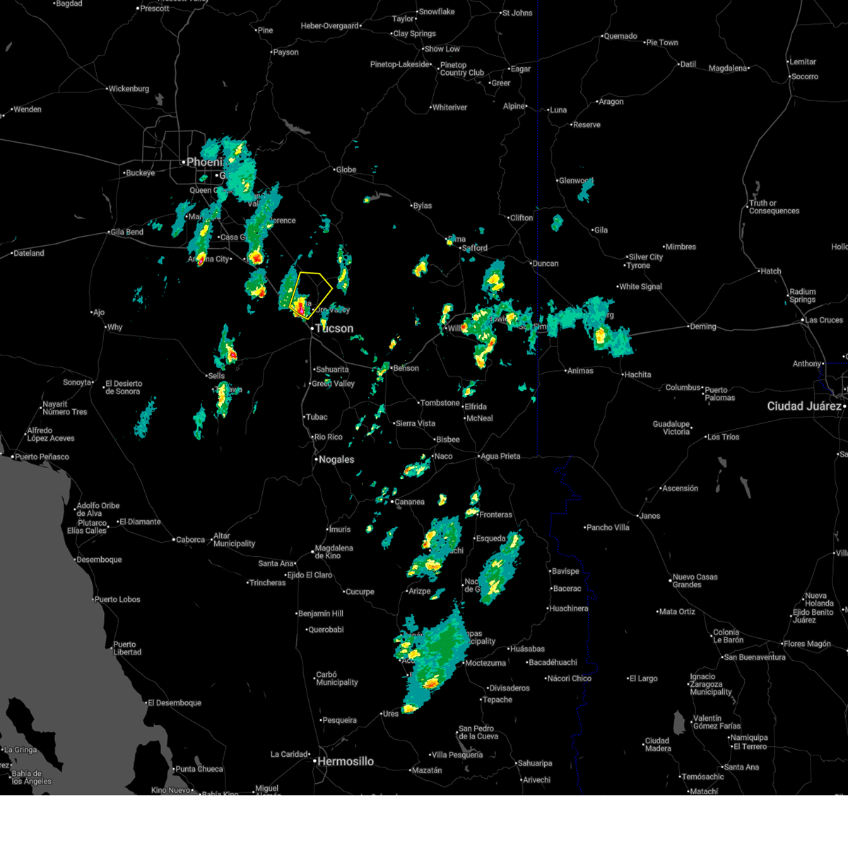
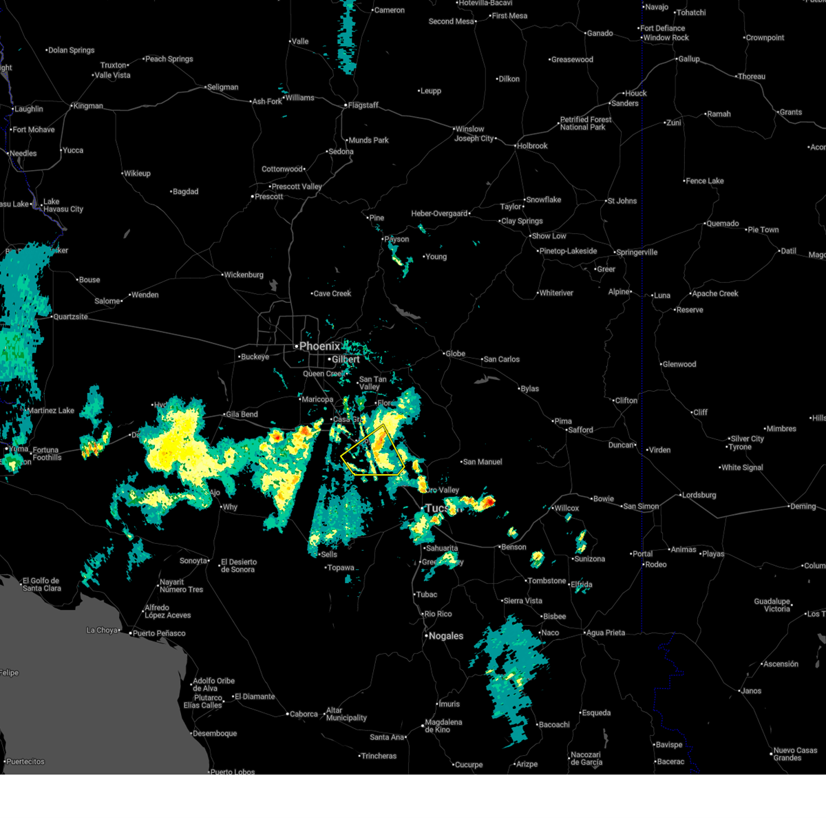
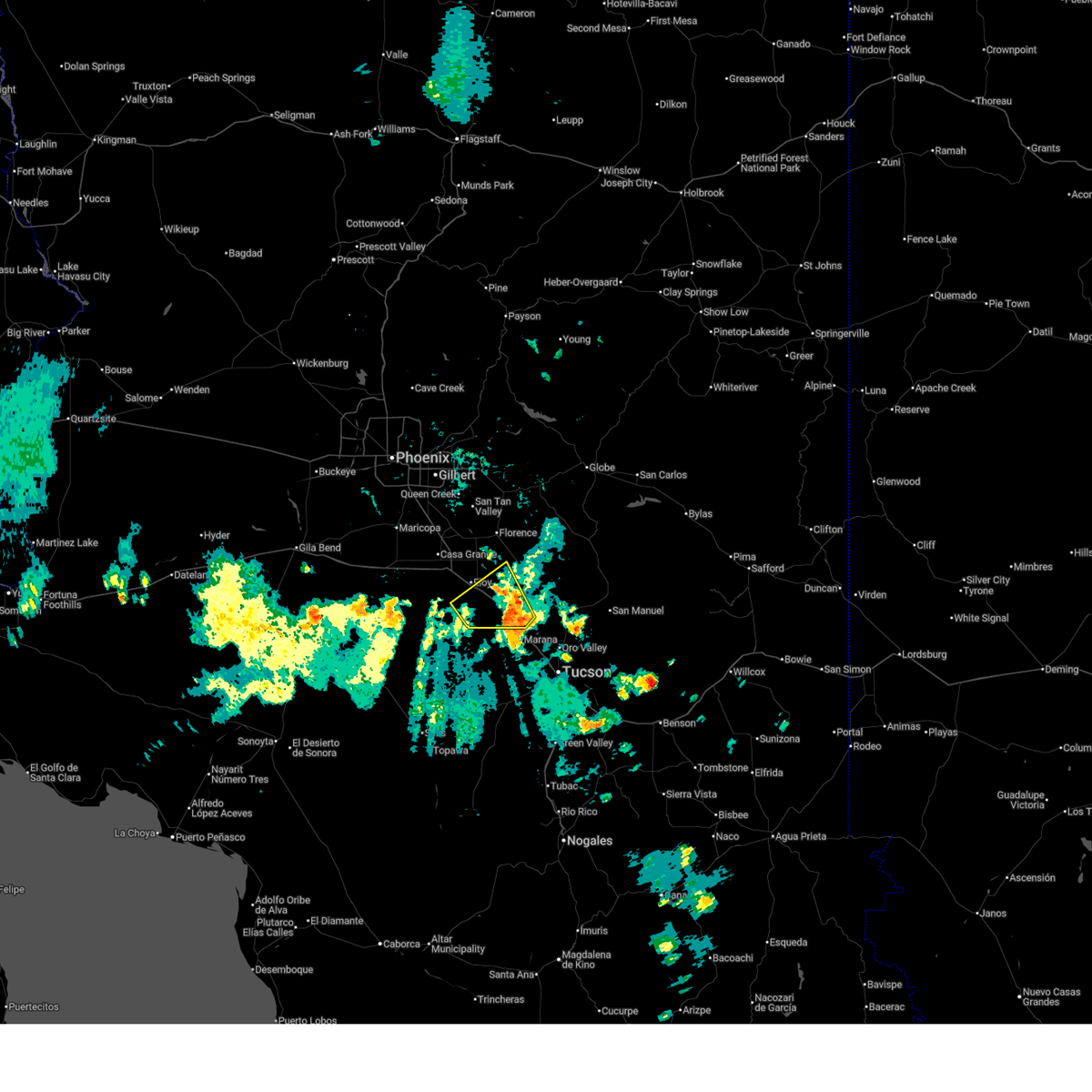
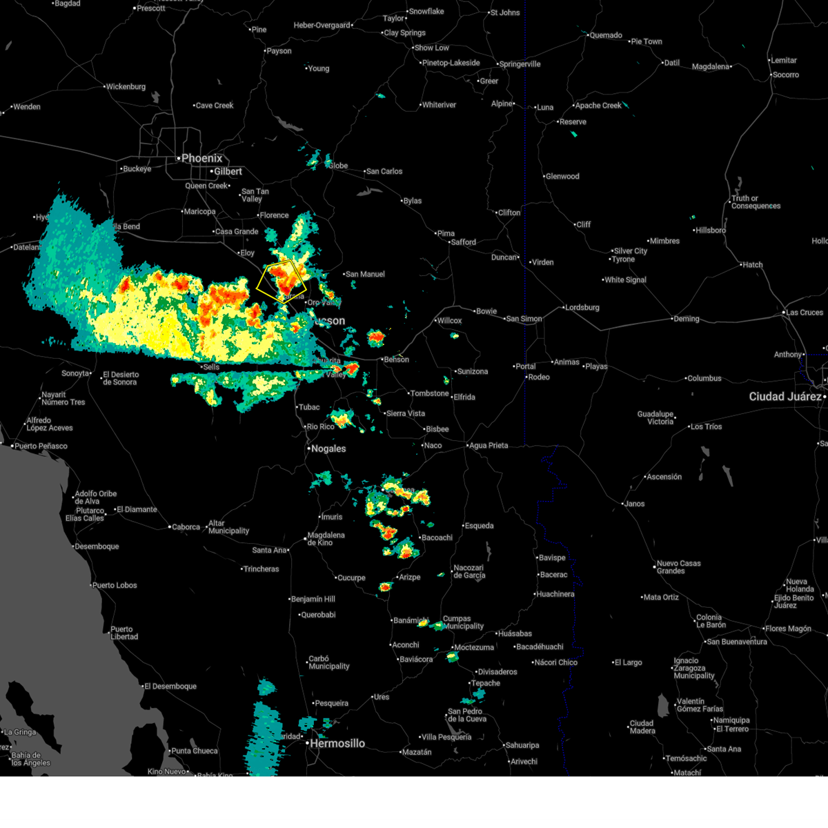
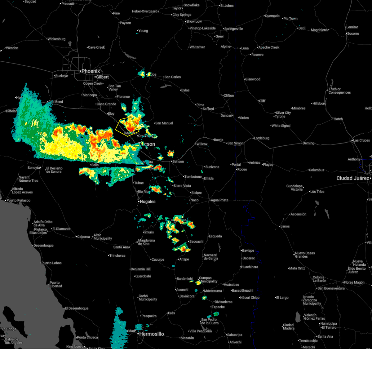
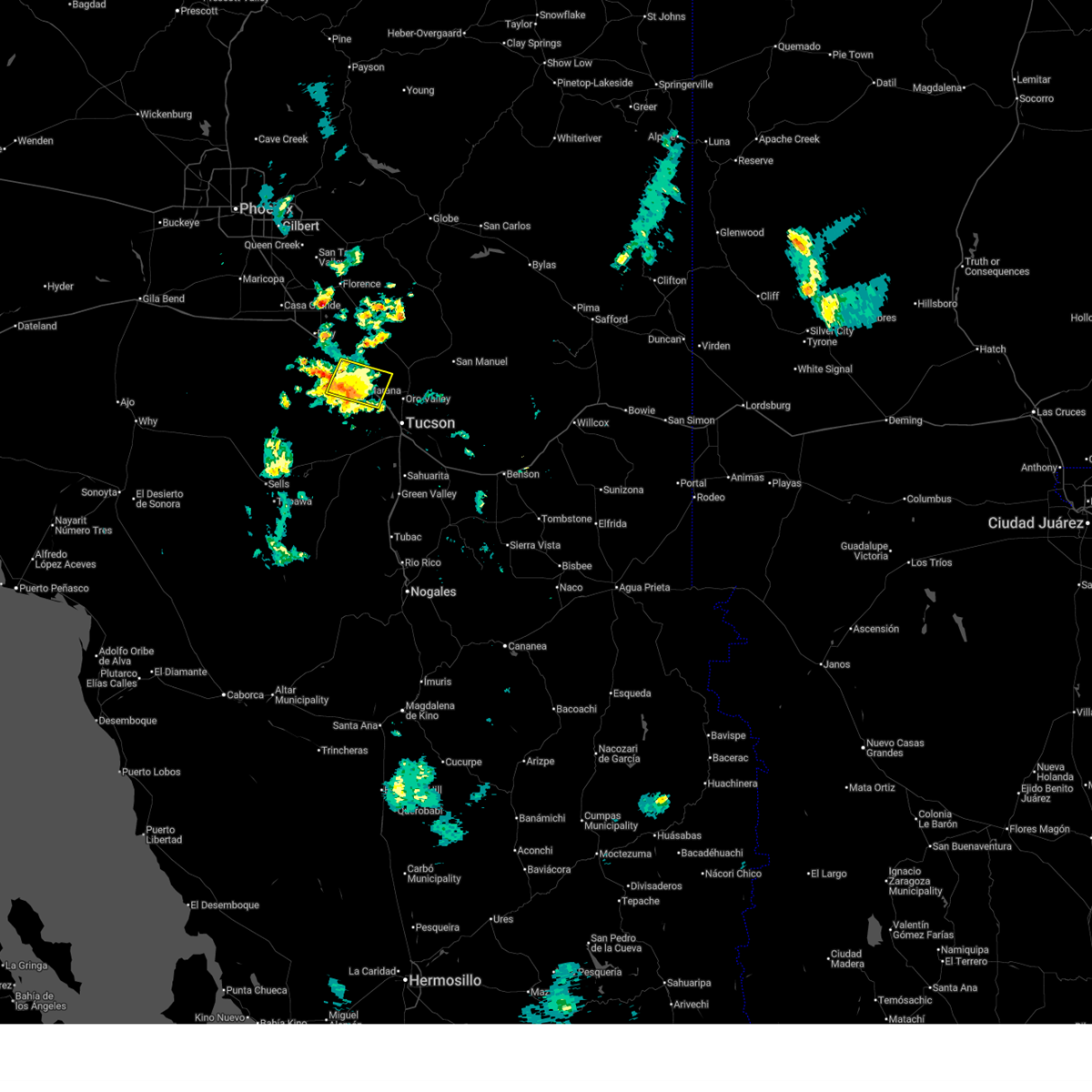
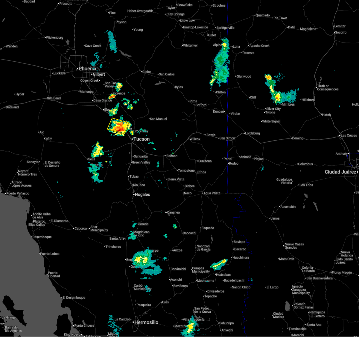
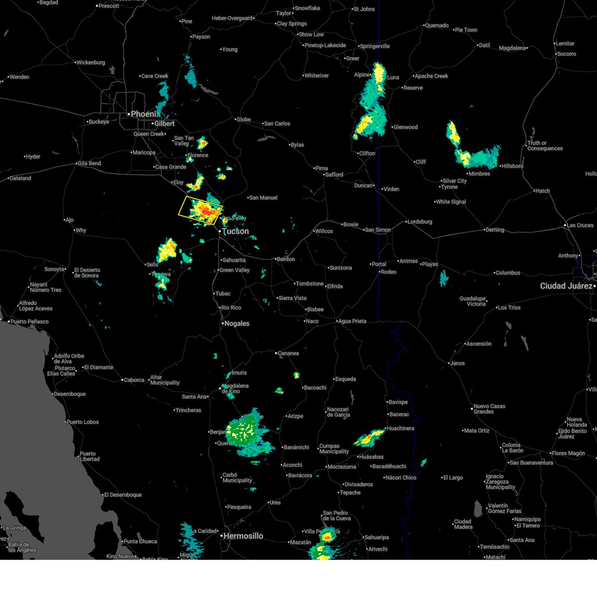
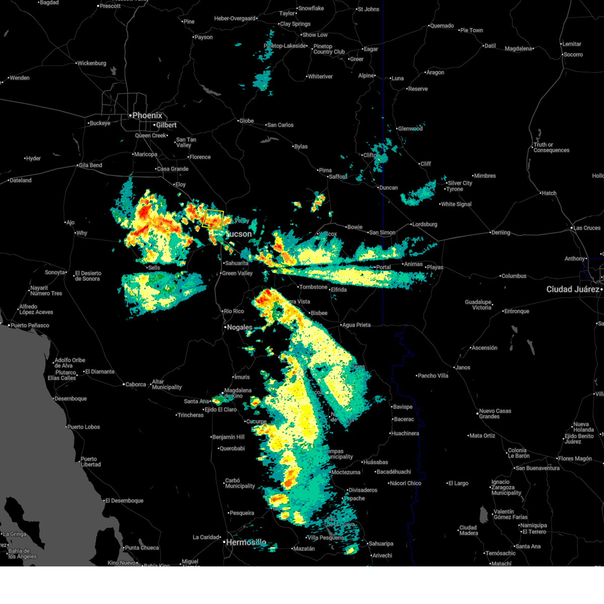
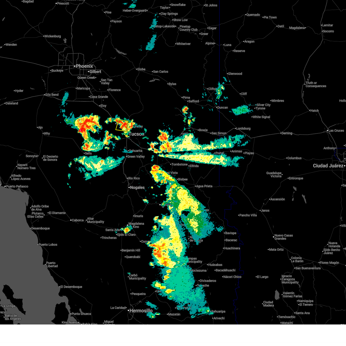
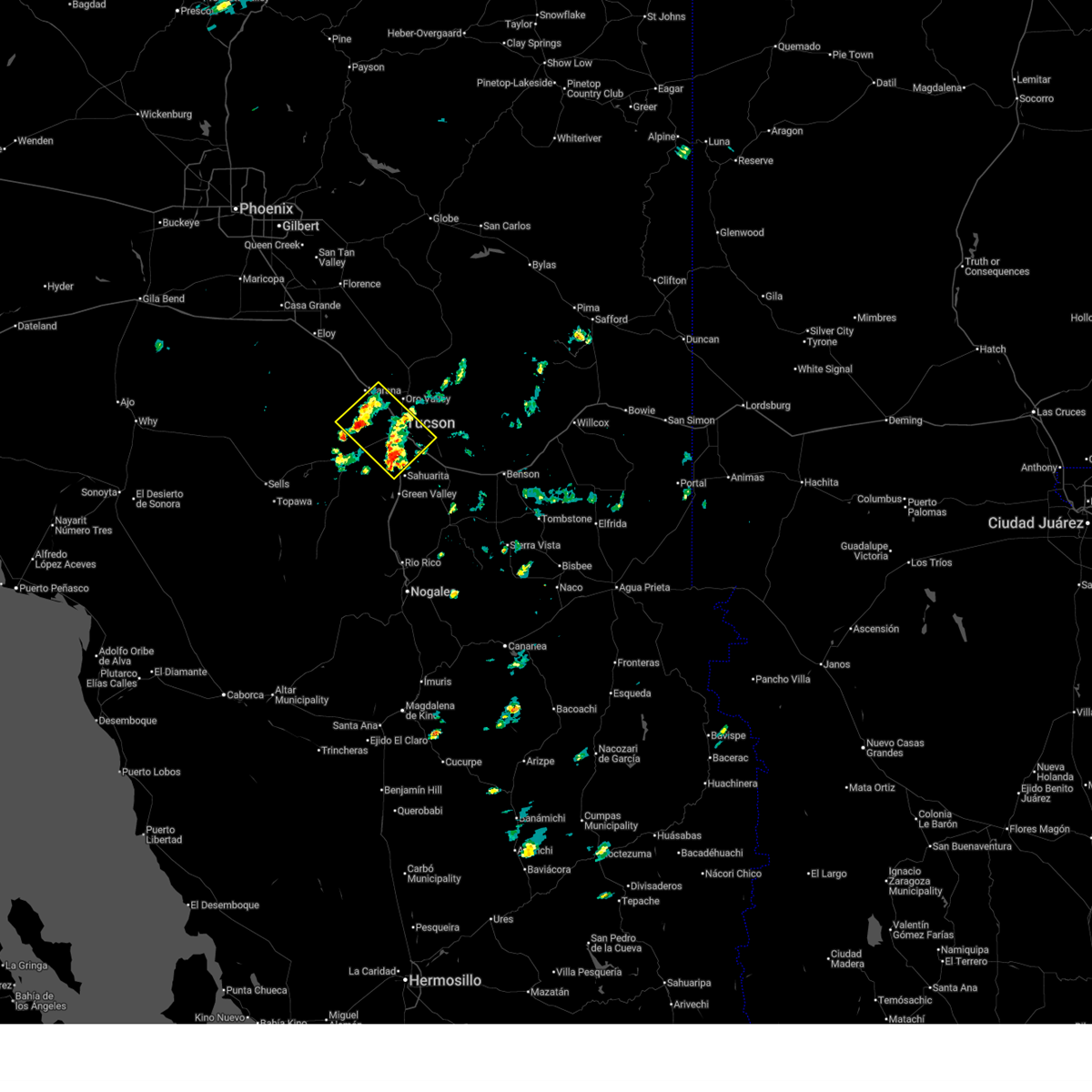
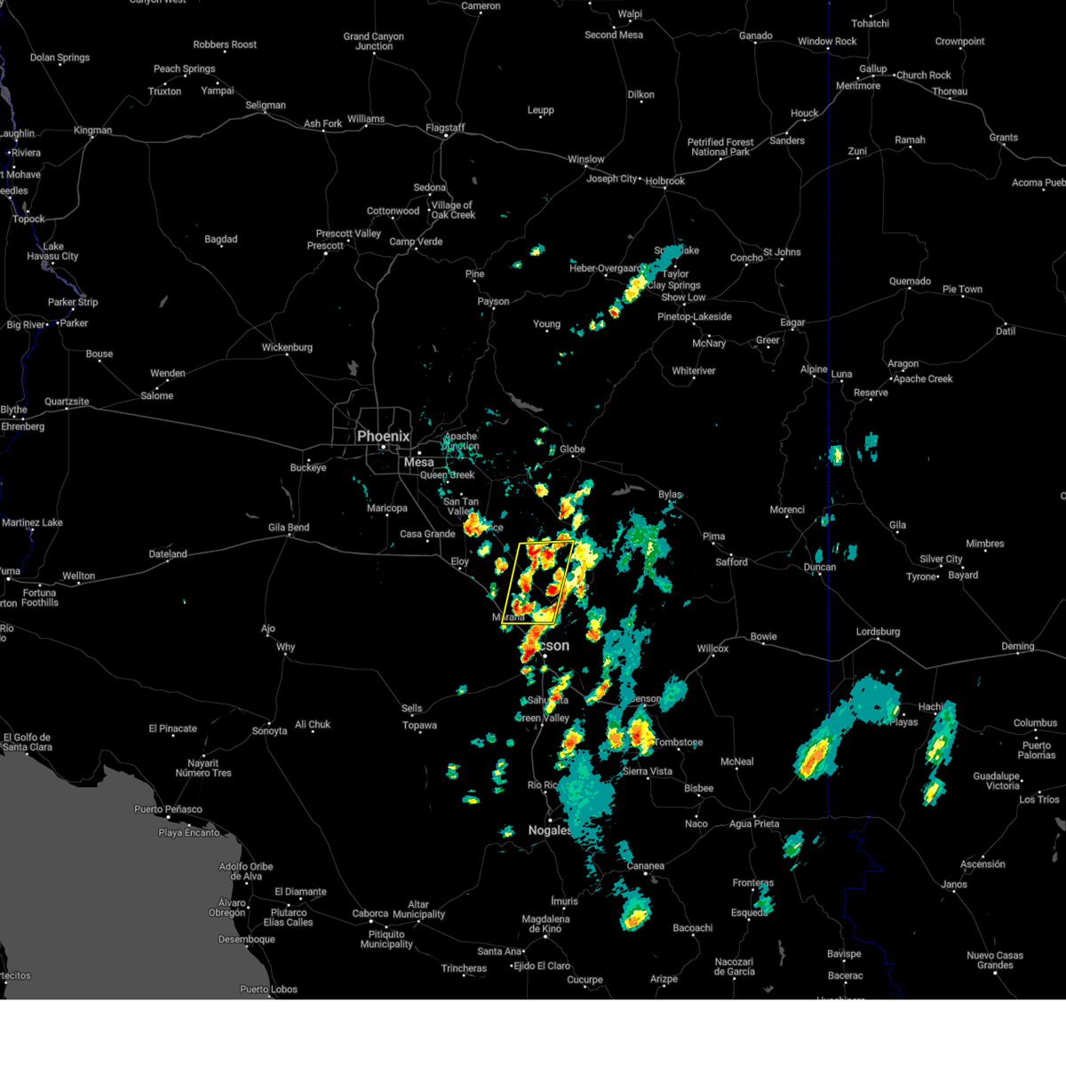
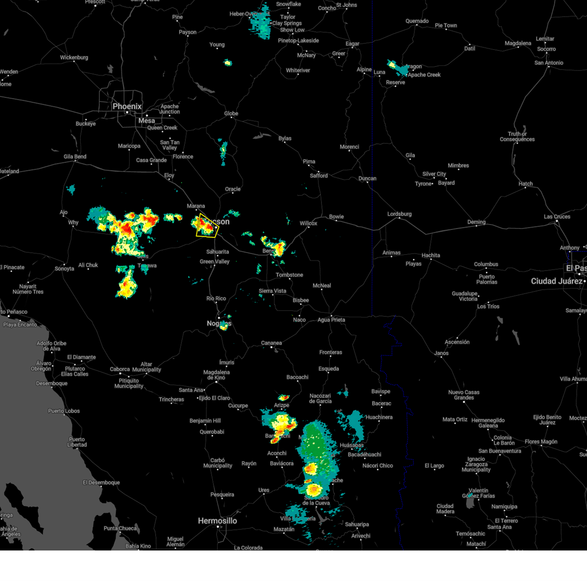
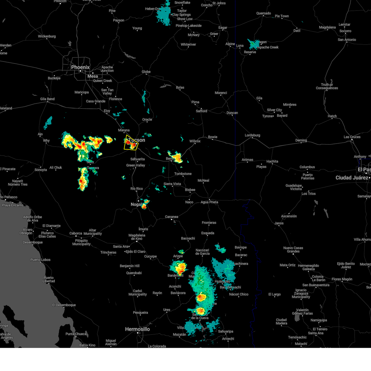
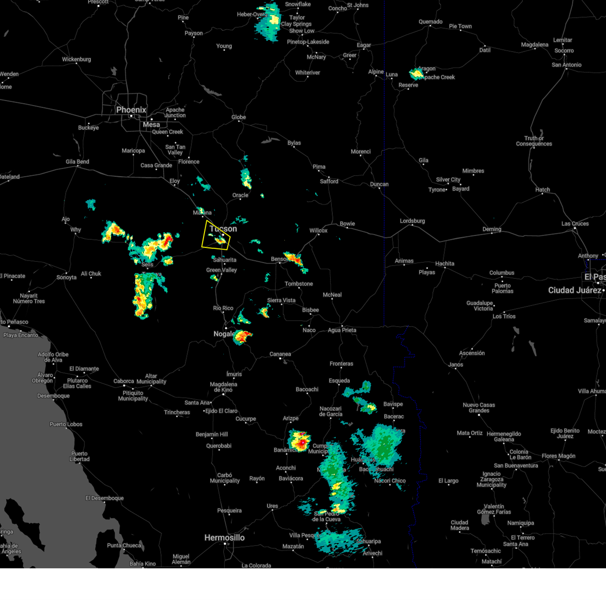
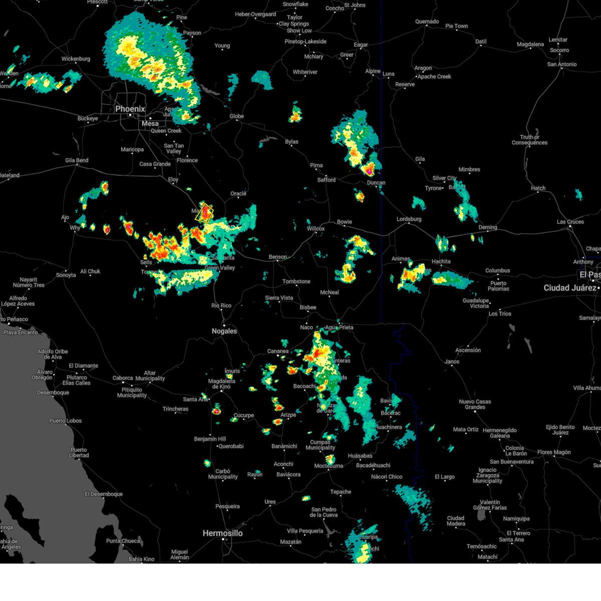
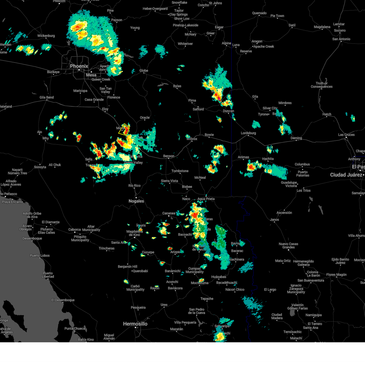
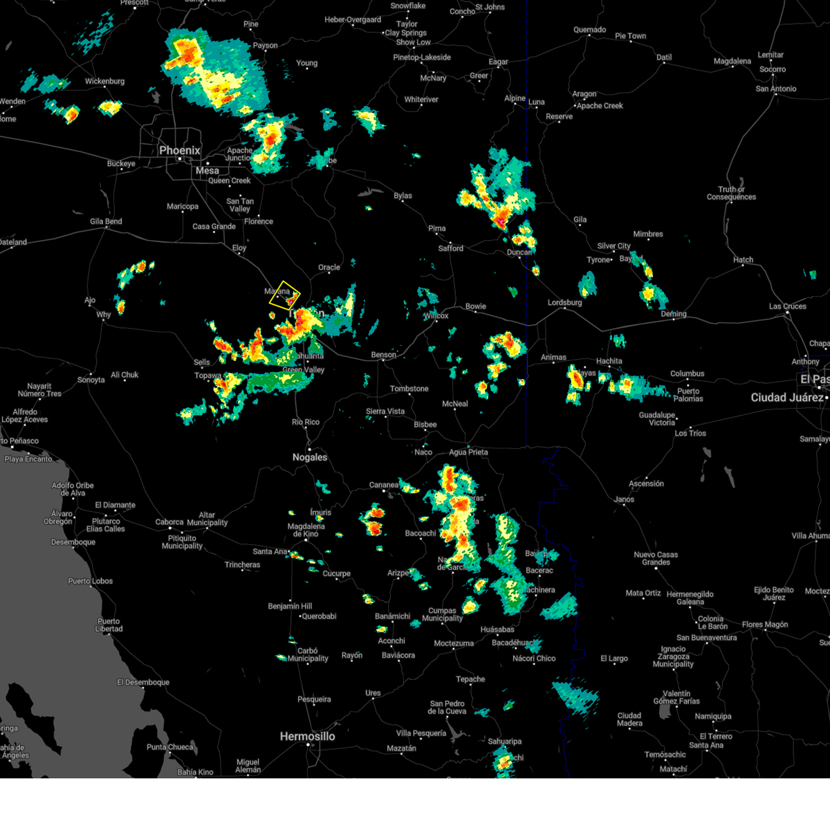
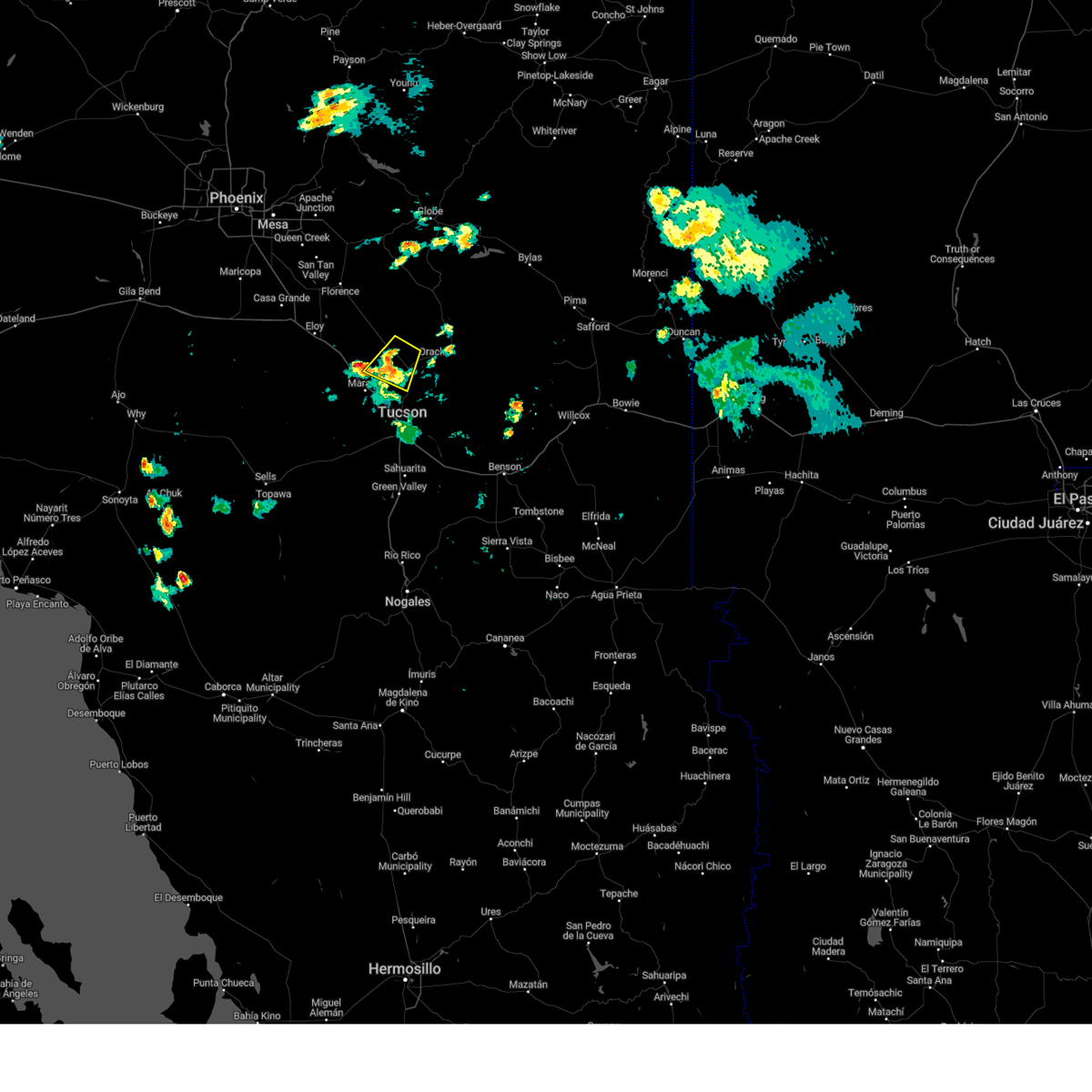
Hail Map for Marana, AZ
The Marana, AZ area has had 2 reports of on-the-ground hail by trained spotters, and has been under severe weather warnings 32 times during the past 12 months. Doppler radar has detected hail at or near Marana, AZ on 84 occasions, including 5 occasions during the past year.
| Name: | Marana, AZ |
| Where Located: | 14.9 miles NW of Tucson, AZ |
| Map: | Google Map for Marana, AZ |
| Population: | 34961 |
| Housing Units: | 14726 |
| More Info: | Search Google for Marana, AZ |
4
The Top Recent Hail Date for Marana, AZ is Monday, August 25, 2025 (3rd out of 84)
Hail and Wind Damage Spotted near Marana, AZ
| Date / Time | Report Details |
|---|---|
| 6/14/2026 9:54 PM MST |
 The storm which prompted the warning has weakened below severe limits, and no longer poses an immediate threat to life or property. therefore, the warning will be allowed to expire. however, gusty winds are still possible with this thunderstorm. The storm which prompted the warning has weakened below severe limits, and no longer poses an immediate threat to life or property. therefore, the warning will be allowed to expire. however, gusty winds are still possible with this thunderstorm.
|
| 6/14/2026 9:28 PM MST |
 Svrtwc the national weather service in tucson has issued a * severe thunderstorm warning for, northern pima county in southeastern arizona, south central pinal county in southeastern arizona, * until 1000 pm mst. * at 928 pm mst, a severe thunderstorm was located 7 miles north of oro valley, moving southeast at 15 mph (radar indicated). Hazards include 60 mph wind gusts and quarter size hail. Hail damage to vehicles is expected. Expect wind damage to roofs, siding, and trees. Svrtwc the national weather service in tucson has issued a * severe thunderstorm warning for, northern pima county in southeastern arizona, south central pinal county in southeastern arizona, * until 1000 pm mst. * at 928 pm mst, a severe thunderstorm was located 7 miles north of oro valley, moving southeast at 15 mph (radar indicated). Hazards include 60 mph wind gusts and quarter size hail. Hail damage to vehicles is expected. Expect wind damage to roofs, siding, and trees.
|
| 11/19/2025 1:13 PM MST |
 At 113 pm mst, a severe thunderstorm was located near saddlebrooke ranch, moving northeast at 30 mph (radar indicated). Hazards include 60 mph wind gusts and quarter size hail. Hail damage to vehicles is expected. expect wind damage to roofs, siding, and trees. locations impacted include, catalina, oro valley, marana, saddlebrooke, saddlebrooke ranch, tortolita, catalina state park, oracle junction, biosphere 2 and dove mountain. this includes the following highways, route 79 between mile markers 92 and 100. Route 77 between mile markers 81 and 96. At 113 pm mst, a severe thunderstorm was located near saddlebrooke ranch, moving northeast at 30 mph (radar indicated). Hazards include 60 mph wind gusts and quarter size hail. Hail damage to vehicles is expected. expect wind damage to roofs, siding, and trees. locations impacted include, catalina, oro valley, marana, saddlebrooke, saddlebrooke ranch, tortolita, catalina state park, oracle junction, biosphere 2 and dove mountain. this includes the following highways, route 79 between mile markers 92 and 100. Route 77 between mile markers 81 and 96.
|
| 11/19/2025 1:03 PM MST |
 At 103 pm mst, a severe thunderstorm was located near oro valley, moving northeast at 30 mph (radar indicated). Hazards include 60 mph wind gusts and quarter size hail. Hail damage to vehicles is expected. expect wind damage to roofs, siding, and trees. this severe thunderstorm will be near, tortolita, marana, catalina state park and casas adobes around 105 pm mst. catalina around 110 pm mst. saddlebrooke around 115 pm mst. saddlebrooke ranch around 120 pm mst. other locations impacted by the severe thunderstorm include dove mountain, oracle junction and biosphere 2. this includes the following highways, route 79 between mile markers 92 and 100. route 77 between mile markers 77 and 96. Interstate 10 between mile markers 241 and 248. At 103 pm mst, a severe thunderstorm was located near oro valley, moving northeast at 30 mph (radar indicated). Hazards include 60 mph wind gusts and quarter size hail. Hail damage to vehicles is expected. expect wind damage to roofs, siding, and trees. this severe thunderstorm will be near, tortolita, marana, catalina state park and casas adobes around 105 pm mst. catalina around 110 pm mst. saddlebrooke around 115 pm mst. saddlebrooke ranch around 120 pm mst. other locations impacted by the severe thunderstorm include dove mountain, oracle junction and biosphere 2. this includes the following highways, route 79 between mile markers 92 and 100. route 77 between mile markers 77 and 96. Interstate 10 between mile markers 241 and 248.
|
| 11/19/2025 12:54 PM MST |
 Svrtwc the national weather service in tucson has issued a * severe thunderstorm warning for, northeastern pima county in southeastern arizona, south central pinal county in southeastern arizona, * until 130 pm mst. * at 1254 pm mst, a severe thunderstorm was located over tortolita, moving northeast at 35 mph (radar indicated). Hazards include 60 mph wind gusts and quarter size hail. Hail damage to vehicles is expected. Expect wind damage to roofs, siding, and trees. Svrtwc the national weather service in tucson has issued a * severe thunderstorm warning for, northeastern pima county in southeastern arizona, south central pinal county in southeastern arizona, * until 130 pm mst. * at 1254 pm mst, a severe thunderstorm was located over tortolita, moving northeast at 35 mph (radar indicated). Hazards include 60 mph wind gusts and quarter size hail. Hail damage to vehicles is expected. Expect wind damage to roofs, siding, and trees.
|
| 10/11/2025 5:36 PM MST | At 536 pm mst, a severe thunderstorm was located near mount lemmon/summerhaven, moving northeast at 20 mph (radar indicated). Hazards include 60 mph wind gusts and quarter size hail. Hail damage to vehicles is expected. expect wind damage to roofs, siding, and trees. locations impacted include, tucson, catalina, oro valley, marana, oracle, casas adobes, flowing wells, saddlebrooke, san manuel, tortolita, mount lemmon/summerhaven, sabino canyon recreation area, catalina state park, catalina foothills and campo bonito. this includes route 77 between mile markers 71 and 86. This includes the following flash flood prone locations, 1st ave north of fort lowell rd, overton rd at canada del oro and e wilds rd at the canada del oro. |
| 10/11/2025 5:09 PM MST | Svrtwc the national weather service in tucson has issued a * severe thunderstorm warning for, northeastern pima county in southeastern arizona, southeastern pinal county in southeastern arizona, * until 600 pm mst. * at 509 pm mst, a severe thunderstorm was located over catalina state park, moving northeast at 20 mph (radar indicated). Hazards include 60 mph wind gusts and quarter size hail. Hail damage to vehicles is expected. Expect wind damage to roofs, siding, and trees. |
| 9/27/2025 2:56 PM MST | the severe thunderstorm warning has been cancelled and is no longer in effect |
| 9/27/2025 2:39 PM MST | At 239 pm mst, a severe thunderstorm was located near oro valley, moving northeast at 20 mph (radar indicated). Hazards include 60 mph wind gusts and quarter size hail. Hail damage to vehicles is expected. expect wind damage to roofs, siding, and trees. locations impacted include, catalina, oro valley, marana, casas adobes, saddlebrooke, saddlebrooke ranch, tortolita, mount lemmon/summerhaven, catalina state park, catalina foothills, oracle junction and biosphere 2. this includes the following highways, route 79 between mile markers 92 and 93. Route 77 between mile markers 77 and 98. |
| 9/27/2025 2:25 PM MST | Svrtwc the national weather service in tucson has issued a * severe thunderstorm warning for, northeastern pima county in southeastern arizona, southeastern pinal county in southeastern arizona, * until 315 pm mst. * at 225 pm mst, a severe thunderstorm was located near oro valley, moving northeast at 20 mph (radar indicated). Hazards include 60 mph wind gusts and quarter size hail. Hail damage to vehicles is expected. Expect wind damage to roofs, siding, and trees. |
| 9/25/2025 1:23 PM MST | The storm which prompted the warning has weakened below severe limits, and no longer poses an immediate threat to life or property. therefore, the warning will be allowed to expire. |
| 9/25/2025 1:13 PM MST | At 113 pm mst, a severe thunderstorm was located over tucson estates, moving southeast at 10 mph (radar indicated). Hazards include 60 mph wind gusts and quarter size hail. Hail damage to vehicles is expected. expect wind damage to roofs, siding, and trees. locations impacted include, tucson, marana, casas adobes, drexel heights, flowing wells, three points, pascua pueblo yaqui reservation, san xavier community, tucson mountain park, tucson estates, valencia west, saguaro national park west, catalina foothills, picture rocks and ryan airfield. this includes the following highways, route 86 between mile markers 156 and 170. route 77 between mile markers 70 and 73. Interstate 10 between mile markers 250 and 258. |
| 9/25/2025 12:51 PM MST | Svrtwc the national weather service in tucson has issued a * severe thunderstorm warning for, northeastern pima county in southeastern arizona, * until 130 pm mst. * at 1251 pm mst, a severe thunderstorm was located near saguaro national park west, moving east at 15 mph (radar indicated). Hazards include 60 mph wind gusts and quarter size hail. Hail damage to vehicles is expected. Expect wind damage to roofs, siding, and trees. |
| 9/19/2025 3:51 PM MST | the severe thunderstorm warning has been cancelled and is no longer in effect |
| 9/19/2025 3:29 PM MST | Svrtwc the national weather service in tucson has issued a * severe thunderstorm warning for, north central pima county in southeastern arizona, south central pinal county in southeastern arizona, * until 415 pm mst. * at 329 pm mst, a severe thunderstorm was located 6 miles west of pinal airpark, moving northeast at 15 mph (radar indicated). Hazards include 60 mph wind gusts and small hail. expect damage to roofs, siding, and trees |
| 9/6/2025 7:25 PM MST |
 The storm which prompted the warning has weakened below severe limits, and no longer poses an immediate threat to life or property. therefore, the warning will be allowed to expire. however, heavy rain is still possible with this thunderstorm. The storm which prompted the warning has weakened below severe limits, and no longer poses an immediate threat to life or property. therefore, the warning will be allowed to expire. however, heavy rain is still possible with this thunderstorm.
|
| 9/6/2025 6:56 PM MST |
 At 656 pm mst, a severe thunderstorm was located over tucson mountain park, moving northeast at 15 mph (radar indicated). Hazards include 60 mph wind gusts and quarter size hail. Hail damage to vehicles is expected. expect wind damage to roofs, siding, and trees. locations impacted include, tucson, marana, casas adobes, drexel heights, flowing wells, pascua pueblo yaqui reservation, tucson mountain park, tucson estates, saguaro national park west, valencia west and ryan airfield. this includes the following highways, route 86 between mile markers 160 and 169. route 77 near mile marker 70. Interstate 10 between mile markers 248 and 259. At 656 pm mst, a severe thunderstorm was located over tucson mountain park, moving northeast at 15 mph (radar indicated). Hazards include 60 mph wind gusts and quarter size hail. Hail damage to vehicles is expected. expect wind damage to roofs, siding, and trees. locations impacted include, tucson, marana, casas adobes, drexel heights, flowing wells, pascua pueblo yaqui reservation, tucson mountain park, tucson estates, saguaro national park west, valencia west and ryan airfield. this includes the following highways, route 86 between mile markers 160 and 169. route 77 near mile marker 70. Interstate 10 between mile markers 248 and 259.
|
| 9/6/2025 6:39 PM MST |
 Svrtwc the national weather service in tucson has issued a * severe thunderstorm warning for, northeastern pima county in southeastern arizona, * until 730 pm mst. * at 639 pm mst, a severe thunderstorm was located over tucson estates, moving northeast at 15 mph (radar indicated). Hazards include 60 mph wind gusts and quarter size hail. Hail damage to vehicles is expected. Expect wind damage to roofs, siding, and trees. Svrtwc the national weather service in tucson has issued a * severe thunderstorm warning for, northeastern pima county in southeastern arizona, * until 730 pm mst. * at 639 pm mst, a severe thunderstorm was located over tucson estates, moving northeast at 15 mph (radar indicated). Hazards include 60 mph wind gusts and quarter size hail. Hail damage to vehicles is expected. Expect wind damage to roofs, siding, and trees.
|
| 8/25/2025 4:55 PM MST |
 The storm which prompted the warning has weakened below severe limits, and no longer poses an immediate threat to life or property. therefore, the warning will be allowed to expire. however, gusty winds are still possible with this thunderstorm. The storm which prompted the warning has weakened below severe limits, and no longer poses an immediate threat to life or property. therefore, the warning will be allowed to expire. however, gusty winds are still possible with this thunderstorm.
|
| 8/25/2025 4:27 PM MST |
 At 427 pm mst, a severe thunderstorm was located near picacho peak state park, moving northwest at 20 mph (radar indicated). Hazards include 60 mph wind gusts and small hail. Expect damage to roofs, siding, and trees. locations impacted include, picacho, picacho peak state park, pinal airpark and red rock. this includes the following highways, route 87 near mile marker 116. Interstate 10 between mile markers 210 and 232. At 427 pm mst, a severe thunderstorm was located near picacho peak state park, moving northwest at 20 mph (radar indicated). Hazards include 60 mph wind gusts and small hail. Expect damage to roofs, siding, and trees. locations impacted include, picacho, picacho peak state park, pinal airpark and red rock. this includes the following highways, route 87 near mile marker 116. Interstate 10 between mile markers 210 and 232.
|
| 8/25/2025 4:08 PM MST |
 Svrtwc the national weather service in tucson has issued a * severe thunderstorm warning for, south central pinal county in southeastern arizona, * until 500 pm mst. * at 408 pm mst, a severe thunderstorm was located over pinal airpark, moving northwest at 20 mph (radar indicated). Hazards include 60 mph wind gusts and quarter size hail. Hail damage to vehicles is expected. Expect wind damage to roofs, siding, and trees. Svrtwc the national weather service in tucson has issued a * severe thunderstorm warning for, south central pinal county in southeastern arizona, * until 500 pm mst. * at 408 pm mst, a severe thunderstorm was located over pinal airpark, moving northwest at 20 mph (radar indicated). Hazards include 60 mph wind gusts and quarter size hail. Hail damage to vehicles is expected. Expect wind damage to roofs, siding, and trees.
|
| 8/25/2025 3:53 PM MST | Partial roof blown off home near i-10 and barnett r in pima county AZ, 5.6 miles SE of Marana, AZ |
| 8/25/2025 3:49 PM MST |
 At 349 pm mst, a severe thunderstorm was located 8 miles north of marana, moving northwest at 10 mph (radar indicated). Hazards include 60 mph wind gusts and quarter size hail. Hail damage to vehicles is expected. expect wind damage to roofs, siding, and trees. locations impacted include, oro valley, marana, avra valley, tortolita, pinal airpark, picture rocks, red rock and dove mountain. This includes interstate 10 between mile markers 225 and 243. At 349 pm mst, a severe thunderstorm was located 8 miles north of marana, moving northwest at 10 mph (radar indicated). Hazards include 60 mph wind gusts and quarter size hail. Hail damage to vehicles is expected. expect wind damage to roofs, siding, and trees. locations impacted include, oro valley, marana, avra valley, tortolita, pinal airpark, picture rocks, red rock and dove mountain. This includes interstate 10 between mile markers 225 and 243.
|
| 8/25/2025 3:43 PM MST | Mesonet station gusted to 62 mp in pima county AZ, 4.7 miles SE of Marana, AZ |
| 8/25/2025 3:37 PM MST |
 Svrtwc the national weather service in tucson has issued a * severe thunderstorm warning for, northeastern pima county in southeastern arizona, south central pinal county in southeastern arizona, * until 415 pm mst. * at 337 pm mst, a severe thunderstorm was located 6 miles north of marana, moving northwest at 10 mph (radar indicated). Hazards include 60 mph wind gusts and quarter size hail. Hail damage to vehicles is expected. Expect wind damage to roofs, siding, and trees. Svrtwc the national weather service in tucson has issued a * severe thunderstorm warning for, northeastern pima county in southeastern arizona, south central pinal county in southeastern arizona, * until 415 pm mst. * at 337 pm mst, a severe thunderstorm was located 6 miles north of marana, moving northwest at 10 mph (radar indicated). Hazards include 60 mph wind gusts and quarter size hail. Hail damage to vehicles is expected. Expect wind damage to roofs, siding, and trees.
|
| 8/20/2025 7:26 PM MST |
 The storm which prompted the warning has weakened below severe limits, and no longer poses an immediate threat to life or property. therefore, the warning will be allowed to expire. however, gusty winds and heavy rain are still possible with this thunderstorm. The storm which prompted the warning has weakened below severe limits, and no longer poses an immediate threat to life or property. therefore, the warning will be allowed to expire. however, gusty winds and heavy rain are still possible with this thunderstorm.
|
| 8/20/2025 6:59 PM MST |
 At 659 pm mst, a severe thunderstorm was located near avra valley, moving west at 15 mph (radar indicated). Hazards include 60 mph wind gusts. Expect damage to roofs, siding, and trees. locations impacted include, tucson, marana, avra valley, tortolita, pinal airpark, saguaro national park west, picture rocks, red rock and dove mountain. This includes interstate 10 between mile markers 224 and 244. At 659 pm mst, a severe thunderstorm was located near avra valley, moving west at 15 mph (radar indicated). Hazards include 60 mph wind gusts. Expect damage to roofs, siding, and trees. locations impacted include, tucson, marana, avra valley, tortolita, pinal airpark, saguaro national park west, picture rocks, red rock and dove mountain. This includes interstate 10 between mile markers 224 and 244.
|
| 8/20/2025 6:47 PM MST |
 Svrtwc the national weather service in tucson has issued a * severe thunderstorm warning for, north central pima county in southeastern arizona, south central pinal county in southeastern arizona, * until 730 pm mst. * at 647 pm mst, a severe thunderstorm was located near marana, moving west at 15 mph (radar indicated). Hazards include 60 mph wind gusts. Expect damage to roofs, siding, and trees. Blowing dust is also expected. Svrtwc the national weather service in tucson has issued a * severe thunderstorm warning for, north central pima county in southeastern arizona, south central pinal county in southeastern arizona, * until 730 pm mst. * at 647 pm mst, a severe thunderstorm was located near marana, moving west at 15 mph (radar indicated). Hazards include 60 mph wind gusts. Expect damage to roofs, siding, and trees. Blowing dust is also expected.
|
| 7/15/2025 8:10 PM MST |
 the severe thunderstorm warning has been cancelled and is no longer in effect the severe thunderstorm warning has been cancelled and is no longer in effect
|
| 7/15/2025 7:46 PM MST |
 Svrtwc the national weather service in tucson has issued a * severe thunderstorm warning for, northeastern pima county in southeastern arizona, * until 830 pm mst. * at 746 pm mst, a severe thunderstorm was located over tortolita, moving south at 5 mph (radar indicated). Hazards include 60 mph wind gusts. expect damage to roofs, siding, and trees Svrtwc the national weather service in tucson has issued a * severe thunderstorm warning for, northeastern pima county in southeastern arizona, * until 830 pm mst. * at 746 pm mst, a severe thunderstorm was located over tortolita, moving south at 5 mph (radar indicated). Hazards include 60 mph wind gusts. expect damage to roofs, siding, and trees
|
| 7/3/2025 2:48 PM MST |
 The severe thunderstorm warning that was previously in effect has been reissued for pima county and is in effect until 330 pm mst. please refer to that bulletin for the latest severe weather information. The severe thunderstorm warning that was previously in effect has been reissued for pima county and is in effect until 330 pm mst. please refer to that bulletin for the latest severe weather information.
|
| 7/3/2025 2:43 PM MST |
 Svrtwc the national weather service in tucson has issued a * severe thunderstorm warning for, northeastern pima county in southeastern arizona, * until 330 pm mst. * at 243 pm mst, a severe thunderstorm was located near catalina foothills, moving northeast at 10 mph (radar indicated). Hazards include 60 mph wind gusts and small hail. expect damage to roofs, siding, and trees Svrtwc the national weather service in tucson has issued a * severe thunderstorm warning for, northeastern pima county in southeastern arizona, * until 330 pm mst. * at 243 pm mst, a severe thunderstorm was located near catalina foothills, moving northeast at 10 mph (radar indicated). Hazards include 60 mph wind gusts and small hail. expect damage to roofs, siding, and trees
|
| 7/3/2025 2:18 PM MST |
 At 218 pm mst, a severe thunderstorm was located near saguaro national park west, moving northeast at 15 mph (radar indicated). Hazards include 60 mph wind gusts and small hail. Expect damage to roofs, siding, and trees. locations impacted include, tucson, oro valley, marana, sahuarita, davis-monthan air force base, casas adobes, drexel heights, flowing wells, south tucson, three points, pascua pueblo yaqui reservation, tortolita, san xavier community, tucson mountain park, tucson estates, valencia west, saguaro national park west, tucson international airport, catalina foothills and summit. this includes the following highways, interstate 19 between mile markers 48 and 63. route 86 between mile markers 156 and 171. route 77 between mile markers 70 and 75. Interstate 10 between mile markers 239 and 271. At 218 pm mst, a severe thunderstorm was located near saguaro national park west, moving northeast at 15 mph (radar indicated). Hazards include 60 mph wind gusts and small hail. Expect damage to roofs, siding, and trees. locations impacted include, tucson, oro valley, marana, sahuarita, davis-monthan air force base, casas adobes, drexel heights, flowing wells, south tucson, three points, pascua pueblo yaqui reservation, tortolita, san xavier community, tucson mountain park, tucson estates, valencia west, saguaro national park west, tucson international airport, catalina foothills and summit. this includes the following highways, interstate 19 between mile markers 48 and 63. route 86 between mile markers 156 and 171. route 77 between mile markers 70 and 75. Interstate 10 between mile markers 239 and 271.
|
| 7/3/2025 1:53 PM MST |
 Svrtwc the national weather service in tucson has issued a * severe thunderstorm warning for, northeastern pima county in southeastern arizona, * until 245 pm mst. * at 153 pm mst, a severe thunderstorm was located near saguaro national park west, moving northeast at 15 mph (radar indicated). Hazards include 60 mph wind gusts and small hail. expect damage to roofs, siding, and trees Svrtwc the national weather service in tucson has issued a * severe thunderstorm warning for, northeastern pima county in southeastern arizona, * until 245 pm mst. * at 153 pm mst, a severe thunderstorm was located near saguaro national park west, moving northeast at 15 mph (radar indicated). Hazards include 60 mph wind gusts and small hail. expect damage to roofs, siding, and trees
|
| 8/23/2024 5:06 PM MST |
 The storm which prompted the warning has weakened below severe limits. therefore, the warning will be allowed to expire. however, heavy rain is still possible with this thunderstorm. The storm which prompted the warning has weakened below severe limits. therefore, the warning will be allowed to expire. however, heavy rain is still possible with this thunderstorm.
|
| 8/23/2024 4:26 PM MST |
 Svrtwc the national weather service in tucson has issued a * severe thunderstorm warning for, northeastern pima county in southeastern arizona, * until 515 pm mst. * at 425 pm mst, a severe thunderstorm was located near flowing wells, or 9 miles south of marana, moving north at 10 mph (radar indicated). Hazards include 60 mph wind gusts and nickel size hail. expect damage to roofs, siding, and trees Svrtwc the national weather service in tucson has issued a * severe thunderstorm warning for, northeastern pima county in southeastern arizona, * until 515 pm mst. * at 425 pm mst, a severe thunderstorm was located near flowing wells, or 9 miles south of marana, moving north at 10 mph (radar indicated). Hazards include 60 mph wind gusts and nickel size hail. expect damage to roofs, siding, and trees
|
| 8/23/2024 4:17 PM MST |
 Svrtwc the national weather service in tucson has issued a * severe thunderstorm warning for, northern pima county in southeastern arizona, southeastern pinal county in southeastern arizona, * until 500 pm mst. * at 416 pm mst, a severe thunderstorm was located 10 miles north of marana, moving north at 10 mph (radar indicated). Hazards include 60 mph wind gusts and penny size hail. expect damage to roofs, siding, and trees Svrtwc the national weather service in tucson has issued a * severe thunderstorm warning for, northern pima county in southeastern arizona, southeastern pinal county in southeastern arizona, * until 500 pm mst. * at 416 pm mst, a severe thunderstorm was located 10 miles north of marana, moving north at 10 mph (radar indicated). Hazards include 60 mph wind gusts and penny size hail. expect damage to roofs, siding, and trees
|
| 8/23/2024 3:45 PM MST |
 Svrtwc the national weather service in tucson has issued a * severe thunderstorm warning for, northeastern pima county in southeastern arizona, * until 430 pm mst. * at 344 pm mst, a severe thunderstorm was located near saguaro national park west, or 8 miles south of marana, moving north at 10 mph (radar indicated). Hazards include 60 mph wind gusts and penny size hail. expect damage to roofs, siding, and trees Svrtwc the national weather service in tucson has issued a * severe thunderstorm warning for, northeastern pima county in southeastern arizona, * until 430 pm mst. * at 344 pm mst, a severe thunderstorm was located near saguaro national park west, or 8 miles south of marana, moving north at 10 mph (radar indicated). Hazards include 60 mph wind gusts and penny size hail. expect damage to roofs, siding, and trees
|
| 8/21/2024 12:51 PM MST |
 The storm which prompted the warning has weakened below severe limits, and no longer poses an immediate threat to life or property. therefore, the warning will be allowed to expire. however, gusty winds and heavy rain are still possible with this thunderstorm. The storm which prompted the warning has weakened below severe limits, and no longer poses an immediate threat to life or property. therefore, the warning will be allowed to expire. however, gusty winds and heavy rain are still possible with this thunderstorm.
|
| 8/21/2024 12:35 PM MST |
 At 1235 pm mst, a severe thunderstorm was located over flowing wells, or 9 miles south of oro valley, moving north at 20 mph (radar indicated). Hazards include 60 mph wind gusts and quarter size hail. Hail damage to vehicles is expected. expect wind damage to roofs, siding, and trees. locations impacted include, tucson, catalina, oro valley, marana, casas adobes, flowing wells, avra valley, tortolita, tucson estates, saguaro national park west, tucson mountain park, catalina state park, catalina foothills, and picture rocks. this includes the following highways, interstate 10 between mile markers 240 and 259. Route 77 between mile markers 70 and 84. At 1235 pm mst, a severe thunderstorm was located over flowing wells, or 9 miles south of oro valley, moving north at 20 mph (radar indicated). Hazards include 60 mph wind gusts and quarter size hail. Hail damage to vehicles is expected. expect wind damage to roofs, siding, and trees. locations impacted include, tucson, catalina, oro valley, marana, casas adobes, flowing wells, avra valley, tortolita, tucson estates, saguaro national park west, tucson mountain park, catalina state park, catalina foothills, and picture rocks. this includes the following highways, interstate 10 between mile markers 240 and 259. Route 77 between mile markers 70 and 84.
|
| 8/21/2024 12:17 PM MST |
 Svrtwc the national weather service in tucson has issued a * severe thunderstorm warning for, northeastern pima county in southeastern arizona, * until 100 pm mst. * at 1216 pm mst, a severe thunderstorm was located over south tucson, or 7 miles west of tucson, moving north at 20 mph (radar indicated). Hazards include 60 mph wind gusts and quarter size hail. Hail damage to vehicles is expected. Expect wind damage to roofs, siding, and trees. Svrtwc the national weather service in tucson has issued a * severe thunderstorm warning for, northeastern pima county in southeastern arizona, * until 100 pm mst. * at 1216 pm mst, a severe thunderstorm was located over south tucson, or 7 miles west of tucson, moving north at 20 mph (radar indicated). Hazards include 60 mph wind gusts and quarter size hail. Hail damage to vehicles is expected. Expect wind damage to roofs, siding, and trees.
|
| 8/20/2024 6:55 PM MST |
 The storm which prompted the warning near west tucson has weakened below severe limits. therefore, the warning will be allowed to expire. however, gusty winds and heavy rain are still possible with this thunderstorm. The storm which prompted the warning near west tucson has weakened below severe limits. therefore, the warning will be allowed to expire. however, gusty winds and heavy rain are still possible with this thunderstorm.
|
| 8/20/2024 6:43 PM MST |
 At 642 pm mst, a severe thunderstorm was located near tucson mountain park, or 10 miles west of tucson, moving northwest at 10 mph (radar indicated). Hazards include 60 mph wind gusts and penny size hail. Expect damage to roofs, siding, and trees. locations impacted include, west tucson, drexel heights, flowing wells, south tucson, saguaro national park west, tucson mountain park, tucson estates, and picture rocks. this includes the following highways, interstate 10 between mile markers 250 and 260. interstate 19 between mile markers 61 and 63. route 77 between mile markers 70 and 71. Route 86 between mile markers 164 and 171. At 642 pm mst, a severe thunderstorm was located near tucson mountain park, or 10 miles west of tucson, moving northwest at 10 mph (radar indicated). Hazards include 60 mph wind gusts and penny size hail. Expect damage to roofs, siding, and trees. locations impacted include, west tucson, drexel heights, flowing wells, south tucson, saguaro national park west, tucson mountain park, tucson estates, and picture rocks. this includes the following highways, interstate 10 between mile markers 250 and 260. interstate 19 between mile markers 61 and 63. route 77 between mile markers 70 and 71. Route 86 between mile markers 164 and 171.
|
| 8/20/2024 6:18 PM MST |
 Svrtwc the national weather service in tucson has issued a * severe thunderstorm warning for, northeastern pima county in southeastern arizona, * until 700 pm mst. * at 618 pm mst, a severe thunderstorm was located over south tucson, or near tucson, moving northwest at 10 mph (radar indicated). Hazards include 60 mph wind gusts and penny size hail. expect damage to roofs, siding, and trees Svrtwc the national weather service in tucson has issued a * severe thunderstorm warning for, northeastern pima county in southeastern arizona, * until 700 pm mst. * at 618 pm mst, a severe thunderstorm was located over south tucson, or near tucson, moving northwest at 10 mph (radar indicated). Hazards include 60 mph wind gusts and penny size hail. expect damage to roofs, siding, and trees
|
| 8/8/2024 5:28 PM MST |
 The storm which prompted the warning has weakened below severe limits, and no longer poses an immediate threat to life or property. therefore, the warning will be allowed to expire. however, gusty winds and brief heavy rain are still possible with this thunderstorm. The storm which prompted the warning has weakened below severe limits, and no longer poses an immediate threat to life or property. therefore, the warning will be allowed to expire. however, gusty winds and brief heavy rain are still possible with this thunderstorm.
|
| 8/8/2024 5:16 PM MST |
 At 516 pm mst, a severe thunderstorm was located over marana, moving northwest at 10 mph (radar indicated). Hazards include 60 mph wind gusts and quarter size hail. Hail damage to vehicles is expected. expect wind damage to roofs, siding, and trees. locations impacted include, marana, picture rocks, and dove mountain. This includes interstate 10 between mile markers 236 and 243. At 516 pm mst, a severe thunderstorm was located over marana, moving northwest at 10 mph (radar indicated). Hazards include 60 mph wind gusts and quarter size hail. Hail damage to vehicles is expected. expect wind damage to roofs, siding, and trees. locations impacted include, marana, picture rocks, and dove mountain. This includes interstate 10 between mile markers 236 and 243.
|
| 8/8/2024 4:57 PM MST |
 Svrtwc the national weather service in tucson has issued a * severe thunderstorm warning for, northeastern pima county in southeastern arizona, southeastern pinal county in southeastern arizona, * until 530 pm mst. * at 457 pm mst, a severe thunderstorm was located over marana, moving northwest at 10 mph (radar indicated). Hazards include 60 mph wind gusts and quarter size hail. Hail damage to vehicles is expected. Expect wind damage to roofs, siding, and trees. Svrtwc the national weather service in tucson has issued a * severe thunderstorm warning for, northeastern pima county in southeastern arizona, southeastern pinal county in southeastern arizona, * until 530 pm mst. * at 457 pm mst, a severe thunderstorm was located over marana, moving northwest at 10 mph (radar indicated). Hazards include 60 mph wind gusts and quarter size hail. Hail damage to vehicles is expected. Expect wind damage to roofs, siding, and trees.
|
| 8/6/2024 5:27 PM MST |
 The storm which prompted the warning has weakened below severe limits, and no longer poses an immediate threat to life or property. therefore, the warning will be allowed to expire. The storm which prompted the warning has weakened below severe limits, and no longer poses an immediate threat to life or property. therefore, the warning will be allowed to expire.
|
| 8/6/2024 4:59 PM MST |
 At 459 pm mst, a severe thunderstorm was located near flowing wells, or 10 miles northwest of tucson, moving southwest at 15 mph (radar indicated). Hazards include 70 mph wind gusts and half dollar size hail. Hail damage to vehicles is expected. expect considerable tree damage. wind damage is also likely to mobile homes, roofs, and outbuildings. locations impacted include, tucson, oro valley, marana, casas adobes, drexel heights, flowing wells, south tucson, pascua pueblo yaqui reservation, tortolita, tucson estates, saguaro national park west, valencia west, tucson mountain park, catalina foothills, and picture rocks. this includes the following highways, interstate 10 between mile markers 245 and 259. route 77 between mile markers 70 and 75. Route 86 between mile markers 162 and 170. At 459 pm mst, a severe thunderstorm was located near flowing wells, or 10 miles northwest of tucson, moving southwest at 15 mph (radar indicated). Hazards include 70 mph wind gusts and half dollar size hail. Hail damage to vehicles is expected. expect considerable tree damage. wind damage is also likely to mobile homes, roofs, and outbuildings. locations impacted include, tucson, oro valley, marana, casas adobes, drexel heights, flowing wells, south tucson, pascua pueblo yaqui reservation, tortolita, tucson estates, saguaro national park west, valencia west, tucson mountain park, catalina foothills, and picture rocks. this includes the following highways, interstate 10 between mile markers 245 and 259. route 77 between mile markers 70 and 75. Route 86 between mile markers 162 and 170.
|
| 8/6/2024 4:48 PM MST |
 Svrtwc the national weather service in tucson has issued a * severe thunderstorm warning for, northeastern pima county in southeastern arizona, * until 530 pm mst. * at 448 pm mst, severe thunderstorms were located over flowing wells, or 9 miles northwest of tucson, moving southwest at 15 mph (radar indicated). Hazards include 60 mph wind gusts and quarter size hail. Hail damage to vehicles is expected. Expect wind damage to roofs, siding, and trees. Svrtwc the national weather service in tucson has issued a * severe thunderstorm warning for, northeastern pima county in southeastern arizona, * until 530 pm mst. * at 448 pm mst, severe thunderstorms were located over flowing wells, or 9 miles northwest of tucson, moving southwest at 15 mph (radar indicated). Hazards include 60 mph wind gusts and quarter size hail. Hail damage to vehicles is expected. Expect wind damage to roofs, siding, and trees.
|
| 8/2/2024 7:31 PM MST |
 The storm which prompted the warning has weakened below severe limits, and no longer poses an immediate threat to life or property. therefore, the warning has been allowed to expire. however, heavy rain is still occurring with this thunderstorm. The storm which prompted the warning has weakened below severe limits, and no longer poses an immediate threat to life or property. therefore, the warning has been allowed to expire. however, heavy rain is still occurring with this thunderstorm.
|
| 8/2/2024 6:58 PM MST |
 At 657 pm mst, a severe thunderstorm was located near tortolita, or near marana, moving north at 10 mph (radar indicated). Hazards include 60 mph wind gusts and quarter size hail. Hail damage to vehicles is expected. expect wind damage to roofs, siding, and trees. locations impacted include, tucson, oro valley, marana, casas adobes, flowing wells, tortolita, saguaro national park west, tucson mountain park, tucson estates, catalina foothills, and picture rocks. this includes the following highways, interstate 10 between mile markers 239 and 258. Route 77 between mile markers 70 and 78. At 657 pm mst, a severe thunderstorm was located near tortolita, or near marana, moving north at 10 mph (radar indicated). Hazards include 60 mph wind gusts and quarter size hail. Hail damage to vehicles is expected. expect wind damage to roofs, siding, and trees. locations impacted include, tucson, oro valley, marana, casas adobes, flowing wells, tortolita, saguaro national park west, tucson mountain park, tucson estates, catalina foothills, and picture rocks. this includes the following highways, interstate 10 between mile markers 239 and 258. Route 77 between mile markers 70 and 78.
|
| 8/2/2024 6:48 PM MST |
 Svrtwc the national weather service in tucson has issued a * severe thunderstorm warning for, northeastern pima county in southeastern arizona, * until 730 pm mst. * at 648 pm mst, a severe thunderstorm was located near saguaro national park west, or 8 miles southeast of marana, moving north at 5 mph (radar indicated). Hazards include 60 mph wind gusts and quarter size hail. Hail damage to vehicles is expected. Expect wind damage to roofs, siding, and trees. Svrtwc the national weather service in tucson has issued a * severe thunderstorm warning for, northeastern pima county in southeastern arizona, * until 730 pm mst. * at 648 pm mst, a severe thunderstorm was located near saguaro national park west, or 8 miles southeast of marana, moving north at 5 mph (radar indicated). Hazards include 60 mph wind gusts and quarter size hail. Hail damage to vehicles is expected. Expect wind damage to roofs, siding, and trees.
|
| 8/2/2024 6:43 PM MST |
 The storm which prompted the warning has weakened below severe limits, and no longer poses an immediate threat to life or property. therefore, the warning will be allowed to expire. however, heavy rain is still occurring with this thunderstorm. remember, a flash flood warning still remains in effect for northeastern pima county until 945 pm mst. The storm which prompted the warning has weakened below severe limits, and no longer poses an immediate threat to life or property. therefore, the warning will be allowed to expire. however, heavy rain is still occurring with this thunderstorm. remember, a flash flood warning still remains in effect for northeastern pima county until 945 pm mst.
|
| 8/2/2024 6:24 PM MST |
 At 624 pm mst, a severe thunderstorm was located over catalina state park, or near oro valley, moving west at 5 mph (radar indicated). Hazards include 70 mph wind gusts and quarter size hail. Hail damage to vehicles is expected. expect considerable tree damage. wind damage is also likely to mobile homes, roofs, and outbuildings. locations impacted include, catalina, oro valley, marana, casas adobes, tortolita, catalina state park, and catalina foothills. this includes the following highways, interstate 10 between mile markers 247 and 249. Route 77 between mile markers 75 and 87. At 624 pm mst, a severe thunderstorm was located over catalina state park, or near oro valley, moving west at 5 mph (radar indicated). Hazards include 70 mph wind gusts and quarter size hail. Hail damage to vehicles is expected. expect considerable tree damage. wind damage is also likely to mobile homes, roofs, and outbuildings. locations impacted include, catalina, oro valley, marana, casas adobes, tortolita, catalina state park, and catalina foothills. this includes the following highways, interstate 10 between mile markers 247 and 249. Route 77 between mile markers 75 and 87.
|
| 8/2/2024 6:17 PM MST |
 Svrtwc the national weather service in tucson has issued a * severe thunderstorm warning for, northeastern pima county in southeastern arizona, southeastern pinal county in southeastern arizona, * until 645 pm mst. * at 617 pm mst, a severe thunderstorm was located over catalina state park, or over oro valley, moving west at 10 mph (radar indicated). Hazards include 60 mph wind gusts and quarter size hail. Hail damage to vehicles is expected. Expect wind damage to roofs, siding, and trees. Svrtwc the national weather service in tucson has issued a * severe thunderstorm warning for, northeastern pima county in southeastern arizona, southeastern pinal county in southeastern arizona, * until 645 pm mst. * at 617 pm mst, a severe thunderstorm was located over catalina state park, or over oro valley, moving west at 10 mph (radar indicated). Hazards include 60 mph wind gusts and quarter size hail. Hail damage to vehicles is expected. Expect wind damage to roofs, siding, and trees.
|
| 7/25/2024 8:11 PM MST | Delayed report. personal weather station reported gust to 58 mph at 8:11 p in pima county AZ, 16.1 miles E of Marana, AZ |
| 7/25/2024 7:43 PM MST |
 The storm which prompted the warning has weakened below severe limits, and no longer poses an immediate threat to life or property. therefore, the warning will be allowed to expire. however, gusty winds and heavy rain are still possible with this thunderstorm. remember, a flash flood warning still remains in effect for tucson and surrounding areas of the metro this evening. The storm which prompted the warning has weakened below severe limits, and no longer poses an immediate threat to life or property. therefore, the warning will be allowed to expire. however, gusty winds and heavy rain are still possible with this thunderstorm. remember, a flash flood warning still remains in effect for tucson and surrounding areas of the metro this evening.
|
| 7/25/2024 7:42 PM MST |
 The storm which prompted the warning has weakened below severe limits, and no longer poses an immediate threat to life or property. therefore, the warning will be allowed to expire. however, gusty winds and heavy rain are still possible with this thunderstorm. remember, a flash flood warning still remains in effect for tucson and surrounding areas of the metro this evening. The storm which prompted the warning has weakened below severe limits, and no longer poses an immediate threat to life or property. therefore, the warning will be allowed to expire. however, gusty winds and heavy rain are still possible with this thunderstorm. remember, a flash flood warning still remains in effect for tucson and surrounding areas of the metro this evening.
|
| 7/25/2024 7:39 PM MST | Delayed report. personal weather station measured gust to 60 mph at 7:39 p in pima county AZ, 11.6 miles ESE of Marana, AZ |
| 7/25/2024 7:32 PM MST |
 At 731 pm mst, a severe thunderstorm was located over catalina state park, or over oro valley, moving south at 15 mph (radar indicated). Hazards include 60 mph wind gusts. Expect damage to roofs, siding, and trees. locations impacted include, catalina, oro valley, marana, oracle, casas adobes, saddlebrooke, san manuel, saddlebrooke ranch, tortolita, mount lemmon/summerhaven, catalina state park, saguaro national park west, picture rocks, campo bonito, dove mountain, oracle junction, and biosphere 2. this includes the following highways, interstate 10 between mile markers 235 and 247. route 77 between mile markers 78 and 111. Route 79 between mile markers 92 and 106. At 731 pm mst, a severe thunderstorm was located over catalina state park, or over oro valley, moving south at 15 mph (radar indicated). Hazards include 60 mph wind gusts. Expect damage to roofs, siding, and trees. locations impacted include, catalina, oro valley, marana, oracle, casas adobes, saddlebrooke, san manuel, saddlebrooke ranch, tortolita, mount lemmon/summerhaven, catalina state park, saguaro national park west, picture rocks, campo bonito, dove mountain, oracle junction, and biosphere 2. this includes the following highways, interstate 10 between mile markers 235 and 247. route 77 between mile markers 78 and 111. Route 79 between mile markers 92 and 106.
|
| 7/25/2024 7:16 PM MST |
 Svrtwc the national weather service in tucson has issued a * severe thunderstorm warning for, northeastern pima county in southeastern arizona, southeastern pinal county in southeastern arizona, * until 745 pm mst. * at 716 pm mst, severe thunderstorms were located along a line extending from near san manuel to near saddlebrooke ranch to 6 miles east of pinal airpark, moving south at 20 mph (radar indicated). Hazards include 60 mph wind gusts. expect damage to roofs, siding, and trees Svrtwc the national weather service in tucson has issued a * severe thunderstorm warning for, northeastern pima county in southeastern arizona, southeastern pinal county in southeastern arizona, * until 745 pm mst. * at 716 pm mst, severe thunderstorms were located along a line extending from near san manuel to near saddlebrooke ranch to 6 miles east of pinal airpark, moving south at 20 mph (radar indicated). Hazards include 60 mph wind gusts. expect damage to roofs, siding, and trees
|
| 7/25/2024 7:12 PM MST |
 At 712 pm mst, a severe thunderstorm was located near tucson mountain park, or 10 miles west of tucson, moving southwest at 10 mph (radar indicated). Hazards include 60 mph wind gusts and penny size hail. Expect damage to roofs, siding, and trees. locations impacted include, tucson, oro valley, marana, davis-monthan air force base, casas adobes, drexel heights, flowing wells, tanque verde, south tucson, pascua pueblo yaqui reservation, san xavier community, sabino canyon recreation area, catalina foothills, valencia west, tucson international airport, tucson mountain park, tucson estates, saguaro national park west, saguaro national park east, and san xavier mission. this includes the following highways, interstate 10 between mile markers 247 and 270. interstate 19 between mile markers 57 and 63. route 77 between mile markers 70 and 78. Route 86 between mile markers 163 and 171. At 712 pm mst, a severe thunderstorm was located near tucson mountain park, or 10 miles west of tucson, moving southwest at 10 mph (radar indicated). Hazards include 60 mph wind gusts and penny size hail. Expect damage to roofs, siding, and trees. locations impacted include, tucson, oro valley, marana, davis-monthan air force base, casas adobes, drexel heights, flowing wells, tanque verde, south tucson, pascua pueblo yaqui reservation, san xavier community, sabino canyon recreation area, catalina foothills, valencia west, tucson international airport, tucson mountain park, tucson estates, saguaro national park west, saguaro national park east, and san xavier mission. this includes the following highways, interstate 10 between mile markers 247 and 270. interstate 19 between mile markers 57 and 63. route 77 between mile markers 70 and 78. Route 86 between mile markers 163 and 171.
|
| 7/25/2024 6:48 PM MST |
 Svrtwc the national weather service in tucson has issued a * severe thunderstorm warning for, northeastern pima county in southeastern arizona, * until 745 pm mst. * at 648 pm mst, a severe thunderstorm was located near flowing wells, or 8 miles northwest of tucson, moving southwest at 10 mph (radar indicated). Hazards include 60 mph wind gusts and quarter size hail. Hail damage to vehicles is expected. Expect wind damage to roofs, siding, and trees. Svrtwc the national weather service in tucson has issued a * severe thunderstorm warning for, northeastern pima county in southeastern arizona, * until 745 pm mst. * at 648 pm mst, a severe thunderstorm was located near flowing wells, or 8 miles northwest of tucson, moving southwest at 10 mph (radar indicated). Hazards include 60 mph wind gusts and quarter size hail. Hail damage to vehicles is expected. Expect wind damage to roofs, siding, and trees.
|
| 7/25/2024 6:28 PM MST |
 the severe thunderstorm warning has been cancelled and is no longer in effect the severe thunderstorm warning has been cancelled and is no longer in effect
|
| 7/25/2024 6:18 PM MST |
 Svrtwc the national weather service in tucson has issued a * severe thunderstorm warning for, north central pima county in southeastern arizona, south central pinal county in southeastern arizona, * until 700 pm mst. * at 616 pm mst, a severe thunderstorm was located over pinal airpark, or 11 miles northwest of marana, and is nearly stationary (radar indicated). Hazards include 60 mph wind gusts and quarter size hail. Hail damage to vehicles is expected. Expect wind damage to roofs, siding, and trees. Svrtwc the national weather service in tucson has issued a * severe thunderstorm warning for, north central pima county in southeastern arizona, south central pinal county in southeastern arizona, * until 700 pm mst. * at 616 pm mst, a severe thunderstorm was located over pinal airpark, or 11 miles northwest of marana, and is nearly stationary (radar indicated). Hazards include 60 mph wind gusts and quarter size hail. Hail damage to vehicles is expected. Expect wind damage to roofs, siding, and trees.
|
| 7/25/2024 6:12 PM MST |
 the severe thunderstorm warning has been cancelled and is no longer in effect the severe thunderstorm warning has been cancelled and is no longer in effect
|
| 7/25/2024 5:44 PM MST |
 Svrtwc the national weather service in tucson has issued a * severe thunderstorm warning for, northeastern pima county in southeastern arizona, * until 630 pm mst. * at 544 pm mst, a severe thunderstorm was located over casas adobes, or near oro valley, moving southwest at 5 mph (radar indicated). Hazards include 60 mph wind gusts and quarter size hail. Hail damage to vehicles is expected. Expect wind damage to roofs, siding, and trees. Svrtwc the national weather service in tucson has issued a * severe thunderstorm warning for, northeastern pima county in southeastern arizona, * until 630 pm mst. * at 544 pm mst, a severe thunderstorm was located over casas adobes, or near oro valley, moving southwest at 5 mph (radar indicated). Hazards include 60 mph wind gusts and quarter size hail. Hail damage to vehicles is expected. Expect wind damage to roofs, siding, and trees.
|
| 7/25/2024 5:21 PM MST |
 The storm which prompted the warning has weakened below severe limits, and no longer poses an immediate threat to life or property. therefore, the warning will be allowed to expire. however, gusty winds and heavy rain are still possible with this thunderstorm. to report severe weather, contact your nearest law enforcement agency. they will relay your report to the national weather service tucson. remember, a severe thunderstorm warning still remains in effect for tucson metro in pima county until 6 pm. The storm which prompted the warning has weakened below severe limits, and no longer poses an immediate threat to life or property. therefore, the warning will be allowed to expire. however, gusty winds and heavy rain are still possible with this thunderstorm. to report severe weather, contact your nearest law enforcement agency. they will relay your report to the national weather service tucson. remember, a severe thunderstorm warning still remains in effect for tucson metro in pima county until 6 pm.
|
| 7/25/2024 4:51 PM MST |
 Svrtwc the national weather service in tucson has issued a * severe thunderstorm warning for, northeastern pima county in southeastern arizona, * until 530 pm mst. * at 451 pm mst, a severe thunderstorm was located near catalina state park, or near oro valley, moving southwest at 5 mph (radar indicated). Hazards include 60 mph wind gusts and quarter size hail. Hail damage to vehicles is expected. Expect wind damage to roofs, siding, and trees. Svrtwc the national weather service in tucson has issued a * severe thunderstorm warning for, northeastern pima county in southeastern arizona, * until 530 pm mst. * at 451 pm mst, a severe thunderstorm was located near catalina state park, or near oro valley, moving southwest at 5 mph (radar indicated). Hazards include 60 mph wind gusts and quarter size hail. Hail damage to vehicles is expected. Expect wind damage to roofs, siding, and trees.
|
| 7/24/2024 5:02 PM MST |
 the severe thunderstorm warning has been cancelled and is no longer in effect the severe thunderstorm warning has been cancelled and is no longer in effect
|
| 7/24/2024 4:44 PM MST |
 At 444 pm mst, a severe thunderstorm was located near saddlebrooke ranch, or 9 miles northwest of catalina, moving southwest at 10 mph (radar indicated). Hazards include 60 mph wind gusts and quarter size hail. Hail damage to vehicles is expected. expect wind damage to roofs, siding, and trees. locations impacted include, catalina, oro valley, marana, saddlebrooke, saddlebrooke ranch, tortolita, and oracle junction. this includes the following highways, route 77 between mile markers 84 and 95. Route 79 between mile markers 92 and 103. At 444 pm mst, a severe thunderstorm was located near saddlebrooke ranch, or 9 miles northwest of catalina, moving southwest at 10 mph (radar indicated). Hazards include 60 mph wind gusts and quarter size hail. Hail damage to vehicles is expected. expect wind damage to roofs, siding, and trees. locations impacted include, catalina, oro valley, marana, saddlebrooke, saddlebrooke ranch, tortolita, and oracle junction. this includes the following highways, route 77 between mile markers 84 and 95. Route 79 between mile markers 92 and 103.
|
| 7/24/2024 4:43 PM MST |
 The storm which prompted the warning has weakened below severe limits, and no longer poses an immediate threat to life or property. therefore, the warning will be allowed to expire. however, gusty winds and heavy rain are still possible with this thunderstorm. a severe thunderstorm watch remains in effect until 900 pm mst for southeastern arizona. remember, a severe thunderstorm warning still remains in effect for portions of pima county until 5:15 pm mst. The storm which prompted the warning has weakened below severe limits, and no longer poses an immediate threat to life or property. therefore, the warning will be allowed to expire. however, gusty winds and heavy rain are still possible with this thunderstorm. a severe thunderstorm watch remains in effect until 900 pm mst for southeastern arizona. remember, a severe thunderstorm warning still remains in effect for portions of pima county until 5:15 pm mst.
|
| 7/24/2024 4:30 PM MST |
 At 429 pm mst, a severe thunderstorm was located over catalina foothills, or near tucson, moving southwest at 10 mph (radar indicated). Hazards include 60 mph wind gusts and quarter size hail. Hail damage to vehicles is expected. expect wind damage to roofs, siding, and trees. locations impacted include, tucson, oro valley, davis-monthan air force base, casas adobes, flowing wells, tanque verde, sabino canyon recreation area, catalina foothills, and catalina state park. This includes route 77 between mile markers 71 and 83. At 429 pm mst, a severe thunderstorm was located over catalina foothills, or near tucson, moving southwest at 10 mph (radar indicated). Hazards include 60 mph wind gusts and quarter size hail. Hail damage to vehicles is expected. expect wind damage to roofs, siding, and trees. locations impacted include, tucson, oro valley, davis-monthan air force base, casas adobes, flowing wells, tanque verde, sabino canyon recreation area, catalina foothills, and catalina state park. This includes route 77 between mile markers 71 and 83.
|
| 7/24/2024 4:27 PM MST |
 Svrtwc the national weather service in tucson has issued a * severe thunderstorm warning for, northern pima county in southeastern arizona, south central pinal county in southeastern arizona, * until 515 pm mst. * at 426 pm mst, severe thunderstorms were located near saddlebrooke ranch, or 11 miles northwest of catalina, moving southwest at 10 mph (radar indicated). Hazards include 60 mph wind gusts and quarter size hail. Hail damage to vehicles is expected. Expect wind damage to roofs, siding, and trees. Svrtwc the national weather service in tucson has issued a * severe thunderstorm warning for, northern pima county in southeastern arizona, south central pinal county in southeastern arizona, * until 515 pm mst. * at 426 pm mst, severe thunderstorms were located near saddlebrooke ranch, or 11 miles northwest of catalina, moving southwest at 10 mph (radar indicated). Hazards include 60 mph wind gusts and quarter size hail. Hail damage to vehicles is expected. Expect wind damage to roofs, siding, and trees.
|
| 7/24/2024 4:14 PM MST |
 Svrtwc the national weather service in tucson has issued a * severe thunderstorm warning for, northeastern pima county in southeastern arizona, * until 445 pm mst. * at 414 pm mst, severe thunderstorms were located over catalina foothills, or 8 miles north of tucson, moving southwest at 10 mph (radar indicated). Hazards include 60 mph wind gusts and quarter size hail. Hail damage to vehicles is expected. Expect wind damage to roofs, siding, and trees. Svrtwc the national weather service in tucson has issued a * severe thunderstorm warning for, northeastern pima county in southeastern arizona, * until 445 pm mst. * at 414 pm mst, severe thunderstorms were located over catalina foothills, or 8 miles north of tucson, moving southwest at 10 mph (radar indicated). Hazards include 60 mph wind gusts and quarter size hail. Hail damage to vehicles is expected. Expect wind damage to roofs, siding, and trees.
|
| 7/18/2024 8:36 PM MST |
 The storm which prompted the warning near summerhaven has weakened below severe limits. therefore, the warning will be allowed to expire. however, heavy rain is still expected with this thunderstorm. an urban and small stream flood advisory remains in effect until 1115 pm mst. The storm which prompted the warning near summerhaven has weakened below severe limits. therefore, the warning will be allowed to expire. however, heavy rain is still expected with this thunderstorm. an urban and small stream flood advisory remains in effect until 1115 pm mst.
|
| 7/18/2024 8:03 PM MST |
 Svrtwc the national weather service in tucson has issued a * severe thunderstorm warning for, northeastern pima county in southeastern arizona, * until 845 pm mst. * at 802 pm mst, a severe thunderstorm was located near mount lemmon/summerhaven, or 8 miles southeast of catalina, moving southwest at 10 mph (radar indicated). Hazards include 60 mph wind gusts. expect damage to roofs, siding, and trees Svrtwc the national weather service in tucson has issued a * severe thunderstorm warning for, northeastern pima county in southeastern arizona, * until 845 pm mst. * at 802 pm mst, a severe thunderstorm was located near mount lemmon/summerhaven, or 8 miles southeast of catalina, moving southwest at 10 mph (radar indicated). Hazards include 60 mph wind gusts. expect damage to roofs, siding, and trees
|
| 7/18/2024 7:12 PM MST |
 The storms which prompted the warning over eastern and southern tucson have weakened below severe limits. therefore, the warning will be allowed to expire. however, gusty winds are still possible with these thunderstorms. The storms which prompted the warning over eastern and southern tucson have weakened below severe limits. therefore, the warning will be allowed to expire. however, gusty winds are still possible with these thunderstorms.
|
| 7/18/2024 6:43 PM MST |
 At 642 pm mst, severe thunderstorms were located along a line extending from near catalina foothills to 6 miles southeast of davis-monthan air force base to near summit, moving west at 15 mph (radar indicated). Hazards include 60 mph wind gusts and penny size hail. Expect damage to roofs, siding, and trees. locations impacted include, tucson, sahuarita, davis-monthan air force base, casas adobes, drexel heights, flowing wells, south tucson, pascua pueblo yaqui reservation, san xavier community, sabino canyon recreation area, summit, catalina foothills, tucson international airport. this includes the following highways, interstate 10 between mile markers 250 and 280. interstate 19 between mile markers 47 and 63. route 77 between mile markers 70 and 74. Route 86 between mile markers 167 and 171. At 642 pm mst, severe thunderstorms were located along a line extending from near catalina foothills to 6 miles southeast of davis-monthan air force base to near summit, moving west at 15 mph (radar indicated). Hazards include 60 mph wind gusts and penny size hail. Expect damage to roofs, siding, and trees. locations impacted include, tucson, sahuarita, davis-monthan air force base, casas adobes, drexel heights, flowing wells, south tucson, pascua pueblo yaqui reservation, san xavier community, sabino canyon recreation area, summit, catalina foothills, tucson international airport. this includes the following highways, interstate 10 between mile markers 250 and 280. interstate 19 between mile markers 47 and 63. route 77 between mile markers 70 and 74. Route 86 between mile markers 167 and 171.
|
| 7/18/2024 6:21 PM MST |
 Svrtwc the national weather service in tucson has issued a * severe thunderstorm warning for, northeastern pima county in southeastern arizona, * until 715 pm mst. * at 617 pm mst, severe thunderstorms were located along a line extending from near tanque verde to near eastern tucson to near east sahuarita, moving west at 10 to 15 mph (radar indicated). Hazards include 60 mph wind gusts and penny size hail. expect damage to roofs, siding, and trees Svrtwc the national weather service in tucson has issued a * severe thunderstorm warning for, northeastern pima county in southeastern arizona, * until 715 pm mst. * at 617 pm mst, severe thunderstorms were located along a line extending from near tanque verde to near eastern tucson to near east sahuarita, moving west at 10 to 15 mph (radar indicated). Hazards include 60 mph wind gusts and penny size hail. expect damage to roofs, siding, and trees
|
| 7/14/2024 7:24 PM MST |
 Svrtwc the national weather service in tucson has issued a * severe thunderstorm warning for, north central pima county in southeastern arizona, southwestern pinal county in southeastern arizona, * until 815 pm mst. * at 722 pm mst, severe thunderstorms were located along a line extending from 8 miles southwest of chui-chu to 13 miles south of arizona city to 10 miles west of avra valley, moving northwest at 25 mph (radar indicated). Hazards include 70 mph wind gusts and quarter size hail. Hail damage to vehicles is expected. expect considerable tree damage. Wind damage is also likely to mobile homes, roofs, and outbuildings. Svrtwc the national weather service in tucson has issued a * severe thunderstorm warning for, north central pima county in southeastern arizona, southwestern pinal county in southeastern arizona, * until 815 pm mst. * at 722 pm mst, severe thunderstorms were located along a line extending from 8 miles southwest of chui-chu to 13 miles south of arizona city to 10 miles west of avra valley, moving northwest at 25 mph (radar indicated). Hazards include 70 mph wind gusts and quarter size hail. Hail damage to vehicles is expected. expect considerable tree damage. Wind damage is also likely to mobile homes, roofs, and outbuildings.
|
| 7/14/2024 6:48 PM MST |
 At 647 pm mst, severe thunderstorms were located along a line extending from 9 miles south of chui-chu to 9 miles southwest of picacho peak state park to near avra valley, moving northwest at 10 mph (radar indicated). Hazards include 70 mph wind gusts and quarter size hail. Hail damage to vehicles is expected. expect considerable tree damage. wind damage is also likely to mobile homes, roofs, and outbuildings. locations impacted include, marana, eloy, avra valley, picacho, picacho peak state park, pinal airpark, picture rocks, red rock, north komelik, queens well, jack rabbit, shopishk, east chui-chu, and silver bell. this includes the following highways, interstate 10 between mile markers 206 and 236. Route 87 between mile markers 116 and 122. At 647 pm mst, severe thunderstorms were located along a line extending from 9 miles south of chui-chu to 9 miles southwest of picacho peak state park to near avra valley, moving northwest at 10 mph (radar indicated). Hazards include 70 mph wind gusts and quarter size hail. Hail damage to vehicles is expected. expect considerable tree damage. wind damage is also likely to mobile homes, roofs, and outbuildings. locations impacted include, marana, eloy, avra valley, picacho, picacho peak state park, pinal airpark, picture rocks, red rock, north komelik, queens well, jack rabbit, shopishk, east chui-chu, and silver bell. this includes the following highways, interstate 10 between mile markers 206 and 236. Route 87 between mile markers 116 and 122.
|
| 7/14/2024 6:45 PM MST |
 Svrtwc the national weather service in tucson has issued a * severe thunderstorm warning for, northeastern pima county in southeastern arizona, south central pinal county in southeastern arizona, * until 730 pm mst. * at 644 pm mst, a severe thunderstorm was located near far northwest tucson and marana, moving northwest at 15 mph (radar indicated). Hazards include 70 mph wind gusts and quarter size hail. Hail damage to vehicles is expected. expect considerable tree damage. Wind damage is also likely to mobile homes, roofs, and outbuildings. Svrtwc the national weather service in tucson has issued a * severe thunderstorm warning for, northeastern pima county in southeastern arizona, south central pinal county in southeastern arizona, * until 730 pm mst. * at 644 pm mst, a severe thunderstorm was located near far northwest tucson and marana, moving northwest at 15 mph (radar indicated). Hazards include 70 mph wind gusts and quarter size hail. Hail damage to vehicles is expected. expect considerable tree damage. Wind damage is also likely to mobile homes, roofs, and outbuildings.
|
| 7/14/2024 6:43 PM MST |
 The tornado threat has diminished and the tornado warning has been cancelled. however, large hail and damaging winds remain likely and a severe thunderstorm warning remains in effect for the area. remember, a severe thunderstorm warning still remains in effect for northeast pima county and southern pinal county. The tornado threat has diminished and the tornado warning has been cancelled. however, large hail and damaging winds remain likely and a severe thunderstorm warning remains in effect for the area. remember, a severe thunderstorm warning still remains in effect for northeast pima county and southern pinal county.
|
| 7/14/2024 6:34 PM MST |
 At 634 pm mst, severe thunderstorms were located through northwest tucson along a line extending from near mount lemmon/summerhaven to tortolita to near tucson mountain park, moving northwest at 15 mph (radar indicated). Hazards include 80 mph wind gusts and quarter size hail. Flying debris will be dangerous to those caught without shelter. mobile homes will be heavily damaged. expect considerable damage to roofs, windows, and vehicles. extensive tree damage and power outages are likely. locations impacted include, tucson, catalina, oro valley, marana, casas adobes, drexel heights, flowing wells, saddlebrooke, south tucson, tortolita, san xavier community, mount lemmon/summerhaven, catalina state park, tucson estates, saguaro national park west, catalina foothills, tucson mountain park, valencia west, picture rocks, and campo bonito. this includes the following highways, interstate 10 between mile markers 237 and 261. interstate 19 between mile markers 61 and 63. route 77 between mile markers 70 and 90. Route 86 between mile markers 162 and 171. At 634 pm mst, severe thunderstorms were located through northwest tucson along a line extending from near mount lemmon/summerhaven to tortolita to near tucson mountain park, moving northwest at 15 mph (radar indicated). Hazards include 80 mph wind gusts and quarter size hail. Flying debris will be dangerous to those caught without shelter. mobile homes will be heavily damaged. expect considerable damage to roofs, windows, and vehicles. extensive tree damage and power outages are likely. locations impacted include, tucson, catalina, oro valley, marana, casas adobes, drexel heights, flowing wells, saddlebrooke, south tucson, tortolita, san xavier community, mount lemmon/summerhaven, catalina state park, tucson estates, saguaro national park west, catalina foothills, tucson mountain park, valencia west, picture rocks, and campo bonito. this includes the following highways, interstate 10 between mile markers 237 and 261. interstate 19 between mile markers 61 and 63. route 77 between mile markers 70 and 90. Route 86 between mile markers 162 and 171.
|
| 7/14/2024 6:32 PM MST |
 At 632 pm mst, a severe thunderstorm capable of producing a tornado was located near and southeast of marana, moving northwest at 10 mph (radar indicated rotation). Hazards include tornado. Flying debris will be dangerous to those caught without shelter. mobile homes will be damaged or destroyed. damage to roofs, windows, and vehicles will occur. tree damage is likely. this dangerous storm will be near, marana around 635 pm mst. other locations impacted by this tornadic thunderstorm include dove mountain and picture rocks. This includes interstate 10 between mile markers 239 and 250. At 632 pm mst, a severe thunderstorm capable of producing a tornado was located near and southeast of marana, moving northwest at 10 mph (radar indicated rotation). Hazards include tornado. Flying debris will be dangerous to those caught without shelter. mobile homes will be damaged or destroyed. damage to roofs, windows, and vehicles will occur. tree damage is likely. this dangerous storm will be near, marana around 635 pm mst. other locations impacted by this tornadic thunderstorm include dove mountain and picture rocks. This includes interstate 10 between mile markers 239 and 250.
|
| 7/14/2024 6:26 PM MST |
 Svrtwc the national weather service in tucson has issued a * severe thunderstorm warning for, north central pima county in southeastern arizona, southwestern pinal county in southeastern arizona, * until 730 pm mst. * at 625 pm mst, an area of severe severe thunderstorm was located along and west of interstate-10, 11 miles southwest of picacho peak state park, or 25 miles south of casa grande, moving northwest at 10 mph (radar indicated). Hazards include 60 mph wind gusts and quarter size hail. Hail damage to vehicles is expected. Expect wind damage to roofs, siding, and trees. Svrtwc the national weather service in tucson has issued a * severe thunderstorm warning for, north central pima county in southeastern arizona, southwestern pinal county in southeastern arizona, * until 730 pm mst. * at 625 pm mst, an area of severe severe thunderstorm was located along and west of interstate-10, 11 miles southwest of picacho peak state park, or 25 miles south of casa grande, moving northwest at 10 mph (radar indicated). Hazards include 60 mph wind gusts and quarter size hail. Hail damage to vehicles is expected. Expect wind damage to roofs, siding, and trees.
|
| 7/14/2024 6:22 PM MST |
 Tortwc the national weather service in tucson has issued a * tornado warning for, northern pima county in southeastern arizona, * until 645 pm mst. * at 621 pm mst, a severe thunderstorm capable of producing a tornado was located over tortolita just southeast of marana, moving northwest at 15 mph (radar indicated rotation). Hazards include tornado. Flying debris will be dangerous to those caught without shelter. mobile homes will be damaged or destroyed. damage to roofs, windows, and vehicles will occur. tree damage is likely. this dangerous storm will be near, marana and tortolita around 625 pm mst. other locations impacted by this tornadic thunderstorm include dove mountain and picture rocks. This includes interstate 10 between mile markers 239 and 250. Tortwc the national weather service in tucson has issued a * tornado warning for, northern pima county in southeastern arizona, * until 645 pm mst. * at 621 pm mst, a severe thunderstorm capable of producing a tornado was located over tortolita just southeast of marana, moving northwest at 15 mph (radar indicated rotation). Hazards include tornado. Flying debris will be dangerous to those caught without shelter. mobile homes will be damaged or destroyed. damage to roofs, windows, and vehicles will occur. tree damage is likely. this dangerous storm will be near, marana and tortolita around 625 pm mst. other locations impacted by this tornadic thunderstorm include dove mountain and picture rocks. This includes interstate 10 between mile markers 239 and 250.
|
| 7/14/2024 6:16 PM MST |
 the severe thunderstorm warning has been cancelled and is no longer in effect the severe thunderstorm warning has been cancelled and is no longer in effect
|
| 7/14/2024 6:16 PM MST |
 At 615 pm mst, severe thunderstorms were located along a line extending from near mount lemmon/summerhaven to oro valley to near tucson mountain park, moving northwest at 15 mph (radar indicated). Hazards include 75 mph wind gusts and quarter size hail. Hail damage to vehicles is expected. expect considerable tree damage. wind damage is also likely to mobile homes, roofs, and outbuildings. locations impacted include, tucson, catalina, oro valley, marana, casas adobes, drexel heights, flowing wells, tanque verde, saddlebrooke, south tucson, pascua pueblo yaqui reservation, tortolita, san xavier community, mount lemmon/summerhaven, sabino canyon recreation area, tucson estates, saguaro national park west, valencia west, and catalina state park. this includes the following highways, interstate 10 between mile markers 237 and 266. interstate 19 between mile markers 57 and 63. route 77 between mile markers 70 and 90. Route 86 between mile markers 160 and 171. At 615 pm mst, severe thunderstorms were located along a line extending from near mount lemmon/summerhaven to oro valley to near tucson mountain park, moving northwest at 15 mph (radar indicated). Hazards include 75 mph wind gusts and quarter size hail. Hail damage to vehicles is expected. expect considerable tree damage. wind damage is also likely to mobile homes, roofs, and outbuildings. locations impacted include, tucson, catalina, oro valley, marana, casas adobes, drexel heights, flowing wells, tanque verde, saddlebrooke, south tucson, pascua pueblo yaqui reservation, tortolita, san xavier community, mount lemmon/summerhaven, sabino canyon recreation area, tucson estates, saguaro national park west, valencia west, and catalina state park. this includes the following highways, interstate 10 between mile markers 237 and 266. interstate 19 between mile markers 57 and 63. route 77 between mile markers 70 and 90. Route 86 between mile markers 160 and 171.
|
| 7/14/2024 5:49 PM MST |
 At 548 pm mst, severe thunderstorms were located across tucson along a line extending from 7 miles east of mount lemmon/summerhaven to near catalina foothills to drexel heights, moving northwest at 20 mph (radar indicated). Hazards include 70 mph wind gusts and penny size hail. Expect considerable tree damage. damage is likely to mobile homes, roofs, and outbuildings. locations impacted include, tucson, catalina, oro valley, marana, davis-monthan air force base, casas adobes, drexel heights, flowing wells, tanque verde, saddlebrooke, south tucson, pascua pueblo yaqui reservation, tortolita, san xavier community, mount lemmon/summerhaven, sabino canyon recreation area, summit, tucson estates, saguaro national park west, and valencia west. this includes the following highways, interstate 10 between mile markers 237 and 271. interstate 19 between mile markers 52 and 63. route 77 between mile markers 70 and 90. Route 86 between mile markers 157 and 171. At 548 pm mst, severe thunderstorms were located across tucson along a line extending from 7 miles east of mount lemmon/summerhaven to near catalina foothills to drexel heights, moving northwest at 20 mph (radar indicated). Hazards include 70 mph wind gusts and penny size hail. Expect considerable tree damage. damage is likely to mobile homes, roofs, and outbuildings. locations impacted include, tucson, catalina, oro valley, marana, davis-monthan air force base, casas adobes, drexel heights, flowing wells, tanque verde, saddlebrooke, south tucson, pascua pueblo yaqui reservation, tortolita, san xavier community, mount lemmon/summerhaven, sabino canyon recreation area, summit, tucson estates, saguaro national park west, and valencia west. this includes the following highways, interstate 10 between mile markers 237 and 271. interstate 19 between mile markers 52 and 63. route 77 between mile markers 70 and 90. Route 86 between mile markers 157 and 171.
|
| 7/14/2024 5:39 PM MST |
 Svrtwc the national weather service in tucson has issued a * severe thunderstorm warning for, northeastern pima county in southeastern arizona, northwestern cochise county in southeastern arizona, southeastern pinal county in southeastern arizona, * until 645 pm mst. * at 538 pm mst, severe thunderstorms were located along a line extending from 13 miles east of mount lemmon/summerhaven to sabino canyon recreation area to near tucson international airport, moving northwest at 10 mph (radar indicated). Hazards include 60 mph wind gusts and penny size hail. expect damage to roofs, siding, and trees Svrtwc the national weather service in tucson has issued a * severe thunderstorm warning for, northeastern pima county in southeastern arizona, northwestern cochise county in southeastern arizona, southeastern pinal county in southeastern arizona, * until 645 pm mst. * at 538 pm mst, severe thunderstorms were located along a line extending from 13 miles east of mount lemmon/summerhaven to sabino canyon recreation area to near tucson international airport, moving northwest at 10 mph (radar indicated). Hazards include 60 mph wind gusts and penny size hail. expect damage to roofs, siding, and trees
|
| 7/11/2024 5:58 PM MST |
 The storms which prompted the warning for the greater tucson area have weakened below severe limits. therefore, the warning will be allowed to expire. heavy rain has caused flooding in some locations with a flash flood warning in effect for portions of the metro area until 730 pm mst. The storms which prompted the warning for the greater tucson area have weakened below severe limits. therefore, the warning will be allowed to expire. heavy rain has caused flooding in some locations with a flash flood warning in effect for portions of the metro area until 730 pm mst.
|
| 7/11/2024 5:41 PM MST |
 At 539 pm mst, several severe thunderstorms were occurring across the greater tucson area. the strongest storms were noted over west tucson, moving southwest at 10 mph (radar indicated). Hazards include 65 mph wind gusts. Expect damage to roofs, siding, and trees. locations impacted include, tucson, catalina, oro valley, marana, davis-monthan air force base, casas adobes, drexel heights, flowing wells, tanque verde, vail, corona de tucson, south tucson, pascua pueblo yaqui reservation, tortolita, san xavier community, sabino canyon recreation area, summit, tucson estates, valencia west, and saguaro national park east. this includes the following highways, interstate 10 between mile markers 244 and 287. interstate 19 between mile markers 53 and 63. route 77 between mile markers 70 and 84. route 83 between mile markers 51 and 58. Route 86 between mile markers 159 and 171. At 539 pm mst, several severe thunderstorms were occurring across the greater tucson area. the strongest storms were noted over west tucson, moving southwest at 10 mph (radar indicated). Hazards include 65 mph wind gusts. Expect damage to roofs, siding, and trees. locations impacted include, tucson, catalina, oro valley, marana, davis-monthan air force base, casas adobes, drexel heights, flowing wells, tanque verde, vail, corona de tucson, south tucson, pascua pueblo yaqui reservation, tortolita, san xavier community, sabino canyon recreation area, summit, tucson estates, valencia west, and saguaro national park east. this includes the following highways, interstate 10 between mile markers 244 and 287. interstate 19 between mile markers 53 and 63. route 77 between mile markers 70 and 84. route 83 between mile markers 51 and 58. Route 86 between mile markers 159 and 171.
|
| 7/11/2024 5:40 PM MST | Power poles reported down west of i-10 between tangerine and avra valley r in pima county AZ, 2.4 miles SE of Marana, AZ |
| 7/11/2024 5:23 PM MST |
 At 522 pm mst, several severe thunderstorms were occurring across the greater tucson area. the strongest storms were noted over northern and northwest tucson, and east tucson, moving southwest at 10 mph (radar indicated). Hazards include 60 mph wind gusts. Expect damage to roofs, siding, and trees. locations impacted include, tucson, catalina, oro valley, marana, davis-monthan air force base, casas adobes, drexel heights, flowing wells, tanque verde, vail, corona de tucson, south tucson, pascua pueblo yaqui reservation, tortolita, san xavier community, mount lemmon/summerhaven, sabino canyon recreation area, summit, tucson estates, and valencia west. this includes the following highways, interstate 10 between mile markers 244 and 295. interstate 19 between mile markers 53 and 63. route 77 between mile markers 70 and 86. route 83 between mile markers 51 and 58. Route 86 between mile markers 159 and 171. At 522 pm mst, several severe thunderstorms were occurring across the greater tucson area. the strongest storms were noted over northern and northwest tucson, and east tucson, moving southwest at 10 mph (radar indicated). Hazards include 60 mph wind gusts. Expect damage to roofs, siding, and trees. locations impacted include, tucson, catalina, oro valley, marana, davis-monthan air force base, casas adobes, drexel heights, flowing wells, tanque verde, vail, corona de tucson, south tucson, pascua pueblo yaqui reservation, tortolita, san xavier community, mount lemmon/summerhaven, sabino canyon recreation area, summit, tucson estates, and valencia west. this includes the following highways, interstate 10 between mile markers 244 and 295. interstate 19 between mile markers 53 and 63. route 77 between mile markers 70 and 86. route 83 between mile markers 51 and 58. Route 86 between mile markers 159 and 171.
|
| 7/11/2024 4:58 PM MST |
 Svrtwc the national weather service in tucson has issued a * severe thunderstorm warning for, northeastern pima county in southeastern arizona, * until 600 pm mst. * at 457 pm mst, a large area of severe thunderstorms were developing along multiple thunderstorm outflows across the greater tucson area. storm movement is to the southwest at 10 mph (radar indicated). Hazards include 60 mph wind gusts. expect damage to roofs, siding, and trees Svrtwc the national weather service in tucson has issued a * severe thunderstorm warning for, northeastern pima county in southeastern arizona, * until 600 pm mst. * at 457 pm mst, a large area of severe thunderstorms were developing along multiple thunderstorm outflows across the greater tucson area. storm movement is to the southwest at 10 mph (radar indicated). Hazards include 60 mph wind gusts. expect damage to roofs, siding, and trees
|
| 7/11/2024 3:54 PM MST |
 the severe thunderstorm warning has been cancelled and is no longer in effect the severe thunderstorm warning has been cancelled and is no longer in effect
|
| 7/11/2024 3:41 PM MST |
 Svrtwc the national weather service in tucson has issued a * severe thunderstorm warning for, northeastern pima county in southeastern arizona, * until 430 pm mst. * at 340 pm mst, a severe thunderstorm was located over casas adobes, or near oro valley, moving southwest at 10 mph (radar indicated). Hazards include 60 mph wind gusts. expect damage to roofs, siding, and trees Svrtwc the national weather service in tucson has issued a * severe thunderstorm warning for, northeastern pima county in southeastern arizona, * until 430 pm mst. * at 340 pm mst, a severe thunderstorm was located over casas adobes, or near oro valley, moving southwest at 10 mph (radar indicated). Hazards include 60 mph wind gusts. expect damage to roofs, siding, and trees
|
| 7/5/2024 4:31 PM MST |
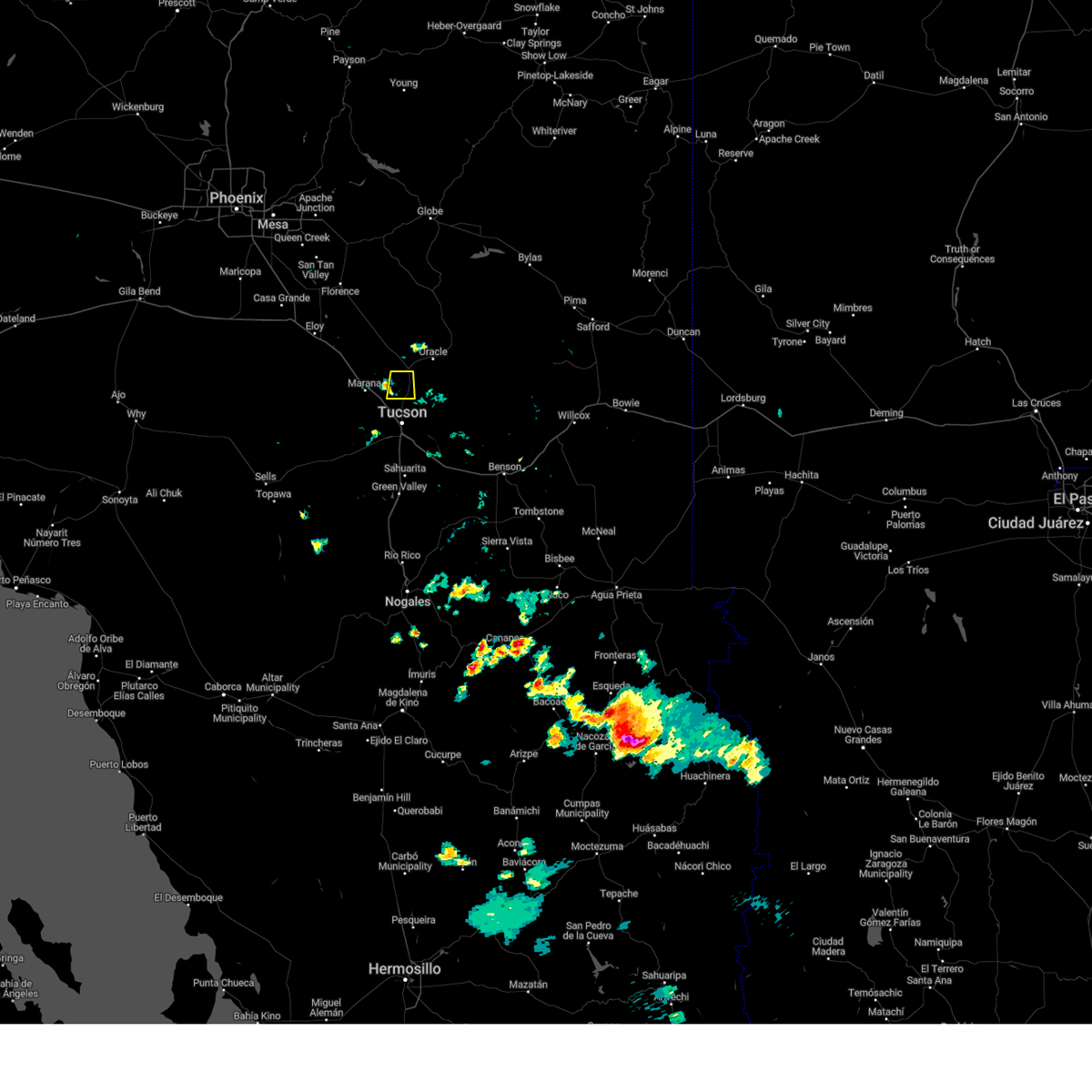 The storm which prompted the warning has weakened below severe limits, and no longer poses an immediate threat to life or property. therefore, the warning will be allowed to expire. The storm which prompted the warning has weakened below severe limits, and no longer poses an immediate threat to life or property. therefore, the warning will be allowed to expire.
|
| 7/5/2024 4:12 PM MST |
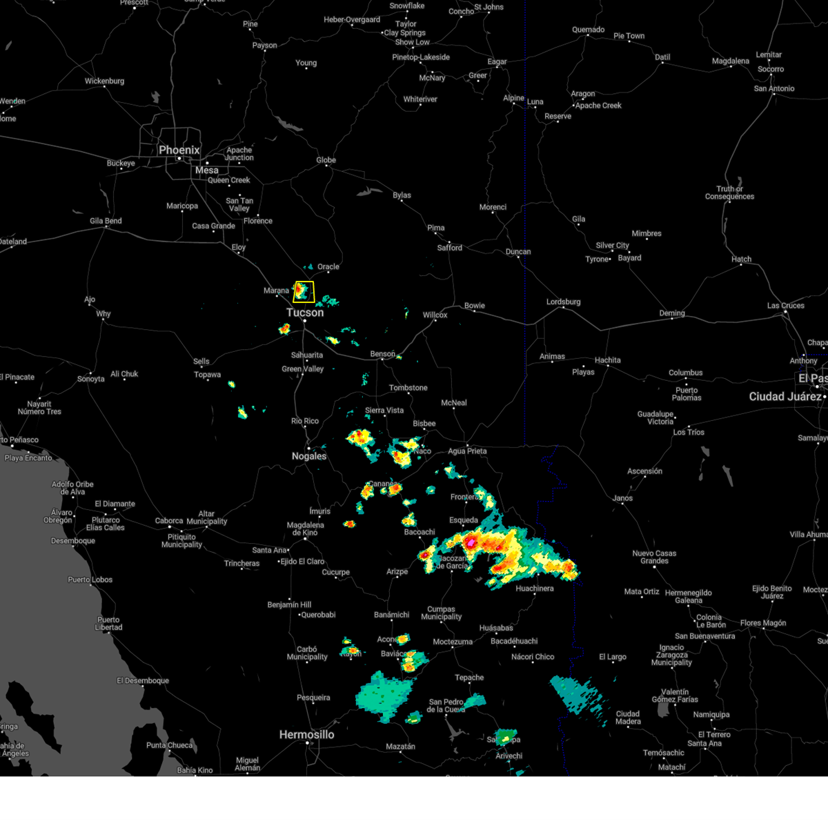 At 412 pm mst, a severe thunderstorm was located near tortolita, or near oro valley, moving west at 5 mph (radar indicated). Hazards include 60 mph wind gusts. Expect damage to roofs, siding, and trees. locations impacted include, catalina, oro valley, marana, saddlebrooke, tortolita, and catalina state park. This includes route 77 between mile markers 79 and 89. At 412 pm mst, a severe thunderstorm was located near tortolita, or near oro valley, moving west at 5 mph (radar indicated). Hazards include 60 mph wind gusts. Expect damage to roofs, siding, and trees. locations impacted include, catalina, oro valley, marana, saddlebrooke, tortolita, and catalina state park. This includes route 77 between mile markers 79 and 89.
|
| 7/5/2024 3:59 PM MST |
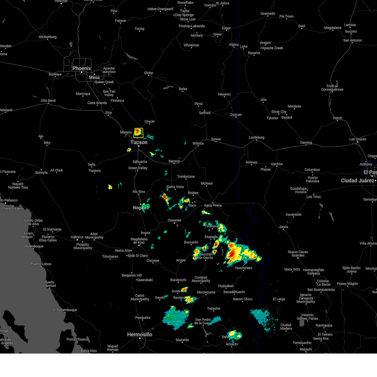 At 357 pm mst, a severe thunderstorm was located just northwest of oro valley, moving south at 5 mph. a tornado is possible with this storm but has not been reported or observed (radar indicated). Hazards include 70 mph wind gusts and penny size hail. Expect considerable tree damage. damage is likely to mobile homes, roofs, and outbuildings. locations impacted include, catalina, oro valley, marana, saddlebrooke, tortolita, and catalina state park. This includes route 77 between mile markers 79 and 89. At 357 pm mst, a severe thunderstorm was located just northwest of oro valley, moving south at 5 mph. a tornado is possible with this storm but has not been reported or observed (radar indicated). Hazards include 70 mph wind gusts and penny size hail. Expect considerable tree damage. damage is likely to mobile homes, roofs, and outbuildings. locations impacted include, catalina, oro valley, marana, saddlebrooke, tortolita, and catalina state park. This includes route 77 between mile markers 79 and 89.
|
| 7/5/2024 3:43 PM MST |
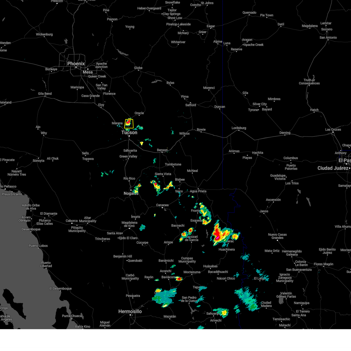 Svrtwc the national weather service in tucson has issued a * severe thunderstorm warning for, northeastern pima county in southeastern arizona, southeastern pinal county in southeastern arizona, * until 430 pm mst. * at 343 pm mst, a severe thunderstorm was located near and west of oro valley, moving south at 5 mph (radar indicated). Hazards include 60 mph wind gusts and penny size hail. expect damage to roofs, siding, and trees Svrtwc the national weather service in tucson has issued a * severe thunderstorm warning for, northeastern pima county in southeastern arizona, southeastern pinal county in southeastern arizona, * until 430 pm mst. * at 343 pm mst, a severe thunderstorm was located near and west of oro valley, moving south at 5 mph (radar indicated). Hazards include 60 mph wind gusts and penny size hail. expect damage to roofs, siding, and trees
|
| 7/2/2024 4:35 PM MST |
 The storm which prompted the warning has weakened below severe limits, and no longer poses an immediate threat to life or property. therefore, the warning will be allowed to expire. The storm which prompted the warning has weakened below severe limits, and no longer poses an immediate threat to life or property. therefore, the warning will be allowed to expire.
|
| 7/2/2024 4:22 PM MST |
 At 422 pm mst, a severe thunderstorm was located over tanque verde, or 7 miles northeast of davis-monthan air force base, moving east at 15 mph (radar indicated). Hazards include 60 mph wind gusts and penny size hail. Expect damage to roofs, siding, and trees. locations impacted include, tucson, casas adobes, flowing wells, tanque verde, south tucson, sabino canyon recreation area, catalina foothills, and seven falls. this includes the following highways, interstate 10 between mile markers 256 and 258. Route 77 between mile markers 70 and 76. At 422 pm mst, a severe thunderstorm was located over tanque verde, or 7 miles northeast of davis-monthan air force base, moving east at 15 mph (radar indicated). Hazards include 60 mph wind gusts and penny size hail. Expect damage to roofs, siding, and trees. locations impacted include, tucson, casas adobes, flowing wells, tanque verde, south tucson, sabino canyon recreation area, catalina foothills, and seven falls. this includes the following highways, interstate 10 between mile markers 256 and 258. Route 77 between mile markers 70 and 76.
|
| 7/2/2024 3:59 PM MST |
 Svrtwc the national weather service in tucson has issued a * severe thunderstorm warning for, northeastern pima county in southeastern arizona, * until 445 pm mst. * at 358 pm mst, a severe thunderstorm was located over catalina foothills, or near tucson, moving northeast at 10 mph (radar indicated). Hazards include 60 mph wind gusts and quarter size hail. Hail damage to vehicles is expected. Expect wind damage to roofs, siding, and trees. Svrtwc the national weather service in tucson has issued a * severe thunderstorm warning for, northeastern pima county in southeastern arizona, * until 445 pm mst. * at 358 pm mst, a severe thunderstorm was located over catalina foothills, or near tucson, moving northeast at 10 mph (radar indicated). Hazards include 60 mph wind gusts and quarter size hail. Hail damage to vehicles is expected. Expect wind damage to roofs, siding, and trees.
|
| 7/1/2024 1:42 PM MST |
 the severe thunderstorm warning has been cancelled and is no longer in effect the severe thunderstorm warning has been cancelled and is no longer in effect
|
| 7/1/2024 1:26 PM MST |
 Svrtwc the national weather service in tucson has issued a * severe thunderstorm warning for, north central pima county in southeastern arizona, * until 200 pm mst. * at 126 pm mst, a severe thunderstorm was located near avra valley, or 8 miles southwest of marana, moving northeast at 20 mph (radar indicated). Hazards include 60 mph wind gusts and quarter size hail. Hail damage to vehicles is expected. Expect wind damage to roofs, siding, and trees. Svrtwc the national weather service in tucson has issued a * severe thunderstorm warning for, north central pima county in southeastern arizona, * until 200 pm mst. * at 126 pm mst, a severe thunderstorm was located near avra valley, or 8 miles southwest of marana, moving northeast at 20 mph (radar indicated). Hazards include 60 mph wind gusts and quarter size hail. Hail damage to vehicles is expected. Expect wind damage to roofs, siding, and trees.
|
| 6/28/2024 4:55 PM MST |
 The storm which prompted the warning has weakened below severe limits, and no longer poses an immediate threat to life or property. therefore, the warning will be allowed to expire. however, heavy rain is still possible with this thunderstorm. The storm which prompted the warning has weakened below severe limits, and no longer poses an immediate threat to life or property. therefore, the warning will be allowed to expire. however, heavy rain is still possible with this thunderstorm.
|
| 6/28/2024 4:49 PM MST |
 At 449 pm mst, a severe thunderstorm was located over marana, moving east at 10 mph (radar indicated). Hazards include 60 mph wind gusts and penny size hail. Expect damage to roofs, siding, and trees. locations impacted include, tucson, oro valley, marana, casas adobes, flowing wells, tortolita, catalina foothills, saguaro national park west, picture rocks, and dove mountain. this includes the following highways, interstate 10 between mile markers 236 and 251. Route 77 between mile markers 72 and 80. At 449 pm mst, a severe thunderstorm was located over marana, moving east at 10 mph (radar indicated). Hazards include 60 mph wind gusts and penny size hail. Expect damage to roofs, siding, and trees. locations impacted include, tucson, oro valley, marana, casas adobes, flowing wells, tortolita, catalina foothills, saguaro national park west, picture rocks, and dove mountain. this includes the following highways, interstate 10 between mile markers 236 and 251. Route 77 between mile markers 72 and 80.
|
| 6/28/2024 4:35 PM MST |
 At 435 pm mst, a severe thunderstorm was located over marana, moving east at 20 mph (radar indicated). Hazards include 60 mph wind gusts and penny size hail. Expect damage to roofs, siding, and trees. locations impacted include, tucson, oro valley, marana, casas adobes, flowing wells, tortolita, saguaro national park west, catalina foothills, picture rocks, and dove mountain. this includes the following highways, interstate 10 between mile markers 236 and 257. Route 77 between mile markers 70 and 80. At 435 pm mst, a severe thunderstorm was located over marana, moving east at 20 mph (radar indicated). Hazards include 60 mph wind gusts and penny size hail. Expect damage to roofs, siding, and trees. locations impacted include, tucson, oro valley, marana, casas adobes, flowing wells, tortolita, saguaro national park west, catalina foothills, picture rocks, and dove mountain. this includes the following highways, interstate 10 between mile markers 236 and 257. Route 77 between mile markers 70 and 80.
|
| 6/28/2024 4:17 PM MST |
 Svrtwc the national weather service in tucson has issued a * severe thunderstorm warning for, northeastern pima county in southeastern arizona, southeastern pinal county in southeastern arizona, * until 500 pm mst. * at 416 pm mst, a severe thunderstorm was located over marana, moving east at 15 mph (radar indicated). Hazards include 60 mph wind gusts and penny size hail. expect damage to roofs, siding, and trees Svrtwc the national weather service in tucson has issued a * severe thunderstorm warning for, northeastern pima county in southeastern arizona, southeastern pinal county in southeastern arizona, * until 500 pm mst. * at 416 pm mst, a severe thunderstorm was located over marana, moving east at 15 mph (radar indicated). Hazards include 60 mph wind gusts and penny size hail. expect damage to roofs, siding, and trees
|
| 6/28/2024 3:44 PM MST |
 At 344 pm mst, a severe thunderstorm was located over tucson mountain park, or 11 miles west of tucson, moving northeast at 10 mph (radar indicated). Hazards include 60 mph wind gusts. Expect damage to roofs, siding, and trees. locations impacted include, tucson, marana, davis-monthan air force base, casas adobes, drexel heights, flowing wells, south tucson, three points, pascua pueblo yaqui reservation, tortolita, san xavier community, tucson estates, valencia west, tucson mountain park, saguaro national park west, tucson international airport, catalina foothills, san xavier mission, and ryan airfield. this includes the following highways, interstate 10 between mile markers 247 and 265. interstate 19 between mile markers 57 and 63. route 77 between mile markers 70 and 73. Route 86 between mile markers 153 and 171. At 344 pm mst, a severe thunderstorm was located over tucson mountain park, or 11 miles west of tucson, moving northeast at 10 mph (radar indicated). Hazards include 60 mph wind gusts. Expect damage to roofs, siding, and trees. locations impacted include, tucson, marana, davis-monthan air force base, casas adobes, drexel heights, flowing wells, south tucson, three points, pascua pueblo yaqui reservation, tortolita, san xavier community, tucson estates, valencia west, tucson mountain park, saguaro national park west, tucson international airport, catalina foothills, san xavier mission, and ryan airfield. this includes the following highways, interstate 10 between mile markers 247 and 265. interstate 19 between mile markers 57 and 63. route 77 between mile markers 70 and 73. Route 86 between mile markers 153 and 171.
|
| 6/28/2024 3:26 PM MST |
 Svrtwc the national weather service in tucson has issued a * severe thunderstorm warning for, northeastern pima county in southeastern arizona, * until 415 pm mst. * at 326 pm mst, a severe thunderstorm was located over tucson estates, or 14 miles west of tucson, moving northeast at 10 mph (radar indicated). Hazards include 60 mph wind gusts. expect damage to roofs, siding, and trees Svrtwc the national weather service in tucson has issued a * severe thunderstorm warning for, northeastern pima county in southeastern arizona, * until 415 pm mst. * at 326 pm mst, a severe thunderstorm was located over tucson estates, or 14 miles west of tucson, moving northeast at 10 mph (radar indicated). Hazards include 60 mph wind gusts. expect damage to roofs, siding, and trees
|
| 6/21/2024 3:55 PM MST |
 The storms which prompted the warning have weakened below severe limits, and no longer pose an immediate threat to life or property. therefore, the warning will be allowed to expire. however, gusty winds and brief heavy rain are still possible with these thunderstorms through 415 pm. The storms which prompted the warning have weakened below severe limits, and no longer pose an immediate threat to life or property. therefore, the warning will be allowed to expire. however, gusty winds and brief heavy rain are still possible with these thunderstorms through 415 pm.
|
| 6/21/2024 3:31 PM MST |
 the severe thunderstorm warning has been cancelled and is no longer in effect the severe thunderstorm warning has been cancelled and is no longer in effect
|
| 6/21/2024 3:27 PM MST |
 Svrtwc the national weather service in tucson has issued a * severe thunderstorm warning for, northeastern pima county in southeastern arizona, southeastern pinal county in southeastern arizona, * until 400 pm mst. * at 326 pm mst, severe thunderstorms were located along a line extending from 6 miles east of pinal airpark to near marana, moving northeast at 10 mph (radar indicated). Hazards include 60 mph wind gusts. expect damage to roofs, siding, and trees Svrtwc the national weather service in tucson has issued a * severe thunderstorm warning for, northeastern pima county in southeastern arizona, southeastern pinal county in southeastern arizona, * until 400 pm mst. * at 326 pm mst, severe thunderstorms were located along a line extending from 6 miles east of pinal airpark to near marana, moving northeast at 10 mph (radar indicated). Hazards include 60 mph wind gusts. expect damage to roofs, siding, and trees
|
| 6/21/2024 3:15 PM MST |
 At 315 pm mst, a severe thunderstorm was located over tucson, moving north at 20 mph (radar indicated). Hazards include 60 mph wind gusts and quarter size hail. Hail damage to vehicles is expected. expect wind damage to roofs, siding, and trees. locations impacted include, tucson, marana, davis-monthan air force base, casas adobes, drexel heights, flowing wells, tanque verde, south tucson, pascua pueblo yaqui reservation, san xavier community, sabino canyon recreation area, saguaro national park west, catalina foothills, tucson international airport, tucson mountain park, valencia west, tucson estates, rita ranch, picture rocks, and san xavier mission. this includes the following highways, interstate 10 between mile markers 250 and 270. interstate 19 between mile markers 56 and 63. route 77 between mile markers 70 and 75. Route 86 between mile markers 165 and 171. At 315 pm mst, a severe thunderstorm was located over tucson, moving north at 20 mph (radar indicated). Hazards include 60 mph wind gusts and quarter size hail. Hail damage to vehicles is expected. expect wind damage to roofs, siding, and trees. locations impacted include, tucson, marana, davis-monthan air force base, casas adobes, drexel heights, flowing wells, tanque verde, south tucson, pascua pueblo yaqui reservation, san xavier community, sabino canyon recreation area, saguaro national park west, catalina foothills, tucson international airport, tucson mountain park, valencia west, tucson estates, rita ranch, picture rocks, and san xavier mission. this includes the following highways, interstate 10 between mile markers 250 and 270. interstate 19 between mile markers 56 and 63. route 77 between mile markers 70 and 75. Route 86 between mile markers 165 and 171.
|
| 6/21/2024 2:52 PM MST |
 Svrtwc the national weather service in tucson has issued a * severe thunderstorm warning for, northeastern pima county in southeastern arizona, * until 345 pm mst. * at 251 pm mst, a severe thunderstorm was located over tucson, moving north at 20 mph (radar indicated). Hazards include 60 mph wind gusts and quarter size hail. Hail damage to vehicles is expected. Expect wind damage to roofs, siding, and trees. Svrtwc the national weather service in tucson has issued a * severe thunderstorm warning for, northeastern pima county in southeastern arizona, * until 345 pm mst. * at 251 pm mst, a severe thunderstorm was located over tucson, moving north at 20 mph (radar indicated). Hazards include 60 mph wind gusts and quarter size hail. Hail damage to vehicles is expected. Expect wind damage to roofs, siding, and trees.
|
| 8/31/2023 7:26 PM MST |
 The severe thunderstorm warning for north central pima and south central pinal counties will expire at 730 pm mst, the storm which prompted the warning has weakened below severe limits, and no longer poses an immediate threat to life or property. therefore, the warning will be allowed to expire. however gusty winds are still possible with this thunderstorm. The severe thunderstorm warning for north central pima and south central pinal counties will expire at 730 pm mst, the storm which prompted the warning has weakened below severe limits, and no longer poses an immediate threat to life or property. therefore, the warning will be allowed to expire. however gusty winds are still possible with this thunderstorm.
|
| 8/31/2023 7:05 PM MST |
 At 704 pm mst, a severe thunderstorm was located 7 miles northwest of avra valley, or 18 miles west of marana, moving west at 20 mph (radar indicated). Hazards include 60 mph wind gusts and quarter size hail. also blowing dust reducing visibility to less than a quarter mile. Hail damage to vehicles is expected. expect wind damage to roofs, siding, and trees. locations impacted include, marana, avra valley, picacho peak state park, picture rocks, red rock and silver bell. hail threat, radar indicated max hail size, 1. 00 in wind threat, radar indicated max wind gust, 60 mph. At 704 pm mst, a severe thunderstorm was located 7 miles northwest of avra valley, or 18 miles west of marana, moving west at 20 mph (radar indicated). Hazards include 60 mph wind gusts and quarter size hail. also blowing dust reducing visibility to less than a quarter mile. Hail damage to vehicles is expected. expect wind damage to roofs, siding, and trees. locations impacted include, marana, avra valley, picacho peak state park, picture rocks, red rock and silver bell. hail threat, radar indicated max hail size, 1. 00 in wind threat, radar indicated max wind gust, 60 mph.
|
| 8/31/2023 6:50 PM MST | Storm damage reported in pinal county AZ, 14.1 miles ESE of Marana, AZ |
| 8/31/2023 6:42 PM MST |
 At 641 pm mst, a severe thunderstorm was located over avra valley, or 10 miles west of marana, moving west at 20 mph (radar indicated). Hazards include 60 mph wind gusts and quarter size hail. Hail damage to vehicles is expected. Expect wind damage to roofs, siding, and trees. At 641 pm mst, a severe thunderstorm was located over avra valley, or 10 miles west of marana, moving west at 20 mph (radar indicated). Hazards include 60 mph wind gusts and quarter size hail. Hail damage to vehicles is expected. Expect wind damage to roofs, siding, and trees.
|
| 8/31/2023 6:23 PM MST |
 The severe thunderstorm warning for northeastern pima and south central pinal counties will expire at 630 pm mst, the storm which prompted the warning has weakened below severe limits, and no longer poses an immediate threat to life or property. therefore, the warning will be allowed to expire. however gusty winds are still possible with this thunderstorm. The severe thunderstorm warning for northeastern pima and south central pinal counties will expire at 630 pm mst, the storm which prompted the warning has weakened below severe limits, and no longer poses an immediate threat to life or property. therefore, the warning will be allowed to expire. however gusty winds are still possible with this thunderstorm.
|
| 8/31/2023 6:22 PM MST |
 The severe thunderstorm warning for northeastern pima county will expire at 630 pm mst, the storm which prompted the warning has weakened below severe limits, and no longer poses an immediate threat to life or property. therefore, the warning will be allowed to expire. however gusty winds are still possible with this thunderstorm. The severe thunderstorm warning for northeastern pima county will expire at 630 pm mst, the storm which prompted the warning has weakened below severe limits, and no longer poses an immediate threat to life or property. therefore, the warning will be allowed to expire. however gusty winds are still possible with this thunderstorm.
|
| 8/31/2023 6:06 PM MST |
 At 606 pm mst, a severe thunderstorm was located over oro valley, moving west at 10 mph (radar indicated). Hazards include 60 mph wind gusts and quarter size hail. Hail damage to vehicles is expected. expect wind damage to roofs, siding, and trees. locations impacted include, catalina, oro valley, marana, casas adobes, tortolita, catalina state park and dove mountain. hail threat, radar indicated max hail size, 1. 00 in wind threat, radar indicated max wind gust, 60 mph. At 606 pm mst, a severe thunderstorm was located over oro valley, moving west at 10 mph (radar indicated). Hazards include 60 mph wind gusts and quarter size hail. Hail damage to vehicles is expected. expect wind damage to roofs, siding, and trees. locations impacted include, catalina, oro valley, marana, casas adobes, tortolita, catalina state park and dove mountain. hail threat, radar indicated max hail size, 1. 00 in wind threat, radar indicated max wind gust, 60 mph.
|
| 8/31/2023 6:04 PM MST |
 At 602 pm mst, a severe thunderstorm was located near tucson estates, or 11 miles south of marana, moving northwest at 10 mph (trained weather spotters. at 603 pm, quarter size hail was reported in tucson estates). Hazards include 60 mph wind gusts and quarter size hail. Hail damage to vehicles is expected. expect wind damage to roofs, siding, and trees. locations impacted include, tucson, marana, saguaro national park west, tucson estates, valencia west, picture rocks and ryan airfield. hail threat, observed max hail size, 1. 00 in wind threat, radar indicated max wind gust, 60 mph. At 602 pm mst, a severe thunderstorm was located near tucson estates, or 11 miles south of marana, moving northwest at 10 mph (trained weather spotters. at 603 pm, quarter size hail was reported in tucson estates). Hazards include 60 mph wind gusts and quarter size hail. Hail damage to vehicles is expected. expect wind damage to roofs, siding, and trees. locations impacted include, tucson, marana, saguaro national park west, tucson estates, valencia west, picture rocks and ryan airfield. hail threat, observed max hail size, 1. 00 in wind threat, radar indicated max wind gust, 60 mph.
|
| 8/31/2023 5:47 PM MST |
 At 547 pm mst, a severe thunderstorm was located over catalina state park, or near oro valley, moving west at 10 mph (radar indicated). Hazards include 60 mph wind gusts and quarter size hail. Hail damage to vehicles is expected. Expect wind damage to roofs, siding, and trees. At 547 pm mst, a severe thunderstorm was located over catalina state park, or near oro valley, moving west at 10 mph (radar indicated). Hazards include 60 mph wind gusts and quarter size hail. Hail damage to vehicles is expected. Expect wind damage to roofs, siding, and trees.
|
| 8/31/2023 5:43 PM MST |
 At 542 pm mst, a severe thunderstorm was located over tucson estates, or 12 miles west of tucson, moving northwest at 10 mph (radar indicated). Hazards include 60 mph wind gusts and quarter size hail. Hail damage to vehicles is expected. Expect wind damage to roofs, siding, and trees. At 542 pm mst, a severe thunderstorm was located over tucson estates, or 12 miles west of tucson, moving northwest at 10 mph (radar indicated). Hazards include 60 mph wind gusts and quarter size hail. Hail damage to vehicles is expected. Expect wind damage to roofs, siding, and trees.
|
| 8/30/2023 7:40 PM MST |
 The severe thunderstorm warning for northeastern pima and southern pinal counties will expire at 745 pm mst, the storm which prompted the warning has weakened below severe limits. therefore, the warning will be allowed to expire. The severe thunderstorm warning for northeastern pima and southern pinal counties will expire at 745 pm mst, the storm which prompted the warning has weakened below severe limits. therefore, the warning will be allowed to expire.
|
| 8/30/2023 7:04 PM MST |
 At 702 pm mst, a severe thunderstorm was located near and north of mount lemmon/summerhaven, or near catalina, moving southwest at 10 mph (radar indicated). Hazards include 60 mph wind gusts and quarter size hail. Hail damage to vehicles is expected. Expect wind damage to roofs, siding, and trees. At 702 pm mst, a severe thunderstorm was located near and north of mount lemmon/summerhaven, or near catalina, moving southwest at 10 mph (radar indicated). Hazards include 60 mph wind gusts and quarter size hail. Hail damage to vehicles is expected. Expect wind damage to roofs, siding, and trees.
|
| 8/22/2023 4:53 PM MST |
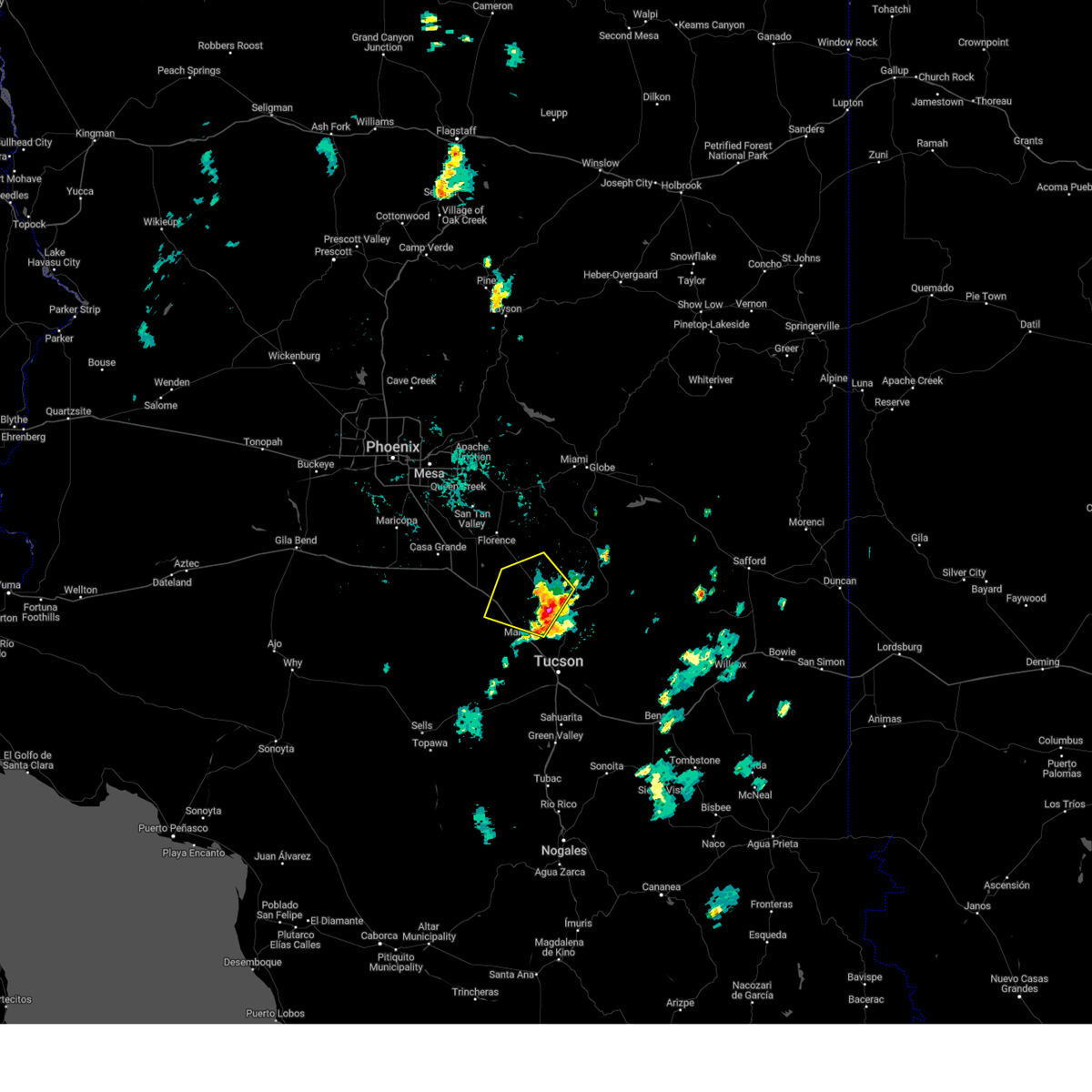 At 452 pm mst, a severe thunderstorm was located 11 miles northeast of picacho peak state park, or 20 miles south of florence, moving northwest at 35 mph (radar indicated). Hazards include 60 mph wind gusts are still possible with this storm complex. Expect damage to roofs, siding, and trees. locations impacted include, marana, picacho peak state park, red rock and dove mountain. hail threat, radar indicated max hail size, <. 75 in wind threat, radar indicated max wind gust, 60 mph. At 452 pm mst, a severe thunderstorm was located 11 miles northeast of picacho peak state park, or 20 miles south of florence, moving northwest at 35 mph (radar indicated). Hazards include 60 mph wind gusts are still possible with this storm complex. Expect damage to roofs, siding, and trees. locations impacted include, marana, picacho peak state park, red rock and dove mountain. hail threat, radar indicated max hail size, <. 75 in wind threat, radar indicated max wind gust, 60 mph.
|
| 8/22/2023 4:24 PM MST |
 At 424 pm mst, a severe thunderstorm was located 10 miles northwest of saddlebrooke, or 11 miles northwest of catalina, moving northwest at 35 mph (radar indicated). Hazards include 60 mph wind gusts and penny size hail. expect damage to roofs, siding, and trees At 424 pm mst, a severe thunderstorm was located 10 miles northwest of saddlebrooke, or 11 miles northwest of catalina, moving northwest at 35 mph (radar indicated). Hazards include 60 mph wind gusts and penny size hail. expect damage to roofs, siding, and trees
|
| 8/21/2023 7:50 PM MST |
 The severe thunderstorm warning for northeastern pima county will expire at 800 pm mst, the storms which prompted the warning are now moving out of the area. therefore, the warning will be allowed to expire. The severe thunderstorm warning for northeastern pima county will expire at 800 pm mst, the storms which prompted the warning are now moving out of the area. therefore, the warning will be allowed to expire.
|
| 8/21/2023 7:25 PM MST |
 At 723 pm mst, severe thunderstorms were located near the tucson estates area moving northwest at 30 mph (radar indicated). Hazards include 60 mph wind gusts and penny size hail. Expect damage to roofs, siding, and trees. locations impacted include, west tucson, oro valley, marana, casas adobes, drexel heights, flowing wells, three points, pascua pueblo yaqui reservation, tortolita, tucson estates, saguaro national park west, valencia west, picture rocks, san xavier mission and ryan airfield. hail threat, radar indicated max hail size, 0. 75 in wind threat, observed max wind gust, 60 mph. At 723 pm mst, severe thunderstorms were located near the tucson estates area moving northwest at 30 mph (radar indicated). Hazards include 60 mph wind gusts and penny size hail. Expect damage to roofs, siding, and trees. locations impacted include, west tucson, oro valley, marana, casas adobes, drexel heights, flowing wells, three points, pascua pueblo yaqui reservation, tortolita, tucson estates, saguaro national park west, valencia west, picture rocks, san xavier mission and ryan airfield. hail threat, radar indicated max hail size, 0. 75 in wind threat, observed max wind gust, 60 mph.
|
| 8/21/2023 6:57 PM MST |
 At 655 pm mst, severe thunderstorms were located along a line extending from near vail to near summit to near green valley, moving northwest at 30 mph (radar indicated). Hazards include 70 mph wind gusts and penny size hail. radar is indicating 70 plus mph winds just above the surface northwest of the corona de tucson area. Expect considerable tree damage. Damage is likely to mobile homes, roofs, and outbuildings. At 655 pm mst, severe thunderstorms were located along a line extending from near vail to near summit to near green valley, moving northwest at 30 mph (radar indicated). Hazards include 70 mph wind gusts and penny size hail. radar is indicating 70 plus mph winds just above the surface northwest of the corona de tucson area. Expect considerable tree damage. Damage is likely to mobile homes, roofs, and outbuildings.
|
| 8/17/2023 4:23 PM MST |
 The severe thunderstorm warning for north central pima and south central pinal counties will expire at 430 pm mst, the storm which prompted the warning has weakened below severe limits, and has exited the warned area. therefore, the warning will be allowed to expire. however gusty winds are still possible with this thunderstorm. The severe thunderstorm warning for north central pima and south central pinal counties will expire at 430 pm mst, the storm which prompted the warning has weakened below severe limits, and has exited the warned area. therefore, the warning will be allowed to expire. however gusty winds are still possible with this thunderstorm.
|
| 8/17/2023 3:45 PM MST |
 At 345 pm mst, a severe thunderstorm was located over avra valley, or 9 miles west of marana, moving northwest at 5 mph (radar indicated). Hazards include 60 mph wind gusts and quarter size hail. Hail damage to vehicles is expected. Expect wind damage to roofs, siding, and trees. At 345 pm mst, a severe thunderstorm was located over avra valley, or 9 miles west of marana, moving northwest at 5 mph (radar indicated). Hazards include 60 mph wind gusts and quarter size hail. Hail damage to vehicles is expected. Expect wind damage to roofs, siding, and trees.
|
| 8/17/2023 3:16 PM MST |
 At 316 pm mst, a severe thunderstorm was located near saguaro national park west, or near marana, moving north at 10 mph (radar indicated). Hazards include 60 mph wind gusts and quarter size hail. Hail damage to vehicles is expected. expect wind damage to roofs, siding, and trees. locations impacted include, tucson, marana, saguaro national park west, tucson estates, valencia west, picture rocks and ryan airfield. hail threat, radar indicated max hail size, 1. 00 in wind threat, radar indicated max wind gust, 60 mph. At 316 pm mst, a severe thunderstorm was located near saguaro national park west, or near marana, moving north at 10 mph (radar indicated). Hazards include 60 mph wind gusts and quarter size hail. Hail damage to vehicles is expected. expect wind damage to roofs, siding, and trees. locations impacted include, tucson, marana, saguaro national park west, tucson estates, valencia west, picture rocks and ryan airfield. hail threat, radar indicated max hail size, 1. 00 in wind threat, radar indicated max wind gust, 60 mph.
|
| 8/17/2023 2:55 PM MST |
 At 255 pm mst, a severe thunderstorm was located over tucson estates, or 14 miles south of marana, moving northwest at 10 mph (radar indicated). Hazards include 60 mph wind gusts and quarter size hail. Hail damage to vehicles is expected. Expect wind damage to roofs, siding, and trees. At 255 pm mst, a severe thunderstorm was located over tucson estates, or 14 miles south of marana, moving northwest at 10 mph (radar indicated). Hazards include 60 mph wind gusts and quarter size hail. Hail damage to vehicles is expected. Expect wind damage to roofs, siding, and trees.
|
| 8/16/2023 6:40 PM MST |
 The severe thunderstorm warning for northeastern pima and south central pinal counties will expire at 645 pm mst, the storm which prompted the warning has weakened below severe limits, and no longer poses an immediate threat to life or property. therefore, the warning will be allowed to expire. however gusty winds are still possible with this thunderstorm. The severe thunderstorm warning for northeastern pima and south central pinal counties will expire at 645 pm mst, the storm which prompted the warning has weakened below severe limits, and no longer poses an immediate threat to life or property. therefore, the warning will be allowed to expire. however gusty winds are still possible with this thunderstorm.
|
| 8/16/2023 6:19 PM MST |
 At 619 pm mst, a severe thunderstorm was located 7 miles north of tortolita, or 8 miles northeast of marana, moving northwest at 15 mph (radar indicated). Hazards include 60 mph wind gusts and quarter size hail. Hail damage to vehicles is expected. expect wind damage to roofs, siding, and trees. locations impacted include, catalina, oro valley, marana, casas adobes, saddlebrooke, tortolita, catalina state park, catalina foothills, oracle junction and dove mountain. hail threat, radar indicated max hail size, 1. 00 in wind threat, radar indicated max wind gust, 60 mph. At 619 pm mst, a severe thunderstorm was located 7 miles north of tortolita, or 8 miles northeast of marana, moving northwest at 15 mph (radar indicated). Hazards include 60 mph wind gusts and quarter size hail. Hail damage to vehicles is expected. expect wind damage to roofs, siding, and trees. locations impacted include, catalina, oro valley, marana, casas adobes, saddlebrooke, tortolita, catalina state park, catalina foothills, oracle junction and dove mountain. hail threat, radar indicated max hail size, 1. 00 in wind threat, radar indicated max wind gust, 60 mph.
|
| 8/16/2023 6:00 PM MST |
 At 559 pm mst, a severe thunderstorm was located near tortolita, or near oro valley, moving northwest at 15 mph (radar indicated). Hazards include 60 mph wind gusts and quarter size hail. Hail damage to vehicles is expected. Expect wind damage to roofs, siding, and trees. At 559 pm mst, a severe thunderstorm was located near tortolita, or near oro valley, moving northwest at 15 mph (radar indicated). Hazards include 60 mph wind gusts and quarter size hail. Hail damage to vehicles is expected. Expect wind damage to roofs, siding, and trees.
|
| 8/8/2023 4:00 PM MST | Power poles knocked down at n anway rd and n tucker r in pima county AZ, 12.2 miles ENE of Marana, AZ |
| 7/31/2023 8:10 PM MST |
 The severe thunderstorm warning for north central pima and south central pinal counties will expire at 815 pm mst, the storm which prompted the warning has moved out of the area. therefore, the warning will be allowed to expire. however gusty winds are still possible with this thunderstorm. remember, a severe thunderstorm warning still remains in effect for southeast pinal county, including red rock and picacho peak. The severe thunderstorm warning for north central pima and south central pinal counties will expire at 815 pm mst, the storm which prompted the warning has moved out of the area. therefore, the warning will be allowed to expire. however gusty winds are still possible with this thunderstorm. remember, a severe thunderstorm warning still remains in effect for southeast pinal county, including red rock and picacho peak.
|
| 7/31/2023 7:46 PM MST |
 At 744 pm mst, a severe thunderstorm was located near avra valley, or 13 miles northwest of marana, moving northwest at 15 mph (radar indicated. at 735pm mst, a 72 mph wind gust was reported at marana airport). Hazards include 70 mph wind gusts and penny size hail. Expect considerable tree damage. damage is likely to mobile homes, roofs, and outbuildings. locations impacted include, marana, avra valley, picacho peak state park, saguaro national park west, picture rocks, red rock, silver bell and dove mountain. thunderstorm damage threat, considerable hail threat, radar indicated max hail size, 0. 75 in wind threat, observed max wind gust, 70 mph. At 744 pm mst, a severe thunderstorm was located near avra valley, or 13 miles northwest of marana, moving northwest at 15 mph (radar indicated. at 735pm mst, a 72 mph wind gust was reported at marana airport). Hazards include 70 mph wind gusts and penny size hail. Expect considerable tree damage. damage is likely to mobile homes, roofs, and outbuildings. locations impacted include, marana, avra valley, picacho peak state park, saguaro national park west, picture rocks, red rock, silver bell and dove mountain. thunderstorm damage threat, considerable hail threat, radar indicated max hail size, 0. 75 in wind threat, observed max wind gust, 70 mph.
|
| 7/31/2023 7:30 PM MST |
 At 729 pm mst, a severe thunderstorm was located near avra valley, or 8 miles west of marana, moving northwest at 15 mph (radar indicated). Hazards include 60 mph wind gusts and penny size hail. expect damage to roofs, siding, and trees At 729 pm mst, a severe thunderstorm was located near avra valley, or 8 miles west of marana, moving northwest at 15 mph (radar indicated). Hazards include 60 mph wind gusts and penny size hail. expect damage to roofs, siding, and trees
|
| 7/31/2023 7:12 PM MST |
 At 710 pm mst, a line of severe thunderstorms from dove mmountain to almost three points continued to move to the northwest at 15 mph with damaging winds, frequent lightning and very heavy rains the major threats (radar indicated). Hazards include 60 mph wind gusts and penny size hail. Expect damage to roofs, siding, and trees. locations impacted include, tucson, catalina, oro valley, marana, casas adobes, drexel heights, flowing wells, saddlebrooke, three points, avra valley, pascua pueblo yaqui reservation, tortolita, tucson estates, saguaro national park west, valencia west, catalina foothills, picture rocks, dove mountain, san xavier mission and oracle junction. hail threat, radar indicated max hail size, 0. 75 in wind threat, radar indicated max wind gust, 60 mph. At 710 pm mst, a line of severe thunderstorms from dove mmountain to almost three points continued to move to the northwest at 15 mph with damaging winds, frequent lightning and very heavy rains the major threats (radar indicated). Hazards include 60 mph wind gusts and penny size hail. Expect damage to roofs, siding, and trees. locations impacted include, tucson, catalina, oro valley, marana, casas adobes, drexel heights, flowing wells, saddlebrooke, three points, avra valley, pascua pueblo yaqui reservation, tortolita, tucson estates, saguaro national park west, valencia west, catalina foothills, picture rocks, dove mountain, san xavier mission and oracle junction. hail threat, radar indicated max hail size, 0. 75 in wind threat, radar indicated max wind gust, 60 mph.
|
| 7/31/2023 6:41 PM MST |
 At 641 pm mst, severe thunderstorms were located along a line extending from near saddlebrooke to flowing wells to 7 miles south of pascua pueblo yaqui reservation, moving northwest at 15 mph (radar indicated). Hazards include 60 mph wind gusts and penny size hail. expect damage to roofs, siding, and trees At 641 pm mst, severe thunderstorms were located along a line extending from near saddlebrooke to flowing wells to 7 miles south of pascua pueblo yaqui reservation, moving northwest at 15 mph (radar indicated). Hazards include 60 mph wind gusts and penny size hail. expect damage to roofs, siding, and trees
|
| 7/31/2023 6:05 PM MST |
 At 604 pm mst, a severe thunderstorm was located over drexel heights, or 7 miles west of tucson, moving northwest at 20 mph (radar indicated). Hazards include 60 mph wind gusts and quarter size hail. Hail damage to vehicles is expected. Expect wind damage to roofs, siding, and trees. At 604 pm mst, a severe thunderstorm was located over drexel heights, or 7 miles west of tucson, moving northwest at 20 mph (radar indicated). Hazards include 60 mph wind gusts and quarter size hail. Hail damage to vehicles is expected. Expect wind damage to roofs, siding, and trees.
|
| 7/30/2023 7:20 PM MST |
 The severe thunderstorm warning for north central pima county will expire at 730 pm mst, the storm which prompted the warning has weakened below severe limits, and no longer poses an immediate threat to life or property. therefore, the warning will be allowed to expire. The severe thunderstorm warning for north central pima county will expire at 730 pm mst, the storm which prompted the warning has weakened below severe limits, and no longer poses an immediate threat to life or property. therefore, the warning will be allowed to expire.
|
| 7/30/2023 7:01 PM MST |
 At 701 pm mst, a severe thunderstorm was located near avra valley, or 15 miles west of marana, moving west at 15 mph (radar indicated). Hazards include 60 mph wind gusts and quarter size hail. Hail damage to vehicles is expected. expect wind damage to roofs, siding, and trees. locations impacted include, marana, avra valley, saguaro national park west, tucson estates and picture rocks. hail threat, radar indicated max hail size, 1. 00 in wind threat, radar indicated max wind gust, 60 mph. At 701 pm mst, a severe thunderstorm was located near avra valley, or 15 miles west of marana, moving west at 15 mph (radar indicated). Hazards include 60 mph wind gusts and quarter size hail. Hail damage to vehicles is expected. expect wind damage to roofs, siding, and trees. locations impacted include, marana, avra valley, saguaro national park west, tucson estates and picture rocks. hail threat, radar indicated max hail size, 1. 00 in wind threat, radar indicated max wind gust, 60 mph.
|
| 7/30/2023 6:41 PM MST |
 At 640 pm mst, a severe thunderstorm was located 8 miles south of avra valley, or 12 miles southwest of marana, moving west at 15 mph (radar indicated). Hazards include 60 mph wind gusts and quarter size hail. Hail damage to vehicles is expected. Expect wind damage to roofs, siding, and trees. At 640 pm mst, a severe thunderstorm was located 8 miles south of avra valley, or 12 miles southwest of marana, moving west at 15 mph (radar indicated). Hazards include 60 mph wind gusts and quarter size hail. Hail damage to vehicles is expected. Expect wind damage to roofs, siding, and trees.
|
| 7/28/2023 6:57 PM MST |
 At 657 pm mst, a severe thunderstorm was located over tucson estates, or 13 miles west of tucson, moving west at 15 mph (radar indicated). Hazards include 60 mph wind gusts and penny size hail. Expect damage to roofs, siding, and trees. locations impacted include, tucson, sahuarita, davis-monthan air force base, casas adobes, drexel heights, flowing wells, south tucson, pascua pueblo yaqui reservation, east sahuarita, summit, tucson estates, valencia west, tucson international airport, saguaro national park west, catalina foothills, san xavier mission and ryan airfield. hail threat, radar indicated max hail size, 0. 75 in wind threat, radar indicated max wind gust, 60 mph. At 657 pm mst, a severe thunderstorm was located over tucson estates, or 13 miles west of tucson, moving west at 15 mph (radar indicated). Hazards include 60 mph wind gusts and penny size hail. Expect damage to roofs, siding, and trees. locations impacted include, tucson, sahuarita, davis-monthan air force base, casas adobes, drexel heights, flowing wells, south tucson, pascua pueblo yaqui reservation, east sahuarita, summit, tucson estates, valencia west, tucson international airport, saguaro national park west, catalina foothills, san xavier mission and ryan airfield. hail threat, radar indicated max hail size, 0. 75 in wind threat, radar indicated max wind gust, 60 mph.
|
| 7/28/2023 6:31 PM MST |
 At 630 pm mst, a severe thunderstorm was located over south tucson, or near tucson, moving southwest at 20 mph (radar indicated). Hazards include golf ball size hail and 70 mph wind gusts. People and animals outdoors will be injured. expect hail damage to roofs, siding, windows, and vehicles. expect considerable tree damage. Wind damage is also likely to mobile homes, roofs, and outbuildings. At 630 pm mst, a severe thunderstorm was located over south tucson, or near tucson, moving southwest at 20 mph (radar indicated). Hazards include golf ball size hail and 70 mph wind gusts. People and animals outdoors will be injured. expect hail damage to roofs, siding, windows, and vehicles. expect considerable tree damage. Wind damage is also likely to mobile homes, roofs, and outbuildings.
|
| 7/28/2023 6:22 PM MST |
 At 620 pm mst, a severe thunderstorm was located near catalina foothills, or near tucson, moving southwest at 15 mph (radar indicated. several reports of quarter to golf ball size hail have been received in the tucson metro). Hazards include golf ball size hail and 70 mph wind gusts. People and animals outdoors will be injured. expect hail damage to roofs, siding, windows, and vehicles. expect considerable tree damage. wind damage is also likely to mobile homes, roofs, and outbuildings. locations impacted include, tucson, oro valley, marana, davis-monthan air force base, casas adobes, flowing wells, tanque verde, south tucson, tortolita, sabino canyon recreation area, catalina state park, catalina foothills, tucson international airport, saguaro national park east and seven falls. thunderstorm damage threat, considerable hail threat, radar indicated max hail size, 1. 75 in wind threat, radar indicated max wind gust, 70 mph. At 620 pm mst, a severe thunderstorm was located near catalina foothills, or near tucson, moving southwest at 15 mph (radar indicated. several reports of quarter to golf ball size hail have been received in the tucson metro). Hazards include golf ball size hail and 70 mph wind gusts. People and animals outdoors will be injured. expect hail damage to roofs, siding, windows, and vehicles. expect considerable tree damage. wind damage is also likely to mobile homes, roofs, and outbuildings. locations impacted include, tucson, oro valley, marana, davis-monthan air force base, casas adobes, flowing wells, tanque verde, south tucson, tortolita, sabino canyon recreation area, catalina state park, catalina foothills, tucson international airport, saguaro national park east and seven falls. thunderstorm damage threat, considerable hail threat, radar indicated max hail size, 1. 75 in wind threat, radar indicated max wind gust, 70 mph.
|
| 7/28/2023 6:12 PM MST |
 At 609 pm mst, a severe thunderstorm was located over catalina foothills, or near tucson, moving southwest at 15 mph (radar indicated. at 605 pm mst tree damage was reported in far east tucson near broadway. at 610 pm mst one inch diameter hail was reported near speedway and wilmot). Hazards include 60 mph wind gusts and quarter size hail. Hail damage to vehicles is expected. expect wind damage to roofs, siding, and trees. locations impacted include, tucson, oro valley, marana, davis-monthan air force base, casas adobes, flowing wells, tanque verde, south tucson, tortolita, sabino canyon recreation area, catalina state park, catalina foothills, tucson international airport, saguaro national park east and seven falls. hail threat, radar indicated max hail size, 1. 00 in wind threat, radar indicated max wind gust, 60 mph. At 609 pm mst, a severe thunderstorm was located over catalina foothills, or near tucson, moving southwest at 15 mph (radar indicated. at 605 pm mst tree damage was reported in far east tucson near broadway. at 610 pm mst one inch diameter hail was reported near speedway and wilmot). Hazards include 60 mph wind gusts and quarter size hail. Hail damage to vehicles is expected. expect wind damage to roofs, siding, and trees. locations impacted include, tucson, oro valley, marana, davis-monthan air force base, casas adobes, flowing wells, tanque verde, south tucson, tortolita, sabino canyon recreation area, catalina state park, catalina foothills, tucson international airport, saguaro national park east and seven falls. hail threat, radar indicated max hail size, 1. 00 in wind threat, radar indicated max wind gust, 60 mph.
|
| 7/28/2023 5:56 PM MST |
 At 555 pm mst, a severe thunderstorm was located over sabino canyon recreation area, or 9 miles northeast of tucson, moving southwest at 15 mph (radar indicated). Hazards include 60 mph wind gusts and quarter size hail. Hail damage to vehicles is expected. Expect wind damage to roofs, siding, and trees. At 555 pm mst, a severe thunderstorm was located over sabino canyon recreation area, or 9 miles northeast of tucson, moving southwest at 15 mph (radar indicated). Hazards include 60 mph wind gusts and quarter size hail. Hail damage to vehicles is expected. Expect wind damage to roofs, siding, and trees.
|
| 7/26/2023 7:38 PM MST |
 The severe thunderstorm warning for northeastern pima and south central pinal counties will expire at 745 pm mst, the storm which prompted the warning has weakened below severe limits. therefore, the warning will be allowed to expire. The severe thunderstorm warning for northeastern pima and south central pinal counties will expire at 745 pm mst, the storm which prompted the warning has weakened below severe limits. therefore, the warning will be allowed to expire.
|
| 7/26/2023 7:12 PM MST |
 At 711 pm mst, a severe thunderstorm was located over valencia west, or 15 miles west of tucson, moving west at 15 to 20 mph (radar indicated). Hazards include 60 mph wind gusts and penny size hail. Expect damage to roofs, siding, and trees. locations impacted include, west tucson, marana, sahuarita, casas adobes, drexel heights, flowing wells, south tucson, pascua pueblo yaqui reservation, summit, tucson estates, saguaro national park west, corona de tucson, valencia west, tucson international airport, rita ranch and picture rocks. hail threat, radar indicated max hail size, 0. 75 in wind threat, radar indicated max wind gust, 60 mph. At 711 pm mst, a severe thunderstorm was located over valencia west, or 15 miles west of tucson, moving west at 15 to 20 mph (radar indicated). Hazards include 60 mph wind gusts and penny size hail. Expect damage to roofs, siding, and trees. locations impacted include, west tucson, marana, sahuarita, casas adobes, drexel heights, flowing wells, south tucson, pascua pueblo yaqui reservation, summit, tucson estates, saguaro national park west, corona de tucson, valencia west, tucson international airport, rita ranch and picture rocks. hail threat, radar indicated max hail size, 0. 75 in wind threat, radar indicated max wind gust, 60 mph.
|
| 7/26/2023 6:56 PM MST |
 At 656 pm mst, a severe thunderstorm was located over catalina state park, or over oro valley, moving west at 15 mph (radar indicated). Hazards include 60 mph wind gusts and penny size hail. expect damage to roofs, siding, and trees At 656 pm mst, a severe thunderstorm was located over catalina state park, or over oro valley, moving west at 15 mph (radar indicated). Hazards include 60 mph wind gusts and penny size hail. expect damage to roofs, siding, and trees
|
| 7/26/2023 6:25 PM MST |
 At 623 pm mst, a severe thunderstorm was located near central to northern tucson, moving west at 15 to 20 mph. another severe thunderstorm was noted near vail (radar indicated). Hazards include 60 mph wind gusts and penny size hail. expect damage to roofs, siding, and trees At 623 pm mst, a severe thunderstorm was located near central to northern tucson, moving west at 15 to 20 mph. another severe thunderstorm was noted near vail (radar indicated). Hazards include 60 mph wind gusts and penny size hail. expect damage to roofs, siding, and trees
|
| 7/25/2023 4:36 PM MST |
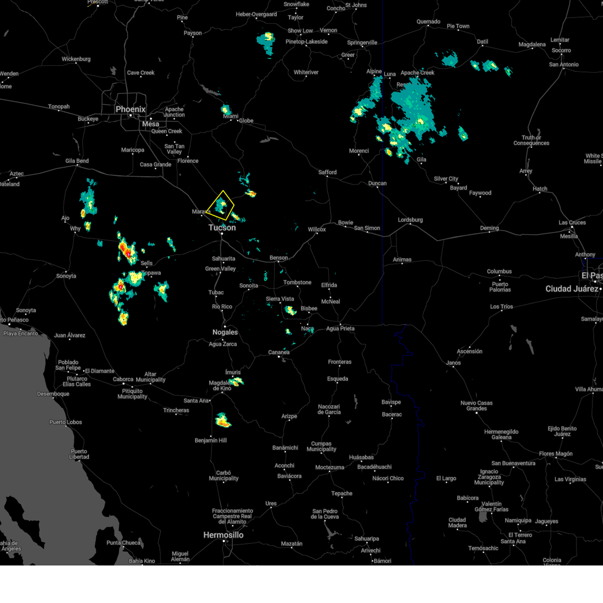 The severe thunderstorm warning for northern pima and south central pinal counties will expire at 445 pm mst, the storm which prompted the warning has weakened below severe limits, and no longer poses an immediate threat to life or property. therefore, the warning will be allowed to expire. however gusty winds are still possible with this thunderstorm. The severe thunderstorm warning for northern pima and south central pinal counties will expire at 445 pm mst, the storm which prompted the warning has weakened below severe limits, and no longer poses an immediate threat to life or property. therefore, the warning will be allowed to expire. however gusty winds are still possible with this thunderstorm.
|
| 7/25/2023 4:23 PM MST |
 At 423 pm mst, a severe thunderstorm was located over catalina, and is nearly stationary (radar indicated). Hazards include 60 mph wind gusts and nickel size hail. Expect damage to roofs, siding, and trees. locations impacted include, catalina, oro valley, marana, saddlebrooke, tortolita, catalina state park, oracle junction and dove mountain. hail threat, radar indicated max hail size, 0. 88 in wind threat, radar indicated max wind gust, 60 mph. At 423 pm mst, a severe thunderstorm was located over catalina, and is nearly stationary (radar indicated). Hazards include 60 mph wind gusts and nickel size hail. Expect damage to roofs, siding, and trees. locations impacted include, catalina, oro valley, marana, saddlebrooke, tortolita, catalina state park, oracle junction and dove mountain. hail threat, radar indicated max hail size, 0. 88 in wind threat, radar indicated max wind gust, 60 mph.
|
| 7/25/2023 4:07 PM MST |
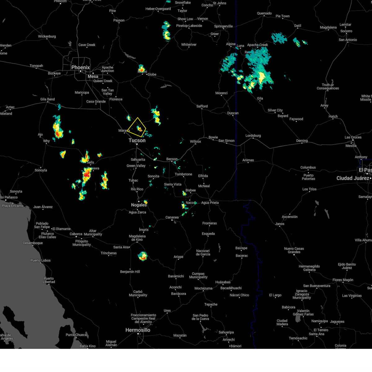 At 407 pm mst, a severe thunderstorm was located over catalina, and is nearly stationary (radar indicated). Hazards include 60 mph wind gusts and nickel size hail. expect damage to roofs, siding, and trees At 407 pm mst, a severe thunderstorm was located over catalina, and is nearly stationary (radar indicated). Hazards include 60 mph wind gusts and nickel size hail. expect damage to roofs, siding, and trees
|
| 7/19/2023 5:27 PM MST |
 The severe thunderstorm warning for northeastern pima county will expire at 530 pm mst, the storm which prompted the warning has weakened below severe limits. therefore, the warning will be allowed to expire. The severe thunderstorm warning for northeastern pima county will expire at 530 pm mst, the storm which prompted the warning has weakened below severe limits. therefore, the warning will be allowed to expire.
|
| 7/19/2023 5:02 PM MST |
 At 501 pm mst, a severe thunderstorm was located near ryan field and tucson estates, or 10 miles west of tucson, moving northwest at 15 mph (radar indicated). Hazards include 60 mph wind gusts and penny size hail. Expect damage to roofs, siding, and trees. locations impacted include, drexel heights, three points, pascua pueblo yaqui reservation, saguaro national park west, valencia west, summit, tucson estates, san xavier mission and ryan airfield. hail threat, radar indicated max hail size, 0. 75 in wind threat, radar indicated max wind gust, 60 mph. At 501 pm mst, a severe thunderstorm was located near ryan field and tucson estates, or 10 miles west of tucson, moving northwest at 15 mph (radar indicated). Hazards include 60 mph wind gusts and penny size hail. Expect damage to roofs, siding, and trees. locations impacted include, drexel heights, three points, pascua pueblo yaqui reservation, saguaro national park west, valencia west, summit, tucson estates, san xavier mission and ryan airfield. hail threat, radar indicated max hail size, 0. 75 in wind threat, radar indicated max wind gust, 60 mph.
|
| 7/19/2023 4:36 PM MST |
 At 435 pm mst, a severe thunderstorm was located near sahuarita, moving northwest at 15 mph (radar indicated). Hazards include 60 mph wind gusts and penny size hail. expect damage to roofs, siding, and trees At 435 pm mst, a severe thunderstorm was located near sahuarita, moving northwest at 15 mph (radar indicated). Hazards include 60 mph wind gusts and penny size hail. expect damage to roofs, siding, and trees
|
| 7/17/2023 5:16 PM MST |
 At 514 pm mst, an area of severe thunderstorms was located near marana and oro valley, moving northwest at 15 mph (radar indicated). Hazards include 60 mph wind gusts and quarter size hail. Hail damage to vehicles is expected. expect wind damage to roofs, siding, and trees. locations impacted include, tucson, catalina, oro valley, marana, casas adobes, drexel heights, flowing wells, saddlebrooke, avra valley, tortolita, catalina state park, tucson estates, saguaro national park west, catalina foothills, valencia west, picture rocks, dove mountain and ryan airfield. hail threat, radar indicated max hail size, 1. 00 in wind threat, radar indicated max wind gust, 60 mph. At 514 pm mst, an area of severe thunderstorms was located near marana and oro valley, moving northwest at 15 mph (radar indicated). Hazards include 60 mph wind gusts and quarter size hail. Hail damage to vehicles is expected. expect wind damage to roofs, siding, and trees. locations impacted include, tucson, catalina, oro valley, marana, casas adobes, drexel heights, flowing wells, saddlebrooke, avra valley, tortolita, catalina state park, tucson estates, saguaro national park west, catalina foothills, valencia west, picture rocks, dove mountain and ryan airfield. hail threat, radar indicated max hail size, 1. 00 in wind threat, radar indicated max wind gust, 60 mph.
|
| 7/17/2023 4:48 PM MST |
 At 447 pm mst, an are of severe thunderstorms was located over northwest, central and southwest tucson, moving west and northwest at 15 to 20 mph (radar indicated). Hazards include 60 mph wind gusts and quarter size hail. Hail damage to vehicles is expected. Expect wind damage to roofs, siding, and trees. At 447 pm mst, an are of severe thunderstorms was located over northwest, central and southwest tucson, moving west and northwest at 15 to 20 mph (radar indicated). Hazards include 60 mph wind gusts and quarter size hail. Hail damage to vehicles is expected. Expect wind damage to roofs, siding, and trees.
|
| 1/1/2023 5:00 PM MST | Significant damage to a home from a tree being blown onto it. also other wind damage to the home. time estimated via rada in pima county AZ, 7 miles ESE of Marana, AZ |
| 10/15/2022 11:06 AM MST |
 The severe thunderstorm warning for northeastern pima county will expire at 1115 am mst, the storm which prompted the warning has rapidly weakened below severe limits, and no longer poses an immediate threat to life or property. therefore, the warning will be allowed to expire. The severe thunderstorm warning for northeastern pima county will expire at 1115 am mst, the storm which prompted the warning has rapidly weakened below severe limits, and no longer poses an immediate threat to life or property. therefore, the warning will be allowed to expire.
|
| 10/15/2022 11:01 AM MST |
 At 1059 am mst, a severe thunderstorm was located near flowing wells, or near tucson, moving north at 25 mph. slightly larger than nickel size hail was reported with this storm near mission rd. the storm is currently beginning to weaken however severe wind or hail is still possible for a bit longer (radar indicated). Hazards include 60 mph wind gusts and quarter size hail. Hail damage to vehicles is expected. expect wind damage to roofs, siding, and trees. locations impacted include, tucson, marana, davis-monthan air force base, casas adobes, drexel heights, flowing wells, south tucson, pascua pueblo yaqui reservation, catalina foothills, tucson international airport, valencia west, summit, tucson estates and san xavier mission. hail threat, radar indicated max hail size, 1. 00 in wind threat, radar indicated max wind gust, 60 mph. At 1059 am mst, a severe thunderstorm was located near flowing wells, or near tucson, moving north at 25 mph. slightly larger than nickel size hail was reported with this storm near mission rd. the storm is currently beginning to weaken however severe wind or hail is still possible for a bit longer (radar indicated). Hazards include 60 mph wind gusts and quarter size hail. Hail damage to vehicles is expected. expect wind damage to roofs, siding, and trees. locations impacted include, tucson, marana, davis-monthan air force base, casas adobes, drexel heights, flowing wells, south tucson, pascua pueblo yaqui reservation, catalina foothills, tucson international airport, valencia west, summit, tucson estates and san xavier mission. hail threat, radar indicated max hail size, 1. 00 in wind threat, radar indicated max wind gust, 60 mph.
|
| 10/15/2022 10:42 AM MST |
 At 1042 am mst, a severe thunderstorm was located over san xavier community, or near tucson, moving north at 25 mph (radar indicated). Hazards include 60 mph wind gusts and quarter size hail. Hail damage to vehicles is expected. Expect wind damage to roofs, siding, and trees. At 1042 am mst, a severe thunderstorm was located over san xavier community, or near tucson, moving north at 25 mph (radar indicated). Hazards include 60 mph wind gusts and quarter size hail. Hail damage to vehicles is expected. Expect wind damage to roofs, siding, and trees.
|
| 10/7/2022 4:11 PM MST |
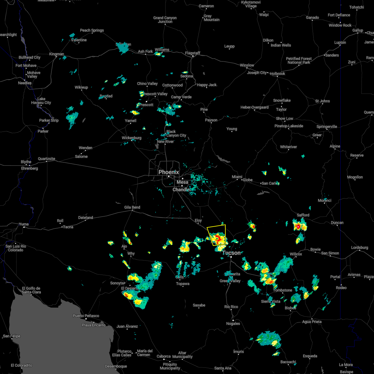 The severe thunderstorm warning for northeastern pima and south central pinal counties will expire at 415 pm mst, the storm which prompted the warning has weakened below severe limits, and no longer poses an immediate threat to life or property. therefore, the warning will be allowed to expire. however, gusty winds with areas of blowing dust, and heavy rain are still possible with this thunderstorm. The severe thunderstorm warning for northeastern pima and south central pinal counties will expire at 415 pm mst, the storm which prompted the warning has weakened below severe limits, and no longer poses an immediate threat to life or property. therefore, the warning will be allowed to expire. however, gusty winds with areas of blowing dust, and heavy rain are still possible with this thunderstorm.
|
| 10/7/2022 3:49 PM MST |
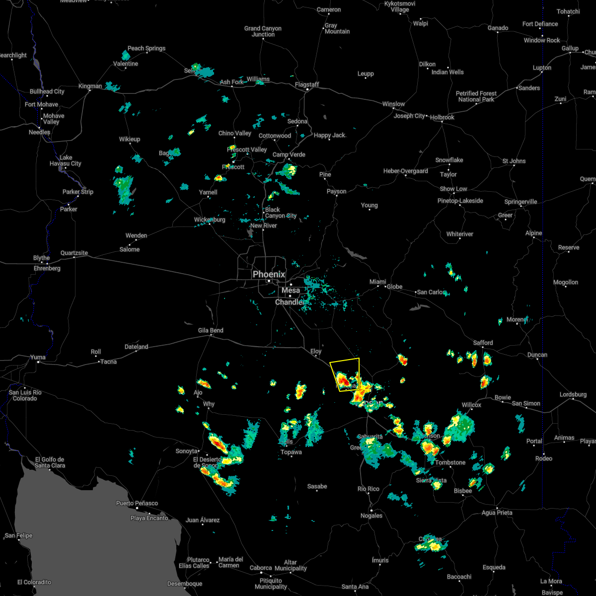 At 348 pm mst, a severe thunderstorm was located 10 miles northwest of marana, moving northwest at 15 mph (radar indicated). Hazards include 60 mph wind gusts, quarter size hail, and areas of blowing dust with low visibilities. Hail damage to vehicles is expected. expect wind damage to roofs, siding, and trees. locations impacted include, marana, red rock and dove mountain, and portions of interstate 10. hail threat, radar indicated max hail size, 1. 00 in wind threat, radar indicated max wind gust, 60 mph. At 348 pm mst, a severe thunderstorm was located 10 miles northwest of marana, moving northwest at 15 mph (radar indicated). Hazards include 60 mph wind gusts, quarter size hail, and areas of blowing dust with low visibilities. Hail damage to vehicles is expected. expect wind damage to roofs, siding, and trees. locations impacted include, marana, red rock and dove mountain, and portions of interstate 10. hail threat, radar indicated max hail size, 1. 00 in wind threat, radar indicated max wind gust, 60 mph.
|
| 10/7/2022 3:29 PM MST |
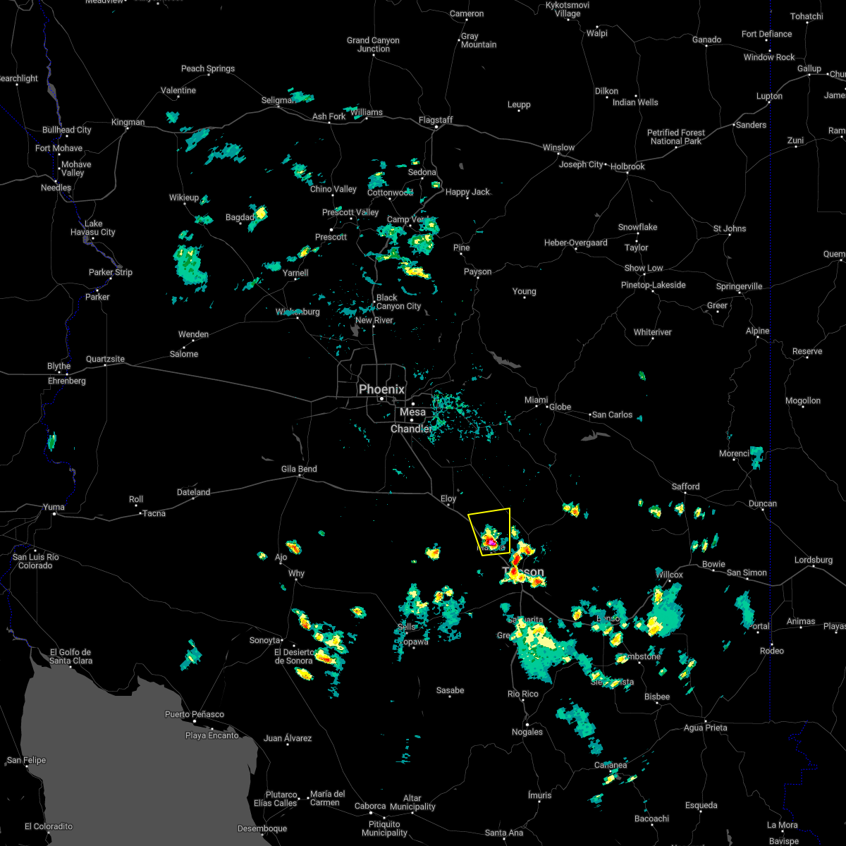 At 328 pm mst, a severe thunderstorm was located 7 miles northwest of marana, moving north at 10 to 15 mph (radar indicated). Hazards include 60 mph wind gusts, quarter size hail, and blowing dust with low visibilities. Hail damage to vehicles is expected. Expect wind damage to roofs, siding, and trees. At 328 pm mst, a severe thunderstorm was located 7 miles northwest of marana, moving north at 10 to 15 mph (radar indicated). Hazards include 60 mph wind gusts, quarter size hail, and blowing dust with low visibilities. Hail damage to vehicles is expected. Expect wind damage to roofs, siding, and trees.
|
| 9/21/2022 4:42 PM MST |
 The severe thunderstorm warning for southeastern pinal county will expire at 445 pm mst, the storm which prompted the warning has weakened below severe limits, and has exited the warned area. therefore, the warning will be allowed to expire. however heavy rain is still possible with this thunderstorm. The severe thunderstorm warning for southeastern pinal county will expire at 445 pm mst, the storm which prompted the warning has weakened below severe limits, and has exited the warned area. therefore, the warning will be allowed to expire. however heavy rain is still possible with this thunderstorm.
|
| 9/21/2022 4:29 PM MST |
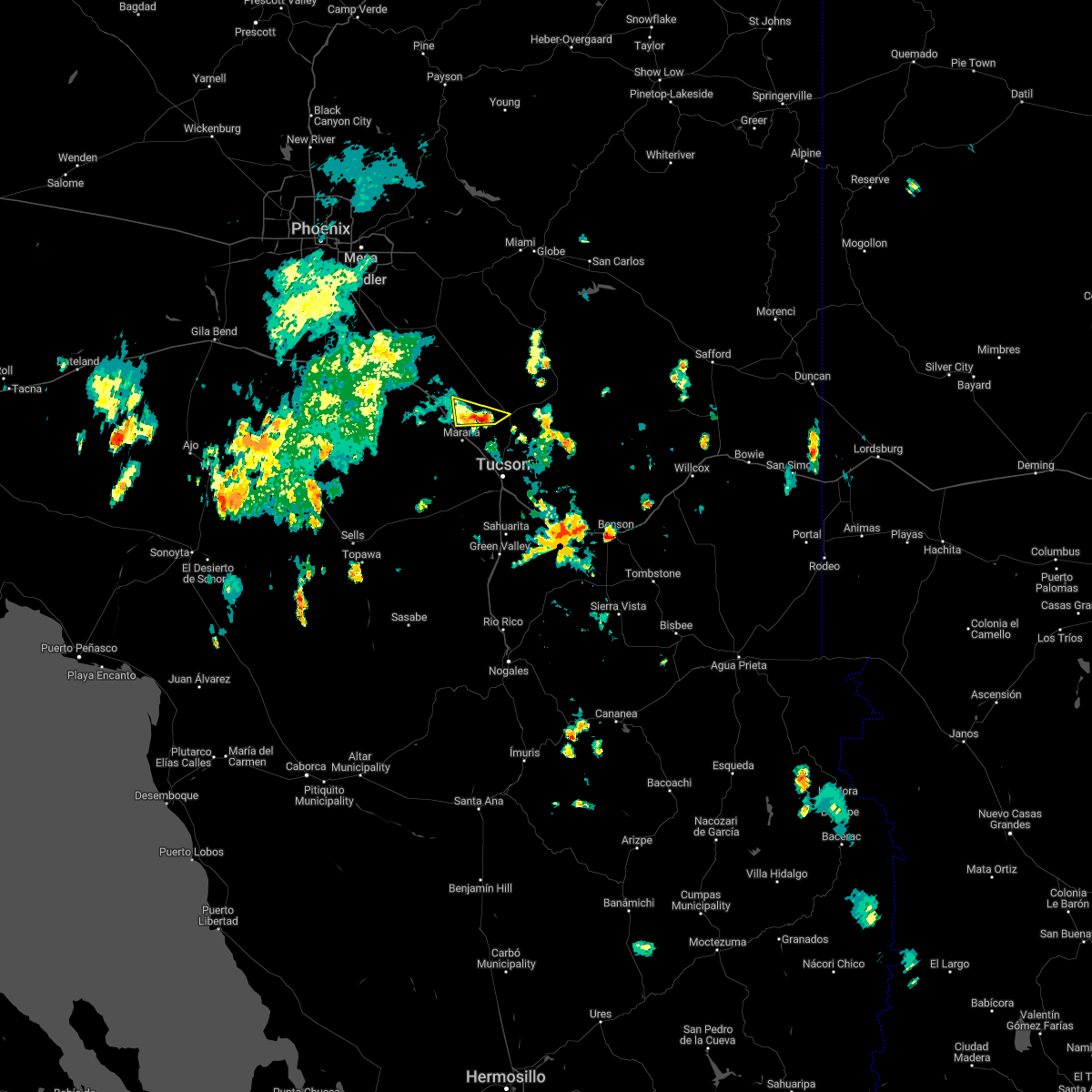 At 429 pm mst, a severe thunderstorm was located 11 miles north of tortolita, or 12 miles north of marana, moving northeast at 25 mph (radar indicated). Hazards include 60 mph wind gusts and quarter size hail. Hail damage to vehicles is expected. expect wind damage to roofs, siding, and trees. This severe thunderstorm will remain over mainly remote areas of southeastern pinal county. At 429 pm mst, a severe thunderstorm was located 11 miles north of tortolita, or 12 miles north of marana, moving northeast at 25 mph (radar indicated). Hazards include 60 mph wind gusts and quarter size hail. Hail damage to vehicles is expected. expect wind damage to roofs, siding, and trees. This severe thunderstorm will remain over mainly remote areas of southeastern pinal county.
|
| 9/21/2022 3:57 PM MST |
 At 356 pm mst, a severe thunderstorm was located near avra valley, or near marana, moving northeast at 15 mph (radar indicated). Hazards include 60 mph wind gusts and quarter size hail. Hail damage to vehicles is expected. Expect wind damage to roofs, siding, and trees. At 356 pm mst, a severe thunderstorm was located near avra valley, or near marana, moving northeast at 15 mph (radar indicated). Hazards include 60 mph wind gusts and quarter size hail. Hail damage to vehicles is expected. Expect wind damage to roofs, siding, and trees.
|
| 9/21/2022 3:55 PM MST | Several downed palo verde trees due to win in pima county AZ, 7.2 miles ESE of Marana, AZ |
| 8/23/2022 5:52 PM MST | The severe thunderstorm warning for north central pima and south central pinal counties will expire at 600 pm mst, the storm which prompted the warning has weakened below severe limits, and no longer poses an immediate threat to life or property. therefore, the warning will be allowed to expire. however small hail, gusty winds and heavy rain are still possible with this thunderstorm. |
| 8/23/2022 5:26 PM MST | At 525 pm mst, a severe thunderstorm was located near red rock, or 16 miles northwest of marana, moving southwest at 10 mph (radar indicated). Hazards include 60 mph wind gusts and quarter size hail. Hail damage to vehicles is expected. Expect wind damage to roofs, siding, and trees. |
| 8/19/2022 1:06 PM MST |
 The severe thunderstorm warning for northeastern pima county will expire at 115 pm mst, the storm which prompted the warning has weakened below severe limits, and no longer poses an immediate threat to life or property. therefore, the warning will be allowed to expire. however heavy rain is still possible with this thunderstorm. The severe thunderstorm warning for northeastern pima county will expire at 115 pm mst, the storm which prompted the warning has weakened below severe limits, and no longer poses an immediate threat to life or property. therefore, the warning will be allowed to expire. however heavy rain is still possible with this thunderstorm.
|
| 8/19/2022 12:28 PM MST |
 At 1228 pm mst, a severe thunderstorm was located over marana, and is nearly stationary (radar indicated). Hazards include 60 mph wind gusts and quarter size hail. Hail damage to vehicles is expected. Expect wind damage to roofs, siding, and trees. At 1228 pm mst, a severe thunderstorm was located over marana, and is nearly stationary (radar indicated). Hazards include 60 mph wind gusts and quarter size hail. Hail damage to vehicles is expected. Expect wind damage to roofs, siding, and trees.
|
| 8/16/2022 6:29 PM MST |
 At 628 pm mst, a severe thunderstorm was located over casas adobes, or near oro valley, and is nearly stationary (radar indicated). Hazards include 60 mph wind gusts, quarter size hail and brief heavy rain. Hail damage to vehicles is expected. Expect wind damage to roofs, siding, and trees. At 628 pm mst, a severe thunderstorm was located over casas adobes, or near oro valley, and is nearly stationary (radar indicated). Hazards include 60 mph wind gusts, quarter size hail and brief heavy rain. Hail damage to vehicles is expected. Expect wind damage to roofs, siding, and trees.
|
| 8/10/2022 8:23 PM MST |
 The severe thunderstorm warning for northeastern pima county will expire at 830 pm mst, the storm which prompted the warning near northwest tucson has weakened below severe limits, and has exited the warned area. therefore, the warning will be allowed to expire. The severe thunderstorm warning for northeastern pima county will expire at 830 pm mst, the storm which prompted the warning near northwest tucson has weakened below severe limits, and has exited the warned area. therefore, the warning will be allowed to expire.
|
| 8/10/2022 7:41 PM MST |
 At 740 pm mst, a severe thunderstorm was located over flowing wells, or 7 miles south of oro valley, moving northwest at 10 mph (radar indicated). Hazards include 60 mph wind gusts and quarter size hail. Hail damage to vehicles is expected. Expect wind damage to roofs, siding, and trees. At 740 pm mst, a severe thunderstorm was located over flowing wells, or 7 miles south of oro valley, moving northwest at 10 mph (radar indicated). Hazards include 60 mph wind gusts and quarter size hail. Hail damage to vehicles is expected. Expect wind damage to roofs, siding, and trees.
|
| 8/9/2022 4:10 PM MST |
 The severe thunderstorm warning for northeastern pima and southeastern pinal counties will expire at 415 pm mst, the storm which prompted the warning has weakened below severe limits, and no longer poses an immediate threat to life or property. therefore, the warning will be allowed to expire. The severe thunderstorm warning for northeastern pima and southeastern pinal counties will expire at 415 pm mst, the storm which prompted the warning has weakened below severe limits, and no longer poses an immediate threat to life or property. therefore, the warning will be allowed to expire.
|
| 8/9/2022 3:45 PM MST |
 At 343 pm mst, a severe thunderstorm was located near casas adobes, or near marana, moving north at 5 mph (trained weather spotters. at 341 pm a spotter reported a two trees down near thornydale and cortaro roads). Hazards include 60 mph wind gusts and quarter size hail. Hail damage to vehicles is expected. expect wind damage to roofs, siding, and trees. locations impacted include, tucson, oro valley, marana, casas adobes, flowing wells, tortolita, saguaro national park west, catalina foothills, tucson estates, picture rocks and dove mountain. hail threat, radar indicated max hail size, 1. 00 in wind threat, radar indicated max wind gust, 60 mph. At 343 pm mst, a severe thunderstorm was located near casas adobes, or near marana, moving north at 5 mph (trained weather spotters. at 341 pm a spotter reported a two trees down near thornydale and cortaro roads). Hazards include 60 mph wind gusts and quarter size hail. Hail damage to vehicles is expected. expect wind damage to roofs, siding, and trees. locations impacted include, tucson, oro valley, marana, casas adobes, flowing wells, tortolita, saguaro national park west, catalina foothills, tucson estates, picture rocks and dove mountain. hail threat, radar indicated max hail size, 1. 00 in wind threat, radar indicated max wind gust, 60 mph.
|
| 8/9/2022 3:33 PM MST |
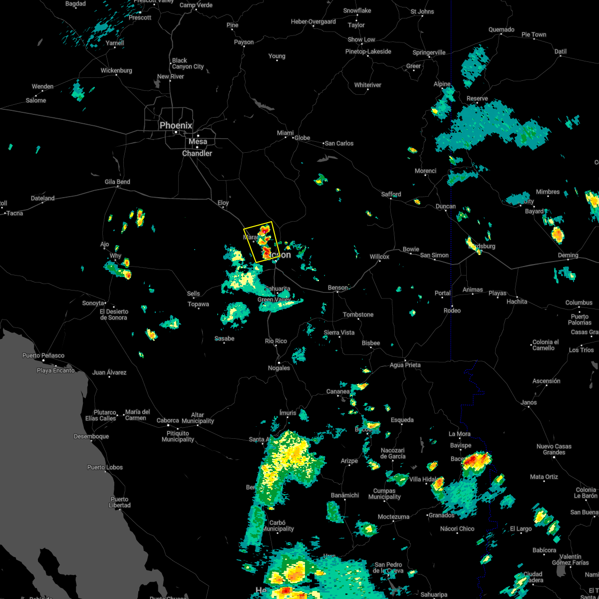 At 333 pm mst, a severe thunderstorm was located near casas adobes, or 7 miles southeast of marana, moving north at 5 mph (radar indicated). Hazards include 60 mph wind gusts and quarter size hail. Hail damage to vehicles is expected. Expect wind damage to roofs, siding, and trees. At 333 pm mst, a severe thunderstorm was located near casas adobes, or 7 miles southeast of marana, moving north at 5 mph (radar indicated). Hazards include 60 mph wind gusts and quarter size hail. Hail damage to vehicles is expected. Expect wind damage to roofs, siding, and trees.
|
| 8/6/2022 9:54 PM MST |
 The severe thunderstorm warning for eastern pima and northeastern santa cruz counties will expire at 1000 pm mst, the storm which prompted the warning has weakened below severe limits, and no longer poses an immediate threat to life or property. therefore, the warning will be allowed to expire. however gusty winds and heavy rain are still possible with this thunderstorm. The severe thunderstorm warning for eastern pima and northeastern santa cruz counties will expire at 1000 pm mst, the storm which prompted the warning has weakened below severe limits, and no longer poses an immediate threat to life or property. therefore, the warning will be allowed to expire. however gusty winds and heavy rain are still possible with this thunderstorm.
|
| 8/6/2022 9:33 PM MST |
 At 932 pm mst, a cluster of severe thunderstorms was located across the tucson metro area extending from green valley northward to tucson, moving west at 30 mph (radar indicated). Hazards include 60 mph wind gusts. Expect damage to roofs, siding, and trees. locations impacted include, tucson, sahuarita, green valley, davis-monthan air force base, casas adobes, drexel heights, flowing wells, tanque verde, vail, south tucson, three points, pascua pueblo yaqui reservation, east sahuarita, sonoita, elgin, sabino canyon recreation area, summit, tucson estates, saguaro national park west and valencia west. hail threat, radar indicated max hail size, <. 75 in wind threat, radar indicated max wind gust, 60 mph. At 932 pm mst, a cluster of severe thunderstorms was located across the tucson metro area extending from green valley northward to tucson, moving west at 30 mph (radar indicated). Hazards include 60 mph wind gusts. Expect damage to roofs, siding, and trees. locations impacted include, tucson, sahuarita, green valley, davis-monthan air force base, casas adobes, drexel heights, flowing wells, tanque verde, vail, south tucson, three points, pascua pueblo yaqui reservation, east sahuarita, sonoita, elgin, sabino canyon recreation area, summit, tucson estates, saguaro national park west and valencia west. hail threat, radar indicated max hail size, <. 75 in wind threat, radar indicated max wind gust, 60 mph.
|
| 8/6/2022 9:09 PM MST |
 At 908 pm mst, a severe thunderstorm was located near east sahuarita, or 7 miles east of sahuarita, moving west at 40 mph (radar indicated). Hazards include 60 mph wind gusts and penny size hail. expect damage to roofs, siding, and trees At 908 pm mst, a severe thunderstorm was located near east sahuarita, or 7 miles east of sahuarita, moving west at 40 mph (radar indicated). Hazards include 60 mph wind gusts and penny size hail. expect damage to roofs, siding, and trees
|
| 7/31/2022 6:38 PM MST |
 The severe thunderstorm warning for northeastern pima county will expire at 645 pm mst, the storms which prompted the warning have weakened below severe limits, and have exited the warned area. therefore, the warning will be allowed to expire. however gusty winds and heavy rain are still possible with these thunderstorms. to report severe weather, contact your nearest law enforcement agency. they will relay your report to the national weather service tucson. The severe thunderstorm warning for northeastern pima county will expire at 645 pm mst, the storms which prompted the warning have weakened below severe limits, and have exited the warned area. therefore, the warning will be allowed to expire. however gusty winds and heavy rain are still possible with these thunderstorms. to report severe weather, contact your nearest law enforcement agency. they will relay your report to the national weather service tucson.
|
| 7/31/2022 6:14 PM MST |
 At 614 pm mst, severe thunderstorms were located along a line extending from near catalina foothills to near mount lemmon/summerhaven to 11 miles south of san manuel, moving north at 25 mph (radar indicated). Hazards include 60 mph wind gusts and quarter size hail. Hail damage to vehicles is expected. expect wind damage to roofs, siding, and trees. locations impacted include, tucson, oro valley, marana, casas adobes, tanque verde, mount lemmon/summerhaven, sabino canyon recreation area, catalina foothills, catalina state park and seven falls. hail threat, radar indicated max hail size, 1. 00 in wind threat, radar indicated max wind gust, 60 mph. At 614 pm mst, severe thunderstorms were located along a line extending from near catalina foothills to near mount lemmon/summerhaven to 11 miles south of san manuel, moving north at 25 mph (radar indicated). Hazards include 60 mph wind gusts and quarter size hail. Hail damage to vehicles is expected. expect wind damage to roofs, siding, and trees. locations impacted include, tucson, oro valley, marana, casas adobes, tanque verde, mount lemmon/summerhaven, sabino canyon recreation area, catalina foothills, catalina state park and seven falls. hail threat, radar indicated max hail size, 1. 00 in wind threat, radar indicated max wind gust, 60 mph.
|
| 7/31/2022 5:58 PM MST |
 At 557 pm mst, a severe thunderstorm was located near tanque verde, or near davis-monthan air force base, moving northwest at 15 mph (radar indicated). Hazards include 60 mph wind gusts and quarter size hail. Hail damage to vehicles is expected. Expect wind damage to roofs, siding, and trees. At 557 pm mst, a severe thunderstorm was located near tanque verde, or near davis-monthan air force base, moving northwest at 15 mph (radar indicated). Hazards include 60 mph wind gusts and quarter size hail. Hail damage to vehicles is expected. Expect wind damage to roofs, siding, and trees.
|
| 7/31/2022 5:38 PM MST |
 The severe thunderstorm warning for northeastern pima county will expire at 545 pm mst, the storm which prompted the warning has moved out of the area. therefore, the warning will be allowed to expire. however gusty winds and heavy rain are still possible with this thunderstorm. to report severe weather, contact your nearest law enforcement agency. they will relay your report to the national weather service tucson. The severe thunderstorm warning for northeastern pima county will expire at 545 pm mst, the storm which prompted the warning has moved out of the area. therefore, the warning will be allowed to expire. however gusty winds and heavy rain are still possible with this thunderstorm. to report severe weather, contact your nearest law enforcement agency. they will relay your report to the national weather service tucson.
|
| 7/31/2022 5:29 PM MST |
 At 528 pm mst, a severe thunderstorm was located near drexel heights, or 10 miles west of tucson, moving north at 20 mph (radar indicated). Hazards include 70 mph wind gusts and quarter size hail. Hail damage to vehicles is expected. expect considerable tree damage. wind damage is also likely to mobile homes, roofs, and outbuildings. Locations impacted include, tucson, marana, casas adobes, drexel heights, flowing wells, pascua pueblo yaqui reservation, saguaro national park west, valencia west, tucson estates, picture rocks and ryan airfield. At 528 pm mst, a severe thunderstorm was located near drexel heights, or 10 miles west of tucson, moving north at 20 mph (radar indicated). Hazards include 70 mph wind gusts and quarter size hail. Hail damage to vehicles is expected. expect considerable tree damage. wind damage is also likely to mobile homes, roofs, and outbuildings. Locations impacted include, tucson, marana, casas adobes, drexel heights, flowing wells, pascua pueblo yaqui reservation, saguaro national park west, valencia west, tucson estates, picture rocks and ryan airfield.
|
| 7/31/2022 5:06 PM MST |
 At 505 pm mst, a severe thunderstorm was located over pascua pueblo yaqui reservation, or 12 miles southwest of tucson, moving north at 20 mph (radar indicated). Hazards include 70 mph wind gusts and ping pong ball size hail. People and animals outdoors will be injured. expect hail damage to roofs, siding, windows, and vehicles. expect considerable tree damage. Wind damage is also likely to mobile homes, roofs, and outbuildings. At 505 pm mst, a severe thunderstorm was located over pascua pueblo yaqui reservation, or 12 miles southwest of tucson, moving north at 20 mph (radar indicated). Hazards include 70 mph wind gusts and ping pong ball size hail. People and animals outdoors will be injured. expect hail damage to roofs, siding, windows, and vehicles. expect considerable tree damage. Wind damage is also likely to mobile homes, roofs, and outbuildings.
|
| 7/30/2022 2:56 PM MST |
 The severe thunderstorm warning for northeastern pima and southeastern pinal counties will expire at 300 pm mst, the storm which prompted the warning has weakened below severe limits, and no longer poses an immediate threat to life or property. therefore, the warning will be allowed to expire. however gusty winds and heavy rain are still possible with this thunderstorm. The severe thunderstorm warning for northeastern pima and southeastern pinal counties will expire at 300 pm mst, the storm which prompted the warning has weakened below severe limits, and no longer poses an immediate threat to life or property. therefore, the warning will be allowed to expire. however gusty winds and heavy rain are still possible with this thunderstorm.
|
| 7/30/2022 2:45 PM MST | Large tree fell down in neighborhoo in pima county AZ, 5.3 miles ESE of Marana, AZ |
| 7/30/2022 2:34 PM MST |
 At 233 pm mst, a severe thunderstorm was located near marana, moving northwest at 20 mph (radar indicated). Hazards include 60 mph wind gusts and quarter size hail. Hail damage to vehicles is expected. Expect wind damage to roofs, siding, and trees. At 233 pm mst, a severe thunderstorm was located near marana, moving northwest at 20 mph (radar indicated). Hazards include 60 mph wind gusts and quarter size hail. Hail damage to vehicles is expected. Expect wind damage to roofs, siding, and trees.
|
| 7/30/2022 2:02 PM MST |
 At 201 pm mst, a severe thunderstorm was located over davis-monthan air force base, moving north at 15 mph (radar indicated). Hazards include 60 mph wind gusts and nickel size hail. Expect damage to roofs, siding, and trees. locations impacted include, tucson, davis-monthan air force base, casas adobes, drexel heights, flowing wells, tanque verde, south tucson, sabino canyon recreation area, catalina foothills, tucson international airport, saguaro national park east and rita ranch. hail threat, radar indicated max hail size, 0. 88 in wind threat, radar indicated max wind gust, 60 mph. At 201 pm mst, a severe thunderstorm was located over davis-monthan air force base, moving north at 15 mph (radar indicated). Hazards include 60 mph wind gusts and nickel size hail. Expect damage to roofs, siding, and trees. locations impacted include, tucson, davis-monthan air force base, casas adobes, drexel heights, flowing wells, tanque verde, south tucson, sabino canyon recreation area, catalina foothills, tucson international airport, saguaro national park east and rita ranch. hail threat, radar indicated max hail size, 0. 88 in wind threat, radar indicated max wind gust, 60 mph.
|
| 7/30/2022 1:47 PM MST |
 At 146 pm mst, a severe thunderstorm was located near tucson international airport, or near davis-monthan air force base, moving north at 15 mph (radar indicated). Hazards include 60 mph wind gusts and quarter size hail. Hail damage to vehicles is expected. Expect wind damage to roofs, siding, and trees. At 146 pm mst, a severe thunderstorm was located near tucson international airport, or near davis-monthan air force base, moving north at 15 mph (radar indicated). Hazards include 60 mph wind gusts and quarter size hail. Hail damage to vehicles is expected. Expect wind damage to roofs, siding, and trees.
|
| 7/24/2022 3:24 PM MST |
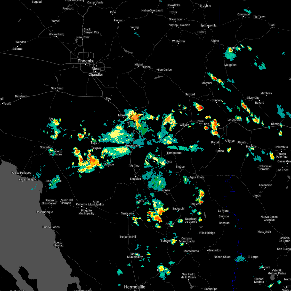 The severe thunderstorm warning for northeastern pima and southeastern pinal counties will expire at 330 pm mst, the storm which prompted the warning has weakened below severe limits, and no longer poses an immediate threat to life or property. therefore, the warning will be allowed to expire. however gusty winds and heavy rain are still possible with this thunderstorm. to report severe weather, contact your nearest law enforcement agency. they will relay your report to the national weather service tucson. The severe thunderstorm warning for northeastern pima and southeastern pinal counties will expire at 330 pm mst, the storm which prompted the warning has weakened below severe limits, and no longer poses an immediate threat to life or property. therefore, the warning will be allowed to expire. however gusty winds and heavy rain are still possible with this thunderstorm. to report severe weather, contact your nearest law enforcement agency. they will relay your report to the national weather service tucson.
|
| 7/24/2022 3:06 PM MST |
 At 306 pm mst, a severe thunderstorm was located over oro valley, and is nearly stationary (radar indicated). Hazards include 60 mph wind gusts and quarter size hail. Hail damage to vehicles is expected. expect wind damage to roofs, siding, and trees. locations impacted include, catalina, oro valley, marana, tortolita and catalina state park. hail threat, radar indicated max hail size, 1. 00 in wind threat, radar indicated max wind gust, 60 mph. At 306 pm mst, a severe thunderstorm was located over oro valley, and is nearly stationary (radar indicated). Hazards include 60 mph wind gusts and quarter size hail. Hail damage to vehicles is expected. expect wind damage to roofs, siding, and trees. locations impacted include, catalina, oro valley, marana, tortolita and catalina state park. hail threat, radar indicated max hail size, 1. 00 in wind threat, radar indicated max wind gust, 60 mph.
|
| 7/24/2022 2:37 PM MST |
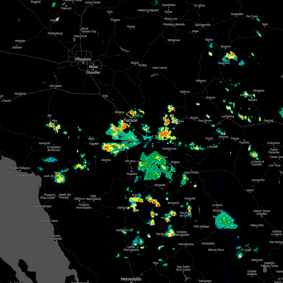 At 237 pm mst, a severe thunderstorm was located over oro valley, and is nearly stationary (radar indicated). Hazards include 60 mph wind gusts and quarter size hail. Hail damage to vehicles is expected. Expect wind damage to roofs, siding, and trees. At 237 pm mst, a severe thunderstorm was located over oro valley, and is nearly stationary (radar indicated). Hazards include 60 mph wind gusts and quarter size hail. Hail damage to vehicles is expected. Expect wind damage to roofs, siding, and trees.
|
| 7/16/2022 7:25 PM MST |
 The severe thunderstorm warning for northeastern pima and south central pinal counties will expire at 730 pm mst, the storm which prompted the warning has weakened below severe limits, and no longer poses an immediate threat to life or property. therefore, the warning will be allowed to expire. The severe thunderstorm warning for northeastern pima and south central pinal counties will expire at 730 pm mst, the storm which prompted the warning has weakened below severe limits, and no longer poses an immediate threat to life or property. therefore, the warning will be allowed to expire.
|
| 7/16/2022 7:06 PM MST |
 At 706 pm mst, a severe thunderstorm was located 11 miles north of marana, moving southwest at 20 mph (radar indicated). Hazards include 60 mph wind gusts and quarter size hail. Hail damage to vehicles is expected. expect wind damage to roofs, siding, and trees. locations impacted include, marana, saddlebrooke, dove mountain and oracle junction. hail threat, radar indicated max hail size, 1. 00 in wind threat, radar indicated max wind gust, 60 mph. At 706 pm mst, a severe thunderstorm was located 11 miles north of marana, moving southwest at 20 mph (radar indicated). Hazards include 60 mph wind gusts and quarter size hail. Hail damage to vehicles is expected. expect wind damage to roofs, siding, and trees. locations impacted include, marana, saddlebrooke, dove mountain and oracle junction. hail threat, radar indicated max hail size, 1. 00 in wind threat, radar indicated max wind gust, 60 mph.
|
| 7/16/2022 6:48 PM MST |
 At 647 pm mst, a severe thunderstorm was located near saddlebrooke, or 8 miles northwest of catalina, moving southwest at 25 mph (radar indicated). Hazards include 60 mph wind gusts and quarter size hail. Hail damage to vehicles is expected. Expect wind damage to roofs, siding, and trees. At 647 pm mst, a severe thunderstorm was located near saddlebrooke, or 8 miles northwest of catalina, moving southwest at 25 mph (radar indicated). Hazards include 60 mph wind gusts and quarter size hail. Hail damage to vehicles is expected. Expect wind damage to roofs, siding, and trees.
|
| 7/15/2022 5:27 PM MST |
 At 527 pm mst, a severe thunderstorm was located near marana, moving northwest at 5 mph (radar indicated). Hazards include 60 mph wind gusts and quarter size hail. Hail damage to vehicles is expected. expect wind damage to roofs, siding, and trees. locations impacted include, marana, avra valley, picture rocks and dove mountain. hail threat, radar indicated max hail size, 1. 00 in wind threat, radar indicated max wind gust, 60 mph. At 527 pm mst, a severe thunderstorm was located near marana, moving northwest at 5 mph (radar indicated). Hazards include 60 mph wind gusts and quarter size hail. Hail damage to vehicles is expected. expect wind damage to roofs, siding, and trees. locations impacted include, marana, avra valley, picture rocks and dove mountain. hail threat, radar indicated max hail size, 1. 00 in wind threat, radar indicated max wind gust, 60 mph.
|
| 7/15/2022 5:00 PM MST |
 At 500 pm mst, a severe thunderstorm was located near marana, moving northwest at 5 mph (radar indicated). Hazards include 60 mph wind gusts and quarter size hail. Hail damage to vehicles is expected. expect wind damage to roofs, siding, and trees. Blowing dust may also reduce visibility to one mile or less. At 500 pm mst, a severe thunderstorm was located near marana, moving northwest at 5 mph (radar indicated). Hazards include 60 mph wind gusts and quarter size hail. Hail damage to vehicles is expected. expect wind damage to roofs, siding, and trees. Blowing dust may also reduce visibility to one mile or less.
|
| 7/14/2022 4:35 PM MST |
 At 434 pm mst, a severe thunderstorm was located near avra valley, or 12 miles southwest of marana, moving west at 15 mph (radar indicated). Hazards include 60 mph wind gusts. Expect damage to roofs, siding, and trees. locations impacted include, marana, avra valley, saguaro national park west, picture rocks and silver bell. hail threat, radar indicated max hail size, <. 75 in wind threat, radar indicated max wind gust, 60 mph. At 434 pm mst, a severe thunderstorm was located near avra valley, or 12 miles southwest of marana, moving west at 15 mph (radar indicated). Hazards include 60 mph wind gusts. Expect damage to roofs, siding, and trees. locations impacted include, marana, avra valley, saguaro national park west, picture rocks and silver bell. hail threat, radar indicated max hail size, <. 75 in wind threat, radar indicated max wind gust, 60 mph.
|
| 7/14/2022 4:23 PM MST |
 At 423 pm mst, a severe thunderstorm was located 7 miles west of saguaro national park west, or 10 miles southwest of marana, moving west at 15 mph (radar indicated). Hazards include 60 mph wind gusts and quarter size hail. Hail damage to vehicles is expected. Expect wind damage to roofs, siding, and trees. At 423 pm mst, a severe thunderstorm was located 7 miles west of saguaro national park west, or 10 miles southwest of marana, moving west at 15 mph (radar indicated). Hazards include 60 mph wind gusts and quarter size hail. Hail damage to vehicles is expected. Expect wind damage to roofs, siding, and trees.
|
| 7/1/2022 3:56 PM MST |
 The severe thunderstorm warning for northeastern pima county will expire at 400 pm mst, the storm which prompted the warning has weakened below severe limits, and no longer poses an immediate threat to life or property. therefore, the warning will be allowed to expire. however small hail, gusty winds and heavy rain are still possible with this thunderstorm. flash flooding is likely ongoing in the area. to report severe weather, contact your nearest law enforcement agency. they will relay your report to the national weather service tucson. The severe thunderstorm warning for northeastern pima county will expire at 400 pm mst, the storm which prompted the warning has weakened below severe limits, and no longer poses an immediate threat to life or property. therefore, the warning will be allowed to expire. however small hail, gusty winds and heavy rain are still possible with this thunderstorm. flash flooding is likely ongoing in the area. to report severe weather, contact your nearest law enforcement agency. they will relay your report to the national weather service tucson.
|
| 7/1/2022 3:16 PM MST |
 At 316 pm mst, a severe thunderstorm was located over casas adobes, or near oro valley, and is nearly stationary (radar indicated). Hazards include 60 mph wind gusts and quarter size hail. Hail damage to vehicles is expected. expect wind damage to roofs, siding, and trees. locations impacted include, tucson, oro valley, marana, casas adobes, flowing wells, tortolita, catalina foothills and catalina state park. hail threat, radar indicated max hail size, 1. 00 in wind threat, radar indicated max wind gust, 60 mph. At 316 pm mst, a severe thunderstorm was located over casas adobes, or near oro valley, and is nearly stationary (radar indicated). Hazards include 60 mph wind gusts and quarter size hail. Hail damage to vehicles is expected. expect wind damage to roofs, siding, and trees. locations impacted include, tucson, oro valley, marana, casas adobes, flowing wells, tortolita, catalina foothills and catalina state park. hail threat, radar indicated max hail size, 1. 00 in wind threat, radar indicated max wind gust, 60 mph.
|
| 7/1/2022 3:09 PM MST |
 At 308 pm mst, a severe thunderstorm was located over casas adobes, or near oro valley, and is nearly stationary (radar indicated). Hazards include 60 mph wind gusts and penny size hail. expect damage to roofs, siding, and trees At 308 pm mst, a severe thunderstorm was located over casas adobes, or near oro valley, and is nearly stationary (radar indicated). Hazards include 60 mph wind gusts and penny size hail. expect damage to roofs, siding, and trees
|
| 9/5/2021 6:40 PM MST |
 The severe thunderstorm warning for northern pima and southeastern pinal counties will expire at 645 pm mst, the storm which prompted the warning has weakened below severe limits, and no longer poses an immediate threat to life or property. therefore, the warning will be allowed to expire. however gusty winds and heavy rain are still possible with this thunderstorm. to report severe weather, contact your nearest law enforcement agency. they will relay your report to the national weather service tucson. The severe thunderstorm warning for northern pima and southeastern pinal counties will expire at 645 pm mst, the storm which prompted the warning has weakened below severe limits, and no longer poses an immediate threat to life or property. therefore, the warning will be allowed to expire. however gusty winds and heavy rain are still possible with this thunderstorm. to report severe weather, contact your nearest law enforcement agency. they will relay your report to the national weather service tucson.
|
| 9/5/2021 6:20 PM MST |
 At 620 pm mst, a severe thunderstorm was located near saddlebrooke, or near oracle, moving southwest at 25 mph (radar indicated). Hazards include 60 mph wind gusts and penny size hail. Expect damage to roofs, siding, and trees. locations impacted include, catalina, oro valley, marana, oracle, saddlebrooke, tortolita, catalina state park, oracle junction, biosphere 2 and dove mountain. hail threat, radar indicated max hail size, 0. 75 in wind threat, radar indicated max wind gust, 60 mph. At 620 pm mst, a severe thunderstorm was located near saddlebrooke, or near oracle, moving southwest at 25 mph (radar indicated). Hazards include 60 mph wind gusts and penny size hail. Expect damage to roofs, siding, and trees. locations impacted include, catalina, oro valley, marana, oracle, saddlebrooke, tortolita, catalina state park, oracle junction, biosphere 2 and dove mountain. hail threat, radar indicated max hail size, 0. 75 in wind threat, radar indicated max wind gust, 60 mph.
|
| 9/5/2021 5:58 PM MST |
 At 558 pm mst, severe thunderstorms were located along a line extending from 6 miles southeast of dudleyville to 10 miles north of oracle to 17 miles north of saddlebrooke to 18 miles southwest of kearny, moving southwest at 25 mph (radar indicated). Hazards include 60 mph wind gusts. expect damage to roofs, siding, and trees At 558 pm mst, severe thunderstorms were located along a line extending from 6 miles southeast of dudleyville to 10 miles north of oracle to 17 miles north of saddlebrooke to 18 miles southwest of kearny, moving southwest at 25 mph (radar indicated). Hazards include 60 mph wind gusts. expect damage to roofs, siding, and trees
|
| 9/5/2021 4:46 PM MST |
 At 442 pm mst, a severe thunderstorm was located near catalina foothills and northern tucson, or 7 miles north of tucson, moving southwest at 10 mph. the storm near mid-town and south tucson has weakened below severe limits (radar indicated). Hazards include 60 mph wind gusts. Expect damage to roofs, siding, and trees. locations impacted include, northern tucson, oro valley, casas adobes, drexel heights, flowing wells, tortolita, sabino canyon recreation area, catalina foothills, tucson estates and picture rocks. hail threat, radar indicated max hail size, <. 75 in wind threat, radar indicated max wind gust, 60 mph. At 442 pm mst, a severe thunderstorm was located near catalina foothills and northern tucson, or 7 miles north of tucson, moving southwest at 10 mph. the storm near mid-town and south tucson has weakened below severe limits (radar indicated). Hazards include 60 mph wind gusts. Expect damage to roofs, siding, and trees. locations impacted include, northern tucson, oro valley, casas adobes, drexel heights, flowing wells, tortolita, sabino canyon recreation area, catalina foothills, tucson estates and picture rocks. hail threat, radar indicated max hail size, <. 75 in wind threat, radar indicated max wind gust, 60 mph.
|
| 9/5/2021 4:30 PM MST |
 At 429 pm mst, a severe thunderstorm was located near central and western tucson, moving west at 10 mph (radar indicated). Hazards include 60 mph wind gusts. expect damage to roofs, siding, and trees At 429 pm mst, a severe thunderstorm was located near central and western tucson, moving west at 10 mph (radar indicated). Hazards include 60 mph wind gusts. expect damage to roofs, siding, and trees
|
| 9/5/2021 4:14 PM MST |
 At 413 pm mst, a severe thunderstorm was located near catalina foothills, or near tucson, moving west at 15 mph (radar indicated). Hazards include 60 mph wind gusts and penny size hail. Expect damage to roofs, siding, and trees. locations impacted include, tucson, catalina, oro valley, marana, davis-monthan air force base, casas adobes, drexel heights, flowing wells, tanque verde, south tucson, tortolita, mount lemmon/summerhaven, sabino canyon recreation area, catalina state park, catalina foothills, saguaro national park west, tucson estates, picture rocks, dove mountain and seven falls. hail threat, radar indicated max hail size, 0. 75 in wind threat, radar indicated max wind gust, 60 mph. At 413 pm mst, a severe thunderstorm was located near catalina foothills, or near tucson, moving west at 15 mph (radar indicated). Hazards include 60 mph wind gusts and penny size hail. Expect damage to roofs, siding, and trees. locations impacted include, tucson, catalina, oro valley, marana, davis-monthan air force base, casas adobes, drexel heights, flowing wells, tanque verde, south tucson, tortolita, mount lemmon/summerhaven, sabino canyon recreation area, catalina state park, catalina foothills, saguaro national park west, tucson estates, picture rocks, dove mountain and seven falls. hail threat, radar indicated max hail size, 0. 75 in wind threat, radar indicated max wind gust, 60 mph.
|
| 9/5/2021 3:52 PM MST |
 At 351 pm mst, a severe thunderstorm was located near tanque verde, or 10 miles northeast of davis-monthan air force base, moving west at 15 to 20 mph (radar indicated). Hazards include 60 mph wind gusts and penny size hail. expect damage to roofs, siding, and trees At 351 pm mst, a severe thunderstorm was located near tanque verde, or 10 miles northeast of davis-monthan air force base, moving west at 15 to 20 mph (radar indicated). Hazards include 60 mph wind gusts and penny size hail. expect damage to roofs, siding, and trees
|
| 8/29/2021 6:53 PM MST |
 At 652 pm mst, a severe thunderstorm was located over casas adobes, or near oro valley, moving west at 10 mph (trained weather spotters). Hazards include 60 mph wind gusts. expect damage to roofs, siding, and trees At 652 pm mst, a severe thunderstorm was located over casas adobes, or near oro valley, moving west at 10 mph (trained weather spotters). Hazards include 60 mph wind gusts. expect damage to roofs, siding, and trees
|
| 8/29/2021 5:00 PM MST | Multiple trees down on dove mtn blvd north of moore r in pima county AZ, 4.8 miles SSW of Marana, AZ |
| 8/28/2021 5:57 PM MST |
 The severe thunderstorm warning for northeastern pima and southeastern pinal counties will expire at 600 pm mst, the storms which prompted the warning have weakened below severe limits, and no longer pose an immediate threat to life or property. therefore, the warning will be allowed to expire. however gusty winds and heavy rain are still possible with these thunderstorms. a flash flood warning remains in effect for much of the region. The severe thunderstorm warning for northeastern pima and southeastern pinal counties will expire at 600 pm mst, the storms which prompted the warning have weakened below severe limits, and no longer pose an immediate threat to life or property. therefore, the warning will be allowed to expire. however gusty winds and heavy rain are still possible with these thunderstorms. a flash flood warning remains in effect for much of the region.
|
| 8/28/2021 5:27 PM MST |
 At 525 pm mst, severe thunderstorms were located along a line extending from 6 miles north of saddlebrooke to near casas adobes, moving west at 15 mph (radar indicated). Hazards include 60 mph wind gusts and penny size hail. Expect damage to roofs, siding, and trees. locations impacted include, marana, flowing wells, saddlebrooke, avra valley, tortolita, saguaro national park west, picture rocks, red rock, dove mountain hail threat, radar indicated max hail size, 0. 75 in wind threat, radar indicated max wind gust, 60 mph. At 525 pm mst, severe thunderstorms were located along a line extending from 6 miles north of saddlebrooke to near casas adobes, moving west at 15 mph (radar indicated). Hazards include 60 mph wind gusts and penny size hail. Expect damage to roofs, siding, and trees. locations impacted include, marana, flowing wells, saddlebrooke, avra valley, tortolita, saguaro national park west, picture rocks, red rock, dove mountain hail threat, radar indicated max hail size, 0. 75 in wind threat, radar indicated max wind gust, 60 mph.
|
| 8/28/2021 4:58 PM MST |
 At 457 pm mst, severe thunderstorms were located along a line extending from oracle to near flowing wells, moving west at 15 mph (radar indicated). Hazards include 60 mph wind gusts and penny size hail. expect damage to roofs, siding, and trees At 457 pm mst, severe thunderstorms were located along a line extending from oracle to near flowing wells, moving west at 15 mph (radar indicated). Hazards include 60 mph wind gusts and penny size hail. expect damage to roofs, siding, and trees
|
| 8/28/2021 3:58 PM MST |
 At 356 pm mst, a severe thunderstorm was located near sabino canyon recreation area, or 9 miles northeast of davis-monthan air force base, moving west at 15 mph (radar indicated). Hazards include 60 mph wind gusts and penny size hail. expect damage to roofs, siding, and trees At 356 pm mst, a severe thunderstorm was located near sabino canyon recreation area, or 9 miles northeast of davis-monthan air force base, moving west at 15 mph (radar indicated). Hazards include 60 mph wind gusts and penny size hail. expect damage to roofs, siding, and trees
|
| 8/16/2021 11:37 PM MST |
 The severe thunderstorm warning for eastern pinal county will expire at 1145 pm mst, the storm which prompted the warning has weakened below severe limits, and no longer poses an immediate threat to life or property. therefore, the warning will be allowed to expire. however gusty winds and brief heavy rain are still possible with these thunderstorms. a severe thunderstorm watch remains in effect until midnight mst for southeastern arizona. The severe thunderstorm warning for eastern pinal county will expire at 1145 pm mst, the storm which prompted the warning has weakened below severe limits, and no longer poses an immediate threat to life or property. therefore, the warning will be allowed to expire. however gusty winds and brief heavy rain are still possible with these thunderstorms. a severe thunderstorm watch remains in effect until midnight mst for southeastern arizona.
|
| 8/16/2021 11:09 PM MST |
 At 1108 pm mst, a severe thunderstorm was located 10 miles northwest of saddlebrooke, or 12 miles northwest of catalina, moving south at 15 mph (radar indicated). Hazards include 60 mph wind gusts and quarter size hail. Hail damage to vehicles is expected. expect wind damage to roofs, siding, and trees. locations impacted include, oracle, saddlebrooke, cactus forest, campo bonito, biosphere 2 and oracle junction. hail threat, radar indicated max hail size, 1. 00 in wind threat, radar indicated max wind gust, 60 mph. At 1108 pm mst, a severe thunderstorm was located 10 miles northwest of saddlebrooke, or 12 miles northwest of catalina, moving south at 15 mph (radar indicated). Hazards include 60 mph wind gusts and quarter size hail. Hail damage to vehicles is expected. expect wind damage to roofs, siding, and trees. locations impacted include, oracle, saddlebrooke, cactus forest, campo bonito, biosphere 2 and oracle junction. hail threat, radar indicated max hail size, 1. 00 in wind threat, radar indicated max wind gust, 60 mph.
|
| 8/16/2021 10:41 PM MST |
 At 1039 pm mst, several severe thunderstorms were impacting mammoth, san manuel and oracle. additional storms were impacting kearny and kelvin. movement of storms is generally to the south at 15 mph (radar indicated). Hazards include 60 mph wind gusts and quarter size hail. Hail damage to vehicles is expected. expect wind damage to roofs, siding, and trees. locations impacted include, oracle, mammoth, saddlebrooke, san manuel, kearny, dudleyville, aravaipa canyon wilderness, cactus forest, campo bonito, kelvin, oracle junction, biosphere 2 and san carlos reservoir. hail threat, radar indicated max hail size, 1. 00 in wind threat, radar indicated max wind gust, 60 mph. At 1039 pm mst, several severe thunderstorms were impacting mammoth, san manuel and oracle. additional storms were impacting kearny and kelvin. movement of storms is generally to the south at 15 mph (radar indicated). Hazards include 60 mph wind gusts and quarter size hail. Hail damage to vehicles is expected. expect wind damage to roofs, siding, and trees. locations impacted include, oracle, mammoth, saddlebrooke, san manuel, kearny, dudleyville, aravaipa canyon wilderness, cactus forest, campo bonito, kelvin, oracle junction, biosphere 2 and san carlos reservoir. hail threat, radar indicated max hail size, 1. 00 in wind threat, radar indicated max wind gust, 60 mph.
|
| 8/16/2021 10:24 PM MST |
 At 1023 pm mst, a several severe thunderstorms across eastern pinal county. one was located near mammoth while another one was approaching kearny. these storms were movint to the south around 10 to 15 mph (radar indicated). Hazards include 60 mph wind gusts. expect damage to roofs, siding, and trees At 1023 pm mst, a several severe thunderstorms across eastern pinal county. one was located near mammoth while another one was approaching kearny. these storms were movint to the south around 10 to 15 mph (radar indicated). Hazards include 60 mph wind gusts. expect damage to roofs, siding, and trees
|
| 7/30/2021 8:42 PM MST |
 At 840 pm mst, a severe thunderstorm was located over central and southern tucson, moving northwest at 15 mph. a wind gust to 55 mph was measured at davis monthan afb (radar indicated). Hazards include 60 mph wind gusts. Expect damage to roofs, siding, and trees. locations impacted include, tucson, marana, davis-monthan air force base, casas adobes, drexel heights, flowing wells, south tucson, tortolita, tucson estates, saguaro national park west, tucson international airport, and valencia west. this includes the following highways, interstate 10 between mile markers 246 and 267. interstate 19 between mile markers 58 and 63. route 77 between mile markers 70 and 73. Route 86 between mile markers 163 and 171. At 840 pm mst, a severe thunderstorm was located over central and southern tucson, moving northwest at 15 mph. a wind gust to 55 mph was measured at davis monthan afb (radar indicated). Hazards include 60 mph wind gusts. Expect damage to roofs, siding, and trees. locations impacted include, tucson, marana, davis-monthan air force base, casas adobes, drexel heights, flowing wells, south tucson, tortolita, tucson estates, saguaro national park west, tucson international airport, and valencia west. this includes the following highways, interstate 10 between mile markers 246 and 267. interstate 19 between mile markers 58 and 63. route 77 between mile markers 70 and 73. Route 86 between mile markers 163 and 171.
|
| 7/30/2021 8:20 PM MST |
 At 819 pm mst, a severe thunderstorm was located over south tucson, or near tucson, moving northwest at 15 mph (radar indicated). Hazards include 60 mph wind gusts. expect damage to roofs, siding, and trees At 819 pm mst, a severe thunderstorm was located over south tucson, or near tucson, moving northwest at 15 mph (radar indicated). Hazards include 60 mph wind gusts. expect damage to roofs, siding, and trees
|
| 7/23/2021 1:26 AM MST |
 The severe thunderstorm warning for north central pima county will expire at 130 am mst, the storms which prompted the warning have weakened below severe limits, and the warning will be allowed to expire. torrential rain is still occurring with these storms with a flash flood warning still in effect through 400 am mst. with saturated ground, wind gusts to 40 mph will be sufficient to uproot some trees. The severe thunderstorm warning for north central pima county will expire at 130 am mst, the storms which prompted the warning have weakened below severe limits, and the warning will be allowed to expire. torrential rain is still occurring with these storms with a flash flood warning still in effect through 400 am mst. with saturated ground, wind gusts to 40 mph will be sufficient to uproot some trees.
|
| 7/23/2021 12:46 AM MST |
 At 1245 am mst, an area of severe thunderstorms with torrential rainfall was located near silver bell and avra valley, moving west at 15 mph (radar indicated). Hazards include 60 mph wind gusts and torrential rainfall leading to flash flooding. expect damage to roofs, siding, and trees At 1245 am mst, an area of severe thunderstorms with torrential rainfall was located near silver bell and avra valley, moving west at 15 mph (radar indicated). Hazards include 60 mph wind gusts and torrential rainfall leading to flash flooding. expect damage to roofs, siding, and trees
|
| 7/23/2021 12:20 AM MST |
 At 1217 am mst, an area of severe thunderstorms with extremely heavy rainfall was located near northwest tucson and marana, moving northwest at 15 mph (radar indicated). Hazards include 60 mph wind gusts, torrential downpours. Expect damage to roofs, siding, and trees. locations impacted include, northwest tucson, catalina, oro valley, marana, sahuarita, casas adobes, drexel heights, flowing wells, three points, avra valley, tortolita, east sahuarita, sabino canyon recreation area, summit and tucson estates. this includes the following highways, interstate 10 between mile markers 233 and 280. interstate 19 between mile markers 45 and 63. route 77 between mile markers 70 and 86. route 86 between mile markers 150 and 171. Route 286 between mile markers 44 and 45. At 1217 am mst, an area of severe thunderstorms with extremely heavy rainfall was located near northwest tucson and marana, moving northwest at 15 mph (radar indicated). Hazards include 60 mph wind gusts, torrential downpours. Expect damage to roofs, siding, and trees. locations impacted include, northwest tucson, catalina, oro valley, marana, sahuarita, casas adobes, drexel heights, flowing wells, three points, avra valley, tortolita, east sahuarita, sabino canyon recreation area, summit and tucson estates. this includes the following highways, interstate 10 between mile markers 233 and 280. interstate 19 between mile markers 45 and 63. route 77 between mile markers 70 and 86. route 86 between mile markers 150 and 171. Route 286 between mile markers 44 and 45.
|
| 7/22/2021 11:45 PM MST |
 At 1144 pm mst, an area of severe thunderstorms was located over tucson, moving northwest at 15 mph (radar indicated). Hazards include 60 mph wind gusts. expect damage to roofs, siding, and trees At 1144 pm mst, an area of severe thunderstorms was located over tucson, moving northwest at 15 mph (radar indicated). Hazards include 60 mph wind gusts. expect damage to roofs, siding, and trees
|
| 7/22/2021 3:07 PM MST |
 At 307 pm mst, a severe thunderstorm was located 10 miles west of saguaro national park west, or 17 miles southwest of marana, moving north at 10 mph (radar indicated). Hazards include 60 mph wind gusts and quarter size hail. Hail damage to vehicles is expected. expect wind damage to roofs, siding, and trees. Locations impacted include, marana, avra valley, tucson estates, picture rocks and san pedro. At 307 pm mst, a severe thunderstorm was located 10 miles west of saguaro national park west, or 17 miles southwest of marana, moving north at 10 mph (radar indicated). Hazards include 60 mph wind gusts and quarter size hail. Hail damage to vehicles is expected. expect wind damage to roofs, siding, and trees. Locations impacted include, marana, avra valley, tucson estates, picture rocks and san pedro.
|
| 7/22/2021 2:51 PM MST |
 At 251 pm mst, a severe thunderstorm was located 9 miles north of three points, or 18 miles southwest of marana, moving north at 10 mph (radar indicated). Hazards include 60 mph wind gusts and quarter size hail. Hail damage to vehicles is expected. Expect wind damage to roofs, siding, and trees. At 251 pm mst, a severe thunderstorm was located 9 miles north of three points, or 18 miles southwest of marana, moving north at 10 mph (radar indicated). Hazards include 60 mph wind gusts and quarter size hail. Hail damage to vehicles is expected. Expect wind damage to roofs, siding, and trees.
|
| 7/20/2021 10:07 PM MST |
 The severe thunderstorm warning for northeastern pima and southeastern pinal counties will expire at 1015 pm mst, the storm which prompted the warning northwest of tucson has moved northwestward into southern pinal county. therefore, the warning will be allowed to expire. a warning continues for south central pinal county. The severe thunderstorm warning for northeastern pima and southeastern pinal counties will expire at 1015 pm mst, the storm which prompted the warning northwest of tucson has moved northwestward into southern pinal county. therefore, the warning will be allowed to expire. a warning continues for south central pinal county.
|
| 7/20/2021 9:24 PM MST |
 At 923 pm mst, an area of severe thunderstorms was located over near tortolita and oro valley, moving west at 10 mph (radar indicated). Hazards include 60 mph wind gusts and nickel size hail. expect damage to roofs, siding, and trees At 923 pm mst, an area of severe thunderstorms was located over near tortolita and oro valley, moving west at 10 mph (radar indicated). Hazards include 60 mph wind gusts and nickel size hail. expect damage to roofs, siding, and trees
|
| 7/20/2021 9:10 PM MST |
 The severe thunderstorm warning for northeastern pima county will expire at 915 pm mst, the storm which prompted the warning through central to northern tucson has weakened below severe limits, and has moved northwest the warned area. therefore, the warning will be allowed to expire. however heavy rain is still possible with this thunderstorm. The severe thunderstorm warning for northeastern pima county will expire at 915 pm mst, the storm which prompted the warning through central to northern tucson has weakened below severe limits, and has moved northwest the warned area. therefore, the warning will be allowed to expire. however heavy rain is still possible with this thunderstorm.
|
| 7/20/2021 8:37 PM MST |
 At 834 pm mst, a severe thunderstorm was located near north central to northeast tucson, moving west and northwest at 10 mph (radar indicated). Hazards include 60 mph wind gusts and quarter size hail. Hail damage to vehicles is expected. expect wind damage to roofs, siding, and trees. locations impacted include, tucson, davis-monthan air force base, casas adobes, drexel heights, flowing wells, tanque verde, tucson international airport, summit, catalina foothills, and tucson estates. this includes the following highways, interstate 10 between mile markers 251 and 272. interstate 19 between mile markers 54 and 63. route 77 between mile markers 70 and 72. Route 86 between mile markers 164 and 171. At 834 pm mst, a severe thunderstorm was located near north central to northeast tucson, moving west and northwest at 10 mph (radar indicated). Hazards include 60 mph wind gusts and quarter size hail. Hail damage to vehicles is expected. expect wind damage to roofs, siding, and trees. locations impacted include, tucson, davis-monthan air force base, casas adobes, drexel heights, flowing wells, tanque verde, tucson international airport, summit, catalina foothills, and tucson estates. this includes the following highways, interstate 10 between mile markers 251 and 272. interstate 19 between mile markers 54 and 63. route 77 between mile markers 70 and 72. Route 86 between mile markers 164 and 171.
|
| 7/20/2021 8:17 PM MST |
 At 816 pm mst, a severe thunderstorm was located near southeast tucson, moving west at 10 mph (radar indicated). Hazards include 60 mph wind gusts and quarter size hail. Hail damage to vehicles is expected. Expect wind damage to roofs, siding, and trees. At 816 pm mst, a severe thunderstorm was located near southeast tucson, moving west at 10 mph (radar indicated). Hazards include 60 mph wind gusts and quarter size hail. Hail damage to vehicles is expected. Expect wind damage to roofs, siding, and trees.
|
| 7/10/2021 8:12 PM MST |
 At 811 pm mst, a number of severe thunderstorms with strong winds are located over the tucson metro, moving west at 20 mph (radar indicated). Hazards include 60 mph wind gusts. expect damage to roofs, siding, and trees At 811 pm mst, a number of severe thunderstorms with strong winds are located over the tucson metro, moving west at 20 mph (radar indicated). Hazards include 60 mph wind gusts. expect damage to roofs, siding, and trees
|
| 7/10/2021 7:48 PM MST |
 At 748 pm mst, a severe thunderstorm was located over south tucson, or over tucson, moving west at 10 mph (radar indicated). Hazards include 60 mph wind gusts. Expect damage to roofs, siding, and trees. locations impacted include, tucson, catalina, oro valley, marana, davis-monthan air force base, casas adobes, drexel heights, flowing wells, tanque verde, south tucson, avra valley, pascua pueblo yaqui reservation, tortolita, mount lemmon/summerhaven, sabino canyon recreation area, tucson estates, saguaro national park west, valencia west, catalina state park and catalina foothills. this includes the following highways, interstate 10 between mile markers 233 and 277. interstate 19 between mile markers 54 and 63. route 77 between mile markers 70 and 86. Route 86 between mile markers 158 and 171. At 748 pm mst, a severe thunderstorm was located over south tucson, or over tucson, moving west at 10 mph (radar indicated). Hazards include 60 mph wind gusts. Expect damage to roofs, siding, and trees. locations impacted include, tucson, catalina, oro valley, marana, davis-monthan air force base, casas adobes, drexel heights, flowing wells, tanque verde, south tucson, avra valley, pascua pueblo yaqui reservation, tortolita, mount lemmon/summerhaven, sabino canyon recreation area, tucson estates, saguaro national park west, valencia west, catalina state park and catalina foothills. this includes the following highways, interstate 10 between mile markers 233 and 277. interstate 19 between mile markers 54 and 63. route 77 between mile markers 70 and 86. Route 86 between mile markers 158 and 171.
|
| 7/10/2021 7:14 PM MST |
 At 714 pm mst, a severe thunderstorm was located over tucson, moving west at 10 mph (radar indicated). Hazards include 60 mph wind gusts. expect damage to roofs, siding, and trees At 714 pm mst, a severe thunderstorm was located over tucson, moving west at 10 mph (radar indicated). Hazards include 60 mph wind gusts. expect damage to roofs, siding, and trees
|
| 7/2/2021 4:11 PM MST |
 The severe thunderstorm warning for northeastern pima county will expire at 415 pm mst, the storms which prompted the warning have weakened below severe limits, and no longer pose an immediate threat to life or property. therefore, the warning will be allowed to expire. however gusty winds and heavy rain are still possible with these thunderstorms. to report severe weather, contact your nearest law enforcement agency. they will relay your report to the national weather service tucson. The severe thunderstorm warning for northeastern pima county will expire at 415 pm mst, the storms which prompted the warning have weakened below severe limits, and no longer pose an immediate threat to life or property. therefore, the warning will be allowed to expire. however gusty winds and heavy rain are still possible with these thunderstorms. to report severe weather, contact your nearest law enforcement agency. they will relay your report to the national weather service tucson.
|
| 7/2/2021 3:55 PM MST |
 At 354 pm mst, severe thunderstorms were located along a line extending from near tucson estates to near saguaro national park west to tortolita, moving northwest at 15 mph (radar indicated). Hazards include 60 mph wind gusts. Expect damage to roofs, siding, and trees. locations impacted include, tucson, marana, casas adobes, flowing wells, avra valley, saguaro national park west, tucson estates, valencia west, picture rocks and ryan airfield. this includes the following highways, interstate 10 between mile markers 245 and 255. route 77 near mile marker 71. Route 86 near mile marker 160. At 354 pm mst, severe thunderstorms were located along a line extending from near tucson estates to near saguaro national park west to tortolita, moving northwest at 15 mph (radar indicated). Hazards include 60 mph wind gusts. Expect damage to roofs, siding, and trees. locations impacted include, tucson, marana, casas adobes, flowing wells, avra valley, saguaro national park west, tucson estates, valencia west, picture rocks and ryan airfield. this includes the following highways, interstate 10 between mile markers 245 and 255. route 77 near mile marker 71. Route 86 near mile marker 160.
|
| 7/2/2021 3:37 PM MST |
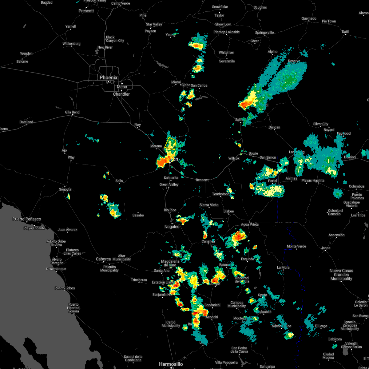 The severe thunderstorm warning for northeastern pima and southeastern pinal counties will expire at 345 pm mst, the storm which prompted the warning has moved out of the area. therefore, the warning will be allowed to expire. however gusty winds and heavy rain are still possible with this thunderstorm. The severe thunderstorm warning for northeastern pima and southeastern pinal counties will expire at 345 pm mst, the storm which prompted the warning has moved out of the area. therefore, the warning will be allowed to expire. however gusty winds and heavy rain are still possible with this thunderstorm.
|
| 7/2/2021 3:35 PM MST |
 At 335 pm mst, severe thunderstorms were located along a line extending from tucson estates to 7 miles northwest of valencia west to near saguaro national park west to near oro valley, moving northwest at 15 mph (radar indicated). Hazards include 60 mph wind gusts. expect damage to roofs, siding, and trees At 335 pm mst, severe thunderstorms were located along a line extending from tucson estates to 7 miles northwest of valencia west to near saguaro national park west to near oro valley, moving northwest at 15 mph (radar indicated). Hazards include 60 mph wind gusts. expect damage to roofs, siding, and trees
|
| 7/2/2021 3:16 PM MST |
 At 315 pm mst, a severe thunderstorm was located over catalina, moving west at 5 mph (radar indicated). Hazards include 60 mph wind gusts and penny size hail. Expect damage to roofs, siding, and trees. locations impacted include, catalina, oro valley, marana, saddlebrooke, tortolita, catalina state park and oracle junction. this includes the following highways, route 77 between mile markers 83 and 93. Route 79 between mile markers 92 and 95. At 315 pm mst, a severe thunderstorm was located over catalina, moving west at 5 mph (radar indicated). Hazards include 60 mph wind gusts and penny size hail. Expect damage to roofs, siding, and trees. locations impacted include, catalina, oro valley, marana, saddlebrooke, tortolita, catalina state park and oracle junction. this includes the following highways, route 77 between mile markers 83 and 93. Route 79 between mile markers 92 and 95.
|
| 7/2/2021 3:15 PM MST |
 At 314 pm mst, a severe thunderstorm was located over catalina foothills, or 7 miles southeast of oro valley, moving west at 10 mph (trained weather spotters). Hazards include 70 mph wind gusts and penny size hail. Expect considerable tree damage. damage is likely to mobile homes, roofs, and outbuildings. locations impacted include, tucson, oro valley, casas adobes, flowing wells, tortolita, catalina foothills and catalina state park. this includes the following highways, interstate 10 between mile markers 251 and 257. Route 77 between mile markers 70 and 82. At 314 pm mst, a severe thunderstorm was located over catalina foothills, or 7 miles southeast of oro valley, moving west at 10 mph (trained weather spotters). Hazards include 70 mph wind gusts and penny size hail. Expect considerable tree damage. damage is likely to mobile homes, roofs, and outbuildings. locations impacted include, tucson, oro valley, casas adobes, flowing wells, tortolita, catalina foothills and catalina state park. this includes the following highways, interstate 10 between mile markers 251 and 257. Route 77 between mile markers 70 and 82.
|
| 7/2/2021 3:01 PM MST |
 At 301 pm mst, a severe thunderstorm was located over catalina, moving west at 5 mph (radar indicated). Hazards include 60 mph wind gusts and quarter size hail. Hail damage to vehicles is expected. Expect wind damage to roofs, siding, and trees. At 301 pm mst, a severe thunderstorm was located over catalina, moving west at 5 mph (radar indicated). Hazards include 60 mph wind gusts and quarter size hail. Hail damage to vehicles is expected. Expect wind damage to roofs, siding, and trees.
|
| 7/2/2021 2:48 PM MST |
 At 248 pm mst, a severe thunderstorm was located over sabino canyon recreation area, or 9 miles north of tucson, moving west at 10 mph (radar indicated). Hazards include 60 mph wind gusts and penny size hail. expect damage to roofs, siding, and trees At 248 pm mst, a severe thunderstorm was located over sabino canyon recreation area, or 9 miles north of tucson, moving west at 10 mph (radar indicated). Hazards include 60 mph wind gusts and penny size hail. expect damage to roofs, siding, and trees
|
| 8/29/2020 5:28 PM MST |
 The severe thunderstorm warning for north central pima county will expire at 530 pm mst, the storm which prompted the warning has weakened below severe limits, and no longer poses an immediate threat to life or property. therefore, the warning will be allowed to expire. however heavy rain is still possible with these thunderstorms. a flood advisory remains in effect in this area until 715 pm for low water crossings and a flash flood watch is in effect for much of southeast arizona through sunday. The severe thunderstorm warning for north central pima county will expire at 530 pm mst, the storm which prompted the warning has weakened below severe limits, and no longer poses an immediate threat to life or property. therefore, the warning will be allowed to expire. however heavy rain is still possible with these thunderstorms. a flood advisory remains in effect in this area until 715 pm for low water crossings and a flash flood watch is in effect for much of southeast arizona through sunday.
|
| 8/29/2020 5:11 PM MST |
 At 509 pm mst, a severe thunderstorm was located near marana, moving northeast at 15 mph (radar indicated). Hazards include 60 mph wind gusts and penny size hail. Expect damage to roofs, siding, and trees. locations impacted include, marana, avra valley and picture rocks. This includes interstate 10 between mile markers 234 and 248. At 509 pm mst, a severe thunderstorm was located near marana, moving northeast at 15 mph (radar indicated). Hazards include 60 mph wind gusts and penny size hail. Expect damage to roofs, siding, and trees. locations impacted include, marana, avra valley and picture rocks. This includes interstate 10 between mile markers 234 and 248.
|
| 8/29/2020 4:53 PM MST |
 At 451 pm mst, a severe thunderstorm was located near marana, moving northeast at 10 mph (radar indicated). Hazards include 60 mph wind gusts and penny size hail. expect damage to roofs, siding, and trees At 451 pm mst, a severe thunderstorm was located near marana, moving northeast at 10 mph (radar indicated). Hazards include 60 mph wind gusts and penny size hail. expect damage to roofs, siding, and trees
|
| 8/16/2020 5:40 PM MST |
 The severe thunderstorm warning for north central pima county will expire at 545 pm mst, the storm which prompted the warning has weakened below severe limits, and no longer poses an immediate threat to life or property. therefore, the warning will be allowed to expire. however gusty winds and heavy rain are still possible with this thunderstorm. The severe thunderstorm warning for north central pima county will expire at 545 pm mst, the storm which prompted the warning has weakened below severe limits, and no longer poses an immediate threat to life or property. therefore, the warning will be allowed to expire. however gusty winds and heavy rain are still possible with this thunderstorm.
|
| 8/16/2020 5:28 PM MST |
 At 528 pm mst, a severe thunderstorm was located 8 miles west of tucson estates, or 17 miles southwest of marana, moving southwest at 5 mph (radar indicated). Hazards include 60 mph wind gusts and quarter size hail. blowing dust with less than one quarter of a mile visibility. Hail damage to vehicles is expected. expect wind damage to roofs, siding, and trees. locations impacted include, marana, three points, avra valley, saguaro national park west, tucson estates, picture rocks, san pedro, pan tak and silver bell. this includes the following highways, interstate 10 between mile markers 238 and 243. route 86 between mile markers 132 and 153. Route 286 between mile markers 42 and 45. At 528 pm mst, a severe thunderstorm was located 8 miles west of tucson estates, or 17 miles southwest of marana, moving southwest at 5 mph (radar indicated). Hazards include 60 mph wind gusts and quarter size hail. blowing dust with less than one quarter of a mile visibility. Hail damage to vehicles is expected. expect wind damage to roofs, siding, and trees. locations impacted include, marana, three points, avra valley, saguaro national park west, tucson estates, picture rocks, san pedro, pan tak and silver bell. this includes the following highways, interstate 10 between mile markers 238 and 243. route 86 between mile markers 132 and 153. Route 286 between mile markers 42 and 45.
|
| 8/16/2020 5:06 PM MST |
 At 505 pm mst, a severe thunderstorm was located 8 miles west of saguaro national park west, or 13 miles southwest of marana, moving west at 20 mph (radar indicated). Hazards include 60 mph wind gusts and quarter size hail. blowing dust with less than one quarter of a mile visibility possible. Hail damage to vehicles is expected. Expect wind damage to roofs, siding, and trees. At 505 pm mst, a severe thunderstorm was located 8 miles west of saguaro national park west, or 13 miles southwest of marana, moving west at 20 mph (radar indicated). Hazards include 60 mph wind gusts and quarter size hail. blowing dust with less than one quarter of a mile visibility possible. Hail damage to vehicles is expected. Expect wind damage to roofs, siding, and trees.
|
| 8/16/2020 4:25 PM MST |
 At 424 pm mst, severe thunderstorms were located along a line extending from near hayden to near catalina state park north of tucson, moving southwest at 10 to 15 mph (radar indicated). Hazards include 60 mph wind gusts and quarter size hail. Hail damage to vehicles is expected. Expect wind damage to roofs, siding, and trees. At 424 pm mst, severe thunderstorms were located along a line extending from near hayden to near catalina state park north of tucson, moving southwest at 10 to 15 mph (radar indicated). Hazards include 60 mph wind gusts and quarter size hail. Hail damage to vehicles is expected. Expect wind damage to roofs, siding, and trees.
|
| 8/16/2020 4:15 PM MST |
 At 415 pm mst, a severe thunderstorm was located over catalina state park, or over catalina, moving southwest at 15 mph (radar indicated). Hazards include 60 mph wind gusts and quarter size hail. Hail damage to vehicles is expected. expect wind damage to roofs, siding, and trees. locations impacted include, catalina, oro valley, marana, casas adobes, flowing wells, saddlebrooke, tortolita, mount lemmon/summerhaven, catalina state park, catalina foothills, dove mountain, oracle junction and biosphere 2. this includes the following highways, interstate 10 between mile markers 243 and 255. route 77 between mile markers 71 and 96. Route 79 between mile markers 92 and 94. At 415 pm mst, a severe thunderstorm was located over catalina state park, or over catalina, moving southwest at 15 mph (radar indicated). Hazards include 60 mph wind gusts and quarter size hail. Hail damage to vehicles is expected. expect wind damage to roofs, siding, and trees. locations impacted include, catalina, oro valley, marana, casas adobes, flowing wells, saddlebrooke, tortolita, mount lemmon/summerhaven, catalina state park, catalina foothills, dove mountain, oracle junction and biosphere 2. this includes the following highways, interstate 10 between mile markers 243 and 255. route 77 between mile markers 71 and 96. Route 79 between mile markers 92 and 94.
|
| 8/16/2020 3:53 PM MST |
 At 351 pm mst, a severe thunderstorm was located near catalina, moving southwest at 10 to 15 mph (radar indicated). Hazards include 60 mph wind gusts and quarter size hail. Hail damage to vehicles is expected. Expect wind damage to roofs, siding, and trees. At 351 pm mst, a severe thunderstorm was located near catalina, moving southwest at 10 to 15 mph (radar indicated). Hazards include 60 mph wind gusts and quarter size hail. Hail damage to vehicles is expected. Expect wind damage to roofs, siding, and trees.
|
| 8/16/2020 3:35 PM MST |
 At 335 pm mst, a severe thunderstorm was located over oro valley, moving west at 5 to 10 mph (radar indicated). Hazards include 60 mph wind gusts and nickel size hail. Expect damage to roofs, siding, and trees. locations impacted include, north tucson, catalina, oro valley, casas adobes, flowing wells, tortolita, catalina foothills, catalina state park and dove mountain. This includes route 77 between mile markers 70 and 87. At 335 pm mst, a severe thunderstorm was located over oro valley, moving west at 5 to 10 mph (radar indicated). Hazards include 60 mph wind gusts and nickel size hail. Expect damage to roofs, siding, and trees. locations impacted include, north tucson, catalina, oro valley, casas adobes, flowing wells, tortolita, catalina foothills, catalina state park and dove mountain. This includes route 77 between mile markers 70 and 87.
|
| 8/16/2020 3:15 PM MST |
 At 314 pm mst, a severe thunderstorm was located over catalina state park, or over oro valley, moving west at 5 to 10 mph (radar indicated). Hazards include 60 mph wind gusts and nickel size hail. expect damage to roofs, siding, and trees At 314 pm mst, a severe thunderstorm was located over catalina state park, or over oro valley, moving west at 5 to 10 mph (radar indicated). Hazards include 60 mph wind gusts and nickel size hail. expect damage to roofs, siding, and trees
|
| 7/11/2020 8:57 PM MST |
 The severe thunderstorm warning for northeastern pima and southeastern pinal counties will expire at 900 pm mst, the storm which prompted the warning has weakened below severe limits, and no longer poses a threat. therefore, the warning will be allowed to expire. however gusty winds are still possible. The severe thunderstorm warning for northeastern pima and southeastern pinal counties will expire at 900 pm mst, the storm which prompted the warning has weakened below severe limits, and no longer poses a threat. therefore, the warning will be allowed to expire. however gusty winds are still possible.
|
| 7/11/2020 8:23 PM MST |
 At 822 pm mst, a severe thunderstorm was located near tortolita and just west of marana, moving west at 15 mph (radar indicated). Hazards include 60 mph wind gusts, small hail, blowing dust, and brief heavy rain. expect damage to roofs, siding, and trees At 822 pm mst, a severe thunderstorm was located near tortolita and just west of marana, moving west at 15 mph (radar indicated). Hazards include 60 mph wind gusts, small hail, blowing dust, and brief heavy rain. expect damage to roofs, siding, and trees
|
| 12/9/2019 10:13 AM MST |
 The severe thunderstorm warning for north central pima and south central pinal counties will expire at 1015 am mst, the storms which prompted the warning have weakened below severe limits and are now moving eastward away from i-10. heavy rain and wind gusts to 40 mph are still possible with these thunderstorms. The severe thunderstorm warning for north central pima and south central pinal counties will expire at 1015 am mst, the storms which prompted the warning have weakened below severe limits and are now moving eastward away from i-10. heavy rain and wind gusts to 40 mph are still possible with these thunderstorms.
|
| 12/9/2019 9:57 AM MST |
 At 956 am mst, severe thunderstorms were located along a line extending from near picacho peak state park to 9 miles southwest of avra valley, moving east at 20 mph (radar indicated). Hazards include 60 mph wind gusts and large hail. Expect damage to roofs, siding, and trees. locations impacted include, marana, avra valley, picacho peak state park, picture rocks, red rock and silver bell. this includes the following highways, interstate 10 between mile markers 218 and 241. Route 79 between mile markers 102 and 108. At 956 am mst, severe thunderstorms were located along a line extending from near picacho peak state park to 9 miles southwest of avra valley, moving east at 20 mph (radar indicated). Hazards include 60 mph wind gusts and large hail. Expect damage to roofs, siding, and trees. locations impacted include, marana, avra valley, picacho peak state park, picture rocks, red rock and silver bell. this includes the following highways, interstate 10 between mile markers 218 and 241. Route 79 between mile markers 102 and 108.
|
| 12/9/2019 9:36 AM MST |
 At 935 am mst, severe thunderstorms were located along a line extending from picacho peak state park to 15 miles southwest of avra valley, moving east at 20 mph (radar indicated). Hazards include 60 mph wind gusts and penny size hail. expect damage to roofs, siding, and trees At 935 am mst, severe thunderstorms were located along a line extending from picacho peak state park to 15 miles southwest of avra valley, moving east at 20 mph (radar indicated). Hazards include 60 mph wind gusts and penny size hail. expect damage to roofs, siding, and trees
|
| 11/29/2019 6:58 AM MST |
 At 656 am mst, a line of scattered showers and thunderstorms extended across portions of the area, moving east at 40 mph (radar indicated). Hazards include 60 mph wind gusts. expect damage to roofs, siding, and trees At 656 am mst, a line of scattered showers and thunderstorms extended across portions of the area, moving east at 40 mph (radar indicated). Hazards include 60 mph wind gusts. expect damage to roofs, siding, and trees
|
| 11/29/2019 6:45 AM MST | Extensive tree damg in pima county AZ, 12.5 miles E of Marana, AZ |
| 11/29/2019 6:37 AM MST |
 At 636 am mst, a severe thunderstorm capable of producing a tornado was located near avra valley, or 7 miles west of marana, moving east at 15 mph (radar indicated rotation). Hazards include tornado. Flying debris will be dangerous to those caught without shelter. mobile homes will be damaged or destroyed. damage to roofs, windows, and vehicles will occur. tree damage is likely. this dangerous storm will be near, marana around 655 am mst. other locations impacted by this tornadic thunderstorm include red rock and picture rocks. This includes interstate 10 between mile markers 227 and 237. At 636 am mst, a severe thunderstorm capable of producing a tornado was located near avra valley, or 7 miles west of marana, moving east at 15 mph (radar indicated rotation). Hazards include tornado. Flying debris will be dangerous to those caught without shelter. mobile homes will be damaged or destroyed. damage to roofs, windows, and vehicles will occur. tree damage is likely. this dangerous storm will be near, marana around 655 am mst. other locations impacted by this tornadic thunderstorm include red rock and picture rocks. This includes interstate 10 between mile markers 227 and 237.
|
| 11/29/2019 6:36 AM MST | Roof damag in pima county AZ, 14 miles ENE of Marana, AZ |
| 11/29/2019 6:19 AM MST |
 At 617 am mst, a line of scattered showers and thunderstorms was located 13 miles west of avra valley, or 22 miles west of marana, moving east at 30 mph (radar indicated). Hazards include 60 mph wind gusts. expect damage to roofs, siding, and trees At 617 am mst, a line of scattered showers and thunderstorms was located 13 miles west of avra valley, or 22 miles west of marana, moving east at 30 mph (radar indicated). Hazards include 60 mph wind gusts. expect damage to roofs, siding, and trees
|
| 9/26/2019 4:10 PM MST |
 The severe thunderstorm warning for north central pima county will expire at 415 pm mst, the storms which prompted the warning around the marana, avra valley and picture rocks area has weakened below severe limits. therefore, the warning will be allowed to expire. however gusty winds are still possible from earlier outflows. The severe thunderstorm warning for north central pima county will expire at 415 pm mst, the storms which prompted the warning around the marana, avra valley and picture rocks area has weakened below severe limits. therefore, the warning will be allowed to expire. however gusty winds are still possible from earlier outflows.
|
| 9/26/2019 3:49 PM MST |
 At 347 pm mst, a severe thunderstorm capable of producing a tornado was located about 2 miles southwest of marana, moving northeast at 25 mph (radar indicated rotation, spotter seeing strong mid to lower level rotation). Hazards include tornado and half dollar size hail. Flying debris will be dangerous to those caught without shelter. mobile homes will be damaged or destroyed. damage to roofs, windows, and vehicles will occur. tree damage is likely. this dangerous storm will be near, marana around 355 pm mst. tortolita around 405 pm mst. other locations impacted by this tornadic thunderstorm include dove mountain and picture rocks. This includes interstate 10 between mile markers 237 and 246. At 347 pm mst, a severe thunderstorm capable of producing a tornado was located about 2 miles southwest of marana, moving northeast at 25 mph (radar indicated rotation, spotter seeing strong mid to lower level rotation). Hazards include tornado and half dollar size hail. Flying debris will be dangerous to those caught without shelter. mobile homes will be damaged or destroyed. damage to roofs, windows, and vehicles will occur. tree damage is likely. this dangerous storm will be near, marana around 355 pm mst. tortolita around 405 pm mst. other locations impacted by this tornadic thunderstorm include dove mountain and picture rocks. This includes interstate 10 between mile markers 237 and 246.
|
| 9/26/2019 3:41 PM MST |
 At 340 pm mst, a severe thunderstorm capable of producing a tornado was located near marana, moving northeast at 30 mph (radar indicated rotation). Hazards include tornado and quarter size hail. Flying debris will be dangerous to those caught without shelter. mobile homes will be damaged or destroyed. damage to roofs, windows, and vehicles will occur. tree damage is likely. this dangerous storm will be near, marana around 355 pm mst. tortolita around 405 pm mst. oro valley around 415 pm mst. other locations impacted by this tornadic thunderstorm include dove mountain and picture rocks. This includes interstate 10 between mile markers 237 and 246. At 340 pm mst, a severe thunderstorm capable of producing a tornado was located near marana, moving northeast at 30 mph (radar indicated rotation). Hazards include tornado and quarter size hail. Flying debris will be dangerous to those caught without shelter. mobile homes will be damaged or destroyed. damage to roofs, windows, and vehicles will occur. tree damage is likely. this dangerous storm will be near, marana around 355 pm mst. tortolita around 405 pm mst. oro valley around 415 pm mst. other locations impacted by this tornadic thunderstorm include dove mountain and picture rocks. This includes interstate 10 between mile markers 237 and 246.
|
| 9/26/2019 3:32 PM MST |
 At 332 pm mst, a severe thunderstorm was located near saguaro national park west, or 8 miles southwest of marana, moving northeast at 30 mph (radar indicated). Hazards include 60 mph wind gusts. expect damage to roofs, siding, and trees At 332 pm mst, a severe thunderstorm was located near saguaro national park west, or 8 miles southwest of marana, moving northeast at 30 mph (radar indicated). Hazards include 60 mph wind gusts. expect damage to roofs, siding, and trees
|
| 9/16/2019 4:06 PM MST |
 The severe thunderstorm warning for northeastern pima county will expire at 415 pm mst, the storm which prompted the warning has weakened below severe limits, and no longer poses an immediate threat to life or property. therefore, the warning will be allowed to expire. however heavy rain is still possible with this thunderstorm. The severe thunderstorm warning for northeastern pima county will expire at 415 pm mst, the storm which prompted the warning has weakened below severe limits, and no longer poses an immediate threat to life or property. therefore, the warning will be allowed to expire. however heavy rain is still possible with this thunderstorm.
|
| 9/16/2019 3:46 PM MST |
 At 346 pm mst, a severe thunderstorm was located over saguaro national park west, or 8 miles south of marana, and is nearly stationary (radar indicated). Hazards include 60 mph wind gusts and penny size hail. Expect damage to roofs, siding, and trees. locations impacted include, tucson, marana, casas adobes, flowing wells, tortolita, saguaro national park west and picture rocks. This includes interstate 10 between mile markers 245 and 254. At 346 pm mst, a severe thunderstorm was located over saguaro national park west, or 8 miles south of marana, and is nearly stationary (radar indicated). Hazards include 60 mph wind gusts and penny size hail. Expect damage to roofs, siding, and trees. locations impacted include, tucson, marana, casas adobes, flowing wells, tortolita, saguaro national park west and picture rocks. This includes interstate 10 between mile markers 245 and 254.
|
| 9/16/2019 3:27 PM MST |
 At 327 pm mst, a severe thunderstorm was located near saguaro national park west, or 7 miles south of marana, moving east at 5 mph (radar indicated). Hazards include 60 mph wind gusts and quarter size hail. Hail damage to vehicles is expected. Expect wind damage to roofs, siding, and trees. At 327 pm mst, a severe thunderstorm was located near saguaro national park west, or 7 miles south of marana, moving east at 5 mph (radar indicated). Hazards include 60 mph wind gusts and quarter size hail. Hail damage to vehicles is expected. Expect wind damage to roofs, siding, and trees.
|
| 9/16/2019 2:54 PM MST |
 At 235 pm mst, a severe thunderstorm was located 7 miles west of avra valley, or 15 miles west of marana, moving east at 10 mph (radar indicated). Hazards include 60 mph wind gusts and quarter size hail. Hail damage to vehicles is expected. expect wind damage to roofs, siding, and trees. locations impacted include, avra valley, picture rocks, red rock and silver bell. This includes interstate 10 between mile markers 224 and 226. At 235 pm mst, a severe thunderstorm was located 7 miles west of avra valley, or 15 miles west of marana, moving east at 10 mph (radar indicated). Hazards include 60 mph wind gusts and quarter size hail. Hail damage to vehicles is expected. expect wind damage to roofs, siding, and trees. locations impacted include, avra valley, picture rocks, red rock and silver bell. This includes interstate 10 between mile markers 224 and 226.
|
| 9/16/2019 2:36 PM MST |
 At 235 pm mst, a severe thunderstorm was located 7 miles west of avra valley, or 15 miles west of marana, moving east at 10 mph (radar indicated). Hazards include 60 mph wind gusts and quarter size hail. Hail damage to vehicles is expected. expect wind damage to roofs, siding, and trees. locations impacted include, avra valley, picture rocks, red rock and silver bell. This includes interstate 10 between mile markers 224 and 226. At 235 pm mst, a severe thunderstorm was located 7 miles west of avra valley, or 15 miles west of marana, moving east at 10 mph (radar indicated). Hazards include 60 mph wind gusts and quarter size hail. Hail damage to vehicles is expected. expect wind damage to roofs, siding, and trees. locations impacted include, avra valley, picture rocks, red rock and silver bell. This includes interstate 10 between mile markers 224 and 226.
|
| 9/16/2019 2:17 PM MST |
 At 215 pm mst, a severe thunderstorm was located 14 miles west of avra valley, or 22 miles west of marana, moving east at 10 mph. there is weak rotation in this storm (radar indicated). Hazards include 60 mph wind gusts and half dollar size hail. Hail damage to vehicles is expected. Expect wind damage to roofs, siding, and trees. At 215 pm mst, a severe thunderstorm was located 14 miles west of avra valley, or 22 miles west of marana, moving east at 10 mph. there is weak rotation in this storm (radar indicated). Hazards include 60 mph wind gusts and half dollar size hail. Hail damage to vehicles is expected. Expect wind damage to roofs, siding, and trees.
|
| 7/24/2019 6:10 PM MST |
 At 609 pm mst, severe thunderstorms were located along a line extending from near marana to 7 miles south of avra valley, moving northwest at 10 mph (radar indicated. a trained spotter near avra valley reported dime size hail associated with these storms). Hazards include 60 mph wind gusts and quarter size hail. Hail damage to vehicles is expected. expect wind damage to roofs, siding, and trees. locations impacted include, marana, avra valley, picture rocks, red rock, silver bell and dove mountain. this includes the following highways, interstate 10 between mile markers 225 and 243. Route 79 near mile marker 108. At 609 pm mst, severe thunderstorms were located along a line extending from near marana to 7 miles south of avra valley, moving northwest at 10 mph (radar indicated. a trained spotter near avra valley reported dime size hail associated with these storms). Hazards include 60 mph wind gusts and quarter size hail. Hail damage to vehicles is expected. expect wind damage to roofs, siding, and trees. locations impacted include, marana, avra valley, picture rocks, red rock, silver bell and dove mountain. this includes the following highways, interstate 10 between mile markers 225 and 243. Route 79 near mile marker 108.
|
| 7/24/2019 6:00 PM MST | Mesonet measurement from up560. i-10 approx 1 mile north of tangerine r in pima county AZ, 4.7 miles SE of Marana, AZ |
| 7/24/2019 6:00 PM MST | Public report via social media shows an overturned semi truck... viewed from i-10 southbound. time estimated from rada in pima county AZ, 8.7 miles SE of Marana, AZ |
| 7/24/2019 5:52 PM MST |
 At 551 pm mst, severe thunderstorms were located along a line extending from near tortolita to 6 miles northwest of saguaro national park west, moving northwest at 10 mph (radar indicated). Hazards include 60 mph wind gusts and quarter size hail. Hail damage to vehicles is expected. Expect wind damage to roofs, siding, and trees. At 551 pm mst, severe thunderstorms were located along a line extending from near tortolita to 6 miles northwest of saguaro national park west, moving northwest at 10 mph (radar indicated). Hazards include 60 mph wind gusts and quarter size hail. Hail damage to vehicles is expected. Expect wind damage to roofs, siding, and trees.
|
| 5/11/2019 8:25 PM MST |
 The severe thunderstorm warning for northeastern pima county will expire at 830 pm mst, the storm which prompted the warning has weakened below severe limits, and no longer poses an immediate threat to life or property. therefore, the warning will be allowed to expire. however gusty winds and heavy rain are still expected with this thunderstorm as it drifts to the west. The severe thunderstorm warning for northeastern pima county will expire at 830 pm mst, the storm which prompted the warning has weakened below severe limits, and no longer poses an immediate threat to life or property. therefore, the warning will be allowed to expire. however gusty winds and heavy rain are still expected with this thunderstorm as it drifts to the west.
|
| 5/11/2019 8:12 PM MST |
 At 808 pm mst, a severe thunderstorm located near saguaro national park west, or 7 miles southeast of marana, moving west-northwest at 15 mph (radar indicates the storm is moving to the west-northwest over drexel heights and the tucson heights area. strong gusts to 60 mph will proceed the storm. less of a threat exists for the oro valley area at this time). Hazards include 60 mph wind gusts. Expect damage to roofs, siding, and trees. locations impacted include, tucson, catalina, oro valley, marana, davis-monthan air force base, casas adobes, drexel heights, flowing wells, south tucson, three points, avra valley, pascua pueblo yaqui reservation, tortolita, summit, catalina state park, tucson estates, saguaro national park west, catalina foothills, valencia west and tucson international airport. this includes the following highways, interstate 10 between mile markers 233 and 268. interstate 19 between mile markers 51 and 63. route 77 between mile markers 70 and 85. Route 86 between mile markers 154 and 171. At 808 pm mst, a severe thunderstorm located near saguaro national park west, or 7 miles southeast of marana, moving west-northwest at 15 mph (radar indicates the storm is moving to the west-northwest over drexel heights and the tucson heights area. strong gusts to 60 mph will proceed the storm. less of a threat exists for the oro valley area at this time). Hazards include 60 mph wind gusts. Expect damage to roofs, siding, and trees. locations impacted include, tucson, catalina, oro valley, marana, davis-monthan air force base, casas adobes, drexel heights, flowing wells, south tucson, three points, avra valley, pascua pueblo yaqui reservation, tortolita, summit, catalina state park, tucson estates, saguaro national park west, catalina foothills, valencia west and tucson international airport. this includes the following highways, interstate 10 between mile markers 233 and 268. interstate 19 between mile markers 51 and 63. route 77 between mile markers 70 and 85. Route 86 between mile markers 154 and 171.
|
| 5/11/2019 7:45 PM MST |
 At 743 pm mst, a severe thunderstorm was located over drexel heights, or near tucson, moving northwest at 25 mph (radar and observation indicated). Hazards include 60 mph wind gusts. winds gusts to 53 mph at afb dm and 56 mph at tucson airport. strong damaging gusts will continue to move northwest. expect damage to roofs, siding, and trees At 743 pm mst, a severe thunderstorm was located over drexel heights, or near tucson, moving northwest at 25 mph (radar and observation indicated). Hazards include 60 mph wind gusts. winds gusts to 53 mph at afb dm and 56 mph at tucson airport. strong damaging gusts will continue to move northwest. expect damage to roofs, siding, and trees
|
| 10/23/2018 1:37 PM MST |
 At 137 pm mst, a severe thunderstorm was located 13 miles south of avra valley, or 15 miles southwest of marana, moving north at 20 mph (radar indicated). Hazards include 60 mph wind gusts and quarter size hail. Hail damage to vehicles is expected. expect wind damage to roofs, siding, and trees. Locations impacted include, marana, tucson estates, avra valley, saguaro national park west and picture rocks. At 137 pm mst, a severe thunderstorm was located 13 miles south of avra valley, or 15 miles southwest of marana, moving north at 20 mph (radar indicated). Hazards include 60 mph wind gusts and quarter size hail. Hail damage to vehicles is expected. expect wind damage to roofs, siding, and trees. Locations impacted include, marana, tucson estates, avra valley, saguaro national park west and picture rocks.
|
| 10/23/2018 1:22 PM MST |
 At 122 pm mst, a severe thunderstorm was located 11 miles northwest of three points, or 18 miles southwest of marana, moving north at 20 mph (radar indicated). Hazards include 60 mph wind gusts and quarter size hail. Hail damage to vehicles is expected. expect wind damage to roofs, siding, and trees. locations impacted include, marana, three points, valencia west, tucson estates, avra valley, saguaro national park west, picture rocks, ryan field, pan tak and san pedro. this includes the following highways, route 86 between mile markers 134 and 161. Route 286 between mile markers 42 and 45. At 122 pm mst, a severe thunderstorm was located 11 miles northwest of three points, or 18 miles southwest of marana, moving north at 20 mph (radar indicated). Hazards include 60 mph wind gusts and quarter size hail. Hail damage to vehicles is expected. expect wind damage to roofs, siding, and trees. locations impacted include, marana, three points, valencia west, tucson estates, avra valley, saguaro national park west, picture rocks, ryan field, pan tak and san pedro. this includes the following highways, route 86 between mile markers 134 and 161. Route 286 between mile markers 42 and 45.
|
| 10/23/2018 12:55 PM MST |
 At 1255 pm mst, a severe thunderstorm was located near three points, or 25 miles northwest of green valley, moving north at 20 mph (radar indicated). Hazards include 60 mph wind gusts and half dollar size hail. Hail damage to vehicles is expected. Expect wind damage to roofs, siding, and trees. At 1255 pm mst, a severe thunderstorm was located near three points, or 25 miles northwest of green valley, moving north at 20 mph (radar indicated). Hazards include 60 mph wind gusts and half dollar size hail. Hail damage to vehicles is expected. Expect wind damage to roofs, siding, and trees.
|
| 10/23/2018 12:43 PM MST |
 At 1243 pm mst, a severe thunderstorm was located near three points, or 20 miles south of marana, moving north at 20 mph (radar indicated). Hazards include ping pong ball size hail. People and animals outdoors will be injured. expect damage to roofs, siding, windows, and vehicles. locations impacted include, tucson, marana, green valley, sahuarita, east sahuarita, flowing wells, drexel heights, summit, tucson estates, three points, valencia west, casas adobes, avra valley, south tucson, ryan field, saguaro national park west, san xavier mission, picture rocks, tucson international airport and catalina foothills. this includes the following highways, interstate 10 between mile markers 248 and 263. interstate 19 between mile markers 38 and 63. route 77 between mile markers 70 and 75. route 86 between mile markers 145 and 171. Route 286 between mile markers 26 and 45. At 1243 pm mst, a severe thunderstorm was located near three points, or 20 miles south of marana, moving north at 20 mph (radar indicated). Hazards include ping pong ball size hail. People and animals outdoors will be injured. expect damage to roofs, siding, windows, and vehicles. locations impacted include, tucson, marana, green valley, sahuarita, east sahuarita, flowing wells, drexel heights, summit, tucson estates, three points, valencia west, casas adobes, avra valley, south tucson, ryan field, saguaro national park west, san xavier mission, picture rocks, tucson international airport and catalina foothills. this includes the following highways, interstate 10 between mile markers 248 and 263. interstate 19 between mile markers 38 and 63. route 77 between mile markers 70 and 75. route 86 between mile markers 145 and 171. Route 286 between mile markers 26 and 45.
|
| 10/23/2018 12:26 PM MST |
 At 1225 pm mst, a severe thunderstorm was located near tucson estates, or 14 miles west of tucson, moving north at 30 mph (radar indicated). Hazards include quarter size hail. Damage to vehicles is expected. locations impacted include, tucson, marana, green valley, sahuarita, east sahuarita, flowing wells, drexel heights, summit, tucson estates, three points, valencia west, casas adobes, avra valley, south tucson, ryan field, saguaro national park west, san xavier mission, picture rocks, tucson international airport and catalina foothills. this includes the following highways, interstate 10 between mile markers 248 and 263. interstate 19 between mile markers 38 and 63. route 77 between mile markers 70 and 75. route 86 between mile markers 145 and 171. Route 286 between mile markers 26 and 45. At 1225 pm mst, a severe thunderstorm was located near tucson estates, or 14 miles west of tucson, moving north at 30 mph (radar indicated). Hazards include quarter size hail. Damage to vehicles is expected. locations impacted include, tucson, marana, green valley, sahuarita, east sahuarita, flowing wells, drexel heights, summit, tucson estates, three points, valencia west, casas adobes, avra valley, south tucson, ryan field, saguaro national park west, san xavier mission, picture rocks, tucson international airport and catalina foothills. this includes the following highways, interstate 10 between mile markers 248 and 263. interstate 19 between mile markers 38 and 63. route 77 between mile markers 70 and 75. route 86 between mile markers 145 and 171. Route 286 between mile markers 26 and 45.
|
| 10/23/2018 11:56 AM MST |
 At 1155 am mst, a severe thunderstorm was located 10 miles northwest of green valley, moving north at 30 mph (radar indicated). Hazards include ping pong ball size hail and 60 mph wind gusts. People and animals outdoors will be injured. expect hail damage to roofs, siding, windows, and vehicles. Expect wind damage to roofs, siding, and trees. At 1155 am mst, a severe thunderstorm was located 10 miles northwest of green valley, moving north at 30 mph (radar indicated). Hazards include ping pong ball size hail and 60 mph wind gusts. People and animals outdoors will be injured. expect hail damage to roofs, siding, windows, and vehicles. Expect wind damage to roofs, siding, and trees.
|
| 10/21/2018 3:22 PM MST |
 The severe thunderstorm warning for northeastern pima county will expire at 330 pm mst, most of the storms which prompted the warning have weakened below severe limits, and no longer pose an immediate threat to life or property. thus, this warning will be allowed to expire. the strongest storm near sahuarita remains under a severe thunderstorm warning until 400 pm mst. gusty winds and heavy rain are still possible with these thunderstorms. The severe thunderstorm warning for northeastern pima county will expire at 330 pm mst, most of the storms which prompted the warning have weakened below severe limits, and no longer pose an immediate threat to life or property. thus, this warning will be allowed to expire. the strongest storm near sahuarita remains under a severe thunderstorm warning until 400 pm mst. gusty winds and heavy rain are still possible with these thunderstorms.
|
| 10/21/2018 3:01 PM MST |
 At 301 pm mst, severe thunderstorms were located along a line extending from 15 miles south of avra valley to 6 miles north of three points to 6 miles south of valencia west to near green valley, moving northeast at 20 mph (trained weather spotters). Hazards include 60 mph wind gusts and quarter size hail. Hail damage to vehicles is expected. expect wind damage to roofs, siding, and trees. locations impacted include, tucson, oro valley, marana, green valley, sahuarita, tortolita, summit, tucson estates, avra valley, drexel-alvernon, valencia west, east sahuarita, flowing wells, littletown, drexel heights, three points, casas adobes, south tucson, ryan field and dove mountain. this includes the following highways, interstate 10 between mile markers 235 and 276. interstate 19 between mile markers 40 and 63. route 77 between mile markers 70 and 78. route 86 between mile markers 148 and 171. Route 286 between mile markers 44 and 45. At 301 pm mst, severe thunderstorms were located along a line extending from 15 miles south of avra valley to 6 miles north of three points to 6 miles south of valencia west to near green valley, moving northeast at 20 mph (trained weather spotters). Hazards include 60 mph wind gusts and quarter size hail. Hail damage to vehicles is expected. expect wind damage to roofs, siding, and trees. locations impacted include, tucson, oro valley, marana, green valley, sahuarita, tortolita, summit, tucson estates, avra valley, drexel-alvernon, valencia west, east sahuarita, flowing wells, littletown, drexel heights, three points, casas adobes, south tucson, ryan field and dove mountain. this includes the following highways, interstate 10 between mile markers 235 and 276. interstate 19 between mile markers 40 and 63. route 77 between mile markers 70 and 78. route 86 between mile markers 148 and 171. Route 286 between mile markers 44 and 45.
|
| 10/21/2018 2:44 PM MST |
 At 243 pm mst, severe thunderstorms were located along a line extending from 17 miles west of tucson estates to near three points to 8 miles southwest of valencia west to near green valley, moving northeast at 25 mph. the strongest part of the storm is just west of sahuarita and likely producing damaging hail up to two inches in diameter (radar indicated). Hazards include two inch hail and 60 mph wind gusts. People and animals outdoors will be injured. expect hail damage to roofs, siding, windows, and vehicles. expect wind damage to roofs, siding, and trees. locations impacted include, tucson, oro valley, marana, green valley, sahuarita, tortolita, summit, tucson estates, avra valley, drexel-alvernon, valencia west, east sahuarita, flowing wells, littletown, drexel heights, three points, casas adobes, south tucson, ryan field and dove mountain. this includes the following highways, interstate 10 between mile markers 235 and 276. interstate 19 between mile markers 40 and 63. route 77 between mile markers 70 and 78. route 86 between mile markers 144 and 171. Route 286 between mile markers 40 and 45. At 243 pm mst, severe thunderstorms were located along a line extending from 17 miles west of tucson estates to near three points to 8 miles southwest of valencia west to near green valley, moving northeast at 25 mph. the strongest part of the storm is just west of sahuarita and likely producing damaging hail up to two inches in diameter (radar indicated). Hazards include two inch hail and 60 mph wind gusts. People and animals outdoors will be injured. expect hail damage to roofs, siding, windows, and vehicles. expect wind damage to roofs, siding, and trees. locations impacted include, tucson, oro valley, marana, green valley, sahuarita, tortolita, summit, tucson estates, avra valley, drexel-alvernon, valencia west, east sahuarita, flowing wells, littletown, drexel heights, three points, casas adobes, south tucson, ryan field and dove mountain. this includes the following highways, interstate 10 between mile markers 235 and 276. interstate 19 between mile markers 40 and 63. route 77 between mile markers 70 and 78. route 86 between mile markers 144 and 171. Route 286 between mile markers 40 and 45.
|
| 10/21/2018 2:30 PM MST |
 At 230 pm mst, severe thunderstorms were located along a line extending from 14 miles north of kitt peak to 6 miles south of three points to 10 miles southwest of green valley, moving northeast at 20 mph (radar indicated). Hazards include 60 mph wind gusts and quarter size hail. Hail damage to vehicles is expected. Expect wind damage to roofs, siding, and trees. At 230 pm mst, severe thunderstorms were located along a line extending from 14 miles north of kitt peak to 6 miles south of three points to 10 miles southwest of green valley, moving northeast at 20 mph (radar indicated). Hazards include 60 mph wind gusts and quarter size hail. Hail damage to vehicles is expected. Expect wind damage to roofs, siding, and trees.
|
| 9/2/2018 5:06 PM MST |
 The severe thunderstorm warning for northeastern pima county will expire at 515 pm mst, the storm which prompted the warning has weakened below severe limits, and no longer poses an immediate threat to life or property. therefore, the warning will be allowed to expire. The severe thunderstorm warning for northeastern pima county will expire at 515 pm mst, the storm which prompted the warning has weakened below severe limits, and no longer poses an immediate threat to life or property. therefore, the warning will be allowed to expire.
|
| 9/2/2018 4:58 PM MST |
 At 458 pm mst, a severe thunderstorm was located 8 miles southwest of marana, moving east at 10 mph (radar indicated). Hazards include 70 mph wind gusts and quarter size hail. Hail damage to vehicles is expected. expect considerable tree damage. Wind damage is also likely to mobile homes, roofs, and outbuildings. At 458 pm mst, a severe thunderstorm was located 8 miles southwest of marana, moving east at 10 mph (radar indicated). Hazards include 70 mph wind gusts and quarter size hail. Hail damage to vehicles is expected. expect considerable tree damage. Wind damage is also likely to mobile homes, roofs, and outbuildings.
|
| 9/2/2018 4:32 PM MST |
 At 432 pm mst, a severe thunderstorm was located over casas adobes, or near oro valley, moving east at 10 mph (radar indicated). Hazards include 70 mph wind gusts and quarter size hail. Hail damage to vehicles is expected. expect considerable tree damage. Wind damage is also likely to mobile homes, roofs, and outbuildings. At 432 pm mst, a severe thunderstorm was located over casas adobes, or near oro valley, moving east at 10 mph (radar indicated). Hazards include 70 mph wind gusts and quarter size hail. Hail damage to vehicles is expected. expect considerable tree damage. Wind damage is also likely to mobile homes, roofs, and outbuildings.
|
| 8/22/2018 3:30 PM MST | Roof blown off at marana middle schoo in pima county AZ, 6.5 miles ESE of Marana, AZ |
| 8/22/2018 3:26 PM MST |
 At 325 pm mst, a severe thunderstorm was located 7 miles north of avra valley, or 10 miles northwest of marana, moving north at 10 mph (radar indicated). Hazards include 60 mph wind gusts and quarter size hail. Hail damage to vehicles is expected. Expect wind damage to roofs, siding, and trees. At 325 pm mst, a severe thunderstorm was located 7 miles north of avra valley, or 10 miles northwest of marana, moving north at 10 mph (radar indicated). Hazards include 60 mph wind gusts and quarter size hail. Hail damage to vehicles is expected. Expect wind damage to roofs, siding, and trees.
|
| 8/22/2018 3:00 PM MST |
 At 244 pm mst, a severe thunderstorm was located over tortolita, or near marana, moving north at 10 mph. quarter sized hail has been reported with this storm near tangerine and la canada rd`s (trained weather spotters). Hazards include 60 mph wind gusts and quarter size hail. Hail damage to vehicles is expected. expect wind damage to roofs, siding, and trees. locations impacted include, tucson, oro valley, marana, tortolita, flowing wells, casas adobes, dove mountain, catalina, catalina state park, picture rocks and catalina foothills. this includes the following highways, interstate 10 between mile markers 240 and 253. Route 77 between mile markers 72 and 89. At 244 pm mst, a severe thunderstorm was located over tortolita, or near marana, moving north at 10 mph. quarter sized hail has been reported with this storm near tangerine and la canada rd`s (trained weather spotters). Hazards include 60 mph wind gusts and quarter size hail. Hail damage to vehicles is expected. expect wind damage to roofs, siding, and trees. locations impacted include, tucson, oro valley, marana, tortolita, flowing wells, casas adobes, dove mountain, catalina, catalina state park, picture rocks and catalina foothills. this includes the following highways, interstate 10 between mile markers 240 and 253. Route 77 between mile markers 72 and 89.
|
| 8/22/2018 2:45 PM MST |
 At 244 pm mst, a severe thunderstorm was located over tortolita, or near marana, moving north at 10 mph. quarter sized hail has been reported with this storm near tangerine and la canada rd`s (trained weather spotters). Hazards include 60 mph wind gusts and quarter size hail. Hail damage to vehicles is expected. expect wind damage to roofs, siding, and trees. locations impacted include, tucson, oro valley, marana, tortolita, flowing wells, casas adobes, dove mountain, catalina, catalina state park, picture rocks and catalina foothills. this includes the following highways, interstate 10 between mile markers 240 and 253. Route 77 between mile markers 72 and 89. At 244 pm mst, a severe thunderstorm was located over tortolita, or near marana, moving north at 10 mph. quarter sized hail has been reported with this storm near tangerine and la canada rd`s (trained weather spotters). Hazards include 60 mph wind gusts and quarter size hail. Hail damage to vehicles is expected. expect wind damage to roofs, siding, and trees. locations impacted include, tucson, oro valley, marana, tortolita, flowing wells, casas adobes, dove mountain, catalina, catalina state park, picture rocks and catalina foothills. this includes the following highways, interstate 10 between mile markers 240 and 253. Route 77 between mile markers 72 and 89.
|
| 8/22/2018 2:39 PM MST |
 At 239 pm mst, a severe thunderstorm was located near tortolita, or near marana, moving north at 10 mph (radar indicated). Hazards include 60 mph wind gusts and quarter size hail. Hail damage to vehicles is expected. Expect wind damage to roofs, siding, and trees. At 239 pm mst, a severe thunderstorm was located near tortolita, or near marana, moving north at 10 mph (radar indicated). Hazards include 60 mph wind gusts and quarter size hail. Hail damage to vehicles is expected. Expect wind damage to roofs, siding, and trees.
|
| 8/12/2018 6:22 PM MST |
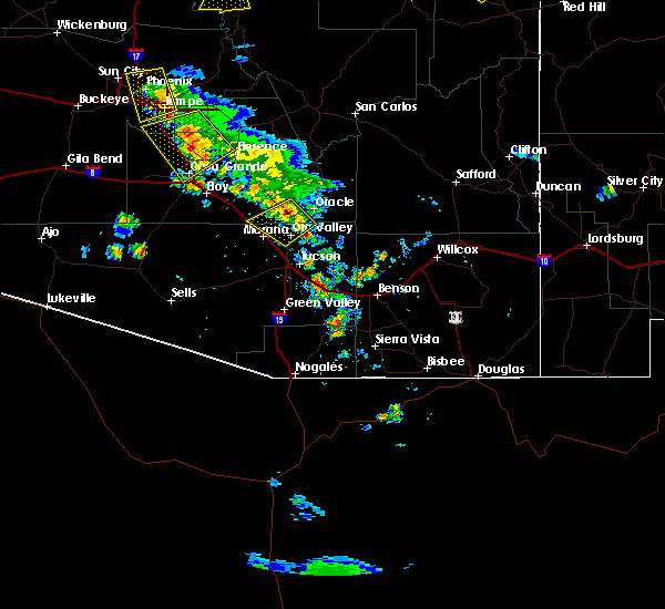 At 620 pm mst, a severe thunderstorm was located 12 miles north of oro valley, moving southwest at 20 mph (radar indicated). Hazards include 60 mph wind gusts and quarter size hail. Hail damage to vehicles is expected. expect wind damage to roofs, siding, and trees. locations impacted include, oro valley, tortolita, casas adobes, saddlebrooke, oracle junction, biosphere 2, dove mountain, catalina. this includes the following highways, route 77 between mile markers 76 and 97. Route 79 between mile markers 92 and 100. At 620 pm mst, a severe thunderstorm was located 12 miles north of oro valley, moving southwest at 20 mph (radar indicated). Hazards include 60 mph wind gusts and quarter size hail. Hail damage to vehicles is expected. expect wind damage to roofs, siding, and trees. locations impacted include, oro valley, tortolita, casas adobes, saddlebrooke, oracle junction, biosphere 2, dove mountain, catalina. this includes the following highways, route 77 between mile markers 76 and 97. Route 79 between mile markers 92 and 100.
|
| 8/12/2018 5:58 PM MST |
 At 557 pm mst, a severe thunderstorm was located near oracle, or 17 miles northeast of oro valley, moving southwest at 20 mph (radar indicated). Hazards include 60 mph wind gusts and quarter size hail. Hail damage to vehicles is expected. Expect wind damage to roofs, siding, and trees. At 557 pm mst, a severe thunderstorm was located near oracle, or 17 miles northeast of oro valley, moving southwest at 20 mph (radar indicated). Hazards include 60 mph wind gusts and quarter size hail. Hail damage to vehicles is expected. Expect wind damage to roofs, siding, and trees.
|
| 8/10/2018 4:01 PM MST |
 At 400 pm mst, a severe thunderstorm was located near oro valley and catalina, moving southwest at 5 mph (radar indicated). Hazards include 60 mph wind gusts and penny size hail, along with heavy rainfall and possible flooding. Expect damage to roofs, siding, and trees. locations impacted include, northwest tucson, oro valley, tortolita, flowing wells, casas adobes, dove mountain, catalina, catalina state park, catalina foothills. this includes the following highways, interstate 10 between mile markers 240 and 259. Route 77 between mile markers 70 and 87. At 400 pm mst, a severe thunderstorm was located near oro valley and catalina, moving southwest at 5 mph (radar indicated). Hazards include 60 mph wind gusts and penny size hail, along with heavy rainfall and possible flooding. Expect damage to roofs, siding, and trees. locations impacted include, northwest tucson, oro valley, tortolita, flowing wells, casas adobes, dove mountain, catalina, catalina state park, catalina foothills. this includes the following highways, interstate 10 between mile markers 240 and 259. Route 77 between mile markers 70 and 87.
|
| 8/10/2018 3:38 PM MST |
 At 337 pm mst, a severe thunderstorm was located over and near oro valley, moving southwest at 10 mph (radar indicated). Hazards include 60 mph wind gusts and penny size hail, along with heavy rain. expect damage to roofs, siding, and trees At 337 pm mst, a severe thunderstorm was located over and near oro valley, moving southwest at 10 mph (radar indicated). Hazards include 60 mph wind gusts and penny size hail, along with heavy rain. expect damage to roofs, siding, and trees
|
| 8/1/2018 8:34 PM MST |
 At 833 pm mst, severe thunderstorms were located along a line extending from near tortolita to near tucson estates to drexel heights, moving west and northwest at 5 mph (radar indicated). Hazards include 60 mph wind gusts and penny size hail, along with heavy rain. Expect damage to roofs, siding, and trees. locations impacted include, west tucson, oro valley, marana, flowing wells, drexel heights, tucson estates, valencia west, casas adobes, avra valley, tortolita, summit, ryan field, saguaro national park west, picture rocks. this includes the following highways, interstate 10 between mile markers 239 and 255. interstate 19 between mile markers 52 and 58. route 77 between mile markers 73 and 78. Route 86 between mile markers 153 and 169. At 833 pm mst, severe thunderstorms were located along a line extending from near tortolita to near tucson estates to drexel heights, moving west and northwest at 5 mph (radar indicated). Hazards include 60 mph wind gusts and penny size hail, along with heavy rain. Expect damage to roofs, siding, and trees. locations impacted include, west tucson, oro valley, marana, flowing wells, drexel heights, tucson estates, valencia west, casas adobes, avra valley, tortolita, summit, ryan field, saguaro national park west, picture rocks. this includes the following highways, interstate 10 between mile markers 239 and 255. interstate 19 between mile markers 52 and 58. route 77 between mile markers 73 and 78. Route 86 between mile markers 153 and 169.
|
| 8/1/2018 8:14 PM MST |
 At 812 pm mst, severe thunderstorms were located along a line extending from near casas adobes to near tucson estates to near drexel heights, moving west at 5 mph (radar indicated). Hazards include 60 mph wind gusts and penny size hail, along with heavy rain. expect damage to roofs, siding, and trees At 812 pm mst, severe thunderstorms were located along a line extending from near casas adobes to near tucson estates to near drexel heights, moving west at 5 mph (radar indicated). Hazards include 60 mph wind gusts and penny size hail, along with heavy rain. expect damage to roofs, siding, and trees
|
| 8/1/2018 7:59 PM MST |
 At 759 pm mst, a severe thunderstorm was located near and northwest of oro valley, moving northwest at 5 mph (radar indicated). Hazards include 60 mph wind gusts and penny size hail. expect damage to roofs, siding, and trees At 759 pm mst, a severe thunderstorm was located near and northwest of oro valley, moving northwest at 5 mph (radar indicated). Hazards include 60 mph wind gusts and penny size hail. expect damage to roofs, siding, and trees
|
| 8/1/2018 7:52 PM MST |
 At 750 pm mst, a severe thunderstorm was located near flowing wells, or near central to northwest tucson and flowing wells, with very little movement. another strong to severe storm was noted near san xavier mission south tucson, also nearly stationary (radar indicated). Hazards include 60 mph wind gusts and heavy rain. Expect damage to roofs, siding, and trees. locations impacted include, tucson, flowing wells, drexel heights, casas adobes, tucson estates, valencia west, south tucson, san xavier mission and catalina foothills. this includes the following highways, interstate 10 between mile markers 251 and 265. interstate 19 between mile markers 56 and 63. route 77 between mile markers 70 and 76. Route 86 between mile markers 163 and 171. At 750 pm mst, a severe thunderstorm was located near flowing wells, or near central to northwest tucson and flowing wells, with very little movement. another strong to severe storm was noted near san xavier mission south tucson, also nearly stationary (radar indicated). Hazards include 60 mph wind gusts and heavy rain. Expect damage to roofs, siding, and trees. locations impacted include, tucson, flowing wells, drexel heights, casas adobes, tucson estates, valencia west, south tucson, san xavier mission and catalina foothills. this includes the following highways, interstate 10 between mile markers 251 and 265. interstate 19 between mile markers 56 and 63. route 77 between mile markers 70 and 76. Route 86 between mile markers 163 and 171.
|
| 8/1/2018 7:27 PM MST |
 At 726 pm mst, a severe thunderstorm was located near tucson, and is nearly stationary (radar indicated). Hazards include 60 mph wind gusts. expect damage to roofs, siding, and trees At 726 pm mst, a severe thunderstorm was located near tucson, and is nearly stationary (radar indicated). Hazards include 60 mph wind gusts. expect damage to roofs, siding, and trees
|
| 7/10/2018 2:29 PM MST |
 At 228 pm mst, a severe thunderstorm was located over marana, moving northwest at 15 mph (radar indicated). Hazards include 60 mph wind gusts. expect damage to roofs, siding, and trees At 228 pm mst, a severe thunderstorm was located over marana, moving northwest at 15 mph (radar indicated). Hazards include 60 mph wind gusts. expect damage to roofs, siding, and trees
|
| 7/10/2018 2:11 PM MST |
 At 210 pm mst, a severe thunderstorm was located near marana, moving northwest at 20 mph (radar indicated). Hazards include 60 mph wind gusts. Expect damage to roofs, siding, and trees. locations impacted include, oro valley, marana, tortolita, casas adobes, flowing wells, red rock, dove mountain and picture rocks. this includes the following highways, interstate 10 between mile markers 226 and 251. Route 77 between mile markers 76 and 82. At 210 pm mst, a severe thunderstorm was located near marana, moving northwest at 20 mph (radar indicated). Hazards include 60 mph wind gusts. Expect damage to roofs, siding, and trees. locations impacted include, oro valley, marana, tortolita, casas adobes, flowing wells, red rock, dove mountain and picture rocks. this includes the following highways, interstate 10 between mile markers 226 and 251. Route 77 between mile markers 76 and 82.
|
| 7/10/2018 1:45 PM MST |
 At 145 pm mst, a severe thunderstorm was located near casas adobes, or near oro valley, moving northwest at 20 mph (radar indicated). Hazards include 60 mph wind gusts. expect damage to roofs, siding, and trees At 145 pm mst, a severe thunderstorm was located near casas adobes, or near oro valley, moving northwest at 20 mph (radar indicated). Hazards include 60 mph wind gusts. expect damage to roofs, siding, and trees
|
| 7/9/2018 1:32 PM MST |
 At 132 pm mst, a severe thunderstorm was located 12 miles north of marana, moving southwest at 10 mph (radar indicated). Hazards include 60 mph wind gusts. Expect damage to roofs, siding, and trees. locations impacted include, red rock. This includes interstate 10 between mile markers 224 and 231. At 132 pm mst, a severe thunderstorm was located 12 miles north of marana, moving southwest at 10 mph (radar indicated). Hazards include 60 mph wind gusts. Expect damage to roofs, siding, and trees. locations impacted include, red rock. This includes interstate 10 between mile markers 224 and 231.
|
| 7/9/2018 1:11 PM MST |
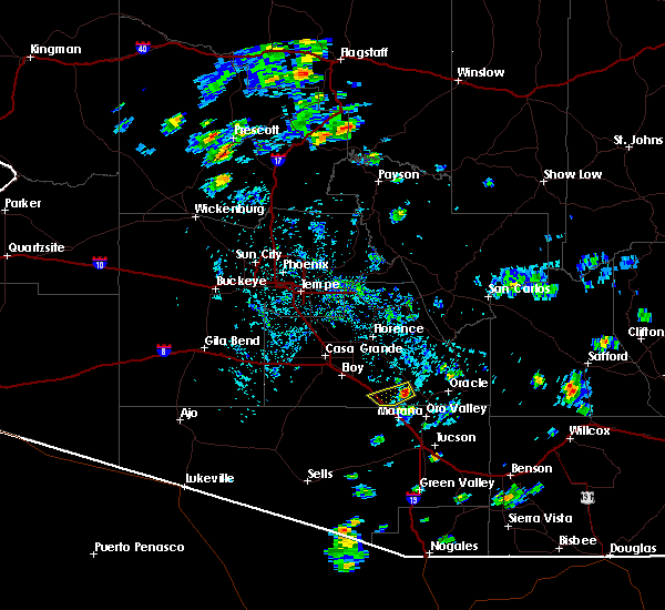 At 111 pm mst, a severe thunderstorm was located 13 miles north of marana, moving southwest at 10 mph (radar indicated). Hazards include 60 mph wind gusts. expect damage to roofs, siding, and trees At 111 pm mst, a severe thunderstorm was located 13 miles north of marana, moving southwest at 10 mph (radar indicated). Hazards include 60 mph wind gusts. expect damage to roofs, siding, and trees
|
| 7/8/2018 6:48 PM MST |
 At 645 pm mst, a severe thunderstorm was located near casas adobes just northwest of tucson, with another strong to severe storm developing near southeast marana, moving southwest at 20 mph (radar indicated). Hazards include 65 mph wind gusts and quarter size hail. Hail damage to vehicles is expected. expect wind damage to roofs, siding, and trees. locations impacted include, oro valley, marana, tortolita, flowing wells, casas adobes, tucson estates, saguaro national park west, picture rocks and catalina foothills. this includes the following highways, interstate 10 between mile markers 242 and 255. Route 77 between mile markers 71 and 79. At 645 pm mst, a severe thunderstorm was located near casas adobes just northwest of tucson, with another strong to severe storm developing near southeast marana, moving southwest at 20 mph (radar indicated). Hazards include 65 mph wind gusts and quarter size hail. Hail damage to vehicles is expected. expect wind damage to roofs, siding, and trees. locations impacted include, oro valley, marana, tortolita, flowing wells, casas adobes, tucson estates, saguaro national park west, picture rocks and catalina foothills. this includes the following highways, interstate 10 between mile markers 242 and 255. Route 77 between mile markers 71 and 79.
|
| 7/8/2018 6:30 PM MST |
 At 629 pm mst, a severe thunderstorm was located over casas adobes, or near oro valley, moving southwest at 15 to 20 mph (radar indicated). Hazards include 60 mph wind gusts and quarter size hail along with heavy rain. Hail damage to vehicles is expected. Expect wind damage to roofs, siding, and trees. At 629 pm mst, a severe thunderstorm was located over casas adobes, or near oro valley, moving southwest at 15 to 20 mph (radar indicated). Hazards include 60 mph wind gusts and quarter size hail along with heavy rain. Hail damage to vehicles is expected. Expect wind damage to roofs, siding, and trees.
|
| 8/10/2017 5:24 PM MST |
 At 523 pm mst, a severe thunderstorm was located near marana, moving northwest at 35 mph (radar indicated). Hazards include 60 mph wind gusts. Expect damage to roofs, siding, and trees. blowing dust will restrict visibility to generally around 1 mile but also lower at times. Locations impacted include, tucson, oro valley, marana, flowing wells, avra valley, casas adobes, tortolita, saguaro national park west, picture rocks and catalina foothills. At 523 pm mst, a severe thunderstorm was located near marana, moving northwest at 35 mph (radar indicated). Hazards include 60 mph wind gusts. Expect damage to roofs, siding, and trees. blowing dust will restrict visibility to generally around 1 mile but also lower at times. Locations impacted include, tucson, oro valley, marana, flowing wells, avra valley, casas adobes, tortolita, saguaro national park west, picture rocks and catalina foothills.
|
| 8/10/2017 5:04 PM MST |
 At 504 pm mst, a severe thunderstorm was located near flowing wells, or 8 miles southeast of marana, moving northwest at 35 mph (radar indicated). Hazards include 60 mph wind gusts. expect damage to roofs, siding, and trees At 504 pm mst, a severe thunderstorm was located near flowing wells, or 8 miles southeast of marana, moving northwest at 35 mph (radar indicated). Hazards include 60 mph wind gusts. expect damage to roofs, siding, and trees
|
| 8/2/2017 2:25 PM MST |
 The severe thunderstorm warning for north central pima county will expire at 230 pm mst, the storm which prompted the warning has weakened below severe limits, and no longer poses an immediate threat to life or property. therefore the warning will be allowed to expire. however heavy rain is still occurring with this thunderstorm. The severe thunderstorm warning for north central pima county will expire at 230 pm mst, the storm which prompted the warning has weakened below severe limits, and no longer poses an immediate threat to life or property. therefore the warning will be allowed to expire. however heavy rain is still occurring with this thunderstorm.
|
| 8/2/2017 2:12 PM MST |
 At 212 pm mst, a severe thunderstorm was located 7 miles southwest of marana or near picture rocks, and is nearly stationary (radar indicated). Hazards include 60 mph wind gusts and nickel size hail. Expect damage to roofs, siding, and trees. Locations impacted include, marana, avra valley, saguaro national park west and picture rocks. At 212 pm mst, a severe thunderstorm was located 7 miles southwest of marana or near picture rocks, and is nearly stationary (radar indicated). Hazards include 60 mph wind gusts and nickel size hail. Expect damage to roofs, siding, and trees. Locations impacted include, marana, avra valley, saguaro national park west and picture rocks.
|
| 8/2/2017 1:58 PM MST |
 At 158 pm mst, a severe thunderstorm was located 7 miles southwest of marana or near picture rocks, and is nearly stationary (radar indicated). Hazards include 60 mph wind gusts and nickel size hail. expect damage to roofs, siding, and trees At 158 pm mst, a severe thunderstorm was located 7 miles southwest of marana or near picture rocks, and is nearly stationary (radar indicated). Hazards include 60 mph wind gusts and nickel size hail. expect damage to roofs, siding, and trees
|
| 7/23/2017 4:27 PM MST |
 At 426 pm mst, a severe thunderstorm was located 10 miles north of avra valley, or 14 miles northwest of marana, moving northwest at 15 mph (radar indicated). Hazards include 60 mph wind gusts. expect damage to roofs, siding, and trees At 426 pm mst, a severe thunderstorm was located 10 miles north of avra valley, or 14 miles northwest of marana, moving northwest at 15 mph (radar indicated). Hazards include 60 mph wind gusts. expect damage to roofs, siding, and trees
|
| 7/19/2017 3:56 PM MST |
 At 354 pm mst, a severe thunderstorm was located just west of downtown tucson, or west on interstate 10, moving west at 5 to 10 mph (radar indicated). Hazards include 60 mph wind gusts, pea size hail and torrential rain. Expect damage to roofs, siding, and trees. Locations impacted include, tucson, flowing wells and tucson estates. At 354 pm mst, a severe thunderstorm was located just west of downtown tucson, or west on interstate 10, moving west at 5 to 10 mph (radar indicated). Hazards include 60 mph wind gusts, pea size hail and torrential rain. Expect damage to roofs, siding, and trees. Locations impacted include, tucson, flowing wells and tucson estates.
|
| 7/19/2017 3:39 PM MST |
 At 337 pm mst, a severe thunderstorm was located over central and western sections of tucson, moving northwest at 5 mph (radar indicated). Hazards include 60 mph wind gusts, pea size hail and torrential rain. Expect damage to roofs, siding, and trees. Locations impacted include, tucson, oro valley, marana, and catalina foothills. At 337 pm mst, a severe thunderstorm was located over central and western sections of tucson, moving northwest at 5 mph (radar indicated). Hazards include 60 mph wind gusts, pea size hail and torrential rain. Expect damage to roofs, siding, and trees. Locations impacted include, tucson, oro valley, marana, and catalina foothills.
|
| 7/19/2017 3:28 PM MST |
 At 327 pm mst, a severe thunderstorm was located over tucson, moving northwest at 5 to 10 mph (radar indicated). Hazards include 60 mph wind gusts. expect damage to roofs, siding, and trees At 327 pm mst, a severe thunderstorm was located over tucson, moving northwest at 5 to 10 mph (radar indicated). Hazards include 60 mph wind gusts. expect damage to roofs, siding, and trees
|
| 7/19/2017 3:19 PM MST | Tree down in eastbound lane at i-10 and tangerine road in pima county AZ, 2.9 miles ESE of Marana, AZ |
| 7/15/2017 5:52 PM MST |
 The severe thunderstorm warning for northeastern pima and south central pinal counties will expire at 600 pm mst, the storm which prompted the warning, now near red rock, has weakened below severe limits. however gusty winds and blowing dust remain in the area with a dust storm warning in effect until 7 pm mst. The severe thunderstorm warning for northeastern pima and south central pinal counties will expire at 600 pm mst, the storm which prompted the warning, now near red rock, has weakened below severe limits. however gusty winds and blowing dust remain in the area with a dust storm warning in effect until 7 pm mst.
|
| 7/15/2017 5:37 PM MST |
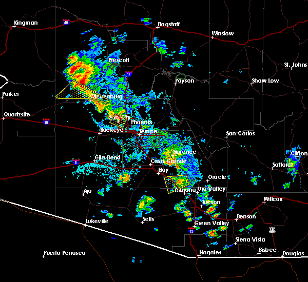 At 533 pm mst, a storm approaching i-10 between red rock and picacho was beginning to weaken, but was still capable of damaging winds and was generating dense blowing dust. movement was to the west at 20 mph (radar indicated). Hazards include 60 mph wind gusts and blowing dust. Expect damage to roofs, siding, and trees. Locations impacted include, red rock and picacho peak. At 533 pm mst, a storm approaching i-10 between red rock and picacho was beginning to weaken, but was still capable of damaging winds and was generating dense blowing dust. movement was to the west at 20 mph (radar indicated). Hazards include 60 mph wind gusts and blowing dust. Expect damage to roofs, siding, and trees. Locations impacted include, red rock and picacho peak.
|
| 7/15/2017 5:04 PM MST |
 At 503 pm mst, a severe thunderstorm was located 14 miles northeast of avra valley, or 15 miles north of marana, moving west at 25 to 30 mph (radar indicated). Hazards include 70 mph wind gusts and quarter size hail. Hail damage to vehicles is expected. expect considerable tree damage. Wind damage is also likely to mobile homes, roofs, and outbuildings. At 503 pm mst, a severe thunderstorm was located 14 miles northeast of avra valley, or 15 miles north of marana, moving west at 25 to 30 mph (radar indicated). Hazards include 70 mph wind gusts and quarter size hail. Hail damage to vehicles is expected. expect considerable tree damage. Wind damage is also likely to mobile homes, roofs, and outbuildings.
|
| 7/14/2017 7:01 PM MST |
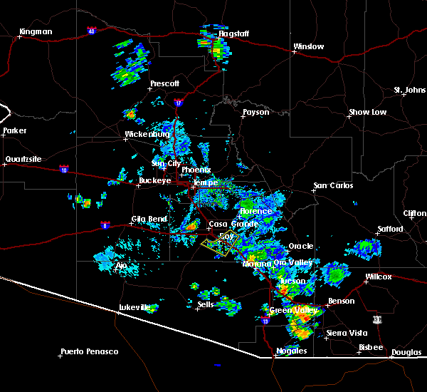 At 659 pm mst, a severe thunderstorm capable of producing a tornado was along interstate 10 near red rock, moving southwest at 25 mph (radar indicated rotation). Hazards include tornado. Flying debris will be dangerous to those caught without shelter. mobile homes will be damaged or destroyed. damage to roofs, windows, and vehicles will occur. tree damage is likely. this dangerous storm will be near, far northern marana around 710 pm mst. Other locations impacted by this tornadic thunderstorm include red rock. At 659 pm mst, a severe thunderstorm capable of producing a tornado was along interstate 10 near red rock, moving southwest at 25 mph (radar indicated rotation). Hazards include tornado. Flying debris will be dangerous to those caught without shelter. mobile homes will be damaged or destroyed. damage to roofs, windows, and vehicles will occur. tree damage is likely. this dangerous storm will be near, far northern marana around 710 pm mst. Other locations impacted by this tornadic thunderstorm include red rock.
|
| 7/13/2017 8:27 PM MST |
 At 824 pm mst, an area of strong to severe thunderstorms was located over tucson, moving southwest at 15 mph (radar indicated). Hazards include 60 mph wind gusts and small hail, along with locally heavy rain. Expect damage to roofs, siding, and trees. Locations impacted include, central to west tucson, flowing wells, drexel heights, tucson estates, casas adobes, south tucson, saguaro national park west, san xavier mission and catalina foothills. At 824 pm mst, an area of strong to severe thunderstorms was located over tucson, moving southwest at 15 mph (radar indicated). Hazards include 60 mph wind gusts and small hail, along with locally heavy rain. Expect damage to roofs, siding, and trees. Locations impacted include, central to west tucson, flowing wells, drexel heights, tucson estates, casas adobes, south tucson, saguaro national park west, san xavier mission and catalina foothills.
|
| 7/13/2017 8:08 PM MST |
 At 806 pm mst, a severe thunderstorm was located near north central tucson, moving southwest at 15 mph (radar indicated). Hazards include 60 mph wind gusts and penny size hail, along with heavy rain. expect damage to roofs, siding, and trees At 806 pm mst, a severe thunderstorm was located near north central tucson, moving southwest at 15 mph (radar indicated). Hazards include 60 mph wind gusts and penny size hail, along with heavy rain. expect damage to roofs, siding, and trees
|
| 9/13/2016 1:30 PM MST |
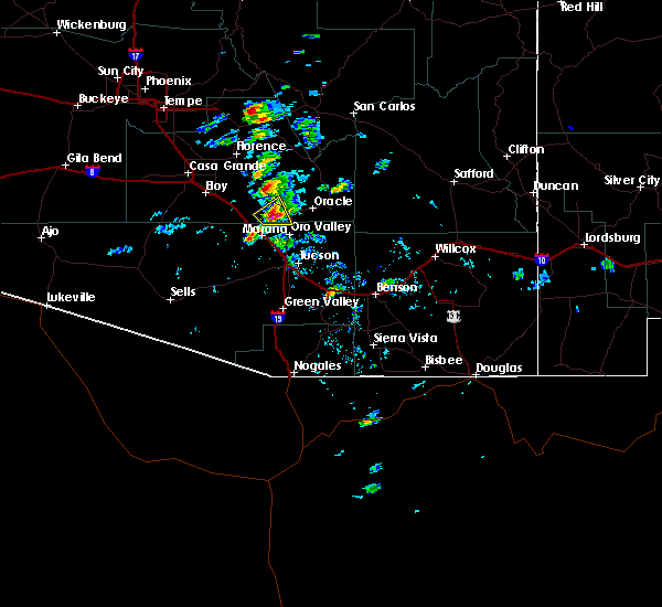 At 130 pm mst, doppler radar indicated a severe thunderstorm capable of producing quarter size hail and damaging winds in excess of 60 mph. this storm was located 10 miles northeast of marana, and moving northeast at 15 mph. * this severe thunderstorm will remain over mainly remote areas of south central pinal and northern pima counties. At 130 pm mst, doppler radar indicated a severe thunderstorm capable of producing quarter size hail and damaging winds in excess of 60 mph. this storm was located 10 miles northeast of marana, and moving northeast at 15 mph. * this severe thunderstorm will remain over mainly remote areas of south central pinal and northern pima counties.
|
| 7/29/2016 7:13 PM MST |
 The severe thunderstorm warning for northeastern pima county will expire at 715 pm mst, the storms which prompted the warning have weakened below severe limits and exited the warned area to the west. therefore the warning will be allowed to expire. however gusty winds and heavy rain are still possible with these thunderstorms. The severe thunderstorm warning for northeastern pima county will expire at 715 pm mst, the storms which prompted the warning have weakened below severe limits and exited the warned area to the west. therefore the warning will be allowed to expire. however gusty winds and heavy rain are still possible with these thunderstorms.
|
| 7/29/2016 6:01 PM MST |
 At 559 pm mst, doppler radar indicated a severe thunderstorm capable of producing quarter size hail and damaging winds in excess of 60 mph. this storm was located over tanque verde, or 12 miles east of tucson, and moving west at 15 mph. in addition to the strong and gusty winds and hail, expect blowing dust to accompany this storm as well. motorists should travel with caution if encountering reduced visibilities due to blowing dust. At 559 pm mst, doppler radar indicated a severe thunderstorm capable of producing quarter size hail and damaging winds in excess of 60 mph. this storm was located over tanque verde, or 12 miles east of tucson, and moving west at 15 mph. in addition to the strong and gusty winds and hail, expect blowing dust to accompany this storm as well. motorists should travel with caution if encountering reduced visibilities due to blowing dust.
|
| 7/27/2016 6:44 PM MST |
 At 640 pm mst, doppler radar indicated severe thunderstorms capable of producing damaging winds in excess of 60 mph. these storms were located along a line extending from southeast tucson to near the catalina foothills, moving southwest at 15 mph. locations impacted include, tucson, oro valley, flowing wells, catalina foothills, rita ranch, vail, catalina state park, davis-monthan air force base, tucson international airport and saguaro national park east. At 640 pm mst, doppler radar indicated severe thunderstorms capable of producing damaging winds in excess of 60 mph. these storms were located along a line extending from southeast tucson to near the catalina foothills, moving southwest at 15 mph. locations impacted include, tucson, oro valley, flowing wells, catalina foothills, rita ranch, vail, catalina state park, davis-monthan air force base, tucson international airport and saguaro national park east.
|
| 7/27/2016 6:20 PM MST |
 At 613 pm mst, doppler radar indicated an area of severe thunderstorms capable of producing damaging winds in excess of 60 mph. these storms were immediately north and east of tucson, moving southwest at 20 mph. a very strong outflow will precede these storms with areas of blowing dust. locations impacted include, tucson, oro valley, marana, flowing wells, tanque verde, casas adobes, tortolita, catalina foothills, mount lemmon/summerhaven, rita ranch, vail, davis-monthan air force base and sabino canyon. At 613 pm mst, doppler radar indicated an area of severe thunderstorms capable of producing damaging winds in excess of 60 mph. these storms were immediately north and east of tucson, moving southwest at 20 mph. a very strong outflow will precede these storms with areas of blowing dust. locations impacted include, tucson, oro valley, marana, flowing wells, tanque verde, casas adobes, tortolita, catalina foothills, mount lemmon/summerhaven, rita ranch, vail, davis-monthan air force base and sabino canyon.
|
| 7/27/2016 6:00 PM MST |
 At 557 pm mst, doppler radar indicated a line of severe thunderstorms capable of producing damaging winds in excess of 60 mph. these storms were located just north and northeast of tucson from near oracle through the tanque verde area and the rincons, and moving southwest at 20 mph. At 557 pm mst, doppler radar indicated a line of severe thunderstorms capable of producing damaging winds in excess of 60 mph. these storms were located just north and northeast of tucson from near oracle through the tanque verde area and the rincons, and moving southwest at 20 mph.
|
| 7/19/2016 4:57 PM MST |
 The severe thunderstorm warning for northeastern pima county will expire at 500 pm mst, the storms which prompted the warning have weakened below severe limits, and no longer poses an immediate threat to life or property. therefore the warning will be allowed to expire. however gusty winds are still possible with these thunderstorms as they continue to move to the northwest at 15 to 20 mph. The severe thunderstorm warning for northeastern pima county will expire at 500 pm mst, the storms which prompted the warning have weakened below severe limits, and no longer poses an immediate threat to life or property. therefore the warning will be allowed to expire. however gusty winds are still possible with these thunderstorms as they continue to move to the northwest at 15 to 20 mph.
|
| 7/19/2016 4:39 PM MST |
 At 435 pm mst, doppler radar indicated a cluster of severe thunderstorms that are still capable of producing damaging winds in excess of 60 mph. the latest report from the marana airport indicated sustained winds of 28 mph with gusts to 32 mph. much stronger winds are likely to the west of marana near avra valley and also to the southeast near rillito. this storm was located over avra valley, or near marana, moving northwest at 15 mph. locations impacted include, marana, avra valley, casas adobes, tucson estates, silver bell, picture rocks and saguaro national park west. At 435 pm mst, doppler radar indicated a cluster of severe thunderstorms that are still capable of producing damaging winds in excess of 60 mph. the latest report from the marana airport indicated sustained winds of 28 mph with gusts to 32 mph. much stronger winds are likely to the west of marana near avra valley and also to the southeast near rillito. this storm was located over avra valley, or near marana, moving northwest at 15 mph. locations impacted include, marana, avra valley, casas adobes, tucson estates, silver bell, picture rocks and saguaro national park west.
|
| 7/19/2016 4:26 PM MST |
 The severe thunderstorm warning for south central pinal and northeastern pima counties will expire at 430 pm mst, the storm which prompted the warning has weakened below severe limits, and no longer poses an immediate threat to life or property. therefore the warning will be allowed to expire. however gusty winds are still possible with this thunderstorm as it moves into eastern pinal county. The severe thunderstorm warning for south central pinal and northeastern pima counties will expire at 430 pm mst, the storm which prompted the warning has weakened below severe limits, and no longer poses an immediate threat to life or property. therefore the warning will be allowed to expire. however gusty winds are still possible with this thunderstorm as it moves into eastern pinal county.
|
| 7/19/2016 4:11 PM MST |
 At 410 pm mst, doppler radar indicated a cluster of severe thunderstorms capable of producing damaging winds in excess of 60 mph. this storm was located near marana, and moving northwest at 15 mph. At 410 pm mst, doppler radar indicated a cluster of severe thunderstorms capable of producing damaging winds in excess of 60 mph. this storm was located near marana, and moving northwest at 15 mph.
|
| 7/19/2016 3:55 PM MST |
 At 354 pm mst, doppler radar indicated a severe thunderstorm capable of producing damaging winds in excess of 60 mph. this storm was located near oro valley, and moving northwest at 15 to 20 mph. At 354 pm mst, doppler radar indicated a severe thunderstorm capable of producing damaging winds in excess of 60 mph. this storm was located near oro valley, and moving northwest at 15 to 20 mph.
|
| 6/26/2016 7:13 PM MST |
 At 711 pm mst, doppler radar indicated a severe thunderstorm capable of producing damaging winds in excess of 60 mph. this storm was located southeast of flowing wells, or 7 miles northwest of tucson, and moving northwest at 25 to 30 mph. At 711 pm mst, doppler radar indicated a severe thunderstorm capable of producing damaging winds in excess of 60 mph. this storm was located southeast of flowing wells, or 7 miles northwest of tucson, and moving northwest at 25 to 30 mph.
|
| 6/11/2016 2:30 PM MST |
 At 229 pm mst, doppler radar indicated a severe thunderstorm capable of producing quarter size hail and damaging winds in excess of 60 mph. this storm was located over tortolita, or near marana, moving north at 15 mph. locations impacted include, oro valley, marana, tortolita, dove mountain,. At 229 pm mst, doppler radar indicated a severe thunderstorm capable of producing quarter size hail and damaging winds in excess of 60 mph. this storm was located over tortolita, or near marana, moving north at 15 mph. locations impacted include, oro valley, marana, tortolita, dove mountain,.
|
| 6/11/2016 2:18 PM MST |
 At 217 pm mst, doppler radar indicated a severe thunderstorm capable of producing quarter size hail and damaging winds in excess of 60 mph. this storm was located near marana, and moving north at 12 mph. At 217 pm mst, doppler radar indicated a severe thunderstorm capable of producing quarter size hail and damaging winds in excess of 60 mph. this storm was located near marana, and moving north at 12 mph.
|
| 6/10/2016 6:15 PM MST |
 At 614 pm mst, doppler radar indicated a severe thunderstorm capable of producing quarter size hail and damaging winds in excess of 60 mph. this storm was located near tortolita, or near marana, moving north at 15 mph. blowing dust with low visibilities was also accompanying this storm. locations impacted include, tucson, marana, tortolita. At 614 pm mst, doppler radar indicated a severe thunderstorm capable of producing quarter size hail and damaging winds in excess of 60 mph. this storm was located near tortolita, or near marana, moving north at 15 mph. blowing dust with low visibilities was also accompanying this storm. locations impacted include, tucson, marana, tortolita.
|
| 6/10/2016 6:01 PM MST |
 At 601 pm mst, doppler radar indicated a severe thunderstorm capable of producing quarter size hail and damaging winds in excess of 60 mph. this storm was located near marana, and moving north at 15 mph. At 601 pm mst, doppler radar indicated a severe thunderstorm capable of producing quarter size hail and damaging winds in excess of 60 mph. this storm was located near marana, and moving north at 15 mph.
|
| 10/18/2015 2:19 PM MST |
 At 217 pm mst, a trained weather spotter reported quarter sized hail from a severe thunderstorm over tortolita. in addition to. At 217 pm mst, a trained weather spotter reported quarter sized hail from a severe thunderstorm over tortolita. in addition to.
|
| 10/18/2015 2:05 PM MST |
 At 204 pm mst, doppler radar indicated a severe thunderstorm capable of producing quarter size hail and damaging winds in excess of 60 mph. a trained weather spotter recently reported hail to the size of quarters beginning to cover the ground near thornydale and cortaro roads. this storm was located over casas adobes, and moving northeast at 20 mph. At 204 pm mst, doppler radar indicated a severe thunderstorm capable of producing quarter size hail and damaging winds in excess of 60 mph. a trained weather spotter recently reported hail to the size of quarters beginning to cover the ground near thornydale and cortaro roads. this storm was located over casas adobes, and moving northeast at 20 mph.
|
| 10/6/2015 12:39 PM MST |
 At 1239 pm mst, doppler radar indicated a severe thunderstorm capable of producing quarter size hail and damaging winds in excess of 60 mph. this storm was located over tucson, moving northeast at 40 mph. locations impacted include, tucson, oro valley, marana, flowing wells, littletown, drexel-alvernon, casas adobes, drexel heights, valencia west, tanque verde, tucson estates, summit, tortolita, south tucson, catalina foothills, mount lemmon/summerhaven, seven falls, san xavier mission, catalina state park and davis-monthan air force base. At 1239 pm mst, doppler radar indicated a severe thunderstorm capable of producing quarter size hail and damaging winds in excess of 60 mph. this storm was located over tucson, moving northeast at 40 mph. locations impacted include, tucson, oro valley, marana, flowing wells, littletown, drexel-alvernon, casas adobes, drexel heights, valencia west, tanque verde, tucson estates, summit, tortolita, south tucson, catalina foothills, mount lemmon/summerhaven, seven falls, san xavier mission, catalina state park and davis-monthan air force base.
|
| 10/6/2015 12:26 PM MST |
 At 1226 pm mst, doppler radar indicated a severe thunderstorm capable of producing quarter size hail and damaging winds in excess of 60 mph. this storm was located over drexel heights, and moving northeast at 40 mph. At 1226 pm mst, doppler radar indicated a severe thunderstorm capable of producing quarter size hail and damaging winds in excess of 60 mph. this storm was located over drexel heights, and moving northeast at 40 mph.
|
| 10/6/2015 12:19 PM MST |
 At 1219 pm mst, doppler radar indicated a severe thunderstorm capable of producing quarter size hail and damaging winds in excess of 60 mph. this storm was located near casas adobes, and moving northeast at 25 mph. At 1219 pm mst, doppler radar indicated a severe thunderstorm capable of producing quarter size hail and damaging winds in excess of 60 mph. this storm was located near casas adobes, and moving northeast at 25 mph.
|
| 8/25/2015 3:30 PM MST | 1000 customers were without power in marana due to downed power poles. total at this time down to 40 in pima county AZ, 3.2 miles ESE of Marana, AZ |
| 8/25/2015 2:36 PM MST |
 At 233 pm mst, doppler radar indicated a severe thunderstorm capable of producing damaging winds in excess of 60 mph. this storm was located near marana. this storm showed very little movement in the past 20 minutes. locallized blowing dust may impact interstate 10 from marana to red rocks. the marana police department reported downed power lines between honea drive and sandy street in marana. locations impacted include, marana and picture rocks. At 233 pm mst, doppler radar indicated a severe thunderstorm capable of producing damaging winds in excess of 60 mph. this storm was located near marana. this storm showed very little movement in the past 20 minutes. locallized blowing dust may impact interstate 10 from marana to red rocks. the marana police department reported downed power lines between honea drive and sandy street in marana. locations impacted include, marana and picture rocks.
|
| 8/25/2015 2:35 PM MST | Marana airport asos recorded a 51 knot wind gust at 235 p in pima county AZ, 6.1 miles E of Marana, AZ |
| 8/25/2015 2:24 PM MST |
 At 222 pm mst, doppler radar indicated a severe thunderstorm capable of producing damaging winds in excess of 60 mph. this storm was located near marana, and moving north at 15 mph. locallized blowing dust will also be posssible and may impact interstate 10 from marana to red rocks. At 222 pm mst, doppler radar indicated a severe thunderstorm capable of producing damaging winds in excess of 60 mph. this storm was located near marana, and moving north at 15 mph. locallized blowing dust will also be posssible and may impact interstate 10 from marana to red rocks.
|
| 8/23/2015 7:28 PM MST |
 At 728 pm mst, doppler radar indicated a severe thunderstorm capable of producing quarter size hail and damaging winds in excess of 60 mph. this storm was located near avra valley, moving south at 5 mph. locations impacted include, marana, avra valley and picture rocks. At 728 pm mst, doppler radar indicated a severe thunderstorm capable of producing quarter size hail and damaging winds in excess of 60 mph. this storm was located near avra valley, moving south at 5 mph. locations impacted include, marana, avra valley and picture rocks.
|
| 8/23/2015 7:13 PM MST |
 At 712 pm mst, doppler radar indicated a severe thunderstorm capable of producing quarter size hail and damaging winds in excess of 60 mph. this storm was located over avra valley, and moving southwest at 5 mph. At 712 pm mst, doppler radar indicated a severe thunderstorm capable of producing quarter size hail and damaging winds in excess of 60 mph. this storm was located over avra valley, and moving southwest at 5 mph.
|
| 8/20/2015 3:35 PM MST |
 At 332 pm mst, doppler radar indicated a severe thunderstorm capable of producing quarter size hail and damaging winds in excess of 60 mph. this storm was located near avra valley. this storm was nearly stationary. reports of blowing dust and gusts to 46 mph have been reported in the vicinity of this storm. locations impacted include, marana, avra valley and picture rocks. At 332 pm mst, doppler radar indicated a severe thunderstorm capable of producing quarter size hail and damaging winds in excess of 60 mph. this storm was located near avra valley. this storm was nearly stationary. reports of blowing dust and gusts to 46 mph have been reported in the vicinity of this storm. locations impacted include, marana, avra valley and picture rocks.
|
| 8/20/2015 3:15 PM MST | Power poles down... mud and debris across road causing road closure in pima county AZ, 10.4 miles ESE of Marana, AZ |
| 8/20/2015 3:14 PM MST |
 At 311 pm mst, doppler radar continued to indicate a severe thunderstorm capable of producing quarter size hail and damaging winds in excess of 60 mph. this storm was located over avra valley, and moving east at 5 mph. there have been reports of blowing dust in the vicinity of this storm. At 311 pm mst, doppler radar continued to indicate a severe thunderstorm capable of producing quarter size hail and damaging winds in excess of 60 mph. this storm was located over avra valley, and moving east at 5 mph. there have been reports of blowing dust in the vicinity of this storm.
|
| 8/20/2015 3:04 PM MST |
 At 303 pm mst, doppler radar indicated a severe thunderstorm capable of producing quarter size hail and damaging winds in excess of 60 mph. this storm was located over avra valley, moving east at 5 mph. locations impacted include, marana, avra valley, picture rocks and saguaro national park west. At 303 pm mst, doppler radar indicated a severe thunderstorm capable of producing quarter size hail and damaging winds in excess of 60 mph. this storm was located over avra valley, moving east at 5 mph. locations impacted include, marana, avra valley, picture rocks and saguaro national park west.
|
| 8/20/2015 2:47 PM MST |
 At 247 pm mst, doppler radar indicated a severe thunderstorm capable of producing quarter size hail and damaging winds in excess of 60 mph. this storm was located over avra valley, and moving east at 5 mph. At 247 pm mst, doppler radar indicated a severe thunderstorm capable of producing quarter size hail and damaging winds in excess of 60 mph. this storm was located over avra valley, and moving east at 5 mph.
|
| 8/7/2015 2:43 PM MST |
 At 242 pm mst, doppler radar indicated a severe thunderstorm capable of producing quarter size hail and damaging winds in excess of 60 mph. this storm was located over flowing wells near northwest tucson, and moving northeast at 10 mph. At 242 pm mst, doppler radar indicated a severe thunderstorm capable of producing quarter size hail and damaging winds in excess of 60 mph. this storm was located over flowing wells near northwest tucson, and moving northeast at 10 mph.
|
| 8/7/2015 1:00 PM MST | Power pole down near lambert and camino de oeste in pima county AZ, 3.3 miles W of Marana, AZ |
| 8/7/2015 1:00 PM MST |
 At 1259 pm mst, doppler radar indicated a severe thunderstorm capable of producing quarter size hail and damaging winds in excess of 60 mph. this storm was located near tortolita just northwest of tucson, moving north at 5 mph. locations impacted include, oro valley, marana, casas adobes, tortolita, flowing wells, dove mountain and picture rocks. At 1259 pm mst, doppler radar indicated a severe thunderstorm capable of producing quarter size hail and damaging winds in excess of 60 mph. this storm was located near tortolita just northwest of tucson, moving north at 5 mph. locations impacted include, oro valley, marana, casas adobes, tortolita, flowing wells, dove mountain and picture rocks.
|
| 8/7/2015 12:48 PM MST |
 At 1247 pm mst, doppler radar indicated a severe thunderstorm capable of producing quarter size hail and damaging winds in excess of 60 mph. this storm was located just east and southeast of marana near tortolita and interstate 10, and moving north at 5 mph. At 1247 pm mst, doppler radar indicated a severe thunderstorm capable of producing quarter size hail and damaging winds in excess of 60 mph. this storm was located just east and southeast of marana near tortolita and interstate 10, and moving north at 5 mph.
|
| 8/1/2015 4:16 PM MST |
 At 414 pm mst, doppler radar continued to indicate a severe thunderstorm capable of producing damaging winds in excess of 60 mph over the tucson metro area. at this time the storm was nearly stationary and is expected to weaken soon. locations impacted include, tucson, oro valley, marana, flowing wells, drexel-alvernon, casas adobes, drexel heights, tortolita, tucson estates, south tucson, catalina foothills and davis-monthan air force base. At 414 pm mst, doppler radar continued to indicate a severe thunderstorm capable of producing damaging winds in excess of 60 mph over the tucson metro area. at this time the storm was nearly stationary and is expected to weaken soon. locations impacted include, tucson, oro valley, marana, flowing wells, drexel-alvernon, casas adobes, drexel heights, tortolita, tucson estates, south tucson, catalina foothills and davis-monthan air force base.
|
| 8/1/2015 3:55 PM MST |
 At 354 pm mst, doppler radar indicated a severe thunderstorm capable of producing damaging winds in excess of 60 mph. this storm was located over south tucson, and moving north at 15 mph. At 354 pm mst, doppler radar indicated a severe thunderstorm capable of producing damaging winds in excess of 60 mph. this storm was located over south tucson, and moving north at 15 mph.
|
| 7/9/2015 6:56 PM MST | The severe thunderstorm warning for south central pinal county will expire at 700 pm mst, the storm which prompted the warning has weakened below severe limits and exited the warned area. therefore the warning will be allowed to expire. |
| 7/9/2015 6:45 PM MST |
 At 642 pm mst, doppler radar continued to indicate a severe thunderstorm capable of producing damaging winds in excess of 60 mph. this storm was located near red rock and was moving to the northeast at 30 mph toward highway 79 northwest of oracle junction. blowing dust is possible in advance of the storm as well as heavy rain directly under the storm. locations impacted include, red rock. At 642 pm mst, doppler radar continued to indicate a severe thunderstorm capable of producing damaging winds in excess of 60 mph. this storm was located near red rock and was moving to the northeast at 30 mph toward highway 79 northwest of oracle junction. blowing dust is possible in advance of the storm as well as heavy rain directly under the storm. locations impacted include, red rock.
|
| 7/9/2015 6:26 PM MST |
 At 625 pm mst, doppler radar indicated a severe thunderstorm capable of producing damaging winds in excess of 60 mph. this storm was located over red rock, and moving northeast at 25 mph. At 625 pm mst, doppler radar indicated a severe thunderstorm capable of producing damaging winds in excess of 60 mph. this storm was located over red rock, and moving northeast at 25 mph.
|
| 7/9/2015 4:15 PM MST | 91 customers without power in marana in pima county AZ, 3.2 miles ESE of Marana, AZ |
| 7/9/2015 4:10 PM MST | Trees down across i-10 near marana in pima county AZ, 3.2 miles ESE of Marana, AZ |
| 6/30/2015 5:30 PM MST |
 At 528 pm mst, reports of one inch hail of occurred near campbell and roger. doppler radar incicates this storm will continue to produce large hail and possibly strong winds to 60 mph. locations impacted include, tucson, oro valley, marana, tucson estates, flowing wells, tortolita, casas adobes, drexel heights, valencia west, drexel-alvernon, three points, avra valley, south tucson, ryan field, catalina foothills, picture rocks, san xavier mission, catalina state park, davis-monthan air force base and saguaro national park west. At 528 pm mst, reports of one inch hail of occurred near campbell and roger. doppler radar incicates this storm will continue to produce large hail and possibly strong winds to 60 mph. locations impacted include, tucson, oro valley, marana, tucson estates, flowing wells, tortolita, casas adobes, drexel heights, valencia west, drexel-alvernon, three points, avra valley, south tucson, ryan field, catalina foothills, picture rocks, san xavier mission, catalina state park, davis-monthan air force base and saguaro national park west.
|
| 6/30/2015 5:19 PM MST |
 At 518 pm mst, doppler radar indicated a severe thunderstorm capable of producing quarter size hail and damaging winds in excess of 60 mph. this storm was located over flowing wells, and moving southwest at 25 mph. At 518 pm mst, doppler radar indicated a severe thunderstorm capable of producing quarter size hail and damaging winds in excess of 60 mph. this storm was located over flowing wells, and moving southwest at 25 mph.
|
| 6/29/2015 4:35 PM MST | Golf Ball sized hail reported 17.3 miles ENE of Marana, AZ, large marble to golf ball sized hail. hail damage sustained to multiple small aircraft. |
| 6/27/2015 3:55 PM MST |
 The severe thunderstorm warning for south central pinal and north central pima counties will expire at 400 pm mst, the storm which prompted the warning has weakened below severe limits, and no longer poses an immediate threat to life or property. therefore the warning will be allowed to expire. however gusty winds are still possible with this thunderstorm and areas of blowing dust could reduce visibility to less than 1 mile. a blowing dust advisory remains in effect for much of pima and southeast pinal counties until 8 pm mst. to report severe weather, contact your nearest law enforcement agency. they will relay your report to the national weather service tucson. The severe thunderstorm warning for south central pinal and north central pima counties will expire at 400 pm mst, the storm which prompted the warning has weakened below severe limits, and no longer poses an immediate threat to life or property. therefore the warning will be allowed to expire. however gusty winds are still possible with this thunderstorm and areas of blowing dust could reduce visibility to less than 1 mile. a blowing dust advisory remains in effect for much of pima and southeast pinal counties until 8 pm mst. to report severe weather, contact your nearest law enforcement agency. they will relay your report to the national weather service tucson.
|
| 6/27/2015 3:25 PM MST |
 At 324 pm mst, doppler radar indicated a severe thunderstorm capable of producing quarter size hail and damaging winds in excess of 60 mph. this storm was located near dove mountain, moving west at 20 mph. locations impacted include, avra valley, pinal air park and interstate 10 near the pima and pinal county line. At 324 pm mst, doppler radar indicated a severe thunderstorm capable of producing quarter size hail and damaging winds in excess of 60 mph. this storm was located near dove mountain, moving west at 20 mph. locations impacted include, avra valley, pinal air park and interstate 10 near the pima and pinal county line.
|
| 6/27/2015 3:11 PM MST |
 At 309 pm mst, doppler radar indicated a severe thunderstorm capable of producing quarter size hail and damaging winds in excess of 60 mph and areas of blowing dust which could reduce visibility to less than a quarter mile. this storm was located near dove mountain, and moving west at 30 mph. At 309 pm mst, doppler radar indicated a severe thunderstorm capable of producing quarter size hail and damaging winds in excess of 60 mph and areas of blowing dust which could reduce visibility to less than a quarter mile. this storm was located near dove mountain, and moving west at 30 mph.
|
| 8/22/2013 5:24 PM MST | Large tree branch down in median in pima county AZ, 6.7 miles NW of Marana, AZ |
| 8/2/2013 1:48 PM MST | Fire department reports power pole down on ina between 1-10 and silverbell in pima county AZ, 4.9 miles NW of Marana, AZ |
| 7/26/2013 2:04 PM MST | 61 mph wind gust in pima county AZ, 5 miles WSW of Marana, AZ |
| 7/26/2013 2:04 PM MST | Some tree branches down... large tree split in half... ocotillo and agave uprooted in pima county AZ, 5 miles WSW of Marana, AZ |
| 8/8/2012 6:02 PM MST | Storm damage reported in pinal county AZ, 18.9 miles S of Marana, AZ |
| 8/6/2012 8:14 PM MST | Delayed report...pinal airpark in pinal county AZ, 10 miles SE of Marana, AZ |
| 7/15/2012 4:20 PM MST | Power lines down along tangerine road near gladden farm in pima county AZ, 6.7 miles ESE of Marana, AZ |
| 6/16/2012 3:42 PM MST | Spotter reports tree limbs down. 0.75 mile west of twin peaks exi in pima county AZ, 3.2 miles ESE of Marana, AZ |
| 9/14/2011 4:45 PM MST | Half Dollar sized hail reported 3.2 miles ESE of Marana, AZ |
| 1/1/0001 12:00 AM | Several trees down near thornydale rd and costco d in pima county AZ, 6.1 miles NW of Marana, AZ |
| 1/1/0001 12:00 AM | Spotter was at cortaro and interstate 1 in pima county AZ, 3.4 miles NW of Marana, AZ |
| 1/1/0001 12:00 AM | Large tree uprooted near eaglestone loo in pima county AZ, 2.9 miles NW of Marana, AZ |
| 1/1/0001 12:00 AM | Mesquite tree down at silverbell rd and continental reserve loop with several additional trees down in continental reserve are in pima county AZ, 2.7 miles N of Marana, AZ |
| 1/1/0001 12:00 AM | Large tree downed partially on residenc in pima county AZ, 3.5 miles NNW of Marana, AZ |
| 1/1/0001 12:00 AM | Framed building being constructed collapse in pima county AZ, 3.1 miles NNW of Marana, AZ |
| 1/1/0001 12:00 AM | Trees down in the sunset point neighborhood near cortaro farms rd and star grass d in pima county AZ, 3.8 miles NW of Marana, AZ |
| 1/1/0001 12:00 AM | Palo verde trees downe in pima county AZ, 3.1 miles SW of Marana, AZ |
| 1/1/0001 12:00 AM | Measured at tangerine road and thornydale road in pima county AZ, 3.2 miles ESE of Marana, AZ |
| 1/1/0001 12:00 AM | Small trees uproote in pima county AZ, 6.7 miles ESE of Marana, AZ |
| 1/1/0001 12:00 AM | Twent foot section of a brick wall blown dow in pima county AZ, 6.7 miles ESE of Marana, AZ |
| 1/1/0001 12:00 AM | Twenty foot section of a brick wall blown dow in pima county AZ, 6.7 miles ESE of Marana, AZ |
Hail Maps for Marana, AZ

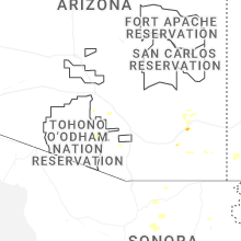
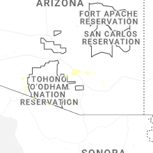
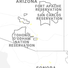


Connect with Interactive Hail Maps