

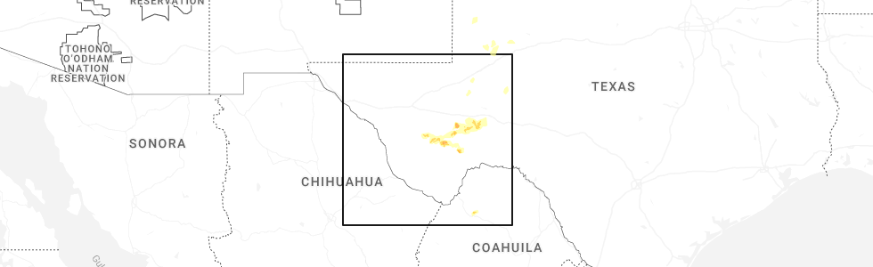
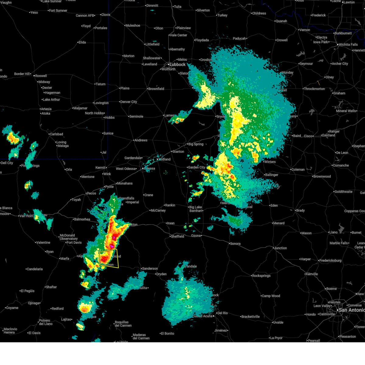
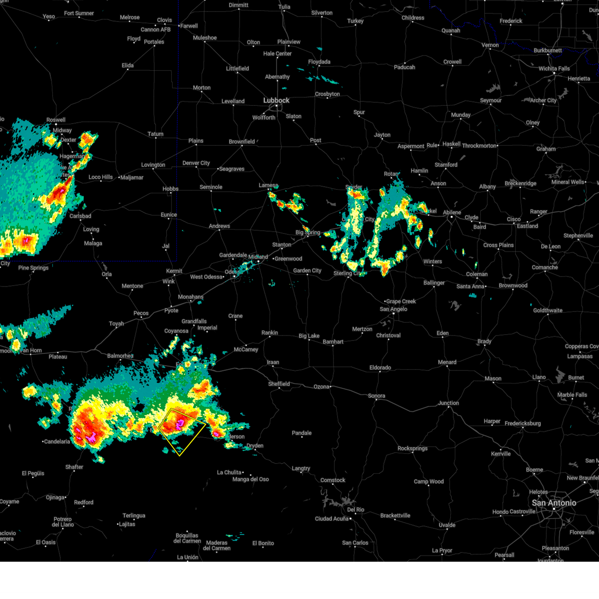
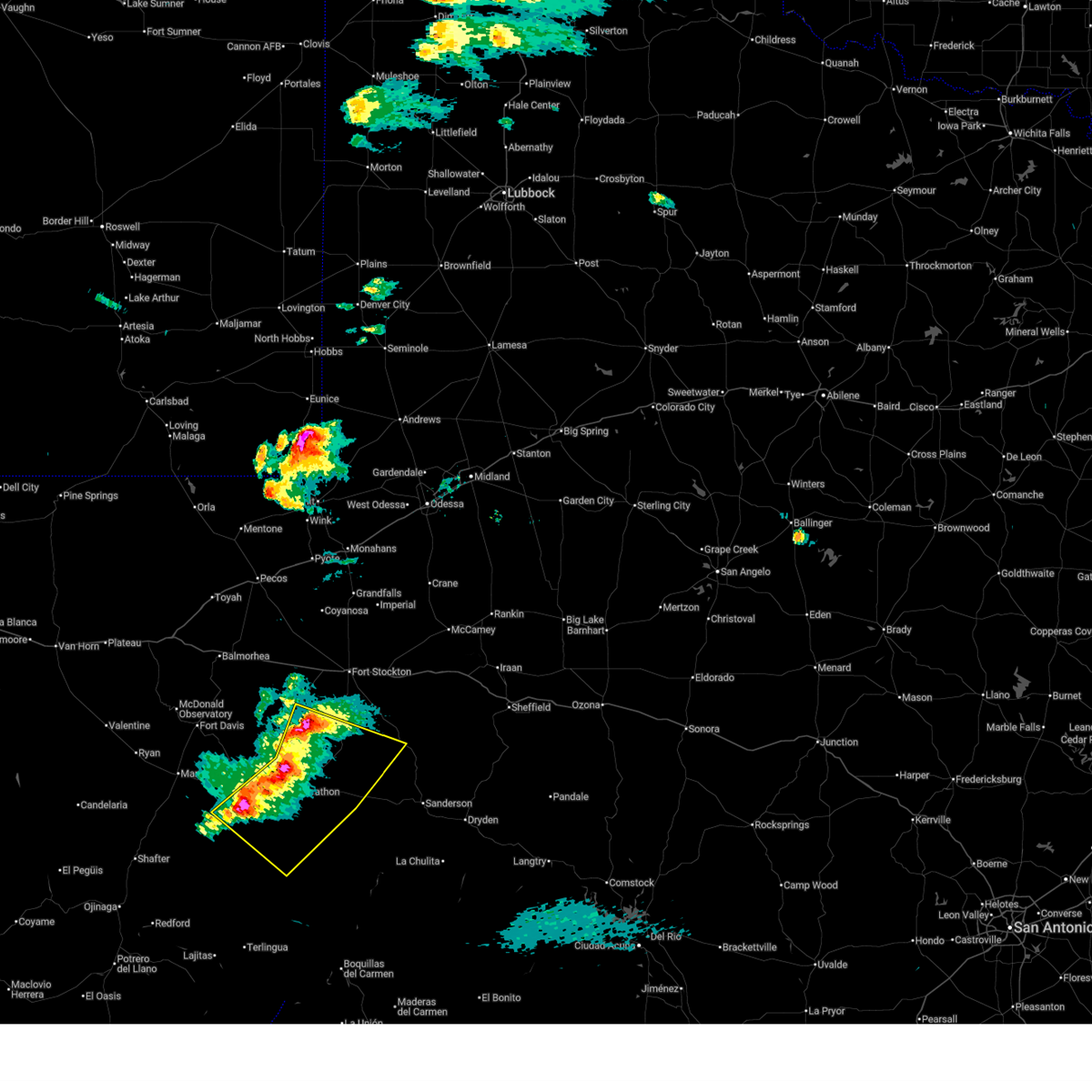
Hail Map for Marathon, TX
The Marathon, TX area has had 24 reports of on-the-ground hail by trained spotters, and has been under severe weather warnings 7 times during the past 12 months. Doppler radar has detected hail at or near Marathon, TX on 81 occasions, including 1 occasion during the past year.
| Name: | Marathon, TX |
| Where Located: | 27.1 miles ESE of Alpine, TX |
| Map: | Google Map for Marathon, TX |
| Population: | 430 |
| Housing Units: | 322 |
| More Info: | Search Google for Marathon, TX |
1
The Top Recent Hail Date for Marathon, TX is Wednesday, May 20, 2026 (34th out of 81)
Hail and Wind Damage Spotted near Marathon, TX
| Date / Time | Report Details |
|---|---|
| 5/31/2026 4:54 PM CDT |
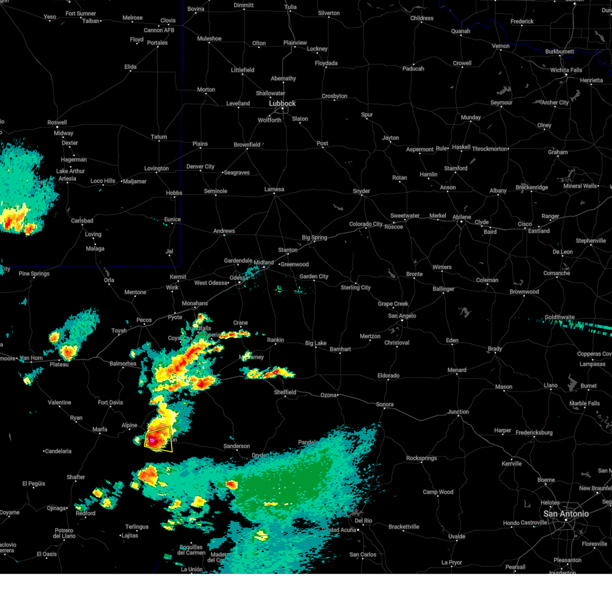
 At 454 pm cdt, a severe thunderstorm was located 22 miles southwest of marathon, or 27 miles south of alpine, moving northeast at 10 mph (radar indicated). Hazards include 60 mph wind gusts and quarter size hail. Hail damage to vehicles is expected. expect wind damage to roofs, siding, and trees. Locations impacted include, marathon, elephant mountain, and elephant mountain wildlife management area. At 454 pm cdt, a severe thunderstorm was located 22 miles southwest of marathon, or 27 miles south of alpine, moving northeast at 10 mph (radar indicated). Hazards include 60 mph wind gusts and quarter size hail. Hail damage to vehicles is expected. expect wind damage to roofs, siding, and trees. Locations impacted include, marathon, elephant mountain, and elephant mountain wildlife management area.
|
| 5/31/2026 4:40 PM CDT |
 Svrmaf the national weather service in midland has issued a * severe thunderstorm warning for, west central brewster county in southwestern texas, * until 530 pm cdt. * at 440 pm cdt, a severe thunderstorm was located 22 miles southwest of marathon, or 26 miles south of alpine, moving northeast at 5 mph (radar indicated). Hazards include 60 mph wind gusts and quarter size hail. Hail damage to vehicles is expected. Expect wind damage to roofs, siding, and trees. Svrmaf the national weather service in midland has issued a * severe thunderstorm warning for, west central brewster county in southwestern texas, * until 530 pm cdt. * at 440 pm cdt, a severe thunderstorm was located 22 miles southwest of marathon, or 26 miles south of alpine, moving northeast at 5 mph (radar indicated). Hazards include 60 mph wind gusts and quarter size hail. Hail damage to vehicles is expected. Expect wind damage to roofs, siding, and trees.
|
| 5/26/2026 7:54 AM CDT |
 Svrmaf the national weather service in midland has issued a * severe thunderstorm warning for, northwestern brewster county in southwestern texas, * until 830 am cdt. * at 754 am cdt, a severe thunderstorm was located 10 miles west of marathon, or 20 miles southeast of alpine, moving east at 25 mph (radar indicated). Hazards include 60 mph wind gusts and quarter size hail. Hail damage to vehicles is expected. Expect wind damage to roofs, siding, and trees. Svrmaf the national weather service in midland has issued a * severe thunderstorm warning for, northwestern brewster county in southwestern texas, * until 830 am cdt. * at 754 am cdt, a severe thunderstorm was located 10 miles west of marathon, or 20 miles southeast of alpine, moving east at 25 mph (radar indicated). Hazards include 60 mph wind gusts and quarter size hail. Hail damage to vehicles is expected. Expect wind damage to roofs, siding, and trees.
|
| 5/20/2026 4:56 PM CDT |
 At 456 pm cdt, a severe thunderstorm was located 9 miles northeast of marathon, or 33 miles east of alpine, moving east at 25 mph (radar indicated). Hazards include 60 mph wind gusts and quarter size hail. Hail damage to vehicles is expected. expect wind damage to roofs, siding, and trees. Locations impacted include, marathon. At 456 pm cdt, a severe thunderstorm was located 9 miles northeast of marathon, or 33 miles east of alpine, moving east at 25 mph (radar indicated). Hazards include 60 mph wind gusts and quarter size hail. Hail damage to vehicles is expected. expect wind damage to roofs, siding, and trees. Locations impacted include, marathon.
|
| 5/20/2026 4:42 PM CDT |
 Svrmaf the national weather service in midland has issued a * severe thunderstorm warning for, south central pecos county in southwestern texas, north central brewster county in southwestern texas, * until 515 pm cdt. * at 442 pm cdt, a severe thunderstorm was located 7 miles northeast of marathon, or 28 miles east of alpine, moving east at 25 mph (radar indicated). Hazards include 60 mph wind gusts and half dollar size hail. Hail damage to vehicles is expected. Expect wind damage to roofs, siding, and trees. Svrmaf the national weather service in midland has issued a * severe thunderstorm warning for, south central pecos county in southwestern texas, north central brewster county in southwestern texas, * until 515 pm cdt. * at 442 pm cdt, a severe thunderstorm was located 7 miles northeast of marathon, or 28 miles east of alpine, moving east at 25 mph (radar indicated). Hazards include 60 mph wind gusts and half dollar size hail. Hail damage to vehicles is expected. Expect wind damage to roofs, siding, and trees.
|
| 5/20/2026 3:59 PM CDT |
 At 359 pm cdt, a severe thunderstorm was located 12 miles east of alpine, moving east at 30 mph (radar indicated). Hazards include 60 mph wind gusts and quarter size hail. Hail damage to vehicles is expected. expect wind damage to roofs, siding, and trees. Locations impacted include, alpine and marathon. At 359 pm cdt, a severe thunderstorm was located 12 miles east of alpine, moving east at 30 mph (radar indicated). Hazards include 60 mph wind gusts and quarter size hail. Hail damage to vehicles is expected. expect wind damage to roofs, siding, and trees. Locations impacted include, alpine and marathon.
|
| 5/20/2026 3:42 PM CDT |
 Svrmaf the national weather service in midland has issued a * severe thunderstorm warning for, west central pecos county in southwestern texas, northwestern brewster county in southwestern texas, southeastern jeff davis county in southwestern texas, * until 415 pm cdt. * at 342 pm cdt, a severe thunderstorm was located 9 miles northeast of alpine, moving east at 25 mph (radar indicated). Hazards include 60 mph wind gusts and quarter size hail. Hail damage to vehicles is expected. Expect wind damage to roofs, siding, and trees. Svrmaf the national weather service in midland has issued a * severe thunderstorm warning for, west central pecos county in southwestern texas, northwestern brewster county in southwestern texas, southeastern jeff davis county in southwestern texas, * until 415 pm cdt. * at 342 pm cdt, a severe thunderstorm was located 9 miles northeast of alpine, moving east at 25 mph (radar indicated). Hazards include 60 mph wind gusts and quarter size hail. Hail damage to vehicles is expected. Expect wind damage to roofs, siding, and trees.
|
| 8/30/2025 4:30 PM CDT | Mesonet station 166 marathon 21 in brewster county TX, 20.5 miles S of Marathon, TX |
| 6/10/2025 6:39 PM CDT | Storm damage reported in brewster county TX, 20.5 miles S of Marathon, TX |
| 6/10/2025 3:32 PM CDT |
 At 332 pm cdt, a severe thunderstorm was located 17 miles east of marathon, or 35 miles west of sanderson, moving southeast at 25 mph (radar indicated). Hazards include tennis ball size hail and 70 mph wind gusts. People and animals outdoors will be injured. expect hail damage to roofs, siding, windows, and vehicles. expect considerable tree damage. wind damage is also likely to mobile homes, roofs, and outbuildings. Locations impacted include, marathon. At 332 pm cdt, a severe thunderstorm was located 17 miles east of marathon, or 35 miles west of sanderson, moving southeast at 25 mph (radar indicated). Hazards include tennis ball size hail and 70 mph wind gusts. People and animals outdoors will be injured. expect hail damage to roofs, siding, windows, and vehicles. expect considerable tree damage. wind damage is also likely to mobile homes, roofs, and outbuildings. Locations impacted include, marathon.
|
| 6/10/2025 3:19 PM CDT |
 At 319 pm cdt, a severe thunderstorm was located 13 miles northeast of marathon, or 35 miles east of alpine, moving southeast at 25 mph (radar indicated). Hazards include golf ball size hail and 60 mph wind gusts. People and animals outdoors will be injured. expect hail damage to roofs, siding, windows, and vehicles. expect wind damage to roofs, siding, and trees. Locations impacted include, marathon. At 319 pm cdt, a severe thunderstorm was located 13 miles northeast of marathon, or 35 miles east of alpine, moving southeast at 25 mph (radar indicated). Hazards include golf ball size hail and 60 mph wind gusts. People and animals outdoors will be injured. expect hail damage to roofs, siding, windows, and vehicles. expect wind damage to roofs, siding, and trees. Locations impacted include, marathon.
|
| 6/10/2025 2:57 PM CDT |
 Svrmaf the national weather service in midland has issued a * severe thunderstorm warning for, southwestern pecos county in southwestern texas, north central brewster county in southwestern texas, * until 345 pm cdt. * at 256 pm cdt, a severe thunderstorm was located 11 miles north of marathon, or 24 miles east of alpine, moving southeast at 20 mph (radar indicated). Hazards include golf ball size hail and 60 mph wind gusts. People and animals outdoors will be injured. expect hail damage to roofs, siding, windows, and vehicles. Expect wind damage to roofs, siding, and trees. Svrmaf the national weather service in midland has issued a * severe thunderstorm warning for, southwestern pecos county in southwestern texas, north central brewster county in southwestern texas, * until 345 pm cdt. * at 256 pm cdt, a severe thunderstorm was located 11 miles north of marathon, or 24 miles east of alpine, moving southeast at 20 mph (radar indicated). Hazards include golf ball size hail and 60 mph wind gusts. People and animals outdoors will be injured. expect hail damage to roofs, siding, windows, and vehicles. Expect wind damage to roofs, siding, and trees.
|
| 6/5/2025 7:40 PM CDT |
 At 739 pm cdt, a severe thunderstorm was located near marathon, or 32 miles southeast of alpine, moving southeast at 25 mph (radar indicated). Hazards include tennis ball size hail and 70 mph wind gusts. People and animals outdoors will be injured. expect hail damage to roofs, siding, windows, and vehicles. expect considerable tree damage. wind damage is also likely to mobile homes, roofs, and outbuildings. Locations impacted include, marathon. At 739 pm cdt, a severe thunderstorm was located near marathon, or 32 miles southeast of alpine, moving southeast at 25 mph (radar indicated). Hazards include tennis ball size hail and 70 mph wind gusts. People and animals outdoors will be injured. expect hail damage to roofs, siding, windows, and vehicles. expect considerable tree damage. wind damage is also likely to mobile homes, roofs, and outbuildings. Locations impacted include, marathon.
|
| 6/5/2025 7:38 PM CDT | Mesonet station ur285 4.4 e marathon (upr in brewster county TX, 4.4 miles W of Marathon, TX |
| 6/5/2025 7:29 PM CDT |
 At 729 pm cdt, a severe thunderstorm was located over marathon, or 28 miles southeast of alpine, moving southeast at 25 mph (radar indicated). Hazards include tennis ball size hail and 70 mph wind gusts. People and animals outdoors will be injured. expect hail damage to roofs, siding, windows, and vehicles. expect considerable tree damage. wind damage is also likely to mobile homes, roofs, and outbuildings. Locations impacted include, marathon. At 729 pm cdt, a severe thunderstorm was located over marathon, or 28 miles southeast of alpine, moving southeast at 25 mph (radar indicated). Hazards include tennis ball size hail and 70 mph wind gusts. People and animals outdoors will be injured. expect hail damage to roofs, siding, windows, and vehicles. expect considerable tree damage. wind damage is also likely to mobile homes, roofs, and outbuildings. Locations impacted include, marathon.
|
| 6/5/2025 7:24 PM CDT |
 Svrmaf the national weather service in midland has issued a * severe thunderstorm warning for, central brewster county in southwestern texas, * until 800 pm cdt. * at 724 pm cdt, a severe thunderstorm was located over marathon, or 26 miles east of alpine, moving east at 30 mph (radar indicated). Hazards include golf ball size hail and 60 mph wind gusts. People and animals outdoors will be injured. expect hail damage to roofs, siding, windows, and vehicles. Expect wind damage to roofs, siding, and trees. Svrmaf the national weather service in midland has issued a * severe thunderstorm warning for, central brewster county in southwestern texas, * until 800 pm cdt. * at 724 pm cdt, a severe thunderstorm was located over marathon, or 26 miles east of alpine, moving east at 30 mph (radar indicated). Hazards include golf ball size hail and 60 mph wind gusts. People and animals outdoors will be injured. expect hail damage to roofs, siding, windows, and vehicles. Expect wind damage to roofs, siding, and trees.
|
| 6/5/2025 7:11 PM CDT |
 Svrmaf the national weather service in midland has issued a * severe thunderstorm warning for, southwestern pecos county in southwestern texas, north central brewster county in southwestern texas, * until 745 pm cdt. * at 711 pm cdt, a severe thunderstorm was located 10 miles north of marathon, or 24 miles east of alpine, moving east at 30 mph (radar indicated). Hazards include tennis ball size hail and 70 mph wind gusts. People and animals outdoors will be injured. expect hail damage to roofs, siding, windows, and vehicles. expect considerable tree damage. wind damage is also likely to mobile homes, roofs, and outbuildings. This severe thunderstorm will remain over mainly rural areas of southwestern pecos and north central brewster counties. Svrmaf the national weather service in midland has issued a * severe thunderstorm warning for, southwestern pecos county in southwestern texas, north central brewster county in southwestern texas, * until 745 pm cdt. * at 711 pm cdt, a severe thunderstorm was located 10 miles north of marathon, or 24 miles east of alpine, moving east at 30 mph (radar indicated). Hazards include tennis ball size hail and 70 mph wind gusts. People and animals outdoors will be injured. expect hail damage to roofs, siding, windows, and vehicles. expect considerable tree damage. wind damage is also likely to mobile homes, roofs, and outbuildings. This severe thunderstorm will remain over mainly rural areas of southwestern pecos and north central brewster counties.
|
| 5/27/2025 7:33 PM CDT |
 the severe thunderstorm warning has been cancelled and is no longer in effect the severe thunderstorm warning has been cancelled and is no longer in effect
|
| 5/27/2025 7:25 PM CDT |
 At 724 pm cdt, a severe thunderstorm was located 7 miles southwest of marathon, or 27 miles southeast of alpine, moving east at 10 mph (radar indicated). Hazards include 60 mph wind gusts and quarter size hail. Hail damage to vehicles is expected. expect wind damage to roofs, siding, and trees. Locations impacted include, marathon. At 724 pm cdt, a severe thunderstorm was located 7 miles southwest of marathon, or 27 miles southeast of alpine, moving east at 10 mph (radar indicated). Hazards include 60 mph wind gusts and quarter size hail. Hail damage to vehicles is expected. expect wind damage to roofs, siding, and trees. Locations impacted include, marathon.
|
| 5/27/2025 7:11 PM CDT |
 Svrmaf the national weather service in midland has issued a * severe thunderstorm warning for, north central brewster county in southwestern texas, * until 800 pm cdt. * at 711 pm cdt, a severe thunderstorm was located 7 miles southwest of marathon, or 26 miles southeast of alpine, moving northeast at 10 mph (radar indicated). Hazards include 60 mph wind gusts and half dollar size hail. Hail damage to vehicles is expected. Expect wind damage to roofs, siding, and trees. Svrmaf the national weather service in midland has issued a * severe thunderstorm warning for, north central brewster county in southwestern texas, * until 800 pm cdt. * at 711 pm cdt, a severe thunderstorm was located 7 miles southwest of marathon, or 26 miles southeast of alpine, moving northeast at 10 mph (radar indicated). Hazards include 60 mph wind gusts and half dollar size hail. Hail damage to vehicles is expected. Expect wind damage to roofs, siding, and trees.
|
| 5/27/2025 6:47 PM CDT |
 At 647 pm cdt, a severe thunderstorm was located 7 miles west of marathon, or 20 miles southeast of alpine, moving southeast at 15 mph (radar indicated). Hazards include 60 mph wind gusts and half dollar size hail. Hail damage to vehicles is expected. expect wind damage to roofs, siding, and trees. Locations impacted include, marathon. At 647 pm cdt, a severe thunderstorm was located 7 miles west of marathon, or 20 miles southeast of alpine, moving southeast at 15 mph (radar indicated). Hazards include 60 mph wind gusts and half dollar size hail. Hail damage to vehicles is expected. expect wind damage to roofs, siding, and trees. Locations impacted include, marathon.
|
| 5/27/2025 6:40 PM CDT |
 At 639 pm cdt, a severe thunderstorm was located 8 miles west of marathon, or 20 miles southeast of alpine, moving southeast at 10 mph (radar indicated). Hazards include two inch hail and 60 mph wind gusts. People and animals outdoors will be injured. expect hail damage to roofs, siding, windows, and vehicles. expect wind damage to roofs, siding, and trees. Locations impacted include, marathon. At 639 pm cdt, a severe thunderstorm was located 8 miles west of marathon, or 20 miles southeast of alpine, moving southeast at 10 mph (radar indicated). Hazards include two inch hail and 60 mph wind gusts. People and animals outdoors will be injured. expect hail damage to roofs, siding, windows, and vehicles. expect wind damage to roofs, siding, and trees. Locations impacted include, marathon.
|
| 5/27/2025 6:38 PM CDT | Half Dollar sized hail reported 2.8 miles E of Marathon, TX, storm chaser reported half dollar size hail on us 90 west of marathon. time was estimated by radar. |
| 5/27/2025 6:34 PM CDT |
 At 634 pm cdt, a severe thunderstorm was located 8 miles west of marathon, or 19 miles southeast of alpine, moving southeast at 25 mph (radar indicated). Hazards include ping pong ball size hail and 60 mph wind gusts. People and animals outdoors will be injured. expect hail damage to roofs, siding, windows, and vehicles. expect wind damage to roofs, siding, and trees. Locations impacted include, marathon. At 634 pm cdt, a severe thunderstorm was located 8 miles west of marathon, or 19 miles southeast of alpine, moving southeast at 25 mph (radar indicated). Hazards include ping pong ball size hail and 60 mph wind gusts. People and animals outdoors will be injured. expect hail damage to roofs, siding, windows, and vehicles. expect wind damage to roofs, siding, and trees. Locations impacted include, marathon.
|
| 5/27/2025 6:14 PM CDT |
 Svrmaf the national weather service in midland has issued a * severe thunderstorm warning for, northwestern brewster county in southwestern texas, * until 700 pm cdt. * at 614 pm cdt, a severe thunderstorm was located 12 miles southeast of alpine, moving east at 10 mph (radar indicated). Hazards include 60 mph wind gusts and half dollar size hail. Hail damage to vehicles is expected. Expect wind damage to roofs, siding, and trees. Svrmaf the national weather service in midland has issued a * severe thunderstorm warning for, northwestern brewster county in southwestern texas, * until 700 pm cdt. * at 614 pm cdt, a severe thunderstorm was located 12 miles southeast of alpine, moving east at 10 mph (radar indicated). Hazards include 60 mph wind gusts and half dollar size hail. Hail damage to vehicles is expected. Expect wind damage to roofs, siding, and trees.
|
| 4/23/2025 7:42 PM CDT |
 At 741 pm cdt, severe thunderstorms were located along a line extending from 26 miles south of fort stockton to 15 miles east of marathon to 30 miles northwest of persimmon gap, moving southeast at 30 mph (radar indicated). Hazards include 70 mph wind gusts and ping pong ball size hail. People and animals outdoors will be injured. expect hail damage to roofs, siding, windows, and vehicles. expect considerable tree damage. wind damage is also likely to mobile homes, roofs, and outbuildings. Locations impacted include, marathon, elephant mountain wildlife management area, elephant mountain, and sierra madera. At 741 pm cdt, severe thunderstorms were located along a line extending from 26 miles south of fort stockton to 15 miles east of marathon to 30 miles northwest of persimmon gap, moving southeast at 30 mph (radar indicated). Hazards include 70 mph wind gusts and ping pong ball size hail. People and animals outdoors will be injured. expect hail damage to roofs, siding, windows, and vehicles. expect considerable tree damage. wind damage is also likely to mobile homes, roofs, and outbuildings. Locations impacted include, marathon, elephant mountain wildlife management area, elephant mountain, and sierra madera.
|
| 4/23/2025 7:23 PM CDT |
 At 723 pm cdt, severe thunderstorms were located along a line extending from 23 miles south of fort stockton to 9 miles east of marathon to 25 miles south of alpine, moving east at 25 mph (radar indicated). Hazards include 60 mph wind gusts and quarter size hail. Hail damage to vehicles is expected. expect wind damage to roofs, siding, and trees. Locations impacted include, marathon, elephant mountain wildlife management area, elephant mountain, and sierra madera. At 723 pm cdt, severe thunderstorms were located along a line extending from 23 miles south of fort stockton to 9 miles east of marathon to 25 miles south of alpine, moving east at 25 mph (radar indicated). Hazards include 60 mph wind gusts and quarter size hail. Hail damage to vehicles is expected. expect wind damage to roofs, siding, and trees. Locations impacted include, marathon, elephant mountain wildlife management area, elephant mountain, and sierra madera.
|
| 4/23/2025 6:55 PM CDT |
 Svrmaf the national weather service in midland has issued a * severe thunderstorm warning for, southwestern pecos county in southwestern texas, northwestern brewster county in southwestern texas, * until 800 pm cdt. * at 654 pm cdt, severe thunderstorms were located along a line extending from 20 miles south of fort stockton to near marathon to 22 miles south of alpine, moving southeast at 25 mph (radar indicated). Hazards include ping pong ball size hail and 60 mph wind gusts. People and animals outdoors will be injured. expect hail damage to roofs, siding, windows, and vehicles. Expect wind damage to roofs, siding, and trees. Svrmaf the national weather service in midland has issued a * severe thunderstorm warning for, southwestern pecos county in southwestern texas, northwestern brewster county in southwestern texas, * until 800 pm cdt. * at 654 pm cdt, severe thunderstorms were located along a line extending from 20 miles south of fort stockton to near marathon to 22 miles south of alpine, moving southeast at 25 mph (radar indicated). Hazards include ping pong ball size hail and 60 mph wind gusts. People and animals outdoors will be injured. expect hail damage to roofs, siding, windows, and vehicles. Expect wind damage to roofs, siding, and trees.
|
| 6/16/2024 6:43 PM CDT |
 Svrmaf the national weather service in midland has issued a * severe thunderstorm warning for, central brewster county in southwestern texas, * until 730 pm cdt. * at 643 pm cdt, a severe thunderstorm was located near marathon, or 31 miles southeast of alpine, moving southeast at 20 mph (radar indicated). Hazards include 60 mph wind gusts and quarter size hail. Hail damage to vehicles is expected. Expect wind damage to roofs, siding, and trees. Svrmaf the national weather service in midland has issued a * severe thunderstorm warning for, central brewster county in southwestern texas, * until 730 pm cdt. * at 643 pm cdt, a severe thunderstorm was located near marathon, or 31 miles southeast of alpine, moving southeast at 20 mph (radar indicated). Hazards include 60 mph wind gusts and quarter size hail. Hail damage to vehicles is expected. Expect wind damage to roofs, siding, and trees.
|
| 6/15/2024 7:39 PM CDT |
 At 738 pm cdt, a severe thunderstorm was located near marathon, or 24 miles southeast of alpine, moving south at 15 mph (radar indicated). Hazards include golf ball size hail and 70 mph wind gusts. People and animals outdoors will be injured. expect hail damage to roofs, siding, windows, and vehicles. expect considerable tree damage. wind damage is also likely to mobile homes, roofs, and outbuildings. Locations impacted include, marathon and elephant mountain wildlife management area. At 738 pm cdt, a severe thunderstorm was located near marathon, or 24 miles southeast of alpine, moving south at 15 mph (radar indicated). Hazards include golf ball size hail and 70 mph wind gusts. People and animals outdoors will be injured. expect hail damage to roofs, siding, windows, and vehicles. expect considerable tree damage. wind damage is also likely to mobile homes, roofs, and outbuildings. Locations impacted include, marathon and elephant mountain wildlife management area.
|
| 6/15/2024 7:26 PM CDT |
 Svrmaf the national weather service in midland has issued a * severe thunderstorm warning for, north central brewster county in southwestern texas, * until 800 pm cdt. * at 726 pm cdt, a severe thunderstorm was located near marathon, or 21 miles southeast of alpine, moving south at 15 mph (radar indicated). Hazards include 70 mph wind gusts and half dollar size hail. Hail damage to vehicles is expected. expect considerable tree damage. Wind damage is also likely to mobile homes, roofs, and outbuildings. Svrmaf the national weather service in midland has issued a * severe thunderstorm warning for, north central brewster county in southwestern texas, * until 800 pm cdt. * at 726 pm cdt, a severe thunderstorm was located near marathon, or 21 miles southeast of alpine, moving south at 15 mph (radar indicated). Hazards include 70 mph wind gusts and half dollar size hail. Hail damage to vehicles is expected. expect considerable tree damage. Wind damage is also likely to mobile homes, roofs, and outbuildings.
|
| 6/10/2024 5:41 PM CDT |
 the severe thunderstorm warning has been cancelled and is no longer in effect the severe thunderstorm warning has been cancelled and is no longer in effect
|
| 6/10/2024 5:19 PM CDT |
 Svrmaf the national weather service in midland has issued a * severe thunderstorm warning for, north central brewster county in southwestern texas, * until 615 pm cdt. * at 519 pm cdt, a severe thunderstorm was located over marathon, or 27 miles southeast of alpine, moving northeast at 10 mph (radar indicated). Hazards include 60 mph wind gusts and quarter size hail. Hail damage to vehicles is expected. Expect wind damage to roofs, siding, and trees. Svrmaf the national weather service in midland has issued a * severe thunderstorm warning for, north central brewster county in southwestern texas, * until 615 pm cdt. * at 519 pm cdt, a severe thunderstorm was located over marathon, or 27 miles southeast of alpine, moving northeast at 10 mph (radar indicated). Hazards include 60 mph wind gusts and quarter size hail. Hail damage to vehicles is expected. Expect wind damage to roofs, siding, and trees.
|
| 6/1/2024 8:17 PM CDT |
 At 817 pm cdt, a severe thunderstorm was located 14 miles southeast of marathon, or 40 miles southeast of alpine, moving southeast at 25 mph (radar indicated). Hazards include two inch hail and 70 mph wind gusts. People and animals outdoors will be injured. expect hail damage to roofs, siding, windows, and vehicles. expect considerable tree damage. wind damage is also likely to mobile homes, roofs, and outbuildings. Locations impacted include, marathon. At 817 pm cdt, a severe thunderstorm was located 14 miles southeast of marathon, or 40 miles southeast of alpine, moving southeast at 25 mph (radar indicated). Hazards include two inch hail and 70 mph wind gusts. People and animals outdoors will be injured. expect hail damage to roofs, siding, windows, and vehicles. expect considerable tree damage. wind damage is also likely to mobile homes, roofs, and outbuildings. Locations impacted include, marathon.
|
| 6/1/2024 7:54 PM CDT |
 Svrmaf the national weather service in midland has issued a * severe thunderstorm warning for, central brewster county in southwestern texas, * until 900 pm cdt. * at 754 pm cdt, a severe thunderstorm was located near marathon, or 31 miles southeast of alpine, moving southeast at 25 mph (radar indicated). Hazards include golf ball size hail and 70 mph wind gusts. People and animals outdoors will be injured. expect hail damage to roofs, siding, windows, and vehicles. expect considerable tree damage. Wind damage is also likely to mobile homes, roofs, and outbuildings. Svrmaf the national weather service in midland has issued a * severe thunderstorm warning for, central brewster county in southwestern texas, * until 900 pm cdt. * at 754 pm cdt, a severe thunderstorm was located near marathon, or 31 miles southeast of alpine, moving southeast at 25 mph (radar indicated). Hazards include golf ball size hail and 70 mph wind gusts. People and animals outdoors will be injured. expect hail damage to roofs, siding, windows, and vehicles. expect considerable tree damage. Wind damage is also likely to mobile homes, roofs, and outbuildings.
|
| 6/1/2024 7:52 PM CDT |
 At 751 pm cdt, a severe thunderstorm was located over marathon, or 25 miles east of alpine, moving southeast at 20 mph (radar indicated). Hazards include tennis ball size hail and 70 mph wind gusts. People and animals outdoors will be injured. expect hail damage to roofs, siding, windows, and vehicles. expect considerable tree damage. wind damage is also likely to mobile homes, roofs, and outbuildings. Locations impacted include, marathon. At 751 pm cdt, a severe thunderstorm was located over marathon, or 25 miles east of alpine, moving southeast at 20 mph (radar indicated). Hazards include tennis ball size hail and 70 mph wind gusts. People and animals outdoors will be injured. expect hail damage to roofs, siding, windows, and vehicles. expect considerable tree damage. wind damage is also likely to mobile homes, roofs, and outbuildings. Locations impacted include, marathon.
|
| 6/1/2024 7:32 PM CDT |
 Svrmaf the national weather service in midland has issued a * severe thunderstorm warning for, north central brewster county in southwestern texas, * until 815 pm cdt. * at 732 pm cdt, a severe thunderstorm was located 10 miles northwest of marathon, or 18 miles east of alpine, moving east at 35 mph (radar indicated). Hazards include tennis ball size hail and 70 mph wind gusts. People and animals outdoors will be injured. expect hail damage to roofs, siding, windows, and vehicles. expect considerable tree damage. Wind damage is also likely to mobile homes, roofs, and outbuildings. Svrmaf the national weather service in midland has issued a * severe thunderstorm warning for, north central brewster county in southwestern texas, * until 815 pm cdt. * at 732 pm cdt, a severe thunderstorm was located 10 miles northwest of marathon, or 18 miles east of alpine, moving east at 35 mph (radar indicated). Hazards include tennis ball size hail and 70 mph wind gusts. People and animals outdoors will be injured. expect hail damage to roofs, siding, windows, and vehicles. expect considerable tree damage. Wind damage is also likely to mobile homes, roofs, and outbuildings.
|
| 6/1/2024 7:30 PM CDT | Tea Cup sized hail reported 7.4 miles W of Marathon, TX |
| 6/1/2024 7:25 PM CDT | Tea Cup sized hail reported 4.2 miles SW of Marathon, TX |
| 6/1/2024 7:25 PM CDT | Tea Cup sized hail reported 4.2 miles SW of Marathon, TX, corrects previous hail report from 4 ne marathon. |
| 6/1/2024 7:22 PM CDT | Mesonet station ur285 4.4 e marathon (upr in brewster county TX, 4.4 miles W of Marathon, TX |
| 5/29/2024 7:31 PM CDT |
 At 729 pm cdt, a severe thunderstorm was located near marathon, or 30 miles southeast of alpine, moving southeast at 20 mph (nws employee observed accumulating quarter size hail, some may be larger). Hazards include golf ball size hail and 60 mph wind gusts. People and animals outdoors will be injured. expect hail damage to roofs, siding, windows, and vehicles. expect wind damage to roofs, siding, and trees. Locations impacted include, marathon. At 729 pm cdt, a severe thunderstorm was located near marathon, or 30 miles southeast of alpine, moving southeast at 20 mph (nws employee observed accumulating quarter size hail, some may be larger). Hazards include golf ball size hail and 60 mph wind gusts. People and animals outdoors will be injured. expect hail damage to roofs, siding, windows, and vehicles. expect wind damage to roofs, siding, and trees. Locations impacted include, marathon.
|
| 5/29/2024 7:21 PM CDT | Quarter sized hail reported 0.3 miles NW of Marathon, TX, accumulating quarter sized hail on the west side of marathon. |
| 5/29/2024 7:13 PM CDT |
 Svrmaf the national weather service in midland has issued a * severe thunderstorm warning for, north central brewster county in southwestern texas, * until 815 pm cdt. * at 712 pm cdt, a severe thunderstorm was located over marathon, or 28 miles southeast of alpine, moving southeast at 25 mph (radar indicated). Hazards include golf ball size hail and 60 mph wind gusts. People and animals outdoors will be injured. expect hail damage to roofs, siding, windows, and vehicles. Expect wind damage to roofs, siding, and trees. Svrmaf the national weather service in midland has issued a * severe thunderstorm warning for, north central brewster county in southwestern texas, * until 815 pm cdt. * at 712 pm cdt, a severe thunderstorm was located over marathon, or 28 miles southeast of alpine, moving southeast at 25 mph (radar indicated). Hazards include golf ball size hail and 60 mph wind gusts. People and animals outdoors will be injured. expect hail damage to roofs, siding, windows, and vehicles. Expect wind damage to roofs, siding, and trees.
|
| 5/29/2024 6:41 PM CDT |
 At 641 pm cdt, a severe thunderstorm was located 10 miles northwest of marathon, or 17 miles east of alpine, moving southeast at 20 mph (radar indicated). Hazards include golf ball size hail and 60 mph wind gusts. People and animals outdoors will be injured. expect hail damage to roofs, siding, windows, and vehicles. expect wind damage to roofs, siding, and trees. Locations impacted include, marathon. At 641 pm cdt, a severe thunderstorm was located 10 miles northwest of marathon, or 17 miles east of alpine, moving southeast at 20 mph (radar indicated). Hazards include golf ball size hail and 60 mph wind gusts. People and animals outdoors will be injured. expect hail damage to roofs, siding, windows, and vehicles. expect wind damage to roofs, siding, and trees. Locations impacted include, marathon.
|
| 5/29/2024 6:33 PM CDT |
 Svrmaf the national weather service in midland has issued a * severe thunderstorm warning for, northwestern brewster county in southwestern texas, * until 715 pm cdt. * at 633 pm cdt, a severe thunderstorm was located 14 miles northwest of marathon, or 14 miles east of alpine, moving southeast at 20 mph (radar indicated). Hazards include 60 mph wind gusts and half dollar size hail. Hail damage to vehicles is expected. Expect wind damage to roofs, siding, and trees. Svrmaf the national weather service in midland has issued a * severe thunderstorm warning for, northwestern brewster county in southwestern texas, * until 715 pm cdt. * at 633 pm cdt, a severe thunderstorm was located 14 miles northwest of marathon, or 14 miles east of alpine, moving southeast at 20 mph (radar indicated). Hazards include 60 mph wind gusts and half dollar size hail. Hail damage to vehicles is expected. Expect wind damage to roofs, siding, and trees.
|
| 12/23/2023 6:04 PM CST |
 At 604 pm cst, a severe thunderstorm was located near marathon, or 32 miles southeast of alpine, moving east at 40 mph (radar indicated). Hazards include 60 mph wind gusts and quarter size hail. Hail damage to vehicles is expected. expect wind damage to roofs, siding, and trees. locations impacted include, marathon. hail threat, radar indicated max hail size, 1. 00 in wind threat, radar indicated max wind gust, 60 mph. At 604 pm cst, a severe thunderstorm was located near marathon, or 32 miles southeast of alpine, moving east at 40 mph (radar indicated). Hazards include 60 mph wind gusts and quarter size hail. Hail damage to vehicles is expected. expect wind damage to roofs, siding, and trees. locations impacted include, marathon. hail threat, radar indicated max hail size, 1. 00 in wind threat, radar indicated max wind gust, 60 mph.
|
| 12/23/2023 5:37 PM CST |
 At 537 pm cst, a severe thunderstorm was located 15 miles southwest of marathon, or 20 miles southeast of alpine, moving northeast at 40 mph (radar indicated). Hazards include 60 mph wind gusts and quarter size hail. Hail damage to vehicles is expected. Expect wind damage to roofs, siding, and trees. At 537 pm cst, a severe thunderstorm was located 15 miles southwest of marathon, or 20 miles southeast of alpine, moving northeast at 40 mph (radar indicated). Hazards include 60 mph wind gusts and quarter size hail. Hail damage to vehicles is expected. Expect wind damage to roofs, siding, and trees.
|
| 9/15/2023 3:09 PM CDT |
 At 308 pm cdt, a severe thunderstorm was located 10 miles northwest of marathon, or 15 miles east of alpine, moving southeast at 15 mph (radar indicated). Hazards include 60 mph wind gusts and quarter size hail. Hail damage to vehicles is expected. expect wind damage to roofs, siding, and trees. locations impacted include, marathon. hail threat, radar indicated max hail size, 1. 00 in wind threat, radar indicated max wind gust, 60 mph. At 308 pm cdt, a severe thunderstorm was located 10 miles northwest of marathon, or 15 miles east of alpine, moving southeast at 15 mph (radar indicated). Hazards include 60 mph wind gusts and quarter size hail. Hail damage to vehicles is expected. expect wind damage to roofs, siding, and trees. locations impacted include, marathon. hail threat, radar indicated max hail size, 1. 00 in wind threat, radar indicated max wind gust, 60 mph.
|
| 9/15/2023 2:36 PM CDT |
 At 236 pm cdt, a severe thunderstorm was located 13 miles east of alpine, moving southeast at 20 mph (radar indicated). Hazards include 60 mph wind gusts and quarter size hail. Hail damage to vehicles is expected. Expect wind damage to roofs, siding, and trees. At 236 pm cdt, a severe thunderstorm was located 13 miles east of alpine, moving southeast at 20 mph (radar indicated). Hazards include 60 mph wind gusts and quarter size hail. Hail damage to vehicles is expected. Expect wind damage to roofs, siding, and trees.
|
| 5/22/2023 4:31 PM CDT |
 At 431 pm cdt, a severe thunderstorm was located 7 miles northeast of marathon, or 31 miles east of alpine, moving southeast at 15 mph (radar indicated). Hazards include 60 mph wind gusts and quarter size hail. Hail damage to vehicles is expected. expect wind damage to roofs, siding, and trees. locations impacted include, marathon. hail threat, radar indicated max hail size, 1. 00 in wind threat, radar indicated max wind gust, 60 mph. At 431 pm cdt, a severe thunderstorm was located 7 miles northeast of marathon, or 31 miles east of alpine, moving southeast at 15 mph (radar indicated). Hazards include 60 mph wind gusts and quarter size hail. Hail damage to vehicles is expected. expect wind damage to roofs, siding, and trees. locations impacted include, marathon. hail threat, radar indicated max hail size, 1. 00 in wind threat, radar indicated max wind gust, 60 mph.
|
| 5/22/2023 4:09 PM CDT |
 At 409 pm cdt, a severe thunderstorm was located 7 miles north of marathon, or 26 miles east of alpine, moving southeast at 20 mph (radar indicated). Hazards include 60 mph wind gusts and quarter size hail. Hail damage to vehicles is expected. Expect wind damage to roofs, siding, and trees. At 409 pm cdt, a severe thunderstorm was located 7 miles north of marathon, or 26 miles east of alpine, moving southeast at 20 mph (radar indicated). Hazards include 60 mph wind gusts and quarter size hail. Hail damage to vehicles is expected. Expect wind damage to roofs, siding, and trees.
|
| 5/9/2023 9:50 PM CDT |
 The severe thunderstorm warning for northern brewster county will expire at 1000 pm cdt, the storm which prompted the warning has weakened below severe limits, and no longer poses an immediate threat to life or property. therefore, the warning will be allowed to expire. The severe thunderstorm warning for northern brewster county will expire at 1000 pm cdt, the storm which prompted the warning has weakened below severe limits, and no longer poses an immediate threat to life or property. therefore, the warning will be allowed to expire.
|
| 5/9/2023 9:34 PM CDT |
 At 934 pm cdt, a severe thunderstorm was located over marathon, or 26 miles east of alpine, moving south at 10 mph (radar indicated). Hazards include 70 mph wind gusts and ping pong ball size hail. People and animals outdoors will be injured. expect hail damage to roofs, siding, windows, and vehicles. expect considerable tree damage. wind damage is also likely to mobile homes, roofs, and outbuildings. locations impacted include, marathon. thunderstorm damage threat, considerable hail threat, radar indicated max hail size, 1. 50 in wind threat, radar indicated max wind gust, 70 mph. At 934 pm cdt, a severe thunderstorm was located over marathon, or 26 miles east of alpine, moving south at 10 mph (radar indicated). Hazards include 70 mph wind gusts and ping pong ball size hail. People and animals outdoors will be injured. expect hail damage to roofs, siding, windows, and vehicles. expect considerable tree damage. wind damage is also likely to mobile homes, roofs, and outbuildings. locations impacted include, marathon. thunderstorm damage threat, considerable hail threat, radar indicated max hail size, 1. 50 in wind threat, radar indicated max wind gust, 70 mph.
|
| 5/9/2023 9:20 PM CDT |
 At 920 pm cdt, a severe thunderstorm was located near marathon, or 25 miles east of alpine, moving south at 10 mph (radar indicated). Hazards include golf ball size hail and 70 mph wind gusts. People and animals outdoors will be injured. expect hail damage to roofs, siding, windows, and vehicles. expect considerable tree damage. wind damage is also likely to mobile homes, roofs, and outbuildings. locations impacted include, marathon. thunderstorm damage threat, considerable hail threat, radar indicated max hail size, 1. 75 in wind threat, radar indicated max wind gust, 70 mph. At 920 pm cdt, a severe thunderstorm was located near marathon, or 25 miles east of alpine, moving south at 10 mph (radar indicated). Hazards include golf ball size hail and 70 mph wind gusts. People and animals outdoors will be injured. expect hail damage to roofs, siding, windows, and vehicles. expect considerable tree damage. wind damage is also likely to mobile homes, roofs, and outbuildings. locations impacted include, marathon. thunderstorm damage threat, considerable hail threat, radar indicated max hail size, 1. 75 in wind threat, radar indicated max wind gust, 70 mph.
|
| 5/9/2023 9:02 PM CDT |
 At 901 pm cdt, a severe thunderstorm was located near marathon, or 25 miles east of alpine, moving south at 10 mph (radar indicated). Hazards include 70 mph wind gusts and half dollar size hail. Hail damage to vehicles is expected. expect considerable tree damage. Wind damage is also likely to mobile homes, roofs, and outbuildings. At 901 pm cdt, a severe thunderstorm was located near marathon, or 25 miles east of alpine, moving south at 10 mph (radar indicated). Hazards include 70 mph wind gusts and half dollar size hail. Hail damage to vehicles is expected. expect considerable tree damage. Wind damage is also likely to mobile homes, roofs, and outbuildings.
|
| 10/16/2022 10:28 PM CDT |
 At 1028 pm cdt, a severe thunderstorm was located near marathon, or 30 miles east of alpine, moving east at 20 mph (radar indicated). Hazards include 60 mph wind gusts and half dollar size hail. Hail damage to vehicles is expected. expect wind damage to roofs, siding, and trees. locations impacted include, marathon. hail threat, radar indicated max hail size, 1. 25 in wind threat, radar indicated max wind gust, 60 mph. At 1028 pm cdt, a severe thunderstorm was located near marathon, or 30 miles east of alpine, moving east at 20 mph (radar indicated). Hazards include 60 mph wind gusts and half dollar size hail. Hail damage to vehicles is expected. expect wind damage to roofs, siding, and trees. locations impacted include, marathon. hail threat, radar indicated max hail size, 1. 25 in wind threat, radar indicated max wind gust, 60 mph.
|
| 10/16/2022 10:08 PM CDT |
 At 1008 pm cdt, a severe thunderstorm was located over marathon, or 24 miles east of alpine, moving east at 20 mph (radar indicated). Hazards include 60 mph wind gusts and quarter size hail. Hail damage to vehicles is expected. Expect wind damage to roofs, siding, and trees. At 1008 pm cdt, a severe thunderstorm was located over marathon, or 24 miles east of alpine, moving east at 20 mph (radar indicated). Hazards include 60 mph wind gusts and quarter size hail. Hail damage to vehicles is expected. Expect wind damage to roofs, siding, and trees.
|
| 6/1/2022 6:31 PM CDT |
 At 631 pm cdt, a severe thunderstorm was located near marathon, or 20 miles east of alpine, moving east at 15 mph (radar indicated). Hazards include 60 mph wind gusts and quarter size hail. Hail damage to vehicles is expected. expect wind damage to roofs, siding, and trees. locations impacted include, marathon. hail threat, radar indicated max hail size, 1. 00 in wind threat, radar indicated max wind gust, 60 mph. At 631 pm cdt, a severe thunderstorm was located near marathon, or 20 miles east of alpine, moving east at 15 mph (radar indicated). Hazards include 60 mph wind gusts and quarter size hail. Hail damage to vehicles is expected. expect wind damage to roofs, siding, and trees. locations impacted include, marathon. hail threat, radar indicated max hail size, 1. 00 in wind threat, radar indicated max wind gust, 60 mph.
|
| 6/1/2022 6:02 PM CDT |
 At 602 pm cdt, a severe thunderstorm was located 13 miles east of alpine, moving east at 15 mph (radar indicated). Hazards include 60 mph wind gusts and half dollar size hail. Hail damage to vehicles is expected. Expect wind damage to roofs, siding, and trees. At 602 pm cdt, a severe thunderstorm was located 13 miles east of alpine, moving east at 15 mph (radar indicated). Hazards include 60 mph wind gusts and half dollar size hail. Hail damage to vehicles is expected. Expect wind damage to roofs, siding, and trees.
|
| 5/1/2022 5:55 PM CDT |
 The severe thunderstorm warning for northwestern brewster and southeastern presidio counties will expire at 600 pm cdt, the storm which prompted the warning has moved out of the area. therefore, the warning will be allowed to expire. a tornado watch remains in effect until 1000 pm cdt for southwestern texas. The severe thunderstorm warning for northwestern brewster and southeastern presidio counties will expire at 600 pm cdt, the storm which prompted the warning has moved out of the area. therefore, the warning will be allowed to expire. a tornado watch remains in effect until 1000 pm cdt for southwestern texas.
|
| 5/1/2022 5:21 PM CDT |
 At 521 pm cdt, a severe thunderstorm was located 29 miles southwest of marathon, or 30 miles south of alpine, moving northeast at 35 mph (radar indicated). Hazards include ping pong ball size hail and 60 mph wind gusts. People and animals outdoors will be injured. expect hail damage to roofs, siding, windows, and vehicles. expect wind damage to roofs, siding, and trees. locations impacted include, marathon, elephant mountain wildlife management area, santiago peak and elephant mountain. hail threat, radar indicated max hail size, 1. 50 in wind threat, radar indicated max wind gust, 60 mph. At 521 pm cdt, a severe thunderstorm was located 29 miles southwest of marathon, or 30 miles south of alpine, moving northeast at 35 mph (radar indicated). Hazards include ping pong ball size hail and 60 mph wind gusts. People and animals outdoors will be injured. expect hail damage to roofs, siding, windows, and vehicles. expect wind damage to roofs, siding, and trees. locations impacted include, marathon, elephant mountain wildlife management area, santiago peak and elephant mountain. hail threat, radar indicated max hail size, 1. 50 in wind threat, radar indicated max wind gust, 60 mph.
|
| 5/1/2022 5:00 PM CDT |
 At 500 pm cdt, a severe thunderstorm was located 30 miles northeast of big bend ranch state park, moving northeast at 35 mph (radar indicated). Hazards include 60 mph wind gusts and quarter size hail. Hail damage to vehicles is expected. Expect wind damage to roofs, siding, and trees. At 500 pm cdt, a severe thunderstorm was located 30 miles northeast of big bend ranch state park, moving northeast at 35 mph (radar indicated). Hazards include 60 mph wind gusts and quarter size hail. Hail damage to vehicles is expected. Expect wind damage to roofs, siding, and trees.
|
| 9/30/2021 4:29 PM CDT |
 At 429 pm cdt, a severe thunderstorm was located 15 miles northeast of marathon, or 34 miles east of alpine, moving northeast at 25 mph (radar indicated). Hazards include 60 mph wind gusts and quarter size hail. Hail damage to vehicles is expected. expect wind damage to roofs, siding, and trees. locations impacted include, marathon and sierra madera. hail threat, radar indicated max hail size, 1. 00 in wind threat, radar indicated max wind gust, 60 mph. At 429 pm cdt, a severe thunderstorm was located 15 miles northeast of marathon, or 34 miles east of alpine, moving northeast at 25 mph (radar indicated). Hazards include 60 mph wind gusts and quarter size hail. Hail damage to vehicles is expected. expect wind damage to roofs, siding, and trees. locations impacted include, marathon and sierra madera. hail threat, radar indicated max hail size, 1. 00 in wind threat, radar indicated max wind gust, 60 mph.
|
| 9/30/2021 4:03 PM CDT |
 At 403 pm cdt, a severe thunderstorm was located 8 miles north of marathon, or 25 miles east of alpine, moving northeast at 30 mph (radar indicated). Hazards include 60 mph wind gusts and quarter size hail. Hail damage to vehicles is expected. Expect wind damage to roofs, siding, and trees. At 403 pm cdt, a severe thunderstorm was located 8 miles north of marathon, or 25 miles east of alpine, moving northeast at 30 mph (radar indicated). Hazards include 60 mph wind gusts and quarter size hail. Hail damage to vehicles is expected. Expect wind damage to roofs, siding, and trees.
|
| 5/28/2021 3:16 PM CDT |
 At 316 pm cdt, a severe thunderstorm was located 19 miles south of marathon, or 34 miles southeast of alpine, moving south at 15 mph (radar indicated). Hazards include 60 mph wind gusts and quarter size hail. Hail damage to vehicles is expected. expect wind damage to roofs, siding, and trees. Locations impacted include, marathon, elephant mountain and elephant mountain wildlife management area. At 316 pm cdt, a severe thunderstorm was located 19 miles south of marathon, or 34 miles southeast of alpine, moving south at 15 mph (radar indicated). Hazards include 60 mph wind gusts and quarter size hail. Hail damage to vehicles is expected. expect wind damage to roofs, siding, and trees. Locations impacted include, marathon, elephant mountain and elephant mountain wildlife management area.
|
| 5/28/2021 3:02 PM CDT |
 At 301 pm cdt, a severe thunderstorm was located 16 miles south of marathon, or 31 miles southeast of alpine, moving south at 15 mph (radar indicated. a funnel was reported by a spotter 10 miles sw of marathon). Hazards include 70 mph wind gusts and quarter size hail. Hail damage to vehicles is expected. expect considerable tree damage. wind damage is also likely to mobile homes, roofs, and outbuildings. Locations impacted include, marathon, elephant mountain and elephant mountain wildlife management area. At 301 pm cdt, a severe thunderstorm was located 16 miles south of marathon, or 31 miles southeast of alpine, moving south at 15 mph (radar indicated. a funnel was reported by a spotter 10 miles sw of marathon). Hazards include 70 mph wind gusts and quarter size hail. Hail damage to vehicles is expected. expect considerable tree damage. wind damage is also likely to mobile homes, roofs, and outbuildings. Locations impacted include, marathon, elephant mountain and elephant mountain wildlife management area.
|
| 5/28/2021 2:55 PM CDT |
 At 255 pm cdt, a severe thunderstorm was located 15 miles southwest of marathon, or 30 miles southeast of alpine, moving south at 15 mph (radar indicated). Hazards include 70 mph wind gusts and quarter size hail. Hail damage to vehicles is expected. expect considerable tree damage. wind damage is also likely to mobile homes, roofs, and outbuildings. Locations impacted include, marathon, elephant mountain and elephant mountain wildlife management area. At 255 pm cdt, a severe thunderstorm was located 15 miles southwest of marathon, or 30 miles southeast of alpine, moving south at 15 mph (radar indicated). Hazards include 70 mph wind gusts and quarter size hail. Hail damage to vehicles is expected. expect considerable tree damage. wind damage is also likely to mobile homes, roofs, and outbuildings. Locations impacted include, marathon, elephant mountain and elephant mountain wildlife management area.
|
| 5/28/2021 2:42 PM CDT |
 At 242 pm cdt, a severe thunderstorm was located 13 miles southwest of marathon, or 27 miles southeast of alpine, moving south at 15 mph (radar indicated). Hazards include golf ball size hail and 70 mph wind gusts. People and animals outdoors will be injured. expect hail damage to roofs, siding, windows, and vehicles. expect considerable tree damage. wind damage is also likely to mobile homes, roofs, and outbuildings. Locations impacted include, marathon, elephant mountain and elephant mountain wildlife management area. At 242 pm cdt, a severe thunderstorm was located 13 miles southwest of marathon, or 27 miles southeast of alpine, moving south at 15 mph (radar indicated). Hazards include golf ball size hail and 70 mph wind gusts. People and animals outdoors will be injured. expect hail damage to roofs, siding, windows, and vehicles. expect considerable tree damage. wind damage is also likely to mobile homes, roofs, and outbuildings. Locations impacted include, marathon, elephant mountain and elephant mountain wildlife management area.
|
| 5/28/2021 2:23 PM CDT |
 At 222 pm cdt, a severe thunderstorm was located 11 miles southwest of marathon, or 23 miles southeast of alpine, moving south at 10 mph (radar indicated). Hazards include 70 mph wind gusts and ping pong ball size hail. People and animals outdoors will be injured. expect hail damage to roofs, siding, windows, and vehicles. expect considerable tree damage. Wind damage is also likely to mobile homes, roofs, and outbuildings. At 222 pm cdt, a severe thunderstorm was located 11 miles southwest of marathon, or 23 miles southeast of alpine, moving south at 10 mph (radar indicated). Hazards include 70 mph wind gusts and ping pong ball size hail. People and animals outdoors will be injured. expect hail damage to roofs, siding, windows, and vehicles. expect considerable tree damage. Wind damage is also likely to mobile homes, roofs, and outbuildings.
|
| 5/27/2021 4:41 PM CDT |
 At 440 pm cdt, a severe thunderstorm was located 19 miles north of marathon, or 29 miles east of alpine, moving southeast at 45 mph (radar indicated). Hazards include 70 mph wind gusts and half dollar size hail. Hail damage to vehicles is expected. expect considerable tree damage. Wind damage is also likely to mobile homes, roofs, and outbuildings. At 440 pm cdt, a severe thunderstorm was located 19 miles north of marathon, or 29 miles east of alpine, moving southeast at 45 mph (radar indicated). Hazards include 70 mph wind gusts and half dollar size hail. Hail damage to vehicles is expected. expect considerable tree damage. Wind damage is also likely to mobile homes, roofs, and outbuildings.
|
| 5/25/2021 5:11 PM CDT |
 At 510 pm cdt, a severe thunderstorm was located 7 miles south of marathon, or 31 miles southeast of alpine, moving southeast at 10 mph (radar indicated). Hazards include ping pong ball size hail and 60 mph wind gusts. People and animals outdoors will be injured. expect hail damage to roofs, siding, windows, and vehicles. expect wind damage to roofs, siding, and trees. Locations impacted include, marathon. At 510 pm cdt, a severe thunderstorm was located 7 miles south of marathon, or 31 miles southeast of alpine, moving southeast at 10 mph (radar indicated). Hazards include ping pong ball size hail and 60 mph wind gusts. People and animals outdoors will be injured. expect hail damage to roofs, siding, windows, and vehicles. expect wind damage to roofs, siding, and trees. Locations impacted include, marathon.
|
| 5/25/2021 4:54 PM CDT |
 At 453 pm cdt, a severe thunderstorm was located near marathon, or 27 miles southeast of alpine, moving southeast at 10 mph (radar indicated). Hazards include 60 mph wind gusts and quarter size hail. Hail damage to vehicles is expected. expect wind damage to roofs, siding, and trees. Locations impacted include, marathon. At 453 pm cdt, a severe thunderstorm was located near marathon, or 27 miles southeast of alpine, moving southeast at 10 mph (radar indicated). Hazards include 60 mph wind gusts and quarter size hail. Hail damage to vehicles is expected. expect wind damage to roofs, siding, and trees. Locations impacted include, marathon.
|
| 5/25/2021 4:47 PM CDT | Quarter sized hail reported 1 miles E of Marathon, TX, public report of small hail with largest up to quarter size. |
| 5/25/2021 4:42 PM CDT | Ping Pong Ball sized hail reported 0.3 miles NW of Marathon, TX, social media photo of ping pong ball size hail. |
| 5/25/2021 4:31 PM CDT |
 At 430 pm cdt, a severe thunderstorm was located near marathon, or 22 miles southeast of alpine, moving southeast at 10 mph (radar indicated). Hazards include two inch hail and 60 mph wind gusts. People and animals outdoors will be injured. expect hail damage to roofs, siding, windows, and vehicles. Expect wind damage to roofs, siding, and trees. At 430 pm cdt, a severe thunderstorm was located near marathon, or 22 miles southeast of alpine, moving southeast at 10 mph (radar indicated). Hazards include two inch hail and 60 mph wind gusts. People and animals outdoors will be injured. expect hail damage to roofs, siding, windows, and vehicles. Expect wind damage to roofs, siding, and trees.
|
| 5/25/2021 4:24 PM CDT |
 At 423 pm cdt, a severe thunderstorm was located near marathon, or 23 miles east of alpine, moving east at 10 mph (radar indicated). Hazards include 60 mph wind gusts and half dollar size hail. Hail damage to vehicles is expected. expect wind damage to roofs, siding, and trees. Locations impacted include, marathon. At 423 pm cdt, a severe thunderstorm was located near marathon, or 23 miles east of alpine, moving east at 10 mph (radar indicated). Hazards include 60 mph wind gusts and half dollar size hail. Hail damage to vehicles is expected. expect wind damage to roofs, siding, and trees. Locations impacted include, marathon.
|
| 5/25/2021 4:15 PM CDT |
 At 414 pm cdt, a severe thunderstorm was located near marathon, or 21 miles east of alpine, moving east at 10 mph (radar indicated). Hazards include ping pong ball size hail and 60 mph wind gusts. People and animals outdoors will be injured. expect hail damage to roofs, siding, windows, and vehicles. Expect wind damage to roofs, siding, and trees. At 414 pm cdt, a severe thunderstorm was located near marathon, or 21 miles east of alpine, moving east at 10 mph (radar indicated). Hazards include ping pong ball size hail and 60 mph wind gusts. People and animals outdoors will be injured. expect hail damage to roofs, siding, windows, and vehicles. Expect wind damage to roofs, siding, and trees.
|
| 5/23/2021 8:57 PM CDT |
 At 830 pm cdt, a severe thunderstorm was located near marathon, or 22 miles east of alpine, moving south at 10 mph (radar indicated). Hazards include golf ball size hail and 60 mph wind gusts. People and animals outdoors will be injured. expect hail damage to roofs, siding, windows, and vehicles. Expect wind damage to roofs, siding, and trees. At 830 pm cdt, a severe thunderstorm was located near marathon, or 22 miles east of alpine, moving south at 10 mph (radar indicated). Hazards include golf ball size hail and 60 mph wind gusts. People and animals outdoors will be injured. expect hail damage to roofs, siding, windows, and vehicles. Expect wind damage to roofs, siding, and trees.
|
| 5/23/2021 8:40 PM CDT | Golf Ball sized hail reported 4.6 miles E of Marathon, TX |
| 5/23/2021 8:30 PM CDT |
 At 830 pm cdt, a severe thunderstorm was located near marathon, or 22 miles east of alpine, moving south at 10 mph (radar indicated). Hazards include golf ball size hail and 60 mph wind gusts. People and animals outdoors will be injured. expect hail damage to roofs, siding, windows, and vehicles. Expect wind damage to roofs, siding, and trees. At 830 pm cdt, a severe thunderstorm was located near marathon, or 22 miles east of alpine, moving south at 10 mph (radar indicated). Hazards include golf ball size hail and 60 mph wind gusts. People and animals outdoors will be injured. expect hail damage to roofs, siding, windows, and vehicles. Expect wind damage to roofs, siding, and trees.
|
| 5/23/2021 8:20 PM CDT |
 At 820 pm cdt, a severe thunderstorm was located 11 miles west of marathon, or 18 miles southeast of alpine, moving south at 20 mph (radar indicated). Hazards include golf ball size hail and 60 mph wind gusts. People and animals outdoors will be injured. expect hail damage to roofs, siding, windows, and vehicles. expect wind damage to roofs, siding, and trees. Locations impacted include, marathon, elephant mountain and elephant mountain wildlife management area. At 820 pm cdt, a severe thunderstorm was located 11 miles west of marathon, or 18 miles southeast of alpine, moving south at 20 mph (radar indicated). Hazards include golf ball size hail and 60 mph wind gusts. People and animals outdoors will be injured. expect hail damage to roofs, siding, windows, and vehicles. expect wind damage to roofs, siding, and trees. Locations impacted include, marathon, elephant mountain and elephant mountain wildlife management area.
|
| 5/23/2021 7:47 PM CDT |
 At 747 pm cdt, a severe thunderstorm was located 8 miles west of marathon, or 18 miles southeast of alpine, moving south at 15 mph (radar indicated). Hazards include golf ball size hail and 60 mph wind gusts. People and animals outdoors will be injured. expect hail damage to roofs, siding, windows, and vehicles. expect wind damage to roofs, siding, and trees. Locations impacted include, marathon, elephant mountain and elephant mountain wildlife management area. At 747 pm cdt, a severe thunderstorm was located 8 miles west of marathon, or 18 miles southeast of alpine, moving south at 15 mph (radar indicated). Hazards include golf ball size hail and 60 mph wind gusts. People and animals outdoors will be injured. expect hail damage to roofs, siding, windows, and vehicles. expect wind damage to roofs, siding, and trees. Locations impacted include, marathon, elephant mountain and elephant mountain wildlife management area.
|
| 5/23/2021 7:39 PM CDT |
 At 739 pm cdt, a severe thunderstorm was located 8 miles west of marathon, or 18 miles southeast of alpine, moving south at 15 mph (radar indicated). Hazards include 60 mph wind gusts and quarter size hail. Hail damage to vehicles is expected. Expect wind damage to roofs, siding, and trees. At 739 pm cdt, a severe thunderstorm was located 8 miles west of marathon, or 18 miles southeast of alpine, moving south at 15 mph (radar indicated). Hazards include 60 mph wind gusts and quarter size hail. Hail damage to vehicles is expected. Expect wind damage to roofs, siding, and trees.
|
| 6/20/2020 5:19 PM CDT | Storm damage reported in brewster county TX, 25.3 miles W of Marathon, TX |
| 5/28/2020 3:23 PM CDT |
 At 322 pm cdt, a severe thunderstorm was located near marathon over us hwy 90, or 32 miles east of alpine, moving north at 15 mph (radar indicated). Hazards include 60 mph wind gusts and half dollar size hail. Hail damage to vehicles is expected. Expect wind damage to roofs, siding, and trees. At 322 pm cdt, a severe thunderstorm was located near marathon over us hwy 90, or 32 miles east of alpine, moving north at 15 mph (radar indicated). Hazards include 60 mph wind gusts and half dollar size hail. Hail damage to vehicles is expected. Expect wind damage to roofs, siding, and trees.
|
| 7/6/2019 4:28 PM CDT |
 At 428 pm cdt, a severe thunderstorm was located 8 miles northeast of marathon, or 29 miles east of alpine, moving south at 10 mph (radar indicated). Hazards include 60 mph wind gusts and quarter size hail. Hail damage to vehicles is expected. expect wind damage to roofs, siding, and trees. Locations impacted include, marathon. At 428 pm cdt, a severe thunderstorm was located 8 miles northeast of marathon, or 29 miles east of alpine, moving south at 10 mph (radar indicated). Hazards include 60 mph wind gusts and quarter size hail. Hail damage to vehicles is expected. expect wind damage to roofs, siding, and trees. Locations impacted include, marathon.
|
| 7/6/2019 3:59 PM CDT |
 At 359 pm cdt, a severe thunderstorm was located 12 miles northeast of marathon, or 30 miles east of alpine, moving south at 10 mph (radar indicated). Hazards include 60 mph wind gusts and quarter size hail. Hail damage to vehicles is expected. Expect wind damage to roofs, siding, and trees. At 359 pm cdt, a severe thunderstorm was located 12 miles northeast of marathon, or 30 miles east of alpine, moving south at 10 mph (radar indicated). Hazards include 60 mph wind gusts and quarter size hail. Hail damage to vehicles is expected. Expect wind damage to roofs, siding, and trees.
|
| 7/6/2019 3:25 PM CDT |
 At 324 pm cdt, a severe thunderstorm was located 22 miles north of marathon, or 30 miles southwest of fort stockton, moving southwest at 20 mph (radar indicated). Hazards include 60 mph wind gusts and quarter size hail. Hail damage to vehicles is expected. expect wind damage to roofs, siding, and trees. Locations impacted include, marathon and sierra madera. At 324 pm cdt, a severe thunderstorm was located 22 miles north of marathon, or 30 miles southwest of fort stockton, moving southwest at 20 mph (radar indicated). Hazards include 60 mph wind gusts and quarter size hail. Hail damage to vehicles is expected. expect wind damage to roofs, siding, and trees. Locations impacted include, marathon and sierra madera.
|
| 7/6/2019 3:07 PM CDT |
 At 307 pm cdt, a severe thunderstorm was located 25 miles southwest of fort stockton, moving southwest at 20 mph (radar indicated). Hazards include 60 mph wind gusts and quarter size hail. Hail damage to vehicles is expected. Expect wind damage to roofs, siding, and trees. At 307 pm cdt, a severe thunderstorm was located 25 miles southwest of fort stockton, moving southwest at 20 mph (radar indicated). Hazards include 60 mph wind gusts and quarter size hail. Hail damage to vehicles is expected. Expect wind damage to roofs, siding, and trees.
|
| 6/21/2019 6:45 PM CDT |
 At 645 pm cdt, a severe thunderstorm was located 14 miles east of marathon, moving northeast at 30 mph (radar indicated). Hazards include ping pong ball size hail and 60 mph wind gusts. People and animals outdoors will be injured. expect hail damage to roofs, siding, windows, and vehicles. expect wind damage to roofs, siding, and trees. This severe thunderstorm will remain over mainly rural areas of south central pecos and north central brewster counties. At 645 pm cdt, a severe thunderstorm was located 14 miles east of marathon, moving northeast at 30 mph (radar indicated). Hazards include ping pong ball size hail and 60 mph wind gusts. People and animals outdoors will be injured. expect hail damage to roofs, siding, windows, and vehicles. expect wind damage to roofs, siding, and trees. This severe thunderstorm will remain over mainly rural areas of south central pecos and north central brewster counties.
|
| 6/18/2019 6:12 PM CDT |
 At 610 pm cdt, a severe thunderstorm was located near marathon, or 31 miles east of alpine, moving northeast at 35 mph (trained weather spotters). Hazards include golf ball size hail and 60 mph wind gusts. People and animals outdoors will be injured. expect hail damage to roofs, siding, windows, and vehicles. expect wind damage to roofs, siding, and trees. Locations impacted include, marathon. At 610 pm cdt, a severe thunderstorm was located near marathon, or 31 miles east of alpine, moving northeast at 35 mph (trained weather spotters). Hazards include golf ball size hail and 60 mph wind gusts. People and animals outdoors will be injured. expect hail damage to roofs, siding, windows, and vehicles. expect wind damage to roofs, siding, and trees. Locations impacted include, marathon.
|
| 6/18/2019 6:08 PM CDT | Golf Ball sized hail reported 0.3 miles NW of Marathon, TX |
| 6/18/2019 6:05 PM CDT | Half Dollar sized hail reported 0.3 miles NW of Marathon, TX, mix of dime to half dollar sized stones near the post office in marathon. |
| 6/18/2019 6:04 PM CDT | Storm damage reported in brewster county TX, 5 miles N of Marathon, TX |
| 6/18/2019 6:04 PM CDT | Quarter sized hail reported 5 miles N of Marathon, TX |
| 6/18/2019 5:52 PM CDT |
 At 551 pm cdt, a severe thunderstorm was located 8 miles southwest of marathon, or 27 miles southeast of alpine, moving north at 35 mph (radar indicated). Hazards include golf ball size hail and 60 mph wind gusts. People and animals outdoors will be injured. expect hail damage to roofs, siding, windows, and vehicles. expect wind damage to roofs, siding, and trees. Locations impacted include, marathon and elephant mountain wildlife management area. At 551 pm cdt, a severe thunderstorm was located 8 miles southwest of marathon, or 27 miles southeast of alpine, moving north at 35 mph (radar indicated). Hazards include golf ball size hail and 60 mph wind gusts. People and animals outdoors will be injured. expect hail damage to roofs, siding, windows, and vehicles. expect wind damage to roofs, siding, and trees. Locations impacted include, marathon and elephant mountain wildlife management area.
|
| 6/18/2019 5:35 PM CDT |
 At 534 pm cdt, a severe thunderstorm was located 18 miles southwest of marathon, or 32 miles southeast of alpine, moving north at 35 mph (radar indicated). Hazards include ping pong ball size hail and 60 mph wind gusts. People and animals outdoors will be injured. expect hail damage to roofs, siding, windows, and vehicles. Expect wind damage to roofs, siding, and trees. At 534 pm cdt, a severe thunderstorm was located 18 miles southwest of marathon, or 32 miles southeast of alpine, moving north at 35 mph (radar indicated). Hazards include ping pong ball size hail and 60 mph wind gusts. People and animals outdoors will be injured. expect hail damage to roofs, siding, windows, and vehicles. Expect wind damage to roofs, siding, and trees.
|
| 6/17/2019 5:51 PM CDT |
 At 551 pm cdt, a severe thunderstorm was located 14 miles southeast of alpine, moving east at 20 mph (radar indicated). Hazards include 60 mph wind gusts and quarter size hail. Hail damage to vehicles is expected. expect wind damage to roofs, siding, and trees. Locations impacted include, marathon, elephant mountain and elephant mountain wildlife management area. At 551 pm cdt, a severe thunderstorm was located 14 miles southeast of alpine, moving east at 20 mph (radar indicated). Hazards include 60 mph wind gusts and quarter size hail. Hail damage to vehicles is expected. expect wind damage to roofs, siding, and trees. Locations impacted include, marathon, elephant mountain and elephant mountain wildlife management area.
|
| 6/17/2019 5:28 PM CDT |
 At 528 pm cdt, a severe thunderstorm was located 12 miles south of alpine, moving southeast at 25 mph (radar indicated). Hazards include 60 mph wind gusts and half dollar size hail. Hail damage to vehicles is expected. Expect wind damage to roofs, siding, and trees. At 528 pm cdt, a severe thunderstorm was located 12 miles south of alpine, moving southeast at 25 mph (radar indicated). Hazards include 60 mph wind gusts and half dollar size hail. Hail damage to vehicles is expected. Expect wind damage to roofs, siding, and trees.
|
| 5/31/2019 8:28 PM CDT |
 At 828 pm cdt, a severe thunderstorm was located near marathon, or 32 miles southeast of alpine, moving southeast at 20 mph (radar indicated). Hazards include ping pong ball size hail and 60 mph wind gusts. People and animals outdoors will be injured. expect hail damage to roofs, siding, windows, and vehicles. Expect wind damage to roofs, siding, and trees. At 828 pm cdt, a severe thunderstorm was located near marathon, or 32 miles southeast of alpine, moving southeast at 20 mph (radar indicated). Hazards include ping pong ball size hail and 60 mph wind gusts. People and animals outdoors will be injured. expect hail damage to roofs, siding, windows, and vehicles. Expect wind damage to roofs, siding, and trees.
|
| 5/31/2019 8:08 PM CDT | Half Dollar sized hail reported 0.3 miles NW of Marathon, TX |
| 5/31/2019 8:08 PM CDT | Structural damage with roof off on west side of tow in brewster county TX, 1.3 miles NE of Marathon, TX |
| 5/31/2019 8:08 PM CDT | Golf Ball sized hail reported 0.3 miles NW of Marathon, TX |
| 5/31/2019 8:05 PM CDT | At least 4 power poles snapped off just above the ground along us 90. active transformer fir in brewster county TX, 1.6 miles E of Marathon, TX |
| 5/31/2019 8:05 PM CDT | Quarter sized hail reported 1.4 miles W of Marathon, TX |
| 5/31/2019 7:43 PM CDT |
 At 743 pm cdt, a severe thunderstorm was located 12 miles east of marathon, or 37 miles east of alpine, moving southeast at 10 mph (radar indicated). Hazards include golf ball size hail and 60 mph wind gusts. People and animals outdoors will be injured. expect hail damage to roofs, siding, windows, and vehicles. expect wind damage to roofs, siding, and trees. Locations impacted include, marathon. At 743 pm cdt, a severe thunderstorm was located 12 miles east of marathon, or 37 miles east of alpine, moving southeast at 10 mph (radar indicated). Hazards include golf ball size hail and 60 mph wind gusts. People and animals outdoors will be injured. expect hail damage to roofs, siding, windows, and vehicles. expect wind damage to roofs, siding, and trees. Locations impacted include, marathon.
|
| 5/31/2019 7:27 PM CDT |
 At 727 pm cdt, a severe thunderstorm was located 12 miles east of marathon, or 36 miles east of alpine, moving southeast at 10 mph (radar indicated). Hazards include 60 mph wind gusts and half dollar size hail. Hail damage to vehicles is expected. Expect wind damage to roofs, siding, and trees. At 727 pm cdt, a severe thunderstorm was located 12 miles east of marathon, or 36 miles east of alpine, moving southeast at 10 mph (radar indicated). Hazards include 60 mph wind gusts and half dollar size hail. Hail damage to vehicles is expected. Expect wind damage to roofs, siding, and trees.
|
| 5/31/2019 6:54 PM CDT |
 At 654 pm cdt, a severe thunderstorm was located 10 miles northeast of marathon, or 31 miles east of alpine, moving southeast at 15 mph (radar indicated). Hazards include golf ball size hail and 60 mph wind gusts. People and animals outdoors will be injured. expect hail damage to roofs, siding, windows, and vehicles. expect wind damage to roofs, siding, and trees. Locations impacted include, marathon. At 654 pm cdt, a severe thunderstorm was located 10 miles northeast of marathon, or 31 miles east of alpine, moving southeast at 15 mph (radar indicated). Hazards include golf ball size hail and 60 mph wind gusts. People and animals outdoors will be injured. expect hail damage to roofs, siding, windows, and vehicles. expect wind damage to roofs, siding, and trees. Locations impacted include, marathon.
|
| 5/31/2019 6:31 PM CDT |
 At 630 pm cdt, a severe thunderstorm was located 12 miles north of marathon, or 28 miles east of alpine, moving southeast at 20 mph (radar indicated). Hazards include 60 mph wind gusts and quarter size hail. Hail damage to vehicles is expected. Expect wind damage to roofs, siding, and trees. At 630 pm cdt, a severe thunderstorm was located 12 miles north of marathon, or 28 miles east of alpine, moving southeast at 20 mph (radar indicated). Hazards include 60 mph wind gusts and quarter size hail. Hail damage to vehicles is expected. Expect wind damage to roofs, siding, and trees.
|
| 5/31/2019 6:01 PM CDT |
 At 600 pm cdt, a severe thunderstorm was located 17 miles north of marathon, or 22 miles east of alpine, moving southeast at 15 mph (radar indicated). Hazards include 60 mph wind gusts and quarter size hail. Hail damage to vehicles is expected. expect wind damage to roofs, siding, and trees. Locations impacted include, marathon. At 600 pm cdt, a severe thunderstorm was located 17 miles north of marathon, or 22 miles east of alpine, moving southeast at 15 mph (radar indicated). Hazards include 60 mph wind gusts and quarter size hail. Hail damage to vehicles is expected. expect wind damage to roofs, siding, and trees. Locations impacted include, marathon.
|
| 5/31/2019 5:28 PM CDT |
 At 527 pm cdt, a severe thunderstorm was located 17 miles northeast of alpine, moving southeast at 20 mph (radar indicated). Hazards include 60 mph wind gusts and quarter size hail. Hail damage to vehicles is expected. Expect wind damage to roofs, siding, and trees. At 527 pm cdt, a severe thunderstorm was located 17 miles northeast of alpine, moving southeast at 20 mph (radar indicated). Hazards include 60 mph wind gusts and quarter size hail. Hail damage to vehicles is expected. Expect wind damage to roofs, siding, and trees.
|
| 5/5/2019 7:02 PM CDT |
 At 702 pm cdt, a severe thunderstorm was located 24 miles southeast of marathon, or 28 miles west of sanderson, moving southeast at 40 mph (radar indicated). Hazards include 60 mph wind gusts and half dollar size hail. Hail damage to vehicles is expected. expect wind damage to roofs, siding, and trees. Locations impacted include, marathon. At 702 pm cdt, a severe thunderstorm was located 24 miles southeast of marathon, or 28 miles west of sanderson, moving southeast at 40 mph (radar indicated). Hazards include 60 mph wind gusts and half dollar size hail. Hail damage to vehicles is expected. expect wind damage to roofs, siding, and trees. Locations impacted include, marathon.
|
| 5/5/2019 6:27 PM CDT |
 At 626 pm cdt, a severe thunderstorm was located over marathon, or 26 miles southeast of alpine, moving southeast at 40 mph (radar indicated). Hazards include 60 mph wind gusts and half dollar size hail. Hail damage to vehicles is expected. Expect wind damage to roofs, siding, and trees. At 626 pm cdt, a severe thunderstorm was located over marathon, or 26 miles southeast of alpine, moving southeast at 40 mph (radar indicated). Hazards include 60 mph wind gusts and half dollar size hail. Hail damage to vehicles is expected. Expect wind damage to roofs, siding, and trees.
|
| 4/23/2019 6:56 PM CDT |
 At 656 pm cdt, a severe thunderstorm was located near marathon, or 24 miles southeast of alpine, moving northeast at 30 mph (radar indicated). Hazards include 60 mph wind gusts and half dollar size hail. Hail damage to vehicles is expected. Expect wind damage to roofs, siding, and trees. At 656 pm cdt, a severe thunderstorm was located near marathon, or 24 miles southeast of alpine, moving northeast at 30 mph (radar indicated). Hazards include 60 mph wind gusts and half dollar size hail. Hail damage to vehicles is expected. Expect wind damage to roofs, siding, and trees.
|
| 10/12/2018 9:42 PM CDT | Quarter sized hail reported 26.5 miles W of Marathon, TX |
| 10/12/2018 9:20 PM CDT |
 At 920 pm cdt, a severe thunderstorm was located near marathon, or 20 miles southeast of alpine, moving east at 30 mph (radar indicated). Hazards include 60 mph wind gusts and half dollar size hail. Hail damage to vehicles is expected. Expect wind damage to roofs, siding, and trees. At 920 pm cdt, a severe thunderstorm was located near marathon, or 20 miles southeast of alpine, moving east at 30 mph (radar indicated). Hazards include 60 mph wind gusts and half dollar size hail. Hail damage to vehicles is expected. Expect wind damage to roofs, siding, and trees.
|
| 10/5/2018 10:45 PM CDT |
 At 1042 pm cdt, a severe thunderstorm was located 9 miles southeast of alpine along state highway 118, moving northeast at 30 mph (radar indicated). Hazards include 60 mph wind gusts and quarter size hail. Hail damage to vehicles is expected. expect wind damage to roofs, siding, and trees. Locations impacted include, altuda. At 1042 pm cdt, a severe thunderstorm was located 9 miles southeast of alpine along state highway 118, moving northeast at 30 mph (radar indicated). Hazards include 60 mph wind gusts and quarter size hail. Hail damage to vehicles is expected. expect wind damage to roofs, siding, and trees. Locations impacted include, altuda.
|
| 10/5/2018 10:26 PM CDT |
 At 1025 pm cdt, a severe thunderstorm was located near alpine, moving northeast at 25 mph (radar indicated). Hazards include 60 mph wind gusts and quarter size hail. Hail damage to vehicles is expected. Expect wind damage to roofs, siding, and trees. At 1025 pm cdt, a severe thunderstorm was located near alpine, moving northeast at 25 mph (radar indicated). Hazards include 60 mph wind gusts and quarter size hail. Hail damage to vehicles is expected. Expect wind damage to roofs, siding, and trees.
|
| 6/1/2018 4:18 PM CDT |
 At 417 pm cdt, a severe thunderstorm was located near marathon, or 20 miles east of alpine, moving east at 10 mph (radar indicated). Hazards include 70 mph wind gusts and quarter size hail. Hail damage to vehicles is expected. expect considerable tree damage. wind damage is also likely to mobile homes, roofs, and outbuildings. Locations impacted include, marathon. At 417 pm cdt, a severe thunderstorm was located near marathon, or 20 miles east of alpine, moving east at 10 mph (radar indicated). Hazards include 70 mph wind gusts and quarter size hail. Hail damage to vehicles is expected. expect considerable tree damage. wind damage is also likely to mobile homes, roofs, and outbuildings. Locations impacted include, marathon.
|
| 6/1/2018 3:51 PM CDT |
 At 350 pm cdt, a severe thunderstorm was located 9 miles northwest of marathon, or 17 miles east of alpine, moving east at 10 mph (radar indicated). Hazards include 70 mph wind gusts and half dollar size hail. Hail damage to vehicles is expected. expect considerable tree damage. Wind damage is also likely to mobile homes, roofs, and outbuildings. At 350 pm cdt, a severe thunderstorm was located 9 miles northwest of marathon, or 17 miles east of alpine, moving east at 10 mph (radar indicated). Hazards include 70 mph wind gusts and half dollar size hail. Hail damage to vehicles is expected. expect considerable tree damage. Wind damage is also likely to mobile homes, roofs, and outbuildings.
|
| 5/23/2018 7:13 PM CDT |
 At 712 pm cdt, severe thunderstorms were located along a line extending from 27 miles northeast of alpine to 7 miles northeast of marathon, moving east at 35 mph (radar indicated). Hazards include 70 mph wind gusts and half dollar size hail. Hail damage to vehicles is expected. expect considerable tree damage. wind damage is also likely to mobile homes, roofs, and outbuildings. Locations impacted include, marathon and sierra madera. At 712 pm cdt, severe thunderstorms were located along a line extending from 27 miles northeast of alpine to 7 miles northeast of marathon, moving east at 35 mph (radar indicated). Hazards include 70 mph wind gusts and half dollar size hail. Hail damage to vehicles is expected. expect considerable tree damage. wind damage is also likely to mobile homes, roofs, and outbuildings. Locations impacted include, marathon and sierra madera.
|
| 5/23/2018 6:53 PM CDT |
 At 653 pm cdt, a severe thunderstorm was located 8 miles north of marathon, or 22 miles east of alpine, moving east at 30 mph (radar indicated). Hazards include 70 mph wind gusts and ping pong ball size hail. People and animals outdoors will be injured. expect hail damage to roofs, siding, windows, and vehicles. expect considerable tree damage. Wind damage is also likely to mobile homes, roofs, and outbuildings. At 653 pm cdt, a severe thunderstorm was located 8 miles north of marathon, or 22 miles east of alpine, moving east at 30 mph (radar indicated). Hazards include 70 mph wind gusts and ping pong ball size hail. People and animals outdoors will be injured. expect hail damage to roofs, siding, windows, and vehicles. expect considerable tree damage. Wind damage is also likely to mobile homes, roofs, and outbuildings.
|
| 5/23/2018 6:42 PM CDT |
 At 642 pm cdt, a severe thunderstorm was located 11 miles northwest of marathon, or 15 miles east of alpine, moving east at 20 mph (radar indicated). Hazards include 60 mph wind gusts and quarter size hail. Hail damage to vehicles is expected. expect wind damage to roofs, siding, and trees. Locations impacted include, marathon. At 642 pm cdt, a severe thunderstorm was located 11 miles northwest of marathon, or 15 miles east of alpine, moving east at 20 mph (radar indicated). Hazards include 60 mph wind gusts and quarter size hail. Hail damage to vehicles is expected. expect wind damage to roofs, siding, and trees. Locations impacted include, marathon.
|
| 5/23/2018 6:27 PM CDT |
 At 627 pm cdt, a severe thunderstorm was located 10 miles east of alpine, moving east at 10 mph (radar indicated). Hazards include 60 mph wind gusts and quarter size hail. Hail damage to vehicles is expected. expect wind damage to roofs, siding, and trees. Locations impacted include, alpine, alpine-casparis municipal airport and marathon. At 627 pm cdt, a severe thunderstorm was located 10 miles east of alpine, moving east at 10 mph (radar indicated). Hazards include 60 mph wind gusts and quarter size hail. Hail damage to vehicles is expected. expect wind damage to roofs, siding, and trees. Locations impacted include, alpine, alpine-casparis municipal airport and marathon.
|
| 5/23/2018 6:12 PM CDT |
 At 611 pm cdt, a severe thunderstorm was located 7 miles northeast of alpine, moving east at 10 mph (radar indicated). Hazards include 60 mph wind gusts and quarter size hail. Hail damage to vehicles is expected. Expect wind damage to roofs, siding, and trees. At 611 pm cdt, a severe thunderstorm was located 7 miles northeast of alpine, moving east at 10 mph (radar indicated). Hazards include 60 mph wind gusts and quarter size hail. Hail damage to vehicles is expected. Expect wind damage to roofs, siding, and trees.
|
| 5/11/2018 7:19 PM CDT |
 At 718 pm cdt, a severe thunderstorm was located just east of marathon, or 32 miles southeast of alpine, moving southeast at 20 mph. persons traveling east on us hwy 90 from marathon may encounter this storm (radar indicated). Hazards include 60 mph wind gusts and quarter size hail. Hail damage to vehicles is expected. Expect wind damage to roofs, siding, and trees. At 718 pm cdt, a severe thunderstorm was located just east of marathon, or 32 miles southeast of alpine, moving southeast at 20 mph. persons traveling east on us hwy 90 from marathon may encounter this storm (radar indicated). Hazards include 60 mph wind gusts and quarter size hail. Hail damage to vehicles is expected. Expect wind damage to roofs, siding, and trees.
|
| 4/29/2018 7:15 PM CDT |
 At 715 pm cdt, a severe thunderstorm was located 8 miles east of marathon, or 35 miles east of alpine, moving east at 25 mph (public). Hazards include 70 mph wind gusts and ping pong ball size hail. People and animals outdoors will be injured. expect hail damage to roofs, siding, windows, and vehicles. expect considerable tree damage. wind damage is also likely to mobile homes, roofs, and outbuildings. Locations impacted include, marathon. At 715 pm cdt, a severe thunderstorm was located 8 miles east of marathon, or 35 miles east of alpine, moving east at 25 mph (public). Hazards include 70 mph wind gusts and ping pong ball size hail. People and animals outdoors will be injured. expect hail damage to roofs, siding, windows, and vehicles. expect considerable tree damage. wind damage is also likely to mobile homes, roofs, and outbuildings. Locations impacted include, marathon.
|
| 4/29/2018 6:57 PM CDT |
 At 657 pm cdt, a severe thunderstorm was located near marathon, or 29 miles southeast of alpine, moving east at 15 mph (public). Hazards include 70 mph wind gusts and ping pong ball size hail. People and animals outdoors will be injured. expect hail damage to roofs, siding, windows, and vehicles. expect considerable tree damage. Wind damage is also likely to mobile homes, roofs, and outbuildings. At 657 pm cdt, a severe thunderstorm was located near marathon, or 29 miles southeast of alpine, moving east at 15 mph (public). Hazards include 70 mph wind gusts and ping pong ball size hail. People and animals outdoors will be injured. expect hail damage to roofs, siding, windows, and vehicles. expect considerable tree damage. Wind damage is also likely to mobile homes, roofs, and outbuildings.
|
| 4/29/2018 6:55 PM CDT | Quarter sized hail reported 0.3 miles NW of Marathon, TX, at the gage hotel in marathon |
| 4/29/2018 6:37 PM CDT |
 At 637 pm cdt, a severe thunderstorm was located over marathon, or 25 miles east of alpine, moving southeast at 10 mph (radar indicated). Hazards include 70 mph wind gusts and half dollar size hail. Hail damage to vehicles is expected. expect considerable tree damage. wind damage is also likely to mobile homes, roofs, and outbuildings. Locations impacted include, marathon. At 637 pm cdt, a severe thunderstorm was located over marathon, or 25 miles east of alpine, moving southeast at 10 mph (radar indicated). Hazards include 70 mph wind gusts and half dollar size hail. Hail damage to vehicles is expected. expect considerable tree damage. wind damage is also likely to mobile homes, roofs, and outbuildings. Locations impacted include, marathon.
|
| 4/29/2018 6:11 PM CDT |
 At 611 pm cdt, a severe thunderstorm was located over marathon, or 27 miles east of alpine, moving southeast at 10 mph (radar indicated). Hazards include tennis ball size hail and 70 mph wind gusts. People and animals outdoors will be injured. expect hail damage to roofs, siding, windows, and vehicles. expect considerable tree damage. Wind damage is also likely to mobile homes, roofs, and outbuildings. At 611 pm cdt, a severe thunderstorm was located over marathon, or 27 miles east of alpine, moving southeast at 10 mph (radar indicated). Hazards include tennis ball size hail and 70 mph wind gusts. People and animals outdoors will be injured. expect hail damage to roofs, siding, windows, and vehicles. expect considerable tree damage. Wind damage is also likely to mobile homes, roofs, and outbuildings.
|
| 4/29/2018 6:05 PM CDT | Golf Ball sized hail reported 0.3 miles NW of Marathon, TX |
| 4/29/2018 5:57 PM CDT |
 At 557 pm cdt, a severe thunderstorm was located over marathon, or 24 miles east of alpine, moving southeast at 15 mph (radar indicated). Hazards include tennis ball size hail and 70 mph wind gusts. People and animals outdoors will be injured. expect hail damage to roofs, siding, windows, and vehicles. expect considerable tree damage. wind damage is also likely to mobile homes, roofs, and outbuildings. Locations impacted include, alpine, alpine-casparis municipal airport and marathon. At 557 pm cdt, a severe thunderstorm was located over marathon, or 24 miles east of alpine, moving southeast at 15 mph (radar indicated). Hazards include tennis ball size hail and 70 mph wind gusts. People and animals outdoors will be injured. expect hail damage to roofs, siding, windows, and vehicles. expect considerable tree damage. wind damage is also likely to mobile homes, roofs, and outbuildings. Locations impacted include, alpine, alpine-casparis municipal airport and marathon.
|
| 4/29/2018 5:44 PM CDT |
 At 543 pm cdt, a severe thunderstorm was located near marathon, or 22 miles east of alpine, moving southeast at 15 mph (radar indicated). Hazards include two inch hail and 70 mph wind gusts. People and animals outdoors will be injured. expect hail damage to roofs, siding, windows, and vehicles. expect considerable tree damage. wind damage is also likely to mobile homes, roofs, and outbuildings. Locations impacted include, alpine, alpine-casparis municipal airport and marathon. At 543 pm cdt, a severe thunderstorm was located near marathon, or 22 miles east of alpine, moving southeast at 15 mph (radar indicated). Hazards include two inch hail and 70 mph wind gusts. People and animals outdoors will be injured. expect hail damage to roofs, siding, windows, and vehicles. expect considerable tree damage. wind damage is also likely to mobile homes, roofs, and outbuildings. Locations impacted include, alpine, alpine-casparis municipal airport and marathon.
|
| 4/29/2018 5:33 PM CDT |
 At 532 pm cdt, a cluster of severe thunderstorms were located 9 miles north of marathon, or 21 miles east of alpine, moving southeast at 10 mph (radar indicated). Hazards include 60 mph wind gusts and quarter size hail. Hail damage to vehicles is expected. Expect wind damage to roofs, siding, and trees. At 532 pm cdt, a cluster of severe thunderstorms were located 9 miles north of marathon, or 21 miles east of alpine, moving southeast at 10 mph (radar indicated). Hazards include 60 mph wind gusts and quarter size hail. Hail damage to vehicles is expected. Expect wind damage to roofs, siding, and trees.
|
| 6/14/2017 7:25 PM CDT |
 At 724 pm cdt, a severe thunderstorm was located 9 miles east of marathon, moving southeast at 15 mph. this storm is now south of us hwy 90 (radar indicated). Hazards include ping pong ball size hail and 60 mph wind gusts. People and animals outdoors will be injured. expect hail damage to roofs, siding, windows, and vehicles. expect wind damage to roofs, siding, and trees. Locations impacted include, marathon. At 724 pm cdt, a severe thunderstorm was located 9 miles east of marathon, moving southeast at 15 mph. this storm is now south of us hwy 90 (radar indicated). Hazards include ping pong ball size hail and 60 mph wind gusts. People and animals outdoors will be injured. expect hail damage to roofs, siding, windows, and vehicles. expect wind damage to roofs, siding, and trees. Locations impacted include, marathon.
|
| 6/14/2017 6:54 PM CDT |
 At 653 pm cdt, a severe thunderstorm was located near marathon, moving south at 20 mph. this storm will cross us hwy 385 (radar indicated). Hazards include ping pong ball size hail and 60 mph wind gusts. People and animals outdoors will be injured. expect hail damage to roofs, siding, windows, and vehicles. Expect wind damage to roofs, siding, and trees. At 653 pm cdt, a severe thunderstorm was located near marathon, moving south at 20 mph. this storm will cross us hwy 385 (radar indicated). Hazards include ping pong ball size hail and 60 mph wind gusts. People and animals outdoors will be injured. expect hail damage to roofs, siding, windows, and vehicles. Expect wind damage to roofs, siding, and trees.
|
| 6/14/2017 6:30 PM CDT |
 At 629 pm cdt, a severe thunderstorm was located 12 miles north of marathon, moving southeast at 15 mph. this storm is heading for us hwy 385 (radar indicated). Hazards include 60 mph wind gusts and quarter size hail. Hail damage to vehicles is expected. expect wind damage to roofs, siding, and trees. Locations impacted include, marathon. At 629 pm cdt, a severe thunderstorm was located 12 miles north of marathon, moving southeast at 15 mph. this storm is heading for us hwy 385 (radar indicated). Hazards include 60 mph wind gusts and quarter size hail. Hail damage to vehicles is expected. expect wind damage to roofs, siding, and trees. Locations impacted include, marathon.
|
| 6/14/2017 6:08 PM CDT |
 At 607 pm cdt, a severe thunderstorm was located 12 miles south of hovey, or 15 miles north of marathon, moving southeast at 15 mph (radar indicated). Hazards include 60 mph wind gusts and quarter size hail. Hail damage to vehicles is expected. Expect wind damage to roofs, siding, and trees. At 607 pm cdt, a severe thunderstorm was located 12 miles south of hovey, or 15 miles north of marathon, moving southeast at 15 mph (radar indicated). Hazards include 60 mph wind gusts and quarter size hail. Hail damage to vehicles is expected. Expect wind damage to roofs, siding, and trees.
|
| 6/1/2017 8:53 PM CDT |
 At 853 pm cdt, a severe thunderstorm was located 17 miles north of persimmon gap, or 20 miles south of marathon, moving north at 25 mph (radar indicated). Hazards include 60 mph wind gusts and half dollar size hail. Hail damage to vehicles is expected. Expect wind damage to roofs, siding, and trees. At 853 pm cdt, a severe thunderstorm was located 17 miles north of persimmon gap, or 20 miles south of marathon, moving north at 25 mph (radar indicated). Hazards include 60 mph wind gusts and half dollar size hail. Hail damage to vehicles is expected. Expect wind damage to roofs, siding, and trees.
|
| 9/16/2016 7:20 PM CDT |
 At 719 pm cdt, a severe thunderstorm was located near marathon, moving east at 20 mph (radar indicated). Hazards include 60 mph wind gusts and quarter size hail. Hail damage to vehicles is expected. expect wind damage to roofs, siding, and trees. Locations impacted include, marathon and altuda. At 719 pm cdt, a severe thunderstorm was located near marathon, moving east at 20 mph (radar indicated). Hazards include 60 mph wind gusts and quarter size hail. Hail damage to vehicles is expected. expect wind damage to roofs, siding, and trees. Locations impacted include, marathon and altuda.
|
| 9/16/2016 6:37 PM CDT |
 At 637 pm cdt, a severe thunderstorm was located near altuda, or 10 miles east of alpine, moving east at 20 mph. storm moving over us 90 (radar indicated). Hazards include 60 mph wind gusts and quarter size hail. Hail damage to vehicles is expected. Expect wind damage to roofs, siding, and trees. At 637 pm cdt, a severe thunderstorm was located near altuda, or 10 miles east of alpine, moving east at 20 mph. storm moving over us 90 (radar indicated). Hazards include 60 mph wind gusts and quarter size hail. Hail damage to vehicles is expected. Expect wind damage to roofs, siding, and trees.
|
| 6/1/2016 4:55 PM CDT |
 At 454 pm cdt, a severe thunderstorm was located near marathon, moving east at 20 mph (radar indicated). Hazards include 60 mph wind gusts and quarter size hail. Hail damage to vehicles is expected. Expect wind damage to roofs, siding, and trees. At 454 pm cdt, a severe thunderstorm was located near marathon, moving east at 20 mph (radar indicated). Hazards include 60 mph wind gusts and quarter size hail. Hail damage to vehicles is expected. Expect wind damage to roofs, siding, and trees.
|
| 5/30/2016 8:13 PM CDT |
 At 813 pm cdt, a severe thunderstorm was located near marathon, moving northeast at 35 mph (radar indicated). Hazards include 60 mph wind gusts and quarter size hail. Hail damage to vehicles is expected. expect wind damage to roofs, siding, and trees. Locations impacted include, marathon. At 813 pm cdt, a severe thunderstorm was located near marathon, moving northeast at 35 mph (radar indicated). Hazards include 60 mph wind gusts and quarter size hail. Hail damage to vehicles is expected. expect wind damage to roofs, siding, and trees. Locations impacted include, marathon.
|
| 5/30/2016 7:50 PM CDT |
 At 750 pm cdt, a severe thunderstorm was located 13 miles south of altuda, or 14 miles southwest of marathon, moving northeast at 35 mph (radar indicated). Hazards include 60 mph wind gusts and quarter size hail. Hail damage to vehicles is expected. Expect wind damage to roofs, siding, and trees. At 750 pm cdt, a severe thunderstorm was located 13 miles south of altuda, or 14 miles southwest of marathon, moving northeast at 35 mph (radar indicated). Hazards include 60 mph wind gusts and quarter size hail. Hail damage to vehicles is expected. Expect wind damage to roofs, siding, and trees.
|
| 5/19/2016 5:26 PM CDT | The national weather service in midland has issued a * severe thunderstorm warning for. northwestern brewster county in southwestern texas. until 630 pm cdt * at 525 pm cdt. a severe thunderstorm was located near altuda. or 10 miles northwest of marathon. Moving southeast at 25 mph. |
| 5/15/2016 6:35 PM CDT |
 At 634 pm cdt, a severe thunderstorm was located over marathon, and is moving southeast at 5 mph (law enforcement). Hazards include golf ball size hail. People and animals outdoors will be injured. expect damage to roofs, siding, windows, and vehicles. Locations impacted include, marathon. At 634 pm cdt, a severe thunderstorm was located over marathon, and is moving southeast at 5 mph (law enforcement). Hazards include golf ball size hail. People and animals outdoors will be injured. expect damage to roofs, siding, windows, and vehicles. Locations impacted include, marathon.
|
| 5/15/2016 6:33 PM CDT | Quarter sized hail reported 0.3 miles NW of Marathon, TX |
| 5/15/2016 6:32 PM CDT | Golf Ball sized hail reported 0.3 miles NW of Marathon, TX, highway 385 in marathon... minor flooding on roadway. |
| 5/15/2016 6:20 PM CDT |
 At 620 pm cdt, a severe thunderstorm was located near marathon, moving east at 20 mph (radar indicated). Hazards include 60 mph wind gusts and quarter size hail. Hail damage to vehicles is expected. Expect wind damage to roofs, siding, and trees. At 620 pm cdt, a severe thunderstorm was located near marathon, moving east at 20 mph (radar indicated). Hazards include 60 mph wind gusts and quarter size hail. Hail damage to vehicles is expected. Expect wind damage to roofs, siding, and trees.
|
| 5/15/2016 6:17 PM CDT | Quarter sized hail reported 7.7 miles SW of Marathon, TX, reported by brewster county s.o. |
| 10/21/2015 10:42 PM CDT |
 At 1041 pm cdt, a severe thunderstorm was located near marathon, moving northeast at 35 mph (radar indicated). Hazards include 60 mph wind gusts and quarter size hail. Hail damage to vehicles is expected. Expect wind damage to roofs, siding and trees. At 1041 pm cdt, a severe thunderstorm was located near marathon, moving northeast at 35 mph (radar indicated). Hazards include 60 mph wind gusts and quarter size hail. Hail damage to vehicles is expected. Expect wind damage to roofs, siding and trees.
|
| 8/20/2015 5:32 PM CDT |
 At 532 pm cdt, a severe thunderstorm was located near marathon, moving southeast at 15 mph (radar indicated). Hazards include 60 mph wind gusts and nickel size hail. Expect damage to roofs. Siding and trees. At 532 pm cdt, a severe thunderstorm was located near marathon, moving southeast at 15 mph (radar indicated). Hazards include 60 mph wind gusts and nickel size hail. Expect damage to roofs. Siding and trees.
|
| 6/13/2015 6:49 PM CDT |
 At 645 pm cdt, severe thunderstorms were located along a line extending from 17 miles northeast of marathon to 10 miles east of marathon to 11 miles south of marathon, and moving east at 25 mph (radar indicated). Hazards include golf ball size hail and 60 mph wind gusts. People and animals outdoors will be injured. expect hail damage to roofs, siding, windows and vehicles. expect wind damage to roofs, siding and trees. Locations impacted include, longfellow. At 645 pm cdt, severe thunderstorms were located along a line extending from 17 miles northeast of marathon to 10 miles east of marathon to 11 miles south of marathon, and moving east at 25 mph (radar indicated). Hazards include golf ball size hail and 60 mph wind gusts. People and animals outdoors will be injured. expect hail damage to roofs, siding, windows and vehicles. expect wind damage to roofs, siding and trees. Locations impacted include, longfellow.
|
| 6/13/2015 6:20 PM CDT |
 At 617 pm cdt, severe thunderstorms were located along a line extending from 10 miles southeast of hovey to marathon to 13 miles south of altuda, and moving east at 25 mph (radar indicated). Hazards include golf ball size hail and 60 mph wind gusts. People and animals outdoors will be injured. expect hail damage to roofs, siding, windows and vehicles. expect wind damage to roofs, siding and trees. Locations impacted include, marathon and longfellow. At 617 pm cdt, severe thunderstorms were located along a line extending from 10 miles southeast of hovey to marathon to 13 miles south of altuda, and moving east at 25 mph (radar indicated). Hazards include golf ball size hail and 60 mph wind gusts. People and animals outdoors will be injured. expect hail damage to roofs, siding, windows and vehicles. expect wind damage to roofs, siding and trees. Locations impacted include, marathon and longfellow.
|
| 6/13/2015 6:12 PM CDT |
 At 609 pm cdt, severe thunderstorms were located along a line extending from 7 miles south of hovey to 6 miles northwest of marathon to 12 miles south of altuda, and moving east at 25 mph (radar indicated). Hazards include 60 mph wind gusts and half dollar size hail. Hail damage to vehicles is expected. Expect wind damage to roofs, siding and trees. At 609 pm cdt, severe thunderstorms were located along a line extending from 7 miles south of hovey to 6 miles northwest of marathon to 12 miles south of altuda, and moving east at 25 mph (radar indicated). Hazards include 60 mph wind gusts and half dollar size hail. Hail damage to vehicles is expected. Expect wind damage to roofs, siding and trees.
|
| 6/13/2015 3:58 PM CDT | The severe thunderstorm warning for east central jeff davis, north central brewster and west central pecos counties will expire at 400 pm cdt/300 pm mdt/, the storm which prompted the warning has weakened below severe limits, and no longer poses an immediate threat to life or property. |
| 6/13/2015 3:25 PM CDT |
 At 322 pm cdt, a severe thunderstorm was located 13 miles southwest of belding, and moving east at 25 mph (radar indicated). Hazards include 60 mph wind gusts and half dollar size hail. Hail damage to vehicles is expected. expect wind damage to roofs, siding and trees. Locations impacted include, marathon and sierra madera. At 322 pm cdt, a severe thunderstorm was located 13 miles southwest of belding, and moving east at 25 mph (radar indicated). Hazards include 60 mph wind gusts and half dollar size hail. Hail damage to vehicles is expected. expect wind damage to roofs, siding and trees. Locations impacted include, marathon and sierra madera.
|
| 6/13/2015 2:54 PM CDT |
 At 253 pm cdt, a severe thunderstorm was located 7 miles northeast of hovey, and moving east at 15 mph (radar indicated). Hazards include 60 mph wind gusts and half dollar size hail. Hail damage to vehicles is expected. Expect wind damage to roofs, siding and trees. At 253 pm cdt, a severe thunderstorm was located 7 miles northeast of hovey, and moving east at 15 mph (radar indicated). Hazards include 60 mph wind gusts and half dollar size hail. Hail damage to vehicles is expected. Expect wind damage to roofs, siding and trees.
|
| 5/28/2015 7:03 PM CDT | At 658 pm cdt, severe thunderstorms were located along a line extending from 9 miles west of iraan to 8 miles northeast of marathon, and moving east at 35 mph (radar indicated). Hazards include 60 mph wind gusts and quarter size hail. Hail damage to vehicles is expected. expect wind damage to roofs, siding and trees. Locations impacted include, iraan and iraan municipal airport. |
| 5/28/2015 6:28 PM CDT | At 626 pm cdt, severe thunderstorms were located along a line extending from 8 miles northeast of bakersfield to 19 miles southeast of hovey, and moving east at 20 mph (radar indicated). Hazards include 60 mph wind gusts and quarter size hail. Hail damage to vehicles is expected. Expect wind damage to roofs, siding and trees. |
| 5/11/2015 2:46 PM CDT | At 243 pm cdt, a severe thunderstorm was located 16 miles south of marathon, and moving southeast at 20 mph (radar indicated). Hazards include 60 mph wind gusts and quarter size hail. Hail damage to vehicles is expected. expect wind damage to roofs, siding and trees. locations impacted include, mainly rural areas of central brewster county. 1. 00in. |
| 5/11/2015 2:25 PM CDT | At 223 pm cdt, a severe thunderstorm was located 14 miles south of marathon, and moving southeast at 15 mph. this storm is crossing u.s 385 (radar indicated). Hazards include 60 mph wind gusts and quarter size hail. Hail damage to vehicles is expected. Expect wind damage to roofs, siding and trees. |
| 5/23/2013 6:10 PM CDT | Golf Ball sized hail reported 16 miles N of Marathon, TX |
| 4/1/2013 8:06 PM CDT | Quarter sized hail reported 0.3 miles NW of Marathon, TX |
| 5/28/2012 3:42 PM CDT | Tennis Ball sized hail reported 14 miles N of Marathon, TX |
| 5/28/2012 3:39 PM CDT | Quarter sized hail reported 13.3 miles N of Marathon, TX, nws employee reported quarter size hail. |
Hail Maps for Marathon, TX
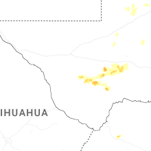
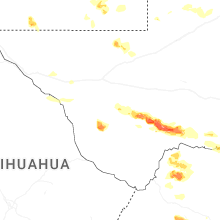

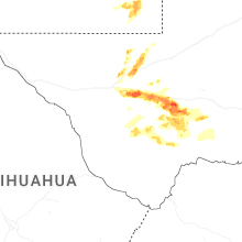
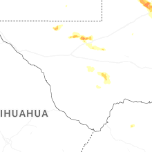
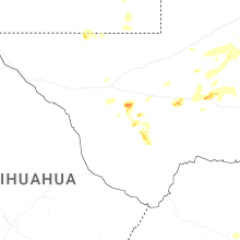
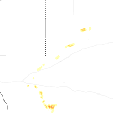
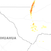


Connect with Interactive Hail Maps