

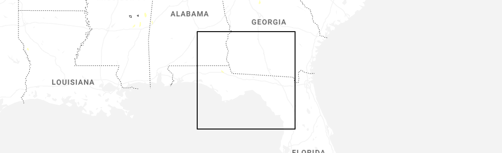
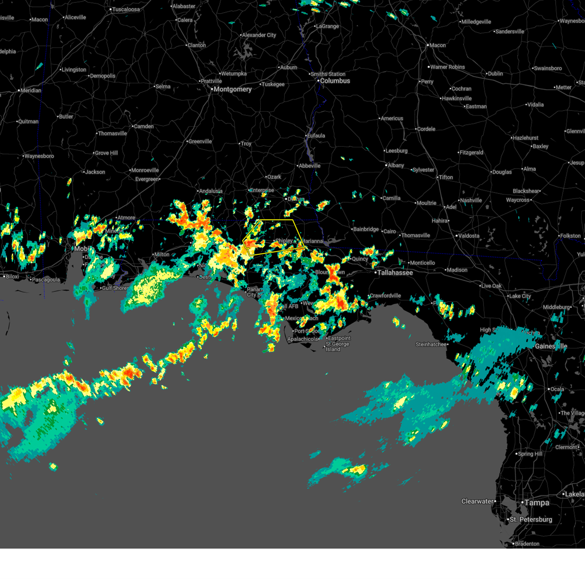
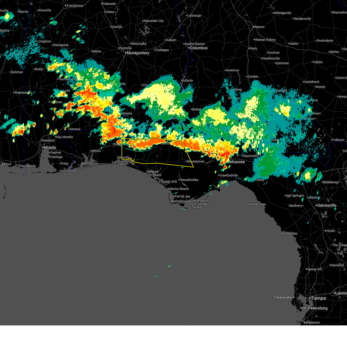
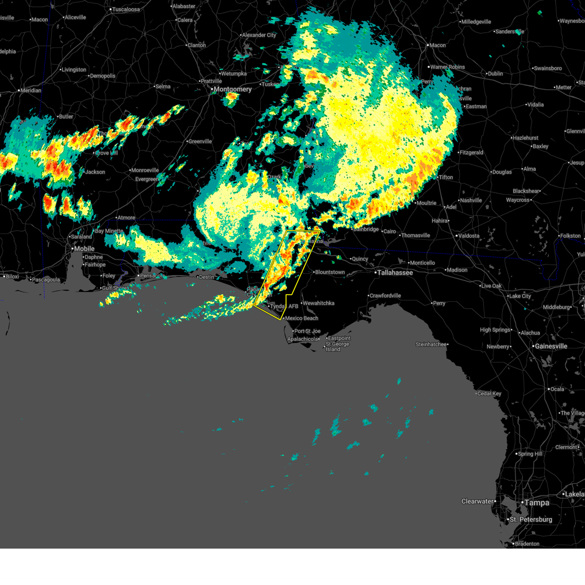
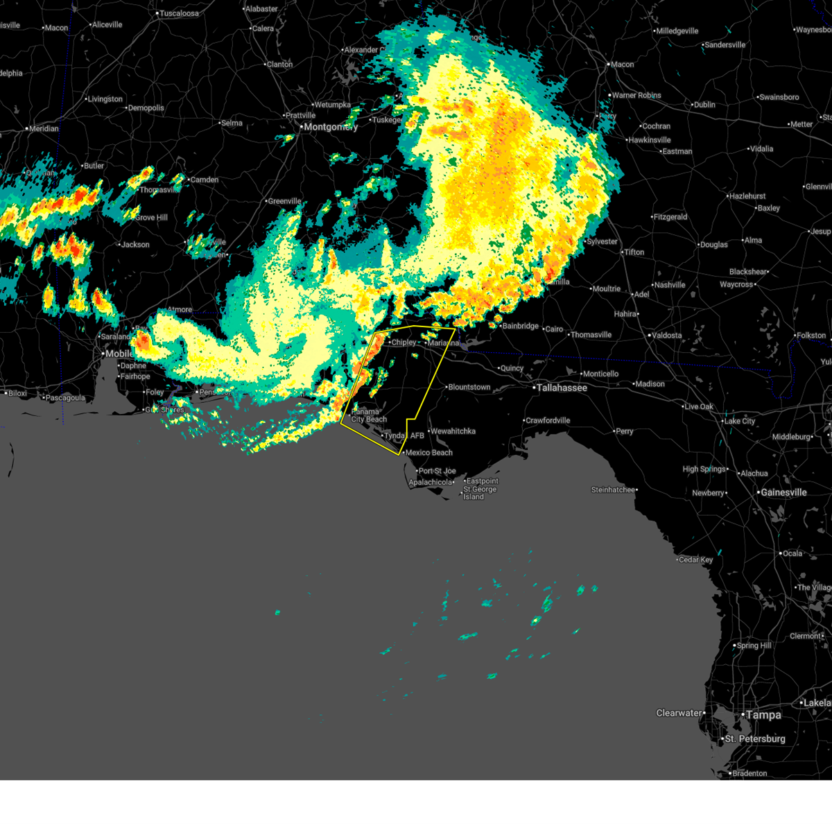
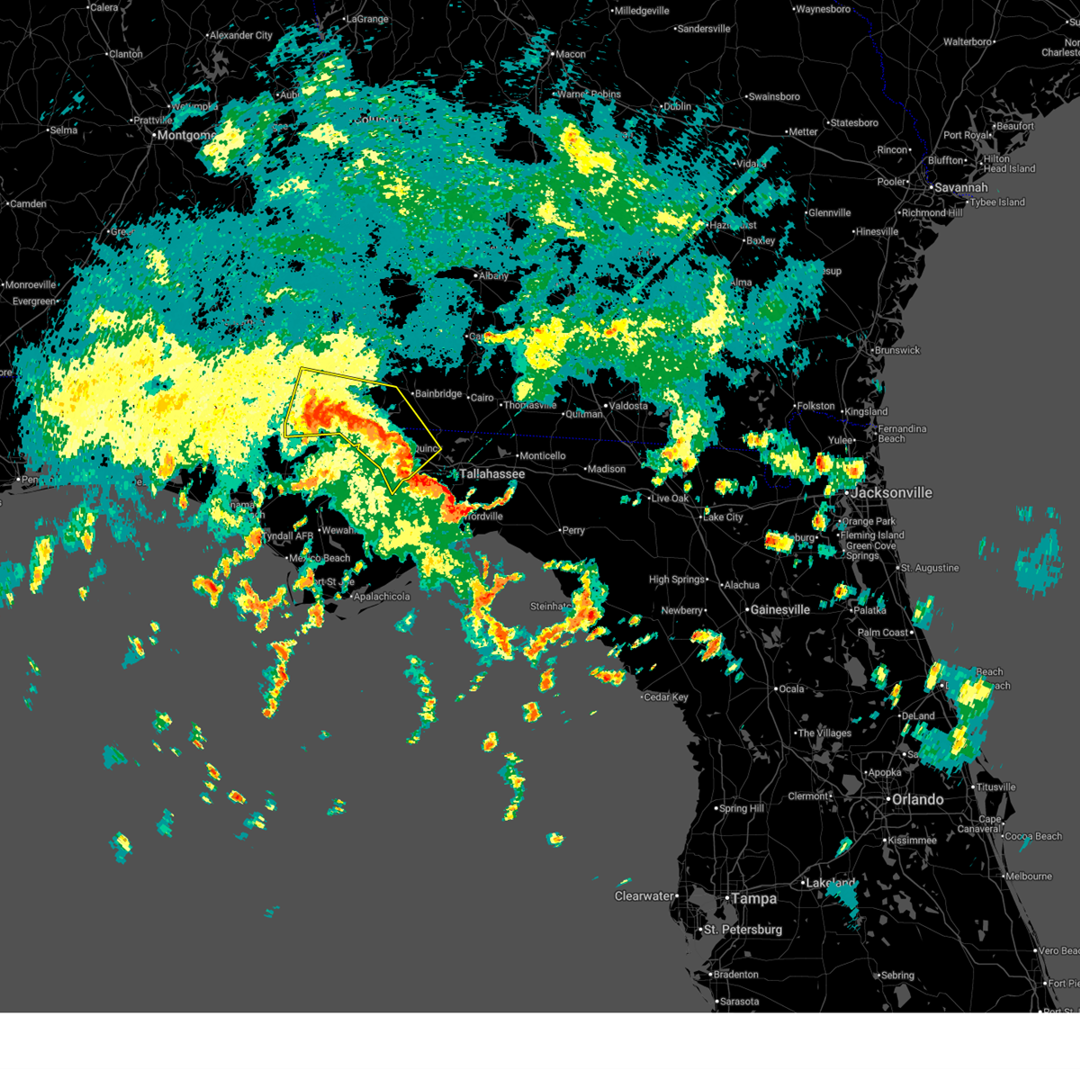
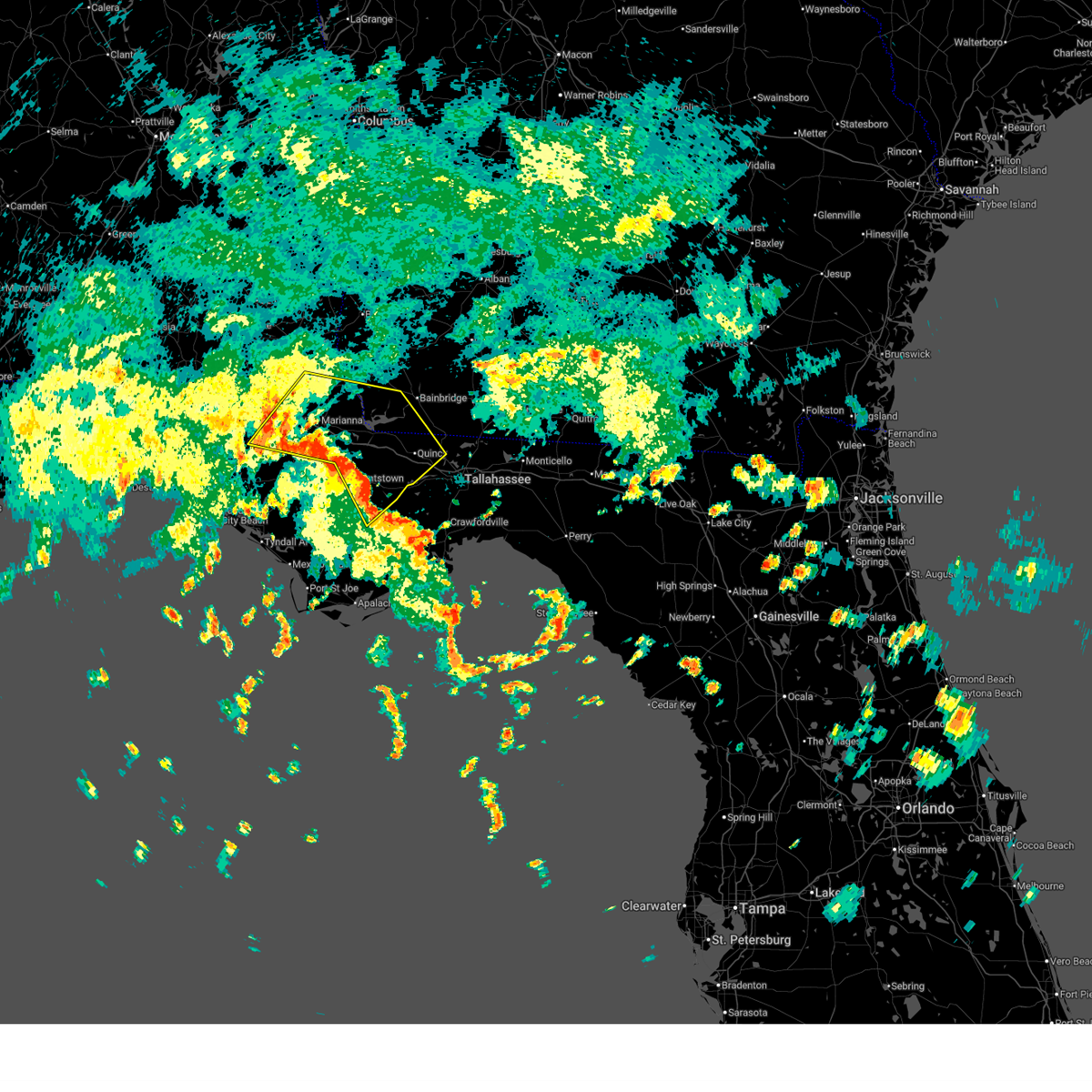
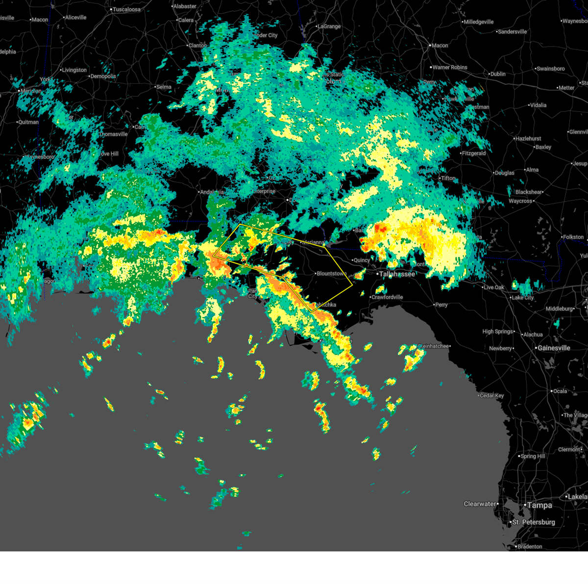
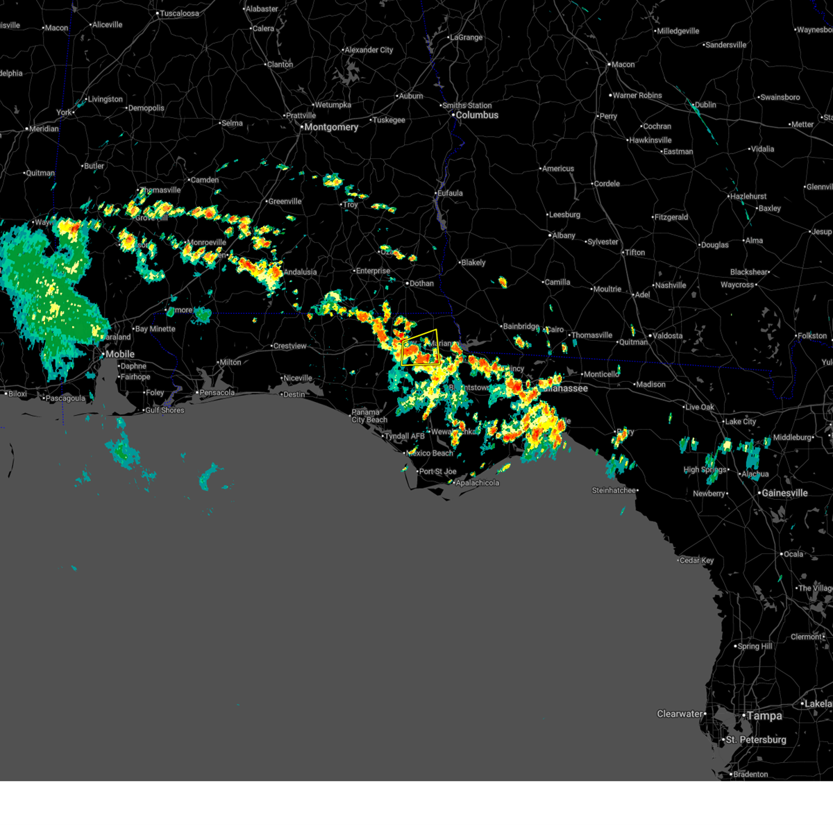
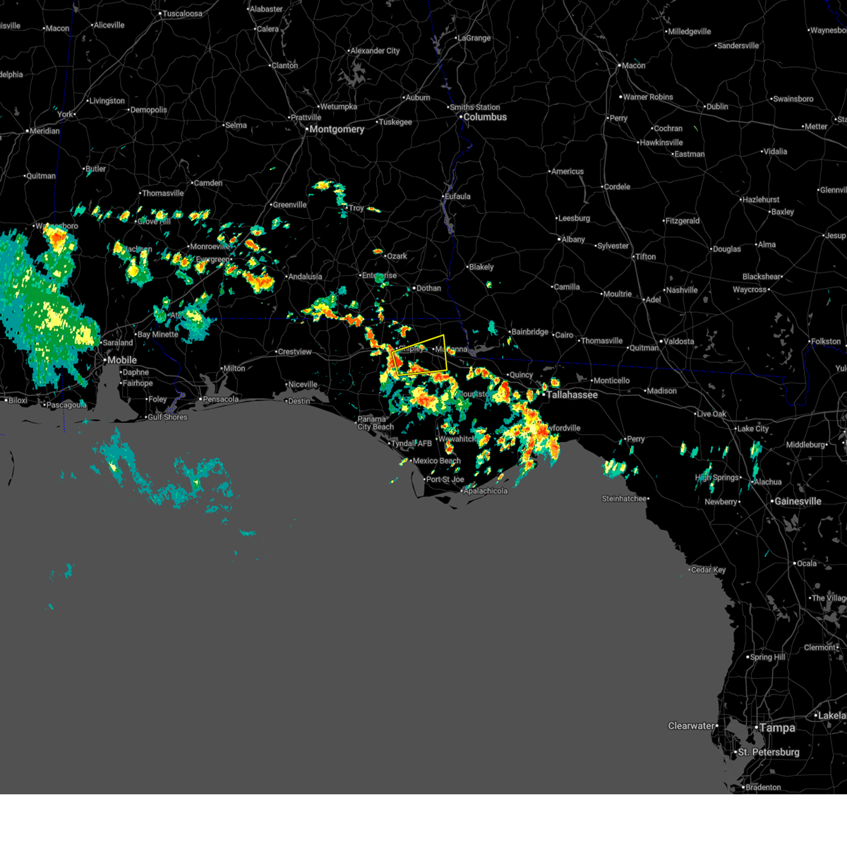
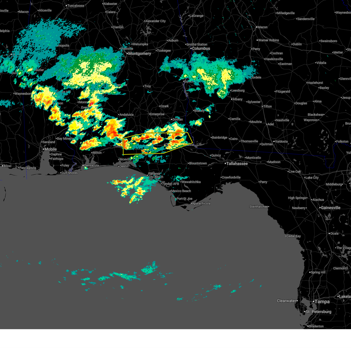
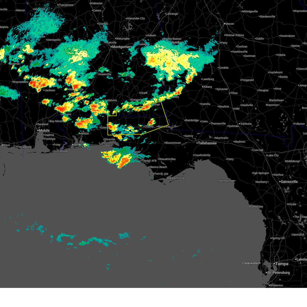
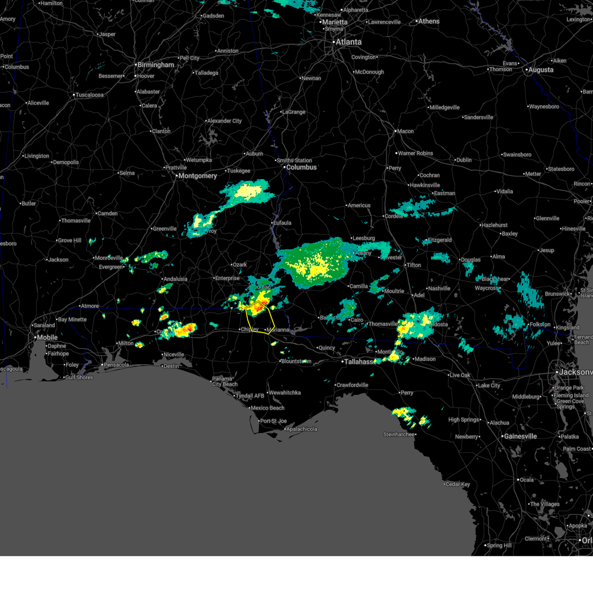
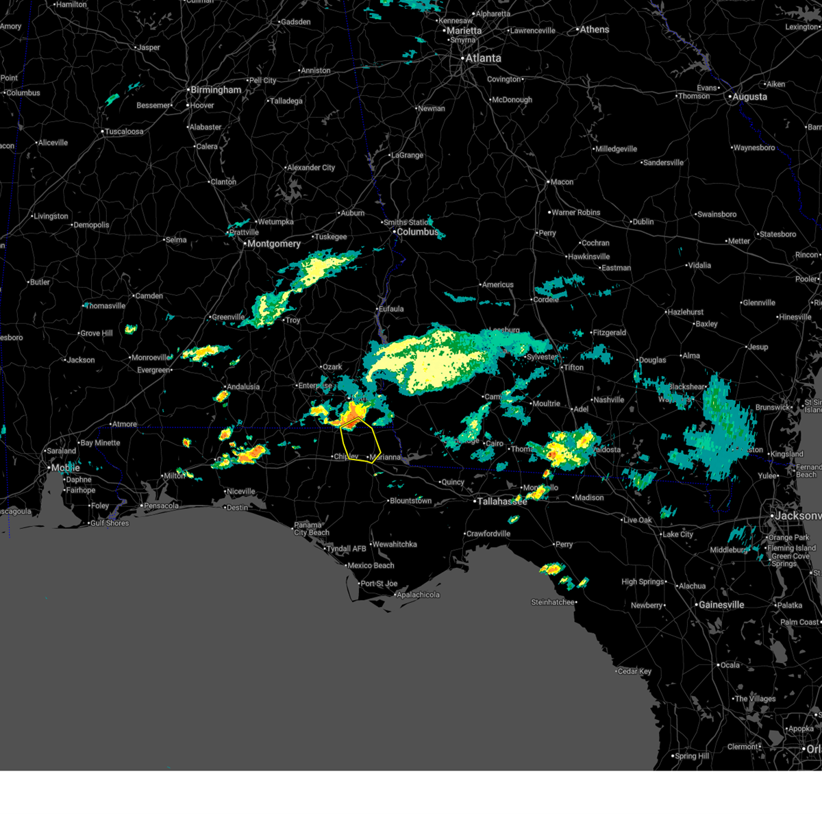
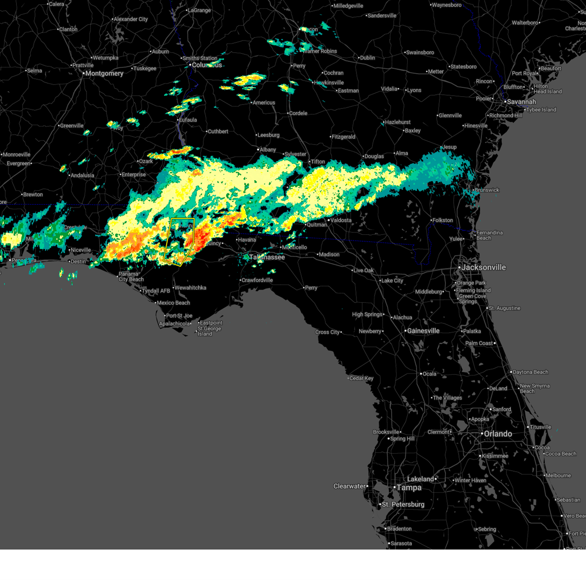
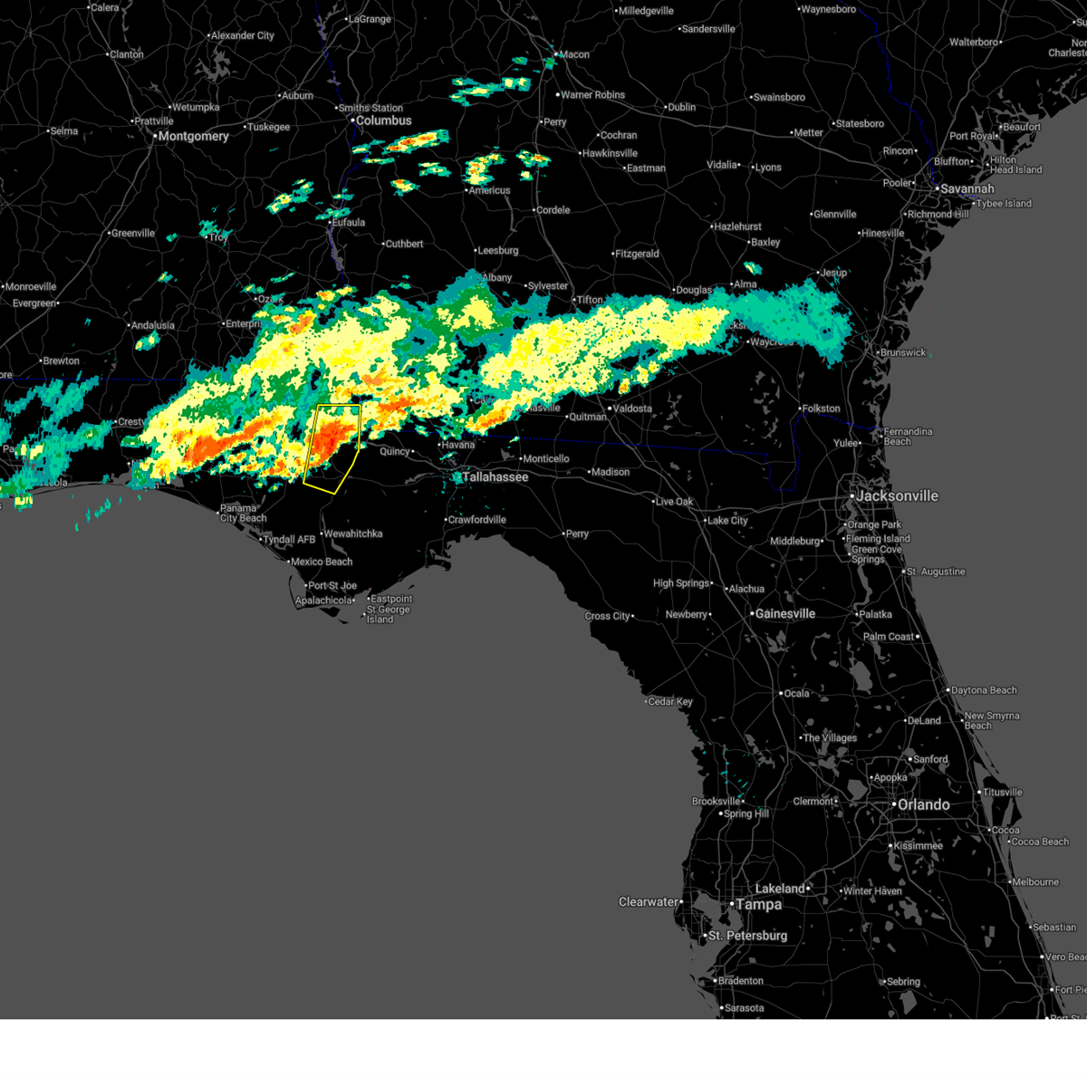
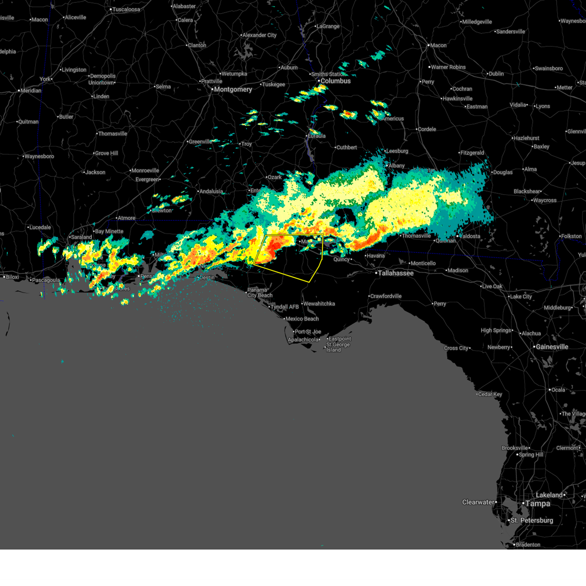
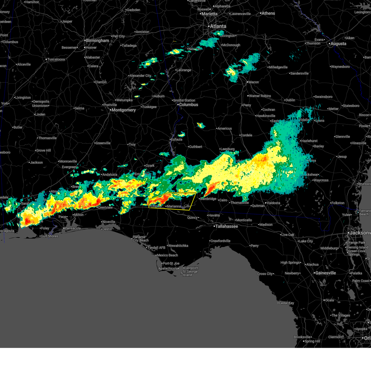
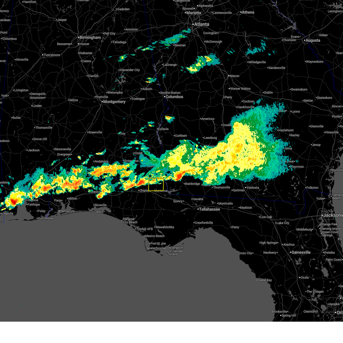
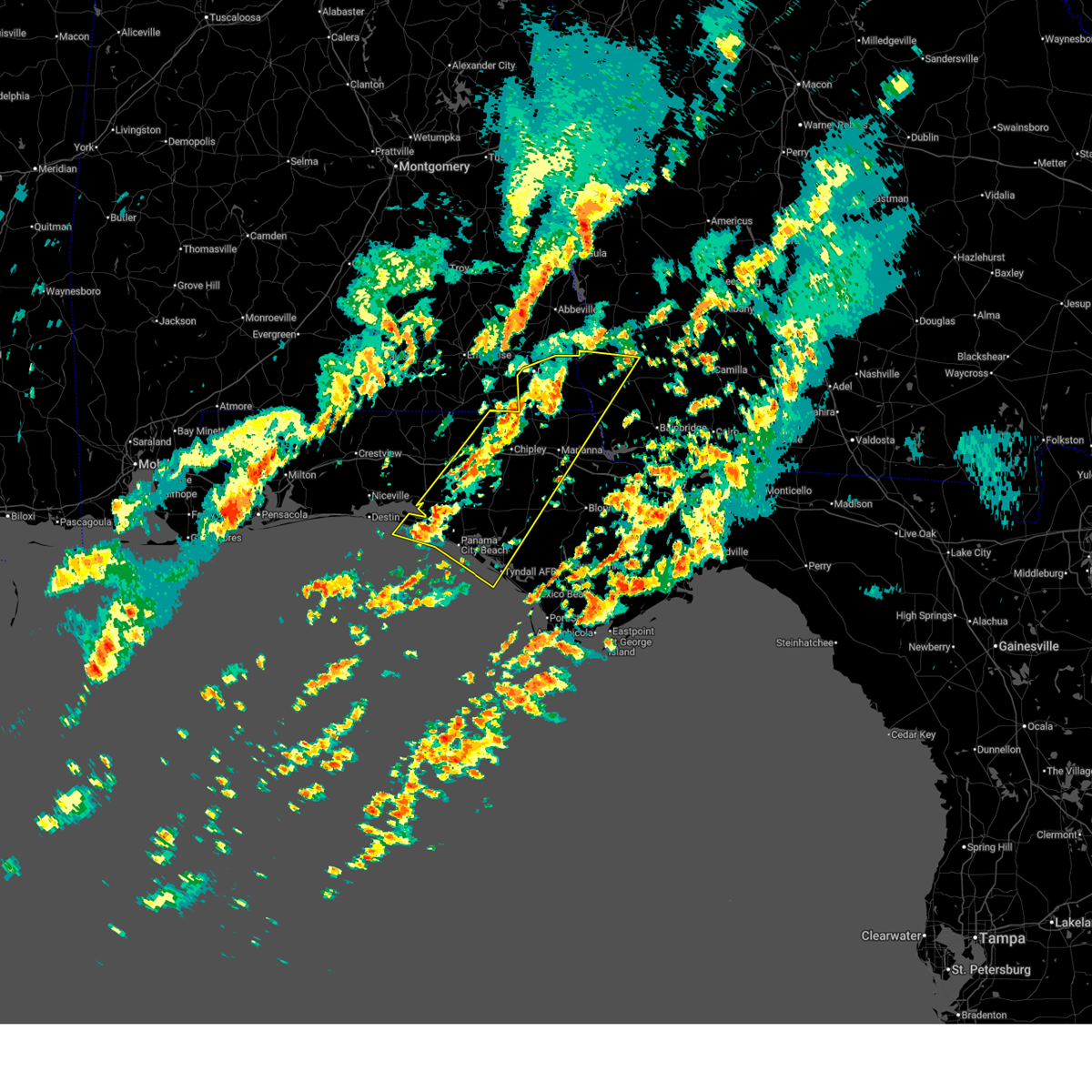
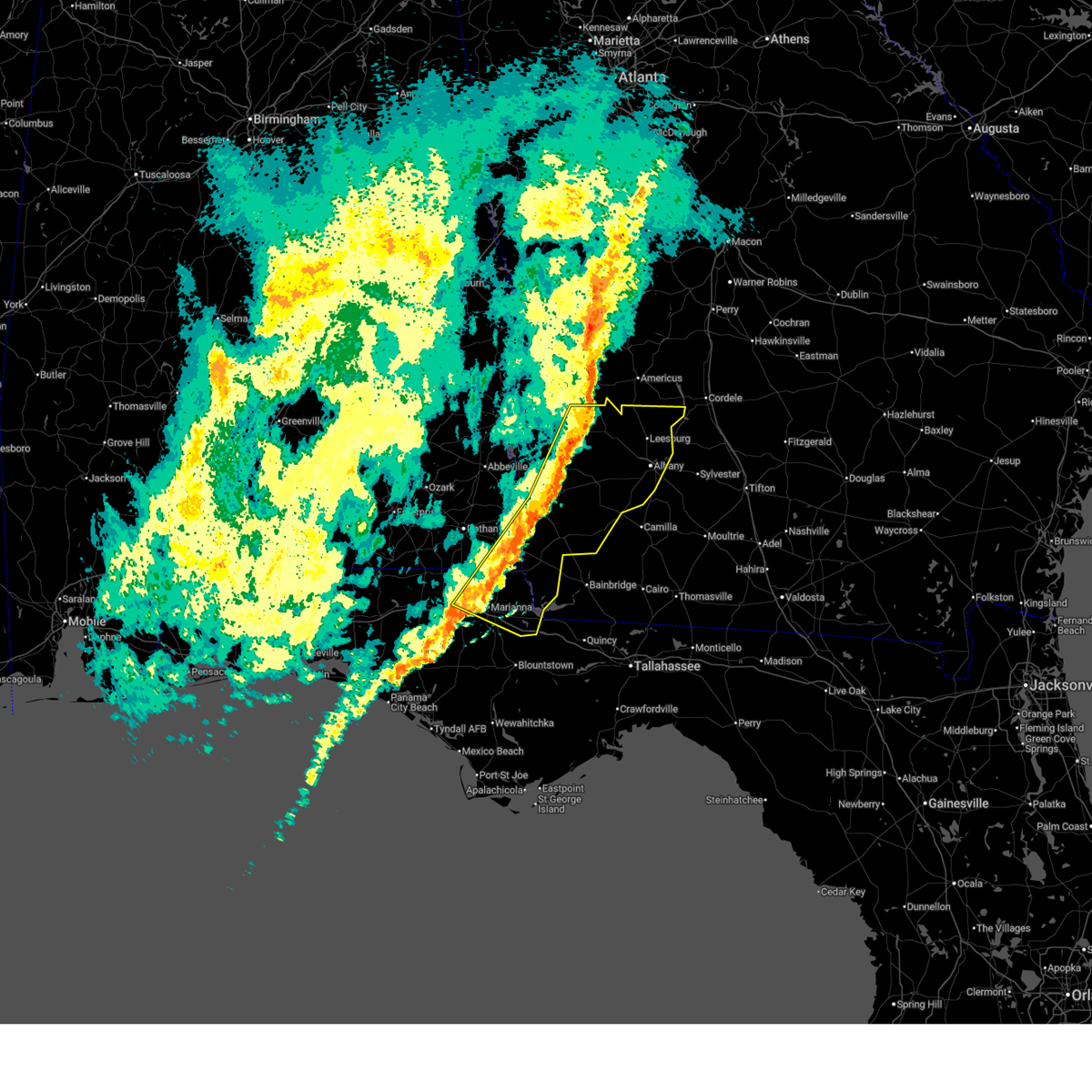
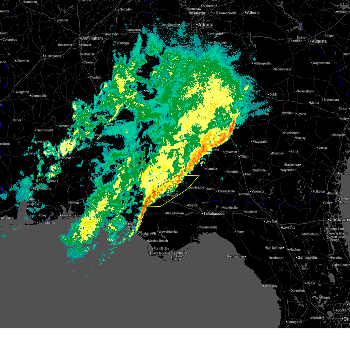
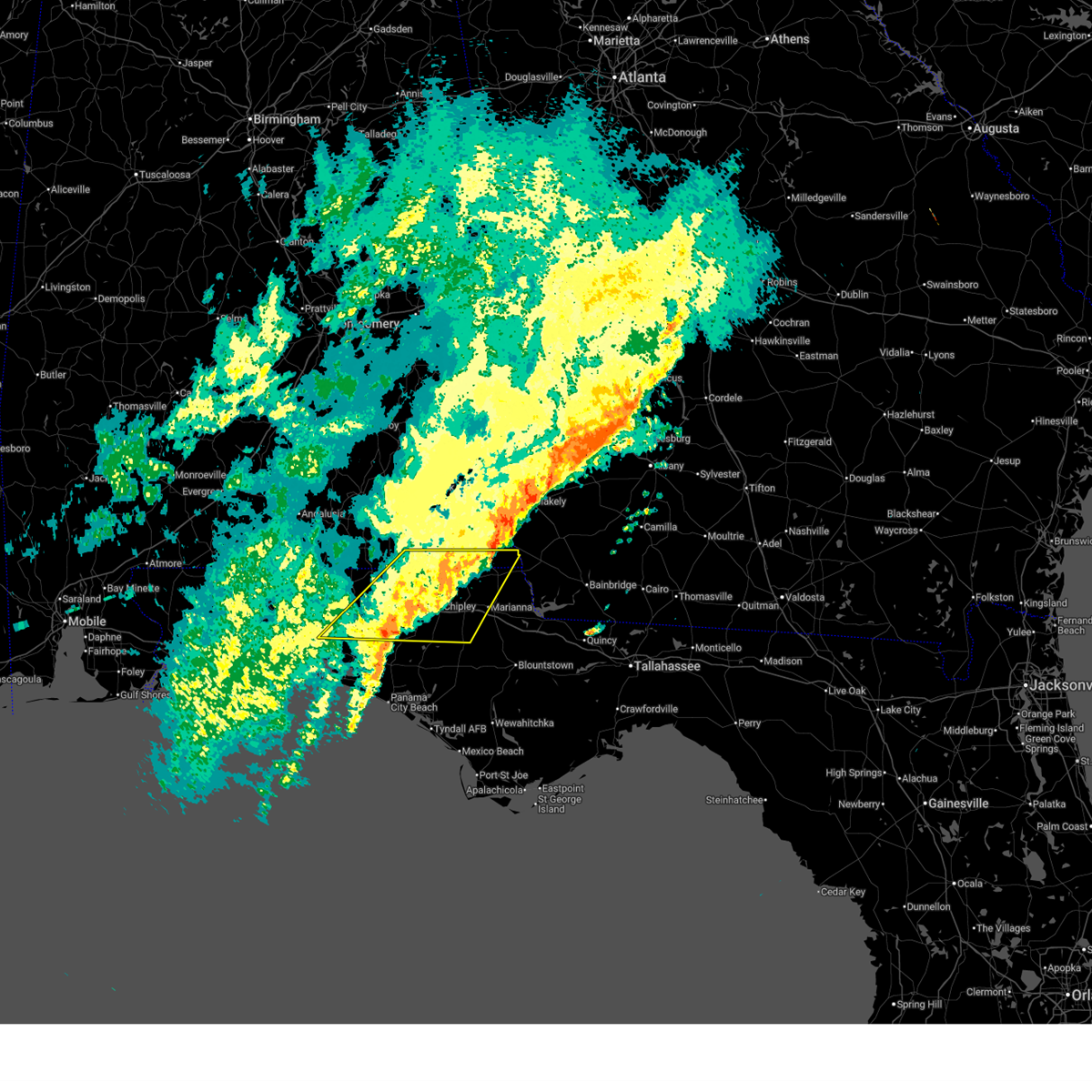
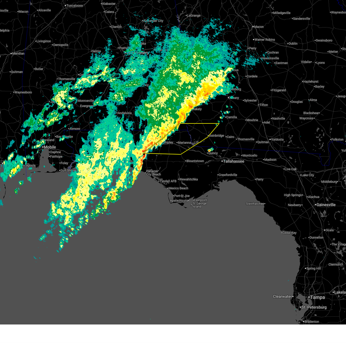
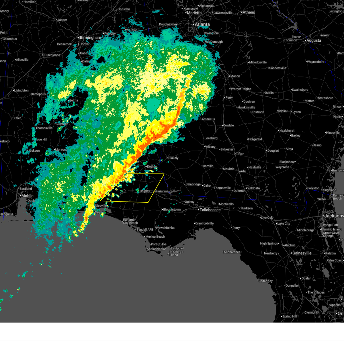
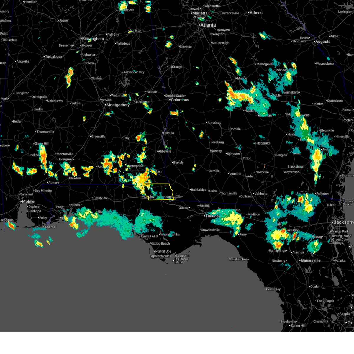
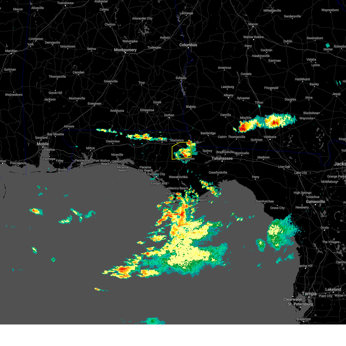
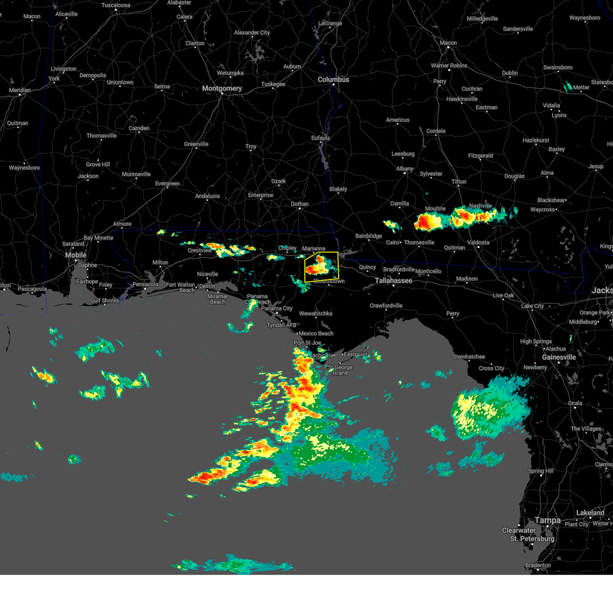
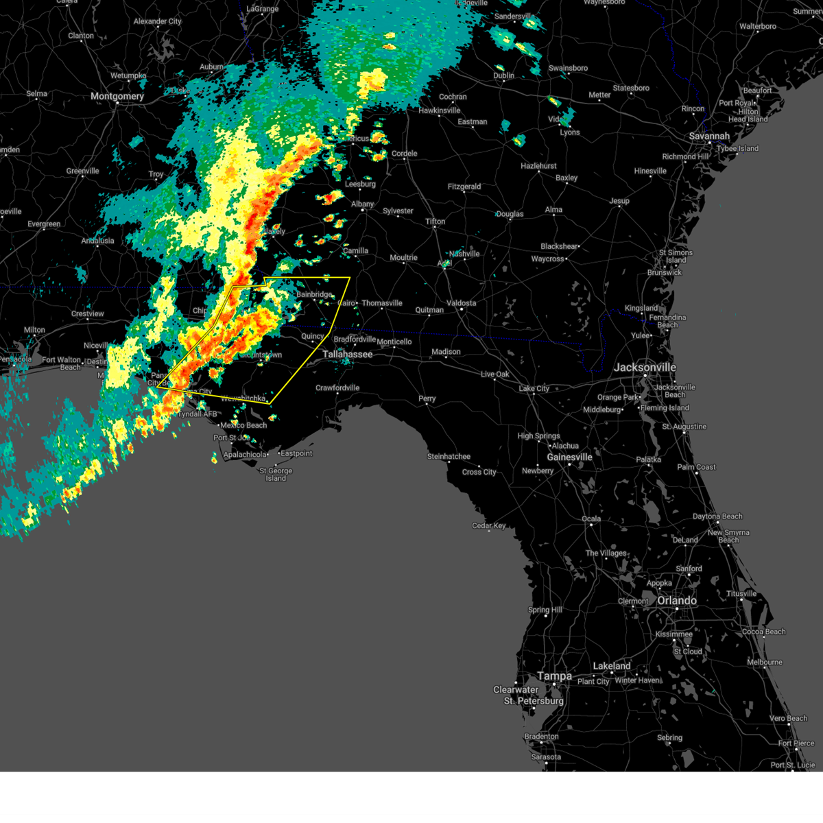
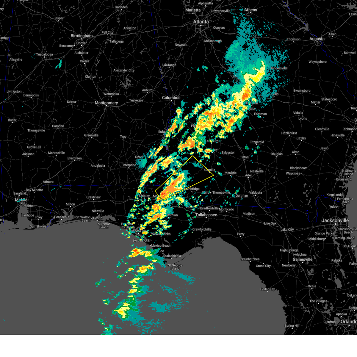
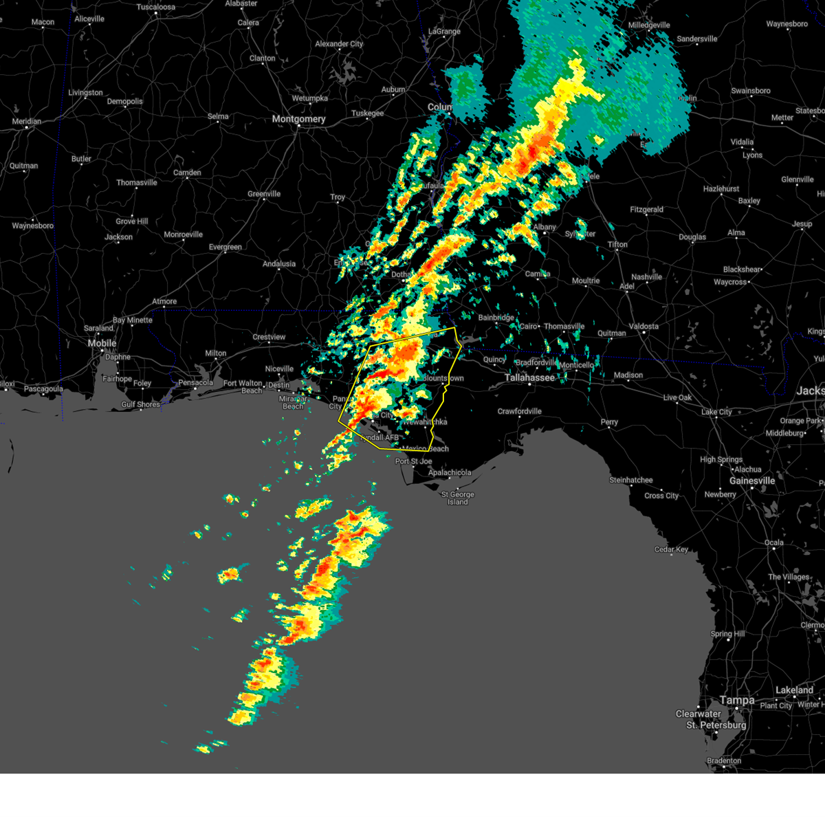
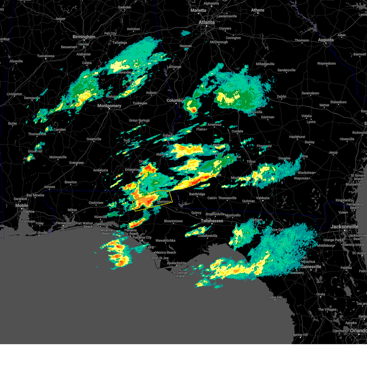
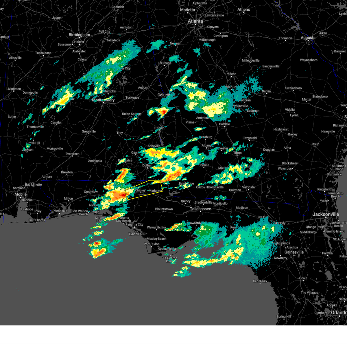
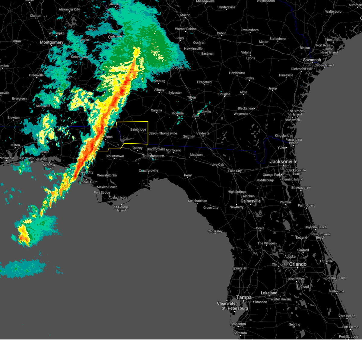
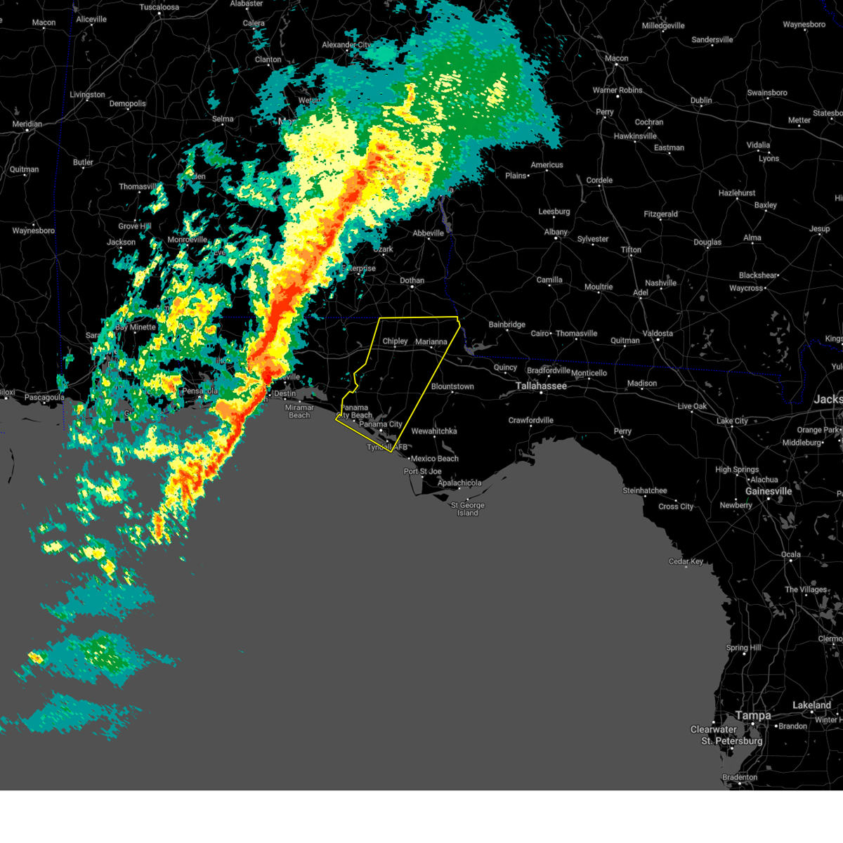
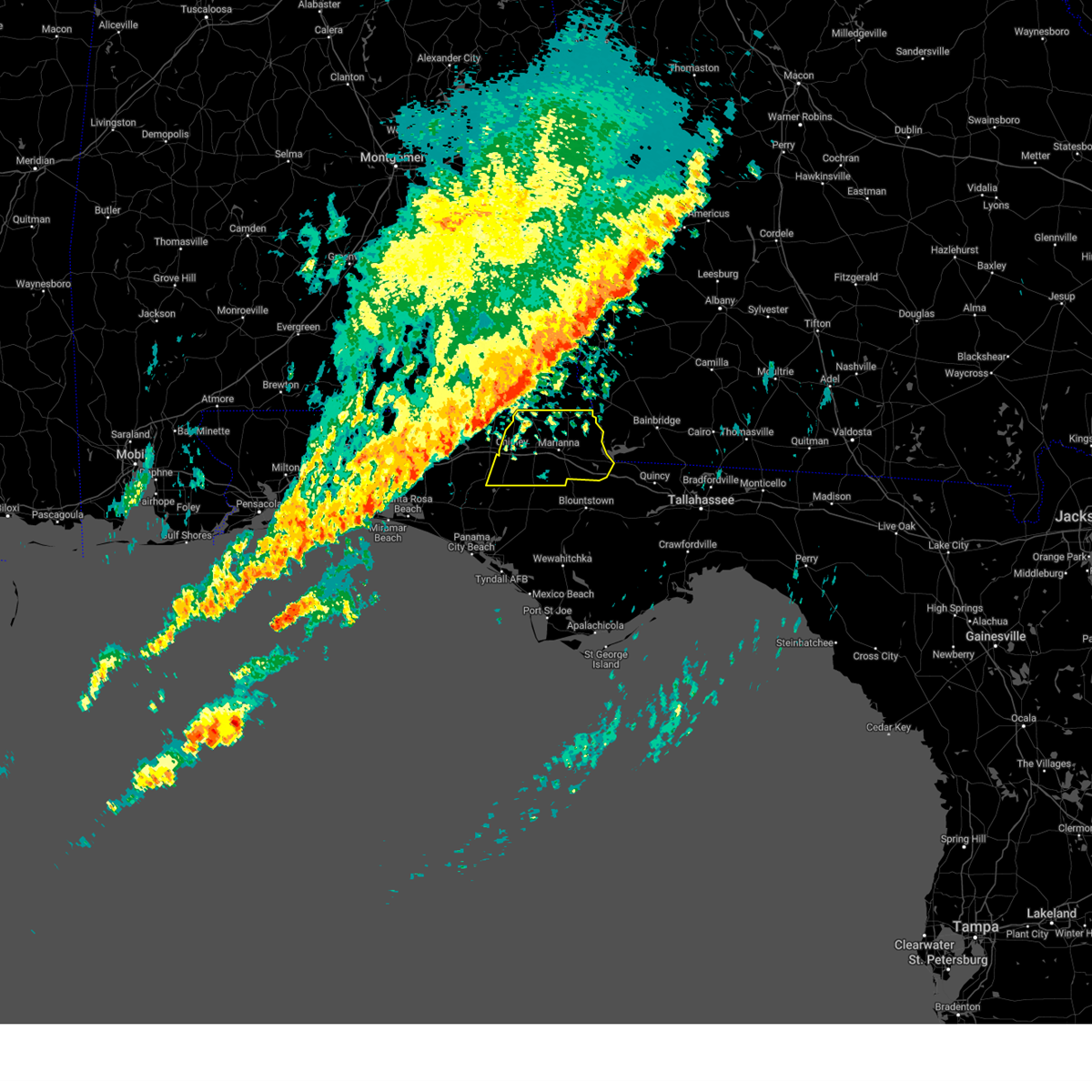
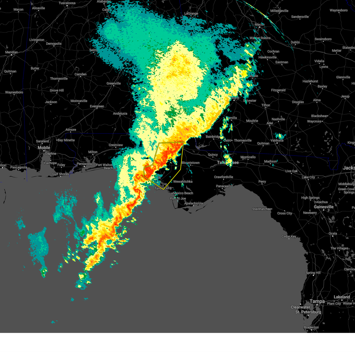
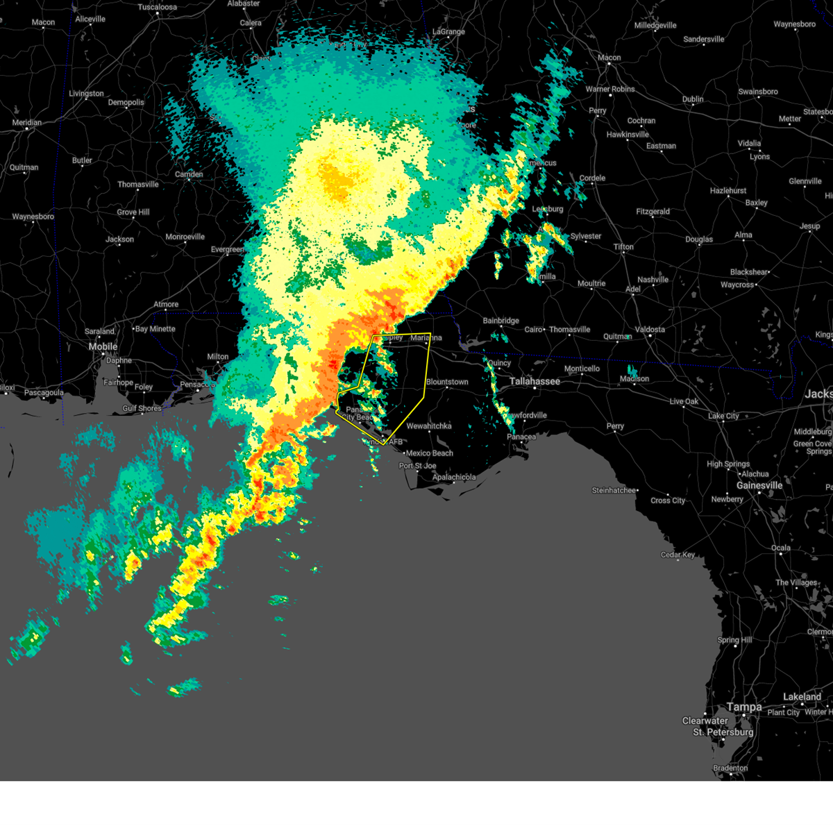
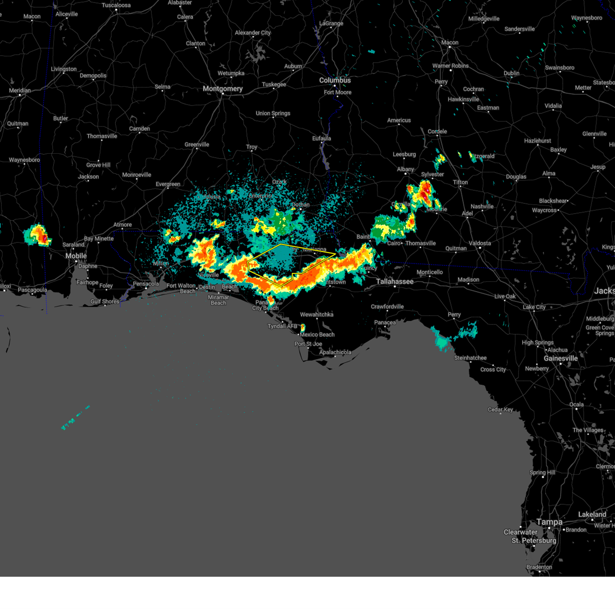
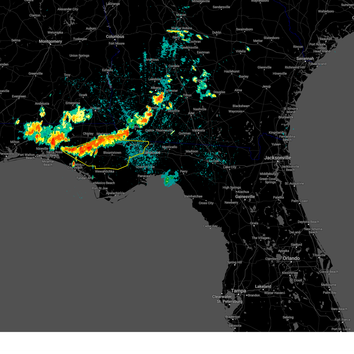
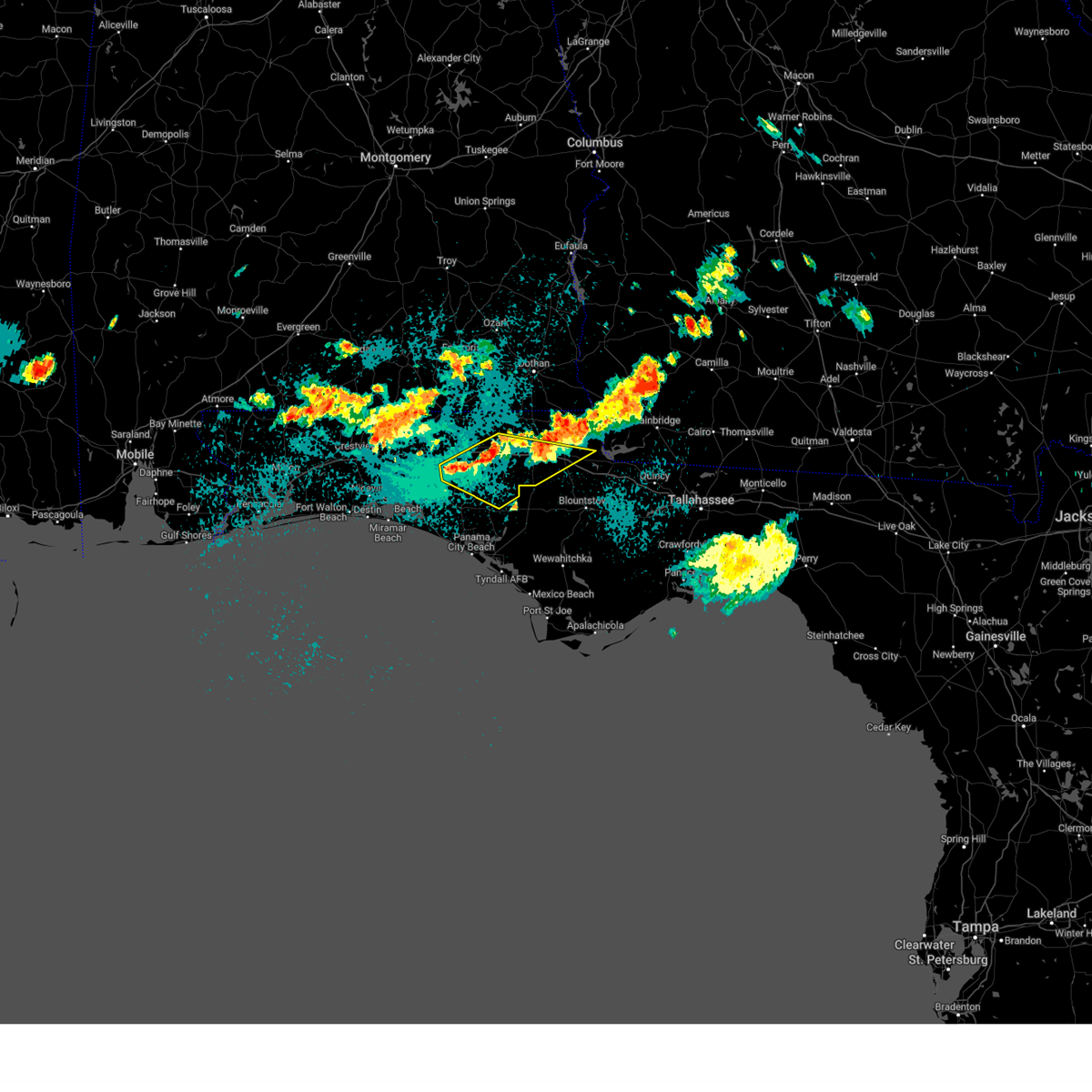
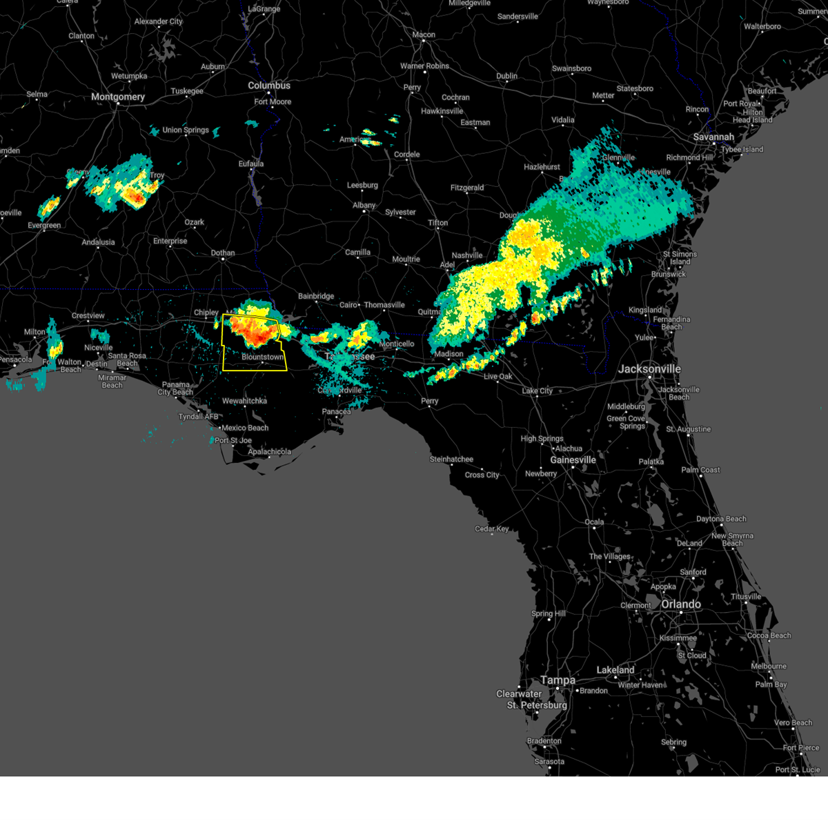
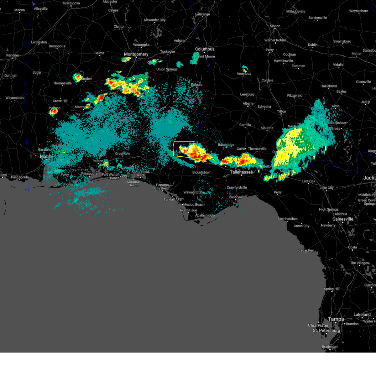
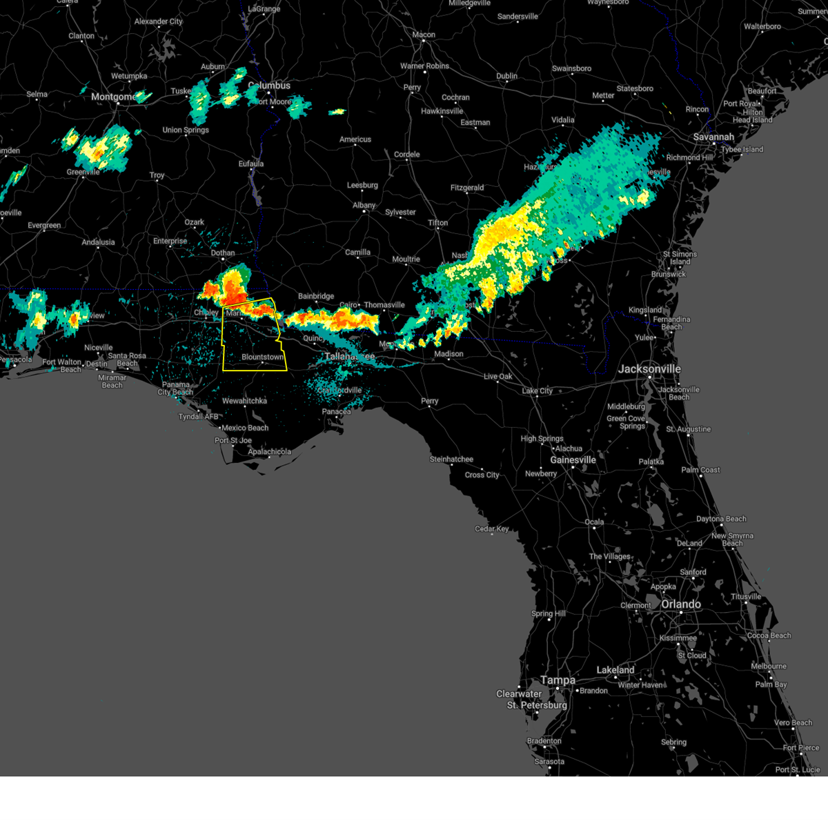
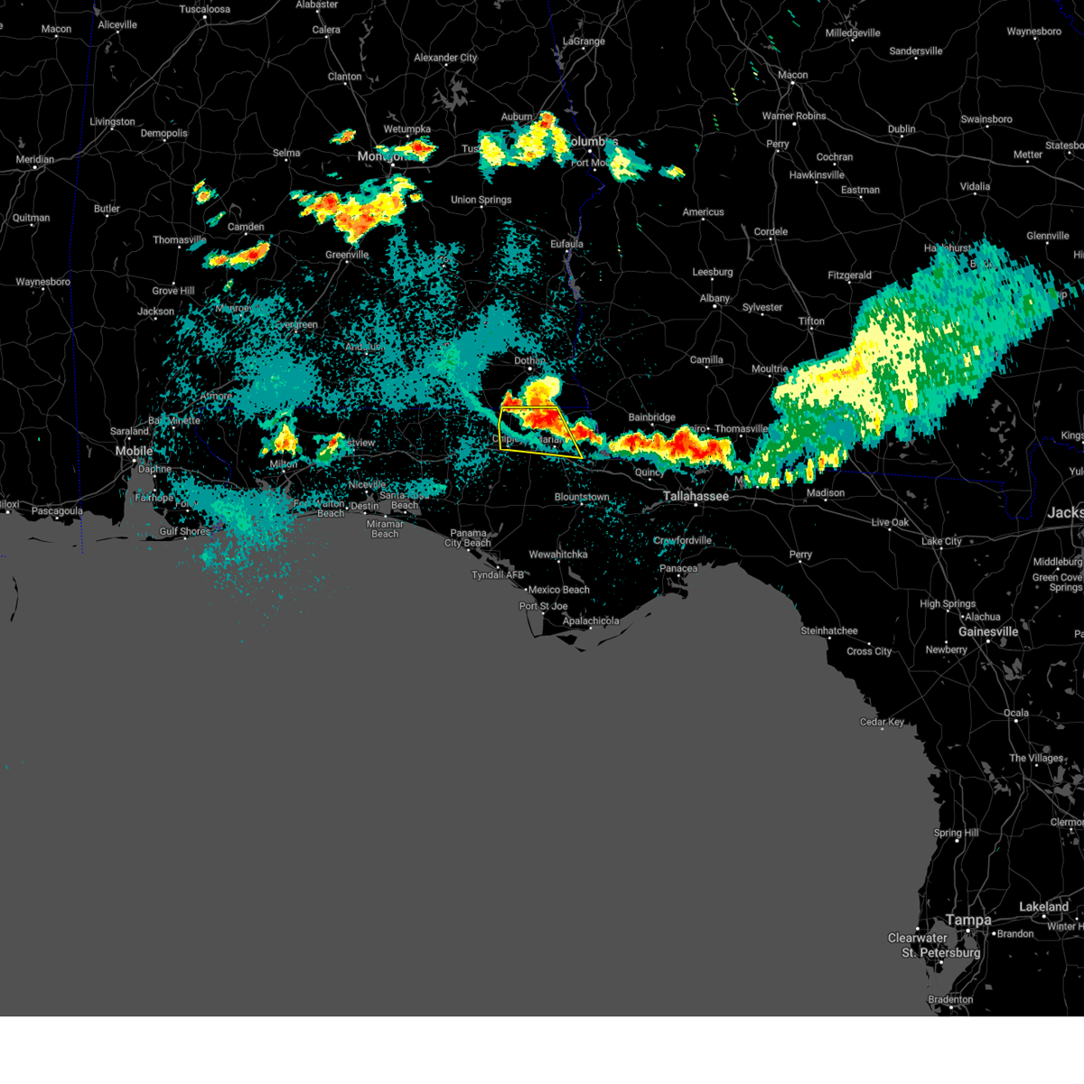
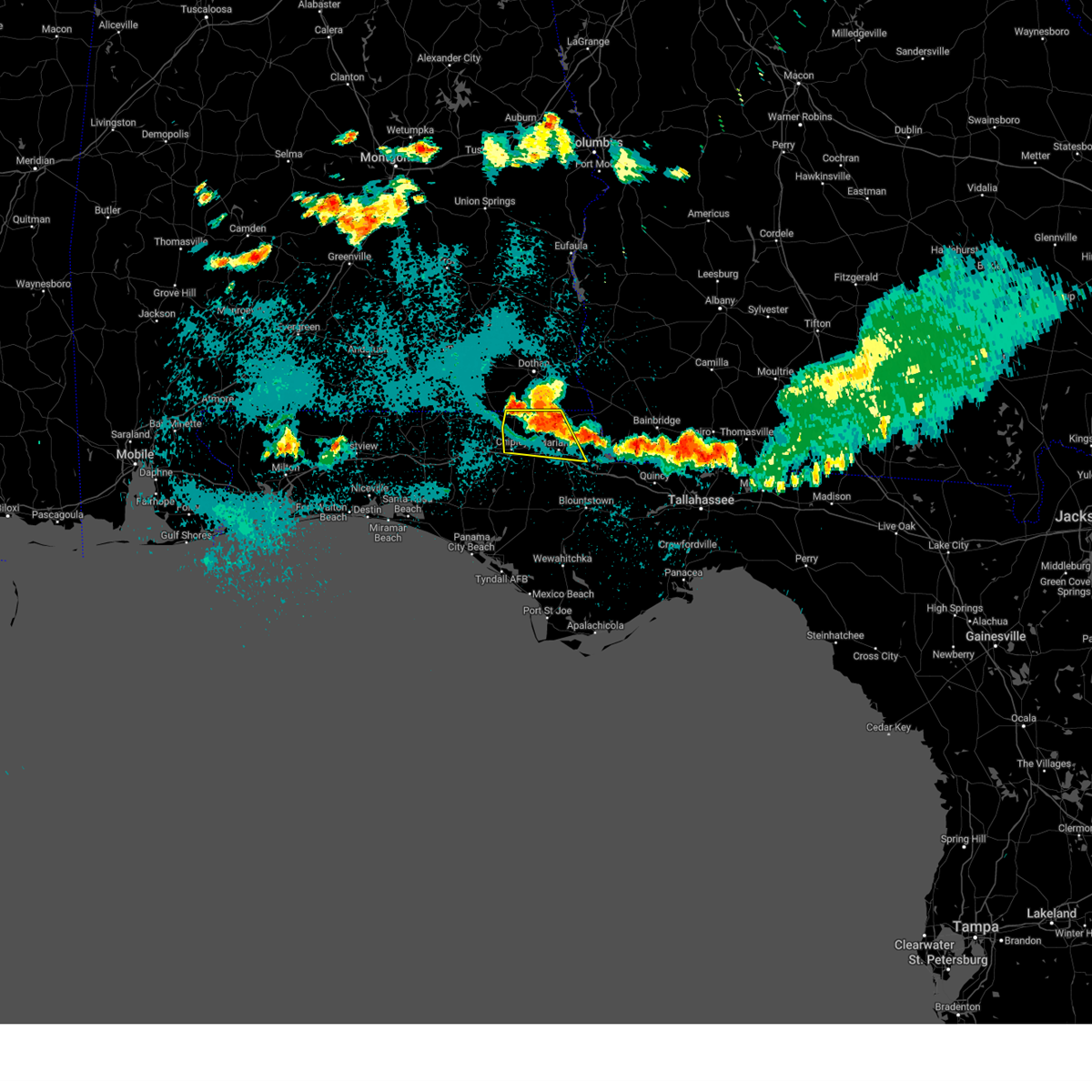
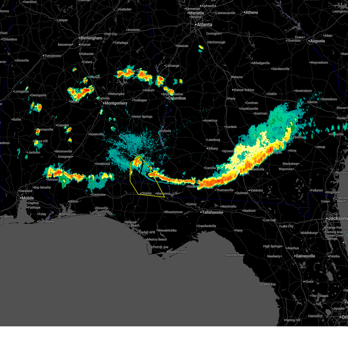
Hail Map for Marianna, FL
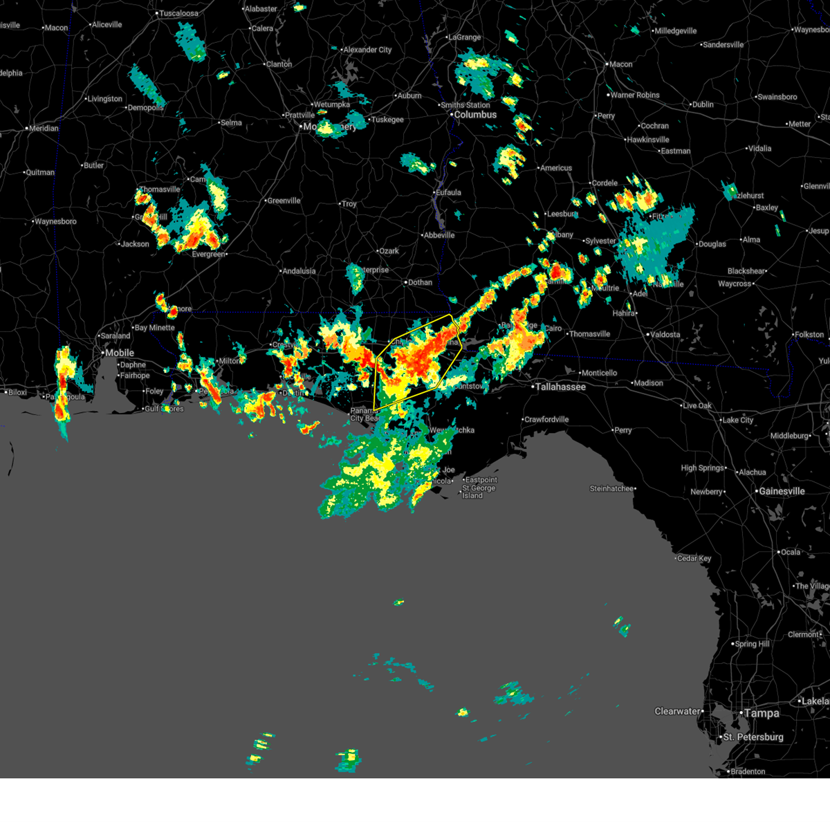
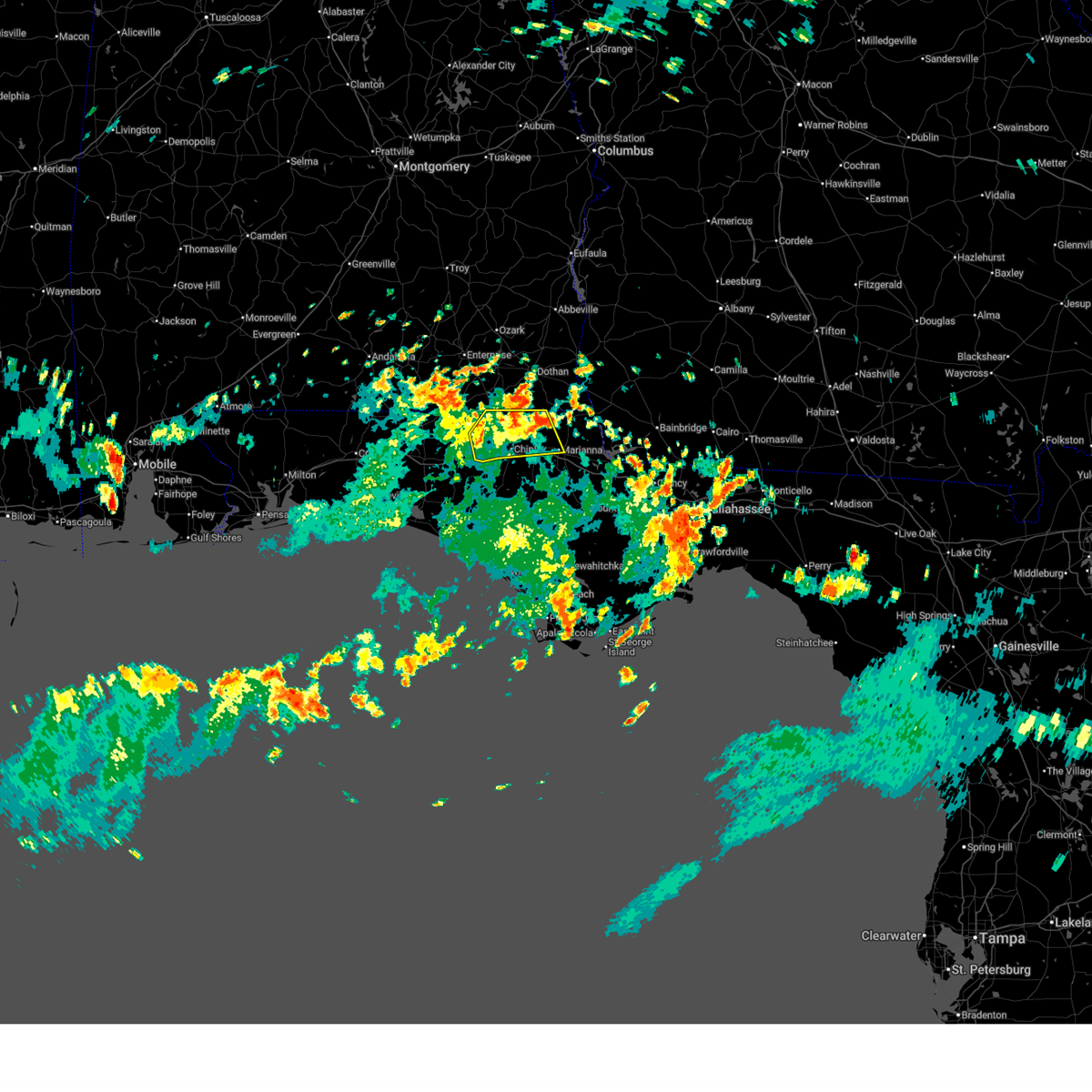
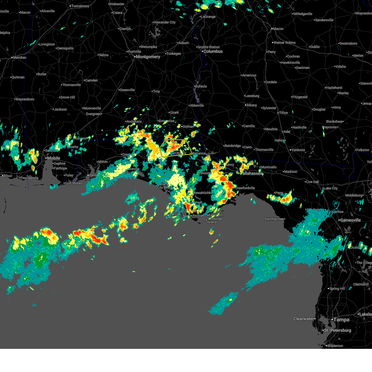
The Marianna, FL area has had 5 reports of on-the-ground hail by trained spotters, and has been under severe weather warnings 32 times during the past 12 months. Doppler radar has detected hail at or near Marianna, FL on 60 occasions, including 3 occasions during the past year.
| Name: | Marianna, FL |
| Where Located: | 61.8 miles WNW of Tallahassee, FL |
| Map: | Google Map for Marianna, FL |
| Population: | 6102 |
| Housing Units: | 3038 |
| More Info: | Search Google for Marianna, FL |
2
The Top Recent Hail Date for Marianna, FL is Wednesday, April 1, 2026 (4th out of 60)
Hail and Wind Damage Spotted near Marianna, FL
| Date / Time | Report Details |
|---|---|
| 7/18/2026 4:43 PM CDT |
 Svrtae the national weather service in tallahassee has issued a * severe thunderstorm warning for, jackson county in the panhandle of florida, northeastern bay county in the panhandle of florida, northwestern calhoun county in the panhandle of florida, eastern washington county in the panhandle of florida, * until 545 pm cdt. * at 443 pm cdt, severe thunderstorms were located along a line extending from 13 miles northwest of chattahoochee to 15 miles southeast of vernon, moving south at 10 mph (radar indicated). Hazards include 60 mph wind gusts. expect damage to roofs, siding, and trees Svrtae the national weather service in tallahassee has issued a * severe thunderstorm warning for, jackson county in the panhandle of florida, northeastern bay county in the panhandle of florida, northwestern calhoun county in the panhandle of florida, eastern washington county in the panhandle of florida, * until 545 pm cdt. * at 443 pm cdt, severe thunderstorms were located along a line extending from 13 miles northwest of chattahoochee to 15 miles southeast of vernon, moving south at 10 mph (radar indicated). Hazards include 60 mph wind gusts. expect damage to roofs, siding, and trees
|
| 7/12/2026 12:53 PM CDT |
 the severe thunderstorm warning has been cancelled and is no longer in effect the severe thunderstorm warning has been cancelled and is no longer in effect
|
| 7/12/2026 12:32 PM CDT |
 At 1232 pm cdt, a severe thunderstorm was located near chipley, moving northeast at 15 mph (radar indicated). Hazards include 60 mph wind gusts. Expect damage to roofs, siding, and trees. Locations impacted include, chipley, graceville, bonifay, marianna, cottondale, caryville, esto, campbellton, noma, richter crossroads, tendil crossing, holland crossroads, cobb crossroads, jacobs, noma junction, bahoma, ellaville, johnson crossroads, miller crossroads, and jacob city. At 1232 pm cdt, a severe thunderstorm was located near chipley, moving northeast at 15 mph (radar indicated). Hazards include 60 mph wind gusts. Expect damage to roofs, siding, and trees. Locations impacted include, chipley, graceville, bonifay, marianna, cottondale, caryville, esto, campbellton, noma, richter crossroads, tendil crossing, holland crossroads, cobb crossroads, jacobs, noma junction, bahoma, ellaville, johnson crossroads, miller crossroads, and jacob city.
|
| 7/12/2026 12:07 PM CDT |
 Svrtae the national weather service in tallahassee has issued a * severe thunderstorm warning for, northwestern jackson county in the panhandle of florida, central holmes county in the panhandle of florida, northeastern washington county in the panhandle of florida, * until 115 pm cdt. * at 1207 pm cdt, a severe thunderstorm was located 8 miles west of bonifay, moving northeast at 10 mph (radar indicated). Hazards include 60 mph wind gusts. expect damage to roofs, siding, and trees Svrtae the national weather service in tallahassee has issued a * severe thunderstorm warning for, northwestern jackson county in the panhandle of florida, central holmes county in the panhandle of florida, northeastern washington county in the panhandle of florida, * until 115 pm cdt. * at 1207 pm cdt, a severe thunderstorm was located 8 miles west of bonifay, moving northeast at 10 mph (radar indicated). Hazards include 60 mph wind gusts. expect damage to roofs, siding, and trees
|
| 6/19/2026 2:30 PM CDT | Jackson county 911 call center reported a tree down along woodbriar drive near mariann in jackson county FL, 1.3 miles S of Marianna, FL |
| 6/19/2026 1:56 PM CDT |
 Svrtae the national weather service in tallahassee has issued a * severe thunderstorm warning for, southwestern jackson county in the panhandle of florida, northern bay county in the panhandle of florida, northern calhoun county in the panhandle of florida, walton county in the panhandle of florida, southern holmes county in the panhandle of florida, northwestern liberty county in big bend florida, washington county in the panhandle of florida, * until 400 pm edt/300 pm cdt/. * at 256 pm edt/156 pm cdt/, severe thunderstorms were located along a line extending from 10 miles north of blountstown to 13 miles southeast of chipley to near vernon to 12 miles southwest of bonifay to 9 miles southeast of de funiak springs to 9 miles northwest of eglin air force base, moving south at 25 mph (radar indicated). Hazards include 60 mph wind gusts. expect damage to roofs, siding, and trees Svrtae the national weather service in tallahassee has issued a * severe thunderstorm warning for, southwestern jackson county in the panhandle of florida, northern bay county in the panhandle of florida, northern calhoun county in the panhandle of florida, walton county in the panhandle of florida, southern holmes county in the panhandle of florida, northwestern liberty county in big bend florida, washington county in the panhandle of florida, * until 400 pm edt/300 pm cdt/. * at 256 pm edt/156 pm cdt/, severe thunderstorms were located along a line extending from 10 miles north of blountstown to 13 miles southeast of chipley to near vernon to 12 miles southwest of bonifay to 9 miles southeast of de funiak springs to 9 miles northwest of eglin air force base, moving south at 25 mph (radar indicated). Hazards include 60 mph wind gusts. expect damage to roofs, siding, and trees
|
| 6/18/2026 11:05 PM CDT |
 At 1105 pm cdt, severe thunderstorms were located along a line extending from near marianna to near panama city, moving east at 40 mph (radar indicated). Hazards include 60 mph wind gusts. Expect damage to roofs, siding, and trees. Locations impacted include, panama city, lynn haven, callaway, marianna, springfield, hiland park, tyndall air force base, parker, cottondale, greenwood, altha, alford, moose pond, allanton, dirego park, college station, camps head, lovedale, bennett, and dellwood. At 1105 pm cdt, severe thunderstorms were located along a line extending from near marianna to near panama city, moving east at 40 mph (radar indicated). Hazards include 60 mph wind gusts. Expect damage to roofs, siding, and trees. Locations impacted include, panama city, lynn haven, callaway, marianna, springfield, hiland park, tyndall air force base, parker, cottondale, greenwood, altha, alford, moose pond, allanton, dirego park, college station, camps head, lovedale, bennett, and dellwood.
|
| 6/18/2026 10:35 PM CDT |
 Svrtae the national weather service in tallahassee has issued a * severe thunderstorm warning for, central jackson county in the panhandle of florida, bay county in the panhandle of florida, western calhoun county in the panhandle of florida, southeastern holmes county in the panhandle of florida, washington county in the panhandle of florida, * until 1130 pm cdt. * at 1034 pm cdt, severe thunderstorms were located along a line extending from near bonifay to 7 miles west of panama city beach, moving east at 40 mph (radar indicated). Hazards include 60 mph wind gusts. expect damage to roofs, siding, and trees Svrtae the national weather service in tallahassee has issued a * severe thunderstorm warning for, central jackson county in the panhandle of florida, bay county in the panhandle of florida, western calhoun county in the panhandle of florida, southeastern holmes county in the panhandle of florida, washington county in the panhandle of florida, * until 1130 pm cdt. * at 1034 pm cdt, severe thunderstorms were located along a line extending from near bonifay to 7 miles west of panama city beach, moving east at 40 mph (radar indicated). Hazards include 60 mph wind gusts. expect damage to roofs, siding, and trees
|
| 6/16/2026 4:13 PM CDT |
 At 513 pm edt/413 pm cdt/, severe thunderstorms were located along a line extending from near marianna to near chattahoochee to 6 miles south of quincy, moving east at 35 mph (radar indicated). Hazards include 60 mph wind gusts. Expect damage to roofs, siding, and trees. Locations impacted include, cottonwood, quincy, havana, marianna, midway, greensboro, chattahoochee, malone, sneads, gretna, cottondale, grand ridge, greenwood, alford, bascom, juniper, douglas city, grangeburg, florence, and jamieson. At 513 pm edt/413 pm cdt/, severe thunderstorms were located along a line extending from near marianna to near chattahoochee to 6 miles south of quincy, moving east at 35 mph (radar indicated). Hazards include 60 mph wind gusts. Expect damage to roofs, siding, and trees. Locations impacted include, cottonwood, quincy, havana, marianna, midway, greensboro, chattahoochee, malone, sneads, gretna, cottondale, grand ridge, greenwood, alford, bascom, juniper, douglas city, grangeburg, florence, and jamieson.
|
| 6/16/2026 4:00 PM CDT | Fhp reports possible tree down in the area of damascus loop and kynesville roa in jackson county FL, 3.7 miles NE of Marianna, FL |
| 6/16/2026 4:51 PM EDT |
 Svrtae the national weather service in tallahassee has issued a * severe thunderstorm warning for, south central houston county in southeastern alabama, jackson county in the panhandle of florida, northeastern calhoun county in the panhandle of florida, gadsden county in big bend florida, northern liberty county in big bend florida, northeastern washington county in the panhandle of florida, southwestern decatur county in southwestern georgia, central seminole county in southwestern georgia, * until 545 pm edt/445 pm cdt/. * at 450 pm edt/350 pm cdt/, severe thunderstorms were located along a line extending from 7 miles southwest of chipley to 11 miles north of blountstown to 21 miles south of greensboro, moving northeast at 35 mph (radar indicated). Hazards include 60 mph wind gusts. expect damage to roofs, siding, and trees Svrtae the national weather service in tallahassee has issued a * severe thunderstorm warning for, south central houston county in southeastern alabama, jackson county in the panhandle of florida, northeastern calhoun county in the panhandle of florida, gadsden county in big bend florida, northern liberty county in big bend florida, northeastern washington county in the panhandle of florida, southwestern decatur county in southwestern georgia, central seminole county in southwestern georgia, * until 545 pm edt/445 pm cdt/. * at 450 pm edt/350 pm cdt/, severe thunderstorms were located along a line extending from 7 miles southwest of chipley to 11 miles north of blountstown to 21 miles south of greensboro, moving northeast at 35 mph (radar indicated). Hazards include 60 mph wind gusts. expect damage to roofs, siding, and trees
|
| 6/16/2026 3:15 PM CDT |
 Svrtae the national weather service in tallahassee has issued a * severe thunderstorm warning for, southern jackson county in the panhandle of florida, north central gulf county in the panhandle of florida, northeastern bay county in the panhandle of florida, calhoun county in the panhandle of florida, northwestern wakulla county in big bend florida, central walton county in the panhandle of florida, southwestern gadsden county in big bend florida, holmes county in the panhandle of florida, liberty county in big bend florida, washington county in the panhandle of florida, southwestern leon county in big bend florida, * until 500 pm edt/400 pm cdt/. * at 415 pm edt/315 pm cdt/, severe thunderstorms were located along a line extending from 6 miles southwest of de funiak springs to 20 miles west of blountstown to 15 miles northwest of carrabelle, moving northeast at 40 mph (radar indicated). Hazards include 60 mph wind gusts. expect damage to roofs, siding, and trees Svrtae the national weather service in tallahassee has issued a * severe thunderstorm warning for, southern jackson county in the panhandle of florida, north central gulf county in the panhandle of florida, northeastern bay county in the panhandle of florida, calhoun county in the panhandle of florida, northwestern wakulla county in big bend florida, central walton county in the panhandle of florida, southwestern gadsden county in big bend florida, holmes county in the panhandle of florida, liberty county in big bend florida, washington county in the panhandle of florida, southwestern leon county in big bend florida, * until 500 pm edt/400 pm cdt/. * at 415 pm edt/315 pm cdt/, severe thunderstorms were located along a line extending from 6 miles southwest of de funiak springs to 20 miles west of blountstown to 15 miles northwest of carrabelle, moving northeast at 40 mph (radar indicated). Hazards include 60 mph wind gusts. expect damage to roofs, siding, and trees
|
| 6/15/2026 11:48 AM CDT | Tree reported down on russ roa in jackson county FL, 5.4 miles SW of Marianna, FL |
| 6/15/2026 11:36 AM CDT |
 At 1136 am cdt, a severe thunderstorm was located near marianna, moving east at 25 mph (radar indicated). Hazards include 60 mph wind gusts. Expect damage to roofs, siding, and trees. Locations impacted include, marianna, cottondale, greenwood, alford, kynesville, ridgetop, blue spring, union city, steele city, sink creek, round lake, star, simsville, cottondale airport, chipola terrace, and marianna municipal a/p. At 1136 am cdt, a severe thunderstorm was located near marianna, moving east at 25 mph (radar indicated). Hazards include 60 mph wind gusts. Expect damage to roofs, siding, and trees. Locations impacted include, marianna, cottondale, greenwood, alford, kynesville, ridgetop, blue spring, union city, steele city, sink creek, round lake, star, simsville, cottondale airport, chipola terrace, and marianna municipal a/p.
|
| 6/15/2026 11:18 AM CDT |
 Svrtae the national weather service in tallahassee has issued a * severe thunderstorm warning for, southwestern jackson county in the panhandle of florida, northeastern washington county in the panhandle of florida, * until noon cdt. * at 1118 am cdt, a severe thunderstorm was located 7 miles southeast of chipley, moving east at 25 mph (radar indicated). Hazards include 60 mph wind gusts. expect damage to roofs, siding, and trees Svrtae the national weather service in tallahassee has issued a * severe thunderstorm warning for, southwestern jackson county in the panhandle of florida, northeastern washington county in the panhandle of florida, * until noon cdt. * at 1118 am cdt, a severe thunderstorm was located 7 miles southeast of chipley, moving east at 25 mph (radar indicated). Hazards include 60 mph wind gusts. expect damage to roofs, siding, and trees
|
| 6/1/2026 7:40 PM CDT |
 At 740 pm cdt, severe thunderstorms were located along a line extending from 12 miles northeast of marianna to chipley to 6 miles north of eglin air force base, moving south at 35 mph (radar indicated). Hazards include 60 mph wind gusts. Expect damage to roofs, siding, and trees. Locations impacted include, vernon, chipley, graceville, de funiak springs, bonifay, marianna, eglin air force base, bradford, union, liberty, malone, cottondale, greenwood, ponce de leon, alford, caryville, wausau, esto, westville, and campbellton. At 740 pm cdt, severe thunderstorms were located along a line extending from 12 miles northeast of marianna to chipley to 6 miles north of eglin air force base, moving south at 35 mph (radar indicated). Hazards include 60 mph wind gusts. Expect damage to roofs, siding, and trees. Locations impacted include, vernon, chipley, graceville, de funiak springs, bonifay, marianna, eglin air force base, bradford, union, liberty, malone, cottondale, greenwood, ponce de leon, alford, caryville, wausau, esto, westville, and campbellton.
|
| 6/1/2026 7:40 PM CDT |
 the severe thunderstorm warning has been cancelled and is no longer in effect the severe thunderstorm warning has been cancelled and is no longer in effect
|
| 6/1/2026 7:09 PM CDT |
 Svrtae the national weather service in tallahassee has issued a * severe thunderstorm warning for, geneva county in southeastern alabama, houston county in southeastern alabama, jackson county in the panhandle of florida, northern walton county in the panhandle of florida, holmes county in the panhandle of florida, northern washington county in the panhandle of florida, * until 800 pm cdt. * at 708 pm cdt, severe thunderstorms were located along a line extending from 8 miles east of ashford to near graceville to 7 miles southeast of florala, moving south at 35 mph (radar indicated). Hazards include 60 mph wind gusts. expect damage to roofs, siding, and trees Svrtae the national weather service in tallahassee has issued a * severe thunderstorm warning for, geneva county in southeastern alabama, houston county in southeastern alabama, jackson county in the panhandle of florida, northern walton county in the panhandle of florida, holmes county in the panhandle of florida, northern washington county in the panhandle of florida, * until 800 pm cdt. * at 708 pm cdt, severe thunderstorms were located along a line extending from 8 miles east of ashford to near graceville to 7 miles southeast of florala, moving south at 35 mph (radar indicated). Hazards include 60 mph wind gusts. expect damage to roofs, siding, and trees
|
| 5/31/2026 10:02 PM CDT |
 the severe thunderstorm warning has been cancelled and is no longer in effect the severe thunderstorm warning has been cancelled and is no longer in effect
|
| 5/31/2026 9:47 PM CDT |
 Svrtae the national weather service in tallahassee has issued a * severe thunderstorm warning for, south central houston county in southeastern alabama, northwestern jackson county in the panhandle of florida, * until 1030 pm cdt. * at 947 pm cdt, a severe thunderstorm was located near cottonwood, moving southeast at 25 mph (radar indicated). Hazards include 60 mph wind gusts. expect damage to roofs, siding, and trees Svrtae the national weather service in tallahassee has issued a * severe thunderstorm warning for, south central houston county in southeastern alabama, northwestern jackson county in the panhandle of florida, * until 1030 pm cdt. * at 947 pm cdt, a severe thunderstorm was located near cottonwood, moving southeast at 25 mph (radar indicated). Hazards include 60 mph wind gusts. expect damage to roofs, siding, and trees
|
| 5/7/2026 11:37 AM CDT |
 The storm which prompted the warning has moved out of the area. therefore, the warning will be allowed to expire. however, gusty winds are still possible with this thunderstorm. a tornado watch remains in effect until 100 pm cdt for big bend and the panhandle of florida. to report severe weather, contact your nearest law enforcement agency. they will relay your report to the national weather service tallahassee. The storm which prompted the warning has moved out of the area. therefore, the warning will be allowed to expire. however, gusty winds are still possible with this thunderstorm. a tornado watch remains in effect until 100 pm cdt for big bend and the panhandle of florida. to report severe weather, contact your nearest law enforcement agency. they will relay your report to the national weather service tallahassee.
|
| 5/7/2026 11:17 AM CDT |
 At 1116 am cdt, a severe thunderstorm was located 11 miles north of blountstown, moving east at 50 mph (radar indicated). Hazards include 60 mph wind gusts and quarter size hail. Hail damage to vehicles is expected. expect wind damage to roofs, siding, and trees. Locations impacted include, blountstown, marianna, grand ridge, altha, clarksville, ocheesee, selman, abe springs, blue spring, camps head, union city, chipola, henderson mill, kennys mill, dellwood, star, alliance, blountstown airport, marianna municipal a/p, and red oak. At 1116 am cdt, a severe thunderstorm was located 11 miles north of blountstown, moving east at 50 mph (radar indicated). Hazards include 60 mph wind gusts and quarter size hail. Hail damage to vehicles is expected. expect wind damage to roofs, siding, and trees. Locations impacted include, blountstown, marianna, grand ridge, altha, clarksville, ocheesee, selman, abe springs, blue spring, camps head, union city, chipola, henderson mill, kennys mill, dellwood, star, alliance, blountstown airport, marianna municipal a/p, and red oak.
|
| 5/7/2026 11:17 AM CDT |
 the severe thunderstorm warning has been cancelled and is no longer in effect the severe thunderstorm warning has been cancelled and is no longer in effect
|
| 5/7/2026 10:43 AM CDT |
 Svrtae the national weather service in tallahassee has issued a * severe thunderstorm warning for, southern jackson county in the panhandle of florida, northeastern bay county in the panhandle of florida, northern calhoun county in the panhandle of florida, southeastern holmes county in the panhandle of florida, washington county in the panhandle of florida, * until 1145 am cdt. * at 1043 am cdt, severe thunderstorms were located along a line extending from near chipley to near vernon, moving east at 50 mph (radar indicated). Hazards include golf ball size hail and 70 mph wind gusts. People and animals outdoors will be injured. expect hail damage to roofs, siding, windows, and vehicles. expect considerable tree damage. Wind damage is also likely to mobile homes, roofs, and outbuildings. Svrtae the national weather service in tallahassee has issued a * severe thunderstorm warning for, southern jackson county in the panhandle of florida, northeastern bay county in the panhandle of florida, northern calhoun county in the panhandle of florida, southeastern holmes county in the panhandle of florida, washington county in the panhandle of florida, * until 1145 am cdt. * at 1043 am cdt, severe thunderstorms were located along a line extending from near chipley to near vernon, moving east at 50 mph (radar indicated). Hazards include golf ball size hail and 70 mph wind gusts. People and animals outdoors will be injured. expect hail damage to roofs, siding, windows, and vehicles. expect considerable tree damage. Wind damage is also likely to mobile homes, roofs, and outbuildings.
|
| 5/7/2026 9:38 AM CDT |
 Svrtae the national weather service in tallahassee has issued a * severe thunderstorm warning for, northern jackson county in the panhandle of florida, northeastern washington county in the panhandle of florida, western decatur county in southwestern georgia, seminole county in southwestern georgia, * until 1145 am edt/1045 am cdt/. * at 1038 am edt/938 am cdt/, severe thunderstorms were located along a line extending from 10 miles northeast of marianna to near chipley, moving east at 40 mph (radar indicated). Hazards include 60 mph wind gusts and quarter size hail. Hail damage to vehicles is expected. Expect wind damage to roofs, siding, and trees. Svrtae the national weather service in tallahassee has issued a * severe thunderstorm warning for, northern jackson county in the panhandle of florida, northeastern washington county in the panhandle of florida, western decatur county in southwestern georgia, seminole county in southwestern georgia, * until 1145 am edt/1045 am cdt/. * at 1038 am edt/938 am cdt/, severe thunderstorms were located along a line extending from 10 miles northeast of marianna to near chipley, moving east at 40 mph (radar indicated). Hazards include 60 mph wind gusts and quarter size hail. Hail damage to vehicles is expected. Expect wind damage to roofs, siding, and trees.
|
| 5/7/2026 9:15 AM CDT |
 Svrtae the national weather service in tallahassee has issued a * severe thunderstorm warning for, northeastern jackson county in the panhandle of florida, * until 945 am cdt. * at 915 am cdt, a severe thunderstorm was located near graceville, moving east at 45 mph (radar indicated). Hazards include 60 mph wind gusts and quarter size hail. Hail damage to vehicles is expected. Expect wind damage to roofs, siding, and trees. Svrtae the national weather service in tallahassee has issued a * severe thunderstorm warning for, northeastern jackson county in the panhandle of florida, * until 945 am cdt. * at 915 am cdt, a severe thunderstorm was located near graceville, moving east at 45 mph (radar indicated). Hazards include 60 mph wind gusts and quarter size hail. Hail damage to vehicles is expected. Expect wind damage to roofs, siding, and trees.
|
| 3/16/2026 6:28 AM CDT |
 Svrtae the national weather service in tallahassee has issued a * severe thunderstorm warning for, houston county in southeastern alabama, jackson county in the panhandle of florida, bay county in the panhandle of florida, northwestern calhoun county in the panhandle of florida, southeastern walton county in the panhandle of florida, central holmes county in the panhandle of florida, washington county in the panhandle of florida, western miller county in southwestern georgia, southern early county in southwestern georgia, northwestern seminole county in southwestern georgia, * until 900 am edt/800 am cdt/. * at 728 am edt/628 am cdt/, severe thunderstorms were located along a line extending from near cottonwood to 10 miles southeast of santa rosa beach, moving northeast at 50 mph (radar indicated). Hazards include 60 mph wind gusts and penny size hail. expect damage to roofs, siding, and trees Svrtae the national weather service in tallahassee has issued a * severe thunderstorm warning for, houston county in southeastern alabama, jackson county in the panhandle of florida, bay county in the panhandle of florida, northwestern calhoun county in the panhandle of florida, southeastern walton county in the panhandle of florida, central holmes county in the panhandle of florida, washington county in the panhandle of florida, western miller county in southwestern georgia, southern early county in southwestern georgia, northwestern seminole county in southwestern georgia, * until 900 am edt/800 am cdt/. * at 728 am edt/628 am cdt/, severe thunderstorms were located along a line extending from near cottonwood to 10 miles southeast of santa rosa beach, moving northeast at 50 mph (radar indicated). Hazards include 60 mph wind gusts and penny size hail. expect damage to roofs, siding, and trees
|
| 3/12/2026 5:58 AM EDT |
 Svrtae the national weather service in tallahassee has issued a * severe thunderstorm warning for, southeastern houston county in southeastern alabama, jackson county in the panhandle of florida, miller county in southwestern georgia, dougherty county in southwestern georgia, southeastern clay county in southwestern georgia, eastern randolph county in southwestern georgia, lee county in southwestern georgia, baker county in southwestern georgia, calhoun county in southwestern georgia, early county in southwestern georgia, seminole county in southwestern georgia, terrell county in southwestern georgia, * until 700 am edt/600 am cdt/. * at 558 am edt/458 am cdt/, severe thunderstorms were located along a line extending from 8 miles southwest of plains to near arlington to marianna, moving east at 25 mph (radar indicated). Hazards include 60 mph wind gusts. expect damage to roofs, siding, and trees Svrtae the national weather service in tallahassee has issued a * severe thunderstorm warning for, southeastern houston county in southeastern alabama, jackson county in the panhandle of florida, miller county in southwestern georgia, dougherty county in southwestern georgia, southeastern clay county in southwestern georgia, eastern randolph county in southwestern georgia, lee county in southwestern georgia, baker county in southwestern georgia, calhoun county in southwestern georgia, early county in southwestern georgia, seminole county in southwestern georgia, terrell county in southwestern georgia, * until 700 am edt/600 am cdt/. * at 558 am edt/458 am cdt/, severe thunderstorms were located along a line extending from 8 miles southwest of plains to near arlington to marianna, moving east at 25 mph (radar indicated). Hazards include 60 mph wind gusts. expect damage to roofs, siding, and trees
|
| 1/25/2026 3:15 PM CST | Tree down at 2544 douglas pond r in jackson county FL, 7.5 miles WNW of Marianna, FL |
| 1/25/2026 3:09 PM CST |
 the severe thunderstorm warning has been cancelled and is no longer in effect the severe thunderstorm warning has been cancelled and is no longer in effect
|
| 1/25/2026 3:09 PM CST |
 At 408 pm est/308 pm cst/, severe thunderstorms were located along a line extending from 9 miles east of colquitt to 11 miles south of donalsonville to 7 miles south of marianna, moving east at 50 mph (radar indicated). Hazards include 60 mph wind gusts. Expect damage to roofs, siding, and trees. Locations impacted include, bainbridge, donalsonville, marianna, west bainbridge, chattahoochee, sneads, grand ridge, greenwood, altha, alford, iron city, brinson, bascom, lovedale, dellwood, donaldsonville a/p, buena vista, vada, kynesville, and eldorendo. At 408 pm est/308 pm cst/, severe thunderstorms were located along a line extending from 9 miles east of colquitt to 11 miles south of donalsonville to 7 miles south of marianna, moving east at 50 mph (radar indicated). Hazards include 60 mph wind gusts. Expect damage to roofs, siding, and trees. Locations impacted include, bainbridge, donalsonville, marianna, west bainbridge, chattahoochee, sneads, grand ridge, greenwood, altha, alford, iron city, brinson, bascom, lovedale, dellwood, donaldsonville a/p, buena vista, vada, kynesville, and eldorendo.
|
| 1/25/2026 2:26 PM CST |
 The storms which prompted the warning have moved out of the area. therefore, the warning will be allowed to expire. a tornado watch remains in effect until 600 pm cst for southeastern alabama, the panhandle of florida, and southwestern georgia. remember, a severe thunderstorm warning still remains in effect for holmes and jackson county. The storms which prompted the warning have moved out of the area. therefore, the warning will be allowed to expire. a tornado watch remains in effect until 600 pm cst for southeastern alabama, the panhandle of florida, and southwestern georgia. remember, a severe thunderstorm warning still remains in effect for holmes and jackson county.
|
| 1/25/2026 2:24 PM CST |
 Svrtae the national weather service in tallahassee has issued a * severe thunderstorm warning for, southeastern houston county in southeastern alabama, jackson county in the panhandle of florida, northwestern calhoun county in the panhandle of florida, southeastern walton county in the panhandle of florida, southeastern holmes county in the panhandle of florida, northern washington county in the panhandle of florida, northwestern decatur county in southwestern georgia, southern miller county in southwestern georgia, southwestern mitchell county in southwestern georgia, southwestern baker county in southwestern georgia, south central early county in southwestern georgia, seminole county in southwestern georgia, * until 430 pm est/330 pm cst/. * at 323 pm est/223 pm cst/, severe thunderstorms were located along a line extending from 6 miles southeast of ashford to near chipley to 10 miles west of vernon, moving east at 50 mph (radar indicated). Hazards include 60 mph wind gusts. expect damage to roofs, siding, and trees Svrtae the national weather service in tallahassee has issued a * severe thunderstorm warning for, southeastern houston county in southeastern alabama, jackson county in the panhandle of florida, northwestern calhoun county in the panhandle of florida, southeastern walton county in the panhandle of florida, southeastern holmes county in the panhandle of florida, northern washington county in the panhandle of florida, northwestern decatur county in southwestern georgia, southern miller county in southwestern georgia, southwestern mitchell county in southwestern georgia, southwestern baker county in southwestern georgia, south central early county in southwestern georgia, seminole county in southwestern georgia, * until 430 pm est/330 pm cst/. * at 323 pm est/223 pm cst/, severe thunderstorms were located along a line extending from 6 miles southeast of ashford to near chipley to 10 miles west of vernon, moving east at 50 mph (radar indicated). Hazards include 60 mph wind gusts. expect damage to roofs, siding, and trees
|
| 1/25/2026 1:36 PM CST |
 Svrtae the national weather service in tallahassee has issued a * severe thunderstorm warning for, southeastern geneva county in southeastern alabama, southeastern houston county in southeastern alabama, western jackson county in the panhandle of florida, central walton county in the panhandle of florida, holmes county in the panhandle of florida, northern washington county in the panhandle of florida, * until 230 pm cst. * at 135 pm cst, severe thunderstorms were located along a line extending from hartford to near eglin air force base, moving east at 55 mph (radar indicated). Hazards include 60 mph wind gusts. expect damage to roofs, siding, and trees Svrtae the national weather service in tallahassee has issued a * severe thunderstorm warning for, southeastern geneva county in southeastern alabama, southeastern houston county in southeastern alabama, western jackson county in the panhandle of florida, central walton county in the panhandle of florida, holmes county in the panhandle of florida, northern washington county in the panhandle of florida, * until 230 pm cst. * at 135 pm cst, severe thunderstorms were located along a line extending from hartford to near eglin air force base, moving east at 55 mph (radar indicated). Hazards include 60 mph wind gusts. expect damage to roofs, siding, and trees
|
| 7/29/2025 4:46 PM CDT |
 the severe thunderstorm warning has been cancelled and is no longer in effect the severe thunderstorm warning has been cancelled and is no longer in effect
|
| 7/29/2025 3:50 PM CDT | Tree reported down on mt tabor roa in jackson county FL, 7.7 miles WSW of Marianna, FL |
| 7/29/2025 3:37 PM CDT |
 Svrtae the national weather service in tallahassee has issued a * severe thunderstorm warning for, jackson county in the panhandle of florida, * until 500 pm cdt. * at 337 pm cdt, severe thunderstorms were located along a line extending from 7 miles southeast of graceville to 11 miles northeast of marianna, moving west at 10 mph (radar indicated). Hazards include 60 mph wind gusts. expect damage to roofs, siding, and trees Svrtae the national weather service in tallahassee has issued a * severe thunderstorm warning for, jackson county in the panhandle of florida, * until 500 pm cdt. * at 337 pm cdt, severe thunderstorms were located along a line extending from 7 miles southeast of graceville to 11 miles northeast of marianna, moving west at 10 mph (radar indicated). Hazards include 60 mph wind gusts. expect damage to roofs, siding, and trees
|
| 6/25/2025 5:42 PM CDT |
 the severe thunderstorm warning has been cancelled and is no longer in effect the severe thunderstorm warning has been cancelled and is no longer in effect
|
| 6/25/2025 5:42 PM CDT |
 At 542 pm cdt, severe thunderstorms were located along a line extending from near marianna to 11 miles northeast of callaway, moving west at 25 mph (radar indicated). Hazards include 60 mph wind gusts. Expect damage to roofs, siding, and trees. Locations impacted include, marianna, cottondale, greenwood, altha, alford, campbellton, bascom, clarksville, moose pond, fountain, blue spring, union city, camps head, youngstown, star, kinard, chipola park, wetappo, compass lake, and marianna municipal a/p. At 542 pm cdt, severe thunderstorms were located along a line extending from near marianna to 11 miles northeast of callaway, moving west at 25 mph (radar indicated). Hazards include 60 mph wind gusts. Expect damage to roofs, siding, and trees. Locations impacted include, marianna, cottondale, greenwood, altha, alford, campbellton, bascom, clarksville, moose pond, fountain, blue spring, union city, camps head, youngstown, star, kinard, chipola park, wetappo, compass lake, and marianna municipal a/p.
|
| 6/25/2025 5:23 PM CDT | Half Dollar sized hail reported 2.8 miles ENE of Marianna, FL, at least 1.25 inch hail on i-10 at exit 136. |
| 6/25/2025 4:51 PM CDT |
 Svrtae the national weather service in tallahassee has issued a * severe thunderstorm warning for, jackson county in the panhandle of florida, northern gulf county in the panhandle of florida, northeastern bay county in the panhandle of florida, calhoun county in the panhandle of florida, northwestern gadsden county in big bend florida, western liberty county in big bend florida, southwestern decatur county in southwestern georgia, southern seminole county in southwestern georgia, * until 715 pm edt/615 pm cdt/. * at 550 pm edt/450 pm cdt/, severe thunderstorms were located along a line extending from near chattahoochee to 15 miles east of stonemill creek, moving west at 20 mph (radar indicated). Hazards include 60 mph wind gusts. expect damage to roofs, siding, and trees Svrtae the national weather service in tallahassee has issued a * severe thunderstorm warning for, jackson county in the panhandle of florida, northern gulf county in the panhandle of florida, northeastern bay county in the panhandle of florida, calhoun county in the panhandle of florida, northwestern gadsden county in big bend florida, western liberty county in big bend florida, southwestern decatur county in southwestern georgia, southern seminole county in southwestern georgia, * until 715 pm edt/615 pm cdt/. * at 550 pm edt/450 pm cdt/, severe thunderstorms were located along a line extending from near chattahoochee to 15 miles east of stonemill creek, moving west at 20 mph (radar indicated). Hazards include 60 mph wind gusts. expect damage to roofs, siding, and trees
|
| 5/8/2025 3:32 PM CDT |
 the severe thunderstorm warning has been cancelled and is no longer in effect the severe thunderstorm warning has been cancelled and is no longer in effect
|
| 5/8/2025 3:07 PM CDT |
 Svrtae the national weather service in tallahassee has issued a * severe thunderstorm warning for, southeastern jackson county in the panhandle of florida, northern calhoun county in the panhandle of florida, northern liberty county in big bend florida, * until 445 pm edt/345 pm cdt/. * at 407 pm edt/307 pm cdt/, a severe thunderstorm was located 12 miles south of marianna, moving east at 20 mph (radar indicated). Hazards include 60 mph wind gusts and quarter size hail. Hail damage to vehicles is expected. Expect wind damage to roofs, siding, and trees. Svrtae the national weather service in tallahassee has issued a * severe thunderstorm warning for, southeastern jackson county in the panhandle of florida, northern calhoun county in the panhandle of florida, northern liberty county in big bend florida, * until 445 pm edt/345 pm cdt/. * at 407 pm edt/307 pm cdt/, a severe thunderstorm was located 12 miles south of marianna, moving east at 20 mph (radar indicated). Hazards include 60 mph wind gusts and quarter size hail. Hail damage to vehicles is expected. Expect wind damage to roofs, siding, and trees.
|
| 4/7/2025 6:48 AM CDT |
 the tornado warning has been cancelled and is no longer in effect the tornado warning has been cancelled and is no longer in effect
|
| 4/7/2025 6:32 AM CDT |
 Tortae the national weather service in tallahassee has issued a * tornado warning for, northeastern jackson county in the panhandle of florida, * until 700 am cdt. * at 632 am cdt, a severe thunderstorm capable of producing a tornado was located 7 miles north of marianna, moving northeast at 35 mph (radar indicated rotation). Hazards include tornado. Flying debris will be dangerous to those caught without shelter. mobile homes will be damaged or destroyed. damage to roofs, windows, and vehicles will occur. tree damage is likely. This tornadic thunderstorm will remain over mainly rural areas of northeastern jackson county, including the following locations, malone, bascom, greenwood, hornsville, and marianna municipal a/p. Tortae the national weather service in tallahassee has issued a * tornado warning for, northeastern jackson county in the panhandle of florida, * until 700 am cdt. * at 632 am cdt, a severe thunderstorm capable of producing a tornado was located 7 miles north of marianna, moving northeast at 35 mph (radar indicated rotation). Hazards include tornado. Flying debris will be dangerous to those caught without shelter. mobile homes will be damaged or destroyed. damage to roofs, windows, and vehicles will occur. tree damage is likely. This tornadic thunderstorm will remain over mainly rural areas of northeastern jackson county, including the following locations, malone, bascom, greenwood, hornsville, and marianna municipal a/p.
|
| 3/31/2025 1:11 PM CDT | Corrects previous non-tstm wnd dmg report from 5 e round lake. jackson county 911 dispatch reported a tree down near the intersection of fairview road and laramore road in jackson county FL, 9.6 miles NNE of Marianna, FL |
| 3/31/2025 12:58 PM CDT |
 Svrtae the national weather service in tallahassee has issued a * severe thunderstorm warning for, jackson county in the panhandle of florida, north central gulf county in the panhandle of florida, bay county in the panhandle of florida, calhoun county in the panhandle of florida, gadsden county in big bend florida, central liberty county in big bend florida, southeastern washington county in the panhandle of florida, decatur county in southwestern georgia, northwestern grady county in southwestern georgia, seminole county in southwestern georgia, * until 300 pm edt/200 pm cdt/. * at 158 pm edt/1258 pm cdt/, severe thunderstorms were located along a line extending from 7 miles east of cottonwood to 13 miles southwest of marianna to 6 miles east of panama city beach, moving east at 40 mph (radar indicated). Hazards include 60 mph wind gusts. expect damage to roofs, siding, and trees Svrtae the national weather service in tallahassee has issued a * severe thunderstorm warning for, jackson county in the panhandle of florida, north central gulf county in the panhandle of florida, bay county in the panhandle of florida, calhoun county in the panhandle of florida, gadsden county in big bend florida, central liberty county in big bend florida, southeastern washington county in the panhandle of florida, decatur county in southwestern georgia, northwestern grady county in southwestern georgia, seminole county in southwestern georgia, * until 300 pm edt/200 pm cdt/. * at 158 pm edt/1258 pm cdt/, severe thunderstorms were located along a line extending from 7 miles east of cottonwood to 13 miles southwest of marianna to 6 miles east of panama city beach, moving east at 40 mph (radar indicated). Hazards include 60 mph wind gusts. expect damage to roofs, siding, and trees
|
| 3/31/2025 12:43 PM CDT |
 At 1243 pm cdt, severe thunderstorms were located along a line extending from near cottonwood to 9 miles southwest of panama city beach, moving east at 50 mph (radar indicated). Hazards include 60 mph wind gusts. Expect damage to roofs, siding, and trees. Locations impacted include, chipley, hiland park, crosby, bradford, grangeburg, dirego park, alford, college station, gulf resort beach, west panama city, bahama beach, holmes valley, millers ferry, bennett, porter lake, brannonville, ebro, panama city beach, millville, and bahoma. At 1243 pm cdt, severe thunderstorms were located along a line extending from near cottonwood to 9 miles southwest of panama city beach, moving east at 50 mph (radar indicated). Hazards include 60 mph wind gusts. Expect damage to roofs, siding, and trees. Locations impacted include, chipley, hiland park, crosby, bradford, grangeburg, dirego park, alford, college station, gulf resort beach, west panama city, bahama beach, holmes valley, millers ferry, bennett, porter lake, brannonville, ebro, panama city beach, millville, and bahoma.
|
| 3/31/2025 12:43 PM CDT |
 the severe thunderstorm warning has been cancelled and is no longer in effect the severe thunderstorm warning has been cancelled and is no longer in effect
|
| 3/31/2025 12:23 PM CDT |
 At 1223 pm cdt, severe thunderstorms were located along a line extending from near slocomb to 18 miles south of santa rosa beach, moving east at 50 mph (radar indicated). Hazards include 60 mph wind gusts. Expect damage to roofs, siding, and trees. Locations impacted include, hiland park, whitehead crossroads, bradford, gulf resort beach, black, gritney, west panama city, rock hill, millers ferry, noma, pleasant ridge, knox hill, four mile village, miller crossroads, west bay, douglass crossroad, santa rosa beach, orange hill, magnolia beach, and bethlehem. At 1223 pm cdt, severe thunderstorms were located along a line extending from near slocomb to 18 miles south of santa rosa beach, moving east at 50 mph (radar indicated). Hazards include 60 mph wind gusts. Expect damage to roofs, siding, and trees. Locations impacted include, hiland park, whitehead crossroads, bradford, gulf resort beach, black, gritney, west panama city, rock hill, millers ferry, noma, pleasant ridge, knox hill, four mile village, miller crossroads, west bay, douglass crossroad, santa rosa beach, orange hill, magnolia beach, and bethlehem.
|
| 3/31/2025 11:58 AM CDT |
 Svrtae the national weather service in tallahassee has issued a * severe thunderstorm warning for, southern geneva county in southeastern alabama, southeastern houston county in southeastern alabama, western jackson county in the panhandle of florida, bay county in the panhandle of florida, northwestern calhoun county in the panhandle of florida, walton county in the panhandle of florida, holmes county in the panhandle of florida, washington county in the panhandle of florida, * until 100 pm cdt. * at 1158 am cdt, severe thunderstorms were located along a line extending from near geneva to 21 miles south of destin, moving east at 50 mph (radar indicated). Hazards include 60 mph wind gusts. expect damage to roofs, siding, and trees Svrtae the national weather service in tallahassee has issued a * severe thunderstorm warning for, southern geneva county in southeastern alabama, southeastern houston county in southeastern alabama, western jackson county in the panhandle of florida, bay county in the panhandle of florida, northwestern calhoun county in the panhandle of florida, walton county in the panhandle of florida, holmes county in the panhandle of florida, washington county in the panhandle of florida, * until 100 pm cdt. * at 1158 am cdt, severe thunderstorms were located along a line extending from near geneva to 21 miles south of destin, moving east at 50 mph (radar indicated). Hazards include 60 mph wind gusts. expect damage to roofs, siding, and trees
|
| 3/16/2025 4:26 AM EDT |
 Svrtae the national weather service in tallahassee has issued a * severe thunderstorm warning for, southeastern houston county in southeastern alabama, northeastern jackson county in the panhandle of florida, northeastern decatur county in southwestern georgia, miller county in southwestern georgia, southwestern mitchell county in southwestern georgia, baker county in southwestern georgia, southeastern calhoun county in southwestern georgia, seminole county in southwestern georgia, central early county in southwestern georgia, * until 515 am edt/415 am cdt/. * at 425 am edt/325 am cdt/, a severe thunderstorm was located 11 miles northeast of marianna, moving northeast at 60 mph (radar indicated). Hazards include 60 mph wind gusts and quarter size hail. Hail damage to vehicles is expected. Expect wind damage to roofs, siding, and trees. Svrtae the national weather service in tallahassee has issued a * severe thunderstorm warning for, southeastern houston county in southeastern alabama, northeastern jackson county in the panhandle of florida, northeastern decatur county in southwestern georgia, miller county in southwestern georgia, southwestern mitchell county in southwestern georgia, baker county in southwestern georgia, southeastern calhoun county in southwestern georgia, seminole county in southwestern georgia, central early county in southwestern georgia, * until 515 am edt/415 am cdt/. * at 425 am edt/325 am cdt/, a severe thunderstorm was located 11 miles northeast of marianna, moving northeast at 60 mph (radar indicated). Hazards include 60 mph wind gusts and quarter size hail. Hail damage to vehicles is expected. Expect wind damage to roofs, siding, and trees.
|
| 3/16/2025 2:39 AM CDT |
 Svrtae the national weather service in tallahassee has issued a * severe thunderstorm warning for, southern jackson county in the panhandle of florida, northwestern gulf county in the panhandle of florida, bay county in the panhandle of florida, calhoun county in the panhandle of florida, washington county in the panhandle of florida, * until 500 am edt/400 am cdt/. * at 338 am edt/238 am cdt/, severe thunderstorms were located along a line extending from 11 miles southeast of vernon to near panama city beach, moving northeast at 55 mph (radar indicated). Hazards include 60 mph wind gusts and quarter size hail. Hail damage to vehicles is expected. Expect wind damage to roofs, siding, and trees. Svrtae the national weather service in tallahassee has issued a * severe thunderstorm warning for, southern jackson county in the panhandle of florida, northwestern gulf county in the panhandle of florida, bay county in the panhandle of florida, calhoun county in the panhandle of florida, washington county in the panhandle of florida, * until 500 am edt/400 am cdt/. * at 338 am edt/238 am cdt/, severe thunderstorms were located along a line extending from 11 miles southeast of vernon to near panama city beach, moving northeast at 55 mph (radar indicated). Hazards include 60 mph wind gusts and quarter size hail. Hail damage to vehicles is expected. Expect wind damage to roofs, siding, and trees.
|
| 3/9/2025 8:34 PM CDT |
 the severe thunderstorm warning has been cancelled and is no longer in effect the severe thunderstorm warning has been cancelled and is no longer in effect
|
| 3/9/2025 8:12 PM CDT |
 Svrtae the national weather service in tallahassee has issued a * severe thunderstorm warning for, northwestern jackson county in the panhandle of florida, central holmes county in the panhandle of florida, northeastern washington county in the panhandle of florida, * until 900 pm cdt. * at 812 pm cdt, a severe thunderstorm was located near bonifay, moving east at 45 mph (radar indicated). Hazards include quarter size hail. damage to vehicles is expected Svrtae the national weather service in tallahassee has issued a * severe thunderstorm warning for, northwestern jackson county in the panhandle of florida, central holmes county in the panhandle of florida, northeastern washington county in the panhandle of florida, * until 900 pm cdt. * at 812 pm cdt, a severe thunderstorm was located near bonifay, moving east at 45 mph (radar indicated). Hazards include quarter size hail. damage to vehicles is expected
|
| 3/5/2025 1:24 AM CST |
 Svrtae the national weather service in tallahassee has issued a * severe thunderstorm warning for, jackson county in the panhandle of florida, decatur county in southwestern georgia, seminole county in southwestern georgia, * until 400 am est/300 am cst/. * at 224 am est/124 am cst/, severe thunderstorms were located along a line extending from 6 miles southeast of cottonwood to 13 miles southeast of chipley, moving east at 50 mph (radar indicated). Hazards include 60 mph wind gusts. expect damage to roofs, siding, and trees Svrtae the national weather service in tallahassee has issued a * severe thunderstorm warning for, jackson county in the panhandle of florida, decatur county in southwestern georgia, seminole county in southwestern georgia, * until 400 am est/300 am cst/. * at 224 am est/124 am cst/, severe thunderstorms were located along a line extending from 6 miles southeast of cottonwood to 13 miles southeast of chipley, moving east at 50 mph (radar indicated). Hazards include 60 mph wind gusts. expect damage to roofs, siding, and trees
|
| 3/5/2025 1:04 AM CST |
 At 103 am cst, severe thunderstorms were located along a line extending from near graceville to near panama city beach, moving east at 35 mph (radar indicated). Hazards include 60 mph wind gusts. Expect damage to roofs, siding, and trees. Locations impacted include, hiland park, whitehead crossroads, bradford, gulf resort beach, west panama city, millers ferry, noma, dellwood, buena vista, bascom, west bay, orange hill, magnolia beach, parker, recota beach, red head, bonifay, edgewater gulf beach, two egg, and poplar head. At 103 am cst, severe thunderstorms were located along a line extending from near graceville to near panama city beach, moving east at 35 mph (radar indicated). Hazards include 60 mph wind gusts. Expect damage to roofs, siding, and trees. Locations impacted include, hiland park, whitehead crossroads, bradford, gulf resort beach, west panama city, millers ferry, noma, dellwood, buena vista, bascom, west bay, orange hill, magnolia beach, parker, recota beach, red head, bonifay, edgewater gulf beach, two egg, and poplar head.
|
| 3/5/2025 1:04 AM CST |
 the severe thunderstorm warning has been cancelled and is no longer in effect the severe thunderstorm warning has been cancelled and is no longer in effect
|
| 3/5/2025 12:19 AM CST |
 Svrtae the national weather service in tallahassee has issued a * severe thunderstorm warning for, jackson county in the panhandle of florida, bay county in the panhandle of florida, northwestern calhoun county in the panhandle of florida, southeastern walton county in the panhandle of florida, holmes county in the panhandle of florida, washington county in the panhandle of florida, * until 145 am cst. * at 1218 am cst, severe thunderstorms were located along a line extending from near geneva to near santa rosa beach, moving east at 45 mph (radar indicated). Hazards include 60 mph wind gusts. expect damage to roofs, siding, and trees Svrtae the national weather service in tallahassee has issued a * severe thunderstorm warning for, jackson county in the panhandle of florida, bay county in the panhandle of florida, northwestern calhoun county in the panhandle of florida, southeastern walton county in the panhandle of florida, holmes county in the panhandle of florida, washington county in the panhandle of florida, * until 145 am cst. * at 1218 am cst, severe thunderstorms were located along a line extending from near geneva to near santa rosa beach, moving east at 45 mph (radar indicated). Hazards include 60 mph wind gusts. expect damage to roofs, siding, and trees
|
| 2/16/2025 4:41 AM CST |
 Svrtae the national weather service in tallahassee has issued a * severe thunderstorm warning for, jackson county in the panhandle of florida, northeastern washington county in the panhandle of florida, * until 615 am cst. * at 441 am cst, severe thunderstorms were located along a line extending from 9 miles southeast of geneva to near de funiak springs, moving east at 55 mph (radar indicated). Hazards include 60 mph wind gusts. expect damage to roofs, siding, and trees Svrtae the national weather service in tallahassee has issued a * severe thunderstorm warning for, jackson county in the panhandle of florida, northeastern washington county in the panhandle of florida, * until 615 am cst. * at 441 am cst, severe thunderstorms were located along a line extending from 9 miles southeast of geneva to near de funiak springs, moving east at 55 mph (radar indicated). Hazards include 60 mph wind gusts. expect damage to roofs, siding, and trees
|
| 12/29/2024 4:45 AM CST |
 The storms which prompted the warning have weakened below severe limits, and no longer pose an immediate threat to life or property. therefore, the warning has been allowed to expire. however, gusty winds are still possible with these thunderstorms. a tornado watch remains in effect until 800 am cst for the panhandle of florida. The storms which prompted the warning have weakened below severe limits, and no longer pose an immediate threat to life or property. therefore, the warning has been allowed to expire. however, gusty winds are still possible with these thunderstorms. a tornado watch remains in effect until 800 am cst for the panhandle of florida.
|
| 12/29/2024 4:06 AM CST |
 Svrtae the national weather service in tallahassee has issued a * severe thunderstorm warning for, southwestern jackson county in the panhandle of florida, bay county in the panhandle of florida, northwestern calhoun county in the panhandle of florida, southeastern holmes county in the panhandle of florida, washington county in the panhandle of florida, * until 445 am cst. * at 405 am cst, severe thunderstorms were located along a line extending from 9 miles west of bonifay to 17 miles northwest of lynn haven to 8 miles west of panama city beach, moving east at 45 mph (radar indicated). Hazards include 60 mph wind gusts. expect damage to roofs, siding, and trees Svrtae the national weather service in tallahassee has issued a * severe thunderstorm warning for, southwestern jackson county in the panhandle of florida, bay county in the panhandle of florida, northwestern calhoun county in the panhandle of florida, southeastern holmes county in the panhandle of florida, washington county in the panhandle of florida, * until 445 am cst. * at 405 am cst, severe thunderstorms were located along a line extending from 9 miles west of bonifay to 17 miles northwest of lynn haven to 8 miles west of panama city beach, moving east at 45 mph (radar indicated). Hazards include 60 mph wind gusts. expect damage to roofs, siding, and trees
|
| 8/19/2024 1:55 AM CDT |
 the severe thunderstorm warning has been cancelled and is no longer in effect the severe thunderstorm warning has been cancelled and is no longer in effect
|
| 8/19/2024 2:39 AM EDT |
 Svrtae the national weather service in tallahassee has issued a * severe thunderstorm warning for, southern jackson county in the panhandle of florida, northern bay county in the panhandle of florida, calhoun county in the panhandle of florida, gadsden county in big bend florida, east central walton county in the panhandle of florida, central liberty county in big bend florida, southern washington county in the panhandle of florida, * until 415 am edt/315 am cdt/. * at 239 am edt/139 am cdt/, severe thunderstorms were located along a line extending from 6 miles east of marianna to 15 miles southwest of vernon, moving southeast at 35 mph (radar indicated). Hazards include 60 mph wind gusts. expect damage to roofs, siding, and trees Svrtae the national weather service in tallahassee has issued a * severe thunderstorm warning for, southern jackson county in the panhandle of florida, northern bay county in the panhandle of florida, calhoun county in the panhandle of florida, gadsden county in big bend florida, east central walton county in the panhandle of florida, central liberty county in big bend florida, southern washington county in the panhandle of florida, * until 415 am edt/315 am cdt/. * at 239 am edt/139 am cdt/, severe thunderstorms were located along a line extending from 6 miles east of marianna to 15 miles southwest of vernon, moving southeast at 35 mph (radar indicated). Hazards include 60 mph wind gusts. expect damage to roofs, siding, and trees
|
| 8/19/2024 1:07 AM CDT |
 Svrtae the national weather service in tallahassee has issued a * severe thunderstorm warning for, southern jackson county in the panhandle of florida, east central walton county in the panhandle of florida, southeastern holmes county in the panhandle of florida, washington county in the panhandle of florida, * until 215 am cdt. * at 107 am cdt, severe thunderstorms were located along a line extending from near bonifay to 11 miles southeast of de funiak springs, moving east at 30 mph (radar indicated). Hazards include 60 mph wind gusts. expect damage to roofs, siding, and trees Svrtae the national weather service in tallahassee has issued a * severe thunderstorm warning for, southern jackson county in the panhandle of florida, east central walton county in the panhandle of florida, southeastern holmes county in the panhandle of florida, washington county in the panhandle of florida, * until 215 am cdt. * at 107 am cdt, severe thunderstorms were located along a line extending from near bonifay to 11 miles southeast of de funiak springs, moving east at 30 mph (radar indicated). Hazards include 60 mph wind gusts. expect damage to roofs, siding, and trees
|
| 8/18/2024 10:30 PM CDT |
 At 1130 pm edt/1030 pm cdt/, a severe thunderstorm was located 12 miles north of blountstown, moving southeast at 35 mph (radar indicated). Hazards include 70 mph wind gusts. Expect considerable tree damage. damage is likely to mobile homes, roofs, and outbuildings. Locations impacted include, blountstown, marianna, sneads, bristol, cottondale, grand ridge, altha, alford, rock bluff, moose pond, clarksville, ocheesee, selman, blue spring, union city, chipola, henderson mill, camps head, kennys mill, and star. At 1130 pm edt/1030 pm cdt/, a severe thunderstorm was located 12 miles north of blountstown, moving southeast at 35 mph (radar indicated). Hazards include 70 mph wind gusts. Expect considerable tree damage. damage is likely to mobile homes, roofs, and outbuildings. Locations impacted include, blountstown, marianna, sneads, bristol, cottondale, grand ridge, altha, alford, rock bluff, moose pond, clarksville, ocheesee, selman, blue spring, union city, chipola, henderson mill, camps head, kennys mill, and star.
|
| 8/18/2024 10:23 PM CDT |
 The storm which prompted the warning has moved out of the area. therefore, the warning will be allowed to expire. a severe thunderstorm watch remains in effect until 100 am cdt for southeastern alabama, and the panhandle of florida. to report severe weather, contact your nearest law enforcement agency. they will relay your report to the national weather service tallahassee. The storm which prompted the warning has moved out of the area. therefore, the warning will be allowed to expire. a severe thunderstorm watch remains in effect until 100 am cdt for southeastern alabama, and the panhandle of florida. to report severe weather, contact your nearest law enforcement agency. they will relay your report to the national weather service tallahassee.
|
| 8/18/2024 10:15 PM CDT | A strapped down mobile home was shifted off its blocks between marianna and cypres in jackson county FL, 3.7 miles NW of Marianna, FL |
| 8/18/2024 10:13 PM CDT | Photo of a tree down on old cottondale road on social medi in jackson county FL, 1.8 miles E of Marianna, FL |
| 8/18/2024 10:10 PM CDT | Several trees down across jackson count in jackson county FL, 0.1 miles N of Marianna, FL |
| 8/18/2024 10:02 PM CDT |
 Svrtae the national weather service in tallahassee has issued a * severe thunderstorm warning for, jackson county in the panhandle of florida, northern calhoun county in the panhandle of florida, northwestern liberty county in big bend florida, * until 1230 am edt/1130 pm cdt/. * at 1102 pm edt/1002 pm cdt/, a severe thunderstorm was located near marianna, moving south at 35 mph (radar indicated). Hazards include 70 mph wind gusts. Expect considerable tree damage. Damage is likely to mobile homes, roofs, and outbuildings. Svrtae the national weather service in tallahassee has issued a * severe thunderstorm warning for, jackson county in the panhandle of florida, northern calhoun county in the panhandle of florida, northwestern liberty county in big bend florida, * until 1230 am edt/1130 pm cdt/. * at 1102 pm edt/1002 pm cdt/, a severe thunderstorm was located near marianna, moving south at 35 mph (radar indicated). Hazards include 70 mph wind gusts. Expect considerable tree damage. Damage is likely to mobile homes, roofs, and outbuildings.
|
| 8/18/2024 9:57 PM CDT |
 At 957 pm cdt, a severe thunderstorm was located 8 miles south of cottonwood, moving southeast at 35 mph (radar indicated). Hazards include 70 mph wind gusts. Expect considerable tree damage. damage is likely to mobile homes, roofs, and outbuildings. Locations impacted include, chipley, graceville, marianna, cottondale, greenwood, campbellton, richter crossroads, jacob city, chipley municipal airport, tendil crossing, blue spring, cobb crossroads, cottondale airport, jacobs, browntown, chipola terrace, bahoma, ellaville, marianna municipal a/p, and sills. At 957 pm cdt, a severe thunderstorm was located 8 miles south of cottonwood, moving southeast at 35 mph (radar indicated). Hazards include 70 mph wind gusts. Expect considerable tree damage. damage is likely to mobile homes, roofs, and outbuildings. Locations impacted include, chipley, graceville, marianna, cottondale, greenwood, campbellton, richter crossroads, jacob city, chipley municipal airport, tendil crossing, blue spring, cobb crossroads, cottondale airport, jacobs, browntown, chipola terrace, bahoma, ellaville, marianna municipal a/p, and sills.
|
| 8/18/2024 9:57 PM CDT |
 the severe thunderstorm warning has been cancelled and is no longer in effect the severe thunderstorm warning has been cancelled and is no longer in effect
|
| 8/18/2024 9:47 PM CDT |
 At 947 pm cdt, a severe thunderstorm was located near cottonwood, moving southeast at 35 mph (radar indicated). Hazards include 70 mph wind gusts. Expect considerable tree damage. damage is likely to mobile homes, roofs, and outbuildings. Locations impacted include, cottonwood, chipley, graceville, marianna, dothan, taylor, slocomb, malvern, rehobeth, cottondale, greenwood, esto, madrid, campbellton, noma, memphis, richter crossroads, grangeburg, garretts crossroads, and tendil crossing. At 947 pm cdt, a severe thunderstorm was located near cottonwood, moving southeast at 35 mph (radar indicated). Hazards include 70 mph wind gusts. Expect considerable tree damage. damage is likely to mobile homes, roofs, and outbuildings. Locations impacted include, cottonwood, chipley, graceville, marianna, dothan, taylor, slocomb, malvern, rehobeth, cottondale, greenwood, esto, madrid, campbellton, noma, memphis, richter crossroads, grangeburg, garretts crossroads, and tendil crossing.
|
| 8/18/2024 9:30 PM CDT |
 At 930 pm cdt, a severe thunderstorm was located near taylor, or 8 miles south of dothan, moving southeast at 35 mph (radar indicated). Hazards include 70 mph wind gusts. Expect considerable tree damage. damage is likely to mobile homes, roofs, and outbuildings. Locations impacted include, cottonwood, chipley, graceville, dothan, marianna, hartford, taylor, slocomb, malvern, rehobeth, cottondale, greenwood, esto, madrid, campbellton, noma, memphis, grangeburg, wilson mill, and southern junction. At 930 pm cdt, a severe thunderstorm was located near taylor, or 8 miles south of dothan, moving southeast at 35 mph (radar indicated). Hazards include 70 mph wind gusts. Expect considerable tree damage. damage is likely to mobile homes, roofs, and outbuildings. Locations impacted include, cottonwood, chipley, graceville, dothan, marianna, hartford, taylor, slocomb, malvern, rehobeth, cottondale, greenwood, esto, madrid, campbellton, noma, memphis, grangeburg, wilson mill, and southern junction.
|
| 8/18/2024 9:30 PM CDT |
 the severe thunderstorm warning has been cancelled and is no longer in effect the severe thunderstorm warning has been cancelled and is no longer in effect
|
| 8/18/2024 9:18 PM CDT |
 At 918 pm cdt, a severe thunderstorm was located near taylor, or near dothan, moving southeast at 35 mph (radar indicated). Hazards include 70 mph wind gusts. Expect considerable tree damage. damage is likely to mobile homes, roofs, and outbuildings. Locations impacted include, cottonwood, chipley, graceville, dothan, marianna, hartford, taylor, midland city, slocomb, pinckard, malvern, rehobeth, cottondale, greenwood, grimes, esto, napier field, madrid, campbellton, and noma. At 918 pm cdt, a severe thunderstorm was located near taylor, or near dothan, moving southeast at 35 mph (radar indicated). Hazards include 70 mph wind gusts. Expect considerable tree damage. damage is likely to mobile homes, roofs, and outbuildings. Locations impacted include, cottonwood, chipley, graceville, dothan, marianna, hartford, taylor, midland city, slocomb, pinckard, malvern, rehobeth, cottondale, greenwood, grimes, esto, napier field, madrid, campbellton, and noma.
|
| 8/18/2024 9:06 PM CDT |
 Svrtae the national weather service in tallahassee has issued a * severe thunderstorm warning for, southern dale county in southeastern alabama, eastern geneva county in southeastern alabama, central houston county in southeastern alabama, northwestern jackson county in the panhandle of florida, northeastern holmes county in the panhandle of florida, northeastern washington county in the panhandle of florida, * until 1030 pm cdt. * at 906 pm cdt, a severe thunderstorm was located over pinckard, or 8 miles east of daleville, moving southeast at 35 mph (radar indicated). Hazards include 60 mph wind gusts. expect damage to roofs, siding, and trees Svrtae the national weather service in tallahassee has issued a * severe thunderstorm warning for, southern dale county in southeastern alabama, eastern geneva county in southeastern alabama, central houston county in southeastern alabama, northwestern jackson county in the panhandle of florida, northeastern holmes county in the panhandle of florida, northeastern washington county in the panhandle of florida, * until 1030 pm cdt. * at 906 pm cdt, a severe thunderstorm was located over pinckard, or 8 miles east of daleville, moving southeast at 35 mph (radar indicated). Hazards include 60 mph wind gusts. expect damage to roofs, siding, and trees
|
| 7/24/2024 6:39 PM CDT |
 the severe thunderstorm warning has been cancelled and is no longer in effect the severe thunderstorm warning has been cancelled and is no longer in effect
|
| 7/24/2024 6:14 PM CDT |
 Svrtae the national weather service in tallahassee has issued a * severe thunderstorm warning for, southeastern houston county in southeastern alabama, central jackson county in the panhandle of florida, east central washington county in the panhandle of florida, * until 700 pm cdt. * at 614 pm cdt, severe thunderstorms were located along a line extending from cottonwood to near marianna to 8 miles south of chipley, moving east at 20 mph (radar indicated). Hazards include 60 mph wind gusts. expect damage to roofs, siding, and trees Svrtae the national weather service in tallahassee has issued a * severe thunderstorm warning for, southeastern houston county in southeastern alabama, central jackson county in the panhandle of florida, east central washington county in the panhandle of florida, * until 700 pm cdt. * at 614 pm cdt, severe thunderstorms were located along a line extending from cottonwood to near marianna to 8 miles south of chipley, moving east at 20 mph (radar indicated). Hazards include 60 mph wind gusts. expect damage to roofs, siding, and trees
|
| 7/1/2024 6:13 PM CDT |
 the severe thunderstorm warning has been cancelled and is no longer in effect the severe thunderstorm warning has been cancelled and is no longer in effect
|
| 7/1/2024 5:59 PM CDT |
 At 559 pm cdt, severe thunderstorms were located along a line extending from near bonifay to near marianna, moving southwest at 15 mph (radar indicated). Hazards include 60 mph wind gusts. Expect damage to roofs, siding, and trees. Locations impacted include, chipley, bonifay, marianna, cottondale, greenwood, richter crossroads, chipley municipal airport, holmes county airport, blue spring, cottondale airport, chipola terrace, bahoma, marianna municipal a/p, and jacob city. At 559 pm cdt, severe thunderstorms were located along a line extending from near bonifay to near marianna, moving southwest at 15 mph (radar indicated). Hazards include 60 mph wind gusts. Expect damage to roofs, siding, and trees. Locations impacted include, chipley, bonifay, marianna, cottondale, greenwood, richter crossroads, chipley municipal airport, holmes county airport, blue spring, cottondale airport, chipola terrace, bahoma, marianna municipal a/p, and jacob city.
|
| 7/1/2024 5:47 PM CDT |
 At 546 pm cdt, severe thunderstorms were located along a line extending from 6 miles northeast of bonifay to 6 miles northeast of marianna, moving south at 10 mph (radar indicated). Hazards include 60 mph wind gusts. Expect damage to roofs, siding, and trees. Locations impacted include, chipley, bonifay, marianna, graceville, cottondale, greenwood, bascom, richter crossroads, jacob city, chipley municipal airport, holmes county airport, blue spring, cottondale airport, jacobs, chipola terrace, bahoma, and marianna municipal a/p. At 546 pm cdt, severe thunderstorms were located along a line extending from 6 miles northeast of bonifay to 6 miles northeast of marianna, moving south at 10 mph (radar indicated). Hazards include 60 mph wind gusts. Expect damage to roofs, siding, and trees. Locations impacted include, chipley, bonifay, marianna, graceville, cottondale, greenwood, bascom, richter crossroads, jacob city, chipley municipal airport, holmes county airport, blue spring, cottondale airport, jacobs, chipola terrace, bahoma, and marianna municipal a/p.
|
| 7/1/2024 5:34 PM CDT |
 At 534 pm cdt, severe thunderstorms were located along a line extending from near graceville to 8 miles north of marianna, moving south at 15 mph (radar indicated). Hazards include 60 mph wind gusts. Expect damage to roofs, siding, and trees. Locations impacted include, chipley, graceville, bonifay, marianna, malone, cottondale, greenwood, esto, campbellton, noma, bascom, richter crossroads, tendil crossing, blue spring, cobb crossroads, jacobs, noma junction, bahoma, ellaville, and marianna municipal a/p. At 534 pm cdt, severe thunderstorms were located along a line extending from near graceville to 8 miles north of marianna, moving south at 15 mph (radar indicated). Hazards include 60 mph wind gusts. Expect damage to roofs, siding, and trees. Locations impacted include, chipley, graceville, bonifay, marianna, malone, cottondale, greenwood, esto, campbellton, noma, bascom, richter crossroads, tendil crossing, blue spring, cobb crossroads, jacobs, noma junction, bahoma, ellaville, and marianna municipal a/p.
|
| 7/1/2024 5:34 PM CDT |
 the severe thunderstorm warning has been cancelled and is no longer in effect the severe thunderstorm warning has been cancelled and is no longer in effect
|
| 7/1/2024 5:19 PM CDT |
 Svrtae the national weather service in tallahassee has issued a * severe thunderstorm warning for, southeastern geneva county in southeastern alabama, south central houston county in southeastern alabama, northwestern jackson county in the panhandle of florida, eastern holmes county in the panhandle of florida, northeastern washington county in the panhandle of florida, * until 630 pm cdt. * at 519 pm cdt, severe thunderstorms were located along a line extending from near graceville to near cottonwood, moving south at 10 mph (radar indicated). Hazards include 60 mph wind gusts. expect damage to roofs, siding, and trees Svrtae the national weather service in tallahassee has issued a * severe thunderstorm warning for, southeastern geneva county in southeastern alabama, south central houston county in southeastern alabama, northwestern jackson county in the panhandle of florida, eastern holmes county in the panhandle of florida, northeastern washington county in the panhandle of florida, * until 630 pm cdt. * at 519 pm cdt, severe thunderstorms were located along a line extending from near graceville to near cottonwood, moving south at 10 mph (radar indicated). Hazards include 60 mph wind gusts. expect damage to roofs, siding, and trees
|
| 5/18/2024 9:10 AM CDT |
 Svrtae the national weather service in tallahassee has issued a * severe thunderstorm warning for, southeastern jackson county in the panhandle of florida, northeastern bay county in the panhandle of florida, northern calhoun county in the panhandle of florida, * until 945 am cdt. * at 909 am cdt, severe thunderstorms were located along a line extending from near marianna to 17 miles east of vernon, moving east at 45 mph (radar indicated). Hazards include 60 mph wind gusts. expect damage to roofs, siding, and trees Svrtae the national weather service in tallahassee has issued a * severe thunderstorm warning for, southeastern jackson county in the panhandle of florida, northeastern bay county in the panhandle of florida, northern calhoun county in the panhandle of florida, * until 945 am cdt. * at 909 am cdt, severe thunderstorms were located along a line extending from near marianna to 17 miles east of vernon, moving east at 45 mph (radar indicated). Hazards include 60 mph wind gusts. expect damage to roofs, siding, and trees
|
| 5/18/2024 8:54 AM CDT |
 Svrtae the national weather service in tallahassee has issued a * severe thunderstorm warning for, southeastern houston county in southeastern alabama, northern jackson county in the panhandle of florida, * until 945 am cdt. * at 853 am cdt, a severe thunderstorm was located 9 miles southeast of graceville, moving east at 35 mph (radar indicated). Hazards include 60 mph wind gusts. expect damage to roofs, siding, and trees Svrtae the national weather service in tallahassee has issued a * severe thunderstorm warning for, southeastern houston county in southeastern alabama, northern jackson county in the panhandle of florida, * until 945 am cdt. * at 853 am cdt, a severe thunderstorm was located 9 miles southeast of graceville, moving east at 35 mph (radar indicated). Hazards include 60 mph wind gusts. expect damage to roofs, siding, and trees
|
| 5/17/2024 8:02 PM CDT |
 the severe thunderstorm warning has been cancelled and is no longer in effect the severe thunderstorm warning has been cancelled and is no longer in effect
|
| 5/17/2024 7:47 PM CDT | Scattered trees down and several power outages across jackson county from multiple rounds of storm in jackson county FL, 0.1 miles N of Marianna, FL |
| 5/17/2024 7:42 PM CDT |
 Svrtae the national weather service in tallahassee has issued a * severe thunderstorm warning for, southeastern jackson county in the panhandle of florida, northern calhoun county in the panhandle of florida, south central seminole county in southwestern georgia, * until 930 pm edt/830 pm cdt/. * at 842 pm edt/742 pm cdt/, a severe thunderstorm was located 9 miles southwest of marianna, moving east at 35 mph (radar indicated). Hazards include 60 mph wind gusts and quarter size hail. Hail damage to vehicles is expected. Expect wind damage to roofs, siding, and trees. Svrtae the national weather service in tallahassee has issued a * severe thunderstorm warning for, southeastern jackson county in the panhandle of florida, northern calhoun county in the panhandle of florida, south central seminole county in southwestern georgia, * until 930 pm edt/830 pm cdt/. * at 842 pm edt/742 pm cdt/, a severe thunderstorm was located 9 miles southwest of marianna, moving east at 35 mph (radar indicated). Hazards include 60 mph wind gusts and quarter size hail. Hail damage to vehicles is expected. Expect wind damage to roofs, siding, and trees.
|
| 5/17/2024 7:40 PM CDT |
 the severe thunderstorm warning has been cancelled and is no longer in effect the severe thunderstorm warning has been cancelled and is no longer in effect
|
| 5/17/2024 7:40 PM CDT |
 At 740 pm cdt, severe thunderstorms were located along a line extending from 10 miles north of marianna to 11 miles east of vernon, moving east at 35 mph (radar indicated). Hazards include 60 mph wind gusts and quarter size hail. Hail damage to vehicles is expected. expect wind damage to roofs, siding, and trees. Locations impacted include, cottondale, alford, steele city, gilberts mill, orange hill, kynesville, ridgetop, round lake, and cottondale airport. At 740 pm cdt, severe thunderstorms were located along a line extending from 10 miles north of marianna to 11 miles east of vernon, moving east at 35 mph (radar indicated). Hazards include 60 mph wind gusts and quarter size hail. Hail damage to vehicles is expected. expect wind damage to roofs, siding, and trees. Locations impacted include, cottondale, alford, steele city, gilberts mill, orange hill, kynesville, ridgetop, round lake, and cottondale airport.
|
| 5/17/2024 6:56 PM CDT |
 Svrtae the national weather service in tallahassee has issued a * severe thunderstorm warning for, western jackson county in the panhandle of florida, east central walton county in the panhandle of florida, eastern holmes county in the panhandle of florida, washington county in the panhandle of florida, * until 800 pm cdt. * at 655 pm cdt, severe thunderstorms were located along a line extending from near graceville to 11 miles west of vernon, moving east at 25 mph (radar indicated). Hazards include 60 mph wind gusts and quarter size hail. Hail damage to vehicles is expected. Expect wind damage to roofs, siding, and trees. Svrtae the national weather service in tallahassee has issued a * severe thunderstorm warning for, western jackson county in the panhandle of florida, east central walton county in the panhandle of florida, eastern holmes county in the panhandle of florida, washington county in the panhandle of florida, * until 800 pm cdt. * at 655 pm cdt, severe thunderstorms were located along a line extending from near graceville to 11 miles west of vernon, moving east at 25 mph (radar indicated). Hazards include 60 mph wind gusts and quarter size hail. Hail damage to vehicles is expected. Expect wind damage to roofs, siding, and trees.
|
| 5/17/2024 6:41 PM CDT |
 The storm which prompted the warning has weakened, and no longer appears capable of producing a tornado. therefore, the warning will be allowed to expire. however, gusty winds and heavy rain are still possible with this thunderstorm. a tornado watch remains in effect until 1000 pm cdt for the panhandle of florida. to report severe weather, contact your nearest law enforcement agency. they will relay your report to the national weather service tallahassee. remember, a severe thunderstorm warning still remains in effect. The storm which prompted the warning has weakened, and no longer appears capable of producing a tornado. therefore, the warning will be allowed to expire. however, gusty winds and heavy rain are still possible with this thunderstorm. a tornado watch remains in effect until 1000 pm cdt for the panhandle of florida. to report severe weather, contact your nearest law enforcement agency. they will relay your report to the national weather service tallahassee. remember, a severe thunderstorm warning still remains in effect.
|
| 5/17/2024 6:36 PM CDT |
 At 636 pm cdt, a severe thunderstorm capable of producing a tornado was located over marianna, moving southeast at 25 mph (radar indicated rotation). Hazards include tornado. Flying debris will be dangerous to those caught without shelter. mobile homes will be damaged or destroyed. damage to roofs, windows, and vehicles will occur. tree damage is likely. this dangerous storm will be near, marianna around 640 pm cdt. Other locations impacted by this tornadic thunderstorm include chipola terrace, marianna municipal a/p, and greenwood. At 636 pm cdt, a severe thunderstorm capable of producing a tornado was located over marianna, moving southeast at 25 mph (radar indicated rotation). Hazards include tornado. Flying debris will be dangerous to those caught without shelter. mobile homes will be damaged or destroyed. damage to roofs, windows, and vehicles will occur. tree damage is likely. this dangerous storm will be near, marianna around 640 pm cdt. Other locations impacted by this tornadic thunderstorm include chipola terrace, marianna municipal a/p, and greenwood.
|
| 5/17/2024 6:30 PM CDT | Multiple trees down on sr-73 north of cottondale florida in jackson count in jackson county FL, 6.8 miles ESE of Marianna, FL |
| 5/17/2024 6:22 PM CDT |
 Svrtae the national weather service in tallahassee has issued a * severe thunderstorm warning for, southeastern houston county in southeastern alabama, jackson county in the panhandle of florida, northern calhoun county in the panhandle of florida, gadsden county in big bend florida, northwestern liberty county in big bend florida, northeastern washington county in the panhandle of florida, southern decatur county in southwestern georgia, seminole county in southwestern georgia, * until 830 pm edt/730 pm cdt/. * at 722 pm edt/622 pm cdt/, a severe thunderstorm was located near marianna, moving southeast at 35 mph (radar indicated). Hazards include 60 mph wind gusts and nickel size hail. expect damage to roofs, siding, and trees Svrtae the national weather service in tallahassee has issued a * severe thunderstorm warning for, southeastern houston county in southeastern alabama, jackson county in the panhandle of florida, northern calhoun county in the panhandle of florida, gadsden county in big bend florida, northwestern liberty county in big bend florida, northeastern washington county in the panhandle of florida, southern decatur county in southwestern georgia, seminole county in southwestern georgia, * until 830 pm edt/730 pm cdt/. * at 722 pm edt/622 pm cdt/, a severe thunderstorm was located near marianna, moving southeast at 35 mph (radar indicated). Hazards include 60 mph wind gusts and nickel size hail. expect damage to roofs, siding, and trees
|
| 5/17/2024 6:12 PM CDT |
 Tortae the national weather service in tallahassee has issued a * tornado warning for, central jackson county in the panhandle of florida, * until 645 pm cdt. * at 612 pm cdt, a severe thunderstorm capable of producing a tornado was located 9 miles northwest of marianna, moving east at 30 mph (radar indicated rotation). Hazards include tornado. Flying debris will be dangerous to those caught without shelter. mobile homes will be damaged or destroyed. damage to roofs, windows, and vehicles will occur. tree damage is likely. this dangerous storm will be near, marianna around 620 pm cdt. Other locations impacted by this tornadic thunderstorm include jacob city, greenwood, cottondale airport, cottondale, jacobs, chipola terrace, and marianna municipal a/p. Tortae the national weather service in tallahassee has issued a * tornado warning for, central jackson county in the panhandle of florida, * until 645 pm cdt. * at 612 pm cdt, a severe thunderstorm capable of producing a tornado was located 9 miles northwest of marianna, moving east at 30 mph (radar indicated rotation). Hazards include tornado. Flying debris will be dangerous to those caught without shelter. mobile homes will be damaged or destroyed. damage to roofs, windows, and vehicles will occur. tree damage is likely. this dangerous storm will be near, marianna around 620 pm cdt. Other locations impacted by this tornadic thunderstorm include jacob city, greenwood, cottondale airport, cottondale, jacobs, chipola terrace, and marianna municipal a/p.
|
| 5/17/2024 5:07 PM CDT |
 Svrtae the national weather service in tallahassee has issued a * severe thunderstorm warning for, geneva county in southeastern alabama, southeastern houston county in southeastern alabama, jackson county in the panhandle of florida, northern walton county in the panhandle of florida, holmes county in the panhandle of florida, northern washington county in the panhandle of florida, * until 630 pm cdt. * at 507 pm cdt, severe thunderstorms were located along a line extending from near slocomb to 12 miles north of baker, moving east at 30 mph (radar indicated). Hazards include 60 mph wind gusts and quarter size hail. Hail damage to vehicles is expected. Expect wind damage to roofs, siding, and trees. Svrtae the national weather service in tallahassee has issued a * severe thunderstorm warning for, geneva county in southeastern alabama, southeastern houston county in southeastern alabama, jackson county in the panhandle of florida, northern walton county in the panhandle of florida, holmes county in the panhandle of florida, northern washington county in the panhandle of florida, * until 630 pm cdt. * at 507 pm cdt, severe thunderstorms were located along a line extending from near slocomb to 12 miles north of baker, moving east at 30 mph (radar indicated). Hazards include 60 mph wind gusts and quarter size hail. Hail damage to vehicles is expected. Expect wind damage to roofs, siding, and trees.
|
| 5/14/2024 4:38 AM CDT |
 the severe thunderstorm warning has been cancelled and is no longer in effect the severe thunderstorm warning has been cancelled and is no longer in effect
|
| 5/14/2024 4:17 AM CDT |
 At 517 am edt/417 am cdt/, severe thunderstorms were located along a line extending from near graceville to near stonemill creek, moving northeast at 50 mph (radar indicated). Hazards include 60 mph wind gusts. Expect damage to roofs, siding, and trees. Locations impacted include, graceville, blountstown, marianna, chipley, stonemill creek, chattahoochee, orange, malone, wewahitchka, sneads, bristol, cottondale, grand ridge, greenwood, altha, alford, esto, campbellton, noma, and bascom. At 517 am edt/417 am cdt/, severe thunderstorms were located along a line extending from near graceville to near stonemill creek, moving northeast at 50 mph (radar indicated). Hazards include 60 mph wind gusts. Expect damage to roofs, siding, and trees. Locations impacted include, graceville, blountstown, marianna, chipley, stonemill creek, chattahoochee, orange, malone, wewahitchka, sneads, bristol, cottondale, grand ridge, greenwood, altha, alford, esto, campbellton, noma, and bascom.
|
| 5/14/2024 4:17 AM CDT |
 the severe thunderstorm warning has been cancelled and is no longer in effect the severe thunderstorm warning has been cancelled and is no longer in effect
|
| 5/14/2024 4:09 AM CDT |
 At 509 am edt/409 am cdt/, severe thunderstorms were located along a line extending from near graceville to 7 miles northwest of wewahitchka, moving northeast at 60 mph (radar indicated). Hazards include 60 mph wind gusts. Expect damage to roofs, siding, and trees. Locations impacted include, blountstown, marianna, chipley, graceville, bonifay, stonemill creek, chattahoochee, orange, bradford, malone, wewahitchka, sneads, bristol, cottondale, grand ridge, greenwood, altha, alford, wausau, and esto. At 509 am edt/409 am cdt/, severe thunderstorms were located along a line extending from near graceville to 7 miles northwest of wewahitchka, moving northeast at 60 mph (radar indicated). Hazards include 60 mph wind gusts. Expect damage to roofs, siding, and trees. Locations impacted include, blountstown, marianna, chipley, graceville, bonifay, stonemill creek, chattahoochee, orange, bradford, malone, wewahitchka, sneads, bristol, cottondale, grand ridge, greenwood, altha, alford, wausau, and esto.
|
| 5/14/2024 3:50 AM CDT |
 Svrtae the national weather service in tallahassee has issued a * severe thunderstorm warning for, jackson county in the panhandle of florida, northern gulf county in the panhandle of florida, bay county in the panhandle of florida, calhoun county in the panhandle of florida, central holmes county in the panhandle of florida, western liberty county in big bend florida, washington county in the panhandle of florida, * until 615 am edt/515 am cdt/. * at 449 am edt/349 am cdt/, severe thunderstorms were located along a line extending from 11 miles north of lynn haven to tyndall air force base, moving northeast at 50 mph (radar indicated). Hazards include 60 mph wind gusts. expect damage to roofs, siding, and trees Svrtae the national weather service in tallahassee has issued a * severe thunderstorm warning for, jackson county in the panhandle of florida, northern gulf county in the panhandle of florida, bay county in the panhandle of florida, calhoun county in the panhandle of florida, central holmes county in the panhandle of florida, western liberty county in big bend florida, washington county in the panhandle of florida, * until 615 am edt/515 am cdt/. * at 449 am edt/349 am cdt/, severe thunderstorms were located along a line extending from 11 miles north of lynn haven to tyndall air force base, moving northeast at 50 mph (radar indicated). Hazards include 60 mph wind gusts. expect damage to roofs, siding, and trees
|
| 5/10/2024 5:24 AM CDT |
 The storms which prompted the warning have moved out of the area. therefore, the warning will be allowed to expire. however, gusty winds are still possible with these thunderstorms. a severe thunderstorm watch remains in effect until 800 am edt/700 am cdt/ for southeastern alabama. a severe thunderstorm watch also remains in effect until 1100 am edt/1000 am cdt/ for the panhandle of florida, and southwestern georgia. remember, a severe thunderstorm warning still remains in effect for eastern bay, liberty, and jackson counties until 6:45 am cdt. The storms which prompted the warning have moved out of the area. therefore, the warning will be allowed to expire. however, gusty winds are still possible with these thunderstorms. a severe thunderstorm watch remains in effect until 800 am edt/700 am cdt/ for southeastern alabama. a severe thunderstorm watch also remains in effect until 1100 am edt/1000 am cdt/ for the panhandle of florida, and southwestern georgia. remember, a severe thunderstorm warning still remains in effect for eastern bay, liberty, and jackson counties until 6:45 am cdt.
|
| 5/10/2024 4:02 AM CDT |
 Svrtae the national weather service in tallahassee has issued a * severe thunderstorm warning for, southern geneva county in southeastern alabama, southeastern houston county in southeastern alabama, jackson county in the panhandle of florida, bay county in the panhandle of florida, western calhoun county in the panhandle of florida, walton county in the panhandle of florida, holmes county in the panhandle of florida, washington county in the panhandle of florida, central seminole county in southwestern georgia, * until 630 am edt/530 am cdt/. * at 502 am edt/402 am cdt/, severe thunderstorms were located along a line extending from near river falls to 7 miles southwest of baker to near oriole beach, moving east at 75 mph (radar indicated). Hazards include 70 mph wind gusts and quarter size hail. Hail damage to vehicles is expected. expect considerable tree damage. Wind damage is also likely to mobile homes, roofs, and outbuildings. Svrtae the national weather service in tallahassee has issued a * severe thunderstorm warning for, southern geneva county in southeastern alabama, southeastern houston county in southeastern alabama, jackson county in the panhandle of florida, bay county in the panhandle of florida, western calhoun county in the panhandle of florida, walton county in the panhandle of florida, holmes county in the panhandle of florida, washington county in the panhandle of florida, central seminole county in southwestern georgia, * until 630 am edt/530 am cdt/. * at 502 am edt/402 am cdt/, severe thunderstorms were located along a line extending from near river falls to 7 miles southwest of baker to near oriole beach, moving east at 75 mph (radar indicated). Hazards include 70 mph wind gusts and quarter size hail. Hail damage to vehicles is expected. expect considerable tree damage. Wind damage is also likely to mobile homes, roofs, and outbuildings.
|
| 4/10/2024 5:00 PM CDT | One tree reported down in jackson county so fa in jackson county FL, 8.2 miles NNW of Marianna, FL |
| 4/10/2024 4:28 PM CDT |
 the severe thunderstorm warning has been cancelled and is no longer in effect the severe thunderstorm warning has been cancelled and is no longer in effect
|
| 4/10/2024 4:28 PM CDT |
 At 527 pm edt/427 pm cdt/, severe thunderstorms were located along a line extending from near pinckard to 10 miles south of santa rosa beach, moving east at 20 mph (radar indicated). Hazards include 60 mph wind gusts. Expect damage to roofs, siding, and trees. Locations impacted include, panama city, lynn haven, panama city beach, callaway, daleville, cottonwood, vernon, bonifay, geneva, marianna, headland, dothan, santa rosa beach, chipley, graceville, de funiak springs, springfield, hartford, taylor, and midland city. At 527 pm edt/427 pm cdt/, severe thunderstorms were located along a line extending from near pinckard to 10 miles south of santa rosa beach, moving east at 20 mph (radar indicated). Hazards include 60 mph wind gusts. Expect damage to roofs, siding, and trees. Locations impacted include, panama city, lynn haven, panama city beach, callaway, daleville, cottonwood, vernon, bonifay, geneva, marianna, headland, dothan, santa rosa beach, chipley, graceville, de funiak springs, springfield, hartford, taylor, and midland city.
|
| 4/10/2024 3:40 PM CDT |
 Svrtae the national weather service in tallahassee has issued a * severe thunderstorm warning for, dale county in southeastern alabama, southern henry county in southeastern alabama, coffee county in southeastern alabama, geneva county in southeastern alabama, houston county in southeastern alabama, jackson county in the panhandle of florida, northwestern gulf county in the panhandle of florida, bay county in the panhandle of florida, western calhoun county in the panhandle of florida, walton county in the panhandle of florida, holmes county in the panhandle of florida, washington county in the panhandle of florida, * until 615 pm edt/515 pm cdt/. * at 440 pm edt/340 pm cdt/, severe thunderstorms were located along a line extending from 9 miles northeast of samson to 10 miles southwest of geneva to 7 miles southeast of de funiak springs to near santa rosa beach, moving northeast at 35 mph (radar indicated). Hazards include 60 mph wind gusts. expect damage to roofs, siding, and trees Svrtae the national weather service in tallahassee has issued a * severe thunderstorm warning for, dale county in southeastern alabama, southern henry county in southeastern alabama, coffee county in southeastern alabama, geneva county in southeastern alabama, houston county in southeastern alabama, jackson county in the panhandle of florida, northwestern gulf county in the panhandle of florida, bay county in the panhandle of florida, western calhoun county in the panhandle of florida, walton county in the panhandle of florida, holmes county in the panhandle of florida, washington county in the panhandle of florida, * until 615 pm edt/515 pm cdt/. * at 440 pm edt/340 pm cdt/, severe thunderstorms were located along a line extending from 9 miles northeast of samson to 10 miles southwest of geneva to 7 miles southeast of de funiak springs to near santa rosa beach, moving northeast at 35 mph (radar indicated). Hazards include 60 mph wind gusts. expect damage to roofs, siding, and trees
|
| 4/3/2024 5:07 AM CDT |
 Svrtae the national weather service in tallahassee has issued a * severe thunderstorm warning for, jackson county in the panhandle of florida, northern calhoun county in the panhandle of florida, northwestern gadsden county in big bend florida, northern liberty county in big bend florida, decatur county in southwestern georgia, seminole county in southwestern georgia, * until 700 am edt/600 am cdt/. * at 607 am edt/507 am cdt/, a severe thunderstorm was located near marianna, moving northeast at 60 mph (radar indicated). Hazards include 60 mph wind gusts and penny size hail. expect damage to roofs, siding, and trees Svrtae the national weather service in tallahassee has issued a * severe thunderstorm warning for, jackson county in the panhandle of florida, northern calhoun county in the panhandle of florida, northwestern gadsden county in big bend florida, northern liberty county in big bend florida, decatur county in southwestern georgia, seminole county in southwestern georgia, * until 700 am edt/600 am cdt/. * at 607 am edt/507 am cdt/, a severe thunderstorm was located near marianna, moving northeast at 60 mph (radar indicated). Hazards include 60 mph wind gusts and penny size hail. expect damage to roofs, siding, and trees
|
| 3/9/2024 7:30 AM EST |
 the severe thunderstorm warning has been cancelled and is no longer in effect the severe thunderstorm warning has been cancelled and is no longer in effect
|
| 3/9/2024 7:30 AM EST |
 At 730 am est/630 am cst/, severe thunderstorms were located along a line extending from 6 miles east of doerun to 6 miles southwest of pelham to west bainbridge, moving east at 55 mph (radar indicated). Hazards include 60 mph wind gusts and penny size hail. Expect damage to roofs, siding, and trees. Locations impacted include, newton, bainbridge, donalsonville, pelham, marianna, camilla, west bainbridge, chattahoochee, malone, sneads, cottondale, grand ridge, greenwood, sale city, iron city, brinson, bascom, recovery, lovedale, and harrells still. At 730 am est/630 am cst/, severe thunderstorms were located along a line extending from 6 miles east of doerun to 6 miles southwest of pelham to west bainbridge, moving east at 55 mph (radar indicated). Hazards include 60 mph wind gusts and penny size hail. Expect damage to roofs, siding, and trees. Locations impacted include, newton, bainbridge, donalsonville, pelham, marianna, camilla, west bainbridge, chattahoochee, malone, sneads, cottondale, grand ridge, greenwood, sale city, iron city, brinson, bascom, recovery, lovedale, and harrells still.
|
| 3/9/2024 6:41 AM EST |
 the severe thunderstorm warning has been cancelled and is no longer in effect the severe thunderstorm warning has been cancelled and is no longer in effect
|
| 3/9/2024 6:41 AM EST |
 At 640 am est/540 am cst/, severe thunderstorms were located along a line extending from 11 miles west of newton to 6 miles northwest of marianna, moving east at 45 mph (radar indicated). Hazards include 60 mph wind gusts. Expect damage to roofs, siding, and trees. Locations impacted include, colquitt, newton, bainbridge, donalsonville, pelham, marianna, camilla, west bainbridge, chattahoochee, malone, sneads, cottondale, grand ridge, greenwood, sale city, iron city, damascus, brinson, jakin, and bascom. At 640 am est/540 am cst/, severe thunderstorms were located along a line extending from 11 miles west of newton to 6 miles northwest of marianna, moving east at 45 mph (radar indicated). Hazards include 60 mph wind gusts. Expect damage to roofs, siding, and trees. Locations impacted include, colquitt, newton, bainbridge, donalsonville, pelham, marianna, camilla, west bainbridge, chattahoochee, malone, sneads, cottondale, grand ridge, greenwood, sale city, iron city, damascus, brinson, jakin, and bascom.
|
| 3/9/2024 5:14 AM CST |
 Svrtae the national weather service in tallahassee has issued a * severe thunderstorm warning for, southeastern houston county in southeastern alabama, jackson county in the panhandle of florida, decatur county in southwestern georgia, northwestern grady county in southwestern georgia, miller county in southwestern georgia, mitchell county in southwestern georgia, southwestern baker county in southwestern georgia, southern early county in southwestern georgia, seminole county in southwestern georgia, * until 745 am est/645 am cst/. * at 614 am est/514 am cst/, severe thunderstorms were located along a line extending from 8 miles southeast of blakely to 6 miles south of graceville, moving east at 50 mph (radar indicated). Hazards include 60 mph wind gusts. expect damage to roofs, siding, and trees Svrtae the national weather service in tallahassee has issued a * severe thunderstorm warning for, southeastern houston county in southeastern alabama, jackson county in the panhandle of florida, decatur county in southwestern georgia, northwestern grady county in southwestern georgia, miller county in southwestern georgia, mitchell county in southwestern georgia, southwestern baker county in southwestern georgia, southern early county in southwestern georgia, seminole county in southwestern georgia, * until 745 am est/645 am cst/. * at 614 am est/514 am cst/, severe thunderstorms were located along a line extending from 8 miles southeast of blakely to 6 miles south of graceville, moving east at 50 mph (radar indicated). Hazards include 60 mph wind gusts. expect damage to roofs, siding, and trees
|
| 1/27/2024 3:23 PM CST |
 The severe thunderstorm warning for central jackson county will expire at 330 pm cst, the storm which prompted the warning has weakened below severe limits, and has exited the warned area. therefore, the warning will be allowed to expire. however, gusty winds are still possible with this thunderstorm. a tornado watch remains in effect until 600 pm cst for the panhandle of florida. to report severe weather, contact your nearest law enforcement agency. they will relay your report to the national weather service tallahassee. The severe thunderstorm warning for central jackson county will expire at 330 pm cst, the storm which prompted the warning has weakened below severe limits, and has exited the warned area. therefore, the warning will be allowed to expire. however, gusty winds are still possible with this thunderstorm. a tornado watch remains in effect until 600 pm cst for the panhandle of florida. to report severe weather, contact your nearest law enforcement agency. they will relay your report to the national weather service tallahassee.
|
| 1/27/2024 3:15 PM CST |
 At 315 pm cst, a severe thunderstorm was located over marianna, moving east at 45 mph (radar indicated). Hazards include 60 mph wind gusts. Expect damage to roofs, siding, and trees. locations impacted include, marianna, greenwood, campbellton, sink creek, star, simsville, blue spring, chipola terrace, union city, ellaville, marianna municipal a/p, and sills. hail threat, radar indicated max hail size, <. 75 in wind threat, radar indicated max wind gust, 60 mph. At 315 pm cst, a severe thunderstorm was located over marianna, moving east at 45 mph (radar indicated). Hazards include 60 mph wind gusts. Expect damage to roofs, siding, and trees. locations impacted include, marianna, greenwood, campbellton, sink creek, star, simsville, blue spring, chipola terrace, union city, ellaville, marianna municipal a/p, and sills. hail threat, radar indicated max hail size, <. 75 in wind threat, radar indicated max wind gust, 60 mph.
|
| 1/27/2024 3:14 PM CST | Several power poles dow in jackson county FL, 0.1 miles N of Marianna, FL |
| 1/27/2024 2:55 PM CST |
 At 255 pm cst, a severe thunderstorm was located 7 miles southeast of chipley, moving east at 45 mph (radar indicated). Hazards include 60 mph wind gusts. Expect damage to roofs, siding, and trees. locations impacted include, chipley, marianna, graceville, cottondale, greenwood, alford, campbellton, richter crossroads, blue spring, union city, star, jacobs, bahoma, compass lake, ellaville, marianna municipal a/p, jacob city, chipley municipal airport, orange hill, and kynesville. hail threat, radar indicated max hail size, <. 75 in wind threat, radar indicated max wind gust, 60 mph. At 255 pm cst, a severe thunderstorm was located 7 miles southeast of chipley, moving east at 45 mph (radar indicated). Hazards include 60 mph wind gusts. Expect damage to roofs, siding, and trees. locations impacted include, chipley, marianna, graceville, cottondale, greenwood, alford, campbellton, richter crossroads, blue spring, union city, star, jacobs, bahoma, compass lake, ellaville, marianna municipal a/p, jacob city, chipley municipal airport, orange hill, and kynesville. hail threat, radar indicated max hail size, <. 75 in wind threat, radar indicated max wind gust, 60 mph.
|
| 1/27/2024 2:35 PM CST |
 At 235 pm cst, a severe thunderstorm was located over vernon, moving east at 45 mph (radar indicated). Hazards include 60 mph wind gusts. expect damage to roofs, siding, and trees At 235 pm cst, a severe thunderstorm was located over vernon, moving east at 45 mph (radar indicated). Hazards include 60 mph wind gusts. expect damage to roofs, siding, and trees
|
| 1/9/2024 7:42 AM CST |
 At 742 am cst, a tornado producing storm was located 8 miles south of vernon, moving northeast at 70 mph (radar confirmed tornado). Hazards include damaging tornado and quarter size hail. Flying debris will be dangerous to those caught without shelter. mobile homes will be damaged or destroyed. damage to roofs, windows, and vehicles will occur. tree damage is likely. this tornadic storm will be near, marianna around 805 am cst. Other locations impacted by this tornadic thunderstorm include richter crossroads, bradford, cottondale, alford, union city, camps head, porter lake, alliance, smyrna, and bahoma. At 742 am cst, a tornado producing storm was located 8 miles south of vernon, moving northeast at 70 mph (radar confirmed tornado). Hazards include damaging tornado and quarter size hail. Flying debris will be dangerous to those caught without shelter. mobile homes will be damaged or destroyed. damage to roofs, windows, and vehicles will occur. tree damage is likely. this tornadic storm will be near, marianna around 805 am cst. Other locations impacted by this tornadic thunderstorm include richter crossroads, bradford, cottondale, alford, union city, camps head, porter lake, alliance, smyrna, and bahoma.
|
| 1/9/2024 7:00 AM CST |
 At 659 am cst, severe thunderstorms were located along a line extending from 10 miles southwest of samson to near santa rosa beach to 25 miles south of destin, moving northeast at 60 mph (radar indicated). Hazards include 70 mph wind gusts and quarter size hail. Hail damage to vehicles is expected. expect considerable tree damage. Wind damage is also likely to mobile homes, roofs, and outbuildings. At 659 am cst, severe thunderstorms were located along a line extending from 10 miles southwest of samson to near santa rosa beach to 25 miles south of destin, moving northeast at 60 mph (radar indicated). Hazards include 70 mph wind gusts and quarter size hail. Hail damage to vehicles is expected. expect considerable tree damage. Wind damage is also likely to mobile homes, roofs, and outbuildings.
|
| 1/9/2024 6:57 AM CST |
 The tornado warning for southeastern houston, central jackson, southwestern decatur and seminole counties will expire at 800 am est/700 am cst/, the storm which prompted the warning has moved out of the area. therefore, the warning will be allowed to expire. a tornado watch remains in effect until 200 pm est/100 pm cst/ for southeastern alabama, the panhandle of florida, and southwestern georgia. to report severe weather, contact your nearest law enforcement agency. they will relay your report to the national weather service tallahassee. The tornado warning for southeastern houston, central jackson, southwestern decatur and seminole counties will expire at 800 am est/700 am cst/, the storm which prompted the warning has moved out of the area. therefore, the warning will be allowed to expire. a tornado watch remains in effect until 200 pm est/100 pm cst/ for southeastern alabama, the panhandle of florida, and southwestern georgia. to report severe weather, contact your nearest law enforcement agency. they will relay your report to the national weather service tallahassee.
|
| 1/9/2024 6:36 AM CST |
 At 736 am est/636 am cst/, a confirmed large and extremely dangerous tornado was located over marianna, moving northeast at 50 mph. this is a particularly dangerous situation. take cover now! (radar confirmed tornado). Hazards include damaging tornado. You are in a life-threatening situation. flying debris may be deadly to those caught without shelter. mobile homes will be destroyed. considerable damage to homes, businesses, and vehicles is likely and complete destruction is possible. This tornadic thunderstorm will remain over mainly rural areas of southeastern houston, central jackson, southwestern decatur and seminole counties, including the following locations, malone, crosby, grand ridge, little hope, blue spring, union city, lovedale, dellwood, riverturn, and star. At 736 am est/636 am cst/, a confirmed large and extremely dangerous tornado was located over marianna, moving northeast at 50 mph. this is a particularly dangerous situation. take cover now! (radar confirmed tornado). Hazards include damaging tornado. You are in a life-threatening situation. flying debris may be deadly to those caught without shelter. mobile homes will be destroyed. considerable damage to homes, businesses, and vehicles is likely and complete destruction is possible. This tornadic thunderstorm will remain over mainly rural areas of southeastern houston, central jackson, southwestern decatur and seminole counties, including the following locations, malone, crosby, grand ridge, little hope, blue spring, union city, lovedale, dellwood, riverturn, and star.
|
| 1/9/2024 6:21 AM CST |
 The national weather service in tallahassee has issued a * tornado warning for. southeastern houston county in southeastern alabama. central jackson county in the panhandle of florida. southwestern decatur county in southwestern georgia. Seminole county in southwestern georgia. The national weather service in tallahassee has issued a * tornado warning for. southeastern houston county in southeastern alabama. central jackson county in the panhandle of florida. southwestern decatur county in southwestern georgia. Seminole county in southwestern georgia.
|
| 1/9/2024 6:21 AM CST |
 At 721 am est/621 am cst/, a tornado producing storm was located 11 miles southwest of marianna, moving northeast at 50 mph (radar confirmed tornado). Hazards include damaging tornado and quarter size hail. Flying debris will be dangerous to those caught without shelter. mobile homes will be damaged or destroyed. damage to roofs, windows, and vehicles will occur. tree damage is likely. this tornadic storm will be near, marianna around 630 am cst. Other locations impacted by this tornadic thunderstorm include malone, crosby, grand ridge, little hope, blue spring, union city, lovedale, dellwood, riverturn, and star. At 721 am est/621 am cst/, a tornado producing storm was located 11 miles southwest of marianna, moving northeast at 50 mph (radar confirmed tornado). Hazards include damaging tornado and quarter size hail. Flying debris will be dangerous to those caught without shelter. mobile homes will be damaged or destroyed. damage to roofs, windows, and vehicles will occur. tree damage is likely. this tornadic storm will be near, marianna around 630 am cst. Other locations impacted by this tornadic thunderstorm include malone, crosby, grand ridge, little hope, blue spring, union city, lovedale, dellwood, riverturn, and star.
|
| 1/9/2024 6:17 AM CST |
 At 616 am cst, a confirmed tornado was located 14 miles southwest of marianna, moving northeast at 55 mph (radar confirmed tornado). Hazards include damaging tornado and ping pong ball size hail. Flying debris will be dangerous to those caught without shelter. mobile homes will be damaged or destroyed. damage to roofs, windows, and vehicles will occur. tree damage is likely. Locations impacted include, marianna, sink creek, center lake, simsville, alliance, compass lake, union city, and camps head. At 616 am cst, a confirmed tornado was located 14 miles southwest of marianna, moving northeast at 55 mph (radar confirmed tornado). Hazards include damaging tornado and ping pong ball size hail. Flying debris will be dangerous to those caught without shelter. mobile homes will be damaged or destroyed. damage to roofs, windows, and vehicles will occur. tree damage is likely. Locations impacted include, marianna, sink creek, center lake, simsville, alliance, compass lake, union city, and camps head.
|
| 1/9/2024 6:06 AM CST |
 At 606 am cst, a severe thunderstorm capable of producing a tornado was located 19 miles southeast of vernon, moving northeast at 55 mph (radar indicated rotation). Hazards include tornado and ping pong ball size hail. Flying debris will be dangerous to those caught without shelter. mobile homes will be damaged or destroyed. damage to roofs, windows, and vehicles will occur. tree damage is likely. Locations impacted include, marianna, altha, alford, betts, moose pond, kynesville, ridgetop, fountain, singer road, chason, saunders, union city, camps head, gainer spring, sink creek, center lake, willis, youngstown, round lake, and simsville. At 606 am cst, a severe thunderstorm capable of producing a tornado was located 19 miles southeast of vernon, moving northeast at 55 mph (radar indicated rotation). Hazards include tornado and ping pong ball size hail. Flying debris will be dangerous to those caught without shelter. mobile homes will be damaged or destroyed. damage to roofs, windows, and vehicles will occur. tree damage is likely. Locations impacted include, marianna, altha, alford, betts, moose pond, kynesville, ridgetop, fountain, singer road, chason, saunders, union city, camps head, gainer spring, sink creek, center lake, willis, youngstown, round lake, and simsville.
|
| 1/9/2024 5:52 AM CST |
 At 552 am cst, a tornado producing storm was located 9 miles northeast of lynn haven, moving northeast at 55 mph (radar confirmed tornado). Hazards include damaging tornado and ping pong ball size hail. Flying debris will be dangerous to those caught without shelter. mobile homes will be damaged or destroyed. damage to roofs, windows, and vehicles will occur. tree damage is likely. This tornadic thunderstorm will remain over mainly rural areas of southwestern jackson, northeastern bay, northwestern calhoun and southeastern washington counties in the panhandle of florida, including the following locations, moose pond, ocheesee, altha, fountain, singer road, alford, bayou george, union city, camp flowers, and chipola. At 552 am cst, a tornado producing storm was located 9 miles northeast of lynn haven, moving northeast at 55 mph (radar confirmed tornado). Hazards include damaging tornado and ping pong ball size hail. Flying debris will be dangerous to those caught without shelter. mobile homes will be damaged or destroyed. damage to roofs, windows, and vehicles will occur. tree damage is likely. This tornadic thunderstorm will remain over mainly rural areas of southwestern jackson, northeastern bay, northwestern calhoun and southeastern washington counties in the panhandle of florida, including the following locations, moose pond, ocheesee, altha, fountain, singer road, alford, bayou george, union city, camp flowers, and chipola.
|
| 8/15/2023 3:48 PM CDT | Tree reported down in marian in jackson county FL, 0.6 miles WNW of Marianna, FL |
| 8/15/2023 4:45 PM EDT |
 At 445 pm edt/345 pm cdt/, severe thunderstorms were located along a line extending from 9 miles southeast of ashford to near marianna, moving east at 25 mph. at 341pm cdt, the marianna municipal airport gusted to 59 mph (radar indicated). Hazards include 60 mph wind gusts and penny size hail. expect damage to roofs, siding, and trees At 445 pm edt/345 pm cdt/, severe thunderstorms were located along a line extending from 9 miles southeast of ashford to near marianna, moving east at 25 mph. at 341pm cdt, the marianna municipal airport gusted to 59 mph (radar indicated). Hazards include 60 mph wind gusts and penny size hail. expect damage to roofs, siding, and trees
|
| 8/15/2023 3:36 PM CDT | Asos station kmai marianna reported a gust of 59 mp in jackson county FL, 4.9 miles SW of Marianna, FL |
| 8/15/2023 3:14 PM CDT |
 At 313 pm cdt, severe thunderstorms were located along a line extending from 6 miles southeast of graceville to 8 miles west of marianna to 7 miles southeast of chipley, moving east at 20 mph (radar indicated). Hazards include 60 mph wind gusts and penny size hail. expect damage to roofs, siding, and trees At 313 pm cdt, severe thunderstorms were located along a line extending from 6 miles southeast of graceville to 8 miles west of marianna to 7 miles southeast of chipley, moving east at 20 mph (radar indicated). Hazards include 60 mph wind gusts and penny size hail. expect damage to roofs, siding, and trees
|
| 8/12/2023 6:00 PM CDT | Jackson county dispatch reported downed trees on chester r in jackson county FL, 6.9 miles WNW of Marianna, FL |
| 8/12/2023 5:42 PM CDT |
 The severe thunderstorm warning for jackson and northeastern holmes counties will expire at 545 pm cdt, the storms which prompted the warning have weakened below severe limits, and no longer pose an immediate threat to life or property. therefore, the warning will be allowed to expire. however gusty winds and heavy rain are still possible with these thunderstorms. The severe thunderstorm warning for jackson and northeastern holmes counties will expire at 545 pm cdt, the storms which prompted the warning have weakened below severe limits, and no longer pose an immediate threat to life or property. therefore, the warning will be allowed to expire. however gusty winds and heavy rain are still possible with these thunderstorms.
|
| 8/12/2023 5:15 PM CDT | Corrects time of previous tstm wnd dmg report from 1 n star. jackson county dispatch reported downed trees on chester r in jackson county FL, 6.9 miles WNW of Marianna, FL |
| 8/12/2023 5:06 PM CDT |
 At 506 pm cdt, severe thunderstorms were located along a line extending from near ashford to cottonwood to 6 miles northeast of graceville to slocomb, moving southeast at 35 mph (radar indicated). Hazards include 60 mph wind gusts. expect damage to roofs, siding, and trees At 506 pm cdt, severe thunderstorms were located along a line extending from near ashford to cottonwood to 6 miles northeast of graceville to slocomb, moving southeast at 35 mph (radar indicated). Hazards include 60 mph wind gusts. expect damage to roofs, siding, and trees
|
| 8/6/2023 1:55 PM CDT |
 At 255 pm edt/155 pm cdt/, severe thunderstorms were located along a line extending from near marianna to 12 miles west of blountstown, moving east at 15 mph (radar indicated). Hazards include 60 mph wind gusts. Expect damage to roofs, siding, and trees. locations impacted include, blountstown, marianna, chattahoochee, sneads, bristol, grand ridge, altha, rock bluff, moose pond, clarksville, ocheesee, selman, abe springs, blue spring, union city, chipola, henderson mill, camps head, kennys mill and star. hail threat, radar indicated max hail size, <. 75 in wind threat, radar indicated max wind gust, 60 mph. At 255 pm edt/155 pm cdt/, severe thunderstorms were located along a line extending from near marianna to 12 miles west of blountstown, moving east at 15 mph (radar indicated). Hazards include 60 mph wind gusts. Expect damage to roofs, siding, and trees. locations impacted include, blountstown, marianna, chattahoochee, sneads, bristol, grand ridge, altha, rock bluff, moose pond, clarksville, ocheesee, selman, abe springs, blue spring, union city, chipola, henderson mill, camps head, kennys mill and star. hail threat, radar indicated max hail size, <. 75 in wind threat, radar indicated max wind gust, 60 mph.
|
| 8/6/2023 1:34 PM CDT |
 At 234 pm edt/134 pm cdt/, severe thunderstorms were located along a line extending from marianna to 19 miles west of blountstown, moving east at 10 mph (radar indicated). Hazards include 60 mph wind gusts. expect damage to roofs, siding, and trees At 234 pm edt/134 pm cdt/, severe thunderstorms were located along a line extending from marianna to 19 miles west of blountstown, moving east at 10 mph (radar indicated). Hazards include 60 mph wind gusts. expect damage to roofs, siding, and trees
|
| 7/30/2023 5:44 PM CDT |
 At 644 pm edt/544 pm cdt/, severe thunderstorms were located along a line extending from 6 miles southwest of graceville to near marianna to 12 miles northwest of chattahoochee, moving south at 5 mph (radar indicated). Hazards include 60 mph wind gusts. expect damage to roofs, siding, and trees At 644 pm edt/544 pm cdt/, severe thunderstorms were located along a line extending from 6 miles southwest of graceville to near marianna to 12 miles northwest of chattahoochee, moving south at 5 mph (radar indicated). Hazards include 60 mph wind gusts. expect damage to roofs, siding, and trees
|
| 7/30/2023 5:21 PM CDT |
 At 521 pm cdt, severe thunderstorms were located along a line extending from 7 miles west of marianna to 13 miles northwest of blountstown, moving southeast at 15 mph (radar indicated). Hazards include 60 mph wind gusts. expect damage to roofs, siding, and trees At 521 pm cdt, severe thunderstorms were located along a line extending from 7 miles west of marianna to 13 miles northwest of blountstown, moving southeast at 15 mph (radar indicated). Hazards include 60 mph wind gusts. expect damage to roofs, siding, and trees
|
| 7/22/2023 1:45 PM CDT |
 At 244 pm edt/144 pm cdt/, severe thunderstorms were located along a line extending from 12 miles northeast of west bainbridge to 8 miles south of donalsonville to near marianna, moving east at 40 mph (radar indicated). Hazards include 60 mph wind gusts and penny size hail. Expect damage to roofs, siding, and trees. locations impacted include, donalsonville, marianna, bainbridge, malone, cottondale, greenwood, alford, iron city, brinson, bascom, hanover, ausmac, little hope, blue spring, decatur co a/p, lovedale, dellwood, riverturn, sharphagen and hornsville. hail threat, radar indicated max hail size, 0. 75 in wind threat, radar indicated max wind gust, 60 mph. At 244 pm edt/144 pm cdt/, severe thunderstorms were located along a line extending from 12 miles northeast of west bainbridge to 8 miles south of donalsonville to near marianna, moving east at 40 mph (radar indicated). Hazards include 60 mph wind gusts and penny size hail. Expect damage to roofs, siding, and trees. locations impacted include, donalsonville, marianna, bainbridge, malone, cottondale, greenwood, alford, iron city, brinson, bascom, hanover, ausmac, little hope, blue spring, decatur co a/p, lovedale, dellwood, riverturn, sharphagen and hornsville. hail threat, radar indicated max hail size, 0. 75 in wind threat, radar indicated max wind gust, 60 mph.
|
| 7/22/2023 1:38 PM CDT | Trees reported down across old hickory circl in jackson county FL, 3.9 miles WNW of Marianna, FL |
| 7/22/2023 1:30 PM CDT | Multiple trees down along 7 in jackson county FL, 3.8 miles WSW of Marianna, FL |
| 7/22/2023 1:22 PM CDT |
 At 222 pm edt/122 pm cdt/, severe thunderstorms were located along a line extending from near colquitt to 12 miles southeast of cottonwood to 6 miles north of chipley, moving south at 15 mph (radar indicated). Hazards include 60 mph wind gusts and penny size hail. Expect damage to roofs, siding, and trees. locations impacted include, colquitt, cottonwood, chipley, graceville, donalsonville, marianna, bainbridge, malone, cottondale, greenwood, alford, madrid, gordon, iron city, campbellton, brinson, noma, jakin, bascom and crosby. hail threat, radar indicated max hail size, 0. 75 in wind threat, radar indicated max wind gust, 60 mph. At 222 pm edt/122 pm cdt/, severe thunderstorms were located along a line extending from near colquitt to 12 miles southeast of cottonwood to 6 miles north of chipley, moving south at 15 mph (radar indicated). Hazards include 60 mph wind gusts and penny size hail. Expect damage to roofs, siding, and trees. locations impacted include, colquitt, cottonwood, chipley, graceville, donalsonville, marianna, bainbridge, malone, cottondale, greenwood, alford, madrid, gordon, iron city, campbellton, brinson, noma, jakin, bascom and crosby. hail threat, radar indicated max hail size, 0. 75 in wind threat, radar indicated max wind gust, 60 mph.
|
| 7/22/2023 1:09 PM CDT |
 At 209 pm edt/109 pm cdt/, severe thunderstorms were located along a line extending from 6 miles northeast of donalsonville to near taylor, moving east at 40 mph (radar indicated). Hazards include 60 mph wind gusts and penny size hail. expect damage to roofs, siding, and trees At 209 pm edt/109 pm cdt/, severe thunderstorms were located along a line extending from 6 miles northeast of donalsonville to near taylor, moving east at 40 mph (radar indicated). Hazards include 60 mph wind gusts and penny size hail. expect damage to roofs, siding, and trees
|
| 7/16/2023 8:05 PM CDT |
 At 805 pm cdt, a severe thunderstorm was located 8 miles west of marianna, moving east at 15 mph (radar indicated). Hazards include 60 mph wind gusts. expect damage to roofs, siding, and trees At 805 pm cdt, a severe thunderstorm was located 8 miles west of marianna, moving east at 15 mph (radar indicated). Hazards include 60 mph wind gusts. expect damage to roofs, siding, and trees
|
| 7/16/2023 2:05 PM CDT |
 The severe thunderstorm warning for houston county in southeastern alabama, jackson and northern calhoun counties in the panhandle of florida, northwestern gadsden and north central liberty counties in big bend of florida, southwestern early and seminole counties in southwestern georgia will expire at 315 pm edt/215 pm cdt/, the storms which prompted the warning have moved out of the area. therefore, the warning will be allowed to expire. to report severe weather, contact your nearest law enforcement agency. they will relay your report to the national weather service tallahassee. The severe thunderstorm warning for houston county in southeastern alabama, jackson and northern calhoun counties in the panhandle of florida, northwestern gadsden and north central liberty counties in big bend of florida, southwestern early and seminole counties in southwestern georgia will expire at 315 pm edt/215 pm cdt/, the storms which prompted the warning have moved out of the area. therefore, the warning will be allowed to expire. to report severe weather, contact your nearest law enforcement agency. they will relay your report to the national weather service tallahassee.
|
| 7/16/2023 1:21 PM CDT |
 At 221 pm edt/121 pm cdt/, severe thunderstorms were located along a line extending from near taylor to 15 miles northwest of blountstown, moving east at 25 mph (radar indicated). Hazards include 60 mph wind gusts. Expect damage to roofs, siding, and trees. locations impacted include, cottonwood, marianna, donalsonville, blountstown, dothan, taylor, ashford, cowarts, chattahoochee, malone, sneads, rehobeth, cottondale, grand ridge, greenwood, avon, altha, alford, madrid and gordon. hail threat, radar indicated max hail size, <. 75 in wind threat, radar indicated max wind gust, 60 mph. At 221 pm edt/121 pm cdt/, severe thunderstorms were located along a line extending from near taylor to 15 miles northwest of blountstown, moving east at 25 mph (radar indicated). Hazards include 60 mph wind gusts. Expect damage to roofs, siding, and trees. locations impacted include, cottonwood, marianna, donalsonville, blountstown, dothan, taylor, ashford, cowarts, chattahoochee, malone, sneads, rehobeth, cottondale, grand ridge, greenwood, avon, altha, alford, madrid and gordon. hail threat, radar indicated max hail size, <. 75 in wind threat, radar indicated max wind gust, 60 mph.
|
| 7/16/2023 1:21 PM CDT |
 A severe thunderstorm warning remains in effect until 315 pm edt/215 pm cdt/ for houston county in southeastern alabama. jackson and northern calhoun counties in the panhandle of florida. northwestern gadsden and north central liberty counties in big bend of florida. Southwestern early and seminole counties in southwestern georgia. A severe thunderstorm warning remains in effect until 315 pm edt/215 pm cdt/ for houston county in southeastern alabama. jackson and northern calhoun counties in the panhandle of florida. northwestern gadsden and north central liberty counties in big bend of florida. Southwestern early and seminole counties in southwestern georgia.
|
| 7/16/2023 12:52 PM CDT |
 At 151 pm edt/1251 pm cdt/, severe thunderstorms were located along a line extending from slocomb to 12 miles east of vernon, moving east at 25 mph (radar indicated). Hazards include 60 mph wind gusts. expect damage to roofs, siding, and trees At 151 pm edt/1251 pm cdt/, severe thunderstorms were located along a line extending from slocomb to 12 miles east of vernon, moving east at 25 mph (radar indicated). Hazards include 60 mph wind gusts. expect damage to roofs, siding, and trees
|
| 7/8/2023 5:42 PM CDT |
 At 641 pm edt/541 pm cdt/, severe thunderstorms were located along a line extending from near columbia to 9 miles southeast of ashford to 7 miles southwest of cottonwood, moving southeast at 30 mph (radar indicated). Hazards include 60 mph wind gusts and penny size hail. expect damage to roofs, siding, and trees At 641 pm edt/541 pm cdt/, severe thunderstorms were located along a line extending from near columbia to 9 miles southeast of ashford to 7 miles southwest of cottonwood, moving southeast at 30 mph (radar indicated). Hazards include 60 mph wind gusts and penny size hail. expect damage to roofs, siding, and trees
|
| 6/22/2023 8:29 PM CDT |
 At 829 pm cdt, a severe thunderstorm was located over marianna, moving east at 10 mph (radar indicated). Hazards include 60 mph wind gusts. Expect damage to roofs, siding, and trees. locations impacted include, marianna, cottondale, grand ridge, greenwood, alford, kynesville, blue spring, steele city, dellwood, star, two egg, simsville, cypress, cottondale airport, chipola terrace, marianna municipal a/p and jacob city. hail threat, radar indicated max hail size, <. 75 in wind threat, radar indicated max wind gust, 60 mph. At 829 pm cdt, a severe thunderstorm was located over marianna, moving east at 10 mph (radar indicated). Hazards include 60 mph wind gusts. Expect damage to roofs, siding, and trees. locations impacted include, marianna, cottondale, grand ridge, greenwood, alford, kynesville, blue spring, steele city, dellwood, star, two egg, simsville, cypress, cottondale airport, chipola terrace, marianna municipal a/p and jacob city. hail threat, radar indicated max hail size, <. 75 in wind threat, radar indicated max wind gust, 60 mph.
|
| 6/22/2023 8:25 PM CDT | Trees down in the marianna are in jackson county FL, 0.1 miles N of Marianna, FL |
| 6/22/2023 7:54 PM CDT | Mai asos measured 55 knot gus in jackson county FL, 5.4 miles SW of Marianna, FL |
| 6/22/2023 7:53 PM CDT |
 At 753 pm cdt, a severe thunderstorm was located near marianna, moving southeast at 20 mph (radar indicated). Hazards include 60 mph wind gusts. expect damage to roofs, siding, and trees At 753 pm cdt, a severe thunderstorm was located near marianna, moving southeast at 20 mph (radar indicated). Hazards include 60 mph wind gusts. expect damage to roofs, siding, and trees
|
| 6/22/2023 7:31 PM CDT |
 At 730 pm cdt, a severe thunderstorm was located near chipley, moving southeast at 10 mph (radar indicated). Hazards include 60 mph wind gusts. Expect damage to roofs, siding, and trees. locations impacted include, marianna, chipley, cottondale, alford, steele city, richter crossroads, jacob city, kynesville, cottondale airport, jacobs, bahoma and round lake. hail threat, radar indicated max hail size, <. 75 in wind threat, radar indicated max wind gust, 60 mph. At 730 pm cdt, a severe thunderstorm was located near chipley, moving southeast at 10 mph (radar indicated). Hazards include 60 mph wind gusts. Expect damage to roofs, siding, and trees. locations impacted include, marianna, chipley, cottondale, alford, steele city, richter crossroads, jacob city, kynesville, cottondale airport, jacobs, bahoma and round lake. hail threat, radar indicated max hail size, <. 75 in wind threat, radar indicated max wind gust, 60 mph.
|
| 6/22/2023 7:03 PM CDT |
 At 703 pm cdt, a severe thunderstorm was located near graceville, moving southeast at 15 mph (radar indicated). Hazards include 60 mph wind gusts and penny size hail. expect damage to roofs, siding, and trees At 703 pm cdt, a severe thunderstorm was located near graceville, moving southeast at 15 mph (radar indicated). Hazards include 60 mph wind gusts and penny size hail. expect damage to roofs, siding, and trees
|
| 6/19/2023 11:12 AM CDT |
 At 1112 am cdt, a severe thunderstorm was located 8 miles southwest of marianna, moving east at 25 mph (radar indicated). Hazards include 60 mph wind gusts. expect damage to roofs, siding, and trees At 1112 am cdt, a severe thunderstorm was located 8 miles southwest of marianna, moving east at 25 mph (radar indicated). Hazards include 60 mph wind gusts. expect damage to roofs, siding, and trees
|
| 6/19/2023 7:20 AM CDT |
 At 820 am edt/720 am cdt/, severe thunderstorms were located along a line extending from 8 miles southeast of colquitt to 13 miles southwest of donalsonville to chipley, moving east at 45 mph (radar indicated). Hazards include 60 mph wind gusts. Expect damage to roofs, siding, and trees. locations impacted include, colquitt, donalsonville, marianna, malone, cottondale, greenwood, iron city, damascus, jakin, bascom, little hope, blue spring, mayhaw, lovedale, dellwood, riverturn, sharphagen, hornsville, donaldsonville a/p and hentown. hail threat, radar indicated max hail size, <. 75 in wind threat, radar indicated max wind gust, 60 mph. At 820 am edt/720 am cdt/, severe thunderstorms were located along a line extending from 8 miles southeast of colquitt to 13 miles southwest of donalsonville to chipley, moving east at 45 mph (radar indicated). Hazards include 60 mph wind gusts. Expect damage to roofs, siding, and trees. locations impacted include, colquitt, donalsonville, marianna, malone, cottondale, greenwood, iron city, damascus, jakin, bascom, little hope, blue spring, mayhaw, lovedale, dellwood, riverturn, sharphagen, hornsville, donaldsonville a/p and hentown. hail threat, radar indicated max hail size, <. 75 in wind threat, radar indicated max wind gust, 60 mph.
|
| 6/19/2023 7:16 AM CDT |
 At 716 am cdt, severe thunderstorms were located along a line extending from 8 miles west of marianna to 11 miles south of vernon, moving east at 40 mph (radar indicated). Hazards include 60 mph wind gusts and penny size hail. expect damage to roofs, siding, and trees At 716 am cdt, severe thunderstorms were located along a line extending from 8 miles west of marianna to 11 miles south of vernon, moving east at 40 mph (radar indicated). Hazards include 60 mph wind gusts and penny size hail. expect damage to roofs, siding, and trees
|
| 6/19/2023 7:07 AM CDT |
 At 807 am edt/707 am cdt/, severe thunderstorms were located along a line extending from near colquitt to 10 miles southeast of cottonwood to near bonifay, moving east at 45 mph (radar indicated). Hazards include 60 mph wind gusts. Expect damage to roofs, siding, and trees. locations impacted include, colquitt, cottonwood, donalsonville, marianna, graceville, chipley, bonifay, ashford, malone, cottondale, greenwood, avon, madrid, gordon, iron city, campbellton, jakin, bascom, crosby and grangeburg. hail threat, radar indicated max hail size, <. 75 in wind threat, radar indicated max wind gust, 60 mph. At 807 am edt/707 am cdt/, severe thunderstorms were located along a line extending from near colquitt to 10 miles southeast of cottonwood to near bonifay, moving east at 45 mph (radar indicated). Hazards include 60 mph wind gusts. Expect damage to roofs, siding, and trees. locations impacted include, colquitt, cottonwood, donalsonville, marianna, graceville, chipley, bonifay, ashford, malone, cottondale, greenwood, avon, madrid, gordon, iron city, campbellton, jakin, bascom, crosby and grangeburg. hail threat, radar indicated max hail size, <. 75 in wind threat, radar indicated max wind gust, 60 mph.
|
| 6/19/2023 6:25 AM CDT |
 At 725 am edt/625 am cdt/, severe thunderstorms were located along a line extending from near webb to near hartford to 9 miles southwest of samson, moving southeast at 45 mph (radar indicated). Hazards include 60 mph wind gusts. expect damage to roofs, siding, and trees At 725 am edt/625 am cdt/, severe thunderstorms were located along a line extending from near webb to near hartford to 9 miles southwest of samson, moving southeast at 45 mph (radar indicated). Hazards include 60 mph wind gusts. expect damage to roofs, siding, and trees
|
| 6/18/2023 4:24 PM EDT |
 At 423 pm edt/323 pm cdt/, severe thunderstorms were located along a line extending from 10 miles east of cottonwood to near marianna, moving east at 45 mph (radar indicated. at 421 pm cdt, the marianna municipal airport weatherstem gusted to 56 mph). Hazards include 60 mph wind gusts. expect damage to roofs, siding, and trees At 423 pm edt/323 pm cdt/, severe thunderstorms were located along a line extending from 10 miles east of cottonwood to near marianna, moving east at 45 mph (radar indicated. at 421 pm cdt, the marianna municipal airport weatherstem gusted to 56 mph). Hazards include 60 mph wind gusts. expect damage to roofs, siding, and trees
|
| 6/18/2023 3:13 PM CDT |
 At 312 pm cdt, severe thunderstorms were located along a line extending from 9 miles southeast of abbeville to near ashford to near marianna, moving east at 45 mph (radar indicated). Hazards include 70 mph wind gusts. Expect considerable tree damage. damage is likely to mobile homes, roofs, and outbuildings. locations impacted include, abbeville, cottonwood, fort gaines, headland, marianna, dothan, kinsey, ashford, cowarts, webb, columbia, malone, cottondale, greenwood, avon, newville, alford, madrid, gordon and campbellton. thunderstorm damage threat, considerable hail threat, radar indicated max hail size, <. 75 in wind threat, radar indicated max wind gust, 70 mph. At 312 pm cdt, severe thunderstorms were located along a line extending from 9 miles southeast of abbeville to near ashford to near marianna, moving east at 45 mph (radar indicated). Hazards include 70 mph wind gusts. Expect considerable tree damage. damage is likely to mobile homes, roofs, and outbuildings. locations impacted include, abbeville, cottonwood, fort gaines, headland, marianna, dothan, kinsey, ashford, cowarts, webb, columbia, malone, cottondale, greenwood, avon, newville, alford, madrid, gordon and campbellton. thunderstorm damage threat, considerable hail threat, radar indicated max hail size, <. 75 in wind threat, radar indicated max wind gust, 70 mph.
|
| 6/18/2023 3:04 PM CDT |
 At 304 pm cdt, severe thunderstorms were located along a line extending from 6 miles southwest of abbeville to cowarts to 7 miles northeast of chipley, moving east at 50 mph (radar indicated). Hazards include 60 mph wind gusts. Expect damage to roofs, siding, and trees. locations impacted include, abbeville, cottonwood, fort gaines, marianna, graceville, headland, dothan, taylor, midland city, kinsey, ashford, cowarts, webb, columbia, pinckard, malone, rehobeth, cottondale, greenwood and grimes. hail threat, radar indicated max hail size, <. 75 in wind threat, radar indicated max wind gust, 60 mph. At 304 pm cdt, severe thunderstorms were located along a line extending from 6 miles southwest of abbeville to cowarts to 7 miles northeast of chipley, moving east at 50 mph (radar indicated). Hazards include 60 mph wind gusts. Expect damage to roofs, siding, and trees. locations impacted include, abbeville, cottonwood, fort gaines, marianna, graceville, headland, dothan, taylor, midland city, kinsey, ashford, cowarts, webb, columbia, pinckard, malone, rehobeth, cottondale, greenwood and grimes. hail threat, radar indicated max hail size, <. 75 in wind threat, radar indicated max wind gust, 60 mph.
|
| 6/18/2023 2:46 PM CDT |
 At 246 pm cdt, severe thunderstorms were located along a line extending from 6 miles south of blue springs to near taylor to 7 miles northwest of bonifay, moving east at 40 mph (radar indicated). Hazards include 60 mph wind gusts. Expect damage to roofs, siding, and trees. locations impacted include, daleville, abbeville, cottonwood, bonifay, geneva, marianna, chipley, graceville, headland, dothan, fort rucker, ozark, enterprise, hartford, taylor, midland city, kinsey, ashford, level plains and slocomb. hail threat, radar indicated max hail size, <. 75 in wind threat, radar indicated max wind gust, 60 mph. At 246 pm cdt, severe thunderstorms were located along a line extending from 6 miles south of blue springs to near taylor to 7 miles northwest of bonifay, moving east at 40 mph (radar indicated). Hazards include 60 mph wind gusts. Expect damage to roofs, siding, and trees. locations impacted include, daleville, abbeville, cottonwood, bonifay, geneva, marianna, chipley, graceville, headland, dothan, fort rucker, ozark, enterprise, hartford, taylor, midland city, kinsey, ashford, level plains and slocomb. hail threat, radar indicated max hail size, <. 75 in wind threat, radar indicated max wind gust, 60 mph.
|
| 6/18/2023 2:28 PM CDT |
 At 227 pm cdt, severe thunderstorms were located along a line extending from near ariton to near hartford to 9 miles northeast of de funiak springs, moving east at 40 mph (radar indicated). Hazards include 60 mph wind gusts. expect damage to roofs, siding, and trees At 227 pm cdt, severe thunderstorms were located along a line extending from near ariton to near hartford to 9 miles northeast of de funiak springs, moving east at 40 mph (radar indicated). Hazards include 60 mph wind gusts. expect damage to roofs, siding, and trees
|
| 6/16/2023 10:42 AM CDT |
 The severe thunderstorm warning for jackson, northwestern gulf, bay, calhoun, south central walton, eastern holmes and washington counties in the panhandle of florida will expire at 1145 am edt/1045 am cdt/, the storms which prompted the warning have moved out of the area. therefore, the warning will be allowed to expire. however wind gusts to near 50 mph are still possible for through about 1130 am cdt. a severe thunderstorm watch remains in effect until 300 pm edt/200 pm cdt/ for big bend of and the panhandle of florida, and southwestern georgia. remember, a severe thunderstorm warning still remains in effect for gulf county until 1230 pm edt. The severe thunderstorm warning for jackson, northwestern gulf, bay, calhoun, south central walton, eastern holmes and washington counties in the panhandle of florida will expire at 1145 am edt/1045 am cdt/, the storms which prompted the warning have moved out of the area. therefore, the warning will be allowed to expire. however wind gusts to near 50 mph are still possible for through about 1130 am cdt. a severe thunderstorm watch remains in effect until 300 pm edt/200 pm cdt/ for big bend of and the panhandle of florida, and southwestern georgia. remember, a severe thunderstorm warning still remains in effect for gulf county until 1230 pm edt.
|
| 6/16/2023 10:04 AM CDT |
 At 1103 am edt/1003 am cdt/, severe thunderstorms were located along a line extending from graceville to 11 miles south of chipley to 12 miles north of lynn haven to panama city beach, moving east at 65 mph. at 959 am cdt, ecp airport measured a gust of 67 mph (radar indicated). Hazards include 70 mph wind gusts and penny size hail. Expect considerable tree damage. damage is likely to mobile homes, roofs, and outbuildings. locations impacted include, panama city, lynn haven, panama city beach, callaway, vernon, bonifay, blountstown, marianna, chipley, graceville, springfield, mexico beach, hiland park, stonemill creek, tyndall air force base, chattahoochee, bradford, parker, malone and wewahitchka. thunderstorm damage threat, considerable hail threat, radar indicated max hail size, 0. 75 in wind threat, observed max wind gust, 70 mph. At 1103 am edt/1003 am cdt/, severe thunderstorms were located along a line extending from graceville to 11 miles south of chipley to 12 miles north of lynn haven to panama city beach, moving east at 65 mph. at 959 am cdt, ecp airport measured a gust of 67 mph (radar indicated). Hazards include 70 mph wind gusts and penny size hail. Expect considerable tree damage. damage is likely to mobile homes, roofs, and outbuildings. locations impacted include, panama city, lynn haven, panama city beach, callaway, vernon, bonifay, blountstown, marianna, chipley, graceville, springfield, mexico beach, hiland park, stonemill creek, tyndall air force base, chattahoochee, bradford, parker, malone and wewahitchka. thunderstorm damage threat, considerable hail threat, radar indicated max hail size, 0. 75 in wind threat, observed max wind gust, 70 mph.
|
| 6/16/2023 9:51 AM CDT |
 At 1050 am edt/950 am cdt/, severe thunderstorms were located along a line extending from 9 miles south of hartford to near vernon to 17 miles northwest of lynn haven to 12 miles west of panama city beach, moving east at 65 mph (radar indicated). Hazards include 60 mph wind gusts and penny size hail. expect damage to roofs, siding, and trees At 1050 am edt/950 am cdt/, severe thunderstorms were located along a line extending from 9 miles south of hartford to near vernon to 17 miles northwest of lynn haven to 12 miles west of panama city beach, moving east at 65 mph (radar indicated). Hazards include 60 mph wind gusts and penny size hail. expect damage to roofs, siding, and trees
|
| 6/15/2023 5:08 PM EDT |
 At 508 pm edt/408 pm cdt/, a severe thunderstorm was located 12 miles southeast of cottonwood, moving east at 35 mph (radar indicated). Hazards include 60 mph wind gusts. expect damage to roofs, siding, and trees At 508 pm edt/408 pm cdt/, a severe thunderstorm was located 12 miles southeast of cottonwood, moving east at 35 mph (radar indicated). Hazards include 60 mph wind gusts. expect damage to roofs, siding, and trees
|
| 6/15/2023 4:05 PM CDT |
 At 405 pm cdt, severe thunderstorms were located along a line extending from 9 miles east of cottonwood to 10 miles northwest of de funiak springs, moving southeast at 15 mph (radar indicated). Hazards include 60 mph wind gusts and penny size hail. Expect damage to roofs, siding, and trees. locations impacted include, cottonwood, chipley, graceville, de funiak springs, bonifay, marianna, eglin air force base, union, liberty, malone, cottondale, greenwood, paxton, ponce de leon, caryville, esto, madrid, westville, campbellton and noma. hail threat, radar indicated max hail size, 0. 75 in wind threat, radar indicated max wind gust, 60 mph. At 405 pm cdt, severe thunderstorms were located along a line extending from 9 miles east of cottonwood to 10 miles northwest of de funiak springs, moving southeast at 15 mph (radar indicated). Hazards include 60 mph wind gusts and penny size hail. Expect damage to roofs, siding, and trees. locations impacted include, cottonwood, chipley, graceville, de funiak springs, bonifay, marianna, eglin air force base, union, liberty, malone, cottondale, greenwood, paxton, ponce de leon, caryville, esto, madrid, westville, campbellton and noma. hail threat, radar indicated max hail size, 0. 75 in wind threat, radar indicated max wind gust, 60 mph.
|
| 6/15/2023 3:24 PM CDT |
 At 323 pm cdt, severe thunderstorms were located along a line extending from near cowarts to 8 miles east of florala, moving southeast at 20 mph (radar indicated). Hazards include 60 mph wind gusts and penny size hail. expect damage to roofs, siding, and trees At 323 pm cdt, severe thunderstorms were located along a line extending from near cowarts to 8 miles east of florala, moving southeast at 20 mph (radar indicated). Hazards include 60 mph wind gusts and penny size hail. expect damage to roofs, siding, and trees
|
| 6/14/2023 11:26 PM CDT |
 At 1126 pm cdt, severe thunderstorms were located along a line extending from 9 miles east of marianna to 8 miles north of blountstown to 18 miles northwest of stonemill creek, moving east at 40 mph (radar indicated). Hazards include 60 mph wind gusts. expect damage to roofs, siding, and trees At 1126 pm cdt, severe thunderstorms were located along a line extending from 9 miles east of marianna to 8 miles north of blountstown to 18 miles northwest of stonemill creek, moving east at 40 mph (radar indicated). Hazards include 60 mph wind gusts. expect damage to roofs, siding, and trees
|
| 6/14/2023 11:17 PM CDT |
 At 1117 pm cdt, severe thunderstorms were located along a line extending from 6 miles west of colquitt to 6 miles southeast of donalsonville to 7 miles west of chattahoochee, moving east at 65 mph (radar indicated). Hazards include 60 mph wind gusts and penny size hail. Expect damage to roofs, siding, and trees. locations impacted include, marianna, chattahoochee, bradford, malone, sneads, cottondale, grand ridge, greenwood, alford, wausau, campbellton, bascom, crosby, grangeburg, blue spring, union city, lovedale, dellwood, star and hornsville. hail threat, radar indicated max hail size, 0. 75 in wind threat, radar indicated max wind gust, 60 mph. At 1117 pm cdt, severe thunderstorms were located along a line extending from 6 miles west of colquitt to 6 miles southeast of donalsonville to 7 miles west of chattahoochee, moving east at 65 mph (radar indicated). Hazards include 60 mph wind gusts and penny size hail. Expect damage to roofs, siding, and trees. locations impacted include, marianna, chattahoochee, bradford, malone, sneads, cottondale, grand ridge, greenwood, alford, wausau, campbellton, bascom, crosby, grangeburg, blue spring, union city, lovedale, dellwood, star and hornsville. hail threat, radar indicated max hail size, 0. 75 in wind threat, radar indicated max wind gust, 60 mph.
|
| 6/14/2023 10:51 PM CDT |
 At 1050 pm cdt, severe thunderstorms were located along a line extending from near cowarts to 9 miles north of marianna to 9 miles southeast of chipley, moving east at 70 mph (radar indicated). Hazards include 60 mph wind gusts and penny size hail. Expect damage to roofs, siding, and trees. Locations impacted include, cottonwood, chipley, graceville, marianna, dothan, taylor, ashford, slocomb, cowarts, chattahoochee, bradford, malone, sneads, malvern, rehobeth, cottondale, grand ridge, greenwood, avon and alford. At 1050 pm cdt, severe thunderstorms were located along a line extending from near cowarts to 9 miles north of marianna to 9 miles southeast of chipley, moving east at 70 mph (radar indicated). Hazards include 60 mph wind gusts and penny size hail. Expect damage to roofs, siding, and trees. Locations impacted include, cottonwood, chipley, graceville, marianna, dothan, taylor, ashford, slocomb, cowarts, chattahoochee, bradford, malone, sneads, malvern, rehobeth, cottondale, grand ridge, greenwood, avon and alford.
|
| 6/14/2023 10:25 PM CDT |
 At 1025 pm cdt, severe thunderstorms were located along a line extending from 6 miles southwest of level plains to 7 miles east of geneva to 11 miles east of de funiak springs, moving east at 65 mph (radar indicated). Hazards include 60 mph wind gusts and penny size hail. expect damage to roofs, siding, and trees At 1025 pm cdt, severe thunderstorms were located along a line extending from 6 miles southwest of level plains to 7 miles east of geneva to 11 miles east of de funiak springs, moving east at 65 mph (radar indicated). Hazards include 60 mph wind gusts and penny size hail. expect damage to roofs, siding, and trees
|
| 6/14/2023 7:52 PM CDT |
 The severe thunderstorm warning for jackson, northern walton, holmes and washington counties will expire at 800 pm cdt, the storms which prompted the warning have weakened below severe limits, and no longer pose an immediate threat to life or property. therefore, the warning will be allowed to expire. a tornado watch remains in effect until 1100 pm cdt for southeastern alabama, big bend of and the panhandle of florida, and southwestern georgia. to report severe weather, contact your nearest law enforcement agency. they will relay your report to the national weather service tallahassee. The severe thunderstorm warning for jackson, northern walton, holmes and washington counties will expire at 800 pm cdt, the storms which prompted the warning have weakened below severe limits, and no longer pose an immediate threat to life or property. therefore, the warning will be allowed to expire. a tornado watch remains in effect until 1100 pm cdt for southeastern alabama, big bend of and the panhandle of florida, and southwestern georgia. to report severe weather, contact your nearest law enforcement agency. they will relay your report to the national weather service tallahassee.
|
| 6/14/2023 7:42 PM CDT | Numerous trees and power lines down across jackson count in jackson county FL, 0.1 miles N of Marianna, FL |
| 6/14/2023 6:37 PM CDT |
 At 636 pm cdt, severe thunderstorms were located along a line extending from 12 miles south of andalusia to near midland city, moving southeast at 40 mph (radar indicated). Hazards include 70 mph wind gusts. Expect considerable tree damage. Damage is likely to mobile homes, roofs, and outbuildings. At 636 pm cdt, severe thunderstorms were located along a line extending from 12 miles south of andalusia to near midland city, moving southeast at 40 mph (radar indicated). Hazards include 70 mph wind gusts. Expect considerable tree damage. Damage is likely to mobile homes, roofs, and outbuildings.
|
| 5/15/2023 4:25 PM CDT | Golf Ball sized hail reported 9.7 miles NE of Marianna, FL, social media report of golfball sized hail near alford. |
| 5/15/2023 4:09 PM CDT |
 At 409 pm cdt, a severe thunderstorm was located 11 miles southwest of marianna, moving southwest at 15 mph (radar indicated). Hazards include 60 mph wind gusts and quarter size hail. Hail damage to vehicles is expected. Expect wind damage to roofs, siding, and trees. At 409 pm cdt, a severe thunderstorm was located 11 miles southwest of marianna, moving southwest at 15 mph (radar indicated). Hazards include 60 mph wind gusts and quarter size hail. Hail damage to vehicles is expected. Expect wind damage to roofs, siding, and trees.
|
| 5/12/2023 2:56 PM CDT |
 The severe thunderstorm warning for northeastern jackson county will expire at 300 pm cdt, the storm which prompted the warning has weakened below severe limits, and no longer poses an immediate threat to life or property. therefore, the warning will be allowed to expire. however small hail and gusty winds are still possible with this thunderstorm. The severe thunderstorm warning for northeastern jackson county will expire at 300 pm cdt, the storm which prompted the warning has weakened below severe limits, and no longer poses an immediate threat to life or property. therefore, the warning will be allowed to expire. however small hail and gusty winds are still possible with this thunderstorm.
|
| 5/12/2023 2:37 PM CDT |
 At 237 pm cdt, a severe thunderstorm was located 12 miles northeast of marianna, and is nearly stationary (radar indicated). Hazards include ping pong ball size hail and 60 mph wind gusts. People and animals outdoors will be injured. expect hail damage to roofs, siding, windows, and vehicles. expect wind damage to roofs, siding, and trees. locations impacted include, malone, greenwood, bascom, dellwood, two egg, hornsville, chipola terrace, buena vista, marianna municipal a/p and lovedale. hail threat, radar indicated max hail size, 1. 50 in wind threat, radar indicated max wind gust, 60 mph. At 237 pm cdt, a severe thunderstorm was located 12 miles northeast of marianna, and is nearly stationary (radar indicated). Hazards include ping pong ball size hail and 60 mph wind gusts. People and animals outdoors will be injured. expect hail damage to roofs, siding, windows, and vehicles. expect wind damage to roofs, siding, and trees. locations impacted include, malone, greenwood, bascom, dellwood, two egg, hornsville, chipola terrace, buena vista, marianna municipal a/p and lovedale. hail threat, radar indicated max hail size, 1. 50 in wind threat, radar indicated max wind gust, 60 mph.
|
| 5/12/2023 2:35 PM CDT |
 At 235 pm cdt, a severe thunderstorm was located 12 miles northeast of marianna, and is nearly stationary (radar indicated). Hazards include 60 mph wind gusts and quarter size hail. Hail damage to vehicles is expected. Expect wind damage to roofs, siding, and trees. At 235 pm cdt, a severe thunderstorm was located 12 miles northeast of marianna, and is nearly stationary (radar indicated). Hazards include 60 mph wind gusts and quarter size hail. Hail damage to vehicles is expected. Expect wind damage to roofs, siding, and trees.
|
| 5/12/2023 2:30 PM CDT | Multiple downed trees at the intersection of mineral rd and woodberry r in jackson county FL, 1.5 miles N of Marianna, FL |
| 5/12/2023 2:06 PM CDT |
 At 206 pm cdt, a severe thunderstorm was located 7 miles south of marianna, moving southwest at 10 mph (radar indicated). Hazards include two inch hail and 60 mph wind gusts. People and animals outdoors will be injured. expect hail damage to roofs, siding, windows, and vehicles. expect wind damage to roofs, siding, and trees. locations impacted include, marianna, cottondale, alford, steele city, gilberts mill, kynesville, ridgetop, star, round lake, simsville, cottondale airport and compass lake. thunderstorm damage threat, considerable hail threat, radar indicated max hail size, 2. 00 in wind threat, radar indicated max wind gust, 60 mph. At 206 pm cdt, a severe thunderstorm was located 7 miles south of marianna, moving southwest at 10 mph (radar indicated). Hazards include two inch hail and 60 mph wind gusts. People and animals outdoors will be injured. expect hail damage to roofs, siding, windows, and vehicles. expect wind damage to roofs, siding, and trees. locations impacted include, marianna, cottondale, alford, steele city, gilberts mill, kynesville, ridgetop, star, round lake, simsville, cottondale airport and compass lake. thunderstorm damage threat, considerable hail threat, radar indicated max hail size, 2. 00 in wind threat, radar indicated max wind gust, 60 mph.
|
| 5/12/2023 1:50 PM CDT |
 At 150 pm cdt, a severe thunderstorm was located 12 miles southwest of marianna, moving northeast at 5 mph (radar indicated). Hazards include 60 mph wind gusts and nickel size hail. expect damage to roofs, siding, and trees At 150 pm cdt, a severe thunderstorm was located 12 miles southwest of marianna, moving northeast at 5 mph (radar indicated). Hazards include 60 mph wind gusts and nickel size hail. expect damage to roofs, siding, and trees
|
| 4/15/2023 6:48 PM CDT |
 At 748 pm edt/648 pm cdt/, severe thunderstorms were located along a line extending from 6 miles southwest of chattahoochee to 8 miles east of blountstown to 15 miles east of stonemill creek to 13 miles southeast of wewahitchka, moving east at 40 mph (radar indicated). Hazards include 60 mph wind gusts. Expect damage to roofs, siding, and trees. locations impacted include, marianna, port st. joe, mexico beach, stonemill creek, tyndall air force base, wewahitchka, altha, clarksville, abe springs, chipola cutoff, union city, chipola, camps head, overstreet, scotts ferry, star, kinard, alliance, blountstown airport and chipola park. hail threat, radar indicated max hail size, <. 75 in wind threat, radar indicated max wind gust, 60 mph. At 748 pm edt/648 pm cdt/, severe thunderstorms were located along a line extending from 6 miles southwest of chattahoochee to 8 miles east of blountstown to 15 miles east of stonemill creek to 13 miles southeast of wewahitchka, moving east at 40 mph (radar indicated). Hazards include 60 mph wind gusts. Expect damage to roofs, siding, and trees. locations impacted include, marianna, port st. joe, mexico beach, stonemill creek, tyndall air force base, wewahitchka, altha, clarksville, abe springs, chipola cutoff, union city, chipola, camps head, overstreet, scotts ferry, star, kinard, alliance, blountstown airport and chipola park. hail threat, radar indicated max hail size, <. 75 in wind threat, radar indicated max wind gust, 60 mph.
|
| 4/15/2023 6:30 PM CDT | Numerous trees down across jackson count in jackson county FL, 0.8 miles N of Marianna, FL |
| 4/15/2023 7:23 PM EDT |
 At 722 pm edt/622 pm cdt/, severe thunderstorms were located along a line extending from 6 miles north of marianna to 20 miles west of chattahoochee to 9 miles southwest of blountstown to near wewahitchka to 6 miles west of port st. joe, moving east at 40 mph (radar indicated). Hazards include 60 mph wind gusts. expect damage to roofs, siding, and trees At 722 pm edt/622 pm cdt/, severe thunderstorms were located along a line extending from 6 miles north of marianna to 20 miles west of chattahoochee to 9 miles southwest of blountstown to near wewahitchka to 6 miles west of port st. joe, moving east at 40 mph (radar indicated). Hazards include 60 mph wind gusts. expect damage to roofs, siding, and trees
|
| 4/15/2023 5:54 PM CDT |
 At 654 pm edt/554 pm cdt/, severe thunderstorms were located along a line extending from near chipley to 14 miles southeast of vernon to 8 miles northeast of lynn haven to 6 miles west of tyndall air force base, moving east at 40 mph (radar indicated). Hazards include 60 mph wind gusts. expect damage to roofs, siding, and trees At 654 pm edt/554 pm cdt/, severe thunderstorms were located along a line extending from near chipley to 14 miles southeast of vernon to 8 miles northeast of lynn haven to 6 miles west of tyndall air force base, moving east at 40 mph (radar indicated). Hazards include 60 mph wind gusts. expect damage to roofs, siding, and trees
|
| 4/3/2023 1:39 PM EDT |
 At 139 pm edt/1239 pm cdt/, severe thunderstorms were located along a line extending from 7 miles northeast of west bainbridge to 6 miles southwest of bainbridge to 11 miles northwest of chattahoochee, moving southeast at 45 mph (radar indicated). Hazards include golf ball size hail and 60 mph wind gusts. People and animals outdoors will be injured. expect hail damage to roofs, siding, windows, and vehicles. expect wind damage to roofs, siding, and trees. Locations impacted include, bainbridge, donalsonville, quincy, havana, cairo, marianna, whigham, greensboro, west bainbridge, chattahoochee, malone, sneads, gretna, grand ridge, greenwood, attapulgus, iron city, climax, campbellton and brinson. At 139 pm edt/1239 pm cdt/, severe thunderstorms were located along a line extending from 7 miles northeast of west bainbridge to 6 miles southwest of bainbridge to 11 miles northwest of chattahoochee, moving southeast at 45 mph (radar indicated). Hazards include golf ball size hail and 60 mph wind gusts. People and animals outdoors will be injured. expect hail damage to roofs, siding, windows, and vehicles. expect wind damage to roofs, siding, and trees. Locations impacted include, bainbridge, donalsonville, quincy, havana, cairo, marianna, whigham, greensboro, west bainbridge, chattahoochee, malone, sneads, gretna, grand ridge, greenwood, attapulgus, iron city, climax, campbellton and brinson.
|
| 4/3/2023 1:27 PM EDT |
 At 126 pm edt/1226 pm cdt/, severe thunderstorms were located along a line extending from 9 miles north of west bainbridge to 11 miles west of bainbridge to 11 miles northeast of marianna, moving east at 40 mph (radar indicated). Hazards include ping pong ball size hail and 60 mph wind gusts. People and animals outdoors will be injured. expect hail damage to roofs, siding, windows, and vehicles. expect wind damage to roofs, siding, and trees. Locations impacted include, colquitt, bainbridge, donalsonville, quincy, havana, cairo, marianna, whigham, greensboro, west bainbridge, chattahoochee, malone, sneads, gretna, grand ridge, greenwood, attapulgus, iron city, climax and campbellton. At 126 pm edt/1226 pm cdt/, severe thunderstorms were located along a line extending from 9 miles north of west bainbridge to 11 miles west of bainbridge to 11 miles northeast of marianna, moving east at 40 mph (radar indicated). Hazards include ping pong ball size hail and 60 mph wind gusts. People and animals outdoors will be injured. expect hail damage to roofs, siding, windows, and vehicles. expect wind damage to roofs, siding, and trees. Locations impacted include, colquitt, bainbridge, donalsonville, quincy, havana, cairo, marianna, whigham, greensboro, west bainbridge, chattahoochee, malone, sneads, gretna, grand ridge, greenwood, attapulgus, iron city, climax and campbellton.
|
| 4/3/2023 1:01 PM EDT |
 At 101 pm edt/1201 pm cdt/, severe thunderstorms were located along a line extending from 8 miles west of colquitt to 8 miles west of donalsonville to 9 miles south of cottonwood, moving southeast at 45 mph (radar indicated). Hazards include 60 mph wind gusts and quarter size hail. Hail damage to vehicles is expected. Expect wind damage to roofs, siding, and trees. At 101 pm edt/1201 pm cdt/, severe thunderstorms were located along a line extending from 8 miles west of colquitt to 8 miles west of donalsonville to 9 miles south of cottonwood, moving southeast at 45 mph (radar indicated). Hazards include 60 mph wind gusts and quarter size hail. Hail damage to vehicles is expected. Expect wind damage to roofs, siding, and trees.
|
| 4/3/2023 11:51 AM CDT |
 At 1250 pm edt/1150 am cdt/, severe thunderstorms were located along a line extending from near colquitt to 8 miles northwest of donalsonville to near geneva, moving east at 45 mph (radar indicated). Hazards include 60 mph wind gusts and quarter size hail. Hail damage to vehicles is expected. expect wind damage to roofs, siding, and trees. Locations impacted include, colquitt, cottonwood, bonifay, geneva, marianna, graceville, donalsonville, dothan, hartford, taylor, ashford, slocomb, samson, cowarts, webb, chattahoochee, centerville, malone, sneads and malvern. At 1250 pm edt/1150 am cdt/, severe thunderstorms were located along a line extending from near colquitt to 8 miles northwest of donalsonville to near geneva, moving east at 45 mph (radar indicated). Hazards include 60 mph wind gusts and quarter size hail. Hail damage to vehicles is expected. expect wind damage to roofs, siding, and trees. Locations impacted include, colquitt, cottonwood, bonifay, geneva, marianna, graceville, donalsonville, dothan, hartford, taylor, ashford, slocomb, samson, cowarts, webb, chattahoochee, centerville, malone, sneads and malvern.
|
| 4/3/2023 11:15 AM CDT |
 At 1215 pm edt/1115 am cdt/, severe thunderstorms were located along a line extending from 7 miles north of columbia to near dothan to near geneva, moving east at 35 mph (radar indicated). Hazards include 60 mph wind gusts and quarter size hail. Hail damage to vehicles is expected. Expect wind damage to roofs, siding, and trees. At 1215 pm edt/1115 am cdt/, severe thunderstorms were located along a line extending from 7 miles north of columbia to near dothan to near geneva, moving east at 35 mph (radar indicated). Hazards include 60 mph wind gusts and quarter size hail. Hail damage to vehicles is expected. Expect wind damage to roofs, siding, and trees.
|
| 3/12/2023 1:27 PM CDT |
 At 227 pm edt/127 pm cdt/, severe thunderstorms were located along a line extending from 10 miles northwest of chattahoochee to near marianna to 12 miles south of chipley, moving east at 40 to 45 mph (radar indicated). Hazards include 60 mph wind gusts and nickel size hail. expect damage to roofs, siding, and trees At 227 pm edt/127 pm cdt/, severe thunderstorms were located along a line extending from 10 miles northwest of chattahoochee to near marianna to 12 miles south of chipley, moving east at 40 to 45 mph (radar indicated). Hazards include 60 mph wind gusts and nickel size hail. expect damage to roofs, siding, and trees
|
| 3/12/2023 12:29 PM CDT |
 At 1229 pm cdt, a severe thunderstorm was located near chipley, moving east at 35 mph (radar indicated). Hazards include 60 mph wind gusts and quarter size hail. Hail damage to vehicles is expected. Expect wind damage to roofs, siding, and trees. At 1229 pm cdt, a severe thunderstorm was located near chipley, moving east at 35 mph (radar indicated). Hazards include 60 mph wind gusts and quarter size hail. Hail damage to vehicles is expected. Expect wind damage to roofs, siding, and trees.
|
| 3/12/2023 12:20 PM CDT | Trees down on highway 162 west of old us road. time estimated by rada in jackson county FL, 7.4 miles SSE of Marianna, FL |
| 3/12/2023 12:19 PM CDT |
 At 119 pm edt/1219 pm cdt/, a severe thunderstorm was located near marianna, moving east at 35 mph (radar indicated). Hazards include 60 mph wind gusts and quarter size hail. Hail damage to vehicles is expected. Expect wind damage to roofs, siding, and trees. At 119 pm edt/1219 pm cdt/, a severe thunderstorm was located near marianna, moving east at 35 mph (radar indicated). Hazards include 60 mph wind gusts and quarter size hail. Hail damage to vehicles is expected. Expect wind damage to roofs, siding, and trees.
|
| 3/12/2023 11:45 AM CDT |
 At 1145 am cdt, a severe thunderstorm was located near bonifay, moving east at 45 mph (radar indicated). Hazards include 60 mph wind gusts and quarter size hail. Hail damage to vehicles is expected. Expect wind damage to roofs, siding, and trees. At 1145 am cdt, a severe thunderstorm was located near bonifay, moving east at 45 mph (radar indicated). Hazards include 60 mph wind gusts and quarter size hail. Hail damage to vehicles is expected. Expect wind damage to roofs, siding, and trees.
|
| 1/25/2023 6:36 AM CST |
 At 735 am est/635 am cst/, severe thunderstorms were located along a line extending from 12 miles west of donalsonville to 11 miles northeast of callaway, moving east at 35 mph (radar indicated). Hazards include 60 mph wind gusts. Expect damage to roofs, siding, and trees. locations impacted include, panama city, callaway, blountstown, port st. Joe, marianna, springfield, mexico beach, stonemill creek, tyndall air force base, chattahoochee, parker, malone, wewahitchka, sneads, grand ridge, greenwood, altha, bascom, honeyville and moose pond. At 735 am est/635 am cst/, severe thunderstorms were located along a line extending from 12 miles west of donalsonville to 11 miles northeast of callaway, moving east at 35 mph (radar indicated). Hazards include 60 mph wind gusts. Expect damage to roofs, siding, and trees. locations impacted include, panama city, callaway, blountstown, port st. Joe, marianna, springfield, mexico beach, stonemill creek, tyndall air force base, chattahoochee, parker, malone, wewahitchka, sneads, grand ridge, greenwood, altha, bascom, honeyville and moose pond.
|
| 1/25/2023 5:57 AM CST |
 At 657 am est/557 am cst/, severe thunderstorms were located along a line extending from near graceville to near panama city beach, moving east at 30 mph (radar indicated). Hazards include 60 mph wind gusts. Expect damage to roofs, siding, and trees. locations impacted include, panama city, lynn haven, panama city beach, callaway, vernon, blountstown, marianna, chipley, graceville, port st. Joe, springfield, mexico beach, hiland park, stonemill creek, tyndall air force base, chattahoochee, bradford, parker, malone and wewahitchka. At 657 am est/557 am cst/, severe thunderstorms were located along a line extending from near graceville to near panama city beach, moving east at 30 mph (radar indicated). Hazards include 60 mph wind gusts. Expect damage to roofs, siding, and trees. locations impacted include, panama city, lynn haven, panama city beach, callaway, vernon, blountstown, marianna, chipley, graceville, port st. Joe, springfield, mexico beach, hiland park, stonemill creek, tyndall air force base, chattahoochee, bradford, parker, malone and wewahitchka.
|
| 1/25/2023 5:30 AM CST |
 At 629 am est/529 am cst/, severe thunderstorms were located along a line extending from 7 miles south of hartford to near panama city beach, moving east at 35 mph (radar indicated). Hazards include 60 mph wind gusts. expect damage to roofs, siding, and trees At 629 am est/529 am cst/, severe thunderstorms were located along a line extending from 7 miles south of hartford to near panama city beach, moving east at 35 mph (radar indicated). Hazards include 60 mph wind gusts. expect damage to roofs, siding, and trees
|
| 1/4/2023 9:07 AM EST |
 At 907 am est/807 am cst/, severe thunderstorms were located along a line extending from near donalsonville to near chattahoochee to near blountstown, moving east at 25 mph (radar indicated). Hazards include 60 mph wind gusts. expect damage to roofs, siding, and trees At 907 am est/807 am cst/, severe thunderstorms were located along a line extending from near donalsonville to near chattahoochee to near blountstown, moving east at 25 mph (radar indicated). Hazards include 60 mph wind gusts. expect damage to roofs, siding, and trees
|
| 1/4/2023 7:42 AM CST | Two large trees down on highway 71 south of magnolia rd. several sheets of plywood blown onto the highway from an under construction hotel parking lo in jackson county FL, 5.8 miles NNW of Marianna, FL |
| 1/4/2023 7:41 AM CST | Powerline down at pondview l in jackson county FL, 8.5 miles NNW of Marianna, FL |
| 1/4/2023 7:41 AM CST | Large tree fell and is covering highway 73 between button ln. and hasty pond r in jackson county FL, 13.7 miles NNW of Marianna, FL |
| 1/4/2023 7:19 AM CST |
 At 819 am est/719 am cst/, a severe thunderstorm was located near chipley, moving northeast at 45 mph (radar indicated). Hazards include 60 mph wind gusts. expect damage to roofs, siding, and trees At 819 am est/719 am cst/, a severe thunderstorm was located near chipley, moving northeast at 45 mph (radar indicated). Hazards include 60 mph wind gusts. expect damage to roofs, siding, and trees
|
| 1/4/2023 7:15 AM CST |
 At 715 am cst, a severe thunderstorm capable of producing a tornado was located 19 miles southeast of vernon, moving northeast at 35 mph (radar indicated rotation). Hazards include tornado. Flying debris will be dangerous to those caught without shelter. mobile homes will be damaged or destroyed. damage to roofs, windows, and vehicles will occur. tree damage is likely. This tornadic thunderstorm will remain over mainly rural areas of south central jackson, northeastern bay and northern calhoun counties in the panhandle of florida, including the following locations, betts, moose pond, red oak, altha, fountain, chason, union city, chipola, henderson mill and camps head. At 715 am cst, a severe thunderstorm capable of producing a tornado was located 19 miles southeast of vernon, moving northeast at 35 mph (radar indicated rotation). Hazards include tornado. Flying debris will be dangerous to those caught without shelter. mobile homes will be damaged or destroyed. damage to roofs, windows, and vehicles will occur. tree damage is likely. This tornadic thunderstorm will remain over mainly rural areas of south central jackson, northeastern bay and northern calhoun counties in the panhandle of florida, including the following locations, betts, moose pond, red oak, altha, fountain, chason, union city, chipola, henderson mill and camps head.
|
| 12/15/2022 2:15 AM CST | Power outage affecting 22 customers along maddox road likely due to win in jackson county FL, 14.6 miles N of Marianna, FL |
| 12/15/2022 2:03 AM CST |
 At 302 am est/202 am cst/, severe thunderstorms were located along a line extending from near marianna to 32 miles southwest of port st. joe, moving east at 30 mph (radar indicated). Hazards include 60 mph wind gusts. Expect damage to roofs, siding, and trees. locations impacted include, callaway, blountstown, port st. Joe, marianna, springfield, mexico beach, stonemill creek, tyndall air force base, chattahoochee, orange, parker, wewahitchka, sneads, bristol, grand ridge, altha, rock bluff, honeyville, moose pond and clarksville. At 302 am est/202 am cst/, severe thunderstorms were located along a line extending from near marianna to 32 miles southwest of port st. joe, moving east at 30 mph (radar indicated). Hazards include 60 mph wind gusts. Expect damage to roofs, siding, and trees. locations impacted include, callaway, blountstown, port st. Joe, marianna, springfield, mexico beach, stonemill creek, tyndall air force base, chattahoochee, orange, parker, wewahitchka, sneads, bristol, grand ridge, altha, rock bluff, honeyville, moose pond and clarksville.
|
| 12/15/2022 1:45 AM CST |
 At 245 am est/145 am cst/, severe thunderstorms were located along a line extending from near marianna to 35 miles southwest of tyndall air force base, moving east at 40 mph (radar indicated). Hazards include 60 mph wind gusts. Expect damage to roofs, siding, and trees. locations impacted include, panama city, lynn haven, callaway, blountstown, marianna, port st. Joe, springfield, mexico beach, hiland park, stonemill creek, tyndall air force base, chattahoochee, orange, parker, wewahitchka, sneads, bristol, cottondale, grand ridge and altha. At 245 am est/145 am cst/, severe thunderstorms were located along a line extending from near marianna to 35 miles southwest of tyndall air force base, moving east at 40 mph (radar indicated). Hazards include 60 mph wind gusts. Expect damage to roofs, siding, and trees. locations impacted include, panama city, lynn haven, callaway, blountstown, marianna, port st. Joe, springfield, mexico beach, hiland park, stonemill creek, tyndall air force base, chattahoochee, orange, parker, wewahitchka, sneads, bristol, cottondale, grand ridge and altha.
|
| 12/15/2022 1:24 AM CST |
 At 223 am est/123 am cst/, severe thunderstorms were located along a line extending from near vernon to 39 miles south of panama city beach, moving east at 30 mph. a wind gust to 58 mph was measured in the panama city beach area (radar indicated). Hazards include 60 mph wind gusts. expect damage to roofs, siding, and trees At 223 am est/123 am cst/, severe thunderstorms were located along a line extending from near vernon to 39 miles south of panama city beach, moving east at 30 mph. a wind gust to 58 mph was measured in the panama city beach area (radar indicated). Hazards include 60 mph wind gusts. expect damage to roofs, siding, and trees
|
| 12/14/2022 6:24 PM CST |
 At 624 pm cst, a severe thunderstorm was located near chipley, moving northeast at 25 mph (radar indicated). Hazards include 60 mph wind gusts. Expect damage to roofs, siding, and trees. Locations impacted include, chipley, marianna, graceville, bradford, cottondale, alford, wausau, richter crossroads, brock crossroad, jacob city, chipley municipal airport, orange hill, kynesville, steele city, gilberts mill, cottondale airport, jacobs, bahoma, sunny hills and round lake. At 624 pm cst, a severe thunderstorm was located near chipley, moving northeast at 25 mph (radar indicated). Hazards include 60 mph wind gusts. Expect damage to roofs, siding, and trees. Locations impacted include, chipley, marianna, graceville, bradford, cottondale, alford, wausau, richter crossroads, brock crossroad, jacob city, chipley municipal airport, orange hill, kynesville, steele city, gilberts mill, cottondale airport, jacobs, bahoma, sunny hills and round lake.
|
| 12/14/2022 5:59 PM CST |
 At 559 pm cst, a severe thunderstorm was located near vernon, moving northeast at 25 mph (radar indicated). Hazards include 60 mph wind gusts. expect damage to roofs, siding, and trees At 559 pm cst, a severe thunderstorm was located near vernon, moving northeast at 25 mph (radar indicated). Hazards include 60 mph wind gusts. expect damage to roofs, siding, and trees
|
| 11/30/2022 8:44 AM EST |
 At 844 am est/744 am cst/, severe thunderstorms were located along a line extending from 10 miles southwest of newton to 10 miles north of west bainbridge to 6 miles southeast of donalsonville to 17 miles northwest of chattahoochee to near marianna to 8 miles east of chipley, moving southeast at 40 mph (radar indicated). Hazards include 60 mph wind gusts. expect damage to roofs, siding, and trees At 844 am est/744 am cst/, severe thunderstorms were located along a line extending from 10 miles southwest of newton to 10 miles north of west bainbridge to 6 miles southeast of donalsonville to 17 miles northwest of chattahoochee to near marianna to 8 miles east of chipley, moving southeast at 40 mph (radar indicated). Hazards include 60 mph wind gusts. expect damage to roofs, siding, and trees
|
| 11/30/2022 6:45 AM CST |
 At 745 am est/645 am cst/, severe thunderstorms were located along a line extending from 8 miles southeast of fort gaines to columbia to near slocomb to 8 miles south of geneva, moving southeast at 40 mph (radar indicated). Hazards include 60 mph wind gusts. expect damage to roofs, siding, and trees At 745 am est/645 am cst/, severe thunderstorms were located along a line extending from 8 miles southeast of fort gaines to columbia to near slocomb to 8 miles south of geneva, moving southeast at 40 mph (radar indicated). Hazards include 60 mph wind gusts. expect damage to roofs, siding, and trees
|
| 7/20/2022 3:49 PM CDT |
 At 349 pm cdt, a severe thunderstorm was located near graceville, moving east at 15 mph (radar indicated). Hazards include 60 mph wind gusts and quarter size hail. Hail damage to vehicles is expected. Expect wind damage to roofs, siding, and trees. At 349 pm cdt, a severe thunderstorm was located near graceville, moving east at 15 mph (radar indicated). Hazards include 60 mph wind gusts and quarter size hail. Hail damage to vehicles is expected. Expect wind damage to roofs, siding, and trees.
|
| 6/16/2022 7:49 PM CDT |
 At 748 pm cdt, a severe thunderstorm was located over bonifay, moving west at 20 mph (radar indicated). Hazards include 60 mph wind gusts and penny size hail. expect damage to roofs, siding, and trees At 748 pm cdt, a severe thunderstorm was located over bonifay, moving west at 20 mph (radar indicated). Hazards include 60 mph wind gusts and penny size hail. expect damage to roofs, siding, and trees
|
| 6/16/2022 7:15 PM CDT |
 At 714 pm cdt, doppler radar indicated a severe thunderstorm capable of producing damaging winds in excess of 60 mph. this storm was located 8 miles southwest of marianna, and moving west at 15 mph. penny size hail may also accompany the damaging winds. At 714 pm cdt, doppler radar indicated a severe thunderstorm capable of producing damaging winds in excess of 60 mph. this storm was located 8 miles southwest of marianna, and moving west at 15 mph. penny size hail may also accompany the damaging winds.
|
| 6/14/2022 5:20 PM CDT | Florida highway patrol reports tree down near union mill road and carter roa in jackson county FL, 0.6 miles S of Marianna, FL |
| 6/14/2022 5:20 PM CDT | Tree down across highway 71 in jackson county florid in jackson county FL, 11.8 miles NNW of Marianna, FL |
| 6/14/2022 5:19 PM CDT |
 At 619 pm edt/519 pm cdt/, severe thunderstorms were located along a line extending from near dothan to 7 miles north of blountstown, moving west at 45 mph (radar indicated). Hazards include 60 mph wind gusts. Expect damage to roofs, siding, and trees. locations impacted include, cottonwood, marianna, headland, dothan, ozark, taylor, midland city, kinsey, ashford, cowarts, newton, webb, pinckard, malone, sneads, rehobeth, cottondale, grand ridge, greenwood and grimes. hail threat, radar indicated max hail size, <. 75 in wind threat, radar indicated max wind gust, 60 mph. At 619 pm edt/519 pm cdt/, severe thunderstorms were located along a line extending from near dothan to 7 miles north of blountstown, moving west at 45 mph (radar indicated). Hazards include 60 mph wind gusts. Expect damage to roofs, siding, and trees. locations impacted include, cottonwood, marianna, headland, dothan, ozark, taylor, midland city, kinsey, ashford, cowarts, newton, webb, pinckard, malone, sneads, rehobeth, cottondale, grand ridge, greenwood and grimes. hail threat, radar indicated max hail size, <. 75 in wind threat, radar indicated max wind gust, 60 mph.
|
| 6/14/2022 5:16 PM CDT |
 At 516 pm cdt, severe thunderstorms were located along a line extending from near dothan to near blountstown, moving southwest at 20 mph (radar indicated). Hazards include 60 mph wind gusts. expect damage to roofs, siding, and trees At 516 pm cdt, severe thunderstorms were located along a line extending from near dothan to near blountstown, moving southwest at 20 mph (radar indicated). Hazards include 60 mph wind gusts. expect damage to roofs, siding, and trees
|
| 6/14/2022 4:39 PM CDT |
 At 538 pm edt/438 pm cdt/, severe thunderstorms were located along a line extending from near columbia to 8 miles south of bainbridge, moving west at 50 mph (radar indicated). Hazards include 60 mph wind gusts. expect damage to roofs, siding, and trees At 538 pm edt/438 pm cdt/, severe thunderstorms were located along a line extending from near columbia to 8 miles south of bainbridge, moving west at 50 mph (radar indicated). Hazards include 60 mph wind gusts. expect damage to roofs, siding, and trees
|
| 6/3/2022 5:27 PM CDT |
 At 527 pm cdt, a severe thunderstorm was located 7 miles west of marianna, moving southeast at 10 mph (radar indicated). Hazards include 60 mph wind gusts and quarter size hail. Hail damage to vehicles is expected. Expect wind damage to roofs, siding, and trees. At 527 pm cdt, a severe thunderstorm was located 7 miles west of marianna, moving southeast at 10 mph (radar indicated). Hazards include 60 mph wind gusts and quarter size hail. Hail damage to vehicles is expected. Expect wind damage to roofs, siding, and trees.
|
| 5/25/2022 10:37 AM CDT |
 At 1037 am cdt, severe thunderstorms were located along a line extending from bonifay to 6 miles south of chipley to 13 miles east of vernon to 19 miles northeast of lynn haven, moving northeast at 40 mph (radar indicated). Hazards include 60 mph wind gusts. expect damage to roofs, siding, and trees At 1037 am cdt, severe thunderstorms were located along a line extending from bonifay to 6 miles south of chipley to 13 miles east of vernon to 19 miles northeast of lynn haven, moving northeast at 40 mph (radar indicated). Hazards include 60 mph wind gusts. expect damage to roofs, siding, and trees
|
| 5/23/2022 2:20 PM CDT | Trees down near hwy 73 and hasty pond r in jackson county FL, 13.7 miles NNW of Marianna, FL |
| 5/23/2022 2:20 PM CDT | Tree down near u.s. hwy 9 in jackson county FL, 0.1 miles N of Marianna, FL |
| 5/23/2022 2:02 PM CDT |
 At 302 pm edt/202 pm cdt/, severe thunderstorms were located along a line extending from near chipley to 9 miles southwest of marianna to 8 miles west of blountstown, moving east at 45 mph (radar indicated). Hazards include 60 mph wind gusts. expect damage to roofs, siding, and trees At 302 pm edt/202 pm cdt/, severe thunderstorms were located along a line extending from near chipley to 9 miles southwest of marianna to 8 miles west of blountstown, moving east at 45 mph (radar indicated). Hazards include 60 mph wind gusts. expect damage to roofs, siding, and trees
|
| 4/17/2022 5:02 PM CDT | Quarter sized hail reported 0.1 miles N of Marianna, FL, quarter sized hail reported near marianna via social media. |
| 4/17/2022 4:38 PM CDT |
 At 438 pm cdt, a severe thunderstorm was located near marianna, moving east at 20 mph (radar indicated). Hazards include 60 mph wind gusts and quarter size hail. Hail damage to vehicles is expected. expect wind damage to roofs, siding, and trees. locations impacted include, sneads, grand ridge, greenwood, blue spring, lovedale, dellwood, star, two egg, simsville, cypress, chipola terrace, buena vista and marianna municipal a/p. hail threat, radar indicated max hail size, 1. 00 in wind threat, radar indicated max wind gust, 60 mph. At 438 pm cdt, a severe thunderstorm was located near marianna, moving east at 20 mph (radar indicated). Hazards include 60 mph wind gusts and quarter size hail. Hail damage to vehicles is expected. expect wind damage to roofs, siding, and trees. locations impacted include, sneads, grand ridge, greenwood, blue spring, lovedale, dellwood, star, two egg, simsville, cypress, chipola terrace, buena vista and marianna municipal a/p. hail threat, radar indicated max hail size, 1. 00 in wind threat, radar indicated max wind gust, 60 mph.
|
| 4/17/2022 4:30 PM CDT | Quarter sized hail reported 0.1 miles N of Marianna, FL, corrects previous hail report from marianna. quarter sized hail reported near marianna via social media. |
| 4/17/2022 4:24 PM CDT |
 At 424 pm cdt, a severe thunderstorm was located over marianna, moving east at 20 mph (radar indicated). Hazards include 60 mph wind gusts and quarter size hail. Hail damage to vehicles is expected. Expect wind damage to roofs, siding, and trees. At 424 pm cdt, a severe thunderstorm was located over marianna, moving east at 20 mph (radar indicated). Hazards include 60 mph wind gusts and quarter size hail. Hail damage to vehicles is expected. Expect wind damage to roofs, siding, and trees.
|
| 4/5/2022 3:43 PM EDT |
 At 342 pm edt/242 pm cdt/, severe thunderstorms were located along a line extending from 10 miles southeast of arlington to near donalsonville to 12 miles southwest of marianna, moving east at 35 mph (radar indicated). Hazards include 60 mph wind gusts and penny size hail. expect damage to roofs, siding, and trees At 342 pm edt/242 pm cdt/, severe thunderstorms were located along a line extending from 10 miles southeast of arlington to near donalsonville to 12 miles southwest of marianna, moving east at 35 mph (radar indicated). Hazards include 60 mph wind gusts and penny size hail. expect damage to roofs, siding, and trees
|
| 4/5/2022 2:42 PM CDT |
 At 242 pm cdt, severe thunderstorms were located along a line extending from 6 miles southeast of donalsonville to 9 miles southeast of vernon, moving east at 55 mph (radar indicated). Hazards include 60 mph wind gusts. Expect damage to roofs, siding, and trees. Locations impacted include, panama city beach, vernon, santa rosa beach, marianna, chipley, bradford, live oak, malone, freeport, cottondale, greenwood, alford, wausau, ebro, bascom, blue mountain beach, seaside, lovedale, holmes valley and millers ferry. At 242 pm cdt, severe thunderstorms were located along a line extending from 6 miles southeast of donalsonville to 9 miles southeast of vernon, moving east at 55 mph (radar indicated). Hazards include 60 mph wind gusts. Expect damage to roofs, siding, and trees. Locations impacted include, panama city beach, vernon, santa rosa beach, marianna, chipley, bradford, live oak, malone, freeport, cottondale, greenwood, alford, wausau, ebro, bascom, blue mountain beach, seaside, lovedale, holmes valley and millers ferry.
|
| 4/5/2022 2:38 PM CDT | Trees fell on power lines across from williams monument on highway 90 west in jackson county FL, 4.2 miles E of Marianna, FL |
| 4/5/2022 2:31 PM CDT |
 At 231 pm cdt, severe thunderstorms were located along a line extending from near donalsonville to 9 miles southwest of vernon, moving east at 55 mph (radar indicated). Hazards include 60 mph wind gusts. Expect damage to roofs, siding, and trees. Locations impacted include, panama city beach, vernon, chipley, santa rosa beach, bonifay, marianna, bradford, live oak, malone, freeport, cottondale, greenwood, alford, wausau, ebro, campbellton, bascom, whitehead crossroads, blue mountain beach and seaside. At 231 pm cdt, severe thunderstorms were located along a line extending from near donalsonville to 9 miles southwest of vernon, moving east at 55 mph (radar indicated). Hazards include 60 mph wind gusts. Expect damage to roofs, siding, and trees. Locations impacted include, panama city beach, vernon, chipley, santa rosa beach, bonifay, marianna, bradford, live oak, malone, freeport, cottondale, greenwood, alford, wausau, ebro, campbellton, bascom, whitehead crossroads, blue mountain beach and seaside.
|
| 4/5/2022 2:00 PM CDT |
 At 159 pm cdt, severe thunderstorms were located along a line extending from near graceville to 7 miles south of eglin air force base, moving east at 55 mph (radar indicated). Hazards include 60 mph wind gusts. expect damage to roofs, siding, and trees At 159 pm cdt, severe thunderstorms were located along a line extending from near graceville to 7 miles south of eglin air force base, moving east at 55 mph (radar indicated). Hazards include 60 mph wind gusts. expect damage to roofs, siding, and trees
|
| 3/31/2022 4:54 AM CDT |
 At 454 am cdt, severe thunderstorms were located along a line extending from 13 miles northeast of marianna to near panama city beach, moving east at 20 mph (radar indicated). Hazards include 60 mph wind gusts. Expect damage to roofs, siding, and trees. Locations impacted include, panama city, lynn haven, panama city beach, callaway, marianna, springfield, hiland park, tyndall air force base, parker, malone, cottondale, greenwood, alford, bascom, moose pond, dirego park, college station, west panama city, camps head and bahama beach. At 454 am cdt, severe thunderstorms were located along a line extending from 13 miles northeast of marianna to near panama city beach, moving east at 20 mph (radar indicated). Hazards include 60 mph wind gusts. Expect damage to roofs, siding, and trees. Locations impacted include, panama city, lynn haven, panama city beach, callaway, marianna, springfield, hiland park, tyndall air force base, parker, malone, cottondale, greenwood, alford, bascom, moose pond, dirego park, college station, west panama city, camps head and bahama beach.
|
| 3/31/2022 4:33 AM CDT |
 At 433 am cdt, a confirmed tornado was located near marianna, moving northeast at 45 mph (radar confirmed tornado). Hazards include damaging tornado and quarter size hail. Flying debris will be dangerous to those caught without shelter. mobile homes will be damaged or destroyed. damage to roofs, windows, and vehicles will occur. tree damage is likely. This tornadic thunderstorm will remain over mainly rural areas of northeastern jackson county, including the following locations, malone, bascom, dellwood, greenwood, two egg, chipola terrace and marianna municipal a/p. At 433 am cdt, a confirmed tornado was located near marianna, moving northeast at 45 mph (radar confirmed tornado). Hazards include damaging tornado and quarter size hail. Flying debris will be dangerous to those caught without shelter. mobile homes will be damaged or destroyed. damage to roofs, windows, and vehicles will occur. tree damage is likely. This tornadic thunderstorm will remain over mainly rural areas of northeastern jackson county, including the following locations, malone, bascom, dellwood, greenwood, two egg, chipola terrace and marianna municipal a/p.
|
| 3/31/2022 4:26 AM CDT | Fhp reports a tractor-trailer was forced off i-10 due to a possible tornado. unknown amount of diesel spille in jackson county FL, 6.7 miles ENE of Marianna, FL |
| 3/31/2022 4:23 AM CDT |
 At 423 am cdt, a tornado producing storm was located near marianna, moving northeast at 45 mph (radar confirmed tornado). Hazards include damaging tornado and quarter size hail. Flying debris will be dangerous to those caught without shelter. mobile homes will be damaged or destroyed. damage to roofs, windows, and vehicles will occur. tree damage is likely. this tornadic storm will be near, marianna around 435 am cdt. Other locations impacted by this tornadic thunderstorm include malone, bascom, kynesville, greenwood, cottondale, blue spring, steele city, dellwood, two egg and cottondale airport. At 423 am cdt, a tornado producing storm was located near marianna, moving northeast at 45 mph (radar confirmed tornado). Hazards include damaging tornado and quarter size hail. Flying debris will be dangerous to those caught without shelter. mobile homes will be damaged or destroyed. damage to roofs, windows, and vehicles will occur. tree damage is likely. this tornadic storm will be near, marianna around 435 am cdt. Other locations impacted by this tornadic thunderstorm include malone, bascom, kynesville, greenwood, cottondale, blue spring, steele city, dellwood, two egg and cottondale airport.
|
| 3/31/2022 3:54 AM CDT |
 At 354 am cdt, severe thunderstorms were located along a line extending from near graceville to 8 miles northwest of panama city beach, moving northeast at 35 mph (radar indicated). Hazards include 60 mph wind gusts. expect damage to roofs, siding, and trees At 354 am cdt, severe thunderstorms were located along a line extending from near graceville to 8 miles northwest of panama city beach, moving northeast at 35 mph (radar indicated). Hazards include 60 mph wind gusts. expect damage to roofs, siding, and trees
|
| 3/18/2022 4:17 PM CDT |
 At 417 pm cdt, severe thunderstorms were located along a line extending from near cottonwood to 9 miles south of chipley, moving east at 50 mph (radar indicated). Hazards include 60 mph wind gusts. Expect damage to roofs, siding, and trees. Locations impacted include, chipley, graceville, marianna, bradford, malone, cottondale, alford, wausau, campbellton, richter crossroads, jacobs, smyrna, bahoma, sylvania, ellaville, brock crossroad, jacob city, chipley municipal airport, orange hill and kynesville. At 417 pm cdt, severe thunderstorms were located along a line extending from near cottonwood to 9 miles south of chipley, moving east at 50 mph (radar indicated). Hazards include 60 mph wind gusts. Expect damage to roofs, siding, and trees. Locations impacted include, chipley, graceville, marianna, bradford, malone, cottondale, alford, wausau, campbellton, richter crossroads, jacobs, smyrna, bahoma, sylvania, ellaville, brock crossroad, jacob city, chipley municipal airport, orange hill and kynesville.
|
| 3/18/2022 4:16 PM CDT |
 At 416 pm cdt, severe thunderstorms were located along a line extending from near cottonwood to 7 miles southeast of chipley, moving east at 45 mph (radar indicated). Hazards include 60 mph wind gusts. expect damage to roofs, siding, and trees At 416 pm cdt, severe thunderstorms were located along a line extending from near cottonwood to 7 miles southeast of chipley, moving east at 45 mph (radar indicated). Hazards include 60 mph wind gusts. expect damage to roofs, siding, and trees
|
| 3/18/2022 3:51 PM CDT |
 At 351 pm cdt, severe thunderstorms were located along a line extending from near graceville to 12 miles southeast of de funiak springs, moving east at 40 mph (radar indicated). Hazards include 60 mph wind gusts. expect damage to roofs, siding, and trees At 351 pm cdt, severe thunderstorms were located along a line extending from near graceville to 12 miles southeast of de funiak springs, moving east at 40 mph (radar indicated). Hazards include 60 mph wind gusts. expect damage to roofs, siding, and trees
|
| 3/9/2022 5:44 AM CST |
 At 544 am cst, a severe thunderstorm capable of producing a tornado was located near marianna, moving east at 30 mph (radar indicated rotation). Hazards include tornado. Flying debris will be dangerous to those caught without shelter. mobile homes will be damaged or destroyed. damage to roofs, windows, and vehicles will occur. tree damage is likely. This tornadic thunderstorm will remain over mainly rural areas of northeastern jackson county, including the following locations, haynes, bascom, dellwood, greenwood, two egg, hornsville, chipola terrace, buena vista, marianna municipal a/p and lovedale. At 544 am cst, a severe thunderstorm capable of producing a tornado was located near marianna, moving east at 30 mph (radar indicated rotation). Hazards include tornado. Flying debris will be dangerous to those caught without shelter. mobile homes will be damaged or destroyed. damage to roofs, windows, and vehicles will occur. tree damage is likely. This tornadic thunderstorm will remain over mainly rural areas of northeastern jackson county, including the following locations, haynes, bascom, dellwood, greenwood, two egg, hornsville, chipola terrace, buena vista, marianna municipal a/p and lovedale.
|
| 3/9/2022 5:24 AM CST |
 At 524 am cst, a severe thunderstorm capable of producing a tornado was located 9 miles northwest of marianna, moving east at 30 mph (radar indicated rotation). Hazards include tornado. Flying debris will be dangerous to those caught without shelter. mobile homes will be damaged or destroyed. damage to roofs, windows, and vehicles will occur. tree damage is likely. this dangerous storm will be near, marianna around 540 am cst. Other locations impacted by this tornadic thunderstorm include haynes, bascom, dellwood, greenwood, two egg, hornsville, blue spring, chipola terrace, buena vista and marianna municipal a/p. At 524 am cst, a severe thunderstorm capable of producing a tornado was located 9 miles northwest of marianna, moving east at 30 mph (radar indicated rotation). Hazards include tornado. Flying debris will be dangerous to those caught without shelter. mobile homes will be damaged or destroyed. damage to roofs, windows, and vehicles will occur. tree damage is likely. this dangerous storm will be near, marianna around 540 am cst. Other locations impacted by this tornadic thunderstorm include haynes, bascom, dellwood, greenwood, two egg, hornsville, blue spring, chipola terrace, buena vista and marianna municipal a/p.
|
| 1/2/2022 3:21 PM CST |
 The severe thunderstorm warning for jackson, northeastern bay, northwestern calhoun and eastern washington counties in the panhandle of florida will expire at 330 pm cst, the storms which prompted the warning have moved out of the area. therefore, the warning will be allowed to expire. a tornado watch remains in effect until 800 pm cst for southeastern alabama, the panhandle of florida, and southwestern georgia. to report severe weather, contact your nearest law enforcement agency. they will relay your report to the national weather service tallahassee. The severe thunderstorm warning for jackson, northeastern bay, northwestern calhoun and eastern washington counties in the panhandle of florida will expire at 330 pm cst, the storms which prompted the warning have moved out of the area. therefore, the warning will be allowed to expire. a tornado watch remains in effect until 800 pm cst for southeastern alabama, the panhandle of florida, and southwestern georgia. to report severe weather, contact your nearest law enforcement agency. they will relay your report to the national weather service tallahassee.
|
| 1/2/2022 2:27 PM CST |
 At 227 pm cst, severe thunderstorms were located along a line extending from near cottonwood to 10 miles south of vernon, moving east at 30 mph (radar indicated). Hazards include 60 mph wind gusts. expect damage to roofs, siding, and trees At 227 pm cst, severe thunderstorms were located along a line extending from near cottonwood to 10 miles south of vernon, moving east at 30 mph (radar indicated). Hazards include 60 mph wind gusts. expect damage to roofs, siding, and trees
|
| 7/9/2021 3:05 PM CDT |
 The severe thunderstorm warning for eastern houston and north central jackson counties will expire at 315 pm cdt, the storms which prompted the warning have moved out of the area. therefore, the warning will be allowed to expire. to report severe weather, contact your nearest law enforcement agency. they will relay your report to the national weather service tallahassee. The severe thunderstorm warning for eastern houston and north central jackson counties will expire at 315 pm cdt, the storms which prompted the warning have moved out of the area. therefore, the warning will be allowed to expire. to report severe weather, contact your nearest law enforcement agency. they will relay your report to the national weather service tallahassee.
|
| 7/9/2021 2:58 PM CDT |
 At 246 pm cdt, severe thunderstorms were located along a line extending from near webb to 7 miles northeast of chipley, moving east at 20 mph (radar indicated). Hazards include 60 mph wind gusts. Expect damage to roofs, siding, and trees. Locations impacted include, cottonwood, ashford, cowarts, webb, columbia, malone, avon, madrid, gordon, campbellton, pansey, grangeburg, sigma, enon, wilson mill, barber, keytons, pleasant plains, jacobs and farley nuclear plant. At 246 pm cdt, severe thunderstorms were located along a line extending from near webb to 7 miles northeast of chipley, moving east at 20 mph (radar indicated). Hazards include 60 mph wind gusts. Expect damage to roofs, siding, and trees. Locations impacted include, cottonwood, ashford, cowarts, webb, columbia, malone, avon, madrid, gordon, campbellton, pansey, grangeburg, sigma, enon, wilson mill, barber, keytons, pleasant plains, jacobs and farley nuclear plant.
|
| 7/9/2021 2:58 PM CDT |
 At 258 pm cdt, severe thunderstorms were located along a line extending from 6 miles south of columbia to 8 miles northwest of marianna, moving east at 25 mph (radar indicated). Hazards include 60 mph wind gusts. Expect damage to roofs, siding, and trees. Locations impacted include, cottonwood, ashford, columbia, malone, gordon, pansey, grangeburg, farley nuclear plant, sealy springs, sills and jacob city. At 258 pm cdt, severe thunderstorms were located along a line extending from 6 miles south of columbia to 8 miles northwest of marianna, moving east at 25 mph (radar indicated). Hazards include 60 mph wind gusts. Expect damage to roofs, siding, and trees. Locations impacted include, cottonwood, ashford, columbia, malone, gordon, pansey, grangeburg, farley nuclear plant, sealy springs, sills and jacob city.
|
| 7/9/2021 2:46 PM CDT |
 At 246 pm cdt, severe thunderstorms were located along a line extending from near webb to 7 miles northeast of chipley, moving east at 20 mph (radar indicated). Hazards include 60 mph wind gusts. Expect damage to roofs, siding, and trees. Locations impacted include, cottonwood, ashford, cowarts, webb, columbia, malone, avon, madrid, gordon, campbellton, pansey, grangeburg, sigma, enon, wilson mill, barber, keytons, pleasant plains, jacobs and farley nuclear plant. At 246 pm cdt, severe thunderstorms were located along a line extending from near webb to 7 miles northeast of chipley, moving east at 20 mph (radar indicated). Hazards include 60 mph wind gusts. Expect damage to roofs, siding, and trees. Locations impacted include, cottonwood, ashford, cowarts, webb, columbia, malone, avon, madrid, gordon, campbellton, pansey, grangeburg, sigma, enon, wilson mill, barber, keytons, pleasant plains, jacobs and farley nuclear plant.
|
| 7/9/2021 2:25 PM CDT |
 At 225 pm cdt, severe thunderstorms were located along a line extending from kinsey to near graceville, moving east at 20 mph (radar indicated). Hazards include 60 mph wind gusts. expect damage to roofs, siding, and trees At 225 pm cdt, severe thunderstorms were located along a line extending from kinsey to near graceville, moving east at 20 mph (radar indicated). Hazards include 60 mph wind gusts. expect damage to roofs, siding, and trees
|
| 6/19/2021 9:32 AM CDT |
 At 931 am cdt, severe thunderstorms were located along a line extending from near bonifay to 11 miles northeast of lynn haven, moving northeast at 40 mph (radar indicated). Hazards include 60 mph wind gusts. Expect damage to roofs, siding, and trees. Locations impacted include, vernon, chipley, bonifay, bradford, cottondale, alford, caryville, wausau, westville, moose pond, whitehead crossroads, gritney, camps head, bennett, porter lake, bahoma, miller crossroads, chipley municipal airport, orange hill and kynesville. At 931 am cdt, severe thunderstorms were located along a line extending from near bonifay to 11 miles northeast of lynn haven, moving northeast at 40 mph (radar indicated). Hazards include 60 mph wind gusts. Expect damage to roofs, siding, and trees. Locations impacted include, vernon, chipley, bonifay, bradford, cottondale, alford, caryville, wausau, westville, moose pond, whitehead crossroads, gritney, camps head, bennett, porter lake, bahoma, miller crossroads, chipley municipal airport, orange hill and kynesville.
|
| 6/19/2021 8:58 AM CDT |
 The national weather service in tallahassee has issued a * severe thunderstorm warning for. southwestern jackson county in the panhandle of florida. northeastern bay county in the panhandle of florida. northwestern calhoun county in the panhandle of florida. East central walton county in the panhandle of florida. The national weather service in tallahassee has issued a * severe thunderstorm warning for. southwestern jackson county in the panhandle of florida. northeastern bay county in the panhandle of florida. northwestern calhoun county in the panhandle of florida. East central walton county in the panhandle of florida.
|
| 6/12/2021 2:36 PM CDT |
 At 336 pm edt/236 pm cdt/, severe thunderstorms were located along a line extending from 8 miles southeast of donalsonville to 10 miles east of marianna, moving east at 25 mph (radar indicated). Hazards include 60 mph wind gusts. Expect damage to roofs, siding, and trees. Locations impacted include, chattahoochee, sneads, grand ridge, greenwood, bascom, rosedale, blue spring, recovery, lovedale, jinks, dellwood, star, hornsville, buena vista, marianna municipal a/p, seminole state park, desser, mount pleasant, hardin heights and faceville. At 336 pm edt/236 pm cdt/, severe thunderstorms were located along a line extending from 8 miles southeast of donalsonville to 10 miles east of marianna, moving east at 25 mph (radar indicated). Hazards include 60 mph wind gusts. Expect damage to roofs, siding, and trees. Locations impacted include, chattahoochee, sneads, grand ridge, greenwood, bascom, rosedale, blue spring, recovery, lovedale, jinks, dellwood, star, hornsville, buena vista, marianna municipal a/p, seminole state park, desser, mount pleasant, hardin heights and faceville.
|
| 6/12/2021 2:18 PM CDT |
 At 318 pm edt/218 pm cdt/, severe thunderstorms were located along a line extending from near donalsonville to 8 miles northeast of marianna, moving southeast at 25 mph (radar indicated). Hazards include 60 mph wind gusts. expect damage to roofs, siding, and trees At 318 pm edt/218 pm cdt/, severe thunderstorms were located along a line extending from near donalsonville to 8 miles northeast of marianna, moving southeast at 25 mph (radar indicated). Hazards include 60 mph wind gusts. expect damage to roofs, siding, and trees
|
| 5/4/2021 9:40 PM CDT | Trees down throughout jackson county hwy 90... hwy 2... hwy16 in jackson county FL, 2 miles WNW of Marianna, FL |
| 5/4/2021 9:27 PM CDT |
 At 1027 pm edt/927 pm cdt/, severe thunderstorms were located along a line extending from 10 miles west of vernon to 7 miles southeast of cottonwood, moving east at 45 mph (radar indicated). Hazards include 60 mph wind gusts. expect damage to roofs, siding, and trees At 1027 pm edt/927 pm cdt/, severe thunderstorms were located along a line extending from 10 miles west of vernon to 7 miles southeast of cottonwood, moving east at 45 mph (radar indicated). Hazards include 60 mph wind gusts. expect damage to roofs, siding, and trees
|
| 4/24/2021 10:15 AM CDT | Golf Ball sized hail reported 10.7 miles WNW of Marianna, FL, golf ball size hail in cypress in jackson co. |
| 4/24/2021 9:52 AM CDT |
 At 952 am cdt, a severe thunderstorm was located 12 miles southeast of chipley, moving northeast at 45 mph (radar indicated). Hazards include 60 mph wind gusts. expect damage to roofs, siding, and trees At 952 am cdt, a severe thunderstorm was located 12 miles southeast of chipley, moving northeast at 45 mph (radar indicated). Hazards include 60 mph wind gusts. expect damage to roofs, siding, and trees
|
| 4/10/2021 8:43 AM CDT |
 At 843 am cdt, severe thunderstorms were located along a line extending from 6 miles southwest of cottonwood to 10 miles southeast of chipley, moving northeast at 40 mph (radar indicated). Hazards include 60 mph wind gusts. expect damage to roofs, siding, and trees At 843 am cdt, severe thunderstorms were located along a line extending from 6 miles southwest of cottonwood to 10 miles southeast of chipley, moving northeast at 40 mph (radar indicated). Hazards include 60 mph wind gusts. expect damage to roofs, siding, and trees
|
| 4/10/2021 7:21 AM CDT |
 At 721 am cdt, severe thunderstorms were located along a line extending from 7 miles south of hartford to near santa rosa beach, moving east at 30 mph (radar indicated). Hazards include 60 mph wind gusts. expect damage to roofs, siding, and trees At 721 am cdt, severe thunderstorms were located along a line extending from 7 miles south of hartford to near santa rosa beach, moving east at 30 mph (radar indicated). Hazards include 60 mph wind gusts. expect damage to roofs, siding, and trees
|
| 3/18/2021 6:45 AM CDT |
 At 745 am edt/645 am cdt/, severe thunderstorms were located along a line extending from 6 miles southwest of cottonwood to 8 miles southwest of wewahitchka, moving northeast at 35 mph (radar indicated). Hazards include 60 mph wind gusts. Expect damage to roofs, siding, and trees. Locations impacted include, blountstown, marianna, mexico beach, stonemill creek, chattahoochee, tyndall air force base, orange, malone, wewahitchka, sneads, bristol, cottondale, grand ridge, greenwood, altha, alford, campbellton, bascom, rock bluff and honeyville. At 745 am edt/645 am cdt/, severe thunderstorms were located along a line extending from 6 miles southwest of cottonwood to 8 miles southwest of wewahitchka, moving northeast at 35 mph (radar indicated). Hazards include 60 mph wind gusts. Expect damage to roofs, siding, and trees. Locations impacted include, blountstown, marianna, mexico beach, stonemill creek, chattahoochee, tyndall air force base, orange, malone, wewahitchka, sneads, bristol, cottondale, grand ridge, greenwood, altha, alford, campbellton, bascom, rock bluff and honeyville.
|
| 3/18/2021 6:19 AM CDT |
 At 719 am edt/619 am cdt/, severe thunderstorms were located along a line extending from near chipley to near tyndall air force base, moving east at 35 mph (radar indicated). Hazards include 60 mph wind gusts. expect damage to roofs, siding, and trees At 719 am edt/619 am cdt/, severe thunderstorms were located along a line extending from near chipley to near tyndall air force base, moving east at 35 mph (radar indicated). Hazards include 60 mph wind gusts. expect damage to roofs, siding, and trees
|
| 2/15/2021 3:09 PM CST | Storm damage reported in jackson county FL, 4.5 miles SW of Marianna, FL |
| 2/15/2021 3:06 PM CST |
 At 406 pm est/306 pm cst/, severe thunderstorms were located along a line extending from 10 miles south of columbia to 11 miles northeast of stonemill creek, moving east at 50 mph (radar indicated). Hazards include 60 mph wind gusts and quarter size hail. Hail damage to vehicles is expected. expect wind damage to roofs, siding, and trees. Locations impacted include, blountstown, marianna, orange, malone, sneads, bristol, grand ridge, greenwood, altha, bascom, clarksville, ocheesee, selman, abe springs, chipola, lovedale, scotts ferry, kennys mill, dellwood and hugh creek. At 406 pm est/306 pm cst/, severe thunderstorms were located along a line extending from 10 miles south of columbia to 11 miles northeast of stonemill creek, moving east at 50 mph (radar indicated). Hazards include 60 mph wind gusts and quarter size hail. Hail damage to vehicles is expected. expect wind damage to roofs, siding, and trees. Locations impacted include, blountstown, marianna, orange, malone, sneads, bristol, grand ridge, greenwood, altha, bascom, clarksville, ocheesee, selman, abe springs, chipola, lovedale, scotts ferry, kennys mill, dellwood and hugh creek.
|
| 2/15/2021 4:03 PM EST |
 At 403 pm est/303 pm cst/, severe thunderstorms were located along a line extending from 10 miles southeast of cottonwood to 8 miles southwest of blountstown, moving northeast at 35 mph (radar indicated). Hazards include 60 mph wind gusts and quarter size hail. Hail damage to vehicles is expected. Expect wind damage to roofs, siding, and trees. At 403 pm est/303 pm cst/, severe thunderstorms were located along a line extending from 10 miles southeast of cottonwood to 8 miles southwest of blountstown, moving northeast at 35 mph (radar indicated). Hazards include 60 mph wind gusts and quarter size hail. Hail damage to vehicles is expected. Expect wind damage to roofs, siding, and trees.
|
| 2/15/2021 3:00 PM CST | Tree down across all lanes of highway 7 in jackson county FL, 11.8 miles NNW of Marianna, FL |
| 2/15/2021 2:41 PM CST |
 At 240 pm cst, a severe thunderstorm capable of producing a tornado was located 12 miles southeast of chipley, moving northeast at 60 mph (radar indicated rotation). Hazards include tornado and quarter size hail. Flying debris will be dangerous to those caught without shelter. mobile homes will be damaged or destroyed. damage to roofs, windows, and vehicles will occur. tree damage is likely. this dangerous storm will be near, marianna around 255 pm cst. Other locations impacted by this tornadic thunderstorm include kynesville, ridgetop, cottondale, alford, blue spring, union city, steele city, gilberts mill, star and round lake. At 240 pm cst, a severe thunderstorm capable of producing a tornado was located 12 miles southeast of chipley, moving northeast at 60 mph (radar indicated rotation). Hazards include tornado and quarter size hail. Flying debris will be dangerous to those caught without shelter. mobile homes will be damaged or destroyed. damage to roofs, windows, and vehicles will occur. tree damage is likely. this dangerous storm will be near, marianna around 255 pm cst. Other locations impacted by this tornadic thunderstorm include kynesville, ridgetop, cottondale, alford, blue spring, union city, steele city, gilberts mill, star and round lake.
|
| 2/15/2021 2:22 PM CST |
 At 321 pm est/221 pm cst/, severe thunderstorms were located along a line extending from 8 miles west of graceville to near tyndall air force base, moving east at 50 mph (radar indicated). Hazards include 60 mph wind gusts and quarter size hail. Hail damage to vehicles is expected. Expect wind damage to roofs, siding, and trees. At 321 pm est/221 pm cst/, severe thunderstorms were located along a line extending from 8 miles west of graceville to near tyndall air force base, moving east at 50 mph (radar indicated). Hazards include 60 mph wind gusts and quarter size hail. Hail damage to vehicles is expected. Expect wind damage to roofs, siding, and trees.
|
| 8/24/2020 7:10 PM CDT |
 At 709 pm cdt, a severe thunderstorm capable of producing a tornado was located near marianna, moving north at 20 mph (radar indicated rotation). Hazards include tornado. Flying debris will be dangerous to those caught without shelter. mobile homes will be damaged or destroyed. damage to roofs, windows, and vehicles will occur. tree damage is likely. This tornadic thunderstorm will remain over mainly rural areas of north central jackson county, including the following locations, malone, bascom, greenwood, blue spring, chipola terrace, marianna municipal a/p and sills. At 709 pm cdt, a severe thunderstorm capable of producing a tornado was located near marianna, moving north at 20 mph (radar indicated rotation). Hazards include tornado. Flying debris will be dangerous to those caught without shelter. mobile homes will be damaged or destroyed. damage to roofs, windows, and vehicles will occur. tree damage is likely. This tornadic thunderstorm will remain over mainly rural areas of north central jackson county, including the following locations, malone, bascom, greenwood, blue spring, chipola terrace, marianna municipal a/p and sills.
|
| 8/11/2020 2:33 PM CDT |
 At 233 pm cdt, severe thunderstorms were located along a line extending from near graceville to 7 miles east of marianna, moving southwest at 20 mph (radar indicated). Hazards include 60 mph wind gusts. Expect damage to roofs, siding, and trees. Locations impacted include, graceville, marianna, cottondale, grand ridge, greenwood, campbellton, jacob city, blue spring, union city, sink creek, star, simsville, cypress, cottondale airport, jacobs, alliance, browntown, chipola terrace and marianna municipal a/p. At 233 pm cdt, severe thunderstorms were located along a line extending from near graceville to 7 miles east of marianna, moving southwest at 20 mph (radar indicated). Hazards include 60 mph wind gusts. Expect damage to roofs, siding, and trees. Locations impacted include, graceville, marianna, cottondale, grand ridge, greenwood, campbellton, jacob city, blue spring, union city, sink creek, star, simsville, cypress, cottondale airport, jacobs, alliance, browntown, chipola terrace and marianna municipal a/p.
|
| 8/11/2020 2:30 PM CDT | Tree dow in jackson county FL, 2 miles WNW of Marianna, FL |
| 8/11/2020 2:26 PM CDT |
 The national weather service in tallahassee has issued a * severe thunderstorm warning for. western jackson county in the panhandle of florida. northeastern bay county in the panhandle of florida. northwestern calhoun county in the panhandle of florida. Eastern holmes county in the panhandle of florida. The national weather service in tallahassee has issued a * severe thunderstorm warning for. western jackson county in the panhandle of florida. northeastern bay county in the panhandle of florida. northwestern calhoun county in the panhandle of florida. Eastern holmes county in the panhandle of florida.
|
| 8/11/2020 1:57 PM CDT |
 At 157 pm cdt, severe thunderstorms were located along a line extending from near cottonwood to 12 miles northwest of chattahoochee, moving southwest at 20 mph (radar indicated). Hazards include 60 mph wind gusts. expect damage to roofs, siding, and trees At 157 pm cdt, severe thunderstorms were located along a line extending from near cottonwood to 12 miles northwest of chattahoochee, moving southwest at 20 mph (radar indicated). Hazards include 60 mph wind gusts. expect damage to roofs, siding, and trees
|
| 7/22/2020 5:06 PM CDT |
 At 506 pm cdt, severe thunderstorms were located along a line extending from 11 miles southwest of donalsonville to near wewahitchka, moving northwest at 20 mph. these storms have a history of blowing down trees and power lines (radar indicated). Hazards include 60 mph wind gusts. expect damage to roofs, siding, and trees At 506 pm cdt, severe thunderstorms were located along a line extending from 11 miles southwest of donalsonville to near wewahitchka, moving northwest at 20 mph. these storms have a history of blowing down trees and power lines (radar indicated). Hazards include 60 mph wind gusts. expect damage to roofs, siding, and trees
|
| 6/23/2020 1:54 PM CDT |
 At 154 pm cdt, severe thunderstorms were located along a line extending from graceville to 6 miles south of chipley to 11 miles northwest of vernon to 9 miles south of de funiak springs to 13 miles east of eglin air force base to santa rosa beach, moving east at 30 mph (radar indicated). Hazards include 60 mph wind gusts. expect damage to roofs, siding, and trees At 154 pm cdt, severe thunderstorms were located along a line extending from graceville to 6 miles south of chipley to 11 miles northwest of vernon to 9 miles south of de funiak springs to 13 miles east of eglin air force base to santa rosa beach, moving east at 30 mph (radar indicated). Hazards include 60 mph wind gusts. expect damage to roofs, siding, and trees
|
| 4/23/2020 4:15 PM CDT | Several trees down across jackson count in jackson county FL, 0.1 miles N of Marianna, FL |
| 4/23/2020 4:08 PM CDT | Tree fell on truc in jackson county FL, 6.7 miles NNW of Marianna, FL |
| 4/23/2020 4:06 PM CDT |
 At 506 pm edt/406 pm cdt/, severe thunderstorms were located along a line extending from near columbia to near marianna to 11 miles southwest of panama city, moving east at 55 mph (radar indicated). Hazards include 60 mph wind gusts and quarter size hail. Hail damage to vehicles is expected. Expect wind damage to roofs, siding, and trees. At 506 pm edt/406 pm cdt/, severe thunderstorms were located along a line extending from near columbia to near marianna to 11 miles southwest of panama city, moving east at 55 mph (radar indicated). Hazards include 60 mph wind gusts and quarter size hail. Hail damage to vehicles is expected. Expect wind damage to roofs, siding, and trees.
|
| 4/23/2020 3:57 PM CDT |
 At 356 pm cdt, a confirmed tornado was located near chipley, moving east at 55 mph (weather spotters confirmed tornado). Hazards include damaging tornado and quarter size hail. Flying debris will be dangerous to those caught without shelter. mobile homes will be damaged or destroyed. damage to roofs, windows, and vehicles will occur. tree damage is likely. this tornado will be near, marianna around 410 pm cdt. Other locations impacted by this tornadic thunderstorm include richter crossroads, chipley municipal airport, orange hill, kynesville, ridgetop, bradford, cottondale, alford, blue spring and union city. At 356 pm cdt, a confirmed tornado was located near chipley, moving east at 55 mph (weather spotters confirmed tornado). Hazards include damaging tornado and quarter size hail. Flying debris will be dangerous to those caught without shelter. mobile homes will be damaged or destroyed. damage to roofs, windows, and vehicles will occur. tree damage is likely. this tornado will be near, marianna around 410 pm cdt. Other locations impacted by this tornadic thunderstorm include richter crossroads, chipley municipal airport, orange hill, kynesville, ridgetop, bradford, cottondale, alford, blue spring and union city.
|
| 4/23/2020 3:48 PM CDT |
 At 447 pm edt/347 pm cdt/, severe thunderstorms were located along a line extending from near cottonwood to 9 miles north of panama city beach, moving east at 55 mph (radar indicated). Hazards include 70 mph wind gusts and quarter size hail. Hail damage to vehicles is expected. expect considerable tree damage. wind damage is also likely to mobile homes, roofs, and outbuildings. Locations impacted include, lynn haven, cottonwood, vernon, bonifay, marianna, chipley, graceville, donalsonville, slocomb, bradford, live oak, malone, sneads, freeport, malvern, rehobeth, cottondale, grand ridge, greenwood and ponce de leon. At 447 pm edt/347 pm cdt/, severe thunderstorms were located along a line extending from near cottonwood to 9 miles north of panama city beach, moving east at 55 mph (radar indicated). Hazards include 70 mph wind gusts and quarter size hail. Hail damage to vehicles is expected. expect considerable tree damage. wind damage is also likely to mobile homes, roofs, and outbuildings. Locations impacted include, lynn haven, cottonwood, vernon, bonifay, marianna, chipley, graceville, donalsonville, slocomb, bradford, live oak, malone, sneads, freeport, malvern, rehobeth, cottondale, grand ridge, greenwood and ponce de leon.
|
| 4/23/2020 3:42 PM CDT |
 At 342 pm cdt, a severe thunderstorm capable of producing a tornado was located near bonifay, moving east at 55 mph (radar indicated rotation). Hazards include tornado and quarter size hail. Flying debris will be dangerous to those caught without shelter. mobile homes will be damaged or destroyed. damage to roofs, windows, and vehicles will occur. tree damage is likely. this dangerous storm will be near, chipley around 350 pm cdt. marianna around 410 pm cdt. Other locations impacted by this tornadic thunderstorm include richter crossroads, bradford, cottondale, alford, blue spring, union city, star, bahoma, sylvania and johnson crossroads. At 342 pm cdt, a severe thunderstorm capable of producing a tornado was located near bonifay, moving east at 55 mph (radar indicated rotation). Hazards include tornado and quarter size hail. Flying debris will be dangerous to those caught without shelter. mobile homes will be damaged or destroyed. damage to roofs, windows, and vehicles will occur. tree damage is likely. this dangerous storm will be near, chipley around 350 pm cdt. marianna around 410 pm cdt. Other locations impacted by this tornadic thunderstorm include richter crossroads, bradford, cottondale, alford, blue spring, union city, star, bahoma, sylvania and johnson crossroads.
|
| 4/23/2020 3:19 PM CDT |
 At 418 pm edt/318 pm cdt/, severe thunderstorms were located along a line extending from near hartford to near santa rosa beach, moving east at 55 mph (radar indicated). Hazards include 60 mph wind gusts and quarter size hail. Hail damage to vehicles is expected. Expect wind damage to roofs, siding, and trees. At 418 pm edt/318 pm cdt/, severe thunderstorms were located along a line extending from near hartford to near santa rosa beach, moving east at 55 mph (radar indicated). Hazards include 60 mph wind gusts and quarter size hail. Hail damage to vehicles is expected. Expect wind damage to roofs, siding, and trees.
|
| 4/23/2020 3:42 PM EDT |
 The national weather service in tallahassee has issued a * severe thunderstorm warning for. southeastern houston county in southeastern alabama. jackson county in the panhandle of florida. northeastern calhoun county in the panhandle of florida. Northern liberty county in big bend of florida. The national weather service in tallahassee has issued a * severe thunderstorm warning for. southeastern houston county in southeastern alabama. jackson county in the panhandle of florida. northeastern calhoun county in the panhandle of florida. Northern liberty county in big bend of florida.
|
| 4/23/2020 3:42 PM EDT |
 At 342 pm edt/242 pm cdt/, severe thunderstorms were located along a line extending from near colquitt to 7 miles southeast of chipley, moving east at 40 mph (radar indicated). Hazards include 60 mph wind gusts and penny size hail. expect damage to roofs, siding, and trees At 342 pm edt/242 pm cdt/, severe thunderstorms were located along a line extending from near colquitt to 7 miles southeast of chipley, moving east at 40 mph (radar indicated). Hazards include 60 mph wind gusts and penny size hail. expect damage to roofs, siding, and trees
|
| 4/23/2020 2:40 PM CDT | Several trees down across jackson count in jackson county FL, 11.8 miles SSE of Marianna, FL |
| 4/23/2020 2:15 PM CDT |
 At 315 pm edt/215 pm cdt/, severe thunderstorms were located along a line extending from cottonwood to 7 miles southwest of chipley, moving east at 40 mph (radar indicated). Hazards include 60 mph wind gusts and penny size hail. expect damage to roofs, siding, and trees At 315 pm edt/215 pm cdt/, severe thunderstorms were located along a line extending from cottonwood to 7 miles southwest of chipley, moving east at 40 mph (radar indicated). Hazards include 60 mph wind gusts and penny size hail. expect damage to roofs, siding, and trees
|
| 4/23/2020 11:36 AM EDT |
 At 1135 am edt/1035 am cdt/, severe thunderstorms were located along a line extending from 8 miles southeast of arlington to 7 miles northeast of colquitt to 14 miles east of marianna, moving east at 55 mph (radar indicated). Hazards include 60 mph wind gusts and penny size hail. Expect damage to roofs, siding, and trees. Locations impacted include, colquitt, newton, donalsonville, marianna, bainbridge, arlington, douglasville, centerville, malone, greenwood, iron city, damascus, brinson, jakin, bascom, iveys mill, crosby, lovedale, dellwood and donaldsonville a/p. At 1135 am edt/1035 am cdt/, severe thunderstorms were located along a line extending from 8 miles southeast of arlington to 7 miles northeast of colquitt to 14 miles east of marianna, moving east at 55 mph (radar indicated). Hazards include 60 mph wind gusts and penny size hail. Expect damage to roofs, siding, and trees. Locations impacted include, colquitt, newton, donalsonville, marianna, bainbridge, arlington, douglasville, centerville, malone, greenwood, iron city, damascus, brinson, jakin, bascom, iveys mill, crosby, lovedale, dellwood and donaldsonville a/p.
|
| 4/23/2020 11:19 AM EDT |
 At 1118 am edt/1018 am cdt/, severe thunderstorms were located along a line extending from near blakely to 9 miles northwest of colquitt to 7 miles north of marianna, moving east at 55 mph (radar indicated). Hazards include 60 mph wind gusts and penny size hail. Expect damage to roofs, siding, and trees. Locations impacted include, colquitt, cottonwood, newton, blakely, donalsonville, marianna, bainbridge, ashford, arlington, columbia, douglasville, centerville, malone, greenwood, avon, madrid, gordon, iron city, damascus and campbellton. At 1118 am edt/1018 am cdt/, severe thunderstorms were located along a line extending from near blakely to 9 miles northwest of colquitt to 7 miles north of marianna, moving east at 55 mph (radar indicated). Hazards include 60 mph wind gusts and penny size hail. Expect damage to roofs, siding, and trees. Locations impacted include, colquitt, cottonwood, newton, blakely, donalsonville, marianna, bainbridge, ashford, arlington, columbia, douglasville, centerville, malone, greenwood, avon, madrid, gordon, iron city, damascus and campbellton.
|
| 4/23/2020 10:06 AM CDT | Report of several large trees down on hwy 2 between campbellton and malon in jackson county FL, 11.7 miles S of Marianna, FL |
| 4/23/2020 10:58 AM EDT |
 At 1057 am edt/957 am cdt/, severe thunderstorms were located along a line extending from 12 miles east of headland to near columbia to near graceville, moving east at 55 mph (radar indicated). Hazards include 60 mph wind gusts and quarter size hail. Hail damage to vehicles is expected. Expect wind damage to roofs, siding, and trees. At 1057 am edt/957 am cdt/, severe thunderstorms were located along a line extending from 12 miles east of headland to near columbia to near graceville, moving east at 55 mph (radar indicated). Hazards include 60 mph wind gusts and quarter size hail. Hail damage to vehicles is expected. Expect wind damage to roofs, siding, and trees.
|
| 4/20/2020 12:39 AM CDT |
 The severe thunderstorm warning for eastern geneva, houston, jackson, central holmes, northeastern washington, west central miller, southwestern early and northwestern seminole counties will expire at 145 am edt/1245 am cdt/, the storms which prompted the warning have moved out of the area. therefore, the warning will be allowed to expire. a tornado watch remains in effect until 700 am edt/600 am cdt/ for southeastern alabama, the panhandle of florida, and southwestern georgia. to report severe weather, contact your nearest law enforcement agency. they will relay your report to the national weather service tallahassee. The severe thunderstorm warning for eastern geneva, houston, jackson, central holmes, northeastern washington, west central miller, southwestern early and northwestern seminole counties will expire at 145 am edt/1245 am cdt/, the storms which prompted the warning have moved out of the area. therefore, the warning will be allowed to expire. a tornado watch remains in effect until 700 am edt/600 am cdt/ for southeastern alabama, the panhandle of florida, and southwestern georgia. to report severe weather, contact your nearest law enforcement agency. they will relay your report to the national weather service tallahassee.
|
| 4/20/2020 1:26 AM EDT |
 At 126 am edt/1226 am cdt/, severe thunderstorms were located along a line extending from near colquitt to 9 miles west of donalsonville to near marianna to 6 miles southeast of chipley, moving east at 35 mph (radar indicated). Hazards include 70 mph wind gusts. Expect considerable tree damage. Damage is likely to mobile homes, roofs, and outbuildings. At 126 am edt/1226 am cdt/, severe thunderstorms were located along a line extending from near colquitt to 9 miles west of donalsonville to near marianna to 6 miles southeast of chipley, moving east at 35 mph (radar indicated). Hazards include 70 mph wind gusts. Expect considerable tree damage. Damage is likely to mobile homes, roofs, and outbuildings.
|
| 4/19/2020 11:49 PM CDT |
 At 1249 am edt/1149 pm cdt/, severe thunderstorms were located along a line extending from near slocomb to 8 miles west of bonifay, moving east at 40 mph (radar indicated). Hazards include 60 mph wind gusts. expect damage to roofs, siding, and trees At 1249 am edt/1149 pm cdt/, severe thunderstorms were located along a line extending from near slocomb to 8 miles west of bonifay, moving east at 40 mph (radar indicated). Hazards include 60 mph wind gusts. expect damage to roofs, siding, and trees
|
| 4/13/2020 4:04 AM CDT |
 At 504 am edt/404 am cdt/, a severe thunderstorm was located near marianna, moving east at 50 mph (radar indicated). Hazards include 60 mph wind gusts and penny size hail. expect damage to roofs, siding, and trees At 504 am edt/404 am cdt/, a severe thunderstorm was located near marianna, moving east at 50 mph (radar indicated). Hazards include 60 mph wind gusts and penny size hail. expect damage to roofs, siding, and trees
|
| 4/13/2020 3:45 AM CDT |
 At 445 am edt/345 am cdt/, a severe thunderstorm was located 8 miles northeast of marianna, moving east at 55 mph (radar indicated). Hazards include 60 mph wind gusts. Expect damage to roofs, siding, and trees. Locations impacted include, panama city, lynn haven, panama city beach, callaway, vernon, marianna, chipley, donalsonville, graceville, springfield, hiland park, tyndall air force base, bradford, parker, malone, cottondale, grand ridge, greenwood, altha and alford. At 445 am edt/345 am cdt/, a severe thunderstorm was located 8 miles northeast of marianna, moving east at 55 mph (radar indicated). Hazards include 60 mph wind gusts. Expect damage to roofs, siding, and trees. Locations impacted include, panama city, lynn haven, panama city beach, callaway, vernon, marianna, chipley, donalsonville, graceville, springfield, hiland park, tyndall air force base, bradford, parker, malone, cottondale, grand ridge, greenwood, altha and alford.
|
| 4/13/2020 3:09 AM CDT |
 At 409 am edt/309 am cdt/, a severe thunderstorm was located near vernon, moving east at 55 mph (radar indicated). Hazards include 60 mph wind gusts. expect damage to roofs, siding, and trees At 409 am edt/309 am cdt/, a severe thunderstorm was located near vernon, moving east at 55 mph (radar indicated). Hazards include 60 mph wind gusts. expect damage to roofs, siding, and trees
|
| 3/31/2020 1:12 PM CDT |
 At 212 pm edt/112 pm cdt/, severe thunderstorms were located along a line extending from 8 miles northwest of west bainbridge to 13 miles west of panama city beach, moving east at 45 mph (radar indicated). Hazards include 60 mph wind gusts. expect damage to roofs, siding, and trees At 212 pm edt/112 pm cdt/, severe thunderstorms were located along a line extending from 8 miles northwest of west bainbridge to 13 miles west of panama city beach, moving east at 45 mph (radar indicated). Hazards include 60 mph wind gusts. expect damage to roofs, siding, and trees
|
| 3/31/2020 12:14 PM CDT |
 At 114 pm edt/1214 pm cdt/, severe thunderstorms were located along a line extending from near taylor to 12 miles southwest of baker, moving southeast at 50 mph (radar indicated). Hazards include 60 mph wind gusts. expect damage to roofs, siding, and trees At 114 pm edt/1214 pm cdt/, severe thunderstorms were located along a line extending from near taylor to 12 miles southwest of baker, moving southeast at 50 mph (radar indicated). Hazards include 60 mph wind gusts. expect damage to roofs, siding, and trees
|
| 2/6/2020 1:48 PM CST | 1-inch tree limbs broken; shingles blown of in jackson county FL, 6.6 miles W of Marianna, FL |
| 2/6/2020 1:10 PM CST | Asos station kmai mariann in jackson county FL, 4.9 miles SW of Marianna, FL |
| 1/11/2020 6:14 PM CST |
 At 713 pm est/613 pm cst/, a severe thunderstorm was located over marianna, moving northeast at 40 mph (radar indicated). Hazards include 60 mph wind gusts. Expect damage to roofs, siding, and trees. Locations impacted include, donalsonville, marianna, malone, cottondale, grand ridge, greenwood, iron city, bascom, little hope, blue spring, union city, lovedale, dellwood, riverturn, star, sharphagen, hornsville, donaldsonville a/p, compass lake and buena vista. At 713 pm est/613 pm cst/, a severe thunderstorm was located over marianna, moving northeast at 40 mph (radar indicated). Hazards include 60 mph wind gusts. Expect damage to roofs, siding, and trees. Locations impacted include, donalsonville, marianna, malone, cottondale, grand ridge, greenwood, iron city, bascom, little hope, blue spring, union city, lovedale, dellwood, riverturn, star, sharphagen, hornsville, donaldsonville a/p, compass lake and buena vista.
|
| 1/11/2020 5:38 PM CST |
 At 638 pm est/538 pm cst/, severe thunderstorms were located along a line extending from 7 miles southeast of cottonwood to 7 miles southeast of vernon, moving northeast at 40 mph (radar indicated). Hazards include 60 mph wind gusts. expect damage to roofs, siding, and trees At 638 pm est/538 pm cst/, severe thunderstorms were located along a line extending from 7 miles southeast of cottonwood to 7 miles southeast of vernon, moving northeast at 40 mph (radar indicated). Hazards include 60 mph wind gusts. expect damage to roofs, siding, and trees
|
| 10/30/2019 2:25 PM CDT |
 The tornado warning for central jackson county will expire at 230 pm cdt, the storm which prompted the warning has weakened below severe limits, and no longer appears capable of producing a tornado. therefore, the warning will be allowed to expire. The tornado warning for central jackson county will expire at 230 pm cdt, the storm which prompted the warning has weakened below severe limits, and no longer appears capable of producing a tornado. therefore, the warning will be allowed to expire.
|
| 10/30/2019 2:09 PM CDT |
 At 208 pm cdt, a severe thunderstorm capable of producing a tornado was located 7 miles west of marianna, moving northeast at 20 mph (radar indicated rotation). Hazards include tornado. Flying debris will be dangerous to those caught without shelter. mobile homes will be damaged or destroyed. damage to roofs, windows, and vehicles will occur. tree damage is likely. this dangerous storm will be near, marianna around 230 pm cdt. Other locations impacted by this tornadic thunderstorm include cottondale airport and cottondale. At 208 pm cdt, a severe thunderstorm capable of producing a tornado was located 7 miles west of marianna, moving northeast at 20 mph (radar indicated rotation). Hazards include tornado. Flying debris will be dangerous to those caught without shelter. mobile homes will be damaged or destroyed. damage to roofs, windows, and vehicles will occur. tree damage is likely. this dangerous storm will be near, marianna around 230 pm cdt. Other locations impacted by this tornadic thunderstorm include cottondale airport and cottondale.
|
| 10/30/2019 1:54 PM CDT |
 At 154 pm cdt, a severe thunderstorm capable of producing a tornado was located 8 miles southeast of chipley, moving northeast at 25 mph (radar indicated rotation). Hazards include tornado. Flying debris will be dangerous to those caught without shelter. mobile homes will be damaged or destroyed. damage to roofs, windows, and vehicles will occur. tree damage is likely. this dangerous storm will be near, marianna around 225 pm cdt. Other locations impacted by this tornadic thunderstorm include steele city, alford, kynesville, cottondale airport and cottondale. At 154 pm cdt, a severe thunderstorm capable of producing a tornado was located 8 miles southeast of chipley, moving northeast at 25 mph (radar indicated rotation). Hazards include tornado. Flying debris will be dangerous to those caught without shelter. mobile homes will be damaged or destroyed. damage to roofs, windows, and vehicles will occur. tree damage is likely. this dangerous storm will be near, marianna around 225 pm cdt. Other locations impacted by this tornadic thunderstorm include steele city, alford, kynesville, cottondale airport and cottondale.
|
| 8/25/2019 3:52 PM CDT |
 The severe thunderstorm warning for southwestern jackson, northwestern calhoun, eastern holmes and northeastern washington counties in the panhandle of florida will expire at 400 pm cdt, the storms which prompted the warning have weakened below severe limits, and no longer pose an immediate threat to life or property. therefore, the warning will be allowed to expire. however gusty winds are still possible with these thunderstorms. to report severe weather, contact your nearest law enforcement agency. they will relay your report to the national weather service tallahassee. The severe thunderstorm warning for southwestern jackson, northwestern calhoun, eastern holmes and northeastern washington counties in the panhandle of florida will expire at 400 pm cdt, the storms which prompted the warning have weakened below severe limits, and no longer pose an immediate threat to life or property. therefore, the warning will be allowed to expire. however gusty winds are still possible with these thunderstorms. to report severe weather, contact your nearest law enforcement agency. they will relay your report to the national weather service tallahassee.
|
| 8/25/2019 3:41 PM CDT |
 A severe thunderstorm warning remains in effect until 400 pm cdt for southwestern jackson. northwestern calhoun. eastern holmes and northeastern washington counties in the panhandle of florida. At 341 pm cdt, severe thunderstorms were located along a line extending from near bonifay to 14 miles west of blountstown, moving northeast at 15 mph. A severe thunderstorm warning remains in effect until 400 pm cdt for southwestern jackson. northwestern calhoun. eastern holmes and northeastern washington counties in the panhandle of florida. At 341 pm cdt, severe thunderstorms were located along a line extending from near bonifay to 14 miles west of blountstown, moving northeast at 15 mph.
|
| 8/25/2019 3:18 PM CDT |
 At 318 pm cdt, severe thunderstorms were located along a line extending from 9 miles southwest of bonifay to 17 miles west of blountstown, moving northeast at 15 mph (radar indicated). Hazards include 60 mph wind gusts. expect damage to roofs, siding, and trees At 318 pm cdt, severe thunderstorms were located along a line extending from 9 miles southwest of bonifay to 17 miles west of blountstown, moving northeast at 15 mph (radar indicated). Hazards include 60 mph wind gusts. expect damage to roofs, siding, and trees
|
| 8/14/2019 5:20 PM CDT |
 The severe thunderstorm warning for central jackson county will expire at 530 pm cdt, the storm which prompted the warning has moved out of the area. therefore, the warning will be allowed to expire. however gusty winds are still possible with this thunderstorm. The severe thunderstorm warning for central jackson county will expire at 530 pm cdt, the storm which prompted the warning has moved out of the area. therefore, the warning will be allowed to expire. however gusty winds are still possible with this thunderstorm.
|
| 8/14/2019 4:50 PM CDT | Few fallen tree in jackson county FL, 0.8 miles N of Marianna, FL |
| 8/14/2019 4:39 PM CDT |
 At 439 pm cdt, a severe thunderstorm was located 8 miles west of marianna, moving northeast at 10 mph (radar indicated). Hazards include 60 mph wind gusts. expect damage to roofs, siding, and trees At 439 pm cdt, a severe thunderstorm was located 8 miles west of marianna, moving northeast at 10 mph (radar indicated). Hazards include 60 mph wind gusts. expect damage to roofs, siding, and trees
|
| 7/7/2019 6:58 PM CDT |
 At 657 pm cdt, doppler radar indicated a severe thunderstorm capable of producing damaging winds in excess of 60 mph. this storm was located 9 miles south of marianna, and moving southeast at 15 mph. At 657 pm cdt, doppler radar indicated a severe thunderstorm capable of producing damaging winds in excess of 60 mph. this storm was located 9 miles south of marianna, and moving southeast at 15 mph.
|
| 6/24/2019 4:05 PM CDT | Report of trees down between mariana and grand ridg in jackson county FL, 8.8 miles WNW of Marianna, FL |
| 6/24/2019 4:00 PM CDT |
 At 336 pm cdt, a severe thunderstorm was located near marianna, moving northeast at 30 mph (radar indicated). Hazards include 60 mph wind gusts. Expect damage to roofs, siding, and trees. Locations impacted include, marianna, malone, cottondale, greenwood, alford, campbellton, bascom, jacob city, kynesville, blue spring, steele city, star, round lake, two egg, simsville, cypress, cottondale airport, jacobs, chipola terrace and ellaville. At 336 pm cdt, a severe thunderstorm was located near marianna, moving northeast at 30 mph (radar indicated). Hazards include 60 mph wind gusts. Expect damage to roofs, siding, and trees. Locations impacted include, marianna, malone, cottondale, greenwood, alford, campbellton, bascom, jacob city, kynesville, blue spring, steele city, star, round lake, two egg, simsville, cypress, cottondale airport, jacobs, chipola terrace and ellaville.
|
| 6/24/2019 3:59 PM CDT | Trees down on douglas pond roa in jackson county FL, 6.9 miles WNW of Marianna, FL |
| 6/24/2019 3:54 PM CDT | Trees down on poplar springs roa in jackson county FL, 6.3 miles WSW of Marianna, FL |
| 6/24/2019 3:51 PM CDT | Asos station kmai marianna reported a wind gust of 60 mp in jackson county FL, 4.9 miles SW of Marianna, FL |
| 6/24/2019 3:45 PM CDT | Tree down along highway 69 off of highway 231 heading towards greenwoo in jackson county FL, 6.2 miles S of Marianna, FL |
| 6/24/2019 3:36 PM CDT |
 At 336 pm cdt, a severe thunderstorm was located near marianna, moving northeast at 30 mph (radar indicated). Hazards include 60 mph wind gusts. Expect damage to roofs, siding, and trees. Locations impacted include, marianna, malone, cottondale, greenwood, alford, campbellton, bascom, jacob city, kynesville, blue spring, steele city, star, round lake, two egg, simsville, cypress, cottondale airport, jacobs, chipola terrace and ellaville. At 336 pm cdt, a severe thunderstorm was located near marianna, moving northeast at 30 mph (radar indicated). Hazards include 60 mph wind gusts. Expect damage to roofs, siding, and trees. Locations impacted include, marianna, malone, cottondale, greenwood, alford, campbellton, bascom, jacob city, kynesville, blue spring, steele city, star, round lake, two egg, simsville, cypress, cottondale airport, jacobs, chipola terrace and ellaville.
|
| 6/24/2019 3:23 PM CDT |
 At 323 pm cdt, severe thunderstorms were located along a line extending from graceville to near chipley, moving northeast at 30 mph (radar indicated). Hazards include 60 mph wind gusts. expect damage to roofs, siding, and trees At 323 pm cdt, severe thunderstorms were located along a line extending from graceville to near chipley, moving northeast at 30 mph (radar indicated). Hazards include 60 mph wind gusts. expect damage to roofs, siding, and trees
|
| 5/12/2019 11:12 AM CDT | Several trees and powerlines down east of marianna near blue sprin in jackson county FL, 3.1 miles WNW of Marianna, FL |
| 5/12/2019 10:42 AM CDT |
 At 1141 am edt/1041 am cdt/, severe thunderstorms were located along a line extending from 9 miles east of chipley to 11 miles south of vernon to near panama city beach, moving east at 50 mph (radar indicated). Hazards include 60 mph wind gusts. expect damage to roofs, siding, and trees At 1141 am edt/1041 am cdt/, severe thunderstorms were located along a line extending from 9 miles east of chipley to 11 miles south of vernon to near panama city beach, moving east at 50 mph (radar indicated). Hazards include 60 mph wind gusts. expect damage to roofs, siding, and trees
|
| 5/4/2019 6:55 PM CDT | Multiple trees down across the count in jackson county FL, 0.1 miles N of Marianna, FL |
| 5/4/2019 6:41 PM CDT |
 At 641 pm cdt, a severe thunderstorm was located 7 miles northeast of marianna, moving northeast at 40 mph (radar indicated). Hazards include 60 mph wind gusts. Expect damage to roofs, siding, and trees. Locations impacted include, marianna, malone, greenwood, bascom, blue spring, lovedale, haynes, dellwood, star, two egg, hornsville, chipola terrace, buena vista and marianna municipal a/p. At 641 pm cdt, a severe thunderstorm was located 7 miles northeast of marianna, moving northeast at 40 mph (radar indicated). Hazards include 60 mph wind gusts. Expect damage to roofs, siding, and trees. Locations impacted include, marianna, malone, greenwood, bascom, blue spring, lovedale, haynes, dellwood, star, two egg, hornsville, chipola terrace, buena vista and marianna municipal a/p.
|
| 5/4/2019 6:24 PM CDT |
 At 624 pm cdt, a severe thunderstorm was located near marianna, moving northeast at 40 mph (radar indicated). Hazards include 60 mph wind gusts. expect damage to roofs, siding, and trees At 624 pm cdt, a severe thunderstorm was located near marianna, moving northeast at 40 mph (radar indicated). Hazards include 60 mph wind gusts. expect damage to roofs, siding, and trees
|
| 4/19/2019 6:16 AM CDT |
 At 616 am cdt, a severe thunderstorm was located 12 miles southeast of cottonwood, moving northeast at 50 mph (radar indicated). Hazards include 60 mph wind gusts. Expect damage to roofs, siding, and trees. locations impacted include, marianna, malone, greenwood, bascom, dellwood, two egg, blue spring, chipola terrace, buena vista, marianna municipal a/p, sills and lovedale. A tornado watch remains in effect until 800 am cdt for the panhandle of florida, and southwestern georgia. At 616 am cdt, a severe thunderstorm was located 12 miles southeast of cottonwood, moving northeast at 50 mph (radar indicated). Hazards include 60 mph wind gusts. Expect damage to roofs, siding, and trees. locations impacted include, marianna, malone, greenwood, bascom, dellwood, two egg, blue spring, chipola terrace, buena vista, marianna municipal a/p, sills and lovedale. A tornado watch remains in effect until 800 am cdt for the panhandle of florida, and southwestern georgia.
|
| 4/19/2019 6:15 AM CDT |
 At 715 am edt/615 am cdt/, a severe thunderstorm was located near cottonwood, moving north at 45 mph (radar indicated). Hazards include 60 mph wind gusts. expect damage to roofs, siding, and trees At 715 am edt/615 am cdt/, a severe thunderstorm was located near cottonwood, moving north at 45 mph (radar indicated). Hazards include 60 mph wind gusts. expect damage to roofs, siding, and trees
|
| 4/19/2019 6:06 AM CDT |
 At 606 am cdt, a severe thunderstorm was located near marianna, moving east at 50 mph (radar indicated). Hazards include 60 mph wind gusts. Expect damage to roofs, siding, and trees. locations impacted include, chipley, marianna, bradford, malone, cottondale, grand ridge, greenwood, altha, alford, wausau, bascom, richter crossroads, blue spring, union city, henderson mill, lovedale, dellwood, star, hornsville and jacobs. A tornado watch remains in effect until 800 am cdt for the panhandle of florida, and southwestern georgia. At 606 am cdt, a severe thunderstorm was located near marianna, moving east at 50 mph (radar indicated). Hazards include 60 mph wind gusts. Expect damage to roofs, siding, and trees. locations impacted include, chipley, marianna, bradford, malone, cottondale, grand ridge, greenwood, altha, alford, wausau, bascom, richter crossroads, blue spring, union city, henderson mill, lovedale, dellwood, star, hornsville and jacobs. A tornado watch remains in effect until 800 am cdt for the panhandle of florida, and southwestern georgia.
|
| 4/19/2019 5:38 AM CDT |
 At 538 am cdt, doppler radar indicated a severe thunderstorm capable of producing damaging winds in excess of 60 mph. this storm was located 9 miles south of chipley, and moving northeast at 50 mph. At 538 am cdt, doppler radar indicated a severe thunderstorm capable of producing damaging winds in excess of 60 mph. this storm was located 9 miles south of chipley, and moving northeast at 50 mph.
|
| 4/14/2019 9:45 AM CDT | Trees reported down on bridge creek rd and old spanish trai in jackson county FL, 6 miles NW of Marianna, FL |
| 4/14/2019 9:45 AM CDT | Trees reported down on lawrence rd and camelot l in jackson county FL, 9.2 miles WNW of Marianna, FL |
| 4/14/2019 9:45 AM CDT | Line down near walmart on hwy 71... traffic light of in jackson county FL, 4.7 miles NW of Marianna, FL |
| 4/14/2019 9:45 AM CDT | Tree reported down on baker creek rd about 1/2 mile from union r in jackson county FL, 7.6 miles SE of Marianna, FL |
| 3/3/2019 6:00 PM CST |
 At 659 pm est/559 pm cst/, a severe thunderstorm was located 12 miles west of blountstown, moving east at 65 mph (radar indicated). Hazards include 60 mph wind gusts. expect damage to roofs, siding, and trees At 659 pm est/559 pm cst/, a severe thunderstorm was located 12 miles west of blountstown, moving east at 65 mph (radar indicated). Hazards include 60 mph wind gusts. expect damage to roofs, siding, and trees
|
| 3/3/2019 5:42 PM CST |
 At 541 pm cst, a confirmed tornado was located 8 miles west of marianna, moving east at 45 mph (radar confirmed tornado). Hazards include damaging tornado. Flying debris will be dangerous to those caught without shelter. mobile homes will be damaged or destroyed. damage to roofs, windows, and vehicles will occur. tree damage is likely. this tornado will be near, marianna around 555 pm cst. Other locations impacted by this tornadic thunderstorm include steele city, kynesville, star, greenwood, simsville, cottondale airport, cottondale, alford, blue spring and chipola terrace. At 541 pm cst, a confirmed tornado was located 8 miles west of marianna, moving east at 45 mph (radar confirmed tornado). Hazards include damaging tornado. Flying debris will be dangerous to those caught without shelter. mobile homes will be damaged or destroyed. damage to roofs, windows, and vehicles will occur. tree damage is likely. this tornado will be near, marianna around 555 pm cst. Other locations impacted by this tornadic thunderstorm include steele city, kynesville, star, greenwood, simsville, cottondale airport, cottondale, alford, blue spring and chipola terrace.
|
| 3/3/2019 5:29 PM CST |
 At 529 pm cst, a severe thunderstorm capable of producing a tornado was located over chipley, moving east at 45 mph (radar indicated rotation). Hazards include tornado. Flying debris will be dangerous to those caught without shelter. mobile homes will be damaged or destroyed. damage to roofs, windows, and vehicles will occur. tree damage is likely. this dangerous storm will be near, marianna around 555 pm cst. Other locations impacted by this tornadic thunderstorm include richter crossroads, chipley municipal airport, orange hill, kynesville, greenwood, cottondale, alford, blue spring, steele city and star. At 529 pm cst, a severe thunderstorm capable of producing a tornado was located over chipley, moving east at 45 mph (radar indicated rotation). Hazards include tornado. Flying debris will be dangerous to those caught without shelter. mobile homes will be damaged or destroyed. damage to roofs, windows, and vehicles will occur. tree damage is likely. this dangerous storm will be near, marianna around 555 pm cst. Other locations impacted by this tornadic thunderstorm include richter crossroads, chipley municipal airport, orange hill, kynesville, greenwood, cottondale, alford, blue spring, steele city and star.
|
| 3/3/2019 5:24 PM CST |
 At 624 pm est/524 pm cst/, severe thunderstorms were located along a line extending from 13 miles northeast of marianna to 11 miles west of panama city beach, moving east at 50 mph (radar indicated). Hazards include 60 mph wind gusts. expect damage to roofs, siding, and trees At 624 pm est/524 pm cst/, severe thunderstorms were located along a line extending from 13 miles northeast of marianna to 11 miles west of panama city beach, moving east at 50 mph (radar indicated). Hazards include 60 mph wind gusts. expect damage to roofs, siding, and trees
|
| 3/3/2019 4:37 PM CST |
 At 437 pm cst, severe thunderstorms were located along a line extending from 9 miles south of hartford to near destin, moving east at 45 mph (radar indicated). Hazards include 60 mph wind gusts. expect damage to roofs, siding, and trees At 437 pm cst, severe thunderstorms were located along a line extending from 9 miles south of hartford to near destin, moving east at 45 mph (radar indicated). Hazards include 60 mph wind gusts. expect damage to roofs, siding, and trees
|
| 1/23/2019 8:30 PM CST |
 At 830 pm cst, severe thunderstorms were located along a line extending from 6 miles south of cottonwood to 15 miles west of blountstown, moving east at 45 mph (radar indicated). Hazards include 60 mph wind gusts. Expect damage to roofs, siding, and trees. Locations impacted include, marianna, chattahoochee, malone, sneads, cottondale, grand ridge, greenwood, altha, campbellton, bascom, moose pond, ocheesee, blue spring, union city, chipola, henderson mill, camps head, lovedale, dellwood and star. At 830 pm cst, severe thunderstorms were located along a line extending from 6 miles south of cottonwood to 15 miles west of blountstown, moving east at 45 mph (radar indicated). Hazards include 60 mph wind gusts. Expect damage to roofs, siding, and trees. Locations impacted include, marianna, chattahoochee, malone, sneads, cottondale, grand ridge, greenwood, altha, campbellton, bascom, moose pond, ocheesee, blue spring, union city, chipola, henderson mill, camps head, lovedale, dellwood and star.
|
| 1/23/2019 8:04 PM CST |
 At 804 pm cst, severe thunderstorms were located along a line extending from 7 miles south of hartford to near vernon, moving northeast at 45 mph (radar indicated). Hazards include 60 mph wind gusts. expect damage to roofs, siding, and trees At 804 pm cst, severe thunderstorms were located along a line extending from 7 miles south of hartford to near vernon, moving northeast at 45 mph (radar indicated). Hazards include 60 mph wind gusts. expect damage to roofs, siding, and trees
|
| 1/19/2019 6:10 PM CST | Power pole dow in jackson county FL, 2.6 miles SW of Marianna, FL |
| 1/19/2019 6:06 PM CST |
 At 605 pm cst, severe thunderstorms were located along a line extending from 11 miles northeast of marianna to 16 miles southeast of chipley, moving northeast at 55 mph (radar indicated). Hazards include 60 mph wind gusts. expect damage to roofs, siding, and trees At 605 pm cst, severe thunderstorms were located along a line extending from 11 miles northeast of marianna to 16 miles southeast of chipley, moving northeast at 55 mph (radar indicated). Hazards include 60 mph wind gusts. expect damage to roofs, siding, and trees
|
| 12/2/2018 8:49 AM EST |
 At 849 am est/749 am cst/, doppler radar indicated a severe thunderstorm capable of producing damaging winds in excess of 60 mph. this storm was located near marianna, and moving northeast at 55 mph. At 849 am est/749 am cst/, doppler radar indicated a severe thunderstorm capable of producing damaging winds in excess of 60 mph. this storm was located near marianna, and moving northeast at 55 mph.
|
| 12/2/2018 7:03 AM CST |
 At 803 am est/703 am cst/, a severe thunderstorm was located near marianna, moving northeast at 35 mph (radar indicated). Hazards include 60 mph wind gusts. expect damage to roofs, siding, and trees At 803 am est/703 am cst/, a severe thunderstorm was located near marianna, moving northeast at 35 mph (radar indicated). Hazards include 60 mph wind gusts. expect damage to roofs, siding, and trees
|
| 12/2/2018 5:01 AM CST |
 At 501 am cst, a severe thunderstorm was located near bonifay, moving east at 35 mph (radar indicated). Hazards include 60 mph wind gusts. expect damage to roofs, siding, and trees At 501 am cst, a severe thunderstorm was located near bonifay, moving east at 35 mph (radar indicated). Hazards include 60 mph wind gusts. expect damage to roofs, siding, and trees
|
| 11/25/2018 8:36 PM CST |
 At 836 pm cst, a severe thunderstorm was located near chipley, moving northeast at 50 mph (radar indicated). Hazards include quarter size hail. damage to vehicles is expected At 836 pm cst, a severe thunderstorm was located near chipley, moving northeast at 50 mph (radar indicated). Hazards include quarter size hail. damage to vehicles is expected
|
| 9/25/2018 2:40 PM CDT |
 The severe thunderstorm warning for north central jackson county will expire at 245 pm cdt, the storm which prompted the warning has moved out of the area. therefore, the warning will be allowed to expire. to report severe weather, contact your nearest law enforcement agency. they will relay your report to the national weather service tallahassee. The severe thunderstorm warning for north central jackson county will expire at 245 pm cdt, the storm which prompted the warning has moved out of the area. therefore, the warning will be allowed to expire. to report severe weather, contact your nearest law enforcement agency. they will relay your report to the national weather service tallahassee.
|
| 9/25/2018 2:11 PM CDT |
 At 211 pm cdt, doppler radar indicated a severe thunderstorm capable of producing damaging winds in excess of 60 mph. this storm was located near marianna, and moving north at 25 mph. At 211 pm cdt, doppler radar indicated a severe thunderstorm capable of producing damaging winds in excess of 60 mph. this storm was located near marianna, and moving north at 25 mph.
|
| 9/3/2018 4:50 PM CDT |
 The severe thunderstorm warning for central jackson and southwestern seminole counties will expire at 600 pm edt/500 pm cdt/, the storm which prompted the warning has weakened below severe limits, and no longer poses an immediate threat to life or property. therefore, the warning will be allowed to expire. however gusty winds are still possible with this thunderstorm. The severe thunderstorm warning for central jackson and southwestern seminole counties will expire at 600 pm edt/500 pm cdt/, the storm which prompted the warning has weakened below severe limits, and no longer poses an immediate threat to life or property. therefore, the warning will be allowed to expire. however gusty winds are still possible with this thunderstorm.
|
| 9/3/2018 4:32 PM CDT |
 At 432 pm cdt, a severe thunderstorm was located 10 miles southeast of marianna, moving west at 40 mph (radar indicated). Hazards include 60 mph wind gusts. Expect damage to roofs, siding, and trees. Locations impacted include, marianna, grand ridge, star, simsville, cypress, union city and blue spring. At 432 pm cdt, a severe thunderstorm was located 10 miles southeast of marianna, moving west at 40 mph (radar indicated). Hazards include 60 mph wind gusts. Expect damage to roofs, siding, and trees. Locations impacted include, marianna, grand ridge, star, simsville, cypress, union city and blue spring.
|
| 9/3/2018 4:30 PM CDT |
 At 529 pm edt/429 pm cdt/, doppler radar indicated a severe thunderstorm capable of producing damaging winds in excess of 60 mph. this storm was located 9 miles east of marianna, and moving west at 30 mph. At 529 pm edt/429 pm cdt/, doppler radar indicated a severe thunderstorm capable of producing damaging winds in excess of 60 mph. this storm was located 9 miles east of marianna, and moving west at 30 mph.
|
| 9/3/2018 4:23 PM CDT |
 At 523 pm edt/423 pm cdt/, a severe thunderstorm was located 9 miles west of chattahoochee, or 15 miles southeast of marianna, moving west at 40 mph (radar indicated). Hazards include 60 mph wind gusts. Expect damage to roofs, siding, and trees. Locations impacted include, marianna, chattahoochee, sneads, grand ridge, altha, ocheesee, selman, chason, blue spring, union city, henderson mill, sink creek, willis, star, simsville, cypress, alliance, macedonia, torreya state park and lake seminole. At 523 pm edt/423 pm cdt/, a severe thunderstorm was located 9 miles west of chattahoochee, or 15 miles southeast of marianna, moving west at 40 mph (radar indicated). Hazards include 60 mph wind gusts. Expect damage to roofs, siding, and trees. Locations impacted include, marianna, chattahoochee, sneads, grand ridge, altha, ocheesee, selman, chason, blue spring, union city, henderson mill, sink creek, willis, star, simsville, cypress, alliance, macedonia, torreya state park and lake seminole.
|
| 9/3/2018 3:59 PM CDT |
 At 459 pm edt/359 pm cdt/, a severe thunderstorm was located near greensboro, or 10 miles northwest of quincy, moving west at 40 mph (radar indicated). Hazards include 60 mph wind gusts. expect damage to roofs, siding, and trees At 459 pm edt/359 pm cdt/, a severe thunderstorm was located near greensboro, or 10 miles northwest of quincy, moving west at 40 mph (radar indicated). Hazards include 60 mph wind gusts. expect damage to roofs, siding, and trees
|
| 9/2/2018 6:38 PM CDT |
 The severe thunderstorm warning for southwestern jackson, bay and washington counties will expire at 645 pm cdt, the storms which prompted the warning have weakened below severe limits, and no longer pose an immediate threat to life or property. therefore, the warning will be allowed to expire. however gusty winds are still expected with these thunderstorms. The severe thunderstorm warning for southwestern jackson, bay and washington counties will expire at 645 pm cdt, the storms which prompted the warning have weakened below severe limits, and no longer pose an immediate threat to life or property. therefore, the warning will be allowed to expire. however gusty winds are still expected with these thunderstorms.
|
| 9/2/2018 6:27 PM CDT |
 At 627 pm cdt, a severe thunderstorm was located near panama city, moving west at 35 mph (radar indicated). Hazards include 60 mph wind gusts. Expect damage to roofs, siding, and trees. Locations impacted include, panama city, lynn haven, panama city beach, callaway, vernon, chipley, marianna, bonifay, springfield, hiland park, tyndall air force base, bradford, parker, alford, wausau, dirego park, college station, gulf resort beach, west panama city and bahama beach. At 627 pm cdt, a severe thunderstorm was located near panama city, moving west at 35 mph (radar indicated). Hazards include 60 mph wind gusts. Expect damage to roofs, siding, and trees. Locations impacted include, panama city, lynn haven, panama city beach, callaway, vernon, chipley, marianna, bonifay, springfield, hiland park, tyndall air force base, bradford, parker, alford, wausau, dirego park, college station, gulf resort beach, west panama city and bahama beach.
|
| 9/2/2018 6:09 PM CDT | Public report via social media of a tree uprooted in a citizen's yard in mariann in jackson county FL, 0.8 miles N of Marianna, FL |
| 9/2/2018 5:49 PM CDT |
 At 549 pm cdt, a severe thunderstorm was located 9 miles west of wewahitchka, or 13 miles east of callaway, moving west at 35 mph (radar indicated). Hazards include 60 mph wind gusts. expect damage to roofs, siding, and trees At 549 pm cdt, a severe thunderstorm was located 9 miles west of wewahitchka, or 13 miles east of callaway, moving west at 35 mph (radar indicated). Hazards include 60 mph wind gusts. expect damage to roofs, siding, and trees
|
| 7/26/2018 6:50 PM CDT |
 The severe thunderstorm warning for jackson, eastern holmes and northeastern washington counties will expire at 700 pm cdt, the storm which prompted the warning has weakened below severe limits, and no longer poses an immediate threat to life or property. therefore, the warning will be allowed to expire. however gusty winds and heavy rain are still possible with this thunderstorm. The severe thunderstorm warning for jackson, eastern holmes and northeastern washington counties will expire at 700 pm cdt, the storm which prompted the warning has weakened below severe limits, and no longer poses an immediate threat to life or property. therefore, the warning will be allowed to expire. however gusty winds and heavy rain are still possible with this thunderstorm.
|
| 7/26/2018 6:19 PM CDT |
 At 618 pm cdt, a severe thunderstorm was located over graceville, moving southeast at 5 mph (radar indicated). Hazards include 60 mph wind gusts. expect damage to roofs, siding, and trees At 618 pm cdt, a severe thunderstorm was located over graceville, moving southeast at 5 mph (radar indicated). Hazards include 60 mph wind gusts. expect damage to roofs, siding, and trees
|
| 7/22/2018 3:27 PM CDT |
 At 327 pm cdt, a severe thunderstorm was located 10 miles southwest of marianna, moving east at 30 mph (radar indicated). Hazards include 60 mph wind gusts and quarter size hail. Hail damage to vehicles is expected. Expect wind damage to roofs, siding, and trees. At 327 pm cdt, a severe thunderstorm was located 10 miles southwest of marianna, moving east at 30 mph (radar indicated). Hazards include 60 mph wind gusts and quarter size hail. Hail damage to vehicles is expected. Expect wind damage to roofs, siding, and trees.
|
| 6/28/2018 7:10 PM CDT |
 At 810 pm edt/710 pm cdt/, severe thunderstorms were located along a line extending from 7 miles southwest of donalsonville to 8 miles southeast of chipley, moving south at 40 mph (radar indicated). Hazards include 60 mph wind gusts. Expect damage to roofs, siding, and trees. Locations impacted include, blountstown, marianna, greensboro, chattahoochee, malone, sneads, bristol, cottondale, grand ridge, greenwood, altha, alford, bascom, rock bluff, moose pond, clarksville, ocheesee, juniper, selman and abe springs. At 810 pm edt/710 pm cdt/, severe thunderstorms were located along a line extending from 7 miles southwest of donalsonville to 8 miles southeast of chipley, moving south at 40 mph (radar indicated). Hazards include 60 mph wind gusts. Expect damage to roofs, siding, and trees. Locations impacted include, blountstown, marianna, greensboro, chattahoochee, malone, sneads, bristol, cottondale, grand ridge, greenwood, altha, alford, bascom, rock bluff, moose pond, clarksville, ocheesee, juniper, selman and abe springs.
|
| 6/28/2018 7:07 PM CDT | Tree dow in jackson county FL, 3.8 miles NNE of Marianna, FL |
| 6/28/2018 7:05 PM CDT | Several trees reported down in mariann in jackson county FL, 0.6 miles WNW of Marianna, FL |
| 6/28/2018 6:54 PM CDT |
 At 754 pm edt/654 pm cdt/, severe thunderstorms were located along a line extending from 6 miles west of donalsonville to 7 miles southeast of graceville, moving south at 40 mph (radar indicated). Hazards include 60 mph wind gusts. expect damage to roofs, siding, and trees At 754 pm edt/654 pm cdt/, severe thunderstorms were located along a line extending from 6 miles west of donalsonville to 7 miles southeast of graceville, moving south at 40 mph (radar indicated). Hazards include 60 mph wind gusts. expect damage to roofs, siding, and trees
|
| 6/25/2018 6:15 PM CDT | Tree down on caverns roa in jackson county FL, 3.2 miles SW of Marianna, FL |
| 6/25/2018 5:55 PM CDT | Photos from viewers of limbs and trees down... as well as destroyed playground equipment. approximate location off fl-73 near willi in jackson county FL, 13.7 miles NNW of Marianna, FL |
| 6/3/2018 3:48 PM CDT |
 At 448 pm edt/348 pm cdt/, a severe thunderstorm was located 10 miles south of chipley, moving south at 25 mph (radar indicated). Hazards include golf ball size hail and 60 mph wind gusts. People and animals outdoors will be injured. expect hail damage to roofs, siding, windows, and vehicles. expect wind damage to roofs, siding, and trees. Locations impacted include, chipley, bonifay, marianna, blountstown, bradford, cottondale, grand ridge, greenwood, altha, alford, wausau, rock bluff, moose pond, ocheesee, selman, chipola, camps head, porter lake, chipley municipal airport and red oak. At 448 pm edt/348 pm cdt/, a severe thunderstorm was located 10 miles south of chipley, moving south at 25 mph (radar indicated). Hazards include golf ball size hail and 60 mph wind gusts. People and animals outdoors will be injured. expect hail damage to roofs, siding, windows, and vehicles. expect wind damage to roofs, siding, and trees. Locations impacted include, chipley, bonifay, marianna, blountstown, bradford, cottondale, grand ridge, greenwood, altha, alford, wausau, rock bluff, moose pond, ocheesee, selman, chipola, camps head, porter lake, chipley municipal airport and red oak.
|
| 6/3/2018 3:40 PM CDT |
 At 440 pm edt/340 pm cdt/, a severe thunderstorm was located 7 miles south of chipley, moving south at 25 mph (radar indicated). Hazards include 60 mph wind gusts and quarter size hail. Hail damage to vehicles is expected. Expect wind damage to roofs, siding, and trees. At 440 pm edt/340 pm cdt/, a severe thunderstorm was located 7 miles south of chipley, moving south at 25 mph (radar indicated). Hazards include 60 mph wind gusts and quarter size hail. Hail damage to vehicles is expected. Expect wind damage to roofs, siding, and trees.
|
| 6/3/2018 3:23 PM CDT |
 At 323 pm cdt, a severe thunderstorm was located near chipley, moving south at 10 mph (radar indicated). Hazards include 60 mph wind gusts and quarter size hail. Hail damage to vehicles is expected. expect wind damage to roofs, siding, and trees. Locations impacted include, chipley, cottondale, esto, holland crossroads, richter crossroads, jacob city, chipley municipal airport, holmes county airport, ards crossroads, cottondale airport, jacobs and bahoma. At 323 pm cdt, a severe thunderstorm was located near chipley, moving south at 10 mph (radar indicated). Hazards include 60 mph wind gusts and quarter size hail. Hail damage to vehicles is expected. expect wind damage to roofs, siding, and trees. Locations impacted include, chipley, cottondale, esto, holland crossroads, richter crossroads, jacob city, chipley municipal airport, holmes county airport, ards crossroads, cottondale airport, jacobs and bahoma.
|
| 6/3/2018 2:49 PM CDT |
 At 249 pm cdt, a severe thunderstorm was located near graceville, moving south at 10 mph (radar indicated). Hazards include 60 mph wind gusts and quarter size hail. Hail damage to vehicles is expected. Expect wind damage to roofs, siding, and trees. At 249 pm cdt, a severe thunderstorm was located near graceville, moving south at 10 mph (radar indicated). Hazards include 60 mph wind gusts and quarter size hail. Hail damage to vehicles is expected. Expect wind damage to roofs, siding, and trees.
|
| 6/2/2018 1:21 PM CDT |
 At 220 pm edt/120 pm cdt/, a severe thunderstorm was located over marianna, moving east at 30 mph (radar indicated). Hazards include 60 mph wind gusts. expect damage to roofs, siding, and trees At 220 pm edt/120 pm cdt/, a severe thunderstorm was located over marianna, moving east at 30 mph (radar indicated). Hazards include 60 mph wind gusts. expect damage to roofs, siding, and trees
|
| 3/19/2018 3:41 AM EDT |
 At 341 am edt/241 am cdt/, a severe thunderstorm was located 10 miles west of chattahoochee, or 15 miles southeast of marianna, moving southeast at 50 mph (radar indicated). Hazards include 60 mph wind gusts and quarter size hail. Hail damage to vehicles is expected. Expect wind damage to roofs, siding, and trees. At 341 am edt/241 am cdt/, a severe thunderstorm was located 10 miles west of chattahoochee, or 15 miles southeast of marianna, moving southeast at 50 mph (radar indicated). Hazards include 60 mph wind gusts and quarter size hail. Hail damage to vehicles is expected. Expect wind damage to roofs, siding, and trees.
|
| 2/11/2018 4:40 AM CST |
 The tornado warning for northeastern jackson county will expire at 445 am cst, the storm which prompted the warning has weakened below severe limits, and no longer appears capable of producing a tornado. therefore the warning will be allowed to expire. to report severe weather, contact your nearest law enforcement agency. they will relay your report to the national weather service tallahassee. The tornado warning for northeastern jackson county will expire at 445 am cst, the storm which prompted the warning has weakened below severe limits, and no longer appears capable of producing a tornado. therefore the warning will be allowed to expire. to report severe weather, contact your nearest law enforcement agency. they will relay your report to the national weather service tallahassee.
|
| 2/11/2018 4:08 AM CST |
 At 408 am cst, a severe thunderstorm capable of producing a tornado was located near marianna, moving northeast at 35 mph (radar indicated rotation). Hazards include tornado. Flying debris will be dangerous to those caught without shelter. mobile homes will be damaged or destroyed. damage to roofs, windows, and vehicles will occur. tree damage is likely. Locations impacted include, marianna, greenwood, bascom, haynes, dellwood, two egg, hornsville, blue spring, chipola terrace, buena vista, marianna municipal a/p and lovedale. At 408 am cst, a severe thunderstorm capable of producing a tornado was located near marianna, moving northeast at 35 mph (radar indicated rotation). Hazards include tornado. Flying debris will be dangerous to those caught without shelter. mobile homes will be damaged or destroyed. damage to roofs, windows, and vehicles will occur. tree damage is likely. Locations impacted include, marianna, greenwood, bascom, haynes, dellwood, two egg, hornsville, blue spring, chipola terrace, buena vista, marianna municipal a/p and lovedale.
|
| 2/11/2018 3:58 AM CST |
 At 358 am cst, a severe thunderstorm capable of producing a tornado was located over marianna, moving northeast at 35 mph (radar indicated rotation). Hazards include tornado. Flying debris will be dangerous to those caught without shelter. mobile homes will be damaged or destroyed. damage to roofs, windows, and vehicles will occur. tree damage is likely. This tornadic thunderstorm will remain over mainly rural areas of central jackson county, including the following locations: haynes, bascom, dellwood, greenwood, two egg, hornsville, cottondale, blue spring, chipola terrace and buena vista. At 358 am cst, a severe thunderstorm capable of producing a tornado was located over marianna, moving northeast at 35 mph (radar indicated rotation). Hazards include tornado. Flying debris will be dangerous to those caught without shelter. mobile homes will be damaged or destroyed. damage to roofs, windows, and vehicles will occur. tree damage is likely. This tornadic thunderstorm will remain over mainly rural areas of central jackson county, including the following locations: haynes, bascom, dellwood, greenwood, two egg, hornsville, cottondale, blue spring, chipola terrace and buena vista.
|
| 2/7/2018 1:34 PM CST |
 At 234 pm est/134 pm cst/, a severe thunderstorm was located near marianna, moving east at 50 mph (radar indicated). Hazards include 60 mph wind gusts. expect damage to roofs, siding, and trees At 234 pm est/134 pm cst/, a severe thunderstorm was located near marianna, moving east at 50 mph (radar indicated). Hazards include 60 mph wind gusts. expect damage to roofs, siding, and trees
|
| 8/31/2017 3:46 PM CDT |
 At 345 pm cdt, a severe thunderstorm was located 7 miles northeast of marianna, moving northeast at 35 mph (radar indicated). Hazards include 60 mph wind gusts. Expect damage to roofs, siding, and trees. Locations impacted include, marianna, malone, greenwood, bascom, blue spring, lovedale, haynes, dellwood, two egg, hornsville, chipola terrace, buena vista, marianna municipal a/p and sills. At 345 pm cdt, a severe thunderstorm was located 7 miles northeast of marianna, moving northeast at 35 mph (radar indicated). Hazards include 60 mph wind gusts. Expect damage to roofs, siding, and trees. Locations impacted include, marianna, malone, greenwood, bascom, blue spring, lovedale, haynes, dellwood, two egg, hornsville, chipola terrace, buena vista, marianna municipal a/p and sills.
|
| 8/31/2017 3:40 PM CDT |
 At 340 pm cdt, a severe thunderstorm was located near marianna, moving northeast at 35 mph (radar indicated). Hazards include 60 mph wind gusts. Expect damage to roofs, siding, and trees. Locations impacted include, marianna, malone, cottondale, greenwood, bascom, jacob city, blue spring, lovedale, haynes, dellwood, two egg, hornsville, cottondale airport, jacobs, chipola terrace, buena vista, marianna municipal a/p and sills. At 340 pm cdt, a severe thunderstorm was located near marianna, moving northeast at 35 mph (radar indicated). Hazards include 60 mph wind gusts. Expect damage to roofs, siding, and trees. Locations impacted include, marianna, malone, cottondale, greenwood, bascom, jacob city, blue spring, lovedale, haynes, dellwood, two egg, hornsville, cottondale airport, jacobs, chipola terrace, buena vista, marianna municipal a/p and sills.
|
| 8/31/2017 3:26 PM CDT |
 At 326 pm cdt, a severe thunderstorm was located 7 miles west of marianna, moving northeast at 35 mph (radar indicated). Hazards include 60 mph wind gusts. expect damage to roofs, siding, and trees At 326 pm cdt, a severe thunderstorm was located 7 miles west of marianna, moving northeast at 35 mph (radar indicated). Hazards include 60 mph wind gusts. expect damage to roofs, siding, and trees
|
| 5/28/2017 3:51 PM CDT |
 The severe thunderstorm warning for southeastern houston, northwestern jackson and northeastern washington counties will expire at 400 pm cdt, the storm which prompted the warning has weakened below severe limits, and no longer poses an immediate threat to life or property. therefore the warning will be allowed to expire. The severe thunderstorm warning for southeastern houston, northwestern jackson and northeastern washington counties will expire at 400 pm cdt, the storm which prompted the warning has weakened below severe limits, and no longer poses an immediate threat to life or property. therefore the warning will be allowed to expire.
|
| 5/28/2017 3:39 PM CDT |
 At 338 pm cdt, a severe thunderstorm was located 8 miles southeast of cottonwood, moving east at 30 mph (radar indicated). Hazards include 60 mph wind gusts and penny size hail. Expect damage to roofs, siding, and trees. Locations impacted include, cottonwood, chipley, graceville, marianna, dothan, taylor, malone, rehobeth, cottondale, greenwood, alford, madrid, gordon, campbellton, bascom, memphis, richter crossroads, crosby, grangeburg and garretts crossroads. At 338 pm cdt, a severe thunderstorm was located 8 miles southeast of cottonwood, moving east at 30 mph (radar indicated). Hazards include 60 mph wind gusts and penny size hail. Expect damage to roofs, siding, and trees. Locations impacted include, cottonwood, chipley, graceville, marianna, dothan, taylor, malone, rehobeth, cottondale, greenwood, alford, madrid, gordon, campbellton, bascom, memphis, richter crossroads, crosby, grangeburg and garretts crossroads.
|
| 5/28/2017 3:19 PM CDT |
 At 318 pm cdt, severe thunderstorms were located along a line extending from near cottonwood to near chipley, moving east at 30 mph (radar indicated). Hazards include 60 mph wind gusts and quarter size hail. Hail damage to vehicles is expected. Expect wind damage to roofs, siding, and trees. At 318 pm cdt, severe thunderstorms were located along a line extending from near cottonwood to near chipley, moving east at 30 mph (radar indicated). Hazards include 60 mph wind gusts and quarter size hail. Hail damage to vehicles is expected. Expect wind damage to roofs, siding, and trees.
|
| 5/21/2017 12:56 AM CDT |
 At 1255 am cdt, severe thunderstorms were located along a line extending from near vernon to near panama city beach, moving southeast at 30 mph (radar indicated). Hazards include 60 mph wind gusts. expect damage to roofs, siding, and trees At 1255 am cdt, severe thunderstorms were located along a line extending from near vernon to near panama city beach, moving southeast at 30 mph (radar indicated). Hazards include 60 mph wind gusts. expect damage to roofs, siding, and trees
|
| 5/12/2017 5:35 PM CDT | Trees reported down on birtchwood rd in jackson county FL, 13.2 miles NW of Marianna, FL |
| 5/12/2017 5:30 PM CDT | Trees reported down near baker creek in mariana in jackson county FL, 1.4 miles NE of Marianna, FL |
| 5/12/2017 5:24 PM CDT | Report of power lines down on colins rd south of i-10 in jackson county FL, 4.3 miles N of Marianna, FL |
| 4/3/2017 12:28 PM EDT |
 At 1228 pm edt/1128 am cdt/, severe thunderstorms were located along a line extending from columbia to 6 miles east of cottonwood to 9 miles north of marianna to near chipley, moving east at 35 mph (radar indicated). Hazards include 60 mph wind gusts. expect damage to roofs, siding, and trees At 1228 pm edt/1128 am cdt/, severe thunderstorms were located along a line extending from columbia to 6 miles east of cottonwood to 9 miles north of marianna to near chipley, moving east at 35 mph (radar indicated). Hazards include 60 mph wind gusts. expect damage to roofs, siding, and trees
|
| 4/3/2017 10:51 AM CDT |
 At 1150 am edt/1050 am cdt/, severe thunderstorms were located along a line extending from near pinckard to near slocomb to 11 miles south of geneva, moving east at 30 mph (radar indicated). Hazards include 60 mph wind gusts. expect damage to roofs, siding, and trees At 1150 am edt/1050 am cdt/, severe thunderstorms were located along a line extending from near pinckard to near slocomb to 11 miles south of geneva, moving east at 30 mph (radar indicated). Hazards include 60 mph wind gusts. expect damage to roofs, siding, and trees
|
| 2/7/2017 4:42 PM CST | A portion of a radio station tower collapse in jackson county FL, 0.8 miles N of Marianna, FL |
| 2/7/2017 4:35 PM CST |
 At 534 pm est/434 pm cst/, a severe thunderstorm was located near marianna, moving east at 50 mph (radar indicated). Hazards include 70 mph wind gusts. Expect considerable tree damage. damage is likely to mobile homes, roofs, and outbuildings. Locations impacted include, blountstown, graceville, marianna, chattahoochee, orange, malone, sneads, bristol, cottondale, grand ridge, greenwood, altha, alford, campbellton, brinson, bascom, scotts ferry, cypress, moose pond and richter crossroads. At 534 pm est/434 pm cst/, a severe thunderstorm was located near marianna, moving east at 50 mph (radar indicated). Hazards include 70 mph wind gusts. Expect considerable tree damage. damage is likely to mobile homes, roofs, and outbuildings. Locations impacted include, blountstown, graceville, marianna, chattahoochee, orange, malone, sneads, bristol, cottondale, grand ridge, greenwood, altha, alford, campbellton, brinson, bascom, scotts ferry, cypress, moose pond and richter crossroads.
|
| 2/7/2017 4:26 PM CST |
 At 526 pm est/426 pm cst/, doppler radar indicated a severe thunderstorm capable of producing destructive winds in excess of 70 mph. this storm was located near chipley, and moving east at 45 mph. At 526 pm est/426 pm cst/, doppler radar indicated a severe thunderstorm capable of producing destructive winds in excess of 70 mph. this storm was located near chipley, and moving east at 45 mph.
|
| 1/22/2017 1:34 PM CST | Storm damage reported in jackson county FL, 0.8 miles N of Marianna, FL |
| 1/22/2017 1:34 PM CST | Storm damage reported in jackson county FL, 0.8 miles N of Marianna, FL |
| 1/22/2017 12:55 PM CST |
 At 1255 pm cst, a severe thunderstorm was located near bonifay, moving northeast at 30 mph (radar indicated). Hazards include 60 mph wind gusts and quarter size hail. Hail damage to vehicles is expected. Expect wind damage to roofs, siding, and trees. At 1255 pm cst, a severe thunderstorm was located near bonifay, moving northeast at 30 mph (radar indicated). Hazards include 60 mph wind gusts and quarter size hail. Hail damage to vehicles is expected. Expect wind damage to roofs, siding, and trees.
|
| 1/22/2017 8:08 AM CST |
 At 808 am cst, a severe thunderstorm was located 12 miles southeast of vernon, moving northeast at 55 mph (radar indicated). Hazards include 60 mph wind gusts and nickel size hail. expect damage to roofs, siding, and trees At 808 am cst, a severe thunderstorm was located 12 miles southeast of vernon, moving northeast at 55 mph (radar indicated). Hazards include 60 mph wind gusts and nickel size hail. expect damage to roofs, siding, and trees
|
| 1/22/2017 12:24 AM CST |
 At 1223 am cst, a severe thunderstorm was located over chipley, moving northeast at 55 mph (radar indicated). Hazards include 60 mph wind gusts and quarter size hail. Hail damage to vehicles is expected. Expect wind damage to roofs, siding, and trees. At 1223 am cst, a severe thunderstorm was located over chipley, moving northeast at 55 mph (radar indicated). Hazards include 60 mph wind gusts and quarter size hail. Hail damage to vehicles is expected. Expect wind damage to roofs, siding, and trees.
|
| 1/2/2017 7:57 PM CST |
 At 856 pm est/756 pm cst/, severe thunderstorms were located along a line extending from near marianna to 9 miles southeast of vernon, moving east at 45 mph (radar indicated). Hazards include 60 mph wind gusts. expect damage to roofs, siding, and trees At 856 pm est/756 pm cst/, severe thunderstorms were located along a line extending from near marianna to 9 miles southeast of vernon, moving east at 45 mph (radar indicated). Hazards include 60 mph wind gusts. expect damage to roofs, siding, and trees
|
| 1/2/2017 7:56 PM CST | 52 knot or 60 mph gust measured at kmai in jackson county FL, 4.9 miles SW of Marianna, FL |
| 1/2/2017 7:28 PM CST |
 At 726 pm cst, severe thunderstorms were located along a line extending from near daleville to near bonifay to vernon to 16 miles northwest of panama city beach, moving east at 60 mph. these are very dangerous storms (radar indicated). Hazards include 80 mph wind gusts. Flying debris will be dangerous to those caught without shelter. mobile homes will be heavily damaged. expect considerable damage to roofs, windows, and vehicles. extensive tree damage and power outages are likely. locations impacted include, panama city, lynn haven, panama city beach, daleville, cottonwood, vernon, ozark, bonifay, fort rucker, headland, marianna, enterprise, chipley, graceville, dothan, springfield, hartford, taylor, midland city and kinsey. A tornado watch remains in effect until 1000 pm cst for southeastern alabama, and the panhandle of florida. At 726 pm cst, severe thunderstorms were located along a line extending from near daleville to near bonifay to vernon to 16 miles northwest of panama city beach, moving east at 60 mph. these are very dangerous storms (radar indicated). Hazards include 80 mph wind gusts. Flying debris will be dangerous to those caught without shelter. mobile homes will be heavily damaged. expect considerable damage to roofs, windows, and vehicles. extensive tree damage and power outages are likely. locations impacted include, panama city, lynn haven, panama city beach, daleville, cottonwood, vernon, ozark, bonifay, fort rucker, headland, marianna, enterprise, chipley, graceville, dothan, springfield, hartford, taylor, midland city and kinsey. A tornado watch remains in effect until 1000 pm cst for southeastern alabama, and the panhandle of florida.
|
| 1/2/2017 7:05 PM CST |
 At 705 pm cst, severe thunderstorms were located along a line extending from near new brockton to 10 miles south of geneva to 6 miles east of de funiak springs to 7 miles south of eglin air force base, moving east at 55 mph (radar indicated). Hazards include 70 mph wind gusts. Expect considerable tree damage. Damage is likely to mobile homes, roofs, and outbuildings. At 705 pm cst, severe thunderstorms were located along a line extending from near new brockton to 10 miles south of geneva to 6 miles east of de funiak springs to 7 miles south of eglin air force base, moving east at 55 mph (radar indicated). Hazards include 70 mph wind gusts. Expect considerable tree damage. Damage is likely to mobile homes, roofs, and outbuildings.
|
| 8/4/2016 6:41 PM CDT |
 The severe thunderstorm warning for northwestern jackson county will expire at 645 pm cdt, the storm which prompted the warning has weakened below severe limits, and no longer pose an immediate threat to life or property. therefore, the warning will be allowed to expire. The severe thunderstorm warning for northwestern jackson county will expire at 645 pm cdt, the storm which prompted the warning has weakened below severe limits, and no longer pose an immediate threat to life or property. therefore, the warning will be allowed to expire.
|
| 8/4/2016 6:13 PM CDT |
 At 613 pm cdt, a severe thunderstorm was located 13 miles southwest of donalsonville, moving southwest at 15 mph (radar indicated). Hazards include 60 mph wind gusts and nickel size hail. Expect damage to roofs. siding. And trees. At 613 pm cdt, a severe thunderstorm was located 13 miles southwest of donalsonville, moving southwest at 15 mph (radar indicated). Hazards include 60 mph wind gusts and nickel size hail. Expect damage to roofs. siding. And trees.
|
| 7/31/2016 3:39 PM CDT |
 At 338 pm cdt, a severe thunderstorm was located 9 miles northwest of marianna, and is nearly stationary (radar indicated). Hazards include 60 mph wind gusts and penny size hail. Expect damage to roofs. siding. And trees. At 338 pm cdt, a severe thunderstorm was located 9 miles northwest of marianna, and is nearly stationary (radar indicated). Hazards include 60 mph wind gusts and penny size hail. Expect damage to roofs. siding. And trees.
|
| 6/17/2016 7:56 PM CDT |
 At 855 pm edt/755 pm cdt/, severe thunderstorms were located along a line extending from near graceville to 10 miles northwest of vernon to 7 miles east of postil, moving southeast at 45 mph (radar indicated). Hazards include 60 mph wind gusts and nickel size hail. Expect damage to roofs. siding. And trees. At 855 pm edt/755 pm cdt/, severe thunderstorms were located along a line extending from near graceville to 10 miles northwest of vernon to 7 miles east of postil, moving southeast at 45 mph (radar indicated). Hazards include 60 mph wind gusts and nickel size hail. Expect damage to roofs. siding. And trees.
|
| 6/17/2016 6:51 PM CDT |
 At 650 pm cdt, severe thunderstorms were located along a line extending from 10 miles east of opp to 8 miles north of baker, moving southeast at 45 mph (radar indicated). Hazards include 60 mph wind gusts and quarter size hail. Hail damage to vehicles is expected. Expect wind damage to roofs, siding, and trees. At 650 pm cdt, severe thunderstorms were located along a line extending from 10 miles east of opp to 8 miles north of baker, moving southeast at 45 mph (radar indicated). Hazards include 60 mph wind gusts and quarter size hail. Hail damage to vehicles is expected. Expect wind damage to roofs, siding, and trees.
|
| 6/13/2016 6:53 PM CDT | Trees down on highway 90 in jackson count in jackson county FL, 0.8 miles N of Marianna, FL |
| 5/20/2016 5:50 AM CDT | Tree down in jackson county FL, 4.4 miles SSW of Marianna, FL |
| 3/17/2016 11:08 PM CDT |
 At 1107 pm cdt, severe thunderstorms were located along a line extending from bonifay to 14 miles east of santa rosa beach, moving east at 40 mph (radar indicated). Hazards include 60 mph wind gusts. Expect damage to roofs. siding. And trees. At 1107 pm cdt, severe thunderstorms were located along a line extending from bonifay to 14 miles east of santa rosa beach, moving east at 40 mph (radar indicated). Hazards include 60 mph wind gusts. Expect damage to roofs. siding. And trees.
|
| 3/3/2016 8:46 PM CST |
 At 946 pm est/846 pm cst/, severe thunderstorms were located along a line extending from 6 miles south of donalsonville to 14 miles south of marianna, moving east at 55 mph (radar indicated). Hazards include 60 mph wind gusts. Expect damage to roofs. siding. and trees. Locations impacted include, bainbridge, marianna, greensboro, west bainbridge, chattahoochee, sneads, grand ridge, greenwood, altha, brinson, cypress, white pond, rock bluff, hardin heights, simsville, sycamore, selman, macedonia, two egg and haynes. At 946 pm est/846 pm cst/, severe thunderstorms were located along a line extending from 6 miles south of donalsonville to 14 miles south of marianna, moving east at 55 mph (radar indicated). Hazards include 60 mph wind gusts. Expect damage to roofs. siding. and trees. Locations impacted include, bainbridge, marianna, greensboro, west bainbridge, chattahoochee, sneads, grand ridge, greenwood, altha, brinson, cypress, white pond, rock bluff, hardin heights, simsville, sycamore, selman, macedonia, two egg and haynes.
|
| 3/3/2016 8:45 PM CST |
 At 845 pm cst, severe thunderstorms were located along a line extending from 11 miles southwest of donalsonville to 10 miles south of vernon, moving east at 55 mph (radar indicated). Hazards include 60 mph wind gusts. Expect damage to roofs. siding. and trees. Locations impacted include, vernon, marianna, malone, greenwood, alford, wausau, bascom, moose pond, smyrna, riverside, fountain, marianna municipal a/p, camps head, gilberts mill, holmes valley, betts, porter lake, greenhead, round lake and spring hollow. At 845 pm cst, severe thunderstorms were located along a line extending from 11 miles southwest of donalsonville to 10 miles south of vernon, moving east at 55 mph (radar indicated). Hazards include 60 mph wind gusts. Expect damage to roofs. siding. and trees. Locations impacted include, vernon, marianna, malone, greenwood, alford, wausau, bascom, moose pond, smyrna, riverside, fountain, marianna municipal a/p, camps head, gilberts mill, holmes valley, betts, porter lake, greenhead, round lake and spring hollow.
|
| 3/3/2016 8:36 PM CST |
 At 836 pm cst, severe thunderstorms were located along a line extending from 12 miles southwest of donalsonville to 7 miles southwest of vernon, moving east at 60 mph (radar indicated). Hazards include 60 mph wind gusts. Expect damage to roofs. siding. and trees. Locations impacted include, vernon, marianna, chipley, bradford, malone, cottondale, greenwood, alford, wausau, bascom, moose pond, smyrna, riverside, fountain, kynesville, marianna municipal a/p, camps head, orange hill, gilberts mill and holmes valley. At 836 pm cst, severe thunderstorms were located along a line extending from 12 miles southwest of donalsonville to 7 miles southwest of vernon, moving east at 60 mph (radar indicated). Hazards include 60 mph wind gusts. Expect damage to roofs. siding. and trees. Locations impacted include, vernon, marianna, chipley, bradford, malone, cottondale, greenwood, alford, wausau, bascom, moose pond, smyrna, riverside, fountain, kynesville, marianna municipal a/p, camps head, orange hill, gilberts mill and holmes valley.
|
| 3/3/2016 8:32 PM CST |
 At 932 pm est/832 pm cst/, severe thunderstorms were located along a line extending from 10 miles southeast of cottonwood to 10 miles east of vernon, moving east at 50 mph (radar indicated). Hazards include 60 mph wind gusts. Expect damage to roofs. siding. And trees. At 932 pm est/832 pm cst/, severe thunderstorms were located along a line extending from 10 miles southeast of cottonwood to 10 miles east of vernon, moving east at 50 mph (radar indicated). Hazards include 60 mph wind gusts. Expect damage to roofs. siding. And trees.
|
| 3/3/2016 8:29 PM CST |
 At 829 pm cst, severe thunderstorms were located along a line extending from 10 miles southeast of cottonwood to 11 miles southwest of vernon, moving east at 65 mph. some reports of trees down have been received from holmes and jackson counties (radar indicated). Hazards include 60 mph wind gusts. Expect damage to roofs. siding. and trees. Locations impacted include, vernon, chipley, marianna, bradford, live oak, malone, cottondale, greenwood, alford, wausau, campbellton, bascom, moose pond, richter crossroads, riverside, bahoma, jacobs, marianna municipal a/p, gilberts mill and red head. At 829 pm cst, severe thunderstorms were located along a line extending from 10 miles southeast of cottonwood to 11 miles southwest of vernon, moving east at 65 mph. some reports of trees down have been received from holmes and jackson counties (radar indicated). Hazards include 60 mph wind gusts. Expect damage to roofs. siding. and trees. Locations impacted include, vernon, chipley, marianna, bradford, live oak, malone, cottondale, greenwood, alford, wausau, campbellton, bascom, moose pond, richter crossroads, riverside, bahoma, jacobs, marianna municipal a/p, gilberts mill and red head.
|
| 3/3/2016 8:14 PM CST |
 At 814 pm cst, severe thunderstorms were located along a line extending from near cottonwood to 11 miles south of de funiak springs, moving east at 55 mph (radar indicated). Hazards include 60 mph wind gusts. Expect damage to roofs. siding. and trees. Locations impacted include, vernon, chipley, bonifay, graceville, marianna, bradford, live oak, malone, freeport, cottondale, greenwood, ponce de leon, alford, caryville, wausau, esto, westville, campbellton, noma and bascom. At 814 pm cst, severe thunderstorms were located along a line extending from near cottonwood to 11 miles south of de funiak springs, moving east at 55 mph (radar indicated). Hazards include 60 mph wind gusts. Expect damage to roofs. siding. and trees. Locations impacted include, vernon, chipley, bonifay, graceville, marianna, bradford, live oak, malone, freeport, cottondale, greenwood, ponce de leon, alford, caryville, wausau, esto, westville, campbellton, noma and bascom.
|
| 3/3/2016 8:00 PM CST |
 At 800 pm cst, a severe thunderstorm was located near bonifay, moving east at 65 mph (radar indicated). Hazards include 60 mph wind gusts. Expect damage to roofs. siding. And trees. At 800 pm cst, a severe thunderstorm was located near bonifay, moving east at 65 mph (radar indicated). Hazards include 60 mph wind gusts. Expect damage to roofs. siding. And trees.
|
| 2/24/2016 12:23 AM CST |
 At 123 am est /1223 am cst/, severe thunderstorms were located along a line extending from 8 miles southwest of donalsonville to near callaway, moving east at 25 mph (radar indicated). Hazards include 60 mph wind gusts. Expect damage to roofs. siding and trees. locations impacted include, panama city, lynn haven, callaway, blountstown, bainbridge, marianna, springfield, mexico beach, west bainbridge, chattahoochee, hiland park, tyndall air force base, malone, sneads, bristol, grand ridge, greenwood, altha, brinson and bascom. A tornado watch remains in effect until 400 am est/300 am cst/ for northwest florida and southwestern georgia. At 123 am est /1223 am cst/, severe thunderstorms were located along a line extending from 8 miles southwest of donalsonville to near callaway, moving east at 25 mph (radar indicated). Hazards include 60 mph wind gusts. Expect damage to roofs. siding and trees. locations impacted include, panama city, lynn haven, callaway, blountstown, bainbridge, marianna, springfield, mexico beach, west bainbridge, chattahoochee, hiland park, tyndall air force base, malone, sneads, bristol, grand ridge, greenwood, altha, brinson and bascom. A tornado watch remains in effect until 400 am est/300 am cst/ for northwest florida and southwestern georgia.
|
| 2/24/2016 12:20 AM CST | Tree blown down across the road at blue spring rd and calhoun r in jackson county FL, 6 miles W of Marianna, FL |
| 2/23/2016 11:49 PM CST |
 At 1149 pm cst, severe thunderstorms were located along a line extending from 9 miles south of cottonwood to 7 miles southwest of panama city beach, moving east at 20 mph (radar indicated). Hazards include 60 mph wind gusts. Expect damage to roofs. siding and trees. locations impacted include, panama city beach, vernon, chipley, bonifay, graceville, bradford, malone, cottondale, alford, wausau, esto, ebro, campbellton, noma, richter crossroads, laird, riverside, bahoma, bahama beach and jacobs. A tornado watch remains in effect until 300 am cst for northwest florida. At 1149 pm cst, severe thunderstorms were located along a line extending from 9 miles south of cottonwood to 7 miles southwest of panama city beach, moving east at 20 mph (radar indicated). Hazards include 60 mph wind gusts. Expect damage to roofs. siding and trees. locations impacted include, panama city beach, vernon, chipley, bonifay, graceville, bradford, malone, cottondale, alford, wausau, esto, ebro, campbellton, noma, richter crossroads, laird, riverside, bahoma, bahama beach and jacobs. A tornado watch remains in effect until 300 am cst for northwest florida.
|
| 2/23/2016 11:47 PM CST |
 At 1246 am est /1146 pm cst/, severe thunderstorms were located along a line extending from near cottonwood to 7 miles southwest of panama city beach, moving east at 45 mph (radar indicated). Hazards include 60 mph wind gusts. Expect damage to roofs. Siding and trees. At 1246 am est /1146 pm cst/, severe thunderstorms were located along a line extending from near cottonwood to 7 miles southwest of panama city beach, moving east at 45 mph (radar indicated). Hazards include 60 mph wind gusts. Expect damage to roofs. Siding and trees.
|
| 2/23/2016 11:30 PM CST |
 At 1130 pm cst, severe thunderstorms were located along a line extending from near graceville to 11 miles west of panama city beach, moving east at 20 mph (radar indicated). Hazards include 60 mph wind gusts. Expect damage to roofs. siding and trees. locations impacted include, panama city beach, vernon, chipley, bonifay, graceville, bradford, live oak, malone, cottondale, ponce de leon, alford, caryville, wausau, esto, westville, ebro, campbellton, noma, richter crossroads and seminole hills. A tornado watch remains in effect until 300 am cst for northwest florida. At 1130 pm cst, severe thunderstorms were located along a line extending from near graceville to 11 miles west of panama city beach, moving east at 20 mph (radar indicated). Hazards include 60 mph wind gusts. Expect damage to roofs. siding and trees. locations impacted include, panama city beach, vernon, chipley, bonifay, graceville, bradford, live oak, malone, cottondale, ponce de leon, alford, caryville, wausau, esto, westville, ebro, campbellton, noma, richter crossroads and seminole hills. A tornado watch remains in effect until 300 am cst for northwest florida.
|
| 2/23/2016 11:14 PM CST |
 At 1113 pm cst, severe thunderstorms were located along a line extending from near graceville to 14 miles southeast of santa rosa beach, moving east at 25 mph (radar indicated). Hazards include 60 mph wind gusts. Expect damage to roofs. siding and trees. locations impacted include, panama city beach, vernon, chipley, bonifay, graceville, santa rosa beach, bradford, live oak, malone, cottondale, ponce de leon, alford, caryville, wausau, esto, westville, ebro, campbellton, noma and barker store. A tornado watch remains in effect until 300 am cst for northwest florida. At 1113 pm cst, severe thunderstorms were located along a line extending from near graceville to 14 miles southeast of santa rosa beach, moving east at 25 mph (radar indicated). Hazards include 60 mph wind gusts. Expect damage to roofs. siding and trees. locations impacted include, panama city beach, vernon, chipley, bonifay, graceville, santa rosa beach, bradford, live oak, malone, cottondale, ponce de leon, alford, caryville, wausau, esto, westville, ebro, campbellton, noma and barker store. A tornado watch remains in effect until 300 am cst for northwest florida.
|
| 2/23/2016 10:52 PM CST |
 At 1052 pm cst, severe thunderstorms were located along a line extending from 7 miles south of hartford to 11 miles south of santa rosa beach, moving east at 20 mph (radar indicated). Hazards include 60 mph wind gusts. Expect damage to roofs. Siding and trees. At 1052 pm cst, severe thunderstorms were located along a line extending from 7 miles south of hartford to 11 miles south of santa rosa beach, moving east at 20 mph (radar indicated). Hazards include 60 mph wind gusts. Expect damage to roofs. Siding and trees.
|
| 2/15/2016 8:00 PM CST | Roof blown off house. numerous trees and power lines down across cit in jackson county FL, 0.8 miles N of Marianna, FL |
| 2/15/2016 7:55 PM CST | Several reports of trees and power lines down throughout jackson county in jackson county FL, 0.8 miles N of Marianna, FL |
| 2/15/2016 7:28 PM CST |
 At 827 pm est /727 pm cst/, severe thunderstorms were located along a line extending from 7 miles east of graceville to 8 miles west of panama city beach, moving east at 45 mph (radar indicated). Hazards include 60 mph wind gusts. Expect damage to roofs. Siding and trees. At 827 pm est /727 pm cst/, severe thunderstorms were located along a line extending from 7 miles east of graceville to 8 miles west of panama city beach, moving east at 45 mph (radar indicated). Hazards include 60 mph wind gusts. Expect damage to roofs. Siding and trees.
|
| 1/22/2016 3:54 AM CST | The severe thunderstorm warning for northeastern washington. northeastern holmes and northwestern jackson counties will expire at 400 am cst. the storm which prompted the warning has weakened below severe limits. and no longer pose an immediate threat to life or property. Therefore the warning will be allowed to expire. |
| 1/22/2016 3:34 AM CST | At 334 am cst, a severe thunderstorm was located near graceville, moving east at 50 mph (radar indicated). Hazards include 60 mph wind gusts. Expect damage to roofs. siding and trees. locations impacted include, graceville, marianna, chipley, malone, cottondale, greenwood, campbellton, noma, browntown, richter crossroads, cobb crossroads, bahoma, blue spring, holmes county airport, tendil crossing, sills, ellaville, jacobs, marianna municipal a/p and noma junction. A tornado watch remains in effect until 500 am cst for northwest florida. |
| 1/22/2016 3:12 AM CST | At 312 am cst, a severe thunderstorm was located near bonifay, moving east at 55 mph (radar indicated). Hazards include 60 mph wind gusts. Expect damage to roofs. Siding and trees. |
| 11/2/2015 11:27 AM CST | A large tree was blown down onto an unoccupied house on kelson av in jackson county FL, 0.1 miles N of Marianna, FL |
| 11/2/2015 11:22 AM CST |
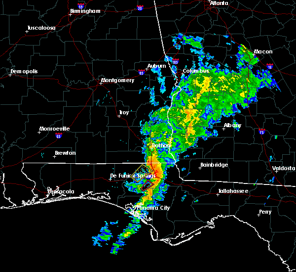 At 1122 am cst, a severe thunderstorm was located over marianna, moving northeast at 45 mph (radar indicated). Hazards include 60 mph wind gusts. Expect damage to roofs. Siding and trees. At 1122 am cst, a severe thunderstorm was located over marianna, moving northeast at 45 mph (radar indicated). Hazards include 60 mph wind gusts. Expect damage to roofs. Siding and trees.
|
| 8/14/2015 5:16 PM CDT |
 At 516 pm cdt, the national weather service has detected a severe thunderstorm capable of producing damaging winds in excess of 60 mph. this storm was located near marianna, and moving northwest at 20 mph. At 516 pm cdt, the national weather service has detected a severe thunderstorm capable of producing damaging winds in excess of 60 mph. this storm was located near marianna, and moving northwest at 20 mph.
|
| 7/24/2015 4:18 PM CDT |
 At 417 pm cdt, national weather service doppler radar indicated a severe thunderstorm capable of producing half dollar size hail and damaging winds in excess of 60 mph. this storm was located 13 miles northeast of marianna, moving southeast at 30 mph. locations impacted include, chattahoochee, malone, sneads, grand ridge, greenwood, bascom, cypress, and chipola terrace. At 417 pm cdt, national weather service doppler radar indicated a severe thunderstorm capable of producing half dollar size hail and damaging winds in excess of 60 mph. this storm was located 13 miles northeast of marianna, moving southeast at 30 mph. locations impacted include, chattahoochee, malone, sneads, grand ridge, greenwood, bascom, cypress, and chipola terrace.
|
| 7/24/2015 3:58 PM CDT |
 At 357 pm cdt, the national weather service has detected a severe thunderstorm capable of producing half dollar size hail and damaging winds in excess of 60 mph. this storm was located 9 miles southeast of cottonwood, and moving southeast at 25 mph. At 357 pm cdt, the national weather service has detected a severe thunderstorm capable of producing half dollar size hail and damaging winds in excess of 60 mph. this storm was located 9 miles southeast of cottonwood, and moving southeast at 25 mph.
|
| 7/19/2015 3:03 PM CDT | Several trees and powerlines dow in jackson county FL, 0.8 miles N of Marianna, FL |
| 7/19/2015 3:00 PM CDT |
 At 300 pm cdt, local law enforcement reported a severe thunderstorm producing damaging winds in excess of 60 mph. this storm was located over marianna, and moving south at 20 mph. jackson county has received several calls regarding trees and power lines being down. additional strong to severe storms are expected to develop across the area through 400 pm cdt. At 300 pm cdt, local law enforcement reported a severe thunderstorm producing damaging winds in excess of 60 mph. this storm was located over marianna, and moving south at 20 mph. jackson county has received several calls regarding trees and power lines being down. additional strong to severe storms are expected to develop across the area through 400 pm cdt.
|
| 7/19/2015 2:47 PM CDT |
 At 247 pm cdt, doppler radar indicated a severe thunderstorm capable of producing damaging winds in excess of 60 mph. this storm was located 9 miles east of marianna, moving south at 20 mph. locations impacted include, marianna, chattahoochee, sneads, grand ridge, greenwood, cypress, haynes, blue spring, simsville, lovedale, dellwood, marianna municipal a/p, two egg, star, buena vista and chipola terrace. At 247 pm cdt, doppler radar indicated a severe thunderstorm capable of producing damaging winds in excess of 60 mph. this storm was located 9 miles east of marianna, moving south at 20 mph. locations impacted include, marianna, chattahoochee, sneads, grand ridge, greenwood, cypress, haynes, blue spring, simsville, lovedale, dellwood, marianna municipal a/p, two egg, star, buena vista and chipola terrace.
|
| 7/19/2015 2:22 PM CDT |
 At 222 pm cdt, the national weather service has detected a severe thunderstorm capable of producing damaging winds in excess of 60 mph. this storm was located 13 miles southeast of cottonwood, and moving south at 20 mph. At 222 pm cdt, the national weather service has detected a severe thunderstorm capable of producing damaging winds in excess of 60 mph. this storm was located 13 miles southeast of cottonwood, and moving south at 20 mph.
|
| 7/13/2015 3:15 PM CDT | Report of a tree limb down on a power line along highway 73 just south of marianna in jackson county FL, 2.3 miles NNW of Marianna, FL |
| 7/13/2015 3:06 PM CDT |
 The severe thunderstorm warning for northwestern jackson county will expire at 315 pm cdt, the storm which prompted the warning has weakened below severe limits, and no longer poses an immediate threat to life or property. therefore the warning will be allowed to expire. to report severe weather, contact your nearest law enforcement agency. they will relay your report to the national weather service tallahassee. The severe thunderstorm warning for northwestern jackson county will expire at 315 pm cdt, the storm which prompted the warning has weakened below severe limits, and no longer poses an immediate threat to life or property. therefore the warning will be allowed to expire. to report severe weather, contact your nearest law enforcement agency. they will relay your report to the national weather service tallahassee.
|
| 7/13/2015 2:45 PM CDT |
 At 245 pm cdt, doppler radar indicated a severe thunderstorm capable of producing damaging winds in excess of 60 mph. this storm was located 7 miles northwest of marianna, moving southeast at 20 mph. locations impacted include, marianna, cottondale, jacob city, jacobs and cottondale airport. At 245 pm cdt, doppler radar indicated a severe thunderstorm capable of producing damaging winds in excess of 60 mph. this storm was located 7 miles northwest of marianna, moving southeast at 20 mph. locations impacted include, marianna, cottondale, jacob city, jacobs and cottondale airport.
|
| 7/13/2015 2:34 PM CDT |
 At 234 pm cdt, doppler radar indicated a severe thunderstorm capable of producing damaging winds in excess of 60 mph. this storm was located 7 miles southeast of graceville, moving south at 20 mph. locations impacted include, marianna, chipley, graceville, cottondale, campbellton, chipley municipal airport, browntown, richter crossroads, cottondale airport, bahoma, ellaville, jacobs, jacob city and sills. At 234 pm cdt, doppler radar indicated a severe thunderstorm capable of producing damaging winds in excess of 60 mph. this storm was located 7 miles southeast of graceville, moving south at 20 mph. locations impacted include, marianna, chipley, graceville, cottondale, campbellton, chipley municipal airport, browntown, richter crossroads, cottondale airport, bahoma, ellaville, jacobs, jacob city and sills.
|
| 7/13/2015 2:27 PM CDT |
 At 227 pm cdt, doppler radar indicated a severe thunderstorm capable of producing damaging winds in excess of 60 mph. this storm was located near graceville, moving south at 15 mph. locations impacted include, marianna, chipley, graceville, cottondale, madrid, campbellton, chipley municipal airport, browntown, richter crossroads, cottondale airport, southern junction, hodgesville, bahoma, garretts crossroads, sills, ellaville, jacobs and jacob city. At 227 pm cdt, doppler radar indicated a severe thunderstorm capable of producing damaging winds in excess of 60 mph. this storm was located near graceville, moving south at 15 mph. locations impacted include, marianna, chipley, graceville, cottondale, madrid, campbellton, chipley municipal airport, browntown, richter crossroads, cottondale airport, southern junction, hodgesville, bahoma, garretts crossroads, sills, ellaville, jacobs and jacob city.
|
| 7/13/2015 2:13 PM CDT |
 At 213 pm cdt, the national weather service has detected a severe thunderstorm capable of producing damaging winds in excess of 60 mph. this storm was located near graceville, and moving south at 15 mph. At 213 pm cdt, the national weather service has detected a severe thunderstorm capable of producing damaging winds in excess of 60 mph. this storm was located near graceville, and moving south at 15 mph.
|
| 7/2/2015 2:09 PM EDT |
 At 209 pm edt /109 pm cdt/, doppler radar indicated a line of severe thunderstorms capable of producing damaging winds in excess of 60 mph. these storms were located along a line extending from near blakely to near marianna, moving east at 45 mph. locations impacted include, colquitt, blakely, donalsonville, marianna, ashford, columbia, centerville, malone, sneads, grand ridge, greenwood, gordon, iron city, damascus, jakin, bascom, cedar springs, cuba, crosby and grangeburg. At 209 pm edt /109 pm cdt/, doppler radar indicated a line of severe thunderstorms capable of producing damaging winds in excess of 60 mph. these storms were located along a line extending from near blakely to near marianna, moving east at 45 mph. locations impacted include, colquitt, blakely, donalsonville, marianna, ashford, columbia, centerville, malone, sneads, grand ridge, greenwood, gordon, iron city, damascus, jakin, bascom, cedar springs, cuba, crosby and grangeburg.
|
| 7/2/2015 12:48 PM CDT |
 At 148 pm edt /1248 pm cdt/, the national weather service has detected a line of severe thunderstorms capable of producing damaging winds in excess of 60 mph. these storms were located along a line extending from 7 miles northeast of headland to 9 miles southeast of graceville, and moving east at 45 mph. At 148 pm edt /1248 pm cdt/, the national weather service has detected a line of severe thunderstorms capable of producing damaging winds in excess of 60 mph. these storms were located along a line extending from 7 miles northeast of headland to 9 miles southeast of graceville, and moving east at 45 mph.
|
| 6/30/2015 3:55 PM CDT |
 At 453 pm edt /353 pm cdt/, doppler radar indicated a line of severe thunderstorms capable of producing destructive winds in excess of 70 mph. these storms were located along a line extending from 12 miles southeast of cottonwood to 8 miles east of marianna to near lynn haven, moving east at 60 mph. in addition, at 337 pm cdt, a 68 mph wind gust was measured at northwest florida beaches international airport. locations impacted include, panama city, lynn haven, panama city beach, marianna, hiland park, chattahoochee, malone, sneads, grand ridge, greenwood, altha, bascom, cypress, moose pond, gainer spring, white pond, red oak, chason, blountstown airport and simsville. At 453 pm edt /353 pm cdt/, doppler radar indicated a line of severe thunderstorms capable of producing destructive winds in excess of 70 mph. these storms were located along a line extending from 12 miles southeast of cottonwood to 8 miles east of marianna to near lynn haven, moving east at 60 mph. in addition, at 337 pm cdt, a 68 mph wind gust was measured at northwest florida beaches international airport. locations impacted include, panama city, lynn haven, panama city beach, marianna, hiland park, chattahoochee, malone, sneads, grand ridge, greenwood, altha, bascom, cypress, moose pond, gainer spring, white pond, red oak, chason, blountstown airport and simsville.
|
| 6/30/2015 3:32 PM CDT |
 At 432 pm edt /332 pm cdt/, the national weather service has detected a line of severe thunderstorms capable of producing damaging winds in excess of 60 mph. these storms were located along a line extending from near cottonwood to 6 miles northwest of marianna to near panama city beach, and moving east at 65 mph. At 432 pm edt /332 pm cdt/, the national weather service has detected a line of severe thunderstorms capable of producing damaging winds in excess of 60 mph. these storms were located along a line extending from near cottonwood to 6 miles northwest of marianna to near panama city beach, and moving east at 65 mph.
|
| 6/30/2015 11:56 AM CDT |
 At 1255 pm edt /1155 am cdt/, doppler radar indicated a line of severe thunderstorms capable of producing damaging winds in excess of 60 mph. these storms were located along a line extending from 10 miles southeast of cottonwood to 20 miles southeast of vernon, moving east at 30 mph. locations impacted include, marianna, blountstown, malone, sneads, grand ridge, greenwood, altha, bascom, cypress, moose pond, hornsville, white pond, red oak, chason, durham, lela, nettle ridge, clarksville, blountstown airport and desser. At 1255 pm edt /1155 am cdt/, doppler radar indicated a line of severe thunderstorms capable of producing damaging winds in excess of 60 mph. these storms were located along a line extending from 10 miles southeast of cottonwood to 20 miles southeast of vernon, moving east at 30 mph. locations impacted include, marianna, blountstown, malone, sneads, grand ridge, greenwood, altha, bascom, cypress, moose pond, hornsville, white pond, red oak, chason, durham, lela, nettle ridge, clarksville, blountstown airport and desser.
|
| 6/30/2015 11:25 AM CDT |
 At 1225 pm edt /1125 am cdt/, the national weather service has detected a line of severe thunderstorms capable of producing damaging winds in excess of 60 mph. these storms were located along a line extending from near graceville to 10 miles southeast of vernon, and moving east at 30 mph. At 1225 pm edt /1125 am cdt/, the national weather service has detected a line of severe thunderstorms capable of producing damaging winds in excess of 60 mph. these storms were located along a line extending from near graceville to 10 miles southeast of vernon, and moving east at 30 mph.
|
| 6/30/2015 11:06 AM CDT |
 At 1105 am cdt, the national weather service has detected a severe thunderstorm capable of producing damaging winds in excess of 60 mph. this storm was located near chipley, and moving east at 30 mph. At 1105 am cdt, the national weather service has detected a severe thunderstorm capable of producing damaging winds in excess of 60 mph. this storm was located near chipley, and moving east at 30 mph.
|
| 5/26/2015 12:31 PM CDT | At 1231 pm cdt, doppler radar indicated a line of severe thunderstorms capable of producing damaging winds in excess of 60 mph. these storms were located along a line extending from ashford to near marianna, moving northeast at 20 mph. locations impacted include, cottonwood, marianna, dothan, ashford, cowarts, webb, malone, greenwood, avon, gordon, bascom, memphis, hornsville, crosby, ardilla, grangeburg, hodgesville, enon, harmon and marianna municipal a/p. |
| 5/26/2015 12:31 PM CDT | At 1231 pm cdt, doppler radar indicated a line of severe thunderstorms capable of producing damaging winds in excess of 60 mph. these storms were located along a line extending from ashford to near marianna, moving northeast at 20 mph. locations impacted include, cottonwood, marianna, dothan, ashford, cowarts, webb, malone, greenwood, avon, gordon, bascom, memphis, hornsville, crosby, ardilla, grangeburg, hodgesville, enon, harmon and marianna municipal a/p. |
| 5/26/2015 12:09 PM CDT | At 1209 pm cdt, the national weather service has detected a severe thunderstorm capable of producing damaging winds in excess of 60 mph. this storm was located 7 miles southwest of cottonwood, and moving north at 25 mph. another storm capable of producing damaging winds was located over marianna. |
| 5/26/2015 12:09 PM CDT | At 1209 pm cdt, the national weather service has detected a severe thunderstorm capable of producing damaging winds in excess of 60 mph. this storm was located 7 miles southwest of cottonwood, and moving north at 25 mph. another storm capable of producing damaging winds was located over marianna. |
| 4/25/2015 5:30 PM CDT | At 530 pm cdt, the national weather service has detected a severe thunderstorm capable of producing quarter size hail and damaging winds in excess of 60 mph. this storm was located 11 miles east of vernon, and moving east at 55 mph. |
| 4/25/2015 8:31 AM CDT | At 830 am cdt, doppler radar indicated a severe thunderstorm capable of producing damaging winds in excess of 60 mph. this storm was located near marianna, moving east at 30 mph. locations impacted include, marianna, greenwood, ridgetop, two egg, blue spring, chipola terrace and compass lake. a tornado watch remains in effect until noon cdt for the western florida panhandle. |
| 4/25/2015 9:20 AM EDT | At 919 am edt /819 am cdt/, local law enforcement reported a line of severe thunderstorms producing damaging winds in excess of 60 mph. these storms were located along a line extending from 11 miles southwest of donalsonville to 12 miles south of marianna to 10 miles southeast of vernon, and moving east at 45 mph. |
| 4/25/2015 9:20 AM EDT | At 919 am edt /819 am cdt/, local law enforcement reported a line of severe thunderstorms producing damaging winds in excess of 60 mph. these storms were located along a line extending from 11 miles southwest of donalsonville to 12 miles south of marianna to 10 miles southeast of vernon, and moving east at 45 mph. |
| 4/25/2015 8:16 AM CDT | At 815 am cdt, local law enforcement reported a severe thunderstorm producing damaging winds in excess of 60 mph. multiple trees were blown down in washington county. this storm was located 8 miles southwest of marianna, moving east at 35 mph. locations impacted include, marianna, bradford, cottondale, alford, wausau, sunny hills, round lake, spring hollow, blue spring, kynesville, ridgetop, two egg, orange hill, chipola terrace, compass lake, steele city and gilberts mill. a tornado watch remains in effect until noon cdt for the western florida panhandle florida. a tornado watch also remains in effect until 300 pm cdt for the central florida panhandle and florida big bend. |
| 4/25/2015 7:57 AM CDT | At 757 am cdt, the national weather service has detected a severe thunderstorm capable of producing damaging winds in excess of 60 mph. this storm was located over chipley, and moving east at 30 mph. |
| 11/17/2014 8:16 AM CST | Minor damage to building in mariann in jackson county FL, 0.8 miles N of Marianna, FL |
| 7/28/2014 6:20 PM CDT | Several trees down across the county in jackson county FL, 0.8 miles N of Marianna, FL |
| 6/6/2014 10:00 PM CDT | Power line down near 2993 old us road. tree also down in the area in jackson county FL, 2.4 miles W of Marianna, FL |
| 5/26/2014 3:51 PM CDT | Storm damage reported in jackson county FL, 0.8 miles N of Marianna, FL |
| 5/26/2014 3:30 PM CDT | Storm damage reported in jackson county FL, 0.8 miles N of Marianna, FL |
| 5/25/2014 5:15 PM CDT | Couple of trees down near marianna in jackson county FL, 2.5 miles NNW of Marianna, FL |
| 4/30/2014 2:30 AM CDT | Numerous trees down across the county in jackson county FL, 0.8 miles N of Marianna, FL |
| 8/4/2013 7:00 PM CDT | Trees blown dow in jackson county FL, 6 miles W of Marianna, FL |
| 8/4/2013 6:40 PM CDT | Trees blown down at baker creek rd near jenny l in jackson county FL, 3.1 miles SE of Marianna, FL |
| 7/23/2013 6:35 PM CDT | Tree down on iron bridge rd near the chipola rive in jackson county FL, 5.3 miles NNW of Marianna, FL |
| 7/23/2013 6:30 PM CDT | Tree down on new hope rd near i-1 in jackson county FL, 2.8 miles ENE of Marianna, FL |
| 7/26/2012 3:58 PM CDT | 64 mph wind gust measured by asos at marianna airpor in jackson county FL, 0.8 miles N of Marianna, FL |
| 7/26/2012 3:58 PM CDT | 64 mph wind gust measured by asos at marianna airpor in jackson county FL, 4.9 miles SW of Marianna, FL |
| 7/25/2012 1:55 PM CDT | Forty to fifty foot tree down near waffle house in mariann in jackson county FL, 0.6 miles ENE of Marianna, FL |
| 7/25/2012 1:55 PM CDT | Roof and awning damage to two businesses at highway 90 and hall stree in jackson county FL, 1.2 miles E of Marianna, FL |
| 7/3/2012 3:03 PM CDT | Tree down near merrits mill and flynt d in jackson county FL, 3.3 miles WNW of Marianna, FL |
| 7/3/2012 2:58 PM CDT | Power poles down on caverns rd. near marianna high schoo in jackson county FL, 3.1 miles SW of Marianna, FL |
| 7/3/2012 2:49 PM CDT | The asos recorded a peak wind gust of 68 mph from 350 degrees at 249 pm cdt with a fastest two minute average wind of 54 mph at the same tim in jackson county FL, 4.9 miles SW of Marianna, FL |
| 6/11/2012 1:38 PM CDT | County dispatch reports trees and powerlines down all over the town of mariann in jackson county FL, 0.8 miles N of Marianna, FL |
| 6/6/2012 6:45 PM CDT | A few trees and power lines down from tstm winds around jackson county in jackson county FL, 0.8 miles N of Marianna, FL |
| 6/5/2012 2:58 PM CDT | Storm damage reported in jackson county FL, 0.8 miles N of Marianna, FL |
| 6/5/2012 2:58 PM CDT | Storm damage reported in jackson county FL, 4.9 miles SW of Marianna, FL |
| 1/1/0001 12:00 AM | 2-3 counties down around the c in jackson county FL, 0.8 miles N of Marianna, FL |
| 1/1/0001 12:00 AM | 2-3 trees down around the c in jackson county FL, 0.8 miles N of Marianna, FL |
| 1/1/0001 12:00 AM | 2-3 trees down around the county...along with 1 power line. time estimated in jackson county FL, 0.8 miles N of Marianna, FL |
| 1/1/0001 12:00 AM | One tree reported down in jackson county FL, 0.8 miles N of Marianna, FL |
| 1/1/0001 12:00 AM | Possible tornado caused damage to the marianna municipal airport. roof reported ripped off house nearb in jackson county FL, 4.9 miles SW of Marianna, FL |
Hail Maps for Marianna, FL
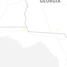


Connect with Interactive Hail Maps