

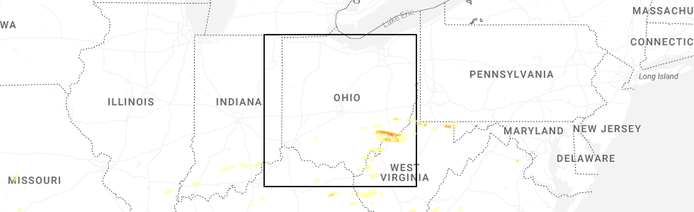
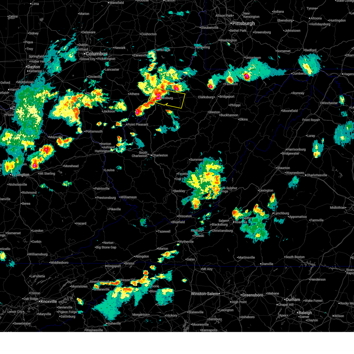
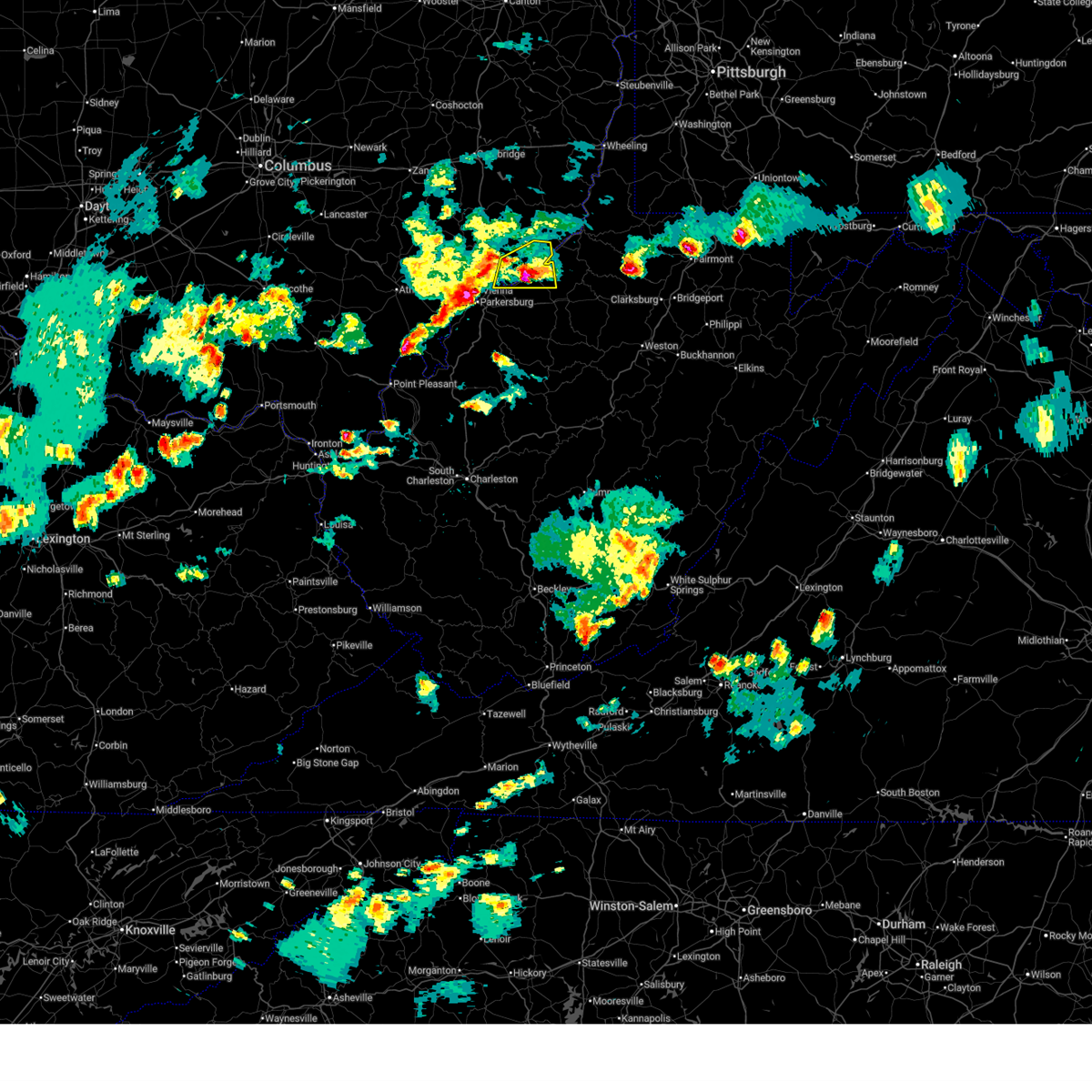
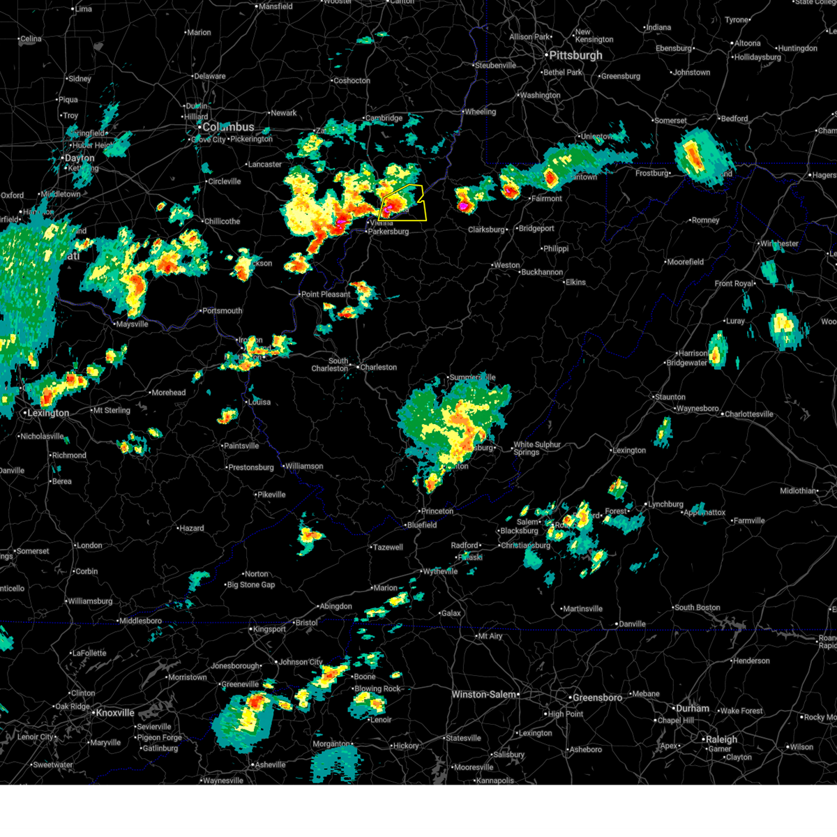
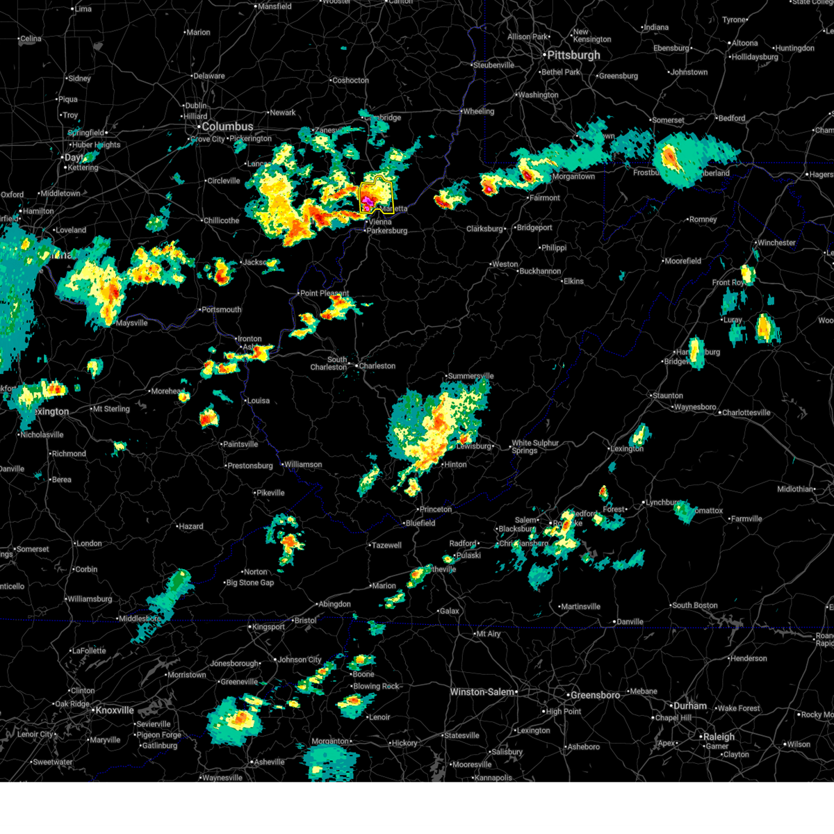
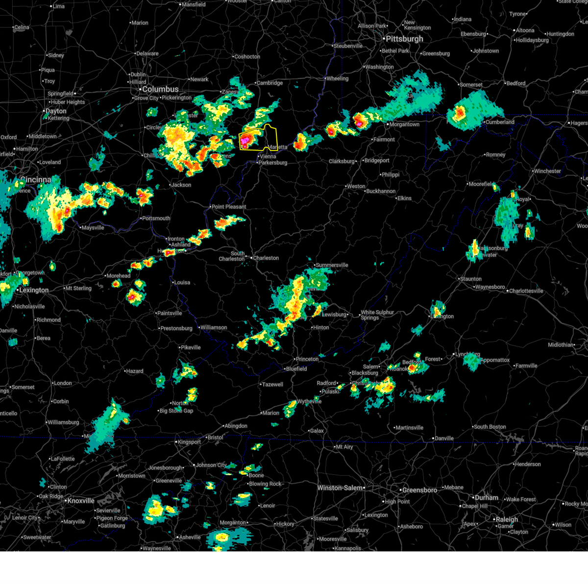
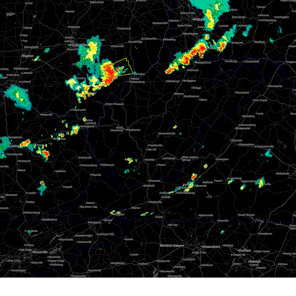
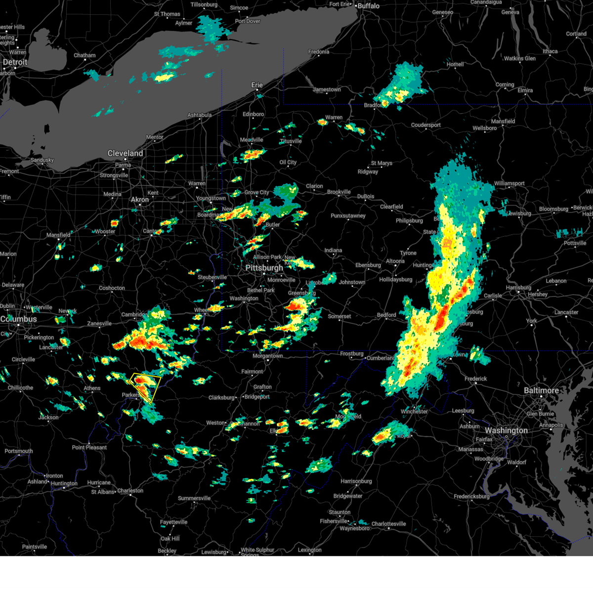
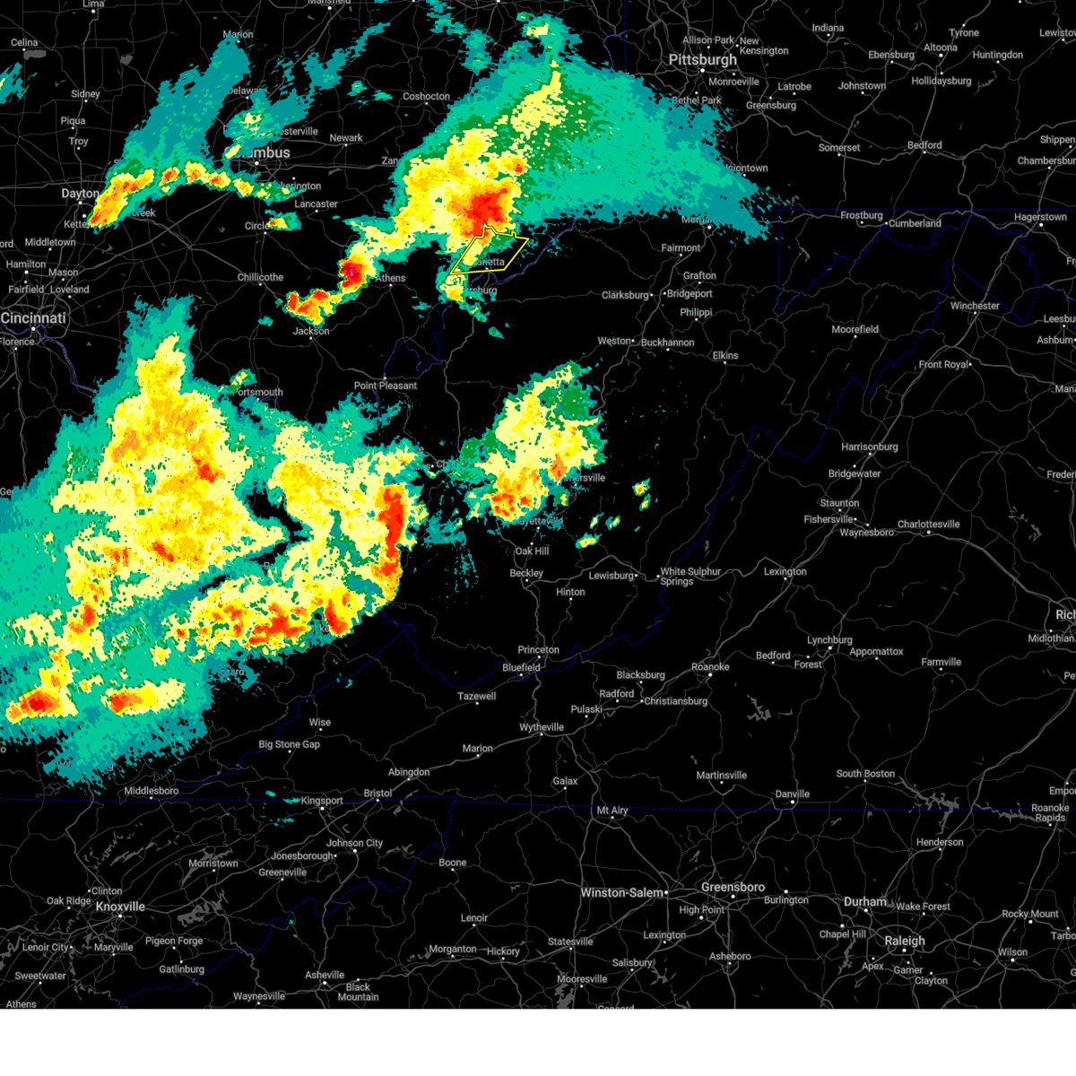
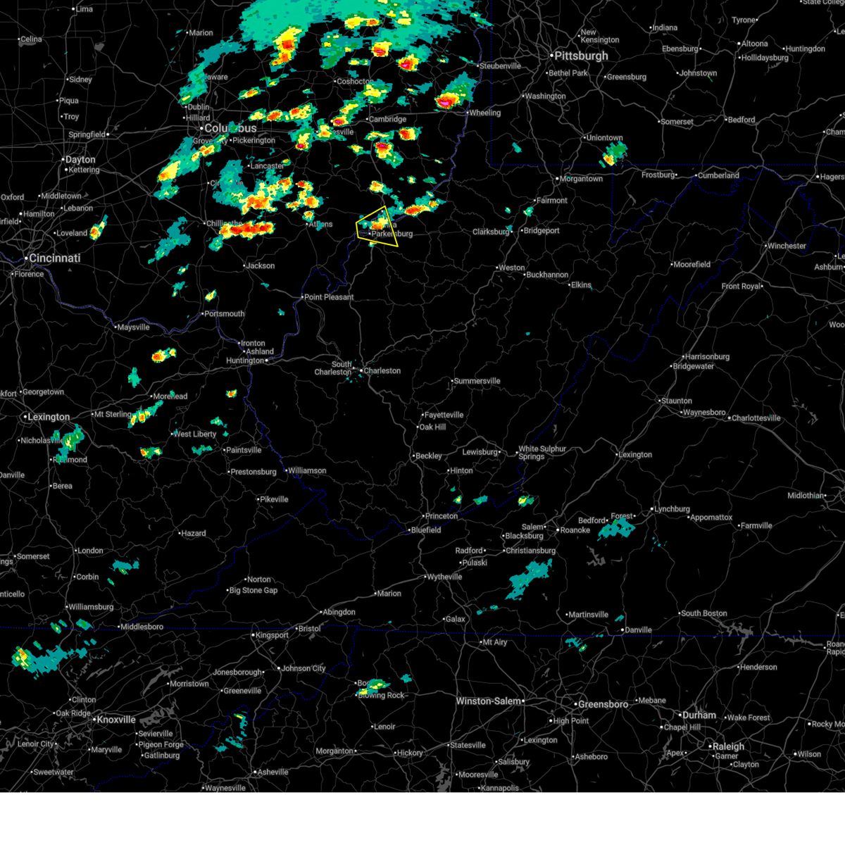
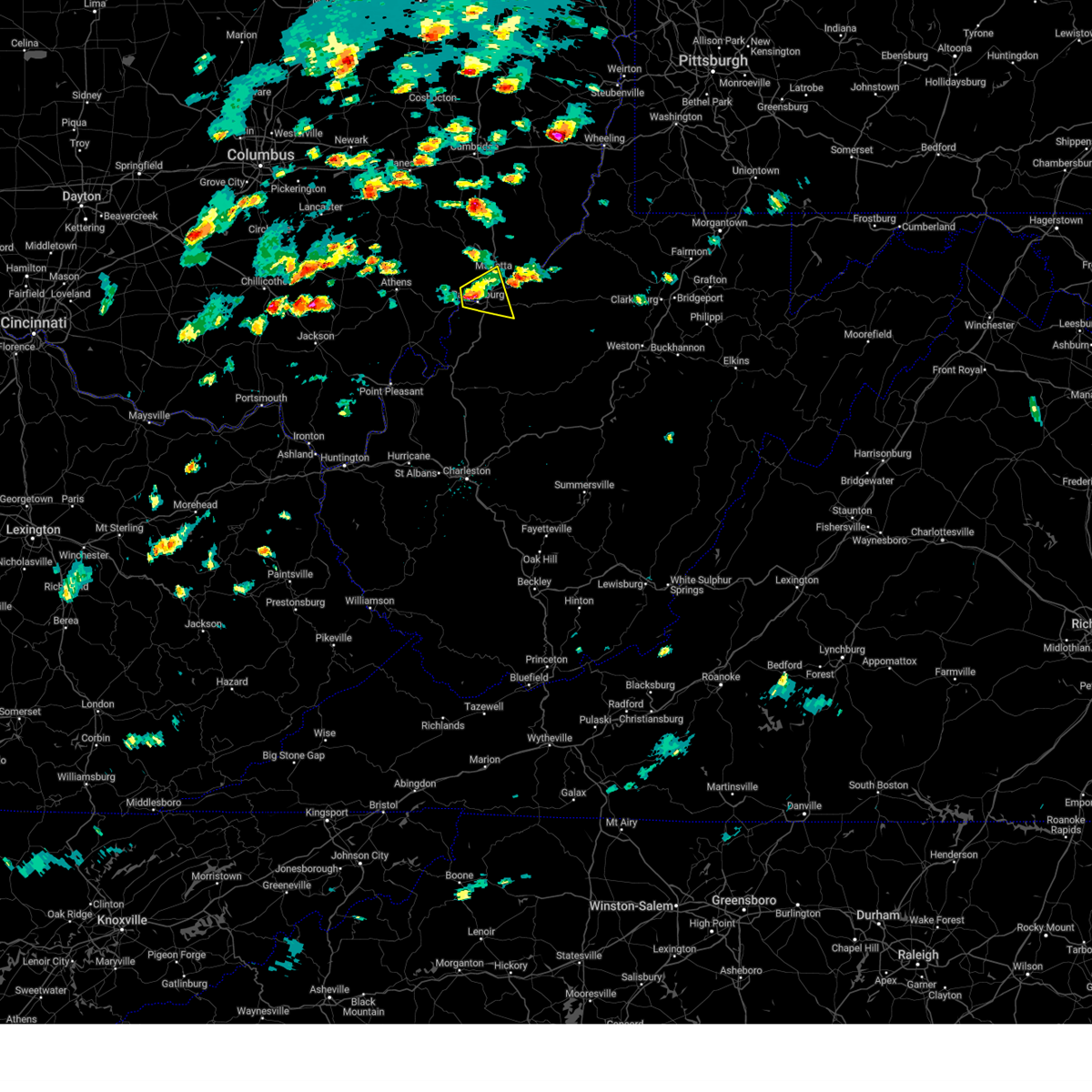
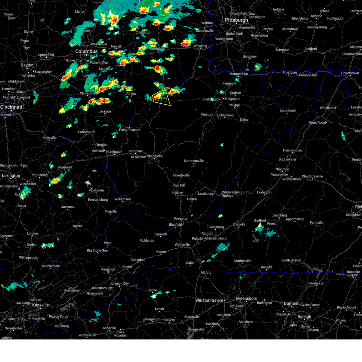
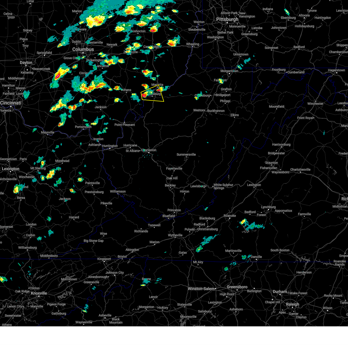
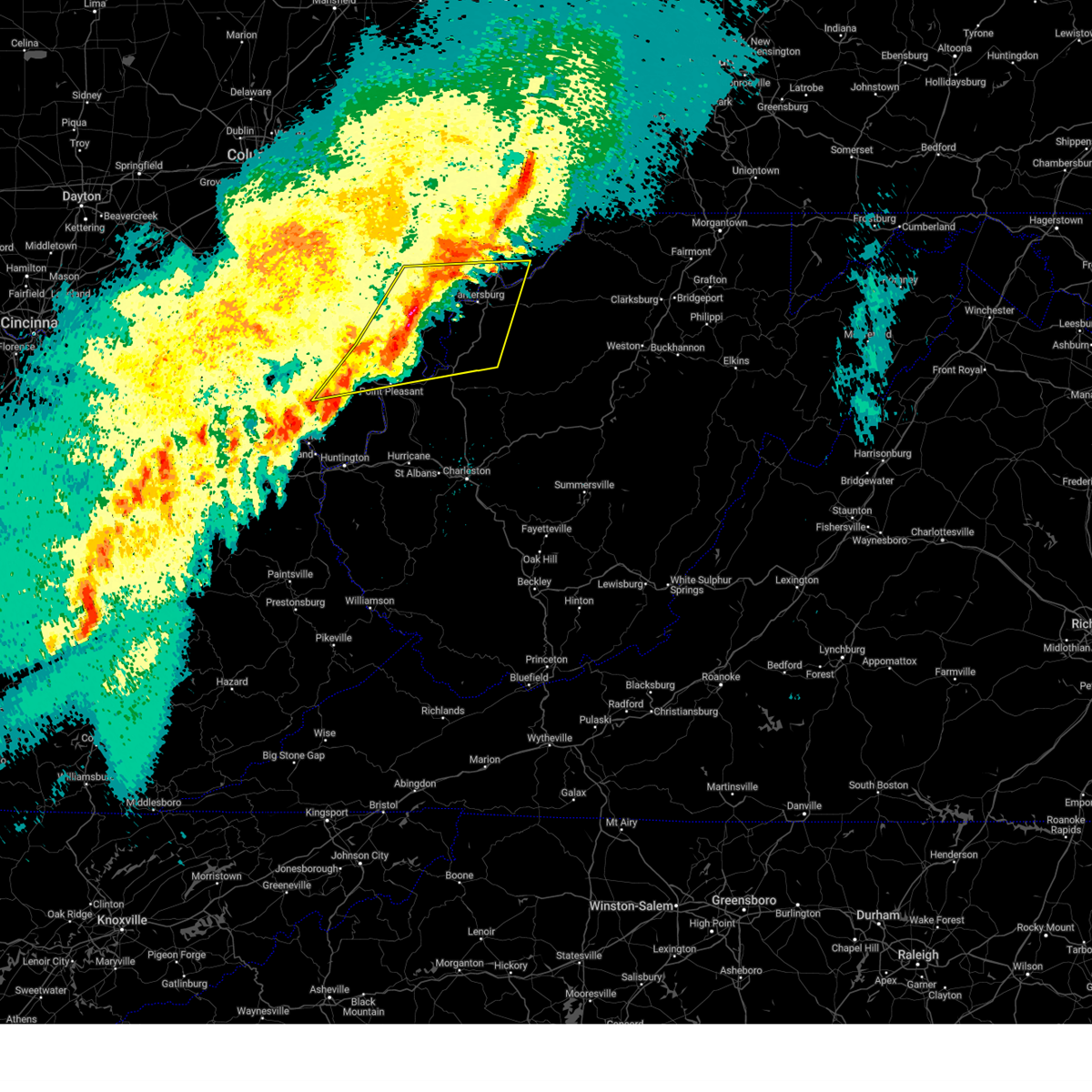
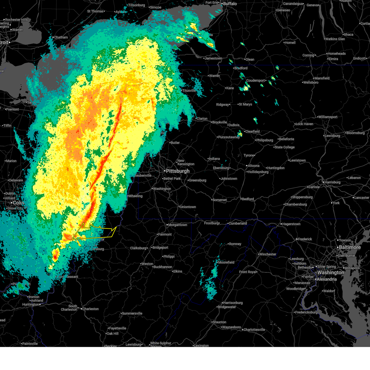
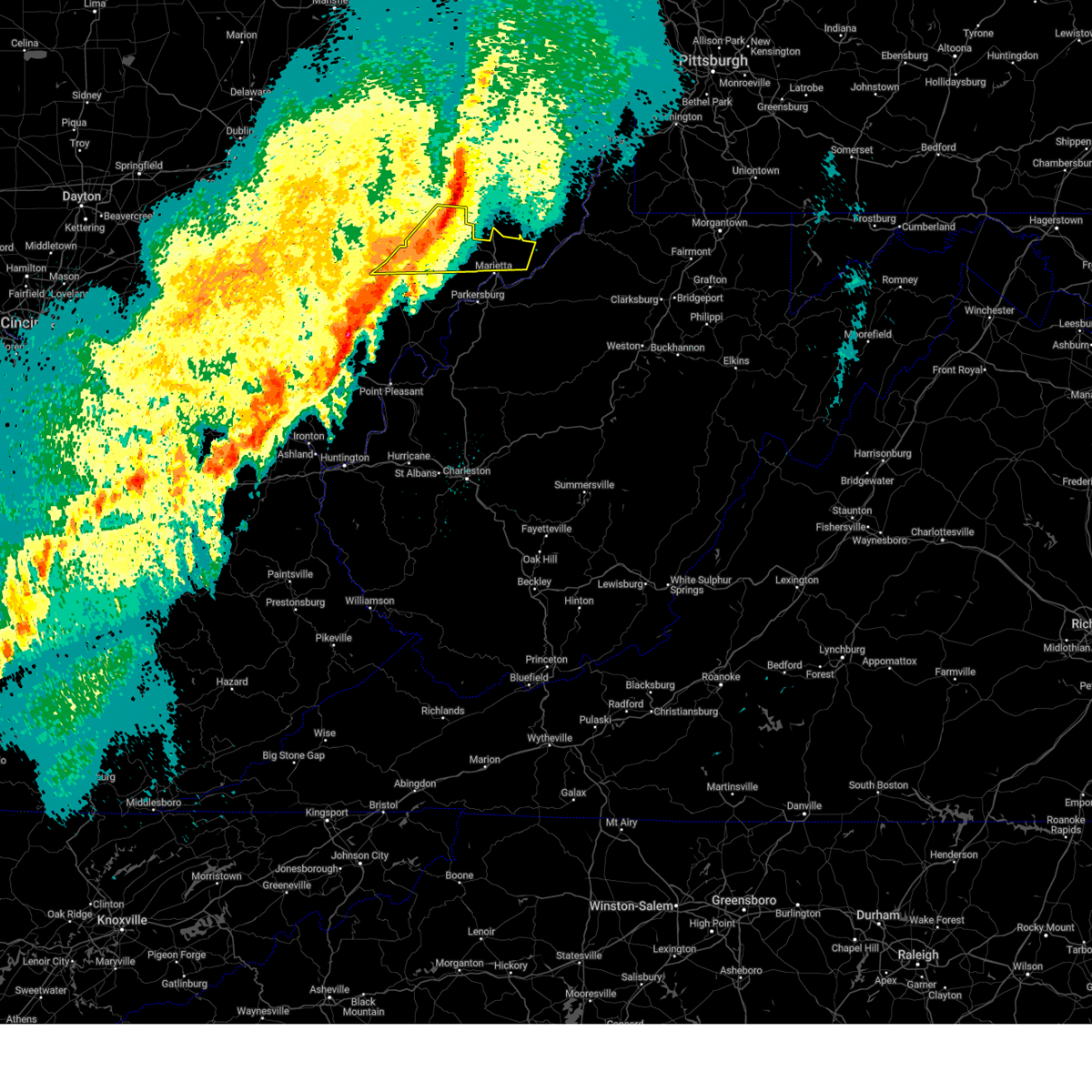
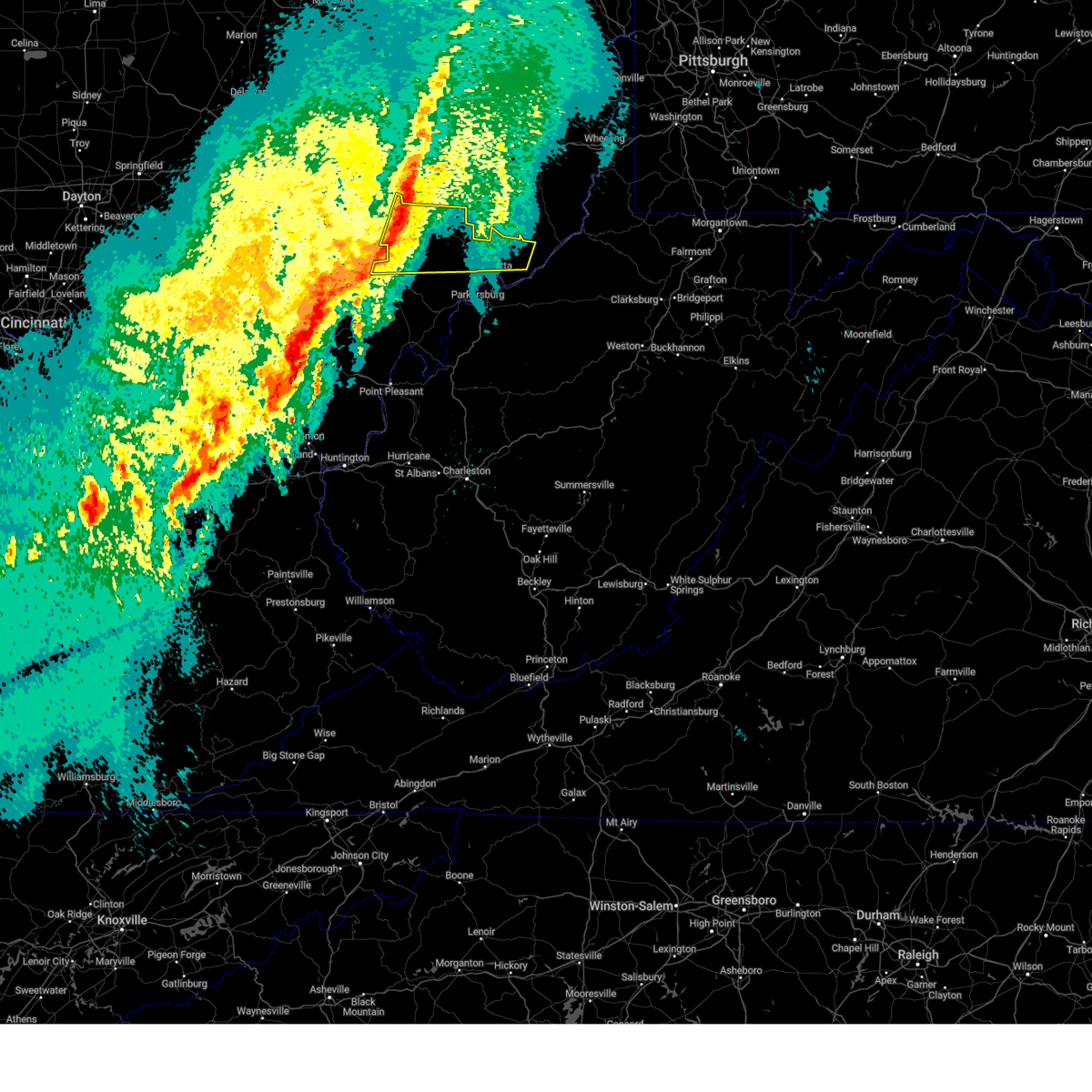
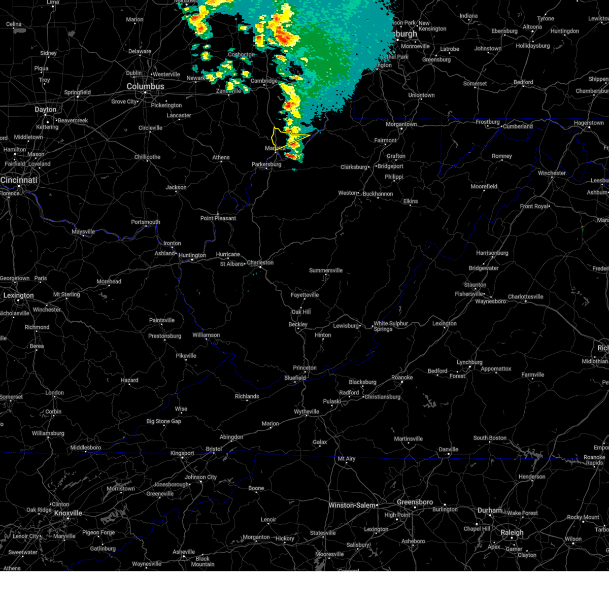
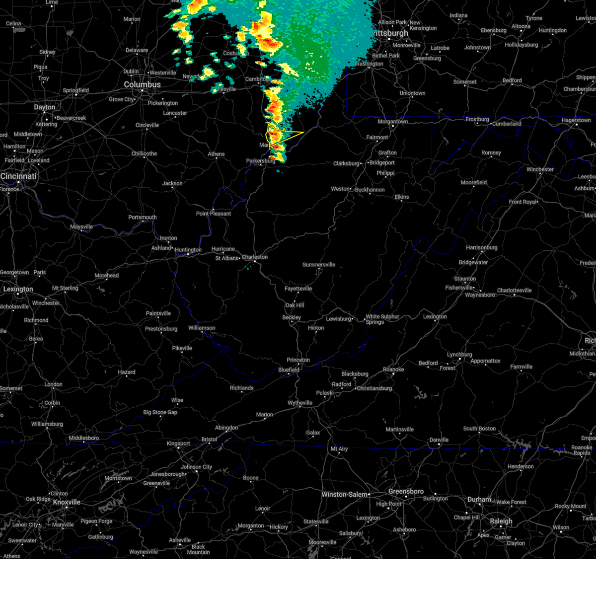
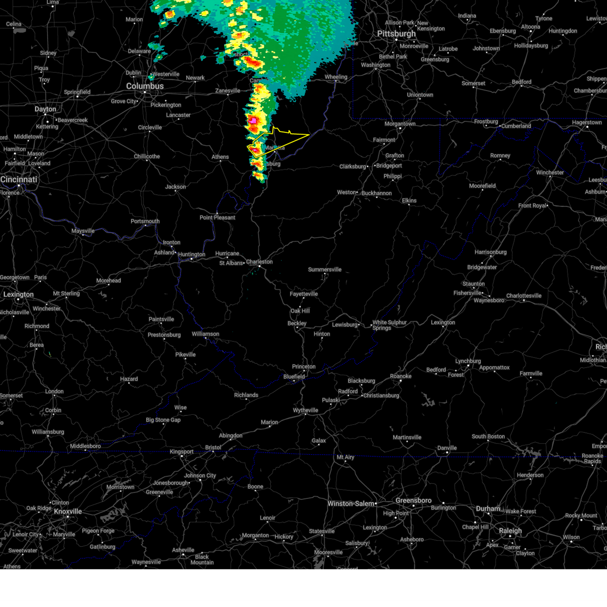
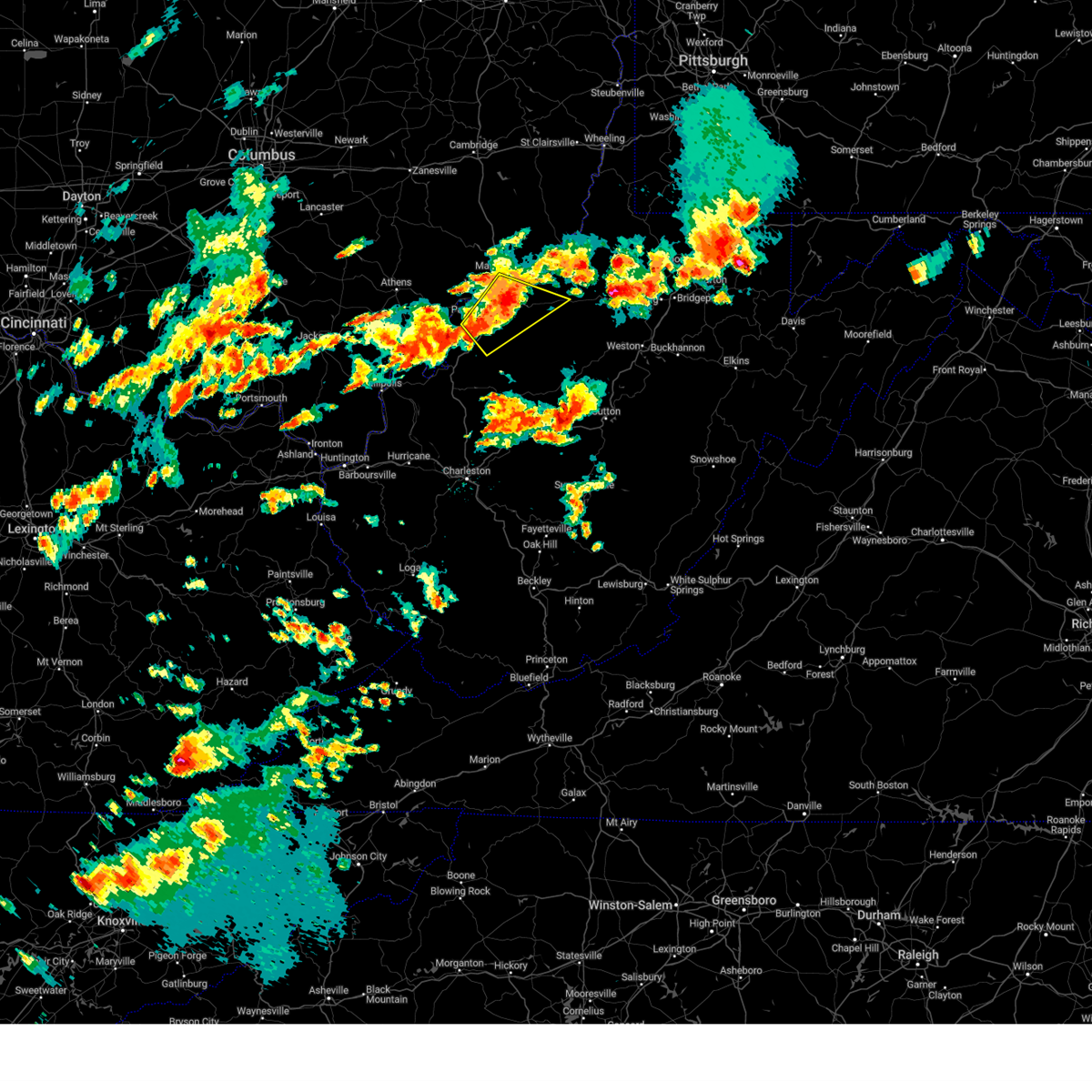
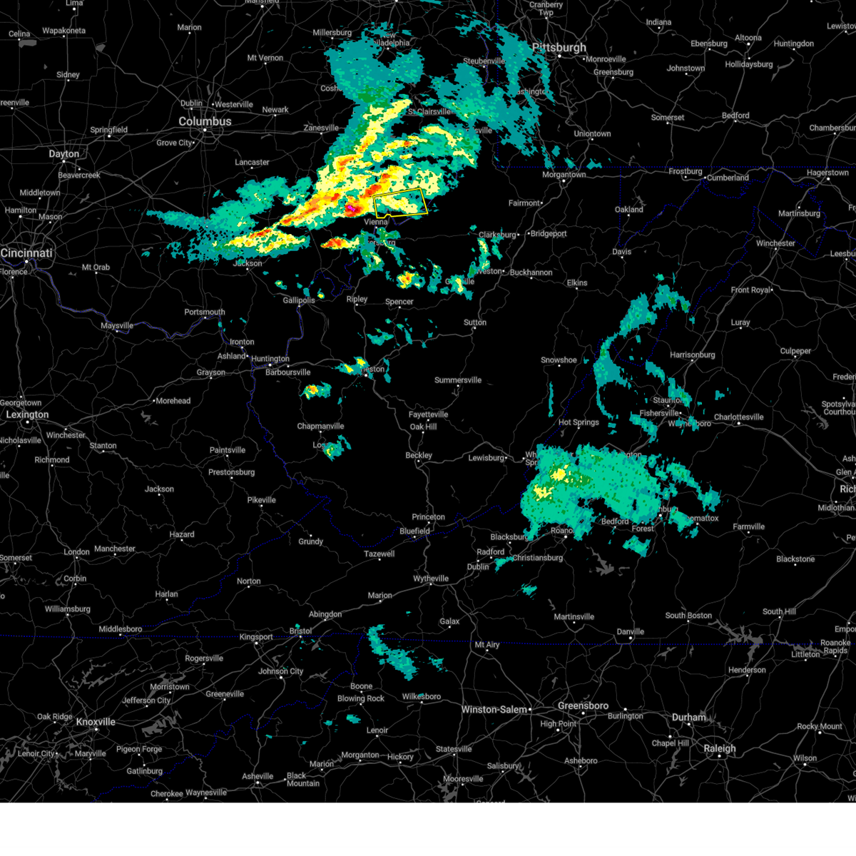
Hail Map for Marietta, OH
The Marietta, OH area has had 20 reports of on-the-ground hail by trained spotters, and has been under severe weather warnings 10 times during the past 12 months. Doppler radar has detected hail at or near Marietta, OH on 56 occasions, including 3 occasions during the past year.
| Name: | Marietta, OH |
| Where Located: | 75.1 miles N of Charleston, WV |
| Map: | Google Map for Marietta, OH |
| Population: | 14085 |
| Housing Units: | 6519 |
| More Info: | Search Google for Marietta, OH |
5
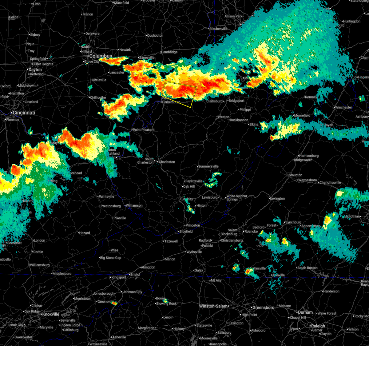
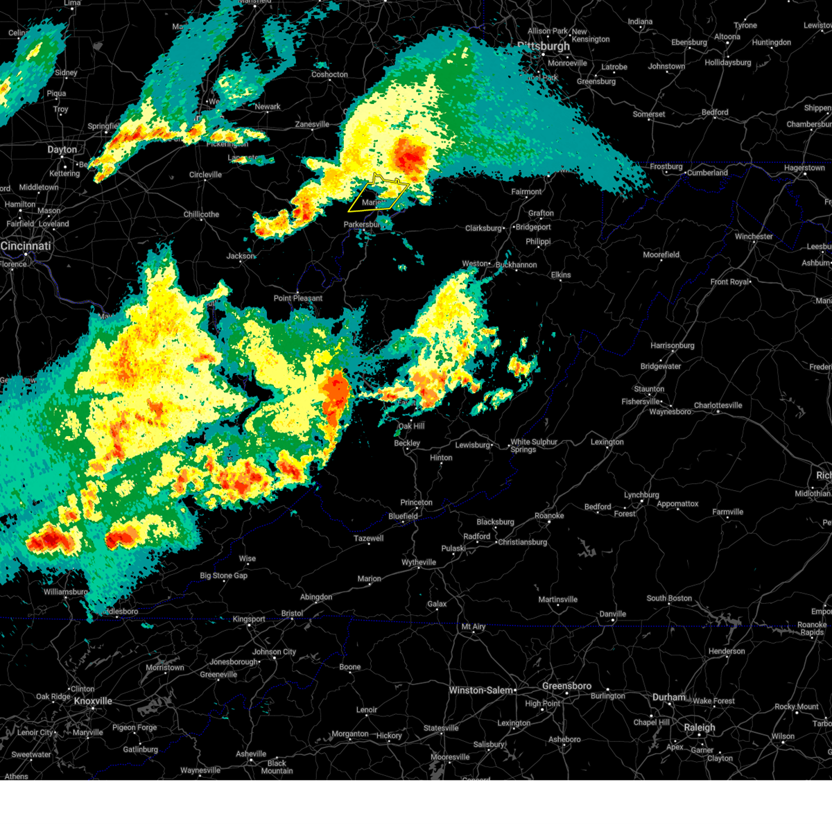
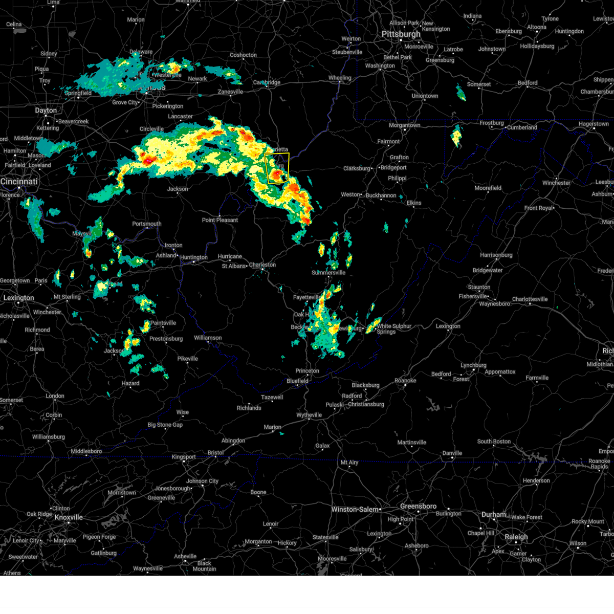
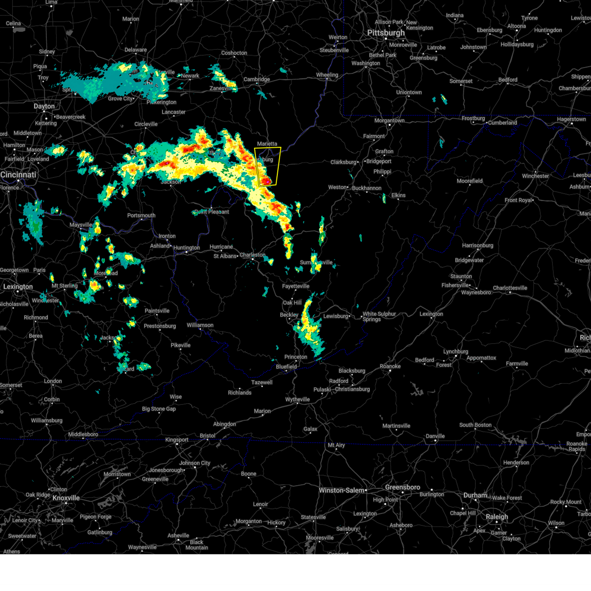
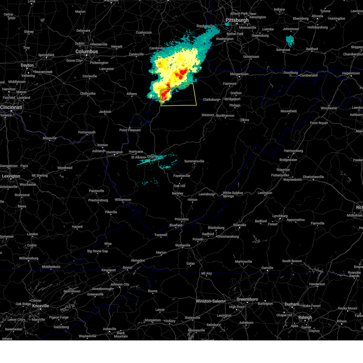
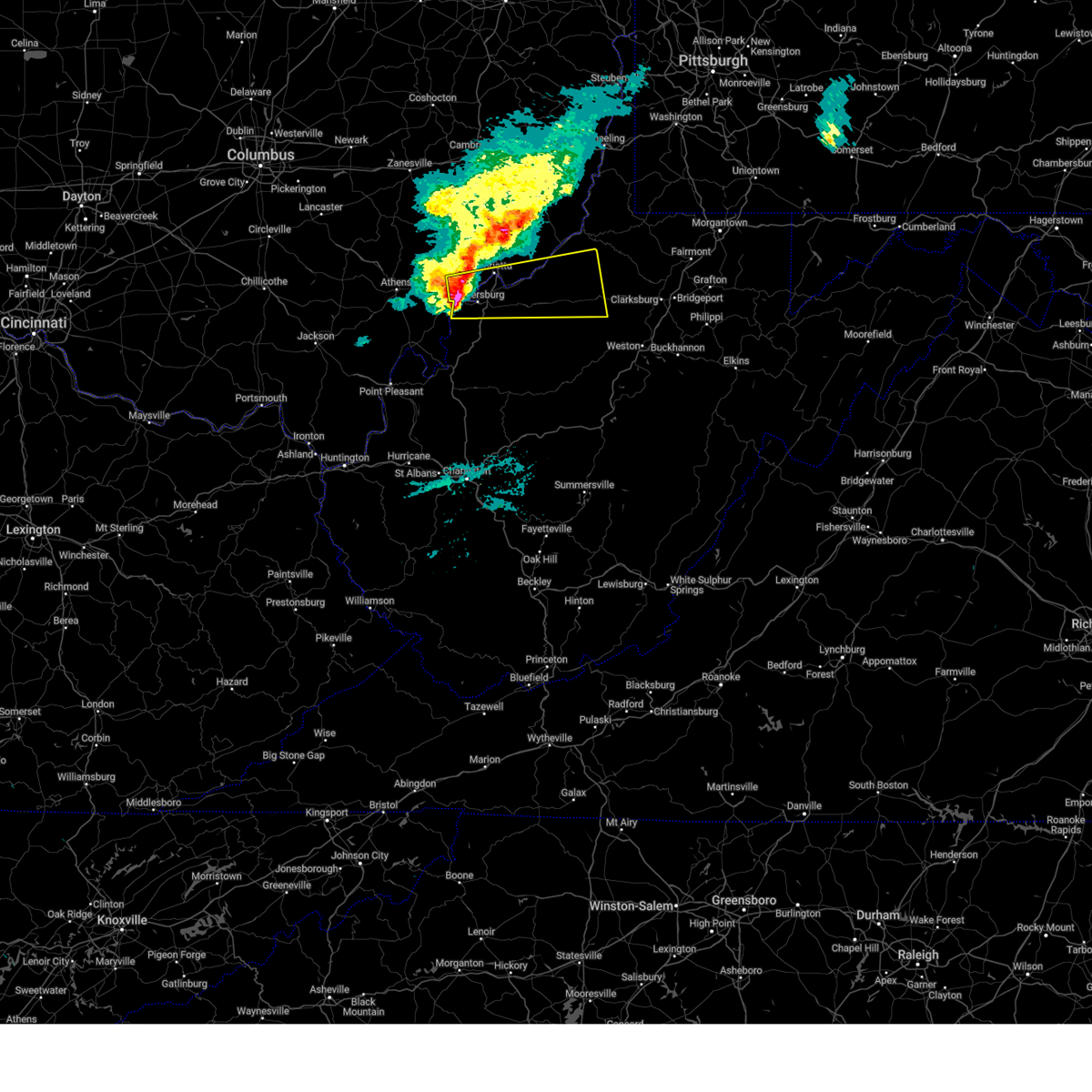
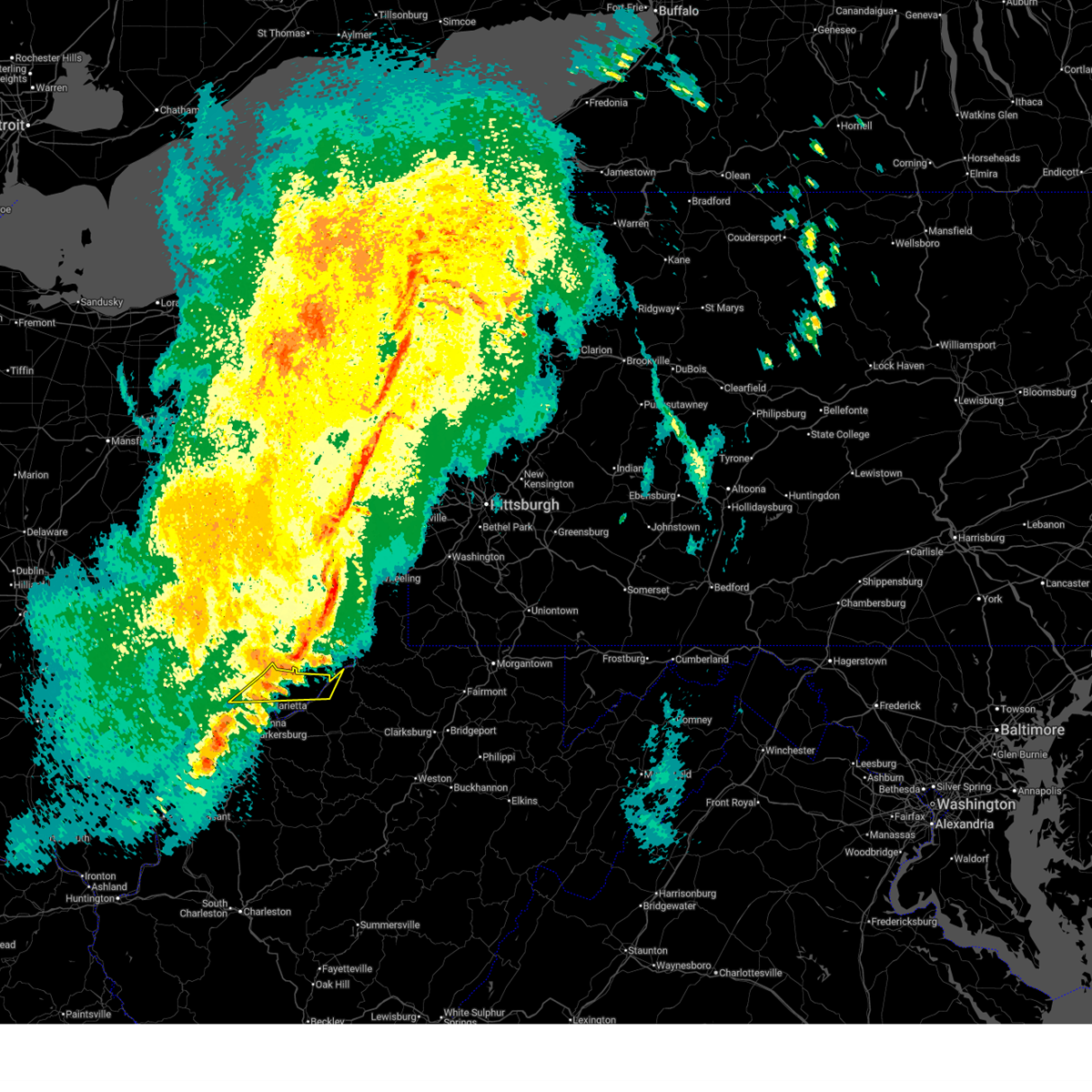
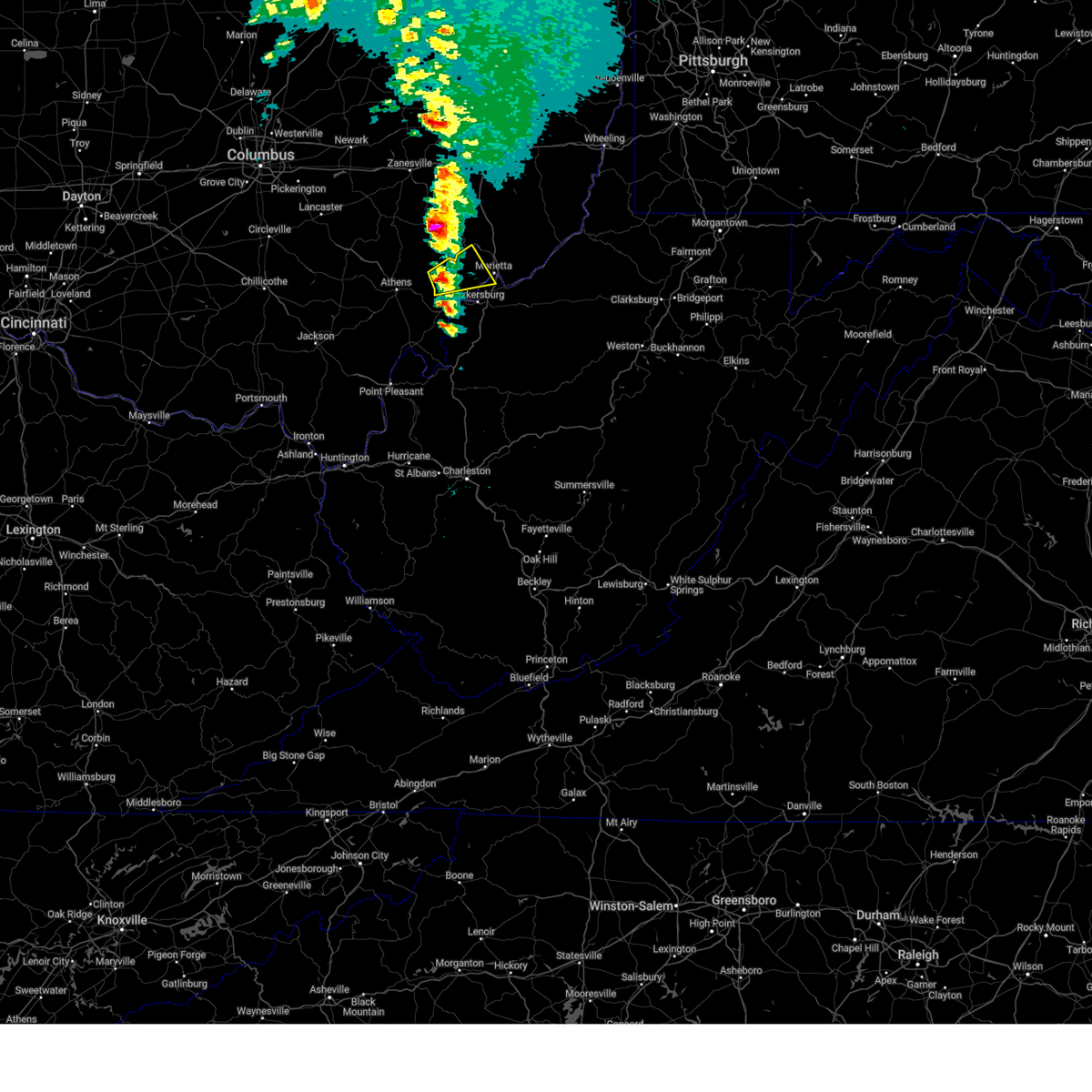
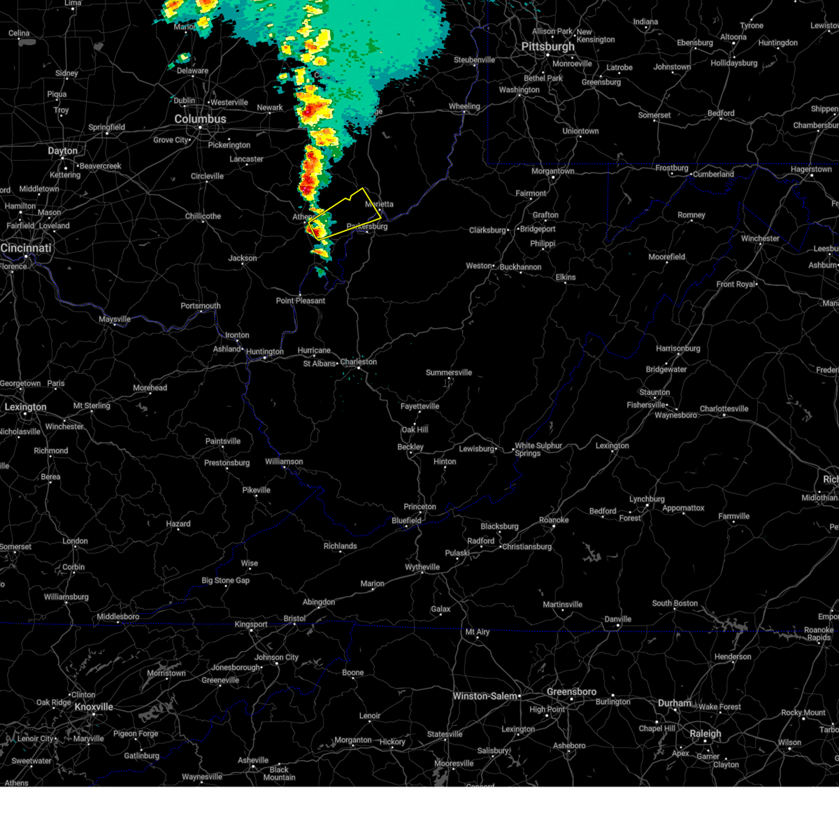
The Top Recent Hail Date for Marietta, OH is Wednesday, April 1, 2026 (1st out of 56)
Hail and Wind Damage Spotted near Marietta, OH
| Date / Time | Report Details |
|---|---|
| 7/21/2026 4:30 PM EDT | Sr-26 closed from baker run rd to edmar ave due to trees in roadwa in washington county OH, 2.7 miles W of Marietta, OH |
| 7/21/2026 4:29 PM EDT |
 Svrrlx the national weather service in charleston west virginia has issued a * severe thunderstorm warning for, central washington county in southeastern ohio, pleasants county in northwestern west virginia, northwestern ritchie county in northwestern west virginia, southwestern tyler county in northern west virginia, northeastern wood county in northwestern west virginia, * until 515 pm edt. * at 429 pm edt, a severe thunderstorm was located over marietta, moving east at 35 mph (radar indicated). Hazards include 60 mph wind gusts and quarter size hail. Hail damage to vehicles is expected. Expect wind damage to roofs, siding, and trees. Svrrlx the national weather service in charleston west virginia has issued a * severe thunderstorm warning for, central washington county in southeastern ohio, pleasants county in northwestern west virginia, northwestern ritchie county in northwestern west virginia, southwestern tyler county in northern west virginia, northeastern wood county in northwestern west virginia, * until 515 pm edt. * at 429 pm edt, a severe thunderstorm was located over marietta, moving east at 35 mph (radar indicated). Hazards include 60 mph wind gusts and quarter size hail. Hail damage to vehicles is expected. Expect wind damage to roofs, siding, and trees.
|
| 7/21/2026 4:20 PM EDT | Cinderblock outbuilding destroyed... trees snapped... camper tossed off hillside between morris rd and grub road off of pleasant ridge r in washington county OH, 3.4 miles WSW of Marietta, OH |
| 7/21/2026 3:40 PM EDT |
 Svrrlx the national weather service in charleston west virginia has issued a * severe thunderstorm warning for, perry county in southeastern ohio, northern washington county in southeastern ohio, morgan county in southeastern ohio, northeastern pleasants county in northwestern west virginia, western tyler county in northern west virginia, * until 445 pm edt. * at 339 pm edt, severe thunderstorms were located along a line extending from near thornport to near sistersville, moving southeast at 20 mph (radar indicated). Hazards include 60 mph wind gusts and penny size hail. expect damage to roofs, siding, and trees Svrrlx the national weather service in charleston west virginia has issued a * severe thunderstorm warning for, perry county in southeastern ohio, northern washington county in southeastern ohio, morgan county in southeastern ohio, northeastern pleasants county in northwestern west virginia, western tyler county in northern west virginia, * until 445 pm edt. * at 339 pm edt, severe thunderstorms were located along a line extending from near thornport to near sistersville, moving southeast at 20 mph (radar indicated). Hazards include 60 mph wind gusts and penny size hail. expect damage to roofs, siding, and trees
|
| 7/18/2026 4:20 PM EDT |
 Svrrlx the national weather service in charleston west virginia has issued a * severe thunderstorm warning for, southeastern washington county in southeastern ohio, pleasants county in northwestern west virginia, ritchie county in northwestern west virginia, doddridge county in northern west virginia, north central gilmer county in north central west virginia, northwestern lewis county in northern west virginia, northeastern wirt county in northwestern west virginia, central tyler county in northern west virginia, central wood county in northwestern west virginia, northwestern harrison county in northern west virginia, * until 500 pm edt. * at 420 pm edt, a severe thunderstorm was located near belmont, or 10 miles southwest of st. marys, moving east at 35 mph (radar indicated). Hazards include 60 mph wind gusts. expect damage to roofs, siding, and trees Svrrlx the national weather service in charleston west virginia has issued a * severe thunderstorm warning for, southeastern washington county in southeastern ohio, pleasants county in northwestern west virginia, ritchie county in northwestern west virginia, doddridge county in northern west virginia, north central gilmer county in north central west virginia, northwestern lewis county in northern west virginia, northeastern wirt county in northwestern west virginia, central tyler county in northern west virginia, central wood county in northwestern west virginia, northwestern harrison county in northern west virginia, * until 500 pm edt. * at 420 pm edt, a severe thunderstorm was located near belmont, or 10 miles southwest of st. marys, moving east at 35 mph (radar indicated). Hazards include 60 mph wind gusts. expect damage to roofs, siding, and trees
|
| 4/1/2026 5:53 PM EDT |
 Svrrlx the national weather service in charleston west virginia has issued a * severe thunderstorm warning for, south central washington county in southeastern ohio, southern pleasants county in northwestern west virginia, central ritchie county in northwestern west virginia, central wood county in northwestern west virginia, * until 645 pm edt. * at 553 pm edt, a severe thunderstorm was located near parkersburg, moving east at 35 mph (radar indicated). Hazards include 60 mph wind gusts and half dollar size hail. Hail damage to vehicles is expected. Expect wind damage to roofs, siding, and trees. Svrrlx the national weather service in charleston west virginia has issued a * severe thunderstorm warning for, south central washington county in southeastern ohio, southern pleasants county in northwestern west virginia, central ritchie county in northwestern west virginia, central wood county in northwestern west virginia, * until 645 pm edt. * at 553 pm edt, a severe thunderstorm was located near parkersburg, moving east at 35 mph (radar indicated). Hazards include 60 mph wind gusts and half dollar size hail. Hail damage to vehicles is expected. Expect wind damage to roofs, siding, and trees.
|
| 4/1/2026 5:47 PM EDT |
 The storm which prompted the warning has moved out of the area. therefore, the warning has been allowed to expire. a severe thunderstorm watch remains in effect until 800 pm edt for southeastern ohio, and northern and northwestern west virginia. The storm which prompted the warning has moved out of the area. therefore, the warning has been allowed to expire. a severe thunderstorm watch remains in effect until 800 pm edt for southeastern ohio, and northern and northwestern west virginia.
|
| 4/1/2026 5:26 PM EDT |
 At 526 pm edt, a severe thunderstorm was located near belmont, or near marietta, moving east at 30 mph (radar indicated). Hazards include ping pong ball size hail and 60 mph wind gusts. People and animals outdoors will be injured. expect hail damage to roofs, siding, windows, and vehicles. expect wind damage to roofs, siding, and trees. locations impacted include, marietta, st. Marys, williamstown, belmont, newport, matamoras, arvilla, point lookout, willow island, maxwell, and new matamoras. At 526 pm edt, a severe thunderstorm was located near belmont, or near marietta, moving east at 30 mph (radar indicated). Hazards include ping pong ball size hail and 60 mph wind gusts. People and animals outdoors will be injured. expect hail damage to roofs, siding, windows, and vehicles. expect wind damage to roofs, siding, and trees. locations impacted include, marietta, st. Marys, williamstown, belmont, newport, matamoras, arvilla, point lookout, willow island, maxwell, and new matamoras.
|
| 4/1/2026 5:22 PM EDT | Half Dollar sized hail reported 2.5 miles NW of Marietta, OH, report from mping: half dollar (1.25 in.). |
| 4/1/2026 5:20 PM EDT | Quarter sized hail reported 1.7 miles NW of Marietta, OH, photo showing quarter size hail. |
| 4/1/2026 5:20 PM EDT | Power lines down along pike street in mariett in washington county OH, 1.7 miles NW of Marietta, OH |
| 4/1/2026 5:19 PM EDT | Quarter sized hail reported 0.8 miles NW of Marietta, OH, corrects previous hail report from 1 ese marietta. large hail estimated at half inch to quarter size. time estimated from radar. |
| 4/1/2026 5:19 PM EDT | Large hail estimated at half inch to quarter size. time estimated from rada in washington county OH, 0.8 miles NW of Marietta, OH |
| 4/1/2026 5:17 PM EDT | Quarter sized hail reported 1.3 miles NNE of Marietta, OH |
| 4/1/2026 5:17 PM EDT | Half Dollar sized hail reported 1.2 miles N of Marietta, OH, report from mping: half dollar (1.25 in.). time is estimated from radar. |
| 4/1/2026 5:16 PM EDT | Ping Pong Ball sized hail reported 0.7 miles NE of Marietta, OH, from photo provided to the media. time is estimated from radar. |
| 4/1/2026 5:16 PM EDT | Quarter sized hail reported 0.5 miles ESE of Marietta, OH, hail up to 1.1 in and accumulation of smaller hail. |
| 4/1/2026 5:16 PM EDT | Quarter sized hail reported 0.5 miles N of Marietta, OH |
| 4/1/2026 5:15 PM EDT | Quarter sized hail reported 6.7 miles ENE of Marietta, OH |
| 4/1/2026 5:14 PM EDT | Caller witnessed part of a roof blown off of a nearby house. time estimated from rada in washington county OH, 0.8 miles NW of Marietta, OH |
| 4/1/2026 5:13 PM EDT |
 Svrrlx the national weather service in charleston west virginia has issued a * severe thunderstorm warning for, northeastern washington county in southeastern ohio, pleasants county in northwestern west virginia, north central wood county in northwestern west virginia, * until 545 pm edt. * at 512 pm edt, a severe thunderstorm was located over marietta, moving east at 30 mph (radar indicated). Hazards include two inch hail and 60 mph wind gusts. People and animals outdoors will be injured. expect hail damage to roofs, siding, windows, and vehicles. Expect wind damage to roofs, siding, and trees. Svrrlx the national weather service in charleston west virginia has issued a * severe thunderstorm warning for, northeastern washington county in southeastern ohio, pleasants county in northwestern west virginia, north central wood county in northwestern west virginia, * until 545 pm edt. * at 512 pm edt, a severe thunderstorm was located over marietta, moving east at 30 mph (radar indicated). Hazards include two inch hail and 60 mph wind gusts. People and animals outdoors will be injured. expect hail damage to roofs, siding, windows, and vehicles. Expect wind damage to roofs, siding, and trees.
|
| 4/1/2026 5:08 PM EDT |
 the severe thunderstorm warning has been cancelled and is no longer in effect the severe thunderstorm warning has been cancelled and is no longer in effect
|
| 4/1/2026 5:08 PM EDT |
 At 507 pm edt, a severe thunderstorm was located near beverly, moving east at 30 mph (radar indicated). Hazards include two inch hail and 60 mph wind gusts. People and animals outdoors will be injured. expect hail damage to roofs, siding, windows, and vehicles. expect wind damage to roofs, siding, and trees. Locations impacted include, marietta, lowell, macksburg, lower salem, and devola. At 507 pm edt, a severe thunderstorm was located near beverly, moving east at 30 mph (radar indicated). Hazards include two inch hail and 60 mph wind gusts. People and animals outdoors will be injured. expect hail damage to roofs, siding, windows, and vehicles. expect wind damage to roofs, siding, and trees. Locations impacted include, marietta, lowell, macksburg, lower salem, and devola.
|
| 4/1/2026 4:46 PM EDT |
 Svrrlx the national weather service in charleston west virginia has issued a * severe thunderstorm warning for, central washington county in southeastern ohio, southeastern morgan county in southeastern ohio, * until 515 pm edt. * at 446 pm edt, a severe thunderstorm was located near chesterhill, moving east at 30 mph (radar indicated). Hazards include two inch hail and 60 mph wind gusts. People and animals outdoors will be injured. expect hail damage to roofs, siding, windows, and vehicles. Expect wind damage to roofs, siding, and trees. Svrrlx the national weather service in charleston west virginia has issued a * severe thunderstorm warning for, central washington county in southeastern ohio, southeastern morgan county in southeastern ohio, * until 515 pm edt. * at 446 pm edt, a severe thunderstorm was located near chesterhill, moving east at 30 mph (radar indicated). Hazards include two inch hail and 60 mph wind gusts. People and animals outdoors will be injured. expect hail damage to roofs, siding, windows, and vehicles. Expect wind damage to roofs, siding, and trees.
|
| 7/7/2025 8:03 PM EDT |
 the severe thunderstorm warning has been cancelled and is no longer in effect the severe thunderstorm warning has been cancelled and is no longer in effect
|
| 7/7/2025 7:55 PM EDT |
 At 755 pm edt, a severe thunderstorm was located near chesterhill, moving east at 20 mph (radar indicated). Hazards include 60 mph wind gusts. Expect damage to roofs, siding, and trees. Locations impacted include, marietta, beverly, chesterhill, stockport, bartlett, and hackney. At 755 pm edt, a severe thunderstorm was located near chesterhill, moving east at 20 mph (radar indicated). Hazards include 60 mph wind gusts. Expect damage to roofs, siding, and trees. Locations impacted include, marietta, beverly, chesterhill, stockport, bartlett, and hackney.
|
| 7/7/2025 7:49 PM EDT |
 At 749 pm edt, a severe thunderstorm was located over nelsonville, moving east at 40 mph (radar indicated). Hazards include 60 mph wind gusts. Expect damage to roofs, siding, and trees. Locations impacted include, marietta, glouster, mcconnelsville, beverly, chesterhill, malta, stockport, amesville, burr oak state park, bartlett, and hackney. At 749 pm edt, a severe thunderstorm was located over nelsonville, moving east at 40 mph (radar indicated). Hazards include 60 mph wind gusts. Expect damage to roofs, siding, and trees. Locations impacted include, marietta, glouster, mcconnelsville, beverly, chesterhill, malta, stockport, amesville, burr oak state park, bartlett, and hackney.
|
| 7/7/2025 7:36 PM EDT |
 At 735 pm edt, a severe thunderstorm was located near chesterhill, and is nearly stationary. this is a destructive storm for chesterhill and southern morgan county (radar indicated). Hazards include 80 mph wind gusts. Flying debris will be dangerous to those caught without shelter. mobile homes will be heavily damaged. expect considerable damage to roofs, windows, and vehicles. extensive tree damage and power outages are likely. Locations impacted include, athens, marietta, glouster, mcconnelsville, beverly, chesterhill, chauncey, malta, stockport, jacksonville, trimble, amesville, burr oak state park, hackney, bartlett, and the plains. At 735 pm edt, a severe thunderstorm was located near chesterhill, and is nearly stationary. this is a destructive storm for chesterhill and southern morgan county (radar indicated). Hazards include 80 mph wind gusts. Flying debris will be dangerous to those caught without shelter. mobile homes will be heavily damaged. expect considerable damage to roofs, windows, and vehicles. extensive tree damage and power outages are likely. Locations impacted include, athens, marietta, glouster, mcconnelsville, beverly, chesterhill, chauncey, malta, stockport, jacksonville, trimble, amesville, burr oak state park, hackney, bartlett, and the plains.
|
| 7/7/2025 7:25 PM EDT |
 Svrrlx the national weather service in charleston west virginia has issued a * severe thunderstorm warning for, northwestern washington county in southeastern ohio, morgan county in southeastern ohio, northeastern athens county in southeastern ohio, * until 815 pm edt. * at 725 pm edt, a severe thunderstorm was located over glouster, moving east at 40 mph (radar indicated). Hazards include 60 mph wind gusts. expect damage to roofs, siding, and trees Svrrlx the national weather service in charleston west virginia has issued a * severe thunderstorm warning for, northwestern washington county in southeastern ohio, morgan county in southeastern ohio, northeastern athens county in southeastern ohio, * until 815 pm edt. * at 725 pm edt, a severe thunderstorm was located over glouster, moving east at 40 mph (radar indicated). Hazards include 60 mph wind gusts. expect damage to roofs, siding, and trees
|
| 6/6/2025 1:20 PM EDT |
 The storm which prompted the warning has weakened below severe limits, and no longer poses an immediate threat to life or property. therefore, the warning will be allowed to expire. however, gusty winds and heavy rain are still possible with this thunderstorm. The storm which prompted the warning has weakened below severe limits, and no longer poses an immediate threat to life or property. therefore, the warning will be allowed to expire. however, gusty winds and heavy rain are still possible with this thunderstorm.
|
| 6/6/2025 1:11 PM EDT |
 At 110 pm edt, a severe thunderstorm was located over williamstown, or over marietta, moving east at 25 mph (radar indicated). Hazards include 60 mph wind gusts and quarter size hail. Hail damage to vehicles is expected. expect wind damage to roofs, siding, and trees. Locations impacted include, marietta, williamstown, boaz, waverly, and devola. At 110 pm edt, a severe thunderstorm was located over williamstown, or over marietta, moving east at 25 mph (radar indicated). Hazards include 60 mph wind gusts and quarter size hail. Hail damage to vehicles is expected. expect wind damage to roofs, siding, and trees. Locations impacted include, marietta, williamstown, boaz, waverly, and devola.
|
| 6/6/2025 12:57 PM EDT |
 Svrrlx the national weather service in charleston west virginia has issued a * severe thunderstorm warning for, central washington county in southeastern ohio, west central pleasants county in northwestern west virginia, northeastern wood county in northwestern west virginia, * until 130 pm edt. * at 1256 pm edt, a severe thunderstorm was located near marietta, moving east at 25 mph (radar indicated). Hazards include 60 mph wind gusts and quarter size hail. Hail damage to vehicles is expected. Expect wind damage to roofs, siding, and trees. Svrrlx the national weather service in charleston west virginia has issued a * severe thunderstorm warning for, central washington county in southeastern ohio, west central pleasants county in northwestern west virginia, northeastern wood county in northwestern west virginia, * until 130 pm edt. * at 1256 pm edt, a severe thunderstorm was located near marietta, moving east at 25 mph (radar indicated). Hazards include 60 mph wind gusts and quarter size hail. Hail damage to vehicles is expected. Expect wind damage to roofs, siding, and trees.
|
| 6/6/2025 12:49 PM EDT |
 At 1249 pm edt, a severe thunderstorm was located near marietta, moving east at 25 mph (radar indicated). Hazards include 60 mph wind gusts and quarter size hail. Hail damage to vehicles is expected. expect wind damage to roofs, siding, and trees. Locations impacted include, marietta, vienna, boaz, and devola. At 1249 pm edt, a severe thunderstorm was located near marietta, moving east at 25 mph (radar indicated). Hazards include 60 mph wind gusts and quarter size hail. Hail damage to vehicles is expected. expect wind damage to roofs, siding, and trees. Locations impacted include, marietta, vienna, boaz, and devola.
|
| 6/6/2025 12:37 PM EDT |
 Svrrlx the national weather service in charleston west virginia has issued a * severe thunderstorm warning for, west central washington county in southeastern ohio, north central wood county in northwestern west virginia, * until 100 pm edt. * at 1237 pm edt, a severe thunderstorm was located near beverly, moving east at 25 mph (radar indicated). Hazards include 60 mph wind gusts and quarter size hail. Hail damage to vehicles is expected. Expect wind damage to roofs, siding, and trees. Svrrlx the national weather service in charleston west virginia has issued a * severe thunderstorm warning for, west central washington county in southeastern ohio, north central wood county in northwestern west virginia, * until 100 pm edt. * at 1237 pm edt, a severe thunderstorm was located near beverly, moving east at 25 mph (radar indicated). Hazards include 60 mph wind gusts and quarter size hail. Hail damage to vehicles is expected. Expect wind damage to roofs, siding, and trees.
|
| 5/17/2025 12:12 AM EDT |
 The storms which prompted the warning have weakened below severe limits, and have exited the warned area. therefore, the warning will be allowed to expire. however, gusty winds are still possible with these thunderstorms. remember, a severe thunderstorm watch remains in effect until 500 am edt for southeastern ohio, and northwestern west virginia. The storms which prompted the warning have weakened below severe limits, and have exited the warned area. therefore, the warning will be allowed to expire. however, gusty winds are still possible with these thunderstorms. remember, a severe thunderstorm watch remains in effect until 500 am edt for southeastern ohio, and northwestern west virginia.
|
| 5/17/2025 12:04 AM EDT |
 At 1203 am edt, severe thunderstorms were located along a line extending from near woodsfield to 9 miles north of marietta, moving east at 65 mph (radar indicated). Hazards include 60 mph wind gusts. Expect damage to roofs, siding, and trees. Locations impacted include, marietta, williamstown, lowell, macksburg, lower salem, and devola. At 1203 am edt, severe thunderstorms were located along a line extending from near woodsfield to 9 miles north of marietta, moving east at 65 mph (radar indicated). Hazards include 60 mph wind gusts. Expect damage to roofs, siding, and trees. Locations impacted include, marietta, williamstown, lowell, macksburg, lower salem, and devola.
|
| 5/17/2025 12:04 AM EDT |
 the severe thunderstorm warning has been cancelled and is no longer in effect the severe thunderstorm warning has been cancelled and is no longer in effect
|
| 5/16/2025 11:43 PM EDT |
 Svrrlx the national weather service in charleston west virginia has issued a * severe thunderstorm warning for, northern washington county in southeastern ohio, morgan county in southeastern ohio, central athens county in southeastern ohio, * until 1215 am edt. * at 1142 pm edt, severe thunderstorms were located along a line extending from near caldwell to chesterhill, moving east at 60 mph (radar indicated). Hazards include 60 mph wind gusts and quarter size hail. Hail damage to vehicles is expected. Expect wind damage to roofs, siding, and trees. Svrrlx the national weather service in charleston west virginia has issued a * severe thunderstorm warning for, northern washington county in southeastern ohio, morgan county in southeastern ohio, central athens county in southeastern ohio, * until 1215 am edt. * at 1142 pm edt, severe thunderstorms were located along a line extending from near caldwell to chesterhill, moving east at 60 mph (radar indicated). Hazards include 60 mph wind gusts and quarter size hail. Hail damage to vehicles is expected. Expect wind damage to roofs, siding, and trees.
|
| 5/5/2025 4:20 PM EDT |
 At 420 pm edt, a severe thunderstorm was located near boaz, or near marietta, moving north at 25 mph (public). Hazards include 60 mph wind gusts and quarter size hail. Hail damage to vehicles is expected. expect wind damage to roofs, siding, and trees. Locations impacted include, marietta, lowell, fleming, and devola. At 420 pm edt, a severe thunderstorm was located near boaz, or near marietta, moving north at 25 mph (public). Hazards include 60 mph wind gusts and quarter size hail. Hail damage to vehicles is expected. expect wind damage to roofs, siding, and trees. Locations impacted include, marietta, lowell, fleming, and devola.
|
| 5/5/2025 4:20 PM EDT |
 the severe thunderstorm warning has been cancelled and is no longer in effect the severe thunderstorm warning has been cancelled and is no longer in effect
|
| 5/5/2025 3:59 PM EDT |
 Svrrlx the national weather service in charleston west virginia has issued a * severe thunderstorm warning for, central washington county in southeastern ohio, central wood county in northwestern west virginia, * until 430 pm edt. * at 359 pm edt, a severe thunderstorm was located over parkersburg, moving north at 25 mph (public). Hazards include 60 mph wind gusts and quarter size hail. Hail damage to vehicles is expected. Expect wind damage to roofs, siding, and trees. Svrrlx the national weather service in charleston west virginia has issued a * severe thunderstorm warning for, central washington county in southeastern ohio, central wood county in northwestern west virginia, * until 430 pm edt. * at 359 pm edt, a severe thunderstorm was located over parkersburg, moving north at 25 mph (public). Hazards include 60 mph wind gusts and quarter size hail. Hail damage to vehicles is expected. Expect wind damage to roofs, siding, and trees.
|
| 5/4/2025 5:26 PM EDT |
 The storm which prompted the warning has weakened below severe limits, and no longer poses an immediate threat to life or property. therefore, the warning will be allowed to expire. however, small hail, gusty winds and heavy rain are still possible with this thunderstorm. to report severe weather, contact your nearest law enforcement agency. they will relay your report to the national weather service charleston west virginia. The storm which prompted the warning has weakened below severe limits, and no longer poses an immediate threat to life or property. therefore, the warning will be allowed to expire. however, small hail, gusty winds and heavy rain are still possible with this thunderstorm. to report severe weather, contact your nearest law enforcement agency. they will relay your report to the national weather service charleston west virginia.
|
| 5/4/2025 5:17 PM EDT |
 At 516 pm edt, a severe thunderstorm was located near parkersburg, moving north at 25 mph (radar indicated). Hazards include 60 mph wind gusts and quarter size hail. Hail damage to vehicles is expected. expect wind damage to roofs, siding, and trees. Locations impacted include, parkersburg, marietta, belpre, vienna, williamstown, boaz, mineralwells, north hills, waverly, walker, and davisville. At 516 pm edt, a severe thunderstorm was located near parkersburg, moving north at 25 mph (radar indicated). Hazards include 60 mph wind gusts and quarter size hail. Hail damage to vehicles is expected. expect wind damage to roofs, siding, and trees. Locations impacted include, parkersburg, marietta, belpre, vienna, williamstown, boaz, mineralwells, north hills, waverly, walker, and davisville.
|
| 5/4/2025 5:17 PM EDT |
 the severe thunderstorm warning has been cancelled and is no longer in effect the severe thunderstorm warning has been cancelled and is no longer in effect
|
| 5/4/2025 5:00 PM EDT |
 Svrrlx the national weather service in charleston west virginia has issued a * severe thunderstorm warning for, south central washington county in southeastern ohio, southwestern pleasants county in northwestern west virginia, northwestern wirt county in northwestern west virginia, wood county in northwestern west virginia, * until 530 pm edt. * at 500 pm edt, a severe thunderstorm was located near mineralwells, or near elizabeth, moving north at 25 mph (radar indicated). Hazards include 60 mph wind gusts and half dollar size hail. Hail damage to vehicles is expected. Expect wind damage to roofs, siding, and trees. Svrrlx the national weather service in charleston west virginia has issued a * severe thunderstorm warning for, south central washington county in southeastern ohio, southwestern pleasants county in northwestern west virginia, northwestern wirt county in northwestern west virginia, wood county in northwestern west virginia, * until 530 pm edt. * at 500 pm edt, a severe thunderstorm was located near mineralwells, or near elizabeth, moving north at 25 mph (radar indicated). Hazards include 60 mph wind gusts and half dollar size hail. Hail damage to vehicles is expected. Expect wind damage to roofs, siding, and trees.
|
| 5/2/2025 3:43 PM EDT |
 The storm which prompted the warning has weakened below severe limits, and no longer poses an immediate threat to life or property. therefore, the warning will be allowed to expire. however, small hail and gusty winds are still possible with this thunderstorm. The storm which prompted the warning has weakened below severe limits, and no longer poses an immediate threat to life or property. therefore, the warning will be allowed to expire. however, small hail and gusty winds are still possible with this thunderstorm.
|
| 5/2/2025 3:30 PM EDT |
 the severe thunderstorm warning has been cancelled and is no longer in effect the severe thunderstorm warning has been cancelled and is no longer in effect
|
| 5/2/2025 3:30 PM EDT |
 At 330 pm edt, a severe thunderstorm was located over belpre, moving east at 30 mph (radar indicated). Hazards include 60 mph wind gusts and quarter size hail. Hail damage to vehicles is expected. expect wind damage to roofs, siding, and trees. Locations impacted include, parkersburg, marietta, belpre, vienna, williamstown, boaz, washington, lubeck, north hills, and blennerhassett. At 330 pm edt, a severe thunderstorm was located over belpre, moving east at 30 mph (radar indicated). Hazards include 60 mph wind gusts and quarter size hail. Hail damage to vehicles is expected. expect wind damage to roofs, siding, and trees. Locations impacted include, parkersburg, marietta, belpre, vienna, williamstown, boaz, washington, lubeck, north hills, and blennerhassett.
|
| 5/2/2025 3:14 PM EDT |
 Svrrlx the national weather service in charleston west virginia has issued a * severe thunderstorm warning for, southwestern washington county in southeastern ohio, eastern athens county in southeastern ohio, central wood county in northwestern west virginia, * until 345 pm edt. * at 314 pm edt, a severe thunderstorm was located over washington, or near coolville, moving east at 30 mph (radar indicated). Hazards include 60 mph wind gusts and quarter size hail. Hail damage to vehicles is expected. Expect wind damage to roofs, siding, and trees. Svrrlx the national weather service in charleston west virginia has issued a * severe thunderstorm warning for, southwestern washington county in southeastern ohio, eastern athens county in southeastern ohio, central wood county in northwestern west virginia, * until 345 pm edt. * at 314 pm edt, a severe thunderstorm was located over washington, or near coolville, moving east at 30 mph (radar indicated). Hazards include 60 mph wind gusts and quarter size hail. Hail damage to vehicles is expected. Expect wind damage to roofs, siding, and trees.
|
| 4/19/2025 7:25 PM EDT |
 At 725 pm edt, a severe thunderstorm was located near boaz, or 7 miles south of marietta, moving east at 65 mph (radar indicated). Hazards include 60 mph wind gusts and penny size hail. Expect damage to roofs, siding, and trees. locations impacted include, newport, belmont, maxwell, schultz, north bend state park, mountain, pennsboro, hebron, pike, st. Marys, davisville, highland, middlebourne, ellenboro, north hills, greenwood, williamstown, willow island, nutter farm, and harrisville. At 725 pm edt, a severe thunderstorm was located near boaz, or 7 miles south of marietta, moving east at 65 mph (radar indicated). Hazards include 60 mph wind gusts and penny size hail. Expect damage to roofs, siding, and trees. locations impacted include, newport, belmont, maxwell, schultz, north bend state park, mountain, pennsboro, hebron, pike, st. Marys, davisville, highland, middlebourne, ellenboro, north hills, greenwood, williamstown, willow island, nutter farm, and harrisville.
|
| 4/19/2025 7:12 PM EDT |
 Svrrlx the national weather service in charleston west virginia has issued a * severe thunderstorm warning for, central washington county in southeastern ohio, pleasants county in northwestern west virginia, northern ritchie county in northwestern west virginia, northwestern doddridge county in northern west virginia, tyler county in northern west virginia, wood county in northwestern west virginia, * until 745 pm edt. * at 711 pm edt, a severe thunderstorm was located over belpre, moving east at 65 mph (radar indicated). Hazards include 60 mph wind gusts and quarter size hail. Hail damage to vehicles is expected. Expect wind damage to roofs, siding, and trees. Svrrlx the national weather service in charleston west virginia has issued a * severe thunderstorm warning for, central washington county in southeastern ohio, pleasants county in northwestern west virginia, northern ritchie county in northwestern west virginia, northwestern doddridge county in northern west virginia, tyler county in northern west virginia, wood county in northwestern west virginia, * until 745 pm edt. * at 711 pm edt, a severe thunderstorm was located over belpre, moving east at 65 mph (radar indicated). Hazards include 60 mph wind gusts and quarter size hail. Hail damage to vehicles is expected. Expect wind damage to roofs, siding, and trees.
|
| 4/3/2025 3:49 AM EDT |
 At 349 am edt, severe thunderstorms were located along a line extending from 13 miles north of st. marys to near marietta, moving east at 80 mph (radar indicated). Hazards include 60 mph wind gusts and penny size hail. Expect damage to roofs, siding, and trees. Locations impacted include, point lookout, new matamoras, sistersville, lower salem, friendly, matamoras, lowell, devola, and marietta. At 349 am edt, severe thunderstorms were located along a line extending from 13 miles north of st. marys to near marietta, moving east at 80 mph (radar indicated). Hazards include 60 mph wind gusts and penny size hail. Expect damage to roofs, siding, and trees. Locations impacted include, point lookout, new matamoras, sistersville, lower salem, friendly, matamoras, lowell, devola, and marietta.
|
| 4/3/2025 3:49 AM EDT |
 the severe thunderstorm warning has been cancelled and is no longer in effect the severe thunderstorm warning has been cancelled and is no longer in effect
|
| 4/3/2025 3:37 AM EDT |
 Svrrlx the national weather service in charleston west virginia has issued a * severe thunderstorm warning for, eastern meigs county in southeastern ohio, eastern gallia county in southeastern ohio, southwestern washington county in southeastern ohio, southeastern athens county in southeastern ohio, southwestern pleasants county in northwestern west virginia, northwestern mason county in western west virginia, northwestern wirt county in northwestern west virginia, northern jackson county in northwestern west virginia, wood county in northwestern west virginia, * until 400 am edt. * at 337 am edt, severe thunderstorms were located along a line extending from 6 miles southeast of chesterhill to near rutland, moving east at 75 mph (radar indicated). Hazards include 60 mph wind gusts and penny size hail. expect damage to roofs, siding, and trees Svrrlx the national weather service in charleston west virginia has issued a * severe thunderstorm warning for, eastern meigs county in southeastern ohio, eastern gallia county in southeastern ohio, southwestern washington county in southeastern ohio, southeastern athens county in southeastern ohio, southwestern pleasants county in northwestern west virginia, northwestern mason county in western west virginia, northwestern wirt county in northwestern west virginia, northern jackson county in northwestern west virginia, wood county in northwestern west virginia, * until 400 am edt. * at 337 am edt, severe thunderstorms were located along a line extending from 6 miles southeast of chesterhill to near rutland, moving east at 75 mph (radar indicated). Hazards include 60 mph wind gusts and penny size hail. expect damage to roofs, siding, and trees
|
| 4/3/2025 3:31 AM EDT |
 At 331 am edt, severe thunderstorms were located along a line extending from near chesterhill to 7 miles northwest of point pleasant, moving east at 45 mph (radar indicated). Hazards include 70 mph wind gusts. Expect considerable tree damage. damage is likely to mobile homes, roofs, and outbuildings. Locations impacted include, sandyville, point pleasant, belmont, stroud run state park, adamsville, pomeroy, mineralwells, little hocking, salem center, fleming, syracuse, dexter, amesville, racine, albany, gallia, peewee, rutland, parkersburg, and hartford city. At 331 am edt, severe thunderstorms were located along a line extending from near chesterhill to 7 miles northwest of point pleasant, moving east at 45 mph (radar indicated). Hazards include 70 mph wind gusts. Expect considerable tree damage. damage is likely to mobile homes, roofs, and outbuildings. Locations impacted include, sandyville, point pleasant, belmont, stroud run state park, adamsville, pomeroy, mineralwells, little hocking, salem center, fleming, syracuse, dexter, amesville, racine, albany, gallia, peewee, rutland, parkersburg, and hartford city.
|
| 4/3/2025 3:28 AM EDT |
 Svrrlx the national weather service in charleston west virginia has issued a * severe thunderstorm warning for, northern washington county in southeastern ohio, southeastern morgan county in southeastern ohio, northeastern pleasants county in northwestern west virginia, northwestern tyler county in northern west virginia, * until 415 am edt. * at 328 am edt, severe thunderstorms were located along a line extending from near caldwell to near beverly, moving east at 60 mph (radar indicated). Hazards include 60 mph wind gusts and penny size hail. expect damage to roofs, siding, and trees Svrrlx the national weather service in charleston west virginia has issued a * severe thunderstorm warning for, northern washington county in southeastern ohio, southeastern morgan county in southeastern ohio, northeastern pleasants county in northwestern west virginia, northwestern tyler county in northern west virginia, * until 415 am edt. * at 328 am edt, severe thunderstorms were located along a line extending from near caldwell to near beverly, moving east at 60 mph (radar indicated). Hazards include 60 mph wind gusts and penny size hail. expect damage to roofs, siding, and trees
|
| 4/3/2025 3:14 AM EDT |
 the severe thunderstorm warning has been cancelled and is no longer in effect the severe thunderstorm warning has been cancelled and is no longer in effect
|
| 4/3/2025 3:14 AM EDT |
 At 314 am edt, severe thunderstorms were located along a line extending from 8 miles west of caldwell to near chesterhill, moving east at 60 mph (radar indicated). Hazards include 60 mph wind gusts. Expect damage to roofs, siding, and trees. Locations impacted include, lower salem, stockport, buchtel, burr oak state park, mcconnelsville, hackney, beverly, malta, chesterhill, lowell, macksburg, bristol, trimble, glouster, jacksonville, devola, and marietta. At 314 am edt, severe thunderstorms were located along a line extending from 8 miles west of caldwell to near chesterhill, moving east at 60 mph (radar indicated). Hazards include 60 mph wind gusts. Expect damage to roofs, siding, and trees. Locations impacted include, lower salem, stockport, buchtel, burr oak state park, mcconnelsville, hackney, beverly, malta, chesterhill, lowell, macksburg, bristol, trimble, glouster, jacksonville, devola, and marietta.
|
| 4/3/2025 3:09 AM EDT |
 Svrrlx the national weather service in charleston west virginia has issued a * severe thunderstorm warning for, meigs county in southeastern ohio, northern gallia county in southeastern ohio, southern washington county in southeastern ohio, southeastern jackson county in southeastern ohio, southeastern vinton county in southeastern ohio, athens county in southeastern ohio, northwestern lawrence county in southeastern ohio, southwestern pleasants county in northwestern west virginia, northwestern mason county in western west virginia, western wirt county in northwestern west virginia, northern jackson county in northwestern west virginia, wood county in northwestern west virginia, * until 345 am edt. * at 308 am edt, severe thunderstorms were located along a line extending from near nelsonville to near oak hill, moving east at 90 mph (radar indicated). Hazards include 70 mph wind gusts. Expect considerable tree damage. Damage is likely to mobile homes, roofs, and outbuildings. Svrrlx the national weather service in charleston west virginia has issued a * severe thunderstorm warning for, meigs county in southeastern ohio, northern gallia county in southeastern ohio, southern washington county in southeastern ohio, southeastern jackson county in southeastern ohio, southeastern vinton county in southeastern ohio, athens county in southeastern ohio, northwestern lawrence county in southeastern ohio, southwestern pleasants county in northwestern west virginia, northwestern mason county in western west virginia, western wirt county in northwestern west virginia, northern jackson county in northwestern west virginia, wood county in northwestern west virginia, * until 345 am edt. * at 308 am edt, severe thunderstorms were located along a line extending from near nelsonville to near oak hill, moving east at 90 mph (radar indicated). Hazards include 70 mph wind gusts. Expect considerable tree damage. Damage is likely to mobile homes, roofs, and outbuildings.
|
| 4/3/2025 2:55 AM EDT |
 Svrrlx the national weather service in charleston west virginia has issued a * severe thunderstorm warning for, southeastern perry county in southeastern ohio, northern washington county in southeastern ohio, morgan county in southeastern ohio, northern athens county in southeastern ohio, * until 330 am edt. * at 254 am edt, severe thunderstorms were located along a line extending from 8 miles south of south zanesville to buchtel, moving east at 60 mph (radar indicated). Hazards include 60 mph wind gusts. expect damage to roofs, siding, and trees Svrrlx the national weather service in charleston west virginia has issued a * severe thunderstorm warning for, southeastern perry county in southeastern ohio, northern washington county in southeastern ohio, morgan county in southeastern ohio, northern athens county in southeastern ohio, * until 330 am edt. * at 254 am edt, severe thunderstorms were located along a line extending from 8 miles south of south zanesville to buchtel, moving east at 60 mph (radar indicated). Hazards include 60 mph wind gusts. expect damage to roofs, siding, and trees
|
| 4/2/2025 12:38 PM EDT |
 The storm which prompted the warning has moved out of the area. therefore, the warning will be allowed to expire. The storm which prompted the warning has moved out of the area. therefore, the warning will be allowed to expire.
|
| 4/2/2025 12:29 PM EDT |
 At 1229 pm edt, a severe thunderstorm was located 12 miles north of marietta, moving northeast at 55 mph (radar indicated). Hazards include 60 mph wind gusts and quarter size hail. Hail damage to vehicles is expected. expect wind damage to roofs, siding, and trees. Locations impacted include, lower salem, macksburg, devola, and marietta. At 1229 pm edt, a severe thunderstorm was located 12 miles north of marietta, moving northeast at 55 mph (radar indicated). Hazards include 60 mph wind gusts and quarter size hail. Hail damage to vehicles is expected. expect wind damage to roofs, siding, and trees. Locations impacted include, lower salem, macksburg, devola, and marietta.
|
| 4/2/2025 12:11 PM EDT |
 Svrrlx the national weather service in charleston west virginia has issued a * severe thunderstorm warning for, northern washington county in southeastern ohio, * until 1245 pm edt. * at 1211 pm edt, a severe thunderstorm was located 7 miles south of beverly, moving northeast at 55 mph (radar indicated). Hazards include 60 mph wind gusts and quarter size hail. Hail damage to vehicles is expected. Expect wind damage to roofs, siding, and trees. Svrrlx the national weather service in charleston west virginia has issued a * severe thunderstorm warning for, northern washington county in southeastern ohio, * until 1245 pm edt. * at 1211 pm edt, a severe thunderstorm was located 7 miles south of beverly, moving northeast at 55 mph (radar indicated). Hazards include 60 mph wind gusts and quarter size hail. Hail damage to vehicles is expected. Expect wind damage to roofs, siding, and trees.
|
| 4/2/2025 12:03 PM EDT |
 At 1203 pm edt, a severe thunderstorm was located 8 miles southeast of chesterhill, moving northeast at 55 mph (radar indicated). Hazards include 60 mph wind gusts and quarter size hail. Hail damage to vehicles is expected. expect wind damage to roofs, siding, and trees. Locations impacted include, boaz, bartlett, fleming, beverly, williamstown, and vienna. At 1203 pm edt, a severe thunderstorm was located 8 miles southeast of chesterhill, moving northeast at 55 mph (radar indicated). Hazards include 60 mph wind gusts and quarter size hail. Hail damage to vehicles is expected. expect wind damage to roofs, siding, and trees. Locations impacted include, boaz, bartlett, fleming, beverly, williamstown, and vienna.
|
| 4/2/2025 11:51 AM EDT |
 Svrrlx the national weather service in charleston west virginia has issued a * severe thunderstorm warning for, western washington county in southeastern ohio, southeastern athens county in southeastern ohio, north central wood county in northwestern west virginia, * until 1215 pm edt. * at 1151 am edt, a severe thunderstorm was located 7 miles east of athens, moving northeast at 55 mph (radar indicated). Hazards include 60 mph wind gusts and half dollar size hail. Hail damage to vehicles is expected. Expect wind damage to roofs, siding, and trees. Svrrlx the national weather service in charleston west virginia has issued a * severe thunderstorm warning for, western washington county in southeastern ohio, southeastern athens county in southeastern ohio, north central wood county in northwestern west virginia, * until 1215 pm edt. * at 1151 am edt, a severe thunderstorm was located 7 miles east of athens, moving northeast at 55 mph (radar indicated). Hazards include 60 mph wind gusts and half dollar size hail. Hail damage to vehicles is expected. Expect wind damage to roofs, siding, and trees.
|
| 8/31/2024 3:29 PM EDT |
 Svrrlx the national weather service in charleston west virginia has issued a * severe thunderstorm warning for, central washington county in southeastern ohio, southwestern pleasants county in northwestern west virginia, northeastern wood county in northwestern west virginia, * until 415 pm edt. * at 329 pm edt, a severe thunderstorm was located over williamstown, or near marietta, moving east at 10 mph (radar indicated). Hazards include 60 mph wind gusts and penny size hail. expect damage to roofs, siding, and trees Svrrlx the national weather service in charleston west virginia has issued a * severe thunderstorm warning for, central washington county in southeastern ohio, southwestern pleasants county in northwestern west virginia, northeastern wood county in northwestern west virginia, * until 415 pm edt. * at 329 pm edt, a severe thunderstorm was located over williamstown, or near marietta, moving east at 10 mph (radar indicated). Hazards include 60 mph wind gusts and penny size hail. expect damage to roofs, siding, and trees
|
| 8/28/2024 3:45 PM EDT | Broadcast media provided viewer pictures of large limbs and a tree down. time was estimated from rada in washington county OH, 4.2 miles SSE of Marietta, OH |
| 7/5/2024 7:04 PM EDT |
 Svrrlx the national weather service in charleston west virginia has issued a * severe thunderstorm warning for, east central washington county in southeastern ohio, pleasants county in northwestern west virginia, northwestern ritchie county in northwestern west virginia, southwestern tyler county in northern west virginia, northeastern wood county in northwestern west virginia, * until 745 pm edt. * at 703 pm edt, a severe thunderstorm was located near belmont, or 9 miles southeast of marietta, moving east at 25 mph (radar indicated). Hazards include 60 mph wind gusts. expect damage to roofs, siding, and trees Svrrlx the national weather service in charleston west virginia has issued a * severe thunderstorm warning for, east central washington county in southeastern ohio, pleasants county in northwestern west virginia, northwestern ritchie county in northwestern west virginia, southwestern tyler county in northern west virginia, northeastern wood county in northwestern west virginia, * until 745 pm edt. * at 703 pm edt, a severe thunderstorm was located near belmont, or 9 miles southeast of marietta, moving east at 25 mph (radar indicated). Hazards include 60 mph wind gusts. expect damage to roofs, siding, and trees
|
| 6/14/2024 6:37 PM EDT |
 The storm which prompted the warning has weakened below severe limits, and no longer poses an immediate threat to life or property. therefore, the warning will be allowed to expire. however, gusty winds are still possible with this thunderstorm. a severe thunderstorm watch remains in effect until 900 pm edt for southeastern ohio, and northwestern west virginia. The storm which prompted the warning has weakened below severe limits, and no longer poses an immediate threat to life or property. therefore, the warning will be allowed to expire. however, gusty winds are still possible with this thunderstorm. a severe thunderstorm watch remains in effect until 900 pm edt for southeastern ohio, and northwestern west virginia.
|
| 6/14/2024 6:25 PM EDT |
 At 625 pm edt, a severe thunderstorm was located near beverly, moving southeast at 25 mph (radar indicated). Hazards include 60 mph wind gusts and quarter size hail. Hail damage to vehicles is expected. expect wind damage to roofs, siding, and trees. Locations impacted include, marietta, beverly, stockport, fleming, and little hocking. At 625 pm edt, a severe thunderstorm was located near beverly, moving southeast at 25 mph (radar indicated). Hazards include 60 mph wind gusts and quarter size hail. Hail damage to vehicles is expected. expect wind damage to roofs, siding, and trees. Locations impacted include, marietta, beverly, stockport, fleming, and little hocking.
|
| 6/14/2024 6:02 PM EDT |
 Svrrlx the national weather service in charleston west virginia has issued a * severe thunderstorm warning for, western washington county in southeastern ohio, southeastern morgan county in southeastern ohio, * until 645 pm edt. * at 600 pm edt, a severe thunderstorm was located over mcconnelsville, moving southeast at 35 mph (radar indicated). Hazards include golf ball size hail and 70 mph wind gusts. People and animals outdoors will be injured. expect hail damage to roofs, siding, windows, and vehicles. expect considerable tree damage. Wind damage is also likely to mobile homes, roofs, and outbuildings. Svrrlx the national weather service in charleston west virginia has issued a * severe thunderstorm warning for, western washington county in southeastern ohio, southeastern morgan county in southeastern ohio, * until 645 pm edt. * at 600 pm edt, a severe thunderstorm was located over mcconnelsville, moving southeast at 35 mph (radar indicated). Hazards include golf ball size hail and 70 mph wind gusts. People and animals outdoors will be injured. expect hail damage to roofs, siding, windows, and vehicles. expect considerable tree damage. Wind damage is also likely to mobile homes, roofs, and outbuildings.
|
| 5/26/2024 5:26 PM EDT |
 The storm which prompted the warning has moved out of the area. therefore, the warning will be allowed to expire. however, gusty winds are still possible with this thunderstorm. a severe thunderstorm watch remains in effect until 800 pm edt for southeastern ohio, and western and northwestern west virginia. a severe thunderstorm watch also remains in effect until 900 pm edt for southeastern ohio, and central, north central and northwestern west virginia. The storm which prompted the warning has moved out of the area. therefore, the warning will be allowed to expire. however, gusty winds are still possible with this thunderstorm. a severe thunderstorm watch remains in effect until 800 pm edt for southeastern ohio, and western and northwestern west virginia. a severe thunderstorm watch also remains in effect until 900 pm edt for southeastern ohio, and central, north central and northwestern west virginia.
|
| 5/26/2024 4:44 PM EDT |
 At 443 pm edt, a severe thunderstorm was located over ravenswood, or near racine, moving northeast at 50 mph (radar indicated). Hazards include 60 mph wind gusts and penny size hail. Expect damage to roofs, siding, and trees. Locations impacted include, parkersburg, athens, marietta, belpre, ripley, spencer, beverly, elizabeth, coolville, chesterhill, forked run state park, vienna, ravenswood, williamstown, sissonville, clendenin, pinch, sandyville, mineralwells, and kenna. At 443 pm edt, a severe thunderstorm was located over ravenswood, or near racine, moving northeast at 50 mph (radar indicated). Hazards include 60 mph wind gusts and penny size hail. Expect damage to roofs, siding, and trees. Locations impacted include, parkersburg, athens, marietta, belpre, ripley, spencer, beverly, elizabeth, coolville, chesterhill, forked run state park, vienna, ravenswood, williamstown, sissonville, clendenin, pinch, sandyville, mineralwells, and kenna.
|
| 5/26/2024 4:32 PM EDT |
 Svrrlx the national weather service in charleston west virginia has issued a * severe thunderstorm warning for, eastern meigs county in southeastern ohio, washington county in southeastern ohio, southern morgan county in southeastern ohio, southeastern athens county in southeastern ohio, northeastern kanawha county in central west virginia, wirt county in northwestern west virginia, roane county in central west virginia, northwestern clay county in north central west virginia, jackson county in northwestern west virginia, wood county in northwestern west virginia, * until 530 pm edt. * at 432 pm edt, a severe thunderstorm was located over racine, moving northeast at 120 mph (radar indicated). Hazards include 60 mph wind gusts and penny size hail. expect damage to roofs, siding, and trees Svrrlx the national weather service in charleston west virginia has issued a * severe thunderstorm warning for, eastern meigs county in southeastern ohio, washington county in southeastern ohio, southern morgan county in southeastern ohio, southeastern athens county in southeastern ohio, northeastern kanawha county in central west virginia, wirt county in northwestern west virginia, roane county in central west virginia, northwestern clay county in north central west virginia, jackson county in northwestern west virginia, wood county in northwestern west virginia, * until 530 pm edt. * at 432 pm edt, a severe thunderstorm was located over racine, moving northeast at 120 mph (radar indicated). Hazards include 60 mph wind gusts and penny size hail. expect damage to roofs, siding, and trees
|
| 5/9/2024 8:21 PM EDT |
 The storm which prompted the warning has weakened below severe limits, and no longer poses an immediate threat to life or property. therefore, the warning will be allowed to expire. however, wind gusts of 40 to 50 mph are still possible with this thunderstorm. The storm which prompted the warning has weakened below severe limits, and no longer poses an immediate threat to life or property. therefore, the warning will be allowed to expire. however, wind gusts of 40 to 50 mph are still possible with this thunderstorm.
|
| 5/9/2024 7:56 PM EDT |
 the severe thunderstorm warning has been cancelled and is no longer in effect the severe thunderstorm warning has been cancelled and is no longer in effect
|
| 5/9/2024 7:56 PM EDT |
 At 755 pm edt, a severe thunderstorm was located 8 miles northwest of vienna, or 8 miles north of belpre, moving east at 45 mph (radar indicated). Hazards include 60 mph wind gusts and quarter size hail. Hail damage to vehicles is expected. expect wind damage to roofs, siding, and trees. Locations impacted include, parkersburg, marietta, belpre, vienna, williamstown, belmont, boaz, newport, north hills, willow island, waverly, fleming, devola, and blennerhassett. At 755 pm edt, a severe thunderstorm was located 8 miles northwest of vienna, or 8 miles north of belpre, moving east at 45 mph (radar indicated). Hazards include 60 mph wind gusts and quarter size hail. Hail damage to vehicles is expected. expect wind damage to roofs, siding, and trees. Locations impacted include, parkersburg, marietta, belpre, vienna, williamstown, belmont, boaz, newport, north hills, willow island, waverly, fleming, devola, and blennerhassett.
|
| 5/9/2024 7:39 PM EDT |
 Svrrlx the national weather service in charleston west virginia has issued a * severe thunderstorm warning for, southern washington county in southeastern ohio, southwestern morgan county in southeastern ohio, central athens county in southeastern ohio, southwestern pleasants county in northwestern west virginia, northern wood county in northwestern west virginia, * until 830 pm edt. * at 738 pm edt, a severe thunderstorm was located near chesterhill, moving east at 45 mph (radar indicated). Hazards include 60 mph wind gusts and quarter size hail. Hail damage to vehicles is expected. Expect wind damage to roofs, siding, and trees. Svrrlx the national weather service in charleston west virginia has issued a * severe thunderstorm warning for, southern washington county in southeastern ohio, southwestern morgan county in southeastern ohio, central athens county in southeastern ohio, southwestern pleasants county in northwestern west virginia, northern wood county in northwestern west virginia, * until 830 pm edt. * at 738 pm edt, a severe thunderstorm was located near chesterhill, moving east at 45 mph (radar indicated). Hazards include 60 mph wind gusts and quarter size hail. Hail damage to vehicles is expected. Expect wind damage to roofs, siding, and trees.
|
| 4/17/2024 8:55 PM EDT | Quarter sized hail reported 1 miles E of Marietta, OH, spotter observed 1 inch hail on property. |
| 4/17/2024 8:42 PM EDT |
 Svrrlx the national weather service in charleston west virginia has issued a * severe thunderstorm warning for, central washington county in southeastern ohio, pleasants county in northwestern west virginia, central ritchie county in northwestern west virginia, central tyler county in northern west virginia, northern wood county in northwestern west virginia, * until 915 pm edt. * at 842 pm edt, severe thunderstorms were located along a line extending from 6 miles northeast of marietta to near williamstown to belpre, moving east at 40 mph (radar indicated). Hazards include 60 mph wind gusts and quarter size hail. Hail damage to vehicles is expected. Expect wind damage to roofs, siding, and trees. Svrrlx the national weather service in charleston west virginia has issued a * severe thunderstorm warning for, central washington county in southeastern ohio, pleasants county in northwestern west virginia, central ritchie county in northwestern west virginia, central tyler county in northern west virginia, northern wood county in northwestern west virginia, * until 915 pm edt. * at 842 pm edt, severe thunderstorms were located along a line extending from 6 miles northeast of marietta to near williamstown to belpre, moving east at 40 mph (radar indicated). Hazards include 60 mph wind gusts and quarter size hail. Hail damage to vehicles is expected. Expect wind damage to roofs, siding, and trees.
|
| 4/17/2024 8:34 PM EDT | Quarter sized hail reported 3.2 miles E of Marietta, OH, report from mping: quarter (1.00 in.). |
| 4/17/2024 8:30 PM EDT |
 the severe thunderstorm warning has been cancelled and is no longer in effect the severe thunderstorm warning has been cancelled and is no longer in effect
|
| 4/17/2024 8:30 PM EDT |
 At 829 pm edt, a severe thunderstorm was located over marietta, moving east at 45 mph (radar indicated). Hazards include 60 mph wind gusts and quarter size hail. Hail damage to vehicles is expected. expect wind damage to roofs, siding, and trees. Locations impacted include, marietta, vienna, williamstown, boaz, north hills, waverly, fleming, and devola. At 829 pm edt, a severe thunderstorm was located over marietta, moving east at 45 mph (radar indicated). Hazards include 60 mph wind gusts and quarter size hail. Hail damage to vehicles is expected. expect wind damage to roofs, siding, and trees. Locations impacted include, marietta, vienna, williamstown, boaz, north hills, waverly, fleming, and devola.
|
| 4/17/2024 8:11 PM EDT |
 Svrrlx the national weather service in charleston west virginia has issued a * severe thunderstorm warning for, southwestern washington county in southeastern ohio, south central morgan county in southeastern ohio, northeastern athens county in southeastern ohio, north central wood county in northwestern west virginia, * until 845 pm edt. * at 810 pm edt, a severe thunderstorm was located near chesterhill, moving east at 40 mph (radar indicated). Hazards include 60 mph wind gusts and quarter size hail. Hail damage to vehicles is expected. Expect wind damage to roofs, siding, and trees. Svrrlx the national weather service in charleston west virginia has issued a * severe thunderstorm warning for, southwestern washington county in southeastern ohio, south central morgan county in southeastern ohio, northeastern athens county in southeastern ohio, north central wood county in northwestern west virginia, * until 845 pm edt. * at 810 pm edt, a severe thunderstorm was located near chesterhill, moving east at 40 mph (radar indicated). Hazards include 60 mph wind gusts and quarter size hail. Hail damage to vehicles is expected. Expect wind damage to roofs, siding, and trees.
|
| 3/30/2024 8:18 PM EDT |
 the severe thunderstorm warning has been cancelled and is no longer in effect the severe thunderstorm warning has been cancelled and is no longer in effect
|
| 3/30/2024 7:55 PM EDT |
 Svrrlx the national weather service in charleston west virginia has issued a * severe thunderstorm warning for, central washington county in southeastern ohio, southwestern pleasants county in northwestern west virginia, northwestern ritchie county in northwestern west virginia, northeastern wood county in northwestern west virginia, * until 830 pm edt. * at 755 pm edt, a severe thunderstorm was located near beverly, moving southeast at 60 mph (radar indicated). Hazards include 60 mph wind gusts and quarter size hail. Hail damage to vehicles is expected. Expect wind damage to roofs, siding, and trees. Svrrlx the national weather service in charleston west virginia has issued a * severe thunderstorm warning for, central washington county in southeastern ohio, southwestern pleasants county in northwestern west virginia, northwestern ritchie county in northwestern west virginia, northeastern wood county in northwestern west virginia, * until 830 pm edt. * at 755 pm edt, a severe thunderstorm was located near beverly, moving southeast at 60 mph (radar indicated). Hazards include 60 mph wind gusts and quarter size hail. Hail damage to vehicles is expected. Expect wind damage to roofs, siding, and trees.
|
| 3/30/2024 7:02 PM EDT |
 Svrrlx the national weather service in charleston west virginia has issued a * severe thunderstorm warning for, northeastern washington county in southeastern ohio, central pleasants county in northwestern west virginia, northwestern tyler county in northern west virginia, * until 745 pm edt. * at 701 pm edt, a severe thunderstorm was located near beverly, moving east at 45 mph (radar indicated). Hazards include 60 mph wind gusts and quarter size hail. Hail damage to vehicles is expected. Expect wind damage to roofs, siding, and trees. Svrrlx the national weather service in charleston west virginia has issued a * severe thunderstorm warning for, northeastern washington county in southeastern ohio, central pleasants county in northwestern west virginia, northwestern tyler county in northern west virginia, * until 745 pm edt. * at 701 pm edt, a severe thunderstorm was located near beverly, moving east at 45 mph (radar indicated). Hazards include 60 mph wind gusts and quarter size hail. Hail damage to vehicles is expected. Expect wind damage to roofs, siding, and trees.
|
| 8/12/2023 8:19 PM EDT |
 At 819 pm edt, a severe thunderstorm was located near marietta, moving east at 20 mph (radar indicated). Hazards include 60 mph wind gusts. expect damage to roofs, siding, and trees At 819 pm edt, a severe thunderstorm was located near marietta, moving east at 20 mph (radar indicated). Hazards include 60 mph wind gusts. expect damage to roofs, siding, and trees
|
| 8/7/2023 1:05 PM EDT |
 At 105 pm edt, a severe thunderstorm was located near mineralwells, or 8 miles northwest of elizabeth, moving northeast at 40 mph (radar indicated). Hazards include 60 mph wind gusts and quarter size hail. Hail damage to vehicles is expected. Expect wind damage to roofs, siding, and trees. At 105 pm edt, a severe thunderstorm was located near mineralwells, or 8 miles northwest of elizabeth, moving northeast at 40 mph (radar indicated). Hazards include 60 mph wind gusts and quarter size hail. Hail damage to vehicles is expected. Expect wind damage to roofs, siding, and trees.
|
| 8/7/2023 12:07 PM EDT |
 The severe thunderstorm warning for central washington, pleasants, northern ritchie, southwestern tyler and northeastern wood counties will expire at 1215 pm edt, the storm which prompted the warning has been replaced with a new warning. therefore, the warning will be allowed to expire. a tornado watch remains in effect until 600 pm edt for southeastern ohio, and northern and northwestern west virginia. The severe thunderstorm warning for central washington, pleasants, northern ritchie, southwestern tyler and northeastern wood counties will expire at 1215 pm edt, the storm which prompted the warning has been replaced with a new warning. therefore, the warning will be allowed to expire. a tornado watch remains in effect until 600 pm edt for southeastern ohio, and northern and northwestern west virginia.
|
| 8/7/2023 11:58 AM EDT |
 At 1158 am edt, a severe thunderstorm was located over st. marys, moving east at 45 mph (radar indicated). Hazards include 60 mph wind gusts and quarter size hail. Hail damage to vehicles is expected. expect wind damage to roofs, siding, and trees. locations impacted include, parkersburg, marietta, belpre, st. Marys, vienna, williamstown, pennsboro, belmont, boaz, newport, north hills, ellenboro, willow island, nutter farm, maxwell, schultz, arvilla, point lookout, wick, and waverly. At 1158 am edt, a severe thunderstorm was located over st. marys, moving east at 45 mph (radar indicated). Hazards include 60 mph wind gusts and quarter size hail. Hail damage to vehicles is expected. expect wind damage to roofs, siding, and trees. locations impacted include, parkersburg, marietta, belpre, st. Marys, vienna, williamstown, pennsboro, belmont, boaz, newport, north hills, ellenboro, willow island, nutter farm, maxwell, schultz, arvilla, point lookout, wick, and waverly.
|
| 8/7/2023 11:44 AM EDT |
 At 1143 am edt, a severe thunderstorm was located near belmont, or 7 miles southeast of marietta, moving east at 45 mph (radar indicated). Hazards include 60 mph wind gusts and quarter size hail. Hail damage to vehicles is expected. expect wind damage to roofs, siding, and trees. locations impacted include, parkersburg, marietta, belpre, st. Marys, vienna, williamstown, pennsboro, belmont, boaz, newport, north hills, ellenboro, willow island, nutter farm, maxwell, schultz, arvilla, point lookout, wick, and waverly. At 1143 am edt, a severe thunderstorm was located near belmont, or 7 miles southeast of marietta, moving east at 45 mph (radar indicated). Hazards include 60 mph wind gusts and quarter size hail. Hail damage to vehicles is expected. expect wind damage to roofs, siding, and trees. locations impacted include, parkersburg, marietta, belpre, st. Marys, vienna, williamstown, pennsboro, belmont, boaz, newport, north hills, ellenboro, willow island, nutter farm, maxwell, schultz, arvilla, point lookout, wick, and waverly.
|
| 8/7/2023 11:30 AM EDT |
 At 1129 am edt, a severe thunderstorm was located over vienna, or over parkersburg, moving east at 45 mph (radar indicated). Hazards include 60 mph wind gusts and quarter size hail. Hail damage to vehicles is expected. Expect wind damage to roofs, siding, and trees. At 1129 am edt, a severe thunderstorm was located over vienna, or over parkersburg, moving east at 45 mph (radar indicated). Hazards include 60 mph wind gusts and quarter size hail. Hail damage to vehicles is expected. Expect wind damage to roofs, siding, and trees.
|
| 7/28/2023 2:57 PM EDT |
 At 257 pm edt, a severe thunderstorm was located near marietta, moving east at 30 mph (radar indicated). Hazards include 60 mph wind gusts and nickel size hail. Expect damage to roofs, siding, and trees. locations impacted include, marietta, st. marys, beverly, williamstown, belmont, boaz, newport, lowell, macksburg, lower salem, willow island, schultz, waverly, fleming, and devola. hail threat, radar indicated max hail size, 0. 88 in wind threat, radar indicated max wind gust, 60 mph. At 257 pm edt, a severe thunderstorm was located near marietta, moving east at 30 mph (radar indicated). Hazards include 60 mph wind gusts and nickel size hail. Expect damage to roofs, siding, and trees. locations impacted include, marietta, st. marys, beverly, williamstown, belmont, boaz, newport, lowell, macksburg, lower salem, willow island, schultz, waverly, fleming, and devola. hail threat, radar indicated max hail size, 0. 88 in wind threat, radar indicated max wind gust, 60 mph.
|
| 7/28/2023 2:28 PM EDT |
 At 228 pm edt, a severe thunderstorm was located near beverly, moving east at 30 mph (radar indicated). Hazards include 60 mph wind gusts and nickel size hail. expect damage to roofs, siding, and trees At 228 pm edt, a severe thunderstorm was located near beverly, moving east at 30 mph (radar indicated). Hazards include 60 mph wind gusts and nickel size hail. expect damage to roofs, siding, and trees
|
| 3/25/2023 3:35 PM EDT | Large healthy pine tree down. another house in neighborhood has lost large sections of shingles off the roof. both verified from photo in washington county OH, 4.6 miles NW of Marietta, OH |
| 2/27/2023 6:25 PM EST |
 At 625 pm est, a severe thunderstorm was located 7 miles south of beverly, moving east at 60 mph (radar indicated). Hazards include 60 mph wind gusts and nickel size hail. expect damage to roofs, siding, and trees At 625 pm est, a severe thunderstorm was located 7 miles south of beverly, moving east at 60 mph (radar indicated). Hazards include 60 mph wind gusts and nickel size hail. expect damage to roofs, siding, and trees
|
| 11/27/2022 1:16 PM EST |
 At 116 pm est, a severe thunderstorm was located near belmont, or 7 miles southwest of st. marys, moving northeast at 45 mph (radar indicated). Hazards include 60 mph wind gusts. expect damage to roofs, siding, and trees At 116 pm est, a severe thunderstorm was located near belmont, or 7 miles southwest of st. marys, moving northeast at 45 mph (radar indicated). Hazards include 60 mph wind gusts. expect damage to roofs, siding, and trees
|
| 7/23/2022 2:29 PM EDT |
 At 228 pm edt, a severe thunderstorm was located over williamstown, or over marietta, moving southeast at 30 mph (radar indicated). Hazards include 60 mph wind gusts and quarter size hail. Hail damage to vehicles is expected. Expect wind damage to roofs, siding, and trees. At 228 pm edt, a severe thunderstorm was located over williamstown, or over marietta, moving southeast at 30 mph (radar indicated). Hazards include 60 mph wind gusts and quarter size hail. Hail damage to vehicles is expected. Expect wind damage to roofs, siding, and trees.
|
| 7/22/2022 4:11 PM EDT |
 The severe thunderstorm warning for central washington, southwestern pleasants and northeastern wood counties will expire at 415 pm edt, the storm which prompted the warning has weakened below severe limits, and no longer poses an immediate threat to life or property. therefore, the warning will be allowed to expire. however gusty winds are still possible with this thunderstorm. The severe thunderstorm warning for central washington, southwestern pleasants and northeastern wood counties will expire at 415 pm edt, the storm which prompted the warning has weakened below severe limits, and no longer poses an immediate threat to life or property. therefore, the warning will be allowed to expire. however gusty winds are still possible with this thunderstorm.
|
| 7/22/2022 3:46 PM EDT |
 At 346 pm edt, a severe thunderstorm was located over williamstown, or near marietta, moving east at 25 mph (radar indicated). Hazards include 60 mph wind gusts. Expect damage to roofs, siding, and trees. locations impacted include, marietta, st. marys, vienna, williamstown, belmont, boaz, newport, north hills, waverly, willow island and devola. hail threat, radar indicated max hail size, <. 75 in wind threat, radar indicated max wind gust, 60 mph. At 346 pm edt, a severe thunderstorm was located over williamstown, or near marietta, moving east at 25 mph (radar indicated). Hazards include 60 mph wind gusts. Expect damage to roofs, siding, and trees. locations impacted include, marietta, st. marys, vienna, williamstown, belmont, boaz, newport, north hills, waverly, willow island and devola. hail threat, radar indicated max hail size, <. 75 in wind threat, radar indicated max wind gust, 60 mph.
|
| 7/22/2022 3:42 PM EDT | Tree down along coffman rd. time estimated from rada in washington county OH, 6.1 miles ENE of Marietta, OH |
| 7/22/2022 3:31 PM EDT |
 At 330 pm edt, a severe thunderstorm was located near boaz, or near marietta, moving east at 25 mph (radar indicated). Hazards include 60 mph wind gusts. expect damage to roofs, siding, and trees At 330 pm edt, a severe thunderstorm was located near boaz, or near marietta, moving east at 25 mph (radar indicated). Hazards include 60 mph wind gusts. expect damage to roofs, siding, and trees
|
| 6/22/2022 7:39 PM EDT |
 At 739 pm edt, a severe thunderstorm was located near belmont, or near st. marys, moving east at 55 mph (radar indicated). Hazards include 60 mph wind gusts and quarter size hail. Hail damage to vehicles is expected. expect wind damage to roofs, siding, and trees. locations impacted include, parkersburg, marietta, vienna, williamstown, belmont, boaz, north hills, schultz, waverly and willow island. hail threat, radar indicated max hail size, 1. 00 in wind threat, radar indicated max wind gust, 60 mph. At 739 pm edt, a severe thunderstorm was located near belmont, or near st. marys, moving east at 55 mph (radar indicated). Hazards include 60 mph wind gusts and quarter size hail. Hail damage to vehicles is expected. expect wind damage to roofs, siding, and trees. locations impacted include, parkersburg, marietta, vienna, williamstown, belmont, boaz, north hills, schultz, waverly and willow island. hail threat, radar indicated max hail size, 1. 00 in wind threat, radar indicated max wind gust, 60 mph.
|
| 6/22/2022 7:35 PM EDT |
 At 735 pm edt, a severe thunderstorm was located over belmont, or near st. marys, moving east at 55 mph (radar indicated). Hazards include 60 mph wind gusts and quarter size hail. Hail damage to vehicles is expected. expect wind damage to roofs, siding, and trees. locations impacted include, parkersburg, marietta, vienna, williamstown, belmont, boaz, north hills, schultz, waverly and willow island. hail threat, radar indicated max hail size, 1. 00 in wind threat, radar indicated max wind gust, 60 mph. At 735 pm edt, a severe thunderstorm was located over belmont, or near st. marys, moving east at 55 mph (radar indicated). Hazards include 60 mph wind gusts and quarter size hail. Hail damage to vehicles is expected. expect wind damage to roofs, siding, and trees. locations impacted include, parkersburg, marietta, vienna, williamstown, belmont, boaz, north hills, schultz, waverly and willow island. hail threat, radar indicated max hail size, 1. 00 in wind threat, radar indicated max wind gust, 60 mph.
|
| 6/22/2022 7:19 PM EDT |
 At 719 pm edt, a severe thunderstorm was located near boaz, or near marietta, moving east at 50 mph (radar indicated). Hazards include 60 mph wind gusts and quarter size hail. Hail damage to vehicles is expected. Expect wind damage to roofs, siding, and trees. At 719 pm edt, a severe thunderstorm was located near boaz, or near marietta, moving east at 50 mph (radar indicated). Hazards include 60 mph wind gusts and quarter size hail. Hail damage to vehicles is expected. Expect wind damage to roofs, siding, and trees.
|
| 6/22/2022 7:05 PM EDT |
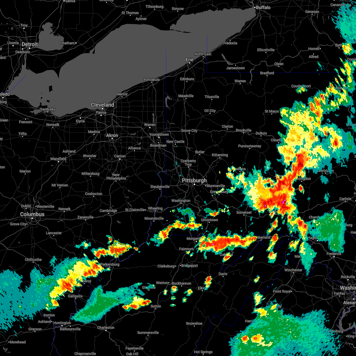 The severe thunderstorm warning for northeastern washington county will expire at 715 pm edt, the storm which prompted the warning has weakened below severe limits, and no longer poses an immediate threat to life or property. therefore, the warning will be allowed to expire. however gusty winds and heavy rain are still possible with this thunderstorm. a severe thunderstorm watch remains in effect until 1000 pm edt for southeastern ohio. The severe thunderstorm warning for northeastern washington county will expire at 715 pm edt, the storm which prompted the warning has weakened below severe limits, and no longer poses an immediate threat to life or property. therefore, the warning will be allowed to expire. however gusty winds and heavy rain are still possible with this thunderstorm. a severe thunderstorm watch remains in effect until 1000 pm edt for southeastern ohio.
|
| 6/22/2022 6:45 PM EDT |
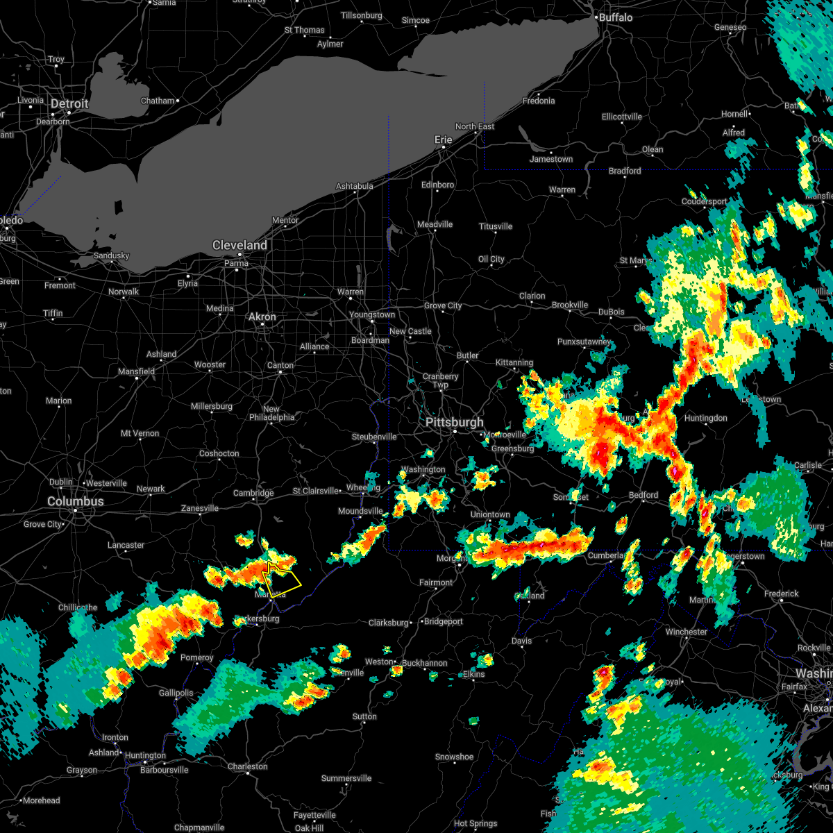 At 644 pm edt, a severe thunderstorm was located 10 miles north of marietta, moving southeast at 25 mph (radar indicated). Hazards include 60 mph wind gusts and quarter size hail. Hail damage to vehicles is expected. Expect wind damage to roofs, siding, and trees. At 644 pm edt, a severe thunderstorm was located 10 miles north of marietta, moving southeast at 25 mph (radar indicated). Hazards include 60 mph wind gusts and quarter size hail. Hail damage to vehicles is expected. Expect wind damage to roofs, siding, and trees.
|
| 6/22/2022 5:53 PM EDT |
 The severe thunderstorm warning for southwestern washington, southwestern pleasants and northeastern wood counties will expire at 600 pm edt, the storm which prompted the warning has moved out of the area. therefore, the warning will be allowed to expire. a severe thunderstorm watch remains in effect until 1000 pm edt for southeastern ohio, and northwestern west virginia. The severe thunderstorm warning for southwestern washington, southwestern pleasants and northeastern wood counties will expire at 600 pm edt, the storm which prompted the warning has moved out of the area. therefore, the warning will be allowed to expire. a severe thunderstorm watch remains in effect until 1000 pm edt for southeastern ohio, and northwestern west virginia.
|
| 6/22/2022 5:48 PM EDT |
 At 548 pm edt, a severe thunderstorm was located near vienna, or near parkersburg, moving southeast at 25 mph (radar indicated). Hazards include 60 mph wind gusts and half dollar size hail. Hail damage to vehicles is expected. expect wind damage to roofs, siding, and trees. locations impacted include, parkersburg, marietta, belpre, vienna, williamstown, boaz, north hills, waverly, fleming and willow island. hail threat, radar indicated max hail size, 1. 25 in wind threat, radar indicated max wind gust, 60 mph. At 548 pm edt, a severe thunderstorm was located near vienna, or near parkersburg, moving southeast at 25 mph (radar indicated). Hazards include 60 mph wind gusts and half dollar size hail. Hail damage to vehicles is expected. expect wind damage to roofs, siding, and trees. locations impacted include, parkersburg, marietta, belpre, vienna, williamstown, boaz, north hills, waverly, fleming and willow island. hail threat, radar indicated max hail size, 1. 25 in wind threat, radar indicated max wind gust, 60 mph.
|
| 6/22/2022 5:26 PM EDT |
 At 526 pm edt, a severe thunderstorm was located near vienna, or near belpre, moving southeast at 25 mph (radar indicated). Hazards include 60 mph wind gusts and quarter size hail. Hail damage to vehicles is expected. Expect wind damage to roofs, siding, and trees. At 526 pm edt, a severe thunderstorm was located near vienna, or near belpre, moving southeast at 25 mph (radar indicated). Hazards include 60 mph wind gusts and quarter size hail. Hail damage to vehicles is expected. Expect wind damage to roofs, siding, and trees.
|
| 6/16/2022 8:26 PM EDT |
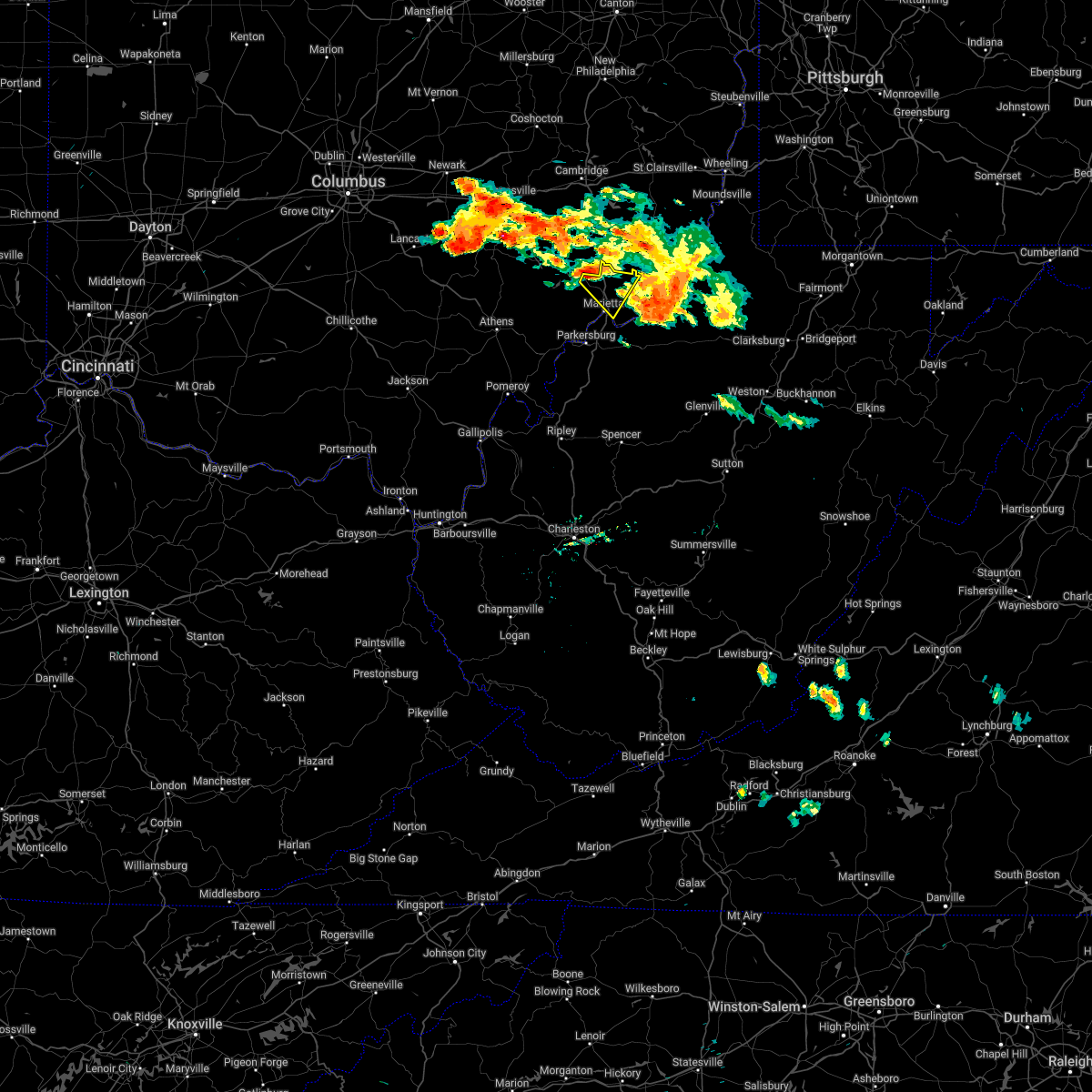 At 825 pm edt, a severe thunderstorm was located near beverly, moving southeast at 30 mph (radar indicated). Hazards include 60 mph wind gusts and quarter size hail. Hail damage to vehicles is expected. Expect wind damage to roofs, siding, and trees. At 825 pm edt, a severe thunderstorm was located near beverly, moving southeast at 30 mph (radar indicated). Hazards include 60 mph wind gusts and quarter size hail. Hail damage to vehicles is expected. Expect wind damage to roofs, siding, and trees.
|
| 6/13/2022 9:17 PM EDT |
 At 917 pm edt, severe thunderstorms were located along a line extending from 8 miles northeast of marietta to 6 miles northwest of north bend state park to near elizabeth, moving east at 65 mph (radar indicated). Hazards include 60 mph wind gusts and nickel size hail. Expect damage to roofs, siding, and trees. locations impacted include, parkersburg, marietta, belpre, spencer, st. marys, elizabeth, vienna, williamstown, belmont, mineralwells, lubeck, boaz, newport, north hills, reedy, cherry, schultz, lucille, davisville and peewee. hail threat, radar indicated max hail size, 0. 88 in wind threat, radar indicated max wind gust, 60 mph. At 917 pm edt, severe thunderstorms were located along a line extending from 8 miles northeast of marietta to 6 miles northwest of north bend state park to near elizabeth, moving east at 65 mph (radar indicated). Hazards include 60 mph wind gusts and nickel size hail. Expect damage to roofs, siding, and trees. locations impacted include, parkersburg, marietta, belpre, spencer, st. marys, elizabeth, vienna, williamstown, belmont, mineralwells, lubeck, boaz, newport, north hills, reedy, cherry, schultz, lucille, davisville and peewee. hail threat, radar indicated max hail size, 0. 88 in wind threat, radar indicated max wind gust, 60 mph.
|
| 6/13/2022 9:17 PM EDT |
 A severe thunderstorm warning remains in effect until 930 pm edt for southeastern washington. southwestern pleasants. west central calhoun. southwestern ritchie. wirt. northwestern roane and wood counties. At 917 pm edt, severe thunderstorms were located along a line extending from 8 miles northeast of marietta to 6 miles northwest of. A severe thunderstorm warning remains in effect until 930 pm edt for southeastern washington. southwestern pleasants. west central calhoun. southwestern ritchie. wirt. northwestern roane and wood counties. At 917 pm edt, severe thunderstorms were located along a line extending from 8 miles northeast of marietta to 6 miles northwest of.
|
| 6/13/2022 9:09 PM EDT |
 A severe thunderstorm warning remains in effect until 930 pm edt for southern washington. southwestern pleasants. west central calhoun. southwestern ritchie. wirt. northwestern roane. northeastern jackson and wood counties. At 908 pm edt, severe thunderstorms were located along a line extending from near marietta to 9 miles east of mineralwells to near. A severe thunderstorm warning remains in effect until 930 pm edt for southern washington. southwestern pleasants. west central calhoun. southwestern ritchie. wirt. northwestern roane. northeastern jackson and wood counties. At 908 pm edt, severe thunderstorms were located along a line extending from near marietta to 9 miles east of mineralwells to near.
|
| 6/13/2022 9:09 PM EDT |
 At 908 pm edt, severe thunderstorms were located along a line extending from near marietta to 9 miles east of mineralwells to near elizabeth, moving east at 65 mph (radar indicated). Hazards include 60 mph wind gusts and nickel size hail. Expect damage to roofs, siding, and trees. locations impacted include, parkersburg, marietta, belpre, ripley, spencer, st. marys, elizabeth, vienna, ravenswood, williamstown, belmont, sandyville, washington, mineralwells, lubeck, boaz, newport, north hills, reedy and cherry. hail threat, radar indicated max hail size, 0. 88 in wind threat, radar indicated max wind gust, 60 mph. At 908 pm edt, severe thunderstorms were located along a line extending from near marietta to 9 miles east of mineralwells to near elizabeth, moving east at 65 mph (radar indicated). Hazards include 60 mph wind gusts and nickel size hail. Expect damage to roofs, siding, and trees. locations impacted include, parkersburg, marietta, belpre, ripley, spencer, st. marys, elizabeth, vienna, ravenswood, williamstown, belmont, sandyville, washington, mineralwells, lubeck, boaz, newport, north hills, reedy and cherry. hail threat, radar indicated max hail size, 0. 88 in wind threat, radar indicated max wind gust, 60 mph.
|
| 6/13/2022 9:06 PM EDT |
 At 905 pm edt, severe thunderstorms were located along a line extending from near vienna to near elizabeth to 7 miles west of spencer, moving east at 55 mph (radar indicated). Hazards include 60 mph wind gusts and quarter size hail. Hail damage to vehicles is possible. Expect wind damage to roofs, siding, and trees. At 905 pm edt, severe thunderstorms were located along a line extending from near vienna to near elizabeth to 7 miles west of spencer, moving east at 55 mph (radar indicated). Hazards include 60 mph wind gusts and quarter size hail. Hail damage to vehicles is possible. Expect wind damage to roofs, siding, and trees.
|
| 6/13/2022 9:06 PM EDT |
 The national weather service in charleston west virginia has issued a * severe thunderstorm warning for. southeastern washington county in southeastern ohio. pleasants county in northwestern west virginia. calhoun county in north central west virginia. Ritchie county in northwestern west virginia. The national weather service in charleston west virginia has issued a * severe thunderstorm warning for. southeastern washington county in southeastern ohio. pleasants county in northwestern west virginia. calhoun county in north central west virginia. Ritchie county in northwestern west virginia.
|
| 6/13/2022 8:44 PM EDT |
 At 843 pm edt, severe thunderstorms were located along a line extending from 8 miles northwest of coolville to near forked run state park to 8 miles south of racine, moving northeast at 65 mph (radar indicated). Hazards include 60 mph wind gusts and nickel size hail. expect damage to roofs, siding, and trees At 843 pm edt, severe thunderstorms were located along a line extending from 8 miles northwest of coolville to near forked run state park to 8 miles south of racine, moving northeast at 65 mph (radar indicated). Hazards include 60 mph wind gusts and nickel size hail. expect damage to roofs, siding, and trees
|
| 6/8/2022 7:23 PM EDT |
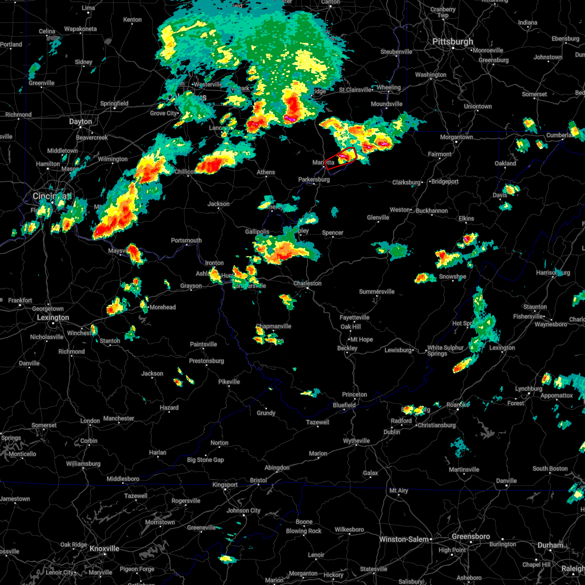 The tornado warning for northeastern washington county will expire at 730 pm edt, the storm which prompted the warning has weakened below severe limits, and no longer appears capable of producing a tornado. therefore, the warning will be allowed to expire. however small hail is still possible with this thunderstorm. a tornado watch remains in effect until 1000 pm edt for southeastern ohio. The tornado warning for northeastern washington county will expire at 730 pm edt, the storm which prompted the warning has weakened below severe limits, and no longer appears capable of producing a tornado. therefore, the warning will be allowed to expire. however small hail is still possible with this thunderstorm. a tornado watch remains in effect until 1000 pm edt for southeastern ohio.
|
| 6/8/2022 7:06 PM EDT |
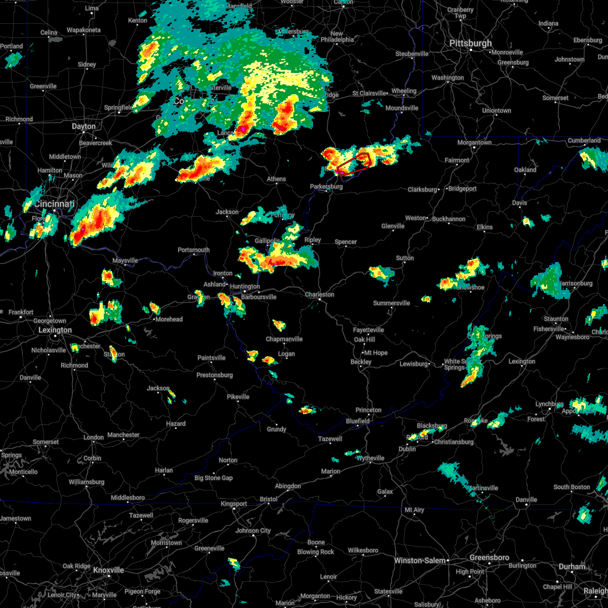 At 706 pm edt, a severe thunderstorm capable of producing a tornado was located near marietta, moving northeast at 30 mph (radar indicated rotation). Hazards include tornado. Flying debris will be dangerous to those caught without shelter. mobile homes will be damaged or destroyed. damage to roofs, windows, and vehicles will occur. tree damage is likely. This tornadic thunderstorm will remain over mainly rural areas of northeastern washington county. At 706 pm edt, a severe thunderstorm capable of producing a tornado was located near marietta, moving northeast at 30 mph (radar indicated rotation). Hazards include tornado. Flying debris will be dangerous to those caught without shelter. mobile homes will be damaged or destroyed. damage to roofs, windows, and vehicles will occur. tree damage is likely. This tornadic thunderstorm will remain over mainly rural areas of northeastern washington county.
|
| 6/8/2022 6:57 PM EDT |
 At 657 pm edt, a severe thunderstorm was located over marietta, moving east at 30 mph (radar indicated). Hazards include 60 mph wind gusts and quarter size hail. Hail damage to vehicles is expected. Expect wind damage to roofs, siding, and trees. At 657 pm edt, a severe thunderstorm was located over marietta, moving east at 30 mph (radar indicated). Hazards include 60 mph wind gusts and quarter size hail. Hail damage to vehicles is expected. Expect wind damage to roofs, siding, and trees.
|
| 3/23/2022 7:58 PM EDT |
 The severe thunderstorm warning for northwestern washington and southeastern morgan counties will expire at 800 pm edt, the storm which prompted the warning has weakened below severe limits, and no longer poses an immediate threat to life or property. therefore, the warning will be allowed to expire. however small hail and gusty winds are still possible with this thunderstorm. a tornado watch remains in effect until 1000 pm edt for southeastern ohio. The severe thunderstorm warning for northwestern washington and southeastern morgan counties will expire at 800 pm edt, the storm which prompted the warning has weakened below severe limits, and no longer poses an immediate threat to life or property. therefore, the warning will be allowed to expire. however small hail and gusty winds are still possible with this thunderstorm. a tornado watch remains in effect until 1000 pm edt for southeastern ohio.
|
| 3/23/2022 7:57 PM EDT |
 The severe thunderstorm warning for southern washington, south central morgan and northwestern wood counties will expire at 800 pm edt, the storm which prompted the warning has weakened below severe limits, and no longer poses an immediate threat to life or property. therefore, the warning will be allowed to expire. however small hail and gusty winds are still possible with this thunderstorm. a tornado watch remains in effect until 1000 pm edt for southeastern ohio, and northwestern west virginia. The severe thunderstorm warning for southern washington, south central morgan and northwestern wood counties will expire at 800 pm edt, the storm which prompted the warning has weakened below severe limits, and no longer poses an immediate threat to life or property. therefore, the warning will be allowed to expire. however small hail and gusty winds are still possible with this thunderstorm. a tornado watch remains in effect until 1000 pm edt for southeastern ohio, and northwestern west virginia.
|
| 3/23/2022 7:36 PM EDT |
 At 736 pm edt, a severe thunderstorm was located 7 miles south of beverly, moving northeast at 70 mph (radar indicated). Hazards include 60 mph wind gusts and quarter size hail. Hail damage to vehicles is expected. Expect wind damage to roofs, siding, and trees. At 736 pm edt, a severe thunderstorm was located 7 miles south of beverly, moving northeast at 70 mph (radar indicated). Hazards include 60 mph wind gusts and quarter size hail. Hail damage to vehicles is expected. Expect wind damage to roofs, siding, and trees.
|
| 3/23/2022 7:30 PM EDT |
 At 725 pm edt, a severe thunderstorm was located 9 miles north of coolville, moving northeast at 60 mph (radar indicated). Hazards include 70 mph wind gusts and quarter size hail. Hail damage to vehicles is expected. expect considerable tree damage. wind damage is also likely to mobile homes, roofs, and outbuildings. locations impacted include, marietta, belpre, chesterhill, vienna, williamstown, boaz, lowell, stockport, fleming, bartlett, devola and little hocking. thunderstorm damage threat, considerable hail threat, radar indicated max hail size, 1. 00 in wind threat, radar indicated max wind gust, 70 mph. At 725 pm edt, a severe thunderstorm was located 9 miles north of coolville, moving northeast at 60 mph (radar indicated). Hazards include 70 mph wind gusts and quarter size hail. Hail damage to vehicles is expected. expect considerable tree damage. wind damage is also likely to mobile homes, roofs, and outbuildings. locations impacted include, marietta, belpre, chesterhill, vienna, williamstown, boaz, lowell, stockport, fleming, bartlett, devola and little hocking. thunderstorm damage threat, considerable hail threat, radar indicated max hail size, 1. 00 in wind threat, radar indicated max wind gust, 70 mph.
|
| 3/23/2022 7:17 PM EDT |
 At 715 pm edt, a severe thunderstorm was located 8 miles southeast of athens, moving northeast at 60 mph (radar indicated). Hazards include 70 mph wind gusts and quarter size hail. Hail damage to vehicles is expected. expect considerable tree damage. wind damage is also likely to mobile homes, roofs, and outbuildings. locations impacted include, athens, marietta, belpre, albany, coolville, chesterhill, vienna, williamstown, boaz, lowell, stockport, amesville, stroud run state park, little hocking, fleming, bartlett, devola and blennerhassett. thunderstorm damage threat, considerable hail threat, radar indicated max hail size, 1. 00 in wind threat, radar indicated max wind gust, 70 mph. At 715 pm edt, a severe thunderstorm was located 8 miles southeast of athens, moving northeast at 60 mph (radar indicated). Hazards include 70 mph wind gusts and quarter size hail. Hail damage to vehicles is expected. expect considerable tree damage. wind damage is also likely to mobile homes, roofs, and outbuildings. locations impacted include, athens, marietta, belpre, albany, coolville, chesterhill, vienna, williamstown, boaz, lowell, stockport, amesville, stroud run state park, little hocking, fleming, bartlett, devola and blennerhassett. thunderstorm damage threat, considerable hail threat, radar indicated max hail size, 1. 00 in wind threat, radar indicated max wind gust, 70 mph.
|
| 3/23/2022 7:08 PM EDT |
 At 708 pm edt, a severe thunderstorm was located near albany, moving northeast at 60 mph (radar indicated). Hazards include 70 mph wind gusts and quarter size hail. Hail damage to vehicles is expected. expect considerable tree damage. Wind damage is also likely to mobile homes, roofs, and outbuildings. At 708 pm edt, a severe thunderstorm was located near albany, moving northeast at 60 mph (radar indicated). Hazards include 70 mph wind gusts and quarter size hail. Hail damage to vehicles is expected. expect considerable tree damage. Wind damage is also likely to mobile homes, roofs, and outbuildings.
|
| 3/23/2022 5:21 PM EDT |
 The severe thunderstorm warning for northeastern washington, pleasants, central ritchie, wirt, southwestern tyler, northeastern jackson and wood counties will expire at 530 pm edt, the storm which prompted the warning has weakened below severe limits, and no longer poses an immediate threat to life or property. therefore, the warning will be allowed to expire. however gusty winds are still possible with this thunderstorm. a tornado watch remains in effect until 1000 pm edt for southeastern ohio, and northern and northwestern west virginia. The severe thunderstorm warning for northeastern washington, pleasants, central ritchie, wirt, southwestern tyler, northeastern jackson and wood counties will expire at 530 pm edt, the storm which prompted the warning has weakened below severe limits, and no longer poses an immediate threat to life or property. therefore, the warning will be allowed to expire. however gusty winds are still possible with this thunderstorm. a tornado watch remains in effect until 1000 pm edt for southeastern ohio, and northern and northwestern west virginia.
|
| 3/23/2022 5:10 PM EDT |
 At 509 pm edt, a severe thunderstorm was located near mineralwells, or 7 miles southeast of parkersburg, moving northeast at 70 mph (radar indicated). Hazards include 70 mph wind gusts and quarter size hail. Hail damage to vehicles is expected. expect considerable tree damage. wind damage is also likely to mobile homes, roofs, and outbuildings. locations impacted include, parkersburg, marietta, harrisville, st. Marys, elizabeth, pennsboro, belmont, mineralwells, north bend state park, newport, ellenboro, cairo, maxwell, schultz, hebron, pike, davisville, highland, peewee and willow island. At 509 pm edt, a severe thunderstorm was located near mineralwells, or 7 miles southeast of parkersburg, moving northeast at 70 mph (radar indicated). Hazards include 70 mph wind gusts and quarter size hail. Hail damage to vehicles is expected. expect considerable tree damage. wind damage is also likely to mobile homes, roofs, and outbuildings. locations impacted include, parkersburg, marietta, harrisville, st. Marys, elizabeth, pennsboro, belmont, mineralwells, north bend state park, newport, ellenboro, cairo, maxwell, schultz, hebron, pike, davisville, highland, peewee and willow island.
|
| 3/23/2022 4:51 PM EDT |
 At 450 pm edt, a severe thunderstorm was located near ravenswood, or 7 miles north of ripley, moving northeast at 70 mph (radar indicated). Hazards include 70 mph wind gusts and quarter size hail. Hail damage to vehicles is expected. expect considerable tree damage. Wind damage is also likely to mobile homes, roofs, and outbuildings. At 450 pm edt, a severe thunderstorm was located near ravenswood, or 7 miles north of ripley, moving northeast at 70 mph (radar indicated). Hazards include 70 mph wind gusts and quarter size hail. Hail damage to vehicles is expected. expect considerable tree damage. Wind damage is also likely to mobile homes, roofs, and outbuildings.
|
| 6/30/2021 2:25 PM EDT |
 The severe thunderstorm warning for central washington and north central wood counties will expire at 230 pm edt, the storms which prompted the warning have weakened below severe limits, and no longer pose an immediate threat to life or property. therefore, the warning will be allowed to expire. however gusty winds and heavy rain are still possible with these thunderstorms. The severe thunderstorm warning for central washington and north central wood counties will expire at 230 pm edt, the storms which prompted the warning have weakened below severe limits, and no longer pose an immediate threat to life or property. therefore, the warning will be allowed to expire. however gusty winds and heavy rain are still possible with these thunderstorms.
|
| 6/30/2021 2:14 PM EDT |
 At 213 pm edt, severe thunderstorms were located along a line extending from 11 miles north of belmont to near marietta to near boaz, moving east at 20 mph (radar indicated). Hazards include 60 mph wind gusts and penny size hail. Expect damage to roofs, siding, and trees. Locations impacted include, marietta, williamstown, boaz, newport, lower salem, waverly and devola. At 213 pm edt, severe thunderstorms were located along a line extending from 11 miles north of belmont to near marietta to near boaz, moving east at 20 mph (radar indicated). Hazards include 60 mph wind gusts and penny size hail. Expect damage to roofs, siding, and trees. Locations impacted include, marietta, williamstown, boaz, newport, lower salem, waverly and devola.
|
| 6/30/2021 1:55 PM EDT |
 At 154 pm edt, severe thunderstorms were located along a line extending from 6 miles north of marietta to williamstown to parkersburg, moving east at 20 mph (radar indicated). Hazards include 60 mph wind gusts and penny size hail. expect damage to roofs, siding, and trees At 154 pm edt, severe thunderstorms were located along a line extending from 6 miles north of marietta to williamstown to parkersburg, moving east at 20 mph (radar indicated). Hazards include 60 mph wind gusts and penny size hail. expect damage to roofs, siding, and trees
|
| 6/21/2021 4:42 PM EDT |
 The tornado warning for east central washington and northern pleasants counties will expire at 445 pm edt, the tornado threat has diminished and the tornado warning has been cancelled. however, large hail and damaging winds remain likely and a severe thunderstorm warning remains in effect for the area. a severe thunderstorm watch remains in effect until 800 pm edt for southeastern ohio, and northern and northwestern west virginia. The tornado warning for east central washington and northern pleasants counties will expire at 445 pm edt, the tornado threat has diminished and the tornado warning has been cancelled. however, large hail and damaging winds remain likely and a severe thunderstorm warning remains in effect for the area. a severe thunderstorm watch remains in effect until 800 pm edt for southeastern ohio, and northern and northwestern west virginia.
|
| 6/21/2021 4:19 PM EDT |
 At 419 pm edt, a severe thunderstorm capable of producing a tornado was located near belmont, or near marietta, moving east at 30 mph (radar indicated rotation). Hazards include tornado. Flying debris will be dangerous to those caught without shelter. mobile homes will be damaged or destroyed. damage to roofs, windows, and vehicles will occur. tree damage is likely. this dangerous storm will be near, belmont around 430 pm edt. st. marys around 435 pm edt. Other locations impacted by this tornadic thunderstorm include newport, arvilla and point lookout. At 419 pm edt, a severe thunderstorm capable of producing a tornado was located near belmont, or near marietta, moving east at 30 mph (radar indicated rotation). Hazards include tornado. Flying debris will be dangerous to those caught without shelter. mobile homes will be damaged or destroyed. damage to roofs, windows, and vehicles will occur. tree damage is likely. this dangerous storm will be near, belmont around 430 pm edt. st. marys around 435 pm edt. Other locations impacted by this tornadic thunderstorm include newport, arvilla and point lookout.
|
| 6/21/2021 4:08 PM EDT |
 At 408 pm edt, a severe thunderstorm was located 9 miles northwest of belpre, moving east at 45 mph (radar indicated). Hazards include 60 mph wind gusts and penny size hail. Expect damage to roofs, siding, and trees. Locations impacted include, parkersburg, marietta, belpre, vienna, williamstown, belmont, boaz, washington, newport, north hills, willow island, little hocking, waverly, fleming, blennerhassett, bartlett and devola. At 408 pm edt, a severe thunderstorm was located 9 miles northwest of belpre, moving east at 45 mph (radar indicated). Hazards include 60 mph wind gusts and penny size hail. Expect damage to roofs, siding, and trees. Locations impacted include, parkersburg, marietta, belpre, vienna, williamstown, belmont, boaz, washington, newport, north hills, willow island, little hocking, waverly, fleming, blennerhassett, bartlett and devola.
|
| 6/21/2021 4:05 PM EDT |
 At 404 pm edt, a severe thunderstorm was located near belmont, or near marietta, moving east at 40 mph (radar indicated). Hazards include 70 mph wind gusts and penny size hail. Expect considerable tree damage. Damage is likely to mobile homes, roofs, and outbuildings. At 404 pm edt, a severe thunderstorm was located near belmont, or near marietta, moving east at 40 mph (radar indicated). Hazards include 70 mph wind gusts and penny size hail. Expect considerable tree damage. Damage is likely to mobile homes, roofs, and outbuildings.
|
| 6/21/2021 3:48 PM EDT |
 At 347 pm edt, a severe thunderstorm was located 7 miles northeast of athens, moving east at 45 mph (radar indicated). Hazards include 60 mph wind gusts and penny size hail. expect damage to roofs, siding, and trees At 347 pm edt, a severe thunderstorm was located 7 miles northeast of athens, moving east at 45 mph (radar indicated). Hazards include 60 mph wind gusts and penny size hail. expect damage to roofs, siding, and trees
|
| 6/21/2021 3:39 PM EDT |
 At 339 pm edt, a severe thunderstorm was located 7 miles south of beverly, moving east at 25 mph (radar indicated). Hazards include 60 mph wind gusts and penny size hail. Expect damage to roofs, siding, and trees. Locations impacted include, marietta, beverly, chesterhill, boaz, lowell, amesville, fleming, bartlett and devola. At 339 pm edt, a severe thunderstorm was located 7 miles south of beverly, moving east at 25 mph (radar indicated). Hazards include 60 mph wind gusts and penny size hail. Expect damage to roofs, siding, and trees. Locations impacted include, marietta, beverly, chesterhill, boaz, lowell, amesville, fleming, bartlett and devola.
|
| 6/21/2021 3:13 PM EDT |
 At 313 pm edt, a severe thunderstorm was located near chesterhill, moving east at 25 mph (radar indicated). Hazards include 60 mph wind gusts and penny size hail. expect damage to roofs, siding, and trees At 313 pm edt, a severe thunderstorm was located near chesterhill, moving east at 25 mph (radar indicated). Hazards include 60 mph wind gusts and penny size hail. expect damage to roofs, siding, and trees
|
| 6/13/2021 4:40 PM EDT |
 At 439 pm edt, severe thunderstorms were located along a line extending from 8 miles west of sistersville to belmont to williamstown, moving southeast at 30 mph (radar indicated). Hazards include 60 mph wind gusts and quarter size hail. Hail damage to vehicles is expected. Expect wind damage to roofs, siding, and trees. At 439 pm edt, severe thunderstorms were located along a line extending from 8 miles west of sistersville to belmont to williamstown, moving southeast at 30 mph (radar indicated). Hazards include 60 mph wind gusts and quarter size hail. Hail damage to vehicles is expected. Expect wind damage to roofs, siding, and trees.
|
| 11/15/2020 1:32 PM EST |
 At 130 pm est, severe thunderstorms were located along a line extending from near sugarcreek to near beverly to near gallipolis, moving east at 50 mph (radar indicated). Hazards include 60 mph wind gusts. storm damage has been reported with this line of storms across perry county. severe wind gusts were recorded across athens county. Expect damage to roofs, siding, and trees. Locations impacted include, athens, marietta, belpre, mcconnelsville, beverly, coolville, chesterhill, tuppers plains, chester, malta, lowell, stockport, bristol, macksburg, amesville, lower salem, stroud run state park, little hocking, dyesville and darwin. At 130 pm est, severe thunderstorms were located along a line extending from near sugarcreek to near beverly to near gallipolis, moving east at 50 mph (radar indicated). Hazards include 60 mph wind gusts. storm damage has been reported with this line of storms across perry county. severe wind gusts were recorded across athens county. Expect damage to roofs, siding, and trees. Locations impacted include, athens, marietta, belpre, mcconnelsville, beverly, coolville, chesterhill, tuppers plains, chester, malta, lowell, stockport, bristol, macksburg, amesville, lower salem, stroud run state park, little hocking, dyesville and darwin.
|
| 11/15/2020 1:18 PM EST |
 At 117 pm est, severe thunderstorms were located along a line extending from near farmerstown to near chesterhill to 6 miles southwest of rio grande, moving east at 50 mph (radar indicated. at severe wind gust of 58 mph was recorded at the ohio university airport with this line of storms). Hazards include 60 mph wind gusts. Expect damage to roofs, siding, and trees. Locations impacted include, athens, marietta, belpre, jackson, wellston, glouster, mcconnelsville, beverly, albany, coolville, rutland, chesterhill, tuppers plains, washington, crooksville, chester, chauncey, malta, corning and lowell. At 117 pm est, severe thunderstorms were located along a line extending from near farmerstown to near chesterhill to 6 miles southwest of rio grande, moving east at 50 mph (radar indicated. at severe wind gust of 58 mph was recorded at the ohio university airport with this line of storms). Hazards include 60 mph wind gusts. Expect damage to roofs, siding, and trees. Locations impacted include, athens, marietta, belpre, jackson, wellston, glouster, mcconnelsville, beverly, albany, coolville, rutland, chesterhill, tuppers plains, washington, crooksville, chester, chauncey, malta, corning and lowell.
|
| 11/15/2020 12:51 PM EST |
 At 1249 pm est, severe thunderstorms were located along a line extending from near danville to near logan to clarktown, moving east at 50 mph (radar indicated). Hazards include 60 mph wind gusts. Expect damage to roofs, siding, and trees. Locations impacted include, athens, marietta, belpre, jackson, wellston, nelsonville, new lexington, glouster, mcconnelsville, mcarthur, somerset, beverly, albany, shawnee, coolville, rutland, chesterhill, perry state forest, lake hope state park and tuppers plains. At 1249 pm est, severe thunderstorms were located along a line extending from near danville to near logan to clarktown, moving east at 50 mph (radar indicated). Hazards include 60 mph wind gusts. Expect damage to roofs, siding, and trees. Locations impacted include, athens, marietta, belpre, jackson, wellston, nelsonville, new lexington, glouster, mcconnelsville, mcarthur, somerset, beverly, albany, shawnee, coolville, rutland, chesterhill, perry state forest, lake hope state park and tuppers plains.
|
| 11/15/2020 12:25 PM EST |
 At 1224 pm est, severe thunderstorms were located along a line extending from chesterville to 10 miles northeast of kingston to 10 miles southeast of peebles, moving east at 50 mph. sporadic severe wind gusts are likely with this line of thunderstorms (radar indicated). Hazards include 60 mph wind gusts. expect damage to roofs, siding, and trees At 1224 pm est, severe thunderstorms were located along a line extending from chesterville to 10 miles northeast of kingston to 10 miles southeast of peebles, moving east at 50 mph. sporadic severe wind gusts are likely with this line of thunderstorms (radar indicated). Hazards include 60 mph wind gusts. expect damage to roofs, siding, and trees
|
| 8/26/2020 4:40 PM EDT |
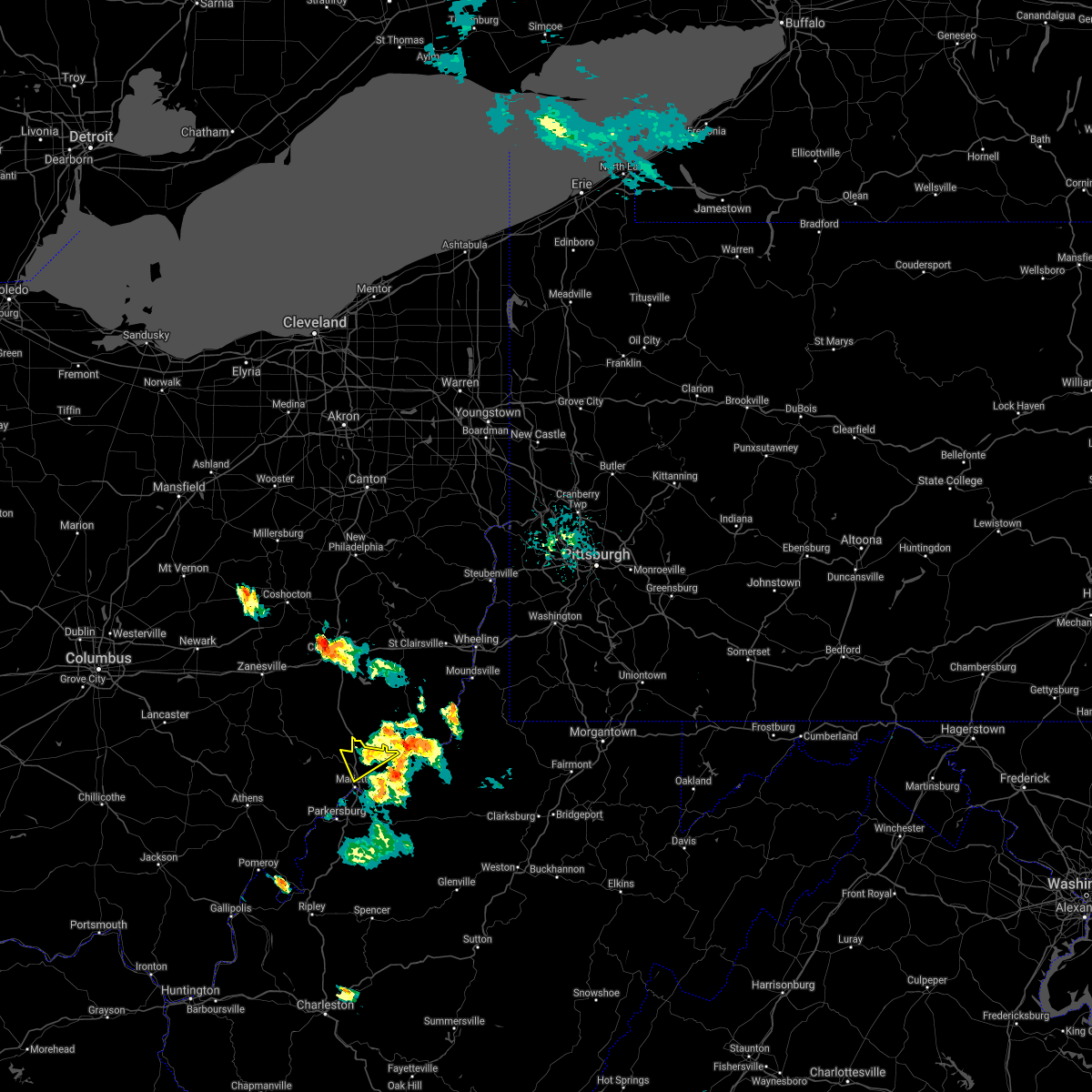 The severe thunderstorm warning for north central washington county will expire at 445 pm edt, the storm which prompted the warning has weakened below severe limits, and no longer poses an immediate threat to life or property. therefore, the warning will be allowed to expire. The severe thunderstorm warning for north central washington county will expire at 445 pm edt, the storm which prompted the warning has weakened below severe limits, and no longer poses an immediate threat to life or property. therefore, the warning will be allowed to expire.
|
| 8/26/2020 4:22 PM EDT |
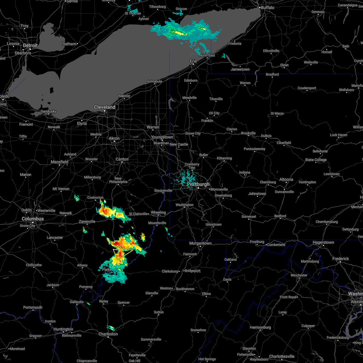 At 421 pm edt, a severe thunderstorm was located near caldwell, moving southeast at 15 mph (radar indicated). Hazards include 60 mph wind gusts and quarter size hail. Hail damage to vehicles is expected. Expect wind damage to roofs, siding, and trees. At 421 pm edt, a severe thunderstorm was located near caldwell, moving southeast at 15 mph (radar indicated). Hazards include 60 mph wind gusts and quarter size hail. Hail damage to vehicles is expected. Expect wind damage to roofs, siding, and trees.
|
| 8/26/2020 4:18 PM EDT |
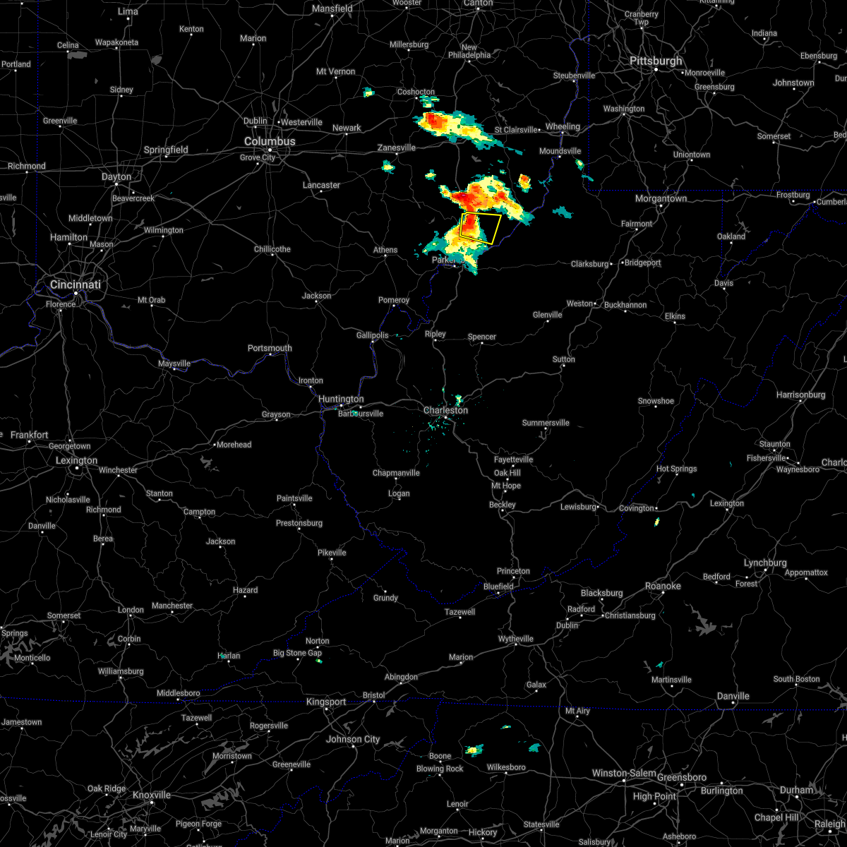 At 417 pm edt, a severe thunderstorm was located 8 miles north of marietta, moving east at 35 mph (radar indicated). Hazards include 60 mph wind gusts and quarter size hail. Hail damage to vehicles is expected. expect wind damage to roofs, siding, and trees. Locations impacted include, marietta, lowell, lower salem and devola. At 417 pm edt, a severe thunderstorm was located 8 miles north of marietta, moving east at 35 mph (radar indicated). Hazards include 60 mph wind gusts and quarter size hail. Hail damage to vehicles is expected. expect wind damage to roofs, siding, and trees. Locations impacted include, marietta, lowell, lower salem and devola.
|
| 8/26/2020 3:58 PM EDT |
 At 357 pm edt, a severe thunderstorm was located over beverly, moving east at 30 mph (radar indicated). Hazards include 60 mph wind gusts and half dollar size hail. Hail damage to vehicles is expected. Expect wind damage to roofs, siding, and trees. At 357 pm edt, a severe thunderstorm was located over beverly, moving east at 30 mph (radar indicated). Hazards include 60 mph wind gusts and half dollar size hail. Hail damage to vehicles is expected. Expect wind damage to roofs, siding, and trees.
|
| 8/26/2020 3:51 PM EDT |
 At 350 pm edt, a severe thunderstorm was located near beverly, moving east at 30 mph (radar indicated). Hazards include 60 mph wind gusts and quarter size hail. Hail damage to vehicles is expected. expect wind damage to roofs, siding, and trees. Locations impacted include, marietta, beverly, lowell, stockport, lower salem, fleming, bartlett and devola. At 350 pm edt, a severe thunderstorm was located near beverly, moving east at 30 mph (radar indicated). Hazards include 60 mph wind gusts and quarter size hail. Hail damage to vehicles is expected. expect wind damage to roofs, siding, and trees. Locations impacted include, marietta, beverly, lowell, stockport, lower salem, fleming, bartlett and devola.
|
| 8/26/2020 3:31 PM EDT |
 At 331 pm edt, a severe thunderstorm was located over chesterhill, moving east at 35 mph (radar indicated). Hazards include 60 mph wind gusts and quarter size hail. Hail damage to vehicles is expected. Expect wind damage to roofs, siding, and trees. At 331 pm edt, a severe thunderstorm was located over chesterhill, moving east at 35 mph (radar indicated). Hazards include 60 mph wind gusts and quarter size hail. Hail damage to vehicles is expected. Expect wind damage to roofs, siding, and trees.
|
| 8/1/2020 3:47 PM EDT |
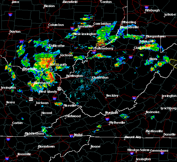 At 346 pm edt, a severe thunderstorm capable of producing a tornado was located near marietta, moving east at 20 mph (radar indicated rotation). Hazards include tornado. Flying debris will be dangerous to those caught without shelter. mobile homes will be damaged or destroyed. damage to roofs, windows, and vehicles will occur. tree damage is likely. This tornadic thunderstorm will remain over mainly rural areas of central washington county. At 346 pm edt, a severe thunderstorm capable of producing a tornado was located near marietta, moving east at 20 mph (radar indicated rotation). Hazards include tornado. Flying debris will be dangerous to those caught without shelter. mobile homes will be damaged or destroyed. damage to roofs, windows, and vehicles will occur. tree damage is likely. This tornadic thunderstorm will remain over mainly rural areas of central washington county.
|
| 8/1/2020 3:38 PM EDT |
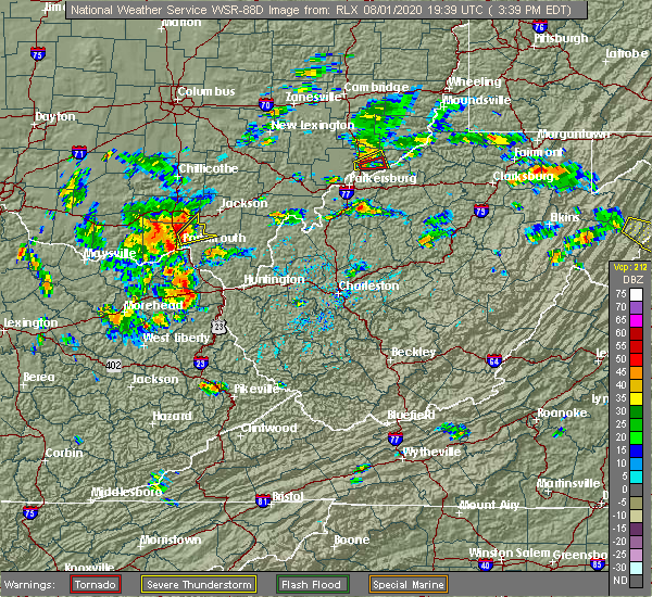 At 338 pm edt, a severe thunderstorm capable of producing a tornado was located over marietta, moving east at 20 mph (radar indicated rotation). Hazards include tornado. Flying debris will be dangerous to those caught without shelter. mobile homes will be damaged or destroyed. damage to roofs, windows, and vehicles will occur. tree damage is likely. This tornadic thunderstorm will remain over mainly rural areas of central washington county. At 338 pm edt, a severe thunderstorm capable of producing a tornado was located over marietta, moving east at 20 mph (radar indicated rotation). Hazards include tornado. Flying debris will be dangerous to those caught without shelter. mobile homes will be damaged or destroyed. damage to roofs, windows, and vehicles will occur. tree damage is likely. This tornadic thunderstorm will remain over mainly rural areas of central washington county.
|
| 8/1/2020 3:34 PM EDT |
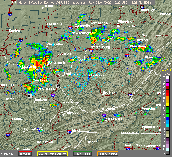 At 334 pm edt, a severe thunderstorm was located over marietta, moving east at 20 mph (radar indicated). Hazards include 60 mph wind gusts and penny size hail. expect damage to roofs, siding, and trees At 334 pm edt, a severe thunderstorm was located over marietta, moving east at 20 mph (radar indicated). Hazards include 60 mph wind gusts and penny size hail. expect damage to roofs, siding, and trees
|
| 7/27/2020 7:30 PM EDT |
 At 730 pm edt, a severe thunderstorm was located near williamstown, or near marietta, moving east at 30 mph (radar indicated). Hazards include 60 mph wind gusts. expect damage to roofs, siding, and trees At 730 pm edt, a severe thunderstorm was located near williamstown, or near marietta, moving east at 30 mph (radar indicated). Hazards include 60 mph wind gusts. expect damage to roofs, siding, and trees
|
| 4/9/2020 1:34 AM EDT |
 At 133 am edt, severe thunderstorms were located along a line extending from 7 miles northeast of elizabeth to near spencer, moving east at 60 mph (radar indicated). Hazards include 70 mph wind gusts and quarter size hail. Hail damage to vehicles is expected. expect considerable tree damage. wind damage is also likely to mobile homes, roofs, and outbuildings. locations impacted include, parkersburg, marietta, belpre, spencer, harrisville, st. Marys, elizabeth, grantsville, vienna, williamstown, pennsboro, belmont, mineralwells, arnoldsburg, north bend state park, boaz, lubeck, newport, north hills and ellenboro. At 133 am edt, severe thunderstorms were located along a line extending from 7 miles northeast of elizabeth to near spencer, moving east at 60 mph (radar indicated). Hazards include 70 mph wind gusts and quarter size hail. Hail damage to vehicles is expected. expect considerable tree damage. wind damage is also likely to mobile homes, roofs, and outbuildings. locations impacted include, parkersburg, marietta, belpre, spencer, harrisville, st. Marys, elizabeth, grantsville, vienna, williamstown, pennsboro, belmont, mineralwells, arnoldsburg, north bend state park, boaz, lubeck, newport, north hills and ellenboro.
|
| 4/9/2020 1:18 AM EDT |
 At 116 am edt, a severe thunderstorm was located near elizabeth, moving east at 50 mph (radar indicated). Hazards include 70 mph wind gusts and quarter size hail. Hail damage to vehicles is expected. expect considerable tree damage. wind damage is also likely to mobile homes, roofs, and outbuildings. locations impacted include, parkersburg, marietta, belpre, ripley, spencer, harrisville, st. Marys, elizabeth, grantsville, vienna, williamstown, pennsboro, belmont, sandyville, mineralwells, arnoldsburg, washington, north bend state park, lubeck and boaz. At 116 am edt, a severe thunderstorm was located near elizabeth, moving east at 50 mph (radar indicated). Hazards include 70 mph wind gusts and quarter size hail. Hail damage to vehicles is expected. expect considerable tree damage. wind damage is also likely to mobile homes, roofs, and outbuildings. locations impacted include, parkersburg, marietta, belpre, ripley, spencer, harrisville, st. Marys, elizabeth, grantsville, vienna, williamstown, pennsboro, belmont, sandyville, mineralwells, arnoldsburg, washington, north bend state park, lubeck and boaz.
|
| 4/9/2020 1:01 AM EDT |
 At 100 am edt, a severe thunderstorm was located 7 miles east of forked run state park, moving east at 65 mph (radar indicated). Hazards include 70 mph wind gusts and quarter size hail. Hail damage to vehicles is expected. expect considerable tree damage. wind damage is also likely to mobile homes, roofs, and outbuildings. locations impacted include, parkersburg, marietta, belpre, ripley, spencer, harrisville, st. Marys, elizabeth, racine, grantsville, coolville, forked run state park, vienna, ravenswood, williamstown, pennsboro, belmont, sandyville, mineralwells and arnoldsburg. At 100 am edt, a severe thunderstorm was located 7 miles east of forked run state park, moving east at 65 mph (radar indicated). Hazards include 70 mph wind gusts and quarter size hail. Hail damage to vehicles is expected. expect considerable tree damage. wind damage is also likely to mobile homes, roofs, and outbuildings. locations impacted include, parkersburg, marietta, belpre, ripley, spencer, harrisville, st. Marys, elizabeth, racine, grantsville, coolville, forked run state park, vienna, ravenswood, williamstown, pennsboro, belmont, sandyville, mineralwells and arnoldsburg.
|
| 4/9/2020 12:54 AM EDT |
 At 1253 am edt, a severe thunderstorm was located near forked run state park, moving east at 75 mph (radar indicated). Hazards include 70 mph wind gusts and quarter size hail. Hail damage to vehicles is expected. expect considerable tree damage. Wind damage is also likely to mobile homes, roofs, and outbuildings. At 1253 am edt, a severe thunderstorm was located near forked run state park, moving east at 75 mph (radar indicated). Hazards include 70 mph wind gusts and quarter size hail. Hail damage to vehicles is expected. expect considerable tree damage. Wind damage is also likely to mobile homes, roofs, and outbuildings.
|
| 4/8/2020 3:34 AM EDT |
 At 333 am edt, a severe thunderstorm was located near marietta, moving southeast at 60 mph (radar indicated). Hazards include 60 mph wind gusts and quarter size hail. Hail damage to vehicles is expected. Expect wind damage to roofs, siding, and trees. At 333 am edt, a severe thunderstorm was located near marietta, moving southeast at 60 mph (radar indicated). Hazards include 60 mph wind gusts and quarter size hail. Hail damage to vehicles is expected. Expect wind damage to roofs, siding, and trees.
|
| 1/11/2020 4:25 PM EST | Damage to roof of home of nws employee family member in washington county OH, 0.7 miles NE of Marietta, OH |
| 8/8/2019 6:24 PM EDT |
 At 624 pm edt, a severe thunderstorm was located near vienna, or 7 miles north of belpre, moving southeast at 35 mph (radar indicated). Hazards include 60 mph wind gusts and quarter size hail. Hail damage to vehicles is expected. expect wind damage to roofs, siding, and trees. Locations impacted include, parkersburg, marietta, belpre, vienna, williamstown, washington, boaz, lubeck, north hills, little hocking, waverly, fleming, blennerhassett and bartlett. At 624 pm edt, a severe thunderstorm was located near vienna, or 7 miles north of belpre, moving southeast at 35 mph (radar indicated). Hazards include 60 mph wind gusts and quarter size hail. Hail damage to vehicles is expected. expect wind damage to roofs, siding, and trees. Locations impacted include, parkersburg, marietta, belpre, vienna, williamstown, washington, boaz, lubeck, north hills, little hocking, waverly, fleming, blennerhassett and bartlett.
|
| 8/8/2019 6:15 PM EDT | Tree down and blocking sr 339 in both directions at mile marker 10.2 near sr 55 in washington county OH, 1.1 miles W of Marietta, OH |
| 8/8/2019 6:05 PM EDT |
 At 605 pm edt, a severe thunderstorm was located over chesterhill, moving southeast at 30 mph (radar indicated). Hazards include 60 mph wind gusts and quarter size hail. Hail damage to vehicles is expected. Expect wind damage to roofs, siding, and trees. At 605 pm edt, a severe thunderstorm was located over chesterhill, moving southeast at 30 mph (radar indicated). Hazards include 60 mph wind gusts and quarter size hail. Hail damage to vehicles is expected. Expect wind damage to roofs, siding, and trees.
|
| 8/8/2019 5:05 PM EDT |
 At 504 pm edt, a severe thunderstorm was located 10 miles northwest of vienna, or 10 miles northwest of belpre, moving southeast at 35 mph (radar indicated). Hazards include 60 mph wind gusts and quarter size hail. Hail damage to vehicles is expected. Expect wind damage to roofs, siding, and trees. At 504 pm edt, a severe thunderstorm was located 10 miles northwest of vienna, or 10 miles northwest of belpre, moving southeast at 35 mph (radar indicated). Hazards include 60 mph wind gusts and quarter size hail. Hail damage to vehicles is expected. Expect wind damage to roofs, siding, and trees.
|
| 8/8/2019 4:23 PM EDT |
 At 423 pm edt, a severe thunderstorm was located near beverly, moving southeast at 30 mph (radar indicated). Hazards include 60 mph wind gusts and quarter size hail. Hail damage to vehicles is expected. expect wind damage to roofs, siding, and trees. Locations impacted include, marietta, beverly, williamstown, lowell, bristol, macksburg, lower salem, hackney and devola. At 423 pm edt, a severe thunderstorm was located near beverly, moving southeast at 30 mph (radar indicated). Hazards include 60 mph wind gusts and quarter size hail. Hail damage to vehicles is expected. expect wind damage to roofs, siding, and trees. Locations impacted include, marietta, beverly, williamstown, lowell, bristol, macksburg, lower salem, hackney and devola.
|
| 8/8/2019 4:06 PM EDT |
 At 406 pm edt, a severe thunderstorm was located near mcconnelsville, moving southeast at 30 mph (radar indicated). Hazards include 60 mph wind gusts and quarter size hail. Hail damage to vehicles is expected. Expect wind damage to roofs, siding, and trees. At 406 pm edt, a severe thunderstorm was located near mcconnelsville, moving southeast at 30 mph (radar indicated). Hazards include 60 mph wind gusts and quarter size hail. Hail damage to vehicles is expected. Expect wind damage to roofs, siding, and trees.
|
| 7/6/2019 8:38 PM EDT |
 At 838 pm edt, a severe thunderstorm was located near marietta, moving east at 35 mph (radar indicated). Hazards include 60 mph wind gusts and quarter size hail. Hail damage to vehicles is expected. Expect wind damage to roofs, siding, and trees. At 838 pm edt, a severe thunderstorm was located near marietta, moving east at 35 mph (radar indicated). Hazards include 60 mph wind gusts and quarter size hail. Hail damage to vehicles is expected. Expect wind damage to roofs, siding, and trees.
|
| 5/25/2019 4:53 PM EDT |
 At 453 pm edt, a severe thunderstorm was located over beverly, moving east at 50 mph (radar indicated). Hazards include 60 mph wind gusts and quarter size hail. Hail damage to vehicles is expected. Expect wind damage to roofs, siding, and trees. At 453 pm edt, a severe thunderstorm was located over beverly, moving east at 50 mph (radar indicated). Hazards include 60 mph wind gusts and quarter size hail. Hail damage to vehicles is expected. Expect wind damage to roofs, siding, and trees.
|
| 7/23/2018 7:15 PM EDT | Numerous reports of large trees down across area with pictures. widespread small limbs down as well. time estimated via rada in wood county WV, 3.7 miles NE of Marietta, OH |
| 5/21/2018 3:35 PM EDT |
 At 334 pm edt, a severe thunderstorm was located over vienna, or near belpre, moving east at 20 mph (radar indicated). Hazards include 60 mph wind gusts and penny size hail. Expect damage to roofs, siding, and trees. locations impacted include, parkersburg, marietta, belpre, vienna, williamstown, boaz, north hills, fleming, blennerhassett and devola. this includes the following highways, interstate 77 in west virginia between mile markers 172 and 186. interstate 77 in ohio between mile markers 1 and 4. Route 50 in west virginia between mile markers 1 and 13. At 334 pm edt, a severe thunderstorm was located over vienna, or near belpre, moving east at 20 mph (radar indicated). Hazards include 60 mph wind gusts and penny size hail. Expect damage to roofs, siding, and trees. locations impacted include, parkersburg, marietta, belpre, vienna, williamstown, boaz, north hills, fleming, blennerhassett and devola. this includes the following highways, interstate 77 in west virginia between mile markers 172 and 186. interstate 77 in ohio between mile markers 1 and 4. Route 50 in west virginia between mile markers 1 and 13.
|
| 5/21/2018 3:08 PM EDT |
 At 307 pm edt, a severe thunderstorm was located 8 miles north of washington, or 9 miles northwest of belpre, moving east at 20 mph (radar indicated). Hazards include 60 mph wind gusts and penny size hail. expect damage to roofs, siding, and trees At 307 pm edt, a severe thunderstorm was located 8 miles north of washington, or 9 miles northwest of belpre, moving east at 20 mph (radar indicated). Hazards include 60 mph wind gusts and penny size hail. expect damage to roofs, siding, and trees
|
| 8/19/2017 7:14 PM EDT |
 At 714 pm edt, a severe thunderstorm was located near belmont, or near marietta, moving southeast at 35 mph (radar indicated). Hazards include 60 mph wind gusts and quarter size hail. Hail damage to vehicles is expected. Expect wind damage to roofs, siding, and trees. At 714 pm edt, a severe thunderstorm was located near belmont, or near marietta, moving southeast at 35 mph (radar indicated). Hazards include 60 mph wind gusts and quarter size hail. Hail damage to vehicles is expected. Expect wind damage to roofs, siding, and trees.
|
| 8/4/2017 12:19 PM EDT | Multiple trees uprooted in reno. time estimated from rada in washington county OH, 4.5 miles NNW of Marietta, OH |
| 7/22/2017 5:31 PM EDT |
 At 530 pm edt, severe thunderstorms were located along a line extending from near williamstown to near washington, moving east at 40 mph (radar indicated). Hazards include 60 mph wind gusts and quarter size hail. Hail damage to vehicles is expected. Expect wind damage to roofs, siding, and trees. At 530 pm edt, severe thunderstorms were located along a line extending from near williamstown to near washington, moving east at 40 mph (radar indicated). Hazards include 60 mph wind gusts and quarter size hail. Hail damage to vehicles is expected. Expect wind damage to roofs, siding, and trees.
|
| 7/22/2017 5:28 PM EDT | Tree down along greenhill rd. time estimated from rada in washington county OH, 8.8 miles ENE of Marietta, OH |
| 7/22/2017 5:28 PM EDT |
 At 528 pm edt, a severe thunderstorm was located near vienna, or near belpre, moving east at 35 mph (law enforcement). Hazards include 60 mph wind gusts and quarter size hail. Hail damage to vehicles is expected. expect wind damage to roofs, siding, and trees. locations impacted include, parkersburg, marietta, vienna, williamstown, boaz, north hills, fleming and devola. this includes the following highways, interstate 77 in west virginia between mile markers 178 and 186. Interstate 77 in ohio between mile markers 1 and 6. At 528 pm edt, a severe thunderstorm was located near vienna, or near belpre, moving east at 35 mph (law enforcement). Hazards include 60 mph wind gusts and quarter size hail. Hail damage to vehicles is expected. expect wind damage to roofs, siding, and trees. locations impacted include, parkersburg, marietta, vienna, williamstown, boaz, north hills, fleming and devola. this includes the following highways, interstate 77 in west virginia between mile markers 178 and 186. Interstate 77 in ohio between mile markers 1 and 6.
|
| 7/22/2017 5:22 PM EDT | Tree down along groves rd. time estimated from rada in washington county OH, 2.1 miles E of Marietta, OH |
| 7/22/2017 5:03 PM EDT |
 At 502 pm edt, a severe thunderstorm was located near chesterhill, moving east at 35 mph (radar indicated). Hazards include 60 mph wind gusts and quarter size hail. Hail damage to vehicles is expected. Expect wind damage to roofs, siding, and trees. At 502 pm edt, a severe thunderstorm was located near chesterhill, moving east at 35 mph (radar indicated). Hazards include 60 mph wind gusts and quarter size hail. Hail damage to vehicles is expected. Expect wind damage to roofs, siding, and trees.
|
| 7/22/2017 4:15 PM EDT |
 At 415 pm edt, a severe thunderstorm was located near belpre, moving east at 30 mph (radar indicated). Hazards include 60 mph wind gusts and quarter size hail. Hail damage to vehicles is expected. Expect wind damage to roofs, siding, and trees. At 415 pm edt, a severe thunderstorm was located near belpre, moving east at 30 mph (radar indicated). Hazards include 60 mph wind gusts and quarter size hail. Hail damage to vehicles is expected. Expect wind damage to roofs, siding, and trees.
|
| 7/10/2017 11:38 PM EDT | Several trees uprooted in reno area via social media report. time estimated by rada in washington county OH, 4.5 miles NNW of Marietta, OH |
| 7/10/2017 6:58 PM EDT |
 The severe thunderstorm warning for central washington, southwestern pleasants, northwestern ritchie and northeastern wood counties will expire at 700 pm edt, the storm which prompted the warning has moved out of the area. therefore the warning will be allowed to expire. The severe thunderstorm warning for central washington, southwestern pleasants, northwestern ritchie and northeastern wood counties will expire at 700 pm edt, the storm which prompted the warning has moved out of the area. therefore the warning will be allowed to expire.
|
| 7/10/2017 6:46 PM EDT | Several trees uprooted in reno area via social media report. time estimated by rada in washington county OH, 4.5 miles NNW of Marietta, OH |
| 7/10/2017 6:28 PM EDT |
 At 628 pm edt, a severe thunderstorm was located over boaz, or near marietta, moving east at 30 mph (radar indicated). Hazards include ping pong ball size hail and 60 mph wind gusts. People and animals outdoors will be injured. expect hail damage to roofs, siding, windows, and vehicles. Expect wind damage to roofs, siding, and trees. At 628 pm edt, a severe thunderstorm was located over boaz, or near marietta, moving east at 30 mph (radar indicated). Hazards include ping pong ball size hail and 60 mph wind gusts. People and animals outdoors will be injured. expect hail damage to roofs, siding, windows, and vehicles. Expect wind damage to roofs, siding, and trees.
|
| 7/7/2017 3:45 PM EDT | Large tree branches down and fell on the yard fence in washington county OH, 0.7 miles NE of Marietta, OH |
| 7/7/2017 3:36 PM EDT |
 At 335 pm edt, severe thunderstorms were located along a line extending from 14 miles northeast of marietta to parkersburg to albany, moving east at 50 mph (radar indicated). Hazards include 60 mph wind gusts. expect damage to roofs, siding, and trees At 335 pm edt, severe thunderstorms were located along a line extending from 14 miles northeast of marietta to parkersburg to albany, moving east at 50 mph (radar indicated). Hazards include 60 mph wind gusts. expect damage to roofs, siding, and trees
|
| 5/1/2017 1:09 PM EDT | Social media report of trees and power lines down along arrends ridge road from ohio-60 to ohio-821 in washington county OH, 0.7 miles NE of Marietta, OH |
| 3/1/2017 4:40 AM EST |
 The severe thunderstorm warning for washington and north central wood counties will expire at 445 am est, the storm which prompted the warning has weakened below severe limits, and was exiting the warned area. therefore, the warning will be allowed to expire. however gusty winds are still possible with this thunderstorm. The severe thunderstorm warning for washington and north central wood counties will expire at 445 am est, the storm which prompted the warning has weakened below severe limits, and was exiting the warned area. therefore, the warning will be allowed to expire. however gusty winds are still possible with this thunderstorm.
|
| 3/1/2017 4:26 AM EST |
 At 425 am est, a severe thunderstorm was located 7 miles north of marietta, moving east at 70 mph (radar indicated). Hazards include 60 mph wind gusts and penny size hail. Expect damage to roofs, siding, and trees. locations impacted include, marietta, beverly, vienna, williamstown, boaz, newport, matamoras, lowell, macksburg, lower salem, fleming and devola. this includes the following highways, interstate 77 in west virginia between mile markers 183 and 186. Interstate 77 in ohio between mile markers 1 and 17. At 425 am est, a severe thunderstorm was located 7 miles north of marietta, moving east at 70 mph (radar indicated). Hazards include 60 mph wind gusts and penny size hail. Expect damage to roofs, siding, and trees. locations impacted include, marietta, beverly, vienna, williamstown, boaz, newport, matamoras, lowell, macksburg, lower salem, fleming and devola. this includes the following highways, interstate 77 in west virginia between mile markers 183 and 186. Interstate 77 in ohio between mile markers 1 and 17.
|
| 3/1/2017 4:14 AM EST |
 At 414 am est, a severe thunderstorm was located near beverly, moving east at 75 mph (radar indicated). Hazards include 70 mph wind gusts and quarter size hail. Hail damage to vehicles is expected. expect considerable tree damage. Wind damage is also likely to mobile homes, roofs, and outbuildings. At 414 am est, a severe thunderstorm was located near beverly, moving east at 75 mph (radar indicated). Hazards include 70 mph wind gusts and quarter size hail. Hail damage to vehicles is expected. expect considerable tree damage. Wind damage is also likely to mobile homes, roofs, and outbuildings.
|
| 12/18/2016 1:37 AM EST |
 The severe thunderstorm warning for southeastern athens, washington, south central morgan, northwestern wood, northern pleasants and northwestern tyler counties will expire at 145 am est, the storm which prompted the warning has weakened below severe limits, and no longer pose an immediate threat to life or property. therefore the warning will be allowed to expire. however heavy rain is still possible with this thunderstorm. The severe thunderstorm warning for southeastern athens, washington, south central morgan, northwestern wood, northern pleasants and northwestern tyler counties will expire at 145 am est, the storm which prompted the warning has weakened below severe limits, and no longer pose an immediate threat to life or property. therefore the warning will be allowed to expire. however heavy rain is still possible with this thunderstorm.
|
| 12/18/2016 12:58 AM EST |
 At 1258 am est, a severe thunderstorm was located 9 miles north of washington, or 9 miles northwest of belpre, moving northeast at 55 mph (radar indicated). Hazards include 60 mph wind gusts. expect damage to roofs, siding, and trees At 1258 am est, a severe thunderstorm was located 9 miles north of washington, or 9 miles northwest of belpre, moving northeast at 55 mph (radar indicated). Hazards include 60 mph wind gusts. expect damage to roofs, siding, and trees
|
| 10/20/2016 4:06 PM EDT |
 At 405 pm edt, a severe thunderstorm was located 10 miles northeast of marietta, moving northeast at 40 mph (trained weather spotters). Hazards include quarter size hail was reported earlier with this storm. Damage to vehicles is expected. locations impacted include, marietta, st. Marys, sistersville, newport, matamoras, friendly, fly, lower salem, new matamoras, arvilla, devola and point lookout. At 405 pm edt, a severe thunderstorm was located 10 miles northeast of marietta, moving northeast at 40 mph (trained weather spotters). Hazards include quarter size hail was reported earlier with this storm. Damage to vehicles is expected. locations impacted include, marietta, st. Marys, sistersville, newport, matamoras, friendly, fly, lower salem, new matamoras, arvilla, devola and point lookout.
|
| 10/20/2016 3:58 PM EDT |
 At 357 pm edt, a severe thunderstorm was located near marietta, moving northeast at 40 mph (trained weather spotters). Hazards include up to quarter size hail was reported near fleming. Damage to vehicles is expected. locations impacted include, marietta, st. Marys, williamstown, sistersville, belmont, boaz, newport, matamoras, lowell, friendly, fly, lower salem, arvilla, devola, point lookout and new matamoras. At 357 pm edt, a severe thunderstorm was located near marietta, moving northeast at 40 mph (trained weather spotters). Hazards include up to quarter size hail was reported near fleming. Damage to vehicles is expected. locations impacted include, marietta, st. Marys, williamstown, sistersville, belmont, boaz, newport, matamoras, lowell, friendly, fly, lower salem, arvilla, devola, point lookout and new matamoras.
|
| 10/20/2016 3:57 PM EDT | Quarter sized hail reported 3.3 miles SSE of Marietta, OH, 2 sycamore trees topped - approx 12 inch diameter trunks |
| 10/20/2016 3:57 PM EDT | 2 sycamore trees topped - approx 12 inch diameter trunks in washington county OH, 3.3 miles SSE of Marietta, OH |
| 10/20/2016 3:55 PM EDT | Large tree on vehicle. 300 block front street via faceboo in washington county OH, 0.7 miles NE of Marietta, OH |
| 10/20/2016 3:46 PM EDT |
 At 345 pm edt, a severe thunderstorm was located near marietta, moving northeast at 40 mph (radar indicated). Hazards include quarter size hail. damage to vehicles is expected At 345 pm edt, a severe thunderstorm was located near marietta, moving northeast at 40 mph (radar indicated). Hazards include quarter size hail. damage to vehicles is expected
|
| 6/23/2016 2:41 AM EDT | The tornado warning for northwestern washington and southeastern morgan counties will expire at 245 am edt. the storm which prompted the warning has moved out of the area. therefore. the warning will be allowed to expire. Another warning has been issued downstream. |
| 6/23/2016 2:38 AM EDT |
 At 238 am edt, a severe thunderstorm was located near belpre, moving east at 60 mph (radar indicated). Hazards include 70 mph wind gusts and quarter size hail. Hail damage to vehicles is expected. expect considerable tree damage. Wind damage is also likely to mobile homes, roofs, and outbuildings. At 238 am edt, a severe thunderstorm was located near belpre, moving east at 60 mph (radar indicated). Hazards include 70 mph wind gusts and quarter size hail. Hail damage to vehicles is expected. expect considerable tree damage. Wind damage is also likely to mobile homes, roofs, and outbuildings.
|
| 6/23/2016 2:33 AM EDT |
 At 233 am edt, a severe thunderstorm was located 7 miles north of belmont, or 7 miles northwest of st. marys, moving east at 40 mph (radar indicated). Hazards include 70 mph wind gusts and quarter size hail. Hail damage to vehicles is expected. expect considerable tree damage. Wind damage is also likely to mobile homes, roofs, and outbuildings. At 233 am edt, a severe thunderstorm was located 7 miles north of belmont, or 7 miles northwest of st. marys, moving east at 40 mph (radar indicated). Hazards include 70 mph wind gusts and quarter size hail. Hail damage to vehicles is expected. expect considerable tree damage. Wind damage is also likely to mobile homes, roofs, and outbuildings.
|
| 6/23/2016 2:33 AM EDT |
 The national weather service in charleston west virginia has issued a * severe thunderstorm warning for. northeastern washington county in southeastern ohio. northern ritchie county in northwestern west virginia. northeastern wood county in northwestern west virginia. Pleasants county in northwestern west virginia. The national weather service in charleston west virginia has issued a * severe thunderstorm warning for. northeastern washington county in southeastern ohio. northern ritchie county in northwestern west virginia. northeastern wood county in northwestern west virginia. Pleasants county in northwestern west virginia.
|
| 6/23/2016 2:24 AM EDT |
 At 223 am edt, a severe thunderstorm capable of producing a tornado was located near beverly, moving east at 40 mph (radar indicated rotation). Hazards include tornado and quarter size hail. Flying debris will be dangerous to those caught without shelter. mobile homes will be damaged or destroyed. damage to roofs, windows, and vehicles will occur. tree damage is likely. this dangerous storm will be near, marietta around 240 am edt. Other locations impacted by this tornadic thunderstorm include lowell, devola, lower salem and macksburg. At 223 am edt, a severe thunderstorm capable of producing a tornado was located near beverly, moving east at 40 mph (radar indicated rotation). Hazards include tornado and quarter size hail. Flying debris will be dangerous to those caught without shelter. mobile homes will be damaged or destroyed. damage to roofs, windows, and vehicles will occur. tree damage is likely. this dangerous storm will be near, marietta around 240 am edt. Other locations impacted by this tornadic thunderstorm include lowell, devola, lower salem and macksburg.
|
| 6/23/2016 2:04 AM EDT |
 At 204 am edt, a severe thunderstorm capable of producing a tornado was located near mcconnelsville, moving east at 40 mph (radar indicated rotation). Hazards include tornado and quarter size hail. Flying debris will be dangerous to those caught without shelter. mobile homes will be damaged or destroyed. damage to roofs, windows, and vehicles will occur. tree damage is likely. this dangerous storm will be near, beverly around 220 am edt. marietta around 240 am edt. Other locations impacted by this tornadic thunderstorm include lowell, bristol, stockport, devola, lower salem, macksburg, malta and hackney. At 204 am edt, a severe thunderstorm capable of producing a tornado was located near mcconnelsville, moving east at 40 mph (radar indicated rotation). Hazards include tornado and quarter size hail. Flying debris will be dangerous to those caught without shelter. mobile homes will be damaged or destroyed. damage to roofs, windows, and vehicles will occur. tree damage is likely. this dangerous storm will be near, beverly around 220 am edt. marietta around 240 am edt. Other locations impacted by this tornadic thunderstorm include lowell, bristol, stockport, devola, lower salem, macksburg, malta and hackney.
|
| 5/29/2016 3:41 PM EDT |
 At 341 pm edt, a severe thunderstorm was located over belpre, moving east at 20 mph (radar indicated). Hazards include quarter size hail. damage to vehicles is expected At 341 pm edt, a severe thunderstorm was located over belpre, moving east at 20 mph (radar indicated). Hazards include quarter size hail. damage to vehicles is expected
|
| 4/28/2016 5:57 PM EDT |
 At 556 pm edt, a severe thunderstorm was located near washington, or 7 miles northeast of coolville, moving east at 35 mph (public). Hazards include golf ball size hail and 60 mph wind gusts. People and animals outdoors will be injured. expect hail damage to roofs, siding, windows, and vehicles. Expect wind damage to roofs, siding, and trees. At 556 pm edt, a severe thunderstorm was located near washington, or 7 miles northeast of coolville, moving east at 35 mph (public). Hazards include golf ball size hail and 60 mph wind gusts. People and animals outdoors will be injured. expect hail damage to roofs, siding, windows, and vehicles. Expect wind damage to roofs, siding, and trees.
|
| 7/14/2015 4:30 PM EDT | Porch blown off structur in washington county OH, 2.3 miles SW of Marietta, OH |
| 7/14/2015 4:28 PM EDT | Roof damage to house on lynch church rd. trees dow in washington county OH, 2.3 miles SW of Marietta, OH |
| 7/14/2015 4:21 PM EDT |
 At 420 pm edt, doppler radar indicated a line of severe thunderstorms capable of producing damaging winds in excess of 60 mph. these storms were located along a line extending from near vienna to near tuppers plains, moving southeast at 50 mph. these severe storms will be near, parkersburg, belpre, vienna, washington and lubeck around 425 pm edt. boaz around 430 pm edt. mineralwells around 435 pm edt. other locations impacted by these severe thunderstorms include harrisonville, darwin, ellenboro, davisville, rockport, walker, reedsville, newport, petroleum and north hills. At 420 pm edt, doppler radar indicated a line of severe thunderstorms capable of producing damaging winds in excess of 60 mph. these storms were located along a line extending from near vienna to near tuppers plains, moving southeast at 50 mph. these severe storms will be near, parkersburg, belpre, vienna, washington and lubeck around 425 pm edt. boaz around 430 pm edt. mineralwells around 435 pm edt. other locations impacted by these severe thunderstorms include harrisonville, darwin, ellenboro, davisville, rockport, walker, reedsville, newport, petroleum and north hills.
|
| 7/14/2015 3:52 PM EDT |
 At 352 pm edt, doppler radar indicated a line of severe thunderstorms capable of producing damaging winds in excess of 60 mph. these storms were located along a line extending from near glouster to near lake hope state park, and moving southeast at 50 mph. * severe thunderstorms will be near, belpre, tuppers plains, washington and lubeck around 420 pm edt. parkersburg, coolville, vienna and boaz around 425 pm edt. forked run state park and mineralwells around 430 pm edt. elizabeth around 445 pm edt. other locations impacted by these severe thunderstorms include harrisonville, stockport, darwin, ellenboro, davisville, bartlett, rockport, walker, reedsville and newport. At 352 pm edt, doppler radar indicated a line of severe thunderstorms capable of producing damaging winds in excess of 60 mph. these storms were located along a line extending from near glouster to near lake hope state park, and moving southeast at 50 mph. * severe thunderstorms will be near, belpre, tuppers plains, washington and lubeck around 420 pm edt. parkersburg, coolville, vienna and boaz around 425 pm edt. forked run state park and mineralwells around 430 pm edt. elizabeth around 445 pm edt. other locations impacted by these severe thunderstorms include harrisonville, stockport, darwin, ellenboro, davisville, bartlett, rockport, walker, reedsville and newport.
|
| 6/30/2015 4:52 PM EDT | Quarter sized hail reported 7.6 miles W of Marietta, OH, time estimated from radar |
| 6/30/2015 4:50 PM EDT |
 At 449 pm edt, doppler radar indicated a severe thunderstorm capable of producing quarter size hail and damaging winds in excess of 60 mph. this storm was located over belmont, or near st. marys, and moving northeast, near the ohio river, at 35 mph. At 449 pm edt, doppler radar indicated a severe thunderstorm capable of producing quarter size hail and damaging winds in excess of 60 mph. this storm was located over belmont, or near st. marys, and moving northeast, near the ohio river, at 35 mph.
|
| 5/11/2015 7:32 PM EDT | At 730 pm edt, national weather service doppler radar continued to indicate a line of severe thunderstorms capable of producing damaging winds in excess of 60 mph. these storms were located along a line extending from williamstown to schultz to cairo, or along a line extending from marietta to 9 miles southwest of st. marys to 8 miles southwest of harrisville, moving northeast at 45 mph. other locations in the warning include but are not limited to nutter farm, willow island, devola, belmont, north bend state park, newport, maxwell, ellenboro, pike, highland, mountain, wick, arvilla, hebron, point lookout, matamoras, new matamoras, lower salem, pennsboro and friendly this will impact the following interstates, i-77 between mile markers 1 and 8 in ohio, and between mile markers 171 and 186 in west virginia. very heavy rain will also fall from this line of severe thunderstorms, and will cause water to pond on roads and quickly fill roadside ditches and small streams. a severe thunderstorm watch remains in effect until 1000 pm edt monday evening for central kentucky and southeast ohio and central west virginia. a severe thunderstorm watch also remains in effect until 100 am edt tuesday morning for central west virginia. please report severe weather to the national weather service by calling toll free, 800-401-9535, when you can do so safely. you may also report severe weather by posting your report to the charleston west virginia national weather service facebook page, or by using the twitter hashtag, nwsrlx. |
| 5/11/2015 7:32 PM EDT | At 730 pm edt, national weather service doppler radar continued to indicate a line of severe thunderstorms capable of producing damaging winds in excess of 60 mph. these storms were located along a line extending from williamstown to schultz to cairo, or along a line extending from marietta to 9 miles southwest of st. marys to 8 miles southwest of harrisville, moving northeast at 45 mph. other locations in the warning include but are not limited to nutter farm, willow island, devola, belmont, north bend state park, newport, maxwell, ellenboro, pike, highland, mountain, wick, arvilla, hebron, point lookout, matamoras, new matamoras, lower salem, pennsboro and friendly this will impact the following interstates, i-77 between mile markers 1 and 8 in ohio, and between mile markers 171 and 186 in west virginia. very heavy rain will also fall from this line of severe thunderstorms, and will cause water to pond on roads and quickly fill roadside ditches and small streams. a severe thunderstorm watch remains in effect until 1000 pm edt monday evening for central kentucky and southeast ohio and central west virginia. a severe thunderstorm watch also remains in effect until 100 am edt tuesday morning for central west virginia. please report severe weather to the national weather service by calling toll free, 800-401-9535, when you can do so safely. you may also report severe weather by posting your report to the charleston west virginia national weather service facebook page, or by using the twitter hashtag, nwsrlx. |
| 5/11/2015 7:12 PM EDT | At 710 pm edt, national weather service doppler radar indicated a line of severe thunderstorms capable of producing damaging winds in excess of 60 mph. these storms were located along a line extending from lubeck to mineralwells to elizabeth, or along a line extending from belpre to 6 miles northwest of elizabeth to elizabeth, moving northeast at 40 mph. * other locations in the warning include but are not limited to pennsboro, north bend state park, belmont, williamstown, washington, vienna and boaz. this will impact the following interstates, i-77 between mile markers 1 and 8 in ohio, and between mile markers 168 and 186 in west virginia. very heavy rain will also fall from this line of severe thunderstorms, and will cause water to pond on roads and quickly fill roadside ditches and small streams. a severe thunderstorm watch remains in effect until 1000 pm edt monday evening for central kentucky and southeast ohio and central west virginia. a severe thunderstorm watch also remains in effect until 100 am edt tuesday morning for central west virginia. please report hail or strong wind to the national weather service by calling toll free, 800-401-9535, when you can do so safely. you may also report severe weather by posting your report to the charleston west virginia national weather service facebook page, or by using the twitter hashtag, nwsrlx. |
| 5/11/2015 7:12 PM EDT | At 710 pm edt, national weather service doppler radar indicated a line of severe thunderstorms capable of producing damaging winds in excess of 60 mph. these storms were located along a line extending from lubeck to mineralwells to elizabeth, or along a line extending from belpre to 6 miles northwest of elizabeth to elizabeth, moving northeast at 40 mph. * other locations in the warning include but are not limited to pennsboro, north bend state park, belmont, williamstown, washington, vienna and boaz. this will impact the following interstates, i-77 between mile markers 1 and 8 in ohio, and between mile markers 168 and 186 in west virginia. very heavy rain will also fall from this line of severe thunderstorms, and will cause water to pond on roads and quickly fill roadside ditches and small streams. a severe thunderstorm watch remains in effect until 1000 pm edt monday evening for central kentucky and southeast ohio and central west virginia. a severe thunderstorm watch also remains in effect until 100 am edt tuesday morning for central west virginia. please report hail or strong wind to the national weather service by calling toll free, 800-401-9535, when you can do so safely. you may also report severe weather by posting your report to the charleston west virginia national weather service facebook page, or by using the twitter hashtag, nwsrlx. |
| 5/11/2015 6:49 PM EDT | At 647 pm edt, national weather service doppler radar continued to indicate a line of severe thunderstorms capable of producing damaging winds in excess of 60 mph. these storms were located along a line extending from eagleport to chesterhill to 6 miles southeast of dexter, or along a line extending from 9 miles north of mcconnelsville to chesterhill to rutland, moving east at 35 mph. other locations in the warning include but are not limited to malta, darwin, stockport, bartlett, bristol, hackney, beverly, fleming, marietta, macksburg, lower salem, lowell and devola this will impact the following interstate, i-77 between mile markers 1 and 17 in ohio. very heavy rain will also fall from this line of severe thunderstorms, and will cause water to pond on roads and quickly fill roadside ditches and small streams. a severe thunderstorm watch remains in effect until 1000 pm edt monday evening for central kentucky and southeast ohio and central west virginia. a severe thunderstorm watch also remains in effect until 100 am edt tuesday morning for central west virginia. please report severe weather to the national weather service by calling toll free, 800-401-9535, when you can do so safely. you may also report severe weather by posting your report to the charleston west virginia national weather service facebook page, or by using the twitter hashtag, nwsrlx. |
| 5/11/2015 6:19 PM EDT | At 617 pm edt, national weather service doppler radar indicated a line of severe thunderstorms capable of producing damaging winds in excess of 60 mph. these storms were located along a line extending from 23 miles northwest of mcconnelsville to 7 miles west of glouster to 18 miles southwest of albany, or along a line extending from 8 miles southwest of zanesville to nelsonville to 9 miles north of rio grande, moving northeast at 55 mph. * other locations in the warning include but are not limited to stroud run state park, salem center, harrisonville, hackney, fleming, eagleport, dyesville, dexter, darwin, carpenter, burr oak state park, bristol, bartlett, vinton, stockport, malta, macksburg, lower salem, lowell, devola, trimble, the plains, jacksonville, chauncey, amesville, rendville and corning. this will impact the following interstate, i-77 between mile markers 1 and 17 in ohio. very heavy rain will also fall from this line of severe thunderstorms, and will cause water to pond on roads and quickly fill roadside ditches and small streams. a severe thunderstorm watch remains in effect until 1000 pm edt monday evening for central kentucky and southeast ohio and central west virginia. a severe thunderstorm watch also remains in effect until 100 am edt tuesday morning for central west virginia. please report hail or strong wind to the national weather service by calling toll free, 800-401-9535, when you can do so safely. you may also report severe weather by posting your report to the charleston west virginia national weather service facebook page, or by using the twitter hashtag, nwsrlx. |
| 4/9/2015 5:43 PM EDT | The national weather service in charleston has issued a * tornado warning for. pleasants county in west virginia. this includes the city of st. marys. north central wood county in west virginia. Washington county in southeast ohio. |
| 4/9/2015 5:43 PM EDT | The national weather service in charleston has issued a * tornado warning for. pleasants county in west virginia. this includes the city of st. marys. north central wood county in west virginia. Washington county in southeast ohio. |
| 4/9/2015 4:56 PM EDT | The national weather service in charleston has issued a * severe thunderstorm warning for. pleasants county in west virginia. this includes the city of st. marys. north central ritchie county in west virginia. Northern wood county in west virginia. |
| 4/9/2015 4:56 PM EDT | The national weather service in charleston has issued a * severe thunderstorm warning for. pleasants county in west virginia. this includes the city of st. marys. north central ritchie county in west virginia. Northern wood county in west virginia. |
| 4/9/2015 4:00 PM EDT | Quarter sized hail reported 0.7 miles NE of Marietta, OH |
| 4/9/2015 3:55 PM EDT | Half Dollar sized hail reported 2.1 miles NW of Marietta, OH |
| 4/9/2015 3:42 PM EDT | The national weather service in charleston has issued a * severe thunderstorm warning for. pleasants county in west virginia. this includes the city of st. marys. tyler county in west virginia. This includes the city of middlebourne. |
| 4/9/2015 3:42 PM EDT | The national weather service in charleston has issued a * severe thunderstorm warning for. pleasants county in west virginia. this includes the city of st. marys. tyler county in west virginia. This includes the city of middlebourne. |
| 7/26/2012 6:37 PM EDT | Large branches broke in washington county OH, 4.8 miles E of Marietta, OH |
| 7/1/2012 8:20 PM EDT | Trees down in marietta area and much of washington count in washington county OH, 0.7 miles NE of Marietta, OH |
| 6/29/2012 6:30 PM EDT | Large trees down in washington county OH, 0.7 miles NE of Marietta, OH |
| 3/19/2012 5:20 PM EDT | Half Dollar sized hail reported 3.1 miles NNW of Marietta, OH, event occured in reno... two vehicles damaged. |
| 1/1/0001 12:00 AM | Large branches broke in washington county OH, 4.8 miles E of Marietta, OH |
| 1/1/0001 12:00 AM | Quarter sized hail reported 4.8 miles E of Marietta, OH |
| 1/1/0001 12:00 AM | Quarter sized hail reported 4.3 miles NW of Marietta, OH |
| 1/1/0001 12:00 AM | Half Dollar sized hail reported 0.7 miles NE of Marietta, OH |
| 6/21/2011 8:00 PM EDT | Golf Ball sized hail reported 5.5 miles WNW of Marietta, OH |
| 1/1/0001 12:00 AM | 3 to 4 trees down at 310 6th street in marietta in washington county OH, 0.7 miles NE of Marietta, OH |
| 1/1/0001 12:00 AM | Tree down on dazell rd on rt 821 in washington county OH, 0.7 miles NE of Marietta, OH |
Hail Maps for Marietta, OH
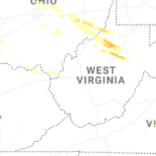
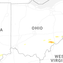
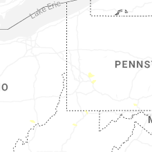


Connect with Interactive Hail Maps