

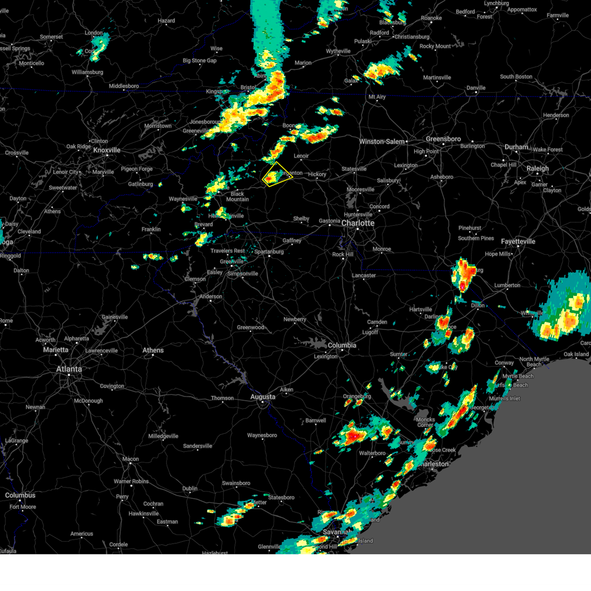
Hail Map for Marion, NC
The Marion, NC area has had 41 reports of on-the-ground hail by trained spotters, and has been under severe weather warnings 5 times during the past 12 months. Doppler radar has detected hail at or near Marion, NC on 57 occasions.
| Name: | Marion, NC |
| Where Located: | 64 miles S of Bristol, TN |
| Map: | Google Map for Marion, NC |
| Population: | 7838 |
| Housing Units: | 3132 |
| More Info: | Search Google for Marion, NC |
3
The Top Recent Hail Date for Marion, NC is Thursday, May 8, 2025 (4th out of 57)

Hail and Wind Damage Spotted near Marion, NC
| Date / Time | Report Details |
|---|---|
| 6/27/2026 3:19 PM EDT |
 Svrgsp the national weather service in greenville-spartanburg has issued a * severe thunderstorm warning for, southeastern mcdowell county in western north carolina, rutherford county in western north carolina, southeastern caldwell county in western north carolina, northwestern cleveland county in the piedmont of north carolina, burke county in western north carolina, * until 415 pm edt. * at 318 pm edt, severe thunderstorms were located along a line extending from 5 miles southwest of lenoir to 10 miles west of rutherfordton, moving east at 30 mph (radar indicated). Hazards include 60 mph wind gusts. expect damage to trees and power lines Svrgsp the national weather service in greenville-spartanburg has issued a * severe thunderstorm warning for, southeastern mcdowell county in western north carolina, rutherford county in western north carolina, southeastern caldwell county in western north carolina, northwestern cleveland county in the piedmont of north carolina, burke county in western north carolina, * until 415 pm edt. * at 318 pm edt, severe thunderstorms were located along a line extending from 5 miles southwest of lenoir to 10 miles west of rutherfordton, moving east at 30 mph (radar indicated). Hazards include 60 mph wind gusts. expect damage to trees and power lines
|
| 3/16/2026 8:03 AM EDT | At 802 am edt, severe thunderstorms were located along a line extending from 3 miles southeast of beech mountain to 9 miles south of marion, moving east at 35 mph (radar indicated). Hazards include 60 mph wind gusts. Expect damage to trees and power lines. Locations impacted include, lenoir, morganton, sawmills, granite falls, valdese, gamewell, hudson, icard, cajah's mountain, and drexel. |
| 3/16/2026 8:03 AM EDT | the severe thunderstorm warning has been cancelled and is no longer in effect |
| 3/16/2026 7:31 AM EDT |
 Svrgsp the national weather service in greenville-spartanburg has issued a * severe thunderstorm warning for, mcdowell county in western north carolina, mitchell county in western north carolina, caldwell county in western north carolina, avery county in western north carolina, burke county in western north carolina, * until 830 am edt. * at 731 am edt, severe thunderstorms were located along a line extending from 9 miles east of erwin to 14 miles east of downtown asheville, moving east at 55 mph (radar indicated). Hazards include 60 mph wind gusts. expect damage to trees and power lines Svrgsp the national weather service in greenville-spartanburg has issued a * severe thunderstorm warning for, mcdowell county in western north carolina, mitchell county in western north carolina, caldwell county in western north carolina, avery county in western north carolina, burke county in western north carolina, * until 830 am edt. * at 731 am edt, severe thunderstorms were located along a line extending from 9 miles east of erwin to 14 miles east of downtown asheville, moving east at 55 mph (radar indicated). Hazards include 60 mph wind gusts. expect damage to trees and power lines
|
| 3/16/2026 5:24 AM EDT |
 Svrgsp the national weather service in greenville-spartanburg has issued a * severe thunderstorm warning for, eastern mcdowell county in western north carolina, rutherford county in western north carolina, eastern polk county in western north carolina, southwestern caldwell county in western north carolina, western cleveland county in the piedmont of north carolina, burke county in western north carolina, * until 615 am edt. * at 523 am edt, severe thunderstorms were located along a line extending from 11 miles northwest of morganton to 7 miles east of columbus, moving east at 25 mph (radar indicated). Hazards include 60 mph wind gusts. expect damage to trees and power lines Svrgsp the national weather service in greenville-spartanburg has issued a * severe thunderstorm warning for, eastern mcdowell county in western north carolina, rutherford county in western north carolina, eastern polk county in western north carolina, southwestern caldwell county in western north carolina, western cleveland county in the piedmont of north carolina, burke county in western north carolina, * until 615 am edt. * at 523 am edt, severe thunderstorms were located along a line extending from 11 miles northwest of morganton to 7 miles east of columbus, moving east at 25 mph (radar indicated). Hazards include 60 mph wind gusts. expect damage to trees and power lines
|
| 6/26/2025 2:25 PM EDT | Tree down and blocking zion hill r in mcdowell county NC, 3.9 miles NE of Marion, NC |
| 6/26/2025 2:25 PM EDT |
 At 224 pm edt, severe thunderstorms were located along a line extending from 10 miles southwest of burnsville to 20 miles south of spruce pine to 3 miles southwest of marion, moving southwest at 5 mph (radar indicated). Hazards include 60 mph wind gusts and quarter size hail. Minor hail damage to vehicles is expected. expect wind damage to trees and power lines. locations impacted include, marion, black mountain, old fort, the b. r. Parkway from east asheville to little switzerland, montreat, pleasant gardens, flat creek, sugar hill, and barnardsville. At 224 pm edt, severe thunderstorms were located along a line extending from 10 miles southwest of burnsville to 20 miles south of spruce pine to 3 miles southwest of marion, moving southwest at 5 mph (radar indicated). Hazards include 60 mph wind gusts and quarter size hail. Minor hail damage to vehicles is expected. expect wind damage to trees and power lines. locations impacted include, marion, black mountain, old fort, the b. r. Parkway from east asheville to little switzerland, montreat, pleasant gardens, flat creek, sugar hill, and barnardsville.
|
| 6/26/2025 2:25 PM EDT |
 the severe thunderstorm warning has been cancelled and is no longer in effect the severe thunderstorm warning has been cancelled and is no longer in effect
|
| 6/26/2025 2:11 PM EDT |
 Svrgsp the national weather service in greenville-spartanburg has issued a * severe thunderstorm warning for, southwestern mcdowell county in western north carolina, northwestern rutherford county in western north carolina, southeastern madison county in western north carolina, northeastern buncombe county in western north carolina, southern yancey county in western north carolina, * until 315 pm edt. * at 210 pm edt, severe thunderstorms were located along a line extending from 7 miles southwest of burnsville to 3 miles southwest of marion, and are nearly stationary (radar indicated). Hazards include 60 mph wind gusts and quarter size hail. Minor hail damage to vehicles is expected. Expect wind damage to trees and power lines. Svrgsp the national weather service in greenville-spartanburg has issued a * severe thunderstorm warning for, southwestern mcdowell county in western north carolina, northwestern rutherford county in western north carolina, southeastern madison county in western north carolina, northeastern buncombe county in western north carolina, southern yancey county in western north carolina, * until 315 pm edt. * at 210 pm edt, severe thunderstorms were located along a line extending from 7 miles southwest of burnsville to 3 miles southwest of marion, and are nearly stationary (radar indicated). Hazards include 60 mph wind gusts and quarter size hail. Minor hail damage to vehicles is expected. Expect wind damage to trees and power lines.
|
| 6/25/2025 4:25 PM EDT | Trees downed near fortune rd and us 6 in mcdowell county NC, 11.1 miles NW of Marion, NC |
| 6/25/2025 4:10 PM EDT | Tree downed on a vehicl in mcdowell county NC, 3.6 miles WNW of Marion, NC |
| 6/25/2025 4:01 PM EDT |
 Svrgsp the national weather service in greenville-spartanburg has issued a * severe thunderstorm warning for, southeastern mcdowell county in western north carolina, northeastern rutherford county in western north carolina, southwestern burke county in western north carolina, * until 500 pm edt. * at 400 pm edt, a severe thunderstorm was located 4 miles northeast of marion, or near lake james state park, and is nearly stationary (radar indicated). Hazards include 60 mph wind gusts and quarter size hail. Minor hail damage to vehicles is expected. Expect wind damage to trees and power lines. Svrgsp the national weather service in greenville-spartanburg has issued a * severe thunderstorm warning for, southeastern mcdowell county in western north carolina, northeastern rutherford county in western north carolina, southwestern burke county in western north carolina, * until 500 pm edt. * at 400 pm edt, a severe thunderstorm was located 4 miles northeast of marion, or near lake james state park, and is nearly stationary (radar indicated). Hazards include 60 mph wind gusts and quarter size hail. Minor hail damage to vehicles is expected. Expect wind damage to trees and power lines.
|
| 6/25/2025 4:00 PM EDT | Trees down near hankins and yancey rd in mcdowell county NC, 3.5 miles SSW of Marion, NC |
| 6/25/2025 3:55 PM EDT |
 At 354 pm edt, severe thunderstorms were located along a line extending from 4 miles north of marion to 9 miles southwest of spruce pine, and are nearly stationary (radar indicated). Hazards include 60 mph wind gusts and quarter size hail. Minor hail damage to vehicles is expected. expect wind damage to trees and power lines. locations impacted include, marion, busick, pleasant gardens, celo, little switzerland, and woodlawn, and the b. r. Parkway from craggy to linville. At 354 pm edt, severe thunderstorms were located along a line extending from 4 miles north of marion to 9 miles southwest of spruce pine, and are nearly stationary (radar indicated). Hazards include 60 mph wind gusts and quarter size hail. Minor hail damage to vehicles is expected. expect wind damage to trees and power lines. locations impacted include, marion, busick, pleasant gardens, celo, little switzerland, and woodlawn, and the b. r. Parkway from craggy to linville.
|
| 6/25/2025 3:30 PM EDT | Quarter sized hail reported 12 miles SSE of Marion, NC |
| 6/25/2025 3:24 PM EDT |
 Svrgsp the national weather service in greenville-spartanburg has issued a * severe thunderstorm warning for, central mcdowell county in western north carolina, southeastern mitchell county in western north carolina, southeastern yancey county in western north carolina, * until 430 pm edt. * at 322 pm edt, a severe thunderstorm was located 6 miles south of spruce pine, and is nearly stationary. new storm development may occur southward into northwest mcdowell county or southeastern yancey county (radar indicated). Hazards include 60 mph wind gusts and quarter size hail. Minor hail damage to vehicles is expected. Expect wind damage to trees and power lines. Svrgsp the national weather service in greenville-spartanburg has issued a * severe thunderstorm warning for, central mcdowell county in western north carolina, southeastern mitchell county in western north carolina, southeastern yancey county in western north carolina, * until 430 pm edt. * at 322 pm edt, a severe thunderstorm was located 6 miles south of spruce pine, and is nearly stationary. new storm development may occur southward into northwest mcdowell county or southeastern yancey county (radar indicated). Hazards include 60 mph wind gusts and quarter size hail. Minor hail damage to vehicles is expected. Expect wind damage to trees and power lines.
|
| 5/17/2025 3:42 AM EDT |
 Svrgsp the national weather service in greenville-spartanburg has issued a * severe thunderstorm warning for, mcdowell county in western north carolina, southeastern mitchell county in western north carolina, southwestern avery county in western north carolina, buncombe county in western north carolina, central haywood county in western north carolina, southeastern yancey county in western north carolina, northwestern burke county in western north carolina, * until 430 am edt. * at 341 am edt, severe thunderstorms were located along a line extending from 5 miles northeast of burnsville to 13 miles northeast of downtown asheville to 8 miles north of waynesville, moving southeast at 45 mph (radar indicated). Hazards include 60 mph wind gusts and nickel size hail. expect damage to trees and power lines Svrgsp the national weather service in greenville-spartanburg has issued a * severe thunderstorm warning for, mcdowell county in western north carolina, southeastern mitchell county in western north carolina, southwestern avery county in western north carolina, buncombe county in western north carolina, central haywood county in western north carolina, southeastern yancey county in western north carolina, northwestern burke county in western north carolina, * until 430 am edt. * at 341 am edt, severe thunderstorms were located along a line extending from 5 miles northeast of burnsville to 13 miles northeast of downtown asheville to 8 miles north of waynesville, moving southeast at 45 mph (radar indicated). Hazards include 60 mph wind gusts and nickel size hail. expect damage to trees and power lines
|
| 5/14/2025 2:45 PM EDT |
 Svrgsp the national weather service in greenville-spartanburg has issued a * severe thunderstorm warning for, southeastern mcdowell county in western north carolina, eastern rutherford county in western north carolina, northwestern cleveland county in the piedmont of north carolina, southwestern burke county in western north carolina, * until 345 pm edt. * at 245 pm edt, a severe thunderstorm was located 8 miles southeast of marion, moving southeast at 15 mph (radar indicated). Hazards include 60 mph wind gusts and quarter size hail. Minor hail damage to vehicles is expected. Expect wind damage to trees and power lines. Svrgsp the national weather service in greenville-spartanburg has issued a * severe thunderstorm warning for, southeastern mcdowell county in western north carolina, eastern rutherford county in western north carolina, northwestern cleveland county in the piedmont of north carolina, southwestern burke county in western north carolina, * until 345 pm edt. * at 245 pm edt, a severe thunderstorm was located 8 miles southeast of marion, moving southeast at 15 mph (radar indicated). Hazards include 60 mph wind gusts and quarter size hail. Minor hail damage to vehicles is expected. Expect wind damage to trees and power lines.
|
| 5/8/2025 4:55 PM EDT |
 At 454 pm edt, a severe thunderstorm was located 6 miles east of marion, or near lake james state park, moving east at 25 mph (radar indicated). Hazards include 60 mph wind gusts and half dollar size hail. Minor hail damage to vehicles is expected. expect wind damage to trees and power lines. Locations impacted include, nebo, lake james state park, morganton, lake rhodhiss, pleasant gardens, glenwood, rhodhiss, icard, valdese, and glen alpine. At 454 pm edt, a severe thunderstorm was located 6 miles east of marion, or near lake james state park, moving east at 25 mph (radar indicated). Hazards include 60 mph wind gusts and half dollar size hail. Minor hail damage to vehicles is expected. expect wind damage to trees and power lines. Locations impacted include, nebo, lake james state park, morganton, lake rhodhiss, pleasant gardens, glenwood, rhodhiss, icard, valdese, and glen alpine.
|
| 5/8/2025 4:49 PM EDT | Quarter sized hail reported 9.3 miles NW of Marion, NC |
| 5/8/2025 4:39 PM EDT |
 Svrgsp the national weather service in greenville-spartanburg has issued a * severe thunderstorm warning for, southeastern mcdowell county in western north carolina, northeastern rutherford county in western north carolina, northwestern cleveland county in the piedmont of north carolina, southern burke county in western north carolina, * until 600 pm edt. * at 439 pm edt, multiple severe thunderstorm were located over the north carolina foothills, one near marion, and another near morganton, both moving east at 25 mph (radar indicated). Hazards include ping pong ball size hail and 60 mph wind gusts. People and animals outdoors will be injured. expect hail damage to roofs, siding, windows, and vehicles. Expect wind damage to trees and power lines. Svrgsp the national weather service in greenville-spartanburg has issued a * severe thunderstorm warning for, southeastern mcdowell county in western north carolina, northeastern rutherford county in western north carolina, northwestern cleveland county in the piedmont of north carolina, southern burke county in western north carolina, * until 600 pm edt. * at 439 pm edt, multiple severe thunderstorm were located over the north carolina foothills, one near marion, and another near morganton, both moving east at 25 mph (radar indicated). Hazards include ping pong ball size hail and 60 mph wind gusts. People and animals outdoors will be injured. expect hail damage to roofs, siding, windows, and vehicles. Expect wind damage to trees and power lines.
|
| 5/8/2025 4:25 PM EDT | Quarter sized hail reported 0.4 miles E of Marion, NC |
| 5/8/2025 4:20 PM EDT | Golf Ball sized hail reported 9.3 miles NNW of Marion, NC, emergency management reports golf ball sized hail. |
| 12/29/2024 8:53 AM EST |
 At 853 am est, severe thunderstorms were located along a line extending from 8 miles northwest of morganton to 15 miles southwest of hickory to 4 miles northeast of shelby to 9 miles northeast of gaffney, moving northeast at 55 mph (radar indicated). Hazards include 60 mph wind gusts. Expect damage to trees and power lines. locations impacted include, gastonia, hickory, shelby, lenoir, morganton, newton, lincolnton, kings mountain, st. Stephens, and conover. At 853 am est, severe thunderstorms were located along a line extending from 8 miles northwest of morganton to 15 miles southwest of hickory to 4 miles northeast of shelby to 9 miles northeast of gaffney, moving northeast at 55 mph (radar indicated). Hazards include 60 mph wind gusts. Expect damage to trees and power lines. locations impacted include, gastonia, hickory, shelby, lenoir, morganton, newton, lincolnton, kings mountain, st. Stephens, and conover.
|
| 12/29/2024 8:25 AM EST |
 Svrgsp the national weather service in greenville-spartanburg has issued a * severe thunderstorm warning for, western catawba county in the piedmont of north carolina, southeastern mcdowell county in western north carolina, eastern rutherford county in western north carolina, lincoln county in the piedmont of north carolina, southern caldwell county in western north carolina, cleveland county in the piedmont of north carolina, gaston county in the piedmont of north carolina, burke county in western north carolina, eastern cherokee county in upstate south carolina, * until 945 am est. * at 824 am est, severe thunderstorms were located along a line extending from 10 miles southwest of marion to near forest city to 9 miles west of gaffney to 8 miles southeast of spartanburg, moving northeast at 55 mph (radar indicated). Hazards include 60 mph wind gusts. expect damage to trees and power lines Svrgsp the national weather service in greenville-spartanburg has issued a * severe thunderstorm warning for, western catawba county in the piedmont of north carolina, southeastern mcdowell county in western north carolina, eastern rutherford county in western north carolina, lincoln county in the piedmont of north carolina, southern caldwell county in western north carolina, cleveland county in the piedmont of north carolina, gaston county in the piedmont of north carolina, burke county in western north carolina, eastern cherokee county in upstate south carolina, * until 945 am est. * at 824 am est, severe thunderstorms were located along a line extending from 10 miles southwest of marion to near forest city to 9 miles west of gaffney to 8 miles southeast of spartanburg, moving northeast at 55 mph (radar indicated). Hazards include 60 mph wind gusts. expect damage to trees and power lines
|
| 9/24/2024 2:06 PM EDT |
 Svrgsp the national weather service in greenville-spartanburg has issued a * severe thunderstorm warning for, central mcdowell county in western north carolina, southeastern madison county in western north carolina, southeastern mitchell county in western north carolina, northeastern buncombe county in western north carolina, yancey county in western north carolina, * until 300 pm edt. * at 205 pm edt, a severe thunderstorm was located 11 miles east of marshall, or 5 miles northeast of weaverville, moving east at 35 mph (radar indicated). Hazards include 60 mph wind gusts and penny size hail. expect damage to trees and power lines Svrgsp the national weather service in greenville-spartanburg has issued a * severe thunderstorm warning for, central mcdowell county in western north carolina, southeastern madison county in western north carolina, southeastern mitchell county in western north carolina, northeastern buncombe county in western north carolina, yancey county in western north carolina, * until 300 pm edt. * at 205 pm edt, a severe thunderstorm was located 11 miles east of marshall, or 5 miles northeast of weaverville, moving east at 35 mph (radar indicated). Hazards include 60 mph wind gusts and penny size hail. expect damage to trees and power lines
|
| 8/30/2024 3:59 PM EDT |
 the severe thunderstorm warning has been cancelled and is no longer in effect the severe thunderstorm warning has been cancelled and is no longer in effect
|
| 8/30/2024 3:52 PM EDT |
 Svrgsp the national weather service in greenville-spartanburg has issued a * severe thunderstorm warning for, southeastern mcdowell county in western north carolina, southwestern burke county in western north carolina, * until 500 pm edt. * at 352 pm edt, a severe thunderstorm was located 8 miles east of marion, or 5 miles southeast of lake james state park, and is nearly stationary (radar indicated). Hazards include 60 mph wind gusts and nickel size hail. expect damage to trees and power lines Svrgsp the national weather service in greenville-spartanburg has issued a * severe thunderstorm warning for, southeastern mcdowell county in western north carolina, southwestern burke county in western north carolina, * until 500 pm edt. * at 352 pm edt, a severe thunderstorm was located 8 miles east of marion, or 5 miles southeast of lake james state park, and is nearly stationary (radar indicated). Hazards include 60 mph wind gusts and nickel size hail. expect damage to trees and power lines
|
| 8/30/2024 3:41 PM EDT | Tree down across the roadway in the 3400 block of old greenlee r in mcdowell county NC, 3.8 miles E of Marion, NC |
| 8/30/2024 3:33 PM EDT |
 Svrgsp the national weather service in greenville-spartanburg has issued a * severe thunderstorm warning for, south central mcdowell county in western north carolina, * until 430 pm edt. * at 333 pm edt, a severe thunderstorm was located 4 miles west of marion, and is nearly stationary (radar indicated). Hazards include 60 mph wind gusts and nickel size hail. expect damage to trees and power lines Svrgsp the national weather service in greenville-spartanburg has issued a * severe thunderstorm warning for, south central mcdowell county in western north carolina, * until 430 pm edt. * at 333 pm edt, a severe thunderstorm was located 4 miles west of marion, and is nearly stationary (radar indicated). Hazards include 60 mph wind gusts and nickel size hail. expect damage to trees and power lines
|
| 8/16/2024 8:25 PM EDT |
 At 825 pm edt, severe thunderstorms were located along a line extending from 4 miles north of morganton to 12 miles northeast of rutherfordton to 16 miles southwest of marion, moving southeast at 30 mph (radar indicated). Hazards include 60 mph wind gusts and penny size hail. Expect damage to trees and power lines. Locations impacted include, morganton, marion, valdese, gamewell, cajah's mountain, drexel, glen alpine, lake lure, chimney rock village, and lake james state park. At 825 pm edt, severe thunderstorms were located along a line extending from 4 miles north of morganton to 12 miles northeast of rutherfordton to 16 miles southwest of marion, moving southeast at 30 mph (radar indicated). Hazards include 60 mph wind gusts and penny size hail. Expect damage to trees and power lines. Locations impacted include, morganton, marion, valdese, gamewell, cajah's mountain, drexel, glen alpine, lake lure, chimney rock village, and lake james state park.
|
| 8/16/2024 8:25 PM EDT |
 the severe thunderstorm warning has been cancelled and is no longer in effect the severe thunderstorm warning has been cancelled and is no longer in effect
|
| 8/16/2024 7:50 PM EDT | Tree down in 3200 block of hankins r in mcdowell county NC, 3.4 miles S of Marion, NC |
| 8/16/2024 7:48 PM EDT |
 At 748 pm edt, severe thunderstorms were located along a line extending from 3 miles north of spruce pine to 8 miles south of burnsville to near downtown asheville, moving east at 25 mph (radar indicated). Hazards include 60 mph wind gusts and penny size hail. Expect damage to trees and power lines. locations impacted include, east asheville, black mountain, swannanoa, fairview in buncombe county, biltmore forest, old fort, b. r. parkway-little switzerland to linville, b. r. parkway-nc arboretum to east asheville, skyland, and b. r. Parkway-craggy to little switzerland. At 748 pm edt, severe thunderstorms were located along a line extending from 3 miles north of spruce pine to 8 miles south of burnsville to near downtown asheville, moving east at 25 mph (radar indicated). Hazards include 60 mph wind gusts and penny size hail. Expect damage to trees and power lines. locations impacted include, east asheville, black mountain, swannanoa, fairview in buncombe county, biltmore forest, old fort, b. r. parkway-little switzerland to linville, b. r. parkway-nc arboretum to east asheville, skyland, and b. r. Parkway-craggy to little switzerland.
|
| 8/16/2024 7:43 PM EDT |
 Svrgsp the national weather service in greenville-spartanburg has issued a * severe thunderstorm warning for, mcdowell county in western north carolina, northern rutherford county in western north carolina, north central polk county in western north carolina, southwestern caldwell county in western north carolina, southeastern buncombe county in western north carolina, burke county in western north carolina, * until 845 pm edt. * at 743 pm edt, severe thunderstorms were located along a line extending from 6 miles east of spruce pine to 8 miles southwest of marion to 6 miles east of downtown asheville, moving southeast at 30 mph (radar indicated). Hazards include 60 mph wind gusts and penny size hail. expect damage to trees and power lines Svrgsp the national weather service in greenville-spartanburg has issued a * severe thunderstorm warning for, mcdowell county in western north carolina, northern rutherford county in western north carolina, north central polk county in western north carolina, southwestern caldwell county in western north carolina, southeastern buncombe county in western north carolina, burke county in western north carolina, * until 845 pm edt. * at 743 pm edt, severe thunderstorms were located along a line extending from 6 miles east of spruce pine to 8 miles southwest of marion to 6 miles east of downtown asheville, moving southeast at 30 mph (radar indicated). Hazards include 60 mph wind gusts and penny size hail. expect damage to trees and power lines
|
| 8/16/2024 7:29 PM EDT |
 the severe thunderstorm warning has been cancelled and is no longer in effect the severe thunderstorm warning has been cancelled and is no longer in effect
|
| 8/16/2024 7:29 PM EDT |
 At 729 pm edt, severe thunderstorms were located along a line extending from 6 miles northeast of burnsville to 16 miles east of marshall to 9 miles west of downtown asheville, moving east at 25 mph (radar indicated). Hazards include 60 mph wind gusts and penny size hail. Expect damage to trees and power lines. Locations impacted include, downtown asheville, burnsville, east asheville, west asheville, north asheville, black mountain, woodfin, swannanoa, weaverville, and fairview in buncombe county. At 729 pm edt, severe thunderstorms were located along a line extending from 6 miles northeast of burnsville to 16 miles east of marshall to 9 miles west of downtown asheville, moving east at 25 mph (radar indicated). Hazards include 60 mph wind gusts and penny size hail. Expect damage to trees and power lines. Locations impacted include, downtown asheville, burnsville, east asheville, west asheville, north asheville, black mountain, woodfin, swannanoa, weaverville, and fairview in buncombe county.
|
| 8/16/2024 7:04 PM EDT |
 Svrgsp the national weather service in greenville-spartanburg has issued a * severe thunderstorm warning for, central mcdowell county in western north carolina, southern madison county in western north carolina, southeastern mitchell county in western north carolina, northeastern haywood county in western north carolina, buncombe county in western north carolina, yancey county in western north carolina, west central burke county in western north carolina, * until 800 pm edt. * at 704 pm edt, severe thunderstorms were located along a line extending from 6 miles northwest of burnsville to 9 miles east of marshall to 12 miles northeast of waynesville, moving east at 25 mph (radar indicated). Hazards include 60 mph wind gusts and penny size hail. expect damage to trees and power lines Svrgsp the national weather service in greenville-spartanburg has issued a * severe thunderstorm warning for, central mcdowell county in western north carolina, southern madison county in western north carolina, southeastern mitchell county in western north carolina, northeastern haywood county in western north carolina, buncombe county in western north carolina, yancey county in western north carolina, west central burke county in western north carolina, * until 800 pm edt. * at 704 pm edt, severe thunderstorms were located along a line extending from 6 miles northwest of burnsville to 9 miles east of marshall to 12 miles northeast of waynesville, moving east at 25 mph (radar indicated). Hazards include 60 mph wind gusts and penny size hail. expect damage to trees and power lines
|
| 8/3/2024 4:20 PM EDT |
 Svrgsp the national weather service in greenville-spartanburg has issued a * severe thunderstorm warning for, southeastern mcdowell county in western north carolina, northwestern rutherford county in western north carolina, * until 515 pm edt. * at 420 pm edt, a severe thunderstorm was located 11 miles southwest of marion, or 7 miles southeast of old fort, moving east at 15 mph (radar indicated). Hazards include 60 mph wind gusts. expect damage to trees and power lines Svrgsp the national weather service in greenville-spartanburg has issued a * severe thunderstorm warning for, southeastern mcdowell county in western north carolina, northwestern rutherford county in western north carolina, * until 515 pm edt. * at 420 pm edt, a severe thunderstorm was located 11 miles southwest of marion, or 7 miles southeast of old fort, moving east at 15 mph (radar indicated). Hazards include 60 mph wind gusts. expect damage to trees and power lines
|
| 8/2/2024 2:24 PM EDT |
 At 223 pm edt, a severe thunderstorm was located 8 miles northwest of morganton, or near table rock, moving northeast at 10 mph (radar indicated). Hazards include 60 mph wind gusts. Expect damage to trees and power lines. Locations impacted include, lake james state park, table rock, lake james, nebo, and oak hill. At 223 pm edt, a severe thunderstorm was located 8 miles northwest of morganton, or near table rock, moving northeast at 10 mph (radar indicated). Hazards include 60 mph wind gusts. Expect damage to trees and power lines. Locations impacted include, lake james state park, table rock, lake james, nebo, and oak hill.
|
| 8/2/2024 1:53 PM EDT | Tree and power lines down on wildlife rd at nc 12 in mcdowell county NC, 5.8 miles SW of Marion, NC |
| 8/2/2024 1:44 PM EDT |
 Svrgsp the national weather service in greenville-spartanburg has issued a * severe thunderstorm warning for, east central mcdowell county in western north carolina, west central burke county in western north carolina, * until 245 pm edt. * at 143 pm edt, a severe thunderstorm was located 5 miles northeast of marion, or near lake james state park, moving northeast at 10 mph (radar indicated). Hazards include 60 mph wind gusts. expect damage to trees and power lines Svrgsp the national weather service in greenville-spartanburg has issued a * severe thunderstorm warning for, east central mcdowell county in western north carolina, west central burke county in western north carolina, * until 245 pm edt. * at 143 pm edt, a severe thunderstorm was located 5 miles northeast of marion, or near lake james state park, moving northeast at 10 mph (radar indicated). Hazards include 60 mph wind gusts. expect damage to trees and power lines
|
| 5/26/2024 8:26 PM EDT |
 At 825 pm edt, severe thunderstorms were located along a line extending from 3 miles south of morganton to 8 miles west of rutherfordton, moving southeast at 35 mph (radar indicated). Hazards include 60 mph wind gusts and quarter size hail. Minor hail damage to vehicles is expected. expect wind damage to trees and power lines. Locations impacted include, hickory, morganton, newton, forest city, marion, rutherfordton, conover, longview, valdese, and spindale. At 825 pm edt, severe thunderstorms were located along a line extending from 3 miles south of morganton to 8 miles west of rutherfordton, moving southeast at 35 mph (radar indicated). Hazards include 60 mph wind gusts and quarter size hail. Minor hail damage to vehicles is expected. expect wind damage to trees and power lines. Locations impacted include, hickory, morganton, newton, forest city, marion, rutherfordton, conover, longview, valdese, and spindale.
|
| 5/26/2024 8:26 PM EDT |
 the severe thunderstorm warning has been cancelled and is no longer in effect the severe thunderstorm warning has been cancelled and is no longer in effect
|
| 5/26/2024 8:10 PM EDT | 911 call center reported a tree blocking roadway on farirview roa in mcdowell county NC, 4.1 miles W of Marion, NC |
| 5/26/2024 8:00 PM EDT |
 Svrgsp the national weather service in greenville-spartanburg has issued a * severe thunderstorm warning for, southwestern catawba county in the piedmont of north carolina, mcdowell county in western north carolina, rutherford county in western north carolina, northeastern polk county in western north carolina, western lincoln county in the piedmont of north carolina, southwestern caldwell county in western north carolina, east central buncombe county in western north carolina, western cleveland county in the piedmont of north carolina, burke county in western north carolina, * until 900 pm edt. * at 759 pm edt, severe thunderstorms were located along a line extending from 9 miles northwest of morganton to 16 miles east of downtown asheville, moving southeast at 35 mph (radar indicated). Hazards include 60 mph wind gusts and quarter size hail. Minor hail damage to vehicles is expected. Expect wind damage to trees and power lines. Svrgsp the national weather service in greenville-spartanburg has issued a * severe thunderstorm warning for, southwestern catawba county in the piedmont of north carolina, mcdowell county in western north carolina, rutherford county in western north carolina, northeastern polk county in western north carolina, western lincoln county in the piedmont of north carolina, southwestern caldwell county in western north carolina, east central buncombe county in western north carolina, western cleveland county in the piedmont of north carolina, burke county in western north carolina, * until 900 pm edt. * at 759 pm edt, severe thunderstorms were located along a line extending from 9 miles northwest of morganton to 16 miles east of downtown asheville, moving southeast at 35 mph (radar indicated). Hazards include 60 mph wind gusts and quarter size hail. Minor hail damage to vehicles is expected. Expect wind damage to trees and power lines.
|
| 5/15/2024 2:59 PM EDT |
 Svrgsp the national weather service in greenville-spartanburg has issued a * severe thunderstorm warning for, central catawba county in the piedmont of north carolina, southeastern mcdowell county in western north carolina, northeastern rutherford county in western north carolina, northwestern lincoln county in the piedmont of north carolina, southeastern caldwell county in western north carolina, northwestern cleveland county in the piedmont of north carolina, burke county in western north carolina, * until 345 pm edt. * at 258 pm edt, severe thunderstorms were located along a line extending from 6 miles northwest of hickory to near morganton to 4 miles east of marion, moving southeast at 15 mph (radar indicated). Hazards include 60 mph wind gusts and quarter size hail. Minor hail damage to vehicles is expected. Expect wind damage to trees and power lines. Svrgsp the national weather service in greenville-spartanburg has issued a * severe thunderstorm warning for, central catawba county in the piedmont of north carolina, southeastern mcdowell county in western north carolina, northeastern rutherford county in western north carolina, northwestern lincoln county in the piedmont of north carolina, southeastern caldwell county in western north carolina, northwestern cleveland county in the piedmont of north carolina, burke county in western north carolina, * until 345 pm edt. * at 258 pm edt, severe thunderstorms were located along a line extending from 6 miles northwest of hickory to near morganton to 4 miles east of marion, moving southeast at 15 mph (radar indicated). Hazards include 60 mph wind gusts and quarter size hail. Minor hail damage to vehicles is expected. Expect wind damage to trees and power lines.
|
| 5/9/2024 12:40 AM EDT |
 the tornado warning has been cancelled and is no longer in effect the tornado warning has been cancelled and is no longer in effect
|
| 5/9/2024 12:27 AM EDT |
 At 1227 am edt, a severe thunderstorm capable of producing a tornado was located 11 miles west of marion, or near old fort, moving east at 45 mph (radar indicated rotation). Hazards include tornado. Flying debris will be dangerous to those caught without shelter. mobile homes will be damaged or destroyed. damage to roofs, windows, and vehicles will occur. tree damage is likely. this dangerous storm will be near, old fort around 1230 am edt. Other locations impacted by this tornadic thunderstorm include glenwood, sugar hill, thermal city, and fero. At 1227 am edt, a severe thunderstorm capable of producing a tornado was located 11 miles west of marion, or near old fort, moving east at 45 mph (radar indicated rotation). Hazards include tornado. Flying debris will be dangerous to those caught without shelter. mobile homes will be damaged or destroyed. damage to roofs, windows, and vehicles will occur. tree damage is likely. this dangerous storm will be near, old fort around 1230 am edt. Other locations impacted by this tornadic thunderstorm include glenwood, sugar hill, thermal city, and fero.
|
| 5/9/2024 12:27 AM EDT |
 the tornado warning has been cancelled and is no longer in effect the tornado warning has been cancelled and is no longer in effect
|
| 5/9/2024 12:15 AM EDT |
 Torgsp the national weather service in greenville-spartanburg has issued a * tornado warning for, southern mcdowell county in western north carolina, northwestern rutherford county in western north carolina, east central buncombe county in western north carolina, * until 100 am edt. * at 1214 am edt, a severe thunderstorm capable of producing a tornado was located 11 miles northeast of downtown asheville, or near black mountain, moving southeast at 30 mph (radar indicated rotation). Hazards include tornado. Flying debris will be dangerous to those caught without shelter. mobile homes will be damaged or destroyed. damage to roofs, windows, and vehicles will occur. tree damage is likely. this dangerous storm will be near, black mountain around 1220 am edt. old fort around 1230 am edt. Other locations impacted by this dangerous thunderstorm include glenwood, shingle hollow, sugar hill, thermal city, and fero. Torgsp the national weather service in greenville-spartanburg has issued a * tornado warning for, southern mcdowell county in western north carolina, northwestern rutherford county in western north carolina, east central buncombe county in western north carolina, * until 100 am edt. * at 1214 am edt, a severe thunderstorm capable of producing a tornado was located 11 miles northeast of downtown asheville, or near black mountain, moving southeast at 30 mph (radar indicated rotation). Hazards include tornado. Flying debris will be dangerous to those caught without shelter. mobile homes will be damaged or destroyed. damage to roofs, windows, and vehicles will occur. tree damage is likely. this dangerous storm will be near, black mountain around 1220 am edt. old fort around 1230 am edt. Other locations impacted by this dangerous thunderstorm include glenwood, shingle hollow, sugar hill, thermal city, and fero.
|
| 5/8/2024 2:09 PM EDT | Emergency management reported numerous trees down in the marion are in mcdowell county NC, 0.4 miles E of Marion, NC |
| 5/8/2024 2:08 PM EDT |
 At 208 pm edt, a severe thunderstorm was located near marion, moving east at 35 mph (radar indicated). Hazards include 70 mph wind gusts and ping pong ball size hail. People and animals outdoors will be injured. expect hail damage to roofs, siding, windows, and vehicles. expect considerable tree damage. wind damage is also likely to mobile homes, roofs, and outbuildings. Locations impacted include, marion, glen alpine, old fort, lake james state park, lake james, nebo, sugar hill, pleasant gardens, glenwood, and fero. At 208 pm edt, a severe thunderstorm was located near marion, moving east at 35 mph (radar indicated). Hazards include 70 mph wind gusts and ping pong ball size hail. People and animals outdoors will be injured. expect hail damage to roofs, siding, windows, and vehicles. expect considerable tree damage. wind damage is also likely to mobile homes, roofs, and outbuildings. Locations impacted include, marion, glen alpine, old fort, lake james state park, lake james, nebo, sugar hill, pleasant gardens, glenwood, and fero.
|
| 5/8/2024 2:03 PM EDT | Emergency management reported tree on house on forest hill drive off hwy 70 in mcdowell county NC, 4.3 miles E of Marion, NC |
| 5/8/2024 1:57 PM EDT |
 At 157 pm edt, a severe thunderstorm was located 8 miles west of marion, or near old fort, moving east at 40 mph (radar indicated). Hazards include golf ball size hail and 70 mph wind gusts. People and animals outdoors will be injured. expect hail damage to roofs, siding, windows, and vehicles. expect considerable tree damage. wind damage is also likely to mobile homes, roofs, and outbuildings. locations impacted include, marion, glen alpine, old fort, lake james state park, lake james, b. r. Parkway-craggy to little switzerland, nebo, pleasant gardens, glenwood, and woodlawn. At 157 pm edt, a severe thunderstorm was located 8 miles west of marion, or near old fort, moving east at 40 mph (radar indicated). Hazards include golf ball size hail and 70 mph wind gusts. People and animals outdoors will be injured. expect hail damage to roofs, siding, windows, and vehicles. expect considerable tree damage. wind damage is also likely to mobile homes, roofs, and outbuildings. locations impacted include, marion, glen alpine, old fort, lake james state park, lake james, b. r. Parkway-craggy to little switzerland, nebo, pleasant gardens, glenwood, and woodlawn.
|
| 5/8/2024 1:43 PM EDT |
 Svrgsp the national weather service in greenville-spartanburg has issued a * severe thunderstorm warning for, mcdowell county in western north carolina, southwestern burke county in western north carolina, * until 245 pm edt. * at 142 pm edt, a severe thunderstorm was located 12 miles northwest of marion, or near b.r. parkway-little switzerland to linville, moving east at 35 mph (radar indicated). Hazards include 60 mph wind gusts and half dollar size hail. Minor hail damage to vehicles is expected. Expect wind damage to trees and power lines. Svrgsp the national weather service in greenville-spartanburg has issued a * severe thunderstorm warning for, mcdowell county in western north carolina, southwestern burke county in western north carolina, * until 245 pm edt. * at 142 pm edt, a severe thunderstorm was located 12 miles northwest of marion, or near b.r. parkway-little switzerland to linville, moving east at 35 mph (radar indicated). Hazards include 60 mph wind gusts and half dollar size hail. Minor hail damage to vehicles is expected. Expect wind damage to trees and power lines.
|
| 4/16/2024 2:44 PM EDT |
 The storm which prompted the warning has weakened below severe limits, and no longer poses an immediate threat to life or property. therefore, the warning will be allowed to expire. however, small hail, gusty winds, and heavy rain are still possible with this thunderstorm. The storm which prompted the warning has weakened below severe limits, and no longer poses an immediate threat to life or property. therefore, the warning will be allowed to expire. however, small hail, gusty winds, and heavy rain are still possible with this thunderstorm.
|
| 4/16/2024 2:28 PM EDT |
 At 228 pm edt, a severe thunderstorm was located 6 miles west of marion, or 4 miles northeast of old fort, moving east at 5 mph (radar indicated). Hazards include 60 mph wind gusts and quarter size hail. Minor hail damage to vehicles is expected. expect wind damage to trees and power lines. Locations impacted include, sugar hill, pleasant gardens, old fort, and woodlawn. At 228 pm edt, a severe thunderstorm was located 6 miles west of marion, or 4 miles northeast of old fort, moving east at 5 mph (radar indicated). Hazards include 60 mph wind gusts and quarter size hail. Minor hail damage to vehicles is expected. expect wind damage to trees and power lines. Locations impacted include, sugar hill, pleasant gardens, old fort, and woodlawn.
|
| 4/16/2024 2:01 PM EDT |
 the severe thunderstorm warning has been cancelled and is no longer in effect the severe thunderstorm warning has been cancelled and is no longer in effect
|
| 4/16/2024 2:01 PM EDT |
 At 200 pm edt, a severe thunderstorm was located 9 miles west of marion, or near old fort, moving east at 10 mph (radar indicated). Hazards include 60 mph wind gusts and quarter size hail. Minor hail damage to vehicles is expected. expect wind damage to trees and power lines. locations impacted include, old fort, b. r. Parkway-craggy to little switzerland, sugar hill, pleasant gardens, woodlawn, and busick. At 200 pm edt, a severe thunderstorm was located 9 miles west of marion, or near old fort, moving east at 10 mph (radar indicated). Hazards include 60 mph wind gusts and quarter size hail. Minor hail damage to vehicles is expected. expect wind damage to trees and power lines. locations impacted include, old fort, b. r. Parkway-craggy to little switzerland, sugar hill, pleasant gardens, woodlawn, and busick.
|
| 4/16/2024 1:46 PM EDT |
 Svrgsp the national weather service in greenville-spartanburg has issued a * severe thunderstorm warning for, southwestern mcdowell county in western north carolina, east central buncombe county in western north carolina, southeastern yancey county in western north carolina, * until 245 pm edt. * at 146 pm edt, a severe thunderstorm was located 12 miles west of marion, or near b.r. parkway-craggy to little switzerland, moving east at 5 mph (radar indicated). Hazards include 60 mph wind gusts and quarter size hail. Minor hail damage to vehicles is expected. Expect wind damage to trees and power lines. Svrgsp the national weather service in greenville-spartanburg has issued a * severe thunderstorm warning for, southwestern mcdowell county in western north carolina, east central buncombe county in western north carolina, southeastern yancey county in western north carolina, * until 245 pm edt. * at 146 pm edt, a severe thunderstorm was located 12 miles west of marion, or near b.r. parkway-craggy to little switzerland, moving east at 5 mph (radar indicated). Hazards include 60 mph wind gusts and quarter size hail. Minor hail damage to vehicles is expected. Expect wind damage to trees and power lines.
|
| 8/12/2023 6:22 PM EDT |
 At 622 pm edt, severe thunderstorms were located along a line extending from 8 miles east of marion to 9 miles north of forest city to 13 miles west of gaffney, moving east at 30 mph (radar indicated). Hazards include 60 mph wind gusts. Expect damage to trees and power lines. locations impacted include, forest city, rutherfordton, spindale, bostic, lake james state park, lake james, nebo, thermal city, glenwood and harris. hail threat, radar indicated max hail size, <. 75 in wind threat, radar indicated max wind gust, 60 mph. At 622 pm edt, severe thunderstorms were located along a line extending from 8 miles east of marion to 9 miles north of forest city to 13 miles west of gaffney, moving east at 30 mph (radar indicated). Hazards include 60 mph wind gusts. Expect damage to trees and power lines. locations impacted include, forest city, rutherfordton, spindale, bostic, lake james state park, lake james, nebo, thermal city, glenwood and harris. hail threat, radar indicated max hail size, <. 75 in wind threat, radar indicated max wind gust, 60 mph.
|
| 8/12/2023 6:06 PM EDT |
 At 606 pm edt, severe thunderstorms were located along a line extending from 4 miles northeast of marion to 10 miles northeast of rutherfordton to 11 miles southeast of columbus, moving east at 30 mph (radar indicated). Hazards include 60 mph wind gusts and penny size hail. Expect damage to trees and power lines. locations impacted include, forest city, marion, rutherfordton, spindale, bostic, lake james state park, lake james, nebo, green hill and mill spring. hail threat, radar indicated max hail size, 0. 75 in wind threat, radar indicated max wind gust, 60 mph. At 606 pm edt, severe thunderstorms were located along a line extending from 4 miles northeast of marion to 10 miles northeast of rutherfordton to 11 miles southeast of columbus, moving east at 30 mph (radar indicated). Hazards include 60 mph wind gusts and penny size hail. Expect damage to trees and power lines. locations impacted include, forest city, marion, rutherfordton, spindale, bostic, lake james state park, lake james, nebo, green hill and mill spring. hail threat, radar indicated max hail size, 0. 75 in wind threat, radar indicated max wind gust, 60 mph.
|
| 8/12/2023 5:50 PM EDT |
 At 550 pm edt, severe thunderstorms were located along a line extending from 6 miles northwest of marion to 10 miles northwest of rutherfordton to 5 miles south of columbus, moving east at 25 mph (radar indicated). Hazards include 60 mph wind gusts and penny size hail. Expect damage to trees and power lines. locations impacted include, forest city, marion, rutherfordton, columbus, spindale, tryon, lake lure, old fort, saluda and bostic. hail threat, radar indicated max hail size, 0. 75 in wind threat, radar indicated max wind gust, 60 mph. At 550 pm edt, severe thunderstorms were located along a line extending from 6 miles northwest of marion to 10 miles northwest of rutherfordton to 5 miles south of columbus, moving east at 25 mph (radar indicated). Hazards include 60 mph wind gusts and penny size hail. Expect damage to trees and power lines. locations impacted include, forest city, marion, rutherfordton, columbus, spindale, tryon, lake lure, old fort, saluda and bostic. hail threat, radar indicated max hail size, 0. 75 in wind threat, radar indicated max wind gust, 60 mph.
|
| 8/12/2023 5:40 PM EDT |
 At 540 pm edt, severe thunderstorms were located along a line extending from 12 miles west of marion to 14 miles northwest of rutherfordton to 6 miles southwest of columbus, moving east at 20 mph (radar indicated). Hazards include 60 mph wind gusts and penny size hail. Expect damage to trees and power lines. locations impacted include, forest city, marion, rutherfordton, columbus, black mountain, spindale, tryon, lake lure, old fort and saluda. hail threat, radar indicated max hail size, 0. 75 in wind threat, radar indicated max wind gust, 60 mph. At 540 pm edt, severe thunderstorms were located along a line extending from 12 miles west of marion to 14 miles northwest of rutherfordton to 6 miles southwest of columbus, moving east at 20 mph (radar indicated). Hazards include 60 mph wind gusts and penny size hail. Expect damage to trees and power lines. locations impacted include, forest city, marion, rutherfordton, columbus, black mountain, spindale, tryon, lake lure, old fort and saluda. hail threat, radar indicated max hail size, 0. 75 in wind threat, radar indicated max wind gust, 60 mph.
|
| 8/12/2023 5:27 PM EDT |
 At 527 pm edt, severe thunderstorms were located along a line extending from 12 miles south of burnsville to 16 miles southwest of marion to 6 miles west of columbus, moving east at 20 mph (radar indicated). Hazards include 60 mph wind gusts and penny size hail. expect damage to trees and power lines At 527 pm edt, severe thunderstorms were located along a line extending from 12 miles south of burnsville to 16 miles southwest of marion to 6 miles west of columbus, moving east at 20 mph (radar indicated). Hazards include 60 mph wind gusts and penny size hail. expect damage to trees and power lines
|
| 8/7/2023 4:24 PM EDT |
 At 424 pm edt, severe thunderstorms were located along a line extending from 5 miles southwest of taylorsville to 6 miles south of hickory to 15 miles southeast of morganton, moving east at 45 mph (radar indicated). Hazards include 70 mph wind gusts. Expect considerable tree damage. damage is likely to mobile homes, roofs, and outbuildings. locations impacted include, hickory, lenoir, morganton, taylorsville, st. stephens, conover, longview, sawmills, granite falls and valdese. thunderstorm damage threat, considerable hail threat, radar indicated max hail size, <. 75 in wind threat, radar indicated max wind gust, 70 mph. At 424 pm edt, severe thunderstorms were located along a line extending from 5 miles southwest of taylorsville to 6 miles south of hickory to 15 miles southeast of morganton, moving east at 45 mph (radar indicated). Hazards include 70 mph wind gusts. Expect considerable tree damage. damage is likely to mobile homes, roofs, and outbuildings. locations impacted include, hickory, lenoir, morganton, taylorsville, st. stephens, conover, longview, sawmills, granite falls and valdese. thunderstorm damage threat, considerable hail threat, radar indicated max hail size, <. 75 in wind threat, radar indicated max wind gust, 70 mph.
|
| 8/7/2023 4:21 PM EDT |
 At 421 pm edt, severe thunderstorms were located along a line extending from 10 miles southwest of marion to 5 miles southeast of brevard, moving east at 50 mph (radar indicated). Hazards include 60 mph wind gusts. Expect damage to trees and power lines. locations impacted include, hendersonville, brevard, marion, rutherfordton, columbus, flat rock, etowah, mountain home, laurel park and tryon. hail threat, radar indicated max hail size, <. 75 in wind threat, radar indicated max wind gust, 60 mph. At 421 pm edt, severe thunderstorms were located along a line extending from 10 miles southwest of marion to 5 miles southeast of brevard, moving east at 50 mph (radar indicated). Hazards include 60 mph wind gusts. Expect damage to trees and power lines. locations impacted include, hendersonville, brevard, marion, rutherfordton, columbus, flat rock, etowah, mountain home, laurel park and tryon. hail threat, radar indicated max hail size, <. 75 in wind threat, radar indicated max wind gust, 60 mph.
|
| 8/7/2023 4:04 PM EDT |
 At 404 pm edt, severe thunderstorms were located along a line extending from 4 miles northwest of lenoir to near morganton to 7 miles southeast of marion, moving east at 45 mph (radar indicated). Hazards include 70 mph wind gusts. Expect considerable tree damage. Damage is likely to mobile homes, roofs, and outbuildings. At 404 pm edt, severe thunderstorms were located along a line extending from 4 miles northwest of lenoir to near morganton to 7 miles southeast of marion, moving east at 45 mph (radar indicated). Hazards include 70 mph wind gusts. Expect considerable tree damage. Damage is likely to mobile homes, roofs, and outbuildings.
|
| 8/7/2023 4:02 PM EDT |
 At 401 pm edt, severe thunderstorms were located along a line extending from 9 miles east of downtown asheville to 9 miles southwest of brevard, moving east at 50 mph (radar indicated). Hazards include 70 mph wind gusts and penny size hail. Expect considerable tree damage. Damage is likely to mobile homes, roofs, and outbuildings. At 401 pm edt, severe thunderstorms were located along a line extending from 9 miles east of downtown asheville to 9 miles southwest of brevard, moving east at 50 mph (radar indicated). Hazards include 70 mph wind gusts and penny size hail. Expect considerable tree damage. Damage is likely to mobile homes, roofs, and outbuildings.
|
| 8/7/2023 3:56 PM EDT |
 At 356 pm edt, severe thunderstorms were located along a line extending from 6 miles south of blowing rock to 7 miles west of lenoir to 7 miles east of marion, moving east at 45 mph (radar indicated). Hazards include 70 mph wind gusts and quarter size hail. Minor hail damage to vehicles is expected. expect considerable tree damage. wind damage is also likely to mobile homes, roofs, and outbuildings. Locations impacted include, lenoir, spruce pine, burnsville, newland, gamewell, cajah`s mountain, glen alpine, banner elk, elk park and bakersville. At 356 pm edt, severe thunderstorms were located along a line extending from 6 miles south of blowing rock to 7 miles west of lenoir to 7 miles east of marion, moving east at 45 mph (radar indicated). Hazards include 70 mph wind gusts and quarter size hail. Minor hail damage to vehicles is expected. expect considerable tree damage. wind damage is also likely to mobile homes, roofs, and outbuildings. Locations impacted include, lenoir, spruce pine, burnsville, newland, gamewell, cajah`s mountain, glen alpine, banner elk, elk park and bakersville.
|
| 8/7/2023 3:36 PM EDT | Tree down on roadwa in mcdowell county NC, 11.9 miles SSW of Marion, NC |
| 8/7/2023 3:25 PM EDT |
 At 325 pm edt, severe thunderstorms were located along a line extending from 4 miles southwest of foscoe to 4 miles northeast of spruce pine to 8 miles southwest of burnsville, moving east at 40 mph (radar indicated). Hazards include 70 mph wind gusts and quarter size hail. Minor hail damage to vehicles is expected. expect considerable tree damage. Wind damage is also likely to mobile homes, roofs, and outbuildings. At 325 pm edt, severe thunderstorms were located along a line extending from 4 miles southwest of foscoe to 4 miles northeast of spruce pine to 8 miles southwest of burnsville, moving east at 40 mph (radar indicated). Hazards include 70 mph wind gusts and quarter size hail. Minor hail damage to vehicles is expected. expect considerable tree damage. Wind damage is also likely to mobile homes, roofs, and outbuildings.
|
| 7/29/2023 6:54 PM EDT | Trees dow in mcdowell county NC, 4.9 miles N of Marion, NC |
| 7/29/2023 6:50 PM EDT | Trees down on mud cut r in mcdowell county NC, 6.3 miles N of Marion, NC |
| 7/29/2023 6:50 PM EDT |
 At 650 pm edt, severe thunderstorms were located along a line extending from near lenoir to near marion, moving east at 30 mph (radar indicated). Hazards include 60 mph wind gusts and nickel size hail. expect damage to trees and power lines At 650 pm edt, severe thunderstorms were located along a line extending from near lenoir to near marion, moving east at 30 mph (radar indicated). Hazards include 60 mph wind gusts and nickel size hail. expect damage to trees and power lines
|
| 7/29/2023 6:46 PM EDT |
 At 645 pm edt, severe thunderstorms were located along a line extending from 9 miles northeast of lenoir to near marion to 8 miles southwest of downtown asheville, moving east at 40 mph (radar indicated). Hazards include 60 mph wind gusts. Expect damage to trees and power lines. locations impacted include, lenoir, marion, black mountain, gamewell, fairview in buncombe county, biltmore forest, bent creek, glen alpine, old fort and cedar rock. hail threat, radar indicated max hail size, <. 75 in wind threat, radar indicated max wind gust, 60 mph. At 645 pm edt, severe thunderstorms were located along a line extending from 9 miles northeast of lenoir to near marion to 8 miles southwest of downtown asheville, moving east at 40 mph (radar indicated). Hazards include 60 mph wind gusts. Expect damage to trees and power lines. locations impacted include, lenoir, marion, black mountain, gamewell, fairview in buncombe county, biltmore forest, bent creek, glen alpine, old fort and cedar rock. hail threat, radar indicated max hail size, <. 75 in wind threat, radar indicated max wind gust, 60 mph.
|
| 7/29/2023 6:40 PM EDT | Tree down blocking roadway on watson r in mcdowell county NC, 6.5 miles WSW of Marion, NC |
| 7/29/2023 6:30 PM EDT | Trees down on nc 80 near lake tahom in mcdowell county NC, 6 miles SE of Marion, NC |
| 7/29/2023 6:11 PM EDT |
 At 610 pm edt, severe thunderstorms were located along a line extending from 4 miles northeast of newland to 9 miles southwest of burnsville to 7 miles north of waynesville, moving east at 35 mph (radar indicated). Hazards include 60 mph wind gusts. expect damage to trees and power lines At 610 pm edt, severe thunderstorms were located along a line extending from 4 miles northeast of newland to 9 miles southwest of burnsville to 7 miles north of waynesville, moving east at 35 mph (radar indicated). Hazards include 60 mph wind gusts. expect damage to trees and power lines
|
| 7/25/2023 3:39 PM EDT |
 The severe thunderstorm warning for southern mcdowell county will expire at 345 pm edt, the storm which prompted the warning has weakened below severe limits, and no longer poses an immediate threat to life or property. therefore, the warning will be allowed to expire. The severe thunderstorm warning for southern mcdowell county will expire at 345 pm edt, the storm which prompted the warning has weakened below severe limits, and no longer poses an immediate threat to life or property. therefore, the warning will be allowed to expire.
|
| 7/25/2023 2:53 PM EDT |
 At 252 pm edt, a severe thunderstorm was located near marion, moving southeast at 10 mph (radar indicated). Hazards include 60 mph wind gusts and quarter size hail. Minor hail damage to vehicles is expected. Expect wind damage to trees and power lines. At 252 pm edt, a severe thunderstorm was located near marion, moving southeast at 10 mph (radar indicated). Hazards include 60 mph wind gusts and quarter size hail. Minor hail damage to vehicles is expected. Expect wind damage to trees and power lines.
|
| 7/14/2023 4:00 PM EDT | Trees down blocking part of the roadwa in mcdowell county NC, 8.3 miles NW of Marion, NC |
| 7/14/2023 4:00 PM EDT | At least 15 trees down near ashworth rd and grants mountain rd. multiple roads are blocked from the downed tree in mcdowell county NC, 2.8 miles N of Marion, NC |
| 7/14/2023 3:35 PM EDT | Tree down on firehouse wa in mcdowell county NC, 5 miles NNW of Marion, NC |
| 7/14/2023 3:35 PM EDT | Corrects previous tstm wnd dmg report from 2 s marion. tree down near 221 s and ashworth r in mcdowell county NC, 2.1 miles N of Marion, NC |
| 7/14/2023 3:35 PM EDT | Corrects previous tstm wnd dmg report from 2 s marion. tree down near 221 s and ashworth r in mcdowell county NC, 2.1 miles N of Marion, NC |
| 7/14/2023 3:30 PM EDT | Tree down near hitt park dr and burma rd in mcdowell county NC, 3.6 miles WNW of Marion, NC |
| 7/14/2023 3:30 PM EDT | Tree fell near exit 86 on i-40 westbound and a tractor trailer struck i in mcdowell county NC, 2.8 miles WNW of Marion, NC |
| 7/14/2023 3:30 PM EDT |
 At 329 pm edt, a severe thunderstorm was located 4 miles southeast of marion, moving southeast at 10 mph (radar indicated). Hazards include 60 mph wind gusts and quarter size hail. Minor hail damage to vehicles is expected. Expect wind damage to trees and power lines. At 329 pm edt, a severe thunderstorm was located 4 miles southeast of marion, moving southeast at 10 mph (radar indicated). Hazards include 60 mph wind gusts and quarter size hail. Minor hail damage to vehicles is expected. Expect wind damage to trees and power lines.
|
| 7/2/2023 7:53 PM EDT |
 The severe thunderstorm warning for mcdowell and east central buncombe counties will expire at 800 pm edt, the storm which prompted the warning has weakened below severe limits, and has exited the warned area. therefore, the warning will be allowed to expire. a severe thunderstorm watch remains in effect until midnight edt for western north carolina. to report severe weather to the national weather service greenville-spartanburg, call toll free, 1, 800, 2 6 7, 8 1 0 1, or post on our facebook page, or tweet it using hashtag nwsgsp. your message should describe the event and the specific location where it occurred. The severe thunderstorm warning for mcdowell and east central buncombe counties will expire at 800 pm edt, the storm which prompted the warning has weakened below severe limits, and has exited the warned area. therefore, the warning will be allowed to expire. a severe thunderstorm watch remains in effect until midnight edt for western north carolina. to report severe weather to the national weather service greenville-spartanburg, call toll free, 1, 800, 2 6 7, 8 1 0 1, or post on our facebook page, or tweet it using hashtag nwsgsp. your message should describe the event and the specific location where it occurred.
|
| 7/2/2023 7:36 PM EDT | Tree on a house on windswept driv in mcdowell county NC, 4.2 miles N of Marion, NC |
| 7/2/2023 7:11 PM EDT |
 At 711 pm edt, a severe thunderstorm was located 6 miles southwest of marion, or near old fort, moving northeast at 15 mph (radar indicated). Hazards include 60 mph wind gusts and quarter size hail. Minor hail damage to vehicles is expected. Expect wind damage to trees and power lines. At 711 pm edt, a severe thunderstorm was located 6 miles southwest of marion, or near old fort, moving northeast at 15 mph (radar indicated). Hazards include 60 mph wind gusts and quarter size hail. Minor hail damage to vehicles is expected. Expect wind damage to trees and power lines.
|
| 6/26/2023 5:01 PM EDT |
 At 500 pm edt, a severe thunderstorm was located 9 miles east of marion, or 5 miles southeast of lake james state park, moving east at 20 mph (radar indicated). Hazards include 60 mph wind gusts and quarter size hail. Minor hail damage to vehicles is expected. Expect wind damage to trees and power lines. At 500 pm edt, a severe thunderstorm was located 9 miles east of marion, or 5 miles southeast of lake james state park, moving east at 20 mph (radar indicated). Hazards include 60 mph wind gusts and quarter size hail. Minor hail damage to vehicles is expected. Expect wind damage to trees and power lines.
|
| 5/16/2023 5:34 PM EDT |
 At 533 pm edt, a severe thunderstorm was located 12 miles south of morganton, or 6 miles west of south mountains state park, moving east at 20 mph (radar indicated). Hazards include 70 mph wind gusts and half dollar size hail. Minor hail damage to vehicles is expected. expect considerable tree damage. wind damage is also likely to mobile homes, roofs, and outbuildings. locations impacted include, south mountains state park, glenwood, sugar hill, fero and dysartsville. thunderstorm damage threat, considerable hail threat, radar indicated max hail size, 1. 25 in wind threat, radar indicated max wind gust, 70 mph. At 533 pm edt, a severe thunderstorm was located 12 miles south of morganton, or 6 miles west of south mountains state park, moving east at 20 mph (radar indicated). Hazards include 70 mph wind gusts and half dollar size hail. Minor hail damage to vehicles is expected. expect considerable tree damage. wind damage is also likely to mobile homes, roofs, and outbuildings. locations impacted include, south mountains state park, glenwood, sugar hill, fero and dysartsville. thunderstorm damage threat, considerable hail threat, radar indicated max hail size, 1. 25 in wind threat, radar indicated max wind gust, 70 mph.
|
| 5/16/2023 5:18 PM EDT | Tree and power lines down in 5300 block of vein mtn r in mcdowell county NC, 9 miles NNW of Marion, NC |
| 5/16/2023 4:57 PM EDT |
 At 456 pm edt, a severe thunderstorm was located 4 miles southeast of marion, moving east at 20 mph (radar indicated). Hazards include 60 mph wind gusts and quarter size hail. Minor hail damage to vehicles is expected. Expect wind damage to trees and power lines. At 456 pm edt, a severe thunderstorm was located 4 miles southeast of marion, moving east at 20 mph (radar indicated). Hazards include 60 mph wind gusts and quarter size hail. Minor hail damage to vehicles is expected. Expect wind damage to trees and power lines.
|
| 8/15/2022 3:53 PM EDT |
 At 352 pm edt, severe thunderstorms were located along a line extending from 10 miles southwest of hickory to 6 miles southwest of morganton to 8 miles south of marion, moving southeast at 20 mph (radar indicated). Hazards include 60 mph wind gusts and quarter size hail. Minor hail damage to vehicles is expected. expect wind damage to trees and power lines. Locations impacted include, valdese, spindale, maiden, icard, hildebran, connelly springs, rutherford college, belwood, bostic and casar. At 352 pm edt, severe thunderstorms were located along a line extending from 10 miles southwest of hickory to 6 miles southwest of morganton to 8 miles south of marion, moving southeast at 20 mph (radar indicated). Hazards include 60 mph wind gusts and quarter size hail. Minor hail damage to vehicles is expected. expect wind damage to trees and power lines. Locations impacted include, valdese, spindale, maiden, icard, hildebran, connelly springs, rutherford college, belwood, bostic and casar.
|
| 8/15/2022 3:36 PM EDT |
 At 336 pm edt, severe thunderstorms were located along a line extending from 11 miles west of hickory to 6 miles west of morganton to 5 miles south of marion, moving southeast at 20 mph (radar indicated). Hazards include 60 mph wind gusts and quarter size hail. Minor hail damage to vehicles is expected. Expect wind damage to trees and power lines. At 336 pm edt, severe thunderstorms were located along a line extending from 11 miles west of hickory to 6 miles west of morganton to 5 miles south of marion, moving southeast at 20 mph (radar indicated). Hazards include 60 mph wind gusts and quarter size hail. Minor hail damage to vehicles is expected. Expect wind damage to trees and power lines.
|
| 8/3/2022 8:00 PM EDT | Fire dept respond to multiple trees down in the marion area. time estimated from rada in mcdowell county NC, 0.4 miles E of Marion, NC |
| 8/2/2022 6:52 PM EDT | Trees down on roadwa in mcdowell county NC, 12.4 miles NW of Marion, NC |
| 8/2/2022 4:25 PM EDT | Tree down on hous in mcdowell county NC, 11.5 miles NW of Marion, NC |
| 8/2/2022 4:25 PM EDT | Trees down on roadwa in mcdowell county NC, 12.4 miles NW of Marion, NC |
| 7/23/2022 11:08 PM EDT | Trees down at highway 64 and 22 in mcdowell county NC, 11.5 miles NW of Marion, NC |
| 7/23/2022 11:05 PM EDT | Trees and powerlines down along walker r in mcdowell county NC, 10.6 miles NW of Marion, NC |
| 7/23/2022 11:00 PM EDT |
 At 1059 pm edt, a severe thunderstorm was located 9 miles southeast of marion, or 7 miles south of lake james state park, moving south at 10 mph (radar indicated). Hazards include 60 mph wind gusts and quarter size hail. Minor hail damage to vehicles is expected. Expect wind damage to trees and power lines. At 1059 pm edt, a severe thunderstorm was located 9 miles southeast of marion, or 7 miles south of lake james state park, moving south at 10 mph (radar indicated). Hazards include 60 mph wind gusts and quarter size hail. Minor hail damage to vehicles is expected. Expect wind damage to trees and power lines.
|
| 7/23/2022 10:56 PM EDT |
 The severe thunderstorm warning for southeastern mcdowell and southwestern burke counties will expire at 1100 pm edt, the storm which prompted the warning has weakened below severe limits, and no longer poses an immediate threat to life or property. therefore, the warning will be allowed to expire. however, gusty winds and heavy rain are still possible with this thunderstorm. The severe thunderstorm warning for southeastern mcdowell and southwestern burke counties will expire at 1100 pm edt, the storm which prompted the warning has weakened below severe limits, and no longer poses an immediate threat to life or property. therefore, the warning will be allowed to expire. however, gusty winds and heavy rain are still possible with this thunderstorm.
|
| 7/23/2022 10:55 PM EDT | County reports trees down along sain r in mcdowell county NC, 8.7 miles WNW of Marion, NC |
| 7/23/2022 10:44 PM EDT | Multiple trees down from airport road north toward cannon r in mcdowell county NC, 4.9 miles SSE of Marion, NC |
| 7/23/2022 10:40 PM EDT |
 The severe thunderstorm warning for northeastern mcdowell, southeastern mitchell and northwestern burke counties will expire at 1045 pm edt, the storm which prompted the warning has moved out of the area. therefore, the warning will be allowed to expire. however, gusty winds and heavy rain are still possible with this thunderstorm. The severe thunderstorm warning for northeastern mcdowell, southeastern mitchell and northwestern burke counties will expire at 1045 pm edt, the storm which prompted the warning has moved out of the area. therefore, the warning will be allowed to expire. however, gusty winds and heavy rain are still possible with this thunderstorm.
|
| 7/23/2022 10:35 PM EDT |
 At 1035 pm edt, a severe thunderstorm was located 5 miles northeast of marion, or near lake james state park, moving south at 5 mph (radar indicated). Hazards include 60 mph wind gusts and quarter size hail. Minor hail damage to vehicles is expected. expect wind damage to trees and power lines. locations impacted include, glen alpine, lake james state park, lake james, nebo, dysartsville, marion, oak hill, glenwood, morganton and south mountains state park. hail threat, radar indicated max hail size, 1. 00 in wind threat, radar indicated max wind gust, 60 mph. At 1035 pm edt, a severe thunderstorm was located 5 miles northeast of marion, or near lake james state park, moving south at 5 mph (radar indicated). Hazards include 60 mph wind gusts and quarter size hail. Minor hail damage to vehicles is expected. expect wind damage to trees and power lines. locations impacted include, glen alpine, lake james state park, lake james, nebo, dysartsville, marion, oak hill, glenwood, morganton and south mountains state park. hail threat, radar indicated max hail size, 1. 00 in wind threat, radar indicated max wind gust, 60 mph.
|
| 7/23/2022 10:19 PM EDT |
 At 1019 pm edt, a severe thunderstorm was located 6 miles southeast of spruce pine, and is nearly stationary (radar indicated). Hazards include 60 mph wind gusts and quarter size hail. Minor hail damage to vehicles is expected. expect wind damage to trees and power lines. locations impacted include, north cove, ashford, little switzerland, woodlawn, pleasant gardens, table rock, linville falls, spruce pine, lake james and lake james state park. hail threat, radar indicated max hail size, 1. 00 in wind threat, radar indicated max wind gust, 60 mph. At 1019 pm edt, a severe thunderstorm was located 6 miles southeast of spruce pine, and is nearly stationary (radar indicated). Hazards include 60 mph wind gusts and quarter size hail. Minor hail damage to vehicles is expected. expect wind damage to trees and power lines. locations impacted include, north cove, ashford, little switzerland, woodlawn, pleasant gardens, table rock, linville falls, spruce pine, lake james and lake james state park. hail threat, radar indicated max hail size, 1. 00 in wind threat, radar indicated max wind gust, 60 mph.
|
| 7/23/2022 10:17 PM EDT |
 At 1017 pm edt, a severe thunderstorm was located 7 miles northeast of marion, or over lake james, moving southeast at 5 mph (radar indicated). Hazards include 60 mph wind gusts and quarter size hail. Minor hail damage to vehicles is expected. Expect wind damage to trees and power lines. At 1017 pm edt, a severe thunderstorm was located 7 miles northeast of marion, or over lake james, moving southeast at 5 mph (radar indicated). Hazards include 60 mph wind gusts and quarter size hail. Minor hail damage to vehicles is expected. Expect wind damage to trees and power lines.
|
| 7/23/2022 10:05 PM EDT |
 At 1005 pm edt, a severe thunderstorm was located near spruce pine, moving southeast at 5 mph (radar indicated). Hazards include 60 mph wind gusts and quarter size hail. Minor hail damage to vehicles is expected. Expect wind damage to trees and power lines. At 1005 pm edt, a severe thunderstorm was located near spruce pine, moving southeast at 5 mph (radar indicated). Hazards include 60 mph wind gusts and quarter size hail. Minor hail damage to vehicles is expected. Expect wind damage to trees and power lines.
|
| 7/20/2022 4:15 PM EDT |
 At 414 pm edt, severe thunderstorms were located along a line extending from 3 miles east of marion to 10 miles north of rutherfordton to 9 miles northeast of hendersonville, moving east at 20 mph (radar indicated). Hazards include 60 mph wind gusts and quarter size hail. Minor hail damage to vehicles is expected. Expect wind damage to trees and power lines. At 414 pm edt, severe thunderstorms were located along a line extending from 3 miles east of marion to 10 miles north of rutherfordton to 9 miles northeast of hendersonville, moving east at 20 mph (radar indicated). Hazards include 60 mph wind gusts and quarter size hail. Minor hail damage to vehicles is expected. Expect wind damage to trees and power lines.
|
| 7/19/2022 6:24 PM EDT |
 At 624 pm edt, a severe thunderstorm was located 7 miles southwest of marion, or 7 miles southeast of old fort, moving east at 15 mph (radar indicated). Hazards include 60 mph wind gusts and quarter size hail. Minor hail damage to vehicles is expected. Expect wind damage to trees and power lines. At 624 pm edt, a severe thunderstorm was located 7 miles southwest of marion, or 7 miles southeast of old fort, moving east at 15 mph (radar indicated). Hazards include 60 mph wind gusts and quarter size hail. Minor hail damage to vehicles is expected. Expect wind damage to trees and power lines.
|
| 7/6/2022 3:45 PM EDT |
 At 345 pm edt, severe thunderstorms were located along a line extending from 21 miles south of spruce pine to 6 miles southwest of marion, moving southeast at 5 mph (radar indicated). Hazards include 60 mph wind gusts and quarter size hail. Minor hail damage to vehicles is expected. Expect wind damage to trees and power lines. At 345 pm edt, severe thunderstorms were located along a line extending from 21 miles south of spruce pine to 6 miles southwest of marion, moving southeast at 5 mph (radar indicated). Hazards include 60 mph wind gusts and quarter size hail. Minor hail damage to vehicles is expected. Expect wind damage to trees and power lines.
|
| 7/5/2022 7:06 PM EDT | Numerous trees reported down in mario in mcdowell county NC, 0.4 miles E of Marion, NC |
| 6/17/2022 3:41 PM EDT |
 At 340 pm edt, severe thunderstorms were located along a line extending from 4 miles south of burnsville to 15 miles east of marshall, moving southeast at 20 mph (radar indicated). Hazards include 60 mph wind gusts and nickel size hail. expect damage to trees and power lines At 340 pm edt, severe thunderstorms were located along a line extending from 4 miles south of burnsville to 15 miles east of marshall, moving southeast at 20 mph (radar indicated). Hazards include 60 mph wind gusts and nickel size hail. expect damage to trees and power lines
|
| 6/16/2022 1:38 PM EDT | Quarter sized hail reported 3.8 miles E of Marion, NC, pleasant gardens area. |
| 6/16/2022 1:38 PM EDT | Trees down in pleasant gardens are in mcdowell county NC, 4 miles ESE of Marion, NC |
| 6/16/2022 1:38 PM EDT |
 At 137 pm edt, a severe thunderstorm was located 7 miles west of marion, or near old fort, moving southeast at 5 mph. another strong storm was located near sugar hill (radar indicated). Hazards include 60 mph wind gusts and quarter size hail. Minor hail damage to vehicles is expected. expect wind damage to trees and power lines. locations impacted include, marion, old fort, nebo, sugar hill, pleasant gardens, glenwood, fero, dysartsville and lake james. hail threat, radar indicated max hail size, 1. 00 in wind threat, radar indicated max wind gust, 60 mph. At 137 pm edt, a severe thunderstorm was located 7 miles west of marion, or near old fort, moving southeast at 5 mph. another strong storm was located near sugar hill (radar indicated). Hazards include 60 mph wind gusts and quarter size hail. Minor hail damage to vehicles is expected. expect wind damage to trees and power lines. locations impacted include, marion, old fort, nebo, sugar hill, pleasant gardens, glenwood, fero, dysartsville and lake james. hail threat, radar indicated max hail size, 1. 00 in wind threat, radar indicated max wind gust, 60 mph.
|
| 6/16/2022 1:18 PM EDT | Quarter sized hail reported 4.3 miles ENE of Marion, NC, reported on nix creek rd. in sugar hill area. |
| 6/16/2022 1:12 PM EDT |
 At 111 pm edt, a severe thunderstorm was located near marion, moving southeast at 15 mph (radar indicated). Hazards include 60 mph wind gusts and quarter size hail. Minor hail damage to vehicles is expected. Expect wind damage to trees and power lines. At 111 pm edt, a severe thunderstorm was located near marion, moving southeast at 15 mph (radar indicated). Hazards include 60 mph wind gusts and quarter size hail. Minor hail damage to vehicles is expected. Expect wind damage to trees and power lines.
|
| 6/15/2022 6:39 PM EDT |
 The severe thunderstorm warning for southeastern mcdowell, northeastern rutherford and southwestern burke counties will expire at 645 pm edt, the storms which prompted the warning have weakened below severe limits, and no longer pose an immediate threat to life or property. therefore, the warning will be allowed to expire. however gusty winds are still possible with these thunderstorms. The severe thunderstorm warning for southeastern mcdowell, northeastern rutherford and southwestern burke counties will expire at 645 pm edt, the storms which prompted the warning have weakened below severe limits, and no longer pose an immediate threat to life or property. therefore, the warning will be allowed to expire. however gusty winds are still possible with these thunderstorms.
|
| 6/15/2022 6:35 PM EDT | Quarter sized hail reported 2.9 miles SSE of Marion, NC, observed off of hankins and fish hatchery roads. |
| 6/15/2022 6:27 PM EDT |
 At 627 pm edt, severe thunderstorms were located along a line extending from near marion to 9 miles southwest of morganton, moving south at 10 mph (radar indicated). Hazards include 60 mph wind gusts and quarter size hail. Minor hail damage to vehicles is expected. expect wind damage to trees and power lines. locations impacted include, marion, glen alpine, lake james state park, lake james, nebo, sugar hill, thermal city, glenwood, fero and dysartsville. hail threat, radar indicated max hail size, 1. 00 in wind threat, radar indicated max wind gust, 60 mph. At 627 pm edt, severe thunderstorms were located along a line extending from near marion to 9 miles southwest of morganton, moving south at 10 mph (radar indicated). Hazards include 60 mph wind gusts and quarter size hail. Minor hail damage to vehicles is expected. expect wind damage to trees and power lines. locations impacted include, marion, glen alpine, lake james state park, lake james, nebo, sugar hill, thermal city, glenwood, fero and dysartsville. hail threat, radar indicated max hail size, 1. 00 in wind threat, radar indicated max wind gust, 60 mph.
|
| 6/15/2022 6:08 PM EDT | Quarter sized hail reported 6.2 miles WSW of Marion, NC, observed at the golf course. |
| 6/15/2022 6:01 PM EDT |
 At 601 pm edt, a severe thunderstorm was located 6 miles east of marion, or near lake james state park, moving south at 10 mph (radar indicated). Hazards include 60 mph wind gusts and quarter size hail. Minor hail damage to vehicles is expected. Expect wind damage to trees and power lines. At 601 pm edt, a severe thunderstorm was located 6 miles east of marion, or near lake james state park, moving south at 10 mph (radar indicated). Hazards include 60 mph wind gusts and quarter size hail. Minor hail damage to vehicles is expected. Expect wind damage to trees and power lines.
|
| 6/14/2022 8:13 AM EDT | Trees and power lines down on forsythe st near virginia r in mcdowell county NC, 1.4 miles S of Marion, NC |
| 6/14/2022 8:05 AM EDT |
 At 804 am edt, a severe thunderstorm was located near marion, moving south at 15 mph (radar indicated). Hazards include 60 mph wind gusts and penny size hail. Expect damage to trees and power lines. locations impacted include, marion, old fort, nebo, sugar hill, thermal city, pleasant gardens, glenwood, fero, union mills and lake james. hail threat, radar indicated max hail size, 0. 75 in wind threat, radar indicated max wind gust, 60 mph. At 804 am edt, a severe thunderstorm was located near marion, moving south at 15 mph (radar indicated). Hazards include 60 mph wind gusts and penny size hail. Expect damage to trees and power lines. locations impacted include, marion, old fort, nebo, sugar hill, thermal city, pleasant gardens, glenwood, fero, union mills and lake james. hail threat, radar indicated max hail size, 0. 75 in wind threat, radar indicated max wind gust, 60 mph.
|
| 6/14/2022 7:46 AM EDT |
 At 746 am edt, severe thunderstorms were located along a line extending from 7 miles west of morganton to 9 miles southwest of spruce pine, moving southwest at 15 mph (radar indicated). Hazards include 60 mph wind gusts and nickel size hail. expect damage to trees and power lines At 746 am edt, severe thunderstorms were located along a line extending from 7 miles west of morganton to 9 miles southwest of spruce pine, moving southwest at 15 mph (radar indicated). Hazards include 60 mph wind gusts and nickel size hail. expect damage to trees and power lines
|
| 6/14/2022 7:28 AM EDT |
 At 726 am edt, severe thunderstorms were located along a line extending from 8 miles northwest of burnsville to 13 miles southwest of hickory to near downtown concord, moving south at 20 mph (radar indicated). Hazards include 60 mph wind gusts and quarter size hail. Minor hail damage to vehicles is expected. expect wind damage to trees and power lines. locations impacted include, charlotte, huntersville, kannapolis, concord, morganton, lincolnton, marion, spruce pine, and burnsville. hail threat, radar indicated max hail size, 1. 00 in wind threat, radar indicated max wind gust, 60 mph. At 726 am edt, severe thunderstorms were located along a line extending from 8 miles northwest of burnsville to 13 miles southwest of hickory to near downtown concord, moving south at 20 mph (radar indicated). Hazards include 60 mph wind gusts and quarter size hail. Minor hail damage to vehicles is expected. expect wind damage to trees and power lines. locations impacted include, charlotte, huntersville, kannapolis, concord, morganton, lincolnton, marion, spruce pine, and burnsville. hail threat, radar indicated max hail size, 1. 00 in wind threat, radar indicated max wind gust, 60 mph.
|
| 6/14/2022 6:55 AM EDT |
 At 655 am edt, severe thunderstorms were located along a line extending from 6 miles southeast of erwin to 12 miles north of morganton to 4 miles southwest of kannapolis, moving south at 25 mph (radar indicated). Hazards include 60 mph wind gusts. expect damage to trees and power lines At 655 am edt, severe thunderstorms were located along a line extending from 6 miles southeast of erwin to 12 miles north of morganton to 4 miles southwest of kannapolis, moving south at 25 mph (radar indicated). Hazards include 60 mph wind gusts. expect damage to trees and power lines
|
| 6/14/2022 6:37 AM EDT |
 At 637 am edt, severe thunderstorms were located along a line extending from 8 miles southeast of taylorsville to 7 miles west of lenoir to near newland to 9 miles north of burnsville, moving south at 30 mph (radar indicated). Hazards include 60 mph wind gusts. Expect damage to trees and power lines. locations impacted include, hickory, lenoir, morganton, spruce pine, taylorsville, burnsville, newland, st. stephens, longview and sawmills. hail threat, radar indicated max hail size, <. 75 in wind threat, radar indicated max wind gust, 60 mph. At 637 am edt, severe thunderstorms were located along a line extending from 8 miles southeast of taylorsville to 7 miles west of lenoir to near newland to 9 miles north of burnsville, moving south at 30 mph (radar indicated). Hazards include 60 mph wind gusts. Expect damage to trees and power lines. locations impacted include, hickory, lenoir, morganton, spruce pine, taylorsville, burnsville, newland, st. stephens, longview and sawmills. hail threat, radar indicated max hail size, <. 75 in wind threat, radar indicated max wind gust, 60 mph.
|
| 6/14/2022 6:09 AM EDT |
 At 608 am edt, severe thunderstorms were located along a line extending from 3 miles southeast of traphill to 9 miles southeast of deep gap to 3 miles southwest of beech mountain to 4 miles north of elizabethton, moving south at 35 mph (radar indicated). Hazards include 60 mph wind gusts. expect damage to trees and power lines At 608 am edt, severe thunderstorms were located along a line extending from 3 miles southeast of traphill to 9 miles southeast of deep gap to 3 miles southwest of beech mountain to 4 miles north of elizabethton, moving south at 35 mph (radar indicated). Hazards include 60 mph wind gusts. expect damage to trees and power lines
|
| 6/13/2022 8:57 PM EDT |
 At 857 pm edt, a severe thunderstorm was located 7 miles northeast of marion, or over lake james, moving east at 20 mph (radar indicated). Hazards include 60 mph wind gusts and quarter size hail. Minor hail damage to vehicles is expected. Expect wind damage to trees and power lines. At 857 pm edt, a severe thunderstorm was located 7 miles northeast of marion, or over lake james, moving east at 20 mph (radar indicated). Hazards include 60 mph wind gusts and quarter size hail. Minor hail damage to vehicles is expected. Expect wind damage to trees and power lines.
|
| 6/8/2022 1:54 PM EDT |
 At 154 pm edt, a severe thunderstorm was located near marion, moving northeast at 15 mph (radar indicated). Hazards include 60 mph wind gusts and quarter size hail. Minor hail damage to vehicles is expected. Expect wind damage to trees and power lines. At 154 pm edt, a severe thunderstorm was located near marion, moving northeast at 15 mph (radar indicated). Hazards include 60 mph wind gusts and quarter size hail. Minor hail damage to vehicles is expected. Expect wind damage to trees and power lines.
|
| 5/22/2022 4:50 PM EDT | Report of numerous trees and power lines down in the northwestern parts of marion. time estimated from rada in mcdowell county NC, 2.9 miles SE of Marion, NC |
| 5/21/2022 10:52 PM EDT |
 The severe thunderstorm warning for southeastern mcdowell and southwestern burke counties will expire at 1100 pm edt, the storm which prompted the warning has weakened below severe limits, and no longer poses an immediate threat to life or property. therefore, the warning will be allowed to expire. however heavy rain is still possible with this thunderstorm. to report severe weather to the national weather service greenville-spartanburg, call toll free, 1, 800, 2 6 7, 8 1 0 1, or post on our facebook page, or tweet it using hashtag nwsgsp. your message should describe the event and the specific location where it occurred. The severe thunderstorm warning for southeastern mcdowell and southwestern burke counties will expire at 1100 pm edt, the storm which prompted the warning has weakened below severe limits, and no longer poses an immediate threat to life or property. therefore, the warning will be allowed to expire. however heavy rain is still possible with this thunderstorm. to report severe weather to the national weather service greenville-spartanburg, call toll free, 1, 800, 2 6 7, 8 1 0 1, or post on our facebook page, or tweet it using hashtag nwsgsp. your message should describe the event and the specific location where it occurred.
|
| 5/21/2022 10:36 PM EDT |
 At 1036 pm edt, a severe thunderstorm was located 4 miles southeast of marion, moving north at 5 mph (radar indicated). Hazards include 60 mph wind gusts and penny size hail. Expect damage to trees and power lines. locations impacted include, marion, lake james state park, lake james, nebo, glenwood, fero, dysartsville, sugar hill, woodlawn and glen alpine. hail threat, radar indicated max hail size, 0. 75 in wind threat, radar indicated max wind gust, 60 mph. At 1036 pm edt, a severe thunderstorm was located 4 miles southeast of marion, moving north at 5 mph (radar indicated). Hazards include 60 mph wind gusts and penny size hail. Expect damage to trees and power lines. locations impacted include, marion, lake james state park, lake james, nebo, glenwood, fero, dysartsville, sugar hill, woodlawn and glen alpine. hail threat, radar indicated max hail size, 0. 75 in wind threat, radar indicated max wind gust, 60 mph.
|
| 5/21/2022 10:35 PM EDT | Tree down on sinclair ave in mario in mcdowell county NC, 0.2 miles W of Marion, NC |
| 5/21/2022 10:35 PM EDT | Trees down on bond street in mario in mcdowell county NC, 2.1 miles N of Marion, NC |
| 5/21/2022 10:17 PM EDT |
 At 1015 pm edt, a severe thunderstorm was located 5 miles southeast of marion, moving north at 10 mph (radar indicated). Hazards include 60 mph wind gusts and quarter size hail. Minor hail damage to vehicles is expected. Expect wind damage to trees and power lines. At 1015 pm edt, a severe thunderstorm was located 5 miles southeast of marion, moving north at 10 mph (radar indicated). Hazards include 60 mph wind gusts and quarter size hail. Minor hail damage to vehicles is expected. Expect wind damage to trees and power lines.
|
| 5/19/2022 7:24 PM EDT |
 The severe thunderstorm warning for central mcdowell and southeastern yancey counties will expire at 730 pm edt, the storm which prompted the warning has weakened below severe limits, and no longer poses an immediate threat to life or property. therefore, the warning will be allowed to expire. however heavy rain is still possible with this thunderstorm. The severe thunderstorm warning for central mcdowell and southeastern yancey counties will expire at 730 pm edt, the storm which prompted the warning has weakened below severe limits, and no longer poses an immediate threat to life or property. therefore, the warning will be allowed to expire. however heavy rain is still possible with this thunderstorm.
|
| 5/19/2022 7:17 PM EDT |
 At 717 pm edt, a severe thunderstorm was located 8 miles northwest of marion, or 6 miles northeast of b.r. parkway-little switzerland to linville, moving east at 30 mph (radar indicated). Hazards include 60 mph wind gusts and quarter size hail. Minor hail damage to vehicles is expected. expect wind damage to trees and power lines. locations impacted include, marion, mount mitchell state park, b. r. parkway-craggy to little switzerland, busick, pleasant gardens, woodlawn, little switzerland and lake james. hail threat, observed max hail size, 1. 00 in wind threat, radar indicated max wind gust, 60 mph. At 717 pm edt, a severe thunderstorm was located 8 miles northwest of marion, or 6 miles northeast of b.r. parkway-little switzerland to linville, moving east at 30 mph (radar indicated). Hazards include 60 mph wind gusts and quarter size hail. Minor hail damage to vehicles is expected. expect wind damage to trees and power lines. locations impacted include, marion, mount mitchell state park, b. r. parkway-craggy to little switzerland, busick, pleasant gardens, woodlawn, little switzerland and lake james. hail threat, observed max hail size, 1. 00 in wind threat, radar indicated max wind gust, 60 mph.
|
| 5/19/2022 7:09 PM EDT |
 At 709 pm edt, a severe thunderstorm was located 10 miles southwest of spruce pine, or near b.r. parkway-little switzerland to linville, moving east at 30 mph (radar indicated). Hazards include 60 mph wind gusts and quarter size hail. Minor hail damage to vehicles is expected. expect wind damage to trees and power lines. locations impacted include, marion, spruce pine, b. r. parkway-little switzerland to linville, mount mitchell state park, b. r. parkway-craggy to little switzerland, pleasant gardens, woodlawn, north cove, busick and micaville. hail threat, observed max hail size, 1. 00 in wind threat, radar indicated max wind gust, 60 mph. At 709 pm edt, a severe thunderstorm was located 10 miles southwest of spruce pine, or near b.r. parkway-little switzerland to linville, moving east at 30 mph (radar indicated). Hazards include 60 mph wind gusts and quarter size hail. Minor hail damage to vehicles is expected. expect wind damage to trees and power lines. locations impacted include, marion, spruce pine, b. r. parkway-little switzerland to linville, mount mitchell state park, b. r. parkway-craggy to little switzerland, pleasant gardens, woodlawn, north cove, busick and micaville. hail threat, observed max hail size, 1. 00 in wind threat, radar indicated max wind gust, 60 mph.
|
| 5/19/2022 6:51 PM EDT |
 At 650 pm edt, a severe thunderstorm was located 10 miles south of burnsville, or near mount mitchell state park, moving east at 25 mph (radar indicated). Hazards include 60 mph wind gusts and quarter size hail. Minor hail damage to vehicles is expected. Expect wind damage to trees and power lines. At 650 pm edt, a severe thunderstorm was located 10 miles south of burnsville, or near mount mitchell state park, moving east at 25 mph (radar indicated). Hazards include 60 mph wind gusts and quarter size hail. Minor hail damage to vehicles is expected. Expect wind damage to trees and power lines.
|
| 5/6/2022 7:36 PM EDT |
 The severe thunderstorm warning for east central mcdowell, caldwell and western burke counties will expire at 745 pm edt, the storms which prompted the warning have weakened below severe limits, and no longer pose an immediate threat to life or property. therefore, the warning will be allowed to expire. however gusty winds are still possible with these thunderstorms. a tornado watch remains in effect until 800 pm edt for western north carolina. to report severe weather to the national weather service greenville-spartanburg, call toll free, 1, 800, 2 6 7, 8 1 0 1, or post on our facebook page, or tweet it using hashtag nwsgsp. your message should describe the event and the specific location where it occurred. The severe thunderstorm warning for east central mcdowell, caldwell and western burke counties will expire at 745 pm edt, the storms which prompted the warning have weakened below severe limits, and no longer pose an immediate threat to life or property. therefore, the warning will be allowed to expire. however gusty winds are still possible with these thunderstorms. a tornado watch remains in effect until 800 pm edt for western north carolina. to report severe weather to the national weather service greenville-spartanburg, call toll free, 1, 800, 2 6 7, 8 1 0 1, or post on our facebook page, or tweet it using hashtag nwsgsp. your message should describe the event and the specific location where it occurred.
|
| 5/6/2022 7:24 PM EDT |
 At 724 pm edt, severe thunderstorms were located along a line extending from near deep gap to 7 miles east of marion, moving east at 30 mph (radar indicated). Hazards include 60 mph wind gusts. Expect damage to trees and power lines. locations impacted include, lenoir, morganton, marion, gamewell, blowing rock in caldwell county, glen alpine, lake james state park, table rock, lake james and nebo. hail threat, radar indicated max hail size, <. 75 in wind threat, radar indicated max wind gust, 60 mph. At 724 pm edt, severe thunderstorms were located along a line extending from near deep gap to 7 miles east of marion, moving east at 30 mph (radar indicated). Hazards include 60 mph wind gusts. Expect damage to trees and power lines. locations impacted include, lenoir, morganton, marion, gamewell, blowing rock in caldwell county, glen alpine, lake james state park, table rock, lake james and nebo. hail threat, radar indicated max hail size, <. 75 in wind threat, radar indicated max wind gust, 60 mph.
|
| 5/6/2022 6:55 PM EDT |
 At 655 pm edt, severe thunderstorms were located along a line extending from near sugar grove to 8 miles west of marion, moving east at 30 mph (radar indicated). Hazards include 60 mph wind gusts. expect damage to trees and power lines At 655 pm edt, severe thunderstorms were located along a line extending from near sugar grove to 8 miles west of marion, moving east at 30 mph (radar indicated). Hazards include 60 mph wind gusts. expect damage to trees and power lines
|
| 5/1/2022 1:57 PM EDT |
 The severe thunderstorm warning for southeastern mcdowell and southwestern burke counties will expire at 200 pm edt, the storm which prompted the warning has moved out of the area. therefore, the warning will be allowed to expire. however small hail and heavy rain are still possible with this thunderstorm. a severe thunderstorm watch remains in effect until 900 pm edt for western north carolina. The severe thunderstorm warning for southeastern mcdowell and southwestern burke counties will expire at 200 pm edt, the storm which prompted the warning has moved out of the area. therefore, the warning will be allowed to expire. however small hail and heavy rain are still possible with this thunderstorm. a severe thunderstorm watch remains in effect until 900 pm edt for western north carolina.
|
| 5/1/2022 1:56 PM EDT |
 At 155 pm edt, a severe thunderstorm was located 6 miles east of marion, or near lake james state park, moving east at 15 mph (radar indicated). Hazards include 60 mph wind gusts and quarter size hail. Minor hail damage to vehicles is expected. Expect wind damage to trees and power lines. At 155 pm edt, a severe thunderstorm was located 6 miles east of marion, or near lake james state park, moving east at 15 mph (radar indicated). Hazards include 60 mph wind gusts and quarter size hail. Minor hail damage to vehicles is expected. Expect wind damage to trees and power lines.
|
| 5/1/2022 1:30 PM EDT | Quarter sized hail reported 4.9 miles SW of Marion, NC, a report of quarter sized hail in nebo. also a public report of near quarter sized hail in nearby marion. |
| 5/1/2022 1:25 PM EDT | Quarter sized hail reported 0.4 miles E of Marion, NC, facebook user measured 1" hail in downtown marion. time estimated from radar. |
| 5/1/2022 1:22 PM EDT |
 At 121 pm edt, a severe thunderstorm was located near marion, moving east at 15 mph (radar indicated). Hazards include 60 mph wind gusts and quarter size hail. Minor hail damage to vehicles is expected. Expect wind damage to trees and power lines. At 121 pm edt, a severe thunderstorm was located near marion, moving east at 15 mph (radar indicated). Hazards include 60 mph wind gusts and quarter size hail. Minor hail damage to vehicles is expected. Expect wind damage to trees and power lines.
|
| 3/23/2022 11:05 PM EDT |
 The tornado warning for southeastern mcdowell, northeastern rutherford and southwestern burke counties will expire at 1115 pm edt, the storm which prompted the warning has moved out of the area. therefore, the warning will be allowed to expire. a tornado watch remains in effect until midnight edt for western and the piedmont of north carolina. The tornado warning for southeastern mcdowell, northeastern rutherford and southwestern burke counties will expire at 1115 pm edt, the storm which prompted the warning has moved out of the area. therefore, the warning will be allowed to expire. a tornado watch remains in effect until midnight edt for western and the piedmont of north carolina.
|
| 3/23/2022 10:55 PM EDT |
 The tornado warning for southeastern mcdowell, southern caldwell and central burke counties will expire at 1100 pm edt, the storm which prompted the warning has weakened below severe limits, and has exited the warned area. therefore, the warning will be allowed to expire. a tornado watch remains in effect until midnight edt for western north carolina. The tornado warning for southeastern mcdowell, southern caldwell and central burke counties will expire at 1100 pm edt, the storm which prompted the warning has weakened below severe limits, and has exited the warned area. therefore, the warning will be allowed to expire. a tornado watch remains in effect until midnight edt for western north carolina.
|
| 3/23/2022 10:43 PM EDT |
 At 1043 pm edt, a severe thunderstorm capable of producing a tornado was located 12 miles southeast of marion, or 12 miles west of south mountains state park, moving northeast at 35 mph (radar indicated rotation). Hazards include tornado. Flying debris will be dangerous to those caught without shelter. mobile homes will be damaged or destroyed. damage to roofs, windows, and vehicles will occur. tree damage is likely. this dangerous storm will be near, south mountains state park around 1100 pm edt. Other locations impacted by this tornadic thunderstorm include glenwood, thermal city, fero, dysartsville and union mills. At 1043 pm edt, a severe thunderstorm capable of producing a tornado was located 12 miles southeast of marion, or 12 miles west of south mountains state park, moving northeast at 35 mph (radar indicated rotation). Hazards include tornado. Flying debris will be dangerous to those caught without shelter. mobile homes will be damaged or destroyed. damage to roofs, windows, and vehicles will occur. tree damage is likely. this dangerous storm will be near, south mountains state park around 1100 pm edt. Other locations impacted by this tornadic thunderstorm include glenwood, thermal city, fero, dysartsville and union mills.
|
| 3/23/2022 10:23 PM EDT |
 At 1023 pm edt, a severe thunderstorm capable of producing a tornado was located 4 miles northwest of rutherfordton, moving northeast at 35 mph (radar indicated rotation). Hazards include tornado. Flying debris will be dangerous to those caught without shelter. mobile homes will be damaged or destroyed. damage to roofs, windows, and vehicles will occur. tree damage is likely. this dangerous storm will be near, south mountains state park around 1100 pm edt. Other locations impacted by this dangerous thunderstorm include glenwood, green hill, thermal city, fero and dysartsville. At 1023 pm edt, a severe thunderstorm capable of producing a tornado was located 4 miles northwest of rutherfordton, moving northeast at 35 mph (radar indicated rotation). Hazards include tornado. Flying debris will be dangerous to those caught without shelter. mobile homes will be damaged or destroyed. damage to roofs, windows, and vehicles will occur. tree damage is likely. this dangerous storm will be near, south mountains state park around 1100 pm edt. Other locations impacted by this dangerous thunderstorm include glenwood, green hill, thermal city, fero and dysartsville.
|
| 3/23/2022 10:10 PM EDT |
 At 1010 pm edt, a severe thunderstorm capable of producing a tornado was located 9 miles east of marion, or 7 miles southeast of lake james state park, moving northeast at 35 mph (radar indicated rotation). Hazards include tornado. Flying debris will be dangerous to those caught without shelter. mobile homes will be damaged or destroyed. damage to roofs, windows, and vehicles will occur. tree damage is likely. this dangerous storm will be near, glen alpine and south mountains state park around 1020 pm edt. morganton around 1030 pm edt. valdese, drexel, rutherford college and connelly springs around 1040 pm edt. lenoir, cajah`s mountain, gamewell, sawmills and hudson around 1050 pm edt. Other locations impacted by this dangerous thunderstorm include collettsville, oak hill and dysartsville. At 1010 pm edt, a severe thunderstorm capable of producing a tornado was located 9 miles east of marion, or 7 miles southeast of lake james state park, moving northeast at 35 mph (radar indicated rotation). Hazards include tornado. Flying debris will be dangerous to those caught without shelter. mobile homes will be damaged or destroyed. damage to roofs, windows, and vehicles will occur. tree damage is likely. this dangerous storm will be near, glen alpine and south mountains state park around 1020 pm edt. morganton around 1030 pm edt. valdese, drexel, rutherford college and connelly springs around 1040 pm edt. lenoir, cajah`s mountain, gamewell, sawmills and hudson around 1050 pm edt. Other locations impacted by this dangerous thunderstorm include collettsville, oak hill and dysartsville.
|
| 8/31/2021 5:41 PM EDT |
 At 540 pm edt, severe thunderstorms were located along a line extending from 9 miles southwest of spruce pine to 9 miles east of morganton, moving north at 50 mph (radar indicated). Hazards include 60 mph wind gusts. expect damage to trees and power lines At 540 pm edt, severe thunderstorms were located along a line extending from 9 miles southwest of spruce pine to 9 miles east of morganton, moving north at 50 mph (radar indicated). Hazards include 60 mph wind gusts. expect damage to trees and power lines
|
| 8/31/2021 5:36 PM EDT |
 At 535 pm edt, severe thunderstorms were located along a line extending from near marion to 9 miles south of morganton, moving north at 50 mph (radar indicated). Hazards include 60 mph wind gusts. Expect damage to trees and power lines. locations impacted include, morganton, marion, valdese, drexel, glen alpine, lake james state park, lake rhodhiss, table rock, south mountains state park and lake james. hail threat, radar indicated max hail size, <. 75 in wind threat, radar indicated max wind gust, 60 mph. At 535 pm edt, severe thunderstorms were located along a line extending from near marion to 9 miles south of morganton, moving north at 50 mph (radar indicated). Hazards include 60 mph wind gusts. Expect damage to trees and power lines. locations impacted include, morganton, marion, valdese, drexel, glen alpine, lake james state park, lake rhodhiss, table rock, south mountains state park and lake james. hail threat, radar indicated max hail size, <. 75 in wind threat, radar indicated max wind gust, 60 mph.
|
| 8/31/2021 5:35 PM EDT | Trees down near lake james in marion. reported 68mph wind gus in mcdowell county NC, 4.9 miles S of Marion, NC |
| 8/31/2021 5:30 PM EDT | Trees down at robinson road and north main street in mario in mcdowell county NC, 1.2 miles SE of Marion, NC |
| 8/31/2021 5:26 PM EDT | Trees down on mud cut road in glenwoo in mcdowell county NC, 6.2 miles N of Marion, NC |
| 8/31/2021 5:22 PM EDT |
 At 522 pm edt, severe thunderstorms were located along a line extending from 7 miles southwest of marion to 13 miles northeast of forest city, moving north at 40 mph (radar indicated). Hazards include 60 mph wind gusts. Expect damage to trees and power lines. locations impacted include, morganton, marion, valdese, drexel, glen alpine, lake rhodhiss, lake james state park, table rock, south mountains state park and lake james. hail threat, radar indicated max hail size, <. 75 in wind threat, radar indicated max wind gust, 60 mph. At 522 pm edt, severe thunderstorms were located along a line extending from 7 miles southwest of marion to 13 miles northeast of forest city, moving north at 40 mph (radar indicated). Hazards include 60 mph wind gusts. Expect damage to trees and power lines. locations impacted include, morganton, marion, valdese, drexel, glen alpine, lake rhodhiss, lake james state park, table rock, south mountains state park and lake james. hail threat, radar indicated max hail size, <. 75 in wind threat, radar indicated max wind gust, 60 mph.
|
| 8/31/2021 5:06 PM EDT |
 At 506 pm edt, severe thunderstorms were located along a line extending from 12 miles west of rutherfordton to near forest city, moving north at 45 mph (radar indicated). Hazards include 60 mph wind gusts. expect damage to trees and power lines At 506 pm edt, severe thunderstorms were located along a line extending from 12 miles west of rutherfordton to near forest city, moving north at 45 mph (radar indicated). Hazards include 60 mph wind gusts. expect damage to trees and power lines
|
| 8/26/2021 5:21 PM EDT |
 The severe thunderstorm warning for northeastern mcdowell and southwestern burke counties will expire at 530 pm edt, the storm which prompted the warning has weakened below severe limits, and no longer poses an immediate threat to life or property. therefore, the warning will be allowed to expire. however heavy rain is still possible with this thunderstorm. to report severe weather to the national weather service greenville-spartanburg, call toll free, 1, 800, 2 6 7, 8 1 0 1, or post on our facebook page, or tweet it using hashtag nwsgsp. your message should describe the event and the specific location where it occurred. The severe thunderstorm warning for northeastern mcdowell and southwestern burke counties will expire at 530 pm edt, the storm which prompted the warning has weakened below severe limits, and no longer poses an immediate threat to life or property. therefore, the warning will be allowed to expire. however heavy rain is still possible with this thunderstorm. to report severe weather to the national weather service greenville-spartanburg, call toll free, 1, 800, 2 6 7, 8 1 0 1, or post on our facebook page, or tweet it using hashtag nwsgsp. your message should describe the event and the specific location where it occurred.
|
| 8/26/2021 5:19 PM EDT | Large tree uprooted on old linville rd. other trees down in a backyard in the are in mcdowell county NC, 11.1 miles S of Marion, NC |
| 8/26/2021 5:04 PM EDT |
 At 503 pm edt, a severe thunderstorm was located 7 miles northeast of marion, or over lake james, moving west at 10 mph (radar indicated). Hazards include 60 mph wind gusts and quarter size hail. Minor hail damage to vehicles is expected. Expect wind damage to trees and power lines. At 503 pm edt, a severe thunderstorm was located 7 miles northeast of marion, or over lake james, moving west at 10 mph (radar indicated). Hazards include 60 mph wind gusts and quarter size hail. Minor hail damage to vehicles is expected. Expect wind damage to trees and power lines.
|
| 8/17/2021 5:47 PM EDT |
 At 547 pm edt, a severe thunderstorm capable of producing a tornado was located 7 miles northwest of marion, or 7 miles northeast of b.r. parkway-little switzerland to linville, moving north at 50 mph (radar indicated rotation). Hazards include tornado. Flying debris will be dangerous to those caught without shelter. mobile homes will be damaged or destroyed. damage to roofs, windows, and vehicles will occur. tree damage is likely. this dangerous storm will be near, spruce pine around 600 pm edt. bakersville around 610 pm edt. Other locations impacted by this tornadic thunderstorm include nebo, buladean, bandana, ingalls and green mountain. At 547 pm edt, a severe thunderstorm capable of producing a tornado was located 7 miles northwest of marion, or 7 miles northeast of b.r. parkway-little switzerland to linville, moving north at 50 mph (radar indicated rotation). Hazards include tornado. Flying debris will be dangerous to those caught without shelter. mobile homes will be damaged or destroyed. damage to roofs, windows, and vehicles will occur. tree damage is likely. this dangerous storm will be near, spruce pine around 600 pm edt. bakersville around 610 pm edt. Other locations impacted by this tornadic thunderstorm include nebo, buladean, bandana, ingalls and green mountain.
|
| 8/17/2021 5:35 PM EDT |
 At 535 pm edt, a severe thunderstorm capable of producing a tornado was located 4 miles southwest of marion, moving north at 40 mph (radar indicated rotation). Hazards include tornado. Flying debris will be dangerous to those caught without shelter. mobile homes will be damaged or destroyed. damage to roofs, windows, and vehicles will occur. tree damage is likely. this dangerous storm will be near, marion and old fort around 540 pm edt. spruce pine and b. r. parkway-craggy to little switzerland around 600 pm edt. bakersville around 620 pm edt. Other locations impacted by this tornadic thunderstorm include nebo, buladean, bandana, ingalls and pleasant gardens. At 535 pm edt, a severe thunderstorm capable of producing a tornado was located 4 miles southwest of marion, moving north at 40 mph (radar indicated rotation). Hazards include tornado. Flying debris will be dangerous to those caught without shelter. mobile homes will be damaged or destroyed. damage to roofs, windows, and vehicles will occur. tree damage is likely. this dangerous storm will be near, marion and old fort around 540 pm edt. spruce pine and b. r. parkway-craggy to little switzerland around 600 pm edt. bakersville around 620 pm edt. Other locations impacted by this tornadic thunderstorm include nebo, buladean, bandana, ingalls and pleasant gardens.
|
| 8/17/2021 5:26 PM EDT |
 At 525 pm edt, a severe thunderstorm capable of producing a tornado was located 9 miles south of marion, moving north at 50 mph (radar indicated rotation). Hazards include tornado. Flying debris will be dangerous to those caught without shelter. mobile homes will be damaged or destroyed. damage to roofs, windows, and vehicles will occur. tree damage is likely. this dangerous storm will be near, marion around 540 pm edt. spruce pine and b. r. parkway-craggy to little switzerland around 550 pm edt. bakersville around 600 pm edt. Other locations impacted by this dangerous thunderstorm include nebo, buladean, bandana, ingalls and thermal city. At 525 pm edt, a severe thunderstorm capable of producing a tornado was located 9 miles south of marion, moving north at 50 mph (radar indicated rotation). Hazards include tornado. Flying debris will be dangerous to those caught without shelter. mobile homes will be damaged or destroyed. damage to roofs, windows, and vehicles will occur. tree damage is likely. this dangerous storm will be near, marion around 540 pm edt. spruce pine and b. r. parkway-craggy to little switzerland around 550 pm edt. bakersville around 600 pm edt. Other locations impacted by this dangerous thunderstorm include nebo, buladean, bandana, ingalls and thermal city.
|
| 8/17/2021 4:59 PM EDT |
 The national weather service in greenville-spartanburg has issued a * tornado warning for. central mcdowell county in western north carolina. mitchell county in western north carolina. southwestern avery county in western north carolina. Northeastern yancey county in western north carolina. The national weather service in greenville-spartanburg has issued a * tornado warning for. central mcdowell county in western north carolina. mitchell county in western north carolina. southwestern avery county in western north carolina. Northeastern yancey county in western north carolina.
|
| 8/14/2021 5:39 PM EDT |
 The severe thunderstorm warning for mcdowell, northwestern rutherford and southwestern burke counties will expire at 545 pm edt, the storm which prompted the warning has weakened below severe limits, and no longer poses an immediate threat to life or property. therefore, the warning will be allowed to expire. however, gusty winds and heavy rain are still possible with this thunderstorm. The severe thunderstorm warning for mcdowell, northwestern rutherford and southwestern burke counties will expire at 545 pm edt, the storm which prompted the warning has weakened below severe limits, and no longer poses an immediate threat to life or property. therefore, the warning will be allowed to expire. however, gusty winds and heavy rain are still possible with this thunderstorm.
|
| 8/14/2021 5:20 PM EDT |
 At 520 pm edt, a severe thunderstorm was located near marion, and is nearly stationary (radar indicated). Hazards include 60 mph wind gusts and quarter size hail. Minor hail damage to vehicles is expected. expect wind damage to trees and power lines. locations impacted include, marion, old fort, lake james state park, lake james, nebo, sugar hill, thermal city, pleasant gardens, glenwood and fero. hail threat, radar indicated max hail size, 1. 00 in wind threat, radar indicated max wind gust, 60 mph. At 520 pm edt, a severe thunderstorm was located near marion, and is nearly stationary (radar indicated). Hazards include 60 mph wind gusts and quarter size hail. Minor hail damage to vehicles is expected. expect wind damage to trees and power lines. locations impacted include, marion, old fort, lake james state park, lake james, nebo, sugar hill, thermal city, pleasant gardens, glenwood and fero. hail threat, radar indicated max hail size, 1. 00 in wind threat, radar indicated max wind gust, 60 mph.
|
| 8/14/2021 5:05 PM EDT | Emergency mngr reported trees down on old us hwy 221 in mcdowell county NC, 3.1 miles NNW of Marion, NC |
| 8/14/2021 5:00 PM EDT | Emergency mngr reported trees down on sugar hill r in mcdowell county NC, 3 miles NE of Marion, NC |
| 8/14/2021 4:55 PM EDT |
 At 455 pm edt, a severe thunderstorm was located 5 miles southwest of marion, and is nearly stationary (radar indicated). Hazards include 60 mph wind gusts and quarter size hail. Minor hail damage to vehicles is expected. Expect wind damage to trees and power lines. At 455 pm edt, a severe thunderstorm was located 5 miles southwest of marion, and is nearly stationary (radar indicated). Hazards include 60 mph wind gusts and quarter size hail. Minor hail damage to vehicles is expected. Expect wind damage to trees and power lines.
|
| 8/14/2021 4:54 PM EDT |
 At 453 pm edt, a severe thunderstorm was located 6 miles southeast of marion, and is nearly stationary (radar indicated). Hazards include 60 mph wind gusts and quarter size hail. Minor hail damage to vehicles is expected. expect wind damage to trees and power lines. locations impacted include, thermal city, glenwood, sunshine, fero, dysartsville, union mills and south mountains state park. hail threat, radar indicated max hail size, 1. 00 in wind threat, radar indicated max wind gust, 60 mph. At 453 pm edt, a severe thunderstorm was located 6 miles southeast of marion, and is nearly stationary (radar indicated). Hazards include 60 mph wind gusts and quarter size hail. Minor hail damage to vehicles is expected. expect wind damage to trees and power lines. locations impacted include, thermal city, glenwood, sunshine, fero, dysartsville, union mills and south mountains state park. hail threat, radar indicated max hail size, 1. 00 in wind threat, radar indicated max wind gust, 60 mph.
|
| 8/14/2021 4:45 PM EDT | Quarter sized hail reported 1 miles NW of Marion, NC, broadcast media reported quarter (1.00") size hail on glenwood ave. |
| 8/14/2021 4:34 PM EDT |
 At 434 pm edt, a severe thunderstorm was located 7 miles southeast of marion, and is nearly stationary (radar indicated). Hazards include 60 mph wind gusts and quarter size hail. Minor hail damage to vehicles is expected. Expect wind damage to trees and power lines. At 434 pm edt, a severe thunderstorm was located 7 miles southeast of marion, and is nearly stationary (radar indicated). Hazards include 60 mph wind gusts and quarter size hail. Minor hail damage to vehicles is expected. Expect wind damage to trees and power lines.
|
| 8/7/2021 2:55 PM EDT | Mcdowell county emergency management reported several trees down... including a few large oak trees... from veterans dr to spaulding rd to rankin dr near mission hospit in mcdowell county NC, 2.1 miles NE of Marion, NC |
| 7/13/2021 12:10 AM EDT |
 The severe thunderstorm warning for southwestern mcdowell and southeastern yancey counties will expire at 1215 am edt, the storm which prompted the warning has moved out of the area. therefore, the warning will be allowed to expire. however, gusty winds to 35 mph are still possible in the area through 1230 am edt. The severe thunderstorm warning for southwestern mcdowell and southeastern yancey counties will expire at 1215 am edt, the storm which prompted the warning has moved out of the area. therefore, the warning will be allowed to expire. however, gusty winds to 35 mph are still possible in the area through 1230 am edt.
|
| 7/13/2021 12:00 AM EDT |
 A severe thunderstorm warning remains in effect until 1215 am edt for southwestern mcdowell and southeastern yancey counties. at 1159 pm edt, a severe thunderstorm was located 8 miles west of marion, or near old fort, moving north at 25 mph. hazard. 60 mph wind gusts. source. Radar indicated. A severe thunderstorm warning remains in effect until 1215 am edt for southwestern mcdowell and southeastern yancey counties. at 1159 pm edt, a severe thunderstorm was located 8 miles west of marion, or near old fort, moving north at 25 mph. hazard. 60 mph wind gusts. source. Radar indicated.
|
| 7/12/2021 11:45 PM EDT |
 At 1144 pm edt, a severe thunderstorm was located 15 miles northwest of rutherfordton, or 4 miles north of lake lure, moving north at 25 mph (radar indicated). Hazards include 60 mph wind gusts. Expect damage to trees and power lines. Locations impacted include, marion, lake lure, old fort, chimney rock village, chimney rock state park, blue ridge parkway-craggy to little switzerland, pleasant gardens, shingle hollow, sugar hill and busick. At 1144 pm edt, a severe thunderstorm was located 15 miles northwest of rutherfordton, or 4 miles north of lake lure, moving north at 25 mph (radar indicated). Hazards include 60 mph wind gusts. Expect damage to trees and power lines. Locations impacted include, marion, lake lure, old fort, chimney rock village, chimney rock state park, blue ridge parkway-craggy to little switzerland, pleasant gardens, shingle hollow, sugar hill and busick.
|
| 7/12/2021 11:32 PM EDT |
 At 1132 pm edt, a severe thunderstorm was located 11 miles north of columbus, or near lake lure, moving north at 25 mph (radar indicated). Hazards include 60 mph wind gusts. expect damage to trees and power lines At 1132 pm edt, a severe thunderstorm was located 11 miles north of columbus, or near lake lure, moving north at 25 mph (radar indicated). Hazards include 60 mph wind gusts. expect damage to trees and power lines
|
| 4/10/2021 8:36 PM EDT | Emergency mngr reported tree down on pinnacle church rd in mcdowell county NC, 9.3 miles NW of Marion, NC |
| 4/10/2021 8:15 PM EDT | Broadcast media reported damage to metal roof and broken chimney on home in the mud creek are in mcdowell county NC, 4.9 miles SW of Marion, NC |
| 4/10/2021 8:09 PM EDT | Measured by wx station at dysartsville fd in mcdowell county NC, 7.2 miles WNW of Marion, NC |
| 3/27/2021 2:00 PM EDT |
 At 200 pm edt, a severe thunderstorm was located near marion, moving east at 40 mph (radar indicated). Hazards include 60 mph wind gusts and quarter size hail. Minor hail damage to vehicles is expected. Expect wind damage to trees and power lines. At 200 pm edt, a severe thunderstorm was located near marion, moving east at 40 mph (radar indicated). Hazards include 60 mph wind gusts and quarter size hail. Minor hail damage to vehicles is expected. Expect wind damage to trees and power lines.
|
| 3/27/2021 1:53 PM EDT |
 At 153 pm edt, a severe thunderstorm was located 9 miles southeast of spruce pine, or 6 miles north of lake james, moving east at 40 mph (radar indicated). Hazards include 60 mph wind gusts and quarter size hail. Minor hail damage to vehicles is expected. Expect wind damage to trees and power lines. At 153 pm edt, a severe thunderstorm was located 9 miles southeast of spruce pine, or 6 miles north of lake james, moving east at 40 mph (radar indicated). Hazards include 60 mph wind gusts and quarter size hail. Minor hail damage to vehicles is expected. Expect wind damage to trees and power lines.
|
| 8/19/2020 3:51 PM EDT | Mcdowell county 911 call center reported a tree down in dysartsville. time estimated from rada in mcdowell county NC, 9.3 miles NW of Marion, NC |
| 8/19/2020 3:45 PM EDT | Mcdowell county 911 call center reported a tree down in glenwood. time estimated from rada in mcdowell county NC, 4.4 miles NNW of Marion, NC |
| 8/19/2020 3:42 PM EDT |
 At 342 pm edt, a severe thunderstorm was located 8 miles south of marion, moving southeast at 10 mph (radar indicated). Hazards include 60 mph wind gusts and nickel size hail. expect damage to trees and power lines At 342 pm edt, a severe thunderstorm was located 8 miles south of marion, moving southeast at 10 mph (radar indicated). Hazards include 60 mph wind gusts and nickel size hail. expect damage to trees and power lines
|
| 8/19/2020 3:27 PM EDT |
 At 327 pm edt, a severe thunderstorm was located 4 miles southwest of marion, moving southeast at 10 mph (radar indicated). Hazards include 60 mph wind gusts and penny size hail. Expect damage to trees and power lines. Locations impacted include, marion, lake james state park, lake james, nebo, pleasant gardens, woodlawn, sugar hill and old fort. At 327 pm edt, a severe thunderstorm was located 4 miles southwest of marion, moving southeast at 10 mph (radar indicated). Hazards include 60 mph wind gusts and penny size hail. Expect damage to trees and power lines. Locations impacted include, marion, lake james state park, lake james, nebo, pleasant gardens, woodlawn, sugar hill and old fort.
|
| 8/19/2020 3:25 PM EDT | Duke energy reported 72 customers were without power along nix creek church road. time reported coincided with strongest winds on rada in mcdowell county NC, 4.3 miles ENE of Marion, NC |
| 8/19/2020 3:08 PM EDT |
 At 308 pm edt, a severe thunderstorm was located 5 miles northwest of marion, moving southeast at 10 mph (radar indicated). Hazards include 60 mph wind gusts and penny size hail. expect damage to trees and power lines At 308 pm edt, a severe thunderstorm was located 5 miles northwest of marion, moving southeast at 10 mph (radar indicated). Hazards include 60 mph wind gusts and penny size hail. expect damage to trees and power lines
|
| 7/31/2020 8:10 PM EDT |
 At 810 pm edt, a severe thunderstorm was located 8 miles north of marion, or 6 miles northwest of lake james, moving northeast at 30 mph (radar indicated). Hazards include 60 mph wind gusts and penny size hail. Expect damage to trees and power lines. locations impacted include, morganton, marion, spruce pine, glen alpine, bakersville, linville falls, b. r. parkway-craggy to little switzerland, lake james state park, b. r. Parkway-little switzerland to linville and table rock. At 810 pm edt, a severe thunderstorm was located 8 miles north of marion, or 6 miles northwest of lake james, moving northeast at 30 mph (radar indicated). Hazards include 60 mph wind gusts and penny size hail. Expect damage to trees and power lines. locations impacted include, morganton, marion, spruce pine, glen alpine, bakersville, linville falls, b. r. parkway-craggy to little switzerland, lake james state park, b. r. Parkway-little switzerland to linville and table rock.
|
| 7/31/2020 7:37 PM EDT | Emergency mngr reported trees down on burnette rd near highway 70. additional trees down on deer park rd off pinnacle church rd and on sugar hill r in mcdowell county NC, 6.6 miles E of Marion, NC |
| 7/31/2020 7:37 PM EDT |
 At 737 pm edt, a severe thunderstorm was located 9 miles west of marion, or near old fort, moving northeast at 30 mph (radar indicated). Hazards include 60 mph wind gusts and quarter size hail. Minor hail damage to vehicles is expected. Expect wind damage to trees and power lines. At 737 pm edt, a severe thunderstorm was located 9 miles west of marion, or near old fort, moving northeast at 30 mph (radar indicated). Hazards include 60 mph wind gusts and quarter size hail. Minor hail damage to vehicles is expected. Expect wind damage to trees and power lines.
|
| 7/18/2020 2:35 PM EDT | Tree fell on house off muddy creek r in mcdowell county NC, 7.5 miles W of Marion, NC |
| 7/18/2020 2:31 PM EDT |
 At 231 pm edt, a severe thunderstorm was located 6 miles southeast of marion, or 6 miles south of lake james state park, moving southeast at 15 mph (radar indicated). Hazards include 60 mph wind gusts and penny size hail. Expect damage to trees and power lines. Locations impacted include, glen alpine, lake james state park, lake james, nebo and marion. At 231 pm edt, a severe thunderstorm was located 6 miles southeast of marion, or 6 miles south of lake james state park, moving southeast at 15 mph (radar indicated). Hazards include 60 mph wind gusts and penny size hail. Expect damage to trees and power lines. Locations impacted include, glen alpine, lake james state park, lake james, nebo and marion.
|
| 7/18/2020 2:05 PM EDT |
 At 204 pm edt, a severe thunderstorm was located 8 miles southeast of spruce pine, or 6 miles northwest of lake james, moving southeast at 5 mph (radar indicated). Hazards include 60 mph wind gusts and penny size hail. expect damage to trees and power lines At 204 pm edt, a severe thunderstorm was located 8 miles southeast of spruce pine, or 6 miles northwest of lake james, moving southeast at 5 mph (radar indicated). Hazards include 60 mph wind gusts and penny size hail. expect damage to trees and power lines
|
| 6/21/2020 8:38 PM EDT | Trees blown down in the vicinity of yancey rd and hankins r in mcdowell county NC, 2.1 miles SSE of Marion, NC |
| 6/21/2020 8:36 PM EDT | Trees down along vein mtn rd sw of dysartsville... n in mcdowell county NC, 9.2 miles NW of Marion, NC |
| 6/21/2020 8:25 PM EDT |
 At 825 pm edt, severe thunderstorms were located along a line extending from 4 miles north of marion to 10 miles southwest of morganton, moving northeast at 30 mph (radar indicated). Hazards include 60 mph wind gusts and quarter size hail. Minor hail damage to vehicles is expected. Expect wind damage to trees and power lines. At 825 pm edt, severe thunderstorms were located along a line extending from 4 miles north of marion to 10 miles southwest of morganton, moving northeast at 30 mph (radar indicated). Hazards include 60 mph wind gusts and quarter size hail. Minor hail damage to vehicles is expected. Expect wind damage to trees and power lines.
|
| 6/21/2020 8:15 PM EDT |
 At 814 pm edt, severe thunderstorms were located along a line extending from 9 miles southwest of marion to 13 miles north of rutherfordton, moving northeast at 10 mph (radar indicated). Hazards include 60 mph wind gusts and quarter size hail. Minor hail damage to vehicles is expected. expect wind damage to trees and power lines. Locations impacted include, marion, sugar hill, pleasant gardens, glenwood, fero, dysartsville, old fort and thermal city. At 814 pm edt, severe thunderstorms were located along a line extending from 9 miles southwest of marion to 13 miles north of rutherfordton, moving northeast at 10 mph (radar indicated). Hazards include 60 mph wind gusts and quarter size hail. Minor hail damage to vehicles is expected. expect wind damage to trees and power lines. Locations impacted include, marion, sugar hill, pleasant gardens, glenwood, fero, dysartsville, old fort and thermal city.
|
| 6/21/2020 7:54 PM EDT |
 At 754 pm edt, a severe thunderstorm was located 12 miles northwest of rutherfordton, or near lake lure, moving northeast at 20 mph (radar indicated). Hazards include 60 mph wind gusts and quarter size hail. Minor hail damage to vehicles is expected. Expect wind damage to trees and power lines. At 754 pm edt, a severe thunderstorm was located 12 miles northwest of rutherfordton, or near lake lure, moving northeast at 20 mph (radar indicated). Hazards include 60 mph wind gusts and quarter size hail. Minor hail damage to vehicles is expected. Expect wind damage to trees and power lines.
|
| 6/4/2020 8:15 PM EDT | Trees down off east court st in marion... n in mcdowell county NC, 0.7 miles SSW of Marion, NC |
| 5/24/2020 1:22 PM EDT |
 At 122 pm edt, a severe thunderstorm was located 9 miles west of marion, or over old fort, moving northeast at 10 mph (radar indicated). Hazards include 60 mph wind gusts and quarter size hail. Minor hail damage to vehicles is expected. Expect wind damage to trees and power lines. At 122 pm edt, a severe thunderstorm was located 9 miles west of marion, or over old fort, moving northeast at 10 mph (radar indicated). Hazards include 60 mph wind gusts and quarter size hail. Minor hail damage to vehicles is expected. Expect wind damage to trees and power lines.
|
| 4/13/2020 12:04 AM EDT |
 At 1204 am edt, a severe thunderstorm was located 8 miles west of morganton, or near lake james, moving northeast at 55 mph (radar indicated). Hazards include 60 mph wind gusts. expect damage to trees and power lines At 1204 am edt, a severe thunderstorm was located 8 miles west of morganton, or near lake james, moving northeast at 55 mph (radar indicated). Hazards include 60 mph wind gusts. expect damage to trees and power lines
|
| 1/11/2020 7:58 PM EST | Multiple trees and powerlines dow in mcdowell county NC, 6.1 miles E of Marion, NC |
| 1/11/2020 7:53 PM EST |
 At 752 pm est, severe thunderstorms were located along a line extending from 4 miles west of spruce pine to 7 miles southeast of columbus, moving northeast at 40 mph (radar indicated). Hazards include 60 mph wind gusts. expect damage to trees and power lines At 752 pm est, severe thunderstorms were located along a line extending from 4 miles west of spruce pine to 7 miles southeast of columbus, moving northeast at 40 mph (radar indicated). Hazards include 60 mph wind gusts. expect damage to trees and power lines
|
| 10/31/2019 3:51 PM EDT |
 At 351 pm edt, rain showers capable of producing damaging winds were located along a line extending from 3 miles north of spruce pine to 7 miles northwest of marion to 21 miles east of downtown asheville, moving northeast at 55 mph (radar indicated). Hazards include 60 mph wind gusts. Expect damage to trees and power lines. locations impacted include, spruce pine, north cove, pleasant gardens, little switzerland, woodlawn, marion, b. r. parkway-little switzerland to linville and b. r. parkway-craggy to little switzerland. A tornado watch remains in effect until 1100 pm edt for western north carolina. At 351 pm edt, rain showers capable of producing damaging winds were located along a line extending from 3 miles north of spruce pine to 7 miles northwest of marion to 21 miles east of downtown asheville, moving northeast at 55 mph (radar indicated). Hazards include 60 mph wind gusts. Expect damage to trees and power lines. locations impacted include, spruce pine, north cove, pleasant gardens, little switzerland, woodlawn, marion, b. r. parkway-little switzerland to linville and b. r. parkway-craggy to little switzerland. A tornado watch remains in effect until 1100 pm edt for western north carolina.
|
| 10/31/2019 3:50 PM EDT | Trees dow in mcdowell county NC, 0.4 miles E of Marion, NC |
| 10/31/2019 3:38 PM EDT |
 At 337 pm edt, rain showers capable of producing damaging winds were located along a line extending from 6 miles west of spruce pine to 11 miles west of marion to 14 miles east of downtown asheville, moving northeast at 55 mph (radar indicated). Hazards include 60 mph wind gusts. Expect damage to trees and power lines. locations impacted include, spruce pine, old fort, b. r. parkway-little switzerland to linville, mount mitchell state park, b. r. parkway-craggy to little switzerland, pleasant gardens, woodlawn, north cove, busick and micaville. A tornado watch remains in effect until 1100 pm edt for western north carolina. At 337 pm edt, rain showers capable of producing damaging winds were located along a line extending from 6 miles west of spruce pine to 11 miles west of marion to 14 miles east of downtown asheville, moving northeast at 55 mph (radar indicated). Hazards include 60 mph wind gusts. Expect damage to trees and power lines. locations impacted include, spruce pine, old fort, b. r. parkway-little switzerland to linville, mount mitchell state park, b. r. parkway-craggy to little switzerland, pleasant gardens, woodlawn, north cove, busick and micaville. A tornado watch remains in effect until 1100 pm edt for western north carolina.
|
| 10/31/2019 3:33 PM EDT |
 At 332 pm edt, rain showers capable of producing damaging winds were located along a line extending from 11 miles east of erwin to near spruce pine to 12 miles west of marion, moving northeast at 65 mph (radar indicated). Hazards include 60 mph wind gusts. expect damage to trees and power lines At 332 pm edt, rain showers capable of producing damaging winds were located along a line extending from 11 miles east of erwin to near spruce pine to 12 miles west of marion, moving northeast at 65 mph (radar indicated). Hazards include 60 mph wind gusts. expect damage to trees and power lines
|
| 10/31/2019 3:30 PM EDT | Trees down on buck creek roa in mcdowell county NC, 8.2 miles SE of Marion, NC |
| 10/31/2019 3:12 PM EDT |
 At 312 pm edt, rain showers capable of producing damaging winds were located along a line extending from 13 miles southwest of burnsville to 5 miles southeast of downtown asheville to 8 miles northwest of hendersonville, moving northeast at 55 mph (radar indicated). Hazards include 60 mph wind gusts. expect damage to trees and power lines At 312 pm edt, rain showers capable of producing damaging winds were located along a line extending from 13 miles southwest of burnsville to 5 miles southeast of downtown asheville to 8 miles northwest of hendersonville, moving northeast at 55 mph (radar indicated). Hazards include 60 mph wind gusts. expect damage to trees and power lines
|
| 9/13/2019 6:35 PM EDT |
 The severe thunderstorm warning for southern mcdowell, northwestern rutherford and southeastern buncombe counties will expire at 645 pm edt, the storm which prompted the warning has weakened below severe limits, and no longer poses an immediate threat to life or property. therefore the warning will be allowed to expire. however gusty winds and heavy rain are still possible with this thunderstorm. if you observed large hail or wind damage, please report it to the national weather service greenville-spartanburg by calling toll free, 1, 800, 2 6 7, 8 1 0 1, or by posting on our facebook page, or tweet it using hashtag nwsgsp. your message should describe the event and the specific location where it occurred. The severe thunderstorm warning for southern mcdowell, northwestern rutherford and southeastern buncombe counties will expire at 645 pm edt, the storm which prompted the warning has weakened below severe limits, and no longer poses an immediate threat to life or property. therefore the warning will be allowed to expire. however gusty winds and heavy rain are still possible with this thunderstorm. if you observed large hail or wind damage, please report it to the national weather service greenville-spartanburg by calling toll free, 1, 800, 2 6 7, 8 1 0 1, or by posting on our facebook page, or tweet it using hashtag nwsgsp. your message should describe the event and the specific location where it occurred.
|
| 9/13/2019 6:00 PM EDT |
 At 559 pm edt, severe thunderstorms were located along a line extending from 16 miles east of downtown asheville to 6 miles south of marion, moving southwest at 15 mph (radar indicated). Hazards include 60 mph wind gusts and quarter size hail. Minor hail damage to vehicles is expected. Expect wind damage to trees and power lines. At 559 pm edt, severe thunderstorms were located along a line extending from 16 miles east of downtown asheville to 6 miles south of marion, moving southwest at 15 mph (radar indicated). Hazards include 60 mph wind gusts and quarter size hail. Minor hail damage to vehicles is expected. Expect wind damage to trees and power lines.
|
| 9/13/2019 5:50 PM EDT | Golf Ball sized hail reported 8 miles WSW of Marion, NC, county official reported golf ball (1.75') size hail on benfields landing rd & nc-126. |
| 8/22/2019 2:45 PM EDT |
 At 245 pm edt, severe thunderstorms were located along a line extending from 6 miles southeast of lenoir to 15 miles south of morganton to near forest city, moving east at 15 mph (radar indicated). Hazards include 60 mph wind gusts and quarter size hail. Minor hail damage to vehicles is expected. Expect wind damage to trees and power lines. At 245 pm edt, severe thunderstorms were located along a line extending from 6 miles southeast of lenoir to 15 miles south of morganton to near forest city, moving east at 15 mph (radar indicated). Hazards include 60 mph wind gusts and quarter size hail. Minor hail damage to vehicles is expected. Expect wind damage to trees and power lines.
|
| 8/22/2019 2:34 PM EDT |
 At 233 pm edt, severe thunderstorms were located along a line extending from 4 miles northeast of morganton to 12 miles southeast of marion to 11 miles north of forest city to 9 miles northwest of rutherfordton, moving east at 15 mph (radar indicated). Hazards include 60 mph wind gusts and quarter size hail. Minor hail damage to vehicles is expected. expect wind damage to trees and power lines. Locations impacted include, morganton, marion, valdese, drexel, glen alpine, lake lure, old fort, chimney rock village, lake james state park and chimney rock state park. At 233 pm edt, severe thunderstorms were located along a line extending from 4 miles northeast of morganton to 12 miles southeast of marion to 11 miles north of forest city to 9 miles northwest of rutherfordton, moving east at 15 mph (radar indicated). Hazards include 60 mph wind gusts and quarter size hail. Minor hail damage to vehicles is expected. expect wind damage to trees and power lines. Locations impacted include, morganton, marion, valdese, drexel, glen alpine, lake lure, old fort, chimney rock village, lake james state park and chimney rock state park.
|
| 8/22/2019 2:18 PM EDT |
 At 156 pm edt, severe thunderstorms were located along a line extending from 12 miles east of spruce pine to 8 miles east of marion to 15 miles northwest of rutherfordton to near hendersonville, moving east at 10 mph (radar indicated). Hazards include 60 mph wind gusts and quarter size hail. Minor hail damage to vehicles is expected. Expect wind damage to trees and power lines. At 156 pm edt, severe thunderstorms were located along a line extending from 12 miles east of spruce pine to 8 miles east of marion to 15 miles northwest of rutherfordton to near hendersonville, moving east at 10 mph (radar indicated). Hazards include 60 mph wind gusts and quarter size hail. Minor hail damage to vehicles is expected. Expect wind damage to trees and power lines.
|
| 8/22/2019 2:15 PM EDT | Emergency mngr reported numerous incidences of trees and lines down in marion in mcdowell county NC, 0.4 miles E of Marion, NC |
| 8/22/2019 2:05 PM EDT | 911 call center reported a tree down on a residence on baldwin av in mcdowell county NC, 0.7 miles W of Marion, NC |
| 8/22/2019 1:56 PM EDT |
 At 156 pm edt, severe thunderstorms were located along a line extending from 12 miles east of spruce pine to 8 miles east of marion to 15 miles northwest of rutherfordton to near hendersonville, moving east at 10 mph (radar indicated). Hazards include 60 mph wind gusts and quarter size hail. Minor hail damage to vehicles is expected. Expect wind damage to trees and power lines. At 156 pm edt, severe thunderstorms were located along a line extending from 12 miles east of spruce pine to 8 miles east of marion to 15 miles northwest of rutherfordton to near hendersonville, moving east at 10 mph (radar indicated). Hazards include 60 mph wind gusts and quarter size hail. Minor hail damage to vehicles is expected. Expect wind damage to trees and power lines.
|
| 8/21/2019 3:35 PM EDT | Trees down involving power lines along us 64. time estimated by rada in mcdowell county NC, 12.1 miles NW of Marion, NC |
| 8/21/2019 3:10 PM EDT | Quarter sized hail reported 11.2 miles N of Marion, NC, about 10 minutes of hail with hail as large as quarters. the wind blew down several small limbs. |
| 8/19/2019 3:41 PM EDT |
 The severe thunderstorm warning for southern mcdowell and northern rutherford counties will expire at 345 pm edt, the storm which prompted the warning has weakened below severe limits, and no longer poses an immediate threat to life or property. therefore the warning will be allowed to expire. however gusty winds and heavy rain are still possible with this thunderstorm. The severe thunderstorm warning for southern mcdowell and northern rutherford counties will expire at 345 pm edt, the storm which prompted the warning has weakened below severe limits, and no longer poses an immediate threat to life or property. therefore the warning will be allowed to expire. however gusty winds and heavy rain are still possible with this thunderstorm.
|
| 8/19/2019 3:22 PM EDT |
 At 322 pm edt, a severe thunderstorm was located 9 miles south of marion, and is nearly stationary (radar indicated). Hazards include 60 mph wind gusts and quarter size hail. Minor hail damage to vehicles is expected. expect wind damage to trees and power lines. Locations impacted include, marion, old fort, shingle hollow, green hill, sugar hill, thermal city, glenwood, fero, union mills and pleasant gardens. At 322 pm edt, a severe thunderstorm was located 9 miles south of marion, and is nearly stationary (radar indicated). Hazards include 60 mph wind gusts and quarter size hail. Minor hail damage to vehicles is expected. expect wind damage to trees and power lines. Locations impacted include, marion, old fort, shingle hollow, green hill, sugar hill, thermal city, glenwood, fero, union mills and pleasant gardens.
|
| 8/19/2019 3:08 PM EDT |
 The national weather service in greenville-spartanburg has issued a * severe thunderstorm warning for. southern mcdowell county in western north carolina. northern rutherford county in western north carolina. until 345 pm edt. At 308 pm edt, a severe thunderstorm was located 9 miles south of. The national weather service in greenville-spartanburg has issued a * severe thunderstorm warning for. southern mcdowell county in western north carolina. northern rutherford county in western north carolina. until 345 pm edt. At 308 pm edt, a severe thunderstorm was located 9 miles south of.
|
| 8/19/2019 2:52 PM EDT | Multiple trees down and a few power line in mcdowell county NC, 7.2 miles NNE of Marion, NC |
| 7/12/2019 3:09 PM EDT |
 At 309 pm edt, a severe thunderstorm was located 10 miles south of marion, moving south at 10 mph (radar indicated). Hazards include 60 mph wind gusts and nickel size hail. Expect damage to trees and power lines. Locations impacted include, glenwood, sugar hill, fero and thermal city. At 309 pm edt, a severe thunderstorm was located 10 miles south of marion, moving south at 10 mph (radar indicated). Hazards include 60 mph wind gusts and nickel size hail. Expect damage to trees and power lines. Locations impacted include, glenwood, sugar hill, fero and thermal city.
|
| 7/12/2019 2:55 PM EDT | Emergency mngr reported trees blown down on mud cut r in mcdowell county NC, 7.1 miles NNE of Marion, NC |
| 7/12/2019 2:42 PM EDT |
 At 241 pm edt, a severe thunderstorm was located 5 miles south of marion, moving south at 10 mph (radar indicated). Hazards include 60 mph wind gusts and nickel size hail. expect damage to trees and power lines At 241 pm edt, a severe thunderstorm was located 5 miles south of marion, moving south at 10 mph (radar indicated). Hazards include 60 mph wind gusts and nickel size hail. expect damage to trees and power lines
|
| 7/11/2019 4:14 PM EDT |
 At 400 pm edt, a severe thunderstorm was located 10 miles north of rutherfordton, moving northeast at 15 mph (radar indicated). Hazards include 60 mph wind gusts and quarter size hail. Minor hail damage to vehicles is expected. Expect wind damage to trees and power lines. At 400 pm edt, a severe thunderstorm was located 10 miles north of rutherfordton, moving northeast at 15 mph (radar indicated). Hazards include 60 mph wind gusts and quarter size hail. Minor hail damage to vehicles is expected. Expect wind damage to trees and power lines.
|
| 7/11/2019 4:00 PM EDT |
 At 400 pm edt, a severe thunderstorm was located 10 miles north of rutherfordton, moving northeast at 15 mph (radar indicated). Hazards include 60 mph wind gusts and quarter size hail. Minor hail damage to vehicles is expected. Expect wind damage to trees and power lines. At 400 pm edt, a severe thunderstorm was located 10 miles north of rutherfordton, moving northeast at 15 mph (radar indicated). Hazards include 60 mph wind gusts and quarter size hail. Minor hail damage to vehicles is expected. Expect wind damage to trees and power lines.
|
| 5/4/2019 3:26 PM EDT |
 At 324 pm edt, while the storm that prompted the initial warning had weakened, doppler radar indicated a new severe thunderstorm was located near marion, moving east at 25 mph (radar indicated). Hazards include 60 mph wind gusts and quarter size hail. Minor hail damage to vehicles is expected. expect wind damage to trees and power lines. Locations impacted include, marion, glenwood, nebo, dysartsville, pleasant gardens and lake james. At 324 pm edt, while the storm that prompted the initial warning had weakened, doppler radar indicated a new severe thunderstorm was located near marion, moving east at 25 mph (radar indicated). Hazards include 60 mph wind gusts and quarter size hail. Minor hail damage to vehicles is expected. expect wind damage to trees and power lines. Locations impacted include, marion, glenwood, nebo, dysartsville, pleasant gardens and lake james.
|
| 5/4/2019 3:03 PM EDT |
 At 303 pm edt, a severe thunderstorm was located near marion, moving east at 25 mph (radar indicated). Hazards include 60 mph wind gusts and quarter size hail. Minor hail damage to vehicles is expected. expect wind damage to trees and power lines. Locations impacted include, marion, lake james state park, lake james, nebo, pleasant gardens, glenwood and dysartsville. At 303 pm edt, a severe thunderstorm was located near marion, moving east at 25 mph (radar indicated). Hazards include 60 mph wind gusts and quarter size hail. Minor hail damage to vehicles is expected. expect wind damage to trees and power lines. Locations impacted include, marion, lake james state park, lake james, nebo, pleasant gardens, glenwood and dysartsville.
|
| 5/4/2019 3:02 PM EDT | Quarter sized hail reported 0.7 miles W of Marion, NC, quarter sized hail reported just east of marion. |
| 5/4/2019 3:00 PM EDT | Emergency mngr reported a tree blown down on a home on sugar hill rd. no injurie in mcdowell county NC, 2.1 miles NE of Marion, NC |
| 5/4/2019 2:46 PM EDT |
 At 246 pm edt, a severe thunderstorm was located 6 miles southwest of marion, or near old fort, moving east at 15 mph (radar indicated). Hazards include ping pong ball size hail and 60 mph wind gusts. People and animals outdoors will be injured. expect hail damage to roofs, siding, windows, and vehicles. Expect wind damage to trees and power lines. At 246 pm edt, a severe thunderstorm was located 6 miles southwest of marion, or near old fort, moving east at 15 mph (radar indicated). Hazards include ping pong ball size hail and 60 mph wind gusts. People and animals outdoors will be injured. expect hail damage to roofs, siding, windows, and vehicles. Expect wind damage to trees and power lines.
|
| 4/19/2019 10:25 AM EDT | Emergency mngr reported a tree down on power lines on us 221 in mcdowell county NC, 16.2 miles SSW of Marion, NC |
| 4/19/2019 10:15 AM EDT | Emergency mngr reported power lines down on harmony grove rd at deer park rd. time estimated from rada in mcdowell county NC, 4.9 miles NW of Marion, NC |
| 4/19/2019 10:07 AM EDT |
 At 1007 am edt, a severe thunderstorm was located 8 miles northwest of rutherfordton, moving northeast at 40 mph (radar indicated). Hazards include 60 mph wind gusts. expect damage to trees and power lines At 1007 am edt, a severe thunderstorm was located 8 miles northwest of rutherfordton, moving northeast at 40 mph (radar indicated). Hazards include 60 mph wind gusts. expect damage to trees and power lines
|
| 4/14/2019 3:41 PM EDT | Emergency mngr reported multiple reports of trees down with at least one structure involved. locations generally from marion south to rutherford county lin in mcdowell county NC, 5.8 miles NNE of Marion, NC |
| 4/14/2019 3:31 PM EDT |
 At 331 pm edt, a severe thunderstorm was located 8 miles southeast of marion, moving northeast at 45 mph (radar indicated). Hazards include 60 mph wind gusts. expect damage to trees and power lines At 331 pm edt, a severe thunderstorm was located 8 miles southeast of marion, moving northeast at 45 mph (radar indicated). Hazards include 60 mph wind gusts. expect damage to trees and power lines
|
| 9/27/2018 7:51 PM EDT |
 At 749 pm edt, severe thunderstorms were located along a line extending from 12 miles southwest of columbus to near inman to spartanburg to near pauline, moving northeast at 55 mph (law enforcement). Hazards include 60 mph wind gusts and penny size hail. expect damage to trees and power lines At 749 pm edt, severe thunderstorms were located along a line extending from 12 miles southwest of columbus to near inman to spartanburg to near pauline, moving northeast at 55 mph (law enforcement). Hazards include 60 mph wind gusts and penny size hail. expect damage to trees and power lines
|
| 8/17/2018 4:05 PM EDT |
 The severe thunderstorm warning for central mcdowell and west central burke counties will expire at 415 pm edt, the storm which prompted the warning has weakened below severe limits, and no longer poses an immediate threat to life or property. therefore the warning will be allowed to expire. however gusty winds and heavy rain are still possible with this thunderstorm. if you observed large hail or wind damage, please report it to the national weather service greenville-spartanburg by calling toll free, 1, 800, 2 6 7, 8 1 0 1, or by posting on our facebook page, or tweet it using hashtag nwsgsp. your message should describe the event and the specific location where it occurred. The severe thunderstorm warning for central mcdowell and west central burke counties will expire at 415 pm edt, the storm which prompted the warning has weakened below severe limits, and no longer poses an immediate threat to life or property. therefore the warning will be allowed to expire. however gusty winds and heavy rain are still possible with this thunderstorm. if you observed large hail or wind damage, please report it to the national weather service greenville-spartanburg by calling toll free, 1, 800, 2 6 7, 8 1 0 1, or by posting on our facebook page, or tweet it using hashtag nwsgsp. your message should describe the event and the specific location where it occurred.
|
| 8/17/2018 3:54 PM EDT |
 At 353 pm edt, a severe thunderstorm was located 5 miles north of marion, moving northeast at 10 mph (radar indicated). Hazards include 60 mph wind gusts and penny size hail. Expect damage to trees and power lines. locations impacted include, lake james state park, lake james, nebo, north cove, ashford, woodlawn, pleasant gardens, little switzerland and b. r. Parkway-little switzerland to linville. At 353 pm edt, a severe thunderstorm was located 5 miles north of marion, moving northeast at 10 mph (radar indicated). Hazards include 60 mph wind gusts and penny size hail. Expect damage to trees and power lines. locations impacted include, lake james state park, lake james, nebo, north cove, ashford, woodlawn, pleasant gardens, little switzerland and b. r. Parkway-little switzerland to linville.
|
| 8/17/2018 3:31 PM EDT |
 At 331 pm edt, a severe thunderstorm was located 5 miles northwest of marion, moving east at 5 mph (radar indicated). Hazards include 60 mph wind gusts and quarter size hail. Minor hail damage to vehicles is expected. Expect wind damage to trees and power lines. At 331 pm edt, a severe thunderstorm was located 5 miles northwest of marion, moving east at 5 mph (radar indicated). Hazards include 60 mph wind gusts and quarter size hail. Minor hail damage to vehicles is expected. Expect wind damage to trees and power lines.
|
| 8/8/2018 4:31 PM EDT | Emergency mngr reported on trees down along hwy 226 in mcdowell county NC, 4.6 miles WNW of Marion, NC |
| 8/8/2018 4:29 PM EDT |
 At 429 pm edt, a severe thunderstorm was located 7 miles east of marion, or 4 miles southeast of lake james state park, moving east at 10 mph (radar indicated). Hazards include 60 mph wind gusts and half dollar size hail. Minor hail damage to vehicles is expected. Expect wind damage to trees and power lines. At 429 pm edt, a severe thunderstorm was located 7 miles east of marion, or 4 miles southeast of lake james state park, moving east at 10 mph (radar indicated). Hazards include 60 mph wind gusts and half dollar size hail. Minor hail damage to vehicles is expected. Expect wind damage to trees and power lines.
|
| 8/7/2018 3:48 PM EDT |
 At 348 pm edt, a severe thunderstorm was located 11 miles southeast of marion, moving east at 10 mph (radar indicated). Hazards include 60 mph wind gusts and quarter size hail. Minor hail damage to vehicles is expected. Expect wind damage to trees and power lines. At 348 pm edt, a severe thunderstorm was located 11 miles southeast of marion, moving east at 10 mph (radar indicated). Hazards include 60 mph wind gusts and quarter size hail. Minor hail damage to vehicles is expected. Expect wind damage to trees and power lines.
|
| 7/21/2018 5:23 PM EDT |
 At 522 pm edt, a severe thunderstorm was located 8 miles south of marion, moving east at 25 mph (radar indicated). Hazards include 60 mph wind gusts and quarter size hail. Minor hail damage to vehicles is expected. expect wind damage to trees and power lines. Locations impacted include, sugar hill, thermal city, glenwood, sunshine, fero, dysartsville, union mills and shingle hollow. At 522 pm edt, a severe thunderstorm was located 8 miles south of marion, moving east at 25 mph (radar indicated). Hazards include 60 mph wind gusts and quarter size hail. Minor hail damage to vehicles is expected. expect wind damage to trees and power lines. Locations impacted include, sugar hill, thermal city, glenwood, sunshine, fero, dysartsville, union mills and shingle hollow.
|
| 7/21/2018 5:03 PM EDT |
 At 503 pm edt, a severe thunderstorm was located 11 miles southwest of marion, or 5 miles south of old fort, moving east at 25 mph (radar indicated). Hazards include 60 mph wind gusts and quarter size hail. Minor hail damage to vehicles is expected. Expect wind damage to trees and power lines. At 503 pm edt, a severe thunderstorm was located 11 miles southwest of marion, or 5 miles south of old fort, moving east at 25 mph (radar indicated). Hazards include 60 mph wind gusts and quarter size hail. Minor hail damage to vehicles is expected. Expect wind damage to trees and power lines.
|
| 7/6/2018 1:56 PM EDT |
 The severe thunderstorm warning for southeastern mcdowell and northwestern rutherford counties will expire at 200 pm edt, the storm which prompted the warning has weakened below severe limits, and no longer poses an immediate threat to life or property. therefore the warning will be allowed to expire. The severe thunderstorm warning for southeastern mcdowell and northwestern rutherford counties will expire at 200 pm edt, the storm which prompted the warning has weakened below severe limits, and no longer poses an immediate threat to life or property. therefore the warning will be allowed to expire.
|
| 7/6/2018 1:39 PM EDT |
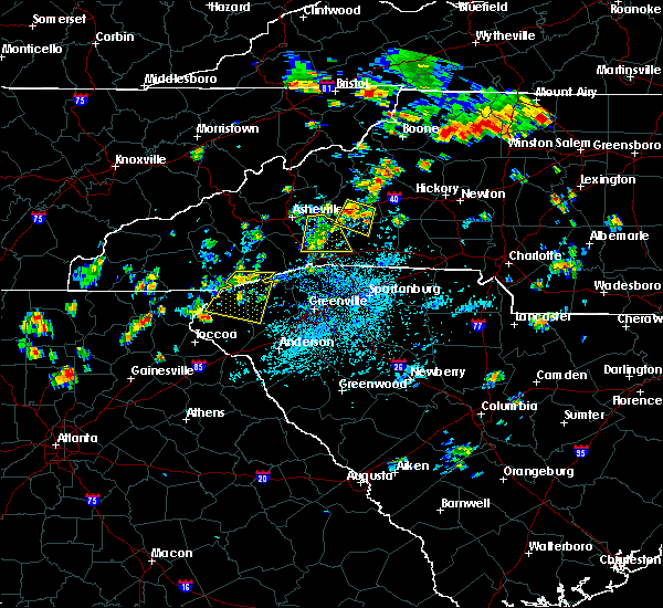 At 138 pm edt, a severe thunderstorm was located 9 miles southwest of marion, or 6 miles southeast of old fort, moving southwest at 40 mph. storm continues with fluctuations in intensity (radar indicated). Hazards include 60 mph wind gusts and quarter size hail. Minor hail damage to vehicles is expected. expect wind damage to trees and power lines. Locations impacted include, marion, sugar hill, thermal city, pleasant gardens, glenwood, fero, union mills, shingle hollow and dysartsville. At 138 pm edt, a severe thunderstorm was located 9 miles southwest of marion, or 6 miles southeast of old fort, moving southwest at 40 mph. storm continues with fluctuations in intensity (radar indicated). Hazards include 60 mph wind gusts and quarter size hail. Minor hail damage to vehicles is expected. expect wind damage to trees and power lines. Locations impacted include, marion, sugar hill, thermal city, pleasant gardens, glenwood, fero, union mills, shingle hollow and dysartsville.
|
| 7/6/2018 1:25 PM EDT | Emergency mngr reported trees down on goose creek roa in mcdowell county NC, 4.3 miles NNE of Marion, NC |
| 7/6/2018 1:20 PM EDT | Emergency mngr reported trees down on i-40 at mm 82 and 8 in mcdowell county NC, 2.8 miles N of Marion, NC |
| 7/6/2018 1:18 PM EDT | Emergency mngr reported trees down at clay street and state s in mcdowell county NC, 0.7 miles SSW of Marion, NC |
| 7/6/2018 1:18 PM EDT |
 At 118 pm edt, a severe thunderstorm was located 4 miles northeast of marion, or near lake james state park, moving southwest at 40 mph (radar indicated). Hazards include 60 mph wind gusts and quarter size hail. Minor hail damage to vehicles is expected. Expect wind damage to trees and power lines. At 118 pm edt, a severe thunderstorm was located 4 miles northeast of marion, or near lake james state park, moving southwest at 40 mph (radar indicated). Hazards include 60 mph wind gusts and quarter size hail. Minor hail damage to vehicles is expected. Expect wind damage to trees and power lines.
|
| 6/26/2018 3:06 PM EDT |
 At 305 pm edt, severe thunderstorms were located along a line extending from 14 miles southwest of morganton to 11 miles south of marion, moving southeast at 10 mph (radar indicated). Hazards include 60 mph wind gusts and quarter size hail. Minor hail damage to vehicles is expected. expect wind damage to trees and power lines. Locations impacted include, glenwood, sugar hill, thermal city, fero, dysartsville and union mills. At 305 pm edt, severe thunderstorms were located along a line extending from 14 miles southwest of morganton to 11 miles south of marion, moving southeast at 10 mph (radar indicated). Hazards include 60 mph wind gusts and quarter size hail. Minor hail damage to vehicles is expected. expect wind damage to trees and power lines. Locations impacted include, glenwood, sugar hill, thermal city, fero, dysartsville and union mills.
|
| 6/26/2018 2:42 PM EDT |
 At 241 pm edt, a severe thunderstorm was located 6 miles southwest of marion, or 6 miles east of old fort, moving southeast at 10 mph (radar indicated). Hazards include 60 mph wind gusts and quarter size hail. Minor hail damage to vehicles is expected. Expect wind damage to trees and power lines. At 241 pm edt, a severe thunderstorm was located 6 miles southwest of marion, or 6 miles east of old fort, moving southeast at 10 mph (radar indicated). Hazards include 60 mph wind gusts and quarter size hail. Minor hail damage to vehicles is expected. Expect wind damage to trees and power lines.
|
| 6/25/2018 4:59 PM EDT |
 At 459 pm edt, severe thunderstorms were located along a line extending from 3 miles northwest of north wilkesboro to 6 miles east of morganton to 6 miles south of marion, moving east at 45 mph (radar indicated). Hazards include 60 mph wind gusts and quarter size hail. Minor hail damage to vehicles is expected. expect wind damage to trees and power lines. Locations impacted include, lenoir, morganton, marion, sawmills, granite falls, valdese, gamewell, hudson, icard and cajah`s mountain. At 459 pm edt, severe thunderstorms were located along a line extending from 3 miles northwest of north wilkesboro to 6 miles east of morganton to 6 miles south of marion, moving east at 45 mph (radar indicated). Hazards include 60 mph wind gusts and quarter size hail. Minor hail damage to vehicles is expected. expect wind damage to trees and power lines. Locations impacted include, lenoir, morganton, marion, sawmills, granite falls, valdese, gamewell, hudson, icard and cajah`s mountain.
|
| 6/25/2018 4:50 PM EDT | Broadcast media reported a tree down at 251 lucky strike drive. time estimated from rada in mcdowell county NC, 9.2 miles NNW of Marion, NC |
| 6/25/2018 4:45 PM EDT | Broadcast media reported a tree down on 2322 ashworth rd. between us 221 and i-40. time estimated from rada in mcdowell county NC, 3.5 miles NNW of Marion, NC |
| 6/25/2018 4:38 PM EDT |
 At 437 pm edt, severe thunderstorms were located along a line extending from 5 miles southeast of deep gap to 8 miles east of marion to 15 miles east of downtown asheville, moving east at 45 mph (radar indicated). Hazards include 60 mph wind gusts and quarter size hail. Minor hail damage to vehicles is expected. Expect wind damage to trees and power lines. At 437 pm edt, severe thunderstorms were located along a line extending from 5 miles southeast of deep gap to 8 miles east of marion to 15 miles east of downtown asheville, moving east at 45 mph (radar indicated). Hazards include 60 mph wind gusts and quarter size hail. Minor hail damage to vehicles is expected. Expect wind damage to trees and power lines.
|
| 6/25/2018 4:26 PM EDT |
 At 426 pm edt, severe thunderstorms were located along a line extending from near todd to 8 miles northeast of marion to 12 miles northeast of downtown asheville, moving east at 35 mph (radar indicated). Hazards include 60 mph wind gusts and quarter size hail. Minor hail damage to vehicles is expected. expect wind damage to trees and power lines. Locations impacted include, downtown asheville, marion, spruce pine, burnsville, newland, east asheville, west asheville, north asheville, black mountain and woodfin. At 426 pm edt, severe thunderstorms were located along a line extending from near todd to 8 miles northeast of marion to 12 miles northeast of downtown asheville, moving east at 35 mph (radar indicated). Hazards include 60 mph wind gusts and quarter size hail. Minor hail damage to vehicles is expected. expect wind damage to trees and power lines. Locations impacted include, downtown asheville, marion, spruce pine, burnsville, newland, east asheville, west asheville, north asheville, black mountain and woodfin.
|
| 6/25/2018 4:20 PM EDT | Broadcast media reported a tree down at lake tahoma rd and toms creek r in mcdowell county NC, 4.7 miles SE of Marion, NC |
| 6/25/2018 4:20 PM EDT | Broadcast media reported a couple of trees down on highway 221 in the northern part of the county including at honeycutt roa in mcdowell county NC, 11.1 miles S of Marion, NC |
| 6/25/2018 4:20 PM EDT | Broadcast media reported a tree down on sugar hill roa in mcdowell county NC, 2.1 miles NE of Marion, NC |
| 6/25/2018 4:00 PM EDT |
 At 359 pm edt, severe thunderstorms were located along a line extending from 4 miles north of beech mountain to 11 miles northwest of marion to 6 miles south of marshall, moving east at 35 mph (radar indicated). Hazards include 60 mph wind gusts and quarter size hail. Minor hail damage to vehicles is expected. Expect wind damage to trees and power lines. At 359 pm edt, severe thunderstorms were located along a line extending from 4 miles north of beech mountain to 11 miles northwest of marion to 6 miles south of marshall, moving east at 35 mph (radar indicated). Hazards include 60 mph wind gusts and quarter size hail. Minor hail damage to vehicles is expected. Expect wind damage to trees and power lines.
|
| 5/31/2018 4:35 PM EDT | 911 call center reported a tree down on 226 n near woodlaw in mcdowell county NC, 7.8 miles SSE of Marion, NC |
| 5/31/2018 4:25 PM EDT |
 At 425 pm edt, a severe thunderstorm was located 4 miles west of marion, moving southeast at 15 mph (radar indicated). Hazards include 60 mph wind gusts and quarter size hail. Minor hail damage to vehicles is expected. expect wind damage to trees and power lines. Locations impacted include, marion, lake james state park, lake james, nebo, sugar hill, pleasant gardens, glenwood, fero, woodlawn and thermal city. At 425 pm edt, a severe thunderstorm was located 4 miles west of marion, moving southeast at 15 mph (radar indicated). Hazards include 60 mph wind gusts and quarter size hail. Minor hail damage to vehicles is expected. expect wind damage to trees and power lines. Locations impacted include, marion, lake james state park, lake james, nebo, sugar hill, pleasant gardens, glenwood, fero, woodlawn and thermal city.
|
| 5/31/2018 3:55 PM EDT |
 At 355 pm edt, a severe thunderstorm was located 4 miles northwest of marion, moving southeast at 10 mph (radar indicated). Hazards include 60 mph wind gusts and quarter size hail. Minor hail damage to vehicles is expected. Expect wind damage to trees and power lines. At 355 pm edt, a severe thunderstorm was located 4 miles northwest of marion, moving southeast at 10 mph (radar indicated). Hazards include 60 mph wind gusts and quarter size hail. Minor hail damage to vehicles is expected. Expect wind damage to trees and power lines.
|
| 10/8/2017 2:42 PM EDT |
 At 241 pm edt, a severe thunderstorm capable of producing a tornado was located 8 miles south of marion, moving north at 30 mph (radar indicated rotation). Hazards include tornado. Flying debris will be dangerous to those caught without shelter. mobile homes will be damaged or destroyed. damage to roofs, windows, and vehicles will occur. tree damage is likely. this dangerous storm will be near, marion around 300 pm edt. Other locations impacted by this dangerous storm include glenwood and fero. At 241 pm edt, a severe thunderstorm capable of producing a tornado was located 8 miles south of marion, moving north at 30 mph (radar indicated rotation). Hazards include tornado. Flying debris will be dangerous to those caught without shelter. mobile homes will be damaged or destroyed. damage to roofs, windows, and vehicles will occur. tree damage is likely. this dangerous storm will be near, marion around 300 pm edt. Other locations impacted by this dangerous storm include glenwood and fero.
|
| 10/8/2017 2:34 PM EDT |
 At 234 pm edt, a severe thunderstorm capable of producing a tornado was located 9 miles north of rutherfordton, moving north at 30 mph (radar indicated rotation). Hazards include tornado. Flying debris will be dangerous to those caught without shelter. mobile homes will be damaged or destroyed. damage to roofs, windows, and vehicles will occur. tree damage is likely. this dangerous storm will be near, marion around 300 pm edt. Other locations impacted by this dangerous storm include glenwood, sugar hill, thermal city, fero and dysartsville. At 234 pm edt, a severe thunderstorm capable of producing a tornado was located 9 miles north of rutherfordton, moving north at 30 mph (radar indicated rotation). Hazards include tornado. Flying debris will be dangerous to those caught without shelter. mobile homes will be damaged or destroyed. damage to roofs, windows, and vehicles will occur. tree damage is likely. this dangerous storm will be near, marion around 300 pm edt. Other locations impacted by this dangerous storm include glenwood, sugar hill, thermal city, fero and dysartsville.
|
| 10/8/2017 2:25 PM EDT |
 At 225 pm edt, a severe thunderstorm capable of producing a tornado was located 5 miles north of rutherfordton, moving north at 30 mph (radar indicated rotation). Hazards include tornado. Flying debris will be dangerous to those caught without shelter. mobile homes will be damaged or destroyed. damage to roofs, windows, and vehicles will occur. tree damage is likely. this dangerous storm will be near, marion around 300 pm edt. Other locations impacted by this dangerous thunderstorm include green hill, sugar hill, thermal city, glenwood and fero. At 225 pm edt, a severe thunderstorm capable of producing a tornado was located 5 miles north of rutherfordton, moving north at 30 mph (radar indicated rotation). Hazards include tornado. Flying debris will be dangerous to those caught without shelter. mobile homes will be damaged or destroyed. damage to roofs, windows, and vehicles will occur. tree damage is likely. this dangerous storm will be near, marion around 300 pm edt. Other locations impacted by this dangerous thunderstorm include green hill, sugar hill, thermal city, glenwood and fero.
|
| 8/4/2017 7:08 PM EDT |
 The severe thunderstorm warning for southeastern mcdowell and northern rutherford counties will expire at 715 pm edt, the storm which prompted the warning has weakened below severe limits, and no longer poses an immediate threat to life or property. therefore the warning will be allowed to expire. however gusty winds and heavy rain are still possible with this thunderstorm. The severe thunderstorm warning for southeastern mcdowell and northern rutherford counties will expire at 715 pm edt, the storm which prompted the warning has weakened below severe limits, and no longer poses an immediate threat to life or property. therefore the warning will be allowed to expire. however gusty winds and heavy rain are still possible with this thunderstorm.
|
| 8/4/2017 7:01 PM EDT | Emergency mngr reported trees and power lines down on beaver creek rd in the glenwood community. time estimated from rada in mcdowell county NC, 7 miles N of Marion, NC |
| 8/4/2017 6:52 PM EDT | Fire dept reported a tree down on montford cove rd at sugar hill rd. time estimated from rada in mcdowell county NC, 7.4 miles NNE of Marion, NC |
| 8/4/2017 6:50 PM EDT | Fire dept reported a tree down on zion hill rd. time estimated from rada in mcdowell county NC, 4.3 miles NE of Marion, NC |
| 8/4/2017 6:48 PM EDT |
 At 648 pm edt, a severe thunderstorm was located 7 miles southwest of marion, or 6 miles southeast of old fort, moving east at 20 mph (radar indicated). Hazards include 60 mph wind gusts and quarter size hail. Minor hail damage to vehicles is expected. expect wind damage to trees and power lines. Locations impacted include, glenwood, sugar hill, thermal city, fero, dysartsville and union mills. At 648 pm edt, a severe thunderstorm was located 7 miles southwest of marion, or 6 miles southeast of old fort, moving east at 20 mph (radar indicated). Hazards include 60 mph wind gusts and quarter size hail. Minor hail damage to vehicles is expected. expect wind damage to trees and power lines. Locations impacted include, glenwood, sugar hill, thermal city, fero, dysartsville and union mills.
|
| 8/4/2017 6:35 PM EDT |
 At 635 pm edt, a severe thunderstorm was located 10 miles southwest of marion, or near old fort, moving east at 20 mph (radar indicated). Hazards include 60 mph wind gusts and quarter size hail. Minor hail damage to vehicles is expected. Expect wind damage to trees and power lines. At 635 pm edt, a severe thunderstorm was located 10 miles southwest of marion, or near old fort, moving east at 20 mph (radar indicated). Hazards include 60 mph wind gusts and quarter size hail. Minor hail damage to vehicles is expected. Expect wind damage to trees and power lines.
|
| 7/23/2017 1:51 PM EDT |
 At 151 pm edt, severe thunderstorms were located along a line extending from 5 miles west of hickory to 3 miles south of marion, moving east at 35 mph (radar indicated). Hazards include 60 mph wind gusts and quarter size hail. Minor hail damage to vehicles is expected. expect wind damage to trees and power lines. Locations impacted include, hickory, morganton, newton, marion, conover, longview, sawmills, granite falls, valdese and icard. At 151 pm edt, severe thunderstorms were located along a line extending from 5 miles west of hickory to 3 miles south of marion, moving east at 35 mph (radar indicated). Hazards include 60 mph wind gusts and quarter size hail. Minor hail damage to vehicles is expected. expect wind damage to trees and power lines. Locations impacted include, hickory, morganton, newton, marion, conover, longview, sawmills, granite falls, valdese and icard.
|
| 7/23/2017 1:33 PM EDT | Trees down at stacy hill road and highway 7 in mcdowell county NC, 3.8 miles WSW of Marion, NC |
| 7/23/2017 1:27 PM EDT |
 At 126 pm edt, a cluster of locally severe thunderstorms was oriented along a line extending from 6 miles south of lenoir to 9 miles west of marion, moving east at 35 mph (radar indicated). Hazards include 60 mph wind gusts and quarter size hail. Minor hail damage to vehicles is expected. Expect wind damage to trees and power lines. At 126 pm edt, a cluster of locally severe thunderstorms was oriented along a line extending from 6 miles south of lenoir to 9 miles west of marion, moving east at 35 mph (radar indicated). Hazards include 60 mph wind gusts and quarter size hail. Minor hail damage to vehicles is expected. Expect wind damage to trees and power lines.
|
| 7/22/2017 5:41 PM EDT |
 The severe thunderstorm warning for southeastern mcdowell and southwestern burke counties will expire at 545 pm edt. the storm which prompted the warning has weakened below severe limits, and no longer poses an immediate threat to life or property. Therefore the warning will be allowed to expire. The severe thunderstorm warning for southeastern mcdowell and southwestern burke counties will expire at 545 pm edt. the storm which prompted the warning has weakened below severe limits, and no longer poses an immediate threat to life or property. Therefore the warning will be allowed to expire.
|
| 7/22/2017 5:26 PM EDT |
 At 525 pm edt, a severe thunderstorm was located 5 miles northeast of marion, or near lake james state park, moving east at 10 mph. trees have been reported down in the city of marion. storm is beginning to weaken, but some threat of strong winds will continue for another 10 to 15 minutes (radar indicated). Hazards include 60 mph wind gusts. Expect damage to trees and power lines. Locations impacted include, marion, lake james state park, lake james, nebo, sugar hill, pleasant gardens, glenwood, fero, dysartsville and woodlawn. At 525 pm edt, a severe thunderstorm was located 5 miles northeast of marion, or near lake james state park, moving east at 10 mph. trees have been reported down in the city of marion. storm is beginning to weaken, but some threat of strong winds will continue for another 10 to 15 minutes (radar indicated). Hazards include 60 mph wind gusts. Expect damage to trees and power lines. Locations impacted include, marion, lake james state park, lake james, nebo, sugar hill, pleasant gardens, glenwood, fero, dysartsville and woodlawn.
|
| 7/22/2017 5:20 PM EDT | Emergency manager reports mulitple trees blown down across several street in mcdowell county NC, 0.4 miles E of Marion, NC |
| 7/22/2017 5:00 PM EDT |
 At 500 pm edt, a severe thunderstorm was located near marion, moving east at 10 mph (radar indicated). Hazards include 60 mph wind gusts and quarter size hail. Minor hail damage to vehicles is expected. Expect wind damage to trees and power lines. At 500 pm edt, a severe thunderstorm was located near marion, moving east at 10 mph (radar indicated). Hazards include 60 mph wind gusts and quarter size hail. Minor hail damage to vehicles is expected. Expect wind damage to trees and power lines.
|
| 7/17/2017 6:36 PM EDT |
 The severe thunderstorm warning for southeastern mcdowell and north central rutherford counties will expire at 645 pm edt, the storm which prompted the warning has weakened below severe limits, and no longer poses an immediate threat to life or property. therefore the warning will be allowed to expire. The severe thunderstorm warning for southeastern mcdowell and north central rutherford counties will expire at 645 pm edt, the storm which prompted the warning has weakened below severe limits, and no longer poses an immediate threat to life or property. therefore the warning will be allowed to expire.
|
| 7/17/2017 6:15 PM EDT | Multiple trees down in the are in mcdowell county NC, 6.4 miles NNW of Marion, NC |
| 7/17/2017 6:05 PM EDT |
 At 605 pm edt, a severe thunderstorm was located 6 miles southeast of marion, moving southwest at 10 mph (radar indicated). Hazards include 60 mph wind gusts and quarter size hail. Minor hail damage to vehicles is expected. Expect wind damage to trees and power lines. At 605 pm edt, a severe thunderstorm was located 6 miles southeast of marion, moving southwest at 10 mph (radar indicated). Hazards include 60 mph wind gusts and quarter size hail. Minor hail damage to vehicles is expected. Expect wind damage to trees and power lines.
|
| 7/17/2017 5:36 PM EDT |
 The severe thunderstorm warning for northeastern mcdowell, west central caldwell and western burke counties will expire at 545 pm edt, the storm which prompted the warning has weakened below severe limits, and no longer poses an immediate threat to life or property. therefore the warning will be allowed to expire. The severe thunderstorm warning for northeastern mcdowell, west central caldwell and western burke counties will expire at 545 pm edt, the storm which prompted the warning has weakened below severe limits, and no longer poses an immediate threat to life or property. therefore the warning will be allowed to expire.
|
| 7/17/2017 4:54 PM EDT |
 At 454 pm edt, a severe thunderstorm was located 7 miles northeast of marion, or over lake james, moving north at 15 mph (radar indicated). Hazards include 60 mph wind gusts and quarter size hail. Minor hail damage to vehicles is expected. Expect wind damage to trees and power lines. At 454 pm edt, a severe thunderstorm was located 7 miles northeast of marion, or over lake james, moving north at 15 mph (radar indicated). Hazards include 60 mph wind gusts and quarter size hail. Minor hail damage to vehicles is expected. Expect wind damage to trees and power lines.
|
| 7/15/2017 3:37 PM EDT |
 The severe thunderstorm warning for southern mcdowell and northwestern rutherford counties will expire at 345 pm edt, the storm which prompted the warning has weakened below severe limits, and no longer poses an immediate threat to life or property. therefore the warning will be allowed to expire. however heavy rain is still possible with this thunderstorm. The severe thunderstorm warning for southern mcdowell and northwestern rutherford counties will expire at 345 pm edt, the storm which prompted the warning has weakened below severe limits, and no longer poses an immediate threat to life or property. therefore the warning will be allowed to expire. however heavy rain is still possible with this thunderstorm.
|
| 7/15/2017 3:21 PM EDT |
 At 255 pm edt, a severe thunderstorm was located 11 miles southwest of marion, or 6 miles southeast of old fort, moving southeast at 10 mph (radar indicated). Hazards include 60 mph wind gusts and quarter size hail. Minor hail damage to vehicles is expected. Expect wind damage to trees and power lines. At 255 pm edt, a severe thunderstorm was located 11 miles southwest of marion, or 6 miles southeast of old fort, moving southeast at 10 mph (radar indicated). Hazards include 60 mph wind gusts and quarter size hail. Minor hail damage to vehicles is expected. Expect wind damage to trees and power lines.
|
| 7/15/2017 2:55 PM EDT |
 At 255 pm edt, a severe thunderstorm was located 11 miles southwest of marion, or 6 miles southeast of old fort, moving southeast at 10 mph (radar indicated). Hazards include 60 mph wind gusts and quarter size hail. Minor hail damage to vehicles is expected. Expect wind damage to trees and power lines. At 255 pm edt, a severe thunderstorm was located 11 miles southwest of marion, or 6 miles southeast of old fort, moving southeast at 10 mph (radar indicated). Hazards include 60 mph wind gusts and quarter size hail. Minor hail damage to vehicles is expected. Expect wind damage to trees and power lines.
|
| 7/14/2017 5:44 PM EDT |
 At 544 pm edt, a severe thunderstorm was located 6 miles south of morganton, or near south mountains state park, moving southeast at 20 mph (radar indicated). Hazards include 60 mph wind gusts. Expect damage to trees and power lines. Locations impacted include, morganton, valdese, icard, drexel, hildebran, connelly springs, rutherford college, lake rhodhiss, hickory regional airport and glenwood. At 544 pm edt, a severe thunderstorm was located 6 miles south of morganton, or near south mountains state park, moving southeast at 20 mph (radar indicated). Hazards include 60 mph wind gusts. Expect damage to trees and power lines. Locations impacted include, morganton, valdese, icard, drexel, hildebran, connelly springs, rutherford college, lake rhodhiss, hickory regional airport and glenwood.
|
| 7/14/2017 5:33 PM EDT |
 At 532 pm edt, a severe thunderstorm was located 7 miles northeast of morganton, or near gamewell, moving east at 10 mph (radar indicated). Hazards include 60 mph wind gusts. Expect damage to trees and power lines. Locations impacted include, lenoir, morganton, sawmills, granite falls, valdese, gamewell, hudson, icard, cajah`s mountain and drexel. At 532 pm edt, a severe thunderstorm was located 7 miles northeast of morganton, or near gamewell, moving east at 10 mph (radar indicated). Hazards include 60 mph wind gusts. Expect damage to trees and power lines. Locations impacted include, lenoir, morganton, sawmills, granite falls, valdese, gamewell, hudson, icard, cajah`s mountain and drexel.
|
| 7/14/2017 5:15 PM EDT |
 At 514 pm edt, a severe thunderstorm was located 8 miles northwest of morganton, or near table rock, moving east at 10 mph. other strong thunderstorms in the warned area may become severe at any time, including near gamewell and near marion (radar indicated). Hazards include 60 mph wind gusts and quarter size hail. Minor hail damage to vehicles is expected. Expect wind damage to trees and power lines. At 514 pm edt, a severe thunderstorm was located 8 miles northwest of morganton, or near table rock, moving east at 10 mph. other strong thunderstorms in the warned area may become severe at any time, including near gamewell and near marion (radar indicated). Hazards include 60 mph wind gusts and quarter size hail. Minor hail damage to vehicles is expected. Expect wind damage to trees and power lines.
|
| 7/14/2017 5:05 PM EDT | Trees down along south main st in mcdowell county NC, 0.4 miles E of Marion, NC |
| 7/14/2017 5:05 PM EDT | Trees down along lytle mtn rd in mcdowell county NC, 4.7 miles NE of Marion, NC |
| 7/14/2017 4:54 PM EDT |
 At 453 pm edt, a severe thunderstorm was located 11 miles northwest of morganton, or near table rock, moving east at 10 mph. another severe thunderstorm cell was located near woodlawn, and a third was located north of old fort (radar indicated). Hazards include 60 mph wind gusts and quarter size hail. Minor hail damage to vehicles is expected. expect wind damage to trees and power lines. locations impacted include, marion, old fort, lake james state park, b. r. parkway-little switzerland to linville, lake james, b. r. Parkway-craggy to little switzerland, nebo, pleasant gardens, ashford and woodlawn. At 453 pm edt, a severe thunderstorm was located 11 miles northwest of morganton, or near table rock, moving east at 10 mph. another severe thunderstorm cell was located near woodlawn, and a third was located north of old fort (radar indicated). Hazards include 60 mph wind gusts and quarter size hail. Minor hail damage to vehicles is expected. expect wind damage to trees and power lines. locations impacted include, marion, old fort, lake james state park, b. r. parkway-little switzerland to linville, lake james, b. r. Parkway-craggy to little switzerland, nebo, pleasant gardens, ashford and woodlawn.
|
| 7/14/2017 4:45 PM EDT | Trees down along old linville rd in mcdowell county NC, 14.2 miles SSW of Marion, NC |
| 7/14/2017 4:44 PM EDT | Tree down on nc 226 blocking travel in mcdowell county NC, 9.9 miles SSE of Marion, NC |
| 7/14/2017 4:34 PM EDT |
 At 433 pm edt, a severe thunderstorm was located 7 miles south of spruce pine, moving east at 15 mph. several other strong to severe thunderstorms were developing near the blue ridge escarpment inside the warned area (radar indicated). Hazards include 60 mph wind gusts and quarter size hail. Minor hail damage to vehicles is expected. Expect wind damage to trees and power lines. At 433 pm edt, a severe thunderstorm was located 7 miles south of spruce pine, moving east at 15 mph. several other strong to severe thunderstorms were developing near the blue ridge escarpment inside the warned area (radar indicated). Hazards include 60 mph wind gusts and quarter size hail. Minor hail damage to vehicles is expected. Expect wind damage to trees and power lines.
|
| 7/13/2017 6:07 PM EDT |
 At 607 pm edt, a severe thunderstorm was located 4 miles east of marion, or near lake james state park, moving southeast at 5 mph (radar indicated). Hazards include 60 mph wind gusts and penny size hail. Expect damage to trees and power lines. Locations impacted include, marion, lake james state park, lake james, nebo, pleasant gardens and glen alpine. At 607 pm edt, a severe thunderstorm was located 4 miles east of marion, or near lake james state park, moving southeast at 5 mph (radar indicated). Hazards include 60 mph wind gusts and penny size hail. Expect damage to trees and power lines. Locations impacted include, marion, lake james state park, lake james, nebo, pleasant gardens and glen alpine.
|
| 7/13/2017 5:55 PM EDT | Trees down along us 70 e in mcdowell county NC, 1.9 miles SW of Marion, NC |
| 7/13/2017 5:34 PM EDT | Emergency mngr reported trees down on power lines at the intersection of lake james rd. and marina d in mcdowell county NC, 5.8 miles SSW of Marion, NC |
| 7/13/2017 5:34 PM EDT |
 At 534 pm edt, a severe thunderstorm was located 11 miles southwest of marion, or near old fort, moving east at 10 mph (radar indicated). Hazards include 60 mph wind gusts. Expect damage to trees and power lines. Locations impacted include, old fort and sugar hill. At 534 pm edt, a severe thunderstorm was located 11 miles southwest of marion, or near old fort, moving east at 10 mph (radar indicated). Hazards include 60 mph wind gusts. Expect damage to trees and power lines. Locations impacted include, old fort and sugar hill.
|
| 7/13/2017 5:33 PM EDT |
 At 533 pm edt, a severe thunderstorm was located 4 miles northeast of marion, or near lake james state park, moving east at 15 mph (radar indicated). Hazards include 60 mph wind gusts and penny size hail. expect damage to trees and power lines At 533 pm edt, a severe thunderstorm was located 4 miles northeast of marion, or near lake james state park, moving east at 15 mph (radar indicated). Hazards include 60 mph wind gusts and penny size hail. expect damage to trees and power lines
|
| 7/13/2017 5:14 PM EDT |
 At 514 pm edt, a severe thunderstorm was located 11 miles southwest of marion, or near old fort, moving east at 15 mph (radar indicated). Hazards include 60 mph wind gusts. expect damage to trees and power lines At 514 pm edt, a severe thunderstorm was located 11 miles southwest of marion, or near old fort, moving east at 15 mph (radar indicated). Hazards include 60 mph wind gusts. expect damage to trees and power lines
|
| 7/8/2017 4:35 PM EDT | Broadcast media reported trees down at highways 64 and 22 in mcdowell county NC, 11.5 miles NW of Marion, NC |
| 7/6/2017 4:49 PM EDT | Emergency mngr reported us 221 s shut down due to trees and power lines down in the glenwood communit in mcdowell county NC, 2.9 miles NNW of Marion, NC |
| 7/6/2017 4:45 PM EDT | Emergency mngr reported trees down on power lines on wildlife rd at hwy 12 in mcdowell county NC, 5.8 miles SW of Marion, NC |
| 7/5/2017 4:45 PM EDT | Power lines down on deer park r in mcdowell county NC, 6.5 miles WNW of Marion, NC |
| 7/5/2017 4:45 PM EDT | Power lines down on deer park r in mcdowell county NC, 6.5 miles WNW of Marion, NC |
| 7/5/2017 4:39 PM EDT | Trees down on nc hwy 226 s and ag services r in mcdowell county NC, 2.5 miles WSW of Marion, NC |
| 7/5/2017 4:25 PM EDT | Tree down across harmony grove rd in mcdowell county NC, 5.2 miles W of Marion, NC |
| 7/5/2017 4:24 PM EDT | Power lines down on roadway on burma rd e in mcdowell county NC, 3.6 miles WNW of Marion, NC |
| 7/5/2017 4:00 PM EDT | Trees and powerlines down on the 1200 block of deacon d in mcdowell county NC, 3.8 miles WNW of Marion, NC |
| 6/13/2017 4:29 PM EDT |
 At 429 pm edt, a severe thunderstorm was located 11 miles southwest of marion, or near old fort, moving southeast at 10 mph (radar indicated). Hazards include 60 mph wind gusts and quarter size hail. Minor hail damage to vehicles is expected. Expect wind damage to trees and power lines. At 429 pm edt, a severe thunderstorm was located 11 miles southwest of marion, or near old fort, moving southeast at 10 mph (radar indicated). Hazards include 60 mph wind gusts and quarter size hail. Minor hail damage to vehicles is expected. Expect wind damage to trees and power lines.
|
| 5/28/2017 1:07 AM EDT |
 At 107 am edt, severe thunderstorms were located along a line extending from 6 miles west of rutherfordton to 12 miles south of columbus to near greenville downtown, moving southeast at 50 mph (radar indicated). Hazards include 60 mph wind gusts and penny size hail. Expect damage to trees and power lines. Locations impacted include, marion, rutherfordton, columbus, spindale, tryon, old fort, chimney rock state park, green hill, mill spring and thermal city. At 107 am edt, severe thunderstorms were located along a line extending from 6 miles west of rutherfordton to 12 miles south of columbus to near greenville downtown, moving southeast at 50 mph (radar indicated). Hazards include 60 mph wind gusts and penny size hail. Expect damage to trees and power lines. Locations impacted include, marion, rutherfordton, columbus, spindale, tryon, old fort, chimney rock state park, green hill, mill spring and thermal city.
|
| 5/28/2017 12:49 AM EDT |
 At 1249 am edt, severe thunderstorms were located along a line extending from 8 miles west of beech mountain to 15 miles southwest of marion, moving east at 30 mph (radar indicated). Hazards include 60 mph wind gusts and penny size hail. Expect damage to trees and power lines. Locations impacted include, marion, spruce pine, newland, glen alpine, banner elk, elk park, bakersville, beech mountain in avery county, crossnore and sugar mountain. At 1249 am edt, severe thunderstorms were located along a line extending from 8 miles west of beech mountain to 15 miles southwest of marion, moving east at 30 mph (radar indicated). Hazards include 60 mph wind gusts and penny size hail. Expect damage to trees and power lines. Locations impacted include, marion, spruce pine, newland, glen alpine, banner elk, elk park, bakersville, beech mountain in avery county, crossnore and sugar mountain.
|
| 5/28/2017 12:48 AM EDT |
 At 1248 am edt, severe thunderstorms were located along a line extending from 15 miles northeast of hendersonville to 9 miles southwest of columbus to 6 miles north of easley, moving southeast at 50 mph (radar indicated). Hazards include 60 mph wind gusts and penny size hail. Expect damage to trees and power lines. Locations impacted include, marion, rutherfordton, columbus, taylors, berea, welcome, travelers rest, spindale, landrum and slater-marietta. At 1248 am edt, severe thunderstorms were located along a line extending from 15 miles northeast of hendersonville to 9 miles southwest of columbus to 6 miles north of easley, moving southeast at 50 mph (radar indicated). Hazards include 60 mph wind gusts and penny size hail. Expect damage to trees and power lines. Locations impacted include, marion, rutherfordton, columbus, taylors, berea, welcome, travelers rest, spindale, landrum and slater-marietta.
|
| 5/28/2017 12:40 AM EDT | One tree blown down along highway 221 nort in mcdowell county NC, 7.7 miles SSE of Marion, NC |
| 5/28/2017 12:21 AM EDT |
 At 1221 am edt, severe thunderstorms were located along a line extending from 5 miles south of elizabethton to 5 miles east of downtown asheville, moving east at 45 mph (radar indicated). Hazards include 60 mph wind gusts and penny size hail. expect damage to trees and power lines At 1221 am edt, severe thunderstorms were located along a line extending from 5 miles south of elizabethton to 5 miles east of downtown asheville, moving east at 45 mph (radar indicated). Hazards include 60 mph wind gusts and penny size hail. expect damage to trees and power lines
|
| 5/28/2017 12:18 AM EDT |
 At 1217 am edt, severe thunderstorms were located along a line extending from 4 miles northwest of downtown asheville to 6 miles northeast of brevard to 17 miles northwest of pickens, moving southeast at 45 mph (radar indicated). Hazards include 60 mph wind gusts and penny size hail. expect damage to trees and power lines At 1217 am edt, severe thunderstorms were located along a line extending from 4 miles northwest of downtown asheville to 6 miles northeast of brevard to 17 miles northwest of pickens, moving southeast at 45 mph (radar indicated). Hazards include 60 mph wind gusts and penny size hail. expect damage to trees and power lines
|
| 5/24/2017 4:10 PM EDT | Trees down at montford cove rd. and hensley r in mcdowell county NC, 8.9 miles NNE of Marion, NC |
| 5/24/2017 3:20 PM EDT | Trees down on old glenwood rd in the glenwood communit in mcdowell county NC, 4.6 miles NNW of Marion, NC |
| 5/24/2017 3:09 PM EDT |
 At 308 pm edt, a severe thunderstorm was located 10 miles north of rutherfordton, moving northeast at 30 mph (radar indicated). Hazards include 60 mph wind gusts and quarter size hail. Minor hail damage to vehicles is expected. expect wind damage to trees and power lines. locations impacted include, shingle hollow, sugar hill, thermal city, glenwood, fero, dysartsville, union mills, green hill and marion. A tornado watch remains in effect until 600 pm edt for western north carolina. At 308 pm edt, a severe thunderstorm was located 10 miles north of rutherfordton, moving northeast at 30 mph (radar indicated). Hazards include 60 mph wind gusts and quarter size hail. Minor hail damage to vehicles is expected. expect wind damage to trees and power lines. locations impacted include, shingle hollow, sugar hill, thermal city, glenwood, fero, dysartsville, union mills, green hill and marion. A tornado watch remains in effect until 600 pm edt for western north carolina.
|
| 5/24/2017 2:47 PM EDT |
 At 247 pm edt, a severe thunderstorm was located 10 miles west of rutherfordton, or 6 miles southeast of chimney rock state park, moving northeast at 30 mph (radar indicated). Hazards include 60 mph wind gusts and quarter size hail. Minor hail damage to vehicles is expected. Expect wind damage to trees and power lines. At 247 pm edt, a severe thunderstorm was located 10 miles west of rutherfordton, or 6 miles southeast of chimney rock state park, moving northeast at 30 mph (radar indicated). Hazards include 60 mph wind gusts and quarter size hail. Minor hail damage to vehicles is expected. Expect wind damage to trees and power lines.
|
| 5/19/2017 2:51 PM EDT |
 The severe thunderstorm warning for southeastern mcdowell and northern rutherford counties will expire at 300 pm edt, the storms which prompted the warning have weakened below severe limits, and no longer pose an immediate threat to life or property. therefore the warning will be allowed to expire. however, gusty winds and heavy rain are still possible with these thunderstorms. The severe thunderstorm warning for southeastern mcdowell and northern rutherford counties will expire at 300 pm edt, the storms which prompted the warning have weakened below severe limits, and no longer pose an immediate threat to life or property. therefore the warning will be allowed to expire. however, gusty winds and heavy rain are still possible with these thunderstorms.
|
| 5/19/2017 2:44 PM EDT |
 At 243 pm edt, severe thunderstorms were located along a line extending from 6 miles southeast of marion to 12 miles north of rutherfordton to 18 miles north of columbus, moving east at 20 mph (radar indicated). Hazards include 60 mph wind gusts and quarter size hail. Minor hail damage to vehicles is expected. expect wind damage to trees and power lines. Locations impacted include, rutherfordton, spindale, shingle hollow, green hill, sugar hill, thermal city, glenwood, fero, dysartsville and union mills. At 243 pm edt, severe thunderstorms were located along a line extending from 6 miles southeast of marion to 12 miles north of rutherfordton to 18 miles north of columbus, moving east at 20 mph (radar indicated). Hazards include 60 mph wind gusts and quarter size hail. Minor hail damage to vehicles is expected. expect wind damage to trees and power lines. Locations impacted include, rutherfordton, spindale, shingle hollow, green hill, sugar hill, thermal city, glenwood, fero, dysartsville and union mills.
|
| 5/19/2017 2:25 PM EDT | Quarter sized hail reported 7.2 miles NNE of Marion, NC, dime to quarter size hail at the dollar general in sugar hill. |
| 5/19/2017 2:18 PM EDT |
 At 218 pm edt, a severe thunderstorm was located 8 miles southwest of marion, or 5 miles southeast of old fort, moving southeast at 15 mph (radar indicated). Hazards include 60 mph wind gusts and quarter size hail. Minor hail damage to vehicles is expected. Expect wind damage to trees and power lines. At 218 pm edt, a severe thunderstorm was located 8 miles southwest of marion, or 5 miles southeast of old fort, moving southeast at 15 mph (radar indicated). Hazards include 60 mph wind gusts and quarter size hail. Minor hail damage to vehicles is expected. Expect wind damage to trees and power lines.
|
| 3/1/2017 4:34 PM EST |
 At 433 pm est, a severe thunderstorm was located 8 miles east of marion, or 5 miles southeast of lake james state park, moving east at 50 mph (radar indicated). Hazards include 60 mph wind gusts and nickel size hail. Expect damage to roofs. Siding and trees. At 433 pm est, a severe thunderstorm was located 8 miles east of marion, or 5 miles southeast of lake james state park, moving east at 50 mph (radar indicated). Hazards include 60 mph wind gusts and nickel size hail. Expect damage to roofs. Siding and trees.
|
| 8/27/2016 5:45 PM EDT |
 At 545 pm edt, a severe thunderstorm was located 10 miles west of marion, or near old fort, moving northwest at 15 mph (radar indicated). Hazards include 60 mph wind gusts. Expect damage to roofs. siding and trees. locations impacted include, marion, spruce pine, burnsville, old fort, b. r. parkway-little switzerland to linville, lake james, b. r. Parkway-craggy to little switzerland, mount mitchell state park, lake james state park and montreat. At 545 pm edt, a severe thunderstorm was located 10 miles west of marion, or near old fort, moving northwest at 15 mph (radar indicated). Hazards include 60 mph wind gusts. Expect damage to roofs. siding and trees. locations impacted include, marion, spruce pine, burnsville, old fort, b. r. parkway-little switzerland to linville, lake james, b. r. Parkway-craggy to little switzerland, mount mitchell state park, lake james state park and montreat.
|
| 8/27/2016 5:25 PM EDT | Tree down in pleasant garden community along highway 70 and river roa in mcdowell county NC, 3.2 miles E of Marion, NC |
| 8/27/2016 5:23 PM EDT | Media reports tree down on house in north cov in mcdowell county NC, 11 miles S of Marion, NC |
| 8/27/2016 5:18 PM EDT |
 At 518 pm edt, a severe thunderstorm was located 4 miles northwest of marion, moving northwest at 20 mph (radar indicated). Hazards include 60 mph wind gusts. Expect damage to roofs. Siding and trees. At 518 pm edt, a severe thunderstorm was located 4 miles northwest of marion, moving northwest at 20 mph (radar indicated). Hazards include 60 mph wind gusts. Expect damage to roofs. Siding and trees.
|
| 8/27/2016 5:10 PM EDT | Trees down on veterans drive in mario in mcdowell county NC, 0.4 miles E of Marion, NC |
| 8/27/2016 5:07 PM EDT |
 At 507 pm edt, a severe thunderstorm was located 4 miles southeast of marion, moving northwest at 20 mph (radar indicated). Hazards include 60 mph wind gusts. Expect damage to roofs. siding and trees. Locations impacted include, marion, sunshine, sugar hill, thermal city, shingle hollow, dysartsville, glenwood, fero and union mills. At 507 pm edt, a severe thunderstorm was located 4 miles southeast of marion, moving northwest at 20 mph (radar indicated). Hazards include 60 mph wind gusts. Expect damage to roofs. siding and trees. Locations impacted include, marion, sunshine, sugar hill, thermal city, shingle hollow, dysartsville, glenwood, fero and union mills.
|
| 8/27/2016 4:52 PM EDT |
 At 452 pm edt, a severe thunderstorm was located 12 miles northeast of rutherfordton, or 10 miles north of bostic, moving northwest at 10 mph (radar indicated). Hazards include 60 mph wind gusts. Expect damage to roofs. Siding and trees. At 452 pm edt, a severe thunderstorm was located 12 miles northeast of rutherfordton, or 10 miles north of bostic, moving northwest at 10 mph (radar indicated). Hazards include 60 mph wind gusts. Expect damage to roofs. Siding and trees.
|
| 8/17/2016 3:52 PM EDT | Broadcast media reported power lines down on rutherford rd and baldwin ave in mario in mcdowell county NC, 0.7 miles W of Marion, NC |
| 8/17/2016 3:40 PM EDT |
 The severe thunderstorm warning for southeastern mcdowell county will expire at 345 pm edt, the storm which prompted the warning has weakened below severe limits, and no longer poses an immediate threat to life or property. therefore the warning will be allowed to expire. The severe thunderstorm warning for southeastern mcdowell county will expire at 345 pm edt, the storm which prompted the warning has weakened below severe limits, and no longer poses an immediate threat to life or property. therefore the warning will be allowed to expire.
|
| 8/17/2016 3:23 PM EDT | Broadcast media reported power lines down on rutherford rd and baldwin ave in mario in mcdowell county NC, 0.7 miles W of Marion, NC |
| 8/17/2016 3:12 PM EDT |
 At 312 pm edt, a severe thunderstorm was located 4 miles west of marion, moving east at 10 mph (radar indicated). Hazards include 60 mph wind gusts. Expect damage to roofs. siding and trees. Locations impacted include, marion, sugar hill, woodlawn, nebo, dysartsville, glenwood, pleasant gardens, fero and lake james. At 312 pm edt, a severe thunderstorm was located 4 miles west of marion, moving east at 10 mph (radar indicated). Hazards include 60 mph wind gusts. Expect damage to roofs. siding and trees. Locations impacted include, marion, sugar hill, woodlawn, nebo, dysartsville, glenwood, pleasant gardens, fero and lake james.
|
| 8/17/2016 2:53 PM EDT |
 At 253 pm edt, a severe thunderstorm was located 8 miles west of marion, or near old fort, moving east at 10 mph (radar indicated). Hazards include 60 mph wind gusts. Expect damage to roofs. Siding and trees. At 253 pm edt, a severe thunderstorm was located 8 miles west of marion, or near old fort, moving east at 10 mph (radar indicated). Hazards include 60 mph wind gusts. Expect damage to roofs. Siding and trees.
|
| 8/7/2016 5:36 PM EDT | Trees fell and brought down power lines in the sugar hill community. ditches were also seen overflowing due to heavy rai in mcdowell county NC, 6.4 miles NNE of Marion, NC |
| 7/22/2016 3:26 PM EDT |
 At 326 pm edt, a severe thunderstorm was located 5 miles southwest of marion, or 4 miles east of old fort, moving south at 10 mph (radar indicated). Hazards include 60 mph wind gusts and nickel size hail. Expect damage to roofs. siding and trees. Locations impacted include, old fort, sugar hill, pleasant gardens, fero, thermal city, marion and glenwood. At 326 pm edt, a severe thunderstorm was located 5 miles southwest of marion, or 4 miles east of old fort, moving south at 10 mph (radar indicated). Hazards include 60 mph wind gusts and nickel size hail. Expect damage to roofs. siding and trees. Locations impacted include, old fort, sugar hill, pleasant gardens, fero, thermal city, marion and glenwood.
|
| 7/22/2016 3:06 PM EDT |
 At 306 pm edt, a severe thunderstorm was located 7 miles west of marion, or near old fort, moving south at 10 mph (radar indicated). Hazards include 60 mph wind gusts and nickel size hail. Expect damage to roofs. Siding and trees. At 306 pm edt, a severe thunderstorm was located 7 miles west of marion, or near old fort, moving south at 10 mph (radar indicated). Hazards include 60 mph wind gusts and nickel size hail. Expect damage to roofs. Siding and trees.
|
| 7/20/2016 7:00 PM EDT | A few trees down in mcdowell county NC, 4.9 miles WNW of Marion, NC |
| 7/20/2016 6:59 PM EDT | Trees and powerlines down in mcdowell county NC, 3.3 miles WNW of Marion, NC |
| 7/16/2016 2:28 PM EDT | Trees down on polly spout r in mcdowell county NC, 9.1 miles N of Marion, NC |
| 7/16/2016 2:24 PM EDT |
 At 223 pm edt, a severe thunderstorm was located 7 miles southeast of marion, moving east at 20 mph (radar indicated). Hazards include 60 mph wind gusts and penny size hail. Expect damage to roofs. siding and trees. Locations impacted include, dysartsville, glenwood, sugar hill, fero, pleasant gardens and marion. At 223 pm edt, a severe thunderstorm was located 7 miles southeast of marion, moving east at 20 mph (radar indicated). Hazards include 60 mph wind gusts and penny size hail. Expect damage to roofs. siding and trees. Locations impacted include, dysartsville, glenwood, sugar hill, fero, pleasant gardens and marion.
|
| 7/16/2016 2:18 PM EDT | A tree down off hwy 221 sout in mcdowell county NC, 5 miles NNW of Marion, NC |
| 7/16/2016 2:04 PM EDT |
 At 203 pm edt, a severe thunderstorm was located 6 miles southwest of marion, or 6 miles east of old fort, moving east at 20 mph (radar indicated). Hazards include 60 mph wind gusts and penny size hail. Expect damage to roofs. Siding and trees. At 203 pm edt, a severe thunderstorm was located 6 miles southwest of marion, or 6 miles east of old fort, moving east at 20 mph (radar indicated). Hazards include 60 mph wind gusts and penny size hail. Expect damage to roofs. Siding and trees.
|
| 7/8/2016 7:52 PM EDT |
 The severe thunderstorm warning for caldwell, burke, eastern mitchell, northwestern catawba, southern yancey, avery, central mcdowell and alexander counties will expire at 800 pm edt, the storms which prompted the warning have weakened below severe limits, and have exited the warned area. therefore the warning will be allowed to expire. however gusty winds are still possible with these thunderstorms. a severe thunderstorm watch remains in effect until midnight edt for the piedmont of and western north carolina. The severe thunderstorm warning for caldwell, burke, eastern mitchell, northwestern catawba, southern yancey, avery, central mcdowell and alexander counties will expire at 800 pm edt, the storms which prompted the warning have weakened below severe limits, and have exited the warned area. therefore the warning will be allowed to expire. however gusty winds are still possible with these thunderstorms. a severe thunderstorm watch remains in effect until midnight edt for the piedmont of and western north carolina.
|
| 7/8/2016 7:18 PM EDT |
 At 718 pm edt, severe thunderstorms were located along a line extending from 5 miles north of beech mountain to 6 miles north of spruce pine to 3 miles west of burnsville, moving east at 55 mph (radar indicated). Hazards include 70 mph wind gusts. Expect considerable tree damage. Damage is likely to mobile homes, roofs and outbuildings. At 718 pm edt, severe thunderstorms were located along a line extending from 5 miles north of beech mountain to 6 miles north of spruce pine to 3 miles west of burnsville, moving east at 55 mph (radar indicated). Hazards include 70 mph wind gusts. Expect considerable tree damage. Damage is likely to mobile homes, roofs and outbuildings.
|
| 7/5/2016 2:15 PM EDT | Trees on structure at us70w campground in mcdowell county NC, 3.3 miles ESE of Marion, NC |
| 7/5/2016 2:12 PM EDT | Tree on a structure on sugar hill roa in mcdowell county NC, 1.2 miles NE of Marion, NC |
| 7/5/2016 2:12 PM EDT | Trees down at sugar hill road off golf course road...nix creek road...rena street...hoyles orchard road off bethlehem roa in mcdowell county NC, 0.4 miles E of Marion, NC |
| 7/5/2016 2:02 PM EDT |
 At 201 pm edt, severe thunderstorms were located along a line extending from 11 miles west of marion to 13 miles southeast of downtown asheville, moving east at 35 mph (radar indicated). Hazards include 60 mph wind gusts and penny size hail. Expect damage to roofs. Siding and trees. At 201 pm edt, severe thunderstorms were located along a line extending from 11 miles west of marion to 13 miles southeast of downtown asheville, moving east at 35 mph (radar indicated). Hazards include 60 mph wind gusts and penny size hail. Expect damage to roofs. Siding and trees.
|
| 6/1/2016 3:42 PM EDT | Tree down at east mcdowell middle school in mcdowell county NC, 0.7 miles SSW of Marion, NC |
| 5/2/2016 3:21 PM EDT | Quarter sized hail reported 4.2 miles N of Marion, NC, up to 1 inch hail south of marion... nc. |
| 5/2/2016 3:15 PM EDT | Trees down on ashworth and goose creek r in mcdowell county NC, 6.4 miles NNW of Marion, NC |
| 5/2/2016 3:11 PM EDT |
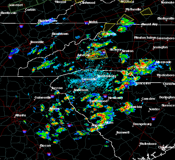 At 310 pm edt, a severe thunderstorm was located 5 miles south of marion, moving east at 20 mph (radar indicated. this storm has a history of producing large hail up to the size of golf balls. take shelter now!). Hazards include 60 mph wind gusts and quarter size hail. Hail damage to vehicles is expected. Expect wind damage to roofs, siding and trees. At 310 pm edt, a severe thunderstorm was located 5 miles south of marion, moving east at 20 mph (radar indicated. this storm has a history of producing large hail up to the size of golf balls. take shelter now!). Hazards include 60 mph wind gusts and quarter size hail. Hail damage to vehicles is expected. Expect wind damage to roofs, siding and trees.
|
| 5/2/2016 2:53 PM EDT |
 At 253 pm edt, a severe thunderstorm was located 9 miles southwest of marion, or near old fort, moving east at 25 mph (radar indicated). Hazards include golf ball size hail and 60 mph wind gusts. People and animals outdoors will be injured. expect hail damage to roofs, siding, windows and vehicles. expect wind damage to roofs, siding and trees. Locations impacted include, marion, old fort, sugar hill, fero, glenwood, pleasant gardens, montreat and woodlawn. At 253 pm edt, a severe thunderstorm was located 9 miles southwest of marion, or near old fort, moving east at 25 mph (radar indicated). Hazards include golf ball size hail and 60 mph wind gusts. People and animals outdoors will be injured. expect hail damage to roofs, siding, windows and vehicles. expect wind damage to roofs, siding and trees. Locations impacted include, marion, old fort, sugar hill, fero, glenwood, pleasant gardens, montreat and woodlawn.
|
| 5/2/2016 2:46 PM EDT |
 At 246 pm edt, a severe thunderstorm was located 11 miles southwest of marion, or near old fort, moving northeast at 15 mph (radar indicated). Hazards include 60 mph wind gusts and quarter size hail. Hail damage to vehicles is expected. expect wind damage to roofs, siding and trees. Locations impacted include, marion, old fort, sugar hill, fero, glenwood, pleasant gardens, montreat and woodlawn. At 246 pm edt, a severe thunderstorm was located 11 miles southwest of marion, or near old fort, moving northeast at 15 mph (radar indicated). Hazards include 60 mph wind gusts and quarter size hail. Hail damage to vehicles is expected. expect wind damage to roofs, siding and trees. Locations impacted include, marion, old fort, sugar hill, fero, glenwood, pleasant gardens, montreat and woodlawn.
|
| 5/2/2016 2:25 PM EDT |
 At 225 pm edt, a severe thunderstorm was located 14 miles east of downtown asheville, or near black mountain, moving northeast at 15 mph (radar indicated). Hazards include 60 mph wind gusts and quarter size hail. Hail damage to vehicles is expected. Expect wind damage to roofs, siding and trees. At 225 pm edt, a severe thunderstorm was located 14 miles east of downtown asheville, or near black mountain, moving northeast at 15 mph (radar indicated). Hazards include 60 mph wind gusts and quarter size hail. Hail damage to vehicles is expected. Expect wind damage to roofs, siding and trees.
|
| 5/1/2016 5:55 PM EDT | 5 structures with trees on them. many power lines down. at least 100 trees dow in mcdowell county NC, 7.2 miles NNE of Marion, NC |
| 5/1/2016 5:55 PM EDT | Hen Egg sized hail reported 7.2 miles NNE of Marion, NC, widespread hail damage. |
| 5/1/2016 5:44 PM EDT |
 At 544 pm edt, a severe thunderstorm was located 8 miles southwest of marion, or 5 miles southeast of old fort, moving east at 25 mph (radar indicated. this storm has a history of producing large hail). Hazards include 60 mph wind gusts and quarter size hail. Hail damage to vehicles is expected. Expect wind damage to roofs, siding and trees. At 544 pm edt, a severe thunderstorm was located 8 miles southwest of marion, or 5 miles southeast of old fort, moving east at 25 mph (radar indicated. this storm has a history of producing large hail). Hazards include 60 mph wind gusts and quarter size hail. Hail damage to vehicles is expected. Expect wind damage to roofs, siding and trees.
|
| 5/1/2016 5:33 PM EDT | Quarter sized hail reported 4.9 miles E of Marion, NC, observed along old river road |
| 5/1/2016 5:26 PM EDT |
 At 526 pm edt, a severe thunderstorm was located 10 miles west of marion, or over old fort, moving east at 30 mph (radar indicated). Hazards include ping pong ball size hail and 60 mph wind gusts. People and animals outdoors will be injured. expect hail damage to roofs, siding, windows and vehicles. expect wind damage to roofs, siding and trees. Locations impacted include, marion, old fort, sugar hill, fero, glenwood, pleasant gardens, thermal city and nebo. At 526 pm edt, a severe thunderstorm was located 10 miles west of marion, or over old fort, moving east at 30 mph (radar indicated). Hazards include ping pong ball size hail and 60 mph wind gusts. People and animals outdoors will be injured. expect hail damage to roofs, siding, windows and vehicles. expect wind damage to roofs, siding and trees. Locations impacted include, marion, old fort, sugar hill, fero, glenwood, pleasant gardens, thermal city and nebo.
|
| 5/1/2016 5:06 PM EDT |
 At 506 pm edt, a severe thunderstorm was located 13 miles east of downtown asheville, or near black mountain, moving east at 30 mph (radar indicated). Hazards include 60 mph wind gusts and quarter size hail. Hail damage to vehicles is expected. Expect wind damage to roofs, siding and trees. At 506 pm edt, a severe thunderstorm was located 13 miles east of downtown asheville, or near black mountain, moving east at 30 mph (radar indicated). Hazards include 60 mph wind gusts and quarter size hail. Hail damage to vehicles is expected. Expect wind damage to roofs, siding and trees.
|
| 5/1/2016 4:27 PM EDT |
 At 427 pm edt, a severe thunderstorm was located 10 miles south of burnsville, or 5 miles west of mount mitchell state park, moving east at 20 mph (radar indicated). Hazards include 60 mph wind gusts and quarter size hail. Hail damage to vehicles is expected. Expect wind damage to roofs, siding and trees. At 427 pm edt, a severe thunderstorm was located 10 miles south of burnsville, or 5 miles west of mount mitchell state park, moving east at 20 mph (radar indicated). Hazards include 60 mph wind gusts and quarter size hail. Hail damage to vehicles is expected. Expect wind damage to roofs, siding and trees.
|
| 12/28/2015 7:42 PM EST | The tornado warning for central mcdowell county will expire at 745 pm est, the storm which prompted the warning has weakened below severe limits, and no longer appears to be capable of producing a tornado. therefore the warning will be allowed to expire. |
| 12/28/2015 7:21 PM EST |
 At 721 pm est, doppler radar indicated a severe thunderstorm capable of producing a tornado. this dangerous storm was located 7 miles southwest of marion, or near old fort, and moving north at 30 mph. At 721 pm est, doppler radar indicated a severe thunderstorm capable of producing a tornado. this dangerous storm was located 7 miles southwest of marion, or near old fort, and moving north at 30 mph.
|
| 7/18/2015 3:00 PM EDT | Large tree down. time estimated from rada in rutherford county NC, 11.2 miles N of Marion, NC |
| 7/18/2015 2:40 PM EDT |
 At 240 pm edt, doppler radar indicated a severe thunderstorm capable of producing quarter size hail and damaging winds in excess of 60 mph. this storm was located 11 miles south of marion, or 9 miles northeast of lake lure, and moving southeast at 20 mph. * locations in the warning include, forest city, rutherfordton, spindale, old fort, ellenboro, bostic, sugar hill, green hill, union mills and shingle hollow. At 240 pm edt, doppler radar indicated a severe thunderstorm capable of producing quarter size hail and damaging winds in excess of 60 mph. this storm was located 11 miles south of marion, or 9 miles northeast of lake lure, and moving southeast at 20 mph. * locations in the warning include, forest city, rutherfordton, spindale, old fort, ellenboro, bostic, sugar hill, green hill, union mills and shingle hollow.
|
| 7/14/2015 8:41 AM EDT |
 The severe thunderstorm warning for rutherford, southern buncombe, southern mcdowell, polk and henderson counties will expire at 845 am edt, the line of storms which prompted the warning have weakened below severe limits, and no longer poses an immediate threat to life or property. therefore the warning will be allowed to expire. however gusty winds and heavy rain are still possible with these thunderstorms. The severe thunderstorm warning for rutherford, southern buncombe, southern mcdowell, polk and henderson counties will expire at 845 am edt, the line of storms which prompted the warning have weakened below severe limits, and no longer poses an immediate threat to life or property. therefore the warning will be allowed to expire. however gusty winds and heavy rain are still possible with these thunderstorms.
|
| 7/14/2015 8:08 AM EDT |
 At 808 am edt, doppler radar indicated a line of severe thunderstorms capable of producing damaging winds in excess of 60 mph. these storms were located along a line extending from 10 miles southwest of morganton to 16 miles north of columbus to 12 miles east of waynesville, moving southeast at 50 mph. penny size hail may also accompany the damaging winds. locations impacted include, hendersonville, forest city, marion, rutherfordton, columbus, arden, mills river, fletcher, spindale and flat rock. At 808 am edt, doppler radar indicated a line of severe thunderstorms capable of producing damaging winds in excess of 60 mph. these storms were located along a line extending from 10 miles southwest of morganton to 16 miles north of columbus to 12 miles east of waynesville, moving southeast at 50 mph. penny size hail may also accompany the damaging winds. locations impacted include, hendersonville, forest city, marion, rutherfordton, columbus, arden, mills river, fletcher, spindale and flat rock.
|
| 7/14/2015 7:47 AM EDT |
 At 747 am edt, doppler radar indicated a line of severe thunderstorms capable of producing damaging winds in excess of 60 mph. these storms were located along a line extending from 9 miles north of marion to 11 miles northeast of downtown asheville to 9 miles northeast of waynesville, and moving southeast at 50 mph. penny size hail may also accompany the damaging winds. At 747 am edt, doppler radar indicated a line of severe thunderstorms capable of producing damaging winds in excess of 60 mph. these storms were located along a line extending from 9 miles north of marion to 11 miles northeast of downtown asheville to 9 miles northeast of waynesville, and moving southeast at 50 mph. penny size hail may also accompany the damaging winds.
|
| 7/13/2015 8:36 PM EDT |
 The severe thunderstorm warning for southeastern caldwell, burke, northeastern rutherford, western catawba, northwestern iredell, southern mcdowell and alexander counties will expire at 845 pm edt, the line of storms which prompted the warning have moved out of the area. therefore the warning will be allowed to expire. The severe thunderstorm warning for southeastern caldwell, burke, northeastern rutherford, western catawba, northwestern iredell, southern mcdowell and alexander counties will expire at 845 pm edt, the line of storms which prompted the warning have moved out of the area. therefore the warning will be allowed to expire.
|
| 7/13/2015 8:06 PM EDT |
 At 805 pm edt, doppler radar indicated a line of showers and thunderstorms with a history of producing damaging winds in excess of 60 mph. these storms were located along a line extending from 5 miles north of north wilkesboro to 5 miles north of morganton to 9 miles west of downtown asheville, and moving southeast at 25 mph. At 805 pm edt, doppler radar indicated a line of showers and thunderstorms with a history of producing damaging winds in excess of 60 mph. these storms were located along a line extending from 5 miles north of north wilkesboro to 5 miles north of morganton to 9 miles west of downtown asheville, and moving southeast at 25 mph.
|
| 7/8/2015 2:50 PM EDT | Power lines down on sugar hill rd in mcdowell county NC, 4.7 miles NE of Marion, NC |
| 7/8/2015 2:50 PM EDT | Trees down at zion hill rd and sugar hill rd in mcdowell county NC, 3.9 miles NE of Marion, NC |
| 6/30/2015 6:25 PM EDT | Highway nc 226 s closed due to multiple trees dow in mcdowell county NC, 9.3 miles NW of Marion, NC |
| 6/30/2015 6:10 PM EDT |
 At 610 pm edt, doppler radar indicated a severe thunderstorm capable of producing quarter size hail and damaging winds in excess of 60 mph. this storm was located 8 miles south of marion, and moving east at 25 mph. At 610 pm edt, doppler radar indicated a severe thunderstorm capable of producing quarter size hail and damaging winds in excess of 60 mph. this storm was located 8 miles south of marion, and moving east at 25 mph.
|
| 6/30/2015 5:51 PM EDT |
 At 551 pm edt, doppler radar indicated a severe thunderstorm capable of producing damaging winds in excess of 60 mph. this storm was located near marion, moving east at 40 mph. penny size hail may also accompany the damaging winds. locations impacted include, marion, pleasant gardens, sugar hill, old fort and glenwood. At 551 pm edt, doppler radar indicated a severe thunderstorm capable of producing damaging winds in excess of 60 mph. this storm was located near marion, moving east at 40 mph. penny size hail may also accompany the damaging winds. locations impacted include, marion, pleasant gardens, sugar hill, old fort and glenwood.
|
| 6/30/2015 5:38 PM EDT |
 At 537 pm edt, doppler radar indicated a severe thunderstorm capable of producing damaging winds in excess of 60 mph. this storm was located 10 miles west of marion, moving east at 40 mph. penny size hail may also accompany the damaging winds. locations impacted include, marion, old fort, pleasant gardens, sugar hill, glenwood and montreat. At 537 pm edt, doppler radar indicated a severe thunderstorm capable of producing damaging winds in excess of 60 mph. this storm was located 10 miles west of marion, moving east at 40 mph. penny size hail may also accompany the damaging winds. locations impacted include, marion, old fort, pleasant gardens, sugar hill, glenwood and montreat.
|
| 6/30/2015 5:19 PM EDT |
 At 519 pm edt, doppler radar indicated a severe thunderstorm capable of producing damaging winds in excess of 60 mph. this storm was located 9 miles east of north asheville, and moving east at 30 mph. nickel size hail may also accompany the damaging winds. At 519 pm edt, doppler radar indicated a severe thunderstorm capable of producing damaging winds in excess of 60 mph. this storm was located 9 miles east of north asheville, and moving east at 30 mph. nickel size hail may also accompany the damaging winds.
|
| 6/19/2015 4:03 PM EDT |
 At 403 pm edt, doppler radar indicated a severe thunderstorm capable of producing quarter size hail and damaging winds in excess of 60 mph. this storm was located 14 miles east of east asheville, or near black mountain, moving east at 15 mph. locations impacted include, black mountain, old fort, b.r. parkway, craggy to little switzerland, montreat, sugar hill, fero, pleasant gardens, glenwood, marion and busick. At 403 pm edt, doppler radar indicated a severe thunderstorm capable of producing quarter size hail and damaging winds in excess of 60 mph. this storm was located 14 miles east of east asheville, or near black mountain, moving east at 15 mph. locations impacted include, black mountain, old fort, b.r. parkway, craggy to little switzerland, montreat, sugar hill, fero, pleasant gardens, glenwood, marion and busick.
|
| 6/19/2015 3:47 PM EDT |
 At 346 pm edt, doppler radar indicated a severe thunderstorm capable of producing quarter size hail and damaging winds in excess of 60 mph. this storm was located 8 miles east of east asheville, or near swannanoa, moving east at 10 mph. locations impacted include, black mountain, swannanoa, old fort, b.r. parkway, craggy to little switzerland, mount mitchell state park, montreat, sugar hill, glenwood, busick and fero. At 346 pm edt, doppler radar indicated a severe thunderstorm capable of producing quarter size hail and damaging winds in excess of 60 mph. this storm was located 8 miles east of east asheville, or near swannanoa, moving east at 10 mph. locations impacted include, black mountain, swannanoa, old fort, b.r. parkway, craggy to little switzerland, mount mitchell state park, montreat, sugar hill, glenwood, busick and fero.
|
| 6/19/2015 3:23 PM EDT |
 At 323 pm edt, doppler radar indicated a severe thunderstorm capable of producing quarter size hail and damaging winds in excess of 60 mph. this storm was located 5 miles northeast of east asheville, or over warren wilson college, and moving northeast at 15 mph. At 323 pm edt, doppler radar indicated a severe thunderstorm capable of producing quarter size hail and damaging winds in excess of 60 mph. this storm was located 5 miles northeast of east asheville, or over warren wilson college, and moving northeast at 15 mph.
|
| 6/19/2015 2:15 PM EDT | A few isolated trees down along polly spout rd. also small hail in vein mountain communit in mcdowell county NC, 9.2 miles NNW of Marion, NC |
| 6/17/2015 5:12 PM EDT | The severe thunderstorm warning for southwestern burke, northeastern rutherford and mcdowell counties will expire at 515 pm edt, the storm which prompted the warning has weakened below severe limits, and no longer poses an immediate threat to life or property. therefore the warning will be allowed to expire. |
| 6/17/2015 4:53 PM EDT |
 At 453 pm edt, doppler radar indicated a severe thunderstorm capable of producing quarter size hail and damaging winds in excess of 60 mph. this storm was located 6 miles southeast of marion, or 5 miles south of lake james state park, moving east at 10 mph. locations impacted include, marion, old fort, dysartsville, sugar hill, nebo, glenwood, union mills, thermal city, fero and pleasant gardens. At 453 pm edt, doppler radar indicated a severe thunderstorm capable of producing quarter size hail and damaging winds in excess of 60 mph. this storm was located 6 miles southeast of marion, or 5 miles south of lake james state park, moving east at 10 mph. locations impacted include, marion, old fort, dysartsville, sugar hill, nebo, glenwood, union mills, thermal city, fero and pleasant gardens.
|
| 6/17/2015 4:38 PM EDT | Quarter sized hail reported 2.8 miles WNW of Marion, NC, volunteer fire fighter reports quarter sized hail at the loves travel stop at exit 86 off interstate 40. |
| 6/17/2015 4:26 PM EDT |
 At 426 pm edt, doppler radar indicated a severe thunderstorm capable of producing quarter size hail and damaging winds in excess of 60 mph. this storm was located near marion, and moving southeast at 10 mph. At 426 pm edt, doppler radar indicated a severe thunderstorm capable of producing quarter size hail and damaging winds in excess of 60 mph. this storm was located near marion, and moving southeast at 10 mph.
|
| 6/17/2015 4:23 PM EDT | Quarter sized hail reported 0.4 miles E of Marion, NC |
| 6/17/2015 4:21 PM EDT | Quarter sized hail reported 0.4 miles E of Marion, NC |
| 6/17/2015 4:10 PM EDT |
 At 410 pm edt, doppler radar indicated a severe thunderstorm capable of producing quarter size hail and damaging winds in excess of 60 mph. this storm was located near marion, moving southeast at 15 mph. locations impacted include, marion, old fort, dysartsville, sugar hill, union mills, thermal city, nebo, fero, pleasant gardens and glenwood. At 410 pm edt, doppler radar indicated a severe thunderstorm capable of producing quarter size hail and damaging winds in excess of 60 mph. this storm was located near marion, moving southeast at 15 mph. locations impacted include, marion, old fort, dysartsville, sugar hill, union mills, thermal city, nebo, fero, pleasant gardens and glenwood.
|
| 6/17/2015 4:00 PM EDT | Trees and power lines down at intersection of school street and virginia roa in mcdowell county NC, 1.4 miles S of Marion, NC |
| 6/17/2015 3:54 PM EDT |
 At 354 pm edt, doppler radar indicated a severe thunderstorm capable of producing quarter size hail and damaging winds in excess of 60 mph. this storm was located near marion, moving east at 10 mph. locations impacted include, marion, old fort, dysartsville, sugar hill, union mills, thermal city, nebo, fero, pleasant gardens and glenwood. At 354 pm edt, doppler radar indicated a severe thunderstorm capable of producing quarter size hail and damaging winds in excess of 60 mph. this storm was located near marion, moving east at 10 mph. locations impacted include, marion, old fort, dysartsville, sugar hill, union mills, thermal city, nebo, fero, pleasant gardens and glenwood.
|
| 6/17/2015 3:52 PM EDT | Tree blown down at emergency management center at south gordon and east court streets. time estimated by rada in mcdowell county NC, 0.4 miles E of Marion, NC |
| 6/17/2015 3:45 PM EDT |
 At 345 pm edt, doppler radar indicated a severe thunderstorm capable of producing damaging winds in excess of 60 mph. this storm was located 4 miles west of morganton, or near glen alpine, moving east at 15 mph. penny size hail may also accompany the damaging winds. locations impacted include, morganton, valdese, drexel, connelly springs, rutherford college, glen alpine, lake james, south mountains state park, lake james state park and table rock. At 345 pm edt, doppler radar indicated a severe thunderstorm capable of producing damaging winds in excess of 60 mph. this storm was located 4 miles west of morganton, or near glen alpine, moving east at 15 mph. penny size hail may also accompany the damaging winds. locations impacted include, morganton, valdese, drexel, connelly springs, rutherford college, glen alpine, lake james, south mountains state park, lake james state park and table rock.
|
| 6/17/2015 3:40 PM EDT |
 At 340 pm edt, doppler radar indicated a severe thunderstorm capable of producing damaging winds in excess of 60 mph. this storm was located near marion, and moving southeast at 15 mph. penny size hail may also accompany the damaging winds. At 340 pm edt, doppler radar indicated a severe thunderstorm capable of producing damaging winds in excess of 60 mph. this storm was located near marion, and moving southeast at 15 mph. penny size hail may also accompany the damaging winds.
|
| 6/17/2015 3:32 PM EDT |
 At 332 pm edt, doppler radar indicated a severe thunderstorm capable of producing damaging winds in excess of 60 mph. this storm was located 8 miles west of morganton, or near lake james, and moving southeast at 15 mph. penny size hail may also accompany the damaging winds. At 332 pm edt, doppler radar indicated a severe thunderstorm capable of producing damaging winds in excess of 60 mph. this storm was located 8 miles west of morganton, or near lake james, and moving southeast at 15 mph. penny size hail may also accompany the damaging winds.
|
| 6/8/2015 7:52 PM EDT | Tree down in glenwood area near hwy 221 and mud cut rd in mcdowell county NC, 5 miles NNW of Marion, NC |
| 6/8/2015 7:30 PM EDT | Emergency manager reported multiple trees uprooted... windows blown out of structures... and structures with roof damage. time estimated from rada in mcdowell county NC, 9.3 miles NW of Marion, NC |
| 9/2/2014 3:50 PM EDT | Broadcast media reports that emergency management reported a tree down in downtown marion with several trees down along interstate 40...likely near mile marker 82. time in mcdowell county NC, 2.8 miles NW of Marion, NC |
| 8/21/2014 3:39 PM EDT | A couple of trees down along baldwin ave. also pea sized hai in mcdowell county NC, 1 miles SW of Marion, NC |
| 8/20/2014 1:10 PM EDT | Several four-inch diameter limbs blown down at landis road and highway 22 in mcdowell county NC, 4.5 miles NW of Marion, NC |
| 8/20/2014 1:05 PM EDT | Trees down along tunnel road and jacktown roa in mcdowell county NC, 2 miles WNW of Marion, NC |
| 8/20/2014 1:00 PM EDT | Numerous large limbs down from wind around downtown mario in mcdowell county NC, 0.4 miles E of Marion, NC |
| 8/20/2014 12:58 PM EDT | Quarter sized hail reported 0.4 miles E of Marion, NC, quarter size hail near post office in downtown marion. |
| 6/19/2014 5:34 PM EDT | Media relayed county comms report of trees blown down on wall pool rd...also on lytle mountain rd in the same are in mcdowell county NC, 5.1 miles NE of Marion, NC |
| 6/11/2014 2:54 PM EDT | Quarter sized hail reported 9.3 miles NW of Marion, NC, time estimated using radar. |
| 8/10/2013 2:30 PM EDT | A few trees down near the southern end of harmony grove roa in mcdowell county NC, 4.6 miles WNW of Marion, NC |
| 7/25/2013 5:18 PM EDT | Five separate reports of trees down in mario in mcdowell county NC, 0.4 miles E of Marion, NC |
| 6/24/2013 4:38 PM EDT | Several trees down on 498 garden creek roa in mcdowell county NC, 2 miles SE of Marion, NC |
| 8/8/2012 4:30 PM EDT | Quarter sized hail reported 5.6 miles N of Marion, NC, public reported quarter size hail in the glenwood community. |
| 8/2/2012 1:56 PM EDT | Trees down on w henderson st in marion. time estimated by rada in mcdowell county NC, 0.4 miles E of Marion, NC |
| 7/28/2012 3:00 PM EDT | Thunderstorm wind gust lifted roof off a boat dock and pushed one boat dock into another at mountain harbour marina near where the highway 126 bridge crosses lake james in burke county NC, 7.9 miles SW of Marion, NC |
| 7/5/2012 5:15 PM EDT | Large limbs down on lake james and hankins road in mcdowell county NC, 2.8 miles SSW of Marion, NC |
| 6/13/2012 9:45 PM EDT | Multiple trees and power lines dow in mcdowell county NC, 4.2 miles W of Marion, NC |
| 6/13/2012 9:39 PM EDT | Quarter sized hail reported 5.3 miles W of Marion, NC, quarter size hail reported near nebo. |
| 5/1/2012 5:55 PM EDT | Quarter sized hail reported 4.7 miles SE of Marion, NC, observed at buck creek campground. |
| 4/17/2012 4:01 PM EDT | Golf Ball sized hail reported 7.8 miles SSE of Marion, NC, hail up to golf ball sized covered the ground on hidden forest drive. |
| 4/17/2012 4:00 PM EDT | Hen Egg sized hail reported 7.8 miles SSE of Marion, NC, spotter reported 2 inch hail along highway 221 north at woodlawn. |
| 4/1/2012 6:15 PM EDT | Tree down on dysartsville roa in mcdowell county NC, 9.3 miles NW of Marion, NC |
| 8/21/2011 5:55 PM EDT | Quarter sized hail reported 7.9 miles SW of Marion, NC, a period of dime to quarter sized hail fell at mountain harbour marina. also had very strong wind...perhaps enough to bring down limbs or a few trees...but could not se |
| 1/1/0001 12:00 AM | County reports one tree down along nix creek road. the public also reported trees down in the marion area at this tim in mcdowell county NC, 2.2 miles ENE of Marion, NC |
| 1/1/0001 12:00 AM | Quarter sized hail reported 11.1 miles S of Marion, NC, spotter from fire dept reported nickel to quarter size hail. time estimated from radar. extreme northeast mcdowell county. |
| 1/1/0001 12:00 AM | Quarter sized hail reported 13.1 miles S of Marion, NC, spotter from fire dept reported nickel to quarter size hail. |
| 1/1/0001 12:00 AM | Public reported trees blown down in the marion are in mcdowell county NC, 0.4 miles E of Marion, NC |
| 1/1/0001 12:00 AM | Several trees down around marion. at least one down on residence on lena st. carport flipped over on nix creek r in mcdowell county NC, 0.4 miles E of Marion, NC |
| 1/1/0001 12:00 AM | Quarter sized hail reported 5.1 miles ESE of Marion, NC, dime to quarter sized hail fell at the lake tohoma dam. |
| 1/1/0001 12:00 AM | Several trees down resulting in power outages in the are in mcdowell county NC, 2.3 miles SSE of Marion, NC |
| 4/9/2011 7:10 PM EDT | Hen Egg sized hail reported 0.4 miles E of Marion, NC |
| 1/1/0001 12:00 AM | Ping Pong Ball sized hail reported 2.5 miles NNW of Marion, NC |
| 1/1/0001 12:00 AM | Quarter sized hail reported 2.3 miles SSE of Marion, NC, cocorahs report |
| 1/1/0001 12:00 AM | Quarter sized hail reported 2.6 miles SE of Marion, NC, cocorahs observer |
| 1/1/0001 12:00 AM | Tennis Ball sized hail reported 0.8 miles NNE of Marion, NC, firemans personal truck damaged by tennis ball size |
| 1/1/0001 12:00 AM | Quarter sized hail reported 2.8 miles WNW of Marion, NC, exit 86 on i-40 |
| 1/1/0001 12:00 AM | Quarter sized hail reported 2.8 miles NW of Marion, NC, spotter reports pea to quarter sized hail currently falling. |
| 4/9/2011 3:50 PM EDT | Quarter sized hail reported 0.4 miles E of Marion, NC |
| 1/1/0001 12:00 AM | Hen Egg sized hail reported 3.5 miles NE of Marion, NC, wfo rnk relayed report of egg sized hail at mile marker 81 on i-40. |
| 1/1/0001 12:00 AM | 1.5 to 2 mile wide swath of wind damage in glenwood. trees down on houses and car in mcdowell county NC, 5 miles NNW of Marion, NC |
Hail Maps for Marion, NC


Connect with Interactive Hail Maps