

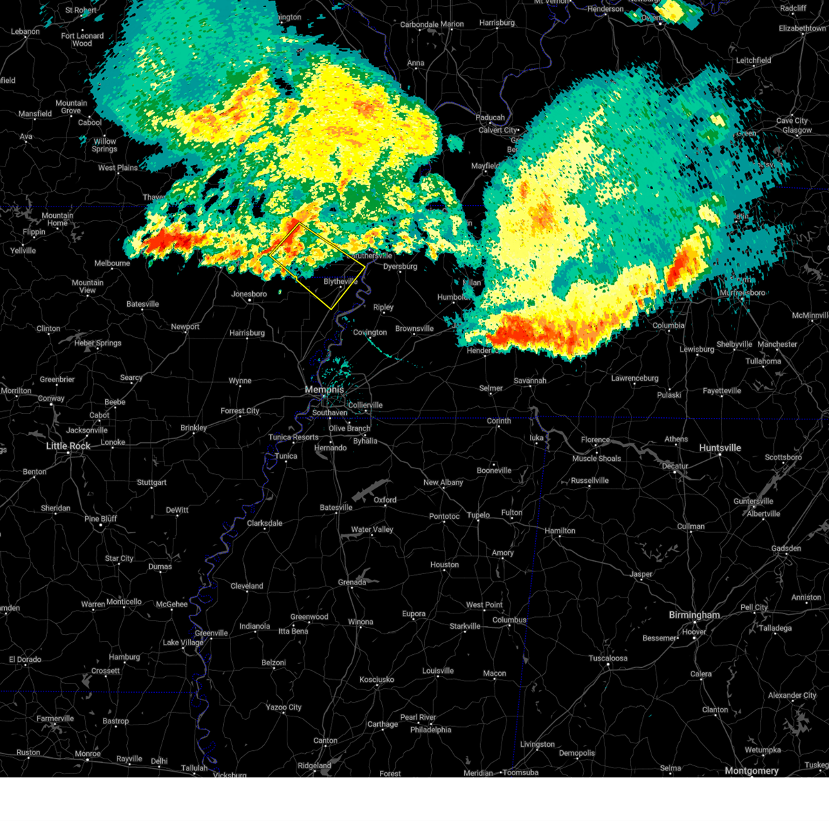
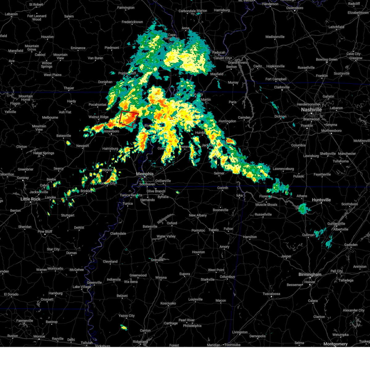
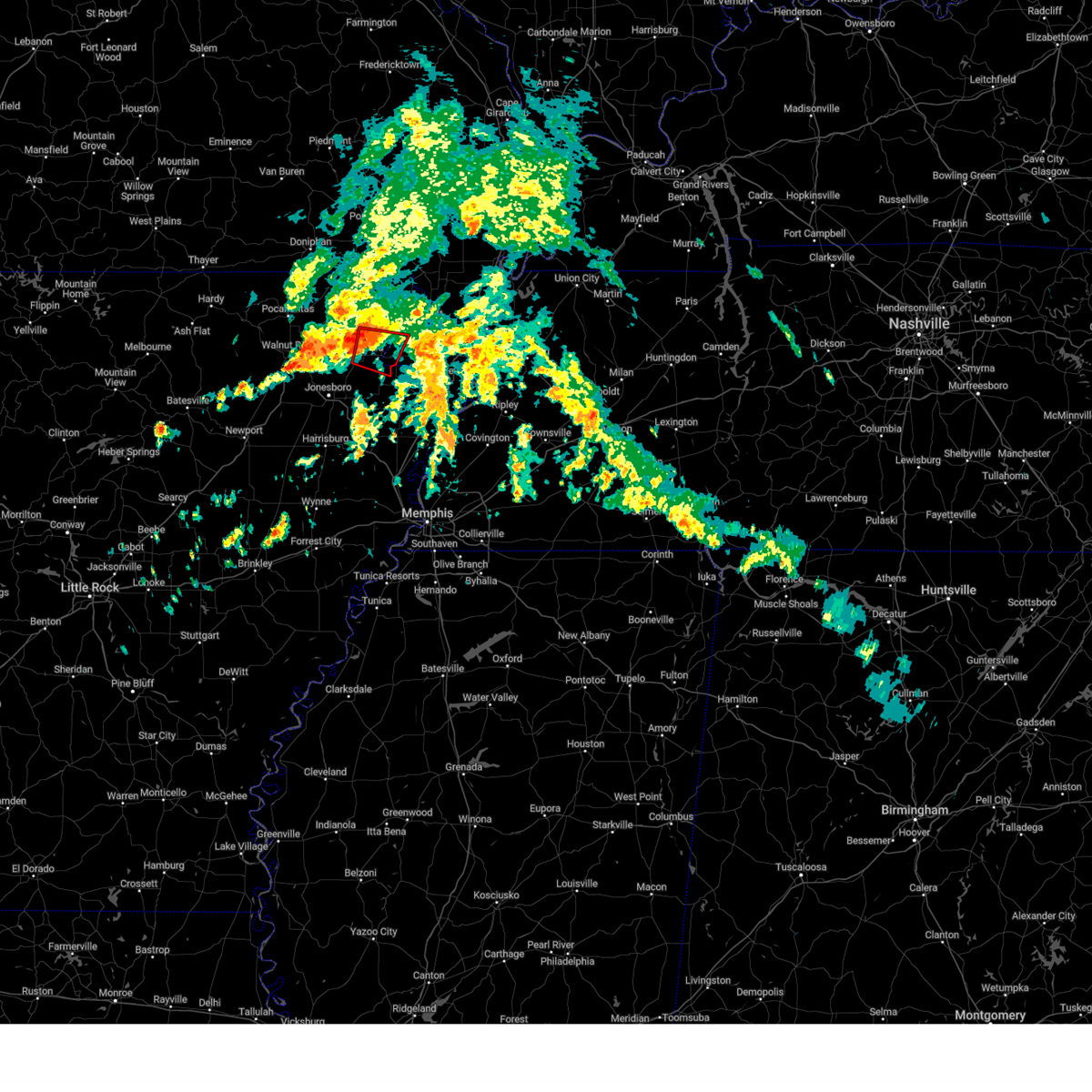
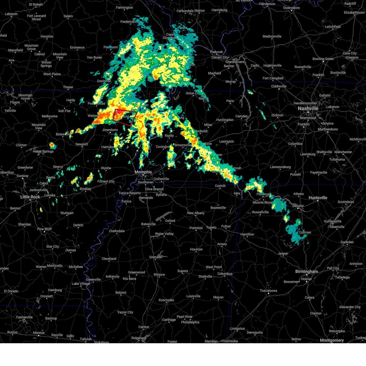
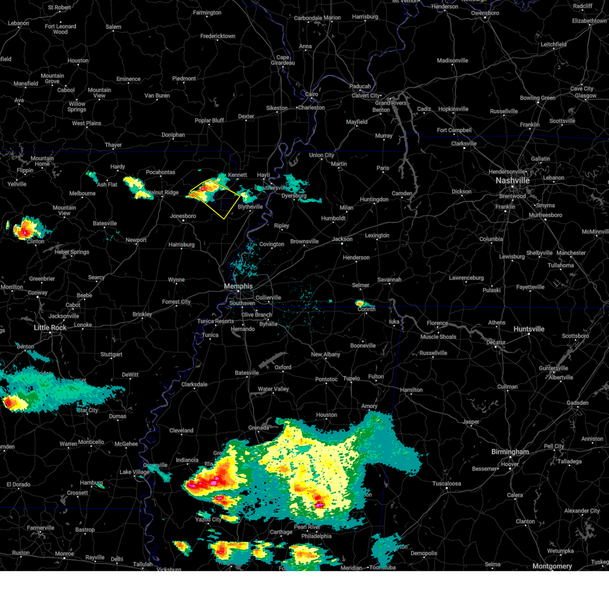
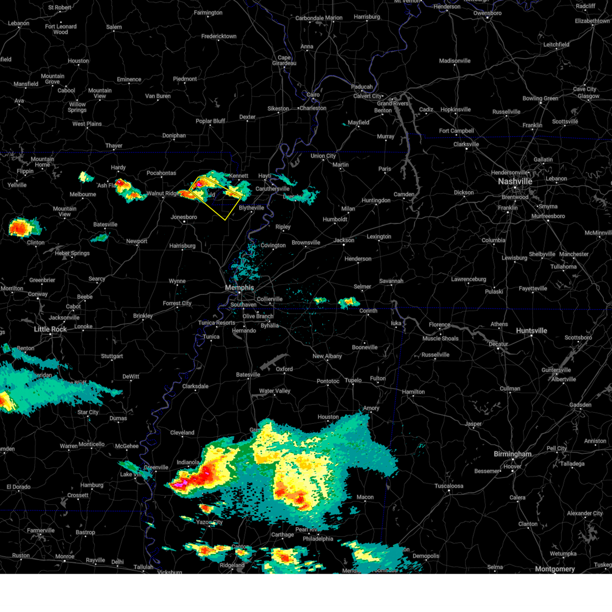
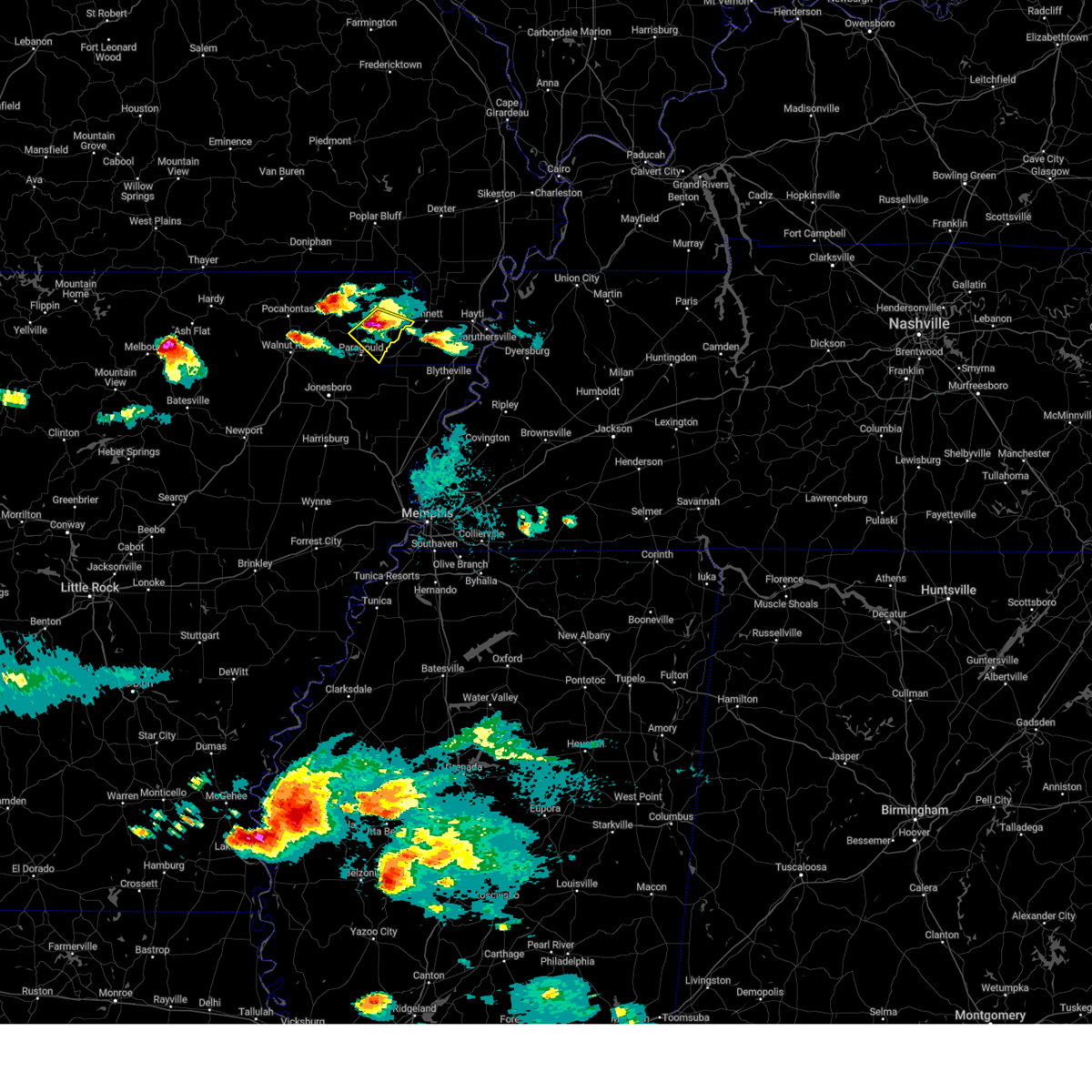
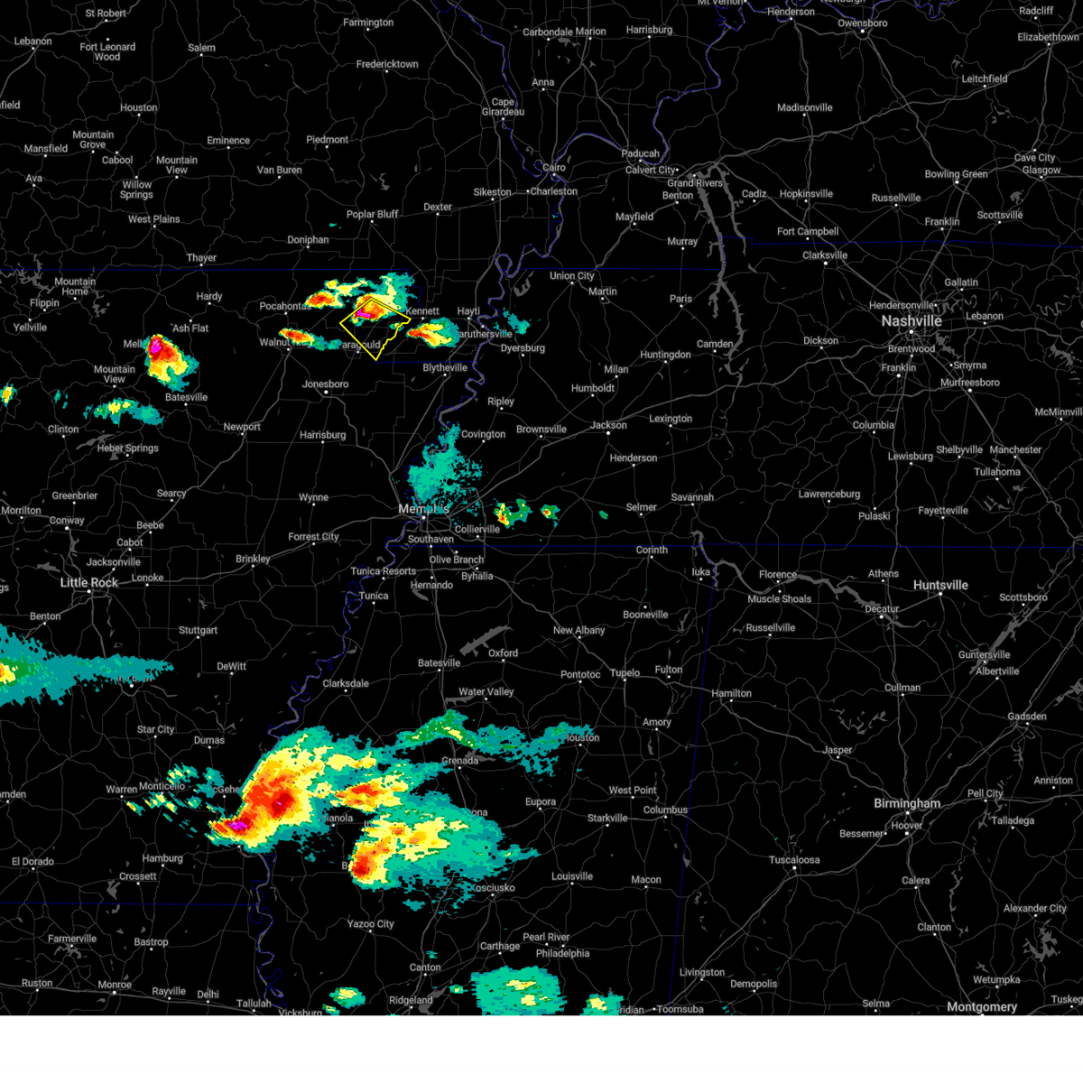
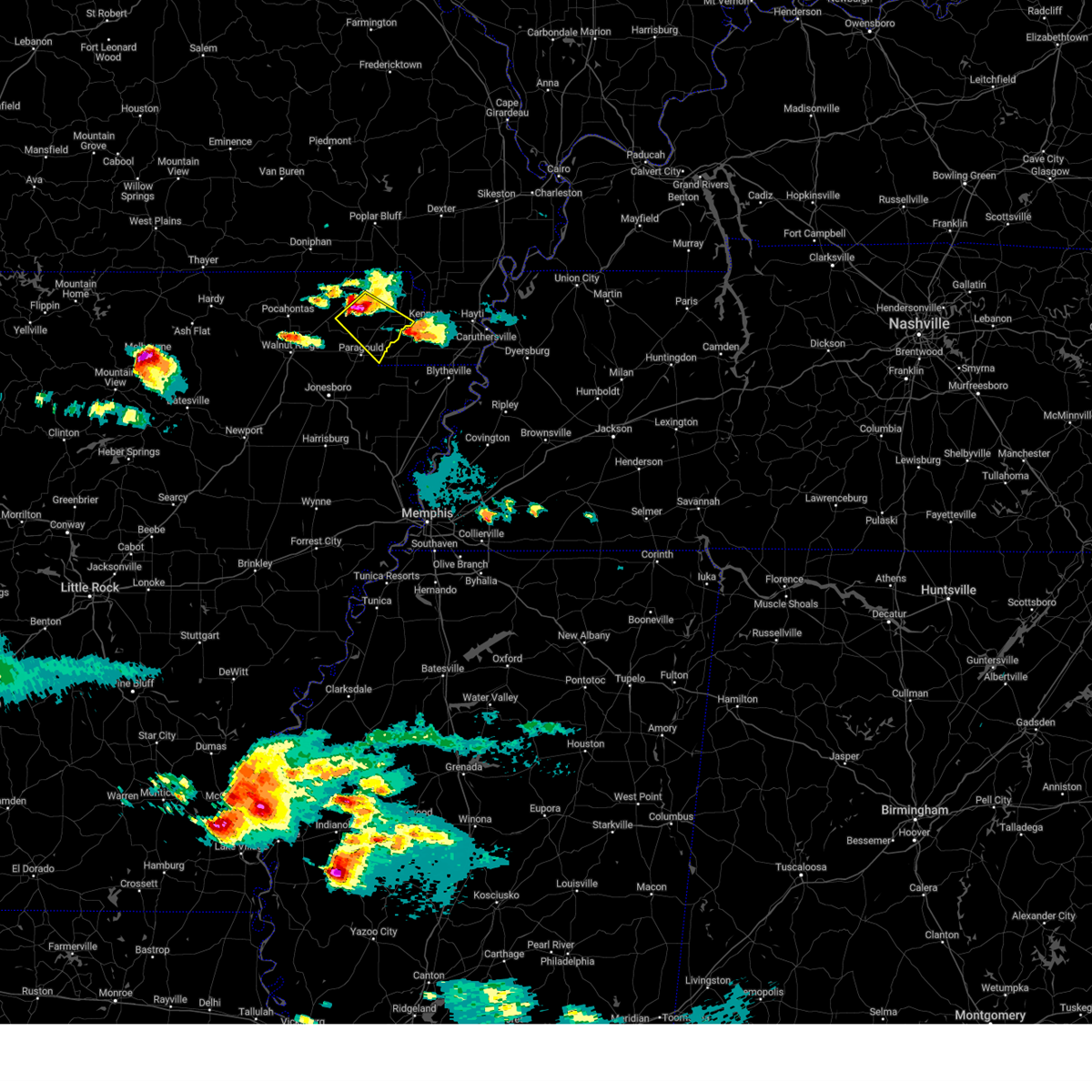
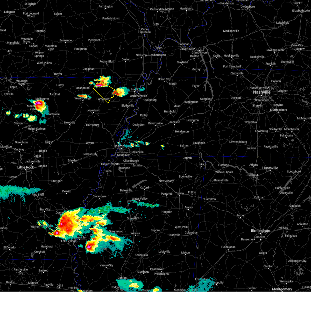
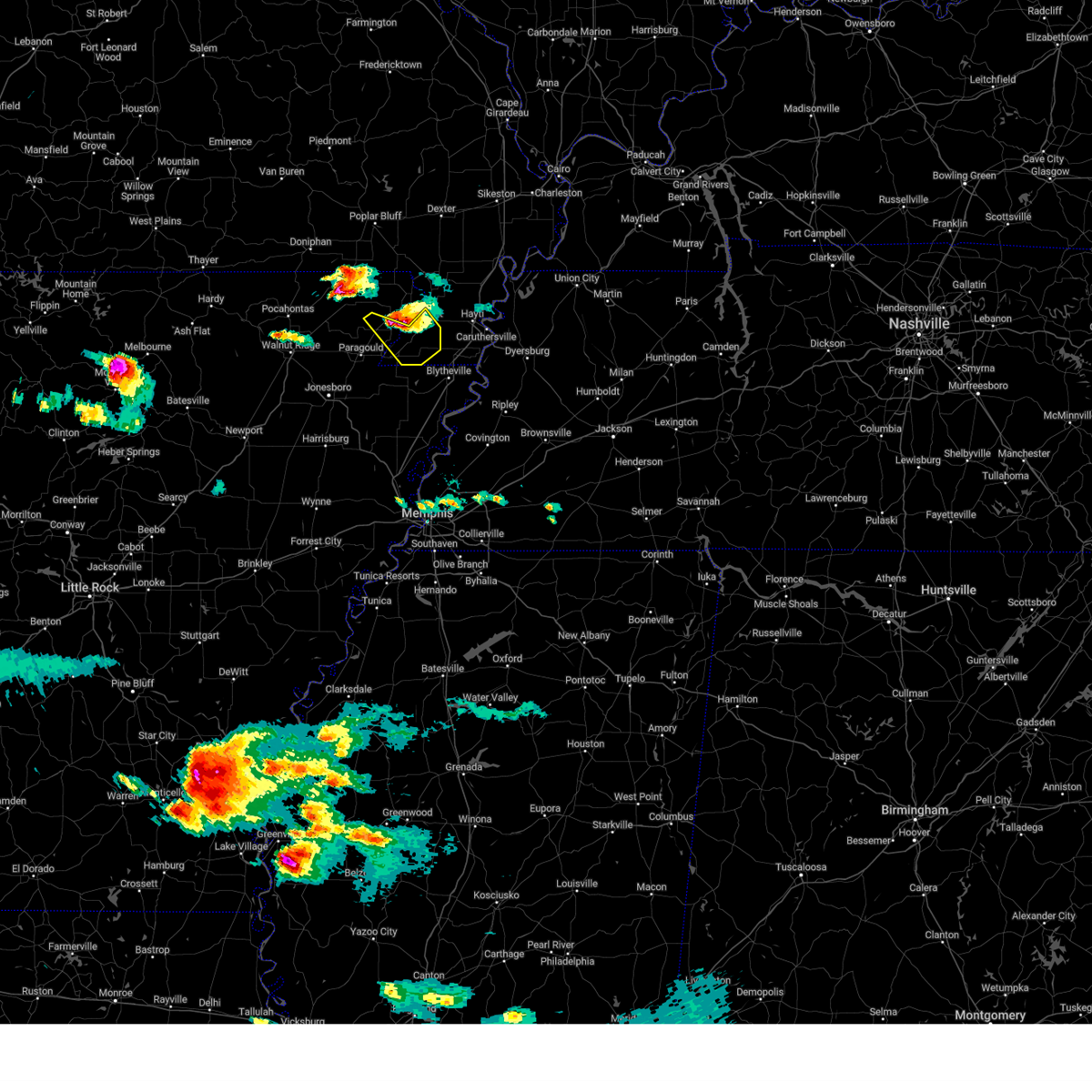
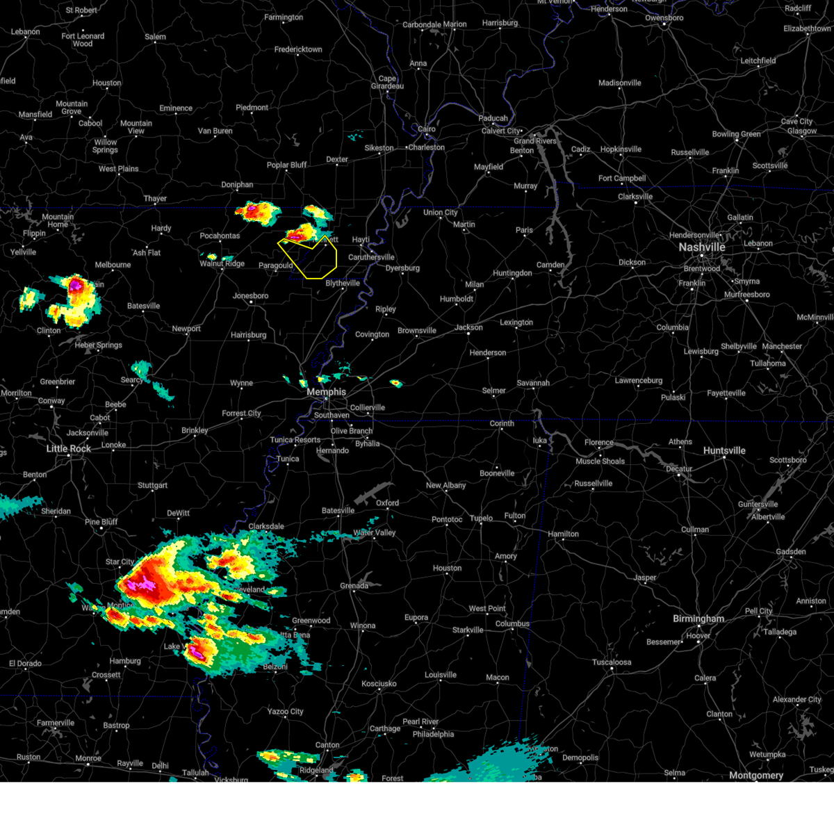
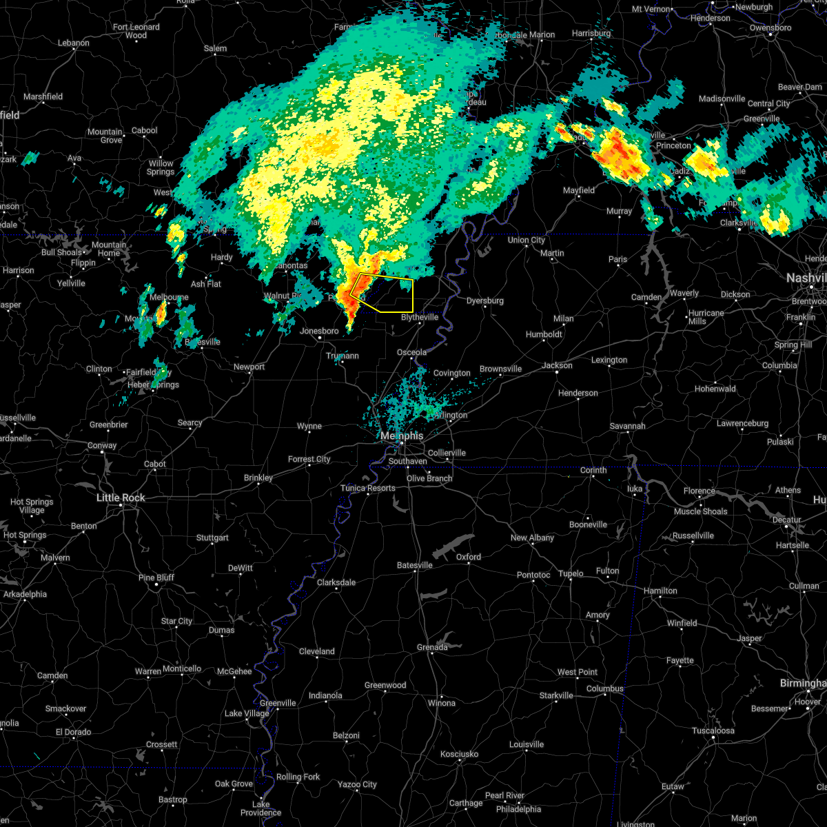
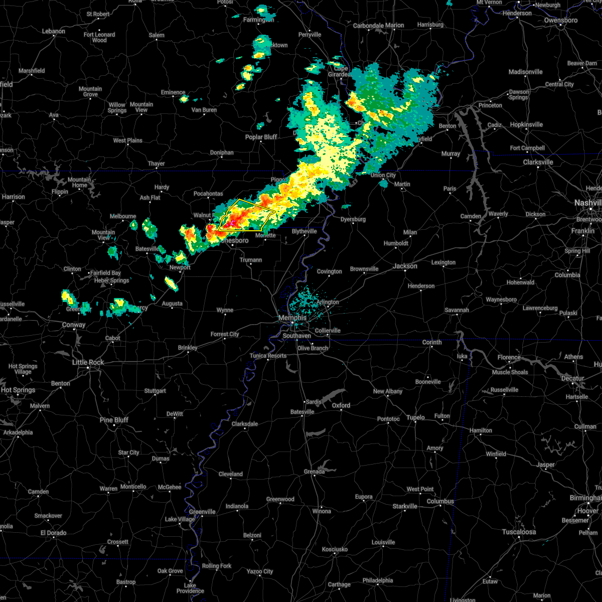
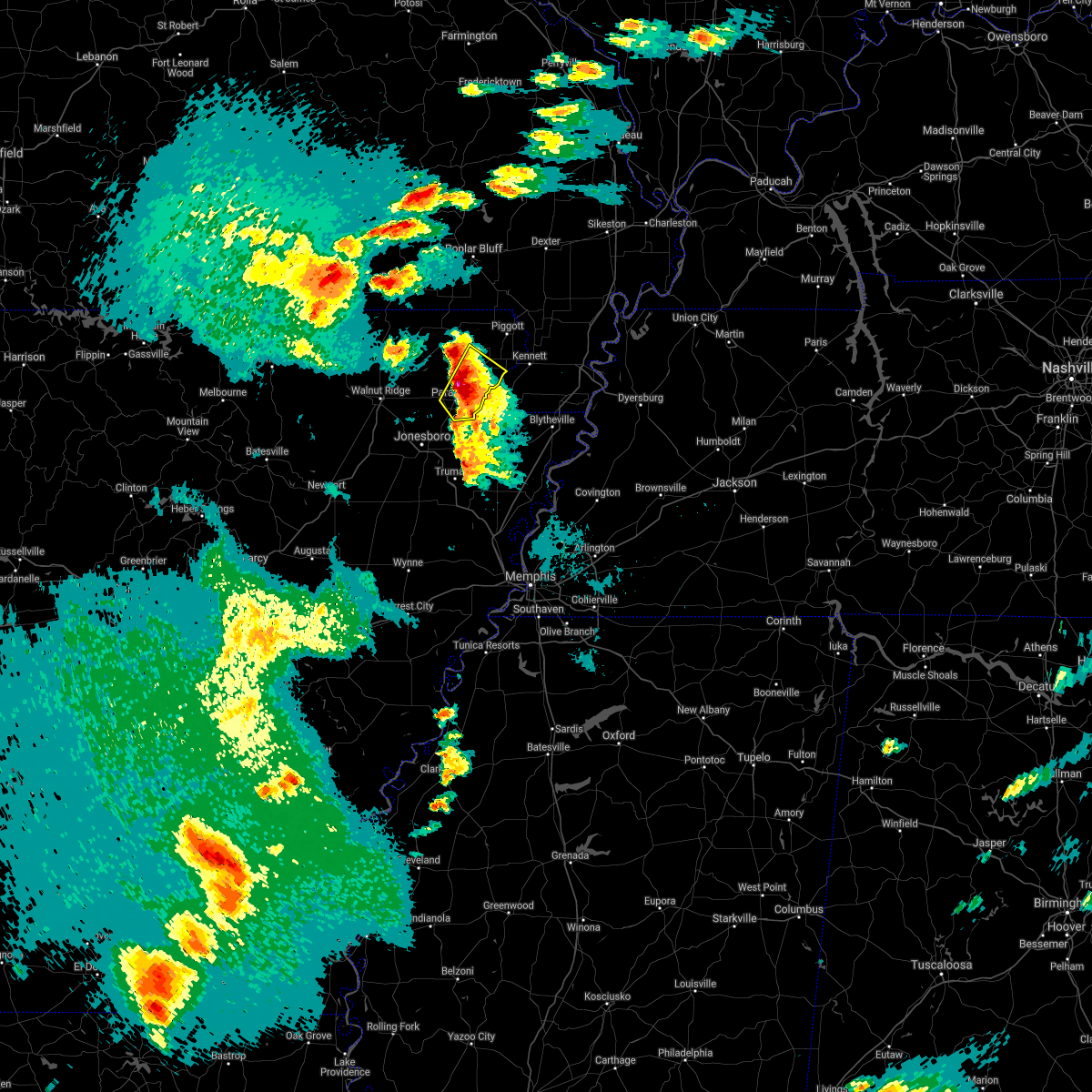
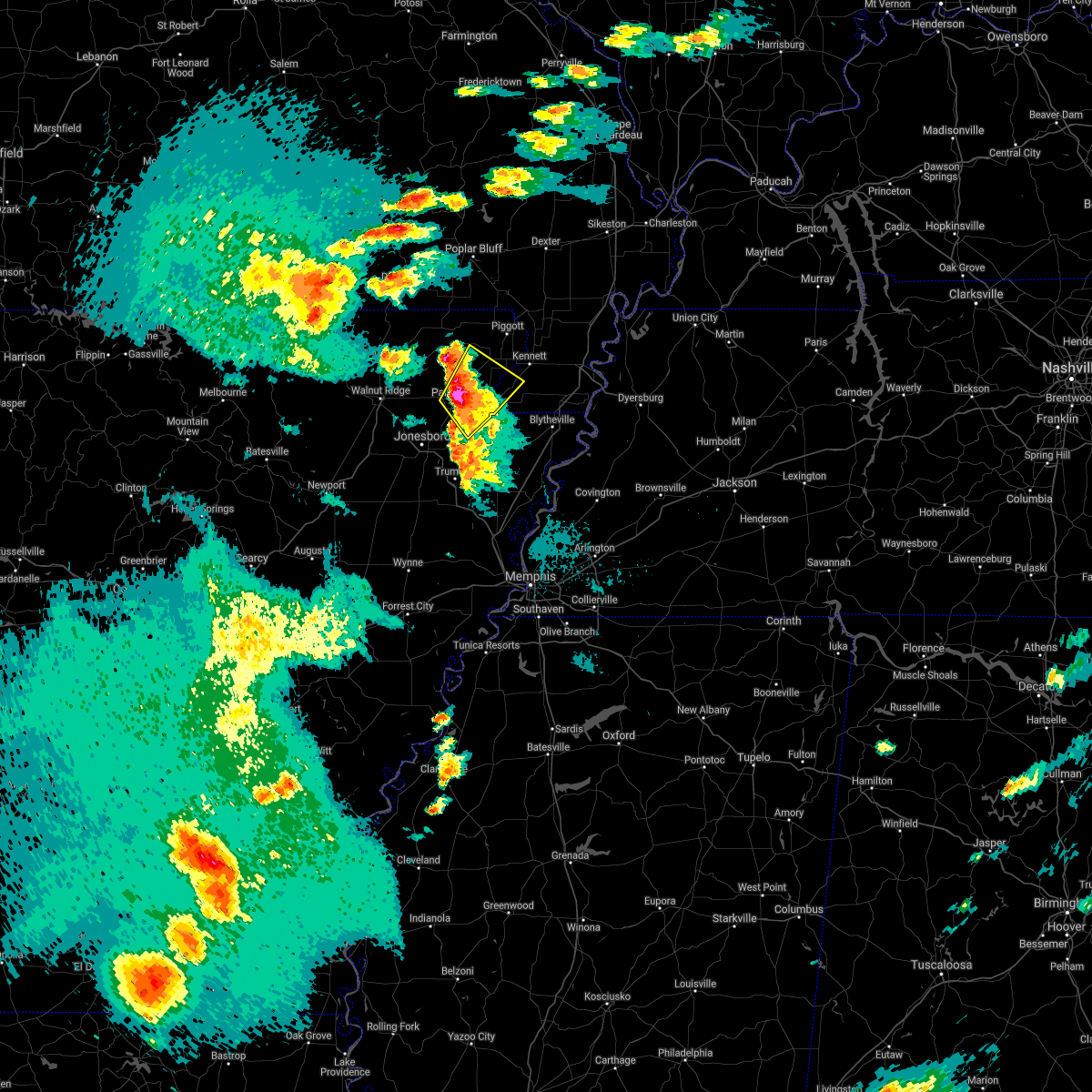
Hail Map for Marmaduke, AR
The Marmaduke, AR area has had 8 reports of on-the-ground hail by trained spotters, and has been under severe weather warnings 23 times during the past 12 months. Doppler radar has detected hail at or near Marmaduke, AR on 49 occasions, including 5 occasions during the past year.
| Name: | Marmaduke, AR |
| Where Located: | 74.4 miles NNW of Memphis, TN |
| Map: | Google Map for Marmaduke, AR |
| Population: | 1111 |
| Housing Units: | 478 |
| More Info: | Search Google for Marmaduke, AR |
5
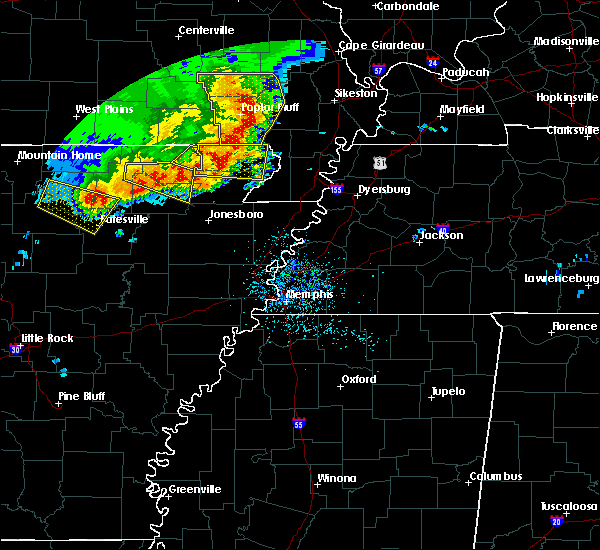
The Top Recent Hail Date for Marmaduke, AR is Wednesday, June 14, 2023 (1st out of 49)

Hail and Wind Damage Spotted near Marmaduke, AR
| Date / Time | Report Details |
|---|---|
| 7/18/2023 4:03 PM CDT |
 At 402 pm cdt, a severe thunderstorm was located near senath, moving southeast at 40 mph (radar indicated). Hazards include 60 mph wind gusts and penny size hail. expect damage to roofs, siding, and trees At 402 pm cdt, a severe thunderstorm was located near senath, moving southeast at 40 mph (radar indicated). Hazards include 60 mph wind gusts and penny size hail. expect damage to roofs, siding, and trees
|
| 6/18/2023 6:25 PM CDT |
 The tornado warning for eastern greene, northeastern craighead and southwestern dunklin counties will expire at 630 pm cdt, the storm which prompted the warning has weakened below severe limits, and has exited the warned area. therefore, the warning will be allowed to expire. remember, a severe thunderstorm warning still remains in effect for greene and dunklin counties through 7 pm cdt. The tornado warning for eastern greene, northeastern craighead and southwestern dunklin counties will expire at 630 pm cdt, the storm which prompted the warning has weakened below severe limits, and has exited the warned area. therefore, the warning will be allowed to expire. remember, a severe thunderstorm warning still remains in effect for greene and dunklin counties through 7 pm cdt.
|
| 6/18/2023 6:02 PM CDT |
 At 602 pm cdt, a severe thunderstorm capable of producing a tornado was located near oak grove heights, or near paragould, moving east at 30 mph (radar indicated rotation). Hazards include tornado, quarter size hail, and 60 mph wind gusts. Flying debris will be dangerous to those caught without shelter. mobile homes will be damaged or destroyed. damage to roofs, windows, and vehicles will occur. tree damage is likely. Locations impacted include, paragould, marmaduke, oak grove heights, cardwell, arbyrd, brighton, bertig, cotton belt, bard, mounds, halliday, noxburn, gainesville, bucoda and buck donic. At 602 pm cdt, a severe thunderstorm capable of producing a tornado was located near oak grove heights, or near paragould, moving east at 30 mph (radar indicated rotation). Hazards include tornado, quarter size hail, and 60 mph wind gusts. Flying debris will be dangerous to those caught without shelter. mobile homes will be damaged or destroyed. damage to roofs, windows, and vehicles will occur. tree damage is likely. Locations impacted include, paragould, marmaduke, oak grove heights, cardwell, arbyrd, brighton, bertig, cotton belt, bard, mounds, halliday, noxburn, gainesville, bucoda and buck donic.
|
| 6/18/2023 5:52 PM CDT |
 At 552 pm cdt, a severe thunderstorm capable of producing a tornado was located over oak grove heights, or near paragould, moving east at 30 mph (radar indicated rotation). Hazards include tornado, golf ball size hail, and 70 mph wind gusts. Flying debris will be dangerous to those caught without shelter. mobile homes will be damaged or destroyed. damage to roofs, windows, and vehicles will occur. tree damage is likely. Locations impacted include, paragould, marmaduke, oak grove heights, cardwell, arbyrd, brighton, bertig, cotton belt, bard, gainesville, mounds, halliday, noxburn, bucoda and buck donic. At 552 pm cdt, a severe thunderstorm capable of producing a tornado was located over oak grove heights, or near paragould, moving east at 30 mph (radar indicated rotation). Hazards include tornado, golf ball size hail, and 70 mph wind gusts. Flying debris will be dangerous to those caught without shelter. mobile homes will be damaged or destroyed. damage to roofs, windows, and vehicles will occur. tree damage is likely. Locations impacted include, paragould, marmaduke, oak grove heights, cardwell, arbyrd, brighton, bertig, cotton belt, bard, gainesville, mounds, halliday, noxburn, bucoda and buck donic.
|
| 6/18/2023 5:40 PM CDT |
 At 540 pm cdt, a severe thunderstorm capable of producing a tornado was located near beech grove, or near crowleys ridge state park, moving east at 30 mph (radar indicated rotation). Hazards include tornado and golf ball size hail. Flying debris will be dangerous to those caught without shelter. mobile homes will be damaged or destroyed. damage to roofs, windows, and vehicles will occur. Tree damage is likely. At 540 pm cdt, a severe thunderstorm capable of producing a tornado was located near beech grove, or near crowleys ridge state park, moving east at 30 mph (radar indicated rotation). Hazards include tornado and golf ball size hail. Flying debris will be dangerous to those caught without shelter. mobile homes will be damaged or destroyed. damage to roofs, windows, and vehicles will occur. Tree damage is likely.
|
| 6/14/2023 9:52 PM CDT |
 At 952 pm cdt, a severe thunderstorm was located near oak grove heights, or near marmaduke, moving southeast at 25 mph (radar indicated). Hazards include 60 mph wind gusts and quarter size hail. Hail damage to vehicles is expected. expect wind damage to roofs, siding, and trees. locations impacted include, paragould, leachville, senath, marmaduke, oak grove heights, cardwell, hornersville, arbyrd, jolliff store, happy corners, delfore, carmi, bard, buckeye, mounds, halliday, arkmo, pawheen, noxburn and brighton. hail threat, radar indicated max hail size, 1. 00 in wind threat, radar indicated max wind gust, 60 mph. At 952 pm cdt, a severe thunderstorm was located near oak grove heights, or near marmaduke, moving southeast at 25 mph (radar indicated). Hazards include 60 mph wind gusts and quarter size hail. Hail damage to vehicles is expected. expect wind damage to roofs, siding, and trees. locations impacted include, paragould, leachville, senath, marmaduke, oak grove heights, cardwell, hornersville, arbyrd, jolliff store, happy corners, delfore, carmi, bard, buckeye, mounds, halliday, arkmo, pawheen, noxburn and brighton. hail threat, radar indicated max hail size, 1. 00 in wind threat, radar indicated max wind gust, 60 mph.
|
| 6/14/2023 9:39 PM CDT |
 At 938 pm cdt, a severe thunderstorm was located over lafe, or 7 miles west of marmaduke, moving southeast at 25 mph (radar indicated). Hazards include 60 mph wind gusts and quarter size hail. Hail damage to vehicles is expected. Expect wind damage to roofs, siding, and trees. At 938 pm cdt, a severe thunderstorm was located over lafe, or 7 miles west of marmaduke, moving southeast at 25 mph (radar indicated). Hazards include 60 mph wind gusts and quarter size hail. Hail damage to vehicles is expected. Expect wind damage to roofs, siding, and trees.
|
| 6/14/2023 9:04 PM CDT | Ping Pong Ball sized hail reported 0.4 miles NE of Marmaduke, AR, public report video on twitter of hail in marmaduke. |
| 6/14/2023 9:03 PM CDT | Half Dollar sized hail reported 1.5 miles E of Marmaduke, AR, video from public on twitter driving on highway 34 west of marmaduke. |
| 6/14/2023 9:01 PM CDT |
 At 901 pm cdt, a severe thunderstorm was located over marmaduke, moving southeast at 30 mph (radar indicated). Hazards include two inch hail and 60 mph wind gusts. People and animals outdoors will be injured. expect hail damage to roofs, siding, windows, and vehicles. expect wind damage to roofs, siding, and trees. locations impacted include, paragould, rector, marmaduke, oak grove heights, lafe, brighton, bertig, heubner, cotton belt, fritz, bard, gainesville, mounds, halliday, leonard and noxburn. thunderstorm damage threat, considerable hail threat, radar indicated max hail size, 2. 00 in wind threat, radar indicated max wind gust, 60 mph. At 901 pm cdt, a severe thunderstorm was located over marmaduke, moving southeast at 30 mph (radar indicated). Hazards include two inch hail and 60 mph wind gusts. People and animals outdoors will be injured. expect hail damage to roofs, siding, windows, and vehicles. expect wind damage to roofs, siding, and trees. locations impacted include, paragould, rector, marmaduke, oak grove heights, lafe, brighton, bertig, heubner, cotton belt, fritz, bard, gainesville, mounds, halliday, leonard and noxburn. thunderstorm damage threat, considerable hail threat, radar indicated max hail size, 2. 00 in wind threat, radar indicated max wind gust, 60 mph.
|
| 6/14/2023 8:52 PM CDT |
 At 852 pm cdt, a severe thunderstorm was located near marmaduke, moving southeast at 30 mph (radar indicated). Hazards include two inch hail and 60 mph wind gusts. People and animals outdoors will be injured. expect hail damage to roofs, siding, windows, and vehicles. expect wind damage to roofs, siding, and trees. locations impacted include, rector, marmaduke, oak grove heights, lafe, brighton, hargrave corner, bertig, stonewall, heubner, cotton belt, fritz, bard, gainesville, mounds, halliday, knob, leonard and noxburn. thunderstorm damage threat, considerable hail threat, radar indicated max hail size, 2. 00 in wind threat, radar indicated max wind gust, 60 mph. At 852 pm cdt, a severe thunderstorm was located near marmaduke, moving southeast at 30 mph (radar indicated). Hazards include two inch hail and 60 mph wind gusts. People and animals outdoors will be injured. expect hail damage to roofs, siding, windows, and vehicles. expect wind damage to roofs, siding, and trees. locations impacted include, rector, marmaduke, oak grove heights, lafe, brighton, hargrave corner, bertig, stonewall, heubner, cotton belt, fritz, bard, gainesville, mounds, halliday, knob, leonard and noxburn. thunderstorm damage threat, considerable hail threat, radar indicated max hail size, 2. 00 in wind threat, radar indicated max wind gust, 60 mph.
|
| 6/14/2023 8:45 PM CDT |
 At 845 pm cdt, a severe thunderstorm was located near lafe, or near marmaduke, moving southeast at 30 mph (radar indicated). Hazards include golf ball size hail and 60 mph wind gusts. People and animals outdoors will be injured. expect hail damage to roofs, siding, windows, and vehicles. expect wind damage to roofs, siding, and trees. locations impacted include, rector, marmaduke, oak grove heights, lafe, pratt, brighton, hargrave corner, bertig, stonewall, heubner, cotton belt, tipperary, fritz, bard, gainesville, mounds, halliday, knob, leonard and noxburn. thunderstorm damage threat, considerable hail threat, radar indicated max hail size, 1. 75 in wind threat, radar indicated max wind gust, 60 mph. At 845 pm cdt, a severe thunderstorm was located near lafe, or near marmaduke, moving southeast at 30 mph (radar indicated). Hazards include golf ball size hail and 60 mph wind gusts. People and animals outdoors will be injured. expect hail damage to roofs, siding, windows, and vehicles. expect wind damage to roofs, siding, and trees. locations impacted include, rector, marmaduke, oak grove heights, lafe, pratt, brighton, hargrave corner, bertig, stonewall, heubner, cotton belt, tipperary, fritz, bard, gainesville, mounds, halliday, knob, leonard and noxburn. thunderstorm damage threat, considerable hail threat, radar indicated max hail size, 1. 75 in wind threat, radar indicated max wind gust, 60 mph.
|
| 6/14/2023 8:33 PM CDT |
 At 833 pm cdt, a severe thunderstorm was located near knobel, or near corning, moving southeast at 30 mph (radar indicated). Hazards include two inch hail and 60 mph wind gusts. People and animals outdoors will be injured. expect hail damage to roofs, siding, windows, and vehicles. expect wind damage to roofs, siding, and trees. locations impacted include, corning, rector, marmaduke, oak grove heights, lafe, knobel, peach orchard, pratt, brighton, hargrave corner, bertig, stonewall, heubner, cotton belt, tipperary, fritz, bard, gainesville, mounds and halliday. thunderstorm damage threat, considerable hail threat, radar indicated max hail size, 2. 00 in wind threat, radar indicated max wind gust, 60 mph. At 833 pm cdt, a severe thunderstorm was located near knobel, or near corning, moving southeast at 30 mph (radar indicated). Hazards include two inch hail and 60 mph wind gusts. People and animals outdoors will be injured. expect hail damage to roofs, siding, windows, and vehicles. expect wind damage to roofs, siding, and trees. locations impacted include, corning, rector, marmaduke, oak grove heights, lafe, knobel, peach orchard, pratt, brighton, hargrave corner, bertig, stonewall, heubner, cotton belt, tipperary, fritz, bard, gainesville, mounds and halliday. thunderstorm damage threat, considerable hail threat, radar indicated max hail size, 2. 00 in wind threat, radar indicated max wind gust, 60 mph.
|
| 6/14/2023 8:29 PM CDT |
 At 828 pm cdt, a severe thunderstorm was located over knobel, or near corning, moving southeast at 30 mph (radar indicated). Hazards include golf ball size hail and 60 mph wind gusts. People and animals outdoors will be injured. expect hail damage to roofs, siding, windows, and vehicles. Expect wind damage to roofs, siding, and trees. At 828 pm cdt, a severe thunderstorm was located over knobel, or near corning, moving southeast at 30 mph (radar indicated). Hazards include golf ball size hail and 60 mph wind gusts. People and animals outdoors will be injured. expect hail damage to roofs, siding, windows, and vehicles. Expect wind damage to roofs, siding, and trees.
|
| 6/14/2023 8:22 PM CDT |
 At 822 pm cdt, a severe thunderstorm was located near rector, moving southeast at 20 mph (radar indicated). Hazards include golf ball size hail and 60 mph wind gusts. People and animals outdoors will be injured. expect hail damage to roofs, siding, windows, and vehicles. expect wind damage to roofs, siding, and trees. locations impacted include, kennett, senath, marmaduke, hornersville, arbyrd, heubner, fritz, mounds, west kennett, leonard, noland, rives, hornersville junction, octa, scobeville, vincit, gilbert, caruth, deer land and europa. thunderstorm damage threat, considerable hail threat, radar indicated max hail size, 1. 75 in wind threat, radar indicated max wind gust, 60 mph. At 822 pm cdt, a severe thunderstorm was located near rector, moving southeast at 20 mph (radar indicated). Hazards include golf ball size hail and 60 mph wind gusts. People and animals outdoors will be injured. expect hail damage to roofs, siding, windows, and vehicles. expect wind damage to roofs, siding, and trees. locations impacted include, kennett, senath, marmaduke, hornersville, arbyrd, heubner, fritz, mounds, west kennett, leonard, noland, rives, hornersville junction, octa, scobeville, vincit, gilbert, caruth, deer land and europa. thunderstorm damage threat, considerable hail threat, radar indicated max hail size, 1. 75 in wind threat, radar indicated max wind gust, 60 mph.
|
| 6/14/2023 8:06 PM CDT |
 At 805 pm cdt, a severe thunderstorm was located over rector, moving southeast at 25 mph (radar indicated). Hazards include 60 mph wind gusts and half dollar size hail. Hail damage to vehicles is expected. Expect wind damage to roofs, siding, and trees. At 805 pm cdt, a severe thunderstorm was located over rector, moving southeast at 25 mph (radar indicated). Hazards include 60 mph wind gusts and half dollar size hail. Hail damage to vehicles is expected. Expect wind damage to roofs, siding, and trees.
|
| 4/15/2023 7:55 PM CDT |
 The severe thunderstorm warning for greene, craighead, poinsett and northern cross counties will expire at 800 pm cdt, the storms which prompted the warning have moved out of the warned area. therefore, the warning will be allowed to expire. a severe thunderstorm watch remains in effect until 200 am cdt for eastern arkansas, and southeastern missouri. The severe thunderstorm warning for greene, craighead, poinsett and northern cross counties will expire at 800 pm cdt, the storms which prompted the warning have moved out of the warned area. therefore, the warning will be allowed to expire. a severe thunderstorm watch remains in effect until 200 am cdt for eastern arkansas, and southeastern missouri.
|
| 4/15/2023 7:29 PM CDT |
 A severe thunderstorm warning remains in effect until 800 pm cdt for greene. craighead. poinsett and northern cross counties. at 729 pm cdt, severe thunderstorms were located along a line extending from near college city to near greenfield to tupelo, moving east at 40 mph. hazard. 60 mph wind gusts and quarter size hail. A severe thunderstorm warning remains in effect until 800 pm cdt for greene. craighead. poinsett and northern cross counties. at 729 pm cdt, severe thunderstorms were located along a line extending from near college city to near greenfield to tupelo, moving east at 40 mph. hazard. 60 mph wind gusts and quarter size hail.
|
| 4/15/2023 7:12 PM CDT |
 At 711 pm cdt, severe thunderstorms were located along a line extending from near portia to 6 miles northeast of grubbs to near russell, moving east at 40 mph (radar indicated). Hazards include 70 mph wind gusts and quarter size hail. Hail damage to vehicles is expected. expect considerable tree damage. wind damage is also likely to mobile homes, roofs, and outbuildings. locations impacted include, jonesboro, paragould, trumann, marked tree, harrisburg, bono, lake city, lepanto, bay, brookland, monette, caraway, marmaduke, crowleys ridge state park, lake frierson state park, oak grove heights, weiner, cherry valley, lafe and cash. thunderstorm damage threat, considerable hail threat, radar indicated max hail size, 1. 00 in wind threat, radar indicated max wind gust, 70 mph. At 711 pm cdt, severe thunderstorms were located along a line extending from near portia to 6 miles northeast of grubbs to near russell, moving east at 40 mph (radar indicated). Hazards include 70 mph wind gusts and quarter size hail. Hail damage to vehicles is expected. expect considerable tree damage. wind damage is also likely to mobile homes, roofs, and outbuildings. locations impacted include, jonesboro, paragould, trumann, marked tree, harrisburg, bono, lake city, lepanto, bay, brookland, monette, caraway, marmaduke, crowleys ridge state park, lake frierson state park, oak grove heights, weiner, cherry valley, lafe and cash. thunderstorm damage threat, considerable hail threat, radar indicated max hail size, 1. 00 in wind threat, radar indicated max wind gust, 70 mph.
|
| 4/15/2023 6:53 PM CDT |
 At 653 pm cdt, severe thunderstorms were located along a line extending from annieville to tuckerman to near steprock, moving east at 40 mph (radar indicated). Hazards include 60 mph wind gusts and quarter size hail. Hail damage to vehicles is expected. Expect wind damage to roofs, siding, and trees. At 653 pm cdt, severe thunderstorms were located along a line extending from annieville to tuckerman to near steprock, moving east at 40 mph (radar indicated). Hazards include 60 mph wind gusts and quarter size hail. Hail damage to vehicles is expected. Expect wind damage to roofs, siding, and trees.
|
| 2/8/2023 6:51 PM CST |
 At 650 pm cst, a severe thunderstorm was located near marmaduke, moving northeast at 40 mph (radar indicated). Hazards include 60 mph wind gusts. expect damage to roofs, siding, and trees At 650 pm cst, a severe thunderstorm was located near marmaduke, moving northeast at 40 mph (radar indicated). Hazards include 60 mph wind gusts. expect damage to roofs, siding, and trees
|
| 9/24/2022 8:26 PM CDT |
 At 826 pm cdt, a severe thunderstorm was located near cardwell, or 7 miles south of marmaduke, moving southeast at 45 mph (radar indicated). Hazards include 60 mph wind gusts and quarter size hail. Hail damage to vehicles is expected. Expect wind damage to roofs, siding, and trees. At 826 pm cdt, a severe thunderstorm was located near cardwell, or 7 miles south of marmaduke, moving southeast at 45 mph (radar indicated). Hazards include 60 mph wind gusts and quarter size hail. Hail damage to vehicles is expected. Expect wind damage to roofs, siding, and trees.
|
| 9/24/2022 8:06 PM CDT |
 At 806 pm cdt, a severe thunderstorm producing a tornado was located over oak grove heights, or near paragould, moving southeast at 35 mph (radar indicated rotation). Hazards include tornado and half dollar size hail. Flying debris will be dangerous to those caught without shelter. mobile homes will be damaged or destroyed. damage to roofs, windows, and vehicles will occur. Tree damage is likely. At 806 pm cdt, a severe thunderstorm producing a tornado was located over oak grove heights, or near paragould, moving southeast at 35 mph (radar indicated rotation). Hazards include tornado and half dollar size hail. Flying debris will be dangerous to those caught without shelter. mobile homes will be damaged or destroyed. damage to roofs, windows, and vehicles will occur. Tree damage is likely.
|
| 7/27/2022 10:49 PM CDT |
 At 1049 pm cdt, a severe thunderstorm was located near marmaduke, moving east at 35 mph (radar indicated). Hazards include 60 mph wind gusts. expect damage to roofs, siding, and trees At 1049 pm cdt, a severe thunderstorm was located near marmaduke, moving east at 35 mph (radar indicated). Hazards include 60 mph wind gusts. expect damage to roofs, siding, and trees
|
| 5/21/2022 6:23 PM CDT |
 At 622 pm cdt, severe thunderstorms were located along a line extending from near maynard to near o`kean to near swifton, moving east at 55 mph (radar indicated). Hazards include 60 mph wind gusts and quarter size hail. Hail damage to vehicles is expected. expect wind damage to roofs, siding, and trees. locations impacted include, jonesboro, paragould, corning, bono, brookland, marmaduke, crowleys ridge state park, lake frierson state park, oak grove heights, lafe, reyno, cash, knobel, o`kean, success, peach orchard, delaplaine, egypt, datto and evening star. hail threat, radar indicated max hail size, 1. 00 in wind threat, radar indicated max wind gust, 60 mph. At 622 pm cdt, severe thunderstorms were located along a line extending from near maynard to near o`kean to near swifton, moving east at 55 mph (radar indicated). Hazards include 60 mph wind gusts and quarter size hail. Hail damage to vehicles is expected. expect wind damage to roofs, siding, and trees. locations impacted include, jonesboro, paragould, corning, bono, brookland, marmaduke, crowleys ridge state park, lake frierson state park, oak grove heights, lafe, reyno, cash, knobel, o`kean, success, peach orchard, delaplaine, egypt, datto and evening star. hail threat, radar indicated max hail size, 1. 00 in wind threat, radar indicated max wind gust, 60 mph.
|
| 5/21/2022 6:02 PM CDT |
 At 602 pm cdt, severe thunderstorms were located along a line extending from 10 miles west of dalton to near black rock to 7 miles northeast of moorefield, moving east at 45 mph (radar indicated). Hazards include 60 mph wind gusts and quarter size hail. Hail damage to vehicles is expected. Expect wind damage to roofs, siding, and trees. At 602 pm cdt, severe thunderstorms were located along a line extending from 10 miles west of dalton to near black rock to 7 miles northeast of moorefield, moving east at 45 mph (radar indicated). Hazards include 60 mph wind gusts and quarter size hail. Hail damage to vehicles is expected. Expect wind damage to roofs, siding, and trees.
|
| 3/30/2022 2:55 PM CDT |
 At 255 pm cdt, severe thunderstorms were located along a line extending from 6 miles east of neelyville to near oak grove heights, moving east at 45 mph (radar indicated). Hazards include 60 mph wind gusts. expect damage to roofs, siding, and trees At 255 pm cdt, severe thunderstorms were located along a line extending from 6 miles east of neelyville to near oak grove heights, moving east at 45 mph (radar indicated). Hazards include 60 mph wind gusts. expect damage to roofs, siding, and trees
|
| 3/30/2022 2:28 PM CDT |
 At 228 pm cdt, severe thunderstorms were located along a line extending from near oxly to near walcott, moving northeast at 60 mph (radar indicated). Hazards include 60 mph wind gusts. expect damage to roofs, siding, and trees At 228 pm cdt, severe thunderstorms were located along a line extending from near oxly to near walcott, moving northeast at 60 mph (radar indicated). Hazards include 60 mph wind gusts. expect damage to roofs, siding, and trees
|
| 3/7/2022 1:39 AM CST |
 At 139 am cst, a severe thunderstorm was located over paragould, moving east at 35 mph (radar indicated). Hazards include 60 mph wind gusts. Expect damage to roofs, siding, and trees. locations impacted include, jonesboro, paragould, manila, lake city, leachville, senath, brookland, monette, marmaduke, crowleys ridge state park, oak grove heights, cardwell, arbyrd, black oak, jolliff store, delfore, carmi, whisp, farrville and lester. hail threat, radar indicated max hail size, <. 75 in wind threat, radar indicated max wind gust, 60 mph. At 139 am cst, a severe thunderstorm was located over paragould, moving east at 35 mph (radar indicated). Hazards include 60 mph wind gusts. Expect damage to roofs, siding, and trees. locations impacted include, jonesboro, paragould, manila, lake city, leachville, senath, brookland, monette, marmaduke, crowleys ridge state park, oak grove heights, cardwell, arbyrd, black oak, jolliff store, delfore, carmi, whisp, farrville and lester. hail threat, radar indicated max hail size, <. 75 in wind threat, radar indicated max wind gust, 60 mph.
|
| 3/7/2022 1:28 AM CST |
 At 128 am cst, a severe thunderstorm was located over paragould, moving east at 50 mph (radar indicated). Hazards include 60 mph wind gusts. expect damage to roofs, siding, and trees At 128 am cst, a severe thunderstorm was located over paragould, moving east at 50 mph (radar indicated). Hazards include 60 mph wind gusts. expect damage to roofs, siding, and trees
|
| 2/22/2022 5:18 AM CST |
 At 518 am cst, severe thunderstorms were located along a line extending from qulin to near rector to near marmaduke to near greenfield, moving east at 60 mph (radar indicated). Hazards include 60 mph wind gusts. Expect damage to roofs, siding, and trees. Locations impacted include, jonesboro, paragould, kennett, malden, piggott, bono, lake city, campbell, rector, bay, senath, brookland, monette, caraway, marmaduke, chalk bluff natural area, crowleys ridge state park, lake frierson state park, oak grove heights and cardwell. At 518 am cst, severe thunderstorms were located along a line extending from qulin to near rector to near marmaduke to near greenfield, moving east at 60 mph (radar indicated). Hazards include 60 mph wind gusts. Expect damage to roofs, siding, and trees. Locations impacted include, jonesboro, paragould, kennett, malden, piggott, bono, lake city, campbell, rector, bay, senath, brookland, monette, caraway, marmaduke, chalk bluff natural area, crowleys ridge state park, lake frierson state park, oak grove heights and cardwell.
|
| 2/22/2022 4:46 AM CST |
 At 445 am cst, severe thunderstorms were located along a line extending from 6 miles north of maynard to near tuckerman, moving east at 60 mph (radar indicated). Hazards include 60 mph wind gusts and penny size hail. expect damage to roofs, siding, and trees At 445 am cst, severe thunderstorms were located along a line extending from 6 miles north of maynard to near tuckerman, moving east at 60 mph (radar indicated). Hazards include 60 mph wind gusts and penny size hail. expect damage to roofs, siding, and trees
|
| 10/25/2021 12:05 AM CDT |
 At 1205 am cdt, severe thunderstorms were located along a line extending from near qulin to near corning to near biggers, moving east at 55 mph (radar indicated). Hazards include 60 mph wind gusts and nickel size hail. expect damage to roofs, siding, and trees At 1205 am cdt, severe thunderstorms were located along a line extending from near qulin to near corning to near biggers, moving east at 55 mph (radar indicated). Hazards include 60 mph wind gusts and nickel size hail. expect damage to roofs, siding, and trees
|
| 5/6/2021 2:04 PM CDT |
 At 204 pm cdt, a severe thunderstorm was located near beech grove, or near crowleys ridge state park, moving southeast at 45 mph (radar indicated). Hazards include 60 mph wind gusts and nickel size hail. Expect damage to roofs, siding, and trees. Locations impacted include, paragould, marmaduke, crowleys ridge state park, lake frierson state park, oak grove heights, lafe, evening star, walcott, beech grove, fontaine, bard, halliday, light, bethel, finch, lorado, faulknerville, noxburn, brighton and bertig. At 204 pm cdt, a severe thunderstorm was located near beech grove, or near crowleys ridge state park, moving southeast at 45 mph (radar indicated). Hazards include 60 mph wind gusts and nickel size hail. Expect damage to roofs, siding, and trees. Locations impacted include, paragould, marmaduke, crowleys ridge state park, lake frierson state park, oak grove heights, lafe, evening star, walcott, beech grove, fontaine, bard, halliday, light, bethel, finch, lorado, faulknerville, noxburn, brighton and bertig.
|
| 5/6/2021 1:53 PM CDT |
 At 153 pm cdt, a severe thunderstorm was located over evening star, or 10 miles north of crowleys ridge state park, moving southeast at 40 mph (radar indicated). Hazards include 60 mph wind gusts and quarter size hail. Hail damage to vehicles is expected. expect wind damage to roofs, siding, and trees. Locations impacted include, paragould, marmaduke, crowleys ridge state park, lake frierson state park, oak grove heights, lafe, o`kean, delaplaine, evening star, walcott, beech grove, fontaine, bard, case, halliday, light, bethel, finch, lorado and faulknerville. At 153 pm cdt, a severe thunderstorm was located over evening star, or 10 miles north of crowleys ridge state park, moving southeast at 40 mph (radar indicated). Hazards include 60 mph wind gusts and quarter size hail. Hail damage to vehicles is expected. expect wind damage to roofs, siding, and trees. Locations impacted include, paragould, marmaduke, crowleys ridge state park, lake frierson state park, oak grove heights, lafe, o`kean, delaplaine, evening star, walcott, beech grove, fontaine, bard, case, halliday, light, bethel, finch, lorado and faulknerville.
|
| 5/6/2021 1:43 PM CDT |
 At 142 pm cdt, a severe thunderstorm was located near o`kean, or 7 miles east of pocahontas, moving southeast at 45 mph (radar indicated). Hazards include 60 mph wind gusts and quarter size hail. Hail damage to vehicles is expected. Expect wind damage to roofs, siding, and trees. At 142 pm cdt, a severe thunderstorm was located near o`kean, or 7 miles east of pocahontas, moving southeast at 45 mph (radar indicated). Hazards include 60 mph wind gusts and quarter size hail. Hail damage to vehicles is expected. Expect wind damage to roofs, siding, and trees.
|
| 5/4/2021 2:53 AM CDT |
 The severe thunderstorm warning for eastern greene, eastern clay and central dunklin counties will expire at 300 am cdt, the storm which prompted the warning has moved out of the area. therefore, the warning will be allowed to expire. however gusty winds are still possible with this thunderstorm. a severe thunderstorm watch remains in effect until 800 am cdt for eastern arkansas, and southeastern missouri. remember, a severe thunderstorm warning still remains in effect for eastern clay county in arkansas and dunklin county in missouri. The severe thunderstorm warning for eastern greene, eastern clay and central dunklin counties will expire at 300 am cdt, the storm which prompted the warning has moved out of the area. therefore, the warning will be allowed to expire. however gusty winds are still possible with this thunderstorm. a severe thunderstorm watch remains in effect until 800 am cdt for eastern arkansas, and southeastern missouri. remember, a severe thunderstorm warning still remains in effect for eastern clay county in arkansas and dunklin county in missouri.
|
| 5/4/2021 2:46 AM CDT |
 At 246 am cdt, a severe thunderstorm was located over chalk bluff natural area, moving northeast at 30 mph (radar indicated). Hazards include 60 mph wind gusts and quarter size hail. Hail damage to vehicles is expected. expect wind damage to roofs, siding, and trees. locations impacted include, paragould, malden, piggott, campbell, rector, marmaduke, chalk bluff natural area, cardwell, holcomb, arbyrd, st. Francis, pollard, greenway, glennonville, saint francis, crockett, nimmons, heubner, fritz and bard. At 246 am cdt, a severe thunderstorm was located over chalk bluff natural area, moving northeast at 30 mph (radar indicated). Hazards include 60 mph wind gusts and quarter size hail. Hail damage to vehicles is expected. expect wind damage to roofs, siding, and trees. locations impacted include, paragould, malden, piggott, campbell, rector, marmaduke, chalk bluff natural area, cardwell, holcomb, arbyrd, st. Francis, pollard, greenway, glennonville, saint francis, crockett, nimmons, heubner, fritz and bard.
|
| 5/4/2021 2:29 AM CDT |
 At 208 am cdt, a severe thunderstorm was located 7 miles southwest of mcdougal, or 8 miles southeast of corning, moving northeast at 30 mph (radar indicated). Hazards include 60 mph wind gusts and quarter size hail. Hail damage to vehicles is expected. Expect wind damage to roofs, siding, and trees. At 208 am cdt, a severe thunderstorm was located 7 miles southwest of mcdougal, or 8 miles southeast of corning, moving northeast at 30 mph (radar indicated). Hazards include 60 mph wind gusts and quarter size hail. Hail damage to vehicles is expected. Expect wind damage to roofs, siding, and trees.
|
| 5/4/2021 2:29 AM CDT |
 At 229 am cdt, a severe thunderstorm was located over pollard, or 7 miles southwest of chalk bluff natural area, moving northeast at 30 mph (radar indicated). Hazards include 60 mph wind gusts and quarter size hail. Hail damage to vehicles is expected. expect wind damage to roofs, siding, and trees. locations impacted include, paragould, malden, piggott, corning, campbell, rector, marmaduke, chalk bluff natural area, oak grove heights, cardwell, holcomb, arbyrd, lafe, knobel, st. Francis, pollard, greenway, mcdougal, peach orchard and glennonville. At 229 am cdt, a severe thunderstorm was located over pollard, or 7 miles southwest of chalk bluff natural area, moving northeast at 30 mph (radar indicated). Hazards include 60 mph wind gusts and quarter size hail. Hail damage to vehicles is expected. expect wind damage to roofs, siding, and trees. locations impacted include, paragould, malden, piggott, corning, campbell, rector, marmaduke, chalk bluff natural area, oak grove heights, cardwell, holcomb, arbyrd, lafe, knobel, st. Francis, pollard, greenway, mcdougal, peach orchard and glennonville.
|
| 5/4/2021 2:08 AM CDT |
 At 208 am cdt, a severe thunderstorm was located 7 miles southwest of mcdougal, or 8 miles southeast of corning, moving northeast at 30 mph (radar indicated). Hazards include 60 mph wind gusts and quarter size hail. Hail damage to vehicles is expected. Expect wind damage to roofs, siding, and trees. At 208 am cdt, a severe thunderstorm was located 7 miles southwest of mcdougal, or 8 miles southeast of corning, moving northeast at 30 mph (radar indicated). Hazards include 60 mph wind gusts and quarter size hail. Hail damage to vehicles is expected. Expect wind damage to roofs, siding, and trees.
|
| 4/9/2021 4:52 PM CDT |
 The severe thunderstorm warning for northeastern greene and south central clay counties will expire at 500 pm cdt, the storm which prompted the warning has weakened below severe limits. therefore, the warning will be allowed to expire. a severe thunderstorm watch remains in effect until 1100 pm cdt for eastern arkansas, and southeastern missouri. The severe thunderstorm warning for northeastern greene and south central clay counties will expire at 500 pm cdt, the storm which prompted the warning has weakened below severe limits. therefore, the warning will be allowed to expire. a severe thunderstorm watch remains in effect until 1100 pm cdt for eastern arkansas, and southeastern missouri.
|
| 4/9/2021 4:41 PM CDT |
 At 440 pm cdt, a severe thunderstorm was located over marmaduke, moving northeast at 30 mph (radar indicated). Hazards include ping pong ball size hail and 60 mph wind gusts. People and animals outdoors will be injured. expect hail damage to roofs, siding, windows, and vehicles. expect wind damage to roofs, siding, and trees. Locations impacted include, rector, marmaduke, lafe, mounds, halliday, knob, bertig, heubner, leonard and fritz. At 440 pm cdt, a severe thunderstorm was located over marmaduke, moving northeast at 30 mph (radar indicated). Hazards include ping pong ball size hail and 60 mph wind gusts. People and animals outdoors will be injured. expect hail damage to roofs, siding, windows, and vehicles. expect wind damage to roofs, siding, and trees. Locations impacted include, rector, marmaduke, lafe, mounds, halliday, knob, bertig, heubner, leonard and fritz.
|
| 4/9/2021 4:35 PM CDT | Half Dollar sized hail reported 6.6 miles E of Marmaduke, AR, report of silver dollar sized hail over lafe arkansas. |
| 4/9/2021 4:31 PM CDT |
 At 431 pm cdt, a severe thunderstorm was located near oak grove heights, or near marmaduke, moving northeast at 30 mph (radar indicated). Hazards include golf ball size hail and 60 mph wind gusts. People and animals outdoors will be injured. expect hail damage to roofs, siding, windows, and vehicles. expect wind damage to roofs, siding, and trees. locations impacted include, paragould, rector, marmaduke, oak grove heights, lafe, brighton, bertig, heubner, cotton belt, fritz, bard, gainesville, mounds, halliday, knob, leonard and noxburn. Golf ball size hail was reported near paragould at 420 pm. At 431 pm cdt, a severe thunderstorm was located near oak grove heights, or near marmaduke, moving northeast at 30 mph (radar indicated). Hazards include golf ball size hail and 60 mph wind gusts. People and animals outdoors will be injured. expect hail damage to roofs, siding, windows, and vehicles. expect wind damage to roofs, siding, and trees. locations impacted include, paragould, rector, marmaduke, oak grove heights, lafe, brighton, bertig, heubner, cotton belt, fritz, bard, gainesville, mounds, halliday, knob, leonard and noxburn. Golf ball size hail was reported near paragould at 420 pm.
|
| 4/9/2021 4:26 PM CDT |
 At 426 pm cdt, a severe thunderstorm was located near paragould, moving northeast at 30 mph (radar indicated). Hazards include ping pong ball size hail and 60 mph wind gusts. People and animals outdoors will be injured. expect hail damage to roofs, siding, windows, and vehicles. expect wind damage to roofs, siding, and trees. Locations impacted include, paragould, rector, marmaduke, oak grove heights, lafe, brighton, bertig, heubner, cotton belt, fritz, bard, gainesville, mounds, halliday, knob, leonard, bethel and noxburn. At 426 pm cdt, a severe thunderstorm was located near paragould, moving northeast at 30 mph (radar indicated). Hazards include ping pong ball size hail and 60 mph wind gusts. People and animals outdoors will be injured. expect hail damage to roofs, siding, windows, and vehicles. expect wind damage to roofs, siding, and trees. Locations impacted include, paragould, rector, marmaduke, oak grove heights, lafe, brighton, bertig, heubner, cotton belt, fritz, bard, gainesville, mounds, halliday, knob, leonard, bethel and noxburn.
|
| 4/9/2021 4:25 PM CDT |
 At 425 pm cdt, a severe thunderstorm was located near paragould, moving northeast at 30 mph (radar indicated). Hazards include ping pong ball size hail and 60 mph wind gusts. People and animals outdoors will be injured. expect hail damage to roofs, siding, windows, and vehicles. expect wind damage to roofs, siding, and trees. Locations impacted include, paragould, rector, marmaduke, oak grove heights, lafe, brighton, bertig, heubner, cotton belt, fritz, bard, gainesville, mounds, halliday, knob, leonard, bethel and noxburn. At 425 pm cdt, a severe thunderstorm was located near paragould, moving northeast at 30 mph (radar indicated). Hazards include ping pong ball size hail and 60 mph wind gusts. People and animals outdoors will be injured. expect hail damage to roofs, siding, windows, and vehicles. expect wind damage to roofs, siding, and trees. Locations impacted include, paragould, rector, marmaduke, oak grove heights, lafe, brighton, bertig, heubner, cotton belt, fritz, bard, gainesville, mounds, halliday, knob, leonard, bethel and noxburn.
|
| 4/9/2021 4:20 PM CDT |
 At 420 pm cdt, a severe thunderstorm was located over paragould, moving northeast at 35 mph (radar indicated). Hazards include ping pong ball size hail and 60 mph wind gusts. People and animals outdoors will be injured. expect hail damage to roofs, siding, windows, and vehicles. expect wind damage to roofs, siding, and trees. Locations impacted include, paragould, rector, senath, marmaduke, oak grove heights, cardwell, arbyrd, lafe, heubner, macey, schug, fritz, bard, mounds, halliday, leonard, bethel, noxburn, brighton and bertig. At 420 pm cdt, a severe thunderstorm was located over paragould, moving northeast at 35 mph (radar indicated). Hazards include ping pong ball size hail and 60 mph wind gusts. People and animals outdoors will be injured. expect hail damage to roofs, siding, windows, and vehicles. expect wind damage to roofs, siding, and trees. Locations impacted include, paragould, rector, senath, marmaduke, oak grove heights, cardwell, arbyrd, lafe, heubner, macey, schug, fritz, bard, mounds, halliday, leonard, bethel, noxburn, brighton and bertig.
|
| 4/9/2021 4:07 PM CDT |
 At 407 pm cdt, a severe thunderstorm was located near brookland, moving northeast at 30 mph (radar indicated). Hazards include ping pong ball size hail and 60 mph wind gusts. People and animals outdoors will be injured. expect hail damage to roofs, siding, windows, and vehicles. Expect wind damage to roofs, siding, and trees. At 407 pm cdt, a severe thunderstorm was located near brookland, moving northeast at 30 mph (radar indicated). Hazards include ping pong ball size hail and 60 mph wind gusts. People and animals outdoors will be injured. expect hail damage to roofs, siding, windows, and vehicles. Expect wind damage to roofs, siding, and trees.
|
| 6/5/2020 11:07 AM CDT |
 At 1107 am cdt, severe thunderstorms were located along a line extending from near parma to near greenway to near marmaduke to near crowleys ridge state park, moving southeast at 35 mph (radar indicated). Hazards include 60 mph wind gusts. expect damage to roofs, siding, and trees At 1107 am cdt, severe thunderstorms were located along a line extending from near parma to near greenway to near marmaduke to near crowleys ridge state park, moving southeast at 35 mph (radar indicated). Hazards include 60 mph wind gusts. expect damage to roofs, siding, and trees
|
| 6/5/2020 10:47 AM CDT |
 At 1046 am cdt, a severe thunderstorm was located near knobel, or 9 miles south of corning, moving southeast at 25 mph (radar indicated). Hazards include 60 mph wind gusts and quarter size hail. Hail damage to vehicles is expected. expect wind damage to roofs, siding, and trees. Locations impacted include, paragould, corning, rector, marmaduke, oak grove heights, lafe, knobel, mcdougal, crockett, pratt, hargrave corner, stonewall, heubner, tipperary, hickoria, gainesville, halliday, knob and noxburn. At 1046 am cdt, a severe thunderstorm was located near knobel, or 9 miles south of corning, moving southeast at 25 mph (radar indicated). Hazards include 60 mph wind gusts and quarter size hail. Hail damage to vehicles is expected. expect wind damage to roofs, siding, and trees. Locations impacted include, paragould, corning, rector, marmaduke, oak grove heights, lafe, knobel, mcdougal, crockett, pratt, hargrave corner, stonewall, heubner, tipperary, hickoria, gainesville, halliday, knob and noxburn.
|
| 6/5/2020 10:29 AM CDT |
 At 1028 am cdt, a severe thunderstorm was located over corning, moving southeast at 30 mph (radar indicated). Hazards include 60 mph wind gusts and quarter size hail. Hail damage to vehicles is expected. Expect wind damage to roofs, siding, and trees. At 1028 am cdt, a severe thunderstorm was located over corning, moving southeast at 30 mph (radar indicated). Hazards include 60 mph wind gusts and quarter size hail. Hail damage to vehicles is expected. Expect wind damage to roofs, siding, and trees.
|
| 5/3/2020 1:50 PM CDT |
 At 149 pm cdt, severe thunderstorms were located along a line extending from near parma to near senath, moving east at 55 mph (radar indicated). Hazards include 70 mph wind gusts and half dollar size hail. Hail damage to vehicles is expected. expect considerable tree damage. wind damage is also likely to mobile homes, roofs, and outbuildings. Locations impacted include, paragould, dyersburg, kennett, caruthersville, piggott, portageville, hayti, steele, campbell, rector, senath, marmaduke, reelfoot lake state park, chalk bluff natural area, tiptonville, malden, ridgely, oak grove heights, cardwell and hornersville. At 149 pm cdt, severe thunderstorms were located along a line extending from near parma to near senath, moving east at 55 mph (radar indicated). Hazards include 70 mph wind gusts and half dollar size hail. Hail damage to vehicles is expected. expect considerable tree damage. wind damage is also likely to mobile homes, roofs, and outbuildings. Locations impacted include, paragould, dyersburg, kennett, caruthersville, piggott, portageville, hayti, steele, campbell, rector, senath, marmaduke, reelfoot lake state park, chalk bluff natural area, tiptonville, malden, ridgely, oak grove heights, cardwell and hornersville.
|
| 5/3/2020 1:30 PM CDT |
 At 130 pm cdt, severe thunderstorms were located along a line extending from near glennonville to near oak grove heights, moving east at 70 mph (radar indicated). Hazards include 70 mph wind gusts and half dollar size hail. Hail damage to vehicles is expected. expect considerable tree damage. Wind damage is also likely to mobile homes, roofs, and outbuildings. At 130 pm cdt, severe thunderstorms were located along a line extending from near glennonville to near oak grove heights, moving east at 70 mph (radar indicated). Hazards include 70 mph wind gusts and half dollar size hail. Hail damage to vehicles is expected. expect considerable tree damage. Wind damage is also likely to mobile homes, roofs, and outbuildings.
|
| 5/3/2020 1:23 PM CDT |
 At 123 pm cdt, a severe thunderstorm was located over beech grove, or 7 miles northwest of paragould, moving east at 50 mph (radar indicated). Hazards include 70 mph wind gusts and quarter size hail. Hail damage to vehicles is expected. expect considerable tree damage. Wind damage is also likely to mobile homes, roofs, and outbuildings. At 123 pm cdt, a severe thunderstorm was located over beech grove, or 7 miles northwest of paragould, moving east at 50 mph (radar indicated). Hazards include 70 mph wind gusts and quarter size hail. Hail damage to vehicles is expected. expect considerable tree damage. Wind damage is also likely to mobile homes, roofs, and outbuildings.
|
| 4/28/2020 11:53 PM CDT |
 The severe thunderstorm warning for eastern greene, craighead, northwestern mississippi, eastern clay, western pemiscot and dunklin counties will expire at midnight cdt, the severe thunderstorm which prompted the warning is now approaching the mississippi river. therefore, the warning will be allowed to expire. however gusty winds are still possible with this thunderstorm. a severe thunderstorm watch remains in effect until 300 am cdt for eastern arkansas, and southeastern missouri. The severe thunderstorm warning for eastern greene, craighead, northwestern mississippi, eastern clay, western pemiscot and dunklin counties will expire at midnight cdt, the severe thunderstorm which prompted the warning is now approaching the mississippi river. therefore, the warning will be allowed to expire. however gusty winds are still possible with this thunderstorm. a severe thunderstorm watch remains in effect until 300 am cdt for eastern arkansas, and southeastern missouri.
|
| 4/28/2020 11:34 PM CDT |
 At 1131 pm cdt, a severe thunderstorm was located near kennett, moving east at 30 mph (radar indicated). Hazards include 70 mph wind gusts. Expect considerable tree damage. damage is likely to mobile homes, roofs, and outbuildings. Locations impacted include, jonesboro, paragould, blytheville, kennett, osceola, piggott, gosnell, manila, lake city, leachville, campbell, rector, bay, senath, brookland, monette, caraway, marmaduke, chalk bluff natural area and malden. At 1131 pm cdt, a severe thunderstorm was located near kennett, moving east at 30 mph (radar indicated). Hazards include 70 mph wind gusts. Expect considerable tree damage. damage is likely to mobile homes, roofs, and outbuildings. Locations impacted include, jonesboro, paragould, blytheville, kennett, osceola, piggott, gosnell, manila, lake city, leachville, campbell, rector, bay, senath, brookland, monette, caraway, marmaduke, chalk bluff natural area and malden.
|
| 4/28/2020 11:09 PM CDT |
 At 1109 pm cdt, a severe thunderstorm was located near marmaduke, moving east at 35 mph (radar indicated). Hazards include 70 mph wind gusts. Expect considerable tree damage. Damage is likely to mobile homes, roofs, and outbuildings. At 1109 pm cdt, a severe thunderstorm was located near marmaduke, moving east at 35 mph (radar indicated). Hazards include 70 mph wind gusts. Expect considerable tree damage. Damage is likely to mobile homes, roofs, and outbuildings.
|
| 4/28/2020 10:53 PM CDT |
 At 1052 pm cdt, severe thunderstorms were located along a line extending from near mcdougal to paragould to 6 miles southwest of jonesboro, moving east at 35 mph (law enforcement. at 1049 pm, 60 mph winds were reported in bono). Hazards include 60 mph wind gusts. Expect damage to roofs, siding, and trees. Locations impacted include, jonesboro, paragould, kennett, piggott, corning, bono, lake city, leachville, campbell, rector, bay, senath, brookland, monette, caraway, marmaduke, chalk bluff natural area, crowleys ridge state park, lake frierson state park and malden. At 1052 pm cdt, severe thunderstorms were located along a line extending from near mcdougal to paragould to 6 miles southwest of jonesboro, moving east at 35 mph (law enforcement. at 1049 pm, 60 mph winds were reported in bono). Hazards include 60 mph wind gusts. Expect damage to roofs, siding, and trees. Locations impacted include, jonesboro, paragould, kennett, piggott, corning, bono, lake city, leachville, campbell, rector, bay, senath, brookland, monette, caraway, marmaduke, chalk bluff natural area, crowleys ridge state park, lake frierson state park and malden.
|
| 4/28/2020 10:35 PM CDT |
 At 1035 pm cdt, a severe thunderstorm was located near evening star, or 7 miles north of crowleys ridge state park, moving east at 45 mph (radar indicated). Hazards include 60 mph wind gusts. expect damage to roofs, siding, and trees At 1035 pm cdt, a severe thunderstorm was located near evening star, or 7 miles north of crowleys ridge state park, moving east at 45 mph (radar indicated). Hazards include 60 mph wind gusts. expect damage to roofs, siding, and trees
|
| 4/8/2020 10:12 PM CDT |
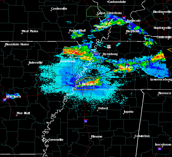 At 1012 pm cdt, a severe thunderstorm was located near cardwell, or near marmaduke, moving southeast at 25 mph (radar indicated). Hazards include 60 mph wind gusts and quarter size hail. Hail damage to vehicles is expected. Expect wind damage to roofs, siding, and trees. At 1012 pm cdt, a severe thunderstorm was located near cardwell, or near marmaduke, moving southeast at 25 mph (radar indicated). Hazards include 60 mph wind gusts and quarter size hail. Hail damage to vehicles is expected. Expect wind damage to roofs, siding, and trees.
|
| 4/8/2020 9:44 PM CDT |
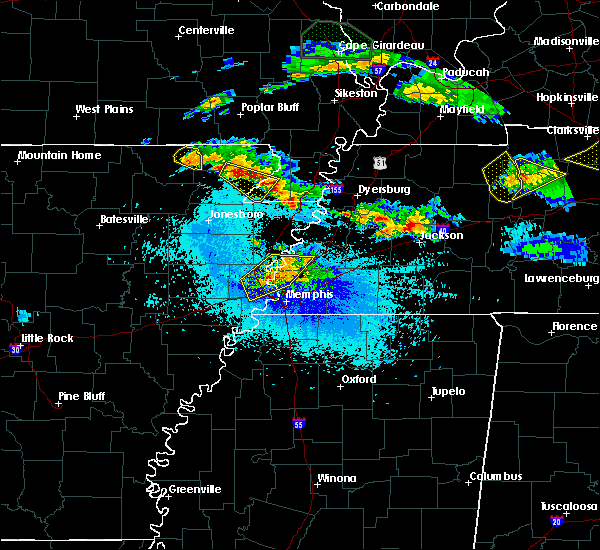 At 944 pm cdt, a severe thunderstorm was located over marmaduke, moving southeast at 20 mph (radar indicated). Hazards include 60 mph wind gusts and quarter size hail. Hail damage to vehicles is expected. expect wind damage to roofs, siding, and trees. Locations impacted include, rector, senath, marmaduke, cardwell, arbyrd, lafe, brighton, bertig, stonewall, heubner, fritz, bard, mounds, halliday, knob, leonard, bucoda, octa, paulding and scobeville. At 944 pm cdt, a severe thunderstorm was located over marmaduke, moving southeast at 20 mph (radar indicated). Hazards include 60 mph wind gusts and quarter size hail. Hail damage to vehicles is expected. expect wind damage to roofs, siding, and trees. Locations impacted include, rector, senath, marmaduke, cardwell, arbyrd, lafe, brighton, bertig, stonewall, heubner, fritz, bard, mounds, halliday, knob, leonard, bucoda, octa, paulding and scobeville.
|
| 4/8/2020 9:27 PM CDT |
 At 927 pm cdt, a severe thunderstorm was located over lafe, or near marmaduke, moving southeast at 30 mph (radar indicated). Hazards include 60 mph wind gusts and quarter size hail. Hail damage to vehicles is expected. Expect wind damage to roofs, siding, and trees. At 927 pm cdt, a severe thunderstorm was located over lafe, or near marmaduke, moving southeast at 30 mph (radar indicated). Hazards include 60 mph wind gusts and quarter size hail. Hail damage to vehicles is expected. Expect wind damage to roofs, siding, and trees.
|
| 4/8/2020 7:47 PM CDT |
 At 747 pm cdt, a severe thunderstorm was located over marmaduke, moving east at 35 mph (radar indicated). Hazards include 60 mph wind gusts and nickel size hail. Expect damage to roofs, siding, and trees. Locations impacted include, paragould, kennett, senath, marmaduke, oak grove heights, cardwell, hornersville, arbyrd, heubner, fritz, bard, mounds, halliday, leonard, noxburn, noland, brighton, bertig, cotton belt and gainesville. At 747 pm cdt, a severe thunderstorm was located over marmaduke, moving east at 35 mph (radar indicated). Hazards include 60 mph wind gusts and nickel size hail. Expect damage to roofs, siding, and trees. Locations impacted include, paragould, kennett, senath, marmaduke, oak grove heights, cardwell, hornersville, arbyrd, heubner, fritz, bard, mounds, halliday, leonard, noxburn, noland, brighton, bertig, cotton belt and gainesville.
|
| 4/8/2020 7:47 PM CDT |
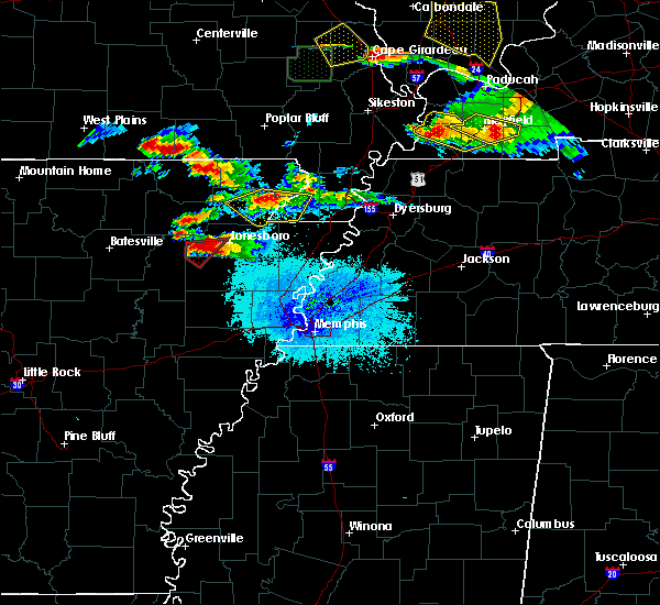 At 747 pm cdt, a severe thunderstorm was located over marmaduke, moving east at 35 mph (radar indicated). Hazards include 60 mph wind gusts and nickel size hail. Expect damage to roofs, siding, and trees. Locations impacted include, paragould, kennett, senath, marmaduke, oak grove heights, cardwell, hornersville, arbyrd, heubner, fritz, bard, mounds, halliday, leonard, noxburn, noland, brighton, bertig, cotton belt and gainesville. At 747 pm cdt, a severe thunderstorm was located over marmaduke, moving east at 35 mph (radar indicated). Hazards include 60 mph wind gusts and nickel size hail. Expect damage to roofs, siding, and trees. Locations impacted include, paragould, kennett, senath, marmaduke, oak grove heights, cardwell, hornersville, arbyrd, heubner, fritz, bard, mounds, halliday, leonard, noxburn, noland, brighton, bertig, cotton belt and gainesville.
|
| 4/8/2020 7:39 PM CDT |
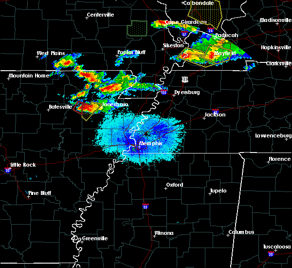 At 739 pm cdt, a severe thunderstorm was located over oak grove heights, or near marmaduke, moving southeast at 30 mph (radar indicated). Hazards include 60 mph wind gusts and quarter size hail. Hail damage to vehicles is expected. Expect wind damage to roofs, siding, and trees. At 739 pm cdt, a severe thunderstorm was located over oak grove heights, or near marmaduke, moving southeast at 30 mph (radar indicated). Hazards include 60 mph wind gusts and quarter size hail. Hail damage to vehicles is expected. Expect wind damage to roofs, siding, and trees.
|
| 4/8/2020 7:39 PM CDT |
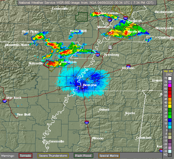 At 739 pm cdt, a severe thunderstorm was located over oak grove heights, or near marmaduke, moving southeast at 30 mph (radar indicated). Hazards include 60 mph wind gusts and quarter size hail. Hail damage to vehicles is expected. Expect wind damage to roofs, siding, and trees. At 739 pm cdt, a severe thunderstorm was located over oak grove heights, or near marmaduke, moving southeast at 30 mph (radar indicated). Hazards include 60 mph wind gusts and quarter size hail. Hail damage to vehicles is expected. Expect wind damage to roofs, siding, and trees.
|
| 3/24/2020 11:11 AM CDT |
 At 1111 am cdt, a severe thunderstorm was located over rector, moving east at 60 mph (radar indicated). Hazards include 60 mph wind gusts and quarter size hail. Hail damage to vehicles is expected. expect wind damage to roofs, siding, and trees. locations impacted include, paragould, kennett, piggott, campbell, rector, senath, marmaduke, clarkton, oak grove heights, holcomb, lafe, st. Francis, pollard, greenway, walcott, saint francis, crockett, nimmons, mounds and halliday. At 1111 am cdt, a severe thunderstorm was located over rector, moving east at 60 mph (radar indicated). Hazards include 60 mph wind gusts and quarter size hail. Hail damage to vehicles is expected. expect wind damage to roofs, siding, and trees. locations impacted include, paragould, kennett, piggott, campbell, rector, senath, marmaduke, clarkton, oak grove heights, holcomb, lafe, st. Francis, pollard, greenway, walcott, saint francis, crockett, nimmons, mounds and halliday.
|
| 3/24/2020 10:59 AM CDT |
 At 1058 am cdt, a severe thunderstorm was located near lafe, or 9 miles northwest of marmaduke, moving east at 60 mph (radar indicated). Hazards include 60 mph wind gusts and quarter size hail. Hail damage to vehicles is expected. Expect wind damage to roofs, siding, and trees. At 1058 am cdt, a severe thunderstorm was located near lafe, or 9 miles northwest of marmaduke, moving east at 60 mph (radar indicated). Hazards include 60 mph wind gusts and quarter size hail. Hail damage to vehicles is expected. Expect wind damage to roofs, siding, and trees.
|
| 3/24/2020 10:34 AM CDT |
 At 1034 am cdt, a severe thunderstorm was located over biggers, or 8 miles east of pocahontas, moving east at 65 mph (radar indicated). Hazards include 60 mph wind gusts and quarter size hail. Hail damage to vehicles is expected. Expect wind damage to roofs, siding, and trees. At 1034 am cdt, a severe thunderstorm was located over biggers, or 8 miles east of pocahontas, moving east at 65 mph (radar indicated). Hazards include 60 mph wind gusts and quarter size hail. Hail damage to vehicles is expected. Expect wind damage to roofs, siding, and trees.
|
| 3/3/2020 12:25 AM CST |
 At 1225 am cst, a severe thunderstorm was located over lake frierson state park, moving northeast at 50 mph (radar indicated). Hazards include half dollar size hail. damage to vehicles is expected At 1225 am cst, a severe thunderstorm was located over lake frierson state park, moving northeast at 50 mph (radar indicated). Hazards include half dollar size hail. damage to vehicles is expected
|
| 1/11/2020 1:15 AM CST |
 At 115 am cst, severe thunderstorms were located along a line extending from near puxico to near beech grove, moving northeast at 55 mph (radar indicated). Hazards include 60 mph wind gusts. Expect damage to roofs, siding, and trees. locations impacted include, paragould, kennett, piggott, manila, lake city, leachville, campbell, rector, senath, brookland, monette, marmaduke, chalk bluff natural area, oak grove heights, cardwell, hornersville, holcomb, arbyrd, st. Francis and dell. At 115 am cst, severe thunderstorms were located along a line extending from near puxico to near beech grove, moving northeast at 55 mph (radar indicated). Hazards include 60 mph wind gusts. Expect damage to roofs, siding, and trees. locations impacted include, paragould, kennett, piggott, manila, lake city, leachville, campbell, rector, senath, brookland, monette, marmaduke, chalk bluff natural area, oak grove heights, cardwell, hornersville, holcomb, arbyrd, st. Francis and dell.
|
| 1/11/2020 12:47 AM CST |
 At 1247 am cst, severe thunderstorms were located along a line extending from near harviell to bono, moving northeast at 55 mph (radar indicated). Hazards include 60 mph wind gusts. expect damage to roofs, siding, and trees At 1247 am cst, severe thunderstorms were located along a line extending from near harviell to bono, moving northeast at 55 mph (radar indicated). Hazards include 60 mph wind gusts. expect damage to roofs, siding, and trees
|
| 8/6/2019 8:15 PM CDT |
 At 815 pm cdt, a severe thunderstorm was located over marmaduke, moving southeast at 45 mph (radar indicated). Hazards include 60 mph wind gusts and quarter size hail. Hail damage to vehicles is expected. Expect wind damage to roofs, siding, and trees. At 815 pm cdt, a severe thunderstorm was located over marmaduke, moving southeast at 45 mph (radar indicated). Hazards include 60 mph wind gusts and quarter size hail. Hail damage to vehicles is expected. Expect wind damage to roofs, siding, and trees.
|
| 8/6/2019 8:01 PM CDT |
 At 759 pm cdt, a severe thunderstorm was located over knobel, or 7 miles south of corning, moving southeast at 35 mph (radar indicated. at 755 pm cdt, a 66 mph wind gust was measured by the corning airport awos observation equipment). Hazards include 60 mph wind gusts and quarter size hail. Hail damage to vehicles is expected. expect wind damage to roofs, siding, and trees. Locations impacted include, corning, marmaduke, oak grove heights, lafe, knobel, peach orchard, datto, beech grove, heelstring, stonewall, tipperary, gainesville and knob. At 759 pm cdt, a severe thunderstorm was located over knobel, or 7 miles south of corning, moving southeast at 35 mph (radar indicated. at 755 pm cdt, a 66 mph wind gust was measured by the corning airport awos observation equipment). Hazards include 60 mph wind gusts and quarter size hail. Hail damage to vehicles is expected. expect wind damage to roofs, siding, and trees. Locations impacted include, corning, marmaduke, oak grove heights, lafe, knobel, peach orchard, datto, beech grove, heelstring, stonewall, tipperary, gainesville and knob.
|
| 8/6/2019 7:49 PM CDT |
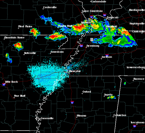 At 749 pm cdt, a severe thunderstorm was located near datto, or near corning, moving southeast at 35 mph (radar indicated). Hazards include 60 mph wind gusts and quarter size hail. Hail damage to vehicles is expected. Expect wind damage to roofs, siding, and trees. At 749 pm cdt, a severe thunderstorm was located near datto, or near corning, moving southeast at 35 mph (radar indicated). Hazards include 60 mph wind gusts and quarter size hail. Hail damage to vehicles is expected. Expect wind damage to roofs, siding, and trees.
|
| 6/26/2019 5:45 PM CDT |
 At 526 pm cdt, a severe thunderstorm was located over biggers, or 10 miles east of pocahontas, moving east at 30 mph (radar indicated). Hazards include 60 mph wind gusts. expect damage to roofs, siding, and trees At 526 pm cdt, a severe thunderstorm was located over biggers, or 10 miles east of pocahontas, moving east at 30 mph (radar indicated). Hazards include 60 mph wind gusts. expect damage to roofs, siding, and trees
|
| 6/26/2019 5:26 PM CDT |
 At 526 pm cdt, a severe thunderstorm was located over biggers, or 10 miles east of pocahontas, moving east at 30 mph (radar indicated). Hazards include 60 mph wind gusts. expect damage to roofs, siding, and trees At 526 pm cdt, a severe thunderstorm was located over biggers, or 10 miles east of pocahontas, moving east at 30 mph (radar indicated). Hazards include 60 mph wind gusts. expect damage to roofs, siding, and trees
|
| 6/23/2019 3:18 PM CDT |
 At 317 pm cdt, severe thunderstorms were located along a line extending from near glennonville to near arbyrd, moving east at 45 mph (radar indicated). Hazards include 60 mph wind gusts. Expect damage to roofs, siding, and trees. locations impacted include, paragould, kennett, malden, piggott, campbell, rector, senath, marmaduke, chalk bluff natural area, clarkton, cardwell, hornersville, holcomb, arbyrd, wardell, st. Francis, pollard, greenway, mcdougal and glennonville. At 317 pm cdt, severe thunderstorms were located along a line extending from near glennonville to near arbyrd, moving east at 45 mph (radar indicated). Hazards include 60 mph wind gusts. Expect damage to roofs, siding, and trees. locations impacted include, paragould, kennett, malden, piggott, campbell, rector, senath, marmaduke, chalk bluff natural area, clarkton, cardwell, hornersville, holcomb, arbyrd, wardell, st. Francis, pollard, greenway, mcdougal and glennonville.
|
| 6/23/2019 3:03 PM CDT |
 At 303 pm cdt, severe thunderstorms were located along a line extending from near qulin to near paragould, moving east at 40 mph (radar indicated). Hazards include 60 mph wind gusts. expect damage to roofs, siding, and trees At 303 pm cdt, severe thunderstorms were located along a line extending from near qulin to near paragould, moving east at 40 mph (radar indicated). Hazards include 60 mph wind gusts. expect damage to roofs, siding, and trees
|
| 6/23/2019 2:47 PM CDT |
 At 247 pm cdt, severe thunderstorms were located along a line extending from near corning to near crowleys ridge state park, moving east at 50 mph (radar indicated). Hazards include 60 mph wind gusts. Expect damage to roofs, siding, and trees. Locations impacted include, paragould, piggott, corning, rector, marmaduke, chalk bluff natural area, crowleys ridge state park, lake frierson state park, oak grove heights, cardwell, arbyrd, lafe, reyno, knobel, pollard, greenway, o`kean, mcdougal, success and peach orchard. At 247 pm cdt, severe thunderstorms were located along a line extending from near corning to near crowleys ridge state park, moving east at 50 mph (radar indicated). Hazards include 60 mph wind gusts. Expect damage to roofs, siding, and trees. Locations impacted include, paragould, piggott, corning, rector, marmaduke, chalk bluff natural area, crowleys ridge state park, lake frierson state park, oak grove heights, cardwell, arbyrd, lafe, reyno, knobel, pollard, greenway, o`kean, mcdougal, success and peach orchard.
|
| 6/23/2019 2:31 PM CDT |
 At 230 pm cdt, severe thunderstorms were located along a line extending from near success to near fontaine, moving east at 45 mph (radar indicated. at 227 pm cdt, a wind gust of 63 mph was measured in walnut ridge). Hazards include 60 mph wind gusts. expect damage to roofs, siding, and trees At 230 pm cdt, severe thunderstorms were located along a line extending from near success to near fontaine, moving east at 45 mph (radar indicated. at 227 pm cdt, a wind gust of 63 mph was measured in walnut ridge). Hazards include 60 mph wind gusts. expect damage to roofs, siding, and trees
|
| 6/23/2019 2:31 PM CDT |
 The national weather service in memphis has issued a * severe thunderstorm warning for. greene county in eastern arkansas. clay county in eastern arkansas. western dunklin county in southeastern missouri. Until 315 pm cdt. The national weather service in memphis has issued a * severe thunderstorm warning for. greene county in eastern arkansas. clay county in eastern arkansas. western dunklin county in southeastern missouri. Until 315 pm cdt.
|
| 6/21/2019 6:42 PM CDT |
 The severe thunderstorm warning for greene, central craighead, northwestern mississippi, southeastern clay, pemiscot, southern dunklin, northwestern dyer and southwestern lake counties will expire at 645 pm cdt, the storms which prompted the warning have moved out of the area. therefore, the warning will be allowed to expire. however wind gusts to 50 mph are still possible with the remaining thunderstorms. a severe thunderstorm watch remains in effect until 100 am cdt for eastern arkansas, southeastern missouri, and western tennessee. The severe thunderstorm warning for greene, central craighead, northwestern mississippi, southeastern clay, pemiscot, southern dunklin, northwestern dyer and southwestern lake counties will expire at 645 pm cdt, the storms which prompted the warning have moved out of the area. therefore, the warning will be allowed to expire. however wind gusts to 50 mph are still possible with the remaining thunderstorms. a severe thunderstorm watch remains in effect until 100 am cdt for eastern arkansas, southeastern missouri, and western tennessee.
|
| 6/21/2019 6:24 PM CDT |
 At 624 pm cdt, severe thunderstorms were located along a line extending from near cloverdale to near brookland, moving southeast at 25 mph (radar indicated). Hazards include 60 mph wind gusts. Expect damage to roofs, siding, and trees. Locations impacted include, jonesboro, paragould, blytheville, kennett, caruthersville, gosnell, hayti, steele, bono, leachville, senath, brookland, monette, marmaduke, crowleys ridge state park, lake frierson state park, oak grove heights, cardwell, hornersville and hayti heights. At 624 pm cdt, severe thunderstorms were located along a line extending from near cloverdale to near brookland, moving southeast at 25 mph (radar indicated). Hazards include 60 mph wind gusts. Expect damage to roofs, siding, and trees. Locations impacted include, jonesboro, paragould, blytheville, kennett, caruthersville, gosnell, hayti, steele, bono, leachville, senath, brookland, monette, marmaduke, crowleys ridge state park, lake frierson state park, oak grove heights, cardwell, hornersville and hayti heights.
|
| 6/21/2019 5:46 PM CDT |
 The national weather service in memphis has issued a * severe thunderstorm warning for. greene county in eastern arkansas. central craighead county in eastern arkansas. northwestern mississippi county in eastern arkansas. Clay county in eastern arkansas. The national weather service in memphis has issued a * severe thunderstorm warning for. greene county in eastern arkansas. central craighead county in eastern arkansas. northwestern mississippi county in eastern arkansas. Clay county in eastern arkansas.
|
| 6/21/2019 5:46 PM CDT |
 At 544 pm cdt, severe thunderstorms were located along a line extending from near tiptonville to near o`kean, moving southeast at 25 mph (radar indicated, measured at kennett missouri airport). Hazards include 60 mph wind gusts. expect damage to roofs, siding, and trees At 544 pm cdt, severe thunderstorms were located along a line extending from near tiptonville to near o`kean, moving southeast at 25 mph (radar indicated, measured at kennett missouri airport). Hazards include 60 mph wind gusts. expect damage to roofs, siding, and trees
|
| 6/21/2019 5:25 PM CDT |
 At 525 pm cdt, a severe thunderstorm was located over mcdougal, or 8 miles west of chalk bluff natural area, moving southeast at 5 mph (radar indicated). Hazards include 60 mph wind gusts and nickel size hail. Expect damage to roofs, siding, and trees. locations impacted include, kennett, malden, piggott, corning, portageville, hayti, campbell, rector, marmaduke, chalk bluff natural area, tiptonville, oak grove heights, holcomb, hayti heights, lafe, reyno, wardell, knobel, st. Francis and pollard. At 525 pm cdt, a severe thunderstorm was located over mcdougal, or 8 miles west of chalk bluff natural area, moving southeast at 5 mph (radar indicated). Hazards include 60 mph wind gusts and nickel size hail. Expect damage to roofs, siding, and trees. locations impacted include, kennett, malden, piggott, corning, portageville, hayti, campbell, rector, marmaduke, chalk bluff natural area, tiptonville, oak grove heights, holcomb, hayti heights, lafe, reyno, wardell, knobel, st. Francis and pollard.
|
| 6/21/2019 5:25 PM CDT |
 At 456 pm cdt, severe thunderstorms were located along a line extending from near bernie to near success, moving southeast at 30 mph (radar indicated). Hazards include 60 mph wind gusts. expect damage to roofs, siding, and trees At 456 pm cdt, severe thunderstorms were located along a line extending from near bernie to near success, moving southeast at 30 mph (radar indicated). Hazards include 60 mph wind gusts. expect damage to roofs, siding, and trees
|
| 6/21/2019 4:56 PM CDT |
 At 456 pm cdt, severe thunderstorms were located along a line extending from near bernie to near success, moving southeast at 30 mph (radar indicated). Hazards include 60 mph wind gusts. expect damage to roofs, siding, and trees At 456 pm cdt, severe thunderstorms were located along a line extending from near bernie to near success, moving southeast at 30 mph (radar indicated). Hazards include 60 mph wind gusts. expect damage to roofs, siding, and trees
|
| 3/14/2019 6:21 AM CDT |
 At 621 am cdt, a severe thunderstorm was located near paragould, moving northeast at 60 mph (radar indicated). Hazards include 60 mph wind gusts. expect damage to roofs, siding, and trees At 621 am cdt, a severe thunderstorm was located near paragould, moving northeast at 60 mph (radar indicated). Hazards include 60 mph wind gusts. expect damage to roofs, siding, and trees
|
| 3/14/2019 6:21 AM CDT |
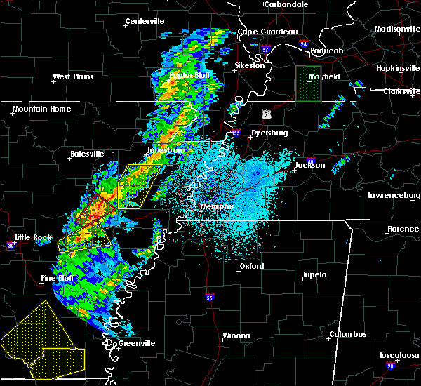 At 621 am cdt, a severe thunderstorm was located near paragould, moving northeast at 60 mph (radar indicated). Hazards include 60 mph wind gusts. expect damage to roofs, siding, and trees At 621 am cdt, a severe thunderstorm was located near paragould, moving northeast at 60 mph (radar indicated). Hazards include 60 mph wind gusts. expect damage to roofs, siding, and trees
|
| 12/1/2018 3:26 AM CST |
 At 325 am cst, a severe thunderstorm was located over marmaduke, moving northeast at 55 mph (radar indicated). Hazards include 60 mph wind gusts. Expect damage to roofs, siding, and trees. locations impacted include, jonesboro, paragould, kennett, piggott, campbell, rector, senath, brookland, marmaduke, clarkton, oak grove heights, cardwell, hornersville, holcomb, arbyrd, st. francis, greenway, saint francis, crockett and nimmons. A tornado watch remains in effect until 800 am cst for eastern arkansas. At 325 am cst, a severe thunderstorm was located over marmaduke, moving northeast at 55 mph (radar indicated). Hazards include 60 mph wind gusts. Expect damage to roofs, siding, and trees. locations impacted include, jonesboro, paragould, kennett, piggott, campbell, rector, senath, brookland, marmaduke, clarkton, oak grove heights, cardwell, hornersville, holcomb, arbyrd, st. francis, greenway, saint francis, crockett and nimmons. A tornado watch remains in effect until 800 am cst for eastern arkansas.
|
| 12/1/2018 3:26 AM CST |
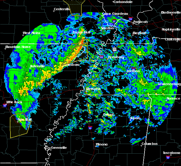 At 325 am cst, a severe thunderstorm was located over marmaduke, moving northeast at 55 mph (radar indicated). Hazards include 60 mph wind gusts. Expect damage to roofs, siding, and trees. locations impacted include, jonesboro, paragould, kennett, piggott, campbell, rector, senath, brookland, marmaduke, clarkton, oak grove heights, cardwell, hornersville, holcomb, arbyrd, st. francis, greenway, saint francis, crockett and nimmons. A tornado watch remains in effect until 800 am cst for eastern arkansas. At 325 am cst, a severe thunderstorm was located over marmaduke, moving northeast at 55 mph (radar indicated). Hazards include 60 mph wind gusts. Expect damage to roofs, siding, and trees. locations impacted include, jonesboro, paragould, kennett, piggott, campbell, rector, senath, brookland, marmaduke, clarkton, oak grove heights, cardwell, hornersville, holcomb, arbyrd, st. francis, greenway, saint francis, crockett and nimmons. A tornado watch remains in effect until 800 am cst for eastern arkansas.
|
| 12/1/2018 3:08 AM CST |
 At 307 am cst, a severe thunderstorm was located over walcott, or over crowleys ridge state park, moving northeast at 55 mph (radar indicated). Hazards include 60 mph wind gusts. expect damage to roofs, siding, and trees At 307 am cst, a severe thunderstorm was located over walcott, or over crowleys ridge state park, moving northeast at 55 mph (radar indicated). Hazards include 60 mph wind gusts. expect damage to roofs, siding, and trees
|
| 8/20/2018 5:30 PM CDT |
 At 530 pm cdt, a severe thunderstorm producing a tornado was located over crowleys ridge state park, moving east at 20 mph (weather spotters reported funnel cloud). Hazards include tornado. Flying debris will be dangerous to those caught without shelter. mobile homes will be damaged or destroyed. damage to roofs, windows, and vehicles will occur. Tree damage is likely. At 530 pm cdt, a severe thunderstorm producing a tornado was located over crowleys ridge state park, moving east at 20 mph (weather spotters reported funnel cloud). Hazards include tornado. Flying debris will be dangerous to those caught without shelter. mobile homes will be damaged or destroyed. damage to roofs, windows, and vehicles will occur. Tree damage is likely.
|
| 8/20/2018 5:25 PM CDT | Semi truck grain hauler overturned. overturned trailer home and several trees down and farm shop damaged mainly around the 700 series of r0ad in greene county AR, 0.4 miles NE of Marmaduke, AR |
| 8/6/2018 3:55 PM CDT | Quarter sized hail reported 0.4 miles NE of Marmaduke, AR, quarter sized hail. |
| 8/6/2018 3:36 PM CDT |
 At 336 pm cdt, a severe thunderstorm was located near marmaduke, moving east at 15 mph (radar indicated). Hazards include 60 mph wind gusts and quarter size hail. Hail damage to vehicles is expected. Expect wind damage to roofs, siding, and trees. At 336 pm cdt, a severe thunderstorm was located near marmaduke, moving east at 15 mph (radar indicated). Hazards include 60 mph wind gusts and quarter size hail. Hail damage to vehicles is expected. Expect wind damage to roofs, siding, and trees.
|
| 6/28/2018 10:54 PM CDT |
 At 1054 pm cdt, a severe thunderstorm was located over lafe, or near marmaduke, moving southwest at 50 mph (radar indicated). Hazards include 60 mph wind gusts and quarter size hail. Hail damage to vehicles is expected. Expect wind damage to roofs, siding, and trees. At 1054 pm cdt, a severe thunderstorm was located over lafe, or near marmaduke, moving southwest at 50 mph (radar indicated). Hazards include 60 mph wind gusts and quarter size hail. Hail damage to vehicles is expected. Expect wind damage to roofs, siding, and trees.
|
| 6/1/2018 12:50 AM CDT |
 At 1250 am cdt, severe thunderstorms were located along a line extending from near hornersville to near lake city to near cash, moving southeast at 45 mph (radar indicated). Hazards include 70 mph wind gusts. Expect considerable tree damage. damage is likely to mobile homes, roofs, and outbuildings. Locations impacted include, jonesboro, paragould, trumann, manila, bono, lake city, leachville, bay, brookland, monette, caraway, marmaduke, crowleys ridge state park, lake frierson state park, oak grove heights, weiner, cardwell, arbyrd, lafe and cash. At 1250 am cdt, severe thunderstorms were located along a line extending from near hornersville to near lake city to near cash, moving southeast at 45 mph (radar indicated). Hazards include 70 mph wind gusts. Expect considerable tree damage. damage is likely to mobile homes, roofs, and outbuildings. Locations impacted include, jonesboro, paragould, trumann, manila, bono, lake city, leachville, bay, brookland, monette, caraway, marmaduke, crowleys ridge state park, lake frierson state park, oak grove heights, weiner, cardwell, arbyrd, lafe and cash.
|
| 6/1/2018 12:42 AM CDT |
 At 1241 am cdt, severe thunderstorms were located along a line extending from near arbyrd to near lake city to near cash, moving southeast at 45 mph (radar indicated). Hazards include 60 mph wind gusts. Expect damage to roofs, siding, and trees. Locations impacted include, jonesboro, paragould, trumann, manila, bono, lake city, leachville, bay, brookland, monette, caraway, marmaduke, crowleys ridge state park, lake frierson state park, oak grove heights, weiner, cardwell, arbyrd, lafe and cash. At 1241 am cdt, severe thunderstorms were located along a line extending from near arbyrd to near lake city to near cash, moving southeast at 45 mph (radar indicated). Hazards include 60 mph wind gusts. Expect damage to roofs, siding, and trees. Locations impacted include, jonesboro, paragould, trumann, manila, bono, lake city, leachville, bay, brookland, monette, caraway, marmaduke, crowleys ridge state park, lake frierson state park, oak grove heights, weiner, cardwell, arbyrd, lafe and cash.
|
| 6/1/2018 12:13 AM CDT |
 At 1213 am cdt, severe thunderstorms were located along a line extending from near oak grove heights to near fontaine to near strawberry, moving southeast at 45 mph (radar indicated). Hazards include 60 mph wind gusts. expect damage to roofs, siding, and trees At 1213 am cdt, severe thunderstorms were located along a line extending from near oak grove heights to near fontaine to near strawberry, moving southeast at 45 mph (radar indicated). Hazards include 60 mph wind gusts. expect damage to roofs, siding, and trees
|
| 5/31/2018 11:42 PM CDT |
 At 1141 pm cdt, a severe thunderstorm was located over rector, moving east at 35 mph (radar indicated). Hazards include 60 mph wind gusts. expect damage to roofs, siding, and trees At 1141 pm cdt, a severe thunderstorm was located over rector, moving east at 35 mph (radar indicated). Hazards include 60 mph wind gusts. expect damage to roofs, siding, and trees
|
| 5/31/2018 11:33 PM CDT | Law enforcement reports a large tree down at the intersection of south 5th street and main street in marmaduke... greene count in greene county AR, 0.4 miles NE of Marmaduke, AR |
| 5/31/2018 11:05 PM CDT |
 At 1104 pm cdt, severe thunderstorms were located along a line extending from near peach orchard to lake charles state park, moving southeast at 25 mph (radar indicated). Hazards include 60 mph wind gusts. expect damage to roofs, siding, and trees At 1104 pm cdt, severe thunderstorms were located along a line extending from near peach orchard to lake charles state park, moving southeast at 25 mph (radar indicated). Hazards include 60 mph wind gusts. expect damage to roofs, siding, and trees
|
| 5/20/2018 3:15 PM CDT | Quarter sized hail reported 6.6 miles E of Marmaduke, AR, quarter size hail between oak grove and lafe. |
| 5/20/2018 2:45 PM CDT |
 At 245 pm cdt, a severe thunderstorm was located near marmaduke, moving east at 10 mph (radar indicated). Hazards include golf ball size hail and 60 mph wind gusts. People and animals outdoors will be injured. expect hail damage to roofs, siding, windows, and vehicles. Expect wind damage to roofs, siding, and trees. At 245 pm cdt, a severe thunderstorm was located near marmaduke, moving east at 10 mph (radar indicated). Hazards include golf ball size hail and 60 mph wind gusts. People and animals outdoors will be injured. expect hail damage to roofs, siding, windows, and vehicles. Expect wind damage to roofs, siding, and trees.
|
| 5/20/2018 2:22 PM CDT |
 At 222 pm cdt, a severe thunderstorm was located near beech grove, or 7 miles north of crowleys ridge state park, moving east at 15 mph (radar indicated). Hazards include 60 mph wind gusts and quarter size hail. Hail damage to vehicles is expected. expect wind damage to roofs, siding, and trees. Locations impacted include, paragould, marmaduke, oak grove heights, lafe, evening star, beech grove, whiskerville, cotton belt, giles spur, stanford, gainesville, halliday, light, walnut corner, faulknerville, noxburn and crowley`s ridge state park. At 222 pm cdt, a severe thunderstorm was located near beech grove, or 7 miles north of crowleys ridge state park, moving east at 15 mph (radar indicated). Hazards include 60 mph wind gusts and quarter size hail. Hail damage to vehicles is expected. expect wind damage to roofs, siding, and trees. Locations impacted include, paragould, marmaduke, oak grove heights, lafe, evening star, beech grove, whiskerville, cotton belt, giles spur, stanford, gainesville, halliday, light, walnut corner, faulknerville, noxburn and crowley`s ridge state park.
|
| 5/20/2018 1:51 PM CDT |
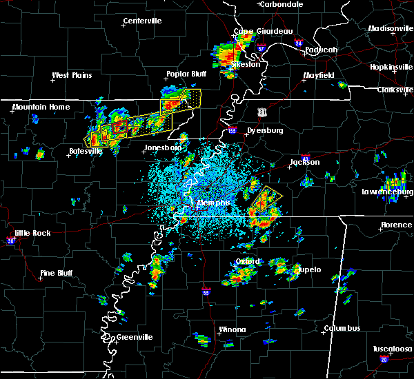 At 151 pm cdt, a severe thunderstorm was located near o`kean, or 8 miles northwest of crowleys ridge state park, moving east at 15 mph (radar indicated). Hazards include 60 mph wind gusts and half dollar size hail. Hail damage to vehicles is expected. Expect wind damage to roofs, siding, and trees. At 151 pm cdt, a severe thunderstorm was located near o`kean, or 8 miles northwest of crowleys ridge state park, moving east at 15 mph (radar indicated). Hazards include 60 mph wind gusts and half dollar size hail. Hail damage to vehicles is expected. Expect wind damage to roofs, siding, and trees.
|
| 4/14/2018 12:27 AM CDT |
 The severe thunderstorm warning for eastern greene, eastern craighead, eastern poinsett, mississippi, southeastern clay, pemiscot and southern dunklin counties will expire at 1230 am cdt, the storms which prompted the warning have moved out of the area. therefore the warning will be allowed to expire. a tornado watch remains in effect until 600 am cdt for eastern arkansas, southeastern missouri, and southwestern and northwestern tennessee. The severe thunderstorm warning for eastern greene, eastern craighead, eastern poinsett, mississippi, southeastern clay, pemiscot and southern dunklin counties will expire at 1230 am cdt, the storms which prompted the warning have moved out of the area. therefore the warning will be allowed to expire. a tornado watch remains in effect until 600 am cdt for eastern arkansas, southeastern missouri, and southwestern and northwestern tennessee.
|
| 4/13/2018 11:42 PM CDT |
 At 1142 pm cdt, severe thunderstorms were located along a line extending from near marmaduke to near harrisburg, moving east at 45 mph (radar indicated). Hazards include 60 mph wind gusts. expect damage to roofs, siding, and trees At 1142 pm cdt, severe thunderstorms were located along a line extending from near marmaduke to near harrisburg, moving east at 45 mph (radar indicated). Hazards include 60 mph wind gusts. expect damage to roofs, siding, and trees
|
| 3/26/2018 6:41 AM CDT |
 At 641 am cdt, a severe thunderstorm was located near lafe, or 7 miles northwest of marmaduke, moving east at 25 mph (radar indicated). Hazards include quarter size hail. Damage to vehicles is expected. Locations impacted include, rector, marmaduke, lafe, knobel, peach orchard, crockett, pratt, hargrave corner, stonewall, heubner, tipperary, fritz, knob and leonard. At 641 am cdt, a severe thunderstorm was located near lafe, or 7 miles northwest of marmaduke, moving east at 25 mph (radar indicated). Hazards include quarter size hail. Damage to vehicles is expected. Locations impacted include, rector, marmaduke, lafe, knobel, peach orchard, crockett, pratt, hargrave corner, stonewall, heubner, tipperary, fritz, knob and leonard.
|
| 3/26/2018 6:41 AM CDT |
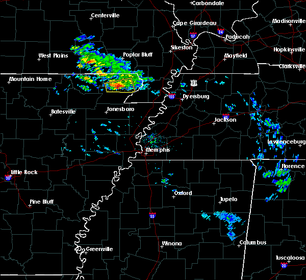 At 641 am cdt, a severe thunderstorm was located near lafe, or 7 miles northwest of marmaduke, moving east at 25 mph (radar indicated). Hazards include quarter size hail. Damage to vehicles is expected. Locations impacted include, rector, marmaduke, lafe, knobel, peach orchard, crockett, pratt, hargrave corner, stonewall, heubner, tipperary, fritz, knob and leonard. At 641 am cdt, a severe thunderstorm was located near lafe, or 7 miles northwest of marmaduke, moving east at 25 mph (radar indicated). Hazards include quarter size hail. Damage to vehicles is expected. Locations impacted include, rector, marmaduke, lafe, knobel, peach orchard, crockett, pratt, hargrave corner, stonewall, heubner, tipperary, fritz, knob and leonard.
|
| 3/26/2018 6:22 AM CDT |
 At 622 am cdt, a severe thunderstorm was located near peach orchard, or 10 miles south of corning, moving east at 35 mph (radar indicated). Hazards include half dollar size hail. damage to vehicles is expected At 622 am cdt, a severe thunderstorm was located near peach orchard, or 10 miles south of corning, moving east at 35 mph (radar indicated). Hazards include half dollar size hail. damage to vehicles is expected
|
| 3/26/2018 6:22 AM CDT |
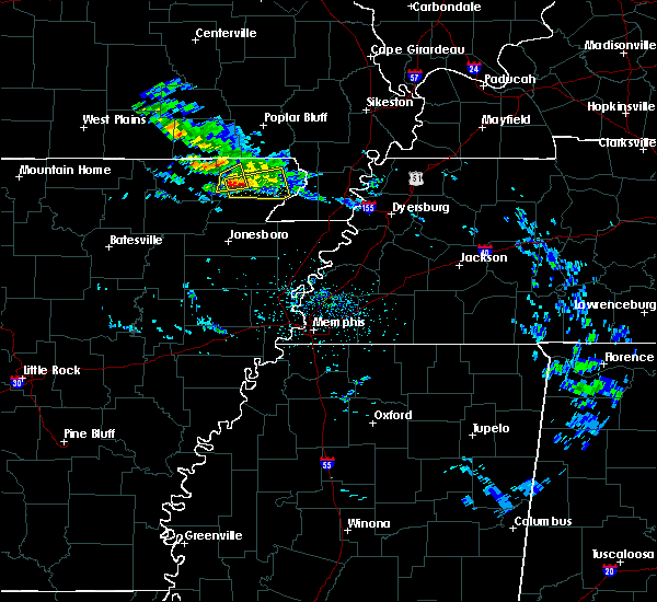 At 622 am cdt, a severe thunderstorm was located near peach orchard, or 10 miles south of corning, moving east at 35 mph (radar indicated). Hazards include half dollar size hail. damage to vehicles is expected At 622 am cdt, a severe thunderstorm was located near peach orchard, or 10 miles south of corning, moving east at 35 mph (radar indicated). Hazards include half dollar size hail. damage to vehicles is expected
|
| 2/24/2018 5:31 PM CST |
 At 530 pm cst, a severe thunderstorm producing a tornado was located near walcott, or near crowleys ridge state park, moving northeast at 55 mph (radar indicated rotation). Hazards include tornado. Flying debris will be dangerous to those caught without shelter. mobile homes will be damaged or destroyed. damage to roofs, windows, and vehicles will occur. tree damage is likely. Locations impacted include, paragould, rector, marmaduke, crowleys ridge state park, lake frierson state park, oak grove heights, lafe, evening star, walcott, beech grove, stonewall, heubner, fritz, mounds, halliday, light, leonard, finch, lorado and faulknerville. At 530 pm cst, a severe thunderstorm producing a tornado was located near walcott, or near crowleys ridge state park, moving northeast at 55 mph (radar indicated rotation). Hazards include tornado. Flying debris will be dangerous to those caught without shelter. mobile homes will be damaged or destroyed. damage to roofs, windows, and vehicles will occur. tree damage is likely. Locations impacted include, paragould, rector, marmaduke, crowleys ridge state park, lake frierson state park, oak grove heights, lafe, evening star, walcott, beech grove, stonewall, heubner, fritz, mounds, halliday, light, leonard, finch, lorado and faulknerville.
|
| 2/24/2018 5:15 PM CST |
 At 515 pm cst, a severe thunderstorm producing a tornado was located near minturn, or near hoxie, moving northeast at 35 mph (radar indicated rotation). Hazards include tornado. Flying debris will be dangerous to those caught without shelter. mobile homes will be damaged or destroyed. damage to roofs, windows, and vehicles will occur. Tree damage is likely. At 515 pm cst, a severe thunderstorm producing a tornado was located near minturn, or near hoxie, moving northeast at 35 mph (radar indicated rotation). Hazards include tornado. Flying debris will be dangerous to those caught without shelter. mobile homes will be damaged or destroyed. damage to roofs, windows, and vehicles will occur. Tree damage is likely.
|
| 2/24/2018 5:05 PM CST |
 At 505 pm cst, a severe thunderstorm was located over o`kean, or 8 miles northeast of walnut ridge, moving northeast at 60 mph (radar indicated). Hazards include 60 mph wind gusts. expect damage to roofs, siding, and trees At 505 pm cst, a severe thunderstorm was located over o`kean, or 8 miles northeast of walnut ridge, moving northeast at 60 mph (radar indicated). Hazards include 60 mph wind gusts. expect damage to roofs, siding, and trees
|
| 2/20/2018 10:49 PM CST |
 At 1049 pm cst, a severe thunderstorm was located over marmaduke, moving northeast at 55 mph (radar indicated). Hazards include 60 mph wind gusts. Expect damage to roofs, siding, and trees. locations impacted include, malden, piggott, campbell, rector, marmaduke, chalk bluff natural area, clarkton, holcomb, lafe, st. Francis, pollard, greenway, mcdougal, glennonville, saint francis, crockett, nimmons, heubner, fritz and lorine. At 1049 pm cst, a severe thunderstorm was located over marmaduke, moving northeast at 55 mph (radar indicated). Hazards include 60 mph wind gusts. Expect damage to roofs, siding, and trees. locations impacted include, malden, piggott, campbell, rector, marmaduke, chalk bluff natural area, clarkton, holcomb, lafe, st. Francis, pollard, greenway, mcdougal, glennonville, saint francis, crockett, nimmons, heubner, fritz and lorine.
|
| 2/20/2018 10:41 PM CST |
 At 1040 pm cst, a severe thunderstorm was located over paragould, moving northeast at 55 mph (radar indicated). Hazards include 60 mph wind gusts. expect damage to roofs, siding, and trees At 1040 pm cst, a severe thunderstorm was located over paragould, moving northeast at 55 mph (radar indicated). Hazards include 60 mph wind gusts. expect damage to roofs, siding, and trees
|
| 6/23/2017 4:54 PM CDT |
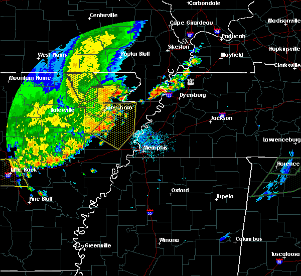 At 454 pm cdt, a severe thunderstorm was located near oak grove heights, or near marmaduke, moving southeast at 25 mph (radar indicated). Hazards include 60 mph wind gusts and quarter size hail. Hail damage to vehicles is expected. Expect wind damage to roofs, siding, and trees. At 454 pm cdt, a severe thunderstorm was located near oak grove heights, or near marmaduke, moving southeast at 25 mph (radar indicated). Hazards include 60 mph wind gusts and quarter size hail. Hail damage to vehicles is expected. Expect wind damage to roofs, siding, and trees.
|
| 5/27/2017 9:45 PM CDT | Quarter sized hail reported 0.4 miles NE of Marmaduke, AR |
| 5/27/2017 9:38 PM CDT |
 At 937 pm cdt, severe thunderstorms were located along a line extending from pollard to near brookland to near swifton, moving southeast at 35 mph (radar indicated). Hazards include 70 mph wind gusts and quarter size hail. Hail damage to vehicles is expected. expect considerable tree damage. Wind damage is also likely to mobile homes, roofs, and outbuildings. At 937 pm cdt, severe thunderstorms were located along a line extending from pollard to near brookland to near swifton, moving southeast at 35 mph (radar indicated). Hazards include 70 mph wind gusts and quarter size hail. Hail damage to vehicles is expected. expect considerable tree damage. Wind damage is also likely to mobile homes, roofs, and outbuildings.
|
| 5/27/2017 9:25 PM CDT |
 At 925 pm cdt, severe thunderstorms were located along a line extending from mcdougal to near walcott to near strawberry, moving east at 60 mph (radar indicated). Hazards include 70 mph wind gusts. Expect considerable tree damage. damage is likely to mobile homes, roofs, and outbuildings. locations impacted include, jonesboro, paragould, kennett, pocahontas, walnut ridge, piggott, corning, hoxie, bono, lake city, leachville, campbell, rector, senath, brookland, monette, marmaduke, black rock, lake charles state park and chalk bluff natural area. A tornado watch remains in effect until 200 am cdt for eastern arkansas, and southeastern missouri. At 925 pm cdt, severe thunderstorms were located along a line extending from mcdougal to near walcott to near strawberry, moving east at 60 mph (radar indicated). Hazards include 70 mph wind gusts. Expect considerable tree damage. damage is likely to mobile homes, roofs, and outbuildings. locations impacted include, jonesboro, paragould, kennett, pocahontas, walnut ridge, piggott, corning, hoxie, bono, lake city, leachville, campbell, rector, senath, brookland, monette, marmaduke, black rock, lake charles state park and chalk bluff natural area. A tornado watch remains in effect until 200 am cdt for eastern arkansas, and southeastern missouri.
|
| 5/27/2017 9:06 PM CDT |
 At 906 pm cdt, severe thunderstorms were located along a line extending from near doniphan to near pocahontas to near sidney, moving southeast at 60 mph (radar indicated). Hazards include 70 mph wind gusts. Expect considerable tree damage. Damage is likely to mobile homes, roofs, and outbuildings. At 906 pm cdt, severe thunderstorms were located along a line extending from near doniphan to near pocahontas to near sidney, moving southeast at 60 mph (radar indicated). Hazards include 70 mph wind gusts. Expect considerable tree damage. Damage is likely to mobile homes, roofs, and outbuildings.
|
| 5/27/2017 5:43 AM CDT |
 At 542 am cdt, severe thunderstorms were located along a line extending from glennonville to greenway to near marmaduke, moving east at 60 mph (radar indicated). Hazards include 60 mph wind gusts and quarter size hail. Hail damage to vehicles is expected. expect wind damage to roofs, siding, and trees. locations impacted include, kennett, malden, piggott, corning, campbell, rector, marmaduke, chalk bluff natural area, clarkton, holcomb, lafe, knobel, st. Francis, pollard, greenway, mcdougal, glennonville, saint francis, crockett and nimmons. At 542 am cdt, severe thunderstorms were located along a line extending from glennonville to greenway to near marmaduke, moving east at 60 mph (radar indicated). Hazards include 60 mph wind gusts and quarter size hail. Hail damage to vehicles is expected. expect wind damage to roofs, siding, and trees. locations impacted include, kennett, malden, piggott, corning, campbell, rector, marmaduke, chalk bluff natural area, clarkton, holcomb, lafe, knobel, st. Francis, pollard, greenway, mcdougal, glennonville, saint francis, crockett and nimmons.
|
| 5/27/2017 5:25 AM CDT |
 At 525 am cdt, severe thunderstorms were located along a line extending from near neelyville to 6 miles east of knobel to near evening star, moving east at 55 mph (radar indicated). Hazards include 60 mph wind gusts and quarter size hail. Hail damage to vehicles is expected. Expect wind damage to roofs, siding, and trees. At 525 am cdt, severe thunderstorms were located along a line extending from near neelyville to 6 miles east of knobel to near evening star, moving east at 55 mph (radar indicated). Hazards include 60 mph wind gusts and quarter size hail. Hail damage to vehicles is expected. Expect wind damage to roofs, siding, and trees.
|
| 4/30/2017 1:56 AM CDT |
 At 155 am cdt, a severe thunderstorm was located over piggott, moving east at 65 mph (radar indicated). Hazards include 60 mph wind gusts. expect damage to roofs, siding, and trees At 155 am cdt, a severe thunderstorm was located over piggott, moving east at 65 mph (radar indicated). Hazards include 60 mph wind gusts. expect damage to roofs, siding, and trees
|
| 4/30/2017 1:25 AM CDT |
 At 124 am cdt, severe thunderstorms were located along a line extending from 8 miles west of budapest to near biggers, moving northeast at 55 mph (radar indicated). Hazards include 60 mph wind gusts and quarter size hail. Hail damage to vehicles is expected. expect wind damage to roofs, siding, and trees. locations impacted include, jonesboro, paragould, piggott, corning, bono, marmaduke, chalk bluff natural area, crowleys ridge state park, lake frierson state park, oak grove heights, lafe, reyno, maynard, biggers, cash, knobel, st. Francis, pollard, o`kean and mcdougal. At 124 am cdt, severe thunderstorms were located along a line extending from 8 miles west of budapest to near biggers, moving northeast at 55 mph (radar indicated). Hazards include 60 mph wind gusts and quarter size hail. Hail damage to vehicles is expected. expect wind damage to roofs, siding, and trees. locations impacted include, jonesboro, paragould, piggott, corning, bono, marmaduke, chalk bluff natural area, crowleys ridge state park, lake frierson state park, oak grove heights, lafe, reyno, maynard, biggers, cash, knobel, st. Francis, pollard, o`kean and mcdougal.
|
| 4/30/2017 1:17 AM CDT |
 At 117 am cdt, a severe thunderstorm producing a tornado was located near beech grove, or near crowleys ridge state park, moving northeast at 55 mph (radar indicated rotation). Hazards include tornado. Flying debris will be dangerous to those caught without shelter. mobile homes will be damaged or destroyed. damage to roofs, windows, and vehicles will occur. tree damage is likely. this dangerous storm will be near, oak grove heights and lafe around 125 am cdt. marmaduke around 135 am cdt. rector around 140 am cdt. greenway around 150 am cdt. kennett around 155 am cdt. holcomb around 200 am cdt. Other locations impacted by this tornadic thunderstorm include ipley, octa, scobeville, stonewall, vincit, heubner, fritz, bard, case and lorine. At 117 am cdt, a severe thunderstorm producing a tornado was located near beech grove, or near crowleys ridge state park, moving northeast at 55 mph (radar indicated rotation). Hazards include tornado. Flying debris will be dangerous to those caught without shelter. mobile homes will be damaged or destroyed. damage to roofs, windows, and vehicles will occur. tree damage is likely. this dangerous storm will be near, oak grove heights and lafe around 125 am cdt. marmaduke around 135 am cdt. rector around 140 am cdt. greenway around 150 am cdt. kennett around 155 am cdt. holcomb around 200 am cdt. Other locations impacted by this tornadic thunderstorm include ipley, octa, scobeville, stonewall, vincit, heubner, fritz, bard, case and lorine.
|
| 4/30/2017 1:17 AM CDT |
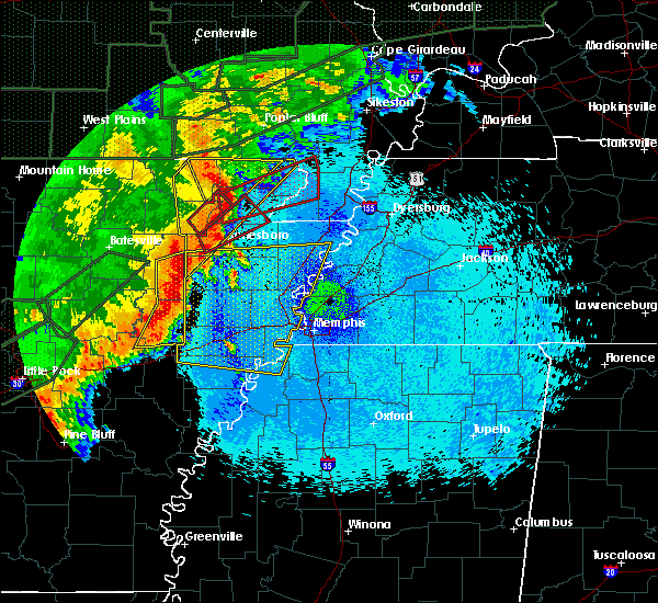 At 117 am cdt, a severe thunderstorm producing a tornado was located near beech grove, or near crowleys ridge state park, moving northeast at 55 mph (radar indicated rotation). Hazards include tornado. Flying debris will be dangerous to those caught without shelter. mobile homes will be damaged or destroyed. damage to roofs, windows, and vehicles will occur. tree damage is likely. this dangerous storm will be near, oak grove heights and lafe around 125 am cdt. marmaduke around 135 am cdt. rector around 140 am cdt. greenway around 150 am cdt. kennett around 155 am cdt. holcomb around 200 am cdt. Other locations impacted by this tornadic thunderstorm include ipley, octa, scobeville, stonewall, vincit, heubner, fritz, bard, case and lorine. At 117 am cdt, a severe thunderstorm producing a tornado was located near beech grove, or near crowleys ridge state park, moving northeast at 55 mph (radar indicated rotation). Hazards include tornado. Flying debris will be dangerous to those caught without shelter. mobile homes will be damaged or destroyed. damage to roofs, windows, and vehicles will occur. tree damage is likely. this dangerous storm will be near, oak grove heights and lafe around 125 am cdt. marmaduke around 135 am cdt. rector around 140 am cdt. greenway around 150 am cdt. kennett around 155 am cdt. holcomb around 200 am cdt. Other locations impacted by this tornadic thunderstorm include ipley, octa, scobeville, stonewall, vincit, heubner, fritz, bard, case and lorine.
|
| 4/30/2017 12:52 AM CDT |
 At 1252 am cdt, severe thunderstorms were located along a line extending from near attica to near minturn, moving northeast at 55 mph (radar indicated). Hazards include 60 mph wind gusts and quarter size hail. Hail damage to vehicles is expected. Expect wind damage to roofs, siding, and trees. At 1252 am cdt, severe thunderstorms were located along a line extending from near attica to near minturn, moving northeast at 55 mph (radar indicated). Hazards include 60 mph wind gusts and quarter size hail. Hail damage to vehicles is expected. Expect wind damage to roofs, siding, and trees.
|
| 4/29/2017 8:18 PM CDT |
 At 817 pm cdt, a severe thunderstorm was located over caraway, moving northeast at 40 mph (radar indicated). Hazards include 60 mph wind gusts. expect damage to roofs, siding, and trees At 817 pm cdt, a severe thunderstorm was located over caraway, moving northeast at 40 mph (radar indicated). Hazards include 60 mph wind gusts. expect damage to roofs, siding, and trees
|
| 3/25/2017 1:48 AM CDT |
 At 148 am cdt, a severe thunderstorm was located near greenway, or near piggott, moving northeast at 60 mph (radar indicated). Hazards include 60 mph wind gusts. Expect damage to roofs, siding, and trees. Locations impacted include, blytheville, kennett, trumann, piggott, gosnell, manila, lake city, leachville, rector, lepanto, senath, monette, caraway, marmaduke, cardwell, hornersville, arbyrd, dell, pollard and greenway. At 148 am cdt, a severe thunderstorm was located near greenway, or near piggott, moving northeast at 60 mph (radar indicated). Hazards include 60 mph wind gusts. Expect damage to roofs, siding, and trees. Locations impacted include, blytheville, kennett, trumann, piggott, gosnell, manila, lake city, leachville, rector, lepanto, senath, monette, caraway, marmaduke, cardwell, hornersville, arbyrd, dell, pollard and greenway.
|
| 3/25/2017 1:36 AM CDT |
 At 135 am cdt, a severe thunderstorm was located over marmaduke, moving northeast at 60 mph (radar indicated). Hazards include 60 mph wind gusts. Expect damage to roofs, siding, and trees. Locations impacted include, jonesboro, paragould, blytheville, kennett, trumann, piggott, gosnell, manila, harrisburg, lake city, leachville, rector, lepanto, bay, senath, brookland, monette, caraway, marmaduke and oak grove heights. At 135 am cdt, a severe thunderstorm was located over marmaduke, moving northeast at 60 mph (radar indicated). Hazards include 60 mph wind gusts. Expect damage to roofs, siding, and trees. Locations impacted include, jonesboro, paragould, blytheville, kennett, trumann, piggott, gosnell, manila, harrisburg, lake city, leachville, rector, lepanto, bay, senath, brookland, monette, caraway, marmaduke and oak grove heights.
|
| 3/25/2017 1:23 AM CDT |
 At 123 am cdt, a severe thunderstorm was located over paragould, moving northeast at 60 mph (radar indicated). Hazards include 60 mph wind gusts. Expect damage to roofs, siding, and trees. Locations impacted include, jonesboro, paragould, blytheville, kennett, trumann, piggott, gosnell, manila, harrisburg, lake city, leachville, rector, lepanto, bay, senath, brookland, monette, caraway, marmaduke and crowleys ridge state park. At 123 am cdt, a severe thunderstorm was located over paragould, moving northeast at 60 mph (radar indicated). Hazards include 60 mph wind gusts. Expect damage to roofs, siding, and trees. Locations impacted include, jonesboro, paragould, blytheville, kennett, trumann, piggott, gosnell, manila, harrisburg, lake city, leachville, rector, lepanto, bay, senath, brookland, monette, caraway, marmaduke and crowleys ridge state park.
|
| 3/25/2017 1:08 AM CDT |
 At 107 am cdt, a severe thunderstorm was located over bono, moving northeast at 60 mph (radar indicated). Hazards include 60 mph wind gusts. expect damage to roofs, siding, and trees At 107 am cdt, a severe thunderstorm was located over bono, moving northeast at 60 mph (radar indicated). Hazards include 60 mph wind gusts. expect damage to roofs, siding, and trees
|
| 3/9/2017 8:10 PM CST |
 At 810 pm cst, severe thunderstorms were located along a line extending from near wardell to 6 miles south of mcdougal to near maynard, moving southeast at 40 mph (radar indicated). Hazards include 60 mph wind gusts and quarter size hail. Hail damage to vehicles is expected. Expect wind damage to roofs, siding, and trees. At 810 pm cst, severe thunderstorms were located along a line extending from near wardell to 6 miles south of mcdougal to near maynard, moving southeast at 40 mph (radar indicated). Hazards include 60 mph wind gusts and quarter size hail. Hail damage to vehicles is expected. Expect wind damage to roofs, siding, and trees.
|
| 3/7/2017 3:30 AM CST |
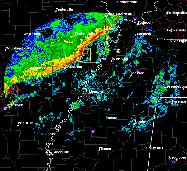 At 330 am cst, a severe thunderstorm was located near rector, moving east at 60 mph (radar indicated). Hazards include 60 mph wind gusts and quarter size hail. Hail damage to vehicles is expected. expect wind damage to roofs, siding, and trees. locations impacted include, kennett, rector, senath, marmaduke, cardwell, hornersville, holcomb, arbyrd, greenway, nimmons, heubner, fritz, bard, lorine, mounds, west kennett, leonard, bell city, pratt and noland. A tornado watch remains in effect until 500 am cst for eastern arkansas, and southeastern missouri. At 330 am cst, a severe thunderstorm was located near rector, moving east at 60 mph (radar indicated). Hazards include 60 mph wind gusts and quarter size hail. Hail damage to vehicles is expected. expect wind damage to roofs, siding, and trees. locations impacted include, kennett, rector, senath, marmaduke, cardwell, hornersville, holcomb, arbyrd, greenway, nimmons, heubner, fritz, bard, lorine, mounds, west kennett, leonard, bell city, pratt and noland. A tornado watch remains in effect until 500 am cst for eastern arkansas, and southeastern missouri.
|
| 3/7/2017 3:07 AM CST |
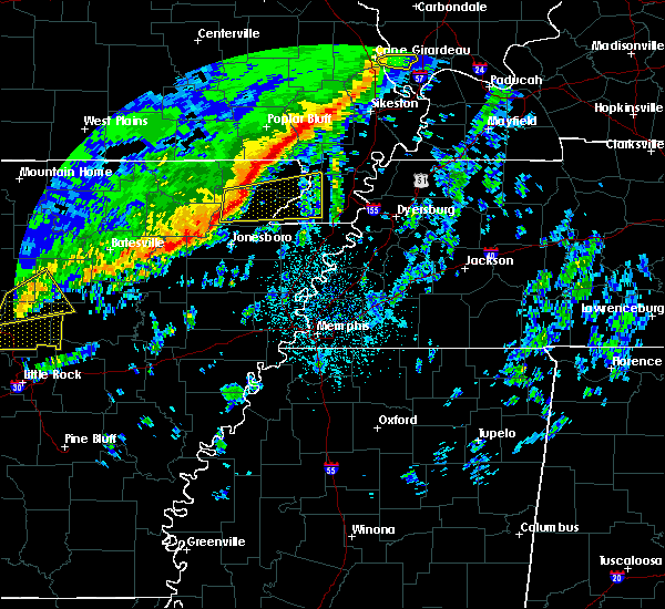 At 307 am cst, a severe thunderstorm was located over beech grove, or 9 miles northwest of paragould, moving east at 50 mph (radar indicated). Hazards include 60 mph wind gusts and quarter size hail. Hail damage to vehicles is expected. Expect wind damage to roofs, siding, and trees. At 307 am cst, a severe thunderstorm was located over beech grove, or 9 miles northwest of paragould, moving east at 50 mph (radar indicated). Hazards include 60 mph wind gusts and quarter size hail. Hail damage to vehicles is expected. Expect wind damage to roofs, siding, and trees.
|
| 3/1/2017 4:05 AM CST |
 At 403 am cst, severe thunderstorms were located along a line extending from near neelyville to rector to near monette, moving east at 70 mph (radar indicated). Hazards include 75 mph wind gusts. Expect considerable tree damage. damage is likely to mobile homes, roofs, and outbuildings. a 58 58 mph gust was reported at corning at 355 am cst. locations impacted include, paragould, piggott, corning, rector, marmaduke, chalk bluff natural area, oak grove heights, lafe, knobel, pollard, greenway, mcdougal, beech grove, crockett, nimmons, stonewall, heubner, tipperary, fritz and hickoria. A tornado watch remains in effect until 800 am cst for eastern arkansas, and southeastern missouri. At 403 am cst, severe thunderstorms were located along a line extending from near neelyville to rector to near monette, moving east at 70 mph (radar indicated). Hazards include 75 mph wind gusts. Expect considerable tree damage. damage is likely to mobile homes, roofs, and outbuildings. a 58 58 mph gust was reported at corning at 355 am cst. locations impacted include, paragould, piggott, corning, rector, marmaduke, chalk bluff natural area, oak grove heights, lafe, knobel, pollard, greenway, mcdougal, beech grove, crockett, nimmons, stonewall, heubner, tipperary, fritz and hickoria. A tornado watch remains in effect until 800 am cst for eastern arkansas, and southeastern missouri.
|
| 3/1/2017 3:46 AM CST |
 At 345 am cst, severe thunderstorms were located along a line extending from near success to near evening star to near bono, moving east at 75 mph (radar indicated). Hazards include 75 mph wind gusts. Expect considerable tree damage. damage is likely to mobile homes, roofs, and outbuildings. thie line of severe thunderstorms produced a 76 mph gust at walnut ridge at 335 am cst. locations impacted include, paragould, piggott, corning, rector, marmaduke, chalk bluff natural area, crowleys ridge state park, lake frierson state park, oak grove heights, lafe, reyno, knobel, pollard, greenway, mcdougal, success, peach orchard, delaplaine, datto and evening star. A tornado watch remains in effect until 800 am cst for eastern arkansas, and southeastern missouri. At 345 am cst, severe thunderstorms were located along a line extending from near success to near evening star to near bono, moving east at 75 mph (radar indicated). Hazards include 75 mph wind gusts. Expect considerable tree damage. damage is likely to mobile homes, roofs, and outbuildings. thie line of severe thunderstorms produced a 76 mph gust at walnut ridge at 335 am cst. locations impacted include, paragould, piggott, corning, rector, marmaduke, chalk bluff natural area, crowleys ridge state park, lake frierson state park, oak grove heights, lafe, reyno, knobel, pollard, greenway, mcdougal, success, peach orchard, delaplaine, datto and evening star. A tornado watch remains in effect until 800 am cst for eastern arkansas, and southeastern missouri.
|
| 3/1/2017 3:41 AM CST |
 At 340 am cst, severe thunderstorms were located along a line extending from 6 miles north of maynard to near o`kean to near bono, moving east at 70 mph (radar indicated). Hazards include 75 mph wind gusts. Expect considerable tree damage. damage is likely to mobile homes, roofs, and outbuildings. thie line of severe thunderstorms produced a 76 mph gust at walnut ridge at 335 am cst. locations impacted include, paragould, piggott, corning, rector, marmaduke, chalk bluff natural area, crowleys ridge state park, lake frierson state park, oak grove heights, lafe, reyno, knobel, pollard, greenway, mcdougal, success, peach orchard, delaplaine, datto and evening star. A tornado watch remains in effect until 800 am cst for eastern arkansas, and southeastern missouri. At 340 am cst, severe thunderstorms were located along a line extending from 6 miles north of maynard to near o`kean to near bono, moving east at 70 mph (radar indicated). Hazards include 75 mph wind gusts. Expect considerable tree damage. damage is likely to mobile homes, roofs, and outbuildings. thie line of severe thunderstorms produced a 76 mph gust at walnut ridge at 335 am cst. locations impacted include, paragould, piggott, corning, rector, marmaduke, chalk bluff natural area, crowleys ridge state park, lake frierson state park, oak grove heights, lafe, reyno, knobel, pollard, greenway, mcdougal, success, peach orchard, delaplaine, datto and evening star. A tornado watch remains in effect until 800 am cst for eastern arkansas, and southeastern missouri.
|
| 3/1/2017 3:28 AM CST |
 At 328 am cst, severe thunderstorms were located along a line extending from near dalton to 6 miles northwest of college city to near alicia, moving east at 70 mph (radar indicated). Hazards include 60 mph wind gusts. expect damage to roofs, siding, and trees At 328 am cst, severe thunderstorms were located along a line extending from near dalton to 6 miles northwest of college city to near alicia, moving east at 70 mph (radar indicated). Hazards include 60 mph wind gusts. expect damage to roofs, siding, and trees
|
| 2/7/2017 3:37 AM CST |
 At 336 am cst, a severe thunderstorm was located over alicia, or 11 miles south of lake charles state park, moving east at 60 mph (radar indicated). Hazards include 60 mph wind gusts and quarter size hail. Hail damage to vehicles is expected. Expect wind damage to roofs, siding, and trees. At 336 am cst, a severe thunderstorm was located over alicia, or 11 miles south of lake charles state park, moving east at 60 mph (radar indicated). Hazards include 60 mph wind gusts and quarter size hail. Hail damage to vehicles is expected. Expect wind damage to roofs, siding, and trees.
|
| 12/17/2016 4:31 PM CST |
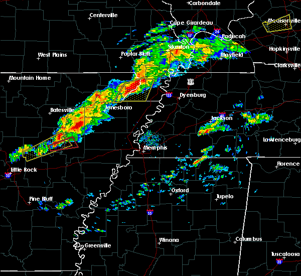 At 431 pm cst, a severe thunderstorm was located near rector, moving northeast at 35 mph (radar indicated). Hazards include 60 mph wind gusts and quarter size hail. Hail damage to vehicles is expected. expect wind damage to roofs, siding, and trees. locations impacted include, paragould, kennett, rector, senath, marmaduke, cardwell, hornersville, holcomb, arbyrd, wardell, greenway, deering, bragg city, nimmons, brighton, bethel, west kennett, bell city, leonard and halliday. A tornado watch remains in effect until 900 pm cst for eastern arkansas, and southeastern missouri. At 431 pm cst, a severe thunderstorm was located near rector, moving northeast at 35 mph (radar indicated). Hazards include 60 mph wind gusts and quarter size hail. Hail damage to vehicles is expected. expect wind damage to roofs, siding, and trees. locations impacted include, paragould, kennett, rector, senath, marmaduke, cardwell, hornersville, holcomb, arbyrd, wardell, greenway, deering, bragg city, nimmons, brighton, bethel, west kennett, bell city, leonard and halliday. A tornado watch remains in effect until 900 pm cst for eastern arkansas, and southeastern missouri.
|
| 12/17/2016 4:27 PM CST |
 At 426 pm cst, a severe thunderstorm was located near rector, moving northeast at 35 mph (radar indicated). Hazards include 60 mph wind gusts and quarter size hail. Hail damage to vehicles is expected. Expect wind damage to roofs, siding, and trees. At 426 pm cst, a severe thunderstorm was located near rector, moving northeast at 35 mph (radar indicated). Hazards include 60 mph wind gusts and quarter size hail. Hail damage to vehicles is expected. Expect wind damage to roofs, siding, and trees.
|
| 12/17/2016 2:43 PM CST |
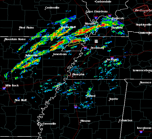 At 243 pm cst, a severe thunderstorm was located over lafe, or near marmaduke, moving northeast at 45 mph (radar indicated). Hazards include 60 mph wind gusts and quarter size hail. Hail damage to vehicles is expected. Expect wind damage to roofs, siding, and trees. At 243 pm cst, a severe thunderstorm was located over lafe, or near marmaduke, moving northeast at 45 mph (radar indicated). Hazards include 60 mph wind gusts and quarter size hail. Hail damage to vehicles is expected. Expect wind damage to roofs, siding, and trees.
|
| 9/18/2016 5:47 PM CDT |
 At 546 pm cdt, a severe thunderstorm was located near walcott, or near crowleys ridge state park, moving southeast at 30 mph (radar indicated). Hazards include 60 mph wind gusts and quarter size hail. Hail damage to vehicles is expected. Expect wind damage to roofs, siding, and trees. At 546 pm cdt, a severe thunderstorm was located near walcott, or near crowleys ridge state park, moving southeast at 30 mph (radar indicated). Hazards include 60 mph wind gusts and quarter size hail. Hail damage to vehicles is expected. Expect wind damage to roofs, siding, and trees.
|
| 7/28/2016 7:10 PM CDT |
 The severe thunderstorm warning for east central greene and southern dunklin counties will expire at 715 pm cdt, the storm which prompted the warning has weakened below severe limits, and no longer pose an immediate threat to life or property. therefore, the warning will be allowed to expire. The severe thunderstorm warning for east central greene and southern dunklin counties will expire at 715 pm cdt, the storm which prompted the warning has weakened below severe limits, and no longer pose an immediate threat to life or property. therefore, the warning will be allowed to expire.
|
| 7/28/2016 6:52 PM CDT |
 At 652 pm cdt, a severe thunderstorm was located near arbyrd, or near senath, moving southeast at 5 mph (radar indicated). Hazards include 60 mph wind gusts. Expect damage to roofs. siding. and trees. Locations impacted include, senath, marmaduke, cardwell, hornersville, arbyrd, fritz, bertig, brighton, mounds, rives, sunrise, caruth, paulding, hollywood, buck donic, dillman, europa, octa, gilbert and cotton plant. At 652 pm cdt, a severe thunderstorm was located near arbyrd, or near senath, moving southeast at 5 mph (radar indicated). Hazards include 60 mph wind gusts. Expect damage to roofs. siding. and trees. Locations impacted include, senath, marmaduke, cardwell, hornersville, arbyrd, fritz, bertig, brighton, mounds, rives, sunrise, caruth, paulding, hollywood, buck donic, dillman, europa, octa, gilbert and cotton plant.
|
| 7/28/2016 6:29 PM CDT |
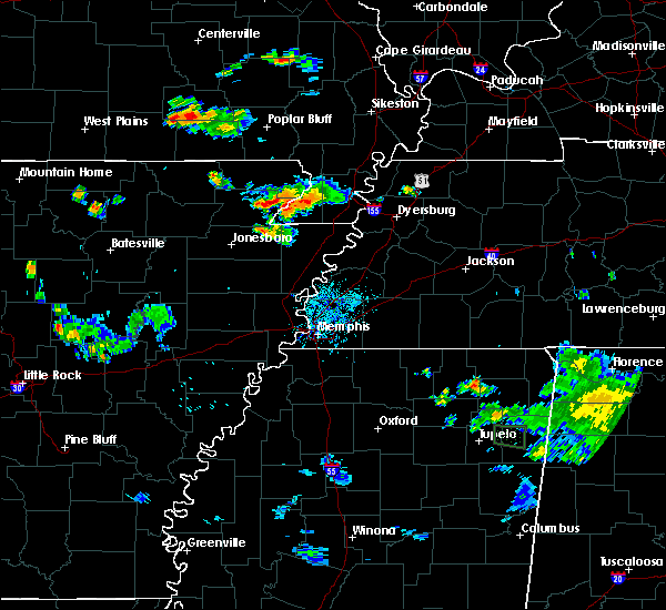 At 629 pm cdt, a severe thunderstorm was located near senath, moving southeast at 5 mph (radar indicated). Hazards include 60 mph wind gusts and quarter size hail. Hail damage to vehicles is expected. Expect wind damage to roofs, siding, and trees. At 629 pm cdt, a severe thunderstorm was located near senath, moving southeast at 5 mph (radar indicated). Hazards include 60 mph wind gusts and quarter size hail. Hail damage to vehicles is expected. Expect wind damage to roofs, siding, and trees.
|
| 6/15/2016 6:15 PM CDT |
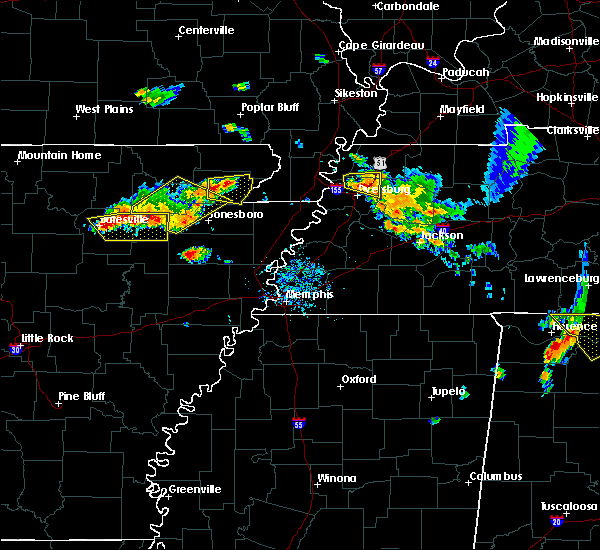 At 615 pm cdt, a severe thunderstorm was located near beech grove, or near crowleys ridge state park, moving east at 20 mph (radar indicated). Hazards include 60 mph wind gusts and quarter size hail. Hail damage to vehicles is expected. Expect wind damage to roofs, siding, and trees. At 615 pm cdt, a severe thunderstorm was located near beech grove, or near crowleys ridge state park, moving east at 20 mph (radar indicated). Hazards include 60 mph wind gusts and quarter size hail. Hail damage to vehicles is expected. Expect wind damage to roofs, siding, and trees.
|
| 3/31/2016 10:59 AM CDT |
 At 1059 am cdt, severe thunderstorms were located along a line extending from near rector to near leachville, moving east at 50 mph (radar indicated). Hazards include 60 mph wind gusts and quarter size hail. Hail damage to vehicles is expected. Expect wind damage to roofs, siding, and trees. At 1059 am cdt, severe thunderstorms were located along a line extending from near rector to near leachville, moving east at 50 mph (radar indicated). Hazards include 60 mph wind gusts and quarter size hail. Hail damage to vehicles is expected. Expect wind damage to roofs, siding, and trees.
|
| 3/31/2016 10:59 AM CDT |
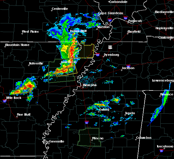 At 1059 am cdt, severe thunderstorms were located along a line extending from near rector to near leachville, moving east at 50 mph (radar indicated). Hazards include 60 mph wind gusts and quarter size hail. Hail damage to vehicles is expected. Expect wind damage to roofs, siding, and trees. At 1059 am cdt, severe thunderstorms were located along a line extending from near rector to near leachville, moving east at 50 mph (radar indicated). Hazards include 60 mph wind gusts and quarter size hail. Hail damage to vehicles is expected. Expect wind damage to roofs, siding, and trees.
|
| 12/23/2015 1:30 PM CST | At 130 pm cst, a severe thunderstorm was located over st. francis, or over campbell, moving northeast at 70 mph (radar indicated). Hazards include 60 mph wind gusts and nickel size hail. Expect damage to roofs. siding and trees. this severe storm will be near, clarkton around 135 pm cst. malden and malden around 140 pm cst. other locations impacted by this severe thunderstorm include fritz, bertig, nimmons, white oak, brighton, buck donic, west kennett, dillman, brian and bell city. A tornado watch remains in effect until 500 pm cst for eastern arkansas and southeastern missouri. |
| 12/23/2015 1:30 PM CST | At 130 pm cst, a severe thunderstorm was located over st. francis, or over campbell, moving northeast at 70 mph (radar indicated). Hazards include 60 mph wind gusts and nickel size hail. Expect damage to roofs. siding and trees. this severe storm will be near, clarkton around 135 pm cst. malden and malden around 140 pm cst. other locations impacted by this severe thunderstorm include fritz, bertig, nimmons, white oak, brighton, buck donic, west kennett, dillman, brian and bell city. A tornado watch remains in effect until 500 pm cst for eastern arkansas and southeastern missouri. |
| 12/23/2015 1:19 PM CST | At 119 pm cst, a severe thunderstorm was located near greenway, or near piggott, moving northeast at 70 mph (radar indicated). Hazards include 60 mph wind gusts and quarter size hail. Hail damage to vehicles is expected. expect wind damage to roofs, siding and trees. this severe storm will be near, chalk bluff natural area around 125 pm cst. st. francis and saint francis around 130 pm cst. campbell, clarkton and glennonville around 135 pm cst. malden and malden around 140 pm cst. other locations impacted by this severe thunderstorm include fritz, bertig, nimmons, white oak, goobertown, crockett, brighton, bethel, buck donic and west kennett. A tornado watch remains in effect until 500 pm cst for eastern arkansas and southeastern missouri. |
| 12/23/2015 1:19 PM CST | At 119 pm cst, a severe thunderstorm was located near greenway, or near piggott, moving northeast at 70 mph (radar indicated). Hazards include 60 mph wind gusts and quarter size hail. Hail damage to vehicles is expected. expect wind damage to roofs, siding and trees. this severe storm will be near, chalk bluff natural area around 125 pm cst. st. francis and saint francis around 130 pm cst. campbell, clarkton and glennonville around 135 pm cst. malden and malden around 140 pm cst. other locations impacted by this severe thunderstorm include fritz, bertig, nimmons, white oak, goobertown, crockett, brighton, bethel, buck donic and west kennett. A tornado watch remains in effect until 500 pm cst for eastern arkansas and southeastern missouri. |
| 12/23/2015 12:59 PM CST | At 1259 pm cst, a severe thunderstorm was located over beech grove, or near paragould, moving northeast at 60 mph (radar indicated). Hazards include 60 mph wind gusts and quarter size hail. Hail damage to vehicles is expected. expect wind damage to roofs, siding and trees. this severe thunderstorm will be near, lafe around 105 pm cst. marmaduke around 110 pm cst. rector around 115 pm cst. greenway around 120 pm cst. piggott and pollard around 125 pm cst. chalk bluff natural area, st. francis and saint francis around 130 pm cst. campbell, clarkton and glennonville around 135 pm cst. malden and malden around 140 pm cst. other locations impacted by this severe thunderstorm include nimmons, white oak, goobertown, crockett, brighton, bethel, west kennett, brian, bell city and scobeville. A tornado watch remains in effect until 500 pm cst for eastern arkansas and southeastern missouri. |
| 12/23/2015 12:59 PM CST | At 1259 pm cst, a severe thunderstorm was located over beech grove, or near paragould, moving northeast at 60 mph (radar indicated). Hazards include 60 mph wind gusts and quarter size hail. Hail damage to vehicles is expected. expect wind damage to roofs, siding and trees. this severe thunderstorm will be near, lafe around 105 pm cst. marmaduke around 110 pm cst. rector around 115 pm cst. greenway around 120 pm cst. piggott and pollard around 125 pm cst. chalk bluff natural area, st. francis and saint francis around 130 pm cst. campbell, clarkton and glennonville around 135 pm cst. malden and malden around 140 pm cst. other locations impacted by this severe thunderstorm include nimmons, white oak, goobertown, crockett, brighton, bethel, west kennett, brian, bell city and scobeville. A tornado watch remains in effect until 500 pm cst for eastern arkansas and southeastern missouri. |
| 12/23/2015 11:19 AM CST | At 1119 am cst, a severe thunderstorm was located near cardwell, or 7 miles east of paragould, moving northeast at 50 mph (radar indicated). Hazards include 60 mph wind gusts. Expect damage to roofs. siding and trees. this severe storm will be near, cardwell around 1125 am cst. other locations impacted by this severe thunderstorm include halliday, bertig, cotton belt, bard, gainesville, goobertown, brighton, schug, noxburn and bethel. A tornado watch remains in effect until 500 pm cst for eastern arkansas and southeastern missouri. |
| 12/23/2015 11:19 AM CST | At 1119 am cst, a severe thunderstorm was located near cardwell, or 7 miles east of paragould, moving northeast at 50 mph (radar indicated). Hazards include 60 mph wind gusts. Expect damage to roofs. siding and trees. this severe storm will be near, cardwell around 1125 am cst. other locations impacted by this severe thunderstorm include halliday, bertig, cotton belt, bard, gainesville, goobertown, brighton, schug, noxburn and bethel. A tornado watch remains in effect until 500 pm cst for eastern arkansas and southeastern missouri. |
| 12/23/2015 11:14 AM CST | At 1113 am cst, a severe thunderstorm was located near paragould, moving northeast at 45 mph (radar indicated). Hazards include 60 mph wind gusts. Expect damage to roofs. siding and trees. this severe storm will be near, cardwell around 1125 am cst. other locations impacted by this severe thunderstorm include herndon, halliday, bertig, bard, stanford, gainesville, goobertown, brighton, noxburn and bethel. A tornado watch remains in effect until 500 pm cst for eastern arkansas and southeastern missouri. |
| 12/23/2015 11:14 AM CST | At 1113 am cst, a severe thunderstorm was located near paragould, moving northeast at 45 mph (radar indicated). Hazards include 60 mph wind gusts. Expect damage to roofs. siding and trees. this severe storm will be near, cardwell around 1125 am cst. other locations impacted by this severe thunderstorm include herndon, halliday, bertig, bard, stanford, gainesville, goobertown, brighton, noxburn and bethel. A tornado watch remains in effect until 500 pm cst for eastern arkansas and southeastern missouri. |
| 12/23/2015 11:02 AM CST | At 1102 am cst, a severe thunderstorm was located near brookland, moving northeast at 50 mph (radar indicated). Hazards include 60 mph wind gusts. Expect damage to roofs. siding and trees. this severe thunderstorm will be near, paragould around 1120 am cst. cardwell around 1130 am cst. other locations impacted by this severe thunderstorm include herndon, garson, bertig, stanford, gainesville, goobertown, brighton, bethel, lester and buck donic. A tornado watch remains in effect until 500 pm cst for eastern arkansas and southeastern missouri. |
| 12/23/2015 11:02 AM CST | At 1102 am cst, a severe thunderstorm was located near brookland, moving northeast at 50 mph (radar indicated). Hazards include 60 mph wind gusts. Expect damage to roofs. siding and trees. this severe thunderstorm will be near, paragould around 1120 am cst. cardwell around 1130 am cst. other locations impacted by this severe thunderstorm include herndon, garson, bertig, stanford, gainesville, goobertown, brighton, bethel, lester and buck donic. A tornado watch remains in effect until 500 pm cst for eastern arkansas and southeastern missouri. |
| 6/5/2015 6:28 PM CDT | At 628 pm cdt, a severe thunderstorm was located near fontaine, or near lake frierson state park, moving southeast at 20 mph (public). Hazards include 60 mph wind gusts and quarter size hail. Hail damage to vehicles is expected. expect wind damage to roofs, siding and trees. Locations impacted include, jonesboro, paragould, walnut ridge, hoxie, bono, brookland, marmaduke, black rock, lake charles state park, lake frierson state park, crowleys ridge state park, oak grove heights, lafe, college city, portia, cash, strawberry, lynn, o`kean and alicia. |
| 6/5/2015 6:05 PM CDT | At 605 pm cdt, a severe thunderstorm was located over college city, or near walnut ridge, moving southeast at 20 mph (public). Hazards include 60 mph wind gusts and half dollar size hail. Hail damage to vehicles is expected. Expect wind damage to roofs, siding and trees. |
| 4/9/2015 7:07 PM CDT | A severe thunderstorm warning remains in effect until 745 pm cdt for northeastern greene. eastern clay and eastern dunklin counties. at 707 pm cdt. a severe thunderstorm was located over lafe. or 8 miles west of marmaduke. moving northeast at 50 mph. hazard. 60 mph wind gusts and quarter size hail. |
| 4/9/2015 7:07 PM CDT | A severe thunderstorm warning remains in effect until 745 pm cdt for northeastern greene. eastern clay and eastern dunklin counties. at 707 pm cdt. a severe thunderstorm was located over lafe. or 8 miles west of marmaduke. moving northeast at 50 mph. hazard. 60 mph wind gusts and quarter size hail. |
| 4/9/2015 6:59 PM CDT | The national weather service in memphis has issued a * severe thunderstorm warning for. greene county in eastern arkansas. eastern clay county in eastern arkansas. eastern dunklin county in southeastern missouri. Until 745 pm cdt. |
| 4/9/2015 6:59 PM CDT | The national weather service in memphis has issued a * severe thunderstorm warning for. greene county in eastern arkansas. eastern clay county in eastern arkansas. eastern dunklin county in southeastern missouri. Until 745 pm cdt. |
| 3/31/2015 9:07 PM CDT | The national weather service in memphis has issued a * severe thunderstorm warning for. northwestern mississippi county in eastern arkansas. eastern greene county in eastern arkansas. southeastern clay county in eastern arkansas. Southern dunklin county in southeastern missouri. |
| 3/31/2015 9:07 PM CDT | The national weather service in memphis has issued a * severe thunderstorm warning for. northwestern mississippi county in eastern arkansas. eastern greene county in eastern arkansas. southeastern clay county in eastern arkansas. Southern dunklin county in southeastern missouri. |
| 3/31/2015 5:35 PM CDT | The national weather service in memphis has issued a * severe thunderstorm warning for. northeastern greene county in eastern arkansas. southeastern clay county in eastern arkansas. southern dunklin county in southeastern missouri. Until 615 pm cdt. |
| 3/31/2015 5:35 PM CDT | The national weather service in memphis has issued a * severe thunderstorm warning for. northeastern greene county in eastern arkansas. southeastern clay county in eastern arkansas. southern dunklin county in southeastern missouri. Until 615 pm cdt. |
| 1/1/0001 12:00 AM | Severe winds blew an 18 wheel tractor trailer off of highway 49 between marmaduke and halida in greene county AR, 2.2 miles NE of Marmaduke, AR |
| 1/1/0001 12:00 AM | Semi truck turned over in hwy 49 between marmaduke and paragould. trees blown over on shed in greene county AR, 0.4 miles NE of Marmaduke, AR |
| 1/1/0001 12:00 AM | Quarter sized hail reported 2.5 miles S of Marmaduke, AR, law enforcement reports quarter size hail. |
| 1/1/0001 12:00 AM | Trees blocking roads countywid in greene county AR, 3.5 miles NE of Marmaduke, AR |
| 1/1/0001 12:00 AM | Trees blocking roads countywid in greene county AR, 4.3 miles NE of Marmaduke, AR |
| 1/1/0001 12:00 AM | Quarter sized hail reported 0.4 miles NE of Marmaduke, AR |
| 1/1/0001 12:00 AM | Storm damage reported in greene county AR, 0.4 miles NE of Marmaduke, AR |
Hail Maps for Marmaduke, AR


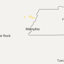
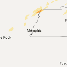


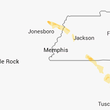


Connect with Interactive Hail Maps