

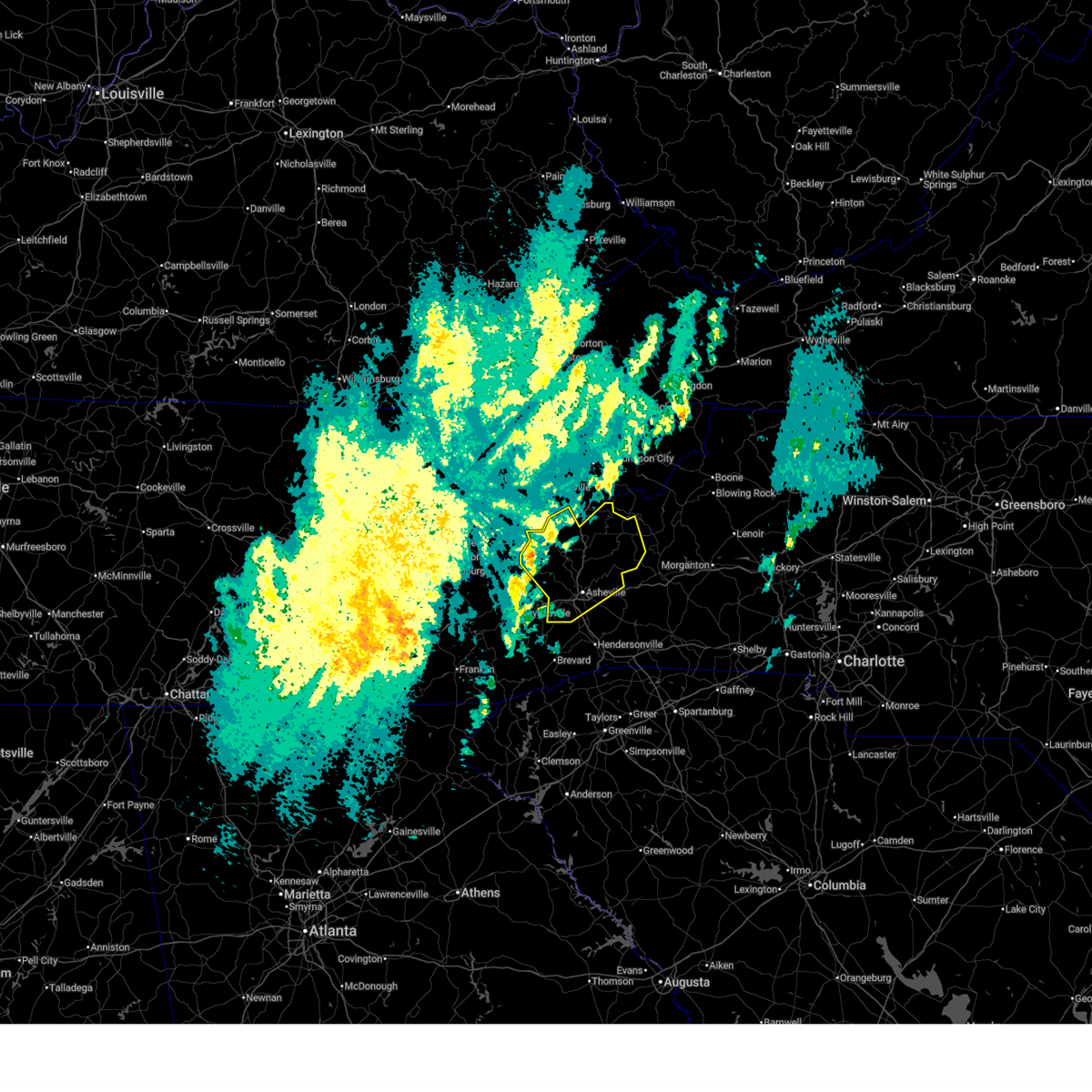
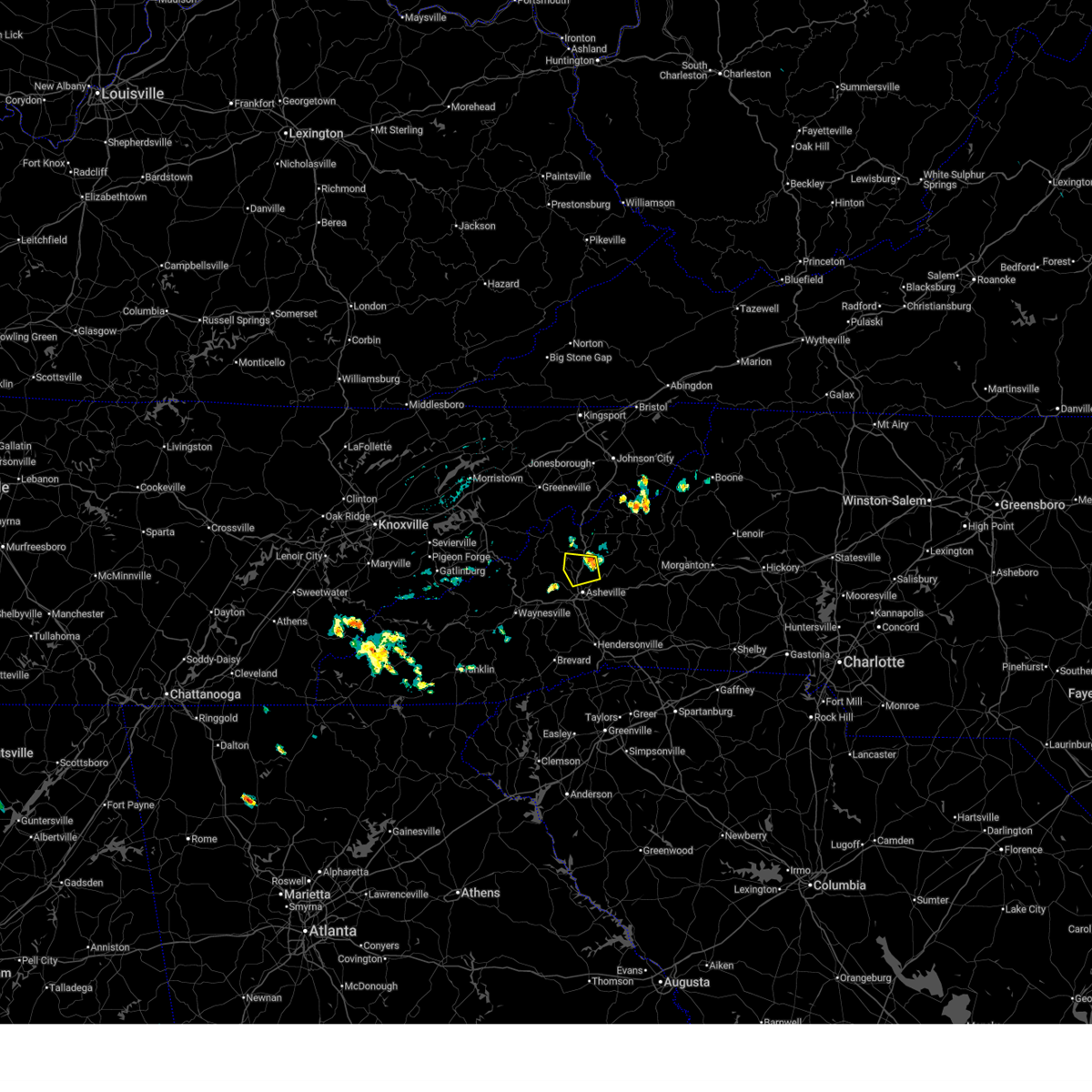
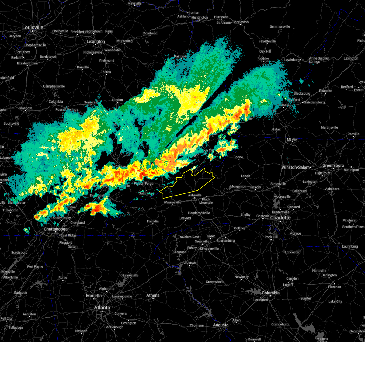
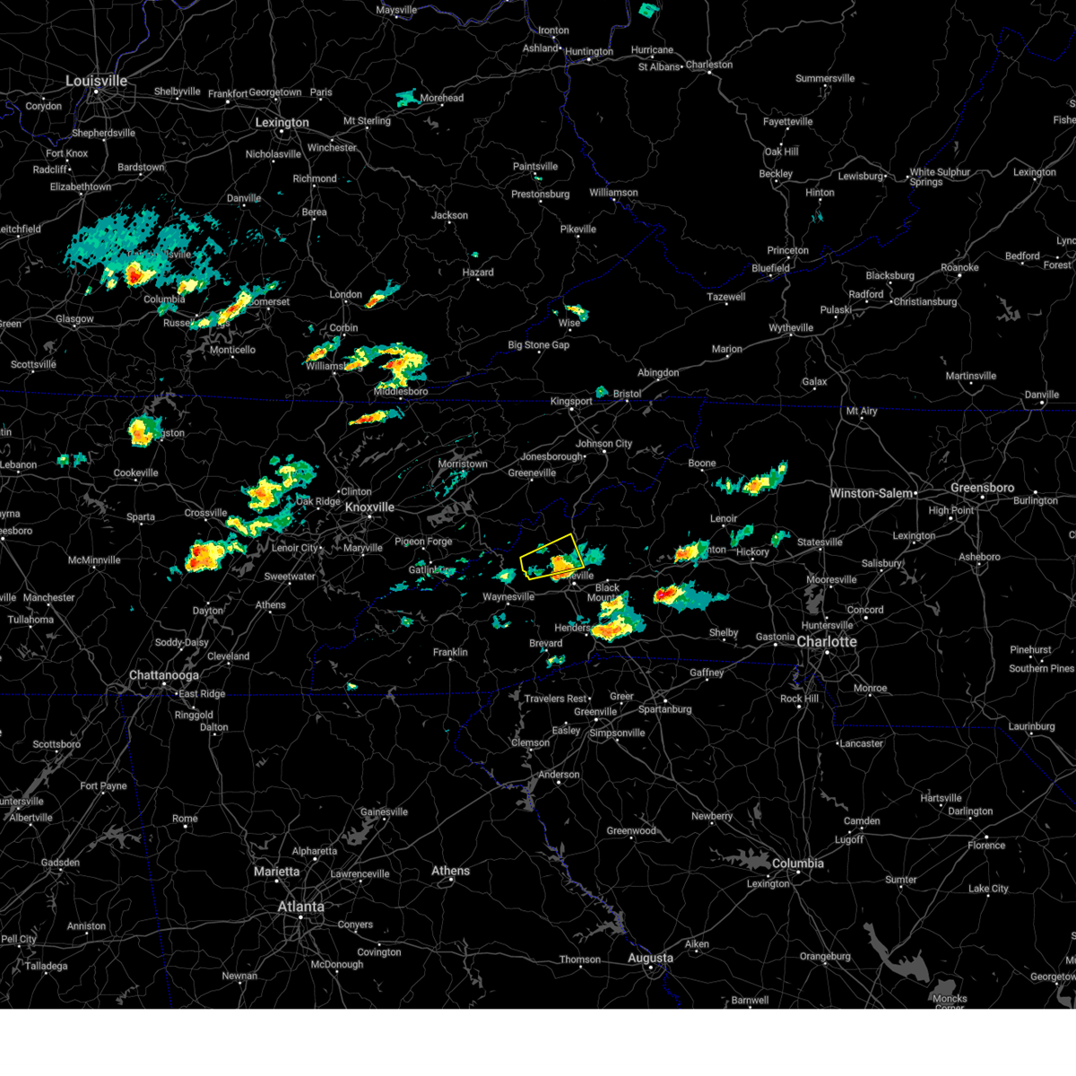
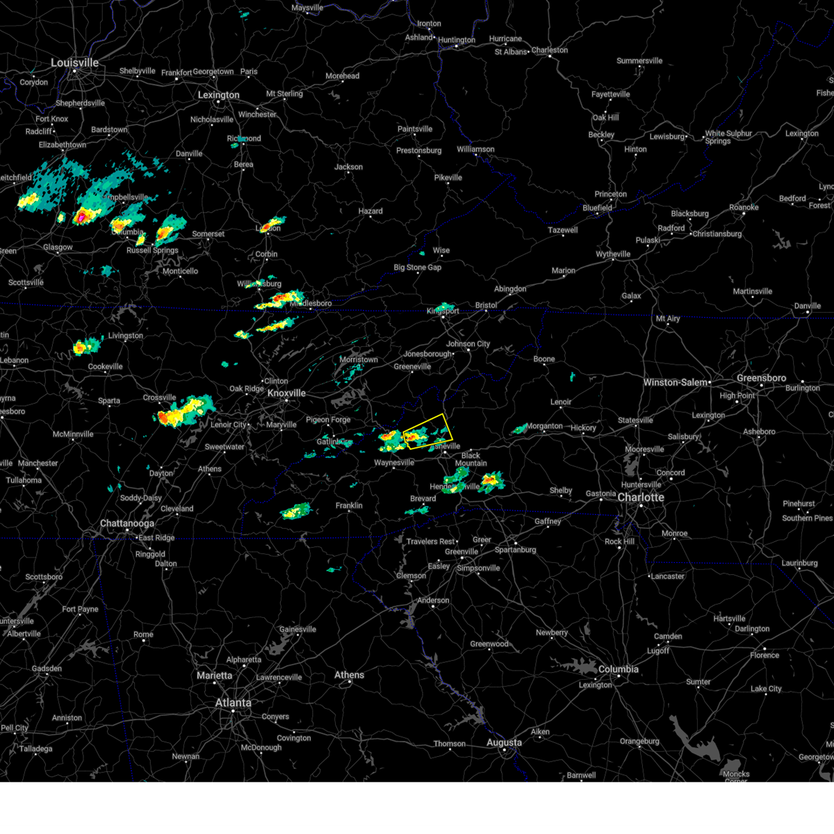
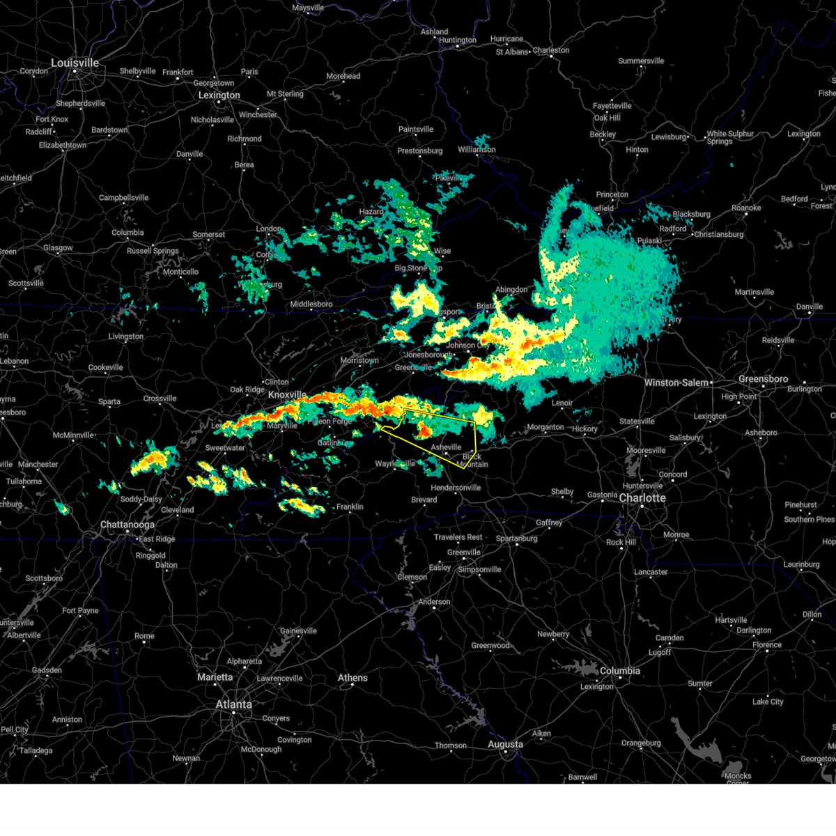
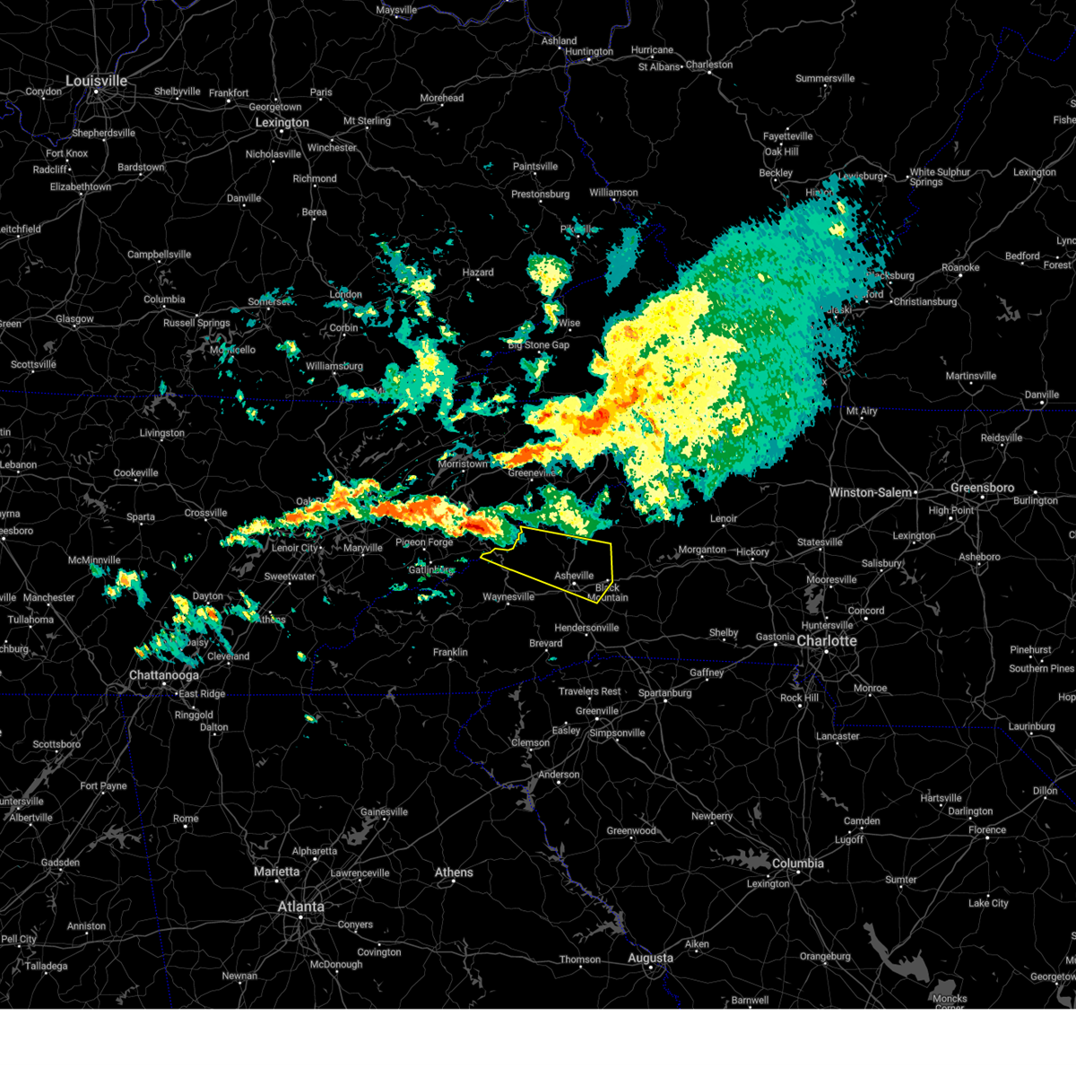
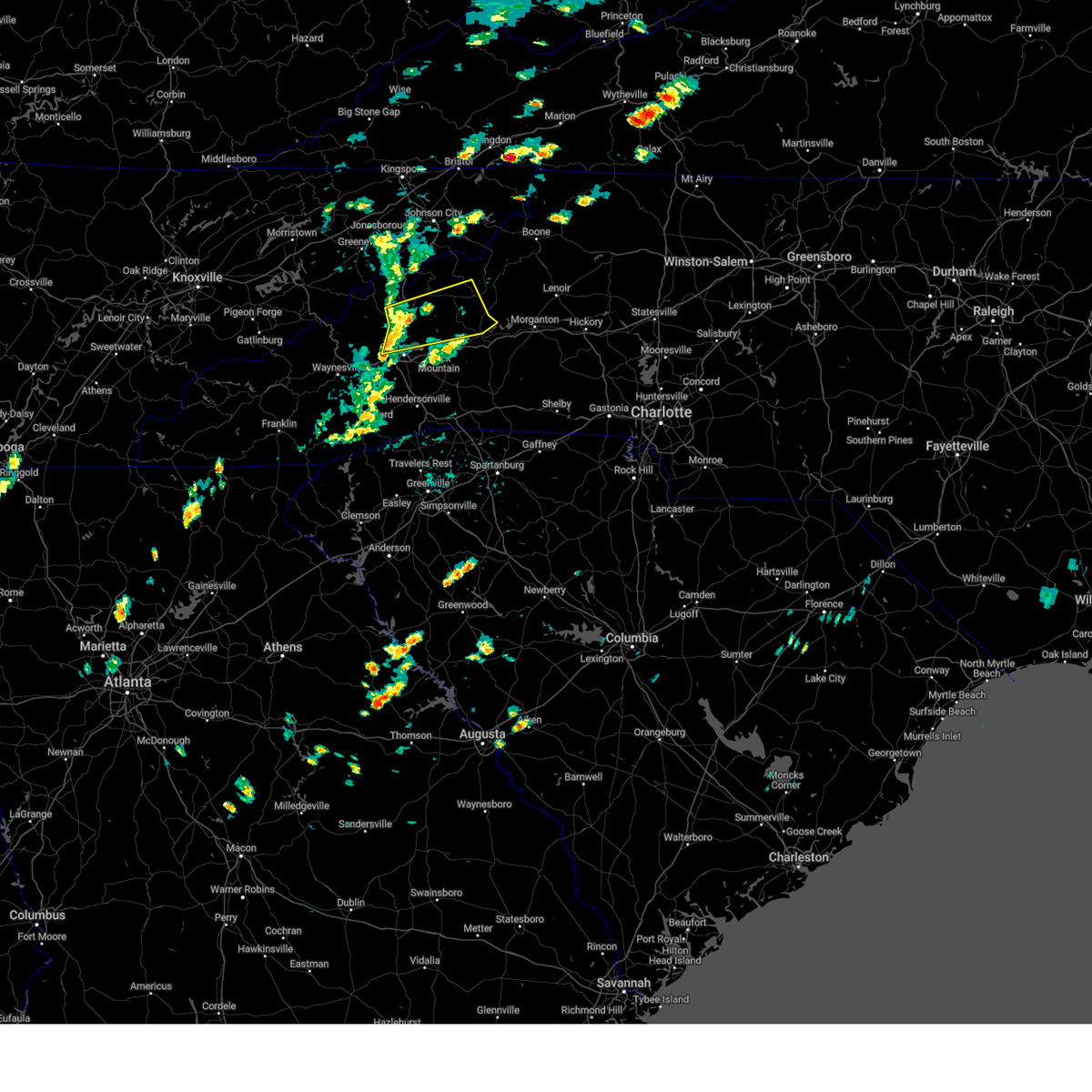
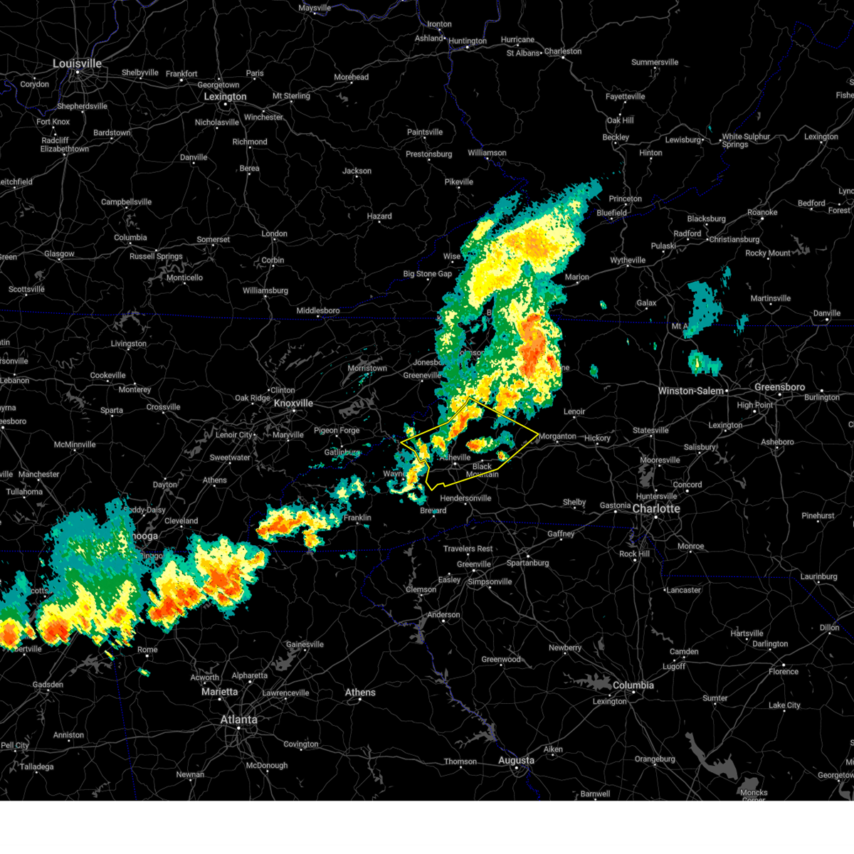
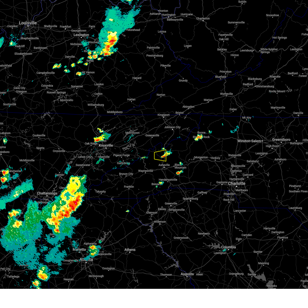
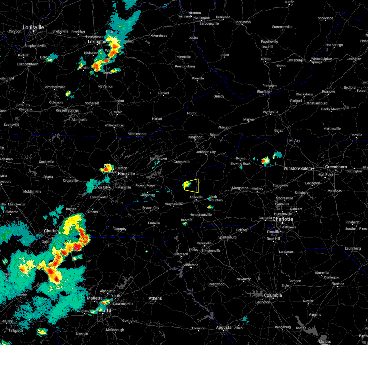
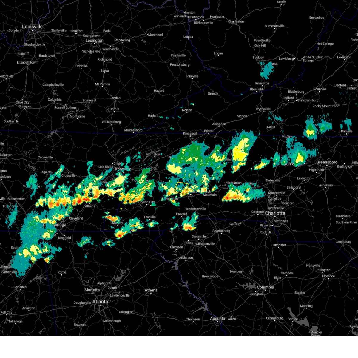
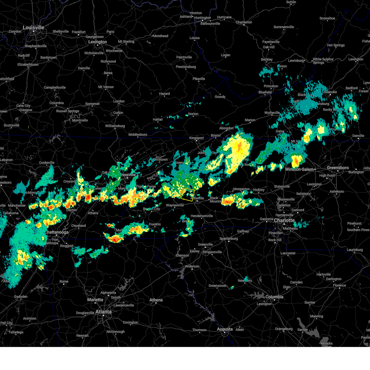
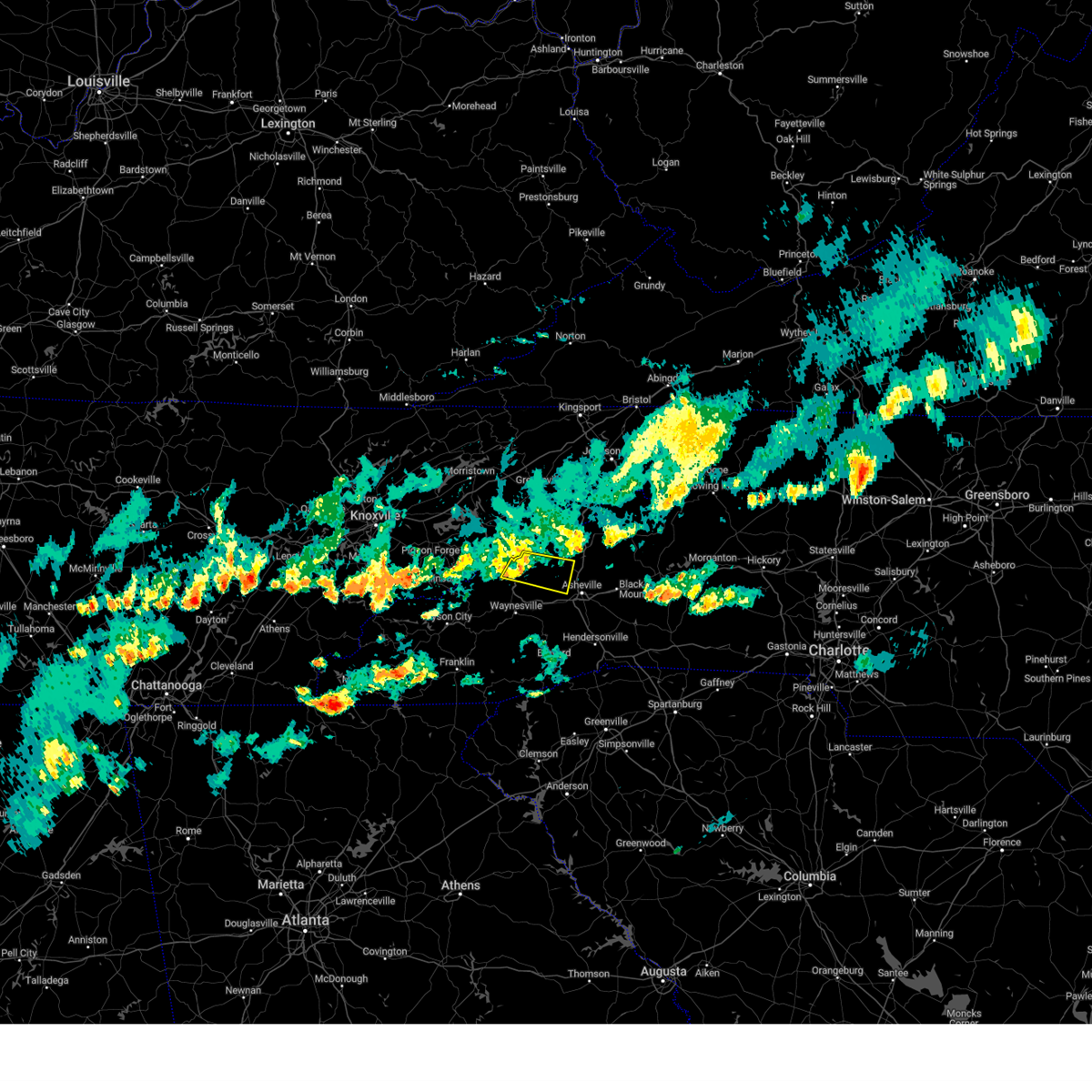
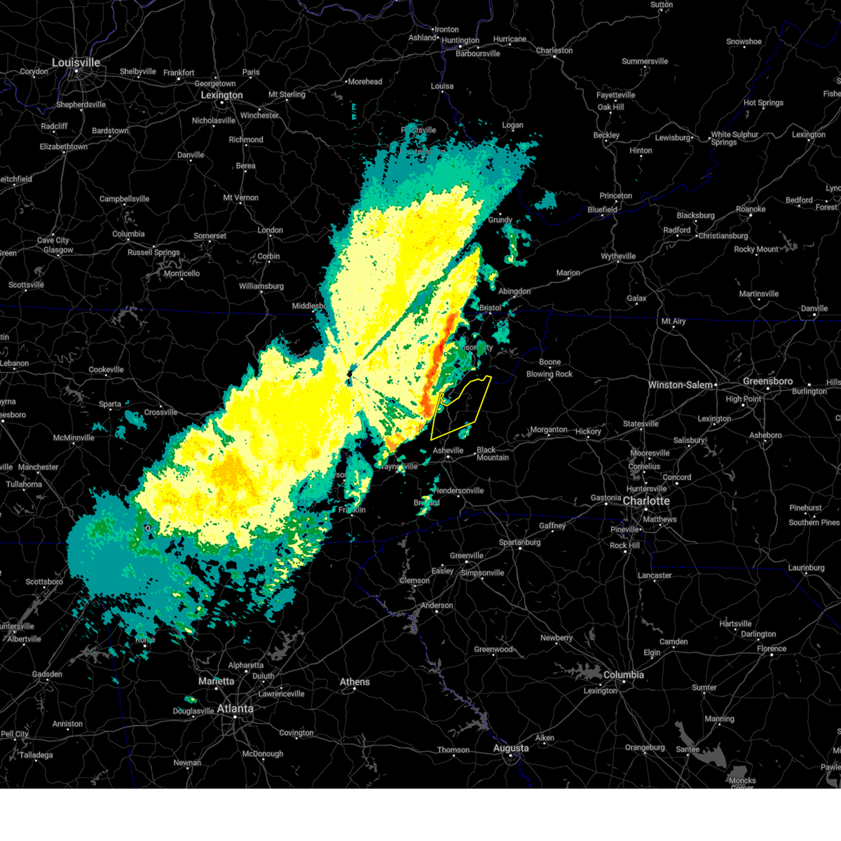
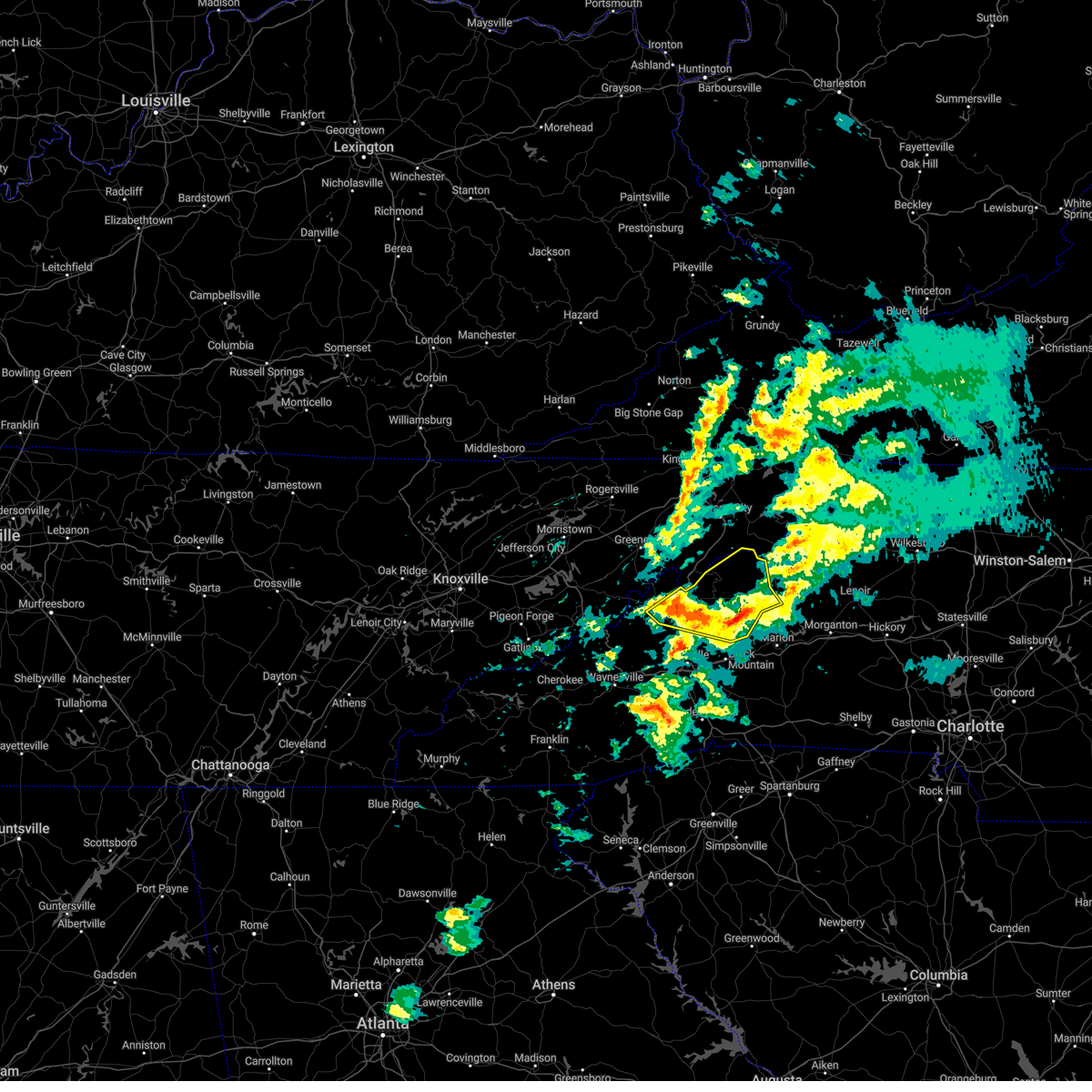
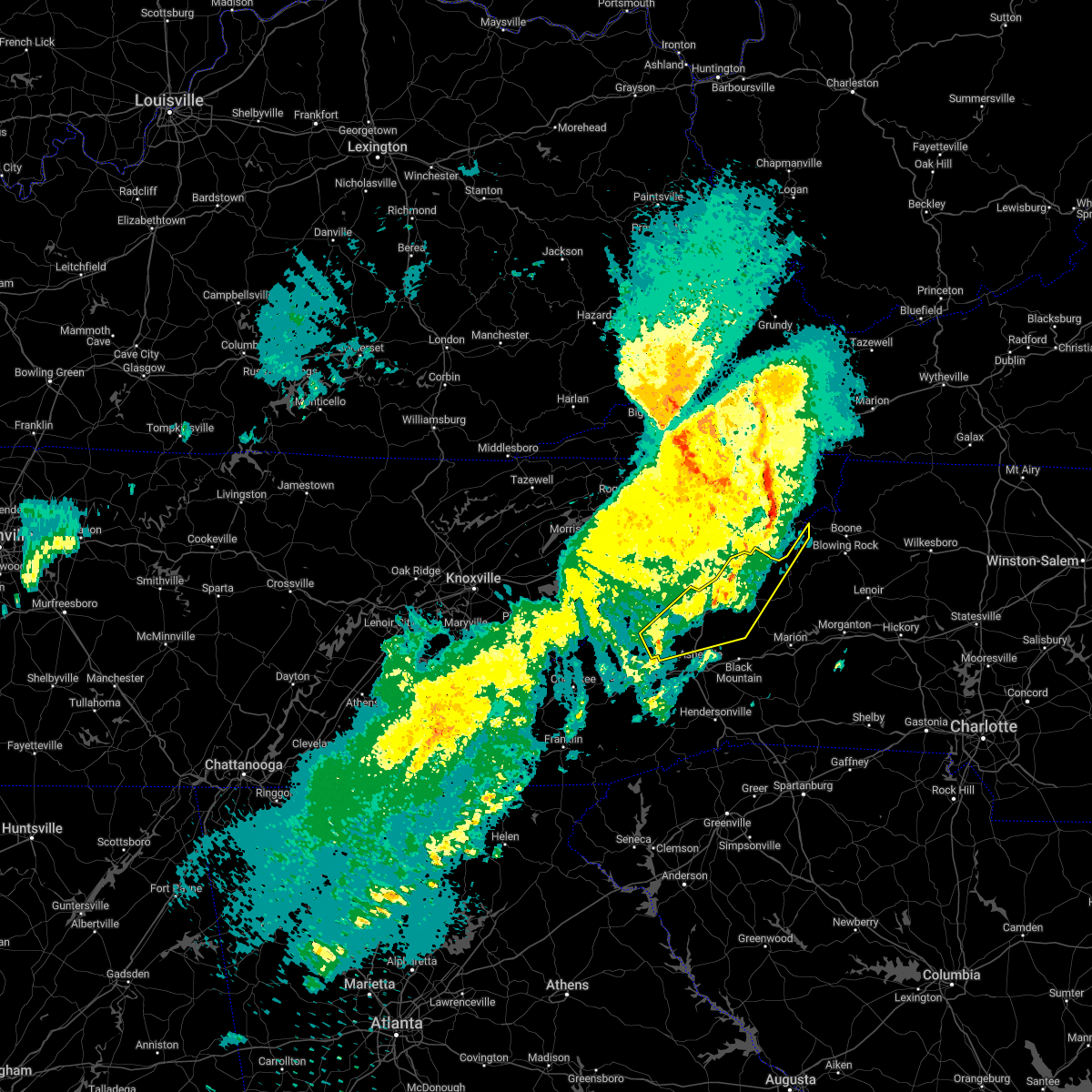
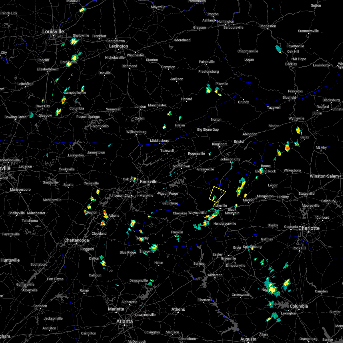
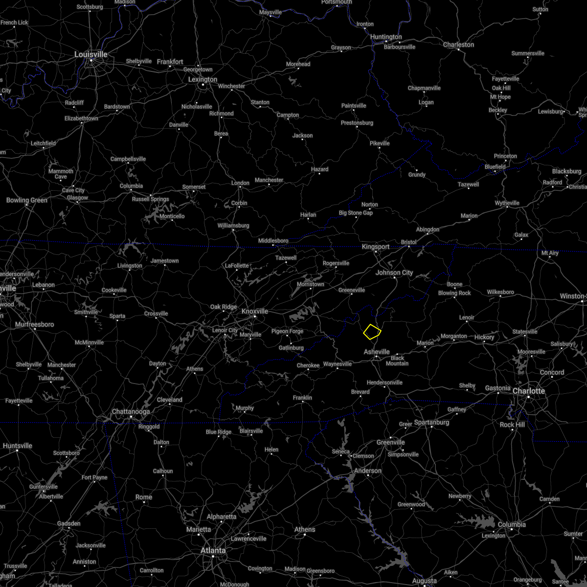
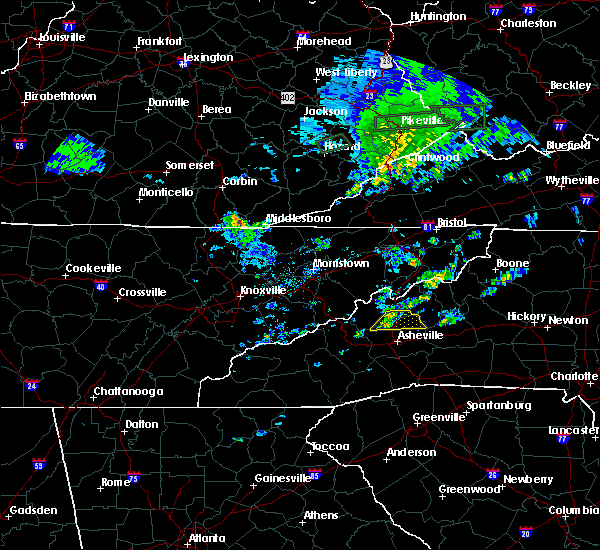
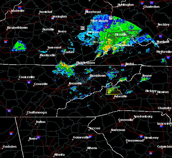
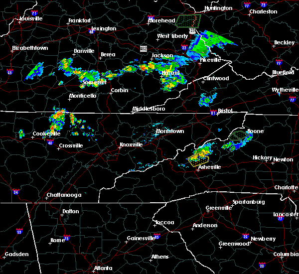
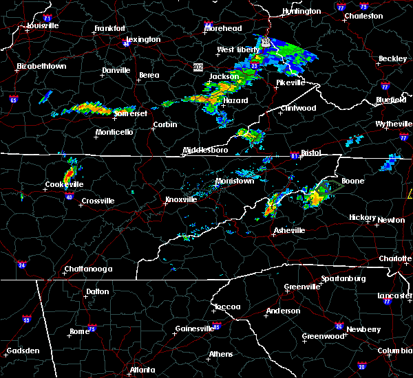
Hail Map for Marshall, NC
The Marshall, NC area has had 15 reports of on-the-ground hail by trained spotters, and has been under severe weather warnings 1 time during the past 12 months. Doppler radar has detected hail at or near Marshall, NC on 20 occasions.
| Name: | Marshall, NC |
| Where Located: | 60 miles SSW of Bristol, TN |
| Map: | Google Map for Marshall, NC |
| Population: | 872 |
| Housing Units: | 484 |
| More Info: | Search Google for Marshall, NC |
0
The Top Recent Hail Date for Marshall, NC is Thursday, February 6, 2025 (17th out of 20)

Hail and Wind Damage Spotted near Marshall, NC
| Date / Time | Report Details |
|---|---|
| 3/16/2026 6:40 AM EDT |
 Svrgsp the national weather service in greenville-spartanburg has issued a * severe thunderstorm warning for, madison county in western north carolina, buncombe county in western north carolina, yancey county in western north carolina, * until 745 am edt. * at 640 am edt, a severe thunderstorm was located 10 miles west of marshall, or 7 miles south of hot springs, moving northeast at 45 mph (radar indicated). Hazards include 60 mph wind gusts. expect damage to trees and power lines Svrgsp the national weather service in greenville-spartanburg has issued a * severe thunderstorm warning for, madison county in western north carolina, buncombe county in western north carolina, yancey county in western north carolina, * until 745 am edt. * at 640 am edt, a severe thunderstorm was located 10 miles west of marshall, or 7 miles south of hot springs, moving northeast at 45 mph (radar indicated). Hazards include 60 mph wind gusts. expect damage to trees and power lines
|
| 9/4/2025 1:38 PM EDT | Utility line damage leading to outages along culvin creek roa in madison county NC, 12.5 miles S of Marshall, NC |
| 6/27/2025 6:22 PM EDT | Social media video of several trees down approximately 5 miles wnw of weavervill in madison county NC, 4.2 miles NNW of Marshall, NC |
| 6/24/2025 4:14 PM EDT |
 Svrgsp the national weather service in greenville-spartanburg has issued a * severe thunderstorm warning for, southeastern madison county in western north carolina, north central buncombe county in western north carolina, * until 500 pm edt. * at 413 pm edt, a severe thunderstorm was located 9 miles north of downtown asheville, or 4 miles northeast of weaverville, moving west at 10 mph (radar indicated). Hazards include 60 mph wind gusts. expect damage to trees and power lines Svrgsp the national weather service in greenville-spartanburg has issued a * severe thunderstorm warning for, southeastern madison county in western north carolina, north central buncombe county in western north carolina, * until 500 pm edt. * at 413 pm edt, a severe thunderstorm was located 9 miles north of downtown asheville, or 4 miles northeast of weaverville, moving west at 10 mph (radar indicated). Hazards include 60 mph wind gusts. expect damage to trees and power lines
|
| 5/17/2025 2:56 AM EDT |
 Svrgsp the national weather service in greenville-spartanburg has issued a * severe thunderstorm warning for, madison county in western north carolina, northwestern buncombe county in western north carolina, northwestern haywood county in western north carolina, yancey county in western north carolina, * until 400 am edt. * at 255 am edt, severe thunderstorms were located along a line extending from 8 miles south of greeneville to 10 miles east of newport to near sevierville, moving southeast at 35 mph (radar indicated). Hazards include 60 mph wind gusts and quarter size hail. Minor hail damage to vehicles is expected. Expect wind damage to trees and power lines. Svrgsp the national weather service in greenville-spartanburg has issued a * severe thunderstorm warning for, madison county in western north carolina, northwestern buncombe county in western north carolina, northwestern haywood county in western north carolina, yancey county in western north carolina, * until 400 am edt. * at 255 am edt, severe thunderstorms were located along a line extending from 8 miles south of greeneville to 10 miles east of newport to near sevierville, moving southeast at 35 mph (radar indicated). Hazards include 60 mph wind gusts and quarter size hail. Minor hail damage to vehicles is expected. Expect wind damage to trees and power lines.
|
| 5/8/2025 4:09 PM EDT |
 the severe thunderstorm warning has been cancelled and is no longer in effect the severe thunderstorm warning has been cancelled and is no longer in effect
|
| 5/8/2025 3:38 PM EDT |
 Svrgsp the national weather service in greenville-spartanburg has issued a * severe thunderstorm warning for, southern madison county in western north carolina, northwestern buncombe county in western north carolina, * until 445 pm edt. * at 337 pm edt, a severe thunderstorm was located 10 miles southwest of marshall, or 8 miles northwest of leicester, moving east at 15 mph (radar indicated). Hazards include ping pong ball size hail and 60 mph wind gusts. People and animals outdoors will be injured. expect hail damage to roofs, siding, windows, and vehicles. Expect wind damage to trees and power lines. Svrgsp the national weather service in greenville-spartanburg has issued a * severe thunderstorm warning for, southern madison county in western north carolina, northwestern buncombe county in western north carolina, * until 445 pm edt. * at 337 pm edt, a severe thunderstorm was located 10 miles southwest of marshall, or 8 miles northwest of leicester, moving east at 15 mph (radar indicated). Hazards include ping pong ball size hail and 60 mph wind gusts. People and animals outdoors will be injured. expect hail damage to roofs, siding, windows, and vehicles. Expect wind damage to trees and power lines.
|
| 2/6/2025 10:49 PM EST |
 Svrgsp the national weather service in greenville-spartanburg has issued a * severe thunderstorm warning for, southern madison county in western north carolina, buncombe county in western north carolina, north central haywood county in western north carolina, south central yancey county in western north carolina, * until 1130 pm est. * at 1048 pm est, a severe thunderstorm was located 15 miles west of marshall, or 9 miles southwest of hot springs, moving east at 45 mph (radar indicated). Hazards include 60 mph wind gusts and quarter size hail. Minor hail damage to vehicles is expected. Expect wind damage to trees and power lines. Svrgsp the national weather service in greenville-spartanburg has issued a * severe thunderstorm warning for, southern madison county in western north carolina, buncombe county in western north carolina, north central haywood county in western north carolina, south central yancey county in western north carolina, * until 1130 pm est. * at 1048 pm est, a severe thunderstorm was located 15 miles west of marshall, or 9 miles southwest of hot springs, moving east at 45 mph (radar indicated). Hazards include 60 mph wind gusts and quarter size hail. Minor hail damage to vehicles is expected. Expect wind damage to trees and power lines.
|
| 2/6/2025 10:09 PM EST |
 Svrgsp the national weather service in greenville-spartanburg has issued a * severe thunderstorm warning for, southern madison county in western north carolina, buncombe county in western north carolina, northeastern haywood county in western north carolina, south central yancey county in western north carolina, * until 1100 pm est. * at 1007 pm est, a severe thunderstorm was located near sevierville, moving east at 45 mph (radar indicated). Hazards include 60 mph wind gusts and quarter size hail. Minor hail damage to vehicles is expected. Expect wind damage to trees and power lines. Svrgsp the national weather service in greenville-spartanburg has issued a * severe thunderstorm warning for, southern madison county in western north carolina, buncombe county in western north carolina, northeastern haywood county in western north carolina, south central yancey county in western north carolina, * until 1100 pm est. * at 1007 pm est, a severe thunderstorm was located near sevierville, moving east at 45 mph (radar indicated). Hazards include 60 mph wind gusts and quarter size hail. Minor hail damage to vehicles is expected. Expect wind damage to trees and power lines.
|
| 9/24/2024 2:06 PM EDT |
 Svrgsp the national weather service in greenville-spartanburg has issued a * severe thunderstorm warning for, central mcdowell county in western north carolina, southeastern madison county in western north carolina, southeastern mitchell county in western north carolina, northeastern buncombe county in western north carolina, yancey county in western north carolina, * until 300 pm edt. * at 205 pm edt, a severe thunderstorm was located 11 miles east of marshall, or 5 miles northeast of weaverville, moving east at 35 mph (radar indicated). Hazards include 60 mph wind gusts and penny size hail. expect damage to trees and power lines Svrgsp the national weather service in greenville-spartanburg has issued a * severe thunderstorm warning for, central mcdowell county in western north carolina, southeastern madison county in western north carolina, southeastern mitchell county in western north carolina, northeastern buncombe county in western north carolina, yancey county in western north carolina, * until 300 pm edt. * at 205 pm edt, a severe thunderstorm was located 11 miles east of marshall, or 5 miles northeast of weaverville, moving east at 35 mph (radar indicated). Hazards include 60 mph wind gusts and penny size hail. expect damage to trees and power lines
|
| 8/16/2024 7:04 PM EDT |
 Svrgsp the national weather service in greenville-spartanburg has issued a * severe thunderstorm warning for, central mcdowell county in western north carolina, southern madison county in western north carolina, southeastern mitchell county in western north carolina, northeastern haywood county in western north carolina, buncombe county in western north carolina, yancey county in western north carolina, west central burke county in western north carolina, * until 800 pm edt. * at 704 pm edt, severe thunderstorms were located along a line extending from 6 miles northwest of burnsville to 9 miles east of marshall to 12 miles northeast of waynesville, moving east at 25 mph (radar indicated). Hazards include 60 mph wind gusts and penny size hail. expect damage to trees and power lines Svrgsp the national weather service in greenville-spartanburg has issued a * severe thunderstorm warning for, central mcdowell county in western north carolina, southern madison county in western north carolina, southeastern mitchell county in western north carolina, northeastern haywood county in western north carolina, buncombe county in western north carolina, yancey county in western north carolina, west central burke county in western north carolina, * until 800 pm edt. * at 704 pm edt, severe thunderstorms were located along a line extending from 6 miles northwest of burnsville to 9 miles east of marshall to 12 miles northeast of waynesville, moving east at 25 mph (radar indicated). Hazards include 60 mph wind gusts and penny size hail. expect damage to trees and power lines
|
| 6/9/2024 6:05 PM EDT |
 Svrgsp the national weather service in greenville-spartanburg has issued a * severe thunderstorm warning for, southern madison county in western north carolina, northern haywood county in western north carolina, buncombe county in western north carolina, * until 700 pm edt. * at 604 pm edt, severe thunderstorms were located along a line extending from 7 miles east of newport to 9 miles east of gatlinburg, moving southeast at 50 mph (radar indicated). Hazards include 70 mph wind gusts and penny size hail. Expect considerable tree damage. Damage is likely to mobile homes, roofs, and outbuildings. Svrgsp the national weather service in greenville-spartanburg has issued a * severe thunderstorm warning for, southern madison county in western north carolina, northern haywood county in western north carolina, buncombe county in western north carolina, * until 700 pm edt. * at 604 pm edt, severe thunderstorms were located along a line extending from 7 miles east of newport to 9 miles east of gatlinburg, moving southeast at 50 mph (radar indicated). Hazards include 70 mph wind gusts and penny size hail. Expect considerable tree damage. Damage is likely to mobile homes, roofs, and outbuildings.
|
| 5/27/2024 4:56 AM EDT |
 At 455 am edt, severe thunderstorms were located along a line extending from 12 miles west of burnsville to 6 miles south of marshall to 6 miles north of waynesville, moving east at 35 mph (radar indicated). Hazards include 60 mph wind gusts and penny size hail. Expect damage to trees and power lines. Locations impacted include, asheville, burnsville, marshall, woodfin, canton, and lake junaluska. At 455 am edt, severe thunderstorms were located along a line extending from 12 miles west of burnsville to 6 miles south of marshall to 6 miles north of waynesville, moving east at 35 mph (radar indicated). Hazards include 60 mph wind gusts and penny size hail. Expect damage to trees and power lines. Locations impacted include, asheville, burnsville, marshall, woodfin, canton, and lake junaluska.
|
| 5/27/2024 4:41 AM EDT |
 Svrgsp the national weather service in greenville-spartanburg has issued a * severe thunderstorm warning for, madison county in western north carolina, haywood county in western north carolina, central buncombe county in western north carolina, northwestern yancey county in western north carolina, * until 530 am edt. * at 441 am edt, severe thunderstorms were located along a line extending from 15 miles southwest of erwin to 5 miles southwest of marshall to 10 miles northwest of waynesville, moving east at 35 mph (radar indicated). Hazards include 60 mph wind gusts and penny size hail. expect damage to trees and power lines Svrgsp the national weather service in greenville-spartanburg has issued a * severe thunderstorm warning for, madison county in western north carolina, haywood county in western north carolina, central buncombe county in western north carolina, northwestern yancey county in western north carolina, * until 530 am edt. * at 441 am edt, severe thunderstorms were located along a line extending from 15 miles southwest of erwin to 5 miles southwest of marshall to 10 miles northwest of waynesville, moving east at 35 mph (radar indicated). Hazards include 60 mph wind gusts and penny size hail. expect damage to trees and power lines
|
| 5/27/2024 4:29 AM EDT |
 At 429 am edt, severe thunderstorms were located along a line extending from 11 miles southeast of greeneville to 6 miles northwest of marshall to 15 miles north of waynesville, moving east at 45 mph (radar indicated). Hazards include 60 mph wind gusts and penny size hail. Expect damage to trees and power lines. Locations impacted include, marshall, hot springs, smoky mountains-cataloochee, smoky mountains-big creek, waterville, fines creek, max patch, allenstand, walnut, and luck. At 429 am edt, severe thunderstorms were located along a line extending from 11 miles southeast of greeneville to 6 miles northwest of marshall to 15 miles north of waynesville, moving east at 45 mph (radar indicated). Hazards include 60 mph wind gusts and penny size hail. Expect damage to trees and power lines. Locations impacted include, marshall, hot springs, smoky mountains-cataloochee, smoky mountains-big creek, waterville, fines creek, max patch, allenstand, walnut, and luck.
|
| 5/27/2024 4:09 AM EDT |
 Svrgsp the national weather service in greenville-spartanburg has issued a * severe thunderstorm warning for, madison county in western north carolina, northwestern haywood county in western north carolina, * until 445 am edt. * at 409 am edt, severe thunderstorms were located along a line extending from 9 miles southwest of greeneville to 9 miles southeast of newport to 10 miles east of gatlinburg, moving east at 45 mph (radar indicated). Hazards include 60 mph wind gusts and penny size hail. expect damage to trees and power lines Svrgsp the national weather service in greenville-spartanburg has issued a * severe thunderstorm warning for, madison county in western north carolina, northwestern haywood county in western north carolina, * until 445 am edt. * at 409 am edt, severe thunderstorms were located along a line extending from 9 miles southwest of greeneville to 9 miles southeast of newport to 10 miles east of gatlinburg, moving east at 45 mph (radar indicated). Hazards include 60 mph wind gusts and penny size hail. expect damage to trees and power lines
|
| 5/26/2024 6:10 PM EDT | Multiple roadways with trees blocking driving lanes via 911 call cente in madison county NC, 0.5 miles ENE of Marshall, NC |
| 5/26/2024 6:05 PM EDT |
 At 604 pm edt, a severe thunderstorm was located near marshall, moving east at 40 mph (radar indicated). Hazards include 60 mph wind gusts and penny size hail. Expect damage to trees and power lines. Locations impacted include, marshall, mars hill, hot springs, faust, walnut, wolf ridge, spring creek, and canto. At 604 pm edt, a severe thunderstorm was located near marshall, moving east at 40 mph (radar indicated). Hazards include 60 mph wind gusts and penny size hail. Expect damage to trees and power lines. Locations impacted include, marshall, mars hill, hot springs, faust, walnut, wolf ridge, spring creek, and canto.
|
| 5/26/2024 6:05 PM EDT |
 the severe thunderstorm warning has been cancelled and is no longer in effect the severe thunderstorm warning has been cancelled and is no longer in effect
|
| 5/26/2024 5:40 PM EDT |
 Svrgsp the national weather service in greenville-spartanburg has issued a * severe thunderstorm warning for, madison county in western north carolina, north central haywood county in western north carolina, * until 700 pm edt. * at 539 pm edt, a severe thunderstorm was located 10 miles south of newport, or 5 miles northwest of smoky mountains-big creek, moving east at 30 mph (radar indicated). Hazards include 60 mph wind gusts and half dollar size hail. Minor hail damage to vehicles is expected. Expect wind damage to trees and power lines. Svrgsp the national weather service in greenville-spartanburg has issued a * severe thunderstorm warning for, madison county in western north carolina, north central haywood county in western north carolina, * until 700 pm edt. * at 539 pm edt, a severe thunderstorm was located 10 miles south of newport, or 5 miles northwest of smoky mountains-big creek, moving east at 30 mph (radar indicated). Hazards include 60 mph wind gusts and half dollar size hail. Minor hail damage to vehicles is expected. Expect wind damage to trees and power lines.
|
| 5/26/2024 5:29 PM EDT |
 the severe thunderstorm warning has been cancelled and is no longer in effect the severe thunderstorm warning has been cancelled and is no longer in effect
|
| 5/26/2024 5:00 PM EDT | Quarter sized hail reported 4.7 miles SE of Marshall, NC, nickel to quarter size hail observed near the french broad river between marshall and hot springs. |
| 5/26/2024 4:56 PM EDT |
 Svrgsp the national weather service in greenville-spartanburg has issued a * severe thunderstorm warning for, central madison county in western north carolina, * until 545 pm edt. * at 456 pm edt, a severe thunderstorm was located near marshall, moving northeast at 30 mph (radar indicated). Hazards include 60 mph wind gusts and quarter size hail. Minor hail damage to vehicles is expected. Expect wind damage to trees and power lines. Svrgsp the national weather service in greenville-spartanburg has issued a * severe thunderstorm warning for, central madison county in western north carolina, * until 545 pm edt. * at 456 pm edt, a severe thunderstorm was located near marshall, moving northeast at 30 mph (radar indicated). Hazards include 60 mph wind gusts and quarter size hail. Minor hail damage to vehicles is expected. Expect wind damage to trees and power lines.
|
| 5/8/2024 11:49 PM EDT |
 the severe thunderstorm warning has been cancelled and is no longer in effect the severe thunderstorm warning has been cancelled and is no longer in effect
|
| 5/8/2024 11:49 PM EDT |
 At 1147 pm edt, severe thunderstorms were located along a line extending from 10 miles east of marshall to near bryson city to 11 miles east of robbinsville to 6 miles southeast of andrews, moving southeast at 40 mph (radar indicated). Hazards include 60 mph wind gusts. Expect damage to trees and power lines. Locations impacted include, sylva, waynesville, bryson city, marshall, cherokee, woodfin, canton, lake junaluska, weaverville, and mars hill. At 1147 pm edt, severe thunderstorms were located along a line extending from 10 miles east of marshall to near bryson city to 11 miles east of robbinsville to 6 miles southeast of andrews, moving southeast at 40 mph (radar indicated). Hazards include 60 mph wind gusts. Expect damage to trees and power lines. Locations impacted include, sylva, waynesville, bryson city, marshall, cherokee, woodfin, canton, lake junaluska, weaverville, and mars hill.
|
| 5/8/2024 11:15 PM EDT |
 Svrgsp the national weather service in greenville-spartanburg has issued a * severe thunderstorm warning for, western macon county in western north carolina, northwestern jackson county in western north carolina, madison county in western north carolina, swain county in western north carolina, graham county in western north carolina, haywood county in western north carolina, northern buncombe county in western north carolina, * until 1215 am edt. * at 1114 pm edt, severe thunderstorms were located along a line extending from 13 miles south of greeneville to 17 miles southeast of maryville to 12 miles northwest of robbinsville to 11 miles north of murphy, moving southeast at 35 mph (radar indicated). Hazards include 60 mph wind gusts. expect damage to trees and power lines Svrgsp the national weather service in greenville-spartanburg has issued a * severe thunderstorm warning for, western macon county in western north carolina, northwestern jackson county in western north carolina, madison county in western north carolina, swain county in western north carolina, graham county in western north carolina, haywood county in western north carolina, northern buncombe county in western north carolina, * until 1215 am edt. * at 1114 pm edt, severe thunderstorms were located along a line extending from 13 miles south of greeneville to 17 miles southeast of maryville to 12 miles northwest of robbinsville to 11 miles north of murphy, moving southeast at 35 mph (radar indicated). Hazards include 60 mph wind gusts. expect damage to trees and power lines
|
| 5/8/2024 12:55 PM EDT | Quarter sized hail reported 0.5 miles ENE of Marshall, NC, quarter sized hail. |
| 5/8/2024 12:55 PM EDT |
 At 1254 pm edt, a severe thunderstorm was located 6 miles northeast of marshall, or 5 miles northwest of mars hill, moving east at 40 mph (radar indicated). Hazards include 60 mph wind gusts and quarter size hail. Minor hail damage to vehicles is expected. expect wind damage to trees and power lines. Locations impacted include, marshall, mars hill, faust, walnut, wolf ridge, spring creek, and max patch. At 1254 pm edt, a severe thunderstorm was located 6 miles northeast of marshall, or 5 miles northwest of mars hill, moving east at 40 mph (radar indicated). Hazards include 60 mph wind gusts and quarter size hail. Minor hail damage to vehicles is expected. expect wind damage to trees and power lines. Locations impacted include, marshall, mars hill, faust, walnut, wolf ridge, spring creek, and max patch.
|
| 5/8/2024 12:17 PM EDT |
 Svrgsp the national weather service in greenville-spartanburg has issued a * severe thunderstorm warning for, madison county in western north carolina, * until 130 pm edt. * at 1217 pm edt, a severe thunderstorm was located 9 miles east of newport, or 5 miles southeast of parrottsville, moving east at 40 mph (radar indicated). Hazards include 60 mph wind gusts and half dollar size hail. Minor hail damage to vehicles is expected. Expect wind damage to trees and power lines. Svrgsp the national weather service in greenville-spartanburg has issued a * severe thunderstorm warning for, madison county in western north carolina, * until 130 pm edt. * at 1217 pm edt, a severe thunderstorm was located 9 miles east of newport, or 5 miles southeast of parrottsville, moving east at 40 mph (radar indicated). Hazards include 60 mph wind gusts and half dollar size hail. Minor hail damage to vehicles is expected. Expect wind damage to trees and power lines.
|
| 8/12/2023 5:09 PM EDT |
 At 508 pm edt, severe thunderstorms were located along a line extending from 9 miles east of greeneville to near marshall, moving east at 35 mph (radar indicated). Hazards include 60 mph wind gusts. Expect damage to trees and power lines. locations impacted include, marshall, mars hill, faust, allenstand, walnut, wolf ridge, barnardsville, flat creek and hot springs. hail threat, radar indicated max hail size, <. 75 in wind threat, radar indicated max wind gust, 60 mph. At 508 pm edt, severe thunderstorms were located along a line extending from 9 miles east of greeneville to near marshall, moving east at 35 mph (radar indicated). Hazards include 60 mph wind gusts. Expect damage to trees and power lines. locations impacted include, marshall, mars hill, faust, allenstand, walnut, wolf ridge, barnardsville, flat creek and hot springs. hail threat, radar indicated max hail size, <. 75 in wind threat, radar indicated max wind gust, 60 mph.
|
| 8/12/2023 5:00 PM EDT | Numerous trees down across the county. time estimated from rada in madison county NC, 0.5 miles ENE of Marshall, NC |
| 8/12/2023 4:41 PM EDT |
 At 441 pm edt, severe thunderstorms were located along a line extending from 8 miles southwest of greeneville to 14 miles west of marshall, moving east at 30 mph (radar indicated). Hazards include 60 mph wind gusts. expect damage to trees and power lines At 441 pm edt, severe thunderstorms were located along a line extending from 8 miles southwest of greeneville to 14 miles west of marshall, moving east at 30 mph (radar indicated). Hazards include 60 mph wind gusts. expect damage to trees and power lines
|
| 8/7/2023 3:50 PM EDT |
 At 349 pm edt, severe thunderstorms were located along a line extending from 4 miles north of downtown asheville to 8 miles northwest of brevard to 15 miles southeast of sylva, moving east at 50 mph (radar indicated). Hazards include 70 mph wind gusts and penny size hail. Expect considerable tree damage. damage is likely to mobile homes, roofs, and outbuildings. locations impacted include, downtown asheville, brevard, sylva, waynesville, burnsville, east asheville, arden, west asheville, north asheville and black mountain. thunderstorm damage threat, considerable hail threat, radar indicated max hail size, 0. 75 in wind threat, radar indicated max wind gust, 70 mph. At 349 pm edt, severe thunderstorms were located along a line extending from 4 miles north of downtown asheville to 8 miles northwest of brevard to 15 miles southeast of sylva, moving east at 50 mph (radar indicated). Hazards include 70 mph wind gusts and penny size hail. Expect considerable tree damage. damage is likely to mobile homes, roofs, and outbuildings. locations impacted include, downtown asheville, brevard, sylva, waynesville, burnsville, east asheville, arden, west asheville, north asheville and black mountain. thunderstorm damage threat, considerable hail threat, radar indicated max hail size, 0. 75 in wind threat, radar indicated max wind gust, 70 mph.
|
| 8/7/2023 3:34 PM EDT |
 At 334 pm edt, severe thunderstorms were located along a line extending from 14 miles southwest of marshall to 7 miles south of waynesville to 9 miles south of sylva, moving east at 50 mph (radar indicated). Hazards include 70 mph wind gusts and quarter size hail. Minor hail damage to vehicles is expected. expect considerable tree damage. Wind damage is also likely to mobile homes, roofs, and outbuildings. At 334 pm edt, severe thunderstorms were located along a line extending from 14 miles southwest of marshall to 7 miles south of waynesville to 9 miles south of sylva, moving east at 50 mph (radar indicated). Hazards include 70 mph wind gusts and quarter size hail. Minor hail damage to vehicles is expected. expect considerable tree damage. Wind damage is also likely to mobile homes, roofs, and outbuildings.
|
| 8/7/2023 3:25 PM EDT | Madison county 911 call center reported several trees and a few powerlines down from marshall to hot springs. time estimated from rada in madison county NC, 5.6 miles SE of Marshall, NC |
| 8/7/2023 3:15 PM EDT |
 At 315 pm edt, severe thunderstorms were located along a line extending from 12 miles south of greeneville to 14 miles north of waynesville, moving east at 70 mph (radar indicated). Hazards include 70 mph wind gusts and quarter size hail. Minor hail damage to vehicles is expected. expect considerable tree damage. Wind damage is also likely to mobile homes, roofs, and outbuildings. At 315 pm edt, severe thunderstorms were located along a line extending from 12 miles south of greeneville to 14 miles north of waynesville, moving east at 70 mph (radar indicated). Hazards include 70 mph wind gusts and quarter size hail. Minor hail damage to vehicles is expected. expect considerable tree damage. Wind damage is also likely to mobile homes, roofs, and outbuildings.
|
| 7/29/2023 6:11 PM EDT |
 At 610 pm edt, severe thunderstorms were located along a line extending from 4 miles northeast of newland to 9 miles southwest of burnsville to 7 miles north of waynesville, moving east at 35 mph (radar indicated). Hazards include 60 mph wind gusts. expect damage to trees and power lines At 610 pm edt, severe thunderstorms were located along a line extending from 4 miles northeast of newland to 9 miles southwest of burnsville to 7 miles north of waynesville, moving east at 35 mph (radar indicated). Hazards include 60 mph wind gusts. expect damage to trees and power lines
|
| 7/29/2023 5:24 PM EDT |
 At 523 pm edt, severe thunderstorms were located along a line extending from 11 miles southwest of greeneville tennessee to 10 miles southeast of newport to 11 miles northeast of gatlinburg, moving southeast at 25 mph (radar indicated). Hazards include 60 mph wind gusts. expect damage to trees and power lines At 523 pm edt, severe thunderstorms were located along a line extending from 11 miles southwest of greeneville tennessee to 10 miles southeast of newport to 11 miles northeast of gatlinburg, moving southeast at 25 mph (radar indicated). Hazards include 60 mph wind gusts. expect damage to trees and power lines
|
| 7/2/2023 5:26 PM EDT |
 The severe thunderstorm warning for central madison and north central buncombe counties will expire at 530 pm edt, the storm which prompted the warning has weakened below severe limits, and has exited the warned area. therefore, the warning will be allowed to expire. The severe thunderstorm warning for central madison and north central buncombe counties will expire at 530 pm edt, the storm which prompted the warning has weakened below severe limits, and has exited the warned area. therefore, the warning will be allowed to expire.
|
| 7/2/2023 5:06 PM EDT | Quarter sized hail reported 0.6 miles S of Marshall, NC, nickel to quarter size hail fell for approximately 3 minutes in marshall. |
| 7/2/2023 5:05 PM EDT |
 At 504 pm edt, a severe thunderstorm was located near marshall, moving east at 20 mph (radar indicated). Hazards include 60 mph wind gusts and quarter size hail. Minor hail damage to vehicles is expected. Expect wind damage to trees and power lines. At 504 pm edt, a severe thunderstorm was located near marshall, moving east at 20 mph (radar indicated). Hazards include 60 mph wind gusts and quarter size hail. Minor hail damage to vehicles is expected. Expect wind damage to trees and power lines.
|
| 6/26/2023 3:11 AM EDT |
 At 309 am edt, severe thunderstorms were located along a line extending from 13 miles south of greeneville to 14 miles east of gatlinburg in tennessee, moving southeast at 45 mph (radar indicated). Hazards include 60 mph wind gusts and penny size hail. expect damage to trees and power lines At 309 am edt, severe thunderstorms were located along a line extending from 13 miles south of greeneville to 14 miles east of gatlinburg in tennessee, moving southeast at 45 mph (radar indicated). Hazards include 60 mph wind gusts and penny size hail. expect damage to trees and power lines
|
| 5/16/2023 8:40 PM EDT |
 The severe thunderstorm warning for south central madison and northwestern buncombe counties will expire at 845 pm edt, the storm which prompted the warning has weakened below severe limits, and no longer poses an immediate threat to life or property. therefore, the warning will be allowed to expire. however gusty winds are still possible with this thunderstorm. a severe thunderstorm watch remains in effect until 1000 pm edt for western north carolina. The severe thunderstorm warning for south central madison and northwestern buncombe counties will expire at 845 pm edt, the storm which prompted the warning has weakened below severe limits, and no longer poses an immediate threat to life or property. therefore, the warning will be allowed to expire. however gusty winds are still possible with this thunderstorm. a severe thunderstorm watch remains in effect until 1000 pm edt for western north carolina.
|
| 5/16/2023 8:22 PM EDT |
 At 822 pm edt, a severe thunderstorm was located 5 miles south of marshall, or 4 miles north of leicester, moving east at 50 mph (radar indicated). Hazards include 60 mph wind gusts. Expect damage to trees and power lines. locations impacted include, leicester and canto. hail threat, radar indicated max hail size, <. 75 in wind threat, radar indicated max wind gust, 60 mph. At 822 pm edt, a severe thunderstorm was located 5 miles south of marshall, or 4 miles north of leicester, moving east at 50 mph (radar indicated). Hazards include 60 mph wind gusts. Expect damage to trees and power lines. locations impacted include, leicester and canto. hail threat, radar indicated max hail size, <. 75 in wind threat, radar indicated max wind gust, 60 mph.
|
| 5/16/2023 8:11 PM EDT |
 At 811 pm edt, a severe thunderstorm was located 11 miles west of marshall, or 10 miles south of hot springs, moving east at 50 mph (radar indicated). Hazards include 60 mph wind gusts. expect damage to trees and power lines At 811 pm edt, a severe thunderstorm was located 11 miles west of marshall, or 10 miles south of hot springs, moving east at 50 mph (radar indicated). Hazards include 60 mph wind gusts. expect damage to trees and power lines
|
| 5/16/2023 7:50 PM EDT |
 At 750 pm edt, a severe thunderstorm was located 11 miles northwest of marshall, or near hot springs, moving east at 50 mph (radar indicated). Hazards include 60 mph wind gusts. expect damage to trees and power lines At 750 pm edt, a severe thunderstorm was located 11 miles northwest of marshall, or near hot springs, moving east at 50 mph (radar indicated). Hazards include 60 mph wind gusts. expect damage to trees and power lines
|
| 3/25/2023 5:01 AM EDT |
 At 500 am edt, severe thunderstorms were located along a line extending from 8 miles southeast of greeneville to 13 miles northeast of waynesville to 5 miles east of sylva, moving east at 50 mph (radar indicated). Hazards include 60 mph wind gusts. Expect damage to trees and power lines. locations impacted include, sylva, waynesville, marshall, cherokee, canton, cullowhee, lake junaluska, clyde, maggie valley and hot springs. hail threat, radar indicated max hail size, <. 75 in wind threat, radar indicated max wind gust, 60 mph. At 500 am edt, severe thunderstorms were located along a line extending from 8 miles southeast of greeneville to 13 miles northeast of waynesville to 5 miles east of sylva, moving east at 50 mph (radar indicated). Hazards include 60 mph wind gusts. Expect damage to trees and power lines. locations impacted include, sylva, waynesville, marshall, cherokee, canton, cullowhee, lake junaluska, clyde, maggie valley and hot springs. hail threat, radar indicated max hail size, <. 75 in wind threat, radar indicated max wind gust, 60 mph.
|
| 3/25/2023 4:57 AM EDT |
 At 457 am edt, severe thunderstorms were located along a line extending from 10 miles west of erwin to 4 miles north of marshall to 17 miles northwest of downtown asheville, moving east at 55 mph (radar indicated). Hazards include 60 mph wind gusts. expect damage to trees and power lines At 457 am edt, severe thunderstorms were located along a line extending from 10 miles west of erwin to 4 miles north of marshall to 17 miles northwest of downtown asheville, moving east at 55 mph (radar indicated). Hazards include 60 mph wind gusts. expect damage to trees and power lines
|
| 3/25/2023 4:28 AM EDT |
 At 426 am edt, severe thunderstorms were located along a line extending from 9 miles east of morristown to 9 miles east of gatlinburg to 8 miles west of bryson city, moving east at 50 mph (radar indicated). Hazards include 60 mph wind gusts. expect damage to trees and power lines At 426 am edt, severe thunderstorms were located along a line extending from 9 miles east of morristown to 9 miles east of gatlinburg to 8 miles west of bryson city, moving east at 50 mph (radar indicated). Hazards include 60 mph wind gusts. expect damage to trees and power lines
|
| 3/3/2023 5:20 PM EST |
 At 520 pm est, a severe thunderstorm was located 7 miles southwest of burnsville, moving northeast at 100 mph (radar indicated). Hazards include 60 mph wind gusts. Expect damage to trees and power lines. locations impacted include, spruce pine, burnsville, marshall, mars hill, bakersville, b. r. parkway-little switzerland to linville, mount mitchell state park, b. r. parkway-craggy to little switzerland, buladean and bandana. hail threat, radar indicated max hail size, <. 75 in wind threat, radar indicated max wind gust, 60 mph. At 520 pm est, a severe thunderstorm was located 7 miles southwest of burnsville, moving northeast at 100 mph (radar indicated). Hazards include 60 mph wind gusts. Expect damage to trees and power lines. locations impacted include, spruce pine, burnsville, marshall, mars hill, bakersville, b. r. parkway-little switzerland to linville, mount mitchell state park, b. r. parkway-craggy to little switzerland, buladean and bandana. hail threat, radar indicated max hail size, <. 75 in wind threat, radar indicated max wind gust, 60 mph.
|
| 3/3/2023 4:41 PM EST |
 At 440 pm est, a severe thunderstorm was located 12 miles southwest of marshall, or 7 miles west of leicester, moving northeast at 70 mph (radar indicated). Hazards include 60 mph wind gusts. expect damage to trees and power lines At 440 pm est, a severe thunderstorm was located 12 miles southwest of marshall, or 7 miles west of leicester, moving northeast at 70 mph (radar indicated). Hazards include 60 mph wind gusts. expect damage to trees and power lines
|
| 2/27/2023 5:31 PM EST |
 At 530 pm est, severe thunderstorms were located along a line extending from 7 miles south of newport to 13 miles southwest of gatlinburg to 16 miles west of robbinsville, moving east at 40 mph (radar indicated). Hazards include 60 mph wind gusts. Expect damage to trees and power lines. locations impacted include, bryson city, robbinsville, cherokee, maggie valley, town of santeetlah, smoky mountains-newfound gap, smoky mountains-fontana area, lake santeetlah, smoky mountains-balsam mountain and fontana lake. hail threat, radar indicated max hail size, <. 75 in wind threat, radar indicated max wind gust, 60 mph. At 530 pm est, severe thunderstorms were located along a line extending from 7 miles south of newport to 13 miles southwest of gatlinburg to 16 miles west of robbinsville, moving east at 40 mph (radar indicated). Hazards include 60 mph wind gusts. Expect damage to trees and power lines. locations impacted include, bryson city, robbinsville, cherokee, maggie valley, town of santeetlah, smoky mountains-newfound gap, smoky mountains-fontana area, lake santeetlah, smoky mountains-balsam mountain and fontana lake. hail threat, radar indicated max hail size, <. 75 in wind threat, radar indicated max wind gust, 60 mph.
|
| 2/27/2023 5:10 PM EST |
 At 509 pm est, severe thunderstorms were located along a line extending from near sevierville to 11 miles south of maryville to 14 miles south of madisonville, moving east at 55 mph (radar indicated). Hazards include 60 mph wind gusts. expect damage to trees and power lines At 509 pm est, severe thunderstorms were located along a line extending from near sevierville to 11 miles south of maryville to 14 miles south of madisonville, moving east at 55 mph (radar indicated). Hazards include 60 mph wind gusts. expect damage to trees and power lines
|
| 1/12/2023 2:32 PM EST |
 At 229 pm est, severe thunderstorms were located along a line extending from 3 miles south of bristol tn to 7 miles east of elizabethton to 9 miles north of burnsville to 12 miles southwest of marshall, moving east at 60 mph. wind gusts over 60 mph have been confirmed with this line of storms in east tennessee (radar indicated). Hazards include 60 mph wind gusts. Expect damage to trees and power lines. locations impacted include, burnsville, marshall, weaverville, mars hill, elk park, bakersville, leicester, mount mitchell state park, buladean and bandana. hail threat, radar indicated max hail size, <. 75 in wind threat, observed max wind gust, 60 mph. At 229 pm est, severe thunderstorms were located along a line extending from 3 miles south of bristol tn to 7 miles east of elizabethton to 9 miles north of burnsville to 12 miles southwest of marshall, moving east at 60 mph. wind gusts over 60 mph have been confirmed with this line of storms in east tennessee (radar indicated). Hazards include 60 mph wind gusts. Expect damage to trees and power lines. locations impacted include, burnsville, marshall, weaverville, mars hill, elk park, bakersville, leicester, mount mitchell state park, buladean and bandana. hail threat, radar indicated max hail size, <. 75 in wind threat, observed max wind gust, 60 mph.
|
| 1/12/2023 2:08 PM EST |
 At 208 pm est, severe thunderstorms were located along a line extending from 7 miles south of kingsport to 5 miles northwest of erwin to 10 miles north of marshall to 11 miles north of waynesville, moving east at 60 mph (radar indicated). Hazards include 60 mph wind gusts. Expect damage to trees and power lines. locations impacted include, burnsville, marshall, weaverville, mars hill, hot springs, elk park, bakersville, leicester, mount mitchell state park and buladean. hail threat, radar indicated max hail size, <. 75 in wind threat, radar indicated max wind gust, 60 mph. At 208 pm est, severe thunderstorms were located along a line extending from 7 miles south of kingsport to 5 miles northwest of erwin to 10 miles north of marshall to 11 miles north of waynesville, moving east at 60 mph (radar indicated). Hazards include 60 mph wind gusts. Expect damage to trees and power lines. locations impacted include, burnsville, marshall, weaverville, mars hill, hot springs, elk park, bakersville, leicester, mount mitchell state park and buladean. hail threat, radar indicated max hail size, <. 75 in wind threat, radar indicated max wind gust, 60 mph.
|
| 1/12/2023 2:00 PM EST | Tiny home knocked of its base off of nc-212 and multiple trees reported down across madison count in madison county NC, 12.4 miles S of Marshall, NC |
| 1/12/2023 1:44 PM EST |
 At 144 pm est, severe thunderstorms were located along a line extending from 10 miles northwest of greeneville to 16 miles east of newport to 8 miles northeast of bryson city, moving east at 60 mph (radar indicated). Hazards include 70 mph wind gusts. Expect considerable tree damage. Damage is likely to mobile homes, roofs, and outbuildings. At 144 pm est, severe thunderstorms were located along a line extending from 10 miles northwest of greeneville to 16 miles east of newport to 8 miles northeast of bryson city, moving east at 60 mph (radar indicated). Hazards include 70 mph wind gusts. Expect considerable tree damage. Damage is likely to mobile homes, roofs, and outbuildings.
|
| 7/23/2022 8:19 PM EDT |
 At 819 pm edt, a severe thunderstorm was located 6 miles south of marshall, or 4 miles northeast of leicester, and is nearly stationary (radar indicated). Hazards include 60 mph wind gusts and quarter size hail. Minor hail damage to vehicles is expected. expect wind damage to trees and power lines. locations impacted include, downtown asheville, west asheville, north asheville, woodfin, weaverville, leicester, b. r. parkway-east asheville to craggy gardens, unc-asheville, enka and flat creek. hail threat, radar indicated max hail size, 1. 00 in wind threat, radar indicated max wind gust, 60 mph. At 819 pm edt, a severe thunderstorm was located 6 miles south of marshall, or 4 miles northeast of leicester, and is nearly stationary (radar indicated). Hazards include 60 mph wind gusts and quarter size hail. Minor hail damage to vehicles is expected. expect wind damage to trees and power lines. locations impacted include, downtown asheville, west asheville, north asheville, woodfin, weaverville, leicester, b. r. parkway-east asheville to craggy gardens, unc-asheville, enka and flat creek. hail threat, radar indicated max hail size, 1. 00 in wind threat, radar indicated max wind gust, 60 mph.
|
| 7/23/2022 8:07 PM EDT |
 At 807 pm edt, a severe thunderstorm was located 5 miles south of marshall, or 4 miles north of leicester, moving southeast at 5 mph (radar indicated). Hazards include 60 mph wind gusts and quarter size hail. Minor hail damage to vehicles is expected. Expect wind damage to trees and power lines. At 807 pm edt, a severe thunderstorm was located 5 miles south of marshall, or 4 miles north of leicester, moving southeast at 5 mph (radar indicated). Hazards include 60 mph wind gusts and quarter size hail. Minor hail damage to vehicles is expected. Expect wind damage to trees and power lines.
|
| 7/6/2022 5:26 PM EDT |
 At 526 pm edt, a severe thunderstorm was located near marshall, moving east at 15 mph (radar indicated). Hazards include 60 mph wind gusts and penny size hail. Expect damage to trees and power lines. locations impacted include, marshall, weaverville, mars hill, faust, walnut, canto, flat creek, wolf ridge, woodfin and b. r. parkway-east asheville to craggy gardens. hail threat, radar indicated max hail size, 0. 75 in wind threat, radar indicated max wind gust, 60 mph. At 526 pm edt, a severe thunderstorm was located near marshall, moving east at 15 mph (radar indicated). Hazards include 60 mph wind gusts and penny size hail. Expect damage to trees and power lines. locations impacted include, marshall, weaverville, mars hill, faust, walnut, canto, flat creek, wolf ridge, woodfin and b. r. parkway-east asheville to craggy gardens. hail threat, radar indicated max hail size, 0. 75 in wind threat, radar indicated max wind gust, 60 mph.
|
| 7/6/2022 5:02 PM EDT |
 At 501 pm edt, a severe thunderstorm was located 4 miles southwest of marshall, moving east at 15 mph (radar indicated). Hazards include 60 mph wind gusts and penny size hail. expect damage to trees and power lines At 501 pm edt, a severe thunderstorm was located 4 miles southwest of marshall, moving east at 15 mph (radar indicated). Hazards include 60 mph wind gusts and penny size hail. expect damage to trees and power lines
|
| 6/17/2022 3:10 PM EDT |
 At 310 pm edt, severe thunderstorms were located along a line extending from 8 miles south of greeneville to 14 miles southeast of newport, moving east at 25 mph (radar indicated). Hazards include 60 mph wind gusts and quarter size hail. Minor hail damage to vehicles is expected. Expect wind damage to trees and power lines. At 310 pm edt, severe thunderstorms were located along a line extending from 8 miles south of greeneville to 14 miles southeast of newport, moving east at 25 mph (radar indicated). Hazards include 60 mph wind gusts and quarter size hail. Minor hail damage to vehicles is expected. Expect wind damage to trees and power lines.
|
| 5/21/2022 1:30 PM EDT |
 At 130 pm edt, a severe thunderstorm was located near marshall, moving northeast at 10 mph (radar indicated). Hazards include 60 mph wind gusts and quarter size hail. Minor hail damage to vehicles is expected. Expect wind damage to trees and power lines. At 130 pm edt, a severe thunderstorm was located near marshall, moving northeast at 10 mph (radar indicated). Hazards include 60 mph wind gusts and quarter size hail. Minor hail damage to vehicles is expected. Expect wind damage to trees and power lines.
|
| 4/6/2022 9:42 PM EDT |
 At 942 pm edt, a severe thunderstorm was located 14 miles southwest of marshall, or 10 miles northeast of smoky mountains-cataloochee, moving east at 25 mph (radar indicated). Hazards include 60 mph wind gusts and quarter size hail. Minor hail damage to vehicles is expected. Expect wind damage to trees and power lines. At 942 pm edt, a severe thunderstorm was located 14 miles southwest of marshall, or 10 miles northeast of smoky mountains-cataloochee, moving east at 25 mph (radar indicated). Hazards include 60 mph wind gusts and quarter size hail. Minor hail damage to vehicles is expected. Expect wind damage to trees and power lines.
|
| 8/15/2021 3:38 PM EDT | At least a couple of trees blown dow in madison county NC, 4.9 miles SSW of Marshall, NC |
| 8/15/2021 3:35 PM EDT |
 At 335 pm edt, a severe thunderstorm was located 5 miles north of marshall, moving northwest at 20 mph (radar indicated). Hazards include 60 mph wind gusts and quarter size hail. Minor hail damage to vehicles is expected. Expect wind damage to trees and power lines. At 335 pm edt, a severe thunderstorm was located 5 miles north of marshall, moving northwest at 20 mph (radar indicated). Hazards include 60 mph wind gusts and quarter size hail. Minor hail damage to vehicles is expected. Expect wind damage to trees and power lines.
|
| 8/10/2021 4:34 PM EDT | Ping Pong Ball sized hail reported 3.6 miles WSW of Marshall, NC, public reported ping pong ball (1.50") size hail in petersburg... nc. also reported large tree limbs down. |
| 8/10/2021 4:28 PM EDT |
 At 427 pm edt, a severe thunderstorm was located 5 miles east of marshall, or near mars hill, moving southeast at 10 mph (radar indicated). Hazards include 60 mph wind gusts and quarter size hail. Minor hail damage to vehicles is expected. expect wind damage to trees and power lines. locations impacted include, marshall and mars hill. hail threat, radar indicated max hail size, 1. 00 in wind threat, radar indicated max wind gust, 60 mph. At 427 pm edt, a severe thunderstorm was located 5 miles east of marshall, or near mars hill, moving southeast at 10 mph (radar indicated). Hazards include 60 mph wind gusts and quarter size hail. Minor hail damage to vehicles is expected. expect wind damage to trees and power lines. locations impacted include, marshall and mars hill. hail threat, radar indicated max hail size, 1. 00 in wind threat, radar indicated max wind gust, 60 mph.
|
| 8/10/2021 4:13 PM EDT |
 At 413 pm edt, a severe thunderstorm was located 4 miles east of marshall, or near mars hill, moving southeast at 10 mph (radar indicated). Hazards include 60 mph wind gusts and quarter size hail. Minor hail damage to vehicles is expected. Expect wind damage to trees and power lines. At 413 pm edt, a severe thunderstorm was located 4 miles east of marshall, or near mars hill, moving southeast at 10 mph (radar indicated). Hazards include 60 mph wind gusts and quarter size hail. Minor hail damage to vehicles is expected. Expect wind damage to trees and power lines.
|
| 3/27/2021 1:08 PM EDT | At least several trees down from hot springs to marshall and some damage to buildings as wel in madison county NC, 0.5 miles ENE of Marshall, NC |
| 7/31/2020 7:45 PM EDT |
 At 744 pm edt, a severe thunderstorm was located 5 miles north of marshall, moving east at 25 mph (radar indicated). Hazards include 60 mph wind gusts. Expect damage to trees and power lines. Locations impacted include, marshall, mars hill, hot springs, faust, allenstand, walnut, wolf ridge, barnardsville, spring creek and swiss. At 744 pm edt, a severe thunderstorm was located 5 miles north of marshall, moving east at 25 mph (radar indicated). Hazards include 60 mph wind gusts. Expect damage to trees and power lines. Locations impacted include, marshall, mars hill, hot springs, faust, allenstand, walnut, wolf ridge, barnardsville, spring creek and swiss.
|
| 7/31/2020 7:13 PM EDT |
 At 713 pm edt, a severe thunderstorm was located 12 miles west of marshall, or 6 miles southwest of hot springs, moving east at 25 mph (radar indicated). Hazards include 60 mph wind gusts and penny size hail. expect damage to trees and power lines At 713 pm edt, a severe thunderstorm was located 12 miles west of marshall, or 6 miles southwest of hot springs, moving east at 25 mph (radar indicated). Hazards include 60 mph wind gusts and penny size hail. expect damage to trees and power lines
|
| 6/21/2020 5:55 PM EDT |
 The severe thunderstorm warning for southwestern madison county will expire at 600 pm edt, the storm which prompted the warning has weakened below severe limits, and no longer poses an immediate threat to life or property. therefore, the warning will be allowed to expire on schedule at 6 pm. however, gusty winds and heavy rain are still possible across madison county with this thunderstorm. The severe thunderstorm warning for southwestern madison county will expire at 600 pm edt, the storm which prompted the warning has weakened below severe limits, and no longer poses an immediate threat to life or property. therefore, the warning will be allowed to expire on schedule at 6 pm. however, gusty winds and heavy rain are still possible across madison county with this thunderstorm.
|
| 6/21/2020 5:42 PM EDT |
 At 541 pm edt, a severe thunderstorm was located 9 miles west of marshall, or 8 miles south of hot springs, moving northeast at 25 mph (radar indicated). Hazards include 60 mph wind gusts and quarter size hail. Minor hail damage to vehicles is expected. expect wind damage to trees and power lines. Locations impacted include, marshall, hot springs, walnut, luck, spring creek, max patch and canto. At 541 pm edt, a severe thunderstorm was located 9 miles west of marshall, or 8 miles south of hot springs, moving northeast at 25 mph (radar indicated). Hazards include 60 mph wind gusts and quarter size hail. Minor hail damage to vehicles is expected. expect wind damage to trees and power lines. Locations impacted include, marshall, hot springs, walnut, luck, spring creek, max patch and canto.
|
| 6/21/2020 5:14 PM EDT |
 At 514 pm edt, a severe thunderstorm was located 10 miles north of waynesville, or 6 miles east of smoky mountains-cataloochee, moving northeast at 20 mph (radar indicated). Hazards include 60 mph wind gusts and quarter size hail. Minor hail damage to vehicles is expected. Expect wind damage to trees and power lines. At 514 pm edt, a severe thunderstorm was located 10 miles north of waynesville, or 6 miles east of smoky mountains-cataloochee, moving northeast at 20 mph (radar indicated). Hazards include 60 mph wind gusts and quarter size hail. Minor hail damage to vehicles is expected. Expect wind damage to trees and power lines.
|
| 9/27/2019 6:50 PM EDT |
 At 650 pm edt, a severe thunderstorm was located 4 miles northeast of marshall, or 4 miles west of mars hill, moving northeast at 30 mph (radar indicated). Hazards include 60 mph wind gusts and quarter size hail. Minor hail damage to vehicles is expected. Expect wind damage to trees and power lines. At 650 pm edt, a severe thunderstorm was located 4 miles northeast of marshall, or 4 miles west of mars hill, moving northeast at 30 mph (radar indicated). Hazards include 60 mph wind gusts and quarter size hail. Minor hail damage to vehicles is expected. Expect wind damage to trees and power lines.
|
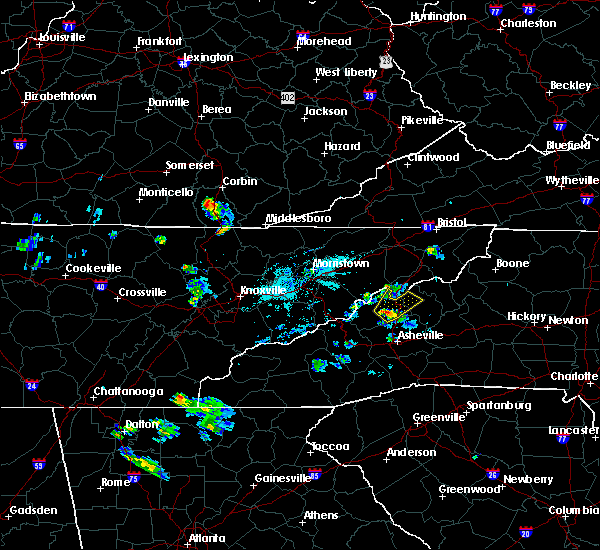
| 9/13/2019 4:36 PM EDT |
 The severe thunderstorm warning for southeastern madison and north central buncombe counties will expire at 445 pm edt, the storm which prompted the warning has weakened below severe limits, and no longer poses an immediate threat to life or property. therefore the warning will be allowed to expire. however heavy rain is still possible with this thunderstorm. if you observed large hail or wind damage, please report it to the national weather service greenville-spartanburg by calling toll free, 1, 800, 2 6 7, 8 1 0 1, or by posting on our facebook page, or tweet it using hashtag nwsgsp. your message should describe the event and the specific location where it occurred. The severe thunderstorm warning for southeastern madison and north central buncombe counties will expire at 445 pm edt, the storm which prompted the warning has weakened below severe limits, and no longer poses an immediate threat to life or property. therefore the warning will be allowed to expire. however heavy rain is still possible with this thunderstorm. if you observed large hail or wind damage, please report it to the national weather service greenville-spartanburg by calling toll free, 1, 800, 2 6 7, 8 1 0 1, or by posting on our facebook page, or tweet it using hashtag nwsgsp. your message should describe the event and the specific location where it occurred.
|
| 9/13/2019 4:06 PM EDT |
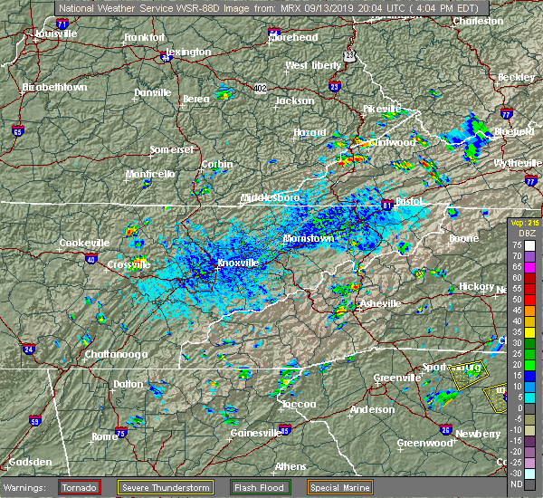 At 405 pm edt, a severe thunderstorm was located 5 miles east of marshall, or near mars hill, and is nearly stationary (radar indicated). Hazards include 60 mph wind gusts and penny size hail. expect damage to trees and power lines At 405 pm edt, a severe thunderstorm was located 5 miles east of marshall, or near mars hill, and is nearly stationary (radar indicated). Hazards include 60 mph wind gusts and penny size hail. expect damage to trees and power lines
|
| 8/13/2019 2:15 PM EDT |
 At 215 pm edt, severe thunderstorms were located along a line extending from 12 miles southwest of erwin to 17 miles west of burnsville to 5 miles southwest of marshall, moving southeast at 25 mph (radar indicated). Hazards include 60 mph wind gusts. Expect damage to trees and power lines. Locations impacted include, burnsville, marshall, swannanoa, weaverville, mars hill, ramseytown, green mountain, swiss and flat creek. At 215 pm edt, severe thunderstorms were located along a line extending from 12 miles southwest of erwin to 17 miles west of burnsville to 5 miles southwest of marshall, moving southeast at 25 mph (radar indicated). Hazards include 60 mph wind gusts. Expect damage to trees and power lines. Locations impacted include, burnsville, marshall, swannanoa, weaverville, mars hill, ramseytown, green mountain, swiss and flat creek.
|
| 8/13/2019 1:46 PM EDT |
 At 146 pm edt, a severe thunderstorm was located 13 miles south of greeneville, or 5 miles north of hot springs, moving southeast at 30 mph (radar indicated). Hazards include 60 mph wind gusts and penny size hail. expect damage to trees and power lines At 146 pm edt, a severe thunderstorm was located 13 miles south of greeneville, or 5 miles north of hot springs, moving southeast at 30 mph (radar indicated). Hazards include 60 mph wind gusts and penny size hail. expect damage to trees and power lines
|
| 7/19/2019 5:52 PM EDT | One tree reported down on redmon roa in madison county NC, 1.3 miles WSW of Marshall, NC |
| 7/19/2019 5:39 PM EDT |
 At 539 pm edt, a severe thunderstorm was located 5 miles east of marshall, or near mars hill, moving west at 10 mph (radar indicated). Hazards include 60 mph wind gusts and penny size hail. expect damage to trees and power lines At 539 pm edt, a severe thunderstorm was located 5 miles east of marshall, or near mars hill, moving west at 10 mph (radar indicated). Hazards include 60 mph wind gusts and penny size hail. expect damage to trees and power lines
|
| 6/22/2019 12:31 AM EDT |
 At 1231 am edt, severe thunderstorms were located along a line extending from 6 miles northwest of greeneville to 12 miles northwest of waynesville, moving southeast at 40 mph (radar indicated). Hazards include 60 mph wind gusts and nickel size hail. expect damage to trees and power lines At 1231 am edt, severe thunderstorms were located along a line extending from 6 miles northwest of greeneville to 12 miles northwest of waynesville, moving southeast at 40 mph (radar indicated). Hazards include 60 mph wind gusts and nickel size hail. expect damage to trees and power lines
|
| 8/8/2018 4:57 PM EDT |
 At 457 pm edt, severe thunderstorms were located along a line extending from 9 miles west of burnsville to 7 miles southeast of marshall, moving east at 25 mph (radar indicated). Hazards include 60 mph wind gusts and nickel size hail. Expect damage to trees and power lines. Locations impacted include, burnsville, marshall, mars hill, mount mitchell state park, ramseytown, green mountain, swiss, faust, wolf ridge and busick. At 457 pm edt, severe thunderstorms were located along a line extending from 9 miles west of burnsville to 7 miles southeast of marshall, moving east at 25 mph (radar indicated). Hazards include 60 mph wind gusts and nickel size hail. Expect damage to trees and power lines. Locations impacted include, burnsville, marshall, mars hill, mount mitchell state park, ramseytown, green mountain, swiss, faust, wolf ridge and busick.
|
| 8/8/2018 4:25 PM EDT |
 At 425 pm edt, a severe thunderstorm was located 9 miles west of marshall, or near hot springs, moving east at 40 mph (radar indicated). Hazards include 60 mph wind gusts. expect damage to trees and power lines At 425 pm edt, a severe thunderstorm was located 9 miles west of marshall, or near hot springs, moving east at 40 mph (radar indicated). Hazards include 60 mph wind gusts. expect damage to trees and power lines
|
| 7/20/2018 11:30 PM EDT | A few social media reports of trees down between hot springs... marshall... and jupite in madison county NC, 0.5 miles ENE of Marshall, NC |
| 7/20/2018 10:51 PM EDT |
 At 1050 pm edt, severe thunderstorms were located along a line extending from near johnson city to 6 miles south of newport, moving southeast at 40 mph (radar indicated). Hazards include 60 mph wind gusts and penny size hail. expect damage to trees and power lines At 1050 pm edt, severe thunderstorms were located along a line extending from near johnson city to 6 miles south of newport, moving southeast at 40 mph (radar indicated). Hazards include 60 mph wind gusts and penny size hail. expect damage to trees and power lines
|
| 6/26/2018 6:49 PM EDT |
 At 648 pm edt, severe thunderstorms were located along a line extending from near marshall to 13 miles west of downtown asheville to 3 miles northeast of waynesville, moving southeast at 30 mph (radar indicated). Hazards include 60 mph wind gusts and quarter size hail. Minor hail damage to vehicles is expected. Expect wind damage to trees and power lines. At 648 pm edt, severe thunderstorms were located along a line extending from near marshall to 13 miles west of downtown asheville to 3 miles northeast of waynesville, moving southeast at 30 mph (radar indicated). Hazards include 60 mph wind gusts and quarter size hail. Minor hail damage to vehicles is expected. Expect wind damage to trees and power lines.
|
| 6/26/2018 6:18 PM EDT |
 At 618 pm edt, severe thunderstorms were located along a line extending from 12 miles south of greeneville to 16 miles west of marshall, moving east at 20 mph (radar indicated). Hazards include 60 mph wind gusts and penny size hail. expect damage to trees and power lines At 618 pm edt, severe thunderstorms were located along a line extending from 12 miles south of greeneville to 16 miles west of marshall, moving east at 20 mph (radar indicated). Hazards include 60 mph wind gusts and penny size hail. expect damage to trees and power lines
|
| 6/26/2018 6:02 PM EDT |
 At 601 pm edt, a severe thunderstorm was located 4 miles north of marshall, moving southeast at 30 mph. behind this thunderstorm, another line of storms will move into the western part of madison county around 615 pm. another warning will likely be needed (radar indicated). Hazards include 60 mph wind gusts and quarter size hail. Minor hail damage to vehicles is expected. expect wind damage to trees and power lines. Locations impacted include, marshall, mars hill, hot springs, faust, allenstand, walnut, luck, wolf ridge, spring creek and max patch. At 601 pm edt, a severe thunderstorm was located 4 miles north of marshall, moving southeast at 30 mph. behind this thunderstorm, another line of storms will move into the western part of madison county around 615 pm. another warning will likely be needed (radar indicated). Hazards include 60 mph wind gusts and quarter size hail. Minor hail damage to vehicles is expected. expect wind damage to trees and power lines. Locations impacted include, marshall, mars hill, hot springs, faust, allenstand, walnut, luck, wolf ridge, spring creek and max patch.
|
| 6/26/2018 5:36 PM EDT |
 At 535 pm edt, a severe thunderstorm was located 15 miles east of newport, or 6 miles northwest of hot springs, moving southeast at 30 mph (radar indicated). Hazards include 60 mph wind gusts and quarter size hail. Minor hail damage to vehicles is expected. Expect wind damage to trees and power lines. At 535 pm edt, a severe thunderstorm was located 15 miles east of newport, or 6 miles northwest of hot springs, moving southeast at 30 mph (radar indicated). Hazards include 60 mph wind gusts and quarter size hail. Minor hail damage to vehicles is expected. Expect wind damage to trees and power lines.
|
| 6/24/2018 5:41 PM EDT |
 The severe thunderstorm warning for madison county will expire at 545 pm edt, the storm which prompted the warning has weakened below severe limits, and no longer poses an immediate threat to life or property. therefore the warning will be allowed to expire. however, gusty winds are still possible with this thunderstorm. The severe thunderstorm warning for madison county will expire at 545 pm edt, the storm which prompted the warning has weakened below severe limits, and no longer poses an immediate threat to life or property. therefore the warning will be allowed to expire. however, gusty winds are still possible with this thunderstorm.
|
| 6/24/2018 5:27 PM EDT |
 At 527 pm edt, a severe thunderstorm was located 5 miles northwest of marshall, moving southeast at 30 mph (radar indicated). Hazards include 60 mph wind gusts and quarter size hail. Minor hail damage to vehicles is expected. expect wind damage to trees and power lines. Locations impacted include, marshall, hot springs, spring creek, allenstand, walnut and faust. At 527 pm edt, a severe thunderstorm was located 5 miles northwest of marshall, moving southeast at 30 mph (radar indicated). Hazards include 60 mph wind gusts and quarter size hail. Minor hail damage to vehicles is expected. expect wind damage to trees and power lines. Locations impacted include, marshall, hot springs, spring creek, allenstand, walnut and faust.
|
| 6/24/2018 5:07 PM EDT |
 At 507 pm edt, a severe thunderstorm was located 15 miles northwest of marshall, or 5 miles northwest of hot springs, moving east at 15 mph (radar indicated). Hazards include 60 mph wind gusts and quarter size hail. Minor hail damage to vehicles is expected. Expect wind damage to trees and power lines. At 507 pm edt, a severe thunderstorm was located 15 miles northwest of marshall, or 5 miles northwest of hot springs, moving east at 15 mph (radar indicated). Hazards include 60 mph wind gusts and quarter size hail. Minor hail damage to vehicles is expected. Expect wind damage to trees and power lines.
|
| 6/17/2018 3:03 PM EDT |
 At 303 pm edt, a severe thunderstorm was located 5 miles northwest of marshall, moving west at 15 mph (radar indicated). Hazards include 60 mph wind gusts. Expect damage to trees and power lines. Locations impacted include, marshall, hot springs, faust, walnut and wolf ridge. At 303 pm edt, a severe thunderstorm was located 5 miles northwest of marshall, moving west at 15 mph (radar indicated). Hazards include 60 mph wind gusts. Expect damage to trees and power lines. Locations impacted include, marshall, hot springs, faust, walnut and wolf ridge.
|
| 6/17/2018 2:53 PM EDT | A few trees were blown down. time estimated by rada in madison county NC, 5.1 miles SE of Marshall, NC |
| 6/17/2018 2:45 PM EDT |
 At 244 pm edt, a severe thunderstorm was located 7 miles north of marshall, or 6 miles northwest of mars hill, and is nearly stationary (radar indicated). Hazards include 60 mph wind gusts and nickel size hail. expect damage to trees and power lines At 244 pm edt, a severe thunderstorm was located 7 miles north of marshall, or 6 miles northwest of mars hill, and is nearly stationary (radar indicated). Hazards include 60 mph wind gusts and nickel size hail. expect damage to trees and power lines
|
| 5/31/2018 8:31 PM EDT |
 At 830 pm edt, a severe thunderstorm was located 6 miles south of marshall, or 4 miles north of leicester, moving southeast at 55 mph (radar indicated). Hazards include 60 mph wind gusts. Expect damage to trees and power lines. Locations impacted include, marshall, north asheville, woodfin, weaverville, mars hill, hot springs, leicester, max patch, faust and allenstand. At 830 pm edt, a severe thunderstorm was located 6 miles south of marshall, or 4 miles north of leicester, moving southeast at 55 mph (radar indicated). Hazards include 60 mph wind gusts. Expect damage to trees and power lines. Locations impacted include, marshall, north asheville, woodfin, weaverville, mars hill, hot springs, leicester, max patch, faust and allenstand.
|
| 5/31/2018 8:27 PM EDT | 911 call center reported numerous trees down along the french broad rive in madison county NC, 1.1 miles E of Marshall, NC |
| 5/31/2018 8:15 PM EDT |
 At 815 pm edt, a severe thunderstorm was located 8 miles northwest of marshall, or near hot springs, moving southeast at 30 mph (radar indicated). Hazards include 60 mph wind gusts. expect damage to trees and power lines At 815 pm edt, a severe thunderstorm was located 8 miles northwest of marshall, or near hot springs, moving southeast at 30 mph (radar indicated). Hazards include 60 mph wind gusts. expect damage to trees and power lines
|
| 5/28/2017 12:27 AM EDT |
 The severe thunderstorm warning for northeastern transylvania, western henderson, madison, buncombe and northwestern yancey counties will expire at 1230 am edt, the storms which prompted the warning have moved out of the area. therefore the warning will be allowed to expire. however gusty winds and heavy rain are still possible with these thunderstorms. a severe thunderstorm watch remains in effect until 200 am edt for western north carolina. a severe thunderstorm watch also remains in effect until 600 am edt for upstate south carolina. The severe thunderstorm warning for northeastern transylvania, western henderson, madison, buncombe and northwestern yancey counties will expire at 1230 am edt, the storms which prompted the warning have moved out of the area. therefore the warning will be allowed to expire. however gusty winds and heavy rain are still possible with these thunderstorms. a severe thunderstorm watch remains in effect until 200 am edt for western north carolina. a severe thunderstorm watch also remains in effect until 600 am edt for upstate south carolina.
|
| 5/28/2017 12:15 AM EDT | County reports trees and power lines down throughout the county with widespread power outages. hardest hit areas include hot springs...marshall...laurel...mars hil in madison county NC, 0.5 miles ENE of Marshall, NC |
| 5/27/2017 11:37 PM EDT |
 At 1136 pm edt, severe thunderstorms were located along a line extending from 5 miles west of greeneville to 4 miles northeast of sylva, moving east at 45 mph (radar indicated). Hazards include 60 mph wind gusts and nickel size hail. expect damage to trees and power lines At 1136 pm edt, severe thunderstorms were located along a line extending from 5 miles west of greeneville to 4 miles northeast of sylva, moving east at 45 mph (radar indicated). Hazards include 60 mph wind gusts and nickel size hail. expect damage to trees and power lines
|
| 5/19/2017 12:28 PM EDT |
 At 1227 pm edt, severe thunderstorms were located along a line extending from 3 miles east of marshall to 11 miles northwest of downtown asheville, moving east at 20 mph (radar indicated). Hazards include 60 mph wind gusts and quarter size hail. Minor hail damage to vehicles is expected. expect wind damage to trees and power lines. locations impacted include, weaverville, mars hill, canto, barnardsville, marshall, b. r. parkway-east asheville to craggy gardens and b. r. Parkway-craggy to little switzerland. At 1227 pm edt, severe thunderstorms were located along a line extending from 3 miles east of marshall to 11 miles northwest of downtown asheville, moving east at 20 mph (radar indicated). Hazards include 60 mph wind gusts and quarter size hail. Minor hail damage to vehicles is expected. expect wind damage to trees and power lines. locations impacted include, weaverville, mars hill, canto, barnardsville, marshall, b. r. parkway-east asheville to craggy gardens and b. r. Parkway-craggy to little switzerland.
|
| 5/19/2017 12:20 PM EDT | Marshall police department reports trees down along baileys branch road just south of the french broad rive in madison county NC, 1.4 miles NE of Marshall, NC |
| 5/19/2017 12:14 PM EDT |
 At 1214 pm edt, a severe thunderstorm was located near marshall, moving east at 30 mph (radar indicated). Hazards include 60 mph wind gusts and quarter size hail. Minor hail damage to vehicles is expected. Expect wind damage to trees and power lines. At 1214 pm edt, a severe thunderstorm was located near marshall, moving east at 30 mph (radar indicated). Hazards include 60 mph wind gusts and quarter size hail. Minor hail damage to vehicles is expected. Expect wind damage to trees and power lines.
|
| 7/27/2016 8:33 PM EDT |
 At 831 pm edt, severe thunderstorms were located along a line extending from 9 miles west of burnsville to near marshall, moving east at 15 mph (radar indicated). Hazards include 60 mph wind gusts and quarter size hail. Hail damage to vehicles is expected. expect wind damage to roofs, siding and trees. Locations impacted include, marshall, weaverville, mars hill, barnardsville and woodfin. At 831 pm edt, severe thunderstorms were located along a line extending from 9 miles west of burnsville to near marshall, moving east at 15 mph (radar indicated). Hazards include 60 mph wind gusts and quarter size hail. Hail damage to vehicles is expected. expect wind damage to roofs, siding and trees. Locations impacted include, marshall, weaverville, mars hill, barnardsville and woodfin.
|
| 7/27/2016 8:20 PM EDT | Trees down off windswept ridge r in madison county NC, 2.4 miles WNW of Marshall, NC |
| 7/27/2016 8:15 PM EDT | Trees down off silvers mill r in madison county NC, 2.9 miles WSW of Marshall, NC |
| 7/27/2016 8:15 PM EDT |
 At 815 pm edt, severe thunderstorms were located along a line extending from 9 miles west of burnsville to near marshall, moving southeast at 15 mph (radar indicated). Hazards include 60 mph wind gusts and quarter size hail. Hail damage to vehicles is expected. expect wind damage to roofs, siding and trees. Locations impacted include, marshall, weaverville, mars hill, faust, barnardsville, swiss and woodfin. At 815 pm edt, severe thunderstorms were located along a line extending from 9 miles west of burnsville to near marshall, moving southeast at 15 mph (radar indicated). Hazards include 60 mph wind gusts and quarter size hail. Hail damage to vehicles is expected. expect wind damage to roofs, siding and trees. Locations impacted include, marshall, weaverville, mars hill, faust, barnardsville, swiss and woodfin.
|
| 7/27/2016 8:06 PM EDT | Multiple trees down off grapevine r in madison county NC, 6.2 miles SW of Marshall, NC |
| 7/27/2016 7:53 PM EDT |
 At 752 pm edt, a severe thunderstorm was located 5 miles northeast of marshall, or near mars hill, moving east at 15 mph (radar indicated). Hazards include 60 mph wind gusts and penny size hail. Expect damage to roofs. Siding and trees. At 752 pm edt, a severe thunderstorm was located 5 miles northeast of marshall, or near mars hill, moving east at 15 mph (radar indicated). Hazards include 60 mph wind gusts and penny size hail. Expect damage to roofs. Siding and trees.
|
| 7/7/2016 7:59 PM EDT |
 At 759 pm edt, severe thunderstorms were located along a line extending from 12 miles southwest of greeneville to 5 miles west of waynesville, moving southeast at 60 mph (radar indicated). Hazards include 60 mph wind gusts. Expect damage to roofs. Siding and trees. At 759 pm edt, severe thunderstorms were located along a line extending from 12 miles southwest of greeneville to 5 miles west of waynesville, moving southeast at 60 mph (radar indicated). Hazards include 60 mph wind gusts. Expect damage to roofs. Siding and trees.
|
| 7/6/2016 9:07 PM EDT |
 The severe thunderstorm warning for madison, west central yancey and northwestern buncombe counties will expire at 915 pm edt, the storm which prompted the warning has weakened below severe limits, and have exited the warned area. therefore the warning will be allowed to expire. The severe thunderstorm warning for madison, west central yancey and northwestern buncombe counties will expire at 915 pm edt, the storm which prompted the warning has weakened below severe limits, and have exited the warned area. therefore the warning will be allowed to expire.
|
| 7/6/2016 8:29 PM EDT |
 At 829 pm edt, a severe thunderstorm was located near marshall, moving southeast at 20 mph (radar indicated). Hazards include 60 mph wind gusts. Expect damage to roofs. Siding and trees. At 829 pm edt, a severe thunderstorm was located near marshall, moving southeast at 20 mph (radar indicated). Hazards include 60 mph wind gusts. Expect damage to roofs. Siding and trees.
|
| 6/30/2016 5:03 PM EDT |
 At 503 pm edt, a severe thunderstorm was located 4 miles east of marshall, or near mars hill, moving east at 5 mph (radar indicated). Hazards include 60 mph wind gusts and quarter size hail. Hail damage to vehicles is expected. Expect wind damage to roofs, siding and trees. At 503 pm edt, a severe thunderstorm was located 4 miles east of marshall, or near mars hill, moving east at 5 mph (radar indicated). Hazards include 60 mph wind gusts and quarter size hail. Hail damage to vehicles is expected. Expect wind damage to roofs, siding and trees.
|
| 5/2/2016 6:47 PM EDT |
 At 646 pm edt, a severe thunderstorm was located 10 miles northwest of marshall, or over hot springs, moving east at 30 mph (radar indicated). Hazards include 60 mph wind gusts and quarter size hail. Hail damage to vehicles is expected. Expect wind damage to roofs, siding and trees. At 646 pm edt, a severe thunderstorm was located 10 miles northwest of marshall, or over hot springs, moving east at 30 mph (radar indicated). Hazards include 60 mph wind gusts and quarter size hail. Hail damage to vehicles is expected. Expect wind damage to roofs, siding and trees.
|
| 8/10/2015 3:05 PM EDT | At least 6 trees down on roadways in madison county mainly from near marshall north to along interstate 26 toward the tennessee lin in madison county NC, 0.5 miles ENE of Marshall, NC |
| 7/13/2015 7:48 PM EDT |
 At 747 pm edt, doppler radar indicated a line of severe thunderstorms with a history of producing damaging winds in excess of 60 mph. these storms were located along a line extending from 7 miles south of burnsville to 10 miles north of downtown asheville to 5 miles southwest of marshall, moving southeast at 35 mph. penny size hail may also accompany the damaging winds. locations impacted include, asheville, marshall, black mountain, woodfin, swannanoa, weaverville, fairview in buncombe county, biltmore forest, bent creek and old fort. At 747 pm edt, doppler radar indicated a line of severe thunderstorms with a history of producing damaging winds in excess of 60 mph. these storms were located along a line extending from 7 miles south of burnsville to 10 miles north of downtown asheville to 5 miles southwest of marshall, moving southeast at 35 mph. penny size hail may also accompany the damaging winds. locations impacted include, asheville, marshall, black mountain, woodfin, swannanoa, weaverville, fairview in buncombe county, biltmore forest, bent creek and old fort.
|
| 7/13/2015 7:36 PM EDT | Multiple trees blown down se of marshall... n in madison county NC, 2.5 miles NNW of Marshall, NC |
| 7/13/2015 7:35 PM EDT |
 At 734 pm edt, doppler radar indicated a line of severe thunderstorms with a history of producing damaging winds in excess of 60 mph. these storms were located along a line extending from 4 miles south of deep gap to 3 miles northeast of spruce pine to 6 miles west of marshall, moving southeast at 40 mph. penny size hail may also accompany the damaging winds. locations impacted include, lenoir, spruce pine, burnsville, marshall, newland, beech mountain, gamewell, cajah`s mountain, mars hill and banner elk. At 734 pm edt, doppler radar indicated a line of severe thunderstorms with a history of producing damaging winds in excess of 60 mph. these storms were located along a line extending from 4 miles south of deep gap to 3 miles northeast of spruce pine to 6 miles west of marshall, moving southeast at 40 mph. penny size hail may also accompany the damaging winds. locations impacted include, lenoir, spruce pine, burnsville, marshall, newland, beech mountain, gamewell, cajah`s mountain, mars hill and banner elk.
|
| 7/13/2015 7:29 PM EDT |
 At 729 pm edt, doppler radar indicated a line of severe thunderstorms with a history of producing damaging winds in excess of 60 mph. these storms were located along a line extending from 4 miles west of burnsville to 3 miles northeast of marshall to 20 miles southeast of newport, and moving southeast at 35 mph. penny size hail may also accompany the damaging winds. At 729 pm edt, doppler radar indicated a line of severe thunderstorms with a history of producing damaging winds in excess of 60 mph. these storms were located along a line extending from 4 miles west of burnsville to 3 miles northeast of marshall to 20 miles southeast of newport, and moving southeast at 35 mph. penny size hail may also accompany the damaging winds.
|
| 7/13/2015 6:59 PM EDT |
 At 657 pm edt, doppler radar indicated a line of severe thunderstorms capable of producing damaging winds in excess of 60 mph. these storms were located along a line extending from near whitetop to 9 miles northwest of beech mountain to 11 miles east of morristown, and moving southeast at 30 mph. nickel size hail may also accompany the damaging winds. At 657 pm edt, doppler radar indicated a line of severe thunderstorms capable of producing damaging winds in excess of 60 mph. these storms were located along a line extending from near whitetop to 9 miles northwest of beech mountain to 11 miles east of morristown, and moving southeast at 30 mph. nickel size hail may also accompany the damaging winds.
|
| 5/27/2015 5:12 PM EDT | The severe thunderstorm warning for southeastern madison and north central buncombe counties will expire at 515 pm edt, the storm which prompted the warning has weakened below severe limits, and no longer poses an immediate threat to life or property. therefore the warning will be allowed to expire. however gusty winds are still possible with this thunderstorm. |
| 5/27/2015 4:52 PM EDT | At 452 pm edt, doppler radar indicated a severe thunderstorm capable of producing quarter size hail and damaging winds in excess of 60 mph. this storm was located 6 miles east of marshall, or over mars hill, moving northeast at 20 mph. locations impacted include, mars hill, barnardsville, wolf ridge, faust and marshall. |
| 5/27/2015 4:38 PM EDT | One tree fell on main street in marshal in madison county NC, 0.5 miles ENE of Marshall, NC |
| 5/27/2015 4:33 PM EDT | At 433 pm edt, doppler radar indicated a severe thunderstorm capable of producing quarter size hail and damaging winds in excess of 60 mph. this storm was located near marshall, and moving northeast at 20 mph. |
| 7/27/2014 8:36 PM EDT | Tree down on baileys branch road blocking both lanes in marshal in madison county NC, 0.5 miles ENE of Marshall, NC |
| 7/27/2014 8:07 PM EDT | Tree down on guntertown road. both lanes blocke in madison county NC, 6.8 miles S of Marshall, NC |
| 7/6/2012 4:50 PM EDT | A few trees down in three places about a half mile inside buncombe county along bear creek road. also had small hail...but was unsure of approximate siz in buncombe county NC, 5.9 miles NNE of Marshall, NC |
| 7/2/2012 12:05 AM EDT | Several small to large tree limbs down. small hai in madison county NC, 8.3 miles NE of Marshall, NC |
| 4/1/2012 4:45 PM EDT | Trees and power lines dow in madison county NC, 0.5 miles ENE of Marshall, NC |
| 4/1/2012 4:45 PM EDT | Thunderstorm winds blew down the tower of radio station whbk. the tower was estimated to be 300 feet hig in madison county NC, 0.5 miles ENE of Marshall, NC |
| 4/1/2012 4:40 PM EDT | Trees and power lines dow in madison county NC, 5.1 miles SE of Marshall, NC |
| 1/1/0001 12:00 AM | Quarter sized hail reported 4.4 miles SW of Marshall, NC, a hail producing storm crossed madison county with the largest hail reported between walnut and mars hill. spotter halfway between those locations reported sounded like |
| 1/1/0001 12:00 AM | One tree down near marshall occurred about the same time as the start of the quarter sized hail based on doppler wind velocit in madison county NC, 0.6 miles S of Marshall, NC |
| 1/1/0001 12:00 AM | Quarter sized hail reported 0.6 miles S of Marshall, NC, hail up to quarter sized fell for at least 5 minutes as the storm passed. |
| 1/1/0001 12:00 AM | Quarter sized hail reported 1.4 miles SSW of Marshall, NC, quarter size hail 2 miles northeast of marshall. |
| 1/1/0001 12:00 AM | Quarter sized hail reported 1.4 miles SSW of Marshall, NC, emergency management reported quarter size hail in the big pine community. |
| 1/1/0001 12:00 AM | Trees down along hwy 25/70 north of marshal in madison county NC, 5.1 miles SE of Marshall, NC |
| 1/1/0001 12:00 AM | Tree down near flint hill rd and panther branch rd in buncombe county NC, 4.2 miles NNW of Marshall, NC |
| 1/1/0001 12:00 AM | Quarter sized hail reported 0.5 miles ENE of Marshall, NC, report of quarter size hail in ne marshall. |
| 1/1/0001 12:00 AM | Several small trees and limbs down on riddle farm r in madison county NC, 2.6 miles ESE of Marshall, NC |
| 1/1/0001 12:00 AM | Quarter sized hail reported 5.1 miles SE of Marshall, NC |
| 1/1/0001 12:00 AM | Quarter sized hail reported 0.5 miles ENE of Marshall, NC |
| 1/1/0001 12:00 AM | Golf Ball sized hail reported 2.7 miles SSE of Marshall, NC |
| 1/1/0001 12:00 AM | Golf Ball sized hail reported 2.3 miles SSW of Marshall, NC |
| 1/1/0001 12:00 AM | Ping Pong Ball sized hail reported 5.1 miles SE of Marshall, NC |
| 1/1/0001 12:00 AM | Golf Ball sized hail reported 9.5 miles SSW of Marshall, NC |
Hail Maps for Marshall, NC


Connect with Interactive Hail Maps