

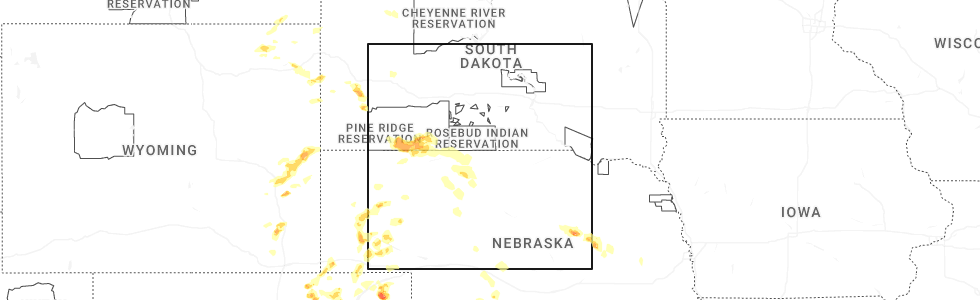
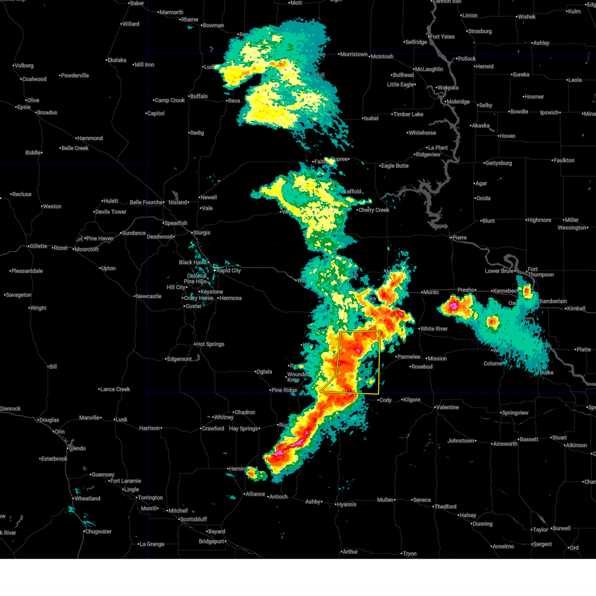
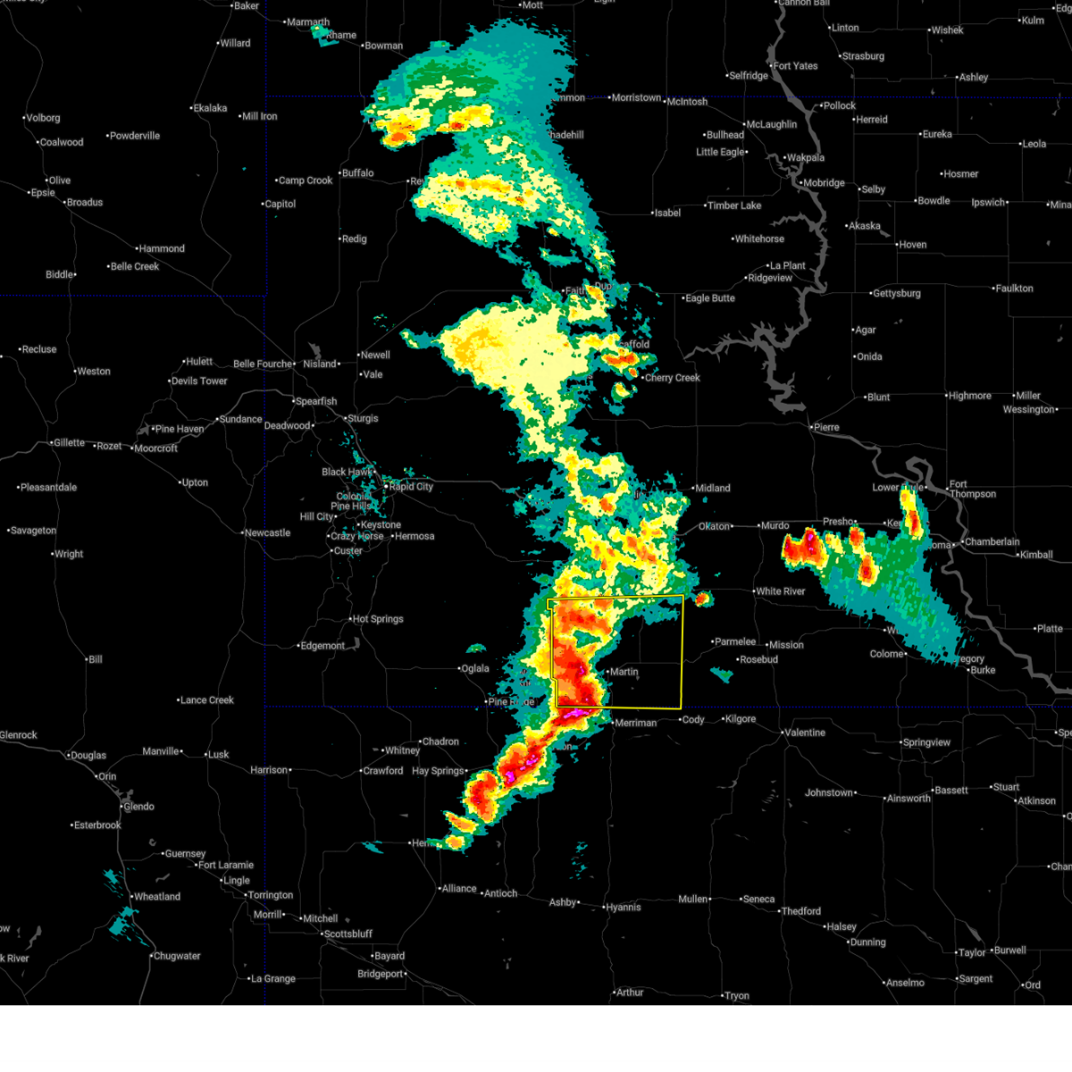
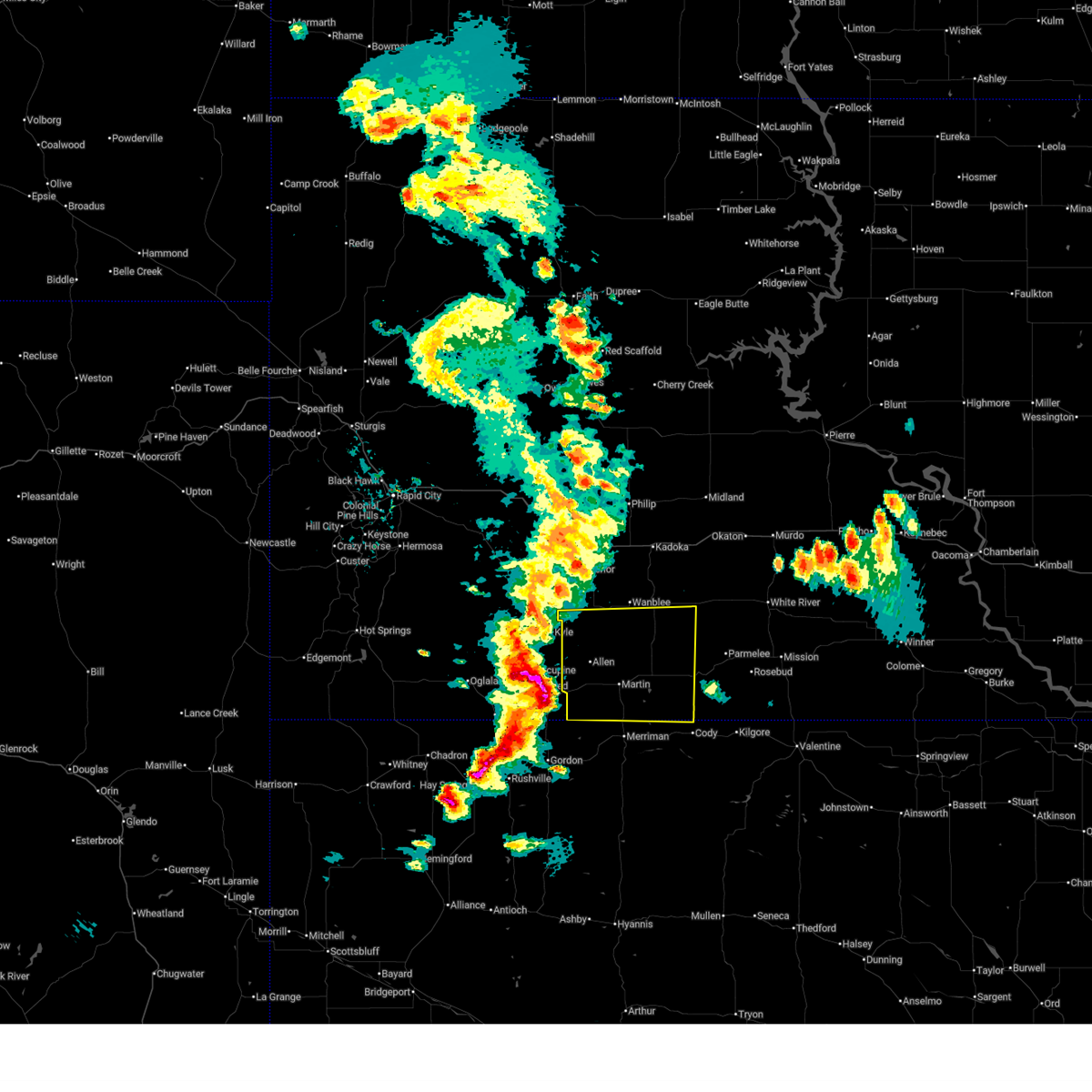
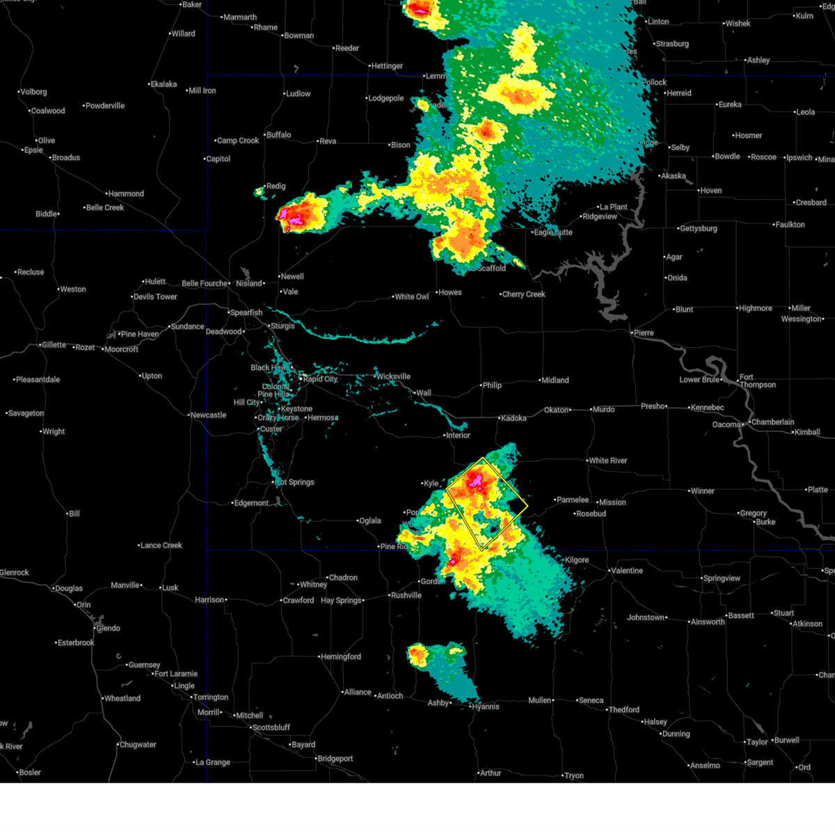
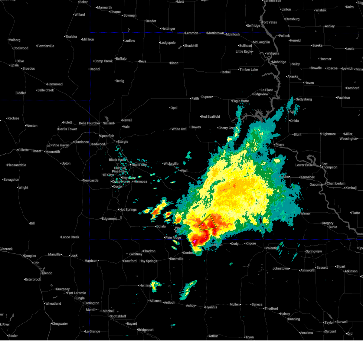
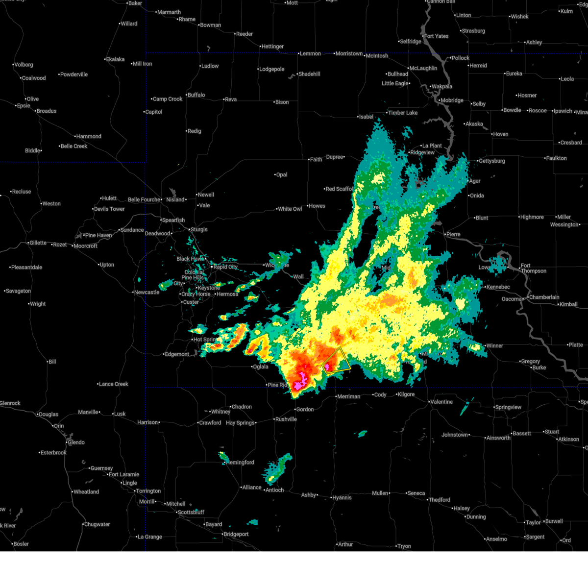
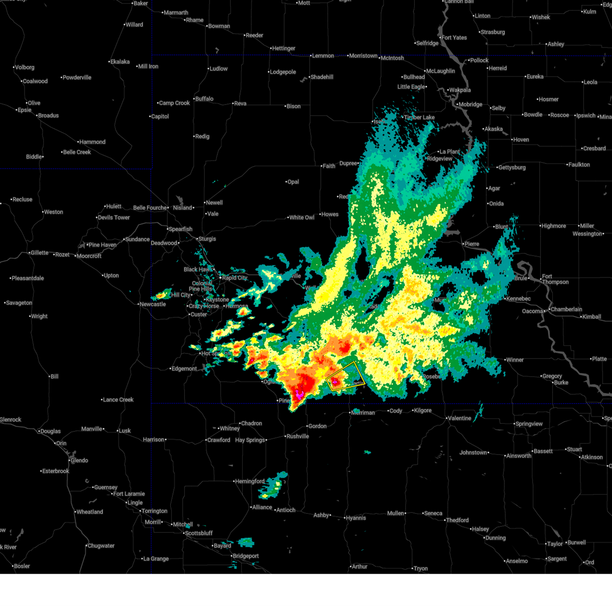
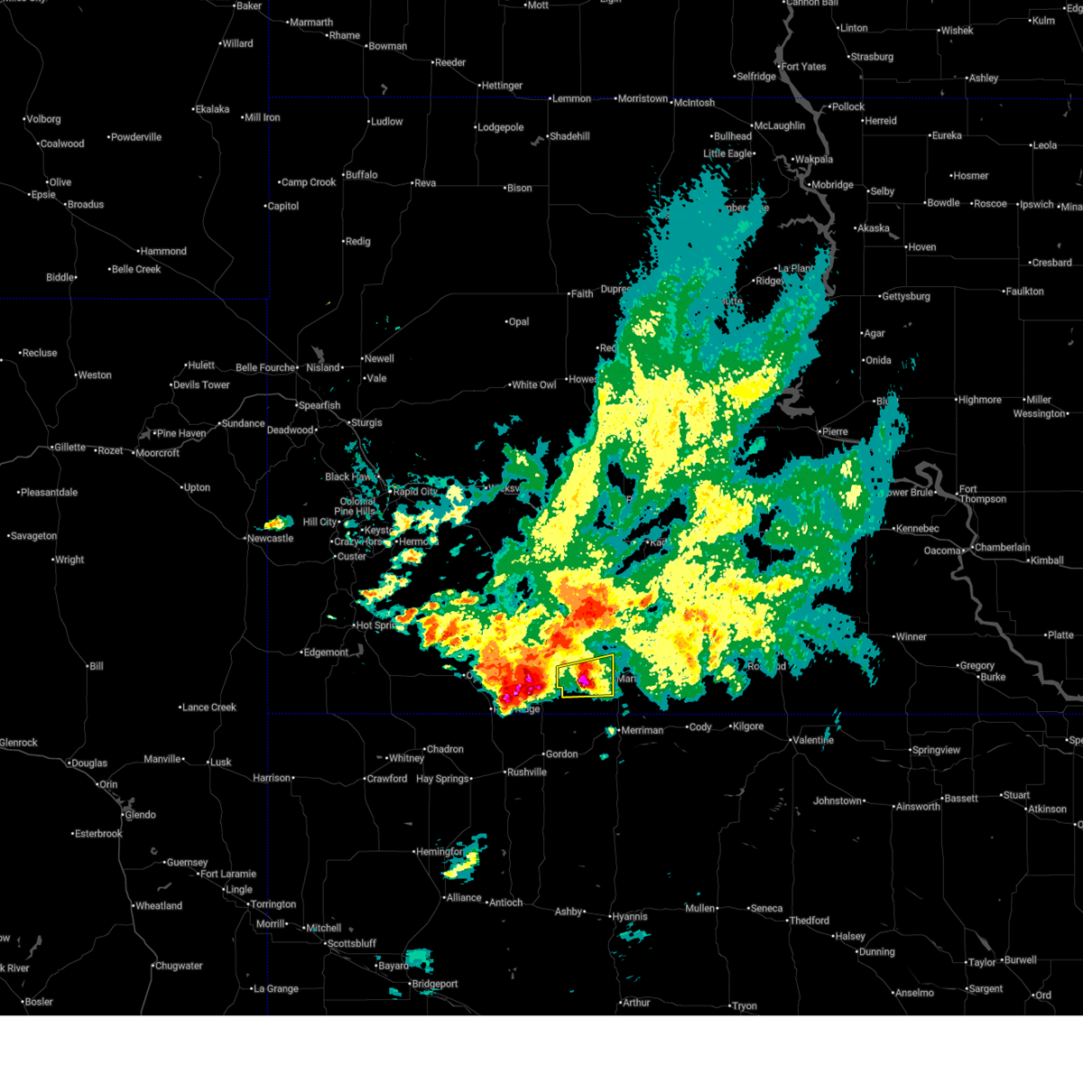
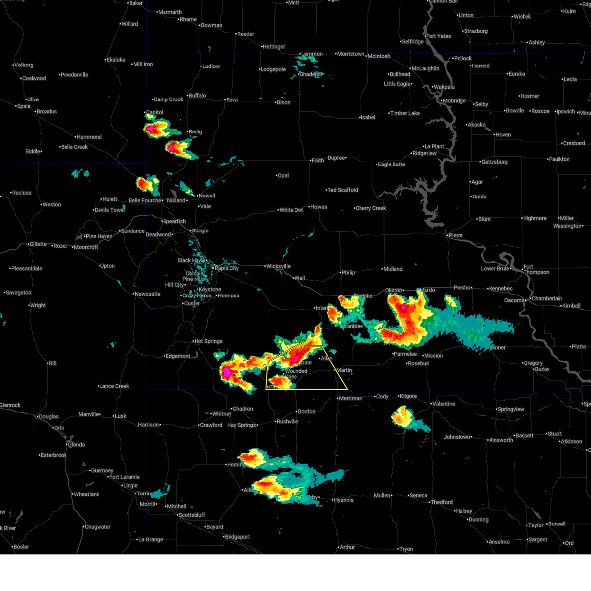
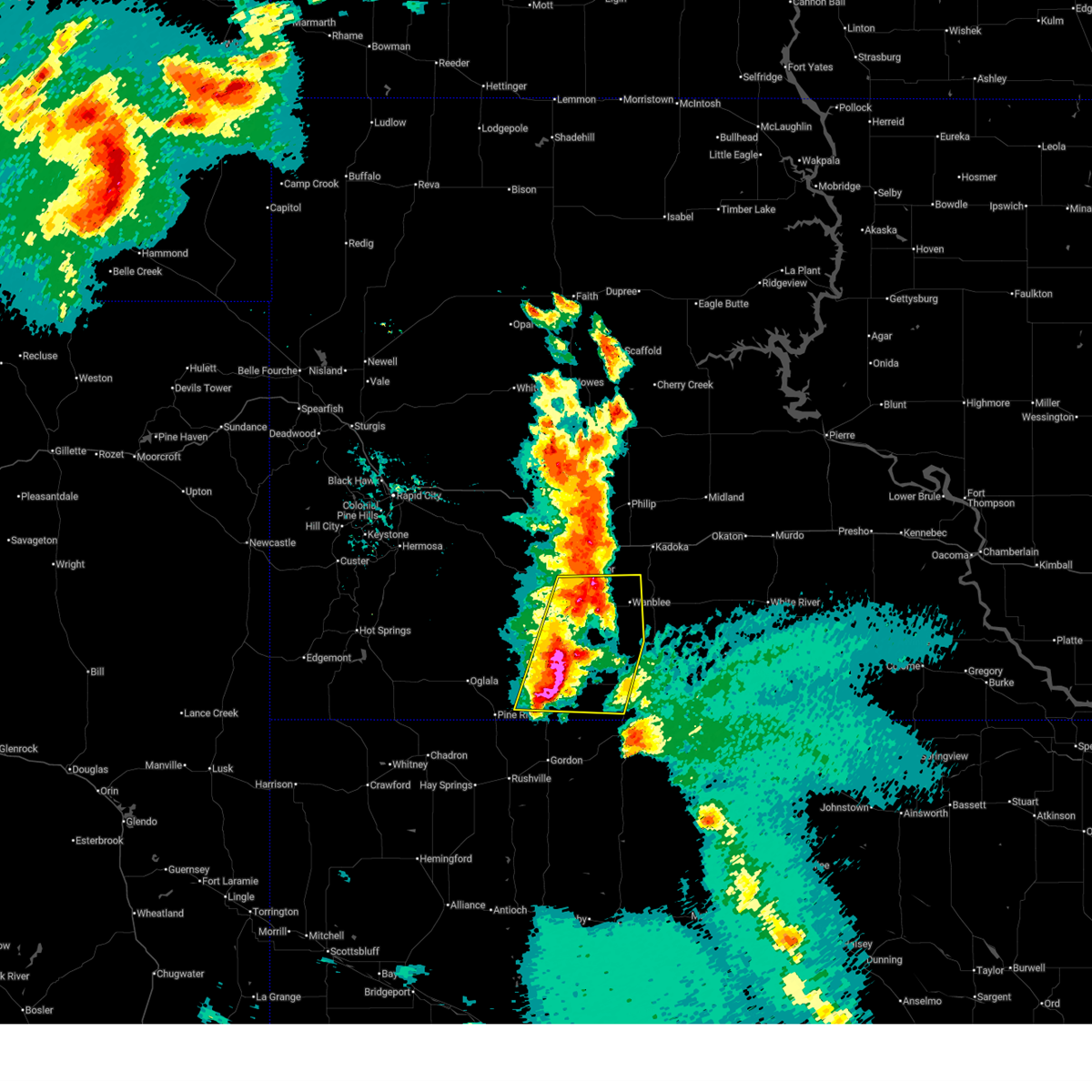
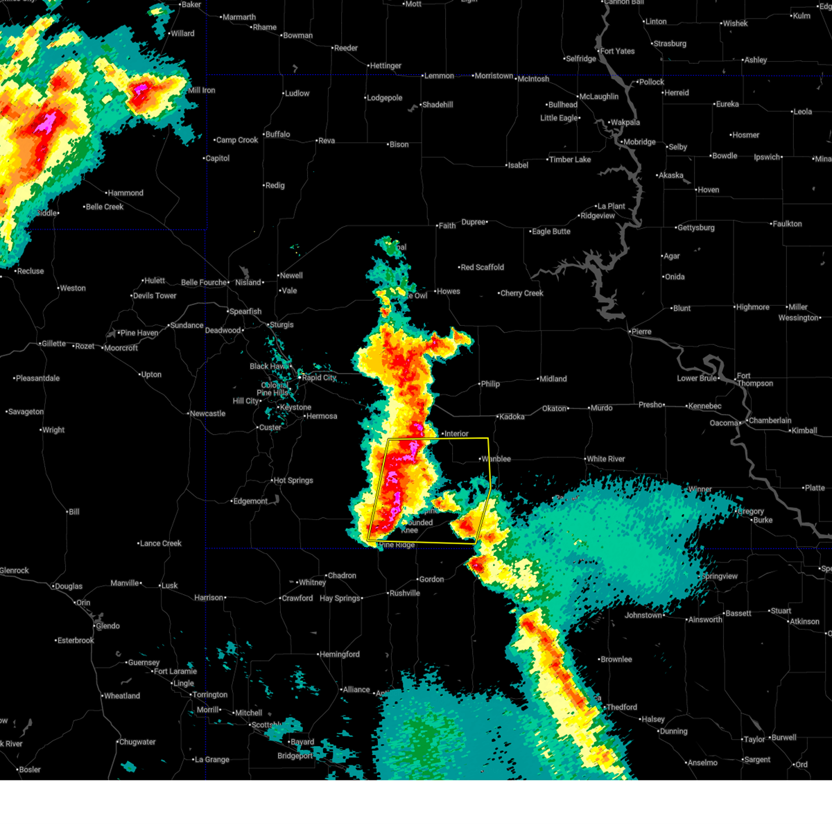
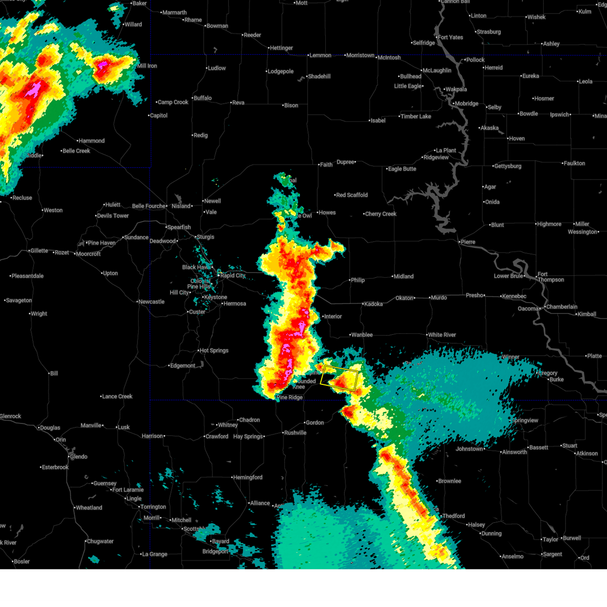
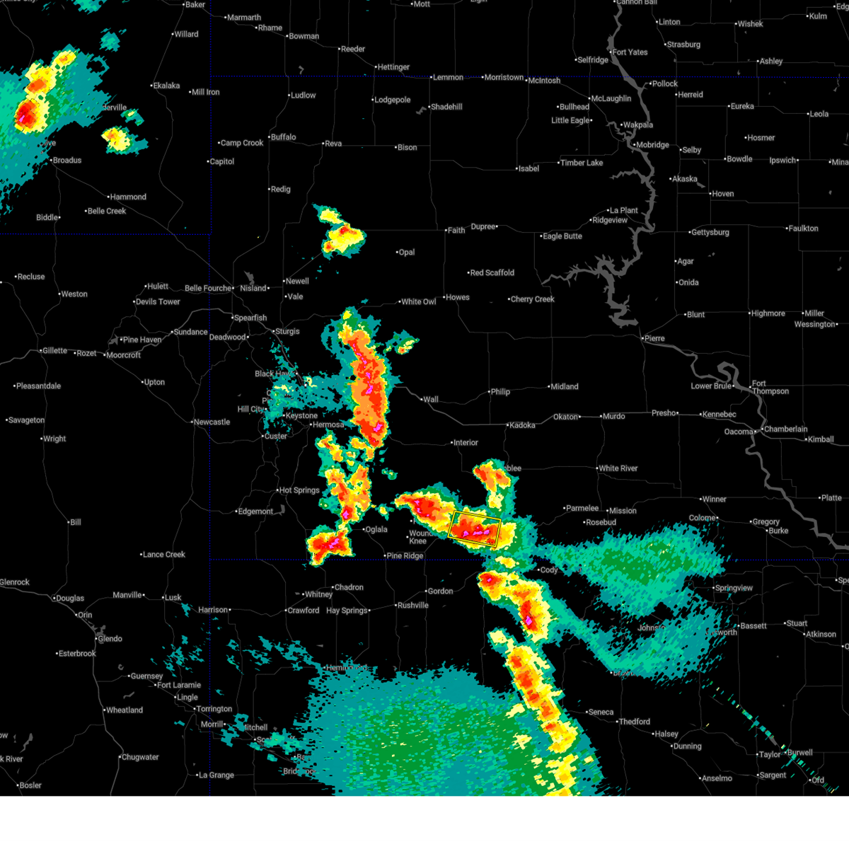
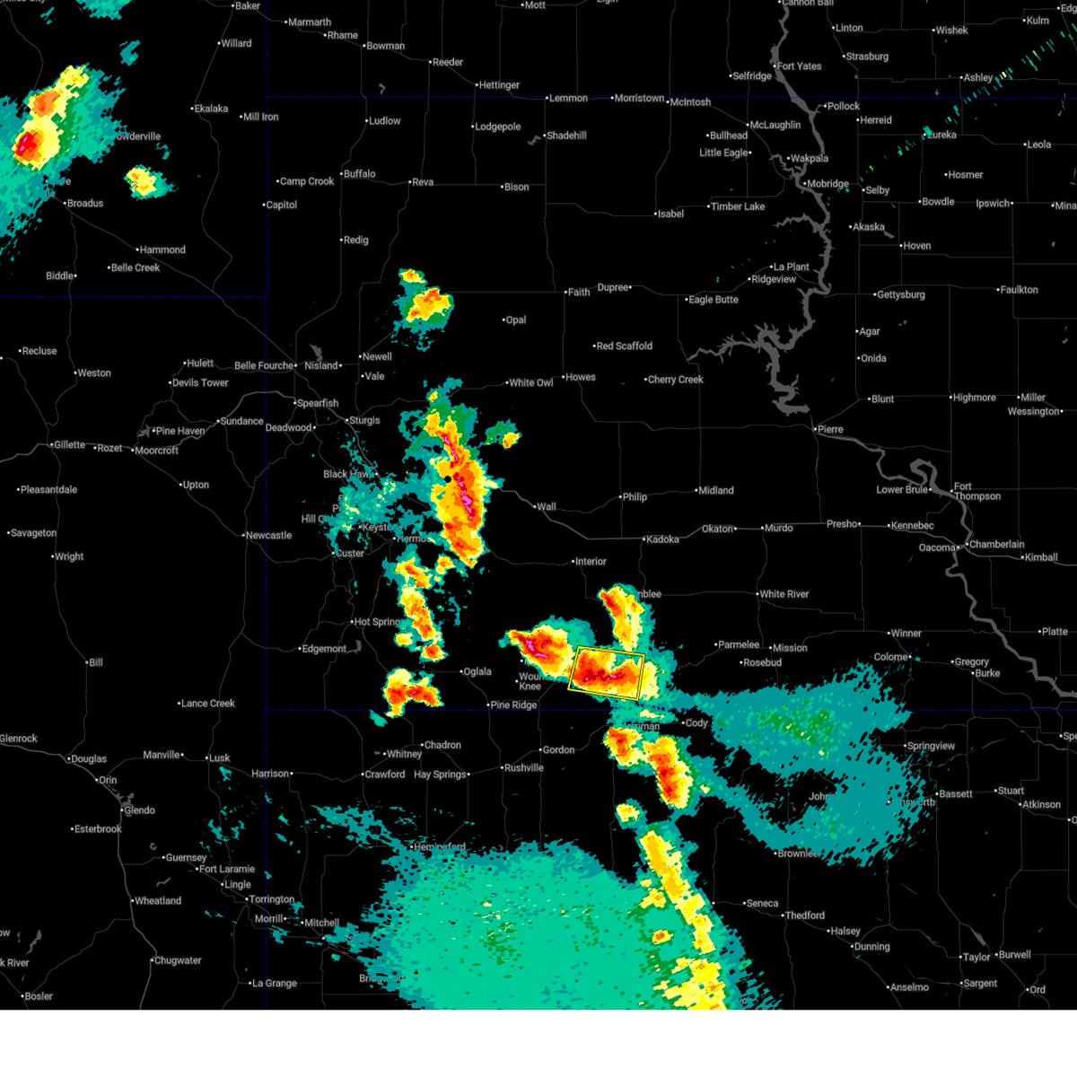
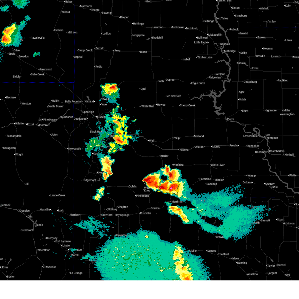
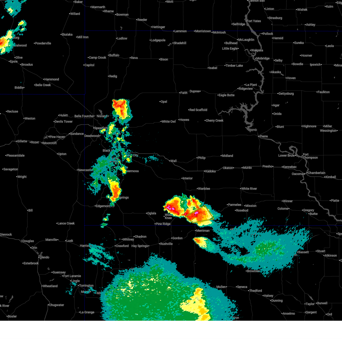
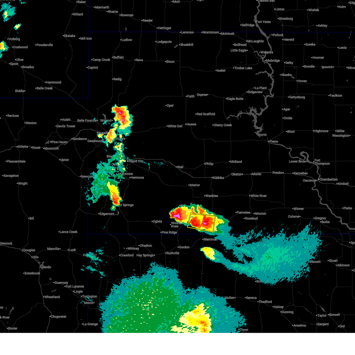
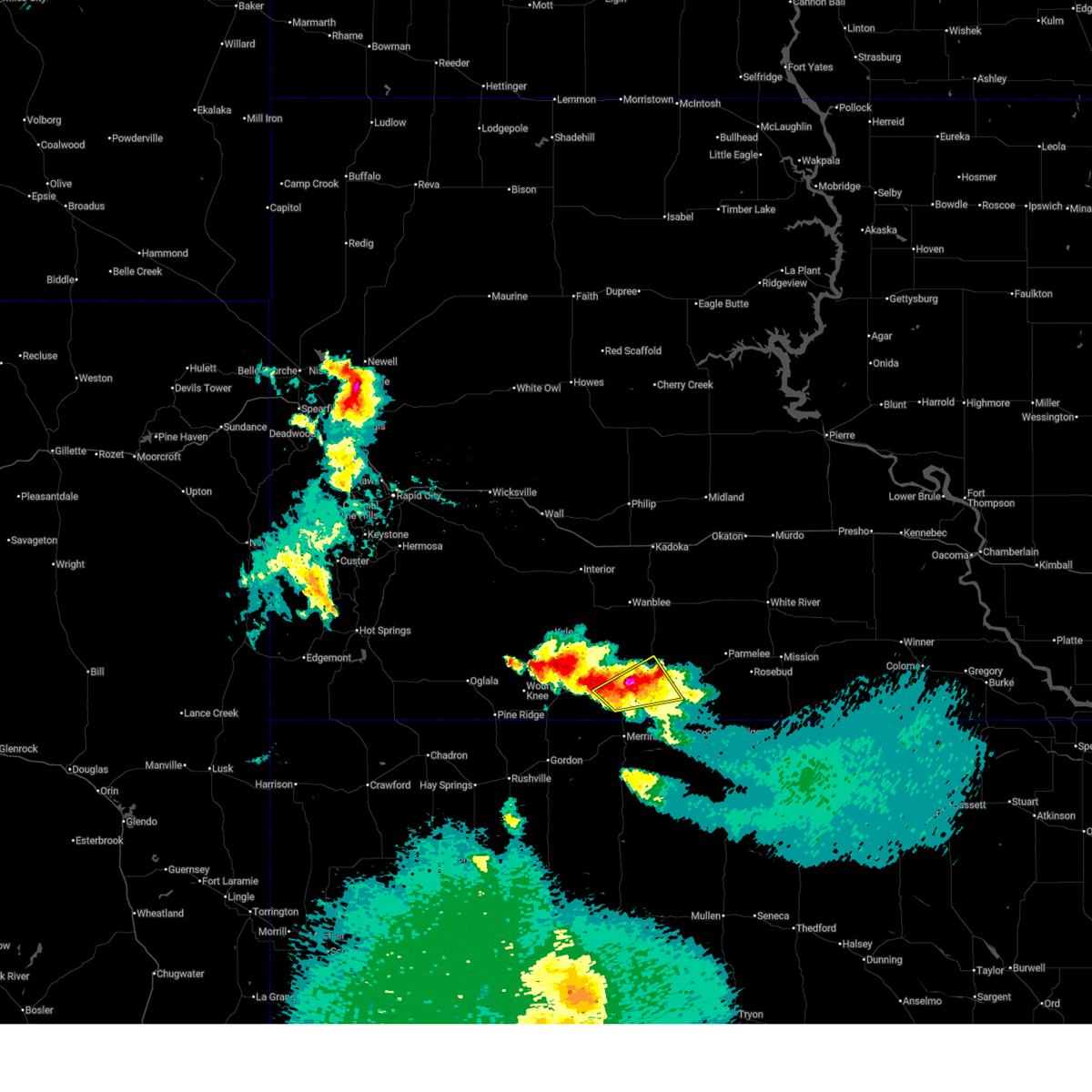
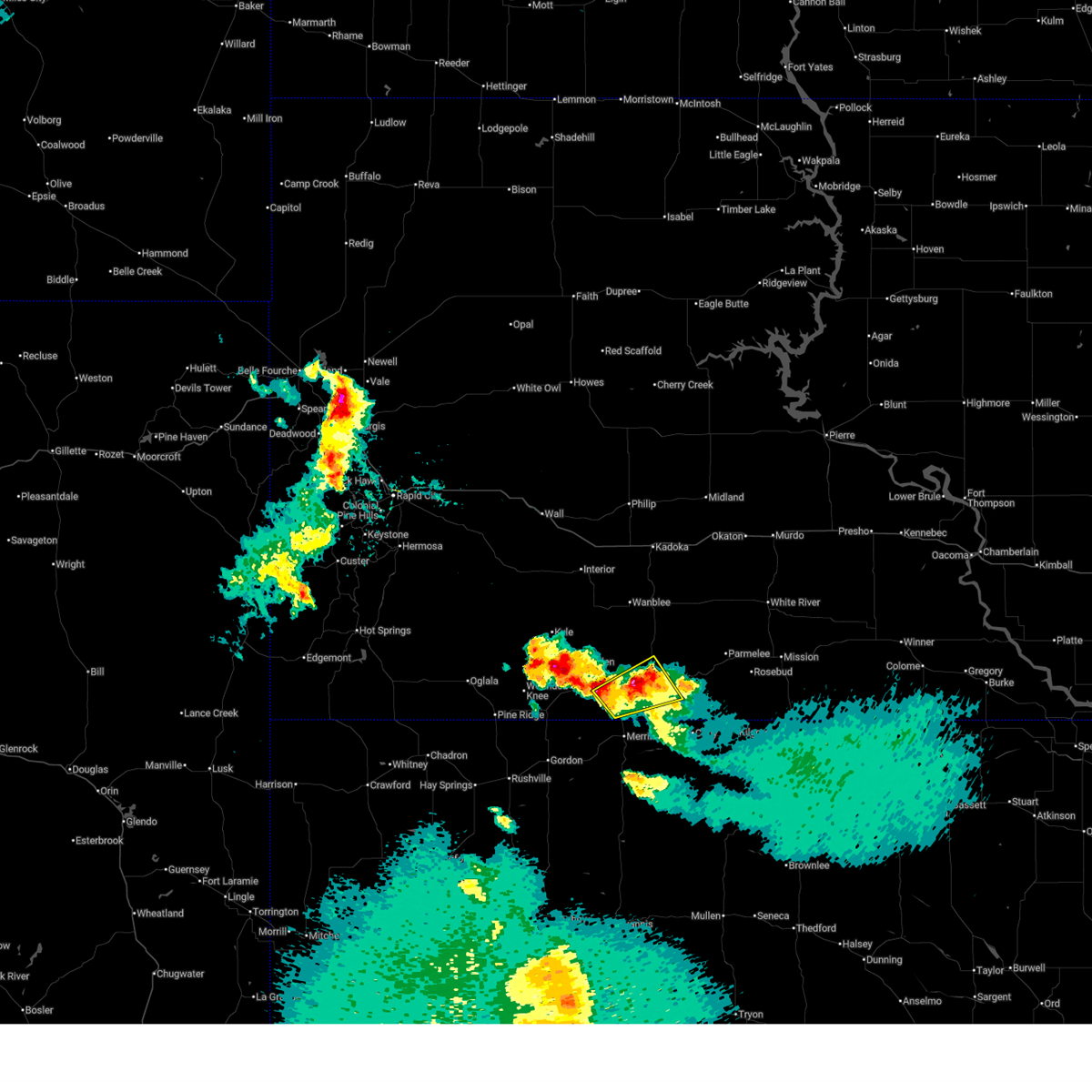
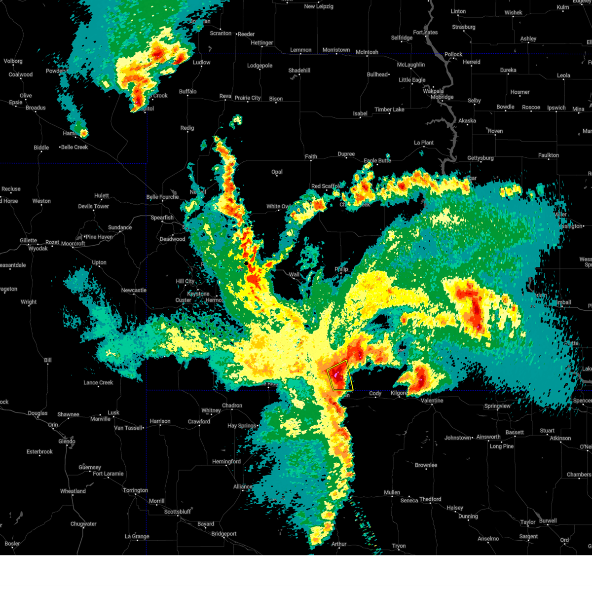
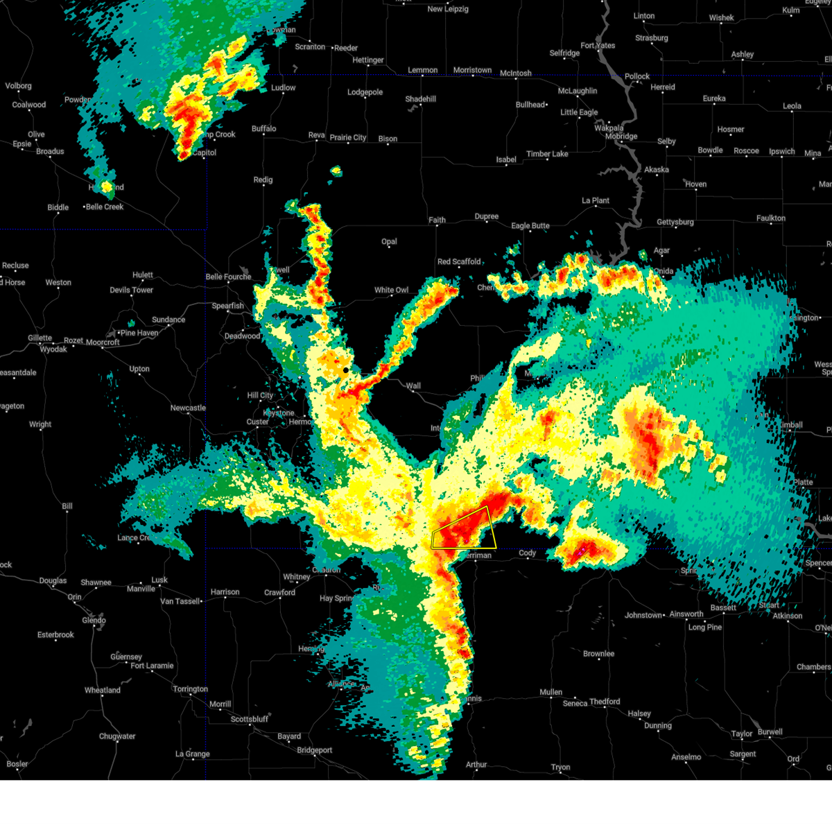
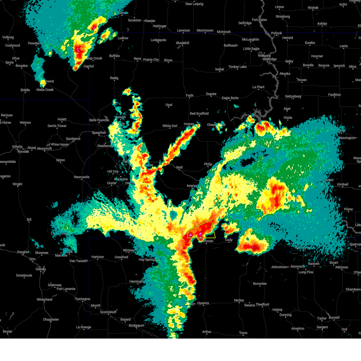
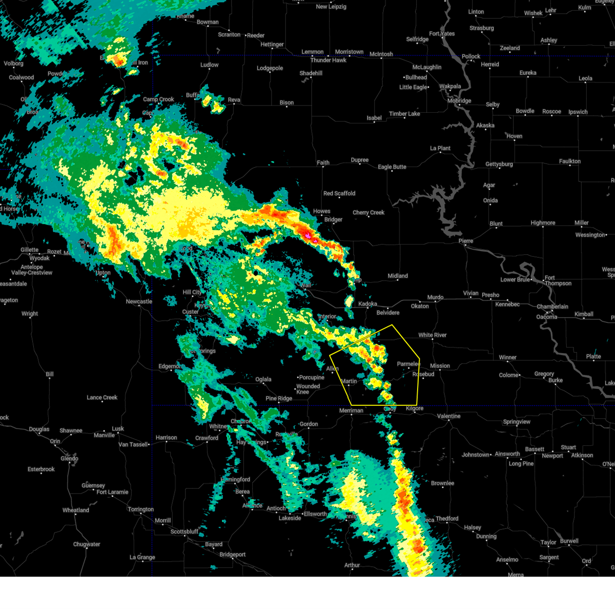
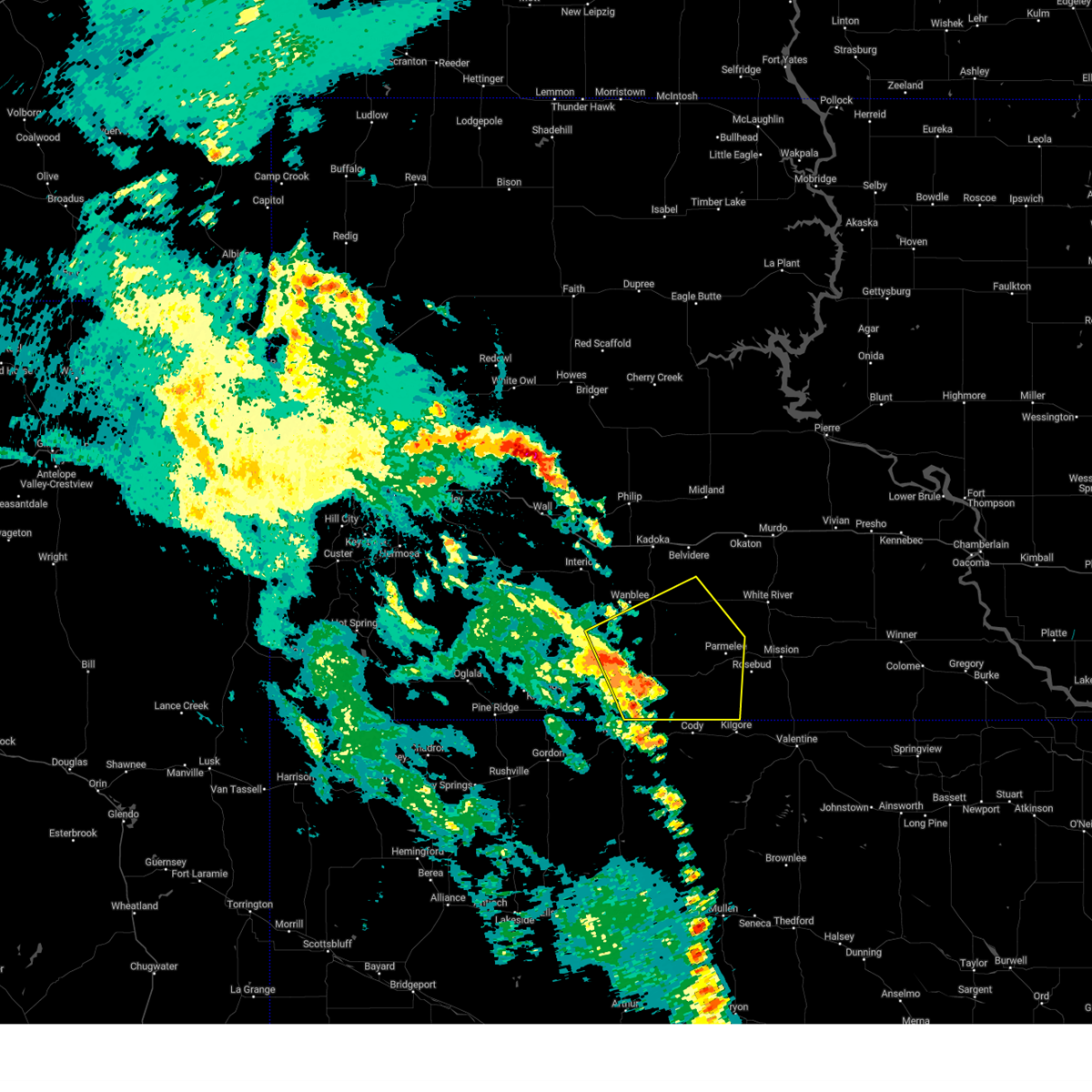
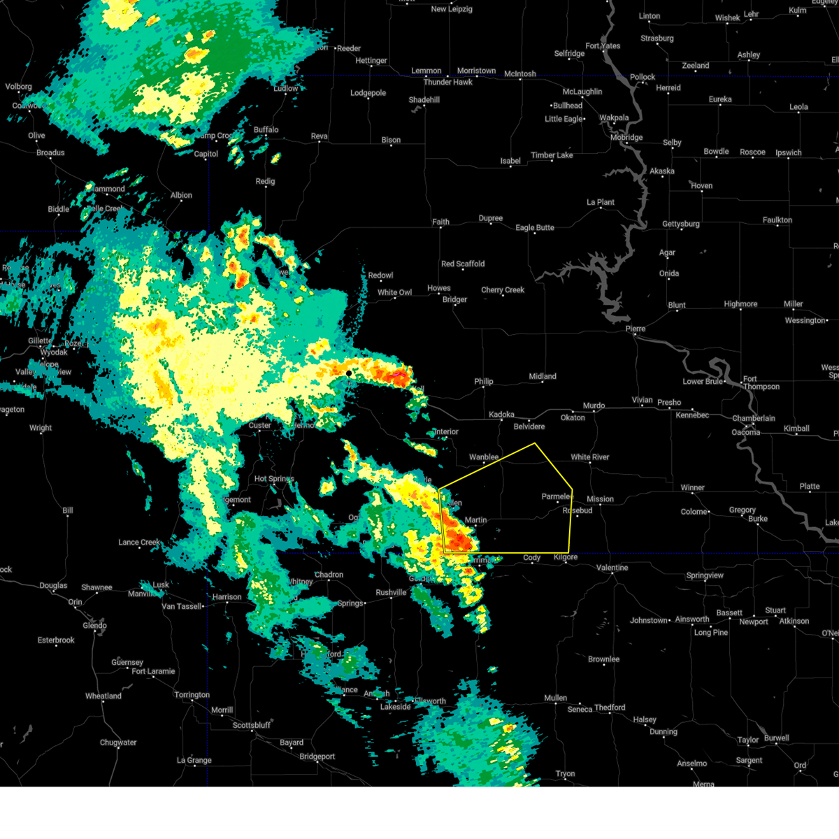
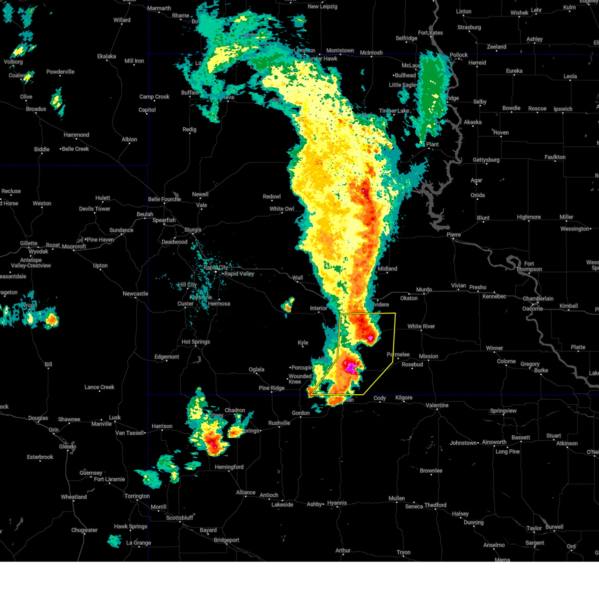
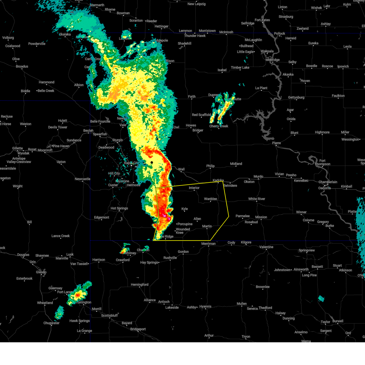
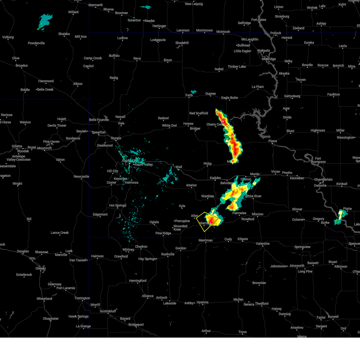
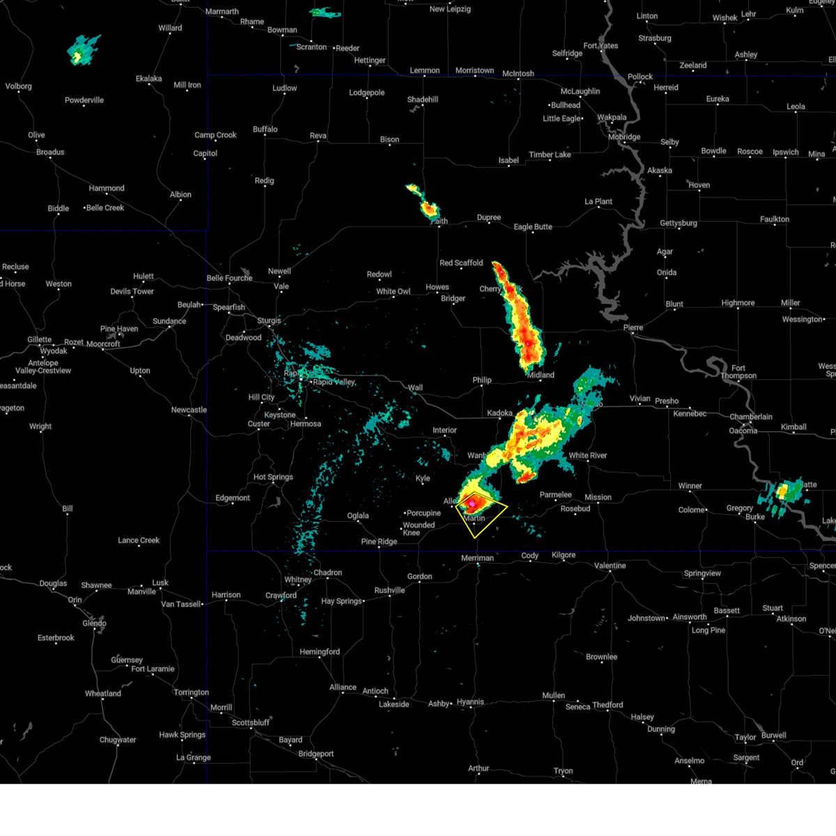
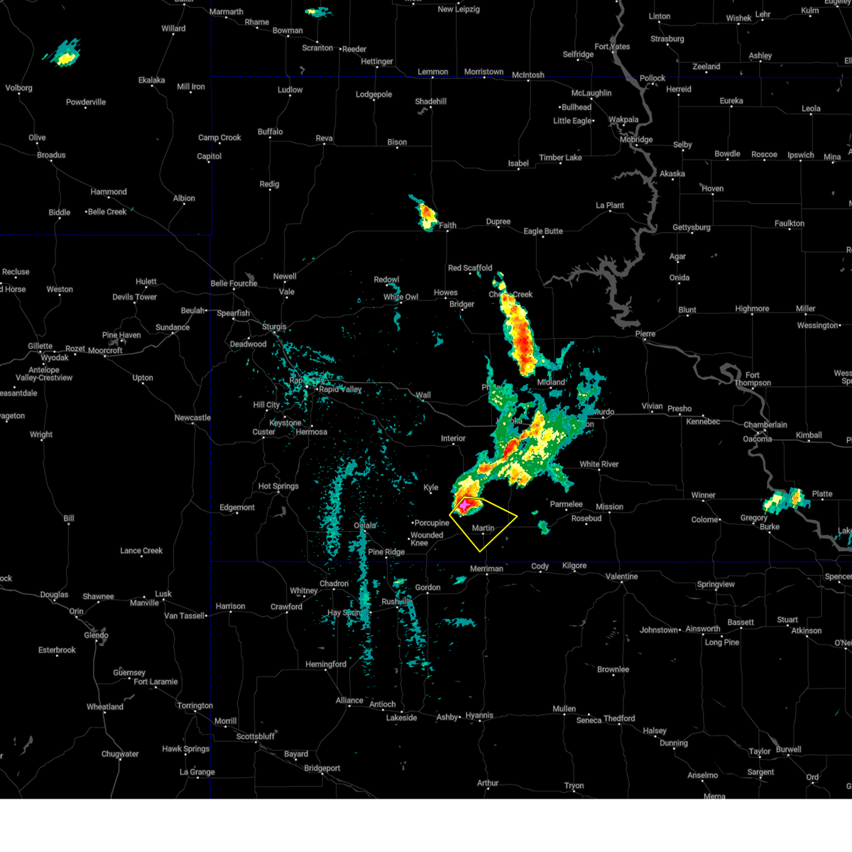
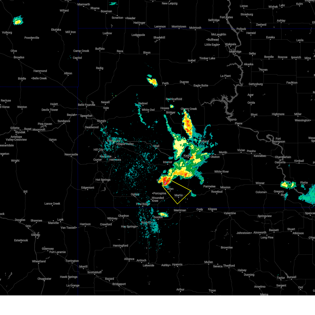
Hail Map for Martin, SD
The Martin, SD area has had 47 reports of on-the-ground hail by trained spotters, and has been under severe weather warnings 25 times during the past 12 months. Doppler radar has detected hail at or near Martin, SD on 99 occasions, including 6 occasions during the past year.
| Name: | Martin, SD |
| Where Located: | 63.3 miles WNW of Valentine, NE |
| Map: | Google Map for Martin, SD |
| Population: | 1071 |
| Housing Units: | 467 |
| More Info: | Search Google for Martin, SD |
2
The Top Recent Hail Date for Martin, SD is Sunday, July 6, 2025 (15th out of 99)
Hail and Wind Damage Spotted near Martin, SD
| Date / Time | Report Details |
|---|---|
| 6/9/2026 6:41 PM MDT | Storm damage reported in bennett county SD, 4.5 miles WSW of Martin, SD |
| 6/9/2026 7:41 PM CDT |
 Svrunr the national weather service in rapid city has issued a * severe thunderstorm warning for, western todd county in south central south dakota, western mellette county in south central south dakota, eastern jackson county in southwestern south dakota, bennett county in southwestern south dakota, * until 745 pm mdt/845 pm cdt/. * at 641 pm mdt/741 pm cdt/, severe thunderstorms were located along a line extending from 3 miles east of kadoka to long valley to 6 miles south of lacreek wildlife refuge, moving east at 35 mph (radar indicated). Hazards include 60 mph wind gusts. expect damage to roofs, siding, and trees Svrunr the national weather service in rapid city has issued a * severe thunderstorm warning for, western todd county in south central south dakota, western mellette county in south central south dakota, eastern jackson county in southwestern south dakota, bennett county in southwestern south dakota, * until 745 pm mdt/845 pm cdt/. * at 641 pm mdt/741 pm cdt/, severe thunderstorms were located along a line extending from 3 miles east of kadoka to long valley to 6 miles south of lacreek wildlife refuge, moving east at 35 mph (radar indicated). Hazards include 60 mph wind gusts. expect damage to roofs, siding, and trees
|
| 6/9/2026 6:35 PM MDT | Storm damage reported in bennett county SD, 4.5 miles WSW of Martin, SD |
| 6/9/2026 6:30 PM MDT | Storm damage reported in bennett county SD, 4.5 miles WSW of Martin, SD |
| 6/9/2026 6:20 PM MDT |
 The storm which prompted the warning has weakened below severe limits, and no longer poses an immediate threat to life or property. therefore, the warning will be allowed to expire. however, gusty winds and heavy rain are still possible with this thunderstorm. a tornado watch remains in effect until 1100 pm mdt for southwestern south dakota. The storm which prompted the warning has weakened below severe limits, and no longer poses an immediate threat to life or property. therefore, the warning will be allowed to expire. however, gusty winds and heavy rain are still possible with this thunderstorm. a tornado watch remains in effect until 1100 pm mdt for southwestern south dakota.
|
| 6/9/2026 5:56 PM MDT |
 At 556 pm mdt, a severe thunderstorm was located near porcupine butte housing, or 15 miles northeast of pine ridge, moving northeast at 40 mph (radar indicated). Hazards include 60 mph wind gusts. Expect damage to roofs, siding, and trees. Locations impacted include, pine ridge, martin, porcupine, manderson, allen, wounded knee, batesland, wakpamni, swett, wolf creek housing, evergreen, porcupine butte housing, yellow bear canyon, snake butte, southwestern lacreek wildlife refuge, and pine ridge reservation. At 556 pm mdt, a severe thunderstorm was located near porcupine butte housing, or 15 miles northeast of pine ridge, moving northeast at 40 mph (radar indicated). Hazards include 60 mph wind gusts. Expect damage to roofs, siding, and trees. Locations impacted include, pine ridge, martin, porcupine, manderson, allen, wounded knee, batesland, wakpamni, swett, wolf creek housing, evergreen, porcupine butte housing, yellow bear canyon, snake butte, southwestern lacreek wildlife refuge, and pine ridge reservation.
|
| 6/9/2026 5:29 PM MDT |
 Svrunr the national weather service in rapid city has issued a * severe thunderstorm warning for, oglala lakota county in southwestern south dakota, southwestern jackson county in southwestern south dakota, western bennett county in southwestern south dakota, * until 630 pm mdt. * at 529 pm mdt, a severe thunderstorm was located over calico, or 3 miles north of pine ridge, moving northeast at 45 mph (radar indicated). Hazards include 60 mph wind gusts. expect damage to roofs, siding, and trees Svrunr the national weather service in rapid city has issued a * severe thunderstorm warning for, oglala lakota county in southwestern south dakota, southwestern jackson county in southwestern south dakota, western bennett county in southwestern south dakota, * until 630 pm mdt. * at 529 pm mdt, a severe thunderstorm was located over calico, or 3 miles north of pine ridge, moving northeast at 45 mph (radar indicated). Hazards include 60 mph wind gusts. expect damage to roofs, siding, and trees
|
| 10/4/2025 8:34 PM CDT | Svrunr the national weather service in rapid city has issued a * severe thunderstorm warning for, northwestern todd county in south central south dakota, mellette county in south central south dakota, eastern jackson county in southwestern south dakota, eastern bennett county in southwestern south dakota, * until 845 pm mdt/945 pm cdt/. * at 734 pm mdt/834 pm cdt/, severe thunderstorms were located along a line extending from 7 miles northeast of lacreek north housing to 2 miles east of vetal, moving northeast at 45 mph (radar indicated). Hazards include 70 mph wind gusts and penny size hail. Expect considerable tree damage. Damage is likely to mobile homes, roofs, and outbuildings. |
| 10/4/2025 7:30 PM MDT | Storm damage reported in bennett county SD, 4.5 miles WSW of Martin, SD |
| 8/15/2025 9:23 PM MDT |
 The storm which prompted the warning has weakened below severe limits, and no longer poses an immediate threat to life or property. therefore, the warning will be allowed to expire. however, gusty winds and heavy rain are still possible with this thunderstorm. a severe thunderstorm watch remains in effect until 200 am mdt for southwestern south dakota. The storm which prompted the warning has weakened below severe limits, and no longer poses an immediate threat to life or property. therefore, the warning will be allowed to expire. however, gusty winds and heavy rain are still possible with this thunderstorm. a severe thunderstorm watch remains in effect until 200 am mdt for southwestern south dakota.
|
| 8/15/2025 9:17 PM MDT |
 At 917 pm mdt, a severe thunderstorm was located near yellow bear canyon, or 17 miles northwest of martin, moving northeast at 35 mph (radar indicated). Hazards include 60 mph wind gusts. Expect damage to roofs, siding, and trees. Locations impacted include, martin, kyle, allen, hisle, lacreek north housing, swett, sunrise housing, kyle north route housing, yellow bear canyon, snake butte, and pine ridge reservation. At 917 pm mdt, a severe thunderstorm was located near yellow bear canyon, or 17 miles northwest of martin, moving northeast at 35 mph (radar indicated). Hazards include 60 mph wind gusts. Expect damage to roofs, siding, and trees. Locations impacted include, martin, kyle, allen, hisle, lacreek north housing, swett, sunrise housing, kyle north route housing, yellow bear canyon, snake butte, and pine ridge reservation.
|
| 8/15/2025 8:58 PM MDT |
 At 858 pm mdt, a severe thunderstorm was located 6 miles east of porcupine, or 24 miles northeast of pine ridge, moving northeast at 35 mph (radar indicated). Hazards include 60 mph wind gusts and nickel size hail. Expect damage to roofs, siding, and trees. Locations impacted include, martin, porcupine, kyle, manderson, allen, wounded knee, batesland, goose neck housing, hisle, swett, lacreek north housing, sunrise housing, kyle north route housing, evergreen, porcupine butte housing, yellow bear canyon, snake butte, northeastern lacreek wildlife refuge, and pine ridge reservation. At 858 pm mdt, a severe thunderstorm was located 6 miles east of porcupine, or 24 miles northeast of pine ridge, moving northeast at 35 mph (radar indicated). Hazards include 60 mph wind gusts and nickel size hail. Expect damage to roofs, siding, and trees. Locations impacted include, martin, porcupine, kyle, manderson, allen, wounded knee, batesland, goose neck housing, hisle, swett, lacreek north housing, sunrise housing, kyle north route housing, evergreen, porcupine butte housing, yellow bear canyon, snake butte, northeastern lacreek wildlife refuge, and pine ridge reservation.
|
| 8/15/2025 8:28 PM MDT |
 Svrunr the national weather service in rapid city has issued a * severe thunderstorm warning for, southeastern oglala lakota county in southwestern south dakota, southwestern jackson county in southwestern south dakota, western bennett county in southwestern south dakota, * until 930 pm mdt. * at 828 pm mdt, a severe thunderstorm was located 3 miles west of wounded knee, or 10 miles northeast of pine ridge, moving northeast at 35 mph (radar indicated). Hazards include ping pong ball size hail and 60 mph wind gusts. People and animals outdoors will be injured. expect hail damage to roofs, siding, windows, and vehicles. Expect wind damage to roofs, siding, and trees. Svrunr the national weather service in rapid city has issued a * severe thunderstorm warning for, southeastern oglala lakota county in southwestern south dakota, southwestern jackson county in southwestern south dakota, western bennett county in southwestern south dakota, * until 930 pm mdt. * at 828 pm mdt, a severe thunderstorm was located 3 miles west of wounded knee, or 10 miles northeast of pine ridge, moving northeast at 35 mph (radar indicated). Hazards include ping pong ball size hail and 60 mph wind gusts. People and animals outdoors will be injured. expect hail damage to roofs, siding, windows, and vehicles. Expect wind damage to roofs, siding, and trees.
|
| 8/13/2025 7:20 PM MDT |
 At 720 pm mdt, severe thunderstorms were located along a line extending from 6 miles east of long valley to 2 miles southeast of tuthill to 4 miles east of merriman, moving east at 45 mph (radar indicated). Hazards include 60 mph wind gusts. Expect damage to roofs, siding, and trees. Locations impacted include, martin, long valley, tuthill, lacreek north housing, harrington, sunrise housing, vetal, eagle nest butte, and lacreek wildlife refuge. At 720 pm mdt, severe thunderstorms were located along a line extending from 6 miles east of long valley to 2 miles southeast of tuthill to 4 miles east of merriman, moving east at 45 mph (radar indicated). Hazards include 60 mph wind gusts. Expect damage to roofs, siding, and trees. Locations impacted include, martin, long valley, tuthill, lacreek north housing, harrington, sunrise housing, vetal, eagle nest butte, and lacreek wildlife refuge.
|
| 8/13/2025 7:15 PM MDT | Storm damage reported in bennett county SD, 4.5 miles WSW of Martin, SD |
| 8/13/2025 6:58 PM MDT |
 At 657 pm mdt, severe thunderstorms were located along a line extending from 3 miles south of snake butte to 9 miles northwest of merriman to 13 miles east of gordon, moving east at 45 mph (radar indicated). Hazards include 60 to 70 mph wind gusts and quarter size hail. Hail damage to vehicles is expected. expect wind damage to roofs, siding, and trees. Locations impacted include, martin, allen, long valley, tuthill, hisle, harrington, swett, lacreek north housing, sunrise housing, vetal, yellow bear canyon, eagle nest butte, snake butte, lacreek wildlife refuge, and eastern pine ridge reservation. At 657 pm mdt, severe thunderstorms were located along a line extending from 3 miles south of snake butte to 9 miles northwest of merriman to 13 miles east of gordon, moving east at 45 mph (radar indicated). Hazards include 60 to 70 mph wind gusts and quarter size hail. Hail damage to vehicles is expected. expect wind damage to roofs, siding, and trees. Locations impacted include, martin, allen, long valley, tuthill, hisle, harrington, swett, lacreek north housing, sunrise housing, vetal, yellow bear canyon, eagle nest butte, snake butte, lacreek wildlife refuge, and eastern pine ridge reservation.
|
| 8/13/2025 6:32 PM MDT |
 Svrunr the national weather service in rapid city has issued a * severe thunderstorm warning for, southern jackson county in southwestern south dakota, bennett county in southwestern south dakota, * until 745 pm mdt. * at 632 pm mdt, severe thunderstorms were located along a line extending from badlands national park to 3 miles northwest of batesland to 6 miles northwest of gordon, moving east at 45 mph (radar indicated). Hazards include 60 mph wind gusts and quarter size hail. Hail damage to vehicles is expected. Expect wind damage to roofs, siding, and trees. Svrunr the national weather service in rapid city has issued a * severe thunderstorm warning for, southern jackson county in southwestern south dakota, bennett county in southwestern south dakota, * until 745 pm mdt. * at 632 pm mdt, severe thunderstorms were located along a line extending from badlands national park to 3 miles northwest of batesland to 6 miles northwest of gordon, moving east at 45 mph (radar indicated). Hazards include 60 mph wind gusts and quarter size hail. Hail damage to vehicles is expected. Expect wind damage to roofs, siding, and trees.
|
| 7/26/2025 6:29 PM MDT | Golf Ball sized hail reported 21.2 miles WSW of Martin, SD |
| 7/9/2025 5:02 PM MDT |
 At 501 pm mdt, a severe thunderstorm was located 7 miles southeast of eagle nest butte, or 15 miles northeast of martin, moving east at 25 mph (radar indicated). Hazards include 70 mph wind gusts. Expect considerable tree damage. damage is likely to mobile homes, roofs, and outbuildings. Locations impacted include, martin, wanblee, long valley, tuthill, hisle, lacreek north housing, sunrise housing, vetal, eagle nest butte, lacreek wildlife refuge, and southeastern pine ridge reservation. At 501 pm mdt, a severe thunderstorm was located 7 miles southeast of eagle nest butte, or 15 miles northeast of martin, moving east at 25 mph (radar indicated). Hazards include 70 mph wind gusts. Expect considerable tree damage. damage is likely to mobile homes, roofs, and outbuildings. Locations impacted include, martin, wanblee, long valley, tuthill, hisle, lacreek north housing, sunrise housing, vetal, eagle nest butte, lacreek wildlife refuge, and southeastern pine ridge reservation.
|
| 7/9/2025 4:50 PM MDT | Storm damage reported in bennett county SD, 5 miles WSW of Martin, SD |
| 7/9/2025 4:46 PM MDT |
 At 445 pm mdt, a severe thunderstorm was located 3 miles southwest of hisle, or 13 miles north of martin, moving southeast at 30 mph (radar indicated). Hazards include 60 mph wind gusts and quarter size hail. Hail damage to vehicles is expected. expect wind damage to roofs, siding, and trees. Locations impacted include, martin, wanblee, allen, long valley, tuthill, hisle, swett, lacreek north housing, sunrise housing, vetal, yellow bear canyon, eagle nest butte, snake butte, lacreek wildlife refuge, and eastern pine ridge reservation. At 445 pm mdt, a severe thunderstorm was located 3 miles southwest of hisle, or 13 miles north of martin, moving southeast at 30 mph (radar indicated). Hazards include 60 mph wind gusts and quarter size hail. Hail damage to vehicles is expected. expect wind damage to roofs, siding, and trees. Locations impacted include, martin, wanblee, allen, long valley, tuthill, hisle, swett, lacreek north housing, sunrise housing, vetal, yellow bear canyon, eagle nest butte, snake butte, lacreek wildlife refuge, and eastern pine ridge reservation.
|
| 7/9/2025 4:30 PM MDT | Storm damage reported in bennett county SD, 3.8 miles WSW of Martin, SD |
| 7/9/2025 4:26 PM MDT |
 Svrunr the national weather service in rapid city has issued a * severe thunderstorm warning for, southwestern jackson county in southwestern south dakota, bennett county in southwestern south dakota, * until 530 pm mdt. * at 426 pm mdt, a severe thunderstorm was located 3 miles west of snake butte, or 21 miles northwest of martin, moving southeast at 30 mph (radar indicated). Hazards include 60 mph wind gusts and quarter size hail. Hail damage to vehicles is expected. Expect wind damage to roofs, siding, and trees. Svrunr the national weather service in rapid city has issued a * severe thunderstorm warning for, southwestern jackson county in southwestern south dakota, bennett county in southwestern south dakota, * until 530 pm mdt. * at 426 pm mdt, a severe thunderstorm was located 3 miles west of snake butte, or 21 miles northwest of martin, moving southeast at 30 mph (radar indicated). Hazards include 60 mph wind gusts and quarter size hail. Hail damage to vehicles is expected. Expect wind damage to roofs, siding, and trees.
|
| 7/9/2025 4:06 PM MDT |
 the severe thunderstorm warning has been cancelled and is no longer in effect the severe thunderstorm warning has been cancelled and is no longer in effect
|
| 7/9/2025 4:06 PM MDT |
 At 404 pm mdt, a severe thunderstorm was located 5 miles northeast of allen, or 11 miles northwest of martin, moving northeast at 25 mph (radar indicated). Hazards include 60 mph wind gusts and quarter size hail. Hail damage to vehicles is expected. expect wind damage to roofs, siding, and trees. Locations impacted include, martin, allen, hisle, lacreek north housing, swett, sunrise housing, yellow bear canyon, eagle nest butte, snake butte, and eastern pine ridge reservation. At 404 pm mdt, a severe thunderstorm was located 5 miles northeast of allen, or 11 miles northwest of martin, moving northeast at 25 mph (radar indicated). Hazards include 60 mph wind gusts and quarter size hail. Hail damage to vehicles is expected. expect wind damage to roofs, siding, and trees. Locations impacted include, martin, allen, hisle, lacreek north housing, swett, sunrise housing, yellow bear canyon, eagle nest butte, snake butte, and eastern pine ridge reservation.
|
| 7/9/2025 3:45 PM MDT |
 Svrunr the national weather service in rapid city has issued a * severe thunderstorm warning for, southeastern oglala lakota county in southwestern south dakota, southwestern jackson county in southwestern south dakota, northwestern bennett county in southwestern south dakota, * until 430 pm mdt. * at 344 pm mdt, a severe thunderstorm was located near allen, or 13 miles northwest of martin, and and another storm was near batesland. both storms were moving northeast at 30 mph (radar indicated). Hazards include 60 mph wind gusts and quarter size hail. Hail damage to vehicles is expected. Expect wind damage to roofs, siding, and trees. Svrunr the national weather service in rapid city has issued a * severe thunderstorm warning for, southeastern oglala lakota county in southwestern south dakota, southwestern jackson county in southwestern south dakota, northwestern bennett county in southwestern south dakota, * until 430 pm mdt. * at 344 pm mdt, a severe thunderstorm was located near allen, or 13 miles northwest of martin, and and another storm was near batesland. both storms were moving northeast at 30 mph (radar indicated). Hazards include 60 mph wind gusts and quarter size hail. Hail damage to vehicles is expected. Expect wind damage to roofs, siding, and trees.
|
| 7/6/2025 7:10 AM MDT |
 The storm which prompted the warning has weakened below severe limits, and no longer poses an immediate threat to life or property. therefore, the warning will be allowed to expire. however, small hail and gusty winds are still possible with this thunderstorm. The storm which prompted the warning has weakened below severe limits, and no longer poses an immediate threat to life or property. therefore, the warning will be allowed to expire. however, small hail and gusty winds are still possible with this thunderstorm.
|
| 7/6/2025 6:42 AM MDT |
 At 642 am mdt, a severe thunderstorm was located near lacreek north housing, or 3 miles northwest of martin, moving east at 15 mph (radar indicated). Hazards include 60 mph wind gusts and quarter size hail. Hail damage to vehicles is expected. expect wind damage to roofs, siding, and trees. Locations impacted include, martin, sunrise housing, lacreek north housing, and northeastern lacreek wildlife refuge. At 642 am mdt, a severe thunderstorm was located near lacreek north housing, or 3 miles northwest of martin, moving east at 15 mph (radar indicated). Hazards include 60 mph wind gusts and quarter size hail. Hail damage to vehicles is expected. expect wind damage to roofs, siding, and trees. Locations impacted include, martin, sunrise housing, lacreek north housing, and northeastern lacreek wildlife refuge.
|
| 7/6/2025 6:25 AM MDT |
 Svrunr the national weather service in rapid city has issued a * severe thunderstorm warning for, central bennett county in southwestern south dakota, * until 715 am mdt. * at 625 am mdt, a severe thunderstorm was located 5 miles east of swett, or 6 miles west of martin, moving northeast at 20 mph (radar indicated). Hazards include 60 mph wind gusts and half dollar size hail. Hail damage to vehicles is expected. Expect wind damage to roofs, siding, and trees. Svrunr the national weather service in rapid city has issued a * severe thunderstorm warning for, central bennett county in southwestern south dakota, * until 715 am mdt. * at 625 am mdt, a severe thunderstorm was located 5 miles east of swett, or 6 miles west of martin, moving northeast at 20 mph (radar indicated). Hazards include 60 mph wind gusts and half dollar size hail. Hail damage to vehicles is expected. Expect wind damage to roofs, siding, and trees.
|
| 7/6/2025 6:16 AM MDT |
 At 615 am mdt, a severe thunderstorm was located over swett, or 9 miles west of martin, moving east at 15 mph (radar indicated). Hazards include 60 mph wind gusts and quarter size hail. Hail damage to vehicles is expected. expect wind damage to roofs, siding, and trees. Locations impacted include, martin, swett, and southern pine ridge reservation. At 615 am mdt, a severe thunderstorm was located over swett, or 9 miles west of martin, moving east at 15 mph (radar indicated). Hazards include 60 mph wind gusts and quarter size hail. Hail damage to vehicles is expected. expect wind damage to roofs, siding, and trees. Locations impacted include, martin, swett, and southern pine ridge reservation.
|
| 7/6/2025 5:54 AM MDT |
 Svrunr the national weather service in rapid city has issued a * severe thunderstorm warning for, southwestern bennett county in southwestern south dakota, * until 630 am mdt. * at 554 am mdt, a severe thunderstorm was located 3 miles southwest of swett, or 14 miles west of martin, moving east at 20 mph (radar indicated). Hazards include 60 mph wind gusts and half dollar size hail. Hail damage to vehicles is expected. Expect wind damage to roofs, siding, and trees. Svrunr the national weather service in rapid city has issued a * severe thunderstorm warning for, southwestern bennett county in southwestern south dakota, * until 630 am mdt. * at 554 am mdt, a severe thunderstorm was located 3 miles southwest of swett, or 14 miles west of martin, moving east at 20 mph (radar indicated). Hazards include 60 mph wind gusts and half dollar size hail. Hail damage to vehicles is expected. Expect wind damage to roofs, siding, and trees.
|
| 7/1/2025 6:43 PM MDT |
 Svrunr the national weather service in rapid city has issued a * severe thunderstorm warning for, southeastern oglala lakota county in southwestern south dakota, western bennett county in southwestern south dakota, * until 745 pm mdt. * at 643 pm mdt, severe thunderstorms were located along a line extending from 2 miles northwest of yellow bear canyon to 3 miles east of porcupine, moving south at 25 mph (radar indicated). Hazards include 60 mph wind gusts and half dollar size hail. Hail damage to vehicles is expected. Expect wind damage to roofs, siding, and trees. Svrunr the national weather service in rapid city has issued a * severe thunderstorm warning for, southeastern oglala lakota county in southwestern south dakota, western bennett county in southwestern south dakota, * until 745 pm mdt. * at 643 pm mdt, severe thunderstorms were located along a line extending from 2 miles northwest of yellow bear canyon to 3 miles east of porcupine, moving south at 25 mph (radar indicated). Hazards include 60 mph wind gusts and half dollar size hail. Hail damage to vehicles is expected. Expect wind damage to roofs, siding, and trees.
|
| 6/28/2025 11:10 PM MDT | Storm damage reported in bennett county SD, 4.5 miles WSW of Martin, SD |
| 6/28/2025 11:05 PM MDT | Storm damage reported in bennett county SD, 1.2 miles WNW of Martin, SD |
| 6/28/2025 10:50 PM MDT |
 Svrunr the national weather service in rapid city has issued a * severe thunderstorm warning for, southeastern oglala lakota county in southwestern south dakota, southern jackson county in southwestern south dakota, bennett county in southwestern south dakota, * until 1130 pm mdt. * at 1049 pm mdt, severe thunderstorms were located along a line extending from 3 miles east of potato creek to 3 miles northwest of allen to 3 miles north of batesland, moving east at 55 mph. wind gusts of 67 mph were recently measured near porcupine (automated observations). Hazards include 70 mph wind gusts and penny size hail. Expect considerable tree damage. Damage is likely to mobile homes, roofs, and outbuildings. Svrunr the national weather service in rapid city has issued a * severe thunderstorm warning for, southeastern oglala lakota county in southwestern south dakota, southern jackson county in southwestern south dakota, bennett county in southwestern south dakota, * until 1130 pm mdt. * at 1049 pm mdt, severe thunderstorms were located along a line extending from 3 miles east of potato creek to 3 miles northwest of allen to 3 miles north of batesland, moving east at 55 mph. wind gusts of 67 mph were recently measured near porcupine (automated observations). Hazards include 70 mph wind gusts and penny size hail. Expect considerable tree damage. Damage is likely to mobile homes, roofs, and outbuildings.
|
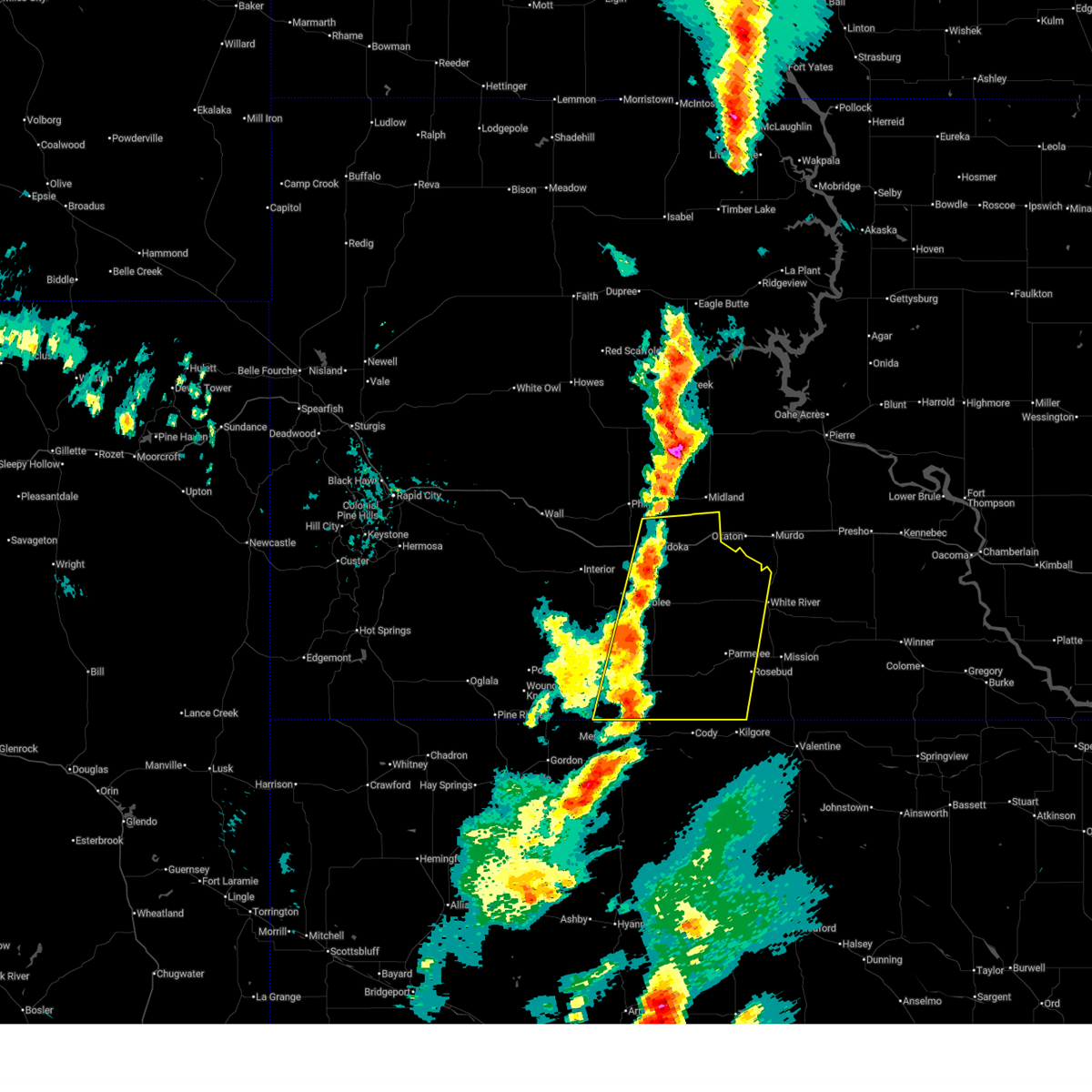
| 6/15/2025 11:56 PM CDT |
 At 1056 pm mdt/1156 pm cdt/, severe thunderstorms were located along a line extending from 3 miles north of corn creek to 7 miles northwest of cody, moving east at 40 mph (radar indicated). Hazards include 60 mph wind gusts and penny size hail. Expect damage to roofs, siding, and trees. these severe storms will be near, parmelee, spring creek, norris, cedar butte, upper cut meat, black pipe, corn creek, grass mountain, and he dog around 1200 am cdt. harrington around 1100 pm mdt. white river, rosebud, saint francis, fairgrounds housing, ring thunder, soldier creek, swift bear, and two strike around 1205 am cdt. lakeview and horse creek around 1210 am cdt. mission around 1215 am cdt. Other locations impacted by these severe thunderstorms include rosebud reservation. At 1056 pm mdt/1156 pm cdt/, severe thunderstorms were located along a line extending from 3 miles north of corn creek to 7 miles northwest of cody, moving east at 40 mph (radar indicated). Hazards include 60 mph wind gusts and penny size hail. Expect damage to roofs, siding, and trees. these severe storms will be near, parmelee, spring creek, norris, cedar butte, upper cut meat, black pipe, corn creek, grass mountain, and he dog around 1200 am cdt. harrington around 1100 pm mdt. white river, rosebud, saint francis, fairgrounds housing, ring thunder, soldier creek, swift bear, and two strike around 1205 am cdt. lakeview and horse creek around 1210 am cdt. mission around 1215 am cdt. Other locations impacted by these severe thunderstorms include rosebud reservation.
|
| 6/15/2025 10:42 PM MDT |
 Svrunr the national weather service in rapid city has issued a * severe thunderstorm warning for, western todd county in south central south dakota, southwestern mellette county in south central south dakota, southeastern jackson county in southwestern south dakota, bennett county in southwestern south dakota, * until 1130 pm mdt/1230 am cdt/. * at 1041 pm mdt/1141 pm cdt/, severe thunderstorms were located along a line extending from 2 miles north of george town to 6 miles north of merriman, moving east at 70 mph (radar indicated). Hazards include 60 mph wind gusts and quarter size hail. Hail damage to vehicles is expected. expect wind damage to roofs, siding, and trees. severe thunderstorms will be near, corn creek around 1145 pm cdt. long valley, tuthill, vetal, and lacreek wildlife refuge around 1045 pm mdt. norris and black pipe around 1150 pm cdt. harrington around 1050 pm mdt. parmelee, cedar butte, upper cut meat, and he dog around 1155 pm cdt. spring creek and grass mountain around 1200 am cdt. white river, rosebud, saint francis, horse creek, fairgrounds housing, ring thunder, soldier creek, swift bear, and two strike around 1205 am cdt. lakeview around 1210 am cdt. mission around 1215 am cdt. Other locations impacted by these severe thunderstorms include rosebud reservation and eastern pine ridge reservation. Svrunr the national weather service in rapid city has issued a * severe thunderstorm warning for, western todd county in south central south dakota, southwestern mellette county in south central south dakota, southeastern jackson county in southwestern south dakota, bennett county in southwestern south dakota, * until 1130 pm mdt/1230 am cdt/. * at 1041 pm mdt/1141 pm cdt/, severe thunderstorms were located along a line extending from 2 miles north of george town to 6 miles north of merriman, moving east at 70 mph (radar indicated). Hazards include 60 mph wind gusts and quarter size hail. Hail damage to vehicles is expected. expect wind damage to roofs, siding, and trees. severe thunderstorms will be near, corn creek around 1145 pm cdt. long valley, tuthill, vetal, and lacreek wildlife refuge around 1045 pm mdt. norris and black pipe around 1150 pm cdt. harrington around 1050 pm mdt. parmelee, cedar butte, upper cut meat, and he dog around 1155 pm cdt. spring creek and grass mountain around 1200 am cdt. white river, rosebud, saint francis, horse creek, fairgrounds housing, ring thunder, soldier creek, swift bear, and two strike around 1205 am cdt. lakeview around 1210 am cdt. mission around 1215 am cdt. Other locations impacted by these severe thunderstorms include rosebud reservation and eastern pine ridge reservation.
|
| 6/15/2025 10:41 PM MDT | Storm damage reported in bennett county SD, 0.3 miles NNW of Martin, SD |
| 6/15/2025 10:16 PM MDT |
 the severe thunderstorm warning has been cancelled and is no longer in effect the severe thunderstorm warning has been cancelled and is no longer in effect
|
| 6/15/2025 10:16 PM MDT |
 At 1015 pm mdt, severe thunderstorms were located along a line extending from 6 miles southeast of cedar pass to batesland, moving east at 40 mph (radar indicated). Hazards include ping pong ball size hail and 60 mph wind gusts. People and animals outdoors will be injured. expect hail damage to roofs, siding, windows, and vehicles. expect wind damage to roofs, siding, and trees. these severe storms will be near, wanblee, allen, swett, hisle, southern yellow bear canyon, snake butte, and eagle nest butte around 1020 pm mdt. martin, lacreek north housing, and sunrise housing around 1025 pm mdt. southwestern lacreek wildlife refuge around 1030 pm mdt. Other locations impacted by these severe thunderstorms include pine ridge reservation. At 1015 pm mdt, severe thunderstorms were located along a line extending from 6 miles southeast of cedar pass to batesland, moving east at 40 mph (radar indicated). Hazards include ping pong ball size hail and 60 mph wind gusts. People and animals outdoors will be injured. expect hail damage to roofs, siding, windows, and vehicles. expect wind damage to roofs, siding, and trees. these severe storms will be near, wanblee, allen, swett, hisle, southern yellow bear canyon, snake butte, and eagle nest butte around 1020 pm mdt. martin, lacreek north housing, and sunrise housing around 1025 pm mdt. southwestern lacreek wildlife refuge around 1030 pm mdt. Other locations impacted by these severe thunderstorms include pine ridge reservation.
|
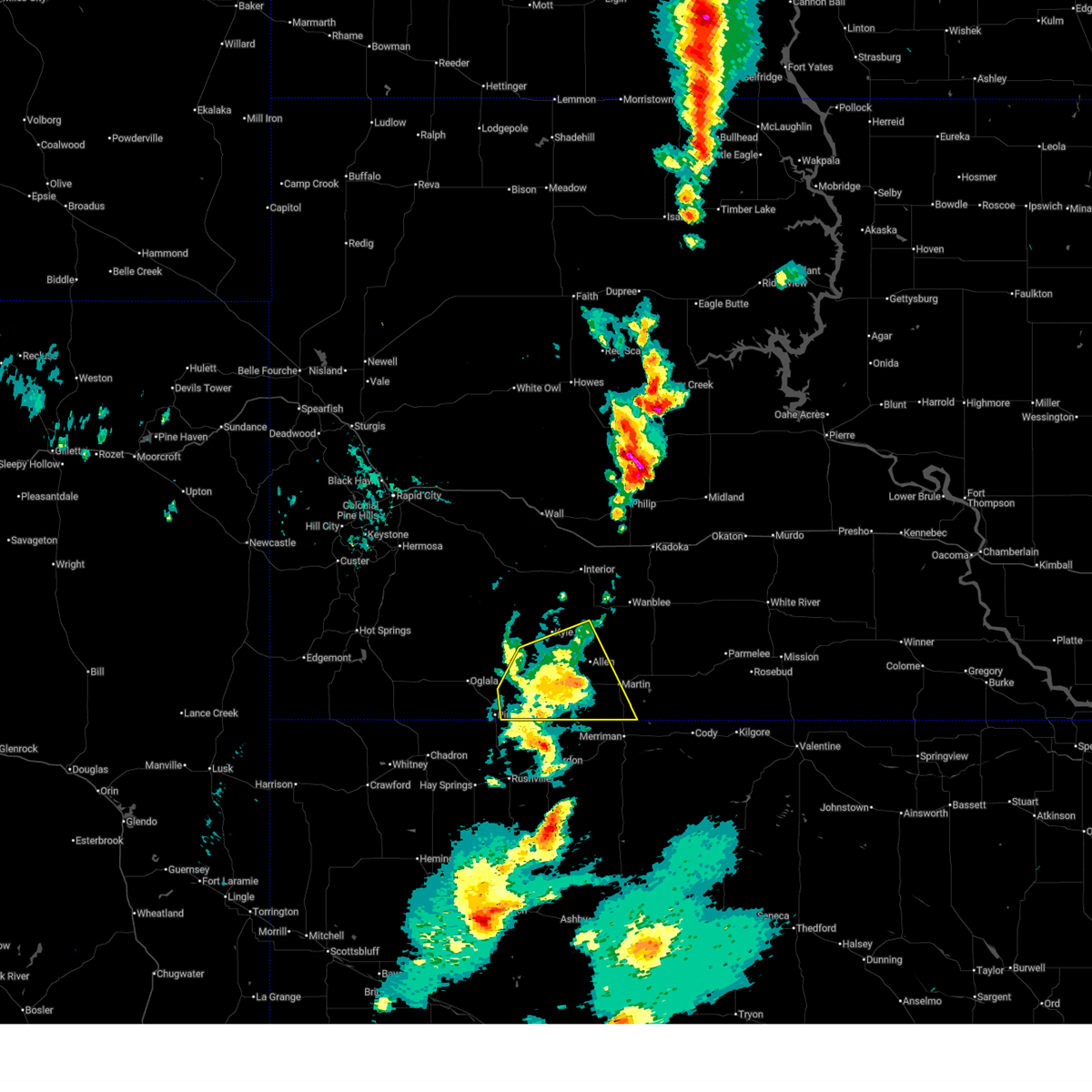
| 6/15/2025 9:54 PM MDT |
 Svrunr the national weather service in rapid city has issued a * severe thunderstorm warning for, eastern oglala lakota county in southwestern south dakota, southwestern jackson county in southwestern south dakota, western bennett county in southwestern south dakota, southeastern pennington county in west central south dakota, * until 1045 pm mdt. * at 953 pm mdt, severe thunderstorms were located along a line extending from 6 miles southwest of interior to near wounded knee, moving east at 40 mph (radar indicated). Hazards include two inch hail and 60 mph wind gusts. People and animals outdoors will be injured. expect hail damage to roofs, siding, windows, and vehicles. expect wind damage to roofs, siding, and trees. severe thunderstorms will be near, kyle, potato creek, batesland, yellow bear canyon, and snake butte around 1000 pm mdt. allen and swett around 1005 pm mdt. wanblee and hisle around 1015 pm mdt. martin and eagle nest butte around 1020 pm mdt. Other locations impacted by these severe thunderstorms include pine ridge reservation. Svrunr the national weather service in rapid city has issued a * severe thunderstorm warning for, eastern oglala lakota county in southwestern south dakota, southwestern jackson county in southwestern south dakota, western bennett county in southwestern south dakota, southeastern pennington county in west central south dakota, * until 1045 pm mdt. * at 953 pm mdt, severe thunderstorms were located along a line extending from 6 miles southwest of interior to near wounded knee, moving east at 40 mph (radar indicated). Hazards include two inch hail and 60 mph wind gusts. People and animals outdoors will be injured. expect hail damage to roofs, siding, windows, and vehicles. expect wind damage to roofs, siding, and trees. severe thunderstorms will be near, kyle, potato creek, batesland, yellow bear canyon, and snake butte around 1000 pm mdt. allen and swett around 1005 pm mdt. wanblee and hisle around 1015 pm mdt. martin and eagle nest butte around 1020 pm mdt. Other locations impacted by these severe thunderstorms include pine ridge reservation.
|
| 6/15/2025 9:51 PM MDT |
 The storm which prompted the warning has weakened below severe limits, and no longer poses an immediate threat to life or property. therefore, the warning will be allowed to expire. a severe thunderstorm watch remains in effect until 100 am mdt for southwestern south dakota. The storm which prompted the warning has weakened below severe limits, and no longer poses an immediate threat to life or property. therefore, the warning will be allowed to expire. a severe thunderstorm watch remains in effect until 100 am mdt for southwestern south dakota.
|
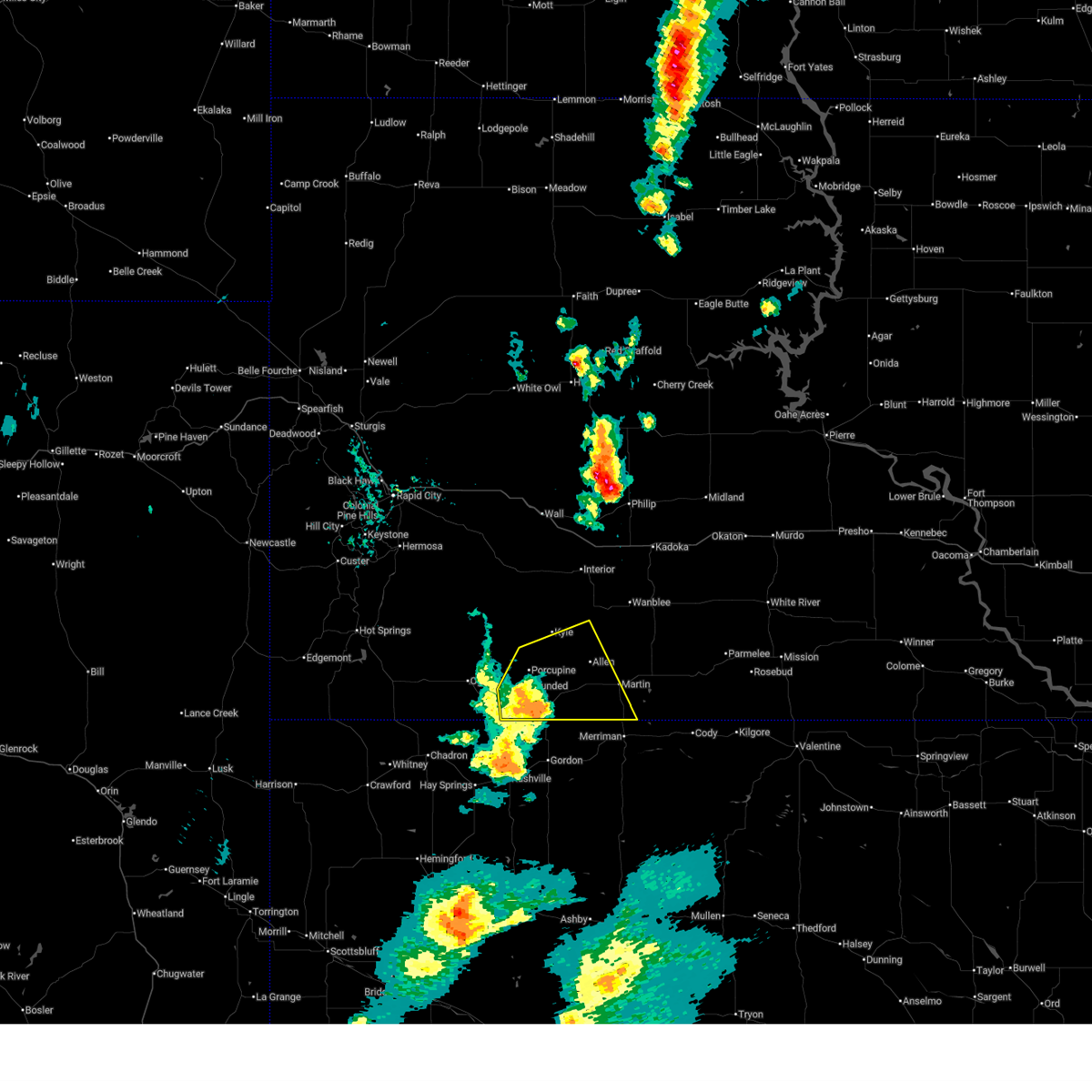
| 6/15/2025 9:15 PM MDT |
 Svrunr the national weather service in rapid city has issued a * severe thunderstorm warning for, southwestern bennett county in southwestern south dakota, * until 1000 pm mdt. * at 915 pm mdt, a severe thunderstorm was located over sunrise housing, or over martin, moving east at 10 mph (radar indicated). Hazards include 60 mph wind gusts and quarter size hail. Hail damage to vehicles is expected. expect wind damage to roofs, siding, and trees. this severe thunderstorm will be near, sunrise housing and lacreek wildlife refuge around 920 pm mdt. Other locations impacted by this severe thunderstorm include southern pine ridge reservation. Svrunr the national weather service in rapid city has issued a * severe thunderstorm warning for, southwestern bennett county in southwestern south dakota, * until 1000 pm mdt. * at 915 pm mdt, a severe thunderstorm was located over sunrise housing, or over martin, moving east at 10 mph (radar indicated). Hazards include 60 mph wind gusts and quarter size hail. Hail damage to vehicles is expected. expect wind damage to roofs, siding, and trees. this severe thunderstorm will be near, sunrise housing and lacreek wildlife refuge around 920 pm mdt. Other locations impacted by this severe thunderstorm include southern pine ridge reservation.
|
| 6/15/2025 9:08 PM MDT |
 The storm which prompted the warning is going to be reissued on, therefre the current warning will be allowed to expire. a severe thunderstorm watch remains in effect until 100 am mdt for southwestern south dakota. The storm which prompted the warning is going to be reissued on, therefre the current warning will be allowed to expire. a severe thunderstorm watch remains in effect until 100 am mdt for southwestern south dakota.
|
| 6/15/2025 8:56 PM MDT | Storm damage reported in bennett county SD, 9.5 miles E of Martin, SD |
| 6/15/2025 8:55 PM MDT |
 At 855 pm mdt, a severe thunderstorm was located 4 miles north of lacreek wildlife refuge, or 6 miles east of martin, and is nearly stationary (radar indicated). Hazards include 60 mph wind gusts and half dollar size hail. Hail damage to vehicles is expected. expect wind damage to roofs, siding, and trees. this severe storm will be near, eastern lacreek wildlife refuge around 900 pm mdt. Other locations impacted by this severe thunderstorm include southern pine ridge reservation. At 855 pm mdt, a severe thunderstorm was located 4 miles north of lacreek wildlife refuge, or 6 miles east of martin, and is nearly stationary (radar indicated). Hazards include 60 mph wind gusts and half dollar size hail. Hail damage to vehicles is expected. expect wind damage to roofs, siding, and trees. this severe storm will be near, eastern lacreek wildlife refuge around 900 pm mdt. Other locations impacted by this severe thunderstorm include southern pine ridge reservation.
|
| 6/15/2025 8:36 PM MDT |
 The storm which prompted the warning has been reissued on, therefore this warning will be allowed to expire. large hail and strong winds are still a threat over the area. a severe thunderstorm watch remains in effect until 100 am mdt for southwestern south dakota. The storm which prompted the warning has been reissued on, therefore this warning will be allowed to expire. large hail and strong winds are still a threat over the area. a severe thunderstorm watch remains in effect until 100 am mdt for southwestern south dakota.
|
| 6/15/2025 8:29 PM MDT |
 Svrunr the national weather service in rapid city has issued a * severe thunderstorm warning for, central bennett county in southwestern south dakota, * until 915 pm mdt. * at 829 pm mdt, a severe thunderstorm was located near sunrise housing, or 4 miles east of martin, moving east at 5 mph (radar indicated). Hazards include 60 mph wind gusts and half dollar size hail. Hail damage to vehicles is expected. expect wind damage to roofs, siding, and trees. this severe thunderstorm will be near, southern lacreek wildlife refuge around 835 pm mdt. Other locations impacted by this severe thunderstorm include southeastern pine ridge reservation. Svrunr the national weather service in rapid city has issued a * severe thunderstorm warning for, central bennett county in southwestern south dakota, * until 915 pm mdt. * at 829 pm mdt, a severe thunderstorm was located near sunrise housing, or 4 miles east of martin, moving east at 5 mph (radar indicated). Hazards include 60 mph wind gusts and half dollar size hail. Hail damage to vehicles is expected. expect wind damage to roofs, siding, and trees. this severe thunderstorm will be near, southern lacreek wildlife refuge around 835 pm mdt. Other locations impacted by this severe thunderstorm include southeastern pine ridge reservation.
|
| 6/15/2025 8:06 PM MDT |
 At 806 pm mdt, a severe thunderstorm was located 5 miles northwest of tuthill, or 7 miles east of martin, moving northeast at 10 mph (radar indicated). Hazards include ping pong ball size hail and 60 mph wind gusts. People and animals outdoors will be injured. expect hail damage to roofs, siding, windows, and vehicles. expect wind damage to roofs, siding, and trees. This severe storm will be near, tuthill around 810 pm mdt. At 806 pm mdt, a severe thunderstorm was located 5 miles northwest of tuthill, or 7 miles east of martin, moving northeast at 10 mph (radar indicated). Hazards include ping pong ball size hail and 60 mph wind gusts. People and animals outdoors will be injured. expect hail damage to roofs, siding, windows, and vehicles. expect wind damage to roofs, siding, and trees. This severe storm will be near, tuthill around 810 pm mdt.
|
| 6/15/2025 7:56 PM MDT |
 Svrunr the national weather service in rapid city has issued a * severe thunderstorm warning for, central bennett county in southwestern south dakota, * until 845 pm mdt. * at 756 pm mdt, a severe thunderstorm was located 4 miles east of sunrise housing, or 5 miles east of martin, moving northeast at 10 mph (radar indicated). Hazards include ping pong ball size hail and 60 mph wind gusts. People and animals outdoors will be injured. expect hail damage to roofs, siding, windows, and vehicles. expect wind damage to roofs, siding, and trees. This severe thunderstorm will be near, tuthill and northeastern lacreek wildlife refuge around 800 pm mdt. Svrunr the national weather service in rapid city has issued a * severe thunderstorm warning for, central bennett county in southwestern south dakota, * until 845 pm mdt. * at 756 pm mdt, a severe thunderstorm was located 4 miles east of sunrise housing, or 5 miles east of martin, moving northeast at 10 mph (radar indicated). Hazards include ping pong ball size hail and 60 mph wind gusts. People and animals outdoors will be injured. expect hail damage to roofs, siding, windows, and vehicles. expect wind damage to roofs, siding, and trees. This severe thunderstorm will be near, tuthill and northeastern lacreek wildlife refuge around 800 pm mdt.
|
| 4/27/2025 10:55 PM MDT |
 At 1055 pm mdt, a severe thunderstorm was located 3 miles northwest of lacreek wildlife refuge, or 5 miles southeast of martin, moving east at 25 mph (radar indicated). Hazards include 60 mph wind gusts and half dollar size hail. Hail damage to vehicles is expected. expect wind damage to roofs, siding, and trees. Locations impacted include, sunrise housing, martin, lacreek wildlife refuge, and lacreek north housing. At 1055 pm mdt, a severe thunderstorm was located 3 miles northwest of lacreek wildlife refuge, or 5 miles southeast of martin, moving east at 25 mph (radar indicated). Hazards include 60 mph wind gusts and half dollar size hail. Hail damage to vehicles is expected. expect wind damage to roofs, siding, and trees. Locations impacted include, sunrise housing, martin, lacreek wildlife refuge, and lacreek north housing.
|
| 4/27/2025 10:39 PM MDT |
 At 1038 pm mdt, a severe thunderstorm was located 4 miles south of martin, moving northeast at 15 mph (radar indicated). Hazards include quarter size hail. Damage to vehicles is expected. Locations impacted include, sunrise housing, martin, lacreek wildlife refuge, and lacreek north housing. At 1038 pm mdt, a severe thunderstorm was located 4 miles south of martin, moving northeast at 15 mph (radar indicated). Hazards include quarter size hail. Damage to vehicles is expected. Locations impacted include, sunrise housing, martin, lacreek wildlife refuge, and lacreek north housing.
|
| 4/27/2025 10:21 PM MDT |
 Svrunr the national weather service in rapid city has issued a * severe thunderstorm warning for, southwestern bennett county in southwestern south dakota, * until 1115 pm mdt. * at 1021 pm mdt, a severe thunderstorm was located 8 miles southwest of martin, moving northeast at 15 mph (radar indicated). Hazards include golf ball size hail. People and animals outdoors will be injured. Expect damage to roofs, siding, windows, and vehicles. Svrunr the national weather service in rapid city has issued a * severe thunderstorm warning for, southwestern bennett county in southwestern south dakota, * until 1115 pm mdt. * at 1021 pm mdt, a severe thunderstorm was located 8 miles southwest of martin, moving northeast at 15 mph (radar indicated). Hazards include golf ball size hail. People and animals outdoors will be injured. Expect damage to roofs, siding, windows, and vehicles.
|
| 9/17/2024 8:56 PM MDT |
 The storms which prompted the warning have weakened below severe limits and no longer pose an immediate threat to life or property. therefore, the warning will be allowed to expire. however, gusty winds up to 50 mph and heavy rain are still possible with these thunderstorms. The storms which prompted the warning have weakened below severe limits and no longer pose an immediate threat to life or property. therefore, the warning will be allowed to expire. however, gusty winds up to 50 mph and heavy rain are still possible with these thunderstorms.
|
| 9/17/2024 8:33 PM MDT |
 At 832 pm mdt/932 pm cdt/, severe thunderstorms were located along a line extending from 2 miles southeast of hisle to 3 miles east of tuthill to 7 miles southeast of lacreek wildlife refuge, moving east at 50 mph (radar indicated). Hazards include 60 mph wind gusts. Expect damage to roofs, siding, and trees. Locations impacted include, upper cut meat, long valley, vetal, harrington, parmelee, spring creek, grass mountain, he dog, norris, black pipe and corn creek. At 832 pm mdt/932 pm cdt/, severe thunderstorms were located along a line extending from 2 miles southeast of hisle to 3 miles east of tuthill to 7 miles southeast of lacreek wildlife refuge, moving east at 50 mph (radar indicated). Hazards include 60 mph wind gusts. Expect damage to roofs, siding, and trees. Locations impacted include, upper cut meat, long valley, vetal, harrington, parmelee, spring creek, grass mountain, he dog, norris, black pipe and corn creek.
|
| 9/17/2024 8:17 PM MDT |
 Svrunr the national weather service in rapid city has issued a * severe thunderstorm warning for, western todd county in south central south dakota, southwestern mellette county in south central south dakota, southeastern jackson county in southwestern south dakota, bennett county in southwestern south dakota, * until 900 pm mdt/1000 pm cdt/. * at 816 pm mdt/916 pm cdt/, severe thunderstorms were located along a line extending from 4 miles south of snake butte to near sunrise housing to 6 miles north of merriman, moving northeast at 45 mph. a wind gust of 74 mph was recently observed near martin (radar and automated observations indicated). Hazards include 70 mph wind gusts. Expect considerable tree damage. damage is likely to mobile homes, roofs, and outbuildings. severe thunderstorms will be near, martin, tuthill, sunrise housing, hisle, eagle nest butte, and lacreek wildlife refuge around 820 pm mdt. vetal around 825 pm mdt. long valley and harrington around 830 pm mdt. Other locations in the path of these severe thunderstorms include upper cut meat. Svrunr the national weather service in rapid city has issued a * severe thunderstorm warning for, western todd county in south central south dakota, southwestern mellette county in south central south dakota, southeastern jackson county in southwestern south dakota, bennett county in southwestern south dakota, * until 900 pm mdt/1000 pm cdt/. * at 816 pm mdt/916 pm cdt/, severe thunderstorms were located along a line extending from 4 miles south of snake butte to near sunrise housing to 6 miles north of merriman, moving northeast at 45 mph. a wind gust of 74 mph was recently observed near martin (radar and automated observations indicated). Hazards include 70 mph wind gusts. Expect considerable tree damage. damage is likely to mobile homes, roofs, and outbuildings. severe thunderstorms will be near, martin, tuthill, sunrise housing, hisle, eagle nest butte, and lacreek wildlife refuge around 820 pm mdt. vetal around 825 pm mdt. long valley and harrington around 830 pm mdt. Other locations in the path of these severe thunderstorms include upper cut meat.
|
| 9/17/2024 8:10 PM MDT | Storm damage reported in bennett county SD, 4.5 miles WSW of Martin, SD |
| 9/17/2024 8:09 PM MDT |
 The storms which prompted the warning have weakened below severe limits and no longer pose an immediate threat to life or property. therefore, the warning will be allowed to expire. however, gusty winds up to 50 mph and heavy rain are still possible with these thunderstorms. The storms which prompted the warning have weakened below severe limits and no longer pose an immediate threat to life or property. therefore, the warning will be allowed to expire. however, gusty winds up to 50 mph and heavy rain are still possible with these thunderstorms.
|
| 9/17/2024 7:46 PM MDT |
 At 745 pm mdt, severe thunderstorms were located along a line extending from 5 miles east of badlands national park to 2 miles south of kyle to near wakpamni, moving northeast at 50 mph (radar indicated). Hazards include 60 mph wind gusts. Expect damage to roofs, siding, and trees. locations impacted include, kyle, potato creek, allen, batesland, kyle north route housing, swett, snake butte, yellow bear canyon, pinnacles ranger station, eastern badlands national park, interior, martin, lacreek north housing, cedar pass, delta 1 launch facility, sunrise housing, hisle, cactus flat, minuteman missile visitors center, eagle nest butte, wanblee, george town and long valley. This includes interstate 90 in south dakota between mile markers 124 and 144. At 745 pm mdt, severe thunderstorms were located along a line extending from 5 miles east of badlands national park to 2 miles south of kyle to near wakpamni, moving northeast at 50 mph (radar indicated). Hazards include 60 mph wind gusts. Expect damage to roofs, siding, and trees. locations impacted include, kyle, potato creek, allen, batesland, kyle north route housing, swett, snake butte, yellow bear canyon, pinnacles ranger station, eastern badlands national park, interior, martin, lacreek north housing, cedar pass, delta 1 launch facility, sunrise housing, hisle, cactus flat, minuteman missile visitors center, eagle nest butte, wanblee, george town and long valley. This includes interstate 90 in south dakota between mile markers 124 and 144.
|
| 9/17/2024 7:16 PM MDT |
 Svrunr the national weather service in rapid city has issued a * severe thunderstorm warning for, oglala lakota county in southwestern south dakota, southwestern jackson county in southwestern south dakota, bennett county in southwestern south dakota, southeastern pennington county in west central south dakota, * until 815 pm mdt. * at 714 pm mdt, severe thunderstorms were located along a line extending from 5 miles northwest of lonesome valley to 2 miles north of wolf creek housing to 3 miles north of rushville, moving northeast at 50 mph. a 60 mph wind gust was recently reported at pine ridge airport (radar and automated observations indicated). Hazards include 60 mph wind gusts. Expect damage to roofs, siding, and trees. severe thunderstorms will be near, porcupine, manderson, wounded knee, evergreen, goose neck housing, lonesome valley, porcupine butte housing, wolf creek housing, wakpamni, and thunder valley around 720 pm mdt. kyle, batesland, and kyle north route housing around 725 pm mdt. swett and yellow bear canyon around 730 pm mdt. This includes interstate 90 in south dakota between mile markers 124 and 144. Svrunr the national weather service in rapid city has issued a * severe thunderstorm warning for, oglala lakota county in southwestern south dakota, southwestern jackson county in southwestern south dakota, bennett county in southwestern south dakota, southeastern pennington county in west central south dakota, * until 815 pm mdt. * at 714 pm mdt, severe thunderstorms were located along a line extending from 5 miles northwest of lonesome valley to 2 miles north of wolf creek housing to 3 miles north of rushville, moving northeast at 50 mph. a 60 mph wind gust was recently reported at pine ridge airport (radar and automated observations indicated). Hazards include 60 mph wind gusts. Expect damage to roofs, siding, and trees. severe thunderstorms will be near, porcupine, manderson, wounded knee, evergreen, goose neck housing, lonesome valley, porcupine butte housing, wolf creek housing, wakpamni, and thunder valley around 720 pm mdt. kyle, batesland, and kyle north route housing around 725 pm mdt. swett and yellow bear canyon around 730 pm mdt. This includes interstate 90 in south dakota between mile markers 124 and 144.
|
| 8/26/2024 6:58 PM MDT |
 The storms which prompted the warning have moved out of the area. therefore, the warning will be allowed to expire. a severe thunderstorm watch remains in effect until 1000 pm mdt/1100 pm cdt/ for south central and southwestern south dakota. remember, a severe thunderstorm warning still remains in effect for todd county and eastern bennet county until 9 pm cdt. The storms which prompted the warning have moved out of the area. therefore, the warning will be allowed to expire. a severe thunderstorm watch remains in effect until 1000 pm mdt/1100 pm cdt/ for south central and southwestern south dakota. remember, a severe thunderstorm warning still remains in effect for todd county and eastern bennet county until 9 pm cdt.
|
| 8/26/2024 6:42 PM MDT |
 At 641 pm mdt/741 pm cdt/, severe thunderstorms were located along a line extending from 9 miles southeast of intersection of highway 73 and white river to 8 miles north of vetal to 8 miles northwest of merriman, moving east at 35 mph (radar indicated). Hazards include 70 mph wind gusts and quarter size hail. Hail damage to vehicles is expected. expect considerable tree damage. wind damage is also likely to mobile homes, roofs, and outbuildings. Locations impacted include, martin, wanblee, long valley, norris, tuthill, hisle, black pipe, harrington, george town, lacreek north housing, sunrise housing, vetal, corn creek, eagle nest butte, and lacreek wildlife refuge. At 641 pm mdt/741 pm cdt/, severe thunderstorms were located along a line extending from 9 miles southeast of intersection of highway 73 and white river to 8 miles north of vetal to 8 miles northwest of merriman, moving east at 35 mph (radar indicated). Hazards include 70 mph wind gusts and quarter size hail. Hail damage to vehicles is expected. expect considerable tree damage. wind damage is also likely to mobile homes, roofs, and outbuildings. Locations impacted include, martin, wanblee, long valley, norris, tuthill, hisle, black pipe, harrington, george town, lacreek north housing, sunrise housing, vetal, corn creek, eagle nest butte, and lacreek wildlife refuge.
|
| 8/26/2024 6:42 PM MDT |
 the severe thunderstorm warning has been cancelled and is no longer in effect the severe thunderstorm warning has been cancelled and is no longer in effect
|
| 8/26/2024 6:35 PM MDT | Storm damage reported in bennett county SD, 4.5 miles WSW of Martin, SD |
| 8/26/2024 5:58 PM MDT |
 Svrunr the national weather service in rapid city has issued a * severe thunderstorm warning for, southeastern oglala lakota county in southwestern south dakota, northwestern todd county in south central south dakota, southwestern mellette county in south central south dakota, southeastern jackson county in southwestern south dakota, bennett county in southwestern south dakota, * until 700 pm mdt/800 pm cdt/. * at 558 pm mdt/658 pm cdt/, severe thunderstorms were located along a line extending from 7 miles north of wanblee to 4 miles south of hisle to near wakpamni, moving east at 30 mph (radar indicated). Hazards include 70 mph wind gusts and quarter size hail. Hail damage to vehicles is expected. expect considerable tree damage. Wind damage is also likely to mobile homes, roofs, and outbuildings. Svrunr the national weather service in rapid city has issued a * severe thunderstorm warning for, southeastern oglala lakota county in southwestern south dakota, northwestern todd county in south central south dakota, southwestern mellette county in south central south dakota, southeastern jackson county in southwestern south dakota, bennett county in southwestern south dakota, * until 700 pm mdt/800 pm cdt/. * at 558 pm mdt/658 pm cdt/, severe thunderstorms were located along a line extending from 7 miles north of wanblee to 4 miles south of hisle to near wakpamni, moving east at 30 mph (radar indicated). Hazards include 70 mph wind gusts and quarter size hail. Hail damage to vehicles is expected. expect considerable tree damage. Wind damage is also likely to mobile homes, roofs, and outbuildings.
|
| 8/26/2024 5:47 PM MDT |
 At 546 pm mdt, severe thunderstorms were located along a line extending from 5 miles east of cedar pass to 2 miles southeast of snake butte to 2 miles east of wakpamni, moving east at 35 mph (radar indicated). Hazards include 70 mph wind gusts and quarter size hail. Hail damage to vehicles is expected. expect considerable tree damage. wind damage is also likely to mobile homes, roofs, and outbuildings. Locations impacted include, martin, porcupine, kyle, wanblee, potato creek, allen, wounded knee, long valley, batesland, interior, hisle, cedar pass, wakpamni, george town, lacreek north housing, kyle north route housing, wolf creek housing, swett, sunrise housing, and porcupine butte housing. At 546 pm mdt, severe thunderstorms were located along a line extending from 5 miles east of cedar pass to 2 miles southeast of snake butte to 2 miles east of wakpamni, moving east at 35 mph (radar indicated). Hazards include 70 mph wind gusts and quarter size hail. Hail damage to vehicles is expected. expect considerable tree damage. wind damage is also likely to mobile homes, roofs, and outbuildings. Locations impacted include, martin, porcupine, kyle, wanblee, potato creek, allen, wounded knee, long valley, batesland, interior, hisle, cedar pass, wakpamni, george town, lacreek north housing, kyle north route housing, wolf creek housing, swett, sunrise housing, and porcupine butte housing.
|
| 8/26/2024 5:47 PM MDT |
 the severe thunderstorm warning has been cancelled and is no longer in effect the severe thunderstorm warning has been cancelled and is no longer in effect
|
| 8/26/2024 5:21 PM MDT |
 At 521 pm mdt, severe thunderstorms were located along a line extending from 8 miles southeast of pinnacles ranger station to near yellow bear canyon to 5 miles northeast of wolf creek housing, moving east at 45 mph (radar indicated). Hazards include 70 mph wind gusts and quarter size hail. Hail damage to vehicles is expected. expect considerable tree damage. wind damage is also likely to mobile homes, roofs, and outbuildings. Locations impacted include, pine ridge, martin, porcupine, kyle, wanblee, potato creek, manderson, allen, wounded knee, long valley, batesland, interior, lonesome valley, goose neck housing, hisle, cedar pass, wakpamni, rockyford, sharps corner, and george town. At 521 pm mdt, severe thunderstorms were located along a line extending from 8 miles southeast of pinnacles ranger station to near yellow bear canyon to 5 miles northeast of wolf creek housing, moving east at 45 mph (radar indicated). Hazards include 70 mph wind gusts and quarter size hail. Hail damage to vehicles is expected. expect considerable tree damage. wind damage is also likely to mobile homes, roofs, and outbuildings. Locations impacted include, pine ridge, martin, porcupine, kyle, wanblee, potato creek, manderson, allen, wounded knee, long valley, batesland, interior, lonesome valley, goose neck housing, hisle, cedar pass, wakpamni, rockyford, sharps corner, and george town.
|
| 8/26/2024 4:58 PM MDT |
 Svrunr the national weather service in rapid city has issued a * severe thunderstorm warning for, oglala lakota county in southwestern south dakota, jackson county in southwestern south dakota, bennett county in southwestern south dakota, southeastern pennington county in west central south dakota, * until 600 pm mdt. * at 458 pm mdt, severe thunderstorms were located along a line extending from badlands national park to 2 miles northwest of evergreen to 3 miles south of number 4, moving east at 45 mph (radar indicated). Hazards include 60 mph wind gusts and quarter size hail. Hail damage to vehicles is expected. Expect wind damage to roofs, siding, and trees. Svrunr the national weather service in rapid city has issued a * severe thunderstorm warning for, oglala lakota county in southwestern south dakota, jackson county in southwestern south dakota, bennett county in southwestern south dakota, southeastern pennington county in west central south dakota, * until 600 pm mdt. * at 458 pm mdt, severe thunderstorms were located along a line extending from badlands national park to 2 miles northwest of evergreen to 3 miles south of number 4, moving east at 45 mph (radar indicated). Hazards include 60 mph wind gusts and quarter size hail. Hail damage to vehicles is expected. Expect wind damage to roofs, siding, and trees.
|
| 8/11/2024 4:43 PM MDT |
 the severe thunderstorm warning has been cancelled and is no longer in effect the severe thunderstorm warning has been cancelled and is no longer in effect
|
| 8/11/2024 4:43 PM MDT |
 At 443 pm mdt, a severe thunderstorm was located near merriman, or 14 miles south of martin, moving southeast at 45 mph (radar indicated). Hazards include two inch hail and 70 mph wind gusts. People and animals outdoors will be injured. expect hail damage to roofs, siding, windows, and vehicles. expect considerable tree damage. wind damage is also likely to mobile homes, roofs, and outbuildings. This severe thunderstorm will remain over mainly rural areas of southeastern bennett county. At 443 pm mdt, a severe thunderstorm was located near merriman, or 14 miles south of martin, moving southeast at 45 mph (radar indicated). Hazards include two inch hail and 70 mph wind gusts. People and animals outdoors will be injured. expect hail damage to roofs, siding, windows, and vehicles. expect considerable tree damage. wind damage is also likely to mobile homes, roofs, and outbuildings. This severe thunderstorm will remain over mainly rural areas of southeastern bennett county.
|
| 8/11/2024 4:22 PM MDT |
 Svrunr the national weather service in rapid city has issued a * severe thunderstorm warning for, southeastern oglala lakota county in southwestern south dakota, southern bennett county in southwestern south dakota, * until 515 pm mdt. * at 422 pm mdt, a severe thunderstorm was located 5 miles south of swett, or 11 miles southwest of martin, moving southeast at 45 mph (radar indicated). Hazards include golf ball size hail and 70 mph wind gusts. People and animals outdoors will be injured. expect hail damage to roofs, siding, windows, and vehicles. expect considerable tree damage. wind damage is also likely to mobile homes, roofs, and outbuildings. This severe thunderstorm will be near, martin, sunrise housing, lacreek north housing, and lacreek wildlife refuge around 425 pm mdt. Svrunr the national weather service in rapid city has issued a * severe thunderstorm warning for, southeastern oglala lakota county in southwestern south dakota, southern bennett county in southwestern south dakota, * until 515 pm mdt. * at 422 pm mdt, a severe thunderstorm was located 5 miles south of swett, or 11 miles southwest of martin, moving southeast at 45 mph (radar indicated). Hazards include golf ball size hail and 70 mph wind gusts. People and animals outdoors will be injured. expect hail damage to roofs, siding, windows, and vehicles. expect considerable tree damage. wind damage is also likely to mobile homes, roofs, and outbuildings. This severe thunderstorm will be near, martin, sunrise housing, lacreek north housing, and lacreek wildlife refuge around 425 pm mdt.
|
| 7/28/2024 10:30 PM MDT | Quarter sized hail reported 10 miles WSW of Martin, SD |
| 7/28/2024 10:30 PM MDT |
 the severe thunderstorm warning has been cancelled and is no longer in effect the severe thunderstorm warning has been cancelled and is no longer in effect
|
| 7/28/2024 10:25 PM MDT | Storm damage reported in bennett county SD, 4.5 miles WSW of Martin, SD |
| 7/28/2024 10:20 PM MDT | Storm damage reported in bennett county SD, 4.5 miles WSW of Martin, SD |
| 7/28/2024 10:09 PM MDT |
 At 1009 pm mdt, a severe thunderstorm was located 5 miles north of lacreek north housing, or 6 miles north of martin, moving southeast at 35 mph (radar indicated). Hazards include golf ball size hail and 60 mph wind gusts. People and animals outdoors will be injured. expect hail damage to roofs, siding, windows, and vehicles. expect wind damage to roofs, siding, and trees. Locations impacted include, martin, sunrise housing, and lacreek north housing. At 1009 pm mdt, a severe thunderstorm was located 5 miles north of lacreek north housing, or 6 miles north of martin, moving southeast at 35 mph (radar indicated). Hazards include golf ball size hail and 60 mph wind gusts. People and animals outdoors will be injured. expect hail damage to roofs, siding, windows, and vehicles. expect wind damage to roofs, siding, and trees. Locations impacted include, martin, sunrise housing, and lacreek north housing.
|
| 7/28/2024 9:56 PM MDT |
 At 955 pm mdt, a severe thunderstorm was located 4 miles northeast of allen, or 11 miles northwest of martin, moving southeast at 35 mph (radar indicated). Hazards include golf ball size hail and 60 mph wind gusts. People and animals outdoors will be injured. expect hail damage to roofs, siding, windows, and vehicles. expect wind damage to roofs, siding, and trees. this severe storm will be near, martin, lacreek north housing, and sunrise housing around 1000 pm mdt. Other locations impacted by this severe thunderstorm include southeastern pine ridge reservation. At 955 pm mdt, a severe thunderstorm was located 4 miles northeast of allen, or 11 miles northwest of martin, moving southeast at 35 mph (radar indicated). Hazards include golf ball size hail and 60 mph wind gusts. People and animals outdoors will be injured. expect hail damage to roofs, siding, windows, and vehicles. expect wind damage to roofs, siding, and trees. this severe storm will be near, martin, lacreek north housing, and sunrise housing around 1000 pm mdt. Other locations impacted by this severe thunderstorm include southeastern pine ridge reservation.
|
| 7/28/2024 9:56 PM MDT |
 the severe thunderstorm warning has been cancelled and is no longer in effect the severe thunderstorm warning has been cancelled and is no longer in effect
|
| 7/28/2024 9:43 PM MDT |
 Svrunr the national weather service in rapid city has issued a * severe thunderstorm warning for, southern jackson county in southwestern south dakota, western bennett county in southwestern south dakota, * until 1045 pm mdt. * at 943 pm mdt, a severe thunderstorm was located 4 miles southwest of snake butte, or 19 miles northwest of martin, moving southeast at 25 mph (radar indicated). Hazards include 60 mph wind gusts and half dollar size hail. Hail damage to vehicles is expected. expect wind damage to roofs, siding, and trees. this severe thunderstorm will be near, allen, hisle, and southern yellow bear canyon around 950 pm mdt. martin and lacreek north housing around 1000 pm mdt. sunrise housing around 1005 pm mdt. Other locations impacted by this severe thunderstorm include eastern pine ridge reservation. Svrunr the national weather service in rapid city has issued a * severe thunderstorm warning for, southern jackson county in southwestern south dakota, western bennett county in southwestern south dakota, * until 1045 pm mdt. * at 943 pm mdt, a severe thunderstorm was located 4 miles southwest of snake butte, or 19 miles northwest of martin, moving southeast at 25 mph (radar indicated). Hazards include 60 mph wind gusts and half dollar size hail. Hail damage to vehicles is expected. expect wind damage to roofs, siding, and trees. this severe thunderstorm will be near, allen, hisle, and southern yellow bear canyon around 950 pm mdt. martin and lacreek north housing around 1000 pm mdt. sunrise housing around 1005 pm mdt. Other locations impacted by this severe thunderstorm include eastern pine ridge reservation.
|
| 7/3/2024 2:22 PM MDT |
 At 222 pm mdt, a severe thunderstorm was located near sunrise housing, or near martin, moving east at 25 mph (radar indicated). Hazards include golf ball size hail and 60 mph wind gusts. People and animals outdoors will be injured. expect hail damage to roofs, siding, windows, and vehicles. expect wind damage to roofs, siding, and trees. this severe storm will be near, tuthill and lacreek wildlife refuge around 230 pm mdt. Other locations in the path of this severe thunderstorm include vetal. At 222 pm mdt, a severe thunderstorm was located near sunrise housing, or near martin, moving east at 25 mph (radar indicated). Hazards include golf ball size hail and 60 mph wind gusts. People and animals outdoors will be injured. expect hail damage to roofs, siding, windows, and vehicles. expect wind damage to roofs, siding, and trees. this severe storm will be near, tuthill and lacreek wildlife refuge around 230 pm mdt. Other locations in the path of this severe thunderstorm include vetal.
|
| 7/3/2024 2:16 PM MDT | Ping Pong Ball sized hail reported 4.9 miles E of Martin, SD |
| 7/3/2024 2:10 PM MDT |
 Svrunr the national weather service in rapid city has issued a * severe thunderstorm warning for, bennett county in southwestern south dakota, * until 315 pm mdt. * at 209 pm mdt, a severe thunderstorm was located 4 miles southwest of martin, moving east at 25 mph (radar indicated). Hazards include tennis ball size hail and 60 mph wind gusts. People and animals outdoors will be injured. expect hail damage to roofs, siding, windows, and vehicles. expect wind damage to roofs, siding, and trees. this severe thunderstorm will be near, martin, lacreek north housing, sunrise housing, and lacreek wildlife refuge around 215 pm mdt. tuthill around 220 pm mdt. Vetal around 235 pm mdt. Svrunr the national weather service in rapid city has issued a * severe thunderstorm warning for, bennett county in southwestern south dakota, * until 315 pm mdt. * at 209 pm mdt, a severe thunderstorm was located 4 miles southwest of martin, moving east at 25 mph (radar indicated). Hazards include tennis ball size hail and 60 mph wind gusts. People and animals outdoors will be injured. expect hail damage to roofs, siding, windows, and vehicles. expect wind damage to roofs, siding, and trees. this severe thunderstorm will be near, martin, lacreek north housing, sunrise housing, and lacreek wildlife refuge around 215 pm mdt. tuthill around 220 pm mdt. Vetal around 235 pm mdt.
|
| 7/3/2024 1:54 PM MDT |
 At 153 pm mdt, a severe thunderstorm was located over swett, or 10 miles west of martin, moving east at 25 mph (radar indicated. at about 135 pm, baseball sized hail was reported 8 miles west-southwest of swett). Hazards include two inch hail and 60 mph wind gusts. People and animals outdoors will be injured. expect hail damage to roofs, siding, windows, and vehicles. expect wind damage to roofs, siding, and trees. this severe storm will be near, martin, allen, lacreek north housing, sunrise housing, and southwestern lacreek wildlife refuge around 200 pm mdt. Other locations impacted by this severe thunderstorm include southern pine ridge reservation. At 153 pm mdt, a severe thunderstorm was located over swett, or 10 miles west of martin, moving east at 25 mph (radar indicated. at about 135 pm, baseball sized hail was reported 8 miles west-southwest of swett). Hazards include two inch hail and 60 mph wind gusts. People and animals outdoors will be injured. expect hail damage to roofs, siding, windows, and vehicles. expect wind damage to roofs, siding, and trees. this severe storm will be near, martin, allen, lacreek north housing, sunrise housing, and southwestern lacreek wildlife refuge around 200 pm mdt. Other locations impacted by this severe thunderstorm include southern pine ridge reservation.
|
| 7/3/2024 1:54 PM MDT |
 the severe thunderstorm warning has been cancelled and is no longer in effect the severe thunderstorm warning has been cancelled and is no longer in effect
|
| 7/3/2024 1:50 PM MDT | Golf Ball sized hail reported 14.1 miles E of Martin, SD |
| 7/3/2024 1:43 PM MDT |
 At 143 pm mdt, a severe thunderstorm was located 4 miles southwest of swett, or 14 miles west of martin, moving east at 20 mph (radar indicated). Hazards include golf ball size hail and 60 mph wind gusts. People and animals outdoors will be injured. expect hail damage to roofs, siding, windows, and vehicles. expect wind damage to roofs, siding, and trees. this severe storm will be near, martin, allen, swett, and lacreek north housing around 150 pm mdt. sunrise housing and southwestern lacreek wildlife refuge around 155 pm mdt. Other locations impacted by this severe thunderstorm include southeastern pine ridge reservation. At 143 pm mdt, a severe thunderstorm was located 4 miles southwest of swett, or 14 miles west of martin, moving east at 20 mph (radar indicated). Hazards include golf ball size hail and 60 mph wind gusts. People and animals outdoors will be injured. expect hail damage to roofs, siding, windows, and vehicles. expect wind damage to roofs, siding, and trees. this severe storm will be near, martin, allen, swett, and lacreek north housing around 150 pm mdt. sunrise housing and southwestern lacreek wildlife refuge around 155 pm mdt. Other locations impacted by this severe thunderstorm include southeastern pine ridge reservation.
|
| 7/3/2024 1:28 PM MDT |
 At 127 pm mdt, a severe thunderstorm was located 3 miles west of swett, or 14 miles west of martin, moving east at 25 mph (radar indicated). Hazards include 60 mph wind gusts and half dollar size hail. Hail damage to vehicles is expected. expect wind damage to roofs, siding, and trees. this severe storm will be near, martin, allen, swett, and lacreek north housing around 135 pm mdt. sunrise housing around 140 pm mdt. southwestern lacreek wildlife refuge around 145 pm mdt. Other locations impacted by this severe thunderstorm include southeastern pine ridge reservation. At 127 pm mdt, a severe thunderstorm was located 3 miles west of swett, or 14 miles west of martin, moving east at 25 mph (radar indicated). Hazards include 60 mph wind gusts and half dollar size hail. Hail damage to vehicles is expected. expect wind damage to roofs, siding, and trees. this severe storm will be near, martin, allen, swett, and lacreek north housing around 135 pm mdt. sunrise housing around 140 pm mdt. southwestern lacreek wildlife refuge around 145 pm mdt. Other locations impacted by this severe thunderstorm include southeastern pine ridge reservation.
|
| 7/3/2024 1:15 PM MDT |
 Svrunr the national weather service in rapid city has issued a * severe thunderstorm warning for, southeastern oglala lakota county in southwestern south dakota, southwestern jackson county in southwestern south dakota, western bennett county in southwestern south dakota, * until 215 pm mdt. * at 115 pm mdt, a severe thunderstorm was located 3 miles north of batesland, or 19 miles west of martin, moving east at 25 mph (radar indicated). Hazards include 60 mph wind gusts and half dollar size hail. Hail damage to vehicles is expected. expect wind damage to roofs, siding, and trees. this severe thunderstorm will be near, allen, swett, and yellow bear canyon around 120 pm mdt. martin and lacreek north housing around 135 pm mdt. sunrise housing around 140 pm mdt. southwestern lacreek wildlife refuge around 145 pm mdt. Other locations impacted by this severe thunderstorm include southeastern pine ridge reservation. Svrunr the national weather service in rapid city has issued a * severe thunderstorm warning for, southeastern oglala lakota county in southwestern south dakota, southwestern jackson county in southwestern south dakota, western bennett county in southwestern south dakota, * until 215 pm mdt. * at 115 pm mdt, a severe thunderstorm was located 3 miles north of batesland, or 19 miles west of martin, moving east at 25 mph (radar indicated). Hazards include 60 mph wind gusts and half dollar size hail. Hail damage to vehicles is expected. expect wind damage to roofs, siding, and trees. this severe thunderstorm will be near, allen, swett, and yellow bear canyon around 120 pm mdt. martin and lacreek north housing around 135 pm mdt. sunrise housing around 140 pm mdt. southwestern lacreek wildlife refuge around 145 pm mdt. Other locations impacted by this severe thunderstorm include southeastern pine ridge reservation.
|
| 6/25/2024 6:56 PM MDT |
 The storm which prompted the warning has moved out of the area. therefore, the warning will be allowed to expire. however, small hail and gusty winds are still possible with this thunderstorm. a severe thunderstorm watch remains in effect until 1000 pm mdt/1100 pm cdt/ for south central and southwestern south dakota. The storm which prompted the warning has moved out of the area. therefore, the warning will be allowed to expire. however, small hail and gusty winds are still possible with this thunderstorm. a severe thunderstorm watch remains in effect until 1000 pm mdt/1100 pm cdt/ for south central and southwestern south dakota.
|
| 6/25/2024 6:48 PM MDT |
 At 648 pm mdt/748 pm cdt/, a severe thunderstorm was located 5 miles west of cody, or 24 miles southeast of martin, moving southeast at 40 mph (radar indicated). Hazards include two inch hail and 70 mph wind gusts. People and animals outdoors will be injured. expect hail damage to roofs, siding, windows, and vehicles. expect considerable tree damage. wind damage is also likely to mobile homes, roofs, and outbuildings. This severe thunderstorm will remain over mainly rural areas of southwestern todd and southeastern bennett counties. At 648 pm mdt/748 pm cdt/, a severe thunderstorm was located 5 miles west of cody, or 24 miles southeast of martin, moving southeast at 40 mph (radar indicated). Hazards include two inch hail and 70 mph wind gusts. People and animals outdoors will be injured. expect hail damage to roofs, siding, windows, and vehicles. expect considerable tree damage. wind damage is also likely to mobile homes, roofs, and outbuildings. This severe thunderstorm will remain over mainly rural areas of southwestern todd and southeastern bennett counties.
|
| 6/25/2024 6:35 PM MDT | Storm damage reported in bennett county SD, 0.7 miles WNW of Martin, SD |
| 6/25/2024 6:35 PM MDT | Hen Egg sized hail reported 1.2 miles WNW of Martin, SD, multiple windows broken downtown. power pole damage caused power outage in martin. |
| 6/25/2024 6:35 PM MDT | Multiple windows broken downtown. power pole damage caused power outage in marti in bennett county SD, 1.2 miles WNW of Martin, SD |
| 6/25/2024 6:29 PM MDT | Golf Ball sized hail reported 2.5 miles S of Martin, SD, mping report |
| 6/25/2024 6:24 PM MDT |
 the severe thunderstorm warning has been cancelled and is no longer in effect the severe thunderstorm warning has been cancelled and is no longer in effect
|
| 6/25/2024 6:24 PM MDT |
 At 624 pm mdt/724 pm cdt/, a severe thunderstorm was located 3 miles west of tuthill, or 8 miles east of martin, moving southeast at 45 mph (radar indicated). Hazards include tennis ball size hail and 70 mph wind gusts. People and animals outdoors will be injured. expect hail damage to roofs, siding, windows, and vehicles. expect considerable tree damage. wind damage is also likely to mobile homes, roofs, and outbuildings. this severe storm will be near, southeastern lacreek wildlife refuge around 630 pm mdt. Other locations impacted by this severe thunderstorm include southeastern pine ridge reservation. At 624 pm mdt/724 pm cdt/, a severe thunderstorm was located 3 miles west of tuthill, or 8 miles east of martin, moving southeast at 45 mph (radar indicated). Hazards include tennis ball size hail and 70 mph wind gusts. People and animals outdoors will be injured. expect hail damage to roofs, siding, windows, and vehicles. expect considerable tree damage. wind damage is also likely to mobile homes, roofs, and outbuildings. this severe storm will be near, southeastern lacreek wildlife refuge around 630 pm mdt. Other locations impacted by this severe thunderstorm include southeastern pine ridge reservation.
|
| 6/25/2024 6:20 PM MDT | Storm damage reported in bennett county SD, 0.7 miles WNW of Martin, SD |
| 6/25/2024 6:02 PM MDT |
 At 602 pm mdt/702 pm cdt/, a severe thunderstorm was located 3 miles southwest of hisle, or 11 miles north of martin, moving southeast at 40 mph (radar indicated). Hazards include tennis ball size hail and 70 mph wind gusts. People and animals outdoors will be injured. expect hail damage to roofs, siding, windows, and vehicles. expect considerable tree damage. wind damage is also likely to mobile homes, roofs, and outbuildings. this severe storm will be near, martin, lacreek north housing, and sunrise housing around 605 pm mdt. lacreek wildlife refuge around 610 pm mdt. tuthill around 615 pm mdt. vetal around 620 pm mdt. harrington around 640 pm mdt. Other locations impacted by this severe thunderstorm include eastern pine ridge reservation. At 602 pm mdt/702 pm cdt/, a severe thunderstorm was located 3 miles southwest of hisle, or 11 miles north of martin, moving southeast at 40 mph (radar indicated). Hazards include tennis ball size hail and 70 mph wind gusts. People and animals outdoors will be injured. expect hail damage to roofs, siding, windows, and vehicles. expect considerable tree damage. wind damage is also likely to mobile homes, roofs, and outbuildings. this severe storm will be near, martin, lacreek north housing, and sunrise housing around 605 pm mdt. lacreek wildlife refuge around 610 pm mdt. tuthill around 615 pm mdt. vetal around 620 pm mdt. harrington around 640 pm mdt. Other locations impacted by this severe thunderstorm include eastern pine ridge reservation.
|
| 6/25/2024 5:51 PM MDT |
 Svrunr the national weather service in rapid city has issued a * severe thunderstorm warning for, southwestern todd county in south central south dakota, southwestern jackson county in southwestern south dakota, bennett county in southwestern south dakota, * until 700 pm mdt/800 pm cdt/. * at 551 pm mdt/651 pm cdt/, a severe thunderstorm was located 3 miles east of snake butte, or 18 miles north of martin, moving southeast at 40 mph (radar indicated). Hazards include golf ball size hail and 70 mph wind gusts. People and animals outdoors will be injured. expect hail damage to roofs, siding, windows, and vehicles. expect considerable tree damage. wind damage is also likely to mobile homes, roofs, and outbuildings. this severe thunderstorm will be near, allen, hisle, and eagle nest butte around 555 pm mdt. martin and lacreek north housing around 600 pm mdt. sunrise housing and lacreek wildlife refuge around 605 pm mdt. tuthill around 610 pm mdt. vetal around 620 pm mdt. Other locations impacted by this severe thunderstorm include eastern pine ridge reservation. Svrunr the national weather service in rapid city has issued a * severe thunderstorm warning for, southwestern todd county in south central south dakota, southwestern jackson county in southwestern south dakota, bennett county in southwestern south dakota, * until 700 pm mdt/800 pm cdt/. * at 551 pm mdt/651 pm cdt/, a severe thunderstorm was located 3 miles east of snake butte, or 18 miles north of martin, moving southeast at 40 mph (radar indicated). Hazards include golf ball size hail and 70 mph wind gusts. People and animals outdoors will be injured. expect hail damage to roofs, siding, windows, and vehicles. expect considerable tree damage. wind damage is also likely to mobile homes, roofs, and outbuildings. this severe thunderstorm will be near, allen, hisle, and eagle nest butte around 555 pm mdt. martin and lacreek north housing around 600 pm mdt. sunrise housing and lacreek wildlife refuge around 605 pm mdt. tuthill around 610 pm mdt. vetal around 620 pm mdt. Other locations impacted by this severe thunderstorm include eastern pine ridge reservation.
|
| 6/25/2024 5:30 PM MDT | Baseball sized hail reported 1.7 miles W of Martin, SD, baseball to softball size hail caused significant damage to spotters vehicle. |
| 6/15/2024 8:40 PM MDT | Storm damage reported in bennett county SD, 0.7 miles WNW of Martin, SD |
| 6/1/2024 9:23 PM MDT |
 the severe thunderstorm warning has been cancelled and is no longer in effect the severe thunderstorm warning has been cancelled and is no longer in effect
|
| 6/1/2024 9:05 PM MDT |
 Svrunr the national weather service in rapid city has issued a * severe thunderstorm warning for, western bennett county in southwestern south dakota, * until 1000 pm mdt. * at 904 pm mdt, severe thunderstorms were located along a line extending from 2 miles northeast of batesland to 6 miles east of wakpamni, moving northeast at 20 mph (radar indicated). Hazards include golf ball size hail and 60 mph wind gusts. People and animals outdoors will be injured. expect hail damage to roofs, siding, windows, and vehicles. Expect wind damage to roofs, siding, and trees. Svrunr the national weather service in rapid city has issued a * severe thunderstorm warning for, western bennett county in southwestern south dakota, * until 1000 pm mdt. * at 904 pm mdt, severe thunderstorms were located along a line extending from 2 miles northeast of batesland to 6 miles east of wakpamni, moving northeast at 20 mph (radar indicated). Hazards include golf ball size hail and 60 mph wind gusts. People and animals outdoors will be injured. expect hail damage to roofs, siding, windows, and vehicles. Expect wind damage to roofs, siding, and trees.
|
| 5/16/2024 8:01 PM MDT |
 the severe thunderstorm warning has been cancelled and is no longer in effect the severe thunderstorm warning has been cancelled and is no longer in effect
|
| 5/16/2024 7:45 PM MDT |
 At 745 pm mdt, a severe thunderstorm was located 5 miles southwest of martin, moving southeast at 30 mph (radar indicated). Hazards include 60 mph wind gusts and nickel size hail. Expect damage to roofs, siding, and trees. This severe storm will be near, sunrise housing and southwestern lacreek wildlife refuge around 750 pm mdt. At 745 pm mdt, a severe thunderstorm was located 5 miles southwest of martin, moving southeast at 30 mph (radar indicated). Hazards include 60 mph wind gusts and nickel size hail. Expect damage to roofs, siding, and trees. This severe storm will be near, sunrise housing and southwestern lacreek wildlife refuge around 750 pm mdt.
|
| 5/16/2024 7:27 PM MDT |
 Svrunr the national weather service in rapid city has issued a * severe thunderstorm warning for, western bennett county in southwestern south dakota, * until 815 pm mdt. * at 726 pm mdt, a severe thunderstorm was located 3 miles northeast of swett, or 9 miles west of martin, moving southeast at 30 mph (radar indicated). Hazards include 60 mph wind gusts and quarter size hail. Hail damage to vehicles is expected. expect wind damage to roofs, siding, and trees. this severe thunderstorm will be near, martin, sunrise housing, lacreek north housing, swett, and southwestern lacreek wildlife refuge around 730 pm mdt. Other locations impacted by this severe thunderstorm include southeastern pine ridge reservation. Svrunr the national weather service in rapid city has issued a * severe thunderstorm warning for, western bennett county in southwestern south dakota, * until 815 pm mdt. * at 726 pm mdt, a severe thunderstorm was located 3 miles northeast of swett, or 9 miles west of martin, moving southeast at 30 mph (radar indicated). Hazards include 60 mph wind gusts and quarter size hail. Hail damage to vehicles is expected. expect wind damage to roofs, siding, and trees. this severe thunderstorm will be near, martin, sunrise housing, lacreek north housing, swett, and southwestern lacreek wildlife refuge around 730 pm mdt. Other locations impacted by this severe thunderstorm include southeastern pine ridge reservation.
|
| 8/12/2023 11:23 PM MDT |
 At 1122 pm mdt, a severe thunderstorm was located 3 miles south of swett, or 10 miles west of martin, moving southeast at 30 mph (radar indicated). Hazards include 60 mph wind gusts and quarter size hail. Hail damage to vehicles is expected. expect wind damage to roofs, siding, and trees. locations impacted include, southwestern lacreek wildlife refuge. hail threat, radar indicated max hail size, 1. 00 in wind threat, radar indicated max wind gust, 60 mph. At 1122 pm mdt, a severe thunderstorm was located 3 miles south of swett, or 10 miles west of martin, moving southeast at 30 mph (radar indicated). Hazards include 60 mph wind gusts and quarter size hail. Hail damage to vehicles is expected. expect wind damage to roofs, siding, and trees. locations impacted include, southwestern lacreek wildlife refuge. hail threat, radar indicated max hail size, 1. 00 in wind threat, radar indicated max wind gust, 60 mph.
|
| 8/12/2023 10:56 PM MDT |
 At 1056 pm mdt, a severe thunderstorm was located 7 miles northwest of batesland, or 22 miles west of martin, moving southeast at 30 mph (radar indicated). Hazards include 60 mph wind gusts and half dollar size hail. Hail damage to vehicles is expected. expect wind damage to roofs, siding, and trees. this severe thunderstorm will be near, swett around 1115 pm mdt. other locations in the path of this severe thunderstorm include southwestern lacreek wildlife refuge. hail threat, radar indicated max hail size, 1. 25 in wind threat, radar indicated max wind gust, 60 mph. At 1056 pm mdt, a severe thunderstorm was located 7 miles northwest of batesland, or 22 miles west of martin, moving southeast at 30 mph (radar indicated). Hazards include 60 mph wind gusts and half dollar size hail. Hail damage to vehicles is expected. expect wind damage to roofs, siding, and trees. this severe thunderstorm will be near, swett around 1115 pm mdt. other locations in the path of this severe thunderstorm include southwestern lacreek wildlife refuge. hail threat, radar indicated max hail size, 1. 25 in wind threat, radar indicated max wind gust, 60 mph.
|
| 8/12/2023 10:33 PM MDT |
 At 1033 pm mdt, a severe thunderstorm was located 3 miles northeast of evergreen, or 25 miles northeast of pine ridge, moving southeast at 30 mph (radar indicated). Hazards include quarter size hail. Damage to vehicles is expected. locations impacted include, martin, allen, lacreek north housing, swett, evergreen, yellow bear canyon, and southern pine ridge reservation. hail threat, radar indicated max hail size, 1. 00 in wind threat, radar indicated max wind gust, <50 mph. At 1033 pm mdt, a severe thunderstorm was located 3 miles northeast of evergreen, or 25 miles northeast of pine ridge, moving southeast at 30 mph (radar indicated). Hazards include quarter size hail. Damage to vehicles is expected. locations impacted include, martin, allen, lacreek north housing, swett, evergreen, yellow bear canyon, and southern pine ridge reservation. hail threat, radar indicated max hail size, 1. 00 in wind threat, radar indicated max wind gust, <50 mph.
|
| 8/12/2023 10:11 PM MDT |
 At 1011 pm mdt, a severe thunderstorm was located 6 miles east of evergreen, or 26 miles northeast of pine ridge, moving southeast at 35 mph (radar indicated). Hazards include 60 mph wind gusts and half dollar size hail. Hail damage to vehicles is expected. expect wind damage to roofs, siding, and trees. locations impacted include, southern yellow bear canyon and swett. hail threat, radar indicated max hail size, 1. 25 in wind threat, radar indicated max wind gust, 60 mph. At 1011 pm mdt, a severe thunderstorm was located 6 miles east of evergreen, or 26 miles northeast of pine ridge, moving southeast at 35 mph (radar indicated). Hazards include 60 mph wind gusts and half dollar size hail. Hail damage to vehicles is expected. expect wind damage to roofs, siding, and trees. locations impacted include, southern yellow bear canyon and swett. hail threat, radar indicated max hail size, 1. 25 in wind threat, radar indicated max wind gust, 60 mph.
|
| 8/12/2023 9:57 PM MDT |
 At 957 pm mdt, a severe thunderstorm was located over sharps corner, or 25 miles north of pine ridge, moving southeast at 30 mph (radar indicated). Hazards include golf ball size hail and 60 mph wind gusts. People and animals outdoors will be injured. expect hail damage to roofs, siding, windows, and vehicles. expect wind damage to roofs, siding, and trees. this severe thunderstorm will be near, evergreen around 1000 pm mdt. other locations in the path of this severe thunderstorm include swett. thunderstorm damage threat, considerable hail threat, radar indicated max hail size, 1. 75 in wind threat, radar indicated max wind gust, 60 mph. At 957 pm mdt, a severe thunderstorm was located over sharps corner, or 25 miles north of pine ridge, moving southeast at 30 mph (radar indicated). Hazards include golf ball size hail and 60 mph wind gusts. People and animals outdoors will be injured. expect hail damage to roofs, siding, windows, and vehicles. expect wind damage to roofs, siding, and trees. this severe thunderstorm will be near, evergreen around 1000 pm mdt. other locations in the path of this severe thunderstorm include swett. thunderstorm damage threat, considerable hail threat, radar indicated max hail size, 1. 75 in wind threat, radar indicated max wind gust, 60 mph.
|
| 8/8/2023 7:15 PM MDT |
 At 714 pm mdt, a severe thunderstorm was located 8 miles south of sunrise housing, or 8 miles south of martin, moving east at 25 mph (radar indicated). Hazards include ping pong ball size hail. People and animals outdoors will be injured. expect damage to roofs, siding, windows, and vehicles. this severe storm will be near, lacreek wildlife refuge around 720 pm mdt. hail threat, radar indicated max hail size, 1. 50 in wind threat, radar indicated max wind gust, <50 mph. At 714 pm mdt, a severe thunderstorm was located 8 miles south of sunrise housing, or 8 miles south of martin, moving east at 25 mph (radar indicated). Hazards include ping pong ball size hail. People and animals outdoors will be injured. expect damage to roofs, siding, windows, and vehicles. this severe storm will be near, lacreek wildlife refuge around 720 pm mdt. hail threat, radar indicated max hail size, 1. 50 in wind threat, radar indicated max wind gust, <50 mph.
|
| 8/8/2023 7:03 PM MDT |
 At 702 pm mdt, a severe thunderstorm was located 10 miles northwest of merriman, or 12 miles southwest of martin, moving east at 25 mph (radar indicated). Hazards include two inch hail and 60 mph wind gusts. People and animals outdoors will be injured. expect hail damage to roofs, siding, windows, and vehicles. expect wind damage to roofs, siding, and trees. this severe storm will be near, lacreek wildlife refuge around 715 pm mdt. other locations in the path of this severe thunderstorm include tuthill. thunderstorm damage threat, considerable hail threat, radar indicated max hail size, 2. 00 in wind threat, radar indicated max wind gust, 60 mph. At 702 pm mdt, a severe thunderstorm was located 10 miles northwest of merriman, or 12 miles southwest of martin, moving east at 25 mph (radar indicated). Hazards include two inch hail and 60 mph wind gusts. People and animals outdoors will be injured. expect hail damage to roofs, siding, windows, and vehicles. expect wind damage to roofs, siding, and trees. this severe storm will be near, lacreek wildlife refuge around 715 pm mdt. other locations in the path of this severe thunderstorm include tuthill. thunderstorm damage threat, considerable hail threat, radar indicated max hail size, 2. 00 in wind threat, radar indicated max wind gust, 60 mph.
|
| 8/8/2023 6:56 PM MDT |
 At 656 pm mdt, a severe thunderstorm was located 11 miles south of swett, or 13 miles southwest of martin, moving east at 25 mph (radar indicated). Hazards include ping pong ball size hail and 60 mph wind gusts. People and animals outdoors will be injured. expect hail damage to roofs, siding, windows, and vehicles. expect wind damage to roofs, siding, and trees. this severe thunderstorm will be near, lacreek wildlife refuge around 710 pm mdt. hail threat, radar indicated max hail size, 1. 50 in wind threat, radar indicated max wind gust, 60 mph. At 656 pm mdt, a severe thunderstorm was located 11 miles south of swett, or 13 miles southwest of martin, moving east at 25 mph (radar indicated). Hazards include ping pong ball size hail and 60 mph wind gusts. People and animals outdoors will be injured. expect hail damage to roofs, siding, windows, and vehicles. expect wind damage to roofs, siding, and trees. this severe thunderstorm will be near, lacreek wildlife refuge around 710 pm mdt. hail threat, radar indicated max hail size, 1. 50 in wind threat, radar indicated max wind gust, 60 mph.
|
| 7/23/2023 5:23 PM MDT |
 At 523 pm mdt, a severe thunderstorm was located 3 miles northwest of swett, or 12 miles west of martin, moving southeast at 45 mph (radar indicated). Hazards include 60 mph wind gusts and quarter size hail. Hail damage to vehicles is expected. expect wind damage to roofs, siding, and trees. locations impacted include, martin, sunrise housing and lacreek north housing. hail threat, radar indicated max hail size, 1. 00 in wind threat, radar indicated max wind gust, 60 mph. At 523 pm mdt, a severe thunderstorm was located 3 miles northwest of swett, or 12 miles west of martin, moving southeast at 45 mph (radar indicated). Hazards include 60 mph wind gusts and quarter size hail. Hail damage to vehicles is expected. expect wind damage to roofs, siding, and trees. locations impacted include, martin, sunrise housing and lacreek north housing. hail threat, radar indicated max hail size, 1. 00 in wind threat, radar indicated max wind gust, 60 mph.
|
| 7/23/2023 5:09 PM MDT |
 At 509 pm mdt, severe thunderstorms were located along a line extending from 2 miles west of yellow bear canyon to near wolf creek housing, moving southeast at 25 mph (radar indicated). Hazards include 60 mph wind gusts and quarter size hail. Hail damage to vehicles is expected. expect wind damage to roofs, siding, and trees. these severe storms will be near, yellow bear canyon around 515 pm mdt. other locations in the path of these severe thunderstorms include allen, swett, wakpamni, martin, lacreek north housing and sunrise housing. hail threat, radar indicated max hail size, 1. 00 in wind threat, radar indicated max wind gust, 60 mph. At 509 pm mdt, severe thunderstorms were located along a line extending from 2 miles west of yellow bear canyon to near wolf creek housing, moving southeast at 25 mph (radar indicated). Hazards include 60 mph wind gusts and quarter size hail. Hail damage to vehicles is expected. expect wind damage to roofs, siding, and trees. these severe storms will be near, yellow bear canyon around 515 pm mdt. other locations in the path of these severe thunderstorms include allen, swett, wakpamni, martin, lacreek north housing and sunrise housing. hail threat, radar indicated max hail size, 1. 00 in wind threat, radar indicated max wind gust, 60 mph.
|
| 7/23/2023 4:55 PM MDT |
 At 455 pm mdt, severe thunderstorms were located along a line extending from 4 miles southwest of kyle to 2 miles east of calico, moving southeast at 30 mph (radar indicated). Hazards include 70 mph wind gusts and half dollar size hail. Hail damage to vehicles is expected. expect considerable tree damage. wind damage is also likely to mobile homes, roofs, and outbuildings. severe thunderstorms will be near, wolf creek housing around 510 pm mdt. yellow bear canyon around 515 pm mdt. other locations in the path of these severe thunderstorms include allen, swett, wakpamni, martin, sunrise housing and lacreek north housing. thunderstorm damage threat, considerable hail threat, radar indicated max hail size, 1. 25 in wind threat, radar indicated max wind gust, 70 mph. At 455 pm mdt, severe thunderstorms were located along a line extending from 4 miles southwest of kyle to 2 miles east of calico, moving southeast at 30 mph (radar indicated). Hazards include 70 mph wind gusts and half dollar size hail. Hail damage to vehicles is expected. expect considerable tree damage. wind damage is also likely to mobile homes, roofs, and outbuildings. severe thunderstorms will be near, wolf creek housing around 510 pm mdt. yellow bear canyon around 515 pm mdt. other locations in the path of these severe thunderstorms include allen, swett, wakpamni, martin, sunrise housing and lacreek north housing. thunderstorm damage threat, considerable hail threat, radar indicated max hail size, 1. 25 in wind threat, radar indicated max wind gust, 70 mph.
|
| 6/27/2023 7:25 PM MDT |
 At 724 pm mdt, a severe thunderstorm was located 7 miles northwest of hisle, or 21 miles north of martin, moving east at 50 mph (radar indicated). Hazards include 60 mph wind gusts and half dollar size hail. Hail damage to vehicles is expected. expect wind damage to roofs, siding, and trees. locations impacted include, wanblee, eagle nest butte, george town and long valley. hail threat, radar indicated max hail size, 1. 25 in wind threat, radar indicated max wind gust, 60 mph. At 724 pm mdt, a severe thunderstorm was located 7 miles northwest of hisle, or 21 miles north of martin, moving east at 50 mph (radar indicated). Hazards include 60 mph wind gusts and half dollar size hail. Hail damage to vehicles is expected. expect wind damage to roofs, siding, and trees. locations impacted include, wanblee, eagle nest butte, george town and long valley. hail threat, radar indicated max hail size, 1. 25 in wind threat, radar indicated max wind gust, 60 mph.
|
| 6/27/2023 7:04 PM MDT |
 At 704 pm mdt, severe thunderstorms were located along a line extending from 4 miles northwest of potato creek to 2 miles northwest of evergreen, moving east at 35 mph (radar indicated). Hazards include 60 mph wind gusts and half dollar size hail. Hail damage to vehicles is expected. expect wind damage to roofs, siding, and trees. severe thunderstorms will be near, potato creek around 710 pm mdt. other locations in the path of these severe thunderstorms include kyle, wanblee, yellow bear canyon, eagle nest butte, allen, george town, long valley, martin, hisle and lacreek north housing. hail threat, radar indicated max hail size, 1. 25 in wind threat, radar indicated max wind gust, 60 mph. At 704 pm mdt, severe thunderstorms were located along a line extending from 4 miles northwest of potato creek to 2 miles northwest of evergreen, moving east at 35 mph (radar indicated). Hazards include 60 mph wind gusts and half dollar size hail. Hail damage to vehicles is expected. expect wind damage to roofs, siding, and trees. severe thunderstorms will be near, potato creek around 710 pm mdt. other locations in the path of these severe thunderstorms include kyle, wanblee, yellow bear canyon, eagle nest butte, allen, george town, long valley, martin, hisle and lacreek north housing. hail threat, radar indicated max hail size, 1. 25 in wind threat, radar indicated max wind gust, 60 mph.
|
| 6/27/2023 4:42 AM MDT |
 At 442 am mdt, a severe thunderstorm was located 4 miles west of allen, or 14 miles west of martin, moving east at 25 mph (radar indicated). Hazards include quarter size hail. Damage to vehicles is expected. this severe thunderstorm will be near, allen and swett around 450 am mdt. other locations in the path of this severe thunderstorm include martin, lacreek north housing and sunrise housing. hail threat, radar indicated max hail size, 1. 00 in wind threat, radar indicated max wind gust, <50 mph. At 442 am mdt, a severe thunderstorm was located 4 miles west of allen, or 14 miles west of martin, moving east at 25 mph (radar indicated). Hazards include quarter size hail. Damage to vehicles is expected. this severe thunderstorm will be near, allen and swett around 450 am mdt. other locations in the path of this severe thunderstorm include martin, lacreek north housing and sunrise housing. hail threat, radar indicated max hail size, 1. 00 in wind threat, radar indicated max wind gust, <50 mph.
|
| 6/24/2023 12:42 AM CDT |
 At 1142 pm mdt/1242 am cdt/, severe thunderstorms were located along a line extending from 4 miles south of intersection of highway 83 and white river to 4 miles southeast of parmelee to 3 miles northwest of lacreek wildlife refuge, moving southeast at 35 mph (radar indicated). Hazards include 70 mph wind gusts. Expect considerable tree damage. damage is likely to mobile homes, roofs, and outbuildings. locations impacted include, white river, parmelee, soldier creek, grass mountain, swift bear, he dog, rosebud, two strike, ring thunder, horse creek, saint francis, fairgrounds housing, wood, butte creek, lakeview, mosher and okreek. thunderstorm damage threat, considerable hail threat, radar indicated max hail size, <. 75 in wind threat, observed max wind gust, 70 mph. At 1142 pm mdt/1242 am cdt/, severe thunderstorms were located along a line extending from 4 miles south of intersection of highway 83 and white river to 4 miles southeast of parmelee to 3 miles northwest of lacreek wildlife refuge, moving southeast at 35 mph (radar indicated). Hazards include 70 mph wind gusts. Expect considerable tree damage. damage is likely to mobile homes, roofs, and outbuildings. locations impacted include, white river, parmelee, soldier creek, grass mountain, swift bear, he dog, rosebud, two strike, ring thunder, horse creek, saint francis, fairgrounds housing, wood, butte creek, lakeview, mosher and okreek. thunderstorm damage threat, considerable hail threat, radar indicated max hail size, <. 75 in wind threat, observed max wind gust, 70 mph.
|
| 6/24/2023 12:15 AM CDT |
 At 1115 pm mdt/1215 am cdt/, severe thunderstorms were located along a line extending from 8 miles southwest of okaton to 4 miles south of norris to near allen, moving southeast at 35 mph (radar indicated). Hazards include 60 mph wind gusts and penny size hail. Expect damage to roofs, siding, and trees. severe thunderstorms will be near, norris and black pipe around 1220 am cdt. parmelee, upper cut meat and he dog around 1235 am cdt. martin, sunrise housing and lacreek north housing around 1135 pm mdt. other locations in the path of these severe thunderstorms include white river, soldier creek, grass mountain, swift bear, lacreek wildlife refuge, ring thunder, horse creek, tuthill, rosebud, saint francis, fairgrounds housing, two strike, wood, butte creek, lakeview and mosher. hail threat, radar indicated max hail size, 0. 75 in wind threat, radar indicated max wind gust, 60 mph. At 1115 pm mdt/1215 am cdt/, severe thunderstorms were located along a line extending from 8 miles southwest of okaton to 4 miles south of norris to near allen, moving southeast at 35 mph (radar indicated). Hazards include 60 mph wind gusts and penny size hail. Expect damage to roofs, siding, and trees. severe thunderstorms will be near, norris and black pipe around 1220 am cdt. parmelee, upper cut meat and he dog around 1235 am cdt. martin, sunrise housing and lacreek north housing around 1135 pm mdt. other locations in the path of these severe thunderstorms include white river, soldier creek, grass mountain, swift bear, lacreek wildlife refuge, ring thunder, horse creek, tuthill, rosebud, saint francis, fairgrounds housing, two strike, wood, butte creek, lakeview and mosher. hail threat, radar indicated max hail size, 0. 75 in wind threat, radar indicated max wind gust, 60 mph.
|
| 5/30/2023 7:45 PM MDT |
 At 744 pm mdt/844 pm cdt/, severe thunderstorms were located along a line extending from 5 miles northeast of potato creek to 6 miles east of hisle to 7 miles north of merriman, moving east at 35 mph (radar indicated). Hazards include 60 mph wind gusts and quarter size hail. Hail damage to vehicles is expected. Expect wind damage to roofs, siding, and trees. At 744 pm mdt/844 pm cdt/, severe thunderstorms were located along a line extending from 5 miles northeast of potato creek to 6 miles east of hisle to 7 miles north of merriman, moving east at 35 mph (radar indicated). Hazards include 60 mph wind gusts and quarter size hail. Hail damage to vehicles is expected. Expect wind damage to roofs, siding, and trees.
|
| 9/16/2022 4:12 PM MDT | Quarter sized hail reported 11.7 miles WNW of Martin, SD |
| 9/16/2022 2:33 PM MDT |
 At 233 pm mdt, a severe thunderstorm was located 3 miles southeast of batesland, or 18 miles west of martin, moving northeast at 30 mph (radar indicated). Hazards include 60 mph wind gusts and quarter size hail. Hail damage to vehicles is expected. Expect wind damage to roofs, siding, and trees. At 233 pm mdt, a severe thunderstorm was located 3 miles southeast of batesland, or 18 miles west of martin, moving northeast at 30 mph (radar indicated). Hazards include 60 mph wind gusts and quarter size hail. Hail damage to vehicles is expected. Expect wind damage to roofs, siding, and trees.
|
| 8/4/2022 4:42 PM MDT | Ping Pong Ball sized hail reported 21.2 miles WSW of Martin, SD |
| 8/4/2022 4:38 PM MDT | Storm damage reported in bennett county SD, 19 miles WSW of Martin, SD |
| 7/7/2022 5:31 PM MDT |
 At 531 pm mdt, severe thunderstorms were located along a line extending from 4 miles southwest of yellow bear canyon to 4 miles north of wakpamni to 5 miles south of white clay, moving southeast at 25 mph (radar indicated). Hazards include 60 mph wind gusts. Expect damage to roofs, siding, and trees. locations impacted include, pine ridge, martin, porcupine, allen, wounded knee, batesland, wakpamni, swett, calico, wolf creek housing, porcupine butte housing and southern pine ridge reservation. hail threat, radar indicated max hail size, <. 75 in wind threat, radar indicated max wind gust, 60 mph. At 531 pm mdt, severe thunderstorms were located along a line extending from 4 miles southwest of yellow bear canyon to 4 miles north of wakpamni to 5 miles south of white clay, moving southeast at 25 mph (radar indicated). Hazards include 60 mph wind gusts. Expect damage to roofs, siding, and trees. locations impacted include, pine ridge, martin, porcupine, allen, wounded knee, batesland, wakpamni, swett, calico, wolf creek housing, porcupine butte housing and southern pine ridge reservation. hail threat, radar indicated max hail size, <. 75 in wind threat, radar indicated max wind gust, 60 mph.
|
| 7/7/2022 5:15 PM MDT |
 At 515 pm mdt, severe thunderstorms were located along a line extending from 4 miles northwest of yellow bear canyon to 3 miles southeast of porcupine butte housing to 4 miles southwest of white clay, moving southeast at 25 mph (radar indicated). Hazards include 60 mph wind gusts. expect damage to roofs, siding, and trees At 515 pm mdt, severe thunderstorms were located along a line extending from 4 miles northwest of yellow bear canyon to 3 miles southeast of porcupine butte housing to 4 miles southwest of white clay, moving southeast at 25 mph (radar indicated). Hazards include 60 mph wind gusts. expect damage to roofs, siding, and trees
|
| 7/3/2022 9:21 PM MDT |
 At 921 pm mdt, severe thunderstorms were located along a line extending from 2 miles north of potato creek to 5 miles northeast of yellow bear canyon to 2 miles south of wakpamni, moving east at 30 mph (radar indicated). Hazards include 70 mph wind gusts. Expect considerable tree damage. damage is likely to mobile homes, roofs, and outbuildings. severe thunderstorms will be near, potato creek, allen and snake butte around 925 pm mdt. Other locations in the path of these severe thunderstorms include hisle, eagle nest butte, wanblee, martin, long valley, george town, lacreek wildlife refuge, sunrise housing and tuthill. At 921 pm mdt, severe thunderstorms were located along a line extending from 2 miles north of potato creek to 5 miles northeast of yellow bear canyon to 2 miles south of wakpamni, moving east at 30 mph (radar indicated). Hazards include 70 mph wind gusts. Expect considerable tree damage. damage is likely to mobile homes, roofs, and outbuildings. severe thunderstorms will be near, potato creek, allen and snake butte around 925 pm mdt. Other locations in the path of these severe thunderstorms include hisle, eagle nest butte, wanblee, martin, long valley, george town, lacreek wildlife refuge, sunrise housing and tuthill.
|
| 7/1/2022 8:36 PM CDT |
 At 735 pm mdt/835 pm cdt/, severe thunderstorms were located along a line extending from 7 miles west of westover to 7 miles southeast of lacreek wildlife refuge, moving east at 25 mph (radar indicated. at 721 pm, a 61 mph gust was reported at wanblee). Hazards include 60 mph wind gusts. expect damage to roofs, siding, and trees At 735 pm mdt/835 pm cdt/, severe thunderstorms were located along a line extending from 7 miles west of westover to 7 miles southeast of lacreek wildlife refuge, moving east at 25 mph (radar indicated. at 721 pm, a 61 mph gust was reported at wanblee). Hazards include 60 mph wind gusts. expect damage to roofs, siding, and trees
|
| 6/20/2022 4:08 PM MDT |
 At 407 pm mdt, severe thunderstorms were located along a line extending from 9 miles south of wasta to badlands national park to 5 miles west of batesland, moving east at 35 mph (radar indicated). Hazards include 60 mph wind gusts. Expect damage to roofs, siding, and trees. severe thunderstorms will be near, batesland around 415 pm mdt. pinnacles ranger station around 420 pm mdt. other locations in the path of these severe thunderstorms include potato creek, swett, delta 9 missile silo, allen, martin, lacreek north housing, sunrise housing, cottonwood and wanblee. this includes interstate 90 in south dakota between mile markers 114 and 143. hail threat, radar indicated max hail size, <. 75 in wind threat, radar indicated max wind gust, 60 mph. At 407 pm mdt, severe thunderstorms were located along a line extending from 9 miles south of wasta to badlands national park to 5 miles west of batesland, moving east at 35 mph (radar indicated). Hazards include 60 mph wind gusts. Expect damage to roofs, siding, and trees. severe thunderstorms will be near, batesland around 415 pm mdt. pinnacles ranger station around 420 pm mdt. other locations in the path of these severe thunderstorms include potato creek, swett, delta 9 missile silo, allen, martin, lacreek north housing, sunrise housing, cottonwood and wanblee. this includes interstate 90 in south dakota between mile markers 114 and 143. hail threat, radar indicated max hail size, <. 75 in wind threat, radar indicated max wind gust, 60 mph.
|
| 6/4/2022 1:11 AM MDT |
 At 111 am mdt, a severe thunderstorm was located 4 miles southwest of martin, moving east at 15 mph (radar indicated). Hazards include quarter size hail. Damage to vehicles is expected. locations impacted include, martin, sunrise housing, lacreek north housing and lacreek wildlife refuge. hail threat, radar indicated max hail size, 1. 00 in wind threat, radar indicated max wind gust, <50 mph. At 111 am mdt, a severe thunderstorm was located 4 miles southwest of martin, moving east at 15 mph (radar indicated). Hazards include quarter size hail. Damage to vehicles is expected. locations impacted include, martin, sunrise housing, lacreek north housing and lacreek wildlife refuge. hail threat, radar indicated max hail size, 1. 00 in wind threat, radar indicated max wind gust, <50 mph.
|
| 6/4/2022 12:40 AM MDT |
 At 1239 am mdt, a severe thunderstorm was located near swett, or 10 miles west of martin, moving east at 15 mph (radar indicated). Hazards include ping pong ball size hail. People and animals outdoors will be injured. Expect damage to roofs, siding, windows, and vehicles. At 1239 am mdt, a severe thunderstorm was located near swett, or 10 miles west of martin, moving east at 15 mph (radar indicated). Hazards include ping pong ball size hail. People and animals outdoors will be injured. Expect damage to roofs, siding, windows, and vehicles.
|
| 5/28/2022 6:35 PM MDT | Quarter sized hail reported 17.6 miles W of Martin, SD |
| 5/28/2022 5:46 PM MDT |
 At 546 pm mdt, a severe thunderstorm was located 7 miles northeast of lacreek north housing, or 7 miles northeast of martin, moving northeast at 35 mph (radar indicated). Hazards include 60 mph wind gusts and quarter size hail. Hail damage to vehicles is expected. expect wind damage to roofs, siding, and trees. locations impacted include, martin, wanblee, long valley, hisle, lacreek north housing, sunrise housing, eagle nest butte and northeastern lacreek wildlife refuge. hail threat, radar indicated max hail size, 1. 00 in wind threat, radar indicated max wind gust, 60 mph. At 546 pm mdt, a severe thunderstorm was located 7 miles northeast of lacreek north housing, or 7 miles northeast of martin, moving northeast at 35 mph (radar indicated). Hazards include 60 mph wind gusts and quarter size hail. Hail damage to vehicles is expected. expect wind damage to roofs, siding, and trees. locations impacted include, martin, wanblee, long valley, hisle, lacreek north housing, sunrise housing, eagle nest butte and northeastern lacreek wildlife refuge. hail threat, radar indicated max hail size, 1. 00 in wind threat, radar indicated max wind gust, 60 mph.
|
| 5/28/2022 5:28 PM MDT |
 At 528 pm mdt, a severe thunderstorm was located 5 miles west of lacreek north housing, or 5 miles northwest of martin, moving northeast at 35 mph (radar indicated). Hazards include 60 mph wind gusts and quarter size hail. Hail damage to vehicles is expected. Expect wind damage to roofs, siding, and trees. At 528 pm mdt, a severe thunderstorm was located 5 miles west of lacreek north housing, or 5 miles northwest of martin, moving northeast at 35 mph (radar indicated). Hazards include 60 mph wind gusts and quarter size hail. Hail damage to vehicles is expected. Expect wind damage to roofs, siding, and trees.
|
| 8/6/2021 7:20 PM MDT |
 At 719 pm mdt, severe thunderstorms were located along a line extending from 2 miles west of potato creek to 3 miles east of allen to 4 miles north of merriman, moving northeast at 40 mph (radar indicated). Hazards include 60 mph wind gusts. Expect damage to roofs, siding, and trees. locations impacted include, potato creek, lacreek wildlife refuge, hisle, tuthill, eagle nest butte, long valley, vetal and george town. hail threat, radar indicated max hail size, <. 75 in wind threat, radar indicated max wind gust, 60 mph. At 719 pm mdt, severe thunderstorms were located along a line extending from 2 miles west of potato creek to 3 miles east of allen to 4 miles north of merriman, moving northeast at 40 mph (radar indicated). Hazards include 60 mph wind gusts. Expect damage to roofs, siding, and trees. locations impacted include, potato creek, lacreek wildlife refuge, hisle, tuthill, eagle nest butte, long valley, vetal and george town. hail threat, radar indicated max hail size, <. 75 in wind threat, radar indicated max wind gust, 60 mph.
|
| 8/6/2021 7:15 PM MDT | Storm damage reported in bennett county SD, 1.2 miles WNW of Martin, SD |
| 8/6/2021 6:53 PM MDT |
 At 652 pm mdt, severe thunderstorms were located along a line extending from 5 miles southwest of kyle north route housing to 2 miles south of batesland to 8 miles west of merriman, moving northeast at 35 mph (radar indicated). Hazards include 60 mph wind gusts. Expect damage to roofs, siding, and trees. severe thunderstorms will be near, kyle and kyle north route housing around 700 pm mdt. swett around 710 pm mdt. other locations in the path of these severe thunderstorms include lacreek wildlife refuge, martin, potato creek, allen, lacreek north housing, tuthill, hisle and vetal. hail threat, radar indicated max hail size, <. 75 in wind threat, radar indicated max wind gust, 60 mph. At 652 pm mdt, severe thunderstorms were located along a line extending from 5 miles southwest of kyle north route housing to 2 miles south of batesland to 8 miles west of merriman, moving northeast at 35 mph (radar indicated). Hazards include 60 mph wind gusts. Expect damage to roofs, siding, and trees. severe thunderstorms will be near, kyle and kyle north route housing around 700 pm mdt. swett around 710 pm mdt. other locations in the path of these severe thunderstorms include lacreek wildlife refuge, martin, potato creek, allen, lacreek north housing, tuthill, hisle and vetal. hail threat, radar indicated max hail size, <. 75 in wind threat, radar indicated max wind gust, 60 mph.
|
| 7/25/2021 6:15 PM MDT | Storm damage reported in bennett county SD, 1.2 miles WNW of Martin, SD |
| 7/8/2021 8:09 PM MDT |
 The severe thunderstorm warning for western bennett county will expire at 815 pm mdt, the storm which prompted the warning has weakened below severe limits, and no longer poses an immediate threat to life or property. therefore, the warning will be allowed to expire. however small hail is still possible with this thunderstorm. a severe thunderstorm watch remains in effect until 1000 pm mdt for southwestern south dakota. The severe thunderstorm warning for western bennett county will expire at 815 pm mdt, the storm which prompted the warning has weakened below severe limits, and no longer poses an immediate threat to life or property. therefore, the warning will be allowed to expire. however small hail is still possible with this thunderstorm. a severe thunderstorm watch remains in effect until 1000 pm mdt for southwestern south dakota.
|
| 7/8/2021 7:55 PM MDT | Ping Pong Ball sized hail reported 5.9 miles E of Martin, SD, mostly small hail...but a few ping pong balls |
| 7/8/2021 7:45 PM MDT |
 At 744 pm mdt, a severe thunderstorm was located over allen, or 11 miles northwest of martin, moving southeast at 40 mph (radar indicated). Hazards include 60 mph wind gusts and quarter size hail. Hail damage to vehicles is expected. expect wind damage to roofs, siding, and trees. Locations impacted include, martin, allen, swett, sunrise housing, lacreek north housing and southern pine ridge reservation. At 744 pm mdt, a severe thunderstorm was located over allen, or 11 miles northwest of martin, moving southeast at 40 mph (radar indicated). Hazards include 60 mph wind gusts and quarter size hail. Hail damage to vehicles is expected. expect wind damage to roofs, siding, and trees. Locations impacted include, martin, allen, swett, sunrise housing, lacreek north housing and southern pine ridge reservation.
|
| 7/8/2021 7:33 PM MDT |
 At 733 pm mdt, a severe thunderstorm was located over yellow bear canyon, or 18 miles northwest of martin, moving southeast at 35 mph (radar indicated). Hazards include 60 mph wind gusts and half dollar size hail. Hail damage to vehicles is expected. expect wind damage to roofs, siding, and trees. Locations impacted include, allen, swett, lacreek north housing, martin and sunrise housing. At 733 pm mdt, a severe thunderstorm was located over yellow bear canyon, or 18 miles northwest of martin, moving southeast at 35 mph (radar indicated). Hazards include 60 mph wind gusts and half dollar size hail. Hail damage to vehicles is expected. expect wind damage to roofs, siding, and trees. Locations impacted include, allen, swett, lacreek north housing, martin and sunrise housing.
|
| 7/8/2021 7:16 PM MDT |
 At 716 pm mdt, a severe thunderstorm was located near kyle, or 28 miles northwest of martin, moving southeast at 35 mph (radar indicated). Hazards include ping pong ball size hail and 60 mph wind gusts. People and animals outdoors will be injured. expect hail damage to roofs, siding, windows, and vehicles. expect wind damage to roofs, siding, and trees. this severe storm will be near, snake butte around 730 pm mdt. Other locations in the path of this severe thunderstorm include yellow bear canyon, allen, swett, martin, lacreek north housing and sunrise housing. At 716 pm mdt, a severe thunderstorm was located near kyle, or 28 miles northwest of martin, moving southeast at 35 mph (radar indicated). Hazards include ping pong ball size hail and 60 mph wind gusts. People and animals outdoors will be injured. expect hail damage to roofs, siding, windows, and vehicles. expect wind damage to roofs, siding, and trees. this severe storm will be near, snake butte around 730 pm mdt. Other locations in the path of this severe thunderstorm include yellow bear canyon, allen, swett, martin, lacreek north housing and sunrise housing.
|
| 7/8/2021 7:10 PM MDT |
 At 709 pm mdt, a severe thunderstorm was located 4 miles north of kyle north route housing, or 33 miles northwest of martin, moving southeast at 35 mph (radar indicated). Hazards include ping pong ball size hail and 60 mph wind gusts. People and animals outdoors will be injured. expect hail damage to roofs, siding, windows, and vehicles. expect wind damage to roofs, siding, and trees. this severe thunderstorm will be near, kyle around 720 pm mdt. Other locations in the path of this severe thunderstorm include snake butte, yellow bear canyon, allen, swett, martin, lacreek north housing and sunrise housing. At 709 pm mdt, a severe thunderstorm was located 4 miles north of kyle north route housing, or 33 miles northwest of martin, moving southeast at 35 mph (radar indicated). Hazards include ping pong ball size hail and 60 mph wind gusts. People and animals outdoors will be injured. expect hail damage to roofs, siding, windows, and vehicles. expect wind damage to roofs, siding, and trees. this severe thunderstorm will be near, kyle around 720 pm mdt. Other locations in the path of this severe thunderstorm include snake butte, yellow bear canyon, allen, swett, martin, lacreek north housing and sunrise housing.
|
| 7/3/2021 7:14 PM MDT | Quarter sized hail reported 8.2 miles W of Martin, SD, still hailing. gusts 40 to 50 mph. |
| 6/11/2021 1:43 AM CDT |
 At 1215 am mdt/115 am cdt/, severe thunderstorms were located along a line extending from 4 miles south of midland to 6 miles northwest of corn creek to 10 miles northwest of merriman, moving east at 40 mph (radar indicated). Hazards include 70 mph wind gusts. Expect considerable tree damage. damage is likely to mobile homes, roofs, and outbuildings. severe thunderstorms will be near, corn creek around 120 am cdt. cedar butte around 130 am cdt. other locations in the path of these severe thunderstorms include tuthill and harrington. This includes interstate 90 in south dakota between mile markers 143 and 174. At 1215 am mdt/115 am cdt/, severe thunderstorms were located along a line extending from 4 miles south of midland to 6 miles northwest of corn creek to 10 miles northwest of merriman, moving east at 40 mph (radar indicated). Hazards include 70 mph wind gusts. Expect considerable tree damage. damage is likely to mobile homes, roofs, and outbuildings. severe thunderstorms will be near, corn creek around 120 am cdt. cedar butte around 130 am cdt. other locations in the path of these severe thunderstorms include tuthill and harrington. This includes interstate 90 in south dakota between mile markers 143 and 174.
|
| 6/11/2021 1:15 AM CDT |
 At 1215 am mdt/115 am cdt/, severe thunderstorms were located along a line extending from 4 miles south of midland to 6 miles northwest of corn creek to 10 miles northwest of merriman, moving east at 40 mph (radar indicated). Hazards include 70 mph wind gusts. Expect considerable tree damage. damage is likely to mobile homes, roofs, and outbuildings. severe thunderstorms will be near, corn creek around 120 am cdt. cedar butte around 130 am cdt. other locations in the path of these severe thunderstorms include tuthill and harrington. This includes interstate 90 in south dakota between mile markers 143 and 174. At 1215 am mdt/115 am cdt/, severe thunderstorms were located along a line extending from 4 miles south of midland to 6 miles northwest of corn creek to 10 miles northwest of merriman, moving east at 40 mph (radar indicated). Hazards include 70 mph wind gusts. Expect considerable tree damage. damage is likely to mobile homes, roofs, and outbuildings. severe thunderstorms will be near, corn creek around 120 am cdt. cedar butte around 130 am cdt. other locations in the path of these severe thunderstorms include tuthill and harrington. This includes interstate 90 in south dakota between mile markers 143 and 174.
|
| 8/26/2020 7:25 PM MDT | Quarter sized hail reported 18.1 miles W of Martin, SD |
| 8/26/2020 7:25 PM MDT | Storm damage reported in bennett county SD, 18.1 miles W of Martin, SD |
| 8/8/2020 8:27 PM MDT |
 At 826 pm mdt/926 pm cdt/, severe thunderstorms were located along a line extending from 4 miles southeast of grindstone to 5 miles southwest of intersection of highway 73 and white river to 2 miles north of hisle, moving east at 35 mph (radar indicated). Hazards include 60 mph wind gusts and nickel size hail. Expect damage to roofs, siding, and trees. severe thunderstorms will be near, intersection of highway 73 and white river around 835 pm mdt. philip around 840 pm mdt. long valley around 845 pm mdt. belvidere around 900 pm mdt. norris around 910 pm mdt. cedar butte around 1030 pm cdt. This includes interstate 90 in south dakota between mile markers 111 and 174. At 826 pm mdt/926 pm cdt/, severe thunderstorms were located along a line extending from 4 miles southeast of grindstone to 5 miles southwest of intersection of highway 73 and white river to 2 miles north of hisle, moving east at 35 mph (radar indicated). Hazards include 60 mph wind gusts and nickel size hail. Expect damage to roofs, siding, and trees. severe thunderstorms will be near, intersection of highway 73 and white river around 835 pm mdt. philip around 840 pm mdt. long valley around 845 pm mdt. belvidere around 900 pm mdt. norris around 910 pm mdt. cedar butte around 1030 pm cdt. This includes interstate 90 in south dakota between mile markers 111 and 174.
|
| 7/20/2020 5:35 PM MDT | Storm damage reported in bennett county SD, 11.7 miles WSW of Martin, SD |
| 7/20/2020 5:33 PM MDT |
 At 532 pm mdt/632 pm cdt/, severe thunderstorms were located along a line extending from 8 miles south of long valley to 2 miles north of tuthill to 9 miles northwest of merriman, moving east at 30 mph (radar indicated). Hazards include 70 mph wind gusts and half dollar size hail. Hail damage to vehicles is expected. expect considerable tree damage. wind damage is also likely to mobile homes, roofs, and outbuildings. Locations impacted include, martin, parmelee, tuthill, vetal, harrington and lacreek wildlife refuge. At 532 pm mdt/632 pm cdt/, severe thunderstorms were located along a line extending from 8 miles south of long valley to 2 miles north of tuthill to 9 miles northwest of merriman, moving east at 30 mph (radar indicated). Hazards include 70 mph wind gusts and half dollar size hail. Hail damage to vehicles is expected. expect considerable tree damage. wind damage is also likely to mobile homes, roofs, and outbuildings. Locations impacted include, martin, parmelee, tuthill, vetal, harrington and lacreek wildlife refuge.
|
| 7/20/2020 5:27 PM MDT |
 At 526 pm mdt/626 pm cdt/, severe thunderstorms were located along a line extending from 6 miles southwest of long valley to 4 miles north of lacreek wildlife refuge to 10 miles northwest of merriman, moving east at 25 mph (radar indicated). Hazards include 70 mph wind gusts and quarter size hail. Hail damage to vehicles is expected. expect considerable tree damage. Wind damage is also likely to mobile homes, roofs, and outbuildings. At 526 pm mdt/626 pm cdt/, severe thunderstorms were located along a line extending from 6 miles southwest of long valley to 4 miles north of lacreek wildlife refuge to 10 miles northwest of merriman, moving east at 25 mph (radar indicated). Hazards include 70 mph wind gusts and quarter size hail. Hail damage to vehicles is expected. expect considerable tree damage. Wind damage is also likely to mobile homes, roofs, and outbuildings.
|
| 7/20/2020 5:13 PM MDT |
 At 513 pm mdt, a severe thunderstorm capable of producing a tornado was located over martin, moving east at 30 mph (radar indicated rotation). Hazards include tornado and tennis ball size hail. Flying debris will be dangerous to those caught without shelter. mobile homes will be damaged or destroyed. damage to roofs, windows, and vehicles will occur. tree damage is likely. this dangerous storm will be near, lacreek wildlife refuge around 520 pm mdt. tuthill around 535 pm mdt. Harrington around 600 pm mdt. At 513 pm mdt, a severe thunderstorm capable of producing a tornado was located over martin, moving east at 30 mph (radar indicated rotation). Hazards include tornado and tennis ball size hail. Flying debris will be dangerous to those caught without shelter. mobile homes will be damaged or destroyed. damage to roofs, windows, and vehicles will occur. tree damage is likely. this dangerous storm will be near, lacreek wildlife refuge around 520 pm mdt. tuthill around 535 pm mdt. Harrington around 600 pm mdt.
|
| 7/20/2020 5:08 PM MDT |
 At 508 pm mdt, a severe thunderstorm capable of producing a tornado was located 6 miles north of martin, moving southeast at 35 mph (radar indicated rotation). Hazards include tornado and tennis ball size hail. Flying debris will be dangerous to those caught without shelter. mobile homes will be damaged or destroyed. damage to roofs, windows, and vehicles will occur. tree damage is likely. this dangerous storm will be near, tuthill around 535 pm mdt. vetal around 540 pm mdt. Harrington around 545 pm mdt. At 508 pm mdt, a severe thunderstorm capable of producing a tornado was located 6 miles north of martin, moving southeast at 35 mph (radar indicated rotation). Hazards include tornado and tennis ball size hail. Flying debris will be dangerous to those caught without shelter. mobile homes will be damaged or destroyed. damage to roofs, windows, and vehicles will occur. tree damage is likely. this dangerous storm will be near, tuthill around 535 pm mdt. vetal around 540 pm mdt. Harrington around 545 pm mdt.
|
| 7/20/2020 4:58 PM MDT |
 At 458 pm mdt, a severe thunderstorm capable of producing a tornado was located near allen, or 13 miles northwest of martin, moving southeast at 30 mph (radar indicated rotation). Hazards include tornado and tennis ball size hail. Flying debris will be dangerous to those caught without shelter. mobile homes will be damaged or destroyed. damage to roofs, windows, and vehicles will occur. tree damage is likely. this dangerous storm will be near, martin around 520 pm mdt. Tuthill and vetal around 545 pm mdt. At 458 pm mdt, a severe thunderstorm capable of producing a tornado was located near allen, or 13 miles northwest of martin, moving southeast at 30 mph (radar indicated rotation). Hazards include tornado and tennis ball size hail. Flying debris will be dangerous to those caught without shelter. mobile homes will be damaged or destroyed. damage to roofs, windows, and vehicles will occur. tree damage is likely. this dangerous storm will be near, martin around 520 pm mdt. Tuthill and vetal around 545 pm mdt.
|
| 7/20/2020 4:48 PM MDT |
 At 448 pm mdt, a severe thunderstorm capable of producing a tornado was located 5 miles northwest of allen, or 17 miles northwest of martin, moving southeast at 30 mph (radar indicated rotation). Hazards include tornado and tennis ball size hail. Flying debris will be dangerous to those caught without shelter. mobile homes will be damaged or destroyed. damage to roofs, windows, and vehicles will occur. tree damage is likely. this dangerous storm will be near, allen around 455 pm mdt. martin around 520 pm mdt. Tuthill around 530 pm mdt. At 448 pm mdt, a severe thunderstorm capable of producing a tornado was located 5 miles northwest of allen, or 17 miles northwest of martin, moving southeast at 30 mph (radar indicated rotation). Hazards include tornado and tennis ball size hail. Flying debris will be dangerous to those caught without shelter. mobile homes will be damaged or destroyed. damage to roofs, windows, and vehicles will occur. tree damage is likely. this dangerous storm will be near, allen around 455 pm mdt. martin around 520 pm mdt. Tuthill around 530 pm mdt.
|
| 7/10/2020 7:34 PM MDT |
 At 734 pm mdt/834 pm cdt/, severe thunderstorms were located along a line extending from 9 miles southeast of long valley to 5 miles north of tuthill to 10 miles southeast of lacreek wildlife refuge, moving east at 40 mph (radar indicated). Hazards include 70 mph wind gusts and quarter size hail. Hail damage to vehicles is expected. expect considerable tree damage. wind damage is also likely to mobile homes, roofs, and outbuildings. Locations impacted include, mission, martin, rosebud, saint francis, parmelee, spring creek, tuthill, lakeview, harrington, vetal and lacreek wildlife refuge. At 734 pm mdt/834 pm cdt/, severe thunderstorms were located along a line extending from 9 miles southeast of long valley to 5 miles north of tuthill to 10 miles southeast of lacreek wildlife refuge, moving east at 40 mph (radar indicated). Hazards include 70 mph wind gusts and quarter size hail. Hail damage to vehicles is expected. expect considerable tree damage. wind damage is also likely to mobile homes, roofs, and outbuildings. Locations impacted include, mission, martin, rosebud, saint francis, parmelee, spring creek, tuthill, lakeview, harrington, vetal and lacreek wildlife refuge.
|
| 7/10/2020 7:19 PM MDT |
 At 718 pm mdt/818 pm cdt/, severe thunderstorms were located along a line extending from 4 miles southeast of eagle nest butte to 6 miles north of martin to 4 miles west of lacreek wildlife refuge, moving east at 50 mph (radar indicated). Hazards include golf ball size hail and 70 mph wind gusts. People and animals outdoors will be injured. expect hail damage to roofs, siding, windows, and vehicles. expect considerable tree damage. Wind damage is also likely to mobile homes, roofs, and outbuildings. At 718 pm mdt/818 pm cdt/, severe thunderstorms were located along a line extending from 4 miles southeast of eagle nest butte to 6 miles north of martin to 4 miles west of lacreek wildlife refuge, moving east at 50 mph (radar indicated). Hazards include golf ball size hail and 70 mph wind gusts. People and animals outdoors will be injured. expect hail damage to roofs, siding, windows, and vehicles. expect considerable tree damage. Wind damage is also likely to mobile homes, roofs, and outbuildings.
|
| 7/10/2020 7:15 PM MDT | Baseball sized hail reported 9.2 miles N of Martin, SD |
| 7/10/2020 7:09 PM MDT |
 At 709 pm mdt, a severe thunderstorm was located 6 miles south of martin, moving southeast at 50 mph. this is a very dangerous storm (radar indicated). Hazards include baseball size hail and 70 mph wind gusts. People and animals outdoors will be severely injured. expect shattered windows, extensive damage to roofs, siding, and vehicles. Locations impacted include, martin, tuthill and lacreek wildlife refuge. At 709 pm mdt, a severe thunderstorm was located 6 miles south of martin, moving southeast at 50 mph. this is a very dangerous storm (radar indicated). Hazards include baseball size hail and 70 mph wind gusts. People and animals outdoors will be severely injured. expect shattered windows, extensive damage to roofs, siding, and vehicles. Locations impacted include, martin, tuthill and lacreek wildlife refuge.
|
| 7/10/2020 6:55 PM MDT | Grapefruit sized hail reported 11 miles E of Martin, SD |
| 7/10/2020 6:49 PM MDT | Tops of some trees snapped. 30 to 40 foot tree uprooted. shingles missing from structures... but have not fully assessed damage ye in bennett county SD, 13.1 miles E of Martin, SD |
| 7/10/2020 6:32 PM MDT |
 At 632 pm mdt, a severe thunderstorm was located 7 miles south of kyle, or 25 miles northeast of pine ridge, moving southeast at 40 mph. softball sized hail was recently reported 1 miles southeast of sharps corner. this is a very dangerous storm (law enforcement). Hazards include softball size hail and 70 mph wind gusts. People and animals outdoors will be severely injured. expect shattered windows, extensive damage to roofs, siding, and vehicles. this severe storm will be near, allen and batesland around 655 pm mdt. swett around 700 pm mdt. martin around 715 pm mdt. Lacreek wildlife refuge around 725 pm mdt. At 632 pm mdt, a severe thunderstorm was located 7 miles south of kyle, or 25 miles northeast of pine ridge, moving southeast at 40 mph. softball sized hail was recently reported 1 miles southeast of sharps corner. this is a very dangerous storm (law enforcement). Hazards include softball size hail and 70 mph wind gusts. People and animals outdoors will be severely injured. expect shattered windows, extensive damage to roofs, siding, and vehicles. this severe storm will be near, allen and batesland around 655 pm mdt. swett around 700 pm mdt. martin around 715 pm mdt. Lacreek wildlife refuge around 725 pm mdt.
|
| 7/10/2020 6:12 PM MDT |
 At 612 pm mdt, a severe thunderstorm was located 3 miles northwest of sharps corner, or 27 miles north of pine ridge, moving southeast at 45 mph. this is a very dangerous storm (radar indicated). Hazards include baseball size hail and 70 mph wind gusts. People and animals outdoors will be severely injured. expect shattered windows, extensive damage to roofs, siding, and vehicles. this severe thunderstorm will be near, sharps corner around 615 pm mdt. porcupine around 630 pm mdt. batesland around 650 pm mdt. swett around 655 pm mdt. martin around 705 pm mdt. Southwestern lacreek wildlife refuge around 715 pm mdt. At 612 pm mdt, a severe thunderstorm was located 3 miles northwest of sharps corner, or 27 miles north of pine ridge, moving southeast at 45 mph. this is a very dangerous storm (radar indicated). Hazards include baseball size hail and 70 mph wind gusts. People and animals outdoors will be severely injured. expect shattered windows, extensive damage to roofs, siding, and vehicles. this severe thunderstorm will be near, sharps corner around 615 pm mdt. porcupine around 630 pm mdt. batesland around 650 pm mdt. swett around 655 pm mdt. martin around 705 pm mdt. Southwestern lacreek wildlife refuge around 715 pm mdt.
|
| 7/7/2020 7:55 PM MDT | From decaying storms east of martin in bennett county SD, 1.2 miles WNW of Martin, SD |
| 7/6/2020 11:14 PM CDT |
 At 1011 pm mdt/1111 pm cdt/, severe thunderstorms were located along a line extending from 3 miles southeast of okaton to 4 miles southeast of swett, moving southeast at 35 mph (radar indicated). Hazards include 70 mph wind gusts and quarter size hail. Hail damage to vehicles is expected. expect considerable tree damage. wind damage is also likely to mobile homes, roofs, and outbuildings. severe thunderstorms will be near, lacreek wildlife refuge and white river around 1130 pm cdt. Saint francis, mission, and wood around 1205 am cdt. At 1011 pm mdt/1111 pm cdt/, severe thunderstorms were located along a line extending from 3 miles southeast of okaton to 4 miles southeast of swett, moving southeast at 35 mph (radar indicated). Hazards include 70 mph wind gusts and quarter size hail. Hail damage to vehicles is expected. expect considerable tree damage. wind damage is also likely to mobile homes, roofs, and outbuildings. severe thunderstorms will be near, lacreek wildlife refuge and white river around 1130 pm cdt. Saint francis, mission, and wood around 1205 am cdt.
|
| 6/28/2020 8:28 PM MDT |
 At 827 pm mdt, severe thunderstorms were located along a line extending from badlands national park to 2 miles south of snake butte to 3 miles east of martin, moving northeast at 35 mph (trained weather spotters). Hazards include 60 mph wind gusts and quarter size hail. Hail damage to vehicles is expected. expect wind damage to roofs, siding, and trees. these severe storms will be near, martin and snake butte around 835 pm mdt. hisle around 840 pm mdt. Eagle nest butte around 850 pm mdt. At 827 pm mdt, severe thunderstorms were located along a line extending from badlands national park to 2 miles south of snake butte to 3 miles east of martin, moving northeast at 35 mph (trained weather spotters). Hazards include 60 mph wind gusts and quarter size hail. Hail damage to vehicles is expected. expect wind damage to roofs, siding, and trees. these severe storms will be near, martin and snake butte around 835 pm mdt. hisle around 840 pm mdt. Eagle nest butte around 850 pm mdt.
|
| 6/28/2020 8:20 PM MDT | Storm damage reported in bennett county SD, 5 miles ENE of Martin, SD |
| 6/28/2020 8:20 PM MDT | Quarter sized hail reported 5 miles ENE of Martin, SD |
| 6/28/2020 8:03 PM MDT |
 At 803 pm mdt, severe thunderstorms were located along a line extending from 10 miles northwest of manderson to 7 miles north of batesland to 10 miles south of swett, moving northeast at 35 mph (radar indicated). Hazards include 60 mph wind gusts and quarter size hail. Hail damage to vehicles is expected. expect wind damage to roofs, siding, and trees. severe thunderstorms will be near, lacreek wildlife refuge around 820 pm mdt. martin, allen, rockyford and sharps corner around 825 pm mdt. snake butte around 835 pm mdt. hisle around 845 pm mdt. Eagle nest butte around 855 pm mdt. At 803 pm mdt, severe thunderstorms were located along a line extending from 10 miles northwest of manderson to 7 miles north of batesland to 10 miles south of swett, moving northeast at 35 mph (radar indicated). Hazards include 60 mph wind gusts and quarter size hail. Hail damage to vehicles is expected. expect wind damage to roofs, siding, and trees. severe thunderstorms will be near, lacreek wildlife refuge around 820 pm mdt. martin, allen, rockyford and sharps corner around 825 pm mdt. snake butte around 835 pm mdt. hisle around 845 pm mdt. Eagle nest butte around 855 pm mdt.
|
| 6/6/2020 8:01 PM MDT |
 At 800 pm mdt/900 pm cdt/, severe thunderstorms were located along a line extending from 2 miles east of cottonwood to 3 miles east of long valley to 7 miles northwest of cody, moving east at 55 mph (radar indicated. at 753 pm mdt a 70 mph wind gust was reported 8 miles southeast of interior). Hazards include 70 mph wind gusts. Expect considerable tree damage. damage is likely to mobile homes, roofs, and outbuildings. these severe storms will be near, norris around 815 pm mdt. spring creek around 920 pm cdt. saint francis and cedar butte around 925 pm cdt. lakeview around 935 pm cdt. This includes interstate 90 in south dakota between mile markers 114 and 174. At 800 pm mdt/900 pm cdt/, severe thunderstorms were located along a line extending from 2 miles east of cottonwood to 3 miles east of long valley to 7 miles northwest of cody, moving east at 55 mph (radar indicated. at 753 pm mdt a 70 mph wind gust was reported 8 miles southeast of interior). Hazards include 70 mph wind gusts. Expect considerable tree damage. damage is likely to mobile homes, roofs, and outbuildings. these severe storms will be near, norris around 815 pm mdt. spring creek around 920 pm cdt. saint francis and cedar butte around 925 pm cdt. lakeview around 935 pm cdt. This includes interstate 90 in south dakota between mile markers 114 and 174.
|
| 6/6/2020 7:55 PM MDT |
 At 754 pm mdt/854 pm cdt/, severe thunderstorms were located along a line extending from near minuteman missile visitors center to 3 miles east of wanblee to 7 miles southwest of harrington, moving east at 60 mph (radar indicated). Hazards include 70 mph wind gusts. Expect considerable tree damage. damage is likely to mobile homes, roofs, and outbuildings. these severe storms will be near, harrington around 800 pm mdt. spring creek around 810 pm mdt. kadoka and saint francis around 915 pm cdt. rosebud, cedar butte and lakeview around 920 pm cdt. belvidere around 925 pm cdt. This includes interstate 90 in south dakota between mile markers 113 and 174. At 754 pm mdt/854 pm cdt/, severe thunderstorms were located along a line extending from near minuteman missile visitors center to 3 miles east of wanblee to 7 miles southwest of harrington, moving east at 60 mph (radar indicated). Hazards include 70 mph wind gusts. Expect considerable tree damage. damage is likely to mobile homes, roofs, and outbuildings. these severe storms will be near, harrington around 800 pm mdt. spring creek around 810 pm mdt. kadoka and saint francis around 915 pm cdt. rosebud, cedar butte and lakeview around 920 pm cdt. belvidere around 925 pm cdt. This includes interstate 90 in south dakota between mile markers 113 and 174.
|
| 6/6/2020 7:43 PM MDT |
 At 742 pm mdt/842 pm cdt/, severe thunderstorms were located along a line extending from 4 miles south of pinnacles ranger station to 6 miles northeast of snake butte to 5 miles south of lacreek wildlife refuge, moving east at 45 mph (radar indicated). Hazards include 70 mph wind gusts. Expect considerable tree damage. damage is likely to mobile homes, roofs, and outbuildings. these severe storms will be near, wanblee, tuthill and eagle nest butte around 755 pm mdt. cedar pass around 800 pm mdt. long valley, cactus flat, cottonwood and minuteman missile visitors center around 805 pm mdt. harrington around 810 pm mdt. spring creek around 825 pm mdt. saint francis around 930 pm cdt. rosebud, cedar butte and lakeview around 940 pm cdt. This includes interstate 90 in south dakota between mile markers 113 and 174. At 742 pm mdt/842 pm cdt/, severe thunderstorms were located along a line extending from 4 miles south of pinnacles ranger station to 6 miles northeast of snake butte to 5 miles south of lacreek wildlife refuge, moving east at 45 mph (radar indicated). Hazards include 70 mph wind gusts. Expect considerable tree damage. damage is likely to mobile homes, roofs, and outbuildings. these severe storms will be near, wanblee, tuthill and eagle nest butte around 755 pm mdt. cedar pass around 800 pm mdt. long valley, cactus flat, cottonwood and minuteman missile visitors center around 805 pm mdt. harrington around 810 pm mdt. spring creek around 825 pm mdt. saint francis around 930 pm cdt. rosebud, cedar butte and lakeview around 940 pm cdt. This includes interstate 90 in south dakota between mile markers 113 and 174.
|
| 6/6/2020 7:28 PM MDT |
 At 728 pm mdt/828 pm cdt/, severe thunderstorms were located along a line extending from badlands national park to 3 miles northeast of kyle to 8 miles northwest of merriman, moving east at 85 mph (radar indicated). Hazards include 70 mph wind gusts. Expect considerable tree damage. damage is likely to mobile homes, roofs, and outbuildings. severe thunderstorms will be near, potato creek, lacreek wildlife refuge and snake butte around 735 pm mdt. tuthill around 740 pm mdt. wanblee, vetal and eagle nest butte around 745 pm mdt. harrington and pinnacles ranger station around 750 pm mdt. spring creek and cedar pass around 755 pm mdt. parmelee, cactus flat, cottonwood, minuteman missile visitors center and delta 1 launch facility around 800 pm mdt. rosebud around 805 pm mdt. This includes interstate 90 in south dakota between mile markers 113 and 174. At 728 pm mdt/828 pm cdt/, severe thunderstorms were located along a line extending from badlands national park to 3 miles northeast of kyle to 8 miles northwest of merriman, moving east at 85 mph (radar indicated). Hazards include 70 mph wind gusts. Expect considerable tree damage. damage is likely to mobile homes, roofs, and outbuildings. severe thunderstorms will be near, potato creek, lacreek wildlife refuge and snake butte around 735 pm mdt. tuthill around 740 pm mdt. wanblee, vetal and eagle nest butte around 745 pm mdt. harrington and pinnacles ranger station around 750 pm mdt. spring creek and cedar pass around 755 pm mdt. parmelee, cactus flat, cottonwood, minuteman missile visitors center and delta 1 launch facility around 800 pm mdt. rosebud around 805 pm mdt. This includes interstate 90 in south dakota between mile markers 113 and 174.
|
| 6/4/2020 9:47 PM MDT |
 At 947 pm mdt, severe thunderstorms were located along a line extending from 7 miles east of potato creek to 3 miles northwest of snake butte to 3 miles east of kyle, moving southeast at 50 mph (radar indicated). Hazards include 60 mph wind gusts and quarter size hail. Hail damage to vehicles is expected. expect wind damage to roofs, siding, and trees. these severe storms will be near, snake butte around 950 pm mdt. allen, hisle and eagle nest butte around 1000 pm mdt. long valley around 1010 pm mdt. Martin around 1015 pm mdt. At 947 pm mdt, severe thunderstorms were located along a line extending from 7 miles east of potato creek to 3 miles northwest of snake butte to 3 miles east of kyle, moving southeast at 50 mph (radar indicated). Hazards include 60 mph wind gusts and quarter size hail. Hail damage to vehicles is expected. expect wind damage to roofs, siding, and trees. these severe storms will be near, snake butte around 950 pm mdt. allen, hisle and eagle nest butte around 1000 pm mdt. long valley around 1010 pm mdt. Martin around 1015 pm mdt.
|
| 6/4/2020 9:25 PM MDT |
 At 925 pm mdt, a severe thunderstorm was located 9 miles northwest of kyle, or 37 miles northwest of martin, moving southeast at 55 mph (radar indicated). Hazards include 60 mph wind gusts and quarter size hail. Hail damage to vehicles is expected. expect wind damage to roofs, siding, and trees. this severe thunderstorm will be near, kyle around 935 pm mdt. potato creek around 940 pm mdt. snake butte around 945 pm mdt. allen around 950 pm mdt. Hisle around 955 pm mdt. At 925 pm mdt, a severe thunderstorm was located 9 miles northwest of kyle, or 37 miles northwest of martin, moving southeast at 55 mph (radar indicated). Hazards include 60 mph wind gusts and quarter size hail. Hail damage to vehicles is expected. expect wind damage to roofs, siding, and trees. this severe thunderstorm will be near, kyle around 935 pm mdt. potato creek around 940 pm mdt. snake butte around 945 pm mdt. allen around 950 pm mdt. Hisle around 955 pm mdt.
|
| 6/4/2020 9:05 PM MDT | Hen Egg sized hail reported 6.2 miles WSW of Martin, SD |
| 6/4/2020 9:05 PM MDT | Tennis Ball sized hail reported 6.2 miles WSW of Martin, SD |
| 6/4/2020 8:56 PM MDT |
 At 856 pm mdt/956 pm cdt/, a severe thunderstorm was located 7 miles northeast of martin, moving southeast at 40 mph (radar indicated). Hazards include tennis ball size hail and 60 mph wind gusts. People and animals outdoors will be injured. expect hail damage to roofs, siding, windows, and vehicles. expect wind damage to roofs, siding, and trees. this severe storm will be near, tuthill around 910 pm mdt. vetal around 915 pm mdt. Harrington around 925 pm mdt. At 856 pm mdt/956 pm cdt/, a severe thunderstorm was located 7 miles northeast of martin, moving southeast at 40 mph (radar indicated). Hazards include tennis ball size hail and 60 mph wind gusts. People and animals outdoors will be injured. expect hail damage to roofs, siding, windows, and vehicles. expect wind damage to roofs, siding, and trees. this severe storm will be near, tuthill around 910 pm mdt. vetal around 915 pm mdt. Harrington around 925 pm mdt.
|
| 6/4/2020 8:47 PM MDT |
 At 847 pm mdt/947 pm cdt/, a severe thunderstorm was located 7 miles north of martin, moving southeast at 40 mph (radar indicated). Hazards include golf ball size hail and 60 mph wind gusts. People and animals outdoors will be injured. expect hail damage to roofs, siding, windows, and vehicles. expect wind damage to roofs, siding, and trees. This severe thunderstorm will be near, tuthill around 910 pm mdt. At 847 pm mdt/947 pm cdt/, a severe thunderstorm was located 7 miles north of martin, moving southeast at 40 mph (radar indicated). Hazards include golf ball size hail and 60 mph wind gusts. People and animals outdoors will be injured. expect hail damage to roofs, siding, windows, and vehicles. expect wind damage to roofs, siding, and trees. This severe thunderstorm will be near, tuthill around 910 pm mdt.
|
| 6/4/2020 8:33 PM MDT |
 At 832 pm mdt, a severe thunderstorm was located 4 miles southwest of hisle, or 14 miles north of martin, moving southeast at 45 mph (radar indicated). Hazards include golf ball size hail and 70 mph wind gusts. People and animals outdoors will be injured. expect hail damage to roofs, siding, windows, and vehicles. expect considerable tree damage. wind damage is also likely to mobile homes, roofs, and outbuildings. This severe thunderstorm will remain over mainly rural areas of south central jackson and northwestern bennett counties, north of allen. At 832 pm mdt, a severe thunderstorm was located 4 miles southwest of hisle, or 14 miles north of martin, moving southeast at 45 mph (radar indicated). Hazards include golf ball size hail and 70 mph wind gusts. People and animals outdoors will be injured. expect hail damage to roofs, siding, windows, and vehicles. expect considerable tree damage. wind damage is also likely to mobile homes, roofs, and outbuildings. This severe thunderstorm will remain over mainly rural areas of south central jackson and northwestern bennett counties, north of allen.
|
| 6/4/2020 8:14 PM MDT |
 At 814 pm mdt, a severe thunderstorm was located near potato creek, or 26 miles northwest of martin, moving southeast at 45 mph (radar indicated). Hazards include tennis ball size hail and 70 mph wind gusts. People and animals outdoors will be injured. expect hail damage to roofs, siding, windows, and vehicles. expect considerable tree damage. wind damage is also likely to mobile homes, roofs, and outbuildings. this severe storm will be near, snake butte around 820 pm mdt. Hisle and eagle nest butte around 835 pm mdt. At 814 pm mdt, a severe thunderstorm was located near potato creek, or 26 miles northwest of martin, moving southeast at 45 mph (radar indicated). Hazards include tennis ball size hail and 70 mph wind gusts. People and animals outdoors will be injured. expect hail damage to roofs, siding, windows, and vehicles. expect considerable tree damage. wind damage is also likely to mobile homes, roofs, and outbuildings. this severe storm will be near, snake butte around 820 pm mdt. Hisle and eagle nest butte around 835 pm mdt.
|
| 6/4/2020 8:06 PM MDT |
 At 805 pm mdt, a severe thunderstorm was located 7 miles west of potato creek, or 33 miles northwest of martin, moving southeast at 45 mph (radar indicated). Hazards include tennis ball size hail and 70 mph wind gusts. People and animals outdoors will be injured. expect hail damage to roofs, siding, windows, and vehicles. expect considerable tree damage. wind damage is also likely to mobile homes, roofs, and outbuildings. this severe storm will be near, potato creek around 815 pm mdt. snake butte around 825 pm mdt. hisle around 835 pm mdt. Eagle nest butte around 840 pm mdt. At 805 pm mdt, a severe thunderstorm was located 7 miles west of potato creek, or 33 miles northwest of martin, moving southeast at 45 mph (radar indicated). Hazards include tennis ball size hail and 70 mph wind gusts. People and animals outdoors will be injured. expect hail damage to roofs, siding, windows, and vehicles. expect considerable tree damage. wind damage is also likely to mobile homes, roofs, and outbuildings. this severe storm will be near, potato creek around 815 pm mdt. snake butte around 825 pm mdt. hisle around 835 pm mdt. Eagle nest butte around 840 pm mdt.
|
| 6/4/2020 7:49 PM MDT |
 At 748 pm mdt, a severe thunderstorm was located 9 miles east of badlands national park, or 41 miles west of kadoka, moving southeast at 45 mph (radar indicated). Hazards include golf ball size hail and 70 mph wind gusts. People and animals outdoors will be injured. expect hail damage to roofs, siding, windows, and vehicles. expect considerable tree damage. wind damage is also likely to mobile homes, roofs, and outbuildings. this severe thunderstorm will be near, potato creek around 810 pm mdt. snake butte around 820 pm mdt. hisle around 830 pm mdt. Eagle nest butte around 835 pm mdt. At 748 pm mdt, a severe thunderstorm was located 9 miles east of badlands national park, or 41 miles west of kadoka, moving southeast at 45 mph (radar indicated). Hazards include golf ball size hail and 70 mph wind gusts. People and animals outdoors will be injured. expect hail damage to roofs, siding, windows, and vehicles. expect considerable tree damage. wind damage is also likely to mobile homes, roofs, and outbuildings. this severe thunderstorm will be near, potato creek around 810 pm mdt. snake butte around 820 pm mdt. hisle around 830 pm mdt. Eagle nest butte around 835 pm mdt.
|
| 5/23/2020 7:47 PM MDT |
 At 747 pm mdt, severe thunderstorms were located along a line extending from 2 miles east of kadoka to 2 miles east of wanblee to 2 miles northwest of martin, moving southeast at 10 mph (radar indicated). Hazards include quarter size hail. Damage to vehicles is expected. these severe storms will be near, martin around 805 pm mdt. eagle nest butte around 810 pm mdt. long valley, belvidere and southwestern lacreek wildlife refuge around 845 pm mdt. This includes interstate 90 in south dakota between mile markers 147 and 150, and between mile markers 154 and 163. At 747 pm mdt, severe thunderstorms were located along a line extending from 2 miles east of kadoka to 2 miles east of wanblee to 2 miles northwest of martin, moving southeast at 10 mph (radar indicated). Hazards include quarter size hail. Damage to vehicles is expected. these severe storms will be near, martin around 805 pm mdt. eagle nest butte around 810 pm mdt. long valley, belvidere and southwestern lacreek wildlife refuge around 845 pm mdt. This includes interstate 90 in south dakota between mile markers 147 and 150, and between mile markers 154 and 163.
|
| 5/23/2020 7:12 PM MDT |
 At 711 pm mdt, severe thunderstorms were located along a line extending from 7 miles north of kadoka to 7 miles southwest of intersection of highway 73 and white river to 3 miles northwest of wanblee to 4 miles east of snake butte to 3 miles east of batesland, moving east at 15 mph (radar indicated). Hazards include golf ball size hail and 60 mph wind gusts. People and animals outdoors will be injured. expect hail damage to roofs, siding, windows, and vehicles. expect wind damage to roofs, siding, and trees. severe thunderstorms will be near, kadoka around 715 pm mdt. wanblee around 725 pm mdt. intersection of highway 73 and white river around 740 pm mdt. eagle nest butte around 755 pm mdt. belvidere around 800 pm mdt. martin, long valley and southwestern lacreek wildlife refuge around 815 pm mdt. This includes interstate 90 in south dakota between mile markers 136 and 171. At 711 pm mdt, severe thunderstorms were located along a line extending from 7 miles north of kadoka to 7 miles southwest of intersection of highway 73 and white river to 3 miles northwest of wanblee to 4 miles east of snake butte to 3 miles east of batesland, moving east at 15 mph (radar indicated). Hazards include golf ball size hail and 60 mph wind gusts. People and animals outdoors will be injured. expect hail damage to roofs, siding, windows, and vehicles. expect wind damage to roofs, siding, and trees. severe thunderstorms will be near, kadoka around 715 pm mdt. wanblee around 725 pm mdt. intersection of highway 73 and white river around 740 pm mdt. eagle nest butte around 755 pm mdt. belvidere around 800 pm mdt. martin, long valley and southwestern lacreek wildlife refuge around 815 pm mdt. This includes interstate 90 in south dakota between mile markers 136 and 171.
|
| 5/23/2020 7:03 PM MDT |
 At 703 pm mdt, severe thunderstorms were located along a line extending from 6 miles south of philip to 10 miles west of intersection of highway 73 and white river to 7 miles northwest of wanblee to 2 miles east of snake butte to 3 miles southeast of batesland, moving east at 15 mph (radar indicated). Hazards include golf ball size hail and 60 mph wind gusts. People and animals outdoors will be injured. expect hail damage to roofs, siding, windows, and vehicles. expect wind damage to roofs, siding, and trees. these severe storms will be near, wanblee and hisle around 730 pm mdt. intersection of highway 73 and white river around 745 pm mdt. eagle nest butte around 750 pm mdt. kadoka around 755 pm mdt. martin, long valley and southwestern lacreek wildlife refuge around 800 pm mdt. This includes interstate 90 in south dakota between mile markers 136 and 158. At 703 pm mdt, severe thunderstorms were located along a line extending from 6 miles south of philip to 10 miles west of intersection of highway 73 and white river to 7 miles northwest of wanblee to 2 miles east of snake butte to 3 miles southeast of batesland, moving east at 15 mph (radar indicated). Hazards include golf ball size hail and 60 mph wind gusts. People and animals outdoors will be injured. expect hail damage to roofs, siding, windows, and vehicles. expect wind damage to roofs, siding, and trees. these severe storms will be near, wanblee and hisle around 730 pm mdt. intersection of highway 73 and white river around 745 pm mdt. eagle nest butte around 750 pm mdt. kadoka around 755 pm mdt. martin, long valley and southwestern lacreek wildlife refuge around 800 pm mdt. This includes interstate 90 in south dakota between mile markers 136 and 158.
|
| 5/23/2020 6:23 PM MDT |
 At 623 pm mdt, severe thunderstorms were located along a line extending from 6 miles southwest of philip to 4 miles southeast of batesland, moving east at 15 mph (radar indicated). Hazards include golf ball size hail and 60 mph wind gusts. People and animals outdoors will be injured. expect hail damage to roofs, siding, windows, and vehicles. expect wind damage to roofs, siding, and trees. severe thunderstorms will be near, martin and southwestern lacreek wildlife refuge around 715 pm mdt. This includes interstate 90 in south dakota between mile markers 130 and 158. At 623 pm mdt, severe thunderstorms were located along a line extending from 6 miles southwest of philip to 4 miles southeast of batesland, moving east at 15 mph (radar indicated). Hazards include golf ball size hail and 60 mph wind gusts. People and animals outdoors will be injured. expect hail damage to roofs, siding, windows, and vehicles. expect wind damage to roofs, siding, and trees. severe thunderstorms will be near, martin and southwestern lacreek wildlife refuge around 715 pm mdt. This includes interstate 90 in south dakota between mile markers 130 and 158.
|
| 5/3/2020 8:13 PM MDT | Quarter sized hail reported 18.5 miles SW of Martin, SD, ground is white |
| 5/3/2020 7:36 PM MDT |
 At 736 pm mdt, a severe thunderstorm was located 3 miles north of hisle, or 19 miles north of martin, moving southeast at 20 mph (public recently reported quarter to half dollar sized hail between wanblee and potato creek). Hazards include 60 mph wind gusts and half dollar size hail. Hail damage to vehicles is expected. expect wind damage to roofs, siding, and trees. This severe storm will be near, hisle and eagle nest butte around 745 pm mdt. At 736 pm mdt, a severe thunderstorm was located 3 miles north of hisle, or 19 miles north of martin, moving southeast at 20 mph (public recently reported quarter to half dollar sized hail between wanblee and potato creek). Hazards include 60 mph wind gusts and half dollar size hail. Hail damage to vehicles is expected. expect wind damage to roofs, siding, and trees. This severe storm will be near, hisle and eagle nest butte around 745 pm mdt.
|
| 5/3/2020 7:25 PM MDT |
 At 725 pm mdt, a severe thunderstorm was located 6 miles northwest of hisle, or 22 miles north of martin, moving southeast at 25 mph (radar indicated). Hazards include 70 mph wind gusts and quarter size hail. Hail damage to vehicles is expected. expect considerable tree damage. wind damage is also likely to mobile homes, roofs, and outbuildings. This severe storm will be near, hisle and eagle nest butte around 740 pm mdt. At 725 pm mdt, a severe thunderstorm was located 6 miles northwest of hisle, or 22 miles north of martin, moving southeast at 25 mph (radar indicated). Hazards include 70 mph wind gusts and quarter size hail. Hail damage to vehicles is expected. expect considerable tree damage. wind damage is also likely to mobile homes, roofs, and outbuildings. This severe storm will be near, hisle and eagle nest butte around 740 pm mdt.
|
| 5/3/2020 7:05 PM MDT |
 At 705 pm mdt, a severe thunderstorm was located 4 miles northeast of potato creek, or 27 miles southwest of kadoka, moving southeast at 30 mph (radar indicated). Hazards include 70 mph wind gusts and half dollar size hail. Hail damage to vehicles is expected. expect considerable tree damage. wind damage is also likely to mobile homes, roofs, and outbuildings. this severe thunderstorm will be near, snake butte around 720 pm mdt. Hisle and eagle nest butte around 735 pm mdt. At 705 pm mdt, a severe thunderstorm was located 4 miles northeast of potato creek, or 27 miles southwest of kadoka, moving southeast at 30 mph (radar indicated). Hazards include 70 mph wind gusts and half dollar size hail. Hail damage to vehicles is expected. expect considerable tree damage. wind damage is also likely to mobile homes, roofs, and outbuildings. this severe thunderstorm will be near, snake butte around 720 pm mdt. Hisle and eagle nest butte around 735 pm mdt.
|
| 4/30/2020 9:10 PM MDT |
 At 909 pm mdt, severe thunderstorms were located along a line extending from 7 miles southwest of interior to 10 miles northwest of merriman, moving east at 60 mph (radar indicated). Hazards include 60 mph wind gusts. Expect damage to roofs, siding, and trees. these severe storms will be near, lacreek wildlife refuge around 920 pm mdt. Wanblee around 930 pm mdt. At 909 pm mdt, severe thunderstorms were located along a line extending from 7 miles southwest of interior to 10 miles northwest of merriman, moving east at 60 mph (radar indicated). Hazards include 60 mph wind gusts. Expect damage to roofs, siding, and trees. these severe storms will be near, lacreek wildlife refuge around 920 pm mdt. Wanblee around 930 pm mdt.
|
| 4/30/2020 8:44 PM MDT |
 At 843 pm mdt, severe thunderstorm winds were located along a line extending from badlands national park to 9 miles south of wounded knee, moving east at 60 mph (radar indicated). Hazards include 60 mph wind gusts. Expect damage to roofs, siding, and trees. severe thunderstorms will be near, lacreek wildlife refuge around 915 pm mdt. Wanblee around 930 pm mdt. At 843 pm mdt, severe thunderstorm winds were located along a line extending from badlands national park to 9 miles south of wounded knee, moving east at 60 mph (radar indicated). Hazards include 60 mph wind gusts. Expect damage to roofs, siding, and trees. severe thunderstorms will be near, lacreek wildlife refuge around 915 pm mdt. Wanblee around 930 pm mdt.
|
| 9/20/2019 9:20 PM MDT |
 The severe thunderstorm warning for western todd, southwestern mellette, southern jackson and bennett counties will expire at 930 pm mdt/1030 pm cdt/, the storms which prompted the warning have weakened below severe limits, and no longer pose an immediate threat to life or property. therefore, the warning will be allowed to expire. however gusty winds and heavy rain are still possible with these thunderstorms. a severe thunderstorm watch remains in effect until 100 am mdt/200 am cdt/ for south central and southwestern south dakota. The severe thunderstorm warning for western todd, southwestern mellette, southern jackson and bennett counties will expire at 930 pm mdt/1030 pm cdt/, the storms which prompted the warning have weakened below severe limits, and no longer pose an immediate threat to life or property. therefore, the warning will be allowed to expire. however gusty winds and heavy rain are still possible with these thunderstorms. a severe thunderstorm watch remains in effect until 100 am mdt/200 am cdt/ for south central and southwestern south dakota.
|
| 9/20/2019 8:49 PM MDT |
 At 849 pm mdt/949 pm cdt/, severe thunderstorms were located along a line extending from 3 miles west of wanblee to 6 miles south of long valley to 5 miles northeast of merriman, moving northeast at 45 mph (radar indicated). Hazards include 60 mph wind gusts. Expect damage to roofs, siding, and trees. Locations impacted include, martin, wanblee, long valley, norris, tuthill, hisle, harrington, vetal, eagle nest butte and lacreek wildlife refuge. At 849 pm mdt/949 pm cdt/, severe thunderstorms were located along a line extending from 3 miles west of wanblee to 6 miles south of long valley to 5 miles northeast of merriman, moving northeast at 45 mph (radar indicated). Hazards include 60 mph wind gusts. Expect damage to roofs, siding, and trees. Locations impacted include, martin, wanblee, long valley, norris, tuthill, hisle, harrington, vetal, eagle nest butte and lacreek wildlife refuge.
|
| 9/20/2019 8:25 PM MDT |
 At 824 pm mdt/924 pm cdt/, severe thunderstorms were located along a line extending from 3 miles northwest of snake butte to 5 miles northwest of martin to 10 miles southwest of merriman, moving northeast at 45 mph (radar indicated). Hazards include 60 mph wind gusts. expect damage to roofs, siding, and trees At 824 pm mdt/924 pm cdt/, severe thunderstorms were located along a line extending from 3 miles northwest of snake butte to 5 miles northwest of martin to 10 miles southwest of merriman, moving northeast at 45 mph (radar indicated). Hazards include 60 mph wind gusts. expect damage to roofs, siding, and trees
|
| 9/10/2019 2:30 PM MDT | Quarter sized hail reported 8.2 miles W of Martin, SD |
| 9/10/2019 2:20 PM MDT | Half Dollar sized hail reported 9.7 miles WNW of Martin, SD |
| 9/10/2019 2:13 PM MDT |
 At 212 pm mdt, a severe thunderstorm was located over southwestern lacreek wildlife refuge, or 7 miles southeast of martin, moving northeast at 35 mph (radar indicated). Hazards include 60 mph wind gusts and quarter size hail. Hail damage to vehicles is expected. Expect wind damage to roofs, siding, and trees. At 212 pm mdt, a severe thunderstorm was located over southwestern lacreek wildlife refuge, or 7 miles southeast of martin, moving northeast at 35 mph (radar indicated). Hazards include 60 mph wind gusts and quarter size hail. Hail damage to vehicles is expected. Expect wind damage to roofs, siding, and trees.
|
| 8/11/2019 7:50 PM MDT | Storm damage reported in bennett county SD, 0.3 miles NNW of Martin, SD |
| 8/11/2019 7:48 PM MDT |
 At 710 pm mdt, severe thunderstorms were located along a line extending from 4 miles east of kyle to allen to 10 miles south of batesland, moving east at 40 mph (radar indicated). Hazards include 60 mph wind gusts and penny size hail. expect damage to roofs, siding, and trees At 710 pm mdt, severe thunderstorms were located along a line extending from 4 miles east of kyle to allen to 10 miles south of batesland, moving east at 40 mph (radar indicated). Hazards include 60 mph wind gusts and penny size hail. expect damage to roofs, siding, and trees
|
| 8/11/2019 7:11 PM MDT |
 The national weather service in rapid city has issued a * severe thunderstorm warning for. southeastern oglala lakota county in southwestern south dakota. southern jackson county in southwestern south dakota. bennett county in southwestern south dakota. Until 800 pm mdt. The national weather service in rapid city has issued a * severe thunderstorm warning for. southeastern oglala lakota county in southwestern south dakota. southern jackson county in southwestern south dakota. bennett county in southwestern south dakota. Until 800 pm mdt.
|
| 8/11/2019 7:00 PM MDT |
 At 700 pm mdt, severe thunderstorms were located along a line extending from 3 miles southeast of sharps corner to 3 miles west of allen to 12 miles southwest of batesland, moving east at 60 mph (radar indicated). Hazards include 70 mph wind gusts and nickel size hail. Expect considerable tree damage. damage is likely to mobile homes, roofs, and outbuildings. Locations impacted include, martin, porcupine, kyle, manderson, allen, wounded knee, long valley, batesland, tuthill, hisle, harrington, swett, sharps corner, vetal, eagle nest butte, snake butte and lacreek wildlife refuge. At 700 pm mdt, severe thunderstorms were located along a line extending from 3 miles southeast of sharps corner to 3 miles west of allen to 12 miles southwest of batesland, moving east at 60 mph (radar indicated). Hazards include 70 mph wind gusts and nickel size hail. Expect considerable tree damage. damage is likely to mobile homes, roofs, and outbuildings. Locations impacted include, martin, porcupine, kyle, manderson, allen, wounded knee, long valley, batesland, tuthill, hisle, harrington, swett, sharps corner, vetal, eagle nest butte, snake butte and lacreek wildlife refuge.
|
| 8/11/2019 6:48 PM MDT |
 At 647 pm mdt, severe thunderstorms were located along a line extending from sharps corner to 9 miles west of allen to 7 miles east of pine ridge, moving east at 55 mph (radar indicated). Hazards include 60 mph wind gusts and quarter size hail. Hail damage to vehicles is expected. expect wind damage to roofs, siding, and trees. Locations impacted include, pine ridge, martin, porcupine, kyle, wanblee, potato creek, manderson, allen, wounded knee, long valley, batesland, tuthill, hisle, harrington, swett, sharps corner, vetal, eagle nest butte, snake butte and lacreek wildlife refuge. At 647 pm mdt, severe thunderstorms were located along a line extending from sharps corner to 9 miles west of allen to 7 miles east of pine ridge, moving east at 55 mph (radar indicated). Hazards include 60 mph wind gusts and quarter size hail. Hail damage to vehicles is expected. expect wind damage to roofs, siding, and trees. Locations impacted include, pine ridge, martin, porcupine, kyle, wanblee, potato creek, manderson, allen, wounded knee, long valley, batesland, tuthill, hisle, harrington, swett, sharps corner, vetal, eagle nest butte, snake butte and lacreek wildlife refuge.
|
| 8/11/2019 6:30 PM MDT |
 At 630 pm mdt, severe thunderstorms were located along a line extending from badlands national park to 7 miles south of kyle to near white clay, moving east at 65 mph (radar indicated). Hazards include 60 mph wind gusts and quarter size hail. Hail damage to vehicles is expected. Expect wind damage to roofs, siding, and trees. At 630 pm mdt, severe thunderstorms were located along a line extending from badlands national park to 7 miles south of kyle to near white clay, moving east at 65 mph (radar indicated). Hazards include 60 mph wind gusts and quarter size hail. Hail damage to vehicles is expected. Expect wind damage to roofs, siding, and trees.
|
| 8/4/2019 4:15 PM MDT |
 At 414 pm mdt/514 pm cdt/, severe thunderstorms were located along a line extending from 5 miles northeast of wanblee to 6 miles southeast of long valley to 9 miles northwest of merriman, moving east at 25 mph (radar indicated). Hazards include 60 mph wind gusts. expect damage to roofs, siding, and trees At 414 pm mdt/514 pm cdt/, severe thunderstorms were located along a line extending from 5 miles northeast of wanblee to 6 miles southeast of long valley to 9 miles northwest of merriman, moving east at 25 mph (radar indicated). Hazards include 60 mph wind gusts. expect damage to roofs, siding, and trees
|
| 8/4/2019 4:06 PM MDT |
 At 406 pm mdt, severe thunderstorms were located along a line extending from 7 miles south of long valley to 7 miles south of swett, moving southeast at 35 mph (radar indicated). Hazards include 60 mph wind gusts and quarter size hail. Hail damage to vehicles is expected. expect wind damage to roofs, siding, and trees. Locations impacted include, martin, tuthill, vetal, harrington and lacreek wildlife refuge. At 406 pm mdt, severe thunderstorms were located along a line extending from 7 miles south of long valley to 7 miles south of swett, moving southeast at 35 mph (radar indicated). Hazards include 60 mph wind gusts and quarter size hail. Hail damage to vehicles is expected. expect wind damage to roofs, siding, and trees. Locations impacted include, martin, tuthill, vetal, harrington and lacreek wildlife refuge.
|
| 8/4/2019 3:54 PM MDT |
 At 353 pm mdt, severe thunderstorms were located along a line extending from 2 miles southeast of allen to 2 miles southeast of batesland, moving southeast at 30 mph (radar indicated). Hazards include 60 mph wind gusts and quarter size hail. Hail damage to vehicles is expected. expect wind damage to roofs, siding, and trees. Locations impacted include, martin, allen, tuthill, harrington, swett, vetal and lacreek wildlife refuge. At 353 pm mdt, severe thunderstorms were located along a line extending from 2 miles southeast of allen to 2 miles southeast of batesland, moving southeast at 30 mph (radar indicated). Hazards include 60 mph wind gusts and quarter size hail. Hail damage to vehicles is expected. expect wind damage to roofs, siding, and trees. Locations impacted include, martin, allen, tuthill, harrington, swett, vetal and lacreek wildlife refuge.
|
| 8/4/2019 3:45 PM MDT |
 At 344 pm mdt, severe thunderstorms were located along a line extending from near allen to 4 miles northwest of batesland, moving southeast at 30 mph. golf ball sized hail and 60 mph winds were recently reported near porcupine (trained weather spotters). Hazards include golf ball size hail and 70 mph wind gusts. People and animals outdoors will be injured. expect hail damage to roofs, siding, windows, and vehicles. expect considerable tree damage. wind damage is also likely to mobile homes, roofs, and outbuildings. Locations impacted include, martin, allen, batesland, tuthill, hisle, harrington, swett, vetal, snake butte and lacreek wildlife refuge. At 344 pm mdt, severe thunderstorms were located along a line extending from near allen to 4 miles northwest of batesland, moving southeast at 30 mph. golf ball sized hail and 60 mph winds were recently reported near porcupine (trained weather spotters). Hazards include golf ball size hail and 70 mph wind gusts. People and animals outdoors will be injured. expect hail damage to roofs, siding, windows, and vehicles. expect considerable tree damage. wind damage is also likely to mobile homes, roofs, and outbuildings. Locations impacted include, martin, allen, batesland, tuthill, hisle, harrington, swett, vetal, snake butte and lacreek wildlife refuge.
|
| 8/4/2019 3:38 PM MDT |
 At 337 pm mdt, severe thunderstorms were located along a line extending from 3 miles west of hisle to 7 miles northwest of batesland, moving southeast at 35 mph (trained weather spotters). Hazards include tennis ball size hail and 70 mph wind gusts. People and animals outdoors will be injured. expect hail damage to roofs, siding, windows, and vehicles. expect considerable tree damage. wind damage is also likely to mobile homes, roofs, and outbuildings. Locations impacted include, martin, allen, batesland, tuthill, hisle, harrington, swett, vetal, snake butte and lacreek wildlife refuge. At 337 pm mdt, severe thunderstorms were located along a line extending from 3 miles west of hisle to 7 miles northwest of batesland, moving southeast at 35 mph (trained weather spotters). Hazards include tennis ball size hail and 70 mph wind gusts. People and animals outdoors will be injured. expect hail damage to roofs, siding, windows, and vehicles. expect considerable tree damage. wind damage is also likely to mobile homes, roofs, and outbuildings. Locations impacted include, martin, allen, batesland, tuthill, hisle, harrington, swett, vetal, snake butte and lacreek wildlife refuge.
|
| 8/4/2019 3:30 PM MDT |
 At 329 pm mdt, a severe thunderstorm was located 6 miles northwest of allen, or 19 miles northwest of martin, moving southeast at 35 mph. trained spotters recently reported golf ball sized hail and wind gusts to 70 mph near kyle (trained weather spotters). Hazards include golf ball size hail and 70 mph wind gusts. People and animals outdoors will be injured. expect hail damage to roofs, siding, windows, and vehicles. expect considerable tree damage. wind damage is also likely to mobile homes, roofs, and outbuildings. Locations impacted include, martin, kyle, allen, batesland, tuthill, hisle, harrington, swett, vetal, eagle nest butte, snake butte and lacreek wildlife refuge. At 329 pm mdt, a severe thunderstorm was located 6 miles northwest of allen, or 19 miles northwest of martin, moving southeast at 35 mph. trained spotters recently reported golf ball sized hail and wind gusts to 70 mph near kyle (trained weather spotters). Hazards include golf ball size hail and 70 mph wind gusts. People and animals outdoors will be injured. expect hail damage to roofs, siding, windows, and vehicles. expect considerable tree damage. wind damage is also likely to mobile homes, roofs, and outbuildings. Locations impacted include, martin, kyle, allen, batesland, tuthill, hisle, harrington, swett, vetal, eagle nest butte, snake butte and lacreek wildlife refuge.
|
| 8/4/2019 3:13 PM MDT |
 At 312 pm mdt, a severe thunderstorm was located near kyle, or 27 miles northwest of martin, moving southeast at 35 mph (radar indicated). Hazards include 60 mph wind gusts and quarter size hail. Hail damage to vehicles is expected. Expect wind damage to roofs, siding, and trees. At 312 pm mdt, a severe thunderstorm was located near kyle, or 27 miles northwest of martin, moving southeast at 35 mph (radar indicated). Hazards include 60 mph wind gusts and quarter size hail. Hail damage to vehicles is expected. Expect wind damage to roofs, siding, and trees.
|
| 7/26/2019 7:13 AM MDT |
 The severe thunderstorm warning for south central jackson and bennett counties will expire at 715 am mdt, the storms which prompted the warning have weakened below severe limits, and no longer pose an immediate threat to life or property. therefore, the warning will be allowed to expire. however small hail is still possible with these thunderstorms. The severe thunderstorm warning for south central jackson and bennett counties will expire at 715 am mdt, the storms which prompted the warning have weakened below severe limits, and no longer pose an immediate threat to life or property. therefore, the warning will be allowed to expire. however small hail is still possible with these thunderstorms.
|
| 7/26/2019 6:54 AM MDT | Quarter sized hail reported 13.1 miles E of Martin, SD |
| 7/26/2019 6:49 AM MDT |
 A severe thunderstorm warning remains in effect until 715 am mdt for south central jackson and bennett counties. at 648 am mdt, severe thunderstorms were located along a line extending from 8 miles southwest of long valley to 4 miles northwest of swett, moving east at 30 mph. hazard. Ping pong ball size hail and 60 mph wind gusts. A severe thunderstorm warning remains in effect until 715 am mdt for south central jackson and bennett counties. at 648 am mdt, severe thunderstorms were located along a line extending from 8 miles southwest of long valley to 4 miles northwest of swett, moving east at 30 mph. hazard. Ping pong ball size hail and 60 mph wind gusts.
|
| 7/26/2019 6:43 AM MDT |
 At 642 am mdt, severe thunderstorms were located along a line extending from 7 miles southeast of hisle to 6 miles north of batesland, moving southeast at 15 mph (radar indicated). Hazards include ping pong ball size hail and 60 mph wind gusts. People and animals outdoors will be injured. expect hail damage to roofs, siding, windows, and vehicles. expect wind damage to roofs, siding, and trees. Locations impacted include, martin, allen, long valley, tuthill, hisle, harrington, swett, vetal, eagle nest butte, snake butte and lacreek wildlife refuge. At 642 am mdt, severe thunderstorms were located along a line extending from 7 miles southeast of hisle to 6 miles north of batesland, moving southeast at 15 mph (radar indicated). Hazards include ping pong ball size hail and 60 mph wind gusts. People and animals outdoors will be injured. expect hail damage to roofs, siding, windows, and vehicles. expect wind damage to roofs, siding, and trees. Locations impacted include, martin, allen, long valley, tuthill, hisle, harrington, swett, vetal, eagle nest butte, snake butte and lacreek wildlife refuge.
|
| 7/26/2019 6:21 AM MDT |
 At 620 am mdt/720 am cdt/, severe thunderstorms were located along a line extending from 8 miles north of kyle to 3 miles west of martin, moving east at 30 mph (radar indicated). Hazards include ping pong ball size hail and 60 mph wind gusts. People and animals outdoors will be injured. expect hail damage to roofs, siding, windows, and vehicles. Expect wind damage to roofs, siding, and trees. At 620 am mdt/720 am cdt/, severe thunderstorms were located along a line extending from 8 miles north of kyle to 3 miles west of martin, moving east at 30 mph (radar indicated). Hazards include ping pong ball size hail and 60 mph wind gusts. People and animals outdoors will be injured. expect hail damage to roofs, siding, windows, and vehicles. Expect wind damage to roofs, siding, and trees.
|
| 7/16/2019 10:23 PM CDT |
 At 922 pm mdt/1022 pm cdt/, severe thunderstorms were located along a line extending from 3 miles south of bunker to 7 miles southwest of okaton to 7 miles west of parmelee, moving northeast at 55 mph (radar indicated. at 905 pm, a 60 mph wind gust was measured at wanblee). Hazards include 60 mph wind gusts and penny size hail. Expect damage to roofs, siding, and trees. locations impacted include, martin, kadoka, white river, rosebud, saint francis, parmelee, spring creek, long valley, norris, midland, tuthill, belvidere, cedar butte, harrington, vetal, nowlin, eagle nest butte, intersection of highway 73 and white river and lacreek wildlife refuge. This includes interstate 90 in south dakota between mile markers 148 and 174. At 922 pm mdt/1022 pm cdt/, severe thunderstorms were located along a line extending from 3 miles south of bunker to 7 miles southwest of okaton to 7 miles west of parmelee, moving northeast at 55 mph (radar indicated. at 905 pm, a 60 mph wind gust was measured at wanblee). Hazards include 60 mph wind gusts and penny size hail. Expect damage to roofs, siding, and trees. locations impacted include, martin, kadoka, white river, rosebud, saint francis, parmelee, spring creek, long valley, norris, midland, tuthill, belvidere, cedar butte, harrington, vetal, nowlin, eagle nest butte, intersection of highway 73 and white river and lacreek wildlife refuge. This includes interstate 90 in south dakota between mile markers 148 and 174.
|
| 7/16/2019 9:04 PM MDT |
 At 903 pm mdt, a severe thunderstorm was located 3 miles east of allen, or 9 miles northwest of martin, moving east at 30 mph (radar indicated). Hazards include 60 mph wind gusts and quarter size hail. Hail damage to vehicles is expected. expect wind damage to roofs, siding, and trees. Locations impacted include, martin, allen, swett, snake butte and southwestern lacreek wildlife refuge. At 903 pm mdt, a severe thunderstorm was located 3 miles east of allen, or 9 miles northwest of martin, moving east at 30 mph (radar indicated). Hazards include 60 mph wind gusts and quarter size hail. Hail damage to vehicles is expected. expect wind damage to roofs, siding, and trees. Locations impacted include, martin, allen, swett, snake butte and southwestern lacreek wildlife refuge.
|
| 7/16/2019 10:03 PM CDT |
 At 902 pm mdt/1002 pm cdt/, severe thunderstorms were located along a line extending from 7 miles west of nowlin to 9 miles south of belvidere to 2 miles north of tuthill, moving northeast at 55 mph (radar indicated). Hazards include 60 mph wind gusts and penny size hail. expect damage to roofs, siding, and trees At 902 pm mdt/1002 pm cdt/, severe thunderstorms were located along a line extending from 7 miles west of nowlin to 9 miles south of belvidere to 2 miles north of tuthill, moving northeast at 55 mph (radar indicated). Hazards include 60 mph wind gusts and penny size hail. expect damage to roofs, siding, and trees
|
| 7/16/2019 8:41 PM MDT |
 At 841 pm mdt, a severe thunderstorm was located 5 miles north of batesland, or 17 miles west of martin, moving east at 30 mph (radar indicated). Hazards include 60 mph wind gusts and quarter size hail. Hail damage to vehicles is expected. expect wind damage to roofs, siding, and trees. Locations impacted include, martin, porcupine, allen, wounded knee, batesland, swett, snake butte and southwestern lacreek wildlife refuge. At 841 pm mdt, a severe thunderstorm was located 5 miles north of batesland, or 17 miles west of martin, moving east at 30 mph (radar indicated). Hazards include 60 mph wind gusts and quarter size hail. Hail damage to vehicles is expected. expect wind damage to roofs, siding, and trees. Locations impacted include, martin, porcupine, allen, wounded knee, batesland, swett, snake butte and southwestern lacreek wildlife refuge.
|
| 7/16/2019 8:25 PM MDT |
 At 824 pm mdt, a severe thunderstorm was located 5 miles southeast of porcupine, or 18 miles northeast of pine ridge, moving east at 30 mph (radar indicated). Hazards include 60 mph wind gusts and quarter size hail. Hail damage to vehicles is expected. Expect wind damage to roofs, siding, and trees. At 824 pm mdt, a severe thunderstorm was located 5 miles southeast of porcupine, or 18 miles northeast of pine ridge, moving east at 30 mph (radar indicated). Hazards include 60 mph wind gusts and quarter size hail. Hail damage to vehicles is expected. Expect wind damage to roofs, siding, and trees.
|
| 7/9/2019 4:38 PM MDT | Ping Pong Ball sized hail reported 11.7 miles WSW of Martin, SD, images show hail of various sizes up to about ping pong ball sized |
| 7/9/2019 4:28 PM MDT |
 The severe thunderstorm warning for north central bennett county will expire at 430 pm mdt, the storm which prompted the warning has weakened below severe limits, and no longer poses an immediate threat to life or property. therefore, the warning will be allowed to expire. however gusty winds and heavy rain are still possible with this thunderstorm. a severe thunderstorm watch remains in effect until 800 pm mdt for southwestern south dakota. The severe thunderstorm warning for north central bennett county will expire at 430 pm mdt, the storm which prompted the warning has weakened below severe limits, and no longer poses an immediate threat to life or property. therefore, the warning will be allowed to expire. however gusty winds and heavy rain are still possible with this thunderstorm. a severe thunderstorm watch remains in effect until 800 pm mdt for southwestern south dakota.
|
| 7/9/2019 4:23 PM MDT |
 At 423 pm mdt/523 pm cdt/, a severe thunderstorm was located 7 miles north of martin, moving southeast at 40 mph (radar indicated). Hazards include ping pong ball size hail and 60 mph wind gusts. People and animals outdoors will be injured. expect hail damage to roofs, siding, windows, and vehicles. Expect wind damage to roofs, siding, and trees. At 423 pm mdt/523 pm cdt/, a severe thunderstorm was located 7 miles north of martin, moving southeast at 40 mph (radar indicated). Hazards include ping pong ball size hail and 60 mph wind gusts. People and animals outdoors will be injured. expect hail damage to roofs, siding, windows, and vehicles. Expect wind damage to roofs, siding, and trees.
|
| 7/9/2019 4:10 PM MDT |
 At 410 pm mdt, a severe thunderstorm was located 4 miles south of hisle, or 11 miles north of martin, moving southeast at 40 mph (radar indicated). Hazards include ping pong ball size hail and 60 mph wind gusts. People and animals outdoors will be injured. expect hail damage to roofs, siding, windows, and vehicles. expect wind damage to roofs, siding, and trees. Locations impacted include, martin. At 410 pm mdt, a severe thunderstorm was located 4 miles south of hisle, or 11 miles north of martin, moving southeast at 40 mph (radar indicated). Hazards include ping pong ball size hail and 60 mph wind gusts. People and animals outdoors will be injured. expect hail damage to roofs, siding, windows, and vehicles. expect wind damage to roofs, siding, and trees. Locations impacted include, martin.
|
| 7/9/2019 3:49 PM MDT |
 At 349 pm mdt, a severe thunderstorm was located near kyle, or 29 miles northwest of martin, moving southeast at 30 mph (radar indicated). Hazards include 60 mph wind gusts and half dollar size hail. Hail damage to vehicles is expected. expect wind damage to roofs, siding, and trees. Locations impacted include, martin, allen, hisle and snake butte. At 349 pm mdt, a severe thunderstorm was located near kyle, or 29 miles northwest of martin, moving southeast at 30 mph (radar indicated). Hazards include 60 mph wind gusts and half dollar size hail. Hail damage to vehicles is expected. expect wind damage to roofs, siding, and trees. Locations impacted include, martin, allen, hisle and snake butte.
|
| 7/9/2019 3:37 PM MDT |
 At 337 pm mdt, a severe thunderstorm was located near kyle, or 30 miles northwest of martin, moving southeast at 30 mph (radar indicated). Hazards include ping pong ball size hail and 60 mph wind gusts. People and animals outdoors will be injured. expect hail damage to roofs, siding, windows, and vehicles. Expect wind damage to roofs, siding, and trees. At 337 pm mdt, a severe thunderstorm was located near kyle, or 30 miles northwest of martin, moving southeast at 30 mph (radar indicated). Hazards include ping pong ball size hail and 60 mph wind gusts. People and animals outdoors will be injured. expect hail damage to roofs, siding, windows, and vehicles. Expect wind damage to roofs, siding, and trees.
|
| 7/3/2019 6:28 PM MDT | Storm damage reported in bennett county SD, 18.6 miles W of Martin, SD |
| 7/3/2019 6:24 PM MDT |
 At 623 pm mdt, severe thunderstorms were located along a line extending from 3 miles south of tuthill to 13 miles southeast of gordon, moving south at 15 mph (radar indicated). Hazards include ping pong ball size hail and 60 mph wind gusts. People and animals outdoors will be injured. expect hail damage to roofs, siding, windows, and vehicles. expect wind damage to roofs, siding, and trees. Locations impacted include, martin, tuthill, swett, vetal and lacreek wildlife refuge. At 623 pm mdt, severe thunderstorms were located along a line extending from 3 miles south of tuthill to 13 miles southeast of gordon, moving south at 15 mph (radar indicated). Hazards include ping pong ball size hail and 60 mph wind gusts. People and animals outdoors will be injured. expect hail damage to roofs, siding, windows, and vehicles. expect wind damage to roofs, siding, and trees. Locations impacted include, martin, tuthill, swett, vetal and lacreek wildlife refuge.
|
| 7/3/2019 6:05 PM MDT |
 At 605 pm mdt, severe thunderstorms were located along a line extending from near tuthill to 11 miles east of gordon, moving south at 15 mph (radar indicated). Hazards include golf ball size hail and 60 mph wind gusts. People and animals outdoors will be injured. expect hail damage to roofs, siding, windows, and vehicles. expect wind damage to roofs, siding, and trees. Locations impacted include, martin, tuthill, swett, vetal and lacreek wildlife refuge. At 605 pm mdt, severe thunderstorms were located along a line extending from near tuthill to 11 miles east of gordon, moving south at 15 mph (radar indicated). Hazards include golf ball size hail and 60 mph wind gusts. People and animals outdoors will be injured. expect hail damage to roofs, siding, windows, and vehicles. expect wind damage to roofs, siding, and trees. Locations impacted include, martin, tuthill, swett, vetal and lacreek wildlife refuge.
|
| 7/3/2019 5:26 PM MDT |
 At 525 pm mdt, severe thunderstorms were located along a line extending from 11 miles southeast of hisle to 10 miles northeast of gordon, moving south at 15 mph (radar indicated). Hazards include golf ball size hail and 60 mph wind gusts. People and animals outdoors will be injured. expect hail damage to roofs, siding, windows, and vehicles. Expect wind damage to roofs, siding, and trees. At 525 pm mdt, severe thunderstorms were located along a line extending from 11 miles southeast of hisle to 10 miles northeast of gordon, moving south at 15 mph (radar indicated). Hazards include golf ball size hail and 60 mph wind gusts. People and animals outdoors will be injured. expect hail damage to roofs, siding, windows, and vehicles. Expect wind damage to roofs, siding, and trees.
|
| 7/3/2019 5:14 PM MDT |
 A tornado warning remains in effect until 530 pm mdt for western bennett county, (radar indicated rotation). Hazards include tornado and ping pong ball size hail. Flying debris will be dangerous to those caught without shelter. mobile homes will be damaged or destroyed. damage to roofs, windows, and vehicles will occur. tree damage is likely. This tornado will be near, martin around 520 pm mdt. A tornado warning remains in effect until 530 pm mdt for western bennett county, (radar indicated rotation). Hazards include tornado and ping pong ball size hail. Flying debris will be dangerous to those caught without shelter. mobile homes will be damaged or destroyed. damage to roofs, windows, and vehicles will occur. tree damage is likely. This tornado will be near, martin around 520 pm mdt.
|
| 7/3/2019 4:47 PM MDT |
 At 446 pm mdt, a confirmed tornado was located approximately 2 miles southwest of allen at 442 pm, moving southeast. the tornado may be currently rain-wrapped and difficult to see (emergency management confirmed tornado). Hazards include damaging tornado and golf ball size hail. Flying debris will be dangerous to those caught without shelter. mobile homes will be damaged or destroyed. damage to roofs, windows, and vehicles will occur. tree damage is likely. This tornado will be near, martin around 520 pm mdt. At 446 pm mdt, a confirmed tornado was located approximately 2 miles southwest of allen at 442 pm, moving southeast. the tornado may be currently rain-wrapped and difficult to see (emergency management confirmed tornado). Hazards include damaging tornado and golf ball size hail. Flying debris will be dangerous to those caught without shelter. mobile homes will be damaged or destroyed. damage to roofs, windows, and vehicles will occur. tree damage is likely. This tornado will be near, martin around 520 pm mdt.
|
| 7/3/2019 4:40 PM MDT |
 At 440 pm mdt, a severe thunderstorm capable of producing a tornado was located near swett, or 12 miles west of martin, moving southeast at 20 mph (radar indicated rotation. tornadoes have been reported with this storm). Hazards include tornado and golf ball size hail. Flying debris will be dangerous to those caught without shelter. mobile homes will be damaged or destroyed. damage to roofs, windows, and vehicles will occur. tree damage is likely. this dangerous storm will be near, swett around 445 pm mdt. Martin around 515 pm mdt. At 440 pm mdt, a severe thunderstorm capable of producing a tornado was located near swett, or 12 miles west of martin, moving southeast at 20 mph (radar indicated rotation. tornadoes have been reported with this storm). Hazards include tornado and golf ball size hail. Flying debris will be dangerous to those caught without shelter. mobile homes will be damaged or destroyed. damage to roofs, windows, and vehicles will occur. tree damage is likely. this dangerous storm will be near, swett around 445 pm mdt. Martin around 515 pm mdt.
|
| 7/3/2019 4:38 PM MDT | Storm damage reported in bennett county SD, 13.6 miles E of Martin, SD |
| 6/29/2019 3:19 PM MDT |
 At 319 pm mdt, a severe thunderstorm capable of producing a tornado was located 3 miles west of swett, or 14 miles west of martin, and is nearly stationary (radar indicated rotation). Hazards include tornado and tennis ball size hail. Flying debris will be dangerous to those caught without shelter. mobile homes will be damaged or destroyed. damage to roofs, windows, and vehicles will occur. tree damage is likely. This dangerous storm will be near, swett around 340 pm mdt. At 319 pm mdt, a severe thunderstorm capable of producing a tornado was located 3 miles west of swett, or 14 miles west of martin, and is nearly stationary (radar indicated rotation). Hazards include tornado and tennis ball size hail. Flying debris will be dangerous to those caught without shelter. mobile homes will be damaged or destroyed. damage to roofs, windows, and vehicles will occur. tree damage is likely. This dangerous storm will be near, swett around 340 pm mdt.
|
| 6/29/2019 2:59 PM MDT |
 The national weather service in rapid city has issued a * tornado warning for. western bennett county in southwestern south dakota. until 400 pm mdt. At 258 pm mdt, a confirmed tornado was located 4 miles northwest of swett, or 13 miles west of martin, moving southeast at 5 mph. The national weather service in rapid city has issued a * tornado warning for. western bennett county in southwestern south dakota. until 400 pm mdt. At 258 pm mdt, a confirmed tornado was located 4 miles northwest of swett, or 13 miles west of martin, moving southeast at 5 mph.
|
| 6/2/2019 5:25 PM MDT | Quarter sized hail reported 17.6 miles SW of Martin, SD |
| 8/15/2018 7:42 AM MDT |
 At 742 am mdt, a severe thunderstorm was located near martin, moving east at 35 mph (radar indicated). Hazards include quarter size hail. Damage to vehicles is expected. Locations impacted include, martin, allen, tuthill, vetal, harrington and northeastern lacreek wildlife refuge. At 742 am mdt, a severe thunderstorm was located near martin, moving east at 35 mph (radar indicated). Hazards include quarter size hail. Damage to vehicles is expected. Locations impacted include, martin, allen, tuthill, vetal, harrington and northeastern lacreek wildlife refuge.
|
| 8/15/2018 7:25 AM MDT |
 At 725 am mdt, a severe thunderstorm was located near swett, or 8 miles west of martin, moving east at 40 mph (radar indicated). Hazards include quarter size hail. damage to vehicles is expected At 725 am mdt, a severe thunderstorm was located near swett, or 8 miles west of martin, moving east at 40 mph (radar indicated). Hazards include quarter size hail. damage to vehicles is expected
|
| 6/22/2018 7:25 PM MDT |
 The severe thunderstorm warning for south central jackson and central bennett counties will expire at 730 pm mdt, the storms which prompted the warning have weakened below severe limits and no longer pose an immediate threat to life or property. therefore, the warning will be allowed to expire. however, gusty winds and heavy rain are still possible with these thunderstorms. The severe thunderstorm warning for south central jackson and central bennett counties will expire at 730 pm mdt, the storms which prompted the warning have weakened below severe limits and no longer pose an immediate threat to life or property. therefore, the warning will be allowed to expire. however, gusty winds and heavy rain are still possible with these thunderstorms.
|
| 6/22/2018 7:12 PM MDT |
 At 712 pm mdt, severe thunderstorms were located along a line extending from 7 miles north of wanblee to 3 miles north of long valley to 5 miles south of swett, moving east at 20 mph (radar indicated). Hazards include 60 mph wind gusts and quarter size hail. Hail damage to vehicles is expected. expect wind damage to roofs, siding, and trees. Locations impacted include, martin, wanblee, long valley, intersection of highway 73 and white river and western lacreek wildlife refuge. At 712 pm mdt, severe thunderstorms were located along a line extending from 7 miles north of wanblee to 3 miles north of long valley to 5 miles south of swett, moving east at 20 mph (radar indicated). Hazards include 60 mph wind gusts and quarter size hail. Hail damage to vehicles is expected. expect wind damage to roofs, siding, and trees. Locations impacted include, martin, wanblee, long valley, intersection of highway 73 and white river and western lacreek wildlife refuge.
|
| 6/22/2018 6:57 PM MDT |
 At 656 pm mdt, severe thunderstorms were located along a line extending from 6 miles southeast of cactus flat to 5 miles southeast of wanblee to near batesland, moving east at 25 mph (radar indicated). Hazards include 60 mph wind gusts and quarter size hail. Hail damage to vehicles is expected. expect wind damage to roofs, siding, and trees. locations impacted include, martin, kadoka, wanblee, long valley, hisle, swett, eagle nest butte, intersection of highway 73 and white river and western lacreek wildlife refuge. This includes interstate 90 in south dakota between mile markers 134 and 154. At 656 pm mdt, severe thunderstorms were located along a line extending from 6 miles southeast of cactus flat to 5 miles southeast of wanblee to near batesland, moving east at 25 mph (radar indicated). Hazards include 60 mph wind gusts and quarter size hail. Hail damage to vehicles is expected. expect wind damage to roofs, siding, and trees. locations impacted include, martin, kadoka, wanblee, long valley, hisle, swett, eagle nest butte, intersection of highway 73 and white river and western lacreek wildlife refuge. This includes interstate 90 in south dakota between mile markers 134 and 154.
|
| 6/22/2018 6:40 PM MDT |
 At 639 pm mdt, severe thunderstorms were located along a line extending from 3 miles south of cottonwood to near hisle to 3 miles west of batesland, moving east at 30 mph (radar indicated). Hazards include 60 mph wind gusts and quarter size hail. Hail damage to vehicles is expected. Expect wind damage to roofs, siding, and trees. At 639 pm mdt, severe thunderstorms were located along a line extending from 3 miles south of cottonwood to near hisle to 3 miles west of batesland, moving east at 30 mph (radar indicated). Hazards include 60 mph wind gusts and quarter size hail. Hail damage to vehicles is expected. Expect wind damage to roofs, siding, and trees.
|
| 6/22/2018 6:28 PM MDT | Quarter sized hail reported 13.8 miles SW of Martin, SD, via mping |
| 6/22/2018 6:20 PM MDT | Quarter sized hail reported 11.9 miles SW of Martin, SD, a lot of quarter sized hail |
| 6/13/2018 9:35 AM MDT |
 At 934 am mdt/1034 am cdt/, a severe thunderstorm was located 3 miles northwest of vetal, or 16 miles east of martin, moving east at 30 mph (radar indicated. at 931 am, quarter-sized hail was reported 5 miles ene of martin). Hazards include 60 mph wind gusts and quarter size hail. Hail damage to vehicles is expected. expect wind damage to roofs, siding, and trees. Locations impacted include, martin, tuthill, vetal, harrington and lacreek wildlife refuge. At 934 am mdt/1034 am cdt/, a severe thunderstorm was located 3 miles northwest of vetal, or 16 miles east of martin, moving east at 30 mph (radar indicated. at 931 am, quarter-sized hail was reported 5 miles ene of martin). Hazards include 60 mph wind gusts and quarter size hail. Hail damage to vehicles is expected. expect wind damage to roofs, siding, and trees. Locations impacted include, martin, tuthill, vetal, harrington and lacreek wildlife refuge.
|
| 6/13/2018 9:31 AM MDT | Quarter sized hail reported 5 miles WSW of Martin, SD, pea to quarter size hail. |
| 6/13/2018 9:17 AM MDT |
 At 916 am mdt/1016 am cdt/, a severe thunderstorm was located 6 miles northwest of tuthill, or 7 miles east of martin, moving east at 30 mph (radar indicated). Hazards include 60 mph wind gusts and quarter size hail. Hail damage to vehicles is expected. Expect wind damage to roofs, siding, and trees. At 916 am mdt/1016 am cdt/, a severe thunderstorm was located 6 miles northwest of tuthill, or 7 miles east of martin, moving east at 30 mph (radar indicated). Hazards include 60 mph wind gusts and quarter size hail. Hail damage to vehicles is expected. Expect wind damage to roofs, siding, and trees.
|
| 6/27/2017 11:44 AM MDT |
 At 544 pm mdt, severe thunderstorms were located along a line extending from near sharps corner to near pine ridge, moving east at 55 mph (radar indicated). Hazards include 60 mph wind gusts and nickel size hail. Expect damage to roofs, siding, and trees. Locations impacted include, pine ridge, martin, oglala, porcupine, kyle, wanblee, potato creek, manderson, allen, wounded knee, batesland, hisle, swett, sharps corner, snake butte and southwestern lacreek wildlife refuge. At 544 pm mdt, severe thunderstorms were located along a line extending from near sharps corner to near pine ridge, moving east at 55 mph (radar indicated). Hazards include 60 mph wind gusts and nickel size hail. Expect damage to roofs, siding, and trees. Locations impacted include, pine ridge, martin, oglala, porcupine, kyle, wanblee, potato creek, manderson, allen, wounded knee, batesland, hisle, swett, sharps corner, snake butte and southwestern lacreek wildlife refuge.
|
| 6/27/2017 11:26 AM MDT |
 At 526 pm mdt, severe thunderstorms were located along a line extending from 9 miles southeast of intersection of red shirt and cuny table roads to near slim butte, moving east at 50 mph (radar indicated). Hazards include 60 mph wind gusts and quarter size hail. Hail damage to vehicles is expected. Expect wind damage to roofs, siding, and trees. At 526 pm mdt, severe thunderstorms were located along a line extending from 9 miles southeast of intersection of red shirt and cuny table roads to near slim butte, moving east at 50 mph (radar indicated). Hazards include 60 mph wind gusts and quarter size hail. Hail damage to vehicles is expected. Expect wind damage to roofs, siding, and trees.
|
| 6/12/2017 9:34 PM MDT |
 At 933 pm mdt, severe thunderstorms were located along a line extending from 9 miles northwest of potato creek to near snake butte to 8 miles south of hisle, moving northeast at 35 mph (radar indicated). Hazards include 70 mph wind gusts and nickel size hail. Expect considerable tree damage. damage is likely to mobile homes, roofs, and outbuildings. locations impacted include, martin, kyle, potato creek, wanblee, allen, long valley, interior, hisle, cedar pass and snake butte. A tornado watch remains in effect until 200 am mdt for southwestern and west central south dakota. At 933 pm mdt, severe thunderstorms were located along a line extending from 9 miles northwest of potato creek to near snake butte to 8 miles south of hisle, moving northeast at 35 mph (radar indicated). Hazards include 70 mph wind gusts and nickel size hail. Expect considerable tree damage. damage is likely to mobile homes, roofs, and outbuildings. locations impacted include, martin, kyle, potato creek, wanblee, allen, long valley, interior, hisle, cedar pass and snake butte. A tornado watch remains in effect until 200 am mdt for southwestern and west central south dakota.
|
| 6/12/2017 9:13 PM MDT |
 At 913 pm mdt, severe thunderstorms were located along a line extending from near sharps corner to near allen to near swett, moving northeast at 30 mph (radar indicated). Hazards include 70 mph wind gusts and quarter size hail. Hail damage to vehicles is expected. expect considerable tree damage. Wind damage is also likely to mobile homes, roofs, and outbuildings. At 913 pm mdt, severe thunderstorms were located along a line extending from near sharps corner to near allen to near swett, moving northeast at 30 mph (radar indicated). Hazards include 70 mph wind gusts and quarter size hail. Hail damage to vehicles is expected. expect considerable tree damage. Wind damage is also likely to mobile homes, roofs, and outbuildings.
|
| 10/3/2016 5:34 PM MDT |
 At 534 pm mdt, severe thunderstorms were located along a line extending from 6 miles southwest of long valley to 9 miles southeast of tuthill, moving northeast at 25 mph (radar indicated). Hazards include 60 mph wind gusts and nickel size hail. Expect damage to roofs. siding. And trees. At 534 pm mdt, severe thunderstorms were located along a line extending from 6 miles southwest of long valley to 9 miles southeast of tuthill, moving northeast at 25 mph (radar indicated). Hazards include 60 mph wind gusts and nickel size hail. Expect damage to roofs. siding. And trees.
|
| 10/3/2016 5:17 PM MDT |
 At 517 pm mdt, severe thunderstorms were located along a line extending from near hisle to 8 miles southeast of lacreek wildlife refuge, moving northeast at 35 mph (radar indicated). Hazards include 60 mph wind gusts and nickel size hail. Expect damage to roofs. siding. and trees. Locations impacted include, martin, allen, tuthill, harrington, vetal, lacreek wildlife refuge and cody lake. At 517 pm mdt, severe thunderstorms were located along a line extending from near hisle to 8 miles southeast of lacreek wildlife refuge, moving northeast at 35 mph (radar indicated). Hazards include 60 mph wind gusts and nickel size hail. Expect damage to roofs. siding. and trees. Locations impacted include, martin, allen, tuthill, harrington, vetal, lacreek wildlife refuge and cody lake.
|
| 10/3/2016 5:14 PM MDT | Storm damage reported in bennett county SD, 0.3 miles NNW of Martin, SD |
| 10/3/2016 4:59 PM MDT |
 The national weather service in rapid city has issued a * severe thunderstorm warning for. bennett county in southwestern south dakota. until 545 pm mdt * at 459 pm mdt. a severe thunderstorm was located near martin. Moving northeast at 40 mph. The national weather service in rapid city has issued a * severe thunderstorm warning for. bennett county in southwestern south dakota. until 545 pm mdt * at 459 pm mdt. a severe thunderstorm was located near martin. Moving northeast at 40 mph.
|
| 9/4/2016 6:41 PM MDT |
 The severe thunderstorm warning for western bennett and southwestern jackson counties will expire at 645 pm mdt, the storms which prompted the warning have moved out of the area. therefore the warning will be allowed to expire. however gusty winds and heavy rain are still possible with these thunderstorms. a severe thunderstorm watch remains in effect until 1000 pm mdt for southwestern south dakota. The severe thunderstorm warning for western bennett and southwestern jackson counties will expire at 645 pm mdt, the storms which prompted the warning have moved out of the area. therefore the warning will be allowed to expire. however gusty winds and heavy rain are still possible with these thunderstorms. a severe thunderstorm watch remains in effect until 1000 pm mdt for southwestern south dakota.
|
| 9/4/2016 6:40 PM MDT | Storm damage reported in bennett county SD, 5 miles WSW of Martin, SD |
| 9/4/2016 6:20 PM MDT |
 At 620 pm mdt, severe thunderstorms were located along a line extending from near potato creek to near allen to 7 miles northwest of merriman, moving northeast at 45 mph (radar indicated). Hazards include 60 mph wind gusts and penny size hail. Expect damage to roofs. siding. and trees. Locations impacted include, martin, potato creek, allen, swett, hisle, snake butte and southwestern lacreek wildlife refuge. At 620 pm mdt, severe thunderstorms were located along a line extending from near potato creek to near allen to 7 miles northwest of merriman, moving northeast at 45 mph (radar indicated). Hazards include 60 mph wind gusts and penny size hail. Expect damage to roofs. siding. and trees. Locations impacted include, martin, potato creek, allen, swett, hisle, snake butte and southwestern lacreek wildlife refuge.
|
| 9/4/2016 5:53 PM MDT |
 At 553 pm mdt, severe thunderstorms were located along a line extending from near sharps corner to near porcupine to 9 miles southwest of batesland, moving northeast at 40 mph (radar indicated). Hazards include 60 mph wind gusts and quarter size hail. Hail damage to vehicles is expected. expect wind damage to roofs, siding, and trees. Locations impacted include, martin, porcupine, kyle, potato creek, allen, wounded knee, batesland, sharps corner, swett, hisle, snake butte and southwestern lacreek wildlife refuge. At 553 pm mdt, severe thunderstorms were located along a line extending from near sharps corner to near porcupine to 9 miles southwest of batesland, moving northeast at 40 mph (radar indicated). Hazards include 60 mph wind gusts and quarter size hail. Hail damage to vehicles is expected. expect wind damage to roofs, siding, and trees. Locations impacted include, martin, porcupine, kyle, potato creek, allen, wounded knee, batesland, sharps corner, swett, hisle, snake butte and southwestern lacreek wildlife refuge.
|
| 9/4/2016 5:40 PM MDT |
 The national weather service in rapid city has issued a * severe thunderstorm warning for. western bennett county in southwestern south dakota. southeastern oglala lakota county in southwestern south dakota. southwestern jackson county in southwestern south dakota. Until 645 pm mdt. The national weather service in rapid city has issued a * severe thunderstorm warning for. western bennett county in southwestern south dakota. southeastern oglala lakota county in southwestern south dakota. southwestern jackson county in southwestern south dakota. Until 645 pm mdt.
|
| 9/4/2016 3:22 PM MDT |
 At 321 pm mdt, a severe thunderstorm was located over batesland, or 18 miles west of martin, moving east at 35 mph (radar indicated). Hazards include 60 mph wind gusts and quarter size hail. Hail damage to vehicles is expected. Expect wind damage to roofs, siding, and trees. At 321 pm mdt, a severe thunderstorm was located over batesland, or 18 miles west of martin, moving east at 35 mph (radar indicated). Hazards include 60 mph wind gusts and quarter size hail. Hail damage to vehicles is expected. Expect wind damage to roofs, siding, and trees.
|
| 7/31/2016 12:07 AM CDT |
 At 1107 pm mdt/1207 am cdt/, severe thunderstorms were located along a line extending from okaton to 7 miles north of parmelee to 7 miles north of cody to 8 miles southwest of merriman, moving east at 50 mph (radar indicated). Hazards include 70 mph wind gusts and penny size hail. Expect considerable tree damage. Damage is likely to mobile homes, roofs, and outbuildings. At 1107 pm mdt/1207 am cdt/, severe thunderstorms were located along a line extending from okaton to 7 miles north of parmelee to 7 miles north of cody to 8 miles southwest of merriman, moving east at 50 mph (radar indicated). Hazards include 70 mph wind gusts and penny size hail. Expect considerable tree damage. Damage is likely to mobile homes, roofs, and outbuildings.
|
| 7/30/2016 10:50 PM MDT |
 At 1049 pm mdt/1149 pm cdt/, severe thunderstorms were located along a line extending from 7 miles south of belvidere to 9 miles north of vetal to near merriman to near gordon, moving southeast at 50 mph (radar indicated). Hazards include 70 mph wind gusts and penny size hail. Expect considerable tree damage. damage is likely to mobile homes, roofs, and outbuildings. Locations impacted include, mission, martin, kadoka, rosebud, porcupine, kyle, potato creek, wanblee, saint francis, parmelee, allen, wounded knee, spring creek, long valley, norris, batesland, interior, tuthill, cedar butte and lakeview. At 1049 pm mdt/1149 pm cdt/, severe thunderstorms were located along a line extending from 7 miles south of belvidere to 9 miles north of vetal to near merriman to near gordon, moving southeast at 50 mph (radar indicated). Hazards include 70 mph wind gusts and penny size hail. Expect considerable tree damage. damage is likely to mobile homes, roofs, and outbuildings. Locations impacted include, mission, martin, kadoka, rosebud, porcupine, kyle, potato creek, wanblee, saint francis, parmelee, allen, wounded knee, spring creek, long valley, norris, batesland, interior, tuthill, cedar butte and lakeview.
|
| 7/30/2016 10:32 PM MDT |
 At 1030 pm mdt/1130 pm cdt/, severe thunderstorms were located along a line extending from near kadoka to near long valley to 9 miles southwest of martin to 8 miles west of gordon, moving east at 50 mph (radar indicated. at 1025 pm mdt a 69 mph wind gust was reported at batesland and a 55 mph wind gust was reported at cactus flats). Hazards include 70 mph wind gusts and penny size hail. Expect considerable tree damage. damage is likely to mobile homes, roofs, and outbuildings. Locations impacted include, mission, martin, philip, kadoka, rosebud, porcupine, kyle, potato creek, wanblee, saint francis, parmelee, allen, wounded knee, spring creek, long valley, norris, batesland, interior, tuthill and cedar butte. At 1030 pm mdt/1130 pm cdt/, severe thunderstorms were located along a line extending from near kadoka to near long valley to 9 miles southwest of martin to 8 miles west of gordon, moving east at 50 mph (radar indicated. at 1025 pm mdt a 69 mph wind gust was reported at batesland and a 55 mph wind gust was reported at cactus flats). Hazards include 70 mph wind gusts and penny size hail. Expect considerable tree damage. damage is likely to mobile homes, roofs, and outbuildings. Locations impacted include, mission, martin, philip, kadoka, rosebud, porcupine, kyle, potato creek, wanblee, saint francis, parmelee, allen, wounded knee, spring creek, long valley, norris, batesland, interior, tuthill and cedar butte.
|
| 7/30/2016 9:57 PM MDT |
 At 957 pm mdt/1057 pm cdt/, severe thunderstorms were located along a line extending from 10 miles northwest of kadoka to near interior to near batesland to 7 miles southwest of white clay, moving southeast at 50 mph (trained weather spotters). Hazards include 70 mph wind gusts and penny size hail. Expect considerable tree damage. Damage is likely to mobile homes, roofs, and outbuildings. At 957 pm mdt/1057 pm cdt/, severe thunderstorms were located along a line extending from 10 miles northwest of kadoka to near interior to near batesland to 7 miles southwest of white clay, moving southeast at 50 mph (trained weather spotters). Hazards include 70 mph wind gusts and penny size hail. Expect considerable tree damage. Damage is likely to mobile homes, roofs, and outbuildings.
|
| 7/30/2016 7:32 PM MDT |
 At 730 pm mdt, severe thunderstorms were located near vetal and south of batesland, moving south at 20 mph (trained weather spotters). Hazards include 60 mph wind gusts and half dollar size hail. Hail damage to vehicles is expected. expect wind damage to roofs, siding, and trees. Locations impacted include, tuthill, harrington, vetal, lacreek wildlife refuge and cody lake. At 730 pm mdt, severe thunderstorms were located near vetal and south of batesland, moving south at 20 mph (trained weather spotters). Hazards include 60 mph wind gusts and half dollar size hail. Hail damage to vehicles is expected. expect wind damage to roofs, siding, and trees. Locations impacted include, tuthill, harrington, vetal, lacreek wildlife refuge and cody lake.
|
| 7/30/2016 6:57 PM MDT |
 At 656 pm mdt, severe thunderstorms were located along a line extending from 6 miles north of vetal to near batesland, moving south at 20 mph (trained weather spotters). Hazards include 60 mph wind gusts and quarter size hail. Hail damage to vehicles is expected. Expect wind damage to roofs, siding, and trees. At 656 pm mdt, severe thunderstorms were located along a line extending from 6 miles north of vetal to near batesland, moving south at 20 mph (trained weather spotters). Hazards include 60 mph wind gusts and quarter size hail. Hail damage to vehicles is expected. Expect wind damage to roofs, siding, and trees.
|
| 7/30/2016 6:29 PM MDT |
 At 628 pm mdt/728 pm cdt/, severe thunderstorms were located along a line extending from 7 miles northeast of parmelee to near batesland, moving southeast at 25 mph (trained weather spotters. at 554 pm mdt...60 mph wind gusts were reported at sharps corner in oglala lakota county). Hazards include 60 mph wind gusts and quarter size hail. Hail damage to vehicles is expected. expect wind damage to roofs, siding, and trees. Locations impacted include, mission, martin, rosebud, porcupine, parmelee, allen, long valley, norris, batesland, tuthill, cedar butte, swett, harrington, vetal, hisle and northeastern lacreek wildlife refuge. At 628 pm mdt/728 pm cdt/, severe thunderstorms were located along a line extending from 7 miles northeast of parmelee to near batesland, moving southeast at 25 mph (trained weather spotters. at 554 pm mdt...60 mph wind gusts were reported at sharps corner in oglala lakota county). Hazards include 60 mph wind gusts and quarter size hail. Hail damage to vehicles is expected. expect wind damage to roofs, siding, and trees. Locations impacted include, mission, martin, rosebud, porcupine, parmelee, allen, long valley, norris, batesland, tuthill, cedar butte, swett, harrington, vetal, hisle and northeastern lacreek wildlife refuge.
|
| 7/30/2016 5:56 PM MDT |
 At 554 pm mdt/654 pm cdt/, severe thunderstorms were located along a line extending from white river to near sharps corner, moving southeast at 35 mph (trained weather spotters. at 550 pm mdt...60 mph wind gusts were reported 2 miles southeast of kyle). Hazards include 60 mph wind gusts and quarter size hail. Hail damage to vehicles is expected. expect wind damage to roofs, siding, and trees. Locations impacted include, mission, martin, white river, rosebud, porcupine, kyle, wanblee, parmelee, allen, okreek, long valley, norris, batesland, tuthill, wood, cedar butte, swett, harrington, vetal and hisle. At 554 pm mdt/654 pm cdt/, severe thunderstorms were located along a line extending from white river to near sharps corner, moving southeast at 35 mph (trained weather spotters. at 550 pm mdt...60 mph wind gusts were reported 2 miles southeast of kyle). Hazards include 60 mph wind gusts and quarter size hail. Hail damage to vehicles is expected. expect wind damage to roofs, siding, and trees. Locations impacted include, mission, martin, white river, rosebud, porcupine, kyle, wanblee, parmelee, allen, okreek, long valley, norris, batesland, tuthill, wood, cedar butte, swett, harrington, vetal and hisle.
|
| 7/30/2016 5:44 PM MDT |
 At 543 pm mdt/643 pm cdt/, severe thunderstorms were located along a line extending from 7 miles northeast of cedar butte to sharps corner, moving east at 45 mph (law enforcement. at 530 pm mdt...a 60 mph wind gust was reported in wanblee). Hazards include 60 mph wind gusts and quarter size hail. Hail damage to vehicles is expected. Expect wind damage to roofs, siding, and trees. At 543 pm mdt/643 pm cdt/, severe thunderstorms were located along a line extending from 7 miles northeast of cedar butte to sharps corner, moving east at 45 mph (law enforcement. at 530 pm mdt...a 60 mph wind gust was reported in wanblee). Hazards include 60 mph wind gusts and quarter size hail. Hail damage to vehicles is expected. Expect wind damage to roofs, siding, and trees.
|
| 7/16/2016 6:46 PM MDT |
 At 646 pm mdt, a severe thunderstorm was located over swett, or 10 miles west of martin, moving east at 35 mph (radar indicated). Hazards include ping pong ball size hail and 60 mph wind gusts. People and animals outdoors will be injured. expect hail damage to roofs, siding, windows, and vehicles. Expect wind damage to roofs, siding, and trees. At 646 pm mdt, a severe thunderstorm was located over swett, or 10 miles west of martin, moving east at 35 mph (radar indicated). Hazards include ping pong ball size hail and 60 mph wind gusts. People and animals outdoors will be injured. expect hail damage to roofs, siding, windows, and vehicles. Expect wind damage to roofs, siding, and trees.
|
| 7/6/2016 3:24 PM MDT |
 At 322 pm mdt, a severe thunderstorm was located 8 miles southwest of martin, moving northeast at 45 mph (radar indicated). Hazards include half dollar size hail. damage to vehicles is expected At 322 pm mdt, a severe thunderstorm was located 8 miles southwest of martin, moving northeast at 45 mph (radar indicated). Hazards include half dollar size hail. damage to vehicles is expected
|
| 7/5/2016 9:29 PM MDT |
 At 927 pm mdt, a severe thunderstorm was located near tuthill, or near martin, moving northeast at 20 mph (public. at 915 pm mdt 60 mph winds were reported in martin). Hazards include ping pong ball size hail and 60 mph wind gusts. People and animals outdoors will be injured. expect hail damage to roofs, siding, windows, and vehicles. expect wind damage to roofs, siding, and trees. Locations impacted include, martin, tuthill and lacreek wildlife refuge. At 927 pm mdt, a severe thunderstorm was located near tuthill, or near martin, moving northeast at 20 mph (public. at 915 pm mdt 60 mph winds were reported in martin). Hazards include ping pong ball size hail and 60 mph wind gusts. People and animals outdoors will be injured. expect hail damage to roofs, siding, windows, and vehicles. expect wind damage to roofs, siding, and trees. Locations impacted include, martin, tuthill and lacreek wildlife refuge.
|
| 7/5/2016 9:15 PM MDT | Storm damage reported in bennett county SD, 1.2 miles WNW of Martin, SD |
| 7/5/2016 9:10 PM MDT | Storm damage reported in bennett county SD, 0.3 miles NNW of Martin, SD |
| 7/5/2016 9:00 PM MDT |
 At 859 pm mdt, a severe thunderstorm was located near martin, moving northeast at 20 mph (radar indicated). Hazards include 60 mph wind gusts and quarter size hail. Hail damage to vehicles is expected. Expect wind damage to roofs, siding, and trees. At 859 pm mdt, a severe thunderstorm was located near martin, moving northeast at 20 mph (radar indicated). Hazards include 60 mph wind gusts and quarter size hail. Hail damage to vehicles is expected. Expect wind damage to roofs, siding, and trees.
|
| 6/29/2016 8:29 PM CDT |
 At 728 pm mdt/828 pm cdt/, severe thunderstorms were located along a line extending from near carter to near kilgore to 9 miles southwest of martin, moving south at 40 mph (radar indicated. this line of thunderstorms has a history of producing 60 to 75 mph winds). Hazards include 70 mph wind gusts and quarter size hail. Hail damage to vehicles is expected. expect considerable tree damage. wind damage is also likely to mobile homes, roofs, and outbuildings. Locations impacted include, mission, martin, rosebud, saint francis, parmelee, okreek, spring creek, tuthill, wood, carter, millboro, mosher, keyapaha, lakeview, harrington, littleburg, clearfield, vetal, hidden timber and lacreek wildlife refuge. At 728 pm mdt/828 pm cdt/, severe thunderstorms were located along a line extending from near carter to near kilgore to 9 miles southwest of martin, moving south at 40 mph (radar indicated. this line of thunderstorms has a history of producing 60 to 75 mph winds). Hazards include 70 mph wind gusts and quarter size hail. Hail damage to vehicles is expected. expect considerable tree damage. wind damage is also likely to mobile homes, roofs, and outbuildings. Locations impacted include, mission, martin, rosebud, saint francis, parmelee, okreek, spring creek, tuthill, wood, carter, millboro, mosher, keyapaha, lakeview, harrington, littleburg, clearfield, vetal, hidden timber and lacreek wildlife refuge.
|
| 6/29/2016 8:14 PM CDT |
 At 713 pm mdt/813 pm cdt/, severe thunderstorms were located along a line extending from 6 miles northeast of mosher to near spring creek to near swett, moving southeast at 40 mph (radar indicated. a 60 mph wind gust was reported 11 miles southwest of parmelee at 7 pm mdt (8 pm cdt)). Hazards include 70 mph wind gusts and quarter size hail. Hail damage to vehicles is expected. expect considerable tree damage. wind damage is also likely to mobile homes, roofs, and outbuildings. Locations impacted include, mission, martin, rosebud, saint francis, parmelee, allen, okreek, spring creek, tuthill, wood, carter, millboro, mosher, keyapaha, lakeview, swett, harrington, littleburg, clearfield and vetal. At 713 pm mdt/813 pm cdt/, severe thunderstorms were located along a line extending from 6 miles northeast of mosher to near spring creek to near swett, moving southeast at 40 mph (radar indicated. a 60 mph wind gust was reported 11 miles southwest of parmelee at 7 pm mdt (8 pm cdt)). Hazards include 70 mph wind gusts and quarter size hail. Hail damage to vehicles is expected. expect considerable tree damage. wind damage is also likely to mobile homes, roofs, and outbuildings. Locations impacted include, mission, martin, rosebud, saint francis, parmelee, allen, okreek, spring creek, tuthill, wood, carter, millboro, mosher, keyapaha, lakeview, swett, harrington, littleburg, clearfield and vetal.
|
| 6/29/2016 7:44 PM CDT |
 At 643 pm mdt/743 pm cdt/, severe thunderstorms were located along a line extending from near westover to near norris to 7 miles northeast of kyle, moving south at 40 mph (radar indicated. this line of storms has a history of producing 65 to 75 mph wind gusts). Hazards include 70 mph wind gusts and nickel size hail. Expect considerable tree damage. Damage is likely to mobile homes, roofs, and outbuildings. At 643 pm mdt/743 pm cdt/, severe thunderstorms were located along a line extending from near westover to near norris to 7 miles northeast of kyle, moving south at 40 mph (radar indicated. this line of storms has a history of producing 65 to 75 mph wind gusts). Hazards include 70 mph wind gusts and nickel size hail. Expect considerable tree damage. Damage is likely to mobile homes, roofs, and outbuildings.
|
| 6/13/2016 7:15 PM MDT |
 At 715 pm mdt/815 pm cdt/, severe thunderstorms were located along a line extending from wanblee to 8 miles north of vetal to 6 miles southeast of lacreek wildlife refuge, moving east at 30 mph (radar indicated). Hazards include golf ball size hail and 60 mph wind gusts. People and animals outdoors will be injured. expect hail damage to roofs, siding, windows, and vehicles. expect wind damage to roofs, siding, and trees. Locations impacted include, martin, wanblee, parmelee, spring creek, long valley, norris, tuthill, cedar butte, harrington, hisle, vetal and lacreek wildlife refuge. At 715 pm mdt/815 pm cdt/, severe thunderstorms were located along a line extending from wanblee to 8 miles north of vetal to 6 miles southeast of lacreek wildlife refuge, moving east at 30 mph (radar indicated). Hazards include golf ball size hail and 60 mph wind gusts. People and animals outdoors will be injured. expect hail damage to roofs, siding, windows, and vehicles. expect wind damage to roofs, siding, and trees. Locations impacted include, martin, wanblee, parmelee, spring creek, long valley, norris, tuthill, cedar butte, harrington, hisle, vetal and lacreek wildlife refuge.
|
| 6/13/2016 7:02 PM MDT | Quarter sized hail reported 7.1 miles N of Martin, SD |
| 6/13/2016 7:02 PM MDT | Storm damage reported in bennett county SD, 7.1 miles N of Martin, SD |
| 6/13/2016 6:46 PM MDT |
 At 646 pm mdt/746 pm cdt/, severe thunderstorms were located along a line extending from 7 miles northeast of potato creek to 6 miles southeast of hisle to 8 miles south of martin, moving east at 25 mph (radar indicated). Hazards include 60 mph wind gusts and half dollar size hail. Hail damage to vehicles is expected. Expect wind damage to roofs, siding, and trees. At 646 pm mdt/746 pm cdt/, severe thunderstorms were located along a line extending from 7 miles northeast of potato creek to 6 miles southeast of hisle to 8 miles south of martin, moving east at 25 mph (radar indicated). Hazards include 60 mph wind gusts and half dollar size hail. Hail damage to vehicles is expected. Expect wind damage to roofs, siding, and trees.
|
| 6/13/2016 6:22 PM MDT |
 At 622 pm mdt, severe thunderstorms were located along a line extending from near potato creek to 9 miles northeast of gordon, moving east at 30 mph (radar indicated). Hazards include ping pong ball size hail and 60 mph wind gusts. People and animals outdoors will be injured. expect hail damage to roofs, siding, windows, and vehicles. expect wind damage to roofs, siding, and trees. Locations impacted include, martin, kyle, potato creek, wanblee, allen, long valley, batesland, tuthill, swett, hisle and lacreek wildlife refuge. At 622 pm mdt, severe thunderstorms were located along a line extending from near potato creek to 9 miles northeast of gordon, moving east at 30 mph (radar indicated). Hazards include ping pong ball size hail and 60 mph wind gusts. People and animals outdoors will be injured. expect hail damage to roofs, siding, windows, and vehicles. expect wind damage to roofs, siding, and trees. Locations impacted include, martin, kyle, potato creek, wanblee, allen, long valley, batesland, tuthill, swett, hisle and lacreek wildlife refuge.
|
| 6/13/2016 6:06 PM MDT |
 At 606 pm mdt, severe thunderstorms were located along a line extending from 10 miles west of potato creek to near gordon, moving east at 30 mph (radar indicated). Hazards include 60 mph wind gusts and quarter size hail. Hail damage to vehicles is expected. Expect wind damage to roofs, siding, and trees. At 606 pm mdt, severe thunderstorms were located along a line extending from 10 miles west of potato creek to near gordon, moving east at 30 mph (radar indicated). Hazards include 60 mph wind gusts and quarter size hail. Hail damage to vehicles is expected. Expect wind damage to roofs, siding, and trees.
|
| 7/27/2015 9:43 PM CDT |
 At 843 pm mdt /943 pm cdt/, severe thunderstorms were located along a line extending from 8 miles southwest of kirley to midland to near martin, moving northeast at 55 mph (radar indicated). Hazards include 70 mph wind gusts and nickel size hail. Expect considerable tree damage. Damage is likely to mobile homes, roofs and outbuildings. At 843 pm mdt /943 pm cdt/, severe thunderstorms were located along a line extending from 8 miles southwest of kirley to midland to near martin, moving northeast at 55 mph (radar indicated). Hazards include 70 mph wind gusts and nickel size hail. Expect considerable tree damage. Damage is likely to mobile homes, roofs and outbuildings.
|
| 7/26/2015 3:23 PM MDT |
 At 322 pm mdt, a severe thunderstorm was located near hisle, or 9 miles north of martin, moving northeast at 20 mph (radar indicated). Hazards include 60 mph wind gusts and half dollar size hail. Hail damage to vehicles is expected. expect wind damage to roofs, siding and trees. Locations impacted include, martin, allen and northeastern lacreek wildlife refuge. At 322 pm mdt, a severe thunderstorm was located near hisle, or 9 miles north of martin, moving northeast at 20 mph (radar indicated). Hazards include 60 mph wind gusts and half dollar size hail. Hail damage to vehicles is expected. expect wind damage to roofs, siding and trees. Locations impacted include, martin, allen and northeastern lacreek wildlife refuge.
|
| 7/26/2015 3:07 PM MDT |
 At 307 pm mdt, a severe thunderstorm was located near martin, moving east at 10 mph (radar indicated). Hazards include 60 mph wind gusts and half dollar size hail. Hail damage to vehicles is expected. Expect wind damage to roofs, siding and trees. At 307 pm mdt, a severe thunderstorm was located near martin, moving east at 10 mph (radar indicated). Hazards include 60 mph wind gusts and half dollar size hail. Hail damage to vehicles is expected. Expect wind damage to roofs, siding and trees.
|
| 7/5/2015 5:36 PM MDT |
 At 536 pm mdt /636 pm cdt/, a severe thunderstorm was located 7 miles north of tuthill, or 11 miles northeast of martin, moving east at 15 mph (radar indicated). Hazards include golf ball size hail and 60 mph wind gusts. People and animals outdoors will be injured. expect hail damage to roofs, siding, windows and vehicles. Expect wind damage to roofs, siding and trees. At 536 pm mdt /636 pm cdt/, a severe thunderstorm was located 7 miles north of tuthill, or 11 miles northeast of martin, moving east at 15 mph (radar indicated). Hazards include golf ball size hail and 60 mph wind gusts. People and animals outdoors will be injured. expect hail damage to roofs, siding, windows and vehicles. Expect wind damage to roofs, siding and trees.
|
| 7/4/2015 11:03 PM MDT | Storm damage reported in bennett county SD, 0.3 miles NNW of Martin, SD |
| 7/4/2015 10:55 PM MDT |
 At 1054 pm mdt, a severe thunderstorm was located over martin, moving southeast at 15 mph (radar indicated). Hazards include golf ball size hail and 60 mph wind gusts. People and animals outdoors will be injured. expect hail damage to roofs, siding, windows and vehicles. expect wind damage to roofs, siding and trees. Locations impacted include, martin and lacreek wildlife refuge. At 1054 pm mdt, a severe thunderstorm was located over martin, moving southeast at 15 mph (radar indicated). Hazards include golf ball size hail and 60 mph wind gusts. People and animals outdoors will be injured. expect hail damage to roofs, siding, windows and vehicles. expect wind damage to roofs, siding and trees. Locations impacted include, martin and lacreek wildlife refuge.
|
| 7/4/2015 10:39 PM MDT |
 At 1038 pm mdt, a severe thunderstorm was located northwest of martin, moving southeast at 10 mph (radar indicated). Hazards include 60 mph wind gusts and half dollar size hail. Hail damage to vehicles is expected. expect wind damage to roofs, siding and trees. this severe storm will be near, martin around 1110 pm mdt. Tuthill and lacreek wildlife refuge around 1145 pm mdt. At 1038 pm mdt, a severe thunderstorm was located northwest of martin, moving southeast at 10 mph (radar indicated). Hazards include 60 mph wind gusts and half dollar size hail. Hail damage to vehicles is expected. expect wind damage to roofs, siding and trees. this severe storm will be near, martin around 1110 pm mdt. Tuthill and lacreek wildlife refuge around 1145 pm mdt.
|
| 7/4/2015 10:09 PM MDT |
 At 1009 pm mdt, a severe thunderstorm was located 7 miles north of martin, moving southeast at 20 mph (radar indicated). Hazards include 60 mph wind gusts and half dollar size hail. Hail damage to vehicles is expected. Expect wind damage to roofs, siding and trees. At 1009 pm mdt, a severe thunderstorm was located 7 miles north of martin, moving southeast at 20 mph (radar indicated). Hazards include 60 mph wind gusts and half dollar size hail. Hail damage to vehicles is expected. Expect wind damage to roofs, siding and trees.
|
| 7/4/2015 9:57 PM MDT | The severe thunderstorm warning for eastern bennett county will expire at 1000 pm mdt. the storm which prompted the warning has moved out of the area. therefore the warning will be allowed to expire. however small hail. Gusty winds and heavy rain are still possible with other thunderstorms in the area. |
| 7/4/2015 9:37 PM MDT |
 At 935 pm mdt, a severe thunderstorm was located over lacreek wildlife refuge, or 10 miles southeast of martin, moving southeast at 20 mph. other thunderstorms were located about 10 miles northeast of martin and were also moving southeast at 20 mph (radar indicated). Hazards include golf ball size hail and 60 mph wind gusts. People and animals outdoors will be injured. expect hail damage to roofs, siding, windows and vehicles. expect wind damage to roofs, siding and trees. Locations impacted include, tuthill, vetal and lacreek wildlife refuge. At 935 pm mdt, a severe thunderstorm was located over lacreek wildlife refuge, or 10 miles southeast of martin, moving southeast at 20 mph. other thunderstorms were located about 10 miles northeast of martin and were also moving southeast at 20 mph (radar indicated). Hazards include golf ball size hail and 60 mph wind gusts. People and animals outdoors will be injured. expect hail damage to roofs, siding, windows and vehicles. expect wind damage to roofs, siding and trees. Locations impacted include, tuthill, vetal and lacreek wildlife refuge.
|
| 7/4/2015 9:07 PM MDT |
 At 906 pm mdt, a severe thunderstorm was located near martin, moving southeast at 10 mph (radar indicated). Hazards include tennis ball size hail and 60 mph wind gusts. People and animals outdoors will be injured. expect hail damage to roofs, siding, windows and vehicles. expect wind damage to roofs, siding and trees. Locations impacted include, martin, tuthill and lacreek wildlife refuge. At 906 pm mdt, a severe thunderstorm was located near martin, moving southeast at 10 mph (radar indicated). Hazards include tennis ball size hail and 60 mph wind gusts. People and animals outdoors will be injured. expect hail damage to roofs, siding, windows and vehicles. expect wind damage to roofs, siding and trees. Locations impacted include, martin, tuthill and lacreek wildlife refuge.
|
| 7/4/2015 9:00 PM MDT | Golf Ball sized hail reported 2.2 miles W of Martin, SD |
| 7/4/2015 8:59 PM MDT |
 At 859 pm mdt, a severe thunderstorm was located near martin, moving east at 15 mph (radar indicated). Hazards include 60 mph wind gusts and quarter size hail. Hail damage to vehicles is expected. Expect wind damage to roofs, siding and trees. At 859 pm mdt, a severe thunderstorm was located near martin, moving east at 15 mph (radar indicated). Hazards include 60 mph wind gusts and quarter size hail. Hail damage to vehicles is expected. Expect wind damage to roofs, siding and trees.
|
| 7/4/2015 8:25 PM MDT | Half Dollar sized hail reported 18.6 miles W of Martin, SD |
| 6/21/2015 2:48 AM MDT |
 At 248 am mdt, a severe thunderstorm was located 9 miles southeast of swett, or 9 miles southwest of martin, moving southeast at 60 mph (radar indicated). Hazards include 70 mph wind gusts and ping pong ball size hail. People and animals outdoors will be injured. expect hail damage to roofs, siding, windows and vehicles. expect considerable tree damage. wind damage is also likely to mobile homes, roofs and outbuildings. Locations impacted include, martin, porcupine, kyle, manderson, allen, wounded knee, batesland, swett and lacreek wildlife refuge. At 248 am mdt, a severe thunderstorm was located 9 miles southeast of swett, or 9 miles southwest of martin, moving southeast at 60 mph (radar indicated). Hazards include 70 mph wind gusts and ping pong ball size hail. People and animals outdoors will be injured. expect hail damage to roofs, siding, windows and vehicles. expect considerable tree damage. wind damage is also likely to mobile homes, roofs and outbuildings. Locations impacted include, martin, porcupine, kyle, manderson, allen, wounded knee, batesland, swett and lacreek wildlife refuge.
|
| 6/21/2015 2:17 AM MDT |
 At 216 am mdt, a severe thunderstorm was located near porcupine, or 22 miles northeast of pine ridge, moving southeast at 40 mph (radar indicated). Hazards include ping pong ball size hail and 60 mph wind gusts. People and animals outdoors will be injured. expect hail damage to roofs, siding, windows and vehicles. Expect wind damage to roofs, siding and trees. At 216 am mdt, a severe thunderstorm was located near porcupine, or 22 miles northeast of pine ridge, moving southeast at 40 mph (radar indicated). Hazards include ping pong ball size hail and 60 mph wind gusts. People and animals outdoors will be injured. expect hail damage to roofs, siding, windows and vehicles. Expect wind damage to roofs, siding and trees.
|
| 6/21/2015 1:49 AM MDT |
 At 147 am mdt, a severe thunderstorm was located near martin, moving east at 35 mph (radar indicated). Hazards include golf ball size hail. People and animals outdoors will be injured. expect damage to roofs, siding, windows and vehicles. Locations impacted include, martin, tuthill, swett and lacreek wildlife refuge. At 147 am mdt, a severe thunderstorm was located near martin, moving east at 35 mph (radar indicated). Hazards include golf ball size hail. People and animals outdoors will be injured. expect damage to roofs, siding, windows and vehicles. Locations impacted include, martin, tuthill, swett and lacreek wildlife refuge.
|
| 6/21/2015 1:11 AM MDT |
 At 110 am mdt, a severe thunderstorm was located 7 miles north of batesland, or 20 miles west of martin, moving east at 35 mph. this is a very dangerous storm (radar indicated). Hazards include baseball size hail. People and animals outdoors will be severely injured. Expect shattered windows, extensive damage to roofs, siding and vehicles. At 110 am mdt, a severe thunderstorm was located 7 miles north of batesland, or 20 miles west of martin, moving east at 35 mph. this is a very dangerous storm (radar indicated). Hazards include baseball size hail. People and animals outdoors will be severely injured. Expect shattered windows, extensive damage to roofs, siding and vehicles.
|
| 6/21/2015 1:06 AM MDT |
 At 105 am mdt, a severe thunderstorm was located near lacreek wildlife refuge, or 9 miles south of martin, moving east at 35 mph (radar indicated). Hazards include golf ball size hail. People and animals outdoors will be injured. expect damage to roofs, siding, windows and vehicles. Locations impacted include, martin and southwestern lacreek wildlife refuge. At 105 am mdt, a severe thunderstorm was located near lacreek wildlife refuge, or 9 miles south of martin, moving east at 35 mph (radar indicated). Hazards include golf ball size hail. People and animals outdoors will be injured. expect damage to roofs, siding, windows and vehicles. Locations impacted include, martin and southwestern lacreek wildlife refuge.
|
| 6/21/2015 12:54 AM MDT |
 At 1253 am mdt, a severe thunderstorm was located 7 miles southwest of martin, moving southeast at 40 mph (radar indicated). Hazards include golf ball size hail. People and animals outdoors will be injured. expect damage to roofs, siding, windows and vehicles. Locations impacted include, martin, allen, swett and southwestern lacreek wildlife refuge. At 1253 am mdt, a severe thunderstorm was located 7 miles southwest of martin, moving southeast at 40 mph (radar indicated). Hazards include golf ball size hail. People and animals outdoors will be injured. expect damage to roofs, siding, windows and vehicles. Locations impacted include, martin, allen, swett and southwestern lacreek wildlife refuge.
|
| 6/21/2015 12:15 AM MDT |
 At 1215 am mdt, a severe thunderstorm was located near porcupine, or 24 miles northeast of pine ridge, moving east at 35 mph (radar indicated). Hazards include golf ball size hail. People and animals outdoors will be injured. Expect damage to roofs, siding, windows and vehicles. At 1215 am mdt, a severe thunderstorm was located near porcupine, or 24 miles northeast of pine ridge, moving east at 35 mph (radar indicated). Hazards include golf ball size hail. People and animals outdoors will be injured. Expect damage to roofs, siding, windows and vehicles.
|
| 6/18/2015 1:27 AM MDT | The severe thunderstorm warning for bennett county will expire at 130 am mdt, the storms which prompted the warning have weakened below severe limits, and no longer pose an immediate threat to life or property. therefore the warning will be allowed to expire. however small. |
| 6/18/2015 1:18 AM MDT |
 At 117 am mdt, severe thunderstorms were located along a line extending from 8 miles southeast of long valley to 8 miles southeast of tuthill to near eli, moving east at 55 mph (radar indicated). Hazards include 60 mph wind gusts and quarter size hail. Hail damage to vehicles is expected. expect wind damage to roofs, siding and trees. Locations impacted include, martin, tuthill, harrington, vetal, and lacreek wildlife refuge. At 117 am mdt, severe thunderstorms were located along a line extending from 8 miles southeast of long valley to 8 miles southeast of tuthill to near eli, moving east at 55 mph (radar indicated). Hazards include 60 mph wind gusts and quarter size hail. Hail damage to vehicles is expected. expect wind damage to roofs, siding and trees. Locations impacted include, martin, tuthill, harrington, vetal, and lacreek wildlife refuge.
|
| 6/18/2015 12:59 AM MDT |
 At 1259 am mdt, severe thunderstorms were located along a line extending from near hisle to near martin to near shell lake state wildlife management area, moving east at 55 mph (radar indicated). Hazards include 60 mph wind gusts and quarter size hail. Hail damage to vehicles is expected. expect wind damage to roofs, siding and trees. Locations impacted include, martin, long valley, tuthill, harrington, vetal, hisle, cody lake and lacreek wildlife refuge. At 1259 am mdt, severe thunderstorms were located along a line extending from near hisle to near martin to near shell lake state wildlife management area, moving east at 55 mph (radar indicated). Hazards include 60 mph wind gusts and quarter size hail. Hail damage to vehicles is expected. expect wind damage to roofs, siding and trees. Locations impacted include, martin, long valley, tuthill, harrington, vetal, hisle, cody lake and lacreek wildlife refuge.
|
| 6/18/2015 12:58 AM MDT |
 At 1258 am mdt, severe thunderstorms were located along a line extending from hisle to martin to near shell lake state wildlife management area, moving east at 60 mph (radar indicated). Hazards include 60 mph wind gusts and quarter size hail. Hail damage to vehicles is expected. expect wind damage to roofs, siding and trees. Locations impacted include, allen, swett and hisle. At 1258 am mdt, severe thunderstorms were located along a line extending from hisle to martin to near shell lake state wildlife management area, moving east at 60 mph (radar indicated). Hazards include 60 mph wind gusts and quarter size hail. Hail damage to vehicles is expected. expect wind damage to roofs, siding and trees. Locations impacted include, allen, swett and hisle.
|
| 6/18/2015 12:52 AM MDT |
 At 1251 am mdt, severe thunderstorms were located along a line extending from near hisle to near martin to near hoover lake, moving east at 55 mph (radar indicated). Hazards include 70 mph wind gusts and quarter size hail. Hail damage to vehicles is expected. expect considerable tree damage. Wind damage is also likely to mobile homes, roofs and outbuildings. At 1251 am mdt, severe thunderstorms were located along a line extending from near hisle to near martin to near hoover lake, moving east at 55 mph (radar indicated). Hazards include 70 mph wind gusts and quarter size hail. Hail damage to vehicles is expected. expect considerable tree damage. Wind damage is also likely to mobile homes, roofs and outbuildings.
|
| 6/18/2015 12:48 AM MDT |
 At 1248 am mdt, severe thunderstorms were located along a line extending from 7 miles north of allen to swett to 6 miles west of hoover lake, moving southeast at 45 mph (radar indicated. 63 mph winds were reported near porcupine and 61 mph winds were reported in pine ridge). Hazards include 70 mph wind gusts and quarter size hail. Hail damage to vehicles is expected. expect considerable tree damage. wind damage is also likely to mobile homes, roofs and outbuildings. Locations impacted include, pine ridge, porcupine, kyle, potato creek, allen, wounded knee, batesland, swett and hisle. At 1248 am mdt, severe thunderstorms were located along a line extending from 7 miles north of allen to swett to 6 miles west of hoover lake, moving southeast at 45 mph (radar indicated. 63 mph winds were reported near porcupine and 61 mph winds were reported in pine ridge). Hazards include 70 mph wind gusts and quarter size hail. Hail damage to vehicles is expected. expect considerable tree damage. wind damage is also likely to mobile homes, roofs and outbuildings. Locations impacted include, pine ridge, porcupine, kyle, potato creek, allen, wounded knee, batesland, swett and hisle.
|
| 6/18/2015 12:33 AM MDT |
 At 1233 am mdt, severe thunderstorms were located along a line extending from near kyle to 8 miles north of batesland to near wounded knee, moving southeast at 50 mph (radar indicated). Hazards include 70 mph wind gusts and quarter size hail. Hail damage to vehicles is expected. expect considerable tree damage. wind damage is also likely to mobile homes, roofs and outbuildings. Locations impacted include, pine ridge, porcupine, kyle, potato creek, manderson, allen, wounded knee, batesland, sharps corner, swett and hisle. At 1233 am mdt, severe thunderstorms were located along a line extending from near kyle to 8 miles north of batesland to near wounded knee, moving southeast at 50 mph (radar indicated). Hazards include 70 mph wind gusts and quarter size hail. Hail damage to vehicles is expected. expect considerable tree damage. wind damage is also likely to mobile homes, roofs and outbuildings. Locations impacted include, pine ridge, porcupine, kyle, potato creek, manderson, allen, wounded knee, batesland, sharps corner, swett and hisle.
|
| 6/18/2015 12:15 AM MDT |
 At 1215 am mdt, severe thunderstorms were located along a line extending from 11 miles southeast of badlands national park to near sharps corner to near manderson, moving southeast at 45 mph (radar indicated). Hazards include 60 mph wind gusts and quarter size hail. Hail damage to vehicles is expected. Expect wind damage to roofs, siding and trees. At 1215 am mdt, severe thunderstorms were located along a line extending from 11 miles southeast of badlands national park to near sharps corner to near manderson, moving southeast at 45 mph (radar indicated). Hazards include 60 mph wind gusts and quarter size hail. Hail damage to vehicles is expected. Expect wind damage to roofs, siding and trees.
|
| 6/17/2015 11:42 PM MDT |
 At 1142 pm mdt, a severe thunderstorm was located near batesland, or 15 miles west of martin, moving southeast at 35 mph (radar indicated). Hazards include 60 mph wind gusts and half dollar size hail. Hail damage to vehicles is expected. expect wind damage to roofs, siding and trees. Locations impacted include, martin and swett. At 1142 pm mdt, a severe thunderstorm was located near batesland, or 15 miles west of martin, moving southeast at 35 mph (radar indicated). Hazards include 60 mph wind gusts and half dollar size hail. Hail damage to vehicles is expected. expect wind damage to roofs, siding and trees. Locations impacted include, martin and swett.
|
| 6/17/2015 11:25 PM MDT |
 At 1124 pm mdt, a severe thunderstorm was located near porcupine, or 20 miles northeast of pine ridge, moving east at 35 mph (radar indicated). Hazards include 60 mph wind gusts and half dollar size hail. Hail damage to vehicles is expected. Expect wind damage to roofs, siding and trees. At 1124 pm mdt, a severe thunderstorm was located near porcupine, or 20 miles northeast of pine ridge, moving east at 35 mph (radar indicated). Hazards include 60 mph wind gusts and half dollar size hail. Hail damage to vehicles is expected. Expect wind damage to roofs, siding and trees.
|
| 6/2/2015 7:17 PM MDT | At 717 pm mdt, a severe thunderstorm was located 8 miles north of martin, moving northeast at 30 mph (radar indicated). Hazards include ping pong ball size hail and 60 mph wind gusts. People and animals outdoors will be injured. expect hail damage to roofs, siding, windows and vehicles. expect wind damage to roofs, siding and trees. Locations impacted include, martin, tuthill, hisle and lacreek wildlife refuge. |
| 6/2/2015 7:15 PM MDT | Storm damage reported in bennett county SD, 1.2 miles WNW of Martin, SD |
| 6/2/2015 7:15 PM MDT | Storm damage reported in bennett county SD, 0.6 miles SE of Martin, SD |
| 6/2/2015 7:01 PM MDT | At 700 pm mdt, a severe thunderstorm was located over martin, moving northeast at 25 mph (radar indicated). Hazards include golf ball size hail and 60 mph wind gusts. People and animals outdoors will be injured. expect hail damage to roofs, siding, windows and vehicles. Expect wind damage to roofs, siding and trees. |
| 5/28/2015 6:41 PM MDT | At 640 pm mdt, a severe thunderstorm was located near allen, or 18 miles northwest of martin, moving east at 35 mph (radar indicated). Hazards include 60 mph wind gusts and quarter size hail. Hail damage to vehicles is expected. expect wind damage to roofs, siding and trees. Locations impacted include, martin, allen and hisle. |
| 5/28/2015 6:23 PM MDT | At 622 pm mdt, a severe thunderstorm was located near kyle, or 25 miles northwest of martin, moving east at 25 mph (radar indicated). Hazards include 60 mph wind gusts and quarter size hail. Hail damage to vehicles is expected. Expect wind damage to roofs, siding and trees. |
| 5/28/2015 4:19 PM MDT | At 418 pm mdt, a severe thunderstorm was located near swett, or 14 miles west of martin, moving northeast at 25 mph (radar indicated). Hazards include quarter size hail. Damage to vehicles is expected. Locations impacted include, martin, allen and swett. |
| 5/28/2015 4:08 PM MDT | At 407 pm mdt, a severe thunderstorm was located near batesland, or 18 miles west of martin, moving east at 20 mph (radar indicated). Hazards include golf ball size hail. People and animals outdoors will be injured. expect damage to roofs, siding, windows and vehicles. Locations impacted include, martin, allen, batesland and swett. |
| 5/28/2015 3:53 PM MDT | At 352 pm mdt, a severe thunderstorm was located near batesland, or 21 miles northeast of pine ridge, moving east at 20 mph (radar indicated). Hazards include golf ball size hail. People and animals outdoors will be injured. Expect damage to roofs, siding, windows and vehicles. |
| 8/7/2014 7:10 PM MDT | Lots of pea-sized hail in bennett county SD, 11.8 miles W of Martin, SD |
| 8/7/2014 6:40 PM MDT | Quarter sized hail reported 9.3 miles SW of Martin, SD |
| 8/7/2014 6:35 PM MDT | Branches of 6-7 inches in diameter broken in bennett county SD, 9.3 miles SW of Martin, SD |
| 7/24/2014 5:30 PM MDT | Martin superawos in bennett county SD, 1.2 miles WNW of Martin, SD |
| 6/13/2014 9:55 PM MDT | Hen Egg sized hail reported 4.9 miles E of Martin, SD |
| 6/13/2014 9:32 PM MDT | Golf Ball sized hail reported 13.1 miles E of Martin, SD |
| 8/1/2013 12:20 PM MDT | Ping Pong Ball sized hail reported 9.2 miles ESE of Martin, SD |
| 8/1/2013 12:15 PM MDT | Tennis Ball sized hail reported 12.8 miles W of Martin, SD |
| 5/17/2013 5:15 PM MDT | Quarter sized hail reported 20.9 miles WSW of Martin, SD |
| 6/22/2012 10:00 PM MDT | Quarter sized hail reported 0.3 miles NNW of Martin, SD |
| 6/22/2012 10:00 PM MDT | Storm damage reported in bennett county SD, 0.3 miles NNW of Martin, SD |
| 1/1/0001 12:00 AM | Hail size .50 inches in bennett county SD, 0.3 miles NNW of Martin, SD |
| 1/1/0001 12:00 AM | Ping Pong Ball sized hail reported 0.6 miles SE of Martin, SD |
| 1/1/0001 12:00 AM | Golf Ball sized hail reported 0.3 miles NNW of Martin, SD, reported by sheriff. |
| 1/1/0001 12:00 AM | Tennis Ball sized hail reported 3.9 miles E of Martin, SD, golfball to tennis ball size hail. |
| 1/1/0001 12:00 AM | Golf Ball sized hail reported 10.5 miles ESE of Martin, SD |
| 1/1/0001 12:00 AM | Quarter sized hail reported 5.9 miles E of Martin, SD, 45-50 mph wind gusts at time of largest hail |
| 1/1/0001 12:00 AM | Ping Pong Ball sized hail reported 5.9 miles E of Martin, SD |
| 1/1/0001 12:00 AM | Storm damage reported in bennett county SD, 13.6 miles WSW of Martin, SD |
| 1/1/0001 12:00 AM | Golf Ball sized hail reported 13.6 miles WSW of Martin, SD, estimated 60 mph winds. funnel cloud visible about 2 mi west this location at 1545 |
| 1/1/0001 12:00 AM | Quarter sized hail reported 14.4 miles SW of Martin, SD, ground white with hail. |
| 1/1/0001 12:00 AM | Quarter sized hail reported 12.5 miles WNW of Martin, SD |
| 1/1/0001 12:00 AM | Ping Pong Ball sized hail reported 8 miles E of Martin, SD |
Hail Maps for Martin, SD
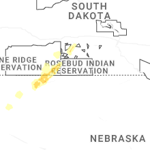
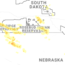
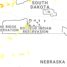
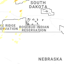
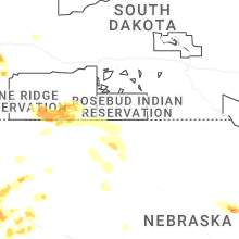
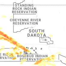
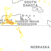
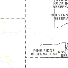
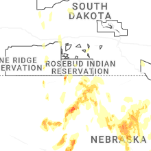
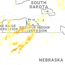


Connect with Interactive Hail Maps