

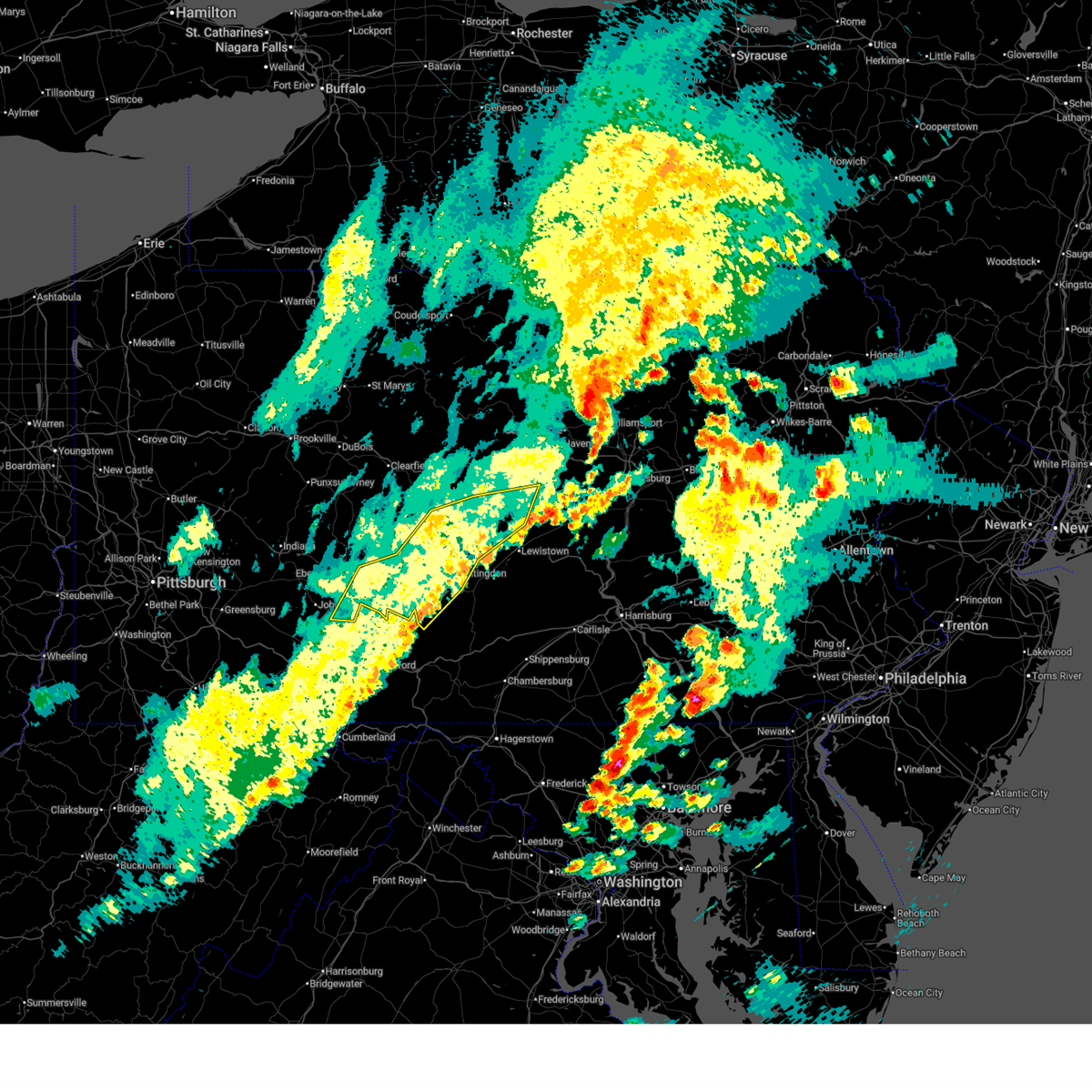
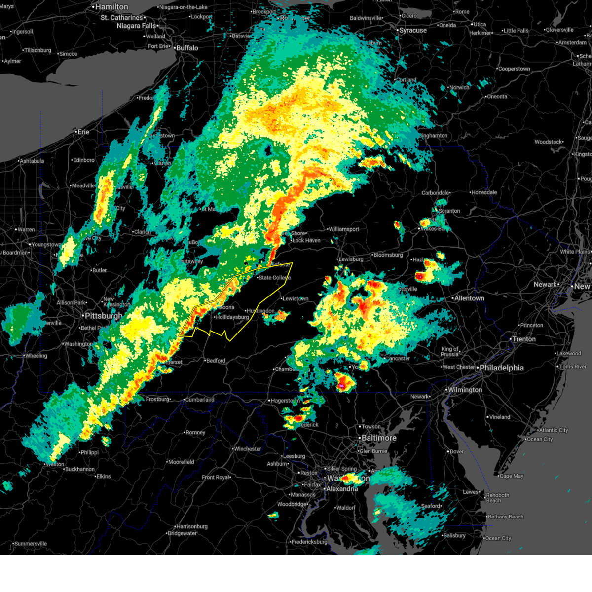
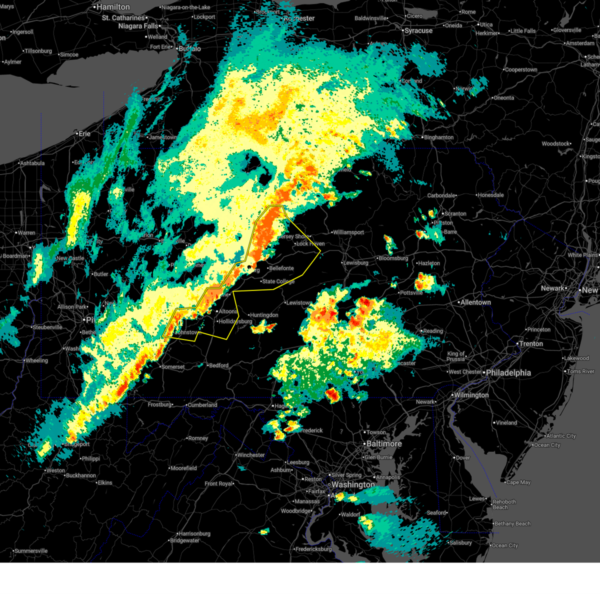
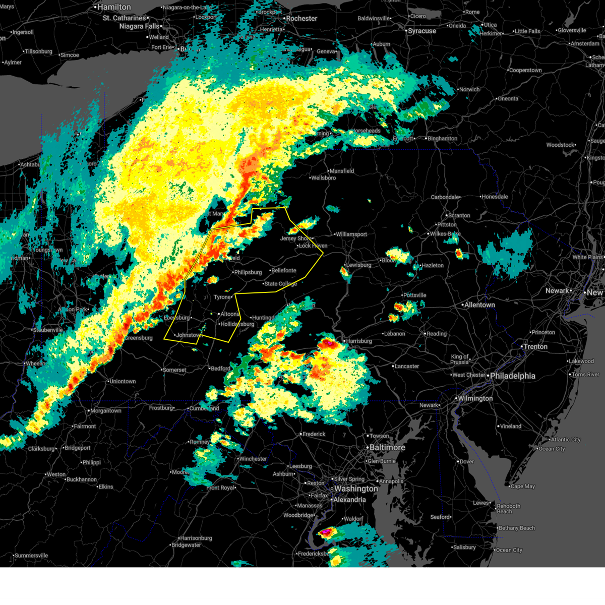
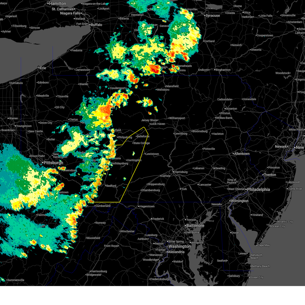
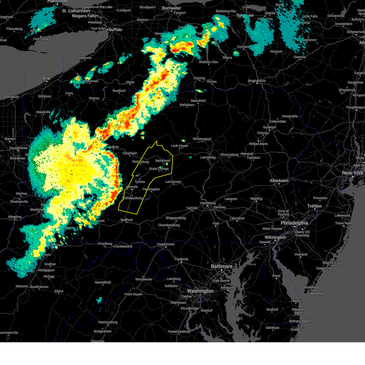
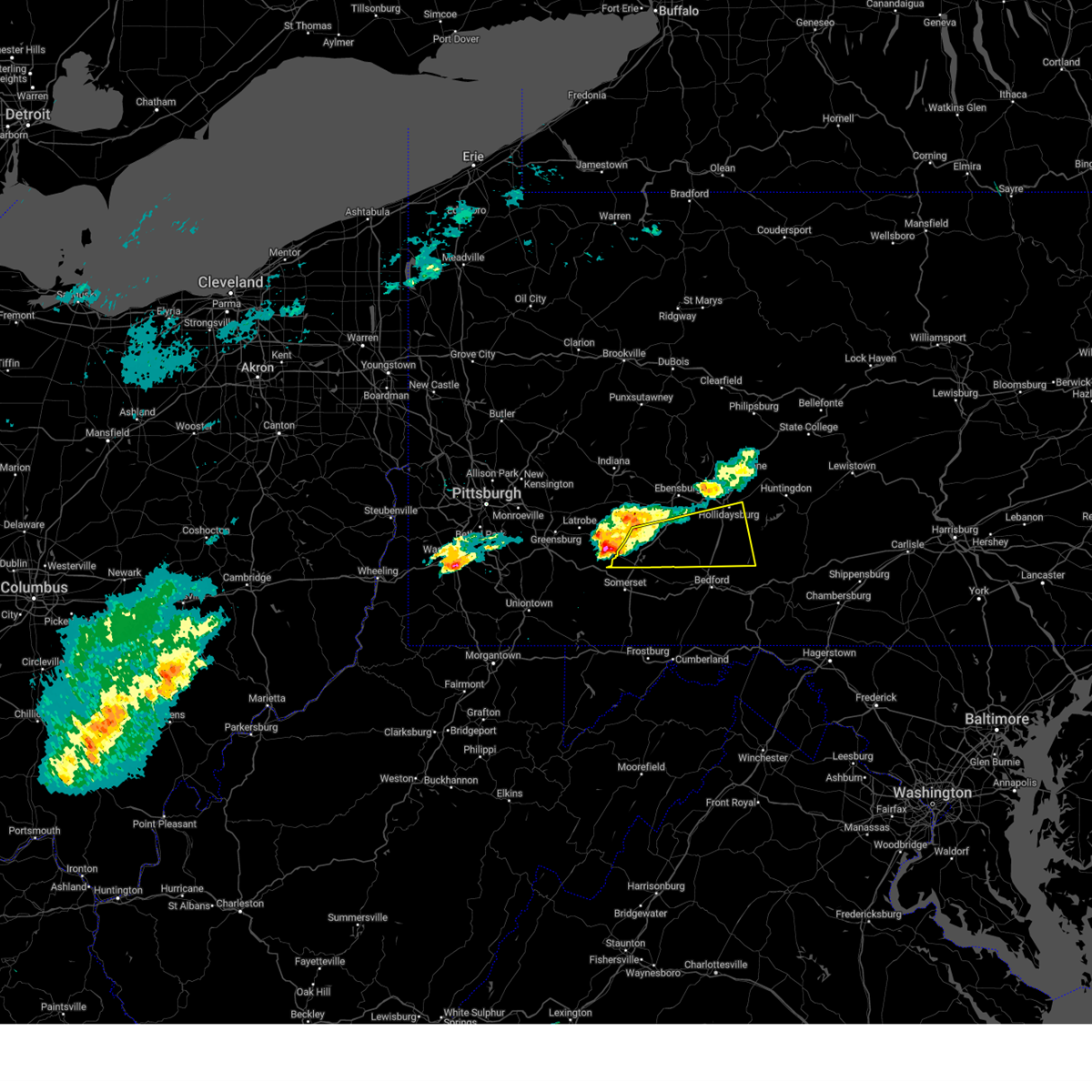
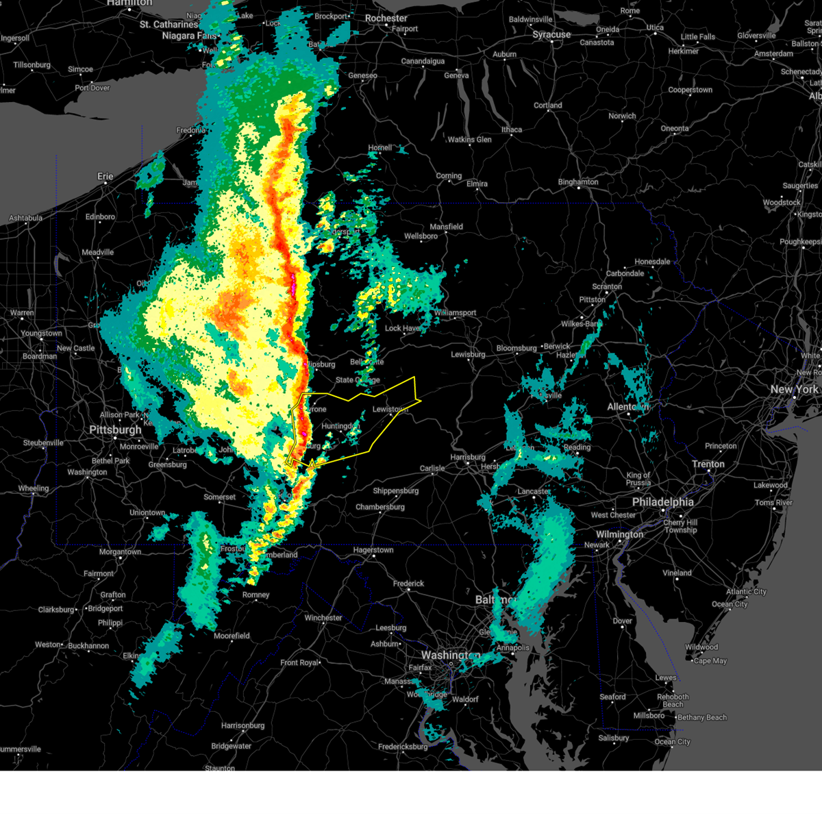
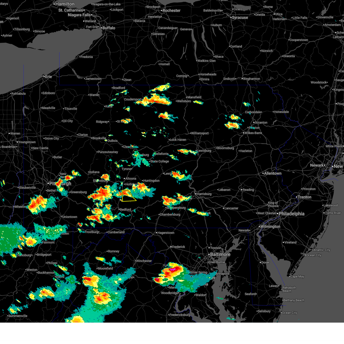
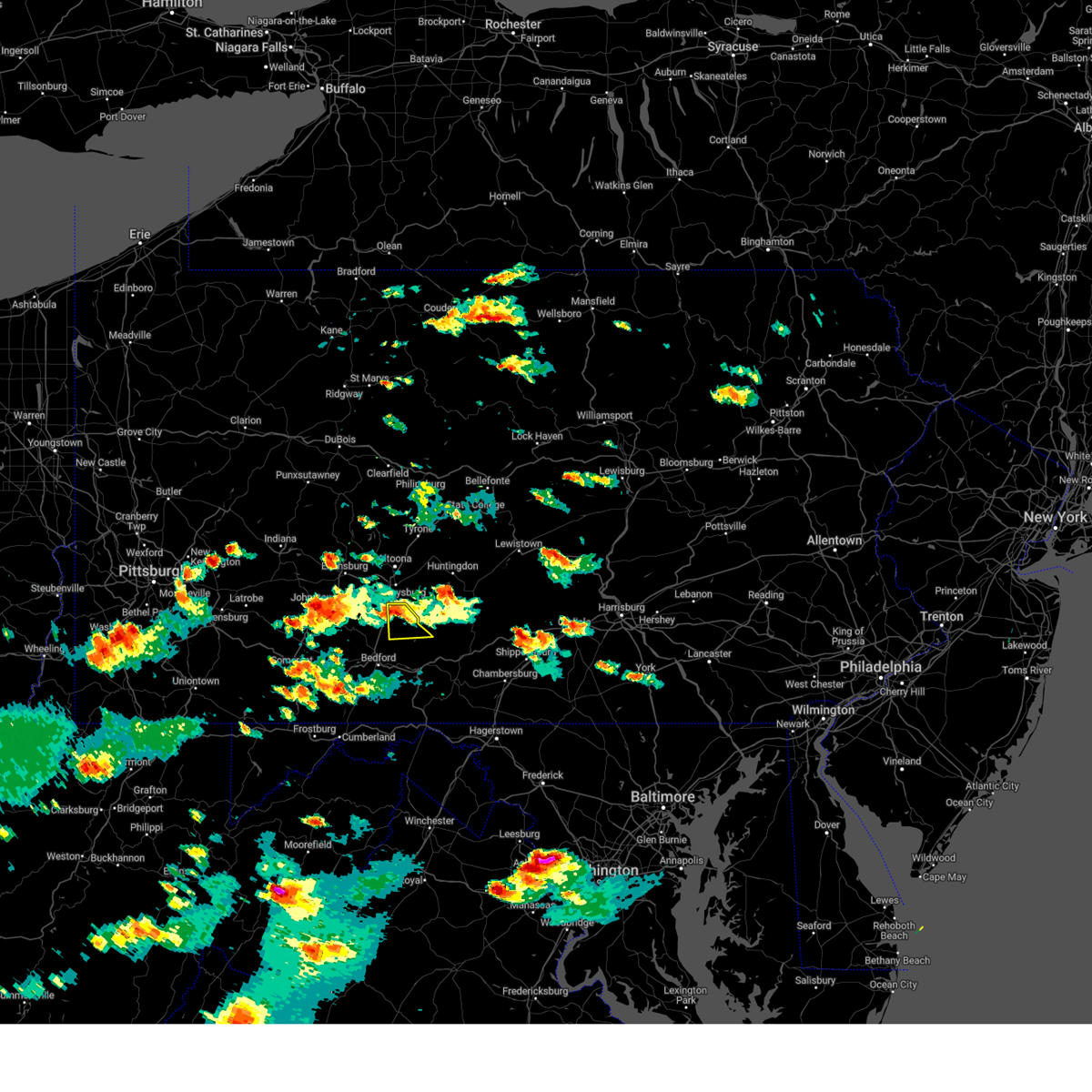
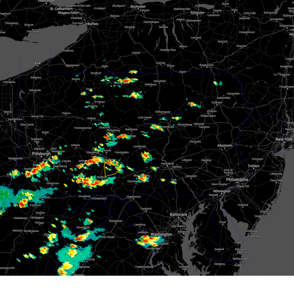
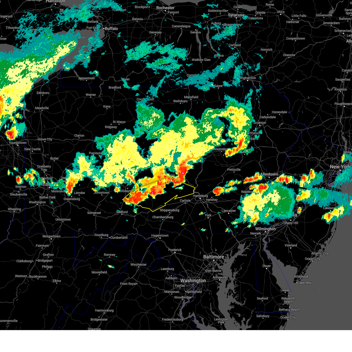
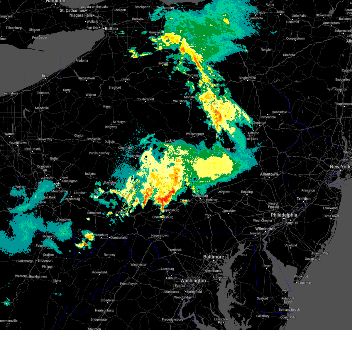
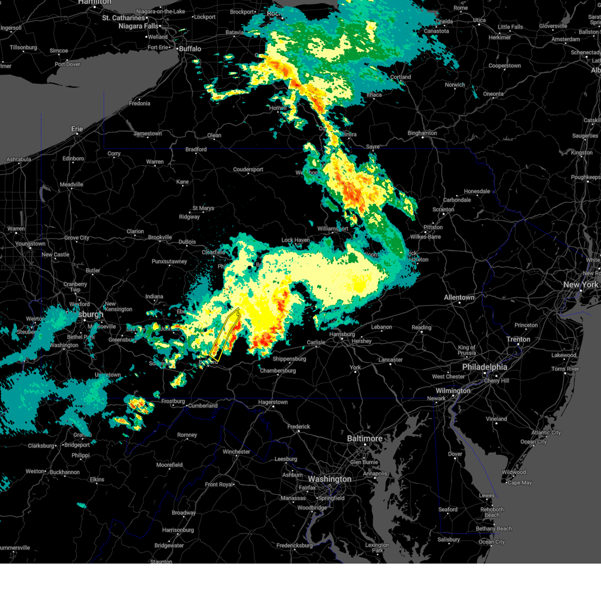
Hail Map for Martinsburg, PA
The Martinsburg, PA area has had 1 report of on-the-ground hail by trained spotters, and has been under severe weather warnings 9 times during the past 12 months. Doppler radar has detected hail at or near Martinsburg, PA on 21 occasions.
| Name: | Martinsburg, PA |
| Where Located: | 41.3 miles SW of State College, PA |
| Map: | Google Map for Martinsburg, PA |
| Population: | 1958 |
| Housing Units: | 899 |
| More Info: | Search Google for Martinsburg, PA |
5
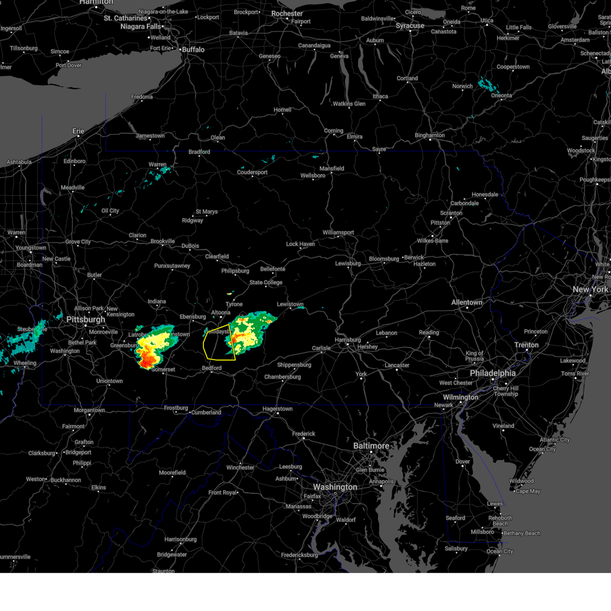
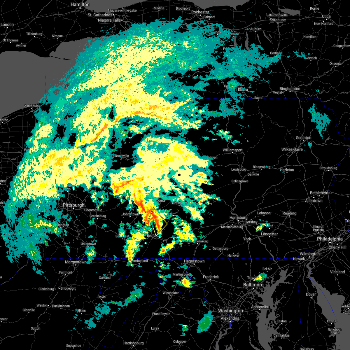
The Top Recent Hail Date for Martinsburg, PA is Thursday, August 29, 2024 (2nd out of 21)

Hail and Wind Damage Spotted near Martinsburg, PA
| Date / Time | Report Details |
|---|---|
| 6/14/2026 8:52 PM EDT |
 The storms which prompted the warning have weakened below severe limits, and have exited the warned area. therefore, the warning will be allowed to expire. however, gusty winds are still possible with these thunderstorms. a tornado watch remains in effect until 1000 pm edt for south central and central pennsylvania. The storms which prompted the warning have weakened below severe limits, and have exited the warned area. therefore, the warning will be allowed to expire. however, gusty winds are still possible with these thunderstorms. a tornado watch remains in effect until 1000 pm edt for south central and central pennsylvania.
|
| 6/14/2026 8:15 PM EDT |
 Svrctp the national weather service in state college pa has issued a * severe thunderstorm warning for, blair county in central pennsylvania, southeastern cambria county in central pennsylvania, southwestern centre county in central pennsylvania, northern huntingdon county in central pennsylvania, northwestern mifflin county in central pennsylvania, * until 900 pm edt. * at 815 pm edt, severe thunderstorms were located along a line extending from bald eagle to sinking valley to gallitzin to salix-beauty line park, moving east at 15 mph (radar indicated). Hazards include 60 mph wind gusts. expect damage to roofs, siding, and trees Svrctp the national weather service in state college pa has issued a * severe thunderstorm warning for, blair county in central pennsylvania, southeastern cambria county in central pennsylvania, southwestern centre county in central pennsylvania, northern huntingdon county in central pennsylvania, northwestern mifflin county in central pennsylvania, * until 900 pm edt. * at 815 pm edt, severe thunderstorms were located along a line extending from bald eagle to sinking valley to gallitzin to salix-beauty line park, moving east at 15 mph (radar indicated). Hazards include 60 mph wind gusts. expect damage to roofs, siding, and trees
|
| 6/14/2026 7:56 PM EDT |
 At 756 pm edt, severe thunderstorms were located along a line extending from cammal to monument to sandy ridge to acosta, moving east at 55 mph (radar indicated). Hazards include 60 mph wind gusts and penny size hail. Expect damage to roofs, siding, and trees. locations impacted include, altoona, state college, johnstown, lock haven, bellefonte, hollidaysburg, tyrone, westmont, ebensburg, belmont, nanty-glo, and portage. for those driving on interstate 80, this includes areas between the kylertown and mile run exits, specifically from mile markers 137 to 193. This includes interstate 99 from mile markers 18 to 85. At 756 pm edt, severe thunderstorms were located along a line extending from cammal to monument to sandy ridge to acosta, moving east at 55 mph (radar indicated). Hazards include 60 mph wind gusts and penny size hail. Expect damage to roofs, siding, and trees. locations impacted include, altoona, state college, johnstown, lock haven, bellefonte, hollidaysburg, tyrone, westmont, ebensburg, belmont, nanty-glo, and portage. for those driving on interstate 80, this includes areas between the kylertown and mile run exits, specifically from mile markers 137 to 193. This includes interstate 99 from mile markers 18 to 85.
|
| 6/14/2026 7:10 PM EDT |
 Svrctp the national weather service in state college pa has issued a * severe thunderstorm warning for, blair county in central pennsylvania, cambria county in central pennsylvania, southeastern cameron county in north central pennsylvania, centre county in central pennsylvania, clearfield county in central pennsylvania, clinton county in north central pennsylvania, southeastern elk county in north central pennsylvania, northwestern huntingdon county in central pennsylvania, southwestern lycoming county in north central pennsylvania, * until 815 pm edt. * at 710 pm edt, severe thunderstorms were located along a line extending from near benezette to curwensville to near northern cambria to brownsville, moving east at 55 mph (radar indicated). Hazards include 60 mph wind gusts and penny size hail. expect damage to roofs, siding, and trees Svrctp the national weather service in state college pa has issued a * severe thunderstorm warning for, blair county in central pennsylvania, cambria county in central pennsylvania, southeastern cameron county in north central pennsylvania, centre county in central pennsylvania, clearfield county in central pennsylvania, clinton county in north central pennsylvania, southeastern elk county in north central pennsylvania, northwestern huntingdon county in central pennsylvania, southwestern lycoming county in north central pennsylvania, * until 815 pm edt. * at 710 pm edt, severe thunderstorms were located along a line extending from near benezette to curwensville to near northern cambria to brownsville, moving east at 55 mph (radar indicated). Hazards include 60 mph wind gusts and penny size hail. expect damage to roofs, siding, and trees
|
| 6/11/2026 5:22 PM EDT |
 Svrctp the national weather service in state college pa has issued a * severe thunderstorm warning for, bedford county in south central pennsylvania, blair county in central pennsylvania, southwestern centre county in central pennsylvania, fulton county in south central pennsylvania, huntingdon county in central pennsylvania, western mifflin county in central pennsylvania, southeastern somerset county in south central pennsylvania, * until 615 pm edt. * at 522 pm edt, severe thunderstorms were located along a line extending from tyrone to queen to near la vale, moving east at 45 mph (radar indicated). Hazards include 60 mph wind gusts. expect damage to roofs, siding, and trees Svrctp the national weather service in state college pa has issued a * severe thunderstorm warning for, bedford county in south central pennsylvania, blair county in central pennsylvania, southwestern centre county in central pennsylvania, fulton county in south central pennsylvania, huntingdon county in central pennsylvania, western mifflin county in central pennsylvania, southeastern somerset county in south central pennsylvania, * until 615 pm edt. * at 522 pm edt, severe thunderstorms were located along a line extending from tyrone to queen to near la vale, moving east at 45 mph (radar indicated). Hazards include 60 mph wind gusts. expect damage to roofs, siding, and trees
|
| 3/11/2026 7:59 PM EDT |
 the severe thunderstorm warning has been cancelled and is no longer in effect the severe thunderstorm warning has been cancelled and is no longer in effect
|
| 3/11/2026 7:59 PM EDT |
 At 759 pm edt, a severe thunderstorm was located over martinsburg, moving east at 55 mph (radar indicated). Hazards include 60 mph wind gusts and penny size hail. Expect damage to roofs, siding, and trees. locations impacted include, hollidaysburg, roaring spring, martinsburg, claysburg, duncansville, blue knob state park, queen, shy beaver, ski gap, trough creek state park, entriken, and royer. This includes interstate 99 from mile markers 13 to 27. At 759 pm edt, a severe thunderstorm was located over martinsburg, moving east at 55 mph (radar indicated). Hazards include 60 mph wind gusts and penny size hail. Expect damage to roofs, siding, and trees. locations impacted include, hollidaysburg, roaring spring, martinsburg, claysburg, duncansville, blue knob state park, queen, shy beaver, ski gap, trough creek state park, entriken, and royer. This includes interstate 99 from mile markers 13 to 27.
|
| 3/11/2026 7:36 PM EDT |
 Svrctp the national weather service in state college pa has issued a * severe thunderstorm warning for, northeastern bedford county in south central pennsylvania, southern blair county in central pennsylvania, southwestern cambria county in central pennsylvania, west central huntingdon county in central pennsylvania, northeastern somerset county in south central pennsylvania, * until 815 pm edt. * at 734 pm edt, a severe thunderstorm was located over sidman, moving east at 55 mph. other storms were to the north and south of this storm (radar indicated). Hazards include 60 mph wind gusts and penny size hail. expect damage to roofs, siding, and trees Svrctp the national weather service in state college pa has issued a * severe thunderstorm warning for, northeastern bedford county in south central pennsylvania, southern blair county in central pennsylvania, southwestern cambria county in central pennsylvania, west central huntingdon county in central pennsylvania, northeastern somerset county in south central pennsylvania, * until 815 pm edt. * at 734 pm edt, a severe thunderstorm was located over sidman, moving east at 55 mph. other storms were to the north and south of this storm (radar indicated). Hazards include 60 mph wind gusts and penny size hail. expect damage to roofs, siding, and trees
|
| 3/11/2026 4:29 PM EDT | Storm damage reported in blair county PA, 0.8 miles NNW of Martinsburg, PA |
| 6/19/2025 6:44 PM EDT |
 Svrctp the national weather service in state college pa has issued a * severe thunderstorm warning for, northern bedford county in south central pennsylvania, southern blair county in central pennsylvania, * until 715 pm edt. * at 643 pm edt, severe thunderstorms were located along a line extending from duncansville to central city, moving east at 45 mph (radar indicated). Hazards include 60 mph wind gusts. expect damage to roofs, siding, and trees Svrctp the national weather service in state college pa has issued a * severe thunderstorm warning for, northern bedford county in south central pennsylvania, southern blair county in central pennsylvania, * until 715 pm edt. * at 643 pm edt, severe thunderstorms were located along a line extending from duncansville to central city, moving east at 45 mph (radar indicated). Hazards include 60 mph wind gusts. expect damage to roofs, siding, and trees
|
| 4/29/2025 6:44 PM EDT | Storm damage reported in blair county PA, 0.8 miles NNW of Martinsburg, PA |
| 4/29/2025 6:10 PM EDT |
 Svrctp the national weather service in state college pa has issued a * severe thunderstorm warning for, northeastern bedford county in south central pennsylvania, blair county in central pennsylvania, centre county in central pennsylvania, southeastern clearfield county in central pennsylvania, northwestern huntingdon county in central pennsylvania, * until 715 pm edt. * at 609 pm edt, severe thunderstorms were located along a line extending from reynoldsville to 10 miles southwest of curwensville to salix-beauty line park, moving east at 70 mph (radar indicated). Hazards include 60 mph wind gusts. expect damage to roofs, siding, and trees Svrctp the national weather service in state college pa has issued a * severe thunderstorm warning for, northeastern bedford county in south central pennsylvania, blair county in central pennsylvania, centre county in central pennsylvania, southeastern clearfield county in central pennsylvania, northwestern huntingdon county in central pennsylvania, * until 715 pm edt. * at 609 pm edt, severe thunderstorms were located along a line extending from reynoldsville to 10 miles southwest of curwensville to salix-beauty line park, moving east at 70 mph (radar indicated). Hazards include 60 mph wind gusts. expect damage to roofs, siding, and trees
|
| 4/19/2025 7:09 PM EDT |
 The storm which prompted the warning has moved out of the area. therefore, the warning will be allowed to expire. The storm which prompted the warning has moved out of the area. therefore, the warning will be allowed to expire.
|
| 4/19/2025 6:55 PM EDT |
 At 655 pm edt, a severe thunderstorm was located over queen, moving east at 70 mph (radar indicated). Hazards include 60 mph wind gusts and penny size hail. Expect damage to roofs, siding, and trees. locations impacted include, blue knob state park, osterburg, martinsburg, blue knob ski resort, queen, hopewell, new enterprise, roaring spring, ski gap, woodbury, saxton, and east freedom. This includes interstate 99 from mile markers 6 to 26. At 655 pm edt, a severe thunderstorm was located over queen, moving east at 70 mph (radar indicated). Hazards include 60 mph wind gusts and penny size hail. Expect damage to roofs, siding, and trees. locations impacted include, blue knob state park, osterburg, martinsburg, blue knob ski resort, queen, hopewell, new enterprise, roaring spring, ski gap, woodbury, saxton, and east freedom. This includes interstate 99 from mile markers 6 to 26.
|
| 4/19/2025 6:55 PM EDT |
 the severe thunderstorm warning has been cancelled and is no longer in effect the severe thunderstorm warning has been cancelled and is no longer in effect
|
| 4/19/2025 6:44 PM EDT |
 At 644 pm edt, a severe thunderstorm was located over ogletown, moving east at 70 mph (radar indicated). Hazards include 60 mph wind gusts and penny size hail. Expect damage to roofs, siding, and trees. locations impacted include, blue knob state park, salix-beauty line park, osterburg, martinsburg, spring hill, new enterprise, windber, roaring spring, scalp level, ski gap, woodbury, and dunlo. This includes interstate 99 from mile markers 6 to 27. At 644 pm edt, a severe thunderstorm was located over ogletown, moving east at 70 mph (radar indicated). Hazards include 60 mph wind gusts and penny size hail. Expect damage to roofs, siding, and trees. locations impacted include, blue knob state park, salix-beauty line park, osterburg, martinsburg, spring hill, new enterprise, windber, roaring spring, scalp level, ski gap, woodbury, and dunlo. This includes interstate 99 from mile markers 6 to 27.
|
| 4/19/2025 6:27 PM EDT |
 Svrctp the national weather service in state college pa has issued a * severe thunderstorm warning for, northern bedford county in south central pennsylvania, southwestern blair county in central pennsylvania, southwestern cambria county in central pennsylvania, northeastern somerset county in south central pennsylvania, * until 715 pm edt. * at 627 pm edt, a severe thunderstorm was located over boswell, moving east at 70 mph (radar indicated). Hazards include 60 mph wind gusts and penny size hail. expect damage to roofs, siding, and trees Svrctp the national weather service in state college pa has issued a * severe thunderstorm warning for, northern bedford county in south central pennsylvania, southwestern blair county in central pennsylvania, southwestern cambria county in central pennsylvania, northeastern somerset county in south central pennsylvania, * until 715 pm edt. * at 627 pm edt, a severe thunderstorm was located over boswell, moving east at 70 mph (radar indicated). Hazards include 60 mph wind gusts and penny size hail. expect damage to roofs, siding, and trees
|
| 3/16/2025 3:22 PM EDT | Trees and wires dow in blair county PA, 1.8 miles E of Martinsburg, PA |
| 3/16/2025 2:27 PM EDT |
 Svrctp the national weather service in state college pa has issued a * severe thunderstorm warning for, blair county in central pennsylvania, huntingdon county in central pennsylvania, mifflin county in central pennsylvania, * until 345 pm edt. * at 226 pm edt, severe thunderstorms were located along a line extending from blandburg to lakemont to claysburg, moving northeast at 65 mph (trained weather spotters). Hazards include 60 mph wind gusts and quarter size hail. Hail damage to vehicles is expected. Expect wind damage to roofs, siding, and trees. Svrctp the national weather service in state college pa has issued a * severe thunderstorm warning for, blair county in central pennsylvania, huntingdon county in central pennsylvania, mifflin county in central pennsylvania, * until 345 pm edt. * at 226 pm edt, severe thunderstorms were located along a line extending from blandburg to lakemont to claysburg, moving northeast at 65 mph (trained weather spotters). Hazards include 60 mph wind gusts and quarter size hail. Hail damage to vehicles is expected. Expect wind damage to roofs, siding, and trees.
|
| 3/16/2025 1:47 PM EDT |
 Svrctp the national weather service in state college pa has issued a * severe thunderstorm warning for, bedford county in south central pennsylvania, blair county in central pennsylvania, cambria county in central pennsylvania, southwestern centre county in central pennsylvania, clearfield county in central pennsylvania, eastern elk county in north central pennsylvania, eastern somerset county in south central pennsylvania, * until 230 pm edt. * at 147 pm edt, severe thunderstorms were located along a line extending from near portland mills to near punxsutawney to near friedens, moving northeast at 80 mph (trained weather spotters). Hazards include 60 mph wind gusts and penny size hail. expect damage to roofs, siding, and trees Svrctp the national weather service in state college pa has issued a * severe thunderstorm warning for, bedford county in south central pennsylvania, blair county in central pennsylvania, cambria county in central pennsylvania, southwestern centre county in central pennsylvania, clearfield county in central pennsylvania, eastern elk county in north central pennsylvania, eastern somerset county in south central pennsylvania, * until 230 pm edt. * at 147 pm edt, severe thunderstorms were located along a line extending from near portland mills to near punxsutawney to near friedens, moving northeast at 80 mph (trained weather spotters). Hazards include 60 mph wind gusts and penny size hail. expect damage to roofs, siding, and trees
|
| 8/29/2024 5:01 PM EDT |
 The storm which prompted the warning has weakened below severe limits, and no longer poses an immediate threat to life or property. therefore, the warning has been allowed to expire. however, heavy rain is still possible with this thunderstorm. a severe thunderstorm watch remains in effect until 1100 pm edt for south central and central pennsylvania. The storm which prompted the warning has weakened below severe limits, and no longer poses an immediate threat to life or property. therefore, the warning has been allowed to expire. however, heavy rain is still possible with this thunderstorm. a severe thunderstorm watch remains in effect until 1100 pm edt for south central and central pennsylvania.
|
| 8/29/2024 4:47 PM EDT |
 the severe thunderstorm warning has been cancelled and is no longer in effect the severe thunderstorm warning has been cancelled and is no longer in effect
|
| 8/29/2024 4:47 PM EDT |
 At 446 pm edt, a severe thunderstorm was located over dudley, moving southeast at 10 mph (radar indicated). Hazards include ping pong ball size hail and 60 mph wind gusts. People and animals outdoors will be injured. expect hail damage to roofs, siding, windows, and vehicles. expect wind damage to roofs, siding, and trees. locations impacted include, roaring spring, new enterprise, martinsburg, saxton, woodbury, defiance, and altoona-blair county airport. This includes interstate 99 from mile markers 19 to 20. At 446 pm edt, a severe thunderstorm was located over dudley, moving southeast at 10 mph (radar indicated). Hazards include ping pong ball size hail and 60 mph wind gusts. People and animals outdoors will be injured. expect hail damage to roofs, siding, windows, and vehicles. expect wind damage to roofs, siding, and trees. locations impacted include, roaring spring, new enterprise, martinsburg, saxton, woodbury, defiance, and altoona-blair county airport. This includes interstate 99 from mile markers 19 to 20.
|
| 8/29/2024 4:08 PM EDT |
 Svrctp the national weather service in state college pa has issued a * severe thunderstorm warning for, northeastern bedford county in south central pennsylvania, south central blair county in central pennsylvania, southwestern huntingdon county in central pennsylvania, * until 500 pm edt. * at 407 pm edt, a severe thunderstorm was located over martinsburg, moving southeast at 10 mph (radar indicated). Hazards include ping pong ball size hail and 60 mph wind gusts. People and animals outdoors will be injured. expect hail damage to roofs, siding, windows, and vehicles. Expect wind damage to roofs, siding, and trees. Svrctp the national weather service in state college pa has issued a * severe thunderstorm warning for, northeastern bedford county in south central pennsylvania, south central blair county in central pennsylvania, southwestern huntingdon county in central pennsylvania, * until 500 pm edt. * at 407 pm edt, a severe thunderstorm was located over martinsburg, moving southeast at 10 mph (radar indicated). Hazards include ping pong ball size hail and 60 mph wind gusts. People and animals outdoors will be injured. expect hail damage to roofs, siding, windows, and vehicles. Expect wind damage to roofs, siding, and trees.
|
| 8/6/2024 4:52 PM EDT |
 Svrctp the national weather service in state college pa has issued a * severe thunderstorm warning for, northeastern bedford county in south central pennsylvania, southeastern blair county in central pennsylvania, north central franklin county in south central pennsylvania, huntingdon county in central pennsylvania, southwestern juniata county in central pennsylvania, southwestern mifflin county in central pennsylvania, perry county in south central pennsylvania, * until 530 pm edt. * at 452 pm edt, severe thunderstorms were located along a line extending from mexico to blacklog to mount union to dudley, moving southeast at 20 mph (radar indicated). Hazards include 60 mph wind gusts and quarter size hail. Hail damage to vehicles is expected. Expect wind damage to roofs, siding, and trees. Svrctp the national weather service in state college pa has issued a * severe thunderstorm warning for, northeastern bedford county in south central pennsylvania, southeastern blair county in central pennsylvania, north central franklin county in south central pennsylvania, huntingdon county in central pennsylvania, southwestern juniata county in central pennsylvania, southwestern mifflin county in central pennsylvania, perry county in south central pennsylvania, * until 530 pm edt. * at 452 pm edt, severe thunderstorms were located along a line extending from mexico to blacklog to mount union to dudley, moving southeast at 20 mph (radar indicated). Hazards include 60 mph wind gusts and quarter size hail. Hail damage to vehicles is expected. Expect wind damage to roofs, siding, and trees.
|
| 7/10/2024 3:33 PM EDT |
 Svrctp the national weather service in state college pa has issued a * severe thunderstorm warning for, northeastern bedford county in south central pennsylvania, eastern blair county in central pennsylvania, northwestern huntingdon county in central pennsylvania, * until 430 pm edt. * at 333 pm edt, a severe thunderstorm was located over royer, moving northeast at 40 mph (radar indicated). Hazards include 60 mph wind gusts. expect damage to roofs, siding, and trees Svrctp the national weather service in state college pa has issued a * severe thunderstorm warning for, northeastern bedford county in south central pennsylvania, eastern blair county in central pennsylvania, northwestern huntingdon county in central pennsylvania, * until 430 pm edt. * at 333 pm edt, a severe thunderstorm was located over royer, moving northeast at 40 mph (radar indicated). Hazards include 60 mph wind gusts. expect damage to roofs, siding, and trees
|
| 6/26/2024 9:35 PM EDT |
 At 935 pm edt, severe thunderstorms were located along a line extending from altoona to royer to claysburg, moving east at 40 mph (radar indicated). Hazards include 60 mph wind gusts. Expect damage to roofs, siding, and trees. locations impacted include, altoona, huntingdon, hollidaysburg, roaring spring, martinsburg, lakemont, williamsburg, dudley, raystown dam, entriken, royer, and shy beaver. This includes interstate 99 from mile markers 31 to 36. At 935 pm edt, severe thunderstorms were located along a line extending from altoona to royer to claysburg, moving east at 40 mph (radar indicated). Hazards include 60 mph wind gusts. Expect damage to roofs, siding, and trees. locations impacted include, altoona, huntingdon, hollidaysburg, roaring spring, martinsburg, lakemont, williamsburg, dudley, raystown dam, entriken, royer, and shy beaver. This includes interstate 99 from mile markers 31 to 36.
|
| 6/26/2024 9:13 PM EDT |
 Svrctp the national weather service in state college pa has issued a * severe thunderstorm warning for, northeastern bedford county in south central pennsylvania, blair county in central pennsylvania, southwestern huntingdon county in central pennsylvania, * until 1000 pm edt. * at 913 pm edt, severe thunderstorms were located along a line extending from loretto to lilly to ogletown, moving east at 40 mph (radar indicated). Hazards include 60 mph wind gusts. expect damage to roofs, siding, and trees Svrctp the national weather service in state college pa has issued a * severe thunderstorm warning for, northeastern bedford county in south central pennsylvania, blair county in central pennsylvania, southwestern huntingdon county in central pennsylvania, * until 1000 pm edt. * at 913 pm edt, severe thunderstorms were located along a line extending from loretto to lilly to ogletown, moving east at 40 mph (radar indicated). Hazards include 60 mph wind gusts. expect damage to roofs, siding, and trees
|
| 6/23/2024 5:56 PM EDT |
 The storm which prompted the warning has weakened below severe limits, and has exited the warned area. therefore, the warning will be allowed to expire. a severe thunderstorm watch remains in effect until 1000 pm edt for south central and central pennsylvania. The storm which prompted the warning has weakened below severe limits, and has exited the warned area. therefore, the warning will be allowed to expire. a severe thunderstorm watch remains in effect until 1000 pm edt for south central and central pennsylvania.
|
| 6/23/2024 5:17 PM EDT |
 Svrctp the national weather service in state college pa has issued a * severe thunderstorm warning for, north central bedford county in south central pennsylvania, southwestern blair county in central pennsylvania, southwestern cambria county in central pennsylvania, northeastern somerset county in south central pennsylvania, * until 600 pm edt. * at 517 pm edt, a severe thunderstorm was located over westmont, moving east at 45 mph (radar indicated). Hazards include 60 mph wind gusts. expect damage to roofs, siding, and trees Svrctp the national weather service in state college pa has issued a * severe thunderstorm warning for, north central bedford county in south central pennsylvania, southwestern blair county in central pennsylvania, southwestern cambria county in central pennsylvania, northeastern somerset county in south central pennsylvania, * until 600 pm edt. * at 517 pm edt, a severe thunderstorm was located over westmont, moving east at 45 mph (radar indicated). Hazards include 60 mph wind gusts. expect damage to roofs, siding, and trees
|
| 5/26/2024 8:54 PM EDT |
 Svrctp the national weather service in state college pa has issued a * severe thunderstorm warning for, bedford county in south central pennsylvania, southwestern blair county in central pennsylvania, cambria county in central pennsylvania, western fulton county in south central pennsylvania, eastern somerset county in south central pennsylvania, * until 945 pm edt. * at 850 pm edt, severe thunderstorms were located along a line extending from near ligonier to somerset to frostburg to near meyersdale to lonaconing to near keyser, moving northeast at 50 mph (radar indicated). Hazards include 60 mph wind gusts. expect damage to roofs, siding, and trees Svrctp the national weather service in state college pa has issued a * severe thunderstorm warning for, bedford county in south central pennsylvania, southwestern blair county in central pennsylvania, cambria county in central pennsylvania, western fulton county in south central pennsylvania, eastern somerset county in south central pennsylvania, * until 945 pm edt. * at 850 pm edt, severe thunderstorms were located along a line extending from near ligonier to somerset to frostburg to near meyersdale to lonaconing to near keyser, moving northeast at 50 mph (radar indicated). Hazards include 60 mph wind gusts. expect damage to roofs, siding, and trees
|
| 5/8/2024 4:23 AM EDT |
 The storm which prompted the warning has weakened below severe limits, and has exited the warned area. therefore, the warning will be allowed to expire. The storm which prompted the warning has weakened below severe limits, and has exited the warned area. therefore, the warning will be allowed to expire.
|
| 5/8/2024 4:08 AM EDT |
 At 407 am edt, a severe thunderstorm was located near entriken, moving east at 50 mph. the storm will be out of the warned area shortly (radar indicated). Hazards include 60 mph wind gusts. Expect damage to roofs, siding, and trees. Locations impacted include, new enterprise, martinsburg, williamsburg, royer, woodbury, and altoona-blair county airport. At 407 am edt, a severe thunderstorm was located near entriken, moving east at 50 mph. the storm will be out of the warned area shortly (radar indicated). Hazards include 60 mph wind gusts. Expect damage to roofs, siding, and trees. Locations impacted include, new enterprise, martinsburg, williamsburg, royer, woodbury, and altoona-blair county airport.
|
| 5/8/2024 3:41 AM EDT |
 Svrctp the national weather service in state college pa has issued a * severe thunderstorm warning for, northwestern bedford county in south central pennsylvania, blair county in central pennsylvania, * until 430 am edt. * at 341 am edt, a severe thunderstorm was located over lilly, moving east at 50 mph (radar indicated). Hazards include 60 mph wind gusts. expect damage to roofs, siding, and trees Svrctp the national weather service in state college pa has issued a * severe thunderstorm warning for, northwestern bedford county in south central pennsylvania, blair county in central pennsylvania, * until 430 am edt. * at 341 am edt, a severe thunderstorm was located over lilly, moving east at 50 mph (radar indicated). Hazards include 60 mph wind gusts. expect damage to roofs, siding, and trees
|
| 8/12/2023 9:38 PM EDT |
 At 938 pm edt, a severe thunderstorm was located over royer, moving east at 35 mph (radar indicated). Hazards include 60 mph wind gusts. Expect damage to roofs, siding, and trees. locations impacted include, altoona, hollidaysburg, roaring spring, martinsburg, lakemont, williamsburg, duncansville, canoe creek state park, royer, east freedom, newry and peoples natural gas field. This includes interstate 99 from mile markers 22 to 35. At 938 pm edt, a severe thunderstorm was located over royer, moving east at 35 mph (radar indicated). Hazards include 60 mph wind gusts. Expect damage to roofs, siding, and trees. locations impacted include, altoona, hollidaysburg, roaring spring, martinsburg, lakemont, williamsburg, duncansville, canoe creek state park, royer, east freedom, newry and peoples natural gas field. This includes interstate 99 from mile markers 22 to 35.
|
| 8/12/2023 9:10 PM EDT |
 At 909 pm edt, a severe thunderstorm was located over gallitzin, moving east at 40 mph (radar indicated). Hazards include 60 mph wind gusts. expect damage to roofs, siding, and trees At 909 pm edt, a severe thunderstorm was located over gallitzin, moving east at 40 mph (radar indicated). Hazards include 60 mph wind gusts. expect damage to roofs, siding, and trees
|
| 7/20/2023 10:57 PM EDT |
 At 1055 pm edt, severe thunderstorms were located along a line extending from mcalevys fort to franklinville to canoe creek state park to horseshoe curve, moving southeast at 15 mph (radar indicated). Hazards include 60 mph wind gusts. expect damage to roofs, siding, and trees At 1055 pm edt, severe thunderstorms were located along a line extending from mcalevys fort to franklinville to canoe creek state park to horseshoe curve, moving southeast at 15 mph (radar indicated). Hazards include 60 mph wind gusts. expect damage to roofs, siding, and trees
|
| 6/3/2023 7:29 PM EDT |
 At 728 pm edt, a severe thunderstorm was located over royer, moving southwest at 25 mph (radar indicated). Hazards include 60 mph wind gusts and half dollar size hail. Hail damage to vehicles is expected. expect wind damage to roofs, siding, and trees. locations impacted include, hollidaysburg, roaring spring, martinsburg, lakemont, claysburg, williamsburg, duncansville, canoe creek state park, royer, east freedom, newry and altoona-blair county airport. this includes interstate 99 from mile markers 18 to 27. hail threat, radar indicated max hail size, 1. 25 in wind threat, radar indicated max wind gust, 60 mph. At 728 pm edt, a severe thunderstorm was located over royer, moving southwest at 25 mph (radar indicated). Hazards include 60 mph wind gusts and half dollar size hail. Hail damage to vehicles is expected. expect wind damage to roofs, siding, and trees. locations impacted include, hollidaysburg, roaring spring, martinsburg, lakemont, claysburg, williamsburg, duncansville, canoe creek state park, royer, east freedom, newry and altoona-blair county airport. this includes interstate 99 from mile markers 18 to 27. hail threat, radar indicated max hail size, 1. 25 in wind threat, radar indicated max wind gust, 60 mph.
|
| 6/3/2023 7:05 PM EDT |
 At 704 pm edt, a severe thunderstorm was located over williamsburg, moving southwest at 25 mph (radar indicated). Hazards include 60 mph wind gusts and quarter size hail. Hail damage to vehicles is expected. Expect wind damage to roofs, siding, and trees. At 704 pm edt, a severe thunderstorm was located over williamsburg, moving southwest at 25 mph (radar indicated). Hazards include 60 mph wind gusts and quarter size hail. Hail damage to vehicles is expected. Expect wind damage to roofs, siding, and trees.
|
| 7/1/2022 1:03 PM EDT |
 At 103 pm edt, a severe thunderstorm was located over lilly, moving east at 40 mph (radar indicated). Hazards include 60 mph wind gusts and quarter size hail. Hail damage to vehicles is expected. expect wind damage to roofs, siding, and trees. this severe thunderstorm will be near, claysburg around 110 pm edt. hollidaysburg, roaring spring and duncansville around 120 pm edt. royer, entriken and williamsburg around 130 pm edt. trough creek state park and raystown dam around 140 pm edt. other locations impacted by this severe thunderstorm include cassville, cassandra, marklesburg, mapleton and mcconnellstown. this includes interstate 99 from mile markers 16 to 32. hail threat, radar indicated max hail size, 1. 00 in wind threat, radar indicated max wind gust, 60 mph. At 103 pm edt, a severe thunderstorm was located over lilly, moving east at 40 mph (radar indicated). Hazards include 60 mph wind gusts and quarter size hail. Hail damage to vehicles is expected. expect wind damage to roofs, siding, and trees. this severe thunderstorm will be near, claysburg around 110 pm edt. hollidaysburg, roaring spring and duncansville around 120 pm edt. royer, entriken and williamsburg around 130 pm edt. trough creek state park and raystown dam around 140 pm edt. other locations impacted by this severe thunderstorm include cassville, cassandra, marklesburg, mapleton and mcconnellstown. this includes interstate 99 from mile markers 16 to 32. hail threat, radar indicated max hail size, 1. 00 in wind threat, radar indicated max wind gust, 60 mph.
|
| 6/22/2022 7:16 PM EDT |
 At 716 pm edt, a severe thunderstorm was located over bedford, moving southeast at 40 mph (radar indicated). Hazards include 60 mph wind gusts and nickel size hail. Expect damage to roofs, siding, and trees. locations impacted include, bedford, roaring spring, new enterprise, martinsburg, everett, claysburg, osterburg, st. clairsville, blue knob state park, queen, cessna and ski gap. this includes the following interstates, the pennsylvania turnpike between mile markers 132 and 151, and near mile marker 153. interstate 99 from mile markers 0 to 23. hail threat, radar indicated max hail size, 0. 88 in wind threat, radar indicated max wind gust, 60 mph. At 716 pm edt, a severe thunderstorm was located over bedford, moving southeast at 40 mph (radar indicated). Hazards include 60 mph wind gusts and nickel size hail. Expect damage to roofs, siding, and trees. locations impacted include, bedford, roaring spring, new enterprise, martinsburg, everett, claysburg, osterburg, st. clairsville, blue knob state park, queen, cessna and ski gap. this includes the following interstates, the pennsylvania turnpike between mile markers 132 and 151, and near mile marker 153. interstate 99 from mile markers 0 to 23. hail threat, radar indicated max hail size, 0. 88 in wind threat, radar indicated max wind gust, 60 mph.
|
| 6/22/2022 6:46 PM EDT | Trees down on wires northeast of martinsbur in blair county PA, 1 miles SW of Martinsburg, PA |
| 6/22/2022 6:45 PM EDT |
 At 645 pm edt, a severe thunderstorm was located over ogletown, moving southeast at 40 mph (radar indicated). Hazards include 60 mph wind gusts and quarter size hail. Hail damage to vehicles is expected. Expect wind damage to roofs, siding, and trees. At 645 pm edt, a severe thunderstorm was located over ogletown, moving southeast at 40 mph (radar indicated). Hazards include 60 mph wind gusts and quarter size hail. Hail damage to vehicles is expected. Expect wind damage to roofs, siding, and trees.
|
| 5/20/2022 11:23 AM EDT |
 At 1122 am edt, severe thunderstorms were located along a line extending from ski gap to claysburg to new enterprise to bedford, moving northeast at 60 mph (radar indicated). Hazards include 60 mph wind gusts. Expect damage to roofs, siding, and trees. locations impacted include, hollidaysburg, bedford, roaring spring, new enterprise, martinsburg, lakemont, everett, claysburg, williamsburg, duncansville, osterburg and waterfall. this includes the following interstates, the pennsylvania turnpike from mile markers 145 to 150. interstate 99 from mile markers 0 to 28. hail threat, radar indicated max hail size, <. 75 in wind threat, radar indicated max wind gust, 60 mph. At 1122 am edt, severe thunderstorms were located along a line extending from ski gap to claysburg to new enterprise to bedford, moving northeast at 60 mph (radar indicated). Hazards include 60 mph wind gusts. Expect damage to roofs, siding, and trees. locations impacted include, hollidaysburg, bedford, roaring spring, new enterprise, martinsburg, lakemont, everett, claysburg, williamsburg, duncansville, osterburg and waterfall. this includes the following interstates, the pennsylvania turnpike from mile markers 145 to 150. interstate 99 from mile markers 0 to 28. hail threat, radar indicated max hail size, <. 75 in wind threat, radar indicated max wind gust, 60 mph.
|
| 5/20/2022 10:56 AM EDT |
 At 1055 am edt, severe thunderstorms were located along a line extending from jerome to near central city to berlin to meyersdale, moving northeast at 60 mph (radar indicated). Hazards include 60 mph wind gusts. expect damage to roofs, siding, and trees At 1055 am edt, severe thunderstorms were located along a line extending from jerome to near central city to berlin to meyersdale, moving northeast at 60 mph (radar indicated). Hazards include 60 mph wind gusts. expect damage to roofs, siding, and trees
|
| 3/7/2022 6:12 PM EST |
 The severe thunderstorm warning for bedford, huntingdon and eastern blair counties will expire at 615 pm est, the storms which prompted the warning have weakened below severe limits, and have exited the warned area. therefore, the warning will be allowed to expire. however gusty winds are still possible with this line of showers. a severe thunderstorm watch remains in effect until 900 pm est for south central and central pennsylvania. The severe thunderstorm warning for bedford, huntingdon and eastern blair counties will expire at 615 pm est, the storms which prompted the warning have weakened below severe limits, and have exited the warned area. therefore, the warning will be allowed to expire. however gusty winds are still possible with this line of showers. a severe thunderstorm watch remains in effect until 900 pm est for south central and central pennsylvania.
|
| 3/7/2022 5:51 PM EST |
 At 550 pm est, severe thunderstorms were located along a line extending from port matilda to martinsburg to buffalo mills, moving east at 60 mph (trained weather spotters). Hazards include 60 mph wind gusts. Expect damage to roofs, siding, and trees. locations impacted include, huntingdon, hollidaysburg, tyrone, bedford, breezewood, roaring spring, mount union, clearville, bald eagle, new enterprise, martinsburg, everett, bellwood, warriors mark, williamsburg, osterburg, tipton, buffalo mills, allensville and spruce creek. this includes the following interstates, interstate 70 from mile markers 147 to 150. the pennsylvania turnpike from mile markers 136 to 165. interstate 99 between mile markers 0 and 14, and from mile markers 38 to 55. hail threat, radar indicated max hail size, <. 75 in wind threat, radar indicated max wind gust, 60 mph. At 550 pm est, severe thunderstorms were located along a line extending from port matilda to martinsburg to buffalo mills, moving east at 60 mph (trained weather spotters). Hazards include 60 mph wind gusts. Expect damage to roofs, siding, and trees. locations impacted include, huntingdon, hollidaysburg, tyrone, bedford, breezewood, roaring spring, mount union, clearville, bald eagle, new enterprise, martinsburg, everett, bellwood, warriors mark, williamsburg, osterburg, tipton, buffalo mills, allensville and spruce creek. this includes the following interstates, interstate 70 from mile markers 147 to 150. the pennsylvania turnpike from mile markers 136 to 165. interstate 99 between mile markers 0 and 14, and from mile markers 38 to 55. hail threat, radar indicated max hail size, <. 75 in wind threat, radar indicated max wind gust, 60 mph.
|
| 3/7/2022 5:27 PM EST |
 At 527 pm est, severe thunderstorms were located along a line extending from prince gallitzin state park to ogletown to meyersdale, moving east at 60 mph (trained weather spotters). Hazards include 60 mph wind gusts. expect damage to roofs, siding, and trees At 527 pm est, severe thunderstorms were located along a line extending from prince gallitzin state park to ogletown to meyersdale, moving east at 60 mph (trained weather spotters). Hazards include 60 mph wind gusts. expect damage to roofs, siding, and trees
|
| 8/18/2021 11:03 AM EDT |
 At 1102 am edt, a severe thunderstorm was located over royer, moving northeast at 40 mph (radar indicated). Hazards include 60 mph wind gusts. Expect damage to roofs, siding, and trees. locations impacted include, roaring spring, new enterprise, martinsburg, claysburg, osterburg, blue knob state park, queen, ski gap, east freedom, saxton, woodbury, newry, blue knob ski resort and altoona-blair county airport. This includes interstate 99 from mile markers 9 to 25. At 1102 am edt, a severe thunderstorm was located over royer, moving northeast at 40 mph (radar indicated). Hazards include 60 mph wind gusts. Expect damage to roofs, siding, and trees. locations impacted include, roaring spring, new enterprise, martinsburg, claysburg, osterburg, blue knob state park, queen, ski gap, east freedom, saxton, woodbury, newry, blue knob ski resort and altoona-blair county airport. This includes interstate 99 from mile markers 9 to 25.
|
| 8/18/2021 10:32 AM EDT |
 At 1031 am edt, a severe thunderstorm was located over cessna, moving northeast at 40 mph (radar indicated). Hazards include 60 mph wind gusts. expect damage to roofs, siding, and trees At 1031 am edt, a severe thunderstorm was located over cessna, moving northeast at 40 mph (radar indicated). Hazards include 60 mph wind gusts. expect damage to roofs, siding, and trees
|
| 8/11/2021 3:21 PM EDT |
 At 320 pm edt, severe thunderstorms were located along a line extending from near rock springs to near new enterprise, moving east at 25 mph (radar indicated). Hazards include 60 mph wind gusts. expect damage to roofs, siding, and trees At 320 pm edt, severe thunderstorms were located along a line extending from near rock springs to near new enterprise, moving east at 25 mph (radar indicated). Hazards include 60 mph wind gusts. expect damage to roofs, siding, and trees
|
| 8/11/2021 3:13 PM EDT |
 At 313 pm edt, severe thunderstorms were located along a line extending from near rock springs to near new enterprise, moving east at 25 mph (radar indicated). Hazards include 60 mph wind gusts. expect damage to roofs, siding, and trees At 313 pm edt, severe thunderstorms were located along a line extending from near rock springs to near new enterprise, moving east at 25 mph (radar indicated). Hazards include 60 mph wind gusts. expect damage to roofs, siding, and trees
|
| 7/11/2021 6:03 PM EDT |
 At 602 pm edt, severe thunderstorms were located along a line extending from near blandburg to near ski gap to near central city to near meyersdale, moving east at 30 mph (radar indicated). Hazards include 60 mph wind gusts. expect damage to roofs, siding, and trees At 602 pm edt, severe thunderstorms were located along a line extending from near blandburg to near ski gap to near central city to near meyersdale, moving east at 30 mph (radar indicated). Hazards include 60 mph wind gusts. expect damage to roofs, siding, and trees
|
| 7/7/2021 5:48 PM EDT |
 At 547 pm edt, severe thunderstorms were located along a line extending from tipton to near canoe creek state park to royer to near roaring spring to near claysburg, moving northeast at 20 mph (radar indicated). Hazards include 70 mph wind gusts and quarter size hail. Hail damage to vehicles is expected. expect considerable tree damage. wind damage is also likely to mobile homes, roofs, and outbuildings. severe thunderstorms will be near, tipton and bellwood around 550 pm edt. tyrone, birmingham, canoe creek state park and sinking valley around 600 pm edt. bald eagle, spruce creek and warriors mark around 610 pm edt. franklinville and williamsburg around 620 pm edt. other locations impacted by these severe thunderstorms include petersburg, marklesburg, alexandria, mcconnellstown, delgrosso`s amusement park, juniata college and altoona-blair county airport. This includes interstate 99 from mile markers 39 to 55. At 547 pm edt, severe thunderstorms were located along a line extending from tipton to near canoe creek state park to royer to near roaring spring to near claysburg, moving northeast at 20 mph (radar indicated). Hazards include 70 mph wind gusts and quarter size hail. Hail damage to vehicles is expected. expect considerable tree damage. wind damage is also likely to mobile homes, roofs, and outbuildings. severe thunderstorms will be near, tipton and bellwood around 550 pm edt. tyrone, birmingham, canoe creek state park and sinking valley around 600 pm edt. bald eagle, spruce creek and warriors mark around 610 pm edt. franklinville and williamsburg around 620 pm edt. other locations impacted by these severe thunderstorms include petersburg, marklesburg, alexandria, mcconnellstown, delgrosso`s amusement park, juniata college and altoona-blair county airport. This includes interstate 99 from mile markers 39 to 55.
|
| 7/7/2021 5:19 PM EDT |
 At 518 pm edt, a severe thunderstorm was located near ski gap, moving east at 15 mph (radar indicated). Hazards include 60 mph wind gusts and quarter size hail. Hail damage to vehicles is expected. expect wind damage to roofs, siding, and trees. this severe thunderstorm will be near, claysburg around 520 pm edt. roaring spring around 530 pm edt. hollidaysburg, duncansville and lakemont around 540 pm edt. martinsburg around 550 pm edt. other locations impacted by this severe thunderstorm include east freedom, newry, altoona-blair county airport, peoples natural gas field, lakemont park and island waterpark and blue knob ski resort. This includes interstate 99 from mile markers 15 to 32. At 518 pm edt, a severe thunderstorm was located near ski gap, moving east at 15 mph (radar indicated). Hazards include 60 mph wind gusts and quarter size hail. Hail damage to vehicles is expected. expect wind damage to roofs, siding, and trees. this severe thunderstorm will be near, claysburg around 520 pm edt. roaring spring around 530 pm edt. hollidaysburg, duncansville and lakemont around 540 pm edt. martinsburg around 550 pm edt. other locations impacted by this severe thunderstorm include east freedom, newry, altoona-blair county airport, peoples natural gas field, lakemont park and island waterpark and blue knob ski resort. This includes interstate 99 from mile markers 15 to 32.
|
| 8/28/2020 1:29 PM EDT |
 At 127 pm edt, severe thunderstorms were located along a line extending from near huntingdon to dudley to near ogletown, moving east at 45 mph (radar indicated). Hazards include 60 mph wind gusts and penny size hail. expect damage to trees, roofs, and siding At 127 pm edt, severe thunderstorms were located along a line extending from near huntingdon to dudley to near ogletown, moving east at 45 mph (radar indicated). Hazards include 60 mph wind gusts and penny size hail. expect damage to trees, roofs, and siding
|
| 8/28/2020 12:46 PM EDT |
 At 1244 pm edt, severe thunderstorms were located along a line extending from near prince gallitzin state park to cresson to near st. michael to near westmont, moving east at 15 mph (radar indicated). Hazards include 60 mph wind gusts and penny size hail. expect damage to trees, roofs, and siding At 1244 pm edt, severe thunderstorms were located along a line extending from near prince gallitzin state park to cresson to near st. michael to near westmont, moving east at 15 mph (radar indicated). Hazards include 60 mph wind gusts and penny size hail. expect damage to trees, roofs, and siding
|
| 8/27/2020 7:03 PM EDT |
 At 702 pm edt, severe thunderstorms were located along a line extending from near mcclure to strodes mills to near duncansville, moving east at 45 mph (radar indicated). Hazards include 60 mph wind gusts and quarter size hail. Hail damage to vehicles is expected. expect wind damage to trees, roofs, and siding. locations impacted include, johnstown, huntingdon, hollidaysburg, westmont, windber, belmont, portage, roaring spring, geistown, southmont, martinsburg, lakemont, claysburg, williamsburg, dale, duncansville, east conemaugh, salix-beauty line park, beaverdale-lloydell and paint. This includes interstate 99 from mile markers 15 to 30. At 702 pm edt, severe thunderstorms were located along a line extending from near mcclure to strodes mills to near duncansville, moving east at 45 mph (radar indicated). Hazards include 60 mph wind gusts and quarter size hail. Hail damage to vehicles is expected. expect wind damage to trees, roofs, and siding. locations impacted include, johnstown, huntingdon, hollidaysburg, westmont, windber, belmont, portage, roaring spring, geistown, southmont, martinsburg, lakemont, claysburg, williamsburg, dale, duncansville, east conemaugh, salix-beauty line park, beaverdale-lloydell and paint. This includes interstate 99 from mile markers 15 to 30.
|
| 8/27/2020 6:15 PM EDT |
 At 614 pm edt, severe thunderstorms were located along a line extending from near black moshannon state park to near houtzdale to near indiana, moving east at 45 mph (radar indicated). Hazards include 60 mph wind gusts and quarter size hail. Hail damage to vehicles is expected. Expect wind damage to trees, roofs, and siding. At 614 pm edt, severe thunderstorms were located along a line extending from near black moshannon state park to near houtzdale to near indiana, moving east at 45 mph (radar indicated). Hazards include 60 mph wind gusts and quarter size hail. Hail damage to vehicles is expected. Expect wind damage to trees, roofs, and siding.
|
| 6/4/2020 7:58 PM EDT |
 At 758 pm edt, severe thunderstorms were located along a line extending from near allensville to near hancock, moving east at 50 mph (radar indicated). Hazards include 70 mph wind gusts and quarter size hail. Hail damage to vehicles is expected. expect considerable tree damage. wind damage is also likely to mobile homes, roofs, and outbuildings. locations impacted include, bedford, roaring spring, clearville, new enterprise, martinsburg, everett, williamsburg, spruce creek, sinking valley, canoe creek state park, entriken, inglesmith, royer, shy beaver, cessna, saxton, alexandria, woodbury, hopewell and marklesburg. this includes the following interstates, the pennsylvania turnpike from mile markers 145 to 159. Interstate 99 from mile markers 0 to 1. At 758 pm edt, severe thunderstorms were located along a line extending from near allensville to near hancock, moving east at 50 mph (radar indicated). Hazards include 70 mph wind gusts and quarter size hail. Hail damage to vehicles is expected. expect considerable tree damage. wind damage is also likely to mobile homes, roofs, and outbuildings. locations impacted include, bedford, roaring spring, clearville, new enterprise, martinsburg, everett, williamsburg, spruce creek, sinking valley, canoe creek state park, entriken, inglesmith, royer, shy beaver, cessna, saxton, alexandria, woodbury, hopewell and marklesburg. this includes the following interstates, the pennsylvania turnpike from mile markers 145 to 159. Interstate 99 from mile markers 0 to 1.
|
| 6/4/2020 7:33 PM EDT |
 At 732 pm edt, severe thunderstorms were located along a line extending from bellwood to near lake gordon, moving east at 50 mph (radar indicated). Hazards include 70 mph wind gusts and quarter size hail. Hail damage to vehicles is expected. expect considerable tree damage. Wind damage is also likely to mobile homes, roofs, and outbuildings. At 732 pm edt, severe thunderstorms were located along a line extending from bellwood to near lake gordon, moving east at 50 mph (radar indicated). Hazards include 70 mph wind gusts and quarter size hail. Hail damage to vehicles is expected. expect considerable tree damage. Wind damage is also likely to mobile homes, roofs, and outbuildings.
|
| 9/11/2019 7:30 PM EDT |
 At 729 pm edt, severe thunderstorms were located along a line extending from near prince gallitzin state park to gallitzin to near beaverdale-lloydell, moving east at 25 mph (radar indicated). Hazards include 60 mph wind gusts. expect damage to trees, roofs, and siding At 729 pm edt, severe thunderstorms were located along a line extending from near prince gallitzin state park to gallitzin to near beaverdale-lloydell, moving east at 25 mph (radar indicated). Hazards include 60 mph wind gusts. expect damage to trees, roofs, and siding
|
| 5/29/2019 4:12 PM EDT |
 At 412 pm edt, severe thunderstorms were located along a line extending from near strodes mills to near allensville to roaring spring, moving east at 25 mph (radar indicated). Hazards include 60 mph wind gusts and quarter size hail. Hail damage to vehicles is expected. expect wind damage to trees, roofs, and siding. locations impacted include, huntingdon, roaring spring, mount union, martinsburg, claysburg, williamsburg, allensville, dudley, raystown dam, entriken, royer, shy beaver, trough creek state park, mcconnellstown, east freedom, broad top city, mapleton, mcveytown, mill creek and kistler. This includes interstate 99 from mile markers 18 to 22. At 412 pm edt, severe thunderstorms were located along a line extending from near strodes mills to near allensville to roaring spring, moving east at 25 mph (radar indicated). Hazards include 60 mph wind gusts and quarter size hail. Hail damage to vehicles is expected. expect wind damage to trees, roofs, and siding. locations impacted include, huntingdon, roaring spring, mount union, martinsburg, claysburg, williamsburg, allensville, dudley, raystown dam, entriken, royer, shy beaver, trough creek state park, mcconnellstown, east freedom, broad top city, mapleton, mcveytown, mill creek and kistler. This includes interstate 99 from mile markers 18 to 22.
|
| 5/29/2019 3:57 PM EDT |
 At 356 pm edt, severe thunderstorms were located along a line extending from near mackeyville to near belleville to williamsburg, moving east at 40 mph (radar indicated). Hazards include 60 mph wind gusts and quarter size hail. Hail damage to vehicles is expected. expect wind damage to trees, roofs, and siding. locations impacted include, lewistown, huntingdon, hollidaysburg, roaring spring, mount union, burnham, martinsburg, belleville, claysburg, milroy, highland park, williamsburg, yeagertown, strodes mills, reedsville, juniata terrace, allensville, spruce creek, dudley and whipple dam state park. This includes interstate 99 from mile markers 18 to 23. At 356 pm edt, severe thunderstorms were located along a line extending from near mackeyville to near belleville to williamsburg, moving east at 40 mph (radar indicated). Hazards include 60 mph wind gusts and quarter size hail. Hail damage to vehicles is expected. expect wind damage to trees, roofs, and siding. locations impacted include, lewistown, huntingdon, hollidaysburg, roaring spring, mount union, burnham, martinsburg, belleville, claysburg, milroy, highland park, williamsburg, yeagertown, strodes mills, reedsville, juniata terrace, allensville, spruce creek, dudley and whipple dam state park. This includes interstate 99 from mile markers 18 to 23.
|
| 5/29/2019 3:30 PM EDT |
 At 330 pm edt, severe thunderstorms were located along a line extending from near milesburg to 6 miles north of huntingdon to near cresson, moving east at 40 mph (radar indicated). Hazards include 60 mph wind gusts and quarter size hail. Hail damage to vehicles is expected. Expect wind damage to trees, roofs, and siding. At 330 pm edt, severe thunderstorms were located along a line extending from near milesburg to 6 miles north of huntingdon to near cresson, moving east at 40 mph (radar indicated). Hazards include 60 mph wind gusts and quarter size hail. Hail damage to vehicles is expected. Expect wind damage to trees, roofs, and siding.
|
| 5/28/2019 6:30 PM EDT |
 At 629 pm edt, a severe thunderstorm was located over queen, moving southeast at 40 mph (radar indicated). Hazards include 60 mph wind gusts and quarter size hail. Hail damage to vehicles is expected. expect wind damage to trees, roofs, and siding. locations impacted include, roaring spring, new enterprise, martinsburg, claysburg, blue knob state park, ski gap, queen, east freedom, woodbury, blue knob ski resort and altoona-blair county airport. This includes interstate 99 from mile markers 8 to 22. At 629 pm edt, a severe thunderstorm was located over queen, moving southeast at 40 mph (radar indicated). Hazards include 60 mph wind gusts and quarter size hail. Hail damage to vehicles is expected. expect wind damage to trees, roofs, and siding. locations impacted include, roaring spring, new enterprise, martinsburg, claysburg, blue knob state park, ski gap, queen, east freedom, woodbury, blue knob ski resort and altoona-blair county airport. This includes interstate 99 from mile markers 8 to 22.
|
| 5/28/2019 6:10 PM EDT |
 At 610 pm edt, a severe thunderstorm was located over beaverdale-lloydell, moving east at 35 mph (radar indicated). Hazards include 60 mph wind gusts and quarter size hail. Hail damage to vehicles is expected. expect wind damage to trees, roofs, and siding. locations impacted include, portage, roaring spring, new enterprise, martinsburg, claysburg, osterburg, salix-beauty line park, beaverdale-lloydell, south fork, sidman, st. michael, dunlo, ehrenfeld, blue knob state park, queen, ski gap, east freedom, spring hill, summerhill and woodbury. This includes interstate 99 from mile markers 8 to 22. At 610 pm edt, a severe thunderstorm was located over beaverdale-lloydell, moving east at 35 mph (radar indicated). Hazards include 60 mph wind gusts and quarter size hail. Hail damage to vehicles is expected. expect wind damage to trees, roofs, and siding. locations impacted include, portage, roaring spring, new enterprise, martinsburg, claysburg, osterburg, salix-beauty line park, beaverdale-lloydell, south fork, sidman, st. michael, dunlo, ehrenfeld, blue knob state park, queen, ski gap, east freedom, spring hill, summerhill and woodbury. This includes interstate 99 from mile markers 8 to 22.
|
| 5/28/2019 6:08 PM EDT | Two dozen trees down in martinsburg. time estimated from rada in blair county PA, 0.3 miles W of Martinsburg, PA |
| 5/28/2019 5:49 PM EDT |
 At 548 pm edt, a severe thunderstorm was located over south fork, moving southeast at 40 mph (radar indicated). Hazards include 60 mph wind gusts and quarter size hail. Hail damage to vehicles is expected. Expect wind damage to trees, roofs, and siding. At 548 pm edt, a severe thunderstorm was located over south fork, moving southeast at 40 mph (radar indicated). Hazards include 60 mph wind gusts and quarter size hail. Hail damage to vehicles is expected. Expect wind damage to trees, roofs, and siding.
|
| 5/28/2019 5:35 PM EDT |
 At 534 pm edt, a severe thunderstorm capable of producing a tornado was located near roaring spring, moving southeast at 50 mph (radar indicated rotation). Hazards include tornado and ping pong ball size hail. Tree damage will occur. damage to roofs, windows, and vehicles is likely. flying debris will be dangerous to those caught without shelter. mobile homes will be damaged or destroyed. this tornadic thunderstorm will remain over mainly rural areas of southern blair county, including the following locations, east freedom, newry, peoples natural gas field, allegheny portage railroad national historic site, altoona-blair county airport, lakemont park and island waterpark and tunnelhill. This includes interstate 99 from mile markers 17 to 32. At 534 pm edt, a severe thunderstorm capable of producing a tornado was located near roaring spring, moving southeast at 50 mph (radar indicated rotation). Hazards include tornado and ping pong ball size hail. Tree damage will occur. damage to roofs, windows, and vehicles is likely. flying debris will be dangerous to those caught without shelter. mobile homes will be damaged or destroyed. this tornadic thunderstorm will remain over mainly rural areas of southern blair county, including the following locations, east freedom, newry, peoples natural gas field, allegheny portage railroad national historic site, altoona-blair county airport, lakemont park and island waterpark and tunnelhill. This includes interstate 99 from mile markers 17 to 32.
|
| 5/28/2019 5:20 PM EDT |
 At 519 pm edt, a severe thunderstorm capable of producing a tornado was located over sankertown, moving southeast at 55 mph (radar indicated rotation). Hazards include tornado and ping pong ball size hail. Tree damage will occur. damage to roofs, windows, and vehicles is likely. flying debris will be dangerous to those caught without shelter. mobile homes will be damaged or destroyed. this dangerous storm will be near, sankertown, cresson, lilly and gallitzin around 520 pm edt. hollidaysburg, duncansville, lakemont, roaring spring, claysburg, horseshoe curve and ski gap around 530 pm edt. martinsburg and royer around 540 pm edt. other locations impacted by this tornadic thunderstorm include tunnelhill, cassandra, east freedom, newry, peoples natural gas field, allegheny portage railroad national historic site, altoona-blair county airport, mt. aloysius college, lakemont park and island waterpark and saint francis university. This includes interstate 99 from mile markers 17 to 32. At 519 pm edt, a severe thunderstorm capable of producing a tornado was located over sankertown, moving southeast at 55 mph (radar indicated rotation). Hazards include tornado and ping pong ball size hail. Tree damage will occur. damage to roofs, windows, and vehicles is likely. flying debris will be dangerous to those caught without shelter. mobile homes will be damaged or destroyed. this dangerous storm will be near, sankertown, cresson, lilly and gallitzin around 520 pm edt. hollidaysburg, duncansville, lakemont, roaring spring, claysburg, horseshoe curve and ski gap around 530 pm edt. martinsburg and royer around 540 pm edt. other locations impacted by this tornadic thunderstorm include tunnelhill, cassandra, east freedom, newry, peoples natural gas field, allegheny portage railroad national historic site, altoona-blair county airport, mt. aloysius college, lakemont park and island waterpark and saint francis university. This includes interstate 99 from mile markers 17 to 32.
|
| 5/28/2019 5:16 PM EDT |
 At 516 pm edt, a severe thunderstorm was located over loretto, moving southeast at 30 mph (radar indicated). Hazards include 60 mph wind gusts and half dollar size hail. Hail damage to vehicles is expected. expect wind damage to trees, roofs, and siding. locations impacted include, hollidaysburg, roaring spring, martinsburg, claysburg, duncansville, ski gap, east freedom, tunnelhill, woodbury, newry, blue knob ski resort, allegheny portage railroad national historic site and altoona-blair county airport. This includes interstate 99 from mile markers 15 to 29. At 516 pm edt, a severe thunderstorm was located over loretto, moving southeast at 30 mph (radar indicated). Hazards include 60 mph wind gusts and half dollar size hail. Hail damage to vehicles is expected. expect wind damage to trees, roofs, and siding. locations impacted include, hollidaysburg, roaring spring, martinsburg, claysburg, duncansville, ski gap, east freedom, tunnelhill, woodbury, newry, blue knob ski resort, allegheny portage railroad national historic site and altoona-blair county airport. This includes interstate 99 from mile markers 15 to 29.
|
| 5/28/2019 4:45 PM EDT |
 At 445 pm edt, a severe thunderstorm was located over roaring spring, moving southeast at 35 mph (radar indicated). Hazards include 60 mph wind gusts and half dollar size hail. Hail damage to vehicles is expected. Expect wind damage to trees, roofs, and siding. At 445 pm edt, a severe thunderstorm was located over roaring spring, moving southeast at 35 mph (radar indicated). Hazards include 60 mph wind gusts and half dollar size hail. Hail damage to vehicles is expected. Expect wind damage to trees, roofs, and siding.
|
| 4/14/2019 10:58 PM EDT |
 At 1058 pm edt, severe thunderstorms were located along a line extending from near blandburg to near everett to 6 miles west of inglesmith, moving northeast at 55 mph (radar indicated). Hazards include 60 mph wind gusts and penny size hail. expect damage to roofs, siding, and trees At 1058 pm edt, severe thunderstorms were located along a line extending from near blandburg to near everett to 6 miles west of inglesmith, moving northeast at 55 mph (radar indicated). Hazards include 60 mph wind gusts and penny size hail. expect damage to roofs, siding, and trees
|
| 4/14/2019 10:52 PM EDT |
 At 1051 pm edt, severe thunderstorms were located along a line extending from near houtzdale to near ski gap to near bedford, moving northeast at 60 mph (radar indicated). Hazards include 60 mph wind gusts and penny size hail. Expect damage to roofs, siding, and trees. locations impacted include, altoona, hollidaysburg, tyrone, bedford, breezewood, roaring spring, clearville, new enterprise, martinsburg, lakemont, everett, bellwood, claysburg, duncansville, osterburg, tipton, buffalo mills, crystal springs, blandburg and st. clairsville. this includes the following interstates, interstate 70 from mile markers 147 to 164. the pennsylvania turnpike from mile markers 136 to 163. interstate 99 from mile markers 0 to 49. A tornado watch remains in effect until 300 am edt for south central and central pennsylvania. At 1051 pm edt, severe thunderstorms were located along a line extending from near houtzdale to near ski gap to near bedford, moving northeast at 60 mph (radar indicated). Hazards include 60 mph wind gusts and penny size hail. Expect damage to roofs, siding, and trees. locations impacted include, altoona, hollidaysburg, tyrone, bedford, breezewood, roaring spring, clearville, new enterprise, martinsburg, lakemont, everett, bellwood, claysburg, duncansville, osterburg, tipton, buffalo mills, crystal springs, blandburg and st. clairsville. this includes the following interstates, interstate 70 from mile markers 147 to 164. the pennsylvania turnpike from mile markers 136 to 163. interstate 99 from mile markers 0 to 49. A tornado watch remains in effect until 300 am edt for south central and central pennsylvania.
|
| 4/14/2019 10:17 PM EDT |
 At 1017 pm edt, severe thunderstorms were located along a line extending from belsano to friedens to near frostburg, moving northeast at 60 mph (radar indicated). Hazards include 60 mph wind gusts and penny size hail. expect damage to roofs, siding, and trees At 1017 pm edt, severe thunderstorms were located along a line extending from belsano to friedens to near frostburg, moving northeast at 60 mph (radar indicated). Hazards include 60 mph wind gusts and penny size hail. expect damage to roofs, siding, and trees
|
| 10/2/2018 9:41 PM EDT |
 The severe thunderstorm warning for southern blair and central cambria counties will expire at 945 pm edt, the storm which prompted the warning has weakened. therefore, the warning will be allowed to expire. a tornado watch remains in effect until 1100 pm edt for south central and central pennsylvania. to report severe weather, contact your nearest law enforcement agency. they will relay your report to the national weather service state college pa. The severe thunderstorm warning for southern blair and central cambria counties will expire at 945 pm edt, the storm which prompted the warning has weakened. therefore, the warning will be allowed to expire. a tornado watch remains in effect until 1100 pm edt for south central and central pennsylvania. to report severe weather, contact your nearest law enforcement agency. they will relay your report to the national weather service state college pa.
|
| 10/2/2018 9:23 PM EDT |
 At 922 pm edt, a severe thunderstorm was located near duncansville, moving southeast at 25 mph (radar indicated). Hazards include 60 mph wind gusts. Expect damage to roofs, siding, and trees. locations impacted include, altoona, hollidaysburg, ebensburg, portage, roaring spring, martinsburg, lakemont, cresson, gallitzin, claysburg, loretto, williamsburg, duncansville, lilly, sankertown, horseshoe curve, ski gap, royer, canoe creek state park and east freedom. this includes interstate 99 from mile markers 17 to 34. A tornado watch remains in effect until 1100 pm edt for south central and central pennsylvania. At 922 pm edt, a severe thunderstorm was located near duncansville, moving southeast at 25 mph (radar indicated). Hazards include 60 mph wind gusts. Expect damage to roofs, siding, and trees. locations impacted include, altoona, hollidaysburg, ebensburg, portage, roaring spring, martinsburg, lakemont, cresson, gallitzin, claysburg, loretto, williamsburg, duncansville, lilly, sankertown, horseshoe curve, ski gap, royer, canoe creek state park and east freedom. this includes interstate 99 from mile markers 17 to 34. A tornado watch remains in effect until 1100 pm edt for south central and central pennsylvania.
|
| 10/2/2018 9:01 PM EDT |
 At 900 pm edt, a severe thunderstorm was located near loretto, moving southeast at 25 mph (radar indicated). Hazards include 60 mph wind gusts. expect damage to roofs, siding, and trees At 900 pm edt, a severe thunderstorm was located near loretto, moving southeast at 25 mph (radar indicated). Hazards include 60 mph wind gusts. expect damage to roofs, siding, and trees
|
| 8/7/2018 4:30 PM EDT | Multiple trees dow in blair county PA, 2.5 miles NNW of Martinsburg, PA |
| 6/13/2018 8:57 PM EDT |
 The severe thunderstorm warning for southern blair and central cambria counties will expire at 900 pm edt, the storm which prompted the warning has weakened below severe limits, and no longer poses an immediate threat to life or property. therefore, the warning will be allowed to expire. a severe thunderstorm watch remains in effect until 1100 pm edt for south central and central pennsylvania. The severe thunderstorm warning for southern blair and central cambria counties will expire at 900 pm edt, the storm which prompted the warning has weakened below severe limits, and no longer poses an immediate threat to life or property. therefore, the warning will be allowed to expire. a severe thunderstorm watch remains in effect until 1100 pm edt for south central and central pennsylvania.
|
| 6/13/2018 8:21 PM EDT |
 At 820 pm edt, a severe thunderstorm was located near carrolltown, moving southeast at 35 mph (radar indicated). Hazards include 60 mph wind gusts and quarter size hail. Hail damage to vehicles is expected. Expect wind damage to roofs, siding, and trees. At 820 pm edt, a severe thunderstorm was located near carrolltown, moving southeast at 35 mph (radar indicated). Hazards include 60 mph wind gusts and quarter size hail. Hail damage to vehicles is expected. Expect wind damage to roofs, siding, and trees.
|
| 5/15/2018 2:34 PM EDT |
 At 233 pm edt, severe thunderstorms were located along a line extending from near belleville to near allensville to martinsburg, moving east at 50 mph (radar indicated). Hazards include 60 mph wind gusts. Expect damage to trees and power lines. severe thunderstorms will be near, lewistown, yeagertown, highland park, allensville, burnham, juniata terrace and belleville around 240 pm edt. strodes mills, blacklog and raystown dam around 250 pm edt. spruce hill, mcalisterville, walnut and mount union around 300 pm edt. ickesburg and mexico around 310 pm edt. other locations impacted by these severe thunderstorms include cassville, port royal, marklesburg, blain, mapleton, thompsontown, atkinson mills, longfellow, east salem and mifflin. This includes interstate 99 near mile marker 18. At 233 pm edt, severe thunderstorms were located along a line extending from near belleville to near allensville to martinsburg, moving east at 50 mph (radar indicated). Hazards include 60 mph wind gusts. Expect damage to trees and power lines. severe thunderstorms will be near, lewistown, yeagertown, highland park, allensville, burnham, juniata terrace and belleville around 240 pm edt. strodes mills, blacklog and raystown dam around 250 pm edt. spruce hill, mcalisterville, walnut and mount union around 300 pm edt. ickesburg and mexico around 310 pm edt. other locations impacted by these severe thunderstorms include cassville, port royal, marklesburg, blain, mapleton, thompsontown, atkinson mills, longfellow, east salem and mifflin. This includes interstate 99 near mile marker 18.
|
| 5/15/2018 2:11 PM EDT |
 At 211 pm edt, severe thunderstorms were located along a line extending from near warriors mark to altoona to near lilly, moving east at 35 mph (radar indicated). Hazards include 60 mph wind gusts. expect damage to trees and power lines At 211 pm edt, severe thunderstorms were located along a line extending from near warriors mark to altoona to near lilly, moving east at 35 mph (radar indicated). Hazards include 60 mph wind gusts. expect damage to trees and power lines
|
| 5/12/2018 3:57 PM EDT |
 At 356 pm edt, a severe thunderstorm was located near blue knob state park, moving east at 45 mph. another strong storm was located west of belmont, also moving east at 45 mph (radar indicated). Hazards include 60 mph wind gusts and quarter size hail. Hail damage to vehicles is possible. expect wind damage to trees and power lines. Locations impacted include, belmont, johnstown, westmont, windber, portage, salix-beauty line park, osterburg, roaring spring, scalp level and ski gap. At 356 pm edt, a severe thunderstorm was located near blue knob state park, moving east at 45 mph. another strong storm was located west of belmont, also moving east at 45 mph (radar indicated). Hazards include 60 mph wind gusts and quarter size hail. Hail damage to vehicles is possible. expect wind damage to trees and power lines. Locations impacted include, belmont, johnstown, westmont, windber, portage, salix-beauty line park, osterburg, roaring spring, scalp level and ski gap.
|
| 5/12/2018 3:23 PM EDT |
 At 323 pm edt, a severe thunderstorm was located 8 miles west of westmont, moving east at 40 mph (radar indicated). Hazards include 60 mph wind gusts and quarter size hail. Hail damage to vehicles is possible. Expect wind damage to trees and power lines. At 323 pm edt, a severe thunderstorm was located 8 miles west of westmont, moving east at 40 mph (radar indicated). Hazards include 60 mph wind gusts and quarter size hail. Hail damage to vehicles is possible. Expect wind damage to trees and power lines.
|
| 1/12/2018 6:05 PM EST |
 At 605 pm est, severe thunderstorms were located along a line extending from near tyrone to altoona to roaring spring to near blue knob state park, moving northeast at 35 mph (radar indicated). Hazards include 60 mph wind gusts. expect damage to trees and power lines At 605 pm est, severe thunderstorms were located along a line extending from near tyrone to altoona to roaring spring to near blue knob state park, moving northeast at 35 mph (radar indicated). Hazards include 60 mph wind gusts. expect damage to trees and power lines
|
| 8/22/2017 5:46 PM EDT |
 At 546 pm edt, severe thunderstorms were located along a line extending from near prince gallitzin state park to near berlin, moving east at 45 mph (radar indicated). Hazards include 60 mph wind gusts. expect damage to trees and power lines At 546 pm edt, severe thunderstorms were located along a line extending from near prince gallitzin state park to near berlin, moving east at 45 mph (radar indicated). Hazards include 60 mph wind gusts. expect damage to trees and power lines
|
| 8/22/2017 3:26 PM EDT |
 At 325 pm edt, a severe thunderstorm was located near westmont, moving east at 45 mph (radar indicated). Hazards include 60 mph wind gusts and quarter size hail. Hail damage to vehicles is possible. Expect wind damage to trees and power lines. At 325 pm edt, a severe thunderstorm was located near westmont, moving east at 45 mph (radar indicated). Hazards include 60 mph wind gusts and quarter size hail. Hail damage to vehicles is possible. Expect wind damage to trees and power lines.
|
| 8/19/2017 6:10 PM EDT |
 At 529 pm edt, severe thunderstorms were located along a line extending from plymptonville to near blandburg to sankertown to westmont, moving east at 45 mph (radar indicated). Hazards include 60 mph wind gusts and penny size hail. Expect damage to trees and power lines. severe thunderstorms will be near, blandburg around 530 pm edt. tyrone, hollidaysburg, duncansville, lakemont, bald eagle, birmingham, horseshoe curve, tipton and sinking valley around 540 pm edt. franklinville, royer, warriors mark, canoe creek state park, spruce creek, black moshannon state park, roaring spring, pine glen and north philipsburg around 550 pm edt. rock springs, snow shoe, clarence, whipple dam state park, moshannon, ski gap, entriken, williamsburg, trough creek state park and ramblewood around 600 pm edt. other locations impacted by these severe thunderstorms include saltillo, shade gap, mapleton, mcconnellstown, shirleysburg, howard, petersburg, east freedom, alexandria and orbisonia. for those driving on interstate 80, this includes areas between the kylertown and lamar exits, specifically from mile markers 139 to 171. this includes the following interstates, the pennsylvania turnpike from mile markers 184 to 186. Interstate 99 from mile markers 15 to 85. At 529 pm edt, severe thunderstorms were located along a line extending from plymptonville to near blandburg to sankertown to westmont, moving east at 45 mph (radar indicated). Hazards include 60 mph wind gusts and penny size hail. Expect damage to trees and power lines. severe thunderstorms will be near, blandburg around 530 pm edt. tyrone, hollidaysburg, duncansville, lakemont, bald eagle, birmingham, horseshoe curve, tipton and sinking valley around 540 pm edt. franklinville, royer, warriors mark, canoe creek state park, spruce creek, black moshannon state park, roaring spring, pine glen and north philipsburg around 550 pm edt. rock springs, snow shoe, clarence, whipple dam state park, moshannon, ski gap, entriken, williamsburg, trough creek state park and ramblewood around 600 pm edt. other locations impacted by these severe thunderstorms include saltillo, shade gap, mapleton, mcconnellstown, shirleysburg, howard, petersburg, east freedom, alexandria and orbisonia. for those driving on interstate 80, this includes areas between the kylertown and lamar exits, specifically from mile markers 139 to 171. this includes the following interstates, the pennsylvania turnpike from mile markers 184 to 186. Interstate 99 from mile markers 15 to 85.
|
| 8/19/2017 5:29 PM EDT |
 At 529 pm edt, severe thunderstorms were located along a line extending from plymptonville to near blandburg to sankertown to westmont, moving east at 45 mph (radar indicated). Hazards include 60 mph wind gusts and penny size hail. Expect damage to trees and power lines. severe thunderstorms will be near, blandburg around 530 pm edt. tyrone, hollidaysburg, duncansville, lakemont, bald eagle, birmingham, horseshoe curve, tipton and sinking valley around 540 pm edt. franklinville, royer, warriors mark, canoe creek state park, spruce creek, black moshannon state park, roaring spring, pine glen and north philipsburg around 550 pm edt. rock springs, snow shoe, clarence, whipple dam state park, moshannon, ski gap, entriken, williamsburg, trough creek state park and ramblewood around 600 pm edt. other locations impacted by these severe thunderstorms include saltillo, shade gap, mapleton, mcconnellstown, shirleysburg, howard, petersburg, east freedom, alexandria and orbisonia. for those driving on interstate 80, this includes areas between the kylertown and lamar exits, specifically from mile markers 139 to 171. this includes the following interstates, the pennsylvania turnpike from mile markers 184 to 186. Interstate 99 from mile markers 15 to 85. At 529 pm edt, severe thunderstorms were located along a line extending from plymptonville to near blandburg to sankertown to westmont, moving east at 45 mph (radar indicated). Hazards include 60 mph wind gusts and penny size hail. Expect damage to trees and power lines. severe thunderstorms will be near, blandburg around 530 pm edt. tyrone, hollidaysburg, duncansville, lakemont, bald eagle, birmingham, horseshoe curve, tipton and sinking valley around 540 pm edt. franklinville, royer, warriors mark, canoe creek state park, spruce creek, black moshannon state park, roaring spring, pine glen and north philipsburg around 550 pm edt. rock springs, snow shoe, clarence, whipple dam state park, moshannon, ski gap, entriken, williamsburg, trough creek state park and ramblewood around 600 pm edt. other locations impacted by these severe thunderstorms include saltillo, shade gap, mapleton, mcconnellstown, shirleysburg, howard, petersburg, east freedom, alexandria and orbisonia. for those driving on interstate 80, this includes areas between the kylertown and lamar exits, specifically from mile markers 139 to 171. this includes the following interstates, the pennsylvania turnpike from mile markers 184 to 186. Interstate 99 from mile markers 15 to 85.
|
| 8/3/2017 8:08 PM EDT |
 The severe thunderstorm warning for northeastern bedford, west central huntingdon and southeastern blair counties will expire at 815 pm edt, the severe thunderstorm which prompted the warning has weakened. therefore, the warning will be allowed to expire. The severe thunderstorm warning for northeastern bedford, west central huntingdon and southeastern blair counties will expire at 815 pm edt, the severe thunderstorm which prompted the warning has weakened. therefore, the warning will be allowed to expire.
|
| 8/3/2017 7:49 PM EDT |
 At 749 pm edt, a severe thunderstorm was located near martinsburg, moving northeast at 25 mph (radar indicated). Hazards include 60 mph wind gusts and quarter size hail. Expect wind damage to trees and power lines. Locations impacted include, dudley, martinsburg, shy beaver, trough creek state park, canoe creek state park, entriken, royer, cassville, marklesburg and coalmont. At 749 pm edt, a severe thunderstorm was located near martinsburg, moving northeast at 25 mph (radar indicated). Hazards include 60 mph wind gusts and quarter size hail. Expect wind damage to trees and power lines. Locations impacted include, dudley, martinsburg, shy beaver, trough creek state park, canoe creek state park, entriken, royer, cassville, marklesburg and coalmont.
|
| 8/3/2017 7:17 PM EDT |
 At 717 pm edt, a severe thunderstorm was located near new enterprise, moving northeast at 25 mph (radar indicated). Hazards include 60 mph wind gusts and quarter size hail. Hail damage to vehicles is possible. Expect wind damage to trees and power lines. At 717 pm edt, a severe thunderstorm was located near new enterprise, moving northeast at 25 mph (radar indicated). Hazards include 60 mph wind gusts and quarter size hail. Hail damage to vehicles is possible. Expect wind damage to trees and power lines.
|
| 7/4/2017 1:40 PM EDT |
 The national weather service in state college pa has issued a * severe thunderstorm warning for. northeastern bedford county in south central pennsylvania. southwestern huntingdon county in central pennsylvania. northeastern fulton county in south central pennsylvania. Southern blair county in central pennsylvania. The national weather service in state college pa has issued a * severe thunderstorm warning for. northeastern bedford county in south central pennsylvania. southwestern huntingdon county in central pennsylvania. northeastern fulton county in south central pennsylvania. Southern blair county in central pennsylvania.
|
| 6/23/2017 2:57 PM EDT |
 At 257 pm edt, a severe thunderstorm was located over roaring spring, moving east at 50 mph (radar indicated). Hazards include 60 mph wind gusts. Expect damage to trees and power lines. Locations impacted include, hollidaysburg, huntingdon, blue knob state park, martinsburg, raystown dam, roaring spring, ski gap, entriken, williamsburg and royer. At 257 pm edt, a severe thunderstorm was located over roaring spring, moving east at 50 mph (radar indicated). Hazards include 60 mph wind gusts. Expect damage to trees and power lines. Locations impacted include, hollidaysburg, huntingdon, blue knob state park, martinsburg, raystown dam, roaring spring, ski gap, entriken, williamsburg and royer.
|
| 6/23/2017 2:40 PM EDT |
 At 239 pm edt, a severe thunderstorm was located over beaverdale, moving east at 50 mph (radar indicated). Hazards include 60 mph wind gusts. expect damage to trees and power lines At 239 pm edt, a severe thunderstorm was located over beaverdale, moving east at 50 mph (radar indicated). Hazards include 60 mph wind gusts. expect damage to trees and power lines
|
| 6/15/2017 6:49 PM EDT |
 At 649 pm edt, severe thunderstorms were located along a line extending from near prince gallitzin state park to salix-beauty line park, moving east at 25 mph (radar indicated). Hazards include 60 mph wind gusts. expect damage to trees and power lines At 649 pm edt, severe thunderstorms were located along a line extending from near prince gallitzin state park to salix-beauty line park, moving east at 25 mph (radar indicated). Hazards include 60 mph wind gusts. expect damage to trees and power lines
|
| 5/1/2017 6:06 PM EDT |
 At 606 pm edt, severe thunderstorms were located along a line extending from port matilda to near bedford, moving east at 35 mph (radar indicated). Hazards include 60 mph wind gusts. expect damage to roofs, siding, and trees At 606 pm edt, severe thunderstorms were located along a line extending from port matilda to near bedford, moving east at 35 mph (radar indicated). Hazards include 60 mph wind gusts. expect damage to roofs, siding, and trees
|
| 5/1/2017 5:21 PM EDT |
 At 521 pm edt, severe thunderstorms were located along a line extending from 6 miles northwest of blandburg to 6 miles east of friedens, moving northeast at 40 mph (radar indicated). Hazards include 60 mph wind gusts. expect damage to roofs, siding, and trees At 521 pm edt, severe thunderstorms were located along a line extending from 6 miles northwest of blandburg to 6 miles east of friedens, moving northeast at 40 mph (radar indicated). Hazards include 60 mph wind gusts. expect damage to roofs, siding, and trees
|
| 2/12/2017 8:52 PM EST |
 At 851 pm est, severe thunderstorms were located along a line extending from royer to near farmington, moving east at 80 mph (radar indicated). Hazards include 60 mph wind gusts. Expect damage to roofs, siding, and trees. locations impacted include, bedford, somerset, lake gordon, osterburg, martinsburg, everett, new enterprise, central city, buffalo mills, cessna, ursina, roaring spring, inglesmith, meyersdale, royer, berlin, queen, clearville, st. Clairsville and claysburg. At 851 pm est, severe thunderstorms were located along a line extending from royer to near farmington, moving east at 80 mph (radar indicated). Hazards include 60 mph wind gusts. Expect damage to roofs, siding, and trees. locations impacted include, bedford, somerset, lake gordon, osterburg, martinsburg, everett, new enterprise, central city, buffalo mills, cessna, ursina, roaring spring, inglesmith, meyersdale, royer, berlin, queen, clearville, st. Clairsville and claysburg.
|
| 2/12/2017 8:11 PM EST |
 At 810 pm est, severe thunderstorms were located along a line extending from near belsano to near cameron, moving east-southeast at 45 mph (radar indicated). Hazards include 60 mph wind gusts. expect damage to roofs, siding, and trees At 810 pm est, severe thunderstorms were located along a line extending from near belsano to near cameron, moving east-southeast at 45 mph (radar indicated). Hazards include 60 mph wind gusts. expect damage to roofs, siding, and trees
|
| 8/16/2016 7:26 PM EDT |
 At 726 pm edt, severe thunderstorms were located along a line extending from near curwensville to near houtzdale to near blandburg to loretto, moving east at 45 mph (radar indicated). Hazards include 60 mph wind gusts. Expect damage to roofs. siding. And trees. At 726 pm edt, severe thunderstorms were located along a line extending from near curwensville to near houtzdale to near blandburg to loretto, moving east at 45 mph (radar indicated). Hazards include 60 mph wind gusts. Expect damage to roofs. siding. And trees.
|
| 7/25/2016 4:29 PM EDT |
 At 428 pm edt, severe thunderstorms were located along a line extending from bald eagle to near lilly, moving southeast at 30 mph (radar indicated). Hazards include 60 mph wind gusts and quarter size hail. Hail damage to vehicles is expected. Expect wind damage to roofs, siding, and trees. At 428 pm edt, severe thunderstorms were located along a line extending from bald eagle to near lilly, moving southeast at 30 mph (radar indicated). Hazards include 60 mph wind gusts and quarter size hail. Hail damage to vehicles is expected. Expect wind damage to roofs, siding, and trees.
|
| 7/7/2015 10:08 PM EDT |
 The severe thunderstorm warning for blair and southwestern centre counties will expire at 1015 pm edt, the line of storms which prompted the warning have weakened below severe limits, and no longer poses an immediate threat to life or property. therefore the warning will be allowed to expire. however gusty winds are still possible with these thunderstorms. The severe thunderstorm warning for blair and southwestern centre counties will expire at 1015 pm edt, the line of storms which prompted the warning have weakened below severe limits, and no longer poses an immediate threat to life or property. therefore the warning will be allowed to expire. however gusty winds are still possible with these thunderstorms.
|
| 7/7/2015 9:43 PM EDT |
 At 942 pm edt, doppler radar indicated a line of severe thunderstorms capable of producing damaging winds in excess of 60 mph. these storms were located along a line extending from near sandy ridge to near tyrone to near sinking valley to near roaring spring to near blue knob state park, moving east at 60 mph. locations impacted include, altoona, hollidaysburg, tyrone, bald eagle, bellwood, birmingham, canoe creek state park, chester hill, claysburg, duncansville, horseshoe curve, lakemont, martinsburg, north philipsburg, osceola mills, philipsburg, roaring spring, royer, sandy ridge and sinking valley. At 942 pm edt, doppler radar indicated a line of severe thunderstorms capable of producing damaging winds in excess of 60 mph. these storms were located along a line extending from near sandy ridge to near tyrone to near sinking valley to near roaring spring to near blue knob state park, moving east at 60 mph. locations impacted include, altoona, hollidaysburg, tyrone, bald eagle, bellwood, birmingham, canoe creek state park, chester hill, claysburg, duncansville, horseshoe curve, lakemont, martinsburg, north philipsburg, osceola mills, philipsburg, roaring spring, royer, sandy ridge and sinking valley.
|
| 7/7/2015 9:26 PM EDT |
 At 925 pm edt, doppler radar indicated a line of severe thunderstorms capable of producing damaging winds around 60 mph. these storms were located along a line extending from near patton to near prince gallitzin state park to near gallitzin to near beaverdale-lloydell to near central city, and moving east at 60 mph. At 925 pm edt, doppler radar indicated a line of severe thunderstorms capable of producing damaging winds around 60 mph. these storms were located along a line extending from near patton to near prince gallitzin state park to near gallitzin to near beaverdale-lloydell to near central city, and moving east at 60 mph.
|
| 6/12/2015 7:52 PM EDT |
 At 752 pm edt, doppler radar indicated a line of severe thunderstorms capable of producing damaging winds around 60 mph. these storms were located along a line extending from near ligonier to near seven springs to near chalkhill, and moving east at 40 mph. At 752 pm edt, doppler radar indicated a line of severe thunderstorms capable of producing damaging winds around 60 mph. these storms were located along a line extending from near ligonier to near seven springs to near chalkhill, and moving east at 40 mph.
|
| 6/8/2015 3:20 PM EDT |
 At 318 pm edt, doppler radar indicated a severe thunderstorm capable of producing destructive winds in excess of 70 mph. this storm was located near royer, moving east northeast at 45 mph. penny size hail may also accompany the damaging winds. additional thunderstorms will likely strengthen to near severe levels and move into the western part of the warned area, near windber around 330 pm. locations impacted include, belmont, hollidaysburg, huntingdon, johnstown, portage, windber, beaverdale-lloydell, blue knob state park, canoe creek state park, claysburg, davidsville, duncansville, dunlo, entriken, ferndale, geistown, lakemont, martinsburg, mount union and ogletown. At 318 pm edt, doppler radar indicated a severe thunderstorm capable of producing destructive winds in excess of 70 mph. this storm was located near royer, moving east northeast at 45 mph. penny size hail may also accompany the damaging winds. additional thunderstorms will likely strengthen to near severe levels and move into the western part of the warned area, near windber around 330 pm. locations impacted include, belmont, hollidaysburg, huntingdon, johnstown, portage, windber, beaverdale-lloydell, blue knob state park, canoe creek state park, claysburg, davidsville, duncansville, dunlo, entriken, ferndale, geistown, lakemont, martinsburg, mount union and ogletown.
|
| 6/8/2015 2:44 PM EDT |
 At 244 pm edt, doppler radar indicated a severe thunderstorm capable of producing damaging winds of 60 to 70 mph. this storm was located near ski gap, and moving east northeast at 55 mph. penny size hail may also accompany the damaging winds. At 244 pm edt, doppler radar indicated a severe thunderstorm capable of producing damaging winds of 60 to 70 mph. this storm was located near ski gap, and moving east northeast at 55 mph. penny size hail may also accompany the damaging winds.
|
| 5/11/2015 11:36 PM EDT | At 1135 pm edt, doppler radar indicated a line of severe thunderstorms capable of producing damaging winds in excess of 60 mph. these storms were located along a line extending from near tamarack to near monument to near milesburg to near mcalevys fort to near trough creek state park, moving east at 45 mph. locations impacted include, state college, lock haven, lewistown, huntingdon, bellefonte, park forest village, carroll, woodward, boalsburg, keating, pleasant gap, lamar, mount union, stormstown, lemont, burnham, zion, martinsburg, belleville and houserville. |
| 5/11/2015 11:06 PM EDT | At 1106 pm edt, doppler radar indicated a line of severe thunderstorms capable of producing damaging winds around 60 mph. these storms were located along a line extending from near hicks run to near lecontes mills to near north philipsburg to birmingham to near roaring spring, and moving east at 45 mph. |
| 5/11/2015 10:37 PM EDT | At 1037 pm edt, doppler radar indicated a line of severe thunderstorms capable of producing damaging winds around 60 mph. these storms were located along a line extending from near falls creek to near curwensville to near loretto to near davidsville, and moving east at 40 mph. |
| 5/6/2015 4:42 PM EDT | At 441 pm edt, doppler radar indicated a severe thunderstorm capable of producing quarter size hail and damaging winds around 60 mph. this storm was located over lilly, and moving southeast at 30 mph. |
| 7/3/2014 1:55 PM EDT | Tree limbs and powerlines down in blair county PA, 0.3 miles W of Martinsburg, PA |
| 7/7/2013 2:50 PM EDT | Multiple reports of trees dow in blair county PA, 2.2 miles NNE of Martinsburg, PA |
| 1/1/0001 12:00 AM | Half Dollar sized hail reported 0.3 miles W of Martinsburg, PA |
| 1/1/0001 12:00 AM | Storm damage reported in blair county PA, 0.8 miles NNW of Martinsburg, PA |
Hail Maps for Martinsburg, PA


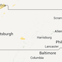

Connect with Interactive Hail Maps