

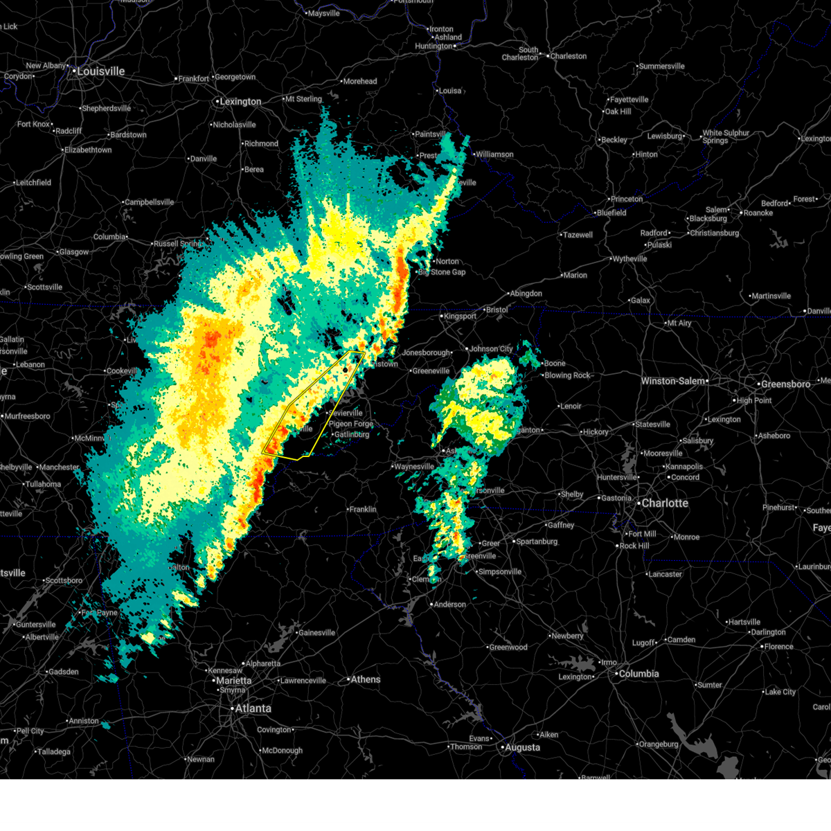
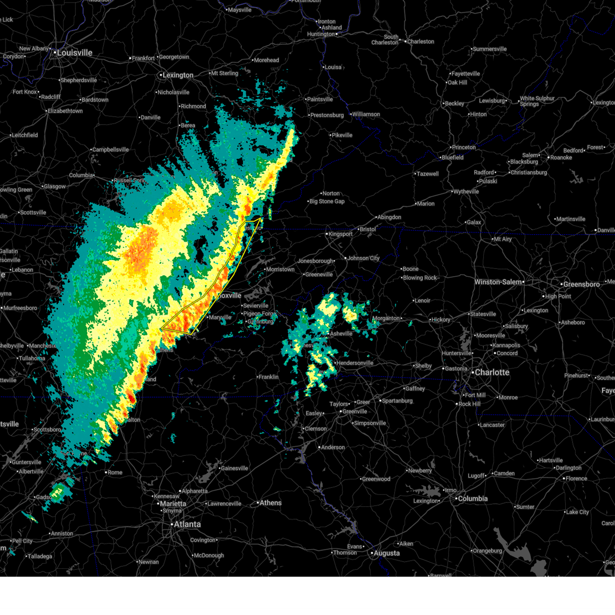
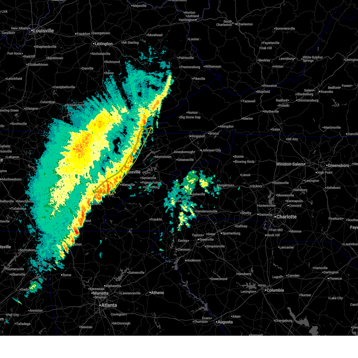
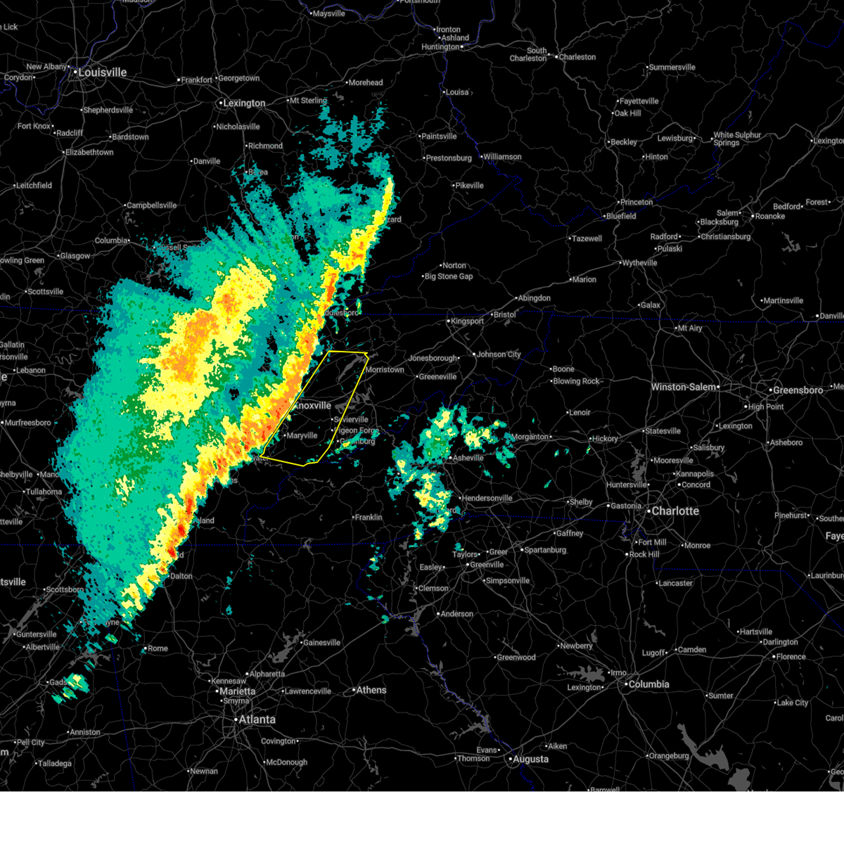
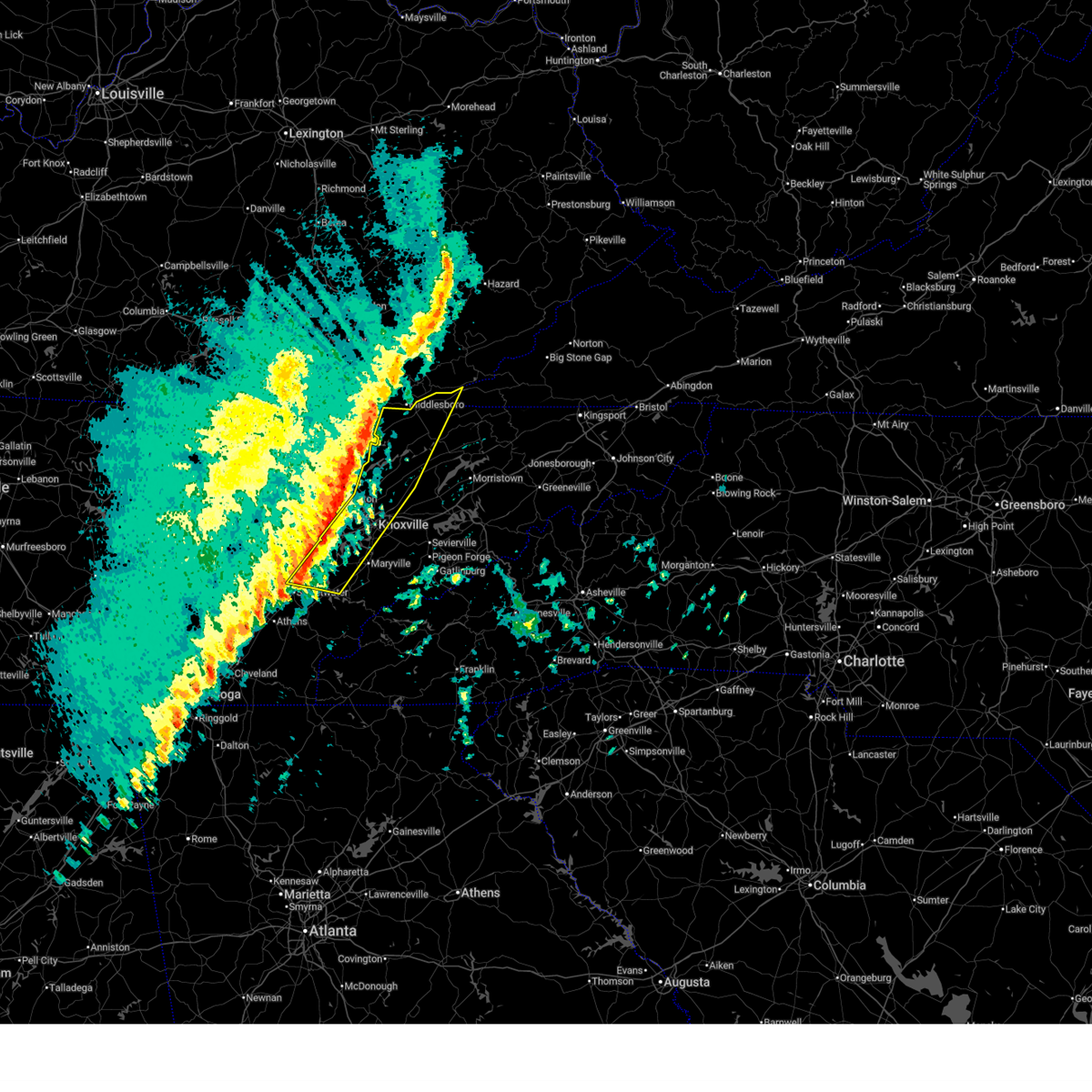
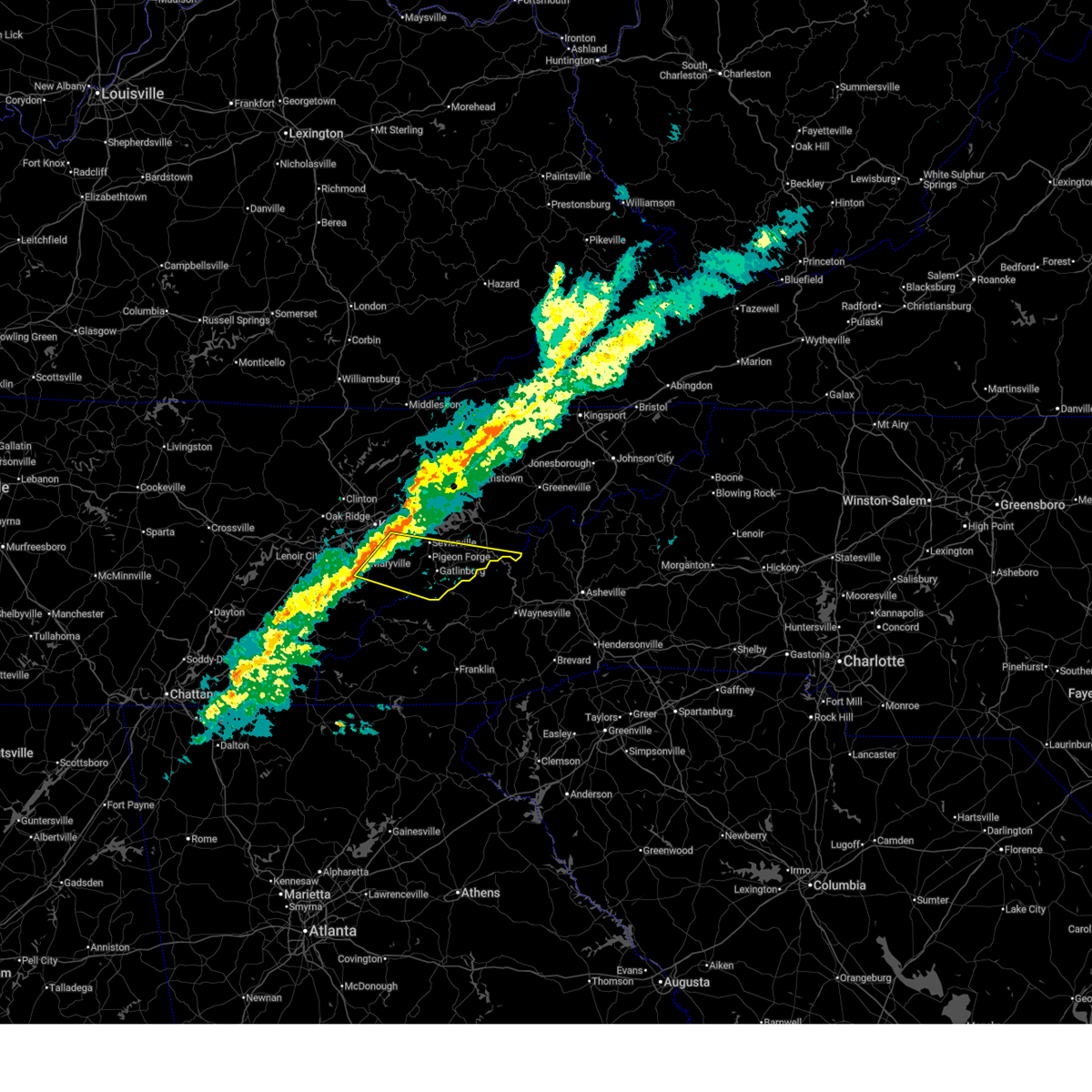
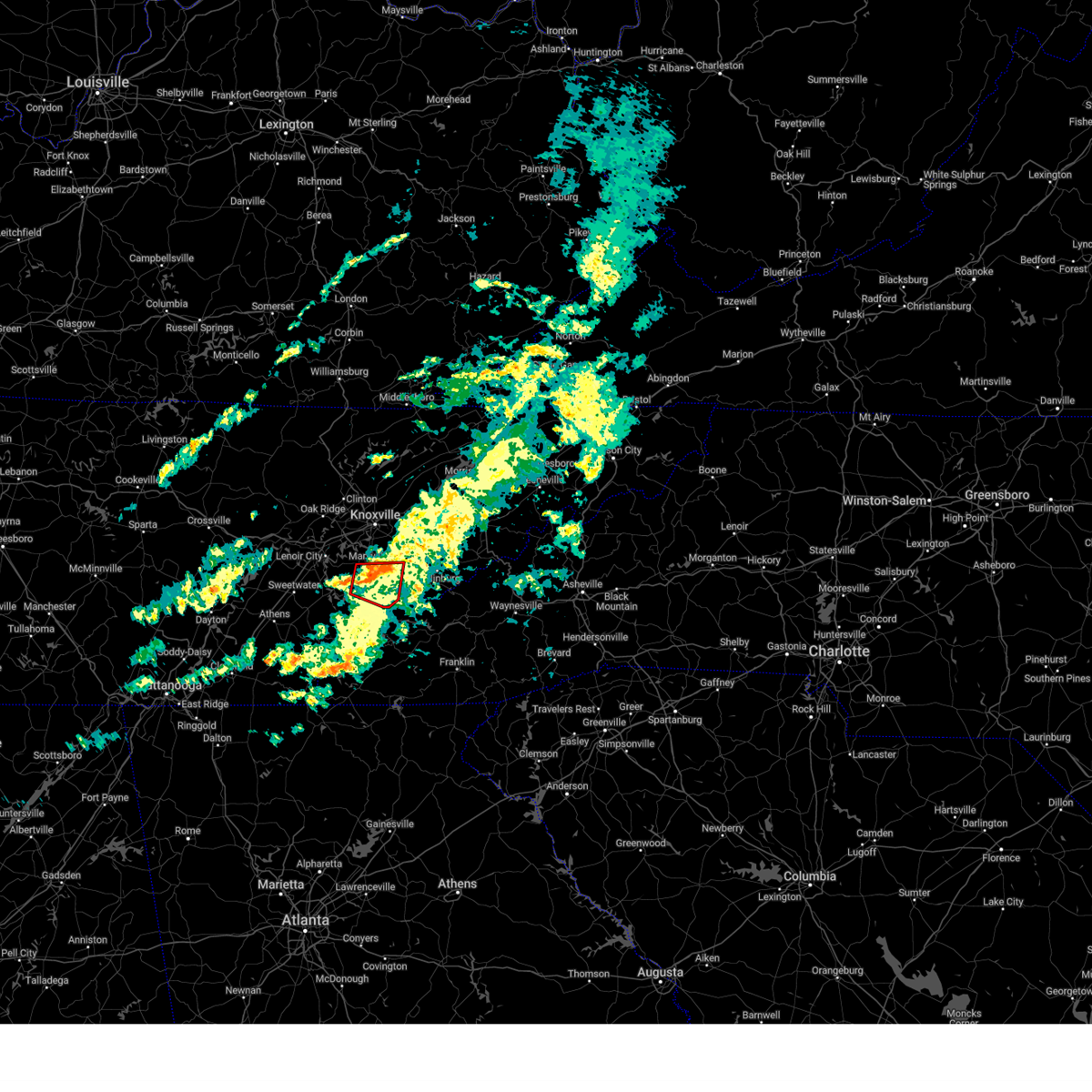
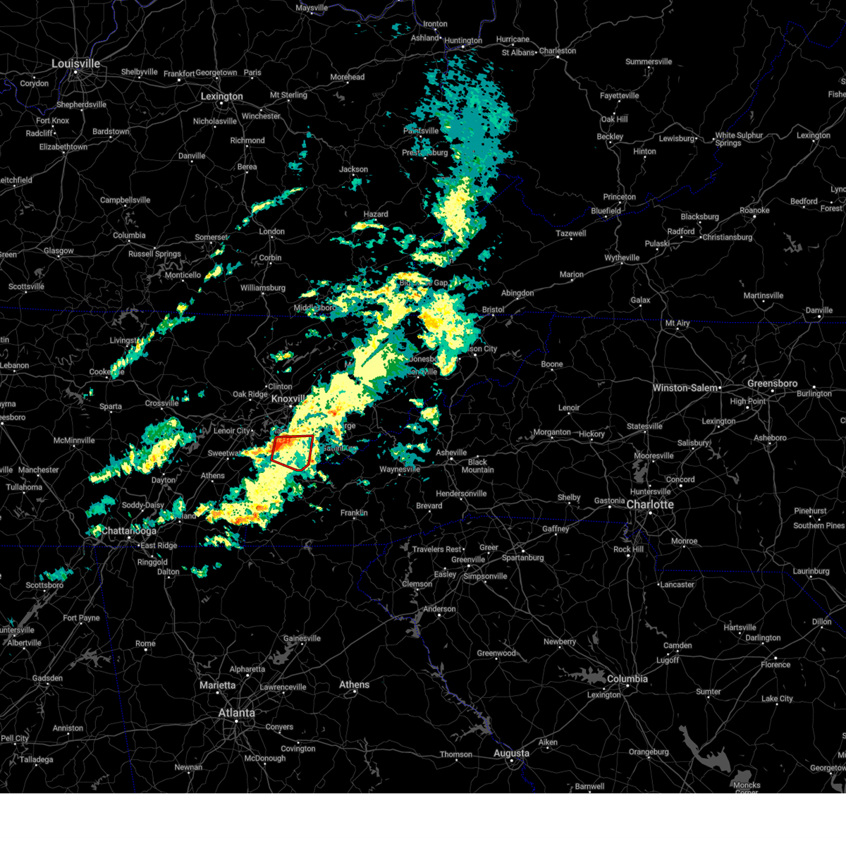
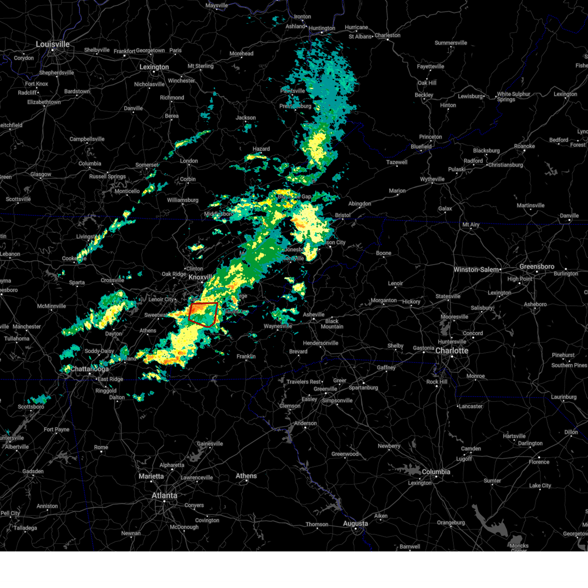
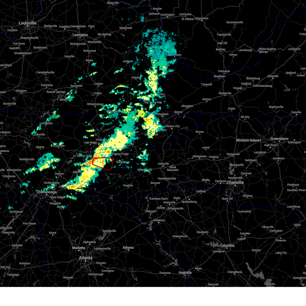
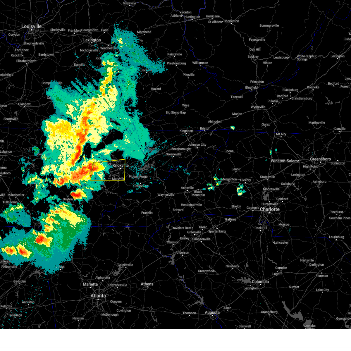
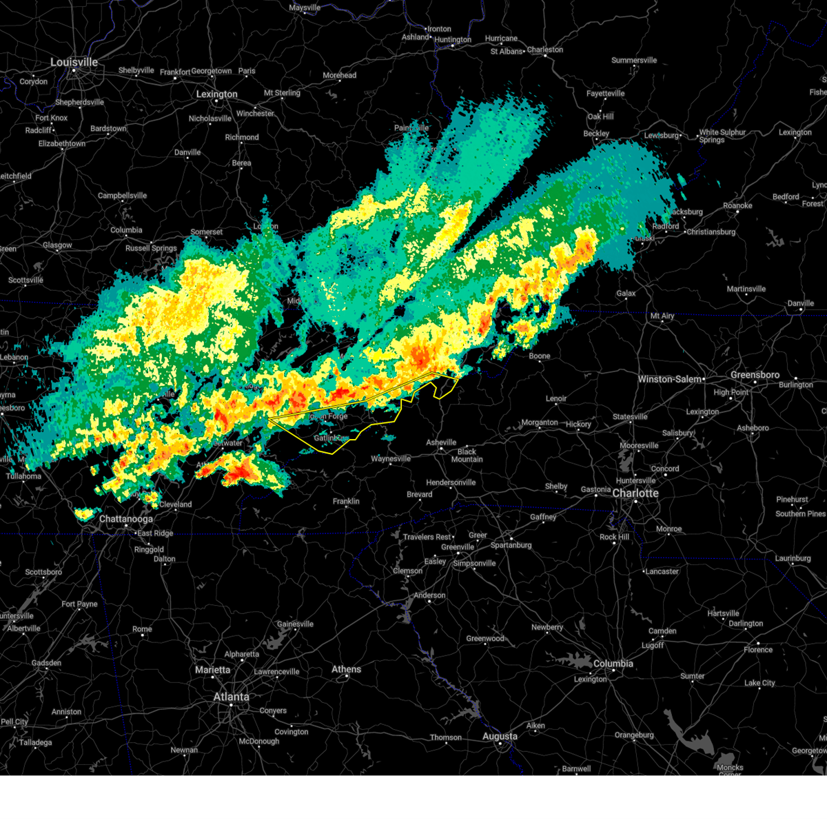
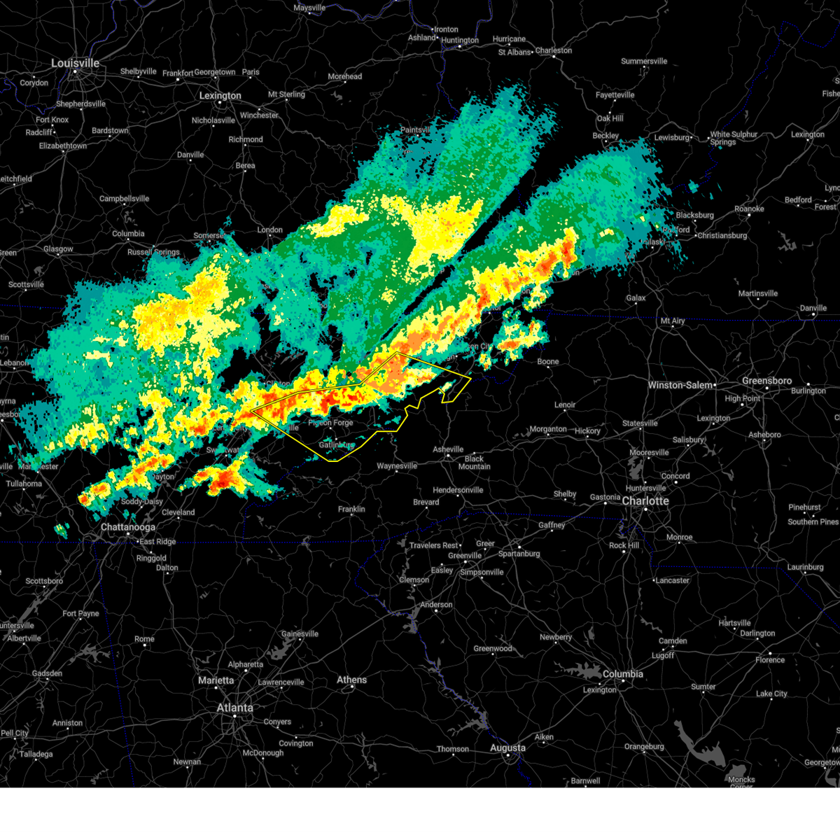
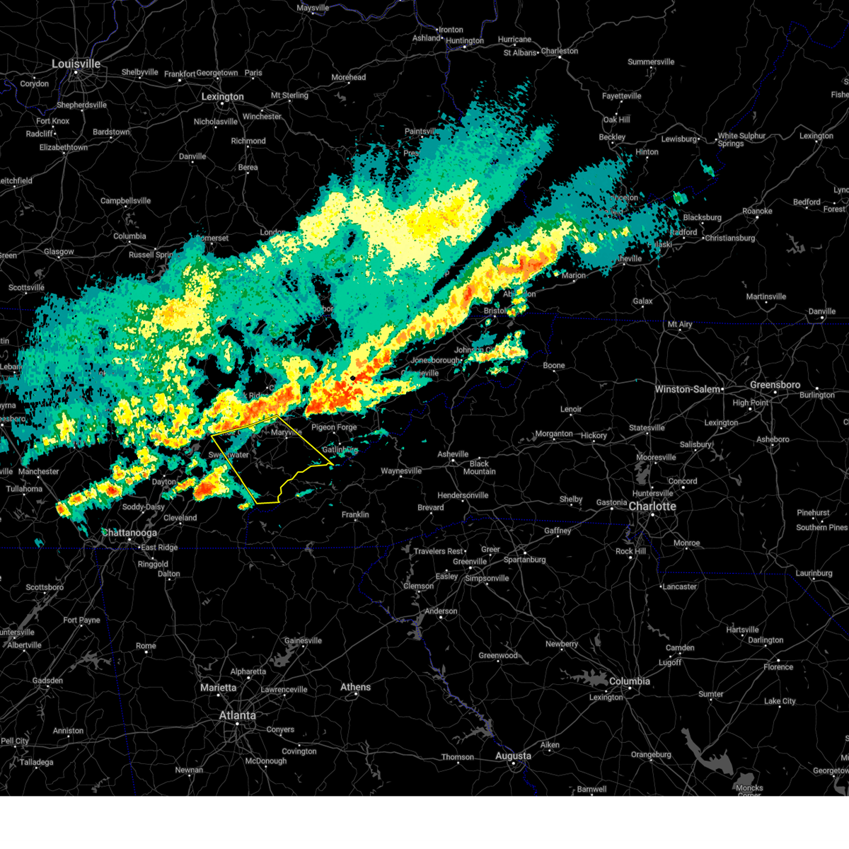
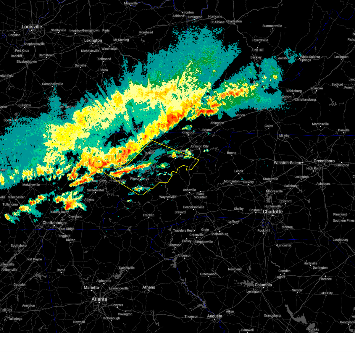
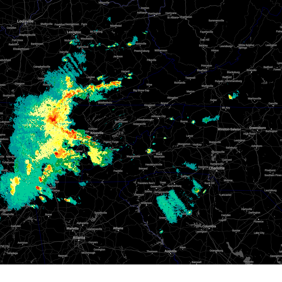
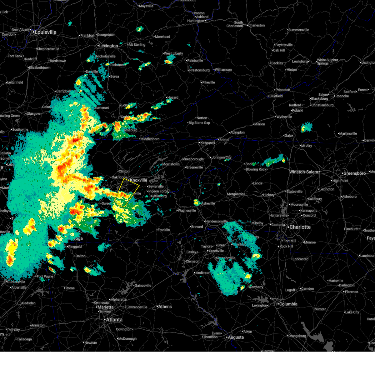
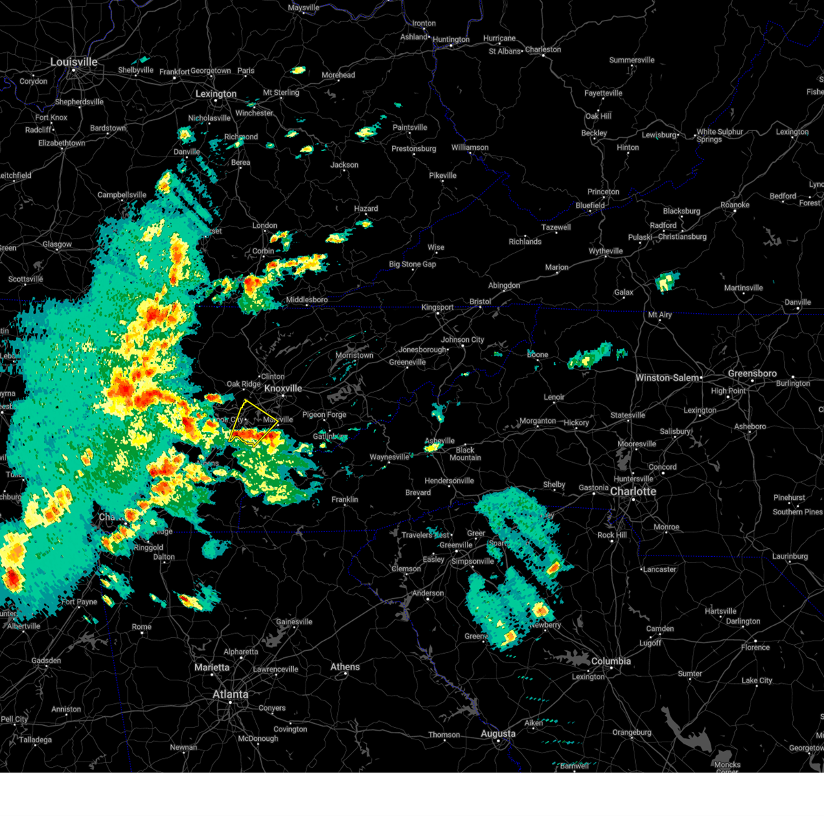
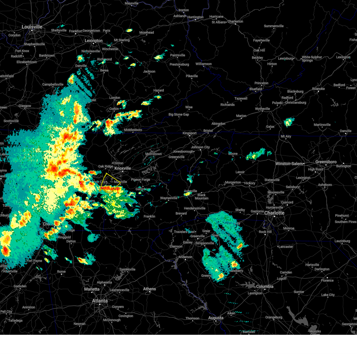
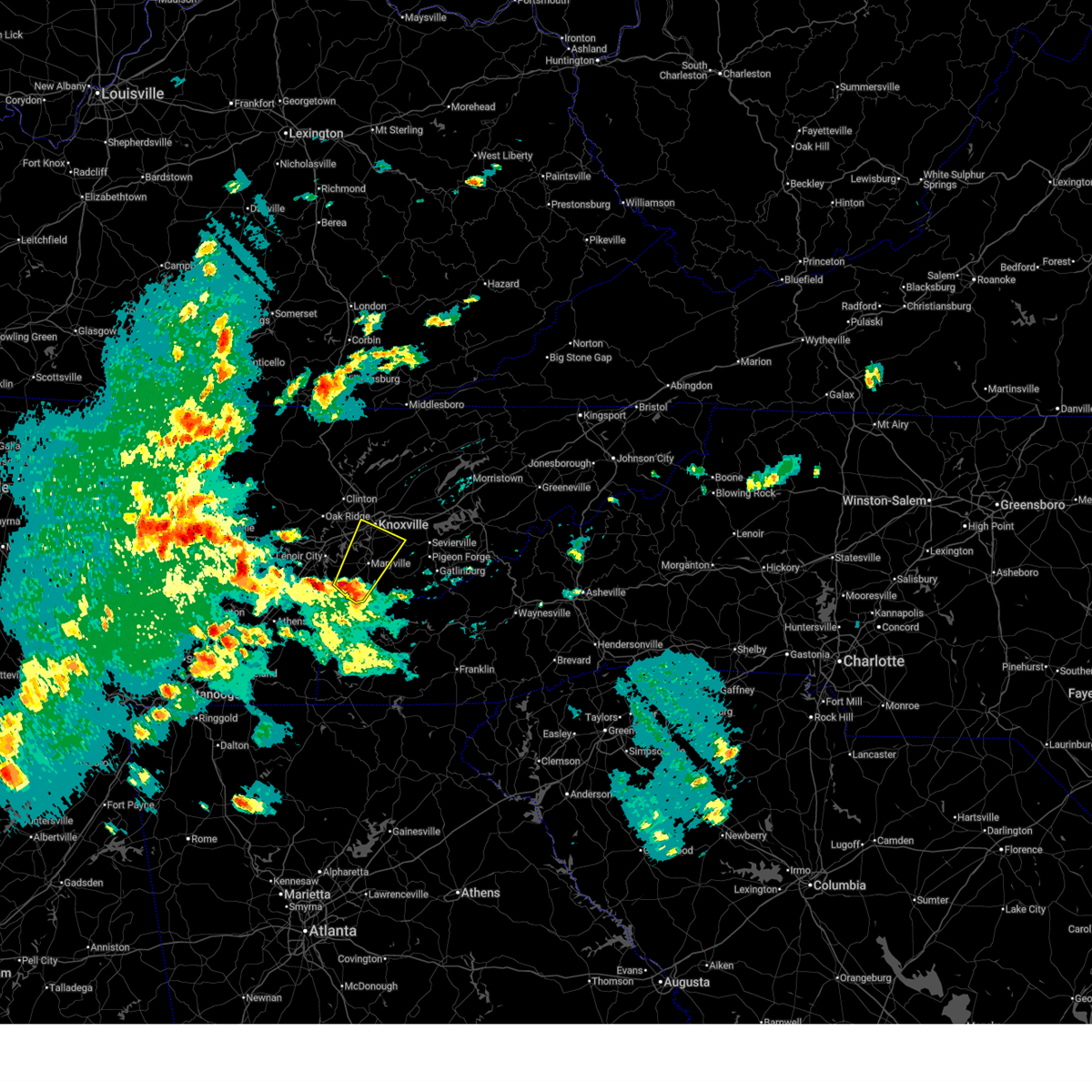
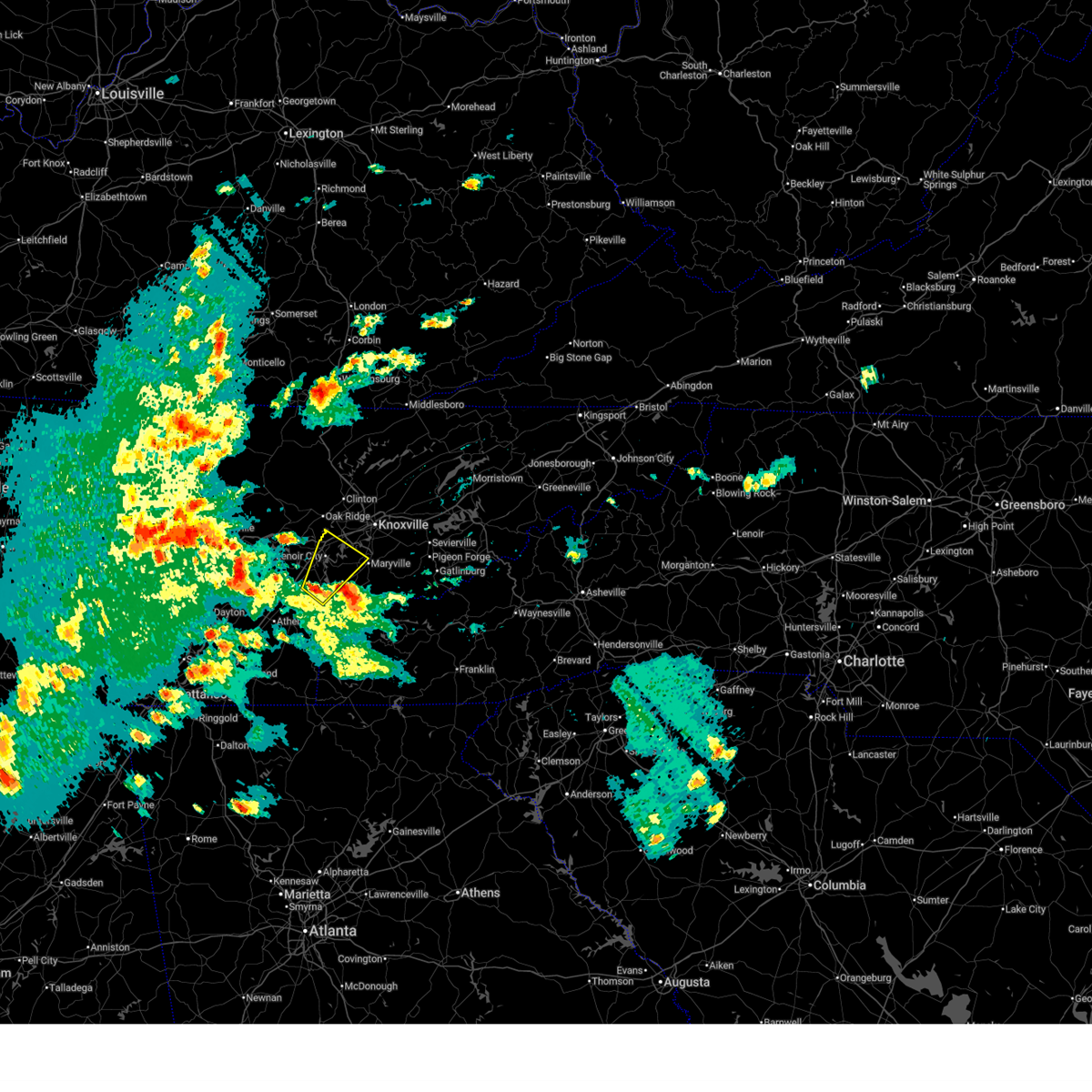
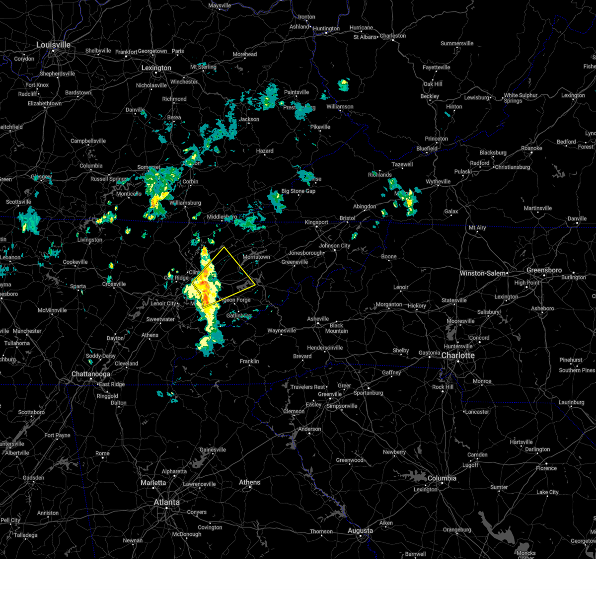
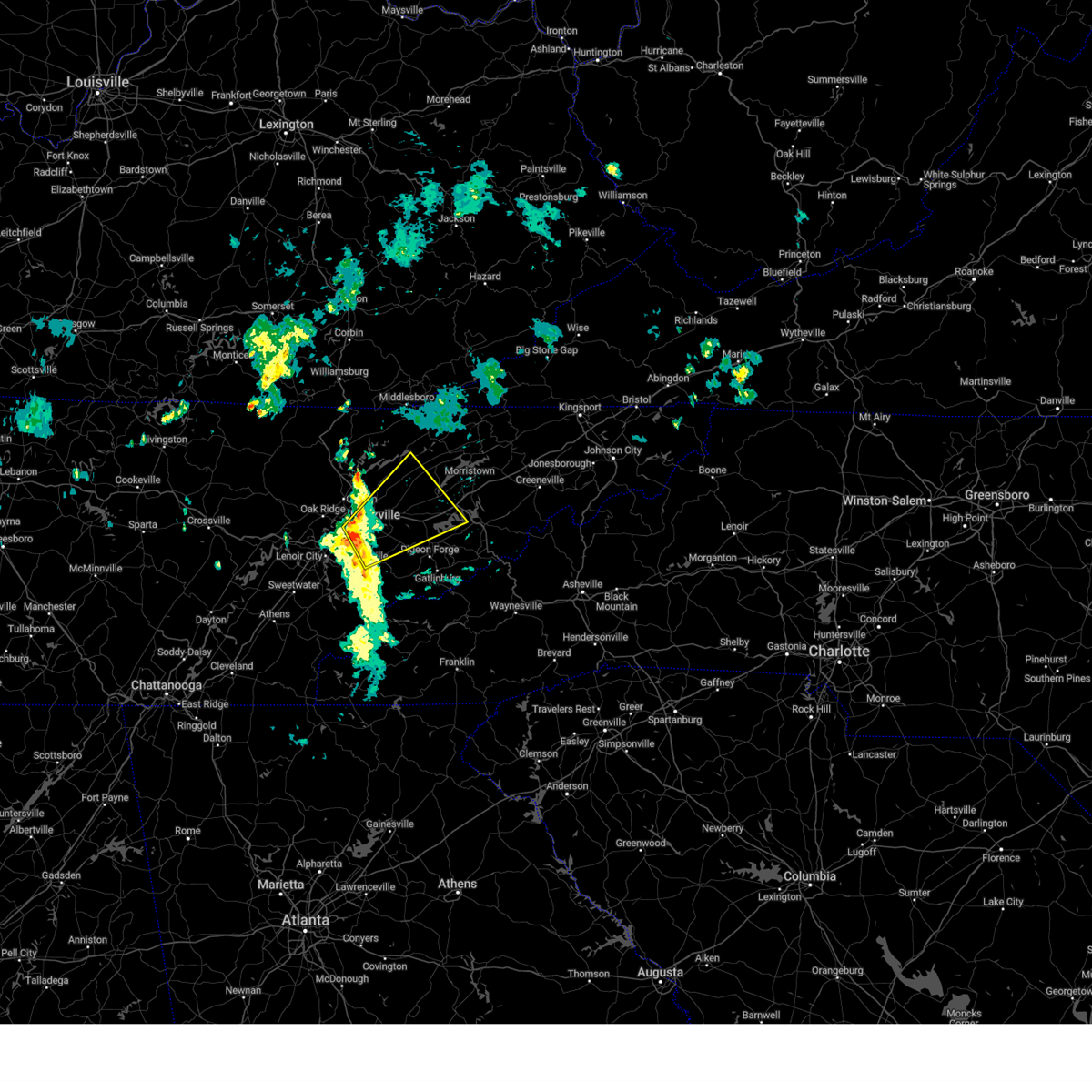
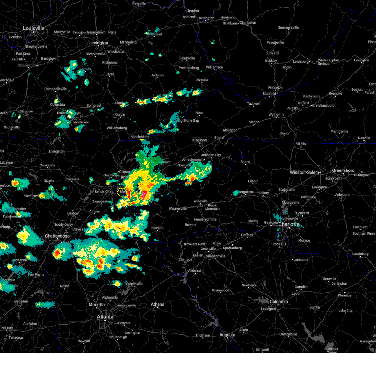
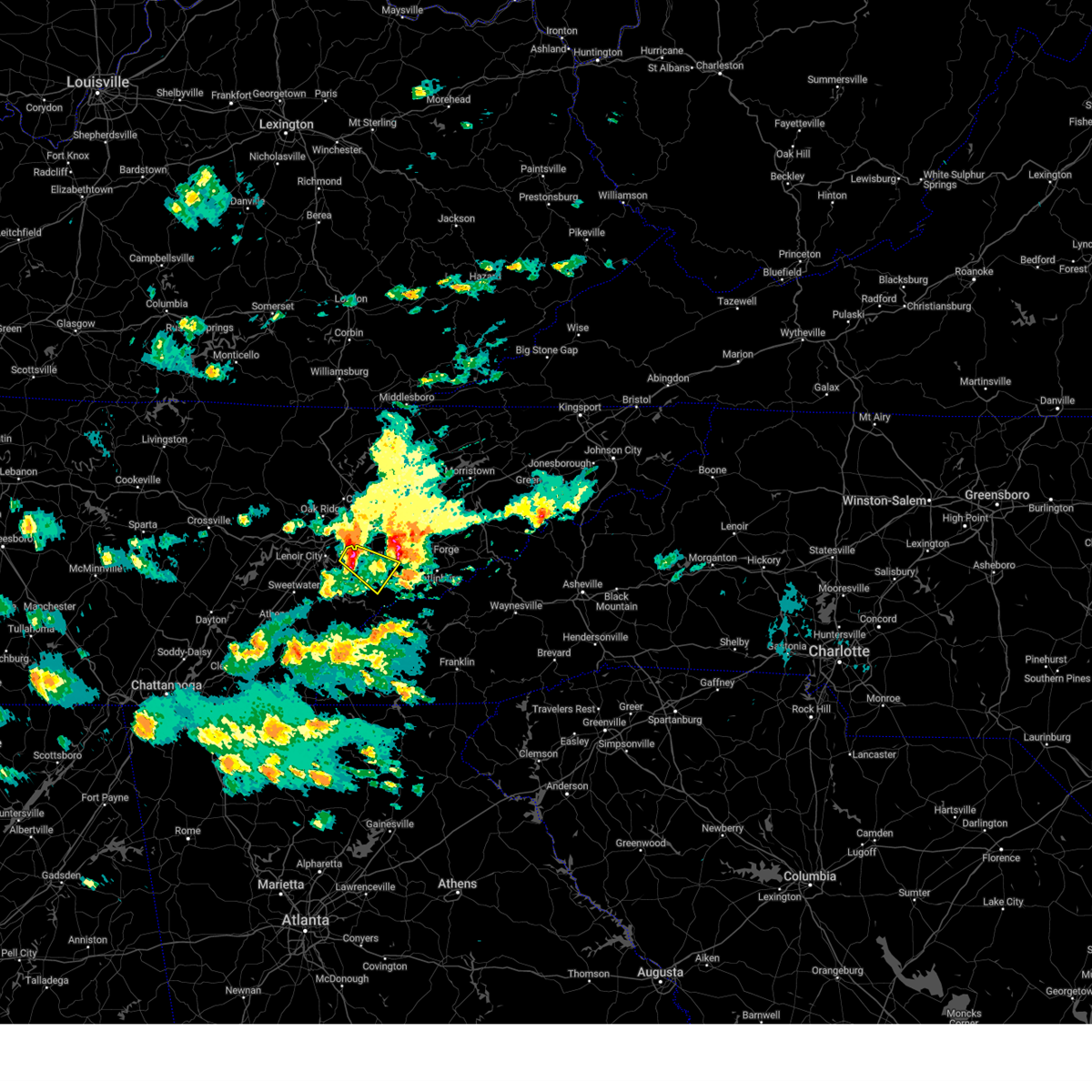
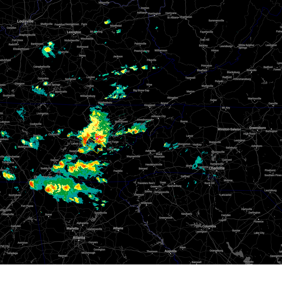
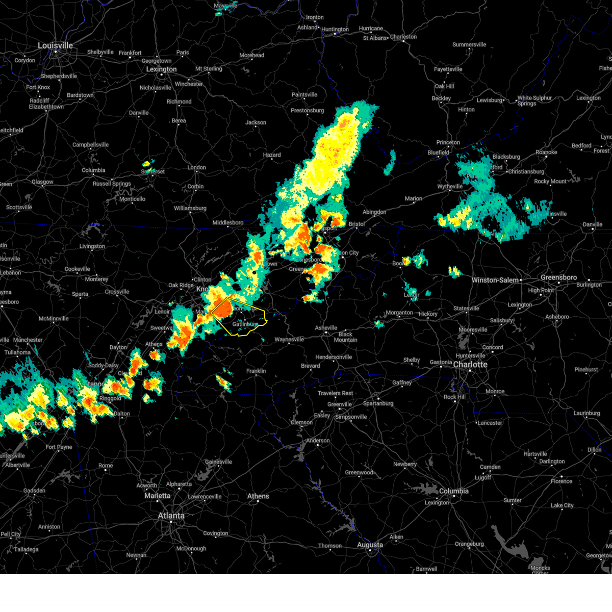
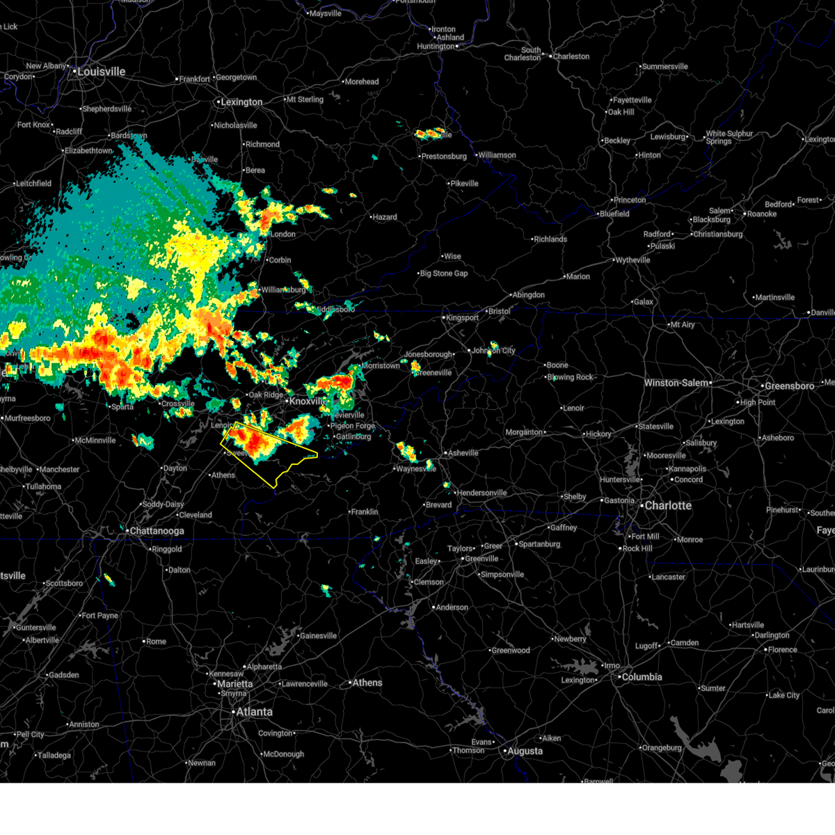
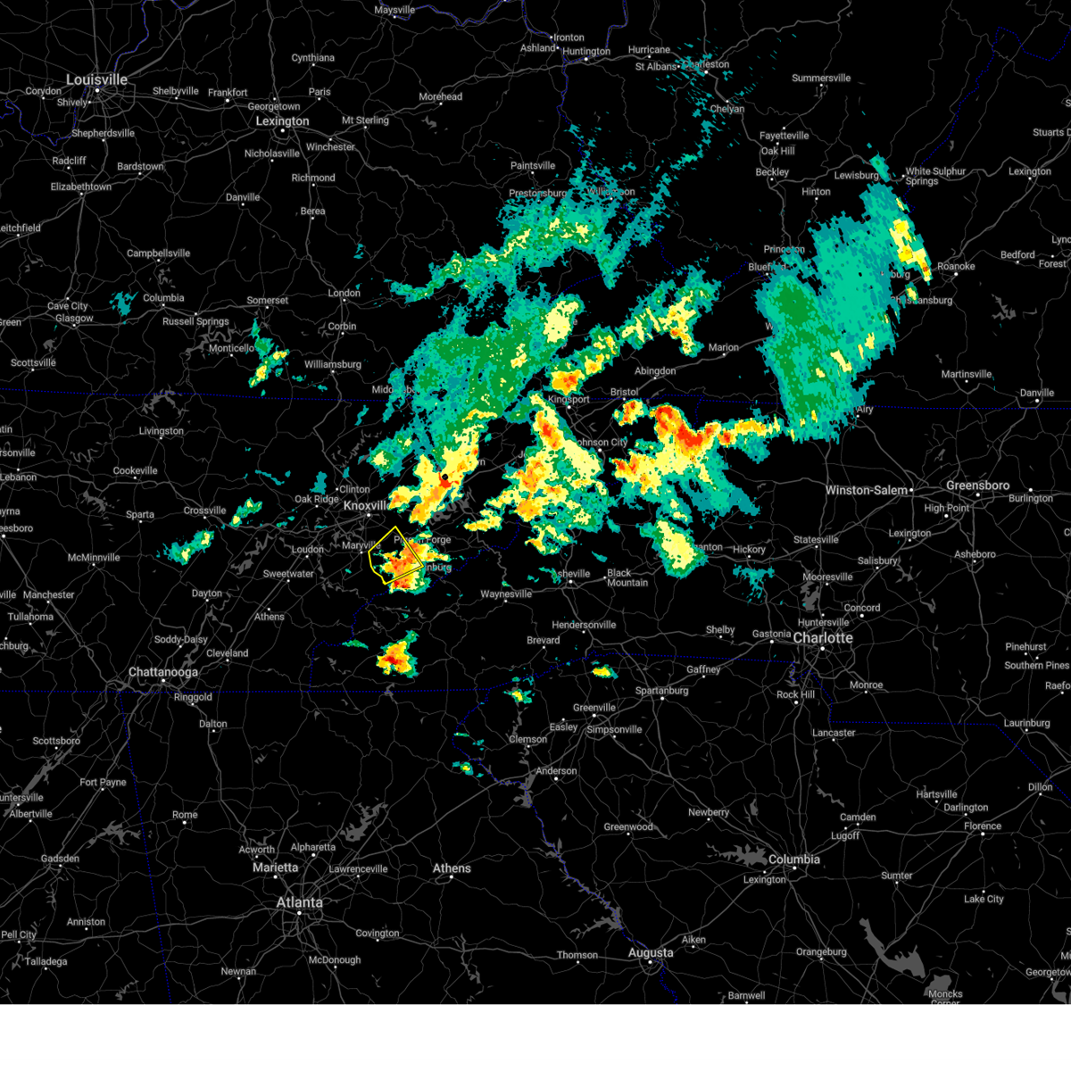
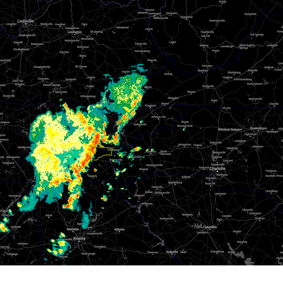
Hail Map for Maryville, TN
The Maryville, TN area has had 20 reports of on-the-ground hail by trained spotters, and has been under severe weather warnings 6 times during the past 12 months. Doppler radar has detected hail at or near Maryville, TN on 50 occasions.
| Name: | Maryville, TN |
| Where Located: | 15.5 miles SSW of Knoxville, TN |
| Map: | Google Map for Maryville, TN |
| Population: | 27465 |
| Housing Units: | 11629 |
| More Info: | Search Google for Maryville, TN |
1
The Top Recent Hail Date for Maryville, TN is Wednesday, July 17, 2024 (8th out of 50)

Hail and Wind Damage Spotted near Maryville, TN
| Date / Time | Report Details |
|---|---|
| 3/16/2026 5:02 AM EDT | Several trees down county-wid in blount county TN, 13.8 miles NNE of Maryville, TN |
| 3/16/2026 4:48 AM EDT | Trees dow in blount county TN, 2.8 miles NNW of Maryville, TN |
| 3/16/2026 4:40 AM EDT |
 Svrmrx the national weather service in morristown has issued a * severe thunderstorm warning for, southeastern knox county in east tennessee, blount county in east tennessee, central jefferson county in east tennessee, central grainger county in east tennessee, western sevier county in east tennessee, western hamblen county in east tennessee, * until 515 am edt. * at 439 am edt, a severe thunderstorm was located near maryville, moving northeast at 35 mph (radar indicated). Hazards include 60 mph wind gusts. expect damage to roofs, siding, and trees Svrmrx the national weather service in morristown has issued a * severe thunderstorm warning for, southeastern knox county in east tennessee, blount county in east tennessee, central jefferson county in east tennessee, central grainger county in east tennessee, western sevier county in east tennessee, western hamblen county in east tennessee, * until 515 am edt. * at 439 am edt, a severe thunderstorm was located near maryville, moving northeast at 35 mph (radar indicated). Hazards include 60 mph wind gusts. expect damage to roofs, siding, and trees
|
| 3/16/2026 4:02 AM EDT |
 the severe thunderstorm warning has been cancelled and is no longer in effect the severe thunderstorm warning has been cancelled and is no longer in effect
|
| 3/16/2026 4:02 AM EDT |
 At 402 am edt, severe thunderstorms were located along a line extending from 8 miles west of sneedville to near eagleton village, moving east at 50 mph (radar indicated). Hazards include 60 mph wind gusts. Expect damage to roofs, siding, and trees. locations impacted include, knoxville, maryville, lenoir city, alcoa, loudon, farragut, new tazewell, louisville, tazewell, and plainview. this includes the following highways, interstate 40 in tennessee between mile markers 379 and 396. Interstate 75 in tennessee between mile markers 65 and 72, and near mile marker 108. At 402 am edt, severe thunderstorms were located along a line extending from 8 miles west of sneedville to near eagleton village, moving east at 50 mph (radar indicated). Hazards include 60 mph wind gusts. Expect damage to roofs, siding, and trees. locations impacted include, knoxville, maryville, lenoir city, alcoa, loudon, farragut, new tazewell, louisville, tazewell, and plainview. this includes the following highways, interstate 40 in tennessee between mile markers 379 and 396. Interstate 75 in tennessee between mile markers 65 and 72, and near mile marker 108.
|
| 3/16/2026 3:47 AM EDT |
 Svrmrx the national weather service in morristown has issued a * severe thunderstorm warning for, eastern knox county in east tennessee, blount county in east tennessee, jefferson county in east tennessee, grainger county in east tennessee, western sevier county in east tennessee, western hamblen county in east tennessee, * until 445 am edt. * at 346 am edt, severe thunderstorms were located along a line extending from near maynardville to louisville, moving east at 40 mph (radar indicated). Hazards include 60 mph wind gusts. expect damage to roofs, siding, and trees Svrmrx the national weather service in morristown has issued a * severe thunderstorm warning for, eastern knox county in east tennessee, blount county in east tennessee, jefferson county in east tennessee, grainger county in east tennessee, western sevier county in east tennessee, western hamblen county in east tennessee, * until 445 am edt. * at 346 am edt, severe thunderstorms were located along a line extending from near maynardville to louisville, moving east at 40 mph (radar indicated). Hazards include 60 mph wind gusts. expect damage to roofs, siding, and trees
|
| 3/16/2026 3:21 AM EDT |
 Svrmrx the national weather service in morristown has issued a * severe thunderstorm warning for, loudon county in east tennessee, claiborne county in east tennessee, eastern anderson county in east tennessee, knox county in east tennessee, northwestern blount county in east tennessee, northwestern hancock county in east tennessee, northwestern monroe county in east tennessee, northwestern grainger county in east tennessee, union county in east tennessee, southwestern lee county in southwestern virginia, * until 415 am edt. * at 321 am edt, severe thunderstorms were located along a line extending from near wilkerson to near loudon, moving east at 40 mph (radar indicated). Hazards include 60 mph wind gusts. expect damage to roofs, siding, and trees Svrmrx the national weather service in morristown has issued a * severe thunderstorm warning for, loudon county in east tennessee, claiborne county in east tennessee, eastern anderson county in east tennessee, knox county in east tennessee, northwestern blount county in east tennessee, northwestern hancock county in east tennessee, northwestern monroe county in east tennessee, northwestern grainger county in east tennessee, union county in east tennessee, southwestern lee county in southwestern virginia, * until 415 am edt. * at 321 am edt, severe thunderstorms were located along a line extending from near wilkerson to near loudon, moving east at 40 mph (radar indicated). Hazards include 60 mph wind gusts. expect damage to roofs, siding, and trees
|
| 2/20/2026 5:54 AM EST |
 Svrmrx the national weather service in morristown has issued a * severe thunderstorm warning for, southeastern knox county in east tennessee, northeastern blount county in east tennessee, southern cocke county in east tennessee, sevier county in east tennessee, * until 700 am est. * at 554 am est, a severe thunderstorm was located near eagleton village, or 7 miles east of alcoa, moving east at 45 mph (radar indicated). Hazards include 60 mph wind gusts. expect damage to roofs, siding, and trees Svrmrx the national weather service in morristown has issued a * severe thunderstorm warning for, southeastern knox county in east tennessee, northeastern blount county in east tennessee, southern cocke county in east tennessee, sevier county in east tennessee, * until 700 am est. * at 554 am est, a severe thunderstorm was located near eagleton village, or 7 miles east of alcoa, moving east at 45 mph (radar indicated). Hazards include 60 mph wind gusts. expect damage to roofs, siding, and trees
|
| 5/30/2025 9:33 AM EDT |
 the tornado warning has been cancelled and is no longer in effect the tornado warning has been cancelled and is no longer in effect
|
| 5/30/2025 9:24 AM EDT |
 the tornado warning has been cancelled and is no longer in effect the tornado warning has been cancelled and is no longer in effect
|
| 5/30/2025 9:24 AM EDT |
 At 923 am edt, a severe thunderstorm capable of producing a tornado was located near maryville, moving east at 30 mph (radar indicated rotation). Hazards include tornado. Flying debris will be dangerous to those caught without shelter. mobile homes will be damaged or destroyed. damage to roofs, windows, and vehicles will occur. tree damage is likely. this dangerous storm will be near, maryville around 930 am edt. smoky mountains-fontana area around 935 am edt. Other locations impacted by this tornadic thunderstorm include townsend, walland, cades cove, and happy valley. At 923 am edt, a severe thunderstorm capable of producing a tornado was located near maryville, moving east at 30 mph (radar indicated rotation). Hazards include tornado. Flying debris will be dangerous to those caught without shelter. mobile homes will be damaged or destroyed. damage to roofs, windows, and vehicles will occur. tree damage is likely. this dangerous storm will be near, maryville around 930 am edt. smoky mountains-fontana area around 935 am edt. Other locations impacted by this tornadic thunderstorm include townsend, walland, cades cove, and happy valley.
|
| 5/30/2025 9:10 AM EDT |
 Tormrx the national weather service in morristown has issued a * tornado warning for, southeastern loudon county in east tennessee, central blount county in east tennessee, * until 945 am edt. * at 910 am edt, a severe thunderstorm capable of producing a tornado was located 11 miles southwest of maryville, moving east at 25 mph (radar indicated rotation). Hazards include tornado. Flying debris will be dangerous to those caught without shelter. mobile homes will be damaged or destroyed. damage to roofs, windows, and vehicles will occur. tree damage is likely. this dangerous storm will be near, maryville around 915 am edt. Other locations impacted by this tornadic thunderstorm include greenback, townsend, clover hill, walland, cades cove, happy valley, and friendsville. Tormrx the national weather service in morristown has issued a * tornado warning for, southeastern loudon county in east tennessee, central blount county in east tennessee, * until 945 am edt. * at 910 am edt, a severe thunderstorm capable of producing a tornado was located 11 miles southwest of maryville, moving east at 25 mph (radar indicated rotation). Hazards include tornado. Flying debris will be dangerous to those caught without shelter. mobile homes will be damaged or destroyed. damage to roofs, windows, and vehicles will occur. tree damage is likely. this dangerous storm will be near, maryville around 915 am edt. Other locations impacted by this tornadic thunderstorm include greenback, townsend, clover hill, walland, cades cove, happy valley, and friendsville.
|
| 5/20/2025 9:25 PM EDT |
 Svrmrx the national weather service in morristown has issued a * severe thunderstorm warning for, southeastern morgan county in east tennessee, northeastern loudon county in east tennessee, southwestern anderson county in east tennessee, knox county in east tennessee, northwestern blount county in east tennessee, northeastern roane county in east tennessee, * until 1030 pm edt. * at 925 pm edt, a severe thunderstorm was located over kingston, moving east at 45 mph (radar indicated). Hazards include 60 mph wind gusts and quarter size hail. Hail damage to vehicles is expected. Expect wind damage to roofs, siding, and trees. Svrmrx the national weather service in morristown has issued a * severe thunderstorm warning for, southeastern morgan county in east tennessee, northeastern loudon county in east tennessee, southwestern anderson county in east tennessee, knox county in east tennessee, northwestern blount county in east tennessee, northeastern roane county in east tennessee, * until 1030 pm edt. * at 925 pm edt, a severe thunderstorm was located over kingston, moving east at 45 mph (radar indicated). Hazards include 60 mph wind gusts and quarter size hail. Hail damage to vehicles is expected. Expect wind damage to roofs, siding, and trees.
|
| 5/17/2025 3:09 AM EDT |
 Svrmrx the national weather service in morristown has issued a * severe thunderstorm warning for, northeastern blount county in east tennessee, southwestern washington county in east tennessee, southern jefferson county in east tennessee, cocke county in east tennessee, southeastern greene county in east tennessee, southwestern unicoi county in east tennessee, sevier county in east tennessee, * until 345 am edt. * at 309 am edt, severe thunderstorms were located along a line extending from near tusculum to near newport to near alcoa, moving east at 50 mph (radar indicated). Hazards include 60 mph wind gusts and nickel size hail. expect damage to roofs, siding, and trees Svrmrx the national weather service in morristown has issued a * severe thunderstorm warning for, northeastern blount county in east tennessee, southwestern washington county in east tennessee, southern jefferson county in east tennessee, cocke county in east tennessee, southeastern greene county in east tennessee, southwestern unicoi county in east tennessee, sevier county in east tennessee, * until 345 am edt. * at 309 am edt, severe thunderstorms were located along a line extending from near tusculum to near newport to near alcoa, moving east at 50 mph (radar indicated). Hazards include 60 mph wind gusts and nickel size hail. expect damage to roofs, siding, and trees
|
| 5/17/2025 3:01 AM EDT |
 the severe thunderstorm warning has been cancelled and is no longer in effect the severe thunderstorm warning has been cancelled and is no longer in effect
|
| 5/17/2025 3:01 AM EDT |
 At 301 am edt, severe thunderstorms were located along a line extending from near pine crest to near hot springs to 6 miles east of gatlinburg, moving east at 70 mph (radar indicated). Hazards include 70 mph wind gusts and quarter size hail. Hail damage to vehicles is expected. expect considerable tree damage. wind damage is also likely to mobile homes, roofs, and outbuildings. locations impacted include, caney branch, gatlinburg, smoky mountains-newfound gap, banner hill, bird crossing, alcoa, rocky fork, kimberlin heights, sevierville, and pittman center. this includes the following highways, interstate 26 in tennessee between mile markers 37 and 52. interstate 40 in tennessee between mile markers 371 and 451. Interstate 81 in tennessee between mile markers 1 and 2, and between mile markers 16 and 32. At 301 am edt, severe thunderstorms were located along a line extending from near pine crest to near hot springs to 6 miles east of gatlinburg, moving east at 70 mph (radar indicated). Hazards include 70 mph wind gusts and quarter size hail. Hail damage to vehicles is expected. expect considerable tree damage. wind damage is also likely to mobile homes, roofs, and outbuildings. locations impacted include, caney branch, gatlinburg, smoky mountains-newfound gap, banner hill, bird crossing, alcoa, rocky fork, kimberlin heights, sevierville, and pittman center. this includes the following highways, interstate 26 in tennessee between mile markers 37 and 52. interstate 40 in tennessee between mile markers 371 and 451. Interstate 81 in tennessee between mile markers 1 and 2, and between mile markers 16 and 32.
|
| 5/17/2025 2:42 AM EDT |
 Svrmrx the national weather service in morristown has issued a * severe thunderstorm warning for, loudon county in east tennessee, southwestern knox county in east tennessee, blount county in east tennessee, monroe county in east tennessee, southeastern roane county in east tennessee, south central sevier county in east tennessee, * until 330 am edt. * at 242 am edt, severe thunderstorms were located along a line extending from near rockford to near lenoir city to near fairview, moving southeast at 50 mph (radar indicated). Hazards include 60 mph wind gusts. expect damage to roofs, siding, and trees Svrmrx the national weather service in morristown has issued a * severe thunderstorm warning for, loudon county in east tennessee, southwestern knox county in east tennessee, blount county in east tennessee, monroe county in east tennessee, southeastern roane county in east tennessee, south central sevier county in east tennessee, * until 330 am edt. * at 242 am edt, severe thunderstorms were located along a line extending from near rockford to near lenoir city to near fairview, moving southeast at 50 mph (radar indicated). Hazards include 60 mph wind gusts. expect damage to roofs, siding, and trees
|
| 5/17/2025 2:15 AM EDT |
 Svrmrx the national weather service in morristown has issued a * severe thunderstorm warning for, southwestern hawkins county in east tennessee, south central anderson county in east tennessee, knox county in east tennessee, jefferson county in east tennessee, cocke county in east tennessee, greene county in east tennessee, grainger county in east tennessee, southwestern unicoi county in east tennessee, sevier county in east tennessee, northeastern blount county in east tennessee, southwestern washington county in east tennessee, southwestern hancock county in east tennessee, northeastern roane county in east tennessee, hamblen county in east tennessee, * until 315 am edt. * at 214 am edt, severe thunderstorms were located along a line extending from 6 miles south of sneedville to 10 miles northeast of knoxville to near oak ridge, moving east at 70 mph (radar indicated). Hazards include 70 mph wind gusts and nickel size hail. Expect considerable tree damage. Damage is likely to mobile homes, roofs, and outbuildings. Svrmrx the national weather service in morristown has issued a * severe thunderstorm warning for, southwestern hawkins county in east tennessee, south central anderson county in east tennessee, knox county in east tennessee, jefferson county in east tennessee, cocke county in east tennessee, greene county in east tennessee, grainger county in east tennessee, southwestern unicoi county in east tennessee, sevier county in east tennessee, northeastern blount county in east tennessee, southwestern washington county in east tennessee, southwestern hancock county in east tennessee, northeastern roane county in east tennessee, hamblen county in east tennessee, * until 315 am edt. * at 214 am edt, severe thunderstorms were located along a line extending from 6 miles south of sneedville to 10 miles northeast of knoxville to near oak ridge, moving east at 70 mph (radar indicated). Hazards include 70 mph wind gusts and nickel size hail. Expect considerable tree damage. Damage is likely to mobile homes, roofs, and outbuildings.
|
| 5/8/2025 7:25 PM EDT | Ping Pong Ball sized hail reported 11.3 miles NNE of Maryville, TN, ping pong ball size hail. |
| 5/8/2025 7:19 PM EDT | Golf Ball sized hail reported 15.2 miles NE of Maryville, TN, golf ball size hail. |
| 5/2/2025 9:56 PM EDT | Quarter sized hail reported 1.5 miles WSW of Maryville, TN, report via social media. |
| 5/2/2025 5:09 PM EDT |
 At 509 pm edt, a severe thunderstorm was located near farragut, or 9 miles northwest of alcoa, moving northeast at 30 mph (radar indicated). Hazards include 60 mph wind gusts and quarter size hail. Hail damage to vehicles is expected. expect wind damage to roofs, siding, and trees. locations impacted include, louisville, lenoir city, farragut, friendsville, maryville, and alcoa. this includes the following highways, interstate 40 in tennessee between mile markers 366 and 372. Interstate 75 in tennessee between mile markers 78 and 84. At 509 pm edt, a severe thunderstorm was located near farragut, or 9 miles northwest of alcoa, moving northeast at 30 mph (radar indicated). Hazards include 60 mph wind gusts and quarter size hail. Hail damage to vehicles is expected. expect wind damage to roofs, siding, and trees. locations impacted include, louisville, lenoir city, farragut, friendsville, maryville, and alcoa. this includes the following highways, interstate 40 in tennessee between mile markers 366 and 372. Interstate 75 in tennessee between mile markers 78 and 84.
|
| 5/2/2025 4:56 PM EDT |
 the severe thunderstorm warning has been cancelled and is no longer in effect the severe thunderstorm warning has been cancelled and is no longer in effect
|
| 5/2/2025 4:50 PM EDT | Quarter sized hail reported 1.5 miles WSW of Maryville, TN, corrects previous hail report from maryville for the time. report via social media. |
| 5/2/2025 4:45 PM EDT |
 At 445 pm edt, a severe thunderstorm was located 7 miles east of loudon, moving northeast at 30 mph (radar indicated). Hazards include 60 mph wind gusts and quarter size hail. Hail damage to vehicles is expected. expect wind damage to roofs, siding, and trees. locations impacted include, greenback, clover hill, tellico village, louisville, friendsville, lenoir city, farragut, loudon, maryville, and alcoa. this includes the following highways, interstate 40 in tennessee between mile markers 366 and 372. Interstate 75 in tennessee between mile markers 78 and 84. At 445 pm edt, a severe thunderstorm was located 7 miles east of loudon, moving northeast at 30 mph (radar indicated). Hazards include 60 mph wind gusts and quarter size hail. Hail damage to vehicles is expected. expect wind damage to roofs, siding, and trees. locations impacted include, greenback, clover hill, tellico village, louisville, friendsville, lenoir city, farragut, loudon, maryville, and alcoa. this includes the following highways, interstate 40 in tennessee between mile markers 366 and 372. Interstate 75 in tennessee between mile markers 78 and 84.
|
| 5/2/2025 4:45 PM EDT |
 the severe thunderstorm warning has been cancelled and is no longer in effect the severe thunderstorm warning has been cancelled and is no longer in effect
|
| 5/2/2025 4:37 PM EDT |
 Svrmrx the national weather service in morristown has issued a * severe thunderstorm warning for, southeastern loudon county in east tennessee, southeastern knox county in east tennessee, central blount county in east tennessee, northwestern sevier county in east tennessee, * until 530 pm edt. * at 437 pm edt, a severe thunderstorm was located 8 miles southwest of maryville, moving northeast at 30 mph (radar indicated). Hazards include 60 mph wind gusts and quarter size hail. Hail damage to vehicles is expected. Expect wind damage to roofs, siding, and trees. Svrmrx the national weather service in morristown has issued a * severe thunderstorm warning for, southeastern loudon county in east tennessee, southeastern knox county in east tennessee, central blount county in east tennessee, northwestern sevier county in east tennessee, * until 530 pm edt. * at 437 pm edt, a severe thunderstorm was located 8 miles southwest of maryville, moving northeast at 30 mph (radar indicated). Hazards include 60 mph wind gusts and quarter size hail. Hail damage to vehicles is expected. Expect wind damage to roofs, siding, and trees.
|
| 5/2/2025 4:29 PM EDT |
 Svrmrx the national weather service in morristown has issued a * severe thunderstorm warning for, loudon county in east tennessee, southwestern knox county in east tennessee, northwestern blount county in east tennessee, north central monroe county in east tennessee, * until 515 pm edt. * at 429 pm edt, a severe thunderstorm was located near madisonville, moving northeast at 30 mph (radar indicated). Hazards include 60 mph wind gusts and quarter size hail. Hail damage to vehicles is expected. Expect wind damage to roofs, siding, and trees. Svrmrx the national weather service in morristown has issued a * severe thunderstorm warning for, loudon county in east tennessee, southwestern knox county in east tennessee, northwestern blount county in east tennessee, north central monroe county in east tennessee, * until 515 pm edt. * at 429 pm edt, a severe thunderstorm was located near madisonville, moving northeast at 30 mph (radar indicated). Hazards include 60 mph wind gusts and quarter size hail. Hail damage to vehicles is expected. Expect wind damage to roofs, siding, and trees.
|
| 4/25/2025 1:15 PM EDT |
 At 114 pm edt, a severe thunderstorm was located 8 miles east of knoxville, moving northeast at 40 mph (radar indicated). Hazards include 60 mph wind gusts and penny size hail. Expect damage to roofs, siding, and trees. locations impacted include, luttrell, buffalo springs, strawberry plains, kimberlin heights, sevierville, maloneyville, mascot, joppa, jefferson city, and seymour. this includes the following highways, interstate 40 in tennessee between mile markers 382 and 420. Interstate 75 in tennessee between mile markers 108 and 113. At 114 pm edt, a severe thunderstorm was located 8 miles east of knoxville, moving northeast at 40 mph (radar indicated). Hazards include 60 mph wind gusts and penny size hail. Expect damage to roofs, siding, and trees. locations impacted include, luttrell, buffalo springs, strawberry plains, kimberlin heights, sevierville, maloneyville, mascot, joppa, jefferson city, and seymour. this includes the following highways, interstate 40 in tennessee between mile markers 382 and 420. Interstate 75 in tennessee between mile markers 108 and 113.
|
| 4/25/2025 1:03 PM EDT |
 Svrmrx the national weather service in morristown has issued a * severe thunderstorm warning for, knox county in east tennessee, north central blount county in east tennessee, jefferson county in east tennessee, southwestern grainger county in east tennessee, southeastern union county in east tennessee, northwestern sevier county in east tennessee, * until 145 pm edt. * at 103 pm edt, a severe thunderstorm was located over knoxville, moving northeast at 40 mph (radar indicated). Hazards include 60 mph wind gusts and penny size hail. expect damage to roofs, siding, and trees Svrmrx the national weather service in morristown has issued a * severe thunderstorm warning for, knox county in east tennessee, north central blount county in east tennessee, jefferson county in east tennessee, southwestern grainger county in east tennessee, southeastern union county in east tennessee, northwestern sevier county in east tennessee, * until 145 pm edt. * at 103 pm edt, a severe thunderstorm was located over knoxville, moving northeast at 40 mph (radar indicated). Hazards include 60 mph wind gusts and penny size hail. expect damage to roofs, siding, and trees
|
| 4/10/2025 6:35 PM EDT |
 the severe thunderstorm warning has been cancelled and is no longer in effect the severe thunderstorm warning has been cancelled and is no longer in effect
|
| 4/10/2025 6:20 PM EDT | Quarter sized hail reported 1 miles WSW of Maryville, TN |
| 4/10/2025 6:18 PM EDT |
 the severe thunderstorm warning has been cancelled and is no longer in effect the severe thunderstorm warning has been cancelled and is no longer in effect
|
| 4/10/2025 6:18 PM EDT |
 At 618 pm edt, a severe thunderstorm was located near louisville, or near maryville, moving southeast at 40 mph (radar indicated). Hazards include quarter size hail. Damage to vehicles is expected. Locations impacted include, clover hill, walland, eagleton village, louisville, friendsville, alcoa, maryville, wildwood, and rockford. At 618 pm edt, a severe thunderstorm was located near louisville, or near maryville, moving southeast at 40 mph (radar indicated). Hazards include quarter size hail. Damage to vehicles is expected. Locations impacted include, clover hill, walland, eagleton village, louisville, friendsville, alcoa, maryville, wildwood, and rockford.
|
| 4/10/2025 6:06 PM EDT |
 Svrmrx the national weather service in morristown has issued a * severe thunderstorm warning for, northeastern loudon county in east tennessee, southwestern knox county in east tennessee, northern blount county in east tennessee, * until 645 pm edt. * at 606 pm edt, a severe thunderstorm was located over farragut, or near lenoir city, moving southeast at 35 mph (radar indicated). Hazards include quarter size hail. damage to vehicles is expected Svrmrx the national weather service in morristown has issued a * severe thunderstorm warning for, northeastern loudon county in east tennessee, southwestern knox county in east tennessee, northern blount county in east tennessee, * until 645 pm edt. * at 606 pm edt, a severe thunderstorm was located over farragut, or near lenoir city, moving southeast at 35 mph (radar indicated). Hazards include quarter size hail. damage to vehicles is expected
|
| 8/16/2024 5:38 PM EDT |
 Svrmrx the national weather service in morristown has issued a * severe thunderstorm warning for, northeastern blount county in east tennessee, sevier county in east tennessee, * until 645 pm edt. * at 538 pm edt, a severe thunderstorm was located 7 miles west of pigeon forge, or 9 miles southwest of sevierville, moving southeast at 40 mph (radar indicated). Hazards include 60 mph wind gusts and nickel size hail. expect damage to roofs, siding, and trees Svrmrx the national weather service in morristown has issued a * severe thunderstorm warning for, northeastern blount county in east tennessee, sevier county in east tennessee, * until 645 pm edt. * at 538 pm edt, a severe thunderstorm was located 7 miles west of pigeon forge, or 9 miles southwest of sevierville, moving southeast at 40 mph (radar indicated). Hazards include 60 mph wind gusts and nickel size hail. expect damage to roofs, siding, and trees
|
| 8/1/2024 10:30 PM EDT | Tree down at short street and mcadams avenue. time estimated from rada in blount county TN, 2.3 miles WSW of Maryville, TN |
| 8/1/2024 10:21 PM EDT |
 the severe thunderstorm warning has been cancelled and is no longer in effect the severe thunderstorm warning has been cancelled and is no longer in effect
|
| 8/1/2024 10:21 PM EDT |
 At 1021 pm edt, severe thunderstorms were located along a line extending from near white pine to near eagleton village, moving east at 25 mph (radar indicated). Hazards include 60 mph wind gusts. Expect damage to roofs, siding, and trees. locations impacted include, morristown, maryville, sevierville, alcoa, jefferson city, newport, gatlinburg, dandridge, pigeon forge, and louisville. this includes the following highways, interstate 40 in tennessee between mile markers 405 and 442. Interstate 81 in tennessee between mile markers 1 and 9. At 1021 pm edt, severe thunderstorms were located along a line extending from near white pine to near eagleton village, moving east at 25 mph (radar indicated). Hazards include 60 mph wind gusts. Expect damage to roofs, siding, and trees. locations impacted include, morristown, maryville, sevierville, alcoa, jefferson city, newport, gatlinburg, dandridge, pigeon forge, and louisville. this includes the following highways, interstate 40 in tennessee between mile markers 405 and 442. Interstate 81 in tennessee between mile markers 1 and 9.
|
| 8/1/2024 9:48 PM EDT |
 Svrmrx the national weather service in morristown has issued a * severe thunderstorm warning for, knox county in east tennessee, northern blount county in east tennessee, jefferson county in east tennessee, western cocke county in east tennessee, west central greene county in east tennessee, southeastern union county in east tennessee, sevier county in east tennessee, southwestern grainger county in east tennessee, southwestern hamblen county in east tennessee, * until 1045 pm edt. * at 948 pm edt, severe thunderstorms were located along a line extending from near new market to near louisville, moving east at 35 mph (radar indicated). Hazards include 60 mph wind gusts. expect damage to roofs, siding, and trees Svrmrx the national weather service in morristown has issued a * severe thunderstorm warning for, knox county in east tennessee, northern blount county in east tennessee, jefferson county in east tennessee, western cocke county in east tennessee, west central greene county in east tennessee, southeastern union county in east tennessee, sevier county in east tennessee, southwestern grainger county in east tennessee, southwestern hamblen county in east tennessee, * until 1045 pm edt. * at 948 pm edt, severe thunderstorms were located along a line extending from near new market to near louisville, moving east at 35 mph (radar indicated). Hazards include 60 mph wind gusts. expect damage to roofs, siding, and trees
|
| 7/30/2024 4:25 PM EDT | Powerlines were down across east lamar alexander parkway between buchanan road and john helton roa in blount county TN, 6.1 miles W of Maryville, TN |
| 7/30/2024 4:21 PM EDT |
 Svrmrx the national weather service in morristown has issued a * severe thunderstorm warning for, loudon county in east tennessee, southern blount county in east tennessee, northeastern monroe county in east tennessee, * until 515 pm edt. * at 420 pm edt, a severe thunderstorm was located near loudon, moving southeast at 30 mph (radar indicated). Hazards include 60 mph wind gusts and penny size hail. expect damage to roofs, siding, and trees Svrmrx the national weather service in morristown has issued a * severe thunderstorm warning for, loudon county in east tennessee, southern blount county in east tennessee, northeastern monroe county in east tennessee, * until 515 pm edt. * at 420 pm edt, a severe thunderstorm was located near loudon, moving southeast at 30 mph (radar indicated). Hazards include 60 mph wind gusts and penny size hail. expect damage to roofs, siding, and trees
|
| 7/30/2024 4:17 PM EDT |
 the severe thunderstorm warning has been cancelled and is no longer in effect the severe thunderstorm warning has been cancelled and is no longer in effect
|
| 7/30/2024 4:17 PM EDT |
 At 417 pm edt, a severe thunderstorm was located 10 miles southwest of maryville, moving southeast at 30 mph (radar indicated). Hazards include 60 mph wind gusts and penny size hail. Expect damage to roofs, siding, and trees. locations impacted include, maryville, lenoir city, alcoa, loudon, farragut, louisville, rockford, eagleton village, greenback, and friendsville. this includes the following highways, interstate 40 in tennessee between mile markers 368 and 371. Interstate 75 in tennessee between mile markers 70 and 84. At 417 pm edt, a severe thunderstorm was located 10 miles southwest of maryville, moving southeast at 30 mph (radar indicated). Hazards include 60 mph wind gusts and penny size hail. Expect damage to roofs, siding, and trees. locations impacted include, maryville, lenoir city, alcoa, loudon, farragut, louisville, rockford, eagleton village, greenback, and friendsville. this includes the following highways, interstate 40 in tennessee between mile markers 368 and 371. Interstate 75 in tennessee between mile markers 70 and 84.
|
| 7/30/2024 3:23 PM EDT |
 Svrmrx the national weather service in morristown has issued a * severe thunderstorm warning for, loudon county in east tennessee, southwestern knox county in east tennessee, western blount county in east tennessee, eastern roane county in east tennessee, * until 430 pm edt. * at 322 pm edt, a severe thunderstorm was located near kingston, moving east at 25 mph (radar indicated). Hazards include 60 mph wind gusts and penny size hail. expect damage to roofs, siding, and trees Svrmrx the national weather service in morristown has issued a * severe thunderstorm warning for, loudon county in east tennessee, southwestern knox county in east tennessee, western blount county in east tennessee, eastern roane county in east tennessee, * until 430 pm edt. * at 322 pm edt, a severe thunderstorm was located near kingston, moving east at 25 mph (radar indicated). Hazards include 60 mph wind gusts and penny size hail. expect damage to roofs, siding, and trees
|
| 7/17/2024 5:35 PM EDT | Multiple trees down. tree struck an ambulance but no injurie in blount county TN, 1.5 miles WSW of Maryville, TN |
| 5/26/2024 6:09 PM EDT |
 At 609 pm edt, a severe thunderstorm was located 10 miles east of eagleton village, or 12 miles east of maryville, moving northeast at 35 mph (radar indicated). Hazards include 60 mph wind gusts and quarter size hail. Hail damage to vehicles is expected. expect wind damage to roofs, siding, and trees. Locations impacted include, townsend, wears valley, walland, cades cove, roundtop mountain state park, wildwood, seymour, and great smoky mountains national park. At 609 pm edt, a severe thunderstorm was located 10 miles east of eagleton village, or 12 miles east of maryville, moving northeast at 35 mph (radar indicated). Hazards include 60 mph wind gusts and quarter size hail. Hail damage to vehicles is expected. expect wind damage to roofs, siding, and trees. Locations impacted include, townsend, wears valley, walland, cades cove, roundtop mountain state park, wildwood, seymour, and great smoky mountains national park.
|
| 5/26/2024 5:45 PM EDT | Quarter sized hail reported 9.5 miles NNW of Maryville, TN, dispatch report of quarter size hail in happy valley area. |
| 5/26/2024 5:42 PM EDT |
 At 541 pm edt, a severe thunderstorm was located 9 miles south of maryville, moving northeast at 35 mph (radar indicated). Hazards include 60 mph wind gusts and quarter size hail. Hail damage to vehicles is expected. expect wind damage to roofs, siding, and trees. Locations impacted include, maryville, townsend, wears valley, walland, cades cove, roundtop mountain state park, happy valley, wildwood, seymour, and great smoky mountains national park. At 541 pm edt, a severe thunderstorm was located 9 miles south of maryville, moving northeast at 35 mph (radar indicated). Hazards include 60 mph wind gusts and quarter size hail. Hail damage to vehicles is expected. expect wind damage to roofs, siding, and trees. Locations impacted include, maryville, townsend, wears valley, walland, cades cove, roundtop mountain state park, happy valley, wildwood, seymour, and great smoky mountains national park.
|
| 5/26/2024 5:42 PM EDT |
 the severe thunderstorm warning has been cancelled and is no longer in effect the severe thunderstorm warning has been cancelled and is no longer in effect
|
| 5/26/2024 5:26 PM EDT |
 Svrmrx the national weather service in morristown has issued a * severe thunderstorm warning for, blount county in east tennessee, northeastern monroe county in east tennessee, southwestern sevier county in east tennessee, * until 630 pm edt. * at 525 pm edt, a severe thunderstorm was located 14 miles east of madisonville, moving northeast at 35 mph (radar indicated). Hazards include 60 mph wind gusts and quarter size hail. Hail damage to vehicles is expected. Expect wind damage to roofs, siding, and trees. Svrmrx the national weather service in morristown has issued a * severe thunderstorm warning for, blount county in east tennessee, northeastern monroe county in east tennessee, southwestern sevier county in east tennessee, * until 630 pm edt. * at 525 pm edt, a severe thunderstorm was located 14 miles east of madisonville, moving northeast at 35 mph (radar indicated). Hazards include 60 mph wind gusts and quarter size hail. Hail damage to vehicles is expected. Expect wind damage to roofs, siding, and trees.
|
| 5/23/2024 7:53 PM EDT |
 Svrmrx the national weather service in morristown has issued a * severe thunderstorm warning for, southeastern loudon county in east tennessee, southwestern blount county in east tennessee, central monroe county in east tennessee, * until 845 pm edt. * at 753 pm edt, a severe thunderstorm was located 7 miles east of madisonville, moving east at 30 mph (radar indicated). Hazards include 60 mph wind gusts and penny size hail. expect damage to roofs, siding, and trees Svrmrx the national weather service in morristown has issued a * severe thunderstorm warning for, southeastern loudon county in east tennessee, southwestern blount county in east tennessee, central monroe county in east tennessee, * until 845 pm edt. * at 753 pm edt, a severe thunderstorm was located 7 miles east of madisonville, moving east at 30 mph (radar indicated). Hazards include 60 mph wind gusts and penny size hail. expect damage to roofs, siding, and trees
|
| 5/8/2024 11:06 PM EDT |
 the severe thunderstorm warning has been cancelled and is no longer in effect the severe thunderstorm warning has been cancelled and is no longer in effect
|
| 5/8/2024 11:06 PM EDT |
 At 1105 pm edt, a severe thunderstorm was located 10 miles northwest of smoky mountains-twentymile creek, or 12 miles south of maryville, moving east at 30 mph (radar indicated). Hazards include 60 mph wind gusts and penny size hail. Expect damage to roofs, siding, and trees. Locations impacted include, maryville, gatlinburg, smoky mountains-newfound gap, smoky mountains-twentymile creek, smoky mountains-fontana area, townsend, happy valley, citico beach, talassee, and cades cove. At 1105 pm edt, a severe thunderstorm was located 10 miles northwest of smoky mountains-twentymile creek, or 12 miles south of maryville, moving east at 30 mph (radar indicated). Hazards include 60 mph wind gusts and penny size hail. Expect damage to roofs, siding, and trees. Locations impacted include, maryville, gatlinburg, smoky mountains-newfound gap, smoky mountains-twentymile creek, smoky mountains-fontana area, townsend, happy valley, citico beach, talassee, and cades cove.
|
| 5/8/2024 11:03 PM EDT |
 the severe thunderstorm warning has been cancelled and is no longer in effect the severe thunderstorm warning has been cancelled and is no longer in effect
|
| 5/8/2024 11:03 PM EDT |
 At 1103 pm edt, a severe thunderstorm was located over pigeon forge, or near gatlinburg, moving east at 45 mph (radar indicated). Hazards include 60 mph wind gusts and quarter size hail. Hail damage to vehicles is expected. expect wind damage to roofs, siding, and trees. locations impacted include, maryville, sevierville, gatlinburg, pigeon forge, eagleton village, walland, wildwood, mcmahan, wears valley, and piedmont. This includes interstate 40 in tennessee between mile markers 404 and 414. At 1103 pm edt, a severe thunderstorm was located over pigeon forge, or near gatlinburg, moving east at 45 mph (radar indicated). Hazards include 60 mph wind gusts and quarter size hail. Hail damage to vehicles is expected. expect wind damage to roofs, siding, and trees. locations impacted include, maryville, sevierville, gatlinburg, pigeon forge, eagleton village, walland, wildwood, mcmahan, wears valley, and piedmont. This includes interstate 40 in tennessee between mile markers 404 and 414.
|
| 5/8/2024 10:45 PM EDT | Trees and powerlines down across the county. much of downtown maryville is without power. also... a tree caught on fire due to downed powerline in blount county TN, 2.3 miles WSW of Maryville, TN |
| 5/8/2024 10:41 PM EDT |
 Svrmrx the national weather service in morristown has issued a * severe thunderstorm warning for, southeastern loudon county in east tennessee, blount county in east tennessee, northern monroe county in east tennessee, southern sevier county in east tennessee, * until 1145 pm edt. * at 1041 pm edt, a severe thunderstorm was located 7 miles northeast of madisonville, moving east at 30 mph (radar indicated). Hazards include 60 mph wind gusts and penny size hail. expect damage to roofs, siding, and trees Svrmrx the national weather service in morristown has issued a * severe thunderstorm warning for, southeastern loudon county in east tennessee, blount county in east tennessee, northern monroe county in east tennessee, southern sevier county in east tennessee, * until 1145 pm edt. * at 1041 pm edt, a severe thunderstorm was located 7 miles northeast of madisonville, moving east at 30 mph (radar indicated). Hazards include 60 mph wind gusts and penny size hail. expect damage to roofs, siding, and trees
|
| 5/8/2024 10:34 PM EDT |
 At 1034 pm edt, a severe thunderstorm was located over lenoir city, moving east at 35 mph (radar indicated). Hazards include 70 mph wind gusts and quarter size hail. Hail damage to vehicles is expected. expect considerable tree damage. wind damage is also likely to mobile homes, roofs, and outbuildings. locations impacted include, knoxville, maryville, lenoir city, alcoa, sweetwater, loudon, farragut, louisville, rockford, and eagleton village. this includes the following highways, interstate 40 in tennessee between mile markers 366 and 387. Interstate 75 in tennessee between mile markers 61 and 84. At 1034 pm edt, a severe thunderstorm was located over lenoir city, moving east at 35 mph (radar indicated). Hazards include 70 mph wind gusts and quarter size hail. Hail damage to vehicles is expected. expect considerable tree damage. wind damage is also likely to mobile homes, roofs, and outbuildings. locations impacted include, knoxville, maryville, lenoir city, alcoa, sweetwater, loudon, farragut, louisville, rockford, and eagleton village. this includes the following highways, interstate 40 in tennessee between mile markers 366 and 387. Interstate 75 in tennessee between mile markers 61 and 84.
|
| 5/8/2024 10:34 PM EDT |
 the severe thunderstorm warning has been cancelled and is no longer in effect the severe thunderstorm warning has been cancelled and is no longer in effect
|
| 5/8/2024 10:26 PM EDT |
 Svrmrx the national weather service in morristown has issued a * severe thunderstorm warning for, northeastern loudon county in east tennessee, knox county in east tennessee, northern blount county in east tennessee, southwestern jefferson county in east tennessee, western sevier county in east tennessee, * until 1115 pm edt. * at 1025 pm edt, a severe thunderstorm was located over louisville, or near alcoa, moving east at 45 mph (radar indicated). Hazards include 70 mph wind gusts and quarter size hail. Hail damage to vehicles is expected. expect considerable tree damage. Wind damage is also likely to mobile homes, roofs, and outbuildings. Svrmrx the national weather service in morristown has issued a * severe thunderstorm warning for, northeastern loudon county in east tennessee, knox county in east tennessee, northern blount county in east tennessee, southwestern jefferson county in east tennessee, western sevier county in east tennessee, * until 1115 pm edt. * at 1025 pm edt, a severe thunderstorm was located over louisville, or near alcoa, moving east at 45 mph (radar indicated). Hazards include 70 mph wind gusts and quarter size hail. Hail damage to vehicles is expected. expect considerable tree damage. Wind damage is also likely to mobile homes, roofs, and outbuildings.
|
| 5/8/2024 10:11 PM EDT |
 Svrmrx the national weather service in morristown has issued a * severe thunderstorm warning for, loudon county in east tennessee, southwestern knox county in east tennessee, northeastern mcminn county in east tennessee, northwestern blount county in east tennessee, northwestern monroe county in east tennessee, southeastern roane county in east tennessee, * until 1100 pm edt. * at 1010 pm edt, a severe thunderstorm was located near fairview, or 7 miles north of sweetwater, moving east at 40 mph (radar indicated). Hazards include 60 mph wind gusts and quarter size hail. Hail damage to vehicles is expected. Expect wind damage to roofs, siding, and trees. Svrmrx the national weather service in morristown has issued a * severe thunderstorm warning for, loudon county in east tennessee, southwestern knox county in east tennessee, northeastern mcminn county in east tennessee, northwestern blount county in east tennessee, northwestern monroe county in east tennessee, southeastern roane county in east tennessee, * until 1100 pm edt. * at 1010 pm edt, a severe thunderstorm was located near fairview, or 7 miles north of sweetwater, moving east at 40 mph (radar indicated). Hazards include 60 mph wind gusts and quarter size hail. Hail damage to vehicles is expected. Expect wind damage to roofs, siding, and trees.
|
| 5/8/2024 10:09 PM EDT |
 At 1008 pm edt, a severe thunderstorm was located near oak ridge, moving east at 50 mph (radar indicated). Hazards include 60 mph wind gusts and quarter size hail. Hail damage to vehicles is expected. expect wind damage to roofs, siding, and trees. locations impacted include, knoxville, oak ridge, maryville, lenoir city, alcoa, kingston, farragut, oliver springs, louisville, and rockford. this includes the following highways, interstate 40 in tennessee between mile markers 353 and 390. Interstate 75 in tennessee between mile markers 79 and 112. At 1008 pm edt, a severe thunderstorm was located near oak ridge, moving east at 50 mph (radar indicated). Hazards include 60 mph wind gusts and quarter size hail. Hail damage to vehicles is expected. expect wind damage to roofs, siding, and trees. locations impacted include, knoxville, oak ridge, maryville, lenoir city, alcoa, kingston, farragut, oliver springs, louisville, and rockford. this includes the following highways, interstate 40 in tennessee between mile markers 353 and 390. Interstate 75 in tennessee between mile markers 79 and 112.
|
| 5/8/2024 10:09 PM EDT |
 the severe thunderstorm warning has been cancelled and is no longer in effect the severe thunderstorm warning has been cancelled and is no longer in effect
|
| 5/8/2024 9:51 PM EDT |
 Svrmrx the national weather service in morristown has issued a * severe thunderstorm warning for, southeastern morgan county in east tennessee, northeastern loudon county in east tennessee, southwestern anderson county in east tennessee, southwestern knox county in east tennessee, northwestern blount county in east tennessee, roane county in east tennessee, * until 1030 pm edt. * at 951 pm edt, a severe thunderstorm was located near kingston, moving east at 50 mph (radar indicated). Hazards include 60 mph wind gusts and nickel size hail. expect damage to roofs, siding, and trees Svrmrx the national weather service in morristown has issued a * severe thunderstorm warning for, southeastern morgan county in east tennessee, northeastern loudon county in east tennessee, southwestern anderson county in east tennessee, southwestern knox county in east tennessee, northwestern blount county in east tennessee, roane county in east tennessee, * until 1030 pm edt. * at 951 pm edt, a severe thunderstorm was located near kingston, moving east at 50 mph (radar indicated). Hazards include 60 mph wind gusts and nickel size hail. expect damage to roofs, siding, and trees
|
| 5/6/2024 9:05 PM EDT |
 The storm which prompted the warning has weakened below severe limits. therefore, the warning will be allowed to expire. however, gusty winds are still possible with this thunderstorm. The storm which prompted the warning has weakened below severe limits. therefore, the warning will be allowed to expire. however, gusty winds are still possible with this thunderstorm.
|
| 5/6/2024 8:50 PM EDT |
 At 850 pm edt, a severe thunderstorm was located near eagleton village, or 7 miles east of alcoa, moving east at 40 mph (radar indicated). Hazards include 60 mph wind gusts. Expect damage to roofs, siding, and trees. Locations impacted include, knoxville, maryville, alcoa, louisville, rockford, eagleton village, wears valley, walland, roundtop mountain state park, and seymour. At 850 pm edt, a severe thunderstorm was located near eagleton village, or 7 miles east of alcoa, moving east at 40 mph (radar indicated). Hazards include 60 mph wind gusts. Expect damage to roofs, siding, and trees. Locations impacted include, knoxville, maryville, alcoa, louisville, rockford, eagleton village, wears valley, walland, roundtop mountain state park, and seymour.
|
| 5/6/2024 8:50 PM EDT |
 the severe thunderstorm warning has been cancelled and is no longer in effect the severe thunderstorm warning has been cancelled and is no longer in effect
|
| 5/6/2024 8:27 PM EDT |
 Svrmrx the national weather service in morristown has issued a * severe thunderstorm warning for, northeastern loudon county in east tennessee, southern knox county in east tennessee, northern blount county in east tennessee, west central sevier county in east tennessee, * until 915 pm edt. * at 827 pm edt, a severe thunderstorm was located near louisville, or 8 miles west of alcoa, moving east at 40 mph (radar indicated). Hazards include 60 mph wind gusts and penny size hail. expect damage to roofs, siding, and trees Svrmrx the national weather service in morristown has issued a * severe thunderstorm warning for, northeastern loudon county in east tennessee, southern knox county in east tennessee, northern blount county in east tennessee, west central sevier county in east tennessee, * until 915 pm edt. * at 827 pm edt, a severe thunderstorm was located near louisville, or 8 miles west of alcoa, moving east at 40 mph (radar indicated). Hazards include 60 mph wind gusts and penny size hail. expect damage to roofs, siding, and trees
|
| 4/11/2024 4:57 PM EDT |
 The storm which prompted the warning has moved out of the area. therefore, the warning will be allowed to expire. however, gusty winds and heavy rain are still possible with this thunderstorm. remember, a severe thunderstorm warning still remains in effect to the northeast until 530 pm edt. The storm which prompted the warning has moved out of the area. therefore, the warning will be allowed to expire. however, gusty winds and heavy rain are still possible with this thunderstorm. remember, a severe thunderstorm warning still remains in effect to the northeast until 530 pm edt.
|
| 4/11/2024 4:37 PM EDT |
 the severe thunderstorm warning has been cancelled and is no longer in effect the severe thunderstorm warning has been cancelled and is no longer in effect
|
| 4/11/2024 4:37 PM EDT |
 At 437 pm edt, a severe thunderstorm was located near alcoa, moving northeast at 45 mph (radar indicated). Hazards include 60 mph wind gusts. Expect damage to roofs, siding, and trees. locations impacted include, knoxville, maryville, alcoa, farragut, louisville, rockford, eagleton village, friendsville, wildwood, and lake forest. this includes the following highways, interstate 40 in tennessee between mile markers 377 and 388. Interstate 75 in tennessee between mile markers 108 and 111. At 437 pm edt, a severe thunderstorm was located near alcoa, moving northeast at 45 mph (radar indicated). Hazards include 60 mph wind gusts. Expect damage to roofs, siding, and trees. locations impacted include, knoxville, maryville, alcoa, farragut, louisville, rockford, eagleton village, friendsville, wildwood, and lake forest. this includes the following highways, interstate 40 in tennessee between mile markers 377 and 388. Interstate 75 in tennessee between mile markers 108 and 111.
|
| 4/11/2024 4:15 PM EDT |
 Svrmrx the national weather service in morristown has issued a * severe thunderstorm warning for, southeastern loudon county in east tennessee, southwestern knox county in east tennessee, northwestern blount county in east tennessee, * until 500 pm edt. * at 415 pm edt, a severe thunderstorm was located 11 miles southeast of lenoir city, moving northeast at 45 mph (radar indicated). Hazards include 60 mph wind gusts. expect damage to roofs, siding, and trees Svrmrx the national weather service in morristown has issued a * severe thunderstorm warning for, southeastern loudon county in east tennessee, southwestern knox county in east tennessee, northwestern blount county in east tennessee, * until 500 pm edt. * at 415 pm edt, a severe thunderstorm was located 11 miles southeast of lenoir city, moving northeast at 45 mph (radar indicated). Hazards include 60 mph wind gusts. expect damage to roofs, siding, and trees
|
| 2/28/2024 12:42 PM EST |
 At 1241 pm est, a severe thunderstorm was located near rockford, or 7 miles southeast of knoxville, moving east at 45 mph (radar indicated). Hazards include 70 mph wind gusts and quarter size hail. Hail damage to vehicles is expected. expect considerable tree damage. wind damage is also likely to mobile homes, roofs, and outbuildings. locations impacted include, knoxville, maryville, sevierville, alcoa, pigeon forge, louisville, rockford, eagleton village, strawberry plains, and friendsville. This includes interstate 40 in tennessee between mile markers 384 and 407. At 1241 pm est, a severe thunderstorm was located near rockford, or 7 miles southeast of knoxville, moving east at 45 mph (radar indicated). Hazards include 70 mph wind gusts and quarter size hail. Hail damage to vehicles is expected. expect considerable tree damage. wind damage is also likely to mobile homes, roofs, and outbuildings. locations impacted include, knoxville, maryville, sevierville, alcoa, pigeon forge, louisville, rockford, eagleton village, strawberry plains, and friendsville. This includes interstate 40 in tennessee between mile markers 384 and 407.
|
| 2/28/2024 12:35 PM EST |
 Svrmrx the national weather service in morristown has issued a * severe thunderstorm warning for, southeastern knox county in east tennessee, northeastern blount county in east tennessee, southeastern jefferson county in east tennessee, southwestern cocke county in east tennessee, central sevier county in east tennessee, * until 115 pm est. * at 1235 pm est, a severe thunderstorm was located near louisville, or near maryville, moving east at 60 mph (radar indicated). Hazards include 60 mph wind gusts and penny size hail. expect damage to roofs, siding, and trees Svrmrx the national weather service in morristown has issued a * severe thunderstorm warning for, southeastern knox county in east tennessee, northeastern blount county in east tennessee, southeastern jefferson county in east tennessee, southwestern cocke county in east tennessee, central sevier county in east tennessee, * until 115 pm est. * at 1235 pm est, a severe thunderstorm was located near louisville, or near maryville, moving east at 60 mph (radar indicated). Hazards include 60 mph wind gusts and penny size hail. expect damage to roofs, siding, and trees
|
| 2/28/2024 12:24 PM EST |
 At 1224 pm est, a severe thunderstorm was located over louisville, or near alcoa, moving east at 40 mph (radar indicated). Hazards include 70 mph wind gusts and quarter size hail. Hail damage to vehicles is expected. expect considerable tree damage. wind damage is also likely to mobile homes, roofs, and outbuildings. locations impacted include, knoxville, maryville, sevierville, lenoir city, alcoa, farragut, pigeon forge, louisville, rockford, and eagleton village. This includes interstate 40 in tennessee between mile markers 369 and 407. At 1224 pm est, a severe thunderstorm was located over louisville, or near alcoa, moving east at 40 mph (radar indicated). Hazards include 70 mph wind gusts and quarter size hail. Hail damage to vehicles is expected. expect considerable tree damage. wind damage is also likely to mobile homes, roofs, and outbuildings. locations impacted include, knoxville, maryville, sevierville, lenoir city, alcoa, farragut, pigeon forge, louisville, rockford, and eagleton village. This includes interstate 40 in tennessee between mile markers 369 and 407.
|
| 2/28/2024 12:15 PM EST |
 Svrmrx the national weather service in morristown has issued a * severe thunderstorm warning for, northeastern loudon county in east tennessee, southern knox county in east tennessee, northern blount county in east tennessee, west central jefferson county in east tennessee, northwestern sevier county in east tennessee, * until 100 pm est. * at 1215 pm est, a severe thunderstorm was located over farragut, or near lenoir city, moving east at 40 mph (radar indicated). Hazards include 70 mph wind gusts and quarter size hail. Hail damage to vehicles is expected. expect considerable tree damage. Wind damage is also likely to mobile homes, roofs, and outbuildings. Svrmrx the national weather service in morristown has issued a * severe thunderstorm warning for, northeastern loudon county in east tennessee, southern knox county in east tennessee, northern blount county in east tennessee, west central jefferson county in east tennessee, northwestern sevier county in east tennessee, * until 100 pm est. * at 1215 pm est, a severe thunderstorm was located over farragut, or near lenoir city, moving east at 40 mph (radar indicated). Hazards include 70 mph wind gusts and quarter size hail. Hail damage to vehicles is expected. expect considerable tree damage. Wind damage is also likely to mobile homes, roofs, and outbuildings.
|
| 2/28/2024 12:09 PM EST |
 At 1209 pm est, severe thunderstorms were located along a line extending from lenoir city to near loudon to near sweetwater, moving east at 40 mph (radar indicated). Hazards include 60 mph wind gusts and penny size hail. Expect damage to roofs, siding, and trees. locations impacted include, maryville, lenoir city, alcoa, sweetwater, loudon, farragut, fairview, louisville, vonore, and greenback. This includes interstate 75 in tennessee between mile markers 58 and 81. At 1209 pm est, severe thunderstorms were located along a line extending from lenoir city to near loudon to near sweetwater, moving east at 40 mph (radar indicated). Hazards include 60 mph wind gusts and penny size hail. Expect damage to roofs, siding, and trees. locations impacted include, maryville, lenoir city, alcoa, sweetwater, loudon, farragut, fairview, louisville, vonore, and greenback. This includes interstate 75 in tennessee between mile markers 58 and 81.
|
| 2/28/2024 11:53 AM EST |
 Svrmrx the national weather service in morristown has issued a * severe thunderstorm warning for, southeastern rhea county in east tennessee, loudon county in east tennessee, meigs county in east tennessee, south central knox county in east tennessee, northern mcminn county in east tennessee, northwestern blount county in east tennessee, northwestern monroe county in east tennessee, southern roane county in east tennessee, * until 1245 pm est. * at 1153 am est, severe thunderstorms were located along a line extending from 8 miles east of spring city to near decatur to near dayton, moving east at 50 mph (radar indicated). Hazards include 60 mph wind gusts and penny size hail. expect damage to roofs, siding, and trees Svrmrx the national weather service in morristown has issued a * severe thunderstorm warning for, southeastern rhea county in east tennessee, loudon county in east tennessee, meigs county in east tennessee, south central knox county in east tennessee, northern mcminn county in east tennessee, northwestern blount county in east tennessee, northwestern monroe county in east tennessee, southern roane county in east tennessee, * until 1245 pm est. * at 1153 am est, severe thunderstorms were located along a line extending from 8 miles east of spring city to near decatur to near dayton, moving east at 50 mph (radar indicated). Hazards include 60 mph wind gusts and penny size hail. expect damage to roofs, siding, and trees
|
| 8/14/2023 9:18 PM EDT |
 At 918 pm edt, a severe thunderstorm was located near lenoir city, moving east at 25 mph (radar indicated). Hazards include 60 mph wind gusts and penny size hail. Expect damage to roofs, siding, and trees. locations impacted include, knoxville, maryville, lenoir city, alcoa, loudon, farragut, louisville, rockford, eagleton village, and greenback. this includes the following highways, interstate 40 in tennessee between mile markers 365 and 368. interstate 75 in tennessee between mile markers 77 and 84. hail threat, radar indicated max hail size, 0. 75 in wind threat, radar indicated max wind gust, 60 mph. At 918 pm edt, a severe thunderstorm was located near lenoir city, moving east at 25 mph (radar indicated). Hazards include 60 mph wind gusts and penny size hail. Expect damage to roofs, siding, and trees. locations impacted include, knoxville, maryville, lenoir city, alcoa, loudon, farragut, louisville, rockford, eagleton village, and greenback. this includes the following highways, interstate 40 in tennessee between mile markers 365 and 368. interstate 75 in tennessee between mile markers 77 and 84. hail threat, radar indicated max hail size, 0. 75 in wind threat, radar indicated max wind gust, 60 mph.
|
| 8/14/2023 8:45 PM EDT |
 At 845 pm edt, a severe thunderstorm was located near loudon, moving east at 30 mph (radar indicated). Hazards include 60 mph wind gusts and quarter size hail. Hail damage to vehicles is expected. Expect wind damage to roofs, siding, and trees. At 845 pm edt, a severe thunderstorm was located near loudon, moving east at 30 mph (radar indicated). Hazards include 60 mph wind gusts and quarter size hail. Hail damage to vehicles is expected. Expect wind damage to roofs, siding, and trees.
|
| 8/12/2023 3:59 PM EDT |
 At 358 pm edt, severe thunderstorms were located along a line extending from near maryville to 12 miles west of smoky mountains-twentymile creek, moving east at 45 mph (trained weather spotters recorded a 60 mph wind gust in southern blount county). Hazards include 60 mph wind gusts. expect damage to roofs, siding, and trees At 358 pm edt, severe thunderstorms were located along a line extending from near maryville to 12 miles west of smoky mountains-twentymile creek, moving east at 45 mph (trained weather spotters recorded a 60 mph wind gust in southern blount county). Hazards include 60 mph wind gusts. expect damage to roofs, siding, and trees
|
| 8/12/2023 3:55 PM EDT | Recorded on a tempest home weather statio in blount county TN, 3.8 miles N of Maryville, TN |
| 8/12/2023 3:51 PM EDT |
 At 349 pm edt, severe thunderstorms were located along a line extending from 9 miles southeast of lenoir city to 14 miles southeast of etowah, moving east at 35 mph (law enforcement. law enforcement reported trees down across the sweetwater area in monroe county). Hazards include 60 mph wind gusts. Expect damage to roofs, siding, and trees. locations impacted include, maryville, athens, loudon, madisonville, etowah, englewood, vonore, greenback, friendsville, and tellico plains. hail threat, radar indicated max hail size, <. 75 in wind threat, observed max wind gust, 60 mph. At 349 pm edt, severe thunderstorms were located along a line extending from 9 miles southeast of lenoir city to 14 miles southeast of etowah, moving east at 35 mph (law enforcement. law enforcement reported trees down across the sweetwater area in monroe county). Hazards include 60 mph wind gusts. Expect damage to roofs, siding, and trees. locations impacted include, maryville, athens, loudon, madisonville, etowah, englewood, vonore, greenback, friendsville, and tellico plains. hail threat, radar indicated max hail size, <. 75 in wind threat, observed max wind gust, 60 mph.
|
| 8/12/2023 3:43 PM EDT |
 At 343 pm edt, severe thunderstorms were located along a line extending from 9 miles east of clinton to 8 miles west of maryville, moving east at 35 mph (radar indicated). Hazards include 60 mph wind gusts and penny size hail. expect damage to roofs, siding, and trees At 343 pm edt, severe thunderstorms were located along a line extending from 9 miles east of clinton to 8 miles west of maryville, moving east at 35 mph (radar indicated). Hazards include 60 mph wind gusts and penny size hail. expect damage to roofs, siding, and trees
|
| 8/12/2023 3:26 PM EDT |
 At 326 pm edt, severe thunderstorms were located along a line extending from near loudon to 6 miles northeast of benton, moving east at 35 mph (law enforcement. law enforcement reported multiple trees down across mcminn county). Hazards include 60 mph wind gusts. expect damage to roofs, siding, and trees At 326 pm edt, severe thunderstorms were located along a line extending from near loudon to 6 miles northeast of benton, moving east at 35 mph (law enforcement. law enforcement reported multiple trees down across mcminn county). Hazards include 60 mph wind gusts. expect damage to roofs, siding, and trees
|
| 8/7/2023 2:32 PM EDT |
 At 232 pm edt, a severe thunderstorm was located 10 miles west of sevierville, moving east at 45 mph. this is a destructive storm (radar indicated). Hazards include 80 mph wind gusts and quarter size hail. Flying debris will be dangerous to those caught without shelter. mobile homes will be heavily damaged. expect considerable damage to roofs, windows, and vehicles. extensive tree damage and power outages are likely. locations impacted include, knoxville, maryville, sevierville, clinton, alcoa, louisville, plainview, rockford, eagleton village and strawberry plains. this includes the following highways, interstate 40 in tennessee between mile markers 381 and 409. Interstate 75 in tennessee between mile markers 108 and 127. At 232 pm edt, a severe thunderstorm was located 10 miles west of sevierville, moving east at 45 mph. this is a destructive storm (radar indicated). Hazards include 80 mph wind gusts and quarter size hail. Flying debris will be dangerous to those caught without shelter. mobile homes will be heavily damaged. expect considerable damage to roofs, windows, and vehicles. extensive tree damage and power outages are likely. locations impacted include, knoxville, maryville, sevierville, clinton, alcoa, louisville, plainview, rockford, eagleton village and strawberry plains. this includes the following highways, interstate 40 in tennessee between mile markers 381 and 409. Interstate 75 in tennessee between mile markers 108 and 127.
|
| 8/7/2023 2:30 PM EDT | Multiple trees down in maryville/alcoa. time estimated from rada in blount county TN, 0.4 miles SSE of Maryville, TN |
| 8/7/2023 2:24 PM EDT |
 At 223 pm edt, a severe thunderstorm was located near knoxville, moving east at 45 mph. this is a destructive storm (radar indicated). Hazards include 80 mph wind gusts and quarter size hail. Flying debris will be dangerous to those caught without shelter. mobile homes will be heavily damaged. expect considerable damage to roofs, windows, and vehicles. extensive tree damage and power outages are likely. locations impacted include, knoxville, oak ridge, maryville, sevierville, clinton, alcoa, farragut, oliver springs, louisville and plainview. this includes the following highways, interstate 40 in tennessee between mile markers 370 and 409. Interstate 75 in tennessee between mile markers 108 and 127. At 223 pm edt, a severe thunderstorm was located near knoxville, moving east at 45 mph. this is a destructive storm (radar indicated). Hazards include 80 mph wind gusts and quarter size hail. Flying debris will be dangerous to those caught without shelter. mobile homes will be heavily damaged. expect considerable damage to roofs, windows, and vehicles. extensive tree damage and power outages are likely. locations impacted include, knoxville, oak ridge, maryville, sevierville, clinton, alcoa, farragut, oliver springs, louisville and plainview. this includes the following highways, interstate 40 in tennessee between mile markers 370 and 409. Interstate 75 in tennessee between mile markers 108 and 127.
|
| 8/7/2023 2:20 PM EDT |
 At 220 pm edt, severe thunderstorms were located along a line extending from lenoir city to 6 miles east of athens to lakesite, moving east at 50 mph (radar indicated). Hazards include 70 mph wind gusts and penny size hail. Expect considerable tree damage. Damage is likely to mobile homes, roofs, and outbuildings. At 220 pm edt, severe thunderstorms were located along a line extending from lenoir city to 6 miles east of athens to lakesite, moving east at 50 mph (radar indicated). Hazards include 70 mph wind gusts and penny size hail. Expect considerable tree damage. Damage is likely to mobile homes, roofs, and outbuildings.
|
| 8/7/2023 2:02 PM EDT |
 At 202 pm edt, a severe thunderstorm was located near farragut, or near oak ridge, moving east at 45 mph (radar indicated). Hazards include 60 mph wind gusts and quarter size hail. Hail damage to vehicles is expected. Expect wind damage to roofs, siding, and trees. At 202 pm edt, a severe thunderstorm was located near farragut, or near oak ridge, moving east at 45 mph (radar indicated). Hazards include 60 mph wind gusts and quarter size hail. Hail damage to vehicles is expected. Expect wind damage to roofs, siding, and trees.
|
| 8/7/2023 1:49 PM EDT |
 At 149 pm edt/1249 pm cdt/, severe thunderstorms were located along a line extending from near fairview to near decatur to near fairmount, moving east at 50 mph (law enforcement). Hazards include 60 mph wind gusts and nickel size hail. expect damage to roofs, siding, and trees At 149 pm edt/1249 pm cdt/, severe thunderstorms were located along a line extending from near fairview to near decatur to near fairmount, moving east at 50 mph (law enforcement). Hazards include 60 mph wind gusts and nickel size hail. expect damage to roofs, siding, and trees
|
| 7/29/2023 7:43 PM EDT |
 At 743 pm edt, a severe thunderstorm was located near rockford, or 8 miles east of alcoa, moving southeast at 25 mph (radar indicated). Hazards include 60 mph wind gusts and quarter size hail. Hail damage to vehicles is expected. expect wind damage to roofs, siding, and trees. locations impacted include, knoxville, maryville, sevierville, alcoa, pigeon forge, louisville, rockford, eagleton village, kimberlin heights and wildwood. this includes interstate 40 in tennessee between mile markers 386 and 413. hail threat, radar indicated max hail size, 1. 00 in wind threat, radar indicated max wind gust, 60 mph. At 743 pm edt, a severe thunderstorm was located near rockford, or 8 miles east of alcoa, moving southeast at 25 mph (radar indicated). Hazards include 60 mph wind gusts and quarter size hail. Hail damage to vehicles is expected. expect wind damage to roofs, siding, and trees. locations impacted include, knoxville, maryville, sevierville, alcoa, pigeon forge, louisville, rockford, eagleton village, kimberlin heights and wildwood. this includes interstate 40 in tennessee between mile markers 386 and 413. hail threat, radar indicated max hail size, 1. 00 in wind threat, radar indicated max wind gust, 60 mph.
|
| 7/29/2023 7:31 PM EDT |
 At 730 pm edt, a severe thunderstorm was located 10 miles east of knoxville, moving east at 30 mph (radar indicated). Hazards include 60 mph wind gusts and quarter size hail. Hail damage to vehicles is expected. expect wind damage to roofs, siding, and trees. locations impacted include, knoxville, maryville, sevierville, alcoa, jefferson city, dandridge, farragut, pigeon forge, louisville and plainview. this includes the following highways, interstate 40 in tennessee between mile markers 377 and 417. interstate 75 in tennessee between mile markers 108 and 112. hail threat, radar indicated max hail size, 1. 00 in wind threat, radar indicated max wind gust, 60 mph. At 730 pm edt, a severe thunderstorm was located 10 miles east of knoxville, moving east at 30 mph (radar indicated). Hazards include 60 mph wind gusts and quarter size hail. Hail damage to vehicles is expected. expect wind damage to roofs, siding, and trees. locations impacted include, knoxville, maryville, sevierville, alcoa, jefferson city, dandridge, farragut, pigeon forge, louisville and plainview. this includes the following highways, interstate 40 in tennessee between mile markers 377 and 417. interstate 75 in tennessee between mile markers 108 and 112. hail threat, radar indicated max hail size, 1. 00 in wind threat, radar indicated max wind gust, 60 mph.
|
| 7/29/2023 7:06 PM EDT |
 At 706 pm edt, a severe thunderstorm was located near knoxville, moving east at 30 mph (radar indicated). Hazards include 60 mph wind gusts and quarter size hail. Hail damage to vehicles is expected. Expect wind damage to roofs, siding, and trees. At 706 pm edt, a severe thunderstorm was located near knoxville, moving east at 30 mph (radar indicated). Hazards include 60 mph wind gusts and quarter size hail. Hail damage to vehicles is expected. Expect wind damage to roofs, siding, and trees.
|
| 7/29/2023 4:31 PM EDT |
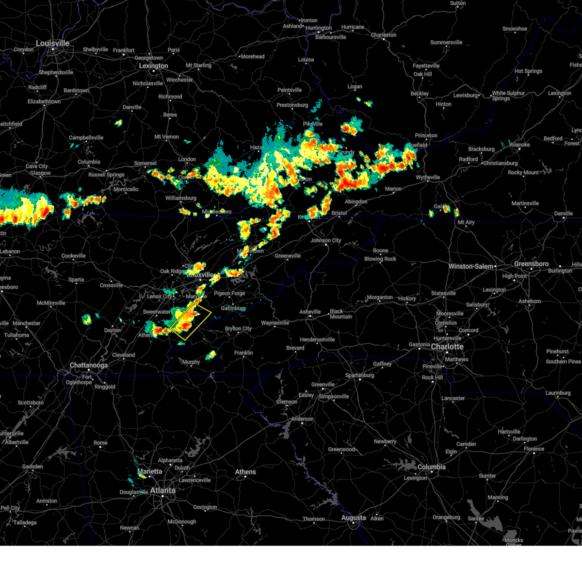 At 431 pm edt, a severe thunderstorm was located 10 miles west of smoky mountains-twentymile creek, or 14 miles south of maryville, moving southeast at 15 mph (radar indicated). Hazards include 60 mph wind gusts and penny size hail. Expect damage to roofs, siding, and trees. locations impacted include, maryville, citico beach, tariffville, citico, talassee and happy valley. hail threat, radar indicated max hail size, 0. 75 in wind threat, radar indicated max wind gust, 60 mph. At 431 pm edt, a severe thunderstorm was located 10 miles west of smoky mountains-twentymile creek, or 14 miles south of maryville, moving southeast at 15 mph (radar indicated). Hazards include 60 mph wind gusts and penny size hail. Expect damage to roofs, siding, and trees. locations impacted include, maryville, citico beach, tariffville, citico, talassee and happy valley. hail threat, radar indicated max hail size, 0. 75 in wind threat, radar indicated max wind gust, 60 mph.
|
| 7/29/2023 4:02 PM EDT |
 At 402 pm edt, a severe thunderstorm was located 13 miles northeast of madisonville, moving southeast at 15 mph (radar indicated). Hazards include 60 mph wind gusts and penny size hail. expect damage to roofs, siding, and trees At 402 pm edt, a severe thunderstorm was located 13 miles northeast of madisonville, moving southeast at 15 mph (radar indicated). Hazards include 60 mph wind gusts and penny size hail. expect damage to roofs, siding, and trees
|
| 7/15/2023 4:35 PM EDT |
 At 434 pm edt, a severe thunderstorm was located near eagleton village, or 8 miles east of alcoa, moving northeast at 25 mph (radar indicated). Hazards include 60 mph wind gusts and nickel size hail. expect damage to roofs, siding, and trees At 434 pm edt, a severe thunderstorm was located near eagleton village, or 8 miles east of alcoa, moving northeast at 25 mph (radar indicated). Hazards include 60 mph wind gusts and nickel size hail. expect damage to roofs, siding, and trees
|
| 6/25/2023 2:36 PM EDT |
 The severe thunderstorm warning for loudon, southwestern knox, blount, northeastern monroe, southeastern roane and southern sevier counties will expire at 245 pm edt, the storms which prompted the warning have weakened below severe limits, and no longer pose an immediate threat to life or property. therefore, the warning will be allowed to expire. a severe thunderstorm watch remains in effect until 700 pm edt for east tennessee. The severe thunderstorm warning for loudon, southwestern knox, blount, northeastern monroe, southeastern roane and southern sevier counties will expire at 245 pm edt, the storms which prompted the warning have weakened below severe limits, and no longer pose an immediate threat to life or property. therefore, the warning will be allowed to expire. a severe thunderstorm watch remains in effect until 700 pm edt for east tennessee.
|
| 6/25/2023 2:12 PM EDT |
 At 209 pm edt, severe thunderstorms were located along a line extending from 7 miles east of rockford to near maryville to 15 miles south of louisville, moving southeast at 50 mph (local dispatch reported numerous trees down across loudon county. additionally half inch diameter hail was reported in maryville). Hazards include 60 mph wind gusts. Expect damage to roofs, siding, and trees. locations impacted include, knoxville, maryville, lenoir city, alcoa, loudon, gatlinburg, farragut, pigeon forge, louisville and rockford. this includes the following highways, interstate 40 in tennessee between mile markers 367 and 385. interstate 75 in tennessee between mile markers 73 and 84. hail threat, radar indicated max hail size, <. 75 in wind threat, observed max wind gust, 60 mph. At 209 pm edt, severe thunderstorms were located along a line extending from 7 miles east of rockford to near maryville to 15 miles south of louisville, moving southeast at 50 mph (local dispatch reported numerous trees down across loudon county. additionally half inch diameter hail was reported in maryville). Hazards include 60 mph wind gusts. Expect damage to roofs, siding, and trees. locations impacted include, knoxville, maryville, lenoir city, alcoa, loudon, gatlinburg, farragut, pigeon forge, louisville and rockford. this includes the following highways, interstate 40 in tennessee between mile markers 367 and 385. interstate 75 in tennessee between mile markers 73 and 84. hail threat, radar indicated max hail size, <. 75 in wind threat, observed max wind gust, 60 mph.
|
| 6/25/2023 1:54 PM EDT |
 At 153 pm edt, severe thunderstorms were located along a line extending from near rockford to near louisville to 8 miles south of lenoir city, moving southeast at 50 mph (various reports of trees down across portions of roane and west knox counties). Hazards include 60 mph wind gusts. expect damage to roofs, siding, and trees At 153 pm edt, severe thunderstorms were located along a line extending from near rockford to near louisville to 8 miles south of lenoir city, moving southeast at 50 mph (various reports of trees down across portions of roane and west knox counties). Hazards include 60 mph wind gusts. expect damage to roofs, siding, and trees
|
| 6/25/2023 1:44 PM EDT |
 At 143 pm edt, severe thunderstorms were located along a line extending from louisville to near loudon to near sweetwater, moving southeast at 40 mph (local dispatch reported several trees down in roane county). Hazards include 60 mph wind gusts. Expect damage to roofs, siding, and trees. locations impacted include, knoxville, oak ridge, maryville, lenoir city, alcoa, kingston, loudon, farragut, louisville and eagleton village. this includes the following highways, interstate 40 in tennessee between mile markers 357 and 376. interstate 75 in tennessee between mile markers 71 and 84. hail threat, radar indicated max hail size, <. 75 in wind threat, observed max wind gust, 60 mph. At 143 pm edt, severe thunderstorms were located along a line extending from louisville to near loudon to near sweetwater, moving southeast at 40 mph (local dispatch reported several trees down in roane county). Hazards include 60 mph wind gusts. Expect damage to roofs, siding, and trees. locations impacted include, knoxville, oak ridge, maryville, lenoir city, alcoa, kingston, loudon, farragut, louisville and eagleton village. this includes the following highways, interstate 40 in tennessee between mile markers 357 and 376. interstate 75 in tennessee between mile markers 71 and 84. hail threat, radar indicated max hail size, <. 75 in wind threat, observed max wind gust, 60 mph.
|
| 6/25/2023 1:21 PM EDT |
 At 120 pm edt, severe thunderstorms were located along a line extending from oak ridge to near kingston to near rockwood, moving southeast at 40 mph (radar indicated). Hazards include 60 mph wind gusts. expect damage to roofs, siding, and trees At 120 pm edt, severe thunderstorms were located along a line extending from oak ridge to near kingston to near rockwood, moving southeast at 40 mph (radar indicated). Hazards include 60 mph wind gusts. expect damage to roofs, siding, and trees
|
| 5/9/2023 5:56 AM EDT |
 At 555 am edt, a severe thunderstorm was located near knoxville, moving southeast at 35 mph (radar indicated). Hazards include 60 mph wind gusts and quarter size hail. Hail damage to vehicles is expected. expect wind damage to roofs, siding, and trees. locations impacted include, knoxville, maryville, alcoa, farragut, louisville, rockford, eagleton village, halls, kimberlin heights and lake forest. this includes the following highways, interstate 40 in tennessee between mile markers 372 and 405. interstate 75 in tennessee between mile markers 108 and 112. hail threat, radar indicated max hail size, 1. 00 in wind threat, radar indicated max wind gust, 60 mph. At 555 am edt, a severe thunderstorm was located near knoxville, moving southeast at 35 mph (radar indicated). Hazards include 60 mph wind gusts and quarter size hail. Hail damage to vehicles is expected. expect wind damage to roofs, siding, and trees. locations impacted include, knoxville, maryville, alcoa, farragut, louisville, rockford, eagleton village, halls, kimberlin heights and lake forest. this includes the following highways, interstate 40 in tennessee between mile markers 372 and 405. interstate 75 in tennessee between mile markers 108 and 112. hail threat, radar indicated max hail size, 1. 00 in wind threat, radar indicated max wind gust, 60 mph.
|
| 5/9/2023 5:39 AM EDT |
 At 539 am edt, a severe thunderstorm was located 8 miles west of knoxville, moving southeast at 35 mph (radar indicated). Hazards include 60 mph wind gusts and quarter size hail. Hail damage to vehicles is expected. Expect wind damage to roofs, siding, and trees. At 539 am edt, a severe thunderstorm was located 8 miles west of knoxville, moving southeast at 35 mph (radar indicated). Hazards include 60 mph wind gusts and quarter size hail. Hail damage to vehicles is expected. Expect wind damage to roofs, siding, and trees.
|
| 4/14/2023 1:30 PM EDT |
 At 128 pm edt, a severe thunderstorm was located over maryville, moving north at 15 mph (radar indicated). Hazards include 60 mph wind gusts and quarter size hail. Hail damage to vehicles is expected. expect wind damage to roofs, siding, and trees. locations impacted include, knoxville, maryville, alcoa, louisville, rockford, eagleton village, friendsville, happy valley, wildwood and clover hill. this includes interstate 40 in tennessee between mile markers 378 and 384. hail threat, radar indicated max hail size, 1. 00 in wind threat, radar indicated max wind gust, 60 mph. At 128 pm edt, a severe thunderstorm was located over maryville, moving north at 15 mph (radar indicated). Hazards include 60 mph wind gusts and quarter size hail. Hail damage to vehicles is expected. expect wind damage to roofs, siding, and trees. locations impacted include, knoxville, maryville, alcoa, louisville, rockford, eagleton village, friendsville, happy valley, wildwood and clover hill. this includes interstate 40 in tennessee between mile markers 378 and 384. hail threat, radar indicated max hail size, 1. 00 in wind threat, radar indicated max wind gust, 60 mph.
|
| 4/14/2023 1:16 PM EDT | Quarter sized hail reported 2.4 miles N of Maryville, TN, social media report of 0.75-to-1.00-inch hail south of maryville. time and location based on radar. |
| 4/14/2023 1:14 PM EDT |
 At 114 pm edt, a severe thunderstorm was located near maryville, moving north at 15 mph (radar indicated). Hazards include 60 mph wind gusts and quarter size hail. Hail damage to vehicles is expected. Expect wind damage to roofs, siding, and trees. At 114 pm edt, a severe thunderstorm was located near maryville, moving north at 15 mph (radar indicated). Hazards include 60 mph wind gusts and quarter size hail. Hail damage to vehicles is expected. Expect wind damage to roofs, siding, and trees.
|
| 4/1/2023 5:50 AM EDT | Powerlines down on mint road... trees reported down in the count in blount county TN, 6.8 miles NNE of Maryville, TN |
| 3/25/2023 3:44 AM EDT | A 63 mph wind gust measured on a home weather station was recorded by a trained spotte in blount county TN, 3.8 miles N of Maryville, TN |
| 3/25/2023 3:43 AM EDT | Trained spotter measured a 74 mph wind gus in blount county TN, 5.3 miles SW of Maryville, TN |
| 3/25/2023 3:41 AM EDT |
 At 340 am edt, severe thunderstorms were located along a line extending from 8 miles north of knoxville to near maryville to 7 miles east of madisonville, moving east at 50 mph (radar indicated). Hazards include 60 mph wind gusts. expect damage to roofs, siding, and trees At 340 am edt, severe thunderstorms were located along a line extending from 8 miles north of knoxville to near maryville to 7 miles east of madisonville, moving east at 50 mph (radar indicated). Hazards include 60 mph wind gusts. expect damage to roofs, siding, and trees
|
| 3/25/2023 3:32 AM EDT |
 At 331 am edt, severe thunderstorms were located along a line extending from 6 miles west of knoxville to near madisonville, moving east at 50 mph (radar indicated). Hazards include 60 mph wind gusts. Expect damage to roofs, siding, and trees. locations impacted include, knoxville, oak ridge, maryville, clinton, lenoir city, alcoa, sweetwater, loudon, madisonville and farragut. this includes the following highways, interstate 40 in tennessee between mile markers 368 and 394. interstate 75 in tennessee between mile markers 79 and 117. hail threat, radar indicated max hail size, <. 75 in wind threat, radar indicated max wind gust, 60 mph. At 331 am edt, severe thunderstorms were located along a line extending from 6 miles west of knoxville to near madisonville, moving east at 50 mph (radar indicated). Hazards include 60 mph wind gusts. Expect damage to roofs, siding, and trees. locations impacted include, knoxville, oak ridge, maryville, clinton, lenoir city, alcoa, sweetwater, loudon, madisonville and farragut. this includes the following highways, interstate 40 in tennessee between mile markers 368 and 394. interstate 75 in tennessee between mile markers 79 and 117. hail threat, radar indicated max hail size, <. 75 in wind threat, radar indicated max wind gust, 60 mph.
|
| 3/25/2023 3:03 AM EDT |
 At 302 am edt, severe thunderstorms were located along a line extending from near kingston to near decatur, moving east at 50 mph (radar indicated). Hazards include 60 mph wind gusts. expect damage to roofs, siding, and trees At 302 am edt, severe thunderstorms were located along a line extending from near kingston to near decatur, moving east at 50 mph (radar indicated). Hazards include 60 mph wind gusts. expect damage to roofs, siding, and trees
|
| 3/3/2023 3:41 PM EST |
 The severe thunderstorm warning for northeastern loudon, south central anderson, knox, northern blount, northwestern sevier and southeastern union counties will expire at 345 pm est, the storm which prompted the warning has moved out of the area. therefore, the warning will be allowed to expire. however gusty winds are still possible with this thunderstorm. a tornado watch remains in effect until 500 pm est for east tennessee. a tornado watch also remains in effect until 800 pm est for east tennessee. The severe thunderstorm warning for northeastern loudon, south central anderson, knox, northern blount, northwestern sevier and southeastern union counties will expire at 345 pm est, the storm which prompted the warning has moved out of the area. therefore, the warning will be allowed to expire. however gusty winds are still possible with this thunderstorm. a tornado watch remains in effect until 500 pm est for east tennessee. a tornado watch also remains in effect until 800 pm est for east tennessee.
|
| 3/3/2023 3:20 PM EST |
 At 319 pm est, a severe thunderstorm was located over rockford, or over alcoa, moving east at 60 mph (radar indicated). Hazards include 70 mph wind gusts and penny size hail. Expect considerable tree damage. damage is likely to mobile homes, roofs, and outbuildings. locations impacted include, knoxville, oak ridge, maryville, sevierville, alcoa, farragut, louisville, plainview, rockford and eagleton village. this includes the following highways, interstate 40 in tennessee between mile markers 369 and 409. interstate 75 in tennessee between mile markers 108 and 115. thunderstorm damage threat, considerable hail threat, radar indicated max hail size, 0. 75 in wind threat, radar indicated max wind gust, 70 mph. At 319 pm est, a severe thunderstorm was located over rockford, or over alcoa, moving east at 60 mph (radar indicated). Hazards include 70 mph wind gusts and penny size hail. Expect considerable tree damage. damage is likely to mobile homes, roofs, and outbuildings. locations impacted include, knoxville, oak ridge, maryville, sevierville, alcoa, farragut, louisville, plainview, rockford and eagleton village. this includes the following highways, interstate 40 in tennessee between mile markers 369 and 409. interstate 75 in tennessee between mile markers 108 and 115. thunderstorm damage threat, considerable hail threat, radar indicated max hail size, 0. 75 in wind threat, radar indicated max wind gust, 70 mph.
|
| 3/3/2023 2:58 PM EST |
 At 257 pm est, a severe thunderstorm was located near loudon, moving east at 60 mph (radar indicated). Hazards include 70 mph wind gusts and quarter size hail. Hail damage to vehicles is expected. expect considerable tree damage. Wind damage is also likely to mobile homes, roofs, and outbuildings. At 257 pm est, a severe thunderstorm was located near loudon, moving east at 60 mph (radar indicated). Hazards include 70 mph wind gusts and quarter size hail. Hail damage to vehicles is expected. expect considerable tree damage. Wind damage is also likely to mobile homes, roofs, and outbuildings.
|
| 2/27/2023 5:44 PM EST |
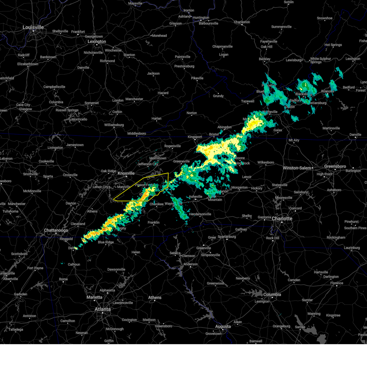 The severe thunderstorm warning for central blount, southeastern jefferson, southwestern cocke and sevier counties will expire at 545 pm est, the storm which prompted the warning has weakened below severe limits, and has exited the warned area. therefore, the warning will be allowed to expire. The severe thunderstorm warning for central blount, southeastern jefferson, southwestern cocke and sevier counties will expire at 545 pm est, the storm which prompted the warning has weakened below severe limits, and has exited the warned area. therefore, the warning will be allowed to expire.
|
| 2/27/2023 5:17 PM EST |
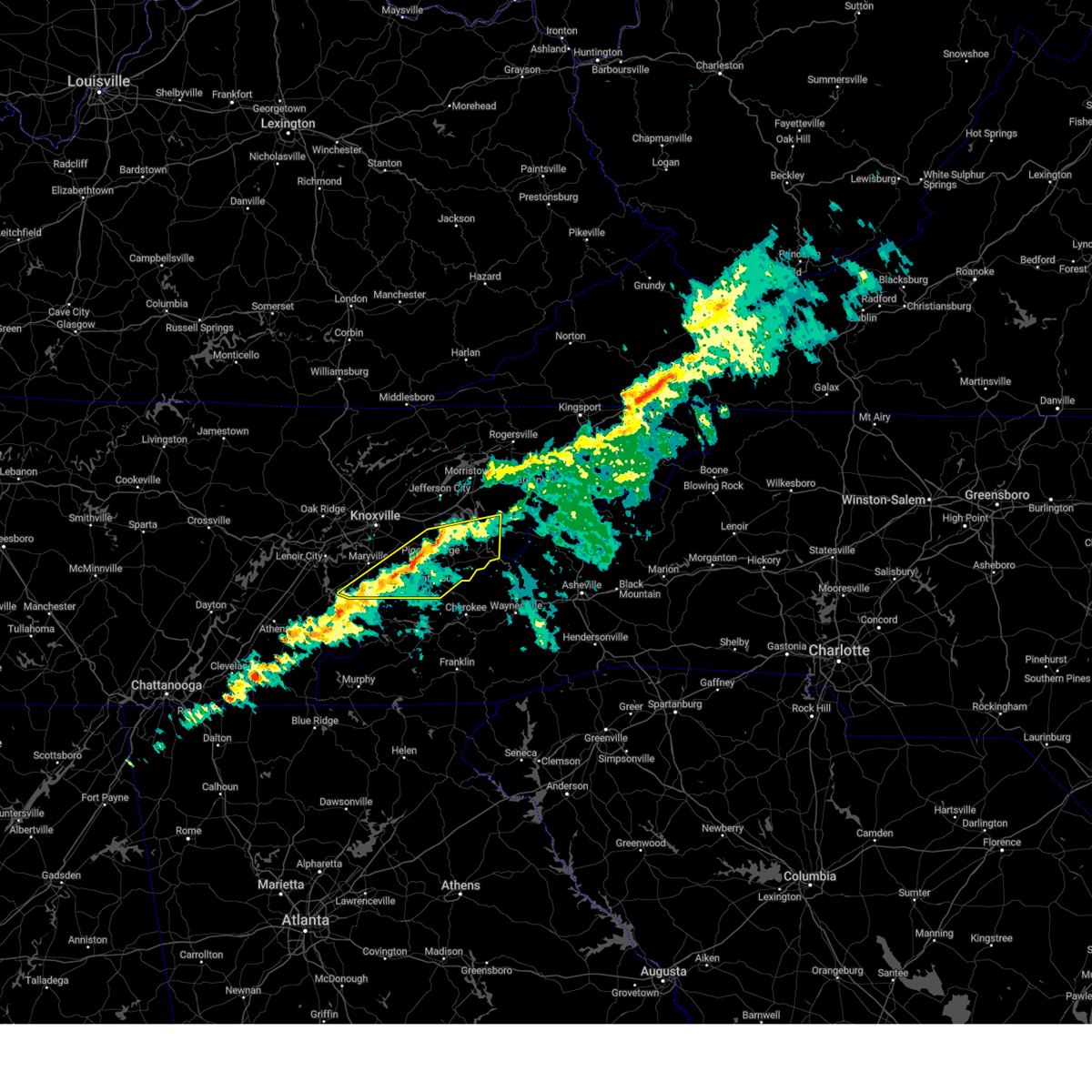 At 515 pm est, a severe thunderstorm was located near pigeon forge, or 7 miles southeast of sevierville, moving east at 55 mph (trained weather spotters). Hazards include 70 mph wind gusts. Expect considerable tree damage. damage is likely to mobile homes, roofs, and outbuildings. locations impacted include, sevierville, newport, gatlinburg, pigeon forge, parrottsville, smoky mountains-newfound gap, smoky mountains-fontana area, smoky mountains-balsam mountain, pittman center and townsend. this includes interstate 40 in tennessee between mile markers 430 and 451. thunderstorm damage threat, considerable hail threat, radar indicated max hail size, <. 75 in wind threat, radar indicated max wind gust, 70 mph. At 515 pm est, a severe thunderstorm was located near pigeon forge, or 7 miles southeast of sevierville, moving east at 55 mph (trained weather spotters). Hazards include 70 mph wind gusts. Expect considerable tree damage. damage is likely to mobile homes, roofs, and outbuildings. locations impacted include, sevierville, newport, gatlinburg, pigeon forge, parrottsville, smoky mountains-newfound gap, smoky mountains-fontana area, smoky mountains-balsam mountain, pittman center and townsend. this includes interstate 40 in tennessee between mile markers 430 and 451. thunderstorm damage threat, considerable hail threat, radar indicated max hail size, <. 75 in wind threat, radar indicated max wind gust, 70 mph.
|
| 2/27/2023 4:57 PM EST |
 At 456 pm est, a severe thunderstorm was located 8 miles east of eagleton village, or 10 miles east of alcoa, moving east at 55 mph (trained weather spotters. winds in excess of 70 miles per hour recorded at knoxville airport). Hazards include 70 mph wind gusts. Expect considerable tree damage. Damage is likely to mobile homes, roofs, and outbuildings. At 456 pm est, a severe thunderstorm was located 8 miles east of eagleton village, or 10 miles east of alcoa, moving east at 55 mph (trained weather spotters. winds in excess of 70 miles per hour recorded at knoxville airport). Hazards include 70 mph wind gusts. Expect considerable tree damage. Damage is likely to mobile homes, roofs, and outbuildings.
|
| 1/12/2023 12:52 PM EST |
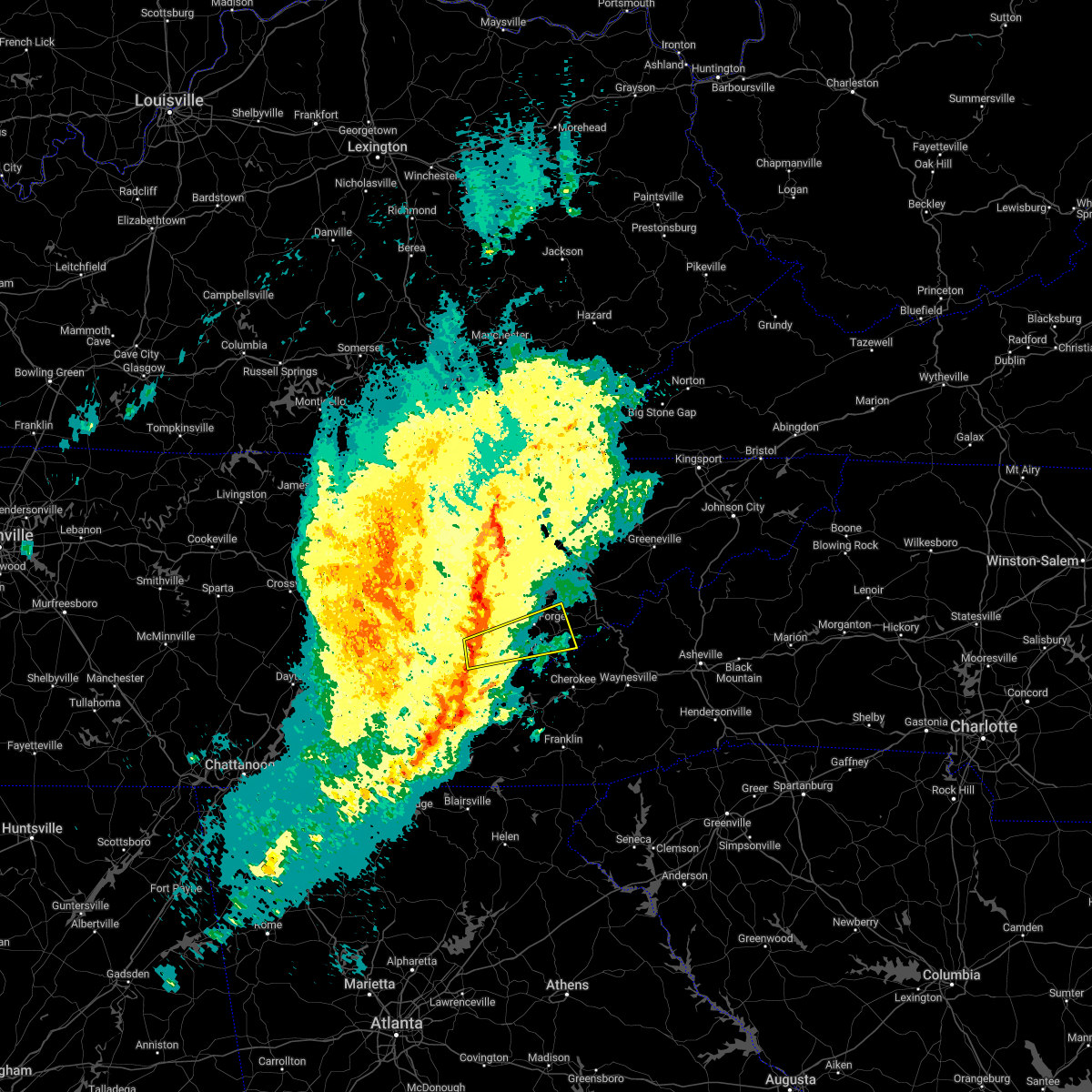 At 1252 pm est, a severe thunderstorm was located 8 miles southwest of maryville, moving east at 50 mph (radar indicated). Hazards include 70 mph wind gusts. Expect considerable tree damage. Damage is likely to mobile homes, roofs, and outbuildings. At 1252 pm est, a severe thunderstorm was located 8 miles southwest of maryville, moving east at 50 mph (radar indicated). Hazards include 70 mph wind gusts. Expect considerable tree damage. Damage is likely to mobile homes, roofs, and outbuildings.
|
| 1/12/2023 12:49 PM EST |
 At 1249 pm est, a severe thunderstorm was located near rockford, or near alcoa, moving northeast at 55 mph (radar indicated and observed wind gusts). Hazards include 70 mph wind gusts. Expect considerable tree damage. damage is likely to mobile homes, roofs, and outbuildings. locations impacted include, knoxville, maryville, sevierville, alcoa, pigeon forge, louisville, rockford, eagleton village, strawberry plains and blaine. This includes interstate 40 in tennessee near mile marker 388, and between mile markers 392 and 408. At 1249 pm est, a severe thunderstorm was located near rockford, or near alcoa, moving northeast at 55 mph (radar indicated and observed wind gusts). Hazards include 70 mph wind gusts. Expect considerable tree damage. damage is likely to mobile homes, roofs, and outbuildings. locations impacted include, knoxville, maryville, sevierville, alcoa, pigeon forge, louisville, rockford, eagleton village, strawberry plains and blaine. This includes interstate 40 in tennessee near mile marker 388, and between mile markers 392 and 408.
|
| 1/12/2023 12:44 PM EST |
 At 1243 pm est, a severe thunderstorm was located over eagleton village, or over alcoa, moving northeast at 55 mph (radar indicated). Hazards include 70 mph wind gusts. Expect considerable tree damage. Damage is likely to mobile homes, roofs, and outbuildings. At 1243 pm est, a severe thunderstorm was located over eagleton village, or over alcoa, moving northeast at 55 mph (radar indicated). Hazards include 70 mph wind gusts. Expect considerable tree damage. Damage is likely to mobile homes, roofs, and outbuildings.
|
| 1/3/2023 3:04 PM EST |
 At 303 pm est, severe thunderstorms were located along a line extending from near louisville to 8 miles southeast of lenoir city to 8 miles northeast of madisonville, moving east at 40 mph (radar indicated). Hazards include 60 mph wind gusts. expect damage to roofs, siding, and trees At 303 pm est, severe thunderstorms were located along a line extending from near louisville to 8 miles southeast of lenoir city to 8 miles northeast of madisonville, moving east at 40 mph (radar indicated). Hazards include 60 mph wind gusts. expect damage to roofs, siding, and trees
|
| 8/5/2022 6:06 PM EDT |
 At 606 pm edt, severe thunderstorms were located along a line extending from rockford to 8 miles southwest of pigeon forge, moving northeast at 20 mph (radar indicated). Hazards include 60 mph wind gusts and penny size hail. Expect damage to roofs, siding, and trees. locations impacted include, knoxville, maryville, sevierville, alcoa, pigeon forge, rockford, eagleton village, townsend, walland and bird crossing. this includes interstate 40 in tennessee between mile markers 405 and 407. hail threat, radar indicated max hail size, 0. 75 in wind threat, radar indicated max wind gust, 60 mph. At 606 pm edt, severe thunderstorms were located along a line extending from rockford to 8 miles southwest of pigeon forge, moving northeast at 20 mph (radar indicated). Hazards include 60 mph wind gusts and penny size hail. Expect damage to roofs, siding, and trees. locations impacted include, knoxville, maryville, sevierville, alcoa, pigeon forge, rockford, eagleton village, townsend, walland and bird crossing. this includes interstate 40 in tennessee between mile markers 405 and 407. hail threat, radar indicated max hail size, 0. 75 in wind threat, radar indicated max wind gust, 60 mph.
|
| 8/5/2022 5:52 PM EDT |
 At 552 pm edt, severe thunderstorms were located along a line extending from near lenoir city to near maryville to 11 miles southeast of eagleton village, moving northeast at 20 mph (radar indicated). Hazards include 60 mph wind gusts and penny size hail. expect damage to roofs, siding, and trees At 552 pm edt, severe thunderstorms were located along a line extending from near lenoir city to near maryville to 11 miles southeast of eagleton village, moving northeast at 20 mph (radar indicated). Hazards include 60 mph wind gusts and penny size hail. expect damage to roofs, siding, and trees
|
| 8/5/2022 5:39 PM EDT |
 At 539 pm edt, severe thunderstorms were located along a line extending from near louisville to 6 miles south of madisonville, moving east at 15 mph (radar indicated). Hazards include 60 mph wind gusts and nickel size hail. Expect damage to roofs, siding, and trees. locations impacted include, knoxville, maryville, alcoa, madisonville, farragut, louisville, rockford, eagleton village, vonore and greenback. this includes interstate 40 in tennessee between mile markers 374 and 383. hail threat, radar indicated max hail size, 0. 88 in wind threat, radar indicated max wind gust, 60 mph. At 539 pm edt, severe thunderstorms were located along a line extending from near louisville to 6 miles south of madisonville, moving east at 15 mph (radar indicated). Hazards include 60 mph wind gusts and nickel size hail. Expect damage to roofs, siding, and trees. locations impacted include, knoxville, maryville, alcoa, madisonville, farragut, louisville, rockford, eagleton village, vonore and greenback. this includes interstate 40 in tennessee between mile markers 374 and 383. hail threat, radar indicated max hail size, 0. 88 in wind threat, radar indicated max wind gust, 60 mph.
|
| 8/5/2022 5:38 PM EDT | Tree down in the road us highway 411 and cedar lawn blvd. time estimated from rada in blount county TN, 2.7 miles NNE of Maryville, TN |
| 8/5/2022 5:12 PM EDT |
 At 512 pm edt, severe thunderstorms were located along a line extending from near louisville to near madisonville, moving east at 10 mph (radar indicated). Hazards include 60 mph wind gusts and nickel size hail. expect damage to roofs, siding, and trees At 512 pm edt, severe thunderstorms were located along a line extending from near louisville to near madisonville, moving east at 10 mph (radar indicated). Hazards include 60 mph wind gusts and nickel size hail. expect damage to roofs, siding, and trees
|
| 8/5/2022 4:49 PM EDT |
 At 448 pm edt, severe thunderstorms were located along a line extending from 7 miles south of clinton to near loudon, moving east at 20 mph (radar indicated). Hazards include 60 mph wind gusts and nickel size hail. Expect damage to roofs, siding, and trees. locations impacted include, knoxville, oak ridge, maryville, clinton, lenoir city, alcoa, loudon, farragut, louisville and plainview. this includes the following highways, interstate 40 in tennessee between mile markers 364 and 392. interstate 75 in tennessee between mile markers 74 and 117. hail threat, radar indicated max hail size, 0. 88 in wind threat, radar indicated max wind gust, 60 mph. At 448 pm edt, severe thunderstorms were located along a line extending from 7 miles south of clinton to near loudon, moving east at 20 mph (radar indicated). Hazards include 60 mph wind gusts and nickel size hail. Expect damage to roofs, siding, and trees. locations impacted include, knoxville, oak ridge, maryville, clinton, lenoir city, alcoa, loudon, farragut, louisville and plainview. this includes the following highways, interstate 40 in tennessee between mile markers 364 and 392. interstate 75 in tennessee between mile markers 74 and 117. hail threat, radar indicated max hail size, 0. 88 in wind threat, radar indicated max wind gust, 60 mph.
|
| 8/5/2022 4:34 PM EDT |
 At 434 pm edt, severe thunderstorms were located along a line extending from 6 miles east of oak ridge to loudon, moving east at 20 mph (radar indicated). Hazards include 60 mph wind gusts and nickel size hail. expect damage to roofs, siding, and trees At 434 pm edt, severe thunderstorms were located along a line extending from 6 miles east of oak ridge to loudon, moving east at 20 mph (radar indicated). Hazards include 60 mph wind gusts and nickel size hail. expect damage to roofs, siding, and trees
|
| 8/4/2022 6:00 PM EDT |
 At 600 pm edt, a severe thunderstorm was located near farragut, or near lenoir city, moving north at 20 mph (radar indicated). Hazards include 60 mph wind gusts. expect damage to roofs, siding, and trees At 600 pm edt, a severe thunderstorm was located near farragut, or near lenoir city, moving north at 20 mph (radar indicated). Hazards include 60 mph wind gusts. expect damage to roofs, siding, and trees
|
| 8/3/2022 8:49 PM EDT |
 At 848 pm edt, a severe thunderstorm was located near rockford, or 7 miles northeast of alcoa, moving northwest at 10 mph (radar indicated). Hazards include 60 mph wind gusts and quarter size hail. Hail damage to vehicles is expected. expect wind damage to roofs, siding, and trees. locations impacted include, knoxville, maryville, alcoa, louisville, rockford, eagleton village, lake forest, bearden, seymour and kimberlin heights. this includes interstate 40 in tennessee between mile markers 381 and 384, between mile markers 386 and 388, and between mile markers 395 and 401. hail threat, radar indicated max hail size, 1. 00 in wind threat, radar indicated max wind gust, 60 mph. At 848 pm edt, a severe thunderstorm was located near rockford, or 7 miles northeast of alcoa, moving northwest at 10 mph (radar indicated). Hazards include 60 mph wind gusts and quarter size hail. Hail damage to vehicles is expected. expect wind damage to roofs, siding, and trees. locations impacted include, knoxville, maryville, alcoa, louisville, rockford, eagleton village, lake forest, bearden, seymour and kimberlin heights. this includes interstate 40 in tennessee between mile markers 381 and 384, between mile markers 386 and 388, and between mile markers 395 and 401. hail threat, radar indicated max hail size, 1. 00 in wind threat, radar indicated max wind gust, 60 mph.
|
| 8/3/2022 8:42 PM EDT |
 At 842 pm edt, a severe thunderstorm was located over louisville, or near alcoa, moving northwest at 20 mph (radar indicated). Hazards include 60 mph wind gusts and quarter size hail. Hail damage to vehicles is expected. Expect wind damage to roofs, siding, and trees. At 842 pm edt, a severe thunderstorm was located over louisville, or near alcoa, moving northwest at 20 mph (radar indicated). Hazards include 60 mph wind gusts and quarter size hail. Hail damage to vehicles is expected. Expect wind damage to roofs, siding, and trees.
|
| 8/3/2022 8:32 PM EDT |
 At 832 pm edt, severe thunderstorms were located along a line extending from near kingston to 11 miles southwest of maryville, moving north at 15 mph (radar indicated). Hazards include 60 mph wind gusts and penny size hail. Expect damage to roofs, siding, and trees. locations impacted include, oak ridge, lenoir city, alcoa, kingston, loudon, farragut, louisville, midtown, harriman and greenback. this includes the following highways, interstate 40 in tennessee between mile markers 351 and 373. interstate 75 in tennessee between mile markers 72 and 84. hail threat, radar indicated max hail size, 0. 75 in wind threat, radar indicated max wind gust, 60 mph. At 832 pm edt, severe thunderstorms were located along a line extending from near kingston to 11 miles southwest of maryville, moving north at 15 mph (radar indicated). Hazards include 60 mph wind gusts and penny size hail. Expect damage to roofs, siding, and trees. locations impacted include, oak ridge, lenoir city, alcoa, kingston, loudon, farragut, louisville, midtown, harriman and greenback. this includes the following highways, interstate 40 in tennessee between mile markers 351 and 373. interstate 75 in tennessee between mile markers 72 and 84. hail threat, radar indicated max hail size, 0. 75 in wind threat, radar indicated max wind gust, 60 mph.
|
| 8/3/2022 8:23 PM EDT |
 At 823 pm edt, a severe thunderstorm was located near eagleton village, or 8 miles east of alcoa, moving northwest at 10 mph (radar indicated). Hazards include 60 mph wind gusts and quarter size hail. Hail damage to vehicles is expected. Expect wind damage to roofs, siding, and trees. At 823 pm edt, a severe thunderstorm was located near eagleton village, or 8 miles east of alcoa, moving northwest at 10 mph (radar indicated). Hazards include 60 mph wind gusts and quarter size hail. Hail damage to vehicles is expected. Expect wind damage to roofs, siding, and trees.
|
| 8/3/2022 8:15 PM EDT |
 At 815 pm edt, a severe thunderstorm was located 7 miles southeast of eagleton village, or 9 miles east of maryville, moving northwest at 15 mph (radar indicated). Hazards include 60 mph wind gusts and nickel size hail. Expect damage to roofs, siding, and trees. locations impacted include, maryville, alcoa, louisville, rockford, eagleton village, townsend, mcmahan, walland, seymour and wildwood. hail threat, radar indicated max hail size, 0. 88 in wind threat, radar indicated max wind gust, 60 mph. At 815 pm edt, a severe thunderstorm was located 7 miles southeast of eagleton village, or 9 miles east of maryville, moving northwest at 15 mph (radar indicated). Hazards include 60 mph wind gusts and nickel size hail. Expect damage to roofs, siding, and trees. locations impacted include, maryville, alcoa, louisville, rockford, eagleton village, townsend, mcmahan, walland, seymour and wildwood. hail threat, radar indicated max hail size, 0. 88 in wind threat, radar indicated max wind gust, 60 mph.
|
| 8/3/2022 8:12 PM EDT |
 At 811 pm edt, severe thunderstorms were located along a line extending from near loudon to 10 miles east of madisonville, moving north at 15 mph (radar indicated). Hazards include 60 mph wind gusts and nickel size hail. expect damage to roofs, siding, and trees At 811 pm edt, severe thunderstorms were located along a line extending from near loudon to 10 miles east of madisonville, moving north at 15 mph (radar indicated). Hazards include 60 mph wind gusts and nickel size hail. expect damage to roofs, siding, and trees
|
| 8/3/2022 7:59 PM EDT |
 At 759 pm edt, a severe thunderstorm was located 11 miles southeast of eagleton village, or 11 miles east of maryville, moving northwest at 15 mph (radar indicated). Hazards include 60 mph wind gusts and nickel size hail. expect damage to roofs, siding, and trees At 759 pm edt, a severe thunderstorm was located 11 miles southeast of eagleton village, or 11 miles east of maryville, moving northwest at 15 mph (radar indicated). Hazards include 60 mph wind gusts and nickel size hail. expect damage to roofs, siding, and trees
|
| 7/12/2022 8:35 PM EDT |
 At 835 pm edt, a severe thunderstorm was located over knoxville, moving southeast at 20 mph (radar indicated). Hazards include 60 mph wind gusts and quarter size hail. Hail damage to vehicles is expected. Expect wind damage to roofs, siding, and trees. At 835 pm edt, a severe thunderstorm was located over knoxville, moving southeast at 20 mph (radar indicated). Hazards include 60 mph wind gusts and quarter size hail. Hail damage to vehicles is expected. Expect wind damage to roofs, siding, and trees.
|
| 5/6/2022 4:25 PM EDT | Multiple trees and power lines down in and around the city of maryvill in blount county TN, 1.5 miles WSW of Maryville, TN |
| 5/6/2022 4:25 PM EDT |
 At 425 pm edt, severe thunderstorms were located along a line extending from 6 miles south of clinton to 7 miles south of maryville, moving northeast at 45 mph (radar indicated). Hazards include 60 mph wind gusts and quarter size hail. Hail damage to vehicles is expected. Expect wind damage to roofs, siding, and trees. At 425 pm edt, severe thunderstorms were located along a line extending from 6 miles south of clinton to 7 miles south of maryville, moving northeast at 45 mph (radar indicated). Hazards include 60 mph wind gusts and quarter size hail. Hail damage to vehicles is expected. Expect wind damage to roofs, siding, and trees.
|
| 5/6/2022 4:10 PM EDT |
 At 410 pm edt, a severe thunderstorm was located 9 miles northwest of smoky mountains-twentymile creek, or 10 miles south of maryville, moving northeast at 45 mph (radar indicated). Hazards include 60 mph wind gusts and half dollar size hail. Hail damage to vehicles is expected. Expect wind damage to roofs, siding, and trees. At 410 pm edt, a severe thunderstorm was located 9 miles northwest of smoky mountains-twentymile creek, or 10 miles south of maryville, moving northeast at 45 mph (radar indicated). Hazards include 60 mph wind gusts and half dollar size hail. Hail damage to vehicles is expected. Expect wind damage to roofs, siding, and trees.
|
| 5/6/2022 3:50 PM EDT |
 At 349 pm edt, a severe thunderstorm was located 7 miles southeast of madisonville, moving northeast at 40 mph (radar indicated). Hazards include ping pong ball size hail and 60 mph wind gusts. People and animals outdoors will be injured. expect hail damage to roofs, siding, windows, and vehicles. expect wind damage to roofs, siding, and trees. locations impacted include, maryville, madisonville, eagleton village, smoky mountains-twentymile creek, smoky mountains-fontana area, vonore, tellico plains, fort loudon state park, tariffville and mcgee carson peninsula. hail threat, radar indicated max hail size, 1. 50 in wind threat, radar indicated max wind gust, 60 mph. At 349 pm edt, a severe thunderstorm was located 7 miles southeast of madisonville, moving northeast at 40 mph (radar indicated). Hazards include ping pong ball size hail and 60 mph wind gusts. People and animals outdoors will be injured. expect hail damage to roofs, siding, windows, and vehicles. expect wind damage to roofs, siding, and trees. locations impacted include, maryville, madisonville, eagleton village, smoky mountains-twentymile creek, smoky mountains-fontana area, vonore, tellico plains, fort loudon state park, tariffville and mcgee carson peninsula. hail threat, radar indicated max hail size, 1. 50 in wind threat, radar indicated max wind gust, 60 mph.
|
| 5/6/2022 3:29 PM EDT |
 At 329 pm edt, a severe thunderstorm was located 7 miles northeast of etowah, or 9 miles south of madisonville, moving northeast at 40 mph (radar indicated). Hazards include 60 mph wind gusts and half dollar size hail. Hail damage to vehicles is expected. Expect wind damage to roofs, siding, and trees. At 329 pm edt, a severe thunderstorm was located 7 miles northeast of etowah, or 9 miles south of madisonville, moving northeast at 40 mph (radar indicated). Hazards include 60 mph wind gusts and half dollar size hail. Hail damage to vehicles is expected. Expect wind damage to roofs, siding, and trees.
|
| 5/6/2022 1:43 PM EDT |
 At 142 pm edt, a severe thunderstorm was located over eagleton village, or over alcoa, moving northeast at 40 mph (radar indicated). Hazards include 60 mph wind gusts and quarter size hail. Hail damage to vehicles is expected. expect wind damage to roofs, siding, and trees. locations impacted include, knoxville, maryville, alcoa, louisville, rockford, eagleton village, mcmahan, lake forest, seymour and kimberlin heights. This includes interstate 40 in tennessee between mile markers 395 and 398. At 142 pm edt, a severe thunderstorm was located over eagleton village, or over alcoa, moving northeast at 40 mph (radar indicated). Hazards include 60 mph wind gusts and quarter size hail. Hail damage to vehicles is expected. expect wind damage to roofs, siding, and trees. locations impacted include, knoxville, maryville, alcoa, louisville, rockford, eagleton village, mcmahan, lake forest, seymour and kimberlin heights. This includes interstate 40 in tennessee between mile markers 395 and 398.
|
| 5/6/2022 1:30 PM EDT | Large tree dow in blount county TN, 1.8 miles SW of Maryville, TN |
| 5/6/2022 1:30 PM EDT | Quarter sized hail reported 1.8 miles SW of Maryville, TN |
| 5/6/2022 1:27 PM EDT |
 At 126 pm edt, a severe thunderstorm was located 8 miles southwest of maryville, moving northeast at 40 mph (radar indicated). Hazards include 60 mph wind gusts and quarter size hail. Hail damage to vehicles is expected. Expect wind damage to roofs, siding, and trees. At 126 pm edt, a severe thunderstorm was located 8 miles southwest of maryville, moving northeast at 40 mph (radar indicated). Hazards include 60 mph wind gusts and quarter size hail. Hail damage to vehicles is expected. Expect wind damage to roofs, siding, and trees.
|
| 12/11/2021 10:40 AM EST | Multiple trees down on hwy 41 in blount county TN, 6.7 miles WSW of Maryville, TN |
| 10/21/2021 6:43 PM EDT |
 At 642 pm edt, a severe thunderstorm was located near louisville, or 8 miles east of lenoir city, moving northeast at 45 mph (radar indicated). Hazards include 60 mph wind gusts. expect damage to roofs, siding, and trees At 642 pm edt, a severe thunderstorm was located near louisville, or 8 miles east of lenoir city, moving northeast at 45 mph (radar indicated). Hazards include 60 mph wind gusts. expect damage to roofs, siding, and trees
|
| 8/14/2021 9:21 PM EDT |
 The severe thunderstorm warning for southwestern blount county will expire at 930 pm edt, the storm which prompted the warning has weakened below severe limits, and no longer poses an immediate threat to life or property. therefore, the warning will be allowed to expire. however gusty winds and heavy rain are still possible with this thunderstorm. The severe thunderstorm warning for southwestern blount county will expire at 930 pm edt, the storm which prompted the warning has weakened below severe limits, and no longer poses an immediate threat to life or property. therefore, the warning will be allowed to expire. however gusty winds and heavy rain are still possible with this thunderstorm.
|
| 8/14/2021 9:02 PM EDT |
 At 902 pm edt, a severe thunderstorm was located 8 miles southwest of maryville, moving northwest at 5 mph (radar indicated). Hazards include 60 mph wind gusts. Expect damage to roofs, siding, and trees. locations impacted include, maryville, greenback, clover hill and happy valley. hail threat, radar indicated max hail size, <. 75 in wind threat, radar indicated max wind gust, 60 mph. At 902 pm edt, a severe thunderstorm was located 8 miles southwest of maryville, moving northwest at 5 mph (radar indicated). Hazards include 60 mph wind gusts. Expect damage to roofs, siding, and trees. locations impacted include, maryville, greenback, clover hill and happy valley. hail threat, radar indicated max hail size, <. 75 in wind threat, radar indicated max wind gust, 60 mph.
|
| 8/14/2021 8:55 PM EDT | Tree dow in blount county TN, 10.7 miles NNE of Maryville, TN |
| 8/14/2021 8:49 PM EDT |
 At 848 pm edt, a severe thunderstorm was located 9 miles south of maryville, moving northwest at 5 mph (radar indicated). Hazards include 60 mph wind gusts and penny size hail. expect damage to roofs, siding, and trees At 848 pm edt, a severe thunderstorm was located 9 miles south of maryville, moving northwest at 5 mph (radar indicated). Hazards include 60 mph wind gusts and penny size hail. expect damage to roofs, siding, and trees
|
| 8/1/2021 2:10 AM EDT |
 At 210 am edt, a severe thunderstorm was located near sweetwater, moving east at 30 mph (radar indicated). Hazards include 60 mph wind gusts and penny size hail. expect damage to roofs, siding, and trees At 210 am edt, a severe thunderstorm was located near sweetwater, moving east at 30 mph (radar indicated). Hazards include 60 mph wind gusts and penny size hail. expect damage to roofs, siding, and trees
|
| 6/21/2021 8:14 PM EDT |
 At 814 pm edt, a severe thunderstorm was located near knoxville, moving east at 50 mph (radar indicated). Hazards include 60 mph wind gusts and penny size hail. Expect damage to roofs, siding, and trees. locations impacted include, knoxville, oak ridge, maryville, clinton, alcoa, farragut, louisville, rockford, eagleton village and friendsville. this includes the following highways, interstate 40 in tennessee between mile markers 372 and 386. Interstate 75 in tennessee between mile markers 108 and 123. At 814 pm edt, a severe thunderstorm was located near knoxville, moving east at 50 mph (radar indicated). Hazards include 60 mph wind gusts and penny size hail. Expect damage to roofs, siding, and trees. locations impacted include, knoxville, oak ridge, maryville, clinton, alcoa, farragut, louisville, rockford, eagleton village and friendsville. this includes the following highways, interstate 40 in tennessee between mile markers 372 and 386. Interstate 75 in tennessee between mile markers 108 and 123.
|
| 6/21/2021 7:41 PM EDT |
 At 741 pm edt, a severe thunderstorm was located over midtown, or near rockwood, moving east at 45 mph (radar indicated). Hazards include 60 mph wind gusts and nickel size hail. expect damage to roofs, siding, and trees At 741 pm edt, a severe thunderstorm was located over midtown, or near rockwood, moving east at 45 mph (radar indicated). Hazards include 60 mph wind gusts and nickel size hail. expect damage to roofs, siding, and trees
|
| 6/21/2021 7:37 PM EDT |
 The severe thunderstorm warning for southeastern knox, northeastern blount and northwestern sevier counties will expire at 745 pm edt, the storm which prompted the warning has weakened below severe limits, and no longer poses an immediate threat to life or property. therefore, the warning will be allowed to expire. however gusty winds and heavy rain are still possible with this thunderstorm. The severe thunderstorm warning for southeastern knox, northeastern blount and northwestern sevier counties will expire at 745 pm edt, the storm which prompted the warning has weakened below severe limits, and no longer poses an immediate threat to life or property. therefore, the warning will be allowed to expire. however gusty winds and heavy rain are still possible with this thunderstorm.
|
| 6/21/2021 7:13 PM EDT | Trees down across the are in blount county TN, 11 miles NNE of Maryville, TN |
| 6/21/2021 7:13 PM EDT |
 At 713 pm edt, a severe thunderstorm was located near rockford, or 8 miles northeast of alcoa, moving east at 25 mph (radar indicated). Hazards include 60 mph wind gusts and penny size hail. Expect damage to roofs, siding, and trees. locations impacted include, knoxville, pigeon forge, rockford, eagleton village, mcmahan, lake forest, seymour, kodak, kimberlin heights and wildwood. This includes interstate 40 in tennessee between mile markers 388 and 389, and between mile markers 400 and 406. At 713 pm edt, a severe thunderstorm was located near rockford, or 8 miles northeast of alcoa, moving east at 25 mph (radar indicated). Hazards include 60 mph wind gusts and penny size hail. Expect damage to roofs, siding, and trees. locations impacted include, knoxville, pigeon forge, rockford, eagleton village, mcmahan, lake forest, seymour, kodak, kimberlin heights and wildwood. This includes interstate 40 in tennessee between mile markers 388 and 389, and between mile markers 400 and 406.
|
| 6/21/2021 6:54 PM EDT |
 At 653 pm edt, a severe thunderstorm was located near louisville, or near alcoa, moving east at 20 mph (radar indicated). Hazards include 60 mph wind gusts and penny size hail. expect damage to roofs, siding, and trees At 653 pm edt, a severe thunderstorm was located near louisville, or near alcoa, moving east at 20 mph (radar indicated). Hazards include 60 mph wind gusts and penny size hail. expect damage to roofs, siding, and trees
|
| 6/21/2021 6:50 PM EDT |
 At 649 pm edt, severe thunderstorms were located along a line extending from 10 miles southwest of maryville to 10 miles east of etowah, moving east at 30 mph (radar indicated). Hazards include 60 mph wind gusts. expect damage to roofs, siding, and trees At 649 pm edt, severe thunderstorms were located along a line extending from 10 miles southwest of maryville to 10 miles east of etowah, moving east at 30 mph (radar indicated). Hazards include 60 mph wind gusts. expect damage to roofs, siding, and trees
|
| 6/21/2021 6:42 PM EDT |
 The severe thunderstorm warning for loudon, western blount and northeastern monroe counties will expire at 645 pm edt, the storm which prompted the warning has weakened below severe limits, and no longer poses an immediate threat to life or property. therefore, the warning will be allowed to expire. The severe thunderstorm warning for loudon, western blount and northeastern monroe counties will expire at 645 pm edt, the storm which prompted the warning has weakened below severe limits, and no longer poses an immediate threat to life or property. therefore, the warning will be allowed to expire.
|
| 6/21/2021 6:20 PM EDT | At 620 pm edt, a severe thunderstorm was located 8 miles southeast of loudon, moving east at 40 mph (radar indicated). Hazards include 60 mph wind gusts and penny size hail. Expect damage to roofs, siding, and trees. locations impacted include, maryville, lenoir city, alcoa, loudon, madisonville, louisville, rockford, eagleton village, vonore and greenback. This includes interstate 75 in tennessee between mile markers 73 and 80. |
| 6/21/2021 6:02 PM EDT |
 At 602 pm edt, a severe thunderstorm was located over sweetwater, moving east at 35 mph (radar indicated). Hazards include 60 mph wind gusts and penny size hail. expect damage to roofs, siding, and trees At 602 pm edt, a severe thunderstorm was located over sweetwater, moving east at 35 mph (radar indicated). Hazards include 60 mph wind gusts and penny size hail. expect damage to roofs, siding, and trees
|
| 6/14/2021 2:53 AM EDT |
 At 252 am edt, a severe thunderstorm was located near louisville, or 7 miles west of alcoa, moving south at 10 mph (radar indicated). Hazards include 60 mph wind gusts and penny size hail. Expect damage to roofs, siding, and trees. Locations impacted include, maryville, louisville and friendsville. At 252 am edt, a severe thunderstorm was located near louisville, or 7 miles west of alcoa, moving south at 10 mph (radar indicated). Hazards include 60 mph wind gusts and penny size hail. Expect damage to roofs, siding, and trees. Locations impacted include, maryville, louisville and friendsville.
|
| 6/14/2021 2:31 AM EDT |
 At 231 am edt, a severe thunderstorm was located over louisville, or near alcoa, moving south at 10 mph (radar indicated). Hazards include 60 mph wind gusts and nickel size hail. expect damage to roofs, siding, and trees At 231 am edt, a severe thunderstorm was located over louisville, or near alcoa, moving south at 10 mph (radar indicated). Hazards include 60 mph wind gusts and nickel size hail. expect damage to roofs, siding, and trees
|
| 5/4/2021 10:55 AM EDT | Trees down along the foothills parkwa in blount county TN, 8.8 miles NNW of Maryville, TN |
| 5/4/2021 10:03 AM EDT |
 The national weather service in morristown has issued a * severe thunderstorm warning for. loudon county in east tennessee. southern knox county in east tennessee. southwestern anderson county in east tennessee. Northwestern blount county in east tennessee. The national weather service in morristown has issued a * severe thunderstorm warning for. loudon county in east tennessee. southern knox county in east tennessee. southwestern anderson county in east tennessee. Northwestern blount county in east tennessee.
|
| 3/26/2021 12:31 AM EDT |
 At 1230 am edt, a severe thunderstorm was located 8 miles north of smoky mountains-twentymile creek, or 11 miles southeast of maryville, moving northeast at 60 mph (radar indicated). Hazards include 60 mph wind gusts and half dollar size hail. Hail damage to vehicles is expected. expect wind damage to roofs, siding, and trees. Locations impacted include, maryville, alcoa, eagleton village, smoky mountains-fontana area, townsend, walland, happy valley, wildwood, talassee and cades cove. At 1230 am edt, a severe thunderstorm was located 8 miles north of smoky mountains-twentymile creek, or 11 miles southeast of maryville, moving northeast at 60 mph (radar indicated). Hazards include 60 mph wind gusts and half dollar size hail. Hail damage to vehicles is expected. expect wind damage to roofs, siding, and trees. Locations impacted include, maryville, alcoa, eagleton village, smoky mountains-fontana area, townsend, walland, happy valley, wildwood, talassee and cades cove.
|
| 3/26/2021 12:11 AM EDT |
 At 1210 am edt, a severe thunderstorm was located 14 miles southeast of madisonville, moving northeast at 80 mph (radar indicated). Hazards include 60 mph wind gusts and half dollar size hail. Hail damage to vehicles is expected. expect wind damage to roofs, siding, and trees. Locations impacted include, maryville, alcoa, eagleton village, smoky mountains-fontana area, tellico plains, townsend, coker creek, tariffville, walland and bullet creek. At 1210 am edt, a severe thunderstorm was located 14 miles southeast of madisonville, moving northeast at 80 mph (radar indicated). Hazards include 60 mph wind gusts and half dollar size hail. Hail damage to vehicles is expected. expect wind damage to roofs, siding, and trees. Locations impacted include, maryville, alcoa, eagleton village, smoky mountains-fontana area, tellico plains, townsend, coker creek, tariffville, walland and bullet creek.
|
| 3/25/2021 11:55 PM EDT |
 At 1154 pm edt, a severe thunderstorm was located 7 miles east of benton, moving northeast at 60 mph (radar indicated). Hazards include 60 mph wind gusts and quarter size hail. Hail damage to vehicles is expected. Expect wind damage to roofs, siding, and trees. At 1154 pm edt, a severe thunderstorm was located 7 miles east of benton, moving northeast at 60 mph (radar indicated). Hazards include 60 mph wind gusts and quarter size hail. Hail damage to vehicles is expected. Expect wind damage to roofs, siding, and trees.
|
| 9/3/2020 3:37 PM EDT |
 At 335 pm edt, severe thunderstorms were located along a line extending from near jefferson city to near sevierville to 6 miles east of eagleton village, moving east at 35 mph (radar indicated). Hazards include 60 mph wind gusts. Expect damage to roofs, siding, and trees. locations impacted include, maryville, sevierville, alcoa, jefferson city, newport, gatlinburg, dandridge, pigeon forge, white pine and new market. this includes the following highways, interstate 40 in tennessee between mile markers 399 and 434. Interstate 81 in tennessee between mile markers 1 and 5. At 335 pm edt, severe thunderstorms were located along a line extending from near jefferson city to near sevierville to 6 miles east of eagleton village, moving east at 35 mph (radar indicated). Hazards include 60 mph wind gusts. Expect damage to roofs, siding, and trees. locations impacted include, maryville, sevierville, alcoa, jefferson city, newport, gatlinburg, dandridge, pigeon forge, white pine and new market. this includes the following highways, interstate 40 in tennessee between mile markers 399 and 434. Interstate 81 in tennessee between mile markers 1 and 5.
|
| 9/3/2020 3:24 PM EDT |
 At 323 pm edt, severe thunderstorms were located along a line extending from near new market to 10 miles northeast of rockford to maryville, moving east at 25 mph (radar indicated). Hazards include 60 mph wind gusts. expect damage to roofs, siding, and trees At 323 pm edt, severe thunderstorms were located along a line extending from near new market to 10 miles northeast of rockford to maryville, moving east at 25 mph (radar indicated). Hazards include 60 mph wind gusts. expect damage to roofs, siding, and trees
|
| 7/9/2020 6:20 PM EDT |
 The severe thunderstorm warning for northwestern blount county will expire at 630 pm edt, the storm which prompted the warning has weakened below severe limits, and no longer poses an immediate threat to life or property. therefore, the warning will be allowed to expire. however heavy rain is still possible with this thunderstorm. The severe thunderstorm warning for northwestern blount county will expire at 630 pm edt, the storm which prompted the warning has weakened below severe limits, and no longer poses an immediate threat to life or property. therefore, the warning will be allowed to expire. however heavy rain is still possible with this thunderstorm.
|
| 7/9/2020 6:01 PM EDT |
 At 601 pm edt, a severe thunderstorm was located over maryville, and is nearly stationary (public). Hazards include 60 mph wind gusts and penny size hail. Expect damage to roofs, siding, and trees. Locations impacted include, maryville, alcoa, louisville, rockford, eagleton village, clover hill, walland and wildwood. At 601 pm edt, a severe thunderstorm was located over maryville, and is nearly stationary (public). Hazards include 60 mph wind gusts and penny size hail. Expect damage to roofs, siding, and trees. Locations impacted include, maryville, alcoa, louisville, rockford, eagleton village, clover hill, walland and wildwood.
|
| 7/9/2020 6:00 PM EDT | Several trees down throughout maryvill in blount county TN, 1.5 miles WSW of Maryville, TN |
| 7/9/2020 6:00 PM EDT | Quarter sized hail reported 1.5 miles WSW of Maryville, TN, time of hail estimated. |
| 7/9/2020 5:43 PM EDT |
 At 542 pm edt, a severe thunderstorm was located over maryville, and is nearly stationary (radar indicated). Hazards include 60 mph wind gusts and quarter size hail. Hail damage to vehicles is expected. Expect wind damage to roofs, siding, and trees. At 542 pm edt, a severe thunderstorm was located over maryville, and is nearly stationary (radar indicated). Hazards include 60 mph wind gusts and quarter size hail. Hail damage to vehicles is expected. Expect wind damage to roofs, siding, and trees.
|
| 7/5/2020 3:30 PM EDT | A tree down onto a bar in blount county TN, 7.2 miles NE of Maryville, TN |
| 6/29/2020 7:25 PM EDT |
 The severe thunderstorm warning for northeastern blount county will expire at 730 pm edt, the storm which prompted the warning has weakened below severe limits, and no longer poses an immediate threat to life or property. therefore, the warning will be allowed to expire. however gusty winds and heavy rain are still possible with this thunderstorm. The severe thunderstorm warning for northeastern blount county will expire at 730 pm edt, the storm which prompted the warning has weakened below severe limits, and no longer poses an immediate threat to life or property. therefore, the warning will be allowed to expire. however gusty winds and heavy rain are still possible with this thunderstorm.
|
| 6/29/2020 7:13 PM EDT |
 At 712 pm edt, a severe thunderstorm was located over rockford, or near alcoa, moving southeast at 25 mph (radar indicated). Hazards include 60 mph wind gusts and quarter size hail. Hail damage to vehicles is expected. expect wind damage to roofs, siding, and trees. Locations impacted include, maryville, alcoa, louisville, rockford, eagleton village, townsend, walland and wildwood. At 712 pm edt, a severe thunderstorm was located over rockford, or near alcoa, moving southeast at 25 mph (radar indicated). Hazards include 60 mph wind gusts and quarter size hail. Hail damage to vehicles is expected. expect wind damage to roofs, siding, and trees. Locations impacted include, maryville, alcoa, louisville, rockford, eagleton village, townsend, walland and wildwood.
|
| 6/29/2020 6:44 PM EDT |
 At 644 pm edt, a severe thunderstorm was located near knoxville, moving southeast at 25 mph (radar indicated). Hazards include 60 mph wind gusts and quarter size hail. Hail damage to vehicles is expected. Expect wind damage to roofs, siding, and trees. At 644 pm edt, a severe thunderstorm was located near knoxville, moving southeast at 25 mph (radar indicated). Hazards include 60 mph wind gusts and quarter size hail. Hail damage to vehicles is expected. Expect wind damage to roofs, siding, and trees.
|
| 6/22/2020 2:40 PM EDT |
 At 238 pm edt, a severe thunderstorm was located near townsend moving northeast at 30 mph (radar indicated). Hazards include 60 mph wind gusts and nickel size hail. Expect damage to roofs, siding, and trees. Locations impacted include, maryville, alcoa, rockford, eagleton village, greenback, friendsville, townsend, walland, happy valley and wildwood. At 238 pm edt, a severe thunderstorm was located near townsend moving northeast at 30 mph (radar indicated). Hazards include 60 mph wind gusts and nickel size hail. Expect damage to roofs, siding, and trees. Locations impacted include, maryville, alcoa, rockford, eagleton village, greenback, friendsville, townsend, walland, happy valley and wildwood.
|
| 6/22/2020 2:20 PM EDT | 2 trees down on clover hill r in blount county TN, 3.9 miles NE of Maryville, TN |
| 6/22/2020 2:14 PM EDT |
 At 214 pm edt, a severe thunderstorm was located near maryville, moving northeast at 35 mph (radar indicated). Hazards include 60 mph wind gusts and nickel size hail. expect damage to roofs, siding, and trees At 214 pm edt, a severe thunderstorm was located near maryville, moving northeast at 35 mph (radar indicated). Hazards include 60 mph wind gusts and nickel size hail. expect damage to roofs, siding, and trees
|
| 4/13/2020 1:00 AM EDT |
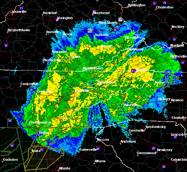 At 100 am edt, a severe thunderstorm was located 10 miles northwest of smoky mountains-twentymile creek, or 11 miles south of maryville, moving northeast at 55 mph (radar indicated). Hazards include 60 mph wind gusts. expect damage to roofs, siding, and trees At 100 am edt, a severe thunderstorm was located 10 miles northwest of smoky mountains-twentymile creek, or 11 miles south of maryville, moving northeast at 55 mph (radar indicated). Hazards include 60 mph wind gusts. expect damage to roofs, siding, and trees
|
| 2/12/2020 9:41 PM EST |
 At 940 pm est, severe thunderstorms were located along a line extending from near jacksboro to near oak ridge to near loudon, moving east at 45 mph (radar indicated). Hazards include 60 mph wind gusts. Expect damage to roofs, siding, and trees. Locations impacted include, knoxville, oak ridge, maryville, clinton, lenoir city, alcoa, kingston, loudon, maynardville and farragut. At 940 pm est, severe thunderstorms were located along a line extending from near jacksboro to near oak ridge to near loudon, moving east at 45 mph (radar indicated). Hazards include 60 mph wind gusts. Expect damage to roofs, siding, and trees. Locations impacted include, knoxville, oak ridge, maryville, clinton, lenoir city, alcoa, kingston, loudon, maynardville and farragut.
|
| 2/12/2020 9:22 PM EST |
 At 922 pm est, severe thunderstorms were located along a line extending from 7 miles west of jacksboro to near oliver springs to near fairview, moving east at 50 mph (radar indicated). Hazards include 60 mph wind gusts. expect damage to roofs, siding, and trees At 922 pm est, severe thunderstorms were located along a line extending from 7 miles west of jacksboro to near oliver springs to near fairview, moving east at 50 mph (radar indicated). Hazards include 60 mph wind gusts. expect damage to roofs, siding, and trees
|
| 1/11/2020 5:23 PM EST |
 At 522 pm est, severe thunderstorms were located along a line extending from near knoxville to 7 miles west of town of santeetlah, moving northeast at 70 mph (radar indicated). Hazards include 70 mph wind gusts. Expect considerable tree damage. Damage is likely to mobile homes, roofs, and outbuildings. At 522 pm est, severe thunderstorms were located along a line extending from near knoxville to 7 miles west of town of santeetlah, moving northeast at 70 mph (radar indicated). Hazards include 70 mph wind gusts. Expect considerable tree damage. Damage is likely to mobile homes, roofs, and outbuildings.
|
| 1/11/2020 5:20 PM EST | Numerous tree down across the count in blount county TN, 1.8 miles SW of Maryville, TN |
| 1/11/2020 4:50 PM EST |
 At 449 pm est, severe thunderstorms were located along a line extending from oak ridge to 15 miles northwest of murphy, moving east at 65 mph (radar indicated). Hazards include 70 mph wind gusts. Expect considerable tree damage. Damage is likely to mobile homes, roofs, and outbuildings. At 449 pm est, severe thunderstorms were located along a line extending from oak ridge to 15 miles northwest of murphy, moving east at 65 mph (radar indicated). Hazards include 70 mph wind gusts. Expect considerable tree damage. Damage is likely to mobile homes, roofs, and outbuildings.
|
| 12/30/2019 1:10 AM EST | Measured 72 mph thunderstorm wind gus in blount county TN, 7 miles WSW of Maryville, TN |
| 12/30/2019 12:53 AM EST |
 At 1253 am est, severe thunderstorms were located along a line extending from farragut to 8 miles northeast of madisonville, moving northeast at 60 mph (radar indicated). Hazards include 60 mph wind gusts. expect damage to roofs, siding, and trees At 1253 am est, severe thunderstorms were located along a line extending from farragut to 8 miles northeast of madisonville, moving northeast at 60 mph (radar indicated). Hazards include 60 mph wind gusts. expect damage to roofs, siding, and trees
|
| 8/13/2019 12:53 PM EDT |
 At 1253 pm edt, a severe thunderstorm was located near loudon, moving southeast at 20 mph (radar indicated). Hazards include 60 mph wind gusts and quarter size hail. Hail damage to vehicles is expected. Expect wind damage to roofs, siding, and trees. At 1253 pm edt, a severe thunderstorm was located near loudon, moving southeast at 20 mph (radar indicated). Hazards include 60 mph wind gusts and quarter size hail. Hail damage to vehicles is expected. Expect wind damage to roofs, siding, and trees.
|
| 8/1/2019 5:37 PM EDT |
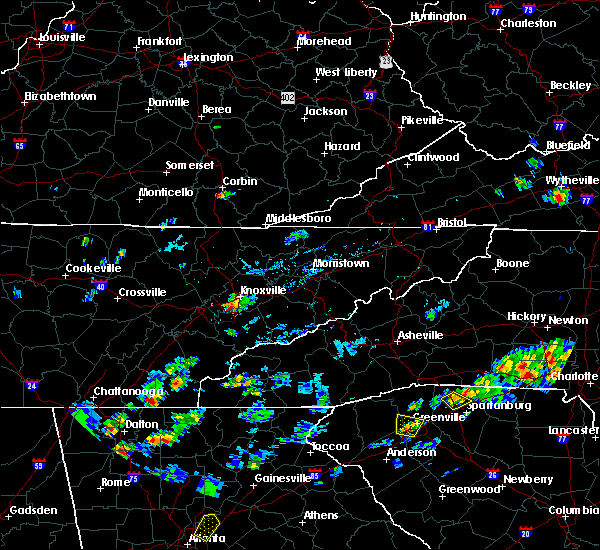 At 536 pm edt, a severe thunderstorm was located near louisville, or near knoxville, and is nearly stationary (radar indicated). Hazards include 60 mph wind gusts and quarter size hail. Hail damage to vehicles is expected. Expect wind damage to roofs, siding, and trees. At 536 pm edt, a severe thunderstorm was located near louisville, or near knoxville, and is nearly stationary (radar indicated). Hazards include 60 mph wind gusts and quarter size hail. Hail damage to vehicles is expected. Expect wind damage to roofs, siding, and trees.
|
| 6/24/2019 5:51 PM EDT |
 The severe thunderstorm warning for loudon, southern knox, central mcminn, blount, monroe and east central roane counties will expire at 600 pm edt, the storms which prompted the warning have weakened below severe limits, and have exited the warned area. therefore, the warning will be allowed to expire. however gusty winds are still possible with these thunderstorms. a severe thunderstorm watch remains in effect until 900 pm edt for east tennessee. The severe thunderstorm warning for loudon, southern knox, central mcminn, blount, monroe and east central roane counties will expire at 600 pm edt, the storms which prompted the warning have weakened below severe limits, and have exited the warned area. therefore, the warning will be allowed to expire. however gusty winds are still possible with these thunderstorms. a severe thunderstorm watch remains in effect until 900 pm edt for east tennessee.
|
| 6/24/2019 5:36 PM EDT |
 At 535 pm edt, severe thunderstorms were located along a line extending from near knoxville to near etowah, moving east at 45 mph (radar indicated). Hazards include 60 mph wind gusts. Expect damage to roofs, siding, and trees. Locations impacted include, knoxville, oak ridge, maryville, athens, lenoir city, alcoa, sweetwater, loudon, madisonville, farragut, etowah, louisville, rockford, eagleton village, englewood, vonore, greenback, friendsville, tellico plains and niota. At 535 pm edt, severe thunderstorms were located along a line extending from near knoxville to near etowah, moving east at 45 mph (radar indicated). Hazards include 60 mph wind gusts. Expect damage to roofs, siding, and trees. Locations impacted include, knoxville, oak ridge, maryville, athens, lenoir city, alcoa, sweetwater, loudon, madisonville, farragut, etowah, louisville, rockford, eagleton village, englewood, vonore, greenback, friendsville, tellico plains and niota.
|
| 6/24/2019 5:08 PM EDT |
 At 507 pm edt, severe thunderstorms were located along a line extending from near oak ridge to 6 miles northwest of charleston, moving east at 45 mph (radar indicated). Hazards include 60 mph wind gusts. expect damage to roofs, siding, and trees At 507 pm edt, severe thunderstorms were located along a line extending from near oak ridge to 6 miles northwest of charleston, moving east at 45 mph (radar indicated). Hazards include 60 mph wind gusts. expect damage to roofs, siding, and trees
|
| 6/21/2019 11:50 PM EDT |
 A severe thunderstorm warning remains in effect until 1215 am edt for southeastern loudon. northeastern mcminn. blount and monroe counties. At 1149 pm edt, severe thunderstorms were located along a line extending from near eagleton village to 11 miles northwest of smoky mountains-twentymile creek to 9 miles east of etowah, moving east at. A severe thunderstorm warning remains in effect until 1215 am edt for southeastern loudon. northeastern mcminn. blount and monroe counties. At 1149 pm edt, severe thunderstorms were located along a line extending from near eagleton village to 11 miles northwest of smoky mountains-twentymile creek to 9 miles east of etowah, moving east at.
|
| 6/21/2019 11:45 PM EDT | Widespread downed trees county wid in blount county TN, 1.5 miles WSW of Maryville, TN |
| 6/21/2019 11:37 PM EDT |
 At 1135 pm edt, severe thunderstorms were located along a line extending from near eagleton village to athens, moving east at 45 mph (radar indicated). Hazards include 65 mph wind gusts and quarter size hail. Hail damage to vehicles is expected. expect wind damage to roofs, siding, and trees. Locations impacted include, maryville, athens, lenoir city, alcoa, sweetwater, loudon, madisonville, decatur, louisville, rockford, eagleton village, smoky mountains-fontana area, englewood, vonore, greenback, friendsville, tellico plains, niota, philadelphia and townsend. At 1135 pm edt, severe thunderstorms were located along a line extending from near eagleton village to athens, moving east at 45 mph (radar indicated). Hazards include 65 mph wind gusts and quarter size hail. Hail damage to vehicles is expected. expect wind damage to roofs, siding, and trees. Locations impacted include, maryville, athens, lenoir city, alcoa, sweetwater, loudon, madisonville, decatur, louisville, rockford, eagleton village, smoky mountains-fontana area, englewood, vonore, greenback, friendsville, tellico plains, niota, philadelphia and townsend.
|
| 6/21/2019 11:11 PM EDT |
 At 1110 pm edt, severe thunderstorms were located along a line extending from farragut to near dayton, moving east at 45 mph (radar indicated). Hazards include 60 mph wind gusts and quarter size hail. Hail damage to vehicles is expected. Expect wind damage to roofs, siding, and trees. At 1110 pm edt, severe thunderstorms were located along a line extending from farragut to near dayton, moving east at 45 mph (radar indicated). Hazards include 60 mph wind gusts and quarter size hail. Hail damage to vehicles is expected. Expect wind damage to roofs, siding, and trees.
|
| 6/20/2019 8:27 AM EDT |
 The severe thunderstorm warning for knox, eastern blount, jefferson and sevier counties will expire at 830 am edt, the storms which prompted the warning have weakened below severe limits, and have exited the warned area. therefore, the warning will be allowed to expire. The severe thunderstorm warning for knox, eastern blount, jefferson and sevier counties will expire at 830 am edt, the storms which prompted the warning have weakened below severe limits, and have exited the warned area. therefore, the warning will be allowed to expire.
|
| 6/20/2019 8:01 AM EDT |
 At 801 am edt, severe thunderstorms were located along a line extending from near plainview to near sevierville to near pigeon forge to near gatlinburg, moving northeast at 55 mph (radar indicated). Hazards include 60 mph wind gusts. Expect damage to roofs, siding, and trees. Locations impacted include, knoxville, maryville, sevierville, alcoa, jefferson city, gatlinburg, dandridge, pigeon forge, louisville, white pine, plainview, new market, rockford, baneberry, smoky mountains-newfound gap, eagleton village, smoky mountains-fontana area, strawberry plains, halls and blaine. At 801 am edt, severe thunderstorms were located along a line extending from near plainview to near sevierville to near pigeon forge to near gatlinburg, moving northeast at 55 mph (radar indicated). Hazards include 60 mph wind gusts. Expect damage to roofs, siding, and trees. Locations impacted include, knoxville, maryville, sevierville, alcoa, jefferson city, gatlinburg, dandridge, pigeon forge, louisville, white pine, plainview, new market, rockford, baneberry, smoky mountains-newfound gap, eagleton village, smoky mountains-fontana area, strawberry plains, halls and blaine.
|
| 6/20/2019 7:26 AM EDT |
 At 726 am edt, severe thunderstorms were located along a line extending from near oak ridge to 7 miles southwest of louisville to 12 miles southwest of maryville to near smoky mountains-twentymile creek, moving northeast at 45 mph (radar indicated). Hazards include 60 mph wind gusts. expect damage to roofs, siding, and trees At 726 am edt, severe thunderstorms were located along a line extending from near oak ridge to 7 miles southwest of louisville to 12 miles southwest of maryville to near smoky mountains-twentymile creek, moving northeast at 45 mph (radar indicated). Hazards include 60 mph wind gusts. expect damage to roofs, siding, and trees
|
| 6/17/2019 4:26 PM EDT |
 The severe thunderstorm warning for eastern loudon and west central blount counties will expire at 430 pm edt, the storm which prompted the warning has moved out of the area. therefore, the warning will be allowed to expire. The severe thunderstorm warning for eastern loudon and west central blount counties will expire at 430 pm edt, the storm which prompted the warning has moved out of the area. therefore, the warning will be allowed to expire.
|
| 6/17/2019 3:55 PM EDT |
 At 354 pm edt, a severe thunderstorm was located near loudon, moving northeast at 5 mph (radar indicated). Hazards include 60 mph wind gusts and quarter size hail. Hail damage to vehicles is expected. expect wind damage to roofs, siding, and trees. Locations impacted include, maryville, lenoir city, loudon, greenback, friendsville, clover hill and tellico village. At 354 pm edt, a severe thunderstorm was located near loudon, moving northeast at 5 mph (radar indicated). Hazards include 60 mph wind gusts and quarter size hail. Hail damage to vehicles is expected. expect wind damage to roofs, siding, and trees. Locations impacted include, maryville, lenoir city, loudon, greenback, friendsville, clover hill and tellico village.
|
| 6/17/2019 3:40 PM EDT |
 At 340 pm edt, a severe thunderstorm was located near lenoir city, moving northeast at 10 mph (radar indicated). Hazards include 60 mph wind gusts and quarter size hail. Hail damage to vehicles is expected. Expect wind damage to roofs, siding, and trees. At 340 pm edt, a severe thunderstorm was located near lenoir city, moving northeast at 10 mph (radar indicated). Hazards include 60 mph wind gusts and quarter size hail. Hail damage to vehicles is expected. Expect wind damage to roofs, siding, and trees.
|
| 5/18/2019 6:09 PM EDT |
 At 609 pm edt, a severe thunderstorm was located over alcoa, moving north at 10 mph (trained weather spotters). Hazards include 60 mph wind gusts and quarter size hail. Hail damage to vehicles is expected. expect wind damage to roofs, siding, and trees. Locations impacted include, maryville, alcoa, louisville, rockford and eagleton village. At 609 pm edt, a severe thunderstorm was located over alcoa, moving north at 10 mph (trained weather spotters). Hazards include 60 mph wind gusts and quarter size hail. Hail damage to vehicles is expected. expect wind damage to roofs, siding, and trees. Locations impacted include, maryville, alcoa, louisville, rockford and eagleton village.
|
| 5/18/2019 6:06 PM EDT | Quarter sized hail reported 1.7 miles SE of Maryville, TN |
| 5/18/2019 5:51 PM EDT |
 At 551 pm edt, a severe thunderstorm was located near maryville, moving northeast at 5 mph (radar indicated). Hazards include 60 mph wind gusts and quarter size hail. Hail damage to vehicles is expected. Expect wind damage to roofs, siding, and trees. At 551 pm edt, a severe thunderstorm was located near maryville, moving northeast at 5 mph (radar indicated). Hazards include 60 mph wind gusts and quarter size hail. Hail damage to vehicles is expected. Expect wind damage to roofs, siding, and trees.
|
| 11/6/2018 4:55 AM EST | Widespread tree damage across the count in blount county TN, 1.5 miles WSW of Maryville, TN |
| 11/6/2018 4:31 AM EST |
 At 431 am est, severe thunderstorms were located along a line extending from near oak ridge to 9 miles northwest of smoky mountains-twentymile creek, moving northeast at 50 mph (radar indicated). Hazards include 60 mph wind gusts. Expect damage to roofs, siding, and trees. locations impacted include, knoxville, oak ridge, maryville, clinton, alcoa, farragut, louisville, rockford, eagleton village, halls, greenback, friendsville, townsend, walland, karns, clover hill, cades cove, happy valley, wildwood and talassee. A tornado watch remains in effect until 900 am est for east tennessee. At 431 am est, severe thunderstorms were located along a line extending from near oak ridge to 9 miles northwest of smoky mountains-twentymile creek, moving northeast at 50 mph (radar indicated). Hazards include 60 mph wind gusts. Expect damage to roofs, siding, and trees. locations impacted include, knoxville, oak ridge, maryville, clinton, alcoa, farragut, louisville, rockford, eagleton village, halls, greenback, friendsville, townsend, walland, karns, clover hill, cades cove, happy valley, wildwood and talassee. A tornado watch remains in effect until 900 am est for east tennessee.
|
| 11/6/2018 4:16 AM EST |
 At 415 am est, severe thunderstorms were located along a line extending from 6 miles southwest of oak ridge to 8 miles east of madisonville, moving northeast at 65 mph (radar indicated. at 353 am est, damaging wind was reported in athens). Hazards include 60 mph wind gusts. expect damage to roofs, siding, and trees At 415 am est, severe thunderstorms were located along a line extending from 6 miles southwest of oak ridge to 8 miles east of madisonville, moving northeast at 65 mph (radar indicated. at 353 am est, damaging wind was reported in athens). Hazards include 60 mph wind gusts. expect damage to roofs, siding, and trees
|
| 9/9/2018 4:08 PM EDT |
 At 407 pm edt, a severe thunderstorm was located over loudon, moving northeast at 30 mph (radar indicated). Hazards include 60 mph wind gusts and penny size hail. expect damage to roofs, siding, and trees At 407 pm edt, a severe thunderstorm was located over loudon, moving northeast at 30 mph (radar indicated). Hazards include 60 mph wind gusts and penny size hail. expect damage to roofs, siding, and trees
|
| 9/1/2018 4:23 PM EDT |
 The severe thunderstorm warning for southeastern loudon and northwestern blount counties will expire at 430 pm edt, the storm which prompted the warning has weakened below severe limits, and no longer poses an immediate threat to life or property. therefore, the warning will be allowed to expire. however gusty winds and heavy rain are still possible with this thunderstorm. The severe thunderstorm warning for southeastern loudon and northwestern blount counties will expire at 430 pm edt, the storm which prompted the warning has weakened below severe limits, and no longer poses an immediate threat to life or property. therefore, the warning will be allowed to expire. however gusty winds and heavy rain are still possible with this thunderstorm.
|
| 9/1/2018 4:00 PM EDT |
 At 359 pm edt, a severe thunderstorm was located 10 miles southeast of lenoir city, moving north at 5 mph (radar indicated). Hazards include 60 mph wind gusts and quarter size hail. Hail damage to vehicles is expected. Expect wind damage to roofs, siding, and trees. At 359 pm edt, a severe thunderstorm was located 10 miles southeast of lenoir city, moving north at 5 mph (radar indicated). Hazards include 60 mph wind gusts and quarter size hail. Hail damage to vehicles is expected. Expect wind damage to roofs, siding, and trees.
|
| 8/8/2018 4:01 PM EDT |
 At 344 pm edt, severe thunderstorms were located along a line extending from 8 miles east of madisonville to 9 miles southeast of wildwood lake, moving east at 15 mph (radar indicated). Hazards include 60 mph wind gusts and penny size hail. expect damage to roofs, siding, and trees At 344 pm edt, severe thunderstorms were located along a line extending from 8 miles east of madisonville to 9 miles southeast of wildwood lake, moving east at 15 mph (radar indicated). Hazards include 60 mph wind gusts and penny size hail. expect damage to roofs, siding, and trees
|
| 8/8/2018 4:01 PM EDT |
 At 400 pm edt, a severe thunderstorm was located 7 miles southeast of benton, moving northeast at 35 mph (radar indicated). Hazards include 60 mph wind gusts and penny size hail. Expect damage to roofs, siding, and trees. locations impacted include, madisonville, murphy, benton, ducktown, etowah, englewood, vonore, greenback, tellico plains, william l. Davenport refuge, big frog mountain, mcgee carson peninsula, parksville, copperhill, bullet creek, archville, mount vernon, clover hill, cades cove and dentville. At 400 pm edt, a severe thunderstorm was located 7 miles southeast of benton, moving northeast at 35 mph (radar indicated). Hazards include 60 mph wind gusts and penny size hail. Expect damage to roofs, siding, and trees. locations impacted include, madisonville, murphy, benton, ducktown, etowah, englewood, vonore, greenback, tellico plains, william l. Davenport refuge, big frog mountain, mcgee carson peninsula, parksville, copperhill, bullet creek, archville, mount vernon, clover hill, cades cove and dentville.
|
| 8/8/2018 3:44 PM EDT |
 At 344 pm edt, severe thunderstorms were located along a line extending from 8 miles east of madisonville to 9 miles southeast of wildwood lake, moving east at 15 mph (radar indicated). Hazards include 60 mph wind gusts and penny size hail. expect damage to roofs, siding, and trees At 344 pm edt, severe thunderstorms were located along a line extending from 8 miles east of madisonville to 9 miles southeast of wildwood lake, moving east at 15 mph (radar indicated). Hazards include 60 mph wind gusts and penny size hail. expect damage to roofs, siding, and trees
|
| 8/8/2018 2:33 PM EDT |
 At 232 pm edt, a severe thunderstorm was located over lenoir city, moving east at 20 mph (radar indicated). Hazards include 60 mph wind gusts and penny size hail. expect damage to roofs, siding, and trees At 232 pm edt, a severe thunderstorm was located over lenoir city, moving east at 20 mph (radar indicated). Hazards include 60 mph wind gusts and penny size hail. expect damage to roofs, siding, and trees
|
| 6/28/2018 6:15 AM EDT |
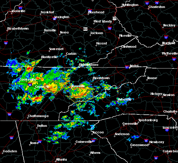 At 615 am edt, severe thunderstorms were located along a line extending from 9 miles southeast of dandridge to 10 miles southwest of newport to near gatlinburg to near maryville, moving southeast at 30 mph (radar indicated). Hazards include 60 mph wind gusts and quarter size hail. Hail damage to vehicles is expected. Expect wind damage to roofs, siding, and trees. At 615 am edt, severe thunderstorms were located along a line extending from 9 miles southeast of dandridge to 10 miles southwest of newport to near gatlinburg to near maryville, moving southeast at 30 mph (radar indicated). Hazards include 60 mph wind gusts and quarter size hail. Hail damage to vehicles is expected. Expect wind damage to roofs, siding, and trees.
|
| 6/26/2018 6:36 PM EDT |
 The severe thunderstorm warning for eastern blount, cocke, southwestern greene and sevier counties will expire at 645 pm edt, the storms which prompted the warning have moved out of the area. therefore, the warning will be allowed to expire. however gusty winds and heavy rain are still possible with these thunderstorms. The severe thunderstorm warning for eastern blount, cocke, southwestern greene and sevier counties will expire at 645 pm edt, the storms which prompted the warning have moved out of the area. therefore, the warning will be allowed to expire. however gusty winds and heavy rain are still possible with these thunderstorms.
|
| 6/26/2018 6:17 PM EDT |
 At 617 pm edt, severe thunderstorms were located along a line extending from 6 miles northwest of hot springs to 8 miles west of smoky mountains-big creek to 7 miles north of smoky mountains-fontana area, moving southeast at 30 mph (radar indicated). Hazards include 60 mph wind gusts and quarter size hail. Hail damage to vehicles is expected. expect wind damage to roofs, siding, and trees. Locations impacted include, maryville, sevierville, alcoa, newport, gatlinburg, pigeon forge, parrottsville, eagleton village, pittman center, townsend, caney branch, del rio, walland, cedar creek, wildwood, wears valley, cades cove, round mountain, hartford and cosby. At 617 pm edt, severe thunderstorms were located along a line extending from 6 miles northwest of hot springs to 8 miles west of smoky mountains-big creek to 7 miles north of smoky mountains-fontana area, moving southeast at 30 mph (radar indicated). Hazards include 60 mph wind gusts and quarter size hail. Hail damage to vehicles is expected. expect wind damage to roofs, siding, and trees. Locations impacted include, maryville, sevierville, alcoa, newport, gatlinburg, pigeon forge, parrottsville, eagleton village, pittman center, townsend, caney branch, del rio, walland, cedar creek, wildwood, wears valley, cades cove, round mountain, hartford and cosby.
|
| 6/26/2018 6:05 PM EDT |
 At 605 pm edt, severe thunderstorms were located along a line extending from near parrottsville to 10 miles northeast of gatlinburg to 10 miles southeast of eagleton village, moving southeast at 30 mph (radar indicated). Hazards include 60 mph wind gusts and quarter size hail. Hail damage to vehicles is expected. expect wind damage to roofs, siding, and trees. Locations impacted include, maryville, sevierville, alcoa, newport, gatlinburg, pigeon forge, parrottsville, eagleton village, pittman center, townsend, caney branch, del rio, walland, bird crossing, fairgarden, cades cove, round mountain, harrisburg, cosby and elkmont. At 605 pm edt, severe thunderstorms were located along a line extending from near parrottsville to 10 miles northeast of gatlinburg to 10 miles southeast of eagleton village, moving southeast at 30 mph (radar indicated). Hazards include 60 mph wind gusts and quarter size hail. Hail damage to vehicles is expected. expect wind damage to roofs, siding, and trees. Locations impacted include, maryville, sevierville, alcoa, newport, gatlinburg, pigeon forge, parrottsville, eagleton village, pittman center, townsend, caney branch, del rio, walland, bird crossing, fairgarden, cades cove, round mountain, harrisburg, cosby and elkmont.
|
| 6/26/2018 6:04 PM EDT |
 At 604 pm edt/504 pm cdt/, severe thunderstorms were located along a line extending from near eagleton village to 6 miles west of pikeville, moving southeast at 35 mph (radar indicated). Hazards include 60 mph wind gusts and quarter size hail. Hail damage to vehicles is expected. expect wind damage to roofs, siding, and trees. Locations impacted include, maryville, athens, lenoir city, alcoa, dayton, sweetwater, loudon, madisonville, pikeville, decatur, fairview, louisville, spring city, eagleton village, englewood, graysville, vonore, greenback, friendsville and niota. At 604 pm edt/504 pm cdt/, severe thunderstorms were located along a line extending from near eagleton village to 6 miles west of pikeville, moving southeast at 35 mph (radar indicated). Hazards include 60 mph wind gusts and quarter size hail. Hail damage to vehicles is expected. expect wind damage to roofs, siding, and trees. Locations impacted include, maryville, athens, lenoir city, alcoa, dayton, sweetwater, loudon, madisonville, pikeville, decatur, fairview, louisville, spring city, eagleton village, englewood, graysville, vonore, greenback, friendsville and niota.
|
| 6/26/2018 5:43 PM EDT |
 At 542 pm edt, severe thunderstorms were located along a line extending from 8 miles north of parrottsville to 6 miles east of sevierville to near eagleton village, moving southeast at 35 mph (law enforcement). Hazards include 60 mph wind gusts and quarter size hail. Hail damage to vehicles is expected. expect wind damage to roofs, siding, and trees. Locations impacted include, knoxville, morristown, sevierville, alcoa, jefferson city, newport, gatlinburg, dandridge, pigeon forge, white pine, new market, rockford, baneberry, parrottsville, russellville, eagleton village, pittman center, townsend, caney branch and del rio. At 542 pm edt, severe thunderstorms were located along a line extending from 8 miles north of parrottsville to 6 miles east of sevierville to near eagleton village, moving southeast at 35 mph (law enforcement). Hazards include 60 mph wind gusts and quarter size hail. Hail damage to vehicles is expected. expect wind damage to roofs, siding, and trees. Locations impacted include, knoxville, morristown, sevierville, alcoa, jefferson city, newport, gatlinburg, dandridge, pigeon forge, white pine, new market, rockford, baneberry, parrottsville, russellville, eagleton village, pittman center, townsend, caney branch and del rio.
|
| 6/26/2018 5:34 PM EDT |
 At 534 pm edt/434 pm cdt/, severe thunderstorms were located along a line extending from near louisville to near spencer, moving southeast at 40 mph (radar indicated). Hazards include 60 mph wind gusts and quarter size hail. Hail damage to vehicles is expected. Expect wind damage to roofs, siding, and trees. At 534 pm edt/434 pm cdt/, severe thunderstorms were located along a line extending from near louisville to near spencer, moving southeast at 40 mph (radar indicated). Hazards include 60 mph wind gusts and quarter size hail. Hail damage to vehicles is expected. Expect wind damage to roofs, siding, and trees.
|
| 6/26/2018 5:33 PM EDT |
 At 532 pm edt, severe thunderstorms were located along a line extending from 7 miles northeast of rockford to near lenoir city to 7 miles southwest of fairview, moving southeast at 45 mph (radar indicated). Hazards include 60 mph wind gusts and quarter size hail. Hail damage to vehicles is expected. expect wind damage to roofs, siding, and trees. Locations impacted include, knoxville, oak ridge, maryville, clinton, lenoir city, alcoa, kingston, rockwood, loudon, farragut, fairview, oliver springs, louisville, rockford, midtown, eagleton village, harriman, friendsville, philadelphia and karns. At 532 pm edt, severe thunderstorms were located along a line extending from 7 miles northeast of rockford to near lenoir city to 7 miles southwest of fairview, moving southeast at 45 mph (radar indicated). Hazards include 60 mph wind gusts and quarter size hail. Hail damage to vehicles is expected. expect wind damage to roofs, siding, and trees. Locations impacted include, knoxville, oak ridge, maryville, clinton, lenoir city, alcoa, kingston, rockwood, loudon, farragut, fairview, oliver springs, louisville, rockford, midtown, eagleton village, harriman, friendsville, philadelphia and karns.
|
| 6/26/2018 5:27 PM EDT |
 At 527 pm edt, severe thunderstorms were located along a line extending from near morristown to 6 miles southwest of new market to near louisville, moving southeast at 35 mph (radar indicated). Hazards include 60 mph wind gusts and quarter size hail. Hail damage to vehicles is expected. Expect wind damage to roofs, siding, and trees. At 527 pm edt, severe thunderstorms were located along a line extending from near morristown to 6 miles southwest of new market to near louisville, moving southeast at 35 mph (radar indicated). Hazards include 60 mph wind gusts and quarter size hail. Hail damage to vehicles is expected. Expect wind damage to roofs, siding, and trees.
|
| 6/26/2018 4:57 PM EDT |
 The national weather service in morristown has issued a * severe thunderstorm warning for. southeastern morgan county in east tennessee. loudon county in east tennessee. southwestern knox county in east tennessee. Anderson county in east tennessee. The national weather service in morristown has issued a * severe thunderstorm warning for. southeastern morgan county in east tennessee. loudon county in east tennessee. southwestern knox county in east tennessee. Anderson county in east tennessee.
|
| 6/25/2018 3:19 PM EDT |
 At 319 pm edt, severe thunderstorms were located along a line extending from 6 miles southeast of maryville to near town of santeetlah to 15 miles east of etowah to 7 miles northeast of ducktown, moving southeast at 30 mph (radar indicated). Hazards include 60 mph wind gusts and quarter size hail. Hail damage to vehicles is expected. expect wind damage to roofs, siding, and trees. Locations impacted include, maryville, andrews, murphy, tellico plains, townsend, coker creek, violet, tariffville, hiawasse dam, marble, culberson, happy valley, citico beach, clover hill, talassee, citico, cades cove, hot house, unaka and great smoky mountains national park. At 319 pm edt, severe thunderstorms were located along a line extending from 6 miles southeast of maryville to near town of santeetlah to 15 miles east of etowah to 7 miles northeast of ducktown, moving southeast at 30 mph (radar indicated). Hazards include 60 mph wind gusts and quarter size hail. Hail damage to vehicles is expected. expect wind damage to roofs, siding, and trees. Locations impacted include, maryville, andrews, murphy, tellico plains, townsend, coker creek, violet, tariffville, hiawasse dam, marble, culberson, happy valley, citico beach, clover hill, talassee, citico, cades cove, hot house, unaka and great smoky mountains national park.
|
| 6/25/2018 3:01 PM EDT |
 At 301 pm edt, severe thunderstorms were located along a line extending from near maryville to 11 miles west of smoky mountains-twentymile creek to 8 miles east of etowah to 8 miles north of ducktown, moving southeast at 30 mph (radar indicated). Hazards include 60 mph wind gusts and quarter size hail. Hail damage to vehicles is expected. Expect wind damage to roofs, siding, and trees. At 301 pm edt, severe thunderstorms were located along a line extending from near maryville to 11 miles west of smoky mountains-twentymile creek to 8 miles east of etowah to 8 miles north of ducktown, moving southeast at 30 mph (radar indicated). Hazards include 60 mph wind gusts and quarter size hail. Hail damage to vehicles is expected. Expect wind damage to roofs, siding, and trees.
|
| 6/25/2018 2:04 PM EDT |
 At 204 pm edt, a severe thunderstorm was located near sevierville, moving east at 35 mph (radar indicated). Hazards include 60 mph wind gusts and penny size hail. Expect damage to roofs, siding, and trees. Locations impacted include, maryville, sevierville, alcoa, jefferson city, newport, gatlinburg, dandridge, pigeon forge, rockford, baneberry, parrottsville, eagleton village, pittman center, townsend, del rio, walland, bird crossing, fairgarden, cades cove and harrisburg. At 204 pm edt, a severe thunderstorm was located near sevierville, moving east at 35 mph (radar indicated). Hazards include 60 mph wind gusts and penny size hail. Expect damage to roofs, siding, and trees. Locations impacted include, maryville, sevierville, alcoa, jefferson city, newport, gatlinburg, dandridge, pigeon forge, rockford, baneberry, parrottsville, eagleton village, pittman center, townsend, del rio, walland, bird crossing, fairgarden, cades cove and harrisburg.
|
| 6/25/2018 1:45 PM EDT |
 At 145 pm edt, a severe thunderstorm was located near sevierville, moving east at 35 mph (radar indicated). Hazards include 60 mph wind gusts and penny size hail. expect damage to roofs, siding, and trees At 145 pm edt, a severe thunderstorm was located near sevierville, moving east at 35 mph (radar indicated). Hazards include 60 mph wind gusts and penny size hail. expect damage to roofs, siding, and trees
|
| 6/25/2018 1:24 PM EDT |
 At 124 pm edt, a severe thunderstorm was located near lenoir city, moving east at 25 mph (radar indicated). Hazards include 60 mph wind gusts and quarter size hail. Hail damage to vehicles is expected. expect wind damage to roofs, siding, and trees. Locations impacted include, maryville, lenoir city, alcoa, loudon, louisville, rockford, eagleton village, vonore, greenback, friendsville, philadelphia, happy valley, clover hill and tellico village. At 124 pm edt, a severe thunderstorm was located near lenoir city, moving east at 25 mph (radar indicated). Hazards include 60 mph wind gusts and quarter size hail. Hail damage to vehicles is expected. expect wind damage to roofs, siding, and trees. Locations impacted include, maryville, lenoir city, alcoa, loudon, louisville, rockford, eagleton village, vonore, greenback, friendsville, philadelphia, happy valley, clover hill and tellico village.
|
| 6/25/2018 1:05 PM EDT |
 At 105 pm edt, a severe thunderstorm was located over loudon, moving east at 25 mph (radar indicated). Hazards include 60 mph wind gusts and quarter size hail. Hail damage to vehicles is expected. Expect wind damage to roofs, siding, and trees. At 105 pm edt, a severe thunderstorm was located over loudon, moving east at 25 mph (radar indicated). Hazards include 60 mph wind gusts and quarter size hail. Hail damage to vehicles is expected. Expect wind damage to roofs, siding, and trees.
|
| 6/24/2018 5:53 PM EDT |
 At 553 pm edt, a severe thunderstorm was located near sweetwater, moving southeast at 25 mph (radar indicated). Hazards include 60 mph wind gusts and quarter size hail. Hail damage to vehicles is expected. expect wind damage to roofs, siding, and trees. Locations impacted include, maryville, lenoir city, sweetwater, loudon, madisonville, fairview, vonore, greenback, friendsville, philadelphia, paint rock, fort loudon state park, tariffville, mcgee carson peninsula, murray store, ten mile, clover hill and tellico village. At 553 pm edt, a severe thunderstorm was located near sweetwater, moving southeast at 25 mph (radar indicated). Hazards include 60 mph wind gusts and quarter size hail. Hail damage to vehicles is expected. expect wind damage to roofs, siding, and trees. Locations impacted include, maryville, lenoir city, sweetwater, loudon, madisonville, fairview, vonore, greenback, friendsville, philadelphia, paint rock, fort loudon state park, tariffville, mcgee carson peninsula, murray store, ten mile, clover hill and tellico village.
|
| 6/24/2018 5:19 PM EDT |
 At 519 pm edt, a severe thunderstorm was located near sweetwater, moving southeast at 15 mph (radar indicated). Hazards include 60 mph wind gusts and quarter size hail. Hail damage to vehicles is expected. Expect wind damage to roofs, siding, and trees. At 519 pm edt, a severe thunderstorm was located near sweetwater, moving southeast at 15 mph (radar indicated). Hazards include 60 mph wind gusts and quarter size hail. Hail damage to vehicles is expected. Expect wind damage to roofs, siding, and trees.
|
| 5/18/2018 5:52 PM EDT |
 At 552 pm edt, a severe thunderstorm was located near knoxville, moving north at 30 mph (radar indicated). Hazards include 60 mph wind gusts and penny size hail. Expect damage to roofs, siding, and trees. Locations impacted include, knoxville, maryville, clinton, alcoa, louisville, rockford, eagleton village, halls, karns, kimberlin heights, wildwood, mcmahan, lake forest, maloneyville, mascot, bearden, powell, seymour, house mountain state park and walland. At 552 pm edt, a severe thunderstorm was located near knoxville, moving north at 30 mph (radar indicated). Hazards include 60 mph wind gusts and penny size hail. Expect damage to roofs, siding, and trees. Locations impacted include, knoxville, maryville, clinton, alcoa, louisville, rockford, eagleton village, halls, karns, kimberlin heights, wildwood, mcmahan, lake forest, maloneyville, mascot, bearden, powell, seymour, house mountain state park and walland.
|
| 5/18/2018 5:34 PM EDT |
 At 533 pm edt, a severe thunderstorm was located over alcoa, moving north at 30 mph (radar indicated). Hazards include 60 mph wind gusts and penny size hail. expect damage to roofs, siding, and trees At 533 pm edt, a severe thunderstorm was located over alcoa, moving north at 30 mph (radar indicated). Hazards include 60 mph wind gusts and penny size hail. expect damage to roofs, siding, and trees
|
| 4/4/2018 1:44 AM EDT |
 At 144 am edt, severe thunderstorms were located along a line extending from knoxville to near maryville, moving east at 45 mph (radar indicated). Hazards include 60 mph wind gusts. expect damage to roofs, siding, and trees At 144 am edt, severe thunderstorms were located along a line extending from knoxville to near maryville, moving east at 45 mph (radar indicated). Hazards include 60 mph wind gusts. expect damage to roofs, siding, and trees
|
| 3/17/2018 7:42 PM EDT |
 At 742 pm edt, a severe thunderstorm was located over alcoa, moving east at 35 mph (radar indicated). Hazards include 60 mph wind gusts and quarter size hail. Hail damage to vehicles is expected. Expect wind damage to roofs, siding, and trees. At 742 pm edt, a severe thunderstorm was located over alcoa, moving east at 35 mph (radar indicated). Hazards include 60 mph wind gusts and quarter size hail. Hail damage to vehicles is expected. Expect wind damage to roofs, siding, and trees.
|
| 3/17/2018 7:35 PM EDT |
 At 735 pm edt, a severe thunderstorm was located over louisville, or near alcoa, moving east at 35 mph (radar indicated). Hazards include 60 mph wind gusts and quarter size hail. Hail damage to vehicles is expected. expect wind damage to roofs, siding, and trees. Locations impacted include, knoxville, maryville, alcoa, farragut, louisville, rockford, eagleton village, friendsville, townsend, walland, wildwood, roundtop mountain state park, seymour and great smoky mountains national park. At 735 pm edt, a severe thunderstorm was located over louisville, or near alcoa, moving east at 35 mph (radar indicated). Hazards include 60 mph wind gusts and quarter size hail. Hail damage to vehicles is expected. expect wind damage to roofs, siding, and trees. Locations impacted include, knoxville, maryville, alcoa, farragut, louisville, rockford, eagleton village, friendsville, townsend, walland, wildwood, roundtop mountain state park, seymour and great smoky mountains national park.
|
| 3/17/2018 7:12 PM EDT |
 At 712 pm edt, a severe thunderstorm was located over lenoir city, moving east at 35 mph (radar indicated). Hazards include 60 mph wind gusts and quarter size hail. Hail damage to vehicles is expected. expect wind damage to roofs, siding, and trees. Locations impacted include, knoxville, maryville, lenoir city, alcoa, loudon, farragut, louisville, rockford, eagleton village, smoky mountains-fontana area, greenback, friendsville, townsend, bradbury, walland, happy valley, wildwood, clover hill, tellico village and cades cove. At 712 pm edt, a severe thunderstorm was located over lenoir city, moving east at 35 mph (radar indicated). Hazards include 60 mph wind gusts and quarter size hail. Hail damage to vehicles is expected. expect wind damage to roofs, siding, and trees. Locations impacted include, knoxville, maryville, lenoir city, alcoa, loudon, farragut, louisville, rockford, eagleton village, smoky mountains-fontana area, greenback, friendsville, townsend, bradbury, walland, happy valley, wildwood, clover hill, tellico village and cades cove.
|
| 3/17/2018 6:59 PM EDT |
 At 659 pm edt, a severe thunderstorm was located near loudon, moving east at 70 mph (radar indicated). Hazards include 60 mph wind gusts and quarter size hail. Hail damage to vehicles is expected. Expect wind damage to roofs, siding, and trees. At 659 pm edt, a severe thunderstorm was located near loudon, moving east at 70 mph (radar indicated). Hazards include 60 mph wind gusts and quarter size hail. Hail damage to vehicles is expected. Expect wind damage to roofs, siding, and trees.
|
| 5/27/2017 11:00 PM EDT | Massive trees and power lines down. several trees on home in blount county TN, 1.5 miles WSW of Maryville, TN |
| 5/27/2017 10:39 PM EDT |
 At 1039 pm edt/939 pm cdt/, severe thunderstorms were located along a line extending from near louisville to 7 miles west of madisonville to 6 miles southwest of athens to near dunlap, moving southeast at 45 mph (radar indicated). Hazards include 70 mph wind gusts and quarter size hail. Hail damage to vehicles is expected. expect considerable tree damage. wind damage is also likely to mobile homes, roofs, and outbuildings. Locations impacted include, chattanooga, cleveland, maryville, athens, alcoa, sweetwater, loudon, madisonville, jasper, decatur, soddy-daisy, signal mountain, etowah, south pittsburg, louisville, walden, lakesite, whitwell, tracy city and kimball. At 1039 pm edt/939 pm cdt/, severe thunderstorms were located along a line extending from near louisville to 7 miles west of madisonville to 6 miles southwest of athens to near dunlap, moving southeast at 45 mph (radar indicated). Hazards include 70 mph wind gusts and quarter size hail. Hail damage to vehicles is expected. expect considerable tree damage. wind damage is also likely to mobile homes, roofs, and outbuildings. Locations impacted include, chattanooga, cleveland, maryville, athens, alcoa, sweetwater, loudon, madisonville, jasper, decatur, soddy-daisy, signal mountain, etowah, south pittsburg, louisville, walden, lakesite, whitwell, tracy city and kimball.
|
| 5/27/2017 10:08 PM EDT |
 At 1008 pm edt/908 pm cdt/, severe thunderstorms were located along a line extending from oliver springs to 6 miles east of spring city to 6 miles north of dayton to 7 miles north of gruetli-laager, moving southeast at 45 mph (radar indicated). Hazards include 70 mph wind gusts and quarter size hail. Hail damage to vehicles is expected. expect considerable tree damage. Wind damage is also likely to mobile homes, roofs, and outbuildings. At 1008 pm edt/908 pm cdt/, severe thunderstorms were located along a line extending from oliver springs to 6 miles east of spring city to 6 miles north of dayton to 7 miles north of gruetli-laager, moving southeast at 45 mph (radar indicated). Hazards include 70 mph wind gusts and quarter size hail. Hail damage to vehicles is expected. expect considerable tree damage. Wind damage is also likely to mobile homes, roofs, and outbuildings.
|
| 5/24/2017 11:32 AM EDT |
 At 1132 am edt, severe thunderstorms were located along a line extending from 7 miles south of maryville to 11 miles southeast of eagleton village to 10 miles northwest of fontana lake to near fontana village, moving northeast at 60 mph (radar indicated). Hazards include 60 mph wind gusts and quarter size hail. Hail damage to vehicles is expected. Expect wind damage to roofs, siding, and trees. At 1132 am edt, severe thunderstorms were located along a line extending from 7 miles south of maryville to 11 miles southeast of eagleton village to 10 miles northwest of fontana lake to near fontana village, moving northeast at 60 mph (radar indicated). Hazards include 60 mph wind gusts and quarter size hail. Hail damage to vehicles is expected. Expect wind damage to roofs, siding, and trees.
|
| 3/27/2017 8:58 PM EDT |
 At 858 pm edt, a severe thunderstorm was located over maryville, moving northeast at 50 mph (radar indicated). Hazards include 60 mph wind gusts and penny size hail. expect damage to roofs, siding, and trees At 858 pm edt, a severe thunderstorm was located over maryville, moving northeast at 50 mph (radar indicated). Hazards include 60 mph wind gusts and penny size hail. expect damage to roofs, siding, and trees
|
| 3/21/2017 8:54 PM EDT |
 At 854 pm edt, a severe thunderstorm was located 12 miles southeast of maryville, moving east at 20 mph (radar indicated). Hazards include 60 mph wind gusts and quarter size hail. Hail damage to vehicles is expected. expect wind damage to roofs, siding, and trees. locations impacted include, maryville, greenback, townsend, talassee, walland, cades cove, happy valley and great smoky mountains n. P At 854 pm edt, a severe thunderstorm was located 12 miles southeast of maryville, moving east at 20 mph (radar indicated). Hazards include 60 mph wind gusts and quarter size hail. Hail damage to vehicles is expected. expect wind damage to roofs, siding, and trees. locations impacted include, maryville, greenback, townsend, talassee, walland, cades cove, happy valley and great smoky mountains n. P
|
| 3/21/2017 8:36 PM EDT |
 At 836 pm edt, a severe thunderstorm was located 8 miles southeast of maryville, moving east at 20 mph (radar indicated). Hazards include 60 mph wind gusts and quarter size hail. Hail damage to vehicles is expected. expect wind damage to roofs, siding, and trees. locations impacted include, maryville, greenback, townsend, talassee, walland, cades cove, happy valley and great smoky mountains n. P At 836 pm edt, a severe thunderstorm was located 8 miles southeast of maryville, moving east at 20 mph (radar indicated). Hazards include 60 mph wind gusts and quarter size hail. Hail damage to vehicles is expected. expect wind damage to roofs, siding, and trees. locations impacted include, maryville, greenback, townsend, talassee, walland, cades cove, happy valley and great smoky mountains n. P
|
| 3/21/2017 8:12 PM EDT |
 The severe thunderstorm warning for central knox, northeastern blount and northwestern sevier counties will expire at 815 pm edt, the storms which prompted the warning have weakened below severe limits, and no longer pose an immediate threat to life or property. therefore the warning will be allowed to expire. however small hail and gusty winds are still possible with these thunderstorms. a severe thunderstorm watch remains in effect until 1100 pm edt for eastern tennessee. The severe thunderstorm warning for central knox, northeastern blount and northwestern sevier counties will expire at 815 pm edt, the storms which prompted the warning have weakened below severe limits, and no longer pose an immediate threat to life or property. therefore the warning will be allowed to expire. however small hail and gusty winds are still possible with these thunderstorms. a severe thunderstorm watch remains in effect until 1100 pm edt for eastern tennessee.
|
| 3/21/2017 8:11 PM EDT |
 The severe thunderstorm warning for southwestern knox and northwestern blount counties will expire at 815 pm edt. the storm which prompted the warning has moved out of the area. therefore the warning will be allowed to expire. however hail and gusty winds are still possible with this thunderstorm. A severe thunderstorm watch remains in effect until 1100 pm edt for. The severe thunderstorm warning for southwestern knox and northwestern blount counties will expire at 815 pm edt. the storm which prompted the warning has moved out of the area. therefore the warning will be allowed to expire. however hail and gusty winds are still possible with this thunderstorm. A severe thunderstorm watch remains in effect until 1100 pm edt for.
|
| 3/21/2017 8:08 PM EDT |
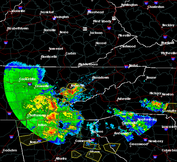 At 808 pm edt, a severe thunderstorm was located 11 miles southwest of maryville, moving east at 20 mph (radar indicated). Hazards include 60 mph wind gusts and quarter size hail. Hail damage to vehicles is expected. Expect wind damage to roofs, siding, and trees. At 808 pm edt, a severe thunderstorm was located 11 miles southwest of maryville, moving east at 20 mph (radar indicated). Hazards include 60 mph wind gusts and quarter size hail. Hail damage to vehicles is expected. Expect wind damage to roofs, siding, and trees.
|
| 3/21/2017 7:34 PM EDT |
 At 733 pm edt, a severe thunderstorm was located near farragut, or near lenoir city, moving east at 25 mph (radar indicated. hail of 2 inches in diameter has been reported with the strongest of these storms). Hazards include two inch hail and 60 mph wind gusts. People and animals outdoors will be injured. expect hail damage to roofs, siding, windows, and vehicles. expect wind damage to roofs, siding, and trees. Locations impacted include, knoxville, maryville, alcoa, farragut, louisville, rockford, eagleton village, friendsville and clover hill. At 733 pm edt, a severe thunderstorm was located near farragut, or near lenoir city, moving east at 25 mph (radar indicated. hail of 2 inches in diameter has been reported with the strongest of these storms). Hazards include two inch hail and 60 mph wind gusts. People and animals outdoors will be injured. expect hail damage to roofs, siding, windows, and vehicles. expect wind damage to roofs, siding, and trees. Locations impacted include, knoxville, maryville, alcoa, farragut, louisville, rockford, eagleton village, friendsville and clover hill.
|
| 3/21/2017 7:33 PM EDT |
 At 732 pm edt, severe thunderstorms were located along a line extending from 10 miles south of plainview to near knoxville, moving southeast at 15 mph (radar indicated). Hazards include 60 mph wind gusts and quarter size hail. Hail damage to vehicles is expected. Expect wind damage to roofs, siding, and trees. At 732 pm edt, severe thunderstorms were located along a line extending from 10 miles south of plainview to near knoxville, moving southeast at 15 mph (radar indicated). Hazards include 60 mph wind gusts and quarter size hail. Hail damage to vehicles is expected. Expect wind damage to roofs, siding, and trees.
|
| 3/21/2017 7:08 PM EDT |
 At 708 pm edt, a severe thunderstorm was located near kingston, moving east at 20 mph (radar indicated). Hazards include ping pong ball size hail and 60 mph wind gusts. People and animals outdoors will be injured. expect hail damage to roofs, siding, windows, and vehicles. Expect wind damage to roofs, siding, and trees. At 708 pm edt, a severe thunderstorm was located near kingston, moving east at 20 mph (radar indicated). Hazards include ping pong ball size hail and 60 mph wind gusts. People and animals outdoors will be injured. expect hail damage to roofs, siding, windows, and vehicles. Expect wind damage to roofs, siding, and trees.
|
| 3/1/2017 3:36 PM EST |
 At 335 pm est, a severe thunderstorm was located near sevierville, moving east at 60 mph (radar indicated). Hazards include 60 mph wind gusts and quarter size hail. Hail damage to vehicles is expected. expect wind damage to roofs, siding, and trees. locations impacted include, maryville, sevierville, alcoa, gatlinburg, pigeon forge, louisville, rockford, eagleton village, friendsville, pittman center, walland, fairgarden, wildwood, mcmahan, clover hill, wears valley, harrisburg, seymour and kodak. A tornado watch remains in effect until 700 pm est for eastern tennessee. At 335 pm est, a severe thunderstorm was located near sevierville, moving east at 60 mph (radar indicated). Hazards include 60 mph wind gusts and quarter size hail. Hail damage to vehicles is expected. expect wind damage to roofs, siding, and trees. locations impacted include, maryville, sevierville, alcoa, gatlinburg, pigeon forge, louisville, rockford, eagleton village, friendsville, pittman center, walland, fairgarden, wildwood, mcmahan, clover hill, wears valley, harrisburg, seymour and kodak. A tornado watch remains in effect until 700 pm est for eastern tennessee.
|
| 3/1/2017 3:20 PM EST |
 At 320 pm est, a severe thunderstorm was located over maryville, moving east at60 mph (radar indicated). Hazards include 60 mph wind gusts and quarter size hail. Hail damage to vehicles is expected. Expect wind damage to roofs, siding, and trees. At 320 pm est, a severe thunderstorm was located over maryville, moving east at60 mph (radar indicated). Hazards include 60 mph wind gusts and quarter size hail. Hail damage to vehicles is expected. Expect wind damage to roofs, siding, and trees.
|
| 3/1/2017 1:23 PM EST |
 At 122 pm est, a severe thunderstorm was located near rockwood, moving east at 55 mph (radar indicated). Hazards include 70 mph wind gusts and quarter size hail. Hail damage to vehicles is expected. expect considerable tree damage. Wind damage is also likely to mobile homes, roofs, and outbuildings. At 122 pm est, a severe thunderstorm was located near rockwood, moving east at 55 mph (radar indicated). Hazards include 70 mph wind gusts and quarter size hail. Hail damage to vehicles is expected. expect considerable tree damage. Wind damage is also likely to mobile homes, roofs, and outbuildings.
|
| 2/25/2017 3:25 AM EST |
 At 325 am est, severe thunderstorms were located along a line extending from 7 miles southwest of plainview to 6 miles east of knoxville to near rockford, moving northeast at 65 mph (radar indicated). Hazards include 60 mph wind gusts and quarter size hail. Hail damage to vehicles is expected. Expect wind damage to roofs, siding, and trees. At 325 am est, severe thunderstorms were located along a line extending from 7 miles southwest of plainview to 6 miles east of knoxville to near rockford, moving northeast at 65 mph (radar indicated). Hazards include 60 mph wind gusts and quarter size hail. Hail damage to vehicles is expected. Expect wind damage to roofs, siding, and trees.
|
| 2/25/2017 3:10 AM EST |
 At 309 am est, a severe thunderstorm was located over louisville, or near alcoa, moving northeast at 55 mph (radar indicated). Hazards include 60 mph wind gusts and quarter size hail. Hail damage to vehicles is expected. expect wind damage to roofs, siding, and trees. Locations impacted include, knoxville, maryville, alcoa, farragut, louisville, rockford, eagleton village, friendsville, lake forest, bearden, wildwood and seymour. At 309 am est, a severe thunderstorm was located over louisville, or near alcoa, moving northeast at 55 mph (radar indicated). Hazards include 60 mph wind gusts and quarter size hail. Hail damage to vehicles is expected. expect wind damage to roofs, siding, and trees. Locations impacted include, knoxville, maryville, alcoa, farragut, louisville, rockford, eagleton village, friendsville, lake forest, bearden, wildwood and seymour.
|
| 2/25/2017 2:58 AM EST |
 At 257 am est, a severe thunderstorm was located near lenoir city, moving northeast at 50 mph (radar indicated). Hazards include 60 mph wind gusts and quarter size hail. Hail damage to vehicles is expected. Expect wind damage to roofs, siding, and trees. At 257 am est, a severe thunderstorm was located near lenoir city, moving northeast at 50 mph (radar indicated). Hazards include 60 mph wind gusts and quarter size hail. Hail damage to vehicles is expected. Expect wind damage to roofs, siding, and trees.
|
| 11/30/2016 5:30 AM EST |
 At 530 am est, severe thunderstorms were located along a line extending from near knoxville to near alcoa to 9 miles east of madisonville, moving east at 30 mph (radar indicated). Hazards include 60 mph wind gusts and penny size hail. Expect damage to roofs. siding. and trees. locations impacted include, knoxville, maryville, alcoa, louisville, rockford, eagleton village, halls, vonore, greenback, friendsville, fort loudon s. p,. mcgee carson peninsula, bearden and clover hill. A tornado watch remains in effect until 1100 am est for eastern tennessee. At 530 am est, severe thunderstorms were located along a line extending from near knoxville to near alcoa to 9 miles east of madisonville, moving east at 30 mph (radar indicated). Hazards include 60 mph wind gusts and penny size hail. Expect damage to roofs. siding. and trees. locations impacted include, knoxville, maryville, alcoa, louisville, rockford, eagleton village, halls, vonore, greenback, friendsville, fort loudon s. p,. mcgee carson peninsula, bearden and clover hill. A tornado watch remains in effect until 1100 am est for eastern tennessee.
|
| 11/30/2016 5:27 AM EST |
 At 527 am est, severe thunderstorms were located along a line extending from 6 miles northeast of knoxville to alcoa to 12 miles east of madisonville, moving east at 45 mph (radar indicated). Hazards include 60 mph wind gusts and quarter size hail. Hail damage to vehicles is expected. Expect wind damage to roofs, siding, and trees. At 527 am est, severe thunderstorms were located along a line extending from 6 miles northeast of knoxville to alcoa to 12 miles east of madisonville, moving east at 45 mph (radar indicated). Hazards include 60 mph wind gusts and quarter size hail. Hail damage to vehicles is expected. Expect wind damage to roofs, siding, and trees.
|
| 11/30/2016 5:11 AM EST |
 At 510 am est, severe thunderstorms were located along a line extending from near clinton to near lenoir city to madisonville, moving east at 35 mph (radar indicated). Hazards include 60 mph wind gusts and penny size hail. Expect damage to roofs. siding. and trees. locations impacted include, knoxville, oak ridge, maryville, clinton, lenoir city, alcoa, sweetwater, loudon, madisonville, farragut, louisville, rockford, eagleton village, halls, vonore, greenback, friendsville, fort loudon s. p,. karns and tellico village. A tornado watch remains in effect until 1100 am est for eastern tennessee. At 510 am est, severe thunderstorms were located along a line extending from near clinton to near lenoir city to madisonville, moving east at 35 mph (radar indicated). Hazards include 60 mph wind gusts and penny size hail. Expect damage to roofs. siding. and trees. locations impacted include, knoxville, oak ridge, maryville, clinton, lenoir city, alcoa, sweetwater, loudon, madisonville, farragut, louisville, rockford, eagleton village, halls, vonore, greenback, friendsville, fort loudon s. p,. karns and tellico village. A tornado watch remains in effect until 1100 am est for eastern tennessee.
|
| 11/30/2016 4:53 AM EST |
 At 453 am est, severe thunderstorms were located along a line extending from near oliver springs to near loudon to near sweetwater, moving east at 30 mph (radar indicated). Hazards include 60 mph wind gusts and penny size hail. Expect damage to roofs. siding. And trees. At 453 am est, severe thunderstorms were located along a line extending from near oliver springs to near loudon to near sweetwater, moving east at 30 mph (radar indicated). Hazards include 60 mph wind gusts and penny size hail. Expect damage to roofs. siding. And trees.
|
| 11/30/2016 2:59 AM EST |
 At 258 am est, a severe thunderstorm capable of producing a tornado was located over eagleton village, or over alcoa, moving northeast at 45 mph (radar indicated rotation). Hazards include tornado. Flying debris will be dangerous to those caught without shelter. mobile homes will be damaged or destroyed. damage to roofs, windows, and vehicles will occur. tree damage is likely. This tornadic thunderstorm will remain over mainly rural areas of northeastern blount county, including the following locations: wildwood, walland and seymour. At 258 am est, a severe thunderstorm capable of producing a tornado was located over eagleton village, or over alcoa, moving northeast at 45 mph (radar indicated rotation). Hazards include tornado. Flying debris will be dangerous to those caught without shelter. mobile homes will be damaged or destroyed. damage to roofs, windows, and vehicles will occur. tree damage is likely. This tornadic thunderstorm will remain over mainly rural areas of northeastern blount county, including the following locations: wildwood, walland and seymour.
|
| 11/30/2016 2:44 AM EST |
 At 244 am est, a severe thunderstorm capable of producing a tornado was located 8 miles southwest of louisville, or 9 miles west of maryville, moving east at 45 mph (radar indicated rotation). Hazards include tornado. Flying debris will be dangerous to those caught without shelter. mobile homes will be damaged or destroyed. damage to roofs, windows, and vehicles will occur. tree damage is likely. this dangerous storm will be near, louisville around 255 am est. maryville, rockford and eagleton village around 300 am est. Other locations impacted by this tornadic thunderstorm include wildwood, walland, greenback, clover hill, friendsville and seymour. At 244 am est, a severe thunderstorm capable of producing a tornado was located 8 miles southwest of louisville, or 9 miles west of maryville, moving east at 45 mph (radar indicated rotation). Hazards include tornado. Flying debris will be dangerous to those caught without shelter. mobile homes will be damaged or destroyed. damage to roofs, windows, and vehicles will occur. tree damage is likely. this dangerous storm will be near, louisville around 255 am est. maryville, rockford and eagleton village around 300 am est. Other locations impacted by this tornadic thunderstorm include wildwood, walland, greenback, clover hill, friendsville and seymour.
|
| 11/30/2016 2:27 AM EST |
 The tornado warning for central blount county will expire at 230 am est. the storm which prompted the warning has moved out of the area. Therefore the warning will be allowed to expire. The tornado warning for central blount county will expire at 230 am est. the storm which prompted the warning has moved out of the area. Therefore the warning will be allowed to expire.
|
| 11/30/2016 2:05 AM EST |
 At 205 am est, a severe thunderstorm capable of producing a tornado was located near maryville, moving northeast at 60 mph (radar indicated rotation). Hazards include tornado. Flying debris will be dangerous to those caught without shelter. mobile homes will be damaged or destroyed. damage to roofs, windows, and vehicles will occur. tree damage is likely. this dangerous storm will be near, eagleton village around 215 am est. Other locations impacted by this tornadic thunderstorm include wildwood, walland, clover hill, friendsville and townsend. At 205 am est, a severe thunderstorm capable of producing a tornado was located near maryville, moving northeast at 60 mph (radar indicated rotation). Hazards include tornado. Flying debris will be dangerous to those caught without shelter. mobile homes will be damaged or destroyed. damage to roofs, windows, and vehicles will occur. tree damage is likely. this dangerous storm will be near, eagleton village around 215 am est. Other locations impacted by this tornadic thunderstorm include wildwood, walland, clover hill, friendsville and townsend.
|
| 11/30/2016 1:54 AM EST |
 At 154 am est, a severe thunderstorm capable of producing a tornado was located 11 miles northeast of madisonville, moving northeast at 60 mph (radar indicated rotation). Hazards include tornado. Flying debris will be dangerous to those caught without shelter. mobile homes will be damaged or destroyed. damage to roofs, windows, and vehicles will occur. tree damage is likely. this dangerous storm will be near, maryville around 210 am est. eagleton village around 215 am est. other locations impacted by this tornadic thunderstorm include walland, vonore, happy valley, fort loudon s. p,. Citico beach, friendsville, talassee, mcgee carson peninsula, wildwood and greenback. At 154 am est, a severe thunderstorm capable of producing a tornado was located 11 miles northeast of madisonville, moving northeast at 60 mph (radar indicated rotation). Hazards include tornado. Flying debris will be dangerous to those caught without shelter. mobile homes will be damaged or destroyed. damage to roofs, windows, and vehicles will occur. tree damage is likely. this dangerous storm will be near, maryville around 210 am est. eagleton village around 215 am est. other locations impacted by this tornadic thunderstorm include walland, vonore, happy valley, fort loudon s. p,. Citico beach, friendsville, talassee, mcgee carson peninsula, wildwood and greenback.
|
| 11/30/2016 1:43 AM EST |
 At 143 am est, a severe thunderstorm was located over madisonville, moving northeast at 55 mph (radar indicated). Hazards include 60 mph wind gusts. Expect damage to roofs. siding. And trees. At 143 am est, a severe thunderstorm was located over madisonville, moving northeast at 55 mph (radar indicated). Hazards include 60 mph wind gusts. Expect damage to roofs. siding. And trees.
|
| 8/27/2016 5:45 PM EDT | Power lines...several small trees/limbs down in maryville. damage to roofs on some businesses in the downtown are in blount county TN, 1.5 miles WSW of Maryville, TN |
| 8/27/2016 4:35 PM EDT | Trees down in maryville in blount county TN, 1.5 miles WSW of Maryville, TN |
| 7/8/2016 6:58 PM EDT |
 At 657 pm edt, severe thunderstorms were located along a line extending from 7 miles east of eagleton village to near maryville, moving southeast at 25 mph (law enforcement). Hazards include 60 mph wind gusts. Expect damage to roofs. siding. and trees. locations impacted include, maryville, alcoa, gatlinburg, pigeon forge, eagleton village, townsend, walland, happy valley, roundtop mountain s. p,. wears valley, elkmont, wildwood, cades cove, clover hill, great smoky mountains n. p,. Deals gap and seymour. At 657 pm edt, severe thunderstorms were located along a line extending from 7 miles east of eagleton village to near maryville, moving southeast at 25 mph (law enforcement). Hazards include 60 mph wind gusts. Expect damage to roofs. siding. and trees. locations impacted include, maryville, alcoa, gatlinburg, pigeon forge, eagleton village, townsend, walland, happy valley, roundtop mountain s. p,. wears valley, elkmont, wildwood, cades cove, clover hill, great smoky mountains n. p,. Deals gap and seymour.
|
| 7/8/2016 6:45 PM EDT |
 At 645 pm edt, a severe thunderstorm was located near loudon, moving east at 35 mph (radar indicated). Hazards include 60 mph wind gusts and quarter size hail. Hail damage to vehicles is expected. expect wind damage to roofs, siding, and trees. locations impacted include, maryville, lenoir city, loudon, madisonville, vonore, greenback, friendsville, philadelphia, fort loudon s. p,. Tellico village, clover hill and mcgee carson peninsula. At 645 pm edt, a severe thunderstorm was located near loudon, moving east at 35 mph (radar indicated). Hazards include 60 mph wind gusts and quarter size hail. Hail damage to vehicles is expected. expect wind damage to roofs, siding, and trees. locations impacted include, maryville, lenoir city, loudon, madisonville, vonore, greenback, friendsville, philadelphia, fort loudon s. p,. Tellico village, clover hill and mcgee carson peninsula.
|
| 7/8/2016 6:38 PM EDT |
 At 638 pm edt, severe thunderstorms were located along a line extending from 8 miles west of pigeon forge to near louisville, moving southeast at 40 mph (radar indicated). Hazards include 60 mph wind gusts. Expect damage to roofs. siding. And trees. At 638 pm edt, severe thunderstorms were located along a line extending from 8 miles west of pigeon forge to near louisville, moving southeast at 40 mph (radar indicated). Hazards include 60 mph wind gusts. Expect damage to roofs. siding. And trees.
|
| 7/8/2016 6:37 PM EDT |
 The severe thunderstorm warning for central blount county will expire at 645 pm edt, the storm which prompted the warning has weakened below severe limits, and no longer pose an immediate threat to life or property. therefore the warning will be allowed to expire. however gusty winds are still possible with this thunderstorm. a severe thunderstorm watch remains in effect until 900 pm edt for eastern tennessee. The severe thunderstorm warning for central blount county will expire at 645 pm edt, the storm which prompted the warning has weakened below severe limits, and no longer pose an immediate threat to life or property. therefore the warning will be allowed to expire. however gusty winds are still possible with this thunderstorm. a severe thunderstorm watch remains in effect until 900 pm edt for eastern tennessee.
|
| 7/8/2016 6:33 PM EDT |
 At 632 pm edt, a severe thunderstorm was located over lenoir city, moving southeast at 40 mph (radar indicated). Hazards include 60 mph wind gusts. Expect damage to roofs. siding. And trees. At 632 pm edt, a severe thunderstorm was located over lenoir city, moving southeast at 40 mph (radar indicated). Hazards include 60 mph wind gusts. Expect damage to roofs. siding. And trees.
|
| 7/8/2016 6:23 PM EDT |
 At 623 pm edt, a severe thunderstorm was located over maryville, moving east at 25 mph (radar indicated). Hazards include 60 mph wind gusts and quarter size hail. Hail damage to vehicles is expected. expect wind damage to roofs, siding, and trees. locations impacted include, maryville, alcoa, rockford, eagleton village, friendsville, townsend, walland, wildwood, clover hill and great smoky mountains n. P At 623 pm edt, a severe thunderstorm was located over maryville, moving east at 25 mph (radar indicated). Hazards include 60 mph wind gusts and quarter size hail. Hail damage to vehicles is expected. expect wind damage to roofs, siding, and trees. locations impacted include, maryville, alcoa, rockford, eagleton village, friendsville, townsend, walland, wildwood, clover hill and great smoky mountains n. P
|
| 7/8/2016 6:07 PM EDT |
 At 606 pm edt, a severe thunderstorm was located near maryville, moving east at 25 mph (radar indicated). Hazards include 60 mph wind gusts and half dollar size hail. Hail damage to vehicles is expected. Expect wind damage to roofs, siding, and trees. At 606 pm edt, a severe thunderstorm was located near maryville, moving east at 25 mph (radar indicated). Hazards include 60 mph wind gusts and half dollar size hail. Hail damage to vehicles is expected. Expect wind damage to roofs, siding, and trees.
|
| 7/7/2016 7:12 PM EDT |
 At 712 pm edt, severe thunderstorms were located along a line extending from near new market to 6 miles west of sevierville to near eagleton village, moving east at 35 mph (radar indicated). Hazards include 60 mph wind gusts and penny size hail. Expect damage to roofs. siding. and trees. locations impacted include, knoxville, maryville, sevierville, alcoa, jefferson city, new market, rockford, eagleton village, strawberry plains, blaine, townsend, walland, mcmahan, seymour, kimberlin heights, kodak, wildwood, house mountain s. p,. Mascot and piedmont. At 712 pm edt, severe thunderstorms were located along a line extending from near new market to 6 miles west of sevierville to near eagleton village, moving east at 35 mph (radar indicated). Hazards include 60 mph wind gusts and penny size hail. Expect damage to roofs. siding. and trees. locations impacted include, knoxville, maryville, sevierville, alcoa, jefferson city, new market, rockford, eagleton village, strawberry plains, blaine, townsend, walland, mcmahan, seymour, kimberlin heights, kodak, wildwood, house mountain s. p,. Mascot and piedmont.
|
| 7/7/2016 6:49 PM EDT |
 At 648 pm edt, severe thunderstorms were located along a line extending from 7 miles west of plainview to near knoxville to near farragut, moving east at 30 mph (radar indicated). Hazards include 60 mph wind gusts and penny size hail. Expect damage to roofs. siding. And trees. At 648 pm edt, severe thunderstorms were located along a line extending from 7 miles west of plainview to near knoxville to near farragut, moving east at 30 mph (radar indicated). Hazards include 60 mph wind gusts and penny size hail. Expect damage to roofs. siding. And trees.
|
| 7/7/2016 6:24 PM EDT |
 At 623 pm edt, severe thunderstorms were located along a line extending from 7 miles south of lot to 7 miles southeast of jacksboro to near oliver springs, moving east at 40 mph (radar indicated). Hazards include 60 mph wind gusts and penny size hail. Expect damage to roofs. siding. and trees. Locations impacted include, knoxville, oak ridge, clinton, lenoir city, alcoa, la follette, kingston, maynardville, farragut, oliver springs, louisville, plainview, jacksboro, midtown, harriman, jellico, caryville, halls, lake city and norris. At 623 pm edt, severe thunderstorms were located along a line extending from 7 miles south of lot to 7 miles southeast of jacksboro to near oliver springs, moving east at 40 mph (radar indicated). Hazards include 60 mph wind gusts and penny size hail. Expect damage to roofs. siding. and trees. Locations impacted include, knoxville, oak ridge, clinton, lenoir city, alcoa, la follette, kingston, maynardville, farragut, oliver springs, louisville, plainview, jacksboro, midtown, harriman, jellico, caryville, halls, lake city and norris.
|
| 7/7/2016 6:13 PM EDT |
 At 612 pm edt, severe thunderstorms were located along a line extending from 6 miles southwest of zion hill to 9 miles west of jacksboro to near wartburg, moving east at 35 mph (radar indicated). Hazards include 60 mph wind gusts and penny size hail. Expect damage to roofs. siding. And trees. At 612 pm edt, severe thunderstorms were located along a line extending from 6 miles southwest of zion hill to 9 miles west of jacksboro to near wartburg, moving east at 35 mph (radar indicated). Hazards include 60 mph wind gusts and penny size hail. Expect damage to roofs. siding. And trees.
|
| 7/6/2016 6:49 PM EDT |
 At 648 pm edt, severe thunderstorms were located along a line extending from near loudon to 8 miles south of lenoir city to 11 miles east of madisonville, moving northeast at 25 mph (radar indicated). Hazards include 60 mph wind gusts and penny size hail. Expect damage to roofs. siding. and trees. locations impacted include, oak ridge, maryville, lenoir city, alcoa, loudon, madisonville, farragut, louisville, vonore, greenback, friendsville, philadelphia, happy valley, bradbury, fort loudon s. p,. Citico beach, tellico village, talassee, tariffville and mcgee carson peninsula. At 648 pm edt, severe thunderstorms were located along a line extending from near loudon to 8 miles south of lenoir city to 11 miles east of madisonville, moving northeast at 25 mph (radar indicated). Hazards include 60 mph wind gusts and penny size hail. Expect damage to roofs. siding. and trees. locations impacted include, oak ridge, maryville, lenoir city, alcoa, loudon, madisonville, farragut, louisville, vonore, greenback, friendsville, philadelphia, happy valley, bradbury, fort loudon s. p,. Citico beach, tellico village, talassee, tariffville and mcgee carson peninsula.
|
| 7/6/2016 6:25 PM EDT |
 At 624 pm edt, severe thunderstorms were located along a line extending from fairview to near sweetwater to madisonville, moving northeast at 20 mph (radar indicated). Hazards include 60 mph wind gusts and penny size hail. Expect damage to roofs. siding. And trees. At 624 pm edt, severe thunderstorms were located along a line extending from fairview to near sweetwater to madisonville, moving northeast at 20 mph (radar indicated). Hazards include 60 mph wind gusts and penny size hail. Expect damage to roofs. siding. And trees.
|
| 7/6/2016 6:15 PM EDT |
 At 614 pm edt, a severe thunderstorm was located 11 miles southeast of loudon, moving east at 25 mph (radar indicated). Hazards include 60 mph wind gusts and quarter size hail. Hail damage to vehicles is expected. expect wind damage to roofs, siding, and trees. locations impacted include, maryville, alcoa, loudon, louisville, rockford, eagleton village, vonore, greenback, friendsville, happy valley, fort loudon s. p,. Tellico village, mcgee carson peninsula and clover hill. At 614 pm edt, a severe thunderstorm was located 11 miles southeast of loudon, moving east at 25 mph (radar indicated). Hazards include 60 mph wind gusts and quarter size hail. Hail damage to vehicles is expected. expect wind damage to roofs, siding, and trees. locations impacted include, maryville, alcoa, loudon, louisville, rockford, eagleton village, vonore, greenback, friendsville, happy valley, fort loudon s. p,. Tellico village, mcgee carson peninsula and clover hill.
|
| 7/6/2016 6:01 PM EDT |
 At 600 pm edt, a severe thunderstorm was located 7 miles south of loudon, moving northeast at 20 mph (radar indicated). Hazards include 60 mph wind gusts and quarter size hail. Hail damage to vehicles is expected. Expect wind damage to roofs, siding, and trees. At 600 pm edt, a severe thunderstorm was located 7 miles south of loudon, moving northeast at 20 mph (radar indicated). Hazards include 60 mph wind gusts and quarter size hail. Hail damage to vehicles is expected. Expect wind damage to roofs, siding, and trees.
|
| 6/17/2016 2:00 AM EDT | Several trees down along chilhowee view rd in blount county TN, 2.8 miles WNW of Maryville, TN |
| 6/17/2016 1:55 AM EDT |
 At 154 am edt, a severe thunderstorm was located near alcoa, moving southeast at 50 mph (radar indicated). Hazards include 60 mph wind gusts and quarter size hail. Hail damage to vehicles is expected. expect wind damage to roofs, siding, and trees. Locations impacted include, maryville, alcoa, louisville, rockford, eagleton village, friendsville, walland, wildwood and clover hill. At 154 am edt, a severe thunderstorm was located near alcoa, moving southeast at 50 mph (radar indicated). Hazards include 60 mph wind gusts and quarter size hail. Hail damage to vehicles is expected. expect wind damage to roofs, siding, and trees. Locations impacted include, maryville, alcoa, louisville, rockford, eagleton village, friendsville, walland, wildwood and clover hill.
|
| 6/17/2016 1:41 AM EDT |
 At 141 am edt, a severe thunderstorm was located over farragut, or 7 miles northeast of lenoir city, moving southeast at 50 mph (radar indicated). Hazards include 60 mph wind gusts and quarter size hail. Hail damage to vehicles is expected. Expect wind damage to roofs, siding, and trees. At 141 am edt, a severe thunderstorm was located over farragut, or 7 miles northeast of lenoir city, moving southeast at 50 mph (radar indicated). Hazards include 60 mph wind gusts and quarter size hail. Hail damage to vehicles is expected. Expect wind damage to roofs, siding, and trees.
|
| 6/14/2016 5:45 PM EDT | Quarter sized hail reported 11.5 miles WSW of Maryville, TN |
| 6/1/2016 6:37 PM EDT |
 At 636 pm edt, a severe thunderstorm was located 9 miles southeast of lenoir city, moving northeast at 15 mph (radar indicated). Hazards include 60 mph wind gusts. Expect damage to roofs. siding. and trees. Locations impacted include, maryville, lenoir city, alcoa, loudon, farragut, louisville, vonore, greenback, friendsville and clover hill. At 636 pm edt, a severe thunderstorm was located 9 miles southeast of lenoir city, moving northeast at 15 mph (radar indicated). Hazards include 60 mph wind gusts. Expect damage to roofs. siding. and trees. Locations impacted include, maryville, lenoir city, alcoa, loudon, farragut, louisville, vonore, greenback, friendsville and clover hill.
|
| 6/1/2016 6:16 PM EDT |
 At 615 pm edt, a severe thunderstorm was located 8 miles northeast of madisonville, moving northeast at 15 mph (radar indicated). Hazards include 60 mph wind gusts and quarter size hail. Hail damage to vehicles is expected. Expect wind damage to roofs, siding, and trees. At 615 pm edt, a severe thunderstorm was located 8 miles northeast of madisonville, moving northeast at 15 mph (radar indicated). Hazards include 60 mph wind gusts and quarter size hail. Hail damage to vehicles is expected. Expect wind damage to roofs, siding, and trees.
|
| 4/22/2016 3:47 PM EDT |
 At 346 pm edt, a severe thunderstorm was located near rockford, or 9 miles northeast of alcoa, moving southeast at 20 mph (radar indicated). Hazards include 60 mph wind gusts and quarter size hail. Hail damage to vehicles is expected. Expect wind damage to roofs, siding, and trees. At 346 pm edt, a severe thunderstorm was located near rockford, or 9 miles northeast of alcoa, moving southeast at 20 mph (radar indicated). Hazards include 60 mph wind gusts and quarter size hail. Hail damage to vehicles is expected. Expect wind damage to roofs, siding, and trees.
|
| 2/24/2016 8:11 AM EST |
 At 809 am est, severe thunderstorms were located along a line extending from 8 miles southwest of jacksboro to near oliver springs to near oak ridge to near louisville, moving northeast at 60 mph (radar indicated). Hazards include 60 mph wind gusts and penny size hail. Expect damage to roofs. siding. And trees. At 809 am est, severe thunderstorms were located along a line extending from 8 miles southwest of jacksboro to near oliver springs to near oak ridge to near louisville, moving northeast at 60 mph (radar indicated). Hazards include 60 mph wind gusts and penny size hail. Expect damage to roofs. siding. And trees.
|
| 2/3/2016 4:47 AM EST |
 At 447 am est, a severe thunderstorm was located near farragut, or near oak ridge, moving northeast at 60 mph (radar indicated). Hazards include 60 mph wind gusts. Expect damage to roofs. siding and trees. Locations impacted include, knoxville, oak ridge, maryville, clinton, lenoir city, alcoa, kingston, sweetwater, loudon, farragut, oliver springs, louisville, rockford, eagleton village, halls, lake city, norris, greenback, friendsville and philadelphia. At 447 am est, a severe thunderstorm was located near farragut, or near oak ridge, moving northeast at 60 mph (radar indicated). Hazards include 60 mph wind gusts. Expect damage to roofs. siding and trees. Locations impacted include, knoxville, oak ridge, maryville, clinton, lenoir city, alcoa, kingston, sweetwater, loudon, farragut, oliver springs, louisville, rockford, eagleton village, halls, lake city, norris, greenback, friendsville and philadelphia.
|
| 2/3/2016 4:19 AM EST |
 At 417 am est, a severe thunderstorm was located 11 miles northwest of sweetwater, moving northeast at 65 mph (radar indicated and reports of downed trees across rhea county). Hazards include 60 mph wind gusts. Expect damage to roofs. Siding and trees. At 417 am est, a severe thunderstorm was located 11 miles northwest of sweetwater, moving northeast at 65 mph (radar indicated and reports of downed trees across rhea county). Hazards include 60 mph wind gusts. Expect damage to roofs. Siding and trees.
|
| 8/10/2015 5:23 PM EDT |
 At 522 pm edt, a severe thunderstorm was located 9 miles west of sevierville, or near seymour, moving northeast at 30 mph (radar indicated). Hazards include 60 mph wind gusts. Expect damage to roofs. siding and trees. Locations impacted include, knoxville, maryville, sevierville, alcoa, pigeon forge, louisville, rockford, eagleton village, strawberry plains, wildwood, walland, seymour, kodak, lake forest, mascot, mcmahan, harrisburg and kimberlin heights. At 522 pm edt, a severe thunderstorm was located 9 miles west of sevierville, or near seymour, moving northeast at 30 mph (radar indicated). Hazards include 60 mph wind gusts. Expect damage to roofs. siding and trees. Locations impacted include, knoxville, maryville, sevierville, alcoa, pigeon forge, louisville, rockford, eagleton village, strawberry plains, wildwood, walland, seymour, kodak, lake forest, mascot, mcmahan, harrisburg and kimberlin heights.
|
| 8/10/2015 5:02 PM EDT |
 At 502 pm edt, a severe thunderstorm was located over eagleton village, or near alcoa, moving northeast at 30 mph (radar indicated). Hazards include 60 mph wind gusts. Expect damage to roofs. Siding and trees. At 502 pm edt, a severe thunderstorm was located over eagleton village, or near alcoa, moving northeast at 30 mph (radar indicated). Hazards include 60 mph wind gusts. Expect damage to roofs. Siding and trees.
|
| 8/10/2015 4:51 PM EDT |
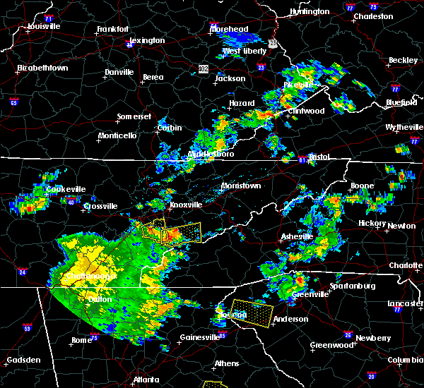 At 450 pm edt, a severe thunderstorm was located 10 miles southeast of maryville, moving east at 30 mph (radar indicated). Hazards include 60 mph wind gusts and quarter size hail. Hail damage to vehicles is expected. expect wind damage to roofs, siding and trees. Locations impacted include, maryville, gatlinburg, pigeon forge, townsend, walland, wears valley, elkmont, cades cove and happy valley. At 450 pm edt, a severe thunderstorm was located 10 miles southeast of maryville, moving east at 30 mph (radar indicated). Hazards include 60 mph wind gusts and quarter size hail. Hail damage to vehicles is expected. expect wind damage to roofs, siding and trees. Locations impacted include, maryville, gatlinburg, pigeon forge, townsend, walland, wears valley, elkmont, cades cove and happy valley.
|
| 8/10/2015 4:45 PM EDT |
 At 444 pm edt, a severe thunderstorm was located 9 miles south of maryville, moving east at 45 mph (radar indicated). Hazards include 60 mph wind gusts. Expect damage to roofs. Siding and trees. At 444 pm edt, a severe thunderstorm was located 9 miles south of maryville, moving east at 45 mph (radar indicated). Hazards include 60 mph wind gusts. Expect damage to roofs. Siding and trees.
|
| 8/10/2015 4:40 PM EDT |
 At 440 pm edt, a severe thunderstorm was located 8 miles southwest of maryville, moving east at 35 mph (radar indicated). Hazards include 60 mph wind gusts and penny size hail. Expect damage to roofs. siding and trees. Locations impacted include, maryville, alcoa, louisville, greenback, friendsville, clover hill and happy valley. At 440 pm edt, a severe thunderstorm was located 8 miles southwest of maryville, moving east at 35 mph (radar indicated). Hazards include 60 mph wind gusts and penny size hail. Expect damage to roofs. siding and trees. Locations impacted include, maryville, alcoa, louisville, greenback, friendsville, clover hill and happy valley.
|
| 8/10/2015 4:32 PM EDT |
 At 431 pm edt, a severe thunderstorm was located near loudon, moving east at 30 mph (radar indicated). Hazards include 60 mph wind gusts and penny size hail. Expect damage to roofs. siding and trees. Locations impacted include, knoxville, maryville, lenoir city, alcoa, sweetwater, loudon, farragut, louisville, vonore, greenback, friendsville, philadelphia, clover hill and happy valley. At 431 pm edt, a severe thunderstorm was located near loudon, moving east at 30 mph (radar indicated). Hazards include 60 mph wind gusts and penny size hail. Expect damage to roofs. siding and trees. Locations impacted include, knoxville, maryville, lenoir city, alcoa, sweetwater, loudon, farragut, louisville, vonore, greenback, friendsville, philadelphia, clover hill and happy valley.
|
| 8/10/2015 4:12 PM EDT |
 At 412 pm edt, a severe thunderstorm was located near loudon, moving east at 30 mph (radar indicated). Hazards include 60 mph wind gusts and quarter size hail. Hail damage to vehicles is expected. Expect wind damage to roofs, siding and trees. At 412 pm edt, a severe thunderstorm was located near loudon, moving east at 30 mph (radar indicated). Hazards include 60 mph wind gusts and quarter size hail. Hail damage to vehicles is expected. Expect wind damage to roofs, siding and trees.
|
| 7/20/2015 6:09 PM EDT |
 The severe thunderstorm warning for blount county will expire at 615 pm edt, the storm which prompted the warning has weakened below severe limits and exited the warned area. therefore the warning will be allowed to expire. The severe thunderstorm warning for blount county will expire at 615 pm edt, the storm which prompted the warning has weakened below severe limits and exited the warned area. therefore the warning will be allowed to expire.
|
| 7/20/2015 5:50 PM EDT |
 At 549 pm edt, a severe thunderstorm was located 7 miles south of maryville, moving southeast at 30 mph (radar indicated). Hazards include 60 mph wind gusts and up to quarter size hail. Hail damage to vehicles is expected. expect wind damage to roofs, siding and trees. Locations impacted include, maryville, alcoa, louisville, rockford, eagleton village, friendsville, townsend, wildwood, walland, happy valley, clover hill, talassee, cades cove and seymour. At 549 pm edt, a severe thunderstorm was located 7 miles south of maryville, moving southeast at 30 mph (radar indicated). Hazards include 60 mph wind gusts and up to quarter size hail. Hail damage to vehicles is expected. expect wind damage to roofs, siding and trees. Locations impacted include, maryville, alcoa, louisville, rockford, eagleton village, friendsville, townsend, wildwood, walland, happy valley, clover hill, talassee, cades cove and seymour.
|
| 7/20/2015 5:26 PM EDT |
 At 525 pm edt, a severe thunderstorm was located 8 miles west of maryville, moving southeast at 40 mph (radar indicated). Hazards include 60 mph wind gusts and quarter size hail. Hail damage to vehicles is expected. Expect wind damage to roofs, siding and trees. At 525 pm edt, a severe thunderstorm was located 8 miles west of maryville, moving southeast at 40 mph (radar indicated). Hazards include 60 mph wind gusts and quarter size hail. Hail damage to vehicles is expected. Expect wind damage to roofs, siding and trees.
|
| 7/14/2015 4:50 PM EDT |
 At 450 pm edt, severe thunderstorms were located along a line extending from 6 miles southwest of gatlinburg to 8 miles southwest of louisville, moving southeast at 25 mph (radar indicated). Hazards include 60 mph wind gusts and nickel size hail. Expect damage to roofs. siding and trees. Locations impacted include, maryville, alcoa, gatlinburg, friendsville, townsend, walland, wears valley, elkmont, cades cove, happy valley and clover hill. At 450 pm edt, severe thunderstorms were located along a line extending from 6 miles southwest of gatlinburg to 8 miles southwest of louisville, moving southeast at 25 mph (radar indicated). Hazards include 60 mph wind gusts and nickel size hail. Expect damage to roofs. siding and trees. Locations impacted include, maryville, alcoa, gatlinburg, friendsville, townsend, walland, wears valley, elkmont, cades cove, happy valley and clover hill.
|
| 7/14/2015 4:36 PM EDT |
 At 436 pm edt, severe thunderstorms were located along a line extending from near pigeon forge to 7 miles southeast of lenoir city, moving southeast at 30 mph (radar indicated). Hazards include 60 mph wind gusts and nickel size hail. Expect damage to roofs. Siding and trees. At 436 pm edt, severe thunderstorms were located along a line extending from near pigeon forge to 7 miles southeast of lenoir city, moving southeast at 30 mph (radar indicated). Hazards include 60 mph wind gusts and nickel size hail. Expect damage to roofs. Siding and trees.
|
| 6/23/2015 10:53 PM EDT |
 At 1053 pm edt, a severe thunderstorm was located near loudon, moving southeast at 20 mph (radar indicated). Hazards include 60 mph wind gusts and quarter size hail. Hail damage to vehicles is expected. Expect wind damage to roofs, siding and trees. At 1053 pm edt, a severe thunderstorm was located near loudon, moving southeast at 20 mph (radar indicated). Hazards include 60 mph wind gusts and quarter size hail. Hail damage to vehicles is expected. Expect wind damage to roofs, siding and trees.
|
| 6/18/2015 7:20 PM EDT | At 718 pm edt, a severe thunderstorm was located over loudon, moving northeast at 25 mph (radar indicated). Hazards include 60 mph wind gusts and quarter size hail. Hail damage to vehicles is expected. expect wind damage to roofs, siding and trees. Locations impacted include, loudon, knoxville, oak ridge, maryville, lenoir city, alcoa, loudon, farragut, louisville, rockford, eagleton village, friendsville, philadelphia, paint rock, karns, tellico village, wildwood, bearden, powell and clover hill. |
| 6/18/2015 7:07 PM EDT | At 706 pm edt, a severe thunderstorm was located over loudon, moving northeast at 35 mph (radar indicated). Hazards include 60 mph wind gusts and quarter size hail. Hail damage to vehicles is expected. Expect wind damage to roofs, siding and trees. |
| 6/8/2015 8:48 PM EDT | At 848 pm edt, severe thunderstorms were located along a line extending from near lenoir city to near sweetwater, moving east at 40 mph (radar indicated). Hazards include 60 mph wind gusts and quarter size hail. Hail damage to vehicles is expected. expect wind damage to roofs, siding and trees. locations impacted include, knoxville, oak ridge, maryville, lenoir city, alcoa, sweetwater, loudon, madisonville, farragut, louisville, rockford, eagleton village, vonore, greenback, friendsville, philadelphia, fort loudon s. p,. Citico beach, tellico village and karns. |
| 6/8/2015 8:08 PM EDT | At 808 pm edt, severe thunderstorms were located along a line extending from rockwood to near decatur, moving east at 40 mph (radar indicated). Hazards include 60 mph wind gusts and quarter size hail. Hail damage to vehicles is expected. Expect wind damage to roofs, siding and trees. |
| 6/8/2015 5:05 PM EDT | At 504 pm edt, a severe thunderstorm was located near lenoir city, moving east at 45 mph (radar indicated). Hazards include 60 mph wind gusts and penny size hail. Expect damage to roofs. Siding and trees. |
| 5/31/2015 3:29 PM EDT | At 329 pm edt, severe thunderstorms were located along a line extending from near loudon to 12 miles southeast of madisonville, moving northeast at 30 mph (radar indicated). Hazards include 60 mph wind gusts and penny size hail. Expect damage to roofs. siding and trees. locations impacted include, knoxville, maryville, athens, lenoir city, alcoa, sweetwater, loudon, madisonville, farragut, louisville, rockford, eagleton village, englewood, vonore, greenback, friendsville, tellico plains, niota, philadelphia and fort loudon s. P |
| 5/31/2015 3:06 PM EDT | At 306 pm edt, a severe thunderstorm was located near sweetwater, moving northeast at 30 mph (radar indicated). Hazards include 60 mph wind gusts and penny size hail. Expect damage to roofs. Siding and trees. |
| 4/26/2015 12:42 AM EDT | At 1241 am edt, a severe thunderstorm was located near pigeon forge, or near gatlinburg, moving east at 45 mph (trained weather spotters). Hazards include quarter size hail and 60 mph wind gusts. Hail damage to vehicles is expected. expect wind damage to roofs, siding and trees. locations impacted include, maryville, sevierville, alcoa, newport, gatlinburg, dandridge, pigeon forge, louisville, white pine, rockford, baneberry, parrottsville, eagleton village, pittman center, townsend, walland, seymour, round mountain, bird crossing and mcmahan. 1. 00in. |
| 4/26/2015 12:34 AM EDT | At 1233 am edt, a severe thunderstorm was located over pigeon forge, or near sevierville, moving east at 45 mph (radar indicated). Hazards include quarter size hail and 60 mph wind gusts. Hail damage to vehicles is expected. expect wind damage to roofs, siding and trees. locations impacted include, maryville, sevierville, alcoa, jefferson city, newport, gatlinburg, dandridge, pigeon forge, louisville, white pine, new market, rockford, baneberry, parrottsville, eagleton village, strawberry plains, pittman center, townsend, walland and seymour. 1. 00in. |
| 4/26/2015 12:06 AM EDT | At 1205 am edt, a severe thunderstorm was located near knoxville, moving east at 45 mph (radar indicated). Hazards include half dollar size hail and 60 mph wind gusts. Hail damage to vehicles is expected. Expect wind damage to roofs, siding and trees. |
| 4/25/2015 11:47 PM EDT | At 1146 pm edt, a severe thunderstorm was located near clinton, moving east at 45 mph (radar indicated). Hazards include quarter size hail and 60 mph wind gusts. Hail damage to vehicles is expected. expect wind damage to roofs, siding and trees. locations impacted include, knoxville, oak ridge, maryville, clinton, alcoa, farragut, oliver springs, louisville, rockford, eagleton village, strawberry plains, halls, townsend, wildwood, walland, maloneyville, lake forest, mascot, karns and rosedale. 1. 00in. |
| 4/25/2015 11:22 PM EDT | At 1121 pm edt, a severe thunderstorm was located 7 miles east of wartburg, moving east at 45 mph (radar indicated). Hazards include quarter size hail and 60 mph wind gusts. Hail damage to vehicles is expected. Expect wind damage to roofs, siding and trees. |
| 4/19/2015 8:58 PM EDT | Several trees and a few power lines down across blount count in blount county TN, 1.5 miles WSW of Maryville, TN |
| 4/19/2015 8:50 PM EDT | The national weather service in morristown has issued a * severe thunderstorm warning for. southwestern sevier county in eastern tennessee. knox county in eastern tennessee. blount county in eastern tennessee. Central anderson county in eastern tennessee. |
| 4/3/2015 9:02 PM EDT | A severe thunderstorm warning remains in effect until 930 pm edt for monroe. northeastern mcminn. southern blount and loudon counties. at 901 pm edt. severe thunderstorms were located along a line extending from near lenoir city to 6 miles east of decatur. Moving east at 60 mph. |
| 4/3/2015 8:46 PM EDT | The national weather service in morristown has issued a * severe thunderstorm warning for. monroe county in eastern tennessee. northeastern mcminn county in eastern tennessee. southern blount county in eastern tennessee. Loudon county in eastern tennessee. |
| 8/20/2014 4:15 PM EDT | Two trees dow in blount county TN, 5.4 miles W of Maryville, TN |
| 7/24/2014 5:50 PM EDT | Couple of trees down near old glory rd and hwy 321 in blount county TN, 1.5 miles WSW of Maryville, TN |
| 6/13/2013 2:40 PM EDT | Trees down in blount county TN, 5.7 miles WNW of Maryville, TN |
| 5/21/2013 6:30 PM EDT | Couple trees dow in blount county TN, 1.5 miles WSW of Maryville, TN |
| 5/21/2013 6:00 PM EDT | Trees and powerlines downed in happy valley. reported by dispatc in blount county TN, 9.5 miles NNW of Maryville, TN |
| 7/5/2012 6:20 PM EDT | Numerous trees and powerlines down county wid in blount county TN, 1.5 miles WSW of Maryville, TN |
| 7/5/2012 6:15 PM EDT | Few trees dow in blount county TN, 1.8 miles NW of Maryville, TN |
| 4/3/2012 4:44 PM EDT | Quarter sized hail reported 8 miles N of Maryville, TN |
| 4/1/2012 5:50 PM EDT | Quarter sized hail reported 11.3 miles NNE of Maryville, TN |
| 3/29/2012 4:17 PM EDT | Quarter sized hail reported 1.5 miles WSW of Maryville, TN |
| 3/2/2012 7:00 PM EST | Quarter sized hail reported 1.5 miles WSW of Maryville, TN, quarter size hail in maryville |
| 1/1/0001 12:00 AM | Golf Ball sized hail reported 4.1 miles NNW of Maryville, TN |
| 1/1/0001 12:00 AM | Few trees down in blount county TN, 1.5 miles WSW of Maryville, TN |
| 1/1/0001 12:00 AM | Few trees dow in blount county TN, 1.5 miles WSW of Maryville, TN |
| 1/1/0001 12:00 AM | Numerous trees down across count in blount county TN, 9.3 miles N of Maryville, TN |
| 1/1/0001 12:00 AM | Storm damage reported in blount county TN, 1.5 miles WSW of Maryville, TN |
| 1/1/0001 12:00 AM | Large tree...and several large limbs dow in blount county TN, 1.5 miles WSW of Maryville, TN |
| 1/1/0001 12:00 AM | Ping Pong Ball sized hail reported 1.5 miles WSW of Maryville, TN |
| 1/1/0001 12:00 AM | Golf Ball sized hail reported 1.5 miles WSW of Maryville, TN |
| 1/1/0001 12:00 AM | Half Dollar sized hail reported 1.5 miles WSW of Maryville, TN, foothills mall area. |
| 1/1/0001 12:00 AM | Ping Pong Ball sized hail reported 1.5 miles WSW of Maryville, TN |
| 1/1/0001 12:00 AM | Carpenters grade road and bert garner ln in blount county TN, 6.7 miles NNE of Maryville, TN |
| 1/1/0001 12:00 AM | Trees down near intersection of carpenters grade road and bert garner l in blount county TN, 6.7 miles NNE of Maryville, TN |
Hail Maps for Maryville, TN


Connect with Interactive Hail Maps