

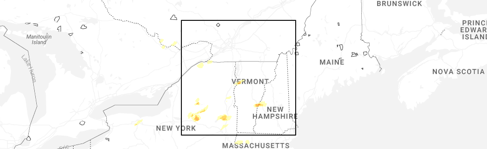
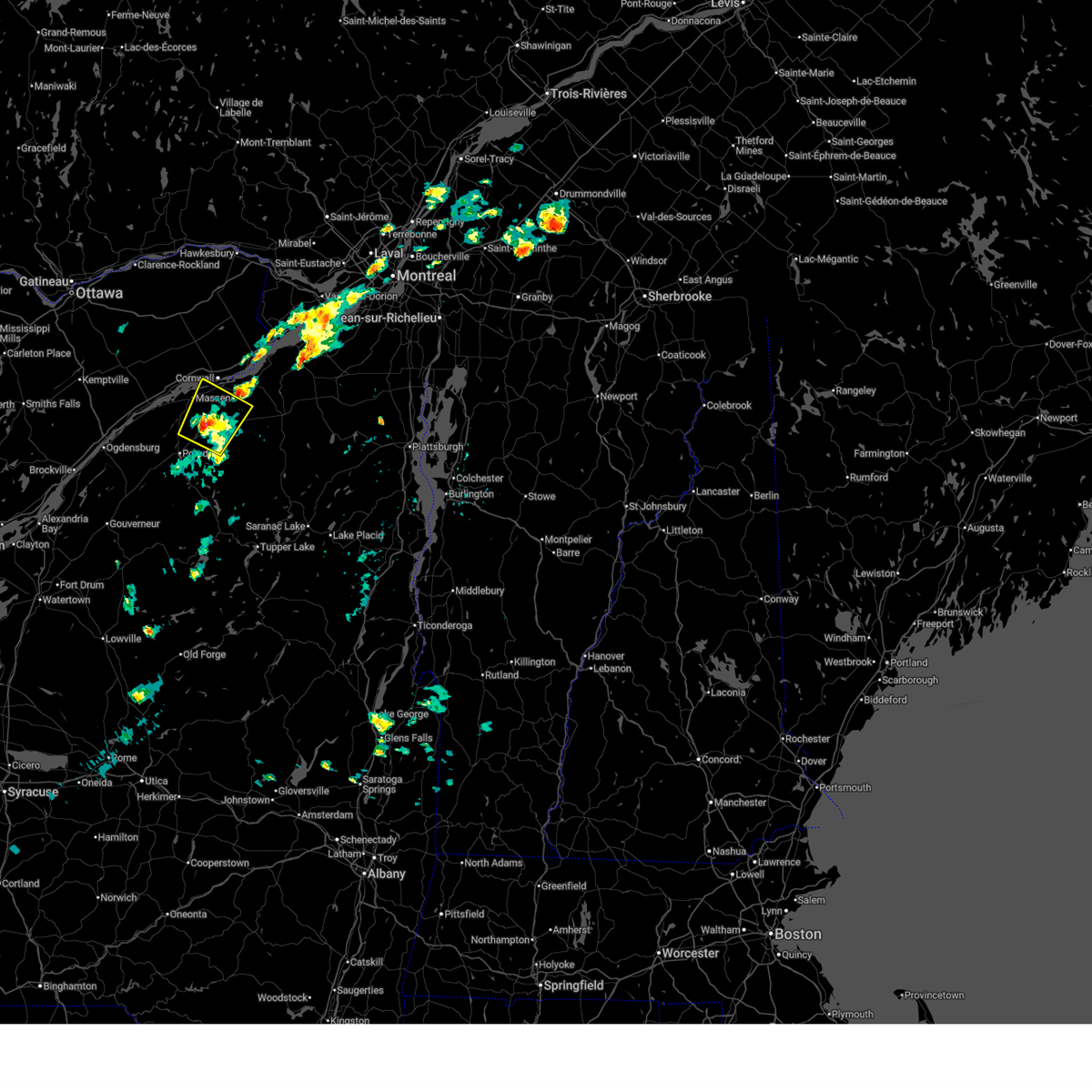
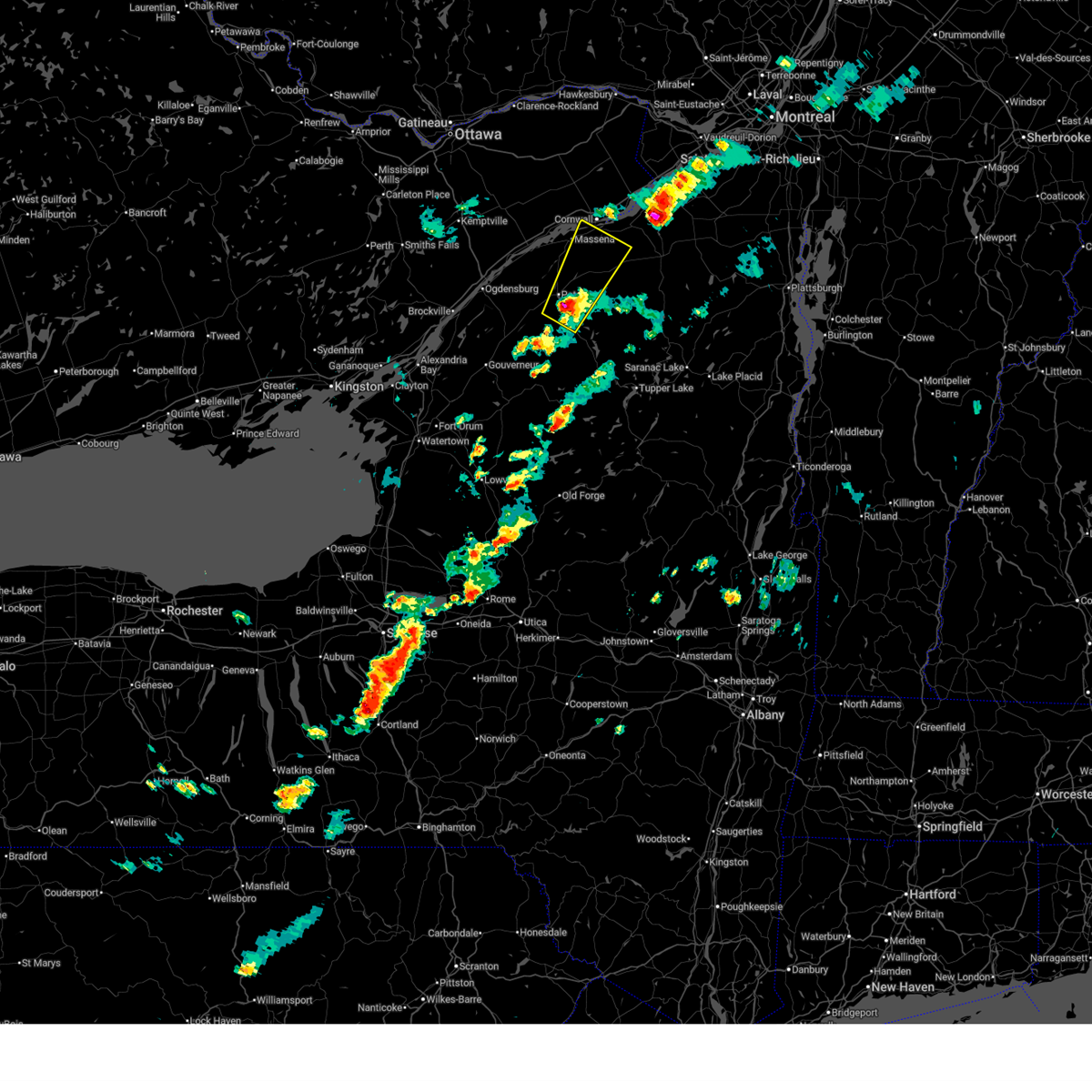
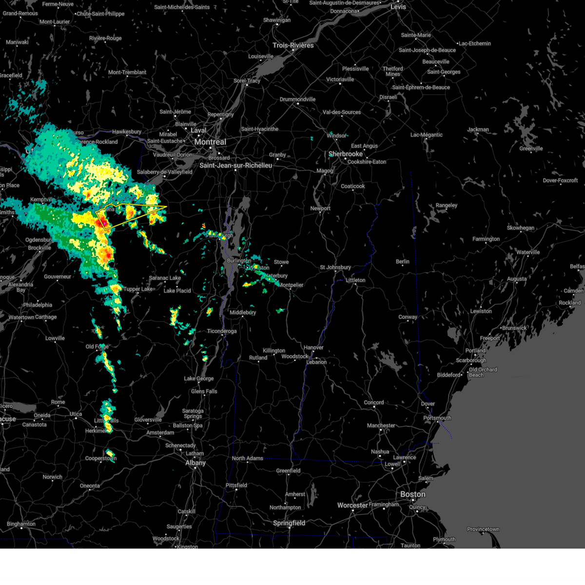
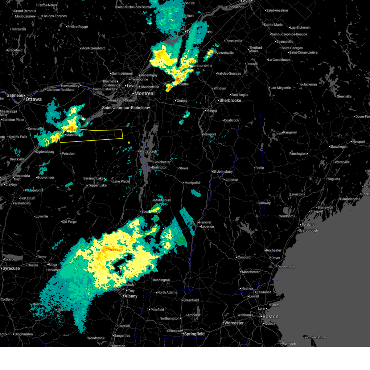
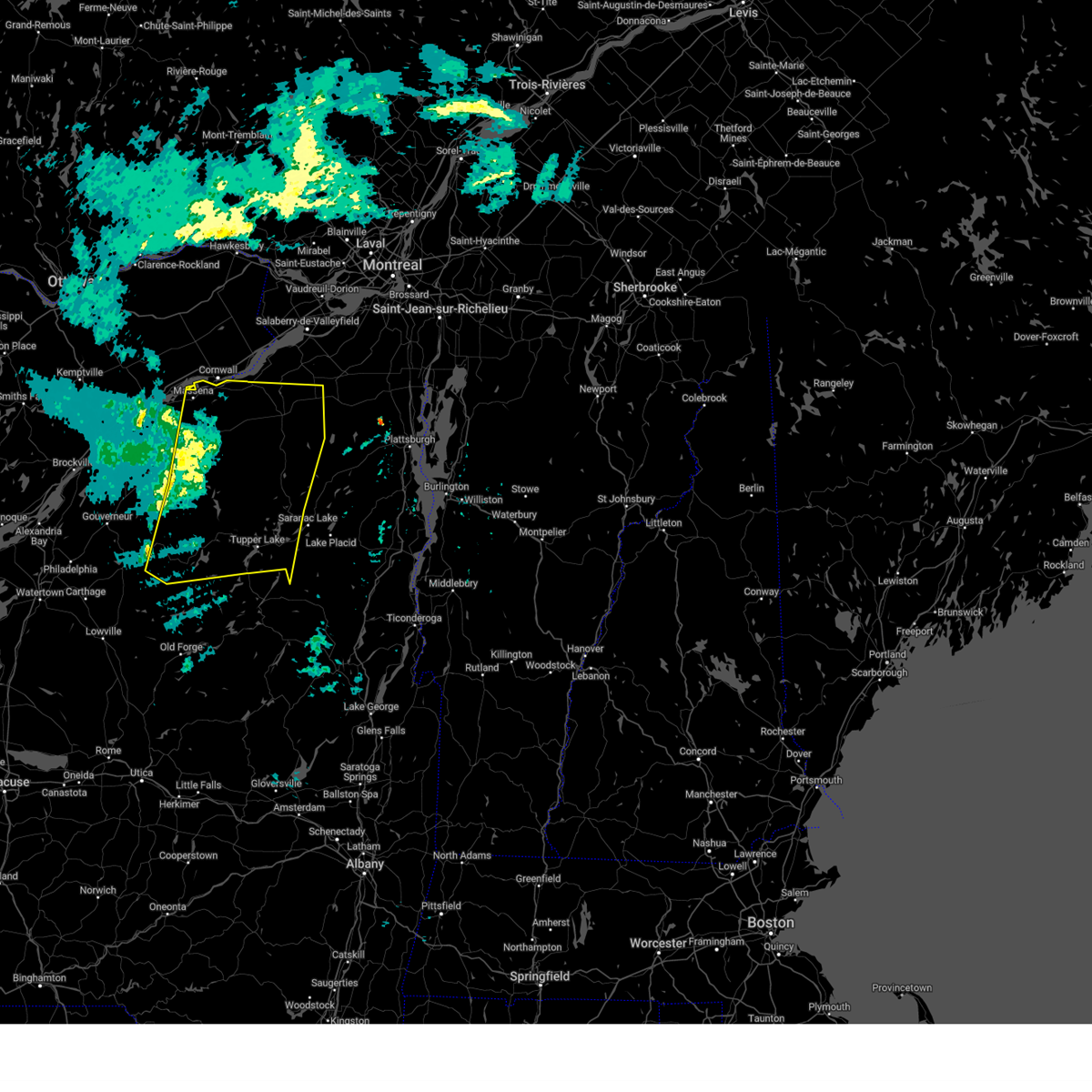
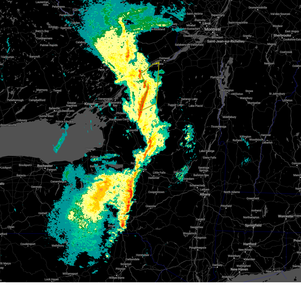
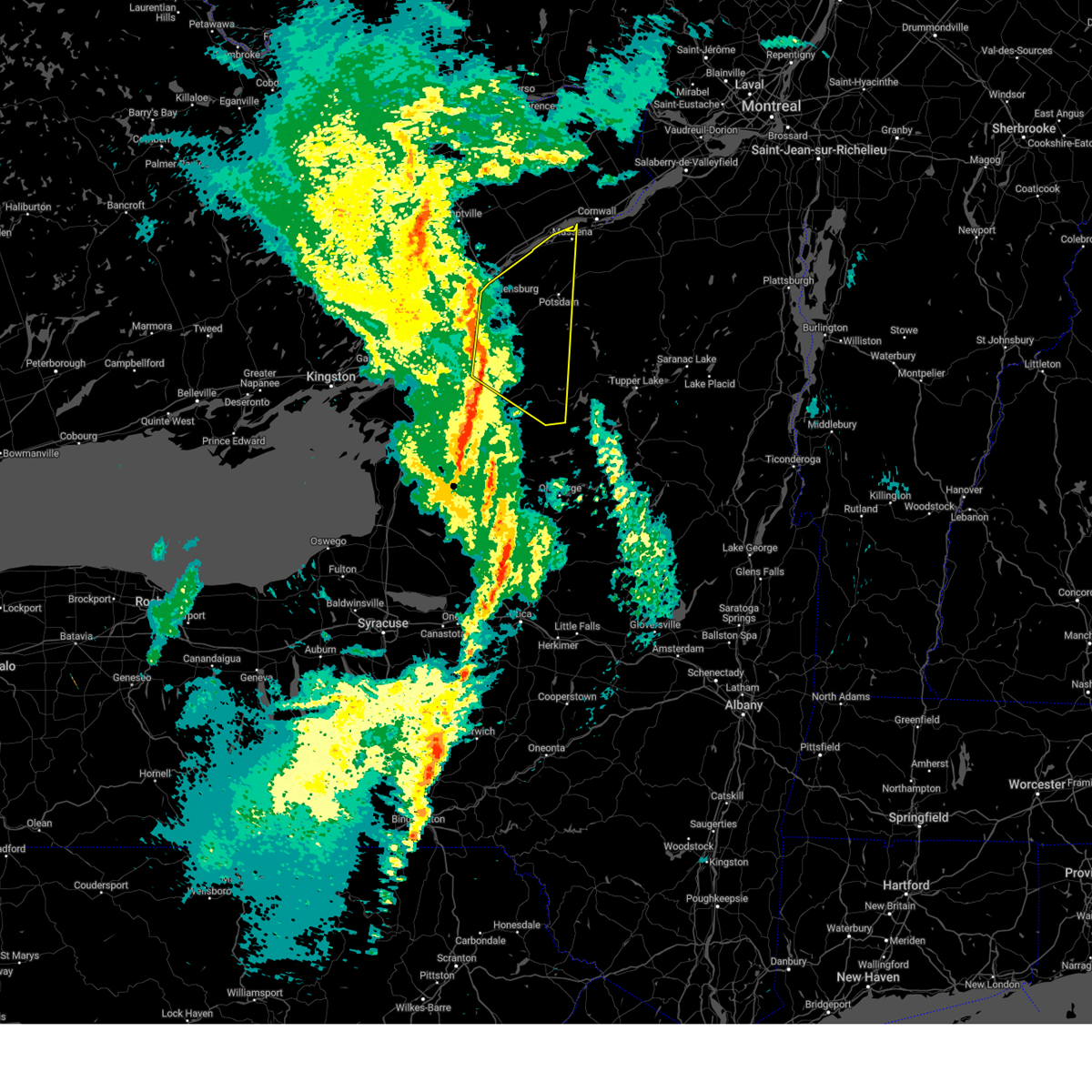
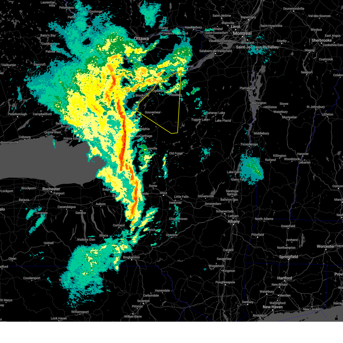
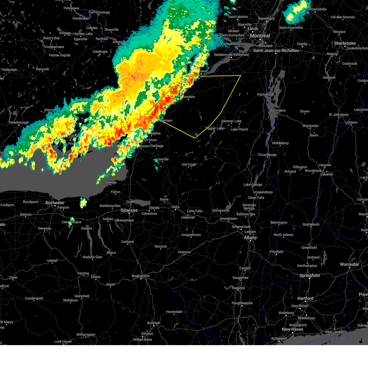
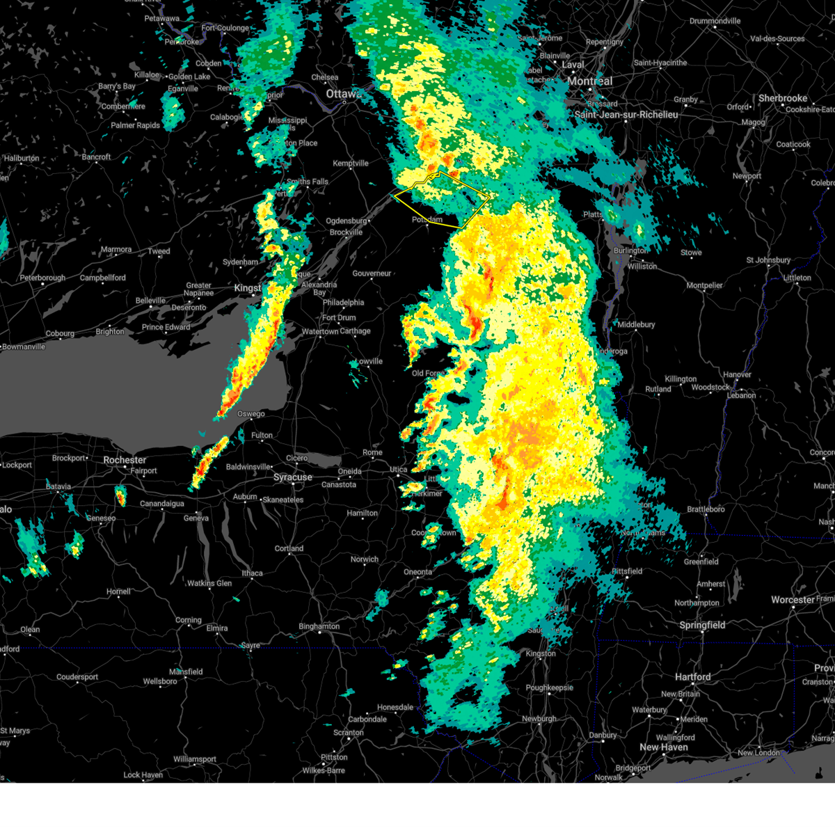
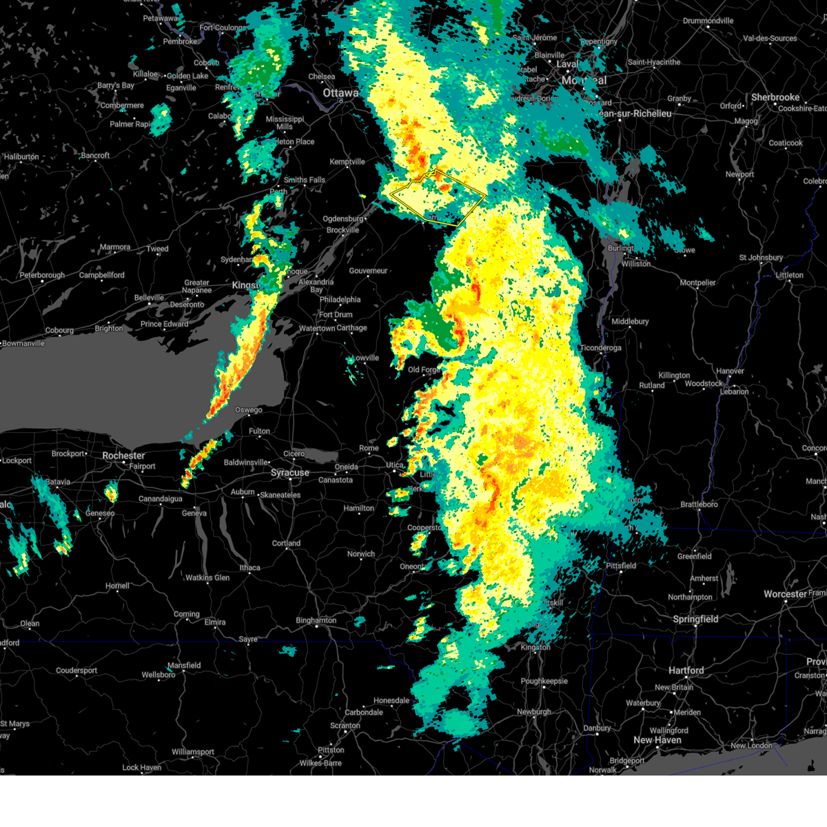
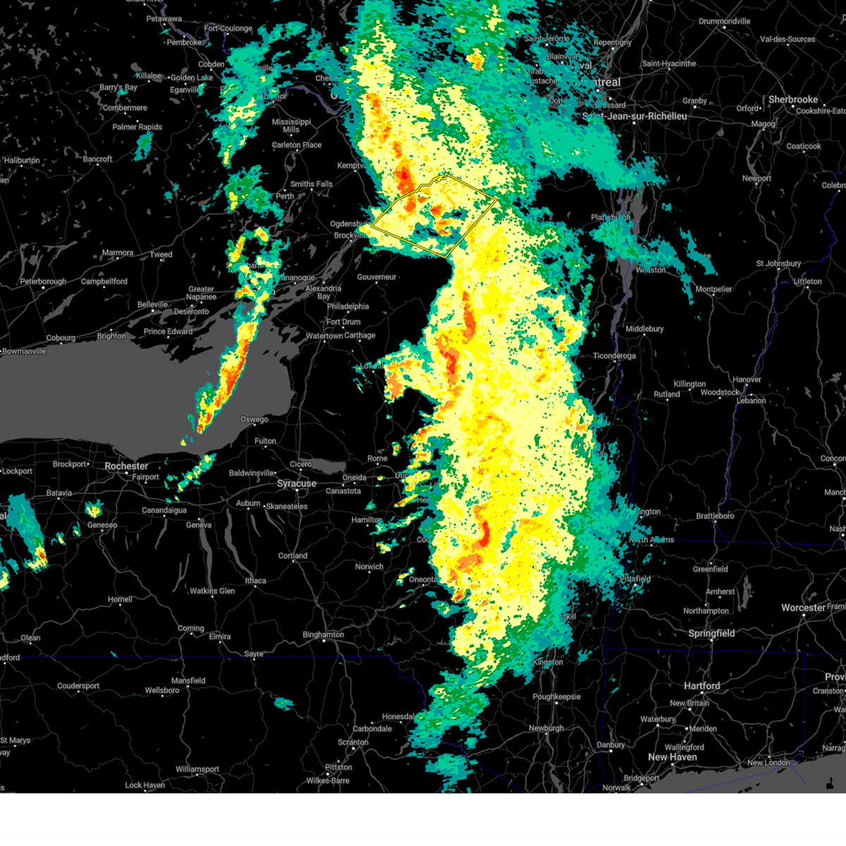
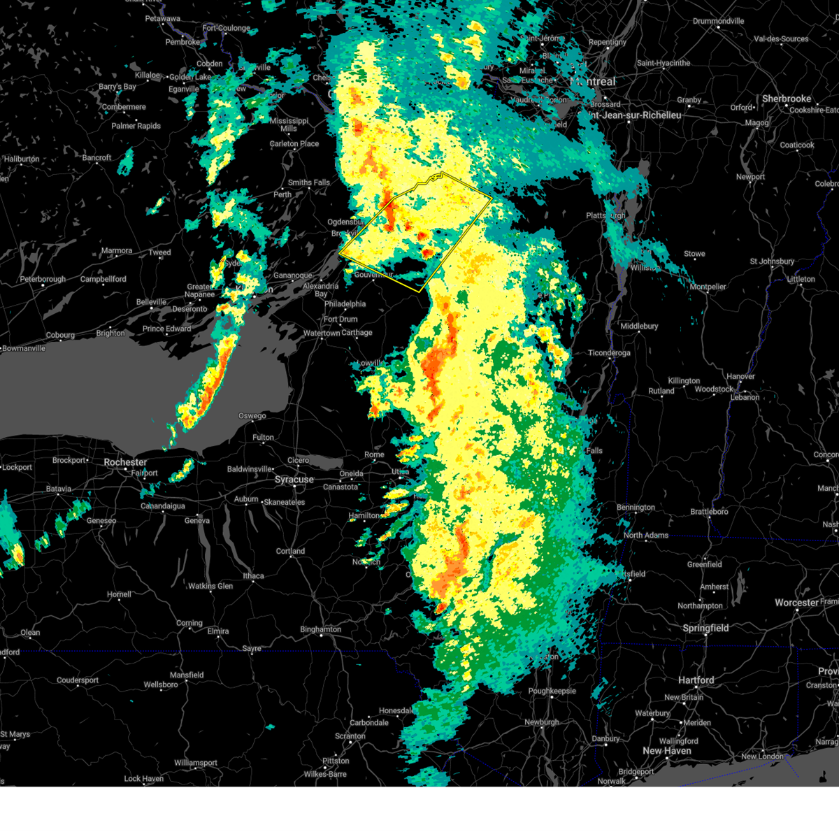
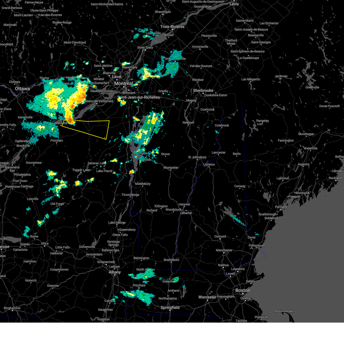
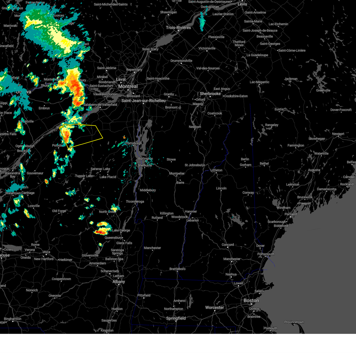
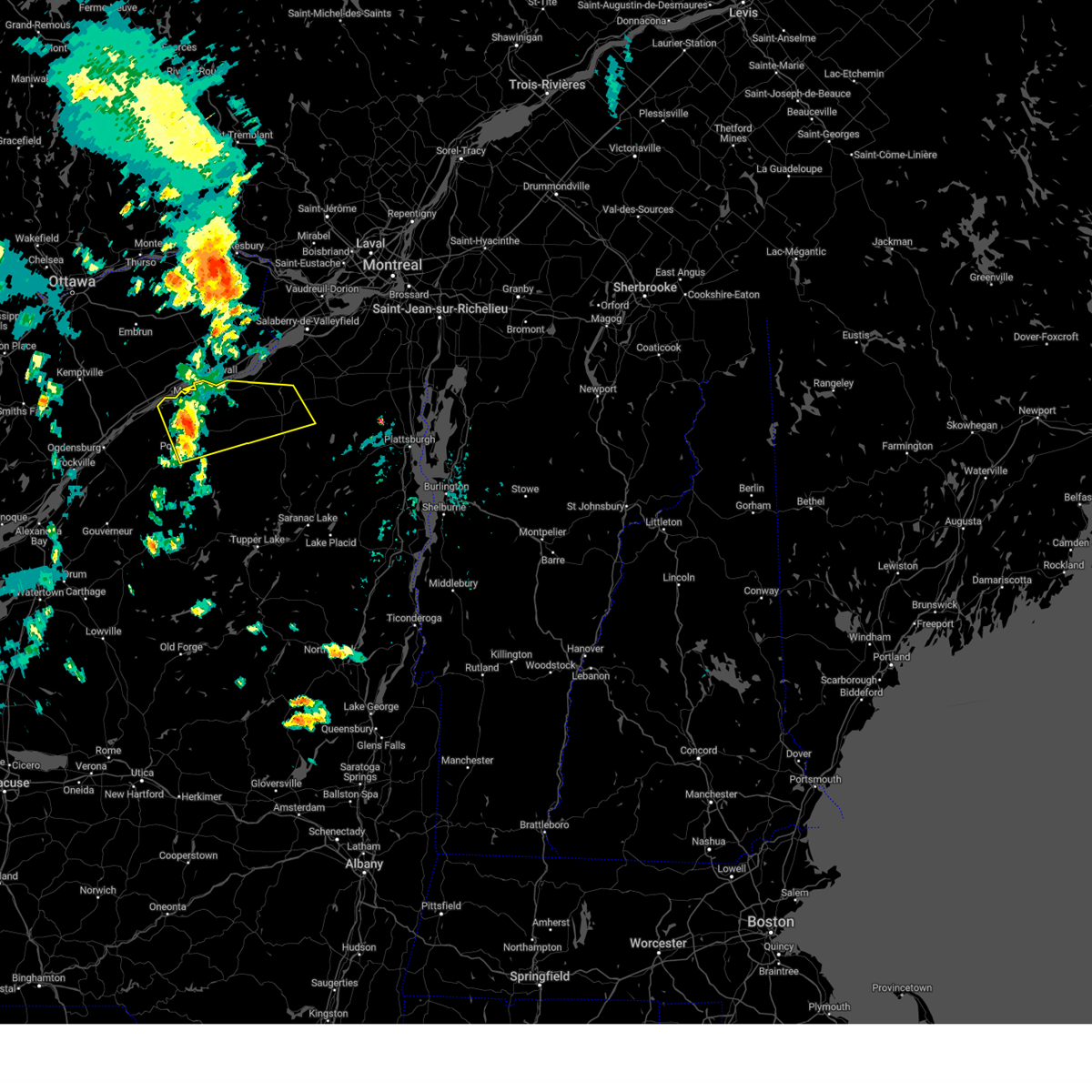
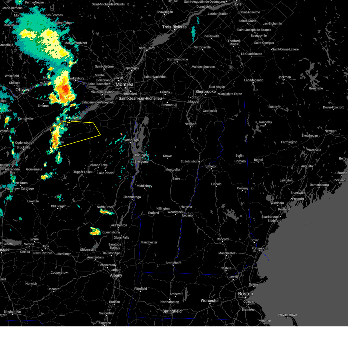
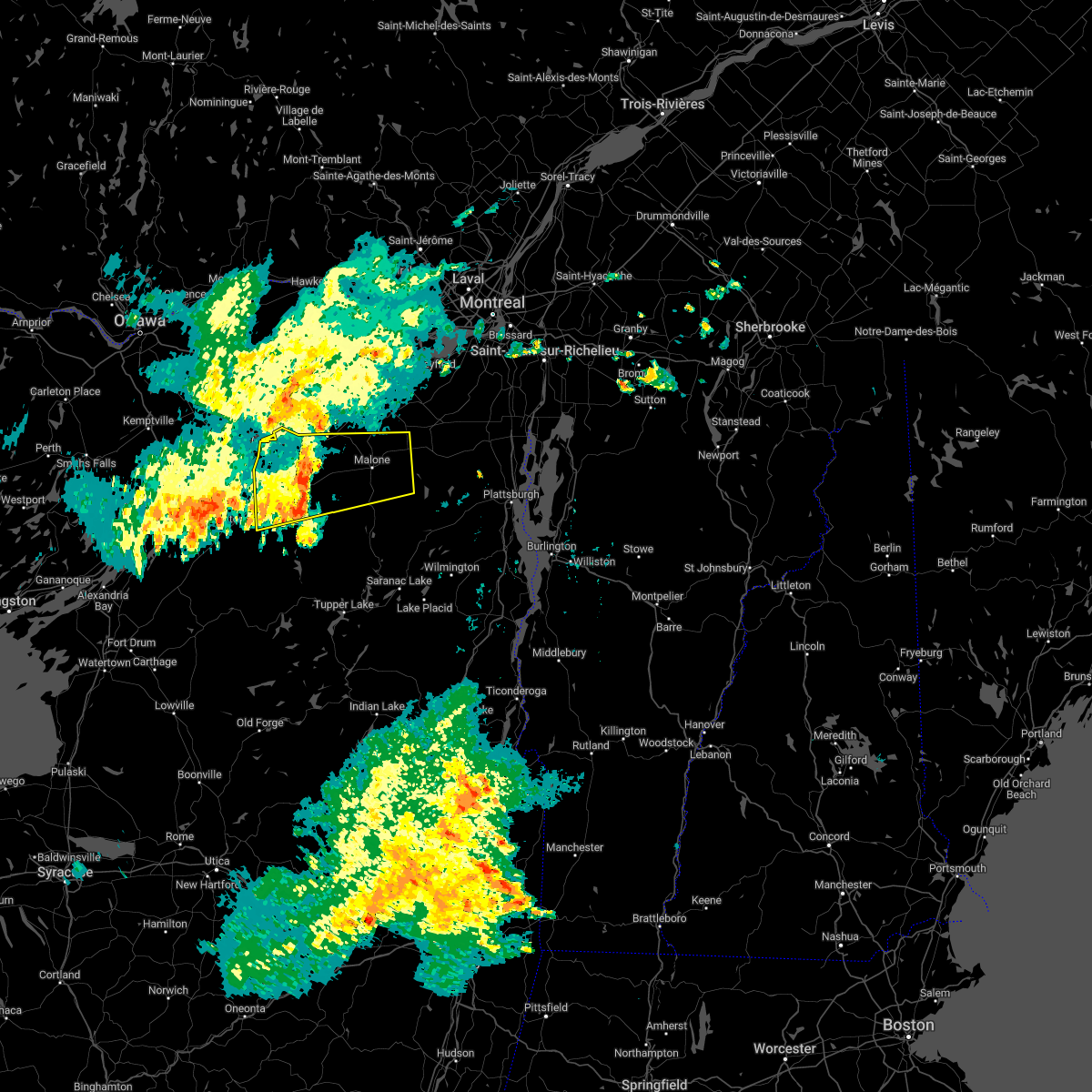
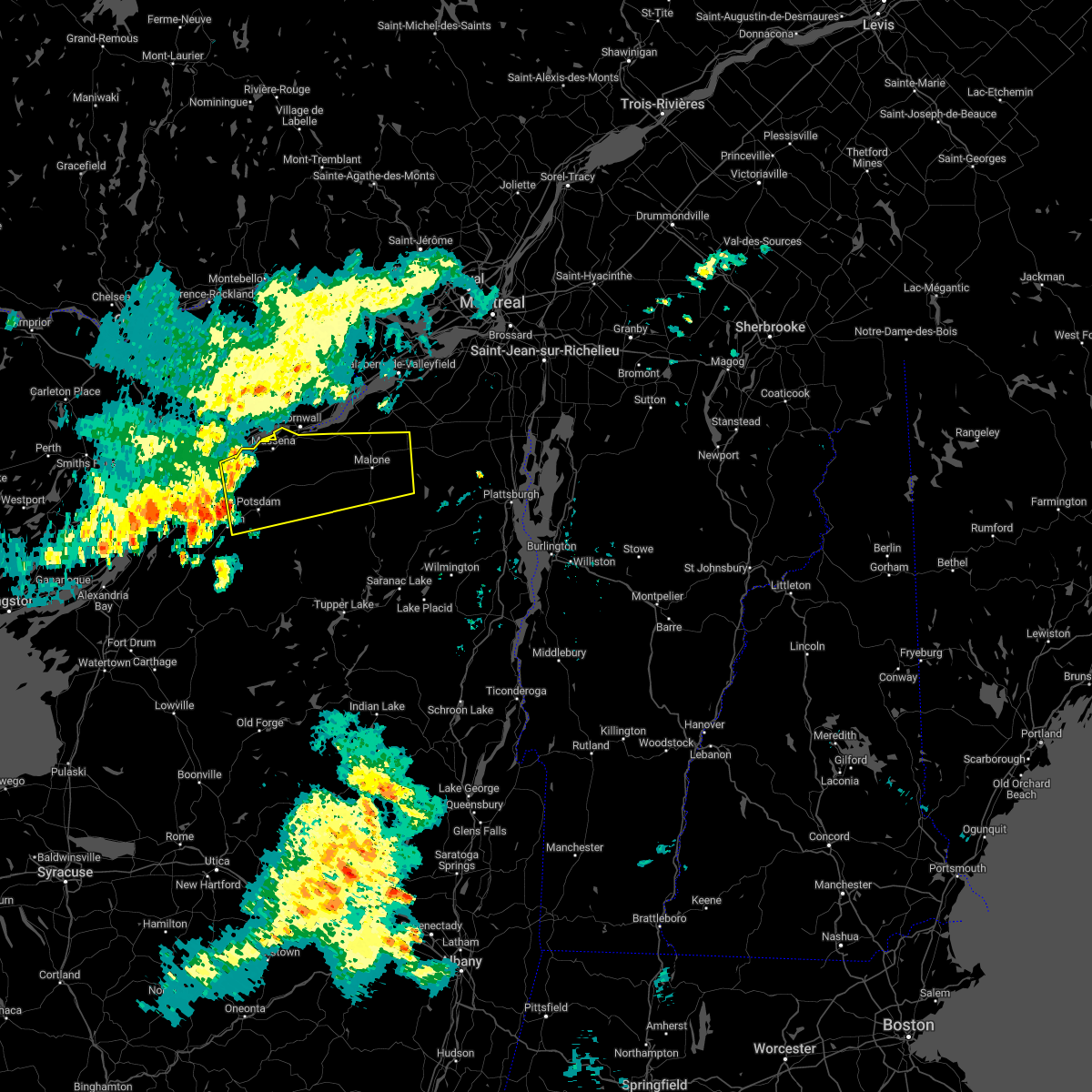
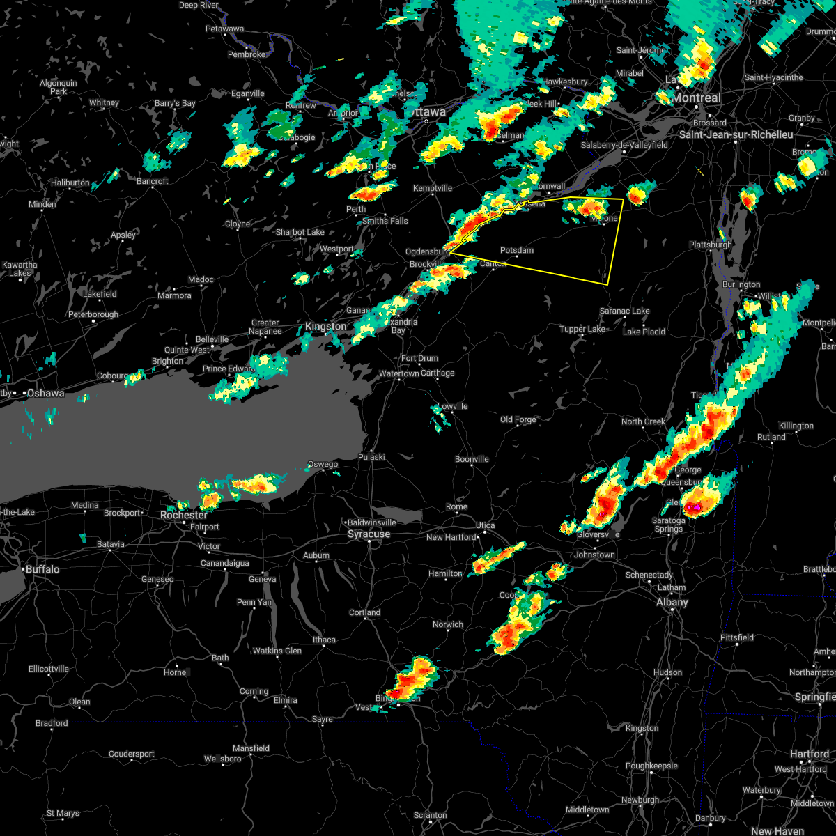
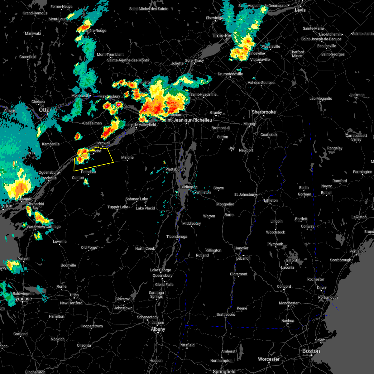
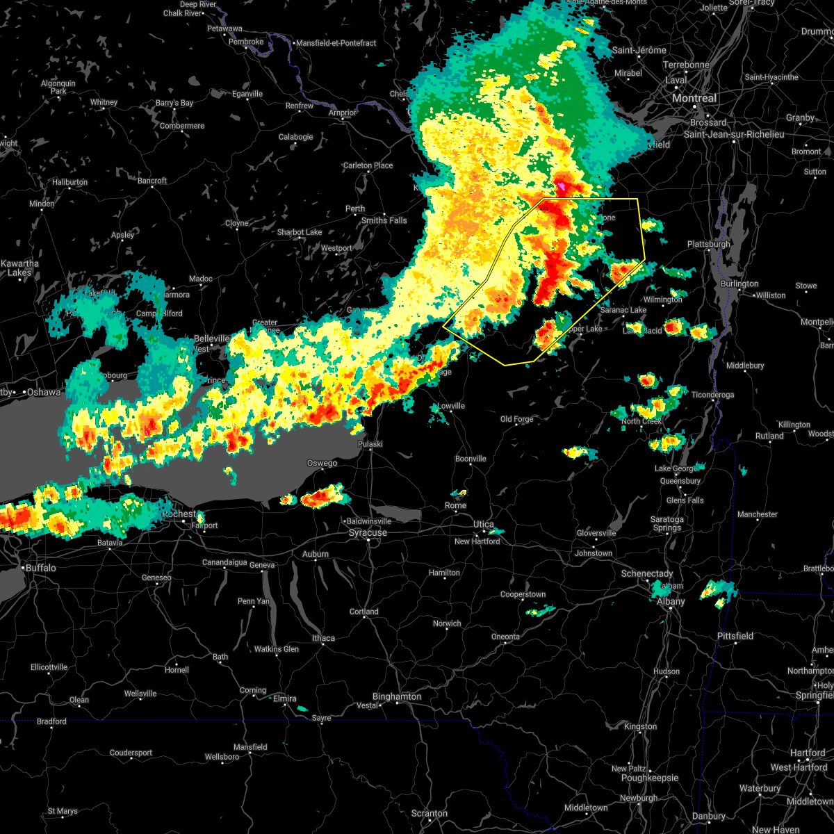
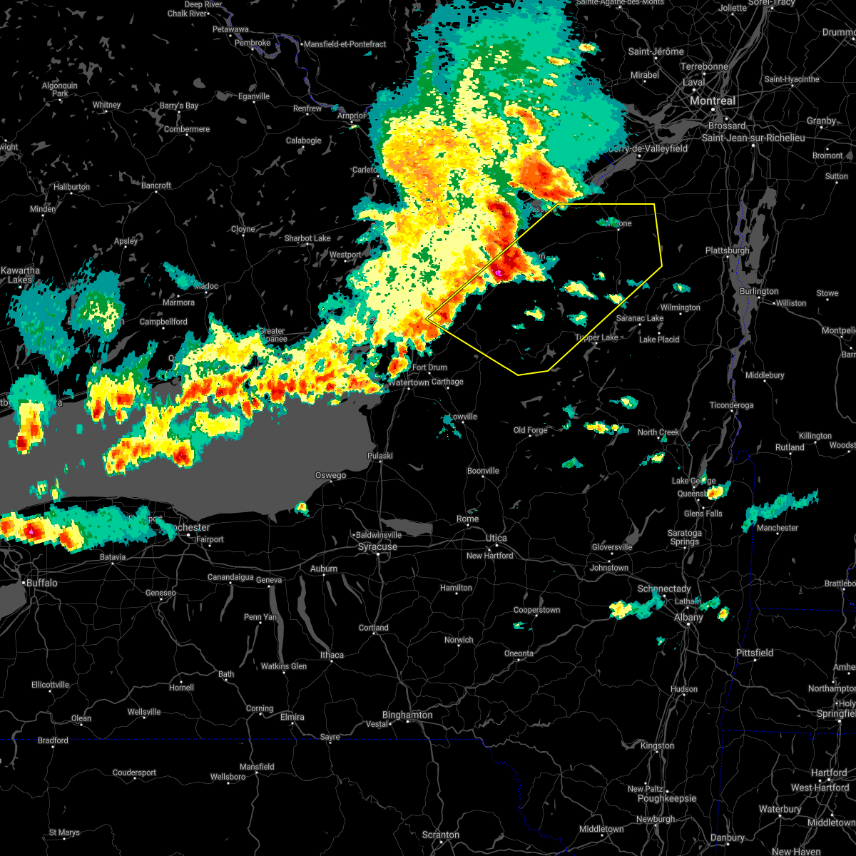
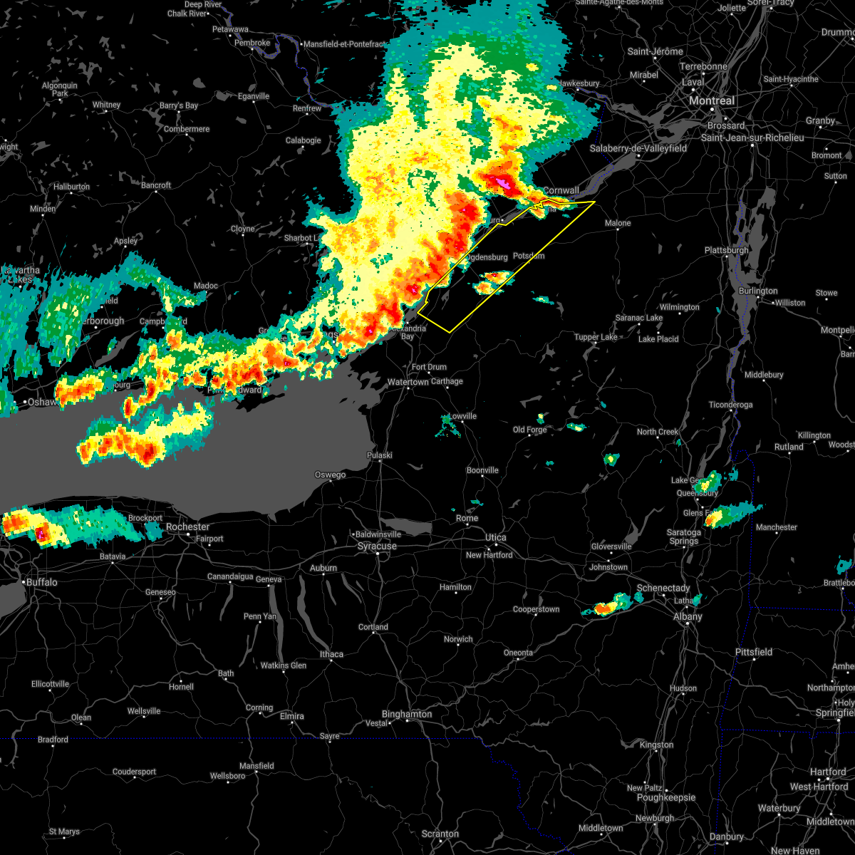
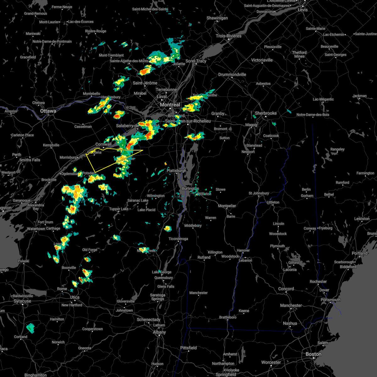
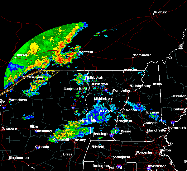
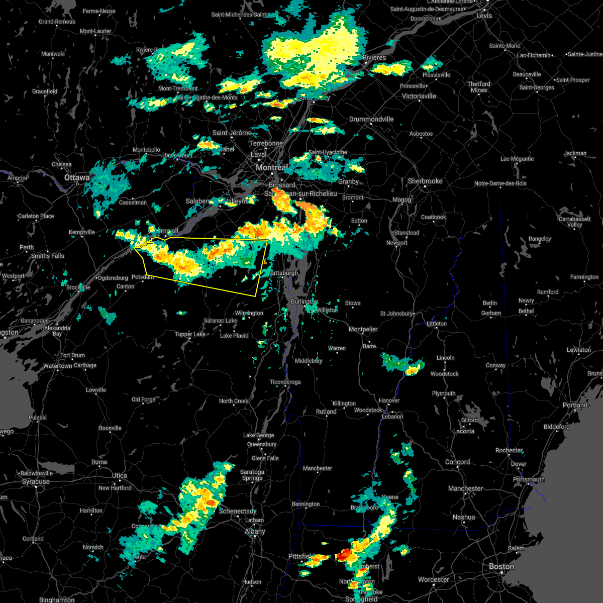
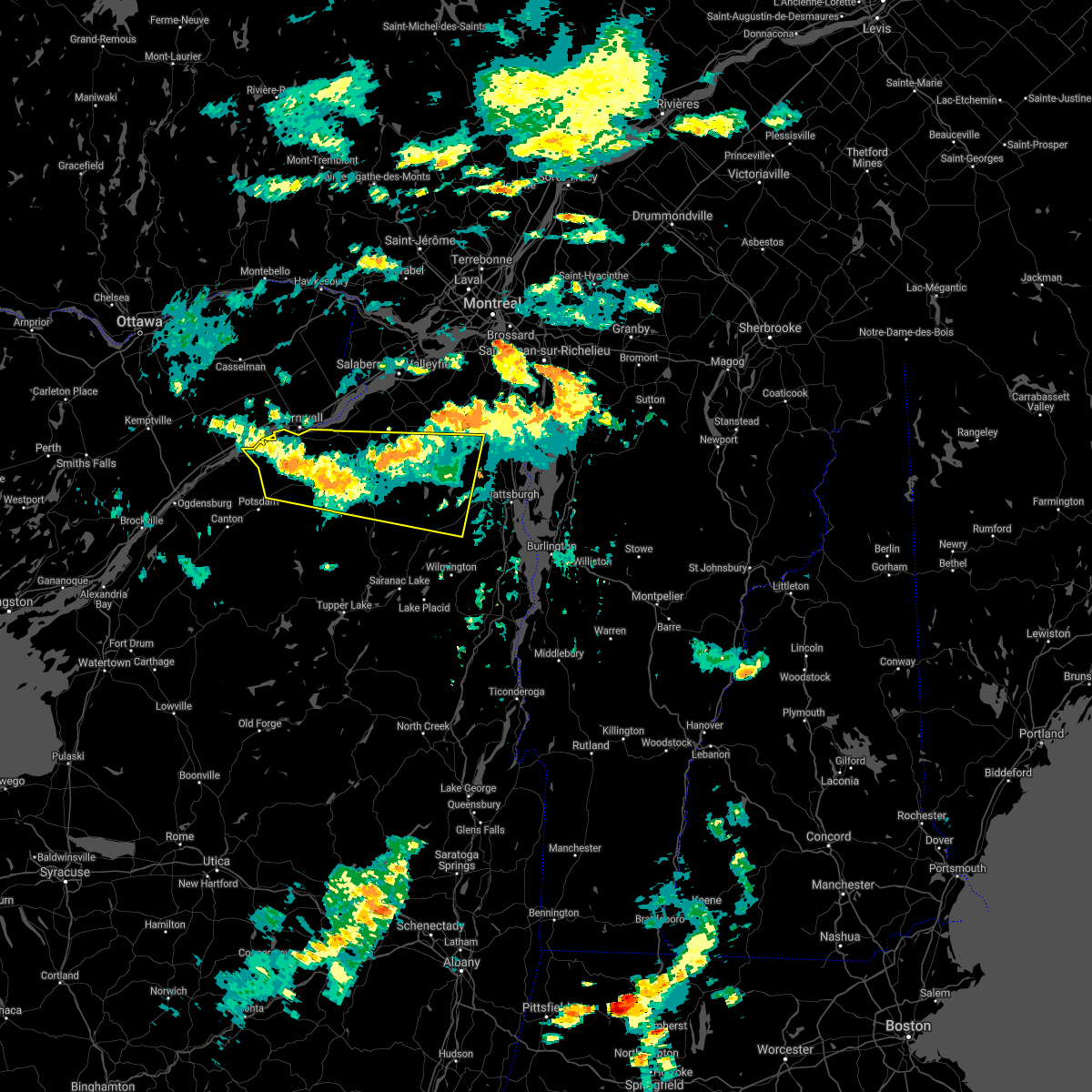
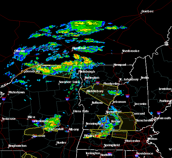
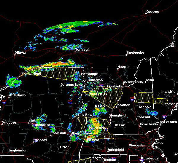
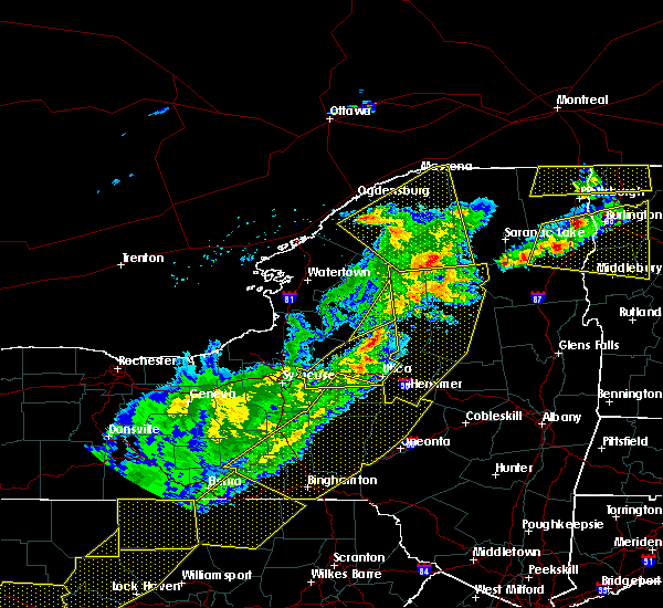
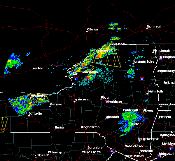
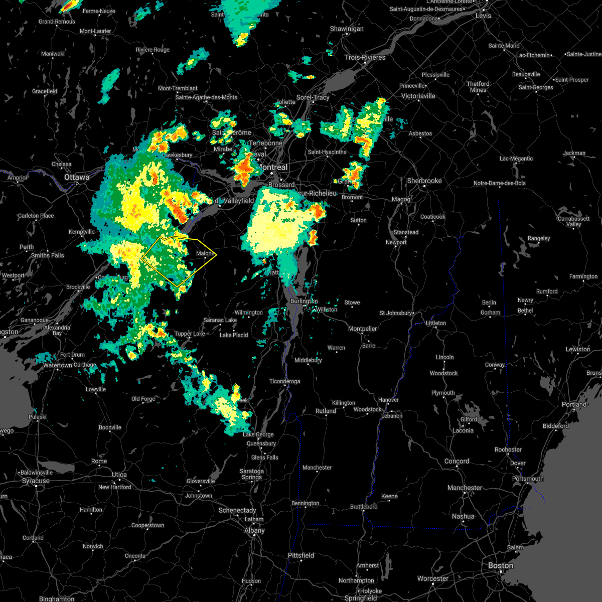
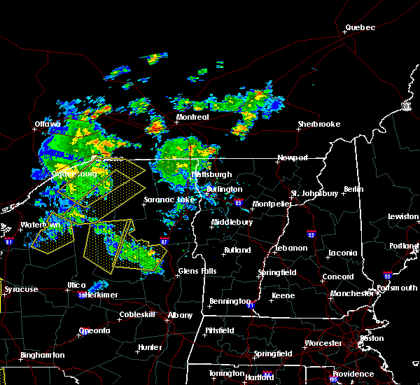
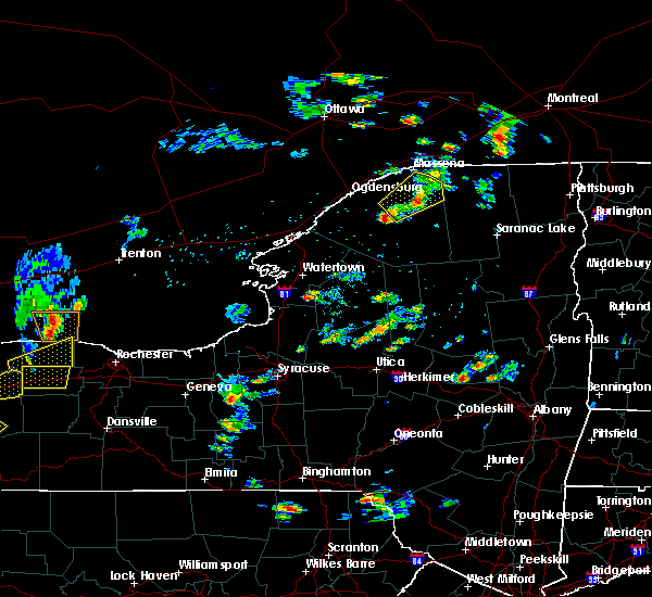
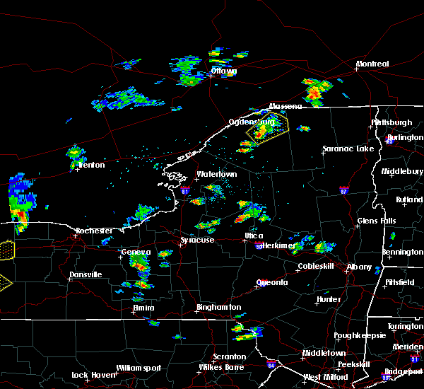
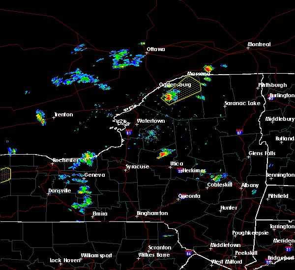
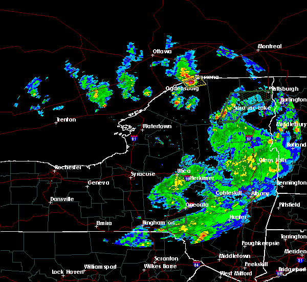
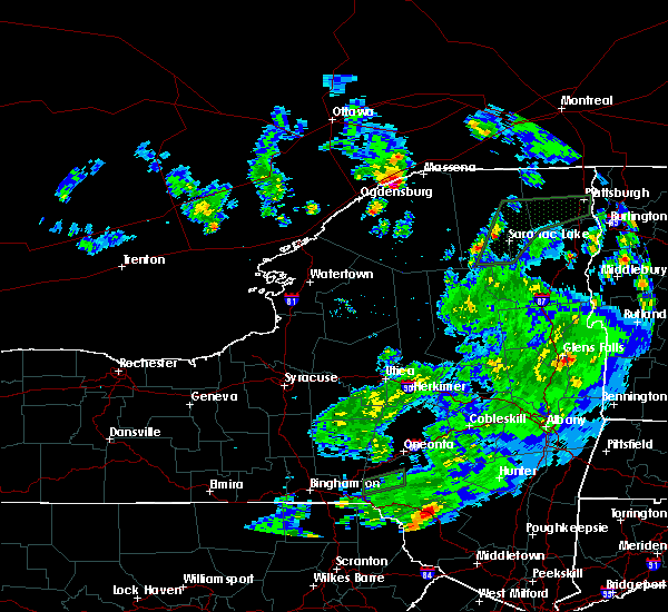
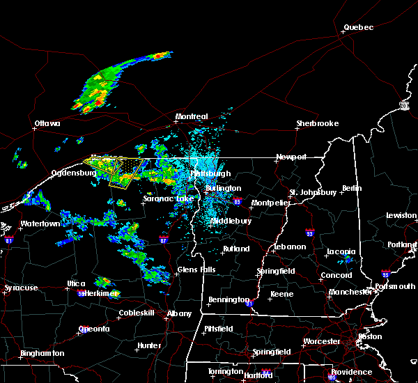
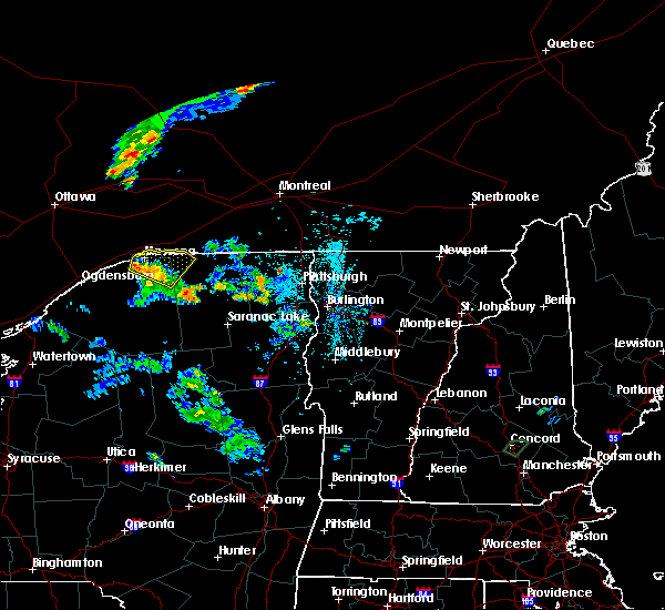
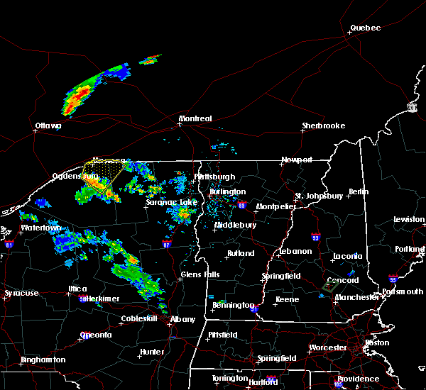
Hail Map for Massena, NY
The Massena, NY area has had 4 reports of on-the-ground hail by trained spotters, and has been under severe weather warnings 2 times during the past 12 months. Doppler radar has detected hail at or near Massena, NY on 6 occasions.
| Name: | Massena, NY |
| Where Located: | 33.5 miles ENE of Ogdensburg, NY |
| Map: | Google Map for Massena, NY |
| Population: | 10936 |
| Housing Units: | 5014 |
| More Info: | Search Google for Massena, NY |
3
The Top Recent Hail Date for Massena, NY is Saturday, May 17, 2025 (3rd out of 6)
Hail and Wind Damage Spotted near Massena, NY
| Date / Time | Report Details |
|---|---|
| 8/24/2025 5:47 PM EDT |
 At 547 pm edt, a severe thunderstorm was located over brasher falls, moving northeast at 30 mph (radar indicated). Hazards include 60 mph wind gusts and quarter size hail. Minor hail damage to vehicles is possible. expect wind damage to trees and powerlines. locations impacted include, massena international airport - richards field, massena village, norwood, brasher, massena, lawrence, moira, stockholm, norfolk, bombay, hopkinton, north stockholm, south bombay, brasher center, st. Lawrence state park, ironton, raquette river, helena, brasher falls, and winthrop. At 547 pm edt, a severe thunderstorm was located over brasher falls, moving northeast at 30 mph (radar indicated). Hazards include 60 mph wind gusts and quarter size hail. Minor hail damage to vehicles is possible. expect wind damage to trees and powerlines. locations impacted include, massena international airport - richards field, massena village, norwood, brasher, massena, lawrence, moira, stockholm, norfolk, bombay, hopkinton, north stockholm, south bombay, brasher center, st. Lawrence state park, ironton, raquette river, helena, brasher falls, and winthrop.
|
| 8/24/2025 5:16 PM EDT |
 Svrbtv the national weather service in burlington has issued a * severe thunderstorm warning for, northwestern franklin county in northern new york, northeastern st. lawrence county in northern new york, * until 600 pm edt. * at 516 pm edt, a severe thunderstorm was located over west parishville, moving northeast at 30 mph (radar indicated). Hazards include 60 mph wind gusts and quarter size hail. Minor hail damage to vehicles is possible. Expect wind damage to trees and powerlines. Svrbtv the national weather service in burlington has issued a * severe thunderstorm warning for, northwestern franklin county in northern new york, northeastern st. lawrence county in northern new york, * until 600 pm edt. * at 516 pm edt, a severe thunderstorm was located over west parishville, moving northeast at 30 mph (radar indicated). Hazards include 60 mph wind gusts and quarter size hail. Minor hail damage to vehicles is possible. Expect wind damage to trees and powerlines.
|
| 5/17/2025 9:10 AM EDT |
 Svrbtv the national weather service in burlington has issued a * severe thunderstorm warning for, northwestern franklin county in northern new york, northeastern st. lawrence county in northern new york, * until 1000 am edt. * at 909 am edt, a severe thunderstorm was located over massena international airport - richards field, moving northeast at 40 mph (radar indicated). Hazards include 60 mph wind gusts and quarter size hail. Minor hail damage to vehicles is possible. Expect wind damage to trees and powerlines. Svrbtv the national weather service in burlington has issued a * severe thunderstorm warning for, northwestern franklin county in northern new york, northeastern st. lawrence county in northern new york, * until 1000 am edt. * at 909 am edt, a severe thunderstorm was located over massena international airport - richards field, moving northeast at 40 mph (radar indicated). Hazards include 60 mph wind gusts and quarter size hail. Minor hail damage to vehicles is possible. Expect wind damage to trees and powerlines.
|
| 4/29/2025 8:34 PM EDT |
 Svrbtv the national weather service in burlington has issued a * severe thunderstorm warning for, northwestern clinton county in northern new york, northern franklin county in northern new york, northeastern st. lawrence county in northern new york, * until 915 pm edt. * at 834 pm edt, a severe thunderstorm was located over massena village, moving east at 65 mph (radar indicated). Hazards include 60 mph wind gusts. expect damage to trees and powerlines Svrbtv the national weather service in burlington has issued a * severe thunderstorm warning for, northwestern clinton county in northern new york, northern franklin county in northern new york, northeastern st. lawrence county in northern new york, * until 915 pm edt. * at 834 pm edt, a severe thunderstorm was located over massena village, moving east at 65 mph (radar indicated). Hazards include 60 mph wind gusts. expect damage to trees and powerlines
|
| 3/16/2025 6:13 PM EDT |
 Svrbtv the national weather service in burlington has issued a * severe thunderstorm warning for, franklin county in northern new york, eastern st. lawrence county in northern new york, western essex county in northern new york, * until 700 pm edt. * at 612 pm edt, severe thunderstorms were located along a line extending from 8 miles north of st. lawrence state park to pierrepont to near lower oswegatchie, moving east at 55 mph (radar indicated). Hazards include 60 mph wind gusts. expect damage to trees and powerlines Svrbtv the national weather service in burlington has issued a * severe thunderstorm warning for, franklin county in northern new york, eastern st. lawrence county in northern new york, western essex county in northern new york, * until 700 pm edt. * at 612 pm edt, severe thunderstorms were located along a line extending from 8 miles north of st. lawrence state park to pierrepont to near lower oswegatchie, moving east at 55 mph (radar indicated). Hazards include 60 mph wind gusts. expect damage to trees and powerlines
|
| 3/16/2025 6:05 PM EDT |
 At 604 pm edt, severe thunderstorms were located along a line extending from near waddington to near north russell to near pitcairn, moving northeast at 70 mph (radar indicated). Hazards include 60 mph wind gusts. Expect damage to trees and powerlines. Locations impacted include, north stockholm, morley, potsdam, massena village, louisville, west parishville, clare, south edwards, degrasse, norwood, pierrepont, west stockholm, west potsdam, chipman, potsdam village, west pierrepont, waddington, higley flow state park, russell, and north russell. At 604 pm edt, severe thunderstorms were located along a line extending from near waddington to near north russell to near pitcairn, moving northeast at 70 mph (radar indicated). Hazards include 60 mph wind gusts. Expect damage to trees and powerlines. Locations impacted include, north stockholm, morley, potsdam, massena village, louisville, west parishville, clare, south edwards, degrasse, norwood, pierrepont, west stockholm, west potsdam, chipman, potsdam village, west pierrepont, waddington, higley flow state park, russell, and north russell.
|
| 3/16/2025 5:45 PM EDT |
 At 544 pm edt, severe thunderstorms were located along a line extending from heuvelton to 30 miles southwest of pitcairn, moving northeast at 60 mph (radar indicated). Hazards include 60 mph wind gusts. Expect damage to trees and powerlines. Locations impacted include, de peyster, morley, potsdam, massena village, talcville, south edwards, degrasse, pierrepont, west stockholm, west potsdam, newton falls, north gouverneur, west fowler, west pierrepont, east de kalb, aldrich, lisbon, waddington, richville, and russell. At 544 pm edt, severe thunderstorms were located along a line extending from heuvelton to 30 miles southwest of pitcairn, moving northeast at 60 mph (radar indicated). Hazards include 60 mph wind gusts. Expect damage to trees and powerlines. Locations impacted include, de peyster, morley, potsdam, massena village, talcville, south edwards, degrasse, pierrepont, west stockholm, west potsdam, newton falls, north gouverneur, west fowler, west pierrepont, east de kalb, aldrich, lisbon, waddington, richville, and russell.
|
| 3/16/2025 5:17 PM EDT |
 Svrbtv the national weather service in burlington has issued a * severe thunderstorm warning for, st. lawrence county in northern new york, * until 615 pm edt. * at 516 pm edt, severe thunderstorms were located along a line extending from 11 miles southwest of cedar island state park to 61 miles southwest of west fowler, moving northeast at 60 mph (radar indicated). Hazards include 60 mph wind gusts. expect damage to trees and powerlines Svrbtv the national weather service in burlington has issued a * severe thunderstorm warning for, st. lawrence county in northern new york, * until 615 pm edt. * at 516 pm edt, severe thunderstorms were located along a line extending from 11 miles southwest of cedar island state park to 61 miles southwest of west fowler, moving northeast at 60 mph (radar indicated). Hazards include 60 mph wind gusts. expect damage to trees and powerlines
|
| 6/13/2024 11:08 PM EDT |
 Svrbtv the national weather service in burlington has issued a * severe thunderstorm warning for, northwestern clinton county in northern new york, northern franklin county in northern new york, st. lawrence county in northern new york, * until midnight edt. * at 1108 pm edt, severe thunderstorms were located along a line extending from massena to waddington to near heuvelton to near hammond, moving southeast at 40 mph (radar indicated). Hazards include 60 mph wind gusts. expect damage to trees and powerlines Svrbtv the national weather service in burlington has issued a * severe thunderstorm warning for, northwestern clinton county in northern new york, northern franklin county in northern new york, st. lawrence county in northern new york, * until midnight edt. * at 1108 pm edt, severe thunderstorms were located along a line extending from massena to waddington to near heuvelton to near hammond, moving southeast at 40 mph (radar indicated). Hazards include 60 mph wind gusts. expect damage to trees and powerlines
|
| 5/27/2024 4:38 PM EDT |
 The storm which prompted the warning has moved out of the area. therefore, the warning will be allowed to expire. a severe thunderstorm watch remains in effect until 900 pm edt for northern new york. The storm which prompted the warning has moved out of the area. therefore, the warning will be allowed to expire. a severe thunderstorm watch remains in effect until 900 pm edt for northern new york.
|
| 5/27/2024 4:27 PM EDT |
 At 426 pm edt, a severe thunderstorm was located near eisenhower lock, moving northeast at 45 mph (radar indicated). Hazards include 60 mph wind gusts and penny size hail. Expect damage to trees and powerlines. Locations impacted include, massena, norfolk, louisville, moira, norwood, massena international airport - richards field, helena, brasher falls, waddington, brushton, lawrenceville, madrid, dickinson, hopkinton, north stockholm, brasher center, west stockholm, ironton, coles creek state park, and raquette river. At 426 pm edt, a severe thunderstorm was located near eisenhower lock, moving northeast at 45 mph (radar indicated). Hazards include 60 mph wind gusts and penny size hail. Expect damage to trees and powerlines. Locations impacted include, massena, norfolk, louisville, moira, norwood, massena international airport - richards field, helena, brasher falls, waddington, brushton, lawrenceville, madrid, dickinson, hopkinton, north stockholm, brasher center, west stockholm, ironton, coles creek state park, and raquette river.
|
| 5/27/2024 4:20 PM EDT | Downed powerlines in st. lawrence county NY, 0.2 miles SW of Massena, NY |
| 5/27/2024 4:12 PM EDT |
 At 411 pm edt, a severe thunderstorm was located near coles creek state park, moving northeast at 45 mph (radar indicated). Hazards include 60 mph wind gusts and penny size hail. Expect damage to trees and powerlines. Locations impacted include, potsdam, massena, canton, ogdensburg, norfolk, lisbon, louisville, moira, parishville, colton, morley, norwood, massena international airport - richards field, helena, chipman, brasher falls, waddington, madrid, brushton, and lawrenceville. At 411 pm edt, a severe thunderstorm was located near coles creek state park, moving northeast at 45 mph (radar indicated). Hazards include 60 mph wind gusts and penny size hail. Expect damage to trees and powerlines. Locations impacted include, potsdam, massena, canton, ogdensburg, norfolk, lisbon, louisville, moira, parishville, colton, morley, norwood, massena international airport - richards field, helena, chipman, brasher falls, waddington, madrid, brushton, and lawrenceville.
|
| 5/27/2024 3:55 PM EDT |
 Svrbtv the national weather service in burlington has issued a * severe thunderstorm warning for, northwestern franklin county in northern new york, central st. lawrence county in northern new york, * until 445 pm edt. * at 354 pm edt, a severe thunderstorm was located over morley, moving northeast at 45 mph (radar indicated). Hazards include 60 mph wind gusts and penny size hail. expect damage to trees and powerlines Svrbtv the national weather service in burlington has issued a * severe thunderstorm warning for, northwestern franklin county in northern new york, central st. lawrence county in northern new york, * until 445 pm edt. * at 354 pm edt, a severe thunderstorm was located over morley, moving northeast at 45 mph (radar indicated). Hazards include 60 mph wind gusts and penny size hail. expect damage to trees and powerlines
|
| 5/21/2024 7:11 PM EDT |
 Svrbtv the national weather service in burlington has issued a * severe thunderstorm warning for, northwestern clinton county in northern new york, northern franklin county in northern new york, northeastern st. lawrence county in northern new york, * until 815 pm edt. * at 711 pm edt, a severe thunderstorm was located over st. regis, moving east at 35 mph (radar indicated). Hazards include 60 mph wind gusts and quarter size hail. Minor hail damage to vehicles is possible. Expect wind damage to trees and powerlines. Svrbtv the national weather service in burlington has issued a * severe thunderstorm warning for, northwestern clinton county in northern new york, northern franklin county in northern new york, northeastern st. lawrence county in northern new york, * until 815 pm edt. * at 711 pm edt, a severe thunderstorm was located over st. regis, moving east at 35 mph (radar indicated). Hazards include 60 mph wind gusts and quarter size hail. Minor hail damage to vehicles is possible. Expect wind damage to trees and powerlines.
|
| 7/13/2023 2:36 PM EDT |
 At 235 pm edt, a severe thunderstorm was located over brasher center, moving northeast at 35 mph (public reported a funnel cloud not reaching the ground with this storm at 212 pm). Hazards include 60 mph wind gusts and quarter size hail. Minor hail damage to vehicles is possible. expect wind damage to trees and powerlines. locations impacted include, massena, moira, bangor, fort covington, bombay, malone, massena international airport - richards field, helena, brasher falls, burke, st. Regis, brushton, lawrenceville, dickinson, constable, hopkinton, fort covington center, west bangor, dickinson center, and south bombay. At 235 pm edt, a severe thunderstorm was located over brasher center, moving northeast at 35 mph (public reported a funnel cloud not reaching the ground with this storm at 212 pm). Hazards include 60 mph wind gusts and quarter size hail. Minor hail damage to vehicles is possible. expect wind damage to trees and powerlines. locations impacted include, massena, moira, bangor, fort covington, bombay, malone, massena international airport - richards field, helena, brasher falls, burke, st. Regis, brushton, lawrenceville, dickinson, constable, hopkinton, fort covington center, west bangor, dickinson center, and south bombay.
|
| 7/13/2023 2:33 PM EDT | Sumac trees blown dow in st. lawrence county NY, 4 miles N of Massena, NY |
| 7/13/2023 2:23 PM EDT |
 At 222 pm edt, a severe thunderstorm was located over norfolk, moving northeast at 35 mph (radar indicated). Hazards include 60 mph wind gusts and quarter size hail. Minor hail damage to vehicles is possible. expect wind damage to trees and powerlines. locations impacted include, potsdam, massena, norfolk, louisville, moira, bangor, fort covington, bombay, malone, norwood, massena international airport - richards field, helena, brasher falls, burke, st. Regis, brushton, lawrenceville, madrid, waddington, and dickinson. At 222 pm edt, a severe thunderstorm was located over norfolk, moving northeast at 35 mph (radar indicated). Hazards include 60 mph wind gusts and quarter size hail. Minor hail damage to vehicles is possible. expect wind damage to trees and powerlines. locations impacted include, potsdam, massena, norfolk, louisville, moira, bangor, fort covington, bombay, malone, norwood, massena international airport - richards field, helena, brasher falls, burke, st. Regis, brushton, lawrenceville, madrid, waddington, and dickinson.
|
| 7/13/2023 2:17 PM EDT |
 At 217 pm edt, a severe thunderstorm was located over norfolk, moving northeast at 35 mph (radar indicated). Hazards include 60 mph wind gusts and quarter size hail. Minor hail damage to vehicles is possible. Expect wind damage to trees and powerlines. At 217 pm edt, a severe thunderstorm was located over norfolk, moving northeast at 35 mph (radar indicated). Hazards include 60 mph wind gusts and quarter size hail. Minor hail damage to vehicles is possible. Expect wind damage to trees and powerlines.
|
| 7/28/2022 2:34 PM EDT |
 At 233 pm edt, a severe thunderstorm was located over raymondville, moving east at 40 mph (law enforcement reported downed trees and powerlines in lisbon at 205 pm). Hazards include 60 mph wind gusts and quarter size hail. Minor hail damage to vehicles is possible. expect wind damage to trees and powerlines. locations impacted include, potsdam, gouverneur, massena, canton, norfolk, lisbon, louisville, de kalb, fowler, rensselaer falls, morley, norwood, massena international airport - richards field, hermon, helena, chipman, brasher falls, heuvelton, waddington and richville. hail threat, radar indicated max hail size, 1. 00 in wind threat, radar indicated max wind gust, 60 mph. At 233 pm edt, a severe thunderstorm was located over raymondville, moving east at 40 mph (law enforcement reported downed trees and powerlines in lisbon at 205 pm). Hazards include 60 mph wind gusts and quarter size hail. Minor hail damage to vehicles is possible. expect wind damage to trees and powerlines. locations impacted include, potsdam, gouverneur, massena, canton, norfolk, lisbon, louisville, de kalb, fowler, rensselaer falls, morley, norwood, massena international airport - richards field, hermon, helena, chipman, brasher falls, heuvelton, waddington and richville. hail threat, radar indicated max hail size, 1. 00 in wind threat, radar indicated max wind gust, 60 mph.
|
| 7/28/2022 1:38 PM EDT |
 At 137 pm edt, a cluster of severe thunderstorms was located 12 miles southwest of south hammond, moving northeast at 25 mph (radar indicated). Hazards include 60 mph wind gusts and quarter size hail. Minor hail damage to vehicles is possible. Expect wind damage to trees and powerlines. At 137 pm edt, a cluster of severe thunderstorms was located 12 miles southwest of south hammond, moving northeast at 25 mph (radar indicated). Hazards include 60 mph wind gusts and quarter size hail. Minor hail damage to vehicles is possible. Expect wind damage to trees and powerlines.
|
| 7/24/2022 11:54 PM EDT |
 At 1153 pm edt, a severe thunderstorm was located over north stockholm, moving east at 50 mph (radar indicated). Hazards include 70 mph wind gusts. Expect considerable tree damage. damage is likely to mobile homes, roofs, and outbuildings. locations impacted include, potsdam, massena, norfolk, moira, bangor, parishville, fort covington, bombay, massena international airport - richards field, helena, burke, brushton, lawrenceville, malone, chateaugay, norwood, brasher falls, dickinson, constable and hopkinton. thunderstorm damage threat, considerable hail threat, radar indicated max hail size, <. 75 in wind threat, radar indicated max wind gust, 70 mph. At 1153 pm edt, a severe thunderstorm was located over north stockholm, moving east at 50 mph (radar indicated). Hazards include 70 mph wind gusts. Expect considerable tree damage. damage is likely to mobile homes, roofs, and outbuildings. locations impacted include, potsdam, massena, norfolk, moira, bangor, parishville, fort covington, bombay, massena international airport - richards field, helena, burke, brushton, lawrenceville, malone, chateaugay, norwood, brasher falls, dickinson, constable and hopkinton. thunderstorm damage threat, considerable hail threat, radar indicated max hail size, <. 75 in wind threat, radar indicated max wind gust, 70 mph.
|
| 7/24/2022 11:18 PM EDT |
 At 1118 pm edt, a severe thunderstorm was located near raymondville, moving east at 50 mph (radar indicated). Hazards include 70 mph wind gusts. Expect considerable tree damage. Damage is likely to mobile homes, roofs, and outbuildings. At 1118 pm edt, a severe thunderstorm was located near raymondville, moving east at 50 mph (radar indicated). Hazards include 70 mph wind gusts. Expect considerable tree damage. Damage is likely to mobile homes, roofs, and outbuildings.
|
| 7/12/2022 2:43 PM EDT |
 At 243 pm edt, a severe thunderstorm was located over louisville, moving east at 50 mph (radar indicated). Hazards include 60 mph wind gusts and penny size hail. Expect damage to trees and powerlines. locations impacted include, potsdam, massena, norfolk, louisville, moira, bangor, parishville, fort covington, bombay, morley, massena international airport - richards field, helena, burke, waddington, madrid, brushton, lawrenceville, malone, norwood and chipman. hail threat, radar indicated max hail size, 0. 75 in wind threat, radar indicated max wind gust, 60 mph. At 243 pm edt, a severe thunderstorm was located over louisville, moving east at 50 mph (radar indicated). Hazards include 60 mph wind gusts and penny size hail. Expect damage to trees and powerlines. locations impacted include, potsdam, massena, norfolk, louisville, moira, bangor, parishville, fort covington, bombay, morley, massena international airport - richards field, helena, burke, waddington, madrid, brushton, lawrenceville, malone, norwood and chipman. hail threat, radar indicated max hail size, 0. 75 in wind threat, radar indicated max wind gust, 60 mph.
|
| 7/12/2022 2:21 PM EDT |
 At 221 pm edt, a severe thunderstorm was located over waddington, moving east at 45 mph (radar indicated). Hazards include 60 mph wind gusts and quarter size hail. Minor hail damage to vehicles is possible. Expect wind damage to trees and powerlines. At 221 pm edt, a severe thunderstorm was located over waddington, moving east at 45 mph (radar indicated). Hazards include 60 mph wind gusts and quarter size hail. Minor hail damage to vehicles is possible. Expect wind damage to trees and powerlines.
|
| 6/16/2022 5:12 PM EDT |
 The severe thunderstorm warning for northwestern franklin and northeastern st. lawrence counties will expire at 515 pm edt, the storm which prompted the warning has moved out of the area. therefore, the warning will be allowed to expire. however small hail, gusty winds and heavy rain are still possible with this thunderstorm. a tornado watch remains in effect until 1100 pm edt for northern new york. to report severe weather, contact your nearest law enforcement agency. they will relay your report to the national weather service burlington. remember, a severe thunderstorm warning still remains in effect for for central and southern st lawrence and franklin counties until 5:45 pm. The severe thunderstorm warning for northwestern franklin and northeastern st. lawrence counties will expire at 515 pm edt, the storm which prompted the warning has moved out of the area. therefore, the warning will be allowed to expire. however small hail, gusty winds and heavy rain are still possible with this thunderstorm. a tornado watch remains in effect until 1100 pm edt for northern new york. to report severe weather, contact your nearest law enforcement agency. they will relay your report to the national weather service burlington. remember, a severe thunderstorm warning still remains in effect for for central and southern st lawrence and franklin counties until 5:45 pm.
|
| 6/16/2022 4:58 PM EDT |
 At 457 pm edt, a severe thunderstorm was located over hogansburg, moving east at 40 mph (radar indicated). Hazards include 60 mph wind gusts and quarter size hail. Minor hail damage to vehicles is possible. expect wind damage to trees and powerlines. locations impacted include, massena, norfolk, louisville, moira, st. regis, massena international airport - richards field, helena, brasher falls, norwood, madrid, waddington, north stockholm, eisenhower lock, brasher center, hogansburg, st. lawrence state park, ironton, rooseveltown, north lawrence and raquette river. hail threat, radar indicated max hail size, 1. 00 in wind threat, radar indicated max wind gust, 60 mph. At 457 pm edt, a severe thunderstorm was located over hogansburg, moving east at 40 mph (radar indicated). Hazards include 60 mph wind gusts and quarter size hail. Minor hail damage to vehicles is possible. expect wind damage to trees and powerlines. locations impacted include, massena, norfolk, louisville, moira, st. regis, massena international airport - richards field, helena, brasher falls, norwood, madrid, waddington, north stockholm, eisenhower lock, brasher center, hogansburg, st. lawrence state park, ironton, rooseveltown, north lawrence and raquette river. hail threat, radar indicated max hail size, 1. 00 in wind threat, radar indicated max wind gust, 60 mph.
|
| 6/16/2022 4:48 PM EDT |
 At 448 pm edt, a severe thunderstorm was located over raquette river, moving east at 30 mph (radar indicated). Hazards include 60 mph wind gusts and quarter size hail. Minor hail damage to vehicles is possible. expect wind damage to trees and powerlines. locations impacted include, massena, norfolk, louisville, moira, waddington, st. regis, massena international airport - richards field, madrid, helena, chipman, brasher falls, norwood, north stockholm, eisenhower lock, brasher center, hogansburg, st. lawrence state park, ironton, rooseveltown and coles creek state park. hail threat, radar indicated max hail size, 1. 00 in wind threat, radar indicated max wind gust, 60 mph. At 448 pm edt, a severe thunderstorm was located over raquette river, moving east at 30 mph (radar indicated). Hazards include 60 mph wind gusts and quarter size hail. Minor hail damage to vehicles is possible. expect wind damage to trees and powerlines. locations impacted include, massena, norfolk, louisville, moira, waddington, st. regis, massena international airport - richards field, madrid, helena, chipman, brasher falls, norwood, north stockholm, eisenhower lock, brasher center, hogansburg, st. lawrence state park, ironton, rooseveltown and coles creek state park. hail threat, radar indicated max hail size, 1. 00 in wind threat, radar indicated max wind gust, 60 mph.
|
| 6/16/2022 4:40 PM EDT | Trees and powerlines down on cornell avenu in st. lawrence county NY, 0.8 miles S of Massena, NY |
| 6/16/2022 4:35 PM EDT | Trees and powerlines down along willard roa in st. lawrence county NY, 5.3 miles E of Massena, NY |
| 6/16/2022 4:23 PM EDT |
 At 423 pm edt, a severe thunderstorm was located over coles creek state park, moving east at 15 mph (radar indicated). Hazards include 60 mph wind gusts and quarter size hail. Minor hail damage to vehicles is possible. Expect wind damage to trees and powerlines. At 423 pm edt, a severe thunderstorm was located over coles creek state park, moving east at 15 mph (radar indicated). Hazards include 60 mph wind gusts and quarter size hail. Minor hail damage to vehicles is possible. Expect wind damage to trees and powerlines.
|
| 7/20/2021 5:21 PM EDT |
 At 519 pm edt, a line of severe thunderstorms over northern new york was located along a line extending from north burke to near balmat, moving east at 45 mph (law enforcement and public reported numerous trees down in ogdensburg and lisbon in saint lawrence county new york). Hazards include 60 mph wind gusts and quarter size hail. Expect wind damage to trees and powerlines. minor hail damage to vehicles is possible. Locations impacted include, potsdam, gouverneur, canton, massena, norfolk, oswegatchie, moira, bangor, fowler, parishville, fort covington, colton, bombay, bryants mill, degrasse, helena, burke, carry falls reservoir, cranberry lake and brushton. At 519 pm edt, a line of severe thunderstorms over northern new york was located along a line extending from north burke to near balmat, moving east at 45 mph (law enforcement and public reported numerous trees down in ogdensburg and lisbon in saint lawrence county new york). Hazards include 60 mph wind gusts and quarter size hail. Expect wind damage to trees and powerlines. minor hail damage to vehicles is possible. Locations impacted include, potsdam, gouverneur, canton, massena, norfolk, oswegatchie, moira, bangor, fowler, parishville, fort covington, colton, bombay, bryants mill, degrasse, helena, burke, carry falls reservoir, cranberry lake and brushton.
|
| 7/20/2021 4:44 PM EDT |
 At 442 pm edt, a line of severe thunderstorms was located from near st. regis, new york to 18 miles southwest of nelson corner, new york moving east at 40 mph (radar indicated). Hazards include 70 mph wind gusts and quarter size hail. Expect considerable tree damage. wind damage is also likely to mobile homes, roofs, and outbuildings. Minor hail damage to vehicles is possible. At 442 pm edt, a line of severe thunderstorms was located from near st. regis, new york to 18 miles southwest of nelson corner, new york moving east at 40 mph (radar indicated). Hazards include 70 mph wind gusts and quarter size hail. Expect considerable tree damage. wind damage is also likely to mobile homes, roofs, and outbuildings. Minor hail damage to vehicles is possible.
|
| 7/20/2021 4:25 PM EDT |
 At 422 pm edt, a line of severe thunderstorms were located along the saint lawrence river in new york extending from 17 miles north of st. regis to 22 miles southwest of cedar island state park, moving east at 45 mph (radar indicated). Hazards include 60 mph wind gusts and quarter size hail. Minor hail damage to vehicles is possible. expect wind damage to trees and powerlines. Locations impacted include, massena, canton, potsdam, ogdensburg, norfolk, lisbon, louisville, de kalb, fort covington, bombay, rensselaer falls, morley, norwood, edwardsville, massena international airport - richards field, helena, chipman, brasher falls, heuvelton and waddington. At 422 pm edt, a line of severe thunderstorms were located along the saint lawrence river in new york extending from 17 miles north of st. regis to 22 miles southwest of cedar island state park, moving east at 45 mph (radar indicated). Hazards include 60 mph wind gusts and quarter size hail. Minor hail damage to vehicles is possible. expect wind damage to trees and powerlines. Locations impacted include, massena, canton, potsdam, ogdensburg, norfolk, lisbon, louisville, de kalb, fort covington, bombay, rensselaer falls, morley, norwood, edwardsville, massena international airport - richards field, helena, chipman, brasher falls, heuvelton and waddington.
|
| 7/20/2021 3:53 PM EDT |
 At 351 pm edt, severe thunderstorms were located west of the saint lawrence river along a line extending from 23 miles northwest of st. lawrence state park to 47 miles west of cedar island state park, moving east at 45 mph (radar indicated). Hazards include 60 mph wind gusts and quarter size hail. Expect wind damage to trees and powerlines. Minor hail damage to vehicles is possible. At 351 pm edt, severe thunderstorms were located west of the saint lawrence river along a line extending from 23 miles northwest of st. lawrence state park to 47 miles west of cedar island state park, moving east at 45 mph (radar indicated). Hazards include 60 mph wind gusts and quarter size hail. Expect wind damage to trees and powerlines. Minor hail damage to vehicles is possible.
|
| 6/21/2021 2:27 PM EDT |
 The severe thunderstorm warning for northwestern franklin and northeastern st. lawrence counties will expire at 230 pm edt, the storm which prompted the warning has moved out of the area. therefore, the warning will be allowed to expire. a severe thunderstorm watch remains in effect until 900 pm edt for northern new york. to report severe weather, contact your nearest law enforcement agency. they will relay your report to the national weather service burlington. The severe thunderstorm warning for northwestern franklin and northeastern st. lawrence counties will expire at 230 pm edt, the storm which prompted the warning has moved out of the area. therefore, the warning will be allowed to expire. a severe thunderstorm watch remains in effect until 900 pm edt for northern new york. to report severe weather, contact your nearest law enforcement agency. they will relay your report to the national weather service burlington.
|
| 6/21/2021 2:02 PM EDT |
 At 202 pm edt, a severe thunderstorm was located near north burke, moving northeast at 35 mph (radar indicated). Hazards include 60 mph wind gusts and quarter size hail. Minor hail damage to vehicles is possible. expect wind damage to trees and powerlines. locations impacted include, massena, moira, fort covington, bombay, st. regis, massena international airport - richards field, helena, brasher falls, brushton, constable, eisenhower lock, fort covington center, south bombay, brasher center, hogansburg, westville center, st. Lawrence state park, ironton, rooseveltown and north lawrence. At 202 pm edt, a severe thunderstorm was located near north burke, moving northeast at 35 mph (radar indicated). Hazards include 60 mph wind gusts and quarter size hail. Minor hail damage to vehicles is possible. expect wind damage to trees and powerlines. locations impacted include, massena, moira, fort covington, bombay, st. regis, massena international airport - richards field, helena, brasher falls, brushton, constable, eisenhower lock, fort covington center, south bombay, brasher center, hogansburg, westville center, st. Lawrence state park, ironton, rooseveltown and north lawrence.
|
| 6/21/2021 1:41 PM EDT |
 At 141 pm edt, a severe thunderstorm was located over fort covington center, moving northeast at 35 mph (radar indicated). Hazards include 60 mph wind gusts and quarter size hail. Minor hail damage to vehicles is possible. Expect wind damage to trees and powerlines. At 141 pm edt, a severe thunderstorm was located over fort covington center, moving northeast at 35 mph (radar indicated). Hazards include 60 mph wind gusts and quarter size hail. Minor hail damage to vehicles is possible. Expect wind damage to trees and powerlines.
|
| 11/15/2020 5:50 PM EST |
 At 546 pm est, a line of strong showers and an embedded thunderstorm was located along a line extending from 33 miles southwest of cedar island state park to 43 miles southwest of south hammond to 74 miles southwest of nelson corner, moving northeast at 65 mph. these storms should enter southwest st. lawrence county between 7 and 715 pm (radar indicated). Hazards include 70 mph wind gusts. tree damage is likely and damge to mobile homes, roofs, and outbuildings is possible At 546 pm est, a line of strong showers and an embedded thunderstorm was located along a line extending from 33 miles southwest of cedar island state park to 43 miles southwest of south hammond to 74 miles southwest of nelson corner, moving northeast at 65 mph. these storms should enter southwest st. lawrence county between 7 and 715 pm (radar indicated). Hazards include 70 mph wind gusts. tree damage is likely and damge to mobile homes, roofs, and outbuildings is possible
|
| 10/10/2020 3:20 PM EDT | Power pole knocked down in st. lawrence county NY, 4.7 miles N of Massena, NY |
| 10/10/2020 2:41 PM EDT | Multiple trees dow in st. lawrence county NY, 9.6 miles W of Massena, NY |
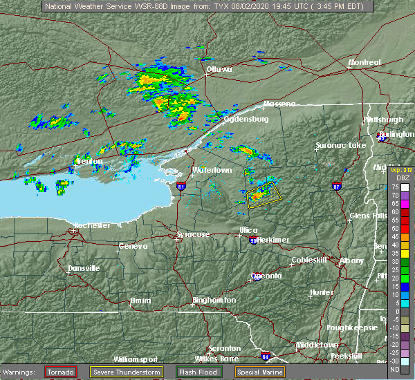
| 8/2/2020 4:13 PM EDT |
 At 413 pm edt, a severe thunderstorm was located over west parishville, moving northeast at 50 mph (radar indicated). Hazards include 60 mph wind gusts and penny size hail. Expect damage to trees and powerlines. locations impacted include, potsdam, massena, norfolk, moira, parishville, colton, norwood, lawrenceville, brasher falls, pierrepont, hopkinton, north stockholm, west parishville, brasher center, west stockholm, north lawrence, converse, south colton, stockholm center and hannawa falls. A tornado watch remains in effect until 1000 pm edt for northern new york. At 413 pm edt, a severe thunderstorm was located over west parishville, moving northeast at 50 mph (radar indicated). Hazards include 60 mph wind gusts and penny size hail. Expect damage to trees and powerlines. locations impacted include, potsdam, massena, norfolk, moira, parishville, colton, norwood, lawrenceville, brasher falls, pierrepont, hopkinton, north stockholm, west parishville, brasher center, west stockholm, north lawrence, converse, south colton, stockholm center and hannawa falls. A tornado watch remains in effect until 1000 pm edt for northern new york.
|
| 8/2/2020 3:52 PM EDT |
 At 352 pm edt, a severe thunderstorm was located over south russell, moving northeast at 50 mph (radar indicated). Hazards include 60 mph wind gusts and penny size hail. expect damage to trees and powerlines At 352 pm edt, a severe thunderstorm was located over south russell, moving northeast at 50 mph (radar indicated). Hazards include 60 mph wind gusts and penny size hail. expect damage to trees and powerlines
|
| 3/20/2020 2:35 PM EDT | Trees blown down... some broken in half. wood shed damage in st. lawrence county NY, 8.5 miles WSW of Massena, NY |
| 3/20/2020 2:32 PM EDT |
 At 232 pm edt, a severe thunderstorm was located over helena, moving northeast at 55 mph (radar indicated). Hazards include 60 mph wind gusts and penny size hail. expect damage to trees and powerlines At 232 pm edt, a severe thunderstorm was located over helena, moving northeast at 55 mph (radar indicated). Hazards include 60 mph wind gusts and penny size hail. expect damage to trees and powerlines
|
| 3/20/2020 2:25 PM EDT | Storm damage reported in st. lawrence county NY, 2.1 miles W of Massena, NY |
| 10/1/2019 1:53 PM EDT | Hen Egg sized hail reported 0.2 miles SW of Massena, NY |
| 10/1/2019 1:49 PM EDT | Quarter sized hail reported 4.1 miles ESE of Massena, NY, hail size estimated slightly larger than a quarter. |
| 10/1/2019 1:49 PM EDT |
 At 149 pm edt, a severe thunderstorm was located over massena, moving east at 45 mph (radar indicated). Hazards include 60 mph wind gusts and quarter size hail. Minor hail damage to vehicles is possible. Expect wind damage to trees and powerlines. At 149 pm edt, a severe thunderstorm was located over massena, moving east at 45 mph (radar indicated). Hazards include 60 mph wind gusts and quarter size hail. Minor hail damage to vehicles is possible. Expect wind damage to trees and powerlines.
|
| 7/11/2019 6:56 PM EDT |
 At 625 pm edt, a severe thunderstorm was located over hannawa falls, moving northeast at 15 mph (radar indicated. as of 623 pm emergency management reports several trees down across the potsdam area). Hazards include 60 mph wind gusts and quarter size hail. Minor hail damage to vehicles is possible. expect wind damage to trees and powerlines. locations impacted include, potsdam, canton, massena, norfolk, moira, parishville, fort covington, colton, bombay, norwood, massena international airport - richards field, helena, brasher falls, st. Regis, brushton, lawrenceville, dickinson, pierrepont, hopkinton and north stockholm. At 625 pm edt, a severe thunderstorm was located over hannawa falls, moving northeast at 15 mph (radar indicated. as of 623 pm emergency management reports several trees down across the potsdam area). Hazards include 60 mph wind gusts and quarter size hail. Minor hail damage to vehicles is possible. expect wind damage to trees and powerlines. locations impacted include, potsdam, canton, massena, norfolk, moira, parishville, fort covington, colton, bombay, norwood, massena international airport - richards field, helena, brasher falls, st. Regis, brushton, lawrenceville, dickinson, pierrepont, hopkinton and north stockholm.
|
| 7/11/2019 6:27 PM EDT |
 A severe thunderstorm warning remains in effect until 700 pm edt for northwestern franklin and northeastern st. lawrence counties. at 625 pm edt, a severe thunderstorm was located over hannawa falls, moving northeast at 15 mph. hazard. 60 mph wind gusts and quarter size hail. source. radar indicated. As of 623 pm emergency management reports. A severe thunderstorm warning remains in effect until 700 pm edt for northwestern franklin and northeastern st. lawrence counties. at 625 pm edt, a severe thunderstorm was located over hannawa falls, moving northeast at 15 mph. hazard. 60 mph wind gusts and quarter size hail. source. radar indicated. As of 623 pm emergency management reports.
|
| 7/11/2019 6:10 PM EDT |
 The severe thunderstorm warning for northwestern franklin and northeastern st. lawrence counties will expire at 615 pm edt. the warning for this storm has been combined with a severe thunderstorm just to the south and therefore the warning will be allowed to expire. A severe thunderstorm watch remains in effect until midnight edt for. The severe thunderstorm warning for northwestern franklin and northeastern st. lawrence counties will expire at 615 pm edt. the warning for this storm has been combined with a severe thunderstorm just to the south and therefore the warning will be allowed to expire. A severe thunderstorm watch remains in effect until midnight edt for.
|
| 7/11/2019 6:08 PM EDT |
 The national weather service in burlington has issued a * severe thunderstorm warning for. northwestern franklin county in northern new york. northeastern st. lawrence county in northern new york. until 700 pm edt. At 606 pm edt, an area of severe thunderstorms was located over. The national weather service in burlington has issued a * severe thunderstorm warning for. northwestern franklin county in northern new york. northeastern st. lawrence county in northern new york. until 700 pm edt. At 606 pm edt, an area of severe thunderstorms was located over.
|
| 7/11/2019 6:02 PM EDT |
 At 602 pm edt, a severe thunderstorm was located over hannawa falls, moving northeast at 30 mph (radar indicated. at 559 pm a trained spotter reported 1 inch hail falling in potsdam, ny). Hazards include 60 mph wind gusts and quarter size hail. Minor hail damage to vehicles is possible. expect wind damage to trees and powerlines. locations impacted include, potsdam, massena, norfolk, moira, parishville, fort covington, bombay, norwood, massena international airport - richards field, helena, brasher falls, st. Regis, brushton, lawrenceville, madrid, hopkinton, north stockholm, fort covington center, south bombay and west parishville. At 602 pm edt, a severe thunderstorm was located over hannawa falls, moving northeast at 30 mph (radar indicated. at 559 pm a trained spotter reported 1 inch hail falling in potsdam, ny). Hazards include 60 mph wind gusts and quarter size hail. Minor hail damage to vehicles is possible. expect wind damage to trees and powerlines. locations impacted include, potsdam, massena, norfolk, moira, parishville, fort covington, bombay, norwood, massena international airport - richards field, helena, brasher falls, st. Regis, brushton, lawrenceville, madrid, hopkinton, north stockholm, fort covington center, south bombay and west parishville.
|
| 7/11/2019 5:41 PM EDT |
 A severe thunderstorm warning remains in effect until 615 pm edt for northwestern franklin and northeastern st. lawrence counties. at 540 pm edt, a severe thunderstorm was located over north stockholm, moving northeast at 20 mph. hazard. 60 mph wind gusts and quarter size hail. source. radar indicated. At 518 pm 1/2 inch hail was reported near. A severe thunderstorm warning remains in effect until 615 pm edt for northwestern franklin and northeastern st. lawrence counties. at 540 pm edt, a severe thunderstorm was located over north stockholm, moving northeast at 20 mph. hazard. 60 mph wind gusts and quarter size hail. source. radar indicated. At 518 pm 1/2 inch hail was reported near.
|
| 7/11/2019 5:21 PM EDT |
 The national weather service in burlington has issued a * severe thunderstorm warning for. northwestern franklin county in northern new york. northeastern st. lawrence county in northern new york. until 615 pm edt. At 521 pm edt, a severe thunderstorm was located near. The national weather service in burlington has issued a * severe thunderstorm warning for. northwestern franklin county in northern new york. northeastern st. lawrence county in northern new york. until 615 pm edt. At 521 pm edt, a severe thunderstorm was located near.
|
| 6/18/2018 5:28 PM EDT |
 The severe thunderstorm warning for western clinton, northern franklin and northeastern st. lawrence counties will expire at 530 pm edt, the storm which prompted the warning has weakened below severe limits, and no longer poses an immediate threat to life or property. therefore, the warning will be allowed to expire. however gusty winds and heavy rain are still possible with this thunderstorm. a severe thunderstorm watch remains in effect until 1000 pm edt for northern new york. The severe thunderstorm warning for western clinton, northern franklin and northeastern st. lawrence counties will expire at 530 pm edt, the storm which prompted the warning has weakened below severe limits, and no longer poses an immediate threat to life or property. therefore, the warning will be allowed to expire. however gusty winds and heavy rain are still possible with this thunderstorm. a severe thunderstorm watch remains in effect until 1000 pm edt for northern new york.
|
| 6/18/2018 5:23 PM EDT |
 At 523 pm edt, a severe thunderstorm was located over ironton, moving east at 35 mph (radar indicated). Hazards include 60 mph wind gusts and penny size hail. Expect damage to trees and powerlines. Locations impacted include, massena, saranac, louisville, moira, altona, bangor, fort covington, bombay, ellenburg depot, bryants mill, massena international airport - richards field, helena, lyon mountain, burke, clayburg, merrill, brushton, lawrenceville, malone and churubusco. At 523 pm edt, a severe thunderstorm was located over ironton, moving east at 35 mph (radar indicated). Hazards include 60 mph wind gusts and penny size hail. Expect damage to trees and powerlines. Locations impacted include, massena, saranac, louisville, moira, altona, bangor, fort covington, bombay, ellenburg depot, bryants mill, massena international airport - richards field, helena, lyon mountain, burke, clayburg, merrill, brushton, lawrenceville, malone and churubusco.
|
| 6/18/2018 4:37 PM EDT |
 At 436 pm edt, a severe thunderstorm was located 7 miles northwest of coles creek state park, moving east at 35 mph (radar indicated). Hazards include 60 mph wind gusts and penny size hail. expect damage to trees and powerlines At 436 pm edt, a severe thunderstorm was located 7 miles northwest of coles creek state park, moving east at 35 mph (radar indicated). Hazards include 60 mph wind gusts and penny size hail. expect damage to trees and powerlines
|
| 5/4/2018 6:51 PM EDT |
 At 651 pm edt, severe thunderstorms were located along a line extending from norfolk to debar mountain to tahawus, moving northeast at 70 mph (radar indicated). Hazards include 60 mph wind gusts and quarter size hail. Minor hail damage to vehicles is possible. Expect wind damage to trees and powerlines. At 651 pm edt, severe thunderstorms were located along a line extending from norfolk to debar mountain to tahawus, moving northeast at 70 mph (radar indicated). Hazards include 60 mph wind gusts and quarter size hail. Minor hail damage to vehicles is possible. Expect wind damage to trees and powerlines.
|
| 5/4/2018 6:33 PM EDT |
 At 633 pm edt, a severe thunderstorm was located over russell, moving northeast at 70 mph (radar indicated). Hazards include 70 mph wind gusts and quarter size hail. Minor hail damage to vehicles is possible. expect considerable tree damage. wind damage is also likely to mobile homes, roofs, and outbuildings. locations impacted include, potsdam, tupper lake, canton, massena, gouverneur, norfolk, oswegatchie, de kalb, parishville, colton, piercefield, morley, degrasse, massena international airport - richards field, helena, carry falls reservoir, richville, cranberry lake, madrid and lawrenceville. A tornado watch remains in effect until 1000 pm edt for northern new york. At 633 pm edt, a severe thunderstorm was located over russell, moving northeast at 70 mph (radar indicated). Hazards include 70 mph wind gusts and quarter size hail. Minor hail damage to vehicles is possible. expect considerable tree damage. wind damage is also likely to mobile homes, roofs, and outbuildings. locations impacted include, potsdam, tupper lake, canton, massena, gouverneur, norfolk, oswegatchie, de kalb, parishville, colton, piercefield, morley, degrasse, massena international airport - richards field, helena, carry falls reservoir, richville, cranberry lake, madrid and lawrenceville. A tornado watch remains in effect until 1000 pm edt for northern new york.
|
| 5/4/2018 6:17 PM EDT |
 At 617 pm edt, a severe thunderstorm was located near west fowler, moving northeast at 55 mph (radar indicated). Hazards include 60 mph wind gusts and quarter size hail. Minor hail damage to vehicles is possible. Expect wind damage to trees and powerlines. At 617 pm edt, a severe thunderstorm was located near west fowler, moving northeast at 55 mph (radar indicated). Hazards include 60 mph wind gusts and quarter size hail. Minor hail damage to vehicles is possible. Expect wind damage to trees and powerlines.
|
| 5/4/2018 4:40 PM EDT |
 At 439 pm edt, a severe thunderstorm was located near hannawa falls, moving northeast at 55 mph (radar indicated). Hazards include 70 mph wind gusts and half dollar size hail. Minor hail damage to vehicles is possible. expect considerable tree damage. wind damage is also likely to mobile homes, roofs, and outbuildings. locations impacted include, potsdam, massena, canton, norfolk, louisville, de kalb, parishville, colton, rensselaer falls, morley, norwood, massena international airport - richards field, hermon, chipman, brasher falls, heuvelton, madrid, waddington, pierrepont and hopkinton. A tornado watch remains in effect until 1000 pm edt for northern new york. At 439 pm edt, a severe thunderstorm was located near hannawa falls, moving northeast at 55 mph (radar indicated). Hazards include 70 mph wind gusts and half dollar size hail. Minor hail damage to vehicles is possible. expect considerable tree damage. wind damage is also likely to mobile homes, roofs, and outbuildings. locations impacted include, potsdam, massena, canton, norfolk, louisville, de kalb, parishville, colton, rensselaer falls, morley, norwood, massena international airport - richards field, hermon, chipman, brasher falls, heuvelton, madrid, waddington, pierrepont and hopkinton. A tornado watch remains in effect until 1000 pm edt for northern new york.
|
| 5/4/2018 4:22 PM EDT |
 At 407 pm edt, a severe thunderstorm was located near north gouverneur, moving east at 45 mph (radar indicated). Hazards include 60 mph wind gusts and quarter size hail. Minor hail damage to vehicles is possible. Expect wind damage to trees and powerlines. At 407 pm edt, a severe thunderstorm was located near north gouverneur, moving east at 45 mph (radar indicated). Hazards include 60 mph wind gusts and quarter size hail. Minor hail damage to vehicles is possible. Expect wind damage to trees and powerlines.
|
| 5/4/2018 4:08 PM EDT |
 At 407 pm edt, a severe thunderstorm was located near north gouverneur, moving east at 45 mph (radar indicated). Hazards include 60 mph wind gusts and quarter size hail. Minor hail damage to vehicles is possible. Expect wind damage to trees and powerlines. At 407 pm edt, a severe thunderstorm was located near north gouverneur, moving east at 45 mph (radar indicated). Hazards include 60 mph wind gusts and quarter size hail. Minor hail damage to vehicles is possible. Expect wind damage to trees and powerlines.
|
| 8/22/2017 2:29 PM EDT |
 At 228 pm edt, severe thunderstorms were located along a line extending from near ironton to converse to west fowler, moving east at 50 mph (radar indicated). Hazards include 60 mph wind gusts and penny size hail. Expect damage to trees and powerlines. locations impacted include, potsdam, massena, gouverneur, canton, norfolk, louisville, moira, de kalb, fowler, parishville, colton, bombay, morley, degrasse, massena international airport - richards field, helena, carry falls reservoir, richville, cranberry lake and madrid. A tornado watch remains in effect until 900 pm edt for northern new york. At 228 pm edt, severe thunderstorms were located along a line extending from near ironton to converse to west fowler, moving east at 50 mph (radar indicated). Hazards include 60 mph wind gusts and penny size hail. Expect damage to trees and powerlines. locations impacted include, potsdam, massena, gouverneur, canton, norfolk, louisville, moira, de kalb, fowler, parishville, colton, bombay, morley, degrasse, massena international airport - richards field, helena, carry falls reservoir, richville, cranberry lake and madrid. A tornado watch remains in effect until 900 pm edt for northern new york.
|
| 8/22/2017 1:45 PM EDT |
 At 144 pm edt, severe thunderstorms were located along a line extending from jacques cartier state park to near hammond to nelson corner, moving east at 40 mph (radar indicated). Hazards include 60 mph wind gusts. expect damage to trees and powerlines At 144 pm edt, severe thunderstorms were located along a line extending from jacques cartier state park to near hammond to nelson corner, moving east at 40 mph (radar indicated). Hazards include 60 mph wind gusts. expect damage to trees and powerlines
|
| 8/4/2017 8:28 PM EDT |
 The severe thunderstorm warning for northwestern franklin and northeastern st. lawrence counties will expire at 830 pm edt, the storms which prompted the warning have weakened below severe limits, and have exited the warned area. therefore the warning will be allowed to expire. The severe thunderstorm warning for northwestern franklin and northeastern st. lawrence counties will expire at 830 pm edt, the storms which prompted the warning have weakened below severe limits, and have exited the warned area. therefore the warning will be allowed to expire.
|
| 8/4/2017 8:12 PM EDT |
 At 810 pm edt, severe thunderstorms were located along a line extending from near massena to north lawrence, moving northeast at 40 mph (radar indicated). Hazards include 60 mph wind gusts and quarter size hail. Minor hail damage to vehicles is possible. expect wind damage to trees and powerlines. locations impacted include, massena, moira, bangor, fort covington, bombay, malone, massena international airport - richards field, helena, brasher falls, st. Regis, brushton, lawrenceville, dickinson, constable, hopkinton, fort covington center, west bangor, dickinson center, south bombay and brasher center. At 810 pm edt, severe thunderstorms were located along a line extending from near massena to north lawrence, moving northeast at 40 mph (radar indicated). Hazards include 60 mph wind gusts and quarter size hail. Minor hail damage to vehicles is possible. expect wind damage to trees and powerlines. locations impacted include, massena, moira, bangor, fort covington, bombay, malone, massena international airport - richards field, helena, brasher falls, st. Regis, brushton, lawrenceville, dickinson, constable, hopkinton, fort covington center, west bangor, dickinson center, south bombay and brasher center.
|
| 8/4/2017 8:01 PM EDT |
 At 800 pm edt, severe thunderstorms were located along a line extending from near north stockholm to nicholville, moving northeast at 45 mph (radar indicated). Hazards include 60 mph wind gusts and quarter size hail. Minor hail damage to vehicles is possible. expect wind damage to trees and powerlines. locations impacted include, potsdam, canton, massena, norfolk, moira, bangor, parishville, fort covington, colton, bombay, morley, massena international airport - richards field, helena, brushton, lawrenceville, malone, norwood, hermon, brasher falls and st. Regis. At 800 pm edt, severe thunderstorms were located along a line extending from near north stockholm to nicholville, moving northeast at 45 mph (radar indicated). Hazards include 60 mph wind gusts and quarter size hail. Minor hail damage to vehicles is possible. expect wind damage to trees and powerlines. locations impacted include, potsdam, canton, massena, norfolk, moira, bangor, parishville, fort covington, colton, bombay, morley, massena international airport - richards field, helena, brushton, lawrenceville, malone, norwood, hermon, brasher falls and st. Regis.
|
| 8/4/2017 7:29 PM EDT |
 At 728 pm edt, severe thunderstorms were located along a line extending from near pyrites to near degrasse, moving northeast at 40 mph (radar indicated). Hazards include 60 mph wind gusts and quarter size hail. Minor hail damage to vehicles is possible. Expect wind damage to trees and powerlines. At 728 pm edt, severe thunderstorms were located along a line extending from near pyrites to near degrasse, moving northeast at 40 mph (radar indicated). Hazards include 60 mph wind gusts and quarter size hail. Minor hail damage to vehicles is possible. Expect wind damage to trees and powerlines.
|
| 8/4/2017 1:25 PM EDT |
 The severe thunderstorm warning for northeastern st. lawrence county will expire at 130 pm edt, the storm which prompted the warning has weakened below severe limits, and no longer pose an immediate threat to life or property. therefore the warning will be allowed to expire. The severe thunderstorm warning for northeastern st. lawrence county will expire at 130 pm edt, the storm which prompted the warning has weakened below severe limits, and no longer pose an immediate threat to life or property. therefore the warning will be allowed to expire.
|
| 8/4/2017 1:04 PM EDT |
 At 103 pm edt, a severe thunderstorm was located over hannawa falls, moving northeast at 25 mph (radar indicated). Hazards include 60 mph wind gusts and quarter size hail. Minor hail damage to vehicles is possible. expect wind damage to trees and powerlines. Locations impacted include, potsdam, canton, norfolk, parishville, colton, norwood, lawrenceville, brasher falls, pierrepont, hopkinton, north stockholm, west parishville, brasher center, west stockholm, west potsdam, north lawrence, converse, nicholville, stockholm center and hannawa falls. At 103 pm edt, a severe thunderstorm was located over hannawa falls, moving northeast at 25 mph (radar indicated). Hazards include 60 mph wind gusts and quarter size hail. Minor hail damage to vehicles is possible. expect wind damage to trees and powerlines. Locations impacted include, potsdam, canton, norfolk, parishville, colton, norwood, lawrenceville, brasher falls, pierrepont, hopkinton, north stockholm, west parishville, brasher center, west stockholm, west potsdam, north lawrence, converse, nicholville, stockholm center and hannawa falls.
|
| 8/4/2017 12:32 PM EDT |
 At 1232 pm edt, a severe thunderstorm was located over de kalb junction, moving northeast at 40 mph (radar indicated). Hazards include 60 mph wind gusts and quarter size hail. Minor hail damage to vehicles is possible. Expect wind damage to trees and powerlines. At 1232 pm edt, a severe thunderstorm was located over de kalb junction, moving northeast at 40 mph (radar indicated). Hazards include 60 mph wind gusts and quarter size hail. Minor hail damage to vehicles is possible. Expect wind damage to trees and powerlines.
|
| 9/11/2016 12:47 AM EDT |
 At 1246 am edt, severe thunderstorms were located along a line extending from brasher center to near stark, moving northeast at 45 mph (radar indicated). Hazards include 60 mph wind gusts. Expect damage to roofs. siding. and trees. locations impacted include, norfolk, madrid, fort covington, norwood, colton, bombay, brushton, st. Regis, lake ozonia, massena international airport - richards field, lawrenceville, helena, brasher falls, dickinson, louisville, moira, pierrepont, parishville, hopkinton and stark. At 1246 am edt, severe thunderstorms were located along a line extending from brasher center to near stark, moving northeast at 45 mph (radar indicated). Hazards include 60 mph wind gusts. Expect damage to roofs. siding. and trees. locations impacted include, norfolk, madrid, fort covington, norwood, colton, bombay, brushton, st. Regis, lake ozonia, massena international airport - richards field, lawrenceville, helena, brasher falls, dickinson, louisville, moira, pierrepont, parishville, hopkinton and stark.
|
| 9/11/2016 12:12 AM EDT |
 At 1211 am edt, severe thunderstorms were located along a line extending from near canton to fine, moving northeast at 50 mph (radar indicated). Hazards include 60 mph wind gusts. Expect damage to roofs. siding. And trees. At 1211 am edt, severe thunderstorms were located along a line extending from near canton to fine, moving northeast at 50 mph (radar indicated). Hazards include 60 mph wind gusts. Expect damage to roofs. siding. And trees.
|
| 9/10/2016 11:26 PM EDT |
 At 1124 pm edt, severe thunderstorms were located along a line extending from louisville to near norwood to fowler, moving northeast at 45 mph (radar indicated). Hazards include 60 mph wind gusts. Expect damage to roofs. siding. And trees. At 1124 pm edt, severe thunderstorms were located along a line extending from louisville to near norwood to fowler, moving northeast at 45 mph (radar indicated). Hazards include 60 mph wind gusts. Expect damage to roofs. siding. And trees.
|
| 6/28/2016 7:25 PM EDT | Quarter sized hail reported 0.2 miles SW of Massena, NY |
| 6/28/2016 7:22 PM EDT | Quarter sized hail reported 0.2 miles SW of Massena, NY, reported from the public. |
| 6/28/2016 7:17 PM EDT |
 At 716 pm edt, a severe thunderstorm was located near massena international airport - richards field, moving east at 25 mph (radar indicated). Hazards include 60 mph wind gusts and quarter size hail. Hail damage to vehicles is expected. expect wind damage to roofs, siding, and trees. locations impacted include, norfolk, massena international airport - richards field, helena, louisville, brasher center, raymondville, raquette river, st. lawrence state park and eisenhower lock. At 716 pm edt, a severe thunderstorm was located near massena international airport - richards field, moving east at 25 mph (radar indicated). Hazards include 60 mph wind gusts and quarter size hail. Hail damage to vehicles is expected. expect wind damage to roofs, siding, and trees. locations impacted include, norfolk, massena international airport - richards field, helena, louisville, brasher center, raymondville, raquette river, st. lawrence state park and eisenhower lock.
|
| 6/28/2016 6:57 PM EDT |
 At 657 pm edt, a severe thunderstorm was located near chipman, moving east at 20 mph (radar indicated). Hazards include 60 mph wind gusts and quarter size hail. Hail damage to vehicles is expected. Expect wind damage to roofs, siding, and trees. At 657 pm edt, a severe thunderstorm was located near chipman, moving east at 20 mph (radar indicated). Hazards include 60 mph wind gusts and quarter size hail. Hail damage to vehicles is expected. Expect wind damage to roofs, siding, and trees.
|
| 8/18/2015 9:07 PM EDT |
 At 904 pm edt, severe thunderstorms were still moving across portions of northern st. lawrence county and northwest franklin county. these storms are capable of still producing 60 mph winds. these storms were located along a line extending from near massena international airport - richards field to near brushton, moving northeast at 15 mph. less than an hour ago, severe thunderstorms produced wind damage in potsdam and stockholm. locations impacted include, fort covington, bombay, brushton, st. regis, massena international airport - richards field, helena, moira, ironton, st. lawrence state park, eisenhower lock, brasher center, raquette river, fort covington center, rooseveltown, south bombay and hogansburg. At 904 pm edt, severe thunderstorms were still moving across portions of northern st. lawrence county and northwest franklin county. these storms are capable of still producing 60 mph winds. these storms were located along a line extending from near massena international airport - richards field to near brushton, moving northeast at 15 mph. less than an hour ago, severe thunderstorms produced wind damage in potsdam and stockholm. locations impacted include, fort covington, bombay, brushton, st. regis, massena international airport - richards field, helena, moira, ironton, st. lawrence state park, eisenhower lock, brasher center, raquette river, fort covington center, rooseveltown, south bombay and hogansburg.
|
| 8/18/2015 8:38 PM EDT |
 At 836 pm edt, emergency management reported a line of severe thunderstorms that produced damaging winds in excess of 60 mph that has caused downed trees and some roof damage to a structure in potsdam. these storms were located along a line extending from norwood to 9 miles northeast of colton. these storms were moving northeast at 20 mph and are still capable of producing wind damage. locations impacted include, fort covington, bombay, brushton, st. regis, massena international airport - richards field, lawrenceville, helena, brasher falls, dickinson, moira, eisenhower lock, buckton, raquette river, ironton, st. lawrence state park, stockholm center, nicholville, winthrop, brasher center and raymondville. At 836 pm edt, emergency management reported a line of severe thunderstorms that produced damaging winds in excess of 60 mph that has caused downed trees and some roof damage to a structure in potsdam. these storms were located along a line extending from norwood to 9 miles northeast of colton. these storms were moving northeast at 20 mph and are still capable of producing wind damage. locations impacted include, fort covington, bombay, brushton, st. regis, massena international airport - richards field, lawrenceville, helena, brasher falls, dickinson, moira, eisenhower lock, buckton, raquette river, ironton, st. lawrence state park, stockholm center, nicholville, winthrop, brasher center and raymondville.
|
| 8/18/2015 8:12 PM EDT |
 At 811 pm edt, doppler radar indicated a line of severe thunderstorms capable of producing damaging winds in excess of 60 mph. these storms were located along a line extending from norwood to 9 miles northeast of colton, and moving north at 20 mph. penny size hail may also accompany the damaging winds. in fact, potsdam airport reported winds of 58 mph. * locations to be impacted include, norfolk, fort covington, norwood, bombay, brushton, st. regis, massena international airport - richards field, lawrenceville, helena, brasher falls, dickinson, moira, parishville, hopkinton, eisenhower lock, buckton, raquette river, converse, ironton and west stockholm. At 811 pm edt, doppler radar indicated a line of severe thunderstorms capable of producing damaging winds in excess of 60 mph. these storms were located along a line extending from norwood to 9 miles northeast of colton, and moving north at 20 mph. penny size hail may also accompany the damaging winds. in fact, potsdam airport reported winds of 58 mph. * locations to be impacted include, norfolk, fort covington, norwood, bombay, brushton, st. regis, massena international airport - richards field, lawrenceville, helena, brasher falls, dickinson, moira, parishville, hopkinton, eisenhower lock, buckton, raquette river, converse, ironton and west stockholm.
|
| 7/10/2013 8:25 PM EDT | Tree down... minor property damage... and power outage in st. lawrence county NY, 0.2 miles SW of Massena, NY |
| 7/10/2013 8:24 PM EDT | Numerous trees and wires down throughout the city of massena in st. lawrence county NY, 0.2 miles SW of Massena, NY |
| 7/10/2013 8:23 PM EDT | Storm damage reported in st. lawrence county NY, 2.3 miles WSW of Massena, NY |
| 7/23/2012 5:30 PM EDT | Several trees down. wires laying on top of cars on south st. relayed by massena polic in st. lawrence county NY, 0.2 miles SW of Massena, NY |
| 1/1/0001 12:00 AM | Telephone poles and power lines down in st. lawrence county NY, 0.2 miles SW of Massena, NY |
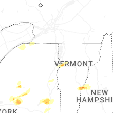
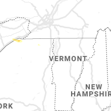
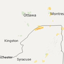
Hail Maps for Massena, NY


Connect with Interactive Hail Maps