

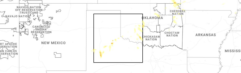
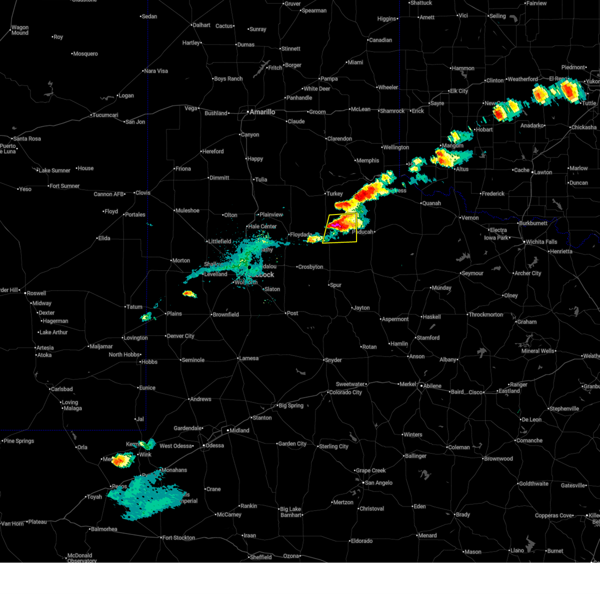
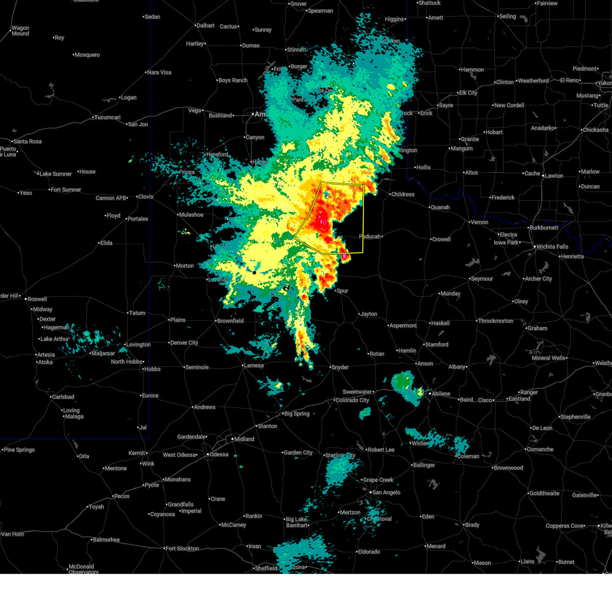
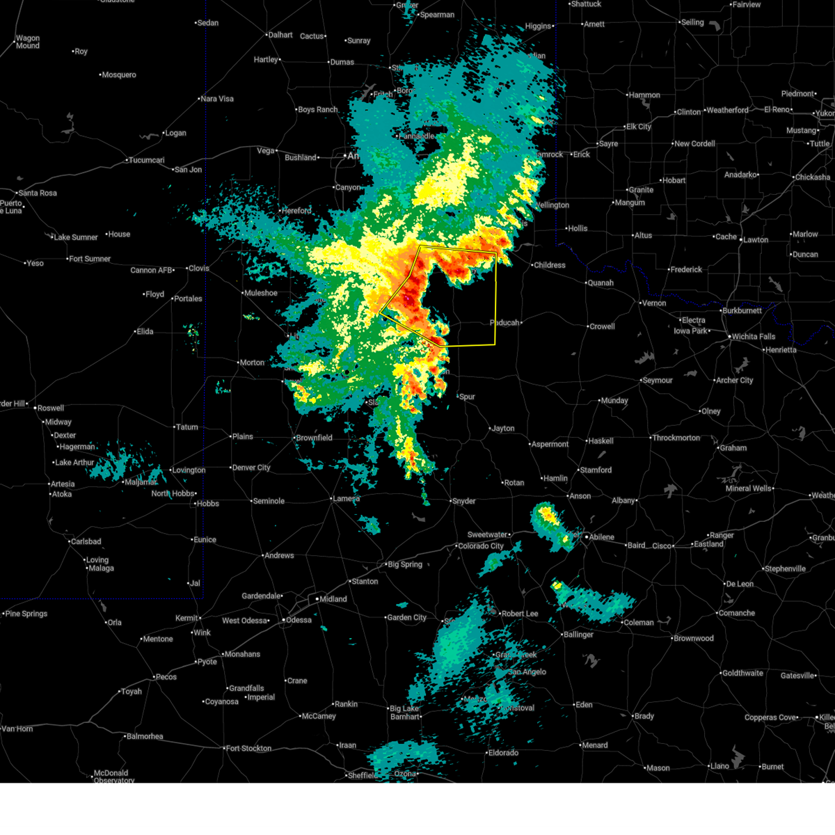
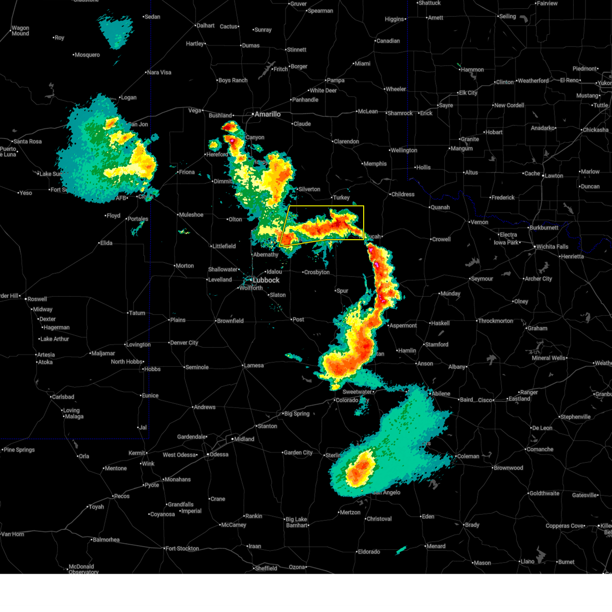
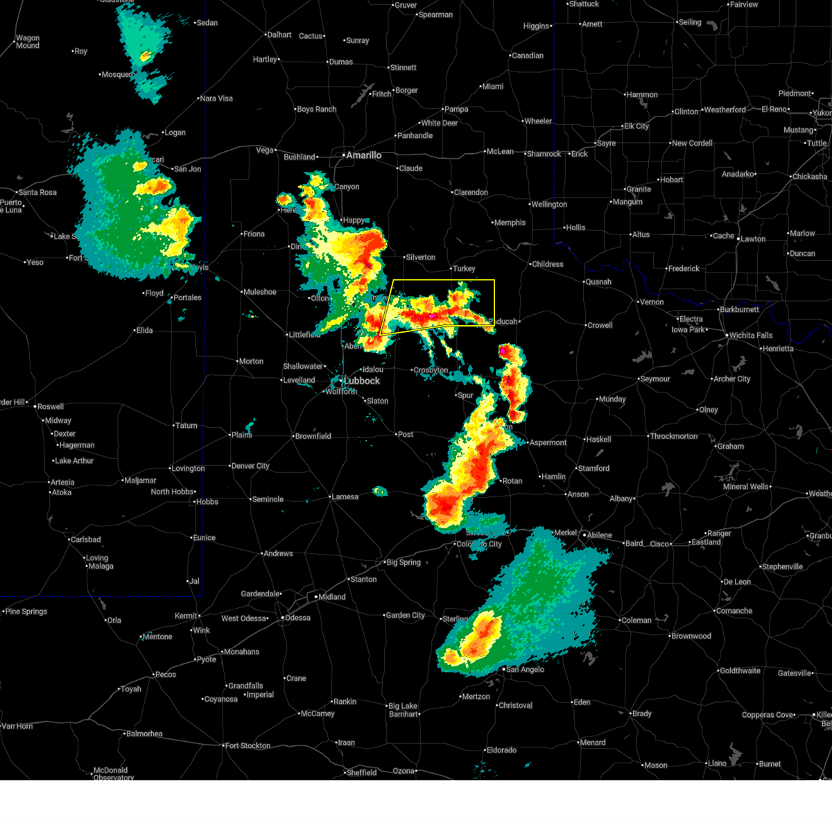
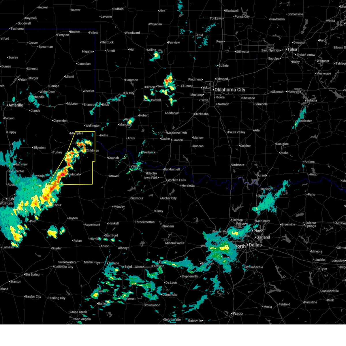
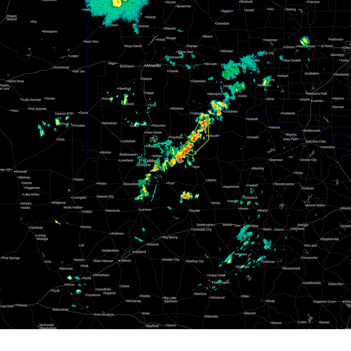
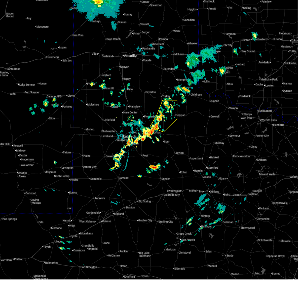
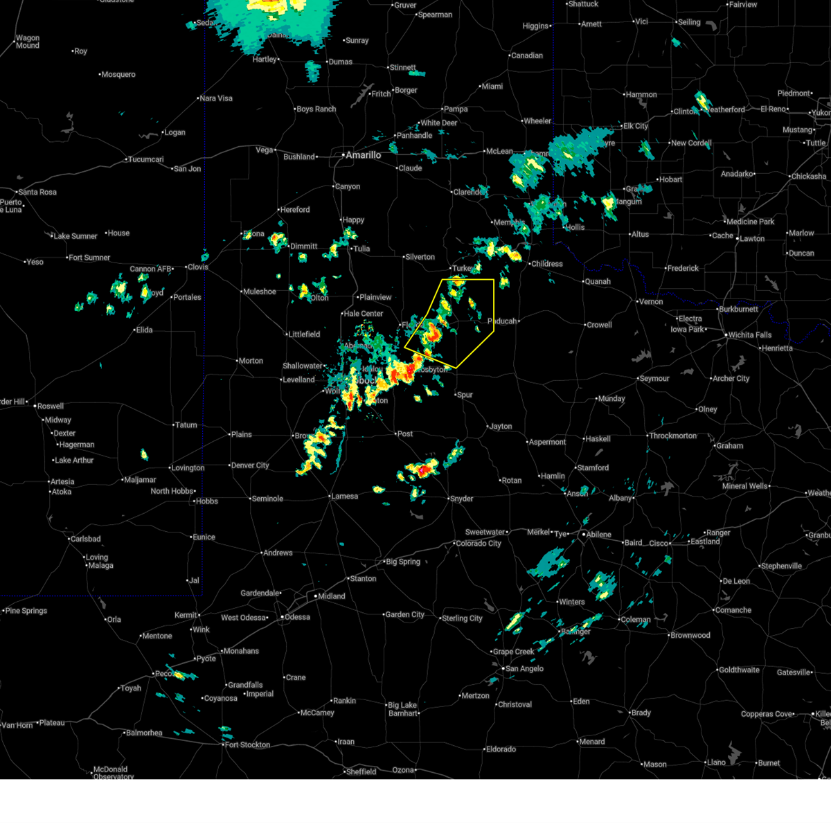
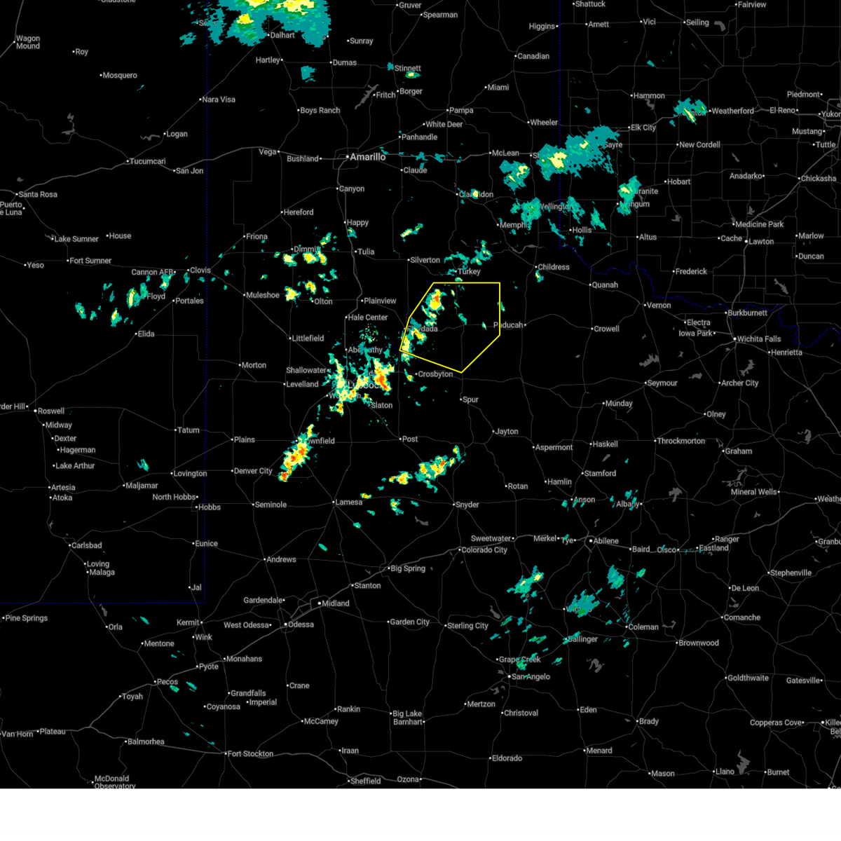
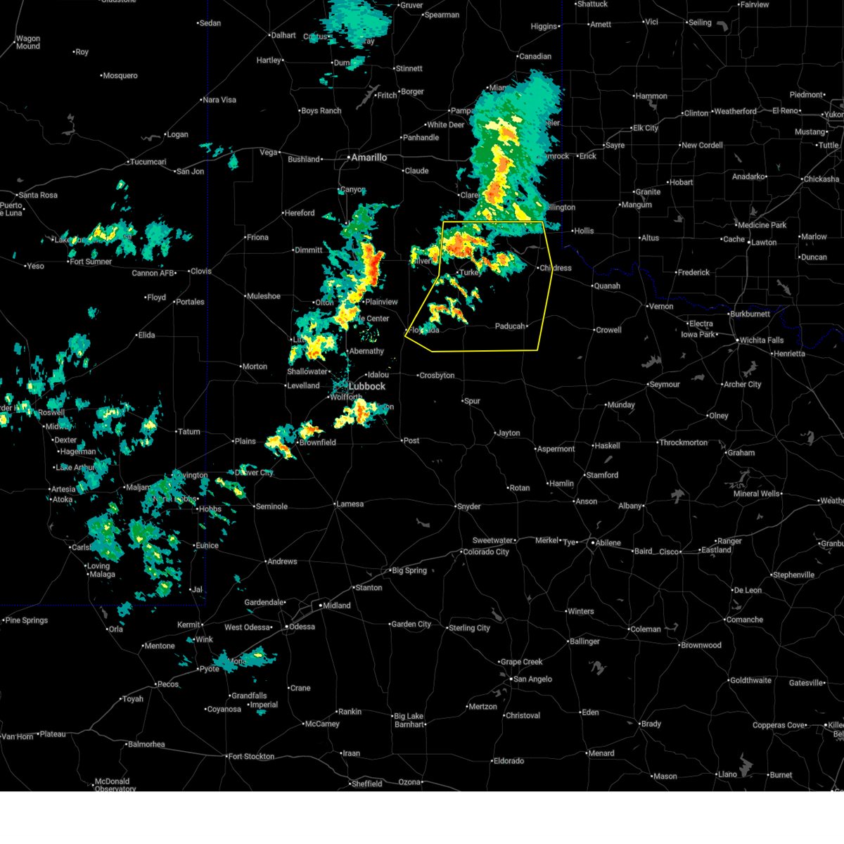
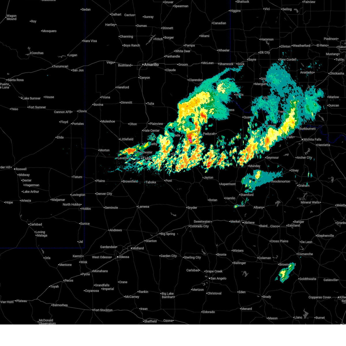
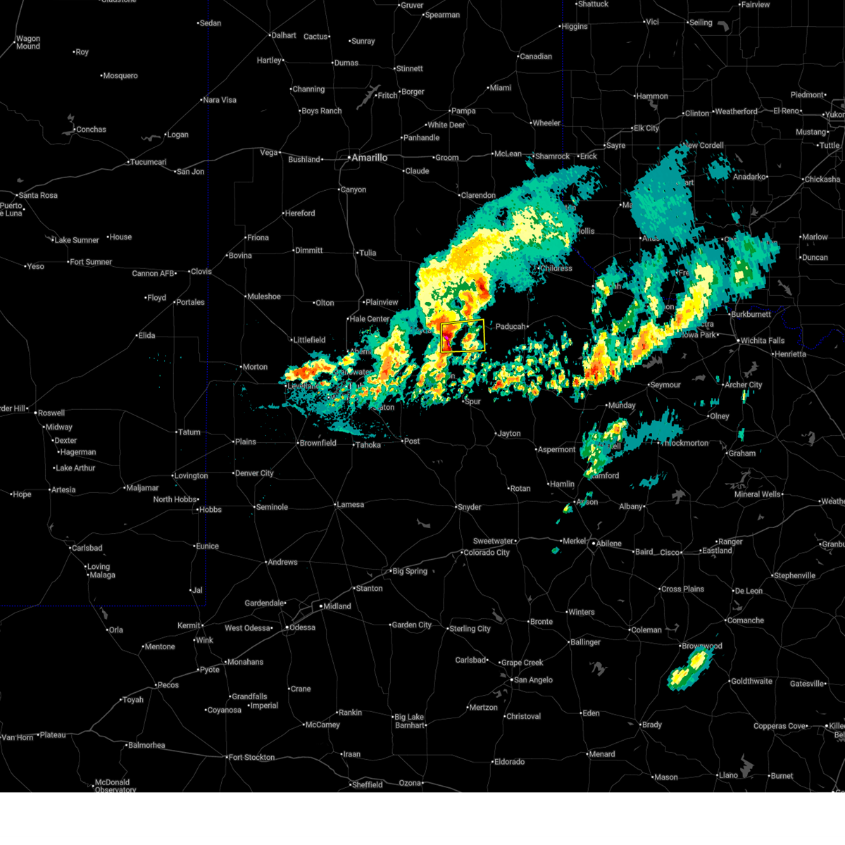
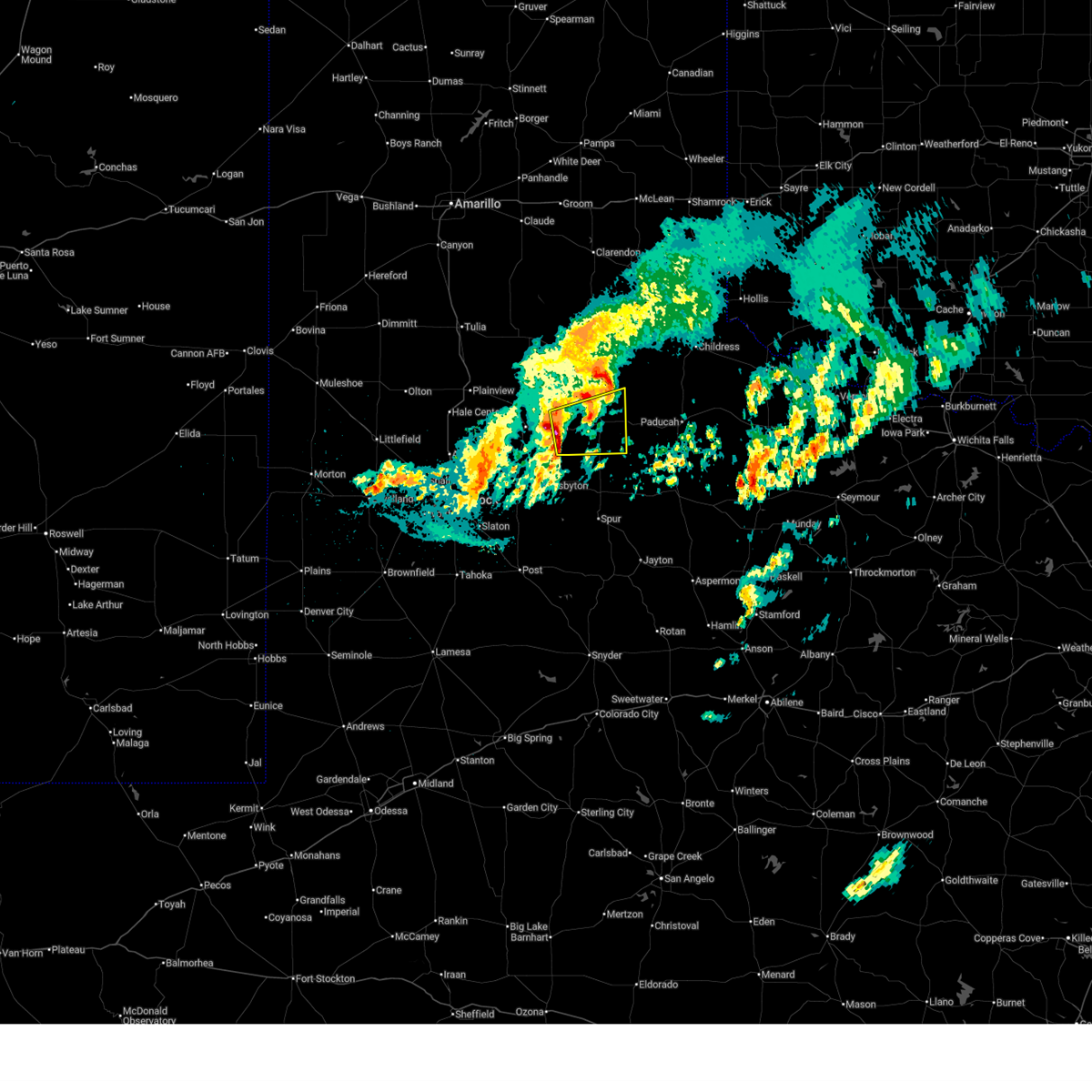
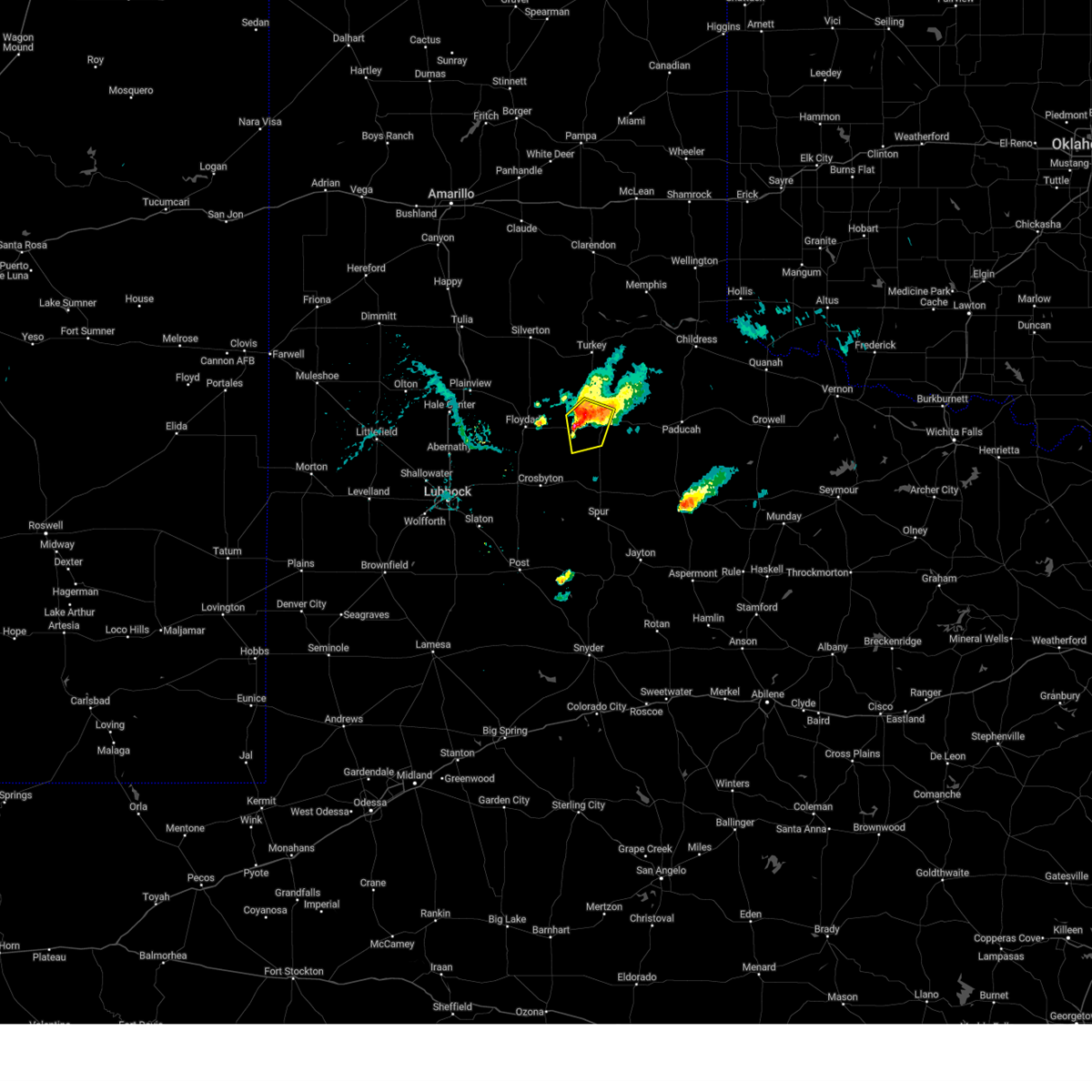
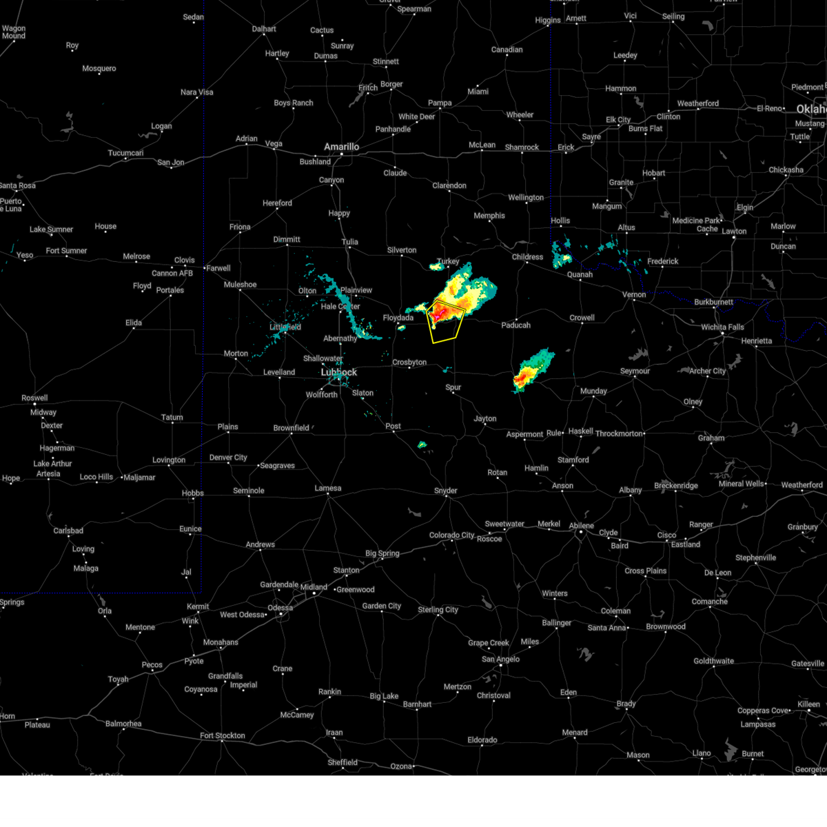
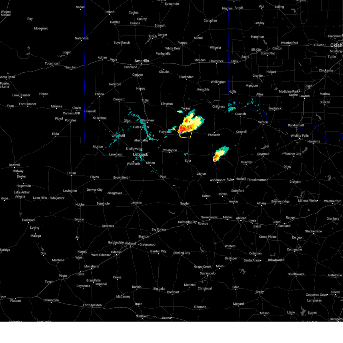
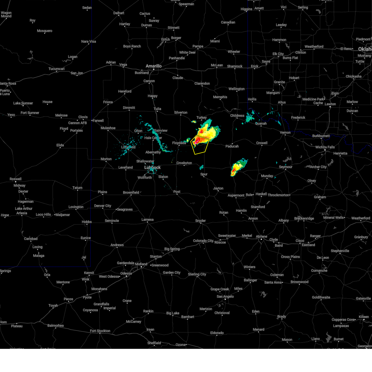
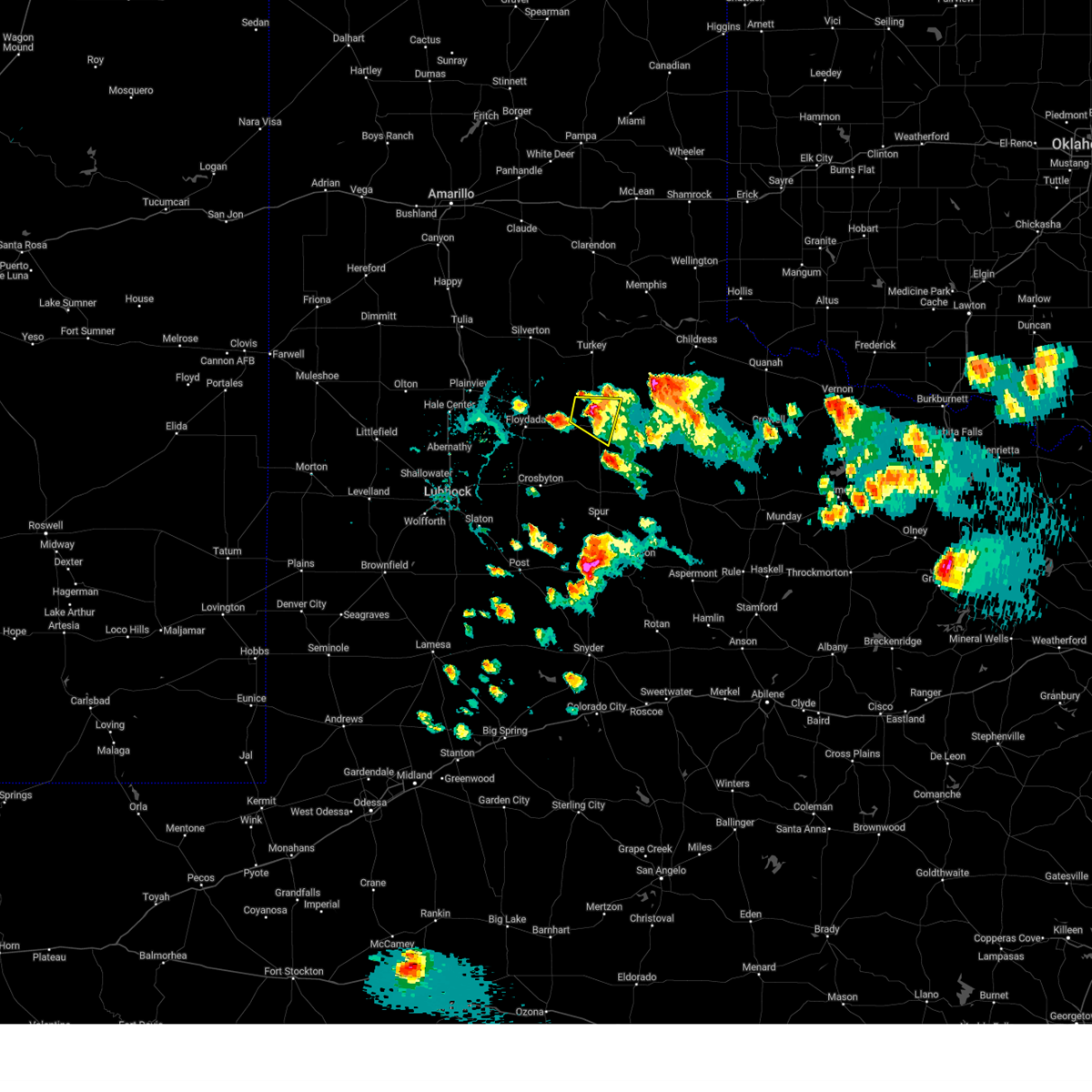
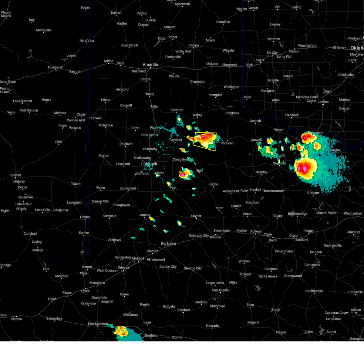
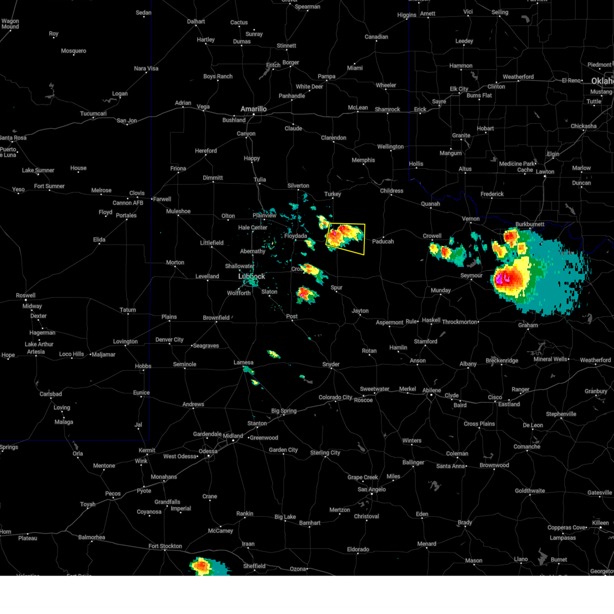
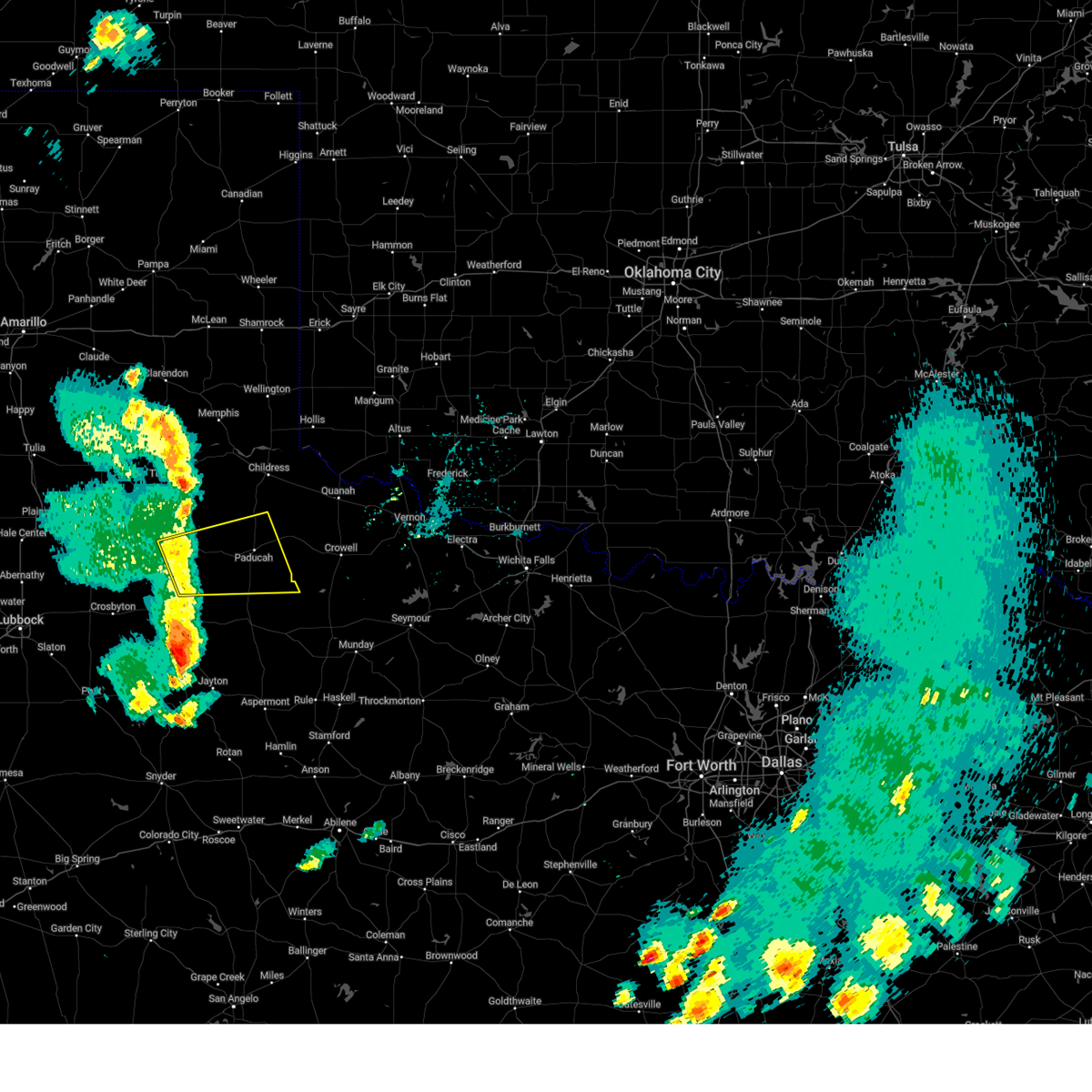
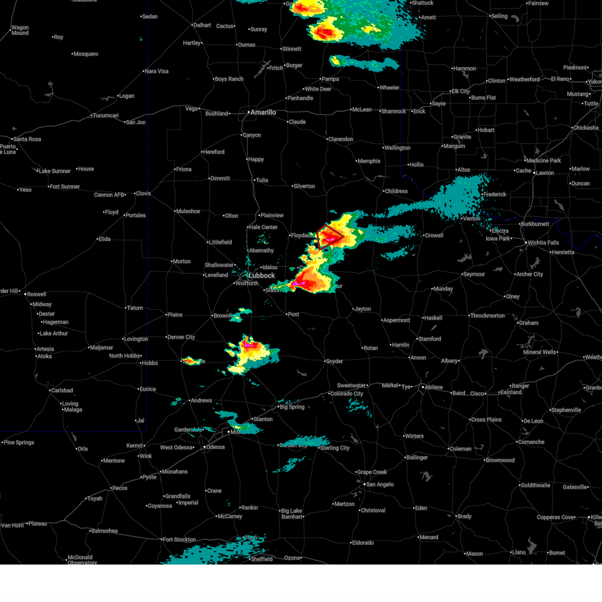
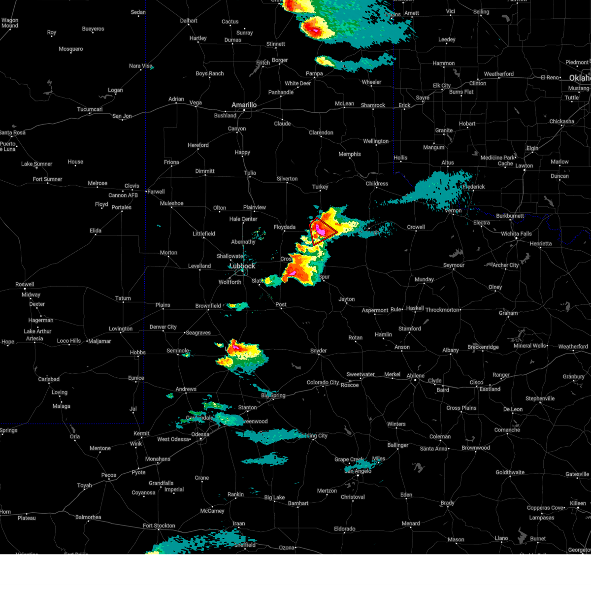
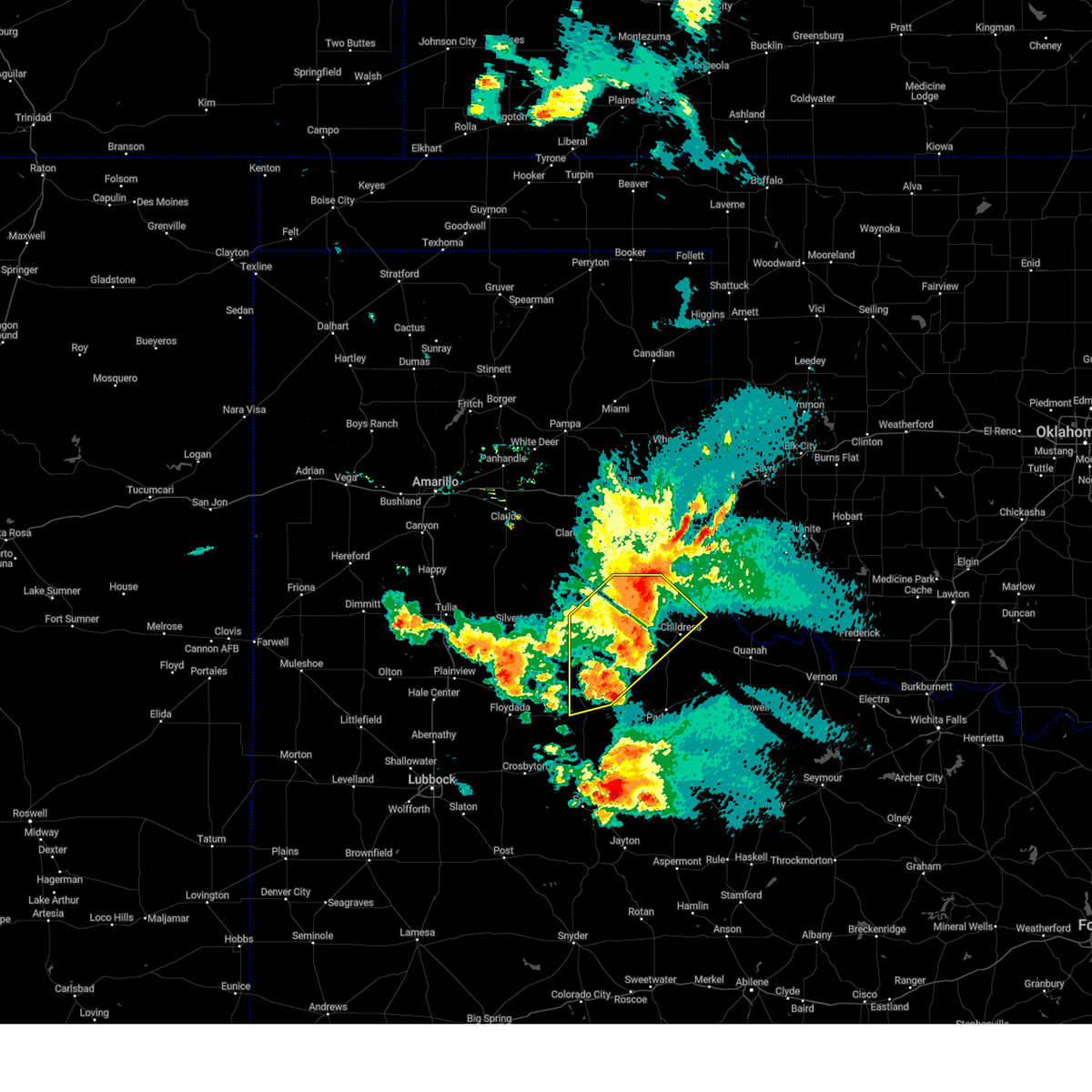
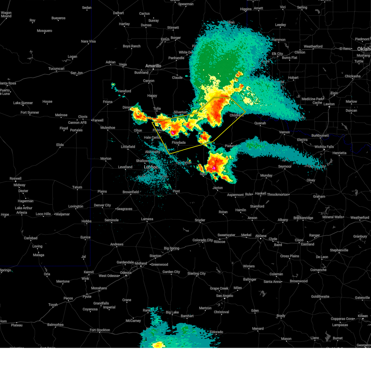
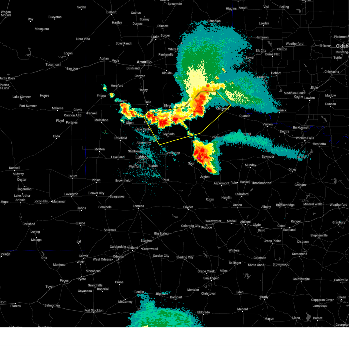
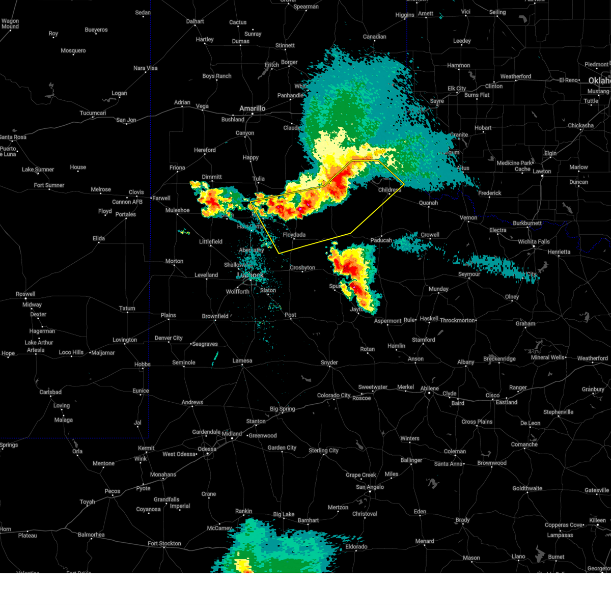
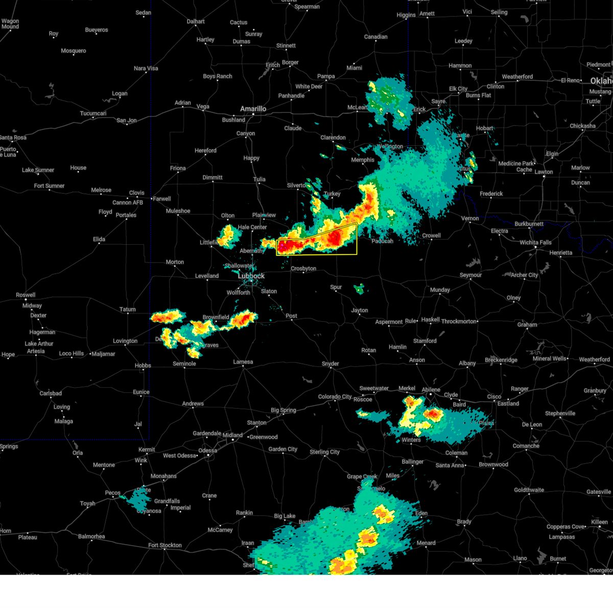
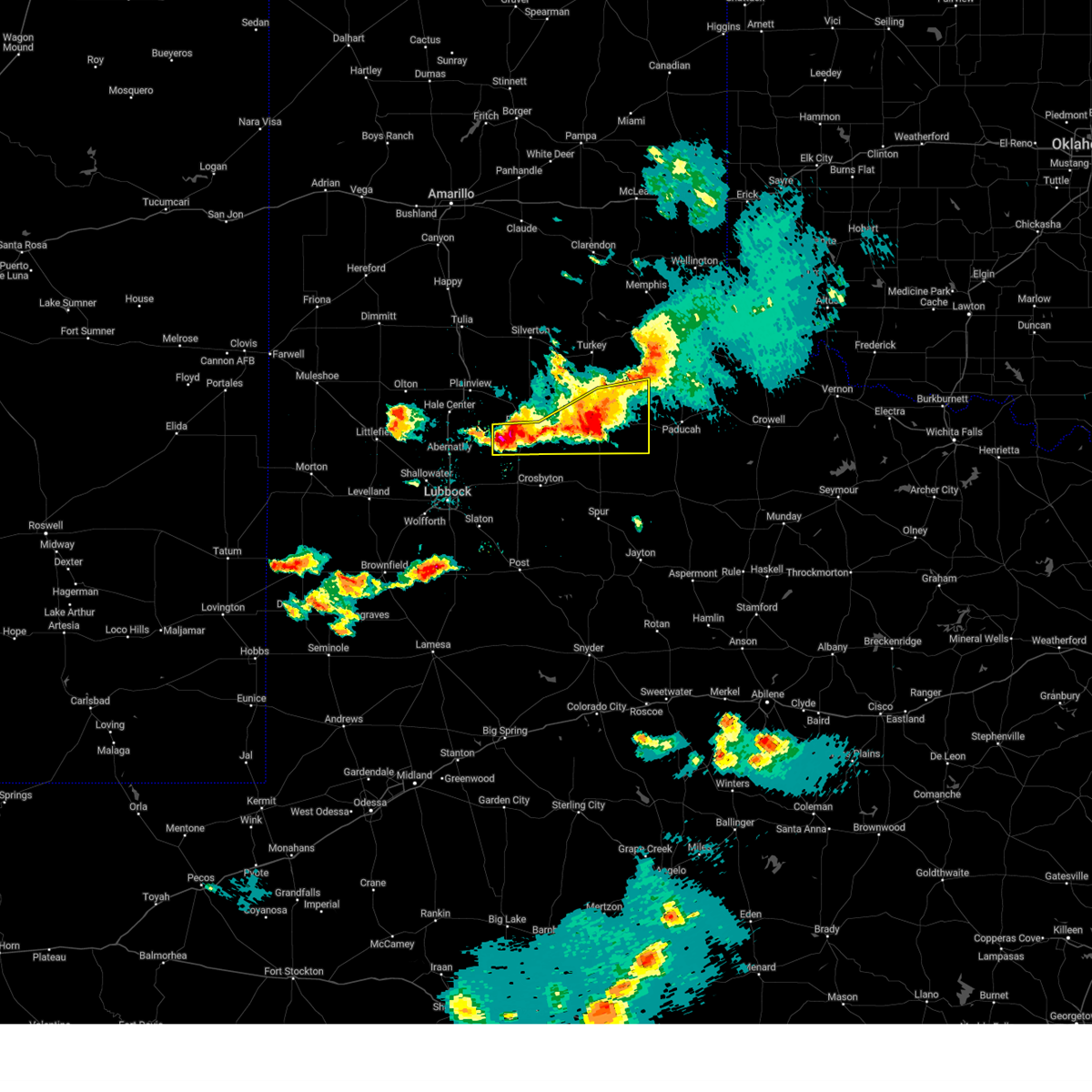
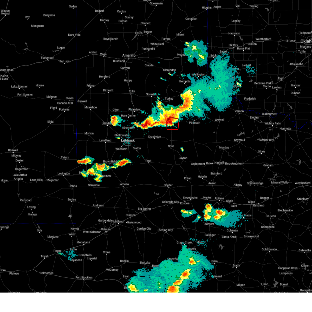
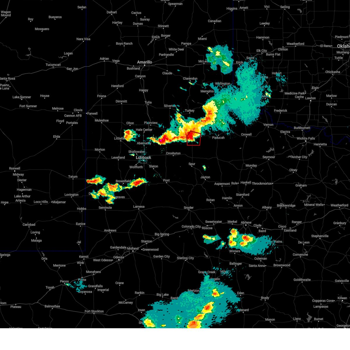
Hail Map for Matador, TX
The Matador, TX area has had 41 reports of on-the-ground hail by trained spotters, and has been under severe weather warnings 25 times during the past 12 months. Doppler radar has detected hail at or near Matador, TX on 108 occasions, including 4 occasions during the past year.
| Name: | Matador, TX |
| Where Located: | 45.3 miles SW of Childress, TX |
| Map: | Google Map for Matador, TX |
| Population: | 607 |
| Housing Units: | 367 |
| More Info: | Search Google for Matador, TX |
1
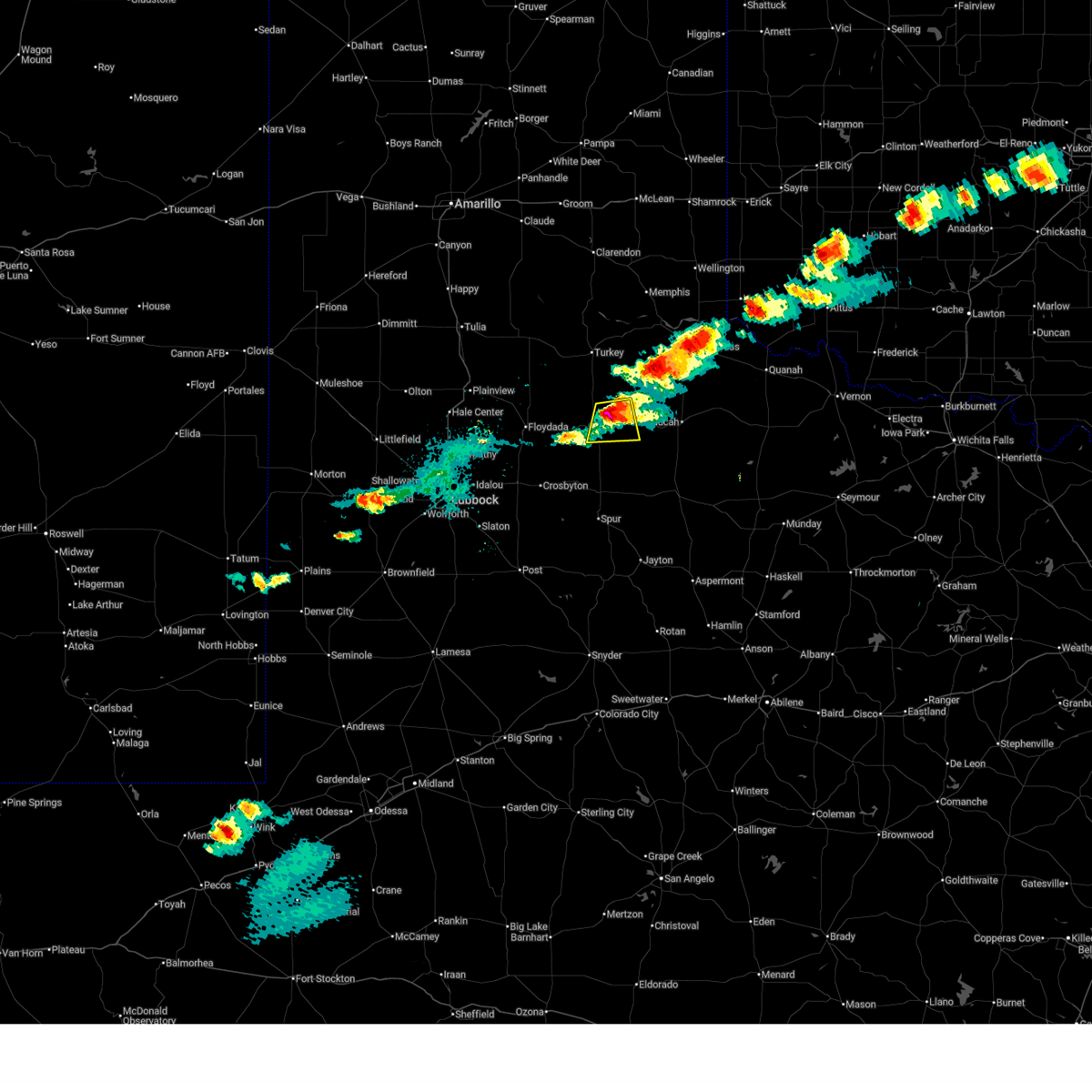
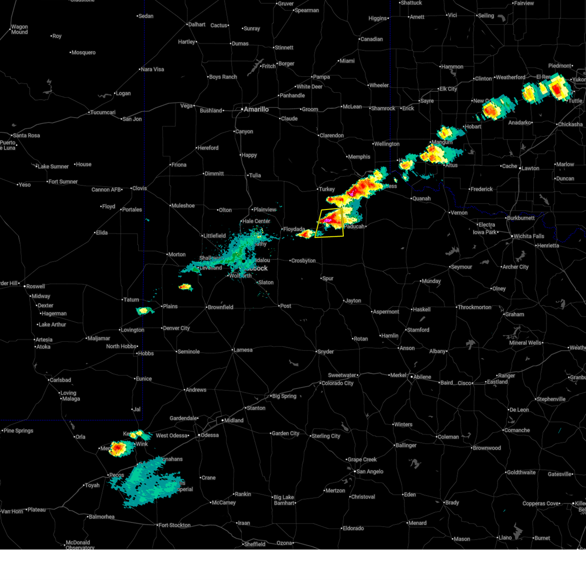
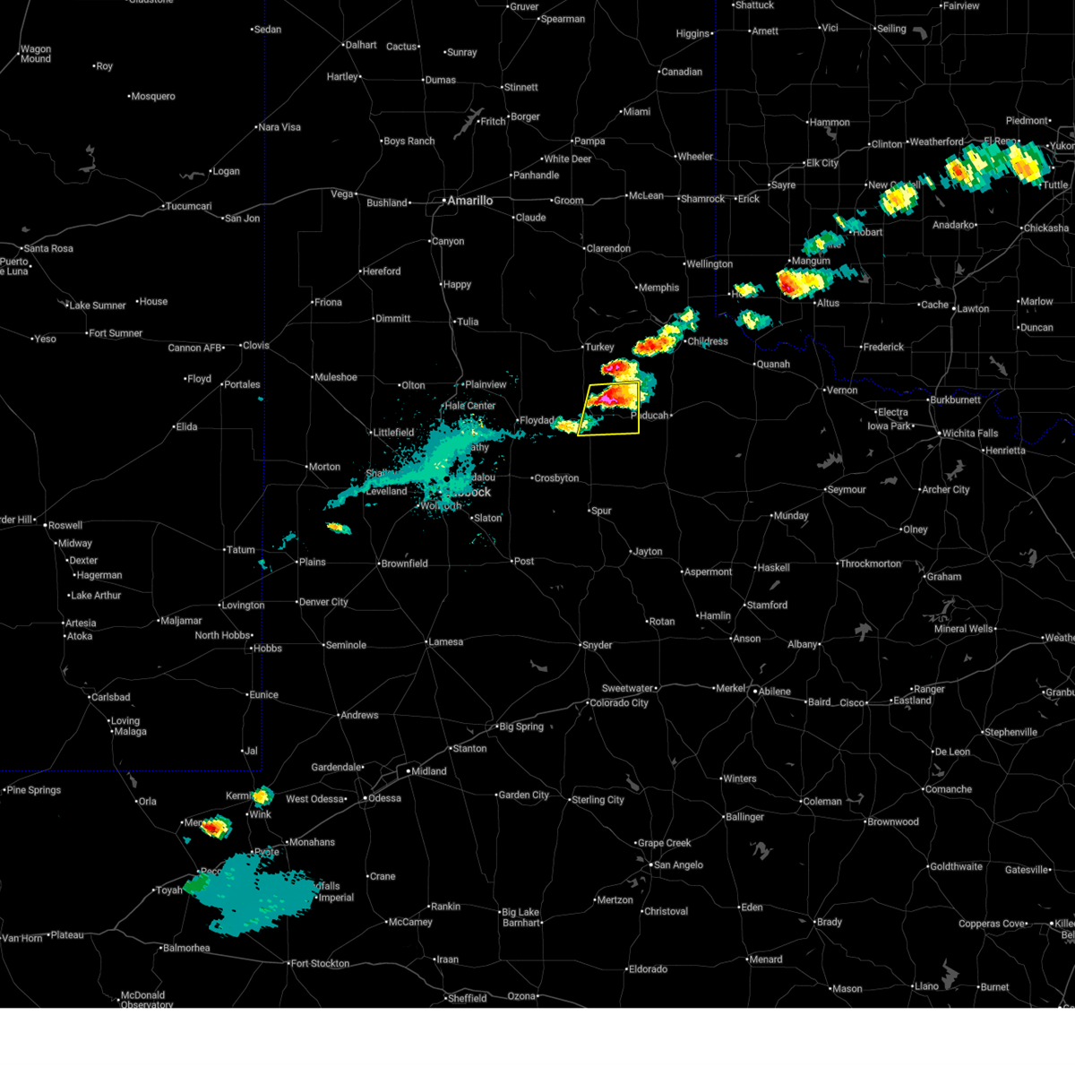
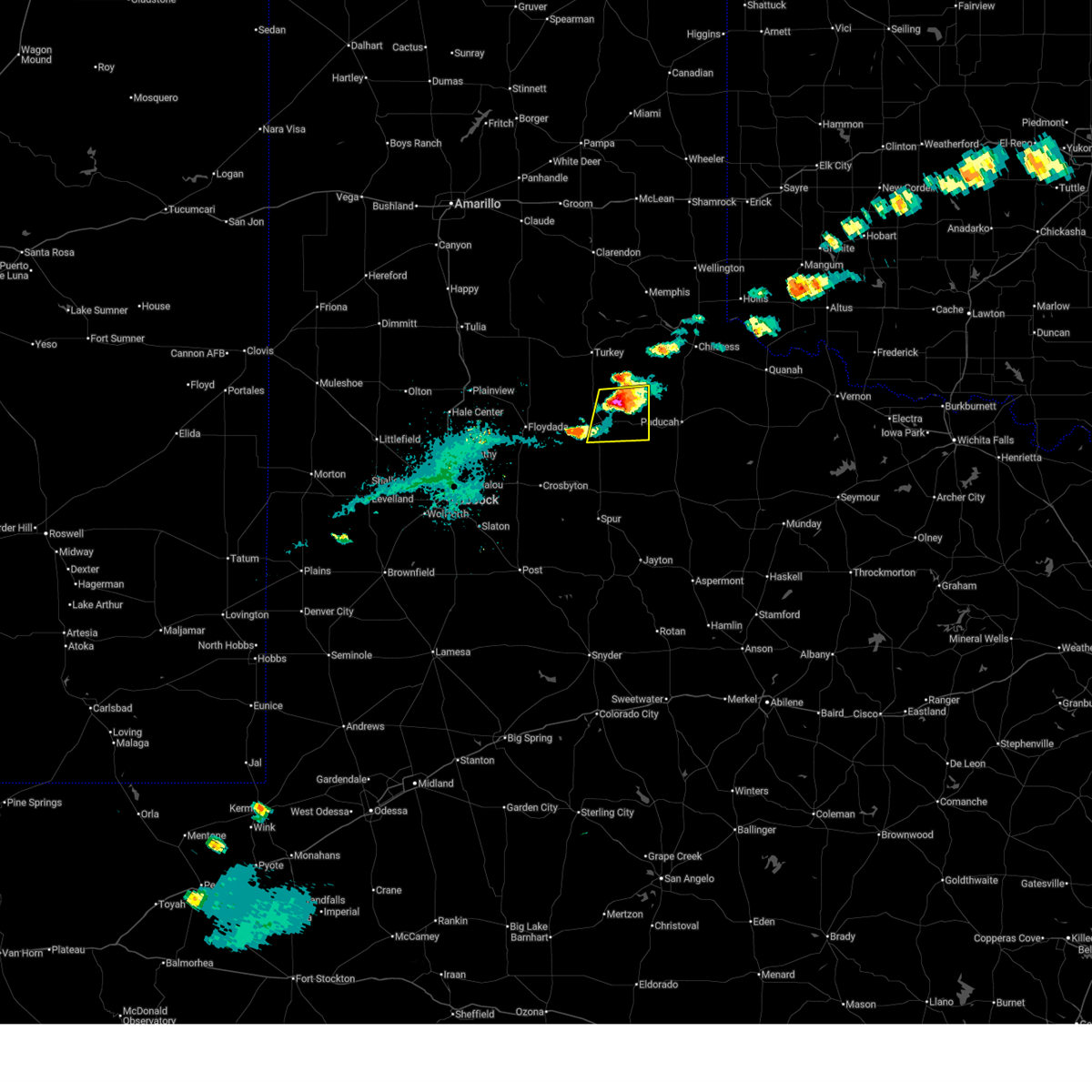
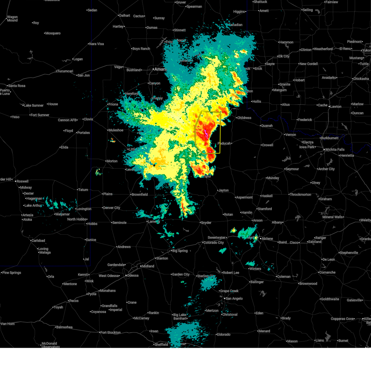
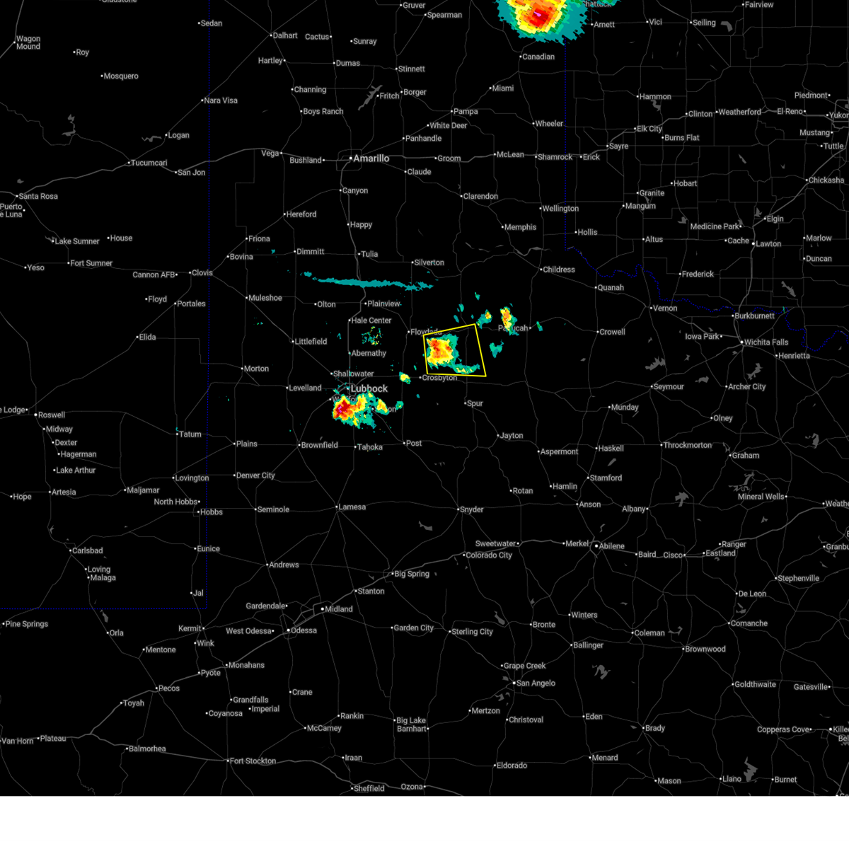
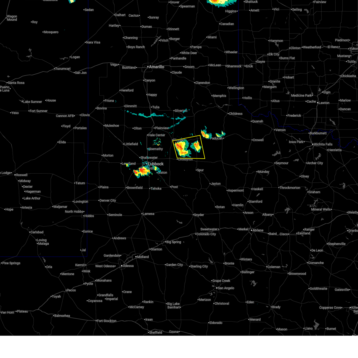
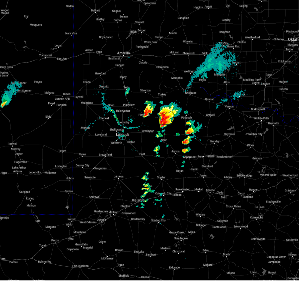
The Top Recent Hail Date for Matador, TX is Thursday, June 11, 2026 (25th out of 108)
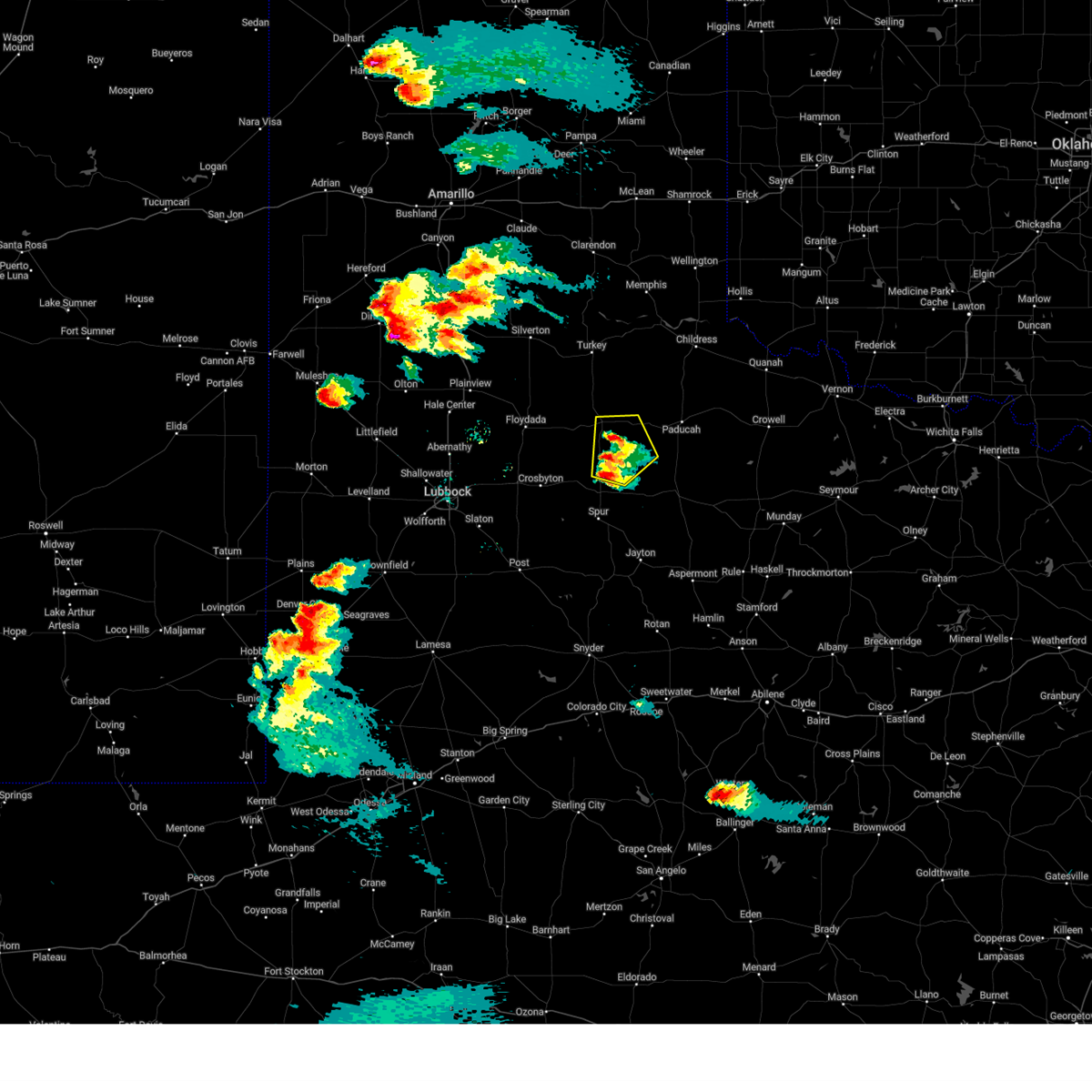
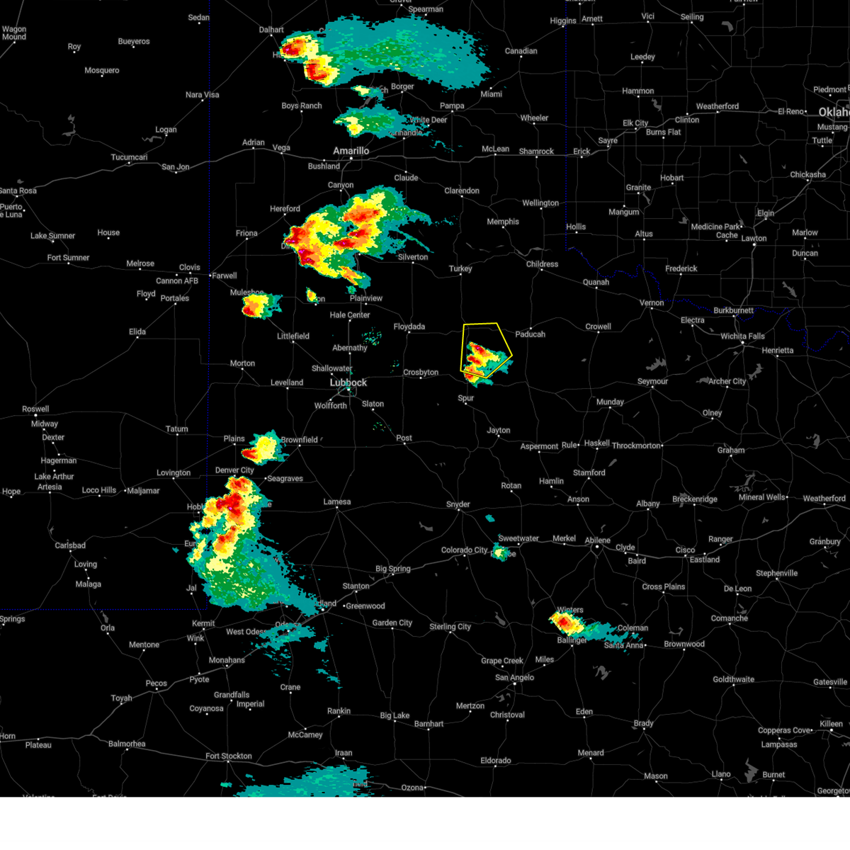
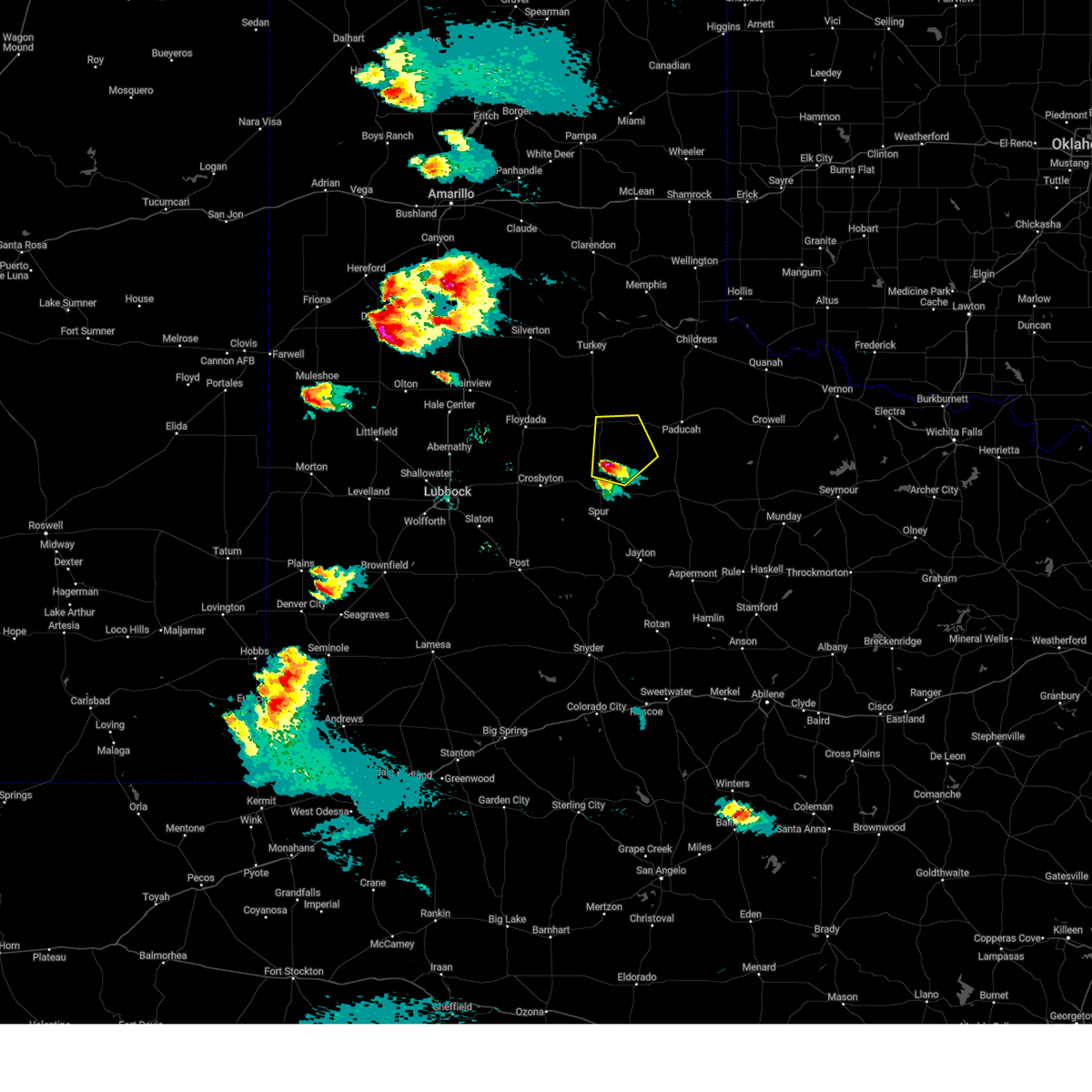
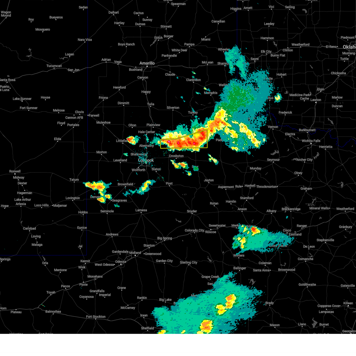
Hail and Wind Damage Spotted near Matador, TX
| Date / Time | Report Details |
|---|---|
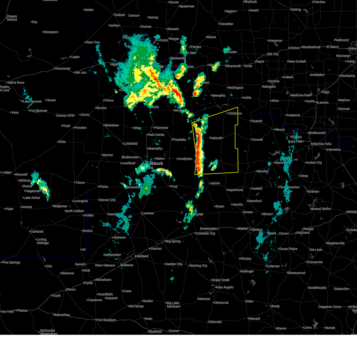
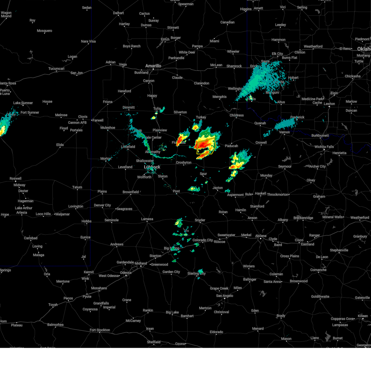
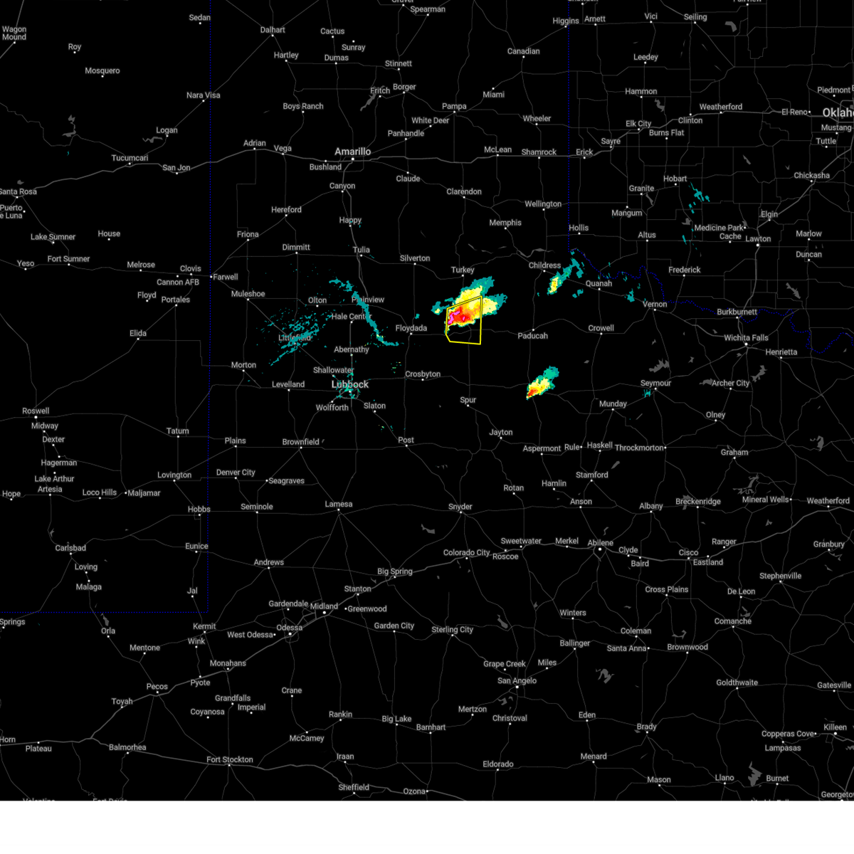
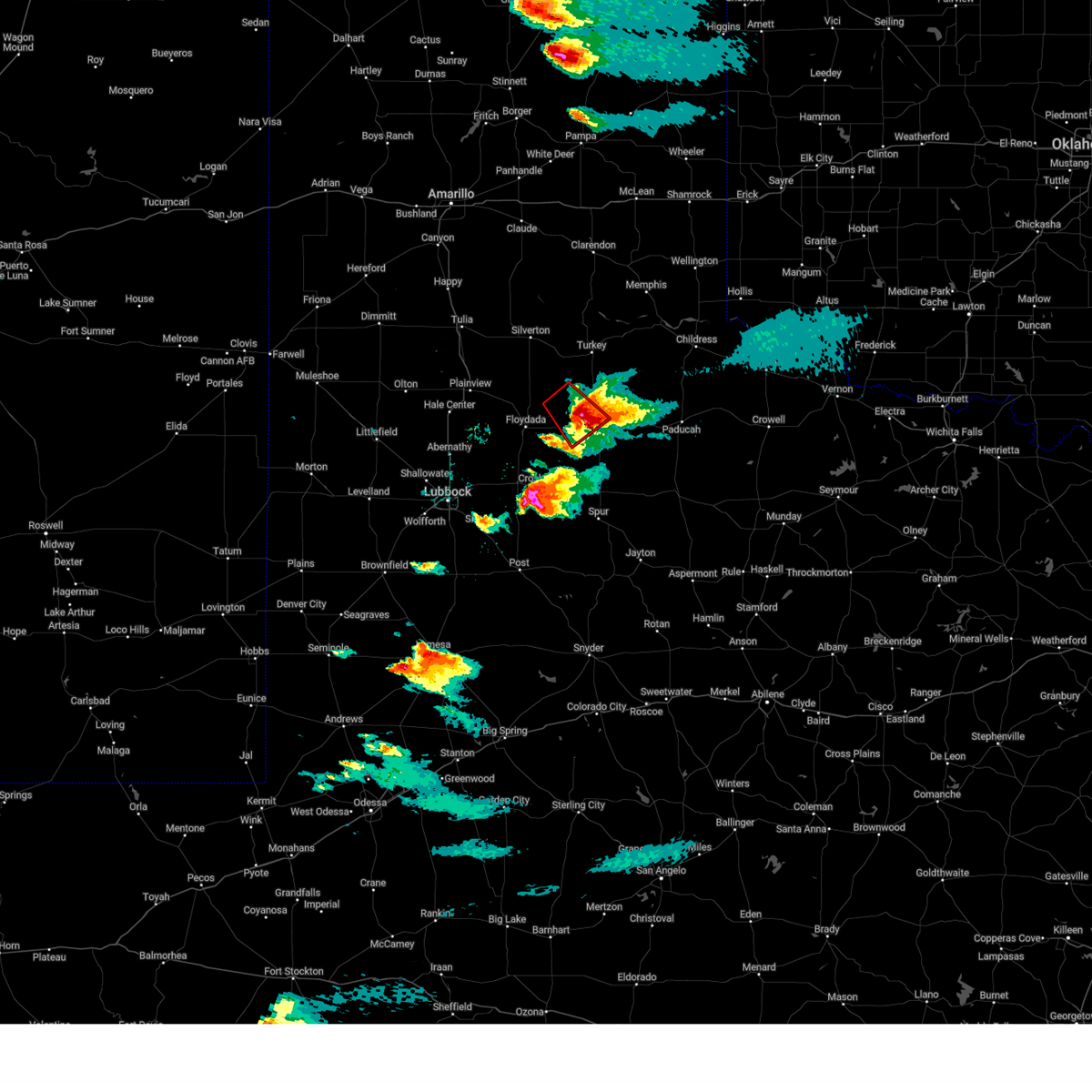
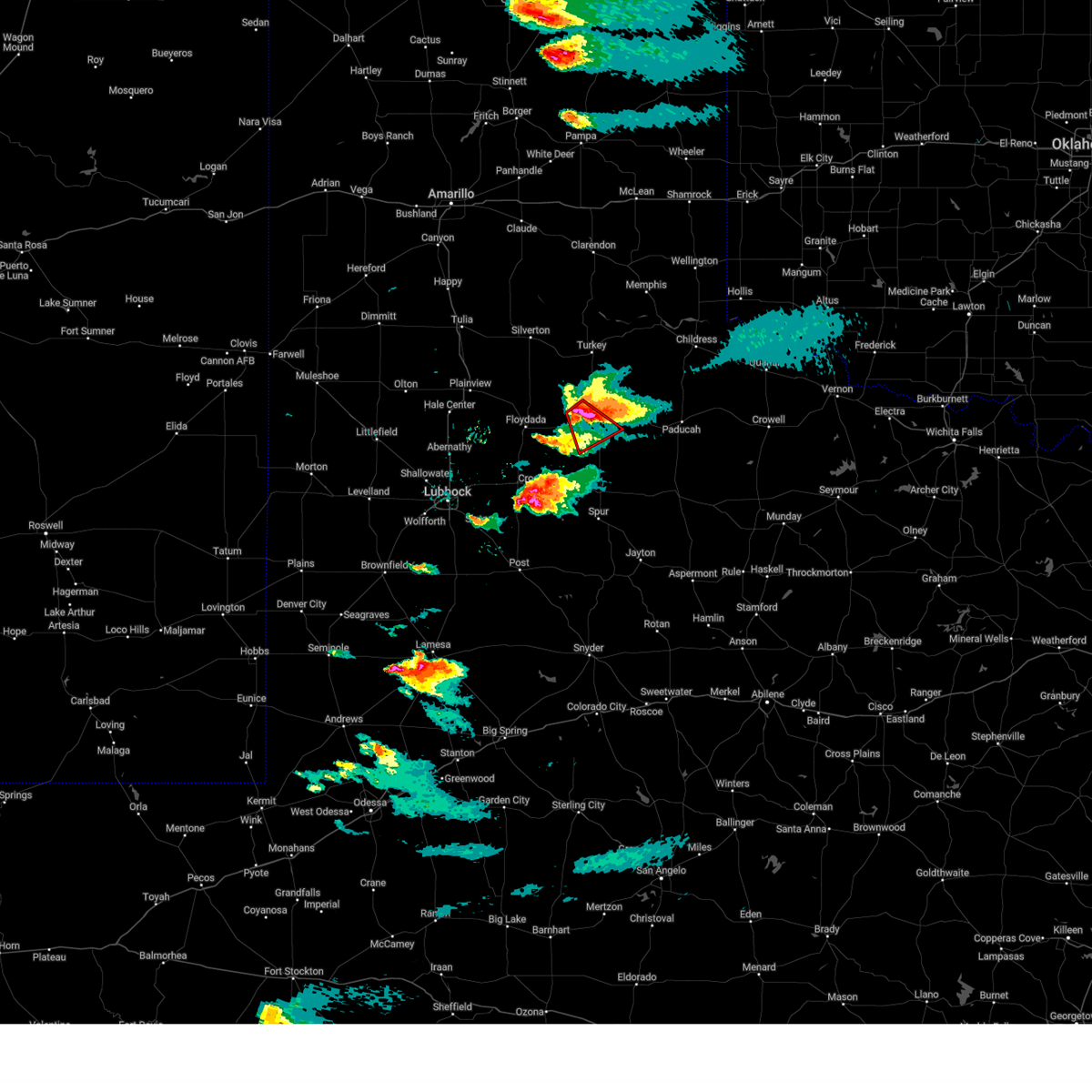
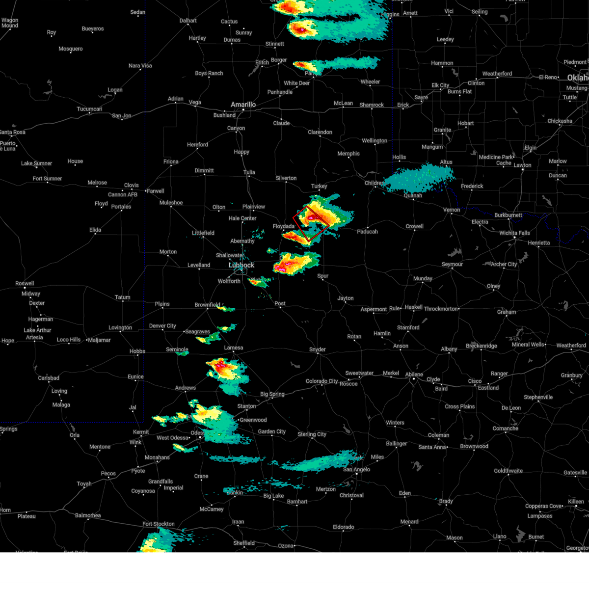
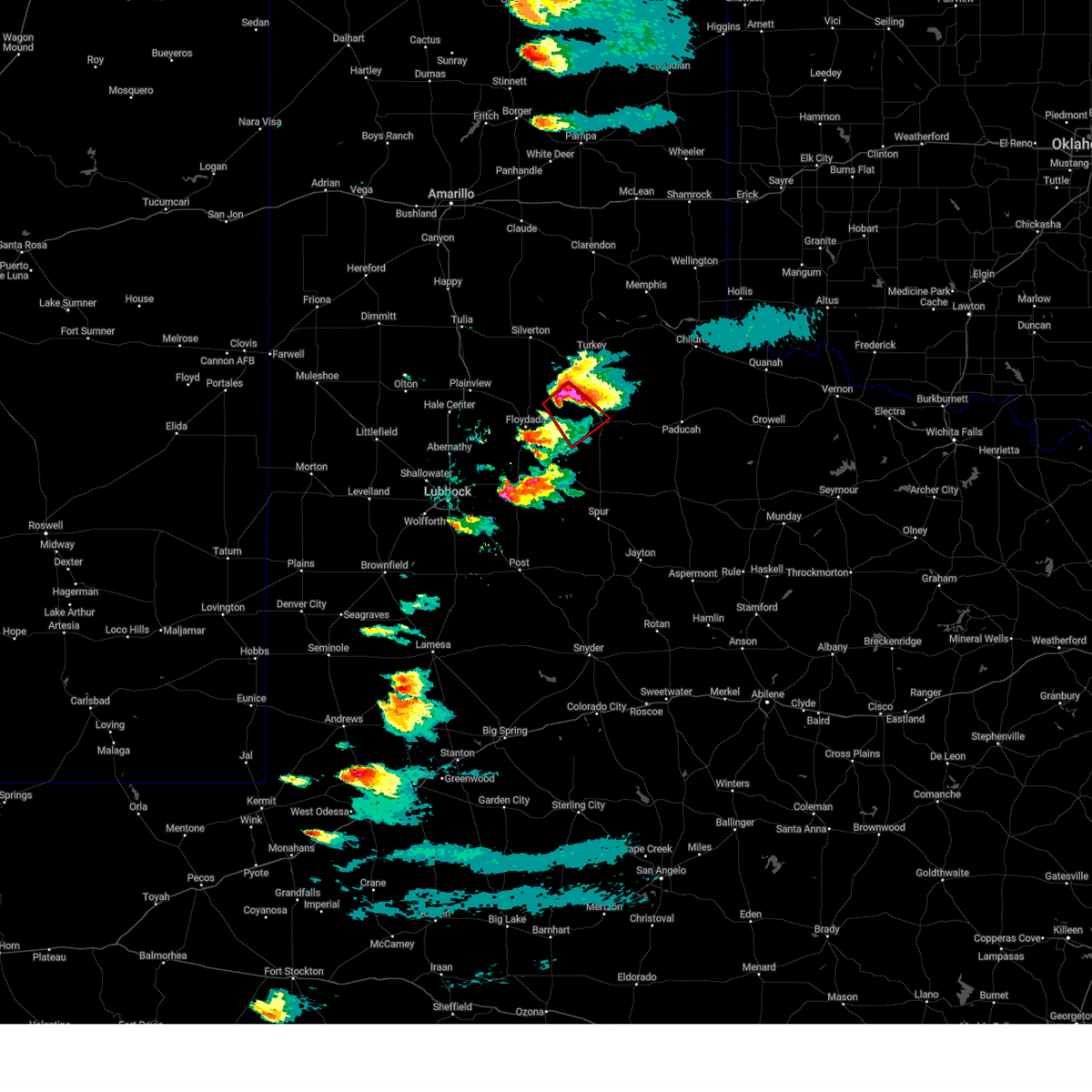
| 6/11/2026 7:06 PM CDT |
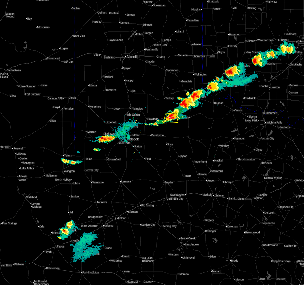 At 706 pm cdt, a severe thunderstorm was located over matador, moving south at 10 mph (radar indicated). Hazards include 60 mph wind gusts and quarter size hail. Hail damage to vehicles is expected. expect wind damage to roofs, siding, and trees. Locations impacted include, matador and roaring springs. At 706 pm cdt, a severe thunderstorm was located over matador, moving south at 10 mph (radar indicated). Hazards include 60 mph wind gusts and quarter size hail. Hail damage to vehicles is expected. expect wind damage to roofs, siding, and trees. Locations impacted include, matador and roaring springs.
|
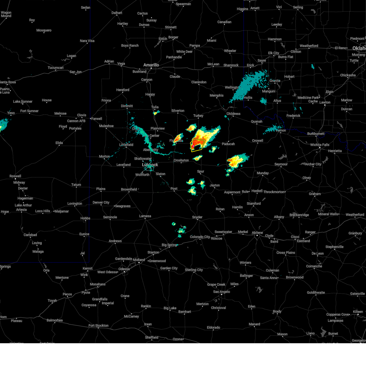
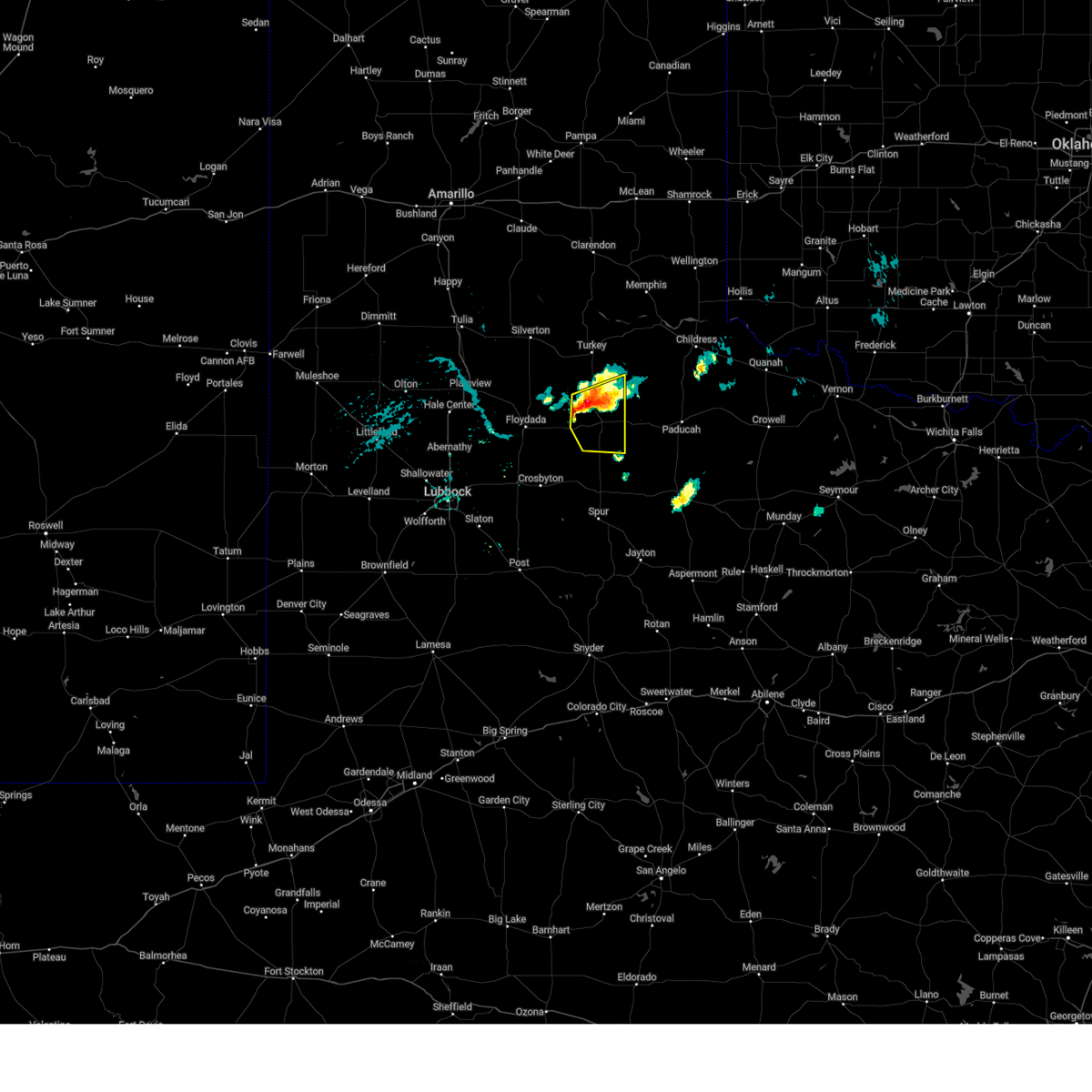
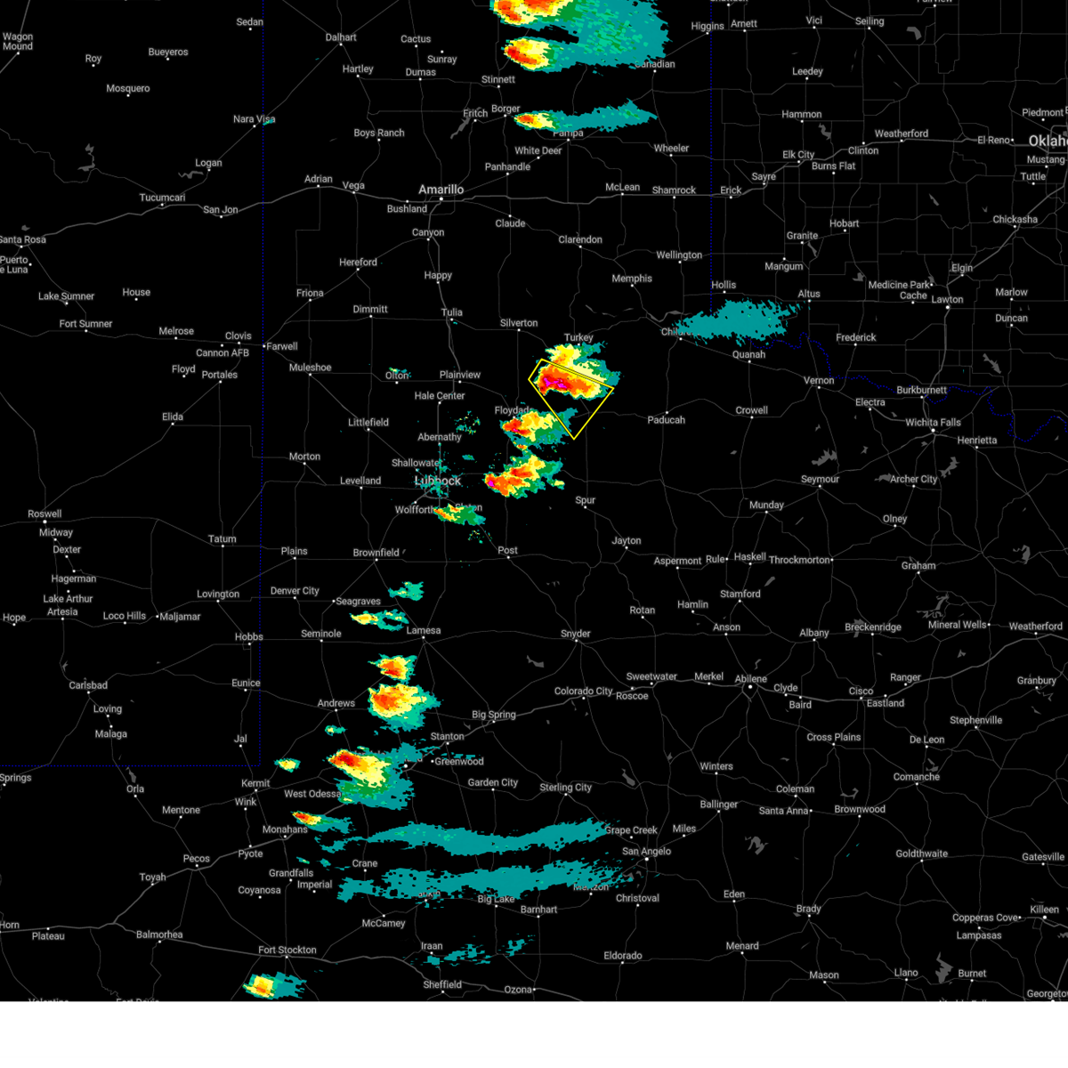
| 6/11/2026 6:54 PM CDT |
 At 654 pm cdt, a severe thunderstorm was located over matador, and is nearly stationary (radar indicated). Hazards include ping pong ball size hail and 60 mph wind gusts. People and animals outdoors will be injured. expect hail damage to roofs, siding, windows, and vehicles. expect wind damage to roofs, siding, and trees. Locations impacted include, matador and roaring springs. At 654 pm cdt, a severe thunderstorm was located over matador, and is nearly stationary (radar indicated). Hazards include ping pong ball size hail and 60 mph wind gusts. People and animals outdoors will be injured. expect hail damage to roofs, siding, windows, and vehicles. expect wind damage to roofs, siding, and trees. Locations impacted include, matador and roaring springs.
|
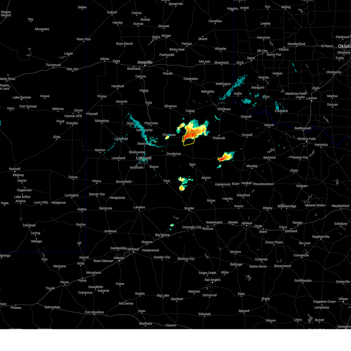
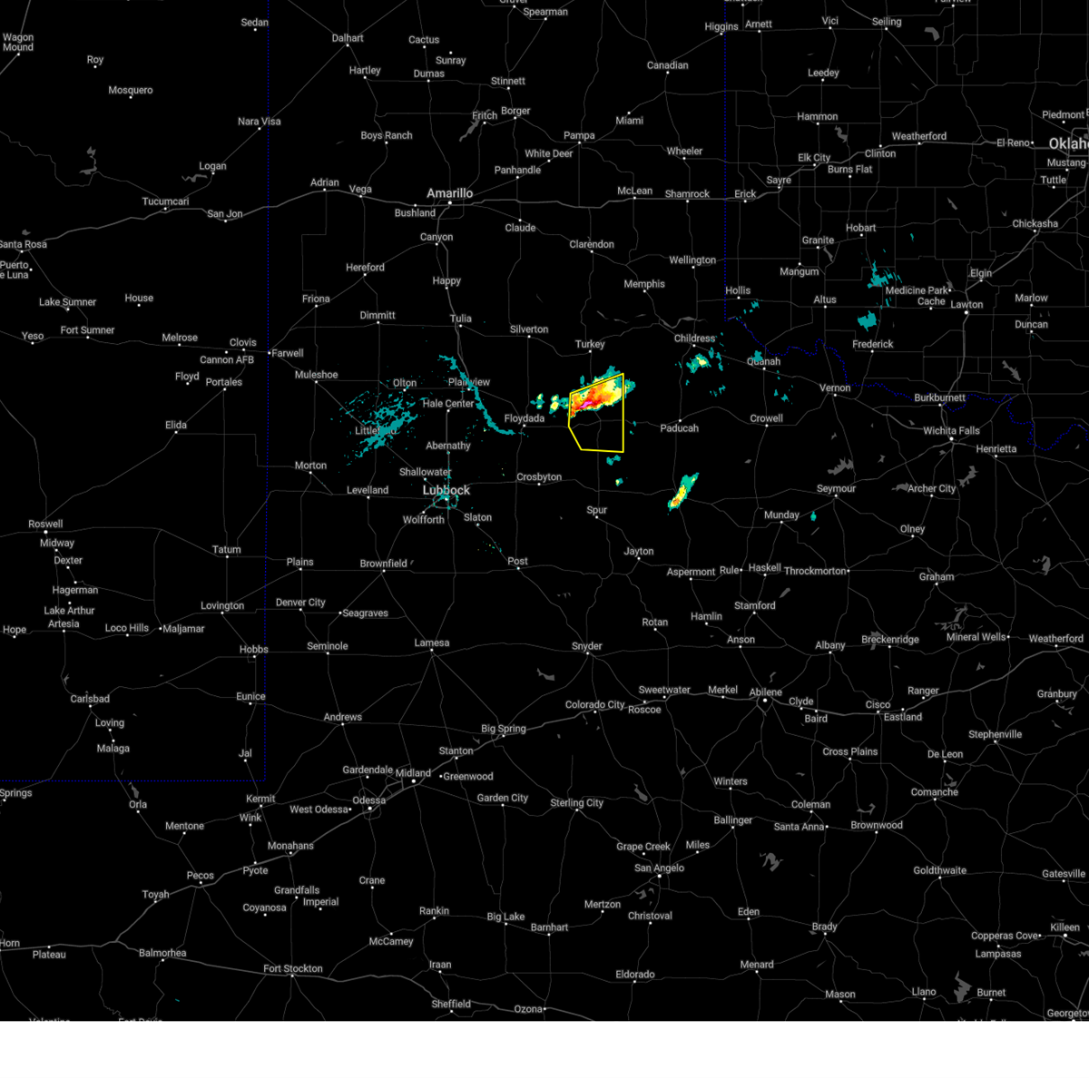
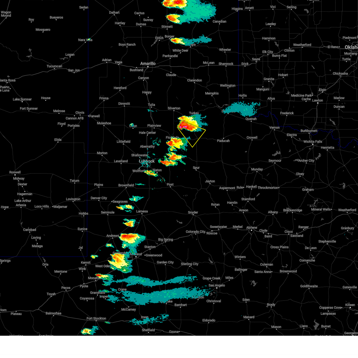
| 6/11/2026 6:46 PM CDT |
 At 646 pm cdt, a severe thunderstorm was located over matador, and is nearly stationary (radar indicated). Hazards include two inch hail and 60 mph wind gusts. People and animals outdoors will be injured. expect hail damage to roofs, siding, windows, and vehicles. expect wind damage to roofs, siding, and trees. Locations impacted include, matador and roaring springs. At 646 pm cdt, a severe thunderstorm was located over matador, and is nearly stationary (radar indicated). Hazards include two inch hail and 60 mph wind gusts. People and animals outdoors will be injured. expect hail damage to roofs, siding, windows, and vehicles. expect wind damage to roofs, siding, and trees. Locations impacted include, matador and roaring springs.
|
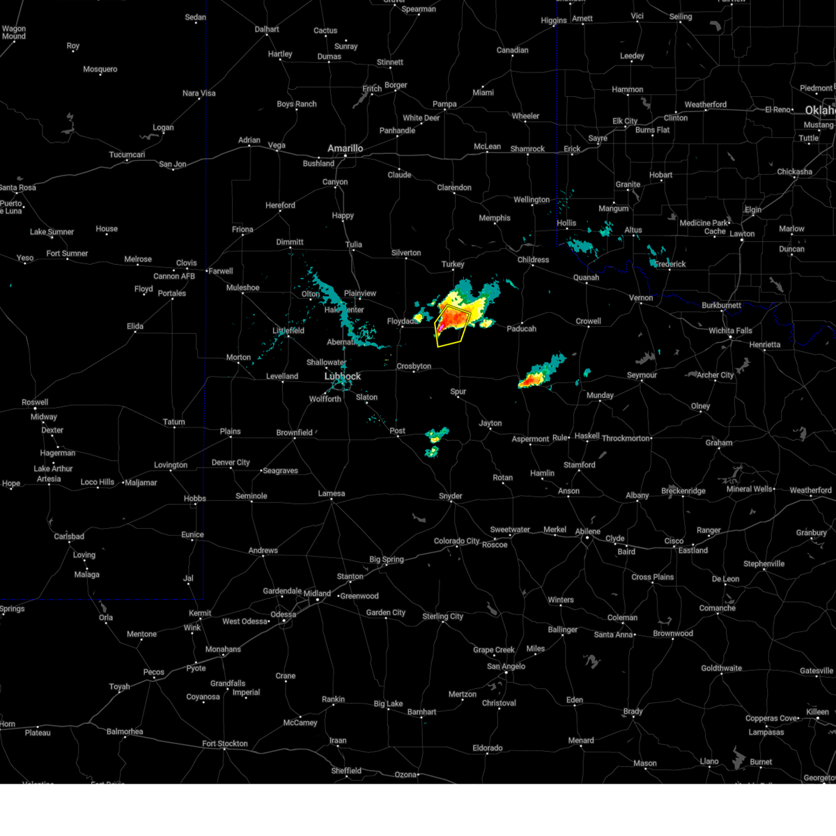
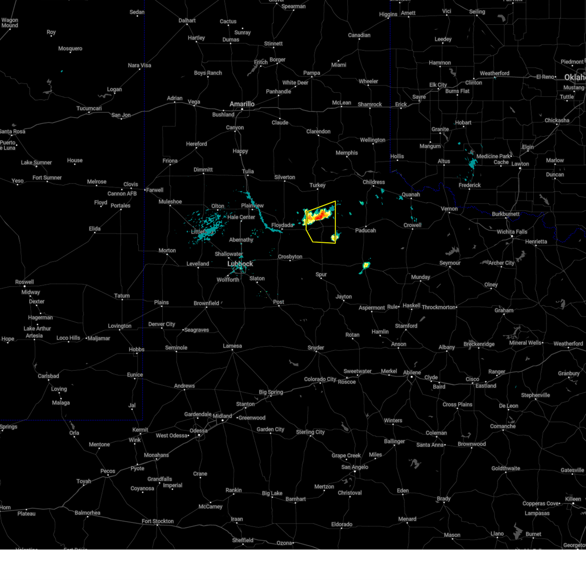
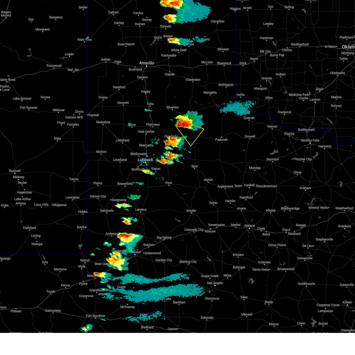
| 6/11/2026 6:37 PM CDT |
 At 637 pm cdt, a severe thunderstorm was located near matador, moving south at 10 mph (radar indicated). Hazards include two inch hail and 60 mph wind gusts. People and animals outdoors will be injured. expect hail damage to roofs, siding, windows, and vehicles. expect wind damage to roofs, siding, and trees. Locations impacted include, matador and roaring springs. At 637 pm cdt, a severe thunderstorm was located near matador, moving south at 10 mph (radar indicated). Hazards include two inch hail and 60 mph wind gusts. People and animals outdoors will be injured. expect hail damage to roofs, siding, windows, and vehicles. expect wind damage to roofs, siding, and trees. Locations impacted include, matador and roaring springs.
|
| 6/11/2026 6:29 PM CDT |
 At 629 pm cdt, a severe thunderstorm was located 6 miles northeast of matador, moving south at 10 mph (radar indicated). Hazards include golf ball size hail and 60 mph wind gusts. People and animals outdoors will be injured. expect hail damage to roofs, siding, windows, and vehicles. expect wind damage to roofs, siding, and trees. Locations impacted include, matador and roaring springs. At 629 pm cdt, a severe thunderstorm was located 6 miles northeast of matador, moving south at 10 mph (radar indicated). Hazards include golf ball size hail and 60 mph wind gusts. People and animals outdoors will be injured. expect hail damage to roofs, siding, windows, and vehicles. expect wind damage to roofs, siding, and trees. Locations impacted include, matador and roaring springs.
|
| 6/11/2026 6:20 PM CDT |
 Svrlub the national weather service in lubbock texas has issued a * severe thunderstorm warning for, central motley county in northwestern texas, * until 715 pm cdt. * at 620 pm cdt, a severe thunderstorm was located 7 miles northeast of matador, moving south at 10 mph (radar indicated). Hazards include ping pong ball size hail and 60 mph wind gusts. People and animals outdoors will be injured. expect hail damage to roofs, siding, windows, and vehicles. Expect wind damage to roofs, siding, and trees. Svrlub the national weather service in lubbock texas has issued a * severe thunderstorm warning for, central motley county in northwestern texas, * until 715 pm cdt. * at 620 pm cdt, a severe thunderstorm was located 7 miles northeast of matador, moving south at 10 mph (radar indicated). Hazards include ping pong ball size hail and 60 mph wind gusts. People and animals outdoors will be injured. expect hail damage to roofs, siding, windows, and vehicles. Expect wind damage to roofs, siding, and trees.
|
| 5/23/2026 11:41 PM CDT | Measured by the west texas mesonet. severe gusts from 58 to 61 mph occurred from 11:36 pm to 11:41 p in motley county TX, 5.3 miles NNE of Matador, TX |
| 5/23/2026 11:39 PM CDT |
 At 1139 pm cdt, severe thunderstorms were located along a line extending from 14 miles northeast of turkey to 11 miles southwest of northfield to 5 miles north of afton, moving east at 55 mph (west texas mesonet. at 1134 pm cdt, a wind gust of 59 mph was measured by the mesonet near matador). Hazards include 60 mph wind gusts and nickel size hail. Expect damage to roofs, siding, and trees. Locations impacted include, matador, turkey, flomot, northfield, and roaring springs. At 1139 pm cdt, severe thunderstorms were located along a line extending from 14 miles northeast of turkey to 11 miles southwest of northfield to 5 miles north of afton, moving east at 55 mph (west texas mesonet. at 1134 pm cdt, a wind gust of 59 mph was measured by the mesonet near matador). Hazards include 60 mph wind gusts and nickel size hail. Expect damage to roofs, siding, and trees. Locations impacted include, matador, turkey, flomot, northfield, and roaring springs.
|
| 5/23/2026 11:34 PM CDT | Measured by the west texas mesone in motley county TX, 4.7 miles ENE of Matador, TX |
| 5/23/2026 11:28 PM CDT |
 At 1128 pm cdt, severe thunderstorms were located along a line extending from 8 miles north of turkey to 6 miles southeast of flomot to 4 miles southeast of dougherty, moving east at 50 mph (west texas mesonet. at 1109 pm cdt, a wind gust of 66 mph was measured by the mesonet near silverton). Hazards include 70 mph wind gusts and nickel size hail. Expect considerable tree damage. damage is likely to mobile homes, roofs, and outbuildings. Locations impacted include, floydada, matador, turkey, caprock canyon state park, quitaque, valley schools, flomot, dougherty, northfield, and roaring springs. At 1128 pm cdt, severe thunderstorms were located along a line extending from 8 miles north of turkey to 6 miles southeast of flomot to 4 miles southeast of dougherty, moving east at 50 mph (west texas mesonet. at 1109 pm cdt, a wind gust of 66 mph was measured by the mesonet near silverton). Hazards include 70 mph wind gusts and nickel size hail. Expect considerable tree damage. damage is likely to mobile homes, roofs, and outbuildings. Locations impacted include, floydada, matador, turkey, caprock canyon state park, quitaque, valley schools, flomot, dougherty, northfield, and roaring springs.
|
| 5/23/2026 11:14 PM CDT |
 Svrlub the national weather service in lubbock texas has issued a * severe thunderstorm warning for, floyd county in northwestern texas, motley county in northwestern texas, southern hall county in the panhandle of texas, southeastern briscoe county in the panhandle of texas, * until midnight cdt. * at 1113 pm cdt, severe thunderstorms were located along a line extending from 6 miles north of caprock canyon state park to 7 miles west of flomot to 3 miles east of lockney, moving east at 45 mph (west texas mesonet. at 1109 pm cdt, a wind gust of 66 mph was measured by the mesonet near silverton). Hazards include 70 mph wind gusts and nickel size hail. Expect considerable tree damage. Damage is likely to mobile homes, roofs, and outbuildings. Svrlub the national weather service in lubbock texas has issued a * severe thunderstorm warning for, floyd county in northwestern texas, motley county in northwestern texas, southern hall county in the panhandle of texas, southeastern briscoe county in the panhandle of texas, * until midnight cdt. * at 1113 pm cdt, severe thunderstorms were located along a line extending from 6 miles north of caprock canyon state park to 7 miles west of flomot to 3 miles east of lockney, moving east at 45 mph (west texas mesonet. at 1109 pm cdt, a wind gust of 66 mph was measured by the mesonet near silverton). Hazards include 70 mph wind gusts and nickel size hail. Expect considerable tree damage. Damage is likely to mobile homes, roofs, and outbuildings.
|
| 5/22/2026 8:57 PM CDT | Storm damage reported in motley county TX, 5.3 miles NNE of Matador, TX |
| 5/22/2026 7:38 PM CDT |
 At 738 pm cdt, severe thunderstorms were located along a line extending from 5 miles west of floydada to 9 miles north of matador, moving northeast at 20 mph (radar indicated). Hazards include 60 mph wind gusts and quarter size hail. Hail damage to vehicles is expected. expect wind damage to roofs, siding, and trees. Locations impacted include, floydada, matador, lockney, flomot, northfield, and south plains. At 738 pm cdt, severe thunderstorms were located along a line extending from 5 miles west of floydada to 9 miles north of matador, moving northeast at 20 mph (radar indicated). Hazards include 60 mph wind gusts and quarter size hail. Hail damage to vehicles is expected. expect wind damage to roofs, siding, and trees. Locations impacted include, floydada, matador, lockney, flomot, northfield, and south plains.
|
| 5/22/2026 7:26 PM CDT |
 Svrlub the national weather service in lubbock texas has issued a * severe thunderstorm warning for, floyd county in northwestern texas, motley county in northwestern texas, * until 830 pm cdt. * at 725 pm cdt, severe thunderstorms were located along a line extending from 6 miles north of floydada to 7 miles northeast of matador, moving north at 10 mph (radar indicated). Hazards include 60 mph wind gusts and half dollar size hail. Hail damage to vehicles is expected. Expect wind damage to roofs, siding, and trees. Svrlub the national weather service in lubbock texas has issued a * severe thunderstorm warning for, floyd county in northwestern texas, motley county in northwestern texas, * until 830 pm cdt. * at 725 pm cdt, severe thunderstorms were located along a line extending from 6 miles north of floydada to 7 miles northeast of matador, moving north at 10 mph (radar indicated). Hazards include 60 mph wind gusts and half dollar size hail. Hail damage to vehicles is expected. Expect wind damage to roofs, siding, and trees.
|
| 5/15/2026 7:07 PM CDT |
 Svrlub the national weather service in lubbock texas has issued a * severe thunderstorm warning for, childress county in the panhandle of texas, eastern motley county in northwestern texas, cottle county in northwestern texas, southeastern hall county in the panhandle of texas, * until 800 pm cdt. * at 706 pm cdt, severe thunderstorms were located along a line extending from 7 miles southwest of dodson to 8 miles southeast of matador, moving southeast at 25 mph (radar indicated). Hazards include 60 mph wind gusts. expect damage to roofs, siding, and trees Svrlub the national weather service in lubbock texas has issued a * severe thunderstorm warning for, childress county in the panhandle of texas, eastern motley county in northwestern texas, cottle county in northwestern texas, southeastern hall county in the panhandle of texas, * until 800 pm cdt. * at 706 pm cdt, severe thunderstorms were located along a line extending from 7 miles southwest of dodson to 8 miles southeast of matador, moving southeast at 25 mph (radar indicated). Hazards include 60 mph wind gusts. expect damage to roofs, siding, and trees
|
| 5/15/2026 7:02 PM CDT |
 At 701 pm cdt, severe thunderstorms were located along a line extending from 4 miles southeast of northfield to 8 miles north of afton, moving east at 40 mph (radar indicated). Hazards include 60 mph wind gusts. Expect damage to roofs, siding, and trees. near zero visibility will be possible along any outflow boundary or stronger wind gust that occurs. Locations impacted include, matador, northfield, afton, mcadoo, and roaring springs. At 701 pm cdt, severe thunderstorms were located along a line extending from 4 miles southeast of northfield to 8 miles north of afton, moving east at 40 mph (radar indicated). Hazards include 60 mph wind gusts. Expect damage to roofs, siding, and trees. near zero visibility will be possible along any outflow boundary or stronger wind gust that occurs. Locations impacted include, matador, northfield, afton, mcadoo, and roaring springs.
|
| 5/15/2026 6:49 PM CDT |
 At 649 pm cdt, severe thunderstorms were located along a line extending from 9 miles north of matador to 5 miles northwest of mcadoo, moving east at 35 mph (radar indicated). Hazards include 60 mph wind gusts. Expect damage to roofs, siding, and trees. near zero visibility will be possible along any outflow boundary or stronger wind gust that occurs. Locations impacted include, matador, northfield, afton, mcadoo, and roaring springs. At 649 pm cdt, severe thunderstorms were located along a line extending from 9 miles north of matador to 5 miles northwest of mcadoo, moving east at 35 mph (radar indicated). Hazards include 60 mph wind gusts. Expect damage to roofs, siding, and trees. near zero visibility will be possible along any outflow boundary or stronger wind gust that occurs. Locations impacted include, matador, northfield, afton, mcadoo, and roaring springs.
|
| 5/15/2026 6:38 PM CDT |
 At 638 pm cdt, severe thunderstorms were located along a line extending from 5 miles southeast of flomot to 9 miles southwest of dougherty, moving east at 30 mph (radar indicated). Hazards include 60 mph wind gusts. Expect damage to roofs, siding, and trees. Locations impacted include, matador, flomot, dougherty, northfield, afton, mcadoo, and roaring springs. At 638 pm cdt, severe thunderstorms were located along a line extending from 5 miles southeast of flomot to 9 miles southwest of dougherty, moving east at 30 mph (radar indicated). Hazards include 60 mph wind gusts. Expect damage to roofs, siding, and trees. Locations impacted include, matador, flomot, dougherty, northfield, afton, mcadoo, and roaring springs.
|
| 5/15/2026 6:24 PM CDT |
 Svrlub the national weather service in lubbock texas has issued a * severe thunderstorm warning for, northwestern dickens county in northwestern texas, eastern floyd county in northwestern texas, northeastern crosby county in northwestern texas, motley county in northwestern texas, * until 715 pm cdt. * at 624 pm cdt, severe thunderstorms were located along a line extending from flomot to 7 miles northeast of cone, moving east at 30 mph (radar indicated). Hazards include 60 mph wind gusts. Expect damage to roofs, siding, and trees. Near zero visibility will be possible along any outflow boundary or stronger wind gust that occurs. Svrlub the national weather service in lubbock texas has issued a * severe thunderstorm warning for, northwestern dickens county in northwestern texas, eastern floyd county in northwestern texas, northeastern crosby county in northwestern texas, motley county in northwestern texas, * until 715 pm cdt. * at 624 pm cdt, severe thunderstorms were located along a line extending from flomot to 7 miles northeast of cone, moving east at 30 mph (radar indicated). Hazards include 60 mph wind gusts. Expect damage to roofs, siding, and trees. Near zero visibility will be possible along any outflow boundary or stronger wind gust that occurs.
|
| 5/14/2026 7:26 PM CDT |
 Svrlub the national weather service in lubbock texas has issued a * severe thunderstorm warning for, childress county in the panhandle of texas, motley county in northwestern texas, cottle county in northwestern texas, hall county in the panhandle of texas, * until 830 pm cdt. * at 724 pm cdt, severe thunderstorms were located along a line extending from 11 miles southwest of dodson to 9 miles southwest of kirkland to 7 miles north of dumont, moving east at 20 mph (radar indicated). Hazards include 60 mph wind gusts and half dollar size hail. Hail damage to vehicles is expected. expect wind damage to roofs, siding, and trees. Near zero visbility will be possible along any outflow boundary or stronger wind gust that occurs. Svrlub the national weather service in lubbock texas has issued a * severe thunderstorm warning for, childress county in the panhandle of texas, motley county in northwestern texas, cottle county in northwestern texas, hall county in the panhandle of texas, * until 830 pm cdt. * at 724 pm cdt, severe thunderstorms were located along a line extending from 11 miles southwest of dodson to 9 miles southwest of kirkland to 7 miles north of dumont, moving east at 20 mph (radar indicated). Hazards include 60 mph wind gusts and half dollar size hail. Hail damage to vehicles is expected. expect wind damage to roofs, siding, and trees. Near zero visbility will be possible along any outflow boundary or stronger wind gust that occurs.
|
| 5/14/2026 7:16 PM CDT | West texas mesone in motley county TX, 3.9 miles ENE of Matador, TX |
| 5/14/2026 6:49 PM CDT |
 Svrlub the national weather service in lubbock texas has issued a * severe thunderstorm warning for, southeastern floyd county in northwestern texas, childress county in the panhandle of texas, motley county in northwestern texas, cottle county in northwestern texas, hall county in the panhandle of texas, eastern briscoe county in the panhandle of texas, * until 730 pm cdt. * at 649 pm cdt, severe thunderstorms were located along a line extending from 10 miles southwest of wellington to near tell to matador, moving east at 30 mph (radar indicated). Hazards include 60 mph wind gusts and quarter size hail. near zero visbility will be possible along any outflow boundary or stronger wind gust that occurs. Hail damage to vehicles is expected. Expect wind damage to roofs, siding, and trees. Svrlub the national weather service in lubbock texas has issued a * severe thunderstorm warning for, southeastern floyd county in northwestern texas, childress county in the panhandle of texas, motley county in northwestern texas, cottle county in northwestern texas, hall county in the panhandle of texas, eastern briscoe county in the panhandle of texas, * until 730 pm cdt. * at 649 pm cdt, severe thunderstorms were located along a line extending from 10 miles southwest of wellington to near tell to matador, moving east at 30 mph (radar indicated). Hazards include 60 mph wind gusts and quarter size hail. near zero visbility will be possible along any outflow boundary or stronger wind gust that occurs. Hail damage to vehicles is expected. Expect wind damage to roofs, siding, and trees.
|
| 5/14/2026 6:37 PM CDT |
 At 637 pm cdt, a severe thunderstorm was located 7 miles northwest of tell, or 12 miles west of childress, moving east at 30 mph (radar indicated). Hazards include 60 mph wind gusts and quarter size hail. Hail damage to vehicles is expected. expect wind damage to roofs, siding, and trees. near zero visbility will be possible along any outflow boundary or stronger wind gust that occurs. Locations impacted include, childress, memphis, paducah, matador, turkey, cee vee, dougherty, brice, swearingen, tell, northfield, delwin, chalk, roaring springs, estelline, lakeview, and plaska community. At 637 pm cdt, a severe thunderstorm was located 7 miles northwest of tell, or 12 miles west of childress, moving east at 30 mph (radar indicated). Hazards include 60 mph wind gusts and quarter size hail. Hail damage to vehicles is expected. expect wind damage to roofs, siding, and trees. near zero visbility will be possible along any outflow boundary or stronger wind gust that occurs. Locations impacted include, childress, memphis, paducah, matador, turkey, cee vee, dougherty, brice, swearingen, tell, northfield, delwin, chalk, roaring springs, estelline, lakeview, and plaska community.
|
| 5/14/2026 6:19 PM CDT |
 Svrlub the national weather service in lubbock texas has issued a * severe thunderstorm warning for, eastern floyd county in northwestern texas, childress county in the panhandle of texas, motley county in northwestern texas, cottle county in northwestern texas, hall county in the panhandle of texas, eastern briscoe county in the panhandle of texas, * until 645 pm cdt. * at 619 pm cdt, a severe thunderstorm was located 12 miles northeast of turkey, moving east at 30 mph (radar indicated). Hazards include 60 mph wind gusts. expect damage to roofs, siding, and trees Svrlub the national weather service in lubbock texas has issued a * severe thunderstorm warning for, eastern floyd county in northwestern texas, childress county in the panhandle of texas, motley county in northwestern texas, cottle county in northwestern texas, hall county in the panhandle of texas, eastern briscoe county in the panhandle of texas, * until 645 pm cdt. * at 619 pm cdt, a severe thunderstorm was located 12 miles northeast of turkey, moving east at 30 mph (radar indicated). Hazards include 60 mph wind gusts. expect damage to roofs, siding, and trees
|
| 4/4/2026 1:19 AM CDT |
 At 118 am cdt, a severe thunderstorm was located 7 miles south of matador, moving east at 30 mph (radar indicated). Hazards include 60 mph wind gusts and penny size hail. Expect damage to roofs, siding, and trees. Locations impacted include, matador and roaring springs. At 118 am cdt, a severe thunderstorm was located 7 miles south of matador, moving east at 30 mph (radar indicated). Hazards include 60 mph wind gusts and penny size hail. Expect damage to roofs, siding, and trees. Locations impacted include, matador and roaring springs.
|
| 4/4/2026 1:06 AM CDT |
 At 106 am cdt, a severe thunderstorm was located 10 miles east of dougherty, or 10 miles southwest of matador, moving east at 35 mph (radar indicated). Hazards include 60 mph wind gusts and penny size hail. Expect damage to roofs, siding, and trees. Locations impacted include, matador and roaring springs. At 106 am cdt, a severe thunderstorm was located 10 miles east of dougherty, or 10 miles southwest of matador, moving east at 35 mph (radar indicated). Hazards include 60 mph wind gusts and penny size hail. Expect damage to roofs, siding, and trees. Locations impacted include, matador and roaring springs.
|
| 4/4/2026 1:06 AM CDT |
 the severe thunderstorm warning has been cancelled and is no longer in effect the severe thunderstorm warning has been cancelled and is no longer in effect
|
| 4/4/2026 12:50 AM CDT |
 Svrlub the national weather service in lubbock texas has issued a * severe thunderstorm warning for, southeastern floyd county in northwestern texas, southwestern motley county in northwestern texas, * until 130 am cdt. * at 1250 am cdt, severe thunderstorms were located along a line extending from 6 miles northwest of dougherty to 9 miles northwest of mcadoo, moving east at 30 mph (radar indicated). Hazards include 60 mph wind gusts and penny size hail. expect damage to roofs, siding, and trees Svrlub the national weather service in lubbock texas has issued a * severe thunderstorm warning for, southeastern floyd county in northwestern texas, southwestern motley county in northwestern texas, * until 130 am cdt. * at 1250 am cdt, severe thunderstorms were located along a line extending from 6 miles northwest of dougherty to 9 miles northwest of mcadoo, moving east at 30 mph (radar indicated). Hazards include 60 mph wind gusts and penny size hail. expect damage to roofs, siding, and trees
|
| 11/20/2025 4:19 PM CST |
 Svrlub the national weather service in lubbock texas has issued a * severe thunderstorm warning for, north central kent county in northwestern texas, dickens county in northwestern texas, king county in northwestern texas, southern childress county in the panhandle of texas, motley county in northwestern texas, cottle county in northwestern texas, southeastern hall county in the panhandle of texas, * until 515 pm cst. * at 418 pm cst, severe thunderstorms were located along a line extending from 7 miles east of flomot to 6 miles east of afton to 6 miles southeast of spur, moving east at 40 mph (radar indicated). Hazards include 60 mph wind gusts and quarter size hail. Hail damage to vehicles is expected. Expect wind damage to roofs, siding, and trees. Svrlub the national weather service in lubbock texas has issued a * severe thunderstorm warning for, north central kent county in northwestern texas, dickens county in northwestern texas, king county in northwestern texas, southern childress county in the panhandle of texas, motley county in northwestern texas, cottle county in northwestern texas, southeastern hall county in the panhandle of texas, * until 515 pm cst. * at 418 pm cst, severe thunderstorms were located along a line extending from 7 miles east of flomot to 6 miles east of afton to 6 miles southeast of spur, moving east at 40 mph (radar indicated). Hazards include 60 mph wind gusts and quarter size hail. Hail damage to vehicles is expected. Expect wind damage to roofs, siding, and trees.
|
| 6/17/2025 7:35 PM CDT |
 At 735 pm cdt, a severe thunderstorm was located 5 miles south of dougherty, or 17 miles southwest of matador, moving east at 20 mph (radar indicated). Hazards include 60 mph wind gusts and penny size hail. Expect damage to roofs, siding, and trees. Locations impacted include, matador, dougherty, afton, mcadoo, and roaring springs. At 735 pm cdt, a severe thunderstorm was located 5 miles south of dougherty, or 17 miles southwest of matador, moving east at 20 mph (radar indicated). Hazards include 60 mph wind gusts and penny size hail. Expect damage to roofs, siding, and trees. Locations impacted include, matador, dougherty, afton, mcadoo, and roaring springs.
|
| 6/17/2025 7:12 PM CDT |
 Svrlub the national weather service in lubbock texas has issued a * severe thunderstorm warning for, northwestern dickens county in northwestern texas, southeastern floyd county in northwestern texas, northeastern crosby county in northwestern texas, southwestern motley county in northwestern texas, * until 800 pm cdt. * at 712 pm cdt, a severe thunderstorm was located 7 miles southwest of dougherty, or 13 miles southeast of floydada, moving east at 20 mph (radar indicated). Hazards include 60 mph wind gusts and penny size hail. expect damage to roofs, siding, and trees Svrlub the national weather service in lubbock texas has issued a * severe thunderstorm warning for, northwestern dickens county in northwestern texas, southeastern floyd county in northwestern texas, northeastern crosby county in northwestern texas, southwestern motley county in northwestern texas, * until 800 pm cdt. * at 712 pm cdt, a severe thunderstorm was located 7 miles southwest of dougherty, or 13 miles southeast of floydada, moving east at 20 mph (radar indicated). Hazards include 60 mph wind gusts and penny size hail. expect damage to roofs, siding, and trees
|
| 6/6/2025 3:20 AM CDT | Storm damage reported in motley county TX, 4.7 miles ENE of Matador, TX |
| 5/25/2025 4:15 PM CDT | Ping Pong Ball sized hail reported 1.4 miles SW of Matador, TX |
| 5/25/2025 4:11 PM CDT |
 At 410 pm cdt, a severe thunderstorm was located 6 miles south of matador, moving southeast at 10 mph (trained weather spotters). Hazards include tennis ball size hail and 60 mph wind gusts. People and animals outdoors will be injured. expect hail damage to roofs, siding, windows, and vehicles. expect wind damage to roofs, siding, and trees. Locations impacted include, matador and roaring springs. At 410 pm cdt, a severe thunderstorm was located 6 miles south of matador, moving southeast at 10 mph (trained weather spotters). Hazards include tennis ball size hail and 60 mph wind gusts. People and animals outdoors will be injured. expect hail damage to roofs, siding, windows, and vehicles. expect wind damage to roofs, siding, and trees. Locations impacted include, matador and roaring springs.
|
| 5/25/2025 4:09 PM CDT | Ping Pong Ball sized hail reported 7.7 miles NNE of Matador, TX, icechip report. |
| 5/25/2025 4:04 PM CDT | Ping Pong Ball sized hail reported 8.1 miles NNE of Matador, TX, report from mping: ping pong ball (1.50 in.). |
| 5/25/2025 4:02 PM CDT | Quarter sized hail reported 8.1 miles NNE of Matador, TX, report from mping: quarter (1.00 in.). |
| 5/25/2025 3:54 PM CDT |
 Svrlub the national weather service in lubbock texas has issued a * severe thunderstorm warning for, southern motley county in northwestern texas, * until 500 pm cdt. * at 354 pm cdt, a severe thunderstorm was located 4 miles southwest of matador, moving east at 20 mph (trained weather spotters). Hazards include tennis ball size hail and 60 mph wind gusts. People and animals outdoors will be injured. expect hail damage to roofs, siding, windows, and vehicles. Expect wind damage to roofs, siding, and trees. Svrlub the national weather service in lubbock texas has issued a * severe thunderstorm warning for, southern motley county in northwestern texas, * until 500 pm cdt. * at 354 pm cdt, a severe thunderstorm was located 4 miles southwest of matador, moving east at 20 mph (trained weather spotters). Hazards include tennis ball size hail and 60 mph wind gusts. People and animals outdoors will be injured. expect hail damage to roofs, siding, windows, and vehicles. Expect wind damage to roofs, siding, and trees.
|
| 5/25/2025 3:37 PM CDT |
 At 337 pm cdt, a severe thunderstorm was located 4 miles east of dougherty, or 12 miles southwest of matador, moving south at 5 mph (radar indicated). Hazards include two inch hail and 60 mph wind gusts. People and animals outdoors will be injured. expect hail damage to roofs, siding, windows, and vehicles. expect wind damage to roofs, siding, and trees. Locations impacted include, matador and roaring springs. At 337 pm cdt, a severe thunderstorm was located 4 miles east of dougherty, or 12 miles southwest of matador, moving south at 5 mph (radar indicated). Hazards include two inch hail and 60 mph wind gusts. People and animals outdoors will be injured. expect hail damage to roofs, siding, windows, and vehicles. expect wind damage to roofs, siding, and trees. Locations impacted include, matador and roaring springs.
|
| 5/25/2025 3:28 PM CDT |
 At 328 pm cdt, a severe thunderstorm was located 4 miles east of dougherty, or 12 miles southwest of matador, moving south at 5 mph (public). Hazards include tennis ball size hail and 60 mph wind gusts. People and animals outdoors will be injured. expect hail damage to roofs, siding, windows, and vehicles. expect wind damage to roofs, siding, and trees. Locations impacted include, matador and roaring springs. At 328 pm cdt, a severe thunderstorm was located 4 miles east of dougherty, or 12 miles southwest of matador, moving south at 5 mph (public). Hazards include tennis ball size hail and 60 mph wind gusts. People and animals outdoors will be injured. expect hail damage to roofs, siding, windows, and vehicles. expect wind damage to roofs, siding, and trees. Locations impacted include, matador and roaring springs.
|
| 5/25/2025 3:24 PM CDT | Hen Egg sized hail reported 9.7 miles E of Matador, TX, icechip report. |
| 5/25/2025 3:15 PM CDT |
 At 315 pm cdt, a severe thunderstorm was located 5 miles east of dougherty, or 10 miles west of matador, moving south at 10 mph (public). Hazards include tennis ball size hail and 60 mph wind gusts. People and animals outdoors will be injured. expect hail damage to roofs, siding, windows, and vehicles. expect wind damage to roofs, siding, and trees. Locations impacted include, matador and roaring springs. At 315 pm cdt, a severe thunderstorm was located 5 miles east of dougherty, or 10 miles west of matador, moving south at 10 mph (public). Hazards include tennis ball size hail and 60 mph wind gusts. People and animals outdoors will be injured. expect hail damage to roofs, siding, windows, and vehicles. expect wind damage to roofs, siding, and trees. Locations impacted include, matador and roaring springs.
|
| 5/25/2025 3:11 PM CDT | Hen Egg sized hail reported 9.7 miles E of Matador, TX, report from mping: hen egg (2.00 in.). |
| 5/25/2025 3:10 PM CDT | Quarter sized hail reported 6.8 miles ENE of Matador, TX |
| 5/25/2025 3:08 PM CDT |
 At 308 pm cdt, a severe thunderstorm was located 5 miles northeast of dougherty, or 10 miles west of matador, moving south at 5 mph (public. hail near tennis ball size was reported 7 miles northeast of dougherty). Hazards include tennis ball size hail and 60 mph wind gusts. People and animals outdoors will be injured. expect hail damage to roofs, siding, windows, and vehicles. expect wind damage to roofs, siding, and trees. Locations impacted include, matador and roaring springs. At 308 pm cdt, a severe thunderstorm was located 5 miles northeast of dougherty, or 10 miles west of matador, moving south at 5 mph (public. hail near tennis ball size was reported 7 miles northeast of dougherty). Hazards include tennis ball size hail and 60 mph wind gusts. People and animals outdoors will be injured. expect hail damage to roofs, siding, windows, and vehicles. expect wind damage to roofs, siding, and trees. Locations impacted include, matador and roaring springs.
|
| 5/25/2025 3:05 PM CDT | Hen Egg sized hail reported 9.1 miles E of Matador, TX, report from mping: hen egg (2.00 in.). |
| 5/25/2025 3:04 PM CDT | Tea Cup sized hail reported 9.1 miles E of Matador, TX, report from mping: tea cup (3.00 in.). |
| 5/25/2025 3:04 PM CDT | Hen Egg sized hail reported 9.7 miles E of Matador, TX, corrects previous hail report from 6 ene dougherty. icechip report. |
| 5/25/2025 3:01 PM CDT |
 At 300 pm cdt, a severe thunderstorm was located 6 miles northeast of dougherty, or 9 miles west of matador, moving southeast at 5 mph (radar indicated). Hazards include 60 mph wind gusts and half dollar size hail. Hail damage to vehicles is expected. expect wind damage to roofs, siding, and trees. Locations impacted include, matador and roaring springs. At 300 pm cdt, a severe thunderstorm was located 6 miles northeast of dougherty, or 9 miles west of matador, moving southeast at 5 mph (radar indicated). Hazards include 60 mph wind gusts and half dollar size hail. Hail damage to vehicles is expected. expect wind damage to roofs, siding, and trees. Locations impacted include, matador and roaring springs.
|
| 5/25/2025 2:51 PM CDT |
 At 251 pm cdt, a severe thunderstorm was located 8 miles west of matador, moving southeast at 5 mph (radar indicated). Hazards include ping pong ball size hail and 60 mph wind gusts. People and animals outdoors will be injured. expect hail damage to roofs, siding, windows, and vehicles. expect wind damage to roofs, siding, and trees. Locations impacted include, matador. At 251 pm cdt, a severe thunderstorm was located 8 miles west of matador, moving southeast at 5 mph (radar indicated). Hazards include ping pong ball size hail and 60 mph wind gusts. People and animals outdoors will be injured. expect hail damage to roofs, siding, windows, and vehicles. expect wind damage to roofs, siding, and trees. Locations impacted include, matador.
|
| 5/25/2025 2:49 PM CDT |
 Svrlub the national weather service in lubbock texas has issued a * severe thunderstorm warning for, east central floyd county in northwestern texas, southwestern motley county in northwestern texas, * until 345 pm cdt. * at 249 pm cdt, a severe thunderstorm was located 7 miles northeast of dougherty, or 9 miles west of matador, moving southeast at 5 mph (radar indicated). Hazards include 60 mph wind gusts and half dollar size hail. Hail damage to vehicles is expected. Expect wind damage to roofs, siding, and trees. Svrlub the national weather service in lubbock texas has issued a * severe thunderstorm warning for, east central floyd county in northwestern texas, southwestern motley county in northwestern texas, * until 345 pm cdt. * at 249 pm cdt, a severe thunderstorm was located 7 miles northeast of dougherty, or 9 miles west of matador, moving southeast at 5 mph (radar indicated). Hazards include 60 mph wind gusts and half dollar size hail. Hail damage to vehicles is expected. Expect wind damage to roofs, siding, and trees.
|
| 5/25/2025 2:43 PM CDT |
 At 243 pm cdt, a severe thunderstorm was located 8 miles west of matador, moving southeast at 5 mph (trained weather spotters). Hazards include ping pong ball size hail and 60 mph wind gusts. People and animals outdoors will be injured. expect hail damage to roofs, siding, windows, and vehicles. expect wind damage to roofs, siding, and trees. Locations impacted include, matador. At 243 pm cdt, a severe thunderstorm was located 8 miles west of matador, moving southeast at 5 mph (trained weather spotters). Hazards include ping pong ball size hail and 60 mph wind gusts. People and animals outdoors will be injured. expect hail damage to roofs, siding, windows, and vehicles. expect wind damage to roofs, siding, and trees. Locations impacted include, matador.
|
| 5/25/2025 2:30 PM CDT |
 At 230 pm cdt, a severe thunderstorm was located 8 miles northwest of matador, and is nearly stationary (trained weather spotters). Hazards include ping pong ball size hail and 60 mph wind gusts. People and animals outdoors will be injured. expect hail damage to roofs, siding, windows, and vehicles. expect wind damage to roofs, siding, and trees. Locations impacted include, matador. At 230 pm cdt, a severe thunderstorm was located 8 miles northwest of matador, and is nearly stationary (trained weather spotters). Hazards include ping pong ball size hail and 60 mph wind gusts. People and animals outdoors will be injured. expect hail damage to roofs, siding, windows, and vehicles. expect wind damage to roofs, siding, and trees. Locations impacted include, matador.
|
| 5/25/2025 2:28 PM CDT | Quarter sized hail reported 8.8 miles SSE of Matador, TX |
| 5/25/2025 2:20 PM CDT |
 At 219 pm cdt, a severe thunderstorm was located 9 miles south of flomot, or 9 miles northwest of matador, and is nearly stationary (trained weather spotters. ping pong ball size hail was reported on county road 212). Hazards include ping pong ball size hail and 60 mph wind gusts. People and animals outdoors will be injured. expect hail damage to roofs, siding, windows, and vehicles. expect wind damage to roofs, siding, and trees. Locations impacted include, matador and roaring springs. At 219 pm cdt, a severe thunderstorm was located 9 miles south of flomot, or 9 miles northwest of matador, and is nearly stationary (trained weather spotters. ping pong ball size hail was reported on county road 212). Hazards include ping pong ball size hail and 60 mph wind gusts. People and animals outdoors will be injured. expect hail damage to roofs, siding, windows, and vehicles. expect wind damage to roofs, siding, and trees. Locations impacted include, matador and roaring springs.
|
| 5/25/2025 2:18 PM CDT |
 At 217 pm cdt, a severe thunderstorm was located 9 miles northwest of matador, and is nearly stationary (radar indicated). Hazards include ping pong ball size hail and 60 mph wind gusts. People and animals outdoors will be injured. expect hail damage to roofs, siding, windows, and vehicles. expect wind damage to roofs, siding, and trees. Locations impacted include, matador and roaring springs. At 217 pm cdt, a severe thunderstorm was located 9 miles northwest of matador, and is nearly stationary (radar indicated). Hazards include ping pong ball size hail and 60 mph wind gusts. People and animals outdoors will be injured. expect hail damage to roofs, siding, windows, and vehicles. expect wind damage to roofs, siding, and trees. Locations impacted include, matador and roaring springs.
|
| 5/25/2025 2:11 PM CDT | Ping Pong Ball sized hail reported 8.9 miles SE of Matador, TX |
| 5/25/2025 2:10 PM CDT |
 At 210 pm cdt, a severe thunderstorm was located 6 miles northwest of matador, and is nearly stationary (radar indicated). Hazards include 60 mph wind gusts and half dollar size hail. Hail damage to vehicles is expected. expect wind damage to roofs, siding, and trees. Locations impacted include, matador and roaring springs. At 210 pm cdt, a severe thunderstorm was located 6 miles northwest of matador, and is nearly stationary (radar indicated). Hazards include 60 mph wind gusts and half dollar size hail. Hail damage to vehicles is expected. expect wind damage to roofs, siding, and trees. Locations impacted include, matador and roaring springs.
|
| 5/25/2025 2:08 PM CDT | Ping Pong Ball sized hail reported 6.8 miles SE of Matador, TX, report from mping: ping pong ball (1.50 in.). |
| 5/25/2025 2:07 PM CDT | Quarter sized hail reported 6.4 miles SE of Matador, TX, report from mping: quarter (1.00 in.). |
| 5/25/2025 2:04 PM CDT |
 Svrlub the national weather service in lubbock texas has issued a * severe thunderstorm warning for, central motley county in northwestern texas, * until 300 pm cdt. * at 204 pm cdt, a severe thunderstorm was located 7 miles northwest of matador, and is nearly stationary (radar indicated). Hazards include 60 mph wind gusts and quarter size hail. Hail damage to vehicles is expected. Expect wind damage to roofs, siding, and trees. Svrlub the national weather service in lubbock texas has issued a * severe thunderstorm warning for, central motley county in northwestern texas, * until 300 pm cdt. * at 204 pm cdt, a severe thunderstorm was located 7 miles northwest of matador, and is nearly stationary (radar indicated). Hazards include 60 mph wind gusts and quarter size hail. Hail damage to vehicles is expected. Expect wind damage to roofs, siding, and trees.
|
| 5/22/2025 4:53 PM CDT |
 At 452 pm cdt, a severe thunderstorm was located 4 miles northwest of matador, moving east at 15 mph (radar indicated). Hazards include 60 mph wind gusts and quarter size hail. Hail damage to vehicles is expected. expect wind damage to roofs, siding, and trees. Locations impacted include, matador. At 452 pm cdt, a severe thunderstorm was located 4 miles northwest of matador, moving east at 15 mph (radar indicated). Hazards include 60 mph wind gusts and quarter size hail. Hail damage to vehicles is expected. expect wind damage to roofs, siding, and trees. Locations impacted include, matador.
|
| 5/22/2025 4:41 PM CDT |
 At 440 pm cdt, a severe thunderstorm was located over matador, moving east at 10 mph (radar indicated). Hazards include 60 mph wind gusts and quarter size hail. Hail damage to vehicles is expected. expect wind damage to roofs, siding, and trees. Locations impacted include, matador. At 440 pm cdt, a severe thunderstorm was located over matador, moving east at 10 mph (radar indicated). Hazards include 60 mph wind gusts and quarter size hail. Hail damage to vehicles is expected. expect wind damage to roofs, siding, and trees. Locations impacted include, matador.
|
| 5/22/2025 4:22 PM CDT |
 At 420 pm cdt, a severe thunderstorm was located 6 miles west of matador, moving east at 10 mph (radar indicated). Hazards include 60 mph wind gusts and quarter size hail. Hail damage to vehicles is expected. expect wind damage to roofs, siding, and trees. Locations impacted include, matador. At 420 pm cdt, a severe thunderstorm was located 6 miles west of matador, moving east at 10 mph (radar indicated). Hazards include 60 mph wind gusts and quarter size hail. Hail damage to vehicles is expected. expect wind damage to roofs, siding, and trees. Locations impacted include, matador.
|
| 5/22/2025 4:15 PM CDT |
 At 414 pm cdt, a severe thunderstorm was located 8 miles west of matador, moving east-southeast at 10 mph (radar indicated). Hazards include golf ball size hail and 70 mph wind gusts. People and animals outdoors will be injured. expect hail damage to roofs, siding, windows, and vehicles. expect considerable tree damage. wind damage is also likely to mobile homes, roofs, and outbuildings. Locations impacted include, matador. At 414 pm cdt, a severe thunderstorm was located 8 miles west of matador, moving east-southeast at 10 mph (radar indicated). Hazards include golf ball size hail and 70 mph wind gusts. People and animals outdoors will be injured. expect hail damage to roofs, siding, windows, and vehicles. expect considerable tree damage. wind damage is also likely to mobile homes, roofs, and outbuildings. Locations impacted include, matador.
|
| 5/22/2025 4:15 PM CDT |
 the severe thunderstorm warning has been cancelled and is no longer in effect the severe thunderstorm warning has been cancelled and is no longer in effect
|
| 5/22/2025 4:03 PM CDT |
 Svrlub the national weather service in lubbock texas has issued a * severe thunderstorm warning for, east central floyd county in northwestern texas, southwestern motley county in northwestern texas, * until 500 pm cdt. * at 402 pm cdt, a severe thunderstorm was located 8 miles northeast of dougherty, or 11 miles west of matador, moving southeast at 10 mph (radar indicated). Hazards include golf ball size hail and 70 mph wind gusts. People and animals outdoors will be injured. expect hail damage to roofs, siding, windows, and vehicles. expect considerable tree damage. Wind damage is also likely to mobile homes, roofs, and outbuildings. Svrlub the national weather service in lubbock texas has issued a * severe thunderstorm warning for, east central floyd county in northwestern texas, southwestern motley county in northwestern texas, * until 500 pm cdt. * at 402 pm cdt, a severe thunderstorm was located 8 miles northeast of dougherty, or 11 miles west of matador, moving southeast at 10 mph (radar indicated). Hazards include golf ball size hail and 70 mph wind gusts. People and animals outdoors will be injured. expect hail damage to roofs, siding, windows, and vehicles. expect considerable tree damage. Wind damage is also likely to mobile homes, roofs, and outbuildings.
|
| 5/22/2025 3:48 PM CDT |
 At 348 pm cdt, a severe thunderstorm was located near matador, moving east at 10 mph (radar indicated). Hazards include 60 mph wind gusts and quarter size hail. Hail damage to vehicles is expected. expect wind damage to roofs, siding, and trees. Locations impacted include, matador. At 348 pm cdt, a severe thunderstorm was located near matador, moving east at 10 mph (radar indicated). Hazards include 60 mph wind gusts and quarter size hail. Hail damage to vehicles is expected. expect wind damage to roofs, siding, and trees. Locations impacted include, matador.
|
| 5/22/2025 3:34 PM CDT |
 Svrlub the national weather service in lubbock texas has issued a * severe thunderstorm warning for, southern motley county in northwestern texas, * until 430 pm cdt. * at 333 pm cdt, a severe thunderstorm was located over matador, moving east at 15 mph (radar indicated). Hazards include 60 mph wind gusts and quarter size hail. Hail damage to vehicles is expected. Expect wind damage to roofs, siding, and trees. Svrlub the national weather service in lubbock texas has issued a * severe thunderstorm warning for, southern motley county in northwestern texas, * until 430 pm cdt. * at 333 pm cdt, a severe thunderstorm was located over matador, moving east at 15 mph (radar indicated). Hazards include 60 mph wind gusts and quarter size hail. Hail damage to vehicles is expected. Expect wind damage to roofs, siding, and trees.
|
| 4/30/2025 5:42 PM CDT |
 Svrlub the national weather service in lubbock texas has issued a * severe thunderstorm warning for, northeastern dickens county in northwestern texas, northern king county in northwestern texas, cottle county in northwestern texas, southern motley county in northwestern texas, * until 630 pm cdt. * at 541 pm cdt, severe thunderstorms were located along a line extending from near matador to 5 miles north of afton, moving east at 40 mph (west texas mesonet. at 533 pm a 64 mph wind gust was reported at the mesonet station located 3 miles north of roaring springs). Hazards include 70 mph wind gusts. Expect considerable tree damage. Damage is likely to mobile homes, roofs, and outbuildings. Svrlub the national weather service in lubbock texas has issued a * severe thunderstorm warning for, northeastern dickens county in northwestern texas, northern king county in northwestern texas, cottle county in northwestern texas, southern motley county in northwestern texas, * until 630 pm cdt. * at 541 pm cdt, severe thunderstorms were located along a line extending from near matador to 5 miles north of afton, moving east at 40 mph (west texas mesonet. at 533 pm a 64 mph wind gust was reported at the mesonet station located 3 miles north of roaring springs). Hazards include 70 mph wind gusts. Expect considerable tree damage. Damage is likely to mobile homes, roofs, and outbuildings.
|
| 4/30/2025 5:33 PM CDT | Storm damage reported in motley county TX, 5.3 miles NNE of Matador, TX |
| 4/24/2025 8:09 PM CDT |
 At 808 pm cdt, a severe thunderstorm capable of producing a tornado was located 9 miles southwest of matador, moving southeast at 15 mph. earlier this storm produced a brief tornado west of roaring springs (radar indicated rotation). Hazards include tornado and two inch hail. Flying debris will be dangerous to those caught without shelter. mobile homes will be damaged or destroyed. damage to roofs, windows, and vehicles will occur. tree damage is likely. Locations impacted include, matador and roaring springs. At 808 pm cdt, a severe thunderstorm capable of producing a tornado was located 9 miles southwest of matador, moving southeast at 15 mph. earlier this storm produced a brief tornado west of roaring springs (radar indicated rotation). Hazards include tornado and two inch hail. Flying debris will be dangerous to those caught without shelter. mobile homes will be damaged or destroyed. damage to roofs, windows, and vehicles will occur. tree damage is likely. Locations impacted include, matador and roaring springs.
|
| 4/24/2025 8:01 PM CDT | Softball sized hail reported 0.4 miles NW of Matador, TX |
| 4/24/2025 7:58 PM CDT |
 At 757 pm cdt, a severe thunderstorm capable of producing a tornado was located 7 miles southwest of matador, moving southeast at 15 mph (radar indicated rotation). Hazards include tornado and tennis ball size hail. Flying debris will be dangerous to those caught without shelter. mobile homes will be damaged or destroyed. damage to roofs, windows, and vehicles will occur. tree damage is likely. Locations impacted include, matador and roaring springs. At 757 pm cdt, a severe thunderstorm capable of producing a tornado was located 7 miles southwest of matador, moving southeast at 15 mph (radar indicated rotation). Hazards include tornado and tennis ball size hail. Flying debris will be dangerous to those caught without shelter. mobile homes will be damaged or destroyed. damage to roofs, windows, and vehicles will occur. tree damage is likely. Locations impacted include, matador and roaring springs.
|
| 4/24/2025 7:58 PM CDT |
 the tornado warning has been cancelled and is no longer in effect the tornado warning has been cancelled and is no longer in effect
|
| 4/24/2025 7:44 PM CDT |
 The tornado warning that was previously in effect has been reissued and is in effect until 815 pm. please refer to that bulletin for the latest severe weather information. a tornado watch remains in effect until 1100 pm cdt for northwestern texas. The tornado warning that was previously in effect has been reissued and is in effect until 815 pm. please refer to that bulletin for the latest severe weather information. a tornado watch remains in effect until 1100 pm cdt for northwestern texas.
|
| 4/24/2025 7:41 PM CDT |
 Torlub the national weather service in lubbock texas has issued a * tornado warning for, eastern floyd county in northwestern texas, southwestern motley county in northwestern texas, * until 815 pm cdt. * at 740 pm cdt, a severe thunderstorm capable of producing a tornado was located 7 miles northeast of dougherty, or 9 miles west of matador, moving southeast at 15 mph (radar indicated rotation). Hazards include tornado and grapefruit size hail. Flying debris will be dangerous to those caught without shelter. mobile homes will be damaged or destroyed. damage to roofs, windows, and vehicles will occur. tree damage is likely. This tornadic thunderstorm will remain over mainly rural areas of eastern floyd and southwestern motley counties, including the following locations, roaring springs. Torlub the national weather service in lubbock texas has issued a * tornado warning for, eastern floyd county in northwestern texas, southwestern motley county in northwestern texas, * until 815 pm cdt. * at 740 pm cdt, a severe thunderstorm capable of producing a tornado was located 7 miles northeast of dougherty, or 9 miles west of matador, moving southeast at 15 mph (radar indicated rotation). Hazards include tornado and grapefruit size hail. Flying debris will be dangerous to those caught without shelter. mobile homes will be damaged or destroyed. damage to roofs, windows, and vehicles will occur. tree damage is likely. This tornadic thunderstorm will remain over mainly rural areas of eastern floyd and southwestern motley counties, including the following locations, roaring springs.
|
| 4/24/2025 7:23 PM CDT |
 At 723 pm cdt, a confirmed large and extremely dangerous tornado was located 8 miles north of dougherty, or 13 miles west of matador, moving southeast at 15 mph. this is a particularly dangerous situation. take cover now! (weather spotters confirmed tornado). Hazards include damaging tornado. You are in a life-threatening situation. flying debris may be deadly to those caught without shelter. mobile homes will be destroyed. considerable damage to homes, businesses, and vehicles is likely and complete destruction is possible. Locations impacted include, dougherty and matador. At 723 pm cdt, a confirmed large and extremely dangerous tornado was located 8 miles north of dougherty, or 13 miles west of matador, moving southeast at 15 mph. this is a particularly dangerous situation. take cover now! (weather spotters confirmed tornado). Hazards include damaging tornado. You are in a life-threatening situation. flying debris may be deadly to those caught without shelter. mobile homes will be destroyed. considerable damage to homes, businesses, and vehicles is likely and complete destruction is possible. Locations impacted include, dougherty and matador.
|
| 4/24/2025 7:16 PM CDT |
 At 715 pm cdt, a confirmed dangerous tornado was located 9 miles north of dougherty, or 15 miles west of matador, moving southeast at 15 mph. this is a particularly dangerous situation. take cover now! (weather spotters confirmed tornado). Hazards include damaging tornado. You are in a life-threatening situation. flying debris may be deadly to those caught without shelter. mobile homes will be destroyed. considerable damage to homes, businesses, and vehicles is likely and complete destruction is possible. Locations impacted include, dougherty and matador. At 715 pm cdt, a confirmed dangerous tornado was located 9 miles north of dougherty, or 15 miles west of matador, moving southeast at 15 mph. this is a particularly dangerous situation. take cover now! (weather spotters confirmed tornado). Hazards include damaging tornado. You are in a life-threatening situation. flying debris may be deadly to those caught without shelter. mobile homes will be destroyed. considerable damage to homes, businesses, and vehicles is likely and complete destruction is possible. Locations impacted include, dougherty and matador.
|
| 4/24/2025 7:11 PM CDT |
 Torlub the national weather service in lubbock texas has issued a * tornado warning for, east central floyd county in northwestern texas, southwestern motley county in northwestern texas, * until 745 pm cdt. * at 710 pm cdt, a severe thunderstorm capable of producing a tornado was located 10 miles southwest of flomot, or 15 miles northeast of floydada, moving southeast at 15 mph (radar indicated rotation). Hazards include tornado and dvd size hail. Flying debris will be dangerous to those caught without shelter. mobile homes will be damaged or destroyed. damage to roofs, windows, and vehicles will occur. tree damage is likely. This tornadic thunderstorm will remain over mainly rural areas of east central floyd and southwestern motley counties. Torlub the national weather service in lubbock texas has issued a * tornado warning for, east central floyd county in northwestern texas, southwestern motley county in northwestern texas, * until 745 pm cdt. * at 710 pm cdt, a severe thunderstorm capable of producing a tornado was located 10 miles southwest of flomot, or 15 miles northeast of floydada, moving southeast at 15 mph (radar indicated rotation). Hazards include tornado and dvd size hail. Flying debris will be dangerous to those caught without shelter. mobile homes will be damaged or destroyed. damage to roofs, windows, and vehicles will occur. tree damage is likely. This tornadic thunderstorm will remain over mainly rural areas of east central floyd and southwestern motley counties.
|
| 4/24/2025 7:06 PM CDT |
 At 705 pm cdt, a severe thunderstorm was located 8 miles southwest of flomot, or 17 miles northwest of matador, moving southeast at 15 mph. this storm is producing giant hail as large as 5 inches. this is a destructive storm for flomot and matador (trained weather spotters). Hazards include dvd size hail and 60 mph wind gusts. People and animals outdoors will be severely injured. expect shattered windows, extensive damage to roofs, siding, and vehicles. Locations impacted include, flomot and matador. At 705 pm cdt, a severe thunderstorm was located 8 miles southwest of flomot, or 17 miles northwest of matador, moving southeast at 15 mph. this storm is producing giant hail as large as 5 inches. this is a destructive storm for flomot and matador (trained weather spotters). Hazards include dvd size hail and 60 mph wind gusts. People and animals outdoors will be severely injured. expect shattered windows, extensive damage to roofs, siding, and vehicles. Locations impacted include, flomot and matador.
|
| 4/24/2025 7:00 PM CDT |
 At 700 pm cdt, a severe thunderstorm was located 8 miles southwest of flomot, or 17 miles northeast of floydada, moving southeast at 15 mph. this is a destructive storm for flomot and matador (radar indicated). Hazards include baseball size hail and 60 mph wind gusts. People and animals outdoors will be severely injured. expect shattered windows, extensive damage to roofs, siding, and vehicles. Locations impacted include, flomot and matador. At 700 pm cdt, a severe thunderstorm was located 8 miles southwest of flomot, or 17 miles northeast of floydada, moving southeast at 15 mph. this is a destructive storm for flomot and matador (radar indicated). Hazards include baseball size hail and 60 mph wind gusts. People and animals outdoors will be severely injured. expect shattered windows, extensive damage to roofs, siding, and vehicles. Locations impacted include, flomot and matador.
|
| 4/24/2025 6:52 PM CDT |
 Svrlub the national weather service in lubbock texas has issued a * severe thunderstorm warning for, northeastern floyd county in northwestern texas, western motley county in northwestern texas, * until 745 pm cdt. * at 652 pm cdt, a severe thunderstorm was located 8 miles west of flomot, or 17 miles south of caprock canyon state park, moving southeast at 15 mph (radar indicated). Hazards include tennis ball size hail and 60 mph wind gusts. People and animals outdoors will be injured. expect hail damage to roofs, siding, windows, and vehicles. Expect wind damage to roofs, siding, and trees. Svrlub the national weather service in lubbock texas has issued a * severe thunderstorm warning for, northeastern floyd county in northwestern texas, western motley county in northwestern texas, * until 745 pm cdt. * at 652 pm cdt, a severe thunderstorm was located 8 miles west of flomot, or 17 miles south of caprock canyon state park, moving southeast at 15 mph (radar indicated). Hazards include tennis ball size hail and 60 mph wind gusts. People and animals outdoors will be injured. expect hail damage to roofs, siding, windows, and vehicles. Expect wind damage to roofs, siding, and trees.
|
| 4/23/2025 11:40 PM CDT |
 At 1140 pm cdt, severe thunderstorms were located along a line extending from 9 miles east of memphis to 3 miles northwest of cee vee to 11 miles northeast of matador, moving southeast at 20 mph (radar indicated). Hazards include 60 mph wind gusts and quarter size hail. Hail damage to vehicles is expected. expect wind damage to roofs, siding, and trees. Locations impacted include, matador, turkey, cee vee, plaska community, tell, lakeview, estelline, northfield, memphis, and childress. At 1140 pm cdt, severe thunderstorms were located along a line extending from 9 miles east of memphis to 3 miles northwest of cee vee to 11 miles northeast of matador, moving southeast at 20 mph (radar indicated). Hazards include 60 mph wind gusts and quarter size hail. Hail damage to vehicles is expected. expect wind damage to roofs, siding, and trees. Locations impacted include, matador, turkey, cee vee, plaska community, tell, lakeview, estelline, northfield, memphis, and childress.
|
| 4/23/2025 11:40 PM CDT |
 the severe thunderstorm warning has been cancelled and is no longer in effect the severe thunderstorm warning has been cancelled and is no longer in effect
|
| 4/23/2025 11:27 PM CDT |
 At 1126 pm cdt, severe thunderstorms were located along a line extending from 13 miles south of wellington to 5 miles east of northfield to 3 miles southeast of lockney, moving southeast at 30 mph (radar indicated). Hazards include 60 mph wind gusts and quarter size hail. Hail damage to vehicles is expected. expect wind damage to roofs, siding, and trees. Locations impacted include, cee vee, lakeview, south plains, claytonville, estelline, kress, caprock canyon state park, aiken, seth ward, flomot, valley schools, matador, turkey, plaska community, tell, northfield, quitaque, memphis, childress, and lockney. At 1126 pm cdt, severe thunderstorms were located along a line extending from 13 miles south of wellington to 5 miles east of northfield to 3 miles southeast of lockney, moving southeast at 30 mph (radar indicated). Hazards include 60 mph wind gusts and quarter size hail. Hail damage to vehicles is expected. expect wind damage to roofs, siding, and trees. Locations impacted include, cee vee, lakeview, south plains, claytonville, estelline, kress, caprock canyon state park, aiken, seth ward, flomot, valley schools, matador, turkey, plaska community, tell, northfield, quitaque, memphis, childress, and lockney.
|
| 4/23/2025 11:09 PM CDT |
 At 1108 pm cdt, severe thunderstorms were located along a line extending from 9 miles east of memphis to 6 miles north of northfield to aiken, moving southeast at 30 mph (radar indicated). Hazards include 60 mph wind gusts and quarter size hail. Hail damage to vehicles is expected. expect wind damage to roofs, siding, and trees. Locations impacted include, cee vee, lakeview, south plains, claytonville, estelline, kress, caprock canyon state park, aiken, seth ward, flomot, valley schools, matador, turkey, plaska community, tell, northfield, quitaque, memphis, childress, and lockney. At 1108 pm cdt, severe thunderstorms were located along a line extending from 9 miles east of memphis to 6 miles north of northfield to aiken, moving southeast at 30 mph (radar indicated). Hazards include 60 mph wind gusts and quarter size hail. Hail damage to vehicles is expected. expect wind damage to roofs, siding, and trees. Locations impacted include, cee vee, lakeview, south plains, claytonville, estelline, kress, caprock canyon state park, aiken, seth ward, flomot, valley schools, matador, turkey, plaska community, tell, northfield, quitaque, memphis, childress, and lockney.
|
| 4/23/2025 10:53 PM CDT |
 Svrlub the national weather service in lubbock texas has issued a * severe thunderstorm warning for, floyd county in northwestern texas, childress county in the panhandle of texas, northwestern cottle county in northwestern texas, motley county in northwestern texas, northeastern hale county in northwestern texas, hall county in the panhandle of texas, southeastern swisher county in the panhandle of texas, southern briscoe county in the panhandle of texas, * until midnight cdt. * at 1053 pm cdt, severe thunderstorms were located along a line extending from 7 miles south of quail to near turkey to 6 miles northwest of aiken, moving southeast at 25 mph (radar indicated). Hazards include 60 mph wind gusts and quarter size hail. Hail damage to vehicles is expected. Expect wind damage to roofs, siding, and trees. Svrlub the national weather service in lubbock texas has issued a * severe thunderstorm warning for, floyd county in northwestern texas, childress county in the panhandle of texas, northwestern cottle county in northwestern texas, motley county in northwestern texas, northeastern hale county in northwestern texas, hall county in the panhandle of texas, southeastern swisher county in the panhandle of texas, southern briscoe county in the panhandle of texas, * until midnight cdt. * at 1053 pm cdt, severe thunderstorms were located along a line extending from 7 miles south of quail to near turkey to 6 miles northwest of aiken, moving southeast at 25 mph (radar indicated). Hazards include 60 mph wind gusts and quarter size hail. Hail damage to vehicles is expected. Expect wind damage to roofs, siding, and trees.
|
| 4/23/2025 8:04 PM CDT |
 At 803 pm cdt, a severe thunderstorm was located near afton, or 7 miles northeast of dickens, moving northeast at 10 mph (radar indicated). Hazards include 60 mph wind gusts and half dollar size hail. Hail damage to vehicles is expected. expect wind damage to roofs, siding, and trees. Locations impacted include, matador, afton, roaring springs, and dumont. At 803 pm cdt, a severe thunderstorm was located near afton, or 7 miles northeast of dickens, moving northeast at 10 mph (radar indicated). Hazards include 60 mph wind gusts and half dollar size hail. Hail damage to vehicles is expected. expect wind damage to roofs, siding, and trees. Locations impacted include, matador, afton, roaring springs, and dumont.
|
| 4/23/2025 7:59 PM CDT |
 At 758 pm cdt, a severe thunderstorm was located 8 miles southeast of matador, moving north at 25 mph. additional storms were located farther south along the motley and dickens county line, and between dickens and afton (radar indicated). Hazards include 60 mph wind gusts and half dollar size hail. Hail damage to vehicles is expected. expect wind damage to roofs, siding, and trees. Locations impacted include, matador, afton, roaring springs, and dumont. At 758 pm cdt, a severe thunderstorm was located 8 miles southeast of matador, moving north at 25 mph. additional storms were located farther south along the motley and dickens county line, and between dickens and afton (radar indicated). Hazards include 60 mph wind gusts and half dollar size hail. Hail damage to vehicles is expected. expect wind damage to roofs, siding, and trees. Locations impacted include, matador, afton, roaring springs, and dumont.
|
| 4/23/2025 7:49 PM CDT |
 At 748 pm cdt, a severe thunderstorm was located 7 miles northeast of afton, or 12 miles southeast of matador, moving north at 20 mph (radar indicated). Hazards include 60 mph wind gusts and half dollar size hail. Hail damage to vehicles is expected. expect wind damage to roofs, siding, and trees. Locations impacted include, matador, afton, roaring springs, and dumont. At 748 pm cdt, a severe thunderstorm was located 7 miles northeast of afton, or 12 miles southeast of matador, moving north at 20 mph (radar indicated). Hazards include 60 mph wind gusts and half dollar size hail. Hail damage to vehicles is expected. expect wind damage to roofs, siding, and trees. Locations impacted include, matador, afton, roaring springs, and dumont.
|
| 4/23/2025 7:34 PM CDT |
 Svrlub the national weather service in lubbock texas has issued a * severe thunderstorm warning for, northeastern dickens county in northwestern texas, northwestern king county in northwestern texas, southwestern cottle county in northwestern texas, southeastern motley county in northwestern texas, * until 830 pm cdt. * at 734 pm cdt, a severe thunderstorm was located over afton, or 11 miles north of dickens, moving north at 20 mph (radar indicated). Hazards include 60 mph wind gusts and half dollar size hail. Hail damage to vehicles is expected. Expect wind damage to roofs, siding, and trees. Svrlub the national weather service in lubbock texas has issued a * severe thunderstorm warning for, northeastern dickens county in northwestern texas, northwestern king county in northwestern texas, southwestern cottle county in northwestern texas, southeastern motley county in northwestern texas, * until 830 pm cdt. * at 734 pm cdt, a severe thunderstorm was located over afton, or 11 miles north of dickens, moving north at 20 mph (radar indicated). Hazards include 60 mph wind gusts and half dollar size hail. Hail damage to vehicles is expected. Expect wind damage to roofs, siding, and trees.
|
| 4/22/2025 9:48 PM CDT |
 At 947 pm cdt, severe thunderstorms were located along a line extending from 8 miles southwest of cee vee to 6 miles northwest of cone, moving southeast at 5 mph (radar indicated). Hazards include 60 mph wind gusts and quarter size hail. Hail damage to vehicles is expected. expect wind damage to roofs, siding, and trees. Locations impacted include, dougherty, matador, roaring springs, and floydada. At 947 pm cdt, severe thunderstorms were located along a line extending from 8 miles southwest of cee vee to 6 miles northwest of cone, moving southeast at 5 mph (radar indicated). Hazards include 60 mph wind gusts and quarter size hail. Hail damage to vehicles is expected. expect wind damage to roofs, siding, and trees. Locations impacted include, dougherty, matador, roaring springs, and floydada.
|
| 4/22/2025 9:27 PM CDT |
 The storm which prompted the warning has weakened below severe limits, and no longer appears capable of producing a tornado. therefore, the warning will be allowed to expire. however, small hail, gusty winds and heavy rain are still possible with this thunderstorm. a severe thunderstorm watch remains in effect until 1100 pm cdt for northwestern texas. to report severe weather, contact your nearest law enforcement agency. they will relay your report to the national weather service lubbock texas. remember, a severe thunderstorm warning still remains in effect for motley county until 10 pm cdt. The storm which prompted the warning has weakened below severe limits, and no longer appears capable of producing a tornado. therefore, the warning will be allowed to expire. however, small hail, gusty winds and heavy rain are still possible with this thunderstorm. a severe thunderstorm watch remains in effect until 1100 pm cdt for northwestern texas. to report severe weather, contact your nearest law enforcement agency. they will relay your report to the national weather service lubbock texas. remember, a severe thunderstorm warning still remains in effect for motley county until 10 pm cdt.
|
| 4/22/2025 9:24 PM CDT |
 Svrlub the national weather service in lubbock texas has issued a * severe thunderstorm warning for, southern floyd county in northwestern texas, northwestern crosby county in northwestern texas, southern motley county in northwestern texas, * until 1000 pm cdt. * at 924 pm cdt, severe thunderstorms were located along a line extending from 6 miles southwest of cee vee to 6 miles east of petersburg, moving southeast at 5 mph (radar indicated). Hazards include 60 mph wind gusts and quarter size hail. Hail damage to vehicles is expected. Expect wind damage to roofs, siding, and trees. Svrlub the national weather service in lubbock texas has issued a * severe thunderstorm warning for, southern floyd county in northwestern texas, northwestern crosby county in northwestern texas, southern motley county in northwestern texas, * until 1000 pm cdt. * at 924 pm cdt, severe thunderstorms were located along a line extending from 6 miles southwest of cee vee to 6 miles east of petersburg, moving southeast at 5 mph (radar indicated). Hazards include 60 mph wind gusts and quarter size hail. Hail damage to vehicles is expected. Expect wind damage to roofs, siding, and trees.
|
| 4/22/2025 9:19 PM CDT |
 At 919 pm cdt, a severe thunderstorm capable of producing a tornado was located near matador, moving southeast at 10 mph (radar indicated rotation). Hazards include tornado and ping pong ball size hail. Flying debris will be dangerous to those caught without shelter. mobile homes will be damaged or destroyed. damage to roofs, windows, and vehicles will occur. tree damage is likely. this dangerous storm will be near, matador around 925 pm cdt. Other locations impacted by this tornadic thunderstorm include roaring springs. At 919 pm cdt, a severe thunderstorm capable of producing a tornado was located near matador, moving southeast at 10 mph (radar indicated rotation). Hazards include tornado and ping pong ball size hail. Flying debris will be dangerous to those caught without shelter. mobile homes will be damaged or destroyed. damage to roofs, windows, and vehicles will occur. tree damage is likely. this dangerous storm will be near, matador around 925 pm cdt. Other locations impacted by this tornadic thunderstorm include roaring springs.
|
| 4/22/2025 9:16 PM CDT |
 the severe thunderstorm warning has been cancelled and is no longer in effect the severe thunderstorm warning has been cancelled and is no longer in effect
|
| 4/22/2025 9:16 PM CDT |
 At 915 pm cdt, severe thunderstorms were located along a line extending from 11 miles south of northfield to 3 miles southeast of dougherty to 5 miles northeast of petersburg, moving east at 10 mph (radar indicated). Hazards include 60 mph wind gusts and quarter size hail. Hail damage to vehicles is expected. expect wind damage to roofs, siding, and trees. Locations impacted include, dougherty, matador, roaring springs, and floydada. At 915 pm cdt, severe thunderstorms were located along a line extending from 11 miles south of northfield to 3 miles southeast of dougherty to 5 miles northeast of petersburg, moving east at 10 mph (radar indicated). Hazards include 60 mph wind gusts and quarter size hail. Hail damage to vehicles is expected. expect wind damage to roofs, siding, and trees. Locations impacted include, dougherty, matador, roaring springs, and floydada.
|
| 4/22/2025 9:15 PM CDT |
 At 915 pm cdt, a severe thunderstorm capable of producing a tornado was located near matador, moving east at 10 mph (radar indicated rotation). Hazards include tornado and ping pong ball size hail. Flying debris will be dangerous to those caught without shelter. mobile homes will be damaged or destroyed. damage to roofs, windows, and vehicles will occur. tree damage is likely. this dangerous storm will be near, matador around 920 pm cdt. Other locations impacted by this tornadic thunderstorm include roaring springs. At 915 pm cdt, a severe thunderstorm capable of producing a tornado was located near matador, moving east at 10 mph (radar indicated rotation). Hazards include tornado and ping pong ball size hail. Flying debris will be dangerous to those caught without shelter. mobile homes will be damaged or destroyed. damage to roofs, windows, and vehicles will occur. tree damage is likely. this dangerous storm will be near, matador around 920 pm cdt. Other locations impacted by this tornadic thunderstorm include roaring springs.
|
| 4/22/2025 9:12 PM CDT |
 At 911 pm cdt, a severe thunderstorm capable of producing a tornado was located 4 miles west of matador, moving southeast at 10 mph (radar indicated rotation). Hazards include tornado and ping pong ball size hail. Flying debris will be dangerous to those caught without shelter. mobile homes will be damaged or destroyed. damage to roofs, windows, and vehicles will occur. tree damage is likely. this dangerous storm will be near, matador around 915 pm cdt. Other locations impacted by this tornadic thunderstorm include roaring springs. At 911 pm cdt, a severe thunderstorm capable of producing a tornado was located 4 miles west of matador, moving southeast at 10 mph (radar indicated rotation). Hazards include tornado and ping pong ball size hail. Flying debris will be dangerous to those caught without shelter. mobile homes will be damaged or destroyed. damage to roofs, windows, and vehicles will occur. tree damage is likely. this dangerous storm will be near, matador around 915 pm cdt. Other locations impacted by this tornadic thunderstorm include roaring springs.
|
| 4/22/2025 9:08 PM CDT |
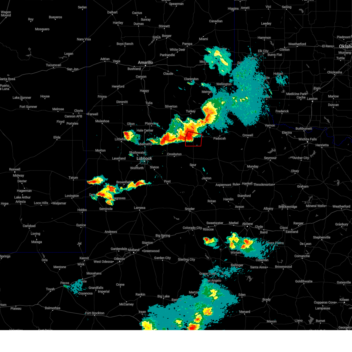 At 908 pm cdt, a severe thunderstorm capable of producing a tornado was located 5 miles west of matador, moving southeast at 10 mph (radar indicated rotation). Hazards include tornado and ping pong ball size hail. Flying debris will be dangerous to those caught without shelter. mobile homes will be damaged or destroyed. damage to roofs, windows, and vehicles will occur. tree damage is likely. this dangerous storm will be near, matador around 915 pm cdt. Other locations impacted by this tornadic thunderstorm include roaring springs. At 908 pm cdt, a severe thunderstorm capable of producing a tornado was located 5 miles west of matador, moving southeast at 10 mph (radar indicated rotation). Hazards include tornado and ping pong ball size hail. Flying debris will be dangerous to those caught without shelter. mobile homes will be damaged or destroyed. damage to roofs, windows, and vehicles will occur. tree damage is likely. this dangerous storm will be near, matador around 915 pm cdt. Other locations impacted by this tornadic thunderstorm include roaring springs.
|
| 4/22/2025 9:05 PM CDT |
 At 905 pm cdt, a severe thunderstorm capable of producing a tornado was located 5 miles west of matador, moving east at 10 mph (radar indicated rotation). Hazards include tornado and ping pong ball size hail. Flying debris will be dangerous to those caught without shelter. mobile homes will be damaged or destroyed. damage to roofs, windows, and vehicles will occur. tree damage is likely. this dangerous storm will be near, matador around 910 pm cdt. Other locations impacted by this tornadic thunderstorm include roaring springs. At 905 pm cdt, a severe thunderstorm capable of producing a tornado was located 5 miles west of matador, moving east at 10 mph (radar indicated rotation). Hazards include tornado and ping pong ball size hail. Flying debris will be dangerous to those caught without shelter. mobile homes will be damaged or destroyed. damage to roofs, windows, and vehicles will occur. tree damage is likely. this dangerous storm will be near, matador around 910 pm cdt. Other locations impacted by this tornadic thunderstorm include roaring springs.
|
| 4/22/2025 9:01 PM CDT |
 the tornado warning has been cancelled and is no longer in effect the tornado warning has been cancelled and is no longer in effect
|
| 4/22/2025 9:01 PM CDT |
 At 900 pm cdt, a severe thunderstorm capable of producing a tornado was located 5 miles west of matador, moving southeast at 15 mph (radar indicated rotation). Hazards include tornado and ping pong ball size hail. Flying debris will be dangerous to those caught without shelter. mobile homes will be damaged or destroyed. damage to roofs, windows, and vehicles will occur. tree damage is likely. this dangerous storm will be near, matador around 905 pm cdt. Other locations impacted by this tornadic thunderstorm include roaring springs. At 900 pm cdt, a severe thunderstorm capable of producing a tornado was located 5 miles west of matador, moving southeast at 15 mph (radar indicated rotation). Hazards include tornado and ping pong ball size hail. Flying debris will be dangerous to those caught without shelter. mobile homes will be damaged or destroyed. damage to roofs, windows, and vehicles will occur. tree damage is likely. this dangerous storm will be near, matador around 905 pm cdt. Other locations impacted by this tornadic thunderstorm include roaring springs.
|
| 4/22/2025 8:54 PM CDT |
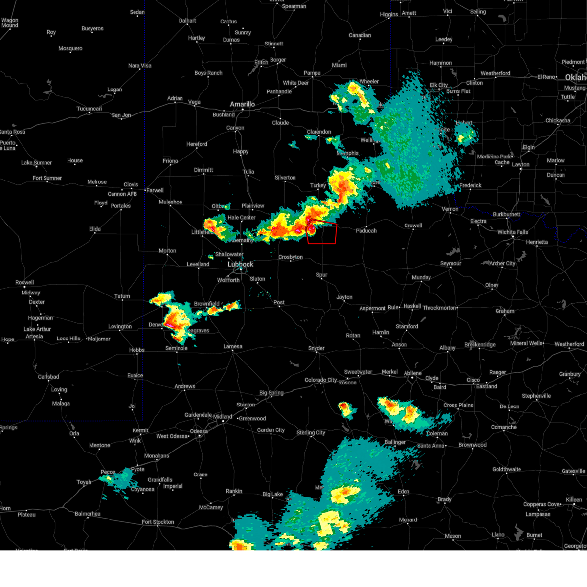 Torlub the national weather service in lubbock texas has issued a * tornado warning for, southeastern floyd county in northwestern texas, southwestern motley county in northwestern texas, * until 930 pm cdt. * at 853 pm cdt, a severe thunderstorm capable of producing a tornado was located 7 miles west of matador, moving southeast at 10 mph (radar indicated rotation). Hazards include tornado and ping pong ball size hail. Flying debris will be dangerous to those caught without shelter. mobile homes will be damaged or destroyed. damage to roofs, windows, and vehicles will occur. tree damage is likely. this dangerous storm will be near, matador around 905 pm cdt. Other locations impacted by this tornadic thunderstorm include roaring springs. Torlub the national weather service in lubbock texas has issued a * tornado warning for, southeastern floyd county in northwestern texas, southwestern motley county in northwestern texas, * until 930 pm cdt. * at 853 pm cdt, a severe thunderstorm capable of producing a tornado was located 7 miles west of matador, moving southeast at 10 mph (radar indicated rotation). Hazards include tornado and ping pong ball size hail. Flying debris will be dangerous to those caught without shelter. mobile homes will be damaged or destroyed. damage to roofs, windows, and vehicles will occur. tree damage is likely. this dangerous storm will be near, matador around 905 pm cdt. Other locations impacted by this tornadic thunderstorm include roaring springs.
|
| 4/22/2025 8:46 PM CDT |
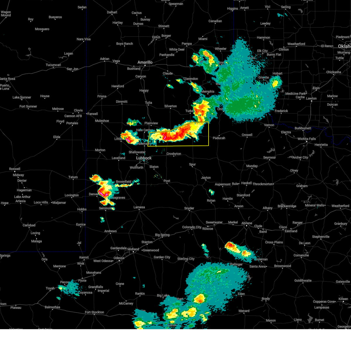 At 846 pm cdt, severe thunderstorms were located along a line extending from 10 miles northeast of matador to near dougherty to 5 miles north of petersburg, moving southeast at 15 mph (radar indicated). Hazards include 60 mph wind gusts and quarter size hail. Hail damage to vehicles is expected. expect wind damage to roofs, siding, and trees. Locations impacted include, dougherty, matador, roaring springs, petersburg, and floydada. At 846 pm cdt, severe thunderstorms were located along a line extending from 10 miles northeast of matador to near dougherty to 5 miles north of petersburg, moving southeast at 15 mph (radar indicated). Hazards include 60 mph wind gusts and quarter size hail. Hail damage to vehicles is expected. expect wind damage to roofs, siding, and trees. Locations impacted include, dougherty, matador, roaring springs, petersburg, and floydada.
|
| 4/22/2025 8:33 PM CDT |
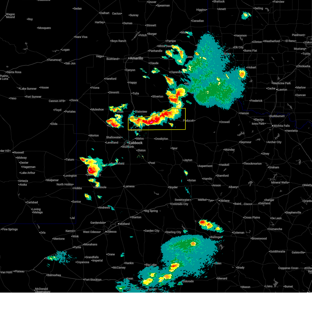 Svrlub the national weather service in lubbock texas has issued a * severe thunderstorm warning for, southern floyd county in northwestern texas, motley county in northwestern texas, southeastern hale county in northwestern texas, * until 930 pm cdt. * at 833 pm cdt, severe thunderstorms were located along a line extending from 10 miles north of matador to 6 miles west of dougherty to 9 miles northwest of petersburg, moving east at 10 mph (radar indicated). Hazards include 60 mph wind gusts and quarter size hail. Hail damage to vehicles is expected. Expect wind damage to roofs, siding, and trees. Svrlub the national weather service in lubbock texas has issued a * severe thunderstorm warning for, southern floyd county in northwestern texas, motley county in northwestern texas, southeastern hale county in northwestern texas, * until 930 pm cdt. * at 833 pm cdt, severe thunderstorms were located along a line extending from 10 miles north of matador to 6 miles west of dougherty to 9 miles northwest of petersburg, moving east at 10 mph (radar indicated). Hazards include 60 mph wind gusts and quarter size hail. Hail damage to vehicles is expected. Expect wind damage to roofs, siding, and trees.
|
| 11/18/2024 1:41 AM CST |
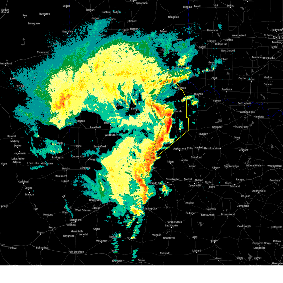 At 140 am cst, severe thunderstorms were located along a line extending from 9 miles southeast of flomot to 11 miles west of delwin to near dumont to 14 miles west of guthrie to 3 miles north of clairemont, moving northeast at 55 mph (radar indicated). Hazards include 60 mph wind gusts. Expect damage to roofs, siding, and trees. Locations impacted include, childress, paducah, matador, jayton, guthrie, girard, cee vee, clairemont, swearingen, grow, dumont, tell, northfield, finney, delwin, chalk, hackberry, and estelline. At 140 am cst, severe thunderstorms were located along a line extending from 9 miles southeast of flomot to 11 miles west of delwin to near dumont to 14 miles west of guthrie to 3 miles north of clairemont, moving northeast at 55 mph (radar indicated). Hazards include 60 mph wind gusts. Expect damage to roofs, siding, and trees. Locations impacted include, childress, paducah, matador, jayton, guthrie, girard, cee vee, clairemont, swearingen, grow, dumont, tell, northfield, finney, delwin, chalk, hackberry, and estelline.
|
| 11/18/2024 1:15 AM CST |
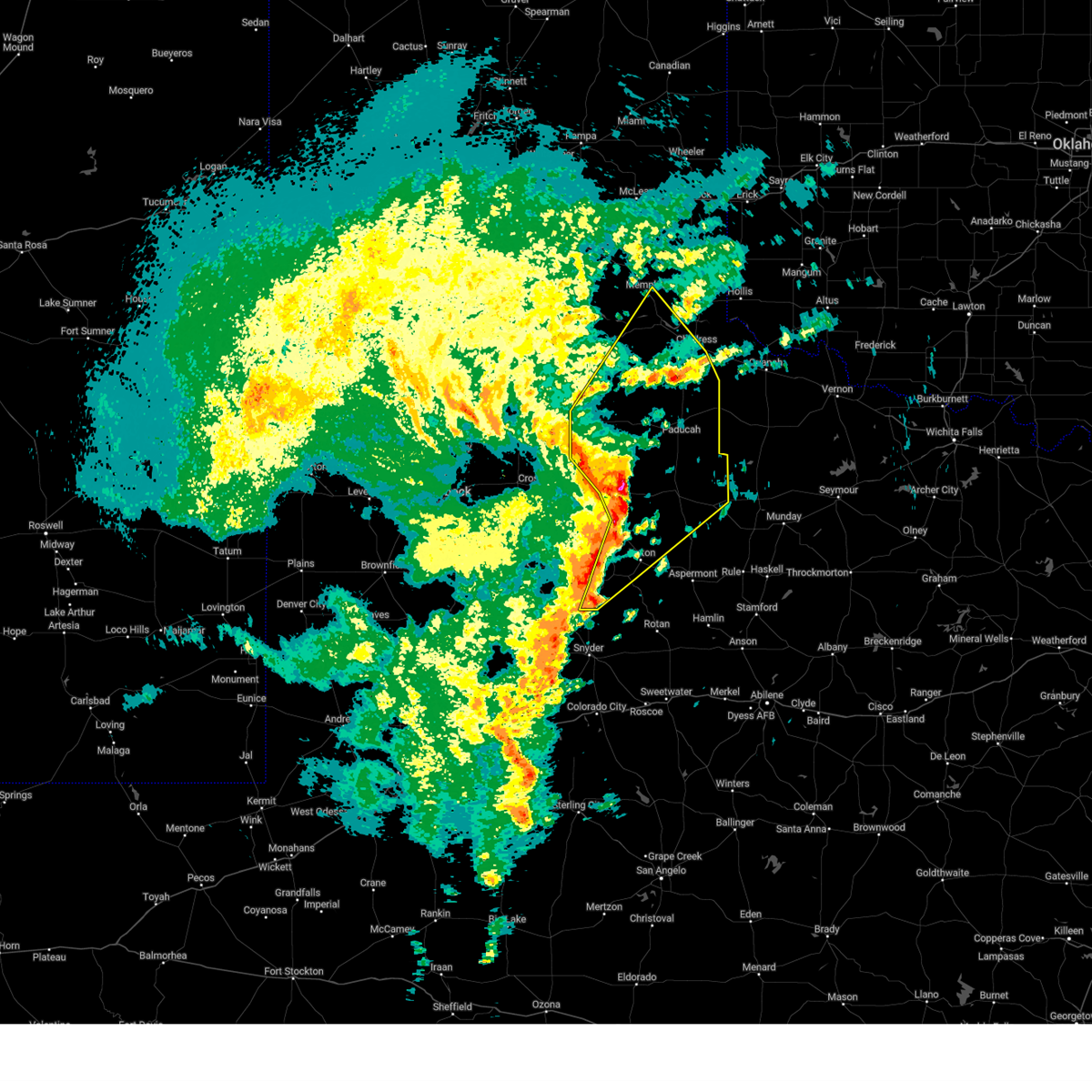 Svrlub the national weather service in lubbock texas has issued a * severe thunderstorm warning for, central kent county in northwestern texas, dickens county in northwestern texas, southwestern childress county in the panhandle of texas, king county in northwestern texas, cottle county in northwestern texas, motley county in northwestern texas, eastern hall county in the panhandle of texas, northwestern stonewall county in northwestern texas, * until 215 am cst. * at 114 am cst, severe thunderstorms were located along a line extending from near dougherty to 3 miles north of dickens to 7 miles northeast of spur to 8 miles west of girard to 8 miles southeast of lake alan henry, moving northeast at 55 mph (radar indicated). Hazards include 60 mph wind gusts. expect damage to roofs, siding, and trees Svrlub the national weather service in lubbock texas has issued a * severe thunderstorm warning for, central kent county in northwestern texas, dickens county in northwestern texas, southwestern childress county in the panhandle of texas, king county in northwestern texas, cottle county in northwestern texas, motley county in northwestern texas, eastern hall county in the panhandle of texas, northwestern stonewall county in northwestern texas, * until 215 am cst. * at 114 am cst, severe thunderstorms were located along a line extending from near dougherty to 3 miles north of dickens to 7 miles northeast of spur to 8 miles west of girard to 8 miles southeast of lake alan henry, moving northeast at 55 mph (radar indicated). Hazards include 60 mph wind gusts. expect damage to roofs, siding, and trees
|
| 11/18/2024 12:57 AM CST |
 At 1256 am cst, severe thunderstorms were located along a line extending from 6 miles east of cone to 6 miles northeast of white river lake to 12 miles south of spur to 3 miles west of lake alan henry, moving northeast at 65 mph. at 1248 am cst, west texas mesonet site at ralls gusted to 64 mph (west texas mesonet). Hazards include 60 mph wind gusts. Expect damage to roofs, siding, and trees. Locations impacted include, crosbyton, spur, matador, jayton, dickens, lake alan henry, white river lake, ralls, kalgary, girard, dougherty, justiceburg, afton, clairemont, flomot, mcadoo, and roaring springs. At 1256 am cst, severe thunderstorms were located along a line extending from 6 miles east of cone to 6 miles northeast of white river lake to 12 miles south of spur to 3 miles west of lake alan henry, moving northeast at 65 mph. at 1248 am cst, west texas mesonet site at ralls gusted to 64 mph (west texas mesonet). Hazards include 60 mph wind gusts. Expect damage to roofs, siding, and trees. Locations impacted include, crosbyton, spur, matador, jayton, dickens, lake alan henry, white river lake, ralls, kalgary, girard, dougherty, justiceburg, afton, clairemont, flomot, mcadoo, and roaring springs.
|
| 11/18/2024 12:54 AM CST |
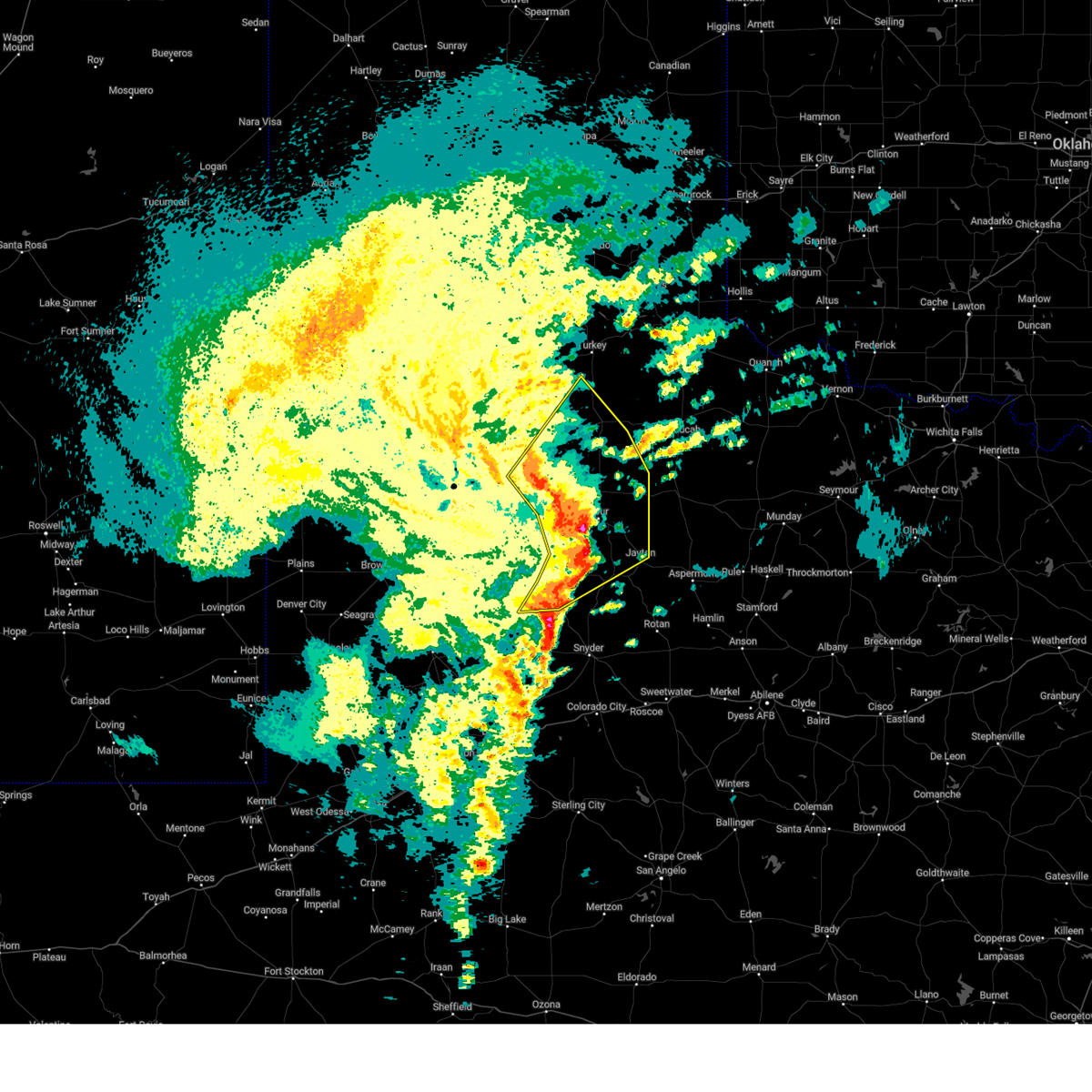 the severe thunderstorm warning has been cancelled and is no longer in effect the severe thunderstorm warning has been cancelled and is no longer in effect
|
| 11/18/2024 12:54 AM CST |
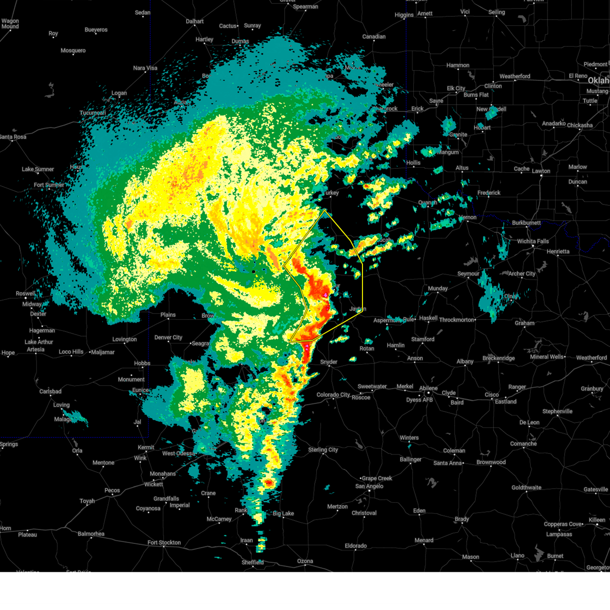 At 1254 am cst, severe thunderstorms were located along a line extending from 7 miles east of cone to 7 miles north of white river lake to 12 miles south of spur to 3 miles west of lake alan henry, moving northeast at 60 mph (radar indicated). Hazards include 60 mph wind gusts. Expect damage to roofs, siding, and trees. Locations impacted include, crosbyton, spur, matador, jayton, dickens, lake alan henry, white river lake, ralls, kalgary, girard, dougherty, justiceburg, afton, clairemont, flomot, mcadoo, and roaring springs. At 1254 am cst, severe thunderstorms were located along a line extending from 7 miles east of cone to 7 miles north of white river lake to 12 miles south of spur to 3 miles west of lake alan henry, moving northeast at 60 mph (radar indicated). Hazards include 60 mph wind gusts. Expect damage to roofs, siding, and trees. Locations impacted include, crosbyton, spur, matador, jayton, dickens, lake alan henry, white river lake, ralls, kalgary, girard, dougherty, justiceburg, afton, clairemont, flomot, mcadoo, and roaring springs.
|
| 11/18/2024 12:48 AM CST |
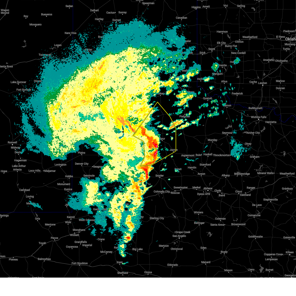 At 1247 am cst, severe thunderstorms were located along a line extending from 7 miles north of crosbyton to 8 miles north of white river lake to 6 miles southwest of spur, moving northeast at 65 mph (radar indicated). Hazards include 60 mph wind gusts. Expect damage to roofs, siding, and trees. Locations impacted include, crosbyton, spur, matador, jayton, dickens, lake alan henry, white river lake, ralls, kalgary, girard, dougherty, justiceburg, afton, clairemont, flomot, mcadoo, and roaring springs. At 1247 am cst, severe thunderstorms were located along a line extending from 7 miles north of crosbyton to 8 miles north of white river lake to 6 miles southwest of spur, moving northeast at 65 mph (radar indicated). Hazards include 60 mph wind gusts. Expect damage to roofs, siding, and trees. Locations impacted include, crosbyton, spur, matador, jayton, dickens, lake alan henry, white river lake, ralls, kalgary, girard, dougherty, justiceburg, afton, clairemont, flomot, mcadoo, and roaring springs.
|
| 11/18/2024 12:48 AM CST |
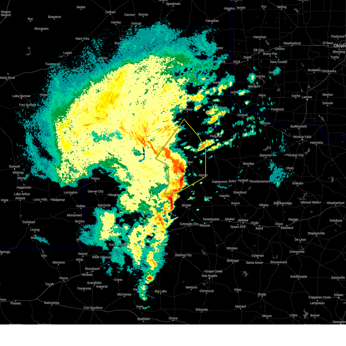 the severe thunderstorm warning has been cancelled and is no longer in effect the severe thunderstorm warning has been cancelled and is no longer in effect
|
| 11/18/2024 12:18 AM CST |
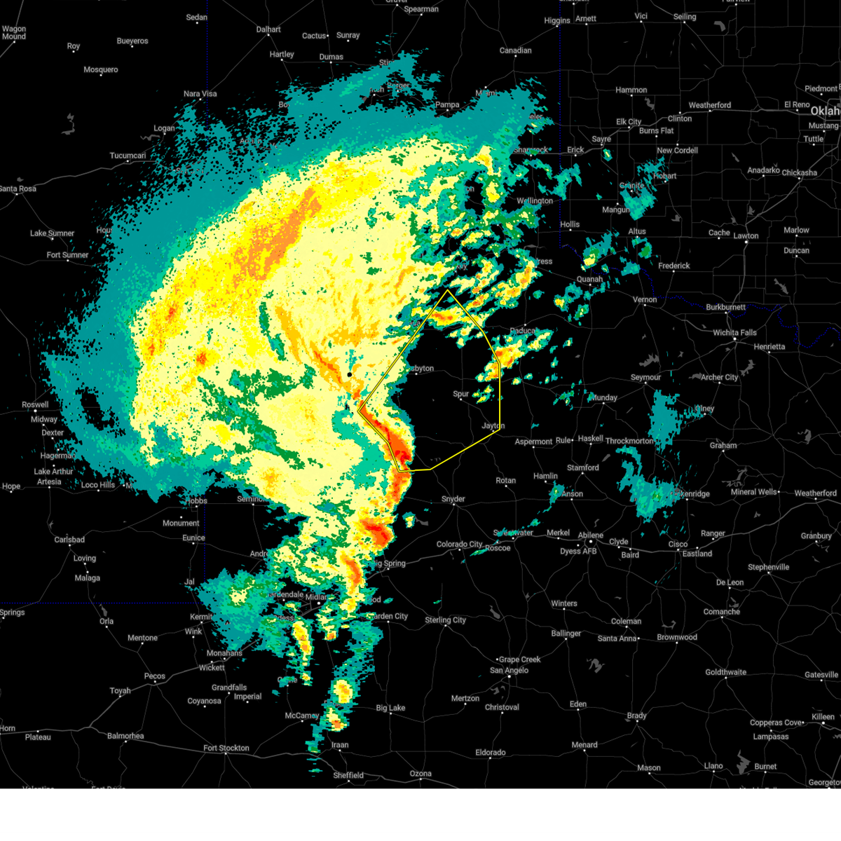 Svrlub the national weather service in lubbock texas has issued a * severe thunderstorm warning for, kent county in northwestern texas, southeastern lubbock county in northwestern texas, northeastern lynn county in northwestern texas, dickens county in northwestern texas, garza county in northwestern texas, southeastern floyd county in northwestern texas, crosby county in northwestern texas, western motley county in northwestern texas, * until 115 am cst. * at 1217 am cst, severe thunderstorms were located along a line extending from 4 miles south of slaton to 3 miles northwest of post to 4 miles west of justiceburg, moving northeast at 65 mph. west texas mesonet at graham gusted to 59 mph at 1206 pm cst (west texas mesonet). Hazards include 60 mph wind gusts. expect damage to roofs, siding, and trees Svrlub the national weather service in lubbock texas has issued a * severe thunderstorm warning for, kent county in northwestern texas, southeastern lubbock county in northwestern texas, northeastern lynn county in northwestern texas, dickens county in northwestern texas, garza county in northwestern texas, southeastern floyd county in northwestern texas, crosby county in northwestern texas, western motley county in northwestern texas, * until 115 am cst. * at 1217 am cst, severe thunderstorms were located along a line extending from 4 miles south of slaton to 3 miles northwest of post to 4 miles west of justiceburg, moving northeast at 65 mph. west texas mesonet at graham gusted to 59 mph at 1206 pm cst (west texas mesonet). Hazards include 60 mph wind gusts. expect damage to roofs, siding, and trees
|
| 8/15/2024 7:02 PM CDT |
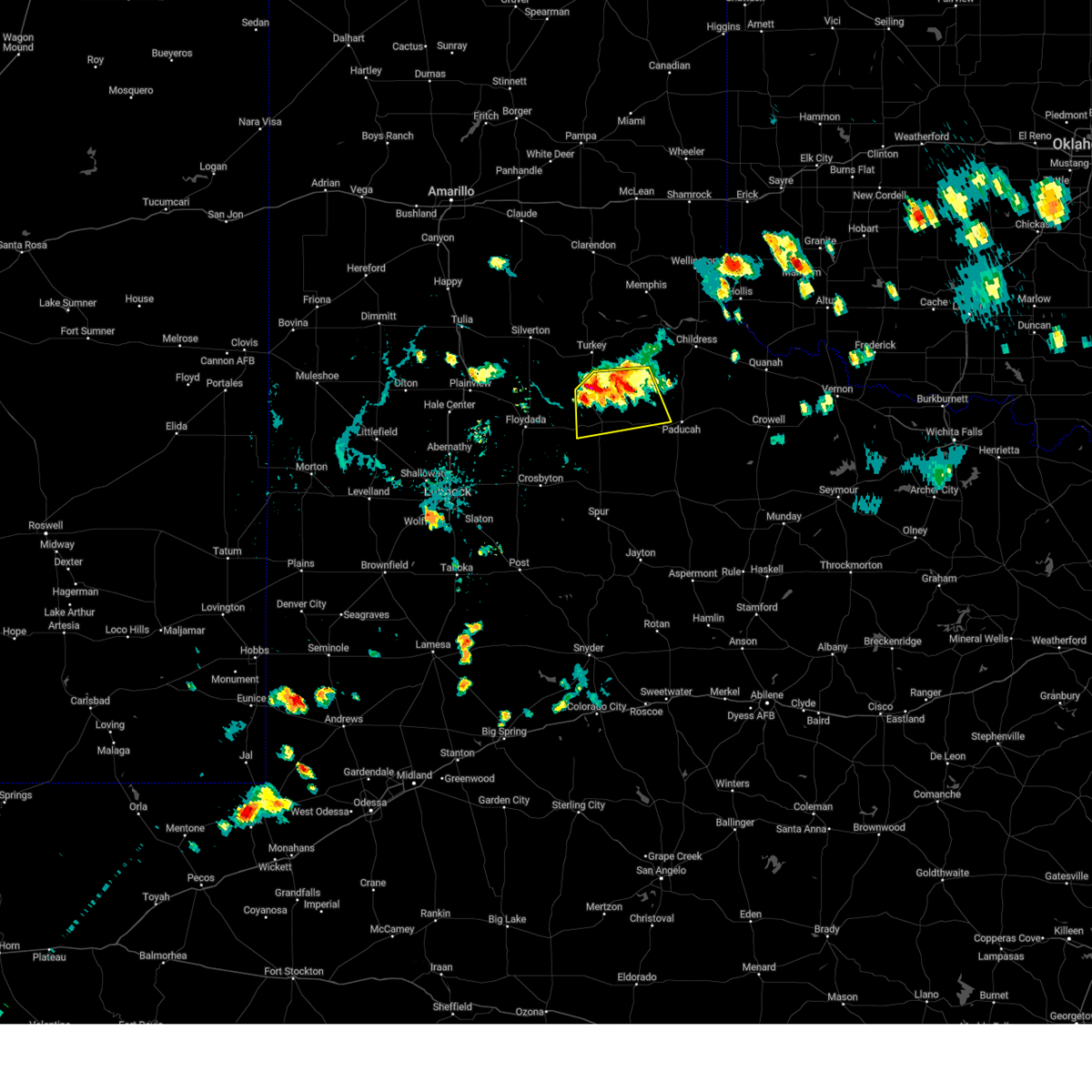 At 702 pm cdt, severe thunderstorms were located along a line extending from 3 miles east of northfield to 3 miles southeast of flomot, moving southeast at 10 mph (radar indicated). Hazards include 70 mph wind gusts and quarter size hail. Hail damage to vehicles is expected. expect considerable tree damage. wind damage is also likely to mobile homes, roofs, and outbuildings. Locations impacted include, matador and northfield. At 702 pm cdt, severe thunderstorms were located along a line extending from 3 miles east of northfield to 3 miles southeast of flomot, moving southeast at 10 mph (radar indicated). Hazards include 70 mph wind gusts and quarter size hail. Hail damage to vehicles is expected. expect considerable tree damage. wind damage is also likely to mobile homes, roofs, and outbuildings. Locations impacted include, matador and northfield.
|
| 8/15/2024 6:52 PM CDT |
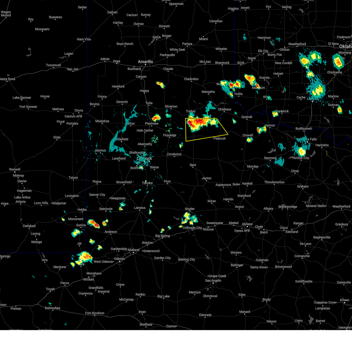 At 651 pm cdt, severe thunderstorms were located along a line extending from 3 miles northeast of northfield to near flomot, and are nearly stationary. these are destructive storms for flomot (radar indicated). Hazards include 80 mph wind gusts and quarter size hail. Flying debris will be dangerous to those caught without shelter. mobile homes will be heavily damaged. expect considerable damage to roofs, windows, and vehicles. extensive tree damage and power outages are likely. Locations impacted include, paducah, matador, flomot, northfield, and cee vee. At 651 pm cdt, severe thunderstorms were located along a line extending from 3 miles northeast of northfield to near flomot, and are nearly stationary. these are destructive storms for flomot (radar indicated). Hazards include 80 mph wind gusts and quarter size hail. Flying debris will be dangerous to those caught without shelter. mobile homes will be heavily damaged. expect considerable damage to roofs, windows, and vehicles. extensive tree damage and power outages are likely. Locations impacted include, paducah, matador, flomot, northfield, and cee vee.
|
| 8/15/2024 6:47 PM CDT |
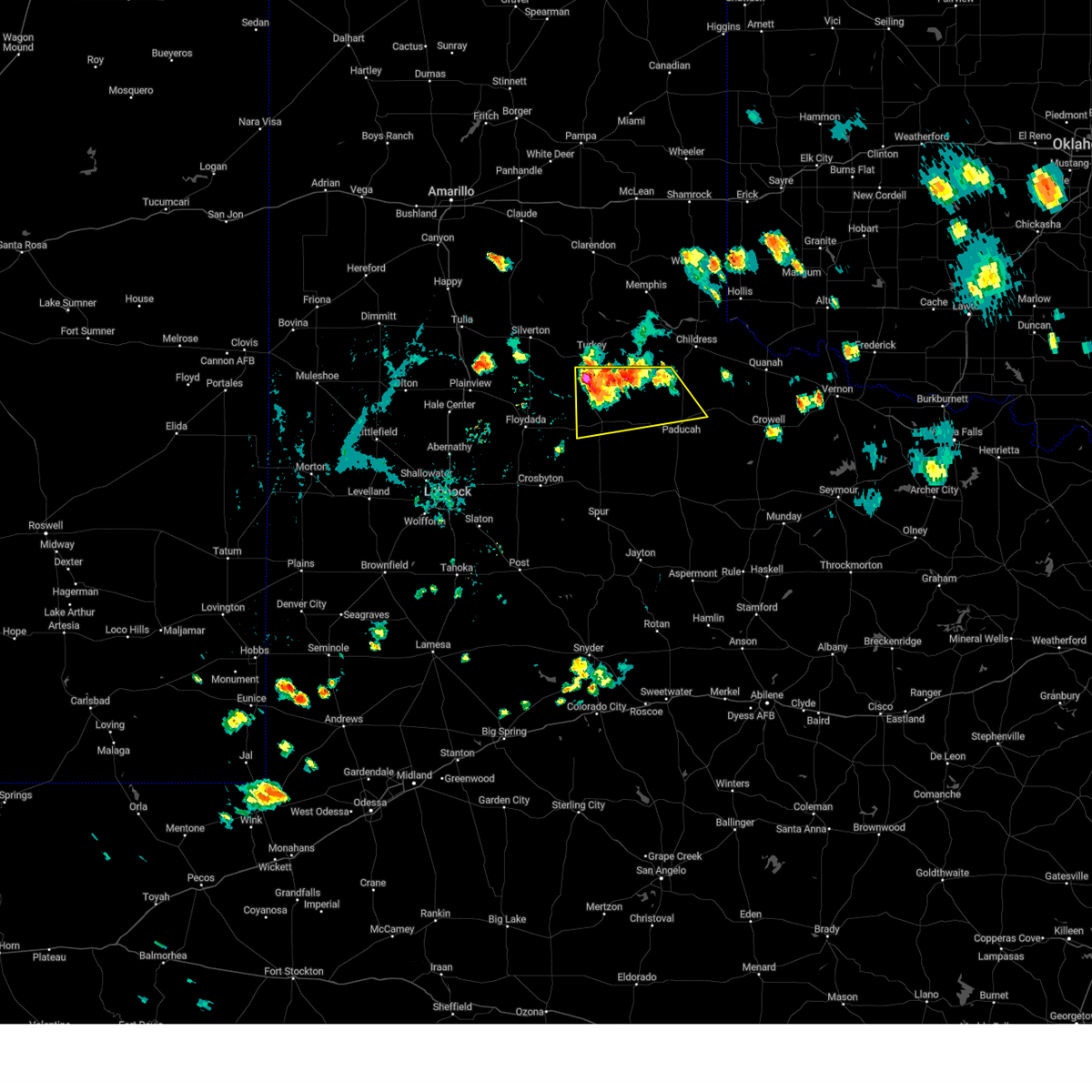 Svrlub the national weather service in lubbock texas has issued a * severe thunderstorm warning for, northwestern cottle county in northwestern texas, motley county in northwestern texas, * until 715 pm cdt. * at 647 pm cdt, severe thunderstorms were located along a line extending from 3 miles northeast of northfield to near flomot, moving southeast at 10 mph (radar indicated). Hazards include 60 mph wind gusts and quarter size hail. Hail damage to vehicles is expected. Expect wind damage to roofs, siding, and trees. Svrlub the national weather service in lubbock texas has issued a * severe thunderstorm warning for, northwestern cottle county in northwestern texas, motley county in northwestern texas, * until 715 pm cdt. * at 647 pm cdt, severe thunderstorms were located along a line extending from 3 miles northeast of northfield to near flomot, moving southeast at 10 mph (radar indicated). Hazards include 60 mph wind gusts and quarter size hail. Hail damage to vehicles is expected. Expect wind damage to roofs, siding, and trees.
|
| 6/1/2024 12:51 AM CDT |
 At 1250 am cdt, severe thunderstorms were located along a line extending from 8 miles northwest of delwin to girard to 8 miles northwest of snyder, moving east at 30 mph (radar indicated). Hazards include 60 mph wind gusts and penny size hail. Expect damage to roofs, siding, and trees. Locations impacted include, spur, paducah, matador, jayton, dickens, lake alan henry, girard, dumont, finney, delwin, afton, and clairemont. At 1250 am cdt, severe thunderstorms were located along a line extending from 8 miles northwest of delwin to girard to 8 miles northwest of snyder, moving east at 30 mph (radar indicated). Hazards include 60 mph wind gusts and penny size hail. Expect damage to roofs, siding, and trees. Locations impacted include, spur, paducah, matador, jayton, dickens, lake alan henry, girard, dumont, finney, delwin, afton, and clairemont.
|
| 6/1/2024 12:33 AM CDT |
 At 1233 am cdt, severe thunderstorms were located along a line extending from 10 miles east of matador to 6 miles northwest of girard to near fluvanna, moving east at 30 mph (radar indicated). Hazards include 60 mph wind gusts and penny size hail. Expect damage to roofs, siding, and trees. Locations impacted include, spur, paducah, matador, jayton, dickens, lake alan henry, girard, justiceburg, afton, clairemont, dumont, finney, delwin, and roaring springs. At 1233 am cdt, severe thunderstorms were located along a line extending from 10 miles east of matador to 6 miles northwest of girard to near fluvanna, moving east at 30 mph (radar indicated). Hazards include 60 mph wind gusts and penny size hail. Expect damage to roofs, siding, and trees. Locations impacted include, spur, paducah, matador, jayton, dickens, lake alan henry, girard, justiceburg, afton, clairemont, dumont, finney, delwin, and roaring springs.
|
| 6/1/2024 12:33 AM CDT |
 the severe thunderstorm warning has been cancelled and is no longer in effect the severe thunderstorm warning has been cancelled and is no longer in effect
|
| 6/1/2024 12:21 AM CDT |
 At 1220 am cdt, severe thunderstorms were located along a line extending from 4 miles east of matador to spur to 6 miles west of fluvanna, moving east at 35 mph (radar indicated). Hazards include 60 mph wind gusts and penny size hail. Expect damage to roofs, siding, and trees. Locations impacted include, spur, paducah, matador, jayton, dickens, lake alan henry, white river lake, kalgary, girard, justiceburg, afton, clairemont, dumont, finney, delwin, mcadoo, and roaring springs. At 1220 am cdt, severe thunderstorms were located along a line extending from 4 miles east of matador to spur to 6 miles west of fluvanna, moving east at 35 mph (radar indicated). Hazards include 60 mph wind gusts and penny size hail. Expect damage to roofs, siding, and trees. Locations impacted include, spur, paducah, matador, jayton, dickens, lake alan henry, white river lake, kalgary, girard, justiceburg, afton, clairemont, dumont, finney, delwin, mcadoo, and roaring springs.
|
| 6/1/2024 12:09 AM CDT |
 Svrlub the national weather service in lubbock texas has issued a * severe thunderstorm warning for, kent county in northwestern texas, dickens county in northwestern texas, eastern garza county in northwestern texas, western king county in northwestern texas, southeastern crosby county in northwestern texas, southwestern cottle county in northwestern texas, southern motley county in northwestern texas, northwestern stonewall county in northwestern texas, * until 115 am cdt. * at 1209 am cdt, severe thunderstorms were located along a line extending from 3 miles northwest of matador to 5 miles west of spur to 11 miles northeast of gail, moving east at 30 mph (radar indicated). Hazards include 60 mph wind gusts and nickel size hail. expect damage to roofs, siding, and trees Svrlub the national weather service in lubbock texas has issued a * severe thunderstorm warning for, kent county in northwestern texas, dickens county in northwestern texas, eastern garza county in northwestern texas, western king county in northwestern texas, southeastern crosby county in northwestern texas, southwestern cottle county in northwestern texas, southern motley county in northwestern texas, northwestern stonewall county in northwestern texas, * until 115 am cdt. * at 1209 am cdt, severe thunderstorms were located along a line extending from 3 miles northwest of matador to 5 miles west of spur to 11 miles northeast of gail, moving east at 30 mph (radar indicated). Hazards include 60 mph wind gusts and nickel size hail. expect damage to roofs, siding, and trees
|
| 5/30/2024 5:17 AM CDT |
 the severe thunderstorm warning has been cancelled and is no longer in effect the severe thunderstorm warning has been cancelled and is no longer in effect
|
| 5/30/2024 5:17 AM CDT |
 At 516 am cdt, a severe thunderstorm was located near matador, moving east at 25 mph (radar indicated). Hazards include ping pong ball size hail and 60 mph wind gusts. People and animals outdoors will be injured. expect hail damage to roofs, siding, windows, and vehicles. expect wind damage to roofs, siding, and trees. Locations impacted include, matador. At 516 am cdt, a severe thunderstorm was located near matador, moving east at 25 mph (radar indicated). Hazards include ping pong ball size hail and 60 mph wind gusts. People and animals outdoors will be injured. expect hail damage to roofs, siding, windows, and vehicles. expect wind damage to roofs, siding, and trees. Locations impacted include, matador.
|
| 5/30/2024 4:48 AM CDT |
 At 447 am cdt, a severe thunderstorm was located 9 miles south of flomot, or 9 miles northwest of matador, moving east at 15 mph (radar indicated). Hazards include golf ball size hail and 60 mph wind gusts. People and animals outdoors will be injured. expect hail damage to roofs, siding, windows, and vehicles. expect wind damage to roofs, siding, and trees. Locations impacted include, matador, flomot, and roaring springs. At 447 am cdt, a severe thunderstorm was located 9 miles south of flomot, or 9 miles northwest of matador, moving east at 15 mph (radar indicated). Hazards include golf ball size hail and 60 mph wind gusts. People and animals outdoors will be injured. expect hail damage to roofs, siding, windows, and vehicles. expect wind damage to roofs, siding, and trees. Locations impacted include, matador, flomot, and roaring springs.
|
| 5/30/2024 4:30 AM CDT |
 Svrlub the national weather service in lubbock texas has issued a * severe thunderstorm warning for, northeastern floyd county in northwestern texas, motley county in northwestern texas, * until 530 am cdt. * at 430 am cdt, a severe thunderstorm was located 8 miles southwest of flomot, or 14 miles northwest of matador, moving east at 15 mph (radar indicated). Hazards include ping pong ball size hail and 60 mph wind gusts. People and animals outdoors will be injured. expect hail damage to roofs, siding, windows, and vehicles. Expect wind damage to roofs, siding, and trees. Svrlub the national weather service in lubbock texas has issued a * severe thunderstorm warning for, northeastern floyd county in northwestern texas, motley county in northwestern texas, * until 530 am cdt. * at 430 am cdt, a severe thunderstorm was located 8 miles southwest of flomot, or 14 miles northwest of matador, moving east at 15 mph (radar indicated). Hazards include ping pong ball size hail and 60 mph wind gusts. People and animals outdoors will be injured. expect hail damage to roofs, siding, windows, and vehicles. Expect wind damage to roofs, siding, and trees.
|
| 5/30/2024 3:43 AM CDT |
 The storms which prompted the warning have weakened below severe limits, and no longer pose an immediate threat to life or property. therefore, the warning will be allowed to expire. however, small hail, gusty winds and heavy rain are still possible with these thunderstorms. The storms which prompted the warning have weakened below severe limits, and no longer pose an immediate threat to life or property. therefore, the warning will be allowed to expire. however, small hail, gusty winds and heavy rain are still possible with these thunderstorms.
|
| 5/30/2024 3:37 AM CDT |
 the severe thunderstorm warning has been cancelled and is no longer in effect the severe thunderstorm warning has been cancelled and is no longer in effect
|
| 5/30/2024 3:37 AM CDT |
 At 336 am cdt, severe thunderstorms were located along a line extending from 10 miles northwest of swearingen to 6 miles east of matador to 9 miles northeast of floydada, moving southeast at 15 mph (radar indicated). Hazards include 60 mph wind gusts and quarter size hail. Hail damage to vehicles is expected. expect wind damage to roofs, siding, and trees. Locations impacted include, childress, paducah, matador, turkey, caprock canyon state park, lockney, quitaque, cee vee, south plains, kirkland, swearingen, valley schools, flomot, tell, northfield, and hackberry. At 336 am cdt, severe thunderstorms were located along a line extending from 10 miles northwest of swearingen to 6 miles east of matador to 9 miles northeast of floydada, moving southeast at 15 mph (radar indicated). Hazards include 60 mph wind gusts and quarter size hail. Hail damage to vehicles is expected. expect wind damage to roofs, siding, and trees. Locations impacted include, childress, paducah, matador, turkey, caprock canyon state park, lockney, quitaque, cee vee, south plains, kirkland, swearingen, valley schools, flomot, tell, northfield, and hackberry.
|
| 5/30/2024 3:06 AM CDT |
 At 306 am cdt, severe thunderstorms were located along a line extending from 3 miles southwest of childress to 10 miles south of northfield to 4 miles south of south plains, moving east at 60 mph (radar indicated). Hazards include 70 mph wind gusts and half dollar size hail. Hail damage to vehicles is expected. expect considerable tree damage. wind damage is also likely to mobile homes, roofs, and outbuildings. Locations impacted include, childress, paducah, matador, turkey, caprock canyon state park, lockney, quitaque, cee vee, south plains, kirkland, aiken, swearingen, valley schools, flomot, tell, northfield, hackberry, estelline, lakeview, and plaska community. At 306 am cdt, severe thunderstorms were located along a line extending from 3 miles southwest of childress to 10 miles south of northfield to 4 miles south of south plains, moving east at 60 mph (radar indicated). Hazards include 70 mph wind gusts and half dollar size hail. Hail damage to vehicles is expected. expect considerable tree damage. wind damage is also likely to mobile homes, roofs, and outbuildings. Locations impacted include, childress, paducah, matador, turkey, caprock canyon state park, lockney, quitaque, cee vee, south plains, kirkland, aiken, swearingen, valley schools, flomot, tell, northfield, hackberry, estelline, lakeview, and plaska community.
|
| 5/30/2024 2:47 AM CDT |
 Svrlub the national weather service in lubbock texas has issued a * severe thunderstorm warning for, northern floyd county in northwestern texas, southern childress county in the panhandle of texas, cottle county in northwestern texas, motley county in northwestern texas, northeastern hale county in northwestern texas, hall county in the panhandle of texas, southeastern briscoe county in the panhandle of texas, * until 345 am cdt. * at 247 am cdt, severe thunderstorms were located along a line extending from 6 miles north of northfield to 6 miles south of flomot to 5 miles west of aiken, moving east at 60 mph (radar indicated). Hazards include 60 mph wind gusts and half dollar size hail. Hail damage to vehicles is expected. Expect wind damage to roofs, siding, and trees. Svrlub the national weather service in lubbock texas has issued a * severe thunderstorm warning for, northern floyd county in northwestern texas, southern childress county in the panhandle of texas, cottle county in northwestern texas, motley county in northwestern texas, northeastern hale county in northwestern texas, hall county in the panhandle of texas, southeastern briscoe county in the panhandle of texas, * until 345 am cdt. * at 247 am cdt, severe thunderstorms were located along a line extending from 6 miles north of northfield to 6 miles south of flomot to 5 miles west of aiken, moving east at 60 mph (radar indicated). Hazards include 60 mph wind gusts and half dollar size hail. Hail damage to vehicles is expected. Expect wind damage to roofs, siding, and trees.
|
| 5/3/2024 6:48 PM CDT | Ping Pong Ball sized hail reported 5 miles SE of Matador, TX, ping pong ball size hail found on the side of the road between matador and whiteflat. time estimated from radar. |
| 5/3/2024 6:42 PM CDT |
 Svrlub the national weather service in lubbock texas has issued a * severe thunderstorm warning for, eastern floyd county in northwestern texas, motley county in northwestern texas, southern hall county in the panhandle of texas, southeastern briscoe county in the panhandle of texas, * until 745 pm cdt. * at 642 pm cdt, severe thunderstorms were located along a line extending from 3 miles east of floydada to 4 miles southwest of matador, moving northeast at 40 mph (radar indicated). Hazards include 60 mph wind gusts and half dollar size hail. Hail damage to vehicles is expected. Expect wind damage to roofs, siding, and trees. Svrlub the national weather service in lubbock texas has issued a * severe thunderstorm warning for, eastern floyd county in northwestern texas, motley county in northwestern texas, southern hall county in the panhandle of texas, southeastern briscoe county in the panhandle of texas, * until 745 pm cdt. * at 642 pm cdt, severe thunderstorms were located along a line extending from 3 miles east of floydada to 4 miles southwest of matador, moving northeast at 40 mph (radar indicated). Hazards include 60 mph wind gusts and half dollar size hail. Hail damage to vehicles is expected. Expect wind damage to roofs, siding, and trees.
|
| 5/3/2024 6:33 PM CDT |
 At 633 pm cdt, a severe thunderstorm was located 5 miles east of matador, moving north at 25 mph (radar indicated). Hazards include 60 mph wind gusts and quarter size hail. Hail damage to vehicles is expected. expect wind damage to roofs, siding, and trees. Locations impacted include, matador, dougherty, and roaring springs. At 633 pm cdt, a severe thunderstorm was located 5 miles east of matador, moving north at 25 mph (radar indicated). Hazards include 60 mph wind gusts and quarter size hail. Hail damage to vehicles is expected. expect wind damage to roofs, siding, and trees. Locations impacted include, matador, dougherty, and roaring springs.
|
| 5/3/2024 6:33 PM CDT |
 the severe thunderstorm warning has been cancelled and is no longer in effect the severe thunderstorm warning has been cancelled and is no longer in effect
|
| 5/3/2024 6:18 PM CDT |
 At 618 pm cdt, a severe thunderstorm was located 4 miles southeast of matador, moving north at 40 mph (radar indicated). Hazards include 60 mph wind gusts and quarter size hail. Hail damage to vehicles is expected. expect wind damage to roofs, siding, and trees. Locations impacted include, matador, dougherty, afton, mcadoo, and roaring springs. At 618 pm cdt, a severe thunderstorm was located 4 miles southeast of matador, moving north at 40 mph (radar indicated). Hazards include 60 mph wind gusts and quarter size hail. Hail damage to vehicles is expected. expect wind damage to roofs, siding, and trees. Locations impacted include, matador, dougherty, afton, mcadoo, and roaring springs.
|
| 5/3/2024 6:01 PM CDT |
 Svrlub the national weather service in lubbock texas has issued a * severe thunderstorm warning for, northern dickens county in northwestern texas, southeastern floyd county in northwestern texas, northeastern crosby county in northwestern texas, motley county in northwestern texas, * until 645 pm cdt. * at 601 pm cdt, a severe thunderstorm was located 5 miles north of afton, or 12 miles south of matador, moving north at 35 mph (radar indicated). Hazards include 60 mph wind gusts and half dollar size hail. Hail damage to vehicles is expected. Expect wind damage to roofs, siding, and trees. Svrlub the national weather service in lubbock texas has issued a * severe thunderstorm warning for, northern dickens county in northwestern texas, southeastern floyd county in northwestern texas, northeastern crosby county in northwestern texas, motley county in northwestern texas, * until 645 pm cdt. * at 601 pm cdt, a severe thunderstorm was located 5 miles north of afton, or 12 miles south of matador, moving north at 35 mph (radar indicated). Hazards include 60 mph wind gusts and half dollar size hail. Hail damage to vehicles is expected. Expect wind damage to roofs, siding, and trees.
|
| 5/1/2024 8:28 PM CDT | Storm damage reported in motley county TX, 5.5 miles NNE of Matador, TX |
| 5/1/2024 8:03 PM CDT | At 802 pm cdt, a severe thunderstorm was located 6 miles northeast of dougherty, or 11 miles west of matador, moving northeast at 35 mph. at 7:51 pm cdt, the west texas mesonet station at floydada recorded a 62 mph gust (west texas mesonet). Hazards include 60 mph wind gusts and nickel size hail. Expect damage to roofs, siding, and trees. Locations impacted include, plainview, floydada, matador, dickens, lockney, south plains, dougherty, aiken, afton, flomot, mcadoo, seth ward, and roaring springs. |
| 5/1/2024 7:53 PM CDT | At 753 pm cdt, a severe thunderstorm was located 4 miles west of dougherty, or 10 miles east of floydada, moving northeast at 25 mph (radar indicated). Hazards include 60 mph wind gusts and quarter size hail. Hail damage to vehicles is expected. expect wind damage to roofs, siding, and trees. Locations impacted include, plainview, floydada, matador, dickens, lockney, cone, south plains, dougherty, aiken, afton, flomot, mcadoo, seth ward, and roaring springs. |
| 5/1/2024 7:29 PM CDT | Svrlub the national weather service in lubbock texas has issued a * severe thunderstorm warning for, western dickens county in northwestern texas, floyd county in northwestern texas, northern crosby county in northwestern texas, western motley county in northwestern texas, hale county in northwestern texas, * until 815 pm cdt. * at 729 pm cdt, a severe thunderstorm was located 4 miles north of cone, or 9 miles southwest of floydada, moving northeast at 30 mph (radar indicated). Hazards include 60 mph wind gusts and quarter size hail. Hail damage to vehicles is expected. Expect wind damage to roofs, siding, and trees. |
| 10/4/2023 3:59 PM CDT |
 At 357 pm cdt, a severe thunderstorm was located 6 miles northeast of matador, moving east at 45 mph (radar indicated). Hazards include 60 mph wind gusts and quarter size hail. Hail damage to vehicles is expected. expect wind damage to roofs, siding, and trees. locations impacted include, matador and roaring springs. hail threat, radar indicated max hail size, 1. 00 in wind threat, radar indicated max wind gust, 60 mph. At 357 pm cdt, a severe thunderstorm was located 6 miles northeast of matador, moving east at 45 mph (radar indicated). Hazards include 60 mph wind gusts and quarter size hail. Hail damage to vehicles is expected. expect wind damage to roofs, siding, and trees. locations impacted include, matador and roaring springs. hail threat, radar indicated max hail size, 1. 00 in wind threat, radar indicated max wind gust, 60 mph.
|
| 10/4/2023 3:38 PM CDT |
 At 337 pm cdt, a severe thunderstorm was located 8 miles northeast of dougherty, or 10 miles west of matador, moving east at 45 mph (radar indicated). Hazards include 60 mph wind gusts and half dollar size hail. Hail damage to vehicles is expected. Expect wind damage to roofs, siding, and trees. At 337 pm cdt, a severe thunderstorm was located 8 miles northeast of dougherty, or 10 miles west of matador, moving east at 45 mph (radar indicated). Hazards include 60 mph wind gusts and half dollar size hail. Hail damage to vehicles is expected. Expect wind damage to roofs, siding, and trees.
|
| 10/4/2023 2:28 PM CDT |
 At 227 pm cdt, a severe thunderstorm was located 9 miles east of matador, moving east at 50 mph (radar indicated). Hazards include 70 mph wind gusts and quarter size hail. Hail damage to vehicles is expected. expect considerable tree damage. wind damage is also likely to mobile homes, roofs, and outbuildings. locations impacted include, matador, dumont, and roaring springs. thunderstorm damage threat, considerable hail threat, radar indicated max hail size, 1. 00 in wind threat, radar indicated max wind gust, 70 mph. At 227 pm cdt, a severe thunderstorm was located 9 miles east of matador, moving east at 50 mph (radar indicated). Hazards include 70 mph wind gusts and quarter size hail. Hail damage to vehicles is expected. expect considerable tree damage. wind damage is also likely to mobile homes, roofs, and outbuildings. locations impacted include, matador, dumont, and roaring springs. thunderstorm damage threat, considerable hail threat, radar indicated max hail size, 1. 00 in wind threat, radar indicated max wind gust, 70 mph.
|
| 10/4/2023 2:23 PM CDT |
 At 223 pm cdt, a severe thunderstorm was located 5 miles east of matador, moving east at 50 mph (radar indicated). Hazards include 60 mph wind gusts and quarter size hail. Hail damage to vehicles is expected. expect wind damage to roofs, siding, and trees. locations impacted include, matador, dumont, and roaring springs. hail threat, radar indicated max hail size, 1. 00 in wind threat, radar indicated max wind gust, 60 mph. At 223 pm cdt, a severe thunderstorm was located 5 miles east of matador, moving east at 50 mph (radar indicated). Hazards include 60 mph wind gusts and quarter size hail. Hail damage to vehicles is expected. expect wind damage to roofs, siding, and trees. locations impacted include, matador, dumont, and roaring springs. hail threat, radar indicated max hail size, 1. 00 in wind threat, radar indicated max wind gust, 60 mph.
|
| 10/4/2023 2:20 PM CDT | Storm damage reported in motley county TX, 5.3 miles NNE of Matador, TX |
| 10/4/2023 2:14 PM CDT |
 At 214 pm cdt, a severe thunderstorm was located near matador, moving east at 50 mph (radar indicated). Hazards include 60 mph wind gusts and half dollar size hail. Hail damage to vehicles is expected. expect wind damage to roofs, siding, and trees. locations impacted include, matador, dougherty, dumont, and roaring springs. hail threat, radar indicated max hail size, 1. 25 in wind threat, radar indicated max wind gust, 60 mph. At 214 pm cdt, a severe thunderstorm was located near matador, moving east at 50 mph (radar indicated). Hazards include 60 mph wind gusts and half dollar size hail. Hail damage to vehicles is expected. expect wind damage to roofs, siding, and trees. locations impacted include, matador, dougherty, dumont, and roaring springs. hail threat, radar indicated max hail size, 1. 25 in wind threat, radar indicated max wind gust, 60 mph.
|
| 10/4/2023 2:03 PM CDT |
 At 203 pm cdt, a severe thunderstorm was located 4 miles east of dougherty, or 12 miles southwest of matador, moving east at 50 mph (radar indicated). Hazards include 60 mph wind gusts and half dollar size hail. Hail damage to vehicles is expected. expect wind damage to roofs, siding, and trees. locations impacted include, matador, dougherty, dumont, and roaring springs. hail threat, radar indicated max hail size, 1. 25 in wind threat, radar indicated max wind gust, 60 mph. At 203 pm cdt, a severe thunderstorm was located 4 miles east of dougherty, or 12 miles southwest of matador, moving east at 50 mph (radar indicated). Hazards include 60 mph wind gusts and half dollar size hail. Hail damage to vehicles is expected. expect wind damage to roofs, siding, and trees. locations impacted include, matador, dougherty, dumont, and roaring springs. hail threat, radar indicated max hail size, 1. 25 in wind threat, radar indicated max wind gust, 60 mph.
|
| 10/4/2023 1:53 PM CDT |
 At 153 pm cdt, a severe thunderstorm was located 4 miles southwest of dougherty, or 12 miles southeast of floydada, moving east at 50 mph (radar indicated). Hazards include 60 mph wind gusts and half dollar size hail. Hail damage to vehicles is expected. Expect wind damage to roofs, siding, and trees. At 153 pm cdt, a severe thunderstorm was located 4 miles southwest of dougherty, or 12 miles southeast of floydada, moving east at 50 mph (radar indicated). Hazards include 60 mph wind gusts and half dollar size hail. Hail damage to vehicles is expected. Expect wind damage to roofs, siding, and trees.
|
| 9/16/2023 1:09 AM CDT |
 The severe thunderstorm warning for northwestern dickens, southeastern floyd, northeastern crosby and southwestern motley counties will expire at 115 am cdt, the storm which prompted the warning has weakened below severe limits, and no longer poses an immediate threat to life or property. therefore, the warning will be allowed to expire. however, gusty winds and heavy rain are still possible with this thunderstorm. a severe thunderstorm watch remains in effect until 200 am cdt for northwestern texas. The severe thunderstorm warning for northwestern dickens, southeastern floyd, northeastern crosby and southwestern motley counties will expire at 115 am cdt, the storm which prompted the warning has weakened below severe limits, and no longer poses an immediate threat to life or property. therefore, the warning will be allowed to expire. however, gusty winds and heavy rain are still possible with this thunderstorm. a severe thunderstorm watch remains in effect until 200 am cdt for northwestern texas.
|
| 9/16/2023 12:58 AM CDT |
 At 1258 am cdt, a severe thunderstorm was located near dougherty, or 12 miles southwest of matador, moving southeast at 25 mph (radar indicated). Hazards include 60 mph wind gusts and quarter size hail. Hail damage to vehicles is expected. expect wind damage to roofs, siding, and trees. locations impacted include, matador, dougherty, and roaring springs. hail threat, radar indicated max hail size, 1. 00 in wind threat, radar indicated max wind gust, 60 mph. At 1258 am cdt, a severe thunderstorm was located near dougherty, or 12 miles southwest of matador, moving southeast at 25 mph (radar indicated). Hazards include 60 mph wind gusts and quarter size hail. Hail damage to vehicles is expected. expect wind damage to roofs, siding, and trees. locations impacted include, matador, dougherty, and roaring springs. hail threat, radar indicated max hail size, 1. 00 in wind threat, radar indicated max wind gust, 60 mph.
|
| 9/16/2023 12:35 AM CDT |
 At 1235 am cdt, a severe thunderstorm was located 7 miles northwest of dougherty, or 11 miles east of floydada, moving southeast at 25 mph (radar indicated). Hazards include 60 mph wind gusts and quarter size hail. Hail damage to vehicles is expected. expect wind damage to roofs, siding, and trees. locations impacted include, matador, dougherty, and roaring springs. hail threat, radar indicated max hail size, 1. 00 in wind threat, radar indicated max wind gust, 60 mph. At 1235 am cdt, a severe thunderstorm was located 7 miles northwest of dougherty, or 11 miles east of floydada, moving southeast at 25 mph (radar indicated). Hazards include 60 mph wind gusts and quarter size hail. Hail damage to vehicles is expected. expect wind damage to roofs, siding, and trees. locations impacted include, matador, dougherty, and roaring springs. hail threat, radar indicated max hail size, 1. 00 in wind threat, radar indicated max wind gust, 60 mph.
|
| 9/16/2023 12:21 AM CDT |
 At 1221 am cdt, a severe thunderstorm was located 10 miles southeast of south plains, or 10 miles northeast of floydada, moving southeast at 25 mph (radar indicated). Hazards include 60 mph wind gusts and quarter size hail. Hail damage to vehicles is expected. Expect wind damage to roofs, siding, and trees. At 1221 am cdt, a severe thunderstorm was located 10 miles southeast of south plains, or 10 miles northeast of floydada, moving southeast at 25 mph (radar indicated). Hazards include 60 mph wind gusts and quarter size hail. Hail damage to vehicles is expected. Expect wind damage to roofs, siding, and trees.
|
| 9/11/2023 4:45 PM CDT |
 At 445 pm cdt, severe thunderstorms were located along a line extending from 10 miles northwest of delwin to 10 miles northwest of dumont to 7 miles east of dougherty, moving southeast at 30 mph (radar indicated). Hazards include ping pong ball size hail and 60 mph wind gusts. People and animals outdoors will be injured. expect hail damage to roofs, siding, windows, and vehicles. expect wind damage to roofs, siding, and trees. locations impacted include, matador. hail threat, radar indicated max hail size, 1. 50 in wind threat, radar indicated max wind gust, 60 mph. At 445 pm cdt, severe thunderstorms were located along a line extending from 10 miles northwest of delwin to 10 miles northwest of dumont to 7 miles east of dougherty, moving southeast at 30 mph (radar indicated). Hazards include ping pong ball size hail and 60 mph wind gusts. People and animals outdoors will be injured. expect hail damage to roofs, siding, windows, and vehicles. expect wind damage to roofs, siding, and trees. locations impacted include, matador. hail threat, radar indicated max hail size, 1. 50 in wind threat, radar indicated max wind gust, 60 mph.
|
| 9/11/2023 4:44 PM CDT |
 At 444 pm cdt, a severe thunderstorm was located 11 miles east of matador, moving southeast at 30 mph (radar indicated). Hazards include ping pong ball size hail and 60 mph wind gusts. People and animals outdoors will be injured. expect hail damage to roofs, siding, windows, and vehicles. expect wind damage to roofs, siding, and trees. locations impacted include, matador, grow, dumont, finney, delwin, chalk, hackberry, and roaring springs. hail threat, radar indicated max hail size, 1. 50 in wind threat, radar indicated max wind gust, 60 mph. At 444 pm cdt, a severe thunderstorm was located 11 miles east of matador, moving southeast at 30 mph (radar indicated). Hazards include ping pong ball size hail and 60 mph wind gusts. People and animals outdoors will be injured. expect hail damage to roofs, siding, windows, and vehicles. expect wind damage to roofs, siding, and trees. locations impacted include, matador, grow, dumont, finney, delwin, chalk, hackberry, and roaring springs. hail threat, radar indicated max hail size, 1. 50 in wind threat, radar indicated max wind gust, 60 mph.
|
| 9/11/2023 4:39 PM CDT |
 At 438 pm cdt, severe thunderstorms were located along a line extending from 13 miles northwest of delwin to 10 miles southeast of matador to 5 miles northeast of dougherty, moving southeast at 30 mph (radar indicated). Hazards include 60 mph wind gusts and quarter size hail. Hail damage to vehicles is expected. expect wind damage to roofs, siding, and trees. locations impacted include, matador. hail threat, radar indicated max hail size, 1. 00 in wind threat, radar indicated max wind gust, 60 mph. At 438 pm cdt, severe thunderstorms were located along a line extending from 13 miles northwest of delwin to 10 miles southeast of matador to 5 miles northeast of dougherty, moving southeast at 30 mph (radar indicated). Hazards include 60 mph wind gusts and quarter size hail. Hail damage to vehicles is expected. expect wind damage to roofs, siding, and trees. locations impacted include, matador. hail threat, radar indicated max hail size, 1. 00 in wind threat, radar indicated max wind gust, 60 mph.
|
| 9/11/2023 4:37 PM CDT |
 At 437 pm cdt, a severe thunderstorm was located 9 miles east of matador, moving southeast at 30 mph (radar indicated). Hazards include 60 mph wind gusts and quarter size hail. Hail damage to vehicles is expected. Expect wind damage to roofs, siding, and trees. At 437 pm cdt, a severe thunderstorm was located 9 miles east of matador, moving southeast at 30 mph (radar indicated). Hazards include 60 mph wind gusts and quarter size hail. Hail damage to vehicles is expected. Expect wind damage to roofs, siding, and trees.
|
| 9/11/2023 4:28 PM CDT |
 At 428 pm cdt, severe thunderstorms were located along a line extending from 13 miles southwest of cee vee to 5 miles east of matador to 5 miles north of dougherty, moving southeast at 30 mph (radar indicated). Hazards include 60 mph wind gusts and quarter size hail. Hail damage to vehicles is expected. expect wind damage to roofs, siding, and trees. locations impacted include, matador. hail threat, radar indicated max hail size, 1. 00 in wind threat, radar indicated max wind gust, 60 mph. At 428 pm cdt, severe thunderstorms were located along a line extending from 13 miles southwest of cee vee to 5 miles east of matador to 5 miles north of dougherty, moving southeast at 30 mph (radar indicated). Hazards include 60 mph wind gusts and quarter size hail. Hail damage to vehicles is expected. expect wind damage to roofs, siding, and trees. locations impacted include, matador. hail threat, radar indicated max hail size, 1. 00 in wind threat, radar indicated max wind gust, 60 mph.
|
| 9/11/2023 4:26 PM CDT |
 At 426 pm cdt, severe thunderstorms were located along a line extending from 13 miles southwest of cee vee to 5 miles east of matador to 5 miles north of dougherty, moving southeast at 30 mph (radar indicated). Hazards include 60 mph wind gusts and quarter size hail. Hail damage to vehicles is expected. expect wind damage to roofs, siding, and trees. locations impacted include, matador. hail threat, radar indicated max hail size, 1. 00 in wind threat, radar indicated max wind gust, 60 mph. At 426 pm cdt, severe thunderstorms were located along a line extending from 13 miles southwest of cee vee to 5 miles east of matador to 5 miles north of dougherty, moving southeast at 30 mph (radar indicated). Hazards include 60 mph wind gusts and quarter size hail. Hail damage to vehicles is expected. expect wind damage to roofs, siding, and trees. locations impacted include, matador. hail threat, radar indicated max hail size, 1. 00 in wind threat, radar indicated max wind gust, 60 mph.
|
| 9/11/2023 4:16 PM CDT |
 At 416 pm cdt, severe thunderstorms were located along a line extending from 9 miles southwest of northfield to near matador to 11 miles north of dougherty, moving southeast at 30 mph (radar indicated). Hazards include 60 mph wind gusts and quarter size hail. Hail damage to vehicles is expected. expect wind damage to roofs, siding, and trees. locations impacted include, matador. hail threat, radar indicated max hail size, 1. 00 in wind threat, radar indicated max wind gust, 60 mph. At 416 pm cdt, severe thunderstorms were located along a line extending from 9 miles southwest of northfield to near matador to 11 miles north of dougherty, moving southeast at 30 mph (radar indicated). Hazards include 60 mph wind gusts and quarter size hail. Hail damage to vehicles is expected. expect wind damage to roofs, siding, and trees. locations impacted include, matador. hail threat, radar indicated max hail size, 1. 00 in wind threat, radar indicated max wind gust, 60 mph.
|
| 9/11/2023 3:59 PM CDT |
 At 359 pm cdt, severe thunderstorms were located along a line extending from 6 miles west of northfield to 8 miles southeast of flomot to 5 miles southeast of south plains, moving southeast at 25 mph (radar indicated). Hazards include 60 mph wind gusts and quarter size hail. Hail damage to vehicles is expected. Expect wind damage to roofs, siding, and trees. At 359 pm cdt, severe thunderstorms were located along a line extending from 6 miles west of northfield to 8 miles southeast of flomot to 5 miles southeast of south plains, moving southeast at 25 mph (radar indicated). Hazards include 60 mph wind gusts and quarter size hail. Hail damage to vehicles is expected. Expect wind damage to roofs, siding, and trees.
|
| 9/10/2023 2:34 AM CDT |
 At 234 am cdt, a severe thunderstorm was located near matador, moving northeast at 15 mph (radar indicated). Hazards include 60 mph wind gusts and quarter size hail. Hail damage to vehicles is expected. expect wind damage to roofs, siding, and trees. locations impacted include, matador. hail threat, radar indicated max hail size, 1. 00 in wind threat, radar indicated max wind gust, 60 mph. At 234 am cdt, a severe thunderstorm was located near matador, moving northeast at 15 mph (radar indicated). Hazards include 60 mph wind gusts and quarter size hail. Hail damage to vehicles is expected. expect wind damage to roofs, siding, and trees. locations impacted include, matador. hail threat, radar indicated max hail size, 1. 00 in wind threat, radar indicated max wind gust, 60 mph.
|
| 9/10/2023 2:14 AM CDT |
 At 214 am cdt, a severe thunderstorm was located over matador, moving northeast at 15 mph (radar indicated). Hazards include 60 mph wind gusts and quarter size hail. Hail damage to vehicles is expected. Expect wind damage to roofs, siding, and trees. At 214 am cdt, a severe thunderstorm was located over matador, moving northeast at 15 mph (radar indicated). Hazards include 60 mph wind gusts and quarter size hail. Hail damage to vehicles is expected. Expect wind damage to roofs, siding, and trees.
|
| 8/4/2023 9:15 PM CDT |
 At 915 pm cdt, a severe thunderstorm was located 9 miles east of flomot, or 12 miles south of turkey, moving southeast at 15 mph (radar indicated). Hazards include 60 mph wind gusts and quarter size hail. Hail damage to vehicles is expected. expect wind damage to roofs, siding, and trees. locations impacted include, matador and roaring springs. hail threat, radar indicated max hail size, 1. 00 in wind threat, radar indicated max wind gust, 60 mph. At 915 pm cdt, a severe thunderstorm was located 9 miles east of flomot, or 12 miles south of turkey, moving southeast at 15 mph (radar indicated). Hazards include 60 mph wind gusts and quarter size hail. Hail damage to vehicles is expected. expect wind damage to roofs, siding, and trees. locations impacted include, matador and roaring springs. hail threat, radar indicated max hail size, 1. 00 in wind threat, radar indicated max wind gust, 60 mph.
|
| 8/4/2023 9:04 PM CDT |
 At 903 pm cdt, a severe thunderstorm was located 8 miles east of flomot, or 10 miles south of turkey, moving southeast at 15 mph (radar indicated). Hazards include 70 mph wind gusts and quarter size hail. Hail damage to vehicles is expected. expect considerable tree damage. wind damage is also likely to mobile homes, roofs, and outbuildings. locations impacted include, matador and roaring springs. thunderstorm damage threat, considerable hail threat, radar indicated max hail size, 1. 00 in wind threat, radar indicated max wind gust, 70 mph. At 903 pm cdt, a severe thunderstorm was located 8 miles east of flomot, or 10 miles south of turkey, moving southeast at 15 mph (radar indicated). Hazards include 70 mph wind gusts and quarter size hail. Hail damage to vehicles is expected. expect considerable tree damage. wind damage is also likely to mobile homes, roofs, and outbuildings. locations impacted include, matador and roaring springs. thunderstorm damage threat, considerable hail threat, radar indicated max hail size, 1. 00 in wind threat, radar indicated max wind gust, 70 mph.
|
| 8/4/2023 8:48 PM CDT |
 At 847 pm cdt, a severe thunderstorm was located 7 miles northeast of flomot, or 7 miles south of turkey, moving southeast at 15 mph (radar indicated). Hazards include 70 mph wind gusts and half dollar size hail. Hail damage to vehicles is expected. expect considerable tree damage. Wind damage is also likely to mobile homes, roofs, and outbuildings. At 847 pm cdt, a severe thunderstorm was located 7 miles northeast of flomot, or 7 miles south of turkey, moving southeast at 15 mph (radar indicated). Hazards include 70 mph wind gusts and half dollar size hail. Hail damage to vehicles is expected. expect considerable tree damage. Wind damage is also likely to mobile homes, roofs, and outbuildings.
|
| 7/16/2023 2:22 AM CDT | Storm damage reported in motley county TX, 5.3 miles NNE of Matador, TX |
| 7/7/2023 7:15 PM CDT |
 At 715 pm cdt, severe thunderstorms were located along a line extending from 6 miles southwest of flomot to 3 miles south of ralls to 6 miles west of slide, moving southeast at 40 mph (radar indicated). Hazards include 60 mph wind gusts. Expect damage to roofs, siding, and trees. locations impacted include, lubbock, slaton, floydada, abernathy, crosbyton, matador, wolfforth, shallowater, idalou, ralls, lockney, petersburg, lorenzo, ransom canyon, dougherty, lubbock south plains mall, aiken, slide, northfield and woodrow. hail threat, radar indicated max hail size, <. 75 in wind threat, radar indicated max wind gust, 60 mph. At 715 pm cdt, severe thunderstorms were located along a line extending from 6 miles southwest of flomot to 3 miles south of ralls to 6 miles west of slide, moving southeast at 40 mph (radar indicated). Hazards include 60 mph wind gusts. Expect damage to roofs, siding, and trees. locations impacted include, lubbock, slaton, floydada, abernathy, crosbyton, matador, wolfforth, shallowater, idalou, ralls, lockney, petersburg, lorenzo, ransom canyon, dougherty, lubbock south plains mall, aiken, slide, northfield and woodrow. hail threat, radar indicated max hail size, <. 75 in wind threat, radar indicated max wind gust, 60 mph.
|
| 7/7/2023 7:00 PM CDT |
 At 700 pm cdt, severe thunderstorms were located along a line extending from 11 miles west of brice to 8 miles west of flomot to 3 miles north of cone to downtown lubbock, moving east at 60 mph (radar indicated). Hazards include 60 mph wind gusts. Expect damage to roofs, siding, and trees. locations impacted include, lubbock, plainview, levelland, slaton, tulia, floydada, abernathy, memphis, hale center, crosbyton, silverton, matador, turkey, caprock canyon state park, wolfforth, shallowater, idalou, ralls, lockney and sundown. hail threat, radar indicated max hail size, <. 75 in wind threat, radar indicated max wind gust, 60 mph. At 700 pm cdt, severe thunderstorms were located along a line extending from 11 miles west of brice to 8 miles west of flomot to 3 miles north of cone to downtown lubbock, moving east at 60 mph (radar indicated). Hazards include 60 mph wind gusts. Expect damage to roofs, siding, and trees. locations impacted include, lubbock, plainview, levelland, slaton, tulia, floydada, abernathy, memphis, hale center, crosbyton, silverton, matador, turkey, caprock canyon state park, wolfforth, shallowater, idalou, ralls, lockney and sundown. hail threat, radar indicated max hail size, <. 75 in wind threat, radar indicated max wind gust, 60 mph.
|
| 7/7/2023 6:31 PM CDT |
 At 631 pm cdt, severe thunderstorms were located along a line extending from 4 miles northwest of vigo park to 4 miles northwest of aiken to abernathy to 6 miles southeast of levelland, moving east at 60 mph (radar indicated). Hazards include 70 mph wind gusts. Expect considerable tree damage. Damage is likely to mobile homes, roofs, and outbuildings. At 631 pm cdt, severe thunderstorms were located along a line extending from 4 miles northwest of vigo park to 4 miles northwest of aiken to abernathy to 6 miles southeast of levelland, moving east at 60 mph (radar indicated). Hazards include 70 mph wind gusts. Expect considerable tree damage. Damage is likely to mobile homes, roofs, and outbuildings.
|
| 6/21/2023 8:55 PM CDT |
 At 853 pm cdt, a severe thunderstorm was located 8 miles north of afton, or 9 miles south of matador, moving south at 35 mph. this is a destructive storm for roaring springs (radar indicated). Hazards include baseball size hail and 70 mph wind gusts. People and animals outdoors will be severely injured. Expect shattered windows, extensive damage to roofs, siding, and vehicles. At 853 pm cdt, a severe thunderstorm was located 8 miles north of afton, or 9 miles south of matador, moving south at 35 mph. this is a destructive storm for roaring springs (radar indicated). Hazards include baseball size hail and 70 mph wind gusts. People and animals outdoors will be severely injured. Expect shattered windows, extensive damage to roofs, siding, and vehicles.
|
| 6/21/2023 8:53 PM CDT | Storm damage reported in motley county TX, 5.3 miles NNE of Matador, TX |
| 6/21/2023 8:22 PM CDT | West texas mesonet report in motley county TX, 5.3 miles NNE of Matador, TX |
| 6/21/2023 8:19 PM CDT |
 At 818 pm cdt, a confirmed tornado was located 6 miles southeast of matador, moving southeast at 20 mph. structure damage has been reported in the city of matador. the tornadic circulation continues over rural portions of motley county east of roaring springs (law enforcement confirmed tornado). Hazards include damaging tornado and baseball size hail. Flying debris will be dangerous to those caught without shelter. mobile homes will be damaged or destroyed. damage to roofs, windows, and vehicles will occur. tree damage is likely. Locations impacted include, matador and roaring springs. At 818 pm cdt, a confirmed tornado was located 6 miles southeast of matador, moving southeast at 20 mph. structure damage has been reported in the city of matador. the tornadic circulation continues over rural portions of motley county east of roaring springs (law enforcement confirmed tornado). Hazards include damaging tornado and baseball size hail. Flying debris will be dangerous to those caught without shelter. mobile homes will be damaged or destroyed. damage to roofs, windows, and vehicles will occur. tree damage is likely. Locations impacted include, matador and roaring springs.
|
| 6/21/2023 8:15 PM CDT | Baseball sized hail reported 0.5 miles SSW of Matador, TX, baseball size hail reported in matador |
| 6/21/2023 8:10 PM CDT |
 At 809 pm cdt, a confirmed tornado was located near matador, moving south at 35 mph. the sheriffs office reports the tornado is just north of the city moving south southeast (law enforcement confirmed tornado). Hazards include damaging tornado and tennis ball size hail. Flying debris will be dangerous to those caught without shelter. mobile homes will be damaged or destroyed. damage to roofs, windows, and vehicles will occur. tree damage is likely. Locations impacted include, matador and roaring springs. At 809 pm cdt, a confirmed tornado was located near matador, moving south at 35 mph. the sheriffs office reports the tornado is just north of the city moving south southeast (law enforcement confirmed tornado). Hazards include damaging tornado and tennis ball size hail. Flying debris will be dangerous to those caught without shelter. mobile homes will be damaged or destroyed. damage to roofs, windows, and vehicles will occur. tree damage is likely. Locations impacted include, matador and roaring springs.
|
| 6/21/2023 8:02 PM CDT |
 At 802 pm cdt, a confirmed tornado was located over matador, moving south at 35 mph (weather spotters confirmed tornado). Hazards include damaging tornado and tennis ball size hail. Flying debris will be dangerous to those caught without shelter. mobile homes will be damaged or destroyed. damage to roofs, windows, and vehicles will occur. tree damage is likely. Locations impacted include, matador and roaring springs. At 802 pm cdt, a confirmed tornado was located over matador, moving south at 35 mph (weather spotters confirmed tornado). Hazards include damaging tornado and tennis ball size hail. Flying debris will be dangerous to those caught without shelter. mobile homes will be damaged or destroyed. damage to roofs, windows, and vehicles will occur. tree damage is likely. Locations impacted include, matador and roaring springs.
|
| 6/21/2023 7:58 PM CDT |
 At 758 pm cdt, a confirmed tornado was located 4 miles north of matador, moving south at 20 mph (weather spotters confirmed tornado). Hazards include damaging tornado and tennis ball size hail. Flying debris will be dangerous to those caught without shelter. mobile homes will be damaged or destroyed. damage to roofs, windows, and vehicles will occur. tree damage is likely. Locations impacted include, matador and roaring springs. At 758 pm cdt, a confirmed tornado was located 4 miles north of matador, moving south at 20 mph (weather spotters confirmed tornado). Hazards include damaging tornado and tennis ball size hail. Flying debris will be dangerous to those caught without shelter. mobile homes will be damaged or destroyed. damage to roofs, windows, and vehicles will occur. tree damage is likely. Locations impacted include, matador and roaring springs.
|
| 6/21/2023 7:56 PM CDT |
 At 755 pm cdt, a severe thunderstorm capable of producing a tornado was located 5 miles north of matador, moving south at 20 mph. a wall cloud has been reported with this storm and a tornado is possible (radar indicated rotation). Hazards include tornado and tennis ball size hail. Flying debris will be dangerous to those caught without shelter. mobile homes will be damaged or destroyed. damage to roofs, windows, and vehicles will occur. Tree damage is likely. At 755 pm cdt, a severe thunderstorm capable of producing a tornado was located 5 miles north of matador, moving south at 20 mph. a wall cloud has been reported with this storm and a tornado is possible (radar indicated rotation). Hazards include tornado and tennis ball size hail. Flying debris will be dangerous to those caught without shelter. mobile homes will be damaged or destroyed. damage to roofs, windows, and vehicles will occur. Tree damage is likely.
|
| 6/2/2023 6:14 PM CDT |
 At 613 pm cdt, severe thunderstorms were located along a line extending from 9 miles southwest of matador to 7 miles northeast of dickens to 4 miles northwest of girard, moving east at 40 mph (radar indicated). Hazards include 70 mph wind gusts and nickel size hail. Expect considerable tree damage. damage is likely to mobile homes, roofs, and outbuildings. Locations impacted include, spur, matador, dickens, girard, dumont, afton, mcadoo and roaring springs. At 613 pm cdt, severe thunderstorms were located along a line extending from 9 miles southwest of matador to 7 miles northeast of dickens to 4 miles northwest of girard, moving east at 40 mph (radar indicated). Hazards include 70 mph wind gusts and nickel size hail. Expect considerable tree damage. damage is likely to mobile homes, roofs, and outbuildings. Locations impacted include, spur, matador, dickens, girard, dumont, afton, mcadoo and roaring springs.
|
| 6/2/2023 5:58 PM CDT |
 At 557 pm cdt, severe thunderstorms were located along a line extending from mcadoo to 4 miles west of girard, moving northeast at 40 mph (radar indicated). Hazards include 70 mph wind gusts and penny size hail. Expect considerable tree damage. damage is likely to mobile homes, roofs, and outbuildings. Locations impacted include, spur, matador, dickens, girard, dumont, afton, mcadoo and roaring springs. At 557 pm cdt, severe thunderstorms were located along a line extending from mcadoo to 4 miles west of girard, moving northeast at 40 mph (radar indicated). Hazards include 70 mph wind gusts and penny size hail. Expect considerable tree damage. damage is likely to mobile homes, roofs, and outbuildings. Locations impacted include, spur, matador, dickens, girard, dumont, afton, mcadoo and roaring springs.
|
| 6/2/2023 5:50 PM CDT |
 At 550 pm cdt, severe thunderstorms were located along a line extending from 4 miles southwest of mcadoo to 7 miles west of girard, moving northeast at 40 mph (radar indicated). Hazards include 60 mph wind gusts and penny size hail. expect damage to roofs, siding, and trees At 550 pm cdt, severe thunderstorms were located along a line extending from 4 miles southwest of mcadoo to 7 miles west of girard, moving northeast at 40 mph (radar indicated). Hazards include 60 mph wind gusts and penny size hail. expect damage to roofs, siding, and trees
|
| 6/2/2023 5:23 PM CDT |
 At 523 pm cdt, a severe thunderstorm capable of producing a tornado was located 4 miles west of matador, moving northeast at 25 mph (radar indicated rotation). Hazards include tornado. Flying debris will be dangerous to those caught without shelter. mobile homes will be damaged or destroyed. damage to roofs, windows, and vehicles will occur. tree damage is likely. Locations impacted include, matador. At 523 pm cdt, a severe thunderstorm capable of producing a tornado was located 4 miles west of matador, moving northeast at 25 mph (radar indicated rotation). Hazards include tornado. Flying debris will be dangerous to those caught without shelter. mobile homes will be damaged or destroyed. damage to roofs, windows, and vehicles will occur. tree damage is likely. Locations impacted include, matador.
|
| 6/2/2023 5:16 PM CDT |
 At 516 pm cdt, a severe thunderstorm capable of producing a tornado was located 7 miles southwest of matador, moving northeast at 25 mph (radar indicated rotation). Hazards include tornado. Flying debris will be dangerous to those caught without shelter. mobile homes will be damaged or destroyed. damage to roofs, windows, and vehicles will occur. tree damage is likely. Locations impacted include, matador. At 516 pm cdt, a severe thunderstorm capable of producing a tornado was located 7 miles southwest of matador, moving northeast at 25 mph (radar indicated rotation). Hazards include tornado. Flying debris will be dangerous to those caught without shelter. mobile homes will be damaged or destroyed. damage to roofs, windows, and vehicles will occur. tree damage is likely. Locations impacted include, matador.
|
| 6/2/2023 5:10 PM CDT |
 At 510 pm cdt, a severe thunderstorm capable of producing a tornado was located 6 miles east of dougherty, or 11 miles southwest of matador, moving north at 25 mph (radar indicated rotation). Hazards include tornado. Flying debris will be dangerous to those caught without shelter. mobile homes will be damaged or destroyed. damage to roofs, windows, and vehicles will occur. Tree damage is likely. At 510 pm cdt, a severe thunderstorm capable of producing a tornado was located 6 miles east of dougherty, or 11 miles southwest of matador, moving north at 25 mph (radar indicated rotation). Hazards include tornado. Flying debris will be dangerous to those caught without shelter. mobile homes will be damaged or destroyed. damage to roofs, windows, and vehicles will occur. Tree damage is likely.
|
| 5/23/2023 9:37 PM CDT |
 At 936 pm cdt, severe thunderstorms were located along a line extending from 8 miles north of childress to 10 miles southeast of tell to 9 miles northwest of delwin, moving east at 55 mph (west texas mesonet. a 60 mph wind gust was measured by the west texas mesonet station in northfield). Hazards include 70 mph wind gusts and quarter size hail. Hail damage to vehicles is expected. expect considerable tree damage. wind damage is also likely to mobile homes, roofs, and outbuildings. locations impacted include, childress, memphis, paducah, cee vee, kirkland, swearingen, tell, northfield, delwin, chalk, hackberry, estelline, lakeview and plaska community. thunderstorm damage threat, considerable hail threat, radar indicated max hail size, 1. 00 in wind threat, observed max wind gust, 70 mph. At 936 pm cdt, severe thunderstorms were located along a line extending from 8 miles north of childress to 10 miles southeast of tell to 9 miles northwest of delwin, moving east at 55 mph (west texas mesonet. a 60 mph wind gust was measured by the west texas mesonet station in northfield). Hazards include 70 mph wind gusts and quarter size hail. Hail damage to vehicles is expected. expect considerable tree damage. wind damage is also likely to mobile homes, roofs, and outbuildings. locations impacted include, childress, memphis, paducah, cee vee, kirkland, swearingen, tell, northfield, delwin, chalk, hackberry, estelline, lakeview and plaska community. thunderstorm damage threat, considerable hail threat, radar indicated max hail size, 1. 00 in wind threat, observed max wind gust, 70 mph.
|
| 5/23/2023 9:29 PM CDT |
 At 929 pm cdt, severe thunderstorms were located along a line extending from 11 miles northwest of childress to 6 miles south of tell to 11 miles east of matador, moving east at 40 mph (radar indicated). Hazards include 70 mph wind gusts and quarter size hail. Hail damage to vehicles is expected. expect considerable tree damage. wind damage is also likely to mobile homes, roofs, and outbuildings. locations impacted include, childress, memphis, paducah, matador, cee vee, kirkland, swearingen, tell, northfield, delwin, chalk, hackberry, estelline, lakeview and plaska community. thunderstorm damage threat, considerable hail threat, radar indicated max hail size, 1. 00 in wind threat, radar indicated max wind gust, 70 mph. At 929 pm cdt, severe thunderstorms were located along a line extending from 11 miles northwest of childress to 6 miles south of tell to 11 miles east of matador, moving east at 40 mph (radar indicated). Hazards include 70 mph wind gusts and quarter size hail. Hail damage to vehicles is expected. expect considerable tree damage. wind damage is also likely to mobile homes, roofs, and outbuildings. locations impacted include, childress, memphis, paducah, matador, cee vee, kirkland, swearingen, tell, northfield, delwin, chalk, hackberry, estelline, lakeview and plaska community. thunderstorm damage threat, considerable hail threat, radar indicated max hail size, 1. 00 in wind threat, radar indicated max wind gust, 70 mph.
|
| 5/23/2023 9:13 PM CDT |
 At 913 pm cdt, severe thunderstorms were located along a line extending from 11 miles south of memphis to 4 miles west of tell to 10 miles southwest of northfield, moving east at 55 mph (radar indicated). Hazards include 70 mph wind gusts and half dollar size hail. Hail damage to vehicles is expected. expect considerable tree damage. Wind damage is also likely to mobile homes, roofs, and outbuildings. At 913 pm cdt, severe thunderstorms were located along a line extending from 11 miles south of memphis to 4 miles west of tell to 10 miles southwest of northfield, moving east at 55 mph (radar indicated). Hazards include 70 mph wind gusts and half dollar size hail. Hail damage to vehicles is expected. expect considerable tree damage. Wind damage is also likely to mobile homes, roofs, and outbuildings.
|
| 5/4/2023 4:12 PM CDT |
 At 412 pm cdt, a severe thunderstorm was located 8 miles northwest of matador, moving east at 20 mph (radar indicated). Hazards include 60 mph wind gusts and half dollar size hail. Hail damage to vehicles is expected. Expect wind damage to roofs, siding, and trees. At 412 pm cdt, a severe thunderstorm was located 8 miles northwest of matador, moving east at 20 mph (radar indicated). Hazards include 60 mph wind gusts and half dollar size hail. Hail damage to vehicles is expected. Expect wind damage to roofs, siding, and trees.
|
| 6/8/2022 9:07 AM CDT |
 At 905 am cdt, severe thunderstorms were located along a line extending from 6 miles south of crosbyton to 10 miles southeast of chalk, moving south at 60 mph (radar indicated. at 900 am the west texas mesonet in ralls reported a wind gust of 58 mph). Hazards include 70 mph wind gusts. Expect considerable tree damage. damage is likely to mobile homes, roofs, and outbuildings. locations impacted include, floydada, crosbyton, spur, paducah, matador, dickens, guthrie, white river lake, ralls, kalgary, cone, dougherty, afton, grow, dumont, finney, delwin, chalk, mcadoo and hackberry. thunderstorm damage threat, considerable hail threat, radar indicated max hail size, <. 75 in wind threat, radar indicated max wind gust, 70 mph. At 905 am cdt, severe thunderstorms were located along a line extending from 6 miles south of crosbyton to 10 miles southeast of chalk, moving south at 60 mph (radar indicated. at 900 am the west texas mesonet in ralls reported a wind gust of 58 mph). Hazards include 70 mph wind gusts. Expect considerable tree damage. damage is likely to mobile homes, roofs, and outbuildings. locations impacted include, floydada, crosbyton, spur, paducah, matador, dickens, guthrie, white river lake, ralls, kalgary, cone, dougherty, afton, grow, dumont, finney, delwin, chalk, mcadoo and hackberry. thunderstorm damage threat, considerable hail threat, radar indicated max hail size, <. 75 in wind threat, radar indicated max wind gust, 70 mph.
|
| 6/8/2022 8:51 AM CDT |
 At 849 am cdt, severe thunderstorms were located along a line extending from 5 miles southeast of cone to 9 miles northeast of chalk, moving south at 60 mph. these are destructive storms for motley, cottle, king, and dickens counties (radar indicated. at 844 am the west texas mesonet at roaring springs reported a wind gust of 81 mph). Hazards include 80 mph wind gusts. Flying debris will be dangerous to those caught without shelter. mobile homes will be heavily damaged. expect considerable damage to roofs, windows, and vehicles. extensive tree damage and power outages are likely. locations impacted include, floydada, crosbyton, spur, paducah, matador, dickens, guthrie, white river lake, ralls, kalgary, cone, dougherty, afton, grow, dumont, finney, delwin, chalk, mcadoo and hackberry. thunderstorm damage threat, destructive hail threat, radar indicated max hail size, <. 75 in wind threat, radar indicated max wind gust, 80 mph. At 849 am cdt, severe thunderstorms were located along a line extending from 5 miles southeast of cone to 9 miles northeast of chalk, moving south at 60 mph. these are destructive storms for motley, cottle, king, and dickens counties (radar indicated. at 844 am the west texas mesonet at roaring springs reported a wind gust of 81 mph). Hazards include 80 mph wind gusts. Flying debris will be dangerous to those caught without shelter. mobile homes will be heavily damaged. expect considerable damage to roofs, windows, and vehicles. extensive tree damage and power outages are likely. locations impacted include, floydada, crosbyton, spur, paducah, matador, dickens, guthrie, white river lake, ralls, kalgary, cone, dougherty, afton, grow, dumont, finney, delwin, chalk, mcadoo and hackberry. thunderstorm damage threat, destructive hail threat, radar indicated max hail size, <. 75 in wind threat, radar indicated max wind gust, 80 mph.
|
| 6/8/2022 8:44 AM CDT | West texas mesonet. wind gusts of 65 to 81 mph from 8:43 to 8:45 a in motley county TX, 5.5 miles NNE of Matador, TX |
| 6/8/2022 8:42 AM CDT |
 At 842 am cdt, severe thunderstorms were located along a line extending from 5 miles northeast of cone to 5 miles south of swearingen, moving south at 65 mph (radar indicated). Hazards include 60 mph wind gusts. expect damage to roofs, siding, and trees At 842 am cdt, severe thunderstorms were located along a line extending from 5 miles northeast of cone to 5 miles south of swearingen, moving south at 65 mph (radar indicated). Hazards include 60 mph wind gusts. expect damage to roofs, siding, and trees
|
| 6/8/2022 8:24 AM CDT |
 At 824 am cdt, severe thunderstorms were located along a line extending from 10 miles east of flomot to 4 miles north of fieldton, moving southeast at 60 mph (radar indicated. at 815 am cdt the west texas mesonet in south plains reported a wind gust of 62 mph). Hazards include 60 mph wind gusts. Expect damage to roofs, siding, and trees. locations impacted include, plainview, littlefield, floydada, abernathy, hale center, olton, earth, matador, lockney, petersburg, amherst, cotton center, fieldton, spade, south plains, dougherty, aiken, flomot, halfway and northfield. hail threat, radar indicated max hail size, <. 75 in wind threat, radar indicated max wind gust, 60 mph. At 824 am cdt, severe thunderstorms were located along a line extending from 10 miles east of flomot to 4 miles north of fieldton, moving southeast at 60 mph (radar indicated. at 815 am cdt the west texas mesonet in south plains reported a wind gust of 62 mph). Hazards include 60 mph wind gusts. Expect damage to roofs, siding, and trees. locations impacted include, plainview, littlefield, floydada, abernathy, hale center, olton, earth, matador, lockney, petersburg, amherst, cotton center, fieldton, spade, south plains, dougherty, aiken, flomot, halfway and northfield. hail threat, radar indicated max hail size, <. 75 in wind threat, radar indicated max wind gust, 60 mph.
|
| 6/8/2022 8:15 AM CDT |
 At 815 am cdt, severe thunderstorms were located along a line extending from 7 miles east of flomot to 6 miles west of olton, moving southeast at 60 mph (radar indicated). Hazards include 60 mph wind gusts. Expect damage to roofs, siding, and trees. locations impacted include, plainview, littlefield, floydada, abernathy, hale center, olton, earth, matador, lockney, petersburg, amherst, cotton center, fieldton, spade, south plains, dougherty, aiken, flomot, halfway and northfield. hail threat, radar indicated max hail size, <. 75 in wind threat, radar indicated max wind gust, 60 mph. At 815 am cdt, severe thunderstorms were located along a line extending from 7 miles east of flomot to 6 miles west of olton, moving southeast at 60 mph (radar indicated). Hazards include 60 mph wind gusts. Expect damage to roofs, siding, and trees. locations impacted include, plainview, littlefield, floydada, abernathy, hale center, olton, earth, matador, lockney, petersburg, amherst, cotton center, fieldton, spade, south plains, dougherty, aiken, flomot, halfway and northfield. hail threat, radar indicated max hail size, <. 75 in wind threat, radar indicated max wind gust, 60 mph.
|
| 6/8/2022 7:58 AM CDT |
 At 757 am cdt, severe thunderstorms were located along a line extending from near caprock canyon state park to 10 miles north of earth, moving southeast at 60 mph (radar indicated). Hazards include 60 mph wind gusts. expect damage to roofs, siding, and trees At 757 am cdt, severe thunderstorms were located along a line extending from near caprock canyon state park to 10 miles north of earth, moving southeast at 60 mph (radar indicated). Hazards include 60 mph wind gusts. expect damage to roofs, siding, and trees
|
| 6/1/2022 10:59 PM CDT |
 At 1059 pm cdt, a severe thunderstorm was located 4 miles east of matador, moving southeast at 10 mph (radar indicated). Hazards include tennis ball size hail and 60 mph wind gusts. People and animals outdoors will be injured. expect hail damage to roofs, siding, windows, and vehicles. expect wind damage to roofs, siding, and trees. locations impacted include, matador and roaring springs. thunderstorm damage threat, considerable hail threat, radar indicated max hail size, 2. 50 in wind threat, radar indicated max wind gust, 60 mph. At 1059 pm cdt, a severe thunderstorm was located 4 miles east of matador, moving southeast at 10 mph (radar indicated). Hazards include tennis ball size hail and 60 mph wind gusts. People and animals outdoors will be injured. expect hail damage to roofs, siding, windows, and vehicles. expect wind damage to roofs, siding, and trees. locations impacted include, matador and roaring springs. thunderstorm damage threat, considerable hail threat, radar indicated max hail size, 2. 50 in wind threat, radar indicated max wind gust, 60 mph.
|
| 6/1/2022 10:52 PM CDT |
 At 1051 pm cdt, a severe thunderstorm was located near matador, moving southeast at 10 mph (radar indicated). Hazards include tennis ball size hail and 60 mph wind gusts. People and animals outdoors will be injured. expect hail damage to roofs, siding, windows, and vehicles. expect wind damage to roofs, siding, and trees. locations impacted include, matador, afton and roaring springs. thunderstorm damage threat, considerable hail threat, radar indicated max hail size, 2. 50 in wind threat, radar indicated max wind gust, 60 mph. At 1051 pm cdt, a severe thunderstorm was located near matador, moving southeast at 10 mph (radar indicated). Hazards include tennis ball size hail and 60 mph wind gusts. People and animals outdoors will be injured. expect hail damage to roofs, siding, windows, and vehicles. expect wind damage to roofs, siding, and trees. locations impacted include, matador, afton and roaring springs. thunderstorm damage threat, considerable hail threat, radar indicated max hail size, 2. 50 in wind threat, radar indicated max wind gust, 60 mph.
|
| 6/1/2022 10:51 PM CDT | Tennis Ball sized hail reported 1.4 miles SW of Matador, TX |
| 6/1/2022 10:29 PM CDT |
 At 1029 pm cdt, a severe thunderstorm was located over matador, moving southeast at 10 mph (radar indicated). Hazards include 60 mph wind gusts and quarter size hail. Hail damage to vehicles is expected. Expect wind damage to roofs, siding, and trees. At 1029 pm cdt, a severe thunderstorm was located over matador, moving southeast at 10 mph (radar indicated). Hazards include 60 mph wind gusts and quarter size hail. Hail damage to vehicles is expected. Expect wind damage to roofs, siding, and trees.
|
| 6/1/2022 9:44 PM CDT |
 At 943 pm cdt, a severe thunderstorm was located 8 miles northwest of matador, moving northeast at 10 mph (radar indicated). Hazards include 60 mph wind gusts and half dollar size hail. Hail damage to vehicles is expected. Expect wind damage to roofs, siding, and trees. At 943 pm cdt, a severe thunderstorm was located 8 miles northwest of matador, moving northeast at 10 mph (radar indicated). Hazards include 60 mph wind gusts and half dollar size hail. Hail damage to vehicles is expected. Expect wind damage to roofs, siding, and trees.
|
| 6/1/2022 9:25 PM CDT |
 At 925 pm cdt, a severe thunderstorm was located 8 miles northwest of matador, moving northeast at 20 mph (radar indicated). Hazards include 60 mph wind gusts and quarter size hail. Hail damage to vehicles is expected. expect wind damage to roofs, siding, and trees. locations impacted include, matador. hail threat, radar indicated max hail size, 1. 00 in wind threat, radar indicated max wind gust, 60 mph. At 925 pm cdt, a severe thunderstorm was located 8 miles northwest of matador, moving northeast at 20 mph (radar indicated). Hazards include 60 mph wind gusts and quarter size hail. Hail damage to vehicles is expected. expect wind damage to roofs, siding, and trees. locations impacted include, matador. hail threat, radar indicated max hail size, 1. 00 in wind threat, radar indicated max wind gust, 60 mph.
|
| 6/1/2022 9:09 PM CDT |
 At 909 pm cdt, a severe thunderstorm was located 8 miles northeast of dougherty, or 10 miles west of matador, moving northeast at 20 mph (radar indicated). Hazards include 60 mph wind gusts and quarter size hail. Hail damage to vehicles is expected. Expect wind damage to roofs, siding, and trees. At 909 pm cdt, a severe thunderstorm was located 8 miles northeast of dougherty, or 10 miles west of matador, moving northeast at 20 mph (radar indicated). Hazards include 60 mph wind gusts and quarter size hail. Hail damage to vehicles is expected. Expect wind damage to roofs, siding, and trees.
|
| 6/1/2022 2:19 AM CDT |
 At 216 am cdt, a severe thunderstorm was located 5 miles southeast of matador, moving east at 25 mph. this storm continues to weaken and the warning may be cancelled before 245 am (radar indicated). Hazards include quarter size hail. Damage to vehicles is expected. locations impacted include, matador. hail threat, radar indicated max hail size, 1. 00 in wind threat, radar indicated max wind gust, <50 mph. At 216 am cdt, a severe thunderstorm was located 5 miles southeast of matador, moving east at 25 mph. this storm continues to weaken and the warning may be cancelled before 245 am (radar indicated). Hazards include quarter size hail. Damage to vehicles is expected. locations impacted include, matador. hail threat, radar indicated max hail size, 1. 00 in wind threat, radar indicated max wind gust, <50 mph.
|
| 6/1/2022 2:07 AM CDT |
 At 206 am cdt, a severe thunderstorm was located 3 miles north of roaring springs, moving east at 25 mph (radar indicated). Hazards include golf ball size hail. People and animals outdoors will be injured. expect damage to roofs, siding, windows, and vehicles. locations impacted include, matador and roaring springs. thunderstorm damage threat, considerable hail threat, radar indicated max hail size, 1. 75 in wind threat, radar indicated max wind gust, <50 mph. At 206 am cdt, a severe thunderstorm was located 3 miles north of roaring springs, moving east at 25 mph (radar indicated). Hazards include golf ball size hail. People and animals outdoors will be injured. expect damage to roofs, siding, windows, and vehicles. locations impacted include, matador and roaring springs. thunderstorm damage threat, considerable hail threat, radar indicated max hail size, 1. 75 in wind threat, radar indicated max wind gust, <50 mph.
|
| 6/1/2022 1:43 AM CDT |
 At 142 am cdt, a severe thunderstorm was located near dougherty, or 13 miles southwest of matador, moving east at 25 mph (radar indicated). Hazards include golf ball size hail. People and animals outdoors will be injured. Expect damage to roofs, siding, windows, and vehicles. At 142 am cdt, a severe thunderstorm was located near dougherty, or 13 miles southwest of matador, moving east at 25 mph (radar indicated). Hazards include golf ball size hail. People and animals outdoors will be injured. Expect damage to roofs, siding, windows, and vehicles.
|
| 6/1/2022 1:26 AM CDT |
 At 125 am cdt, severe thunderstorms were located along a line extending from 5 miles south of swearingen to near dougherty, moving east at 35 mph (radar indicated). Hazards include golf ball size hail and 60 mph wind gusts. People and animals outdoors will be injured. expect hail damage to roofs, siding, windows, and vehicles. expect wind damage to roofs, siding, and trees. locations impacted include, paducah, matador, dougherty, cee vee, swearingen and roaring springs. thunderstorm damage threat, considerable hail threat, radar indicated max hail size, 1. 75 in wind threat, radar indicated max wind gust, 60 mph. At 125 am cdt, severe thunderstorms were located along a line extending from 5 miles south of swearingen to near dougherty, moving east at 35 mph (radar indicated). Hazards include golf ball size hail and 60 mph wind gusts. People and animals outdoors will be injured. expect hail damage to roofs, siding, windows, and vehicles. expect wind damage to roofs, siding, and trees. locations impacted include, paducah, matador, dougherty, cee vee, swearingen and roaring springs. thunderstorm damage threat, considerable hail threat, radar indicated max hail size, 1. 75 in wind threat, radar indicated max wind gust, 60 mph.
|
| 6/1/2022 1:07 AM CDT |
 At 105 am cdt, severe thunderstorms were located along a line extending from 6 miles northwest of paducah to near floydada, moving east at 25 mph. the most dangerous storm will impact rural areas south and southeast of floydada (radar indicated). Hazards include baseball size hail and 60 mph wind gusts. People and animals outdoors will be severely injured. expect shattered windows, extensive damage to roofs, siding, and vehicles. locations impacted include, floydada, paducah, matador, cee vee, dougherty, swearingen and roaring springs. thunderstorm damage threat, destructive hail threat, radar indicated max hail size, 2. 75 in wind threat, radar indicated max wind gust, 60 mph. At 105 am cdt, severe thunderstorms were located along a line extending from 6 miles northwest of paducah to near floydada, moving east at 25 mph. the most dangerous storm will impact rural areas south and southeast of floydada (radar indicated). Hazards include baseball size hail and 60 mph wind gusts. People and animals outdoors will be severely injured. expect shattered windows, extensive damage to roofs, siding, and vehicles. locations impacted include, floydada, paducah, matador, cee vee, dougherty, swearingen and roaring springs. thunderstorm damage threat, destructive hail threat, radar indicated max hail size, 2. 75 in wind threat, radar indicated max wind gust, 60 mph.
|
| 6/1/2022 12:43 AM CDT |
 At 1242 am cdt, severe thunderstorms were located along a line extending from 5 miles northeast of matador to 7 miles northwest of petersburg, moving east at 25 mph. these are destructive storms for floydada, dougherty, and paducah (radar indicated). Hazards include three inch hail and 60 mph wind gusts. People and animals outdoors will be severely injured. Expect shattered windows, extensive damage to roofs, siding, and vehicles. At 1242 am cdt, severe thunderstorms were located along a line extending from 5 miles northeast of matador to 7 miles northwest of petersburg, moving east at 25 mph. these are destructive storms for floydada, dougherty, and paducah (radar indicated). Hazards include three inch hail and 60 mph wind gusts. People and animals outdoors will be severely injured. Expect shattered windows, extensive damage to roofs, siding, and vehicles.
|
| 6/1/2022 12:32 AM CDT |
 At 1232 am cdt, severe thunderstorms were located along a line extending from 9 miles northeast of matador to 8 miles north of petersburg, moving east at 25 mph (radar indicated). Hazards include two inch hail and 60 mph wind gusts. People and animals outdoors will be injured. expect hail damage to roofs, siding, windows, and vehicles. expect wind damage to roofs, siding, and trees. locations impacted include, floydada, matador, lockney, dougherty and aiken. thunderstorm damage threat, considerable hail threat, radar indicated max hail size, 2. 00 in wind threat, radar indicated max wind gust, 60 mph. At 1232 am cdt, severe thunderstorms were located along a line extending from 9 miles northeast of matador to 8 miles north of petersburg, moving east at 25 mph (radar indicated). Hazards include two inch hail and 60 mph wind gusts. People and animals outdoors will be injured. expect hail damage to roofs, siding, windows, and vehicles. expect wind damage to roofs, siding, and trees. locations impacted include, floydada, matador, lockney, dougherty and aiken. thunderstorm damage threat, considerable hail threat, radar indicated max hail size, 2. 00 in wind threat, radar indicated max wind gust, 60 mph.
|
| 6/1/2022 12:16 AM CDT |
 At 1215 am cdt, severe thunderstorms were located along a line extending from 3 miles north of matador to 6 miles southeast of hale center, moving east at 25 mph (radar indicated). Hazards include two inch hail and 60 mph wind gusts. People and animals outdoors will be injured. expect hail damage to roofs, siding, windows, and vehicles. expect wind damage to roofs, siding, and trees. locations impacted include, floydada, matador, lockney, dougherty, aiken and roaring springs. thunderstorm damage threat, considerable hail threat, radar indicated max hail size, 2. 00 in wind threat, radar indicated max wind gust, 60 mph. At 1215 am cdt, severe thunderstorms were located along a line extending from 3 miles north of matador to 6 miles southeast of hale center, moving east at 25 mph (radar indicated). Hazards include two inch hail and 60 mph wind gusts. People and animals outdoors will be injured. expect hail damage to roofs, siding, windows, and vehicles. expect wind damage to roofs, siding, and trees. locations impacted include, floydada, matador, lockney, dougherty, aiken and roaring springs. thunderstorm damage threat, considerable hail threat, radar indicated max hail size, 2. 00 in wind threat, radar indicated max wind gust, 60 mph.
|
| 5/31/2022 11:58 PM CDT |
 At 1157 pm cdt, severe thunderstorms were located along a line extending from 6 miles west of matador to hale center, moving east at 15 mph. these are destructive storms for hale center and matador (radar indicated). Hazards include baseball size hail and 60 mph wind gusts. People and animals outdoors will be severely injured. expect shattered windows, extensive damage to roofs, siding, and vehicles. locations impacted include, plainview, floydada, hale center, matador, lockney, dougherty, aiken and roaring springs. thunderstorm damage threat, destructive hail threat, radar indicated max hail size, 2. 75 in wind threat, radar indicated max wind gust, 60 mph. At 1157 pm cdt, severe thunderstorms were located along a line extending from 6 miles west of matador to hale center, moving east at 15 mph. these are destructive storms for hale center and matador (radar indicated). Hazards include baseball size hail and 60 mph wind gusts. People and animals outdoors will be severely injured. expect shattered windows, extensive damage to roofs, siding, and vehicles. locations impacted include, plainview, floydada, hale center, matador, lockney, dougherty, aiken and roaring springs. thunderstorm damage threat, destructive hail threat, radar indicated max hail size, 2. 75 in wind threat, radar indicated max wind gust, 60 mph.
|
| 5/31/2022 11:45 PM CDT |
 At 1145 pm cdt, severe thunderstorms were located along a line extending from 7 miles north of dougherty to near hale center, moving east at 20 mph (radar indicated). Hazards include ping pong ball size hail and 60 mph wind gusts. People and animals outdoors will be injured. expect hail damage to roofs, siding, windows, and vehicles. Expect wind damage to roofs, siding, and trees. At 1145 pm cdt, severe thunderstorms were located along a line extending from 7 miles north of dougherty to near hale center, moving east at 20 mph (radar indicated). Hazards include ping pong ball size hail and 60 mph wind gusts. People and animals outdoors will be injured. expect hail damage to roofs, siding, windows, and vehicles. Expect wind damage to roofs, siding, and trees.
|
| 5/31/2022 11:32 PM CDT |
 At 1132 pm cdt, severe thunderstorms were located along a line extending from 3 miles south of aiken to cee vee, moving east at 35 mph (radar indicated). Hazards include ping pong ball size hail and 60 mph wind gusts. People and animals outdoors will be injured. expect hail damage to roofs, siding, windows, and vehicles. expect wind damage to roofs, siding, and trees. locations impacted include, plainview, floydada, matador, lockney, flomot, cee vee, south plains and aiken. hail threat, radar indicated max hail size, 1. 50 in wind threat, radar indicated max wind gust, 60 mph. At 1132 pm cdt, severe thunderstorms were located along a line extending from 3 miles south of aiken to cee vee, moving east at 35 mph (radar indicated). Hazards include ping pong ball size hail and 60 mph wind gusts. People and animals outdoors will be injured. expect hail damage to roofs, siding, windows, and vehicles. expect wind damage to roofs, siding, and trees. locations impacted include, plainview, floydada, matador, lockney, flomot, cee vee, south plains and aiken. hail threat, radar indicated max hail size, 1. 50 in wind threat, radar indicated max wind gust, 60 mph.
|
| 5/31/2022 11:07 PM CDT |
 At 1107 pm cdt, severe thunderstorms were located along a line extending from 6 miles southwest of aiken to near swearingen, moving east at 30 mph (radar indicated). Hazards include golf ball size hail. People and animals outdoors will be injured. expect damage to roofs, siding, windows, and vehicles. locations impacted include, plainview, floydada, paducah, matador, lockney, flomot, cee vee, south plains, aiken and swearingen. thunderstorm damage threat, considerable hail threat, radar indicated max hail size, 1. 75 in wind threat, radar indicated max wind gust, <50 mph. At 1107 pm cdt, severe thunderstorms were located along a line extending from 6 miles southwest of aiken to near swearingen, moving east at 30 mph (radar indicated). Hazards include golf ball size hail. People and animals outdoors will be injured. expect damage to roofs, siding, windows, and vehicles. locations impacted include, plainview, floydada, paducah, matador, lockney, flomot, cee vee, south plains, aiken and swearingen. thunderstorm damage threat, considerable hail threat, radar indicated max hail size, 1. 75 in wind threat, radar indicated max wind gust, <50 mph.
|
| 5/31/2022 10:42 PM CDT |
 At 1041 pm cdt, severe thunderstorms were located along a line extending from 5 miles southwest of aiken to 6 miles southeast of cee vee, moving east at 20 mph (radar indicated). Hazards include ping pong ball size hail. People and animals outdoors will be injured. Expect damage to roofs, siding, windows, and vehicles. At 1041 pm cdt, severe thunderstorms were located along a line extending from 5 miles southwest of aiken to 6 miles southeast of cee vee, moving east at 20 mph (radar indicated). Hazards include ping pong ball size hail. People and animals outdoors will be injured. Expect damage to roofs, siding, windows, and vehicles.
|
| 5/17/2022 7:46 PM CDT | West texas mesonet reported continuous severe wind gusts between 7:44 pm and 7:46 pm from a passing virga showe in motley county TX, 5.3 miles NNE of Matador, TX |
| 5/16/2022 10:01 PM CDT |
 At 1000 pm cdt, severe thunderstorms were located along a line extending from 9 miles east of flomot to 9 miles northwest of dumont to 8 miles northwest of clairemont, moving east at 45 mph (radar indicated). Hazards include 60 mph wind gusts. Expect damage to roofs, siding, and trees. locations impacted include, spur, matador, jayton, dickens, white river lake, kalgary, girard, flomot, dougherty, afton, mcadoo and roaring springs. hail threat, radar indicated max hail size, <. 75 in wind threat, observed max wind gust, 60 mph. At 1000 pm cdt, severe thunderstorms were located along a line extending from 9 miles east of flomot to 9 miles northwest of dumont to 8 miles northwest of clairemont, moving east at 45 mph (radar indicated). Hazards include 60 mph wind gusts. Expect damage to roofs, siding, and trees. locations impacted include, spur, matador, jayton, dickens, white river lake, kalgary, girard, flomot, dougherty, afton, mcadoo and roaring springs. hail threat, radar indicated max hail size, <. 75 in wind threat, observed max wind gust, 60 mph.
|
| 5/16/2022 9:50 PM CDT |
 At 949 pm cdt, a severe thunderstorm was located 9 miles southeast of matador, moving northeast at 45 mph (radar indicated). Hazards include 70 mph wind gusts and penny size hail. Expect considerable tree damage. Damage is likely to mobile homes, roofs, and outbuildings. At 949 pm cdt, a severe thunderstorm was located 9 miles southeast of matador, moving northeast at 45 mph (radar indicated). Hazards include 70 mph wind gusts and penny size hail. Expect considerable tree damage. Damage is likely to mobile homes, roofs, and outbuildings.
|
| 5/16/2022 9:49 PM CDT |
 At 945 pm cdt, severe thunderstorms were located along a line extending from 8 miles southwest of flomot to 6 miles north of afton to 12 miles south of kalgary, moving northeast at 55 mph (radar indicated). Hazards include 70 mph wind gusts and penny size hail. Expect considerable tree damage. damage is likely to mobile homes, roofs, and outbuildings. locations impacted include, post, floydada, crosbyton, spur, matador, jayton, dickens, lake alan henry, white river lake, ralls, lockney, kalgary, girard, cone, south plains, dougherty, justiceburg, afton, clairemont and flomot. thunderstorm damage threat, considerable hail threat, radar indicated max hail size, 0. 75 in wind threat, observed max wind gust, 70 mph. At 945 pm cdt, severe thunderstorms were located along a line extending from 8 miles southwest of flomot to 6 miles north of afton to 12 miles south of kalgary, moving northeast at 55 mph (radar indicated). Hazards include 70 mph wind gusts and penny size hail. Expect considerable tree damage. damage is likely to mobile homes, roofs, and outbuildings. locations impacted include, post, floydada, crosbyton, spur, matador, jayton, dickens, lake alan henry, white river lake, ralls, lockney, kalgary, girard, cone, south plains, dougherty, justiceburg, afton, clairemont and flomot. thunderstorm damage threat, considerable hail threat, radar indicated max hail size, 0. 75 in wind threat, observed max wind gust, 70 mph.
|
| 5/16/2022 9:40 PM CDT | West texas mesonet in motley county TX, 5.3 miles NNE of Matador, TX |
| 5/16/2022 9:30 PM CDT |
 At 930 pm cdt, severe thunderstorms were located along a line extending from 8 miles northeast of floydada to mcadoo to 3 miles northwest of justiceburg, moving northeast at 55 mph (radar indicated). Hazards include 70 mph wind gusts and penny size hail. Expect considerable tree damage. damage is likely to mobile homes, roofs, and outbuildings. locations impacted include, post, floydada, crosbyton, spur, matador, jayton, dickens, lake alan henry, white river lake, ralls, lockney, kalgary, girard, cone, south plains, dougherty, justiceburg, afton, clairemont and flomot. thunderstorm damage threat, considerable hail threat, radar indicated max hail size, 0. 75 in wind threat, observed max wind gust, 70 mph. At 930 pm cdt, severe thunderstorms were located along a line extending from 8 miles northeast of floydada to mcadoo to 3 miles northwest of justiceburg, moving northeast at 55 mph (radar indicated). Hazards include 70 mph wind gusts and penny size hail. Expect considerable tree damage. damage is likely to mobile homes, roofs, and outbuildings. locations impacted include, post, floydada, crosbyton, spur, matador, jayton, dickens, lake alan henry, white river lake, ralls, lockney, kalgary, girard, cone, south plains, dougherty, justiceburg, afton, clairemont and flomot. thunderstorm damage threat, considerable hail threat, radar indicated max hail size, 0. 75 in wind threat, observed max wind gust, 70 mph.
|
| 5/16/2022 9:10 PM CDT |
 At 909 pm cdt, severe thunderstorms were located along a line extending from 7 miles south of lockney to 3 miles southwest of crosbyton to 7 miles west of justiceburg, moving east at 40 mph (radar indicated). Hazards include 70 mph wind gusts and penny size hail. Expect considerable tree damage. Damage is likely to mobile homes, roofs, and outbuildings. At 909 pm cdt, severe thunderstorms were located along a line extending from 7 miles south of lockney to 3 miles southwest of crosbyton to 7 miles west of justiceburg, moving east at 40 mph (radar indicated). Hazards include 70 mph wind gusts and penny size hail. Expect considerable tree damage. Damage is likely to mobile homes, roofs, and outbuildings.
|
| 5/10/2022 11:02 PM CDT |
 At 1102 pm cdt, severe thunderstorms were located along a line extending from 10 miles east of flomot to 13 miles southwest of cee vee, moving northeast at 50 mph (radar indicated). Hazards include 60 mph wind gusts. Expect damage to roofs, siding, and trees. locations impacted include, matador, turkey, northfield and cee vee. hail threat, radar indicated max hail size, <. 75 in wind threat, radar indicated max wind gust, 60 mph. At 1102 pm cdt, severe thunderstorms were located along a line extending from 10 miles east of flomot to 13 miles southwest of cee vee, moving northeast at 50 mph (radar indicated). Hazards include 60 mph wind gusts. Expect damage to roofs, siding, and trees. locations impacted include, matador, turkey, northfield and cee vee. hail threat, radar indicated max hail size, <. 75 in wind threat, radar indicated max wind gust, 60 mph.
|
| 5/10/2022 10:52 PM CDT |
 At 1052 pm cdt, severe thunderstorms were located along a line extending from 8 miles northwest of matador to 13 miles northwest of dumont, moving northeast at 35 mph (radar indicated). Hazards include 60 mph wind gusts. Expect damage to roofs, siding, and trees. locations impacted include, matador, turkey, northfield and cee vee. hail threat, radar indicated max hail size, <. 75 in wind threat, radar indicated max wind gust, 60 mph. At 1052 pm cdt, severe thunderstorms were located along a line extending from 8 miles northwest of matador to 13 miles northwest of dumont, moving northeast at 35 mph (radar indicated). Hazards include 60 mph wind gusts. Expect damage to roofs, siding, and trees. locations impacted include, matador, turkey, northfield and cee vee. hail threat, radar indicated max hail size, <. 75 in wind threat, radar indicated max wind gust, 60 mph.
|
| 5/10/2022 10:40 PM CDT |
 At 1038 pm cdt, severe thunderstorms were located along a line extending from 3 miles southeast of flomot to 13 miles northwest of delwin, moving northeast at 55 mph. these storms have a history of producing destructive wind gusts to nearly 80 mph. these are destructive storms for much of motley county, including the cities of matador and northfield (west texas mesonet). Hazards include 80 mph wind gusts and quarter size hail. Flying debris will be dangerous to those caught without shelter. mobile homes will be heavily damaged. expect considerable damage to roofs, windows, and vehicles. extensive tree damage and power outages are likely. locations impacted include, matador, turkey, flomot, northfield, cee vee and roaring springs. thunderstorm damage threat, destructive hail threat, radar indicated max hail size, 1. 00 in wind threat, radar indicated max wind gust, 80 mph. At 1038 pm cdt, severe thunderstorms were located along a line extending from 3 miles southeast of flomot to 13 miles northwest of delwin, moving northeast at 55 mph. these storms have a history of producing destructive wind gusts to nearly 80 mph. these are destructive storms for much of motley county, including the cities of matador and northfield (west texas mesonet). Hazards include 80 mph wind gusts and quarter size hail. Flying debris will be dangerous to those caught without shelter. mobile homes will be heavily damaged. expect considerable damage to roofs, windows, and vehicles. extensive tree damage and power outages are likely. locations impacted include, matador, turkey, flomot, northfield, cee vee and roaring springs. thunderstorm damage threat, destructive hail threat, radar indicated max hail size, 1. 00 in wind threat, radar indicated max wind gust, 80 mph.
|
| 5/10/2022 10:30 PM CDT |
 At 1029 pm cdt, severe thunderstorms were located along a line extending from 5 miles south of flomot to 9 miles northwest of dumont, moving northeast at 50 mph. at 1008 pm, a wind gust to 77 mph was measured by the west texas mesonet near roaring springs. these are destructive storms for much of motley county, including the city of matador! (west texas mesonet). Hazards include 80 mph wind gusts and quarter size hail. Flying debris will be dangerous to those caught without shelter. mobile homes will be heavily damaged. expect considerable damage to roofs, windows, and vehicles. Extensive tree damage and power outages are likely. At 1029 pm cdt, severe thunderstorms were located along a line extending from 5 miles south of flomot to 9 miles northwest of dumont, moving northeast at 50 mph. at 1008 pm, a wind gust to 77 mph was measured by the west texas mesonet near roaring springs. these are destructive storms for much of motley county, including the city of matador! (west texas mesonet). Hazards include 80 mph wind gusts and quarter size hail. Flying debris will be dangerous to those caught without shelter. mobile homes will be heavily damaged. expect considerable damage to roofs, windows, and vehicles. Extensive tree damage and power outages are likely.
|
| 5/10/2022 10:27 PM CDT |
 At 1025 pm cdt, severe thunderstorms were located along a line extending from 7 miles south of flomot to 9 miles northwest of dumont, moving northeast at 50 mph. at 108 pm, a wind gust to 77 mph was measured by the west texas mesonet near roaring springs. these are destructive storms for much of motley county, including the city of matador (radar indicated). Hazards include 80 mph wind gusts and quarter size hail. Flying debris will be dangerous to those caught without shelter. mobile homes will be heavily damaged. expect considerable damage to roofs, windows, and vehicles. Extensive tree damage and power outages are likely. At 1025 pm cdt, severe thunderstorms were located along a line extending from 7 miles south of flomot to 9 miles northwest of dumont, moving northeast at 50 mph. at 108 pm, a wind gust to 77 mph was measured by the west texas mesonet near roaring springs. these are destructive storms for much of motley county, including the city of matador (radar indicated). Hazards include 80 mph wind gusts and quarter size hail. Flying debris will be dangerous to those caught without shelter. mobile homes will be heavily damaged. expect considerable damage to roofs, windows, and vehicles. Extensive tree damage and power outages are likely.
|
| 5/10/2022 10:18 PM CDT | West texas mesonet reported occasional severe gusts between 10:18 pm and 10:25 p in motley county TX, 5.3 miles NNE of Matador, TX |
| 5/10/2022 10:12 PM CDT |
 At 1011 pm cdt, severe thunderstorms were located along a line extending from 4 miles southwest of floydada to near dougherty to 4 miles southeast of mcadoo, moving northeast at 60 mph (west texas mesonet. at 1004 pm cdt, the west texas mesonet at mcadoo measured a wind gust of 73 mph). Hazards include 75 mph wind gusts and penny size hail. Expect considerable tree damage. damage is likely to mobile homes, roofs, and outbuildings. locations impacted include, floydada, crosbyton, matador, white river lake, ralls, lorenzo, cone, dougherty, afton, mcadoo, and roaring springs. thunderstorm damage threat, considerable hail threat, radar indicated max hail size, 0. 75 in wind threat, radar indicated max wind gust, 70 mph. At 1011 pm cdt, severe thunderstorms were located along a line extending from 4 miles southwest of floydada to near dougherty to 4 miles southeast of mcadoo, moving northeast at 60 mph (west texas mesonet. at 1004 pm cdt, the west texas mesonet at mcadoo measured a wind gust of 73 mph). Hazards include 75 mph wind gusts and penny size hail. Expect considerable tree damage. damage is likely to mobile homes, roofs, and outbuildings. locations impacted include, floydada, crosbyton, matador, white river lake, ralls, lorenzo, cone, dougherty, afton, mcadoo, and roaring springs. thunderstorm damage threat, considerable hail threat, radar indicated max hail size, 0. 75 in wind threat, radar indicated max wind gust, 70 mph.
|
| 5/10/2022 9:52 PM CDT |
 At 952 pm cdt, severe thunderstorms were located along a line extending from near lorenzo to near crosbyton to white river lake, moving northeast at 60 mph (west texas mesonet. at 945 pm cdt, the west texas mesonet near white river lake measured a wind gust of 71 mph). Hazards include 70 mph wind gusts and penny size hail. Expect considerable tree damage. Damage is likely to mobile homes, roofs, and outbuildings. At 952 pm cdt, severe thunderstorms were located along a line extending from near lorenzo to near crosbyton to white river lake, moving northeast at 60 mph (west texas mesonet. at 945 pm cdt, the west texas mesonet near white river lake measured a wind gust of 71 mph). Hazards include 70 mph wind gusts and penny size hail. Expect considerable tree damage. Damage is likely to mobile homes, roofs, and outbuildings.
|
| 5/10/2022 7:59 PM CDT |
 At 759 pm cdt, severe thunderstorms were located along a line extending from 8 miles northwest of brice to 4 miles north of flomot to 6 miles northeast of cone, moving east at 55 mph (radar indicated). Hazards include 60 mph wind gusts and penny size hail. Expect damage to roofs, siding, and trees. locations impacted include, floydada, memphis, silverton, matador, turkey, caprock canyon state park, lockney, quitaque, south plains, dougherty, brice, flomot, valley schools, northfield, roaring springs, lakeview, and plaska community. hail threat, radar indicated max hail size, 0. 75 in wind threat, radar indicated max wind gust, 60 mph. At 759 pm cdt, severe thunderstorms were located along a line extending from 8 miles northwest of brice to 4 miles north of flomot to 6 miles northeast of cone, moving east at 55 mph (radar indicated). Hazards include 60 mph wind gusts and penny size hail. Expect damage to roofs, siding, and trees. locations impacted include, floydada, memphis, silverton, matador, turkey, caprock canyon state park, lockney, quitaque, south plains, dougherty, brice, flomot, valley schools, northfield, roaring springs, lakeview, and plaska community. hail threat, radar indicated max hail size, 0. 75 in wind threat, radar indicated max wind gust, 60 mph.
|
| 5/10/2022 7:49 PM CDT |
 At 749 pm cdt, severe thunderstorms were located along a line extending from 13 miles northwest of brice to 5 miles south of quitaque to 4 miles north of cone, moving east at 55 mph (radar indicated). Hazards include 60 mph wind gusts and penny size hail. Expect damage to roofs, siding, and trees. locations impacted include, floydada, memphis, silverton, matador, turkey, caprock canyon state park, lockney, quitaque, south plains, dougherty, mackenzie reservoir, brice, flomot, valley schools, northfield, roaring springs, lakeview, and plaska community. hail threat, radar indicated max hail size, 0. 75 in wind threat, radar indicated max wind gust, 60 mph. At 749 pm cdt, severe thunderstorms were located along a line extending from 13 miles northwest of brice to 5 miles south of quitaque to 4 miles north of cone, moving east at 55 mph (radar indicated). Hazards include 60 mph wind gusts and penny size hail. Expect damage to roofs, siding, and trees. locations impacted include, floydada, memphis, silverton, matador, turkey, caprock canyon state park, lockney, quitaque, south plains, dougherty, mackenzie reservoir, brice, flomot, valley schools, northfield, roaring springs, lakeview, and plaska community. hail threat, radar indicated max hail size, 0. 75 in wind threat, radar indicated max wind gust, 60 mph.
|
| 5/10/2022 7:40 PM CDT |
 At 739 pm cdt, severe thunderstorms were located along a line extending from 16 miles south of goodnight to 8 miles northeast of south plains to 4 miles east of petersburg, moving east at 55 mph (radar indicated). Hazards include 70 mph wind gusts and penny size hail. Expect considerable tree damage. Damage is likely to mobile homes, roofs, and outbuildings. At 739 pm cdt, severe thunderstorms were located along a line extending from 16 miles south of goodnight to 8 miles northeast of south plains to 4 miles east of petersburg, moving east at 55 mph (radar indicated). Hazards include 70 mph wind gusts and penny size hail. Expect considerable tree damage. Damage is likely to mobile homes, roofs, and outbuildings.
|
| 5/4/2022 8:35 PM CDT |
 At 835 pm cdt, a severe thunderstorm was located 9 miles south of northfield, or 14 miles northeast of matador, moving northeast at 40 mph (radar indicated). Hazards include 60 mph wind gusts and penny size hail. Expect damage to roofs, siding, and trees. locations impacted include, matador. hail threat, radar indicated max hail size, 0. 75 in wind threat, radar indicated max wind gust, 60 mph. At 835 pm cdt, a severe thunderstorm was located 9 miles south of northfield, or 14 miles northeast of matador, moving northeast at 40 mph (radar indicated). Hazards include 60 mph wind gusts and penny size hail. Expect damage to roofs, siding, and trees. locations impacted include, matador. hail threat, radar indicated max hail size, 0. 75 in wind threat, radar indicated max wind gust, 60 mph.
|
| 5/4/2022 8:17 PM CDT |
 At 817 pm cdt, a severe thunderstorm was located near matador, moving northeast at 40 mph (radar indicated). Hazards include 60 mph wind gusts and quarter size hail. Hail damage to vehicles is expected. Expect wind damage to roofs, siding, and trees. At 817 pm cdt, a severe thunderstorm was located near matador, moving northeast at 40 mph (radar indicated). Hazards include 60 mph wind gusts and quarter size hail. Hail damage to vehicles is expected. Expect wind damage to roofs, siding, and trees.
|
| 5/4/2022 5:30 PM CDT |
 At 530 pm cdt, a severe thunderstorm was located 8 miles north of matador, moving northeast at 50 mph (radar indicated). Hazards include ping pong ball size hail and 60 mph wind gusts. People and animals outdoors will be injured. expect hail damage to roofs, siding, windows, and vehicles. expect wind damage to roofs, siding, and trees. locations impacted include, matador, flomot and northfield. hail threat, radar indicated max hail size, 1. 50 in wind threat, radar indicated max wind gust, 60 mph. At 530 pm cdt, a severe thunderstorm was located 8 miles north of matador, moving northeast at 50 mph (radar indicated). Hazards include ping pong ball size hail and 60 mph wind gusts. People and animals outdoors will be injured. expect hail damage to roofs, siding, windows, and vehicles. expect wind damage to roofs, siding, and trees. locations impacted include, matador, flomot and northfield. hail threat, radar indicated max hail size, 1. 50 in wind threat, radar indicated max wind gust, 60 mph.
|
| 5/4/2022 5:29 PM CDT | Quarter sized hail reported 5.5 miles SE of Matador, TX |
| 5/4/2022 5:22 PM CDT |
 At 522 pm cdt, a severe thunderstorm was located 5 miles west of matador, moving northeast at 45 mph (radar indicated). Hazards include 60 mph wind gusts and half dollar size hail. Hail damage to vehicles is expected. expect wind damage to roofs, siding, and trees. locations impacted include, matador, flomot, northfield and roaring springs. hail threat, radar indicated max hail size, 1. 25 in wind threat, radar indicated max wind gust, 60 mph. At 522 pm cdt, a severe thunderstorm was located 5 miles west of matador, moving northeast at 45 mph (radar indicated). Hazards include 60 mph wind gusts and half dollar size hail. Hail damage to vehicles is expected. expect wind damage to roofs, siding, and trees. locations impacted include, matador, flomot, northfield and roaring springs. hail threat, radar indicated max hail size, 1. 25 in wind threat, radar indicated max wind gust, 60 mph.
|
| 5/4/2022 5:15 PM CDT |
 At 515 pm cdt, a severe thunderstorm was located 7 miles west of matador, moving northeast at 50 mph (radar indicated). Hazards include golf ball size hail and 60 mph wind gusts. People and animals outdoors will be injured. expect hail damage to roofs, siding, windows, and vehicles. expect wind damage to roofs, siding, and trees. locations impacted include, matador, flomot, northfield and roaring springs. thunderstorm damage threat, considerable hail threat, radar indicated max hail size, 1. 75 in wind threat, radar indicated max wind gust, 60 mph. At 515 pm cdt, a severe thunderstorm was located 7 miles west of matador, moving northeast at 50 mph (radar indicated). Hazards include golf ball size hail and 60 mph wind gusts. People and animals outdoors will be injured. expect hail damage to roofs, siding, windows, and vehicles. expect wind damage to roofs, siding, and trees. locations impacted include, matador, flomot, northfield and roaring springs. thunderstorm damage threat, considerable hail threat, radar indicated max hail size, 1. 75 in wind threat, radar indicated max wind gust, 60 mph.
|
| 5/4/2022 5:06 PM CDT |
 At 506 pm cdt, a severe thunderstorm was located 5 miles southeast of dougherty, or 14 miles southwest of matador, moving northeast at 45 mph (radar indicated). Hazards include 60 mph wind gusts and half dollar size hail. Hail damage to vehicles is expected. expect wind damage to roofs, siding, and trees. locations impacted include, matador, dougherty, flomot, northfield and roaring springs. hail threat, radar indicated max hail size, 1. 25 in wind threat, radar indicated max wind gust, 60 mph. At 506 pm cdt, a severe thunderstorm was located 5 miles southeast of dougherty, or 14 miles southwest of matador, moving northeast at 45 mph (radar indicated). Hazards include 60 mph wind gusts and half dollar size hail. Hail damage to vehicles is expected. expect wind damage to roofs, siding, and trees. locations impacted include, matador, dougherty, flomot, northfield and roaring springs. hail threat, radar indicated max hail size, 1. 25 in wind threat, radar indicated max wind gust, 60 mph.
|
| 5/4/2022 5:01 PM CDT |
 At 500 pm cdt, a severe thunderstorm was located 7 miles northwest of mcadoo, or 16 miles northeast of crosbyton, moving northeast at 50 mph (radar indicated). Hazards include 60 mph wind gusts and half dollar size hail. Hail damage to vehicles is expected. Expect wind damage to roofs, siding, and trees. At 500 pm cdt, a severe thunderstorm was located 7 miles northwest of mcadoo, or 16 miles northeast of crosbyton, moving northeast at 50 mph (radar indicated). Hazards include 60 mph wind gusts and half dollar size hail. Hail damage to vehicles is expected. Expect wind damage to roofs, siding, and trees.
|
| 6/26/2021 10:57 PM CDT |
 At 1056 pm cdt, severe thunderstorms were located along a line extending from 8 miles west of matador to 9 miles northeast of lake alan henry, moving east at 30 mph (radar indicated). Hazards include 70 mph wind gusts and quarter size hail. Hail damage to vehicles is expected. expect considerable tree damage. Wind damage is also likely to mobile homes, roofs, and outbuildings. At 1056 pm cdt, severe thunderstorms were located along a line extending from 8 miles west of matador to 9 miles northeast of lake alan henry, moving east at 30 mph (radar indicated). Hazards include 70 mph wind gusts and quarter size hail. Hail damage to vehicles is expected. expect considerable tree damage. Wind damage is also likely to mobile homes, roofs, and outbuildings.
|
| 6/26/2021 9:36 PM CDT |
 At 935 pm cdt, severe thunderstorms were located along a line extending from 3 miles northeast of matador to 3 miles southwest of paducah, moving southeast at 20 mph (radar indicated). Hazards include 60 mph wind gusts and quarter size hail. Hail damage to vehicles is expected. expect wind damage to roofs, siding, and trees. Locations impacted include, matador. At 935 pm cdt, severe thunderstorms were located along a line extending from 3 miles northeast of matador to 3 miles southwest of paducah, moving southeast at 20 mph (radar indicated). Hazards include 60 mph wind gusts and quarter size hail. Hail damage to vehicles is expected. expect wind damage to roofs, siding, and trees. Locations impacted include, matador.
|
| 6/26/2021 9:28 PM CDT |
 At 928 pm cdt, severe thunderstorms were located along a line extending from 4 miles north of matador to 4 miles west of paducah, moving east at 10 mph (radar indicated). Hazards include 60 mph wind gusts and quarter size hail. Hail damage to vehicles is expected. expect wind damage to roofs, siding, and trees. Locations impacted include, matador and northfield. At 928 pm cdt, severe thunderstorms were located along a line extending from 4 miles north of matador to 4 miles west of paducah, moving east at 10 mph (radar indicated). Hazards include 60 mph wind gusts and quarter size hail. Hail damage to vehicles is expected. expect wind damage to roofs, siding, and trees. Locations impacted include, matador and northfield.
|
| 6/26/2021 9:18 PM CDT |
 At 918 pm cdt, severe thunderstorms were located along a line extending from 8 miles south of flomot to 7 miles west of paducah, moving east at 15 mph (radar indicated). Hazards include golf ball size hail and 60 mph wind gusts. People and animals outdoors will be injured. expect hail damage to roofs, siding, windows, and vehicles. expect wind damage to roofs, siding, and trees. Locations impacted include, matador and northfield. At 918 pm cdt, severe thunderstorms were located along a line extending from 8 miles south of flomot to 7 miles west of paducah, moving east at 15 mph (radar indicated). Hazards include golf ball size hail and 60 mph wind gusts. People and animals outdoors will be injured. expect hail damage to roofs, siding, windows, and vehicles. expect wind damage to roofs, siding, and trees. Locations impacted include, matador and northfield.
|
| 6/26/2021 9:12 PM CDT |
 At 912 pm cdt, severe thunderstorms were located along a line extending from 8 miles south of flomot to 11 miles west of paducah, and are nearly stationary (radar indicated). Hazards include golf ball size hail and 60 mph wind gusts. People and animals outdoors will be injured. expect hail damage to roofs, siding, windows, and vehicles. expect wind damage to roofs, siding, and trees. Locations impacted include, matador, northfield and delwin. At 912 pm cdt, severe thunderstorms were located along a line extending from 8 miles south of flomot to 11 miles west of paducah, and are nearly stationary (radar indicated). Hazards include golf ball size hail and 60 mph wind gusts. People and animals outdoors will be injured. expect hail damage to roofs, siding, windows, and vehicles. expect wind damage to roofs, siding, and trees. Locations impacted include, matador, northfield and delwin.
|
| 6/26/2021 9:06 PM CDT |
 At 906 pm cdt, severe thunderstorms were located along a line extending from 8 miles south of flomot to 11 miles west of paducah, and are nearly stationary (radar indicated). Hazards include ping pong ball size hail and 60 mph wind gusts. People and animals outdoors will be injured. expect hail damage to roofs, siding, windows, and vehicles. Expect wind damage to roofs, siding, and trees. At 906 pm cdt, severe thunderstorms were located along a line extending from 8 miles south of flomot to 11 miles west of paducah, and are nearly stationary (radar indicated). Hazards include ping pong ball size hail and 60 mph wind gusts. People and animals outdoors will be injured. expect hail damage to roofs, siding, windows, and vehicles. Expect wind damage to roofs, siding, and trees.
|
| 5/17/2021 9:46 PM CDT |
 At 945 pm cdt, a severe thunderstorm was located 8 miles south of flomot, or 10 miles northwest of matador, moving east at 25 mph (radar indicated). Hazards include 60 mph wind gusts and quarter size hail. Hail damage to vehicles is expected. expect wind damage to roofs, siding, and trees. Locations impacted include, matador, flomot and northfield. At 945 pm cdt, a severe thunderstorm was located 8 miles south of flomot, or 10 miles northwest of matador, moving east at 25 mph (radar indicated). Hazards include 60 mph wind gusts and quarter size hail. Hail damage to vehicles is expected. expect wind damage to roofs, siding, and trees. Locations impacted include, matador, flomot and northfield.
|
| 5/17/2021 9:30 PM CDT |
 At 929 pm cdt, a severe thunderstorm was located 7 miles north of dougherty, or 14 miles west of matador, moving northeast at 25 mph (radar indicated). Hazards include 60 mph wind gusts and quarter size hail. Hail damage to vehicles is expected. Expect wind damage to roofs, siding, and trees. At 929 pm cdt, a severe thunderstorm was located 7 miles north of dougherty, or 14 miles west of matador, moving northeast at 25 mph (radar indicated). Hazards include 60 mph wind gusts and quarter size hail. Hail damage to vehicles is expected. Expect wind damage to roofs, siding, and trees.
|
| 5/17/2021 6:08 PM CDT |
 The severe thunderstorm warning for central motley county will expire at 615 pm cdt, the storm which prompted the warning has weakened below severe limits, and no longer poses an immediate threat to life or property. therefore, the warning will be allowed to expire. however small hail, gusty winds and heavy rain are still possible with this thunderstorm. a tornado watch remains in effect until 1100 pm cdt for northwestern texas. The severe thunderstorm warning for central motley county will expire at 615 pm cdt, the storm which prompted the warning has weakened below severe limits, and no longer poses an immediate threat to life or property. therefore, the warning will be allowed to expire. however small hail, gusty winds and heavy rain are still possible with this thunderstorm. a tornado watch remains in effect until 1100 pm cdt for northwestern texas.
|
| 5/17/2021 5:58 PM CDT |
 At 558 pm cdt, a severe thunderstorm was located 7 miles east of matador, moving northeast at 30 mph (law enforcement). Hazards include ping pong ball size hail and 60 mph wind gusts. People and animals outdoors will be injured. expect hail damage to roofs, siding, windows, and vehicles. expect wind damage to roofs, siding, and trees. Locations impacted include, matador. At 558 pm cdt, a severe thunderstorm was located 7 miles east of matador, moving northeast at 30 mph (law enforcement). Hazards include ping pong ball size hail and 60 mph wind gusts. People and animals outdoors will be injured. expect hail damage to roofs, siding, windows, and vehicles. expect wind damage to roofs, siding, and trees. Locations impacted include, matador.
|
| 5/17/2021 5:44 PM CDT |
 At 543 pm cdt, a severe thunderstorm was located over matador, moving north at 20 mph (law enforcement). Hazards include ping pong ball size hail and 60 mph wind gusts. People and animals outdoors will be injured. expect hail damage to roofs, siding, windows, and vehicles. expect wind damage to roofs, siding, and trees. Locations impacted include, matador. At 543 pm cdt, a severe thunderstorm was located over matador, moving north at 20 mph (law enforcement). Hazards include ping pong ball size hail and 60 mph wind gusts. People and animals outdoors will be injured. expect hail damage to roofs, siding, windows, and vehicles. expect wind damage to roofs, siding, and trees. Locations impacted include, matador.
|
| 5/17/2021 5:40 PM CDT | Ping Pong Ball sized hail reported 0.5 miles SSW of Matador, TX, ping pong ball sized hail reported at the shariff office. |
| 5/17/2021 5:37 PM CDT |
 At 537 pm cdt, a severe thunderstorm was located over matador, moving north at 20 mph (radar indicated). Hazards include 60 mph wind gusts and quarter size hail. Hail damage to vehicles is expected. Expect wind damage to roofs, siding, and trees. At 537 pm cdt, a severe thunderstorm was located over matador, moving north at 20 mph (radar indicated). Hazards include 60 mph wind gusts and quarter size hail. Hail damage to vehicles is expected. Expect wind damage to roofs, siding, and trees.
|
| 5/16/2021 11:31 PM CDT |
 At 1131 pm cdt, severe thunderstorms were located along a line extending from 11 miles west of crowell to finney to 5 miles northeast of crosbyton, moving south at 25 mph (radar indicated). Hazards include 60 mph wind gusts and quarter size hail. Hail damage to vehicles is expected. expect wind damage to roofs, siding, and trees. Locations impacted include, floydada, crosbyton, paducah, matador, dickens, guthrie, dougherty, afton, grow, dumont, finney, delwin, chalk, mcadoo, hackberry and roaring springs. At 1131 pm cdt, severe thunderstorms were located along a line extending from 11 miles west of crowell to finney to 5 miles northeast of crosbyton, moving south at 25 mph (radar indicated). Hazards include 60 mph wind gusts and quarter size hail. Hail damage to vehicles is expected. expect wind damage to roofs, siding, and trees. Locations impacted include, floydada, crosbyton, paducah, matador, dickens, guthrie, dougherty, afton, grow, dumont, finney, delwin, chalk, mcadoo, hackberry and roaring springs.
|
| 5/16/2021 11:08 PM CDT |
 At 1108 pm cdt, severe thunderstorms were located along a line extending from 11 miles east of swearingen to 3 miles northwest of delwin to 9 miles east of cone, moving east at 25 mph (radar indicated). Hazards include 60 mph wind gusts and quarter size hail. Hail damage to vehicles is expected. expect wind damage to roofs, siding, and trees. Locations impacted include, floydada, crosbyton, paducah, matador, dickens, guthrie, dougherty, afton, grow, dumont, finney, delwin, chalk, mcadoo, hackberry and roaring springs. At 1108 pm cdt, severe thunderstorms were located along a line extending from 11 miles east of swearingen to 3 miles northwest of delwin to 9 miles east of cone, moving east at 25 mph (radar indicated). Hazards include 60 mph wind gusts and quarter size hail. Hail damage to vehicles is expected. expect wind damage to roofs, siding, and trees. Locations impacted include, floydada, crosbyton, paducah, matador, dickens, guthrie, dougherty, afton, grow, dumont, finney, delwin, chalk, mcadoo, hackberry and roaring springs.
|
| 5/16/2021 10:39 PM CDT |
 The national weather service in lubbock texas has issued a * severe thunderstorm warning for. northern dickens county in northwestern texas. southeastern floyd county in northwestern texas. northern king county in northwestern texas. Southeastern childress county in the panhandle of texas. The national weather service in lubbock texas has issued a * severe thunderstorm warning for. northern dickens county in northwestern texas. southeastern floyd county in northwestern texas. northern king county in northwestern texas. Southeastern childress county in the panhandle of texas.
|
| 5/16/2021 10:28 PM CDT |
 At 1027 pm cdt, severe thunderstorms were located along a line extending from 5 miles south of dodson to 9 miles north of swearingen to 7 miles southwest of cee vee to 7 miles northeast of dougherty, moving southeast at 35 mph (radar indicated). Hazards include 60 mph wind gusts and quarter size hail. Hail damage to vehicles is expected. expect wind damage to roofs, siding, and trees. Locations impacted include, childress, paducah, matador, cee vee, tell, kirkland, northfield and swearingen. At 1027 pm cdt, severe thunderstorms were located along a line extending from 5 miles south of dodson to 9 miles north of swearingen to 7 miles southwest of cee vee to 7 miles northeast of dougherty, moving southeast at 35 mph (radar indicated). Hazards include 60 mph wind gusts and quarter size hail. Hail damage to vehicles is expected. expect wind damage to roofs, siding, and trees. Locations impacted include, childress, paducah, matador, cee vee, tell, kirkland, northfield and swearingen.
|
| 5/16/2021 10:20 PM CDT |
 At 1019 pm cdt, severe thunderstorms were located along a line extending from 7 miles southwest of dodson to 10 miles northwest of swearingen to 8 miles northeast of dougherty, moving east at 45 mph (radar indicated). Hazards include 60 mph wind gusts and quarter size hail. Hail damage to vehicles is expected. expect wind damage to roofs, siding, and trees. Locations impacted include, childress, paducah, matador, flomot, cee vee, tell, kirkland, northfield and swearingen. At 1019 pm cdt, severe thunderstorms were located along a line extending from 7 miles southwest of dodson to 10 miles northwest of swearingen to 8 miles northeast of dougherty, moving east at 45 mph (radar indicated). Hazards include 60 mph wind gusts and quarter size hail. Hail damage to vehicles is expected. expect wind damage to roofs, siding, and trees. Locations impacted include, childress, paducah, matador, flomot, cee vee, tell, kirkland, northfield and swearingen.
|
| 5/16/2021 10:11 PM CDT |
 At 1011 pm cdt, severe thunderstorms were located along a line extending from 8 miles south of wellington to 3 miles south of tell to 9 miles north of dougherty, moving east at 40 mph (radar indicated). Hazards include 70 mph wind gusts and quarter size hail. Hail damage to vehicles is expected. expect considerable tree damage. wind damage is also likely to mobile homes, roofs, and outbuildings. Locations impacted include, childress, memphis, paducah, matador, flomot, cee vee, tell, kirkland, northfield, swearingen and estelline. At 1011 pm cdt, severe thunderstorms were located along a line extending from 8 miles south of wellington to 3 miles south of tell to 9 miles north of dougherty, moving east at 40 mph (radar indicated). Hazards include 70 mph wind gusts and quarter size hail. Hail damage to vehicles is expected. expect considerable tree damage. wind damage is also likely to mobile homes, roofs, and outbuildings. Locations impacted include, childress, memphis, paducah, matador, flomot, cee vee, tell, kirkland, northfield, swearingen and estelline.
|
| 5/16/2021 10:03 PM CDT |
 At 1002 pm cdt, severe thunderstorms were located along a line extending from 8 miles south of wellington to near tell to 5 miles northwest of matador, moving east at 45 mph (radar indicated). Hazards include 70 mph wind gusts and quarter size hail. Hail damage to vehicles is expected. expect considerable tree damage. wind damage is also likely to mobile homes, roofs, and outbuildings. Locations impacted include, childress, memphis, paducah, matador, flomot, cee vee, tell, kirkland, northfield, swearingen and estelline. At 1002 pm cdt, severe thunderstorms were located along a line extending from 8 miles south of wellington to near tell to 5 miles northwest of matador, moving east at 45 mph (radar indicated). Hazards include 70 mph wind gusts and quarter size hail. Hail damage to vehicles is expected. expect considerable tree damage. wind damage is also likely to mobile homes, roofs, and outbuildings. Locations impacted include, childress, memphis, paducah, matador, flomot, cee vee, tell, kirkland, northfield, swearingen and estelline.
|
| 5/16/2021 9:56 PM CDT |
 At 956 pm cdt, severe thunderstorms were located along a line extending from 8 miles south of wellington to 4 miles west of tell to 8 miles west of matador, moving east at 45 mph. these are very dangerous storms (west texas mesonet. at 928 pm, the mesonet near lesley recorded sustained winds of 61 mph with gusts to 73 mph). Hazards include 80 mph wind gusts and quarter size hail. Flying debris will be dangerous to those caught without shelter. mobile homes will be heavily damaged. expect considerable damage to roofs, windows, and vehicles. extensive tree damage and power outages are likely. Locations impacted include, childress, memphis, paducah, matador, cee vee, kirkland, swearingen, flomot, tell, northfield, estelline, lakeview and plaska community. At 956 pm cdt, severe thunderstorms were located along a line extending from 8 miles south of wellington to 4 miles west of tell to 8 miles west of matador, moving east at 45 mph. these are very dangerous storms (west texas mesonet. at 928 pm, the mesonet near lesley recorded sustained winds of 61 mph with gusts to 73 mph). Hazards include 80 mph wind gusts and quarter size hail. Flying debris will be dangerous to those caught without shelter. mobile homes will be heavily damaged. expect considerable damage to roofs, windows, and vehicles. extensive tree damage and power outages are likely. Locations impacted include, childress, memphis, paducah, matador, cee vee, kirkland, swearingen, flomot, tell, northfield, estelline, lakeview and plaska community.
|
| 5/16/2021 9:40 PM CDT |
 At 939 pm cdt, severe thunderstorms were located along a line extending from 5 miles northeast of memphis to 9 miles northwest of northfield to 11 miles southeast of south plains, moving east at 45 mph. these are very dangerous storms (west texas mesonet. at 928 pm, the mesonet near lesley recorded sustained winds of 61 mph with gusts to 73 mph). Hazards include 80 mph wind gusts and quarter size hail. Flying debris will be dangerous to those caught without shelter. mobile homes will be heavily damaged. expect considerable damage to roofs, windows, and vehicles. Extensive tree damage and power outages are likely. At 939 pm cdt, severe thunderstorms were located along a line extending from 5 miles northeast of memphis to 9 miles northwest of northfield to 11 miles southeast of south plains, moving east at 45 mph. these are very dangerous storms (west texas mesonet. at 928 pm, the mesonet near lesley recorded sustained winds of 61 mph with gusts to 73 mph). Hazards include 80 mph wind gusts and quarter size hail. Flying debris will be dangerous to those caught without shelter. mobile homes will be heavily damaged. expect considerable damage to roofs, windows, and vehicles. Extensive tree damage and power outages are likely.
|
| 5/15/2021 9:31 PM CDT |
 At 931 pm cdt, severe thunderstorms were located along a line extending from 4 miles south of cotton center to near downtown lubbock to 8 miles north of new moore, moving east at 55 mph (radar indicated). Hazards include 60 mph wind gusts and penny size hail. expect damage to roofs, siding, and trees At 931 pm cdt, severe thunderstorms were located along a line extending from 4 miles south of cotton center to near downtown lubbock to 8 miles north of new moore, moving east at 55 mph (radar indicated). Hazards include 60 mph wind gusts and penny size hail. expect damage to roofs, siding, and trees
|
| 3/22/2021 3:02 PM CDT |
 At 302 pm cdt, severe thunderstorms were located along a line extending from near northfield to 6 miles east of girard, moving northeast at 65 mph (law enforcement). Hazards include 60 mph wind gusts and quarter size hail. Hail damage to vehicles is expected. expect wind damage to roofs, siding, and trees. Locations impacted include, paducah, matador, guthrie, grow, cee vee, dumont, finney, delwin, chalk, swearingen and hackberry. At 302 pm cdt, severe thunderstorms were located along a line extending from near northfield to 6 miles east of girard, moving northeast at 65 mph (law enforcement). Hazards include 60 mph wind gusts and quarter size hail. Hail damage to vehicles is expected. expect wind damage to roofs, siding, and trees. Locations impacted include, paducah, matador, guthrie, grow, cee vee, dumont, finney, delwin, chalk, swearingen and hackberry.
|
| 3/22/2021 2:55 PM CDT |
 At 254 pm cdt, severe thunderstorms were located along a line extending from 6 miles southwest of northfield to 3 miles south of girard, moving northeast at 65 mph (law enforcement reported wind damage in dickens). Hazards include 60 mph wind gusts and quarter size hail. Hail damage to vehicles is expected. expect wind damage to roofs, siding, and trees. Locations impacted include, paducah, matador, dickens, guthrie, cee vee, afton, swearingen, grow, dumont, finney, northfield, delwin, chalk, hackberry and roaring springs. At 254 pm cdt, severe thunderstorms were located along a line extending from 6 miles southwest of northfield to 3 miles south of girard, moving northeast at 65 mph (law enforcement reported wind damage in dickens). Hazards include 60 mph wind gusts and quarter size hail. Hail damage to vehicles is expected. expect wind damage to roofs, siding, and trees. Locations impacted include, paducah, matador, dickens, guthrie, cee vee, afton, swearingen, grow, dumont, finney, northfield, delwin, chalk, hackberry and roaring springs.
|
| 3/22/2021 2:53 PM CDT |
 At 253 pm cdt, severe thunderstorms were located along a line extending from 6 miles southwest of northfield to 3 miles southwest of girard, moving northeast at 65 mph (radar indicated). Hazards include 60 mph wind gusts and quarter size hail. Hail damage to vehicles is expected. expect wind damage to roofs, siding, and trees. Locations impacted include, paducah, matador, dickens, guthrie, cee vee, afton, swearingen, grow, dumont, finney, northfield, delwin, chalk, hackberry and roaring springs. At 253 pm cdt, severe thunderstorms were located along a line extending from 6 miles southwest of northfield to 3 miles southwest of girard, moving northeast at 65 mph (radar indicated). Hazards include 60 mph wind gusts and quarter size hail. Hail damage to vehicles is expected. expect wind damage to roofs, siding, and trees. Locations impacted include, paducah, matador, dickens, guthrie, cee vee, afton, swearingen, grow, dumont, finney, northfield, delwin, chalk, hackberry and roaring springs.
|
| 3/22/2021 2:35 PM CDT |
 At 234 pm cdt, severe thunderstorms were located along a line extending from 8 miles northwest of matador to 10 miles northeast of lake alan henry, moving northeast at 65 mph (radar indicated). Hazards include 60 mph wind gusts and quarter size hail. Hail damage to vehicles is expected. Expect wind damage to roofs, siding, and trees. At 234 pm cdt, severe thunderstorms were located along a line extending from 8 miles northwest of matador to 10 miles northeast of lake alan henry, moving northeast at 65 mph (radar indicated). Hazards include 60 mph wind gusts and quarter size hail. Hail damage to vehicles is expected. Expect wind damage to roofs, siding, and trees.
|
| 3/12/2021 7:33 PM CST |
 At 732 pm cst, a severe thunderstorm was located 4 miles northeast of afton, or 13 miles south of matador, moving east at 30 mph. this is a very dangerous storm (radar indicated). Hazards include baseball size hail and 70 mph wind gusts. People and animals outdoors will be severely injured. expect shattered windows, extensive damage to roofs, siding, and vehicles. Locations impacted include, matador, afton and roaring springs. At 732 pm cst, a severe thunderstorm was located 4 miles northeast of afton, or 13 miles south of matador, moving east at 30 mph. this is a very dangerous storm (radar indicated). Hazards include baseball size hail and 70 mph wind gusts. People and animals outdoors will be severely injured. expect shattered windows, extensive damage to roofs, siding, and vehicles. Locations impacted include, matador, afton and roaring springs.
|
| 3/12/2021 7:25 PM CST |
 At 722 pm cst, a severe thunderstorm was located 4 miles north of afton, or 13 miles south of matador, moving east at 30 mph. at 657 pm, this storm produced a wind gust to 64 mph at mcadoo (radar indicated). Hazards include two inch hail and 70 mph wind gusts. People and animals outdoors will be injured. expect hail damage to roofs, siding, windows, and vehicles. expect considerable tree damage. wind damage is also likely to mobile homes, roofs, and outbuildings. Locations impacted include, matador, afton and roaring springs. At 722 pm cst, a severe thunderstorm was located 4 miles north of afton, or 13 miles south of matador, moving east at 30 mph. at 657 pm, this storm produced a wind gust to 64 mph at mcadoo (radar indicated). Hazards include two inch hail and 70 mph wind gusts. People and animals outdoors will be injured. expect hail damage to roofs, siding, windows, and vehicles. expect considerable tree damage. wind damage is also likely to mobile homes, roofs, and outbuildings. Locations impacted include, matador, afton and roaring springs.
|
| 3/12/2021 7:11 PM CST |
 At 710 pm cst, a severe thunderstorm was located 6 miles northwest of afton, or 14 miles north of dickens, moving east at 25 mph (radar indicated). Hazards include 70 mph wind gusts and half dollar size hail. Hail damage to vehicles is expected. expect considerable tree damage. wind damage is also likely to mobile homes, roofs, and outbuildings. Locations impacted include, matador, afton, mcadoo and roaring springs. At 710 pm cst, a severe thunderstorm was located 6 miles northwest of afton, or 14 miles north of dickens, moving east at 25 mph (radar indicated). Hazards include 70 mph wind gusts and half dollar size hail. Hail damage to vehicles is expected. expect considerable tree damage. wind damage is also likely to mobile homes, roofs, and outbuildings. Locations impacted include, matador, afton, mcadoo and roaring springs.
|
| 3/12/2021 7:04 PM CST |
 At 704 pm cst, a severe thunderstorm was located 8 miles northwest of afton, or 10 miles south of matador, moving east at 35 mph (radar indicated). Hazards include 60 mph wind gusts and half dollar size hail. Hail damage to vehicles is expected. expect wind damage to roofs, siding, and trees. Locations impacted include, matador, dougherty, afton, mcadoo and roaring springs. At 704 pm cst, a severe thunderstorm was located 8 miles northwest of afton, or 10 miles south of matador, moving east at 35 mph (radar indicated). Hazards include 60 mph wind gusts and half dollar size hail. Hail damage to vehicles is expected. expect wind damage to roofs, siding, and trees. Locations impacted include, matador, dougherty, afton, mcadoo and roaring springs.
|
| 3/12/2021 6:52 PM CST |
 At 652 pm cst, a severe thunderstorm was located 6 miles southeast of dougherty, or 15 miles southwest of matador, moving east at 30 mph (radar indicated). Hazards include 60 mph wind gusts and half dollar size hail. Hail damage to vehicles is expected. expect wind damage to roofs, siding, and trees. Locations impacted include, matador, dougherty, afton, mcadoo and roaring springs. At 652 pm cst, a severe thunderstorm was located 6 miles southeast of dougherty, or 15 miles southwest of matador, moving east at 30 mph (radar indicated). Hazards include 60 mph wind gusts and half dollar size hail. Hail damage to vehicles is expected. expect wind damage to roofs, siding, and trees. Locations impacted include, matador, dougherty, afton, mcadoo and roaring springs.
|
| 3/12/2021 6:42 PM CST |
 At 642 pm cst, a severe thunderstorm was located 7 miles south of dougherty, or 15 miles northeast of crosbyton, moving east at 35 mph (radar indicated). Hazards include two inch hail and 70 mph wind gusts. People and animals outdoors will be injured. expect hail damage to roofs, siding, windows, and vehicles. expect considerable tree damage. Wind damage is also likely to mobile homes, roofs, and outbuildings. At 642 pm cst, a severe thunderstorm was located 7 miles south of dougherty, or 15 miles northeast of crosbyton, moving east at 35 mph (radar indicated). Hazards include two inch hail and 70 mph wind gusts. People and animals outdoors will be injured. expect hail damage to roofs, siding, windows, and vehicles. expect considerable tree damage. Wind damage is also likely to mobile homes, roofs, and outbuildings.
|
| 8/16/2020 5:17 PM CDT |
 At 516 pm cdt, a severe thunderstorm was located 6 miles south of matador, moving south at 10 mph (radar indicated). Hazards include 70 mph wind gusts and quarter size hail. Hail damage to vehicles is expected. expect considerable tree damage. wind damage is also likely to mobile homes, roofs, and outbuildings. Locations impacted include, matador and roaring springs. At 516 pm cdt, a severe thunderstorm was located 6 miles south of matador, moving south at 10 mph (radar indicated). Hazards include 70 mph wind gusts and quarter size hail. Hail damage to vehicles is expected. expect considerable tree damage. wind damage is also likely to mobile homes, roofs, and outbuildings. Locations impacted include, matador and roaring springs.
|
| 8/16/2020 5:08 PM CDT |
 At 508 pm cdt, a severe thunderstorm was located 5 miles south of matador, moving south at 10 mph (radar indicated). Hazards include 70 mph wind gusts and quarter size hail. Hail damage to vehicles is expected. expect considerable tree damage. Wind damage is also likely to mobile homes, roofs, and outbuildings. At 508 pm cdt, a severe thunderstorm was located 5 miles south of matador, moving south at 10 mph (radar indicated). Hazards include 70 mph wind gusts and quarter size hail. Hail damage to vehicles is expected. expect considerable tree damage. Wind damage is also likely to mobile homes, roofs, and outbuildings.
|
| 8/2/2020 5:32 PM CDT |
 At 532 pm cdt, a severe thunderstorm was located 6 miles southwest of northfield, or 14 miles southeast of turkey, moving southeast at 25 mph (radar indicated). Hazards include 70 mph wind gusts and quarter size hail. Hail damage to vehicles is expected. expect considerable tree damage. Wind damage is also likely to mobile homes, roofs, and outbuildings. At 532 pm cdt, a severe thunderstorm was located 6 miles southwest of northfield, or 14 miles southeast of turkey, moving southeast at 25 mph (radar indicated). Hazards include 70 mph wind gusts and quarter size hail. Hail damage to vehicles is expected. expect considerable tree damage. Wind damage is also likely to mobile homes, roofs, and outbuildings.
|
| 7/30/2020 4:20 PM CDT |
 At 420 pm cdt, a severe thunderstorm was located over matador, moving southeast at 25 mph (radar indicated). Hazards include 70 mph wind gusts and quarter size hail. Hail damage to vehicles is expected. expect considerable tree damage. Wind damage is also likely to mobile homes, roofs, and outbuildings. At 420 pm cdt, a severe thunderstorm was located over matador, moving southeast at 25 mph (radar indicated). Hazards include 70 mph wind gusts and quarter size hail. Hail damage to vehicles is expected. expect considerable tree damage. Wind damage is also likely to mobile homes, roofs, and outbuildings.
|
| 6/19/2020 7:45 PM CDT |
 At 730 pm cdt, severe thunderstorms were located along a line extending from 10 miles east of matador to 3 miles south of kalgary, moving southeast at 40 mph (radar indicated). Hazards include 70 mph wind gusts. Expect considerable tree damage. Damage is likely to mobile homes, roofs, and outbuildings. At 730 pm cdt, severe thunderstorms were located along a line extending from 10 miles east of matador to 3 miles south of kalgary, moving southeast at 40 mph (radar indicated). Hazards include 70 mph wind gusts. Expect considerable tree damage. Damage is likely to mobile homes, roofs, and outbuildings.
|
| 6/19/2020 7:31 PM CDT |
 At 730 pm cdt, severe thunderstorms were located along a line extending from 10 miles east of matador to 3 miles south of kalgary, moving southeast at 40 mph (radar indicated). Hazards include 70 mph wind gusts. Expect considerable tree damage. Damage is likely to mobile homes, roofs, and outbuildings. At 730 pm cdt, severe thunderstorms were located along a line extending from 10 miles east of matador to 3 miles south of kalgary, moving southeast at 40 mph (radar indicated). Hazards include 70 mph wind gusts. Expect considerable tree damage. Damage is likely to mobile homes, roofs, and outbuildings.
|
| 6/19/2020 7:06 PM CDT |
 At 706 pm cdt, a severe thunderstorm was located 8 miles northwest of afton, or 11 miles southwest of matador, moving east at 35 mph (radar indicated). Hazards include 70 mph wind gusts. Expect considerable tree damage. Damage is likely to mobile homes, roofs, and outbuildings. At 706 pm cdt, a severe thunderstorm was located 8 miles northwest of afton, or 11 miles southwest of matador, moving east at 35 mph (radar indicated). Hazards include 70 mph wind gusts. Expect considerable tree damage. Damage is likely to mobile homes, roofs, and outbuildings.
|
| 5/24/2020 8:33 PM CDT |
 At 831 pm cdt, severe thunderstorms were located along a line extending from 9 miles east of matador to 11 miles northeast of swenson, moving northeast at 40 mph. a gust of 66 mph was recorded 10 miles west southwest of guthrie at 825 pm (radar indicated). Hazards include 60 mph wind gusts and quarter size hail. Hail damage to vehicles is expected. expect wind damage to roofs, siding, and trees. Locations impacted include, paducah, matador, guthrie, grow, cee vee, dumont, finney, delwin, chalk, swenson and swearingen. At 831 pm cdt, severe thunderstorms were located along a line extending from 9 miles east of matador to 11 miles northeast of swenson, moving northeast at 40 mph. a gust of 66 mph was recorded 10 miles west southwest of guthrie at 825 pm (radar indicated). Hazards include 60 mph wind gusts and quarter size hail. Hail damage to vehicles is expected. expect wind damage to roofs, siding, and trees. Locations impacted include, paducah, matador, guthrie, grow, cee vee, dumont, finney, delwin, chalk, swenson and swearingen.
|
| 5/24/2020 8:26 PM CDT |
 At 825 pm cdt, severe thunderstorms were located along a line extending from 6 miles southeast of matador to 6 miles northeast of swenson, moving northeast at 40 mph. a gust of 62 mph was recorded 10 miles west southwest of guthrie at 820 pm (radar indicated). Hazards include 60 mph wind gusts and quarter size hail. Hail damage to vehicles is expected. expect wind damage to roofs, siding, and trees. Locations impacted include, paducah, matador, guthrie, grow, cee vee, dumont, finney, delwin, chalk, swenson and swearingen. At 825 pm cdt, severe thunderstorms were located along a line extending from 6 miles southeast of matador to 6 miles northeast of swenson, moving northeast at 40 mph. a gust of 62 mph was recorded 10 miles west southwest of guthrie at 820 pm (radar indicated). Hazards include 60 mph wind gusts and quarter size hail. Hail damage to vehicles is expected. expect wind damage to roofs, siding, and trees. Locations impacted include, paducah, matador, guthrie, grow, cee vee, dumont, finney, delwin, chalk, swenson and swearingen.
|
| 5/24/2020 8:14 PM CDT |
 At 814 pm cdt, severe thunderstorms were located along a line extending from 7 miles south of matador to swenson, moving northeast at 40 mph (radar indicated). Hazards include 60 mph wind gusts and quarter size hail. Hail damage to vehicles is expected. Expect wind damage to roofs, siding, and trees. At 814 pm cdt, severe thunderstorms were located along a line extending from 7 miles south of matador to swenson, moving northeast at 40 mph (radar indicated). Hazards include 60 mph wind gusts and quarter size hail. Hail damage to vehicles is expected. Expect wind damage to roofs, siding, and trees.
|
| 5/15/2020 6:57 PM CDT |
 At 648 pm cdt, a severe thunderstorm was located 11 miles northeast of matador, moving east at 15 mph (radar indicated). Hazards include 60 mph wind gusts. Expect damage to roofs, siding, and trees. Locations impacted include, matador. At 648 pm cdt, a severe thunderstorm was located 11 miles northeast of matador, moving east at 15 mph (radar indicated). Hazards include 60 mph wind gusts. Expect damage to roofs, siding, and trees. Locations impacted include, matador.
|
| 5/15/2020 6:48 PM CDT |
 At 648 pm cdt, a severe thunderstorm was located 11 miles northeast of matador, moving east at 15 mph (radar indicated). Hazards include 60 mph wind gusts. Expect damage to roofs, siding, and trees. Locations impacted include, matador. At 648 pm cdt, a severe thunderstorm was located 11 miles northeast of matador, moving east at 15 mph (radar indicated). Hazards include 60 mph wind gusts. Expect damage to roofs, siding, and trees. Locations impacted include, matador.
|
| 5/15/2020 6:35 PM CDT |
 At 634 pm cdt, a severe thunderstorm was located 8 miles northeast of matador, moving east at 20 mph (radar indicated). Hazards include 60 mph wind gusts and penny size hail. Expect damage to roofs, siding, and trees. Locations impacted include, matador. At 634 pm cdt, a severe thunderstorm was located 8 miles northeast of matador, moving east at 20 mph (radar indicated). Hazards include 60 mph wind gusts and penny size hail. Expect damage to roofs, siding, and trees. Locations impacted include, matador.
|
| 5/15/2020 6:16 PM CDT |
 At 616 pm cdt, a severe thunderstorm was located over matador, moving northeast at 25 mph (radar indicated). Hazards include 65 mph wind gusts and blowing dust. expect damage to roofs, siding, and trees At 616 pm cdt, a severe thunderstorm was located over matador, moving northeast at 25 mph (radar indicated). Hazards include 65 mph wind gusts and blowing dust. expect damage to roofs, siding, and trees
|
| 5/15/2020 6:00 PM CDT | Storm damage reported in motley county TX, 5.3 miles NNE of Matador, TX |
| 5/13/2020 7:53 PM CDT |
 The severe thunderstorm warning for northeastern dickens, south central childress, southern motley and cottle counties will expire at 800 pm cdt, the storm which prompted the warning has weakened below severe limits, and no longer poses an immediate threat to life or property. therefore, the warning will be allowed to expire. however small hail and heavy rain are still possible with this thunderstorm. a severe thunderstorm watch remains in effect until 1000 pm cdt for the panhandle of and northwestern texas. The severe thunderstorm warning for northeastern dickens, south central childress, southern motley and cottle counties will expire at 800 pm cdt, the storm which prompted the warning has weakened below severe limits, and no longer poses an immediate threat to life or property. therefore, the warning will be allowed to expire. however small hail and heavy rain are still possible with this thunderstorm. a severe thunderstorm watch remains in effect until 1000 pm cdt for the panhandle of and northwestern texas.
|
| 5/13/2020 7:44 PM CDT |
 At 744 pm cdt, a severe thunderstorm was located 5 miles southwest of goodlett, or 11 miles west of quanah, moving northeast at 55 mph (radar indicated). Hazards include 60 mph wind gusts and quarter size hail. Hail damage to vehicles is expected. expect wind damage to roofs, siding, and trees. Locations impacted include, paducah, matador, delwin, cee vee, swearingen and roaring springs. At 744 pm cdt, a severe thunderstorm was located 5 miles southwest of goodlett, or 11 miles west of quanah, moving northeast at 55 mph (radar indicated). Hazards include 60 mph wind gusts and quarter size hail. Hail damage to vehicles is expected. expect wind damage to roofs, siding, and trees. Locations impacted include, paducah, matador, delwin, cee vee, swearingen and roaring springs.
|
| 5/13/2020 7:17 PM CDT |
 At 716 pm cdt, a severe thunderstorm was located near paducah, moving northeast at 55 mph (radar indicated). Hazards include 70 mph wind gusts and quarter size hail. Hail damage to vehicles is expected. expect considerable tree damage. wind damage is also likely to mobile homes, roofs, and outbuildings. Locations impacted include, childress, paducah, matador, cee vee, tell, delwin, swearingen and roaring springs. At 716 pm cdt, a severe thunderstorm was located near paducah, moving northeast at 55 mph (radar indicated). Hazards include 70 mph wind gusts and quarter size hail. Hail damage to vehicles is expected. expect considerable tree damage. wind damage is also likely to mobile homes, roofs, and outbuildings. Locations impacted include, childress, paducah, matador, cee vee, tell, delwin, swearingen and roaring springs.
|
| 5/13/2020 7:00 PM CDT |
 At 700 pm cdt, a severe thunderstorm was located 8 miles northwest of delwin, or 13 miles west of paducah, moving northeast at 50 mph (radar indicated). Hazards include 70 mph wind gusts and quarter size hail. Hail damage to vehicles is expected. expect considerable tree damage. Wind damage is also likely to mobile homes, roofs, and outbuildings. At 700 pm cdt, a severe thunderstorm was located 8 miles northwest of delwin, or 13 miles west of paducah, moving northeast at 50 mph (radar indicated). Hazards include 70 mph wind gusts and quarter size hail. Hail damage to vehicles is expected. expect considerable tree damage. Wind damage is also likely to mobile homes, roofs, and outbuildings.
|
| 5/13/2020 6:09 PM CDT |
 At 609 pm cdt, a severe thunderstorm was located 7 miles north of mcadoo, or 14 miles southwest of matador, moving northeast at 15 mph (radar indicated). Hazards include 60 mph wind gusts and quarter size hail. Hail damage to vehicles is expected. Expect wind damage to roofs, siding, and trees. At 609 pm cdt, a severe thunderstorm was located 7 miles north of mcadoo, or 14 miles southwest of matador, moving northeast at 15 mph (radar indicated). Hazards include 60 mph wind gusts and quarter size hail. Hail damage to vehicles is expected. Expect wind damage to roofs, siding, and trees.
|
| 5/13/2020 5:37 PM CDT |
 At 537 pm cdt, a severe thunderstorm was located near matador, moving northeast at 40 mph (radar indicated). Hazards include 60 mph wind gusts and quarter size hail. Hail damage to vehicles is expected. Expect wind damage to roofs, siding, and trees. At 537 pm cdt, a severe thunderstorm was located near matador, moving northeast at 40 mph (radar indicated). Hazards include 60 mph wind gusts and quarter size hail. Hail damage to vehicles is expected. Expect wind damage to roofs, siding, and trees.
|
| 4/11/2020 6:12 PM CDT |
 At 611 pm cdt, a severe thunderstorm was located 7 miles southwest of cee vee, or 18 miles northwest of paducah, moving east at 35 mph (radar indicated). Hazards include 60 mph wind gusts and half dollar size hail. Hail damage to vehicles is expected. expect wind damage to roofs, siding, and trees. Locations impacted include, matador and cee vee. At 611 pm cdt, a severe thunderstorm was located 7 miles southwest of cee vee, or 18 miles northwest of paducah, moving east at 35 mph (radar indicated). Hazards include 60 mph wind gusts and half dollar size hail. Hail damage to vehicles is expected. expect wind damage to roofs, siding, and trees. Locations impacted include, matador and cee vee.
|
| 4/11/2020 5:54 PM CDT |
 At 553 pm cdt, a severe thunderstorm was located 6 miles north of matador, moving east-northeast at 35 mph (radar indicated). Hazards include 60 mph wind gusts and half dollar size hail. Hail damage to vehicles is expected. Expect wind damage to roofs, siding, and trees. At 553 pm cdt, a severe thunderstorm was located 6 miles north of matador, moving east-northeast at 35 mph (radar indicated). Hazards include 60 mph wind gusts and half dollar size hail. Hail damage to vehicles is expected. Expect wind damage to roofs, siding, and trees.
|
| 9/19/2019 9:35 PM CDT |
 At 935 pm cdt, a severe thunderstorm was located 11 miles north of dougherty, or 15 miles northeast of floydada, moving southeast at 15 mph (radar indicated). Hazards include 60 mph wind gusts and quarter size hail. Hail damage to vehicles is expected. expect wind damage to roofs, siding, and trees. Locations impacted include, matador and flomot. At 935 pm cdt, a severe thunderstorm was located 11 miles north of dougherty, or 15 miles northeast of floydada, moving southeast at 15 mph (radar indicated). Hazards include 60 mph wind gusts and quarter size hail. Hail damage to vehicles is expected. expect wind damage to roofs, siding, and trees. Locations impacted include, matador and flomot.
|
| 9/19/2019 9:23 PM CDT |
 At 923 pm cdt, a severe thunderstorm was located 11 miles southeast of south plains, or 14 miles northeast of floydada, moving east at 15 mph (radar indicated). Hazards include 60 mph wind gusts and quarter size hail. Hail damage to vehicles is expected. Expect wind damage to roofs, siding, and trees. At 923 pm cdt, a severe thunderstorm was located 11 miles southeast of south plains, or 14 miles northeast of floydada, moving east at 15 mph (radar indicated). Hazards include 60 mph wind gusts and quarter size hail. Hail damage to vehicles is expected. Expect wind damage to roofs, siding, and trees.
|
| 8/15/2019 9:14 PM CDT |
 At 913 pm cdt, a severe thunderstorm was located near matador, moving south at 20 mph. this storm has a history of producing severe wind gusts and wind damage (radar indicated). Hazards include 70 mph wind gusts. Expect considerable tree damage. Damage is likely to mobile homes, roofs, and outbuildings. At 913 pm cdt, a severe thunderstorm was located near matador, moving south at 20 mph. this storm has a history of producing severe wind gusts and wind damage (radar indicated). Hazards include 70 mph wind gusts. Expect considerable tree damage. Damage is likely to mobile homes, roofs, and outbuildings.
|
| 7/11/2019 4:02 AM CDT |
 The national weather service in lubbock texas has issued a * severe thunderstorm warning for. northeastern floyd county in northwestern texas. northwestern motley county in northwestern texas. western hall county in the panhandle of texas. Briscoe county in the panhandle of texas. The national weather service in lubbock texas has issued a * severe thunderstorm warning for. northeastern floyd county in northwestern texas. northwestern motley county in northwestern texas. western hall county in the panhandle of texas. Briscoe county in the panhandle of texas.
|
| 7/8/2019 5:01 PM CDT |
 At 501 pm cdt, a severe thunderstorm was located over matador, moving east at 15 mph (radar indicated). Hazards include 60 mph wind gusts and nickel size hail. expect damage to roofs, siding, and trees At 501 pm cdt, a severe thunderstorm was located over matador, moving east at 15 mph (radar indicated). Hazards include 60 mph wind gusts and nickel size hail. expect damage to roofs, siding, and trees
|
| 7/8/2019 5:00 PM CDT | Nickel size hail as well in motley county TX, 0.5 miles SSW of Matador, TX |
| 6/18/2019 9:40 PM CDT |
 At 939 pm cdt, a severe thunderstorm was located 13 miles east of matador, moving east at 40 mph (radar indicated. at 935 pm cdt, a wind gust to 61 mph was reported by the west texas mesonet site near roaring springs). Hazards include 60 mph wind gusts and quarter size hail. Hail damage to vehicles is expected. expect wind damage to roofs, siding, and trees. Locations impacted include, paducah, matador, cee vee, dumont, northfield, delwin, afton and roaring springs. At 939 pm cdt, a severe thunderstorm was located 13 miles east of matador, moving east at 40 mph (radar indicated. at 935 pm cdt, a wind gust to 61 mph was reported by the west texas mesonet site near roaring springs). Hazards include 60 mph wind gusts and quarter size hail. Hail damage to vehicles is expected. expect wind damage to roofs, siding, and trees. Locations impacted include, paducah, matador, cee vee, dumont, northfield, delwin, afton and roaring springs.
|
| 6/18/2019 9:38 PM CDT | Storm damage reported in motley county TX, 5.3 miles NNE of Matador, TX |
| 6/18/2019 9:30 PM CDT |
 At 930 pm cdt, a severe thunderstorm was located 6 miles east of matador, moving east at 40 mph (radar indicated). Hazards include 60 mph wind gusts and quarter size hail. Hail damage to vehicles is expected. Expect wind damage to roofs, siding, and trees. At 930 pm cdt, a severe thunderstorm was located 6 miles east of matador, moving east at 40 mph (radar indicated). Hazards include 60 mph wind gusts and quarter size hail. Hail damage to vehicles is expected. Expect wind damage to roofs, siding, and trees.
|
| 6/15/2019 7:47 PM CDT |
 At 744 pm cdt, severe thunderstorms were located along a line extending from near memphis to northfield to 4 miles northeast of dumont, moving east at 40 mph. these are very dangerous storms (radar indicated. at 740 pm cdt, the west texas mesonet 1 mile south of northfield reported a sustained southwest wind of 52 mph with a gust to 82 mph). Hazards include 80 mph wind gusts and quarter size hail. Flying debris will be dangerous to those caught without shelter. mobile homes will be heavily damaged. expect considerable damage to roofs, windows, and vehicles. extensive tree damage and power outages are likely. Locations impacted include, childress, memphis, paducah, matador, cee vee, kirkland, swearingen, grow, dumont, tell, finney, northfield, delwin, chalk, roaring springs, estelline, lakeview and plaska community. At 744 pm cdt, severe thunderstorms were located along a line extending from near memphis to northfield to 4 miles northeast of dumont, moving east at 40 mph. these are very dangerous storms (radar indicated. at 740 pm cdt, the west texas mesonet 1 mile south of northfield reported a sustained southwest wind of 52 mph with a gust to 82 mph). Hazards include 80 mph wind gusts and quarter size hail. Flying debris will be dangerous to those caught without shelter. mobile homes will be heavily damaged. expect considerable damage to roofs, windows, and vehicles. extensive tree damage and power outages are likely. Locations impacted include, childress, memphis, paducah, matador, cee vee, kirkland, swearingen, grow, dumont, tell, finney, northfield, delwin, chalk, roaring springs, estelline, lakeview and plaska community.
|
| 6/15/2019 7:26 PM CDT |
 At 725 pm cdt, severe thunderstorms were located along a line extending from 7 miles west of memphis to 9 miles east of flomot to 7 miles west of dumont, moving east at 30 mph (radar indicated). Hazards include 60 mph wind gusts and quarter size hail. Hail damage to vehicles is expected. Expect wind damage to roofs, siding, and trees. At 725 pm cdt, severe thunderstorms were located along a line extending from 7 miles west of memphis to 9 miles east of flomot to 7 miles west of dumont, moving east at 30 mph (radar indicated). Hazards include 60 mph wind gusts and quarter size hail. Hail damage to vehicles is expected. Expect wind damage to roofs, siding, and trees.
|
| 6/15/2019 6:40 PM CDT |
 The severe thunderstorm warning for northwestern dickens, southeastern floyd, northeastern crosby and southern motley counties will expire at 645 pm cdt, the storm which prompted the warning has weakened below severe limits, and has exited the warned area. therefore, the warning will be allowed to expire. however gusty winds are still possible with thunderstorms that are moving towards roaring springs and matador. a severe thunderstorm watch remains in effect until 1000 pm cdt for northwestern texas. The severe thunderstorm warning for northwestern dickens, southeastern floyd, northeastern crosby and southern motley counties will expire at 645 pm cdt, the storm which prompted the warning has weakened below severe limits, and has exited the warned area. therefore, the warning will be allowed to expire. however gusty winds are still possible with thunderstorms that are moving towards roaring springs and matador. a severe thunderstorm watch remains in effect until 1000 pm cdt for northwestern texas.
|
| 6/15/2019 6:27 PM CDT |
 At 627 pm cdt, a severe thunderstorm was located 6 miles south of dougherty, or 17 miles southwest of matador, moving northeast at 30 mph (radar indicated). Hazards include 60 mph wind gusts and quarter size hail. Hail damage to vehicles is expected. expect wind damage to roofs, siding, and trees. Locations impacted include, matador, dougherty, mcadoo and roaring springs. At 627 pm cdt, a severe thunderstorm was located 6 miles south of dougherty, or 17 miles southwest of matador, moving northeast at 30 mph (radar indicated). Hazards include 60 mph wind gusts and quarter size hail. Hail damage to vehicles is expected. expect wind damage to roofs, siding, and trees. Locations impacted include, matador, dougherty, mcadoo and roaring springs.
|
| 6/15/2019 6:17 PM CDT |
 At 607 pm cdt, a severe thunderstorm was located 6 miles north of crosbyton, moving northeast at 30 mph (radar indicated). Hazards include 60 mph wind gusts and half dollar size hail. Hail damage to vehicles is expected. expect wind damage to roofs, siding, and trees. Locations impacted include, crosbyton, matador, dougherty, mcadoo and roaring springs. At 607 pm cdt, a severe thunderstorm was located 6 miles north of crosbyton, moving northeast at 30 mph (radar indicated). Hazards include 60 mph wind gusts and half dollar size hail. Hail damage to vehicles is expected. expect wind damage to roofs, siding, and trees. Locations impacted include, crosbyton, matador, dougherty, mcadoo and roaring springs.
|
| 6/15/2019 6:07 PM CDT |
 At 607 pm cdt, a severe thunderstorm was located 6 miles north of crosbyton, moving northeast at 30 mph (radar indicated). Hazards include 60 mph wind gusts and half dollar size hail. Hail damage to vehicles is expected. expect wind damage to roofs, siding, and trees. Locations impacted include, crosbyton, matador, dougherty, mcadoo and roaring springs. At 607 pm cdt, a severe thunderstorm was located 6 miles north of crosbyton, moving northeast at 30 mph (radar indicated). Hazards include 60 mph wind gusts and half dollar size hail. Hail damage to vehicles is expected. expect wind damage to roofs, siding, and trees. Locations impacted include, crosbyton, matador, dougherty, mcadoo and roaring springs.
|
| 6/15/2019 5:49 PM CDT |
 The national weather service in lubbock texas has issued a * severe thunderstorm warning for. northwestern dickens county in northwestern texas. southeastern floyd county in northwestern texas. crosby county in northwestern texas. Southern motley county in northwestern texas. The national weather service in lubbock texas has issued a * severe thunderstorm warning for. northwestern dickens county in northwestern texas. southeastern floyd county in northwestern texas. crosby county in northwestern texas. Southern motley county in northwestern texas.
|
| 6/14/2019 10:40 PM CDT |
 The severe thunderstorm warning for southwestern motley county will expire at 1045 pm cdt, the storm which prompted the warning has weakened below severe limits, and has exited the warned area. therefore, the warning will be allowed to expire. however gusty winds are still possible with this thunderstorm. The severe thunderstorm warning for southwestern motley county will expire at 1045 pm cdt, the storm which prompted the warning has weakened below severe limits, and has exited the warned area. therefore, the warning will be allowed to expire. however gusty winds are still possible with this thunderstorm.
|
| 6/14/2019 10:04 PM CDT |
 At 1003 pm cdt, a severe thunderstorm was located 7 miles east of dougherty, or 8 miles southwest of matador, moving east at 20 mph (radar indicated). Hazards include ping pong ball size hail and 60 mph wind gusts. People and animals outdoors will be injured. expect hail damage to roofs, siding, windows, and vehicles. expect wind damage to roofs, siding, and trees. Locations impacted include, matador and roaring springs. At 1003 pm cdt, a severe thunderstorm was located 7 miles east of dougherty, or 8 miles southwest of matador, moving east at 20 mph (radar indicated). Hazards include ping pong ball size hail and 60 mph wind gusts. People and animals outdoors will be injured. expect hail damage to roofs, siding, windows, and vehicles. expect wind damage to roofs, siding, and trees. Locations impacted include, matador and roaring springs.
|
| 6/14/2019 9:39 PM CDT |
 At 939 pm cdt, a severe thunderstorm was located over dougherty, or 14 miles east of floydada, moving east at 20 mph (radar indicated). Hazards include ping pong ball size hail and 60 mph wind gusts. People and animals outdoors will be injured. expect hail damage to roofs, siding, windows, and vehicles. Expect wind damage to roofs, siding, and trees. At 939 pm cdt, a severe thunderstorm was located over dougherty, or 14 miles east of floydada, moving east at 20 mph (radar indicated). Hazards include ping pong ball size hail and 60 mph wind gusts. People and animals outdoors will be injured. expect hail damage to roofs, siding, windows, and vehicles. Expect wind damage to roofs, siding, and trees.
|
| 6/5/2019 8:14 PM CDT |
 At 813 pm cdt, severe thunderstorms were located along a line extending from 3 miles southwest of brice to 8 miles southeast of turkey to 7 miles north of afton, moving east at 30 mph (radar indicated). Hazards include 70 mph wind gusts. Expect considerable tree damage. damage is likely to mobile homes, roofs, and outbuildings. Locations impacted include, memphis, matador, turkey, caprock canyon state park, quitaque, flomot, valley schools, northfield, brice, roaring springs, lakeview and plaska community. At 813 pm cdt, severe thunderstorms were located along a line extending from 3 miles southwest of brice to 8 miles southeast of turkey to 7 miles north of afton, moving east at 30 mph (radar indicated). Hazards include 70 mph wind gusts. Expect considerable tree damage. damage is likely to mobile homes, roofs, and outbuildings. Locations impacted include, memphis, matador, turkey, caprock canyon state park, quitaque, flomot, valley schools, northfield, brice, roaring springs, lakeview and plaska community.
|
| 6/5/2019 7:52 PM CDT |
 At 751 pm cdt, severe thunderstorms were located along a line extending from 12 miles west of brice to 4 miles north of flomot to 6 miles southeast of dougherty, moving east at 35 mph (radar indicated. at 744 pm cdt, the west texas mesonet site at caprock canyons state park reported a wind gust to 61 mph). Hazards include 70 mph wind gusts. Expect considerable tree damage. damage is likely to mobile homes, roofs, and outbuildings. Locations impacted include, memphis, silverton, matador, turkey, caprock canyon state park, quitaque, dougherty, brice, flomot, valley schools, northfield, roaring springs, lakeview and plaska community. At 751 pm cdt, severe thunderstorms were located along a line extending from 12 miles west of brice to 4 miles north of flomot to 6 miles southeast of dougherty, moving east at 35 mph (radar indicated. at 744 pm cdt, the west texas mesonet site at caprock canyons state park reported a wind gust to 61 mph). Hazards include 70 mph wind gusts. Expect considerable tree damage. damage is likely to mobile homes, roofs, and outbuildings. Locations impacted include, memphis, silverton, matador, turkey, caprock canyon state park, quitaque, dougherty, brice, flomot, valley schools, northfield, roaring springs, lakeview and plaska community.
|
| 6/5/2019 7:36 PM CDT |
 At 735 pm cdt, severe thunderstorms were located along a line extending from 16 miles west of brice to near dougherty, moving east at 30 mph (radar indicated). Hazards include 70 mph wind gusts. Expect considerable tree damage. Damage is likely to mobile homes, roofs, and outbuildings. At 735 pm cdt, severe thunderstorms were located along a line extending from 16 miles west of brice to near dougherty, moving east at 30 mph (radar indicated). Hazards include 70 mph wind gusts. Expect considerable tree damage. Damage is likely to mobile homes, roofs, and outbuildings.
|
| 1/1/0001 12:00 AM | Reported by nssl mobile mesonet in motley county TX, 9.4 miles W of Matador, TX |
| 5/24/2019 4:08 PM CDT |
 At 407 pm cdt, a severe thunderstorm was located over matador, moving northeast at 50 mph (radar indicated). Hazards include golf ball size hail and 60 mph wind gusts. People and animals outdoors will be injured. expect hail damage to roofs, siding, windows, and vehicles. expect wind damage to roofs, siding, and trees. Locations impacted include, matador and flomot. At 407 pm cdt, a severe thunderstorm was located over matador, moving northeast at 50 mph (radar indicated). Hazards include golf ball size hail and 60 mph wind gusts. People and animals outdoors will be injured. expect hail damage to roofs, siding, windows, and vehicles. expect wind damage to roofs, siding, and trees. Locations impacted include, matador and flomot.
|
| 5/24/2019 4:03 PM CDT | Quarter sized hail reported 0.5 miles SSW of Matador, TX |
| 1/1/0001 12:00 AM | Reported by nssl mobile mesonet in motley county TX, 4.3 miles NNE of Matador, TX |
| 5/24/2019 3:50 PM CDT | Measured by the texas tech university west texas mesonet in motley county TX, 5.3 miles NNE of Matador, TX |
| 5/24/2019 3:46 PM CDT |
 At 345 pm cdt, a severe thunderstorm capable of producing a tornado was located 6 miles southwest of matador, moving northeast at 25 mph (radar indicated rotation). Hazards include tornado. Flying debris will be dangerous to those caught without shelter. mobile homes will be damaged or destroyed. damage to roofs, windows, and vehicles will occur. Tree damage is likely. At 345 pm cdt, a severe thunderstorm capable of producing a tornado was located 6 miles southwest of matador, moving northeast at 25 mph (radar indicated rotation). Hazards include tornado. Flying debris will be dangerous to those caught without shelter. mobile homes will be damaged or destroyed. damage to roofs, windows, and vehicles will occur. Tree damage is likely.
|
| 5/24/2019 3:33 PM CDT |
 At 332 pm cdt, a severe thunderstorm was located over dougherty, or 14 miles west of matador, moving northeast at 25 mph (radar indicated). Hazards include golf ball size hail and 60 mph wind gusts. People and animals outdoors will be injured. expect hail damage to roofs, siding, windows, and vehicles. Expect wind damage to roofs, siding, and trees. At 332 pm cdt, a severe thunderstorm was located over dougherty, or 14 miles west of matador, moving northeast at 25 mph (radar indicated). Hazards include golf ball size hail and 60 mph wind gusts. People and animals outdoors will be injured. expect hail damage to roofs, siding, windows, and vehicles. Expect wind damage to roofs, siding, and trees.
|
| 5/20/2019 2:41 PM CDT |
 At 241 pm cdt, a severe thunderstorm capable of producing a tornado was located 8 miles southeast of matador, moving northeast at 40 mph (weather spotters reported funnel cloud). Hazards include tornado. Flying debris will be dangerous to those caught without shelter. mobile homes will be damaged or destroyed. damage to roofs, windows, and vehicles will occur. Tree damage is likely. At 241 pm cdt, a severe thunderstorm capable of producing a tornado was located 8 miles southeast of matador, moving northeast at 40 mph (weather spotters reported funnel cloud). Hazards include tornado. Flying debris will be dangerous to those caught without shelter. mobile homes will be damaged or destroyed. damage to roofs, windows, and vehicles will occur. Tree damage is likely.
|
| 5/20/2019 2:34 PM CDT |
 At 233 pm cdt, a severe thunderstorm capable of producing a tornado was located 6 miles north of afton, or 10 miles south of matador, moving northeast at 45 mph (weather spotters reported a funnel cloud). Hazards include tornado and half dollar size hail. Flying debris will be dangerous to those caught without shelter. mobile homes will be damaged or destroyed. damage to roofs, windows, and vehicles will occur. tree damage is likely. Locations impacted include, matador and roaring springs. At 233 pm cdt, a severe thunderstorm capable of producing a tornado was located 6 miles north of afton, or 10 miles south of matador, moving northeast at 45 mph (weather spotters reported a funnel cloud). Hazards include tornado and half dollar size hail. Flying debris will be dangerous to those caught without shelter. mobile homes will be damaged or destroyed. damage to roofs, windows, and vehicles will occur. tree damage is likely. Locations impacted include, matador and roaring springs.
|
| 5/20/2019 2:29 PM CDT |
 At 228 pm cdt, a severe thunderstorm was located 6 miles northwest of afton, or 14 miles south of matador, moving northeast at 40 mph. a second storm was located 7 miles northeast of floydada (radar indicated). Hazards include 60 mph wind gusts and half dollar size hail. Hail damage to vehicles is expected. expect wind damage to roofs, siding, and trees. Locations impacted include, matador, dougherty, afton and roaring springs. At 228 pm cdt, a severe thunderstorm was located 6 miles northwest of afton, or 14 miles south of matador, moving northeast at 40 mph. a second storm was located 7 miles northeast of floydada (radar indicated). Hazards include 60 mph wind gusts and half dollar size hail. Hail damage to vehicles is expected. expect wind damage to roofs, siding, and trees. Locations impacted include, matador, dougherty, afton and roaring springs.
|
| 5/20/2019 2:21 PM CDT |
 The national weather service in lubbock texas has issued a * tornado warning for. northwestern dickens county in northwestern texas. southern motley county in northwestern texas. until 245 pm cdt. At 221 pm cdt, a severe thunderstorm capable of producing a tornado. The national weather service in lubbock texas has issued a * tornado warning for. northwestern dickens county in northwestern texas. southern motley county in northwestern texas. until 245 pm cdt. At 221 pm cdt, a severe thunderstorm capable of producing a tornado.
|
| 5/20/2019 2:17 PM CDT |
 At 217 pm cdt, a severe thunderstorm was located over mcadoo, or 12 miles northwest of dickens, moving northeast at 50 mph (radar indicated). Hazards include 60 mph wind gusts and half dollar size hail. Hail damage to vehicles is expected. expect wind damage to roofs, siding, and trees. Locations impacted include, matador, dougherty, afton, mcadoo and roaring springs. At 217 pm cdt, a severe thunderstorm was located over mcadoo, or 12 miles northwest of dickens, moving northeast at 50 mph (radar indicated). Hazards include 60 mph wind gusts and half dollar size hail. Hail damage to vehicles is expected. expect wind damage to roofs, siding, and trees. Locations impacted include, matador, dougherty, afton, mcadoo and roaring springs.
|
| 5/20/2019 2:01 PM CDT |
 At 200 pm cdt, a severe thunderstorm was located 5 miles northeast of crosbyton, moving northeast at 40 mph (radar indicated). Hazards include 60 mph wind gusts and half dollar size hail. Hail damage to vehicles is expected. expect wind damage to roofs, siding, and trees. Locations impacted include, crosbyton, matador, ralls, dougherty, afton, mcadoo and roaring springs. At 200 pm cdt, a severe thunderstorm was located 5 miles northeast of crosbyton, moving northeast at 40 mph (radar indicated). Hazards include 60 mph wind gusts and half dollar size hail. Hail damage to vehicles is expected. expect wind damage to roofs, siding, and trees. Locations impacted include, crosbyton, matador, ralls, dougherty, afton, mcadoo and roaring springs.
|
| 5/20/2019 1:49 PM CDT |
 At 148 pm cdt, a severe thunderstorm was located 5 miles east of caprock, or 11 miles southwest of crosbyton, moving northeast at 45 mph (radar indicated). Hazards include 60 mph wind gusts and half dollar size hail. Hail damage to vehicles is expected. Expect wind damage to roofs, siding, and trees. At 148 pm cdt, a severe thunderstorm was located 5 miles east of caprock, or 11 miles southwest of crosbyton, moving northeast at 45 mph (radar indicated). Hazards include 60 mph wind gusts and half dollar size hail. Hail damage to vehicles is expected. Expect wind damage to roofs, siding, and trees.
|
| 5/8/2019 1:33 AM CDT |
 At 132 am cdt, severe thunderstorms were located along a line extending from 4 miles southwest of dodson to spur, moving east at 30 mph (radar indicated). Hazards include ping pong ball size hail and 60 mph wind gusts. People and animals outdoors will be injured. expect hail damage to roofs, siding, windows, and vehicles. Expect wind damage to roofs, siding, and trees. At 132 am cdt, severe thunderstorms were located along a line extending from 4 miles southwest of dodson to spur, moving east at 30 mph (radar indicated). Hazards include ping pong ball size hail and 60 mph wind gusts. People and animals outdoors will be injured. expect hail damage to roofs, siding, windows, and vehicles. Expect wind damage to roofs, siding, and trees.
|
| 3/9/2019 3:01 AM CST |
 At 300 am cst, severe thunderstorms with a history of damaging wind gusts were located along a line extending from 4 miles southeast of memphis to near dougherty, moving east at 65 mph (radar indicated). Hazards include 70 mph wind gusts. Expect considerable tree damage. Damage is likely to mobile homes, roofs and outbuildings. At 300 am cst, severe thunderstorms with a history of damaging wind gusts were located along a line extending from 4 miles southeast of memphis to near dougherty, moving east at 65 mph (radar indicated). Hazards include 70 mph wind gusts. Expect considerable tree damage. Damage is likely to mobile homes, roofs and outbuildings.
|
| 12/26/2018 3:54 PM CST |
 At 352 pm cst, a severe thunderstorm was located 7 miles northeast of matador, moving northeast at 40 mph. quarter size hail was reported in matador at 350 pm. numerous circulations have been observed on doppler radar and quick tornado formation remains possible (radar indicated). Hazards include golf ball size hail. People and animals outdoors will be injured. expect damage to roofs, siding, windows, and vehicles. Locations impacted include, matador. At 352 pm cst, a severe thunderstorm was located 7 miles northeast of matador, moving northeast at 40 mph. quarter size hail was reported in matador at 350 pm. numerous circulations have been observed on doppler radar and quick tornado formation remains possible (radar indicated). Hazards include golf ball size hail. People and animals outdoors will be injured. expect damage to roofs, siding, windows, and vehicles. Locations impacted include, matador.
|
| 12/26/2018 3:50 PM CST | Quarter sized hail reported 0.5 miles SSW of Matador, TX, hail up to quarter size covering highway 62 in and around matador |
| 12/26/2018 3:43 PM CST |
 At 342 pm cst, a severe thunderstorm was located over matador, moving northeast at 40 mph (radar indicated). Hazards include golf ball size hail. People and animals outdoors will be injured. expect damage to roofs, siding, windows, and vehicles. Locations impacted include, matador. At 342 pm cst, a severe thunderstorm was located over matador, moving northeast at 40 mph (radar indicated). Hazards include golf ball size hail. People and animals outdoors will be injured. expect damage to roofs, siding, windows, and vehicles. Locations impacted include, matador.
|
| 5/30/2018 6:59 PM CDT |
 At 659 pm cdt, a severe thunderstorm was located near matador, moving northeast at 25 mph (radar indicated). Hazards include 60 mph wind gusts and quarter size hail. Hail damage to vehicles is expected. expect wind damage to roofs, siding, and trees. Location impacted include, matador. At 659 pm cdt, a severe thunderstorm was located near matador, moving northeast at 25 mph (radar indicated). Hazards include 60 mph wind gusts and quarter size hail. Hail damage to vehicles is expected. expect wind damage to roofs, siding, and trees. Location impacted include, matador.
|
| 5/19/2018 4:47 PM CDT |
 At 445 pm cdt, a severe thunderstorm was located 10 miles southwest of cee vee, or 15 miles northwest of paducah, moving east at 25 mph (radar indicated). Hazards include two inch hail and 60 mph wind gusts. People and animals outdoors will be injured. expect hail damage to roofs, siding, windows, and vehicles. expect wind damage to roofs, siding, and trees. Locations impacted include, matador and northfield. At 445 pm cdt, a severe thunderstorm was located 10 miles southwest of cee vee, or 15 miles northwest of paducah, moving east at 25 mph (radar indicated). Hazards include two inch hail and 60 mph wind gusts. People and animals outdoors will be injured. expect hail damage to roofs, siding, windows, and vehicles. expect wind damage to roofs, siding, and trees. Locations impacted include, matador and northfield.
|
| 5/19/2018 4:39 PM CDT |
 At 438 pm cdt, a severe thunderstorm was located 12 miles south of northfield, or 13 miles northeast of matador, moving east at 25 mph. a second storm capable of quarter size hail is located just east of roaring springs (radar indicated). Hazards include two inch hail and 60 mph wind gusts. People and animals outdoors will be injured. expect hail damage to roofs, siding, windows, and vehicles. expect wind damage to roofs, siding, and trees. Locations impacted include, matador, northfield and roaring springs. At 438 pm cdt, a severe thunderstorm was located 12 miles south of northfield, or 13 miles northeast of matador, moving east at 25 mph. a second storm capable of quarter size hail is located just east of roaring springs (radar indicated). Hazards include two inch hail and 60 mph wind gusts. People and animals outdoors will be injured. expect hail damage to roofs, siding, windows, and vehicles. expect wind damage to roofs, siding, and trees. Locations impacted include, matador, northfield and roaring springs.
|
| 5/19/2018 4:28 PM CDT |
 At 427 pm cdt, a severe thunderstorm was located 10 miles northeast of matador, moving east at 35 mph. a second storm was located near roaring springs. these are very dangerous storms (radar indicated). Hazards include baseball size hail and 60 mph wind gusts. People and animals outdoors will be severely injured. Expect shattered windows, extensive damage to roofs, siding, and vehicles. At 427 pm cdt, a severe thunderstorm was located 10 miles northeast of matador, moving east at 35 mph. a second storm was located near roaring springs. these are very dangerous storms (radar indicated). Hazards include baseball size hail and 60 mph wind gusts. People and animals outdoors will be severely injured. Expect shattered windows, extensive damage to roofs, siding, and vehicles.
|
| 5/19/2018 4:24 PM CDT |
 At 424 pm cdt, a severe thunderstorm was located 8 miles northeast of matador, moving east at 35 mph. this is a very dangerous storm (radar indicated). Hazards include baseball size hail and 60 mph wind gusts. People and animals outdoors will be severely injured. expect shattered windows, extensive damage to roofs, siding, and vehicles. Locations impacted include, matador. At 424 pm cdt, a severe thunderstorm was located 8 miles northeast of matador, moving east at 35 mph. this is a very dangerous storm (radar indicated). Hazards include baseball size hail and 60 mph wind gusts. People and animals outdoors will be severely injured. expect shattered windows, extensive damage to roofs, siding, and vehicles. Locations impacted include, matador.
|
| 5/19/2018 4:22 PM CDT |
 At 424 pm cdt, a severe thunderstorm was located 8 miles northeast of matador, moving east at 35 mph. this is a very dangerous storm (radar indicated). Hazards include baseball size hail and 60 mph wind gusts. People and animals outdoors will be severely injured. expect shattered windows, extensive damage to roofs, siding, and vehicles. Locations impacted include, matador. At 424 pm cdt, a severe thunderstorm was located 8 miles northeast of matador, moving east at 35 mph. this is a very dangerous storm (radar indicated). Hazards include baseball size hail and 60 mph wind gusts. People and animals outdoors will be severely injured. expect shattered windows, extensive damage to roofs, siding, and vehicles. Locations impacted include, matador.
|
| 5/19/2018 4:11 PM CDT |
 At 411 pm cdt, a severe thunderstorm was located over matador, moving east at 30 mph (radar indicated). Hazards include 60 mph wind gusts and quarter size hail. Hail damage to vehicles is expected. expect wind damage to roofs, siding, and trees. Locations impacted include, matador. At 411 pm cdt, a severe thunderstorm was located over matador, moving east at 30 mph (radar indicated). Hazards include 60 mph wind gusts and quarter size hail. Hail damage to vehicles is expected. expect wind damage to roofs, siding, and trees. Locations impacted include, matador.
|
| 5/19/2018 4:03 PM CDT |
 At 402 pm cdt, a severe thunderstorm was located near matador, moving east at 30 mph along highway 70 (radar indicated). Hazards include golf ball size hail and 60 mph wind gusts. People and animals outdoors will be injured. expect hail damage to roofs, siding, windows, and vehicles. expect wind damage to roofs, siding, and trees. Locations impacted include, matador. At 402 pm cdt, a severe thunderstorm was located near matador, moving east at 30 mph along highway 70 (radar indicated). Hazards include golf ball size hail and 60 mph wind gusts. People and animals outdoors will be injured. expect hail damage to roofs, siding, windows, and vehicles. expect wind damage to roofs, siding, and trees. Locations impacted include, matador.
|
| 5/19/2018 3:51 PM CDT |
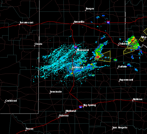 At 350 pm cdt, a severe thunderstorm was located over dougherty, or 14 miles southwest of matador, moving east at 30 mph (radar indicated). Hazards include tennis ball size hail and 60 mph wind gusts. People and animals outdoors will be injured. expect hail damage to roofs, siding, windows, and vehicles. expect wind damage to roofs, siding, and trees. Locations impacted include, matador and roaring springs. At 350 pm cdt, a severe thunderstorm was located over dougherty, or 14 miles southwest of matador, moving east at 30 mph (radar indicated). Hazards include tennis ball size hail and 60 mph wind gusts. People and animals outdoors will be injured. expect hail damage to roofs, siding, windows, and vehicles. expect wind damage to roofs, siding, and trees. Locations impacted include, matador and roaring springs.
|
| 5/19/2018 3:39 PM CDT |
 The national weather service in lubbock texas has issued a * severe thunderstorm warning for. southeastern floyd county in northwestern texas. southern motley county in northwestern texas. Until 430 pm cdt * at 339 pm cdt, a severe thunderstorm was located near dougherty, or. The national weather service in lubbock texas has issued a * severe thunderstorm warning for. southeastern floyd county in northwestern texas. southern motley county in northwestern texas. Until 430 pm cdt * at 339 pm cdt, a severe thunderstorm was located near dougherty, or.
|
| 5/17/2018 6:26 PM CDT |
 At 626 pm cdt, severe thunderstorms were located along a line extending from near memphis to 7 miles northeast of afton, moving east at 20 mph (radar indicated). Hazards include 70 mph wind gusts and quarter size hail. Hail damage to vehicles is expected. expect considerable tree damage. Wind damage is also likely to mobile homes, roofs, and outbuildings. At 626 pm cdt, severe thunderstorms were located along a line extending from near memphis to 7 miles northeast of afton, moving east at 20 mph (radar indicated). Hazards include 70 mph wind gusts and quarter size hail. Hail damage to vehicles is expected. expect considerable tree damage. Wind damage is also likely to mobile homes, roofs, and outbuildings.
|
| 5/17/2018 5:58 PM CDT |
 At 557 pm cdt, a severe thunderstorm was located near flomot, or 17 miles southwest of turkey, moving northeast at 40 mph (radar indicated). Hazards include 60 mph wind gusts and quarter size hail. Hail damage to vehicles is expected. expect wind damage to roofs, siding, and trees. Locations impacted include, matador, turkey, caprock canyon state park, quitaque, valley schools, flomot and northfield. At 557 pm cdt, a severe thunderstorm was located near flomot, or 17 miles southwest of turkey, moving northeast at 40 mph (radar indicated). Hazards include 60 mph wind gusts and quarter size hail. Hail damage to vehicles is expected. expect wind damage to roofs, siding, and trees. Locations impacted include, matador, turkey, caprock canyon state park, quitaque, valley schools, flomot and northfield.
|
| 5/17/2018 5:32 PM CDT |
 At 531 pm cdt, a severe thunderstorm was located over floydada, moving northeast at 45 mph (radar indicated). Hazards include golf ball size hail and 60 mph wind gusts. People and animals outdoors will be injured. expect hail damage to roofs, siding, windows, and vehicles. Expect wind damage to roofs, siding, and trees. At 531 pm cdt, a severe thunderstorm was located over floydada, moving northeast at 45 mph (radar indicated). Hazards include golf ball size hail and 60 mph wind gusts. People and animals outdoors will be injured. expect hail damage to roofs, siding, windows, and vehicles. Expect wind damage to roofs, siding, and trees.
|
| 5/15/2018 10:32 PM CDT |
 At 1032 pm cdt, severe thunderstorms were located along a line extending from near tell to near finney, moving east at 45 mph (radar indicated). Hazards include 60 mph wind gusts. Expect damage to roofs, siding, and trees. Locations impacted include, childress, paducah, matador, guthrie, cee vee, kirkland, swearingen, grow, dumont, tell, finney, northfield, delwin and chalk. At 1032 pm cdt, severe thunderstorms were located along a line extending from near tell to near finney, moving east at 45 mph (radar indicated). Hazards include 60 mph wind gusts. Expect damage to roofs, siding, and trees. Locations impacted include, childress, paducah, matador, guthrie, cee vee, kirkland, swearingen, grow, dumont, tell, finney, northfield, delwin and chalk.
|
| 5/15/2018 10:19 PM CDT |
 At 1018 pm cdt, severe thunderstorms were located along a line extending from near tell to near dumont, moving east at 55 mph (radar indicated). Hazards include 70 mph wind gusts. Expect considerable tree damage. damage is likely to mobile homes, roofs, and outbuildings. Locations impacted include, childress, paducah, matador, guthrie, cee vee, kirkland, afton, swearingen, grow, dumont, tell, finney, northfield, delwin, chalk and roaring springs. At 1018 pm cdt, severe thunderstorms were located along a line extending from near tell to near dumont, moving east at 55 mph (radar indicated). Hazards include 70 mph wind gusts. Expect considerable tree damage. damage is likely to mobile homes, roofs, and outbuildings. Locations impacted include, childress, paducah, matador, guthrie, cee vee, kirkland, afton, swearingen, grow, dumont, tell, finney, northfield, delwin, chalk and roaring springs.
|
| 5/15/2018 10:06 PM CDT |
 At 1005 pm cdt, severe thunderstorms were located along a line extending from near northfield to 9 miles northwest of afton, moving east at 45 mph (radar indicated). Hazards include 70 mph wind gusts. Expect considerable tree damage. Damage is likely to mobile homes, roofs, and outbuildings. At 1005 pm cdt, severe thunderstorms were located along a line extending from near northfield to 9 miles northwest of afton, moving east at 45 mph (radar indicated). Hazards include 70 mph wind gusts. Expect considerable tree damage. Damage is likely to mobile homes, roofs, and outbuildings.
|
| 5/15/2018 9:57 PM CDT |
 At 956 pm cdt, severe thunderstorms were located along a line extending from 8 miles southeast of turkey to 6 miles northwest of mcadoo, moving east at 50 mph (radar indicated. at 945 pm the west texas mesonet station located 2 miles west southwest of turkey reported a 66 mph wind gust). Hazards include 70 mph wind gusts. Expect considerable tree damage. damage is likely to mobile homes, roofs, and outbuildings. Locations impacted include, floydada, matador, turkey, caprock canyon state park, quitaque, valley schools, flomot, cone, dougherty, mcadoo and roaring springs. At 956 pm cdt, severe thunderstorms were located along a line extending from 8 miles southeast of turkey to 6 miles northwest of mcadoo, moving east at 50 mph (radar indicated. at 945 pm the west texas mesonet station located 2 miles west southwest of turkey reported a 66 mph wind gust). Hazards include 70 mph wind gusts. Expect considerable tree damage. damage is likely to mobile homes, roofs, and outbuildings. Locations impacted include, floydada, matador, turkey, caprock canyon state park, quitaque, valley schools, flomot, cone, dougherty, mcadoo and roaring springs.
|
| 5/15/2018 9:47 PM CDT |
 At 945 pm cdt, severe thunderstorms were located along a line extending from near valley schools to near cone, moving southeast at 45 mph (radar indicated. at 935 pm the west texas mesonet station located 2 miles north northeast of floydada reported a 60 mph wind gust). Hazards include 70 mph wind gusts. Expect considerable tree damage. damage is likely to mobile homes, roofs, and outbuildings. Locations impacted include, floydada, silverton, matador, turkey, caprock canyon state park, lockney, quitaque, south plains, dougherty, valley schools, flomot, mcadoo, cone and roaring springs. At 945 pm cdt, severe thunderstorms were located along a line extending from near valley schools to near cone, moving southeast at 45 mph (radar indicated. at 935 pm the west texas mesonet station located 2 miles north northeast of floydada reported a 60 mph wind gust). Hazards include 70 mph wind gusts. Expect considerable tree damage. damage is likely to mobile homes, roofs, and outbuildings. Locations impacted include, floydada, silverton, matador, turkey, caprock canyon state park, lockney, quitaque, south plains, dougherty, valley schools, flomot, mcadoo, cone and roaring springs.
|
| 5/15/2018 9:27 PM CDT |
 At 927 pm cdt, severe thunderstorms were located along a line extending from near silverton to near south plains to 7 miles north of petersburg, moving southeast at 40 mph. these are very dangerous storms (radar indicated). Hazards include 80 mph wind gusts. Flying debris will be dangerous to those caught without shelter. mobile homes will be heavily damaged. expect considerable damage to roofs, windows, and vehicles. Extensive tree damage and power outages are likely. At 927 pm cdt, severe thunderstorms were located along a line extending from near silverton to near south plains to 7 miles north of petersburg, moving southeast at 40 mph. these are very dangerous storms (radar indicated). Hazards include 80 mph wind gusts. Flying debris will be dangerous to those caught without shelter. mobile homes will be heavily damaged. expect considerable damage to roofs, windows, and vehicles. Extensive tree damage and power outages are likely.
|
| 5/15/2018 8:08 PM CDT |
 At 808 pm cdt, a severe thunderstorm was located 8 miles southeast of matador, moving east at 30 mph (radar indicated). Hazards include 70 mph wind gusts and quarter size hail. Hail damage to vehicles is expected. expect considerable tree damage. wind damage is also likely to mobile homes, roofs, and outbuildings. Locations impacted include, matador and roaring springs. At 808 pm cdt, a severe thunderstorm was located 8 miles southeast of matador, moving east at 30 mph (radar indicated). Hazards include 70 mph wind gusts and quarter size hail. Hail damage to vehicles is expected. expect considerable tree damage. wind damage is also likely to mobile homes, roofs, and outbuildings. Locations impacted include, matador and roaring springs.
|
| 5/15/2018 7:55 PM CDT |
 At 755 pm cdt, a severe thunderstorm was located 7 miles south of matador, moving northeast at 15 mph (radar indicated). Hazards include 70 mph wind gusts and quarter size hail. Hail damage to vehicles is expected. expect considerable tree damage. wind damage is also likely to mobile homes, roofs, and outbuildings. Locations impacted include, matador and roaring springs. At 755 pm cdt, a severe thunderstorm was located 7 miles south of matador, moving northeast at 15 mph (radar indicated). Hazards include 70 mph wind gusts and quarter size hail. Hail damage to vehicles is expected. expect considerable tree damage. wind damage is also likely to mobile homes, roofs, and outbuildings. Locations impacted include, matador and roaring springs.
|
| 5/15/2018 7:44 PM CDT |
 At 744 pm cdt, a severe thunderstorm was located 2 miles southwest of roaring springs, or 9 miles south of matador, moving northeast at 15 mph (radar indicated). Hazards include 70 mph wind gusts and quarter size hail. Hail damage to vehicles is expected. expect considerable tree damage. wind damage is also likely to mobile homes, roofs, and outbuildings. Locations impacted include, matador, dougherty and roaring springs. At 744 pm cdt, a severe thunderstorm was located 2 miles southwest of roaring springs, or 9 miles south of matador, moving northeast at 15 mph (radar indicated). Hazards include 70 mph wind gusts and quarter size hail. Hail damage to vehicles is expected. expect considerable tree damage. wind damage is also likely to mobile homes, roofs, and outbuildings. Locations impacted include, matador, dougherty and roaring springs.
|
| 5/15/2018 7:30 PM CDT |
 At 729 pm cdt, a severe thunderstorm was located 9 miles southeast of dougherty, or 10 miles southwest of matador, moving northeast at 15 mph (radar indicated). Hazards include 70 mph wind gusts and quarter size hail. Hail damage to vehicles is expected. expect considerable tree damage. Wind damage is also likely to mobile homes, roofs, and outbuildings. At 729 pm cdt, a severe thunderstorm was located 9 miles southeast of dougherty, or 10 miles southwest of matador, moving northeast at 15 mph (radar indicated). Hazards include 70 mph wind gusts and quarter size hail. Hail damage to vehicles is expected. expect considerable tree damage. Wind damage is also likely to mobile homes, roofs, and outbuildings.
|
| 5/15/2018 7:21 PM CDT |
 At 721 pm cdt, a severe thunderstorm was located 7 miles southeast of dougherty, or 14 miles southwest of matador, moving northeast at 15 mph (radar indicated). Hazards include 70 mph wind gusts and quarter size hail. Hail damage to vehicles is expected. expect considerable tree damage. wind damage is also likely to mobile homes, roofs, and outbuildings. Locations impacted include, matador, dougherty, mcadoo and roaring springs. At 721 pm cdt, a severe thunderstorm was located 7 miles southeast of dougherty, or 14 miles southwest of matador, moving northeast at 15 mph (radar indicated). Hazards include 70 mph wind gusts and quarter size hail. Hail damage to vehicles is expected. expect considerable tree damage. wind damage is also likely to mobile homes, roofs, and outbuildings. Locations impacted include, matador, dougherty, mcadoo and roaring springs.
|
| 5/15/2018 7:11 PM CDT |
 At 710 pm cdt, a severe thunderstorm was located 7 miles southeast of dougherty, or 16 miles southwest of matador, moving northeast at 15 mph (radar indicated). Hazards include 70 mph wind gusts and ping pong ball size hail. People and animals outdoors will be injured. expect hail damage to roofs, siding, windows, and vehicles. expect considerable tree damage. wind damage is also likely to mobile homes, roofs, and outbuildings. Locations impacted include, matador, dougherty, mcadoo and roaring springs. At 710 pm cdt, a severe thunderstorm was located 7 miles southeast of dougherty, or 16 miles southwest of matador, moving northeast at 15 mph (radar indicated). Hazards include 70 mph wind gusts and ping pong ball size hail. People and animals outdoors will be injured. expect hail damage to roofs, siding, windows, and vehicles. expect considerable tree damage. wind damage is also likely to mobile homes, roofs, and outbuildings. Locations impacted include, matador, dougherty, mcadoo and roaring springs.
|
| 5/15/2018 6:56 PM CDT |
 At 642 pm cdt, a severe thunderstorm was located 8 miles northwest of mcadoo, or 13 miles northeast of crosbyton, moving northeast at 20 mph (radar indicated). Hazards include 70 mph wind gusts and ping pong ball size hail. People and animals outdoors will be injured. expect hail damage to roofs, siding, windows, and vehicles. expect considerable tree damage. Wind damage is also likely to mobile homes, roofs, and outbuildings. At 642 pm cdt, a severe thunderstorm was located 8 miles northwest of mcadoo, or 13 miles northeast of crosbyton, moving northeast at 20 mph (radar indicated). Hazards include 70 mph wind gusts and ping pong ball size hail. People and animals outdoors will be injured. expect hail damage to roofs, siding, windows, and vehicles. expect considerable tree damage. Wind damage is also likely to mobile homes, roofs, and outbuildings.
|
| 5/15/2018 6:42 PM CDT |
 At 642 pm cdt, a severe thunderstorm was located 8 miles northwest of mcadoo, or 13 miles northeast of crosbyton, moving northeast at 20 mph (radar indicated). Hazards include 70 mph wind gusts and ping pong ball size hail. People and animals outdoors will be injured. expect hail damage to roofs, siding, windows, and vehicles. expect considerable tree damage. Wind damage is also likely to mobile homes, roofs, and outbuildings. At 642 pm cdt, a severe thunderstorm was located 8 miles northwest of mcadoo, or 13 miles northeast of crosbyton, moving northeast at 20 mph (radar indicated). Hazards include 70 mph wind gusts and ping pong ball size hail. People and animals outdoors will be injured. expect hail damage to roofs, siding, windows, and vehicles. expect considerable tree damage. Wind damage is also likely to mobile homes, roofs, and outbuildings.
|
| 5/14/2018 5:42 PM CDT |
 At 542 pm cdt, a severe thunderstorm was located 7 miles southeast of matador, moving northeast at 30 mph (radar indicated). Hazards include 60 mph wind gusts and quarter size hail. Hail damage to vehicles is expected. Expect wind damage to roofs, siding, and trees. At 542 pm cdt, a severe thunderstorm was located 7 miles southeast of matador, moving northeast at 30 mph (radar indicated). Hazards include 60 mph wind gusts and quarter size hail. Hail damage to vehicles is expected. Expect wind damage to roofs, siding, and trees.
|
| 4/30/2018 6:50 PM CDT | Quarter sized hail reported 0.5 miles SSW of Matador, TX |
| 4/30/2018 6:38 PM CDT |
 At 638 pm cdt, a severe thunderstorm was located near matador, moving northeast at 20 mph (radar indicated). Hazards include 60 mph wind gusts and quarter size hail. Hail damage to vehicles is expected. expect wind damage to roofs, siding, and trees. Locations impacted include, matador, northfield and cee vee. At 638 pm cdt, a severe thunderstorm was located near matador, moving northeast at 20 mph (radar indicated). Hazards include 60 mph wind gusts and quarter size hail. Hail damage to vehicles is expected. expect wind damage to roofs, siding, and trees. Locations impacted include, matador, northfield and cee vee.
|
| 4/30/2018 6:18 PM CDT |
 At 618 pm cdt, a severe thunderstorm was located near matador, moving northeast at 35 mph (trained weather spotters). Hazards include 60 mph wind gusts and quarter size hail. Hail damage to vehicles is expected. Expect wind damage to roofs, siding, and trees. At 618 pm cdt, a severe thunderstorm was located near matador, moving northeast at 35 mph (trained weather spotters). Hazards include 60 mph wind gusts and quarter size hail. Hail damage to vehicles is expected. Expect wind damage to roofs, siding, and trees.
|
| 10/6/2017 10:59 PM CDT |
 At 1058 pm cdt, a severe thunderstorm was located over turkey, moving east at 50 mph (radar indicated). Hazards include 70 mph wind gusts and nickel size hail. Expect considerable tree damage. Damage is likely to mobile homes, roofs, and outbuildings. At 1058 pm cdt, a severe thunderstorm was located over turkey, moving east at 50 mph (radar indicated). Hazards include 70 mph wind gusts and nickel size hail. Expect considerable tree damage. Damage is likely to mobile homes, roofs, and outbuildings.
|
| 10/6/2017 10:43 PM CDT |
 At 1042 pm cdt, a severe thunderstorm was located near valley schools, or near caprock canyon state park, moving east at 50 mph (radar indicated). Hazards include 70 mph wind gusts and quarter size hail. Hail damage to vehicles is expected. expect considerable tree damage. wind damage is also likely to mobile homes, roofs, and outbuildings. Locations impacted include, plainview, floydada, memphis, silverton, matador, turkey, caprock canyon state park, quitaque, dougherty, aiken, brice, flomot, northfield, roaring springs and estelline. At 1042 pm cdt, a severe thunderstorm was located near valley schools, or near caprock canyon state park, moving east at 50 mph (radar indicated). Hazards include 70 mph wind gusts and quarter size hail. Hail damage to vehicles is expected. expect considerable tree damage. wind damage is also likely to mobile homes, roofs, and outbuildings. Locations impacted include, plainview, floydada, memphis, silverton, matador, turkey, caprock canyon state park, quitaque, dougherty, aiken, brice, flomot, northfield, roaring springs and estelline.
|
| 10/6/2017 10:26 PM CDT |
 The national weather service in lubbock texas has issued a * severe thunderstorm warning for. floyd county in northwestern texas. motley county in northwestern texas. hall county in the panhandle of texas. Northeastern hale county in northwestern texas. The national weather service in lubbock texas has issued a * severe thunderstorm warning for. floyd county in northwestern texas. motley county in northwestern texas. hall county in the panhandle of texas. Northeastern hale county in northwestern texas.
|
| 8/13/2017 10:51 PM CDT |
 At 1050 pm cdt, severe thunderstorms were located along a line extending from 6 miles north of paducah to near dougherty, moving southeast at 30 mph (radar indicated). Hazards include 60 mph wind gusts and quarter size hail. Hail damage to vehicles is expected. expect wind damage to roofs, siding, and trees. Locations impacted include, floydada, paducah, matador, flomot, cee vee, dougherty, northfield, swearingen and roaring springs. At 1050 pm cdt, severe thunderstorms were located along a line extending from 6 miles north of paducah to near dougherty, moving southeast at 30 mph (radar indicated). Hazards include 60 mph wind gusts and quarter size hail. Hail damage to vehicles is expected. expect wind damage to roofs, siding, and trees. Locations impacted include, floydada, paducah, matador, flomot, cee vee, dougherty, northfield, swearingen and roaring springs.
|
| 8/13/2017 10:35 PM CDT |
 At 1033 pm cdt, severe thunderstorms were located along a line extending from near cee vee to 6 miles north of dougherty, moving southeast at 30 mph (radar indicated). Hazards include 70 mph wind gusts and half dollar size hail. Hail damage to vehicles is expected. expect considerable tree damage. wind damage is also likely to mobile homes, roofs, and outbuildings. Locations impacted include, childress, floydada, paducah, matador, flomot, cee vee, tell, dougherty, northfield, swearingen and roaring springs. At 1033 pm cdt, severe thunderstorms were located along a line extending from near cee vee to 6 miles north of dougherty, moving southeast at 30 mph (radar indicated). Hazards include 70 mph wind gusts and half dollar size hail. Hail damage to vehicles is expected. expect considerable tree damage. wind damage is also likely to mobile homes, roofs, and outbuildings. Locations impacted include, childress, floydada, paducah, matador, flomot, cee vee, tell, dougherty, northfield, swearingen and roaring springs.
|
| 8/13/2017 10:14 PM CDT |
 At 1013 pm cdt, severe thunderstorms were located along a line extending from near tell to 10 miles southwest of flomot, moving southeast at 30 mph (radar indicated). Hazards include two inch hail and 70 mph wind gusts. People and animals outdoors will be injured. expect hail damage to roofs, siding, windows, and vehicles. expect considerable tree damage. Wind damage is also likely to mobile homes, roofs, and outbuildings. At 1013 pm cdt, severe thunderstorms were located along a line extending from near tell to 10 miles southwest of flomot, moving southeast at 30 mph (radar indicated). Hazards include two inch hail and 70 mph wind gusts. People and animals outdoors will be injured. expect hail damage to roofs, siding, windows, and vehicles. expect considerable tree damage. Wind damage is also likely to mobile homes, roofs, and outbuildings.
|
| 6/8/2017 10:57 PM CDT |
 At 1028 pm cdt, severe thunderstorms were located along a line extending from near tulia to turkey, moving south at 30 mph (radar indicated). Hazards include 60 mph wind gusts and half dollar size hail. Hail damage to vehicles is expected. Expect wind damage to roofs, siding and trees. At 1028 pm cdt, severe thunderstorms were located along a line extending from near tulia to turkey, moving south at 30 mph (radar indicated). Hazards include 60 mph wind gusts and half dollar size hail. Hail damage to vehicles is expected. Expect wind damage to roofs, siding and trees.
|
| 6/8/2017 10:29 PM CDT |
 At 1028 pm cdt, severe thunderstorms were located along a line extending from near tulia to turkey, moving south at 30 mph (radar indicated). Hazards include 60 mph wind gusts and half dollar size hail. Hail damage to vehicles is expected. Expect wind damage to roofs, siding and trees. At 1028 pm cdt, severe thunderstorms were located along a line extending from near tulia to turkey, moving south at 30 mph (radar indicated). Hazards include 60 mph wind gusts and half dollar size hail. Hail damage to vehicles is expected. Expect wind damage to roofs, siding and trees.
|
| 5/10/2017 2:43 PM CDT | Half Dollar sized hail reported 6.2 miles SSE of Matador, TX |
| 5/10/2017 2:41 PM CDT |
 At 241 pm cdt, a severe thunderstorm was located near matador, moving northeast at 25 mph (radar indicated). Hazards include golf ball size hail and 60 mph wind gusts. People and animals outdoors will be injured. expect hail damage to roofs, siding, windows, and vehicles. Expect wind damage to roofs, siding, and trees. At 241 pm cdt, a severe thunderstorm was located near matador, moving northeast at 25 mph (radar indicated). Hazards include golf ball size hail and 60 mph wind gusts. People and animals outdoors will be injured. expect hail damage to roofs, siding, windows, and vehicles. Expect wind damage to roofs, siding, and trees.
|
| 5/10/2017 2:21 PM CDT |
 At 221 pm cdt, a severe thunderstorm was located 7 miles southwest of matador, moving northeast at 30 mph (radar indicated). Hazards include golf ball size hail and 60 mph wind gusts. People and animals outdoors will be injured. expect hail damage to roofs, siding, windows, and vehicles. Expect wind damage to roofs, siding, and trees. At 221 pm cdt, a severe thunderstorm was located 7 miles southwest of matador, moving northeast at 30 mph (radar indicated). Hazards include golf ball size hail and 60 mph wind gusts. People and animals outdoors will be injured. expect hail damage to roofs, siding, windows, and vehicles. Expect wind damage to roofs, siding, and trees.
|
| 3/28/2017 5:35 PM CDT |
 At 535 pm cdt, a severe thunderstorm was located 8 miles north of matador, moving northeast at 45 mph (radar indicated). Hazards include ping pong ball size hail and 60 mph wind gusts. People and animals outdoors will be injured. expect hail damage to roofs, siding, windows, and vehicles. expect wind damage to roofs, siding, and trees. locations impacted include, matador and northfield. A tornado watch remains in effect until 1100 pm cdt for northwestern texas. At 535 pm cdt, a severe thunderstorm was located 8 miles north of matador, moving northeast at 45 mph (radar indicated). Hazards include ping pong ball size hail and 60 mph wind gusts. People and animals outdoors will be injured. expect hail damage to roofs, siding, windows, and vehicles. expect wind damage to roofs, siding, and trees. locations impacted include, matador and northfield. A tornado watch remains in effect until 1100 pm cdt for northwestern texas.
|
| 3/28/2017 5:22 PM CDT |
 At 522 pm cdt, a severe thunderstorm was located 7 miles northwest of matador, moving northeast at 45 mph (radar indicated). Hazards include ping pong ball size hail and 60 mph wind gusts. People and animals outdoors will be injured. expect hail damage to roofs, siding, windows, and vehicles. Expect wind damage to roofs, siding, and trees. At 522 pm cdt, a severe thunderstorm was located 7 miles northwest of matador, moving northeast at 45 mph (radar indicated). Hazards include ping pong ball size hail and 60 mph wind gusts. People and animals outdoors will be injured. expect hail damage to roofs, siding, windows, and vehicles. Expect wind damage to roofs, siding, and trees.
|
| 3/28/2017 4:34 PM CDT |
 At 433 pm cdt, a severe thunderstorm capable of producing a tornado was located 9 miles west of dumont, or 14 miles southeast of matador, moving northeast at 40 mph (radar indicated rotation). Hazards include tornado. Flying debris will be dangerous to those caught without shelter. mobile homes will be damaged or destroyed. damage to roofs, windows, and vehicles will occur. tree damage is likely. This tornadic thunderstorm will remain over mainly rural areas of northeastern dickens, eastern motley and southwestern cottle counties, including the following locations: roaring springs. At 433 pm cdt, a severe thunderstorm capable of producing a tornado was located 9 miles west of dumont, or 14 miles southeast of matador, moving northeast at 40 mph (radar indicated rotation). Hazards include tornado. Flying debris will be dangerous to those caught without shelter. mobile homes will be damaged or destroyed. damage to roofs, windows, and vehicles will occur. tree damage is likely. This tornadic thunderstorm will remain over mainly rural areas of northeastern dickens, eastern motley and southwestern cottle counties, including the following locations: roaring springs.
|
| 3/28/2017 4:06 PM CDT | Ping Pong Ball sized hail reported 12.7 miles SSE of Matador, TX |
| 3/28/2017 3:51 PM CDT |
 At 351 pm cdt, a severe thunderstorm capable of producing a tornado was located 7 miles northwest of matador, moving northeast at 25 mph (radar indicated rotation). Hazards include tornado. Flying debris will be dangerous to those caught without shelter. mobile homes will be damaged or destroyed. damage to roofs, windows, and vehicles will occur. tree damage is likely. This tornadic thunderstorm will remain over mainly rural areas of northern motley county. At 351 pm cdt, a severe thunderstorm capable of producing a tornado was located 7 miles northwest of matador, moving northeast at 25 mph (radar indicated rotation). Hazards include tornado. Flying debris will be dangerous to those caught without shelter. mobile homes will be damaged or destroyed. damage to roofs, windows, and vehicles will occur. tree damage is likely. This tornadic thunderstorm will remain over mainly rural areas of northern motley county.
|
| 3/28/2017 3:38 PM CDT |
 At 337 pm cdt, a severe thunderstorm capable of producing a tornado was located 8 miles west of matador, moving northeast at 25 mph (radar indicated rotation). Hazards include tornado. Flying debris will be dangerous to those caught without shelter. mobile homes will be damaged or destroyed. damage to roofs, windows, and vehicles will occur. tree damage is likely. This dangerous storm will be near, matador around 350 pm cdt. At 337 pm cdt, a severe thunderstorm capable of producing a tornado was located 8 miles west of matador, moving northeast at 25 mph (radar indicated rotation). Hazards include tornado. Flying debris will be dangerous to those caught without shelter. mobile homes will be damaged or destroyed. damage to roofs, windows, and vehicles will occur. tree damage is likely. This dangerous storm will be near, matador around 350 pm cdt.
|
| 7/15/2016 11:42 PM CDT |
 At 1142 pm cdt, severe thunderstorms were located along a line extending from 9 miles south of goodlett to 7 miles northwest of paducah to near dougherty, moving southeast at 35 mph (radar indicated). Hazards include 60 mph wind gusts. Expect damage to roofs. siding and trees. Locations impacted include, floydada, paducah, matador, cee vee, dougherty, chalk, swearingen, flomot, delwin, south plains and roaring springs. At 1142 pm cdt, severe thunderstorms were located along a line extending from 9 miles south of goodlett to 7 miles northwest of paducah to near dougherty, moving southeast at 35 mph (radar indicated). Hazards include 60 mph wind gusts. Expect damage to roofs. siding and trees. Locations impacted include, floydada, paducah, matador, cee vee, dougherty, chalk, swearingen, flomot, delwin, south plains and roaring springs.
|
| 7/15/2016 11:24 PM CDT |
 At 1123 pm cdt, severe thunderstorms were located along a line extending from 7 miles south of kirkland to 7 miles southwest of cee vee to 9 miles northeast of floydada, moving southeast at 35 mph (radar indicated). Hazards include 60 mph wind gusts. Expect damage to roofs. Siding and trees. At 1123 pm cdt, severe thunderstorms were located along a line extending from 7 miles south of kirkland to 7 miles southwest of cee vee to 9 miles northeast of floydada, moving southeast at 35 mph (radar indicated). Hazards include 60 mph wind gusts. Expect damage to roofs. Siding and trees.
|
| 6/15/2016 9:47 PM CDT |
 At 946 pm cdt, a severe thunderstorm was located near cee vee, or 15 miles southwest of childress, moving east at 20 mph. outflow ahead of this thunderstorm produced a wind gust to 59 mph at the childress airport at 9:39 pm (radar indicated). Hazards include 60 mph wind gusts and penny size hail. Expect damage to roofs. Siding and trees. At 946 pm cdt, a severe thunderstorm was located near cee vee, or 15 miles southwest of childress, moving east at 20 mph. outflow ahead of this thunderstorm produced a wind gust to 59 mph at the childress airport at 9:39 pm (radar indicated). Hazards include 60 mph wind gusts and penny size hail. Expect damage to roofs. Siding and trees.
|
| 6/14/2016 6:00 PM CDT |
 At 600 pm cdt, a severe thunderstorm was located near matador, moving northeast at 10 mph (radar indicated). Hazards include golf ball size hail and 60 mph wind gusts. People and animals outdoors will be injured. expect hail damage to roofs, siding, windows and vehicles. expect wind damage to roofs, siding and trees. locations impacted include, matador and roaring springs. A tornado watch remains in effect until 100 am cdt for northwestern texas. At 600 pm cdt, a severe thunderstorm was located near matador, moving northeast at 10 mph (radar indicated). Hazards include golf ball size hail and 60 mph wind gusts. People and animals outdoors will be injured. expect hail damage to roofs, siding, windows and vehicles. expect wind damage to roofs, siding and trees. locations impacted include, matador and roaring springs. A tornado watch remains in effect until 100 am cdt for northwestern texas.
|
| 6/14/2016 5:39 PM CDT |
 At 539 pm cdt, a severe thunderstorm was located near matador, moving east at 10 mph (radar indicated). Hazards include golf ball size hail and 60 mph wind gusts. People and animals outdoors will be injured. expect hail damage to roofs, siding, windows and vehicles. Expect wind damage to roofs, siding and trees. At 539 pm cdt, a severe thunderstorm was located near matador, moving east at 10 mph (radar indicated). Hazards include golf ball size hail and 60 mph wind gusts. People and animals outdoors will be injured. expect hail damage to roofs, siding, windows and vehicles. Expect wind damage to roofs, siding and trees.
|
| 5/13/2016 7:59 PM CDT |
 At 758 pm cdt, severe thunderstorms were located along a line extending from near matador, to delwin to near swearingen, moving southeast at 25 mph (radar indicated). Hazards include 70 mph wind gusts and quarter size hail. Expect wind damage to trees. mobile homes. roofs and outbuildings. Minor hail damage is also likely. At 758 pm cdt, severe thunderstorms were located along a line extending from near matador, to delwin to near swearingen, moving southeast at 25 mph (radar indicated). Hazards include 70 mph wind gusts and quarter size hail. Expect wind damage to trees. mobile homes. roofs and outbuildings. Minor hail damage is also likely.
|
| 4/20/2016 10:08 PM CDT |
 At 1006 pm cdt, severe thunderstorms were located along a line extending from 6 miles north of mcadoo to near cone, moving southeast at 25 mph. a second storm was located just west of floydada and capable of producing quarter size hail (radar indicated). Hazards include 60 mph wind gusts and half dollar size hail. Hail damage to vehicles is expected. expect wind damage to roofs, siding and trees. Locations impacted include, floydada, crosbyton, matador, ralls, mcadoo, dougherty, cone, afton and roaring springs. At 1006 pm cdt, severe thunderstorms were located along a line extending from 6 miles north of mcadoo to near cone, moving southeast at 25 mph. a second storm was located just west of floydada and capable of producing quarter size hail (radar indicated). Hazards include 60 mph wind gusts and half dollar size hail. Hail damage to vehicles is expected. expect wind damage to roofs, siding and trees. Locations impacted include, floydada, crosbyton, matador, ralls, mcadoo, dougherty, cone, afton and roaring springs.
|
| 4/20/2016 9:57 PM CDT |
 At 955 pm cdt, severe thunderstorms were located along a line extending from near dougherty to near cone, moving southeast at 25 mph. another storm was rapidly developing about 4 miles south of aiken which may further strengthen and produce large hail (radar indicated). Hazards include 60 mph wind gusts and half dollar size hail. Hail damage to vehicles is expected. expect wind damage to roofs, siding and trees. Locations impacted include, floydada, crosbyton, matador, ralls, mcadoo, dougherty, cone, afton and roaring springs. At 955 pm cdt, severe thunderstorms were located along a line extending from near dougherty to near cone, moving southeast at 25 mph. another storm was rapidly developing about 4 miles south of aiken which may further strengthen and produce large hail (radar indicated). Hazards include 60 mph wind gusts and half dollar size hail. Hail damage to vehicles is expected. expect wind damage to roofs, siding and trees. Locations impacted include, floydada, crosbyton, matador, ralls, mcadoo, dougherty, cone, afton and roaring springs.
|
| 4/20/2016 9:45 PM CDT |
 At 944 pm cdt, a severe thunderstorm was located near dougherty, or 13 miles southeast of floydada, moving southeast at 35 mph (radar indicated). Hazards include 60 mph wind gusts and quarter size hail. Hail damage to vehicles is expected. Expect wind damage to roofs, siding and trees. At 944 pm cdt, a severe thunderstorm was located near dougherty, or 13 miles southeast of floydada, moving southeast at 35 mph (radar indicated). Hazards include 60 mph wind gusts and quarter size hail. Hail damage to vehicles is expected. Expect wind damage to roofs, siding and trees.
|
| 4/20/2016 9:34 PM CDT |
 At 932 pm cdt, severe thunderstorms were located along a line extending from near northfield to 6 miles east of matador to near floydada to 9 miles south of lockney, moving east at 50 mph. an area of circulation that has potential to produce a tornado was located between floydada and dougherty. the circulation currently appears as if it will pass south of the city of dougherty (radar indicated). Hazards include golf ball size hail and 70 mph wind gusts. People and animals outdoors will be injured. expect hail damage to roofs, siding, windows and vehicles. expect considerable tree damage. wind damage is also likely to mobile homes, roofs and outbuildings. Locations impacted include, floydada, matador, dougherty, northfield, cone and roaring springs. At 932 pm cdt, severe thunderstorms were located along a line extending from near northfield to 6 miles east of matador to near floydada to 9 miles south of lockney, moving east at 50 mph. an area of circulation that has potential to produce a tornado was located between floydada and dougherty. the circulation currently appears as if it will pass south of the city of dougherty (radar indicated). Hazards include golf ball size hail and 70 mph wind gusts. People and animals outdoors will be injured. expect hail damage to roofs, siding, windows and vehicles. expect considerable tree damage. wind damage is also likely to mobile homes, roofs and outbuildings. Locations impacted include, floydada, matador, dougherty, northfield, cone and roaring springs.
|
| 4/20/2016 9:20 PM CDT |
 At 919 pm cdt, a severe thunderstorm was located near floydada, moving southeast at 25 mph. a low level rotation was located just north of the city of floydada which could create a tornado (radar indicated). Hazards include golf ball size hail and 70 mph wind gusts. People and animals outdoors will be injured. expect hail damage to roofs, siding, windows and vehicles. expect considerable tree damage. wind damage is also likely to mobile homes, roofs and outbuildings. Locations impacted include, floydada, matador, dougherty, cone, flomot, northfield and roaring springs. At 919 pm cdt, a severe thunderstorm was located near floydada, moving southeast at 25 mph. a low level rotation was located just north of the city of floydada which could create a tornado (radar indicated). Hazards include golf ball size hail and 70 mph wind gusts. People and animals outdoors will be injured. expect hail damage to roofs, siding, windows and vehicles. expect considerable tree damage. wind damage is also likely to mobile homes, roofs and outbuildings. Locations impacted include, floydada, matador, dougherty, cone, flomot, northfield and roaring springs.
|
| 4/20/2016 9:14 PM CDT |
 At 913 pm cdt, severe thunderstorms were located along a line extending from 9 miles east of flomot to 7 miles north of dougherty to near floydada, moving southeast at 35 mph (radar indicated). Hazards include golf ball size hail and 70 mph wind gusts. People and animals outdoors will be injured. expect hail damage to roofs, siding, windows and vehicles. expect considerable tree damage. Wind damage is also likely to mobile homes, roofs and outbuildings. At 913 pm cdt, severe thunderstorms were located along a line extending from 9 miles east of flomot to 7 miles north of dougherty to near floydada, moving southeast at 35 mph (radar indicated). Hazards include golf ball size hail and 70 mph wind gusts. People and animals outdoors will be injured. expect hail damage to roofs, siding, windows and vehicles. expect considerable tree damage. Wind damage is also likely to mobile homes, roofs and outbuildings.
|
| 5/28/2015 1:03 PM CDT | At 102 pm cdt, a severe thunderstorm was located over matador, moving northeast at 15 mph (radar indicated). Hazards include half dollar size hail and 60 mph wind gusts. Hail damage to vehicles is expected. expect wind damage to roofs, siding and trees. locations impacted include, matador and roaring springs. A tornado watch remains in effect until 800 pm cdt for northwestern texas. |
| 5/28/2015 12:32 PM CDT | At 1232 pm cdt, a severe thunderstorm was located near matador, moving northeast at 15 mph (radar indicated). Hazards include 60 mph wind gusts and half dollar size hail. Hail damage to vehicles is expected. Expect wind damage to roofs, siding and trees. |
| 5/23/2015 7:26 PM CDT | At 726 pm cdt, a severe thunderstorm was located near matador, moving northeast at 45 mph (radar indicated). Hazards include 60 mph wind gusts and penny size hail. Expect damage to roofs. Siding and trees. |
| 5/16/2015 3:03 PM CDT | At 302 pm cdt, a severe thunderstorm was located 9 miles north of matador. another severe thunderstorm was located 8 miles southwest of matador. both storms were moving northeast at 35 mph (radar indicated). Hazards include quarter size hail and 70 mph wind gusts. Hail damage to vehicles is expected. expect considerable tree damage. wind damage is also likely to mobile homes, roofs and outbuildings. locations impacted include, matador, cee vee and northfield. a tornado watch remains in effect until 800 pm cdt for northwestern texas. Possible. |
| 5/16/2015 2:45 PM CDT | At 245 pm cdt, a severe thunderstorm was located near matador, moving northeast at 50 mph (radar indicated). Hazards include golf ball size hail and 70 mph wind gusts. People and animals outdoors will be injured. expect hail damage to roofs, siding, windows and vehicles. expect considerable tree damage. Wind damage is also likely to mobile homes, roofs and outbuildings. |
| 5/8/2015 11:26 AM CDT | At 1123 am cdt, a cluster of severe thunderstorms was located from plainview to north of matador. the strongest of these storms will approach 207 between silverton nd floydada. these storms were moving northeast at 50 mph and have a history of producing large hail (radar indicated). Hazards include two inch hail and 60 mph wind gusts. People and animals outdoors will be injured. expect hail damage to roofs, siding, windows and vehicles. expect wind damage to roofs, siding and trees. locations impacted include, silverton, matador, quitaque, lockney, flomot, south plains and caprock canyon state park. a tornado watch remains in effect until 500 pm cdt for northwestern texas. 2. 00in. |
| 5/8/2015 11:22 AM CDT | Quarter sized hail reported 0.5 miles SSW of Matador, TX |
| 5/8/2015 11:07 AM CDT | At 1106 am cdt, a cluster of severe thunderstorms was located from plainview to dougherty to roaring springs. the strongest of these storms was north of aiken. storms were moving northeast at 50 mph (radar indicated). Hazards include ping pong ball size hail and 60 mph wind gusts. People and animals outdoors will be injured. expect hail damage to roofs, siding, windows and vehicles. Expect wind damage to roofs, siding and trees. |
| 4/22/2015 8:46 PM CDT | At 845 pm cdt, a severe thunderstorm was located 9 miles east of matador, moving southeast at 45 mph (radar indicated). Hazards include tennis ball size hail and 70 mph wind gusts. People and animals outdoors will be injured. expect hail damage to roofs, siding, windows and vehicles. expect considerable tree damage. wind damage is also likely to mobile homes, roofs and outbuildings. locations impacted include, paducah, matador, dumont, grow, chalk, finney, delwin, afton and roaring springs. a tornado watch remains in effect until 1000 pm cdt for northwestern texas. Possible. |
| 4/22/2015 8:30 PM CDT | Truck blown over on us 62 7 in motley county TX, 10 miles W of Matador, TX |
| 4/22/2015 8:30 PM CDT | Quarter sized hail reported 10 miles W of Matador, TX, one inch diamter hail reported at the time of wind report. |
| 4/22/2015 8:30 PM CDT | Quarter sized hail reported 3.2 miles S of Matador, TX |
| 4/22/2015 8:25 PM CDT | At 824 pm cdt, a severe thunderstorm was located near matador, moving southeast at 35 mph. this storm is producing large destructive hail! (radar indicated). Hazards include tennis ball size hail and 70 mph wind gusts. People and animals outdoors will be injured. expect hail damage to roofs, siding, windows and vehicles. expect considerable tree damage. Wind damage is also likely to mobile homes, roofs and outbuildings. |
| 4/22/2015 8:09 PM CDT | At 808 pm cdt, a severe thunderstorm was located over flomot, or 10 miles southeast of quitaque, moving southeast at 40 mph. damaging hail to 2 inches in diameter is occurring with this storm! (law enforcement). Hazards include two inch hail and 70 mph wind gusts. People and animals outdoors will be injured. expect hail damage to roofs, siding, windows and vehicles. expect considerable tree damage. wind damage is also likely to mobile homes, roofs and outbuildings. locations impacted include, matador, dougherty, flomot, northfield, south plains and roaring springs. a tornado watch remains in effect until 1000 pm cdt for northwestern texas. Possible. |
| 4/22/2015 8:00 PM CDT | At 758 pm cdt, a severe thunderstorm was located 7 miles southwest of quitaque, moving southeast at 30 mph. at 752 pm, law enforcement reported destructive 2 inch diameter hail 6 miles south of quitaque (law enforcement). Hazards include two inch hail and 70 mph wind gusts. People and animals outdoors will be injured. expect hail damage to roofs, siding, windows and vehicles. expect considerable tree damage. wind damage is also likely to mobile homes, roofs and outbuildings. locations impacted include, matador, quitaque, valley schools, dougherty, flomot, northfield, south plains, turkey and roaring springs. a tornado watch remains in effect until 1000 pm cdt for northwestern texas. Possible. |
| 4/22/2015 7:42 PM CDT | At 741 pm cdt, a severe thunderstorm was located 8 miles south of silverton, moving southeast at 30 mph (radar indicated). Hazards include two inch hail and 70 mph wind gusts. People and animals outdoors will be injured. expect hail damage to roofs, siding, windows and vehicles. expect considerable tree damage. Wind damage is also likely to mobile homes, roofs and outbuildings. |
| 4/16/2015 5:36 PM CDT | At 535 pm cdt, a severe thunderstorm was located near matador, moving north at 30 mph (law enforcement. at 523 pm golf ball sized hail was reported in roaring springs). Hazards include golf ball size hail and 60 mph wind gusts. People and animals outdoors will be injured. expect hail damage to roofs, siding, windows and vehicles. expect wind damage to roofs, siding and trees. locations impacted include, matador and roaring springs. Possible. |
| 4/16/2015 5:24 PM CDT | Golf Ball sized hail reported 0.5 miles SSW of Matador, TX |
| 4/16/2015 5:24 PM CDT | At 523 pm cdt, a severe thunderstorm was located 3 miles west of matador, moving north at 30 mph (radar indicated). Hazards include half dollar size hail and 60 mph wind gusts. Hail damage to vehicles is expected. expect wind damage to roofs, siding and trees. locations impacted include, matador and roaring springs. 1. 25in. |
| 4/16/2015 5:09 PM CDT | At 508 pm cdt, a severe thunderstorm was located 8 miles northwest of afton, or 12 miles southwest of matador, moving north at 30 mph (radar indicated). Hazards include 60 mph wind gusts and half dollar size hail. Hail damage to vehicles is expected. Expect wind damage to roofs, siding and trees. |
| 4/8/2015 8:35 PM CDT | A severe thunderstorm warning remains in effect until 845 pm cdt for motley and dickens counties. at 833 pm cdt. doppler radar indicated a line of severe thunderstorms located along a line extending from 8 miles northeast of afton to 6 miles east of dickens to 6 miles northwest of girard. Moving east at 60 mph. |
| 4/8/2015 8:13 PM CDT | A severe thunderstorm warning remains in effect until 845 pm cdt for eastern crosby. southeastern floyd. motley and dickens counties. at 812 pm cdt. severe thunderstorms were located along a line extending from near dougherty to 7 miles east of crosbyton to near white river lake. Moving east at 45 mph. |
| 4/8/2015 7:58 PM CDT | The national weather service in lubbock has issued a * severe thunderstorm warning for. crosby county in northwestern texas. southeastern floyd county in northwestern texas. motley county in northwestern texas. Dickens county in northwestern texas. |
| 8/28/2014 4:55 PM CDT | Multiple trees down in matador in motley county TX, 0.5 miles SSW of Matador, TX |
| 6/7/2014 8:20 PM CDT | Golf Ball sized hail reported 0.5 miles SSW of Matador, TX, reports of golf ball and quarter sized hail |
| 6/7/2014 7:32 PM CDT | Golf Ball sized hail reported 0.5 miles SSW of Matador, TX |
| 6/7/2014 7:30 PM CDT | Golf Ball sized hail reported 3.8 miles E of Matador, TX |
| 6/16/2013 10:00 PM CDT | Quarter sized hail reported 8 miles S of Matador, TX |
| 6/6/2012 6:36 PM CDT | Quarter sized hail reported 22.9 miles SW of Matador, TX, mostly dime-sized with a few quarter-sized hail |
| 4/30/2012 6:32 PM CDT | Hen Egg sized hail reported 3.1 miles W of Matador, TX, on us 70 |
| 4/30/2012 6:28 PM CDT | Golf Ball sized hail reported 0.5 miles SSW of Matador, TX, relayed by kcbd...along highway 70 in matador. |
| 4/30/2012 6:23 PM CDT | Golf Ball sized hail reported 3.5 miles NW of Matador, TX, reported by matador fire department. |
| 4/19/2012 8:39 PM CDT | Quarter sized hail reported 6.1 miles E of Matador, TX |
| 1/1/0001 12:00 AM | Golf Ball sized hail reported 17.9 miles S of Matador, TX |
| 1/1/0001 12:00 AM | Golf Ball sized hail reported 0.5 miles SSW of Matador, TX, time estimated |
| 1/1/0001 12:00 AM | Quarter sized hail reported 22.9 miles SW of Matador, TX |
Hail Maps for Matador, TX
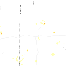
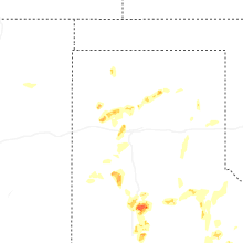
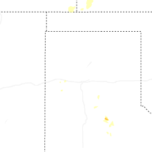
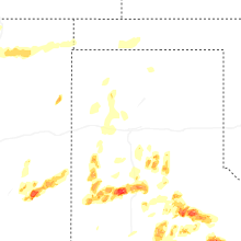
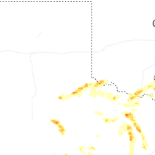
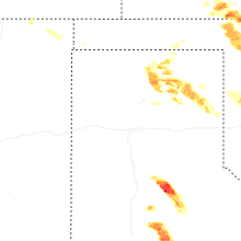
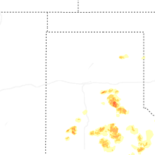


Connect with Interactive Hail Maps