

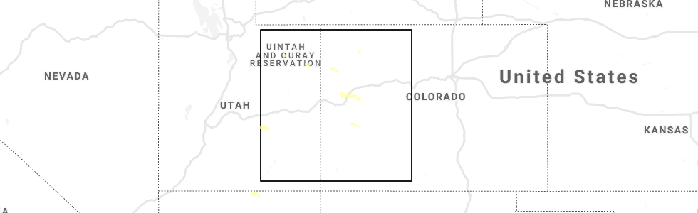
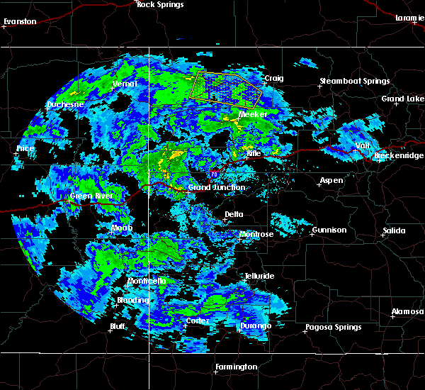
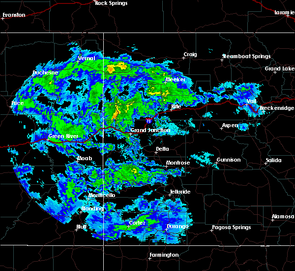
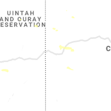
Hail Map for Maybell, CO
The Maybell, CO area has had 0 reports of on-the-ground hail by trained spotters, and has been under severe weather warnings 0 times during the past 12 months. Doppler radar has detected hail at or near Maybell, CO on 2 occasions.
| Name: | Maybell, CO |
| Where Located: | 28.3 miles W of Craig, CO |
| Map: | Google Map for Maybell, CO |
| Population: | 72 |
| Housing Units: | 45 |
| More Info: | Search Google for Maybell, CO |
0
The Top Recent Hail Date for Maybell, CO is Monday, May 11, 2020 (2nd out of 2)
Hail and Wind Damage Spotted near Maybell, CO
| Date / Time | Report Details |
|---|---|
| 9/4/2024 3:35 PM MDT |
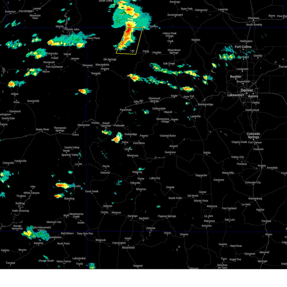
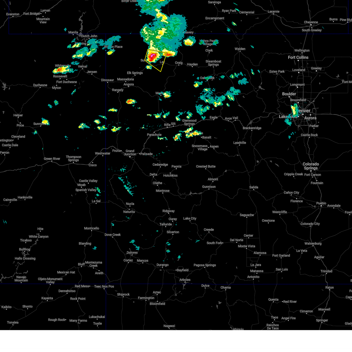 At 335 pm mdt, a severe thunderstorm was located 26 miles west of craig, moving east at 35 mph (radar indicated). Hazards include quarter size hail. Damage to vehicles is expected. Locations impacted include, maybell, juniper springs, and lay. At 335 pm mdt, a severe thunderstorm was located 26 miles west of craig, moving east at 35 mph (radar indicated). Hazards include quarter size hail. Damage to vehicles is expected. Locations impacted include, maybell, juniper springs, and lay.
|
| 9/4/2024 3:20 PM MDT |
 Svrgjt the national weather service in grand junction has issued a * severe thunderstorm warning for, central moffat county in northwestern colorado, * until 345 pm mdt. * at 320 pm mdt, a severe thunderstorm was located 35 miles west of craig, moving east at 35 mph (radar indicated). Hazards include quarter size hail. damage to vehicles is expected Svrgjt the national weather service in grand junction has issued a * severe thunderstorm warning for, central moffat county in northwestern colorado, * until 345 pm mdt. * at 320 pm mdt, a severe thunderstorm was located 35 miles west of craig, moving east at 35 mph (radar indicated). Hazards include quarter size hail. damage to vehicles is expected
|
| 8/10/2024 2:36 PM MDT |
 The storm which prompted the warning has weakened below severe limits, and no longer poses an immediate threat to life or property. therefore, the warning will be allowed to expire. however, small hail and gusty winds are still possible with this thunderstorm. The storm which prompted the warning has weakened below severe limits, and no longer poses an immediate threat to life or property. therefore, the warning will be allowed to expire. however, small hail and gusty winds are still possible with this thunderstorm.
|
| 8/10/2024 2:15 PM MDT |
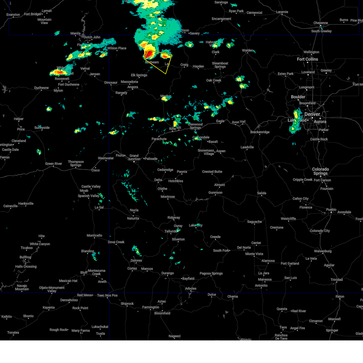
 Svrgjt the national weather service in grand junction has issued a * severe thunderstorm warning for, northeastern moffat county in northwestern colorado, * until 245 pm mdt. * at 214 pm mdt, a severe thunderstorm was located 25 miles southwest of baggs, or 29 miles northwest of craig, moving east at 30 mph (radar indicated). Hazards include 60 mph wind gusts and penny size hail. expect damage to roofs, siding, and trees Svrgjt the national weather service in grand junction has issued a * severe thunderstorm warning for, northeastern moffat county in northwestern colorado, * until 245 pm mdt. * at 214 pm mdt, a severe thunderstorm was located 25 miles southwest of baggs, or 29 miles northwest of craig, moving east at 30 mph (radar indicated). Hazards include 60 mph wind gusts and penny size hail. expect damage to roofs, siding, and trees
|
| 8/10/2024 2:01 PM MDT |
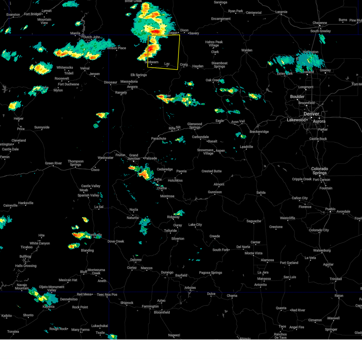 Svrgjt the national weather service in grand junction has issued a * severe thunderstorm warning for, northeastern moffat county in northwestern colorado, * until 230 pm mdt. * at 200 pm mdt, a severe thunderstorm was located 30 miles southwest of baggs, or 35 miles northwest of craig, moving east at 30 mph (radar indicated). Hazards include 60 mph wind gusts and penny size hail. expect damage to roofs, siding, and trees Svrgjt the national weather service in grand junction has issued a * severe thunderstorm warning for, northeastern moffat county in northwestern colorado, * until 230 pm mdt. * at 200 pm mdt, a severe thunderstorm was located 30 miles southwest of baggs, or 35 miles northwest of craig, moving east at 30 mph (radar indicated). Hazards include 60 mph wind gusts and penny size hail. expect damage to roofs, siding, and trees
|
| 6/6/2020 1:28 PM MDT | Mesonet station tt290 rbfmz portable in moffat county CO, 53.2 miles ESE of Maybell, CO |
| 6/6/2020 1:22 PM MDT |
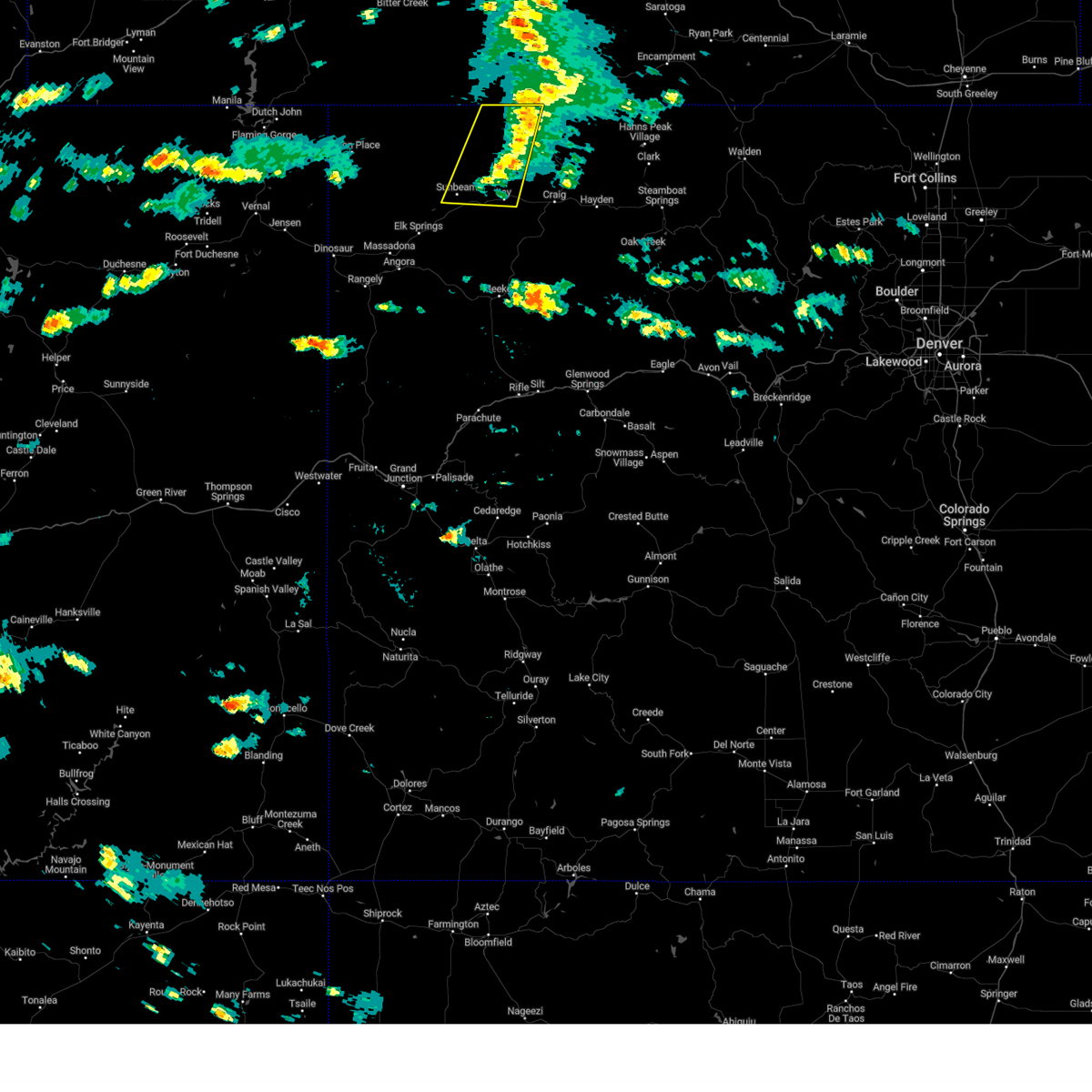
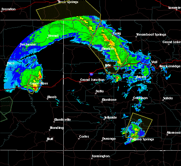 At 122 pm mdt, severe thunderstorms were located along a line extending from 12 miles northwest of craig to 21 miles southwest of hayden to 19 miles north of glenwood springs, moving northeast at 75 mph (radar indicated). Hazards include 70 mph wind gusts. Expect considerable tree damage. damage is likely to mobile homes, roofs, and outbuildings. locations impacted include, glenwood springs, craig, great divide, axial, lay, maybell, hamilton, loyd, juniper springs and buford. this includes the following highways, interstate 70 in colorado between mile markers 110 and 118. u. s. highway 40 in colorado between mile markers 58 and 94. colorado 13 between mile markers 52 and 93. colorado 82 near mile marker 1. Colorado 318 near mile marker 60. At 122 pm mdt, severe thunderstorms were located along a line extending from 12 miles northwest of craig to 21 miles southwest of hayden to 19 miles north of glenwood springs, moving northeast at 75 mph (radar indicated). Hazards include 70 mph wind gusts. Expect considerable tree damage. damage is likely to mobile homes, roofs, and outbuildings. locations impacted include, glenwood springs, craig, great divide, axial, lay, maybell, hamilton, loyd, juniper springs and buford. this includes the following highways, interstate 70 in colorado between mile markers 110 and 118. u. s. highway 40 in colorado between mile markers 58 and 94. colorado 13 between mile markers 52 and 93. colorado 82 near mile marker 1. Colorado 318 near mile marker 60.
|
| 6/6/2020 12:59 PM MDT |
 At 1258 pm mdt, severe thunderstorms were located along a line extending from 14 miles northwest of meeker to 21 miles northwest of new castle to 7 miles southeast of silt, moving northeast at 75 mph (radar indicated). Hazards include 70 mph wind gusts. Expect considerable tree damage. Damage is likely to mobile homes, roofs, and outbuildings. At 1258 pm mdt, severe thunderstorms were located along a line extending from 14 miles northwest of meeker to 21 miles northwest of new castle to 7 miles southeast of silt, moving northeast at 75 mph (radar indicated). Hazards include 70 mph wind gusts. Expect considerable tree damage. Damage is likely to mobile homes, roofs, and outbuildings.
|
| 6/5/2020 10:28 PM MDT | Mesonet station tt290 rbfmz portable in moffat county CO, 53.2 miles ESE of Maybell, CO |
| 6/5/2020 10:23 PM MDT | Mesonet station lodc2 ladore... greystone 11n in moffat county CO, 42.5 miles ESE of Maybell, CO |
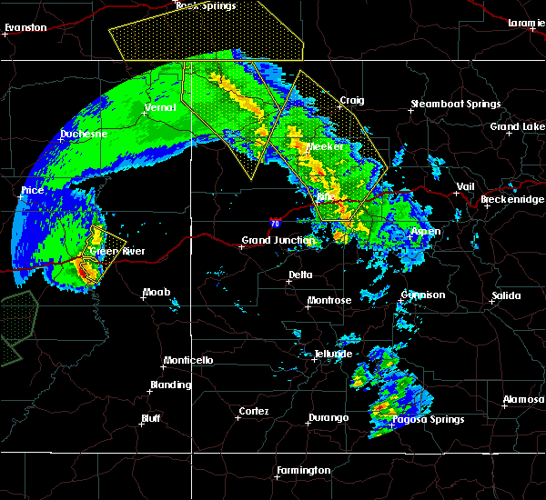
| 6/5/2020 9:42 PM MDT |
 At 941 pm mdt, doppler radar indicated severe thunderstorms capable of producing damaging winds in excess of 60 mph. these storms were located along a line extending from 30 miles northeast of rangely to 20 miles north of meeker to 18 miles south of craig, moving north at 45 mph. in addition, gusts of 60 to 70 mph have been recorded by numerous reporting stations. locations impacted include, elk springs, axial, sunbeam, lay, maybell, hamilton, loyd and juniper springs. At 941 pm mdt, doppler radar indicated severe thunderstorms capable of producing damaging winds in excess of 60 mph. these storms were located along a line extending from 30 miles northeast of rangely to 20 miles north of meeker to 18 miles south of craig, moving north at 45 mph. in addition, gusts of 60 to 70 mph have been recorded by numerous reporting stations. locations impacted include, elk springs, axial, sunbeam, lay, maybell, hamilton, loyd and juniper springs.
|
| 6/5/2020 9:26 PM MDT |
 At 924 pm mdt, doppler radar indicated a line of thunderstorms forming on an fast moving outflow boundary, producing destructive winds in excess of 70 mph. these storms were located along a line extending from 19 miles northeast of rangely to 11 miles northwest of meeker to 23 miles north of new castle, and moving north at 45 mph. At 924 pm mdt, doppler radar indicated a line of thunderstorms forming on an fast moving outflow boundary, producing destructive winds in excess of 70 mph. these storms were located along a line extending from 19 miles northeast of rangely to 11 miles northwest of meeker to 23 miles north of new castle, and moving north at 45 mph.
|
Hail Maps for Maybell, CO
Connect with Interactive Hail Maps