

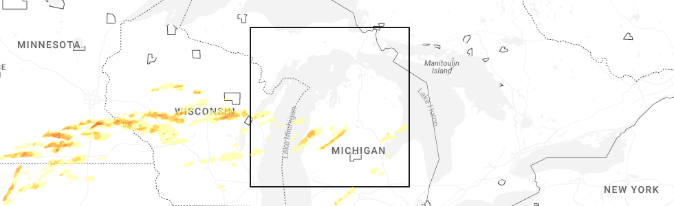
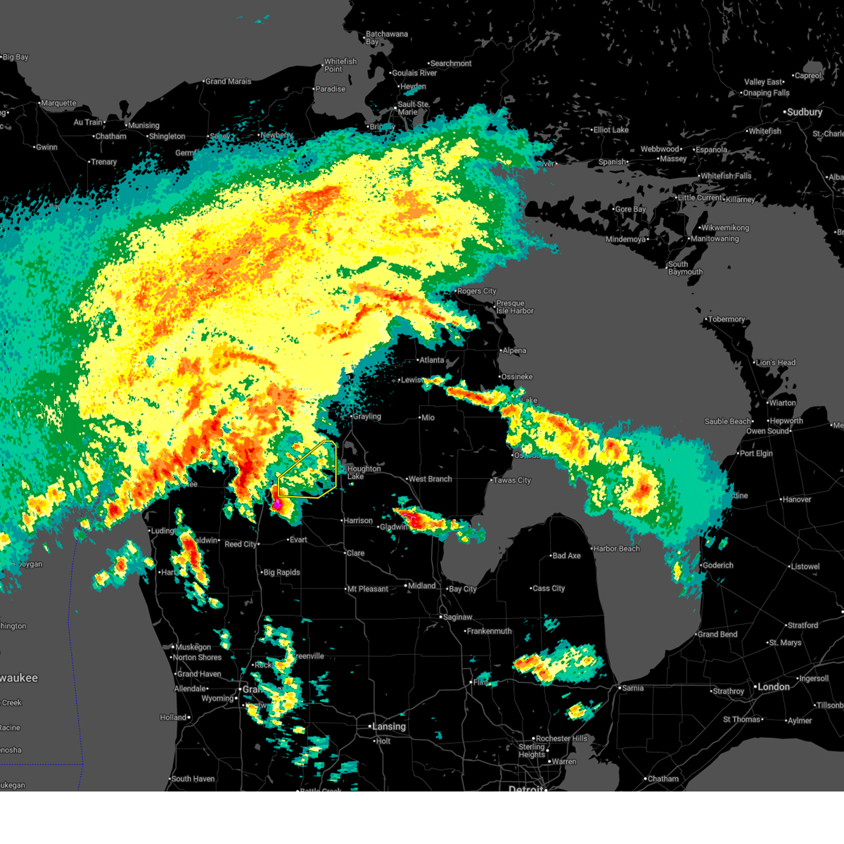
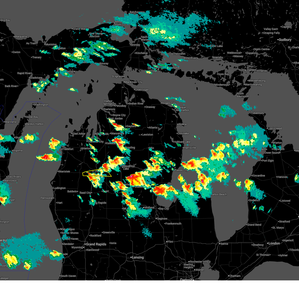
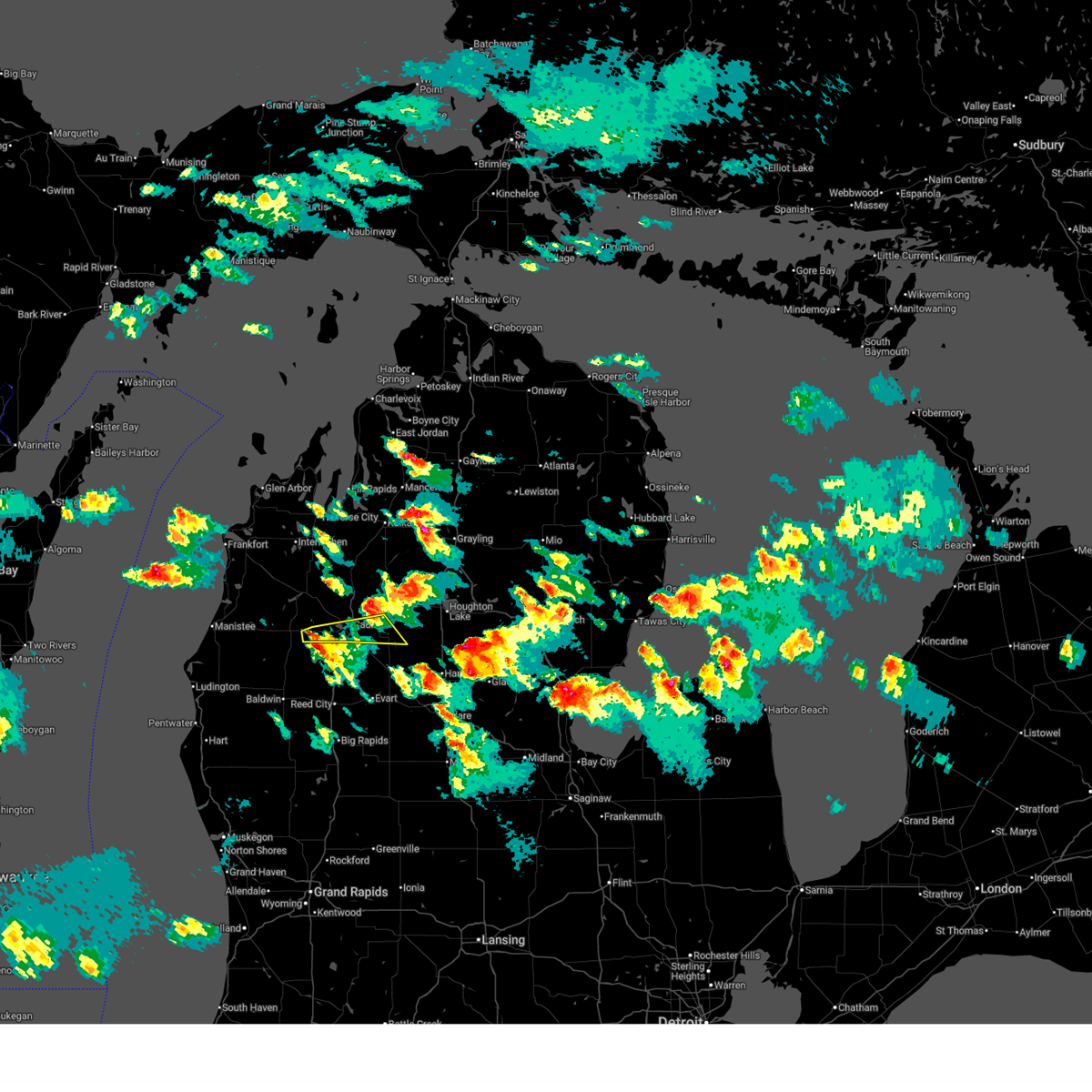
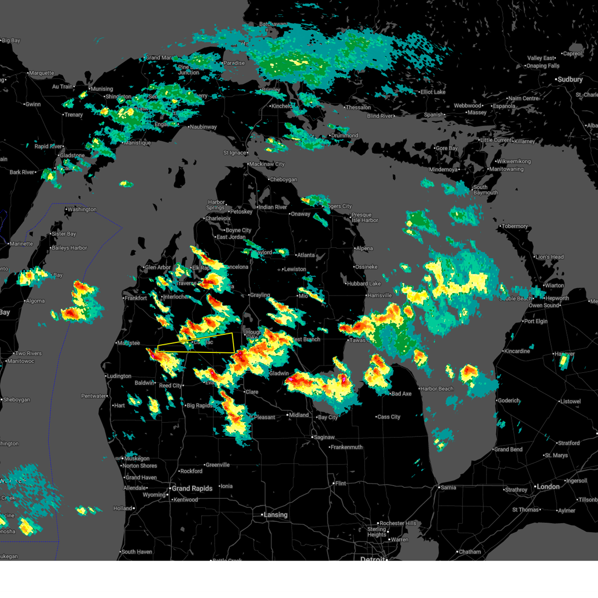
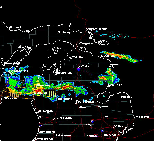
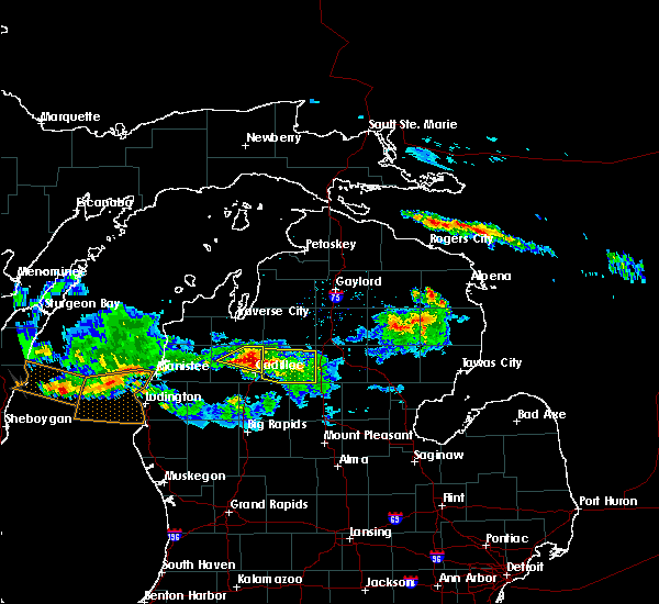
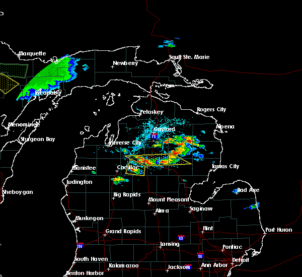
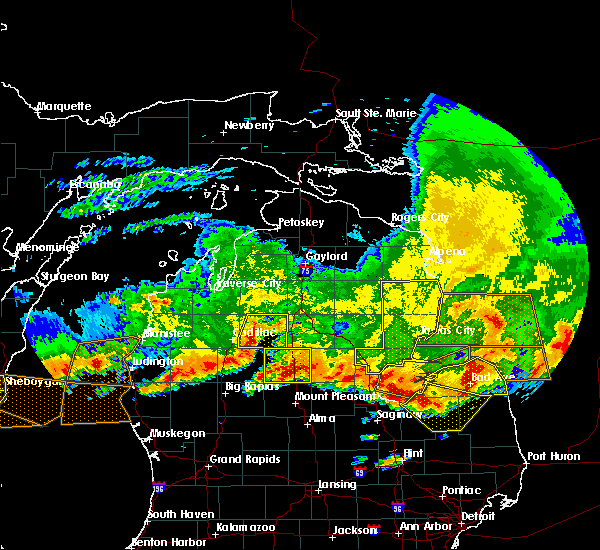
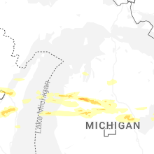
Hail Map for McBain, MI
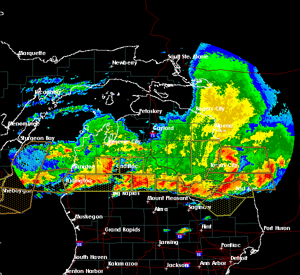
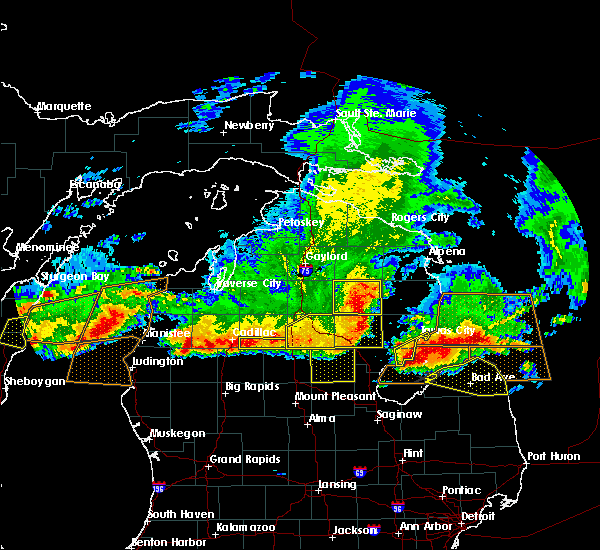
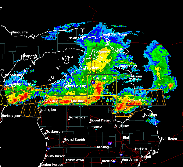
The McBain, MI area has had 1 report of on-the-ground hail by trained spotters, and has been under severe weather warnings 4 times during the past 12 months. Doppler radar has detected hail at or near McBain, MI on 22 occasions, including 2 occasions during the past year.
| Name: | McBain, MI |
| Where Located: | 43.6 miles SSE of Traverse City, MI |
| Map: | Google Map for McBain, MI |
| Population: | 656 |
| Housing Units: | 275 |
| More Info: | Search Google for McBain, MI |
5
The Top Recent Hail Date for McBain, MI is Monday, April 13, 2026 (1st out of 22)
Hail and Wind Damage Spotted near McBain, MI
| Date / Time | Report Details |
|---|---|
| 4/14/2026 12:50 AM EDT |
 Svrapx the national weather service in gaylord has issued a * severe thunderstorm warning for, missaukee county in northern michigan, * until 130 am edt. * at 1250 am edt, a severe thunderstorm was located near lucas, or 9 miles southeast of cadillac, moving northeast at 40 mph (radar indicated). Hazards include 60 mph wind gusts and quarter size hail. Hail damage to vehicles is expected. expect wind damage to roofs, siding, and trees. this severe thunderstorm will be near, mcbain and lucas around 1255 am edt. falmouth and vogel center around 100 am edt. lake city around 105 am edt. moddersville around 110 am edt. Other locations impacted by this severe thunderstorm include stittsville and merritt. Svrapx the national weather service in gaylord has issued a * severe thunderstorm warning for, missaukee county in northern michigan, * until 130 am edt. * at 1250 am edt, a severe thunderstorm was located near lucas, or 9 miles southeast of cadillac, moving northeast at 40 mph (radar indicated). Hazards include 60 mph wind gusts and quarter size hail. Hail damage to vehicles is expected. expect wind damage to roofs, siding, and trees. this severe thunderstorm will be near, mcbain and lucas around 1255 am edt. falmouth and vogel center around 100 am edt. lake city around 105 am edt. moddersville around 110 am edt. Other locations impacted by this severe thunderstorm include stittsville and merritt.
|
| 3/31/2026 12:17 AM EDT |
 the severe thunderstorm warning has been cancelled and is no longer in effect the severe thunderstorm warning has been cancelled and is no longer in effect
|
| 3/31/2026 12:11 AM EDT |
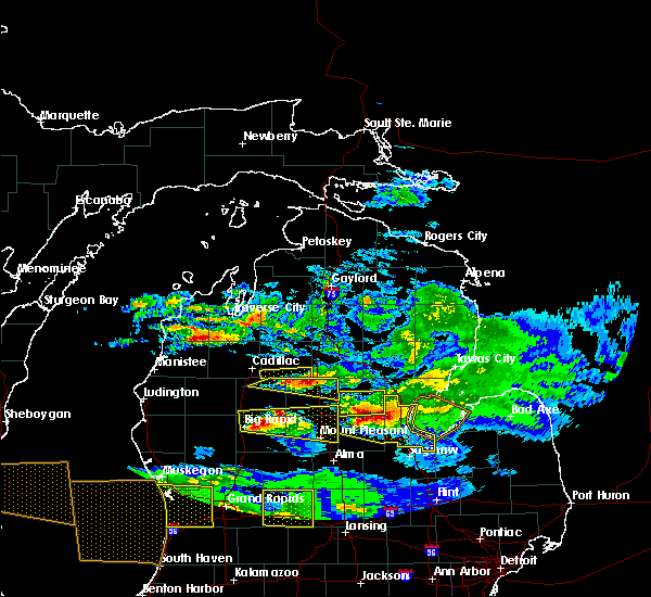
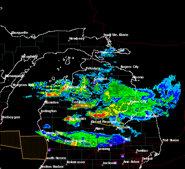
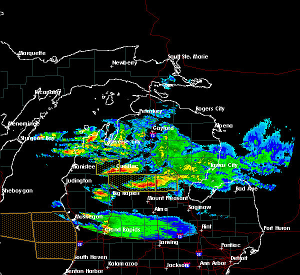
 At 1211 am edt, a severe thunderstorm was located near hoxeyville, or 10 miles southwest of cadillac, moving east at 50 mph (radar indicated). Hazards include quarter size hail. Damage to vehicles is expected. this severe storm will be near, cadillac and mitchell state park around 1215 am edt. lucas around 1220 am edt. Mcbain around 1225 am edt. At 1211 am edt, a severe thunderstorm was located near hoxeyville, or 10 miles southwest of cadillac, moving east at 50 mph (radar indicated). Hazards include quarter size hail. Damage to vehicles is expected. this severe storm will be near, cadillac and mitchell state park around 1215 am edt. lucas around 1220 am edt. Mcbain around 1225 am edt.
|
| 3/31/2026 12:02 AM EDT |
 Svrapx the national weather service in gaylord has issued a * severe thunderstorm warning for, southern wexford county in northern michigan, southern missaukee county in northern michigan, * until 1245 am edt. * at 1201 am edt, a severe thunderstorm was located near hoxeyville, or 16 miles north of baldwin, moving east at 50 mph (radar indicated). Hazards include 60 mph wind gusts and quarter size hail. Hail damage to vehicles is expected. expect wind damage to roofs, siding, and trees. this severe thunderstorm will be near, hoxeyville around 1205 am edt. cadillac and mitchell state park around 1215 am edt. lucas around 1220 am edt. mcbain around 1225 am edt. falmouth and vogel center around 1235 am edt. Other locations impacted by this severe thunderstorm include merritt. Svrapx the national weather service in gaylord has issued a * severe thunderstorm warning for, southern wexford county in northern michigan, southern missaukee county in northern michigan, * until 1245 am edt. * at 1201 am edt, a severe thunderstorm was located near hoxeyville, or 16 miles north of baldwin, moving east at 50 mph (radar indicated). Hazards include 60 mph wind gusts and quarter size hail. Hail damage to vehicles is expected. expect wind damage to roofs, siding, and trees. this severe thunderstorm will be near, hoxeyville around 1205 am edt. cadillac and mitchell state park around 1215 am edt. lucas around 1220 am edt. mcbain around 1225 am edt. falmouth and vogel center around 1235 am edt. Other locations impacted by this severe thunderstorm include merritt.
|
| 8/3/2022 10:53 AM EDT |
 At 1052 am edt, a severe thunderstorm was located over lake city, moving east at 60 mph (radar indicated. at 1043 am, wexford county airport gusted to 55 mph). Hazards include 60 mph wind gusts and quarter size hail. Hail damage to vehicles is expected. expect wind damage to roofs, siding, and trees. this severe thunderstorm will remain over mainly rural areas of southeastern wexford and missaukee counties, including the following locations, merritt. hail threat, radar indicated max hail size, 1. 00 in wind threat, radar indicated max wind gust, 60 mph. At 1052 am edt, a severe thunderstorm was located over lake city, moving east at 60 mph (radar indicated. at 1043 am, wexford county airport gusted to 55 mph). Hazards include 60 mph wind gusts and quarter size hail. Hail damage to vehicles is expected. expect wind damage to roofs, siding, and trees. this severe thunderstorm will remain over mainly rural areas of southeastern wexford and missaukee counties, including the following locations, merritt. hail threat, radar indicated max hail size, 1. 00 in wind threat, radar indicated max wind gust, 60 mph.
|
| 8/3/2022 10:45 AM EDT |
 At 1045 am edt, a severe thunderstorm was located near cadillac, moving east at 55 mph (radar indicated). Hazards include 60 mph wind gusts and quarter size hail. Hail damage to vehicles is expected. expect wind damage to roofs, siding, and trees. this severe storm will be near, lake city and mcbain around 1050 am edt. other locations in the path of this severe thunderstorm include falmouth, vogel center and moddersville. hail threat, radar indicated max hail size, 1. 00 in wind threat, radar indicated max wind gust, 60 mph. At 1045 am edt, a severe thunderstorm was located near cadillac, moving east at 55 mph (radar indicated). Hazards include 60 mph wind gusts and quarter size hail. Hail damage to vehicles is expected. expect wind damage to roofs, siding, and trees. this severe storm will be near, lake city and mcbain around 1050 am edt. other locations in the path of this severe thunderstorm include falmouth, vogel center and moddersville. hail threat, radar indicated max hail size, 1. 00 in wind threat, radar indicated max wind gust, 60 mph.
|
| 8/3/2022 10:31 AM EDT |
 At 1031 am edt, a severe thunderstorm was located over boon, or 8 miles west of cadillac, moving east at 55 mph (radar indicated). Hazards include 60 mph wind gusts and penny size hail. Expect damage to roofs, siding, and trees. this severe thunderstorm will be near, meauwataka around 1035 am edt. cadillac and mitchell state park around 1040 am edt. mcbain, lucas and jennings around 1050 am edt. other locations in the path of this severe thunderstorm include lake city, falmouth, vogel center and moddersville. hail threat, radar indicated max hail size, 0. 75 in wind threat, radar indicated max wind gust, 60 mph. At 1031 am edt, a severe thunderstorm was located over boon, or 8 miles west of cadillac, moving east at 55 mph (radar indicated). Hazards include 60 mph wind gusts and penny size hail. Expect damage to roofs, siding, and trees. this severe thunderstorm will be near, meauwataka around 1035 am edt. cadillac and mitchell state park around 1040 am edt. mcbain, lucas and jennings around 1050 am edt. other locations in the path of this severe thunderstorm include lake city, falmouth, vogel center and moddersville. hail threat, radar indicated max hail size, 0. 75 in wind threat, radar indicated max wind gust, 60 mph.
|
| 9/7/2021 12:18 PM EDT |
 At 1216 pm edt, a strong thunderstorm was located near boon, or near cadillac, moving east at 50 mph (trained weather spotter). Hazards include ping pong ball size hail and 60 mph wind gusts. People and animals outdoors will be injured. expect hail damage to roofs, siding, windows, and vehicles. expect wind damage to roofs, siding, and trees. locations impacted include, mitchell state park, cadillac, lucas, jennings, lake city, mcbain, falmouth and vogel center. hail threat, radar indicated max hail size, 1. 50 in wind threat, radar indicated max wind gust, 60 mph. At 1216 pm edt, a strong thunderstorm was located near boon, or near cadillac, moving east at 50 mph (trained weather spotter). Hazards include ping pong ball size hail and 60 mph wind gusts. People and animals outdoors will be injured. expect hail damage to roofs, siding, windows, and vehicles. expect wind damage to roofs, siding, and trees. locations impacted include, mitchell state park, cadillac, lucas, jennings, lake city, mcbain, falmouth and vogel center. hail threat, radar indicated max hail size, 1. 50 in wind threat, radar indicated max wind gust, 60 mph.
|
| 9/7/2021 11:56 AM EDT |
 At 1156 am edt, severe thunderstorms were located along a line extending from near yuma to near dublin, moving east at 65 mph (trained spotter. at 1155 am edt, ping pong ball size hail was reported in wellston). Hazards include two inch hail and 60 mph wind gusts. People and animals outdoors will be injured. expect hail damage to roofs, siding, windows, and vehicles. expect wind damage to roofs, siding, and trees. severe thunderstorms will be near, mesick and yuma around 1200 pm edt. sherman, harrietta and hoxeyville around 1205 pm edt. boon and meauwataka around 1210 pm edt. cadillac, manton and mitchell state park around 1215 pm edt. other locations in the path of these severe thunderstorms include lake city, mcbain, jennings, morey, lucas, falmouth and vogel center. thunderstorm damage threat, considerable hail threat, radar indicated max hail size, 2. 00 in wind threat, radar indicated max wind gust, 60 mph. At 1156 am edt, severe thunderstorms were located along a line extending from near yuma to near dublin, moving east at 65 mph (trained spotter. at 1155 am edt, ping pong ball size hail was reported in wellston). Hazards include two inch hail and 60 mph wind gusts. People and animals outdoors will be injured. expect hail damage to roofs, siding, windows, and vehicles. expect wind damage to roofs, siding, and trees. severe thunderstorms will be near, mesick and yuma around 1200 pm edt. sherman, harrietta and hoxeyville around 1205 pm edt. boon and meauwataka around 1210 pm edt. cadillac, manton and mitchell state park around 1215 pm edt. other locations in the path of these severe thunderstorms include lake city, mcbain, jennings, morey, lucas, falmouth and vogel center. thunderstorm damage threat, considerable hail threat, radar indicated max hail size, 2. 00 in wind threat, radar indicated max wind gust, 60 mph.
|
| 8/28/2021 4:53 AM EDT |
 At 452 am edt, severe thunderstorms were located along a line extending from near spider lake to near meauwataka to near mitchell state park, moving east at 50 mph (radar indicated). Hazards include 60 mph wind gusts. Expect damage to roofs, siding, and trees. locations impacted include, cadillac, lake city, kingsley, manton, buckley, boon, mcbain, fife lake, meauwataka, hannah, lucas, jennings, hoxeyville, south boardman, mitchell state park and morey. hail threat, radar indicated max hail size, <. 75 in wind threat, radar indicated max wind gust, 60 mph. At 452 am edt, severe thunderstorms were located along a line extending from near spider lake to near meauwataka to near mitchell state park, moving east at 50 mph (radar indicated). Hazards include 60 mph wind gusts. Expect damage to roofs, siding, and trees. locations impacted include, cadillac, lake city, kingsley, manton, buckley, boon, mcbain, fife lake, meauwataka, hannah, lucas, jennings, hoxeyville, south boardman, mitchell state park and morey. hail threat, radar indicated max hail size, <. 75 in wind threat, radar indicated max wind gust, 60 mph.
|
| 8/28/2021 4:42 AM EDT |
 At 441 am edt, severe thunderstorms were located along a line extending from grawn to near sherman to hoxeyville, moving east at 50 mph (radar indicated). Hazards include 60 mph wind gusts. Expect damage to roofs, siding, and trees. locations impacted include, hannah, kingsley, boon, meauwataka, manton, cadillac, mitchell state park, fife lake, jennings, lake city, mcbain, lucas, south boardman and morey. hail threat, radar indicated max hail size, <. 75 in wind threat, radar indicated max wind gust, 60 mph. At 441 am edt, severe thunderstorms were located along a line extending from grawn to near sherman to hoxeyville, moving east at 50 mph (radar indicated). Hazards include 60 mph wind gusts. Expect damage to roofs, siding, and trees. locations impacted include, hannah, kingsley, boon, meauwataka, manton, cadillac, mitchell state park, fife lake, jennings, lake city, mcbain, lucas, south boardman and morey. hail threat, radar indicated max hail size, <. 75 in wind threat, radar indicated max wind gust, 60 mph.
|
| 8/28/2021 4:15 AM EDT |
 At 414 am edt, severe thunderstorms were located along a line extending from beulah to kaleva to near free soil, moving east at 50 mph (radar indicated. at blacker airport in manistee a wind gust of 45 mph was observed). Hazards include 60 mph wind gusts. Expect damage to roofs, siding, and trees. severe thunderstorms will be near, thompsonville, copemish, dublin and wellston around 425 am edt. bendon around 430 am edt. other locations in the path of these severe thunderstorms include sherman, mesick, harrietta, interlochen state park, yuma, karlin, hoxeyville, boon, meauwataka, hannah, kingsley, manton, mitchell state park, cadillac, fife lake and jennings. hail threat, radar indicated max hail size, <. 75 in wind threat, radar indicated max wind gust, 60 mph. At 414 am edt, severe thunderstorms were located along a line extending from beulah to kaleva to near free soil, moving east at 50 mph (radar indicated. at blacker airport in manistee a wind gust of 45 mph was observed). Hazards include 60 mph wind gusts. Expect damage to roofs, siding, and trees. severe thunderstorms will be near, thompsonville, copemish, dublin and wellston around 425 am edt. bendon around 430 am edt. other locations in the path of these severe thunderstorms include sherman, mesick, harrietta, interlochen state park, yuma, karlin, hoxeyville, boon, meauwataka, hannah, kingsley, manton, mitchell state park, cadillac, fife lake and jennings. hail threat, radar indicated max hail size, <. 75 in wind threat, radar indicated max wind gust, 60 mph.
|
| 11/10/2020 8:50 PM EST | Barn roof and door damage 5 miles south of lake cit in missaukee county MI, 3.6 miles S of McBain, MI |
| 4/7/2020 7:22 PM EDT |
 The severe thunderstorm warning for southern missaukee county will expire at 730 pm edt, the storm which prompted the warning has moved out of the area. therefore, the warning will be allowed to expire. a severe thunderstorm watch remains in effect until 1000 pm edt for northern michigan. The severe thunderstorm warning for southern missaukee county will expire at 730 pm edt, the storm which prompted the warning has moved out of the area. therefore, the warning will be allowed to expire. a severe thunderstorm watch remains in effect until 1000 pm edt for northern michigan.
|
| 4/7/2020 7:07 PM EDT |
 At 707 pm edt, a severe thunderstorm was located over mcbain, or 9 miles south of lake city, moving east at 55 mph (radar indicated). Hazards include quarter size hail. Damage to vehicles is expected. this severe storm will be near, vogel center and falmouth around 715 pm edt. Moddersville around 720 pm edt. At 707 pm edt, a severe thunderstorm was located over mcbain, or 9 miles south of lake city, moving east at 55 mph (radar indicated). Hazards include quarter size hail. Damage to vehicles is expected. this severe storm will be near, vogel center and falmouth around 715 pm edt. Moddersville around 720 pm edt.
|
| 4/7/2020 6:54 PM EDT |
 At 654 pm edt, a severe thunderstorm was located over mitchell state park, or over cadillac, moving southeast at 35 mph (radar indicated). Hazards include quarter size hail. Damage to vehicles is expected. this severe thunderstorm will be near, lucas around 705 pm edt. mcbain around 710 pm edt. falmouth around 720 pm edt. vogel center around 725 pm edt. Other locations impacted by this severe thunderstorm include merritt. At 654 pm edt, a severe thunderstorm was located over mitchell state park, or over cadillac, moving southeast at 35 mph (radar indicated). Hazards include quarter size hail. Damage to vehicles is expected. this severe thunderstorm will be near, lucas around 705 pm edt. mcbain around 710 pm edt. falmouth around 720 pm edt. vogel center around 725 pm edt. Other locations impacted by this severe thunderstorm include merritt.
|
| 7/20/2019 1:18 AM EDT |
 At 117 am edt, severe thunderstorms were located along a line extending from near kalkaska to 6 miles southwest of moorestown to 8 miles south of evart, moving east at 45 mph (radar indicated). Hazards include 60 mph wind gusts and penny size hail. Expect damage to roofs, siding, and trees. Locations impacted include, kalkaska, lake city, sharon, mcbain, moddersville, vogel center, sigma, lucas, darragh, jennings, south boardman, moorestown, morey, falmouth, merritt, stittsville, blue lake township and smithville. At 117 am edt, severe thunderstorms were located along a line extending from near kalkaska to 6 miles southwest of moorestown to 8 miles south of evart, moving east at 45 mph (radar indicated). Hazards include 60 mph wind gusts and penny size hail. Expect damage to roofs, siding, and trees. Locations impacted include, kalkaska, lake city, sharon, mcbain, moddersville, vogel center, sigma, lucas, darragh, jennings, south boardman, moorestown, morey, falmouth, merritt, stittsville, blue lake township and smithville.
|
| 7/20/2019 1:06 AM EDT |
 At 105 am edt, doppler radar indicated a line of severe thunderstorms capable of producing damaging winds in excess of 60 mph. these storms were located along a line extending from near elk rapids to morey to reed city, and moving east at 40 mph. penny size hail may also accompany the damaging winds. At 105 am edt, doppler radar indicated a line of severe thunderstorms capable of producing damaging winds in excess of 60 mph. these storms were located along a line extending from near elk rapids to morey to reed city, and moving east at 40 mph. penny size hail may also accompany the damaging winds.
|
| 5/31/2019 9:31 PM EDT |
 At 930 pm edt, a severe thunderstorm was located near mcbain, or near lake city, moving southeast at 40 mph (radar indicated). Hazards include 60 mph wind gusts and quarter size hail. Hail damage to vehicles is expected. expect wind damage to roofs, siding, and trees. Locations impacted include, lake city, mcbain, falmouth, moddersville, vogel center and lucas. At 930 pm edt, a severe thunderstorm was located near mcbain, or near lake city, moving southeast at 40 mph (radar indicated). Hazards include 60 mph wind gusts and quarter size hail. Hail damage to vehicles is expected. expect wind damage to roofs, siding, and trees. Locations impacted include, lake city, mcbain, falmouth, moddersville, vogel center and lucas.
|
| 5/31/2019 9:06 PM EDT |
 At 905 pm edt, a severe thunderstorm was located near manton, or 8 miles north of cadillac, moving southeast at 25 mph (radar indicated). Hazards include 60 mph wind gusts and quarter size hail. Hail damage to vehicles is expected. Expect wind damage to roofs, siding, and trees. At 905 pm edt, a severe thunderstorm was located near manton, or 8 miles north of cadillac, moving southeast at 25 mph (radar indicated). Hazards include 60 mph wind gusts and quarter size hail. Hail damage to vehicles is expected. Expect wind damage to roofs, siding, and trees.
|
| 8/28/2018 7:54 PM EDT |
 The severe thunderstorm warning for eastern wexford, southeastern grand traverse, southwestern kalkaska and missaukee counties will expire at 800 pm edt, the storms which prompted the warning have weakened. therefore, the warning will be allowed to expire. a severe thunderstorm watch remains in effect until 100 am edt for northern michigan. The severe thunderstorm warning for eastern wexford, southeastern grand traverse, southwestern kalkaska and missaukee counties will expire at 800 pm edt, the storms which prompted the warning have weakened. therefore, the warning will be allowed to expire. a severe thunderstorm watch remains in effect until 100 am edt for northern michigan.
|
| 8/28/2018 7:41 PM EDT |
 At 741 pm edt, severe thunderstorms were located along a line extending from near south boardman to near mitchell state park, moving east at 50 mph (radar indicated). Hazards include 60 mph wind gusts. Expect damage to roofs, siding, and trees. Locations impacted include, cadillac, lake city, manton, mcbain, fife lake, vogel center, lucas, jennings, mitchell state park, morey, falmouth, moorestown, meauwataka, stittsville and smithville. At 741 pm edt, severe thunderstorms were located along a line extending from near south boardman to near mitchell state park, moving east at 50 mph (radar indicated). Hazards include 60 mph wind gusts. Expect damage to roofs, siding, and trees. Locations impacted include, cadillac, lake city, manton, mcbain, fife lake, vogel center, lucas, jennings, mitchell state park, morey, falmouth, moorestown, meauwataka, stittsville and smithville.
|
| 8/28/2018 7:26 PM EDT |
 At 726 pm edt, severe thunderstorms were located along a line extending from near kingsley to near hoxeyville, moving east at 50 mph (radar indicated). Hazards include 60 mph wind gusts. expect damage to roofs, siding, and trees At 726 pm edt, severe thunderstorms were located along a line extending from near kingsley to near hoxeyville, moving east at 50 mph (radar indicated). Hazards include 60 mph wind gusts. expect damage to roofs, siding, and trees
|
| 8/28/2018 1:19 AM EDT |
 At 119 am edt, severe thunderstorms were located along a line extending from 6 miles northwest of fishermans island state park to greilickville to near norwalk, moving east at 60 mph (radar indicated. at 110 am, leland harbor reported a wind gust to 65 mph). Hazards include 70 mph wind gusts. Expect considerable tree damage. damage is likely to mobile homes, roofs, and outbuildings. Locations impacted include, traverse city, cadillac, kalkaska, elk rapids, mancelona, bellaire, lake city, ellsworth, antrim, sharon, kingsley, manton, torch lake, sherman, central lake, buckley, boon, mcbain, fife lake and mesick. At 119 am edt, severe thunderstorms were located along a line extending from 6 miles northwest of fishermans island state park to greilickville to near norwalk, moving east at 60 mph (radar indicated. at 110 am, leland harbor reported a wind gust to 65 mph). Hazards include 70 mph wind gusts. Expect considerable tree damage. damage is likely to mobile homes, roofs, and outbuildings. Locations impacted include, traverse city, cadillac, kalkaska, elk rapids, mancelona, bellaire, lake city, ellsworth, antrim, sharon, kingsley, manton, torch lake, sherman, central lake, buckley, boon, mcbain, fife lake and mesick.
|
| 8/28/2018 1:01 AM EDT |
 At 101 am edt, severe thunderstorms were located along a line extending from 14 miles northwest of grand traverse light to near empire to 9 miles west of manistee, moving east at 60 mph (radar indicated). Hazards include 70 mph wind gusts. Expect considerable tree damage. Damage is likely to mobile homes, roofs, and outbuildings. At 101 am edt, severe thunderstorms were located along a line extending from 14 miles northwest of grand traverse light to near empire to 9 miles west of manistee, moving east at 60 mph (radar indicated). Hazards include 70 mph wind gusts. Expect considerable tree damage. Damage is likely to mobile homes, roofs, and outbuildings.
|
| 7/1/2018 8:51 PM EDT |
 At 851 pm edt, severe thunderstorms were located along a line extending from near darragh to near sigma to near moorestown to mcbain, moving northeast at 50 mph (radar indicated). Hazards include 60 mph wind gusts. Expect damage to roofs, siding, and trees. Locations impacted include, kalkaska, lake city, sharon, mcbain, vogel center, sigma, lucas, darragh, jennings, south boardman, moorestown, morey, falmouth, merritt, stittsville, blue lake township and smithville. At 851 pm edt, severe thunderstorms were located along a line extending from near darragh to near sigma to near moorestown to mcbain, moving northeast at 50 mph (radar indicated). Hazards include 60 mph wind gusts. Expect damage to roofs, siding, and trees. Locations impacted include, kalkaska, lake city, sharon, mcbain, vogel center, sigma, lucas, darragh, jennings, south boardman, moorestown, morey, falmouth, merritt, stittsville, blue lake township and smithville.
|
| 7/1/2018 8:44 PM EDT |
 At 843 pm edt, severe thunderstorms were located along a line extending from near kalkaska to near south boardman to near morey to lucas, moving northeast at 55 mph (radar indicated). Hazards include 60 mph wind gusts. Expect damage to roofs, siding, and trees. Locations impacted include, kalkaska, lake city, sharon, mcbain, vogel center, sigma, lucas, darragh, jennings, south boardman, moorestown, morey, falmouth, merritt, stittsville, blue lake township and smithville. At 843 pm edt, severe thunderstorms were located along a line extending from near kalkaska to near south boardman to near morey to lucas, moving northeast at 55 mph (radar indicated). Hazards include 60 mph wind gusts. Expect damage to roofs, siding, and trees. Locations impacted include, kalkaska, lake city, sharon, mcbain, vogel center, sigma, lucas, darragh, jennings, south boardman, moorestown, morey, falmouth, merritt, stittsville, blue lake township and smithville.
|
| 7/1/2018 8:31 PM EDT |
 At 831 pm edt, severe thunderstorms were located along a line extending from near south boardman to 6 miles northwest of manton to near jennings to 7 miles south of mitchell state park, moving northeast at 35 mph (radar indicated). Hazards include 60 mph wind gusts. Expect damage to roofs, siding, and trees. Locations impacted include, kalkaska, lake city, sharon, mcbain, vogel center, sigma, lucas, darragh, jennings, south boardman, moorestown, morey, falmouth, merritt, stittsville, blue lake township and smithville. At 831 pm edt, severe thunderstorms were located along a line extending from near south boardman to 6 miles northwest of manton to near jennings to 7 miles south of mitchell state park, moving northeast at 35 mph (radar indicated). Hazards include 60 mph wind gusts. Expect damage to roofs, siding, and trees. Locations impacted include, kalkaska, lake city, sharon, mcbain, vogel center, sigma, lucas, darragh, jennings, south boardman, moorestown, morey, falmouth, merritt, stittsville, blue lake township and smithville.
|
| 7/1/2018 8:19 PM EDT |
 At 818 pm edt, severe thunderstorms were located along a line extending from near buckley to near mitchell state park, moving northeast at 45 mph (radar indicated). Hazards include 60 mph wind gusts. expect damage to roofs, siding, and trees At 818 pm edt, severe thunderstorms were located along a line extending from near buckley to near mitchell state park, moving northeast at 45 mph (radar indicated). Hazards include 60 mph wind gusts. expect damage to roofs, siding, and trees
|
| 5/26/2018 4:08 PM EDT |
 At 408 pm edt, a severe thunderstorm was located between falmouth and lake city, moving east at 15 mph (radar indicated). Hazards include ping pong ball size hail and 60 mph wind gusts. People and animals outdoors will be injured. expect hail damage to roofs, siding, windows, and vehicles. Expect wind damage to roofs, siding, and trees. At 408 pm edt, a severe thunderstorm was located between falmouth and lake city, moving east at 15 mph (radar indicated). Hazards include ping pong ball size hail and 60 mph wind gusts. People and animals outdoors will be injured. expect hail damage to roofs, siding, windows, and vehicles. Expect wind damage to roofs, siding, and trees.
|
| 7/13/2017 12:58 AM EDT |
 At 1257 am edt, a severe thunderstorm was located over cadillac, moving northeast at 40 mph (radar indicated). Hazards include 60 mph wind gusts and penny size hail. Expect damage to roofs, siding, and trees. Locations impacted include, cadillac, lake city, manton, mcbain, mitchell state park, morey, meauwataka, falmouth, lucas, jennings, merritt and stittsville. At 1257 am edt, a severe thunderstorm was located over cadillac, moving northeast at 40 mph (radar indicated). Hazards include 60 mph wind gusts and penny size hail. Expect damage to roofs, siding, and trees. Locations impacted include, cadillac, lake city, manton, mcbain, mitchell state park, morey, meauwataka, falmouth, lucas, jennings, merritt and stittsville.
|
| 7/13/2017 12:48 AM EDT |
 At 1246 am edt, a severe thunderstorm was located near boon, or 6 miles west of near cadillac, moving northeast at 40 mph (radar indicated). Hazards include 60 mph wind gusts and quarter size hail. Hail damage to vehicles is expected. Expect wind damage to roofs, siding, and trees. At 1246 am edt, a severe thunderstorm was located near boon, or 6 miles west of near cadillac, moving northeast at 40 mph (radar indicated). Hazards include 60 mph wind gusts and quarter size hail. Hail damage to vehicles is expected. Expect wind damage to roofs, siding, and trees.
|
| 2/24/2017 3:47 PM EST | Quarter sized hail reported 4 miles SSE of McBain, MI, road commission using plows to clear hail covered roadways. |
| 2/24/2017 3:40 PM EST |
 At 339 pm est, a severe thunderstorm was located over lucas, or 7 miles south of lake city, moving northeast at 55 mph (radar indicated). Hazards include quarter size hail. damage to vehicles is expected At 339 pm est, a severe thunderstorm was located over lucas, or 7 miles south of lake city, moving northeast at 55 mph (radar indicated). Hazards include quarter size hail. damage to vehicles is expected
|
| 7/8/2016 1:40 PM EDT |
 At 140 pm edt, a severe thunderstorm was located over lake city, moving east at 30 mph (radar indicated). Hazards include ping pong ball size hail and 60 mph wind gusts. People and animals outdoors will be injured. expect hail damage to roofs, siding, windows, and vehicles. Expect wind damage to roofs, siding, and trees. At 140 pm edt, a severe thunderstorm was located over lake city, moving east at 30 mph (radar indicated). Hazards include ping pong ball size hail and 60 mph wind gusts. People and animals outdoors will be injured. expect hail damage to roofs, siding, windows, and vehicles. Expect wind damage to roofs, siding, and trees.
|
| 8/2/2015 6:55 PM EDT |
 At 655 pm edt, severe thunderstorms were located along a line extending from near morey to 6 miles north of evart, moving east at 60 mph (radar indicated). Hazards include 60 mph wind gusts and quarter size hail. Hail damage to vehicles is expected. expect wind damage to roofs, siding and trees. Locations impacted include, lake city, mcbain, falmouth, lucas, moddersville, vogel center, jennings, morey, moorestown, merritt and stittsville. At 655 pm edt, severe thunderstorms were located along a line extending from near morey to 6 miles north of evart, moving east at 60 mph (radar indicated). Hazards include 60 mph wind gusts and quarter size hail. Hail damage to vehicles is expected. expect wind damage to roofs, siding and trees. Locations impacted include, lake city, mcbain, falmouth, lucas, moddersville, vogel center, jennings, morey, moorestown, merritt and stittsville.
|
| 8/2/2015 6:42 PM EDT |
 At 642 pm edt, severe thunderstorms were located along a line extending from near kingsley to near luther, moving east at 60 mph (radar indicated). Hazards include 60 mph wind gusts and quarter size hail. Hail damage to vehicles is expected. Expect wind damage to roofs, siding and trees. At 642 pm edt, severe thunderstorms were located along a line extending from near kingsley to near luther, moving east at 60 mph (radar indicated). Hazards include 60 mph wind gusts and quarter size hail. Hail damage to vehicles is expected. Expect wind damage to roofs, siding and trees.
|
| 8/2/2015 5:50 PM EDT |
 At 550 pm edt, severe thunderstorms were located along a line extending from near marion to near skeels, moving southeast at 35 mph (radar indicated). Hazards include 70 mph wind gusts and quarter size hail. Hail damage to vehicles is expected. expect considerable tree damage. wind damage is also likely to mobile homes, roofs and outbuildings. Locations impacted include, mcbain, falmouth, moddersville, vogel center and lucas. At 550 pm edt, severe thunderstorms were located along a line extending from near marion to near skeels, moving southeast at 35 mph (radar indicated). Hazards include 70 mph wind gusts and quarter size hail. Hail damage to vehicles is expected. expect considerable tree damage. wind damage is also likely to mobile homes, roofs and outbuildings. Locations impacted include, mcbain, falmouth, moddersville, vogel center and lucas.
|
| 8/2/2015 5:31 PM EDT |
 At 531 pm edt, severe thunderstorms were located along a line extending from near cadillac to near houghton lake, moving southeast at 35 mph (radar indicated). Hazards include 70 mph wind gusts and quarter size hail. Hail damage to vehicles is expected. expect considerable tree damage. Wind damage is also likely to mobile homes, roofs and outbuildings. At 531 pm edt, severe thunderstorms were located along a line extending from near cadillac to near houghton lake, moving southeast at 35 mph (radar indicated). Hazards include 70 mph wind gusts and quarter size hail. Hail damage to vehicles is expected. expect considerable tree damage. Wind damage is also likely to mobile homes, roofs and outbuildings.
|
| 8/2/2015 5:04 PM EDT |
 At 502 pm edt, severe thunderstorms were located along a line extending from near northport to cedar to near bendon to near elberta, and are nearly stationary (radar indicated. there have numerous reports of 60 to 70 mph winds and widespread wind damage). Hazards include 60 mph wind gusts and quarter size hail. Expect damage to roofs. siding and trees. Locations impacted include, east jordan, kalkaska, elk rapids, mancelona, bellaire, lake city, ellsworth, antrim, sharon, torch lake, central lake, mcbain, fife lake, darragh, kewadin, moddersville, vogel center, sigma, morey and south boardman. At 502 pm edt, severe thunderstorms were located along a line extending from near northport to cedar to near bendon to near elberta, and are nearly stationary (radar indicated. there have numerous reports of 60 to 70 mph winds and widespread wind damage). Hazards include 60 mph wind gusts and quarter size hail. Expect damage to roofs. siding and trees. Locations impacted include, east jordan, kalkaska, elk rapids, mancelona, bellaire, lake city, ellsworth, antrim, sharon, torch lake, central lake, mcbain, fife lake, darragh, kewadin, moddersville, vogel center, sigma, morey and south boardman.
|
| 8/2/2015 4:31 PM EDT |
 At 428 pm edt, severe thunderstorms were located along a line extending from near northport to cedar to near bendon to near elberta, moving east at 60 mph (radar indicated. at 426 pm 60 mph wind gust was reported at lake ann). Hazards include 60 mph wind gusts and penny size hail. Expect damage to roofs. Siding and trees. At 428 pm edt, severe thunderstorms were located along a line extending from near northport to cedar to near bendon to near elberta, moving east at 60 mph (radar indicated. at 426 pm 60 mph wind gust was reported at lake ann). Hazards include 60 mph wind gusts and penny size hail. Expect damage to roofs. Siding and trees.
|
Hail Maps for McBain, MI


Connect with Interactive Hail Maps