

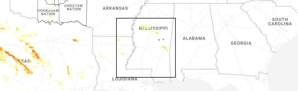
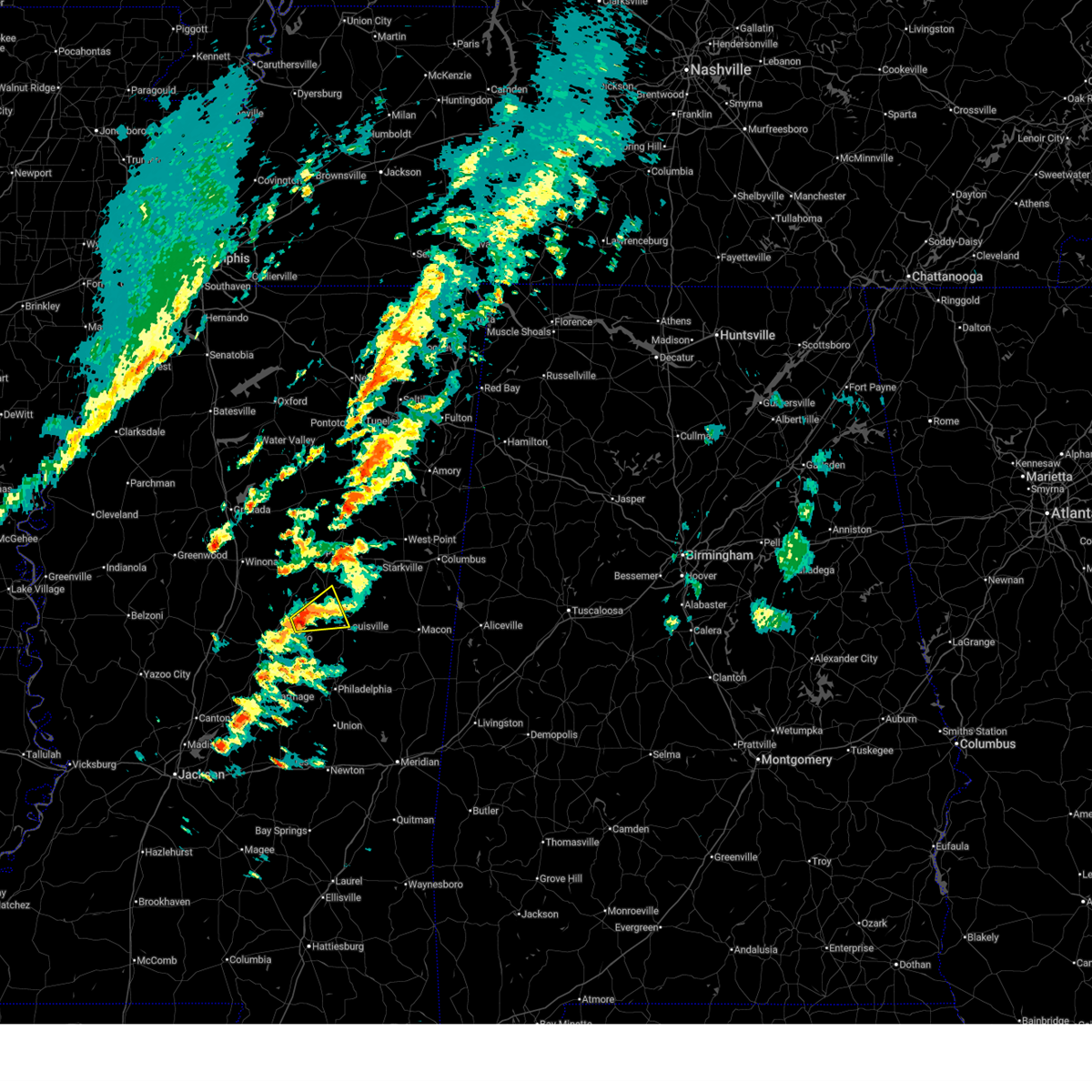
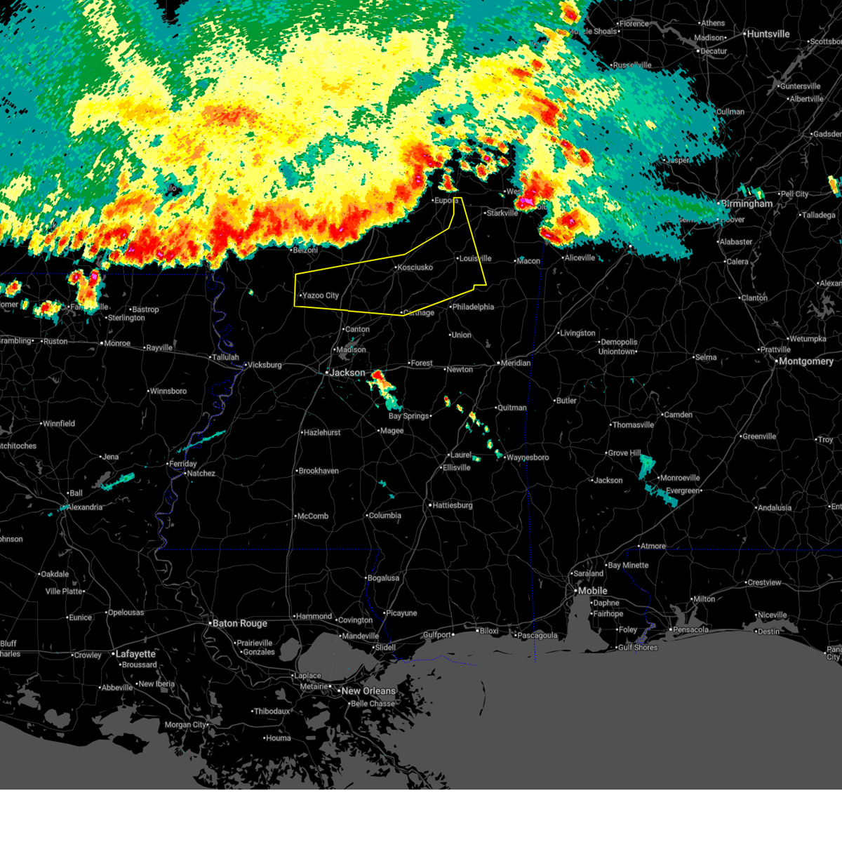
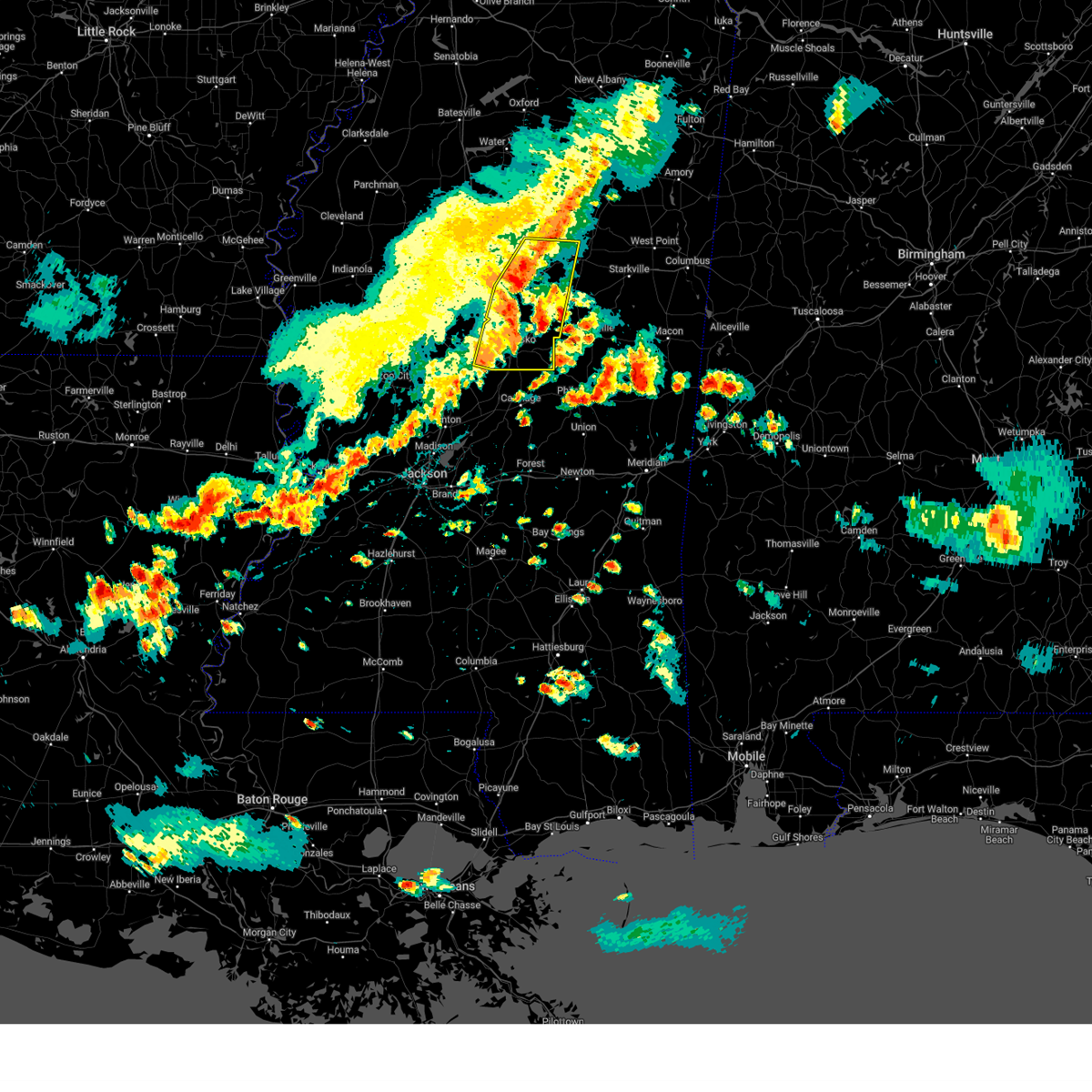
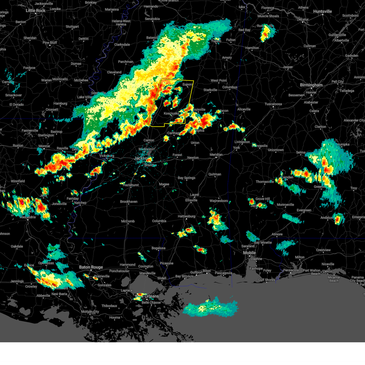
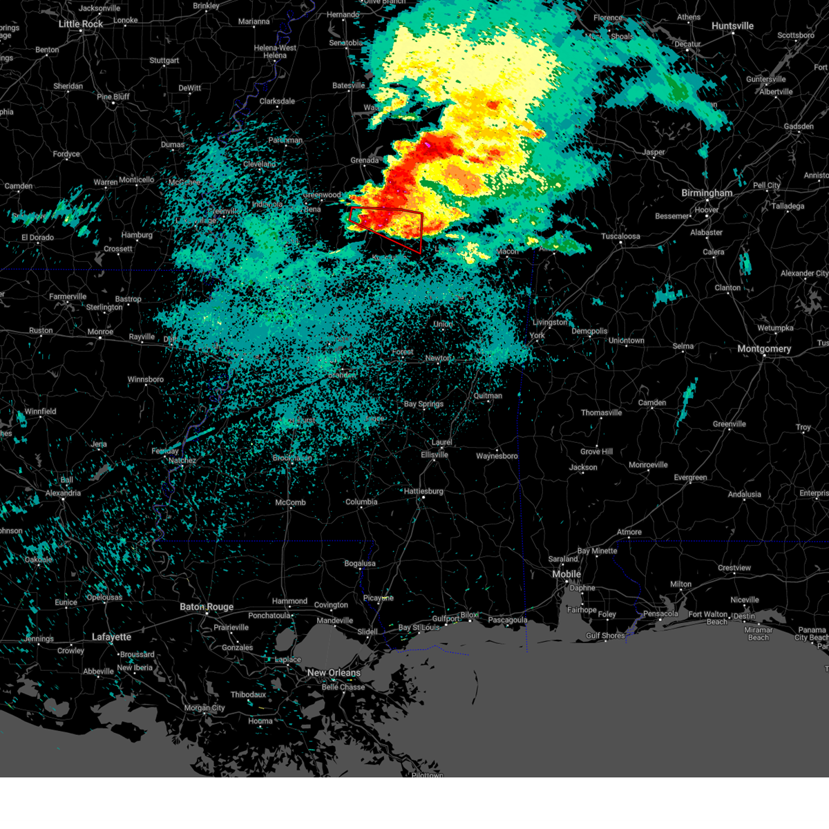
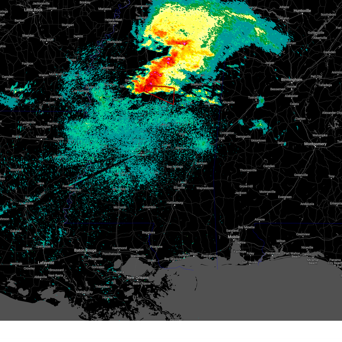
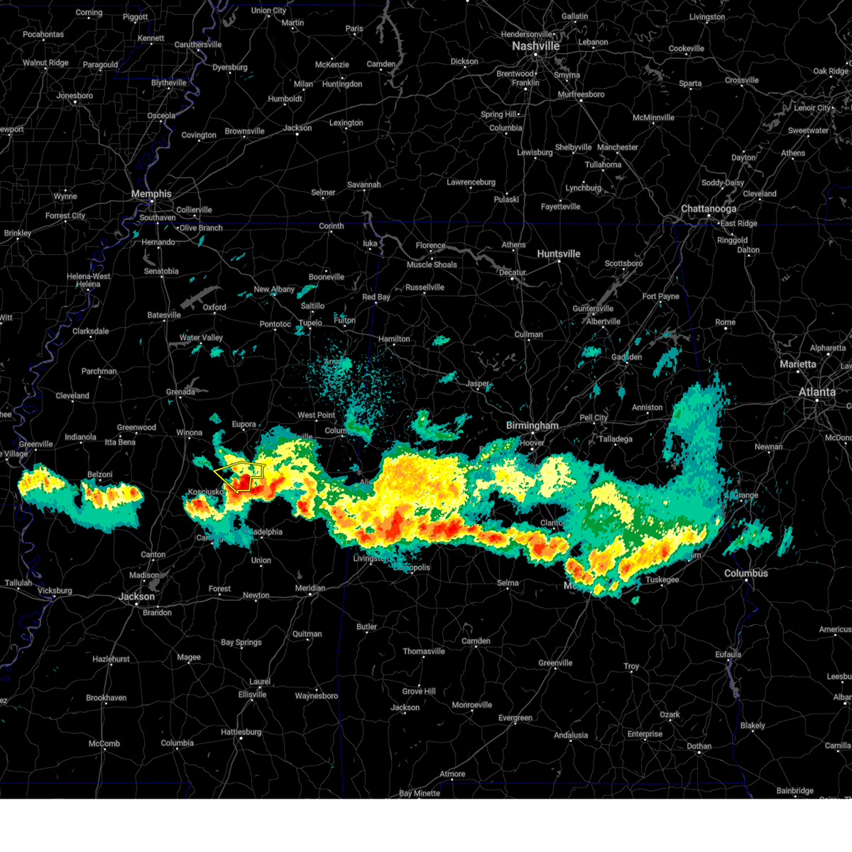
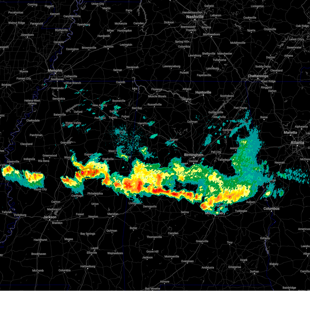
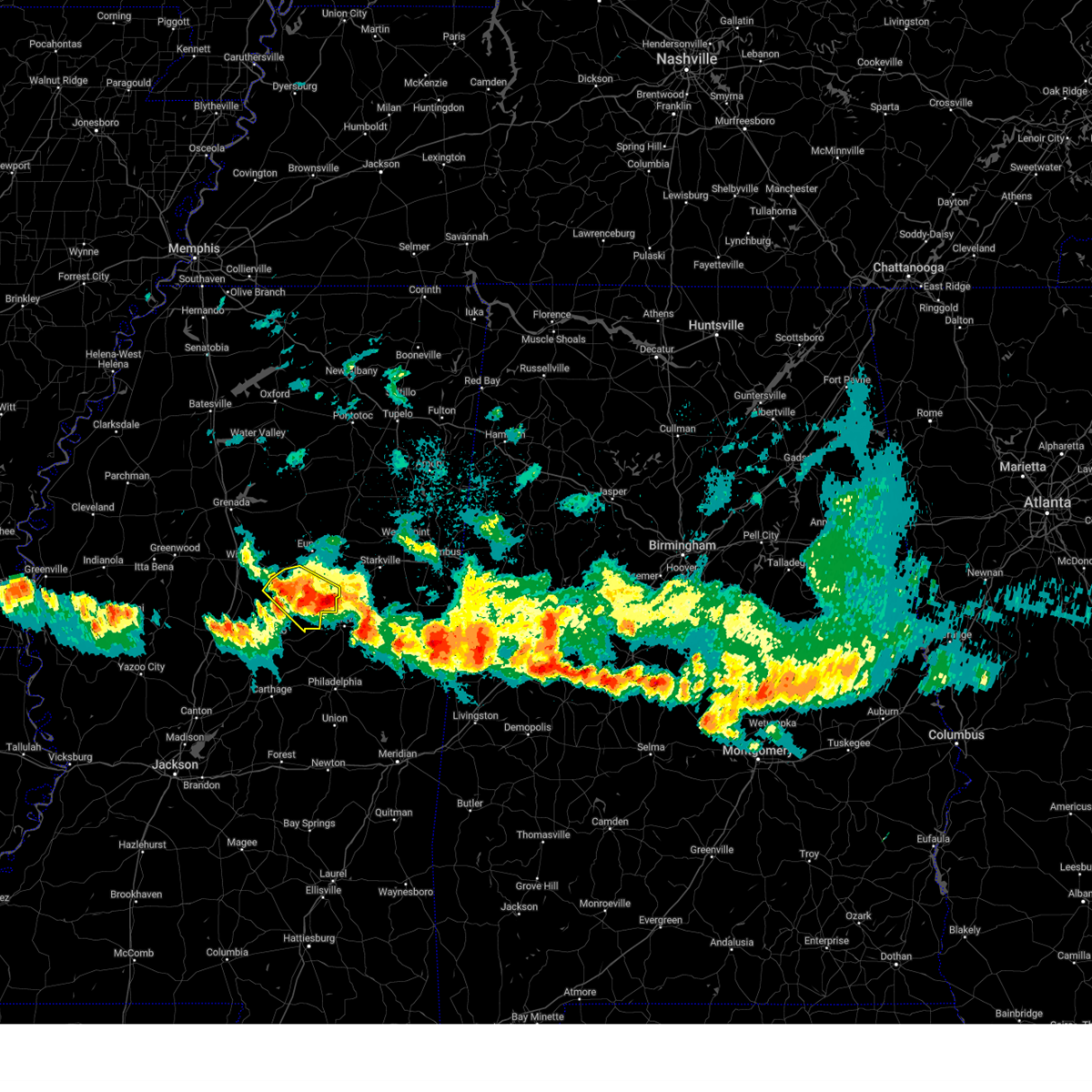
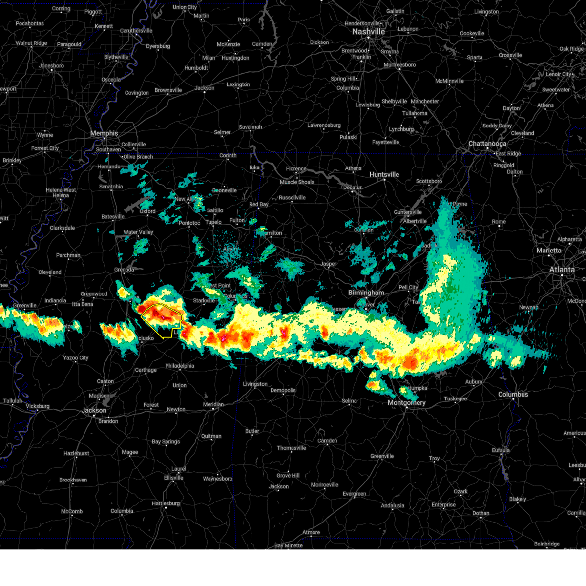
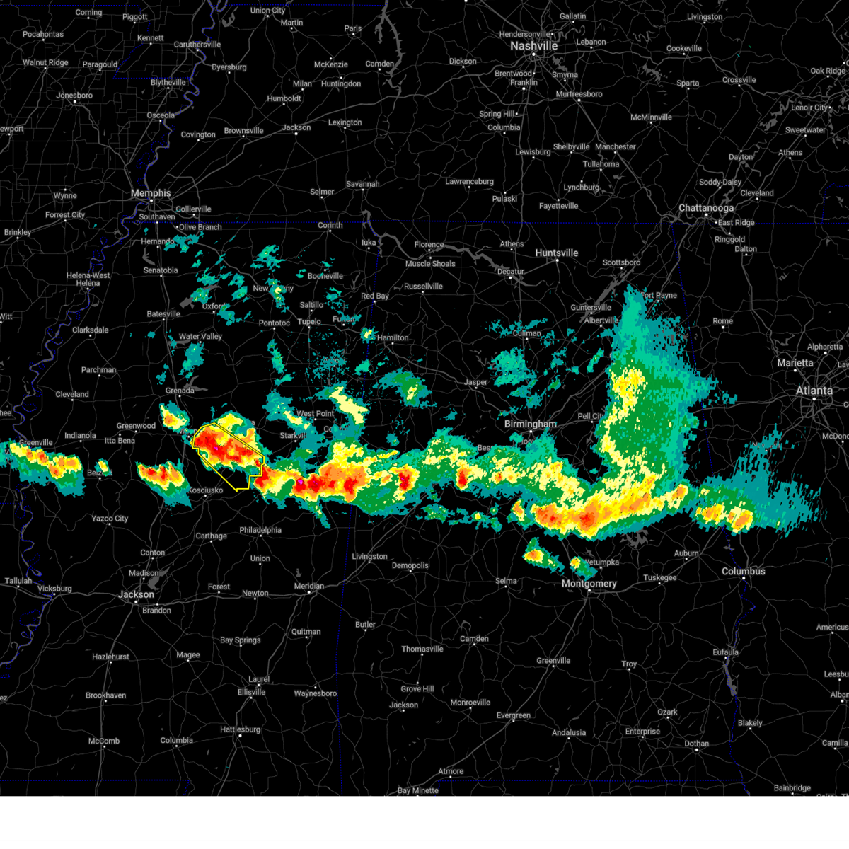
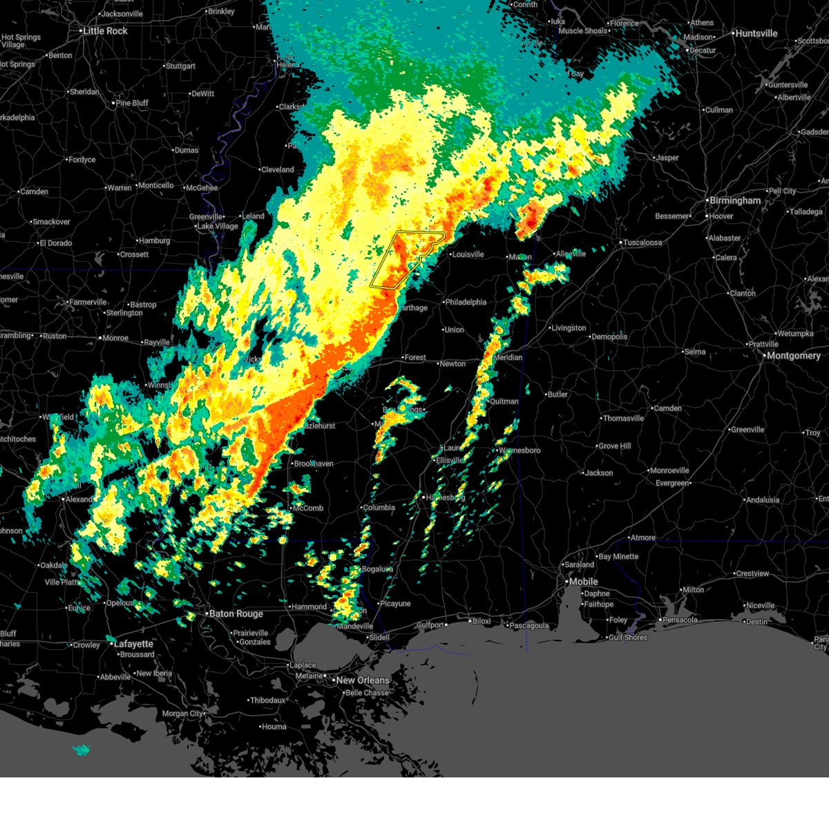
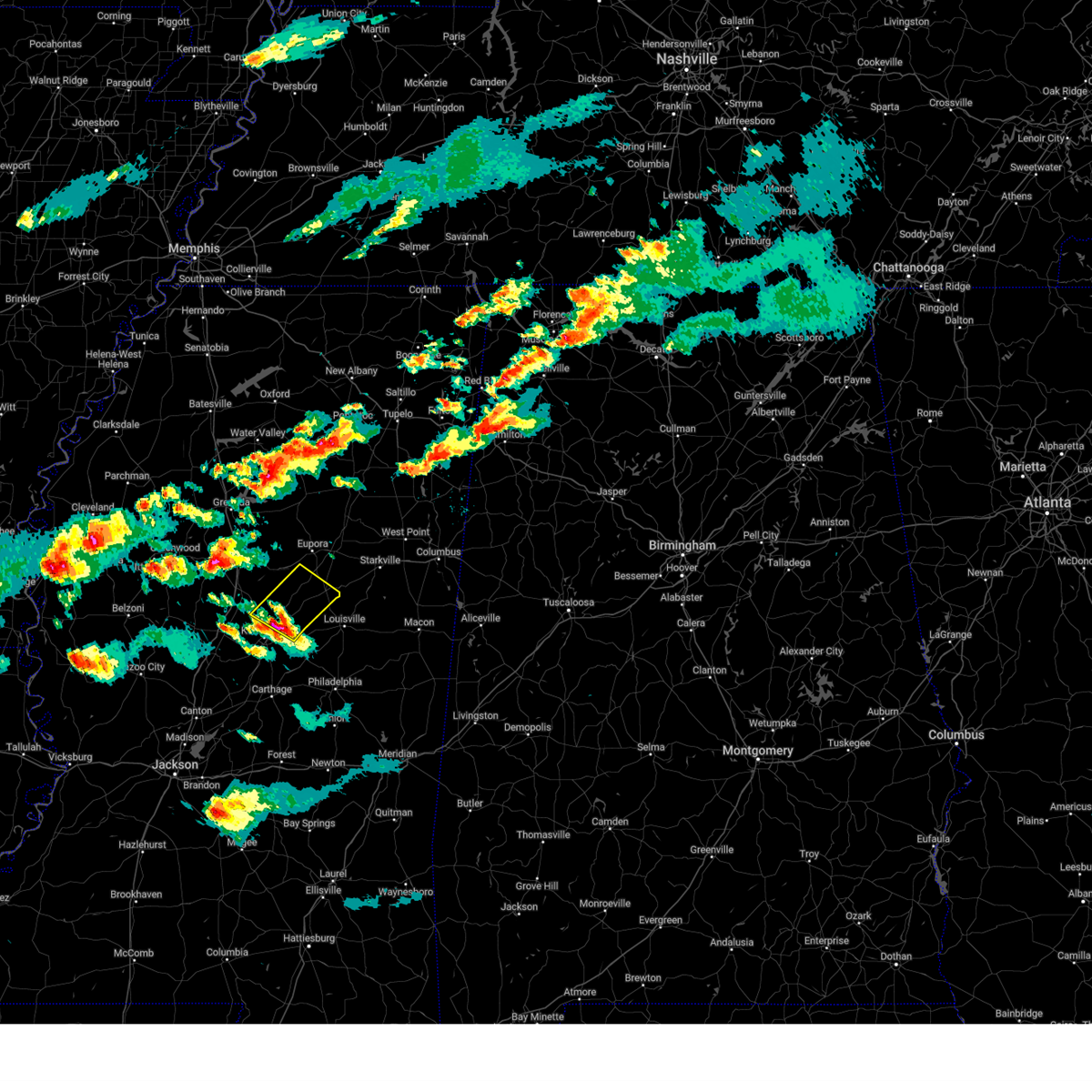
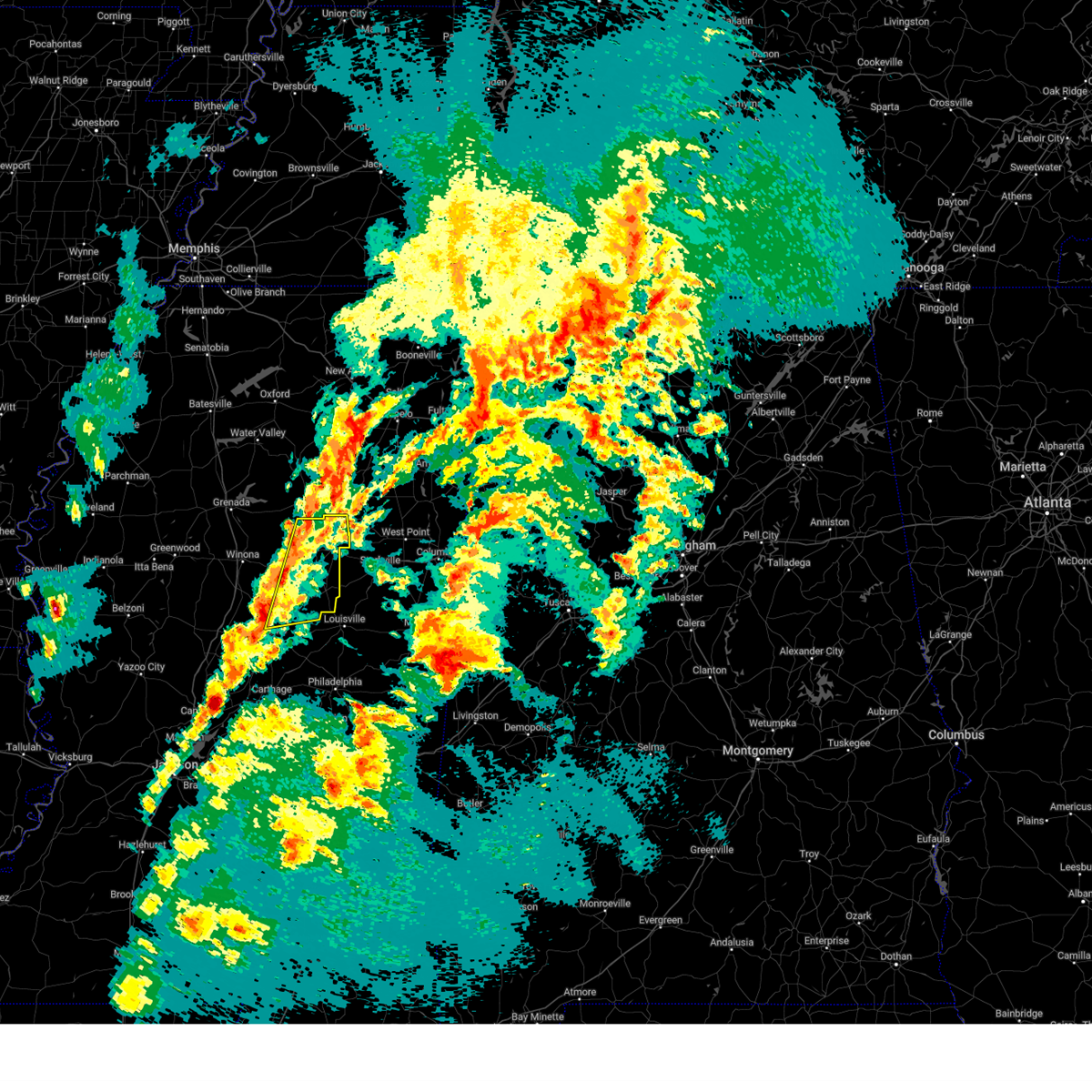
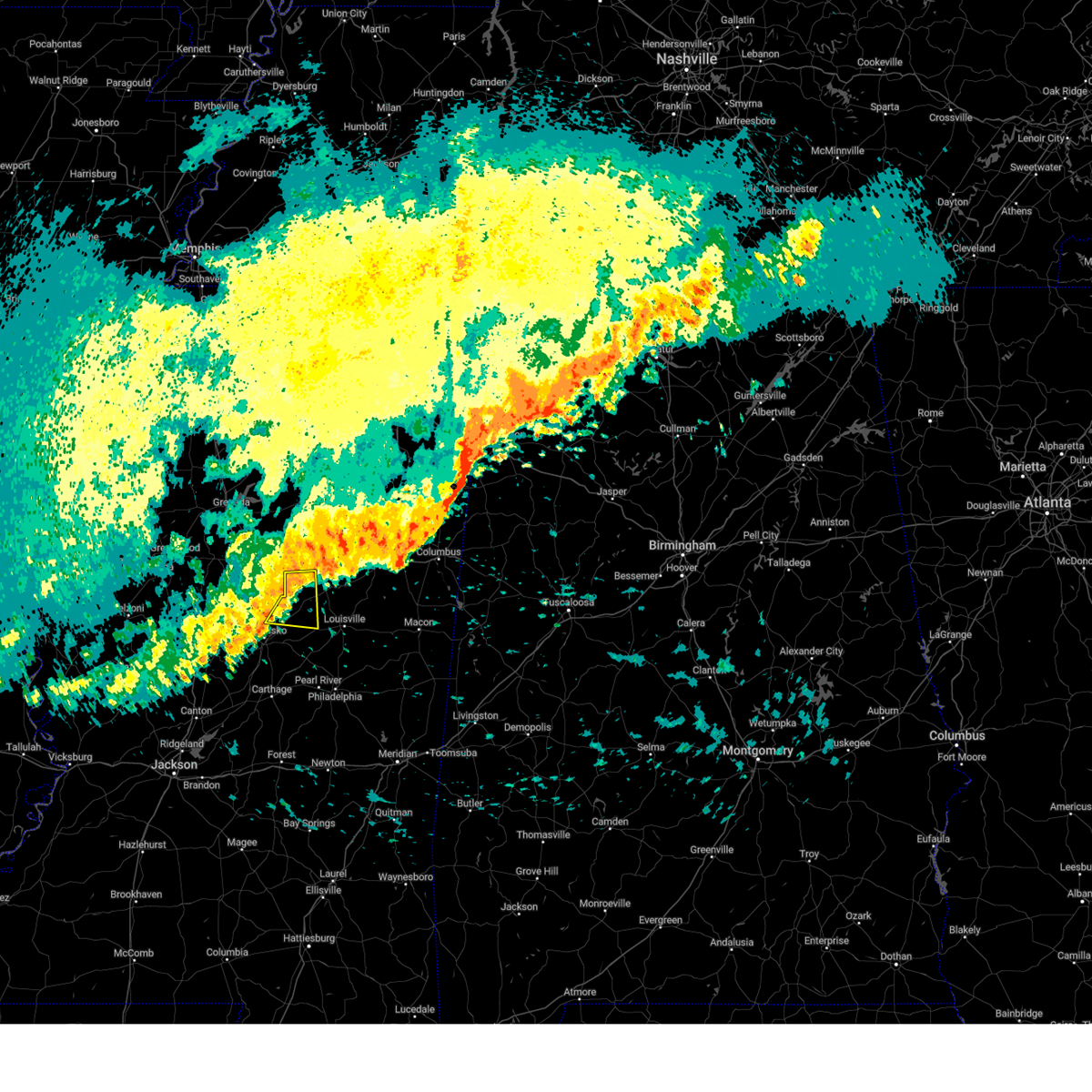
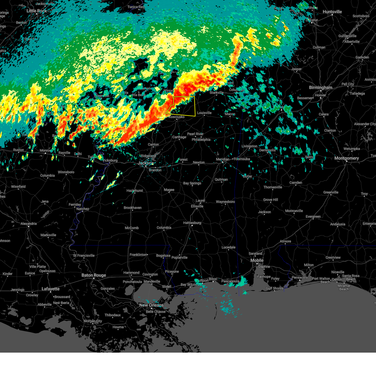
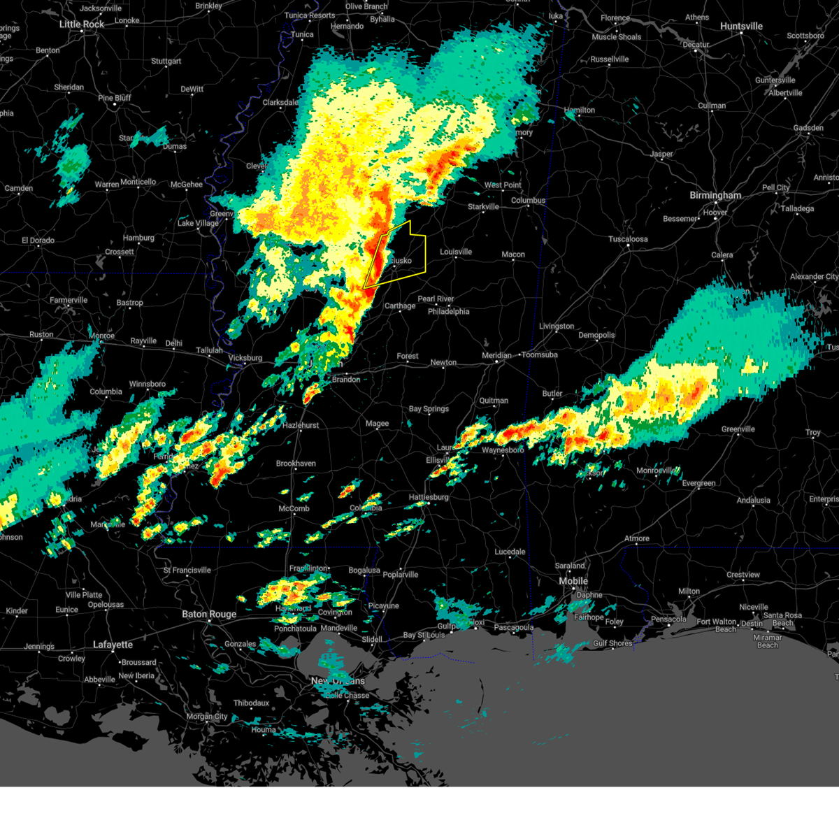
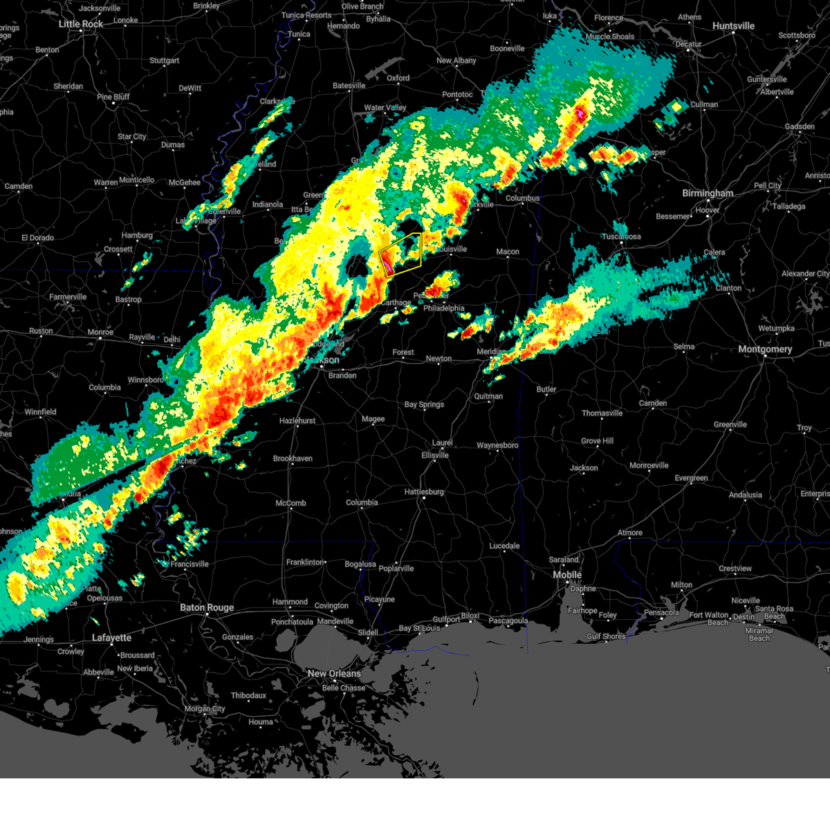
Hail Map for McCool, MS
The McCool, MS area has had 6 reports of on-the-ground hail by trained spotters, and has been under severe weather warnings 12 times during the past 12 months. Doppler radar has detected hail at or near McCool, MS on 53 occasions, including 3 occasions during the past year.
| Name: | McCool, MS |
| Where Located: | 35.5 miles WSW of Starkville, MS |
| Map: | Google Map for McCool, MS |
| Population: | 135 |
| Housing Units: | 88 |
| More Info: | Search Google for McCool, MS |
3
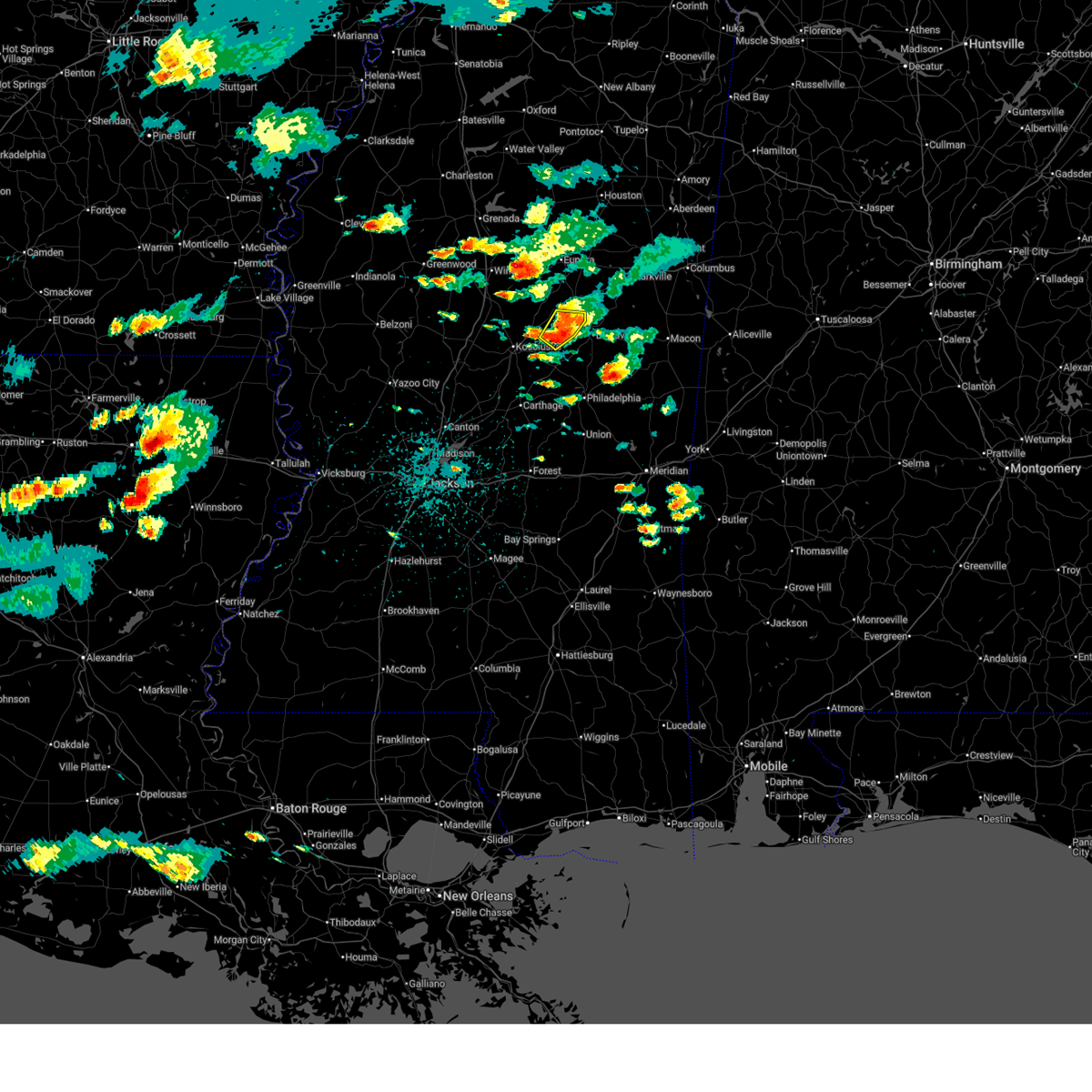
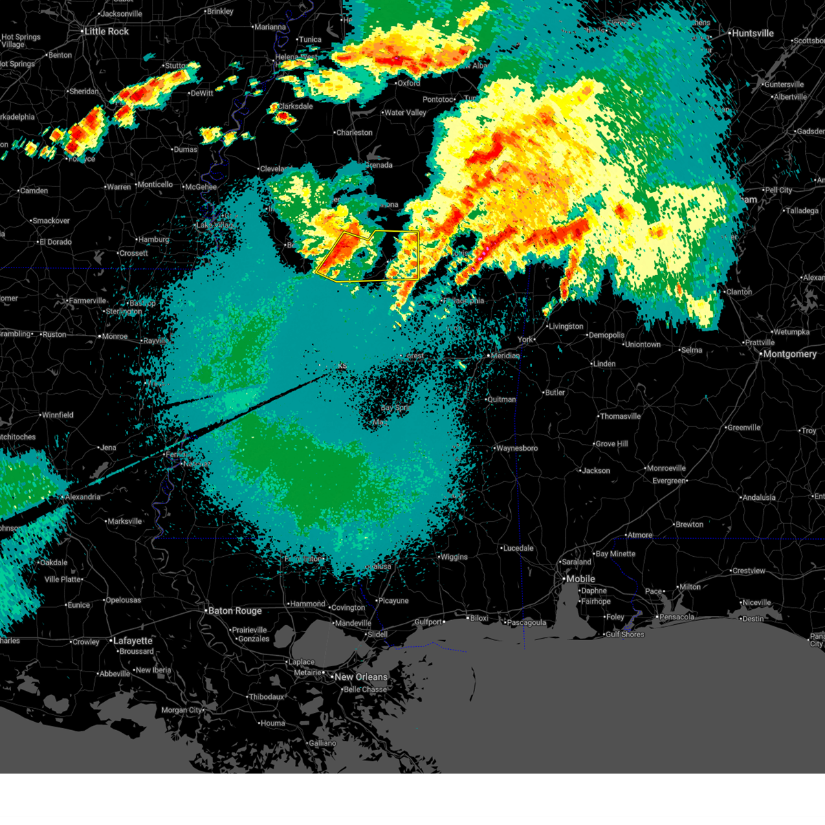
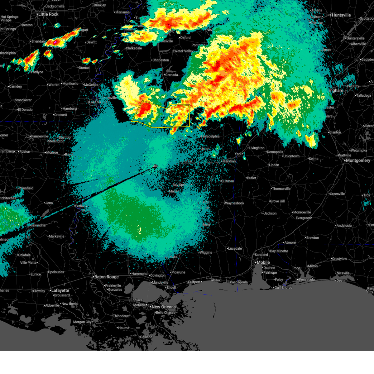
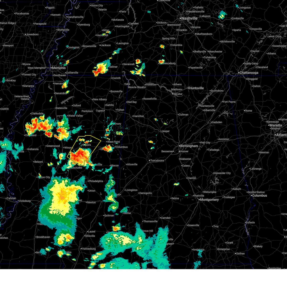
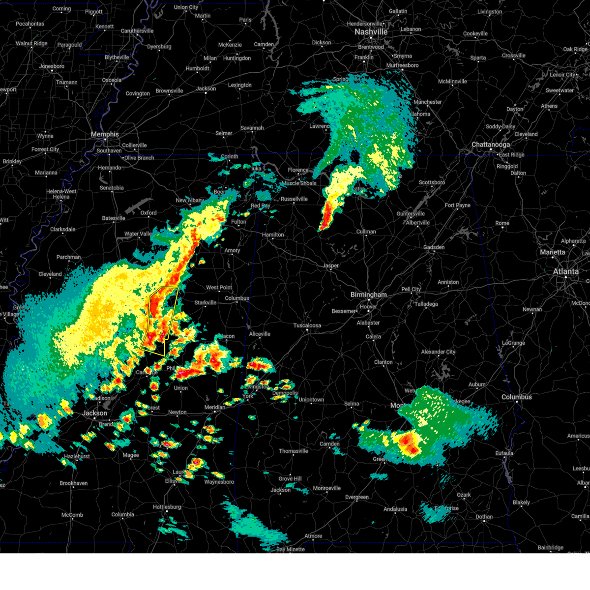
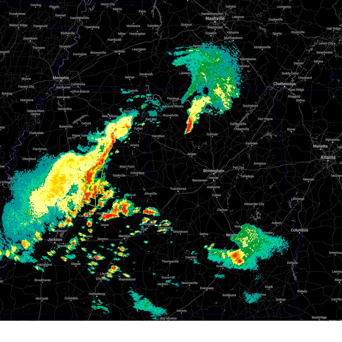
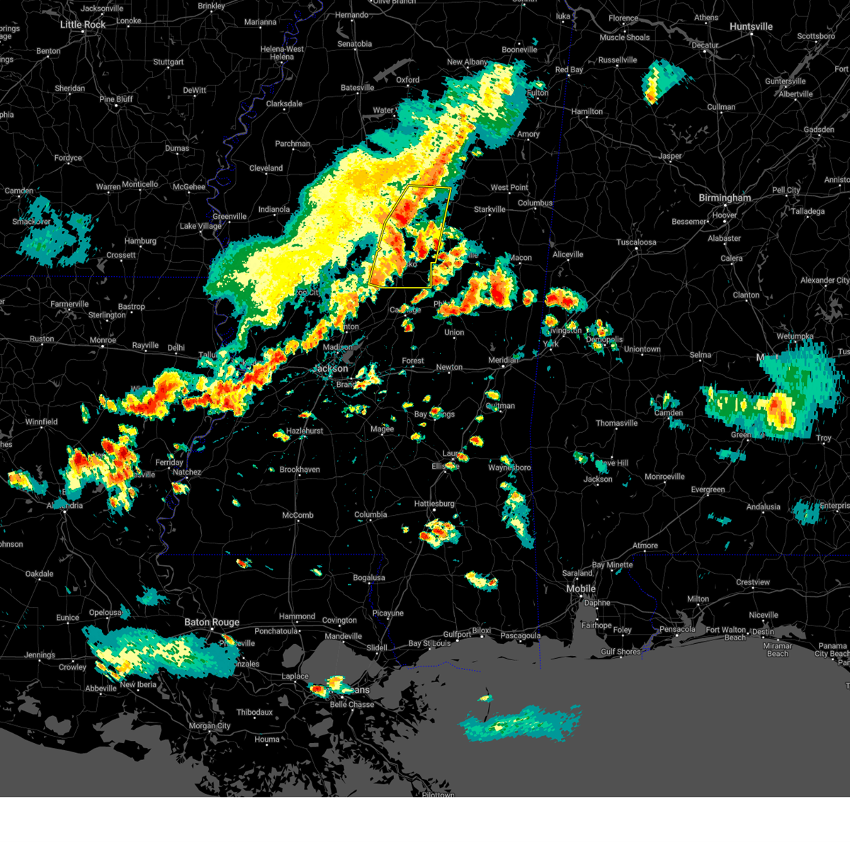
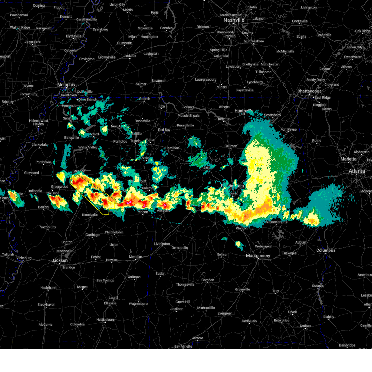
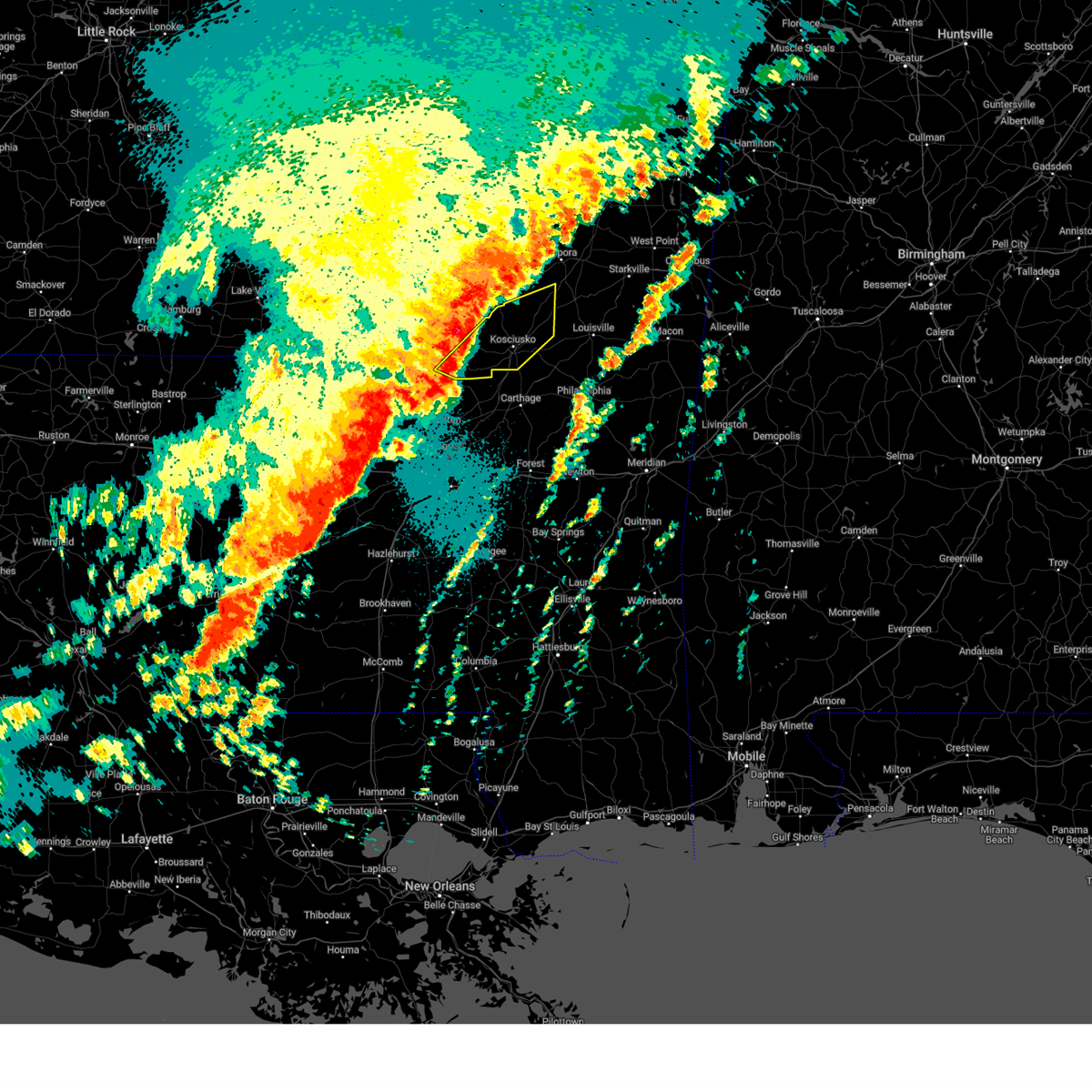
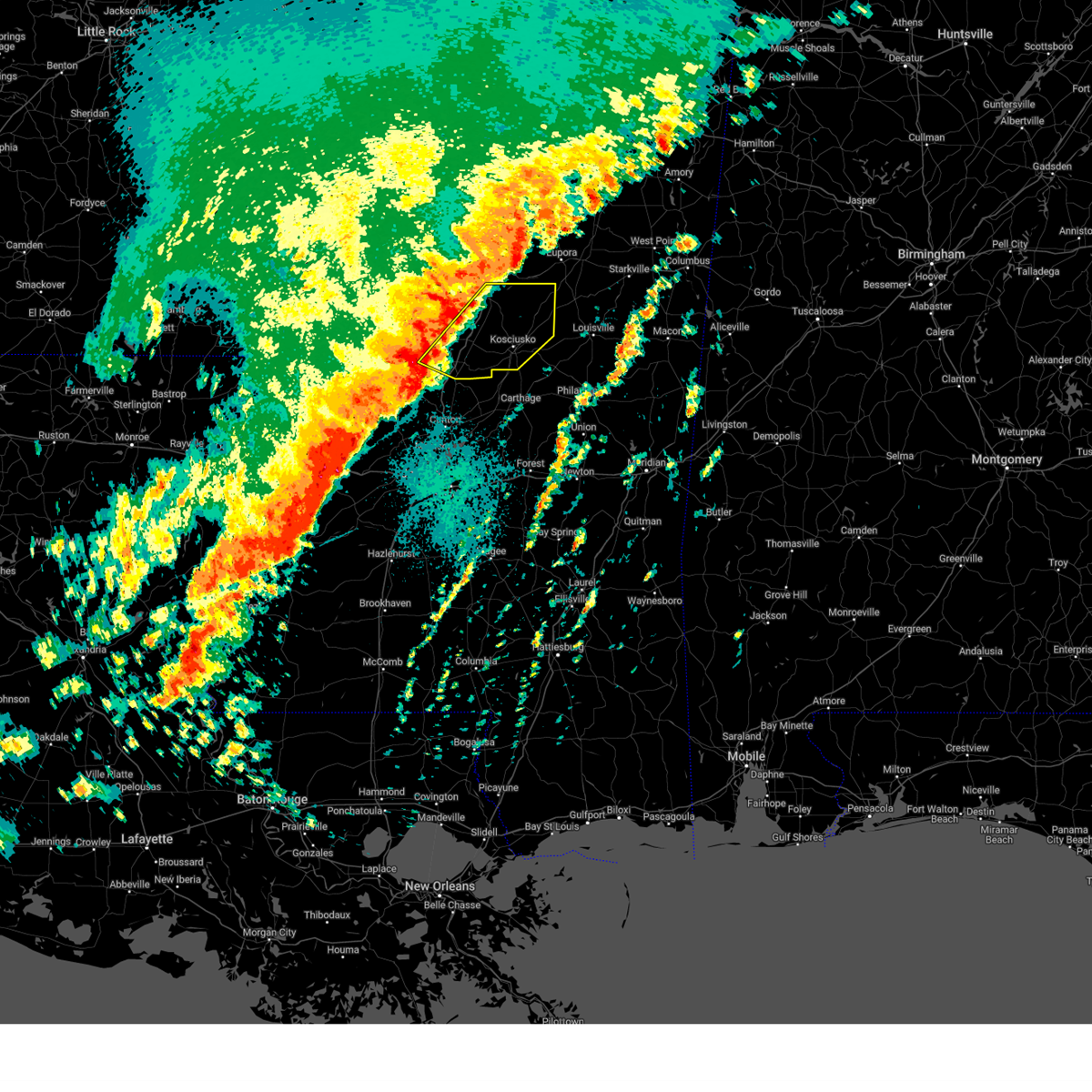
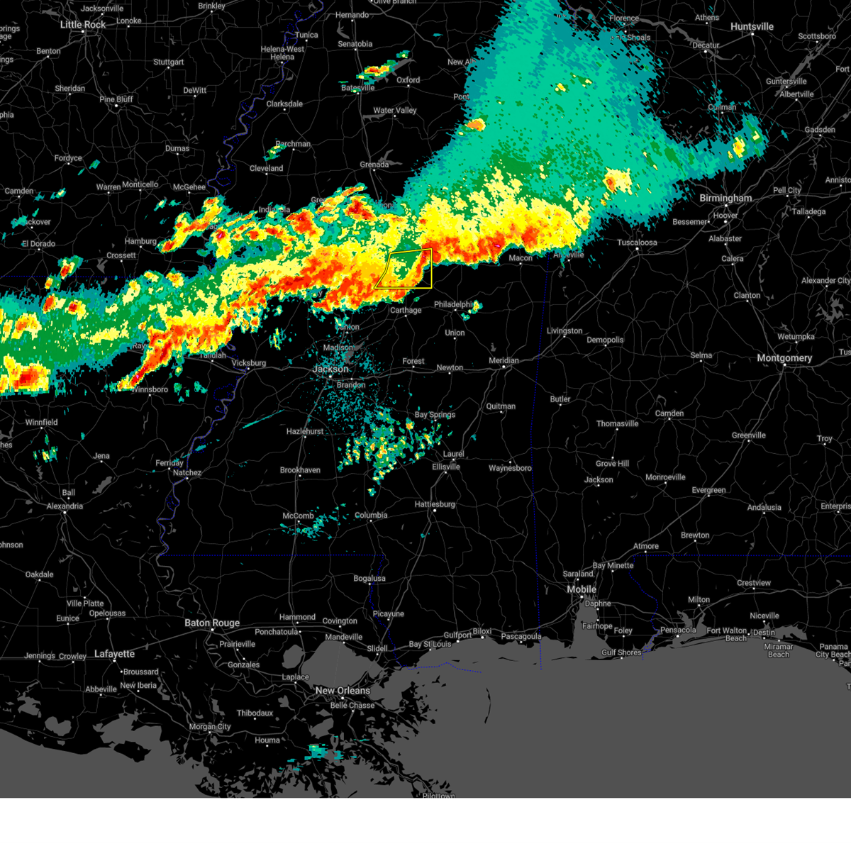
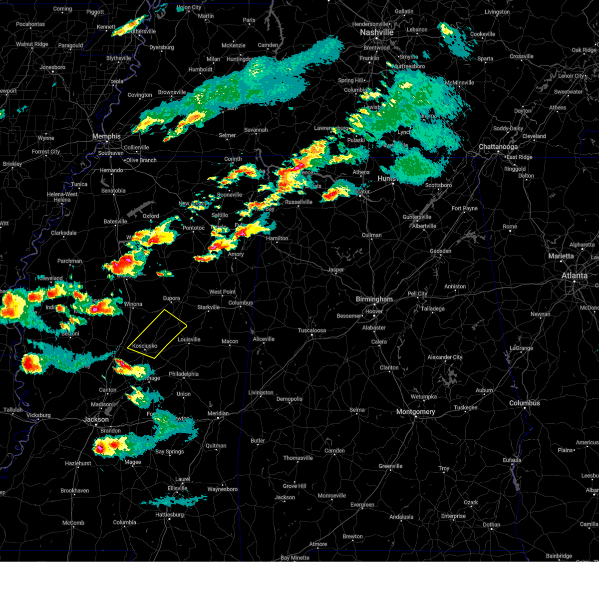
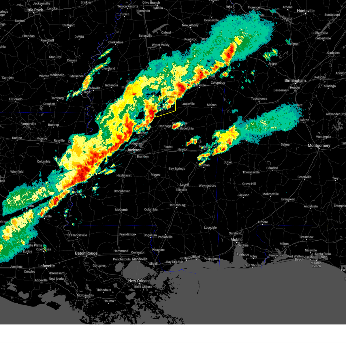
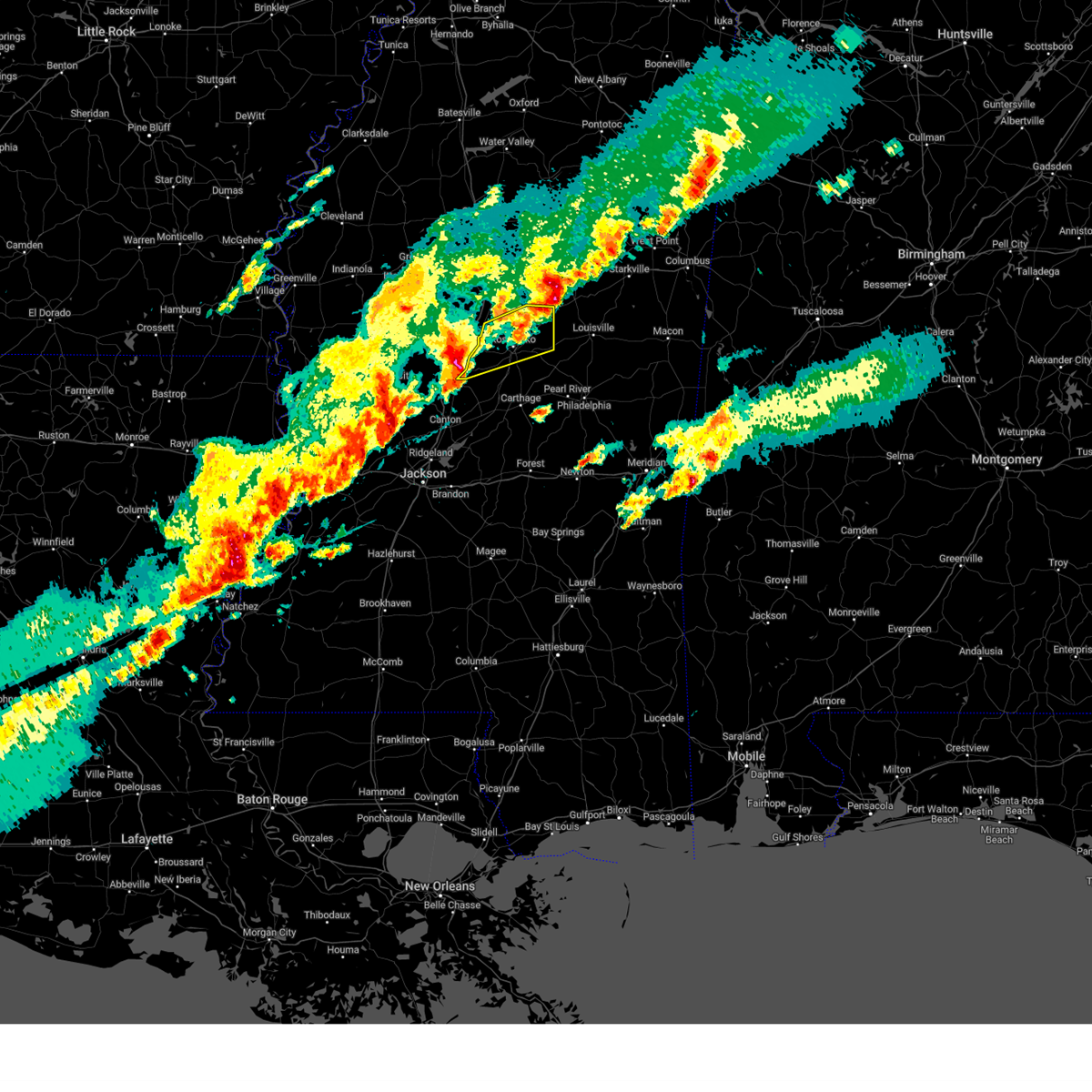
The Top Recent Hail Date for McCool, MS is Sunday, May 10, 2026 (3rd out of 53)
Hail and Wind Damage Spotted near McCool, MS
| Date / Time | Report Details |
|---|---|
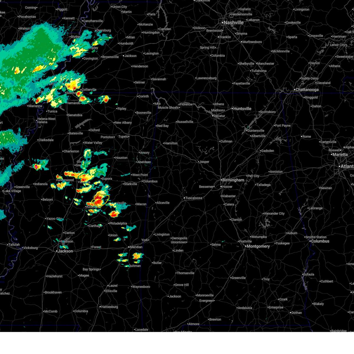
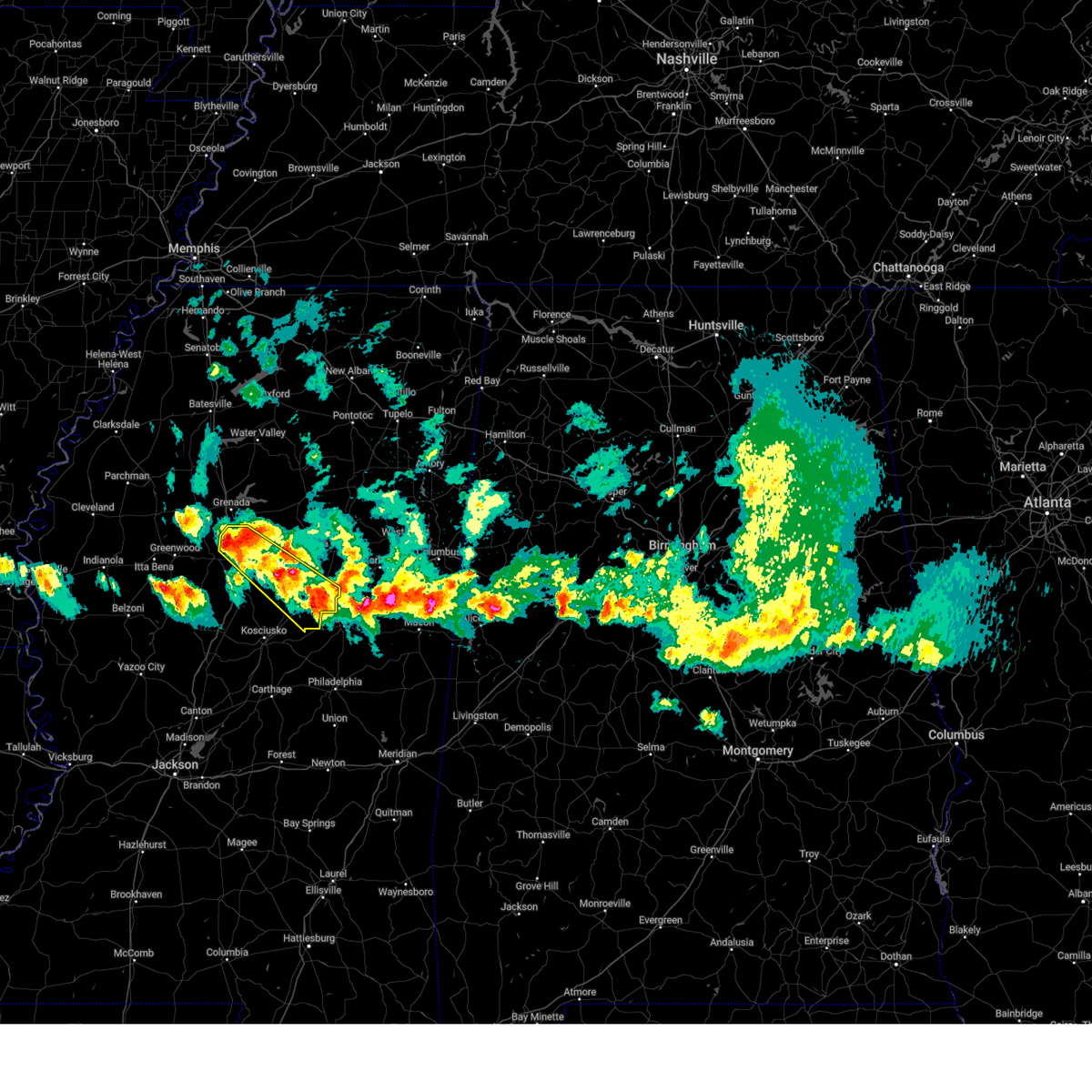
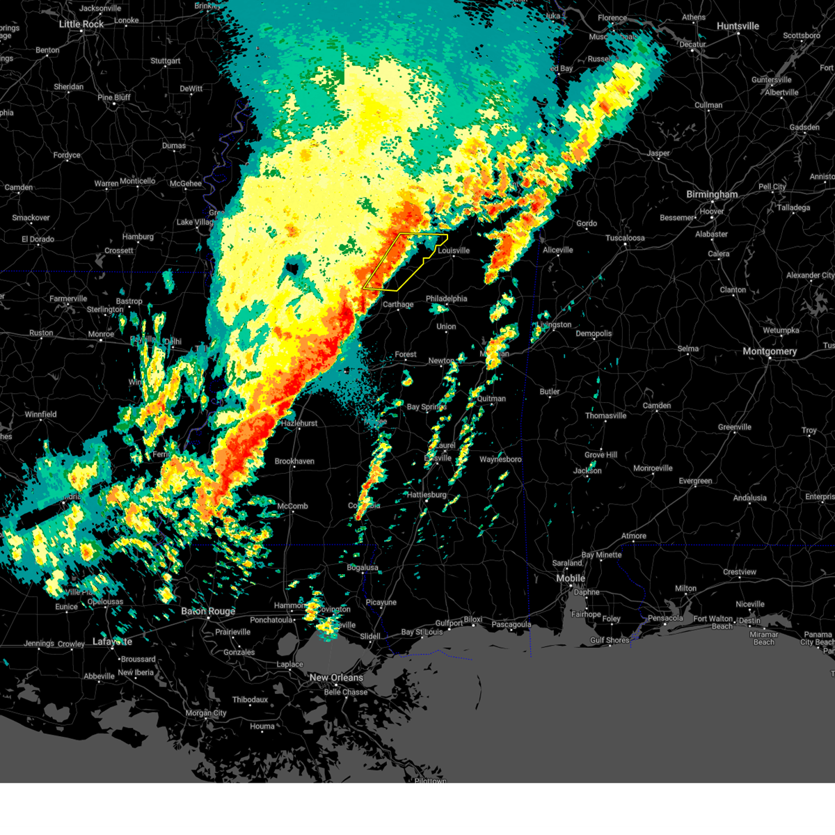
| 5/10/2026 5:31 PM CDT |
 At 531 pm cdt, a severe thunderstorm was located over mccool, or 11 miles southwest of ackerman, moving southeast at 15 mph (radar indicated). Hazards include 60 mph wind gusts and quarter size hail. Hail damage to vehicles is expected. expect wind damage to roofs, siding, and trees. This severe thunderstorm will remain over mainly rural areas of southeastern choctaw, east central attala and west central winston counties. At 531 pm cdt, a severe thunderstorm was located over mccool, or 11 miles southwest of ackerman, moving southeast at 15 mph (radar indicated). Hazards include 60 mph wind gusts and quarter size hail. Hail damage to vehicles is expected. expect wind damage to roofs, siding, and trees. This severe thunderstorm will remain over mainly rural areas of southeastern choctaw, east central attala and west central winston counties.
|
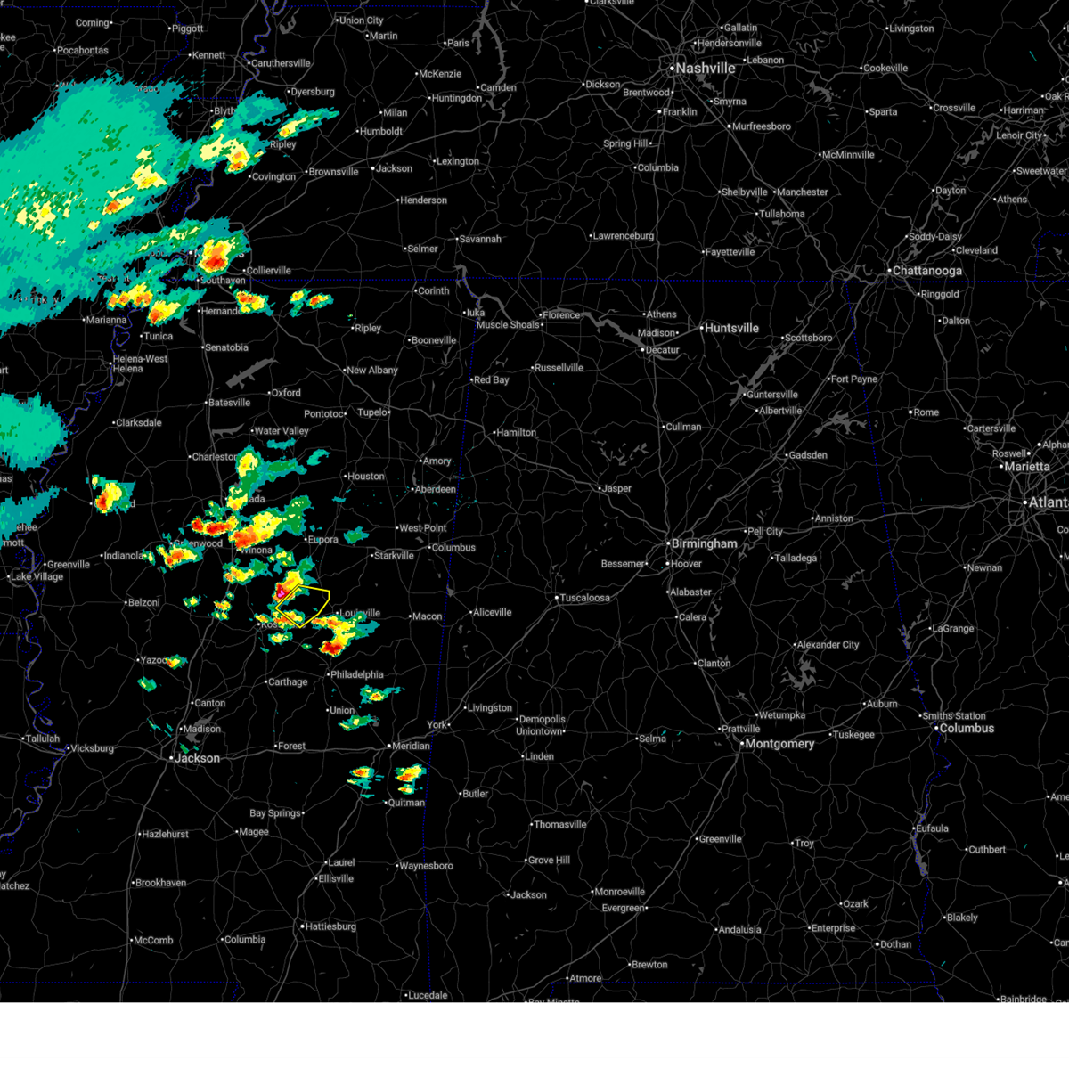
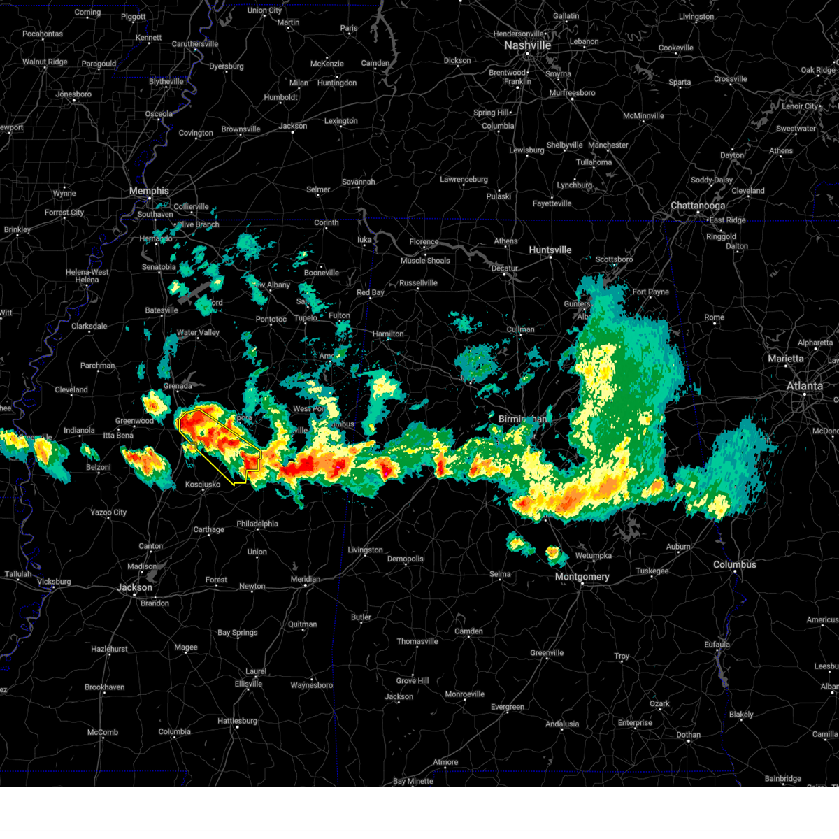
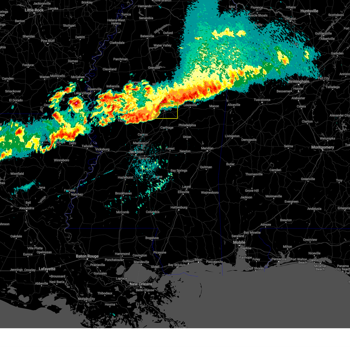
| 5/10/2026 5:22 PM CDT |
 At 522 pm cdt, a severe thunderstorm was located over mccool, or 12 miles southwest of ackerman, moving east at 15 mph (radar indicated). Hazards include 60 mph wind gusts and half dollar size hail. Hail damage to vehicles is expected. expect wind damage to roofs, siding, and trees. This severe storm will be near, weir around 525 pm cdt. At 522 pm cdt, a severe thunderstorm was located over mccool, or 12 miles southwest of ackerman, moving east at 15 mph (radar indicated). Hazards include 60 mph wind gusts and half dollar size hail. Hail damage to vehicles is expected. expect wind damage to roofs, siding, and trees. This severe storm will be near, weir around 525 pm cdt.
|
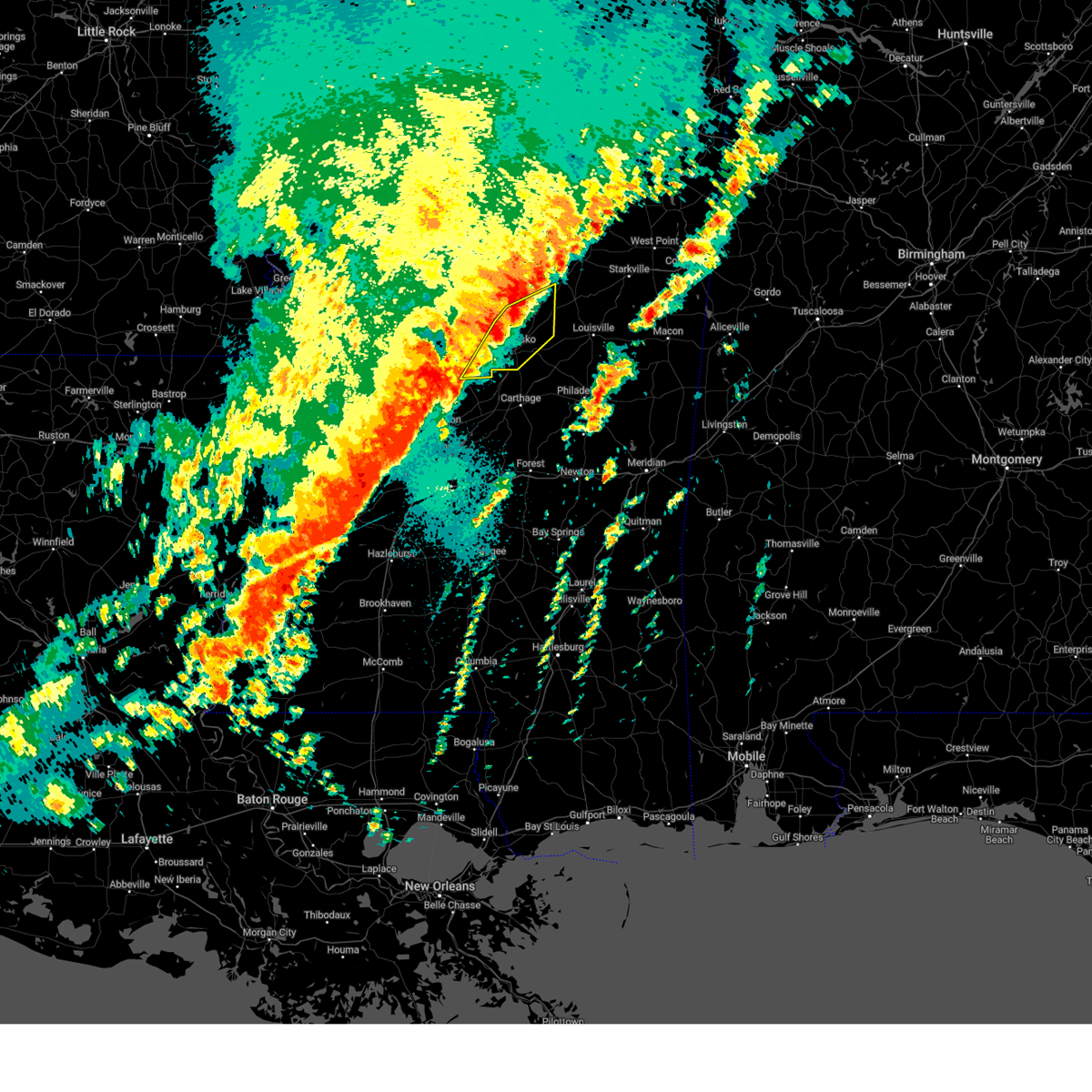
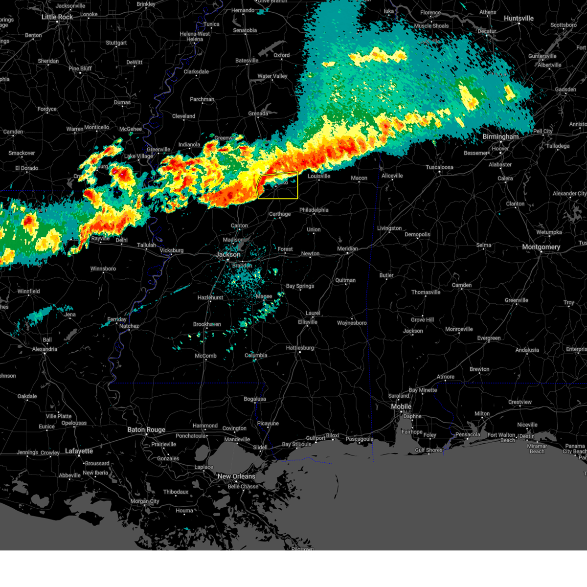
| 5/10/2026 5:17 PM CDT | Golf Ball sized hail reported 0.9 miles SW of McCool, MS, relayed via social media. |
| 5/10/2026 5:09 PM CDT | Golf Ball sized hail reported 2.2 miles SE of McCool, MS, relayed through social media. |
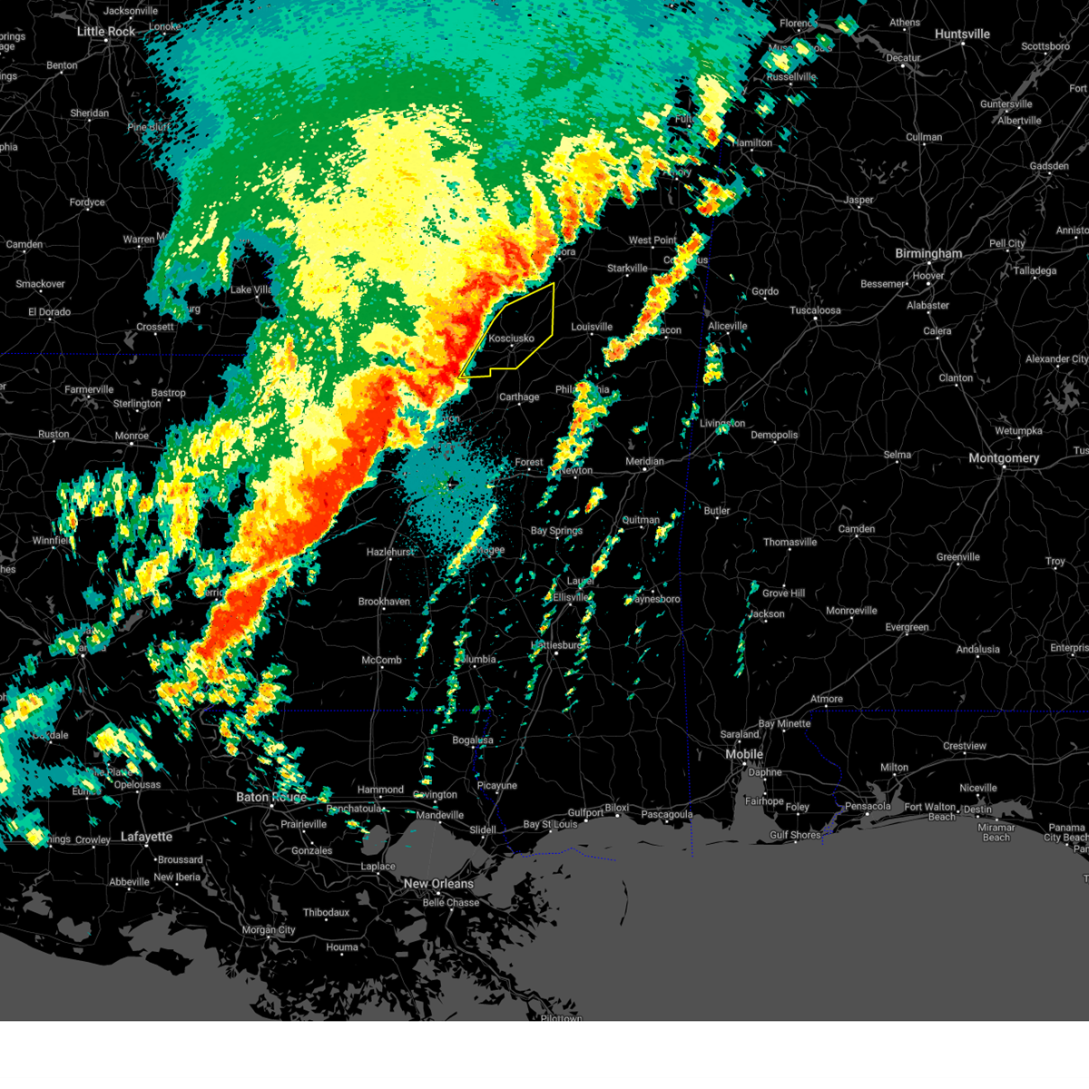
| 5/10/2026 5:07 PM CDT |
 Svrjan the national weather service in jackson has issued a * severe thunderstorm warning for, southeastern choctaw county in central mississippi, east central attala county in central mississippi, west central winston county in east central mississippi, * until 615 pm cdt. * at 507 pm cdt, a severe thunderstorm was located near mccool, or 14 miles northeast of kosciusko, moving southeast at 15 mph (radar indicated). Hazards include golf ball size hail and 60 mph wind gusts. People and animals outdoors will be injured. expect hail damage to roofs, siding, windows, and vehicles. expect wind damage to roofs, siding, and trees. This severe thunderstorm will be near, weir and mccool around 510 pm cdt. Svrjan the national weather service in jackson has issued a * severe thunderstorm warning for, southeastern choctaw county in central mississippi, east central attala county in central mississippi, west central winston county in east central mississippi, * until 615 pm cdt. * at 507 pm cdt, a severe thunderstorm was located near mccool, or 14 miles northeast of kosciusko, moving southeast at 15 mph (radar indicated). Hazards include golf ball size hail and 60 mph wind gusts. People and animals outdoors will be injured. expect hail damage to roofs, siding, windows, and vehicles. expect wind damage to roofs, siding, and trees. This severe thunderstorm will be near, weir and mccool around 510 pm cdt.
|
| 4/28/2026 11:14 PM CDT |
 At 1113 pm cdt, a severe thunderstorm was located near possumneck, or near durant, moving east at 60 mph (radar indicated). Hazards include 70 mph wind gusts. Expect considerable tree damage. damage is likely to mobile homes, roofs, and outbuildings. this severe storm will be near, kosciusko, hesterville, and mcadams around 1120 pm cdt. ethel and smyrna around 1125 pm cdt. Zama around 1130 pm cdt. At 1113 pm cdt, a severe thunderstorm was located near possumneck, or near durant, moving east at 60 mph (radar indicated). Hazards include 70 mph wind gusts. Expect considerable tree damage. damage is likely to mobile homes, roofs, and outbuildings. this severe storm will be near, kosciusko, hesterville, and mcadams around 1120 pm cdt. ethel and smyrna around 1125 pm cdt. Zama around 1130 pm cdt.
|
| 4/28/2026 10:57 PM CDT |
 Svrjan the national weather service in jackson has issued a * severe thunderstorm warning for, holmes county in central mississippi, attala county in central mississippi, southeastern humphreys county in central mississippi, * until 1145 pm cdt. * at 1057 pm cdt, a severe thunderstorm was located near lexington, moving east at 75 mph (radar indicated). Hazards include 70 mph wind gusts. Expect considerable tree damage. damage is likely to mobile homes, roofs, and outbuildings. this severe thunderstorm will be near, durant, west, emory, and bowling green around 1105 pm cdt. hesterville and possumneck around 1110 pm cdt. kosciusko around 1115 pm cdt. ethel around 1120 pm cdt. Mccool around 1130 pm cdt. Svrjan the national weather service in jackson has issued a * severe thunderstorm warning for, holmes county in central mississippi, attala county in central mississippi, southeastern humphreys county in central mississippi, * until 1145 pm cdt. * at 1057 pm cdt, a severe thunderstorm was located near lexington, moving east at 75 mph (radar indicated). Hazards include 70 mph wind gusts. Expect considerable tree damage. damage is likely to mobile homes, roofs, and outbuildings. this severe thunderstorm will be near, durant, west, emory, and bowling green around 1105 pm cdt. hesterville and possumneck around 1110 pm cdt. kosciusko around 1115 pm cdt. ethel around 1120 pm cdt. Mccool around 1130 pm cdt.
|
| 4/28/2026 7:15 PM CDT |
 At 714 pm cdt, a severe thunderstorm was located near ethel, or 10 miles northeast of kosciusko, moving east at 45 mph (radar indicated). Hazards include golf ball size hail and 60 mph wind gusts. People and animals outdoors will be injured. expect hail damage to roofs, siding, windows, and vehicles. expect wind damage to roofs, siding, and trees. this severe storm will be near, ethel and mccool around 720 pm cdt. weir around 725 pm cdt. Louisville and mcmillan around 735 pm cdt. At 714 pm cdt, a severe thunderstorm was located near ethel, or 10 miles northeast of kosciusko, moving east at 45 mph (radar indicated). Hazards include golf ball size hail and 60 mph wind gusts. People and animals outdoors will be injured. expect hail damage to roofs, siding, windows, and vehicles. expect wind damage to roofs, siding, and trees. this severe storm will be near, ethel and mccool around 720 pm cdt. weir around 725 pm cdt. Louisville and mcmillan around 735 pm cdt.
|
| 4/28/2026 7:15 PM CDT |
 the severe thunderstorm warning has been cancelled and is no longer in effect the severe thunderstorm warning has been cancelled and is no longer in effect
|
| 4/28/2026 7:00 PM CDT |
 Svrjan the national weather service in jackson has issued a * severe thunderstorm warning for, southern choctaw county in central mississippi, southeastern carroll county in north central mississippi, northeastern attala county in central mississippi, western winston county in east central mississippi, south central montgomery county in north central mississippi, * until 800 pm cdt. * at 700 pm cdt, a severe thunderstorm was located near hesterville, or 9 miles southeast of vaiden, moving east at 45 mph (radar indicated). Hazards include 60 mph wind gusts and quarter size hail. Hail damage to vehicles is expected. expect wind damage to roofs, siding, and trees. this severe thunderstorm will be near, ethel around 710 pm cdt. mccool around 715 pm cdt. weir around 725 pm cdt. Louisville and mcmillan around 735 pm cdt. Svrjan the national weather service in jackson has issued a * severe thunderstorm warning for, southern choctaw county in central mississippi, southeastern carroll county in north central mississippi, northeastern attala county in central mississippi, western winston county in east central mississippi, south central montgomery county in north central mississippi, * until 800 pm cdt. * at 700 pm cdt, a severe thunderstorm was located near hesterville, or 9 miles southeast of vaiden, moving east at 45 mph (radar indicated). Hazards include 60 mph wind gusts and quarter size hail. Hail damage to vehicles is expected. expect wind damage to roofs, siding, and trees. this severe thunderstorm will be near, ethel around 710 pm cdt. mccool around 715 pm cdt. weir around 725 pm cdt. Louisville and mcmillan around 735 pm cdt.
|
| 12/18/2025 4:35 PM CST |
 At 435 pm cst, a severe thunderstorm was located near mccool, or 14 miles southwest of ackerman, moving northeast at 40 mph (radar indicated). Hazards include 60 mph wind gusts. Expect damage to roofs, siding, and trees. This severe storm will be near, louisville, ackerman, and mcmillan around 445 pm cst. At 435 pm cst, a severe thunderstorm was located near mccool, or 14 miles southwest of ackerman, moving northeast at 40 mph (radar indicated). Hazards include 60 mph wind gusts. Expect damage to roofs, siding, and trees. This severe storm will be near, louisville, ackerman, and mcmillan around 445 pm cst.
|
| 12/18/2025 4:23 PM CST |
 Svrjan the national weather service in jackson has issued a * severe thunderstorm warning for, southeastern choctaw county in central mississippi, east central attala county in central mississippi, northwestern winston county in east central mississippi, * until 515 pm cst. * at 423 pm cst, a severe thunderstorm was located over ethel, or 9 miles east of kosciusko, moving northeast at 35 mph (radar indicated). Hazards include 60 mph wind gusts. Expect damage to roofs, siding, and trees. this severe thunderstorm will be near, mccool around 430 pm cst. weir around 435 pm cst. mcmillan around 445 pm cst. Louisville and ackerman around 450 pm cst. Svrjan the national weather service in jackson has issued a * severe thunderstorm warning for, southeastern choctaw county in central mississippi, east central attala county in central mississippi, northwestern winston county in east central mississippi, * until 515 pm cst. * at 423 pm cst, a severe thunderstorm was located over ethel, or 9 miles east of kosciusko, moving northeast at 35 mph (radar indicated). Hazards include 60 mph wind gusts. Expect damage to roofs, siding, and trees. this severe thunderstorm will be near, mccool around 430 pm cst. weir around 435 pm cst. mcmillan around 445 pm cst. Louisville and ackerman around 450 pm cst.
|
| 8/20/2025 1:42 PM CDT |
 Svrjan the national weather service in jackson has issued a * severe thunderstorm warning for, southwestern choctaw county in central mississippi, eastern holmes county in central mississippi, southeastern carroll county in north central mississippi, attala county in central mississippi, southeastern montgomery county in north central mississippi, * until 245 pm cdt. * at 142 pm cdt, a severe thunderstorm was located near ethel, or 10 miles northeast of kosciusko, moving southwest at 20 mph (radar indicated). Hazards include 60 mph wind gusts. expect damage to roofs, siding, and trees Svrjan the national weather service in jackson has issued a * severe thunderstorm warning for, southwestern choctaw county in central mississippi, eastern holmes county in central mississippi, southeastern carroll county in north central mississippi, attala county in central mississippi, southeastern montgomery county in north central mississippi, * until 245 pm cdt. * at 142 pm cdt, a severe thunderstorm was located near ethel, or 10 miles northeast of kosciusko, moving southwest at 20 mph (radar indicated). Hazards include 60 mph wind gusts. expect damage to roofs, siding, and trees
|
| 8/14/2025 6:19 PM CDT |
 Svrjan the national weather service in jackson has issued a * severe thunderstorm warning for, choctaw county in central mississippi, northwestern oktibbeha county in northeastern mississippi, northeastern attala county in central mississippi, webster county in north central mississippi, southeastern montgomery county in north central mississippi, southwestern clay county in northeastern mississippi, * until 715 pm cdt. * at 619 pm cdt, a severe thunderstorm was located near chester, or 8 miles south of eupora, moving northeast at 30 mph (radar indicated). Hazards include 60 mph wind gusts. Expect damage to roofs, siding, and trees. this severe thunderstorm will be near, eupora, sherwood, and reform around 625 pm cdt. mathiston around 630 pm cdt. maben and walthall around 635 pm cdt. cumberland and clarkson around 640 pm cdt. Mantee around 655 pm cdt. Svrjan the national weather service in jackson has issued a * severe thunderstorm warning for, choctaw county in central mississippi, northwestern oktibbeha county in northeastern mississippi, northeastern attala county in central mississippi, webster county in north central mississippi, southeastern montgomery county in north central mississippi, southwestern clay county in northeastern mississippi, * until 715 pm cdt. * at 619 pm cdt, a severe thunderstorm was located near chester, or 8 miles south of eupora, moving northeast at 30 mph (radar indicated). Hazards include 60 mph wind gusts. Expect damage to roofs, siding, and trees. this severe thunderstorm will be near, eupora, sherwood, and reform around 625 pm cdt. mathiston around 630 pm cdt. maben and walthall around 635 pm cdt. cumberland and clarkson around 640 pm cdt. Mantee around 655 pm cdt.
|
| 5/25/2025 7:57 PM CDT |
 Svrjan the national weather service in jackson has issued a * severe thunderstorm warning for, northern leake county in central mississippi, southeastern choctaw county in central mississippi, southern holmes county in central mississippi, western oktibbeha county in northeastern mississippi, attala county in central mississippi, winston county in east central mississippi, northeastern yazoo county in central mississippi, northern neshoba county in east central mississippi, northeastern madison county in central mississippi, * until 915 pm cdt. * at 757 pm cdt, severe thunderstorms were located along a line extending from 8 miles east of kilmichael to near lexington to near belzoni, moving southeast at 45 mph (radar indicated). Hazards include 60 mph wind gusts and penny size hail. expect damage to roofs, siding, and trees Svrjan the national weather service in jackson has issued a * severe thunderstorm warning for, northern leake county in central mississippi, southeastern choctaw county in central mississippi, southern holmes county in central mississippi, western oktibbeha county in northeastern mississippi, attala county in central mississippi, winston county in east central mississippi, northeastern yazoo county in central mississippi, northern neshoba county in east central mississippi, northeastern madison county in central mississippi, * until 915 pm cdt. * at 757 pm cdt, severe thunderstorms were located along a line extending from 8 miles east of kilmichael to near lexington to near belzoni, moving southeast at 45 mph (radar indicated). Hazards include 60 mph wind gusts and penny size hail. expect damage to roofs, siding, and trees
|
| 5/24/2025 4:33 PM CDT | Multiple branches of a large tree were split along mccool stevenson r in choctaw county MS, 5.3 miles NW of McCool, MS |
| 5/24/2025 4:30 PM CDT |
 At 429 pm cdt, severe thunderstorms were located along a line extending from walthall to near thomastown, moving east at 35 mph (radar indicated). Hazards include 60 mph wind gusts and nickel size hail. Expect damage to roofs, siding, and trees. Locations impacted include, kosciusko, eupora, weir, ethel, french camp, walthall, mccool, chester, zama, smyrna, and bellefontaine. At 429 pm cdt, severe thunderstorms were located along a line extending from walthall to near thomastown, moving east at 35 mph (radar indicated). Hazards include 60 mph wind gusts and nickel size hail. Expect damage to roofs, siding, and trees. Locations impacted include, kosciusko, eupora, weir, ethel, french camp, walthall, mccool, chester, zama, smyrna, and bellefontaine.
|
| 5/24/2025 4:30 PM CDT |
 the severe thunderstorm warning has been cancelled and is no longer in effect the severe thunderstorm warning has been cancelled and is no longer in effect
|
| 5/24/2025 4:18 PM CDT |
 At 418 pm cdt, severe thunderstorms were located along a line extending from near embry to near thomastown, moving east at 35 mph (radar indicated). Hazards include 60 mph wind gusts and penny size hail. Expect damage to roofs, siding, and trees. Locations impacted include, kosciusko, eupora, kilmichael, weir, ethel, french camp, walthall, mccool, sallis, hesterville, lodi, poplar creek, chester, zama, bellefontaine, mcadams, possumneck, and smyrna. At 418 pm cdt, severe thunderstorms were located along a line extending from near embry to near thomastown, moving east at 35 mph (radar indicated). Hazards include 60 mph wind gusts and penny size hail. Expect damage to roofs, siding, and trees. Locations impacted include, kosciusko, eupora, kilmichael, weir, ethel, french camp, walthall, mccool, sallis, hesterville, lodi, poplar creek, chester, zama, bellefontaine, mcadams, possumneck, and smyrna.
|
| 5/24/2025 4:18 PM CDT |
 the severe thunderstorm warning has been cancelled and is no longer in effect the severe thunderstorm warning has been cancelled and is no longer in effect
|
| 5/24/2025 3:52 PM CDT |
 Svrjan the national weather service in jackson has issued a * severe thunderstorm warning for, central choctaw county in central mississippi, eastern holmes county in central mississippi, eastern carroll county in north central mississippi, attala county in central mississippi, southwestern webster county in north central mississippi, montgomery county in north central mississippi, * until 445 pm cdt. * at 351 pm cdt, severe thunderstorms were located along a line extending from near duck hill to near pickens, moving east at 35 mph (radar indicated). Hazards include 60 mph wind gusts and penny size hail. expect damage to roofs, siding, and trees Svrjan the national weather service in jackson has issued a * severe thunderstorm warning for, central choctaw county in central mississippi, eastern holmes county in central mississippi, eastern carroll county in north central mississippi, attala county in central mississippi, southwestern webster county in north central mississippi, montgomery county in north central mississippi, * until 445 pm cdt. * at 351 pm cdt, severe thunderstorms were located along a line extending from near duck hill to near pickens, moving east at 35 mph (radar indicated). Hazards include 60 mph wind gusts and penny size hail. expect damage to roofs, siding, and trees
|
| 5/18/2025 3:48 AM CDT |
 the tornado warning has been cancelled and is no longer in effect the tornado warning has been cancelled and is no longer in effect
|
| 5/18/2025 3:28 AM CDT |
 Torjan the national weather service in jackson has issued a * tornado warning for, southwestern choctaw county in central mississippi, southeastern carroll county in north central mississippi, northeastern attala county in central mississippi, southern montgomery county in north central mississippi, * until 430 am cdt. * at 328 am cdt, a severe thunderstorm capable of producing a tornado was located near carrollton, moving east at 35 mph (radar indicated rotation). Hazards include tornado and quarter size hail. Flying debris will be dangerous to those caught without shelter. mobile homes will be damaged or destroyed. damage to roofs, windows, and vehicles will occur. tree damage is likely. this dangerous storm will be near, vaiden around 335 am cdt. kilmichael and poplar creek around 345 am cdt. french camp around 400 am cdt. Mccool around 415 am cdt. Torjan the national weather service in jackson has issued a * tornado warning for, southwestern choctaw county in central mississippi, southeastern carroll county in north central mississippi, northeastern attala county in central mississippi, southern montgomery county in north central mississippi, * until 430 am cdt. * at 328 am cdt, a severe thunderstorm capable of producing a tornado was located near carrollton, moving east at 35 mph (radar indicated rotation). Hazards include tornado and quarter size hail. Flying debris will be dangerous to those caught without shelter. mobile homes will be damaged or destroyed. damage to roofs, windows, and vehicles will occur. tree damage is likely. this dangerous storm will be near, vaiden around 335 am cdt. kilmichael and poplar creek around 345 am cdt. french camp around 400 am cdt. Mccool around 415 am cdt.
|
| 4/10/2025 10:28 PM CDT |
 The storm which prompted the warning has moved out of the area. therefore, the warning will be allowed to expire. a severe thunderstorm watch remains in effect until 1100 pm cdt for central and east central mississippi. The storm which prompted the warning has moved out of the area. therefore, the warning will be allowed to expire. a severe thunderstorm watch remains in effect until 1100 pm cdt for central and east central mississippi.
|
| 4/10/2025 10:16 PM CDT |
 the severe thunderstorm warning has been cancelled and is no longer in effect the severe thunderstorm warning has been cancelled and is no longer in effect
|
| 4/10/2025 10:16 PM CDT |
 At 1015 pm cdt, a severe thunderstorm was located over mccool, or 14 miles southwest of ackerman, moving southeast at 60 mph (radar indicated). Hazards include 60 mph wind gusts and quarter size hail. Hail damage to vehicles is expected. expect wind damage to roofs, siding, and trees. Locations impacted include, mccool and weir. At 1015 pm cdt, a severe thunderstorm was located over mccool, or 14 miles southwest of ackerman, moving southeast at 60 mph (radar indicated). Hazards include 60 mph wind gusts and quarter size hail. Hail damage to vehicles is expected. expect wind damage to roofs, siding, and trees. Locations impacted include, mccool and weir.
|
| 4/10/2025 10:07 PM CDT |
 At 1006 pm cdt, a severe thunderstorm was located near ackerman, moving southeast at 45 mph (radar indicated). Hazards include 60 mph wind gusts and quarter size hail. Hail damage to vehicles is expected. expect wind damage to roofs, siding, and trees. This severe thunderstorm will remain over mainly rural areas of choctaw, northeastern attala and southeastern montgomery counties. At 1006 pm cdt, a severe thunderstorm was located near ackerman, moving southeast at 45 mph (radar indicated). Hazards include 60 mph wind gusts and quarter size hail. Hail damage to vehicles is expected. expect wind damage to roofs, siding, and trees. This severe thunderstorm will remain over mainly rural areas of choctaw, northeastern attala and southeastern montgomery counties.
|
| 4/10/2025 10:07 PM CDT |
 the severe thunderstorm warning has been cancelled and is no longer in effect the severe thunderstorm warning has been cancelled and is no longer in effect
|
| 4/10/2025 9:55 PM CDT |
 At 955 pm cdt, a severe thunderstorm was located near french camp, or 15 miles west of ackerman, moving southeast at 45 mph (radar indicated). Hazards include 60 mph wind gusts and quarter size hail. Hail damage to vehicles is expected. expect wind damage to roofs, siding, and trees. this severe storm will be near, chester, french camp, weir, and mccool around 1000 pm cdt. Ackerman around 1005 pm cdt. At 955 pm cdt, a severe thunderstorm was located near french camp, or 15 miles west of ackerman, moving southeast at 45 mph (radar indicated). Hazards include 60 mph wind gusts and quarter size hail. Hail damage to vehicles is expected. expect wind damage to roofs, siding, and trees. this severe storm will be near, chester, french camp, weir, and mccool around 1000 pm cdt. Ackerman around 1005 pm cdt.
|
| 4/10/2025 9:45 PM CDT |
 the severe thunderstorm warning has been cancelled and is no longer in effect the severe thunderstorm warning has been cancelled and is no longer in effect
|
| 4/10/2025 9:45 PM CDT |
 At 945 pm cdt, a severe thunderstorm was located near lodi, or near winona, moving southeast at 55 mph (radar indicated). Hazards include 60 mph wind gusts and quarter size hail. Hail damage to vehicles is expected. expect wind damage to roofs, siding, and trees. this severe storm will be near, kilmichael, lodi, and poplar creek around 950 pm cdt. french camp around 1000 pm cdt. chester and weir around 1005 pm cdt. Ackerman around 1010 pm cdt. At 945 pm cdt, a severe thunderstorm was located near lodi, or near winona, moving southeast at 55 mph (radar indicated). Hazards include 60 mph wind gusts and quarter size hail. Hail damage to vehicles is expected. expect wind damage to roofs, siding, and trees. this severe storm will be near, kilmichael, lodi, and poplar creek around 950 pm cdt. french camp around 1000 pm cdt. chester and weir around 1005 pm cdt. Ackerman around 1010 pm cdt.
|
| 4/10/2025 9:40 PM CDT |
 the severe thunderstorm warning has been cancelled and is no longer in effect the severe thunderstorm warning has been cancelled and is no longer in effect
|
| 4/10/2025 9:40 PM CDT |
 At 940 pm cdt, a severe thunderstorm was located near duck hill, or near winona, moving southeast at 55 mph (radar indicated). Hazards include 60 mph wind gusts and quarter size hail. Hail damage to vehicles is expected. expect wind damage to roofs, siding, and trees. this severe storm will be near, winona, kilmichael, and lodi around 945 pm cdt. poplar creek around 955 pm cdt. french camp around 1000 pm cdt. chester and weir around 1005 pm cdt. Ackerman around 1010 pm cdt. At 940 pm cdt, a severe thunderstorm was located near duck hill, or near winona, moving southeast at 55 mph (radar indicated). Hazards include 60 mph wind gusts and quarter size hail. Hail damage to vehicles is expected. expect wind damage to roofs, siding, and trees. this severe storm will be near, winona, kilmichael, and lodi around 945 pm cdt. poplar creek around 955 pm cdt. french camp around 1000 pm cdt. chester and weir around 1005 pm cdt. Ackerman around 1010 pm cdt.
|
| 4/10/2025 9:30 PM CDT |
 Svrjan the national weather service in jackson has issued a * severe thunderstorm warning for, choctaw county in central mississippi, northeastern carroll county in north central mississippi, south central grenada county in north central mississippi, northeastern attala county in central mississippi, southwestern webster county in north central mississippi, montgomery county in north central mississippi, * until 1030 pm cdt. * at 929 pm cdt, a severe thunderstorm was located near jefferson, or 8 miles south of grenada, moving southeast at 55 mph (radar indicated). Hazards include 60 mph wind gusts and quarter size hail. Hail damage to vehicles is expected. expect wind damage to roofs, siding, and trees. this severe thunderstorm will be near, winona, elliott, and duck hill around 935 pm cdt. kilmichael around 945 pm cdt. poplar creek around 955 pm cdt. french camp around 1000 pm cdt. chester around 1005 pm cdt. weir around 1010 pm cdt. Ackerman and mccool around 1015 pm cdt. Svrjan the national weather service in jackson has issued a * severe thunderstorm warning for, choctaw county in central mississippi, northeastern carroll county in north central mississippi, south central grenada county in north central mississippi, northeastern attala county in central mississippi, southwestern webster county in north central mississippi, montgomery county in north central mississippi, * until 1030 pm cdt. * at 929 pm cdt, a severe thunderstorm was located near jefferson, or 8 miles south of grenada, moving southeast at 55 mph (radar indicated). Hazards include 60 mph wind gusts and quarter size hail. Hail damage to vehicles is expected. expect wind damage to roofs, siding, and trees. this severe thunderstorm will be near, winona, elliott, and duck hill around 935 pm cdt. kilmichael around 945 pm cdt. poplar creek around 955 pm cdt. french camp around 1000 pm cdt. chester around 1005 pm cdt. weir around 1010 pm cdt. Ackerman and mccool around 1015 pm cdt.
|
| 4/6/2025 1:46 AM CDT |
 the severe thunderstorm warning has been cancelled and is no longer in effect the severe thunderstorm warning has been cancelled and is no longer in effect
|
| 4/6/2025 1:18 AM CDT | At 118 am cdt, a severe thunderstorm was located near kosciusko, moving northeast at 45 mph (radar indicated). Hazards include 60 mph wind gusts. Expect damage to roofs, siding, and trees. this severe storm will be near, ethel and mccool around 125 am cdt. Weir around 135 am cdt. |
| 4/6/2025 12:59 AM CDT |
 Svrjan the national weather service in jackson has issued a * severe thunderstorm warning for, northwestern leake county in central mississippi, southeastern choctaw county in central mississippi, attala county in central mississippi, * until 200 am cdt. * at 1259 am cdt, a severe thunderstorm was located near newport, or 13 miles southwest of kosciusko, moving northeast at 50 mph (radar indicated). Hazards include 60 mph wind gusts. Expect damage to roofs, siding, and trees. this severe thunderstorm will be near, kosciusko and mcadams around 105 am cdt. smyrna around 110 am cdt. ethel around 115 am cdt. mccool around 125 am cdt. Weir around 135 am cdt. Svrjan the national weather service in jackson has issued a * severe thunderstorm warning for, northwestern leake county in central mississippi, southeastern choctaw county in central mississippi, attala county in central mississippi, * until 200 am cdt. * at 1259 am cdt, a severe thunderstorm was located near newport, or 13 miles southwest of kosciusko, moving northeast at 50 mph (radar indicated). Hazards include 60 mph wind gusts. Expect damage to roofs, siding, and trees. this severe thunderstorm will be near, kosciusko and mcadams around 105 am cdt. smyrna around 110 am cdt. ethel around 115 am cdt. mccool around 125 am cdt. Weir around 135 am cdt.
|
| 4/6/2025 12:05 AM CDT |
 the severe thunderstorm warning has been cancelled and is no longer in effect the severe thunderstorm warning has been cancelled and is no longer in effect
|
| 4/5/2025 11:41 PM CDT |
 At 1141 pm cdt, a severe thunderstorm was located over hesterville, or near kosciusko, moving northeast at 50 mph (radar indicated). Hazards include 60 mph wind gusts. Expect damage to roofs, siding, and trees. this severe storm will be near, hesterville and kosciusko around 1145 pm cdt. ethel around 1150 pm cdt. French camp and mccool around 1155 pm cdt. At 1141 pm cdt, a severe thunderstorm was located over hesterville, or near kosciusko, moving northeast at 50 mph (radar indicated). Hazards include 60 mph wind gusts. Expect damage to roofs, siding, and trees. this severe storm will be near, hesterville and kosciusko around 1145 pm cdt. ethel around 1150 pm cdt. French camp and mccool around 1155 pm cdt.
|
| 4/5/2025 11:41 PM CDT |
 the severe thunderstorm warning has been cancelled and is no longer in effect the severe thunderstorm warning has been cancelled and is no longer in effect
|
| 4/5/2025 11:32 PM CDT |
 At 1132 pm cdt, a severe thunderstorm was located near sallis, or near durant, moving northeast at 50 mph (radar indicated). Hazards include 60 mph wind gusts. Expect damage to roofs, siding, and trees. this severe storm will be near, west, hesterville, kosciusko, mcadams, and possumneck around 1135 pm cdt. ethel around 1150 pm cdt. French camp and mccool around 1155 pm cdt. At 1132 pm cdt, a severe thunderstorm was located near sallis, or near durant, moving northeast at 50 mph (radar indicated). Hazards include 60 mph wind gusts. Expect damage to roofs, siding, and trees. this severe storm will be near, west, hesterville, kosciusko, mcadams, and possumneck around 1135 pm cdt. ethel around 1150 pm cdt. French camp and mccool around 1155 pm cdt.
|
| 4/5/2025 11:32 PM CDT |
 the severe thunderstorm warning has been cancelled and is no longer in effect the severe thunderstorm warning has been cancelled and is no longer in effect
|
| 4/5/2025 11:09 PM CDT |
 Svrjan the national weather service in jackson has issued a * severe thunderstorm warning for, west central choctaw county in central mississippi, eastern holmes county in central mississippi, southeastern carroll county in north central mississippi, attala county in central mississippi, southern montgomery county in north central mississippi, * until 1230 am cdt. * at 1109 pm cdt, a severe thunderstorm was located over ebenezer, or 12 miles south of lexington, moving northeast at 50 mph (radar indicated). Hazards include 60 mph wind gusts. Expect damage to roofs, siding, and trees. this severe thunderstorm will be near, pickens, goodman, and franklin around 1115 pm cdt. durant around 1120 pm cdt. sallis around 1125 pm cdt. mcadams and possumneck around 1130 pm cdt. west, hesterville, and kosciusko around 1135 pm cdt. ethel around 1150 pm cdt. French camp and mccool around 1155 pm cdt. Svrjan the national weather service in jackson has issued a * severe thunderstorm warning for, west central choctaw county in central mississippi, eastern holmes county in central mississippi, southeastern carroll county in north central mississippi, attala county in central mississippi, southern montgomery county in north central mississippi, * until 1230 am cdt. * at 1109 pm cdt, a severe thunderstorm was located over ebenezer, or 12 miles south of lexington, moving northeast at 50 mph (radar indicated). Hazards include 60 mph wind gusts. Expect damage to roofs, siding, and trees. this severe thunderstorm will be near, pickens, goodman, and franklin around 1115 pm cdt. durant around 1120 pm cdt. sallis around 1125 pm cdt. mcadams and possumneck around 1130 pm cdt. west, hesterville, and kosciusko around 1135 pm cdt. ethel around 1150 pm cdt. French camp and mccool around 1155 pm cdt.
|
| 3/31/2025 5:58 AM CDT |
 At 557 am cdt, severe thunderstorms were located along a line extending from columbus afb to near ethel, moving east at 50 mph (radar indicated). Hazards include 60 mph wind gusts and quarter size hail. Hail damage to vehicles is expected. expect wind damage to roofs, siding, and trees. these severe storms will be near, waverly, tibbee, sessums, columbus afb, oktoc, steens, bent oak, craig springs, starkville, and artesia around 605 am cdt. betheden and louisville around 610 am cdt. crawford and millcreek around 615 am cdt. brooksville around 625 am cdt. deerbrook around 630 am cdt. bigbee valley around 635 am cdt. Prairie point around 645 am cdt. At 557 am cdt, severe thunderstorms were located along a line extending from columbus afb to near ethel, moving east at 50 mph (radar indicated). Hazards include 60 mph wind gusts and quarter size hail. Hail damage to vehicles is expected. expect wind damage to roofs, siding, and trees. these severe storms will be near, waverly, tibbee, sessums, columbus afb, oktoc, steens, bent oak, craig springs, starkville, and artesia around 605 am cdt. betheden and louisville around 610 am cdt. crawford and millcreek around 615 am cdt. brooksville around 625 am cdt. deerbrook around 630 am cdt. bigbee valley around 635 am cdt. Prairie point around 645 am cdt.
|
| 3/31/2025 5:20 AM CDT |
 Svrjan the national weather service in jackson has issued a * severe thunderstorm warning for, central choctaw county in central mississippi, northern noxubee county in east central mississippi, oktibbeha county in northeastern mississippi, northeastern attala county in central mississippi, northern winston county in east central mississippi, clay county in northeastern mississippi, lowndes county in northeastern mississippi, * until 615 am cdt. * at 519 am cdt, a severe thunderstorm was located near pheba, or 16 miles northwest of starkville, moving east at 45 mph (radar indicated). Hazards include 60 mph wind gusts and quarter size hail. Hail damage to vehicles is expected. expect wind damage to roofs, siding, and trees. this severe thunderstorm will be near, griffith and pala alto around 525 am cdt. muldrow and west point around 535 am cdt. waverly, kolola springs, and columbus afb around 550 am cdt. columbus around 555 am cdt. caledonia around 600 am cdt. Steens around 605 am cdt. Svrjan the national weather service in jackson has issued a * severe thunderstorm warning for, central choctaw county in central mississippi, northern noxubee county in east central mississippi, oktibbeha county in northeastern mississippi, northeastern attala county in central mississippi, northern winston county in east central mississippi, clay county in northeastern mississippi, lowndes county in northeastern mississippi, * until 615 am cdt. * at 519 am cdt, a severe thunderstorm was located near pheba, or 16 miles northwest of starkville, moving east at 45 mph (radar indicated). Hazards include 60 mph wind gusts and quarter size hail. Hail damage to vehicles is expected. expect wind damage to roofs, siding, and trees. this severe thunderstorm will be near, griffith and pala alto around 525 am cdt. muldrow and west point around 535 am cdt. waverly, kolola springs, and columbus afb around 550 am cdt. columbus around 555 am cdt. caledonia around 600 am cdt. Steens around 605 am cdt.
|
| 3/23/2025 11:33 PM CDT |
 the severe thunderstorm warning has been cancelled and is no longer in effect the severe thunderstorm warning has been cancelled and is no longer in effect
|
| 3/23/2025 11:06 PM CDT |
 At 1106 pm cdt, a severe thunderstorm was located over kosciusko, moving east at 30 mph (radar indicated). Hazards include 60 mph wind gusts and quarter size hail. Hail damage to vehicles is expected. expect wind damage to roofs, siding, and trees. this severe storm will be near, kosciusko, ethel, and smyrna around 1110 pm cdt. Mccool around 1130 pm cdt. At 1106 pm cdt, a severe thunderstorm was located over kosciusko, moving east at 30 mph (radar indicated). Hazards include 60 mph wind gusts and quarter size hail. Hail damage to vehicles is expected. expect wind damage to roofs, siding, and trees. this severe storm will be near, kosciusko, ethel, and smyrna around 1110 pm cdt. Mccool around 1130 pm cdt.
|
| 3/23/2025 10:54 PM CDT |
 Svrjan the national weather service in jackson has issued a * severe thunderstorm warning for, attala county in central mississippi, * until 1145 pm cdt. * at 1054 pm cdt, a severe thunderstorm was located near mcadams, or 7 miles west of kosciusko, moving east at 30 mph (radar indicated). Hazards include 60 mph wind gusts and quarter size hail. Hail damage to vehicles is expected. expect wind damage to roofs, siding, and trees. this severe thunderstorm will be near, hesterville, kosciusko, and mcadams around 1100 pm cdt. ethel and smyrna around 1110 pm cdt. Zama and mccool around 1130 pm cdt. Svrjan the national weather service in jackson has issued a * severe thunderstorm warning for, attala county in central mississippi, * until 1145 pm cdt. * at 1054 pm cdt, a severe thunderstorm was located near mcadams, or 7 miles west of kosciusko, moving east at 30 mph (radar indicated). Hazards include 60 mph wind gusts and quarter size hail. Hail damage to vehicles is expected. expect wind damage to roofs, siding, and trees. this severe thunderstorm will be near, hesterville, kosciusko, and mcadams around 1100 pm cdt. ethel and smyrna around 1110 pm cdt. Zama and mccool around 1130 pm cdt.
|
| 3/23/2025 7:34 PM CDT |
 At 733 pm cdt, a severe thunderstorm was located near ethel, or 11 miles northeast of kosciusko, moving northeast at 50 mph (radar indicated). Hazards include two inch hail and 60 mph wind gusts. People and animals outdoors will be injured. expect hail damage to roofs, siding, windows, and vehicles. expect wind damage to roofs, siding, and trees. this severe storm will be near, french camp, weir, and mccool around 740 pm cdt. chester around 745 pm cdt. Ackerman around 750 pm cdt. At 733 pm cdt, a severe thunderstorm was located near ethel, or 11 miles northeast of kosciusko, moving northeast at 50 mph (radar indicated). Hazards include two inch hail and 60 mph wind gusts. People and animals outdoors will be injured. expect hail damage to roofs, siding, windows, and vehicles. expect wind damage to roofs, siding, and trees. this severe storm will be near, french camp, weir, and mccool around 740 pm cdt. chester around 745 pm cdt. Ackerman around 750 pm cdt.
|
| 3/23/2025 7:08 PM CDT |
 Svrjan the national weather service in jackson has issued a * severe thunderstorm warning for, central choctaw county in central mississippi, northeastern attala county in central mississippi, southeastern montgomery county in north central mississippi, * until 815 pm cdt. * at 708 pm cdt, a severe thunderstorm was located near mcadams, or 9 miles southwest of kosciusko, moving northeast at 50 mph (radar indicated). Hazards include two inch hail and 60 mph wind gusts. People and animals outdoors will be injured. expect hail damage to roofs, siding, windows, and vehicles. expect wind damage to roofs, siding, and trees. this severe thunderstorm will be near, hesterville and kosciusko around 715 pm cdt. ethel around 720 pm cdt. mccool around 730 pm cdt. french camp around 735 pm cdt. weir around 740 pm cdt. chester around 745 pm cdt. Ackerman around 750 pm cdt. Svrjan the national weather service in jackson has issued a * severe thunderstorm warning for, central choctaw county in central mississippi, northeastern attala county in central mississippi, southeastern montgomery county in north central mississippi, * until 815 pm cdt. * at 708 pm cdt, a severe thunderstorm was located near mcadams, or 9 miles southwest of kosciusko, moving northeast at 50 mph (radar indicated). Hazards include two inch hail and 60 mph wind gusts. People and animals outdoors will be injured. expect hail damage to roofs, siding, windows, and vehicles. expect wind damage to roofs, siding, and trees. this severe thunderstorm will be near, hesterville and kosciusko around 715 pm cdt. ethel around 720 pm cdt. mccool around 730 pm cdt. french camp around 735 pm cdt. weir around 740 pm cdt. chester around 745 pm cdt. Ackerman around 750 pm cdt.
|
| 3/15/2025 2:51 PM CDT |
 the severe thunderstorm warning has been cancelled and is no longer in effect the severe thunderstorm warning has been cancelled and is no longer in effect
|
| 3/15/2025 2:51 PM CDT |
 At 250 pm cdt, severe thunderstorms were located along a line extending from near eupora to near ethel, moving northeast at 35 mph (radar indicated). Hazards include 60 mph wind gusts and quarter size hail. Hail damage to vehicles is expected. expect wind damage to roofs, siding, and trees. these severe storms will be near, eupora, french camp, and walthall around 255 pm cdt. chester, weir, mccool, clarkson, and mathiston around 305 pm cdt. Cumberland, sherwood, and reform around 310 pm cdt. At 250 pm cdt, severe thunderstorms were located along a line extending from near eupora to near ethel, moving northeast at 35 mph (radar indicated). Hazards include 60 mph wind gusts and quarter size hail. Hail damage to vehicles is expected. expect wind damage to roofs, siding, and trees. these severe storms will be near, eupora, french camp, and walthall around 255 pm cdt. chester, weir, mccool, clarkson, and mathiston around 305 pm cdt. Cumberland, sherwood, and reform around 310 pm cdt.
|
| 3/15/2025 2:14 PM CDT |
 Svrjan the national weather service in jackson has issued a * severe thunderstorm warning for, choctaw county in central mississippi, east central holmes county in central mississippi, southeastern carroll county in north central mississippi, northern attala county in central mississippi, webster county in north central mississippi, montgomery county in north central mississippi, * until 300 pm cdt. * at 214 pm cdt, severe thunderstorms were located along a line extending from near calhoun city to possumneck, moving east at 40 mph (radar indicated). Hazards include 60 mph wind gusts and quarter size hail. Hail damage to vehicles is expected. expect wind damage to roofs, siding, and trees. severe thunderstorms will be near, hesterville, kilmichael, bellefontaine, embry, lodi, and poplar creek around 220 pm cdt. eupora and walthall around 230 pm cdt. french camp around 235 pm cdt. clarkson around 240 pm cdt. chester, mantee, and weir around 245 pm cdt. Cumberland and mathiston around 250 pm cdt. Svrjan the national weather service in jackson has issued a * severe thunderstorm warning for, choctaw county in central mississippi, east central holmes county in central mississippi, southeastern carroll county in north central mississippi, northern attala county in central mississippi, webster county in north central mississippi, montgomery county in north central mississippi, * until 300 pm cdt. * at 214 pm cdt, severe thunderstorms were located along a line extending from near calhoun city to possumneck, moving east at 40 mph (radar indicated). Hazards include 60 mph wind gusts and quarter size hail. Hail damage to vehicles is expected. expect wind damage to roofs, siding, and trees. severe thunderstorms will be near, hesterville, kilmichael, bellefontaine, embry, lodi, and poplar creek around 220 pm cdt. eupora and walthall around 230 pm cdt. french camp around 235 pm cdt. clarkson around 240 pm cdt. chester, mantee, and weir around 245 pm cdt. Cumberland and mathiston around 250 pm cdt.
|
| 2/15/2025 10:13 PM CST |
 the severe thunderstorm warning has been cancelled and is no longer in effect the severe thunderstorm warning has been cancelled and is no longer in effect
|
| 2/15/2025 10:13 PM CST |
 At 1012 pm cst, severe thunderstorms were located along a line extending from bellefontaine to near pickens, moving east at 50 mph (radar indicated). Hazards include 70 mph wind gusts. Expect considerable tree damage. damage is likely to mobile homes, roofs, and outbuildings. these severe storms will be near, eupora, hesterville, french camp, kosciusko, walthall, mcadams, newport, sallis, and clarkson around 1020 pm cst. cumberland and mathiston around 1025 pm cst. chester, mantee, weir, ethel, sherwood, and reform around 1030 pm cst. mccool and smyrna around 1035 pm cst. ackerman around 1040 pm cst. Zama around 1045 pm cst. At 1012 pm cst, severe thunderstorms were located along a line extending from bellefontaine to near pickens, moving east at 50 mph (radar indicated). Hazards include 70 mph wind gusts. Expect considerable tree damage. damage is likely to mobile homes, roofs, and outbuildings. these severe storms will be near, eupora, hesterville, french camp, kosciusko, walthall, mcadams, newport, sallis, and clarkson around 1020 pm cst. cumberland and mathiston around 1025 pm cst. chester, mantee, weir, ethel, sherwood, and reform around 1030 pm cst. mccool and smyrna around 1035 pm cst. ackerman around 1040 pm cst. Zama around 1045 pm cst.
|
| 2/15/2025 9:55 PM CST |
 Svrjan the national weather service in jackson has issued a * severe thunderstorm warning for, choctaw county in central mississippi, eastern holmes county in central mississippi, eastern carroll county in north central mississippi, attala county in central mississippi, western winston county in east central mississippi, webster county in north central mississippi, montgomery county in north central mississippi, * until 1045 pm cst. * at 955 pm cst, severe thunderstorms were located along a line extending from near slate springs to franklin, moving northeast at 70 mph (radar indicated). Hazards include 70 mph wind gusts. Expect considerable tree damage. damage is likely to mobile homes, roofs, and outbuildings. severe thunderstorms will be near, west, durant, kilmichael, bellefontaine, embry, lodi, poplar creek, possumneck, vaiden, and bowling green around 1000 pm cst. hesterville and walthall around 1005 pm cst. eupora around 1010 pm cst. mantee and clarkson around 1015 pm cst. french camp and cumberland around 1020 pm cst. chester, sherwood, and mathiston around 1025 pm cst. weir and reform around 1030 pm cst. Ackerman around 1035 pm cst. Svrjan the national weather service in jackson has issued a * severe thunderstorm warning for, choctaw county in central mississippi, eastern holmes county in central mississippi, eastern carroll county in north central mississippi, attala county in central mississippi, western winston county in east central mississippi, webster county in north central mississippi, montgomery county in north central mississippi, * until 1045 pm cst. * at 955 pm cst, severe thunderstorms were located along a line extending from near slate springs to franklin, moving northeast at 70 mph (radar indicated). Hazards include 70 mph wind gusts. Expect considerable tree damage. damage is likely to mobile homes, roofs, and outbuildings. severe thunderstorms will be near, west, durant, kilmichael, bellefontaine, embry, lodi, poplar creek, possumneck, vaiden, and bowling green around 1000 pm cst. hesterville and walthall around 1005 pm cst. eupora around 1010 pm cst. mantee and clarkson around 1015 pm cst. french camp and cumberland around 1020 pm cst. chester, sherwood, and mathiston around 1025 pm cst. weir and reform around 1030 pm cst. Ackerman around 1035 pm cst.
|
| 1/5/2025 6:41 PM CST |
 The storms which prompted the warning have weakened below severe limits, and have exited the warned area. therefore, the warning will be allowed to expire. a tornado watch remains in effect until 900 pm cst for central and north central mississippi. The storms which prompted the warning have weakened below severe limits, and have exited the warned area. therefore, the warning will be allowed to expire. a tornado watch remains in effect until 900 pm cst for central and north central mississippi.
|
| 1/5/2025 5:49 PM CST |
 Svrjan the national weather service in jackson has issued a * severe thunderstorm warning for, western choctaw county in central mississippi, east central holmes county in central mississippi, southeastern carroll county in north central mississippi, northern attala county in central mississippi, southeastern montgomery county in north central mississippi, * until 645 pm cst. * at 549 pm cst, severe thunderstorms were located along a line extending from 6 miles northwest of vaiden to goodman, moving northeast at 45 mph (radar indicated). Hazards include 60 mph wind gusts. Expect damage to roofs, siding, and trees. severe thunderstorms will be near, west, durant, possumneck, and vaiden around 555 pm cst. hesterville around 605 pm cst. kosciusko and poplar creek around 610 pm cst. French camp around 625 pm cst. Svrjan the national weather service in jackson has issued a * severe thunderstorm warning for, western choctaw county in central mississippi, east central holmes county in central mississippi, southeastern carroll county in north central mississippi, northern attala county in central mississippi, southeastern montgomery county in north central mississippi, * until 645 pm cst. * at 549 pm cst, severe thunderstorms were located along a line extending from 6 miles northwest of vaiden to goodman, moving northeast at 45 mph (radar indicated). Hazards include 60 mph wind gusts. Expect damage to roofs, siding, and trees. severe thunderstorms will be near, west, durant, possumneck, and vaiden around 555 pm cst. hesterville around 605 pm cst. kosciusko and poplar creek around 610 pm cst. French camp around 625 pm cst.
|
| 12/28/2024 7:34 PM CST |
 Torjan the national weather service in jackson has issued a * tornado warning for, choctaw county in central mississippi, northeastern attala county in central mississippi, southeastern montgomery county in north central mississippi, * until 830 pm cst. * at 734 pm cst, a severe thunderstorm capable of producing a tornado was located over hesterville, or 10 miles north of kosciusko, moving northeast at 60 mph (radar indicated rotation). Hazards include tornado. Flying debris will be dangerous to those caught without shelter. mobile homes will be damaged or destroyed. damage to roofs, windows, and vehicles will occur. tree damage is likely. this dangerous storm will be near, french camp around 745 pm cst. chester around 755 pm cst. Sherwood and reform around 800 pm cst. Torjan the national weather service in jackson has issued a * tornado warning for, choctaw county in central mississippi, northeastern attala county in central mississippi, southeastern montgomery county in north central mississippi, * until 830 pm cst. * at 734 pm cst, a severe thunderstorm capable of producing a tornado was located over hesterville, or 10 miles north of kosciusko, moving northeast at 60 mph (radar indicated rotation). Hazards include tornado. Flying debris will be dangerous to those caught without shelter. mobile homes will be damaged or destroyed. damage to roofs, windows, and vehicles will occur. tree damage is likely. this dangerous storm will be near, french camp around 745 pm cst. chester around 755 pm cst. Sherwood and reform around 800 pm cst.
|
| 3/15/2024 5:01 AM CDT |
 the severe thunderstorm warning has been cancelled and is no longer in effect the severe thunderstorm warning has been cancelled and is no longer in effect
|
| 3/15/2024 5:01 AM CDT |
 At 501 am cdt, a severe thunderstorm was located over french camp, or 10 miles west of ackerman, moving east at 25 mph (radar indicated). Hazards include 60 mph wind gusts and penny size hail. Expect damage to roofs, siding, and trees. This severe storm will be near, weir around 505 am cdt. At 501 am cdt, a severe thunderstorm was located over french camp, or 10 miles west of ackerman, moving east at 25 mph (radar indicated). Hazards include 60 mph wind gusts and penny size hail. Expect damage to roofs, siding, and trees. This severe storm will be near, weir around 505 am cdt.
|
| 3/15/2024 4:38 AM CDT |
 At 437 am cdt, a severe thunderstorm was located near poplar creek, or 13 miles east of vaiden, moving east at 30 mph (radar indicated). Hazards include 60 mph wind gusts and quarter size hail. Hail damage to vehicles is expected. expect wind damage to roofs, siding, and trees. this severe storm will be near, french camp around 445 am cdt. Weir and mccool around 450 am cdt. At 437 am cdt, a severe thunderstorm was located near poplar creek, or 13 miles east of vaiden, moving east at 30 mph (radar indicated). Hazards include 60 mph wind gusts and quarter size hail. Hail damage to vehicles is expected. expect wind damage to roofs, siding, and trees. this severe storm will be near, french camp around 445 am cdt. Weir and mccool around 450 am cdt.
|
| 3/15/2024 4:38 AM CDT |
 the severe thunderstorm warning has been cancelled and is no longer in effect the severe thunderstorm warning has been cancelled and is no longer in effect
|
| 3/15/2024 4:16 AM CDT |
 Svrjan the national weather service in jackson has issued a * severe thunderstorm warning for, southwestern choctaw county in central mississippi, northeastern holmes county in central mississippi, southeastern carroll county in north central mississippi, northeastern attala county in central mississippi, southern montgomery county in north central mississippi, * until 515 am cdt. * at 415 am cdt, a severe thunderstorm was located near vaiden, moving east at 25 mph (radar indicated). Hazards include 60 mph wind gusts and quarter size hail. Hail damage to vehicles is expected. expect wind damage to roofs, siding, and trees. this severe thunderstorm will be near, hesterville around 420 am cdt. poplar creek around 425 am cdt. french camp around 440 am cdt. Weir and mccool around 455 am cdt. Svrjan the national weather service in jackson has issued a * severe thunderstorm warning for, southwestern choctaw county in central mississippi, northeastern holmes county in central mississippi, southeastern carroll county in north central mississippi, northeastern attala county in central mississippi, southern montgomery county in north central mississippi, * until 515 am cdt. * at 415 am cdt, a severe thunderstorm was located near vaiden, moving east at 25 mph (radar indicated). Hazards include 60 mph wind gusts and quarter size hail. Hail damage to vehicles is expected. expect wind damage to roofs, siding, and trees. this severe thunderstorm will be near, hesterville around 420 am cdt. poplar creek around 425 am cdt. french camp around 440 am cdt. Weir and mccool around 455 am cdt.
|
| 2/11/2024 2:37 PM CST |
 At 237 pm cst, a severe thunderstorm was located over hesterville, or 7 miles north of kosciusko, moving east at 50 mph (radar indicated). Hazards include 60 mph wind gusts and quarter size hail. Hail damage to vehicles is expected. expect wind damage to roofs, siding, and trees. this severe storm will be near, kosciusko and ethel around 240 pm cst. mccool around 250 pm cst. hail threat, radar indicated max hail size, 1. 00 in wind threat, radar indicated max wind gust, 60 mph. At 237 pm cst, a severe thunderstorm was located over hesterville, or 7 miles north of kosciusko, moving east at 50 mph (radar indicated). Hazards include 60 mph wind gusts and quarter size hail. Hail damage to vehicles is expected. expect wind damage to roofs, siding, and trees. this severe storm will be near, kosciusko and ethel around 240 pm cst. mccool around 250 pm cst. hail threat, radar indicated max hail size, 1. 00 in wind threat, radar indicated max wind gust, 60 mph.
|
| 2/11/2024 2:14 PM CST |
 At 214 pm cst, a severe thunderstorm was located near bowling green, or near lexington, moving east at 50 mph (radar indicated). Hazards include 60 mph wind gusts and quarter size hail. Hail damage to vehicles is expected. expect wind damage to roofs, siding, and trees. this severe thunderstorm will be near, durant, west, possumneck, and bowling green around 220 pm cst. hesterville around 225 pm cst. ethel around 245 pm cst. mccool around 250 pm cst. hail threat, radar indicated max hail size, 1. 00 in wind threat, radar indicated max wind gust, 60 mph. At 214 pm cst, a severe thunderstorm was located near bowling green, or near lexington, moving east at 50 mph (radar indicated). Hazards include 60 mph wind gusts and quarter size hail. Hail damage to vehicles is expected. expect wind damage to roofs, siding, and trees. this severe thunderstorm will be near, durant, west, possumneck, and bowling green around 220 pm cst. hesterville around 225 pm cst. ethel around 245 pm cst. mccool around 250 pm cst. hail threat, radar indicated max hail size, 1. 00 in wind threat, radar indicated max wind gust, 60 mph.
|
| 1/12/2024 8:53 AM CST |
 At 853 am cst, a severe thunderstorm was located near walnut grove, or 13 miles southeast of carthage, moving northeast at 55 mph (radar indicated). Hazards include 60 mph wind gusts. Expect damage to roofs, siding, and trees. this severe storm will be near, madden around 900 am cst. hail threat, radar indicated max hail size, <. 75 in wind threat, radar indicated max wind gust, 60 mph. At 853 am cst, a severe thunderstorm was located near walnut grove, or 13 miles southeast of carthage, moving northeast at 55 mph (radar indicated). Hazards include 60 mph wind gusts. Expect damage to roofs, siding, and trees. this severe storm will be near, madden around 900 am cst. hail threat, radar indicated max hail size, <. 75 in wind threat, radar indicated max wind gust, 60 mph.
|
| 1/12/2024 8:26 AM CST |
 At 826 am cst, a severe thunderstorm was located over pelahatchie, or 9 miles west of morton, moving northeast at 50 mph (radar indicated). Hazards include 60 mph wind gusts. Expect damage to roofs, siding, and trees. this severe thunderstorm will be near, morton, branch, leesburg, and forkville around 830 am cst. hillsboro and ludlow around 840 am cst. harperville and lena around 845 am cst. walnut grove, tuscola, and steele around 850 am cst. standing pine around 855 am cst. sebastopol and madden around 900 am cst. edinburg around 910 am cst. hail threat, radar indicated max hail size, <. 75 in wind threat, radar indicated max wind gust, 60 mph. At 826 am cst, a severe thunderstorm was located over pelahatchie, or 9 miles west of morton, moving northeast at 50 mph (radar indicated). Hazards include 60 mph wind gusts. Expect damage to roofs, siding, and trees. this severe thunderstorm will be near, morton, branch, leesburg, and forkville around 830 am cst. hillsboro and ludlow around 840 am cst. harperville and lena around 845 am cst. walnut grove, tuscola, and steele around 850 am cst. standing pine around 855 am cst. sebastopol and madden around 900 am cst. edinburg around 910 am cst. hail threat, radar indicated max hail size, <. 75 in wind threat, radar indicated max wind gust, 60 mph.
|
| 12/9/2023 8:36 PM CST |
 The severe thunderstorm warning for eastern attala county will expire at 845 pm cst, the storm which prompted the warning has weakened below severe limits, and no longer poses an immediate threat to life or property. therefore, the warning will be allowed to expire. however, gusty winds are still possible with this thunderstorm. a tornado watch remains in effect until midnight cst for central mississippi. The severe thunderstorm warning for eastern attala county will expire at 845 pm cst, the storm which prompted the warning has weakened below severe limits, and no longer poses an immediate threat to life or property. therefore, the warning will be allowed to expire. however, gusty winds are still possible with this thunderstorm. a tornado watch remains in effect until midnight cst for central mississippi.
|
| 12/9/2023 8:14 PM CST |
 At 814 pm cst, a severe thunderstorm was located near ethel, or near kosciusko, moving northeast at 45 mph (radar indicated). Hazards include 60 mph wind gusts and quarter size hail. Hail damage to vehicles is expected. expect wind damage to roofs, siding, and trees. this severe storm will be near, ethel and mccool around 820 pm cst. hail threat, radar indicated max hail size, 1. 00 in wind threat, radar indicated max wind gust, 60 mph. At 814 pm cst, a severe thunderstorm was located near ethel, or near kosciusko, moving northeast at 45 mph (radar indicated). Hazards include 60 mph wind gusts and quarter size hail. Hail damage to vehicles is expected. expect wind damage to roofs, siding, and trees. this severe storm will be near, ethel and mccool around 820 pm cst. hail threat, radar indicated max hail size, 1. 00 in wind threat, radar indicated max wind gust, 60 mph.
|
| 12/9/2023 8:03 PM CST |
 At 803 pm cst, a severe thunderstorm was located over mcadams, or near kosciusko, moving northeast at 40 mph (radar indicated). Hazards include 60 mph wind gusts and half dollar size hail. Hail damage to vehicles is expected. expect wind damage to roofs, siding, and trees. this severe storm will be near, kosciusko, ethel, and hesterville around 810 pm cst. mccool around 825 pm cst. hail threat, radar indicated max hail size, 1. 25 in wind threat, radar indicated max wind gust, 60 mph. At 803 pm cst, a severe thunderstorm was located over mcadams, or near kosciusko, moving northeast at 40 mph (radar indicated). Hazards include 60 mph wind gusts and half dollar size hail. Hail damage to vehicles is expected. expect wind damage to roofs, siding, and trees. this severe storm will be near, kosciusko, ethel, and hesterville around 810 pm cst. mccool around 825 pm cst. hail threat, radar indicated max hail size, 1. 25 in wind threat, radar indicated max wind gust, 60 mph.
|
| 12/9/2023 7:43 PM CST |
 At 743 pm cst, a severe thunderstorm was located over goodman, or near durant, moving northeast at 40 mph (radar indicated). Hazards include 60 mph wind gusts and half dollar size hail. Hail damage to vehicles is expected. expect wind damage to roofs, siding, and trees. this severe thunderstorm will be near, sallis, mcadams, and newport around 750 pm cst. kosciusko and possumneck around 755 pm cst. hesterville around 800 pm cst. ethel around 810 pm cst. mccool around 825 pm cst. hail threat, radar indicated max hail size, 1. 25 in wind threat, radar indicated max wind gust, 60 mph. At 743 pm cst, a severe thunderstorm was located over goodman, or near durant, moving northeast at 40 mph (radar indicated). Hazards include 60 mph wind gusts and half dollar size hail. Hail damage to vehicles is expected. expect wind damage to roofs, siding, and trees. this severe thunderstorm will be near, sallis, mcadams, and newport around 750 pm cst. kosciusko and possumneck around 755 pm cst. hesterville around 800 pm cst. ethel around 810 pm cst. mccool around 825 pm cst. hail threat, radar indicated max hail size, 1. 25 in wind threat, radar indicated max wind gust, 60 mph.
|
| 9/6/2023 10:01 PM CDT |
 At 1000 pm cdt, a severe thunderstorm was located near ethel, or 7 miles east of kosciusko, moving south at 30 mph (radar indicated). Hazards include 60 mph wind gusts and nickel size hail. Expect damage to roofs, siding, and trees. this severe thunderstorm will be near, zama and smyrna around 1005 pm cdt. singleton and renfroe around 1010 pm cdt. hail threat, radar indicated max hail size, 0. 88 in wind threat, radar indicated max wind gust, 60 mph. At 1000 pm cdt, a severe thunderstorm was located near ethel, or 7 miles east of kosciusko, moving south at 30 mph (radar indicated). Hazards include 60 mph wind gusts and nickel size hail. Expect damage to roofs, siding, and trees. this severe thunderstorm will be near, zama and smyrna around 1005 pm cdt. singleton and renfroe around 1010 pm cdt. hail threat, radar indicated max hail size, 0. 88 in wind threat, radar indicated max wind gust, 60 mph.
|
| 7/21/2023 5:44 PM CDT |
 At 544 pm cdt, a severe thunderstorm was located near mcmillan, or 9 miles northwest of louisville, moving southeast at 15 mph (radar indicated). Hazards include 60 mph wind gusts. Expect damage to roofs, siding, and trees. this severe storm will be near, mcmillan around 605 pm cdt. louisville around 610 pm cdt. hail threat, radar indicated max hail size, <. 75 in wind threat, radar indicated max wind gust, 60 mph. At 544 pm cdt, a severe thunderstorm was located near mcmillan, or 9 miles northwest of louisville, moving southeast at 15 mph (radar indicated). Hazards include 60 mph wind gusts. Expect damage to roofs, siding, and trees. this severe storm will be near, mcmillan around 605 pm cdt. louisville around 610 pm cdt. hail threat, radar indicated max hail size, <. 75 in wind threat, radar indicated max wind gust, 60 mph.
|
| 7/21/2023 5:19 PM CDT |
 At 518 pm cdt, a severe thunderstorm was located over weir, or 9 miles southwest of ackerman, moving southeast at 15 mph (radar indicated). Hazards include 60 mph wind gusts and quarter size hail. Hail damage to vehicles is expected. expect wind damage to roofs, siding, and trees. this severe thunderstorm will be near, mcmillan around 605 pm cdt. louisville around 610 pm cdt. hail threat, radar indicated max hail size, 1. 00 in wind threat, radar indicated max wind gust, 60 mph. At 518 pm cdt, a severe thunderstorm was located over weir, or 9 miles southwest of ackerman, moving southeast at 15 mph (radar indicated). Hazards include 60 mph wind gusts and quarter size hail. Hail damage to vehicles is expected. expect wind damage to roofs, siding, and trees. this severe thunderstorm will be near, mcmillan around 605 pm cdt. louisville around 610 pm cdt. hail threat, radar indicated max hail size, 1. 00 in wind threat, radar indicated max wind gust, 60 mph.
|
| 6/25/2023 10:16 PM CDT |
 At 1015 pm cdt, severe thunderstorms were located along a line extending from cruger to near eden, moving east at 40 mph (radar indicated). Hazards include 70 mph wind gusts. Expect considerable tree damage. damage is likely to mobile homes, roofs, and outbuildings. severe thunderstorms will be near, tolarville around 1020 pm cdt. coxburg and seven pines around 1025 pm cdt. brozville around 1030 pm cdt. ebenezer and black hawk around 1035 pm cdt. franklin around 1040 pm cdt. pickens and emory around 1045 pm cdt. goodman and bowling green around 1050 pm cdt. west around 1100 pm cdt. thunderstorm damage threat, considerable hail threat, radar indicated max hail size, <. 75 in wind threat, radar indicated max wind gust, 70 mph. At 1015 pm cdt, severe thunderstorms were located along a line extending from cruger to near eden, moving east at 40 mph (radar indicated). Hazards include 70 mph wind gusts. Expect considerable tree damage. damage is likely to mobile homes, roofs, and outbuildings. severe thunderstorms will be near, tolarville around 1020 pm cdt. coxburg and seven pines around 1025 pm cdt. brozville around 1030 pm cdt. ebenezer and black hawk around 1035 pm cdt. franklin around 1040 pm cdt. pickens and emory around 1045 pm cdt. goodman and bowling green around 1050 pm cdt. west around 1100 pm cdt. thunderstorm damage threat, considerable hail threat, radar indicated max hail size, <. 75 in wind threat, radar indicated max wind gust, 70 mph.
|
| 6/25/2023 9:48 PM CDT |
 At 948 pm cdt, severe thunderstorms were located along a line extending from 8 miles west of noxapater to carthage to near way, moving southeast at 55 mph (radar indicated). Hazards include 60 mph wind gusts and penny size hail. Expect damage to roofs, siding, and trees. these severe thunderstorms will remain over mainly rural areas of southeastern sunflower, west central choctaw, holmes, southern leflore, attala and humphreys counties. hail threat, radar indicated max hail size, 0. 75 in wind threat, radar indicated max wind gust, 60 mph. At 948 pm cdt, severe thunderstorms were located along a line extending from 8 miles west of noxapater to carthage to near way, moving southeast at 55 mph (radar indicated). Hazards include 60 mph wind gusts and penny size hail. Expect damage to roofs, siding, and trees. these severe thunderstorms will remain over mainly rural areas of southeastern sunflower, west central choctaw, holmes, southern leflore, attala and humphreys counties. hail threat, radar indicated max hail size, 0. 75 in wind threat, radar indicated max wind gust, 60 mph.
|
| 6/25/2023 8:56 PM CDT |
 At 856 pm cdt, severe thunderstorms were located along a line extending from 6 miles southwest of sweatman to near emory to near belzoni, moving southeast at 60 mph (radar indicated). Hazards include 70 mph wind gusts and penny size hail. Expect considerable tree damage. damage is likely to mobile homes, roofs, and outbuildings. these severe storms will be near, emory around 900 pm cdt. silver city, west and bowling green around 905 pm cdt. durant, thornton and possumneck around 910 pm cdt. sallis and tolarville around 915 pm cdt. kosciusko, french camp, and newport around 920 pm cdt. mccool around 925 pm cdt. thunderstorm damage threat, considerable hail threat, radar indicated max hail size, 0. 75 in wind threat, radar indicated max wind gust, 70 mph. At 856 pm cdt, severe thunderstorms were located along a line extending from 6 miles southwest of sweatman to near emory to near belzoni, moving southeast at 60 mph (radar indicated). Hazards include 70 mph wind gusts and penny size hail. Expect considerable tree damage. damage is likely to mobile homes, roofs, and outbuildings. these severe storms will be near, emory around 900 pm cdt. silver city, west and bowling green around 905 pm cdt. durant, thornton and possumneck around 910 pm cdt. sallis and tolarville around 915 pm cdt. kosciusko, french camp, and newport around 920 pm cdt. mccool around 925 pm cdt. thunderstorm damage threat, considerable hail threat, radar indicated max hail size, 0. 75 in wind threat, radar indicated max wind gust, 70 mph.
|
| 6/25/2023 8:47 PM CDT |
 At 846 pm cdt, severe thunderstorms were located along a line extending from near elliott to near seven pines to near inverness, moving southeast at 55 mph (radar indicated). Hazards include 60 mph wind gusts and penny size hail. Expect damage to roofs, siding, and trees. severe thunderstorms will be near, swiftown around 900 pm cdt. belzoni and emory around 905 pm cdt. silver city, west and bowling green around 910 pm cdt. durant, thornton and possumneck around 915 pm cdt. french camp, sallis, mcadams, coxburg and tolarville around 925 pm cdt. kosciusko and newport around 930 pm cdt. mccool around 935 pm cdt. hail threat, radar indicated max hail size, 0. 75 in wind threat, radar indicated max wind gust, 60 mph. At 846 pm cdt, severe thunderstorms were located along a line extending from near elliott to near seven pines to near inverness, moving southeast at 55 mph (radar indicated). Hazards include 60 mph wind gusts and penny size hail. Expect damage to roofs, siding, and trees. severe thunderstorms will be near, swiftown around 900 pm cdt. belzoni and emory around 905 pm cdt. silver city, west and bowling green around 910 pm cdt. durant, thornton and possumneck around 915 pm cdt. french camp, sallis, mcadams, coxburg and tolarville around 925 pm cdt. kosciusko and newport around 930 pm cdt. mccool around 935 pm cdt. hail threat, radar indicated max hail size, 0. 75 in wind threat, radar indicated max wind gust, 60 mph.
|
| 6/18/2023 5:53 AM CDT |
 At 553 am cdt, a severe thunderstorm was located 7 miles northeast of zama, or 15 miles west of louisville, moving east at 50 mph (radar indicated). Hazards include 60 mph wind gusts and quarter size hail. Hail damage to vehicles is expected. expect wind damage to roofs, siding, and trees. this severe thunderstorm will be near, louisville and mcmillan around 610 am cdt. betheden and millcreek around 620 am cdt. hail threat, radar indicated max hail size, 1. 00 in wind threat, radar indicated max wind gust, 60 mph. At 553 am cdt, a severe thunderstorm was located 7 miles northeast of zama, or 15 miles west of louisville, moving east at 50 mph (radar indicated). Hazards include 60 mph wind gusts and quarter size hail. Hail damage to vehicles is expected. expect wind damage to roofs, siding, and trees. this severe thunderstorm will be near, louisville and mcmillan around 610 am cdt. betheden and millcreek around 620 am cdt. hail threat, radar indicated max hail size, 1. 00 in wind threat, radar indicated max wind gust, 60 mph.
|
| 6/14/2023 10:35 PM CDT |
 At 1034 pm cdt, severe thunderstorms were located along a line extending from near mcadams to near goodman to near vaughan, moving southeast at 60 mph (radar indicated). Hazards include 60 mph wind gusts and quarter size hail. Hail damage to vehicles is expected. expect wind damage to roofs, siding, and trees. locations impacted include, kosciusko, durant, goodman, pickens, ethel, mccool, sallis, newport, franklin, hesterville, cameron, thomastown, singleton, mcadams, possumneck, smyrna and camden. hail threat, radar indicated max hail size, 1. 00 in wind threat, radar indicated max wind gust, 60 mph. At 1034 pm cdt, severe thunderstorms were located along a line extending from near mcadams to near goodman to near vaughan, moving southeast at 60 mph (radar indicated). Hazards include 60 mph wind gusts and quarter size hail. Hail damage to vehicles is expected. expect wind damage to roofs, siding, and trees. locations impacted include, kosciusko, durant, goodman, pickens, ethel, mccool, sallis, newport, franklin, hesterville, cameron, thomastown, singleton, mcadams, possumneck, smyrna and camden. hail threat, radar indicated max hail size, 1. 00 in wind threat, radar indicated max wind gust, 60 mph.
|
| 6/14/2023 10:25 PM CDT |
 At 1025 pm cdt, severe thunderstorms were located along a line extending from bowling green to near ebenezer to near eden, moving southeast at 50 mph (radar indicated). Hazards include 60 mph wind gusts and half dollar size hail. Hail damage to vehicles is expected. expect wind damage to roofs, siding, and trees. locations impacted include, kosciusko, durant, lexington, goodman, pickens, ethel, west, mccool, sallis, coxburg, newport, franklin, brozville, cameron, way, thomastown, smyrna, ebenezer, bowling green and hesterville. hail threat, radar indicated max hail size, 1. 25 in wind threat, radar indicated max wind gust, 60 mph. At 1025 pm cdt, severe thunderstorms were located along a line extending from bowling green to near ebenezer to near eden, moving southeast at 50 mph (radar indicated). Hazards include 60 mph wind gusts and half dollar size hail. Hail damage to vehicles is expected. expect wind damage to roofs, siding, and trees. locations impacted include, kosciusko, durant, lexington, goodman, pickens, ethel, west, mccool, sallis, coxburg, newport, franklin, brozville, cameron, way, thomastown, smyrna, ebenezer, bowling green and hesterville. hail threat, radar indicated max hail size, 1. 25 in wind threat, radar indicated max wind gust, 60 mph.
|
| 6/14/2023 10:10 PM CDT |
 At 1010 pm cdt, severe thunderstorms were located along a line extending from near emory to near brozville to near eden, moving southeast at 55 mph (radar indicated). Hazards include golf ball size hail and 60 mph wind gusts. People and animals outdoors will be injured. expect hail damage to roofs, siding, windows, and vehicles. Expect wind damage to roofs, siding, and trees. At 1010 pm cdt, severe thunderstorms were located along a line extending from near emory to near brozville to near eden, moving southeast at 55 mph (radar indicated). Hazards include golf ball size hail and 60 mph wind gusts. People and animals outdoors will be injured. expect hail damage to roofs, siding, windows, and vehicles. Expect wind damage to roofs, siding, and trees.
|
| 6/14/2023 3:22 PM CDT |
 At 321 pm cdt, a severe thunderstorm was located near kosciusko, moving east at 70 mph. this is a destructive storm for kosciusko, philadelphia, noxapater, and surrounding areas (radar indicated). Hazards include 80 mph wind gusts and ping pong ball size hail. Flying debris will be dangerous to those caught without shelter. mobile homes will be heavily damaged. expect considerable damage to roofs, windows, and vehicles. extensive tree damage and power outages are likely. this severe thunderstorm will be near, smyrna and singleton around 325 pm cdt. zama and renfroe around 330 pm cdt. stallo around 345 pm cdt. burnside around 350 pm cdt. forestdale and nanih waiya around 355 pm cdt. preston around 400 pm cdt. bluff springs around 405 pm cdt. De kalb around 410 pm cdt. At 321 pm cdt, a severe thunderstorm was located near kosciusko, moving east at 70 mph. this is a destructive storm for kosciusko, philadelphia, noxapater, and surrounding areas (radar indicated). Hazards include 80 mph wind gusts and ping pong ball size hail. Flying debris will be dangerous to those caught without shelter. mobile homes will be heavily damaged. expect considerable damage to roofs, windows, and vehicles. extensive tree damage and power outages are likely. this severe thunderstorm will be near, smyrna and singleton around 325 pm cdt. zama and renfroe around 330 pm cdt. stallo around 345 pm cdt. burnside around 350 pm cdt. forestdale and nanih waiya around 355 pm cdt. preston around 400 pm cdt. bluff springs around 405 pm cdt. De kalb around 410 pm cdt.
|
| 5/11/2023 3:22 PM CDT |
 At 322 pm cdt, severe thunderstorms were located along a line extending from leflore to near kilmichael to zama, moving northeast at 45 mph (radar indicated). Hazards include 60 mph wind gusts. Expect damage to roofs, siding, and trees. severe thunderstorms will be near, kilmichael around 325 pm cdt. bew springs and lodi around 335 pm cdt. grenada around 340 pm cdt. eupora and embry around 350 pm cdt. louisville, walthall, bellefontaine and mcmillan around 355 pm cdt. millcreek around 400 pm cdt. clarkson around 405 pm cdt. mantee around 415 pm cdt. hail threat, radar indicated max hail size, <. 75 in wind threat, radar indicated max wind gust, 60 mph. At 322 pm cdt, severe thunderstorms were located along a line extending from leflore to near kilmichael to zama, moving northeast at 45 mph (radar indicated). Hazards include 60 mph wind gusts. Expect damage to roofs, siding, and trees. severe thunderstorms will be near, kilmichael around 325 pm cdt. bew springs and lodi around 335 pm cdt. grenada around 340 pm cdt. eupora and embry around 350 pm cdt. louisville, walthall, bellefontaine and mcmillan around 355 pm cdt. millcreek around 400 pm cdt. clarkson around 405 pm cdt. mantee around 415 pm cdt. hail threat, radar indicated max hail size, <. 75 in wind threat, radar indicated max wind gust, 60 mph.
|
| 3/12/2023 3:24 AM CDT |
 At 324 am cdt, severe thunderstorms were located along a line extending from near hesterville to near newport to near tinsley, moving east at 50 mph (radar indicated). Hazards include 60 mph wind gusts and half dollar size hail. Hail damage to vehicles is expected. expect wind damage to roofs, siding, and trees. these severe storms will be near, kosciusko, newport and hesterville around 330 am cdt. thomastown around 335 am cdt. carthage and singleton around 340 am cdt. canton and renfroe around 350 am cdt. edinburg, way and zama around 355 am cdt. sharon around 400 am cdt. farmhaven around 410 am cdt. ludlow around 415 am cdt. other locations impacted by these severe thunderstorms include lena, walnut grove, mccool, ethel, redwater and standing pine. hail threat, radar indicated max hail size, 1. 25 in wind threat, radar indicated max wind gust, 60 mph. At 324 am cdt, severe thunderstorms were located along a line extending from near hesterville to near newport to near tinsley, moving east at 50 mph (radar indicated). Hazards include 60 mph wind gusts and half dollar size hail. Hail damage to vehicles is expected. expect wind damage to roofs, siding, and trees. these severe storms will be near, kosciusko, newport and hesterville around 330 am cdt. thomastown around 335 am cdt. carthage and singleton around 340 am cdt. canton and renfroe around 350 am cdt. edinburg, way and zama around 355 am cdt. sharon around 400 am cdt. farmhaven around 410 am cdt. ludlow around 415 am cdt. other locations impacted by these severe thunderstorms include lena, walnut grove, mccool, ethel, redwater and standing pine. hail threat, radar indicated max hail size, 1. 25 in wind threat, radar indicated max wind gust, 60 mph.
|
| 3/12/2023 3:13 AM CDT |
 At 312 am cdt, severe thunderstorms were located along a line extending from near possumneck to pickens to 6 miles north of phoenix, moving east at 50 mph (radar indicated). Hazards include 60 mph wind gusts and quarter size hail. Hail damage to vehicles is expected. expect wind damage to roofs, siding, and trees. these severe storms will be near, pickens, cameron, hesterville, possumneck and mcadams around 320 am cdt. kosciusko, camden and newport around 325 am cdt. thomastown around 330 am cdt. smyrna around 335 am cdt. carthage and singleton around 340 am cdt. zama and renfroe around 345 am cdt. canton around 350 am cdt. edinburg and madden around 355 am cdt. other locations impacted by these severe thunderstorms include walnut grove, ethel, sallis, redwater, standing pine, west, lena and mccool. hail threat, radar indicated max hail size, 1. 00 in wind threat, radar indicated max wind gust, 60 mph. At 312 am cdt, severe thunderstorms were located along a line extending from near possumneck to pickens to 6 miles north of phoenix, moving east at 50 mph (radar indicated). Hazards include 60 mph wind gusts and quarter size hail. Hail damage to vehicles is expected. expect wind damage to roofs, siding, and trees. these severe storms will be near, pickens, cameron, hesterville, possumneck and mcadams around 320 am cdt. kosciusko, camden and newport around 325 am cdt. thomastown around 330 am cdt. smyrna around 335 am cdt. carthage and singleton around 340 am cdt. zama and renfroe around 345 am cdt. canton around 350 am cdt. edinburg and madden around 355 am cdt. other locations impacted by these severe thunderstorms include walnut grove, ethel, sallis, redwater, standing pine, west, lena and mccool. hail threat, radar indicated max hail size, 1. 00 in wind threat, radar indicated max wind gust, 60 mph.
|
| 3/12/2023 3:10 AM CDT |
 At 310 am cdt, severe thunderstorms were located along a line extending from 6 miles west of lodi to near vaiden to near hesterville, moving east at 60 mph (radar indicated). Hazards include 60 mph wind gusts and nickel size hail. Expect damage to roofs, siding, and trees. severe thunderstorms will be near, poplar creek around 315 am cdt. ackerman and chester around 335 am cdt. reform and sherwood around 340 am cdt. Other locations impacted by these severe thunderstorms include french camp and weir. At 310 am cdt, severe thunderstorms were located along a line extending from 6 miles west of lodi to near vaiden to near hesterville, moving east at 60 mph (radar indicated). Hazards include 60 mph wind gusts and nickel size hail. Expect damage to roofs, siding, and trees. severe thunderstorms will be near, poplar creek around 315 am cdt. ackerman and chester around 335 am cdt. reform and sherwood around 340 am cdt. Other locations impacted by these severe thunderstorms include french camp and weir.
|
| 3/12/2023 3:00 AM CDT |
 At 159 am cst, severe thunderstorms were located along a line extending from near bowling green to near ebenezer to 7 miles southwest of holly bluff, moving east at 50 mph (radar indicated). Hazards include 60 mph wind gusts and quarter size hail. Hail damage to vehicles is expected. expect wind damage to roofs, siding, and trees. severe thunderstorms will be near, bowling green, ebenezer and emory around 305 am cdt. durant, goodman, pickens and vaughan around 310 am cdt. possumneck around 315 am cdt. cameron, hesterville, camden, mcadams, tinsley and newport around 320 am cdt. kosciusko and little yazoo around 325 am cdt. thomastown around 330 am cdt. smyrna around 335 am cdt. carthage and zama around 340 am cdt. other locations impacted by these severe thunderstorms include walnut grove, ethel, sallis, redwater, standing pine, west, lena, satartia, mccool and bentonia. hail threat, radar indicated max hail size, 1. 00 in wind threat, radar indicated max wind gust, 60 mph. At 159 am cst, severe thunderstorms were located along a line extending from near bowling green to near ebenezer to 7 miles southwest of holly bluff, moving east at 50 mph (radar indicated). Hazards include 60 mph wind gusts and quarter size hail. Hail damage to vehicles is expected. expect wind damage to roofs, siding, and trees. severe thunderstorms will be near, bowling green, ebenezer and emory around 305 am cdt. durant, goodman, pickens and vaughan around 310 am cdt. possumneck around 315 am cdt. cameron, hesterville, camden, mcadams, tinsley and newport around 320 am cdt. kosciusko and little yazoo around 325 am cdt. thomastown around 330 am cdt. smyrna around 335 am cdt. carthage and zama around 340 am cdt. other locations impacted by these severe thunderstorms include walnut grove, ethel, sallis, redwater, standing pine, west, lena, satartia, mccool and bentonia. hail threat, radar indicated max hail size, 1. 00 in wind threat, radar indicated max wind gust, 60 mph.
|
| 3/3/2023 8:58 AM CST |
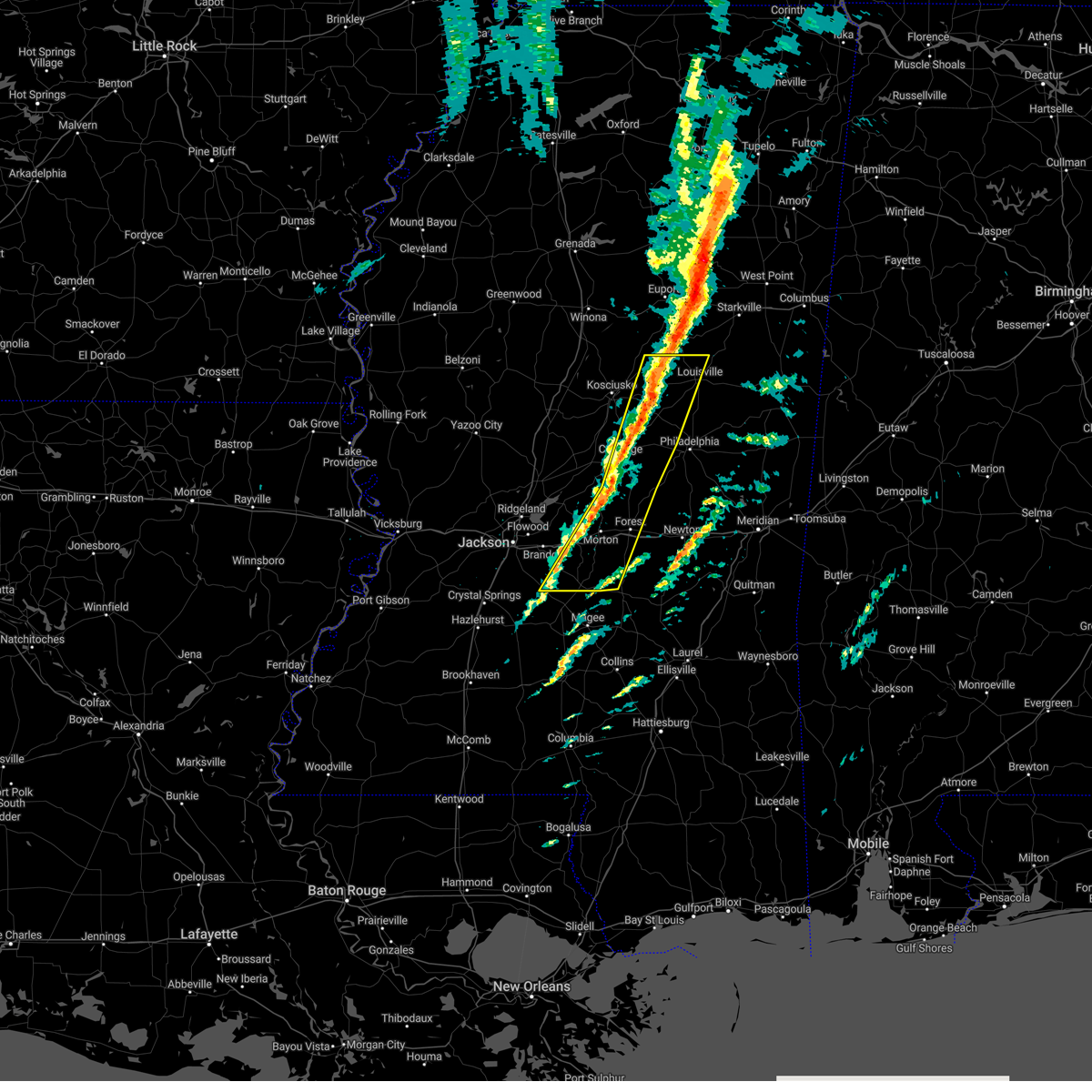 At 858 am cst, severe thunderstorms were located along a line extending from 8 miles west of mcmillan to tuscola to near pelahatchie, moving east at 50 mph (radar indicated). Hazards include 60 mph wind gusts. Expect damage to roofs, siding, and trees. locations impacted include, philadelphia, louisville, forest, carthage, morton, edinburg, harperville, pearl river, pelahatchie, mcmillan, homewood, renfroe, pulaski, piney woods, forkville, branch, white oak, smyrna, tuscola and cato. hail threat, radar indicated max hail size, <. 75 in wind threat, observed max wind gust, 60 mph. At 858 am cst, severe thunderstorms were located along a line extending from 8 miles west of mcmillan to tuscola to near pelahatchie, moving east at 50 mph (radar indicated). Hazards include 60 mph wind gusts. Expect damage to roofs, siding, and trees. locations impacted include, philadelphia, louisville, forest, carthage, morton, edinburg, harperville, pearl river, pelahatchie, mcmillan, homewood, renfroe, pulaski, piney woods, forkville, branch, white oak, smyrna, tuscola and cato. hail threat, radar indicated max hail size, <. 75 in wind threat, observed max wind gust, 60 mph.
|
| 3/3/2023 8:26 AM CST |
 At 825 am cst, severe thunderstorms were located along a line extending from near kosciusko to near goshen springs to near whites, moving northeast at 55 mph (radar indicated. at 823 am cst, wind gusts of 60 mph were reported at the jackson-evers international airport). Hazards include 60 mph wind gusts. expect damage to roofs, siding, and trees At 825 am cst, severe thunderstorms were located along a line extending from near kosciusko to near goshen springs to near whites, moving northeast at 55 mph (radar indicated. at 823 am cst, wind gusts of 60 mph were reported at the jackson-evers international airport). Hazards include 60 mph wind gusts. expect damage to roofs, siding, and trees
|
| 1/3/2023 9:24 PM CST |
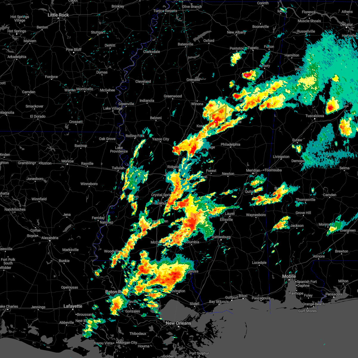 The severe thunderstorm warning for southwestern choctaw and northeastern attala counties will expire at 930 pm cst, the storm which prompted the warning has weakened below severe limits, and no longer poses an immediate threat to life or property. therefore, the warning will be allowed to expire. a severe thunderstorm watch remains in effect until midnight cst for central mississippi. The severe thunderstorm warning for southwestern choctaw and northeastern attala counties will expire at 930 pm cst, the storm which prompted the warning has weakened below severe limits, and no longer poses an immediate threat to life or property. therefore, the warning will be allowed to expire. a severe thunderstorm watch remains in effect until midnight cst for central mississippi.
|
| 1/3/2023 9:12 PM CST |
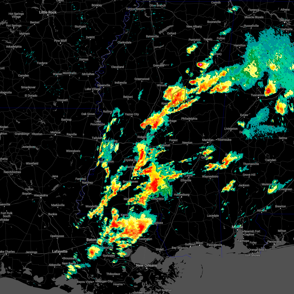 At 912 pm cst, a severe thunderstorm was located 13 miles southwest of chester, or 15 miles northeast of kosciusko, moving northeast at 35 mph (radar indicated). Hazards include 60 mph wind gusts and nickel size hail. Expect damage to roofs, siding, and trees. this severe storm will be near, chester around 935 pm cst. other locations impacted by this severe thunderstorm include mccool, ethel, french camp and weir. hail threat, radar indicated max hail size, 0. 88 in wind threat, radar indicated max wind gust, 60 mph. At 912 pm cst, a severe thunderstorm was located 13 miles southwest of chester, or 15 miles northeast of kosciusko, moving northeast at 35 mph (radar indicated). Hazards include 60 mph wind gusts and nickel size hail. Expect damage to roofs, siding, and trees. this severe storm will be near, chester around 935 pm cst. other locations impacted by this severe thunderstorm include mccool, ethel, french camp and weir. hail threat, radar indicated max hail size, 0. 88 in wind threat, radar indicated max wind gust, 60 mph.
|
| 1/3/2023 9:00 PM CST |
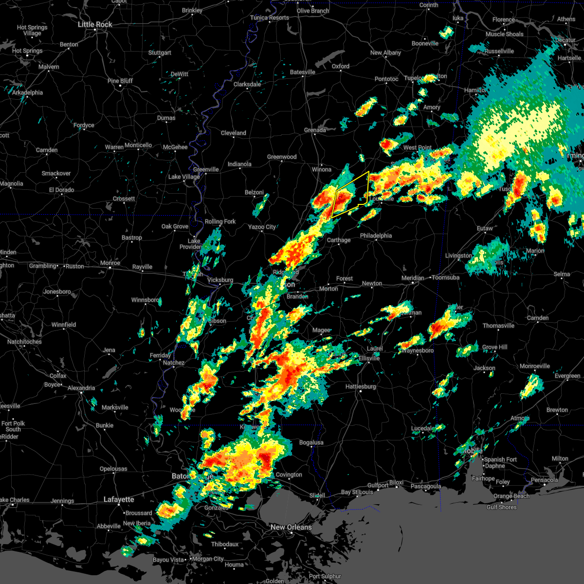 At 900 pm cst, a severe thunderstorm was located 10 miles northeast of kosciusko, moving northeast at 35 mph (radar indicated). Hazards include 60 mph wind gusts and nickel size hail. Expect damage to roofs, siding, and trees. this severe storm will be near, chester around 930 pm cst. other locations impacted by this severe thunderstorm include mccool, ethel, french camp and weir. hail threat, radar indicated max hail size, 0. 88 in wind threat, radar indicated max wind gust, 60 mph. At 900 pm cst, a severe thunderstorm was located 10 miles northeast of kosciusko, moving northeast at 35 mph (radar indicated). Hazards include 60 mph wind gusts and nickel size hail. Expect damage to roofs, siding, and trees. this severe storm will be near, chester around 930 pm cst. other locations impacted by this severe thunderstorm include mccool, ethel, french camp and weir. hail threat, radar indicated max hail size, 0. 88 in wind threat, radar indicated max wind gust, 60 mph.
|
| 1/3/2023 8:46 PM CST |
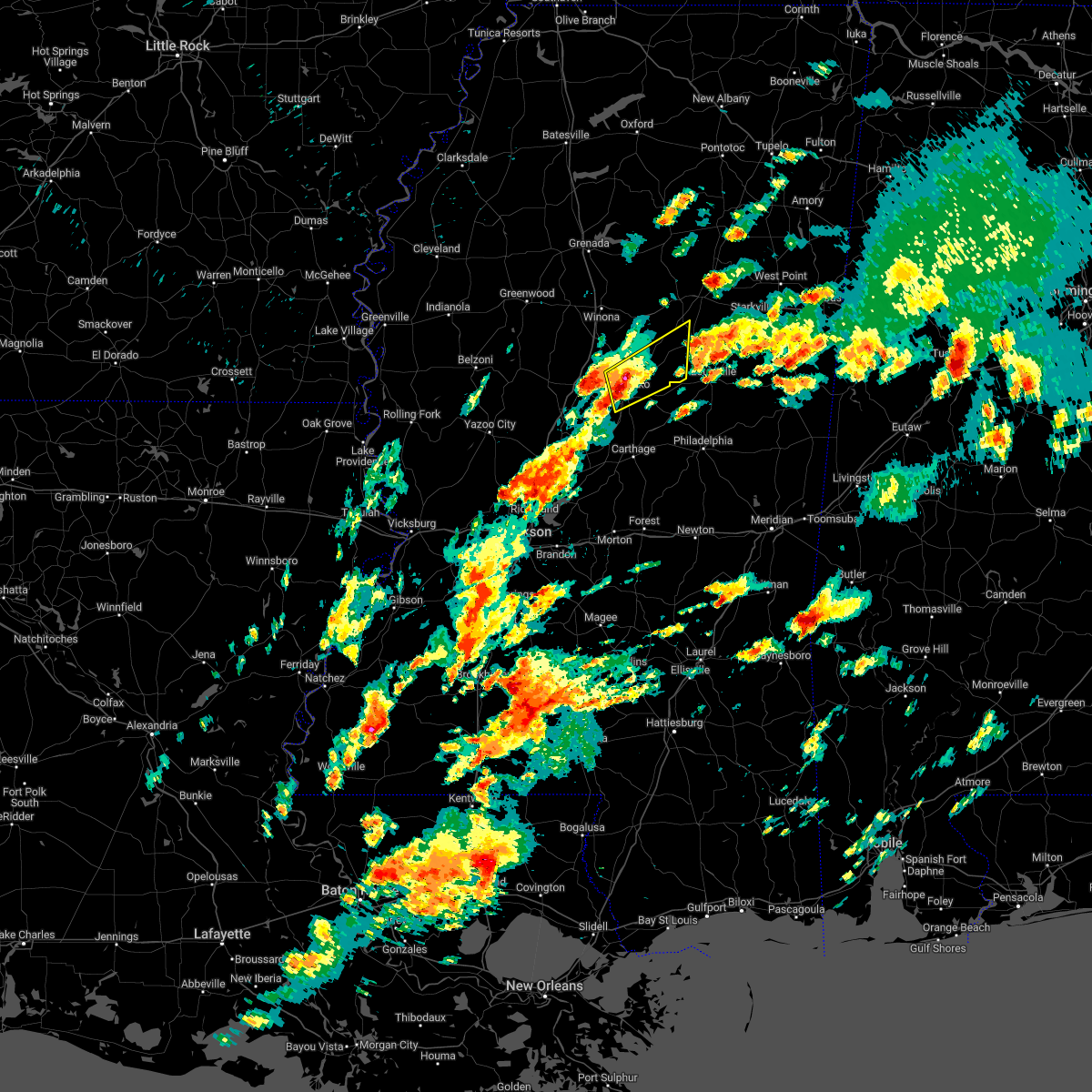 At 845 pm cst, a severe thunderstorm was located near kosciusko, moving northeast at 35 mph (radar indicated). Hazards include ping pong ball size hail and 60 mph wind gusts. People and animals outdoors will be injured. expect hail damage to roofs, siding, windows, and vehicles. expect wind damage to roofs, siding, and trees. this severe storm will be near, chester around 930 pm cst. other locations impacted by this severe thunderstorm include mccool, ethel, french camp and weir. hail threat, radar indicated max hail size, 1. 50 in wind threat, radar indicated max wind gust, 60 mph. At 845 pm cst, a severe thunderstorm was located near kosciusko, moving northeast at 35 mph (radar indicated). Hazards include ping pong ball size hail and 60 mph wind gusts. People and animals outdoors will be injured. expect hail damage to roofs, siding, windows, and vehicles. expect wind damage to roofs, siding, and trees. this severe storm will be near, chester around 930 pm cst. other locations impacted by this severe thunderstorm include mccool, ethel, french camp and weir. hail threat, radar indicated max hail size, 1. 50 in wind threat, radar indicated max wind gust, 60 mph.
|
| 1/3/2023 8:37 PM CST |
 At 836 pm cst, a severe thunderstorm was located near mcadams, or near kosciusko, moving northeast at 35 mph (radar indicated). Hazards include 60 mph wind gusts and half dollar size hail. Hail damage to vehicles is expected. expect wind damage to roofs, siding, and trees. this severe thunderstorm will be near, kosciusko and hesterville around 840 pm cst. chester around 930 pm cst. other locations impacted by this severe thunderstorm include mccool, ethel, french camp and weir. hail threat, radar indicated max hail size, 1. 25 in wind threat, radar indicated max wind gust, 60 mph. At 836 pm cst, a severe thunderstorm was located near mcadams, or near kosciusko, moving northeast at 35 mph (radar indicated). Hazards include 60 mph wind gusts and half dollar size hail. Hail damage to vehicles is expected. expect wind damage to roofs, siding, and trees. this severe thunderstorm will be near, kosciusko and hesterville around 840 pm cst. chester around 930 pm cst. other locations impacted by this severe thunderstorm include mccool, ethel, french camp and weir. hail threat, radar indicated max hail size, 1. 25 in wind threat, radar indicated max wind gust, 60 mph.
|
| 1/3/2023 6:41 PM CST |
 At 641 pm cst, a severe thunderstorm was located 8 miles southwest of ackerman, or 13 miles northwest of louisville, moving northeast at 40 mph (radar indicated). Hazards include 60 mph wind gusts and quarter size hail. Hail damage to vehicles is expected. expect wind damage to roofs, siding, and trees. this severe storm will be near, ackerman and chester around 655 pm cst. other locations impacted by this severe thunderstorm include mccool and weir. hail threat, radar indicated max hail size, 1. 00 in wind threat, radar indicated max wind gust, 60 mph. At 641 pm cst, a severe thunderstorm was located 8 miles southwest of ackerman, or 13 miles northwest of louisville, moving northeast at 40 mph (radar indicated). Hazards include 60 mph wind gusts and quarter size hail. Hail damage to vehicles is expected. expect wind damage to roofs, siding, and trees. this severe storm will be near, ackerman and chester around 655 pm cst. other locations impacted by this severe thunderstorm include mccool and weir. hail threat, radar indicated max hail size, 1. 00 in wind threat, radar indicated max wind gust, 60 mph.
|
| 1/3/2023 6:17 PM CST |
 At 617 pm cst, a severe thunderstorm was located near zama, or 10 miles east of kosciusko, moving northeast at 40 mph (radar indicated). Hazards include 60 mph wind gusts and half dollar size hail. Hail damage to vehicles is expected. expect wind damage to roofs, siding, and trees. this severe thunderstorm will be near, ackerman and chester around 655 pm cst. other locations impacted by this severe thunderstorm include mccool, weir and ethel. hail threat, radar indicated max hail size, 1. 25 in wind threat, radar indicated max wind gust, 60 mph. At 617 pm cst, a severe thunderstorm was located near zama, or 10 miles east of kosciusko, moving northeast at 40 mph (radar indicated). Hazards include 60 mph wind gusts and half dollar size hail. Hail damage to vehicles is expected. expect wind damage to roofs, siding, and trees. this severe thunderstorm will be near, ackerman and chester around 655 pm cst. other locations impacted by this severe thunderstorm include mccool, weir and ethel. hail threat, radar indicated max hail size, 1. 25 in wind threat, radar indicated max wind gust, 60 mph.
|
| 11/29/2022 6:25 PM CST |
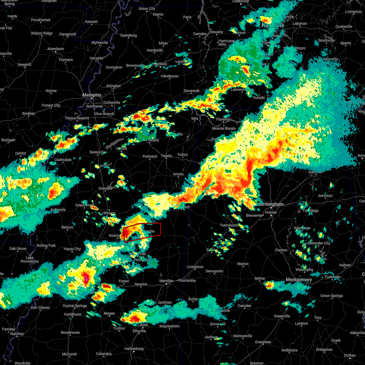 At 624 pm cst, a severe thunderstorm capable of producing a tornado was located 7 miles northeast of smyrna, or 9 miles east of kosciusko, moving east at 50 mph (radar indicated rotation). Hazards include tornado and half dollar size hail. Flying debris will be dangerous to those caught without shelter. mobile homes will be damaged or destroyed. damage to roofs, windows, and vehicles will occur. tree damage is likely. this dangerous storm will be near, mcmillan around 645 pm cst. louisville around 650 pm cst. millcreek around 655 pm cst. betheden around 700 pm cst. Other locations impacted by this tornadic thunderstorm include mccool and ethel. At 624 pm cst, a severe thunderstorm capable of producing a tornado was located 7 miles northeast of smyrna, or 9 miles east of kosciusko, moving east at 50 mph (radar indicated rotation). Hazards include tornado and half dollar size hail. Flying debris will be dangerous to those caught without shelter. mobile homes will be damaged or destroyed. damage to roofs, windows, and vehicles will occur. tree damage is likely. this dangerous storm will be near, mcmillan around 645 pm cst. louisville around 650 pm cst. millcreek around 655 pm cst. betheden around 700 pm cst. Other locations impacted by this tornadic thunderstorm include mccool and ethel.
|
| 11/29/2022 6:07 PM CST |
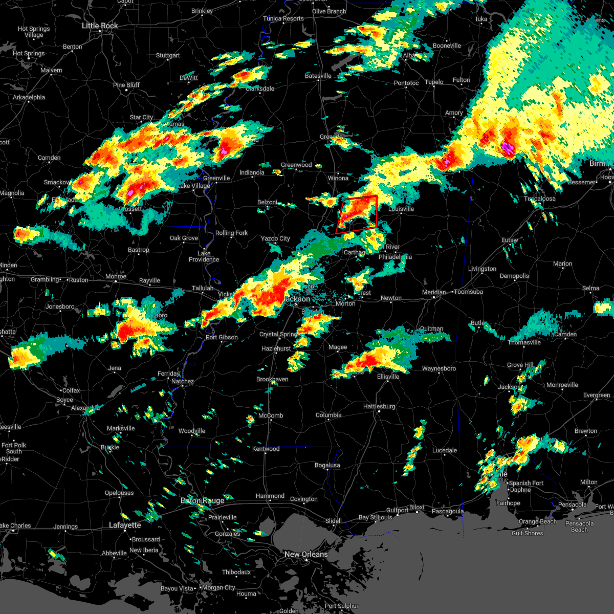 At 606 pm cst, a severe thunderstorm capable of producing a tornado was located near hesterville, or near kosciusko, moving east at 50 mph (radar indicated rotation). Hazards include tornado and two inch hail. Flying debris will be dangerous to those caught without shelter. mobile homes will be damaged or destroyed. damage to roofs, windows, and vehicles will occur. tree damage is likely. This tornadic thunderstorm will remain over mainly rural areas of attala county, including the following locations, mccool and ethel. At 606 pm cst, a severe thunderstorm capable of producing a tornado was located near hesterville, or near kosciusko, moving east at 50 mph (radar indicated rotation). Hazards include tornado and two inch hail. Flying debris will be dangerous to those caught without shelter. mobile homes will be damaged or destroyed. damage to roofs, windows, and vehicles will occur. tree damage is likely. This tornadic thunderstorm will remain over mainly rural areas of attala county, including the following locations, mccool and ethel.
|
| 11/29/2022 5:55 PM CST |
 At 554 pm cst, a severe thunderstorm capable of producing a tornado was located near durant, moving east at 50 mph (radar indicated rotation). Hazards include tornado and quarter size hail. Flying debris will be dangerous to those caught without shelter. mobile homes will be damaged or destroyed. damage to roofs, windows, and vehicles will occur. tree damage is likely. this dangerous storm will be near, mcadams and possumneck around 600 pm cst. kosciusko and hesterville around 605 pm cst. Other locations impacted by this tornadic thunderstorm include mccool, ethel and sallis. At 554 pm cst, a severe thunderstorm capable of producing a tornado was located near durant, moving east at 50 mph (radar indicated rotation). Hazards include tornado and quarter size hail. Flying debris will be dangerous to those caught without shelter. mobile homes will be damaged or destroyed. damage to roofs, windows, and vehicles will occur. tree damage is likely. this dangerous storm will be near, mcadams and possumneck around 600 pm cst. kosciusko and hesterville around 605 pm cst. Other locations impacted by this tornadic thunderstorm include mccool, ethel and sallis.
|
| 11/29/2022 5:40 PM CST |
 At 540 pm cst, a severe thunderstorm capable of producing a tornado was located over franklin, or 9 miles southwest of durant, moving east at 50 mph (radar indicated rotation). Hazards include tornado and quarter size hail. Flying debris will be dangerous to those caught without shelter. mobile homes will be damaged or destroyed. damage to roofs, windows, and vehicles will occur. tree damage is likely. this dangerous storm will be near, durant around 550 pm cst. possumneck and mcadams around 600 pm cst. kosciusko and hesterville around 605 pm cst. Other locations impacted by this tornadic thunderstorm include mccool, ethel, sallis and west. At 540 pm cst, a severe thunderstorm capable of producing a tornado was located over franklin, or 9 miles southwest of durant, moving east at 50 mph (radar indicated rotation). Hazards include tornado and quarter size hail. Flying debris will be dangerous to those caught without shelter. mobile homes will be damaged or destroyed. damage to roofs, windows, and vehicles will occur. tree damage is likely. this dangerous storm will be near, durant around 550 pm cst. possumneck and mcadams around 600 pm cst. kosciusko and hesterville around 605 pm cst. Other locations impacted by this tornadic thunderstorm include mccool, ethel, sallis and west.
|
| 11/29/2022 5:28 PM CST |
 At 528 pm cst, a severe thunderstorm capable of producing a tornado was located near ebenezer, or 13 miles southeast of thornton, moving east at 50 mph (radar indicated rotation). Hazards include tornado and quarter size hail. Flying debris will be dangerous to those caught without shelter. mobile homes will be damaged or destroyed. damage to roofs, windows, and vehicles will occur. tree damage is likely. this dangerous storm will be near, franklin and pickens around 540 pm cst. goodman around 545 pm cst. durant around 550 pm cst. possumneck and mcadams around 600 pm cst. kosciusko and hesterville around 605 pm cst. Other locations impacted by this tornadic thunderstorm include mccool, ethel, sallis and west. At 528 pm cst, a severe thunderstorm capable of producing a tornado was located near ebenezer, or 13 miles southeast of thornton, moving east at 50 mph (radar indicated rotation). Hazards include tornado and quarter size hail. Flying debris will be dangerous to those caught without shelter. mobile homes will be damaged or destroyed. damage to roofs, windows, and vehicles will occur. tree damage is likely. this dangerous storm will be near, franklin and pickens around 540 pm cst. goodman around 545 pm cst. durant around 550 pm cst. possumneck and mcadams around 600 pm cst. kosciusko and hesterville around 605 pm cst. Other locations impacted by this tornadic thunderstorm include mccool, ethel, sallis and west.
|
| 7/14/2022 7:05 PM CDT |
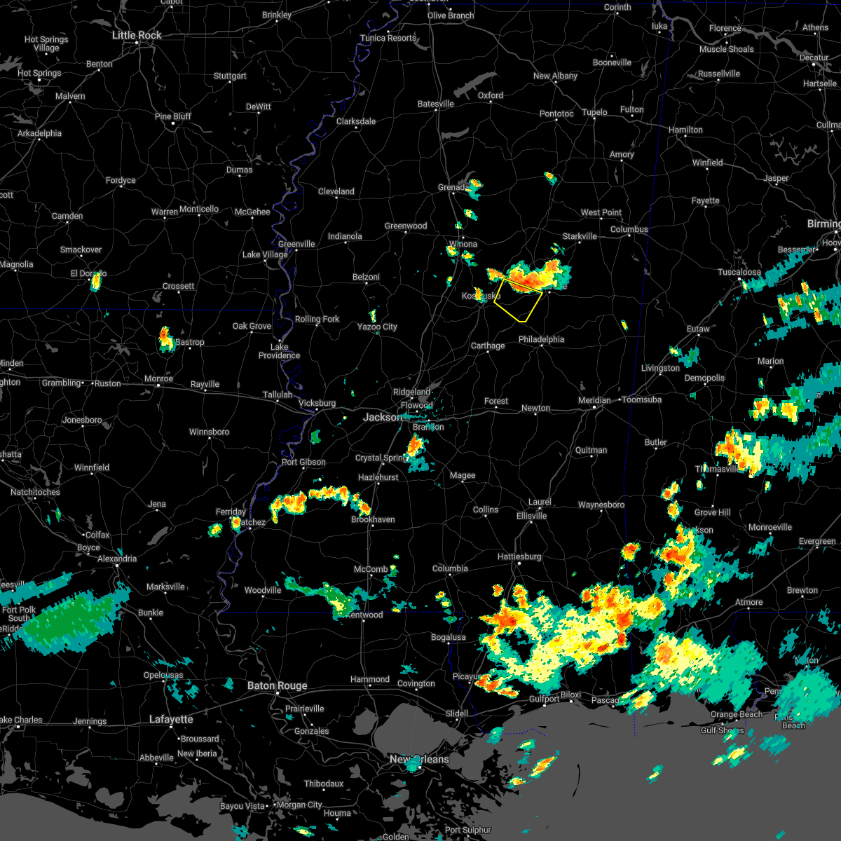 At 705 pm cdt, a severe thunderstorm was located 10 miles southwest of mcmillan, or 10 miles southwest of louisville, moving south at 15 mph (radar indicated). Hazards include 60 mph wind gusts and quarter size hail. Hail damage to vehicles is expected. expect wind damage to roofs, siding, and trees. this severe thunderstorm will remain over mainly rural areas of south central choctaw, east central attala and southwestern winston counties. hail threat, radar indicated max hail size, 1. 00 in wind threat, radar indicated max wind gust, 60 mph. At 705 pm cdt, a severe thunderstorm was located 10 miles southwest of mcmillan, or 10 miles southwest of louisville, moving south at 15 mph (radar indicated). Hazards include 60 mph wind gusts and quarter size hail. Hail damage to vehicles is expected. expect wind damage to roofs, siding, and trees. this severe thunderstorm will remain over mainly rural areas of south central choctaw, east central attala and southwestern winston counties. hail threat, radar indicated max hail size, 1. 00 in wind threat, radar indicated max wind gust, 60 mph.
|
| 7/14/2022 6:48 PM CDT |
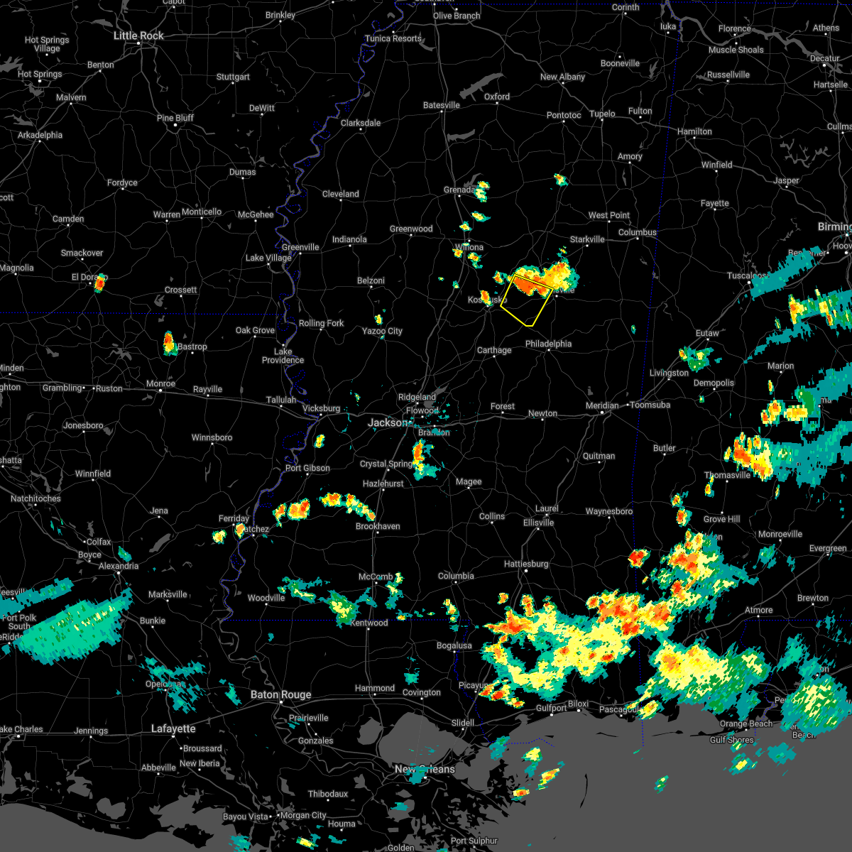 At 647 pm cdt, a severe thunderstorm was located near mcmillan, or 8 miles west of louisville, moving south at 15 mph (radar indicated). Hazards include 60 mph wind gusts and quarter size hail. Hail damage to vehicles is expected. expect wind damage to roofs, siding, and trees. this severe thunderstorm will remain over mainly rural areas of south central choctaw, northeastern attala and southwestern winston counties, including the following locations, mccool. hail threat, radar indicated max hail size, 1. 00 in wind threat, radar indicated max wind gust, 60 mph. At 647 pm cdt, a severe thunderstorm was located near mcmillan, or 8 miles west of louisville, moving south at 15 mph (radar indicated). Hazards include 60 mph wind gusts and quarter size hail. Hail damage to vehicles is expected. expect wind damage to roofs, siding, and trees. this severe thunderstorm will remain over mainly rural areas of south central choctaw, northeastern attala and southwestern winston counties, including the following locations, mccool. hail threat, radar indicated max hail size, 1. 00 in wind threat, radar indicated max wind gust, 60 mph.
|
| 7/13/2022 2:09 PM CDT |
 At 209 pm cdt, a severe thunderstorm was located 12 miles southeast of poplar creek, or 14 miles northeast of kosciusko, moving south at 10 mph (radar indicated). Hazards include 60 mph wind gusts and nickel size hail. Expect damage to roofs, siding, and trees. this severe thunderstorm will remain over mainly rural areas of northeastern attala county, including the following locations, mccool and ethel. hail threat, radar indicated max hail size, 0. 88 in wind threat, radar indicated max wind gust, 60 mph. At 209 pm cdt, a severe thunderstorm was located 12 miles southeast of poplar creek, or 14 miles northeast of kosciusko, moving south at 10 mph (radar indicated). Hazards include 60 mph wind gusts and nickel size hail. Expect damage to roofs, siding, and trees. this severe thunderstorm will remain over mainly rural areas of northeastern attala county, including the following locations, mccool and ethel. hail threat, radar indicated max hail size, 0. 88 in wind threat, radar indicated max wind gust, 60 mph.
|
| 7/9/2022 7:19 PM CDT |
 At 718 pm cdt, a severe thunderstorm was located near durant, moving southeast at 30 mph (radar indicated). Hazards include 60 mph wind gusts. Expect damage to roofs, siding, and trees. this severe thunderstorm will be near, possumneck around 725 pm cdt. hesterville around 735 pm cdt. mcadams around 740 pm cdt. kosciusko around 750 pm cdt. smyrna around 805 pm cdt. zama and renfroe around 815 pm cdt. other locations impacted by this severe thunderstorm include mccool, ethel, sallis, redwater and west. hail threat, radar indicated max hail size, <. 75 in wind threat, radar indicated max wind gust, 60 mph. At 718 pm cdt, a severe thunderstorm was located near durant, moving southeast at 30 mph (radar indicated). Hazards include 60 mph wind gusts. Expect damage to roofs, siding, and trees. this severe thunderstorm will be near, possumneck around 725 pm cdt. hesterville around 735 pm cdt. mcadams around 740 pm cdt. kosciusko around 750 pm cdt. smyrna around 805 pm cdt. zama and renfroe around 815 pm cdt. other locations impacted by this severe thunderstorm include mccool, ethel, sallis, redwater and west. hail threat, radar indicated max hail size, <. 75 in wind threat, radar indicated max wind gust, 60 mph.
|
| 7/9/2022 6:52 PM CDT | Two trees were blown down along highway 12 east near the choctaw and attala counties line... in the mccool are in attala county MS, 2.3 miles E of McCool, MS |
| 3/30/2022 5:43 PM CDT |
 At 543 pm cdt, severe thunderstorms were located along a line extending from 9 miles southeast of poplar creek to near renfroe, moving northeast at 50 mph (radar indicated). Hazards include 60 mph wind gusts. Expect damage to roofs, siding, and trees. these severe storms will be near, ackerman around 600 pm cdt. mcmillan around 615 pm cdt. Other locations impacted by these severe thunderstorms include mccool, weir and ethel. At 543 pm cdt, severe thunderstorms were located along a line extending from 9 miles southeast of poplar creek to near renfroe, moving northeast at 50 mph (radar indicated). Hazards include 60 mph wind gusts. Expect damage to roofs, siding, and trees. these severe storms will be near, ackerman around 600 pm cdt. mcmillan around 615 pm cdt. Other locations impacted by these severe thunderstorms include mccool, weir and ethel.
|
| 3/30/2022 5:38 PM CDT |
 At 538 pm cdt, a confirmed tornado was located over smyrna, or 8 miles southeast of kosciusko, moving northeast at 60 mph (radar confirmed tornado). Hazards include damaging tornado. Flying debris will be dangerous to those caught without shelter. mobile homes will be damaged or destroyed. damage to roofs, windows, and vehicles will occur. tree damage is likely. This tornadic thunderstorm will remain over mainly rural areas of eastern attala county, including the following locations, mccool and ethel. At 538 pm cdt, a confirmed tornado was located over smyrna, or 8 miles southeast of kosciusko, moving northeast at 60 mph (radar confirmed tornado). Hazards include damaging tornado. Flying debris will be dangerous to those caught without shelter. mobile homes will be damaged or destroyed. damage to roofs, windows, and vehicles will occur. tree damage is likely. This tornadic thunderstorm will remain over mainly rural areas of eastern attala county, including the following locations, mccool and ethel.
|
| 3/30/2022 5:35 PM CDT |
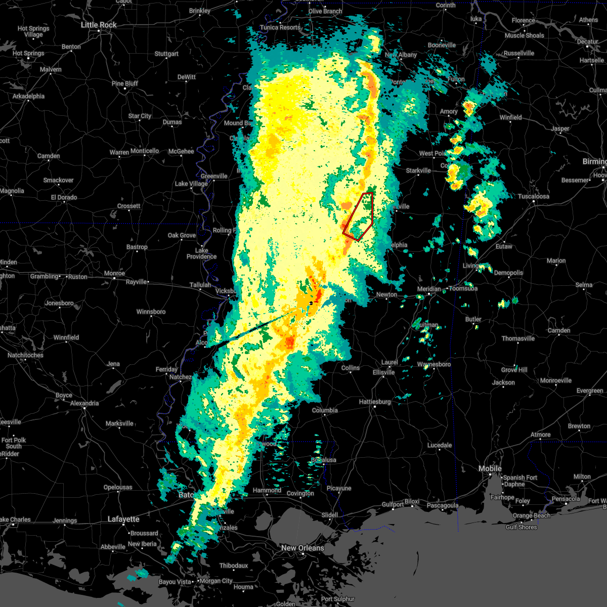 At 535 pm cdt, a confirmed tornado was located over singleton, or 9 miles southeast of kosciusko, moving northeast at 65 mph (radar confirmed tornado). Hazards include damaging tornado. Flying debris will be dangerous to those caught without shelter. mobile homes will be damaged or destroyed. damage to roofs, windows, and vehicles will occur. tree damage is likely. this tornado will be near, zama around 545 pm cdt. Other locations impacted by this tornadic thunderstorm include mccool and ethel. At 535 pm cdt, a confirmed tornado was located over singleton, or 9 miles southeast of kosciusko, moving northeast at 65 mph (radar confirmed tornado). Hazards include damaging tornado. Flying debris will be dangerous to those caught without shelter. mobile homes will be damaged or destroyed. damage to roofs, windows, and vehicles will occur. tree damage is likely. this tornado will be near, zama around 545 pm cdt. Other locations impacted by this tornadic thunderstorm include mccool and ethel.
|
| 3/30/2022 5:32 PM CDT |
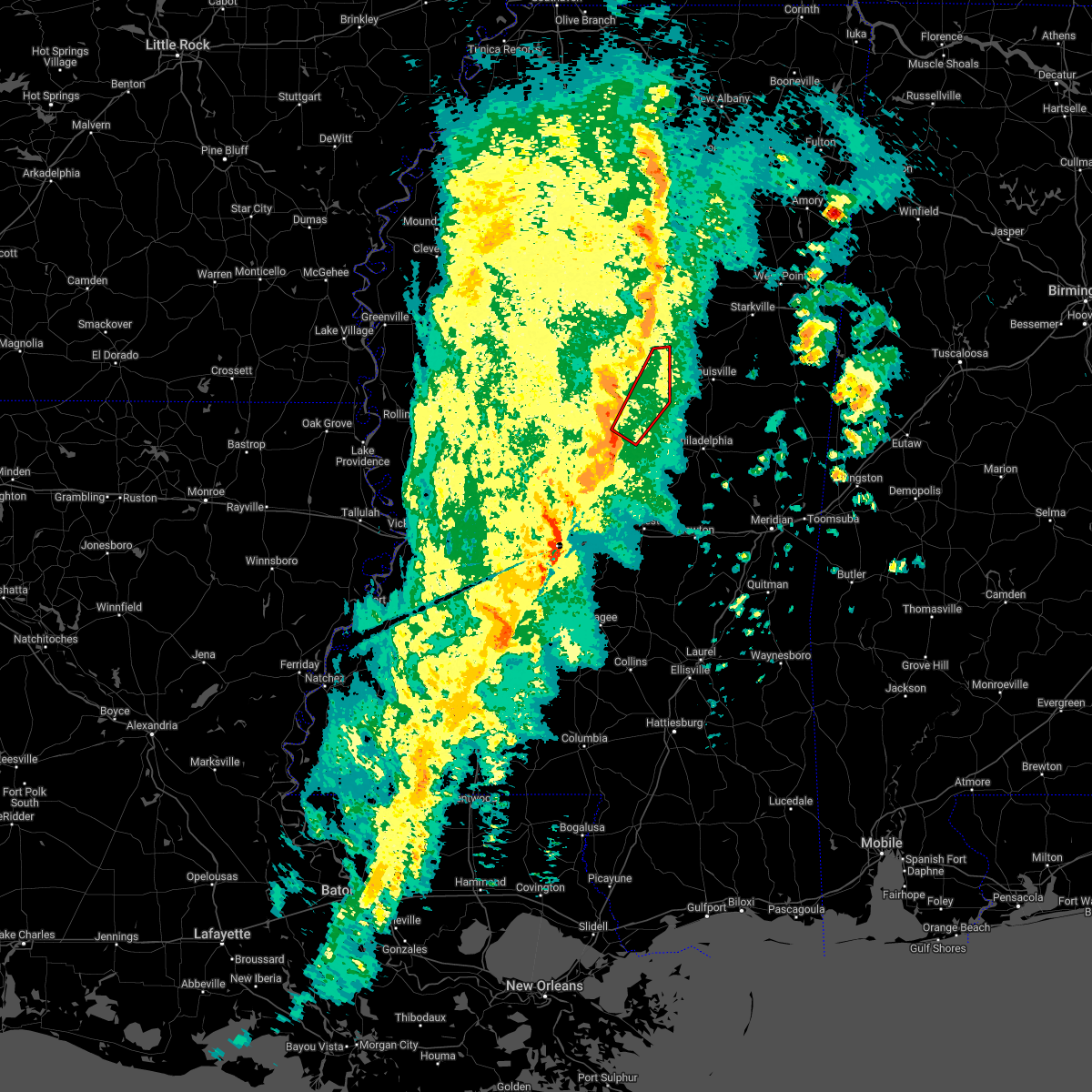 At 532 pm cdt, a severe thunderstorm capable of producing a tornado was located over singleton, or 10 miles south of kosciusko, moving northeast at 60 mph (radar indicated rotation). Hazards include tornado. Flying debris will be dangerous to those caught without shelter. mobile homes will be damaged or destroyed. damage to roofs, windows, and vehicles will occur. tree damage is likely. this dangerous storm will be near, smyrna and zama around 540 pm cdt. Other locations impacted by this tornadic thunderstorm include mccool and ethel. At 532 pm cdt, a severe thunderstorm capable of producing a tornado was located over singleton, or 10 miles south of kosciusko, moving northeast at 60 mph (radar indicated rotation). Hazards include tornado. Flying debris will be dangerous to those caught without shelter. mobile homes will be damaged or destroyed. damage to roofs, windows, and vehicles will occur. tree damage is likely. this dangerous storm will be near, smyrna and zama around 540 pm cdt. Other locations impacted by this tornadic thunderstorm include mccool and ethel.
|
| 3/30/2022 5:23 PM CDT |
 At 523 pm cdt, severe thunderstorms were located along a line extending from near hesterville to 6 miles west of carthage, moving northeast at 50 mph (radar indicated). Hazards include 60 mph wind gusts. Expect damage to roofs, siding, and trees. severe thunderstorms will be near, renfroe around 540 pm cdt. smyrna around 545 pm cdt. zama around 550 pm cdt. ackerman around 600 pm cdt. mcmillan around 615 pm cdt. Other locations impacted by these severe thunderstorms include mccool, weir and ethel. At 523 pm cdt, severe thunderstorms were located along a line extending from near hesterville to 6 miles west of carthage, moving northeast at 50 mph (radar indicated). Hazards include 60 mph wind gusts. Expect damage to roofs, siding, and trees. severe thunderstorms will be near, renfroe around 540 pm cdt. smyrna around 545 pm cdt. zama around 550 pm cdt. ackerman around 600 pm cdt. mcmillan around 615 pm cdt. Other locations impacted by these severe thunderstorms include mccool, weir and ethel.
|
| 3/22/2022 1:45 PM CDT |
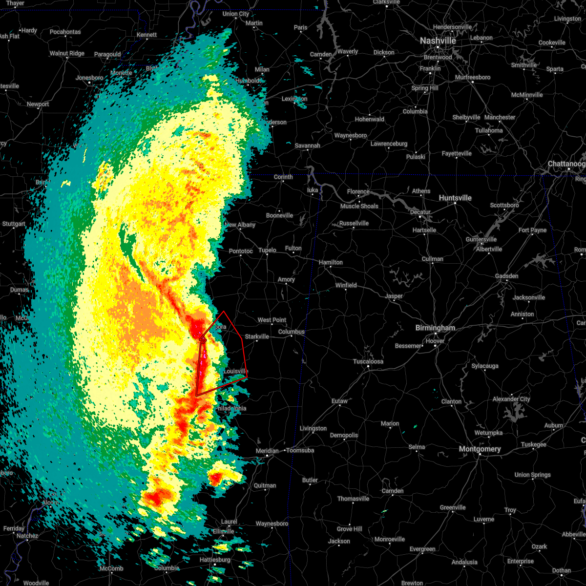 At 145 pm cdt, severe thunderstorms capable of producing tornadoes were located along a line extending from 7 miles southeast of lodi to 8 miles west of chester to near zama, moving northeast at 50 mph (radar indicated rotation). Hazards include tornado. Flying debris will be dangerous to those caught without shelter. mobile homes will be damaged or destroyed. damage to roofs, windows, and vehicles will occur. tree damage is likely. these dangerous storms will be near, chester around 155 pm cdt. eupora and reform around 200 pm cdt. sherwood around 205 pm cdt. louisville, maben, mathiston, clarkson and mcmillan around 210 pm cdt. millcreek around 215 pm cdt. Other locations impacted by these tornadic storms include mccool, walthall, ethel, french camp, sturgis and weir. At 145 pm cdt, severe thunderstorms capable of producing tornadoes were located along a line extending from 7 miles southeast of lodi to 8 miles west of chester to near zama, moving northeast at 50 mph (radar indicated rotation). Hazards include tornado. Flying debris will be dangerous to those caught without shelter. mobile homes will be damaged or destroyed. damage to roofs, windows, and vehicles will occur. tree damage is likely. these dangerous storms will be near, chester around 155 pm cdt. eupora and reform around 200 pm cdt. sherwood around 205 pm cdt. louisville, maben, mathiston, clarkson and mcmillan around 210 pm cdt. millcreek around 215 pm cdt. Other locations impacted by these tornadic storms include mccool, walthall, ethel, french camp, sturgis and weir.
|
| 3/22/2022 1:23 PM CDT |
 At 123 pm cdt, severe thunderstorms capable of producing a tornado were located along a line extending from 6 miles southeast of vaiden to hesterville to near thomastown, moving northeast at 50 mph (radar indicated rotation). Hazards include tornado. Flying debris will be dangerous to those caught without shelter. mobile homes will be damaged or destroyed. damage to roofs, windows, and vehicles will occur. tree damage is likely. these dangerous storms will be near, poplar creek around 135 pm cdt. smyrna around 140 pm cdt. zama around 145 pm cdt. ackerman and chester around 155 pm cdt. eupora and reform around 200 pm cdt. mathiston and sherwood around 205 pm cdt. louisville, maben, mcmillan and clarkson around 210 pm cdt. millcreek around 215 pm cdt. Other locations impacted by these tornadic storms include mccool, walthall, ethel, french camp, sturgis and weir. At 123 pm cdt, severe thunderstorms capable of producing a tornado were located along a line extending from 6 miles southeast of vaiden to hesterville to near thomastown, moving northeast at 50 mph (radar indicated rotation). Hazards include tornado. Flying debris will be dangerous to those caught without shelter. mobile homes will be damaged or destroyed. damage to roofs, windows, and vehicles will occur. tree damage is likely. these dangerous storms will be near, poplar creek around 135 pm cdt. smyrna around 140 pm cdt. zama around 145 pm cdt. ackerman and chester around 155 pm cdt. eupora and reform around 200 pm cdt. mathiston and sherwood around 205 pm cdt. louisville, maben, mcmillan and clarkson around 210 pm cdt. millcreek around 215 pm cdt. Other locations impacted by these tornadic storms include mccool, walthall, ethel, french camp, sturgis and weir.
|
| 2/17/2022 2:20 PM CST |
 At 220 pm cst, a severe thunderstorm was located 7 miles north of zama, or 14 miles east of kosciusko, moving northeast at 65 mph (radar indicated). Hazards include 60 mph wind gusts. Expect damage to roofs, siding, and trees. this severe thunderstorm will be near, louisville and mcmillan around 235 pm cst. millcreek around 240 pm cst. betheden around 245 pm cst. craig springs around 250 pm cst. other locations impacted by this severe thunderstorm include noxapater, mccool, ethel, french camp, sturgis and weir. hail threat, radar indicated max hail size, <. 75 in wind threat, radar indicated max wind gust, 60 mph. At 220 pm cst, a severe thunderstorm was located 7 miles north of zama, or 14 miles east of kosciusko, moving northeast at 65 mph (radar indicated). Hazards include 60 mph wind gusts. Expect damage to roofs, siding, and trees. this severe thunderstorm will be near, louisville and mcmillan around 235 pm cst. millcreek around 240 pm cst. betheden around 245 pm cst. craig springs around 250 pm cst. other locations impacted by this severe thunderstorm include noxapater, mccool, ethel, french camp, sturgis and weir. hail threat, radar indicated max hail size, <. 75 in wind threat, radar indicated max wind gust, 60 mph.
|
| 9/1/2021 3:52 PM CDT |
 At 352 pm cdt, a severe thunderstorm was located over center ridge, or near louisville, moving southeast at 50 mph (radar indicated). Hazards include 60 mph wind gusts and nickel size hail. Expect damage to roofs, siding, and trees. this severe thunderstorm will remain over mainly rural areas of southeastern choctaw, east central attala and central winston counties, including the following locations, mccool and weir. hail threat, radar indicated max hail size, 0. 88 in wind threat, radar indicated max wind gust, 60 mph. At 352 pm cdt, a severe thunderstorm was located over center ridge, or near louisville, moving southeast at 50 mph (radar indicated). Hazards include 60 mph wind gusts and nickel size hail. Expect damage to roofs, siding, and trees. this severe thunderstorm will remain over mainly rural areas of southeastern choctaw, east central attala and central winston counties, including the following locations, mccool and weir. hail threat, radar indicated max hail size, 0. 88 in wind threat, radar indicated max wind gust, 60 mph.
|
| 9/1/2021 3:30 PM CDT |
 At 330 pm cdt, a severe thunderstorm was located 9 miles southwest of ackerman, or 16 miles northwest of louisville, moving southeast at 50 mph (radar indicated). Hazards include 60 mph wind gusts and nickel size hail. Expect damage to roofs, siding, and trees. this severe thunderstorm will be near, louisville and mcmillan around 345 pm cdt. other locations impacted by this severe thunderstorm include french camp, mccool and weir. hail threat, radar indicated max hail size, 0. 88 in wind threat, radar indicated max wind gust, 60 mph. At 330 pm cdt, a severe thunderstorm was located 9 miles southwest of ackerman, or 16 miles northwest of louisville, moving southeast at 50 mph (radar indicated). Hazards include 60 mph wind gusts and nickel size hail. Expect damage to roofs, siding, and trees. this severe thunderstorm will be near, louisville and mcmillan around 345 pm cdt. other locations impacted by this severe thunderstorm include french camp, mccool and weir. hail threat, radar indicated max hail size, 0. 88 in wind threat, radar indicated max wind gust, 60 mph.
|
| 6/13/2021 4:28 PM CDT |
 At 428 pm cdt, a severe thunderstorm was located 7 miles southeast of poplar creek, or 17 miles northeast of kosciusko, moving southwest at 40 mph (radar indicated). Hazards include 60 mph wind gusts and quarter size hail. Hail damage to vehicles is expected. expect wind damage to roofs, siding, and trees. this severe thunderstorm will be near, hesterville around 450 pm cdt. kosciusko around 455 pm cdt. possumneck around 500 pm cdt. mcadams around 505 pm cdt. newport around 515 pm cdt. Other locations impacted by this severe thunderstorm include mccool, ethel and sallis. At 428 pm cdt, a severe thunderstorm was located 7 miles southeast of poplar creek, or 17 miles northeast of kosciusko, moving southwest at 40 mph (radar indicated). Hazards include 60 mph wind gusts and quarter size hail. Hail damage to vehicles is expected. expect wind damage to roofs, siding, and trees. this severe thunderstorm will be near, hesterville around 450 pm cdt. kosciusko around 455 pm cdt. possumneck around 500 pm cdt. mcadams around 505 pm cdt. newport around 515 pm cdt. Other locations impacted by this severe thunderstorm include mccool, ethel and sallis.
|
| 5/4/2021 2:58 PM CDT |
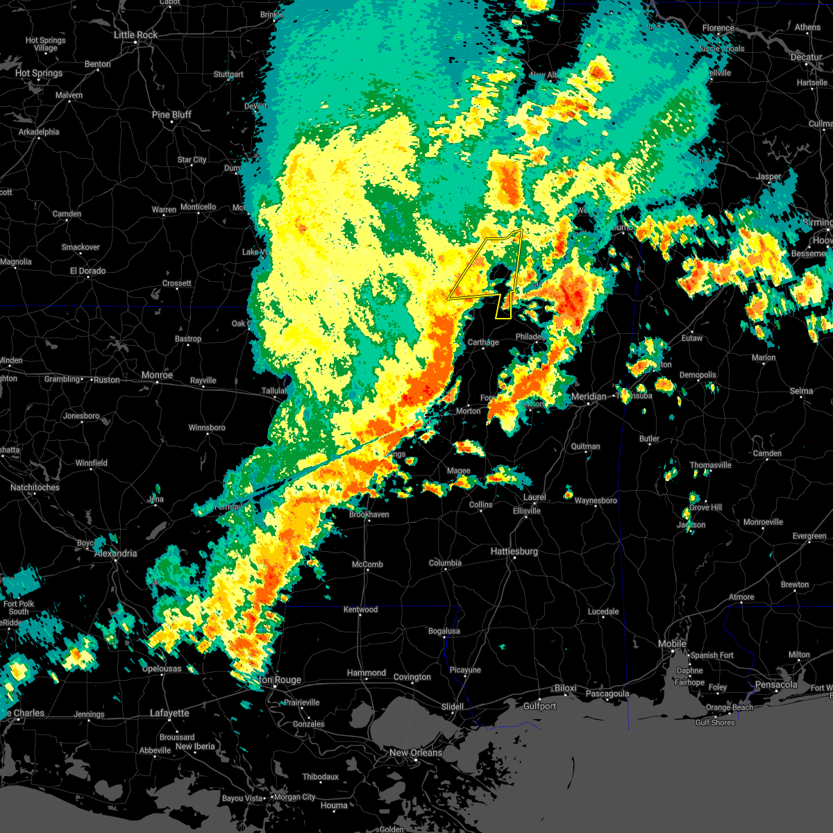 At 258 pm cdt, severe thunderstorms were located along a line extending from near eupora to 8 miles east of hesterville, moving east at 65 mph (radar indicated). Hazards include 60 mph wind gusts. Expect damage to roofs, siding, and trees. locations impacted include, zama, hesterville, possumneck, poplar creek, weir, ethel, french camp and mccool. A tornado watch remains in effect until 400 pm cdt for central and north central mississippi. At 258 pm cdt, severe thunderstorms were located along a line extending from near eupora to 8 miles east of hesterville, moving east at 65 mph (radar indicated). Hazards include 60 mph wind gusts. Expect damage to roofs, siding, and trees. locations impacted include, zama, hesterville, possumneck, poplar creek, weir, ethel, french camp and mccool. A tornado watch remains in effect until 400 pm cdt for central and north central mississippi.
|
| 5/4/2021 2:45 PM CDT |
 At 245 pm cdt, severe thunderstorms were located along a line extending from near kilmichael to possumneck, moving east at 65 mph (radar indicated). Hazards include 60 mph wind gusts. Expect damage to roofs, siding, and trees. these severe thunderstorms will remain over mainly rural areas of western choctaw, east central holmes, southeastern carroll, attala and southern montgomery counties, including the following locations, mccool, ethel, french camp, west and weir. A tornado watch remains in effect until 400 pm cdt for central and north central mississippi. At 245 pm cdt, severe thunderstorms were located along a line extending from near kilmichael to possumneck, moving east at 65 mph (radar indicated). Hazards include 60 mph wind gusts. Expect damage to roofs, siding, and trees. these severe thunderstorms will remain over mainly rural areas of western choctaw, east central holmes, southeastern carroll, attala and southern montgomery counties, including the following locations, mccool, ethel, french camp, west and weir. A tornado watch remains in effect until 400 pm cdt for central and north central mississippi.
|
| 5/4/2021 2:12 PM CDT |
 At 212 pm cdt, severe thunderstorms were located along a line extending from near seven pines to thornton, moving east at 65 mph (radar indicated). Hazards include 70 mph wind gusts and nickel size hail. Expect considerable tree damage. damage is likely to mobile homes, roofs, and outbuildings. severe thunderstorms will be near, black hawk around 220 pm cdt. franklin and vaiden around 230 pm cdt. bowling green around 235 pm cdt. durant, kilmichael and poplar creek around 240 pm cdt. possumneck around 245 pm cdt. hesterville around 250 pm cdt. other locations impacted by these severe thunderstorms include mccool, ethel, french camp, west and weir. A tornado watch remains in effect until 400 pm cdt for central and north central mississippi. At 212 pm cdt, severe thunderstorms were located along a line extending from near seven pines to thornton, moving east at 65 mph (radar indicated). Hazards include 70 mph wind gusts and nickel size hail. Expect considerable tree damage. damage is likely to mobile homes, roofs, and outbuildings. severe thunderstorms will be near, black hawk around 220 pm cdt. franklin and vaiden around 230 pm cdt. bowling green around 235 pm cdt. durant, kilmichael and poplar creek around 240 pm cdt. possumneck around 245 pm cdt. hesterville around 250 pm cdt. other locations impacted by these severe thunderstorms include mccool, ethel, french camp, west and weir. A tornado watch remains in effect until 400 pm cdt for central and north central mississippi.
|
| 5/2/2021 7:49 PM CDT |
 At 749 pm cdt, a confirmed tornado was located over hesterville, or 10 miles northwest of kosciusko, moving northeast at 30 mph (radar confirmed tornado). Hazards include damaging tornado. Flying debris will be dangerous to those caught without shelter. mobile homes will be damaged or destroyed. damage to roofs, windows, and vehicles will occur. tree damage is likely. this tornado will be near, poplar creek around 810 pm cdt. Other locations impacted by this tornadic thunderstorm include french camp and weir. At 749 pm cdt, a confirmed tornado was located over hesterville, or 10 miles northwest of kosciusko, moving northeast at 30 mph (radar confirmed tornado). Hazards include damaging tornado. Flying debris will be dangerous to those caught without shelter. mobile homes will be damaged or destroyed. damage to roofs, windows, and vehicles will occur. tree damage is likely. this tornado will be near, poplar creek around 810 pm cdt. Other locations impacted by this tornadic thunderstorm include french camp and weir.
|
| 5/2/2021 7:41 PM CDT |
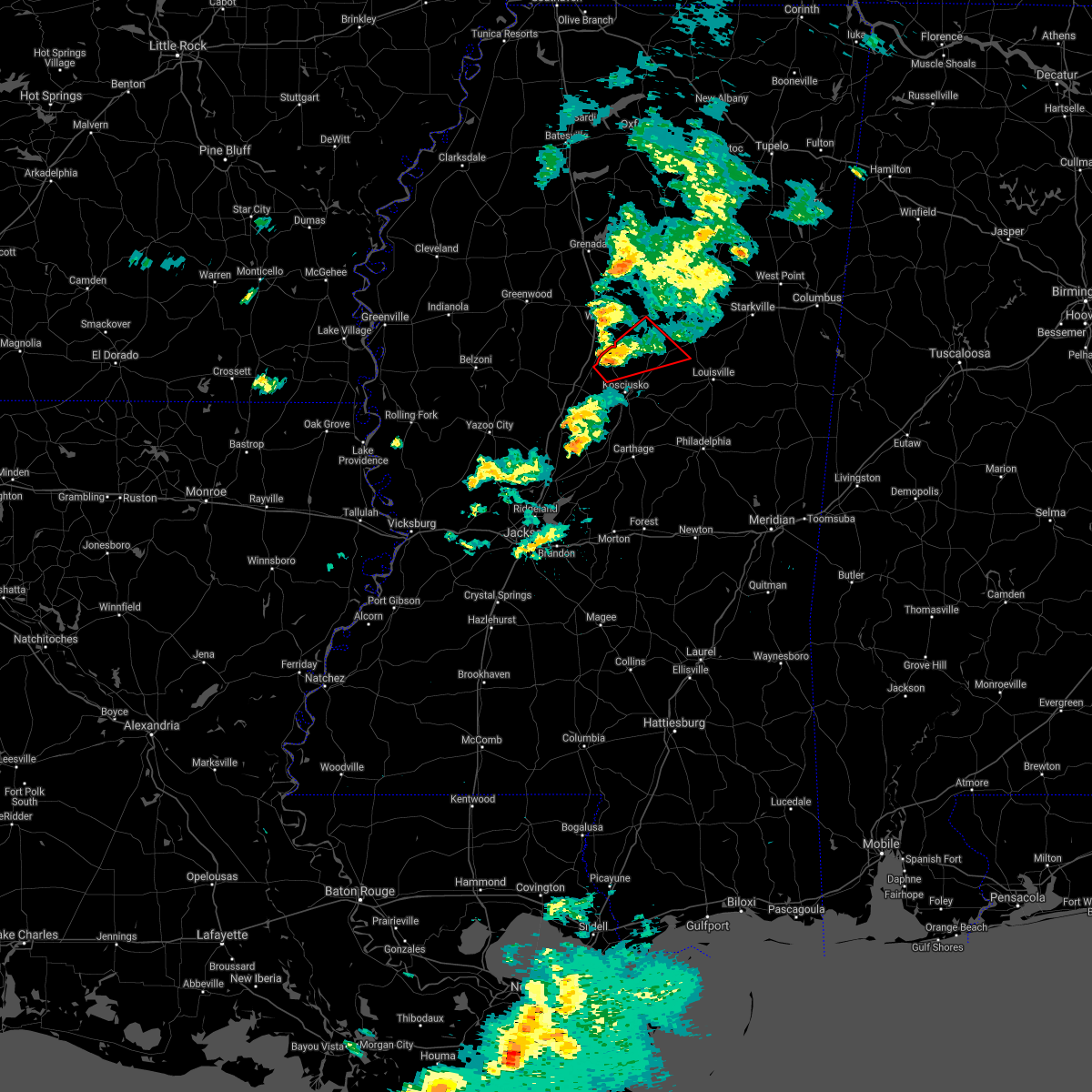 At 741 pm cdt, a severe thunderstorm capable of producing a tornado was located over possumneck, or 9 miles northeast of durant, moving northeast at 30 mph (radar indicated rotation). Hazards include tornado. Flying debris will be dangerous to those caught without shelter. mobile homes will be damaged or destroyed. damage to roofs, windows, and vehicles will occur. tree damage is likely. this dangerous storm will be near, hesterville around 745 pm cdt. poplar creek around 810 pm cdt. Other locations impacted by this tornadic thunderstorm include french camp, mccool and weir. At 741 pm cdt, a severe thunderstorm capable of producing a tornado was located over possumneck, or 9 miles northeast of durant, moving northeast at 30 mph (radar indicated rotation). Hazards include tornado. Flying debris will be dangerous to those caught without shelter. mobile homes will be damaged or destroyed. damage to roofs, windows, and vehicles will occur. tree damage is likely. this dangerous storm will be near, hesterville around 745 pm cdt. poplar creek around 810 pm cdt. Other locations impacted by this tornadic thunderstorm include french camp, mccool and weir.
|
| 5/2/2021 7:37 PM CDT |
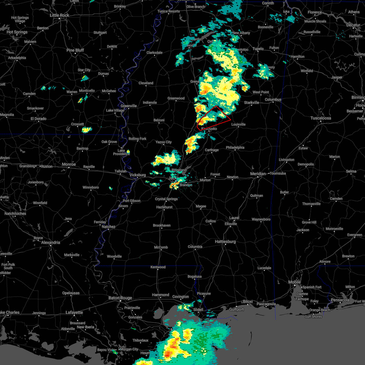 At 736 pm cdt, a confirmed tornado was located over possumneck, or 7 miles northeast of durant, moving northeast at 30 mph (radar confirmed tornado). Hazards include damaging tornado. Flying debris will be dangerous to those caught without shelter. mobile homes will be damaged or destroyed. damage to roofs, windows, and vehicles will occur. tree damage is likely. this tornadic storm will be near, hesterville around 745 pm cdt. poplar creek around 810 pm cdt. Other locations impacted by this tornadic thunderstorm include french camp, mccool and weir. At 736 pm cdt, a confirmed tornado was located over possumneck, or 7 miles northeast of durant, moving northeast at 30 mph (radar confirmed tornado). Hazards include damaging tornado. Flying debris will be dangerous to those caught without shelter. mobile homes will be damaged or destroyed. damage to roofs, windows, and vehicles will occur. tree damage is likely. this tornadic storm will be near, hesterville around 745 pm cdt. poplar creek around 810 pm cdt. Other locations impacted by this tornadic thunderstorm include french camp, mccool and weir.
|
| 4/9/2021 8:53 PM CDT | Multiple trees dow in winston county MS, 8.3 miles NNW of McCool, MS |
| 4/9/2021 8:38 PM CDT |
 At 837 pm cdt, a severe thunderstorm was located 7 miles north of zama, or 14 miles east of kosciusko, moving northeast at 15 mph (radar indicated). Hazards include golf ball size hail and 60 mph wind gusts. People and animals outdoors will be injured. expect hail damage to roofs, siding, windows, and vehicles. expect wind damage to roofs, siding, and trees. this severe storm will be near, ackerman around 1005 pm cdt. Other locations impacted by this severe thunderstorm include mccool, ethel, french camp and weir. At 837 pm cdt, a severe thunderstorm was located 7 miles north of zama, or 14 miles east of kosciusko, moving northeast at 15 mph (radar indicated). Hazards include golf ball size hail and 60 mph wind gusts. People and animals outdoors will be injured. expect hail damage to roofs, siding, windows, and vehicles. expect wind damage to roofs, siding, and trees. this severe storm will be near, ackerman around 1005 pm cdt. Other locations impacted by this severe thunderstorm include mccool, ethel, french camp and weir.
|
| 4/9/2021 8:07 PM CDT |
 At 806 pm cdt, a severe thunderstorm was located near poplar creek, or 15 miles southeast of winona, moving east at 35 mph (radar indicated). Hazards include golf ball size hail and 60 mph wind gusts. People and animals outdoors will be injured. expect hail damage to roofs, siding, windows, and vehicles. expect wind damage to roofs, siding, and trees. this severe storm will be near, chester around 835 pm cdt. ackerman and reform around 840 pm cdt. sherwood around 845 pm cdt. Other locations impacted by this severe thunderstorm include mccool, ethel, french camp and weir. At 806 pm cdt, a severe thunderstorm was located near poplar creek, or 15 miles southeast of winona, moving east at 35 mph (radar indicated). Hazards include golf ball size hail and 60 mph wind gusts. People and animals outdoors will be injured. expect hail damage to roofs, siding, windows, and vehicles. expect wind damage to roofs, siding, and trees. this severe storm will be near, chester around 835 pm cdt. ackerman and reform around 840 pm cdt. sherwood around 845 pm cdt. Other locations impacted by this severe thunderstorm include mccool, ethel, french camp and weir.
|
| 4/9/2021 7:37 PM CDT |
 At 737 pm cdt, a severe thunderstorm was located near vaiden, or 7 miles southwest of winona, moving east at 35 mph (radar indicated). Hazards include 60 mph wind gusts and quarter size hail. Hail damage to vehicles is expected. expect wind damage to roofs, siding, and trees. this severe thunderstorm will be near, winona around 745 pm cdt. kilmichael and poplar creek around 805 pm cdt. eupora and chester around 835 pm cdt. reform around 845 pm cdt. mathiston and sherwood around 850 pm cdt. maben around 855 pm cdt. Other locations impacted by this severe thunderstorm include mccool, ethel, french camp and weir. At 737 pm cdt, a severe thunderstorm was located near vaiden, or 7 miles southwest of winona, moving east at 35 mph (radar indicated). Hazards include 60 mph wind gusts and quarter size hail. Hail damage to vehicles is expected. expect wind damage to roofs, siding, and trees. this severe thunderstorm will be near, winona around 745 pm cdt. kilmichael and poplar creek around 805 pm cdt. eupora and chester around 835 pm cdt. reform around 845 pm cdt. mathiston and sherwood around 850 pm cdt. maben around 855 pm cdt. Other locations impacted by this severe thunderstorm include mccool, ethel, french camp and weir.
|
| 3/17/2021 6:32 PM CDT | Six trees downed and damage to the roof of a home along ms highway 14 near the winston/attala county lin in winston county MS, 9.2 miles N of McCool, MS |
| 3/17/2021 6:26 PM CDT |
 At 626 pm cdt, severe thunderstorms were located along a line extending from near poplar creek to 8 miles north of zama to near renfroe, moving northeast at 65 mph (radar indicated). Hazards include 60 mph wind gusts. Expect damage to roofs, siding, and trees. these severe storms will be near, mcmillan around 640 pm cdt. louisville, ackerman, stallo and chester around 645 pm cdt. other locations impacted by these severe thunderstorms include noxapater, mccool, ethel, french camp and weir. a tornado watch remains in effect until 700 pm cdt for central, northeastern and east central mississippi. A tornado watch also remains in effect until 700 pm cdt for north central mississippi. At 626 pm cdt, severe thunderstorms were located along a line extending from near poplar creek to 8 miles north of zama to near renfroe, moving northeast at 65 mph (radar indicated). Hazards include 60 mph wind gusts. Expect damage to roofs, siding, and trees. these severe storms will be near, mcmillan around 640 pm cdt. louisville, ackerman, stallo and chester around 645 pm cdt. other locations impacted by these severe thunderstorms include noxapater, mccool, ethel, french camp and weir. a tornado watch remains in effect until 700 pm cdt for central, northeastern and east central mississippi. A tornado watch also remains in effect until 700 pm cdt for north central mississippi.
|
| 3/17/2021 6:14 PM CDT |
 At 614 pm cdt, severe thunderstorms were located along a line extending from near possumneck to near kosciusko to near carthage, moving northeast at 65 mph (radar indicated). Hazards include 60 mph wind gusts. Expect damage to roofs, siding, and trees. these severe storms will be near, smyrna around 620 pm cdt. edinburg around 625 pm cdt. poplar creek and zama around 630 pm cdt. stallo and mcmillan around 640 pm cdt. ackerman and chester around 645 pm cdt. louisville around 650 pm cdt. other locations impacted by these severe thunderstorms include noxapater, mccool, ethel, redwater, french camp and weir. a tornado watch remains in effect until 700 pm cdt for central, northeastern and east central mississippi. A tornado watch also remains in effect until 700 pm cdt for central and north central mississippi. At 614 pm cdt, severe thunderstorms were located along a line extending from near possumneck to near kosciusko to near carthage, moving northeast at 65 mph (radar indicated). Hazards include 60 mph wind gusts. Expect damage to roofs, siding, and trees. these severe storms will be near, smyrna around 620 pm cdt. edinburg around 625 pm cdt. poplar creek and zama around 630 pm cdt. stallo and mcmillan around 640 pm cdt. ackerman and chester around 645 pm cdt. louisville around 650 pm cdt. other locations impacted by these severe thunderstorms include noxapater, mccool, ethel, redwater, french camp and weir. a tornado watch remains in effect until 700 pm cdt for central, northeastern and east central mississippi. A tornado watch also remains in effect until 700 pm cdt for central and north central mississippi.
|
| 3/17/2021 5:55 PM CDT |
 At 555 pm cdt, severe thunderstorms were located along a line extending from near franklin to cameron to 6 miles southwest of farmhaven, moving northeast at 65 mph (radar indicated). Hazards include 60 mph wind gusts. Expect damage to roofs, siding, and trees. severe thunderstorms will be near, durant, newport and thomastown around 605 pm cdt. mcadams around 610 pm cdt. kosciusko, carthage, possumneck and singleton around 615 pm cdt. smyrna and hesterville around 620 pm cdt. renfroe and zama around 625 pm cdt. edinburg, pearl river and poplar creek around 630 pm cdt. burnside around 640 pm cdt. louisville, ackerman, stallo, mcmillan and chester around 645 pm cdt. other locations impacted by these severe thunderstorms include noxapater, ethel, sallis, redwater, french camp, west, mccool and weir. a tornado watch remains in effect until 700 pm cdt for central, northeastern and east central mississippi. A tornado watch also remains in effect until 700 pm cdt for central and north central mississippi. At 555 pm cdt, severe thunderstorms were located along a line extending from near franklin to cameron to 6 miles southwest of farmhaven, moving northeast at 65 mph (radar indicated). Hazards include 60 mph wind gusts. Expect damage to roofs, siding, and trees. severe thunderstorms will be near, durant, newport and thomastown around 605 pm cdt. mcadams around 610 pm cdt. kosciusko, carthage, possumneck and singleton around 615 pm cdt. smyrna and hesterville around 620 pm cdt. renfroe and zama around 625 pm cdt. edinburg, pearl river and poplar creek around 630 pm cdt. burnside around 640 pm cdt. louisville, ackerman, stallo, mcmillan and chester around 645 pm cdt. other locations impacted by these severe thunderstorms include noxapater, ethel, sallis, redwater, french camp, west, mccool and weir. a tornado watch remains in effect until 700 pm cdt for central, northeastern and east central mississippi. A tornado watch also remains in effect until 700 pm cdt for central and north central mississippi.
|
| 3/16/2021 7:17 PM CDT |
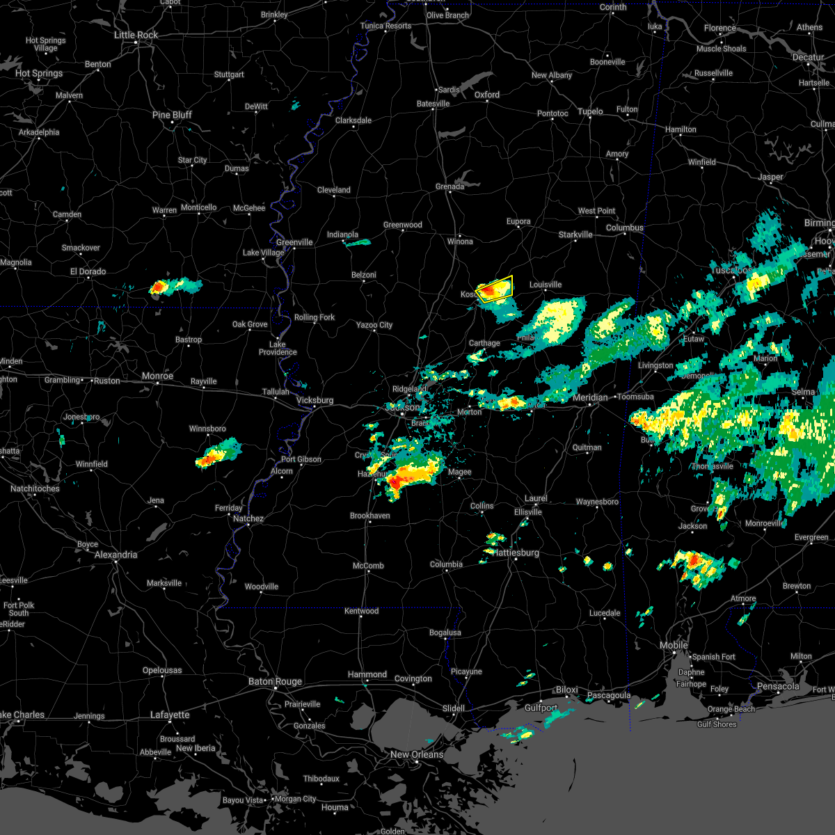 At 717 pm cdt, a severe thunderstorm was located near kosciusko, moving northeast at 35 mph (radar indicated). Hazards include golf ball size hail and 60 mph wind gusts. People and animals outdoors will be injured. expect hail damage to roofs, siding, windows, and vehicles. expect wind damage to roofs, siding, and trees. Locations impacted include, kosciusko, ethel and mccool. At 717 pm cdt, a severe thunderstorm was located near kosciusko, moving northeast at 35 mph (radar indicated). Hazards include golf ball size hail and 60 mph wind gusts. People and animals outdoors will be injured. expect hail damage to roofs, siding, windows, and vehicles. expect wind damage to roofs, siding, and trees. Locations impacted include, kosciusko, ethel and mccool.
|
| 3/16/2021 7:11 PM CDT |
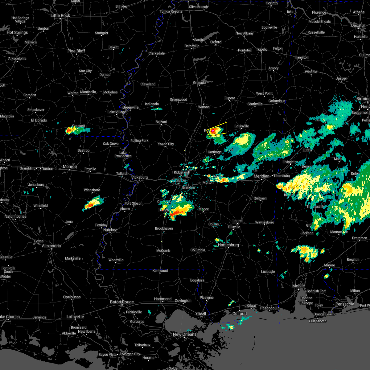 At 711 pm cdt, a severe thunderstorm was located over kosciusko, moving northeast at 30 mph (radar indicated). Hazards include two inch hail and 60 mph wind gusts. People and animals outdoors will be injured. expect hail damage to roofs, siding, windows, and vehicles. expect wind damage to roofs, siding, and trees. This severe thunderstorm will remain over mainly rural areas of east central attala county, including the following locations, mccool and ethel. At 711 pm cdt, a severe thunderstorm was located over kosciusko, moving northeast at 30 mph (radar indicated). Hazards include two inch hail and 60 mph wind gusts. People and animals outdoors will be injured. expect hail damage to roofs, siding, windows, and vehicles. expect wind damage to roofs, siding, and trees. This severe thunderstorm will remain over mainly rural areas of east central attala county, including the following locations, mccool and ethel.
|
| 3/16/2021 7:06 PM CDT |
 At 705 pm cdt, a severe thunderstorm was located over mcadams, or near kosciusko, moving east at 20 mph (radar indicated). Hazards include golf ball size hail and 60 mph wind gusts. People and animals outdoors will be injured. expect hail damage to roofs, siding, windows, and vehicles. expect wind damage to roofs, siding, and trees. this severe storm will be near, kosciusko around 715 pm cdt. smyrna around 730 pm cdt. zama around 745 pm cdt. Other locations impacted by this severe thunderstorm include mccool and ethel. At 705 pm cdt, a severe thunderstorm was located over mcadams, or near kosciusko, moving east at 20 mph (radar indicated). Hazards include golf ball size hail and 60 mph wind gusts. People and animals outdoors will be injured. expect hail damage to roofs, siding, windows, and vehicles. expect wind damage to roofs, siding, and trees. this severe storm will be near, kosciusko around 715 pm cdt. smyrna around 730 pm cdt. zama around 745 pm cdt. Other locations impacted by this severe thunderstorm include mccool and ethel.
|
| 3/16/2021 7:02 PM CDT |
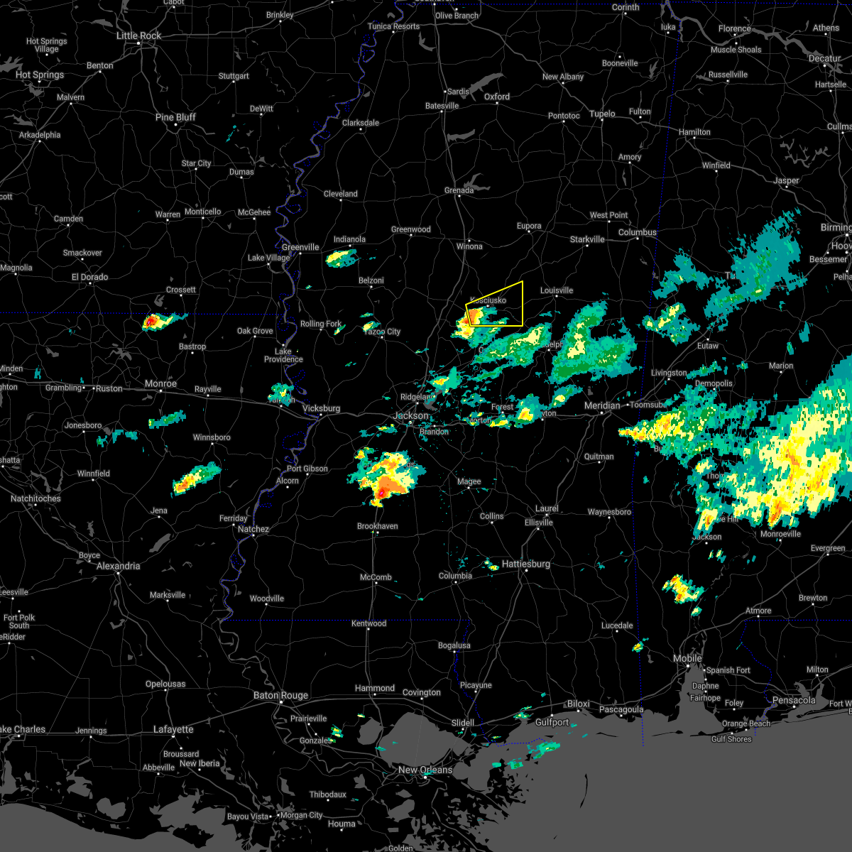 At 702 pm cdt, a severe thunderstorm was located over mcadams, or near kosciusko, moving east at 20 mph (radar indicated). Hazards include 60 mph wind gusts and quarter size hail. Hail damage to vehicles is expected. expect wind damage to roofs, siding, and trees. this severe thunderstorm will be near, kosciusko around 715 pm cdt. smyrna around 730 pm cdt. zama around 745 pm cdt. Other locations impacted by this severe thunderstorm include mccool and ethel. At 702 pm cdt, a severe thunderstorm was located over mcadams, or near kosciusko, moving east at 20 mph (radar indicated). Hazards include 60 mph wind gusts and quarter size hail. Hail damage to vehicles is expected. expect wind damage to roofs, siding, and trees. this severe thunderstorm will be near, kosciusko around 715 pm cdt. smyrna around 730 pm cdt. zama around 745 pm cdt. Other locations impacted by this severe thunderstorm include mccool and ethel.
|
| 6/5/2020 4:54 PM CDT |
 At 454 pm cdt, severe thunderstorms were located along a line extending from near tchula to near kosciusko, moving south at 35 mph (radar indicated). Hazards include 60 mph wind gusts. Expect damage to roofs, siding, and trees. these severe storms will be near, kosciusko, thornton, tolarville and mcadams around 505 pm cdt. coxburg, smyrna and brozville around 510 pm cdt. Other locations impacted by these severe thunderstorms include silver city, mccool, ethel, sallis and west. At 454 pm cdt, severe thunderstorms were located along a line extending from near tchula to near kosciusko, moving south at 35 mph (radar indicated). Hazards include 60 mph wind gusts. Expect damage to roofs, siding, and trees. these severe storms will be near, kosciusko, thornton, tolarville and mcadams around 505 pm cdt. coxburg, smyrna and brozville around 510 pm cdt. Other locations impacted by these severe thunderstorms include silver city, mccool, ethel, sallis and west.
|
| 6/5/2020 4:43 PM CDT |
 At 442 pm cdt, severe thunderstorms were located along a line extending from 6 miles east of swiftown to near hesterville, moving south at 35 mph (radar indicated). Hazards include 60 mph wind gusts. Expect damage to roofs, siding, and trees. these severe storms will be near, hesterville around 450 pm cdt. tchula and possumneck around 455 pm cdt. howard around 500 pm cdt. kosciusko and thornton around 505 pm cdt. mcadams and tolarville around 510 pm cdt. coxburg around 515 pm cdt. newport around 520 pm cdt. Other locations impacted by these severe thunderstorms include silver city, ethel, sallis, west, mccool, morgan city and cruger. At 442 pm cdt, severe thunderstorms were located along a line extending from 6 miles east of swiftown to near hesterville, moving south at 35 mph (radar indicated). Hazards include 60 mph wind gusts. Expect damage to roofs, siding, and trees. these severe storms will be near, hesterville around 450 pm cdt. tchula and possumneck around 455 pm cdt. howard around 500 pm cdt. kosciusko and thornton around 505 pm cdt. mcadams and tolarville around 510 pm cdt. coxburg around 515 pm cdt. newport around 520 pm cdt. Other locations impacted by these severe thunderstorms include silver city, ethel, sallis, west, mccool, morgan city and cruger.
|
| 6/5/2020 4:21 PM CDT |
 At 421 pm cdt, severe thunderstorms were located along a line extending from quito to 6 miles west of kilmichael, moving south at 35 mph (radar indicated). Hazards include 60 mph wind gusts. Expect damage to roofs, siding, and trees. severe thunderstorms will be near, itta bena, sidon and quito around 425 pm cdt. swiftown around 445 pm cdt. hesterville around 450 pm cdt. possumneck around 455 pm cdt. belzoni around 500 pm cdt. durant around 505 pm cdt. thornton and mcadams around 510 pm cdt. goodman and newport around 520 pm cdt. Other locations impacted by these severe thunderstorms include silver city, ethel, carrollton, sallis, west, mccool, morgan city and cruger. At 421 pm cdt, severe thunderstorms were located along a line extending from quito to 6 miles west of kilmichael, moving south at 35 mph (radar indicated). Hazards include 60 mph wind gusts. Expect damage to roofs, siding, and trees. severe thunderstorms will be near, itta bena, sidon and quito around 425 pm cdt. swiftown around 445 pm cdt. hesterville around 450 pm cdt. possumneck around 455 pm cdt. belzoni around 500 pm cdt. durant around 505 pm cdt. thornton and mcadams around 510 pm cdt. goodman and newport around 520 pm cdt. Other locations impacted by these severe thunderstorms include silver city, ethel, carrollton, sallis, west, mccool, morgan city and cruger.
|
| 4/12/2020 11:08 PM CDT |
 At 1108 pm cdt, severe thunderstorms were located along a line extending from 6 miles north of edinburg to tuscola, moving east at 30 mph (radar indicated). Hazards include 60 mph wind gusts. Expect damage to roofs, siding, and trees. these severe storms will be near, edinburg around 1115 pm cdt. madden around 1130 pm cdt. Other locations impacted by these severe thunderstorms include lena, walnut grove, mccool, redwater and standing pine. At 1108 pm cdt, severe thunderstorms were located along a line extending from 6 miles north of edinburg to tuscola, moving east at 30 mph (radar indicated). Hazards include 60 mph wind gusts. Expect damage to roofs, siding, and trees. these severe storms will be near, edinburg around 1115 pm cdt. madden around 1130 pm cdt. Other locations impacted by these severe thunderstorms include lena, walnut grove, mccool, redwater and standing pine.
|
| 4/12/2020 10:59 PM CDT |
 At 1058 pm cdt, severe thunderstorms were located along a line extending from 9 miles southwest of ackerman to near singleton to near ludlow, moving east at 60 mph (radar indicated). Hazards include 60 mph wind gusts. Expect damage to roofs, siding, and trees. these severe storms will be near, edinburg around 1110 pm cdt. madden around 1120 pm cdt. Other locations impacted by these severe thunderstorms include lena, walnut grove, mccool, ethel, redwater and standing pine. At 1058 pm cdt, severe thunderstorms were located along a line extending from 9 miles southwest of ackerman to near singleton to near ludlow, moving east at 60 mph (radar indicated). Hazards include 60 mph wind gusts. Expect damage to roofs, siding, and trees. these severe storms will be near, edinburg around 1110 pm cdt. madden around 1120 pm cdt. Other locations impacted by these severe thunderstorms include lena, walnut grove, mccool, ethel, redwater and standing pine.
|
| 4/12/2020 10:27 PM CDT |
 At 1027 pm cdt, severe thunderstorms were located along a line extending from near emory to near pickens to 7 miles southeast of myrleville, moving east at 50 mph (radar indicated). Hazards include 60 mph wind gusts. Expect damage to roofs, siding, and trees. severe thunderstorms will be near, cameron and possumneck around 1035 pm cdt. hesterville around 1040 pm cdt. newport around 1045 pm cdt. farmhaven, thomastown and mcadams around 1050 pm cdt. singleton and smyrna around 1100 pm cdt. renfroe around 1105 pm cdt. carthage, tuscola and zama around 1110 pm cdt. edinburg around 1115 pm cdt. Other locations impacted by these severe thunderstorms include walnut grove, ethel, sallis, redwater, standing pine, lena and mccool. At 1027 pm cdt, severe thunderstorms were located along a line extending from near emory to near pickens to 7 miles southeast of myrleville, moving east at 50 mph (radar indicated). Hazards include 60 mph wind gusts. Expect damage to roofs, siding, and trees. severe thunderstorms will be near, cameron and possumneck around 1035 pm cdt. hesterville around 1040 pm cdt. newport around 1045 pm cdt. farmhaven, thomastown and mcadams around 1050 pm cdt. singleton and smyrna around 1100 pm cdt. renfroe around 1105 pm cdt. carthage, tuscola and zama around 1110 pm cdt. edinburg around 1115 pm cdt. Other locations impacted by these severe thunderstorms include walnut grove, ethel, sallis, redwater, standing pine, lena and mccool.
|
| 4/12/2020 2:27 PM CDT |
 At 227 pm cdt, severe thunderstorms were located along a line extending from 7 miles northeast of kosciusko to near smyrna to near singleton, moving east at 65 mph (radar indicated). Hazards include 60 mph wind gusts and quarter size hail. Hail damage to vehicles is expected. expect wind damage to roofs, siding, and trees. severe thunderstorms will be near, zama around 240 pm cdt. ackerman around 245 pm cdt. louisville and mcmillan around 250 pm cdt. betheden around 300 pm cdt. millcreek around 305 pm cdt. other locations impacted by these severe thunderstorms include french camp, mccool and weir. A tornado watch remains in effect until 800 pm cdt for central, northeastern and east central mississippi. At 227 pm cdt, severe thunderstorms were located along a line extending from 7 miles northeast of kosciusko to near smyrna to near singleton, moving east at 65 mph (radar indicated). Hazards include 60 mph wind gusts and quarter size hail. Hail damage to vehicles is expected. expect wind damage to roofs, siding, and trees. severe thunderstorms will be near, zama around 240 pm cdt. ackerman around 245 pm cdt. louisville and mcmillan around 250 pm cdt. betheden around 300 pm cdt. millcreek around 305 pm cdt. other locations impacted by these severe thunderstorms include french camp, mccool and weir. A tornado watch remains in effect until 800 pm cdt for central, northeastern and east central mississippi.
|
| 2/5/2020 4:56 PM CST | Trees were blown down on highway 411 about 5 miles south of mccoo in attala county MS, 3.5 miles N of McCool, MS |
| 2/5/2020 4:52 PM CST |
 At 452 pm cst, a severe thunderstorm capable of producing a tornado was located 8 miles north of smyrna, or 8 miles northeast of kosciusko, moving northeast at 40 mph (radar indicated rotation). Hazards include tornado. Flying debris will be dangerous to those caught without shelter. mobile homes will be damaged or destroyed. damage to roofs, windows, and vehicles will occur. tree damage is likely. this dangerous storm will be near, louisville, ackerman and mcmillan around 525 pm cst. betheden around 540 pm cst. Other locations impacted by this tornadic thunderstorm include mccool and weir. At 452 pm cst, a severe thunderstorm capable of producing a tornado was located 8 miles north of smyrna, or 8 miles northeast of kosciusko, moving northeast at 40 mph (radar indicated rotation). Hazards include tornado. Flying debris will be dangerous to those caught without shelter. mobile homes will be damaged or destroyed. damage to roofs, windows, and vehicles will occur. tree damage is likely. this dangerous storm will be near, louisville, ackerman and mcmillan around 525 pm cst. betheden around 540 pm cst. Other locations impacted by this tornadic thunderstorm include mccool and weir.
|
| 2/5/2020 4:44 PM CST |
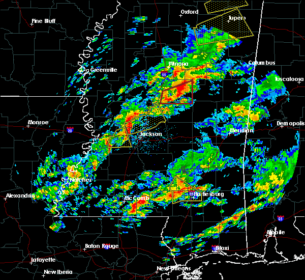 At 443 pm cst, a severe thunderstorm capable of producing a tornado was located near smyrna, or near kosciusko, moving east at 40 mph (radar indicated rotation). Hazards include tornado. Flying debris will be dangerous to those caught without shelter. mobile homes will be damaged or destroyed. damage to roofs, windows, and vehicles will occur. tree damage is likely. this dangerous storm will be near, zama around 455 pm cst. Other locations impacted by this tornadic thunderstorm include mccool and ethel. At 443 pm cst, a severe thunderstorm capable of producing a tornado was located near smyrna, or near kosciusko, moving east at 40 mph (radar indicated rotation). Hazards include tornado. Flying debris will be dangerous to those caught without shelter. mobile homes will be damaged or destroyed. damage to roofs, windows, and vehicles will occur. tree damage is likely. this dangerous storm will be near, zama around 455 pm cst. Other locations impacted by this tornadic thunderstorm include mccool and ethel.
|
| 2/5/2020 4:29 PM CST |
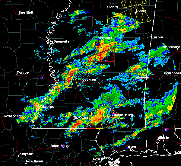 At 428 pm cst, a confirmed tornado was located near mcadams, or 9 miles southwest of kosciusko, moving northeast at 40 mph (radar confirmed tornado). Hazards include damaging tornado. Flying debris will be dangerous to those caught without shelter. mobile homes will be damaged or destroyed. damage to roofs, windows, and vehicles will occur. tree damage is likely. this tornado will be near, kosciusko around 440 pm cst. smyrna around 445 pm cst. Other locations impacted by this tornadic thunderstorm include mccool, ethel and sallis. At 428 pm cst, a confirmed tornado was located near mcadams, or 9 miles southwest of kosciusko, moving northeast at 40 mph (radar confirmed tornado). Hazards include damaging tornado. Flying debris will be dangerous to those caught without shelter. mobile homes will be damaged or destroyed. damage to roofs, windows, and vehicles will occur. tree damage is likely. this tornado will be near, kosciusko around 440 pm cst. smyrna around 445 pm cst. Other locations impacted by this tornadic thunderstorm include mccool, ethel and sallis.
|
| 2/5/2020 4:16 PM CST |
 At 415 pm cst, a confirmed large and extremely dangerous tornado was located near newport, or 10 miles south of durant, moving northeast at 50 mph. this is a particularly dangerous situation. take cover now! (radar confirmed tornado). Hazards include damaging tornado. You are in a life-threatening situation. flying debris may be deadly to those caught without shelter. mobile homes will be destroyed. considerable damage to homes, businesses, and vehicles is likely and complete destruction is possible. the tornado will be near, newport around 420 pm cst. mcadams around 430 pm cst. kosciusko around 435 pm cst. smyrna around 440 pm cst. Other locations impacted by this tornadic thunderstorm include mccool, ethel and sallis. At 415 pm cst, a confirmed large and extremely dangerous tornado was located near newport, or 10 miles south of durant, moving northeast at 50 mph. this is a particularly dangerous situation. take cover now! (radar confirmed tornado). Hazards include damaging tornado. You are in a life-threatening situation. flying debris may be deadly to those caught without shelter. mobile homes will be destroyed. considerable damage to homes, businesses, and vehicles is likely and complete destruction is possible. the tornado will be near, newport around 420 pm cst. mcadams around 430 pm cst. kosciusko around 435 pm cst. smyrna around 440 pm cst. Other locations impacted by this tornadic thunderstorm include mccool, ethel and sallis.
|
| 2/5/2020 4:04 PM CST |
 At 404 pm cst, a confirmed large and extremely dangerous tornado was located over pickens, or 16 miles southwest of durant, moving northeast at 50 mph. this is a particularly dangerous situation. take cover now! (radar confirmed tornado). Hazards include damaging tornado. You are in a life-threatening situation. flying debris may be deadly to those caught without shelter. mobile homes will be destroyed. considerable damage to homes, businesses, and vehicles is likely and complete destruction is possible. the tornado will be near, goodman around 410 pm cst. newport around 420 pm cst. kosciusko and mcadams around 430 pm cst. Other locations impacted by this tornadic thunderstorm include mccool, ethel and sallis. At 404 pm cst, a confirmed large and extremely dangerous tornado was located over pickens, or 16 miles southwest of durant, moving northeast at 50 mph. this is a particularly dangerous situation. take cover now! (radar confirmed tornado). Hazards include damaging tornado. You are in a life-threatening situation. flying debris may be deadly to those caught without shelter. mobile homes will be destroyed. considerable damage to homes, businesses, and vehicles is likely and complete destruction is possible. the tornado will be near, goodman around 410 pm cst. newport around 420 pm cst. kosciusko and mcadams around 430 pm cst. Other locations impacted by this tornadic thunderstorm include mccool, ethel and sallis.
|
| 2/5/2020 3:55 PM CST |
 At 355 pm cst, a severe thunderstorm capable of producing a tornado was located over vaughan, or 15 miles north of canton, moving east at 50 mph (radar indicated rotation). Hazards include tornado. Flying debris will be dangerous to those caught without shelter. mobile homes will be damaged or destroyed. damage to roofs, windows, and vehicles will occur. tree damage is likely. this dangerous storm will be near, pickens around 405 pm cst. goodman and cameron around 410 pm cst. newport and thomastown around 420 pm cst. mcadams around 425 pm cst. kosciusko and singleton around 430 pm cst. smyrna around 440 pm cst. zama around 445 pm cst. Other locations impacted by this tornadic thunderstorm include mccool, ethel and sallis. At 355 pm cst, a severe thunderstorm capable of producing a tornado was located over vaughan, or 15 miles north of canton, moving east at 50 mph (radar indicated rotation). Hazards include tornado. Flying debris will be dangerous to those caught without shelter. mobile homes will be damaged or destroyed. damage to roofs, windows, and vehicles will occur. tree damage is likely. this dangerous storm will be near, pickens around 405 pm cst. goodman and cameron around 410 pm cst. newport and thomastown around 420 pm cst. mcadams around 425 pm cst. kosciusko and singleton around 430 pm cst. smyrna around 440 pm cst. zama around 445 pm cst. Other locations impacted by this tornadic thunderstorm include mccool, ethel and sallis.
|
| 1/11/2020 8:26 AM CST |
 At 826 am cst, severe thunderstorms were located along a line extending from near maben to 6 miles northeast of zama, moving northeast at 40 mph (radar indicated). Hazards include 60 mph wind gusts. Expect damage to roofs, siding, and trees. these severe storms will be near, louisville and mcmillan around 850 am cst. millcreek and betheden around 900 am cst. other locations impacted by these severe thunderstorms include noxapater, mccool, sturgis and weir. a tornado watch remains in effect until 900 am cst for central mississippi. A tornado watch also remains in effect until 400 pm cst for northeastern and east central mississippi. At 826 am cst, severe thunderstorms were located along a line extending from near maben to 6 miles northeast of zama, moving northeast at 40 mph (radar indicated). Hazards include 60 mph wind gusts. Expect damage to roofs, siding, and trees. these severe storms will be near, louisville and mcmillan around 850 am cst. millcreek and betheden around 900 am cst. other locations impacted by these severe thunderstorms include noxapater, mccool, sturgis and weir. a tornado watch remains in effect until 900 am cst for central mississippi. A tornado watch also remains in effect until 400 pm cst for northeastern and east central mississippi.
|
| 1/11/2020 8:15 AM CST |
 At 814 am cst, severe thunderstorms were located along a line extending from sherwood to 10 miles west of center ridge, moving northeast at 80 mph (radar indicated). Hazards include 60 mph wind gusts. Expect damage to roofs, siding, and trees. severe thunderstorms will be near, betheden and millcreek around 830 am cst. oktoc around 840 am cst. other locations impacted by these severe thunderstorms include noxapater, mccool, sturgis and weir. a tornado watch remains in effect until 900 am cst for central mississippi. A tornado watch also remains in effect until 400 pm cst for northeastern and east central mississippi. At 814 am cst, severe thunderstorms were located along a line extending from sherwood to 10 miles west of center ridge, moving northeast at 80 mph (radar indicated). Hazards include 60 mph wind gusts. Expect damage to roofs, siding, and trees. severe thunderstorms will be near, betheden and millcreek around 830 am cst. oktoc around 840 am cst. other locations impacted by these severe thunderstorms include noxapater, mccool, sturgis and weir. a tornado watch remains in effect until 900 am cst for central mississippi. A tornado watch also remains in effect until 400 pm cst for northeastern and east central mississippi.
|
| 1/11/2020 7:38 AM CST |
 At 737 am cst, severe thunderstorms were located along a line extending from near kilmichael to near mcadams, moving northeast at 60 mph (radar indicated). Hazards include 60 mph wind gusts. Expect damage to roofs, siding, and trees. these severe storms will be near, eupora around 755 am cst. other locations impacted by these severe thunderstorms include mccool, ethel, sallis, french camp and weir. A tornado watch remains in effect until 900 am cst for central and north central mississippi. At 737 am cst, severe thunderstorms were located along a line extending from near kilmichael to near mcadams, moving northeast at 60 mph (radar indicated). Hazards include 60 mph wind gusts. Expect damage to roofs, siding, and trees. these severe storms will be near, eupora around 755 am cst. other locations impacted by these severe thunderstorms include mccool, ethel, sallis, french camp and weir. A tornado watch remains in effect until 900 am cst for central and north central mississippi.
|
| 1/11/2020 7:18 AM CST |
 At 718 am cst, severe thunderstorms were located along a line extending from near vaiden to near pickens, moving northeast at 60 mph (radar indicated). Hazards include 60 mph wind gusts. Expect damage to roofs, siding, and trees. severe thunderstorms will be near, vaiden around 725 am cst. kilmichael and poplar creek around 735 am cst. mcadams around 740 am cst. kosciusko around 745 am cst. smyrna around 750 am cst. eupora around 755 am cst. other locations impacted by these severe thunderstorms include mccool, ethel, sallis, french camp, west and weir. A tornado watch remains in effect until 900 am cst for central and north central mississippi. At 718 am cst, severe thunderstorms were located along a line extending from near vaiden to near pickens, moving northeast at 60 mph (radar indicated). Hazards include 60 mph wind gusts. Expect damage to roofs, siding, and trees. severe thunderstorms will be near, vaiden around 725 am cst. kilmichael and poplar creek around 735 am cst. mcadams around 740 am cst. kosciusko around 745 am cst. smyrna around 750 am cst. eupora around 755 am cst. other locations impacted by these severe thunderstorms include mccool, ethel, sallis, french camp, west and weir. A tornado watch remains in effect until 900 am cst for central and north central mississippi.
|
| 12/29/2019 4:09 PM CST |
 At 408 pm cst, severe thunderstorms were located along a line extending from near eupora to 11 miles southwest of chester, moving northeast at 50 mph (radar indicated). Hazards include 60 mph wind gusts and quarter size hail. Hail damage to vehicles is expected. expect wind damage to roofs, siding, and trees. these severe storms will be near, eupora and bellefontaine around 415 pm cst. mathiston and clarkson around 420 pm cst. ackerman and cumberland around 425 pm cst. reform around 430 pm cst. other locations impacted by these severe thunderstorms include mccool, walthall, french camp, mantee and weir. A tornado watch remains in effect until 900 pm cst for central, north central, northeastern and east central mississippi. At 408 pm cst, severe thunderstorms were located along a line extending from near eupora to 11 miles southwest of chester, moving northeast at 50 mph (radar indicated). Hazards include 60 mph wind gusts and quarter size hail. Hail damage to vehicles is expected. expect wind damage to roofs, siding, and trees. these severe storms will be near, eupora and bellefontaine around 415 pm cst. mathiston and clarkson around 420 pm cst. ackerman and cumberland around 425 pm cst. reform around 430 pm cst. other locations impacted by these severe thunderstorms include mccool, walthall, french camp, mantee and weir. A tornado watch remains in effect until 900 pm cst for central, north central, northeastern and east central mississippi.
|
| 12/29/2019 4:02 PM CST |
 At 402 pm cst, a severe thunderstorm capable of producing a tornado was located 13 miles northeast of kosciusko, moving northeast at 65 mph (radar indicated rotation). Hazards include tornado and quarter size hail. Flying debris will be dangerous to those caught without shelter. mobile homes will be damaged or destroyed. damage to roofs, windows, and vehicles will occur. tree damage is likely. this dangerous storm will be near, ackerman and chester around 415 pm cst. reform around 420 pm cst. longview around 430 pm cst. starkville and pheba around 435 pm cst. Other locations impacted by this tornadic thunderstorm include mccool, french camp, sturgis and weir. At 402 pm cst, a severe thunderstorm capable of producing a tornado was located 13 miles northeast of kosciusko, moving northeast at 65 mph (radar indicated rotation). Hazards include tornado and quarter size hail. Flying debris will be dangerous to those caught without shelter. mobile homes will be damaged or destroyed. damage to roofs, windows, and vehicles will occur. tree damage is likely. this dangerous storm will be near, ackerman and chester around 415 pm cst. reform around 420 pm cst. longview around 430 pm cst. starkville and pheba around 435 pm cst. Other locations impacted by this tornadic thunderstorm include mccool, french camp, sturgis and weir.
|
| 12/29/2019 3:46 PM CST |
 At 346 pm cst, severe thunderstorms were located along a line extending from near kilmichael to near hesterville, moving northeast at 50 mph (radar indicated). Hazards include 60 mph wind gusts and quarter size hail. Hail damage to vehicles is expected. expect wind damage to roofs, siding, and trees. severe thunderstorms will be near, kilmichael around 350 pm cst. eupora around 410 pm cst. ackerman, chester and bellefontaine around 415 pm cst. mathiston, reform and clarkson around 420 pm cst. cumberland and sherwood around 425 pm cst. other locations impacted by these severe thunderstorms include mccool, walthall, french camp, mantee and weir. A tornado watch remains in effect until 900 pm cst for central, north central, northeastern and east central mississippi. At 346 pm cst, severe thunderstorms were located along a line extending from near kilmichael to near hesterville, moving northeast at 50 mph (radar indicated). Hazards include 60 mph wind gusts and quarter size hail. Hail damage to vehicles is expected. expect wind damage to roofs, siding, and trees. severe thunderstorms will be near, kilmichael around 350 pm cst. eupora around 410 pm cst. ackerman, chester and bellefontaine around 415 pm cst. mathiston, reform and clarkson around 420 pm cst. cumberland and sherwood around 425 pm cst. other locations impacted by these severe thunderstorms include mccool, walthall, french camp, mantee and weir. A tornado watch remains in effect until 900 pm cst for central, north central, northeastern and east central mississippi.
|
| 10/26/2019 9:38 AM CDT |
 At 938 am cdt, a severe thunderstorm was located near chester, or 23 miles northwest of louisville, moving north at 60 mph (radar indicated). Hazards include 60 mph wind gusts. Expect damage to roofs, siding, and trees. this severe thunderstorm will be near, sherwood around 945 am cdt. eupora and mathiston around 950 am cdt. maben, clarkson, cumberland and bellefontaine around 955 am cdt. Other locations impacted by this severe thunderstorm include mccool, walthall, french camp, mantee, sturgis and weir. At 938 am cdt, a severe thunderstorm was located near chester, or 23 miles northwest of louisville, moving north at 60 mph (radar indicated). Hazards include 60 mph wind gusts. Expect damage to roofs, siding, and trees. this severe thunderstorm will be near, sherwood around 945 am cdt. eupora and mathiston around 950 am cdt. maben, clarkson, cumberland and bellefontaine around 955 am cdt. Other locations impacted by this severe thunderstorm include mccool, walthall, french camp, mantee, sturgis and weir.
|
| 7/15/2019 5:45 PM CDT |
 At 544 pm cdt, a severe thunderstorm was located 13 miles north of zama, or 15 miles northeast of kosciusko, moving northeast at 40 mph (radar indicated). Hazards include 60 mph wind gusts. Expect damage to roofs, siding, and trees. this severe thunderstorm will be near, ackerman and chester around 605 pm cdt. reform around 615 pm cdt. sherwood around 620 pm cdt. mathiston around 625 pm cdt. maben around 630 pm cdt. Other locations impacted by this severe thunderstorm include mccool, french camp, sturgis and weir. At 544 pm cdt, a severe thunderstorm was located 13 miles north of zama, or 15 miles northeast of kosciusko, moving northeast at 40 mph (radar indicated). Hazards include 60 mph wind gusts. Expect damage to roofs, siding, and trees. this severe thunderstorm will be near, ackerman and chester around 605 pm cdt. reform around 615 pm cdt. sherwood around 620 pm cdt. mathiston around 625 pm cdt. maben around 630 pm cdt. Other locations impacted by this severe thunderstorm include mccool, french camp, sturgis and weir.
|
| 6/24/2019 5:23 AM CDT |
 At 523 am cdt, a severe thunderstorm was located over kosciusko, moving northeast at 55 mph (radar indicated). Hazards include 60 mph wind gusts. Expect damage to roofs, siding, and trees. this severe thunderstorm will be near, ackerman and chester around 555 am cdt. reform around 605 am cdt. Other locations impacted by this severe thunderstorm include mccool, ethel, sallis, french camp, sturgis and weir. At 523 am cdt, a severe thunderstorm was located over kosciusko, moving northeast at 55 mph (radar indicated). Hazards include 60 mph wind gusts. Expect damage to roofs, siding, and trees. this severe thunderstorm will be near, ackerman and chester around 555 am cdt. reform around 605 am cdt. Other locations impacted by this severe thunderstorm include mccool, ethel, sallis, french camp, sturgis and weir.
|
| 6/20/2019 12:11 AM CDT |
 At 1210 am cdt, severe thunderstorms were located along a line extending from near sabougla to 8 miles southeast of poplar creek to near mcadams, moving east at 45 mph (radar indicated). Hazards include 60 mph wind gusts and quarter size hail. Hail damage to vehicles is expected. expect wind damage to roofs, siding, and trees. severe thunderstorms will be near, embry around 1215 am cdt. bellefontaine around 1220 am cdt. chester around 1225 am cdt. ackerman and clarkson around 1230 am cdt. montpelier and betheden around 1245 am cdt. craig springs and longview around 1250 am cdt. starkville around 1255 am cdt. louisville around 100 am cdt. Other locations impacted by these severe thunderstorms include ethel, sallis, french camp, mantee, mccool, walthall, sturgis and weir. At 1210 am cdt, severe thunderstorms were located along a line extending from near sabougla to 8 miles southeast of poplar creek to near mcadams, moving east at 45 mph (radar indicated). Hazards include 60 mph wind gusts and quarter size hail. Hail damage to vehicles is expected. expect wind damage to roofs, siding, and trees. severe thunderstorms will be near, embry around 1215 am cdt. bellefontaine around 1220 am cdt. chester around 1225 am cdt. ackerman and clarkson around 1230 am cdt. montpelier and betheden around 1245 am cdt. craig springs and longview around 1250 am cdt. starkville around 1255 am cdt. louisville around 100 am cdt. Other locations impacted by these severe thunderstorms include ethel, sallis, french camp, mantee, mccool, walthall, sturgis and weir.
|
| 5/8/2019 10:45 PM CDT |
 At 1045 pm cdt, severe thunderstorms were located along a line extending from 13 miles north of zama to near smyrna to near edinburg, moving northeast at 20 mph (radar indicated). Hazards include 60 mph wind gusts. Expect damage to roofs, siding, and trees. these severe thunderstorms will remain over mainly rural areas of northeastern leake and eastern attala counties, including the following locations, mccool, ethel and redwater. A tornado watch remains in effect until midnight cdt for central and north central mississippi. At 1045 pm cdt, severe thunderstorms were located along a line extending from 13 miles north of zama to near smyrna to near edinburg, moving northeast at 20 mph (radar indicated). Hazards include 60 mph wind gusts. Expect damage to roofs, siding, and trees. these severe thunderstorms will remain over mainly rural areas of northeastern leake and eastern attala counties, including the following locations, mccool, ethel and redwater. A tornado watch remains in effect until midnight cdt for central and north central mississippi.
|
| 5/8/2019 10:13 PM CDT |
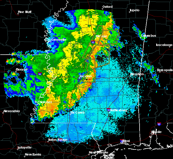 At 1013 pm cdt, severe thunderstorms were located along a line extending from 7 miles south of poplar creek, to newport, to 7 miles north of ludlow, moving east at 35 mph (radar indicated). Hazards include 60 mph wind gusts. Expect damage to roofs, siding, and trees. these severe storms will be near, carthage around 1025 pm cdt. kosciusko around 1030 pm cdt. singleton around 1035 pm cdt. smyrna around 1040 pm cdt. renfroe around 1045 pm cdt. zama around 1050 pm cdt. other locations impacted by these severe thunderstorms include mccool, ethel, sallis and redwater. A tornado watch remains in effect until midnight cdt for central and north central mississippi. At 1013 pm cdt, severe thunderstorms were located along a line extending from 7 miles south of poplar creek, to newport, to 7 miles north of ludlow, moving east at 35 mph (radar indicated). Hazards include 60 mph wind gusts. Expect damage to roofs, siding, and trees. these severe storms will be near, carthage around 1025 pm cdt. kosciusko around 1030 pm cdt. singleton around 1035 pm cdt. smyrna around 1040 pm cdt. renfroe around 1045 pm cdt. zama around 1050 pm cdt. other locations impacted by these severe thunderstorms include mccool, ethel, sallis and redwater. A tornado watch remains in effect until midnight cdt for central and north central mississippi.
|
| 5/8/2019 9:55 PM CDT |
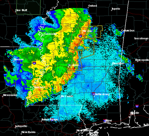 At 955 pm cdt, severe thunderstorms were located along a line extending from near pickens to cameron to farmhaven, moving northeast at 35 mph (radar indicated). Hazards include 60 mph wind gusts. Expect damage to roofs, siding, and trees. severe thunderstorms will be near, newport around 1010 pm cdt. thomastown around 1015 pm cdt. mcadams around 1025 pm cdt. kosciusko, carthage and possumneck around 1030 pm cdt. hesterville around 1035 pm cdt. smyrna and singleton around 1040 pm cdt. renfroe around 1045 pm cdt. edinburg around 1050 pm cdt. other locations impacted by these severe thunderstorms include mccool, ethel, sallis and redwater. A tornado watch remains in effect until midnight cdt for central and north central mississippi. At 955 pm cdt, severe thunderstorms were located along a line extending from near pickens to cameron to farmhaven, moving northeast at 35 mph (radar indicated). Hazards include 60 mph wind gusts. Expect damage to roofs, siding, and trees. severe thunderstorms will be near, newport around 1010 pm cdt. thomastown around 1015 pm cdt. mcadams around 1025 pm cdt. kosciusko, carthage and possumneck around 1030 pm cdt. hesterville around 1035 pm cdt. smyrna and singleton around 1040 pm cdt. renfroe around 1045 pm cdt. edinburg around 1050 pm cdt. other locations impacted by these severe thunderstorms include mccool, ethel, sallis and redwater. A tornado watch remains in effect until midnight cdt for central and north central mississippi.
|
| 4/13/2019 8:17 PM CDT |
 At 817 pm cdt, a severe thunderstorm capable of producing a tornado was located 9 miles southwest of chester, or 19 miles northwest of louisville, moving north at 40 mph (radar indicated rotation). Hazards include tornado and quarter size hail. Flying debris will be dangerous to those caught without shelter. mobile homes will be damaged or destroyed. damage to roofs, windows, and vehicles will occur. tree damage is likely. this dangerous storm will be near, chester around 830 pm cdt. Other locations impacted by this tornadic thunderstorm include french camp and weir. At 817 pm cdt, a severe thunderstorm capable of producing a tornado was located 9 miles southwest of chester, or 19 miles northwest of louisville, moving north at 40 mph (radar indicated rotation). Hazards include tornado and quarter size hail. Flying debris will be dangerous to those caught without shelter. mobile homes will be damaged or destroyed. damage to roofs, windows, and vehicles will occur. tree damage is likely. this dangerous storm will be near, chester around 830 pm cdt. Other locations impacted by this tornadic thunderstorm include french camp and weir.
|
| 4/13/2019 8:08 PM CDT |
 At 808 pm cdt, a severe thunderstorm was located 8 miles southwest of ackerman, or 16 miles northwest of louisville, moving northeast at 50 mph (radar indicated). Hazards include 60 mph wind gusts and nickel size hail. Expect damage to roofs, siding, and trees. this severe thunderstorm will be near, ackerman and chester around 820 pm cdt. reform around 825 pm cdt. sherwood around 830 pm cdt. maben around 840 pm cdt. other locations impacted by this severe thunderstorm include mccool, french camp, sturgis and weir. a tornado watch remains in effect until 900 pm cdt for central mississippi. A tornado watch also remains in effect until 300 am cdt for central, north central, northeastern and east central mississippi. At 808 pm cdt, a severe thunderstorm was located 8 miles southwest of ackerman, or 16 miles northwest of louisville, moving northeast at 50 mph (radar indicated). Hazards include 60 mph wind gusts and nickel size hail. Expect damage to roofs, siding, and trees. this severe thunderstorm will be near, ackerman and chester around 820 pm cdt. reform around 825 pm cdt. sherwood around 830 pm cdt. maben around 840 pm cdt. other locations impacted by this severe thunderstorm include mccool, french camp, sturgis and weir. a tornado watch remains in effect until 900 pm cdt for central mississippi. A tornado watch also remains in effect until 300 am cdt for central, north central, northeastern and east central mississippi.
|
| 4/6/2019 5:38 PM CDT |
 At 538 pm cdt, severe thunderstorms were located along a line extending from near kilmichael to 9 miles southeast of poplar creek to 9 miles northeast of zama, moving northeast at 60 mph (radar indicated). Hazards include 60 mph wind gusts and quarter size hail. Hail damage to vehicles is expected. expect wind damage to roofs, siding, and trees. severe thunderstorms will be near, lodi and chester around 550 pm cdt. eupora, ackerman and reform around 555 pm cdt. mathiston, embry and sherwood around 600 pm cdt. maben, bellefontaine and clarkson around 605 pm cdt. cumberland and pheba around 610 pm cdt. montpelier around 620 pm cdt. Other locations impacted by these severe thunderstorms include mccool, walthall, french camp, mantee, sturgis and weir. At 538 pm cdt, severe thunderstorms were located along a line extending from near kilmichael to 9 miles southeast of poplar creek to 9 miles northeast of zama, moving northeast at 60 mph (radar indicated). Hazards include 60 mph wind gusts and quarter size hail. Hail damage to vehicles is expected. expect wind damage to roofs, siding, and trees. severe thunderstorms will be near, lodi and chester around 550 pm cdt. eupora, ackerman and reform around 555 pm cdt. mathiston, embry and sherwood around 600 pm cdt. maben, bellefontaine and clarkson around 605 pm cdt. cumberland and pheba around 610 pm cdt. montpelier around 620 pm cdt. Other locations impacted by these severe thunderstorms include mccool, walthall, french camp, mantee, sturgis and weir.
|
| 4/6/2019 5:34 PM CDT |
 At 534 pm cdt, a severe thunderstorm was located near hesterville, or 12 miles northwest of kosciusko, moving northeast at 35 mph (radar indicated). Hazards include 60 mph wind gusts and quarter size hail. Hail damage to vehicles is expected. expect wind damage to roofs, siding, and trees. this severe storm will be near, vaiden around 540 pm cdt. poplar creek around 555 pm cdt. Other locations impacted by this severe thunderstorm include mccool and ethel. At 534 pm cdt, a severe thunderstorm was located near hesterville, or 12 miles northwest of kosciusko, moving northeast at 35 mph (radar indicated). Hazards include 60 mph wind gusts and quarter size hail. Hail damage to vehicles is expected. expect wind damage to roofs, siding, and trees. this severe storm will be near, vaiden around 540 pm cdt. poplar creek around 555 pm cdt. Other locations impacted by this severe thunderstorm include mccool and ethel.
|
| 4/6/2019 5:10 PM CDT |
 At 510 pm cdt, a severe thunderstorm was located over durant, moving northeast at 35 mph (radar indicated). Hazards include 60 mph wind gusts and quarter size hail. Hail damage to vehicles is expected. expect wind damage to roofs, siding, and trees. this severe thunderstorm will be near, possumneck around 520 pm cdt. hesterville around 530 pm cdt. vaiden around 540 pm cdt. poplar creek around 555 pm cdt. Other locations impacted by this severe thunderstorm include mccool, ethel, sallis and west. At 510 pm cdt, a severe thunderstorm was located over durant, moving northeast at 35 mph (radar indicated). Hazards include 60 mph wind gusts and quarter size hail. Hail damage to vehicles is expected. expect wind damage to roofs, siding, and trees. this severe thunderstorm will be near, possumneck around 520 pm cdt. hesterville around 530 pm cdt. vaiden around 540 pm cdt. poplar creek around 555 pm cdt. Other locations impacted by this severe thunderstorm include mccool, ethel, sallis and west.
|
| 2/23/2019 3:41 PM CST |
 At 341 pm cst, a severe thunderstorm was located near kosciusko, moving northeast at 60 mph (radar indicated). Hazards include golf ball size hail and 60 mph wind gusts. People and animals outdoors will be injured. expect hail damage to roofs, siding, windows, and vehicles. expect wind damage to roofs, siding, and trees. this severe thunderstorm will be near, louisville, ackerman and mcmillan around 405 pm cst. betheden around 415 pm cst. other locations impacted by this severe thunderstorm include mccool, ethel, french camp and weir. A tornado watch remains in effect until 800 pm cst for central, northeastern and east central mississippi. At 341 pm cst, a severe thunderstorm was located near kosciusko, moving northeast at 60 mph (radar indicated). Hazards include golf ball size hail and 60 mph wind gusts. People and animals outdoors will be injured. expect hail damage to roofs, siding, windows, and vehicles. expect wind damage to roofs, siding, and trees. this severe thunderstorm will be near, louisville, ackerman and mcmillan around 405 pm cst. betheden around 415 pm cst. other locations impacted by this severe thunderstorm include mccool, ethel, french camp and weir. A tornado watch remains in effect until 800 pm cst for central, northeastern and east central mississippi.
|
| 2/23/2019 3:36 PM CST |
 At 335 pm cst, a severe thunderstorm was located near kosciusko, moving northeast at 70 mph (radar indicated). Hazards include 60 mph wind gusts and half dollar size hail. Hail damage to vehicles is expected. expect wind damage to roofs, siding, and trees. this severe thunderstorm will remain over mainly rural areas of eastern attala county, including the following locations, mccool and ethel. A tornado watch remains in effect until 800 pm cst for central mississippi. At 335 pm cst, a severe thunderstorm was located near kosciusko, moving northeast at 70 mph (radar indicated). Hazards include 60 mph wind gusts and half dollar size hail. Hail damage to vehicles is expected. expect wind damage to roofs, siding, and trees. this severe thunderstorm will remain over mainly rural areas of eastern attala county, including the following locations, mccool and ethel. A tornado watch remains in effect until 800 pm cst for central mississippi.
|
| 2/23/2019 3:22 PM CST |
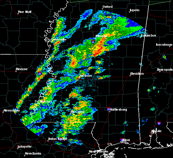 At 322 pm cst, a severe thunderstorm was located over mcadams, or near kosciusko, moving northeast at 50 mph (radar indicated). Hazards include 60 mph wind gusts and nickel size hail. Expect damage to roofs, siding, and trees. this severe storm will be near, kosciusko around 325 pm cst. hesterville around 330 pm cst. other locations impacted by this severe thunderstorm include mccool, ethel and sallis. A tornado watch remains in effect until 800 pm cst for central and north central mississippi. At 322 pm cst, a severe thunderstorm was located over mcadams, or near kosciusko, moving northeast at 50 mph (radar indicated). Hazards include 60 mph wind gusts and nickel size hail. Expect damage to roofs, siding, and trees. this severe storm will be near, kosciusko around 325 pm cst. hesterville around 330 pm cst. other locations impacted by this severe thunderstorm include mccool, ethel and sallis. A tornado watch remains in effect until 800 pm cst for central and north central mississippi.
|
| 2/23/2019 3:12 PM CST |
 At 311 pm cst, a severe thunderstorm was located near newport, or 8 miles south of durant, moving northeast at 50 mph (radar indicated). Hazards include 60 mph wind gusts and half dollar size hail. Hail damage to vehicles is expected. expect wind damage to roofs, siding, and trees. this severe storm will be near, mcadams around 320 pm cst. kosciusko and possumneck around 325 pm cst. hesterville around 330 pm cst. other locations impacted by this severe thunderstorm include mccool, ethel, sallis and west. A tornado watch remains in effect until 800 pm cst for central and north central mississippi. At 311 pm cst, a severe thunderstorm was located near newport, or 8 miles south of durant, moving northeast at 50 mph (radar indicated). Hazards include 60 mph wind gusts and half dollar size hail. Hail damage to vehicles is expected. expect wind damage to roofs, siding, and trees. this severe storm will be near, mcadams around 320 pm cst. kosciusko and possumneck around 325 pm cst. hesterville around 330 pm cst. other locations impacted by this severe thunderstorm include mccool, ethel, sallis and west. A tornado watch remains in effect until 800 pm cst for central and north central mississippi.
|
| 2/23/2019 2:53 PM CST |
 At 252 pm cst, a severe thunderstorm was located over vaughan, or 15 miles north of canton, moving northeast at 50 mph (radar indicated). Hazards include 60 mph wind gusts and quarter size hail. Hail damage to vehicles is expected. expect wind damage to roofs, siding, and trees. this severe thunderstorm will be near, cameron around 300 pm cst. goodman around 305 pm cst. durant and newport around 315 pm cst. mcadams around 320 pm cst. kosciusko and possumneck around 325 pm cst. hesterville around 330 pm cst. other locations impacted by this severe thunderstorm include mccool, ethel, sallis and west. A tornado watch remains in effect until 800 pm cst for central and north central mississippi. At 252 pm cst, a severe thunderstorm was located over vaughan, or 15 miles north of canton, moving northeast at 50 mph (radar indicated). Hazards include 60 mph wind gusts and quarter size hail. Hail damage to vehicles is expected. expect wind damage to roofs, siding, and trees. this severe thunderstorm will be near, cameron around 300 pm cst. goodman around 305 pm cst. durant and newport around 315 pm cst. mcadams around 320 pm cst. kosciusko and possumneck around 325 pm cst. hesterville around 330 pm cst. other locations impacted by this severe thunderstorm include mccool, ethel, sallis and west. A tornado watch remains in effect until 800 pm cst for central and north central mississippi.
|
| 1/19/2019 7:40 AM CST |
 At 740 am cst, a severe thunderstorm was located 10 miles north of zama, or 15 miles west of louisville, moving northeast at 45 mph (radar indicated). Hazards include 60 mph wind gusts. Expect damage to roofs, siding, and trees. this severe thunderstorm will be near, louisville and mcmillan around 755 am cst. ackerman around 800 am cst. betheden around 810 am cst. craig springs around 815 am cst. other locations impacted by this severe thunderstorm include mccool, sturgis and weir. A tornado watch remains in effect until 100 pm cst for central, northeastern and east central mississippi. At 740 am cst, a severe thunderstorm was located 10 miles north of zama, or 15 miles west of louisville, moving northeast at 45 mph (radar indicated). Hazards include 60 mph wind gusts. Expect damage to roofs, siding, and trees. this severe thunderstorm will be near, louisville and mcmillan around 755 am cst. ackerman around 800 am cst. betheden around 810 am cst. craig springs around 815 am cst. other locations impacted by this severe thunderstorm include mccool, sturgis and weir. A tornado watch remains in effect until 100 pm cst for central, northeastern and east central mississippi.
|
| 1/19/2019 5:54 AM CST |
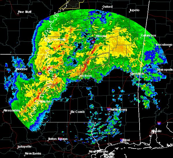 At 554 am cst, a severe thunderstorm capable of producing a tornado was located near durant, moving northeast at 40 mph (radar indicated rotation). Hazards include tornado. Flying debris will be dangerous to those caught without shelter. mobile homes will be damaged or destroyed. damage to roofs, windows, and vehicles will occur. tree damage is likely. this dangerous storm will be near, possumneck around 600 am cst. kosciusko around 605 am cst. hesterville around 610 am cst. Other locations impacted by this tornadic thunderstorm include mccool, ethel and sallis. At 554 am cst, a severe thunderstorm capable of producing a tornado was located near durant, moving northeast at 40 mph (radar indicated rotation). Hazards include tornado. Flying debris will be dangerous to those caught without shelter. mobile homes will be damaged or destroyed. damage to roofs, windows, and vehicles will occur. tree damage is likely. this dangerous storm will be near, possumneck around 600 am cst. kosciusko around 605 am cst. hesterville around 610 am cst. Other locations impacted by this tornadic thunderstorm include mccool, ethel and sallis.
|
| 12/27/2018 12:05 PM CST |
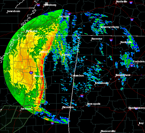 At 1205 pm cst, severe thunderstorms were located along a line extending from 8 miles southeast of lodi to 10 miles southwest of chester to 7 miles north of zama, moving northeast at 45 mph (radar indicated). Hazards include 60 mph wind gusts. Expect damage to roofs, siding, and trees. Locations impacted include, weir, ethel, french camp and mccool. At 1205 pm cst, severe thunderstorms were located along a line extending from 8 miles southeast of lodi to 10 miles southwest of chester to 7 miles north of zama, moving northeast at 45 mph (radar indicated). Hazards include 60 mph wind gusts. Expect damage to roofs, siding, and trees. Locations impacted include, weir, ethel, french camp and mccool.
|
| 12/27/2018 11:57 AM CST |
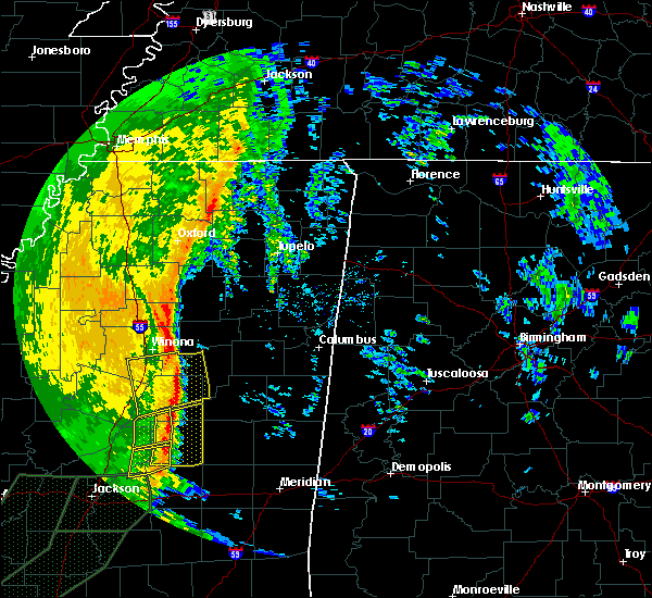 At 1157 am cst, severe thunderstorms were located along a line extending from near kilmichael to 9 miles southeast of poplar creek to near smyrna, moving northeast at 40 mph (radar indicated). Hazards include 60 mph wind gusts. Expect damage to roofs, siding, and trees. These severe thunderstorms will remain over mainly rural areas of western choctaw, northeastern attala and southeastern montgomery counties, including the following locations, mccool, ethel, french camp and weir. At 1157 am cst, severe thunderstorms were located along a line extending from near kilmichael to 9 miles southeast of poplar creek to near smyrna, moving northeast at 40 mph (radar indicated). Hazards include 60 mph wind gusts. Expect damage to roofs, siding, and trees. These severe thunderstorms will remain over mainly rural areas of western choctaw, northeastern attala and southeastern montgomery counties, including the following locations, mccool, ethel, french camp and weir.
|
| 12/27/2018 11:30 AM CST |
 At 1130 am cst, severe thunderstorms were located along a line extending from 6 miles northwest of vaiden to near possumneck to newport, moving northeast at 45 mph (radar indicated). Hazards include 60 mph wind gusts. Expect damage to roofs, siding, and trees. severe thunderstorms will be near, vaiden around 1135 am cst. hesterville around 1140 am cst. kosciusko around 1145 am cst. kilmichael around 1150 am cst. Other locations impacted by these severe thunderstorms include mccool, ethel, sallis, french camp, west and weir. At 1130 am cst, severe thunderstorms were located along a line extending from 6 miles northwest of vaiden to near possumneck to newport, moving northeast at 45 mph (radar indicated). Hazards include 60 mph wind gusts. Expect damage to roofs, siding, and trees. severe thunderstorms will be near, vaiden around 1135 am cst. hesterville around 1140 am cst. kosciusko around 1145 am cst. kilmichael around 1150 am cst. Other locations impacted by these severe thunderstorms include mccool, ethel, sallis, french camp, west and weir.
|
| 11/1/2018 4:34 AM CDT |
 At 433 am cdt, severe thunderstorms were located along a line extending from near chester to near zama, moving east at 40 mph (radar indicated). Hazards include 60 mph wind gusts. Expect damage to roofs, siding, and trees. severe thunderstorms will be near, louisville and mcmillan around 455 am cdt. betheden and millcreek around 505 am cdt. other locations impacted by these severe thunderstorms include noxapater, mccool and weir. A tornado watch remains in effect until 700 am cdt for central, northeastern and east central mississippi. At 433 am cdt, severe thunderstorms were located along a line extending from near chester to near zama, moving east at 40 mph (radar indicated). Hazards include 60 mph wind gusts. Expect damage to roofs, siding, and trees. severe thunderstorms will be near, louisville and mcmillan around 455 am cdt. betheden and millcreek around 505 am cdt. other locations impacted by these severe thunderstorms include noxapater, mccool and weir. A tornado watch remains in effect until 700 am cdt for central, northeastern and east central mississippi.
|
| 11/1/2018 4:07 AM CDT |
 At 407 am cdt, severe thunderstorms were located along a line extending from near poplar creek to near newport, moving east at 40 mph (radar indicated). Hazards include 60 mph wind gusts. Expect damage to roofs, siding, and trees. these severe storms will be near, smyrna around 425 am cdt. zama around 430 am cdt. other locations impacted by these severe thunderstorms include mccool and ethel. A tornado watch remains in effect until 700 am cdt for central and north central mississippi. At 407 am cdt, severe thunderstorms were located along a line extending from near poplar creek to near newport, moving east at 40 mph (radar indicated). Hazards include 60 mph wind gusts. Expect damage to roofs, siding, and trees. these severe storms will be near, smyrna around 425 am cdt. zama around 430 am cdt. other locations impacted by these severe thunderstorms include mccool and ethel. A tornado watch remains in effect until 700 am cdt for central and north central mississippi.
|
| 11/1/2018 3:49 AM CDT |
 At 349 am cdt, severe thunderstorms were located along a line extending from near vaiden to near goodman, moving east at 40 mph (radar indicated). Hazards include 60 mph wind gusts. Expect damage to roofs, siding, and trees. these severe storms will be near, mcadams around 405 am cdt. kosciusko around 415 am cdt. smyrna around 420 am cdt. zama around 430 am cdt. other locations impacted by these severe thunderstorms include mccool, ethel, sallis and west. A tornado watch remains in effect until 700 am cdt for central and north central mississippi. At 349 am cdt, severe thunderstorms were located along a line extending from near vaiden to near goodman, moving east at 40 mph (radar indicated). Hazards include 60 mph wind gusts. Expect damage to roofs, siding, and trees. these severe storms will be near, mcadams around 405 am cdt. kosciusko around 415 am cdt. smyrna around 420 am cdt. zama around 430 am cdt. other locations impacted by these severe thunderstorms include mccool, ethel, sallis and west. A tornado watch remains in effect until 700 am cdt for central and north central mississippi.
|
| 11/1/2018 3:28 AM CDT |
 At 328 am cdt, severe thunderstorms were located along a line extending from near emory to near vaughan, moving east at 40 mph (radar indicated). Hazards include 60 mph wind gusts. Expect damage to roofs, siding, and trees. severe thunderstorms will be near, bowling green around 335 am cdt. newport around 355 am cdt. mcadams around 405 am cdt. kosciusko around 410 am cdt. smyrna around 420 am cdt. zama around 430 am cdt. other locations impacted by these severe thunderstorms include mccool, ethel, sallis and west. A tornado watch remains in effect until 700 am cdt for central and north central mississippi. At 328 am cdt, severe thunderstorms were located along a line extending from near emory to near vaughan, moving east at 40 mph (radar indicated). Hazards include 60 mph wind gusts. Expect damage to roofs, siding, and trees. severe thunderstorms will be near, bowling green around 335 am cdt. newport around 355 am cdt. mcadams around 405 am cdt. kosciusko around 410 am cdt. smyrna around 420 am cdt. zama around 430 am cdt. other locations impacted by these severe thunderstorms include mccool, ethel, sallis and west. A tornado watch remains in effect until 700 am cdt for central and north central mississippi.
|
| 8/16/2018 3:50 PM CDT |
 At 349 pm cdt, a severe thunderstorm was located 8 miles west of chester, or 22 miles southeast of winona, moving southeast at 10 mph (radar indicated). Hazards include 60 mph wind gusts and quarter size hail. Hail damage to vehicles is expected. expect wind damage to roofs, siding, and trees. this severe storm will be near, chester around 415 pm cdt. Other locations impacted by this severe thunderstorm include french camp, mccool and weir. At 349 pm cdt, a severe thunderstorm was located 8 miles west of chester, or 22 miles southeast of winona, moving southeast at 10 mph (radar indicated). Hazards include 60 mph wind gusts and quarter size hail. Hail damage to vehicles is expected. expect wind damage to roofs, siding, and trees. this severe storm will be near, chester around 415 pm cdt. Other locations impacted by this severe thunderstorm include french camp, mccool and weir.
|
| 8/16/2018 3:33 PM CDT |
 At 333 pm cdt, a severe thunderstorm was located 8 miles east of poplar creek, or 19 miles southeast of winona, moving southeast at 10 mph (radar indicated). Hazards include 60 mph wind gusts and quarter size hail. Hail damage to vehicles is expected. expect wind damage to roofs, siding, and trees. this severe thunderstorm will be near, chester around 410 pm cdt. Other locations impacted by this severe thunderstorm include french camp, mccool and weir. At 333 pm cdt, a severe thunderstorm was located 8 miles east of poplar creek, or 19 miles southeast of winona, moving southeast at 10 mph (radar indicated). Hazards include 60 mph wind gusts and quarter size hail. Hail damage to vehicles is expected. expect wind damage to roofs, siding, and trees. this severe thunderstorm will be near, chester around 410 pm cdt. Other locations impacted by this severe thunderstorm include french camp, mccool and weir.
|
| 7/6/2018 5:30 PM CDT |
 At 530 pm cdt, severe thunderstorms were located along a line extending from near poplar creek to 6 miles southwest of ackerman, moving southwest at 40 mph (radar indicated). Hazards include 60 mph wind gusts. Expect damage to roofs, siding, and trees. these severe storms will be near, poplar creek around 535 pm cdt. Other locations impacted by these severe thunderstorms include french camp, mccool and weir. At 530 pm cdt, severe thunderstorms were located along a line extending from near poplar creek to 6 miles southwest of ackerman, moving southwest at 40 mph (radar indicated). Hazards include 60 mph wind gusts. Expect damage to roofs, siding, and trees. these severe storms will be near, poplar creek around 535 pm cdt. Other locations impacted by these severe thunderstorms include french camp, mccool and weir.
|
| 7/6/2018 5:21 PM CDT |
 At 521 pm cdt, severe thunderstorms were located along a line extending from 7 miles east of poplar creek to ackerman, moving southwest at 40 mph (radar indicated). Hazards include 60 mph wind gusts. Expect damage to roofs, siding, and trees. these severe storms will be near, poplar creek around 525 pm cdt. Other locations impacted by these severe thunderstorms include french camp, mccool and weir. At 521 pm cdt, severe thunderstorms were located along a line extending from 7 miles east of poplar creek to ackerman, moving southwest at 40 mph (radar indicated). Hazards include 60 mph wind gusts. Expect damage to roofs, siding, and trees. these severe storms will be near, poplar creek around 525 pm cdt. Other locations impacted by these severe thunderstorms include french camp, mccool and weir.
|
| 7/6/2018 5:06 PM CDT |
 At 505 pm cdt, severe thunderstorms were located along a line extending from 6 miles south of eupora to 6 miles east of reform, moving southwest at 40 mph (radar indicated). Hazards include 60 mph wind gusts. Expect damage to roofs, siding, and trees. severe thunderstorms will be near, ackerman and chester around 525 pm cdt. poplar creek around 530 pm cdt. Other locations impacted by these severe thunderstorms include mccool, french camp, sturgis and weir. At 505 pm cdt, severe thunderstorms were located along a line extending from 6 miles south of eupora to 6 miles east of reform, moving southwest at 40 mph (radar indicated). Hazards include 60 mph wind gusts. Expect damage to roofs, siding, and trees. severe thunderstorms will be near, ackerman and chester around 525 pm cdt. poplar creek around 530 pm cdt. Other locations impacted by these severe thunderstorms include mccool, french camp, sturgis and weir.
|
| 4/3/2018 9:17 PM CDT |
 At 916 pm cdt, severe thunderstorms were located along a line extending from near una to just west of louisville, moving east at 55 mph (emergency management. multiple trees were downed in webster county). Hazards include 60 mph wind gusts. Expect damage to roofs, siding, and trees. Locations impacted include, ackerman, mathiston, chester, zama, cumberland, reform, smyrna, sherwood, clarkson, weir, mantee and mccool. At 916 pm cdt, severe thunderstorms were located along a line extending from near una to just west of louisville, moving east at 55 mph (emergency management. multiple trees were downed in webster county). Hazards include 60 mph wind gusts. Expect damage to roofs, siding, and trees. Locations impacted include, ackerman, mathiston, chester, zama, cumberland, reform, smyrna, sherwood, clarkson, weir, mantee and mccool.
|
| 4/3/2018 9:06 PM CDT |
 At 904 pm cdt, severe thunderstorms were located along a line extending from near montpelier to near mccool, moving east at 45 mph (emergency management. at 849 pm, a tree was blown down on a house in eupora). Hazards include 60 mph wind gusts. Expect damage to roofs, siding, and trees. Locations impacted include, kosciusko, eupora, ackerman, mathiston, cumberland, sherwood, clarkson, chester, zama, reform, smyrna, weir, ethel, mantee, french camp and mccool. At 904 pm cdt, severe thunderstorms were located along a line extending from near montpelier to near mccool, moving east at 45 mph (emergency management. at 849 pm, a tree was blown down on a house in eupora). Hazards include 60 mph wind gusts. Expect damage to roofs, siding, and trees. Locations impacted include, kosciusko, eupora, ackerman, mathiston, cumberland, sherwood, clarkson, chester, zama, reform, smyrna, weir, ethel, mantee, french camp and mccool.
|
| 4/3/2018 9:03 PM CDT |
 At 902 pm cdt, severe thunderstorms were located along a line extending from near mantee to near kosciusko, moving east at 55 mph (radar indicated). Hazards include 60 mph wind gusts. Expect damage to roofs, siding, and trees. Locations impacted include, kosciusko, eupora, ackerman, mathiston, cumberland, sherwood, clarkson, chester, zama, reform, smyrna, weir, ethel, mantee, french camp and mccool. At 902 pm cdt, severe thunderstorms were located along a line extending from near mantee to near kosciusko, moving east at 55 mph (radar indicated). Hazards include 60 mph wind gusts. Expect damage to roofs, siding, and trees. Locations impacted include, kosciusko, eupora, ackerman, mathiston, cumberland, sherwood, clarkson, chester, zama, reform, smyrna, weir, ethel, mantee, french camp and mccool.
|
| 4/3/2018 8:47 PM CDT |
 At 847 pm cdt, severe thunderstorms were located along a line extending from near slate springs to near mcadams, moving east at 45 mph (radar indicated). Hazards include 60 mph wind gusts. Expect damage to roofs, siding, and trees. Locations impacted include, kosciusko, eupora, ackerman, mathiston, newport, hesterville, cumberland, sherwood, clarkson, chester, zama, bellefontaine, mcadams, reform, possumneck, smyrna, embry, weir, ethel and mantee. At 847 pm cdt, severe thunderstorms were located along a line extending from near slate springs to near mcadams, moving east at 45 mph (radar indicated). Hazards include 60 mph wind gusts. Expect damage to roofs, siding, and trees. Locations impacted include, kosciusko, eupora, ackerman, mathiston, newport, hesterville, cumberland, sherwood, clarkson, chester, zama, bellefontaine, mcadams, reform, possumneck, smyrna, embry, weir, ethel and mantee.
|
| 4/3/2018 8:19 PM CDT |
 At 819 pm cdt, severe thunderstorms were located along a line extending from near gore springs to near ebenezer, moving east at 45 mph (radar indicated). Hazards include 60 mph wind gusts. expect damage to roofs, siding, and trees At 819 pm cdt, severe thunderstorms were located along a line extending from near gore springs to near ebenezer, moving east at 45 mph (radar indicated). Hazards include 60 mph wind gusts. expect damage to roofs, siding, and trees
|
| 3/5/2018 6:44 PM CST |
 At 643 pm cst, a severe thunderstorm was located near kilmichael, or near winona, moving east at 40 mph (radar indicated). Hazards include 60 mph wind gusts and quarter size hail. Hail damage to vehicles is expected. expect wind damage to roofs, siding, and trees. this severe storm will be near, poplar creek around 655 pm cst. chester around 720 pm cst. ackerman around 730 pm cst. Other locations impacted by this severe thunderstorm include french camp, mccool and weir. At 643 pm cst, a severe thunderstorm was located near kilmichael, or near winona, moving east at 40 mph (radar indicated). Hazards include 60 mph wind gusts and quarter size hail. Hail damage to vehicles is expected. expect wind damage to roofs, siding, and trees. this severe storm will be near, poplar creek around 655 pm cst. chester around 720 pm cst. ackerman around 730 pm cst. Other locations impacted by this severe thunderstorm include french camp, mccool and weir.
|
| 3/5/2018 6:27 PM CST |
 At 626 pm cst, a severe thunderstorm was located near winona, moving east at 40 mph (radar indicated). Hazards include 60 mph wind gusts and half dollar size hail. Hail damage to vehicles is expected. expect wind damage to roofs, siding, and trees. this severe thunderstorm will be near, winona around 635 pm cst. kilmichael around 650 pm cst. poplar creek around 655 pm cst. chester around 720 pm cst. ackerman around 730 pm cst. Other locations impacted by this severe thunderstorm include french camp, mccool and weir. At 626 pm cst, a severe thunderstorm was located near winona, moving east at 40 mph (radar indicated). Hazards include 60 mph wind gusts and half dollar size hail. Hail damage to vehicles is expected. expect wind damage to roofs, siding, and trees. this severe thunderstorm will be near, winona around 635 pm cst. kilmichael around 650 pm cst. poplar creek around 655 pm cst. chester around 720 pm cst. ackerman around 730 pm cst. Other locations impacted by this severe thunderstorm include french camp, mccool and weir.
|
| 6/16/2017 5:08 PM CDT |
 At 507 pm cdt, severe thunderstorms were located along a line extending from 6 miles west of craig springs to 6 miles northeast of zama, moving east at 40 mph (radar indicated). Hazards include 60 mph wind gusts and quarter size hail. Hail damage to vehicles is expected. expect wind damage to roofs, siding, and trees. severe thunderstorms will be near, craig springs around 515 pm cdt. betheden around 520 pm cdt. oktoc around 530 pm cdt. Other locations impacted by these severe thunderstorms include noxapater, mccool, sturgis and weir. At 507 pm cdt, severe thunderstorms were located along a line extending from 6 miles west of craig springs to 6 miles northeast of zama, moving east at 40 mph (radar indicated). Hazards include 60 mph wind gusts and quarter size hail. Hail damage to vehicles is expected. expect wind damage to roofs, siding, and trees. severe thunderstorms will be near, craig springs around 515 pm cdt. betheden around 520 pm cdt. oktoc around 530 pm cdt. Other locations impacted by these severe thunderstorms include noxapater, mccool, sturgis and weir.
|
| 6/15/2017 7:52 PM CDT |
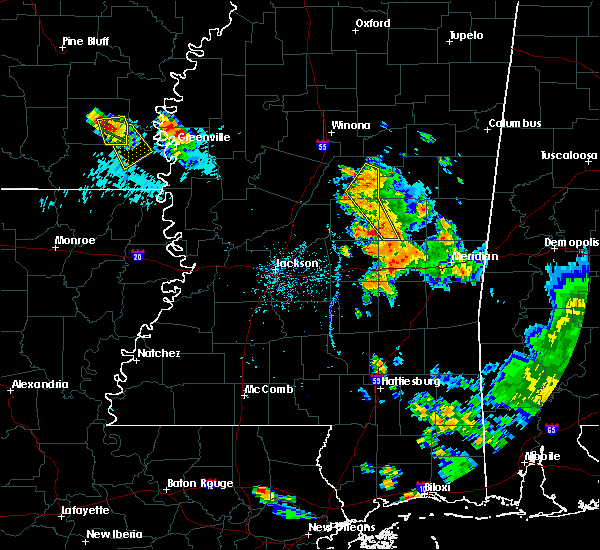 The severe thunderstorm warning for northeastern leake, eastern attala and southwestern neshoba counties will expire at 800 pm cdt, the storms which prompted the warning have weakened below severe limits, and no longer pose an immediate threat to life or property. therefore the warning will be allowed to expire. however gusty winds, heavy rain, and frequent cloud to ground lightning are still possible with these thunderstorms. The severe thunderstorm warning for northeastern leake, eastern attala and southwestern neshoba counties will expire at 800 pm cdt, the storms which prompted the warning have weakened below severe limits, and no longer pose an immediate threat to life or property. therefore the warning will be allowed to expire. however gusty winds, heavy rain, and frequent cloud to ground lightning are still possible with these thunderstorms.
|
| 6/15/2017 7:36 PM CDT |
 At 735 pm cdt, severe thunderstorms were located along a line extending from 12 miles northeast of kosciusko to near dowdville, moving southeast at 30 mph (radar indicated). Hazards include 60 mph wind gusts and penny size hail. Expect damage to roofs, siding, and trees. these severe storms will be near, dixon, dowdville and madden around 740 pm cdt. zama around 800 pm cdt. Other locations impacted by these severe thunderstorms include mccool and ethel. At 735 pm cdt, severe thunderstorms were located along a line extending from 12 miles northeast of kosciusko to near dowdville, moving southeast at 30 mph (radar indicated). Hazards include 60 mph wind gusts and penny size hail. Expect damage to roofs, siding, and trees. these severe storms will be near, dixon, dowdville and madden around 740 pm cdt. zama around 800 pm cdt. Other locations impacted by these severe thunderstorms include mccool and ethel.
|
| 6/15/2017 7:06 PM CDT |
 At 706 pm cdt, severe thunderstorms were located along a line extending from 10 miles north of zama to near smyrna, moving southeast at 20 mph (radar indicated). Hazards include 60 mph wind gusts and quarter size hail. Hail damage to vehicles is expected. expect wind damage to roofs, siding, and trees. severe thunderstorms will be near, zama around 715 pm cdt. renfroe around 720 pm cdt. edinburg around 740 pm cdt. pearl river around 755 pm cdt. philadelphia, stallo and burnside around 800 pm cdt. Other locations impacted by these severe thunderstorms include noxapater, tucker, mccool and ethel. At 706 pm cdt, severe thunderstorms were located along a line extending from 10 miles north of zama to near smyrna, moving southeast at 20 mph (radar indicated). Hazards include 60 mph wind gusts and quarter size hail. Hail damage to vehicles is expected. expect wind damage to roofs, siding, and trees. severe thunderstorms will be near, zama around 715 pm cdt. renfroe around 720 pm cdt. edinburg around 740 pm cdt. pearl river around 755 pm cdt. philadelphia, stallo and burnside around 800 pm cdt. Other locations impacted by these severe thunderstorms include noxapater, tucker, mccool and ethel.
|
| 4/26/2017 10:23 PM CDT |
 At 1023 pm cdt, a severe thunderstorm was located near carthage, moving east at 35 mph (radar indicated). Hazards include 60 mph wind gusts and quarter size hail. Hail damage to vehicles is expected. expect wind damage to roofs, siding, and trees. this severe thunderstorm will be near, edinburg around 1040 pm cdt. philadelphia and pearl river around 1050 pm cdt. burnside around 1100 pm cdt. stallo around 1105 pm cdt. nanih waiya around 1120 pm cdt. Other locations impacted by this severe thunderstorm include noxapater and weir. At 1023 pm cdt, a severe thunderstorm was located near carthage, moving east at 35 mph (radar indicated). Hazards include 60 mph wind gusts and quarter size hail. Hail damage to vehicles is expected. expect wind damage to roofs, siding, and trees. this severe thunderstorm will be near, edinburg around 1040 pm cdt. philadelphia and pearl river around 1050 pm cdt. burnside around 1100 pm cdt. stallo around 1105 pm cdt. nanih waiya around 1120 pm cdt. Other locations impacted by this severe thunderstorm include noxapater and weir.
|
| 4/26/2017 9:51 PM CDT |
 At 951 pm cdt, a severe thunderstorm was located over kosciusko, moving northeast at 45 mph (radar indicated). Hazards include 60 mph wind gusts and quarter size hail. Hail damage to vehicles is expected. expect wind damage to roofs, siding, and trees. This severe thunderstorm will remain over mainly rural areas of northern leake, attala and northeastern madison counties, including the following locations: mccool, ethel and redwater. At 951 pm cdt, a severe thunderstorm was located over kosciusko, moving northeast at 45 mph (radar indicated). Hazards include 60 mph wind gusts and quarter size hail. Hail damage to vehicles is expected. expect wind damage to roofs, siding, and trees. This severe thunderstorm will remain over mainly rural areas of northern leake, attala and northeastern madison counties, including the following locations: mccool, ethel and redwater.
|
| 2/7/2017 6:09 PM CST |
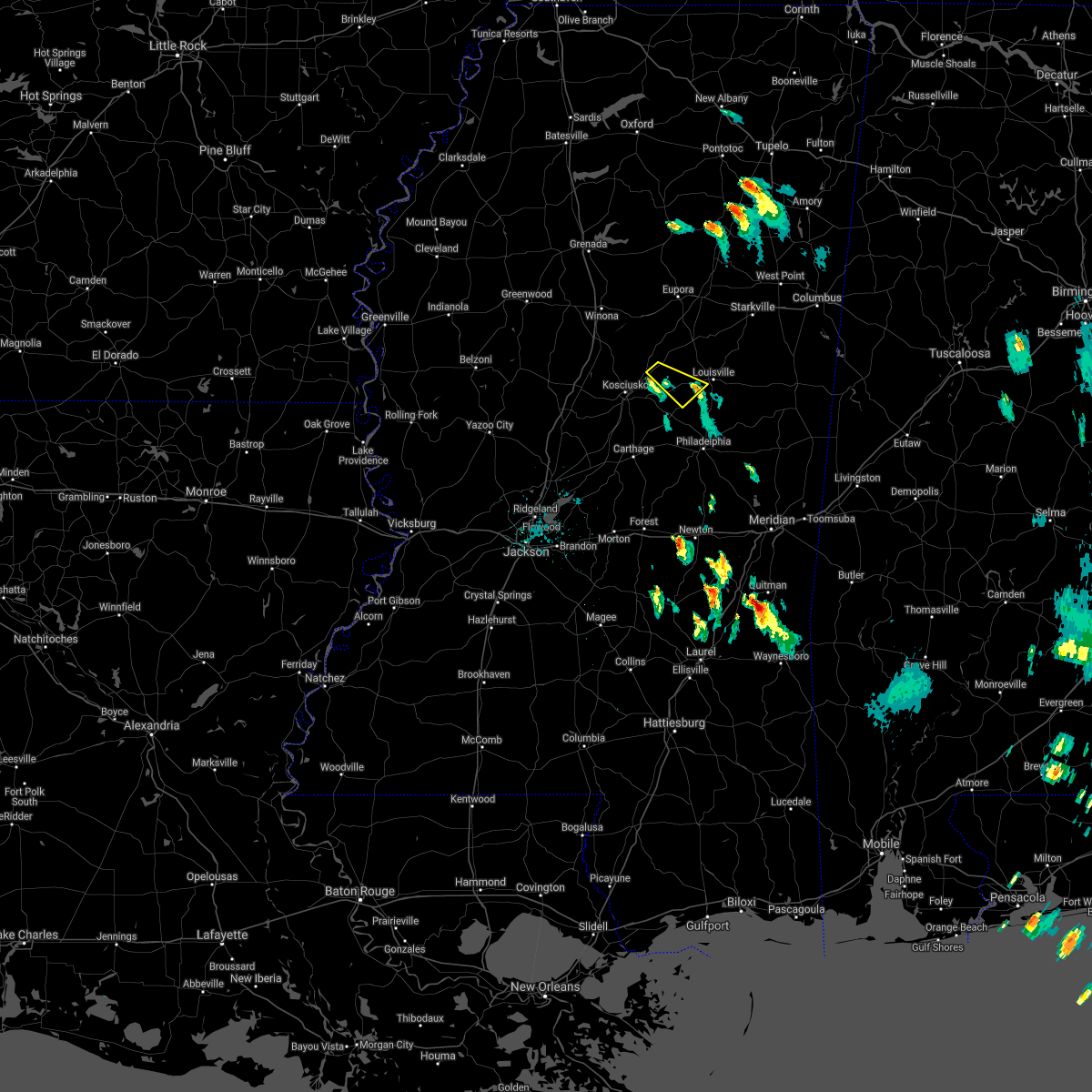 The severe thunderstorm warning for east central attala, south central choctaw and southwestern winston counties will expire at 615 pm cst, the storm which prompted the warning has weakened below severe limits, and no longer pose an immediate threat to life or property. therefore the warning will be allowed to expire. The severe thunderstorm warning for east central attala, south central choctaw and southwestern winston counties will expire at 615 pm cst, the storm which prompted the warning has weakened below severe limits, and no longer pose an immediate threat to life or property. therefore the warning will be allowed to expire.
|
| 2/7/2017 5:36 PM CST |
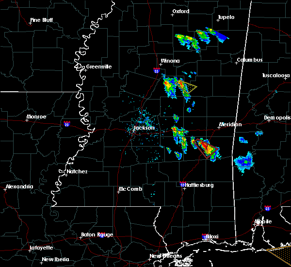 At 536 pm cst, a severe thunderstorm was located 11 miles north of zama, or 14 miles east of kosciusko, moving southeast at 30 mph (radar indicated). Hazards include 60 mph wind gusts and quarter size hail. Hail damage to vehicles is expected. expect wind damage to roofs, siding, and trees. This severe thunderstorm will remain over mainly rural areas of east central attala, south central choctaw and southwestern winston counties. At 536 pm cst, a severe thunderstorm was located 11 miles north of zama, or 14 miles east of kosciusko, moving southeast at 30 mph (radar indicated). Hazards include 60 mph wind gusts and quarter size hail. Hail damage to vehicles is expected. expect wind damage to roofs, siding, and trees. This severe thunderstorm will remain over mainly rural areas of east central attala, south central choctaw and southwestern winston counties.
|
| 2/7/2017 5:18 PM CST |
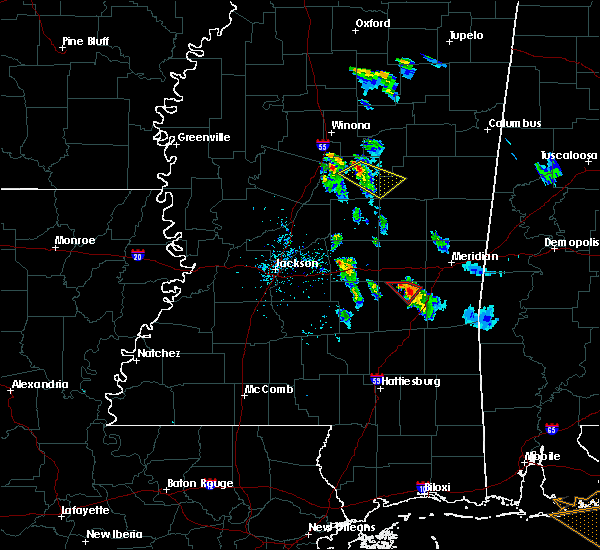 At 518 pm cst, a severe thunderstorm was located 9 miles east of hesterville, or 10 miles northeast of kosciusko, moving southeast at 30 mph (radar indicated). Hazards include 60 mph wind gusts and quarter size hail. Hail damage to vehicles is expected. expect wind damage to roofs, siding, and trees. this severe thunderstorm will remain over mainly rural areas of northeastern attala, south central choctaw and southwestern winston counties, including the following locations: ethel and mccool. A tornado watch remains in effect until 700 pm cst for east central mississippi. At 518 pm cst, a severe thunderstorm was located 9 miles east of hesterville, or 10 miles northeast of kosciusko, moving southeast at 30 mph (radar indicated). Hazards include 60 mph wind gusts and quarter size hail. Hail damage to vehicles is expected. expect wind damage to roofs, siding, and trees. this severe thunderstorm will remain over mainly rural areas of northeastern attala, south central choctaw and southwestern winston counties, including the following locations: ethel and mccool. A tornado watch remains in effect until 700 pm cst for east central mississippi.
|
| 1/2/2017 3:16 PM CST |
 At 315 pm cst, severe thunderstorms were located along a line extending from kosciusko to near madden, moving northeast at 70 mph (radar indicated). Hazards include 60 mph wind gusts. Expect damage to roofs, siding, and trees. these severe storms will be near, smyrna around 320 pm cst. other locations impacted by these severe thunderstorms include standing pine, redwater, walnut grove, mccool and ethel. A tornado watch remains in effect until 800 pm cst for central mississippi. At 315 pm cst, severe thunderstorms were located along a line extending from kosciusko to near madden, moving northeast at 70 mph (radar indicated). Hazards include 60 mph wind gusts. Expect damage to roofs, siding, and trees. these severe storms will be near, smyrna around 320 pm cst. other locations impacted by these severe thunderstorms include standing pine, redwater, walnut grove, mccool and ethel. A tornado watch remains in effect until 800 pm cst for central mississippi.
|
| 1/2/2017 3:02 PM CST |
 At 302 pm cst, severe thunderstorms were located along a line extending from newport to near ludlow, moving northeast at 55 mph (radar indicated). Hazards include 60 mph wind gusts. Expect damage to roofs, siding, and trees. these severe storms will be near, newport and thomastown around 305 pm cst. mcadams around 310 pm cst. kosciusko and carthage around 315 pm cst. hesterville around 320 pm cst. edinburg and renfroe around 325 pm cst. zama around 335 pm cst. other locations impacted by these severe thunderstorms include redwater, standing pine, walnut grove, sallis, lena, ethel and mccool. A tornado watch remains in effect until 800 pm cst for central mississippi. At 302 pm cst, severe thunderstorms were located along a line extending from newport to near ludlow, moving northeast at 55 mph (radar indicated). Hazards include 60 mph wind gusts. Expect damage to roofs, siding, and trees. these severe storms will be near, newport and thomastown around 305 pm cst. mcadams around 310 pm cst. kosciusko and carthage around 315 pm cst. hesterville around 320 pm cst. edinburg and renfroe around 325 pm cst. zama around 335 pm cst. other locations impacted by these severe thunderstorms include redwater, standing pine, walnut grove, sallis, lena, ethel and mccool. A tornado watch remains in effect until 800 pm cst for central mississippi.
|
| 1/2/2017 2:43 PM CST |
 At 243 pm cst, severe thunderstorms were located along a line extending from near cameron to near leesburg, moving northeast at 70 mph (radar indicated). Hazards include 60 mph wind gusts. Expect damage to roofs, siding, and trees. severe thunderstorms will be near, cameron and camden around 250 pm cst. newport and thomastown around 255 pm cst. mcadams and tuscola around 300 pm cst. kosciusko, carthage and hesterville around 305 pm cst. madden around 310 pm cst. edinburg and renfroe around 315 pm cst. zama around 325 pm cst. other locations impacted by these severe thunderstorms include redwater, standing pine, walnut grove, sallis, lena, ethel and mccool. A tornado watch remains in effect until 800 pm cst for central mississippi. At 243 pm cst, severe thunderstorms were located along a line extending from near cameron to near leesburg, moving northeast at 70 mph (radar indicated). Hazards include 60 mph wind gusts. Expect damage to roofs, siding, and trees. severe thunderstorms will be near, cameron and camden around 250 pm cst. newport and thomastown around 255 pm cst. mcadams and tuscola around 300 pm cst. kosciusko, carthage and hesterville around 305 pm cst. madden around 310 pm cst. edinburg and renfroe around 315 pm cst. zama around 325 pm cst. other locations impacted by these severe thunderstorms include redwater, standing pine, walnut grove, sallis, lena, ethel and mccool. A tornado watch remains in effect until 800 pm cst for central mississippi.
|
| 11/29/2016 9:39 PM CST |
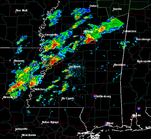 At 939 pm cst, a severe thunderstorm capable of producing a tornado was located 7 miles northeast of hesterville, or 11 miles north of kosciusko, moving northeast at 40 mph (radar indicated rotation). Hazards include tornado. Flying debris will be dangerous to those caught without shelter. mobile homes will be damaged or destroyed. damage to roofs, windows, and vehicles will occur. tree damage is likely. Locations impacted include, mccool. At 939 pm cst, a severe thunderstorm capable of producing a tornado was located 7 miles northeast of hesterville, or 11 miles north of kosciusko, moving northeast at 40 mph (radar indicated rotation). Hazards include tornado. Flying debris will be dangerous to those caught without shelter. mobile homes will be damaged or destroyed. damage to roofs, windows, and vehicles will occur. tree damage is likely. Locations impacted include, mccool.
|
| 11/29/2016 9:32 PM CST |
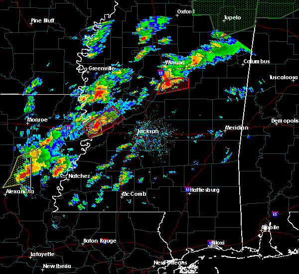 At 932 pm cst, a severe thunderstorm capable of producing a tornado was located near hesterville, or 8 miles north of kosciusko, moving northeast at 45 mph (radar indicated rotation). Hazards include tornado. Flying debris will be dangerous to those caught without shelter. mobile homes will be damaged or destroyed. damage to roofs, windows, and vehicles will occur. tree damage is likely. Locations impacted include, hesterville and mccool. At 932 pm cst, a severe thunderstorm capable of producing a tornado was located near hesterville, or 8 miles north of kosciusko, moving northeast at 45 mph (radar indicated rotation). Hazards include tornado. Flying debris will be dangerous to those caught without shelter. mobile homes will be damaged or destroyed. damage to roofs, windows, and vehicles will occur. tree damage is likely. Locations impacted include, hesterville and mccool.
|
| 11/29/2016 9:13 PM CST |
 At 913 pm cst, a severe thunderstorm capable of producing a tornado was located over durant, moving east at 45 mph (radar indicated rotation). Hazards include tornado. Flying debris will be dangerous to those caught without shelter. mobile homes will be damaged or destroyed. damage to roofs, windows, and vehicles will occur. Tree damage is likely. At 913 pm cst, a severe thunderstorm capable of producing a tornado was located over durant, moving east at 45 mph (radar indicated rotation). Hazards include tornado. Flying debris will be dangerous to those caught without shelter. mobile homes will be damaged or destroyed. damage to roofs, windows, and vehicles will occur. Tree damage is likely.
|
| 11/28/2016 3:46 PM CST |
 At 346 pm cst, severe thunderstorms were located along a line extending from near eupora to near newport, moving east at 55 mph (radar indicated). Hazards include 60 mph wind gusts. Expect damage to roofs. siding. and trees. severe thunderstorms will be near, reform and mcadams around 355 pm cst. kosciusko and sherwood around 400 pm cst. maben around 405 pm cst. smyrna around 410 pm cst. zama around 415 pm cst. other locations impacted by these severe thunderstorms include weir, french camp, mccool, ethel and sturgis. A tornado watch remains in effect until 900 pm cst for north central, northeastern, east central and central mississippi. At 346 pm cst, severe thunderstorms were located along a line extending from near eupora to near newport, moving east at 55 mph (radar indicated). Hazards include 60 mph wind gusts. Expect damage to roofs. siding. and trees. severe thunderstorms will be near, reform and mcadams around 355 pm cst. kosciusko and sherwood around 400 pm cst. maben around 405 pm cst. smyrna around 410 pm cst. zama around 415 pm cst. other locations impacted by these severe thunderstorms include weir, french camp, mccool, ethel and sturgis. A tornado watch remains in effect until 900 pm cst for north central, northeastern, east central and central mississippi.
|
| 7/10/2016 1:37 PM CDT |
 At 136 pm cdt, a severe thunderstorm was located 9 miles northeast of kosciusko, moving northeast at 15 mph (radar indicated). Hazards include 60 mph wind gusts. Expect damage to roofs. siding. and trees. Locations impacted include, ethel and mccool. At 136 pm cdt, a severe thunderstorm was located 9 miles northeast of kosciusko, moving northeast at 15 mph (radar indicated). Hazards include 60 mph wind gusts. Expect damage to roofs. siding. and trees. Locations impacted include, ethel and mccool.
|
| 7/10/2016 1:17 PM CDT |
 At 117 pm cdt, a severe thunderstorm was located near kosciusko, moving northeast at 15 mph (radar indicated). Hazards include 60 mph wind gusts. Expect damage to roofs. siding. And trees. At 117 pm cdt, a severe thunderstorm was located near kosciusko, moving northeast at 15 mph (radar indicated). Hazards include 60 mph wind gusts. Expect damage to roofs. siding. And trees.
|
| 6/17/2016 3:52 PM CDT | Power line down in mccool causing several outage in attala county MS, 0 miles NNE of McCool, MS |
| 6/17/2016 3:43 PM CDT |
 At 343 pm cdt, severe thunderstorms were located along a line extending from seven pines to 8 miles southwest of ackerman, moving south at 25 mph (radar indicated). Hazards include 70 mph wind gusts and quarter size hail. Hail damage to vehicles is expected. expect considerable tree damage. wind damage is also likely to mobile homes, roofs, and outbuildings. severe thunderstorms will be near, mcmillan around 405 pm cdt. emory around 410 pm cdt. lexington and bowling green around 425 pm cdt. franklin around 440 pm cdt. durant and goodman around 445 pm cdt. Other locations impacted by these severe thunderstorms include french camp, noxapater, sallis, ethel, west, weir and mccool. At 343 pm cdt, severe thunderstorms were located along a line extending from seven pines to 8 miles southwest of ackerman, moving south at 25 mph (radar indicated). Hazards include 70 mph wind gusts and quarter size hail. Hail damage to vehicles is expected. expect considerable tree damage. wind damage is also likely to mobile homes, roofs, and outbuildings. severe thunderstorms will be near, mcmillan around 405 pm cdt. emory around 410 pm cdt. lexington and bowling green around 425 pm cdt. franklin around 440 pm cdt. durant and goodman around 445 pm cdt. Other locations impacted by these severe thunderstorms include french camp, noxapater, sallis, ethel, west, weir and mccool.
|
| 5/1/2016 11:40 AM CDT |
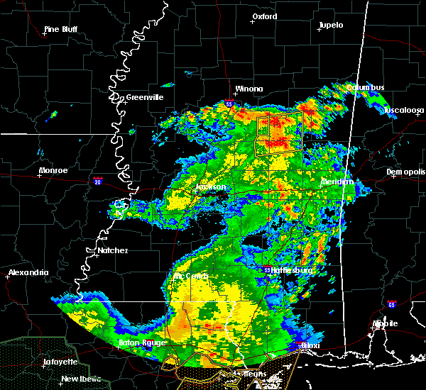 At 1140 am cdt, severe thunderstorms were located along a line extending from near ackerman to near stallo, moving east at 35 mph (radar indicated). Hazards include 60 mph wind gusts. Expect damage to roofs. siding. and trees. Locations impacted include, mccool. At 1140 am cdt, severe thunderstorms were located along a line extending from near ackerman to near stallo, moving east at 35 mph (radar indicated). Hazards include 60 mph wind gusts. Expect damage to roofs. siding. and trees. Locations impacted include, mccool.
|
| 5/1/2016 11:17 AM CDT |
 At 1117 am cdt, severe thunderstorms were located along a line extending from 10 miles northeast of kosciusko to near edinburg, moving northeast at 50 mph (radar indicated). Hazards include 60 mph wind gusts. Expect damage to roofs. siding. and trees. These severe thunderstorms will remain over mainly rural areas of northeastern attala county, including the following locations: ethel and mccool. At 1117 am cdt, severe thunderstorms were located along a line extending from 10 miles northeast of kosciusko to near edinburg, moving northeast at 50 mph (radar indicated). Hazards include 60 mph wind gusts. Expect damage to roofs. siding. and trees. These severe thunderstorms will remain over mainly rural areas of northeastern attala county, including the following locations: ethel and mccool.
|
| 5/1/2016 10:56 AM CDT |
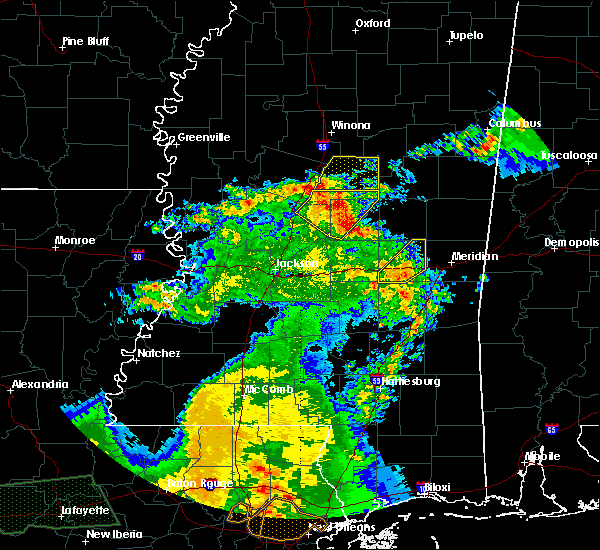 At 1055 am cdt, severe thunderstorms were located along a line extending from near durant to near singleton to carthage, moving northeast at 45 mph (radar indicated). Hazards include 60 mph wind gusts. Expect damage to roofs. siding. and trees. severe thunderstorms will be near, mcadams around 1100 am cdt. kosciusko around 1105 am cdt. possumneck around 1110 am cdt. hesterville around 1115 am cdt. Other locations impacted by these severe thunderstorms include sallis, ethel and mccool. At 1055 am cdt, severe thunderstorms were located along a line extending from near durant to near singleton to carthage, moving northeast at 45 mph (radar indicated). Hazards include 60 mph wind gusts. Expect damage to roofs. siding. and trees. severe thunderstorms will be near, mcadams around 1100 am cdt. kosciusko around 1105 am cdt. possumneck around 1110 am cdt. hesterville around 1115 am cdt. Other locations impacted by these severe thunderstorms include sallis, ethel and mccool.
|
| 4/11/2016 4:47 PM CDT | A tree fell and damaged utility equipment off mcdaniel rd in attala county MS, 5.2 miles NNE of McCool, MS |
| 3/3/2016 4:32 PM CST |
 At 432 pm cst, a severe thunderstorm was located near zama, or 13 miles east of kosciusko, moving east at 55 mph (radar indicated). Hazards include 60 mph wind gusts and quarter size hail. Hail damage to vehicles is expected. expect wind damage to roofs, siding and trees. This severe thunderstorm will remain over mainly rural areas of east central attala county. At 432 pm cst, a severe thunderstorm was located near zama, or 13 miles east of kosciusko, moving east at 55 mph (radar indicated). Hazards include 60 mph wind gusts and quarter size hail. Hail damage to vehicles is expected. expect wind damage to roofs, siding and trees. This severe thunderstorm will remain over mainly rural areas of east central attala county.
|
| 3/3/2016 4:22 PM CST |
 At 422 pm cst, a severe thunderstorm was located near kosciusko, moving east at 45 mph (radar indicated). Hazards include 60 mph wind gusts and quarter size hail. Hail damage to vehicles is expected. expect wind damage to roofs, siding and trees. this severe storm will be near, zama around 440 pm cst. Other locations impacted by this severe thunderstorm include ethel and mccool. At 422 pm cst, a severe thunderstorm was located near kosciusko, moving east at 45 mph (radar indicated). Hazards include 60 mph wind gusts and quarter size hail. Hail damage to vehicles is expected. expect wind damage to roofs, siding and trees. this severe storm will be near, zama around 440 pm cst. Other locations impacted by this severe thunderstorm include ethel and mccool.
|
| 3/3/2016 4:02 PM CST |
 At 402 pm cst, a severe thunderstorm was located near bowling green, or 8 miles north of durant, moving east at 45 mph (radar indicated). Hazards include 60 mph wind gusts and quarter size hail. Hail damage to vehicles is expected. expect wind damage to roofs, siding and trees. this severe thunderstorm will be near, possumneck around 410 pm cst. hesterville around 415 pm cst. kosciusko around 425 pm cst. smyrna around 435 pm cst. zama around 440 pm cst. Other locations impacted by this severe thunderstorm include ethel and mccool. At 402 pm cst, a severe thunderstorm was located near bowling green, or 8 miles north of durant, moving east at 45 mph (radar indicated). Hazards include 60 mph wind gusts and quarter size hail. Hail damage to vehicles is expected. expect wind damage to roofs, siding and trees. this severe thunderstorm will be near, possumneck around 410 pm cst. hesterville around 415 pm cst. kosciusko around 425 pm cst. smyrna around 435 pm cst. zama around 440 pm cst. Other locations impacted by this severe thunderstorm include ethel and mccool.
|
| 2/23/2016 10:05 PM CST |
 At 1004 pm cst, severe thunderstorms were located along a line extending from 7 miles east of poplar creek to near edinburg, moving northeast at 50 mph (radar indicated). Hazards include 60 mph wind gusts. Expect damage to roofs. siding and trees. severe thunderstorms will be near, chester around 1015 pm cst. reform around 1025 pm cst. sherwood and stallo around 1030 pm cst. maben around 1035 pm cst. millcreek around 1045 pm cst. Other locations impacted by these severe thunderstorms include weir, french camp, noxapater, mccool, ethel and sturgis. At 1004 pm cst, severe thunderstorms were located along a line extending from 7 miles east of poplar creek to near edinburg, moving northeast at 50 mph (radar indicated). Hazards include 60 mph wind gusts. Expect damage to roofs. siding and trees. severe thunderstorms will be near, chester around 1015 pm cst. reform around 1025 pm cst. sherwood and stallo around 1030 pm cst. maben around 1035 pm cst. millcreek around 1045 pm cst. Other locations impacted by these severe thunderstorms include weir, french camp, noxapater, mccool, ethel and sturgis.
|
| 2/15/2016 12:47 PM CST | Tree down across hinze roa in winston county MS, 11.8 miles NNW of McCool, MS |
| 2/2/2016 1:42 PM CST |
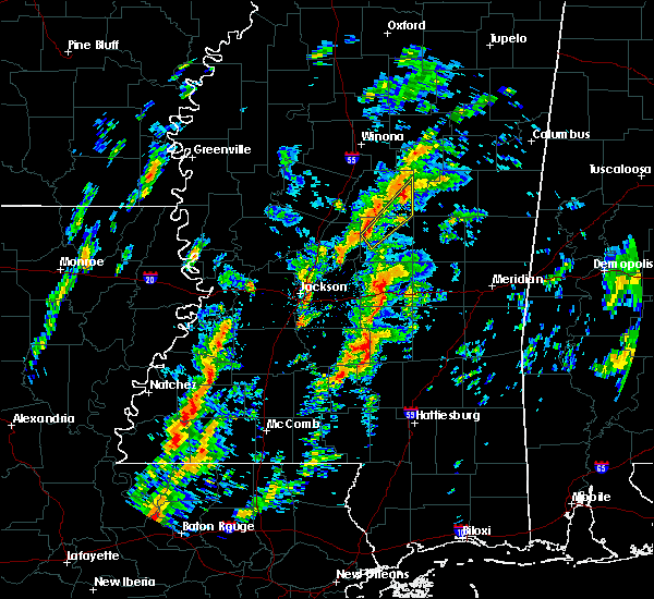 At 142 pm cst, a severe thunderstorm was located near zama, or 11 miles east of kosciusko, moving northeast at 40 mph (radar indicated). Hazards include 60 mph wind gusts and quarter size hail. Hail damage to vehicles is expected. expect wind damage to roofs, siding and trees. this severe thunderstorm will remain over mainly rural areas of northwestern leake and southeastern attala counties, including the following locations, mccool. a tornado watch remains in effect until 700 pm cst for central mississippi. A tornado watch also remains in effect until 700 pm cst for central mississippi. At 142 pm cst, a severe thunderstorm was located near zama, or 11 miles east of kosciusko, moving northeast at 40 mph (radar indicated). Hazards include 60 mph wind gusts and quarter size hail. Hail damage to vehicles is expected. expect wind damage to roofs, siding and trees. this severe thunderstorm will remain over mainly rural areas of northwestern leake and southeastern attala counties, including the following locations, mccool. a tornado watch remains in effect until 700 pm cst for central mississippi. A tornado watch also remains in effect until 700 pm cst for central mississippi.
|
| 2/2/2016 1:21 PM CST |
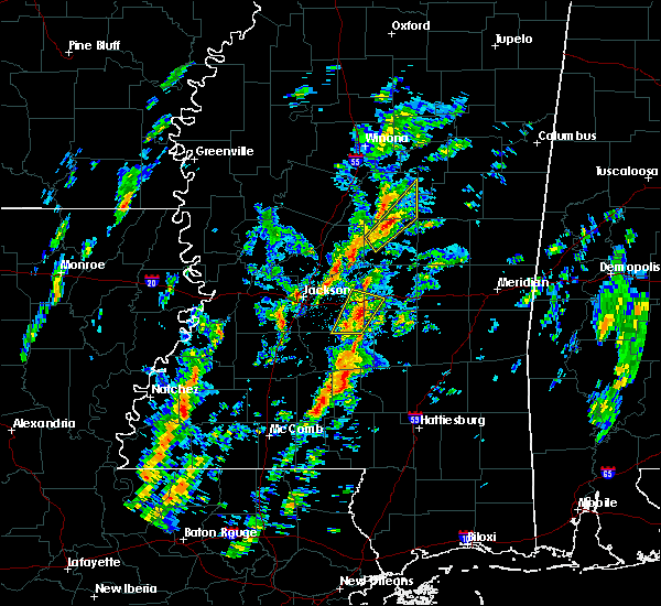 At 121 pm cst, a severe thunderstorm was located over singleton, or 8 miles north of carthage, moving northeast at 40 mph (radar indicated). Hazards include 60 mph wind gusts and quarter size hail. Hail damage to vehicles is expected. expect wind damage to roofs, siding and trees. this severe storm will be near, smyrna around 135 pm cst. zama around 140 pm cst. other locations impacted by this severe thunderstorm include redwater and mccool. a tornado watch remains in effect until 700 pm cst for central mississippi. A tornado watch also remains in effect until 700 pm cst for central mississippi. At 121 pm cst, a severe thunderstorm was located over singleton, or 8 miles north of carthage, moving northeast at 40 mph (radar indicated). Hazards include 60 mph wind gusts and quarter size hail. Hail damage to vehicles is expected. expect wind damage to roofs, siding and trees. this severe storm will be near, smyrna around 135 pm cst. zama around 140 pm cst. other locations impacted by this severe thunderstorm include redwater and mccool. a tornado watch remains in effect until 700 pm cst for central mississippi. A tornado watch also remains in effect until 700 pm cst for central mississippi.
|
| 2/2/2016 1:08 PM CST |
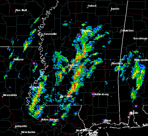 At 107 pm cst, a severe thunderstorm was located near carthage, moving northeast at 35 mph (radar indicated). Hazards include 60 mph wind gusts and quarter size hail. Hail damage to vehicles is expected. expect wind damage to roofs, siding and trees. this severe thunderstorm will be near, singleton and renfroe around 125 pm cst. smyrna around 135 pm cst. zama around 140 pm cst. other locations impacted by this severe thunderstorm include redwater and mccool. A tornado watch remains in effect until 700 pm cst for central mississippi. At 107 pm cst, a severe thunderstorm was located near carthage, moving northeast at 35 mph (radar indicated). Hazards include 60 mph wind gusts and quarter size hail. Hail damage to vehicles is expected. expect wind damage to roofs, siding and trees. this severe thunderstorm will be near, singleton and renfroe around 125 pm cst. smyrna around 135 pm cst. zama around 140 pm cst. other locations impacted by this severe thunderstorm include redwater and mccool. A tornado watch remains in effect until 700 pm cst for central mississippi.
|
| 12/28/2015 6:50 AM CST |
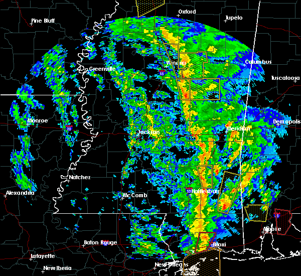 At 650 am cst, severe thunderstorms were located along a line extending from near poplar creek to near renfroe, moving northeast at 30 mph (radar indicated). Hazards include 60 mph wind gusts. Expect damage to roofs. siding and trees. locations impacted include, zama, ethel and mccool. A tornado watch remains in effect until 800 am cst for central mississippi. At 650 am cst, severe thunderstorms were located along a line extending from near poplar creek to near renfroe, moving northeast at 30 mph (radar indicated). Hazards include 60 mph wind gusts. Expect damage to roofs. siding and trees. locations impacted include, zama, ethel and mccool. A tornado watch remains in effect until 800 am cst for central mississippi.
|
| 12/28/2015 5:55 AM CST |
 At 555 am cst, severe thunderstorms were located along a line extending from near emory to near ludlow, moving northeast at 35 mph (radar indicated). Hazards include 60 mph wind gusts. Expect damage to roofs. siding and trees. these severe thunderstorms will remain over mainly rural areas of attala county, including the following locations, sallis, ethel and mccool. A tornado watch remains in effect until 800 am cst for north central mississippi. At 555 am cst, severe thunderstorms were located along a line extending from near emory to near ludlow, moving northeast at 35 mph (radar indicated). Hazards include 60 mph wind gusts. Expect damage to roofs. siding and trees. these severe thunderstorms will remain over mainly rural areas of attala county, including the following locations, sallis, ethel and mccool. A tornado watch remains in effect until 800 am cst for north central mississippi.
|
| 6/10/2015 5:42 PM CDT |
 At 542 pm cdt, a severe thunderstorm was located near smyrna, or near kosciusko, moving south at 30 mph (radar indicated). Hazards include 60 mph wind gusts and half dollar size hail. Hail damage to vehicles is expected. expect wind damage to roofs, siding and trees. this severe thunderstorm will be near, smyrna around 555 pm cdt. zama around 600 pm cdt. Other locations impacted by this severe thunderstorm include ethel. At 542 pm cdt, a severe thunderstorm was located near smyrna, or near kosciusko, moving south at 30 mph (radar indicated). Hazards include 60 mph wind gusts and half dollar size hail. Hail damage to vehicles is expected. expect wind damage to roofs, siding and trees. this severe thunderstorm will be near, smyrna around 555 pm cdt. zama around 600 pm cdt. Other locations impacted by this severe thunderstorm include ethel.
|
| 4/25/2015 2:11 AM CDT | At 211 am cdt, severe thunderstorms were located along a line extending from 12 miles north of zama to thomastown, moving southeast at 50 mph (radar indicated). Hazards include 60 mph wind gusts and quarter size hail. Hail damage to vehicles is expected. expect wind damage to roofs, siding and trees. these severe storms will be near, singleton around 220 am cdt. carthage around 225 am cdt. tuscola around 235 am cdt. madden around 240 am cdt. other locations impacted by these severe thunderstorms include redwater, standing pine, mccool, walnut grove and lena. a tornado watch remains in effect until 800 am cdt for central mississippi. 1. 00in. |
| 4/25/2015 1:44 AM CDT | At 144 am cdt, severe thunderstorms were located along a line extending from near possumneck to near pickens, moving southeast at 60 mph (radar indicated). Hazards include 60 mph wind gusts and quarter size hail. Hail damage to vehicles is expected. expect wind damage to roofs, siding and trees. severe thunderstorms will be near, possumneck around 150 am cdt. hesterville and mcadams around 155 am cdt. kosciusko around 200 am cdt. smyrna around 210 am cdt. zama around 215 am cdt. tuscola around 220 am cdt. other locations impacted by these severe thunderstorms include redwater, standing pine, walnut grove, sallis, lena, ethel and mccool. a tornado watch remains in effect until 800 am cdt for north central mississippi. 1. 00in. |
| 10/13/2014 4:30 PM CDT | Power line down along hwy 12 in attala county MS, 1.8 miles SW of McCool, MS |
| 5/6/2012 2:10 PM CDT | Quarter sized hail reported 2.9 miles SSW of McCool, MS |
| 1/1/0001 12:00 AM | Quarter sized hail reported 7.3 miles ENE of McCool, MS |
| 1/1/0001 12:00 AM | Quarter sized hail reported 0 miles NNE of McCool, MS, covered the ground on the south side of town |
| 1/1/0001 12:00 AM | Quarter sized hail reported 0 miles NNE of McCool, MS |
Hail Maps for McCool, MS
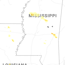
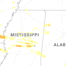
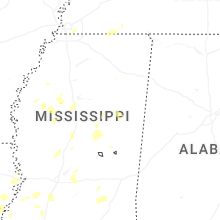
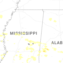

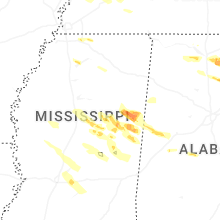


Connect with Interactive Hail Maps