

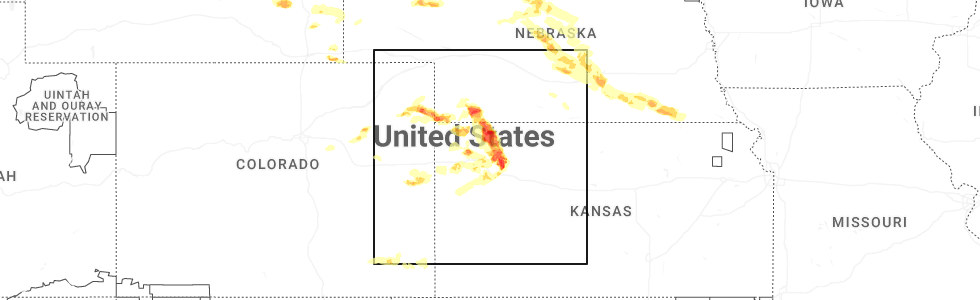
Hail Map for McDonald, KS
The McDonald, KS area has had 22 reports of on-the-ground hail by trained spotters, and has been under severe weather warnings 39 times during the past 12 months. Doppler radar has detected hail at or near McDonald, KS on 111 occasions, including 15 occasions during the past year.
| Name: | McDonald, KS |
| Where Located: | 31.8 miles NNW of Colby, KS |
| Map: | Google Map for McDonald, KS |
| Population: | 160 |
| Housing Units: | 98 |
| More Info: | Search Google for McDonald, KS |
2
The Top Recent Hail Date for McDonald, KS is Saturday, June 20, 2026 (10th out of 111)
Hail and Wind Damage Spotted near McDonald, KS
| Date / Time | Report Details |
|---|---|
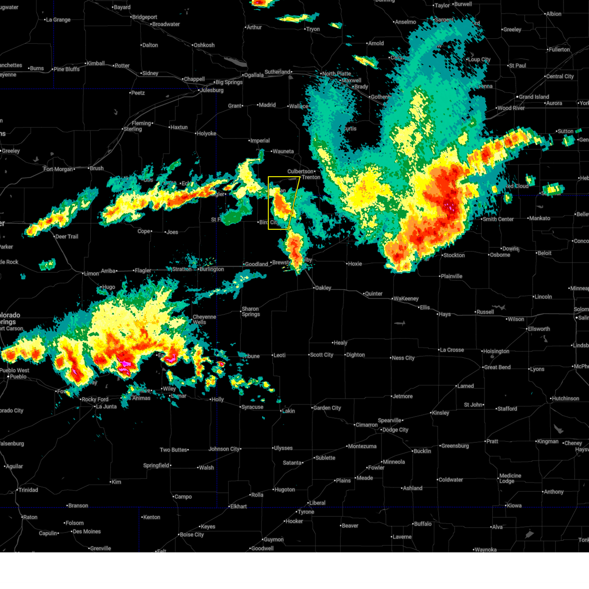
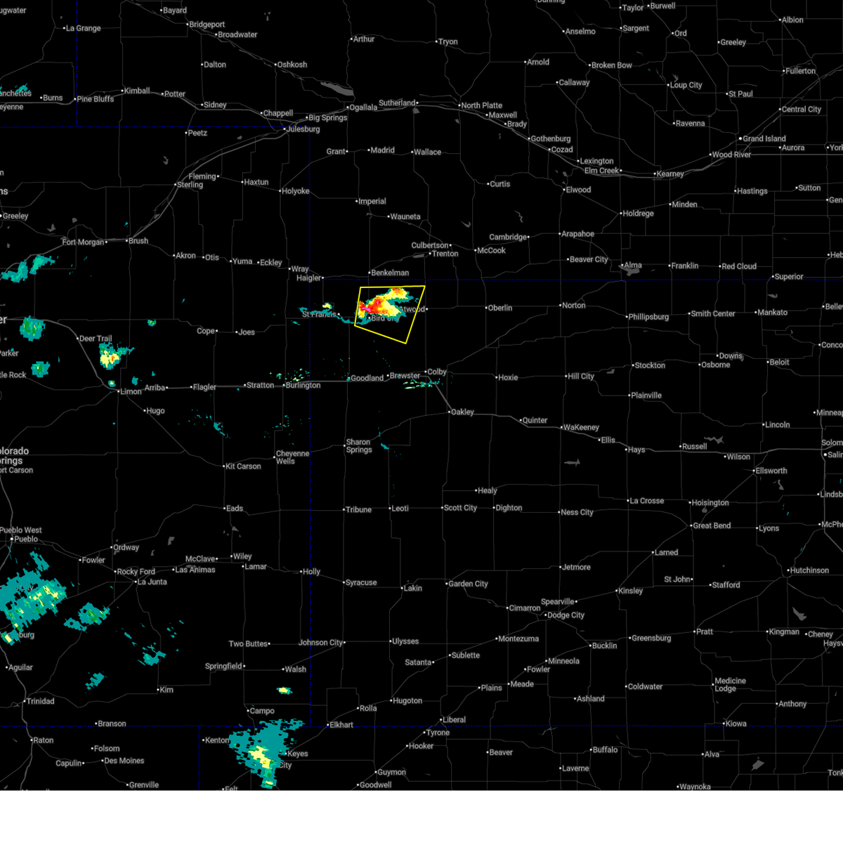
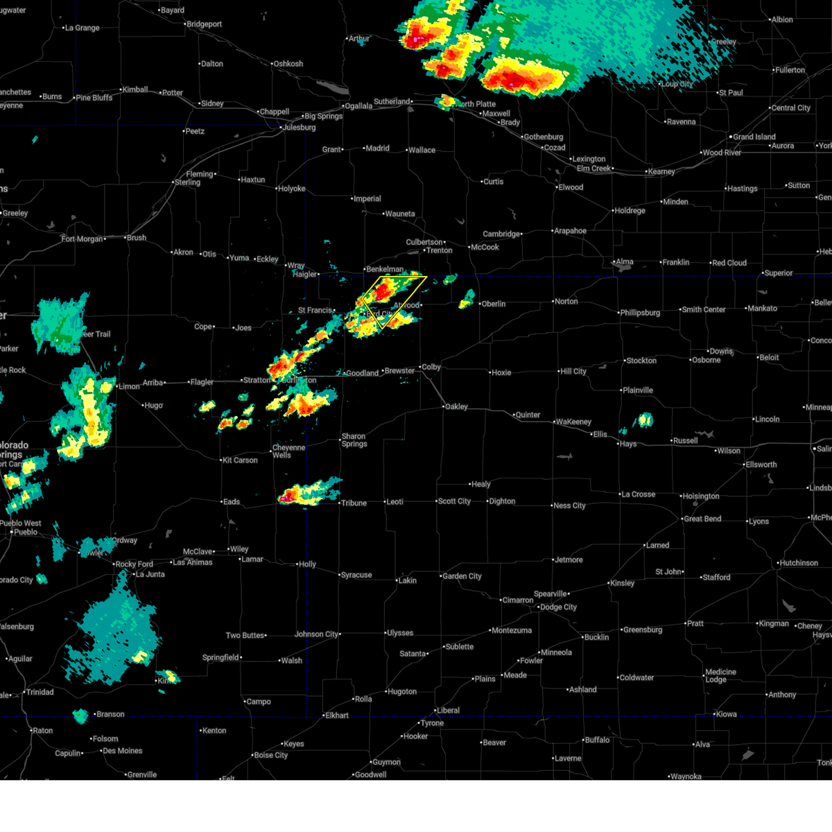
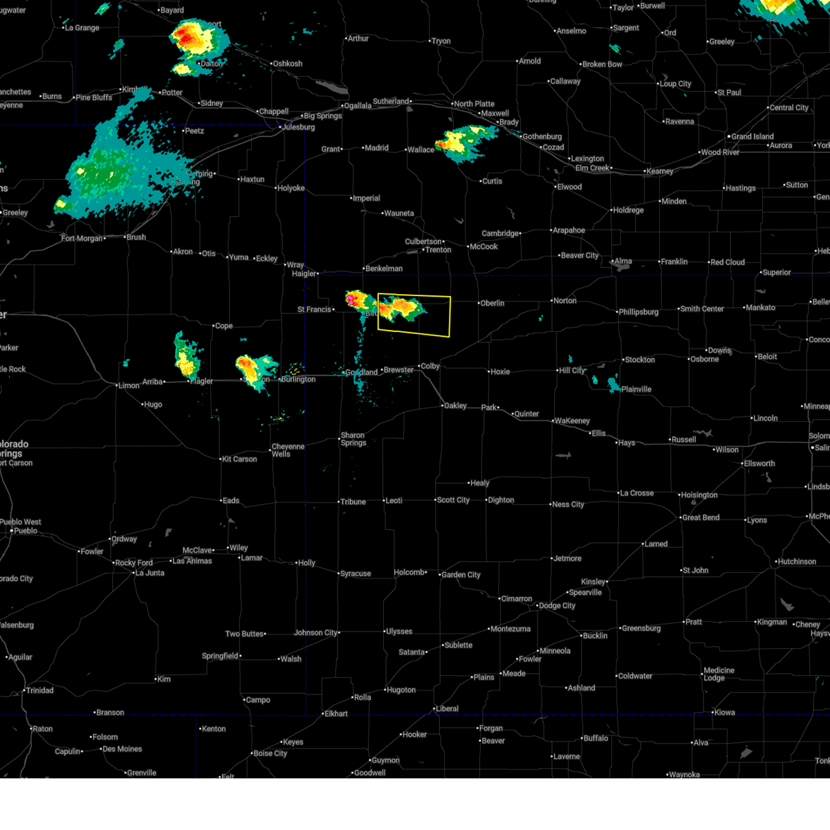
| 6/21/2026 4:58 PM CDT |
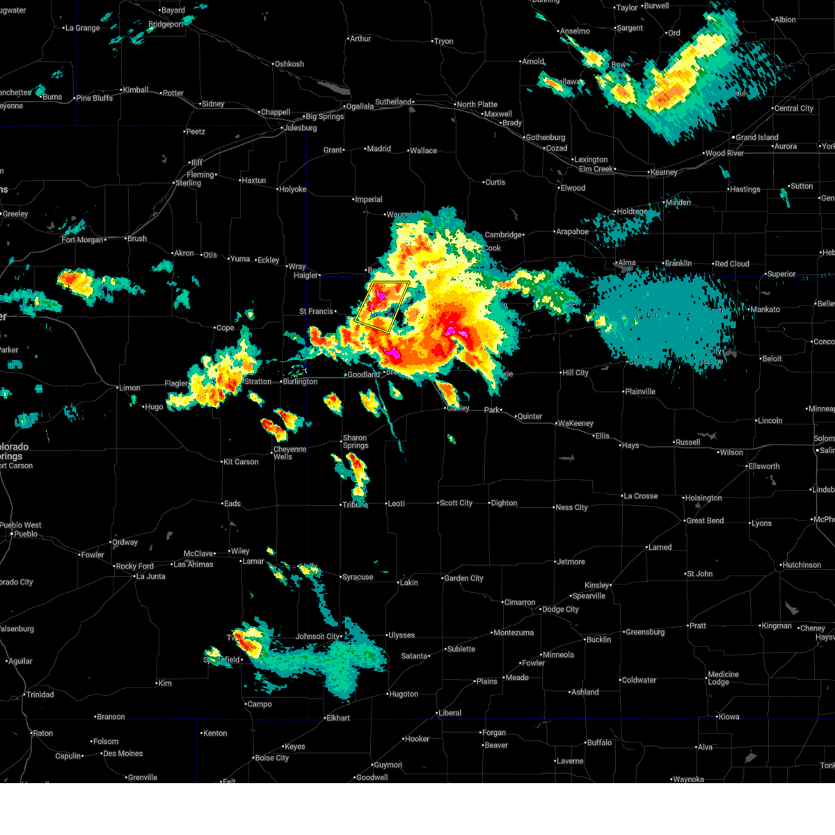
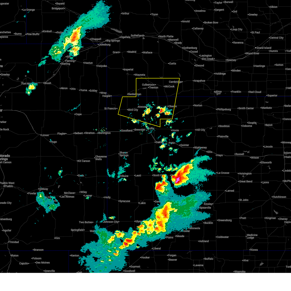
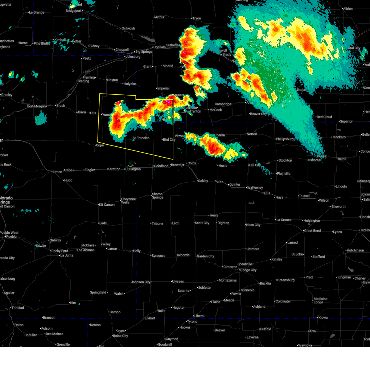
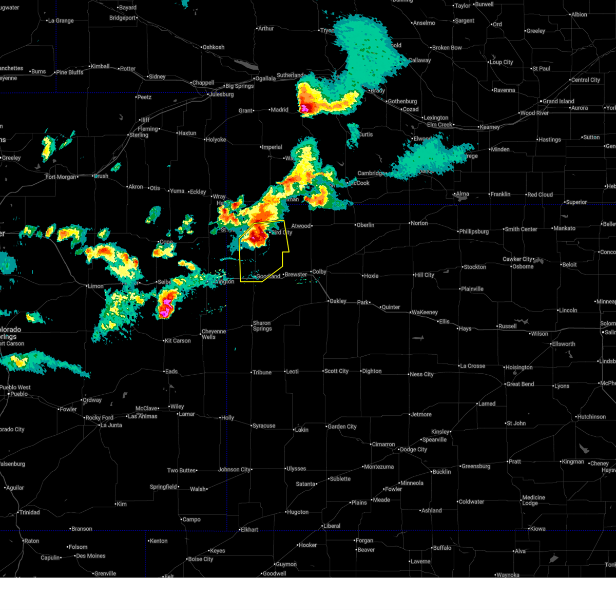 At 358 pm mdt/458 pm cdt/, a severe thunderstorm was located 8 miles southeast of bird city, or 19 miles north of brewster, moving southeast at 35 mph (radar indicated). Hazards include 60 mph wind gusts and quarter size hail. Hail damage to vehicles is expected. expect wind damage to roofs, siding, and trees. this severe thunderstorm will remain over mainly rural areas of southeastern cheyenne, southwestern rawlins and northeastern sherman counties in northwestern kansas, including the following locations, wheeler. This includes interstate 70 in kansas between mile markers 9 and 25. At 358 pm mdt/458 pm cdt/, a severe thunderstorm was located 8 miles southeast of bird city, or 19 miles north of brewster, moving southeast at 35 mph (radar indicated). Hazards include 60 mph wind gusts and quarter size hail. Hail damage to vehicles is expected. expect wind damage to roofs, siding, and trees. this severe thunderstorm will remain over mainly rural areas of southeastern cheyenne, southwestern rawlins and northeastern sherman counties in northwestern kansas, including the following locations, wheeler. This includes interstate 70 in kansas between mile markers 9 and 25.
|
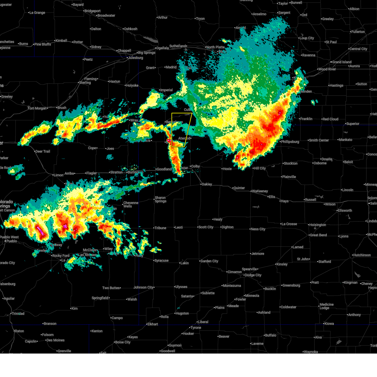
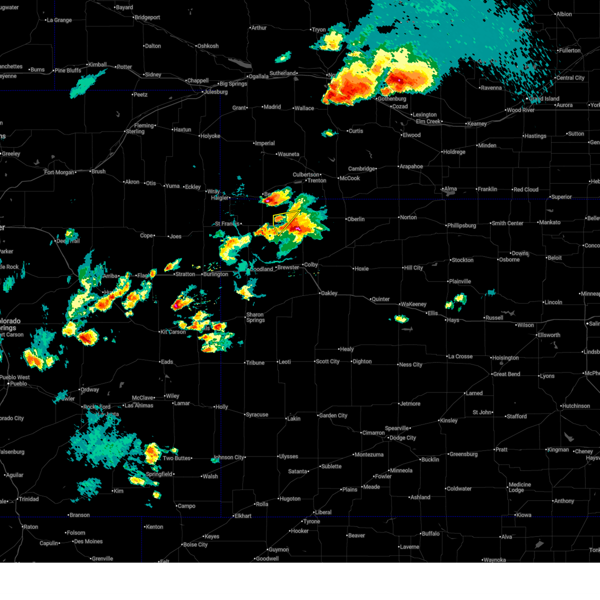
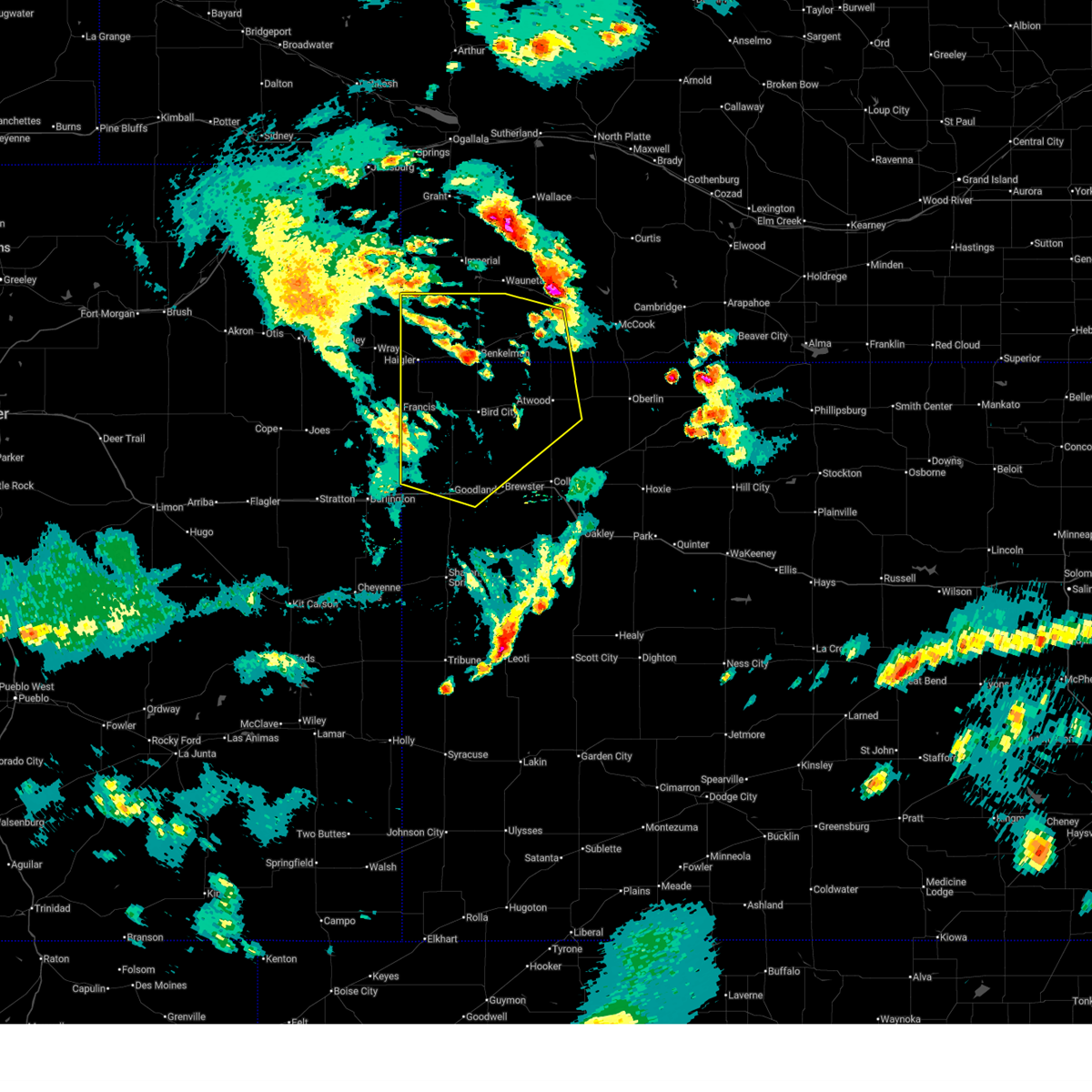
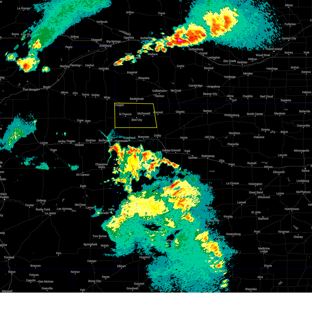
| 6/21/2026 3:46 PM MDT |
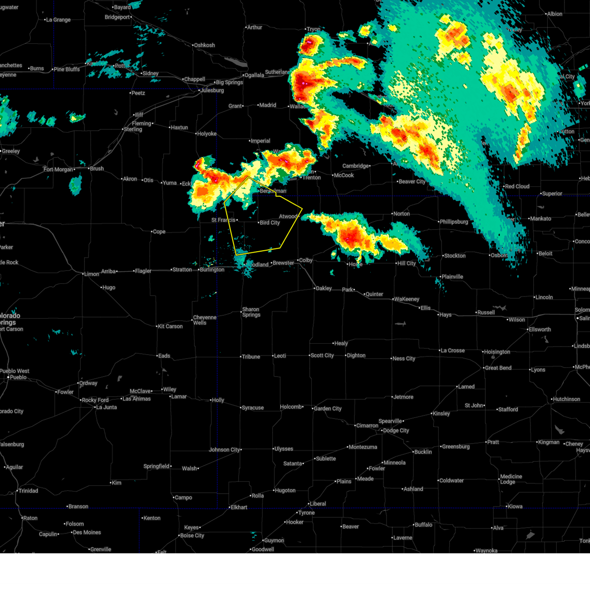
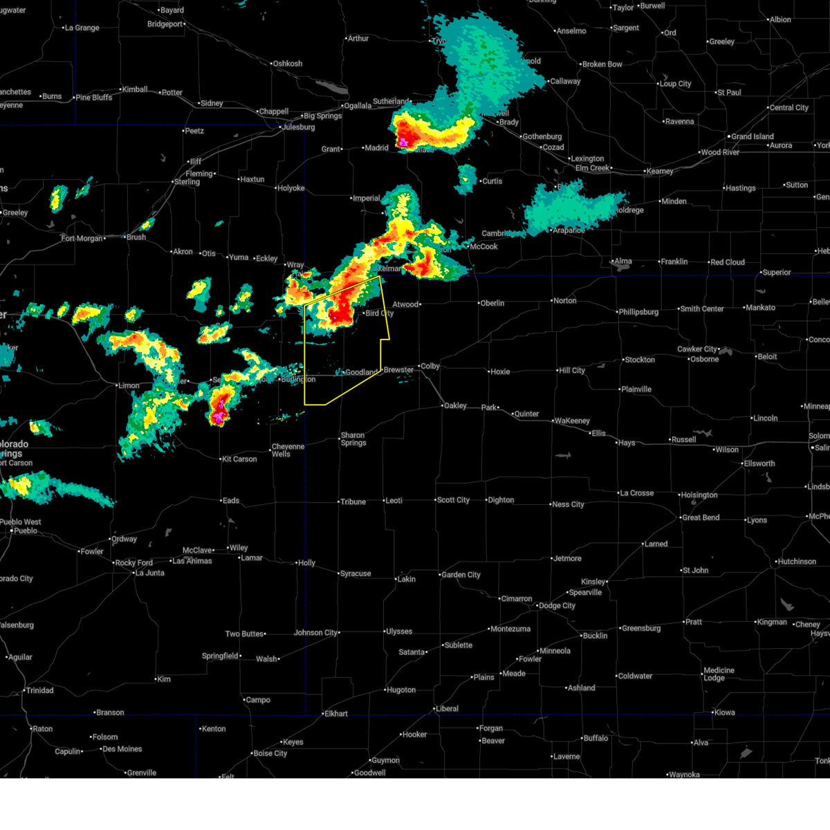 At 346 pm mdt/446 pm cdt/, severe thunderstorms were located along a line extending from 7 miles north of bird city to 15 miles southeast of st. francis to 5 miles south of bonny reservoir, moving southeast at 40 mph (radar indicated). Hazards include 60 mph wind gusts and quarter size hail. Hail damage to vehicles is expected. expect wind damage to roofs, siding, and trees. these severe storms will be near, bird city around 450 pm cdt. goodland and ruleton around 405 pm mdt. other locations impacted by these severe thunderstorms include wheeler and edson. This includes interstate 70 in kansas between mile markers 0 and 31. At 346 pm mdt/446 pm cdt/, severe thunderstorms were located along a line extending from 7 miles north of bird city to 15 miles southeast of st. francis to 5 miles south of bonny reservoir, moving southeast at 40 mph (radar indicated). Hazards include 60 mph wind gusts and quarter size hail. Hail damage to vehicles is expected. expect wind damage to roofs, siding, and trees. these severe storms will be near, bird city around 450 pm cdt. goodland and ruleton around 405 pm mdt. other locations impacted by these severe thunderstorms include wheeler and edson. This includes interstate 70 in kansas between mile markers 0 and 31.
|
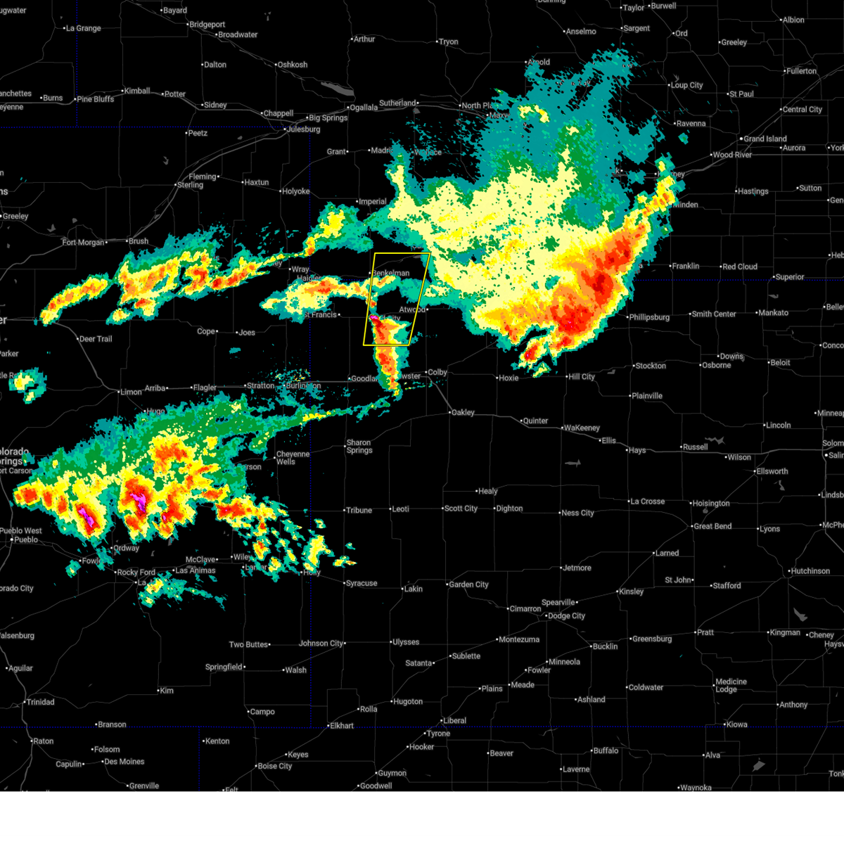
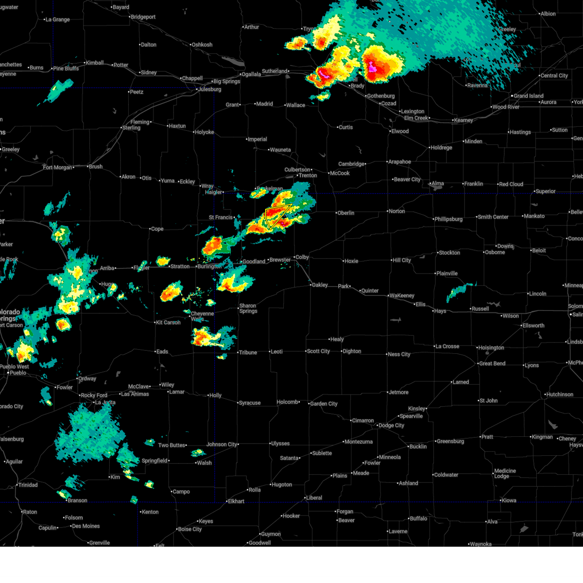
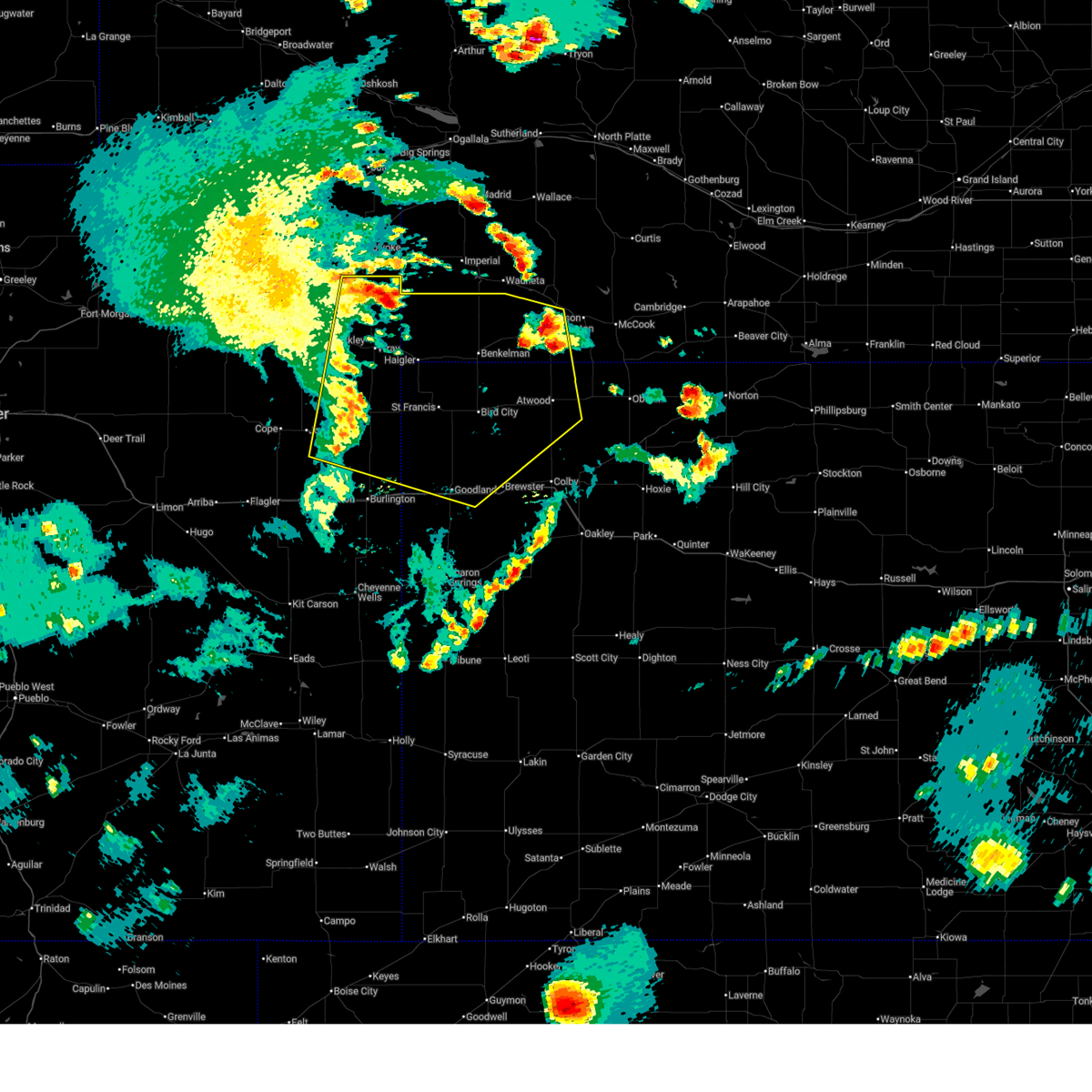
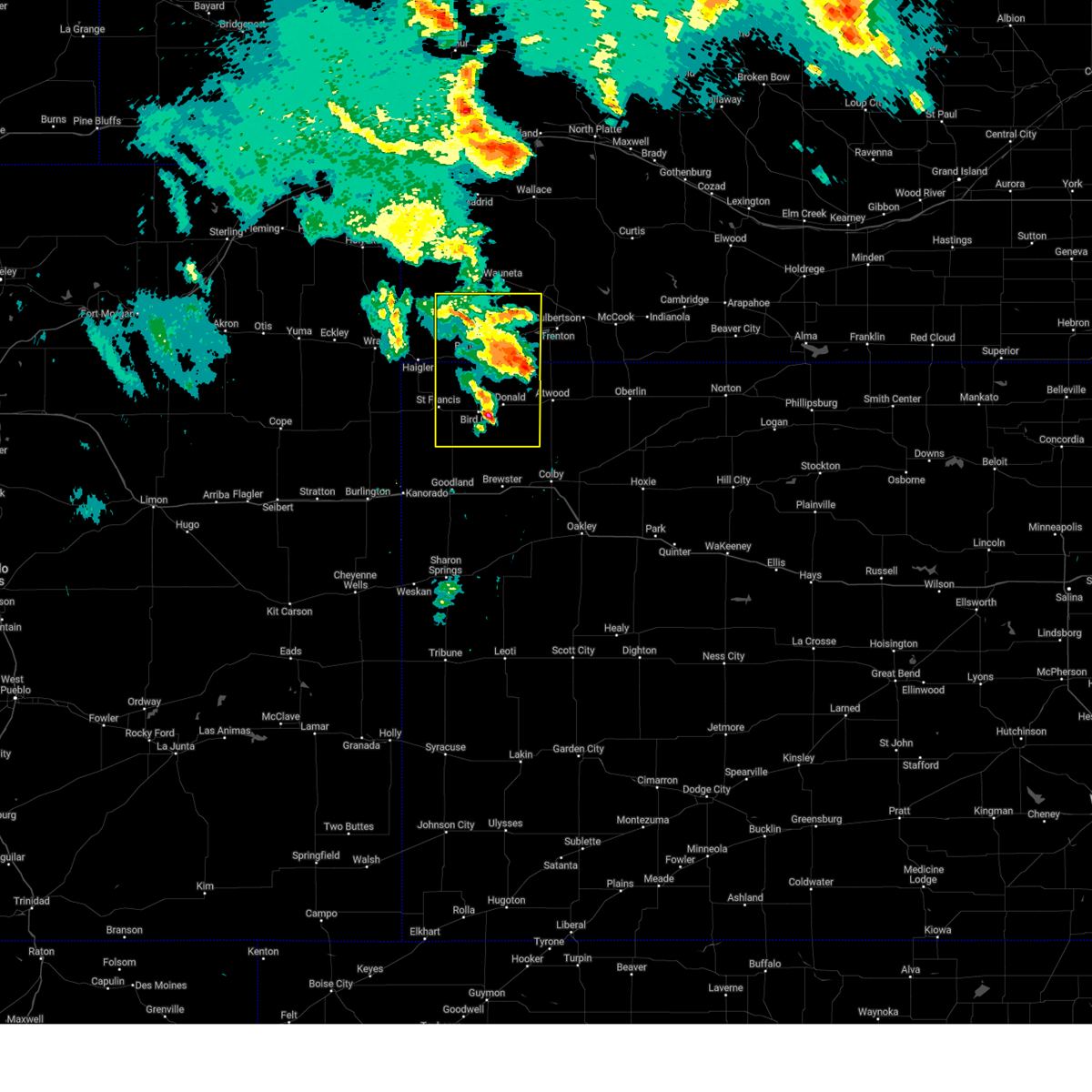
| 6/21/2026 3:26 PM MDT |
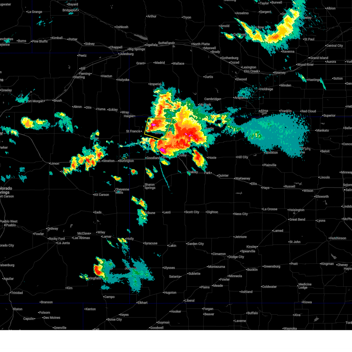
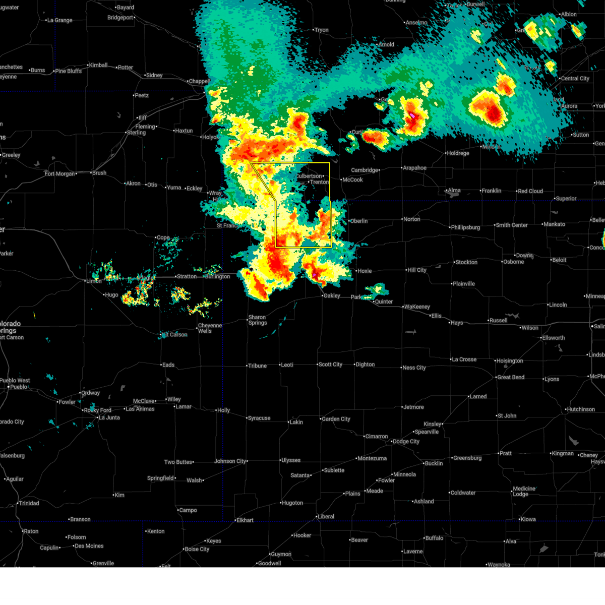
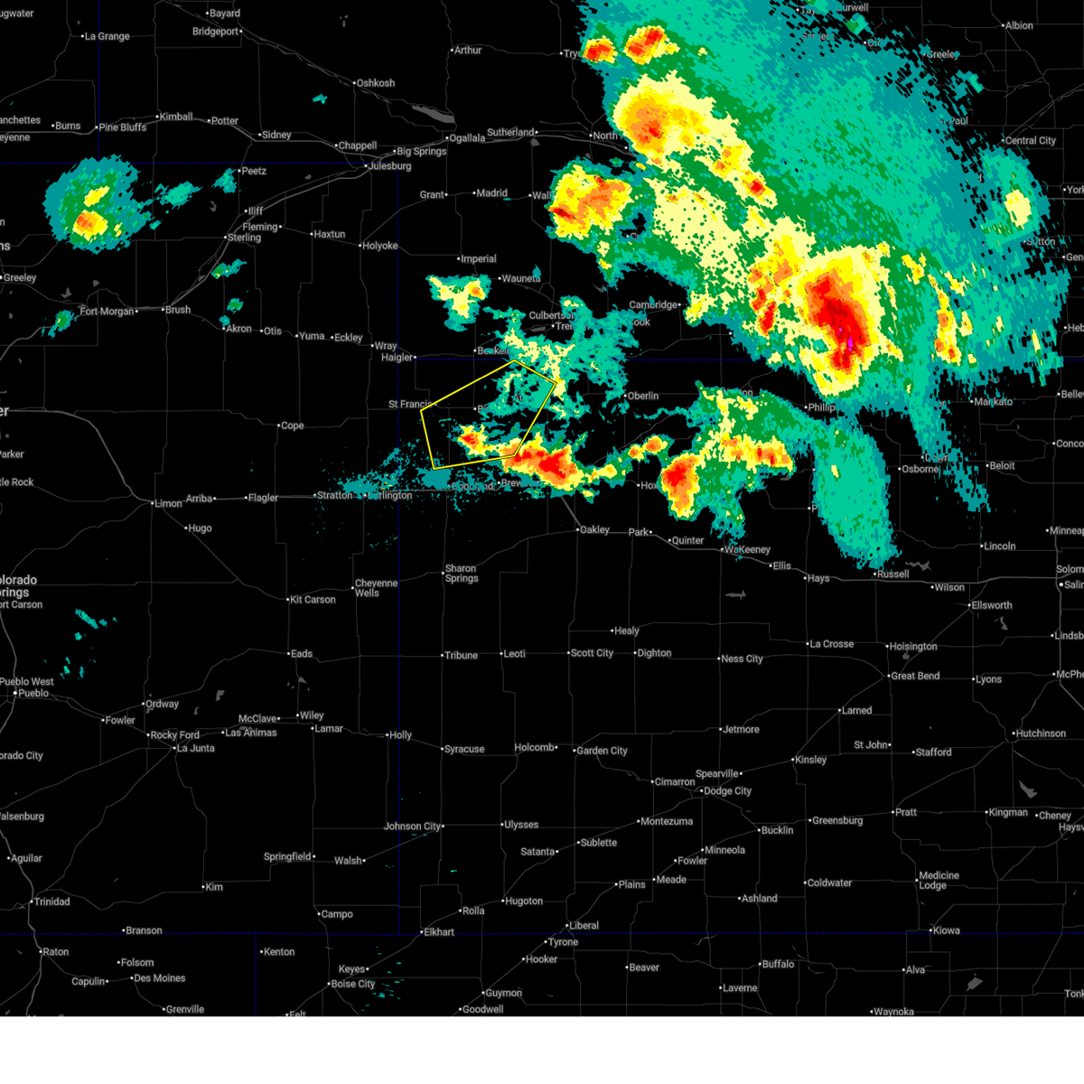
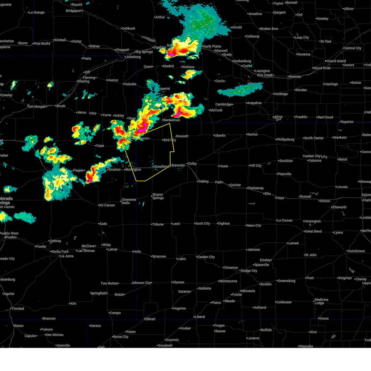 Svrgld the national weather service in goodland has issued a * severe thunderstorm warning for, southeastern yuma county in northeastern colorado, northeastern kit carson county in east central colorado, cheyenne county in northwestern kansas, southwestern rawlins county in northwestern kansas, sherman county in northwestern kansas, * until 415 pm mdt/515 pm cdt/. * at 325 pm mdt/425 pm cdt/, severe thunderstorms were located along a line extending from 9 miles east of haigler to st. francis to 6 miles west of bonny reservoir, moving southeast at 50 mph (radar indicated). Hazards include 70 mph wind gusts and ping pong ball size hail. People and animals outdoors will be injured. expect hail damage to roofs, siding, windows, and vehicles. expect considerable tree damage. wind damage is also likely to mobile homes, roofs, and outbuildings. severe thunderstorms will be near, st. francis around 430 pm cdt. bonny reservoir around 330 pm mdt. bird city around 445 pm cdt. kanorado around 345 pm mdt. other locations in the path of these severe thunderstorms include ruleton and goodland. this includes the following highways, interstate 70 in kansas between mile markers 0 and 31. interstate 70 in colorado between mile markers 445 and 450. Highway 385 between mile markers 207 and 210, and between mile markers 212 and 218. Svrgld the national weather service in goodland has issued a * severe thunderstorm warning for, southeastern yuma county in northeastern colorado, northeastern kit carson county in east central colorado, cheyenne county in northwestern kansas, southwestern rawlins county in northwestern kansas, sherman county in northwestern kansas, * until 415 pm mdt/515 pm cdt/. * at 325 pm mdt/425 pm cdt/, severe thunderstorms were located along a line extending from 9 miles east of haigler to st. francis to 6 miles west of bonny reservoir, moving southeast at 50 mph (radar indicated). Hazards include 70 mph wind gusts and ping pong ball size hail. People and animals outdoors will be injured. expect hail damage to roofs, siding, windows, and vehicles. expect considerable tree damage. wind damage is also likely to mobile homes, roofs, and outbuildings. severe thunderstorms will be near, st. francis around 430 pm cdt. bonny reservoir around 330 pm mdt. bird city around 445 pm cdt. kanorado around 345 pm mdt. other locations in the path of these severe thunderstorms include ruleton and goodland. this includes the following highways, interstate 70 in kansas between mile markers 0 and 31. interstate 70 in colorado between mile markers 445 and 450. Highway 385 between mile markers 207 and 210, and between mile markers 212 and 218.
|
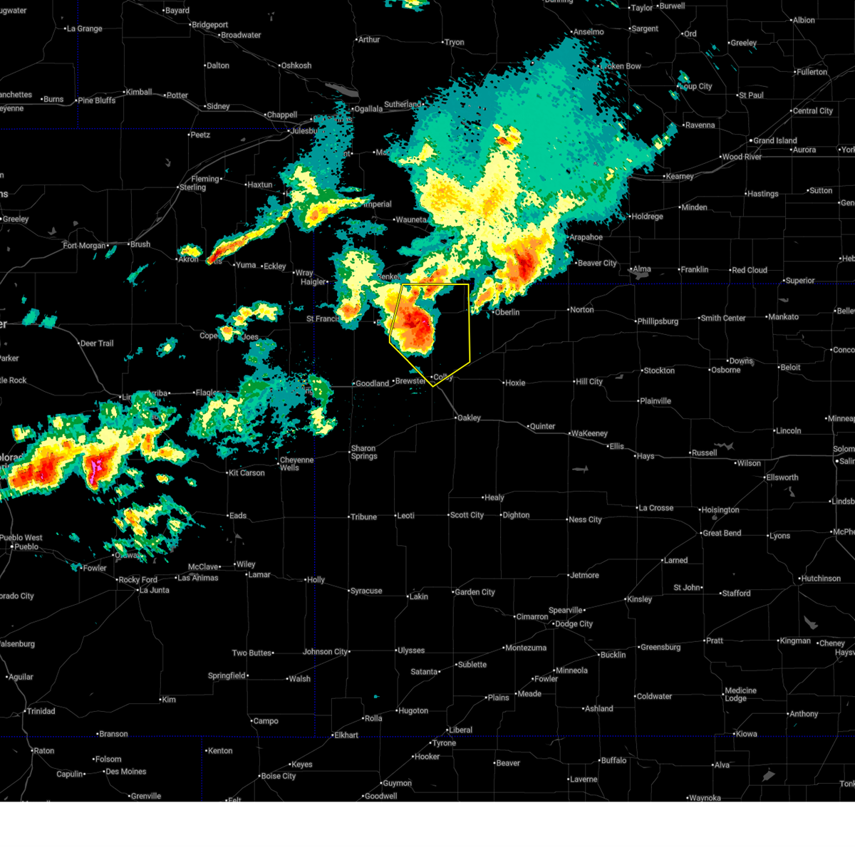
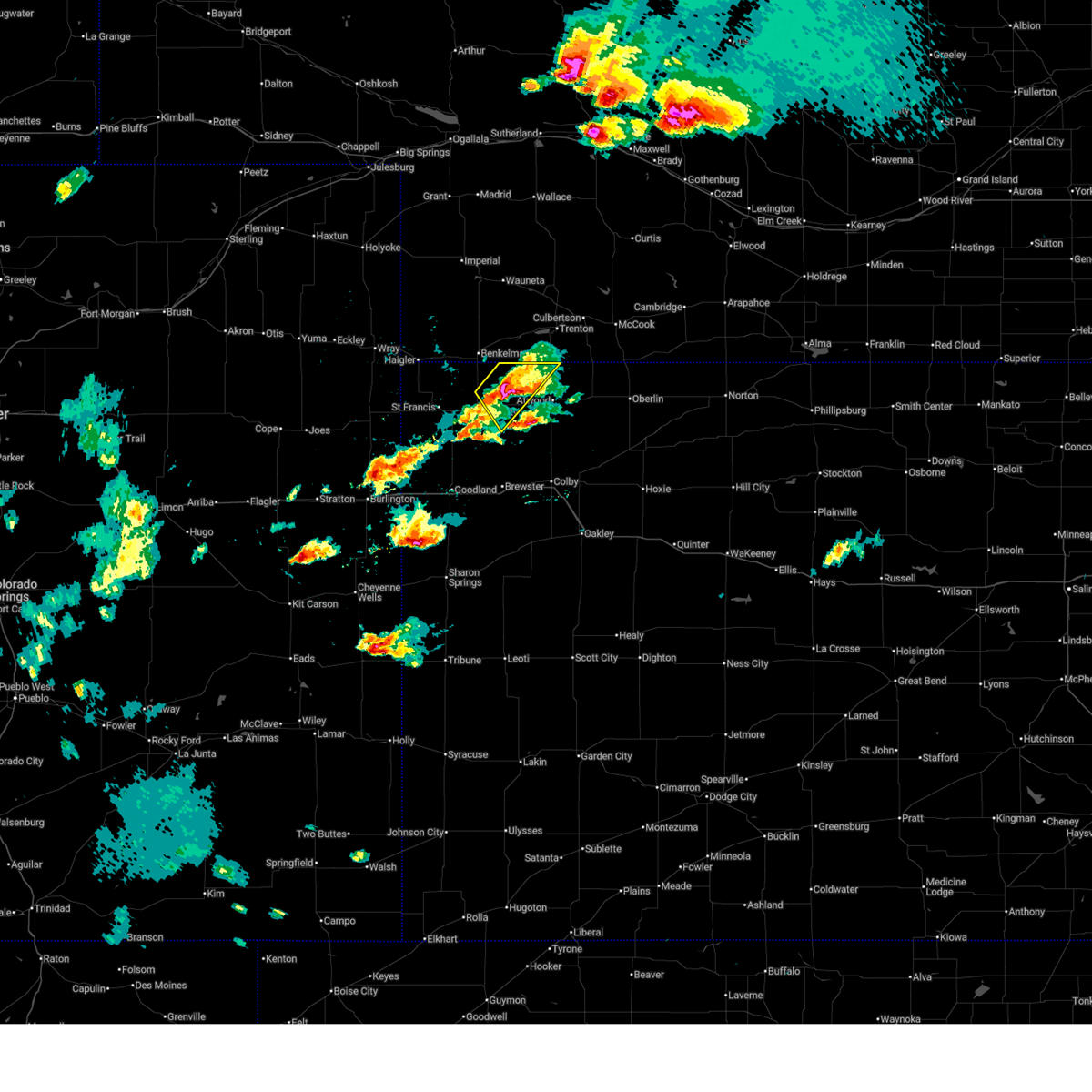
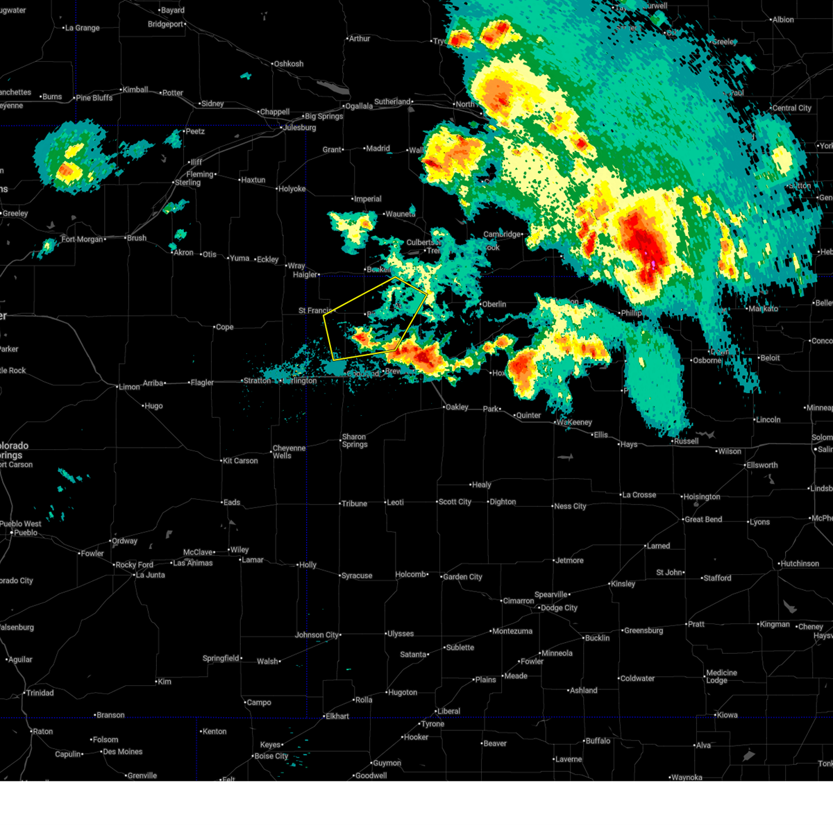
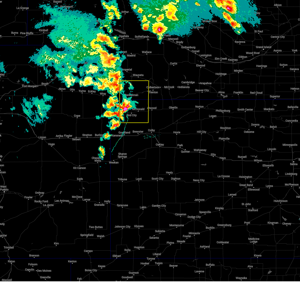
| 6/20/2026 6:28 PM CDT |
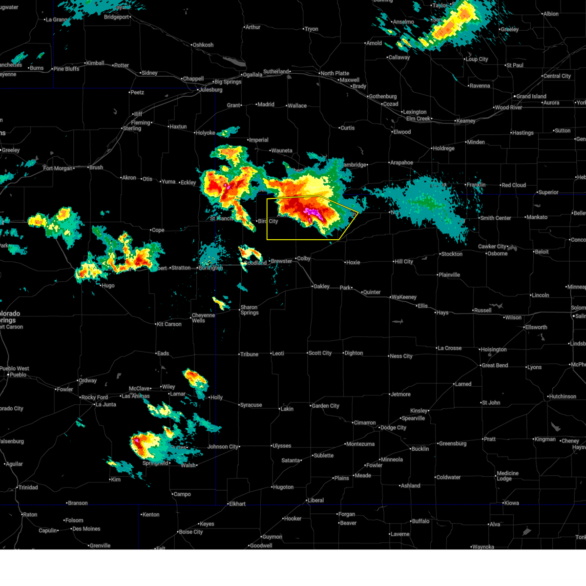
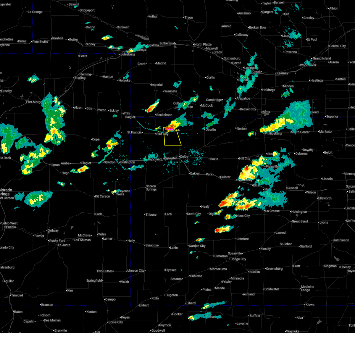
 At 628 pm cdt, a severe thunderstorm was located over mcdonald, or 16 miles west of atwood, moving east at 65 mph (radar indicated). Hazards include ping pong ball size hail and 60 mph wind gusts. People and animals outdoors will be injured. expect hail damage to roofs, siding, windows, and vehicles. expect wind damage to roofs, siding, and trees. Locations impacted include, bird city and mcdonald. At 628 pm cdt, a severe thunderstorm was located over mcdonald, or 16 miles west of atwood, moving east at 65 mph (radar indicated). Hazards include ping pong ball size hail and 60 mph wind gusts. People and animals outdoors will be injured. expect hail damage to roofs, siding, windows, and vehicles. expect wind damage to roofs, siding, and trees. Locations impacted include, bird city and mcdonald.
|
| 6/20/2026 6:12 PM CDT |
 Svrgld the national weather service in goodland has issued a * severe thunderstorm warning for, northeastern cheyenne county in northwestern kansas, northwestern rawlins county in northwestern kansas, * until 715 pm cdt. * at 612 pm cdt, a severe thunderstorm was located 6 miles north of bird city, or 14 miles south of benkelman, moving east at 15 mph (radar indicated). Hazards include 60 mph wind gusts and quarter size hail. Hail damage to vehicles is expected. Expect wind damage to roofs, siding, and trees. Svrgld the national weather service in goodland has issued a * severe thunderstorm warning for, northeastern cheyenne county in northwestern kansas, northwestern rawlins county in northwestern kansas, * until 715 pm cdt. * at 612 pm cdt, a severe thunderstorm was located 6 miles north of bird city, or 14 miles south of benkelman, moving east at 15 mph (radar indicated). Hazards include 60 mph wind gusts and quarter size hail. Hail damage to vehicles is expected. Expect wind damage to roofs, siding, and trees.
|
| 6/20/2026 5:50 PM CDT | Awn; ambient_44b7143c575b2968cdf184967408ca2 in cheyenne county KS, 8.8 miles SSE of McDonald, KS |
| 6/20/2026 5:32 PM CDT |
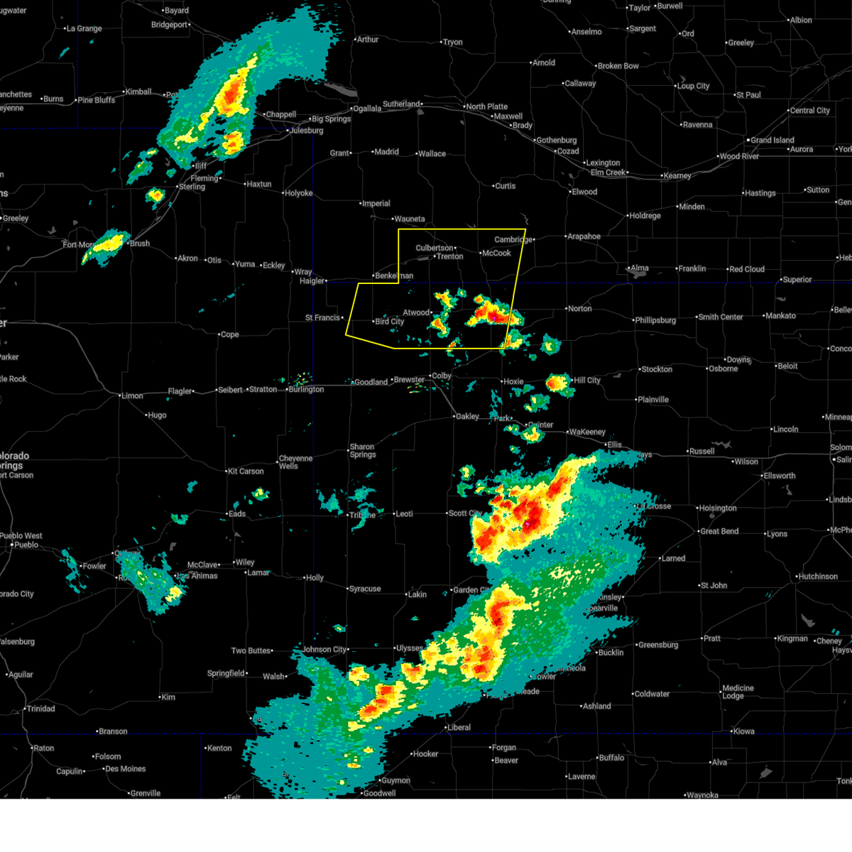
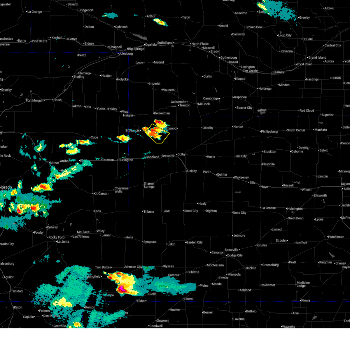
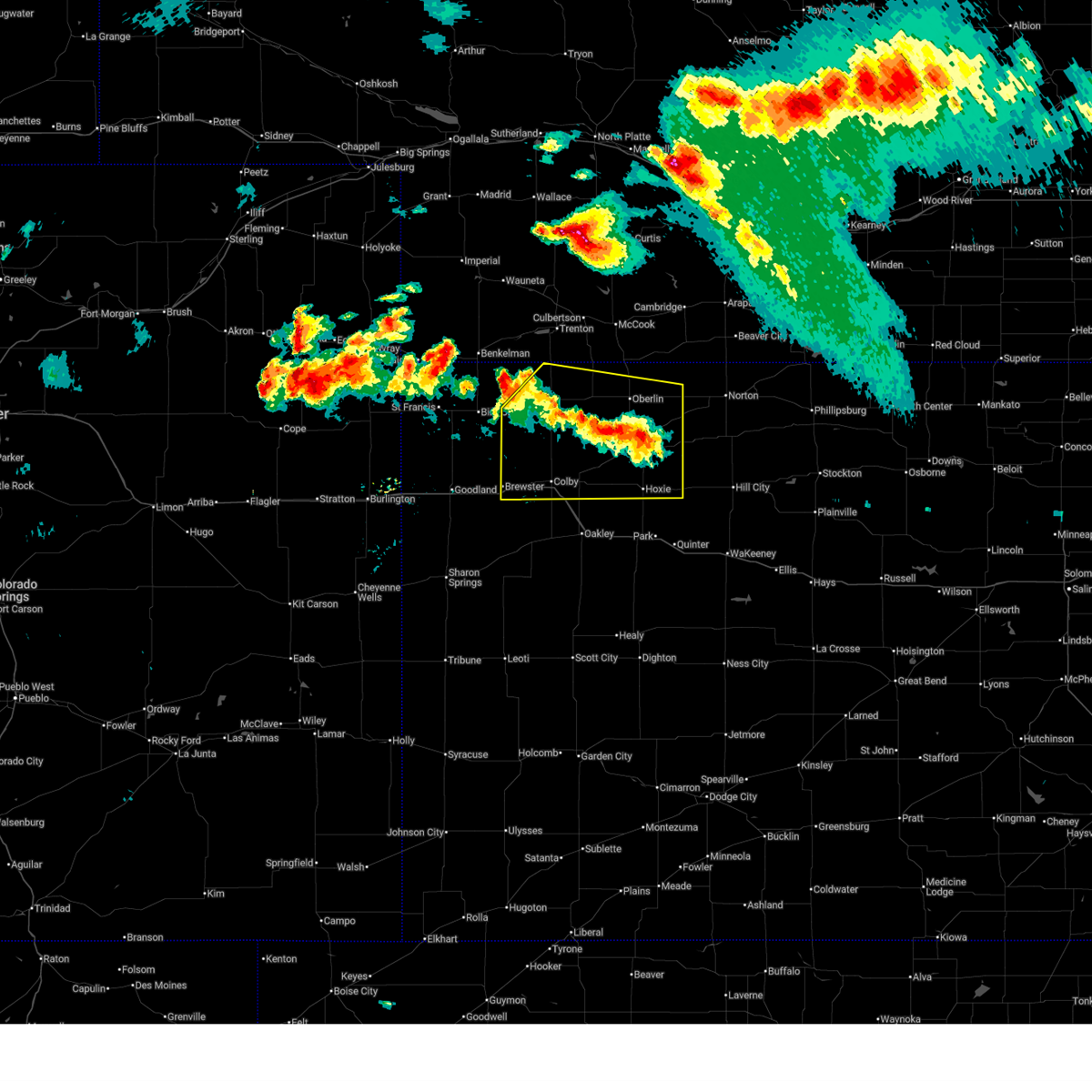
 At 531 pm cdt, severe thunderstorms were located along a line extending from 6 miles west of oberlin to 8 miles southeast of ludell to 8 miles northwest of atwood, moving east at 15 mph. these are destructive storms for southern rawlins county (trained weather spotters recorded 90 mph winds south of atwood). Hazards include 90 mph wind gusts and tennis ball size hail. You are in a life-threatening situation. flying debris may be deadly to those caught without shelter. mobile homes will be heavily damaged or destroyed. homes and businesses will have substantial roof and window damage. expect extensive tree damage and power outages. these severe storms will be near, atwood and ludell around 535 pm cdt. oberlin around 600 pm cdt. Other locations impacted by these severe thunderstorms include blakeman, beardsley, kanona, and traer. At 531 pm cdt, severe thunderstorms were located along a line extending from 6 miles west of oberlin to 8 miles southeast of ludell to 8 miles northwest of atwood, moving east at 15 mph. these are destructive storms for southern rawlins county (trained weather spotters recorded 90 mph winds south of atwood). Hazards include 90 mph wind gusts and tennis ball size hail. You are in a life-threatening situation. flying debris may be deadly to those caught without shelter. mobile homes will be heavily damaged or destroyed. homes and businesses will have substantial roof and window damage. expect extensive tree damage and power outages. these severe storms will be near, atwood and ludell around 535 pm cdt. oberlin around 600 pm cdt. Other locations impacted by these severe thunderstorms include blakeman, beardsley, kanona, and traer.
|
| 6/20/2026 5:19 PM CDT | Awn; ambient_44b7143c575b2968cdf184967408ca2 in cheyenne county KS, 8.8 miles SSE of McDonald, KS |
| 6/9/2026 5:28 PM CDT |
 At 527 pm cdt, severe thunderstorms were located along a line extending from 8 miles north of bird city to 10 miles north of rexford, moving north at 55 mph. another stronger storm near oberlin may be capable of nickel sized hail (radar indicated). Hazards include 70 mph wind gusts and nickel size hail. Expect considerable tree damage. damage is likely to mobile homes, roofs, and outbuildings. these severe storms will be near, atwood and ludell around 535 pm cdt. herndon around 545 pm cdt. stratton around 550 pm cdt. trenton around 555 pm cdt. mccook and culbertson around 605 pm cdt. palisade around 610 pm cdt. indianola around 615 pm cdt. Other locations impacted by these severe thunderstorms include blakeman, leoville, traer, cedar bluffs, beardsley, wheeler, and kanona. At 527 pm cdt, severe thunderstorms were located along a line extending from 8 miles north of bird city to 10 miles north of rexford, moving north at 55 mph. another stronger storm near oberlin may be capable of nickel sized hail (radar indicated). Hazards include 70 mph wind gusts and nickel size hail. Expect considerable tree damage. damage is likely to mobile homes, roofs, and outbuildings. these severe storms will be near, atwood and ludell around 535 pm cdt. herndon around 545 pm cdt. stratton around 550 pm cdt. trenton around 555 pm cdt. mccook and culbertson around 605 pm cdt. palisade around 610 pm cdt. indianola around 615 pm cdt. Other locations impacted by these severe thunderstorms include blakeman, leoville, traer, cedar bluffs, beardsley, wheeler, and kanona.
|
| 6/9/2026 5:28 PM CDT |
 the severe thunderstorm warning has been cancelled and is no longer in effect the severe thunderstorm warning has been cancelled and is no longer in effect
|
| 6/9/2026 5:12 PM CDT |
 Svrgld the national weather service in goodland has issued a * severe thunderstorm warning for, eastern cheyenne county in northwestern kansas, northeastern thomas county in northwestern kansas, rawlins county in northwestern kansas, decatur county in northwestern kansas, red willow county in southwestern nebraska, hitchcock county in southwestern nebraska, * until 645 pm cdt. * at 511 pm cdt, severe thunderstorms were located along a line extending from 6 miles west of bird city to 3 miles east of gem, moving north at 60 mph (mesonet. wind gusts around 65 mph has been reported north of brewster). Hazards include 70 mph wind gusts. Expect considerable tree damage. damage is likely to mobile homes, roofs, and outbuildings. severe thunderstorms will be near, bird city, rexford, and mcdonald around 515 pm cdt. atwood around 525 pm cdt. ludell around 530 pm cdt. Other locations in the path of these severe thunderstorms include herndon, stratton, trenton, culbertson, mccook and palisade. Svrgld the national weather service in goodland has issued a * severe thunderstorm warning for, eastern cheyenne county in northwestern kansas, northeastern thomas county in northwestern kansas, rawlins county in northwestern kansas, decatur county in northwestern kansas, red willow county in southwestern nebraska, hitchcock county in southwestern nebraska, * until 645 pm cdt. * at 511 pm cdt, severe thunderstorms were located along a line extending from 6 miles west of bird city to 3 miles east of gem, moving north at 60 mph (mesonet. wind gusts around 65 mph has been reported north of brewster). Hazards include 70 mph wind gusts. Expect considerable tree damage. damage is likely to mobile homes, roofs, and outbuildings. severe thunderstorms will be near, bird city, rexford, and mcdonald around 515 pm cdt. atwood around 525 pm cdt. ludell around 530 pm cdt. Other locations in the path of these severe thunderstorms include herndon, stratton, trenton, culbertson, mccook and palisade.
|
| 5/16/2026 7:36 PM CDT |
 Svrgld the national weather service in goodland has issued a * severe thunderstorm warning for, rawlins county in northwestern kansas, hitchcock county in southwestern nebraska, eastern dundy county in southwestern nebraska, * until 745 pm mdt/845 pm cdt/. * at 635 pm mdt/735 pm cdt/, severe thunderstorms were located along a line extending from 7 miles southwest of enders reservoir state recreation area to 6 miles northwest of atwood to 11 miles southeast of mcdonald, moving northeast at 45 mph (radar indicated). Hazards include 60 mph wind gusts and quarter size hail. Hail damage to vehicles is expected. expect wind damage to roofs, siding, and trees. severe thunderstorms will be near, atwood and stratton around 740 pm cdt. trenton around 755 pm cdt. Other locations in the path of these severe thunderstorms include palisade, ludell and culbertson. Svrgld the national weather service in goodland has issued a * severe thunderstorm warning for, rawlins county in northwestern kansas, hitchcock county in southwestern nebraska, eastern dundy county in southwestern nebraska, * until 745 pm mdt/845 pm cdt/. * at 635 pm mdt/735 pm cdt/, severe thunderstorms were located along a line extending from 7 miles southwest of enders reservoir state recreation area to 6 miles northwest of atwood to 11 miles southeast of mcdonald, moving northeast at 45 mph (radar indicated). Hazards include 60 mph wind gusts and quarter size hail. Hail damage to vehicles is expected. expect wind damage to roofs, siding, and trees. severe thunderstorms will be near, atwood and stratton around 740 pm cdt. trenton around 755 pm cdt. Other locations in the path of these severe thunderstorms include palisade, ludell and culbertson.
|
| 9/16/2025 8:19 PM MDT | At 819 pm mdt/919 pm cdt/, severe thunderstorms were located along a line extending from near mcdonald to 10 miles southeast of bird city to 8 miles west of brewster to 8 miles south of goodland, moving east at 25 mph (radar indicated). Hazards include 60 mph wind gusts and quarter size hail. Hail damage to vehicles is expected. expect wind damage to roofs, siding, and trees. these severe storms will be near, brewster around 935 pm cdt. other locations impacted by these severe thunderstorms include edson and beardsley. This includes interstate 70 in kansas between mile markers 19 and 41. |
| 9/16/2025 8:04 PM MDT | At 803 pm mdt/903 pm cdt/, severe thunderstorms were located along a line extending from 6 miles northwest of mcdonald to 7 miles south of bird city to 4 miles east of goodland to 13 miles south of ruleton, moving east at 25 mph (radar indicated). Hazards include 60 mph wind gusts and quarter size hail. Hail damage to vehicles is expected. expect wind damage to roofs, siding, and trees. these severe storms will be near, mcdonald around 910 pm cdt. brewster around 930 pm cdt. other locations impacted by these severe thunderstorms include edson and beardsley. This includes interstate 70 in kansas between mile markers 11 and 41. |
| 9/16/2025 7:54 PM MDT | Svrgld the national weather service in goodland has issued a * severe thunderstorm warning for, southeastern cheyenne county in northwestern kansas, western thomas county in northwestern kansas, southwestern rawlins county in northwestern kansas, sherman county in northwestern kansas, * until 900 pm mdt/1000 pm cdt/. * at 754 pm mdt/854 pm cdt/, severe thunderstorms were located along a line extending from 5 miles north of bird city to 15 miles southwest of mcdonald to goodland to 13 miles south of ruleton, moving east at 25 mph (radar indicated). Hazards include ping pong ball size hail and 60 mph wind gusts. People and animals outdoors will be injured. expect hail damage to roofs, siding, windows, and vehicles. expect wind damage to roofs, siding, and trees. severe thunderstorms will be near, bird city around 900 pm cdt. goodland around 800 pm mdt. mcdonald around 905 pm cdt. other locations in the path of these severe thunderstorms include brewster. This includes interstate 70 in kansas between mile markers 9 and 41. |
| 8/30/2025 6:58 PM CDT |
 Svrgld the national weather service in goodland has issued a * severe thunderstorm warning for, southwestern rawlins county in northwestern kansas, * until 745 pm cdt. * at 658 pm cdt, a severe thunderstorm was located 6 miles east of mcdonald, or 10 miles west of atwood, moving south at 25 mph (radar indicated). Hazards include 60 mph wind gusts and quarter size hail. Hail damage to vehicles is expected. expect wind damage to roofs, siding, and trees. This severe thunderstorm will remain over mainly rural areas of southwestern rawlins county, including the following locations, blakeman and beardsley. Svrgld the national weather service in goodland has issued a * severe thunderstorm warning for, southwestern rawlins county in northwestern kansas, * until 745 pm cdt. * at 658 pm cdt, a severe thunderstorm was located 6 miles east of mcdonald, or 10 miles west of atwood, moving south at 25 mph (radar indicated). Hazards include 60 mph wind gusts and quarter size hail. Hail damage to vehicles is expected. expect wind damage to roofs, siding, and trees. This severe thunderstorm will remain over mainly rural areas of southwestern rawlins county, including the following locations, blakeman and beardsley.
|
| 8/29/2025 5:43 PM CDT |
 Svrgld the national weather service in goodland has issued a * severe thunderstorm warning for, southeastern cheyenne county in northwestern kansas, southwestern rawlins county in northwestern kansas, * until 615 pm cdt. * at 542 pm cdt, a severe thunderstorm was located over bird city, or 13 miles east of st. francis, moving southeast at 20 mph (public. at 4:33 mdt, a gust of 60 mph was reported 4 miles north-northwest of bird city). Hazards include 60 mph wind gusts and half dollar size hail. Hail damage to vehicles is expected. expect wind damage to roofs, siding, and trees. This severe thunderstorm will be near, bird city around 545 pm cdt. Svrgld the national weather service in goodland has issued a * severe thunderstorm warning for, southeastern cheyenne county in northwestern kansas, southwestern rawlins county in northwestern kansas, * until 615 pm cdt. * at 542 pm cdt, a severe thunderstorm was located over bird city, or 13 miles east of st. francis, moving southeast at 20 mph (public. at 4:33 mdt, a gust of 60 mph was reported 4 miles north-northwest of bird city). Hazards include 60 mph wind gusts and half dollar size hail. Hail damage to vehicles is expected. expect wind damage to roofs, siding, and trees. This severe thunderstorm will be near, bird city around 545 pm cdt.
|
| 8/9/2025 11:21 PM CDT |
 the severe thunderstorm warning has been cancelled and is no longer in effect the severe thunderstorm warning has been cancelled and is no longer in effect
|
| 8/9/2025 11:21 PM CDT |
 the severe thunderstorm warning has been cancelled and is no longer in effect the severe thunderstorm warning has been cancelled and is no longer in effect
|
| 8/9/2025 11:11 PM CDT |
 At 1010 pm mdt/1110 pm cdt/, a severe thunderstorm was located 8 miles north of mcdonald, or 15 miles southeast of benkelman, moving northeast at 40 mph (radar indicated. at 1056 pm cdt, accumulating hail ranging from dime to possibly quarters in size was reported in bird city). Hazards include 60 mph wind gusts and quarter size hail. Hail damage to vehicles is expected. expect wind damage to roofs, siding, and trees. Locations impacted include, trenton, stratton, mcdonald, beardsley, and max. At 1010 pm mdt/1110 pm cdt/, a severe thunderstorm was located 8 miles north of mcdonald, or 15 miles southeast of benkelman, moving northeast at 40 mph (radar indicated. at 1056 pm cdt, accumulating hail ranging from dime to possibly quarters in size was reported in bird city). Hazards include 60 mph wind gusts and quarter size hail. Hail damage to vehicles is expected. expect wind damage to roofs, siding, and trees. Locations impacted include, trenton, stratton, mcdonald, beardsley, and max.
|
| 8/9/2025 11:11 PM CDT |
 the severe thunderstorm warning has been cancelled and is no longer in effect the severe thunderstorm warning has been cancelled and is no longer in effect
|
| 8/9/2025 10:50 PM CDT |
 Svrgld the national weather service in goodland has issued a * severe thunderstorm warning for, eastern cheyenne county in northwestern kansas, western rawlins county in northwestern kansas, southeastern dundy county in southwestern nebraska, southwestern hitchcock county in southwestern nebraska, * until 1045 pm mdt/1145 pm cdt/. * at 950 pm mdt/1050 pm cdt/, a severe thunderstorm was located near bird city, or 16 miles east of st. francis, moving northeast at 35 mph (radar indicated). Hazards include 60 mph wind gusts and half dollar size hail. Hail damage to vehicles is expected. Expect wind damage to roofs, siding, and trees. Svrgld the national weather service in goodland has issued a * severe thunderstorm warning for, eastern cheyenne county in northwestern kansas, western rawlins county in northwestern kansas, southeastern dundy county in southwestern nebraska, southwestern hitchcock county in southwestern nebraska, * until 1045 pm mdt/1145 pm cdt/. * at 950 pm mdt/1050 pm cdt/, a severe thunderstorm was located near bird city, or 16 miles east of st. francis, moving northeast at 35 mph (radar indicated). Hazards include 60 mph wind gusts and half dollar size hail. Hail damage to vehicles is expected. Expect wind damage to roofs, siding, and trees.
|
| 8/9/2025 9:31 PM CDT |
 the severe thunderstorm warning has been cancelled and is no longer in effect the severe thunderstorm warning has been cancelled and is no longer in effect
|
| 8/9/2025 9:31 PM CDT |
 At 930 pm cdt, severe thunderstorms were located along a line extending from 7 miles south of herndon to 5 miles north of gem to 7 miles northwest of monument, moving southeast at 35 mph (radar indicated). Hazards include 60 mph wind gusts and quarter size hail. Hail damage to vehicles is expected. expect wind damage to roofs, siding, and trees. these severe storms will be near, gem around 935 pm cdt. other locations impacted by these severe thunderstorms include blakeman and beardsley. This includes interstate 70 in kansas between mile markers 53 and 56. At 930 pm cdt, severe thunderstorms were located along a line extending from 7 miles south of herndon to 5 miles north of gem to 7 miles northwest of monument, moving southeast at 35 mph (radar indicated). Hazards include 60 mph wind gusts and quarter size hail. Hail damage to vehicles is expected. expect wind damage to roofs, siding, and trees. these severe storms will be near, gem around 935 pm cdt. other locations impacted by these severe thunderstorms include blakeman and beardsley. This includes interstate 70 in kansas between mile markers 53 and 56.
|
| 8/9/2025 9:01 PM CDT |
 At 801 pm mdt/901 pm cdt/, severe thunderstorms were located along a line extending from 9 miles northwest of ludell to 13 miles southwest of atwood to 4 miles southeast of brewster, moving east at 25 mph (radar indicated). Hazards include 60 mph wind gusts and quarter size hail. Hail damage to vehicles is expected. expect wind damage to roofs, siding, and trees. these severe storms will be near, atwood and levant around 905 pm cdt. ludell around 910 pm cdt. colby around 920 pm cdt. herndon around 930 pm cdt. gem around 935 pm cdt. other locations impacted by these severe thunderstorms include blakeman and beardsley. This includes interstate 70 in kansas between mile markers 42 and 57. At 801 pm mdt/901 pm cdt/, severe thunderstorms were located along a line extending from 9 miles northwest of ludell to 13 miles southwest of atwood to 4 miles southeast of brewster, moving east at 25 mph (radar indicated). Hazards include 60 mph wind gusts and quarter size hail. Hail damage to vehicles is expected. expect wind damage to roofs, siding, and trees. these severe storms will be near, atwood and levant around 905 pm cdt. ludell around 910 pm cdt. colby around 920 pm cdt. herndon around 930 pm cdt. gem around 935 pm cdt. other locations impacted by these severe thunderstorms include blakeman and beardsley. This includes interstate 70 in kansas between mile markers 42 and 57.
|
| 8/9/2025 8:59 PM CDT |
 At 758 pm mdt/858 pm cdt/, severe thunderstorms were located along a line extending from 10 miles south of stratton to 4 miles south of mcdonald to 6 miles northwest of brewster, moving east at 15 mph (radar indicated). Hazards include 60 mph wind gusts and quarter size hail. Hail damage to vehicles is expected. expect wind damage to roofs, siding, and trees. These severe thunderstorms will remain over mainly rural areas of eastern cheyenne, northwestern thomas, western rawlins and northeastern sherman counties in northwestern kansas, including the following locations, wheeler, blakeman, and beardsley. At 758 pm mdt/858 pm cdt/, severe thunderstorms were located along a line extending from 10 miles south of stratton to 4 miles south of mcdonald to 6 miles northwest of brewster, moving east at 15 mph (radar indicated). Hazards include 60 mph wind gusts and quarter size hail. Hail damage to vehicles is expected. expect wind damage to roofs, siding, and trees. These severe thunderstorms will remain over mainly rural areas of eastern cheyenne, northwestern thomas, western rawlins and northeastern sherman counties in northwestern kansas, including the following locations, wheeler, blakeman, and beardsley.
|
| 8/9/2025 8:40 PM CDT |
 Svrgld the national weather service in goodland has issued a * severe thunderstorm warning for, thomas county in northwestern kansas, rawlins county in northwestern kansas, eastern sherman county in northwestern kansas, * until 845 pm mdt/945 pm cdt/. * at 740 pm mdt/840 pm cdt/, severe thunderstorms were located along a line extending from 13 miles northwest of atwood to 11 miles south of mcdonald to 3 miles southeast of goodland, moving southeast at 35 mph (trained weather spotters. at 0730 pm mdt, a 65 mph wind gust was reported 13 miles north northwest of edson). Hazards include 70 mph wind gusts and quarter size hail. Hail damage to vehicles is expected. expect considerable tree damage. wind damage is also likely to mobile homes, roofs, and outbuildings. severe thunderstorms will be near, brewster around 850 pm cdt. atwood around 855 pm cdt. levant around 900 pm cdt. colby around 910 pm cdt. gem around 920 pm cdt. other locations impacted by these severe thunderstorms include edson, blakeman, beardsley, mingo, and halford. This includes interstate 70 in kansas between mile markers 19 and 75. Svrgld the national weather service in goodland has issued a * severe thunderstorm warning for, thomas county in northwestern kansas, rawlins county in northwestern kansas, eastern sherman county in northwestern kansas, * until 845 pm mdt/945 pm cdt/. * at 740 pm mdt/840 pm cdt/, severe thunderstorms were located along a line extending from 13 miles northwest of atwood to 11 miles south of mcdonald to 3 miles southeast of goodland, moving southeast at 35 mph (trained weather spotters. at 0730 pm mdt, a 65 mph wind gust was reported 13 miles north northwest of edson). Hazards include 70 mph wind gusts and quarter size hail. Hail damage to vehicles is expected. expect considerable tree damage. wind damage is also likely to mobile homes, roofs, and outbuildings. severe thunderstorms will be near, brewster around 850 pm cdt. atwood around 855 pm cdt. levant around 900 pm cdt. colby around 910 pm cdt. gem around 920 pm cdt. other locations impacted by these severe thunderstorms include edson, blakeman, beardsley, mingo, and halford. This includes interstate 70 in kansas between mile markers 19 and 75.
|
| 8/9/2025 8:34 PM CDT |
 At 733 pm mdt/833 pm cdt/, severe thunderstorms were located along a line extending from 8 miles southeast of benkelman to near bird city to 10 miles north of goodland, moving southeast at 25 mph (trained weather spotters. at 0730 pm mdt, a measured 65 mph wind gust was reported 13 miles north northwest of edson). Hazards include 70 mph wind gusts and quarter size hail. Hail damage to vehicles is expected. expect considerable tree damage. wind damage is also likely to mobile homes, roofs, and outbuildings. these severe storms will be near, mcdonald around 840 pm cdt. other locations impacted by these severe thunderstorms include edson, blakeman, beardsley, and wheeler. This includes interstate 70 in kansas between mile markers 15 and 28. At 733 pm mdt/833 pm cdt/, severe thunderstorms were located along a line extending from 8 miles southeast of benkelman to near bird city to 10 miles north of goodland, moving southeast at 25 mph (trained weather spotters. at 0730 pm mdt, a measured 65 mph wind gust was reported 13 miles north northwest of edson). Hazards include 70 mph wind gusts and quarter size hail. Hail damage to vehicles is expected. expect considerable tree damage. wind damage is also likely to mobile homes, roofs, and outbuildings. these severe storms will be near, mcdonald around 840 pm cdt. other locations impacted by these severe thunderstorms include edson, blakeman, beardsley, and wheeler. This includes interstate 70 in kansas between mile markers 15 and 28.
|
| 8/9/2025 8:27 PM CDT |
 The severe thunderstorm warning that was previously in effect has been reissued for cheyenne, sherman, and rawlins counties and is in effect until 830 pm mdt. please refer to that bulletin for the latest severe weather information. a severe thunderstorm watch remains in effect until 900 pm mdt/1000 pm cdt/ for northeastern and east central colorado, northwestern kansas, and southwestern nebraska. remember, a severe thunderstorm warning still remains in effect for cheyenne, sherman, and rawlins counties until 830 pm mdt. The severe thunderstorm warning that was previously in effect has been reissued for cheyenne, sherman, and rawlins counties and is in effect until 830 pm mdt. please refer to that bulletin for the latest severe weather information. a severe thunderstorm watch remains in effect until 900 pm mdt/1000 pm cdt/ for northeastern and east central colorado, northwestern kansas, and southwestern nebraska. remember, a severe thunderstorm warning still remains in effect for cheyenne, sherman, and rawlins counties until 830 pm mdt.
|
| 8/9/2025 8:24 PM CDT |
 Svrgld the national weather service in goodland has issued a * severe thunderstorm warning for, cheyenne county in northwestern kansas, northwestern thomas county in northwestern kansas, western rawlins county in northwestern kansas, northeastern sherman county in northwestern kansas, * until 830 pm mdt/930 pm cdt/. * at 724 pm mdt/824 pm cdt/, severe thunderstorms were located along a line extending from 5 miles southeast of benkelman to near bird city to 12 miles north of goodland, moving southeast at 25 mph (radar indicated). Hazards include 70 mph wind gusts and quarter size hail. Hail damage to vehicles is expected. expect considerable tree damage. wind damage is also likely to mobile homes, roofs, and outbuildings. severe thunderstorms will be near, bird city around 830 pm cdt. mcdonald around 835 pm cdt. other locations impacted by these severe thunderstorms include edson, blakeman, beardsley, and wheeler. This includes interstate 70 in kansas between mile markers 15 and 28. Svrgld the national weather service in goodland has issued a * severe thunderstorm warning for, cheyenne county in northwestern kansas, northwestern thomas county in northwestern kansas, western rawlins county in northwestern kansas, northeastern sherman county in northwestern kansas, * until 830 pm mdt/930 pm cdt/. * at 724 pm mdt/824 pm cdt/, severe thunderstorms were located along a line extending from 5 miles southeast of benkelman to near bird city to 12 miles north of goodland, moving southeast at 25 mph (radar indicated). Hazards include 70 mph wind gusts and quarter size hail. Hail damage to vehicles is expected. expect considerable tree damage. wind damage is also likely to mobile homes, roofs, and outbuildings. severe thunderstorms will be near, bird city around 830 pm cdt. mcdonald around 835 pm cdt. other locations impacted by these severe thunderstorms include edson, blakeman, beardsley, and wheeler. This includes interstate 70 in kansas between mile markers 15 and 28.
|
| 8/9/2025 8:07 PM CDT |
 At 706 pm mdt/806 pm cdt/, severe thunderstorms were located along a line extending from 6 miles southeast of benkelman to 4 miles northwest of bird city to 14 miles south of st. francis, moving east at 45 mph (radar indicated). Hazards include 60 mph wind gusts and quarter size hail. Hail damage to vehicles is expected. expect wind damage to roofs, siding, and trees. these severe storms will be near, bird city around 810 pm cdt. mcdonald around 815 pm cdt. Other locations impacted by these severe thunderstorms include beardsley, parks, wheeler, and max. At 706 pm mdt/806 pm cdt/, severe thunderstorms were located along a line extending from 6 miles southeast of benkelman to 4 miles northwest of bird city to 14 miles south of st. francis, moving east at 45 mph (radar indicated). Hazards include 60 mph wind gusts and quarter size hail. Hail damage to vehicles is expected. expect wind damage to roofs, siding, and trees. these severe storms will be near, bird city around 810 pm cdt. mcdonald around 815 pm cdt. Other locations impacted by these severe thunderstorms include beardsley, parks, wheeler, and max.
|
| 8/9/2025 8:07 PM CDT |
 the severe thunderstorm warning has been cancelled and is no longer in effect the severe thunderstorm warning has been cancelled and is no longer in effect
|
| 8/9/2025 7:54 PM CDT |
 Svrgld the national weather service in goodland has issued a * severe thunderstorm warning for, southeastern yuma county in northeastern colorado, cheyenne county in northwestern kansas, northwestern rawlins county in northwestern kansas, northwestern sherman county in northwestern kansas, southern dundy county in southwestern nebraska, southwestern hitchcock county in southwestern nebraska, * until 730 pm mdt/830 pm cdt/. * at 654 pm mdt/754 pm cdt/, severe thunderstorms were located along a line extending from 4 miles southwest of benkelman to 5 miles northeast of st. francis to 10 miles east of bonny reservoir, moving east at 45 mph (radar indicated). Hazards include 60 mph wind gusts and quarter size hail. Hail damage to vehicles is expected. expect wind damage to roofs, siding, and trees. severe thunderstorms will be near, bird city around 805 pm cdt. mcdonald around 810 pm cdt. other locations impacted by these severe thunderstorms include hale, beardsley, parks, wheeler, and max. This includes highway 385 between mile markers 216 and 223. Svrgld the national weather service in goodland has issued a * severe thunderstorm warning for, southeastern yuma county in northeastern colorado, cheyenne county in northwestern kansas, northwestern rawlins county in northwestern kansas, northwestern sherman county in northwestern kansas, southern dundy county in southwestern nebraska, southwestern hitchcock county in southwestern nebraska, * until 730 pm mdt/830 pm cdt/. * at 654 pm mdt/754 pm cdt/, severe thunderstorms were located along a line extending from 4 miles southwest of benkelman to 5 miles northeast of st. francis to 10 miles east of bonny reservoir, moving east at 45 mph (radar indicated). Hazards include 60 mph wind gusts and quarter size hail. Hail damage to vehicles is expected. expect wind damage to roofs, siding, and trees. severe thunderstorms will be near, bird city around 805 pm cdt. mcdonald around 810 pm cdt. other locations impacted by these severe thunderstorms include hale, beardsley, parks, wheeler, and max. This includes highway 385 between mile markers 216 and 223.
|
| 8/9/2025 4:32 AM CDT |
 Svrgld the national weather service in goodland has issued a * severe thunderstorm warning for, central rawlins county in northwestern kansas, * until 515 am cdt. * at 432 am cdt, a severe thunderstorm was located 4 miles southeast of mcdonald, or 13 miles west of atwood, moving east at 35 mph (radar indicated). Hazards include 60 mph wind gusts and half dollar size hail. Hail damage to vehicles is expected. expect wind damage to roofs, siding, and trees. This severe thunderstorm will be near, atwood around 450 am cdt. Svrgld the national weather service in goodland has issued a * severe thunderstorm warning for, central rawlins county in northwestern kansas, * until 515 am cdt. * at 432 am cdt, a severe thunderstorm was located 4 miles southeast of mcdonald, or 13 miles west of atwood, moving east at 35 mph (radar indicated). Hazards include 60 mph wind gusts and half dollar size hail. Hail damage to vehicles is expected. expect wind damage to roofs, siding, and trees. This severe thunderstorm will be near, atwood around 450 am cdt.
|
| 8/7/2025 6:42 PM CDT |
 At 642 pm cdt, a severe thunderstorm was located near bird city, or 14 miles east of st. francis, moving southeast at 5 mph (radar indicated). Hazards include golf ball size hail and 60 mph wind gusts. People and animals outdoors will be injured. expect hail damage to roofs, siding, windows, and vehicles. expect wind damage to roofs, siding, and trees. this severe storm will be near, bird city around 645 pm cdt. Other locations impacted by this severe thunderstorm include blakeman and beardsley. At 642 pm cdt, a severe thunderstorm was located near bird city, or 14 miles east of st. francis, moving southeast at 5 mph (radar indicated). Hazards include golf ball size hail and 60 mph wind gusts. People and animals outdoors will be injured. expect hail damage to roofs, siding, windows, and vehicles. expect wind damage to roofs, siding, and trees. this severe storm will be near, bird city around 645 pm cdt. Other locations impacted by this severe thunderstorm include blakeman and beardsley.
|
| 8/7/2025 6:28 PM CDT |
 Svrgld the national weather service in goodland has issued a * severe thunderstorm warning for, northeastern cheyenne county in northwestern kansas, western rawlins county in northwestern kansas, * until 715 pm cdt. * at 627 pm cdt, a severe thunderstorm was located 4 miles northeast of bird city, or 16 miles east of st. francis, moving east at 10 mph (radar indicated). Hazards include 60 mph wind gusts and quarter size hail. Hail damage to vehicles is expected. expect wind damage to roofs, siding, and trees. This severe thunderstorm will be near, mcdonald around 640 pm cdt. Svrgld the national weather service in goodland has issued a * severe thunderstorm warning for, northeastern cheyenne county in northwestern kansas, western rawlins county in northwestern kansas, * until 715 pm cdt. * at 627 pm cdt, a severe thunderstorm was located 4 miles northeast of bird city, or 16 miles east of st. francis, moving east at 10 mph (radar indicated). Hazards include 60 mph wind gusts and quarter size hail. Hail damage to vehicles is expected. expect wind damage to roofs, siding, and trees. This severe thunderstorm will be near, mcdonald around 640 pm cdt.
|
| 7/19/2025 5:59 PM CDT |
 The severe thunderstorm warning that was previously in effect has been reissued for rawlins county until 6:45 pm ct. please refer to that bulletin for the latest severe weather information. a severe thunderstorm watch remains in effect until midnight cdt for northwestern kansas. to report severe weather, contact your nearest law enforcement agency. they will relay your report to the national weather service goodland. remember, a severe thunderstorm warning still remains in effect for rawlins county until 6:45 pm ct. The severe thunderstorm warning that was previously in effect has been reissued for rawlins county until 6:45 pm ct. please refer to that bulletin for the latest severe weather information. a severe thunderstorm watch remains in effect until midnight cdt for northwestern kansas. to report severe weather, contact your nearest law enforcement agency. they will relay your report to the national weather service goodland. remember, a severe thunderstorm warning still remains in effect for rawlins county until 6:45 pm ct.
|
| 7/19/2025 5:30 PM CDT |
 At 530 pm cdt, a severe thunderstorm was located near mcdonald, or 14 miles west of atwood, moving southeast at 10 mph (radar indicated). Hazards include 60 mph wind gusts and quarter size hail. Hail damage to vehicles is expected. expect wind damage to roofs, siding, and trees. This severe thunderstorm will remain over mainly rural areas of west central rawlins county, including the following locations, beardsley. At 530 pm cdt, a severe thunderstorm was located near mcdonald, or 14 miles west of atwood, moving southeast at 10 mph (radar indicated). Hazards include 60 mph wind gusts and quarter size hail. Hail damage to vehicles is expected. expect wind damage to roofs, siding, and trees. This severe thunderstorm will remain over mainly rural areas of west central rawlins county, including the following locations, beardsley.
|
| 7/19/2025 5:13 PM CDT |
 The severe thunderstorm warning that was previously in effect has been reissued for rawlins county until 6 pm ct. please refer to that bulletin for the latest severe weather information. to report severe weather, contact your nearest law enforcement agency. they will relay your report to the national weather service goodland. remember, a severe thunderstorm warning still remains in effect for rawlins county until 6 pm ct. The severe thunderstorm warning that was previously in effect has been reissued for rawlins county until 6 pm ct. please refer to that bulletin for the latest severe weather information. to report severe weather, contact your nearest law enforcement agency. they will relay your report to the national weather service goodland. remember, a severe thunderstorm warning still remains in effect for rawlins county until 6 pm ct.
|
| 7/19/2025 5:11 PM CDT |
 Svrgld the national weather service in goodland has issued a * severe thunderstorm warning for, west central rawlins county in northwestern kansas, * until 600 pm cdt. * at 510 pm cdt, a severe thunderstorm was located near mcdonald, or 17 miles west of atwood, moving southeast at 10 mph (radar indicated). Hazards include ping pong ball size hail and 60 mph wind gusts. People and animals outdoors will be injured. expect hail damage to roofs, siding, windows, and vehicles. expect wind damage to roofs, siding, and trees. This severe thunderstorm will be near, mcdonald around 515 pm cdt. Svrgld the national weather service in goodland has issued a * severe thunderstorm warning for, west central rawlins county in northwestern kansas, * until 600 pm cdt. * at 510 pm cdt, a severe thunderstorm was located near mcdonald, or 17 miles west of atwood, moving southeast at 10 mph (radar indicated). Hazards include ping pong ball size hail and 60 mph wind gusts. People and animals outdoors will be injured. expect hail damage to roofs, siding, windows, and vehicles. expect wind damage to roofs, siding, and trees. This severe thunderstorm will be near, mcdonald around 515 pm cdt.
|
| 7/19/2025 4:54 PM CDT |
 Svrgld the national weather service in goodland has issued a * severe thunderstorm warning for, east central cheyenne county in northwestern kansas, northwestern rawlins county in northwestern kansas, * until 515 pm cdt. * at 454 pm cdt, a severe thunderstorm was located near mcdonald, or 16 miles southeast of benkelman, moving southeast at 20 mph (radar indicated). Hazards include 60 mph wind gusts and quarter size hail. Hail damage to vehicles is expected. expect wind damage to roofs, siding, and trees. This severe thunderstorm will be near, mcdonald around 500 pm cdt. Svrgld the national weather service in goodland has issued a * severe thunderstorm warning for, east central cheyenne county in northwestern kansas, northwestern rawlins county in northwestern kansas, * until 515 pm cdt. * at 454 pm cdt, a severe thunderstorm was located near mcdonald, or 16 miles southeast of benkelman, moving southeast at 20 mph (radar indicated). Hazards include 60 mph wind gusts and quarter size hail. Hail damage to vehicles is expected. expect wind damage to roofs, siding, and trees. This severe thunderstorm will be near, mcdonald around 500 pm cdt.
|
| 6/17/2025 6:44 PM CDT |
 At 544 pm mdt/644 pm cdt/, severe thunderstorms were located along a line extending from 11 miles south of wauneta to 3 miles northeast of mcdonald to 9 miles north of ruleton, moving east at 50 mph (radar indicated). Hazards include 60 mph wind gusts. Expect damage to roofs, siding, and trees. Locations impacted include, stratton, mcdonald, atwood, goodland, trenton and ludell. At 544 pm mdt/644 pm cdt/, severe thunderstorms were located along a line extending from 11 miles south of wauneta to 3 miles northeast of mcdonald to 9 miles north of ruleton, moving east at 50 mph (radar indicated). Hazards include 60 mph wind gusts. Expect damage to roofs, siding, and trees. Locations impacted include, stratton, mcdonald, atwood, goodland, trenton and ludell.
|
| 6/17/2025 6:44 PM CDT |
 the severe thunderstorm warning has been cancelled and is no longer in effect the severe thunderstorm warning has been cancelled and is no longer in effect
|
| 6/17/2025 5:18 PM MDT |
 Svrgld the national weather service in goodland has issued a * severe thunderstorm warning for, yuma county in northeastern colorado, northeastern kit carson county in east central colorado, cheyenne county in northwestern kansas, northwestern thomas county in northwestern kansas, rawlins county in northwestern kansas, northern sherman county in northwestern kansas, dundy county in southwestern nebraska, western hitchcock county in southwestern nebraska, * until 600 pm mdt/700 pm cdt/. * at 517 pm mdt/617 pm cdt/, severe thunderstorms were located along a line extending from 10 miles southwest of champion to 10 miles northeast of st. francis to 6 miles southwest of bonny reservoir, moving east at 50 mph (radar indicated). Hazards include 60 mph wind gusts. Expect damage to roofs, siding, and trees. severe thunderstorms will be near, st. francis around 625 pm cdt. benkelman around 525 pm mdt. bird city around 630 pm cdt. mcdonald around 635 pm cdt. Other locations in the path of these severe thunderstorms include stratton. Svrgld the national weather service in goodland has issued a * severe thunderstorm warning for, yuma county in northeastern colorado, northeastern kit carson county in east central colorado, cheyenne county in northwestern kansas, northwestern thomas county in northwestern kansas, rawlins county in northwestern kansas, northern sherman county in northwestern kansas, dundy county in southwestern nebraska, western hitchcock county in southwestern nebraska, * until 600 pm mdt/700 pm cdt/. * at 517 pm mdt/617 pm cdt/, severe thunderstorms were located along a line extending from 10 miles southwest of champion to 10 miles northeast of st. francis to 6 miles southwest of bonny reservoir, moving east at 50 mph (radar indicated). Hazards include 60 mph wind gusts. Expect damage to roofs, siding, and trees. severe thunderstorms will be near, st. francis around 625 pm cdt. benkelman around 525 pm mdt. bird city around 630 pm cdt. mcdonald around 635 pm cdt. Other locations in the path of these severe thunderstorms include stratton.
|
| 6/16/2025 11:01 PM CDT |
 At 1000 pm mdt/1100 pm cdt/, a severe thunderstorm was located 11 miles south of bird city, or 16 miles north of brewster, moving east at 30 mph (radar indicated). Hazards include 60 mph wind gusts and penny size hail. Expect damage to roofs, siding, and trees. This severe thunderstorm will remain over mainly rural areas of southeastern cheyenne, northwestern thomas, western rawlins and northeastern sherman counties in northwestern kansas, including the following locations, wheeler, blakeman, and beardsley. At 1000 pm mdt/1100 pm cdt/, a severe thunderstorm was located 11 miles south of bird city, or 16 miles north of brewster, moving east at 30 mph (radar indicated). Hazards include 60 mph wind gusts and penny size hail. Expect damage to roofs, siding, and trees. This severe thunderstorm will remain over mainly rural areas of southeastern cheyenne, northwestern thomas, western rawlins and northeastern sherman counties in northwestern kansas, including the following locations, wheeler, blakeman, and beardsley.
|
| 6/16/2025 11:01 PM CDT |
 the severe thunderstorm warning has been cancelled and is no longer in effect the severe thunderstorm warning has been cancelled and is no longer in effect
|
| 6/16/2025 10:16 PM CDT |
 Svrgld the national weather service in goodland has issued a * severe thunderstorm warning for, cheyenne county in northwestern kansas, northwestern thomas county in northwestern kansas, western rawlins county in northwestern kansas, northeastern sherman county in northwestern kansas, southeastern dundy county in southwestern nebraska, * until 1015 pm mdt/1115 pm cdt/. * at 914 pm mdt/1014 pm cdt/, a heat burst from dissipating thunderstorms was located 8 miles northeast of st. francis, moving southeast at 30 mph (radar indicated). Hazards include 60 mph wind gusts. Expect damage to roofs, siding, and trees. this severe thunderstorm will be near, bird city around 1020 pm cdt. Other locations in the path of this severe thunderstorm include mcdonald. Svrgld the national weather service in goodland has issued a * severe thunderstorm warning for, cheyenne county in northwestern kansas, northwestern thomas county in northwestern kansas, western rawlins county in northwestern kansas, northeastern sherman county in northwestern kansas, southeastern dundy county in southwestern nebraska, * until 1015 pm mdt/1115 pm cdt/. * at 914 pm mdt/1014 pm cdt/, a heat burst from dissipating thunderstorms was located 8 miles northeast of st. francis, moving southeast at 30 mph (radar indicated). Hazards include 60 mph wind gusts. Expect damage to roofs, siding, and trees. this severe thunderstorm will be near, bird city around 1020 pm cdt. Other locations in the path of this severe thunderstorm include mcdonald.
|
| 6/16/2025 8:43 PM MDT |
 Svrgld the national weather service in goodland has issued a * severe thunderstorm warning for, yuma county in northeastern colorado, cheyenne county in northwestern kansas, northwestern thomas county in northwestern kansas, western rawlins county in northwestern kansas, northeastern sherman county in northwestern kansas, dundy county in southwestern nebraska, * until 930 pm mdt/1030 pm cdt/. * at 842 pm mdt/942 pm cdt/, a severe thunderstorm was located 6 miles southeast of eckley, or 8 miles west of wray, moving east at 30 mph (radar indicated). Hazards include golf ball size hail and 60 mph wind gusts. People and animals outdoors will be injured. expect hail damage to roofs, siding, windows, and vehicles. expect wind damage to roofs, siding, and trees. This severe thunderstorm will be near, wray around 850 pm mdt. Svrgld the national weather service in goodland has issued a * severe thunderstorm warning for, yuma county in northeastern colorado, cheyenne county in northwestern kansas, northwestern thomas county in northwestern kansas, western rawlins county in northwestern kansas, northeastern sherman county in northwestern kansas, dundy county in southwestern nebraska, * until 930 pm mdt/1030 pm cdt/. * at 842 pm mdt/942 pm cdt/, a severe thunderstorm was located 6 miles southeast of eckley, or 8 miles west of wray, moving east at 30 mph (radar indicated). Hazards include golf ball size hail and 60 mph wind gusts. People and animals outdoors will be injured. expect hail damage to roofs, siding, windows, and vehicles. expect wind damage to roofs, siding, and trees. This severe thunderstorm will be near, wray around 850 pm mdt.
|
| 6/16/2025 9:13 PM CDT |
 Svrgld the national weather service in goodland has issued a * severe thunderstorm warning for, southeastern yuma county in northeastern colorado, central cheyenne county in northwestern kansas, northwestern thomas county in northwestern kansas, western rawlins county in northwestern kansas, northeastern sherman county in northwestern kansas, * until 845 pm mdt/945 pm cdt/. * at 812 pm mdt/912 pm cdt/, a severe thunderstorm was located 7 miles north of bird city, or 12 miles northeast of st. francis, moving northeast at 15 mph (radar indicated). Hazards include two inch hail and 60 mph wind gusts. People and animals outdoors will be injured. expect hail damage to roofs, siding, windows, and vehicles. expect wind damage to roofs, siding, and trees. This severe thunderstorm will remain over mainly rural areas of southeastern yuma county in northeastern colorado, central cheyenne, northwestern thomas, western rawlins and northeastern sherman counties in northwestern kansas, including the following locations, wheeler. Svrgld the national weather service in goodland has issued a * severe thunderstorm warning for, southeastern yuma county in northeastern colorado, central cheyenne county in northwestern kansas, northwestern thomas county in northwestern kansas, western rawlins county in northwestern kansas, northeastern sherman county in northwestern kansas, * until 845 pm mdt/945 pm cdt/. * at 812 pm mdt/912 pm cdt/, a severe thunderstorm was located 7 miles north of bird city, or 12 miles northeast of st. francis, moving northeast at 15 mph (radar indicated). Hazards include two inch hail and 60 mph wind gusts. People and animals outdoors will be injured. expect hail damage to roofs, siding, windows, and vehicles. expect wind damage to roofs, siding, and trees. This severe thunderstorm will remain over mainly rural areas of southeastern yuma county in northeastern colorado, central cheyenne, northwestern thomas, western rawlins and northeastern sherman counties in northwestern kansas, including the following locations, wheeler.
|
| 6/16/2025 9:08 PM CDT |
 At 908 pm cdt, severe thunderstorms were located along a line extending from 3 miles southwest of atwood to 8 miles southeast of dresden, moving east at 15 mph (radar indicated). Hazards include 70 mph wind gusts and half dollar size hail. Hail damage to vehicles is expected. expect considerable tree damage. wind damage is also likely to mobile homes, roofs, and outbuildings. Locations impacted include, atwood and dresden. At 908 pm cdt, severe thunderstorms were located along a line extending from 3 miles southwest of atwood to 8 miles southeast of dresden, moving east at 15 mph (radar indicated). Hazards include 70 mph wind gusts and half dollar size hail. Hail damage to vehicles is expected. expect considerable tree damage. wind damage is also likely to mobile homes, roofs, and outbuildings. Locations impacted include, atwood and dresden.
|
| 6/16/2025 8:52 PM CDT |
 Svrgld the national weather service in goodland has issued a * severe thunderstorm warning for, thomas county in northwestern kansas, northern sheridan county in northwestern kansas, rawlins county in northwestern kansas, decatur county in northwestern kansas, * until 930 pm cdt. * at 851 pm cdt, severe thunderstorms were located along a line extending from 7 miles west of atwood to 5 miles southeast of dresden, moving east at 15 mph (radar indicated). Hazards include 70 mph wind gusts and quarter size hail. Hail damage to vehicles is expected. expect considerable tree damage. wind damage is also likely to mobile homes, roofs, and outbuildings. Severe thunderstorms will be near, atwood and dresden around 855 pm cdt. Svrgld the national weather service in goodland has issued a * severe thunderstorm warning for, thomas county in northwestern kansas, northern sheridan county in northwestern kansas, rawlins county in northwestern kansas, decatur county in northwestern kansas, * until 930 pm cdt. * at 851 pm cdt, severe thunderstorms were located along a line extending from 7 miles west of atwood to 5 miles southeast of dresden, moving east at 15 mph (radar indicated). Hazards include 70 mph wind gusts and quarter size hail. Hail damage to vehicles is expected. expect considerable tree damage. wind damage is also likely to mobile homes, roofs, and outbuildings. Severe thunderstorms will be near, atwood and dresden around 855 pm cdt.
|
| 6/16/2025 8:26 PM CDT |
 the tornado warning has been cancelled and is no longer in effect the tornado warning has been cancelled and is no longer in effect
|
| 6/16/2025 8:25 PM CDT |
 The severe thunderstorm which prompted the warning has moved out of the warned area. therefore, the warning will be allowed to expire. however, small hail, gusty winds and heavy rain are still possible with this thunderstorm. a severe thunderstorm watch remains in effect until midnight cdt for northwestern kansas. The severe thunderstorm which prompted the warning has moved out of the warned area. therefore, the warning will be allowed to expire. however, small hail, gusty winds and heavy rain are still possible with this thunderstorm. a severe thunderstorm watch remains in effect until midnight cdt for northwestern kansas.
|
| 6/16/2025 8:24 PM CDT |
 Svrgld the national weather service in goodland has issued a * severe thunderstorm warning for, east central cheyenne county in northwestern kansas, west central rawlins county in northwestern kansas, * until 930 pm cdt. * at 823 pm cdt, a severe thunderstorm was located 4 miles northwest of mcdonald, or 16 miles south of benkelman, moving northeast at 5 mph (radar indicated). Hazards include 60 mph wind gusts and quarter size hail. Hail damage to vehicles is expected. expect wind damage to roofs, siding, and trees. This severe thunderstorm will remain over mainly rural areas of east central cheyenne and west central rawlins counties in northwestern kansas. Svrgld the national weather service in goodland has issued a * severe thunderstorm warning for, east central cheyenne county in northwestern kansas, west central rawlins county in northwestern kansas, * until 930 pm cdt. * at 823 pm cdt, a severe thunderstorm was located 4 miles northwest of mcdonald, or 16 miles south of benkelman, moving northeast at 5 mph (radar indicated). Hazards include 60 mph wind gusts and quarter size hail. Hail damage to vehicles is expected. expect wind damage to roofs, siding, and trees. This severe thunderstorm will remain over mainly rural areas of east central cheyenne and west central rawlins counties in northwestern kansas.
|
| 6/16/2025 8:11 PM CDT |
 At 811 pm cdt, a severe thunderstorm capable of producing a tornado was located 6 miles northwest of mcdonald, or 14 miles south of benkelman, moving northeast at 10 mph (radar indicated rotation). Hazards include tornado and quarter size hail. Flying debris will be dangerous to those caught without shelter. mobile homes will be damaged or destroyed. damage to roofs, windows, and vehicles will occur. tree damage is likely. Locations impacted include, mcdonald. At 811 pm cdt, a severe thunderstorm capable of producing a tornado was located 6 miles northwest of mcdonald, or 14 miles south of benkelman, moving northeast at 10 mph (radar indicated rotation). Hazards include tornado and quarter size hail. Flying debris will be dangerous to those caught without shelter. mobile homes will be damaged or destroyed. damage to roofs, windows, and vehicles will occur. tree damage is likely. Locations impacted include, mcdonald.
|
| 6/16/2025 8:05 PM CDT |
 At 804 pm cdt, a severe thunderstorm was located 6 miles northwest of mcdonald, or 14 miles south of benkelman, and is nearly stationary (radar indicated). Hazards include 60 mph wind gusts and quarter size hail. Hail damage to vehicles is expected. expect wind damage to roofs, siding, and trees. This severe thunderstorm will remain over mainly rural areas of east central cheyenne and southwestern rawlins counties in northwestern kansas, including the following locations, blakeman and beardsley. At 804 pm cdt, a severe thunderstorm was located 6 miles northwest of mcdonald, or 14 miles south of benkelman, and is nearly stationary (radar indicated). Hazards include 60 mph wind gusts and quarter size hail. Hail damage to vehicles is expected. expect wind damage to roofs, siding, and trees. This severe thunderstorm will remain over mainly rural areas of east central cheyenne and southwestern rawlins counties in northwestern kansas, including the following locations, blakeman and beardsley.
|
| 6/16/2025 7:53 PM CDT |
 Torgld the national weather service in goodland has issued a * tornado warning for, northeastern cheyenne county in northwestern kansas, northwestern rawlins county in northwestern kansas, * until 845 pm cdt. * at 753 pm cdt, a severe thunderstorm capable of producing a tornado was located 5 miles northwest of mcdonald, or 16 miles south of benkelman, moving northeast at 10 mph (radar indicated rotation). Hazards include tornado and quarter size hail. Flying debris will be dangerous to those caught without shelter. mobile homes will be damaged or destroyed. damage to roofs, windows, and vehicles will occur. tree damage is likely. This tornadic thunderstorm will remain over mainly rural areas of northeastern cheyenne and northwestern rawlins counties in northwestern kansas. Torgld the national weather service in goodland has issued a * tornado warning for, northeastern cheyenne county in northwestern kansas, northwestern rawlins county in northwestern kansas, * until 845 pm cdt. * at 753 pm cdt, a severe thunderstorm capable of producing a tornado was located 5 miles northwest of mcdonald, or 16 miles south of benkelman, moving northeast at 10 mph (radar indicated rotation). Hazards include tornado and quarter size hail. Flying debris will be dangerous to those caught without shelter. mobile homes will be damaged or destroyed. damage to roofs, windows, and vehicles will occur. tree damage is likely. This tornadic thunderstorm will remain over mainly rural areas of northeastern cheyenne and northwestern rawlins counties in northwestern kansas.
|
| 6/16/2025 7:50 PM CDT |
 At 750 pm cdt, a severe thunderstorm was located near mcdonald, or 19 miles south of benkelman, moving southwest at 10 mph (radar indicated). Hazards include 60 mph wind gusts and half dollar size hail. Hail damage to vehicles is expected. expect wind damage to roofs, siding, and trees. This severe storm will be near, bird city around 755 pm cdt. At 750 pm cdt, a severe thunderstorm was located near mcdonald, or 19 miles south of benkelman, moving southwest at 10 mph (radar indicated). Hazards include 60 mph wind gusts and half dollar size hail. Hail damage to vehicles is expected. expect wind damage to roofs, siding, and trees. This severe storm will be near, bird city around 755 pm cdt.
|
| 6/16/2025 7:43 PM CDT |
 Svrgld the national weather service in goodland has issued a * severe thunderstorm warning for, northeastern cheyenne county in northwestern kansas, southwestern rawlins county in northwestern kansas, * until 830 pm cdt. * at 742 pm cdt, a severe thunderstorm was located near mcdonald, or 18 miles south of benkelman, moving northwest at 5 mph (radar indicated). Hazards include 60 mph wind gusts and half dollar size hail. Hail damage to vehicles is expected. expect wind damage to roofs, siding, and trees. This severe thunderstorm will be near, bird city around 750 pm cdt. Svrgld the national weather service in goodland has issued a * severe thunderstorm warning for, northeastern cheyenne county in northwestern kansas, southwestern rawlins county in northwestern kansas, * until 830 pm cdt. * at 742 pm cdt, a severe thunderstorm was located near mcdonald, or 18 miles south of benkelman, moving northwest at 5 mph (radar indicated). Hazards include 60 mph wind gusts and half dollar size hail. Hail damage to vehicles is expected. expect wind damage to roofs, siding, and trees. This severe thunderstorm will be near, bird city around 750 pm cdt.
|
| 6/16/2025 7:20 PM CDT |
 At 720 pm cdt, a severe thunderstorm was located near mcdonald, or 15 miles west of atwood, moving east at 10 mph (radar indicated). Hazards include 60 mph wind gusts and nickel size hail. Expect damage to roofs, siding, and trees. This severe thunderstorm will remain over mainly rural areas of central rawlins county, including the following locations, blakeman and beardsley. At 720 pm cdt, a severe thunderstorm was located near mcdonald, or 15 miles west of atwood, moving east at 10 mph (radar indicated). Hazards include 60 mph wind gusts and nickel size hail. Expect damage to roofs, siding, and trees. This severe thunderstorm will remain over mainly rural areas of central rawlins county, including the following locations, blakeman and beardsley.
|
| 6/16/2025 6:55 PM CDT | Quarter sized hail reported 0.4 miles S of McDonald, KS, nickel to quarter sized hail ongoing over a duration of 10 minutes. |
| 6/16/2025 6:55 PM CDT |
 Svrgld the national weather service in goodland has issued a * severe thunderstorm warning for, central rawlins county in northwestern kansas, * until 745 pm cdt. * at 654 pm cdt, a severe thunderstorm was located over mcdonald, or 19 miles west of atwood, moving east at 10 mph (radar indicated). Hazards include 60 mph wind gusts and quarter size hail. Hail damage to vehicles is expected. expect wind damage to roofs, siding, and trees. This severe thunderstorm will be near, mcdonald around 700 pm cdt. Svrgld the national weather service in goodland has issued a * severe thunderstorm warning for, central rawlins county in northwestern kansas, * until 745 pm cdt. * at 654 pm cdt, a severe thunderstorm was located over mcdonald, or 19 miles west of atwood, moving east at 10 mph (radar indicated). Hazards include 60 mph wind gusts and quarter size hail. Hail damage to vehicles is expected. expect wind damage to roofs, siding, and trees. This severe thunderstorm will be near, mcdonald around 700 pm cdt.
|
| 6/2/2025 7:59 PM CDT | Awn site 3350 reports 62 mph wind gus in cheyenne county KS, 8.8 miles SSE of McDonald, KS |
| 6/2/2025 7:19 PM CDT |
 Svrgld the national weather service in goodland has issued a * severe thunderstorm warning for, cheyenne county in northwestern kansas, western rawlins county in northwestern kansas, southwestern dundy county in southwestern nebraska, * until 715 pm mdt/815 pm cdt/. * at 619 pm mdt/719 pm cdt/, a severe thunderstorm was located 6 miles north of goodland, moving north at 55 mph (mesonet. the goodland airport reported a gust of 75 mph). Hazards include 70 mph wind gusts. Expect considerable tree damage. damage is likely to mobile homes, roofs, and outbuildings. This severe thunderstorm will remain over mainly rural areas of cheyenne, western rawlins counties in northwestern kansas and southwestern dundy counties in southwestern nebraska, including the following locations, wheeler, blakeman, and beardsley. Svrgld the national weather service in goodland has issued a * severe thunderstorm warning for, cheyenne county in northwestern kansas, western rawlins county in northwestern kansas, southwestern dundy county in southwestern nebraska, * until 715 pm mdt/815 pm cdt/. * at 619 pm mdt/719 pm cdt/, a severe thunderstorm was located 6 miles north of goodland, moving north at 55 mph (mesonet. the goodland airport reported a gust of 75 mph). Hazards include 70 mph wind gusts. Expect considerable tree damage. damage is likely to mobile homes, roofs, and outbuildings. This severe thunderstorm will remain over mainly rural areas of cheyenne, western rawlins counties in northwestern kansas and southwestern dundy counties in southwestern nebraska, including the following locations, wheeler, blakeman, and beardsley.
|
| 5/18/2025 6:19 PM CDT | 3350_(awn644725c42c9e7c32b00d2cb6 in cheyenne county KS, 8.8 miles SSE of McDonald, KS |
| 5/14/2025 8:59 PM CDT |
 The storms which prompted the warning have moved out of the area. therefore, the warning will be allowed to expire. strong winds will continue well behind the storms and a high wind warning is now in effect. a severe thunderstorm watch remains in effect until 1000 pm mdt/1100 pm cdt/ for northwestern kansas, and southwestern nebraska. The storms which prompted the warning have moved out of the area. therefore, the warning will be allowed to expire. strong winds will continue well behind the storms and a high wind warning is now in effect. a severe thunderstorm watch remains in effect until 1000 pm mdt/1100 pm cdt/ for northwestern kansas, and southwestern nebraska.
|
| 5/14/2025 8:48 PM CDT | Ambient weathe in cheyenne county KS, 8.6 miles SSE of McDonald, KS |
| 5/14/2025 8:12 PM CDT |
 At 712 pm mdt/812 pm cdt/, severe thunderstorms were located along a line extending from 11 miles southwest of enders reservoir state recreation area to 13 miles south of st. francis, moving east at 35 mph (public). Hazards include 60 mph wind gusts and half dollar size hail. Hail damage to vehicles is expected. expect wind damage to roofs, siding, and trees. these severe storms will be near, bird city around 820 pm cdt. benkelman around 720 pm mdt. mcdonald around 835 pm cdt. stratton around 845 pm cdt. Other locations impacted by these severe thunderstorms include beardsley, parks, wheeler, and max. At 712 pm mdt/812 pm cdt/, severe thunderstorms were located along a line extending from 11 miles southwest of enders reservoir state recreation area to 13 miles south of st. francis, moving east at 35 mph (public). Hazards include 60 mph wind gusts and half dollar size hail. Hail damage to vehicles is expected. expect wind damage to roofs, siding, and trees. these severe storms will be near, bird city around 820 pm cdt. benkelman around 720 pm mdt. mcdonald around 835 pm cdt. stratton around 845 pm cdt. Other locations impacted by these severe thunderstorms include beardsley, parks, wheeler, and max.
|
| 5/14/2025 8:06 PM CDT |
 At 705 pm mdt/805 pm cdt/, severe thunderstorms were located along a line extending from 11 miles south of champion to 13 miles south of st. francis, moving east at 35 mph (public. half dollar sized hail has been reported in st. francis). Hazards include 60 mph wind gusts and half dollar size hail. Hail damage to vehicles is expected. expect wind damage to roofs, siding, and trees. these severe storms will be near, benkelman around 715 pm mdt. bird city around 820 pm cdt. mcdonald around 835 pm cdt. stratton around 845 pm cdt. Other locations impacted by these severe thunderstorms include beardsley, parks, wheeler, and max. At 705 pm mdt/805 pm cdt/, severe thunderstorms were located along a line extending from 11 miles south of champion to 13 miles south of st. francis, moving east at 35 mph (public. half dollar sized hail has been reported in st. francis). Hazards include 60 mph wind gusts and half dollar size hail. Hail damage to vehicles is expected. expect wind damage to roofs, siding, and trees. these severe storms will be near, benkelman around 715 pm mdt. bird city around 820 pm cdt. mcdonald around 835 pm cdt. stratton around 845 pm cdt. Other locations impacted by these severe thunderstorms include beardsley, parks, wheeler, and max.
|
| 5/14/2025 8:03 PM CDT |
 At 702 pm mdt/802 pm cdt/, severe thunderstorms were located along a line extending from 11 miles south of champion to 12 miles south of st. francis, moving east at 50 mph (public reports of hail in saint francis up to half dollar in size). Hazards include 60 mph wind gusts and quarter size hail. Hail damage to vehicles is expected. expect wind damage to roofs, siding, and trees. these severe storms will be near, st. francis around 805 pm cdt. bird city around 815 pm cdt. benkelman around 715 pm mdt. mcdonald around 825 pm cdt. stratton around 835 pm cdt. Other locations impacted by these severe thunderstorms include beardsley, parks, wheeler, and max. At 702 pm mdt/802 pm cdt/, severe thunderstorms were located along a line extending from 11 miles south of champion to 12 miles south of st. francis, moving east at 50 mph (public reports of hail in saint francis up to half dollar in size). Hazards include 60 mph wind gusts and quarter size hail. Hail damage to vehicles is expected. expect wind damage to roofs, siding, and trees. these severe storms will be near, st. francis around 805 pm cdt. bird city around 815 pm cdt. benkelman around 715 pm mdt. mcdonald around 825 pm cdt. stratton around 835 pm cdt. Other locations impacted by these severe thunderstorms include beardsley, parks, wheeler, and max.
|
| 5/14/2025 7:54 PM CDT |
 Svrgld the national weather service in goodland has issued a * severe thunderstorm warning for, cheyenne county in northwestern kansas, western rawlins county in northwestern kansas, dundy county in southwestern nebraska, western hitchcock county in southwestern nebraska, * until 800 pm mdt/900 pm cdt/. * at 654 pm mdt/754 pm cdt/, severe thunderstorms were located along a line extending from 17 miles southwest of champion to 9 miles east of bonny reservoir, moving east at 35 mph (radar indicated). Hazards include 60 mph wind gusts and penny size hail. Expect damage to roofs, siding, and trees. severe thunderstorms will be near, st. francis around 800 pm cdt. Other locations in the path of these severe thunderstorms include bird city, benkelman and mcdonald. Svrgld the national weather service in goodland has issued a * severe thunderstorm warning for, cheyenne county in northwestern kansas, western rawlins county in northwestern kansas, dundy county in southwestern nebraska, western hitchcock county in southwestern nebraska, * until 800 pm mdt/900 pm cdt/. * at 654 pm mdt/754 pm cdt/, severe thunderstorms were located along a line extending from 17 miles southwest of champion to 9 miles east of bonny reservoir, moving east at 35 mph (radar indicated). Hazards include 60 mph wind gusts and penny size hail. Expect damage to roofs, siding, and trees. severe thunderstorms will be near, st. francis around 800 pm cdt. Other locations in the path of these severe thunderstorms include bird city, benkelman and mcdonald.
|
| 4/30/2025 7:10 PM CDT |
 Svrgld the national weather service in goodland has issued a * severe thunderstorm warning for, southwestern rawlins county in northwestern kansas, * until 745 pm cdt. * at 709 pm cdt, a severe thunderstorm was located near mcdonald, or 16 miles west of atwood, moving east at 15 mph (radar indicated). Hazards include 60 mph wind gusts and quarter size hail. Hail damage to vehicles is expected. expect wind damage to roofs, siding, and trees. This severe thunderstorm will remain over mainly rural areas of southwestern rawlins county, including the following locations, beardsley. Svrgld the national weather service in goodland has issued a * severe thunderstorm warning for, southwestern rawlins county in northwestern kansas, * until 745 pm cdt. * at 709 pm cdt, a severe thunderstorm was located near mcdonald, or 16 miles west of atwood, moving east at 15 mph (radar indicated). Hazards include 60 mph wind gusts and quarter size hail. Hail damage to vehicles is expected. expect wind damage to roofs, siding, and trees. This severe thunderstorm will remain over mainly rural areas of southwestern rawlins county, including the following locations, beardsley.
|
| 9/17/2024 8:47 PM CDT |
 the severe thunderstorm warning has been cancelled and is no longer in effect the severe thunderstorm warning has been cancelled and is no longer in effect
|
| 9/17/2024 8:47 PM CDT |
 At 846 pm cdt, severe thunderstorms were located along a line extending from 7 miles southeast of trenton to 3 miles west of rexford to 4 miles west of grigston, moving east at 50 mph (radar indicated). Hazards include 60 mph wind gusts. Expect damage to roofs, siding, and trees. these severe thunderstorms will remain over mainly rural areas of wichita, thomas, logan and rawlins counties, including the following locations, lydia, blakeman, beardsley, mingo, marienthal, and halford. This includes interstate 70 in kansas between mile markers 36 and 75. At 846 pm cdt, severe thunderstorms were located along a line extending from 7 miles southeast of trenton to 3 miles west of rexford to 4 miles west of grigston, moving east at 50 mph (radar indicated). Hazards include 60 mph wind gusts. Expect damage to roofs, siding, and trees. these severe thunderstorms will remain over mainly rural areas of wichita, thomas, logan and rawlins counties, including the following locations, lydia, blakeman, beardsley, mingo, marienthal, and halford. This includes interstate 70 in kansas between mile markers 36 and 75.
|
| 9/17/2024 8:24 PM CDT |
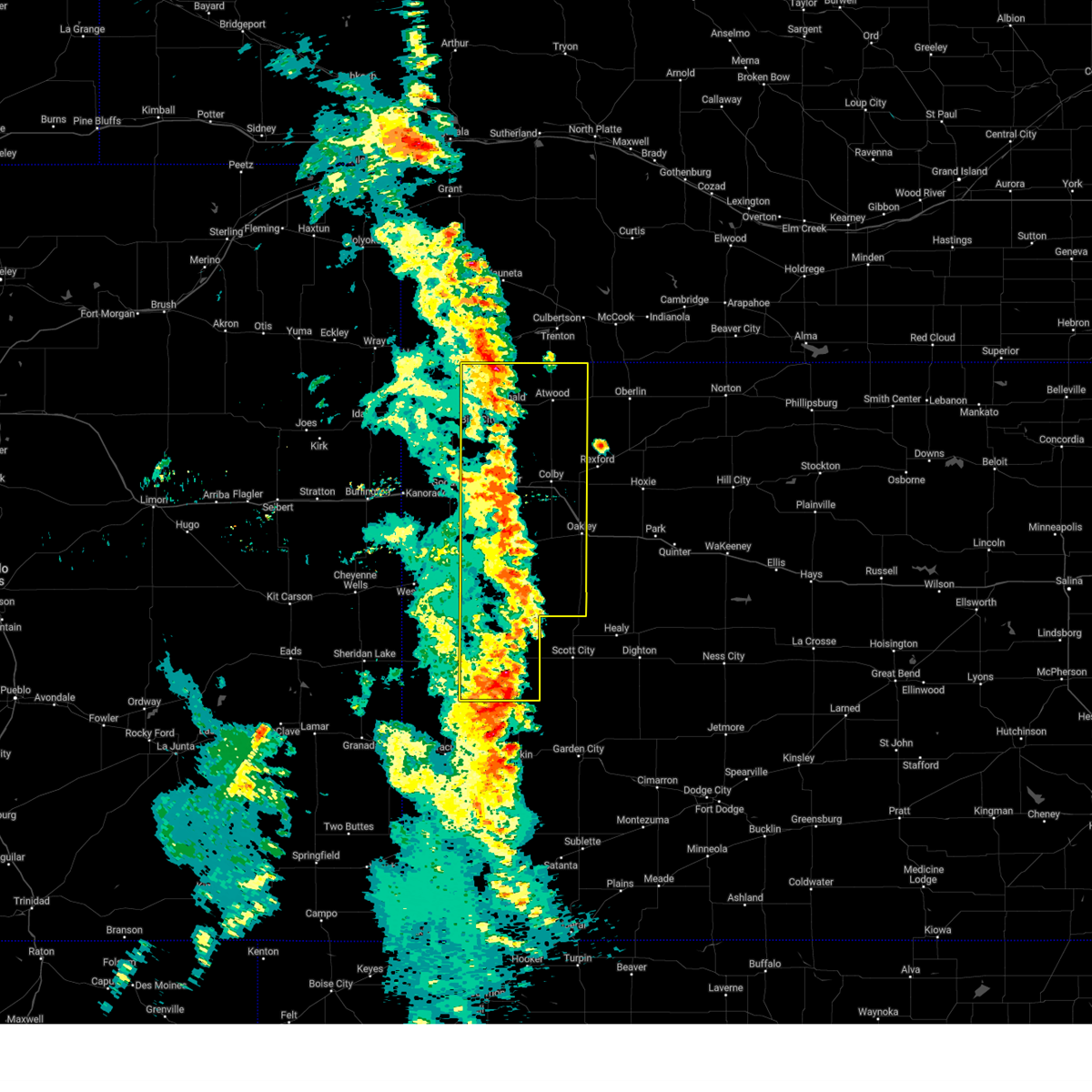 At 724 pm mdt/824 pm cdt/, severe thunderstorms were located along a line extending from 5 miles south of stratton to 5 miles north of colby to modoc, moving east at 45 mph (radar indicated). Hazards include 60 mph wind gusts. Expect damage to roofs, siding, and trees. these severe storms will be near, colby, atwood, monument, and gem around 830 pm cdt. oakley and ludell around 835 pm cdt. other locations impacted by these severe thunderstorms include blakeman, selkirk, mingo, marienthal, halford, lydia, and edson. This includes interstate 70 in kansas between mile markers 22 and 75. At 724 pm mdt/824 pm cdt/, severe thunderstorms were located along a line extending from 5 miles south of stratton to 5 miles north of colby to modoc, moving east at 45 mph (radar indicated). Hazards include 60 mph wind gusts. Expect damage to roofs, siding, and trees. these severe storms will be near, colby, atwood, monument, and gem around 830 pm cdt. oakley and ludell around 835 pm cdt. other locations impacted by these severe thunderstorms include blakeman, selkirk, mingo, marienthal, halford, lydia, and edson. This includes interstate 70 in kansas between mile markers 22 and 75.
|
| 9/17/2024 7:58 PM CDT |
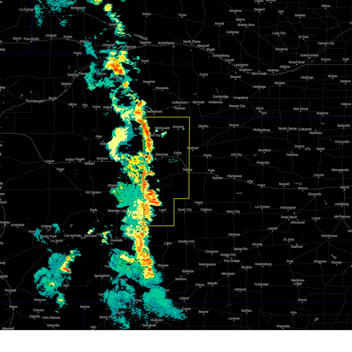 Svrgld the national weather service in goodland has issued a * severe thunderstorm warning for, wichita county in west central kansas, eastern wallace county in west central kansas, eastern cheyenne county in northwestern kansas, thomas county in northwestern kansas, logan county in west central kansas, rawlins county in northwestern kansas, eastern greeley county in west central kansas, eastern sherman county in northwestern kansas, * until 800 pm mdt/900 pm cdt/. * at 657 pm mdt/757 pm cdt/, severe thunderstorms were located along a line extending from 4 miles east of benkelman to 8 miles north of brewster to 6 miles northwest of leoti, moving east at 70 mph (trained weather spotters. at 0640 pm mdt, estimated 60 to 65 mph wind gusts were reported 13 miles nw of edson). Hazards include 60 mph wind gusts. Expect damage to roofs, siding, and trees. severe thunderstorms will be near, levant, winona, and russell springs around 805 pm cdt. colby, atwood, and monument around 810 pm cdt. gem and ludell around 815 pm cdt. other locations in the path of these severe thunderstorms include oakley. This includes interstate 70 in kansas between mile markers 16 and 75. Svrgld the national weather service in goodland has issued a * severe thunderstorm warning for, wichita county in west central kansas, eastern wallace county in west central kansas, eastern cheyenne county in northwestern kansas, thomas county in northwestern kansas, logan county in west central kansas, rawlins county in northwestern kansas, eastern greeley county in west central kansas, eastern sherman county in northwestern kansas, * until 800 pm mdt/900 pm cdt/. * at 657 pm mdt/757 pm cdt/, severe thunderstorms were located along a line extending from 4 miles east of benkelman to 8 miles north of brewster to 6 miles northwest of leoti, moving east at 70 mph (trained weather spotters. at 0640 pm mdt, estimated 60 to 65 mph wind gusts were reported 13 miles nw of edson). Hazards include 60 mph wind gusts. Expect damage to roofs, siding, and trees. severe thunderstorms will be near, levant, winona, and russell springs around 805 pm cdt. colby, atwood, and monument around 810 pm cdt. gem and ludell around 815 pm cdt. other locations in the path of these severe thunderstorms include oakley. This includes interstate 70 in kansas between mile markers 16 and 75.
|
| 9/17/2024 7:51 PM CDT |
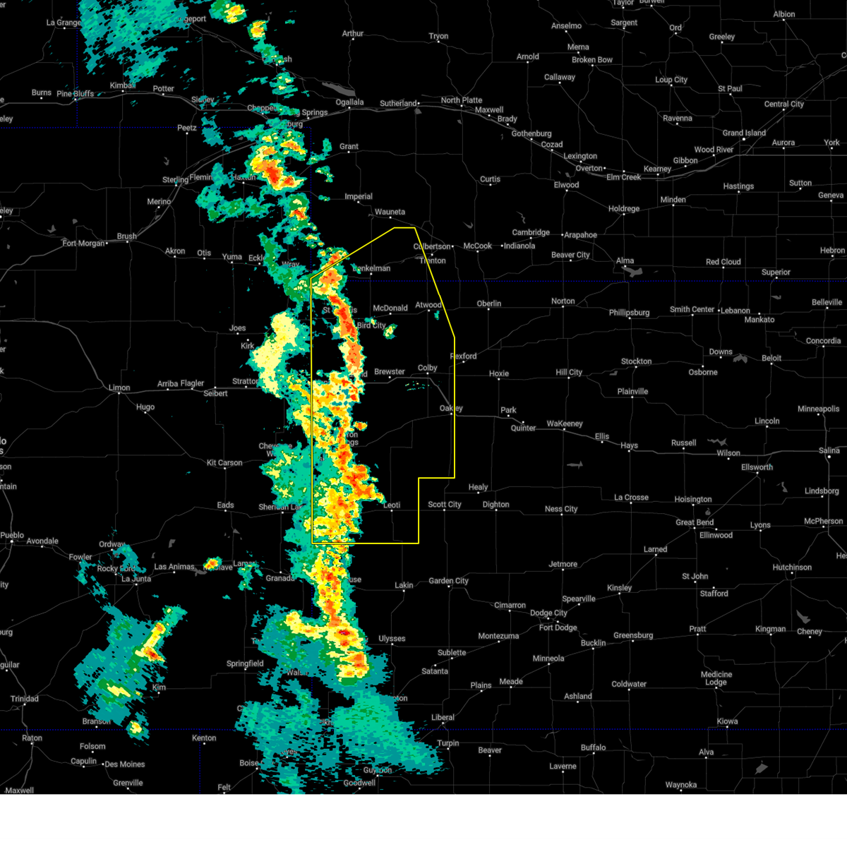 At 650 pm mdt/750 pm cdt/, severe thunderstorms were located along a line extending from 3 miles west of benkelman to 10 miles northwest of brewster to 11 miles northeast of tribune, moving east at 45 mph (trained weather spotters. at 0640 pm mdt, estimated 60 to 65 mph wind gusts were reported 13 miles nw of edson). Hazards include 60 mph wind gusts. Expect damage to roofs, siding, and trees. these severe storms will be near, brewster and bird city around 755 pm cdt. benkelman around 655 pm mdt. mcdonald around 800 pm cdt. winona around 805 pm cdt. levant and russell springs around 810 pm cdt. stratton around 815 pm cdt. colby and atwood around 820 pm cdt. monument around 825 pm cdt. gem and ludell around 830 pm cdt. other locations impacted by these severe thunderstorms include blakeman, selkirk, mingo, marienthal, max, halford, and lydia. This includes interstate 70 in kansas between mile markers 1 and 74. At 650 pm mdt/750 pm cdt/, severe thunderstorms were located along a line extending from 3 miles west of benkelman to 10 miles northwest of brewster to 11 miles northeast of tribune, moving east at 45 mph (trained weather spotters. at 0640 pm mdt, estimated 60 to 65 mph wind gusts were reported 13 miles nw of edson). Hazards include 60 mph wind gusts. Expect damage to roofs, siding, and trees. these severe storms will be near, brewster and bird city around 755 pm cdt. benkelman around 655 pm mdt. mcdonald around 800 pm cdt. winona around 805 pm cdt. levant and russell springs around 810 pm cdt. stratton around 815 pm cdt. colby and atwood around 820 pm cdt. monument around 825 pm cdt. gem and ludell around 830 pm cdt. other locations impacted by these severe thunderstorms include blakeman, selkirk, mingo, marienthal, max, halford, and lydia. This includes interstate 70 in kansas between mile markers 1 and 74.
|
| 9/17/2024 7:32 PM CDT |
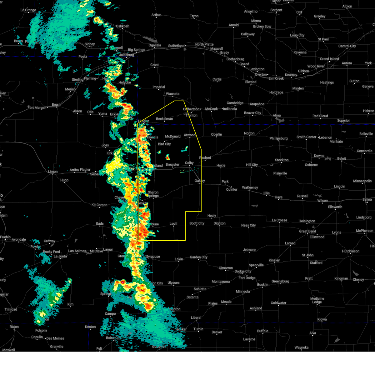 At 630 pm mdt/730 pm cdt/, severe thunderstorms were located along a line extending from 7 miles east of haigler to 10 miles northeast of goodland to 7 miles south of tribune, moving northeast at 70 mph (trained spotter. at 0625 pm mdt, estimated 60 mph winds were reported 13 miles northwest of saint francis). Hazards include 60 mph wind gusts and nickel size hail. Expect damage to roofs, siding, and trees. these severe storms will be near, brewster and bird city around 735 pm cdt. wallace around 635 pm mdt. mcdonald around 740 pm cdt. benkelman around 640 pm mdt. leoti, levant, and winona around 745 pm cdt. russell springs around 750 pm cdt. colby, atwood, and stratton around 755 pm cdt. monument, gem, and ludell around 800 pm cdt. other locations impacted by these severe thunderstorms include blakeman, selkirk, mingo, marienthal, max, halford, and lydia. This includes interstate 70 in kansas between mile markers 1 and 74. At 630 pm mdt/730 pm cdt/, severe thunderstorms were located along a line extending from 7 miles east of haigler to 10 miles northeast of goodland to 7 miles south of tribune, moving northeast at 70 mph (trained spotter. at 0625 pm mdt, estimated 60 mph winds were reported 13 miles northwest of saint francis). Hazards include 60 mph wind gusts and nickel size hail. Expect damage to roofs, siding, and trees. these severe storms will be near, brewster and bird city around 735 pm cdt. wallace around 635 pm mdt. mcdonald around 740 pm cdt. benkelman around 640 pm mdt. leoti, levant, and winona around 745 pm cdt. russell springs around 750 pm cdt. colby, atwood, and stratton around 755 pm cdt. monument, gem, and ludell around 800 pm cdt. other locations impacted by these severe thunderstorms include blakeman, selkirk, mingo, marienthal, max, halford, and lydia. This includes interstate 70 in kansas between mile markers 1 and 74.
|
| 9/17/2024 7:32 PM CDT |
 the severe thunderstorm warning has been cancelled and is no longer in effect the severe thunderstorm warning has been cancelled and is no longer in effect
|
| 9/17/2024 6:21 PM MDT |
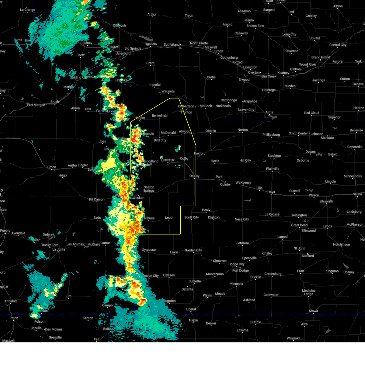 At 620 pm mdt/720 pm cdt/, severe thunderstorms were located along a line extending from 6 miles southwest of haigler to near goodland to 13 miles southwest of horace, moving east at 35 mph (mesonet. at 0607 pm mdt, a 62 mph wind gust was reported near vernon). Hazards include 60 mph wind gusts and nickel size hail. Expect damage to roofs, siding, and trees. these severe storms will be near, st. francis around 725 pm cdt. goodland, sharon springs, tribune, and horace around 625 pm mdt. wallace around 635 pm mdt. brewster and bird city around 745 pm cdt. leoti, winona, and mcdonald around 800 pm cdt. other locations impacted by these severe thunderstorms include blakeman, selkirk, mingo, marienthal, max, halford, and lydia. this includes the following highways, interstate 70 in kansas between mile markers 0 and 74. Interstate 70 in colorado between mile markers 446 and 450. At 620 pm mdt/720 pm cdt/, severe thunderstorms were located along a line extending from 6 miles southwest of haigler to near goodland to 13 miles southwest of horace, moving east at 35 mph (mesonet. at 0607 pm mdt, a 62 mph wind gust was reported near vernon). Hazards include 60 mph wind gusts and nickel size hail. Expect damage to roofs, siding, and trees. these severe storms will be near, st. francis around 725 pm cdt. goodland, sharon springs, tribune, and horace around 625 pm mdt. wallace around 635 pm mdt. brewster and bird city around 745 pm cdt. leoti, winona, and mcdonald around 800 pm cdt. other locations impacted by these severe thunderstorms include blakeman, selkirk, mingo, marienthal, max, halford, and lydia. this includes the following highways, interstate 70 in kansas between mile markers 0 and 74. Interstate 70 in colorado between mile markers 446 and 450.
|
| 9/17/2024 5:57 PM MDT |
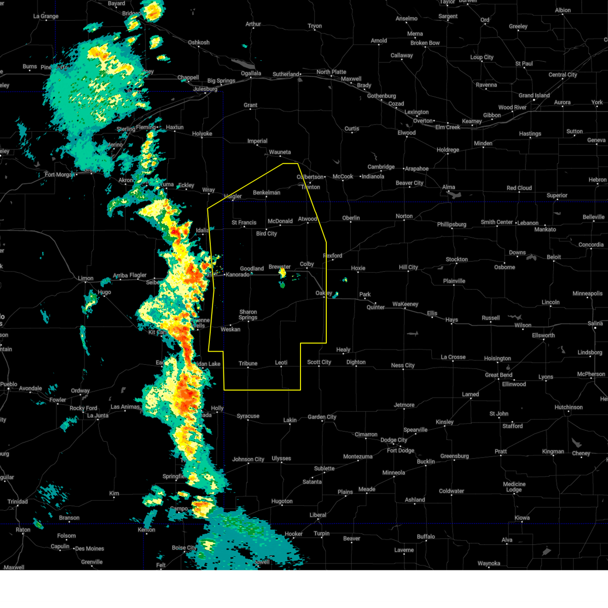 Svrgld the national weather service in goodland has issued a * severe thunderstorm warning for, eastern cheyenne county in east central colorado, southeastern yuma county in northeastern colorado, eastern kit carson county in east central colorado, wichita county in west central kansas, cheyenne county in northwestern kansas, logan county in west central kansas, rawlins county in northwestern kansas, sherman county in northwestern kansas, wallace county in west central kansas, thomas county in northwestern kansas, greeley county in west central kansas, western hitchcock county in southwestern nebraska, southeastern dundy county in southwestern nebraska, * until 700 pm mdt/800 pm cdt/. * at 556 pm mdt/656 pm cdt/, severe thunderstorms were located along a line extending from 18 miles northwest of bonny reservoir to 9 miles southeast of burlington to 17 miles south of holly, moving east at 70 mph (asos. at 0547 pm mdt, a 66 mph wind gust was reported in burlington, colorado). Hazards include 70 mph wind gusts and nickel size hail. Expect considerable tree damage. damage is likely to mobile homes, roofs, and outbuildings. severe thunderstorms will be near, kanorado and bonny reservoir around 600 pm mdt. ruleton and weskan around 605 pm mdt. goodland, sharon springs, tribune, and horace around 615 pm mdt. st. francis around 720 pm cdt. haigler and wallace around 620 pm mdt. brewster and bird city around 730 pm cdt. leoti around 735 pm cdt. benkelman around 635 pm mdt. levant, winona, and mcdonald around 740 pm cdt. colby and russell springs around 745 pm cdt. other locations impacted by these severe thunderstorms include blakeman, beecher island, marienthal, max, halford, lydia, and edson. this includes the following highways, interstate 70 in kansas between mile markers 0 and 74. Interstate 70 in colorado between mile markers 444 and 450. Svrgld the national weather service in goodland has issued a * severe thunderstorm warning for, eastern cheyenne county in east central colorado, southeastern yuma county in northeastern colorado, eastern kit carson county in east central colorado, wichita county in west central kansas, cheyenne county in northwestern kansas, logan county in west central kansas, rawlins county in northwestern kansas, sherman county in northwestern kansas, wallace county in west central kansas, thomas county in northwestern kansas, greeley county in west central kansas, western hitchcock county in southwestern nebraska, southeastern dundy county in southwestern nebraska, * until 700 pm mdt/800 pm cdt/. * at 556 pm mdt/656 pm cdt/, severe thunderstorms were located along a line extending from 18 miles northwest of bonny reservoir to 9 miles southeast of burlington to 17 miles south of holly, moving east at 70 mph (asos. at 0547 pm mdt, a 66 mph wind gust was reported in burlington, colorado). Hazards include 70 mph wind gusts and nickel size hail. Expect considerable tree damage. damage is likely to mobile homes, roofs, and outbuildings. severe thunderstorms will be near, kanorado and bonny reservoir around 600 pm mdt. ruleton and weskan around 605 pm mdt. goodland, sharon springs, tribune, and horace around 615 pm mdt. st. francis around 720 pm cdt. haigler and wallace around 620 pm mdt. brewster and bird city around 730 pm cdt. leoti around 735 pm cdt. benkelman around 635 pm mdt. levant, winona, and mcdonald around 740 pm cdt. colby and russell springs around 745 pm cdt. other locations impacted by these severe thunderstorms include blakeman, beecher island, marienthal, max, halford, lydia, and edson. this includes the following highways, interstate 70 in kansas between mile markers 0 and 74. Interstate 70 in colorado between mile markers 444 and 450.
|
| 7/28/2024 6:55 PM CDT | Quarter sized hail reported 9.3 miles NNW of McDonald, KS, hail ranged from pea to quarter in size; mostly nickel though this replaces the prior storm report from 11 s of beardsley. |
| 7/28/2024 6:42 PM CDT |
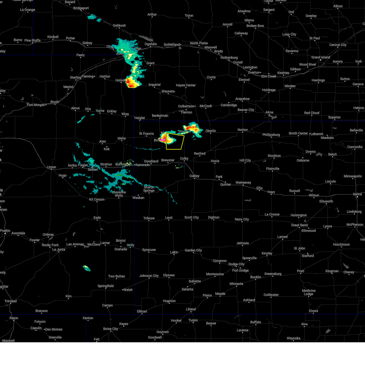 At 641 pm cdt, a severe thunderstorm was located 7 miles southeast of bird city, or 20 miles east of st. francis, moving east at 30 mph (radar indicated. at 627 pm cdt 1 inch diameter hail was reported in bird city). Hazards include ping pong ball size hail and 60 mph wind gusts. People and animals outdoors will be injured. expect hail damage to roofs, siding, windows, and vehicles. expect wind damage to roofs, siding, and trees. Locations impacted include, mcdonald. At 641 pm cdt, a severe thunderstorm was located 7 miles southeast of bird city, or 20 miles east of st. francis, moving east at 30 mph (radar indicated. at 627 pm cdt 1 inch diameter hail was reported in bird city). Hazards include ping pong ball size hail and 60 mph wind gusts. People and animals outdoors will be injured. expect hail damage to roofs, siding, windows, and vehicles. expect wind damage to roofs, siding, and trees. Locations impacted include, mcdonald.
|
| 7/28/2024 6:32 PM CDT |
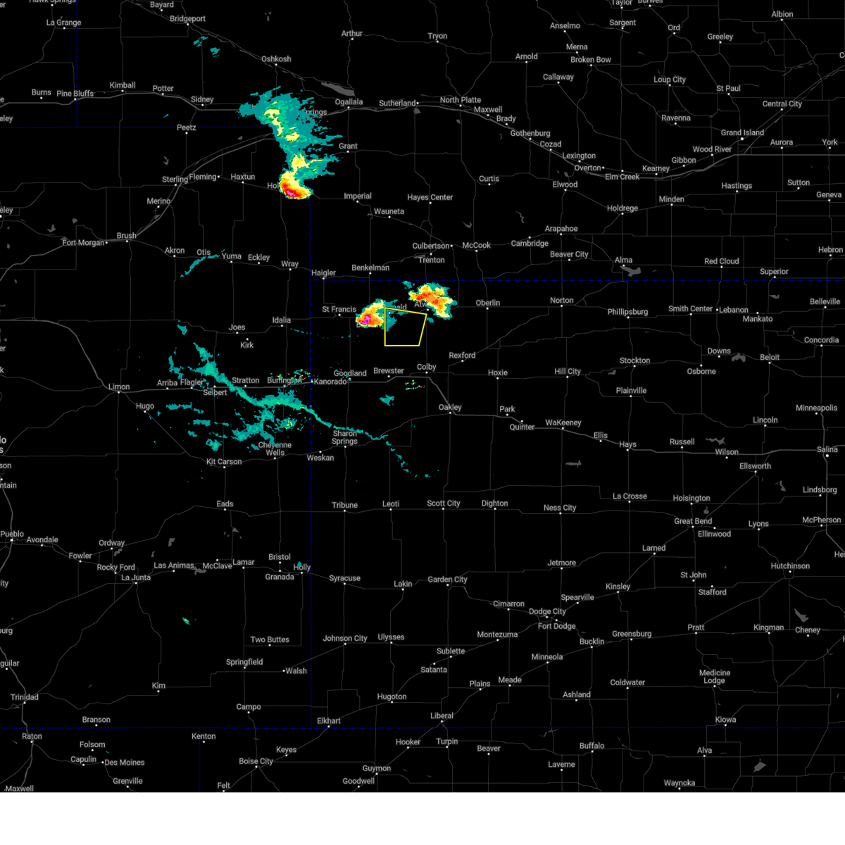 Svrgld the national weather service in goodland has issued a * severe thunderstorm warning for, southwestern rawlins county in northwestern kansas, * until 730 pm cdt. * at 631 pm cdt, a severe thunderstorm was located near bird city, or 15 miles east of st. francis, moving east at 30 mph (radar indicated). Hazards include golf ball size hail and 70 mph wind gusts. People and animals outdoors will be injured. expect hail damage to roofs, siding, windows, and vehicles. expect considerable tree damage. wind damage is also likely to mobile homes, roofs, and outbuildings. This severe thunderstorm will remain over mainly rural areas of southwestern rawlins county. Svrgld the national weather service in goodland has issued a * severe thunderstorm warning for, southwestern rawlins county in northwestern kansas, * until 730 pm cdt. * at 631 pm cdt, a severe thunderstorm was located near bird city, or 15 miles east of st. francis, moving east at 30 mph (radar indicated). Hazards include golf ball size hail and 70 mph wind gusts. People and animals outdoors will be injured. expect hail damage to roofs, siding, windows, and vehicles. expect considerable tree damage. wind damage is also likely to mobile homes, roofs, and outbuildings. This severe thunderstorm will remain over mainly rural areas of southwestern rawlins county.
|
| 7/19/2024 10:40 PM CDT |
 At 937 pm mdt/1037 pm cdt/, severe thunderstorms were located along a line extending from 5 miles north of st. francis to 5 miles southeast of colby, moving south at 25 mph (quarter size hail was observed in the city of colby at 1025 pm cdt). Hazards include 60 mph wind gusts, nickel to quarter size hail and torrential rainfall. Hail damage to vehicles is expected. expect wind damage to roofs, siding, and trees. torrential rainfall with these storms may lead to localized flash flooding. these severe storms will be near, colby, st. francis, and levant around 1045 pm cdt. oakley and brewster around 1110 pm cdt. other locations impacted by these severe thunderstorms include wheeler, mingo, and halford. This includes interstate 70 in kansas between mile markers 33 and 75. At 937 pm mdt/1037 pm cdt/, severe thunderstorms were located along a line extending from 5 miles north of st. francis to 5 miles southeast of colby, moving south at 25 mph (quarter size hail was observed in the city of colby at 1025 pm cdt). Hazards include 60 mph wind gusts, nickel to quarter size hail and torrential rainfall. Hail damage to vehicles is expected. expect wind damage to roofs, siding, and trees. torrential rainfall with these storms may lead to localized flash flooding. these severe storms will be near, colby, st. francis, and levant around 1045 pm cdt. oakley and brewster around 1110 pm cdt. other locations impacted by these severe thunderstorms include wheeler, mingo, and halford. This includes interstate 70 in kansas between mile markers 33 and 75.
|
| 7/19/2024 10:32 PM CDT |
 Svrgld the national weather service in goodland has issued a * severe thunderstorm warning for, cheyenne county in northwestern kansas, thomas county in northwestern kansas, southwestern sheridan county in northwestern kansas, southwestern rawlins county in northwestern kansas, northeastern sherman county in northwestern kansas, * until 1030 pm mdt/1130 pm cdt/. * at 931 pm mdt/1031 pm cdt/, severe thunderstorms were located along a line extending from 7 miles north of st. francis to 5 miles southwest of gem, moving south at 20 mph (quarter sized hail was reported in the city of colby at 1025 pm cdt). Hazards include 60 mph wind gusts and quarter size hail. Hail damage to vehicles is expected. expect wind damage to roofs, siding, and trees. severe thunderstorms will be near, colby and bird city around 1035 pm cdt. st. francis around 1045 pm cdt. levant around 1050 pm cdt. other locations in the path of these severe thunderstorms include oakley. This includes interstate 70 in kansas between mile markers 33 and 75. Svrgld the national weather service in goodland has issued a * severe thunderstorm warning for, cheyenne county in northwestern kansas, thomas county in northwestern kansas, southwestern sheridan county in northwestern kansas, southwestern rawlins county in northwestern kansas, northeastern sherman county in northwestern kansas, * until 1030 pm mdt/1130 pm cdt/. * at 931 pm mdt/1031 pm cdt/, severe thunderstorms were located along a line extending from 7 miles north of st. francis to 5 miles southwest of gem, moving south at 20 mph (quarter sized hail was reported in the city of colby at 1025 pm cdt). Hazards include 60 mph wind gusts and quarter size hail. Hail damage to vehicles is expected. expect wind damage to roofs, siding, and trees. severe thunderstorms will be near, colby and bird city around 1035 pm cdt. st. francis around 1045 pm cdt. levant around 1050 pm cdt. other locations in the path of these severe thunderstorms include oakley. This includes interstate 70 in kansas between mile markers 33 and 75.
|
| 7/19/2024 2:54 PM CDT |
 the severe thunderstorm warning has been cancelled and is no longer in effect the severe thunderstorm warning has been cancelled and is no longer in effect
|
| 7/19/2024 2:54 PM CDT |
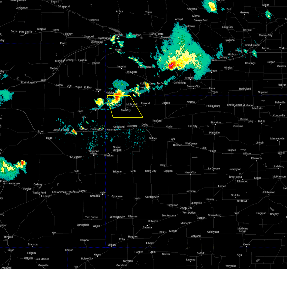 At 253 pm cdt, a severe thunderstorm was located 11 miles northeast of st. francis, moving southeast at 30 mph (radar indicated). Hazards include 70 mph wind gusts and half dollar size hail. Hail damage to vehicles is expected. expect considerable tree damage. wind damage is also likely to mobile homes, roofs, and outbuildings. locations impacted include, st. Francis, bird city, mcdonald, and wheeler. At 253 pm cdt, a severe thunderstorm was located 11 miles northeast of st. francis, moving southeast at 30 mph (radar indicated). Hazards include 70 mph wind gusts and half dollar size hail. Hail damage to vehicles is expected. expect considerable tree damage. wind damage is also likely to mobile homes, roofs, and outbuildings. locations impacted include, st. Francis, bird city, mcdonald, and wheeler.
|
| 7/19/2024 2:34 PM CDT |
 Svrgld the national weather service in goodland has issued a * severe thunderstorm warning for, cheyenne county in northwestern kansas, southwestern rawlins county in northwestern kansas, south central dundy county in southwestern nebraska, * until 230 pm mdt/330 pm cdt/. * at 133 pm mdt/233 pm cdt/, severe thunderstorms were located along a line extending from 4 miles northwest of benkelman to near haigler, moving southeast at 35 mph (radar indicated). Hazards include 70 mph wind gusts and half dollar size hail. Hail damage to vehicles is expected. expect considerable tree damage. Wind damage is also likely to mobile homes, roofs, and outbuildings. Svrgld the national weather service in goodland has issued a * severe thunderstorm warning for, cheyenne county in northwestern kansas, southwestern rawlins county in northwestern kansas, south central dundy county in southwestern nebraska, * until 230 pm mdt/330 pm cdt/. * at 133 pm mdt/233 pm cdt/, severe thunderstorms were located along a line extending from 4 miles northwest of benkelman to near haigler, moving southeast at 35 mph (radar indicated). Hazards include 70 mph wind gusts and half dollar size hail. Hail damage to vehicles is expected. expect considerable tree damage. Wind damage is also likely to mobile homes, roofs, and outbuildings.
|
| 6/2/2024 8:16 PM CDT |
 At 714 pm mdt/814 pm cdt/, severe thunderstorms were located along a line extending from 3 miles northwest of bartley to near atwood to 10 miles north of brewster, moving east at 30 mph (radar indicated). Hazards include 60 mph wind gusts and quarter size hail. Hail damage to vehicles is expected. expect wind damage to roofs, siding, and trees. these severe storms will be near, indianola, bartley, and herndon around 820 pm cdt. danbury around 835 pm cdt. lebanon around 845 pm cdt. oberlin around 850 pm cdt. other locations impacted by these severe thunderstorms include blakeman, cedar bluffs, beardsley, and traer. This includes interstate 70 in kansas between mile markers 36 and 60. At 714 pm mdt/814 pm cdt/, severe thunderstorms were located along a line extending from 3 miles northwest of bartley to near atwood to 10 miles north of brewster, moving east at 30 mph (radar indicated). Hazards include 60 mph wind gusts and quarter size hail. Hail damage to vehicles is expected. expect wind damage to roofs, siding, and trees. these severe storms will be near, indianola, bartley, and herndon around 820 pm cdt. danbury around 835 pm cdt. lebanon around 845 pm cdt. oberlin around 850 pm cdt. other locations impacted by these severe thunderstorms include blakeman, cedar bluffs, beardsley, and traer. This includes interstate 70 in kansas between mile markers 36 and 60.
|
| 6/2/2024 7:56 PM CDT |
 Svrgld the national weather service in goodland has issued a * severe thunderstorm warning for, southeastern cheyenne county in northwestern kansas, northern thomas county in northwestern kansas, rawlins county in northwestern kansas, northwestern decatur county in northwestern kansas, northern sherman county in northwestern kansas, red willow county in southwestern nebraska, hitchcock county in southwestern nebraska, southeastern dundy county in southwestern nebraska, * until 800 pm mdt/900 pm cdt/. * at 656 pm mdt/756 pm cdt/, severe thunderstorms were located along a line extending from 6 miles northwest of indianola to 8 miles west of atwood to 13 miles northwest of brewster, moving east at 30 mph (radar indicated). Hazards include 60 mph wind gusts and quarter size hail. Hail damage to vehicles is expected. expect wind damage to roofs, siding, and trees. severe thunderstorms will be near, mccook, atwood, indianola, and ludell around 800 pm cdt. bartley and herndon around 810 pm cdt. danbury around 830 pm cdt. lebanon around 840 pm cdt. oberlin around 845 pm cdt. other locations impacted by these severe thunderstorms include blakeman, cedar bluffs, beardsley, and traer. This includes interstate 70 in kansas between mile markers 36 and 60. Svrgld the national weather service in goodland has issued a * severe thunderstorm warning for, southeastern cheyenne county in northwestern kansas, northern thomas county in northwestern kansas, rawlins county in northwestern kansas, northwestern decatur county in northwestern kansas, northern sherman county in northwestern kansas, red willow county in southwestern nebraska, hitchcock county in southwestern nebraska, southeastern dundy county in southwestern nebraska, * until 800 pm mdt/900 pm cdt/. * at 656 pm mdt/756 pm cdt/, severe thunderstorms were located along a line extending from 6 miles northwest of indianola to 8 miles west of atwood to 13 miles northwest of brewster, moving east at 30 mph (radar indicated). Hazards include 60 mph wind gusts and quarter size hail. Hail damage to vehicles is expected. expect wind damage to roofs, siding, and trees. severe thunderstorms will be near, mccook, atwood, indianola, and ludell around 800 pm cdt. bartley and herndon around 810 pm cdt. danbury around 830 pm cdt. lebanon around 840 pm cdt. oberlin around 845 pm cdt. other locations impacted by these severe thunderstorms include blakeman, cedar bluffs, beardsley, and traer. This includes interstate 70 in kansas between mile markers 36 and 60.
|
| 6/2/2024 7:48 PM CDT |
 At 648 pm mdt/748 pm cdt/, severe thunderstorms were located along a line extending from 8 miles north of mccook to 11 miles southeast of stratton to 10 miles south of mcdonald, moving east at 45 mph (radar indicated). Hazards include 60 mph wind gusts and half dollar size hail. Hail damage to vehicles is expected. expect wind damage to roofs, siding, and trees. these severe storms will be near, mccook and atwood around 755 pm cdt. ludell around 800 pm cdt. Other locations impacted by these severe thunderstorms include blakeman, beardsley, wheeler, and max. At 648 pm mdt/748 pm cdt/, severe thunderstorms were located along a line extending from 8 miles north of mccook to 11 miles southeast of stratton to 10 miles south of mcdonald, moving east at 45 mph (radar indicated). Hazards include 60 mph wind gusts and half dollar size hail. Hail damage to vehicles is expected. expect wind damage to roofs, siding, and trees. these severe storms will be near, mccook and atwood around 755 pm cdt. ludell around 800 pm cdt. Other locations impacted by these severe thunderstorms include blakeman, beardsley, wheeler, and max.
|
| 6/2/2024 7:44 PM CDT |
 At 644 pm mdt/744 pm cdt/, severe thunderstorms were located along a line extending from 7 miles north of mccook to 11 miles south of stratton to 10 miles southeast of bird city, moving east at 45 mph (mesonet. at 7:44 pm cdt the mccook airport reported a 62 mph wind gust). Hazards include two inch hail and 60 mph wind gusts. People and animals outdoors will be injured. expect hail damage to roofs, siding, windows, and vehicles. expect wind damage to roofs, siding, and trees. these severe storms will be near, mccook around 750 pm cdt. atwood around 755 pm cdt. ludell around 805 pm cdt. Other locations impacted by these severe thunderstorms include blakeman, beardsley, wheeler, and max. At 644 pm mdt/744 pm cdt/, severe thunderstorms were located along a line extending from 7 miles north of mccook to 11 miles south of stratton to 10 miles southeast of bird city, moving east at 45 mph (mesonet. at 7:44 pm cdt the mccook airport reported a 62 mph wind gust). Hazards include two inch hail and 60 mph wind gusts. People and animals outdoors will be injured. expect hail damage to roofs, siding, windows, and vehicles. expect wind damage to roofs, siding, and trees. these severe storms will be near, mccook around 750 pm cdt. atwood around 755 pm cdt. ludell around 805 pm cdt. Other locations impacted by these severe thunderstorms include blakeman, beardsley, wheeler, and max.
|
| 6/2/2024 7:32 PM CDT |
 At 631 pm mdt/731 pm cdt/, severe thunderstorms were located along a line extending from 5 miles northeast of culbertson to 12 miles north of mcdonald to 10 miles south of bird city, moving east at 40 mph (trained weather spotters. at 725 pm cdt, two and a quarter inch hail was reported 13 miles north of bird city). Hazards include two inch hail and 60 mph wind gusts. People and animals outdoors will be injured. expect hail damage to roofs, siding, windows, and vehicles. expect wind damage to roofs, siding, and trees. these severe storms will be near, mccook, culbertson, and mcdonald around 735 pm cdt. atwood around 755 pm cdt. ludell around 800 pm cdt. Other locations impacted by these severe thunderstorms include blakeman, beardsley, wheeler, and max. At 631 pm mdt/731 pm cdt/, severe thunderstorms were located along a line extending from 5 miles northeast of culbertson to 12 miles north of mcdonald to 10 miles south of bird city, moving east at 40 mph (trained weather spotters. at 725 pm cdt, two and a quarter inch hail was reported 13 miles north of bird city). Hazards include two inch hail and 60 mph wind gusts. People and animals outdoors will be injured. expect hail damage to roofs, siding, windows, and vehicles. expect wind damage to roofs, siding, and trees. these severe storms will be near, mccook, culbertson, and mcdonald around 735 pm cdt. atwood around 755 pm cdt. ludell around 800 pm cdt. Other locations impacted by these severe thunderstorms include blakeman, beardsley, wheeler, and max.
|
| 6/2/2024 7:15 PM CDT |
 Svrgld the national weather service in goodland has issued a * severe thunderstorm warning for, cheyenne county in northwestern kansas, northwestern thomas county in northwestern kansas, rawlins county in northwestern kansas, northern sherman county in northwestern kansas, western red willow county in southwestern nebraska, hitchcock county in southwestern nebraska, eastern dundy county in southwestern nebraska, * until 700 pm mdt/800 pm cdt/. * at 614 pm mdt/714 pm cdt/, severe thunderstorms were located along a line extending from 5 miles west of culbertson to 13 miles south of st. francis, moving east at 45 mph (radar indicated. at 0712 pm cdt, ping pong ball sized hail was reported northwest of stratton, nebraska). Hazards include golf ball size hail and 60 mph wind gusts. People and animals outdoors will be injured. expect hail damage to roofs, siding, windows, and vehicles. expect wind damage to roofs, siding, and trees. severe thunderstorms will be near, trenton, culbertson, bird city, and mcdonald around 720 pm cdt. Other locations in the path of these severe thunderstorms include mccook. Svrgld the national weather service in goodland has issued a * severe thunderstorm warning for, cheyenne county in northwestern kansas, northwestern thomas county in northwestern kansas, rawlins county in northwestern kansas, northern sherman county in northwestern kansas, western red willow county in southwestern nebraska, hitchcock county in southwestern nebraska, eastern dundy county in southwestern nebraska, * until 700 pm mdt/800 pm cdt/. * at 614 pm mdt/714 pm cdt/, severe thunderstorms were located along a line extending from 5 miles west of culbertson to 13 miles south of st. francis, moving east at 45 mph (radar indicated. at 0712 pm cdt, ping pong ball sized hail was reported northwest of stratton, nebraska). Hazards include golf ball size hail and 60 mph wind gusts. People and animals outdoors will be injured. expect hail damage to roofs, siding, windows, and vehicles. expect wind damage to roofs, siding, and trees. severe thunderstorms will be near, trenton, culbertson, bird city, and mcdonald around 720 pm cdt. Other locations in the path of these severe thunderstorms include mccook.
|
| 5/19/2024 8:58 PM CDT |
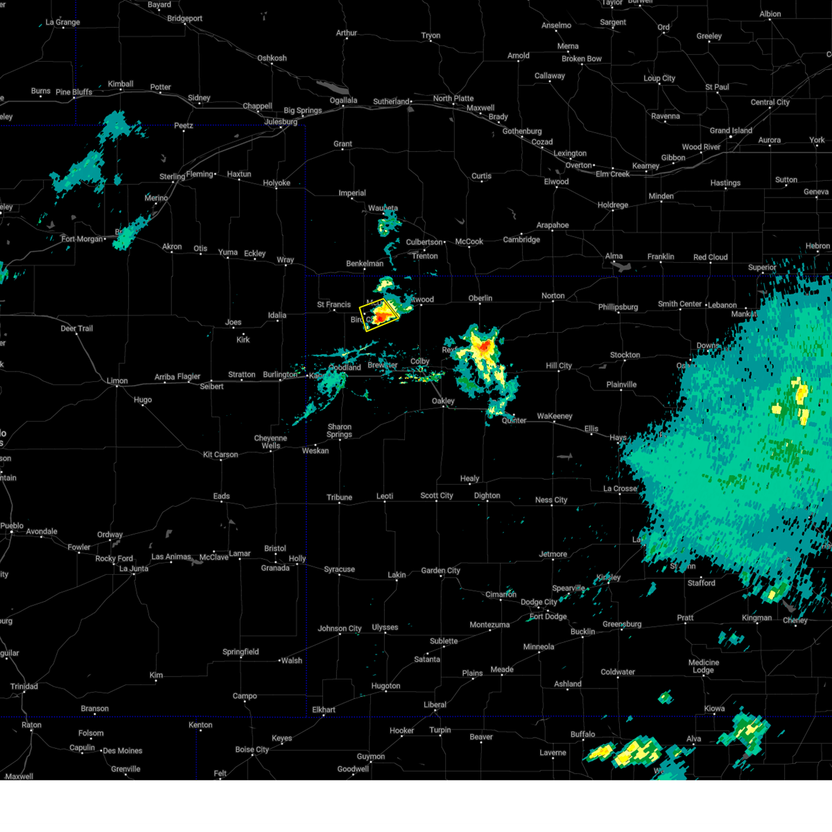 The storm which prompted the warning has weakened below severe limits, and no longer poses an immediate threat to life or property. therefore, the warning will be allowed to expire. however, heavy rain is still possible with this thunderstorm. The storm which prompted the warning has weakened below severe limits, and no longer poses an immediate threat to life or property. therefore, the warning will be allowed to expire. however, heavy rain is still possible with this thunderstorm.
|
| 5/19/2024 8:48 PM CDT |
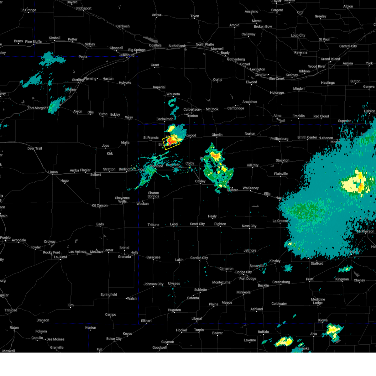 At 848 pm cdt, a severe thunderstorm was located 5 miles southwest of mcdonald, or 19 miles east of st. francis, moving southeast at 20 mph (radar indicated). Hazards include 60 mph wind gusts and quarter size hail. Hail damage to vehicles is expected. expect wind damage to roofs, siding, and trees. This severe thunderstorm will remain over mainly rural areas of southeastern cheyenne and west central rawlins counties in northwestern kansas. At 848 pm cdt, a severe thunderstorm was located 5 miles southwest of mcdonald, or 19 miles east of st. francis, moving southeast at 20 mph (radar indicated). Hazards include 60 mph wind gusts and quarter size hail. Hail damage to vehicles is expected. expect wind damage to roofs, siding, and trees. This severe thunderstorm will remain over mainly rural areas of southeastern cheyenne and west central rawlins counties in northwestern kansas.
|
| 5/19/2024 8:39 PM CDT |
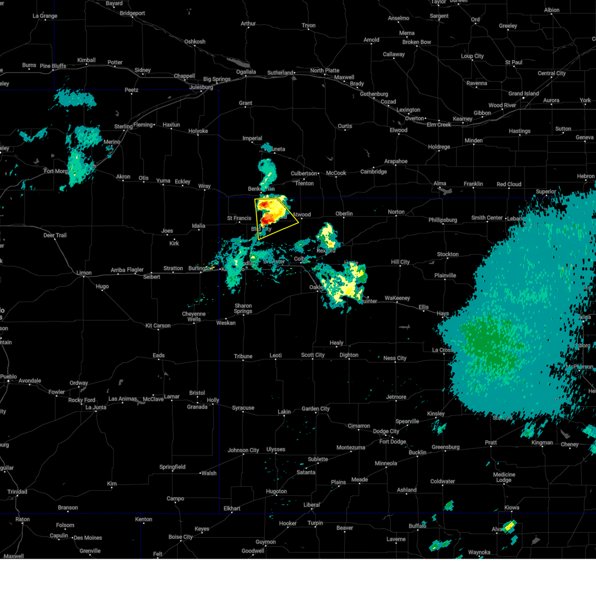 At 839 pm cdt, a severe thunderstorm was located near mcdonald, or 19 miles east of st. francis, moving southeast at 20 mph (radar indicated). Hazards include 60 mph wind gusts and quarter size hail. Hail damage to vehicles is expected. expect wind damage to roofs, siding, and trees. this severe storm will be near, mcdonald around 845 pm cdt. Other locations impacted by this severe thunderstorm include beardsley. At 839 pm cdt, a severe thunderstorm was located near mcdonald, or 19 miles east of st. francis, moving southeast at 20 mph (radar indicated). Hazards include 60 mph wind gusts and quarter size hail. Hail damage to vehicles is expected. expect wind damage to roofs, siding, and trees. this severe storm will be near, mcdonald around 845 pm cdt. Other locations impacted by this severe thunderstorm include beardsley.
|
| 5/19/2024 8:25 PM CDT |
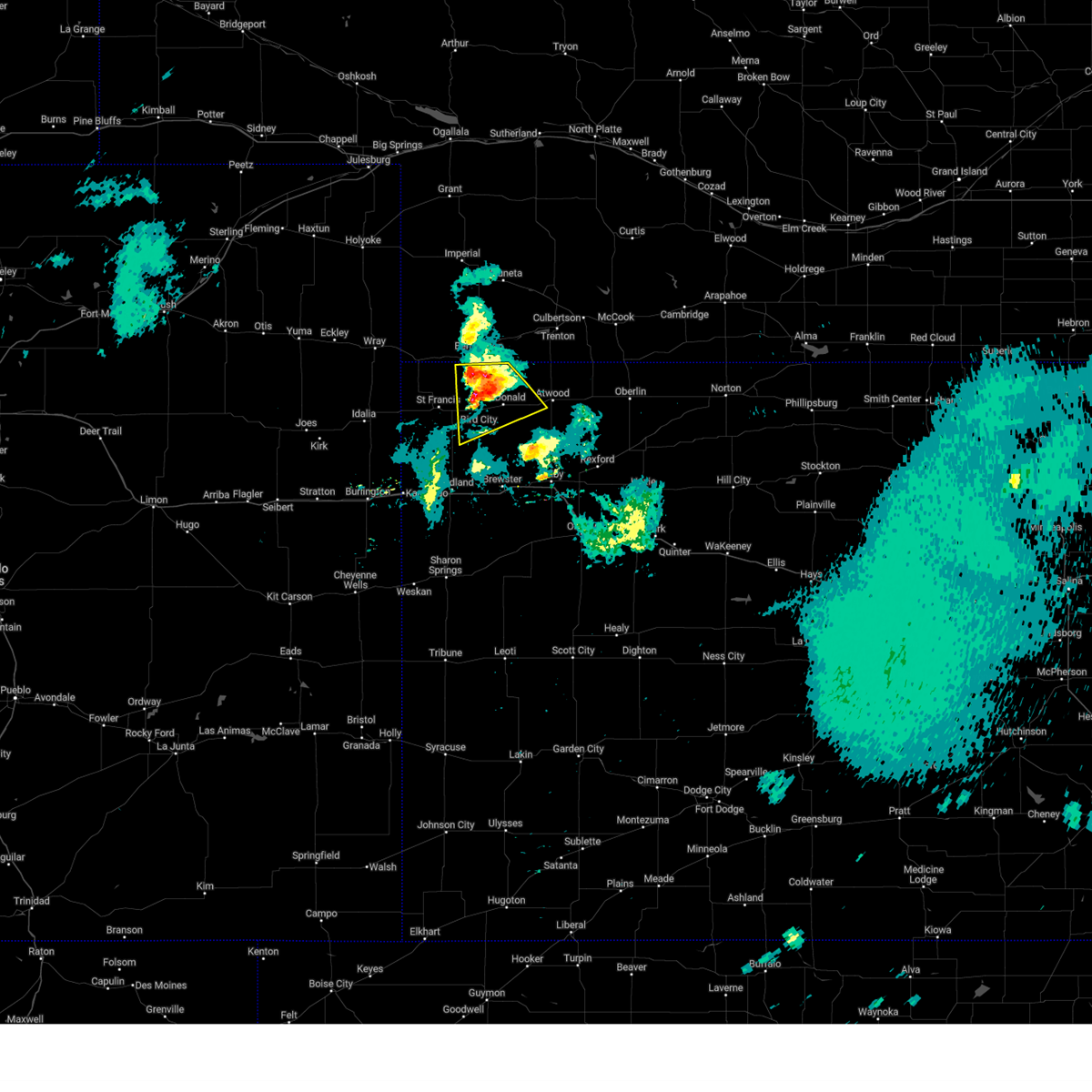 At 824 pm cdt, a severe thunderstorm was located 5 miles north of bird city, or 15 miles south of benkelman, moving southeast at 25 mph (trained weather spotters. at 0822 pm cdt, dime to nickel sized hail was reported 6 miles northwest of bird city). Hazards include 60 mph wind gusts and quarter size hail. Hail damage to vehicles is expected. expect wind damage to roofs, siding, and trees. this severe storm will be near, bird city around 830 pm cdt. mcdonald around 835 pm cdt. Other locations impacted by this severe thunderstorm include beardsley. At 824 pm cdt, a severe thunderstorm was located 5 miles north of bird city, or 15 miles south of benkelman, moving southeast at 25 mph (trained weather spotters. at 0822 pm cdt, dime to nickel sized hail was reported 6 miles northwest of bird city). Hazards include 60 mph wind gusts and quarter size hail. Hail damage to vehicles is expected. expect wind damage to roofs, siding, and trees. this severe storm will be near, bird city around 830 pm cdt. mcdonald around 835 pm cdt. Other locations impacted by this severe thunderstorm include beardsley.
|
| 5/19/2024 8:11 PM CDT |
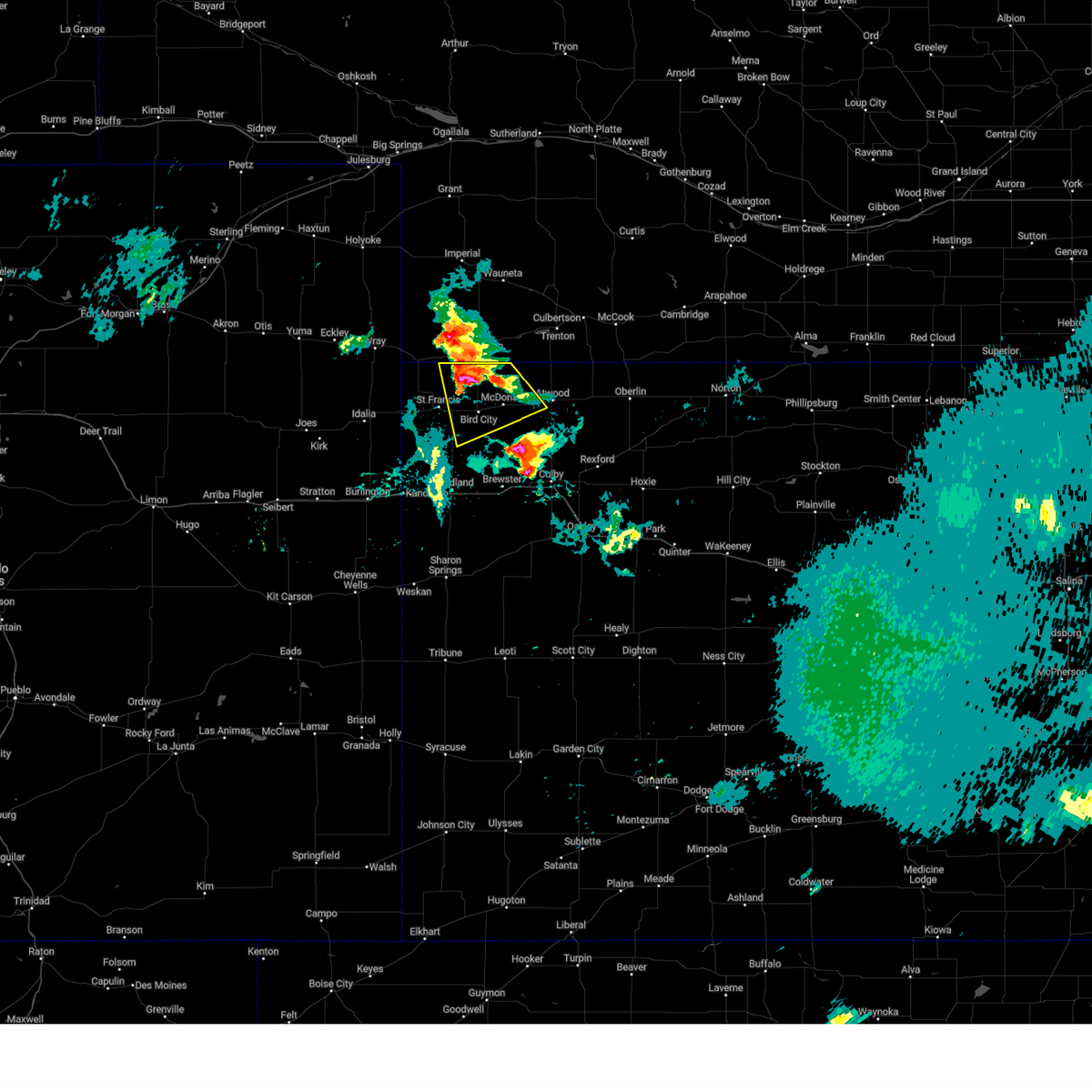 Svrgld the national weather service in goodland has issued a * severe thunderstorm warning for, eastern cheyenne county in northwestern kansas, northwestern rawlins county in northwestern kansas, * until 900 pm cdt. * at 811 pm cdt, a severe thunderstorm was located 9 miles north of bird city, or 11 miles south of benkelman, moving southeast at 20 mph (radar indicated). Hazards include 60 mph wind gusts and quarter size hail. Hail damage to vehicles is expected. expect wind damage to roofs, siding, and trees. this severe thunderstorm will be near, bird city around 830 pm cdt. Other locations in the path of this severe thunderstorm include mcdonald. Svrgld the national weather service in goodland has issued a * severe thunderstorm warning for, eastern cheyenne county in northwestern kansas, northwestern rawlins county in northwestern kansas, * until 900 pm cdt. * at 811 pm cdt, a severe thunderstorm was located 9 miles north of bird city, or 11 miles south of benkelman, moving southeast at 20 mph (radar indicated). Hazards include 60 mph wind gusts and quarter size hail. Hail damage to vehicles is expected. expect wind damage to roofs, siding, and trees. this severe thunderstorm will be near, bird city around 830 pm cdt. Other locations in the path of this severe thunderstorm include mcdonald.
|
| 5/3/2024 10:21 PM CDT |
 The storms which prompted the warning have weakened below severe limits, and no longer pose an immediate threat to life or property. therefore, the warning will be allowed to expire. a severe thunderstorm watch remains in effect until midnight cdt for northwestern kansas. to report severe weather, contact your nearest law enforcement agency. they will relay your report to the national weather service goodland. The storms which prompted the warning have weakened below severe limits, and no longer pose an immediate threat to life or property. therefore, the warning will be allowed to expire. a severe thunderstorm watch remains in effect until midnight cdt for northwestern kansas. to report severe weather, contact your nearest law enforcement agency. they will relay your report to the national weather service goodland.
|
| 5/3/2024 10:07 PM CDT |
 At 1006 pm cdt, severe thunderstorms were located along a line extending from 7 miles southeast of benkelman to 5 miles west of mcdonald to 13 miles north of goodland, moving east at 20 mph (radar indicated). Hazards include 60 mph wind gusts. Expect damage to roofs, siding, and trees. these severe storms will be near, bird city and mcdonald around 1010 pm cdt. Other locations impacted by these severe thunderstorms include wheeler, blakeman, and beardsley. At 1006 pm cdt, severe thunderstorms were located along a line extending from 7 miles southeast of benkelman to 5 miles west of mcdonald to 13 miles north of goodland, moving east at 20 mph (radar indicated). Hazards include 60 mph wind gusts. Expect damage to roofs, siding, and trees. these severe storms will be near, bird city and mcdonald around 1010 pm cdt. Other locations impacted by these severe thunderstorms include wheeler, blakeman, and beardsley.
|
| 5/3/2024 9:36 PM CDT |
 Svrgld the national weather service in goodland has issued a * severe thunderstorm warning for, cheyenne county in northwestern kansas, rawlins county in northwestern kansas, * until 1030 pm cdt. * at 936 pm cdt, severe thunderstorms were located along a line extending from 8 miles southwest of benkelman to 7 miles northwest of bird city to 14 miles east of bonny reservoir, moving east at 20 mph (radar indicated. 785-675-3481). Hazards include 60 mph wind gusts. Expect damage to roofs, siding, and trees. severe thunderstorms will be near, bird city around 945 pm cdt. Other locations in the path of these severe thunderstorms include mcdonald. Svrgld the national weather service in goodland has issued a * severe thunderstorm warning for, cheyenne county in northwestern kansas, rawlins county in northwestern kansas, * until 1030 pm cdt. * at 936 pm cdt, severe thunderstorms were located along a line extending from 8 miles southwest of benkelman to 7 miles northwest of bird city to 14 miles east of bonny reservoir, moving east at 20 mph (radar indicated. 785-675-3481). Hazards include 60 mph wind gusts. Expect damage to roofs, siding, and trees. severe thunderstorms will be near, bird city around 945 pm cdt. Other locations in the path of these severe thunderstorms include mcdonald.
|
| 4/25/2024 5:18 PM CDT |
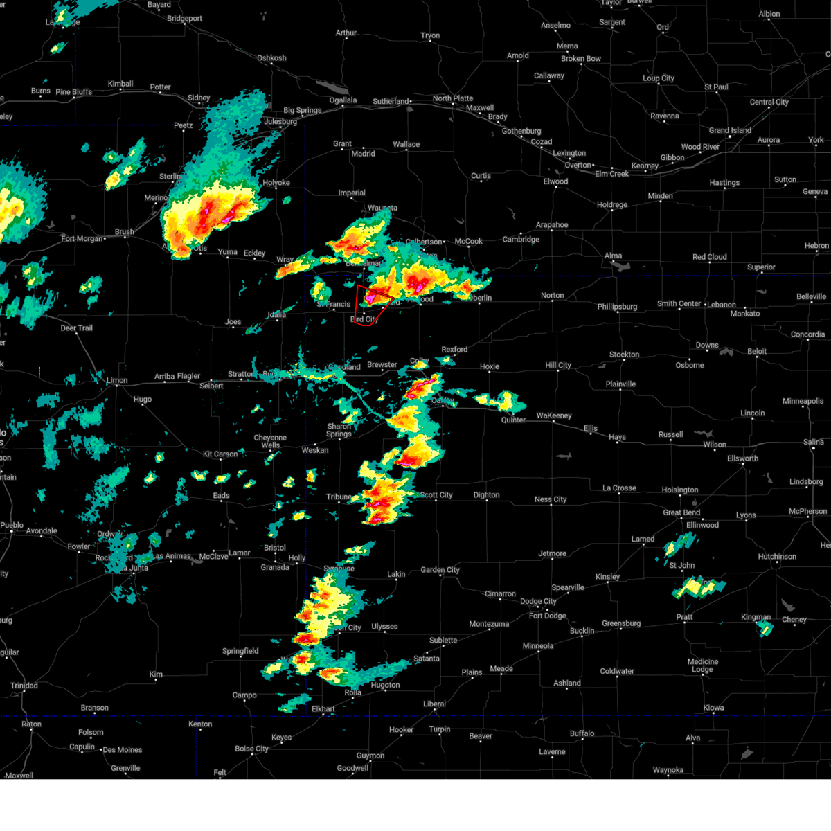 the tornado warning has been cancelled and is no longer in effect the tornado warning has been cancelled and is no longer in effect
|
| 4/25/2024 5:09 PM CDT |
 At 509 pm cdt, a severe thunderstorm was located 6 miles northwest of atwood, moving northeast at 30 mph (radar indicated). Hazards include 60 mph wind gusts and quarter size hail. Hail damage to vehicles is expected. expect wind damage to roofs, siding, and trees. Locations impacted include, atwood, mcdonald, blakeman, and beardsley. At 509 pm cdt, a severe thunderstorm was located 6 miles northwest of atwood, moving northeast at 30 mph (radar indicated). Hazards include 60 mph wind gusts and quarter size hail. Hail damage to vehicles is expected. expect wind damage to roofs, siding, and trees. Locations impacted include, atwood, mcdonald, blakeman, and beardsley.
|
| 4/25/2024 5:09 PM CDT |
 the severe thunderstorm warning has been cancelled and is no longer in effect the severe thunderstorm warning has been cancelled and is no longer in effect
|
| 4/25/2024 5:08 PM CDT |
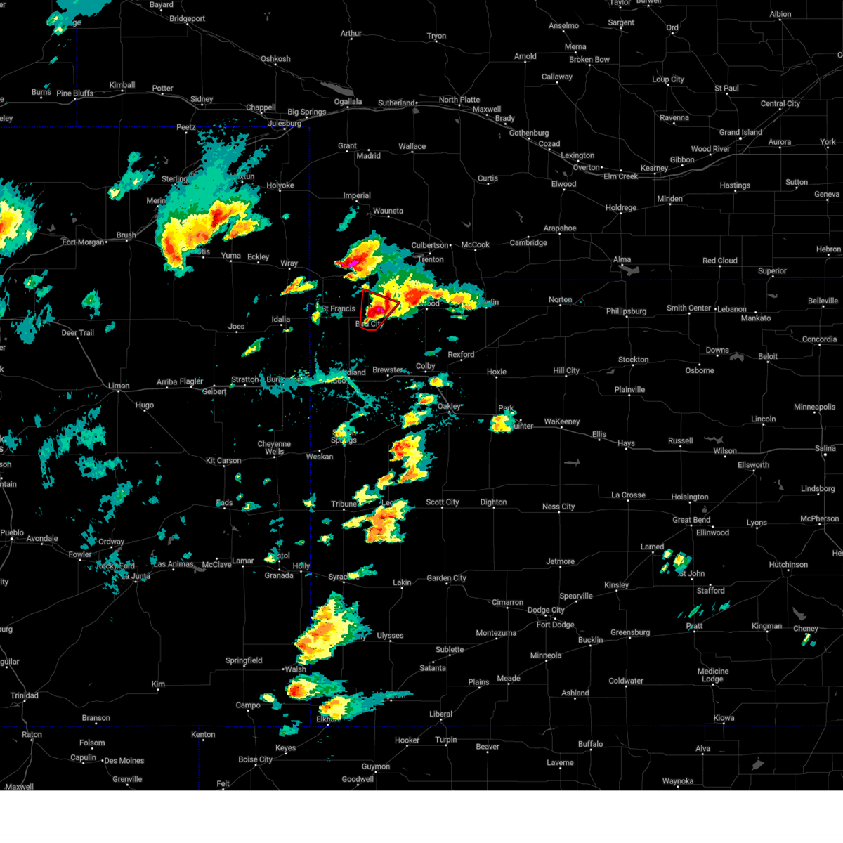 At 508 pm cdt, a severe thunderstorm capable of producing a tornado was located over bird city, or 15 miles east of st. francis, moving northeast at 25 mph (radar indicated rotation). Hazards include tornado and golf ball size hail. Flying debris will be dangerous to those caught without shelter. mobile homes will be damaged or destroyed. damage to roofs, windows, and vehicles will occur. tree damage is likely. This tornadic thunderstorm will remain over mainly rural areas of northeastern cheyenne and west central rawlins counties in northwestern kansas. At 508 pm cdt, a severe thunderstorm capable of producing a tornado was located over bird city, or 15 miles east of st. francis, moving northeast at 25 mph (radar indicated rotation). Hazards include tornado and golf ball size hail. Flying debris will be dangerous to those caught without shelter. mobile homes will be damaged or destroyed. damage to roofs, windows, and vehicles will occur. tree damage is likely. This tornadic thunderstorm will remain over mainly rural areas of northeastern cheyenne and west central rawlins counties in northwestern kansas.
|
| 4/25/2024 4:58 PM CDT |
 At 457 pm cdt, a severe thunderstorm capable of producing a tornado was located 6 miles south of bird city, or 14 miles southeast of st. francis, moving northeast at 25 mph (radar indicated rotation. this storm does have a history of producing tornadoes and funnel clouds). Hazards include tornado and golf ball size hail. Flying debris will be dangerous to those caught without shelter. mobile homes will be damaged or destroyed. damage to roofs, windows, and vehicles will occur. tree damage is likely. this dangerous storm will be near, bird city around 500 pm cdt. Other locations in the path of this tornadic thunderstorm include mcdonald. At 457 pm cdt, a severe thunderstorm capable of producing a tornado was located 6 miles south of bird city, or 14 miles southeast of st. francis, moving northeast at 25 mph (radar indicated rotation. this storm does have a history of producing tornadoes and funnel clouds). Hazards include tornado and golf ball size hail. Flying debris will be dangerous to those caught without shelter. mobile homes will be damaged or destroyed. damage to roofs, windows, and vehicles will occur. tree damage is likely. this dangerous storm will be near, bird city around 500 pm cdt. Other locations in the path of this tornadic thunderstorm include mcdonald.
|
| 4/25/2024 4:49 PM CDT |
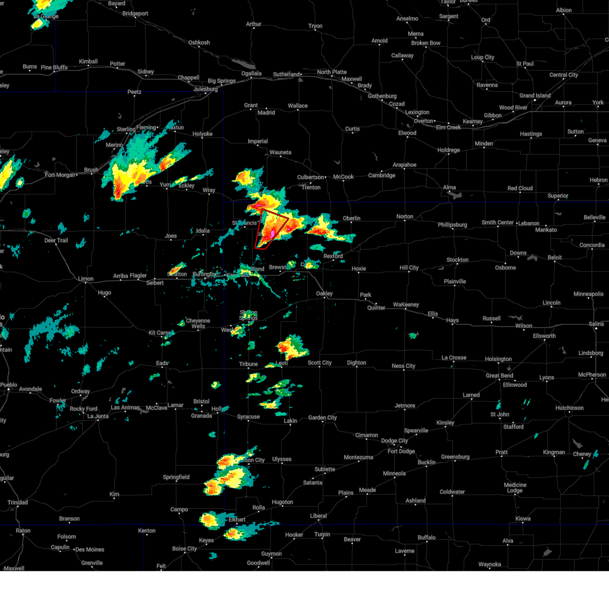 Torgld the national weather service in goodland has issued a * tornado warning for, eastern cheyenne county in northwestern kansas, west central rawlins county in northwestern kansas, * until 530 pm cdt. * at 449 pm cdt, a confirmed tornado was located 9 miles southwest of bird city, or 14 miles southeast of st. francis, moving northeast at 25 mph (weather spotters confirmed tornado near county road 23 in southern cheyenne county). Hazards include damaging tornado and golf ball size hail. Flying debris will be dangerous to those caught without shelter. mobile homes will be damaged or destroyed. damage to roofs, windows, and vehicles will occur. tree damage is likely. The tornado will be near, bird city around 500 pm cdt. Torgld the national weather service in goodland has issued a * tornado warning for, eastern cheyenne county in northwestern kansas, west central rawlins county in northwestern kansas, * until 530 pm cdt. * at 449 pm cdt, a confirmed tornado was located 9 miles southwest of bird city, or 14 miles southeast of st. francis, moving northeast at 25 mph (weather spotters confirmed tornado near county road 23 in southern cheyenne county). Hazards include damaging tornado and golf ball size hail. Flying debris will be dangerous to those caught without shelter. mobile homes will be damaged or destroyed. damage to roofs, windows, and vehicles will occur. tree damage is likely. The tornado will be near, bird city around 500 pm cdt.
|
| 4/25/2024 4:45 PM CDT |
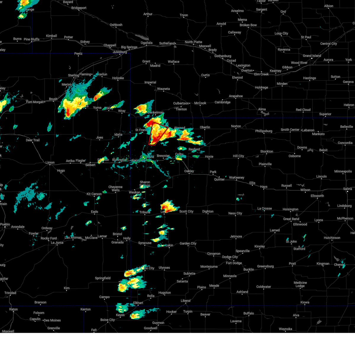 Torgld the national weather service in goodland has issued a * tornado warning for, eastern cheyenne county in northwestern kansas, west central rawlins county in northwestern kansas, * until 530 pm cdt. * at 445 pm cdt, a severe thunderstorm capable of producing a tornado was located 10 miles southwest of bird city, or 14 miles southeast of st. francis, moving northeast at 25 mph (radar indicated rotation). Hazards include tornado and golf ball size hail. Flying debris will be dangerous to those caught without shelter. mobile homes will be damaged or destroyed. damage to roofs, windows, and vehicles will occur. tree damage is likely. This dangerous storm will be near, bird city around 500 pm cdt. Torgld the national weather service in goodland has issued a * tornado warning for, eastern cheyenne county in northwestern kansas, west central rawlins county in northwestern kansas, * until 530 pm cdt. * at 445 pm cdt, a severe thunderstorm capable of producing a tornado was located 10 miles southwest of bird city, or 14 miles southeast of st. francis, moving northeast at 25 mph (radar indicated rotation). Hazards include tornado and golf ball size hail. Flying debris will be dangerous to those caught without shelter. mobile homes will be damaged or destroyed. damage to roofs, windows, and vehicles will occur. tree damage is likely. This dangerous storm will be near, bird city around 500 pm cdt.
|
| 4/25/2024 4:31 PM CDT |
 Svrgld the national weather service in goodland has issued a * severe thunderstorm warning for, northwestern thomas county in northwestern kansas, western rawlins county in northwestern kansas, * until 530 pm cdt. * at 430 pm cdt, a severe thunderstorm was located 9 miles south of mcdonald, or 19 miles north of brewster, moving northeast at 35 mph (trained weather spotters reported quarter size hail in southwest rawlins county). Hazards include 60 mph wind gusts and quarter size hail. Hail damage to vehicles is expected. expect wind damage to roofs, siding, and trees. This severe thunderstorm will remain over mainly rural areas of northwestern thomas and western rawlins counties, including the following locations, blakeman and beardsley. Svrgld the national weather service in goodland has issued a * severe thunderstorm warning for, northwestern thomas county in northwestern kansas, western rawlins county in northwestern kansas, * until 530 pm cdt. * at 430 pm cdt, a severe thunderstorm was located 9 miles south of mcdonald, or 19 miles north of brewster, moving northeast at 35 mph (trained weather spotters reported quarter size hail in southwest rawlins county). Hazards include 60 mph wind gusts and quarter size hail. Hail damage to vehicles is expected. expect wind damage to roofs, siding, and trees. This severe thunderstorm will remain over mainly rural areas of northwestern thomas and western rawlins counties, including the following locations, blakeman and beardsley.
|
| 9/9/2023 9:28 PM CDT |
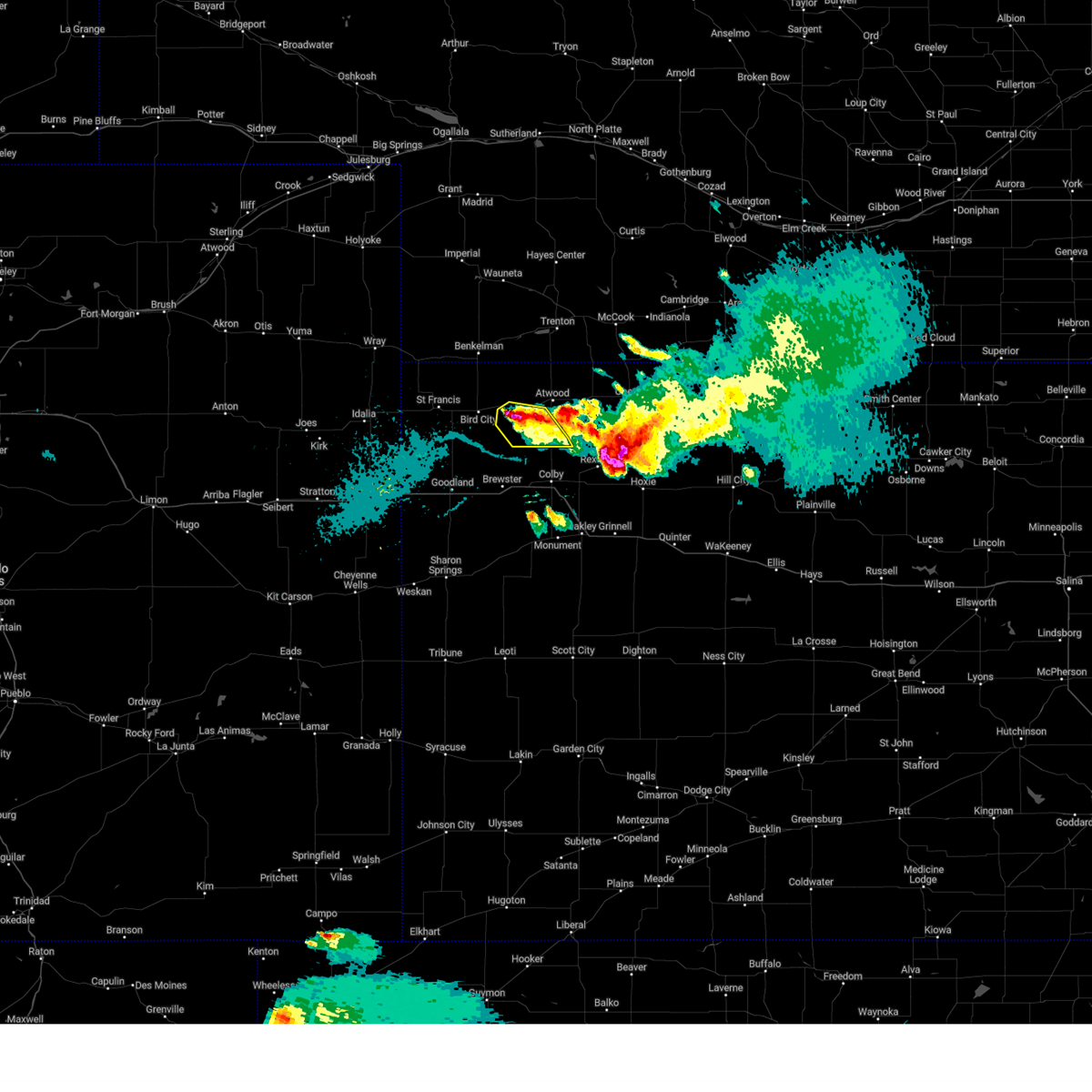 At 928 pm cdt, a severe thunderstorm was located 7 miles southeast of mcdonald, or 13 miles southwest of atwood, moving southeast at 15 mph (radar indicated). Hazards include ping pong ball size hail and 60 mph wind gusts. People and animals outdoors will be injured. expect hail damage to roofs, siding, windows, and vehicles. expect wind damage to roofs, siding, and trees. this severe thunderstorm will remain over mainly rural areas of southwestern rawlins county. hail threat, radar indicated max hail size, 1. 50 in wind threat, radar indicated max wind gust, 60 mph. At 928 pm cdt, a severe thunderstorm was located 7 miles southeast of mcdonald, or 13 miles southwest of atwood, moving southeast at 15 mph (radar indicated). Hazards include ping pong ball size hail and 60 mph wind gusts. People and animals outdoors will be injured. expect hail damage to roofs, siding, windows, and vehicles. expect wind damage to roofs, siding, and trees. this severe thunderstorm will remain over mainly rural areas of southwestern rawlins county. hail threat, radar indicated max hail size, 1. 50 in wind threat, radar indicated max wind gust, 60 mph.
|
| 9/9/2023 9:21 PM CDT |
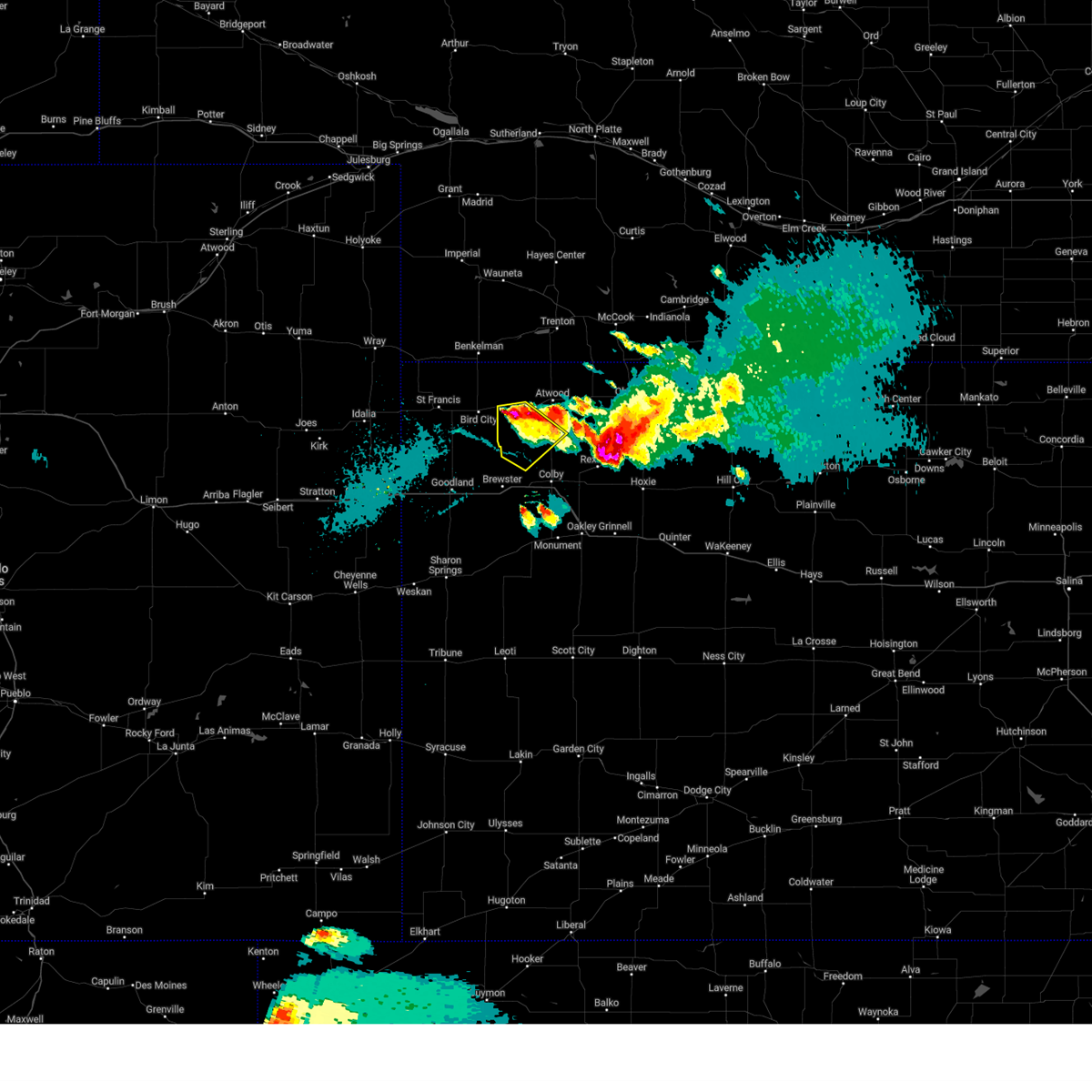 At 920 pm cdt, a severe thunderstorm was located 14 miles southwest of atwood, moving southeast at 20 mph (radar indicated). Hazards include 60 mph wind gusts and quarter size hail. Hail damage to vehicles is expected. expect wind damage to roofs, siding, and trees. locations impacted include, mcdonald. hail threat, radar indicated max hail size, 1. 00 in wind threat, radar indicated max wind gust, 60 mph. At 920 pm cdt, a severe thunderstorm was located 14 miles southwest of atwood, moving southeast at 20 mph (radar indicated). Hazards include 60 mph wind gusts and quarter size hail. Hail damage to vehicles is expected. expect wind damage to roofs, siding, and trees. locations impacted include, mcdonald. hail threat, radar indicated max hail size, 1. 00 in wind threat, radar indicated max wind gust, 60 mph.
|
| 9/9/2023 9:02 PM CDT |
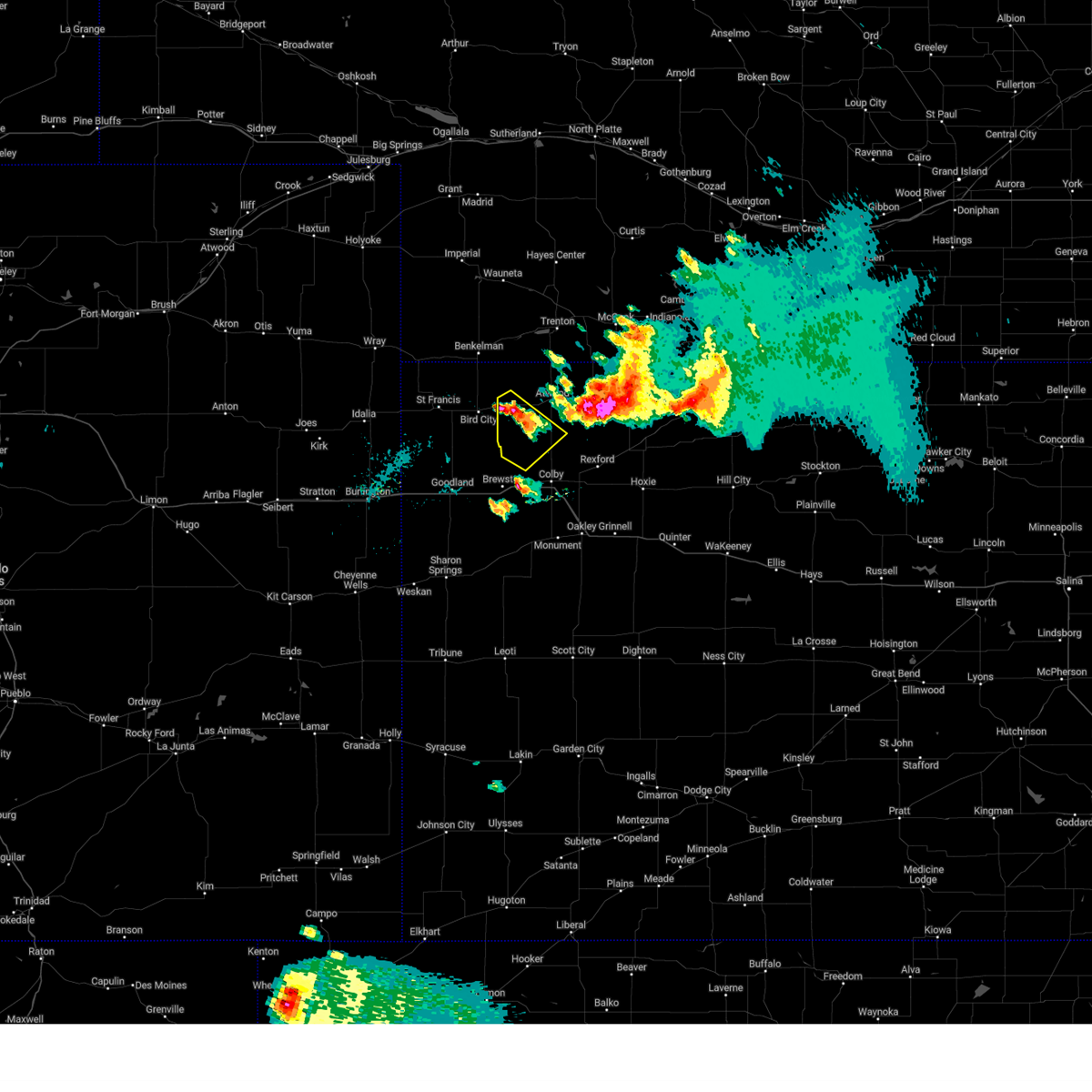 At 900 pm cdt, a severe thunderstorm was located 9 miles southeast of mcdonald, or 13 miles southwest of atwood, moving southeast at 20 mph (radar indicated). Hazards include 60 mph wind gusts and quarter size hail. Hail damage to vehicles is expected. expect wind damage to roofs, siding, and trees. locations impacted include, mcdonald. hail threat, radar indicated max hail size, 1. 00 in wind threat, radar indicated max wind gust, 60 mph. At 900 pm cdt, a severe thunderstorm was located 9 miles southeast of mcdonald, or 13 miles southwest of atwood, moving southeast at 20 mph (radar indicated). Hazards include 60 mph wind gusts and quarter size hail. Hail damage to vehicles is expected. expect wind damage to roofs, siding, and trees. locations impacted include, mcdonald. hail threat, radar indicated max hail size, 1. 00 in wind threat, radar indicated max wind gust, 60 mph.
|
| 9/9/2023 8:52 PM CDT |
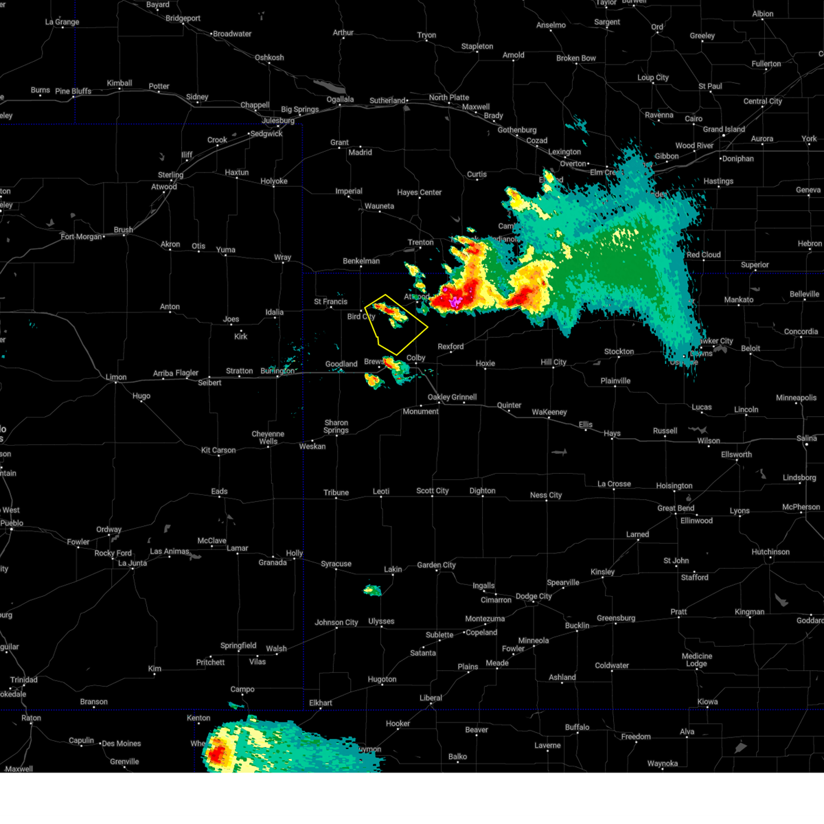 At 851 pm cdt, a severe thunderstorm was located 7 miles southeast of mcdonald, or 13 miles southwest of atwood, moving southeast at 20 mph (radar indicated). Hazards include 60 mph wind gusts and quarter size hail. Hail damage to vehicles is expected. expect wind damage to roofs, siding, and trees. this severe thunderstorm will remain over mainly rural areas of east central cheyenne, northwestern thomas and southwestern rawlins counties in northwestern kansas. hail threat, radar indicated max hail size, 1. 00 in wind threat, radar indicated max wind gust, 60 mph. At 851 pm cdt, a severe thunderstorm was located 7 miles southeast of mcdonald, or 13 miles southwest of atwood, moving southeast at 20 mph (radar indicated). Hazards include 60 mph wind gusts and quarter size hail. Hail damage to vehicles is expected. expect wind damage to roofs, siding, and trees. this severe thunderstorm will remain over mainly rural areas of east central cheyenne, northwestern thomas and southwestern rawlins counties in northwestern kansas. hail threat, radar indicated max hail size, 1. 00 in wind threat, radar indicated max wind gust, 60 mph.
|
| 8/7/2023 6:00 PM CDT | Golf Ball sized hail reported 9.2 miles N of McDonald, KS, hail lasted about 5 minutes. |
| 8/7/2023 5:43 PM CDT |
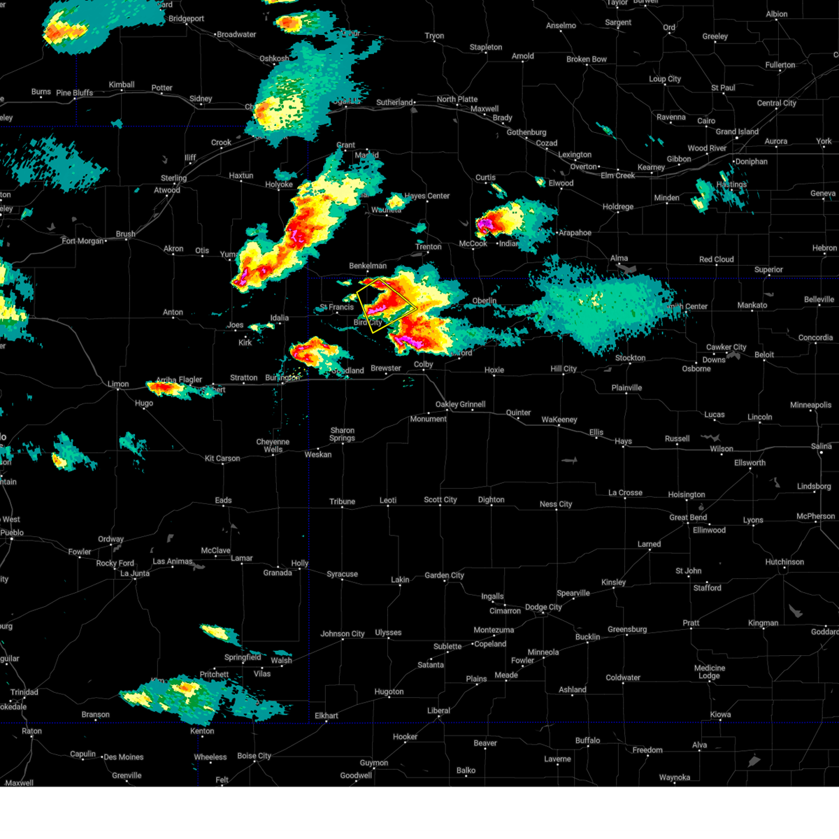 The severe thunderstorm warning for northeastern cheyenne and west central rawlins counties in northwestern kansas will expire at 545 pm cdt, the storm which prompted the warning has moved out of the area. therefore, the warning will be allowed to expire. a new warning has been issued for the storm. a severe thunderstorm watch remains in effect until 1000 pm cdt for northwestern kansas. The severe thunderstorm warning for northeastern cheyenne and west central rawlins counties in northwestern kansas will expire at 545 pm cdt, the storm which prompted the warning has moved out of the area. therefore, the warning will be allowed to expire. a new warning has been issued for the storm. a severe thunderstorm watch remains in effect until 1000 pm cdt for northwestern kansas.
|
| 8/7/2023 5:42 PM CDT |
 At 442 pm mdt/542 pm cdt/, a severe thunderstorm was located 4 miles east of bird city, or 18 miles east of st. francis, moving south at 25 mph (radar indicated). Hazards include ping pong ball size hail and 60 mph wind gusts. People and animals outdoors will be injured. expect hail damage to roofs, siding, windows, and vehicles. expect wind damage to roofs, siding, and trees. this severe thunderstorm will remain over mainly rural areas of southeastern cheyenne, northwestern thomas, southwestern rawlins and northeastern sherman counties in northwestern kansas. hail threat, radar indicated max hail size, 1. 50 in wind threat, radar indicated max wind gust, 60 mph. At 442 pm mdt/542 pm cdt/, a severe thunderstorm was located 4 miles east of bird city, or 18 miles east of st. francis, moving south at 25 mph (radar indicated). Hazards include ping pong ball size hail and 60 mph wind gusts. People and animals outdoors will be injured. expect hail damage to roofs, siding, windows, and vehicles. expect wind damage to roofs, siding, and trees. this severe thunderstorm will remain over mainly rural areas of southeastern cheyenne, northwestern thomas, southwestern rawlins and northeastern sherman counties in northwestern kansas. hail threat, radar indicated max hail size, 1. 50 in wind threat, radar indicated max wind gust, 60 mph.
|
| 8/7/2023 5:22 PM CDT | Half Dollar sized hail reported 12.1 miles NW of McDonald, KS, broken windshields on vehicle. |
| 8/7/2023 5:17 PM CDT |
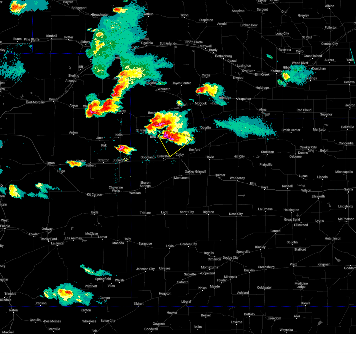 At 516 pm cdt, a severe thunderstorm was located 9 miles southeast of mcdonald, or 12 miles southwest of atwood, moving southeast at 25 mph (off duty nws employee reports 58mph wind gust 10 miles south of mcdonald). Hazards include two inch hail and 60 mph wind gusts. People and animals outdoors will be injured. expect hail damage to roofs, siding, windows, and vehicles. expect wind damage to roofs, siding, and trees. locations impacted include, mcdonald. thunderstorm damage threat, considerable hail threat, observed max hail size, 2. 00 in wind threat, radar indicated max wind gust, 60 mph. At 516 pm cdt, a severe thunderstorm was located 9 miles southeast of mcdonald, or 12 miles southwest of atwood, moving southeast at 25 mph (off duty nws employee reports 58mph wind gust 10 miles south of mcdonald). Hazards include two inch hail and 60 mph wind gusts. People and animals outdoors will be injured. expect hail damage to roofs, siding, windows, and vehicles. expect wind damage to roofs, siding, and trees. locations impacted include, mcdonald. thunderstorm damage threat, considerable hail threat, observed max hail size, 2. 00 in wind threat, radar indicated max wind gust, 60 mph.
|
| 8/7/2023 5:10 PM CDT | Ping Pong Ball sized hail reported 2.1 miles E of McDonald, KS, social media report with picture of ping pong ball sized hail stones. |
| 8/7/2023 5:10 PM CDT |
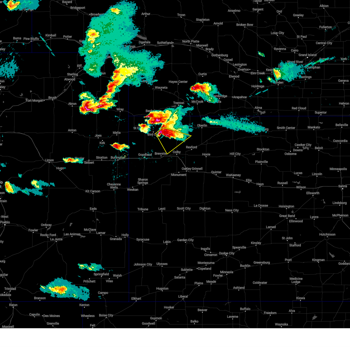 At 510 pm cdt, a severe thunderstorm was located 7 miles southeast of mcdonald, or 12 miles southwest of atwood, moving southeast at 25 mph (radar indicated). Hazards include two inch hail and 60 mph wind gusts. People and animals outdoors will be injured. expect hail damage to roofs, siding, windows, and vehicles. expect wind damage to roofs, siding, and trees. locations impacted include, mcdonald. thunderstorm damage threat, considerable hail threat, observed max hail size, 2. 00 in wind threat, radar indicated max wind gust, 60 mph. At 510 pm cdt, a severe thunderstorm was located 7 miles southeast of mcdonald, or 12 miles southwest of atwood, moving southeast at 25 mph (radar indicated). Hazards include two inch hail and 60 mph wind gusts. People and animals outdoors will be injured. expect hail damage to roofs, siding, windows, and vehicles. expect wind damage to roofs, siding, and trees. locations impacted include, mcdonald. thunderstorm damage threat, considerable hail threat, observed max hail size, 2. 00 in wind threat, radar indicated max wind gust, 60 mph.
|
| 8/7/2023 5:08 PM CDT |
 At 508 pm cdt, a severe thunderstorm was located 9 miles northwest of mcdonald, or 11 miles south of benkelman, moving southeast at 25 mph (radar indicated). Hazards include ping pong ball size hail and 60 mph wind gusts. People and animals outdoors will be injured. expect hail damage to roofs, siding, windows, and vehicles. Expect wind damage to roofs, siding, and trees. At 508 pm cdt, a severe thunderstorm was located 9 miles northwest of mcdonald, or 11 miles south of benkelman, moving southeast at 25 mph (radar indicated). Hazards include ping pong ball size hail and 60 mph wind gusts. People and animals outdoors will be injured. expect hail damage to roofs, siding, windows, and vehicles. Expect wind damage to roofs, siding, and trees.
|
| 8/7/2023 5:00 PM CDT |
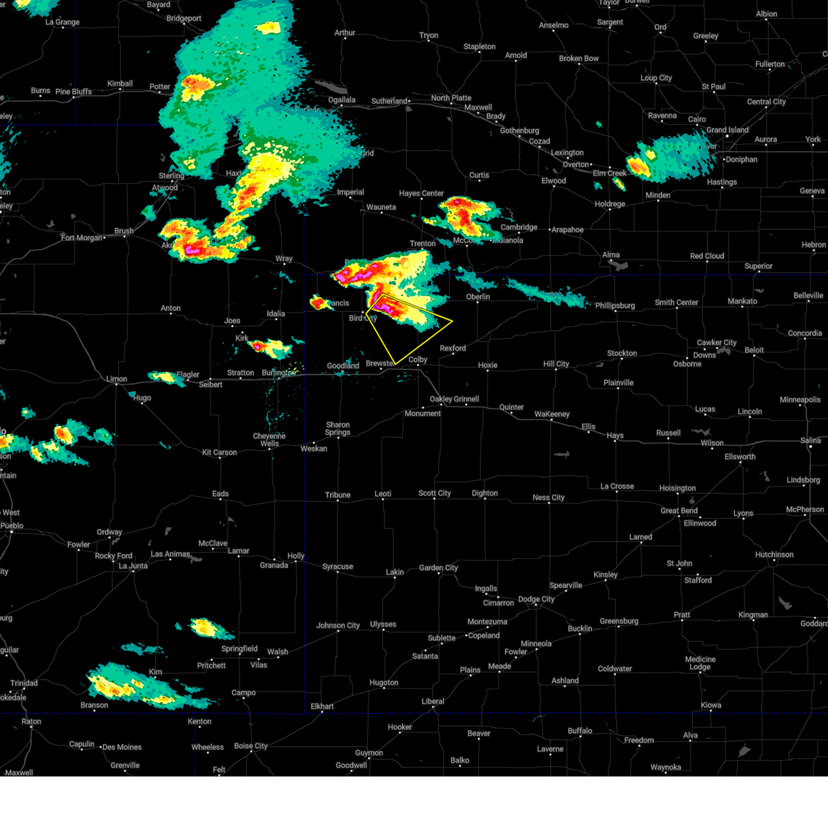 At 459 pm cdt, a severe thunderstorm was located near mcdonald, or 15 miles west of atwood, moving southeast at 25 mph (trained weather spotter 5 southeast of mcdonald reported hail up to quarters in size). Hazards include ping pong ball size hail and 60 mph wind gusts. People and animals outdoors will be injured. expect hail damage to roofs, siding, windows, and vehicles. expect wind damage to roofs, siding, and trees. locations impacted include, mcdonald and beardsley. hail threat, observed max hail size, 1. 50 in wind threat, radar indicated max wind gust, 60 mph. At 459 pm cdt, a severe thunderstorm was located near mcdonald, or 15 miles west of atwood, moving southeast at 25 mph (trained weather spotter 5 southeast of mcdonald reported hail up to quarters in size). Hazards include ping pong ball size hail and 60 mph wind gusts. People and animals outdoors will be injured. expect hail damage to roofs, siding, windows, and vehicles. expect wind damage to roofs, siding, and trees. locations impacted include, mcdonald and beardsley. hail threat, observed max hail size, 1. 50 in wind threat, radar indicated max wind gust, 60 mph.
|
| 8/7/2023 4:57 PM CDT |
 The severe thunderstorm warning for east central cheyenne and southwestern rawlins counties in northwestern kansas will expire at 500 pm cdt, the original severe warning is expiring. however, the storm is maintaining intensity so a new warning has been issued. a severe thunderstorm watch remains in effect until 1000 pm cdt for northwestern kansas. The severe thunderstorm warning for east central cheyenne and southwestern rawlins counties in northwestern kansas will expire at 500 pm cdt, the original severe warning is expiring. however, the storm is maintaining intensity so a new warning has been issued. a severe thunderstorm watch remains in effect until 1000 pm cdt for northwestern kansas.
|
| 8/7/2023 4:56 PM CDT |
 At 455 pm cdt, a severe thunderstorm was located over mcdonald, or 16 miles west of atwood, moving southeast at 25 mph (radar indicated). Hazards include golf ball size hail and 60 mph wind gusts. People and animals outdoors will be injured. expect hail damage to roofs, siding, windows, and vehicles. expect wind damage to roofs, siding, and trees. this severe thunderstorm will remain over mainly rural areas of east central cheyenne, northwestern thomas and southern rawlins counties in northwestern kansas, including the following locations, beardsley. thunderstorm damage threat, considerable hail threat, radar indicated max hail size, 1. 75 in wind threat, radar indicated max wind gust, 60 mph. At 455 pm cdt, a severe thunderstorm was located over mcdonald, or 16 miles west of atwood, moving southeast at 25 mph (radar indicated). Hazards include golf ball size hail and 60 mph wind gusts. People and animals outdoors will be injured. expect hail damage to roofs, siding, windows, and vehicles. expect wind damage to roofs, siding, and trees. this severe thunderstorm will remain over mainly rural areas of east central cheyenne, northwestern thomas and southern rawlins counties in northwestern kansas, including the following locations, beardsley. thunderstorm damage threat, considerable hail threat, radar indicated max hail size, 1. 75 in wind threat, radar indicated max wind gust, 60 mph.
|
| 8/7/2023 4:48 PM CDT |
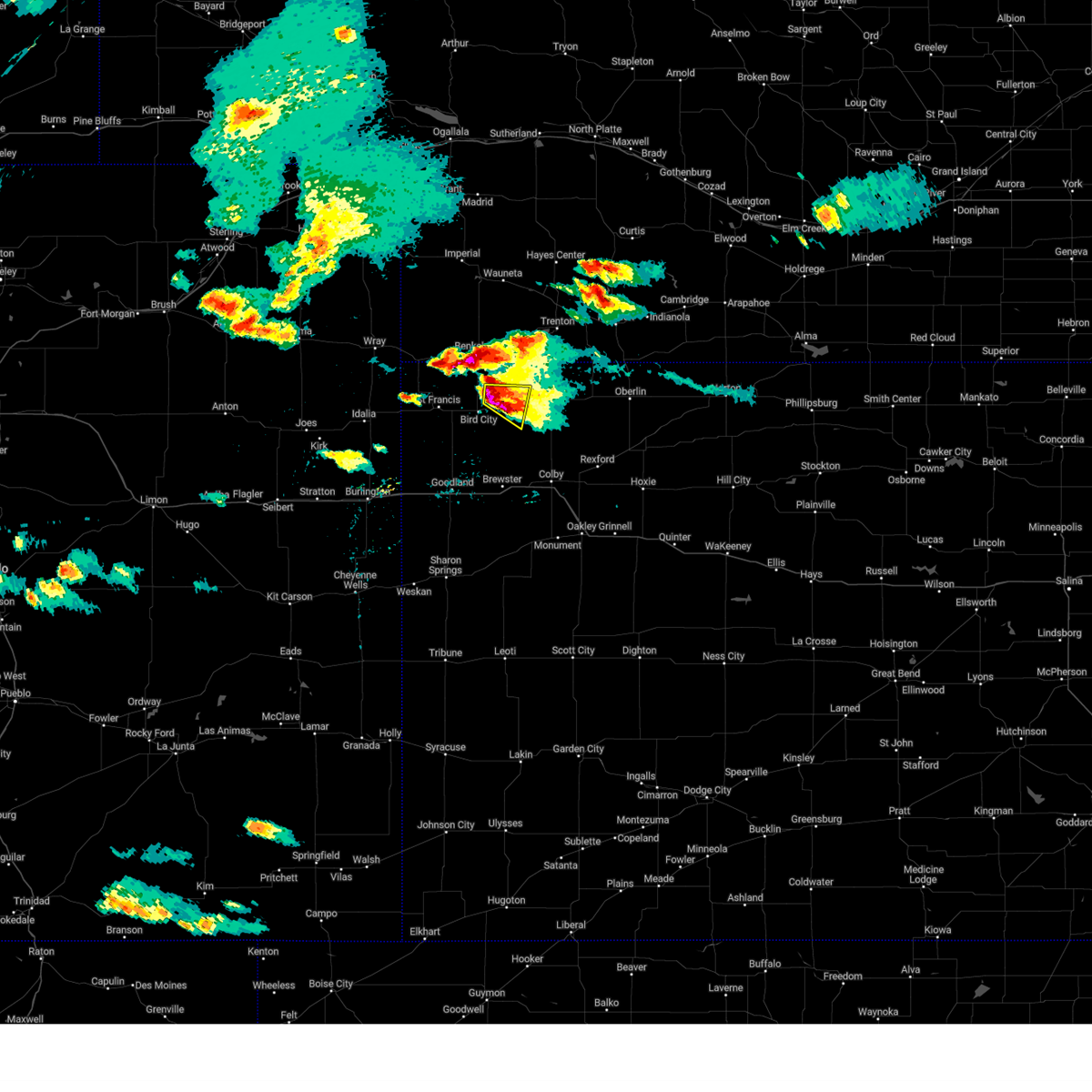 At 447 pm cdt, a severe thunderstorm was located over mcdonald, or 16 miles west of atwood, moving east at 20 mph (trained weather spotters reported variety of hail sizes from nickel to two inch hail 5 miles north bird city at 4:41pm cdt). Hazards include two inch hail and 60 mph wind gusts. People and animals outdoors will be injured. expect hail damage to roofs, siding, windows, and vehicles. expect wind damage to roofs, siding, and trees. Locations impacted include, mcdonald and beardsley. At 447 pm cdt, a severe thunderstorm was located over mcdonald, or 16 miles west of atwood, moving east at 20 mph (trained weather spotters reported variety of hail sizes from nickel to two inch hail 5 miles north bird city at 4:41pm cdt). Hazards include two inch hail and 60 mph wind gusts. People and animals outdoors will be injured. expect hail damage to roofs, siding, windows, and vehicles. expect wind damage to roofs, siding, and trees. Locations impacted include, mcdonald and beardsley.
|
| 8/7/2023 4:47 PM CDT | Quarter sized hail reported 4.8 miles NW of McDonald, KS, spotter reported ongoing dime to quarter sized hail that has been falling for 10 minutes as of 3:57 pm mt. |
| 8/7/2023 4:41 PM CDT |
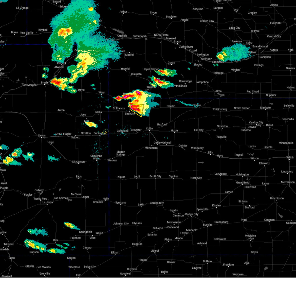 At 441 pm cdt, a severe thunderstorm was located over mcdonald, or 18 miles west of atwood, moving east at 20 mph (trained weather spotters reported quarter sized hail and a landspout a few miles north of bird city). Hazards include 60 mph wind gusts and half dollar size hail. Hail damage to vehicles is expected. expect wind damage to roofs, siding, and trees. Locations impacted include, mcdonald and beardsley. At 441 pm cdt, a severe thunderstorm was located over mcdonald, or 18 miles west of atwood, moving east at 20 mph (trained weather spotters reported quarter sized hail and a landspout a few miles north of bird city). Hazards include 60 mph wind gusts and half dollar size hail. Hail damage to vehicles is expected. expect wind damage to roofs, siding, and trees. Locations impacted include, mcdonald and beardsley.
|
| 8/7/2023 4:31 PM CDT |
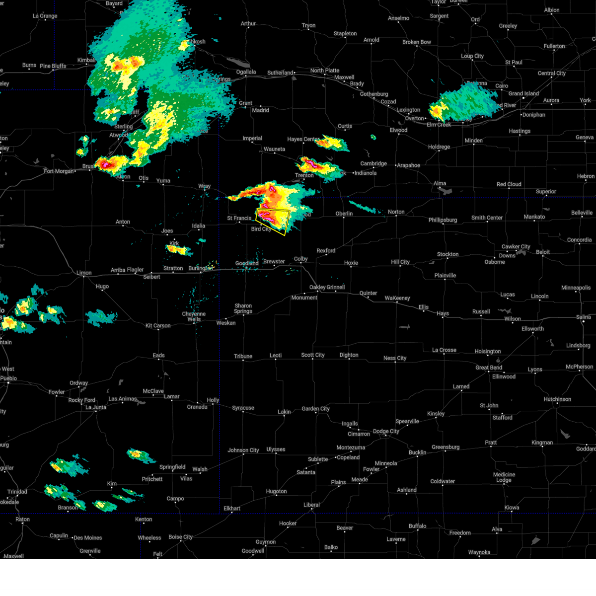 At 431 pm cdt, a severe thunderstorm was located 5 miles west of mcdonald, or 17 miles south of benkelman, moving east at 20 mph (off duty nws employee reported quarter sized hail 2 miles north of bird city). Hazards include 60 mph wind gusts and half dollar size hail. Hail damage to vehicles is expected. expect wind damage to roofs, siding, and trees. locations impacted include, bird city, mcdonald and beardsley. hail threat, observed max hail size, 1. 25 in wind threat, radar indicated max wind gust, 60 mph. At 431 pm cdt, a severe thunderstorm was located 5 miles west of mcdonald, or 17 miles south of benkelman, moving east at 20 mph (off duty nws employee reported quarter sized hail 2 miles north of bird city). Hazards include 60 mph wind gusts and half dollar size hail. Hail damage to vehicles is expected. expect wind damage to roofs, siding, and trees. locations impacted include, bird city, mcdonald and beardsley. hail threat, observed max hail size, 1. 25 in wind threat, radar indicated max wind gust, 60 mph.
|
| 8/7/2023 4:20 PM CDT |
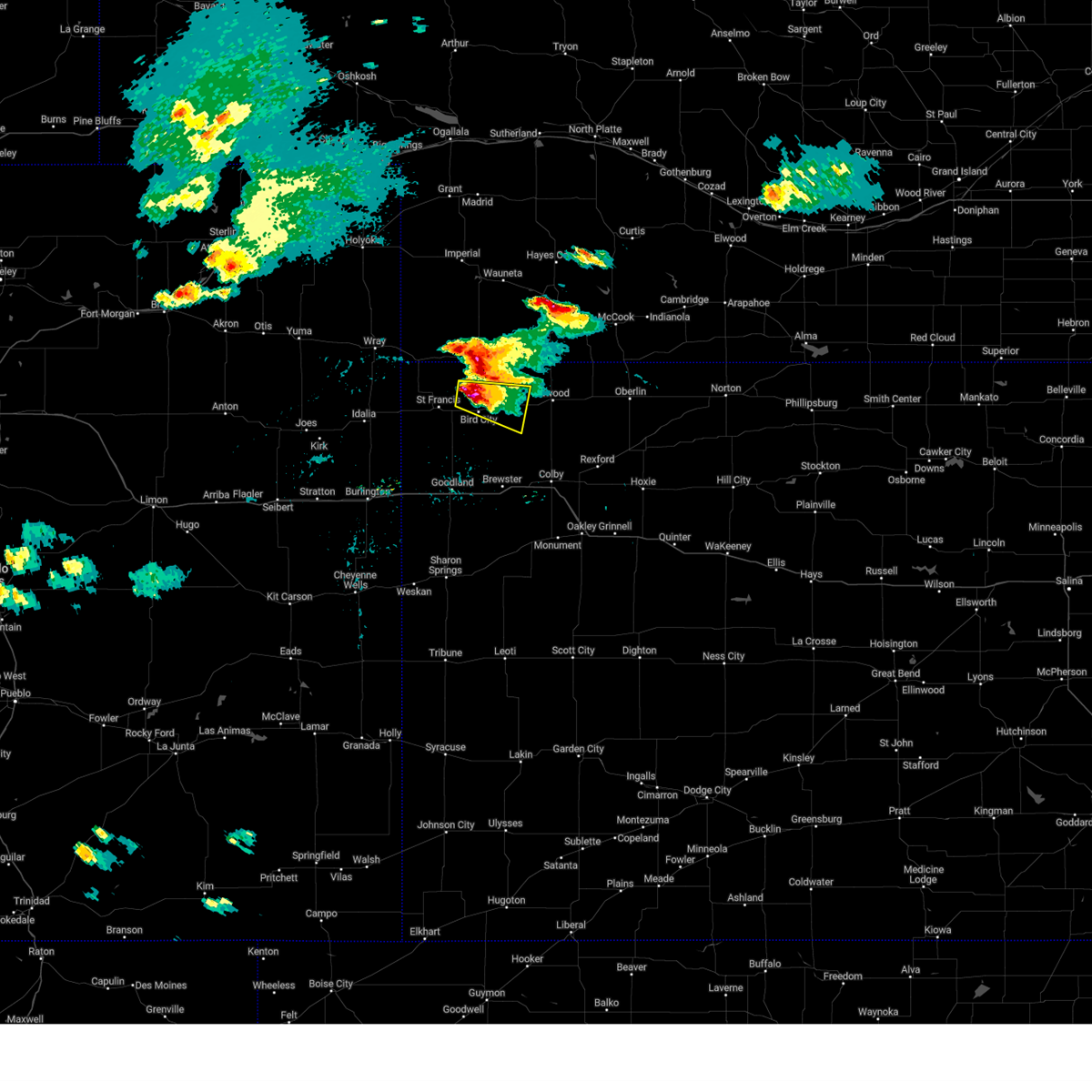 At 419 pm cdt, a severe thunderstorm was located 5 miles north of bird city, or 14 miles east of st. francis, moving east at 20 mph (off duty nws employee reports quarter sized hail 2 north of bird city at 4:17pm cdt). Hazards include 70 mph wind gusts and half dollar size hail. Hail damage to vehicles is expected. expect considerable tree damage. wind damage is also likely to mobile homes, roofs, and outbuildings. locations impacted include, mcdonald. thunderstorm damage threat, considerable hail threat, observed max hail size, 1. 25 in wind threat, radar indicated max wind gust, 70 mph. At 419 pm cdt, a severe thunderstorm was located 5 miles north of bird city, or 14 miles east of st. francis, moving east at 20 mph (off duty nws employee reports quarter sized hail 2 north of bird city at 4:17pm cdt). Hazards include 70 mph wind gusts and half dollar size hail. Hail damage to vehicles is expected. expect considerable tree damage. wind damage is also likely to mobile homes, roofs, and outbuildings. locations impacted include, mcdonald. thunderstorm damage threat, considerable hail threat, observed max hail size, 1. 25 in wind threat, radar indicated max wind gust, 70 mph.
|
| 8/7/2023 4:12 PM CDT |
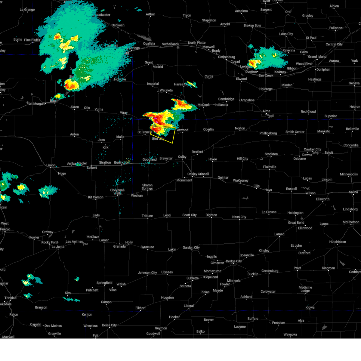 At 412 pm cdt, a severe thunderstorm was located 6 miles northwest of bird city, or 11 miles east of st. francis, moving east at 20 mph (radar indicated). Hazards include half dollar size hail. Damage to vehicles is expected. this severe thunderstorm will be near, bird city around 425 pm cdt. other locations in the path of this severe thunderstorm include mcdonald. hail threat, radar indicated max hail size, 1. 25 in wind threat, radar indicated max wind gust, <50 mph. At 412 pm cdt, a severe thunderstorm was located 6 miles northwest of bird city, or 11 miles east of st. francis, moving east at 20 mph (radar indicated). Hazards include half dollar size hail. Damage to vehicles is expected. this severe thunderstorm will be near, bird city around 425 pm cdt. other locations in the path of this severe thunderstorm include mcdonald. hail threat, radar indicated max hail size, 1. 25 in wind threat, radar indicated max wind gust, <50 mph.
|
| 8/5/2023 7:09 PM CDT |
 At 708 pm cdt, a severe thunderstorm was located 4 miles southwest of atwood, moving east at 30 mph (radar indicated). Hazards include 60 mph wind gusts and quarter size hail. Hail damage to vehicles is expected. expect wind damage to roofs, siding, and trees. this severe thunderstorm will be near, ludell around 725 pm cdt. hail threat, radar indicated max hail size, 1. 00 in wind threat, radar indicated max wind gust, 60 mph. At 708 pm cdt, a severe thunderstorm was located 4 miles southwest of atwood, moving east at 30 mph (radar indicated). Hazards include 60 mph wind gusts and quarter size hail. Hail damage to vehicles is expected. expect wind damage to roofs, siding, and trees. this severe thunderstorm will be near, ludell around 725 pm cdt. hail threat, radar indicated max hail size, 1. 00 in wind threat, radar indicated max wind gust, 60 mph.
|
| 8/5/2023 3:43 AM CDT |
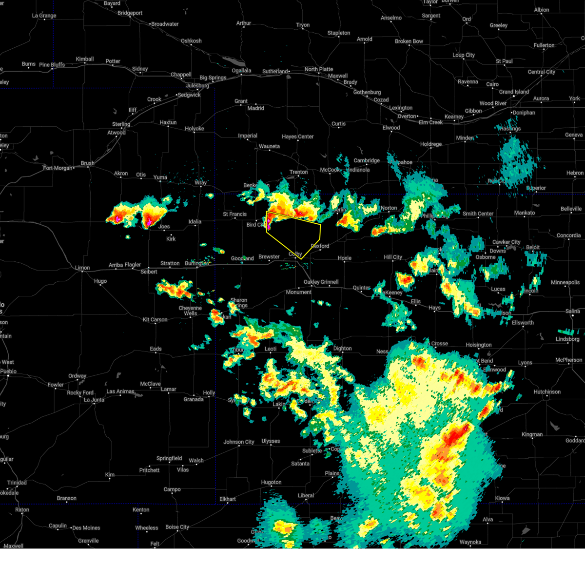 At 343 am cdt, a severe thunderstorm was located 7 miles south of mcdonald, or 19 miles southwest of atwood, moving southeast at 35 mph (radar indicated). Hazards include 60 mph wind gusts and quarter size hail. Hail damage to vehicles is expected. expect wind damage to roofs, siding, and trees. this severe thunderstorm will remain over mainly rural areas of northeastern thomas and southern rawlins counties. hail threat, radar indicated max hail size, 1. 00 in wind threat, radar indicated max wind gust, 60 mph. At 343 am cdt, a severe thunderstorm was located 7 miles south of mcdonald, or 19 miles southwest of atwood, moving southeast at 35 mph (radar indicated). Hazards include 60 mph wind gusts and quarter size hail. Hail damage to vehicles is expected. expect wind damage to roofs, siding, and trees. this severe thunderstorm will remain over mainly rural areas of northeastern thomas and southern rawlins counties. hail threat, radar indicated max hail size, 1. 00 in wind threat, radar indicated max wind gust, 60 mph.
|
| 7/26/2023 9:36 PM CDT |
 At 835 pm mdt/935 pm cdt/, severe thunderstorms were located along a line extending from 8 miles north of ludell to 9 miles north of gem to 5 miles south of colby, moving east at 45 mph (mesonet. at 931 pm cdt, a 60 mph wind gust was reported near atwood). Hazards include 60 mph wind gusts. Expect damage to roofs, siding, and trees. these severe storms will be near, rexford, herndon and gem around 950 pm cdt. selden and menlo around 1000 pm cdt. dresden around 1010 pm cdt. hoxie and jennings around 1020 pm cdt. other locations impacted by these severe thunderstorms include blakeman, mingo, leoville, traer, halford, seguin and cedar bluffs. this includes interstate 70 in kansas between mile markers 36 and 67. hail threat, radar indicated max hail size, <. 75 in wind threat, observed max wind gust, 60 mph. At 835 pm mdt/935 pm cdt/, severe thunderstorms were located along a line extending from 8 miles north of ludell to 9 miles north of gem to 5 miles south of colby, moving east at 45 mph (mesonet. at 931 pm cdt, a 60 mph wind gust was reported near atwood). Hazards include 60 mph wind gusts. Expect damage to roofs, siding, and trees. these severe storms will be near, rexford, herndon and gem around 950 pm cdt. selden and menlo around 1000 pm cdt. dresden around 1010 pm cdt. hoxie and jennings around 1020 pm cdt. other locations impacted by these severe thunderstorms include blakeman, mingo, leoville, traer, halford, seguin and cedar bluffs. this includes interstate 70 in kansas between mile markers 36 and 67. hail threat, radar indicated max hail size, <. 75 in wind threat, observed max wind gust, 60 mph.
|
| 7/26/2023 9:23 PM CDT |
 At 822 pm mdt/922 pm cdt/, severe thunderstorms were located along a line extending from 12 miles south of stratton to 13 miles north of colby to near levant, moving east at 55 mph (radar indicated). Hazards include 60 mph wind gusts. Expect damage to roofs, siding, and trees. these storms have a history of producing 60 to 65 mph wind gusts. severe thunderstorms will be near, colby around 930 pm cdt. gem and ludell around 940 pm cdt. rexford around 945 pm cdt. herndon and menlo around 950 pm cdt. selden around 955 pm cdt. oberlin around 1005 pm cdt. hoxie around 1010 pm cdt. norcatur and clayton around 1025 pm cdt. other locations impacted by these severe thunderstorms include blakeman, mingo, leoville, traer, halford, seguin and cedar bluffs. this includes interstate 70 in kansas between mile markers 36 and 66. hail threat, radar indicated max hail size, <. 75 in wind threat, radar indicated max wind gust, 60 mph. At 822 pm mdt/922 pm cdt/, severe thunderstorms were located along a line extending from 12 miles south of stratton to 13 miles north of colby to near levant, moving east at 55 mph (radar indicated). Hazards include 60 mph wind gusts. Expect damage to roofs, siding, and trees. these storms have a history of producing 60 to 65 mph wind gusts. severe thunderstorms will be near, colby around 930 pm cdt. gem and ludell around 940 pm cdt. rexford around 945 pm cdt. herndon and menlo around 950 pm cdt. selden around 955 pm cdt. oberlin around 1005 pm cdt. hoxie around 1010 pm cdt. norcatur and clayton around 1025 pm cdt. other locations impacted by these severe thunderstorms include blakeman, mingo, leoville, traer, halford, seguin and cedar bluffs. this includes interstate 70 in kansas between mile markers 36 and 66. hail threat, radar indicated max hail size, <. 75 in wind threat, radar indicated max wind gust, 60 mph.
|
| 7/26/2023 9:17 PM CDT |
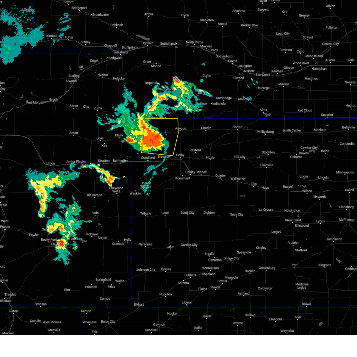 At 816 pm mdt/916 pm cdt/, severe thunderstorms were located along a line extending from 13 miles south of stratton to 13 miles southwest of atwood to 4 miles northwest of levant, moving east at 45 mph (mesonet. at 808 pm cdt, a 60 mph wind gust was reported 3 miles west of bird city). Hazards include 60 mph wind gusts and nickel size hail. Expect damage to roofs, siding, and trees. these severe thunderstorms will remain over mainly rural areas of cheyenne, northwestern thomas, western rawlins and northeastern sherman counties in northwestern kansas, including the following locations, wheeler, blakeman and beardsley. hail threat, radar indicated max hail size, 0. 88 in wind threat, observed max wind gust, 60 mph. At 816 pm mdt/916 pm cdt/, severe thunderstorms were located along a line extending from 13 miles south of stratton to 13 miles southwest of atwood to 4 miles northwest of levant, moving east at 45 mph (mesonet. at 808 pm cdt, a 60 mph wind gust was reported 3 miles west of bird city). Hazards include 60 mph wind gusts and nickel size hail. Expect damage to roofs, siding, and trees. these severe thunderstorms will remain over mainly rural areas of cheyenne, northwestern thomas, western rawlins and northeastern sherman counties in northwestern kansas, including the following locations, wheeler, blakeman and beardsley. hail threat, radar indicated max hail size, 0. 88 in wind threat, observed max wind gust, 60 mph.
|
| 7/26/2023 9:00 PM CDT |
 At 759 pm mdt/859 pm cdt/, severe thunderstorms were located along a line extending from 5 miles southeast of benkelman to 3 miles east of bird city to 13 miles northwest of brewster, moving east at 35 mph (trained spotter. at 755 pm mdt, an estimated 70 mph wind gust was reported 13 miles north of edson). Hazards include 70 mph wind gusts and nickel size hail. Expect considerable tree damage. damage is likely to mobile homes, roofs, and outbuildings. these severe storms will be near, mcdonald around 910 pm cdt. other locations impacted by these severe thunderstorms include wheeler, blakeman and beardsley. thunderstorm damage threat, considerable hail threat, radar indicated max hail size, 0. 88 in wind threat, observed max wind gust, 70 mph. At 759 pm mdt/859 pm cdt/, severe thunderstorms were located along a line extending from 5 miles southeast of benkelman to 3 miles east of bird city to 13 miles northwest of brewster, moving east at 35 mph (trained spotter. at 755 pm mdt, an estimated 70 mph wind gust was reported 13 miles north of edson). Hazards include 70 mph wind gusts and nickel size hail. Expect considerable tree damage. damage is likely to mobile homes, roofs, and outbuildings. these severe storms will be near, mcdonald around 910 pm cdt. other locations impacted by these severe thunderstorms include wheeler, blakeman and beardsley. thunderstorm damage threat, considerable hail threat, radar indicated max hail size, 0. 88 in wind threat, observed max wind gust, 70 mph.
|
| 7/26/2023 8:58 PM CDT |
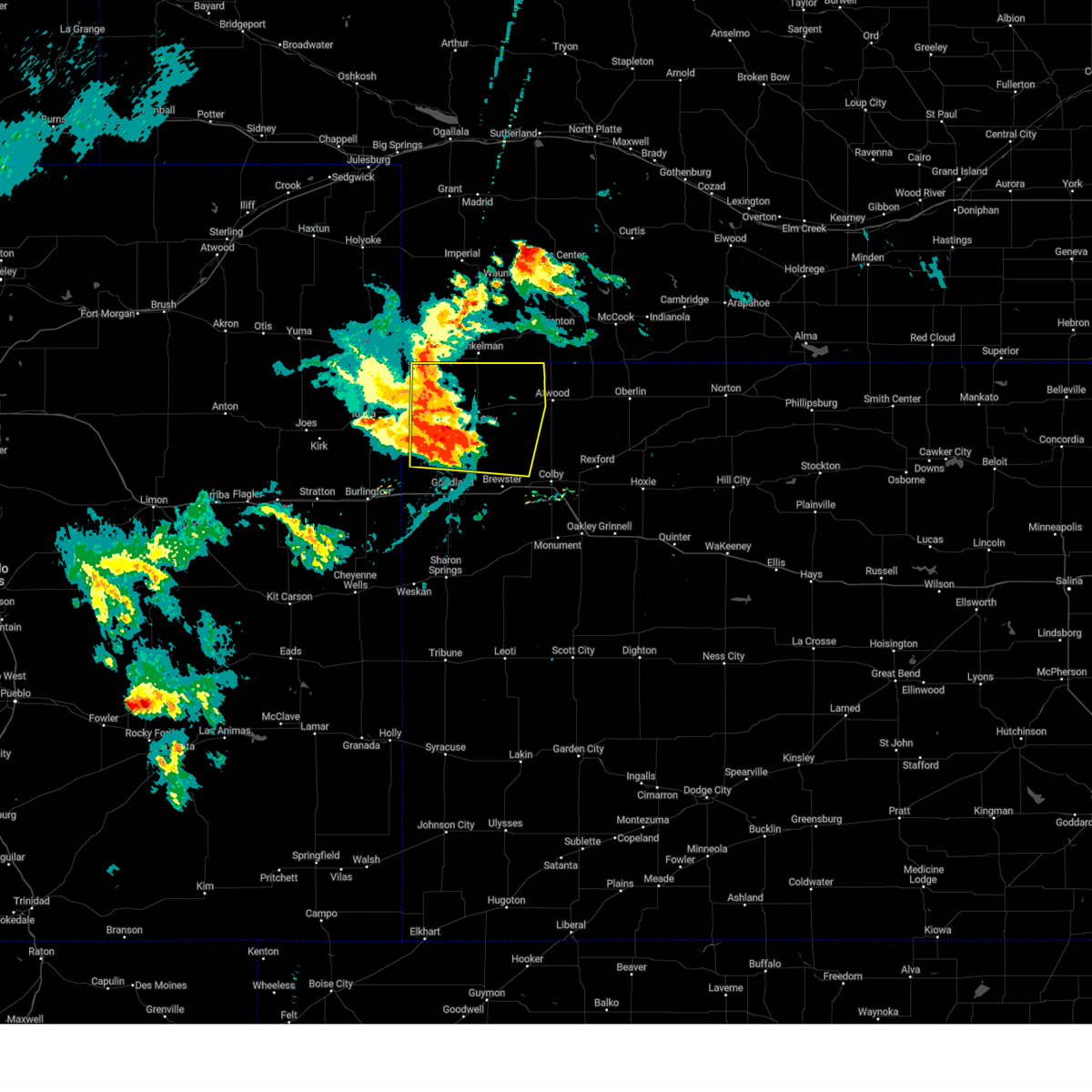 At 758 pm mdt/858 pm cdt/, severe thunderstorms were located along a line extending from 5 miles southeast of benkelman to 3 miles east of bird city to 13 miles northwest of brewster, moving east at 35 mph (radar indicated). Hazards include 70 mph wind gusts and nickel size hail. Expect considerable tree damage. damage is likely to mobile homes, roofs, and outbuildings. these severe storms will be near, mcdonald around 905 pm cdt. other locations impacted by these severe thunderstorms include wheeler, blakeman and beardsley. thunderstorm damage threat, considerable hail threat, radar indicated max hail size, 0. 88 in wind threat, radar indicated max wind gust, 70 mph. At 758 pm mdt/858 pm cdt/, severe thunderstorms were located along a line extending from 5 miles southeast of benkelman to 3 miles east of bird city to 13 miles northwest of brewster, moving east at 35 mph (radar indicated). Hazards include 70 mph wind gusts and nickel size hail. Expect considerable tree damage. damage is likely to mobile homes, roofs, and outbuildings. these severe storms will be near, mcdonald around 905 pm cdt. other locations impacted by these severe thunderstorms include wheeler, blakeman and beardsley. thunderstorm damage threat, considerable hail threat, radar indicated max hail size, 0. 88 in wind threat, radar indicated max wind gust, 70 mph.
|
| 7/26/2023 8:43 PM CDT |
 At 741 pm mdt/841 pm cdt/, severe thunderstorms were located along a line extending from 5 miles west of benkelman to 6 miles west of bird city to 11 miles north of goodland, moving east at 40 mph (awos. at 837 pm cdt, a 64 mph wind gust was reported at the saint francis airport). Hazards include 70 mph wind gusts and nickel size hail. Expect considerable tree damage. damage is likely to mobile homes, roofs, and outbuildings. these severe storms will be near, bird city around 850 pm cdt. benkelman around 750 pm mdt. mcdonald around 905 pm cdt. other locations impacted by these severe thunderstorms include blakeman, beardsley, parks, wheeler and max. thunderstorm damage threat, considerable hail threat, radar indicated max hail size, 0. 88 in wind threat, observed max wind gust, 70 mph. At 741 pm mdt/841 pm cdt/, severe thunderstorms were located along a line extending from 5 miles west of benkelman to 6 miles west of bird city to 11 miles north of goodland, moving east at 40 mph (awos. at 837 pm cdt, a 64 mph wind gust was reported at the saint francis airport). Hazards include 70 mph wind gusts and nickel size hail. Expect considerable tree damage. damage is likely to mobile homes, roofs, and outbuildings. these severe storms will be near, bird city around 850 pm cdt. benkelman around 750 pm mdt. mcdonald around 905 pm cdt. other locations impacted by these severe thunderstorms include blakeman, beardsley, parks, wheeler and max. thunderstorm damage threat, considerable hail threat, radar indicated max hail size, 0. 88 in wind threat, observed max wind gust, 70 mph.
|
| 7/26/2023 8:27 PM CDT |
 At 726 pm mdt/826 pm cdt/, severe thunderstorms were located along a line extending from 8 miles east of haigler to 4 miles southwest of st. francis to 12 miles north of ruleton, moving east at 35 mph (radar indicated). Hazards include 70 mph wind gusts and quarter size hail. Hail damage to vehicles is expected. expect considerable tree damage. wind damage is also likely to mobile homes, roofs, and outbuildings. this storm has a history of 60 to 65 mph wind gusts. severe thunderstorms will be near, st. francis around 835 pm cdt. benkelman around 750 pm mdt. bird city around 855 pm cdt. mcdonald around 910 pm cdt. stratton around 915 pm cdt. other locations impacted by these severe thunderstorms include hale, blakeman, beecher island, max, beardsley, parks and wheeler. this includes highway 385 between mile markers 201 and 213. thunderstorm damage threat, considerable hail threat, radar indicated max hail size, 1. 00 in wind threat, radar indicated max wind gust, 70 mph. At 726 pm mdt/826 pm cdt/, severe thunderstorms were located along a line extending from 8 miles east of haigler to 4 miles southwest of st. francis to 12 miles north of ruleton, moving east at 35 mph (radar indicated). Hazards include 70 mph wind gusts and quarter size hail. Hail damage to vehicles is expected. expect considerable tree damage. wind damage is also likely to mobile homes, roofs, and outbuildings. this storm has a history of 60 to 65 mph wind gusts. severe thunderstorms will be near, st. francis around 835 pm cdt. benkelman around 750 pm mdt. bird city around 855 pm cdt. mcdonald around 910 pm cdt. stratton around 915 pm cdt. other locations impacted by these severe thunderstorms include hale, blakeman, beecher island, max, beardsley, parks and wheeler. this includes highway 385 between mile markers 201 and 213. thunderstorm damage threat, considerable hail threat, radar indicated max hail size, 1. 00 in wind threat, radar indicated max wind gust, 70 mph.
|
| 7/10/2023 6:42 PM CDT |
 At 641 pm cdt, a severe thunderstorm was located 4 miles south of mcdonald, or 17 miles west of atwood, moving southeast at 40 mph (radar indicated). Hazards include 60 mph wind gusts. Expect damage to roofs, siding, and trees. this severe thunderstorm will remain over mainly rural areas of rawlins county, including the following locations, blakeman and beardsley. hail threat, radar indicated max hail size, <. 75 in wind threat, radar indicated max wind gust, 60 mph. At 641 pm cdt, a severe thunderstorm was located 4 miles south of mcdonald, or 17 miles west of atwood, moving southeast at 40 mph (radar indicated). Hazards include 60 mph wind gusts. Expect damage to roofs, siding, and trees. this severe thunderstorm will remain over mainly rural areas of rawlins county, including the following locations, blakeman and beardsley. hail threat, radar indicated max hail size, <. 75 in wind threat, radar indicated max wind gust, 60 mph.
|
| 7/10/2023 6:31 PM CDT |
 At 630 pm cdt, a severe thunderstorm was located near mcdonald, or 16 miles south of benkelman, moving southeast at 40 mph (radar indicated. spotters did indicate blowing dust with visbilities down to three quarter mile in mcdonald due to blowing dust). Hazards include 70 mph wind gusts. Expect considerable tree damage. damage is likely to mobile homes, roofs, and outbuildings. this severe storm will be near, mcdonald around 635 pm cdt. thunderstorm damage threat, considerable hail threat, radar indicated max hail size, <. 75 in wind threat, radar indicated max wind gust, 70 mph. At 630 pm cdt, a severe thunderstorm was located near mcdonald, or 16 miles south of benkelman, moving southeast at 40 mph (radar indicated. spotters did indicate blowing dust with visbilities down to three quarter mile in mcdonald due to blowing dust). Hazards include 70 mph wind gusts. Expect considerable tree damage. damage is likely to mobile homes, roofs, and outbuildings. this severe storm will be near, mcdonald around 635 pm cdt. thunderstorm damage threat, considerable hail threat, radar indicated max hail size, <. 75 in wind threat, radar indicated max wind gust, 70 mph.
|
| 7/10/2023 6:21 PM CDT |
 At 620 pm cdt, a severe thunderstorm was located 10 miles south of benkelman, moving southeast at 40 mph (public reported tree damage from thunderstorm winds in benkelman, nebraska). Hazards include 70 mph wind gusts. Expect considerable tree damage. damage is likely to mobile homes, roofs, and outbuildings. this severe thunderstorm will be near, mcdonald around 635 pm cdt. thunderstorm damage threat, considerable hail threat, radar indicated max hail size, <. 75 in wind threat, radar indicated max wind gust, 70 mph. At 620 pm cdt, a severe thunderstorm was located 10 miles south of benkelman, moving southeast at 40 mph (public reported tree damage from thunderstorm winds in benkelman, nebraska). Hazards include 70 mph wind gusts. Expect considerable tree damage. damage is likely to mobile homes, roofs, and outbuildings. this severe thunderstorm will be near, mcdonald around 635 pm cdt. thunderstorm damage threat, considerable hail threat, radar indicated max hail size, <. 75 in wind threat, radar indicated max wind gust, 70 mph.
|
| 5/11/2023 1:42 PM CDT |
 At 141 pm cdt, a confirmed tornado was located over mcdonald, or 18 miles west of atwood, moving northwest at 30 mph (law enforcement confirmed tornado). Hazards include damaging tornado. Flying debris will be dangerous to those caught without shelter. mobile homes will be damaged or destroyed. damage to roofs, windows, and vehicles will occur. tree damage is likely. This tornadic thunderstorm will remain over mainly rural areas of northeastern cheyenne and west central rawlins counties in northwestern kansas. At 141 pm cdt, a confirmed tornado was located over mcdonald, or 18 miles west of atwood, moving northwest at 30 mph (law enforcement confirmed tornado). Hazards include damaging tornado. Flying debris will be dangerous to those caught without shelter. mobile homes will be damaged or destroyed. damage to roofs, windows, and vehicles will occur. tree damage is likely. This tornadic thunderstorm will remain over mainly rural areas of northeastern cheyenne and west central rawlins counties in northwestern kansas.
|
| 5/11/2023 1:35 PM CDT |
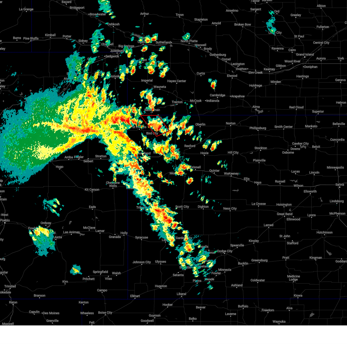 At 135 pm cdt, a severe thunderstorm capable of producing a tornado was located near mcdonald, or 16 miles west of atwood, moving northwest at 30 mph (radar indicated rotation). Hazards include tornado. Flying debris will be dangerous to those caught without shelter. mobile homes will be damaged or destroyed. damage to roofs, windows, and vehicles will occur. tree damage is likely. This dangerous storm will be near, mcdonald around 140 pm cdt. At 135 pm cdt, a severe thunderstorm capable of producing a tornado was located near mcdonald, or 16 miles west of atwood, moving northwest at 30 mph (radar indicated rotation). Hazards include tornado. Flying debris will be dangerous to those caught without shelter. mobile homes will be damaged or destroyed. damage to roofs, windows, and vehicles will occur. tree damage is likely. This dangerous storm will be near, mcdonald around 140 pm cdt.
|
| 5/9/2023 7:32 AM CDT |
 At 732 am cdt, a severe thunderstorm was located 7 miles northwest of ludell, or 9 miles north of atwood, moving northeast at 25 mph (radar indicated). Hazards include ping pong ball size hail. People and animals outdoors will be injured. expect damage to roofs, siding, windows, and vehicles. this severe thunderstorm will remain over mainly rural areas of northern rawlins and hitchcock counties, including the following locations, blakeman and beardsley. hail threat, radar indicated max hail size, 1. 50 in wind threat, radar indicated max wind gust, <50 mph. At 732 am cdt, a severe thunderstorm was located 7 miles northwest of ludell, or 9 miles north of atwood, moving northeast at 25 mph (radar indicated). Hazards include ping pong ball size hail. People and animals outdoors will be injured. expect damage to roofs, siding, windows, and vehicles. this severe thunderstorm will remain over mainly rural areas of northern rawlins and hitchcock counties, including the following locations, blakeman and beardsley. hail threat, radar indicated max hail size, 1. 50 in wind threat, radar indicated max wind gust, <50 mph.
|
| 5/9/2023 7:15 AM CDT |
 At 614 am mdt/714 am cdt/, a severe thunderstorm was located 9 miles north of atwood, moving east at 25 mph. another severe thunderstorm was located near max, also moving east at 25 mph (radar indicated). Hazards include quarter size hail. Damage to vehicles is expected. this severe thunderstorm will be near, ludell around 730 am cdt. other locations in the path of this severe thunderstorm include herndon. hail threat, radar indicated max hail size, 1. 00 in wind threat, radar indicated max wind gust, <50 mph. At 614 am mdt/714 am cdt/, a severe thunderstorm was located 9 miles north of atwood, moving east at 25 mph. another severe thunderstorm was located near max, also moving east at 25 mph (radar indicated). Hazards include quarter size hail. Damage to vehicles is expected. this severe thunderstorm will be near, ludell around 730 am cdt. other locations in the path of this severe thunderstorm include herndon. hail threat, radar indicated max hail size, 1. 00 in wind threat, radar indicated max wind gust, <50 mph.
|
| 5/9/2023 6:34 AM CDT |
 At 534 am mdt/634 am cdt/, a severe thunderstorm was located 4 miles north of mcdonald, or 16 miles southeast of benkelman, moving northeast at 40 mph (radar indicated). Hazards include quarter size hail. damage to vehicles is expected At 534 am mdt/634 am cdt/, a severe thunderstorm was located 4 miles north of mcdonald, or 16 miles southeast of benkelman, moving northeast at 40 mph (radar indicated). Hazards include quarter size hail. damage to vehicles is expected
|
| 5/7/2023 5:08 PM CDT |
 At 508 pm cdt, a severe thunderstorm was located 9 miles southwest of atwood, moving east at 35 mph (radar indicated). Hazards include 60 mph wind gusts and quarter size hail. Hail damage to vehicles is expected. expect wind damage to roofs, siding, and trees. accumulating hail is possible with this storm. locations impacted include, mcdonald, blakeman and beardsley. hail threat, radar indicated max hail size, 1. 00 in wind threat, radar indicated max wind gust, 60 mph. At 508 pm cdt, a severe thunderstorm was located 9 miles southwest of atwood, moving east at 35 mph (radar indicated). Hazards include 60 mph wind gusts and quarter size hail. Hail damage to vehicles is expected. expect wind damage to roofs, siding, and trees. accumulating hail is possible with this storm. locations impacted include, mcdonald, blakeman and beardsley. hail threat, radar indicated max hail size, 1. 00 in wind threat, radar indicated max wind gust, 60 mph.
|
| 5/7/2023 4:59 PM CDT |
 At 458 pm cdt, a severe thunderstorm was located 6 miles southeast of mcdonald, or 14 miles southwest of atwood, moving east at 35 mph (radar indicated). Hazards include 60 mph wind gusts and quarter size hail. Hail damage to vehicles is expected. expect wind damage to roofs, siding, and trees. accumulating hail was reported in mcdonald. locations impacted include, mcdonald, blakeman and beardsley. hail threat, radar indicated max hail size, 1. 00 in wind threat, radar indicated max wind gust, 60 mph. At 458 pm cdt, a severe thunderstorm was located 6 miles southeast of mcdonald, or 14 miles southwest of atwood, moving east at 35 mph (radar indicated). Hazards include 60 mph wind gusts and quarter size hail. Hail damage to vehicles is expected. expect wind damage to roofs, siding, and trees. accumulating hail was reported in mcdonald. locations impacted include, mcdonald, blakeman and beardsley. hail threat, radar indicated max hail size, 1. 00 in wind threat, radar indicated max wind gust, 60 mph.
|
| 5/7/2023 4:52 PM CDT |
 At 451 pm cdt, a severe thunderstorm was located near mcdonald, or 18 miles west of atwood, moving east at 35 mph (radar indicated). Hazards include 60 mph wind gusts and quarter size hail. Hail damage to vehicles is expected. expect wind damage to roofs, siding, and trees. this severe thunderstorm will remain over mainly rural areas of eastern cheyenne and southwestern rawlins counties in northwestern kansas, including the following locations, blakeman and beardsley. hail threat, radar indicated max hail size, 1. 00 in wind threat, radar indicated max wind gust, 60 mph. At 451 pm cdt, a severe thunderstorm was located near mcdonald, or 18 miles west of atwood, moving east at 35 mph (radar indicated). Hazards include 60 mph wind gusts and quarter size hail. Hail damage to vehicles is expected. expect wind damage to roofs, siding, and trees. this severe thunderstorm will remain over mainly rural areas of eastern cheyenne and southwestern rawlins counties in northwestern kansas, including the following locations, blakeman and beardsley. hail threat, radar indicated max hail size, 1. 00 in wind threat, radar indicated max wind gust, 60 mph.
|
| 5/7/2023 4:35 PM CDT |
 At 435 pm cdt, a severe thunderstorm was located over bird city, or 12 miles east of st. francis, moving east at 35 mph (radar indicated). Hazards include 60 mph wind gusts and quarter size hail. Hail damage to vehicles is expected. expect wind damage to roofs, siding, and trees. this severe thunderstorm will be near, mcdonald around 450 pm cdt. hail threat, radar indicated max hail size, 1. 00 in wind threat, radar indicated max wind gust, 60 mph. At 435 pm cdt, a severe thunderstorm was located over bird city, or 12 miles east of st. francis, moving east at 35 mph (radar indicated). Hazards include 60 mph wind gusts and quarter size hail. Hail damage to vehicles is expected. expect wind damage to roofs, siding, and trees. this severe thunderstorm will be near, mcdonald around 450 pm cdt. hail threat, radar indicated max hail size, 1. 00 in wind threat, radar indicated max wind gust, 60 mph.
|
| 7/27/2022 11:53 PM CDT |
 At 1152 pm cdt, a severe thunderstorm was located 8 miles northeast of mcdonald, or 12 miles west of atwood, moving southeast at 25 mph (mesonet. a mesonet site near mcdonald reported a 57 mph wind gust). Hazards include 60 mph wind gusts and quarter size hail. Hail damage to vehicles is expected. expect wind damage to roofs, siding, and trees. this severe thunderstorm will be near, mcdonald around 1200 am cdt. hail threat, radar indicated max hail size, 1. 00 in wind threat, radar indicated max wind gust, 60 mph. At 1152 pm cdt, a severe thunderstorm was located 8 miles northeast of mcdonald, or 12 miles west of atwood, moving southeast at 25 mph (mesonet. a mesonet site near mcdonald reported a 57 mph wind gust). Hazards include 60 mph wind gusts and quarter size hail. Hail damage to vehicles is expected. expect wind damage to roofs, siding, and trees. this severe thunderstorm will be near, mcdonald around 1200 am cdt. hail threat, radar indicated max hail size, 1. 00 in wind threat, radar indicated max wind gust, 60 mph.
|
| 6/20/2022 6:27 PM CDT | At least 60 mph wind gusts reported from public via faceboo in rawlins county KS, 3.2 miles SW of McDonald, KS |
| 6/20/2022 6:17 PM CDT |
 At 617 pm cdt, a severe thunderstorm was located 5 miles southeast of mcdonald, or 15 miles west of atwood, moving northeast at 30 mph (radar indicated). Hazards include 60 mph wind gusts. expect damage to roofs, siding, and trees At 617 pm cdt, a severe thunderstorm was located 5 miles southeast of mcdonald, or 15 miles west of atwood, moving northeast at 30 mph (radar indicated). Hazards include 60 mph wind gusts. expect damage to roofs, siding, and trees
|
| 6/5/2022 7:39 PM CDT |
 At 738 pm cdt, severe thunderstorms were located along a line extending from 6 miles northeast of mcdonald to 8 miles northeast of st. francis, moving south at 30 mph (radar indicated). Hazards include 70 mph wind gusts and half dollar size hail. Hail damage to vehicles is expected. expect considerable tree damage. wind damage is also likely to mobile homes, roofs, and outbuildings. locations impacted include, st. francis, atwood, bird city, mcdonald, blakeman, beardsley and wheeler. thunderstorm damage threat, considerable hail threat, radar indicated max hail size, 1. 25 in wind threat, radar indicated max wind gust, 70 mph. At 738 pm cdt, severe thunderstorms were located along a line extending from 6 miles northeast of mcdonald to 8 miles northeast of st. francis, moving south at 30 mph (radar indicated). Hazards include 70 mph wind gusts and half dollar size hail. Hail damage to vehicles is expected. expect considerable tree damage. wind damage is also likely to mobile homes, roofs, and outbuildings. locations impacted include, st. francis, atwood, bird city, mcdonald, blakeman, beardsley and wheeler. thunderstorm damage threat, considerable hail threat, radar indicated max hail size, 1. 25 in wind threat, radar indicated max wind gust, 70 mph.
|
| 6/5/2022 7:13 PM CDT |
 At 613 pm mdt/713 pm cdt/, severe thunderstorms were located along a line extending from 9 miles south of stratton to 9 miles southeast of haigler, moving south at 30 mph (radar indicated). Hazards include 70 mph wind gusts and half dollar size hail. Hail damage to vehicles is expected. expect considerable tree damage. Wind damage is also likely to mobile homes, roofs, and outbuildings. At 613 pm mdt/713 pm cdt/, severe thunderstorms were located along a line extending from 9 miles south of stratton to 9 miles southeast of haigler, moving south at 30 mph (radar indicated). Hazards include 70 mph wind gusts and half dollar size hail. Hail damage to vehicles is expected. expect considerable tree damage. Wind damage is also likely to mobile homes, roofs, and outbuildings.
|
| 8/26/2021 8:14 PM CDT |
 At 813 pm cdt, a severe thunderstorm was located 6 miles southwest of atwood, moving northeast at 25 mph (trained weather spotters). Hazards include 70 mph wind gusts and penny size hail. Expect considerable tree damage. damage is likely to mobile homes, roofs, and outbuildings. locations impacted include, atwood, mcdonald, blakeman and beardsley. thunderstorm damage threat, considerable hail threat, radar indicated max hail size, 0. 75 in wind threat, observed max wind gust, 70 mph. At 813 pm cdt, a severe thunderstorm was located 6 miles southwest of atwood, moving northeast at 25 mph (trained weather spotters). Hazards include 70 mph wind gusts and penny size hail. Expect considerable tree damage. damage is likely to mobile homes, roofs, and outbuildings. locations impacted include, atwood, mcdonald, blakeman and beardsley. thunderstorm damage threat, considerable hail threat, radar indicated max hail size, 0. 75 in wind threat, observed max wind gust, 70 mph.
|
| 8/26/2021 7:56 PM CDT |
 At 755 pm cdt, a severe thunderstorm was located 4 miles southeast of mcdonald, or 14 miles west of atwood, moving northeast at 25 mph (trained weather spotters). Hazards include 70 mph wind gusts and penny size hail. Expect considerable tree damage. damage is likely to mobile homes, roofs, and outbuildings. locations impacted include, atwood, bird city, mcdonald, blakeman and beardsley. thunderstorm damage threat, considerable hail threat, radar indicated max hail size, 0. 75 in wind threat, observed max wind gust, 70 mph. At 755 pm cdt, a severe thunderstorm was located 4 miles southeast of mcdonald, or 14 miles west of atwood, moving northeast at 25 mph (trained weather spotters). Hazards include 70 mph wind gusts and penny size hail. Expect considerable tree damage. damage is likely to mobile homes, roofs, and outbuildings. locations impacted include, atwood, bird city, mcdonald, blakeman and beardsley. thunderstorm damage threat, considerable hail threat, radar indicated max hail size, 0. 75 in wind threat, observed max wind gust, 70 mph.
|
| 8/26/2021 7:47 PM CDT | Spotter estimated 70mph wind gus in rawlins county KS, 0.4 miles S of McDonald, KS |
| 8/26/2021 7:30 PM CDT |
 At 630 pm mdt/730 pm cdt/, a severe thunderstorm was located 6 miles southeast of bird city, or 18 miles southeast of st. francis, moving northeast at 25 mph (radar indicated). Hazards include 70 mph wind gusts. Expect considerable tree damage. Damage is likely to mobile homes, roofs, and outbuildings. At 630 pm mdt/730 pm cdt/, a severe thunderstorm was located 6 miles southeast of bird city, or 18 miles southeast of st. francis, moving northeast at 25 mph (radar indicated). Hazards include 70 mph wind gusts. Expect considerable tree damage. Damage is likely to mobile homes, roofs, and outbuildings.
|
| 6/25/2021 7:06 PM CDT |
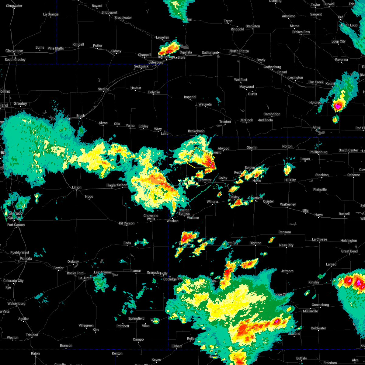 The severe thunderstorm warning for southeastern cheyenne and southwestern rawlins counties in northwestern kansas will expire at 715 pm cdt, the storm which prompted the warning has weakened below severe limits, and no longer poses an immediate threat to life or property. therefore, the warning will be allowed to expire. a severe thunderstorm watch remains in effect until 900 pm cdt for northwestern kansas. The severe thunderstorm warning for southeastern cheyenne and southwestern rawlins counties in northwestern kansas will expire at 715 pm cdt, the storm which prompted the warning has weakened below severe limits, and no longer poses an immediate threat to life or property. therefore, the warning will be allowed to expire. a severe thunderstorm watch remains in effect until 900 pm cdt for northwestern kansas.
|
| 6/25/2021 7:01 PM CDT |
 At 700 pm cdt, a severe thunderstorm was located 9 miles south of mcdonald, or 19 miles southwest of atwood, moving southeast at 25 mph (radar indicated). Hazards include 60 mph wind gusts and quarter size hail. Hail damage to vehicles is expected. expect wind damage to roofs, siding, and trees. Locations impacted include, bird city and mcdonald. At 700 pm cdt, a severe thunderstorm was located 9 miles south of mcdonald, or 19 miles southwest of atwood, moving southeast at 25 mph (radar indicated). Hazards include 60 mph wind gusts and quarter size hail. Hail damage to vehicles is expected. expect wind damage to roofs, siding, and trees. Locations impacted include, bird city and mcdonald.
|
| 6/25/2021 6:48 PM CDT |
 At 647 pm cdt, a severe thunderstorm was located 7 miles south of mcdonald, or 21 miles east of st. francis, moving southeast at 25 mph (radar indicated). Hazards include 60 mph wind gusts and quarter size hail. Hail damage to vehicles is expected. expect wind damage to roofs, siding, and trees. Locations impacted include, bird city, mcdonald and wheeler. At 647 pm cdt, a severe thunderstorm was located 7 miles south of mcdonald, or 21 miles east of st. francis, moving southeast at 25 mph (radar indicated). Hazards include 60 mph wind gusts and quarter size hail. Hail damage to vehicles is expected. expect wind damage to roofs, siding, and trees. Locations impacted include, bird city, mcdonald and wheeler.
|
| 6/25/2021 6:32 PM CDT |
 At 631 pm cdt, a severe thunderstorm was located over bird city, or 14 miles east of st. francis, moving southeast at 25 mph (radar indicated). Hazards include 60 mph wind gusts and quarter size hail. Hail damage to vehicles is expected. expect wind damage to roofs, siding, and trees. Locations impacted include, mcdonald. At 631 pm cdt, a severe thunderstorm was located over bird city, or 14 miles east of st. francis, moving southeast at 25 mph (radar indicated). Hazards include 60 mph wind gusts and quarter size hail. Hail damage to vehicles is expected. expect wind damage to roofs, siding, and trees. Locations impacted include, mcdonald.
|
| 6/25/2021 6:15 PM CDT |
 At 615 pm cdt, a severe thunderstorm was located 6 miles east of st. francis, moving southeast at 25 mph (radar indicated). Hazards include 60 mph wind gusts and quarter size hail. Hail damage to vehicles is expected. expect wind damage to roofs, siding, and trees. This severe thunderstorm will be near, bird city around 635 pm cdt. At 615 pm cdt, a severe thunderstorm was located 6 miles east of st. francis, moving southeast at 25 mph (radar indicated). Hazards include 60 mph wind gusts and quarter size hail. Hail damage to vehicles is expected. expect wind damage to roofs, siding, and trees. This severe thunderstorm will be near, bird city around 635 pm cdt.
|
| 6/19/2021 8:34 PM CDT |
 At 834 pm cdt, severe thunderstorms were located along a line extending from 12 miles southwest of stockville to 12 miles north of gem, moving east at 45 mph. these are very dangerous storms (public). Hazards include 80 mph wind gusts. Flying debris will be dangerous to those caught without shelter. mobile homes will be heavily damaged. expect considerable damage to roofs, windows, and vehicles. extensive tree damage and power outages are likely. Locations impacted include, mccook, oberlin, atwood, trenton, culbertson, indianola and palisade. At 834 pm cdt, severe thunderstorms were located along a line extending from 12 miles southwest of stockville to 12 miles north of gem, moving east at 45 mph. these are very dangerous storms (public). Hazards include 80 mph wind gusts. Flying debris will be dangerous to those caught without shelter. mobile homes will be heavily damaged. expect considerable damage to roofs, windows, and vehicles. extensive tree damage and power outages are likely. Locations impacted include, mccook, oberlin, atwood, trenton, culbertson, indianola and palisade.
|
| 6/19/2021 7:32 PM CDT |
 At 731 pm cdt, severe thunderstorms were located along a line extending from near wauneta to 14 miles south of st. francis, moving east at 45 mph. these are very dangerous storms (public reported eight to ten inch diameter tree limbs blown down in benkelman). Hazards include 80 mph wind gusts. Flying debris will be dangerous to those caught without shelter. mobile homes will be heavily damaged. expect considerable damage to roofs, windows, and vehicles. extensive tree damage and power outages are likely. Locations impacted include, mccook, oberlin, atwood, trenton, culbertson, indianola and palisade. At 731 pm cdt, severe thunderstorms were located along a line extending from near wauneta to 14 miles south of st. francis, moving east at 45 mph. these are very dangerous storms (public reported eight to ten inch diameter tree limbs blown down in benkelman). Hazards include 80 mph wind gusts. Flying debris will be dangerous to those caught without shelter. mobile homes will be heavily damaged. expect considerable damage to roofs, windows, and vehicles. extensive tree damage and power outages are likely. Locations impacted include, mccook, oberlin, atwood, trenton, culbertson, indianola and palisade.
|
| 6/19/2021 7:29 PM CDT |
 At 729 pm cdt, severe thunderstorms were located along a line extending from near wauneta to 14 miles south of st. francis, moving east at 45 mph. these are very dangerous storms (public). Hazards include 80 mph wind gusts. Flying debris will be dangerous to those caught without shelter. mobile homes will be heavily damaged. expect considerable damage to roofs, windows, and vehicles. Extensive tree damage and power outages are likely. At 729 pm cdt, severe thunderstorms were located along a line extending from near wauneta to 14 miles south of st. francis, moving east at 45 mph. these are very dangerous storms (public). Hazards include 80 mph wind gusts. Flying debris will be dangerous to those caught without shelter. mobile homes will be heavily damaged. expect considerable damage to roofs, windows, and vehicles. Extensive tree damage and power outages are likely.
|
| 6/19/2021 7:29 PM CDT |
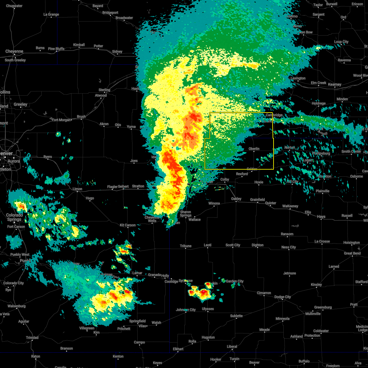 At 729 pm cdt, severe thunderstorms were located along a line extending from near wauneta to 14 miles south of st. francis, moving east at 45 mph. these are very dangerous storms (public). Hazards include 80 mph wind gusts. Flying debris will be dangerous to those caught without shelter. mobile homes will be heavily damaged. expect considerable damage to roofs, windows, and vehicles. Extensive tree damage and power outages are likely. At 729 pm cdt, severe thunderstorms were located along a line extending from near wauneta to 14 miles south of st. francis, moving east at 45 mph. these are very dangerous storms (public). Hazards include 80 mph wind gusts. Flying debris will be dangerous to those caught without shelter. mobile homes will be heavily damaged. expect considerable damage to roofs, windows, and vehicles. Extensive tree damage and power outages are likely.
|
| 5/26/2021 11:14 AM CDT |
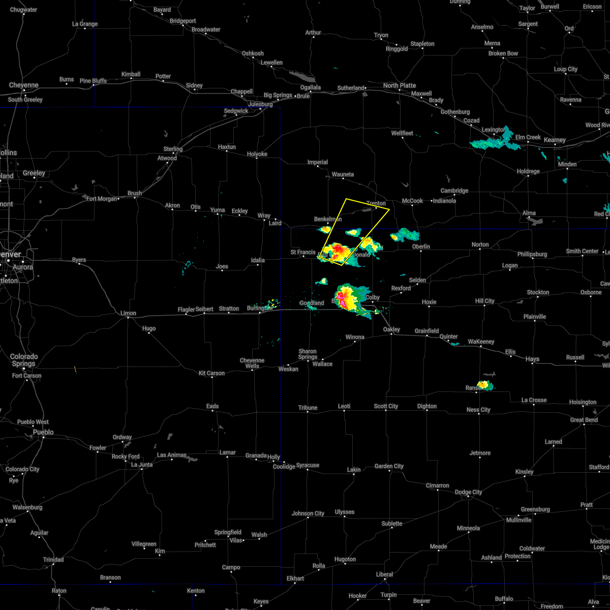 At 1014 am mdt/1114 am cdt/, a severe thunderstorm was located 4 miles west of mcdonald, or 17 miles south of benkelman, moving northeast at 30 mph (radar indicated). Hazards include quarter size hail. damage to vehicles is expected At 1014 am mdt/1114 am cdt/, a severe thunderstorm was located 4 miles west of mcdonald, or 17 miles south of benkelman, moving northeast at 30 mph (radar indicated). Hazards include quarter size hail. damage to vehicles is expected
|
| 5/26/2021 10:56 AM CDT |
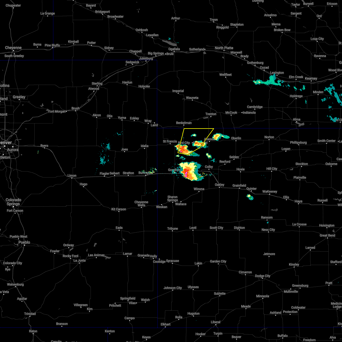 At 1055 am cdt, a severe thunderstorm was located near bird city, or 14 miles east of st. francis, moving northeast at 35 mph (radar indicated). Hazards include 60 mph wind gusts and quarter size hail. Hail damage to vehicles is expected. expect wind damage to roofs, siding, and trees. Locations impacted include, bird city, mcdonald and beardsley. At 1055 am cdt, a severe thunderstorm was located near bird city, or 14 miles east of st. francis, moving northeast at 35 mph (radar indicated). Hazards include 60 mph wind gusts and quarter size hail. Hail damage to vehicles is expected. expect wind damage to roofs, siding, and trees. Locations impacted include, bird city, mcdonald and beardsley.
|
| 5/26/2021 10:40 AM CDT |
 At 940 am mdt/1040 am cdt/, a severe thunderstorm was located 11 miles south of bird city, or 16 miles southeast of st. francis, moving northeast at 30 mph (radar indicated). Hazards include 60 mph wind gusts and quarter size hail. Hail damage to vehicles is expected. expect wind damage to roofs, siding, and trees. Locations impacted include, bird city, mcdonald and beardsley. At 940 am mdt/1040 am cdt/, a severe thunderstorm was located 11 miles south of bird city, or 16 miles southeast of st. francis, moving northeast at 30 mph (radar indicated). Hazards include 60 mph wind gusts and quarter size hail. Hail damage to vehicles is expected. expect wind damage to roofs, siding, and trees. Locations impacted include, bird city, mcdonald and beardsley.
|
| 5/26/2021 10:30 AM CDT |
 At 928 am mdt/1028 am cdt/, a severe thunderstorm was located 9 miles southeast of bird city, or 19 miles north of brewster, moving northeast at 35 mph. another severe thunderstorm was located 12 miles north of goodland (radar indicated. at 907 am mdt...half dollar size hail was reported 10 miles north northwest of brewster). Hazards include 60 mph wind gusts and half dollar size hail. Hail damage to vehicles is expected. expect wind damage to roofs, siding, and trees. Locations impacted include, bird city, mcdonald and beardsley. At 928 am mdt/1028 am cdt/, a severe thunderstorm was located 9 miles southeast of bird city, or 19 miles north of brewster, moving northeast at 35 mph. another severe thunderstorm was located 12 miles north of goodland (radar indicated. at 907 am mdt...half dollar size hail was reported 10 miles north northwest of brewster). Hazards include 60 mph wind gusts and half dollar size hail. Hail damage to vehicles is expected. expect wind damage to roofs, siding, and trees. Locations impacted include, bird city, mcdonald and beardsley.
|
| 5/26/2021 10:09 AM CDT |
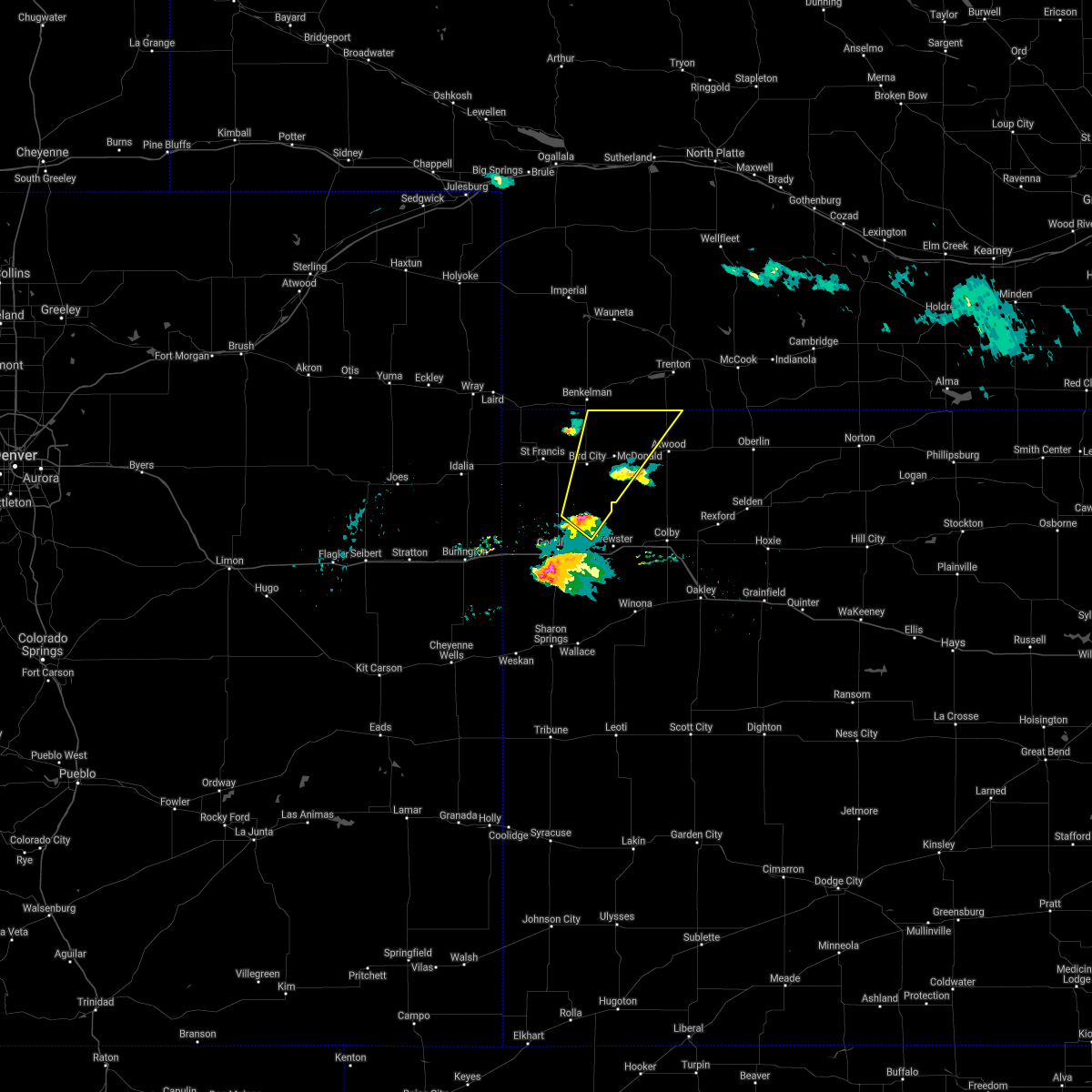 At 907 am mdt/1007 am cdt/, a severe thunderstorm was located 13 miles northwest of brewster, moving northeast at 40 mph (trained weather spotters. at 907 am mdt...half dollar size hail was reported 10 miles north northwest of brewster). Hazards include 60 mph wind gusts and half dollar size hail. Hail damage to vehicles is expected. Expect wind damage to roofs, siding, and trees. At 907 am mdt/1007 am cdt/, a severe thunderstorm was located 13 miles northwest of brewster, moving northeast at 40 mph (trained weather spotters. at 907 am mdt...half dollar size hail was reported 10 miles north northwest of brewster). Hazards include 60 mph wind gusts and half dollar size hail. Hail damage to vehicles is expected. Expect wind damage to roofs, siding, and trees.
|
| 5/23/2021 11:12 PM CDT |
 At 1111 pm cdt, a severe thunderstorm was located 6 miles east of mcdonald, or 11 miles west of atwood, moving northeast at 50 mph (radar indicated). Hazards include 70 mph wind gusts and penny size hail. Expect considerable tree damage. damage is likely to mobile homes, roofs, and outbuildings. this severe thunderstorm will be near, atwood around 1125 pm cdt. Ludell around 1130 pm cdt. At 1111 pm cdt, a severe thunderstorm was located 6 miles east of mcdonald, or 11 miles west of atwood, moving northeast at 50 mph (radar indicated). Hazards include 70 mph wind gusts and penny size hail. Expect considerable tree damage. damage is likely to mobile homes, roofs, and outbuildings. this severe thunderstorm will be near, atwood around 1125 pm cdt. Ludell around 1130 pm cdt.
|
| 5/23/2021 8:38 PM MDT |
 At 838 pm mdt/938 pm cdt/, severe thunderstorms were located along a line extending from 7 miles southeast of wauneta to 4 miles southwest of bird city, moving northeast at 25 mph (radar indicated). Hazards include 60 mph wind gusts and quarter size hail. Hail damage to vehicles is expected. expect wind damage to roofs, siding, and trees. locations impacted include, st. Francis, benkelman, bird city, palisade, stratton, mcdonald and max. At 838 pm mdt/938 pm cdt/, severe thunderstorms were located along a line extending from 7 miles southeast of wauneta to 4 miles southwest of bird city, moving northeast at 25 mph (radar indicated). Hazards include 60 mph wind gusts and quarter size hail. Hail damage to vehicles is expected. expect wind damage to roofs, siding, and trees. locations impacted include, st. Francis, benkelman, bird city, palisade, stratton, mcdonald and max.
|
| 5/23/2021 9:13 PM CDT |
 At 813 pm mdt/913 pm cdt/, severe thunderstorms were located along a line extending from 3 miles south of enders reservoir state recreation area to 13 miles north of ruleton, moving northeast at 45 mph (radar indicated). Hazards include 60 mph wind gusts and quarter size hail. Hail damage to vehicles is expected. Expect wind damage to roofs, siding, and trees. At 813 pm mdt/913 pm cdt/, severe thunderstorms were located along a line extending from 3 miles south of enders reservoir state recreation area to 13 miles north of ruleton, moving northeast at 45 mph (radar indicated). Hazards include 60 mph wind gusts and quarter size hail. Hail damage to vehicles is expected. Expect wind damage to roofs, siding, and trees.
|
| 5/22/2021 3:48 PM CDT |
 At 248 pm mdt/348 pm cdt/, a severe thunderstorm was located 6 miles north of mcdonald, or 14 miles southeast of benkelman, moving northeast at 35 mph (radar indicated). Hazards include 60 mph wind gusts and quarter size hail. Hail damage to vehicles is expected. expect wind damage to roofs, siding, and trees. This severe thunderstorm will remain over mainly rural areas of eastern cheyenne and western rawlins counties in northwestern kansas, southwestern hitchcock and southeastern dundy counties in southwestern nebraska, including the following locations, beardsley. At 248 pm mdt/348 pm cdt/, a severe thunderstorm was located 6 miles north of mcdonald, or 14 miles southeast of benkelman, moving northeast at 35 mph (radar indicated). Hazards include 60 mph wind gusts and quarter size hail. Hail damage to vehicles is expected. expect wind damage to roofs, siding, and trees. This severe thunderstorm will remain over mainly rural areas of eastern cheyenne and western rawlins counties in northwestern kansas, southwestern hitchcock and southeastern dundy counties in southwestern nebraska, including the following locations, beardsley.
|
| 5/22/2021 3:48 PM CDT |
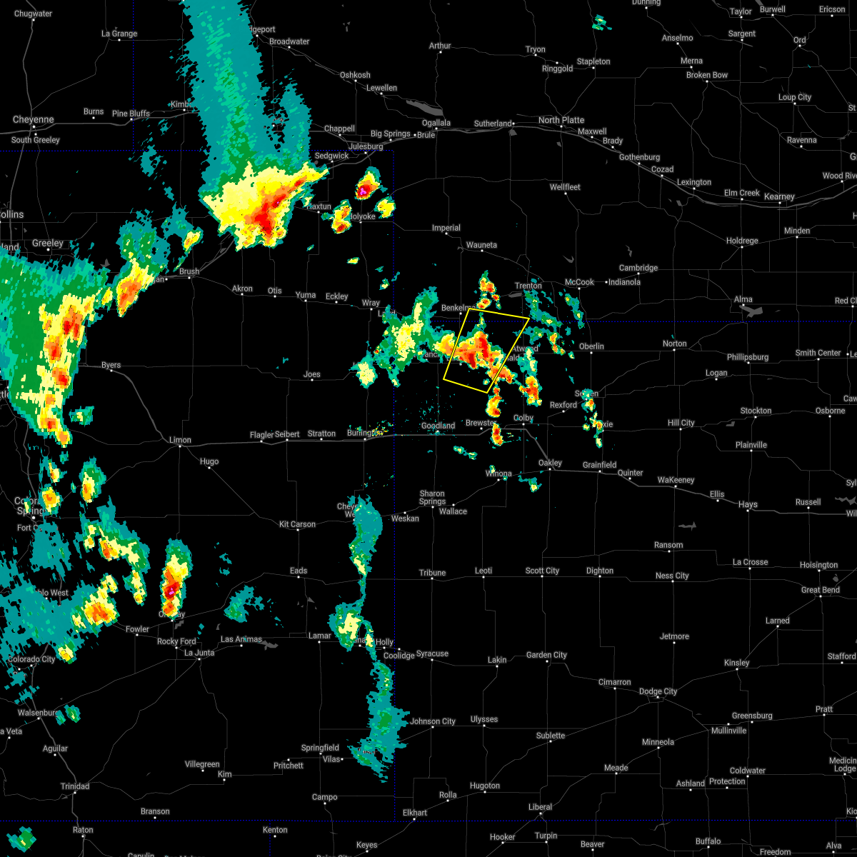 At 248 pm mdt/348 pm cdt/, a severe thunderstorm was located 6 miles north of mcdonald, or 14 miles southeast of benkelman, moving northeast at 35 mph (radar indicated). Hazards include 60 mph wind gusts and quarter size hail. Hail damage to vehicles is expected. expect wind damage to roofs, siding, and trees. This severe thunderstorm will remain over mainly rural areas of eastern cheyenne and western rawlins counties in northwestern kansas, southwestern hitchcock and southeastern dundy counties in southwestern nebraska, including the following locations, beardsley. At 248 pm mdt/348 pm cdt/, a severe thunderstorm was located 6 miles north of mcdonald, or 14 miles southeast of benkelman, moving northeast at 35 mph (radar indicated). Hazards include 60 mph wind gusts and quarter size hail. Hail damage to vehicles is expected. expect wind damage to roofs, siding, and trees. This severe thunderstorm will remain over mainly rural areas of eastern cheyenne and western rawlins counties in northwestern kansas, southwestern hitchcock and southeastern dundy counties in southwestern nebraska, including the following locations, beardsley.
|
| 5/22/2021 3:31 PM CDT |
 At 230 pm mdt/330 pm cdt/, a severe thunderstorm was located near bird city, or 17 miles east of st. francis, moving northeast at 35 mph (radar indicated). Hazards include 60 mph wind gusts and quarter size hail. Hail damage to vehicles is expected. expect wind damage to roofs, siding, and trees. This severe thunderstorm will be near, mcdonald around 340 pm cdt. At 230 pm mdt/330 pm cdt/, a severe thunderstorm was located near bird city, or 17 miles east of st. francis, moving northeast at 35 mph (radar indicated). Hazards include 60 mph wind gusts and quarter size hail. Hail damage to vehicles is expected. expect wind damage to roofs, siding, and trees. This severe thunderstorm will be near, mcdonald around 340 pm cdt.
|
| 5/2/2021 6:44 PM CDT |
 At 544 pm mdt/644 pm cdt/, severe thunderstorms were located along a line extending from 9 miles north of culbertson to 15 miles north of levant, moving east at 35 mph (mesonet site at bird city). Hazards include 60 mph wind gusts. Expect damage to roofs, siding, and trees. locations impacted include, st. Francis, atwood, benkelman, trenton, culbertson, bird city and stratton. At 544 pm mdt/644 pm cdt/, severe thunderstorms were located along a line extending from 9 miles north of culbertson to 15 miles north of levant, moving east at 35 mph (mesonet site at bird city). Hazards include 60 mph wind gusts. Expect damage to roofs, siding, and trees. locations impacted include, st. Francis, atwood, benkelman, trenton, culbertson, bird city and stratton.
|
| 5/2/2021 6:17 PM CDT |
 At 516 pm mdt/616 pm cdt/, severe thunderstorms were located along a line extending from near palisade to 11 miles south of bird city, moving east at 35 mph (radar indicated). Hazards include 70 mph wind gusts and quarter size hail. Hail damage to vehicles is expected. expect considerable tree damage. wind damage is also likely to mobile homes, roofs, and outbuildings. locations impacted include, st. Francis, atwood, benkelman, trenton, culbertson, bird city and stratton. At 516 pm mdt/616 pm cdt/, severe thunderstorms were located along a line extending from near palisade to 11 miles south of bird city, moving east at 35 mph (radar indicated). Hazards include 70 mph wind gusts and quarter size hail. Hail damage to vehicles is expected. expect considerable tree damage. wind damage is also likely to mobile homes, roofs, and outbuildings. locations impacted include, st. Francis, atwood, benkelman, trenton, culbertson, bird city and stratton.
|
| 5/2/2021 6:03 PM CDT |
 At 503 pm mdt/603 pm cdt/, severe thunderstorms were located along a line extending from 6 miles southeast of wauneta to 13 miles southwest of bird city, moving east at 35 mph (radar indicated). Hazards include 70 mph wind gusts and quarter size hail. Hail damage to vehicles is expected. expect considerable tree damage. wind damage is also likely to mobile homes, roofs, and outbuildings. These severe thunderstorms will remain over mainly rural areas of cheyenne and rawlins counties in northwestern kansas, hitchcock and dundy counties in southwestern nebraska, including the following locations, blakeman, beardsley, parks, wheeler and max. At 503 pm mdt/603 pm cdt/, severe thunderstorms were located along a line extending from 6 miles southeast of wauneta to 13 miles southwest of bird city, moving east at 35 mph (radar indicated). Hazards include 70 mph wind gusts and quarter size hail. Hail damage to vehicles is expected. expect considerable tree damage. wind damage is also likely to mobile homes, roofs, and outbuildings. These severe thunderstorms will remain over mainly rural areas of cheyenne and rawlins counties in northwestern kansas, hitchcock and dundy counties in southwestern nebraska, including the following locations, blakeman, beardsley, parks, wheeler and max.
|
| 4/27/2021 8:42 PM CDT | Trained spotter estimated 50-60 mph winds that almost knocked them ove in rawlins county KS, 0.4 miles S of McDonald, KS |
| 4/27/2021 8:21 PM CDT |
 At 721 pm mdt/821 pm cdt/, a severe thunderstorm was located near st. francis, moving northeast at 35 mph (radar indicated). Hazards include 60 mph wind gusts and half dollar size hail. Hail damage to vehicles is expected. Expect wind damage to roofs, siding, and trees. At 721 pm mdt/821 pm cdt/, a severe thunderstorm was located near st. francis, moving northeast at 35 mph (radar indicated). Hazards include 60 mph wind gusts and half dollar size hail. Hail damage to vehicles is expected. Expect wind damage to roofs, siding, and trees.
|
| 9/7/2020 11:03 PM CDT |
 At 1101 pm cdt, a severe thunderstorm was located 5 miles northeast of mcdonald, or 13 miles west of atwood, moving northeast at 30 mph (trained weather spotters). Hazards include 60 mph wind gusts and quarter size hail. Hail damage to vehicles is expected. expect wind damage to roofs, siding, and trees. Locations impacted include, atwood, mcdonald, blakeman and beardsley. At 1101 pm cdt, a severe thunderstorm was located 5 miles northeast of mcdonald, or 13 miles west of atwood, moving northeast at 30 mph (trained weather spotters). Hazards include 60 mph wind gusts and quarter size hail. Hail damage to vehicles is expected. expect wind damage to roofs, siding, and trees. Locations impacted include, atwood, mcdonald, blakeman and beardsley.
|
| 9/7/2020 11:00 PM CDT | Quarter sized hail reported 0.4 miles S of McDonald, KS |
| 9/7/2020 11:00 PM CDT | Storm damage reported in rawlins county KS, 0.4 miles S of McDonald, KS |
| 9/7/2020 10:55 PM CDT | Quarter sized hail reported 0.4 miles S of McDonald, KS, quarter inch hail reported via social media. included a picture showing a large pile of pea to quarter size hail accumulation against a structure. time estimated by rad |
| 9/7/2020 10:46 PM CDT |
 At 1046 pm cdt, a severe thunderstorm was located over mcdonald, or 19 miles west of atwood, moving northeast at 30 mph (radar indicated). Hazards include 60 mph wind gusts and quarter size hail. Hail damage to vehicles is expected. Expect wind damage to roofs, siding, and trees. At 1046 pm cdt, a severe thunderstorm was located over mcdonald, or 19 miles west of atwood, moving northeast at 30 mph (radar indicated). Hazards include 60 mph wind gusts and quarter size hail. Hail damage to vehicles is expected. Expect wind damage to roofs, siding, and trees.
|
| 8/16/2020 6:54 PM CDT |
 At 552 pm mdt/652 pm cdt/, severe thunderstorms were located along a line extending from 15 miles southwest of eckley to 3 miles north of bonny reservoir to 6 miles north of goodland to near brewster to 7 miles east of menlo to 3 miles southwest of hill city, moving south at 20 mph (these storms have a history of producing wind gusts up to 70 mph. an automated weather observation site in st. francis reported a 67 mph wind gust at 535 pm mdt). Hazards include quarter size hail and 70 mph wind gusts. People and animals outdoors will be injured. expect hail damage to roofs, siding, windows, and vehicles. expect considerable tree damage. wind damage is also likely to mobile homes, roofs, and outbuildings. locations impacted include, colby, goodland, burlington, yuma, wray, oberlin and hill city. this includes the following highways, interstate 70 in kansas between mile markers 0 and 74. interstate 70 in colorado between mile markers 391 and 450. Highway 385 between mile markers 170 and 269. At 552 pm mdt/652 pm cdt/, severe thunderstorms were located along a line extending from 15 miles southwest of eckley to 3 miles north of bonny reservoir to 6 miles north of goodland to near brewster to 7 miles east of menlo to 3 miles southwest of hill city, moving south at 20 mph (these storms have a history of producing wind gusts up to 70 mph. an automated weather observation site in st. francis reported a 67 mph wind gust at 535 pm mdt). Hazards include quarter size hail and 70 mph wind gusts. People and animals outdoors will be injured. expect hail damage to roofs, siding, windows, and vehicles. expect considerable tree damage. wind damage is also likely to mobile homes, roofs, and outbuildings. locations impacted include, colby, goodland, burlington, yuma, wray, oberlin and hill city. this includes the following highways, interstate 70 in kansas between mile markers 0 and 74. interstate 70 in colorado between mile markers 391 and 450. Highway 385 between mile markers 170 and 269.
|
| 8/16/2020 6:43 PM CDT |
 At 540 pm mdt/640 pm cdt/, severe thunderstorms were located along a line extending from 8 miles south of yuma to 10 miles north of bonny reservoir to 14 miles north of goodland to 9 miles north of brewster to 6 miles southeast of rexford to 6 miles northwest of hill city, moving south at 20 to 30 mph. the strongest storm within the line was progressing southward from cheyenne county, kansas into sherman county, kansas (these storms have a history of producing quarter to golf ball size hail and wind gusts up to 65 mph). Hazards include quarter to golf ball size hail and 70 mph wind gusts. People and animals outdoors will be injured. expect hail damage to roofs, siding, windows, and vehicles. expect considerable tree damage. wind damage is also likely to mobile homes, roofs, and outbuildings. locations impacted include, colby, goodland, burlington, yuma, norton, wray and oberlin. this includes the following highways, interstate 70 in kansas between mile markers 0 and 74. interstate 70 in colorado between mile markers 391 and 450. Highway 385 between mile markers 170 and 269. At 540 pm mdt/640 pm cdt/, severe thunderstorms were located along a line extending from 8 miles south of yuma to 10 miles north of bonny reservoir to 14 miles north of goodland to 9 miles north of brewster to 6 miles southeast of rexford to 6 miles northwest of hill city, moving south at 20 to 30 mph. the strongest storm within the line was progressing southward from cheyenne county, kansas into sherman county, kansas (these storms have a history of producing quarter to golf ball size hail and wind gusts up to 65 mph). Hazards include quarter to golf ball size hail and 70 mph wind gusts. People and animals outdoors will be injured. expect hail damage to roofs, siding, windows, and vehicles. expect considerable tree damage. wind damage is also likely to mobile homes, roofs, and outbuildings. locations impacted include, colby, goodland, burlington, yuma, norton, wray and oberlin. this includes the following highways, interstate 70 in kansas between mile markers 0 and 74. interstate 70 in colorado between mile markers 391 and 450. Highway 385 between mile markers 170 and 269.
|
| 8/16/2020 6:28 PM CDT |
 At 523 pm mdt/623 pm cdt/, severe thunderstorms were located along a line extending from 8 miles southwest of eckley to 12 miles south of bird city to 9 miles southeast of lenora, moving south at 25 mph. the strongest storm within the line was located in southern cheyenne county kansas, moving southward into sherman county, kansas (these storms have a history of producing quarter to golf ball size hail and wind gusts up to 65 mph). Hazards include quarter to golf ball size hail and 70 mph wind gusts. People and animals outdoors will be injured. expect hail damage to roofs, siding, windows, and vehicles. expect considerable tree damage. wind damage is also likely to mobile homes, roofs, and outbuildings. locations impacted include, colby, goodland, burlington, yuma, norton, wray and oberlin. this includes the following highways, interstate 70 in kansas between mile markers 0 and 74. interstate 70 in colorado between mile markers 391 and 450. Highway 385 between mile markers 170 and 269. At 523 pm mdt/623 pm cdt/, severe thunderstorms were located along a line extending from 8 miles southwest of eckley to 12 miles south of bird city to 9 miles southeast of lenora, moving south at 25 mph. the strongest storm within the line was located in southern cheyenne county kansas, moving southward into sherman county, kansas (these storms have a history of producing quarter to golf ball size hail and wind gusts up to 65 mph). Hazards include quarter to golf ball size hail and 70 mph wind gusts. People and animals outdoors will be injured. expect hail damage to roofs, siding, windows, and vehicles. expect considerable tree damage. wind damage is also likely to mobile homes, roofs, and outbuildings. locations impacted include, colby, goodland, burlington, yuma, norton, wray and oberlin. this includes the following highways, interstate 70 in kansas between mile markers 0 and 74. interstate 70 in colorado between mile markers 391 and 450. Highway 385 between mile markers 170 and 269.
|
| 8/16/2020 6:11 PM CDT |
 At 507 pm mdt/607 pm cdt/, severe thunderstorms were located along a line extending from 7 miles southeast of yuma to 11 miles south of bird city to 3 miles southwest of edmond, moving south at 15 mph. the strongest storm within the line was located in central cheyenne county, kansas moving south toward sherman county, kansas (these storms have a history of producing quarter to golf ball size hail and wind gusts up to 65 mph). Hazards include quarter to golf ball size hail and 70 mph wind gusts. People and animals outdoors will be injured. expect hail damage to roofs, siding, windows, and vehicles. expect considerable tree damage. wind damage is also likely to mobile homes, roofs, and outbuildings. locations impacted include, colby, goodland, burlington, yuma, norton, wray and oberlin. this includes the following highways, interstate 70 in kansas between mile markers 0 and 74. interstate 70 in colorado between mile markers 391 and 450. Highway 385 between mile markers 170 and 269. At 507 pm mdt/607 pm cdt/, severe thunderstorms were located along a line extending from 7 miles southeast of yuma to 11 miles south of bird city to 3 miles southwest of edmond, moving south at 15 mph. the strongest storm within the line was located in central cheyenne county, kansas moving south toward sherman county, kansas (these storms have a history of producing quarter to golf ball size hail and wind gusts up to 65 mph). Hazards include quarter to golf ball size hail and 70 mph wind gusts. People and animals outdoors will be injured. expect hail damage to roofs, siding, windows, and vehicles. expect considerable tree damage. wind damage is also likely to mobile homes, roofs, and outbuildings. locations impacted include, colby, goodland, burlington, yuma, norton, wray and oberlin. this includes the following highways, interstate 70 in kansas between mile markers 0 and 74. interstate 70 in colorado between mile markers 391 and 450. Highway 385 between mile markers 170 and 269.
|
| 8/16/2020 5:54 PM CDT |
 At 453 pm mdt/553 pm cdt/, severe thunderstorms were located along a line extending from 9 miles east of bonny reservoir to 6 miles west of logan, moving south at 15 mph (radar indicated). Hazards include two inch hail and 70 mph wind gusts. People and animals outdoors will be injured. expect hail damage to roofs, siding, windows, and vehicles. expect considerable tree damage. Wind damage is also likely to mobile homes, roofs, and outbuildings. At 453 pm mdt/553 pm cdt/, severe thunderstorms were located along a line extending from 9 miles east of bonny reservoir to 6 miles west of logan, moving south at 15 mph (radar indicated). Hazards include two inch hail and 70 mph wind gusts. People and animals outdoors will be injured. expect hail damage to roofs, siding, windows, and vehicles. expect considerable tree damage. Wind damage is also likely to mobile homes, roofs, and outbuildings.
|
| 8/16/2020 5:30 PM CDT | Spotter also reported pea size hai in rawlins county KS, 4.4 miles WNW of McDonald, KS |
| 8/16/2020 5:22 PM CDT |
 At 421 pm mdt/521 pm cdt/, severe thunderstorms were located along a line extending from 7 miles south of hendley to 3 miles northwest of haigler, moving south at 5 mph (spotters have reported hail 1 to 2 inches in size). Hazards include two inch hail and 70 mph wind gusts. People and animals outdoors will be injured. expect hail damage to roofs, siding, windows, and vehicles. expect considerable tree damage. wind damage is also likely to mobile homes, roofs, and outbuildings. locations impacted include, mccook, norton, oberlin, st. Francis, atwood, benkelman and trenton. At 421 pm mdt/521 pm cdt/, severe thunderstorms were located along a line extending from 7 miles south of hendley to 3 miles northwest of haigler, moving south at 5 mph (spotters have reported hail 1 to 2 inches in size). Hazards include two inch hail and 70 mph wind gusts. People and animals outdoors will be injured. expect hail damage to roofs, siding, windows, and vehicles. expect considerable tree damage. wind damage is also likely to mobile homes, roofs, and outbuildings. locations impacted include, mccook, norton, oberlin, st. Francis, atwood, benkelman and trenton.
|
| 8/16/2020 5:04 PM CDT |
 At 404 pm mdt/504 pm cdt/, severe thunderstorms were located along a line extending from 5 miles south of hendley to 4 miles northwest of haigler, moving south at 5 mph (radar indicated). Hazards include two inch hail and 70 mph wind gusts. People and animals outdoors will be injured. expect hail damage to roofs, siding, windows, and vehicles. expect considerable tree damage. Wind damage is also likely to mobile homes, roofs, and outbuildings. At 404 pm mdt/504 pm cdt/, severe thunderstorms were located along a line extending from 5 miles south of hendley to 4 miles northwest of haigler, moving south at 5 mph (radar indicated). Hazards include two inch hail and 70 mph wind gusts. People and animals outdoors will be injured. expect hail damage to roofs, siding, windows, and vehicles. expect considerable tree damage. Wind damage is also likely to mobile homes, roofs, and outbuildings.
|
| 8/16/2020 4:34 PM CDT |
 At 334 pm mdt/434 pm cdt/, severe thunderstorms were located along a line extending from 10 miles north of mccook to 6 miles north of benkelman, moving south at 15 mph (trained weather spotters). Hazards include 60 mph wind gusts and half dollar size hail. Hail damage to vehicles is expected. expect wind damage to roofs, siding, and trees. Locations impacted include, mccook, oberlin, atwood, benkelman, trenton, culbertson and indianola. At 334 pm mdt/434 pm cdt/, severe thunderstorms were located along a line extending from 10 miles north of mccook to 6 miles north of benkelman, moving south at 15 mph (trained weather spotters). Hazards include 60 mph wind gusts and half dollar size hail. Hail damage to vehicles is expected. expect wind damage to roofs, siding, and trees. Locations impacted include, mccook, oberlin, atwood, benkelman, trenton, culbertson and indianola.
|
| 8/16/2020 4:20 PM CDT |
 At 319 pm mdt/419 pm cdt/, severe thunderstorms were located along a line extending from 13 miles southwest of stockville to 10 miles north of benkelman, moving south at 15 mph (trained weather spotters have reported hail size ranging as big as a half inch up to golf ball). Hazards include 60 mph wind gusts and half dollar size hail. Hail damage to vehicles is expected. Expect wind damage to roofs, siding, and trees. At 319 pm mdt/419 pm cdt/, severe thunderstorms were located along a line extending from 13 miles southwest of stockville to 10 miles north of benkelman, moving south at 15 mph (trained weather spotters have reported hail size ranging as big as a half inch up to golf ball). Hazards include 60 mph wind gusts and half dollar size hail. Hail damage to vehicles is expected. Expect wind damage to roofs, siding, and trees.
|
| 8/8/2020 7:29 PM CDT |
 At 729 pm cdt, a severe thunderstorm was located 11 miles south of stratton, or 15 miles northwest of atwood, moving northeast at 10 mph (radar indicated). Hazards include 60 mph wind gusts and quarter size hail. Hail damage to vehicles is expected. Expect wind damage to roofs, siding, and trees. At 729 pm cdt, a severe thunderstorm was located 11 miles south of stratton, or 15 miles northwest of atwood, moving northeast at 10 mph (radar indicated). Hazards include 60 mph wind gusts and quarter size hail. Hail damage to vehicles is expected. Expect wind damage to roofs, siding, and trees.
|
| 8/8/2020 7:07 PM CDT |
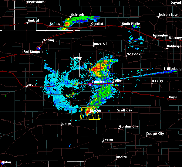 At 707 pm cdt, a severe thunderstorm was located near bird city, or 13 miles east of st. francis, and is nearly stationary (radar indicated). Hazards include 60 mph wind gusts and quarter size hail. Hail damage to vehicles is expected. expect wind damage to roofs, siding, and trees. Locations impacted include, bird city, mcdonald, beardsley and wheeler. At 707 pm cdt, a severe thunderstorm was located near bird city, or 13 miles east of st. francis, and is nearly stationary (radar indicated). Hazards include 60 mph wind gusts and quarter size hail. Hail damage to vehicles is expected. expect wind damage to roofs, siding, and trees. Locations impacted include, bird city, mcdonald, beardsley and wheeler.
|
| 8/8/2020 6:49 PM CDT |
 At 647 pm cdt, a severe thunderstorm was located 6 miles north of bird city, or 14 miles east of st. francis, moving northeast at 5 mph (this storm produced golf ball size hail a few miles east of st. francis around 535 pm mdt). Hazards include golf ball size hail and 70 mph wind gusts. People and animals outdoors will be injured. expect hail damage to roofs, siding, windows, and vehicles. expect considerable tree damage. wind damage is also likely to mobile homes, roofs, and outbuildings. locations impacted include, st. Francis, bird city, mcdonald, beardsley and wheeler. At 647 pm cdt, a severe thunderstorm was located 6 miles north of bird city, or 14 miles east of st. francis, moving northeast at 5 mph (this storm produced golf ball size hail a few miles east of st. francis around 535 pm mdt). Hazards include golf ball size hail and 70 mph wind gusts. People and animals outdoors will be injured. expect hail damage to roofs, siding, windows, and vehicles. expect considerable tree damage. wind damage is also likely to mobile homes, roofs, and outbuildings. locations impacted include, st. Francis, bird city, mcdonald, beardsley and wheeler.
|
| 8/8/2020 6:32 PM CDT |
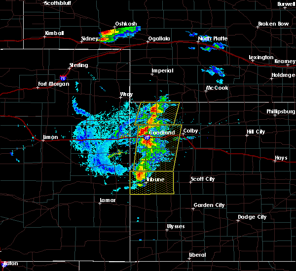 At 631 pm cdt, a severe thunderstorm was located 6 miles northwest of bird city, or 11 miles northeast of st. francis, moving northeast at 10 mph (radar indicated). Hazards include 70 mph wind gusts and quarter size hail. Hail damage to vehicles is expected. expect considerable tree damage. wind damage is also likely to mobile homes, roofs, and outbuildings. locations impacted include, st. Francis, bird city, mcdonald, beardsley and wheeler. At 631 pm cdt, a severe thunderstorm was located 6 miles northwest of bird city, or 11 miles northeast of st. francis, moving northeast at 10 mph (radar indicated). Hazards include 70 mph wind gusts and quarter size hail. Hail damage to vehicles is expected. expect considerable tree damage. wind damage is also likely to mobile homes, roofs, and outbuildings. locations impacted include, st. Francis, bird city, mcdonald, beardsley and wheeler.
|
| 8/8/2020 6:18 PM CDT |
 At 617 pm cdt, a severe thunderstorm was located 6 miles northwest of bird city, or 9 miles east of st. francis, and is nearly stationary (radar indicated). Hazards include golf ball size hail and 70 mph wind gusts. People and animals outdoors will be injured. expect hail damage to roofs, siding, windows, and vehicles. expect considerable tree damage. wind damage is also likely to mobile homes, roofs, and outbuildings. locations impacted include, st. Francis, bird city, mcdonald, beardsley and wheeler. At 617 pm cdt, a severe thunderstorm was located 6 miles northwest of bird city, or 9 miles east of st. francis, and is nearly stationary (radar indicated). Hazards include golf ball size hail and 70 mph wind gusts. People and animals outdoors will be injured. expect hail damage to roofs, siding, windows, and vehicles. expect considerable tree damage. wind damage is also likely to mobile homes, roofs, and outbuildings. locations impacted include, st. Francis, bird city, mcdonald, beardsley and wheeler.
|
| 8/8/2020 6:04 PM CDT |
 At 603 pm cdt, a severe thunderstorm was located 13 miles northeast of goodland, moving northeast at 25 mph (this storm has a history of producing quarter to golf ball size hail and wind gusts up to 65 mph). Hazards include 70 mph wind gusts and quarter size hail. Hail damage to vehicles is expected. expect considerable tree damage. Wind damage is also likely to mobile homes, roofs, and outbuildings. At 603 pm cdt, a severe thunderstorm was located 13 miles northeast of goodland, moving northeast at 25 mph (this storm has a history of producing quarter to golf ball size hail and wind gusts up to 65 mph). Hazards include 70 mph wind gusts and quarter size hail. Hail damage to vehicles is expected. expect considerable tree damage. Wind damage is also likely to mobile homes, roofs, and outbuildings.
|
| 8/5/2020 9:10 PM CDT | Public reported 60mph wind gus in rawlins county KS, 0.4 miles S of McDonald, KS |
| 7/20/2020 9:46 PM CDT |
 At 944 pm cdt, severe thunderstorms were located along a line extending from 6 miles north of selden to 10 miles north of kanorado, moving south at 30 mph (these storms have a history of producing quarter size hail and damaging winds). Hazards include 60 mph wind gusts and quarter size hail. Hail damage to vehicles is expected. expect wind damage to roofs, siding, and trees. locations impacted include, st. Francis, atwood, bird city, mcdonald, ludell, blakeman and beardsley. At 944 pm cdt, severe thunderstorms were located along a line extending from 6 miles north of selden to 10 miles north of kanorado, moving south at 30 mph (these storms have a history of producing quarter size hail and damaging winds). Hazards include 60 mph wind gusts and quarter size hail. Hail damage to vehicles is expected. expect wind damage to roofs, siding, and trees. locations impacted include, st. Francis, atwood, bird city, mcdonald, ludell, blakeman and beardsley.
|
| 7/20/2020 9:28 PM CDT |
 At 926 pm cdt, severe thunderstorms were located along a line extending from 4 miles southwest of oberlin to 7 miles east of bonny reservoir, moving south at 35 mph (these storms have a history of producing quarter size hail and damaging winds). Hazards include 60 mph wind gusts and quarter size hail. Hail damage to vehicles is expected. expect wind damage to roofs, siding, and trees. locations impacted include, oberlin, st. Francis, atwood, bird city, mcdonald, norcatur and herndon. At 926 pm cdt, severe thunderstorms were located along a line extending from 4 miles southwest of oberlin to 7 miles east of bonny reservoir, moving south at 35 mph (these storms have a history of producing quarter size hail and damaging winds). Hazards include 60 mph wind gusts and quarter size hail. Hail damage to vehicles is expected. expect wind damage to roofs, siding, and trees. locations impacted include, oberlin, st. Francis, atwood, bird city, mcdonald, norcatur and herndon.
|
| 7/20/2020 9:17 PM CDT |
 At 815 pm mdt/915 pm cdt/, severe thunderstorms were located along a line extending from 5 miles northwest of oberlin to 10 miles northeast of bonny reservoir, moving south at 30 mph (these storms have a history of producing quarter size hail and damaging winds). Hazards include 60 mph wind gusts and quarter size hail. Hail damage to vehicles is expected. expect wind damage to roofs, siding, and trees. locations impacted include, oberlin, st. Francis, atwood, benkelman, bird city, mcdonald and haigler. At 815 pm mdt/915 pm cdt/, severe thunderstorms were located along a line extending from 5 miles northwest of oberlin to 10 miles northeast of bonny reservoir, moving south at 30 mph (these storms have a history of producing quarter size hail and damaging winds). Hazards include 60 mph wind gusts and quarter size hail. Hail damage to vehicles is expected. expect wind damage to roofs, siding, and trees. locations impacted include, oberlin, st. Francis, atwood, benkelman, bird city, mcdonald and haigler.
|
| 7/20/2020 9:09 PM CDT |
 At 808 pm mdt/908 pm cdt/, severe thunderstorms were located along a line extending from 8 miles northwest of oberlin to 12 miles west of st. francis, moving south at 25 mph (these storms have a history of producing quarter size hail and damaging winds). Hazards include 60 mph wind gusts and quarter size hail. Hail damage to vehicles is expected. expect wind damage to roofs, siding, and trees. locations impacted include, oberlin, st. Francis, atwood, benkelman, trenton, bird city and stratton. At 808 pm mdt/908 pm cdt/, severe thunderstorms were located along a line extending from 8 miles northwest of oberlin to 12 miles west of st. francis, moving south at 25 mph (these storms have a history of producing quarter size hail and damaging winds). Hazards include 60 mph wind gusts and quarter size hail. Hail damage to vehicles is expected. expect wind damage to roofs, siding, and trees. locations impacted include, oberlin, st. Francis, atwood, benkelman, trenton, bird city and stratton.
|
| 7/20/2020 8:48 PM CDT |
 At 746 pm mdt/846 pm cdt/, severe thunderstorms were located along a line extending from 6 miles west of danbury to 7 miles southwest of haigler, moving south at 25 mph (these storms have a history of producing quarter size hail and damaging winds). Hazards include 60 mph wind gusts and quarter size hail. Hail damage to vehicles is expected. expect wind damage to roofs, siding, and trees. locations impacted include, mccook, oberlin, st. Francis, atwood, benkelman, trenton and culbertson. At 746 pm mdt/846 pm cdt/, severe thunderstorms were located along a line extending from 6 miles west of danbury to 7 miles southwest of haigler, moving south at 25 mph (these storms have a history of producing quarter size hail and damaging winds). Hazards include 60 mph wind gusts and quarter size hail. Hail damage to vehicles is expected. expect wind damage to roofs, siding, and trees. locations impacted include, mccook, oberlin, st. Francis, atwood, benkelman, trenton and culbertson.
|
| 7/20/2020 8:29 PM CDT |
 At 729 pm mdt/829 pm cdt/, severe thunderstorms were located along a line extending from 4 miles northeast of mccook to 5 miles northwest of haigler, moving south at 25 mph (these storms have a history of producing quarter size hail and damaging winds). Hazards include 60 mph wind gusts and quarter size hail. Hail damage to vehicles is expected. Expect wind damage to roofs, siding, and trees. At 729 pm mdt/829 pm cdt/, severe thunderstorms were located along a line extending from 4 miles northeast of mccook to 5 miles northwest of haigler, moving south at 25 mph (these storms have a history of producing quarter size hail and damaging winds). Hazards include 60 mph wind gusts and quarter size hail. Hail damage to vehicles is expected. Expect wind damage to roofs, siding, and trees.
|
| 7/19/2020 9:45 PM CDT |
 At 845 pm mdt/945 pm cdt/, severe thunderstorms were located along a line extending from 11 miles northwest of atwood to 9 miles northeast of st. francis, moving southeast at 30 mph (radar indicated). Hazards include 60 mph wind gusts. Expect damage to roofs, siding, and trees. locations impacted include, st. Francis, atwood, benkelman, bird city, stratton, mcdonald and ludell. At 845 pm mdt/945 pm cdt/, severe thunderstorms were located along a line extending from 11 miles northwest of atwood to 9 miles northeast of st. francis, moving southeast at 30 mph (radar indicated). Hazards include 60 mph wind gusts. Expect damage to roofs, siding, and trees. locations impacted include, st. Francis, atwood, benkelman, bird city, stratton, mcdonald and ludell.
|
| 7/19/2020 9:23 PM CDT |
 At 823 pm mdt/923 pm cdt/, severe thunderstorms were located along a line extending from 9 miles east of benkelman to 5 miles east of haigler, moving southeast at 30 mph (radar indicated). Hazards include 70 mph wind gusts and nickel size hail. Expect considerable tree damage. damage is likely to mobile homes, roofs, and outbuildings. locations impacted include, st. Francis, atwood, benkelman, bird city, stratton, mcdonald and haigler. At 823 pm mdt/923 pm cdt/, severe thunderstorms were located along a line extending from 9 miles east of benkelman to 5 miles east of haigler, moving southeast at 30 mph (radar indicated). Hazards include 70 mph wind gusts and nickel size hail. Expect considerable tree damage. damage is likely to mobile homes, roofs, and outbuildings. locations impacted include, st. Francis, atwood, benkelman, bird city, stratton, mcdonald and haigler.
|
| 7/19/2020 9:11 PM CDT |
 At 810 pm mdt/910 pm cdt/, severe thunderstorms were located along a line extending from 8 miles west of stratton to near haigler, moving southeast at 25 mph (radar indicated). Hazards include 70 mph wind gusts and nickel size hail. Expect considerable tree damage. damage is likely to mobile homes, roofs, and outbuildings. locations impacted include, st. Francis, atwood, benkelman, bird city, stratton, mcdonald and haigler. At 810 pm mdt/910 pm cdt/, severe thunderstorms were located along a line extending from 8 miles west of stratton to near haigler, moving southeast at 25 mph (radar indicated). Hazards include 70 mph wind gusts and nickel size hail. Expect considerable tree damage. damage is likely to mobile homes, roofs, and outbuildings. locations impacted include, st. Francis, atwood, benkelman, bird city, stratton, mcdonald and haigler.
|
| 7/19/2020 8:55 PM CDT |
 At 754 pm mdt/854 pm cdt/, severe thunderstorms were located along a line extending from 8 miles north of benkelman to 4 miles northwest of haigler, moving southeast at 35 mph (radar indicated). Hazards include 70 mph wind gusts and nickel size hail. Expect considerable tree damage. Damage is likely to mobile homes, roofs, and outbuildings. At 754 pm mdt/854 pm cdt/, severe thunderstorms were located along a line extending from 8 miles north of benkelman to 4 miles northwest of haigler, moving southeast at 35 mph (radar indicated). Hazards include 70 mph wind gusts and nickel size hail. Expect considerable tree damage. Damage is likely to mobile homes, roofs, and outbuildings.
|
| 7/13/2020 10:04 PM CDT |
 At 1004 pm cdt, severe thunderstorms were located along a line extending from 6 miles northwest of culbertson to 7 miles north of ludell to 7 miles south of mcdonald, moving east at 45 mph (trained weather spotters. at 948 pm cdt, a 62 mph wind gust was reported in trenton). Hazards include 60 mph wind gusts and quarter size hail. Hail damage to vehicles is expected. expect wind damage to roofs, siding, and trees. Locations impacted include, atwood, trenton, culbertson, stratton, mcdonald, herndon and ludell. At 1004 pm cdt, severe thunderstorms were located along a line extending from 6 miles northwest of culbertson to 7 miles north of ludell to 7 miles south of mcdonald, moving east at 45 mph (trained weather spotters. at 948 pm cdt, a 62 mph wind gust was reported in trenton). Hazards include 60 mph wind gusts and quarter size hail. Hail damage to vehicles is expected. expect wind damage to roofs, siding, and trees. Locations impacted include, atwood, trenton, culbertson, stratton, mcdonald, herndon and ludell.
|
| 7/13/2020 10:00 PM CDT |
 At 1000 pm cdt, severe thunderstorms were located along a line extending from 7 miles southeast of palisade to 7 miles north of ludell to 7 miles south of mcdonald, moving east at 45 mph (radar indicated). Hazards include 60 mph wind gusts and quarter size hail. Hail damage to vehicles is expected. expect wind damage to roofs, siding, and trees. Locations impacted include, atwood, trenton, culbertson, stratton, mcdonald, herndon and ludell. At 1000 pm cdt, severe thunderstorms were located along a line extending from 7 miles southeast of palisade to 7 miles north of ludell to 7 miles south of mcdonald, moving east at 45 mph (radar indicated). Hazards include 60 mph wind gusts and quarter size hail. Hail damage to vehicles is expected. expect wind damage to roofs, siding, and trees. Locations impacted include, atwood, trenton, culbertson, stratton, mcdonald, herndon and ludell.
|
| 7/13/2020 9:38 PM CDT |
 At 937 pm cdt, severe thunderstorms were located along a line extending from 8 miles southwest of palisade to 11 miles north of mcdonald to 9 miles southwest of bird city, moving east at 45 mph (law enforcement. at 921 pm cdt, a 58 mph wind gust was reported in benkelman). Hazards include 60 mph wind gusts and quarter size hail. Hail damage to vehicles is expected. expect wind damage to roofs, siding, and trees. Locations impacted include, atwood, trenton, culbertson, palisade, stratton, mcdonald and herndon. At 937 pm cdt, severe thunderstorms were located along a line extending from 8 miles southwest of palisade to 11 miles north of mcdonald to 9 miles southwest of bird city, moving east at 45 mph (law enforcement. at 921 pm cdt, a 58 mph wind gust was reported in benkelman). Hazards include 60 mph wind gusts and quarter size hail. Hail damage to vehicles is expected. expect wind damage to roofs, siding, and trees. Locations impacted include, atwood, trenton, culbertson, palisade, stratton, mcdonald and herndon.
|
| 7/13/2020 9:34 PM CDT |
 At 933 pm cdt, severe thunderstorms were located along a line extending from 9 miles southeast of wauneta to 10 miles north of mcdonald to 8 miles southeast of st. francis, moving east at 45 mph (law enforcement. at 921 pm cdt, a 58 mph wind gust was reported in benkelman). Hazards include 60 mph wind gusts and quarter size hail. Hail damage to vehicles is expected. Expect wind damage to roofs, siding, and trees. At 933 pm cdt, severe thunderstorms were located along a line extending from 9 miles southeast of wauneta to 10 miles north of mcdonald to 8 miles southeast of st. francis, moving east at 45 mph (law enforcement. at 921 pm cdt, a 58 mph wind gust was reported in benkelman). Hazards include 60 mph wind gusts and quarter size hail. Hail damage to vehicles is expected. Expect wind damage to roofs, siding, and trees.
|
| 7/8/2020 9:14 PM CDT |
 At 813 pm mdt/913 pm cdt/, severe thunderstorms were located along a line extending from 7 miles northeast of stockville to 5 miles north of mccook to 11 miles northwest of ludell to 10 miles northwest of bird city, moving southeast at 30 mph (radar indicated). Hazards include 60 mph wind gusts and quarter size hail. Hail damage to vehicles is expected. Expect wind damage to roofs, siding, and trees. At 813 pm mdt/913 pm cdt/, severe thunderstorms were located along a line extending from 7 miles northeast of stockville to 5 miles north of mccook to 11 miles northwest of ludell to 10 miles northwest of bird city, moving southeast at 30 mph (radar indicated). Hazards include 60 mph wind gusts and quarter size hail. Hail damage to vehicles is expected. Expect wind damage to roofs, siding, and trees.
|
| 7/2/2020 7:26 PM CDT |
 At 725 pm cdt, severe thunderstorms were located along a line extending from indianola to near hoxie, moving east at 40 mph (trained weather spotters). Hazards include 70 mph wind gusts and quarter size hail. Hail damage to vehicles is expected. expect considerable tree damage. wind damage is also likely to mobile homes, roofs, and outbuildings. locations impacted include, mccook, colby, oberlin, hoxie, atwood, trenton and brewster. People attending downtown atwood should seek safe shelter immediately! this includes interstate 70 in kansas between mile markers 36 and 74. At 725 pm cdt, severe thunderstorms were located along a line extending from indianola to near hoxie, moving east at 40 mph (trained weather spotters). Hazards include 70 mph wind gusts and quarter size hail. Hail damage to vehicles is expected. expect considerable tree damage. wind damage is also likely to mobile homes, roofs, and outbuildings. locations impacted include, mccook, colby, oberlin, hoxie, atwood, trenton and brewster. People attending downtown atwood should seek safe shelter immediately! this includes interstate 70 in kansas between mile markers 36 and 74.
|
| 7/2/2020 7:03 PM CDT |
 At 703 pm cdt, severe thunderstorms were located along a line extending from 8 miles north of culbertson to near levant, moving east at 40 mph (trained weather spotters). Hazards include 70 mph wind gusts and quarter size hail. Hail damage to vehicles is expected. expect considerable tree damage. wind damage is also likely to mobile homes, roofs, and outbuildings. locations impacted include, mccook, colby, oberlin, hoxie, atwood, trenton and brewster. This includes interstate 70 in kansas between mile markers 36 and 74. At 703 pm cdt, severe thunderstorms were located along a line extending from 8 miles north of culbertson to near levant, moving east at 40 mph (trained weather spotters). Hazards include 70 mph wind gusts and quarter size hail. Hail damage to vehicles is expected. expect considerable tree damage. wind damage is also likely to mobile homes, roofs, and outbuildings. locations impacted include, mccook, colby, oberlin, hoxie, atwood, trenton and brewster. This includes interstate 70 in kansas between mile markers 36 and 74.
|
| 7/2/2020 6:51 PM CDT |
 At 551 pm mdt/651 pm cdt/, severe thunderstorms were located along a line extending from 9 miles northwest of culbertson to 3 miles east of brewster, moving east at 40 mph (storm chaser 2 miles south of culbertson). Hazards include 74 mph wind gusts. Expect considerable tree damage. damage is likely to mobile homes, roofs, and outbuildings. locations impacted include, mccook, colby, oberlin, hoxie, atwood, trenton and brewster. This includes interstate 70 in kansas between mile markers 22 and 74. At 551 pm mdt/651 pm cdt/, severe thunderstorms were located along a line extending from 9 miles northwest of culbertson to 3 miles east of brewster, moving east at 40 mph (storm chaser 2 miles south of culbertson). Hazards include 74 mph wind gusts. Expect considerable tree damage. damage is likely to mobile homes, roofs, and outbuildings. locations impacted include, mccook, colby, oberlin, hoxie, atwood, trenton and brewster. This includes interstate 70 in kansas between mile markers 22 and 74.
|
| 7/2/2020 6:49 PM CDT |
 At 548 pm mdt/648 pm cdt/, severe thunderstorms were located along a line extending from 9 miles east of palisade to near brewster, moving east at 40 mph (mesonet). Hazards include 63 mph wind gusts measured six miles north of ludell. Expect damage to roofs, siding, and trees. locations impacted include, mccook, colby, oberlin, hoxie, atwood, trenton and brewster. This includes interstate 70 in kansas between mile markers 22 and 74. At 548 pm mdt/648 pm cdt/, severe thunderstorms were located along a line extending from 9 miles east of palisade to near brewster, moving east at 40 mph (mesonet). Hazards include 63 mph wind gusts measured six miles north of ludell. Expect damage to roofs, siding, and trees. locations impacted include, mccook, colby, oberlin, hoxie, atwood, trenton and brewster. This includes interstate 70 in kansas between mile markers 22 and 74.
|
| 7/2/2020 6:43 PM CDT |
 At 543 pm mdt/643 pm cdt/, severe thunderstorms were located along a line extending from 7 miles east of palisade to near brewster, moving east at 40 mph (radar indicated). Hazards include 70 mph wind gusts and half dollar size hail. Hail damage to vehicles is expected. expect considerable tree damage. Wind damage is also likely to mobile homes, roofs, and outbuildings. At 543 pm mdt/643 pm cdt/, severe thunderstorms were located along a line extending from 7 miles east of palisade to near brewster, moving east at 40 mph (radar indicated). Hazards include 70 mph wind gusts and half dollar size hail. Hail damage to vehicles is expected. expect considerable tree damage. Wind damage is also likely to mobile homes, roofs, and outbuildings.
|
| 7/2/2020 6:26 PM CDT |
 At 525 pm mdt/625 pm cdt/, severe thunderstorms were located along a line extending from 3 miles east of palisade to 13 miles south of mcdonald, moving east at 30 mph (radar indicated). Hazards include 70 mph wind gusts and quarter size hail. Hail damage to vehicles is expected. expect considerable tree damage. wind damage is also likely to mobile homes, roofs, and outbuildings. Locations impacted include, atwood, benkelman, trenton, culbertson, bird city, palisade and stratton. At 525 pm mdt/625 pm cdt/, severe thunderstorms were located along a line extending from 3 miles east of palisade to 13 miles south of mcdonald, moving east at 30 mph (radar indicated). Hazards include 70 mph wind gusts and quarter size hail. Hail damage to vehicles is expected. expect considerable tree damage. wind damage is also likely to mobile homes, roofs, and outbuildings. Locations impacted include, atwood, benkelman, trenton, culbertson, bird city, palisade and stratton.
|
| 7/2/2020 6:06 PM CDT |
 At 505 pm mdt/605 pm cdt/, severe thunderstorms were located along a line extending from 6 miles west of palisade to 11 miles south of bird city, moving east at 30 mph (radar indicated). Hazards include 70 mph wind gusts and quarter size hail. Hail damage to vehicles is expected. expect considerable tree damage. wind damage is also likely to mobile homes, roofs, and outbuildings. Locations impacted include, atwood, benkelman, trenton, culbertson, bird city, palisade and stratton. At 505 pm mdt/605 pm cdt/, severe thunderstorms were located along a line extending from 6 miles west of palisade to 11 miles south of bird city, moving east at 30 mph (radar indicated). Hazards include 70 mph wind gusts and quarter size hail. Hail damage to vehicles is expected. expect considerable tree damage. wind damage is also likely to mobile homes, roofs, and outbuildings. Locations impacted include, atwood, benkelman, trenton, culbertson, bird city, palisade and stratton.
|
| 7/2/2020 5:51 PM CDT |
 At 451 pm mdt/551 pm cdt/, severe thunderstorms were located along a line extending from 4 miles southeast of wauneta to 13 miles southeast of st. francis, moving east at 30 mph (radar indicated). Hazards include 70 mph wind gusts and half dollar size hail. Hail damage to vehicles is expected. expect considerable tree damage. Wind damage is also likely to mobile homes, roofs, and outbuildings. At 451 pm mdt/551 pm cdt/, severe thunderstorms were located along a line extending from 4 miles southeast of wauneta to 13 miles southeast of st. francis, moving east at 30 mph (radar indicated). Hazards include 70 mph wind gusts and half dollar size hail. Hail damage to vehicles is expected. expect considerable tree damage. Wind damage is also likely to mobile homes, roofs, and outbuildings.
|
| 6/27/2020 8:50 PM MDT |
 At 850 pm mdt/950 pm cdt/, severe thunderstorms were located along a line extending from mcdonald to 10 miles south of brewster, moving east at 50 mph (radar indicated). Hazards include 60 mph wind gusts and quarter size hail. Hail damage to vehicles is expected. expect wind damage to roofs, siding, and trees. locations impacted include, brewster, levant, bird city, mcdonald, blakeman, edson and beardsley. This includes interstate 70 in kansas between mile markers 27 and 51. At 850 pm mdt/950 pm cdt/, severe thunderstorms were located along a line extending from mcdonald to 10 miles south of brewster, moving east at 50 mph (radar indicated). Hazards include 60 mph wind gusts and quarter size hail. Hail damage to vehicles is expected. expect wind damage to roofs, siding, and trees. locations impacted include, brewster, levant, bird city, mcdonald, blakeman, edson and beardsley. This includes interstate 70 in kansas between mile markers 27 and 51.
|
| 6/27/2020 8:28 PM MDT |
 At 827 pm mdt/927 pm cdt/, severe thunderstorms were located along a line extending from 6 miles west of bird city to 13 miles south of goodland, moving east at 40 mph (radar indicated). Hazards include 60 mph wind gusts and quarter size hail. Hail damage to vehicles is expected. Expect wind damage to roofs, siding, and trees. At 827 pm mdt/927 pm cdt/, severe thunderstorms were located along a line extending from 6 miles west of bird city to 13 miles south of goodland, moving east at 40 mph (radar indicated). Hazards include 60 mph wind gusts and quarter size hail. Hail damage to vehicles is expected. Expect wind damage to roofs, siding, and trees.
|
| 6/25/2020 5:58 PM CDT |
 At 458 pm mdt/558 pm cdt/, severe thunderstorms were located along a line extending from 5 miles south of benkelman to 7 miles northwest of bird city to 6 miles southeast of st. francis to 9 miles east of bonny reservoir, moving east at 20 mph (radar indicated). Hazards include 60 mph wind gusts and blowing dust. expect damage to roofs, siding, and trees At 458 pm mdt/558 pm cdt/, severe thunderstorms were located along a line extending from 5 miles south of benkelman to 7 miles northwest of bird city to 6 miles southeast of st. francis to 9 miles east of bonny reservoir, moving east at 20 mph (radar indicated). Hazards include 60 mph wind gusts and blowing dust. expect damage to roofs, siding, and trees
|
| 6/4/2020 5:48 PM MDT |
 At 546 pm mdt/646 pm cdt/, severe thunderstorms were located along a line extending from 7 miles southwest of stratton to 10 miles south of mcdonald to 15 miles northwest of levant to 8 miles west of brewster to 8 miles south of goodland, moving east at 45 mph (trained weather spotters). Hazards include 60 mph wind gusts. visibilities as low as 20 feet have been reported. Expect damage to roofs, siding, and trees. locations impacted include, goodland, atwood, trenton, brewster, ruleton, levant and bird city. This includes interstate 70 in kansas between mile markers 3 and 48. At 546 pm mdt/646 pm cdt/, severe thunderstorms were located along a line extending from 7 miles southwest of stratton to 10 miles south of mcdonald to 15 miles northwest of levant to 8 miles west of brewster to 8 miles south of goodland, moving east at 45 mph (trained weather spotters). Hazards include 60 mph wind gusts. visibilities as low as 20 feet have been reported. Expect damage to roofs, siding, and trees. locations impacted include, goodland, atwood, trenton, brewster, ruleton, levant and bird city. This includes interstate 70 in kansas between mile markers 3 and 48.
|
| 6/4/2020 6:36 PM CDT | Vis reduced to 20 to 30 ft due to blowing dust. winds est 50 to 60 mp in rawlins county KS, 0.4 miles S of McDonald, KS |
| 6/4/2020 6:30 PM CDT |
 At 530 pm mdt/630 pm cdt/, severe thunderstorms were located along a line extending from 3 miles northeast of benkelman to 5 miles south of bird city to 4 miles north of goodland to 6 miles south of ruleton, moving east at 45 mph (trained weather spotters). Hazards include 60 mph wind gusts. Expect damage to roofs, siding, and trees. locations impacted include, goodland, burlington, st. francis, atwood, benkelman, trenton and brewster. this includes the following highways, interstate 70 in kansas between mile markers 0 and 48. interstate 70 in colorado between mile markers 430 and 450. Highway 385 between mile markers 183 and 193. At 530 pm mdt/630 pm cdt/, severe thunderstorms were located along a line extending from 3 miles northeast of benkelman to 5 miles south of bird city to 4 miles north of goodland to 6 miles south of ruleton, moving east at 45 mph (trained weather spotters). Hazards include 60 mph wind gusts. Expect damage to roofs, siding, and trees. locations impacted include, goodland, burlington, st. francis, atwood, benkelman, trenton and brewster. this includes the following highways, interstate 70 in kansas between mile markers 0 and 48. interstate 70 in colorado between mile markers 430 and 450. Highway 385 between mile markers 183 and 193.
|
| 6/4/2020 5:57 PM CDT |
 At 457 pm mdt/557 pm cdt/, severe thunderstorms were located along a line extending from 11 miles north of haigler to 5 miles west of st. francis to 9 miles southeast of bonny reservoir to near burlington, moving east at 45 mph (radar indicated). Hazards include 60 mph wind gusts. expect damage to roofs, siding, and trees At 457 pm mdt/557 pm cdt/, severe thunderstorms were located along a line extending from 11 miles north of haigler to 5 miles west of st. francis to 9 miles southeast of bonny reservoir to near burlington, moving east at 45 mph (radar indicated). Hazards include 60 mph wind gusts. expect damage to roofs, siding, and trees
|
| 6/4/2020 5:57 PM CDT |
 The national weather service in goodland has issued a * severe thunderstorm warning for. southeastern yuma county in northeastern colorado. northeastern kit carson county in east central colorado. cheyenne county in northwestern kansas. Northwestern thomas county in northwestern kansas. The national weather service in goodland has issued a * severe thunderstorm warning for. southeastern yuma county in northeastern colorado. northeastern kit carson county in east central colorado. cheyenne county in northwestern kansas. Northwestern thomas county in northwestern kansas.
|
| 6/3/2020 6:54 PM CDT |
 At 554 pm mdt/654 pm cdt/, severe thunderstorms were located along a line extending from 7 miles south of benkelman to 4 miles northeast of st. francis to 13 miles north of bonny reservoir, moving southeast at 45 mph (radar indicated). Hazards include 60 mph wind gusts and penny size hail. Expect damage to roofs, siding, and trees. locations impacted include, st. francis, bonny reservoir, bird city, mcdonald, hale, blakeman and beardsley. This includes highway 385 between mile markers 216 and 226. At 554 pm mdt/654 pm cdt/, severe thunderstorms were located along a line extending from 7 miles south of benkelman to 4 miles northeast of st. francis to 13 miles north of bonny reservoir, moving southeast at 45 mph (radar indicated). Hazards include 60 mph wind gusts and penny size hail. Expect damage to roofs, siding, and trees. locations impacted include, st. francis, bonny reservoir, bird city, mcdonald, hale, blakeman and beardsley. This includes highway 385 between mile markers 216 and 226.
|
| 6/3/2020 6:34 PM CDT |
 At 532 pm mdt/632 pm cdt/, severe thunderstorms were located along a line extending from 10 miles east of haigler to 8 miles southeast of wray to 18 miles southeast of eckley, moving southeast at 40 mph (radar indicated). Hazards include 60 mph wind gusts and quarter size hail. Hail damage to vehicles is expected. Expect wind damage to roofs, siding, and trees. At 532 pm mdt/632 pm cdt/, severe thunderstorms were located along a line extending from 10 miles east of haigler to 8 miles southeast of wray to 18 miles southeast of eckley, moving southeast at 40 mph (radar indicated). Hazards include 60 mph wind gusts and quarter size hail. Hail damage to vehicles is expected. Expect wind damage to roofs, siding, and trees.
|
| 8/11/2019 8:21 PM CDT |
 At 721 pm mdt/821 pm cdt/, severe thunderstorms were located along a line extending from 3 miles northeast of mcdonald to 3 miles north of bird city, moving northeast at 25 mph (radar indicated). Hazards include 70 mph wind gusts and ping pong ball size hail. People and animals outdoors will be injured. expect hail damage to roofs, siding, windows, and vehicles. expect considerable tree damage. Wind damage is also likely to mobile homes, roofs, and outbuildings. At 721 pm mdt/821 pm cdt/, severe thunderstorms were located along a line extending from 3 miles northeast of mcdonald to 3 miles north of bird city, moving northeast at 25 mph (radar indicated). Hazards include 70 mph wind gusts and ping pong ball size hail. People and animals outdoors will be injured. expect hail damage to roofs, siding, windows, and vehicles. expect considerable tree damage. Wind damage is also likely to mobile homes, roofs, and outbuildings.
|
| 8/11/2019 8:21 PM CDT |
 The national weather service in goodland has issued a * severe thunderstorm warning for. cheyenne county in northwestern kansas. western rawlins county in northwestern kansas. southwestern hitchcock county in southwestern nebraska. Southeastern dundy county in southwestern nebraska. The national weather service in goodland has issued a * severe thunderstorm warning for. cheyenne county in northwestern kansas. western rawlins county in northwestern kansas. southwestern hitchcock county in southwestern nebraska. Southeastern dundy county in southwestern nebraska.
|
| 7/1/2019 6:40 PM CDT | Storm damage reported in rawlins county KS, 0.3 miles N of McDonald, KS |
| 7/1/2019 6:20 PM CDT |
 At 520 pm mdt/620 pm cdt/, severe thunderstorms were located along a line extending from 9 miles southeast of mcdonald to 12 miles north of brewster to 5 miles north of goodland, moving northeast at 5 mph (radar indicated). Hazards include 60 mph wind gusts and quarter size hail. Hail damage to vehicles is expected. expect wind damage to roofs, siding, and trees. locations impacted include, goodland, bird city, mcdonald, edson and beardsley. This includes interstate 70 in kansas between mile markers 14 and 31. At 520 pm mdt/620 pm cdt/, severe thunderstorms were located along a line extending from 9 miles southeast of mcdonald to 12 miles north of brewster to 5 miles north of goodland, moving northeast at 5 mph (radar indicated). Hazards include 60 mph wind gusts and quarter size hail. Hail damage to vehicles is expected. expect wind damage to roofs, siding, and trees. locations impacted include, goodland, bird city, mcdonald, edson and beardsley. This includes interstate 70 in kansas between mile markers 14 and 31.
|
| 7/1/2019 6:03 PM CDT |
 At 502 pm mdt/602 pm cdt/, severe thunderstorms were located along a line extending from 5 miles southeast of mcdonald to 7 miles northeast of goodland, moving northeast at 20 mph (trained weather spotters. at 555 pm cdt, 455 pm mdt, a 62 mph wind gust was reported 11 miles north northeast of goodland). Hazards include 60 mph wind gusts and quarter size hail. Hail damage to vehicles is expected. expect wind damage to roofs, siding, and trees. locations impacted include, goodland, bird city, mcdonald, edson and beardsley. This includes interstate 70 in kansas between mile markers 14 and 31. At 502 pm mdt/602 pm cdt/, severe thunderstorms were located along a line extending from 5 miles southeast of mcdonald to 7 miles northeast of goodland, moving northeast at 20 mph (trained weather spotters. at 555 pm cdt, 455 pm mdt, a 62 mph wind gust was reported 11 miles north northeast of goodland). Hazards include 60 mph wind gusts and quarter size hail. Hail damage to vehicles is expected. expect wind damage to roofs, siding, and trees. locations impacted include, goodland, bird city, mcdonald, edson and beardsley. This includes interstate 70 in kansas between mile markers 14 and 31.
|
| 7/1/2019 5:56 PM CDT |
 At 456 pm mdt/556 pm cdt/, severe thunderstorms were located along a line extending from 5 miles southeast of mcdonald to 6 miles northeast of goodland, moving northeast at 20 mph (radar indicated). Hazards include 60 mph wind gusts and quarter size hail. Hail damage to vehicles is expected. Expect wind damage to roofs, siding, and trees. At 456 pm mdt/556 pm cdt/, severe thunderstorms were located along a line extending from 5 miles southeast of mcdonald to 6 miles northeast of goodland, moving northeast at 20 mph (radar indicated). Hazards include 60 mph wind gusts and quarter size hail. Hail damage to vehicles is expected. Expect wind damage to roofs, siding, and trees.
|
| 7/1/2019 5:47 PM CDT |
 At 547 pm cdt, a severe thunderstorm was located 4 miles southeast of mcdonald, or 15 miles west of atwood, moving northeast at 15 mph (radar indicated). Hazards include ping pong ball size hail and 60 mph wind gusts. People and animals outdoors will be injured. expect hail damage to roofs, siding, windows, and vehicles. expect wind damage to roofs, siding, and trees. Locations impacted include, atwood, mcdonald, blakeman and beardsley. At 547 pm cdt, a severe thunderstorm was located 4 miles southeast of mcdonald, or 15 miles west of atwood, moving northeast at 15 mph (radar indicated). Hazards include ping pong ball size hail and 60 mph wind gusts. People and animals outdoors will be injured. expect hail damage to roofs, siding, windows, and vehicles. expect wind damage to roofs, siding, and trees. Locations impacted include, atwood, mcdonald, blakeman and beardsley.
|
| 7/1/2019 5:36 PM CDT |
 At 536 pm cdt, a severe thunderstorm was located 6 miles south of mcdonald, or 17 miles southwest of atwood, moving northeast at 15 mph (radar indicated). Hazards include 60 mph wind gusts and half dollar size hail. Hail damage to vehicles is expected. Expect wind damage to roofs, siding, and trees. At 536 pm cdt, a severe thunderstorm was located 6 miles south of mcdonald, or 17 miles southwest of atwood, moving northeast at 15 mph (radar indicated). Hazards include 60 mph wind gusts and half dollar size hail. Hail damage to vehicles is expected. Expect wind damage to roofs, siding, and trees.
|
| 6/8/2019 9:43 PM CDT |
 At 942 pm cdt, a severe thunderstorm was located 11 miles southeast of mcdonald, or 17 miles southwest of atwood, moving northeast at 35 mph (radar indicated). Hazards include ping pong ball size hail and 60 mph wind gusts. People and animals outdoors will be injured. expect hail damage to roofs, siding, windows, and vehicles. Expect wind damage to roofs, siding, and trees. At 942 pm cdt, a severe thunderstorm was located 11 miles southeast of mcdonald, or 17 miles southwest of atwood, moving northeast at 35 mph (radar indicated). Hazards include ping pong ball size hail and 60 mph wind gusts. People and animals outdoors will be injured. expect hail damage to roofs, siding, windows, and vehicles. Expect wind damage to roofs, siding, and trees.
|
| 6/8/2019 9:29 PM CDT |
 At 854 pm cdt, severe thunderstorms were located along a line extending from 4 miles south of culbertson to 4 miles west of mcdonald, moving southeast at 20 mph (radar indicated). Hazards include 70 mph wind gusts and ping pong ball size hail. People and animals outdoors will be injured. expect hail damage to roofs, siding, windows, and vehicles. expect considerable tree damage. Wind damage is also likely to mobile homes, roofs, and outbuildings. At 854 pm cdt, severe thunderstorms were located along a line extending from 4 miles south of culbertson to 4 miles west of mcdonald, moving southeast at 20 mph (radar indicated). Hazards include 70 mph wind gusts and ping pong ball size hail. People and animals outdoors will be injured. expect hail damage to roofs, siding, windows, and vehicles. expect considerable tree damage. Wind damage is also likely to mobile homes, roofs, and outbuildings.
|
| 6/8/2019 9:29 PM CDT |
 At 929 pm cdt, severe thunderstorms were located along a line extending from 8 miles southwest of mccook to 5 miles southeast of mcdonald, moving southeast at 20 mph (radar indicated). Hazards include 70 mph wind gusts and ping pong ball size hail. People and animals outdoors will be injured. expect hail damage to roofs, siding, windows, and vehicles. expect considerable tree damage. wind damage is also likely to mobile homes, roofs, and outbuildings. Locations impacted include, atwood, mcdonald, blakeman and beardsley. At 929 pm cdt, severe thunderstorms were located along a line extending from 8 miles southwest of mccook to 5 miles southeast of mcdonald, moving southeast at 20 mph (radar indicated). Hazards include 70 mph wind gusts and ping pong ball size hail. People and animals outdoors will be injured. expect hail damage to roofs, siding, windows, and vehicles. expect considerable tree damage. wind damage is also likely to mobile homes, roofs, and outbuildings. Locations impacted include, atwood, mcdonald, blakeman and beardsley.
|
| 6/8/2019 8:55 PM CDT |
 At 854 pm cdt, severe thunderstorms were located along a line extending from 4 miles south of culbertson to 4 miles west of mcdonald, moving southeast at 20 mph (radar indicated). Hazards include 70 mph wind gusts and ping pong ball size hail. People and animals outdoors will be injured. expect hail damage to roofs, siding, windows, and vehicles. expect considerable tree damage. Wind damage is also likely to mobile homes, roofs, and outbuildings. At 854 pm cdt, severe thunderstorms were located along a line extending from 4 miles south of culbertson to 4 miles west of mcdonald, moving southeast at 20 mph (radar indicated). Hazards include 70 mph wind gusts and ping pong ball size hail. People and animals outdoors will be injured. expect hail damage to roofs, siding, windows, and vehicles. expect considerable tree damage. Wind damage is also likely to mobile homes, roofs, and outbuildings.
|
| 6/8/2019 8:41 PM CDT |
 At 841 pm cdt, a severe thunderstorm was located 8 miles north of mcdonald, or 14 miles southeast of benkelman, moving east at 30 mph (radar indicated). Hazards include ping pong ball size hail and 60 mph wind gusts. People and animals outdoors will be injured. expect hail damage to roofs, siding, windows, and vehicles. Expect wind damage to roofs, siding, and trees. At 841 pm cdt, a severe thunderstorm was located 8 miles north of mcdonald, or 14 miles southeast of benkelman, moving east at 30 mph (radar indicated). Hazards include ping pong ball size hail and 60 mph wind gusts. People and animals outdoors will be injured. expect hail damage to roofs, siding, windows, and vehicles. Expect wind damage to roofs, siding, and trees.
|
| 6/3/2019 9:20 PM CDT |
 At 820 pm mdt/920 pm cdt/, severe thunderstorms were located along a line extending from 3 miles southwest of benkelman to near stratton to 9 miles northwest of herndon, moving northeast at 50 mph (radar indicated). Hazards include 70 mph wind gusts and half dollar size hail. Hail damage to vehicles is expected. expect considerable tree damage. wind damage is also likely to mobile homes, roofs, and outbuildings. Locations impacted include, atwood, benkelman, bird city, stratton, mcdonald, ludell and blakeman. At 820 pm mdt/920 pm cdt/, severe thunderstorms were located along a line extending from 3 miles southwest of benkelman to near stratton to 9 miles northwest of herndon, moving northeast at 50 mph (radar indicated). Hazards include 70 mph wind gusts and half dollar size hail. Hail damage to vehicles is expected. expect considerable tree damage. wind damage is also likely to mobile homes, roofs, and outbuildings. Locations impacted include, atwood, benkelman, bird city, stratton, mcdonald, ludell and blakeman.
|
| 6/3/2019 9:09 PM CDT |
 At 809 pm mdt/909 pm cdt/, severe thunderstorms were located along a line extending from 11 miles northeast of st. francis to 10 miles south of stratton to 3 miles northwest of ludell, moving northeast at 50 mph (radar indicated). Hazards include 70 mph wind gusts and half dollar size hail. Hail damage to vehicles is expected. expect considerable tree damage. wind damage is also likely to mobile homes, roofs, and outbuildings. locations impacted include, st. Francis, atwood, benkelman, bird city, stratton, mcdonald and ludell. At 809 pm mdt/909 pm cdt/, severe thunderstorms were located along a line extending from 11 miles northeast of st. francis to 10 miles south of stratton to 3 miles northwest of ludell, moving northeast at 50 mph (radar indicated). Hazards include 70 mph wind gusts and half dollar size hail. Hail damage to vehicles is expected. expect considerable tree damage. wind damage is also likely to mobile homes, roofs, and outbuildings. locations impacted include, st. Francis, atwood, benkelman, bird city, stratton, mcdonald and ludell.
|
| 6/3/2019 8:49 PM CDT |
 At 749 pm mdt/849 pm cdt/, severe thunderstorms were located along a line extending from 5 miles south of st. francis to 4 miles northeast of bird city to 10 miles southwest of atwood, moving northeast at 50 mph (radar indicated). Hazards include golf ball size hail and 60 mph wind gusts. People and animals outdoors will be injured. expect hail damage to roofs, siding, windows, and vehicles. expect wind damage to roofs, siding, and trees. locations impacted include, st. Francis, atwood, benkelman, bird city, stratton, mcdonald and ludell. At 749 pm mdt/849 pm cdt/, severe thunderstorms were located along a line extending from 5 miles south of st. francis to 4 miles northeast of bird city to 10 miles southwest of atwood, moving northeast at 50 mph (radar indicated). Hazards include golf ball size hail and 60 mph wind gusts. People and animals outdoors will be injured. expect hail damage to roofs, siding, windows, and vehicles. expect wind damage to roofs, siding, and trees. locations impacted include, st. Francis, atwood, benkelman, bird city, stratton, mcdonald and ludell.
|
| 6/3/2019 8:38 PM CDT |
 At 738 pm mdt/838 pm cdt/, severe thunderstorms were located along a line extending from 13 miles east of bonny reservoir to 4 miles south of bird city to 13 miles north of levant, moving northeast at 50 mph (radar indicated). Hazards include 60 mph wind gusts and quarter size hail. Hail damage to vehicles is expected. Expect wind damage to roofs, siding, and trees. At 738 pm mdt/838 pm cdt/, severe thunderstorms were located along a line extending from 13 miles east of bonny reservoir to 4 miles south of bird city to 13 miles north of levant, moving northeast at 50 mph (radar indicated). Hazards include 60 mph wind gusts and quarter size hail. Hail damage to vehicles is expected. Expect wind damage to roofs, siding, and trees.
|
| 5/26/2019 8:44 PM CDT |
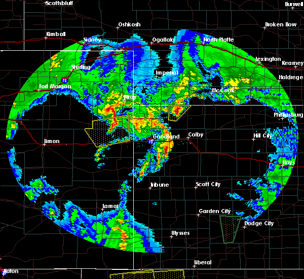 At 843 pm cdt, a severe thunderstorm was located 8 miles northeast of mcdonald, or 11 miles west of atwood, moving northeast at 45 mph (radar indicated). Hazards include half dollar size hail. Damage to vehicles is expected. quarter size hail has been reported in mcdonald. locations impacted include, mcdonald and beardsley. A tornado watch remains in effect until 1000 pm cdt for northwestern kansas. At 843 pm cdt, a severe thunderstorm was located 8 miles northeast of mcdonald, or 11 miles west of atwood, moving northeast at 45 mph (radar indicated). Hazards include half dollar size hail. Damage to vehicles is expected. quarter size hail has been reported in mcdonald. locations impacted include, mcdonald and beardsley. A tornado watch remains in effect until 1000 pm cdt for northwestern kansas.
|
| 5/26/2019 8:35 PM CDT |
 At 834 pm cdt, a severe thunderstorm was located 5 miles northeast of mcdonald, or 12 miles west of atwood, moving northeast at 50 mph (trained weather spotters). Hazards include quarter size hail in mcdonald, however larger hail may be falling east of town. Damage to vehicles is expected. locations impacted include, mcdonald and beardsley. A tornado watch remains in effect until 1000 pm cdt for northwestern kansas. At 834 pm cdt, a severe thunderstorm was located 5 miles northeast of mcdonald, or 12 miles west of atwood, moving northeast at 50 mph (trained weather spotters). Hazards include quarter size hail in mcdonald, however larger hail may be falling east of town. Damage to vehicles is expected. locations impacted include, mcdonald and beardsley. A tornado watch remains in effect until 1000 pm cdt for northwestern kansas.
|
| 5/26/2019 8:34 PM CDT | Quarter sized hail reported 0.4 miles S of McDonald, KS |
| 5/26/2019 8:31 PM CDT |
 At 831 pm cdt, a severe thunderstorm was located near mcdonald, or 14 miles west of atwood, moving northeast at 50 mph (radar indicated). Hazards include golf ball size hail. People and animals outdoors will be injured. expect damage to roofs, siding, windows, and vehicles. locations impacted include, mcdonald and beardsley. A tornado watch remains in effect until 1000 pm cdt for northwestern kansas. At 831 pm cdt, a severe thunderstorm was located near mcdonald, or 14 miles west of atwood, moving northeast at 50 mph (radar indicated). Hazards include golf ball size hail. People and animals outdoors will be injured. expect damage to roofs, siding, windows, and vehicles. locations impacted include, mcdonald and beardsley. A tornado watch remains in effect until 1000 pm cdt for northwestern kansas.
|
| 5/26/2019 8:23 PM CDT |
 At 823 pm cdt, a severe thunderstorm was located 5 miles south of mcdonald, or 18 miles southwest of atwood, moving northeast at 50 mph (radar indicated). Hazards include 60 mph wind gusts and half dollar size hail. Hail damage to vehicles is expected. Expect wind damage to roofs, siding, and trees. At 823 pm cdt, a severe thunderstorm was located 5 miles south of mcdonald, or 18 miles southwest of atwood, moving northeast at 50 mph (radar indicated). Hazards include 60 mph wind gusts and half dollar size hail. Hail damage to vehicles is expected. Expect wind damage to roofs, siding, and trees.
|
| 5/17/2019 4:43 PM CDT |
 At 442 pm cdt, a severe thunderstorm was located 4 miles northeast of mcdonald, or 13 miles west of atwood, moving northeast at 45 mph (radar indicated). Hazards include golf ball size hail and 60 mph wind gusts. People and animals outdoors will be injured. expect hail damage to roofs, siding, windows, and vehicles. Expect wind damage to roofs, siding, and trees. At 442 pm cdt, a severe thunderstorm was located 4 miles northeast of mcdonald, or 13 miles west of atwood, moving northeast at 45 mph (radar indicated). Hazards include golf ball size hail and 60 mph wind gusts. People and animals outdoors will be injured. expect hail damage to roofs, siding, windows, and vehicles. Expect wind damage to roofs, siding, and trees.
|
| 5/17/2019 4:27 PM CDT |
 At 426 pm cdt, a severe thunderstorm was located 4 miles southeast of bird city, or 18 miles east of st. francis, moving northeast at 40 mph (radar indicated). Hazards include ping pong ball size hail and 60 mph wind gusts. People and animals outdoors will be injured. expect hail damage to roofs, siding, windows, and vehicles. expect wind damage to roofs, siding, and trees. locations impacted include, bird city, mcdonald, blakeman and beardsley. A tornado watch remains in effect until 1000 pm cdt for northwestern kansas. At 426 pm cdt, a severe thunderstorm was located 4 miles southeast of bird city, or 18 miles east of st. francis, moving northeast at 40 mph (radar indicated). Hazards include ping pong ball size hail and 60 mph wind gusts. People and animals outdoors will be injured. expect hail damage to roofs, siding, windows, and vehicles. expect wind damage to roofs, siding, and trees. locations impacted include, bird city, mcdonald, blakeman and beardsley. A tornado watch remains in effect until 1000 pm cdt for northwestern kansas.
|
| 5/17/2019 4:11 PM CDT |
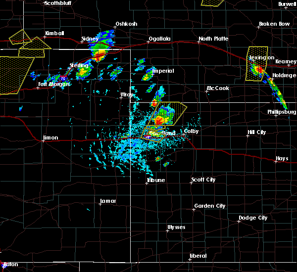 At 411 pm cdt, a severe thunderstorm was located 11 miles south of bird city, or 17 miles northwest of brewster, moving northeast at 40 mph (radar indicated). Hazards include two inch hail and 60 mph wind gusts. golf ball size hail has been reported with this storm. People and animals outdoors will be injured. expect hail damage to roofs, siding, windows, and vehicles. expect wind damage to roofs, siding, and trees. locations impacted include, bird city, mcdonald, blakeman and beardsley. A tornado watch remains in effect until 1000 pm cdt for northwestern kansas. At 411 pm cdt, a severe thunderstorm was located 11 miles south of bird city, or 17 miles northwest of brewster, moving northeast at 40 mph (radar indicated). Hazards include two inch hail and 60 mph wind gusts. golf ball size hail has been reported with this storm. People and animals outdoors will be injured. expect hail damage to roofs, siding, windows, and vehicles. expect wind damage to roofs, siding, and trees. locations impacted include, bird city, mcdonald, blakeman and beardsley. A tornado watch remains in effect until 1000 pm cdt for northwestern kansas.
|
| 5/17/2019 4:03 PM CDT |
 At 402 pm cdt, a severe thunderstorm was located 14 miles south of bird city, or 15 miles northwest of brewster, moving north at 40 mph (radar indicated). Hazards include two inch hail and 60 mph wind gusts. golf ball hail has been reported 13 north of edson. People and animals outdoors will be injured. expect hail damage to roofs, siding, windows, and vehicles. expect wind damage to roofs, siding, and trees. locations impacted include, atwood, bird city, mcdonald, blakeman and beardsley. A tornado watch remains in effect until 1000 pm cdt for northwestern kansas. At 402 pm cdt, a severe thunderstorm was located 14 miles south of bird city, or 15 miles northwest of brewster, moving north at 40 mph (radar indicated). Hazards include two inch hail and 60 mph wind gusts. golf ball hail has been reported 13 north of edson. People and animals outdoors will be injured. expect hail damage to roofs, siding, windows, and vehicles. expect wind damage to roofs, siding, and trees. locations impacted include, atwood, bird city, mcdonald, blakeman and beardsley. A tornado watch remains in effect until 1000 pm cdt for northwestern kansas.
|
| 5/17/2019 3:54 PM CDT |
 At 353 pm cdt, a severe thunderstorm was located 11 miles northeast of goodland, moving northeast at 45 mph (radar indicated). Hazards include golf ball size hail and 60 mph wind gusts. People and animals outdoors will be injured. expect hail damage to roofs, siding, windows, and vehicles. Expect wind damage to roofs, siding, and trees. At 353 pm cdt, a severe thunderstorm was located 11 miles northeast of goodland, moving northeast at 45 mph (radar indicated). Hazards include golf ball size hail and 60 mph wind gusts. People and animals outdoors will be injured. expect hail damage to roofs, siding, windows, and vehicles. Expect wind damage to roofs, siding, and trees.
|
| 4/28/2019 5:12 PM CDT |
 At 412 pm mdt/512 pm cdt/, a severe thunderstorm was located 9 miles south of bird city, or 18 miles southeast of st. francis, moving northeast at 25 mph. this is a very dangerous storm (radar indicated). Hazards include 80 mph wind gusts and golf ball size hail. Flying debris will be dangerous to those caught without shelter. mobile homes will be heavily damaged. expect considerable damage to roofs, windows, and vehicles. extensive tree damage and power outages are likely. Locations impacted include, bird city and mcdonald. At 412 pm mdt/512 pm cdt/, a severe thunderstorm was located 9 miles south of bird city, or 18 miles southeast of st. francis, moving northeast at 25 mph. this is a very dangerous storm (radar indicated). Hazards include 80 mph wind gusts and golf ball size hail. Flying debris will be dangerous to those caught without shelter. mobile homes will be heavily damaged. expect considerable damage to roofs, windows, and vehicles. extensive tree damage and power outages are likely. Locations impacted include, bird city and mcdonald.
|
| 4/28/2019 5:00 PM CDT |
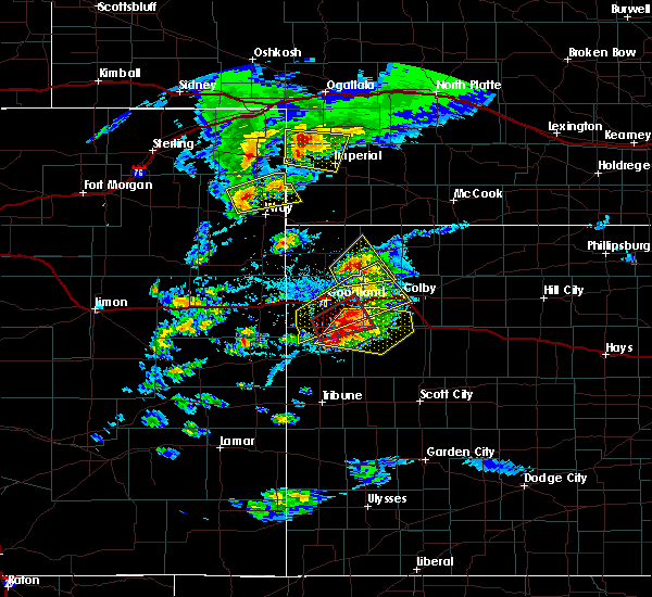 At 400 pm mdt/500 pm cdt/, a severe thunderstorm was located 11 miles south of bird city, or 16 miles southeast of st. francis, moving northeast at 25 mph. this is a very dangerous storm (radar indicated). Hazards include 80 mph wind gusts and golf ball size hail. Flying debris will be dangerous to those caught without shelter. mobile homes will be heavily damaged. expect considerable damage to roofs, windows, and vehicles. extensive tree damage and power outages are likely. Locations impacted include, bird city and mcdonald. At 400 pm mdt/500 pm cdt/, a severe thunderstorm was located 11 miles south of bird city, or 16 miles southeast of st. francis, moving northeast at 25 mph. this is a very dangerous storm (radar indicated). Hazards include 80 mph wind gusts and golf ball size hail. Flying debris will be dangerous to those caught without shelter. mobile homes will be heavily damaged. expect considerable damage to roofs, windows, and vehicles. extensive tree damage and power outages are likely. Locations impacted include, bird city and mcdonald.
|
| 4/28/2019 4:53 PM CDT |
 At 353 pm mdt/453 pm cdt/, a severe thunderstorm was located 14 miles southwest of bird city, or 15 miles north of goodland, moving northeast at 25 mph. this is a very dangerous storm (radar indicated). Hazards include 80 mph wind gusts and golf ball size hail. Flying debris will be dangerous to those caught without shelter. mobile homes will be heavily damaged. expect considerable damage to roofs, windows, and vehicles. extensive tree damage and power outages are likely. Locations impacted include, bird city and mcdonald. At 353 pm mdt/453 pm cdt/, a severe thunderstorm was located 14 miles southwest of bird city, or 15 miles north of goodland, moving northeast at 25 mph. this is a very dangerous storm (radar indicated). Hazards include 80 mph wind gusts and golf ball size hail. Flying debris will be dangerous to those caught without shelter. mobile homes will be heavily damaged. expect considerable damage to roofs, windows, and vehicles. extensive tree damage and power outages are likely. Locations impacted include, bird city and mcdonald.
|
| 4/28/2019 4:38 PM CDT |
 At 338 pm mdt/438 pm cdt/, a severe thunderstorm was located 12 miles north of goodland, moving northeast at 25 mph. this is a very dangerous storm (radar indicated). Hazards include 80 mph wind gusts and two inch hail. Flying debris will be dangerous to those caught without shelter. mobile homes will be heavily damaged. expect considerable damage to roofs, windows, and vehicles. Extensive tree damage and power outages are likely. At 338 pm mdt/438 pm cdt/, a severe thunderstorm was located 12 miles north of goodland, moving northeast at 25 mph. this is a very dangerous storm (radar indicated). Hazards include 80 mph wind gusts and two inch hail. Flying debris will be dangerous to those caught without shelter. mobile homes will be heavily damaged. expect considerable damage to roofs, windows, and vehicles. Extensive tree damage and power outages are likely.
|
| 4/28/2019 4:00 PM CDT |
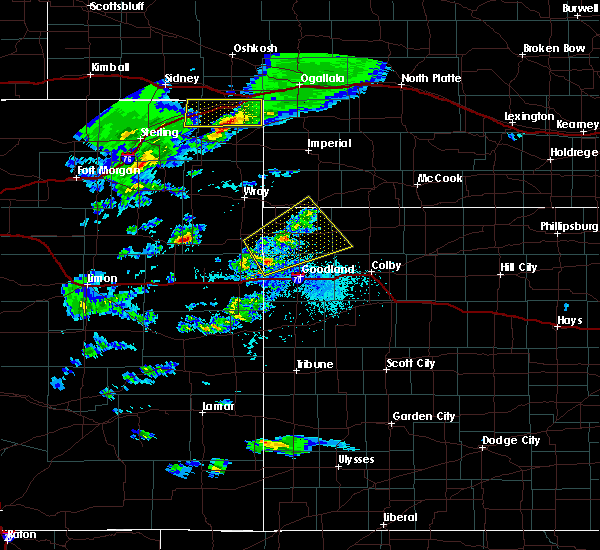 At 300 pm mdt/400 pm cdt/, a severe thunderstorm was located 10 miles north of kanorado, moving northeast at 30 mph (radar indicated). Hazards include 60 mph wind gusts and quarter size hail. Hail damage to vehicles is expected. Expect wind damage to roofs, siding, and trees. At 300 pm mdt/400 pm cdt/, a severe thunderstorm was located 10 miles north of kanorado, moving northeast at 30 mph (radar indicated). Hazards include 60 mph wind gusts and quarter size hail. Hail damage to vehicles is expected. Expect wind damage to roofs, siding, and trees.
|
| 8/31/2018 9:25 PM CDT |
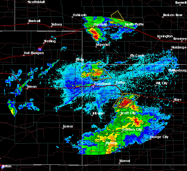 At 924 pm cdt, a severe thunderstorm was located near bird city, or 15 miles east of st. francis, moving northeast at 35 mph (radar indicated). Hazards include 70 mph wind gusts and half dollar size hail. Hail damage to vehicles is expected. expect considerable tree damage. wind damage is also likely to mobile homes, roofs, and outbuildings. Locations impacted include, bird city and mcdonald. At 924 pm cdt, a severe thunderstorm was located near bird city, or 15 miles east of st. francis, moving northeast at 35 mph (radar indicated). Hazards include 70 mph wind gusts and half dollar size hail. Hail damage to vehicles is expected. expect considerable tree damage. wind damage is also likely to mobile homes, roofs, and outbuildings. Locations impacted include, bird city and mcdonald.
|
| 8/31/2018 9:11 PM CDT |
 At 810 pm mdt/910 pm cdt/, a severe thunderstorm was located 9 miles southwest of bird city, or 10 miles southeast of st. francis, moving northeast at 35 mph (radar indicated). Hazards include 70 mph wind gusts and half dollar size hail. Hail damage to vehicles is expected. expect considerable tree damage. Wind damage is also likely to mobile homes, roofs, and outbuildings. At 810 pm mdt/910 pm cdt/, a severe thunderstorm was located 9 miles southwest of bird city, or 10 miles southeast of st. francis, moving northeast at 35 mph (radar indicated). Hazards include 70 mph wind gusts and half dollar size hail. Hail damage to vehicles is expected. expect considerable tree damage. Wind damage is also likely to mobile homes, roofs, and outbuildings.
|
| 8/3/2018 5:45 PM MDT |
 At 545 pm mdt/645 pm cdt/, a severe thunderstorm was located near brewster, moving northeast at 15 mph (radar indicated). Hazards include 60 mph wind gusts and quarter size hail. Hail damage to vehicles is expected. expect wind damage to roofs, siding, and trees. locations impacted include, brewster, levant, mcdonald and edson. This includes interstate 70 in kansas between mile markers 28 and 48. At 545 pm mdt/645 pm cdt/, a severe thunderstorm was located near brewster, moving northeast at 15 mph (radar indicated). Hazards include 60 mph wind gusts and quarter size hail. Hail damage to vehicles is expected. expect wind damage to roofs, siding, and trees. locations impacted include, brewster, levant, mcdonald and edson. This includes interstate 70 in kansas between mile markers 28 and 48.
|
| 8/3/2018 5:26 PM MDT |
 At 526 pm mdt/626 pm cdt/, a severe thunderstorm was located 12 miles north of brewster, moving northeast at 30 mph (radar indicated). Hazards include 60 mph wind gusts and penny size hail. Expect damage to roofs, siding, and trees. locations impacted include, brewster, levant, mcdonald and edson. This includes interstate 70 in kansas between mile markers 22 and 48. At 526 pm mdt/626 pm cdt/, a severe thunderstorm was located 12 miles north of brewster, moving northeast at 30 mph (radar indicated). Hazards include 60 mph wind gusts and penny size hail. Expect damage to roofs, siding, and trees. locations impacted include, brewster, levant, mcdonald and edson. This includes interstate 70 in kansas between mile markers 22 and 48.
|
| 8/3/2018 5:14 PM MDT |
 At 514 pm mdt/614 pm cdt/, a severe thunderstorm was located 9 miles northwest of brewster, moving northeast at 25 mph (radar indicated). Hazards include 70 mph wind gusts and quarter size hail. Hail damage to vehicles is expected. expect considerable tree damage. Wind damage is also likely to mobile homes, roofs, and outbuildings. At 514 pm mdt/614 pm cdt/, a severe thunderstorm was located 9 miles northwest of brewster, moving northeast at 25 mph (radar indicated). Hazards include 70 mph wind gusts and quarter size hail. Hail damage to vehicles is expected. expect considerable tree damage. Wind damage is also likely to mobile homes, roofs, and outbuildings.
|
| 7/28/2018 9:55 PM CDT |
 The severe thunderstorm warning for southeastern cheyenne, northern thomas, rawlins and northeastern sherman counties in northwestern kansas will expire at 900 pm mdt/1000 pm cdt/, the storms which prompted the warning have weakened. therefore, the warning will be allowed to expire. a severe thunderstorm watch remains in effect until 100 am mdt/200 am cdt/ for northwestern kansas. The severe thunderstorm warning for southeastern cheyenne, northern thomas, rawlins and northeastern sherman counties in northwestern kansas will expire at 900 pm mdt/1000 pm cdt/, the storms which prompted the warning have weakened. therefore, the warning will be allowed to expire. a severe thunderstorm watch remains in effect until 100 am mdt/200 am cdt/ for northwestern kansas.
|
| 7/28/2018 9:44 PM CDT |
 At 844 pm mdt/944 pm cdt/, severe thunderstorms were located along a line extending from 10 miles north of mcdonald to near colby, moving east at 40 mph (radar indicated). Hazards include 70 mph wind gusts and quarter size hail. Hail damage to vehicles is expected. expect considerable tree damage. wind damage is also likely to mobile homes, roofs, and outbuildings. Locations impacted include, atwood, bird city, mcdonald, gem, ludell, blakeman and beardsley. At 844 pm mdt/944 pm cdt/, severe thunderstorms were located along a line extending from 10 miles north of mcdonald to near colby, moving east at 40 mph (radar indicated). Hazards include 70 mph wind gusts and quarter size hail. Hail damage to vehicles is expected. expect considerable tree damage. wind damage is also likely to mobile homes, roofs, and outbuildings. Locations impacted include, atwood, bird city, mcdonald, gem, ludell, blakeman and beardsley.
|
| 7/28/2018 9:14 PM CDT |
 At 814 pm mdt/914 pm cdt/, severe thunderstorms were located along a line extending from 9 miles southwest of benkelman to near brewster, moving east at 40 mph (radar indicated). Hazards include 70 mph wind gusts and quarter size hail. Hail damage to vehicles is expected. expect considerable tree damage. Wind damage is also likely to mobile homes, roofs, and outbuildings. At 814 pm mdt/914 pm cdt/, severe thunderstorms were located along a line extending from 9 miles southwest of benkelman to near brewster, moving east at 40 mph (radar indicated). Hazards include 70 mph wind gusts and quarter size hail. Hail damage to vehicles is expected. expect considerable tree damage. Wind damage is also likely to mobile homes, roofs, and outbuildings.
|
| 7/28/2018 9:01 PM CDT |
 At 800 pm mdt/900 pm cdt/, severe thunderstorms were located along a line extending from near bird city to 9 miles north of brewster, moving east at 45 mph (radar indicated). Hazards include 70 mph wind gusts and quarter size hail. Hail damage to vehicles is expected. expect considerable tree damage. wind damage is also likely to mobile homes, roofs, and outbuildings. locations impacted include, st. Francis, bird city, mcdonald, gem and wheeler. At 800 pm mdt/900 pm cdt/, severe thunderstorms were located along a line extending from near bird city to 9 miles north of brewster, moving east at 45 mph (radar indicated). Hazards include 70 mph wind gusts and quarter size hail. Hail damage to vehicles is expected. expect considerable tree damage. wind damage is also likely to mobile homes, roofs, and outbuildings. locations impacted include, st. Francis, bird city, mcdonald, gem and wheeler.
|
| 7/28/2018 8:21 PM CDT |
 At 721 pm mdt/821 pm cdt/, severe thunderstorms were located along a line extending from 8 miles northeast of bonny reservoir to 11 miles north of ruleton, moving east at 45 mph (radar indicated). Hazards include 70 mph wind gusts and quarter size hail. Hail damage to vehicles is expected. expect considerable tree damage. Wind damage is also likely to mobile homes, roofs, and outbuildings. At 721 pm mdt/821 pm cdt/, severe thunderstorms were located along a line extending from 8 miles northeast of bonny reservoir to 11 miles north of ruleton, moving east at 45 mph (radar indicated). Hazards include 70 mph wind gusts and quarter size hail. Hail damage to vehicles is expected. expect considerable tree damage. Wind damage is also likely to mobile homes, roofs, and outbuildings.
|
| 7/26/2018 5:57 PM MDT |
 At 557 pm mdt/657 pm cdt/, severe thunderstorms were located along a line extending from 9 miles west of atwood to near goodland, moving east at 35 mph. these are very dangerous storms (radar indicated). Hazards include 80 mph wind gusts and two inch hail. Flying debris will be dangerous to those caught without shelter. mobile homes will be heavily damaged. expect considerable damage to roofs, windows, and vehicles. extensive tree damage and power outages are likely. locations impacted include, goodland, atwood, ruleton, bird city, mcdonald, blakeman and edson. This includes interstate 70 in kansas between mile markers 3 and 28. At 557 pm mdt/657 pm cdt/, severe thunderstorms were located along a line extending from 9 miles west of atwood to near goodland, moving east at 35 mph. these are very dangerous storms (radar indicated). Hazards include 80 mph wind gusts and two inch hail. Flying debris will be dangerous to those caught without shelter. mobile homes will be heavily damaged. expect considerable damage to roofs, windows, and vehicles. extensive tree damage and power outages are likely. locations impacted include, goodland, atwood, ruleton, bird city, mcdonald, blakeman and edson. This includes interstate 70 in kansas between mile markers 3 and 28.
|
| 7/26/2018 5:34 PM MDT |
 At 533 pm mdt/633 pm cdt/, severe thunderstorms were located along a line extending from 7 miles northwest of mcdonald to near ruleton, moving east at 35 mph (radar indicated). Hazards include 70 mph wind gusts and ping pong ball size hail. People and animals outdoors will be injured. expect hail damage to roofs, siding, windows, and vehicles. expect considerable tree damage. Wind damage is also likely to mobile homes, roofs, and outbuildings. At 533 pm mdt/633 pm cdt/, severe thunderstorms were located along a line extending from 7 miles northwest of mcdonald to near ruleton, moving east at 35 mph (radar indicated). Hazards include 70 mph wind gusts and ping pong ball size hail. People and animals outdoors will be injured. expect hail damage to roofs, siding, windows, and vehicles. expect considerable tree damage. Wind damage is also likely to mobile homes, roofs, and outbuildings.
|
| 7/22/2018 9:00 PM MDT |
 At 900 pm mdt/1000 pm cdt/, severe thunderstorms were located along a line extending from 3 miles south of wauneta to near haigler, moving east at 25 mph (radar indicated). Hazards include 60 mph wind gusts and nickel size hail. expect damage to roofs, siding, and trees At 900 pm mdt/1000 pm cdt/, severe thunderstorms were located along a line extending from 3 miles south of wauneta to near haigler, moving east at 25 mph (radar indicated). Hazards include 60 mph wind gusts and nickel size hail. expect damage to roofs, siding, and trees
|
| 6/30/2018 8:41 PM CDT |
 At 841 pm cdt, a severe thunderstorm was located 7 miles west of atwood, moving east at 55 mph (trained weather spotters). Hazards include 70 mph wind gusts. Expect considerable tree damage. Damage is likely to mobile homes, roofs, and outbuildings. At 841 pm cdt, a severe thunderstorm was located 7 miles west of atwood, moving east at 55 mph (trained weather spotters). Hazards include 70 mph wind gusts. Expect considerable tree damage. Damage is likely to mobile homes, roofs, and outbuildings.
|
| 6/29/2018 9:26 PM CDT |
 The severe thunderstorm warning for western rawlins county will expire at 930 pm cdt, the storm which prompted the warning has weakened below severe limits, and no longer poses an immediate threat to life or property. therefore, the warning will be allowed to expire. however small hail and gusty winds are still possible with this thunderstorm. The severe thunderstorm warning for western rawlins county will expire at 930 pm cdt, the storm which prompted the warning has weakened below severe limits, and no longer poses an immediate threat to life or property. therefore, the warning will be allowed to expire. however small hail and gusty winds are still possible with this thunderstorm.
|
| 6/29/2018 8:50 PM CDT | Half Dollar sized hail reported 4.4 miles WNW of McDonald, KS, trained spotter estimated hail at the size of a half dollar. |
| 6/29/2018 8:38 PM CDT |
 The national weather service in goodland has issued a * severe thunderstorm warning for. western rawlins county in northwestern kansas. until 930 pm cdt. At 838 pm cdt, a severe thunderstorm was located 7 miles southeast of mcdonald, or 16 miles southwest of atwood, moving northeast at. The national weather service in goodland has issued a * severe thunderstorm warning for. western rawlins county in northwestern kansas. until 930 pm cdt. At 838 pm cdt, a severe thunderstorm was located 7 miles southeast of mcdonald, or 16 miles southwest of atwood, moving northeast at.
|
| 6/22/2018 3:58 PM CDT | Storm damage reported in rawlins county KS, 0.4 miles S of McDonald, KS |
| 6/22/2018 3:49 PM CDT |
 At 348 pm cdt, severe thunderstorms were located along a line extending from 6 miles north of mcdonald to 9 miles southeast of bird city, moving east at 45 mph. these are very dangerous storms (trained weather spotters. a wind gust to 77 mph was reported earlier at bird city airport). Hazards include 80 mph wind gusts and nickel size hail. Flying debris will be dangerous to those caught without shelter. mobile homes will be heavily damaged. expect considerable damage to roofs, windows, and vehicles. extensive tree damage and power outages are likely. Locations impacted include, atwood, bird city, mcdonald, ludell, blakeman and beardsley. At 348 pm cdt, severe thunderstorms were located along a line extending from 6 miles north of mcdonald to 9 miles southeast of bird city, moving east at 45 mph. these are very dangerous storms (trained weather spotters. a wind gust to 77 mph was reported earlier at bird city airport). Hazards include 80 mph wind gusts and nickel size hail. Flying debris will be dangerous to those caught without shelter. mobile homes will be heavily damaged. expect considerable damage to roofs, windows, and vehicles. extensive tree damage and power outages are likely. Locations impacted include, atwood, bird city, mcdonald, ludell, blakeman and beardsley.
|
| 6/22/2018 3:34 PM CDT |
 At 333 pm cdt, severe thunderstorms were located along a line extending from 6 miles northwest of bird city to 11 miles southeast of st. francis, moving east at 45 mph. these are very dangerous storms (trained weather spotters. at 232 pm mdt...a 77 mph gust was measured at bird city airport). Hazards include 80 mph wind gusts and quarter size hail. Flying debris will be dangerous to those caught without shelter. mobile homes will be heavily damaged. expect considerable damage to roofs, windows, and vehicles. Extensive tree damage and power outages are likely. At 333 pm cdt, severe thunderstorms were located along a line extending from 6 miles northwest of bird city to 11 miles southeast of st. francis, moving east at 45 mph. these are very dangerous storms (trained weather spotters. at 232 pm mdt...a 77 mph gust was measured at bird city airport). Hazards include 80 mph wind gusts and quarter size hail. Flying debris will be dangerous to those caught without shelter. mobile homes will be heavily damaged. expect considerable damage to roofs, windows, and vehicles. Extensive tree damage and power outages are likely.
|
| 6/19/2018 8:20 PM CDT |
 At 820 pm cdt, a severe thunderstorm was located 4 miles southeast of atwood, moving east at 35 mph (radar indicated). Hazards include 60 mph wind gusts. Expect damage to roofs, siding, and trees. Locations impacted include, atwood, mcdonald, herndon, ludell, blakeman and beardsley. At 820 pm cdt, a severe thunderstorm was located 4 miles southeast of atwood, moving east at 35 mph (radar indicated). Hazards include 60 mph wind gusts. Expect damage to roofs, siding, and trees. Locations impacted include, atwood, mcdonald, herndon, ludell, blakeman and beardsley.
|
| 6/19/2018 8:00 PM CDT |
 At 727 pm cdt, a severe thunderstorm was located near bird city, or 17 miles east of st. francis, moving east at 55 mph. this is a very dangerous storm (radar indicated). Hazards include 80 mph wind gusts and two inch hail. Flying debris will be dangerous to those caught without shelter. mobile homes will be heavily damaged. expect considerable damage to roofs, windows, and vehicles. Extensive tree damage and power outages are likely. At 727 pm cdt, a severe thunderstorm was located near bird city, or 17 miles east of st. francis, moving east at 55 mph. this is a very dangerous storm (radar indicated). Hazards include 80 mph wind gusts and two inch hail. Flying debris will be dangerous to those caught without shelter. mobile homes will be heavily damaged. expect considerable damage to roofs, windows, and vehicles. Extensive tree damage and power outages are likely.
|
| 6/19/2018 7:39 PM CDT |
 At 738 pm cdt, a confirmed tornado was located near bird city, or 14 miles east of st. francis, moving east at 20 mph (weather spotters confirmed tornado). Hazards include damaging tornado and hail up to two inches in diameter. Flying debris will be dangerous to those caught without shelter. mobile homes will be damaged or destroyed. damage to roofs, windows, and vehicles will occur. Tree damage is likely. At 738 pm cdt, a confirmed tornado was located near bird city, or 14 miles east of st. francis, moving east at 20 mph (weather spotters confirmed tornado). Hazards include damaging tornado and hail up to two inches in diameter. Flying debris will be dangerous to those caught without shelter. mobile homes will be damaged or destroyed. damage to roofs, windows, and vehicles will occur. Tree damage is likely.
|
| 6/19/2018 7:27 PM CDT |
 At 727 pm cdt, a severe thunderstorm was located near bird city, or 17 miles east of st. francis, moving east at 55 mph. this is a very dangerous storm (radar indicated). Hazards include 80 mph wind gusts and two inch hail. Flying debris will be dangerous to those caught without shelter. mobile homes will be heavily damaged. expect considerable damage to roofs, windows, and vehicles. Extensive tree damage and power outages are likely. At 727 pm cdt, a severe thunderstorm was located near bird city, or 17 miles east of st. francis, moving east at 55 mph. this is a very dangerous storm (radar indicated). Hazards include 80 mph wind gusts and two inch hail. Flying debris will be dangerous to those caught without shelter. mobile homes will be heavily damaged. expect considerable damage to roofs, windows, and vehicles. Extensive tree damage and power outages are likely.
|
| 6/19/2018 7:02 PM CDT |
 A severe thunderstorm warning remains in effect until 730 pm cdt for southeastern cheyenne and western rawlins counties in northwestern kansas. at 657 pm cdt, a severe thunderstorm was located 4 miles southwest of mcdonald, or 19 miles east of st. Francis, moving northeast at 15 mph. A severe thunderstorm warning remains in effect until 730 pm cdt for southeastern cheyenne and western rawlins counties in northwestern kansas. at 657 pm cdt, a severe thunderstorm was located 4 miles southwest of mcdonald, or 19 miles east of st. Francis, moving northeast at 15 mph.
|
| 6/19/2018 6:38 PM CDT |
 At 537 pm mdt/637 pm cdt/, a severe thunderstorm was located near bird city, or 16 miles east of st. francis, moving northeast at 15 mph (radar indicated). Hazards include 70 mph wind gusts and ping pong ball size hail. People and animals outdoors will be injured. expect hail damage to roofs, siding, windows, and vehicles. expect considerable tree damage. Wind damage is also likely to mobile homes, roofs, and outbuildings. At 537 pm mdt/637 pm cdt/, a severe thunderstorm was located near bird city, or 16 miles east of st. francis, moving northeast at 15 mph (radar indicated). Hazards include 70 mph wind gusts and ping pong ball size hail. People and animals outdoors will be injured. expect hail damage to roofs, siding, windows, and vehicles. expect considerable tree damage. Wind damage is also likely to mobile homes, roofs, and outbuildings.
|
| 5/28/2018 8:40 PM CDT |
 The severe thunderstorm warning for northeastern wallace county in west central kansas, cheyenne and thomas counties in northwestern kansas, northern logan county in west central kansas, southwestern rawlins and sherman counties in northwestern kansas will expire at 745 pm mdt/845 pm cdt/, the storms which prompted the warning have weakened below severe limits, and no longer pose an immediate threat to life or property. therefore the warning will be allowed to expire. however gusty winds are still possible with these thunderstorms. a tornado watch remains in effect until 900 pm mdt/1000 pm cdt/ for northeastern and east central colorado, and northwestern and west central kansas. The severe thunderstorm warning for northeastern wallace county in west central kansas, cheyenne and thomas counties in northwestern kansas, northern logan county in west central kansas, southwestern rawlins and sherman counties in northwestern kansas will expire at 745 pm mdt/845 pm cdt/, the storms which prompted the warning have weakened below severe limits, and no longer pose an immediate threat to life or property. therefore the warning will be allowed to expire. however gusty winds are still possible with these thunderstorms. a tornado watch remains in effect until 900 pm mdt/1000 pm cdt/ for northeastern and east central colorado, and northwestern and west central kansas.
|
| 5/28/2018 8:13 PM CDT |
 At 653 pm mdt/753 pm cdt/, severe thunderstorms were located along a line extending from 9 miles north of levant to near goodland, moving northwest at 50 mph (radar indicated). Hazards include 70 mph wind gusts. Expect considerable tree damage. Damage is likely to mobile homes, roofs, and outbuildings. At 653 pm mdt/753 pm cdt/, severe thunderstorms were located along a line extending from 9 miles north of levant to near goodland, moving northwest at 50 mph (radar indicated). Hazards include 70 mph wind gusts. Expect considerable tree damage. Damage is likely to mobile homes, roofs, and outbuildings.
|
| 5/28/2018 7:53 PM CDT |
 At 653 pm mdt/753 pm cdt/, severe thunderstorms were located along a line extending from 9 miles north of levant to near goodland, moving northwest at 50 mph (radar indicated). Hazards include 70 mph wind gusts. Expect considerable tree damage. Damage is likely to mobile homes, roofs, and outbuildings. At 653 pm mdt/753 pm cdt/, severe thunderstorms were located along a line extending from 9 miles north of levant to near goodland, moving northwest at 50 mph (radar indicated). Hazards include 70 mph wind gusts. Expect considerable tree damage. Damage is likely to mobile homes, roofs, and outbuildings.
|
| 5/28/2018 6:25 PM CDT | Golf Ball sized hail reported 3.2 miles W of McDonald, KS, golf ball sized hail measured by storm chaser. |
| 5/28/2018 6:25 PM CDT | Golf Ball sized hail reported 2.2 miles WSW of McDonald, KS, chaser measured golf ball sized hail. |
| 5/27/2018 7:40 PM CDT | Quarter sized hail reported 0.4 miles S of McDonald, KS |
| 5/27/2018 7:15 PM CDT |
 At 612 pm mdt/712 pm cdt/, severe thunderstorms were located along a line extending from near haigler to 5 miles southwest of herndon, moving north at 50 mph (wind gusts to 62 mph and a 10 minute period of reduced visibilities associated with blowing dirt were observed at the national weather service office in goodland. quarter size hail was recently reported in western rawlins county). Hazards include 60 to 70 mph wind gusts, quarter size hail, and near 0 visibility associated with blowing dirt. Hail damage to vehicles is expected. expect wind damage to roofs, siding, and trees. Hazardous travel conditions associated with blowing dirt. At 612 pm mdt/712 pm cdt/, severe thunderstorms were located along a line extending from near haigler to 5 miles southwest of herndon, moving north at 50 mph (wind gusts to 62 mph and a 10 minute period of reduced visibilities associated with blowing dirt were observed at the national weather service office in goodland. quarter size hail was recently reported in western rawlins county). Hazards include 60 to 70 mph wind gusts, quarter size hail, and near 0 visibility associated with blowing dirt. Hail damage to vehicles is expected. expect wind damage to roofs, siding, and trees. Hazardous travel conditions associated with blowing dirt.
|
| 5/27/2018 7:06 PM CDT |
 At 601 pm mdt/701 pm cdt/, severe thunderstorms were located along a line extending from 8 miles southeast of haigler to 8 miles northeast of mcdonald to 10 miles southeast of ludell, moving north at 50 mph (wind gusts to 62 mph and a 5 to 10 minute period of reduced visibilities associated with blowing dust were observed at the national weather service office in goodland. additionally, quarter to golf ball size hail was reported earlier in colby). Hazards include 60 to 70 mph wind gusts, near 0 visibility associated with blowing dirt, and quarter size hail. Hail damage to vehicles is expected. expect wind damage to roofs, siding, and trees. hazardous travel conditions associated with blowing dirt. locations impacted include, st. Francis, atwood, benkelman, trenton, culbertson, bird city and palisade. At 601 pm mdt/701 pm cdt/, severe thunderstorms were located along a line extending from 8 miles southeast of haigler to 8 miles northeast of mcdonald to 10 miles southeast of ludell, moving north at 50 mph (wind gusts to 62 mph and a 5 to 10 minute period of reduced visibilities associated with blowing dust were observed at the national weather service office in goodland. additionally, quarter to golf ball size hail was reported earlier in colby). Hazards include 60 to 70 mph wind gusts, near 0 visibility associated with blowing dirt, and quarter size hail. Hail damage to vehicles is expected. expect wind damage to roofs, siding, and trees. hazardous travel conditions associated with blowing dirt. locations impacted include, st. Francis, atwood, benkelman, trenton, culbertson, bird city and palisade.
|
| 5/27/2018 7:05 PM CDT | Quarter sized hail reported 0.4 miles S of McDonald, KS |
| 5/27/2018 6:50 PM CDT |
 At 547 pm mdt/647 pm cdt/, severe thunderstorms were located along a line extending from 8 miles west of st. francis to 8 miles south of herndon, moving north at 55 mph (radar indicated). Hazards include 60 to 70 mph wind gusts, near 0 visibility associated with blowing dirt, and quarter size hail. Hail damage to vehicles is expected. expect wind damage to roofs, siding, and trees. locations impacted include, st. Francis, atwood, benkelman, trenton, culbertson, bird city and palisade. At 547 pm mdt/647 pm cdt/, severe thunderstorms were located along a line extending from 8 miles west of st. francis to 8 miles south of herndon, moving north at 55 mph (radar indicated). Hazards include 60 to 70 mph wind gusts, near 0 visibility associated with blowing dirt, and quarter size hail. Hail damage to vehicles is expected. expect wind damage to roofs, siding, and trees. locations impacted include, st. Francis, atwood, benkelman, trenton, culbertson, bird city and palisade.
|
| 5/27/2018 6:34 PM CDT |
 At 532 pm mdt/632 pm cdt/, severe thunderstorms were located along a line extending from 10 miles south of bird city to 11 miles north of gem, moving north at 60 mph (radar indicated). Hazards include 65 mph wind gusts, quarter size hail, and locally reduced visibilities associated with blowing dust. Hail damage to vehicles is expected. expect considerable tree damage. Wind damage is also likely to mobile homes, roofs, and outbuildings. At 532 pm mdt/632 pm cdt/, severe thunderstorms were located along a line extending from 10 miles south of bird city to 11 miles north of gem, moving north at 60 mph (radar indicated). Hazards include 65 mph wind gusts, quarter size hail, and locally reduced visibilities associated with blowing dust. Hail damage to vehicles is expected. expect considerable tree damage. Wind damage is also likely to mobile homes, roofs, and outbuildings.
|
| 10/2/2017 8:17 PM CDT |
 At 816 pm cdt, a severe thunderstorm was located near mcdonald, or 16 miles southeast of benkelman, moving northeast at 25 mph (trained weather spotters). Hazards include quarter size hail. Damage to vehicles is expected. Locations impacted include, trenton, culbertson, stratton and mcdonald. At 816 pm cdt, a severe thunderstorm was located near mcdonald, or 16 miles southeast of benkelman, moving northeast at 25 mph (trained weather spotters). Hazards include quarter size hail. Damage to vehicles is expected. Locations impacted include, trenton, culbertson, stratton and mcdonald.
|
| 10/2/2017 8:00 PM CDT |
 At 659 pm mdt/759 pm cdt/, a severe thunderstorm was located near bird city, or 17 miles east of st. francis, moving northeast at 25 mph (radar indicated). Hazards include quarter size hail. damage to vehicles is expected At 659 pm mdt/759 pm cdt/, a severe thunderstorm was located near bird city, or 17 miles east of st. francis, moving northeast at 25 mph (radar indicated). Hazards include quarter size hail. damage to vehicles is expected
|
| 9/13/2017 3:41 PM CDT |
 At 341 pm cdt, a severe thunderstorm was located near mcdonald, or 13 miles west of atwood, moving northeast at 15 mph (radar indicated). Hazards include 60 mph wind gusts and quarter size hail. Hail damage to vehicles is expected. expect wind damage to roofs, siding, and trees. Locations impacted include, atwood, mcdonald, blakeman and beardsley. At 341 pm cdt, a severe thunderstorm was located near mcdonald, or 13 miles west of atwood, moving northeast at 15 mph (radar indicated). Hazards include 60 mph wind gusts and quarter size hail. Hail damage to vehicles is expected. expect wind damage to roofs, siding, and trees. Locations impacted include, atwood, mcdonald, blakeman and beardsley.
|
| 9/13/2017 3:30 PM CDT | Estimated winds of 50 to 60 mph. also had hail up to nickel siz in rawlins county KS, 0.4 miles S of McDonald, KS |
| 9/13/2017 3:28 PM CDT |
 At 328 pm cdt, a severe thunderstorm was located over mcdonald, or 16 miles west of atwood, moving northeast at 10 mph (radar indicated). Hazards include 60 mph wind gusts and quarter size hail. Hail damage to vehicles is expected. Expect wind damage to roofs, siding, and trees. At 328 pm cdt, a severe thunderstorm was located over mcdonald, or 16 miles west of atwood, moving northeast at 10 mph (radar indicated). Hazards include 60 mph wind gusts and quarter size hail. Hail damage to vehicles is expected. Expect wind damage to roofs, siding, and trees.
|
| 8/14/2017 5:28 PM CDT | Quarter sized hail reported 0.4 miles S of McDonald, KS |
| 8/14/2017 5:28 PM CDT |
 At 528 pm cdt, a severe thunderstorm was located 9 miles north of bird city, or 11 miles south of benkelman, moving south at 10 mph (radar indicated). Hazards include two inch hail and 70 mph wind gusts. People and animals outdoors will be injured. expect hail damage to roofs, siding, windows, and vehicles. expect considerable tree damage. wind damage is also likely to mobile homes, roofs, and outbuildings. Locations impacted include, bird city, mcdonald and wheeler. At 528 pm cdt, a severe thunderstorm was located 9 miles north of bird city, or 11 miles south of benkelman, moving south at 10 mph (radar indicated). Hazards include two inch hail and 70 mph wind gusts. People and animals outdoors will be injured. expect hail damage to roofs, siding, windows, and vehicles. expect considerable tree damage. wind damage is also likely to mobile homes, roofs, and outbuildings. Locations impacted include, bird city, mcdonald and wheeler.
|
| 8/14/2017 5:14 PM CDT |
 At 514 pm cdt, a severe thunderstorm was located 10 miles north of bird city, or 11 miles south of benkelman, moving south at 10 mph (radar indicated). Hazards include two inch hail and 60 mph wind gusts. People and animals outdoors will be injured. expect hail damage to roofs, siding, windows, and vehicles. Expect wind damage to roofs, siding, and trees. At 514 pm cdt, a severe thunderstorm was located 10 miles north of bird city, or 11 miles south of benkelman, moving south at 10 mph (radar indicated). Hazards include two inch hail and 60 mph wind gusts. People and animals outdoors will be injured. expect hail damage to roofs, siding, windows, and vehicles. Expect wind damage to roofs, siding, and trees.
|
| 8/14/2017 4:47 PM CDT |
 At 347 pm mdt/447 pm cdt/, severe thunderstorms were located along a line extending from 4 miles south of benkelman to 9 miles northeast of mcdonald, and are nearly stationary (radar indicated). Hazards include two inch hail and 60 mph wind gusts. People and animals outdoors will be injured. expect hail damage to roofs, siding, windows, and vehicles. expect wind damage to roofs, siding, and trees. Locations impacted include, benkelman and mcdonald. At 347 pm mdt/447 pm cdt/, severe thunderstorms were located along a line extending from 4 miles south of benkelman to 9 miles northeast of mcdonald, and are nearly stationary (radar indicated). Hazards include two inch hail and 60 mph wind gusts. People and animals outdoors will be injured. expect hail damage to roofs, siding, windows, and vehicles. expect wind damage to roofs, siding, and trees. Locations impacted include, benkelman and mcdonald.
|
| 8/14/2017 4:42 PM CDT |
 At 342 pm mdt/442 pm cdt/, severe thunderstorms were located along a line extending from 4 miles south of benkelman to 8 miles northeast of mcdonald, and are nearly stationary (radar indicated). Hazards include ping pong ball size hail and 60 mph wind gusts. People and animals outdoors will be injured. expect hail damage to roofs, siding, windows, and vehicles. Expect wind damage to roofs, siding, and trees. At 342 pm mdt/442 pm cdt/, severe thunderstorms were located along a line extending from 4 miles south of benkelman to 8 miles northeast of mcdonald, and are nearly stationary (radar indicated). Hazards include ping pong ball size hail and 60 mph wind gusts. People and animals outdoors will be injured. expect hail damage to roofs, siding, windows, and vehicles. Expect wind damage to roofs, siding, and trees.
|
| 7/12/2017 12:21 AM CDT |
 At 1221 am cdt, a severe thunderstorm was located 6 miles south of mcdonald, or 18 miles southwest of atwood, moving north at 20 mph (radar indicated). Hazards include 60 mph wind gusts and quarter size hail. Hail damage to vehicles is expected. expect wind damage to roofs, siding, and trees. Locations impacted include, mcdonald. At 1221 am cdt, a severe thunderstorm was located 6 miles south of mcdonald, or 18 miles southwest of atwood, moving north at 20 mph (radar indicated). Hazards include 60 mph wind gusts and quarter size hail. Hail damage to vehicles is expected. expect wind damage to roofs, siding, and trees. Locations impacted include, mcdonald.
|
| 7/12/2017 12:13 AM CDT |
 At 1213 am cdt, a severe thunderstorm was located 9 miles south of mcdonald, or 20 miles north of brewster, moving north at 20 mph (radar indicated). Hazards include 60 mph wind gusts and quarter size hail. Hail damage to vehicles is expected. Expect wind damage to roofs, siding, and trees. At 1213 am cdt, a severe thunderstorm was located 9 miles south of mcdonald, or 20 miles north of brewster, moving north at 20 mph (radar indicated). Hazards include 60 mph wind gusts and quarter size hail. Hail damage to vehicles is expected. Expect wind damage to roofs, siding, and trees.
|
| 7/7/2017 7:24 PM CDT |
 At 723 pm cdt, severe thunderstorms were located along a line extending from 11 miles southwest of atwood to near mcdonald, moving southwest at 10 mph (radar indicated). Hazards include golf ball size hail and 70 mph wind gusts. People and animals outdoors will be injured. expect hail damage to roofs, siding, windows, and vehicles. expect considerable tree damage. wind damage is also likely to mobile homes, roofs, and outbuildings. Locations impacted include, mcdonald. At 723 pm cdt, severe thunderstorms were located along a line extending from 11 miles southwest of atwood to near mcdonald, moving southwest at 10 mph (radar indicated). Hazards include golf ball size hail and 70 mph wind gusts. People and animals outdoors will be injured. expect hail damage to roofs, siding, windows, and vehicles. expect considerable tree damage. wind damage is also likely to mobile homes, roofs, and outbuildings. Locations impacted include, mcdonald.
|
| 7/7/2017 7:18 PM CDT |
 At 716 pm cdt, a severe thunderstorm was located 7 miles southwest of atwood, moving southeast at 10 mph (radar indicated). Hazards include golf ball size hail and 70 mph wind gusts. People and animals outdoors will be injured. expect hail damage to roofs, siding, windows, and vehicles. expect considerable tree damage. wind damage is also likely to mobile homes, roofs, and outbuildings. Locations impacted include, mcdonald and beardsley. At 716 pm cdt, a severe thunderstorm was located 7 miles southwest of atwood, moving southeast at 10 mph (radar indicated). Hazards include golf ball size hail and 70 mph wind gusts. People and animals outdoors will be injured. expect hail damage to roofs, siding, windows, and vehicles. expect considerable tree damage. wind damage is also likely to mobile homes, roofs, and outbuildings. Locations impacted include, mcdonald and beardsley.
|
| 7/7/2017 7:17 PM CDT | Golf Ball sized hail reported 0.4 miles S of McDonald, KS |
| 7/7/2017 7:02 PM CDT |
 At 702 pm cdt, a severe thunderstorm was located 7 miles southwest of atwood, moving southeast at 10 mph (radar indicated). Hazards include golf ball size hail and 60 mph wind gusts. People and animals outdoors will be injured. expect hail damage to roofs, siding, windows, and vehicles. Expect wind damage to roofs, siding, and trees. At 702 pm cdt, a severe thunderstorm was located 7 miles southwest of atwood, moving southeast at 10 mph (radar indicated). Hazards include golf ball size hail and 60 mph wind gusts. People and animals outdoors will be injured. expect hail damage to roofs, siding, windows, and vehicles. Expect wind damage to roofs, siding, and trees.
|
| 7/6/2017 6:59 PM CDT |
 At 659 pm cdt, a severe thunderstorm was located 8 miles south of bird city, or 14 miles southeast of st. francis, moving south at 30 mph (public). Hazards include 60 mph wind gusts. Expect damage to roofs, siding, and trees. locations impacted include, st. Francis, bird city, mcdonald, beardsley and wheeler. At 659 pm cdt, a severe thunderstorm was located 8 miles south of bird city, or 14 miles southeast of st. francis, moving south at 30 mph (public). Hazards include 60 mph wind gusts. Expect damage to roofs, siding, and trees. locations impacted include, st. Francis, bird city, mcdonald, beardsley and wheeler.
|
| 7/6/2017 6:38 PM CDT |
 At 638 pm cdt, a severe thunderstorm was located 5 miles east of st. francis, moving southeast at 30 mph (radar indicated). Hazards include 60 mph wind gusts and penny size hail. expect damage to roofs, siding, and trees At 638 pm cdt, a severe thunderstorm was located 5 miles east of st. francis, moving southeast at 30 mph (radar indicated). Hazards include 60 mph wind gusts and penny size hail. expect damage to roofs, siding, and trees
|
| 7/2/2017 11:04 PM CDT |
 At 1004 pm mdt/1104 pm cdt/, severe thunderstorms were located along a line extending from near bird city to 3 miles south of levant, moving east at 15 mph (radar indicated). Hazards include 70 mph wind gusts and quarter size hail. Hail damage to vehicles is expected. expect considerable tree damage. Wind damage is also likely to mobile homes, roofs, and outbuildings. At 1004 pm mdt/1104 pm cdt/, severe thunderstorms were located along a line extending from near bird city to 3 miles south of levant, moving east at 15 mph (radar indicated). Hazards include 70 mph wind gusts and quarter size hail. Hail damage to vehicles is expected. expect considerable tree damage. Wind damage is also likely to mobile homes, roofs, and outbuildings.
|
| 5/26/2017 10:52 PM CDT |
 At 1052 pm cdt, severe thunderstorms were located along a line extending from 6 miles west of atwood to 5 miles southeast of colby, moving northeast at 35 mph (radar indicated). Hazards include golf ball size hail and 70 mph wind gusts. People and animals outdoors will be injured. expect hail damage to roofs, siding, windows, and vehicles. expect considerable tree damage. wind damage is also likely to mobile homes, roofs, and outbuildings. locations impacted include, colby, atwood, brewster, levant, rexford, mcdonald and gem. This includes interstate 70 in kansas between mile markers 36 and 67. At 1052 pm cdt, severe thunderstorms were located along a line extending from 6 miles west of atwood to 5 miles southeast of colby, moving northeast at 35 mph (radar indicated). Hazards include golf ball size hail and 70 mph wind gusts. People and animals outdoors will be injured. expect hail damage to roofs, siding, windows, and vehicles. expect considerable tree damage. wind damage is also likely to mobile homes, roofs, and outbuildings. locations impacted include, colby, atwood, brewster, levant, rexford, mcdonald and gem. This includes interstate 70 in kansas between mile markers 36 and 67.
|
| 5/26/2017 10:40 PM CDT |
 At 1040 pm cdt, severe thunderstorms were located along a line extending from 6 miles east of mcdonald to 7 miles south of colby, moving northeast at 35 mph (radar indicated). Hazards include golf ball size hail and 70 mph wind gusts. People and animals outdoors will be injured. expect hail damage to roofs, siding, windows, and vehicles. expect considerable tree damage. Wind damage is also likely to mobile homes, roofs, and outbuildings. At 1040 pm cdt, severe thunderstorms were located along a line extending from 6 miles east of mcdonald to 7 miles south of colby, moving northeast at 35 mph (radar indicated). Hazards include golf ball size hail and 70 mph wind gusts. People and animals outdoors will be injured. expect hail damage to roofs, siding, windows, and vehicles. expect considerable tree damage. Wind damage is also likely to mobile homes, roofs, and outbuildings.
|
| 5/25/2017 5:43 PM CDT |
 At 543 pm cdt, a severe thunderstorm was located 5 miles southeast of st. francis, moving east at 40 mph (radar indicated). Hazards include 60 mph wind gusts and quarter size hail. Hail damage to vehicles is expected. Expect wind damage to roofs, siding, and trees. At 543 pm cdt, a severe thunderstorm was located 5 miles southeast of st. francis, moving east at 40 mph (radar indicated). Hazards include 60 mph wind gusts and quarter size hail. Hail damage to vehicles is expected. Expect wind damage to roofs, siding, and trees.
|
| 5/16/2017 8:53 PM CDT |
 At 853 pm cdt, a severe thunderstorm was located 4 miles southwest of mcdonald, or 20 miles west of atwood, moving northeast at 15 mph (radar indicated). Hazards include golf ball size hail and 60 mph wind gusts. People and animals outdoors will be injured. expect hail damage to roofs, siding, windows, and vehicles. Expect wind damage to roofs, siding, and trees. At 853 pm cdt, a severe thunderstorm was located 4 miles southwest of mcdonald, or 20 miles west of atwood, moving northeast at 15 mph (radar indicated). Hazards include golf ball size hail and 60 mph wind gusts. People and animals outdoors will be injured. expect hail damage to roofs, siding, windows, and vehicles. Expect wind damage to roofs, siding, and trees.
|
| 5/16/2017 7:48 PM CDT | Quarter sized hail reported 0.4 miles S of McDonald, KS |
| 5/16/2017 7:42 PM CDT |
 At 741 pm cdt, a severe thunderstorm was located 4 miles east of mcdonald, or 12 miles west of atwood, moving northeast at 15 mph (radar indicated). Hazards include two inch hail and 70 mph wind gusts. People and animals outdoors will be injured. expect hail damage to roofs, siding, windows, and vehicles. expect considerable tree damage. Wind damage is also likely to mobile homes, roofs, and outbuildings. At 741 pm cdt, a severe thunderstorm was located 4 miles east of mcdonald, or 12 miles west of atwood, moving northeast at 15 mph (radar indicated). Hazards include two inch hail and 70 mph wind gusts. People and animals outdoors will be injured. expect hail damage to roofs, siding, windows, and vehicles. expect considerable tree damage. Wind damage is also likely to mobile homes, roofs, and outbuildings.
|
| 5/16/2017 7:35 PM CDT |
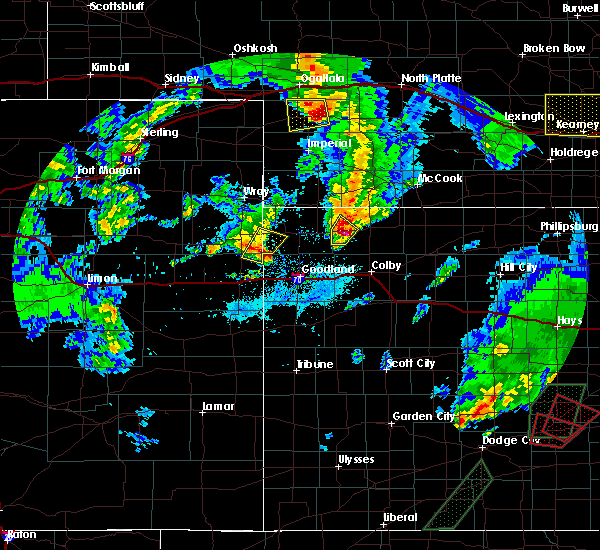 At 735 pm cdt, a severe thunderstorm was located 4 miles southeast of mcdonald, or 14 miles west of atwood, moving northeast at 10 mph (radar indicated). Hazards include two inch hail and 60 mph wind gusts. People and animals outdoors will be injured. expect hail damage to roofs, siding, windows, and vehicles. expect wind damage to roofs, siding, and trees. Locations impacted include, mcdonald and beardsley. At 735 pm cdt, a severe thunderstorm was located 4 miles southeast of mcdonald, or 14 miles west of atwood, moving northeast at 10 mph (radar indicated). Hazards include two inch hail and 60 mph wind gusts. People and animals outdoors will be injured. expect hail damage to roofs, siding, windows, and vehicles. expect wind damage to roofs, siding, and trees. Locations impacted include, mcdonald and beardsley.
|
| 5/16/2017 7:21 PM CDT |
 At 721 pm cdt, a severe thunderstorm was located 4 miles southeast of mcdonald, or 15 miles west of atwood, moving northeast at 25 mph (radar indicated). Hazards include 60 mph wind gusts and half dollar size hail. Hail damage to vehicles is expected. expect wind damage to roofs, siding, and trees. Locations impacted include, mcdonald and beardsley. At 721 pm cdt, a severe thunderstorm was located 4 miles southeast of mcdonald, or 15 miles west of atwood, moving northeast at 25 mph (radar indicated). Hazards include 60 mph wind gusts and half dollar size hail. Hail damage to vehicles is expected. expect wind damage to roofs, siding, and trees. Locations impacted include, mcdonald and beardsley.
|
| 5/16/2017 7:05 PM CDT |
 At 705 pm cdt, a severe thunderstorm was located 6 miles south of mcdonald, or 19 miles southwest of atwood, moving northeast at 15 mph (radar indicated). Hazards include 60 mph wind gusts and half dollar size hail. Hail damage to vehicles is expected. Expect wind damage to roofs, siding, and trees. At 705 pm cdt, a severe thunderstorm was located 6 miles south of mcdonald, or 19 miles southwest of atwood, moving northeast at 15 mph (radar indicated). Hazards include 60 mph wind gusts and half dollar size hail. Hail damage to vehicles is expected. Expect wind damage to roofs, siding, and trees.
|
| 5/9/2017 8:37 PM CDT | Quarter sized hail reported 1.1 miles ENE of McDonald, KS, emergency manager and local fire dept reported mainly dimes and nickels with a few quarters mixed in. vehicle slide off due to fog and hail covering the road at the raw |
| 5/9/2017 8:17 PM CDT |
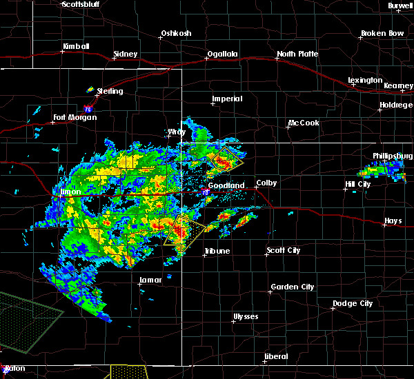 At 817 pm cdt, a severe thunderstorm was located over bird city, or 14 miles east of st. francis, moving northeast at 25 mph (radar indicated). Hazards include 60 mph wind gusts and quarter size hail. Hail damage to vehicles is expected. expect wind damage to roofs, siding, and trees. Locations impacted include, bird city and mcdonald. At 817 pm cdt, a severe thunderstorm was located over bird city, or 14 miles east of st. francis, moving northeast at 25 mph (radar indicated). Hazards include 60 mph wind gusts and quarter size hail. Hail damage to vehicles is expected. expect wind damage to roofs, siding, and trees. Locations impacted include, bird city and mcdonald.
|
| 5/9/2017 7:55 PM CDT |
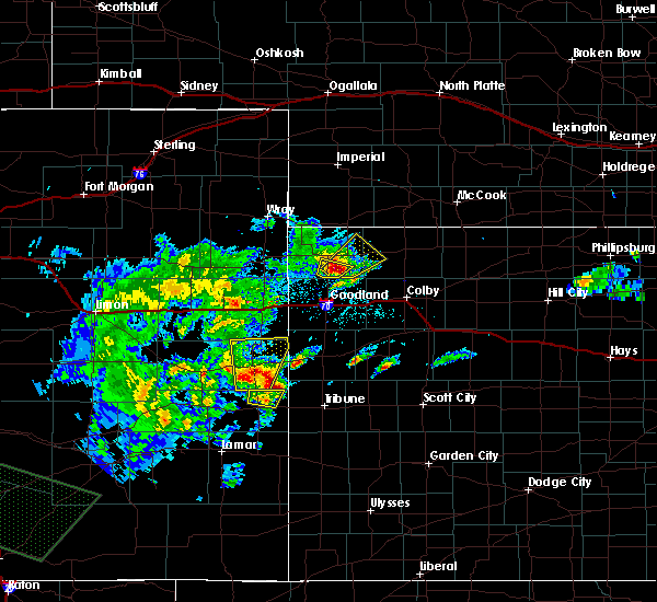 At 755 pm cdt, a severe thunderstorm was located 9 miles southwest of bird city, or 13 miles southeast of st. francis, moving northeast at 20 mph (radar indicated). Hazards include 60 mph wind gusts and half dollar size hail. Hail damage to vehicles is expected. Expect wind damage to roofs, siding, and trees. At 755 pm cdt, a severe thunderstorm was located 9 miles southwest of bird city, or 13 miles southeast of st. francis, moving northeast at 20 mph (radar indicated). Hazards include 60 mph wind gusts and half dollar size hail. Hail damage to vehicles is expected. Expect wind damage to roofs, siding, and trees.
|
| 9/17/2016 5:12 PM CDT |
 At 512 pm cdt, severe thunderstorms were located along a line extending from 8 miles northwest of atwood to 12 miles north of levant, moving east at 50 mph (radar indicated). Hazards include 60 mph wind gusts and nickel size hail. Expect damage to roofs. siding. and trees. Locations impacted include, atwood, mcdonald, ludell, blakeman and beardsley. At 512 pm cdt, severe thunderstorms were located along a line extending from 8 miles northwest of atwood to 12 miles north of levant, moving east at 50 mph (radar indicated). Hazards include 60 mph wind gusts and nickel size hail. Expect damage to roofs. siding. and trees. Locations impacted include, atwood, mcdonald, ludell, blakeman and beardsley.
|
| 9/17/2016 4:42 PM CDT |
 At 341 pm mdt/441 pm cdt/, severe thunderstorms were located along a line extending from near bird city to 7 miles northeast of goodland, moving east at 50 mph (radar indicated). Hazards include 60 mph wind gusts and quarter size hail. Hail damage to vehicles is expected. expect wind damage to roofs, siding, and trees. Visibility will be reduced near zero in blowing dust. At 341 pm mdt/441 pm cdt/, severe thunderstorms were located along a line extending from near bird city to 7 miles northeast of goodland, moving east at 50 mph (radar indicated). Hazards include 60 mph wind gusts and quarter size hail. Hail damage to vehicles is expected. expect wind damage to roofs, siding, and trees. Visibility will be reduced near zero in blowing dust.
|
| 9/15/2016 6:21 PM CDT |
 At 621 pm cdt, a severe thunderstorm was located 4 miles east of mcdonald, or 13 miles west of atwood, moving north at 25 mph (radar indicated). Hazards include 60 mph wind gusts and half dollar size hail. Hail damage to vehicles is expected. Expect wind damage to roofs, siding, and trees. At 621 pm cdt, a severe thunderstorm was located 4 miles east of mcdonald, or 13 miles west of atwood, moving north at 25 mph (radar indicated). Hazards include 60 mph wind gusts and half dollar size hail. Hail damage to vehicles is expected. Expect wind damage to roofs, siding, and trees.
|
| 9/4/2016 12:08 AM CDT |
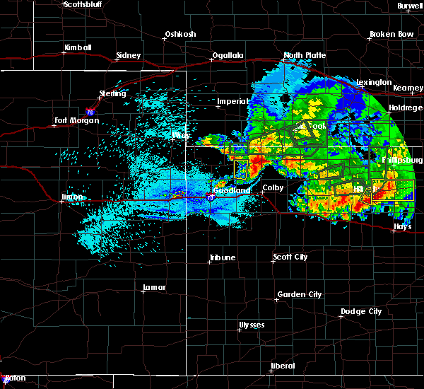 The severe thunderstorm warning for southwestern rawlins county will expire at 1215 am cdt, the storm which prompted the warning has weakened below severe limits, and no longer pose an immediate threat to life or property. therefore the warning will be allowed to expire. however gusty winds and heavy rain are still possible with this thunderstorm. a severe thunderstorm watch remains in effect until 200 am cdt for northwestern kansas. The severe thunderstorm warning for southwestern rawlins county will expire at 1215 am cdt, the storm which prompted the warning has weakened below severe limits, and no longer pose an immediate threat to life or property. therefore the warning will be allowed to expire. however gusty winds and heavy rain are still possible with this thunderstorm. a severe thunderstorm watch remains in effect until 200 am cdt for northwestern kansas.
|
| 9/3/2016 11:58 PM CDT |
 At 1158 pm cdt, a severe thunderstorm was located 8 miles southeast of mcdonald, or 14 miles southwest of atwood, moving east at 30 mph (radar indicated). Hazards include 60 mph wind gusts and quarter size hail. Hail damage to vehicles is expected. expect wind damage to roofs, siding, and trees. Locations impacted include, mcdonald. At 1158 pm cdt, a severe thunderstorm was located 8 miles southeast of mcdonald, or 14 miles southwest of atwood, moving east at 30 mph (radar indicated). Hazards include 60 mph wind gusts and quarter size hail. Hail damage to vehicles is expected. expect wind damage to roofs, siding, and trees. Locations impacted include, mcdonald.
|
| 9/3/2016 11:44 PM CDT |
 At 1144 pm cdt, a severe thunderstorm was located 7 miles south of mcdonald, or 20 miles southwest of atwood, moving southeast at 25 mph (radar indicated). Hazards include 60 mph wind gusts and quarter size hail. Hail damage to vehicles is expected. expect wind damage to roofs, siding, and trees. Locations impacted include, mcdonald. At 1144 pm cdt, a severe thunderstorm was located 7 miles south of mcdonald, or 20 miles southwest of atwood, moving southeast at 25 mph (radar indicated). Hazards include 60 mph wind gusts and quarter size hail. Hail damage to vehicles is expected. expect wind damage to roofs, siding, and trees. Locations impacted include, mcdonald.
|
| 9/3/2016 11:29 PM CDT |
 At 1129 pm cdt, a severe thunderstorm was located 5 miles southeast of bird city, or 18 miles east of st. francis, moving southeast at 35 mph (radar indicated). Hazards include 60 mph wind gusts and half dollar size hail. Hail damage to vehicles is expected. Expect wind damage to roofs, siding, and trees. At 1129 pm cdt, a severe thunderstorm was located 5 miles southeast of bird city, or 18 miles east of st. francis, moving southeast at 35 mph (radar indicated). Hazards include 60 mph wind gusts and half dollar size hail. Hail damage to vehicles is expected. Expect wind damage to roofs, siding, and trees.
|
| 8/19/2016 2:12 AM CDT |
 At 112 am mdt/212 am cdt/, a severe thunderstorm was located near mcdonald, or 14 miles west of atwood, moving northeast at 25 mph (radar indicated). Hazards include 60 mph wind gusts and nickel size hail. Expect damage to roofs. siding. And trees. At 112 am mdt/212 am cdt/, a severe thunderstorm was located near mcdonald, or 14 miles west of atwood, moving northeast at 25 mph (radar indicated). Hazards include 60 mph wind gusts and nickel size hail. Expect damage to roofs. siding. And trees.
|
| 7/28/2016 1:45 AM CDT |
 At 145 am cdt, a severe thunderstorm was located over bird city, or 16 miles east of st. francis, moving south at 20 mph (radar indicated). Hazards include 60 mph wind gusts and quarter size hail. Hail damage to vehicles is expected. Expect wind damage to roofs, siding, and trees. At 145 am cdt, a severe thunderstorm was located over bird city, or 16 miles east of st. francis, moving south at 20 mph (radar indicated). Hazards include 60 mph wind gusts and quarter size hail. Hail damage to vehicles is expected. Expect wind damage to roofs, siding, and trees.
|
| 7/28/2016 1:36 AM CDT |
 At 135 am cdt, a severe thunderstorm was located 7 miles south of mcdonald, or 21 miles southwest of atwood, moving south at 20 mph (radar indicated). Hazards include ping pong ball size hail and 60 mph wind gusts. People and animals outdoors will be injured. expect hail damage to roofs, siding, windows, and vehicles. expect wind damage to roofs, siding, and trees. Locations impacted include, mcdonald and beardsley. At 135 am cdt, a severe thunderstorm was located 7 miles south of mcdonald, or 21 miles southwest of atwood, moving south at 20 mph (radar indicated). Hazards include ping pong ball size hail and 60 mph wind gusts. People and animals outdoors will be injured. expect hail damage to roofs, siding, windows, and vehicles. expect wind damage to roofs, siding, and trees. Locations impacted include, mcdonald and beardsley.
|
| 7/28/2016 1:31 AM CDT |
 At 130 am cdt, a severe thunderstorm was located 5 miles south of mcdonald, or 19 miles southwest of atwood, moving south at 20 mph (radar indicated). Hazards include ping pong ball size hail and 60 mph wind gusts. People and animals outdoors will be injured. expect hail damage to roofs, siding, windows, and vehicles. expect wind damage to roofs, siding, and trees. Locations impacted include, mcdonald and beardsley. At 130 am cdt, a severe thunderstorm was located 5 miles south of mcdonald, or 19 miles southwest of atwood, moving south at 20 mph (radar indicated). Hazards include ping pong ball size hail and 60 mph wind gusts. People and animals outdoors will be injured. expect hail damage to roofs, siding, windows, and vehicles. expect wind damage to roofs, siding, and trees. Locations impacted include, mcdonald and beardsley.
|
| 7/28/2016 1:17 AM CDT |
 At 116 am cdt, a severe thunderstorm was located near mcdonald, or 16 miles west of atwood, moving south at 25 mph (radar indicated). Hazards include golf ball size hail and 60 mph wind gusts. People and animals outdoors will be injured. expect hail damage to roofs, siding, windows, and vehicles. Expect wind damage to roofs, siding, and trees. At 116 am cdt, a severe thunderstorm was located near mcdonald, or 16 miles west of atwood, moving south at 25 mph (radar indicated). Hazards include golf ball size hail and 60 mph wind gusts. People and animals outdoors will be injured. expect hail damage to roofs, siding, windows, and vehicles. Expect wind damage to roofs, siding, and trees.
|
| 7/14/2016 1:03 AM CDT |
 At 102 am cdt, a severe thunderstorm was located near mcdonald, or 15 miles west of atwood, moving east at 25 mph (radar indicated). Hazards include 60 mph wind gusts and quarter size hail. Hail damage to vehicles is expected. expect wind damage to roofs, siding, and trees. Locations impacted include, oberlin, atwood, mcdonald, jennings, ludell, dresden and kanona. At 102 am cdt, a severe thunderstorm was located near mcdonald, or 15 miles west of atwood, moving east at 25 mph (radar indicated). Hazards include 60 mph wind gusts and quarter size hail. Hail damage to vehicles is expected. expect wind damage to roofs, siding, and trees. Locations impacted include, oberlin, atwood, mcdonald, jennings, ludell, dresden and kanona.
|
| 7/14/2016 12:51 AM CDT |
 At 1251 am cdt, a severe thunderstorm was located 8 miles southeast of mcdonald, or 11 miles southwest of atwood, moving east at 60 mph (radar indicated). Hazards include 60 mph wind gusts and quarter size hail. Hail damage to vehicles is expected. Expect wind damage to roofs, siding, and trees. At 1251 am cdt, a severe thunderstorm was located 8 miles southeast of mcdonald, or 11 miles southwest of atwood, moving east at 60 mph (radar indicated). Hazards include 60 mph wind gusts and quarter size hail. Hail damage to vehicles is expected. Expect wind damage to roofs, siding, and trees.
|
| 7/13/2016 2:34 AM CDT |
 At 133 am mdt/233 am cdt/, a severe thunderstorm was located 5 miles west of bird city, or 9 miles east of st. francis, moving east at 45 mph (radar indicated). Hazards include ping pong ball size hail and 60 mph wind gusts. People and animals outdoors will be injured. expect hail damage to roofs, siding, windows, and vehicles. expect wind damage to roofs, siding, and trees. locations impacted include, st. Francis, atwood, bird city, mcdonald, ludell, wheeler and blakeman. At 133 am mdt/233 am cdt/, a severe thunderstorm was located 5 miles west of bird city, or 9 miles east of st. francis, moving east at 45 mph (radar indicated). Hazards include ping pong ball size hail and 60 mph wind gusts. People and animals outdoors will be injured. expect hail damage to roofs, siding, windows, and vehicles. expect wind damage to roofs, siding, and trees. locations impacted include, st. Francis, atwood, bird city, mcdonald, ludell, wheeler and blakeman.
|
| 7/13/2016 2:19 AM CDT |
 At 118 am mdt/218 am cdt/, a severe thunderstorm was located near st. francis, moving east at 45 mph (radar indicated). Hazards include 60 mph wind gusts and quarter size hail. Hail damage to vehicles is expected. Expect wind damage to roofs, siding, and trees. At 118 am mdt/218 am cdt/, a severe thunderstorm was located near st. francis, moving east at 45 mph (radar indicated). Hazards include 60 mph wind gusts and quarter size hail. Hail damage to vehicles is expected. Expect wind damage to roofs, siding, and trees.
|
| 7/7/2016 8:15 PM CDT |
 At 815 pm cdt, a severe thunderstorm was located 4 miles southwest of mcdonald, or 19 miles east of st. francis, moving southeast at 30 mph. this is a very dangerous storm (trained weather spotters). Hazards include softball size hail and 70 mph wind gusts. People and animals outdoors will be severely injured. Expect shattered windows, extensive damage to roofs, siding, and vehicles. At 815 pm cdt, a severe thunderstorm was located 4 miles southwest of mcdonald, or 19 miles east of st. francis, moving southeast at 30 mph. this is a very dangerous storm (trained weather spotters). Hazards include softball size hail and 70 mph wind gusts. People and animals outdoors will be severely injured. Expect shattered windows, extensive damage to roofs, siding, and vehicles.
|
| 6/28/2016 11:15 PM CDT |
 At 1115 pm cdt, severe thunderstorms were located along a line extending from 6 miles north of danbury to 10 miles northwest of brewster, moving south at 30 mph (wind gusts measured at atwood airport). Hazards include 60 mph wind gusts and nickel size hail. Expect damage to roofs. siding. and trees. Locations impacted include, mccook, oberlin, atwood, trenton, culbertson, indianola and bartley. At 1115 pm cdt, severe thunderstorms were located along a line extending from 6 miles north of danbury to 10 miles northwest of brewster, moving south at 30 mph (wind gusts measured at atwood airport). Hazards include 60 mph wind gusts and nickel size hail. Expect damage to roofs. siding. and trees. Locations impacted include, mccook, oberlin, atwood, trenton, culbertson, indianola and bartley.
|
| 6/28/2016 11:08 PM CDT |
 At 1107 pm cdt, severe thunderstorms were located along a line extending from near indianola to 13 miles south of mcdonald, moving south at 70 mph (radar indicated). Hazards include 70 mph wind gusts and nickel size hail. Expect considerable tree damage. Damage is likely to mobile homes, roofs, and outbuildings. At 1107 pm cdt, severe thunderstorms were located along a line extending from near indianola to 13 miles south of mcdonald, moving south at 70 mph (radar indicated). Hazards include 70 mph wind gusts and nickel size hail. Expect considerable tree damage. Damage is likely to mobile homes, roofs, and outbuildings.
|
| 6/28/2016 11:00 PM CDT |
 At 959 pm mdt/1059 pm cdt/, severe thunderstorms were located along a line extending from 8 miles east of mcdonald to 10 miles southwest of st. francis, moving south at 40 mph. these are very dangerous storms (trained weather spotters reported blowing dust and large limbs blown down in bird city). Hazards include 80 mph wind gusts and penny size hail. Flying debris will be dangerous to those caught without shelter. mobile homes will be heavily damaged. expect considerable damage to roofs, windows, and vehicles. extensive tree damage and power outages are likely. locations impacted include, st. Francis, atwood, bird city, mcdonald, herndon, ludell and wheeler. At 959 pm mdt/1059 pm cdt/, severe thunderstorms were located along a line extending from 8 miles east of mcdonald to 10 miles southwest of st. francis, moving south at 40 mph. these are very dangerous storms (trained weather spotters reported blowing dust and large limbs blown down in bird city). Hazards include 80 mph wind gusts and penny size hail. Flying debris will be dangerous to those caught without shelter. mobile homes will be heavily damaged. expect considerable damage to roofs, windows, and vehicles. extensive tree damage and power outages are likely. locations impacted include, st. Francis, atwood, bird city, mcdonald, herndon, ludell and wheeler.
|
| 6/28/2016 10:53 PM CDT |
 At 953 pm mdt/1053 pm cdt/, severe thunderstorms were located along a line extending from 8 miles northeast of mcdonald to 7 miles southwest of st. francis, moving south at 40 mph. these are very dangerous storms (trained weather spotters in bird city reported large tree limbs blown down). Hazards include 80 mph wind gusts. Flying debris will be dangerous to those caught without shelter. mobile homes will be heavily damaged. expect considerable damage to roofs, windows, and vehicles. extensive tree damage and power outages are likely. locations impacted include, st. Francis, atwood, bird city, mcdonald, herndon, ludell and wheeler. At 953 pm mdt/1053 pm cdt/, severe thunderstorms were located along a line extending from 8 miles northeast of mcdonald to 7 miles southwest of st. francis, moving south at 40 mph. these are very dangerous storms (trained weather spotters in bird city reported large tree limbs blown down). Hazards include 80 mph wind gusts. Flying debris will be dangerous to those caught without shelter. mobile homes will be heavily damaged. expect considerable damage to roofs, windows, and vehicles. extensive tree damage and power outages are likely. locations impacted include, st. Francis, atwood, bird city, mcdonald, herndon, ludell and wheeler.
|
| 6/28/2016 10:47 PM CDT |
 At 947 pm mdt/1047 pm cdt/, severe thunderstorms were located along a line extending from 13 miles northeast of mcdonald to 5 miles west of st. francis, moving southeast at 35 mph (measured 8 miles north-northeast of st. francis). Hazards include 62 mph wind gusts. Expect damage to roofs. siding. and trees. locations impacted include, st. Francis, atwood, bird city, mcdonald, herndon, ludell and wheeler. At 947 pm mdt/1047 pm cdt/, severe thunderstorms were located along a line extending from 13 miles northeast of mcdonald to 5 miles west of st. francis, moving southeast at 35 mph (measured 8 miles north-northeast of st. francis). Hazards include 62 mph wind gusts. Expect damage to roofs. siding. and trees. locations impacted include, st. Francis, atwood, bird city, mcdonald, herndon, ludell and wheeler.
|
| 6/28/2016 10:41 PM CDT |
 At 941 pm mdt/1041 pm cdt/, severe thunderstorms were located along a line extending from 10 miles southwest of stratton to 9 miles west of st. francis, moving south at 40 mph (radar indicated). Hazards include 70 mph wind gusts. Expect considerable tree damage. damage is likely to mobile homes, roofs, and outbuildings. locations impacted include, st. Francis, atwood, bird city, mcdonald, herndon, ludell and wheeler. At 941 pm mdt/1041 pm cdt/, severe thunderstorms were located along a line extending from 10 miles southwest of stratton to 9 miles west of st. francis, moving south at 40 mph (radar indicated). Hazards include 70 mph wind gusts. Expect considerable tree damage. damage is likely to mobile homes, roofs, and outbuildings. locations impacted include, st. Francis, atwood, bird city, mcdonald, herndon, ludell and wheeler.
|
| 6/28/2016 10:31 PM CDT |
 At 931 pm mdt/1031 pm cdt/, severe thunderstorms were located along a line extending from 7 miles southwest of stratton to 8 miles southwest of haigler, moving south at 40 mph. these are very dangerous storms (radar indicated). Hazards include 90 mph wind gusts and nickel size hail. You are in a life-threatening situation. flying debris may be deadly to those caught without shelter. mobile homes will be heavily damaged or destroyed. homes and businesses will have substantial roof and window damage. Expect extensive tree damage and power outages. At 931 pm mdt/1031 pm cdt/, severe thunderstorms were located along a line extending from 7 miles southwest of stratton to 8 miles southwest of haigler, moving south at 40 mph. these are very dangerous storms (radar indicated). Hazards include 90 mph wind gusts and nickel size hail. You are in a life-threatening situation. flying debris may be deadly to those caught without shelter. mobile homes will be heavily damaged or destroyed. homes and businesses will have substantial roof and window damage. Expect extensive tree damage and power outages.
|
| 6/11/2016 6:22 PM CDT |
 At 621 pm cdt, a severe thunderstorm was located 4 miles north of mcdonald, or 17 miles southeast of benkelman, moving north at 20 mph (trained weather spotters. at 610 cdt...dime size hail...an estimated 60 mph gust and small tree limbs down were reported in mcdonald). Hazards include 60 mph wind gusts and nickel size hail. Expect damage to roofs. siding. and trees. Locations impacted include, mcdonald. At 621 pm cdt, a severe thunderstorm was located 4 miles north of mcdonald, or 17 miles southeast of benkelman, moving north at 20 mph (trained weather spotters. at 610 cdt...dime size hail...an estimated 60 mph gust and small tree limbs down were reported in mcdonald). Hazards include 60 mph wind gusts and nickel size hail. Expect damage to roofs. siding. and trees. Locations impacted include, mcdonald.
|
| 6/11/2016 6:10 PM CDT | Branches around 1 inch in diameter on groun in rawlins county KS, 0.4 miles S of McDonald, KS |
| 6/11/2016 6:00 PM CDT |
 At 600 pm cdt, a severe thunderstorm was located near mcdonald, or 16 miles west of atwood, moving north at 20 mph (radar indicated). Hazards include 60 mph wind gusts and quarter size hail. Hail damage to vehicles is expected. Expect wind damage to roofs, siding, and trees. At 600 pm cdt, a severe thunderstorm was located near mcdonald, or 16 miles west of atwood, moving north at 20 mph (radar indicated). Hazards include 60 mph wind gusts and quarter size hail. Hail damage to vehicles is expected. Expect wind damage to roofs, siding, and trees.
|
| 5/26/2016 8:48 PM CDT |
 At 848 pm cdt, severe thunderstorms were located along a line extending from near st. francis to near atwood, moving northeast at 160 mph (radar indicated). Hazards include 70 mph wind gusts. Expect considerable tree damage. Damage is likely to mobile homes, roofs, and outbuildings. At 848 pm cdt, severe thunderstorms were located along a line extending from near st. francis to near atwood, moving northeast at 160 mph (radar indicated). Hazards include 70 mph wind gusts. Expect considerable tree damage. Damage is likely to mobile homes, roofs, and outbuildings.
|
| 5/26/2016 8:03 PM CDT |
 At 803 pm cdt, severe thunderstorms were located along a line extending from near st. francis to 13 miles south of mcdonald, moving northeast at 85 mph. these are very dangerous storms (radar indicated). Hazards include 80 mph wind gusts. Flying debris will be dangerous to those caught without shelter. mobile homes will be heavily damaged. expect considerable damage to roofs, windows, and vehicles. Extensive tree damage and power outages are likely. At 803 pm cdt, severe thunderstorms were located along a line extending from near st. francis to 13 miles south of mcdonald, moving northeast at 85 mph. these are very dangerous storms (radar indicated). Hazards include 80 mph wind gusts. Flying debris will be dangerous to those caught without shelter. mobile homes will be heavily damaged. expect considerable damage to roofs, windows, and vehicles. Extensive tree damage and power outages are likely.
|
| 5/8/2016 6:25 PM CDT |
 At 625 pm cdt, a severe thunderstorm was located 7 miles northeast of mcdonald, or 12 miles west of atwood, moving north at 35 mph (radar indicated). Hazards include 60 mph wind gusts and quarter size hail. Hail damage to vehicles is expected. expect wind damage to roofs, siding, and trees. locations impacted include, mcdonald and beardsley. A tornado watch remains in effect until 1000 pm cdt for northwestern kansas. At 625 pm cdt, a severe thunderstorm was located 7 miles northeast of mcdonald, or 12 miles west of atwood, moving north at 35 mph (radar indicated). Hazards include 60 mph wind gusts and quarter size hail. Hail damage to vehicles is expected. expect wind damage to roofs, siding, and trees. locations impacted include, mcdonald and beardsley. A tornado watch remains in effect until 1000 pm cdt for northwestern kansas.
|
| 5/8/2016 6:14 PM CDT |
 At 614 pm cdt, a severe thunderstorm was located near mcdonald, or 16 miles west of atwood, moving north at 20 mph (radar indicated). Hazards include ping pong ball size hail and 60 mph wind gusts. People and animals outdoors will be injured. expect hail damage to roofs, siding, windows, and vehicles. expect wind damage to roofs, siding, and trees. locations impacted include, mcdonald and beardsley. A tornado watch remains in effect until 1000 pm cdt for northwestern kansas. At 614 pm cdt, a severe thunderstorm was located near mcdonald, or 16 miles west of atwood, moving north at 20 mph (radar indicated). Hazards include ping pong ball size hail and 60 mph wind gusts. People and animals outdoors will be injured. expect hail damage to roofs, siding, windows, and vehicles. expect wind damage to roofs, siding, and trees. locations impacted include, mcdonald and beardsley. A tornado watch remains in effect until 1000 pm cdt for northwestern kansas.
|
| 5/8/2016 6:02 PM CDT |
 At 601 pm cdt, a severe thunderstorm was located 8 miles south of mcdonald, or 17 miles southwest of atwood, moving north at 20 mph (radar indicated). Hazards include 60 mph wind gusts and half dollar size hail. Hail damage to vehicles is expected. Expect wind damage to roofs, siding, and trees. At 601 pm cdt, a severe thunderstorm was located 8 miles south of mcdonald, or 17 miles southwest of atwood, moving north at 20 mph (radar indicated). Hazards include 60 mph wind gusts and half dollar size hail. Hail damage to vehicles is expected. Expect wind damage to roofs, siding, and trees.
|
| 4/23/2016 11:22 PM CDT |
 At 1121 pm cdt, severe thunderstorms were located along a line extending from 7 miles southeast of stratton to 13 miles north of levant, moving northeast at 45 mph (radar indicated). Hazards include 60 mph wind gusts. Expect damage to roofs. siding. And trees. At 1121 pm cdt, severe thunderstorms were located along a line extending from 7 miles southeast of stratton to 13 miles north of levant, moving northeast at 45 mph (radar indicated). Hazards include 60 mph wind gusts. Expect damage to roofs. siding. And trees.
|
| 11/16/2015 3:46 PM CST |
 At 345 pm cst, a severe thunderstorm was located 7 miles south of mcdonald, or 20 miles southwest of atwood, moving north at 45 mph (radar indicated). Hazards include 60 mph wind gusts and half dollar size hail. Hail damage to vehicles is expected. expect wind damage to roofs, siding and trees. locations impacted include, bird city, mcdonald and beardsley. A tornado watch remains in effect until 1000 pm cst for northwestern kansas. At 345 pm cst, a severe thunderstorm was located 7 miles south of mcdonald, or 20 miles southwest of atwood, moving north at 45 mph (radar indicated). Hazards include 60 mph wind gusts and half dollar size hail. Hail damage to vehicles is expected. expect wind damage to roofs, siding and trees. locations impacted include, bird city, mcdonald and beardsley. A tornado watch remains in effect until 1000 pm cst for northwestern kansas.
|
| 11/16/2015 3:35 PM CST |
 At 235 pm mst/335 pm cst/, a severe thunderstorm was located 13 miles north of brewster, moving north at 55 mph (radar indicated). Hazards include 60 mph wind gusts and half dollar size hail. Hail damage to vehicles is expected. expect wind damage to roofs, siding and trees. locations impacted include, bird city, mcdonald and beardsley. A tornado watch remains in effect until 900 pm mst/1000 pm cst/ for northwestern kansas. At 235 pm mst/335 pm cst/, a severe thunderstorm was located 13 miles north of brewster, moving north at 55 mph (radar indicated). Hazards include 60 mph wind gusts and half dollar size hail. Hail damage to vehicles is expected. expect wind damage to roofs, siding and trees. locations impacted include, bird city, mcdonald and beardsley. A tornado watch remains in effect until 900 pm mst/1000 pm cst/ for northwestern kansas.
|
| 11/16/2015 3:26 PM CST |
 At 226 pm mst/326 pm cst/, a severe thunderstorm was located 7 miles northwest of brewster, moving north at 55 mph (radar indicated). Hazards include 60 mph wind gusts and quarter size hail. Hail damage to vehicles is expected. Expect wind damage to roofs, siding and trees. At 226 pm mst/326 pm cst/, a severe thunderstorm was located 7 miles northwest of brewster, moving north at 55 mph (radar indicated). Hazards include 60 mph wind gusts and quarter size hail. Hail damage to vehicles is expected. Expect wind damage to roofs, siding and trees.
|
| 8/16/2015 4:10 PM CDT | Storm damage reported in rawlins county KS, 7.9 miles N of McDonald, KS |
| 8/7/2015 8:47 PM CDT |
 At 746 pm mdt /846 pm cdt/, severe thunderstorms were located along a line extending from 3 miles north of bird city to 6 miles northwest of grinnell, moving north at 30 mph (radar indicated). Hazards include 70 mph wind gusts and quarter size hail. Hail damage to vehicles is expected. expect considerable tree damage. wind damage is also likely to mobile homes, roofs and outbuildings. locations impacted include, colby, oakley, hoxie, atwood, benkelman, grainfield, grinnell, levant, bird city and rexford. This includes interstate 70 in kansas between mile markers 46 and 97. At 746 pm mdt /846 pm cdt/, severe thunderstorms were located along a line extending from 3 miles north of bird city to 6 miles northwest of grinnell, moving north at 30 mph (radar indicated). Hazards include 70 mph wind gusts and quarter size hail. Hail damage to vehicles is expected. expect considerable tree damage. wind damage is also likely to mobile homes, roofs and outbuildings. locations impacted include, colby, oakley, hoxie, atwood, benkelman, grainfield, grinnell, levant, bird city and rexford. This includes interstate 70 in kansas between mile markers 46 and 97.
|
| 8/7/2015 8:33 PM CDT |
 At 732 pm mdt /832 pm cdt/, severe thunderstorms were located along a line extending from 3 miles south of bird city to 6 miles southeast of oakley, moving north at 25 mph (radar indicated). Hazards include 60 mph wind gusts and quarter size hail. Hail damage to vehicles is expected. Expect wind damage to roofs, siding and trees. At 732 pm mdt /832 pm cdt/, severe thunderstorms were located along a line extending from 3 miles south of bird city to 6 miles southeast of oakley, moving north at 25 mph (radar indicated). Hazards include 60 mph wind gusts and quarter size hail. Hail damage to vehicles is expected. Expect wind damage to roofs, siding and trees.
|
| 8/4/2015 1:54 PM CDT |
 At 154 pm cdt, a severe thunderstorm was located near bird city, or 16 miles east of st. francis, moving southeast at 20 mph (trained weather spotters). Hazards include 70 mph wind gusts and half dollar size hail. Hail damage to vehicles is expected. expect considerable tree damage. wind damage is also likely to mobile homes, roofs and outbuildings. Locations impacted include, bird city and mcdonald. At 154 pm cdt, a severe thunderstorm was located near bird city, or 16 miles east of st. francis, moving southeast at 20 mph (trained weather spotters). Hazards include 70 mph wind gusts and half dollar size hail. Hail damage to vehicles is expected. expect considerable tree damage. wind damage is also likely to mobile homes, roofs and outbuildings. Locations impacted include, bird city and mcdonald.
|
| 8/4/2015 1:44 PM CDT |
 At 144 pm cdt, a severe thunderstorm was located near bird city, or 13 miles east of st. francis, moving southeast at 20 mph (radar indicated). Hazards include 60 mph wind gusts and quarter size hail. Hail damage to vehicles is expected. Expect wind damage to roofs, siding and trees. At 144 pm cdt, a severe thunderstorm was located near bird city, or 13 miles east of st. francis, moving southeast at 20 mph (radar indicated). Hazards include 60 mph wind gusts and quarter size hail. Hail damage to vehicles is expected. Expect wind damage to roofs, siding and trees.
|
| 7/18/2015 11:10 PM CDT |
 At 1109 pm cdt, severe thunderstorms were located along a line extending from 10 miles southeast of benkelman to 14 miles north of levant, moving east at 25 mph (weather instrument at st. francis). Hazards include 60 mph wind gusts. Expect damage to roofs. siding and trees. Locations impacted include, atwood, bird city, mcdonald, herndon, ludell, blakeman and beardsley. At 1109 pm cdt, severe thunderstorms were located along a line extending from 10 miles southeast of benkelman to 14 miles north of levant, moving east at 25 mph (weather instrument at st. francis). Hazards include 60 mph wind gusts. Expect damage to roofs. siding and trees. Locations impacted include, atwood, bird city, mcdonald, herndon, ludell, blakeman and beardsley.
|
| 7/18/2015 10:54 PM CDT |
 At 1053 pm cdt, severe thunderstorm outflow winds were located along a line extending from 5 miles southeast of benkelman to 13 miles southeast of bird city, moving east at 25 mph (weather instrument at st. francis). Hazards include 62 mph wind gusts. Expect damage to roofs. siding and trees. Locations impacted include, atwood, bird city, mcdonald, herndon, ludell, blakeman, beardsley and wheeler. At 1053 pm cdt, severe thunderstorm outflow winds were located along a line extending from 5 miles southeast of benkelman to 13 miles southeast of bird city, moving east at 25 mph (weather instrument at st. francis). Hazards include 62 mph wind gusts. Expect damage to roofs. siding and trees. Locations impacted include, atwood, bird city, mcdonald, herndon, ludell, blakeman, beardsley and wheeler.
|
| 7/18/2015 10:39 PM CDT |
 At 1038 pm cdt, severe thunderstorm outflow winds were located along a line extending from 5 miles southwest of benkelman to 11 miles south of bird city, moving east at 25 mph (weather instrument at st. francis airport). Hazards include 60 mph wind gusts. Expect damage to roofs. Siding and trees. At 1038 pm cdt, severe thunderstorm outflow winds were located along a line extending from 5 miles southwest of benkelman to 11 miles south of bird city, moving east at 25 mph (weather instrument at st. francis airport). Hazards include 60 mph wind gusts. Expect damage to roofs. Siding and trees.
|
| 7/11/2015 6:12 PM CDT | The severe thunderstorm warning for northwestern rawlins county will expire at 615 pm cdt. the storm which prompted the warning has weakened below severe limits. and no longer pose an immediate threat to life or property. therefore the warning will be allowed to expire. however small hail. Gusty winds and heavy rain are still possible with this. |
| 7/11/2015 5:53 PM CDT |
 At 552 pm cdt, a severe thunderstorm was located 4 miles west of atwood, moving east at 10 mph (radar indicated). Hazards include 60 mph wind gusts and quarter size hail. Hail damage to vehicles is expected. expect wind damage to roofs, siding and trees. Locations impacted include, atwood, mcdonald, blakeman and beardsley. At 552 pm cdt, a severe thunderstorm was located 4 miles west of atwood, moving east at 10 mph (radar indicated). Hazards include 60 mph wind gusts and quarter size hail. Hail damage to vehicles is expected. expect wind damage to roofs, siding and trees. Locations impacted include, atwood, mcdonald, blakeman and beardsley.
|
| 7/11/2015 5:37 PM CDT |
 At 536 pm cdt, a severe thunderstorm was located 7 miles northeast of mcdonald, or 12 miles west of atwood, and is nearly stationary (radar indicated). Hazards include 60 mph wind gusts and quarter size hail. Hail damage to vehicles is expected. expect wind damage to roofs, siding and trees. Locations impacted include, atwood, mcdonald, blakeman and beardsley. At 536 pm cdt, a severe thunderstorm was located 7 miles northeast of mcdonald, or 12 miles west of atwood, and is nearly stationary (radar indicated). Hazards include 60 mph wind gusts and quarter size hail. Hail damage to vehicles is expected. expect wind damage to roofs, siding and trees. Locations impacted include, atwood, mcdonald, blakeman and beardsley.
|
| 7/11/2015 5:15 PM CDT |
 At 515 pm cdt, a severe thunderstorm was located 7 miles northeast of mcdonald, or 11 miles west of atwood, and is nearly stationary (radar indicated). Hazards include 60 mph wind gusts and quarter size hail. Hail damage to vehicles is expected. Expect wind damage to roofs, siding and trees. At 515 pm cdt, a severe thunderstorm was located 7 miles northeast of mcdonald, or 11 miles west of atwood, and is nearly stationary (radar indicated). Hazards include 60 mph wind gusts and quarter size hail. Hail damage to vehicles is expected. Expect wind damage to roofs, siding and trees.
|
| 6/5/2015 8:58 PM MDT | At 856 pm mdt /956 pm cdt/, a severe thunderstorm was located 6 miles northeast of benkelman, moving north at 30 mph (radar indicated). Hazards include 70 mph wind gusts and quarter size hail. Hail damage to vehicles is expected. expect considerable tree damage. Wind damage is also likely to mobile homes, roofs and outbuildings. |
| 6/5/2015 8:58 PM MDT | At 856 pm mdt /956 pm cdt/, a severe thunderstorm was located 6 miles northeast of benkelman, moving north at 30 mph (radar indicated). Hazards include 70 mph wind gusts and quarter size hail. Hail damage to vehicles is expected. expect considerable tree damage. Wind damage is also likely to mobile homes, roofs and outbuildings. |
| 5/15/2015 10:39 PM CDT | At 938 pm mdt /1038 pm cdt/, strong winds behind an outflow boundary were located along a line extending from 3 miles northwest of st. francis to 6 miles southwest of atwood to near menlo, moving east at 55 mph (measured at goodland airport). Hazards include 60 mph wind gusts. Expect damage to roofs. siding and trees. locations impacted include, colby, goodland, st. francis, atwood, brewster, levant, bird city, rexford, selden and mcdonald. this includes interstate 70 in kansas between mile markers 29 and 72. 75in. |
| 5/15/2015 9:23 PM MDT | At 921 pm mdt /1021 pm cdt/, thunderstorms were located along a line extending from 4 miles northwest of ruleton to 7 miles northwest of oakley, moving northeast at 45 mph (measured at goodland airport). Hazards include 60 mph wind gusts. Expect damage to roofs. Siding and trees. |
| 5/15/2015 9:23 PM MDT | At 921 pm mdt /1021 pm cdt/, thunderstorms were located along a line extending from 4 miles northwest of ruleton to 7 miles northwest of oakley, moving northeast at 45 mph (measured at goodland airport). Hazards include 60 mph wind gusts. Expect damage to roofs. Siding and trees. |
| 5/9/2015 11:47 PM CDT | At 1147 pm cdt, a severe thunderstorm was located 9 miles east of mcdonald, or 9 miles southwest of atwood, moving north at 35 mph (radar indicated). Hazards include 60 mph wind gusts and penny size hail. Expect damage to roofs. Siding and trees. |
| 5/9/2015 11:36 PM CDT | At 1136 pm cdt, a severe thunderstorm was located 11 miles southeast of mcdonald, or 14 miles southwest of atwood, moving north at 35 mph (radar indicated). Hazards include 70 mph wind gusts and nickel size hail. Expect considerable tree damage. Damage is likely to mobile homes, roofs and outbuildings. |
| 6/27/2014 6:05 PM CDT | Reported roughly 10 n of mcdonald and 2 east on road d. lasted about 10 minutes in rawlins county KS, 10.1 miles SSW of McDonald, KS |
| 1/1/0001 12:00 AM | Storm damage reported in rawlins county KS, 5.9 miles W of McDonald, KS |
| 1/1/0001 12:00 AM | Tree blown across highway 3 in rawlins county KS, 0.4 miles S of McDonald, KS |
| 1/1/0001 12:00 AM | Quarter sized hail reported 9.2 miles SW of McDonald, KS |
| 1/1/0001 12:00 AM | Half Dollar sized hail reported 11 miles NW of McDonald, KS |
| 1/1/0001 12:00 AM | Ping Pong Ball sized hail reported 5.1 miles N of McDonald, KS |
| 1/1/0001 12:00 AM | Quarter sized hail reported 6 miles NNE of McDonald, KS |
Hail Maps for McDonald, KS
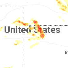
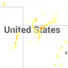
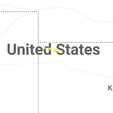
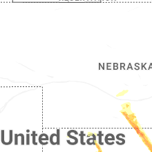

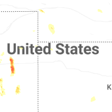
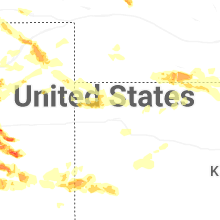
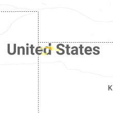
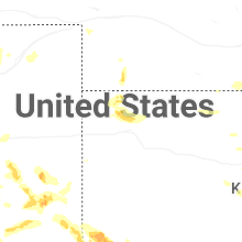
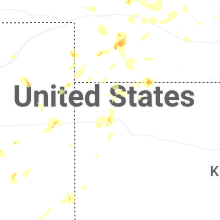
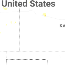
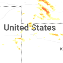
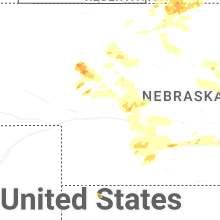
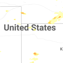
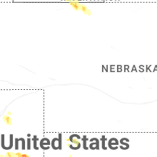
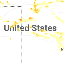
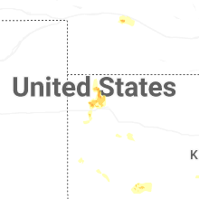


Connect with Interactive Hail Maps