

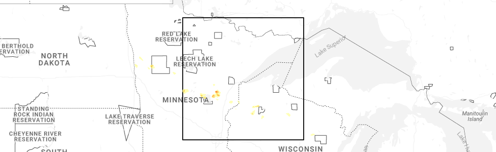
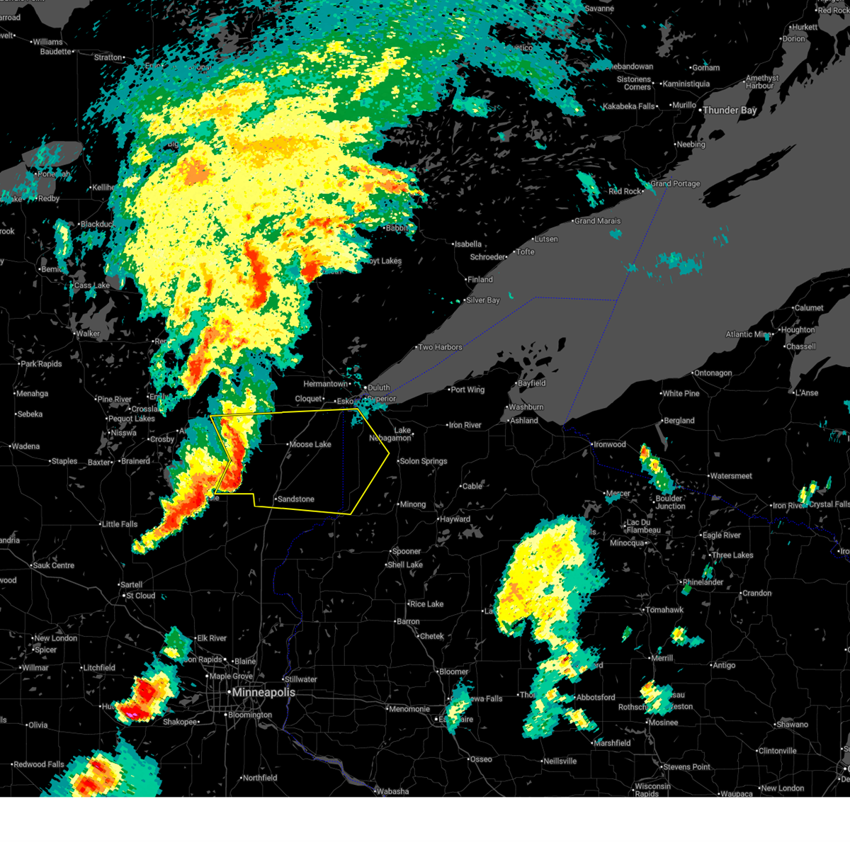
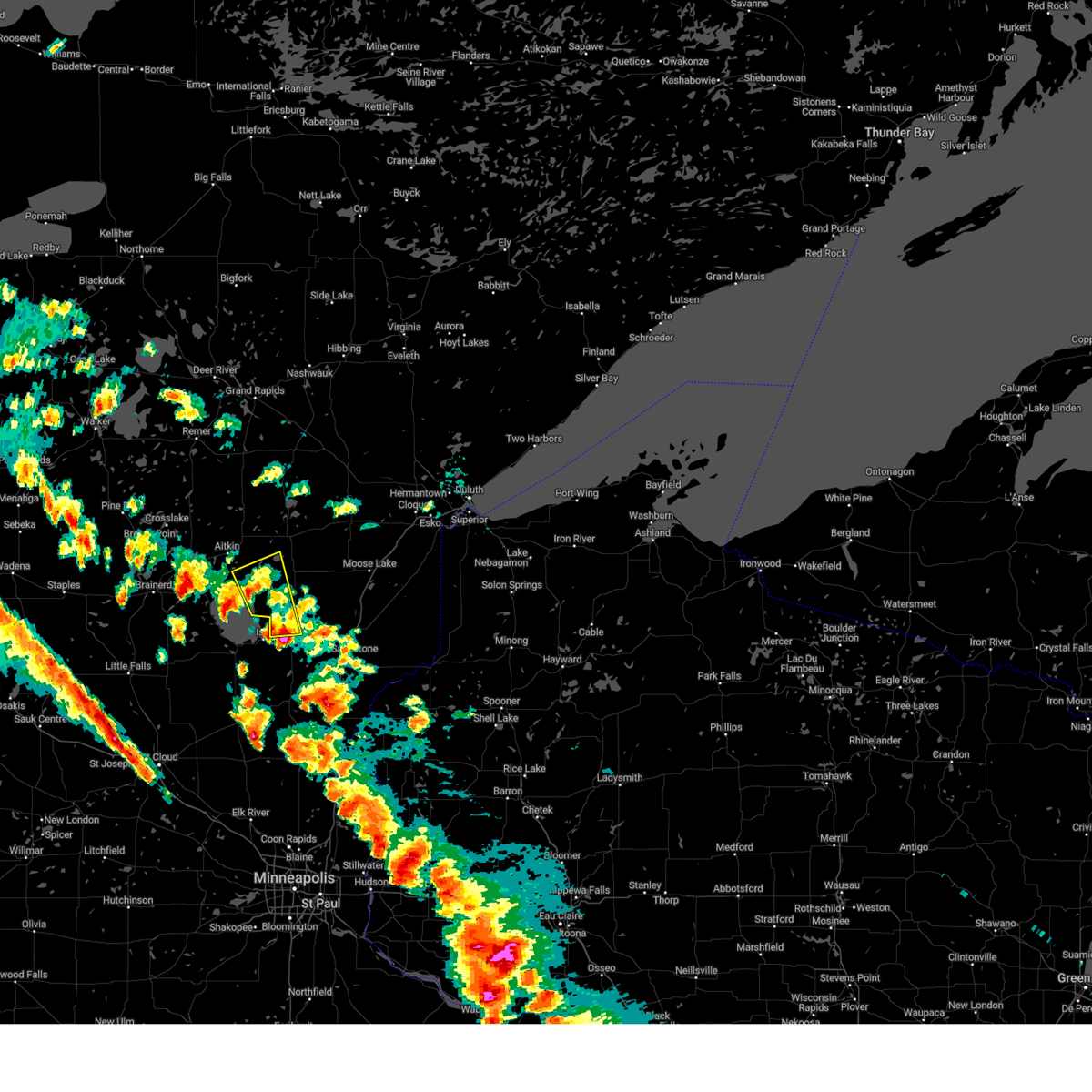
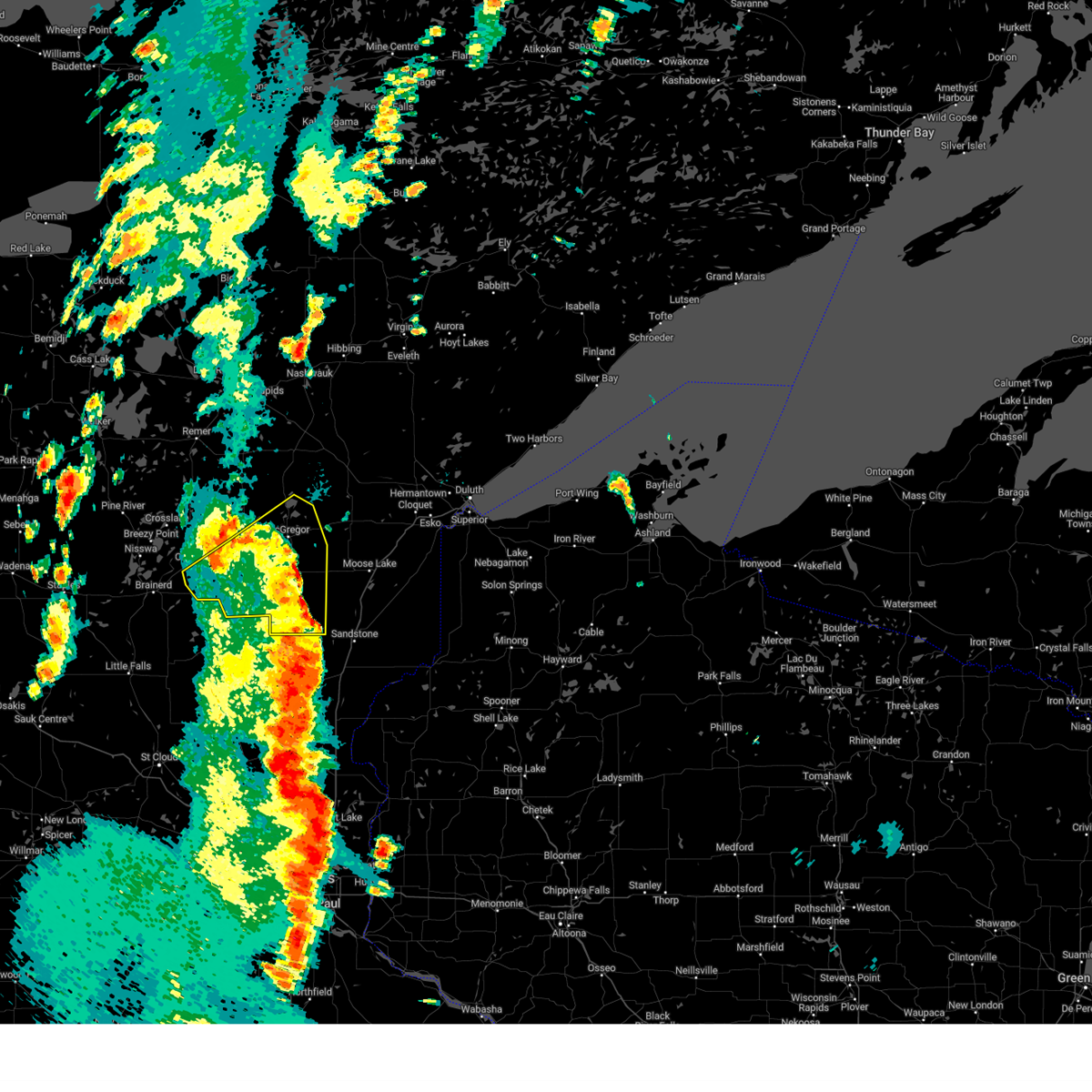
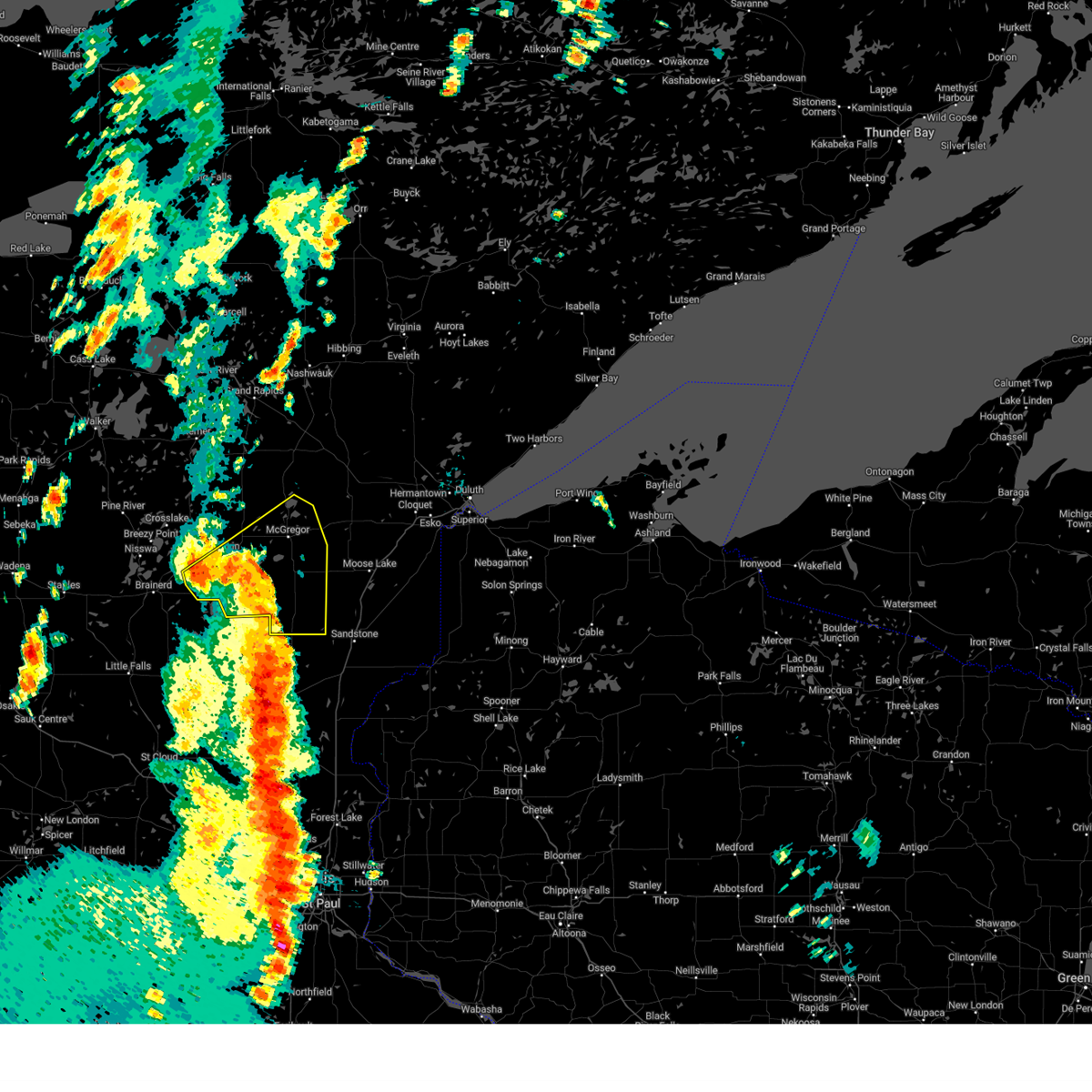
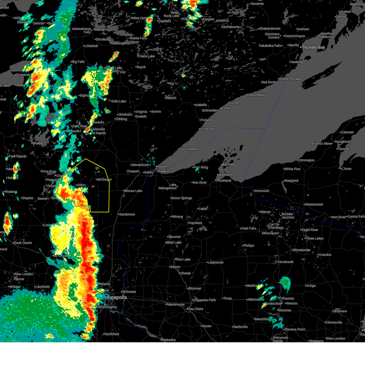
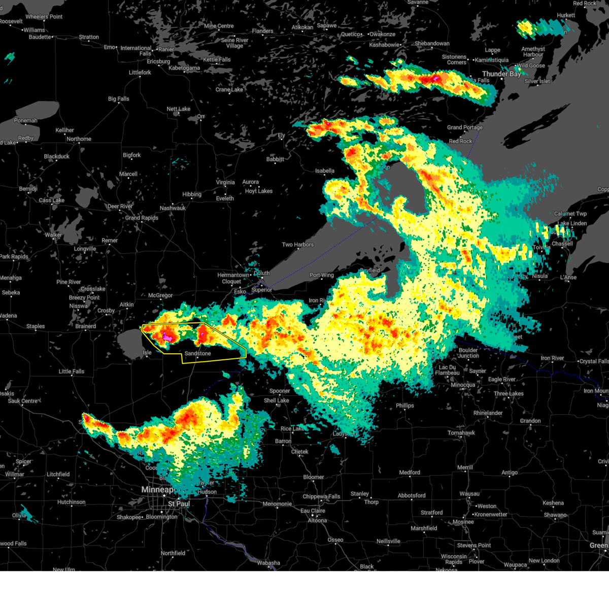
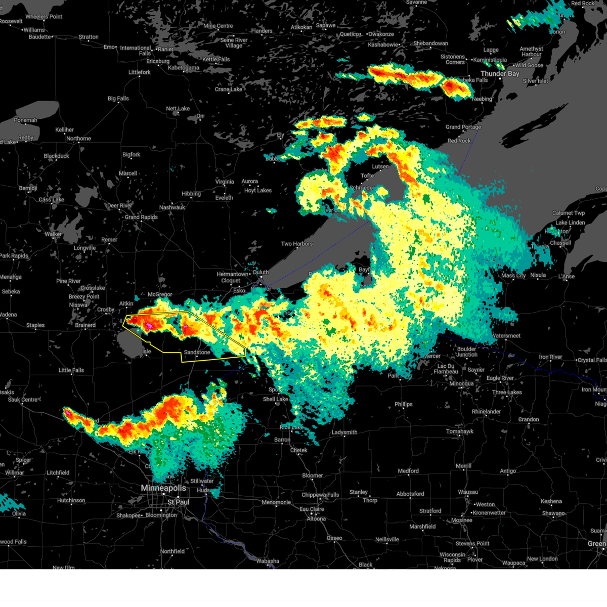
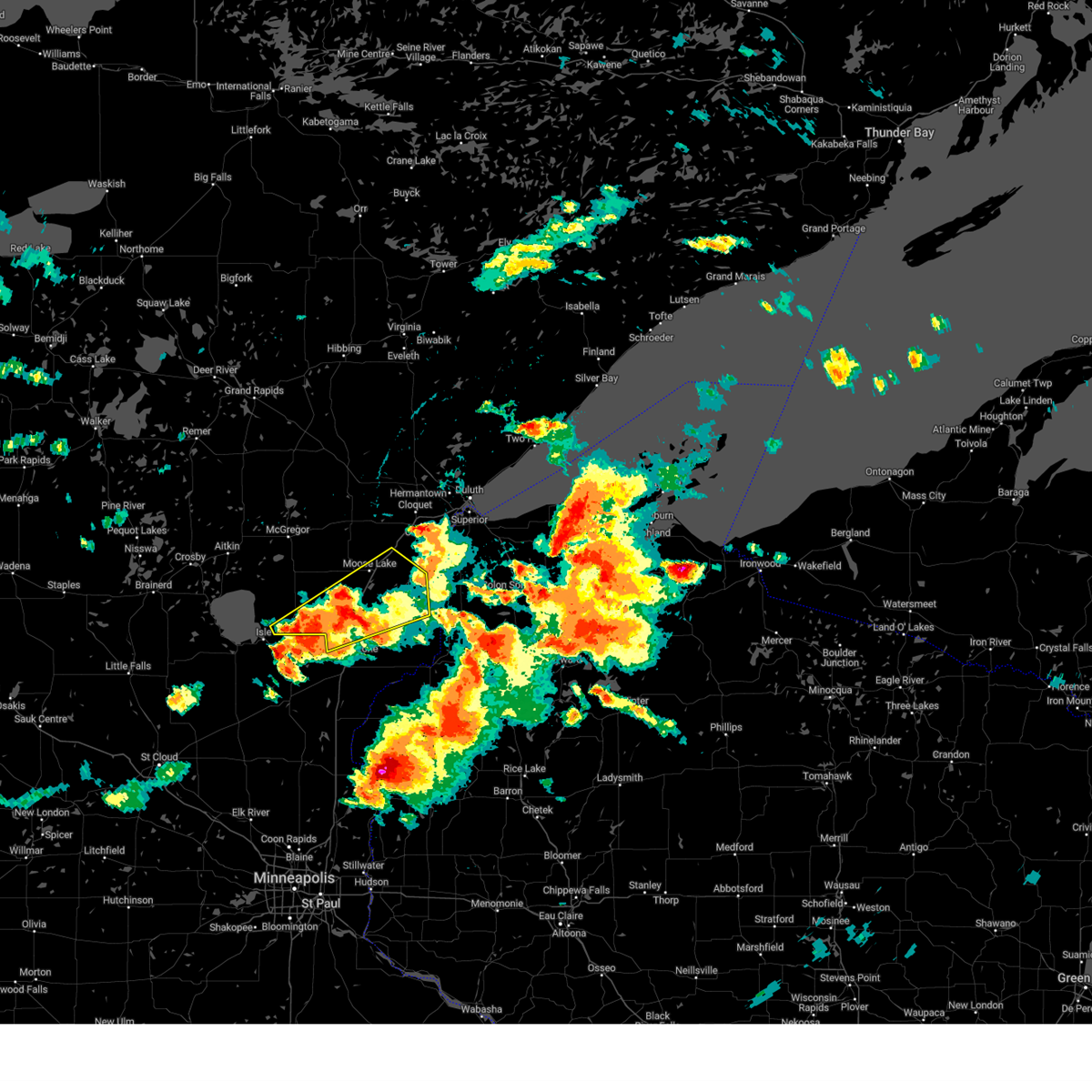
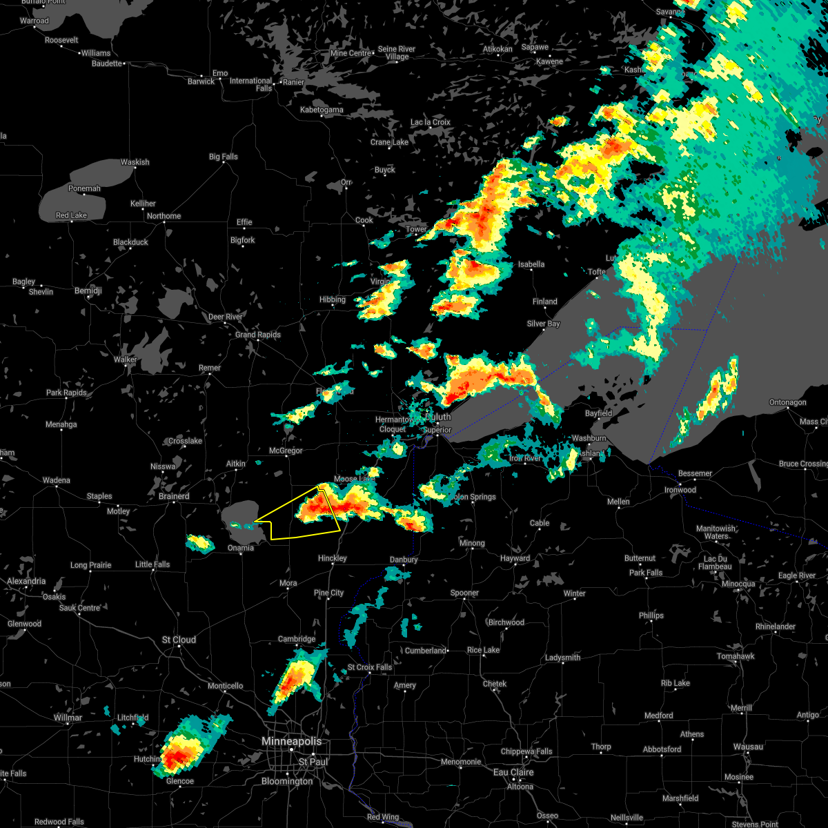
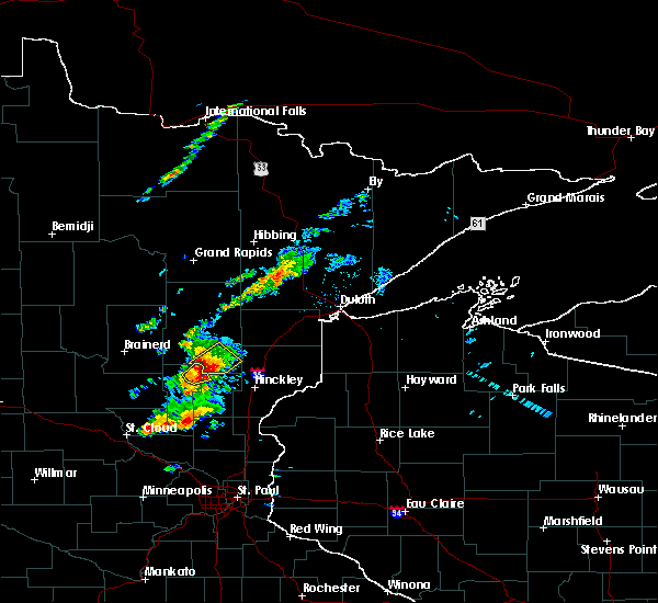
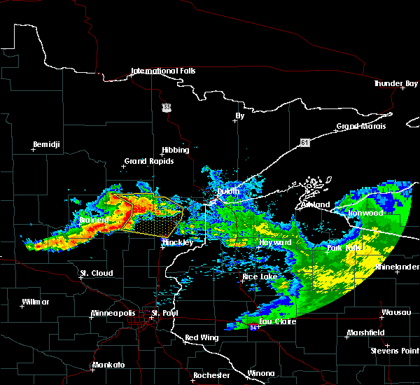
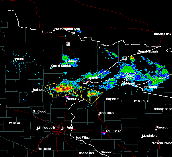
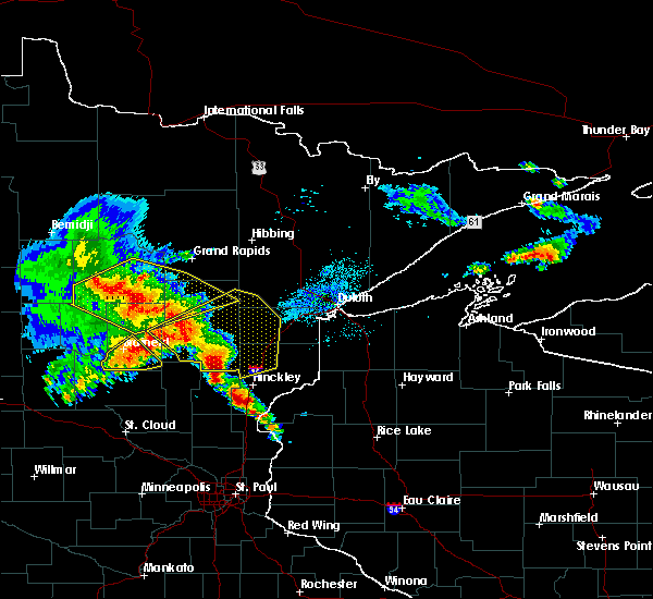
Hail Map for McGrath, MN
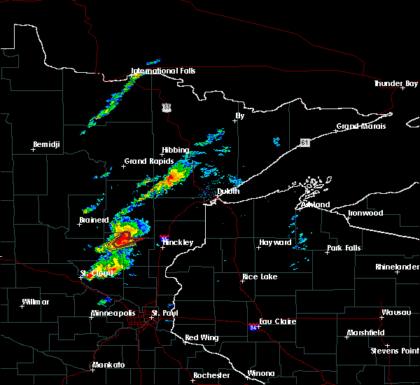
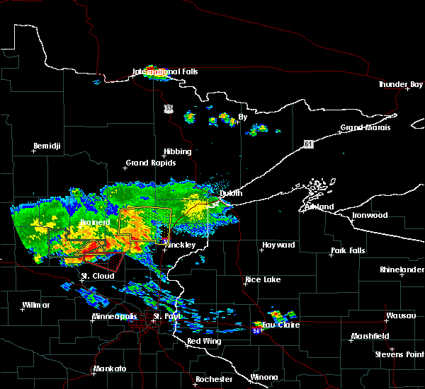
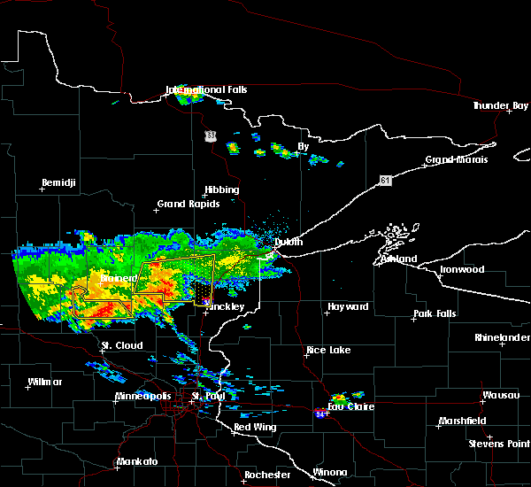
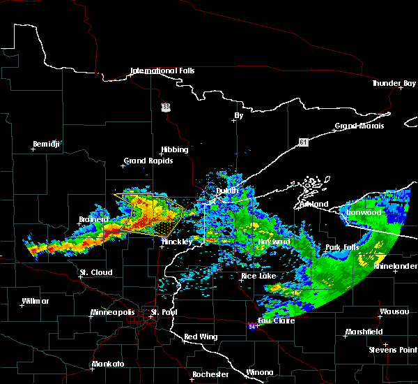
The McGrath, MN area has had 0 reports of on-the-ground hail by trained spotters, and has been under severe weather warnings 8 times during the past 12 months. Doppler radar has detected hail at or near McGrath, MN on 45 occasions, including 4 occasions during the past year.
| Name: | McGrath, MN |
| Where Located: | 67.5 miles SW of Duluth, MN |
| Map: | Google Map for McGrath, MN |
| Population: | 80 |
| Housing Units: | 48 |
| More Info: | Search Google for McGrath, MN |
0
The Top Recent Hail Date for McGrath, MN is Tuesday, May 26, 2026 (29th out of 45)
Hail and Wind Damage Spotted near McGrath, MN
| Date / Time | Report Details |
|---|---|
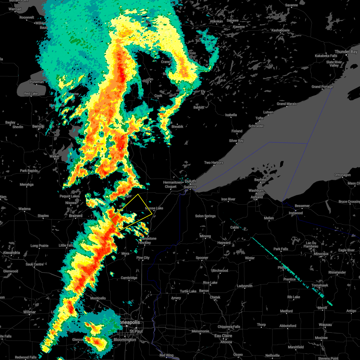
| 6/15/2026 7:24 PM CDT |
 The storm which prompted the warning has weakened below severe limits, and no longer poses an immediate threat to life or property. therefore, the warning will be allowed to expire. The storm which prompted the warning has weakened below severe limits, and no longer poses an immediate threat to life or property. therefore, the warning will be allowed to expire.
|
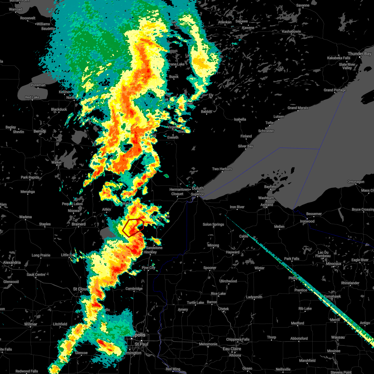
| 6/15/2026 7:05 PM CDT |
 Svrdlh the national weather service in duluth mn has issued a * severe thunderstorm warning for, southeastern aitkin county in east central minnesota, northwestern pine county in east central minnesota, * until 730 pm cdt. * at 704 pm cdt, a severe thunderstorm was located over mcgrath, or 19 miles east of mille lacs lake, moving east at 30 mph (radar indicated). Hazards include 60 mph wind gusts and penny size hail. expect damage to roofs, siding, and trees Svrdlh the national weather service in duluth mn has issued a * severe thunderstorm warning for, southeastern aitkin county in east central minnesota, northwestern pine county in east central minnesota, * until 730 pm cdt. * at 704 pm cdt, a severe thunderstorm was located over mcgrath, or 19 miles east of mille lacs lake, moving east at 30 mph (radar indicated). Hazards include 60 mph wind gusts and penny size hail. expect damage to roofs, siding, and trees
|
| 6/10/2026 4:25 AM CDT |
 At 425 am cdt, severe thunderstorms were located along a line extending from near palisade to rutledge to near saint croix band pike lake area, moving northeast at 55 mph (radar indicated). Hazards include 60 mph wind gusts and penny size hail. Expect damage to roofs, siding, and trees. Locations impacted include, webster, willow river, bruno, tamarack, duxbury, danbury, saint croix state park, mille lacs band lena lake area, webb lake wisconsin and cloverton. At 425 am cdt, severe thunderstorms were located along a line extending from near palisade to rutledge to near saint croix band pike lake area, moving northeast at 55 mph (radar indicated). Hazards include 60 mph wind gusts and penny size hail. Expect damage to roofs, siding, and trees. Locations impacted include, webster, willow river, bruno, tamarack, duxbury, danbury, saint croix state park, mille lacs band lena lake area, webb lake wisconsin and cloverton.
|
| 6/10/2026 3:45 AM CDT |
 Svrdlh the national weather service in duluth mn has issued a * severe thunderstorm warning for, aitkin county in east central minnesota, pine county in east central minnesota, southeastern crow wing county in east central minnesota, burnett county in northwestern wisconsin, * until 445 am cdt. * at 344 am cdt, severe thunderstorms were located along a line extending from near garrison to near grasston to near center city, moving northeast at 55 mph (radar indicated). Hazards include 60 mph wind gusts and quarter size hail. Hail damage to vehicles is expected. expect wind damage to roofs, siding, and trees. severe thunderstorms will be near, pine city, mille lacs lake, rock creek, garrison, and brook park around 350 am cdt. hinckley, grantsburg, malmo, mcgrath, and branstad around 400 am cdt. Other locations in the path of these severe thunderstorms include sandstone, aitkin, trade lake, saint croix state park, banning state park, askov, rutledge, willow river, mcgregor, mille lacs band lena lake area, mille lacs band east lake area, palisade, bruno, tamarack, duxbury and danbury. Svrdlh the national weather service in duluth mn has issued a * severe thunderstorm warning for, aitkin county in east central minnesota, pine county in east central minnesota, southeastern crow wing county in east central minnesota, burnett county in northwestern wisconsin, * until 445 am cdt. * at 344 am cdt, severe thunderstorms were located along a line extending from near garrison to near grasston to near center city, moving northeast at 55 mph (radar indicated). Hazards include 60 mph wind gusts and quarter size hail. Hail damage to vehicles is expected. expect wind damage to roofs, siding, and trees. severe thunderstorms will be near, pine city, mille lacs lake, rock creek, garrison, and brook park around 350 am cdt. hinckley, grantsburg, malmo, mcgrath, and branstad around 400 am cdt. Other locations in the path of these severe thunderstorms include sandstone, aitkin, trade lake, saint croix state park, banning state park, askov, rutledge, willow river, mcgregor, mille lacs band lena lake area, mille lacs band east lake area, palisade, bruno, tamarack, duxbury and danbury.
|
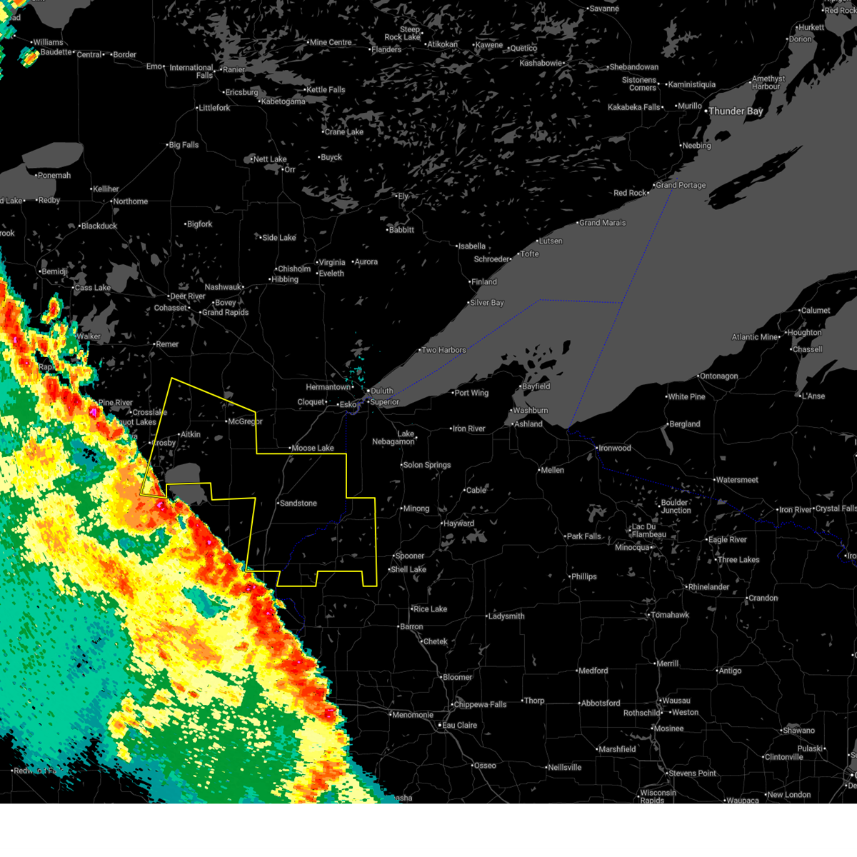
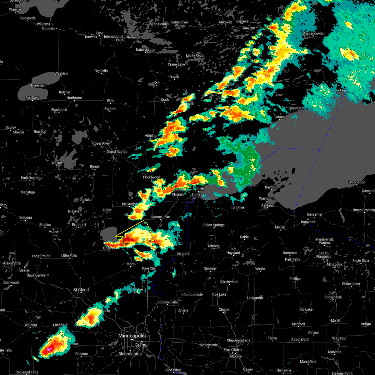
| 5/26/2026 4:34 PM CDT |
 Svrdlh the national weather service in duluth mn has issued a * severe thunderstorm warning for, southeastern aitkin county in east central minnesota, northwestern pine county in east central minnesota, * until 530 pm cdt. * at 434 pm cdt, a severe thunderstorm was located near mcgrath, or 24 miles northwest of hinckley, and is nearly stationary (radar indicated). Hazards include 60 mph wind gusts and quarter size hail. Hail damage to vehicles is expected. expect wind damage to roofs, siding, and trees. This severe thunderstorm will remain over mainly rural areas of southeastern aitkin and northwestern pine counties, including the following locations, arthyde and dads corner. Svrdlh the national weather service in duluth mn has issued a * severe thunderstorm warning for, southeastern aitkin county in east central minnesota, northwestern pine county in east central minnesota, * until 530 pm cdt. * at 434 pm cdt, a severe thunderstorm was located near mcgrath, or 24 miles northwest of hinckley, and is nearly stationary (radar indicated). Hazards include 60 mph wind gusts and quarter size hail. Hail damage to vehicles is expected. expect wind damage to roofs, siding, and trees. This severe thunderstorm will remain over mainly rural areas of southeastern aitkin and northwestern pine counties, including the following locations, arthyde and dads corner.
|
| 8/8/2025 8:42 AM CDT |
 the severe thunderstorm warning has been cancelled and is no longer in effect the severe thunderstorm warning has been cancelled and is no longer in effect
|
| 8/8/2025 8:42 AM CDT |
 At 842 am cdt, severe thunderstorms were located along a line extending from 7 miles southeast of aitkin to near malmo to near isle, moving east at 40 mph (radar indicated). Hazards include 60 mph wind gusts and penny size hail. Expect damage to roofs, siding, and trees. these severe storms will be near, mcgrath around 850 am cdt. mille lacs band east lake area around 900 am cdt. rutledge around 915 am cdt. willow river, kettle river, and banning state park around 920 am cdt. Other locations impacted by these severe thunderstorms include grindstone lake pine county, finlayson, arthyde, lawler, ripple lake, dads corner, glory, denham, rice lake wildlife refuge, and glen. At 842 am cdt, severe thunderstorms were located along a line extending from 7 miles southeast of aitkin to near malmo to near isle, moving east at 40 mph (radar indicated). Hazards include 60 mph wind gusts and penny size hail. Expect damage to roofs, siding, and trees. these severe storms will be near, mcgrath around 850 am cdt. mille lacs band east lake area around 900 am cdt. rutledge around 915 am cdt. willow river, kettle river, and banning state park around 920 am cdt. Other locations impacted by these severe thunderstorms include grindstone lake pine county, finlayson, arthyde, lawler, ripple lake, dads corner, glory, denham, rice lake wildlife refuge, and glen.
|
| 8/8/2025 8:23 AM CDT |
 Svrdlh the national weather service in duluth mn has issued a * severe thunderstorm warning for, southern aitkin county in east central minnesota, northwestern pine county in east central minnesota, southwestern carlton county in northeastern minnesota, east central crow wing county in east central minnesota, * until 930 am cdt. * at 822 am cdt, severe thunderstorms were located along a line extending from near deerwood to mille lacs lake to near vineland, moving east at 40 mph (radar indicated). Hazards include 60 mph wind gusts and penny size hail. Expect damage to roofs, siding, and trees. severe thunderstorms will be near, mille lacs lake and malmo around 830 am cdt. mcgrath around 845 am cdt. mille lacs band east lake area around 900 am cdt. rutledge and banning state park around 915 am cdt. willow river around 920 am cdt. Other locations impacted by these severe thunderstorms include grindstone lake pine county, finlayson, arthyde, cedar lake, wright, lawler, ripple lake, dads corner, glory, and denham. Svrdlh the national weather service in duluth mn has issued a * severe thunderstorm warning for, southern aitkin county in east central minnesota, northwestern pine county in east central minnesota, southwestern carlton county in northeastern minnesota, east central crow wing county in east central minnesota, * until 930 am cdt. * at 822 am cdt, severe thunderstorms were located along a line extending from near deerwood to mille lacs lake to near vineland, moving east at 40 mph (radar indicated). Hazards include 60 mph wind gusts and penny size hail. Expect damage to roofs, siding, and trees. severe thunderstorms will be near, mille lacs lake and malmo around 830 am cdt. mcgrath around 845 am cdt. mille lacs band east lake area around 900 am cdt. rutledge and banning state park around 915 am cdt. willow river around 920 am cdt. Other locations impacted by these severe thunderstorms include grindstone lake pine county, finlayson, arthyde, cedar lake, wright, lawler, ripple lake, dads corner, glory, and denham.
|
| 6/16/2025 6:11 PM CDT |
 Svrdlh the national weather service in duluth mn has issued a * severe thunderstorm warning for, southeastern aitkin county in east central minnesota, pine county in east central minnesota, carlton county in northeastern minnesota, southwestern douglas county in northwestern wisconsin, north central burnett county in northwestern wisconsin, * until 715 pm cdt. * at 610 pm cdt, severe thunderstorms were located along a line extending from near mcgregor to 8 miles southeast of mille lacs band east lake area to 13 miles west of rutledge to near mcgrath, moving east at 50 mph (radar indicated). Hazards include 60 mph wind gusts and quarter size hail. Hail damage to vehicles is expected. Expect wind damage to roofs, siding, and trees. Svrdlh the national weather service in duluth mn has issued a * severe thunderstorm warning for, southeastern aitkin county in east central minnesota, pine county in east central minnesota, carlton county in northeastern minnesota, southwestern douglas county in northwestern wisconsin, north central burnett county in northwestern wisconsin, * until 715 pm cdt. * at 610 pm cdt, severe thunderstorms were located along a line extending from near mcgregor to 8 miles southeast of mille lacs band east lake area to 13 miles west of rutledge to near mcgrath, moving east at 50 mph (radar indicated). Hazards include 60 mph wind gusts and quarter size hail. Hail damage to vehicles is expected. Expect wind damage to roofs, siding, and trees.
|
| 5/15/2025 3:25 PM CDT |
 Svrdlh the national weather service in duluth mn has issued a * severe thunderstorm warning for, southwestern aitkin county in east central minnesota, * until 400 pm cdt. * at 324 pm cdt, a severe thunderstorm was located near isle, or 20 miles southeast of mille lacs lake, moving north at 40 mph (radar indicated). Hazards include 60 mph wind gusts and quarter size hail. Hail damage to vehicles is expected. expect wind damage to roofs, siding, and trees. This severe thunderstorm will remain over mainly rural areas of southwestern aitkin county, including the following locations, glory and glen. Svrdlh the national weather service in duluth mn has issued a * severe thunderstorm warning for, southwestern aitkin county in east central minnesota, * until 400 pm cdt. * at 324 pm cdt, a severe thunderstorm was located near isle, or 20 miles southeast of mille lacs lake, moving north at 40 mph (radar indicated). Hazards include 60 mph wind gusts and quarter size hail. Hail damage to vehicles is expected. expect wind damage to roofs, siding, and trees. This severe thunderstorm will remain over mainly rural areas of southwestern aitkin county, including the following locations, glory and glen.
|
| 8/29/2024 4:44 PM CDT |
 the severe thunderstorm warning has been cancelled and is no longer in effect the severe thunderstorm warning has been cancelled and is no longer in effect
|
| 8/29/2024 4:32 PM CDT |
 At 431 pm cdt, severe thunderstorms were located along a line extending from south long lake to 6 miles southwest of onamia, moving northeast at 40 mph (radar indicated). Hazards include 60 mph wind gusts. Expect damage to roofs, siding, and trees. these severe storms will be near, mille lacs lake around 440 pm cdt. Other locations in the path of these severe thunderstorms include deerwood, aitkin, malmo, mcgrath, mcgregor, mille lacs band east lake area and big sandy lake. At 431 pm cdt, severe thunderstorms were located along a line extending from south long lake to 6 miles southwest of onamia, moving northeast at 40 mph (radar indicated). Hazards include 60 mph wind gusts. Expect damage to roofs, siding, and trees. these severe storms will be near, mille lacs lake around 440 pm cdt. Other locations in the path of these severe thunderstorms include deerwood, aitkin, malmo, mcgrath, mcgregor, mille lacs band east lake area and big sandy lake.
|
| 8/29/2024 4:24 PM CDT |
 At 424 pm cdt, severe thunderstorms were located along a line extending from south long lake to 9 miles southwest of onamia, moving northeast at 40 mph (radar indicated). Hazards include 60 mph wind gusts. Expect damage to roofs, siding, and trees. Locations impacted include, mille lacs lake, deerwood, aitkin, malmo, mcgrath, palisade, mille lacs band east lake area, mcgregor, big sandy lake, tamarack and libby. At 424 pm cdt, severe thunderstorms were located along a line extending from south long lake to 9 miles southwest of onamia, moving northeast at 40 mph (radar indicated). Hazards include 60 mph wind gusts. Expect damage to roofs, siding, and trees. Locations impacted include, mille lacs lake, deerwood, aitkin, malmo, mcgrath, palisade, mille lacs band east lake area, mcgregor, big sandy lake, tamarack and libby.
|
| 8/29/2024 4:10 PM CDT |
 At 410 pm cdt, severe thunderstorms were located along a line extending from upper south long lake to near onamia, moving northeast at 40 mph (radar indicated). Hazards include 60 mph wind gusts. Expect damage to roofs, siding, and trees. these severe storms will be near, mille lacs lake, garrison, and upper south long lake around 415 pm cdt. Other locations in the path of these severe thunderstorms include deerwood, aitkin, malmo, mcgrath, palisade, mille lacs band east lake area, mcgregor, big sandy lake, tamarack, libby and savanna portage state park. At 410 pm cdt, severe thunderstorms were located along a line extending from upper south long lake to near onamia, moving northeast at 40 mph (radar indicated). Hazards include 60 mph wind gusts. Expect damage to roofs, siding, and trees. these severe storms will be near, mille lacs lake, garrison, and upper south long lake around 415 pm cdt. Other locations in the path of these severe thunderstorms include deerwood, aitkin, malmo, mcgrath, palisade, mille lacs band east lake area, mcgregor, big sandy lake, tamarack, libby and savanna portage state park.
|
| 8/29/2024 3:56 PM CDT |
 At 356 pm cdt, severe thunderstorms were located along a line extending from near saint mathias to 11 miles east of pierz, moving northeast at 40 mph (radar indicated). Hazards include 60 mph wind gusts and quarter size hail. Hail damage to vehicles is expected. expect wind damage to roofs, siding, and trees. these severe storms will be near, south long lake around 400 pm cdt. upper south long lake around 405 pm cdt. Other locations in the path of these severe thunderstorms include mille lacs lake, garrison, deerwood, aitkin, malmo, mcgrath, mcgregor, palisade and mille lacs band east lake area. At 356 pm cdt, severe thunderstorms were located along a line extending from near saint mathias to 11 miles east of pierz, moving northeast at 40 mph (radar indicated). Hazards include 60 mph wind gusts and quarter size hail. Hail damage to vehicles is expected. expect wind damage to roofs, siding, and trees. these severe storms will be near, south long lake around 400 pm cdt. upper south long lake around 405 pm cdt. Other locations in the path of these severe thunderstorms include mille lacs lake, garrison, deerwood, aitkin, malmo, mcgrath, mcgregor, palisade and mille lacs band east lake area.
|
| 8/29/2024 3:56 PM CDT |
 the severe thunderstorm warning has been cancelled and is no longer in effect the severe thunderstorm warning has been cancelled and is no longer in effect
|
| 8/29/2024 3:45 PM CDT |
 Svrdlh the national weather service in duluth mn has issued a * severe thunderstorm warning for, aitkin county in east central minnesota, southern cass county in north central minnesota, crow wing county in east central minnesota, * until 500 pm cdt. * at 344 pm cdt, severe thunderstorms were located along a line extending from near fort ripley to 9 miles southeast of pierz, moving northeast at 40 mph (radar indicated). Hazards include 60 mph wind gusts and quarter size hail. Hail damage to vehicles is expected. expect wind damage to roofs, siding, and trees. severe thunderstorms will be near, saint mathias around 350 pm cdt. south long lake around 355 pm cdt. upper south long lake around 400 pm cdt. Other locations in the path of these severe thunderstorms include mille lacs lake, garrison, deerwood, aitkin, malmo and mcgrath. Svrdlh the national weather service in duluth mn has issued a * severe thunderstorm warning for, aitkin county in east central minnesota, southern cass county in north central minnesota, crow wing county in east central minnesota, * until 500 pm cdt. * at 344 pm cdt, severe thunderstorms were located along a line extending from near fort ripley to 9 miles southeast of pierz, moving northeast at 40 mph (radar indicated). Hazards include 60 mph wind gusts and quarter size hail. Hail damage to vehicles is expected. expect wind damage to roofs, siding, and trees. severe thunderstorms will be near, saint mathias around 350 pm cdt. south long lake around 355 pm cdt. upper south long lake around 400 pm cdt. Other locations in the path of these severe thunderstorms include mille lacs lake, garrison, deerwood, aitkin, malmo and mcgrath.
|
| 7/31/2024 4:43 PM CDT |
 The storms which prompted the warning have moved out of the area. therefore, the warning will be allowed to expire. a severe thunderstorm watch remains in effect until 700 pm cdt for north central and east central minnesota. The storms which prompted the warning have moved out of the area. therefore, the warning will be allowed to expire. a severe thunderstorm watch remains in effect until 700 pm cdt for north central and east central minnesota.
|
| 7/31/2024 4:17 PM CDT |
 At 415 pm cdt, severe thunderstorms were located along a line extending from 7 miles southwest of swatara to 7 miles south of malmo, moving east at 25 mph (emergency management reported tree down on power lines from this line of storms). Hazards include 60 mph wind gusts and penny size hail. Expect damage to roofs, siding, and trees. Locations impacted include, mille lacs lake, big sandy lake, aitkin, mcgregor, malmo, palisade, mcgrath, mille lacs band east lake area, glen, waukenabo, wealthwood, kimberly, ripple lake, dads corner, glory, waldeck, rice lake wildlife refuge, hassman, flowage lake, and farm island lake. At 415 pm cdt, severe thunderstorms were located along a line extending from 7 miles southwest of swatara to 7 miles south of malmo, moving east at 25 mph (emergency management reported tree down on power lines from this line of storms). Hazards include 60 mph wind gusts and penny size hail. Expect damage to roofs, siding, and trees. Locations impacted include, mille lacs lake, big sandy lake, aitkin, mcgregor, malmo, palisade, mcgrath, mille lacs band east lake area, glen, waukenabo, wealthwood, kimberly, ripple lake, dads corner, glory, waldeck, rice lake wildlife refuge, hassman, flowage lake, and farm island lake.
|
| 7/31/2024 4:17 PM CDT |
 the severe thunderstorm warning has been cancelled and is no longer in effect the severe thunderstorm warning has been cancelled and is no longer in effect
|
| 7/31/2024 4:03 PM CDT |
 At 402 pm cdt, severe thunderstorms were located along a line extending from near emily to near vineland, moving east at 25 mph (emergency management reported tree down on power lines near emily). Hazards include 60 mph wind gusts and penny size hail. Expect damage to roofs, siding, and trees. Locations impacted include, mille lacs lake, big sandy lake, crosby, aitkin, crosslake, emily, ironton, deerwood, mcgregor, fifty lakes, malmo, cuyuna, garrison, palisade, mcgrath, upper south long lake, mille lacs band east lake area, cuyuna country state park, cedar lake, and bay lake. At 402 pm cdt, severe thunderstorms were located along a line extending from near emily to near vineland, moving east at 25 mph (emergency management reported tree down on power lines near emily). Hazards include 60 mph wind gusts and penny size hail. Expect damage to roofs, siding, and trees. Locations impacted include, mille lacs lake, big sandy lake, crosby, aitkin, crosslake, emily, ironton, deerwood, mcgregor, fifty lakes, malmo, cuyuna, garrison, palisade, mcgrath, upper south long lake, mille lacs band east lake area, cuyuna country state park, cedar lake, and bay lake.
|
| 7/31/2024 3:58 PM CDT |
 At 358 pm cdt, severe thunderstorms were located along a line extending from near emily to near vineland, moving east at 25 mph (radar indicated). Hazards include 60 mph wind gusts and penny size hail. Expect damage to roofs, siding, and trees. Locations impacted include, mille lacs lake, aitkin, malmo, palisade, mcgrath, mcgregor and mille lacs band east lake area. At 358 pm cdt, severe thunderstorms were located along a line extending from near emily to near vineland, moving east at 25 mph (radar indicated). Hazards include 60 mph wind gusts and penny size hail. Expect damage to roofs, siding, and trees. Locations impacted include, mille lacs lake, aitkin, malmo, palisade, mcgrath, mcgregor and mille lacs band east lake area.
|
| 7/31/2024 3:58 PM CDT |
 the severe thunderstorm warning has been cancelled and is no longer in effect the severe thunderstorm warning has been cancelled and is no longer in effect
|
| 7/31/2024 3:40 PM CDT |
 Svrdlh the national weather service in duluth mn has issued a * severe thunderstorm warning for, aitkin county in east central minnesota, east central cass county in north central minnesota, crow wing county in east central minnesota, * until 445 pm cdt. * at 340 pm cdt, severe thunderstorms were located along a line extending from near fifty lakes to near vineland, moving east at 25 mph (radar indicated). Hazards include 60 mph wind gusts and quarter size hail. Hail damage to vehicles is expected. expect wind damage to roofs, siding, and trees. severe thunderstorms will be near, mille lacs lake, crosby, emily, deerwood, fifty lakes, cuyuna, and garrison around 345 pm cdt. outing around 350 pm cdt. aitkin around 355 pm cdt. Other locations in the path of these severe thunderstorms include malmo and palisade. Svrdlh the national weather service in duluth mn has issued a * severe thunderstorm warning for, aitkin county in east central minnesota, east central cass county in north central minnesota, crow wing county in east central minnesota, * until 445 pm cdt. * at 340 pm cdt, severe thunderstorms were located along a line extending from near fifty lakes to near vineland, moving east at 25 mph (radar indicated). Hazards include 60 mph wind gusts and quarter size hail. Hail damage to vehicles is expected. expect wind damage to roofs, siding, and trees. severe thunderstorms will be near, mille lacs lake, crosby, emily, deerwood, fifty lakes, cuyuna, and garrison around 345 pm cdt. outing around 350 pm cdt. aitkin around 355 pm cdt. Other locations in the path of these severe thunderstorms include malmo and palisade.
|
| 6/12/2024 8:28 PM CDT |
 the severe thunderstorm warning has been cancelled and is no longer in effect the severe thunderstorm warning has been cancelled and is no longer in effect
|
| 6/12/2024 8:28 PM CDT |
 At 828 pm cdt, severe thunderstorms were located along a line extending from near bruno to near mcgrath, moving east at 50 mph (radar indicated). Hazards include two inch hail and 60 mph wind gusts. People and animals outdoors will be injured. expect hail damage to roofs, siding, windows, and vehicles. expect wind damage to roofs, siding, and trees. Locations impacted include, askov, rutledge, bruno, banning state park, sandstone, cloverton and duxbury. At 828 pm cdt, severe thunderstorms were located along a line extending from near bruno to near mcgrath, moving east at 50 mph (radar indicated). Hazards include two inch hail and 60 mph wind gusts. People and animals outdoors will be injured. expect hail damage to roofs, siding, windows, and vehicles. expect wind damage to roofs, siding, and trees. Locations impacted include, askov, rutledge, bruno, banning state park, sandstone, cloverton and duxbury.
|
| 6/12/2024 8:11 PM CDT |
 Svrdlh the national weather service in duluth mn has issued a * severe thunderstorm warning for, southern aitkin county in east central minnesota, northern pine county in east central minnesota, southwestern carlton county in northeastern minnesota, * until 900 pm cdt. * at 811 pm cdt, severe thunderstorms were located along a line extending from willow river to near malmo, moving east at 50 mph (radar indicated). Hazards include two inch hail and 60 mph wind gusts. People and animals outdoors will be injured. expect hail damage to roofs, siding, windows, and vehicles. expect wind damage to roofs, siding, and trees. severe thunderstorms will be near, willow river, rutledge, bruno, mcgrath, and banning state park around 815 pm cdt. askov around 825 pm cdt. Other locations in the path of these severe thunderstorms include sandstone, cloverton and duxbury. Svrdlh the national weather service in duluth mn has issued a * severe thunderstorm warning for, southern aitkin county in east central minnesota, northern pine county in east central minnesota, southwestern carlton county in northeastern minnesota, * until 900 pm cdt. * at 811 pm cdt, severe thunderstorms were located along a line extending from willow river to near malmo, moving east at 50 mph (radar indicated). Hazards include two inch hail and 60 mph wind gusts. People and animals outdoors will be injured. expect hail damage to roofs, siding, windows, and vehicles. expect wind damage to roofs, siding, and trees. severe thunderstorms will be near, willow river, rutledge, bruno, mcgrath, and banning state park around 815 pm cdt. askov around 825 pm cdt. Other locations in the path of these severe thunderstorms include sandstone, cloverton and duxbury.
|
| 6/12/2024 7:59 PM CDT |
 At 759 pm cdt, severe thunderstorms were located along a line extending from 7 miles northeast of bruno to 7 miles northwest of rutledge to 6 miles southeast of aitkin, moving east at 45 mph (radar indicated). Hazards include two inch hail and 60 mph wind gusts. People and animals outdoors will be injured. expect hail damage to roofs, siding, windows, and vehicles. expect wind damage to roofs, siding, and trees. Locations impacted include, willow river, rutledge and bruno. At 759 pm cdt, severe thunderstorms were located along a line extending from 7 miles northeast of bruno to 7 miles northwest of rutledge to 6 miles southeast of aitkin, moving east at 45 mph (radar indicated). Hazards include two inch hail and 60 mph wind gusts. People and animals outdoors will be injured. expect hail damage to roofs, siding, windows, and vehicles. expect wind damage to roofs, siding, and trees. Locations impacted include, willow river, rutledge and bruno.
|
| 6/12/2024 7:38 PM CDT |
 At 737 pm cdt, severe thunderstorms were located along a line extending from near kettle river to 8 miles north of mcgrath to crosby, moving east at 45 mph (radar indicated). Hazards include two inch hail and 60 mph wind gusts. People and animals outdoors will be injured. expect hail damage to roofs, siding, windows, and vehicles. expect wind damage to roofs, siding, and trees. these severe storms will be near, moose lake, willow river, and moose lake state park around 745 pm cdt. Other locations in the path of these severe thunderstorms include rutledge and bruno. At 737 pm cdt, severe thunderstorms were located along a line extending from near kettle river to 8 miles north of mcgrath to crosby, moving east at 45 mph (radar indicated). Hazards include two inch hail and 60 mph wind gusts. People and animals outdoors will be injured. expect hail damage to roofs, siding, windows, and vehicles. expect wind damage to roofs, siding, and trees. these severe storms will be near, moose lake, willow river, and moose lake state park around 745 pm cdt. Other locations in the path of these severe thunderstorms include rutledge and bruno.
|
| 6/12/2024 7:27 PM CDT |
 Svrdlh the national weather service in duluth mn has issued a * severe thunderstorm warning for, aitkin county in east central minnesota, northwestern pine county in east central minnesota, southwestern carlton county in northeastern minnesota, northern crow wing county in east central minnesota, * until 815 pm cdt. * at 726 pm cdt, severe thunderstorms were located along a line extending from 8 miles southwest of kettle river to near malmo to near merrifield, moving east at 45 mph (radar indicated). Hazards include two inch hail and 60 mph wind gusts. People and animals outdoors will be injured. expect hail damage to roofs, siding, windows, and vehicles. expect wind damage to roofs, siding, and trees. severe thunderstorms will be near, crosby, ironton, deerwood, cuyuna, and cuyuna country state park around 730 pm cdt. moose lake around 735 pm cdt. willow river and moose lake state park around 740 pm cdt. Other locations in the path of these severe thunderstorms include rutledge, bruno and banning state park. Svrdlh the national weather service in duluth mn has issued a * severe thunderstorm warning for, aitkin county in east central minnesota, northwestern pine county in east central minnesota, southwestern carlton county in northeastern minnesota, northern crow wing county in east central minnesota, * until 815 pm cdt. * at 726 pm cdt, severe thunderstorms were located along a line extending from 8 miles southwest of kettle river to near malmo to near merrifield, moving east at 45 mph (radar indicated). Hazards include two inch hail and 60 mph wind gusts. People and animals outdoors will be injured. expect hail damage to roofs, siding, windows, and vehicles. expect wind damage to roofs, siding, and trees. severe thunderstorms will be near, crosby, ironton, deerwood, cuyuna, and cuyuna country state park around 730 pm cdt. moose lake around 735 pm cdt. willow river and moose lake state park around 740 pm cdt. Other locations in the path of these severe thunderstorms include rutledge, bruno and banning state park.
|
| 7/27/2023 5:00 PM CDT |
 At 459 pm cdt, severe thunderstorms were located along a line extending from nemadji, to 9 miles southeast of hinckley, moving east at 25 mph (trained weather spotters reported 1 inch hail west of hinckley). Hazards include golf ball size hail and 60 mph wind gusts. People and animals outdoors will be injured. expect hail damage to roofs, siding, windows, and vehicles. expect wind damage to roofs, siding, and trees. severe thunderstorms will be near, nemadji around 505 pm cdt. other locations in the path of these severe thunderstorms include holyoke, webster and danbury. thunderstorm damage threat, considerable hail threat, radar indicated max hail size, 1. 75 in wind threat, radar indicated max wind gust, 60 mph. At 459 pm cdt, severe thunderstorms were located along a line extending from nemadji, to 9 miles southeast of hinckley, moving east at 25 mph (trained weather spotters reported 1 inch hail west of hinckley). Hazards include golf ball size hail and 60 mph wind gusts. People and animals outdoors will be injured. expect hail damage to roofs, siding, windows, and vehicles. expect wind damage to roofs, siding, and trees. severe thunderstorms will be near, nemadji around 505 pm cdt. other locations in the path of these severe thunderstorms include holyoke, webster and danbury. thunderstorm damage threat, considerable hail threat, radar indicated max hail size, 1. 75 in wind threat, radar indicated max wind gust, 60 mph.
|
| 7/27/2023 4:32 PM CDT |
 At 432 pm cdt, a severe thunderstorm was located over willow river, or 22 miles north of hinckley, moving northeast at 45 mph (radar indicated). Hazards include golf ball size hail and 60 mph wind gusts. People and animals outdoors will be injured. expect hail damage to roofs, siding, windows, and vehicles. expect wind damage to roofs, siding, and trees. this severe thunderstorm will be near, nemadji around 450 pm cdt. thunderstorm damage threat, considerable hail threat, radar indicated max hail size, 1. 75 in wind threat, radar indicated max wind gust, 60 mph. At 432 pm cdt, a severe thunderstorm was located over willow river, or 22 miles north of hinckley, moving northeast at 45 mph (radar indicated). Hazards include golf ball size hail and 60 mph wind gusts. People and animals outdoors will be injured. expect hail damage to roofs, siding, windows, and vehicles. expect wind damage to roofs, siding, and trees. this severe thunderstorm will be near, nemadji around 450 pm cdt. thunderstorm damage threat, considerable hail threat, radar indicated max hail size, 1. 75 in wind threat, radar indicated max wind gust, 60 mph.
|
| 5/30/2022 5:05 AM CDT |
 At 505 am cdt, severe thunderstorms were located along a line extending from near motley, to 7 miles southeast of south long lake, to near bock, moving northeast at 75 mph (radar indicated). Hazards include 70 mph wind gusts and quarter size hail. Hail damage to vehicles is expected. expect considerable tree damage. wind damage is also likely to mobile homes, roofs, and outbuildings. severe thunderstorms will be near, upper south long lake and south long lake around 510 am cdt. garrison around 515 am cdt. deerwood around 520 am cdt. pequot lakes and pine river around 525 am cdt. other locations in the path of these severe thunderstorms include aitkin, mcgrath, wabedo, palisade, woman lake and longville. thunderstorm damage threat, considerable hail threat, radar indicated max hail size, 1. 00 in wind threat, radar indicated max wind gust, 70 mph. At 505 am cdt, severe thunderstorms were located along a line extending from near motley, to 7 miles southeast of south long lake, to near bock, moving northeast at 75 mph (radar indicated). Hazards include 70 mph wind gusts and quarter size hail. Hail damage to vehicles is expected. expect considerable tree damage. wind damage is also likely to mobile homes, roofs, and outbuildings. severe thunderstorms will be near, upper south long lake and south long lake around 510 am cdt. garrison around 515 am cdt. deerwood around 520 am cdt. pequot lakes and pine river around 525 am cdt. other locations in the path of these severe thunderstorms include aitkin, mcgrath, wabedo, palisade, woman lake and longville. thunderstorm damage threat, considerable hail threat, radar indicated max hail size, 1. 00 in wind threat, radar indicated max wind gust, 70 mph.
|
| 5/30/2022 3:28 AM CDT |
 At 327 am cdt, a severe thunderstorm was located 8 miles southeast of isle, or 18 miles west of hinckley, moving northeast at 40 mph (spotters reported one inch hail near ogilvie). Hazards include ping pong ball size hail and 60 mph wind gusts. People and animals outdoors will be injured. expect hail damage to roofs, siding, windows, and vehicles. expect wind damage to roofs, siding, and trees. this severe thunderstorm will be near, mcgrath around 345 am cdt. hail threat, radar indicated max hail size, 1. 50 in wind threat, radar indicated max wind gust, 60 mph. At 327 am cdt, a severe thunderstorm was located 8 miles southeast of isle, or 18 miles west of hinckley, moving northeast at 40 mph (spotters reported one inch hail near ogilvie). Hazards include ping pong ball size hail and 60 mph wind gusts. People and animals outdoors will be injured. expect hail damage to roofs, siding, windows, and vehicles. expect wind damage to roofs, siding, and trees. this severe thunderstorm will be near, mcgrath around 345 am cdt. hail threat, radar indicated max hail size, 1. 50 in wind threat, radar indicated max wind gust, 60 mph.
|
| 5/12/2022 8:46 PM CDT |
 At 846 pm cdt, severe thunderstorms were located along a line extending from near longville, to 6 miles northeast of aitkin, to ogilvie, moving northeast at 65 mph (radar indicated). Hazards include 70 mph wind gusts and quarter size hail. Hail damage to vehicles is expected. expect considerable tree damage. wind damage is also likely to mobile homes, roofs, and outbuildings. Locations impacted include, grand rapids, big sandy lake, mille lacs lake, cohasset, crosby, aitkin, crosslake, deer river, emily, hill city, deerwood, mcgregor, fifty lakes, remer, wabedo, malmo, cuyuna, garrison, palisade, and longville. At 846 pm cdt, severe thunderstorms were located along a line extending from near longville, to 6 miles northeast of aitkin, to ogilvie, moving northeast at 65 mph (radar indicated). Hazards include 70 mph wind gusts and quarter size hail. Hail damage to vehicles is expected. expect considerable tree damage. wind damage is also likely to mobile homes, roofs, and outbuildings. Locations impacted include, grand rapids, big sandy lake, mille lacs lake, cohasset, crosby, aitkin, crosslake, deer river, emily, hill city, deerwood, mcgregor, fifty lakes, remer, wabedo, malmo, cuyuna, garrison, palisade, and longville.
|
| 5/12/2022 8:32 PM CDT |
 At 832 pm cdt, severe thunderstorms were located along a line extending from near backus, to near deerwood, to near milaca, moving northeast at 65 mph (radar indicated). Hazards include 70 mph wind gusts and quarter size hail. Hail damage to vehicles is expected. expect considerable tree damage. wind damage is also likely to mobile homes, roofs, and outbuildings. Locations impacted include, deerwood, aitkin, wabedo, woman lake, longville, palisade, boy river, leech lake, big sandy lake, libby, zemple, ball club, days high landing, deer river and jacobson. At 832 pm cdt, severe thunderstorms were located along a line extending from near backus, to near deerwood, to near milaca, moving northeast at 65 mph (radar indicated). Hazards include 70 mph wind gusts and quarter size hail. Hail damage to vehicles is expected. expect considerable tree damage. wind damage is also likely to mobile homes, roofs, and outbuildings. Locations impacted include, deerwood, aitkin, wabedo, woman lake, longville, palisade, boy river, leech lake, big sandy lake, libby, zemple, ball club, days high landing, deer river and jacobson.
|
| 5/12/2022 8:09 PM CDT |
 At 809 pm cdt, severe thunderstorms were located along a line extending from near poplar, to 7 miles southeast of saint mathias, to near clear lake, moving northeast at 65 mph (radar indicated). Hazards include 70 mph wind gusts and quarter size hail. Hail damage to vehicles is expected. expect considerable tree damage. wind damage is also likely to mobile homes, roofs, and outbuildings. severe thunderstorms will be near, south long lake around 815 pm cdt. upper south long lake around 820 pm cdt. garrison around 825 pm cdt. Other locations in the path of these severe thunderstorms include deerwood, backus, hackensack, aitkin, wabedo, woman lake, longville and leech lake. At 809 pm cdt, severe thunderstorms were located along a line extending from near poplar, to 7 miles southeast of saint mathias, to near clear lake, moving northeast at 65 mph (radar indicated). Hazards include 70 mph wind gusts and quarter size hail. Hail damage to vehicles is expected. expect considerable tree damage. wind damage is also likely to mobile homes, roofs, and outbuildings. severe thunderstorms will be near, south long lake around 815 pm cdt. upper south long lake around 820 pm cdt. garrison around 825 pm cdt. Other locations in the path of these severe thunderstorms include deerwood, backus, hackensack, aitkin, wabedo, woman lake, longville and leech lake.
|
| 9/16/2021 9:06 PM CDT |
 The severe thunderstorm warning for southeastern aitkin and northwestern pine counties will expire at 915 pm cdt, the storms which prompted the warning have weakened below severe limits, and no longer pose an immediate threat to life or property. therefore, the warning will be allowed to expire. however heavy rain is still possible with these thunderstorms. a tornado watch remains in effect until midnight cdt for northeastern and east central minnesota. The severe thunderstorm warning for southeastern aitkin and northwestern pine counties will expire at 915 pm cdt, the storms which prompted the warning have weakened below severe limits, and no longer pose an immediate threat to life or property. therefore, the warning will be allowed to expire. however heavy rain is still possible with these thunderstorms. a tornado watch remains in effect until midnight cdt for northeastern and east central minnesota.
|
| 9/16/2021 8:46 PM CDT |
 At 846 pm cdt, severe thunderstorms were located along a line extending from near isle, to near willow river, moving northeast at 40 mph (radar indicated). Hazards include 60 mph wind gusts and quarter size hail. Hail damage to vehicles is expected. expect wind damage to roofs, siding, and trees. these severe thunderstorms will remain over mainly rural areas of southeastern aitkin and northwestern pine counties, including the following locations, arthyde, dads corner and finlayson. hail threat, radar indicated max hail size, 1. 00 in wind threat, radar indicated max wind gust, 60 mph. At 846 pm cdt, severe thunderstorms were located along a line extending from near isle, to near willow river, moving northeast at 40 mph (radar indicated). Hazards include 60 mph wind gusts and quarter size hail. Hail damage to vehicles is expected. expect wind damage to roofs, siding, and trees. these severe thunderstorms will remain over mainly rural areas of southeastern aitkin and northwestern pine counties, including the following locations, arthyde, dads corner and finlayson. hail threat, radar indicated max hail size, 1. 00 in wind threat, radar indicated max wind gust, 60 mph.
|
| 9/16/2021 8:22 PM CDT |
 At 821 pm cdt, a severe thunderstorm was located near mcgrath, or 17 miles southeast of mille lacs lake, moving northeast at 50 mph (radar indicated). Hazards include golf ball size hail and 60 mph wind gusts. People and animals outdoors will be injured. expect hail damage to roofs, siding, windows, and vehicles. expect wind damage to roofs, siding, and trees. this severe thunderstorm will be near, mcgrath around 825 pm cdt. thunderstorm damage threat, considerable hail threat, radar indicated max hail size, 1. 75 in wind threat, radar indicated max wind gust, 60 mph. At 821 pm cdt, a severe thunderstorm was located near mcgrath, or 17 miles southeast of mille lacs lake, moving northeast at 50 mph (radar indicated). Hazards include golf ball size hail and 60 mph wind gusts. People and animals outdoors will be injured. expect hail damage to roofs, siding, windows, and vehicles. expect wind damage to roofs, siding, and trees. this severe thunderstorm will be near, mcgrath around 825 pm cdt. thunderstorm damage threat, considerable hail threat, radar indicated max hail size, 1. 75 in wind threat, radar indicated max wind gust, 60 mph.
|
| 8/14/2020 6:49 PM CDT |
 At 649 pm cdt, a severe thunderstorm capable of producing a tornado was located near mcgrath, or 18 miles east of mille lacs lake, moving northeast at 20 mph (radar indicated rotation). Hazards include tornado and quarter size hail. Flying debris will be dangerous to those caught without shelter. mobile homes will be damaged or destroyed. damage to roofs, windows, and vehicles will occur. tree damage is likely. This tornadic thunderstorm will remain over mainly rural areas of southeastern aitkin county, including the following locations, arthyde and dads corner. At 649 pm cdt, a severe thunderstorm capable of producing a tornado was located near mcgrath, or 18 miles east of mille lacs lake, moving northeast at 20 mph (radar indicated rotation). Hazards include tornado and quarter size hail. Flying debris will be dangerous to those caught without shelter. mobile homes will be damaged or destroyed. damage to roofs, windows, and vehicles will occur. tree damage is likely. This tornadic thunderstorm will remain over mainly rural areas of southeastern aitkin county, including the following locations, arthyde and dads corner.
|
| 8/14/2020 6:30 PM CDT |
 At 630 pm cdt, a severe thunderstorm was located near malmo, or 14 miles east of mille lacs lake, moving northeast at 55 mph (radar indicated). Hazards include 60 mph wind gusts and penny size hail. expect damage to roofs, siding, and trees At 630 pm cdt, a severe thunderstorm was located near malmo, or 14 miles east of mille lacs lake, moving northeast at 55 mph (radar indicated). Hazards include 60 mph wind gusts and penny size hail. expect damage to roofs, siding, and trees
|
| 7/8/2020 8:40 PM CDT |
 The severe thunderstorm warning for southern aitkin and west central carlton counties will expire at 845 pm cdt, the storms which prompted the warning have weakened below severe limits, and no longer pose an immediate threat to life or property. therefore, the warning will be allowed to expire. however small hail and heavy rain are still possible with these thunderstorms. a severe thunderstorm watch remains in effect until midnight cdt for northeastern and east central minnesota. The severe thunderstorm warning for southern aitkin and west central carlton counties will expire at 845 pm cdt, the storms which prompted the warning have weakened below severe limits, and no longer pose an immediate threat to life or property. therefore, the warning will be allowed to expire. however small hail and heavy rain are still possible with these thunderstorms. a severe thunderstorm watch remains in effect until midnight cdt for northeastern and east central minnesota.
|
| 7/8/2020 8:27 PM CDT |
 At 826 pm cdt, severe thunderstorms were located along a line extending from 8 miles south of mcgregor, to near mille lacs lake, moving east at 25 mph (radar indicated). Hazards include golf ball size hail and 60 mph wind gusts. People and animals outdoors will be injured. expect hail damage to roofs, siding, windows, and vehicles. expect wind damage to roofs, siding, and trees. Locations impacted include, mille lacs lake, aitkin, mcgregor, malmo, tamarack, mcgrath, cedar lake, glen, wealthwood, kimberly, arthyde, ripple lake, lawler, dads corner, glory, rice lake wildlife refuge, rossburg, ronald, and farm island lake. At 826 pm cdt, severe thunderstorms were located along a line extending from 8 miles south of mcgregor, to near mille lacs lake, moving east at 25 mph (radar indicated). Hazards include golf ball size hail and 60 mph wind gusts. People and animals outdoors will be injured. expect hail damage to roofs, siding, windows, and vehicles. expect wind damage to roofs, siding, and trees. Locations impacted include, mille lacs lake, aitkin, mcgregor, malmo, tamarack, mcgrath, cedar lake, glen, wealthwood, kimberly, arthyde, ripple lake, lawler, dads corner, glory, rice lake wildlife refuge, rossburg, ronald, and farm island lake.
|
| 7/8/2020 7:58 PM CDT |
 The national weather service in duluth mn has issued a * severe thunderstorm warning for. aitkin county in east central minnesota. west central carlton county in northeastern minnesota. until 845 pm cdt. At 758 pm cdt, severe thunderstorms were located along a line. The national weather service in duluth mn has issued a * severe thunderstorm warning for. aitkin county in east central minnesota. west central carlton county in northeastern minnesota. until 845 pm cdt. At 758 pm cdt, severe thunderstorms were located along a line.
|
| 9/21/2019 4:41 PM CDT |
 The severe thunderstorm warning for southeastern aitkin county will expire at 445 pm cdt, the storm which prompted the warning has weakened below severe limits, and no longer poses an immediate threat to life or property. therefore, the warning will be allowed to expire. however, small hail and gusty winds are still possible with this thunderstorm. The severe thunderstorm warning for southeastern aitkin county will expire at 445 pm cdt, the storm which prompted the warning has weakened below severe limits, and no longer poses an immediate threat to life or property. therefore, the warning will be allowed to expire. however, small hail and gusty winds are still possible with this thunderstorm.
|
| 9/21/2019 4:27 PM CDT |
 At 427 pm cdt, a severe thunderstorm was located over isle, or 15 miles southeast of mille lacs lake, moving northeast at 35 mph (radar indicated). Hazards include 60 mph wind gusts and quarter size hail. Hail damage to vehicles is expected. expect wind damage to roofs, siding, and trees. Locations impacted include, mcgrath and dads corner. At 427 pm cdt, a severe thunderstorm was located over isle, or 15 miles southeast of mille lacs lake, moving northeast at 35 mph (radar indicated). Hazards include 60 mph wind gusts and quarter size hail. Hail damage to vehicles is expected. expect wind damage to roofs, siding, and trees. Locations impacted include, mcgrath and dads corner.
|
| 9/21/2019 4:17 PM CDT |
 At 417 pm cdt, a severe thunderstorm was located over wahkon, or 14 miles southeast of mille lacs lake, moving northeast at 35 mph (radar indicated). Hazards include 60 mph wind gusts and quarter size hail. Hail damage to vehicles is expected. Expect wind damage to roofs, siding, and trees. At 417 pm cdt, a severe thunderstorm was located over wahkon, or 14 miles southeast of mille lacs lake, moving northeast at 35 mph (radar indicated). Hazards include 60 mph wind gusts and quarter size hail. Hail damage to vehicles is expected. Expect wind damage to roofs, siding, and trees.
|
| 7/14/2019 7:52 PM CDT |
 The severe thunderstorm warning for southeastern aitkin, northwestern pine and southwestern carlton counties will expire at 800 pm cdt, the storms which prompted the warning have weakened below severe limits, and no longer pose an immediate threat to life or property. therefore, the warning will be allowed to expire. however heavy rain is still possible with these thunderstorms. a severe thunderstorm watch remains in effect until midnight cdt for northeastern and east central minnesota. to report severe weather, contact your nearest law enforcement agency. they will relay your report to the national weather service duluth mn. The severe thunderstorm warning for southeastern aitkin, northwestern pine and southwestern carlton counties will expire at 800 pm cdt, the storms which prompted the warning have weakened below severe limits, and no longer pose an immediate threat to life or property. therefore, the warning will be allowed to expire. however heavy rain is still possible with these thunderstorms. a severe thunderstorm watch remains in effect until midnight cdt for northeastern and east central minnesota. to report severe weather, contact your nearest law enforcement agency. they will relay your report to the national weather service duluth mn.
|
| 7/14/2019 7:36 PM CDT |
 At 736 pm cdt, severe thunderstorms were located along a line extending from 12 miles east of malmo, to near mcgrath, moving southeast at 35 mph (radar indicated). Hazards include 70 mph wind gusts and quarter size hail. Hail damage to vehicles is expected. expect considerable tree damage. wind damage is also likely to mobile homes, roofs, and outbuildings. Locations impacted include, mille lacs lake, sandstone, willow river, mcgregor, malmo, rutledge, kettle river, tamarack, mcgrath, glen, finlayson, kimberly, automba, denham, grindstone lake pine county, arthyde, lawler, dads corner, rice lake wildlife refuge, and rossburg. At 736 pm cdt, severe thunderstorms were located along a line extending from 12 miles east of malmo, to near mcgrath, moving southeast at 35 mph (radar indicated). Hazards include 70 mph wind gusts and quarter size hail. Hail damage to vehicles is expected. expect considerable tree damage. wind damage is also likely to mobile homes, roofs, and outbuildings. Locations impacted include, mille lacs lake, sandstone, willow river, mcgregor, malmo, rutledge, kettle river, tamarack, mcgrath, glen, finlayson, kimberly, automba, denham, grindstone lake pine county, arthyde, lawler, dads corner, rice lake wildlife refuge, and rossburg.
|
| 7/14/2019 7:17 PM CDT |
 At 717 pm cdt, severe thunderstorms were located along a line extending from 10 miles west of mcgregor, to near malmo, moving east at 45 mph (radar indicated). Hazards include 70 mph wind gusts and half dollar size hail. Hail damage to vehicles is expected. expect considerable tree damage. wind damage is also likely to mobile homes, roofs, and outbuildings. Locations impacted include, mille lacs lake, sandstone, aitkin, willow river, mcgregor, malmo, cromwell, rutledge, kettle river, tamarack, mcgrath, glen, finlayson, wealthwood, kimberly, automba, wright, denham, arthyde, and ripple lake. At 717 pm cdt, severe thunderstorms were located along a line extending from 10 miles west of mcgregor, to near malmo, moving east at 45 mph (radar indicated). Hazards include 70 mph wind gusts and half dollar size hail. Hail damage to vehicles is expected. expect considerable tree damage. wind damage is also likely to mobile homes, roofs, and outbuildings. Locations impacted include, mille lacs lake, sandstone, aitkin, willow river, mcgregor, malmo, cromwell, rutledge, kettle river, tamarack, mcgrath, glen, finlayson, wealthwood, kimberly, automba, wright, denham, arthyde, and ripple lake.
|
| 7/14/2019 7:13 PM CDT |
 At 713 pm cdt, severe thunderstorms were located along a line extending from 8 miles east of aitkin, to near malmo, moving east at 45 mph (radar indicated). Hazards include 70 mph wind gusts and half dollar size hail. Hail damage to vehicles is expected. expect considerable tree damage. Wind damage is also likely to mobile homes, roofs, and outbuildings. At 713 pm cdt, severe thunderstorms were located along a line extending from 8 miles east of aitkin, to near malmo, moving east at 45 mph (radar indicated). Hazards include 70 mph wind gusts and half dollar size hail. Hail damage to vehicles is expected. expect considerable tree damage. Wind damage is also likely to mobile homes, roofs, and outbuildings.
|
| 6/30/2019 10:07 AM CDT |
 At 1006 am cdt, severe thunderstorms were located along a line extending from near big sandy lake, to near tamarack, to 7 miles west of kettle river, to 8 miles northeast of mcgrath, moving east at 45 mph (radar indicated). Hazards include 60 mph wind gusts and quarter size hail. Hail damage to vehicles is expected. expect wind damage to roofs, siding, and trees. Locations impacted include, willow river, rutledge, kettle river, mcgrath, sturgeon lake, finlayson, denham, arthyde, moose lake state park, ronald, dads corner, and banning state park. At 1006 am cdt, severe thunderstorms were located along a line extending from near big sandy lake, to near tamarack, to 7 miles west of kettle river, to 8 miles northeast of mcgrath, moving east at 45 mph (radar indicated). Hazards include 60 mph wind gusts and quarter size hail. Hail damage to vehicles is expected. expect wind damage to roofs, siding, and trees. Locations impacted include, willow river, rutledge, kettle river, mcgrath, sturgeon lake, finlayson, denham, arthyde, moose lake state park, ronald, dads corner, and banning state park.
|
| 6/30/2019 10:01 AM CDT |
 At 958 am cdt, severe thunderstorms were located along a line extending from big sandy lake, to tamarack, to 11 miles west of kettle river, to near mcgrath, moving east at 45 mph (radar indicated). Hazards include 60 mph wind gusts and quarter size hail. Hail damage to vehicles is expected. expect wind damage to roofs, siding, and trees. Locations impacted include, big sandy lake, mahtowa, barnum, willow river, mcgregor, cromwell, rutledge, kettle river, palisade, tamarack, mcgrath, libby, sturgeon lake, finlayson, automba, wright, balsam, denham, arthyde, and sheshebee. At 958 am cdt, severe thunderstorms were located along a line extending from big sandy lake, to tamarack, to 11 miles west of kettle river, to near mcgrath, moving east at 45 mph (radar indicated). Hazards include 60 mph wind gusts and quarter size hail. Hail damage to vehicles is expected. expect wind damage to roofs, siding, and trees. Locations impacted include, big sandy lake, mahtowa, barnum, willow river, mcgregor, cromwell, rutledge, kettle river, palisade, tamarack, mcgrath, libby, sturgeon lake, finlayson, automba, wright, balsam, denham, arthyde, and sheshebee.
|
| 6/30/2019 9:45 AM CDT |
 At 945 am cdt, severe thunderstorms were located along a line extending from near palisade, to near mcgregor, to 14 miles southwest of tamarack, to near malmo, moving east at 45 mph (radar indicated). Hazards include 60 mph wind gusts and quarter size hail. Hail damage to vehicles is expected. Expect wind damage to roofs, siding, and trees. At 945 am cdt, severe thunderstorms were located along a line extending from near palisade, to near mcgregor, to 14 miles southwest of tamarack, to near malmo, moving east at 45 mph (radar indicated). Hazards include 60 mph wind gusts and quarter size hail. Hail damage to vehicles is expected. Expect wind damage to roofs, siding, and trees.
|
| 6/30/2018 2:49 AM CDT |
 At 248 am cdt, severe thunderstorms were located along a line extending from 6 miles southwest of meadowlands, to 6 miles north of kettle river, to 6 miles west of rutledge, moving east at 45 mph (radar indicated). Hazards include 60 mph wind gusts and quarter size hail. Hail damage to vehicles is expected. expect wind damage to roofs, siding, and trees. Locations impacted include, big sandy lake, sandstone, mahtowa, barnum, floodwood, willow river, cromwell, rutledge, kettle river, tamarack, mcgrath, fond du lac reservation, sturgeon lake, finlayson, automba, wright, balsam, denham, gowan, and arthyde. At 248 am cdt, severe thunderstorms were located along a line extending from 6 miles southwest of meadowlands, to 6 miles north of kettle river, to 6 miles west of rutledge, moving east at 45 mph (radar indicated). Hazards include 60 mph wind gusts and quarter size hail. Hail damage to vehicles is expected. expect wind damage to roofs, siding, and trees. Locations impacted include, big sandy lake, sandstone, mahtowa, barnum, floodwood, willow river, cromwell, rutledge, kettle river, tamarack, mcgrath, fond du lac reservation, sturgeon lake, finlayson, automba, wright, balsam, denham, gowan, and arthyde.
|
| 6/30/2018 2:42 AM CDT |
 At 242 am cdt, severe thunderstorms were located along a line extending from 6 miles north of floodwood, to near kettle river, to 8 miles east of mcgrath, moving east at 45 mph (radar indicated). Hazards include 60 mph wind gusts and quarter size hail. Hail damage to vehicles is expected. expect wind damage to roofs, siding, and trees. Locations impacted include, big sandy lake, sandstone, mahtowa, barnum, floodwood, willow river, mcgregor, cromwell, rutledge, kettle river, tamarack, mcgrath, libby, fond du lac reservation, jacobson, sturgeon lake, finlayson, ball bluff, automba, and wright. At 242 am cdt, severe thunderstorms were located along a line extending from 6 miles north of floodwood, to near kettle river, to 8 miles east of mcgrath, moving east at 45 mph (radar indicated). Hazards include 60 mph wind gusts and quarter size hail. Hail damage to vehicles is expected. expect wind damage to roofs, siding, and trees. Locations impacted include, big sandy lake, sandstone, mahtowa, barnum, floodwood, willow river, mcgregor, cromwell, rutledge, kettle river, tamarack, mcgrath, libby, fond du lac reservation, jacobson, sturgeon lake, finlayson, ball bluff, automba, and wright.
|
| 6/30/2018 2:28 AM CDT |
 At 227 am cdt, severe thunderstorms were located along a line extending from near jacobson, to 8 miles south of tamarack, to near mcgrath, moving east at 45 mph (radar indicated). Hazards include 60 mph wind gusts and quarter size hail. Hail damage to vehicles is expected. expect wind damage to roofs, siding, and trees. severe thunderstorms will be near, floodwood around 240 am cdt. kettle river around 245 am cdt. cromwell around 250 am cdt. barnum around 255 am cdt. mahtowa, willow river and rutledge around 300 am cdt. Other locations impacted by these severe thunderstorms include gowan, finlayson, arthyde, sheshebee, wright, dads corner, denham, sawyer, banning state park, and rice lake wildlife refuge. At 227 am cdt, severe thunderstorms were located along a line extending from near jacobson, to 8 miles south of tamarack, to near mcgrath, moving east at 45 mph (radar indicated). Hazards include 60 mph wind gusts and quarter size hail. Hail damage to vehicles is expected. expect wind damage to roofs, siding, and trees. severe thunderstorms will be near, floodwood around 240 am cdt. kettle river around 245 am cdt. cromwell around 250 am cdt. barnum around 255 am cdt. mahtowa, willow river and rutledge around 300 am cdt. Other locations impacted by these severe thunderstorms include gowan, finlayson, arthyde, sheshebee, wright, dads corner, denham, sawyer, banning state park, and rice lake wildlife refuge.
|
| 6/30/2018 2:12 AM CDT |
 At 212 am cdt, severe thunderstorms were located along a line extending from palisade, to near wahkon, moving east at 50 mph (radar indicated). Hazards include 60 mph wind gusts and quarter size hail. Hail damage to vehicles is expected. expect wind damage to roofs, siding, and trees. Locations impacted include, big sandy lake, mille lacs lake, aitkin, mcgregor, malmo, garrison, palisade, tamarack, mcgrath, libby, cedar lake, bay lake, glen, waukenabo, wealthwood, camp lake, kimberly, balsam, arthyde, and sheshebee. At 212 am cdt, severe thunderstorms were located along a line extending from palisade, to near wahkon, moving east at 50 mph (radar indicated). Hazards include 60 mph wind gusts and quarter size hail. Hail damage to vehicles is expected. expect wind damage to roofs, siding, and trees. Locations impacted include, big sandy lake, mille lacs lake, aitkin, mcgregor, malmo, garrison, palisade, tamarack, mcgrath, libby, cedar lake, bay lake, glen, waukenabo, wealthwood, camp lake, kimberly, balsam, arthyde, and sheshebee.
|
| 6/30/2018 2:01 AM CDT |
 At 154 am cdt, severe thunderstorms were located along a line extending from 9 miles southeast of emily, to near vineland, moving east at 50 mph (radar indicated). Hazards include 60 mph wind gusts and quarter size hail. Hail damage to vehicles is expected. expect wind damage to roofs, siding, and trees. these severe storms will be near, palisade around 210 am cdt. big sandy lake, mcgregor and libby around 220 am cdt. mcgrath around 225 am cdt. tamarack around 230 am cdt. Other locations impacted by these severe thunderstorms include waukenabo, arthyde, cedar lake, camp lake, sheshebee, riverton, ripple lake, cuyuna country state park, dads corner, and glory. At 154 am cdt, severe thunderstorms were located along a line extending from 9 miles southeast of emily, to near vineland, moving east at 50 mph (radar indicated). Hazards include 60 mph wind gusts and quarter size hail. Hail damage to vehicles is expected. expect wind damage to roofs, siding, and trees. these severe storms will be near, palisade around 210 am cdt. big sandy lake, mcgregor and libby around 220 am cdt. mcgrath around 225 am cdt. tamarack around 230 am cdt. Other locations impacted by these severe thunderstorms include waukenabo, arthyde, cedar lake, camp lake, sheshebee, riverton, ripple lake, cuyuna country state park, dads corner, and glory.
|
| 6/30/2018 1:54 AM CDT |
 At 154 am cdt, severe thunderstorms were located along a line extending from 9 miles southeast of emily, to near vineland, moving east at 50 mph (radar indicated). Hazards include 60 mph wind gusts and quarter size hail. Hail damage to vehicles is expected. expect wind damage to roofs, siding, and trees. these severe storms will be near, palisade around 210 am cdt. big sandy lake, mcgregor and libby around 220 am cdt. mcgrath around 225 am cdt. tamarack around 230 am cdt. Other locations impacted by these severe thunderstorms include waukenabo, arthyde, cedar lake, camp lake, sheshebee, riverton, ripple lake, cuyuna country state park, dads corner, and glory. At 154 am cdt, severe thunderstorms were located along a line extending from 9 miles southeast of emily, to near vineland, moving east at 50 mph (radar indicated). Hazards include 60 mph wind gusts and quarter size hail. Hail damage to vehicles is expected. expect wind damage to roofs, siding, and trees. these severe storms will be near, palisade around 210 am cdt. big sandy lake, mcgregor and libby around 220 am cdt. mcgrath around 225 am cdt. tamarack around 230 am cdt. Other locations impacted by these severe thunderstorms include waukenabo, arthyde, cedar lake, camp lake, sheshebee, riverton, ripple lake, cuyuna country state park, dads corner, and glory.
|
| 6/30/2018 1:41 AM CDT |
 At 141 am cdt, severe thunderstorms were located along a line extending from near crosslake, to near lastrup, moving east at 50 mph (radar indicated). Hazards include 60 mph wind gusts and quarter size hail. Hail damage to vehicles is expected. expect wind damage to roofs, siding, and trees. severe thunderstorms will be near, cuyuna around 145 am cdt. aitkin around 200 am cdt. palisade around 210 am cdt. big sandy lake, mcgregor and libby around 220 am cdt. tamarack around 230 am cdt. Other locations impacted by these severe thunderstorms include waukenabo, arthyde, cedar lake, camp lake, sheshebee, riverton, ripple lake, cuyuna country state park, dads corner, and glory. At 141 am cdt, severe thunderstorms were located along a line extending from near crosslake, to near lastrup, moving east at 50 mph (radar indicated). Hazards include 60 mph wind gusts and quarter size hail. Hail damage to vehicles is expected. expect wind damage to roofs, siding, and trees. severe thunderstorms will be near, cuyuna around 145 am cdt. aitkin around 200 am cdt. palisade around 210 am cdt. big sandy lake, mcgregor and libby around 220 am cdt. tamarack around 230 am cdt. Other locations impacted by these severe thunderstorms include waukenabo, arthyde, cedar lake, camp lake, sheshebee, riverton, ripple lake, cuyuna country state park, dads corner, and glory.
|
| 6/28/2018 5:49 PM CDT |
 At 549 pm cdt, a severe thunderstorm was located 12 miles south of mcgregor, or 22 miles south of big sandy lake, moving southeast at 35 mph (radar indicated). Hazards include 60 mph wind gusts and quarter size hail. Hail damage to vehicles is expected. expect wind damage to roofs, siding, and trees. Locations impacted include, willow river, rutledge, mcgrath, denham, arthyde, ronald, lawler, dads corner, and snake river state forest. At 549 pm cdt, a severe thunderstorm was located 12 miles south of mcgregor, or 22 miles south of big sandy lake, moving southeast at 35 mph (radar indicated). Hazards include 60 mph wind gusts and quarter size hail. Hail damage to vehicles is expected. expect wind damage to roofs, siding, and trees. Locations impacted include, willow river, rutledge, mcgrath, denham, arthyde, ronald, lawler, dads corner, and snake river state forest.
|
| 6/28/2018 5:34 PM CDT |
 At 533 pm cdt, a severe thunderstorm was located near mcgregor, or 15 miles south of big sandy lake, moving southeast at 35 mph (radar indicated). Hazards include 60 mph wind gusts and quarter size hail. Hail damage to vehicles is expected. Expect wind damage to roofs, siding, and trees. At 533 pm cdt, a severe thunderstorm was located near mcgregor, or 15 miles south of big sandy lake, moving southeast at 35 mph (radar indicated). Hazards include 60 mph wind gusts and quarter size hail. Hail damage to vehicles is expected. Expect wind damage to roofs, siding, and trees.
|
| 6/17/2018 2:05 PM CDT |
 At 204 pm cdt, severe thunderstorms were located along a line extending from near tamarack, to 10 miles west of kettle river, to near mcgrath, moving east at 65 mph (radar indicated). Hazards include 70 mph wind gusts and quarter size hail. Hail damage to vehicles is expected. expect considerable tree damage. Wind damage is also likely to mobile homes, roofs, and outbuildings. At 204 pm cdt, severe thunderstorms were located along a line extending from near tamarack, to 10 miles west of kettle river, to near mcgrath, moving east at 65 mph (radar indicated). Hazards include 70 mph wind gusts and quarter size hail. Hail damage to vehicles is expected. expect considerable tree damage. Wind damage is also likely to mobile homes, roofs, and outbuildings.
|
| 9/22/2017 5:41 AM CDT |
 At 541 am cdt, severe thunderstorms were located along a line extending from 7 miles west of palisade, to 8 miles west of mcgregor, to near mcgrath, to 11 miles east of isle, moving northeast at 45 mph (radar indicated). Hazards include 70 mph wind gusts and ping pong ball size hail. People and animals outdoors will be injured. expect hail damage to roofs, siding, windows, and vehicles. expect considerable tree damage. wind damage is also likely to mobile homes, roofs, and outbuildings. Locations impacted include, big sandy lake, mille lacs lake, sandstone, aitkin, barnum, mahtowa, willow river, mcgregor, askov, malmo, cromwell, rutledge, kettle river, palisade, tamarack, mcgrath, libby, glen, sturgeon lake, and finlayson. At 541 am cdt, severe thunderstorms were located along a line extending from 7 miles west of palisade, to 8 miles west of mcgregor, to near mcgrath, to 11 miles east of isle, moving northeast at 45 mph (radar indicated). Hazards include 70 mph wind gusts and ping pong ball size hail. People and animals outdoors will be injured. expect hail damage to roofs, siding, windows, and vehicles. expect considerable tree damage. wind damage is also likely to mobile homes, roofs, and outbuildings. Locations impacted include, big sandy lake, mille lacs lake, sandstone, aitkin, barnum, mahtowa, willow river, mcgregor, askov, malmo, cromwell, rutledge, kettle river, palisade, tamarack, mcgrath, libby, glen, sturgeon lake, and finlayson.
|
| 9/22/2017 5:26 AM CDT |
 At 526 am cdt, severe thunderstorms were located along a line extending from 8 miles northeast of cuyuna, to 6 miles southeast of aitkin, to 7 miles west of mcgrath, to near isle, moving northeast at 45 mph (radar indicated). Hazards include 70 mph wind gusts and ping pong ball size hail. People and animals outdoors will be injured. expect hail damage to roofs, siding, windows, and vehicles. expect considerable tree damage. Wind damage is also likely to mobile homes, roofs, and outbuildings. At 526 am cdt, severe thunderstorms were located along a line extending from 8 miles northeast of cuyuna, to 6 miles southeast of aitkin, to 7 miles west of mcgrath, to near isle, moving northeast at 45 mph (radar indicated). Hazards include 70 mph wind gusts and ping pong ball size hail. People and animals outdoors will be injured. expect hail damage to roofs, siding, windows, and vehicles. expect considerable tree damage. Wind damage is also likely to mobile homes, roofs, and outbuildings.
|
| 9/20/2017 2:29 AM CDT |
 At 229 am cdt, severe thunderstorms were located along a line extending from 6 miles north of tamarack, to 12 miles northeast of mcgrath, to 12 miles west of hinckley, moving east at 65 mph (radar indicated). Hazards include 70 mph wind gusts and penny size hail. Expect considerable tree damage. Damage is likely to mobile homes, roofs, and outbuildings. At 229 am cdt, severe thunderstorms were located along a line extending from 6 miles north of tamarack, to 12 miles northeast of mcgrath, to 12 miles west of hinckley, moving east at 65 mph (radar indicated). Hazards include 70 mph wind gusts and penny size hail. Expect considerable tree damage. Damage is likely to mobile homes, roofs, and outbuildings.
|
| 9/20/2017 2:22 AM CDT |
 At 221 am cdt, severe thunderstorms were located along a line extending from mcgregor, to 14 miles northeast of malmo, to near mcgrath, moving east at 65 mph (radar indicated). Hazards include 70 mph wind gusts and ping pong ball size hail. People and animals outdoors will be injured. expect hail damage to roofs, siding, windows, and vehicles. expect considerable tree damage. wind damage is also likely to mobile homes, roofs, and outbuildings. Locations impacted include, hinckley, big sandy lake, sandstone, willow river, mcgregor, cromwell, rutledge, kettle river, palisade, tamarack, mcgrath, glen, finlayson, kimberly, automba, wright, denham, arthyde, sheshebee, and dads corner. At 221 am cdt, severe thunderstorms were located along a line extending from mcgregor, to 14 miles northeast of malmo, to near mcgrath, moving east at 65 mph (radar indicated). Hazards include 70 mph wind gusts and ping pong ball size hail. People and animals outdoors will be injured. expect hail damage to roofs, siding, windows, and vehicles. expect considerable tree damage. wind damage is also likely to mobile homes, roofs, and outbuildings. Locations impacted include, hinckley, big sandy lake, sandstone, willow river, mcgregor, cromwell, rutledge, kettle river, palisade, tamarack, mcgrath, glen, finlayson, kimberly, automba, wright, denham, arthyde, sheshebee, and dads corner.
|
| 9/20/2017 2:13 AM CDT |
 At 213 am cdt, severe thunderstorms were located along a line extending from 8 miles southwest of mcgregor, to the east shore of lake mille lacs, moving east at 60 mph (radar indicated). Hazards include golf ball size hail and 70 mph wind gusts. People and animals outdoors will be injured. expect hail damage to roofs, siding, windows, and vehicles. expect considerable tree damage. wind damage is also likely to mobile homes, roofs, and outbuildings. Locations impacted include, hinckley, big sandy lake, mille lacs lake, sandstone, aitkin, willow river, mcgregor, malmo, cromwell, rutledge, kettle river, palisade, tamarack, mcgrath, glen, waukenabo, finlayson, wealthwood, kimberly, and automba. At 213 am cdt, severe thunderstorms were located along a line extending from 8 miles southwest of mcgregor, to the east shore of lake mille lacs, moving east at 60 mph (radar indicated). Hazards include golf ball size hail and 70 mph wind gusts. People and animals outdoors will be injured. expect hail damage to roofs, siding, windows, and vehicles. expect considerable tree damage. wind damage is also likely to mobile homes, roofs, and outbuildings. Locations impacted include, hinckley, big sandy lake, mille lacs lake, sandstone, aitkin, willow river, mcgregor, malmo, cromwell, rutledge, kettle river, palisade, tamarack, mcgrath, glen, waukenabo, finlayson, wealthwood, kimberly, and automba.
|
| 9/20/2017 2:00 AM CDT |
 At 159 am cdt, severe thunderstorms were located along a line extending from near aitkin, to near onamia, moving east at 70 mph (radar indicated. at 158 am cdt, golf ball size hail was reported in garrison). Hazards include golf ball size hail and 70 mph wind gusts. People and animals outdoors will be injured. expect hail damage to roofs, siding, windows, and vehicles. expect considerable tree damage. Wind damage is also likely to mobile homes, roofs, and outbuildings. At 159 am cdt, severe thunderstorms were located along a line extending from near aitkin, to near onamia, moving east at 70 mph (radar indicated. at 158 am cdt, golf ball size hail was reported in garrison). Hazards include golf ball size hail and 70 mph wind gusts. People and animals outdoors will be injured. expect hail damage to roofs, siding, windows, and vehicles. expect considerable tree damage. Wind damage is also likely to mobile homes, roofs, and outbuildings.
|
| 9/20/2017 1:51 AM CDT |
 At 151 am cdt, severe thunderstorms were located along a line extending from wabedo, to near cuyuna, to 7 miles west of vineland, moving northeast at 70 mph (radar indicated). Hazards include 70 mph wind gusts and penny size hail. Expect considerable tree damage. damage is likely to mobile homes, roofs, and outbuildings. Locations impacted include, brainerd, mille lacs lake, baxter, crosby, breezy point, aitkin, pequot lakes, crosslake, nisswa, emily, ironton, deerwood, fifty lakes, malmo, cuyuna, garrison, mcgrath, outing, upper south long lake, and south long lake. At 151 am cdt, severe thunderstorms were located along a line extending from wabedo, to near cuyuna, to 7 miles west of vineland, moving northeast at 70 mph (radar indicated). Hazards include 70 mph wind gusts and penny size hail. Expect considerable tree damage. damage is likely to mobile homes, roofs, and outbuildings. Locations impacted include, brainerd, mille lacs lake, baxter, crosby, breezy point, aitkin, pequot lakes, crosslake, nisswa, emily, ironton, deerwood, fifty lakes, malmo, cuyuna, garrison, mcgrath, outing, upper south long lake, and south long lake.
|
| 9/20/2017 1:42 AM CDT |
 At 142 am cdt, severe thunderstorms were located along a line extending from 7 miles northeast of pine river, to near merrifield, to near lastrup, moving northeast at 70 mph (radar indicated). Hazards include 70 mph wind gusts and penny size hail. Expect considerable tree damage. damage is likely to mobile homes, roofs, and outbuildings. Locations impacted include, brainerd, mille lacs lake, baxter, crosby, breezy point, aitkin, pequot lakes, crosslake, nisswa, pine river, emily, ironton, deerwood, fifty lakes, malmo, cuyuna, backus, garrison, mcgrath, and fort ripley. At 142 am cdt, severe thunderstorms were located along a line extending from 7 miles northeast of pine river, to near merrifield, to near lastrup, moving northeast at 70 mph (radar indicated). Hazards include 70 mph wind gusts and penny size hail. Expect considerable tree damage. damage is likely to mobile homes, roofs, and outbuildings. Locations impacted include, brainerd, mille lacs lake, baxter, crosby, breezy point, aitkin, pequot lakes, crosslake, nisswa, pine river, emily, ironton, deerwood, fifty lakes, malmo, cuyuna, backus, garrison, mcgrath, and fort ripley.
|
| 9/20/2017 1:34 AM CDT |
 At 134 am cdt, severe thunderstorms were located along a line extending from near pine river, to brainerd, to near lastrup, moving northeast at 65 mph (radar indicated). Hazards include 70 mph wind gusts and penny size hail. Expect considerable tree damage. damage is likely to mobile homes, roofs, and outbuildings. Locations impacted include, brainerd, mille lacs lake, baxter, crosby, breezy point, aitkin, pequot lakes, crosslake, nisswa, pine river, emily, ironton, deerwood, pillager, fifty lakes, malmo, cuyuna, backus, garrison, and mcgrath. At 134 am cdt, severe thunderstorms were located along a line extending from near pine river, to brainerd, to near lastrup, moving northeast at 65 mph (radar indicated). Hazards include 70 mph wind gusts and penny size hail. Expect considerable tree damage. damage is likely to mobile homes, roofs, and outbuildings. Locations impacted include, brainerd, mille lacs lake, baxter, crosby, breezy point, aitkin, pequot lakes, crosslake, nisswa, pine river, emily, ironton, deerwood, pillager, fifty lakes, malmo, cuyuna, backus, garrison, and mcgrath.
|
| 9/20/2017 1:21 AM CDT |
 At 119 am cdt, severe thunderstorms were located along a line extending from near staples airport, to fort ripley, to 10 miles southeast of pierz, moving northeast at 70 mph. these are very dangerous storms (radar indicated. several reports of severe wind gusts from observation sites have also been reported with this line of storms). Hazards include 80 mph wind gusts and penny size hail. Flying debris will be dangerous to those caught without shelter. mobile homes will be heavily damaged. expect considerable damage to roofs, windows, and vehicles. Extensive tree damage and power outages are likely. At 119 am cdt, severe thunderstorms were located along a line extending from near staples airport, to fort ripley, to 10 miles southeast of pierz, moving northeast at 70 mph. these are very dangerous storms (radar indicated. several reports of severe wind gusts from observation sites have also been reported with this line of storms). Hazards include 80 mph wind gusts and penny size hail. Flying debris will be dangerous to those caught without shelter. mobile homes will be heavily damaged. expect considerable damage to roofs, windows, and vehicles. Extensive tree damage and power outages are likely.
|
| 7/21/2017 8:09 PM CDT |
 At 809 pm cdt, a severe thunderstorm was located over willow river, or 20 miles north of hinckley, moving southeast at 45 mph (radar indicated). Hazards include 60 mph wind gusts and penny size hail. Expect damage to roofs, siding, and trees. this severe storm will be near, bruno around 815 pm cdt. askov around 820 pm cdt. Other locations impacted by this severe thunderstorm include grindstone lake pine county, finlayson, arthyde, moose lake state park, duquette, lawler, dads corner, denham, banning state park, and automba. At 809 pm cdt, a severe thunderstorm was located over willow river, or 20 miles north of hinckley, moving southeast at 45 mph (radar indicated). Hazards include 60 mph wind gusts and penny size hail. Expect damage to roofs, siding, and trees. this severe storm will be near, bruno around 815 pm cdt. askov around 820 pm cdt. Other locations impacted by this severe thunderstorm include grindstone lake pine county, finlayson, arthyde, moose lake state park, duquette, lawler, dads corner, denham, banning state park, and automba.
|
| 7/21/2017 7:49 PM CDT |
 At 748 pm cdt, a severe thunderstorm was located near kettle river, or 22 miles southeast of big sandy lake, moving southeast at 45 mph (radar indicated). Hazards include 60 mph wind gusts and nickel size hail. Expect damage to roofs, siding, and trees. this severe thunderstorm will be near, kettle river around 755 pm cdt. barnum and willow river around 805 pm cdt. nemadji around 810 pm cdt. bruno around 815 pm cdt. Other locations impacted by this severe thunderstorm include grindstone lake pine county, finlayson, arthyde, moose lake state park, duquette, lawler, dads corner, denham, banning state park, and automba. At 748 pm cdt, a severe thunderstorm was located near kettle river, or 22 miles southeast of big sandy lake, moving southeast at 45 mph (radar indicated). Hazards include 60 mph wind gusts and nickel size hail. Expect damage to roofs, siding, and trees. this severe thunderstorm will be near, kettle river around 755 pm cdt. barnum and willow river around 805 pm cdt. nemadji around 810 pm cdt. bruno around 815 pm cdt. Other locations impacted by this severe thunderstorm include grindstone lake pine county, finlayson, arthyde, moose lake state park, duquette, lawler, dads corner, denham, banning state park, and automba.
|
| 7/17/2017 7:09 PM CDT |
 At 657 pm cdt, severe thunderstorms were located along a line extending from 9 miles southwest of brookston, to 6 miles west of sandstone, moving east at 40 mph (radar indicated). Hazards include 60 mph wind gusts and quarter size hail. Hail damage to vehicles is expected. expect wind damage to roofs, siding, and trees. these severe storms will be near, cloquet and askov around 715 pm cdt. bruno around 720 pm cdt. Other locations impacted by these severe thunderstorms include finlayson, arthyde, moose lake state park, wright, dads corner, denham, sawyer, banning state park, automba, and mahnomen. At 657 pm cdt, severe thunderstorms were located along a line extending from 9 miles southwest of brookston, to 6 miles west of sandstone, moving east at 40 mph (radar indicated). Hazards include 60 mph wind gusts and quarter size hail. Hail damage to vehicles is expected. expect wind damage to roofs, siding, and trees. these severe storms will be near, cloquet and askov around 715 pm cdt. bruno around 720 pm cdt. Other locations impacted by these severe thunderstorms include finlayson, arthyde, moose lake state park, wright, dads corner, denham, sawyer, banning state park, automba, and mahnomen.
|
| 7/17/2017 6:58 PM CDT |
 At 657 pm cdt, severe thunderstorms were located along a line extending from 9 miles southwest of brookston, to 6 miles west of sandstone, moving east at 40 mph (radar indicated). Hazards include 60 mph wind gusts and quarter size hail. Hail damage to vehicles is expected. expect wind damage to roofs, siding, and trees. these severe storms will be near, cloquet and askov around 715 pm cdt. bruno around 720 pm cdt. Other locations impacted by these severe thunderstorms include finlayson, arthyde, moose lake state park, wright, dads corner, denham, sawyer, banning state park, automba, and mahnomen. At 657 pm cdt, severe thunderstorms were located along a line extending from 9 miles southwest of brookston, to 6 miles west of sandstone, moving east at 40 mph (radar indicated). Hazards include 60 mph wind gusts and quarter size hail. Hail damage to vehicles is expected. expect wind damage to roofs, siding, and trees. these severe storms will be near, cloquet and askov around 715 pm cdt. bruno around 720 pm cdt. Other locations impacted by these severe thunderstorms include finlayson, arthyde, moose lake state park, wright, dads corner, denham, sawyer, banning state park, automba, and mahnomen.
|
| 7/17/2017 6:43 PM CDT |
 At 643 pm cdt, severe thunderstorms were located along a line extending from 10 miles southwest of floodwood, to 6 miles south of mcgrath, moving east at 25 mph (radar indicated). Hazards include 60 mph wind gusts and quarter size hail. Hail damage to vehicles is expected. expect wind damage to roofs, siding, and trees. severe thunderstorms will be near, rutledge around 725 pm cdt. askov around 735 pm cdt. cloquet around 740 pm cdt. bruno around 745 pm cdt. Other locations impacted by these severe thunderstorms include finlayson, arthyde, moose lake state park, sheshebee, wright, lawler, dads corner, denham, sawyer, and banning state park. At 643 pm cdt, severe thunderstorms were located along a line extending from 10 miles southwest of floodwood, to 6 miles south of mcgrath, moving east at 25 mph (radar indicated). Hazards include 60 mph wind gusts and quarter size hail. Hail damage to vehicles is expected. expect wind damage to roofs, siding, and trees. severe thunderstorms will be near, rutledge around 725 pm cdt. askov around 735 pm cdt. cloquet around 740 pm cdt. bruno around 745 pm cdt. Other locations impacted by these severe thunderstorms include finlayson, arthyde, moose lake state park, sheshebee, wright, lawler, dads corner, denham, sawyer, and banning state park.
|
| 7/17/2017 6:32 PM CDT |
 At 631 pm cdt, severe thunderstorms were located along a line extending from near libby, to 6 miles northwest of mcgrath, moving east at 35 mph (radar indicated). Hazards include 60 mph wind gusts and quarter size hail. Hail damage to vehicles is expected. expect wind damage to roofs, siding, and trees. these severe storms will be near, big sandy lake around 635 pm cdt. Other locations impacted by these severe thunderstorms include arthyde, gun lake, sheshebee, ripple lake, lawler, savanna portage state park, dads corner, glory, rice lake wildlife refuge, and glen. At 631 pm cdt, severe thunderstorms were located along a line extending from near libby, to 6 miles northwest of mcgrath, moving east at 35 mph (radar indicated). Hazards include 60 mph wind gusts and quarter size hail. Hail damage to vehicles is expected. expect wind damage to roofs, siding, and trees. these severe storms will be near, big sandy lake around 635 pm cdt. Other locations impacted by these severe thunderstorms include arthyde, gun lake, sheshebee, ripple lake, lawler, savanna portage state park, dads corner, glory, rice lake wildlife refuge, and glen.
|
| 7/17/2017 6:20 PM CDT |
 At 619 pm cdt, severe thunderstorms were located along a line extending from near libby, to near malmo, moving east at 35 mph (radar indicated). Hazards include 60 mph wind gusts and quarter size hail. Hail damage to vehicles is expected. expect wind damage to roofs, siding, and trees. these severe storms will be near, big sandy lake and libby around 630 pm cdt. mcgrath around 640 pm cdt. Other locations impacted by these severe thunderstorms include waukenabo, arthyde, gun lake, sheshebee, ripple lake, lawler, savanna portage state park, dads corner, glory, and waldeck. At 619 pm cdt, severe thunderstorms were located along a line extending from near libby, to near malmo, moving east at 35 mph (radar indicated). Hazards include 60 mph wind gusts and quarter size hail. Hail damage to vehicles is expected. expect wind damage to roofs, siding, and trees. these severe storms will be near, big sandy lake and libby around 630 pm cdt. mcgrath around 640 pm cdt. Other locations impacted by these severe thunderstorms include waukenabo, arthyde, gun lake, sheshebee, ripple lake, lawler, savanna portage state park, dads corner, glory, and waldeck.
|
| 7/17/2017 6:11 PM CDT |
 At 610 pm cdt, severe thunderstorms were located along a line extending from near palisade, to near malmo, moving east at 35 mph (radar indicated). Hazards include 60 mph wind gusts and quarter size hail. Hail damage to vehicles is expected. expect wind damage to roofs, siding, and trees. these severe storms will be near, palisade around 615 pm cdt. libby around 625 pm cdt. big sandy lake around 630 pm cdt. mcgrath around 635 pm cdt. Other locations impacted by these severe thunderstorms include waukenabo, arthyde, cedar lake, sheshebee, ripple lake, dads corner, glory, waldeck, rice lake wildlife refuge, and glen. At 610 pm cdt, severe thunderstorms were located along a line extending from near palisade, to near malmo, moving east at 35 mph (radar indicated). Hazards include 60 mph wind gusts and quarter size hail. Hail damage to vehicles is expected. expect wind damage to roofs, siding, and trees. these severe storms will be near, palisade around 615 pm cdt. libby around 625 pm cdt. big sandy lake around 630 pm cdt. mcgrath around 635 pm cdt. Other locations impacted by these severe thunderstorms include waukenabo, arthyde, cedar lake, sheshebee, ripple lake, dads corner, glory, waldeck, rice lake wildlife refuge, and glen.
|
| 7/17/2017 5:58 PM CDT |
 At 557 pm cdt, severe thunderstorms were located along a line extending from 7 miles south of swatara, to mille lacs lake, moving east at 35 mph (radar indicated). Hazards include 60 mph wind gusts and quarter size hail. Hail damage to vehicles is expected. expect wind damage to roofs, siding, and trees. severe thunderstorms will be near, malmo and palisade around 615 pm cdt. libby around 625 pm cdt. big sandy lake around 630 pm cdt. mcgrath around 635 pm cdt. Other locations impacted by these severe thunderstorms include waukenabo, arthyde, cedar lake, sheshebee, ripple lake, dads corner, glory, waldeck, rice lake wildlife refuge, and glen. At 557 pm cdt, severe thunderstorms were located along a line extending from 7 miles south of swatara, to mille lacs lake, moving east at 35 mph (radar indicated). Hazards include 60 mph wind gusts and quarter size hail. Hail damage to vehicles is expected. expect wind damage to roofs, siding, and trees. severe thunderstorms will be near, malmo and palisade around 615 pm cdt. libby around 625 pm cdt. big sandy lake around 630 pm cdt. mcgrath around 635 pm cdt. Other locations impacted by these severe thunderstorms include waukenabo, arthyde, cedar lake, sheshebee, ripple lake, dads corner, glory, waldeck, rice lake wildlife refuge, and glen.
|
| 7/6/2017 4:48 AM CDT |
 At 448 am cdt, severe thunderstorms were located along a line extending from 7 miles east of mcgrath, to near quamba, to near bock, moving east at 45 mph (radar indicated). Hazards include 60 mph wind gusts and quarter size hail. Hail damage to vehicles is expected. Expect wind damage to roofs, siding, and trees. At 448 am cdt, severe thunderstorms were located along a line extending from 7 miles east of mcgrath, to near quamba, to near bock, moving east at 45 mph (radar indicated). Hazards include 60 mph wind gusts and quarter size hail. Hail damage to vehicles is expected. Expect wind damage to roofs, siding, and trees.
|
| 7/6/2017 3:49 AM CDT |
 At 348 am cdt, a severe thunderstorm was located near mcgrath, or 17 miles northwest of hinckley, moving southeast at 20 mph (radar indicated). Hazards include tennis ball size hail and 60 mph wind gusts. People and animals outdoors will be injured. expect hail damage to roofs, siding, windows, and vehicles. Expect wind damage to roofs, siding, and trees. At 348 am cdt, a severe thunderstorm was located near mcgrath, or 17 miles northwest of hinckley, moving southeast at 20 mph (radar indicated). Hazards include tennis ball size hail and 60 mph wind gusts. People and animals outdoors will be injured. expect hail damage to roofs, siding, windows, and vehicles. Expect wind damage to roofs, siding, and trees.
|
| 7/6/2017 3:38 AM CDT |
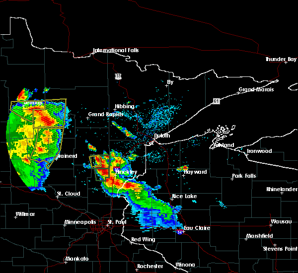 At 338 am cdt, a severe thunderstorm was located over mcgrath, or 18 miles east of mille lacs lake, moving southeast at 20 mph (radar indicated). Hazards include 60 mph wind gusts and half dollar size hail. Hail damage to vehicles is expected. expect wind damage to roofs, siding, and trees. Locations impacted include, mcgrath and dads corner. At 338 am cdt, a severe thunderstorm was located over mcgrath, or 18 miles east of mille lacs lake, moving southeast at 20 mph (radar indicated). Hazards include 60 mph wind gusts and half dollar size hail. Hail damage to vehicles is expected. expect wind damage to roofs, siding, and trees. Locations impacted include, mcgrath and dads corner.
|
| 7/6/2017 3:16 AM CDT |
 At 315 am cdt, a severe thunderstorm was located just east of malmo, or 12 miles east of mille lacs lake, moving southeast at 25 mph (radar indicated). Hazards include 60 mph wind gusts and quarter size hail. Hail damage to vehicles is expected. expect wind damage to roofs, siding, and trees. Locations impacted include, malmo, mcgrath, glen, and dads corner. At 315 am cdt, a severe thunderstorm was located just east of malmo, or 12 miles east of mille lacs lake, moving southeast at 25 mph (radar indicated). Hazards include 60 mph wind gusts and quarter size hail. Hail damage to vehicles is expected. expect wind damage to roofs, siding, and trees. Locations impacted include, malmo, mcgrath, glen, and dads corner.
|
| 7/6/2017 3:03 AM CDT |
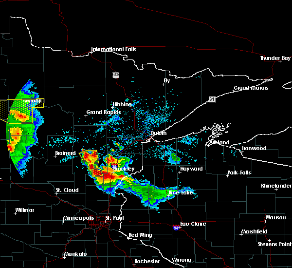 At 303 am cdt, a severe thunderstorm was located over malmo, or 9 miles east of mille lacs lake, moving southeast at 20 mph (radar indicated). Hazards include 60 mph wind gusts and half dollar size hail. Hail damage to vehicles is expected. Expect wind damage to roofs, siding, and trees. At 303 am cdt, a severe thunderstorm was located over malmo, or 9 miles east of mille lacs lake, moving southeast at 20 mph (radar indicated). Hazards include 60 mph wind gusts and half dollar size hail. Hail damage to vehicles is expected. Expect wind damage to roofs, siding, and trees.
|
| 7/6/2017 1:39 AM CDT |
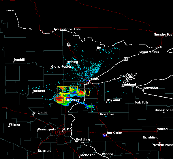 At 120 am cdt, a severe thunderstorm was located near mcgrath, or 18 miles northwest of hinckley, moving southeast at 15 mph (radar indicated). Hazards include 60 mph wind gusts and half dollar size hail. Hail damage to vehicles is expected. Expect wind damage to roofs, siding, and trees. At 120 am cdt, a severe thunderstorm was located near mcgrath, or 18 miles northwest of hinckley, moving southeast at 15 mph (radar indicated). Hazards include 60 mph wind gusts and half dollar size hail. Hail damage to vehicles is expected. Expect wind damage to roofs, siding, and trees.
|
| 7/6/2017 1:21 AM CDT |
 At 120 am cdt, a severe thunderstorm was located near mcgrath, or 18 miles northwest of hinckley, moving southeast at 15 mph (radar indicated). Hazards include 60 mph wind gusts and half dollar size hail. Hail damage to vehicles is expected. Expect wind damage to roofs, siding, and trees. At 120 am cdt, a severe thunderstorm was located near mcgrath, or 18 miles northwest of hinckley, moving southeast at 15 mph (radar indicated). Hazards include 60 mph wind gusts and half dollar size hail. Hail damage to vehicles is expected. Expect wind damage to roofs, siding, and trees.
|
| 8/4/2016 4:07 AM CDT |
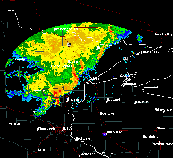 At 406 am cdt, severe thunderstorms were located along a line extending from near mcgregor, to near isle, moving east at 45 mph. these are very dangerous storms (radar indicated). Hazards include 80 mph wind gusts and penny size hail. Flying debris will be dangerous to those caught without shelter. mobile homes will be heavily damaged. expect considerable damage to roofs, windows, and vehicles. extensive tree damage and power outages are likely. Locations impacted include, mille lacs lake, malmo, mcgrath, glen, wealthwood, ripple lake, glory, dads corner, farm island lake and arthyde. At 406 am cdt, severe thunderstorms were located along a line extending from near mcgregor, to near isle, moving east at 45 mph. these are very dangerous storms (radar indicated). Hazards include 80 mph wind gusts and penny size hail. Flying debris will be dangerous to those caught without shelter. mobile homes will be heavily damaged. expect considerable damage to roofs, windows, and vehicles. extensive tree damage and power outages are likely. Locations impacted include, mille lacs lake, malmo, mcgrath, glen, wealthwood, ripple lake, glory, dads corner, farm island lake and arthyde.
|
| 8/4/2016 3:51 AM CDT |
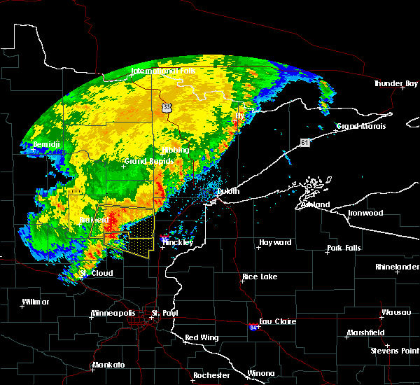 At 349 am cdt, severe thunderstorms were located along a line extending from 6 miles northeast of aitkin, to near vineland, moving east at 45 mph. these are very dangerous storms (radar indicated. at 322 am a wind gust to 78 mph was measured at brainerd). Hazards include 80 mph wind gusts and penny size hail. Flying debris will be dangerous to those caught without shelter. mobile homes will be heavily damaged. expect considerable damage to roofs, windows, and vehicles. extensive tree damage and power outages are likely. Locations impacted include, mille lacs lake, malmo, mcgrath, glen, wealthwood, ripple lake, glory, dads corner, farm island lake and arthyde. At 349 am cdt, severe thunderstorms were located along a line extending from 6 miles northeast of aitkin, to near vineland, moving east at 45 mph. these are very dangerous storms (radar indicated. at 322 am a wind gust to 78 mph was measured at brainerd). Hazards include 80 mph wind gusts and penny size hail. Flying debris will be dangerous to those caught without shelter. mobile homes will be heavily damaged. expect considerable damage to roofs, windows, and vehicles. extensive tree damage and power outages are likely. Locations impacted include, mille lacs lake, malmo, mcgrath, glen, wealthwood, ripple lake, glory, dads corner, farm island lake and arthyde.
|
| 8/4/2016 3:38 AM CDT |
 At 335 am cdt, severe thunderstorms were located along a line extending from near cuyuna, to 8 miles west of vineland, moving east at 45 mph. these are very dangerous storms (radar indicated. at 322 am there was a report of a 78 mph wind gust at brainerd airport). Hazards include 80 mph wind gusts and penny size hail. Flying debris will be dangerous to those caught without shelter. mobile homes will be heavily damaged. expect considerable damage to roofs, windows, and vehicles. extensive tree damage and power outages are likely. Locations impacted include, mille lacs lake, crosby, aitkin, deerwood, mcgregor, malmo, cuyuna, garrison, mcgrath, cedar lake, bay lake, glen, wealthwood, camp lake, kimberly, pine center, arthyde, ripple lake, glory and pine knoll. At 335 am cdt, severe thunderstorms were located along a line extending from near cuyuna, to 8 miles west of vineland, moving east at 45 mph. these are very dangerous storms (radar indicated. at 322 am there was a report of a 78 mph wind gust at brainerd airport). Hazards include 80 mph wind gusts and penny size hail. Flying debris will be dangerous to those caught without shelter. mobile homes will be heavily damaged. expect considerable damage to roofs, windows, and vehicles. extensive tree damage and power outages are likely. Locations impacted include, mille lacs lake, crosby, aitkin, deerwood, mcgregor, malmo, cuyuna, garrison, mcgrath, cedar lake, bay lake, glen, wealthwood, camp lake, kimberly, pine center, arthyde, ripple lake, glory and pine knoll.
|
| 8/4/2016 3:28 AM CDT |
 At 327 am cdt, severe thunderstorms were located along a line extending from near cuyuna, to 8 miles south of south long lake, moving east at 45 mph. these are very dangerous storms (radar indicated. at 306 am a 73 mph wind gust was observed northwest of brainerd). Hazards include 80 mph wind gusts and penny size hail. Flying debris will be dangerous to those caught without shelter. mobile homes will be heavily damaged. expect considerable damage to roofs, windows, and vehicles. Extensive tree damage and power outages are likely. At 327 am cdt, severe thunderstorms were located along a line extending from near cuyuna, to 8 miles south of south long lake, moving east at 45 mph. these are very dangerous storms (radar indicated. at 306 am a 73 mph wind gust was observed northwest of brainerd). Hazards include 80 mph wind gusts and penny size hail. Flying debris will be dangerous to those caught without shelter. mobile homes will be heavily damaged. expect considerable damage to roofs, windows, and vehicles. Extensive tree damage and power outages are likely.
|
| 7/24/2016 1:29 AM CDT |
 At 129 am cdt, severe thunderstorms were located along a line extending from near tamarack, to 7 miles southeast of mcgrath, moving east at 40 mph (radar indicated). Hazards include 60 mph wind gusts and nickel size hail. Expect damage to roofs. siding. And trees. At 129 am cdt, severe thunderstorms were located along a line extending from near tamarack, to 7 miles southeast of mcgrath, moving east at 40 mph (radar indicated). Hazards include 60 mph wind gusts and nickel size hail. Expect damage to roofs. siding. And trees.
|
| 7/24/2016 1:08 AM CDT |
 At 107 am cdt, a severe thunderstorm was located over malmo, or over the eastern portion of mille lacs lake, moving east at 40 mph (radar indicated). Hazards include 60 mph wind gusts and penny size hail. Expect damage to roofs. siding. and trees. Locations impacted include, mille lacs lake, malmo, mcgrath, glen, wealthwood, ripple lake, lawler, glory, rossburg, dads corner, rice lake wildlife refuge and arthyde. At 107 am cdt, a severe thunderstorm was located over malmo, or over the eastern portion of mille lacs lake, moving east at 40 mph (radar indicated). Hazards include 60 mph wind gusts and penny size hail. Expect damage to roofs. siding. and trees. Locations impacted include, mille lacs lake, malmo, mcgrath, glen, wealthwood, ripple lake, lawler, glory, rossburg, dads corner, rice lake wildlife refuge and arthyde.
|
| 7/24/2016 12:57 AM CDT |
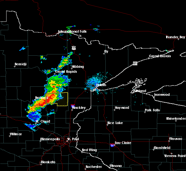 At 1256 am cdt, a severe thunderstorm was located over the northern part of mille lacs lake, moving east at 40 mph (radar indicated). Hazards include 60 mph wind gusts and penny size hail. Expect damage to roofs. siding. and trees. Locations impacted include, mille lacs lake, aitkin, malmo, mcgrath, cedar lake, glen, wealthwood, kimberly, rossburg, dads corner, farm island lake, arthyde, ripple lake, lawler, glory and rice lake wildlife refuge. At 1256 am cdt, a severe thunderstorm was located over the northern part of mille lacs lake, moving east at 40 mph (radar indicated). Hazards include 60 mph wind gusts and penny size hail. Expect damage to roofs. siding. and trees. Locations impacted include, mille lacs lake, aitkin, malmo, mcgrath, cedar lake, glen, wealthwood, kimberly, rossburg, dads corner, farm island lake, arthyde, ripple lake, lawler, glory and rice lake wildlife refuge.
|
| 7/24/2016 12:46 AM CDT |
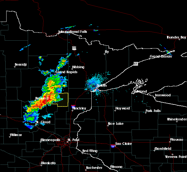 At 1245 am cdt, a severe thunderstorm was located near garrison, on the northwest side of lake mille lacs, moving east at 40 mph (radar indicated). Hazards include 60 mph wind gusts and penny size hail. Expect damage to roofs. siding. and trees. Locations impacted include, mille lacs lake, aitkin, malmo, mcgrath, cedar lake, glen, wealthwood, kimberly, rossburg, dads corner, farm island lake, arthyde, ripple lake, lawler, glory and rice lake wildlife refuge. At 1245 am cdt, a severe thunderstorm was located near garrison, on the northwest side of lake mille lacs, moving east at 40 mph (radar indicated). Hazards include 60 mph wind gusts and penny size hail. Expect damage to roofs. siding. and trees. Locations impacted include, mille lacs lake, aitkin, malmo, mcgrath, cedar lake, glen, wealthwood, kimberly, rossburg, dads corner, farm island lake, arthyde, ripple lake, lawler, glory and rice lake wildlife refuge.
|
| 7/24/2016 12:33 AM CDT |
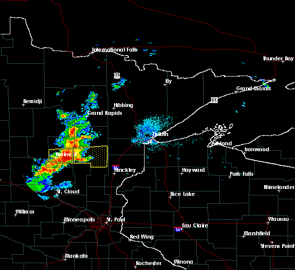 At 1232 am cdt, a severe thunderstorm was located 6 miles northwest of garrison, or 11 miles west of mille lacs lake, moving east at 40 mph (radar indicated. at 1220 am cdt... a 51 mph wind gust was reported at the brainerd airport). Hazards include 60 mph wind gusts and penny size hail. Expect damage to roofs. siding. And trees. At 1232 am cdt, a severe thunderstorm was located 6 miles northwest of garrison, or 11 miles west of mille lacs lake, moving east at 40 mph (radar indicated. at 1220 am cdt... a 51 mph wind gust was reported at the brainerd airport). Hazards include 60 mph wind gusts and penny size hail. Expect damage to roofs. siding. And trees.
|
| 7/21/2016 3:09 AM CDT |
 The severe thunderstorm warning for western carlton, aitkin, northwestern pine and southeastern crow wing counties will expire at 315 am cdt, the storms which prompted the warning have moved out of the area. therefore the warning will be allowed to expire. however gusty winds are still possible with these thunderstorms. a severe thunderstorm watch remains in effect until 700 am cdt for northeastern and east central minnesota. The severe thunderstorm warning for western carlton, aitkin, northwestern pine and southeastern crow wing counties will expire at 315 am cdt, the storms which prompted the warning have moved out of the area. therefore the warning will be allowed to expire. however gusty winds are still possible with these thunderstorms. a severe thunderstorm watch remains in effect until 700 am cdt for northeastern and east central minnesota.
|
| 7/21/2016 2:47 AM CDT |
 At 247 am cdt, severe thunderstorms were located along a line extending from near libby, to near isle, moving east at 50 mph (trained weather spotters). Hazards include 70 mph wind gusts and quarter size hail. Hail damage to vehicles is expected. expect considerable tree damage. wind damage is also likely to mobile homes, roofs, and outbuildings. these severe storms will be near, big sandy lake around 250 am cdt. sandstone and rutledge around 315 am cdt. Other locations impacted by these severe thunderstorms include glen, pine center, sheshebee, wealthwood, gun lake, automba, finlayson, arthyde, ripple lake and glory. At 247 am cdt, severe thunderstorms were located along a line extending from near libby, to near isle, moving east at 50 mph (trained weather spotters). Hazards include 70 mph wind gusts and quarter size hail. Hail damage to vehicles is expected. expect considerable tree damage. wind damage is also likely to mobile homes, roofs, and outbuildings. these severe storms will be near, big sandy lake around 250 am cdt. sandstone and rutledge around 315 am cdt. Other locations impacted by these severe thunderstorms include glen, pine center, sheshebee, wealthwood, gun lake, automba, finlayson, arthyde, ripple lake and glory.
|
| 7/21/2016 2:40 AM CDT |
 At 239 am cdt, severe thunderstorms were located along a line extending from near libby, to wahkon, moving east at 50 mph (trained weather spotters). Hazards include 70 mph wind gusts and quarter size hail. Hail damage to vehicles is expected. expect considerable tree damage. wind damage is also likely to mobile homes, roofs, and outbuildings. these severe storms will be near, big sandy lake and libby around 245 am cdt. mcgrath around 255 am cdt. sandstone and rutledge around 315 am cdt. Other locations impacted by these severe thunderstorms include glen, pine center, wealthwood, gun lake, mission, automba, arthyde, ripple lake, glory and lower mission lake. At 239 am cdt, severe thunderstorms were located along a line extending from near libby, to wahkon, moving east at 50 mph (trained weather spotters). Hazards include 70 mph wind gusts and quarter size hail. Hail damage to vehicles is expected. expect considerable tree damage. wind damage is also likely to mobile homes, roofs, and outbuildings. these severe storms will be near, big sandy lake and libby around 245 am cdt. mcgrath around 255 am cdt. sandstone and rutledge around 315 am cdt. Other locations impacted by these severe thunderstorms include glen, pine center, wealthwood, gun lake, mission, automba, arthyde, ripple lake, glory and lower mission lake.
|
| 7/21/2016 2:26 AM CDT |
 At 224 am cdt, severe thunderstorms were located along a line extending from 6 miles southeast of swatara, to near onamia, moving east at 45 mph (trained weather spotters reported damaging winds with numerous trees down in the pine river and emily areas). Hazards include 70 mph wind gusts and quarter size hail. Hail damage to vehicles is expected. expect considerable tree damage. wind damage is also likely to mobile homes, roofs, and outbuildings. these severe storms will be near, palisade and aitkin around 230 am cdt. libby around 240 am cdt. big sandy lake around 245 am cdt. mcgrath around 255 am cdt. sandstone and rutledge around 315 am cdt. Other locations impacted by these severe thunderstorms include glen, pine center, edward lake, wealthwood, gun lake, mission, automba, arthyde, swanburg and ripple lake. At 224 am cdt, severe thunderstorms were located along a line extending from 6 miles southeast of swatara, to near onamia, moving east at 45 mph (trained weather spotters reported damaging winds with numerous trees down in the pine river and emily areas). Hazards include 70 mph wind gusts and quarter size hail. Hail damage to vehicles is expected. expect considerable tree damage. wind damage is also likely to mobile homes, roofs, and outbuildings. these severe storms will be near, palisade and aitkin around 230 am cdt. libby around 240 am cdt. big sandy lake around 245 am cdt. mcgrath around 255 am cdt. sandstone and rutledge around 315 am cdt. Other locations impacted by these severe thunderstorms include glen, pine center, edward lake, wealthwood, gun lake, mission, automba, arthyde, swanburg and ripple lake.
|
| 7/21/2016 2:14 AM CDT |
 At 211 am cdt, severe thunderstorms were located along a line extending from 7 miles southwest of swatara, to 8 miles northeast of lastrup, moving east at 50 mph (trained weather spotters). Hazards include 70 mph wind gusts and quarter size hail. Hail damage to vehicles is expected. expect considerable tree damage. wind damage is also likely to mobile homes, roofs, and outbuildings. severe thunderstorms will be near, palisade and aitkin around 230 am cdt. big sandy lake and mcgregor around 240 am cdt. mcgrath around 250 am cdt. sandstone and rutledge around 315 am cdt. Other locations impacted by these severe thunderstorms include glen, pine center, edward lake, wealthwood, gun lake, mission, automba, arthyde, swanburg and ripple lake. At 211 am cdt, severe thunderstorms were located along a line extending from 7 miles southwest of swatara, to 8 miles northeast of lastrup, moving east at 50 mph (trained weather spotters). Hazards include 70 mph wind gusts and quarter size hail. Hail damage to vehicles is expected. expect considerable tree damage. wind damage is also likely to mobile homes, roofs, and outbuildings. severe thunderstorms will be near, palisade and aitkin around 230 am cdt. big sandy lake and mcgregor around 240 am cdt. mcgrath around 250 am cdt. sandstone and rutledge around 315 am cdt. Other locations impacted by these severe thunderstorms include glen, pine center, edward lake, wealthwood, gun lake, mission, automba, arthyde, swanburg and ripple lake.
|
| 7/11/2016 4:26 AM CDT |
 At 424 am cdt, severe thunderstorms were located along a line extending from jacobson, to 8 miles south of mcgregor, to wahkon, moving east at 45 mph. these are very dangerous storms (radar indicated). Hazards include 80 mph wind gusts and half dollar size hail. Flying debris will be dangerous to those caught without shelter. mobile homes will be heavily damaged. expect considerable damage to roofs, windows, and vehicles. extensive tree damage and power outages are likely. locations impacted include, big sandy lake, mille lacs lake, aitkin, hill city, floodwood, mcgregor, malmo, cromwell, garrison, kettle river, palisade, tamarack, mcgrath, libby, jacobson, swatara and glen. These storms have a history of producing large hail up to ping pong ball size. At 424 am cdt, severe thunderstorms were located along a line extending from jacobson, to 8 miles south of mcgregor, to wahkon, moving east at 45 mph. these are very dangerous storms (radar indicated). Hazards include 80 mph wind gusts and half dollar size hail. Flying debris will be dangerous to those caught without shelter. mobile homes will be heavily damaged. expect considerable damage to roofs, windows, and vehicles. extensive tree damage and power outages are likely. locations impacted include, big sandy lake, mille lacs lake, aitkin, hill city, floodwood, mcgregor, malmo, cromwell, garrison, kettle river, palisade, tamarack, mcgrath, libby, jacobson, swatara and glen. These storms have a history of producing large hail up to ping pong ball size.
|
| 7/11/2016 4:09 AM CDT |
 At 409 am cdt, severe thunderstorms were located along a line extending from 6 miles east of hill city to 7 miles east of aitkin to near vineland, moving east at 45 mph. these are very dangerous storms (radar indicated). Hazards include 80 mph wind gusts and ping pong ball size hail. Flying debris will be dangerous to those caught without shelter. mobile homes will be heavily damaged. expect considerable damage to roofs, windows, and vehicles. extensive tree damage and power outages are likely. locations impacted include, big sandy lake, mille lacs lake, aitkin, hill city, floodwood, mcgregor, malmo, cromwell, garrison, kettle river, palisade, tamarack, mcgrath, libby, jacobson, swatara, cedar lake, bay lake, glen and sturgeon lake. These storms have a history of producing hail up to ping pong ball size. At 409 am cdt, severe thunderstorms were located along a line extending from 6 miles east of hill city to 7 miles east of aitkin to near vineland, moving east at 45 mph. these are very dangerous storms (radar indicated). Hazards include 80 mph wind gusts and ping pong ball size hail. Flying debris will be dangerous to those caught without shelter. mobile homes will be heavily damaged. expect considerable damage to roofs, windows, and vehicles. extensive tree damage and power outages are likely. locations impacted include, big sandy lake, mille lacs lake, aitkin, hill city, floodwood, mcgregor, malmo, cromwell, garrison, kettle river, palisade, tamarack, mcgrath, libby, jacobson, swatara, cedar lake, bay lake, glen and sturgeon lake. These storms have a history of producing hail up to ping pong ball size.
|
| 7/11/2016 3:58 AM CDT |
 At 356 am cdt, severe thunderstorms were located along a line extending from near hill city to aitkin to 7 miles west of vineland, moving east at 45 mph (radar indicated). Hazards include half dollar size hail. Damage to vehicles is expected. severe thunderstorms will be near, mcgregor and jacobson around 420 am cdt. floodwood around 440 am cdt. moose lake and kettle river around 445 am cdt. other locations impacted by these severe thunderstorms include bain, glen, pine center, savanna portage state park, sheshebee and wealthwood. These storms have a history of large hail and high winds as they went through brainerd and crosby. At 356 am cdt, severe thunderstorms were located along a line extending from near hill city to aitkin to 7 miles west of vineland, moving east at 45 mph (radar indicated). Hazards include half dollar size hail. Damage to vehicles is expected. severe thunderstorms will be near, mcgregor and jacobson around 420 am cdt. floodwood around 440 am cdt. moose lake and kettle river around 445 am cdt. other locations impacted by these severe thunderstorms include bain, glen, pine center, savanna portage state park, sheshebee and wealthwood. These storms have a history of large hail and high winds as they went through brainerd and crosby.
|
| 6/25/2016 4:55 PM CDT |
 At 455 pm cdt, a severe thunderstorm was located 9 miles northwest of rutledge, or 22 miles north of hinckley, moving east at 45 mph (radar indicated). Hazards include 60 mph wind gusts and nickel size hail. Expect damage to roofs. siding. And trees. At 455 pm cdt, a severe thunderstorm was located 9 miles northwest of rutledge, or 22 miles north of hinckley, moving east at 45 mph (radar indicated). Hazards include 60 mph wind gusts and nickel size hail. Expect damage to roofs. siding. And trees.
|
| 6/25/2016 4:46 PM CDT |
 At 445 pm cdt, severe thunderstorms were located along a line extending from near kettle river to 8 miles south of mcgrath, moving east at 55 mph (radar indicated). Hazards include 70 mph wind gusts and nickel size hail. Expect considerable tree damage. damage is likely to mobile homes, roofs, and outbuildings. locations impacted include, cloquet, mille lacs lake, hermantown, sandstone, scanlon, carlton, barnum, mahtowa, willow river, wrenshall, askov, malmo, cromwell, rutledge, kettle river, thomson, bruno, tamarack, mcgrath and nemadji. A tornado watch remains in effect until 900 pm cdt for northeastern minnesota. At 445 pm cdt, severe thunderstorms were located along a line extending from near kettle river to 8 miles south of mcgrath, moving east at 55 mph (radar indicated). Hazards include 70 mph wind gusts and nickel size hail. Expect considerable tree damage. damage is likely to mobile homes, roofs, and outbuildings. locations impacted include, cloquet, mille lacs lake, hermantown, sandstone, scanlon, carlton, barnum, mahtowa, willow river, wrenshall, askov, malmo, cromwell, rutledge, kettle river, thomson, bruno, tamarack, mcgrath and nemadji. A tornado watch remains in effect until 900 pm cdt for northeastern minnesota.
|
| 6/25/2016 4:28 PM CDT |
 At 426 pm cdt, dangerous severe thunderstorms were located along a line extending from near brookston to near mahtowa to 7 miles northwest of rutledge, moving east at 50 mph (radar indicated). Hazards include 80 mph wind gusts and nickel size hail. Flying debris will be dangerous to those caught without shelter. mobile homes will be heavily damaged. expect considerable damage to roofs, windows, and vehicles. extensive tree damage and power outages are likely. locations impacted include, cloquet, mille lacs lake, hermantown, sandstone, scanlon, carlton, barnum, mahtowa, willow river, wrenshall, mcgregor, askov, malmo, cromwell, rutledge, kettle river, thomson, brookston, bruno and tamarack. A tornado watch remains in effect until 900 pm cdt for northeastern minnesota. At 426 pm cdt, dangerous severe thunderstorms were located along a line extending from near brookston to near mahtowa to 7 miles northwest of rutledge, moving east at 50 mph (radar indicated). Hazards include 80 mph wind gusts and nickel size hail. Flying debris will be dangerous to those caught without shelter. mobile homes will be heavily damaged. expect considerable damage to roofs, windows, and vehicles. extensive tree damage and power outages are likely. locations impacted include, cloquet, mille lacs lake, hermantown, sandstone, scanlon, carlton, barnum, mahtowa, willow river, wrenshall, mcgregor, askov, malmo, cromwell, rutledge, kettle river, thomson, brookston, bruno and tamarack. A tornado watch remains in effect until 900 pm cdt for northeastern minnesota.
|
| 6/25/2016 4:21 PM CDT |
 At 419 pm cdt, severe thunderstorms were located along a line extending from 7 miles northeast of cromwell to 7 miles west of mahtowa to 6 miles east of mcgrath, moving east at 65 mph. these are very dangerous storms. radar indicates that a narrow corridor of very strong winds, perhaps up to 80 mph will affect areas along the highway 210 corridor from cromwell to cloquet (radar indicated). Hazards include 80 mph wind gusts and quarter size hail. Flying debris will be dangerous to those caught without shelter. mobile homes will be heavily damaged. expect considerable damage to roofs, windows, and vehicles. extensive tree damage and power outages are likely. locations impacted include, cloquet, mille lacs lake, hermantown, sandstone, scanlon, carlton, barnum, mahtowa, willow river, wrenshall, mcgregor, askov, malmo, cromwell, rutledge, kettle river, thomson, brookston, bruno and tamarack. A tornado watch remains in effect until 900 pm cdt for northeastern minnesota. At 419 pm cdt, severe thunderstorms were located along a line extending from 7 miles northeast of cromwell to 7 miles west of mahtowa to 6 miles east of mcgrath, moving east at 65 mph. these are very dangerous storms. radar indicates that a narrow corridor of very strong winds, perhaps up to 80 mph will affect areas along the highway 210 corridor from cromwell to cloquet (radar indicated). Hazards include 80 mph wind gusts and quarter size hail. Flying debris will be dangerous to those caught without shelter. mobile homes will be heavily damaged. expect considerable damage to roofs, windows, and vehicles. extensive tree damage and power outages are likely. locations impacted include, cloquet, mille lacs lake, hermantown, sandstone, scanlon, carlton, barnum, mahtowa, willow river, wrenshall, mcgregor, askov, malmo, cromwell, rutledge, kettle river, thomson, brookston, bruno and tamarack. A tornado watch remains in effect until 900 pm cdt for northeastern minnesota.
|
| 6/25/2016 4:07 PM CDT |
 At 406 pm cdt, severe thunderstorms were located along a line extending from 7 miles north of cromwell to 6 miles northwest of kettle river to 6 miles north of isle, moving east at 50 mph (radar indicated). Hazards include 70 mph wind gusts and quarter size hail. Hail damage to vehicles is expected. expect considerable tree damage. Wind damage is also likely to mobile homes, roofs, and outbuildings. At 406 pm cdt, severe thunderstorms were located along a line extending from 7 miles north of cromwell to 6 miles northwest of kettle river to 6 miles north of isle, moving east at 50 mph (radar indicated). Hazards include 70 mph wind gusts and quarter size hail. Hail damage to vehicles is expected. expect considerable tree damage. Wind damage is also likely to mobile homes, roofs, and outbuildings.
|
| 6/19/2016 9:36 PM CDT |
 At 935 pm cdt, a severe thunderstorm was located over rutledge, or 17 miles north of hinckley, moving east at 50 mph (radar indicated). Hazards include 70 mph wind gusts and quarter size hail. Hail damage to vehicles is expected. expect considerable tree damage. wind damage is also likely to mobile homes, roofs, and outbuildings. this severe storm will be near, askov and bruno around 945 pm cdt. Other locations impacted by this severe thunderstorm include denham, banning state park, dads corner, moose lake state park, grindstone lake pine county, finlayson, arthyde and sturgeon lake. At 935 pm cdt, a severe thunderstorm was located over rutledge, or 17 miles north of hinckley, moving east at 50 mph (radar indicated). Hazards include 70 mph wind gusts and quarter size hail. Hail damage to vehicles is expected. expect considerable tree damage. wind damage is also likely to mobile homes, roofs, and outbuildings. this severe storm will be near, askov and bruno around 945 pm cdt. Other locations impacted by this severe thunderstorm include denham, banning state park, dads corner, moose lake state park, grindstone lake pine county, finlayson, arthyde and sturgeon lake.
|
| 6/19/2016 9:24 PM CDT |
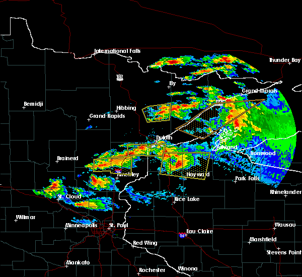 At 923 pm cdt, a severe thunderstorm was located 8 miles east of mcgrath, or 18 miles northwest of hinckley, moving east at 50 mph (radar indicated). Hazards include 70 mph wind gusts and half dollar size hail. Hail damage to vehicles is expected. expect considerable tree damage. wind damage is also likely to mobile homes, roofs, and outbuildings. this severe storm will be near, rutledge around 935 pm cdt. sandstone and willow river around 940 pm cdt. askov and bruno around 945 pm cdt. Other locations impacted by this severe thunderstorm include denham, banning state park, dads corner, moose lake state park, grindstone lake pine county, finlayson, arthyde and sturgeon lake. At 923 pm cdt, a severe thunderstorm was located 8 miles east of mcgrath, or 18 miles northwest of hinckley, moving east at 50 mph (radar indicated). Hazards include 70 mph wind gusts and half dollar size hail. Hail damage to vehicles is expected. expect considerable tree damage. wind damage is also likely to mobile homes, roofs, and outbuildings. this severe storm will be near, rutledge around 935 pm cdt. sandstone and willow river around 940 pm cdt. askov and bruno around 945 pm cdt. Other locations impacted by this severe thunderstorm include denham, banning state park, dads corner, moose lake state park, grindstone lake pine county, finlayson, arthyde and sturgeon lake.
|
| 6/19/2016 9:01 PM CDT |
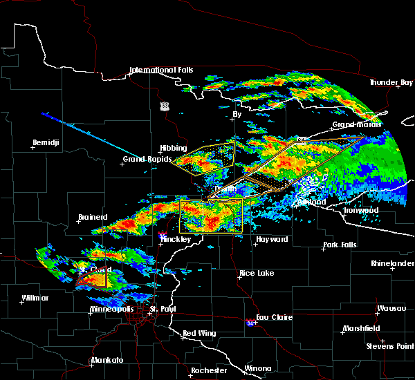 At 900 pm cdt, a severe thunderstorm was located near malmo, or 10 miles east of mille lacs lake, moving east at 50 mph (radar indicated). Hazards include 70 mph wind gusts and half dollar size hail. Hail damage to vehicles is expected. expect considerable tree damage. wind damage is also likely to mobile homes, roofs, and outbuildings. this severe thunderstorm will be near, mcgrath around 915 pm cdt. sandstone, willow river and rutledge around 940 pm cdt. askov and bruno around 945 pm cdt. Other locations impacted by this severe thunderstorm include denham, banning state park, dads corner, moose lake state park, grindstone lake pine county, finlayson, arthyde and sturgeon lake. At 900 pm cdt, a severe thunderstorm was located near malmo, or 10 miles east of mille lacs lake, moving east at 50 mph (radar indicated). Hazards include 70 mph wind gusts and half dollar size hail. Hail damage to vehicles is expected. expect considerable tree damage. wind damage is also likely to mobile homes, roofs, and outbuildings. this severe thunderstorm will be near, mcgrath around 915 pm cdt. sandstone, willow river and rutledge around 940 pm cdt. askov and bruno around 945 pm cdt. Other locations impacted by this severe thunderstorm include denham, banning state park, dads corner, moose lake state park, grindstone lake pine county, finlayson, arthyde and sturgeon lake.
|
| 7/12/2015 8:00 PM CDT |
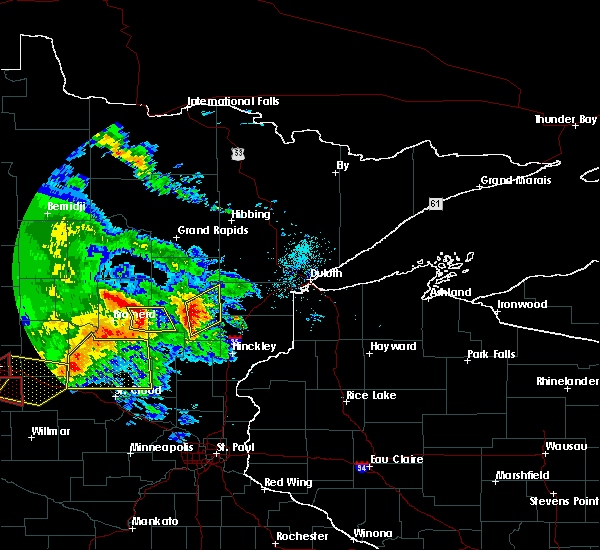 At 800 pm cdt, severe thunderstorms were located along a line extending from near mcgregor to 6 miles north of mcgrath, moving northeast at 30 mph (radar indicated). Hazards include 70 mph wind gusts and penny size hail. Expect considerable tree damage. Damage is likely to mobile homes, roofs and outbuildings. At 800 pm cdt, severe thunderstorms were located along a line extending from near mcgregor to 6 miles north of mcgrath, moving northeast at 30 mph (radar indicated). Hazards include 70 mph wind gusts and penny size hail. Expect considerable tree damage. Damage is likely to mobile homes, roofs and outbuildings.
|
Hail Maps for McGrath, MN
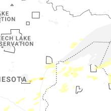
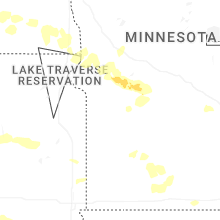
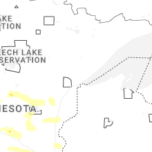


Connect with Interactive Hail Maps