

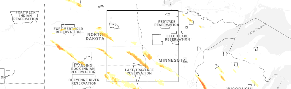
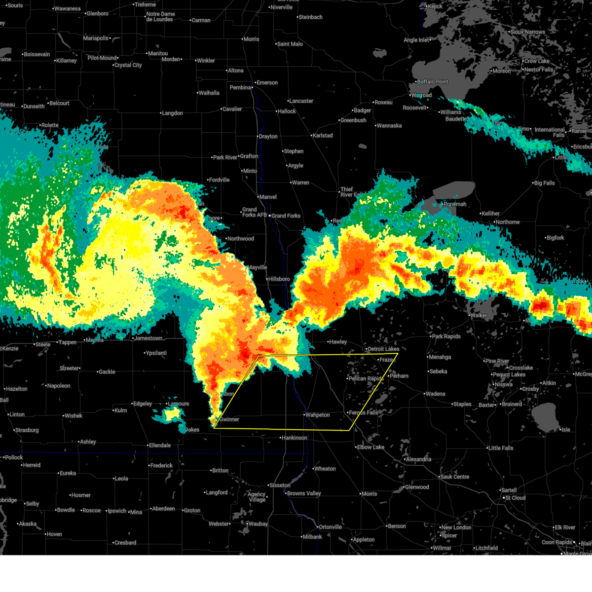
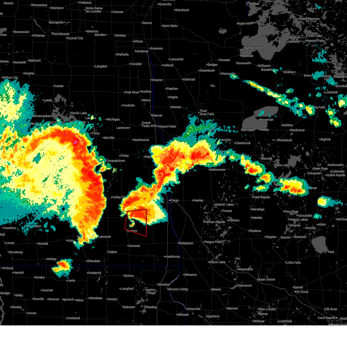
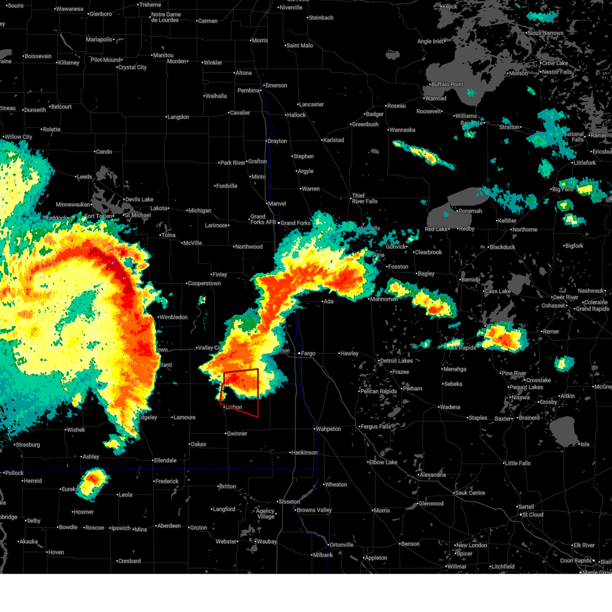
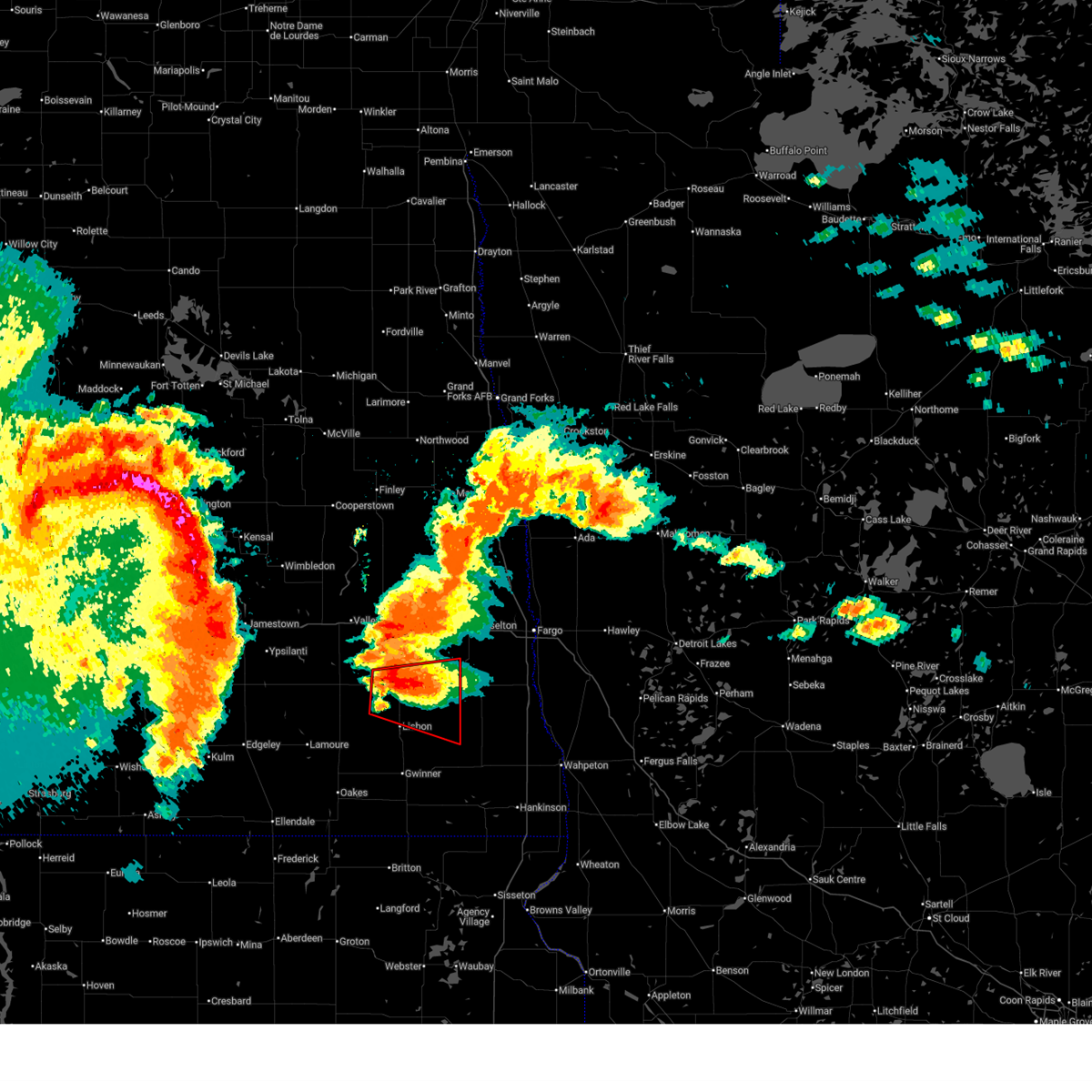
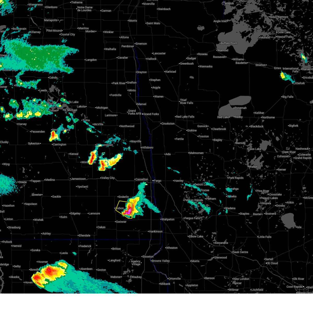
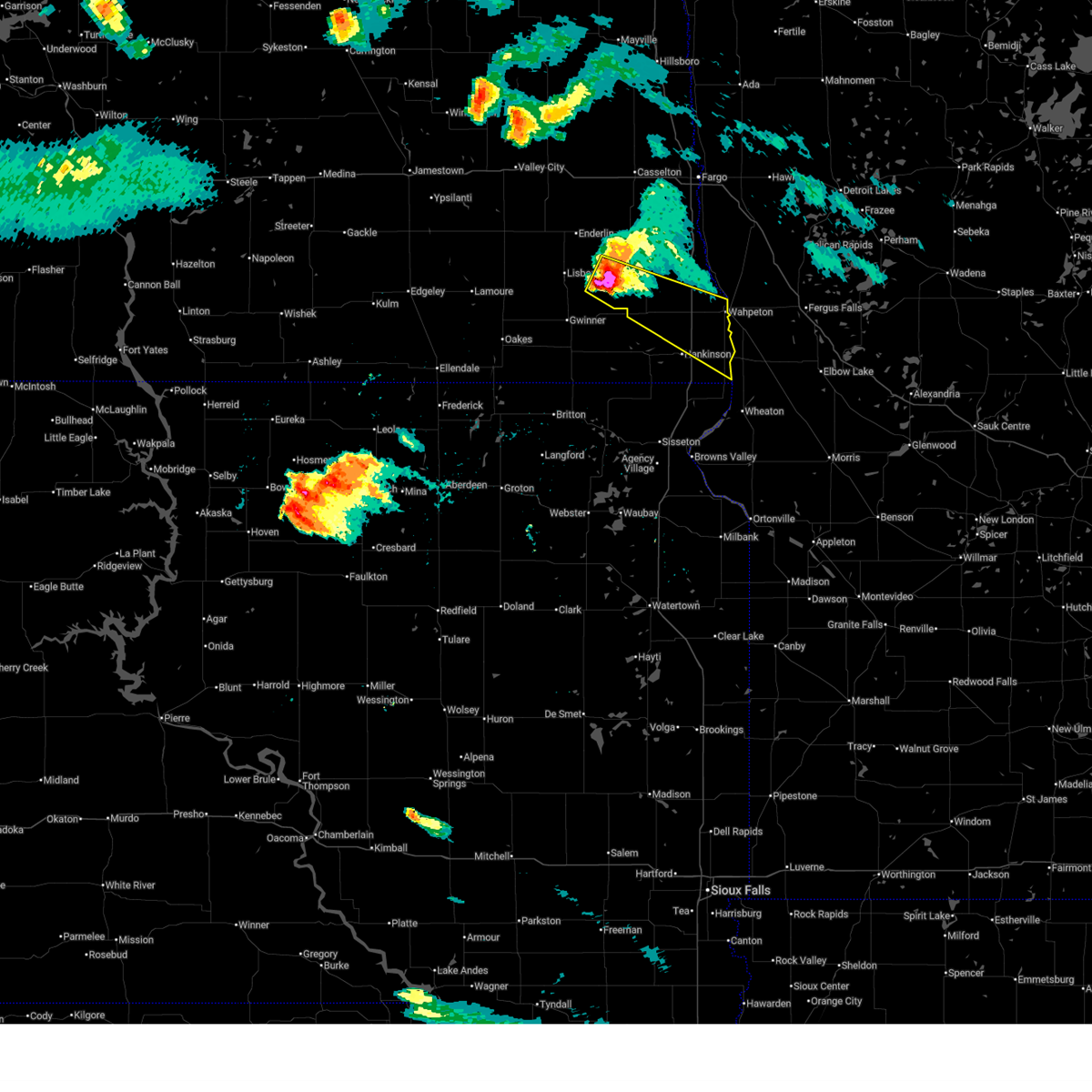
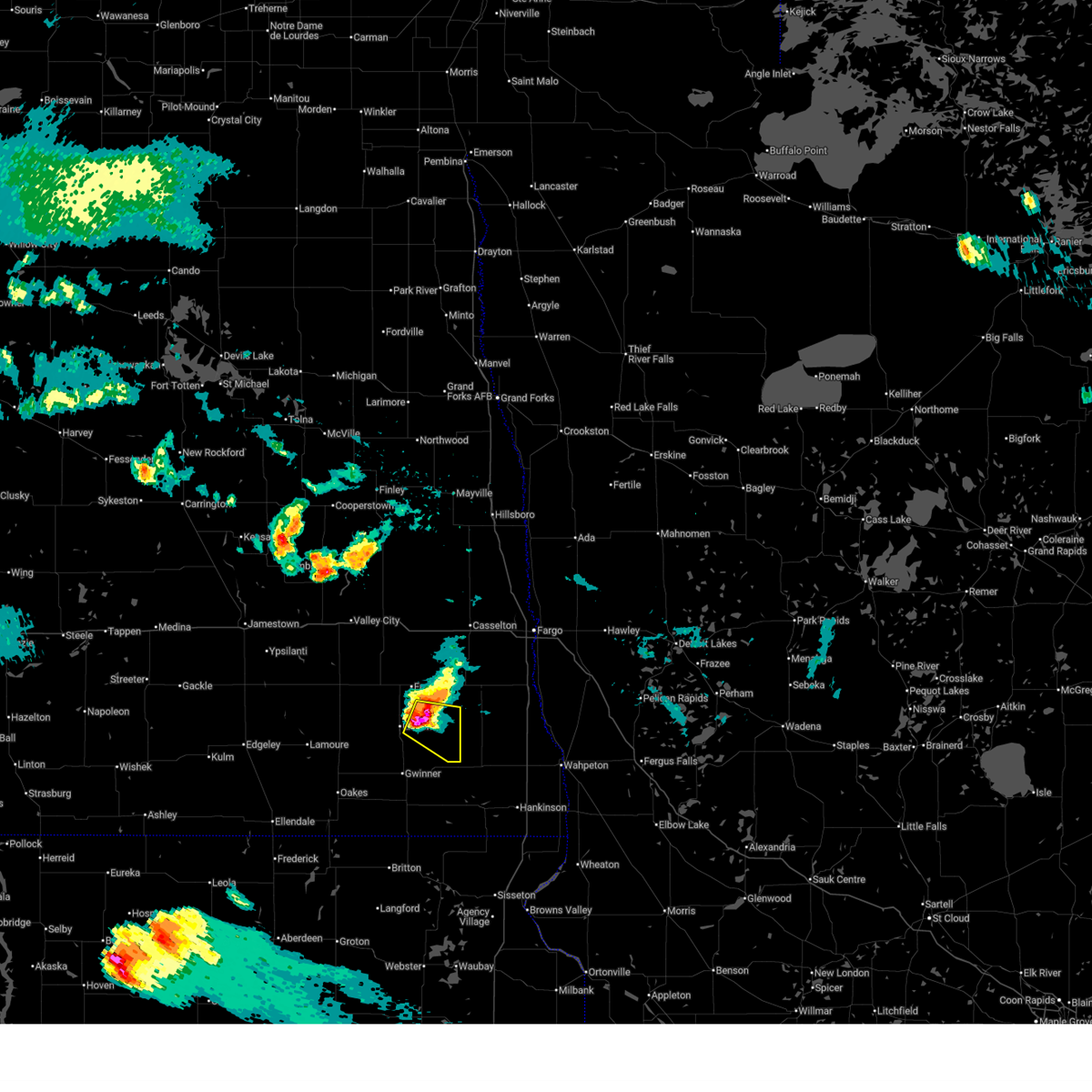
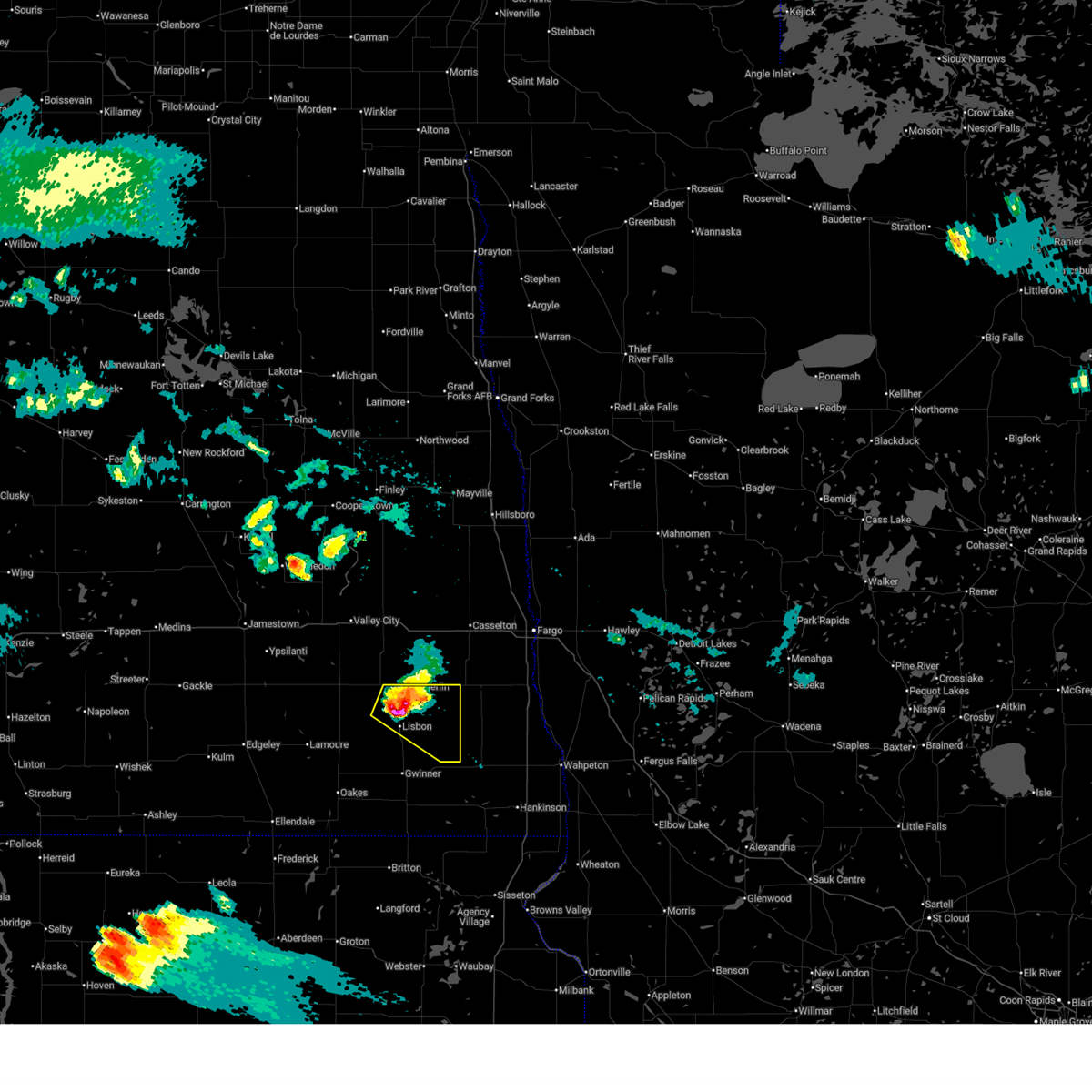
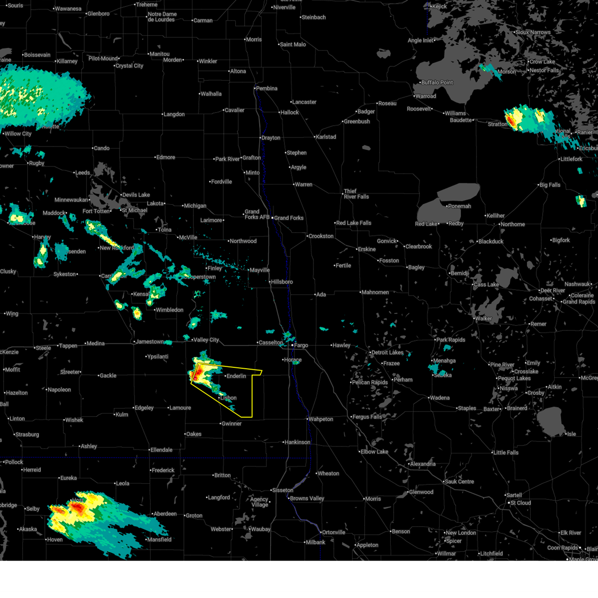
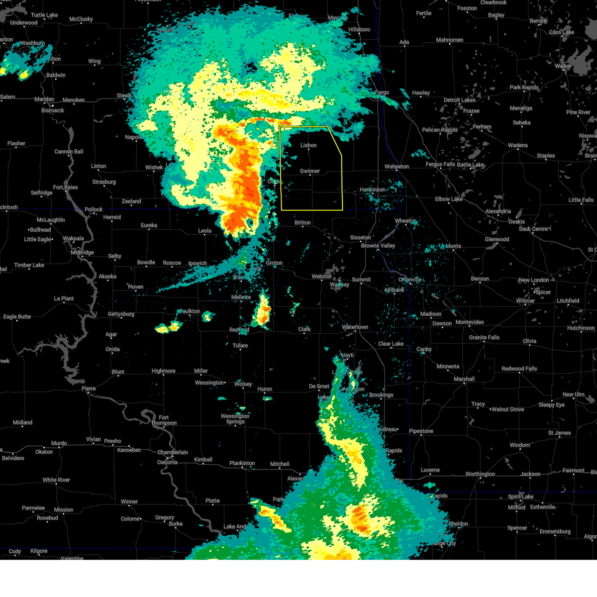
Hail Map for McLeod, ND
The McLeod, ND area has had 2 reports of on-the-ground hail by trained spotters, and has been under severe weather warnings 29 times during the past 12 months. Doppler radar has detected hail at or near McLeod, ND on 46 occasions, including 6 occasions during the past year.
| Name: | McLeod, ND |
| Where Located: | 41.6 miles SW of Fargo, ND |
| Map: | Google Map for McLeod, ND |
| Population: | 27 |
| Housing Units: | 20 |
| More Info: | Search Google for McLeod, ND |
4
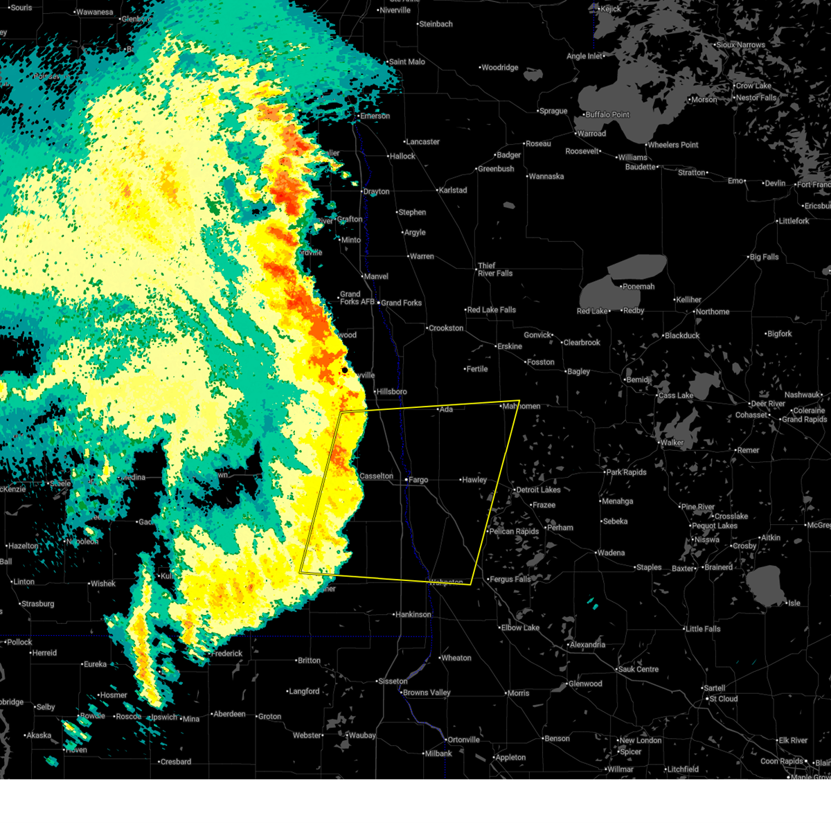
The Top Recent Hail Date for McLeod, ND is Thursday, June 19, 2025 (2nd out of 46)
Hail and Wind Damage Spotted near McLeod, ND
| Date / Time | Report Details |
|---|---|
| 6/10/2026 1:21 AM CDT |
 The storms which prompted the warning have moved out of the area. therefore, the warning will be allowed to expire. a severe thunderstorm watch remains in effect until 400 am cdt for west central minnesota, and southeastern north dakota. The storms which prompted the warning have moved out of the area. therefore, the warning will be allowed to expire. a severe thunderstorm watch remains in effect until 400 am cdt for west central minnesota, and southeastern north dakota.
|
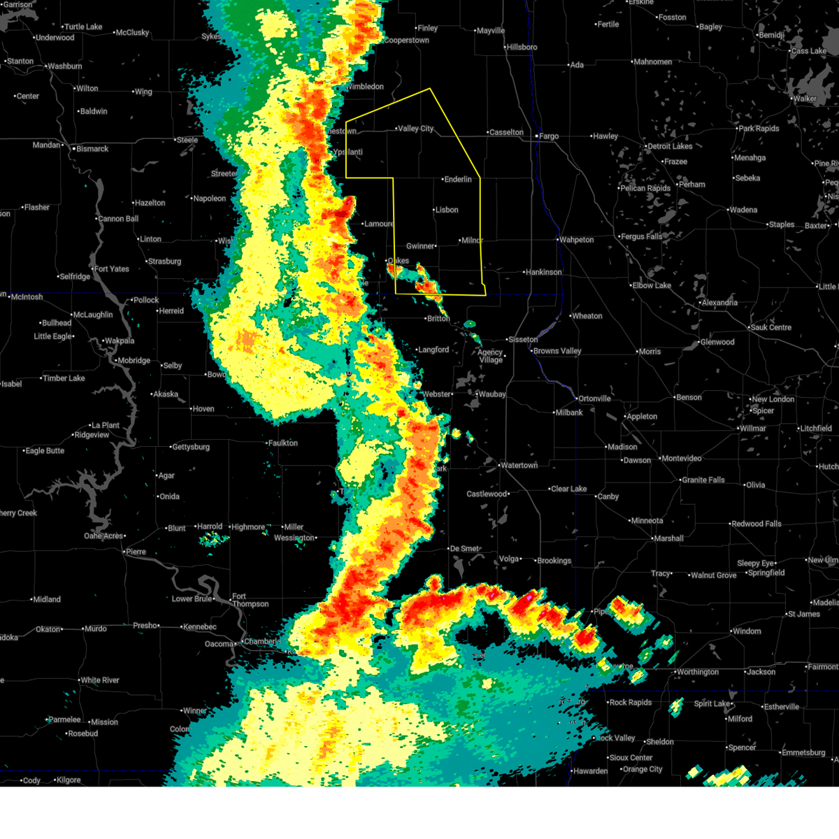
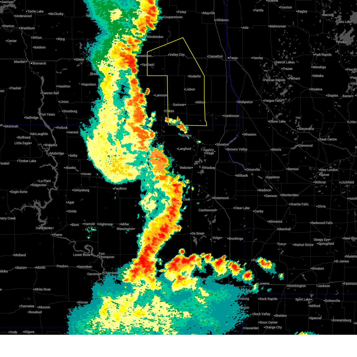
| 6/10/2026 1:05 AM CDT | Storm damage reported in ransom county ND, 3.3 miles S of McLeod, ND |
| 6/10/2026 1:05 AM CDT |
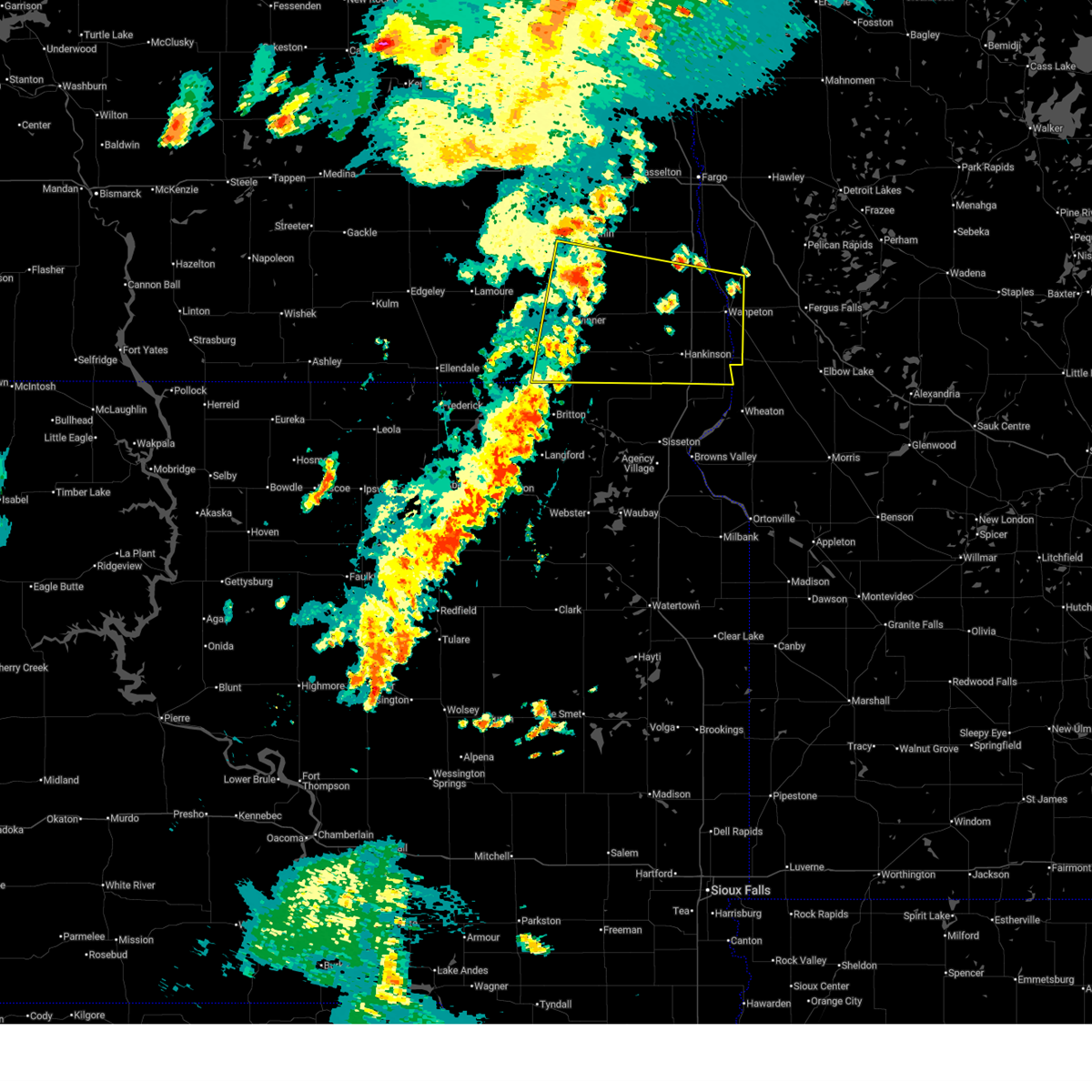
 At 104 am cdt, severe thunderstorms were located over mainly rural areas of ransom, richland and sargent counties, moving northeast at 50 mph (radar indicated). Hazards include 60 mph wind gusts and penny size hail. Expect damage to roofs, siding, and trees. Locations impacted include, wahpeton, breckenridge, lisbon, hankinson, enderlin, kindred, and milnor. At 104 am cdt, severe thunderstorms were located over mainly rural areas of ransom, richland and sargent counties, moving northeast at 50 mph (radar indicated). Hazards include 60 mph wind gusts and penny size hail. Expect damage to roofs, siding, and trees. Locations impacted include, wahpeton, breckenridge, lisbon, hankinson, enderlin, kindred, and milnor.
|
| 6/10/2026 12:40 AM CDT |
 Svrfgf the national weather service in grand forks has issued a * severe thunderstorm warning for, ransom county in southeastern north dakota, southwestern cass county in southeastern north dakota, southeastern barnes county in southeastern north dakota, richland county in southeastern north dakota, eastern sargent county in southeastern north dakota, * until 130 am cdt. * at 1235 am cdt, severe thunderstorms were located along a line extending from little yellowstone to near milnor to lake traverse reservation, moving northeast at 65 mph (radar indicated). Hazards include 60 mph wind gusts and penny size hail. expect damage to roofs, siding, and trees Svrfgf the national weather service in grand forks has issued a * severe thunderstorm warning for, ransom county in southeastern north dakota, southwestern cass county in southeastern north dakota, southeastern barnes county in southeastern north dakota, richland county in southeastern north dakota, eastern sargent county in southeastern north dakota, * until 130 am cdt. * at 1235 am cdt, severe thunderstorms were located along a line extending from little yellowstone to near milnor to lake traverse reservation, moving northeast at 65 mph (radar indicated). Hazards include 60 mph wind gusts and penny size hail. expect damage to roofs, siding, and trees
|
| 6/9/2026 11:56 PM CDT |
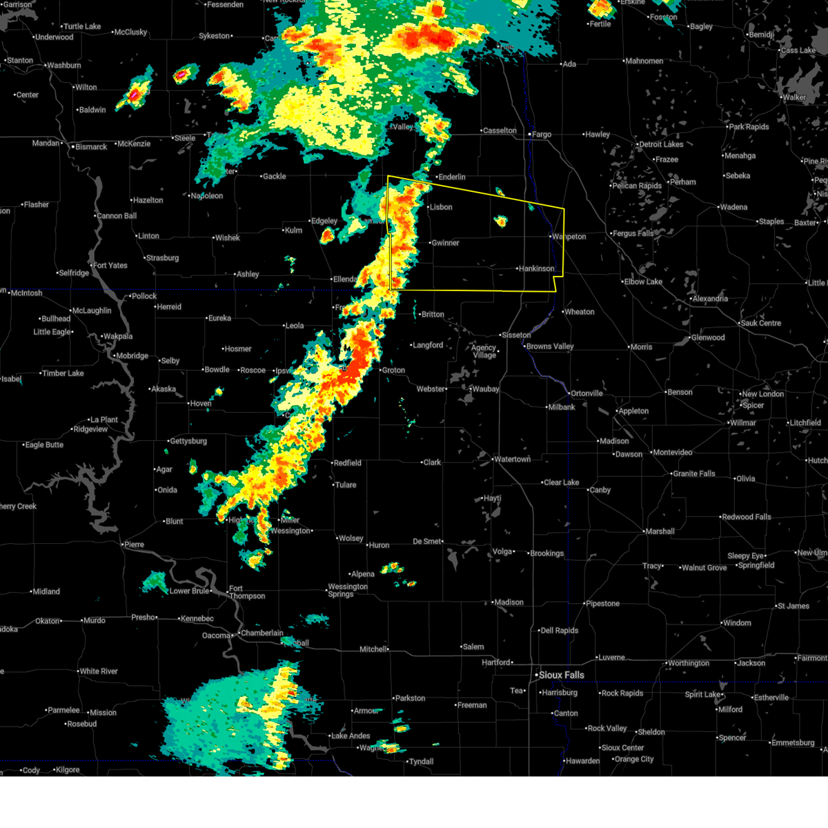
 At 1154 pm cdt, severe thunderstorms were located along a line extending from near ypsilanti to 6 miles southeast of berlin to 7 miles west of langford, moving east at 50 mph (radar indicated). Hazards include 70 mph wind gusts and penny size hail. a 70 mph wind gust has been reported at the jamestown airport. Expect considerable tree damage. damage is likely to mobile homes, roofs, and outbuildings. Locations impacted include, valley city, lisbon, enderlin, gwinner, milnor, forman, and tower city. At 1154 pm cdt, severe thunderstorms were located along a line extending from near ypsilanti to 6 miles southeast of berlin to 7 miles west of langford, moving east at 50 mph (radar indicated). Hazards include 70 mph wind gusts and penny size hail. a 70 mph wind gust has been reported at the jamestown airport. Expect considerable tree damage. damage is likely to mobile homes, roofs, and outbuildings. Locations impacted include, valley city, lisbon, enderlin, gwinner, milnor, forman, and tower city.
|
| 6/9/2026 11:51 PM CDT |
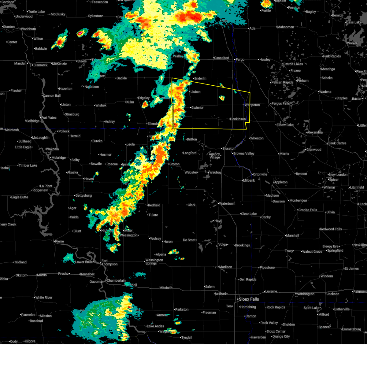
 Svrfgf the national weather service in grand forks has issued a * severe thunderstorm warning for, ransom county in southeastern north dakota, southwestern cass county in southeastern north dakota, barnes county in southeastern north dakota, sargent county in southeastern north dakota, * until 1245 am cdt. * at 1151 pm cdt, severe thunderstorms were located along a line extending from near ypsilanti to 6 miles southeast of berlin to 7 miles southwest of langford, moving northeast at 50 mph (radar indicated). Hazards include 70 mph wind gusts and penny size hail. Expect considerable tree damage. Damage is likely to mobile homes, roofs, and outbuildings. Svrfgf the national weather service in grand forks has issued a * severe thunderstorm warning for, ransom county in southeastern north dakota, southwestern cass county in southeastern north dakota, barnes county in southeastern north dakota, sargent county in southeastern north dakota, * until 1245 am cdt. * at 1151 pm cdt, severe thunderstorms were located along a line extending from near ypsilanti to 6 miles southeast of berlin to 7 miles southwest of langford, moving northeast at 50 mph (radar indicated). Hazards include 70 mph wind gusts and penny size hail. Expect considerable tree damage. Damage is likely to mobile homes, roofs, and outbuildings.
|
| 9/14/2025 5:35 PM CDT | The storms which prompted the warning have weakened below severe limits, and have exited the warned area. therefore, the warning will be allowed to expire. |
| 9/14/2025 5:00 PM CDT | At 500 pm cdt, severe thunderstorms were located along a line extending from 7 miles east of venlo to 9 miles east of mcleod to mooreton, moving north at 35 mph (radar indicated). Hazards include 60 mph wind gusts and penny size hail. Expect damage to roofs, siding, and trees. Locations impacted include, kindred, wyndmere, walcott, leonard, mooreton, colfax, and mcleod. |
| 9/14/2025 5:00 PM CDT | the severe thunderstorm warning has been cancelled and is no longer in effect |
| 9/14/2025 4:41 PM CDT |
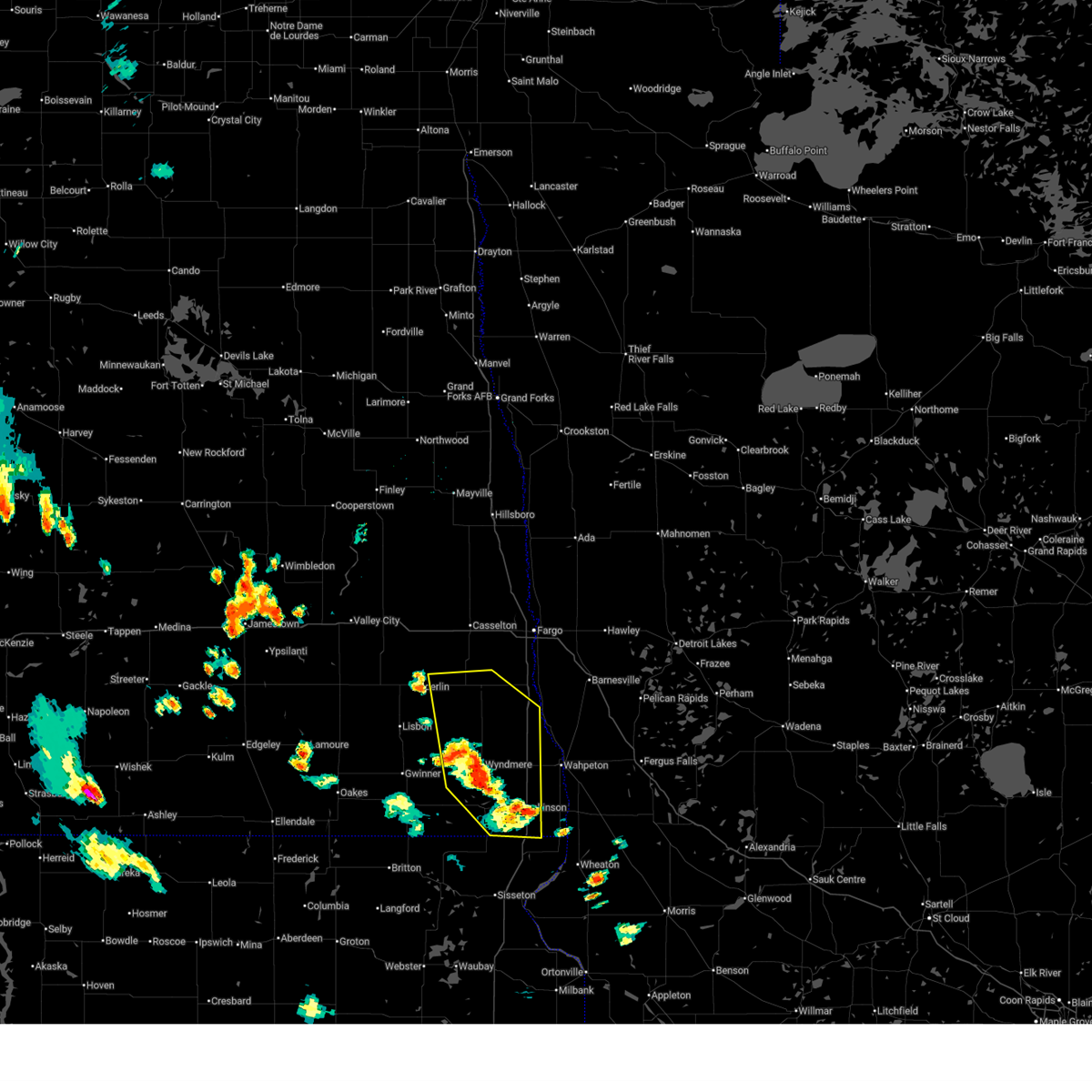 Svrfgf the national weather service in grand forks has issued a * severe thunderstorm warning for, eastern ransom county in southeastern north dakota, south central cass county in southeastern north dakota, richland county in southeastern north dakota, northeastern sargent county in southeastern north dakota, * until 545 pm cdt. * at 440 pm cdt, severe thunderstorms were located along a line extending from near de lamere to near mantador to near hankinson, moving north at 35 mph (radar indicated). Hazards include 60 mph wind gusts and penny size hail. expect damage to roofs, siding, and trees Svrfgf the national weather service in grand forks has issued a * severe thunderstorm warning for, eastern ransom county in southeastern north dakota, south central cass county in southeastern north dakota, richland county in southeastern north dakota, northeastern sargent county in southeastern north dakota, * until 545 pm cdt. * at 440 pm cdt, severe thunderstorms were located along a line extending from near de lamere to near mantador to near hankinson, moving north at 35 mph (radar indicated). Hazards include 60 mph wind gusts and penny size hail. expect damage to roofs, siding, and trees
|
| 8/8/2025 4:34 AM CDT |
 At 434 am cdt, severe thunderstorms were located along a line extending from near twin valley to near kent, moving east at 60 mph (radar indicated). Hazards include 70 mph wind gusts. Expect considerable tree damage. damage is likely to mobile homes, roofs, and outbuildings. Locations impacted include, fargo, wahpeton, moorhead, west fargo, dilworth, breckenridge, and barnesville. At 434 am cdt, severe thunderstorms were located along a line extending from near twin valley to near kent, moving east at 60 mph (radar indicated). Hazards include 70 mph wind gusts. Expect considerable tree damage. damage is likely to mobile homes, roofs, and outbuildings. Locations impacted include, fargo, wahpeton, moorhead, west fargo, dilworth, breckenridge, and barnesville.
|
| 8/8/2025 3:55 AM CDT |
 Svrfgf the national weather service in grand forks has issued a * severe thunderstorm warning for, clay county in northwestern minnesota, southern norman county in northwestern minnesota, northwestern otter tail county in west central minnesota, wilkin county in west central minnesota, southwestern mahnomen county in northwestern minnesota, western becker county in northwestern minnesota, eastern ransom county in southeastern north dakota, cass county in southeastern north dakota, southeastern traill county in southeastern north dakota, northern richland county in southeastern north dakota, * until 500 am cdt. * at 355 am cdt, severe thunderstorms were located along a line extending from near grandin to near venlo, moving east at 60 mph (mesonets). Hazards include 70 mph wind gusts. Expect considerable tree damage. Damage is likely to mobile homes, roofs, and outbuildings. Svrfgf the national weather service in grand forks has issued a * severe thunderstorm warning for, clay county in northwestern minnesota, southern norman county in northwestern minnesota, northwestern otter tail county in west central minnesota, wilkin county in west central minnesota, southwestern mahnomen county in northwestern minnesota, western becker county in northwestern minnesota, eastern ransom county in southeastern north dakota, cass county in southeastern north dakota, southeastern traill county in southeastern north dakota, northern richland county in southeastern north dakota, * until 500 am cdt. * at 355 am cdt, severe thunderstorms were located along a line extending from near grandin to near venlo, moving east at 60 mph (mesonets). Hazards include 70 mph wind gusts. Expect considerable tree damage. Damage is likely to mobile homes, roofs, and outbuildings.
|
| 7/4/2025 5:26 PM CDT |
 The storms which prompted the warning have weakened below severe limits, and no longer pose an immediate threat to life or property. therefore, the warning will be allowed to expire. however, gusty winds and heavy rain are still possible with these thunderstorms. a severe thunderstorm watch remains in effect until 900 pm cdt for west central minnesota, and southeastern north dakota. The storms which prompted the warning have weakened below severe limits, and no longer pose an immediate threat to life or property. therefore, the warning will be allowed to expire. however, gusty winds and heavy rain are still possible with these thunderstorms. a severe thunderstorm watch remains in effect until 900 pm cdt for west central minnesota, and southeastern north dakota.
|
| 7/4/2025 5:20 PM CDT |
 The storms which prompted the warning have weakened below severe limits, and no longer pose an immediate threat to life or property. therefore, the warning will be allowed to expire. however, gusty winds and heavy rain are still possible with these thunderstorms. a severe thunderstorm watch remains in effect until 900 pm cdt for west central minnesota, and southeastern north dakota. The storms which prompted the warning have weakened below severe limits, and no longer pose an immediate threat to life or property. therefore, the warning will be allowed to expire. however, gusty winds and heavy rain are still possible with these thunderstorms. a severe thunderstorm watch remains in effect until 900 pm cdt for west central minnesota, and southeastern north dakota.
|
| 7/4/2025 5:02 PM CDT |
 At 502 pm cdt, severe thunderstorms were located along a line extending from anselm to near kidder, moving east at 35 mph (radar indicated). Hazards include 60 mph wind gusts and penny size hail. Expect damage to roofs, siding, and trees. locations impacted include, wahpeton, breckenridge, lisbon, hankinson, gwinner, milnor, and lidgerwood. This includes interstate 29 between mile markers 0 and 37. At 502 pm cdt, severe thunderstorms were located along a line extending from anselm to near kidder, moving east at 35 mph (radar indicated). Hazards include 60 mph wind gusts and penny size hail. Expect damage to roofs, siding, and trees. locations impacted include, wahpeton, breckenridge, lisbon, hankinson, gwinner, milnor, and lidgerwood. This includes interstate 29 between mile markers 0 and 37.
|
| 7/4/2025 5:01 PM CDT |
 At 501 pm cdt, severe thunderstorms were located along a line extending from near venlo to havana, moving east at 35 mph (radar indicated). Hazards include 60 mph wind gusts and penny size hail. Expect damage to roofs, siding, and trees. locations impacted include, wahpeton, breckenridge, lisbon, hankinson, gwinner, milnor, and lidgerwood. This includes interstate 29 between mile markers 0 and 37. At 501 pm cdt, severe thunderstorms were located along a line extending from near venlo to havana, moving east at 35 mph (radar indicated). Hazards include 60 mph wind gusts and penny size hail. Expect damage to roofs, siding, and trees. locations impacted include, wahpeton, breckenridge, lisbon, hankinson, gwinner, milnor, and lidgerwood. This includes interstate 29 between mile markers 0 and 37.
|
| 7/4/2025 4:36 PM CDT |
 Svrfgf the national weather service in grand forks has issued a * severe thunderstorm warning for, central wilkin county in west central minnesota, ransom county in southeastern north dakota, richland county in southeastern north dakota, sargent county in southeastern north dakota, * until 530 pm cdt. * at 436 pm cdt, severe thunderstorms were located along a line extending from near enderlin to near straubville, moving east at 40 mph (radar indicated). Hazards include 60 mph wind gusts. expect damage to roofs, siding, and trees Svrfgf the national weather service in grand forks has issued a * severe thunderstorm warning for, central wilkin county in west central minnesota, ransom county in southeastern north dakota, richland county in southeastern north dakota, sargent county in southeastern north dakota, * until 530 pm cdt. * at 436 pm cdt, severe thunderstorms were located along a line extending from near enderlin to near straubville, moving east at 40 mph (radar indicated). Hazards include 60 mph wind gusts. expect damage to roofs, siding, and trees
|
| 6/21/2025 12:46 AM CDT |
 The storms which prompted the warning have weakened below severe limits, and have exited the warned area. therefore, the warning has been allowed to expire. however, heavy rain is still possible with these thunderstorms. a tornado watch remains in effect until 300 am cdt for northwestern and west central minnesota, and southeastern north dakota. The storms which prompted the warning have weakened below severe limits, and have exited the warned area. therefore, the warning has been allowed to expire. however, heavy rain is still possible with these thunderstorms. a tornado watch remains in effect until 300 am cdt for northwestern and west central minnesota, and southeastern north dakota.
|
| 6/20/2025 11:52 PM CDT |
 Svrfgf the national weather service in grand forks has issued a * severe thunderstorm warning for, southern clay county in northwestern minnesota, western otter tail county in west central minnesota, wilkin county in west central minnesota, southwestern becker county in northwestern minnesota, southeastern ransom county in southeastern north dakota, southeastern cass county in southeastern north dakota, richland county in southeastern north dakota, northeastern sargent county in southeastern north dakota, * until 1245 am cdt. * at 1151 pm cdt, severe thunderstorms were located along a line extending from near mapleton to near gwinner, moving east at 70 mph (radar indicated). Hazards include 70 mph wind gusts. Expect considerable tree damage. damage is likely to mobile homes, roofs, and outbuildings. severe thunderstorms will be near, horace, kindred, and milnor around 1155 pm cdt. wild rice around 1200 am cdt. wyndmere, oxbow, and walcott around 1205 am cdt. wolverton, colfax, and barney around 1210 am cdt. abercrombie, mooreton, and galchutt around 1215 am cdt. other locations impacted by these severe thunderstorms include fergus falls airport. this includes the following highways, interstate 29 between mile markers 15 and 57. interstate 94 in north dakota between mile markers 15 and 62. Interstate 94 in minnesota between mile markers 15 and 62. Svrfgf the national weather service in grand forks has issued a * severe thunderstorm warning for, southern clay county in northwestern minnesota, western otter tail county in west central minnesota, wilkin county in west central minnesota, southwestern becker county in northwestern minnesota, southeastern ransom county in southeastern north dakota, southeastern cass county in southeastern north dakota, richland county in southeastern north dakota, northeastern sargent county in southeastern north dakota, * until 1245 am cdt. * at 1151 pm cdt, severe thunderstorms were located along a line extending from near mapleton to near gwinner, moving east at 70 mph (radar indicated). Hazards include 70 mph wind gusts. Expect considerable tree damage. damage is likely to mobile homes, roofs, and outbuildings. severe thunderstorms will be near, horace, kindred, and milnor around 1155 pm cdt. wild rice around 1200 am cdt. wyndmere, oxbow, and walcott around 1205 am cdt. wolverton, colfax, and barney around 1210 am cdt. abercrombie, mooreton, and galchutt around 1215 am cdt. other locations impacted by these severe thunderstorms include fergus falls airport. this includes the following highways, interstate 29 between mile markers 15 and 57. interstate 94 in north dakota between mile markers 15 and 62. Interstate 94 in minnesota between mile markers 15 and 62.
|
| 6/20/2025 11:11 PM CDT |
 At 1110 pm cdt, a confirmed large and extremely dangerous tornado was located near sheldon, or 36 miles southeast of valley city, moving east at 25 mph. this is a particularly dangerous situation. take cover now! (weather spotters confirmed tornado). Hazards include damaging tornado and half dollar size hail. You are in a life-threatening situation. flying debris may be deadly to those caught without shelter. mobile homes will be destroyed. considerable damage to homes, businesses, and vehicles is likely and complete destruction is possible. Locations impacted include, enderlin, sheldon, mcleod, anselm, and venlo. At 1110 pm cdt, a confirmed large and extremely dangerous tornado was located near sheldon, or 36 miles southeast of valley city, moving east at 25 mph. this is a particularly dangerous situation. take cover now! (weather spotters confirmed tornado). Hazards include damaging tornado and half dollar size hail. You are in a life-threatening situation. flying debris may be deadly to those caught without shelter. mobile homes will be destroyed. considerable damage to homes, businesses, and vehicles is likely and complete destruction is possible. Locations impacted include, enderlin, sheldon, mcleod, anselm, and venlo.
|
| 6/20/2025 11:05 PM CDT |
 the tornado warning has been cancelled and is no longer in effect the tornado warning has been cancelled and is no longer in effect
|
| 6/20/2025 11:05 PM CDT |
 At 1104 pm cdt, a severe thunderstorm capable of producing a tornado was located over anselm, or 34 miles southeast of valley city, moving east at 25 mph (radar indicated rotation). Hazards include tornado and half dollar size hail. Flying debris will be dangerous to those caught without shelter. mobile homes will be damaged or destroyed. damage to roofs, windows, and vehicles will occur. tree damage is likely. Locations impacted include, enderlin, sheldon, mcleod, anselm, and venlo. At 1104 pm cdt, a severe thunderstorm capable of producing a tornado was located over anselm, or 34 miles southeast of valley city, moving east at 25 mph (radar indicated rotation). Hazards include tornado and half dollar size hail. Flying debris will be dangerous to those caught without shelter. mobile homes will be damaged or destroyed. damage to roofs, windows, and vehicles will occur. tree damage is likely. Locations impacted include, enderlin, sheldon, mcleod, anselm, and venlo.
|
| 6/20/2025 10:42 PM CDT |
 Torfgf the national weather service in grand forks has issued a * tornado warning for, northern ransom county in southeastern north dakota, southwestern cass county in southeastern north dakota, southeastern barnes county in southeastern north dakota, * until 1130 pm cdt. * at 1042 pm cdt, a severe thunderstorm capable of producing a tornado was located 7 miles north of lisbon, or 29 miles southeast of valley city, moving east at 25 mph (radar indicated rotation). Hazards include tornado and half dollar size hail. Flying debris will be dangerous to those caught without shelter. mobile homes will be damaged or destroyed. damage to roofs, windows, and vehicles will occur. Tree damage is likely. Torfgf the national weather service in grand forks has issued a * tornado warning for, northern ransom county in southeastern north dakota, southwestern cass county in southeastern north dakota, southeastern barnes county in southeastern north dakota, * until 1130 pm cdt. * at 1042 pm cdt, a severe thunderstorm capable of producing a tornado was located 7 miles north of lisbon, or 29 miles southeast of valley city, moving east at 25 mph (radar indicated rotation). Hazards include tornado and half dollar size hail. Flying debris will be dangerous to those caught without shelter. mobile homes will be damaged or destroyed. damage to roofs, windows, and vehicles will occur. Tree damage is likely.
|
| 6/19/2025 8:13 PM CDT |
 The storm which prompted the warning has moved out of the area. therefore, the warning will be allowed to expire. however, small hail and gusty winds are still possible with this thunderstorm. to report severe weather, contact your nearest law enforcement agency. they will relay your report to the national weather service grand forks. remember, a severe thunderstorm warning still remains in effect for eastern ransom county. The storm which prompted the warning has moved out of the area. therefore, the warning will be allowed to expire. however, small hail and gusty winds are still possible with this thunderstorm. to report severe weather, contact your nearest law enforcement agency. they will relay your report to the national weather service grand forks. remember, a severe thunderstorm warning still remains in effect for eastern ransom county.
|
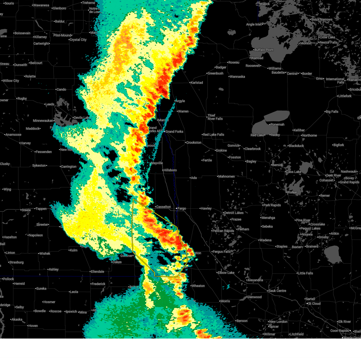
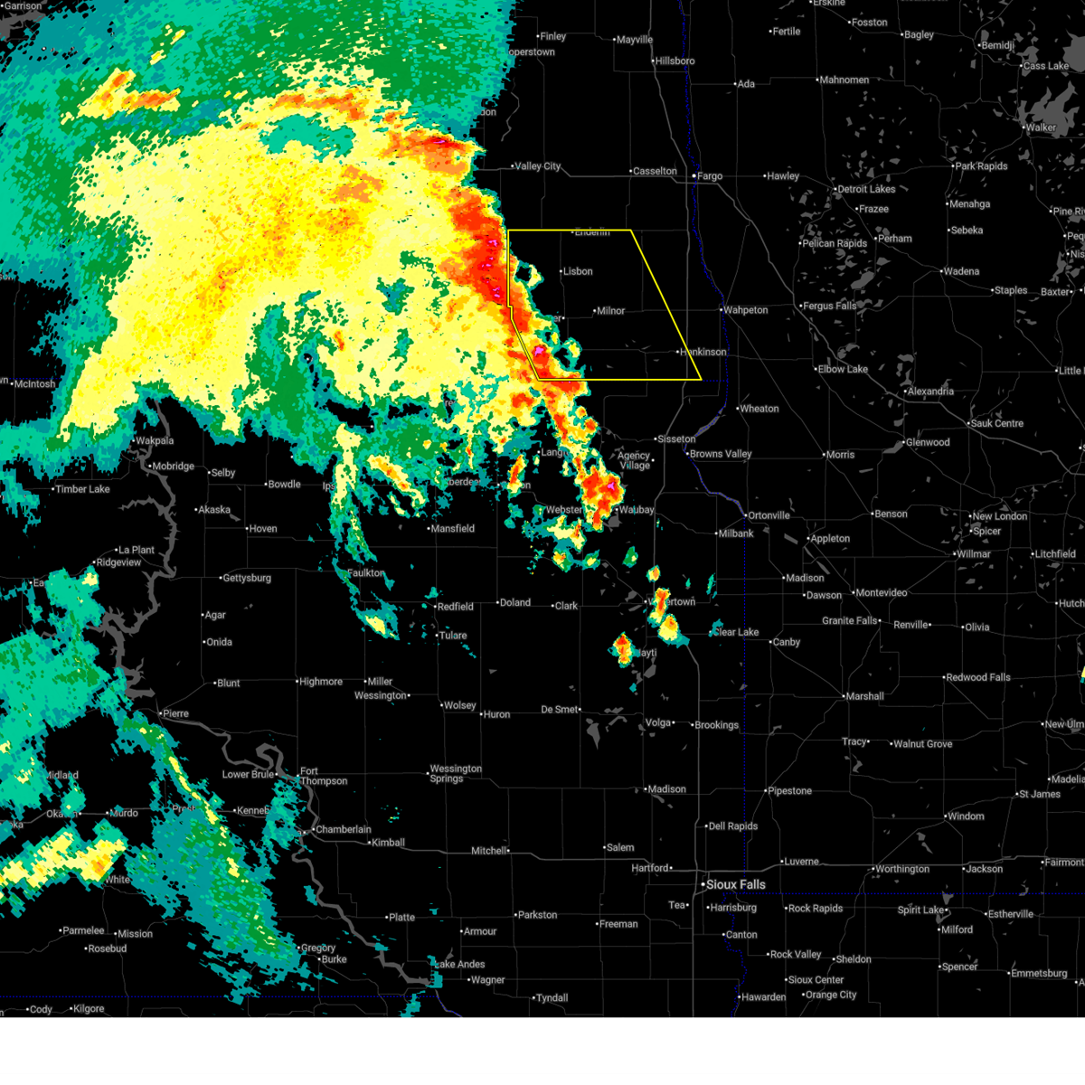
| 6/19/2025 8:07 PM CDT |
 Svrfgf the national weather service in grand forks has issued a * severe thunderstorm warning for, southeastern ransom county in southeastern north dakota, central richland county in southeastern north dakota, * until 900 pm cdt. * at 806 pm cdt, a severe thunderstorm was located near mcleod, or 37 miles north of veblen, moving southeast at 45 mph (radar indicated). Hazards include ping pong ball size hail and 60 mph wind gusts. People and animals outdoors will be injured. expect hail damage to roofs, siding, windows, and vehicles. Expect wind damage to roofs, siding, and trees. Svrfgf the national weather service in grand forks has issued a * severe thunderstorm warning for, southeastern ransom county in southeastern north dakota, central richland county in southeastern north dakota, * until 900 pm cdt. * at 806 pm cdt, a severe thunderstorm was located near mcleod, or 37 miles north of veblen, moving southeast at 45 mph (radar indicated). Hazards include ping pong ball size hail and 60 mph wind gusts. People and animals outdoors will be injured. expect hail damage to roofs, siding, windows, and vehicles. Expect wind damage to roofs, siding, and trees.
|
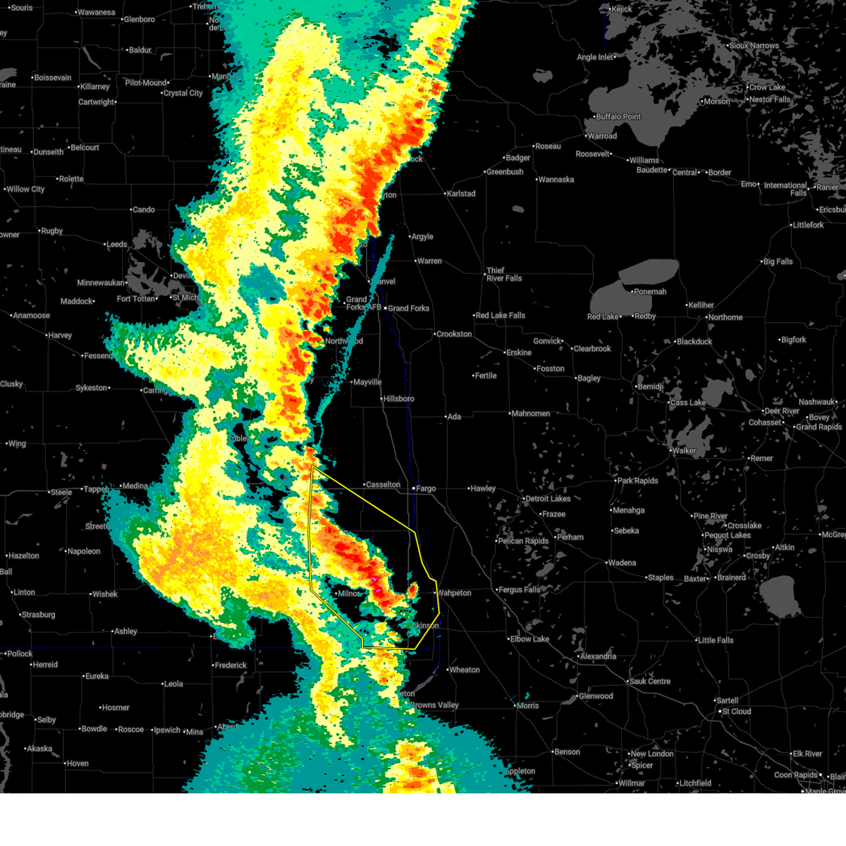
| 6/19/2025 7:58 PM CDT |
 At 757 pm cdt, a severe thunderstorm was located near venlo, or 39 miles southeast of valley city, moving southeast at 40 mph (radar indicated). Hazards include ping pong ball size hail and 60 mph wind gusts. People and animals outdoors will be injured. expect hail damage to roofs, siding, windows, and vehicles. expect wind damage to roofs, siding, and trees. Locations impacted include, mcleod, anselm, and venlo. At 757 pm cdt, a severe thunderstorm was located near venlo, or 39 miles southeast of valley city, moving southeast at 40 mph (radar indicated). Hazards include ping pong ball size hail and 60 mph wind gusts. People and animals outdoors will be injured. expect hail damage to roofs, siding, windows, and vehicles. expect wind damage to roofs, siding, and trees. Locations impacted include, mcleod, anselm, and venlo.
|
| 6/19/2025 7:47 PM CDT |
 the severe thunderstorm warning has been cancelled and is no longer in effect the severe thunderstorm warning has been cancelled and is no longer in effect
|
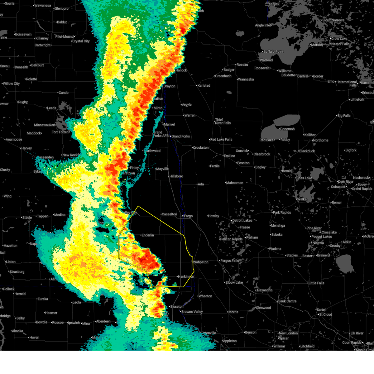
| 6/19/2025 7:47 PM CDT |
 At 747 pm cdt, a severe thunderstorm was located near lisbon, or 33 miles southeast of valley city, moving east at 45 mph (radar indicated). Hazards include ping pong ball size hail and 60 mph wind gusts. People and animals outdoors will be injured. expect hail damage to roofs, siding, windows, and vehicles. expect wind damage to roofs, siding, and trees. Locations impacted include, lisbon, enderlin, sheldon, mcleod, anselm, and venlo. At 747 pm cdt, a severe thunderstorm was located near lisbon, or 33 miles southeast of valley city, moving east at 45 mph (radar indicated). Hazards include ping pong ball size hail and 60 mph wind gusts. People and animals outdoors will be injured. expect hail damage to roofs, siding, windows, and vehicles. expect wind damage to roofs, siding, and trees. Locations impacted include, lisbon, enderlin, sheldon, mcleod, anselm, and venlo.
|
| 6/19/2025 7:30 PM CDT |
 Svrfgf the national weather service in grand forks has issued a * severe thunderstorm warning for, ransom county in southeastern north dakota, southwestern cass county in southeastern north dakota, southeastern barnes county in southeastern north dakota, * until 815 pm cdt. * at 729 pm cdt, a severe thunderstorm was located near little yellowstone, or 23 miles south of valley city, moving east at 40 mph (radar indicated). Hazards include 60 mph wind gusts and quarter size hail. Hail damage to vehicles is expected. Expect wind damage to roofs, siding, and trees. Svrfgf the national weather service in grand forks has issued a * severe thunderstorm warning for, ransom county in southeastern north dakota, southwestern cass county in southeastern north dakota, southeastern barnes county in southeastern north dakota, * until 815 pm cdt. * at 729 pm cdt, a severe thunderstorm was located near little yellowstone, or 23 miles south of valley city, moving east at 40 mph (radar indicated). Hazards include 60 mph wind gusts and quarter size hail. Hail damage to vehicles is expected. Expect wind damage to roofs, siding, and trees.
|
| 6/16/2025 5:01 AM CDT |
 Svrfgf the national weather service in grand forks has issued a * severe thunderstorm warning for, ransom county in southeastern north dakota, western richland county in southeastern north dakota, sargent county in southeastern north dakota, * until 545 am cdt. * at 457 am cdt, severe thunderstorms were located along a line extending from 6 miles south of litchville to near brampton, moving east at 55 mph (radar indicated). Hazards include 60 mph wind gusts and quarter size hail. Hail damage to vehicles is expected. Expect wind damage to roofs, siding, and trees. Svrfgf the national weather service in grand forks has issued a * severe thunderstorm warning for, ransom county in southeastern north dakota, western richland county in southeastern north dakota, sargent county in southeastern north dakota, * until 545 am cdt. * at 457 am cdt, severe thunderstorms were located along a line extending from 6 miles south of litchville to near brampton, moving east at 55 mph (radar indicated). Hazards include 60 mph wind gusts and quarter size hail. Hail damage to vehicles is expected. Expect wind damage to roofs, siding, and trees.
|
| 7/29/2024 11:44 PM CDT |
 The storms which prompted the warning have weakened below severe limits, and no longer pose an immediate threat to life or property. therefore, the warning will be allowed to expire. however, gusty winds are still possible with these thunderstorms. a severe thunderstorm watch remains in effect until 300 am cdt for southeastern north dakota. to report severe weather, contact your nearest law enforcement agency. they will relay your report to the national weather service grand forks. The storms which prompted the warning have weakened below severe limits, and no longer pose an immediate threat to life or property. therefore, the warning will be allowed to expire. however, gusty winds are still possible with these thunderstorms. a severe thunderstorm watch remains in effect until 300 am cdt for southeastern north dakota. to report severe weather, contact your nearest law enforcement agency. they will relay your report to the national weather service grand forks.
|
| 7/29/2024 11:25 PM CDT |
 At 1125 pm cdt, severe thunderstorms were located along a line extending from 7 miles south of nome to 6 miles southeast of lisbon to havana, moving east at 45 mph (radar indicated). Hazards include 60 mph wind gusts and quarter size hail. Hail damage to vehicles is expected. expect wind damage to roofs, siding, and trees. Locations impacted include, lisbon, enderlin, gwinner, milnor, forman, rutland, and sheldon. At 1125 pm cdt, severe thunderstorms were located along a line extending from 7 miles south of nome to 6 miles southeast of lisbon to havana, moving east at 45 mph (radar indicated). Hazards include 60 mph wind gusts and quarter size hail. Hail damage to vehicles is expected. expect wind damage to roofs, siding, and trees. Locations impacted include, lisbon, enderlin, gwinner, milnor, forman, rutland, and sheldon.
|
| 7/29/2024 10:49 PM CDT |
 Svrfgf the national weather service in grand forks has issued a * severe thunderstorm warning for, ransom county in southeastern north dakota, sargent county in southeastern north dakota, * until 1145 pm cdt. * at 1048 pm cdt, severe thunderstorms were located along a line extending from near marion to near la moure to near hecla, moving east at 40 mph (radar indicated). Hazards include 60 mph wind gusts and quarter size hail. Hail damage to vehicles is expected. Expect wind damage to roofs, siding, and trees. Svrfgf the national weather service in grand forks has issued a * severe thunderstorm warning for, ransom county in southeastern north dakota, sargent county in southeastern north dakota, * until 1145 pm cdt. * at 1048 pm cdt, severe thunderstorms were located along a line extending from near marion to near la moure to near hecla, moving east at 40 mph (radar indicated). Hazards include 60 mph wind gusts and quarter size hail. Hail damage to vehicles is expected. Expect wind damage to roofs, siding, and trees.
|
| 7/15/2024 4:30 AM CDT |
 Svrfgf the national weather service in grand forks has issued a * severe thunderstorm warning for, southwestern otter tail county in west central minnesota, northern grant county in west central minnesota, wilkin county in west central minnesota, southeastern ransom county in southeastern north dakota, richland county in southeastern north dakota, eastern sargent county in southeastern north dakota, * until 530 am cdt. * at 429 am cdt, severe thunderstorms were located along a line extending from near kindred to near galchutt to near lidgerwood, moving southeast at 60 mph (radar indicated). Hazards include 60 mph wind gusts and quarter size hail. Hail damage to vehicles is expected. Expect wind damage to roofs, siding, and trees. Svrfgf the national weather service in grand forks has issued a * severe thunderstorm warning for, southwestern otter tail county in west central minnesota, northern grant county in west central minnesota, wilkin county in west central minnesota, southeastern ransom county in southeastern north dakota, richland county in southeastern north dakota, eastern sargent county in southeastern north dakota, * until 530 am cdt. * at 429 am cdt, severe thunderstorms were located along a line extending from near kindred to near galchutt to near lidgerwood, moving southeast at 60 mph (radar indicated). Hazards include 60 mph wind gusts and quarter size hail. Hail damage to vehicles is expected. Expect wind damage to roofs, siding, and trees.
|
| 7/15/2024 4:12 AM CDT |
 the severe thunderstorm warning has been cancelled and is no longer in effect the severe thunderstorm warning has been cancelled and is no longer in effect
|
| 7/15/2024 4:12 AM CDT |
 At 412 am cdt, severe thunderstorms were located along a line extending from near durbin to near barrie to near lisbon, moving east at 45 mph (radar indicated). Hazards include 60 mph wind gusts and quarter size hail. Hail damage to vehicles is expected. expect wind damage to roofs, siding, and trees. locations impacted include, horace, lisbon, enderlin, gwinner, kindred, milnor, and forman. this includes the following highways, interstate 29 between mile markers 25 and 58. interstate 94 in north dakota between mile markers 319 and 326. Interstate 94 in minnesota near mile marker 22. At 412 am cdt, severe thunderstorms were located along a line extending from near durbin to near barrie to near lisbon, moving east at 45 mph (radar indicated). Hazards include 60 mph wind gusts and quarter size hail. Hail damage to vehicles is expected. expect wind damage to roofs, siding, and trees. locations impacted include, horace, lisbon, enderlin, gwinner, kindred, milnor, and forman. this includes the following highways, interstate 29 between mile markers 25 and 58. interstate 94 in north dakota between mile markers 319 and 326. Interstate 94 in minnesota near mile marker 22.
|
| 7/15/2024 4:04 AM CDT |
 At 404 am cdt, severe thunderstorms were located along a line extending from near durbin to 6 miles south of leonard to elliott, moving east at 45 mph (radar indicated). Hazards include 60 mph wind gusts and quarter size hail. Hail damage to vehicles is expected. expect wind damage to roofs, siding, and trees. locations impacted include, horace, lisbon, enderlin, gwinner, kindred, milnor, and forman. this includes the following highways, interstate 29 between mile markers 25 and 57. interstate 94 in north dakota between mile markers 305 and 326. Interstate 94 in minnesota near mile marker 22. At 404 am cdt, severe thunderstorms were located along a line extending from near durbin to 6 miles south of leonard to elliott, moving east at 45 mph (radar indicated). Hazards include 60 mph wind gusts and quarter size hail. Hail damage to vehicles is expected. expect wind damage to roofs, siding, and trees. locations impacted include, horace, lisbon, enderlin, gwinner, kindred, milnor, and forman. this includes the following highways, interstate 29 between mile markers 25 and 57. interstate 94 in north dakota between mile markers 305 and 326. Interstate 94 in minnesota near mile marker 22.
|
| 7/15/2024 3:51 AM CDT |
 Svrfgf the national weather service in grand forks has issued a * severe thunderstorm warning for, southwestern clay county in northwestern minnesota, northwestern wilkin county in west central minnesota, ransom county in southeastern north dakota, southern cass county in southeastern north dakota, southeastern barnes county in southeastern north dakota, northern richland county in southeastern north dakota, sargent county in southeastern north dakota, * until 445 am cdt. * at 350 am cdt, severe thunderstorms were located along a line extending from near embden to near sheldon to near englevale, moving east at 45 mph (radar indicated). Hazards include 60 mph wind gusts and quarter size hail. Hail damage to vehicles is expected. Expect wind damage to roofs, siding, and trees. Svrfgf the national weather service in grand forks has issued a * severe thunderstorm warning for, southwestern clay county in northwestern minnesota, northwestern wilkin county in west central minnesota, ransom county in southeastern north dakota, southern cass county in southeastern north dakota, southeastern barnes county in southeastern north dakota, northern richland county in southeastern north dakota, sargent county in southeastern north dakota, * until 445 am cdt. * at 350 am cdt, severe thunderstorms were located along a line extending from near embden to near sheldon to near englevale, moving east at 45 mph (radar indicated). Hazards include 60 mph wind gusts and quarter size hail. Hail damage to vehicles is expected. Expect wind damage to roofs, siding, and trees.
|
| 6/18/2024 3:58 AM CDT |
 At 358 am cdt, severe thunderstorms were located along a line extending from near wolverton to near hillhead, moving east at 55 mph (radar indicated). Hazards include 60 mph wind gusts. Expect damage to roofs, siding, and trees. locations impacted include, fergus falls, wahpeton, breckenridge, pelican rapids, lake lida, hankinson, and gwinner. this includes the following highways, interstate 29 between mile markers 0 and 48. Interstate 94 in minnesota between mile markers 28 and 54. At 358 am cdt, severe thunderstorms were located along a line extending from near wolverton to near hillhead, moving east at 55 mph (radar indicated). Hazards include 60 mph wind gusts. Expect damage to roofs, siding, and trees. locations impacted include, fergus falls, wahpeton, breckenridge, pelican rapids, lake lida, hankinson, and gwinner. this includes the following highways, interstate 29 between mile markers 0 and 48. Interstate 94 in minnesota between mile markers 28 and 54.
|
| 6/18/2024 3:25 AM CDT |
 Svrfgf the national weather service in grand forks has issued a * severe thunderstorm warning for, western otter tail county in west central minnesota, wilkin county in west central minnesota, ransom county in southeastern north dakota, richland county in southeastern north dakota, sargent county in southeastern north dakota, * until 430 am cdt. * at 325 am cdt, severe thunderstorms were located along a line extending from near comstock to 7 miles south of havana, moving east at 45 mph (radar indicated). Hazards include 60 mph wind gusts. expect damage to roofs, siding, and trees Svrfgf the national weather service in grand forks has issued a * severe thunderstorm warning for, western otter tail county in west central minnesota, wilkin county in west central minnesota, ransom county in southeastern north dakota, richland county in southeastern north dakota, sargent county in southeastern north dakota, * until 430 am cdt. * at 325 am cdt, severe thunderstorms were located along a line extending from near comstock to 7 miles south of havana, moving east at 45 mph (radar indicated). Hazards include 60 mph wind gusts. expect damage to roofs, siding, and trees
|
| 6/18/2024 3:08 AM CDT |
 At 308 am cdt, severe thunderstorms were located along a line extending from near maple bay to dilworth to near forman, moving east at 40 mph (radar indicated). Hazards include 70 mph wind gusts. Expect considerable tree damage. damage is likely to mobile homes, roofs, and outbuildings. locations impacted include, fargo, moorhead, west fargo, dilworth, barnesville, horace, and casselton. this includes the following highways, interstate 29 between mile markers 13 and 114. interstate 94 in north dakota between mile markers 305 and 352. Interstate 94 in minnesota between mile markers 1 and 26. At 308 am cdt, severe thunderstorms were located along a line extending from near maple bay to dilworth to near forman, moving east at 40 mph (radar indicated). Hazards include 70 mph wind gusts. Expect considerable tree damage. damage is likely to mobile homes, roofs, and outbuildings. locations impacted include, fargo, moorhead, west fargo, dilworth, barnesville, horace, and casselton. this includes the following highways, interstate 29 between mile markers 13 and 114. interstate 94 in north dakota between mile markers 305 and 352. Interstate 94 in minnesota between mile markers 1 and 26.
|
| 6/18/2024 2:50 AM CDT |
 Svrfgf the national weather service in grand forks has issued a * severe thunderstorm warning for, clay county in northwestern minnesota, norman county in northwestern minnesota, southern polk county in northwestern minnesota, northwestern wilkin county in west central minnesota, western mahnomen county in northwestern minnesota, northwestern becker county in northwestern minnesota, ransom county in southeastern north dakota, cass county in southeastern north dakota, southeastern traill county in southeastern north dakota, southeastern barnes county in southeastern north dakota, richland county in southeastern north dakota, sargent county in southeastern north dakota, * until 330 am cdt. * at 250 am cdt, severe thunderstorms were located along a line extending from melvin to west fargo to straubville, moving east at 40 mph (radar indicated). Hazards include 60 mph wind gusts. expect damage to roofs, siding, and trees Svrfgf the national weather service in grand forks has issued a * severe thunderstorm warning for, clay county in northwestern minnesota, norman county in northwestern minnesota, southern polk county in northwestern minnesota, northwestern wilkin county in west central minnesota, western mahnomen county in northwestern minnesota, northwestern becker county in northwestern minnesota, ransom county in southeastern north dakota, cass county in southeastern north dakota, southeastern traill county in southeastern north dakota, southeastern barnes county in southeastern north dakota, richland county in southeastern north dakota, sargent county in southeastern north dakota, * until 330 am cdt. * at 250 am cdt, severe thunderstorms were located along a line extending from melvin to west fargo to straubville, moving east at 40 mph (radar indicated). Hazards include 60 mph wind gusts. expect damage to roofs, siding, and trees
|
| 6/18/2024 2:31 AM CDT |
 At 231 am cdt, severe thunderstorms were located along a line extending from near amenia to lisbon to frederick, moving southeast at 40 mph (radar indicated). Hazards include 60 mph wind gusts. Expect damage to roofs, siding, and trees. locations impacted include, valley city, west fargo, casselton, lisbon, enderlin, mapleton, and gwinner. this includes the following highways, interstate 29 between mile markers 71 and 74. Interstate 94 in north dakota between mile markers 280 and 345. At 231 am cdt, severe thunderstorms were located along a line extending from near amenia to lisbon to frederick, moving southeast at 40 mph (radar indicated). Hazards include 60 mph wind gusts. Expect damage to roofs, siding, and trees. locations impacted include, valley city, west fargo, casselton, lisbon, enderlin, mapleton, and gwinner. this includes the following highways, interstate 29 between mile markers 71 and 74. Interstate 94 in north dakota between mile markers 280 and 345.
|
| 6/18/2024 2:11 AM CDT |
 Svrfgf the national weather service in grand forks has issued a * severe thunderstorm warning for, ransom county in southeastern north dakota, cass county in southeastern north dakota, barnes county in southeastern north dakota, northwestern richland county in southeastern north dakota, sargent county in southeastern north dakota, * until 300 am cdt. * at 210 am cdt, severe thunderstorms were located along a line extending from erie to near fort ransom to near elm lake, moving southeast at 40 mph (radar indicated). Hazards include 70 mph wind gusts. Expect considerable tree damage. Damage is likely to mobile homes, roofs, and outbuildings. Svrfgf the national weather service in grand forks has issued a * severe thunderstorm warning for, ransom county in southeastern north dakota, cass county in southeastern north dakota, barnes county in southeastern north dakota, northwestern richland county in southeastern north dakota, sargent county in southeastern north dakota, * until 300 am cdt. * at 210 am cdt, severe thunderstorms were located along a line extending from erie to near fort ransom to near elm lake, moving southeast at 40 mph (radar indicated). Hazards include 70 mph wind gusts. Expect considerable tree damage. Damage is likely to mobile homes, roofs, and outbuildings.
|
| 6/2/2024 8:58 PM CDT |
 Svrfgf the national weather service in grand forks has issued a * severe thunderstorm warning for, eastern ransom county in southeastern north dakota, richland county in southeastern north dakota, sargent county in southeastern north dakota, * until 1000 pm cdt. * at 856 pm cdt, severe thunderstorms were located along a line extending from near barrie to near milnor to straubville, moving southeast at 25 mph (radar indicated). Hazards include 60 mph wind gusts and nickel size hail. expect damage to roofs, siding, and trees Svrfgf the national weather service in grand forks has issued a * severe thunderstorm warning for, eastern ransom county in southeastern north dakota, richland county in southeastern north dakota, sargent county in southeastern north dakota, * until 1000 pm cdt. * at 856 pm cdt, severe thunderstorms were located along a line extending from near barrie to near milnor to straubville, moving southeast at 25 mph (radar indicated). Hazards include 60 mph wind gusts and nickel size hail. expect damage to roofs, siding, and trees
|
| 6/2/2024 8:07 PM CDT |
 Svrfgf the national weather service in grand forks has issued a * severe thunderstorm warning for, ransom county in southeastern north dakota, northwestern richland county in southeastern north dakota, sargent county in southeastern north dakota, * until 900 pm cdt. * at 806 pm cdt, severe thunderstorms were located along a line extending from enderlin to near englevale to near glover, moving east at 40 mph (radar indicated). Hazards include 70 mph wind gusts and quarter size hail. Hail damage to vehicles is expected. expect considerable tree damage. Wind damage is also likely to mobile homes, roofs, and outbuildings. Svrfgf the national weather service in grand forks has issued a * severe thunderstorm warning for, ransom county in southeastern north dakota, northwestern richland county in southeastern north dakota, sargent county in southeastern north dakota, * until 900 pm cdt. * at 806 pm cdt, severe thunderstorms were located along a line extending from enderlin to near englevale to near glover, moving east at 40 mph (radar indicated). Hazards include 70 mph wind gusts and quarter size hail. Hail damage to vehicles is expected. expect considerable tree damage. Wind damage is also likely to mobile homes, roofs, and outbuildings.
|
| 9/29/2023 7:41 AM CDT |
 At 741 am cdt, severe thunderstorms were located along a line extending from near barrie to galchutt to near great bend, moving northeast at 50 mph (radar indicated). Hazards include 60 mph wind gusts and quarter size hail. Hail damage to vehicles is expected. Expect wind damage to roofs, siding, and trees. At 741 am cdt, severe thunderstorms were located along a line extending from near barrie to galchutt to near great bend, moving northeast at 50 mph (radar indicated). Hazards include 60 mph wind gusts and quarter size hail. Hail damage to vehicles is expected. Expect wind damage to roofs, siding, and trees.
|
| 9/29/2023 7:02 AM CDT |
 At 702 am cdt, a severe thunderstorm was located over forman, or 50 miles west of wahpeton, moving northeast at 45 mph (radar indicated). Hazards include 60 mph wind gusts and quarter size hail. Hail damage to vehicles is expected. Expect wind damage to roofs, siding, and trees. At 702 am cdt, a severe thunderstorm was located over forman, or 50 miles west of wahpeton, moving northeast at 45 mph (radar indicated). Hazards include 60 mph wind gusts and quarter size hail. Hail damage to vehicles is expected. Expect wind damage to roofs, siding, and trees.
|
| 8/10/2023 5:56 PM CDT |
 At 555 pm cdt, severe thunderstorms were located along a line extending from 6 miles west of mcleod to near de lamere to geneseo, moving east at 45 mph (radar indicated). Hazards include 60 mph wind gusts. Expect damage to roofs, siding, and trees. locations impacted include, hankinson, gwinner, milnor, lidgerwood, wyndmere, mantador and de lamere. hail threat, radar indicated max hail size, <. 75 in wind threat, radar indicated max wind gust, 60 mph. At 555 pm cdt, severe thunderstorms were located along a line extending from 6 miles west of mcleod to near de lamere to geneseo, moving east at 45 mph (radar indicated). Hazards include 60 mph wind gusts. Expect damage to roofs, siding, and trees. locations impacted include, hankinson, gwinner, milnor, lidgerwood, wyndmere, mantador and de lamere. hail threat, radar indicated max hail size, <. 75 in wind threat, radar indicated max wind gust, 60 mph.
|
| 8/10/2023 5:32 PM CDT |
 At 532 pm cdt, severe thunderstorms were located along a line extending from near gwinner to near milnor to near rutland, moving east at 40 mph (radar indicated). Hazards include 60 mph wind gusts. expect damage to roofs, siding, and trees At 532 pm cdt, severe thunderstorms were located along a line extending from near gwinner to near milnor to near rutland, moving east at 40 mph (radar indicated). Hazards include 60 mph wind gusts. expect damage to roofs, siding, and trees
|
| 7/7/2023 3:12 PM CDT |
 At 312 pm cdt, a severe thunderstorm was located near anselm, or 33 miles southeast of valley city, moving southeast at 25 mph (radar indicated). Hazards include quarter size hail. damage to vehicles is expected At 312 pm cdt, a severe thunderstorm was located near anselm, or 33 miles southeast of valley city, moving southeast at 25 mph (radar indicated). Hazards include quarter size hail. damage to vehicles is expected
|
| 8/5/2022 10:02 PM CDT |
 At 1002 pm cdt, a severe thunderstorm was located over galchutt, or 13 miles northwest of wahpeton, moving east at 55 mph (radar indicated). Hazards include 60 mph wind gusts and quarter size hail. Hail damage to vehicles is expected. expect wind damage to roofs, siding, and trees. locations impacted include, wyndmere, dwight, mcleod, barney and galchutt. this includes interstate 29 between mile markers 25 and 33. hail threat, radar indicated max hail size, 1. 00 in wind threat, radar indicated max wind gust, 60 mph. At 1002 pm cdt, a severe thunderstorm was located over galchutt, or 13 miles northwest of wahpeton, moving east at 55 mph (radar indicated). Hazards include 60 mph wind gusts and quarter size hail. Hail damage to vehicles is expected. expect wind damage to roofs, siding, and trees. locations impacted include, wyndmere, dwight, mcleod, barney and galchutt. this includes interstate 29 between mile markers 25 and 33. hail threat, radar indicated max hail size, 1. 00 in wind threat, radar indicated max wind gust, 60 mph.
|
| 8/5/2022 9:54 PM CDT |
 At 954 pm cdt, a severe thunderstorm was located near barney, or 18 miles west of wahpeton, moving east at 55 mph (radar indicated). Hazards include 60 mph wind gusts and quarter size hail. Hail damage to vehicles is expected. expect wind damage to roofs, siding, and trees. locations impacted include, galchutt. this includes interstate 29 between mile markers 25 and 33. hail threat, radar indicated max hail size, 1. 00 in wind threat, radar indicated max wind gust, 60 mph. At 954 pm cdt, a severe thunderstorm was located near barney, or 18 miles west of wahpeton, moving east at 55 mph (radar indicated). Hazards include 60 mph wind gusts and quarter size hail. Hail damage to vehicles is expected. expect wind damage to roofs, siding, and trees. locations impacted include, galchutt. this includes interstate 29 between mile markers 25 and 33. hail threat, radar indicated max hail size, 1. 00 in wind threat, radar indicated max wind gust, 60 mph.
|
| 8/5/2022 9:20 PM CDT |
 At 920 pm cdt, a severe thunderstorm was located near gwinner, or 46 miles west of wahpeton, moving east at 55 mph (radar indicated). Hazards include 60 mph wind gusts and quarter size hail. Hail damage to vehicles is expected. expect wind damage to roofs, siding, and trees. this severe thunderstorm will be near, milnor around 930 pm cdt. de lamere and hamlin around 935 pm cdt. mcleod around 940 pm cdt. other locations in the path of this severe thunderstorm include wyndmere and barney. this includes interstate 29 between mile markers 19 and 33. hail threat, radar indicated max hail size, 1. 00 in wind threat, radar indicated max wind gust, 60 mph. At 920 pm cdt, a severe thunderstorm was located near gwinner, or 46 miles west of wahpeton, moving east at 55 mph (radar indicated). Hazards include 60 mph wind gusts and quarter size hail. Hail damage to vehicles is expected. expect wind damage to roofs, siding, and trees. this severe thunderstorm will be near, milnor around 930 pm cdt. de lamere and hamlin around 935 pm cdt. mcleod around 940 pm cdt. other locations in the path of this severe thunderstorm include wyndmere and barney. this includes interstate 29 between mile markers 19 and 33. hail threat, radar indicated max hail size, 1. 00 in wind threat, radar indicated max wind gust, 60 mph.
|
| 7/10/2022 1:50 PM CDT |
 At 150 pm cdt, a severe thunderstorm was located 7 miles south of barrie, or 30 miles northwest of wahpeton, moving east at 40 mph (radar indicated). Hazards include 60 mph wind gusts and quarter size hail. Hail damage to vehicles is expected. expect wind damage to roofs, siding, and trees. this severe thunderstorm will be near, colfax around 210 pm cdt. other locations in the path of this severe thunderstorm include galchutt, mooreton, mccauleyville, abercrombie, dwight, kent and brushvale. this includes interstate 29 between mile markers 17 and 43. hail threat, radar indicated max hail size, 1. 00 in wind threat, radar indicated max wind gust, 60 mph. At 150 pm cdt, a severe thunderstorm was located 7 miles south of barrie, or 30 miles northwest of wahpeton, moving east at 40 mph (radar indicated). Hazards include 60 mph wind gusts and quarter size hail. Hail damage to vehicles is expected. expect wind damage to roofs, siding, and trees. this severe thunderstorm will be near, colfax around 210 pm cdt. other locations in the path of this severe thunderstorm include galchutt, mooreton, mccauleyville, abercrombie, dwight, kent and brushvale. this includes interstate 29 between mile markers 17 and 43. hail threat, radar indicated max hail size, 1. 00 in wind threat, radar indicated max wind gust, 60 mph.
|
| 7/10/2022 1:46 PM CDT |
 At 146 pm cdt, a severe thunderstorm was located near barrie, or 28 miles southwest of fargo, moving east at 40 mph (radar indicated). Hazards include ping pong ball size hail and 60 mph wind gusts. People and animals outdoors will be injured. expect hail damage to roofs, siding, windows, and vehicles. expect wind damage to roofs, siding, and trees. locations impacted include, leonard, mcleod, venlo and barrie. hail threat, radar indicated max hail size, 1. 50 in wind threat, radar indicated max wind gust, 60 mph. At 146 pm cdt, a severe thunderstorm was located near barrie, or 28 miles southwest of fargo, moving east at 40 mph (radar indicated). Hazards include ping pong ball size hail and 60 mph wind gusts. People and animals outdoors will be injured. expect hail damage to roofs, siding, windows, and vehicles. expect wind damage to roofs, siding, and trees. locations impacted include, leonard, mcleod, venlo and barrie. hail threat, radar indicated max hail size, 1. 50 in wind threat, radar indicated max wind gust, 60 mph.
|
| 7/10/2022 1:36 PM CDT |
 At 136 pm cdt, a severe thunderstorm was located near sheldon, or 31 miles southwest of fargo, moving east at 40 mph (radar indicated). Hazards include ping pong ball size hail and 60 mph wind gusts. People and animals outdoors will be injured. expect hail damage to roofs, siding, windows, and vehicles. expect wind damage to roofs, siding, and trees. locations impacted include, leonard and barrie. hail threat, radar indicated max hail size, 1. 50 in wind threat, radar indicated max wind gust, 60 mph. At 136 pm cdt, a severe thunderstorm was located near sheldon, or 31 miles southwest of fargo, moving east at 40 mph (radar indicated). Hazards include ping pong ball size hail and 60 mph wind gusts. People and animals outdoors will be injured. expect hail damage to roofs, siding, windows, and vehicles. expect wind damage to roofs, siding, and trees. locations impacted include, leonard and barrie. hail threat, radar indicated max hail size, 1. 50 in wind threat, radar indicated max wind gust, 60 mph.
|
| 7/10/2022 1:17 PM CDT |
 At 117 pm cdt, a severe thunderstorm was located over enderlin, or 28 miles southeast of valley city, moving east at 35 mph (radar indicated). Hazards include ping pong ball size hail and 60 mph wind gusts. People and animals outdoors will be injured. expect hail damage to roofs, siding, windows, and vehicles. expect wind damage to roofs, siding, and trees. this severe thunderstorm will be near, sheldon around 125 pm cdt. anselm and venlo around 130 pm cdt. other locations in the path of this severe thunderstorm include leonard and barrie. hail threat, radar indicated max hail size, 1. 50 in wind threat, radar indicated max wind gust, 60 mph. At 117 pm cdt, a severe thunderstorm was located over enderlin, or 28 miles southeast of valley city, moving east at 35 mph (radar indicated). Hazards include ping pong ball size hail and 60 mph wind gusts. People and animals outdoors will be injured. expect hail damage to roofs, siding, windows, and vehicles. expect wind damage to roofs, siding, and trees. this severe thunderstorm will be near, sheldon around 125 pm cdt. anselm and venlo around 130 pm cdt. other locations in the path of this severe thunderstorm include leonard and barrie. hail threat, radar indicated max hail size, 1. 50 in wind threat, radar indicated max wind gust, 60 mph.
|
| 6/30/2022 12:24 AM CDT |
 The severe thunderstorm warning for ransom, southwestern cass, southern barnes and northern richland counties will expire at 1230 am cdt, the storms which prompted the warning have weakened below severe limits, and no longer pose an immediate threat to life or property. therefore, the warning will be allowed to expire. however gusty winds are still possible with these thunderstorms. a severe thunderstorm watch remains in effect until 100 am cdt for west central minnesota, and southeastern north dakota. The severe thunderstorm warning for ransom, southwestern cass, southern barnes and northern richland counties will expire at 1230 am cdt, the storms which prompted the warning have weakened below severe limits, and no longer pose an immediate threat to life or property. therefore, the warning will be allowed to expire. however gusty winds are still possible with these thunderstorms. a severe thunderstorm watch remains in effect until 100 am cdt for west central minnesota, and southeastern north dakota.
|
| 6/30/2022 12:06 AM CDT |
 At 1204 am cdt, severe thunderstorms were located along a line extending from 10 miles east of ypsilanti to near barney, moving northeast at 45 mph. several 60 mph wind gusts have been measured near fort ransom (radar indicated). Hazards include 60 mph wind gusts and penny size hail. Expect damage to roofs, siding, and trees. locations impacted include, fort ransom, enderlin, lisbon, kindred, wyndmere, abercrombie, walcott and leonard. this includes interstate 29 between mile markers 19 and 47. hail threat, radar indicated max hail size, 0. 75 in wind threat, observed max wind gust, 60 mph. At 1204 am cdt, severe thunderstorms were located along a line extending from 10 miles east of ypsilanti to near barney, moving northeast at 45 mph. several 60 mph wind gusts have been measured near fort ransom (radar indicated). Hazards include 60 mph wind gusts and penny size hail. Expect damage to roofs, siding, and trees. locations impacted include, fort ransom, enderlin, lisbon, kindred, wyndmere, abercrombie, walcott and leonard. this includes interstate 29 between mile markers 19 and 47. hail threat, radar indicated max hail size, 0. 75 in wind threat, observed max wind gust, 60 mph.
|
| 6/29/2022 11:50 PM CDT |
 At 1150 pm cdt, severe thunderstorms were located along a line extending from near montpelier to near wyndmere, moving northeast at 45 mph (radar indicated). Hazards include 60 mph wind gusts and penny size hail. expect damage to roofs, siding, and trees At 1150 pm cdt, severe thunderstorms were located along a line extending from near montpelier to near wyndmere, moving northeast at 45 mph (radar indicated). Hazards include 60 mph wind gusts and penny size hail. expect damage to roofs, siding, and trees
|
| 6/24/2022 10:27 PM CDT |
 The severe thunderstorm warning for ransom, west central richland and eastern sargent counties will expire at 1030 pm cdt, the storm which prompted the warning has weakened below severe limits, and has exited the warned area. therefore, the warning will be allowed to expire. however small hail and gusty winds are still possible with this thunderstorm. a severe thunderstorm watch remains in effect until 1100 pm cdt for southeastern north dakota. a severe thunderstorm watch also remains in effect until 300 am cdt for southeastern north dakota. The severe thunderstorm warning for ransom, west central richland and eastern sargent counties will expire at 1030 pm cdt, the storm which prompted the warning has weakened below severe limits, and has exited the warned area. therefore, the warning will be allowed to expire. however small hail and gusty winds are still possible with this thunderstorm. a severe thunderstorm watch remains in effect until 1100 pm cdt for southeastern north dakota. a severe thunderstorm watch also remains in effect until 300 am cdt for southeastern north dakota.
|
| 6/24/2022 10:07 PM CDT |
 At 1007 pm cdt, a severe thunderstorm was located near venlo, or 42 miles southeast of valley city, moving east at 45 mph (radar indicated). Hazards include 60 mph wind gusts and quarter size hail. Hail damage to vehicles is expected. expect wind damage to roofs, siding, and trees. locations impacted include, venlo and mcleod. hail threat, radar indicated max hail size, 1. 00 in wind threat, radar indicated max wind gust, 60 mph. At 1007 pm cdt, a severe thunderstorm was located near venlo, or 42 miles southeast of valley city, moving east at 45 mph (radar indicated). Hazards include 60 mph wind gusts and quarter size hail. Hail damage to vehicles is expected. expect wind damage to roofs, siding, and trees. locations impacted include, venlo and mcleod. hail threat, radar indicated max hail size, 1. 00 in wind threat, radar indicated max wind gust, 60 mph.
|
| 6/24/2022 9:38 PM CDT |
 At 938 pm cdt, a severe thunderstorm was located near englevale, or 41 miles south of valley city, moving east at 55 mph (radar indicated). Hazards include 60 mph wind gusts and quarter size hail. Hail damage to vehicles is expected. expect wind damage to roofs, siding, and trees. this severe thunderstorm will be near, elliott around 945 pm cdt. lisbon around 950 pm cdt. other locations in the path of this severe thunderstorm include venlo, anselm and mcleod. hail threat, radar indicated max hail size, 1. 00 in wind threat, radar indicated max wind gust, 60 mph. At 938 pm cdt, a severe thunderstorm was located near englevale, or 41 miles south of valley city, moving east at 55 mph (radar indicated). Hazards include 60 mph wind gusts and quarter size hail. Hail damage to vehicles is expected. expect wind damage to roofs, siding, and trees. this severe thunderstorm will be near, elliott around 945 pm cdt. lisbon around 950 pm cdt. other locations in the path of this severe thunderstorm include venlo, anselm and mcleod. hail threat, radar indicated max hail size, 1. 00 in wind threat, radar indicated max wind gust, 60 mph.
|
| 6/20/2022 5:47 PM CDT |
 At 547 pm cdt, a severe thunderstorm was located over crete, or 49 miles south of valley city, moving east at 35 mph (radar indicated). Hazards include 60 mph wind gusts and quarter size hail. Hail damage to vehicles is expected. expect wind damage to roofs, siding, and trees. this severe thunderstorm will be near, stirum around 555 pm cdt. gwinner around 605 pm cdt. other locations in the path of this severe thunderstorm include milnor, de lamere and mcleod. hail threat, radar indicated max hail size, 1. 00 in wind threat, radar indicated max wind gust, 60 mph. At 547 pm cdt, a severe thunderstorm was located over crete, or 49 miles south of valley city, moving east at 35 mph (radar indicated). Hazards include 60 mph wind gusts and quarter size hail. Hail damage to vehicles is expected. expect wind damage to roofs, siding, and trees. this severe thunderstorm will be near, stirum around 555 pm cdt. gwinner around 605 pm cdt. other locations in the path of this severe thunderstorm include milnor, de lamere and mcleod. hail threat, radar indicated max hail size, 1. 00 in wind threat, radar indicated max wind gust, 60 mph.
|
| 5/12/2022 7:15 PM CDT |
 At 715 pm cdt, severe thunderstorms were located along a line extending from near crete to near donnelly, moving north at 55 mph (radar indicated). Hazards include 70 mph wind gusts and quarter size hail. Hail damage to vehicles is expected. expect considerable tree damage. wind damage is also likely to mobile homes, roofs, and outbuildings. locations impacted include, crete, englevale, elbow lake, erdahl, elliott, fort ransom, ashby and dalton. this includes the following highways, interstate 29 between mile markers 0 and 34. Interstate 94 in minnesota between mile markers 49 and 81. At 715 pm cdt, severe thunderstorms were located along a line extending from near crete to near donnelly, moving north at 55 mph (radar indicated). Hazards include 70 mph wind gusts and quarter size hail. Hail damage to vehicles is expected. expect considerable tree damage. wind damage is also likely to mobile homes, roofs, and outbuildings. locations impacted include, crete, englevale, elbow lake, erdahl, elliott, fort ransom, ashby and dalton. this includes the following highways, interstate 29 between mile markers 0 and 34. Interstate 94 in minnesota between mile markers 49 and 81.
|
| 5/12/2022 6:47 PM CDT |
 At 646 pm cdt, severe thunderstorms were located along a line from near britton south dakota to morris minnesota, moving north at 55 mph (radar indicated). Hazards include 70 mph wind gusts and quarter size hail. Hail damage to vehicles is expected. expect considerable tree damage. wind damage is also likely to mobile homes, roofs, and outbuildings. severe thunderstorms will be near, straubville around 705 pm cdt. other locations in the path of these severe thunderstorms include crete, stirum, hoffman, barrett, englevale, elbow lake and erdahl. this includes the following highways, interstate 29 between mile markers 0 and 34. Interstate 94 in minnesota between mile markers 49 and 81. At 646 pm cdt, severe thunderstorms were located along a line from near britton south dakota to morris minnesota, moving north at 55 mph (radar indicated). Hazards include 70 mph wind gusts and quarter size hail. Hail damage to vehicles is expected. expect considerable tree damage. wind damage is also likely to mobile homes, roofs, and outbuildings. severe thunderstorms will be near, straubville around 705 pm cdt. other locations in the path of these severe thunderstorms include crete, stirum, hoffman, barrett, englevale, elbow lake and erdahl. this includes the following highways, interstate 29 between mile markers 0 and 34. Interstate 94 in minnesota between mile markers 49 and 81.
|
| 4/23/2022 2:28 PM CDT |
 At 227 pm cdt, a severe thunderstorm capable of producing a tornado was located 8 miles southwest of colfax, or 22 miles northwest of wahpeton, moving north at 55 mph (radar indicated rotation). Hazards include tornado and quarter size hail. Flying debris will be dangerous to those caught without shelter. mobile homes will be damaged or destroyed. damage to roofs, windows, and vehicles will occur. tree damage is likely. this dangerous storm will be near, walcott around 235 pm cdt. barrie around 240 pm cdt. kindred around 245 pm cdt. other locations in the path of this tornadic thunderstorm include davenport and durbin. This includes interstate 94 in north dakota between mile markers 321 and 345. At 227 pm cdt, a severe thunderstorm capable of producing a tornado was located 8 miles southwest of colfax, or 22 miles northwest of wahpeton, moving north at 55 mph (radar indicated rotation). Hazards include tornado and quarter size hail. Flying debris will be dangerous to those caught without shelter. mobile homes will be damaged or destroyed. damage to roofs, windows, and vehicles will occur. tree damage is likely. this dangerous storm will be near, walcott around 235 pm cdt. barrie around 240 pm cdt. kindred around 245 pm cdt. other locations in the path of this tornadic thunderstorm include davenport and durbin. This includes interstate 94 in north dakota between mile markers 321 and 345.
|
| 10/9/2021 7:51 PM CDT |
 At 750 pm cdt, severe thunderstorms were located along a line extending from near venlo to near everdell to near barrett, moving northeast at 40 mph (radar indicated). Hazards include 60 mph wind gusts. Expect damage to roofs, siding, and trees. locations impacted include, everdell, foxhome, hoffman, barrett, elbow lake, carlisle, rothsay, erdahl and ashby. this includes the following highways, interstate 29 between mile markers 18 and 40. Interstate 94 in minnesota between mile markers 40 and 81. At 750 pm cdt, severe thunderstorms were located along a line extending from near venlo to near everdell to near barrett, moving northeast at 40 mph (radar indicated). Hazards include 60 mph wind gusts. Expect damage to roofs, siding, and trees. locations impacted include, everdell, foxhome, hoffman, barrett, elbow lake, carlisle, rothsay, erdahl and ashby. this includes the following highways, interstate 29 between mile markers 18 and 40. Interstate 94 in minnesota between mile markers 40 and 81.
|
| 10/9/2021 7:26 PM CDT |
 At 726 pm cdt, severe thunderstorms were located along a line extending from near mcleod to near doran to near norcross, moving northeast at 55 mph (radar indicated). Hazards include 70 mph wind gusts and penny size hail. Expect considerable tree damage. damage is likely to mobile homes, roofs, and outbuildings. severe thunderstorms will be near, norcross, doran and herman around 730 pm cdt. everdell around 735 pm cdt. foxhome around 740 pm cdt. elbow lake and wendell around 745 pm cdt. other locations in the path of these severe thunderstorms include carlisle, rothsay and elizabeth. this includes the following highways, interstate 29 between mile markers 7 and 40. Interstate 94 in minnesota between mile markers 40 and 81. At 726 pm cdt, severe thunderstorms were located along a line extending from near mcleod to near doran to near norcross, moving northeast at 55 mph (radar indicated). Hazards include 70 mph wind gusts and penny size hail. Expect considerable tree damage. damage is likely to mobile homes, roofs, and outbuildings. severe thunderstorms will be near, norcross, doran and herman around 730 pm cdt. everdell around 735 pm cdt. foxhome around 740 pm cdt. elbow lake and wendell around 745 pm cdt. other locations in the path of these severe thunderstorms include carlisle, rothsay and elizabeth. this includes the following highways, interstate 29 between mile markers 7 and 40. Interstate 94 in minnesota between mile markers 40 and 81.
|
| 10/9/2021 7:16 PM CDT |
 At 716 pm cdt, severe thunderstorms were located along a line extending from 7 miles north of milnor to near blackmer, moving northeast at 35 mph (radar indicated). Hazards include 70 mph wind gusts and penny size hail. Expect considerable tree damage. damage is likely to mobile homes, roofs, and outbuildings. locations impacted include, lisbon, hankinson, gwinner, milnor, lidgerwood, wyndmere and fairmount. This includes interstate 29 between mile markers 0 and 27. At 716 pm cdt, severe thunderstorms were located along a line extending from 7 miles north of milnor to near blackmer, moving northeast at 35 mph (radar indicated). Hazards include 70 mph wind gusts and penny size hail. Expect considerable tree damage. damage is likely to mobile homes, roofs, and outbuildings. locations impacted include, lisbon, hankinson, gwinner, milnor, lidgerwood, wyndmere and fairmount. This includes interstate 29 between mile markers 0 and 27.
|
| 10/9/2021 6:52 PM CDT |
 At 651 pm cdt, severe thunderstorms were located along a line extending from gwinner to lake traverse reservation, moving northeast at 35 mph (trained weather spotters). Hazards include 70 mph wind gusts and penny size hail. Expect considerable tree damage. damage is likely to mobile homes, roofs, and outbuildings. locations impacted include, lisbon, hankinson, gwinner, milnor, lidgerwood, forman and wyndmere. This includes interstate 29 between mile markers 0 and 27. At 651 pm cdt, severe thunderstorms were located along a line extending from gwinner to lake traverse reservation, moving northeast at 35 mph (trained weather spotters). Hazards include 70 mph wind gusts and penny size hail. Expect considerable tree damage. damage is likely to mobile homes, roofs, and outbuildings. locations impacted include, lisbon, hankinson, gwinner, milnor, lidgerwood, forman and wyndmere. This includes interstate 29 between mile markers 0 and 27.
|
| 10/9/2021 6:43 PM CDT |
 At 643 pm cdt, severe thunderstorms were located along a line extending from near gwinner to lake traverse reservation, moving northeast at 35 mph (radar indicated). Hazards include 60 mph wind gusts and penny size hail. expect damage to roofs, siding, and trees At 643 pm cdt, severe thunderstorms were located along a line extending from near gwinner to lake traverse reservation, moving northeast at 35 mph (radar indicated). Hazards include 60 mph wind gusts and penny size hail. expect damage to roofs, siding, and trees
|
| 8/24/2021 2:14 AM CDT |
 At 214 am cdt, severe thunderstorms were located along a line extending from near kindred to near mooreton to lake traverse reservation, moving east at 50 mph (radar indicated). Hazards include 60 mph wind gusts and nickel size hail. Expect damage to roofs, siding, and trees. severe thunderstorms will be near, mooreton around 215 am cdt. walcott and great bend around 220 am cdt. dwight around 225 am cdt. christine, wolverton and lamars around 230 am cdt. other locations in the path of these severe thunderstorms include breckenridge, wahpeton and blackmer. this includes the following highways, interstate 29 between mile markers 0 and 48. interstate 94 in minnesota between mile markers 28 and 80. hail threat, radar indicated max hail size, 0. 88 in wind threat, radar indicated max wind gust, 60 mph. At 214 am cdt, severe thunderstorms were located along a line extending from near kindred to near mooreton to lake traverse reservation, moving east at 50 mph (radar indicated). Hazards include 60 mph wind gusts and nickel size hail. Expect damage to roofs, siding, and trees. severe thunderstorms will be near, mooreton around 215 am cdt. walcott and great bend around 220 am cdt. dwight around 225 am cdt. christine, wolverton and lamars around 230 am cdt. other locations in the path of these severe thunderstorms include breckenridge, wahpeton and blackmer. this includes the following highways, interstate 29 between mile markers 0 and 48. interstate 94 in minnesota between mile markers 28 and 80. hail threat, radar indicated max hail size, 0. 88 in wind threat, radar indicated max wind gust, 60 mph.
|
| 7/25/2021 11:10 PM CDT |
 At 1110 pm cdt, severe thunderstorms were located along a line extending from near fort ransom to near venlo, moving east at 35 mph (radar indicated). Hazards include golf ball size hail and 60 mph wind gusts. People and animals outdoors will be injured. expect hail damage to roofs, siding, windows, and vehicles. expect wind damage to roofs, siding, and trees. severe thunderstorms will be near, mcleod around 1120 pm cdt. other locations in the path of these severe thunderstorms include lisbon, enderlin, anselm, sheldon, venlo, colfax and galchutt. This includes interstate 29 between mile markers 27 and 47. At 1110 pm cdt, severe thunderstorms were located along a line extending from near fort ransom to near venlo, moving east at 35 mph (radar indicated). Hazards include golf ball size hail and 60 mph wind gusts. People and animals outdoors will be injured. expect hail damage to roofs, siding, windows, and vehicles. expect wind damage to roofs, siding, and trees. severe thunderstorms will be near, mcleod around 1120 pm cdt. other locations in the path of these severe thunderstorms include lisbon, enderlin, anselm, sheldon, venlo, colfax and galchutt. This includes interstate 29 between mile markers 27 and 47.
|
| 7/25/2021 10:04 PM CDT |
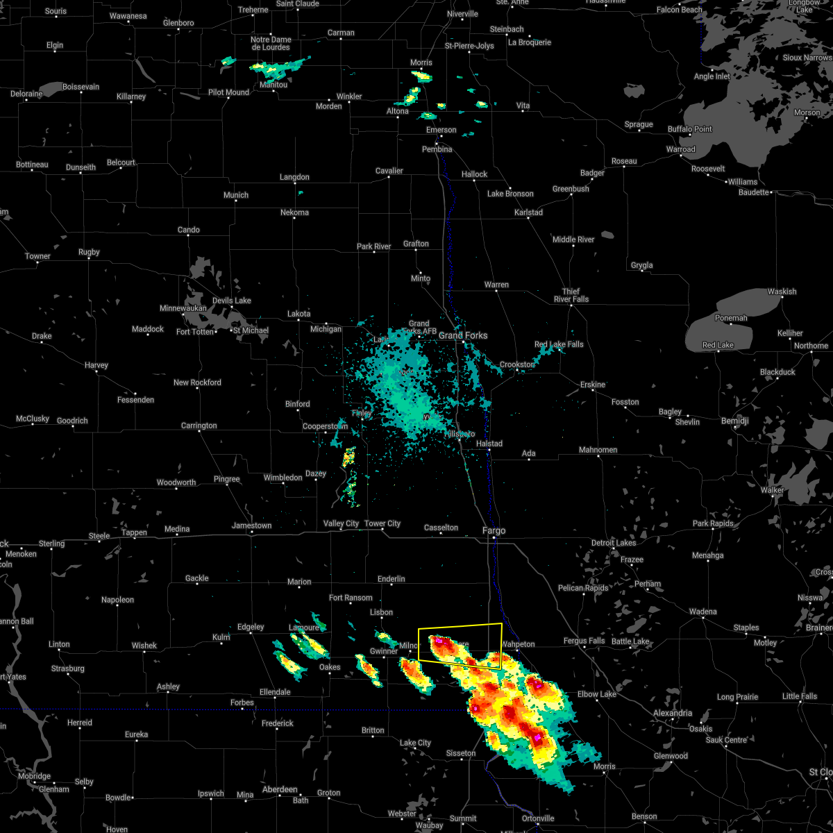 At 1004 pm cdt, a severe thunderstorm was located near wyndmere, or 29 miles west of wahpeton, moving east at 20 mph (radar indicated). Hazards include 70 mph wind gusts and half dollar size hail. Hail damage to vehicles is expected. expect considerable tree damage. wind damage is also likely to mobile homes, roofs, and outbuildings. this severe thunderstorm will be near, wyndmere around 1020 pm cdt. other locations in the path of this severe thunderstorm include barney, mooreton, dwight and galchutt. This includes interstate 29 between mile markers 17 and 32. At 1004 pm cdt, a severe thunderstorm was located near wyndmere, or 29 miles west of wahpeton, moving east at 20 mph (radar indicated). Hazards include 70 mph wind gusts and half dollar size hail. Hail damage to vehicles is expected. expect considerable tree damage. wind damage is also likely to mobile homes, roofs, and outbuildings. this severe thunderstorm will be near, wyndmere around 1020 pm cdt. other locations in the path of this severe thunderstorm include barney, mooreton, dwight and galchutt. This includes interstate 29 between mile markers 17 and 32.
|
| 7/19/2021 3:13 PM CDT |
 At 312 pm cdt, severe thunderstorms were located along a line extending from near glyndon to 6 miles east of comstock to mcleod, moving south at 40 mph (radar indicated). Hazards include 60 mph wind gusts and penny size hail. Expect damage to roofs, siding, and trees. severe thunderstorms will be near, wolverton around 315 pm cdt. de lamere around 325 pm cdt. barnesville, wyndmere and kent around 330 pm cdt. other locations in the path of these severe thunderstorms include hamlin, brushvale and lawndale. this includes the following highways, interstate 29 between mile markers 0 and 52. Interstate 94 in minnesota between mile markers 7 and 56. At 312 pm cdt, severe thunderstorms were located along a line extending from near glyndon to 6 miles east of comstock to mcleod, moving south at 40 mph (radar indicated). Hazards include 60 mph wind gusts and penny size hail. Expect damage to roofs, siding, and trees. severe thunderstorms will be near, wolverton around 315 pm cdt. de lamere around 325 pm cdt. barnesville, wyndmere and kent around 330 pm cdt. other locations in the path of these severe thunderstorms include hamlin, brushvale and lawndale. this includes the following highways, interstate 29 between mile markers 0 and 52. Interstate 94 in minnesota between mile markers 7 and 56.
|
| 6/11/2021 5:18 AM CDT |
 At 517 am cdt, severe thunderstorms were located along a line extending from north river to near hankinson, moving east at 135 mph (radar indicated). Hazards include 70 mph wind gusts and quarter size hail. Hail damage to vehicles is expected. expect considerable tree damage. wind damage is also likely to mobile homes, roofs, and outbuildings. locations impacted include, fargo, wahpeton, moorhead, west fargo, dilworth, breckenridge and barnesville. Time, mot, loc 1017z 259deg 115kt 4695 9681 4604 9683. At 517 am cdt, severe thunderstorms were located along a line extending from north river to near hankinson, moving east at 135 mph (radar indicated). Hazards include 70 mph wind gusts and quarter size hail. Hail damage to vehicles is expected. expect considerable tree damage. wind damage is also likely to mobile homes, roofs, and outbuildings. locations impacted include, fargo, wahpeton, moorhead, west fargo, dilworth, breckenridge and barnesville. Time, mot, loc 1017z 259deg 115kt 4695 9681 4604 9683.
|
| 6/11/2021 4:42 AM CDT |
 At 442 am cdt, severe thunderstorms were located along a line extending from near wheatland to near geneseo, moving east at 60 mph (radar indicated). Hazards include 70 mph wind gusts. Expect considerable tree damage. Damage is likely to mobile homes, roofs, and outbuildings. At 442 am cdt, severe thunderstorms were located along a line extending from near wheatland to near geneseo, moving east at 60 mph (radar indicated). Hazards include 70 mph wind gusts. Expect considerable tree damage. Damage is likely to mobile homes, roofs, and outbuildings.
|
| 6/11/2021 4:33 AM CDT |
 At 433 am cdt, severe thunderstorms were located along a line extending from near wheatland to lake traverse reservation, moving east at 60 mph (radar indicated). Hazards include 70 mph wind gusts and penny size hail. Expect considerable tree damage. damage is likely to mobile homes, roofs, and outbuildings. Locations impacted include, casselton, lisbon, enderlin, gwinner, milnor, lidgerwood and forman. At 433 am cdt, severe thunderstorms were located along a line extending from near wheatland to lake traverse reservation, moving east at 60 mph (radar indicated). Hazards include 70 mph wind gusts and penny size hail. Expect considerable tree damage. damage is likely to mobile homes, roofs, and outbuildings. Locations impacted include, casselton, lisbon, enderlin, gwinner, milnor, lidgerwood and forman.
|
| 6/11/2021 4:07 AM CDT |
 At 407 am cdt, severe thunderstorms were located along a line extending from near valley city to near straubville, moving east at 60 mph (radar indicated). Hazards include 60 mph wind gusts and penny size hail. expect damage to roofs, siding, and trees At 407 am cdt, severe thunderstorms were located along a line extending from near valley city to near straubville, moving east at 60 mph (radar indicated). Hazards include 60 mph wind gusts and penny size hail. expect damage to roofs, siding, and trees
|
| 6/7/2021 10:42 PM CDT |
 At 1041 pm cdt, a severe thunderstorm was located near anselm, or 37 miles southeast of valley city, moving east at 35 mph (radar indicated). Hazards include 60 mph wind gusts and quarter size hail. Hail damage to vehicles is expected. expect wind damage to roofs, siding, and trees. Locations impacted include, anselm, venlo, sheldon and mcleod. At 1041 pm cdt, a severe thunderstorm was located near anselm, or 37 miles southeast of valley city, moving east at 35 mph (radar indicated). Hazards include 60 mph wind gusts and quarter size hail. Hail damage to vehicles is expected. expect wind damage to roofs, siding, and trees. Locations impacted include, anselm, venlo, sheldon and mcleod.
|
| 6/7/2021 10:08 PM CDT |
 At 1008 pm cdt, a severe thunderstorm was located near fort ransom, or 32 miles south of valley city, moving east at 35 mph (radar indicated). Hazards include 60 mph wind gusts and quarter size hail. Hail damage to vehicles is expected. expect wind damage to roofs, siding, and trees. this severe thunderstorm will be near, fort ransom and englevale around 1015 pm cdt. elliott around 1020 pm cdt. Other locations in the path of this severe thunderstorm include lisbon, anselm, venlo and sheldon. At 1008 pm cdt, a severe thunderstorm was located near fort ransom, or 32 miles south of valley city, moving east at 35 mph (radar indicated). Hazards include 60 mph wind gusts and quarter size hail. Hail damage to vehicles is expected. expect wind damage to roofs, siding, and trees. this severe thunderstorm will be near, fort ransom and englevale around 1015 pm cdt. elliott around 1020 pm cdt. Other locations in the path of this severe thunderstorm include lisbon, anselm, venlo and sheldon.
|
| 8/14/2020 10:04 AM CDT |
 At 1001 am cdt, severe thunderstorms were located along a line extending from near ada to sabin to near colfax, moving east at 40 mph (observed. at 954 am, a wind gust to 61 mph was reported at the ndawn mesonet site on the ndsu campus). Hazards include 60 mph wind gusts and quarter size hail. Hail damage to vehicles is expected. expect wind damage to roofs, siding, and trees. these severe storms will be near, sabin and ada around 1005 am cdt. baker, glyndon and borup around 1010 am cdt. downer and buffalo river state park around 1015 am cdt. mccauleyville, kent and abercrombie around 1020 am cdt. twin valley, brushvale and syre around 1025 am cdt. other locations impacted by these severe thunderstorms include moorhead airport, casselton airport and west argusville. this includes the following highways, interstate 29 between mile markers 23 and 97. interstate 94 in north dakota between mile markers 331 and 352. Interstate 94 in minnesota between mile markers 1 and 33. At 1001 am cdt, severe thunderstorms were located along a line extending from near ada to sabin to near colfax, moving east at 40 mph (observed. at 954 am, a wind gust to 61 mph was reported at the ndawn mesonet site on the ndsu campus). Hazards include 60 mph wind gusts and quarter size hail. Hail damage to vehicles is expected. expect wind damage to roofs, siding, and trees. these severe storms will be near, sabin and ada around 1005 am cdt. baker, glyndon and borup around 1010 am cdt. downer and buffalo river state park around 1015 am cdt. mccauleyville, kent and abercrombie around 1020 am cdt. twin valley, brushvale and syre around 1025 am cdt. other locations impacted by these severe thunderstorms include moorhead airport, casselton airport and west argusville. this includes the following highways, interstate 29 between mile markers 23 and 97. interstate 94 in north dakota between mile markers 331 and 352. Interstate 94 in minnesota between mile markers 1 and 33.
|
| 8/14/2020 9:56 AM CDT |
 At 955 am cdt, severe thunderstorms were located along a line extending from 6 miles east of hendrum to near fargo to 8 miles west of colfax, moving east at 40 mph (radar indicated). Hazards include 60 mph wind gusts and quarter size hail. Hail damage to vehicles is expected. expect wind damage to roofs, siding, and trees. these severe storms will be near, dilworth and rustad around 1000 am cdt. sabin and walcott around 1005 am cdt. ada, glyndon and baker around 1010 am cdt. downer, galchutt and buffalo river state park around 1015 am cdt. mccauleyville, abercrombie and muskoda around 1020 am cdt. other locations impacted by these severe thunderstorms include moorhead airport, casselton airport and west argusville. this includes the following highways, interstate 29 between mile markers 23 and 97. interstate 94 in north dakota between mile markers 331 and 352. Interstate 94 in minnesota between mile markers 1 and 33. At 955 am cdt, severe thunderstorms were located along a line extending from 6 miles east of hendrum to near fargo to 8 miles west of colfax, moving east at 40 mph (radar indicated). Hazards include 60 mph wind gusts and quarter size hail. Hail damage to vehicles is expected. expect wind damage to roofs, siding, and trees. these severe storms will be near, dilworth and rustad around 1000 am cdt. sabin and walcott around 1005 am cdt. ada, glyndon and baker around 1010 am cdt. downer, galchutt and buffalo river state park around 1015 am cdt. mccauleyville, abercrombie and muskoda around 1020 am cdt. other locations impacted by these severe thunderstorms include moorhead airport, casselton airport and west argusville. this includes the following highways, interstate 29 between mile markers 23 and 97. interstate 94 in north dakota between mile markers 331 and 352. Interstate 94 in minnesota between mile markers 1 and 33.
|
| 8/14/2020 9:38 AM CDT |
 At 938 am cdt, severe thunderstorms were located along a line extending from near hunter to near durbin to near mcleod, moving east at 55 mph (radar indicated). Hazards include 60 mph wind gusts and half dollar size hail. Hail damage to vehicles is expected. expect wind damage to roofs, siding, and trees. severe thunderstorms will be near, mapleton around 940 am cdt. grandin, west fargo and horace around 945 am cdt. prairie rose, frontier and briarwood around 950 am cdt. dilworth, moorhead and hendrum around 955 am cdt. glyndon, colfax and galchutt around 1000 am cdt. other locations impacted by these severe thunderstorms include moorhead airport, casselton airport and west argusville. this includes the following highways, interstate 29 between mile markers 23 and 98. interstate 94 in north dakota between mile markers 319 and 352. Interstate 94 in minnesota between mile markers 1 and 33. At 938 am cdt, severe thunderstorms were located along a line extending from near hunter to near durbin to near mcleod, moving east at 55 mph (radar indicated). Hazards include 60 mph wind gusts and half dollar size hail. Hail damage to vehicles is expected. expect wind damage to roofs, siding, and trees. severe thunderstorms will be near, mapleton around 940 am cdt. grandin, west fargo and horace around 945 am cdt. prairie rose, frontier and briarwood around 950 am cdt. dilworth, moorhead and hendrum around 955 am cdt. glyndon, colfax and galchutt around 1000 am cdt. other locations impacted by these severe thunderstorms include moorhead airport, casselton airport and west argusville. this includes the following highways, interstate 29 between mile markers 23 and 98. interstate 94 in north dakota between mile markers 319 and 352. Interstate 94 in minnesota between mile markers 1 and 33.
|
| 8/14/2020 9:31 AM CDT |
 At 930 am cdt, severe thunderstorms were located along a line extending from near durbin to near venlo to near gwinner, moving east at 55 mph (radar indicated). Hazards include 60 mph wind gusts and half dollar size hail. Hail damage to vehicles is expected. expect wind damage to roofs, siding, and trees. these severe storms will be near, durbin around 935 am cdt. davenport and mapleton around 940 am cdt. de lamere, barrie and mcleod around 945 am cdt. kindred around 950 am cdt. wyndmere around 955 am cdt. other locations impacted by these severe thunderstorms include casselton airport. This includes interstate 94 in north dakota between mile markers 311 and 339. At 930 am cdt, severe thunderstorms were located along a line extending from near durbin to near venlo to near gwinner, moving east at 55 mph (radar indicated). Hazards include 60 mph wind gusts and half dollar size hail. Hail damage to vehicles is expected. expect wind damage to roofs, siding, and trees. these severe storms will be near, durbin around 935 am cdt. davenport and mapleton around 940 am cdt. de lamere, barrie and mcleod around 945 am cdt. kindred around 950 am cdt. wyndmere around 955 am cdt. other locations impacted by these severe thunderstorms include casselton airport. This includes interstate 94 in north dakota between mile markers 311 and 339.
|
| 8/14/2020 9:09 AM CDT |
 At 909 am cdt, a severe thunderstorm was located near enderlin, or 26 miles southeast of valley city, moving east at 50 mph (radar indicated). Hazards include ping pong ball size hail and 60 mph wind gusts. People and animals outdoors will be injured. expect hail damage to roofs, siding, windows, and vehicles. expect wind damage to roofs, siding, and trees. this severe storm will be near, enderlin around 915 am cdt. sheldon and anselm around 920 am cdt. venlo around 925 am cdt. leonard around 935 am cdt. barrie and davenport around 945 am cdt. other locations impacted by this severe thunderstorm include casselton airport. This includes interstate 94 in north dakota between mile markers 310 and 339. At 909 am cdt, a severe thunderstorm was located near enderlin, or 26 miles southeast of valley city, moving east at 50 mph (radar indicated). Hazards include ping pong ball size hail and 60 mph wind gusts. People and animals outdoors will be injured. expect hail damage to roofs, siding, windows, and vehicles. expect wind damage to roofs, siding, and trees. this severe storm will be near, enderlin around 915 am cdt. sheldon and anselm around 920 am cdt. venlo around 925 am cdt. leonard around 935 am cdt. barrie and davenport around 945 am cdt. other locations impacted by this severe thunderstorm include casselton airport. This includes interstate 94 in north dakota between mile markers 310 and 339.
|
| 8/14/2020 9:00 AM CDT |
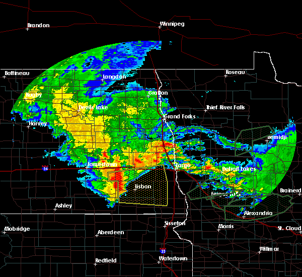 At 900 am cdt, a severe thunderstorm capable of producing a tornado was located near elliott, or 33 miles south of valley city, moving east at 40 mph (radar indicated rotation). Hazards include tornado and half dollar size hail. Expect damage to mobile homes, roofs, and vehicles. this dangerous storm will be near, lisbon around 910 am cdt. venlo and anselm around 925 am cdt. Mcleod around 930 am cdt. At 900 am cdt, a severe thunderstorm capable of producing a tornado was located near elliott, or 33 miles south of valley city, moving east at 40 mph (radar indicated rotation). Hazards include tornado and half dollar size hail. Expect damage to mobile homes, roofs, and vehicles. this dangerous storm will be near, lisbon around 910 am cdt. venlo and anselm around 925 am cdt. Mcleod around 930 am cdt.
|
| 8/14/2020 8:56 AM CDT |
 At 856 am cdt, a severe thunderstorm was located over fort ransom, or 28 miles south of valley city, moving east at 40 mph (radar indicated). Hazards include 60 mph wind gusts and half dollar size hail. Hail damage to vehicles is expected. expect wind damage to roofs, siding, and trees. this severe storm will be near, lisbon around 910 am cdt. enderlin around 920 am cdt. sheldon and anselm around 925 am cdt. venlo around 930 am cdt. leonard around 945 am cdt. other locations impacted by this severe thunderstorm include casselton airport. This includes interstate 94 in north dakota between mile markers 310 and 339. At 856 am cdt, a severe thunderstorm was located over fort ransom, or 28 miles south of valley city, moving east at 40 mph (radar indicated). Hazards include 60 mph wind gusts and half dollar size hail. Hail damage to vehicles is expected. expect wind damage to roofs, siding, and trees. this severe storm will be near, lisbon around 910 am cdt. enderlin around 920 am cdt. sheldon and anselm around 925 am cdt. venlo around 930 am cdt. leonard around 945 am cdt. other locations impacted by this severe thunderstorm include casselton airport. This includes interstate 94 in north dakota between mile markers 310 and 339.
|
| 8/14/2020 8:44 AM CDT |
 At 844 am cdt, a severe thunderstorm was located 8 miles west of fort ransom, or 29 miles south of valley city, moving east at 40 mph (radar indicated). Hazards include 60 mph wind gusts and penny size hail. Expect damage to roofs, siding, and trees. this severe thunderstorm will be near, fort ransom and fort ransom state park around 855 am cdt. little yellowstone around 900 am cdt. lisbon around 910 am cdt. enderlin around 920 am cdt. sheldon and anselm around 925 am cdt. other locations impacted by this severe thunderstorm include casselton airport. This includes interstate 94 in north dakota between mile markers 310 and 339. At 844 am cdt, a severe thunderstorm was located 8 miles west of fort ransom, or 29 miles south of valley city, moving east at 40 mph (radar indicated). Hazards include 60 mph wind gusts and penny size hail. Expect damage to roofs, siding, and trees. this severe thunderstorm will be near, fort ransom and fort ransom state park around 855 am cdt. little yellowstone around 900 am cdt. lisbon around 910 am cdt. enderlin around 920 am cdt. sheldon and anselm around 925 am cdt. other locations impacted by this severe thunderstorm include casselton airport. This includes interstate 94 in north dakota between mile markers 310 and 339.
|
| 7/25/2020 12:24 AM CDT |
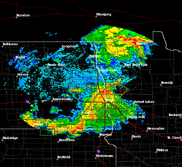 At 1223 am cdt, a severe thunderstorm was located over mcleod, or 35 miles west of wahpeton, moving northeast at 50 mph (radar indicated). Hazards include 60 mph wind gusts. Expect damage to roofs, siding, and trees. locations impacted include, walcott, sheldon, mcleod, anselm, venlo and barrie. This includes interstate 29 between mile markers 47 and 48. At 1223 am cdt, a severe thunderstorm was located over mcleod, or 35 miles west of wahpeton, moving northeast at 50 mph (radar indicated). Hazards include 60 mph wind gusts. Expect damage to roofs, siding, and trees. locations impacted include, walcott, sheldon, mcleod, anselm, venlo and barrie. This includes interstate 29 between mile markers 47 and 48.
|
| 7/25/2020 12:07 AM CDT |
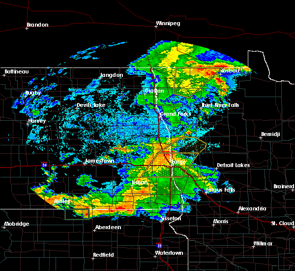 At 1206 am cdt, a severe thunderstorm was located near milnor, or 42 miles west of wahpeton, moving northeast at 50 mph (radar indicated). Hazards include 60 mph wind gusts. expect damage to roofs, siding, and trees At 1206 am cdt, a severe thunderstorm was located near milnor, or 42 miles west of wahpeton, moving northeast at 50 mph (radar indicated). Hazards include 60 mph wind gusts. expect damage to roofs, siding, and trees
|
| 7/17/2020 10:17 PM CDT |
 At 1017 pm cdt, a severe thunderstorm was located over forman, or 51 miles west of wahpeton, moving southeast at 35 mph (radar indicated). Hazards include 60 mph wind gusts. expect damage to roofs, siding, and trees At 1017 pm cdt, a severe thunderstorm was located over forman, or 51 miles west of wahpeton, moving southeast at 35 mph (radar indicated). Hazards include 60 mph wind gusts. expect damage to roofs, siding, and trees
|
| 7/8/2020 5:06 AM CDT |
 The severe thunderstorm warning for southeastern ransom, western richland and northeastern sargent counties will expire at 515 am cdt, the storm which prompted the warning has weakened below severe limits, and no longer pose an immediate threat to life or property. therefore, the warning will be allowed to expire. a severe thunderstorm watch remains in effect until 600 am cdt for southeastern north dakota. The severe thunderstorm warning for southeastern ransom, western richland and northeastern sargent counties will expire at 515 am cdt, the storm which prompted the warning has weakened below severe limits, and no longer pose an immediate threat to life or property. therefore, the warning will be allowed to expire. a severe thunderstorm watch remains in effect until 600 am cdt for southeastern north dakota.
|
| 7/8/2020 4:45 AM CDT |
 At 445 am cdt, a severe thunderstorm was located near gwinner, or 46 miles west of wahpeton, moving east at 65 mph (radar indicated). Hazards include 60 mph wind gusts and quarter size hail. Hail damage to vehicles is expected. expect wind damage to roofs, siding, and trees. this severe storm will be near, milnor around 450 am cdt. de lamere around 455 am cdt. mcleod around 500 am cdt. Wyndmere around 505 am cdt. At 445 am cdt, a severe thunderstorm was located near gwinner, or 46 miles west of wahpeton, moving east at 65 mph (radar indicated). Hazards include 60 mph wind gusts and quarter size hail. Hail damage to vehicles is expected. expect wind damage to roofs, siding, and trees. this severe storm will be near, milnor around 450 am cdt. de lamere around 455 am cdt. mcleod around 500 am cdt. Wyndmere around 505 am cdt.
|
| 7/8/2020 4:23 AM CDT |
 At 423 am cdt, a severe thunderstorm was located near oakes, or 56 miles south of valley city, moving northeast at 65 mph (radar indicated). Hazards include 60 mph wind gusts and quarter size hail. Hail damage to vehicles is expected. expect wind damage to roofs, siding, and trees. this severe thunderstorm will be near, straubville around 425 am cdt. crete around 430 am cdt. stirum and cogswell around 435 am cdt. gwinner and forman around 440 am cdt. Milnor around 450 am cdt. At 423 am cdt, a severe thunderstorm was located near oakes, or 56 miles south of valley city, moving northeast at 65 mph (radar indicated). Hazards include 60 mph wind gusts and quarter size hail. Hail damage to vehicles is expected. expect wind damage to roofs, siding, and trees. this severe thunderstorm will be near, straubville around 425 am cdt. crete around 430 am cdt. stirum and cogswell around 435 am cdt. gwinner and forman around 440 am cdt. Milnor around 450 am cdt.
|
| 7/5/2020 4:46 PM CDT |
 At 446 pm cdt, a severe thunderstorm was located near cayuga, or 40 miles west of wahpeton, moving northeast at 20 mph (radar indicated). Hazards include 60 mph wind gusts and quarter size hail. Hail damage to vehicles is expected. Expect wind damage to roofs, siding, and trees. At 446 pm cdt, a severe thunderstorm was located near cayuga, or 40 miles west of wahpeton, moving northeast at 20 mph (radar indicated). Hazards include 60 mph wind gusts and quarter size hail. Hail damage to vehicles is expected. Expect wind damage to roofs, siding, and trees.
|
| 6/7/2020 9:48 PM CDT |
 The national weather service in grand forks has issued a * severe thunderstorm warning for. wilkin county in west central minnesota. eastern ransom county in southeastern north dakota. richland county in southeastern north dakota. Eastern sargent county in southeastern north dakota. The national weather service in grand forks has issued a * severe thunderstorm warning for. wilkin county in west central minnesota. eastern ransom county in southeastern north dakota. richland county in southeastern north dakota. Eastern sargent county in southeastern north dakota.
|
| 6/7/2020 9:48 PM CDT |
 At 948 pm cdt, severe thunderstorms were located along a line extending from 8 miles north of mcleod to near wyndmere to near geneseo, moving east at 60 mph (radar indicated). Hazards include 70 mph wind gusts. Expect considerable tree damage. Damage is likely to mobile homes, roofs, and outbuildings. At 948 pm cdt, severe thunderstorms were located along a line extending from 8 miles north of mcleod to near wyndmere to near geneseo, moving east at 60 mph (radar indicated). Hazards include 70 mph wind gusts. Expect considerable tree damage. Damage is likely to mobile homes, roofs, and outbuildings.
|
| 6/7/2020 9:11 PM CDT |
 At 911 pm cdt, severe thunderstorms were located along a line extending from near verona to crete to 6 miles south of straubville, moving east at 55 mph (radar indicated). Hazards include 70 mph wind gusts. Expect considerable tree damage. Damage is likely to mobile homes, roofs, and outbuildings. At 911 pm cdt, severe thunderstorms were located along a line extending from near verona to crete to 6 miles south of straubville, moving east at 55 mph (radar indicated). Hazards include 70 mph wind gusts. Expect considerable tree damage. Damage is likely to mobile homes, roofs, and outbuildings.
|
| 9/2/2019 6:14 PM CDT |
 At 613 pm cdt, severe thunderstorms were located along a line extending from near sheldon to near gwinner, moving east at 50 mph (radar indicated). Hazards include 60 mph wind gusts and quarter size hail. Hail damage to vehicles is expected. expect wind damage to roofs, siding, and trees. locations impacted include, wahpeton, breckenridge, lisbon, hankinson, enderlin, gwinner and milnor. this includes the following highways, interstate 29 between mile markers 10 and 48. Interstate 94 in minnesota between mile markers 28 and 32. At 613 pm cdt, severe thunderstorms were located along a line extending from near sheldon to near gwinner, moving east at 50 mph (radar indicated). Hazards include 60 mph wind gusts and quarter size hail. Hail damage to vehicles is expected. expect wind damage to roofs, siding, and trees. locations impacted include, wahpeton, breckenridge, lisbon, hankinson, enderlin, gwinner and milnor. this includes the following highways, interstate 29 between mile markers 10 and 48. Interstate 94 in minnesota between mile markers 28 and 32.
|
| 9/2/2019 6:00 PM CDT |
 At 600 pm cdt, severe thunderstorms were located along a line extending from enderlin to near stirum, moving east at 45 mph (radar indicated). Hazards include 60 mph wind gusts and quarter size hail. Hail damage to vehicles is expected. expect wind damage to roofs, siding, and trees. locations impacted include, wahpeton, breckenridge, lisbon, hankinson, enderlin, gwinner and milnor. this includes the following highways, interstate 29 between mile markers 10 and 48. Interstate 94 in minnesota between mile markers 28 and 32. At 600 pm cdt, severe thunderstorms were located along a line extending from enderlin to near stirum, moving east at 45 mph (radar indicated). Hazards include 60 mph wind gusts and quarter size hail. Hail damage to vehicles is expected. expect wind damage to roofs, siding, and trees. locations impacted include, wahpeton, breckenridge, lisbon, hankinson, enderlin, gwinner and milnor. this includes the following highways, interstate 29 between mile markers 10 and 48. Interstate 94 in minnesota between mile markers 28 and 32.
|
| 9/2/2019 5:36 PM CDT |
 At 535 pm cdt, severe thunderstorms were located along a line extending from near fingal to 9 miles west of fort ransom to near kulm, moving east at 70 mph (radar indicated). Hazards include 60 mph wind gusts and quarter size hail. Hail damage to vehicles is expected. Expect wind damage to roofs, siding, and trees. At 535 pm cdt, severe thunderstorms were located along a line extending from near fingal to 9 miles west of fort ransom to near kulm, moving east at 70 mph (radar indicated). Hazards include 60 mph wind gusts and quarter size hail. Hail damage to vehicles is expected. Expect wind damage to roofs, siding, and trees.
|
| 8/5/2019 5:41 AM CDT |
 The severe thunderstorm warning for southeastern ransom, southwestern richland and northeastern sargent counties will expire at 545 am cdt, the storm which prompted the warning has weakened below severe limits, and no longer pose an immediate threat to life or property. therefore, the warning will be allowed to expire. however gusty winds are still possible with this thunderstorm. a severe thunderstorm watch remains in effect until 700 am cdt for southeastern north dakota. The severe thunderstorm warning for southeastern ransom, southwestern richland and northeastern sargent counties will expire at 545 am cdt, the storm which prompted the warning has weakened below severe limits, and no longer pose an immediate threat to life or property. therefore, the warning will be allowed to expire. however gusty winds are still possible with this thunderstorm. a severe thunderstorm watch remains in effect until 700 am cdt for southeastern north dakota.
|
| 8/5/2019 5:25 AM CDT |
 At 524 am cdt, a severe thunderstorm was located over de lamere, or 35 miles west of wahpeton, moving east at 45 mph (radar indicated). Hazards include 60 mph wind gusts and quarter size hail. Hail damage to vehicles is expected. expect wind damage to roofs, siding, and trees. Locations impacted include, gwinner, milnor, lidgerwood, wyndmere, de lamere, mcleod and barney. At 524 am cdt, a severe thunderstorm was located over de lamere, or 35 miles west of wahpeton, moving east at 45 mph (radar indicated). Hazards include 60 mph wind gusts and quarter size hail. Hail damage to vehicles is expected. expect wind damage to roofs, siding, and trees. Locations impacted include, gwinner, milnor, lidgerwood, wyndmere, de lamere, mcleod and barney.
|
| 8/5/2019 5:02 AM CDT |
 At 502 am cdt, a severe thunderstorm was located 7 miles north of gwinner moving east at 45 mph (radar indicated). Hazards include 60 mph wind gusts and quarter size hail. Hail damage to vehicles is expected. Expect wind damage to roofs, siding, and trees. At 502 am cdt, a severe thunderstorm was located 7 miles north of gwinner moving east at 45 mph (radar indicated). Hazards include 60 mph wind gusts and quarter size hail. Hail damage to vehicles is expected. Expect wind damage to roofs, siding, and trees.
|
| 6/27/2019 6:02 AM CDT |
 At 601 am cdt, severe thunderstorms were located along a line extending from near mcleod to near wyndmere, moving east at 50 mph (radar indicated). Hazards include 60 mph wind gusts and quarter size hail. Hail damage to vehicles is expected. expect wind damage to roofs, siding, and trees. severe thunderstorms will be near, barney and mantador around 610 am cdt. mooreton and barrie around 615 am cdt. dwight, walcott and colfax around 625 am cdt. wahpeton and breckenridge around 630 am cdt. This includes interstate 29 between mile markers 19 and 43. At 601 am cdt, severe thunderstorms were located along a line extending from near mcleod to near wyndmere, moving east at 50 mph (radar indicated). Hazards include 60 mph wind gusts and quarter size hail. Hail damage to vehicles is expected. expect wind damage to roofs, siding, and trees. severe thunderstorms will be near, barney and mantador around 610 am cdt. mooreton and barrie around 615 am cdt. dwight, walcott and colfax around 625 am cdt. wahpeton and breckenridge around 630 am cdt. This includes interstate 29 between mile markers 19 and 43.
|
| 7/8/2018 6:27 PM CDT |
 At 627 pm cdt, a severe thunderstorm was located near milnor, or 43 miles west of wahpeton, moving east at 25 mph (radar indicated). Hazards include two inch hail and 60 mph wind gusts. People and animals outdoors will be injured. expect hail damage to roofs, siding, windows, and vehicles. expect wind damage to roofs, siding, and trees. this severe thunderstorm will be near, milnor around 635 pm cdt. de lamere and mcleod around 650 pm cdt. hamlin around 705 pm cdt. wyndmere around 715 pm cdt. barney and mantador around 730 pm cdt. This includes interstate 29 between mile markers 2 and 28. At 627 pm cdt, a severe thunderstorm was located near milnor, or 43 miles west of wahpeton, moving east at 25 mph (radar indicated). Hazards include two inch hail and 60 mph wind gusts. People and animals outdoors will be injured. expect hail damage to roofs, siding, windows, and vehicles. expect wind damage to roofs, siding, and trees. this severe thunderstorm will be near, milnor around 635 pm cdt. de lamere and mcleod around 650 pm cdt. hamlin around 705 pm cdt. wyndmere around 715 pm cdt. barney and mantador around 730 pm cdt. This includes interstate 29 between mile markers 2 and 28.
|
| 7/4/2018 4:08 AM CDT |
 The severe thunderstorm warning for ransom, southwestern cass, western richland and sargent counties will expire at 415 am cdt, the storms which prompted the warning have weakened below severe limits, and no longer poses an immediate threat to life or property. therefore, the warning will be allowed to expire. however gusty winds are still possible with these thunderstorms. a severe thunderstorm watch remains in effect until 900 am cdt for southeastern north dakota. The severe thunderstorm warning for ransom, southwestern cass, western richland and sargent counties will expire at 415 am cdt, the storms which prompted the warning have weakened below severe limits, and no longer poses an immediate threat to life or property. therefore, the warning will be allowed to expire. however gusty winds are still possible with these thunderstorms. a severe thunderstorm watch remains in effect until 900 am cdt for southeastern north dakota.
|
| 7/4/2018 3:42 AM CDT |
 At 342 am cdt, severe thunderstorms were located along a line extending from enderlin to 6 miles southeast of ludden, moving east at 55 mph (radar indicated). Hazards include 60 mph wind gusts and quarter size hail. Hail damage to vehicles is expected. expect wind damage to roofs, siding, and trees. these severe storms will be near, enderlin, sheldon and anselm around 345 am cdt. brampton around 355 am cdt. havana around 400 am cdt. barrie and rutland around 405 am cdt. Walcott around 415 am cdt. At 342 am cdt, severe thunderstorms were located along a line extending from enderlin to 6 miles southeast of ludden, moving east at 55 mph (radar indicated). Hazards include 60 mph wind gusts and quarter size hail. Hail damage to vehicles is expected. expect wind damage to roofs, siding, and trees. these severe storms will be near, enderlin, sheldon and anselm around 345 am cdt. brampton around 355 am cdt. havana around 400 am cdt. barrie and rutland around 405 am cdt. Walcott around 415 am cdt.
|
| 7/4/2018 3:09 AM CDT |
 At 309 am cdt, severe thunderstorms were located along a line extending from little yellowstone to near guelph, moving east at 55 mph (radar indicated). Hazards include 60 mph wind gusts and quarter size hail. Hail damage to vehicles is expected. expect wind damage to roofs, siding, and trees. severe thunderstorms will be near, little yellowstone and fort ransom state park around 310 am cdt. enderlin and straubville around 330 am cdt. sheldon and anselm around 335 am cdt. brampton around 340 am cdt. Havana around 345 am cdt. At 309 am cdt, severe thunderstorms were located along a line extending from little yellowstone to near guelph, moving east at 55 mph (radar indicated). Hazards include 60 mph wind gusts and quarter size hail. Hail damage to vehicles is expected. expect wind damage to roofs, siding, and trees. severe thunderstorms will be near, little yellowstone and fort ransom state park around 310 am cdt. enderlin and straubville around 330 am cdt. sheldon and anselm around 335 am cdt. brampton around 340 am cdt. Havana around 345 am cdt.
|
| 7/2/2018 9:49 PM CDT |
 At 948 pm cdt, a severe thunderstorm was located over venlo, or 41 miles west of wahpeton, moving northeast at 35 mph (radar indicated). Hazards include ping pong ball size hail and 60 mph wind gusts. People and animals outdoors will be injured. expect hail damage to roofs, siding, windows, and vehicles. expect wind damage to roofs, siding, and trees. this severe storm will be near, mcleod around 950 pm cdt. venlo and anselm around 955 pm cdt. Leonard around 1015 pm cdt. At 948 pm cdt, a severe thunderstorm was located over venlo, or 41 miles west of wahpeton, moving northeast at 35 mph (radar indicated). Hazards include ping pong ball size hail and 60 mph wind gusts. People and animals outdoors will be injured. expect hail damage to roofs, siding, windows, and vehicles. expect wind damage to roofs, siding, and trees. this severe storm will be near, mcleod around 950 pm cdt. venlo and anselm around 955 pm cdt. Leonard around 1015 pm cdt.
|
| 7/2/2018 9:27 PM CDT |
 At 927 pm cdt, a severe thunderstorm was located near gwinner, or 47 miles west of wahpeton, moving northeast at 45 mph (radar indicated). Hazards include ping pong ball size hail and 60 mph wind gusts. People and animals outdoors will be injured. expect hail damage to roofs, siding, windows, and vehicles. expect wind damage to roofs, siding, and trees. this severe thunderstorm will be near, milnor around 930 pm cdt. venlo, anselm and mcleod around 950 pm cdt. leonard and barrie around 1010 pm cdt. Davenport around 1015 pm cdt. At 927 pm cdt, a severe thunderstorm was located near gwinner, or 47 miles west of wahpeton, moving northeast at 45 mph (radar indicated). Hazards include ping pong ball size hail and 60 mph wind gusts. People and animals outdoors will be injured. expect hail damage to roofs, siding, windows, and vehicles. expect wind damage to roofs, siding, and trees. this severe thunderstorm will be near, milnor around 930 pm cdt. venlo, anselm and mcleod around 950 pm cdt. leonard and barrie around 1010 pm cdt. Davenport around 1015 pm cdt.
|
| 7/2/2018 9:22 PM CDT |
 At 921 pm cdt, a severe thunderstorm was located over gwinner, or 50 miles west of wahpeton, moving northeast at 30 mph. this storm has reports of ping pong to baseball sized hail (public). Hazards include golf ball size hail and 60 mph wind gusts. People and animals outdoors will be injured. expect hail damage to roofs, siding, windows, and vehicles. expect wind damage to roofs, siding, and trees. This severe storm will be near, milnor around 940 pm cdt. At 921 pm cdt, a severe thunderstorm was located over gwinner, or 50 miles west of wahpeton, moving northeast at 30 mph. this storm has reports of ping pong to baseball sized hail (public). Hazards include golf ball size hail and 60 mph wind gusts. People and animals outdoors will be injured. expect hail damage to roofs, siding, windows, and vehicles. expect wind damage to roofs, siding, and trees. This severe storm will be near, milnor around 940 pm cdt.
|
| 7/2/2018 9:08 PM CDT |
 At 850 pm cdt, a severe thunderstorm was located over straubville, or 61 miles south of valley city, moving northeast at 40 mph (radar indicated). Hazards include 60 mph wind gusts and quarter size hail. Hail damage to vehicles is expected. expect wind damage to roofs, siding, and trees. this severe thunderstorm will be near, brampton around 900 pm cdt. cogswell around 905 pm cdt. forman and gwinner around 915 pm cdt. rutland around 920 pm cdt. Milnor around 930 pm cdt. At 850 pm cdt, a severe thunderstorm was located over straubville, or 61 miles south of valley city, moving northeast at 40 mph (radar indicated). Hazards include 60 mph wind gusts and quarter size hail. Hail damage to vehicles is expected. expect wind damage to roofs, siding, and trees. this severe thunderstorm will be near, brampton around 900 pm cdt. cogswell around 905 pm cdt. forman and gwinner around 915 pm cdt. rutland around 920 pm cdt. Milnor around 930 pm cdt.
|
| 7/2/2018 8:51 PM CDT |
 At 850 pm cdt, a severe thunderstorm was located over straubville, or 61 miles south of valley city, moving northeast at 40 mph (radar indicated). Hazards include 60 mph wind gusts and quarter size hail. Hail damage to vehicles is expected. expect wind damage to roofs, siding, and trees. this severe thunderstorm will be near, brampton around 900 pm cdt. cogswell around 905 pm cdt. forman and gwinner around 915 pm cdt. rutland around 920 pm cdt. Milnor around 930 pm cdt. At 850 pm cdt, a severe thunderstorm was located over straubville, or 61 miles south of valley city, moving northeast at 40 mph (radar indicated). Hazards include 60 mph wind gusts and quarter size hail. Hail damage to vehicles is expected. expect wind damage to roofs, siding, and trees. this severe thunderstorm will be near, brampton around 900 pm cdt. cogswell around 905 pm cdt. forman and gwinner around 915 pm cdt. rutland around 920 pm cdt. Milnor around 930 pm cdt.
|
| 6/29/2018 4:06 AM CDT |
 At 405 am cdt, severe thunderstorms were located along a line extending from absaraka to near venlo to near havana, moving east at 50 mph (radar indicated). Hazards include 60 mph wind gusts and penny size hail. Expect damage to roofs, siding, and trees. severe thunderstorms will be near, wheatland around 410 am cdt. casselton around 415 am cdt. barrie around 420 am cdt. mapleton around 425 am cdt. prosper, walcott and west fargo around 430 am cdt. other locations impacted by these severe thunderstorms include moorhead airport and casselton airport. this includes the following highways, interstate 29 between mile markers 0 and 71. interstate 94 in north dakota between mile markers 309 and 352. Interstate 94 in minnesota between mile markers 1 and 44. At 405 am cdt, severe thunderstorms were located along a line extending from absaraka to near venlo to near havana, moving east at 50 mph (radar indicated). Hazards include 60 mph wind gusts and penny size hail. Expect damage to roofs, siding, and trees. severe thunderstorms will be near, wheatland around 410 am cdt. casselton around 415 am cdt. barrie around 420 am cdt. mapleton around 425 am cdt. prosper, walcott and west fargo around 430 am cdt. other locations impacted by these severe thunderstorms include moorhead airport and casselton airport. this includes the following highways, interstate 29 between mile markers 0 and 71. interstate 94 in north dakota between mile markers 309 and 352. Interstate 94 in minnesota between mile markers 1 and 44.
|
| 6/29/2018 3:59 AM CDT |
 At 345 am cdt, severe thunderstorms were located along a line extending from near oriska to near fort ransom to near crete, moving east at 50 mph (radar indicated). Hazards include 60 mph wind gusts and nickel size hail. Expect damage to roofs, siding, and trees. these severe storms will be near, tower city and lisbon around 355 am cdt. buffalo, forman and gwinner around 400 am cdt. anselm, venlo and sheldon around 405 am cdt. milnor around 410 am cdt. wheatland, hamlin and cayuga around 415 am cdt. This includes interstate 94 in north dakota between mile markers 272 and 326. At 345 am cdt, severe thunderstorms were located along a line extending from near oriska to near fort ransom to near crete, moving east at 50 mph (radar indicated). Hazards include 60 mph wind gusts and nickel size hail. Expect damage to roofs, siding, and trees. these severe storms will be near, tower city and lisbon around 355 am cdt. buffalo, forman and gwinner around 400 am cdt. anselm, venlo and sheldon around 405 am cdt. milnor around 410 am cdt. wheatland, hamlin and cayuga around 415 am cdt. This includes interstate 94 in north dakota between mile markers 272 and 326.
|
| 6/29/2018 3:45 AM CDT |
 At 345 am cdt, severe thunderstorms were located along a line extending from near oriska to near fort ransom to near crete, moving east at 50 mph (radar indicated). Hazards include 60 mph wind gusts and nickel size hail. Expect damage to roofs, siding, and trees. these severe storms will be near, tower city and lisbon around 355 am cdt. buffalo, forman and gwinner around 400 am cdt. anselm, venlo and sheldon around 405 am cdt. milnor around 410 am cdt. wheatland, hamlin and cayuga around 415 am cdt. This includes interstate 94 in north dakota between mile markers 272 and 326. At 345 am cdt, severe thunderstorms were located along a line extending from near oriska to near fort ransom to near crete, moving east at 50 mph (radar indicated). Hazards include 60 mph wind gusts and nickel size hail. Expect damage to roofs, siding, and trees. these severe storms will be near, tower city and lisbon around 355 am cdt. buffalo, forman and gwinner around 400 am cdt. anselm, venlo and sheldon around 405 am cdt. milnor around 410 am cdt. wheatland, hamlin and cayuga around 415 am cdt. This includes interstate 94 in north dakota between mile markers 272 and 326.
|
| 6/29/2018 3:16 AM CDT |
 At 315 am cdt, severe thunderstorms were located along a line extending from urbana to near dickey to near monango, moving east at 50 mph (radar indicated). Hazards include 60 mph wind gusts and nickel size hail. Expect damage to roofs, siding, and trees. severe thunderstorms will be near, eckelson around 320 am cdt. sanborn around 325 am cdt. valley city around 335 am cdt. fort ransom and fort ransom state park around 340 am cdt. oriska and elliott around 350 am cdt. This includes interstate 94 in north dakota between mile markers 272 and 326. At 315 am cdt, severe thunderstorms were located along a line extending from urbana to near dickey to near monango, moving east at 50 mph (radar indicated). Hazards include 60 mph wind gusts and nickel size hail. Expect damage to roofs, siding, and trees. severe thunderstorms will be near, eckelson around 320 am cdt. sanborn around 325 am cdt. valley city around 335 am cdt. fort ransom and fort ransom state park around 340 am cdt. oriska and elliott around 350 am cdt. This includes interstate 94 in north dakota between mile markers 272 and 326.
|
| 6/16/2018 8:06 AM CDT |
 At 806 am cdt, severe thunderstorms were located along a line extending from near elliott to near leonard to near brushvale, moving north at 45 mph (radar indicated). Hazards include 60 mph wind gusts and quarter size hail. Hail damage to vehicles is expected. expect wind damage to roofs, siding, and trees. these severe storms will be near, kent, brushvale and barrie around 810 am cdt. leonard around 815 am cdt. little yellowstone around 820 am cdt. davenport around 825 am cdt. nome and lucca around 830 am cdt. This includes interstate 29 between mile markers 18 and 50. At 806 am cdt, severe thunderstorms were located along a line extending from near elliott to near leonard to near brushvale, moving north at 45 mph (radar indicated). Hazards include 60 mph wind gusts and quarter size hail. Hail damage to vehicles is expected. expect wind damage to roofs, siding, and trees. these severe storms will be near, kent, brushvale and barrie around 810 am cdt. leonard around 815 am cdt. little yellowstone around 820 am cdt. davenport around 825 am cdt. nome and lucca around 830 am cdt. This includes interstate 29 between mile markers 18 and 50.
|
| 6/16/2018 7:44 AM CDT |
 At 743 am cdt, severe thunderstorms were located along a line extending from crete to near mcleod to 6 miles east of great bend, moving north at 35 mph (radar indicated). Hazards include 60 mph wind gusts and quarter size hail. Hail damage to vehicles is expected. expect wind damage to roofs, siding, and trees. severe thunderstorms will be near, great bend around 745 am cdt. mcleod around 750 am cdt. breckenridge and venlo around 755 am cdt. wahpeton, dwight and anselm around 800 am cdt. englevale around 805 am cdt. This includes interstate 29 between mile markers 8 and 50. At 743 am cdt, severe thunderstorms were located along a line extending from crete to near mcleod to 6 miles east of great bend, moving north at 35 mph (radar indicated). Hazards include 60 mph wind gusts and quarter size hail. Hail damage to vehicles is expected. expect wind damage to roofs, siding, and trees. severe thunderstorms will be near, great bend around 745 am cdt. mcleod around 750 am cdt. breckenridge and venlo around 755 am cdt. wahpeton, dwight and anselm around 800 am cdt. englevale around 805 am cdt. This includes interstate 29 between mile markers 8 and 50.
|
| 9/19/2017 9:34 PM CDT |
 At 934 pm cdt, a severe thunderstorm was located near wyndmere, or 27 miles west of wahpeton, moving northeast at 40 mph (radar indicated). Hazards include 60 mph wind gusts and quarter size hail. Hail damage to vehicles is expected. expect wind damage to roofs, siding, and trees. this severe thunderstorm will remain over mainly rural areas of southeastern ransom, central richland and northeastern sargent counties. this includes interstate 29 between mile markers 23 and 30. A tornado watch remains in effect until midnight cdt for southeastern north dakota. At 934 pm cdt, a severe thunderstorm was located near wyndmere, or 27 miles west of wahpeton, moving northeast at 40 mph (radar indicated). Hazards include 60 mph wind gusts and quarter size hail. Hail damage to vehicles is expected. expect wind damage to roofs, siding, and trees. this severe thunderstorm will remain over mainly rural areas of southeastern ransom, central richland and northeastern sargent counties. this includes interstate 29 between mile markers 23 and 30. A tornado watch remains in effect until midnight cdt for southeastern north dakota.
|
| 9/19/2017 9:04 PM CDT |
 At 904 pm cdt, a severe thunderstorm was located near forman, or 22 miles northeast of britton, moving northeast at 35 mph (radar indicated). Hazards include 60 mph wind gusts and quarter size hail. Hail damage to vehicles is expected. expect wind damage to roofs, siding, and trees. this severe thunderstorm will be near, rutland around 905 pm cdt. cayuga around 915 pm cdt. milnor and hamlin around 925 pm cdt. de lamere around 930 pm cdt. wyndmere and mcleod around 940 pm cdt. this includes interstate 29 between mile markers 23 and 30. A tornado watch remains in effect until midnight cdt for southeastern north dakota. At 904 pm cdt, a severe thunderstorm was located near forman, or 22 miles northeast of britton, moving northeast at 35 mph (radar indicated). Hazards include 60 mph wind gusts and quarter size hail. Hail damage to vehicles is expected. expect wind damage to roofs, siding, and trees. this severe thunderstorm will be near, rutland around 905 pm cdt. cayuga around 915 pm cdt. milnor and hamlin around 925 pm cdt. de lamere around 930 pm cdt. wyndmere and mcleod around 940 pm cdt. this includes interstate 29 between mile markers 23 and 30. A tornado watch remains in effect until midnight cdt for southeastern north dakota.
|
| 9/19/2017 8:41 PM CDT |
 At 840 pm cdt, a severe thunderstorm was located near straubville, or 16 miles northwest of britton, moving northeast at 25 mph (radar indicated). Hazards include 60 mph wind gusts and quarter size hail. Hail damage to vehicles is expected. expect wind damage to roofs, siding, and trees. this severe storm will be near, straubville around 855 pm cdt. brampton around 900 pm cdt. cogswell around 910 pm cdt. forman and stirum around 915 pm cdt. A tornado watch remains in effect until midnight cdt for southeastern north dakota. At 840 pm cdt, a severe thunderstorm was located near straubville, or 16 miles northwest of britton, moving northeast at 25 mph (radar indicated). Hazards include 60 mph wind gusts and quarter size hail. Hail damage to vehicles is expected. expect wind damage to roofs, siding, and trees. this severe storm will be near, straubville around 855 pm cdt. brampton around 900 pm cdt. cogswell around 910 pm cdt. forman and stirum around 915 pm cdt. A tornado watch remains in effect until midnight cdt for southeastern north dakota.
|
| 9/19/2017 8:13 PM CDT |
 At 813 pm cdt, a severe thunderstorm was located near ludden, or 16 miles northwest of britton, moving northeast at 45 mph (radar indicated). Hazards include 60 mph wind gusts and quarter size hail. Hail damage to vehicles is expected. expect wind damage to roofs, siding, and trees. this severe thunderstorm will be near, straubville and brampton around 825 pm cdt. cogswell around 835 pm cdt. forman and stirum around 840 pm cdt. gwinner around 850 pm cdt. milnor around 900 pm cdt. A tornado watch remains in effect until midnight cdt for southeastern north dakota. At 813 pm cdt, a severe thunderstorm was located near ludden, or 16 miles northwest of britton, moving northeast at 45 mph (radar indicated). Hazards include 60 mph wind gusts and quarter size hail. Hail damage to vehicles is expected. expect wind damage to roofs, siding, and trees. this severe thunderstorm will be near, straubville and brampton around 825 pm cdt. cogswell around 835 pm cdt. forman and stirum around 840 pm cdt. gwinner around 850 pm cdt. milnor around 900 pm cdt. A tornado watch remains in effect until midnight cdt for southeastern north dakota.
|
| 8/9/2017 4:50 PM CDT |
 At 450 pm cdt, a severe thunderstorm was located near alice, or 28 miles southeast of valley city, moving east at 25 mph (radar indicated). Hazards include golf ball size hail and 60 mph wind gusts. People and animals outdoors will be injured. expect hail damage to roofs, siding, windows, and vehicles. expect wind damage to roofs, siding, and trees. Locations impacted include, enderlin, kindred, davenport, leonard, sheldon, chaffee and mcleod. At 450 pm cdt, a severe thunderstorm was located near alice, or 28 miles southeast of valley city, moving east at 25 mph (radar indicated). Hazards include golf ball size hail and 60 mph wind gusts. People and animals outdoors will be injured. expect hail damage to roofs, siding, windows, and vehicles. expect wind damage to roofs, siding, and trees. Locations impacted include, enderlin, kindred, davenport, leonard, sheldon, chaffee and mcleod.
|
| 8/9/2017 4:36 PM CDT |
 At 436 pm cdt, a severe thunderstorm was located over alice, or 24 miles southeast of valley city, moving east at 40 mph (radar indicated). Hazards include golf ball size hail. People and animals outdoors will be injured. expect damage to roofs, siding, windows, and vehicles. Locations impacted include, enderlin, kindred, davenport, leonard, sheldon, chaffee and mcleod. At 436 pm cdt, a severe thunderstorm was located over alice, or 24 miles southeast of valley city, moving east at 40 mph (radar indicated). Hazards include golf ball size hail. People and animals outdoors will be injured. expect damage to roofs, siding, windows, and vehicles. Locations impacted include, enderlin, kindred, davenport, leonard, sheldon, chaffee and mcleod.
|
| 8/9/2017 4:29 PM CDT |
 At 429 pm cdt, a severe thunderstorm was located near lucca, or 19 miles southeast of valley city, moving east at 40 mph (radar indicated). Hazards include quarter size hail. damage to vehicles is expected At 429 pm cdt, a severe thunderstorm was located near lucca, or 19 miles southeast of valley city, moving east at 40 mph (radar indicated). Hazards include quarter size hail. damage to vehicles is expected
|
| 7/31/2017 9:44 PM CDT |
 At 941 pm cdt, severe thunderstorms were located along a line extending from dilworth to fargo to near casselton, moving south at 30 mph (radar indicated). Hazards include 60 mph wind gusts. Expect damage to roofs, siding, and trees. locations impacted include, fargo, moorhead, west fargo, dilworth, horace, casselton and mapleton. this includes the following highways, interstate 29 between mile markers 27 and 80. interstate 94 in north dakota between mile markers 318 and 352. Interstate 94 in minnesota between mile markers 1 and 5. At 941 pm cdt, severe thunderstorms were located along a line extending from dilworth to fargo to near casselton, moving south at 30 mph (radar indicated). Hazards include 60 mph wind gusts. Expect damage to roofs, siding, and trees. locations impacted include, fargo, moorhead, west fargo, dilworth, horace, casselton and mapleton. this includes the following highways, interstate 29 between mile markers 27 and 80. interstate 94 in north dakota between mile markers 318 and 352. Interstate 94 in minnesota between mile markers 1 and 5.
|
| 7/31/2017 9:13 PM CDT |
 At 912 pm cdt, severe thunderstorms were located along a line extending from near kragnes to absaraka, moving south at 50 mph (radar indicated). Hazards include 60 mph wind gusts. Expect damage to roofs, siding, and trees. severe thunderstorms will be near, oakport, kragnes and north river around 915 pm cdt. fargo, moorhead and casselton around 950 pm cdt. dilworth and embden around 930 pm cdt. sabin and chaffee around 940 pm cdt. other locations impacted by these severe thunderstorms include casselton airport and moorhead airport. this includes the following highways, interstate 29 between mile markers 27 and 80. interstate 94 in north dakota between mile markers 318 and 352. Interstate 94 in minnesota between mile markers 1 and 5. At 912 pm cdt, severe thunderstorms were located along a line extending from near kragnes to absaraka, moving south at 50 mph (radar indicated). Hazards include 60 mph wind gusts. Expect damage to roofs, siding, and trees. severe thunderstorms will be near, oakport, kragnes and north river around 915 pm cdt. fargo, moorhead and casselton around 950 pm cdt. dilworth and embden around 930 pm cdt. sabin and chaffee around 940 pm cdt. other locations impacted by these severe thunderstorms include casselton airport and moorhead airport. this includes the following highways, interstate 29 between mile markers 27 and 80. interstate 94 in north dakota between mile markers 318 and 352. Interstate 94 in minnesota between mile markers 1 and 5.
|
| 7/22/2017 3:45 AM CDT |
 At 343 am cdt, severe thunderstorms were located along a line extending from near downer to near christine to 6 miles east of mcleod, moving east at 45 mph (radar indicated). Hazards include 60 mph wind gusts and quarter size hail. Hail damage to vehicles is expected. expect wind damage to roofs, siding, and trees. these severe storms will be near, wolverton, barnesville and downer around 345 am cdt. abercrombie and wyndmere around 350 am cdt. kent and mccauleyville around 355 am cdt. barney and brushvale around 400 am cdt. mooreton and galchutt around 405 am cdt. this includes the following highways, interstate 29 between mile markers 6 and 56. interstate 94 in minnesota between mile markers 11 and 34. Most likely location for quarter size hail is just south of sabin, moving toward the barnesville area. At 343 am cdt, severe thunderstorms were located along a line extending from near downer to near christine to 6 miles east of mcleod, moving east at 45 mph (radar indicated). Hazards include 60 mph wind gusts and quarter size hail. Hail damage to vehicles is expected. expect wind damage to roofs, siding, and trees. these severe storms will be near, wolverton, barnesville and downer around 345 am cdt. abercrombie and wyndmere around 350 am cdt. kent and mccauleyville around 355 am cdt. barney and brushvale around 400 am cdt. mooreton and galchutt around 405 am cdt. this includes the following highways, interstate 29 between mile markers 6 and 56. interstate 94 in minnesota between mile markers 11 and 34. Most likely location for quarter size hail is just south of sabin, moving toward the barnesville area.
|
| 7/22/2017 3:27 AM CDT |
 At 325 am cdt, severe thunderstorms were located along a line extending from near sabin to near barrie to near venlo, moving east at 45 mph (radar indicated). Hazards include 60 mph wind gusts and quarter size hail. Hail damage to vehicles is expected. expect wind damage to roofs, siding, and trees. these severe storms will be near, sabin and rustad around 330 am cdt. walcott around 335 am cdt. colfax, downer and baker around 340 am cdt. christine around 345 am cdt. abercrombie, wolverton and barnesville around 350 am cdt. this includes the following highways, interstate 29 between mile markers 6 and 66. interstate 94 in north dakota between mile markers 346 and 352. interstate 94 in minnesota between mile markers 1 and 3, and between mile markers 11 and 34. Most likely area for quarter size hail is just south of enderlin, moving toward barrie. At 325 am cdt, severe thunderstorms were located along a line extending from near sabin to near barrie to near venlo, moving east at 45 mph (radar indicated). Hazards include 60 mph wind gusts and quarter size hail. Hail damage to vehicles is expected. expect wind damage to roofs, siding, and trees. these severe storms will be near, sabin and rustad around 330 am cdt. walcott around 335 am cdt. colfax, downer and baker around 340 am cdt. christine around 345 am cdt. abercrombie, wolverton and barnesville around 350 am cdt. this includes the following highways, interstate 29 between mile markers 6 and 66. interstate 94 in north dakota between mile markers 346 and 352. interstate 94 in minnesota between mile markers 1 and 3, and between mile markers 11 and 34. Most likely area for quarter size hail is just south of enderlin, moving toward barrie.
|
| 7/22/2017 3:07 AM CDT |
 At 307 am cdt, severe thunderstorms were located along a line extending from near casselton to near leonard to near lisbon, moving southeast at 40 mph (radar indicated). Hazards include 60 mph wind gusts. Expect damage to roofs, siding, and trees. severe thunderstorms will be near, casselton around 310 am cdt. mapleton, leonard and durbin around 315 am cdt. venlo around 320 am cdt. west fargo and barrie around 325 am cdt. fargo, horace and kindred around 330 am cdt. other locations impacted by these severe thunderstorms include casselton airport. this includes the following highways, interstate 29 between mile markers 6 and 66. interstate 94 in north dakota between mile markers 323 and 352. Interstate 94 in minnesota between mile markers 1 and 3, and between mile markers 11 and 34. At 307 am cdt, severe thunderstorms were located along a line extending from near casselton to near leonard to near lisbon, moving southeast at 40 mph (radar indicated). Hazards include 60 mph wind gusts. Expect damage to roofs, siding, and trees. severe thunderstorms will be near, casselton around 310 am cdt. mapleton, leonard and durbin around 315 am cdt. venlo around 320 am cdt. west fargo and barrie around 325 am cdt. fargo, horace and kindred around 330 am cdt. other locations impacted by these severe thunderstorms include casselton airport. this includes the following highways, interstate 29 between mile markers 6 and 66. interstate 94 in north dakota between mile markers 323 and 352. Interstate 94 in minnesota between mile markers 1 and 3, and between mile markers 11 and 34.
|
| 6/13/2017 8:38 PM CDT |
 At 838 pm cdt, severe thunderstorms were located along a line extending from near durbin to near collis, moving east at 50 mph (radar indicated). Hazards include 60 mph wind gusts and quarter size hail. Hail damage to vehicles is expected. expect wind damage to roofs, siding, and trees. these severe storms will be near, horace around 845 pm cdt. wild rice around 850 pm cdt. This includes interstate 29 between mile markers 1 and 58. At 838 pm cdt, severe thunderstorms were located along a line extending from near durbin to near collis, moving east at 50 mph (radar indicated). Hazards include 60 mph wind gusts and quarter size hail. Hail damage to vehicles is expected. expect wind damage to roofs, siding, and trees. these severe storms will be near, horace around 845 pm cdt. wild rice around 850 pm cdt. This includes interstate 29 between mile markers 1 and 58.
|
| 6/13/2017 8:35 PM CDT | Peak winds measured at the sheyenne raws station... sngn8. time estimated from rada in ransom county ND, 4 miles S of McLeod, ND |
| 6/13/2017 8:29 PM CDT |
 At 829 pm cdt, severe thunderstorms were located along a line extending from near chaffee to near barry, moving northeast at 55 mph (radar indicated). Hazards include 60 mph wind gusts and quarter size hail. Hail damage to vehicles is expected. expect wind damage to roofs, siding, and trees. these severe storms will be near, davenport around 840 pm cdt. horace around 850 pm cdt. wild rice around 855 pm cdt. This includes interstate 29 between mile markers 1 and 58. At 829 pm cdt, severe thunderstorms were located along a line extending from near chaffee to near barry, moving northeast at 55 mph (radar indicated). Hazards include 60 mph wind gusts and quarter size hail. Hail damage to vehicles is expected. expect wind damage to roofs, siding, and trees. these severe storms will be near, davenport around 840 pm cdt. horace around 850 pm cdt. wild rice around 855 pm cdt. This includes interstate 29 between mile markers 1 and 58.
|
| 6/13/2017 8:11 PM CDT |
 At 810 pm cdt, severe thunderstorms were located along a line extending from near enderlin to peever, moving east at 55 mph (radar indicated). Hazards include 60 mph wind gusts and quarter size hail. Hail damage to vehicles is expected. expect wind damage to roofs, siding, and trees. severe thunderstorms will be near, leonard around 830 pm cdt. davenport around 840 pm cdt. horace around 850 pm cdt. wild rice around 855 pm cdt. This includes interstate 29 between mile markers 1 and 58. At 810 pm cdt, severe thunderstorms were located along a line extending from near enderlin to peever, moving east at 55 mph (radar indicated). Hazards include 60 mph wind gusts and quarter size hail. Hail damage to vehicles is expected. expect wind damage to roofs, siding, and trees. severe thunderstorms will be near, leonard around 830 pm cdt. davenport around 840 pm cdt. horace around 850 pm cdt. wild rice around 855 pm cdt. This includes interstate 29 between mile markers 1 and 58.
|
| 9/7/2016 3:52 PM CDT |
 The severe thunderstorm warning for eastern ransom and northeastern sargent counties will expire at 400 pm cdt, the storms which prompted the warning have moved out of the area. therefore, the warning will be allowed to expire. a severe thunderstorm watch remains in effect until 900 pm cdt for southeastern north dakota. The severe thunderstorm warning for eastern ransom and northeastern sargent counties will expire at 400 pm cdt, the storms which prompted the warning have moved out of the area. therefore, the warning will be allowed to expire. a severe thunderstorm watch remains in effect until 900 pm cdt for southeastern north dakota.
|
| 9/7/2016 3:42 PM CDT |
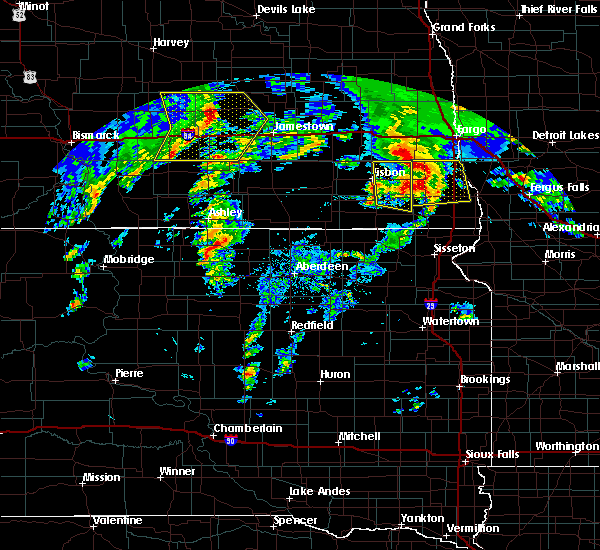 At 341 pm cdt, severe thunderstorms were located along a line extending from near chaffee to near de lamere, moving east at 40 mph (radar indicated). Hazards include tennis ball size hail and 60 mph wind gusts. People and animals outdoors will be injured. expect hail damage to roofs, siding, windows, and vehicles. expect wind damage to roofs, siding, and trees. These severe thunderstorms will impact the mcleod area through 350 pm cdt. At 341 pm cdt, severe thunderstorms were located along a line extending from near chaffee to near de lamere, moving east at 40 mph (radar indicated). Hazards include tennis ball size hail and 60 mph wind gusts. People and animals outdoors will be injured. expect hail damage to roofs, siding, windows, and vehicles. expect wind damage to roofs, siding, and trees. These severe thunderstorms will impact the mcleod area through 350 pm cdt.
|
| 9/7/2016 3:22 PM CDT |
 At 321 pm cdt, severe thunderstorms were located along a line extending from near alice to near milnor, moving east at 40 mph. this storm produced golf ball sized hail north of stirum around 3 pm cdt (radar indicated). Hazards include tennis ball size hail and 60 mph wind gusts. People and animals outdoors will be injured. expect hail damage to roofs, siding, windows, and vehicles. expect wind damage to roofs, siding, and trees. these severe storms will be near, de lamere around 335 pm cdt. Mcleod around 340 pm cdt. At 321 pm cdt, severe thunderstorms were located along a line extending from near alice to near milnor, moving east at 40 mph. this storm produced golf ball sized hail north of stirum around 3 pm cdt (radar indicated). Hazards include tennis ball size hail and 60 mph wind gusts. People and animals outdoors will be injured. expect hail damage to roofs, siding, windows, and vehicles. expect wind damage to roofs, siding, and trees. these severe storms will be near, de lamere around 335 pm cdt. Mcleod around 340 pm cdt.
|
| 9/7/2016 3:01 PM CDT |
 At 301 pm cdt, severe thunderstorms were located along a line extending from near nome to near stirum, moving east at 40 mph (radar indicated). Hazards include tennis ball size hail and 60 mph wind gusts. People and animals outdoors will be injured. expect hail damage to roofs, siding, windows, and vehicles. expect wind damage to roofs, siding, and trees. these severe storms will be near, gwinner and forman around 310 pm cdt. enderlin around 315 pm cdt. milnor around 325 pm cdt. de lamere around 335 pm cdt. Mcleod around 340 pm cdt. At 301 pm cdt, severe thunderstorms were located along a line extending from near nome to near stirum, moving east at 40 mph (radar indicated). Hazards include tennis ball size hail and 60 mph wind gusts. People and animals outdoors will be injured. expect hail damage to roofs, siding, windows, and vehicles. expect wind damage to roofs, siding, and trees. these severe storms will be near, gwinner and forman around 310 pm cdt. enderlin around 315 pm cdt. milnor around 325 pm cdt. de lamere around 335 pm cdt. Mcleod around 340 pm cdt.
|
| 9/7/2016 2:54 PM CDT |
 At 253 pm cdt, severe thunderstorms were located along a line extending from little yellowstone to near stirum, moving east at 40 mph (radar indicated). Hazards include 60 mph wind gusts and half dollar size hail. Hail damage to vehicles is expected. expect wind damage to roofs, siding, and trees. severe thunderstorms will be near, forman around 305 pm cdt. gwinner around 310 pm cdt. enderlin around 315 pm cdt. milnor around 325 pm cdt. De lamere around 330 pm cdt. At 253 pm cdt, severe thunderstorms were located along a line extending from little yellowstone to near stirum, moving east at 40 mph (radar indicated). Hazards include 60 mph wind gusts and half dollar size hail. Hail damage to vehicles is expected. expect wind damage to roofs, siding, and trees. severe thunderstorms will be near, forman around 305 pm cdt. gwinner around 310 pm cdt. enderlin around 315 pm cdt. milnor around 325 pm cdt. De lamere around 330 pm cdt.
|
| 8/18/2016 8:29 AM CDT |
 At 828 am cdt, a severe thunderstorm was located over mcleod, or 35 miles west of wahpeton, moving southeast at 45 mph (radar indicated). Hazards include 60 mph wind gusts and quarter size hail. Hail damage to vehicles is expected. expect wind damage to roofs, siding, and trees. this severe storm will be near, mcleod around 830 am cdt. De lamere around 835 am cdt. At 828 am cdt, a severe thunderstorm was located over mcleod, or 35 miles west of wahpeton, moving southeast at 45 mph (radar indicated). Hazards include 60 mph wind gusts and quarter size hail. Hail damage to vehicles is expected. expect wind damage to roofs, siding, and trees. this severe storm will be near, mcleod around 830 am cdt. De lamere around 835 am cdt.
|
| 8/18/2016 8:18 AM CDT |
 At 817 am cdt, severe thunderstorms were located along a line extending from near absaraka to near venlo to stirum, moving southeast at 45 mph (radar indicated). Hazards include 70 mph wind gusts and quarter size hail. Hail damage to vehicles is expected. expect considerable tree damage. wind damage is also likely to mobile homes, roofs, and outbuildings. these severe storms will be near, venlo around 820 am cdt. mcleod around 825 am cdt. forman and casselton around 830 am cdt. prosper around 835 am cdt. west fargo, mapleton and harwood around 840 am cdt. also includes the following highways, interstate 29 between mile markers 71 and 88. Interstate 94 in north dakota between mile markers 302 and 348. At 817 am cdt, severe thunderstorms were located along a line extending from near absaraka to near venlo to stirum, moving southeast at 45 mph (radar indicated). Hazards include 70 mph wind gusts and quarter size hail. Hail damage to vehicles is expected. expect considerable tree damage. wind damage is also likely to mobile homes, roofs, and outbuildings. these severe storms will be near, venlo around 820 am cdt. mcleod around 825 am cdt. forman and casselton around 830 am cdt. prosper around 835 am cdt. west fargo, mapleton and harwood around 840 am cdt. also includes the following highways, interstate 29 between mile markers 71 and 88. Interstate 94 in north dakota between mile markers 302 and 348.
|
| 8/18/2016 7:52 AM CDT |
 At 751 am cdt, severe thunderstorms were located along a line extending from near pillsbury to near nome to near la moure city, moving east at 40 mph (public. at 720 am...thunderstorm winds overturned a semi truck on i-94 at mile marker 278). Hazards include 70 mph wind gusts and quarter size hail. Hail damage to vehicles is expected. expect considerable tree damage. wind damage is also likely to mobile homes, roofs, and outbuildings. severe thunderstorms will be near, nome, pillsbury and fingal around 755 am cdt. lucca around 800 am cdt. page around 805 am cdt. enderlin and ayr around 810 am cdt. erie around 815 am cdt. also includes the following highways, interstate 29 between mile markers 71 and 88. Interstate 94 in north dakota between mile markers 291 and 348. At 751 am cdt, severe thunderstorms were located along a line extending from near pillsbury to near nome to near la moure city, moving east at 40 mph (public. at 720 am...thunderstorm winds overturned a semi truck on i-94 at mile marker 278). Hazards include 70 mph wind gusts and quarter size hail. Hail damage to vehicles is expected. expect considerable tree damage. wind damage is also likely to mobile homes, roofs, and outbuildings. severe thunderstorms will be near, nome, pillsbury and fingal around 755 am cdt. lucca around 800 am cdt. page around 805 am cdt. enderlin and ayr around 810 am cdt. erie around 815 am cdt. also includes the following highways, interstate 29 between mile markers 71 and 88. Interstate 94 in north dakota between mile markers 291 and 348.
|
| 8/10/2016 1:07 PM CDT |
 At 107 pm cdt, severe thunderstorms were located along a line extending from near mcleod to near everdell, moving east at 35 mph (radar indicated). Hazards include 60 mph wind gusts and quarter size hail. Hail damage to vehicles is expected. expect wind damage to roofs, siding, and trees. these severe storms will be near, galchutt around 140 pm cdt. abercrombie around 145 pm cdt. Also includes interstate 29 between mile markers 23 and 36. At 107 pm cdt, severe thunderstorms were located along a line extending from near mcleod to near everdell, moving east at 35 mph (radar indicated). Hazards include 60 mph wind gusts and quarter size hail. Hail damage to vehicles is expected. expect wind damage to roofs, siding, and trees. these severe storms will be near, galchutt around 140 pm cdt. abercrombie around 145 pm cdt. Also includes interstate 29 between mile markers 23 and 36.
|
| 8/10/2016 12:47 PM CDT |
 At 1245 pm cdt, severe thunderstorms were located along a line extending from 6 miles north of milnor to dwight, moving east at 35 mph (radar indicated). Hazards include 60 mph wind gusts and half dollar size hail. Hail damage to vehicles is expected. expect wind damage to roofs, siding, and trees. severe thunderstorms will be near, mclead and dwight around 1250 pm cdt. galchutt around 140 pm cdt. abercrombie around 145 pm cdt. Also includes interstate 29 between mile markers 23 and 36. At 1245 pm cdt, severe thunderstorms were located along a line extending from 6 miles north of milnor to dwight, moving east at 35 mph (radar indicated). Hazards include 60 mph wind gusts and half dollar size hail. Hail damage to vehicles is expected. expect wind damage to roofs, siding, and trees. severe thunderstorms will be near, mclead and dwight around 1250 pm cdt. galchutt around 140 pm cdt. abercrombie around 145 pm cdt. Also includes interstate 29 between mile markers 23 and 36.
|
| 8/10/2016 11:41 AM CDT |
 At 1141 am cdt, a severe thunderstorm was located over stirum, or 26 miles north of britton, moving northeast at 30 mph (radar indicated). Hazards include 60 mph wind gusts and half dollar size hail. Hail damage to vehicles is expected. expect wind damage to roofs, siding, and trees. this severe thunderstorm will be near, forman around 1145 am cdt. gwinner around 1155 am cdt. milnor around 1210 pm cdt. De lamere around 1220 pm cdt. At 1141 am cdt, a severe thunderstorm was located over stirum, or 26 miles north of britton, moving northeast at 30 mph (radar indicated). Hazards include 60 mph wind gusts and half dollar size hail. Hail damage to vehicles is expected. expect wind damage to roofs, siding, and trees. this severe thunderstorm will be near, forman around 1145 am cdt. gwinner around 1155 am cdt. milnor around 1210 pm cdt. De lamere around 1220 pm cdt.
|
| 8/10/2016 3:09 AM CDT |
 At 308 am cdt, severe thunderstorms were located along a line extending from mcleod to 7 miles southwest of hankinson to 7 miles north of sisseton, moving east at 50 mph (radar indicated). Hazards include 70 mph wind gusts and quarter size hail. Hail damage to vehicles is expected. expect considerable tree damage. wind damage is also likely to mobile homes, roofs, and outbuildings. severe thunderstorms will be near, stiles around 310 am cdt. hankinson around 315 am cdt. sonora around 320 am cdt. lamars around 325 am cdt. colfax, fairmount and blackmer around 330 am cdt. Also includes interstate 29 between mile markers 0 and 37. At 308 am cdt, severe thunderstorms were located along a line extending from mcleod to 7 miles southwest of hankinson to 7 miles north of sisseton, moving east at 50 mph (radar indicated). Hazards include 70 mph wind gusts and quarter size hail. Hail damage to vehicles is expected. expect considerable tree damage. wind damage is also likely to mobile homes, roofs, and outbuildings. severe thunderstorms will be near, stiles around 310 am cdt. hankinson around 315 am cdt. sonora around 320 am cdt. lamars around 325 am cdt. colfax, fairmount and blackmer around 330 am cdt. Also includes interstate 29 between mile markers 0 and 37.
|
| 7/16/2016 7:39 PM CDT |
 At 738 pm cdt, a severe thunderstorm was located near sheldon, or 32 miles southwest of fargo, moving east at 35 mph (radar indicated). Hazards include 60 mph wind gusts and quarter size hail. Hail damage to vehicles is expected. expect wind damage to roofs, siding, and trees. This severe thunderstorm will remain over mainly rural areas of northeastern ransom county. At 738 pm cdt, a severe thunderstorm was located near sheldon, or 32 miles southwest of fargo, moving east at 35 mph (radar indicated). Hazards include 60 mph wind gusts and quarter size hail. Hail damage to vehicles is expected. expect wind damage to roofs, siding, and trees. This severe thunderstorm will remain over mainly rural areas of northeastern ransom county.
|
| 7/16/2016 7:21 PM CDT |
 At 719 pm cdt, a severe thunderstorm was located over anselm, or 35 miles southeast of valley city, moving east at 35 mph (radar indicated). Hazards include 60 mph wind gusts and quarter size hail. Hail damage to vehicles is expected. expect wind damage to roofs, siding, and trees. This severe thunderstorm will be near, venlo and sheldon around 730 pm cdt. At 719 pm cdt, a severe thunderstorm was located over anselm, or 35 miles southeast of valley city, moving east at 35 mph (radar indicated). Hazards include 60 mph wind gusts and quarter size hail. Hail damage to vehicles is expected. expect wind damage to roofs, siding, and trees. This severe thunderstorm will be near, venlo and sheldon around 730 pm cdt.
|
| 7/10/2016 1:36 AM CDT |
 At 134 am cdt, severe thunderstorms were located along a line extending from near christine to near new effington, moving east at 45 mph (radar indicated. at 115 am cdt...55 mph wind was reported at gwinner). Hazards include 60 mph wind gusts and penny size hail. Expect damage to roofs. siding. and trees. these severe storms will be near, christine and colfax around 135 am cdt. abercrombie and mccauleyville around 140 am cdt. lamars around 145 am cdt. Also includes interstate 29 between mile markers 1 and 48. At 134 am cdt, severe thunderstorms were located along a line extending from near christine to near new effington, moving east at 45 mph (radar indicated. at 115 am cdt...55 mph wind was reported at gwinner). Hazards include 60 mph wind gusts and penny size hail. Expect damage to roofs. siding. and trees. these severe storms will be near, christine and colfax around 135 am cdt. abercrombie and mccauleyville around 140 am cdt. lamars around 145 am cdt. Also includes interstate 29 between mile markers 1 and 48.
|
| 7/10/2016 1:16 AM CDT |
 At 113 am cdt, severe thunderstorms were located along a line extending from near barrie to near veblen, moving east at 70 mph (radar indicated. at 1 am cdt...75 mph wind was reported at havana). Hazards include 70 mph wind gusts and penny size hail. Expect considerable tree damage. damage is likely to mobile homes, roofs, and outbuildings. these severe storms will be near, walcott around 120 am cdt. colfax, christine and galchutt around 125 am cdt. abercrombie and mccauleyville around 130 am cdt. Also includes interstate 29 between mile markers 1 and 48. At 113 am cdt, severe thunderstorms were located along a line extending from near barrie to near veblen, moving east at 70 mph (radar indicated. at 1 am cdt...75 mph wind was reported at havana). Hazards include 70 mph wind gusts and penny size hail. Expect considerable tree damage. damage is likely to mobile homes, roofs, and outbuildings. these severe storms will be near, walcott around 120 am cdt. colfax, christine and galchutt around 125 am cdt. abercrombie and mccauleyville around 130 am cdt. Also includes interstate 29 between mile markers 1 and 48.
|
| 7/10/2016 12:46 AM CDT |
 At 1245 am cdt, severe thunderstorms were located along a line extending from near enderlin to near brampton, moving east at 80 mph (radar indicated). Hazards include 60 mph wind gusts and penny size hail. Expect damage to roofs. siding. and trees. severe thunderstorms will be near, havana around 1250 am cdt. sheldon, anselm and venlo around 1255 am cdt. barrie around 105 am cdt. walcott around 110 am cdt. colfax around 115 am cdt. Also includes interstate 29 between mile markers 1 and 48. At 1245 am cdt, severe thunderstorms were located along a line extending from near enderlin to near brampton, moving east at 80 mph (radar indicated). Hazards include 60 mph wind gusts and penny size hail. Expect damage to roofs. siding. and trees. severe thunderstorms will be near, havana around 1250 am cdt. sheldon, anselm and venlo around 1255 am cdt. barrie around 105 am cdt. walcott around 110 am cdt. colfax around 115 am cdt. Also includes interstate 29 between mile markers 1 and 48.
|
| 7/4/2016 7:48 PM CDT |
 At 747 pm cdt, severe thunderstorms were located along a line extending from near mapleton to near embden to near nome, moving southeast at 45 mph (radar indicated). Hazards include 60 mph wind gusts and quarter size hail. Hail damage to vehicles is expected. expect wind damage to roofs, siding, and trees. these severe storms will be near, casselton, chaffee and durbin around 750 pm cdt. leonard and enderlin around 805 pm cdt. sheldon, kindred and walcott around 815 pm cdt. also includes the following highways, interstate 29 between mile markers 34 and 51. Interstate 94 in north dakota between mile markers 286 and 337. At 747 pm cdt, severe thunderstorms were located along a line extending from near mapleton to near embden to near nome, moving southeast at 45 mph (radar indicated). Hazards include 60 mph wind gusts and quarter size hail. Hail damage to vehicles is expected. expect wind damage to roofs, siding, and trees. these severe storms will be near, casselton, chaffee and durbin around 750 pm cdt. leonard and enderlin around 805 pm cdt. sheldon, kindred and walcott around 815 pm cdt. also includes the following highways, interstate 29 between mile markers 34 and 51. Interstate 94 in north dakota between mile markers 286 and 337.
|
| 7/4/2016 7:28 PM CDT |
 At 727 pm cdt, severe thunderstorms were located along a line extending from near amenia to near buffalo to 7 miles north of kathryn, moving southeast at 55 mph (radar indicated). Hazards include 60 mph wind gusts and quarter size hail. Hail damage to vehicles is expected. expect wind damage to roofs, siding, and trees. severe thunderstorms will be near, alice around 730 pm cdt. embden and wheatland around 735 pm cdt. chaffee and nome around 740 pm cdt. lucca around 745 pm cdt. leonard and durbin around 750 pm cdt. also includes the following highways, interstate 29 between mile markers 34 and 51. Interstate 94 in north dakota between mile markers 286 and 337. At 727 pm cdt, severe thunderstorms were located along a line extending from near amenia to near buffalo to 7 miles north of kathryn, moving southeast at 55 mph (radar indicated). Hazards include 60 mph wind gusts and quarter size hail. Hail damage to vehicles is expected. expect wind damage to roofs, siding, and trees. severe thunderstorms will be near, alice around 730 pm cdt. embden and wheatland around 735 pm cdt. chaffee and nome around 740 pm cdt. lucca around 745 pm cdt. leonard and durbin around 750 pm cdt. also includes the following highways, interstate 29 between mile markers 34 and 51. Interstate 94 in north dakota between mile markers 286 and 337.
|
| 6/27/2015 6:46 PM CDT |
 At 645 pm cdt, a severe thunderstorm capable of producing a tornado was located near wyndmere, or 27 miles west of wahpeton, moving southeast at 30 mph (radar indicated rotation). Hazards include tornado and quarter size hail. Expect damage to mobile homes. roofs and vehicles. This dangerous storm will be near, wyndmere around 655 pm cdt. At 645 pm cdt, a severe thunderstorm capable of producing a tornado was located near wyndmere, or 27 miles west of wahpeton, moving southeast at 30 mph (radar indicated rotation). Hazards include tornado and quarter size hail. Expect damage to mobile homes. roofs and vehicles. This dangerous storm will be near, wyndmere around 655 pm cdt.
|
| 6/27/2015 6:30 PM CDT |
 At 630 pm cdt, a severe thunderstorm capable of producing a tornado was located near mcleod, or 37 miles west of wahpeton, moving southeast at 25 mph (radar indicated rotation). Hazards include tornado and half dollar size hail. Expect damage to mobile homes. roofs and vehicles. this dangerous storm will be near, mcleod around 640 pm cdt. Wyndmere around 705 pm cdt. At 630 pm cdt, a severe thunderstorm capable of producing a tornado was located near mcleod, or 37 miles west of wahpeton, moving southeast at 25 mph (radar indicated rotation). Hazards include tornado and half dollar size hail. Expect damage to mobile homes. roofs and vehicles. this dangerous storm will be near, mcleod around 640 pm cdt. Wyndmere around 705 pm cdt.
|
| 6/27/2015 6:28 PM CDT | Golf Ball sized hail reported 0.2 miles NW of McLeod, ND, quarter to golf ball size hail reported by multiple spotters in mcleod. |
| 6/27/2015 6:14 PM CDT |
 At 613 pm cdt, a severe thunderstorm capable of producing a tornado was located over mcleod, or 33 miles west of wahpeton, moving east at 45 mph (radar indicated rotation). Hazards include tornado and half dollar size hail. Expect damage to mobile homes. roofs and vehicles. This tornadic thunderstorm will remain over mainly rural areas of south central cass and eastern ransom counties. At 613 pm cdt, a severe thunderstorm capable of producing a tornado was located over mcleod, or 33 miles west of wahpeton, moving east at 45 mph (radar indicated rotation). Hazards include tornado and half dollar size hail. Expect damage to mobile homes. roofs and vehicles. This tornadic thunderstorm will remain over mainly rural areas of south central cass and eastern ransom counties.
|
| 6/27/2015 5:55 PM CDT |
 At 555 pm cdt, a severe thunderstorm capable of producing a tornado was located over enderlin, or 30 miles southeast of valley city, moving east at 20 mph (radar indicated rotation). Hazards include tornado and golf ball size hail. Expect damage to mobile homes. roofs and vehicles. this dangerous storm will be near, sheldon around 605 pm cdt. anselm around 610 pm cdt. Venlo around 620 pm cdt. At 555 pm cdt, a severe thunderstorm capable of producing a tornado was located over enderlin, or 30 miles southeast of valley city, moving east at 20 mph (radar indicated rotation). Hazards include tornado and golf ball size hail. Expect damage to mobile homes. roofs and vehicles. this dangerous storm will be near, sheldon around 605 pm cdt. anselm around 610 pm cdt. Venlo around 620 pm cdt.
|
| 6/27/2015 5:42 PM CDT |
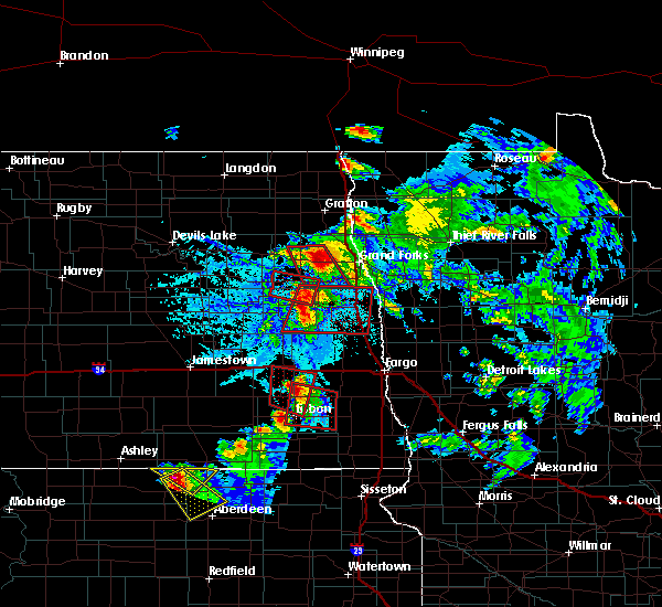 At 541 pm cdt, a severe thunderstorm capable of producing a tornado was located near enderlin, or 24 miles southeast of valley city, moving east at 25 mph (radar indicated rotation). Hazards include tornado and half dollar size hail. Expect damage to mobile homes. roofs and vehicles. this dangerous storm will be near, enderlin around 550 pm cdt. sheldon around 600 pm cdt. Anselm around 605 pm cdt. At 541 pm cdt, a severe thunderstorm capable of producing a tornado was located near enderlin, or 24 miles southeast of valley city, moving east at 25 mph (radar indicated rotation). Hazards include tornado and half dollar size hail. Expect damage to mobile homes. roofs and vehicles. this dangerous storm will be near, enderlin around 550 pm cdt. sheldon around 600 pm cdt. Anselm around 605 pm cdt.
|
| 6/20/2015 7:22 PM CDT | 50 foot tall tree blown down in richland county ND, 10.2 miles WSW of McLeod, ND |
| 8/3/2012 6:36 PM CDT | Measured at the sheyenne national grasslands raws sit in ransom county ND, 4 miles S of McLeod, ND |
| 8/3/2012 6:30 PM CDT | Measured at the sheyenne national grasslands raws sit in ransom county ND, 4 miles S of McLeod, ND |
| 1/1/0001 12:00 AM | Quarter sized hail reported 0.2 miles NW of McLeod, ND, nickel to quarter sized hail was reported by multiple sources and occurred mainly between 405 and 410 am cdt. |
| 1/1/0001 12:00 AM | Estimated wind gust of 65 mp in ransom county ND, 0.2 miles NW of McLeod, ND |
Hail Maps for McLeod, ND
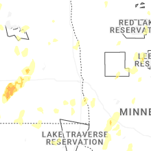
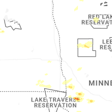
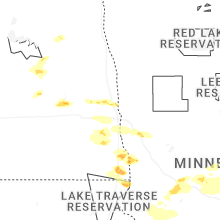
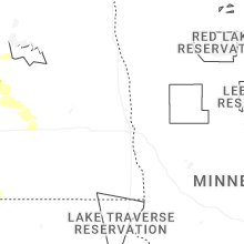
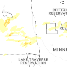
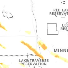


Connect with Interactive Hail Maps