

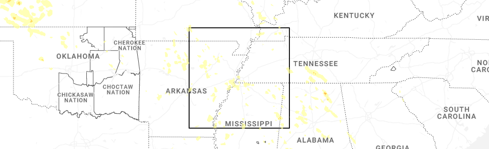
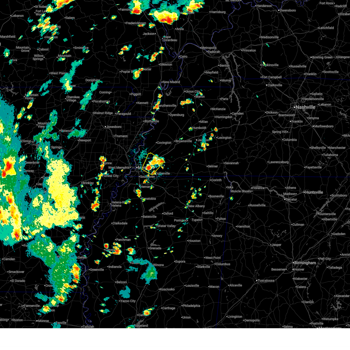
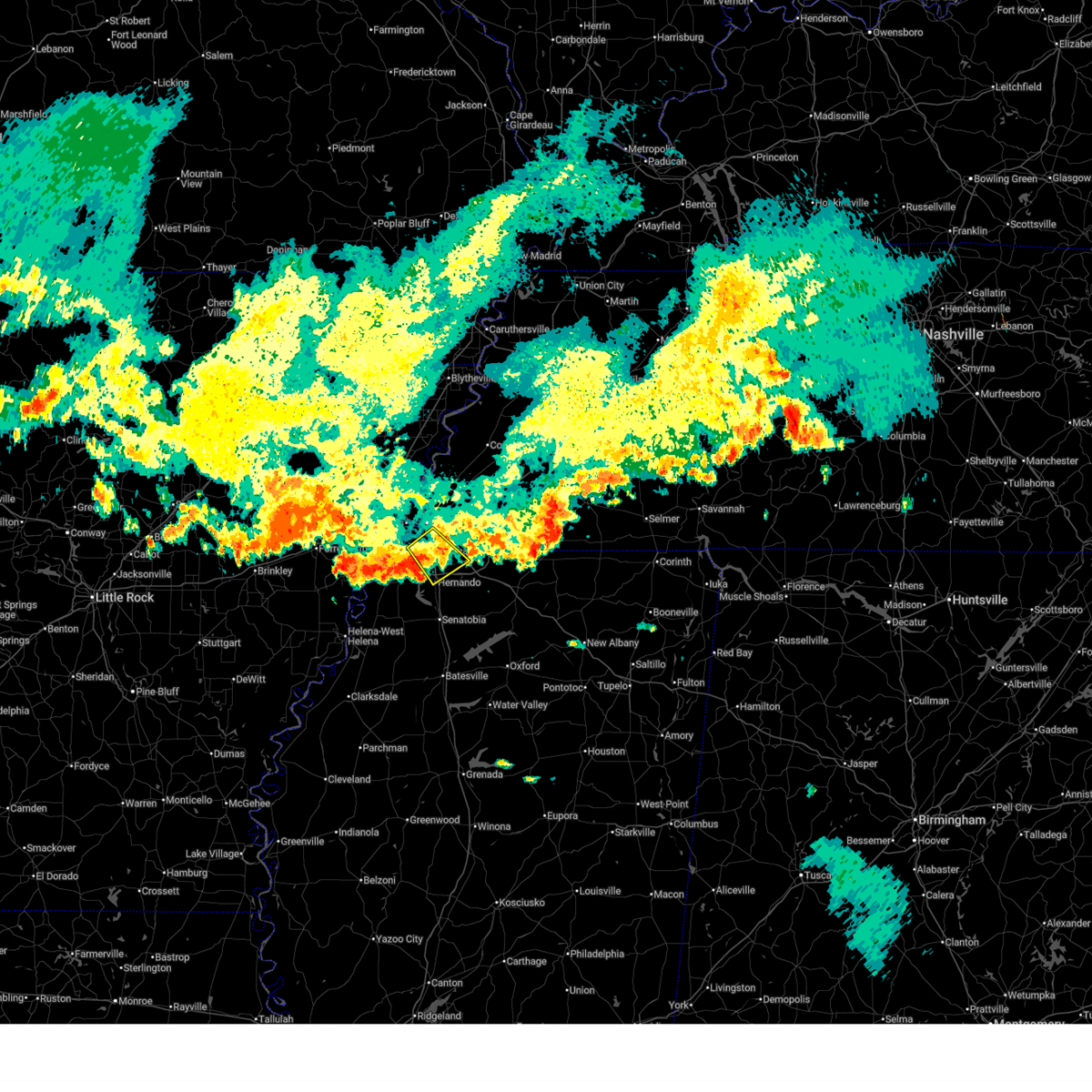
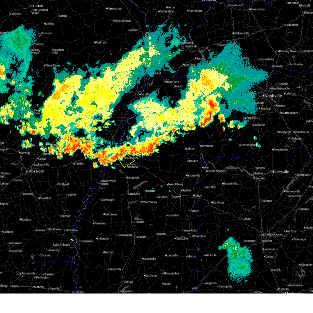
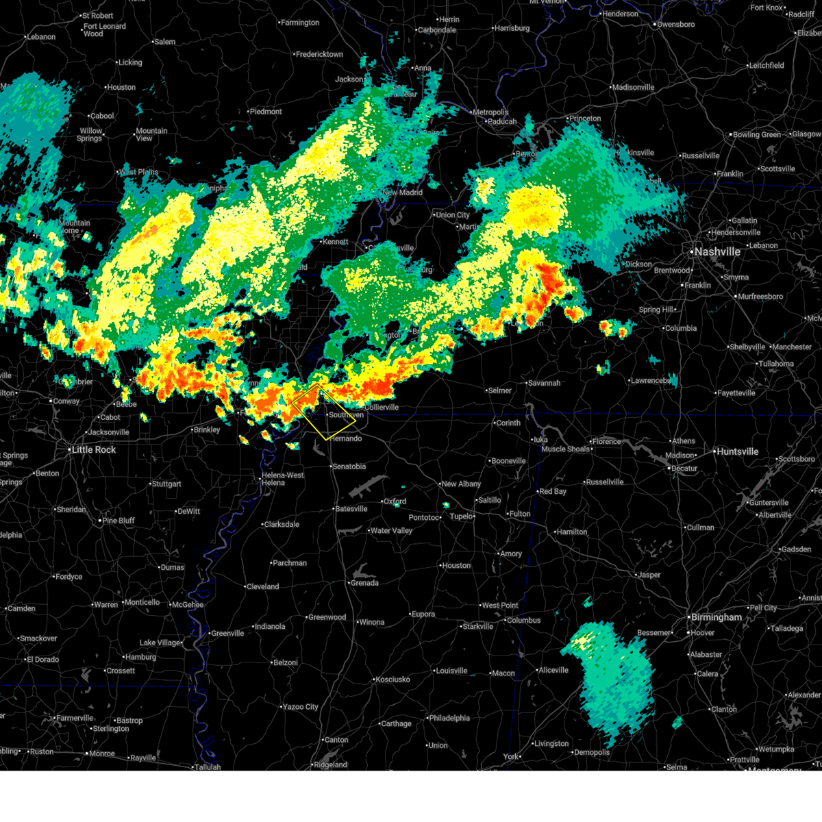
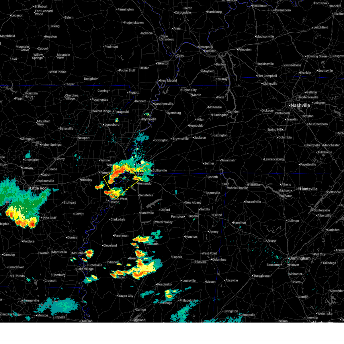
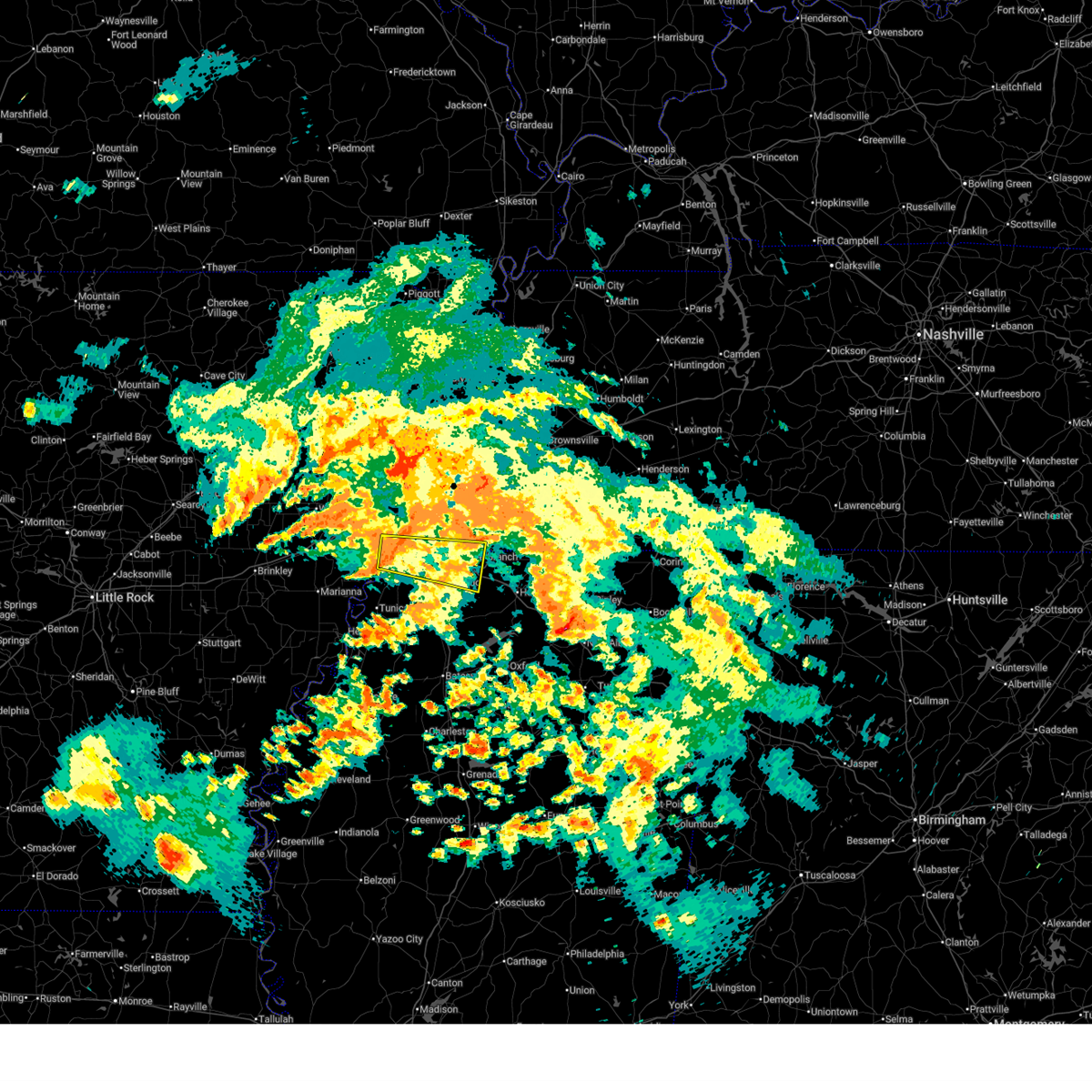
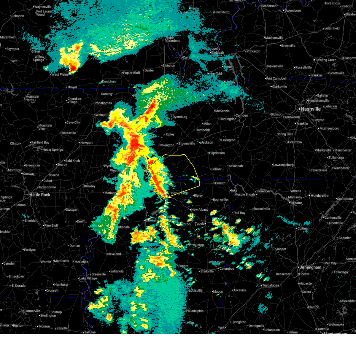
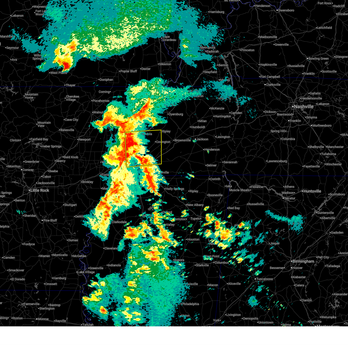
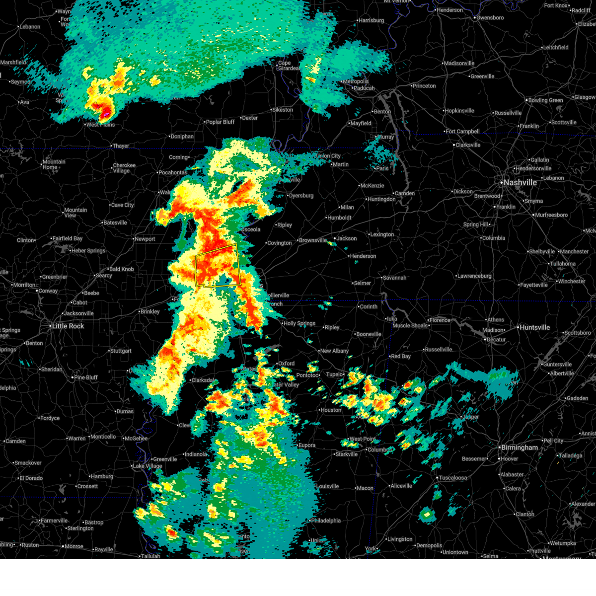
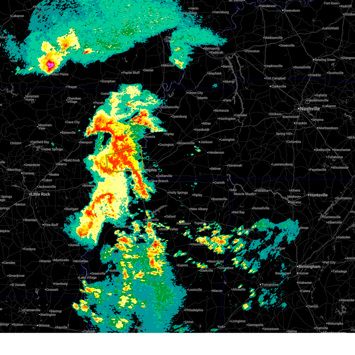
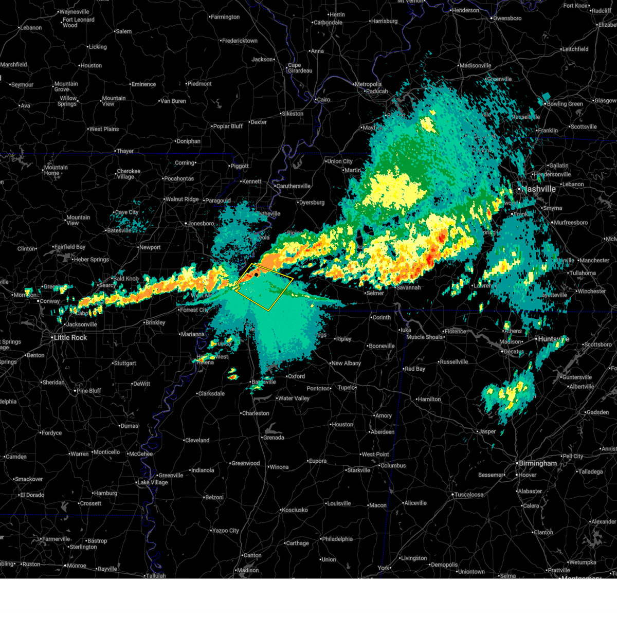
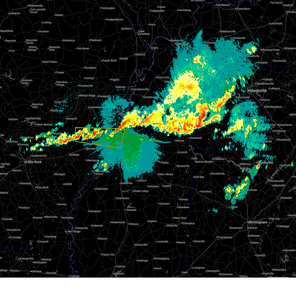
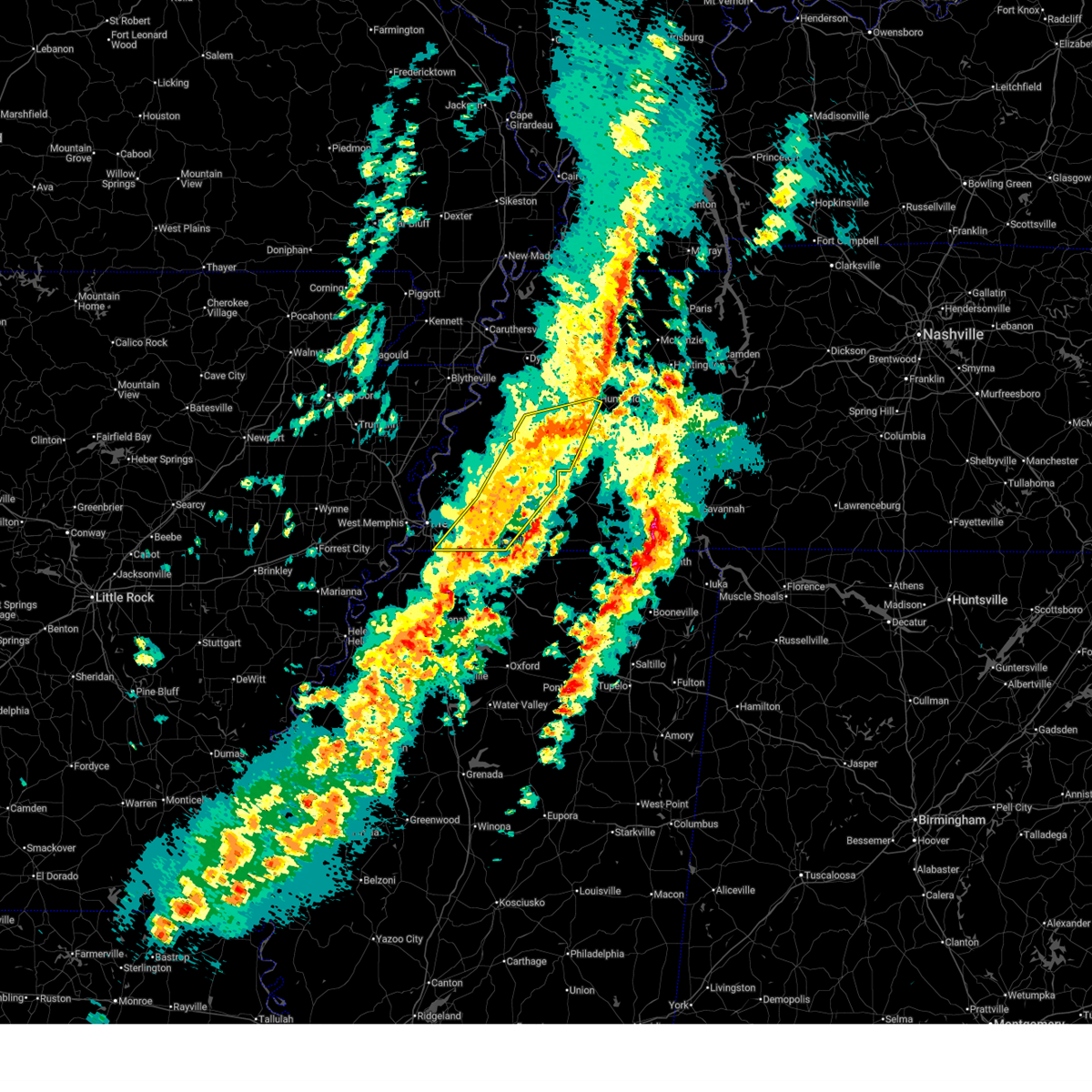
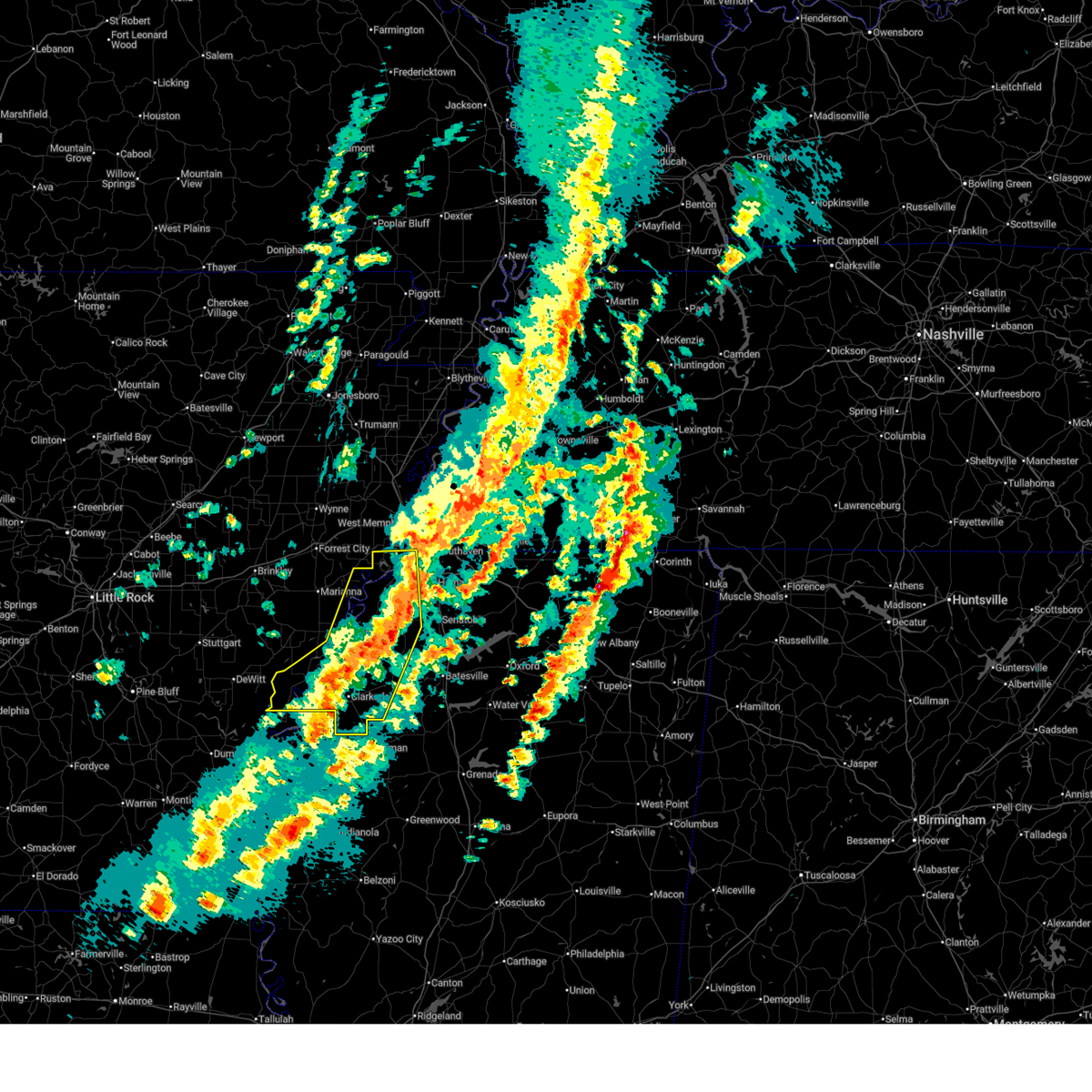
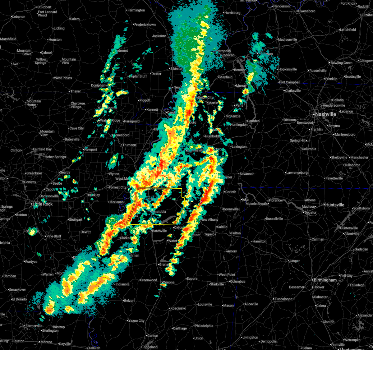
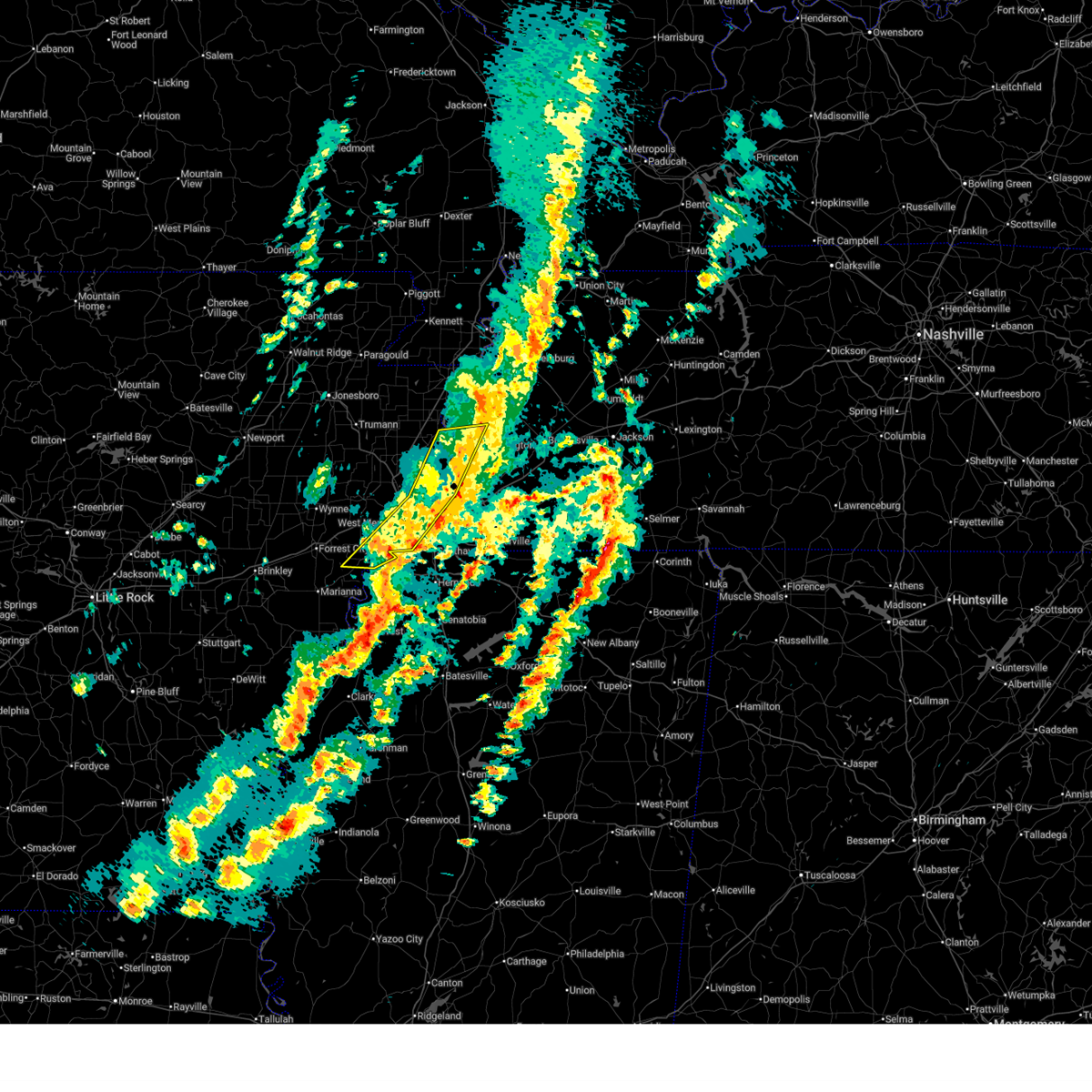
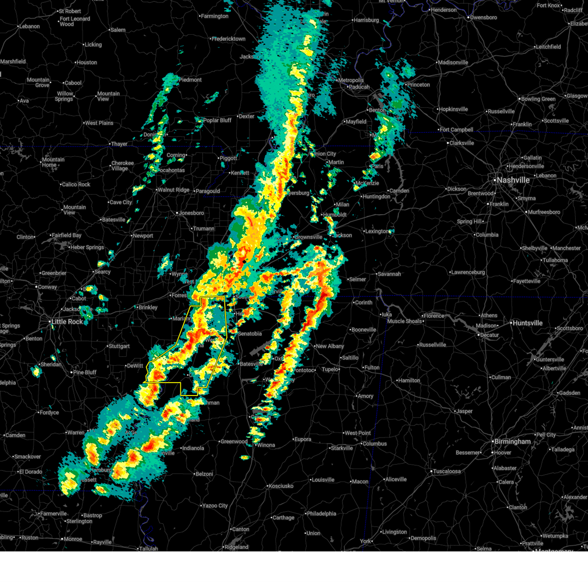
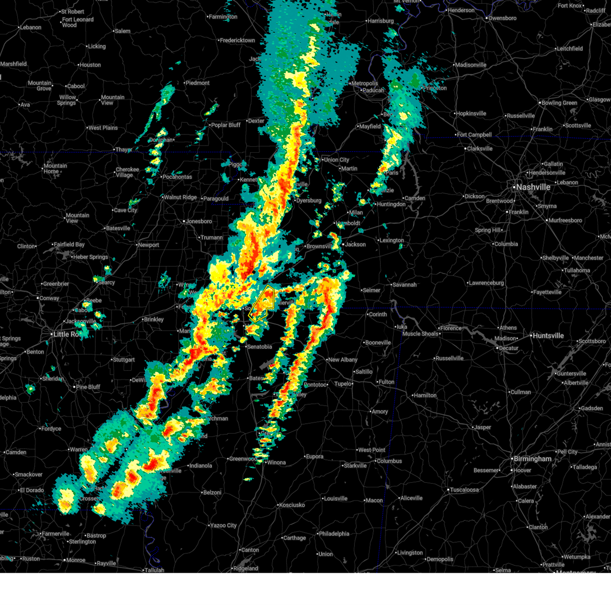
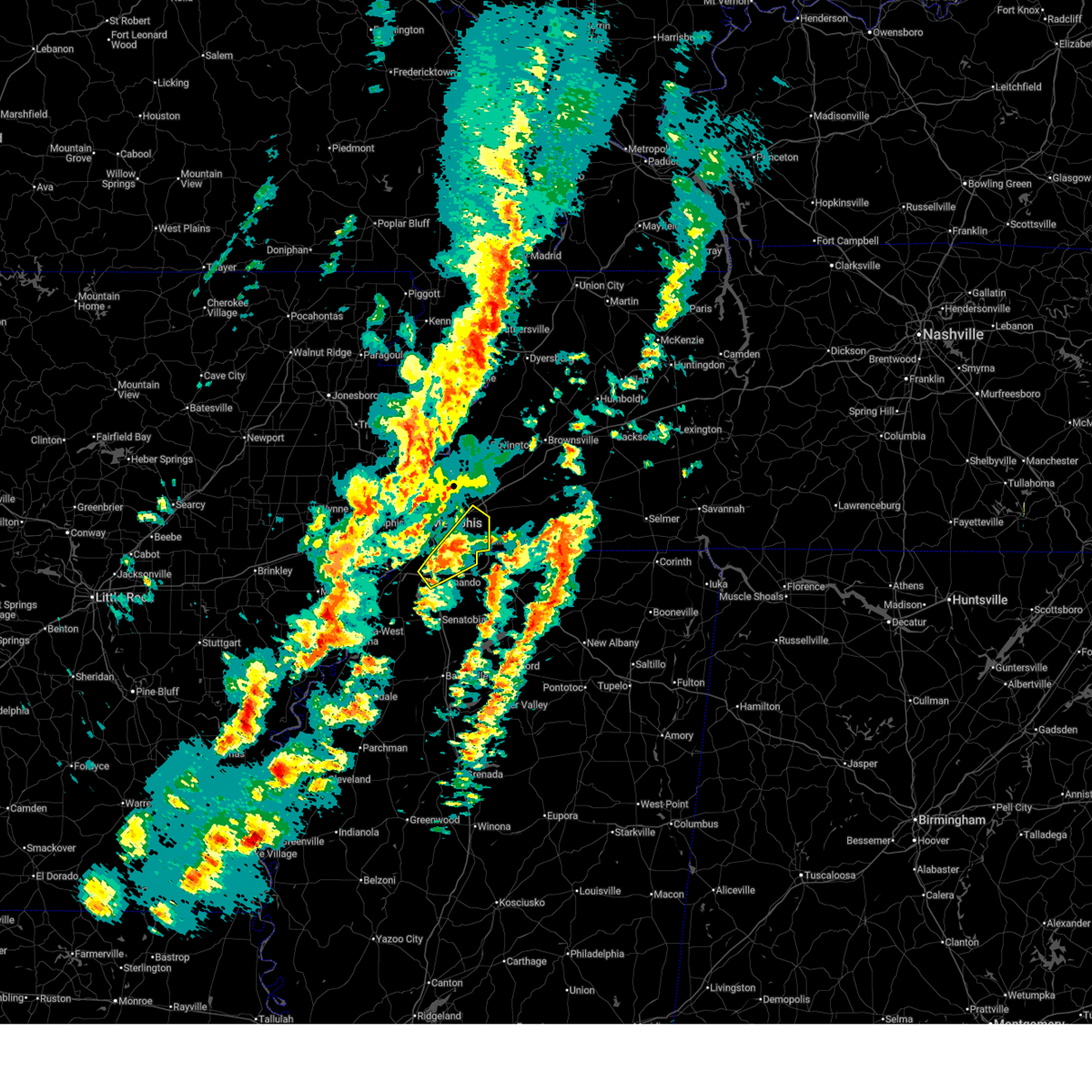
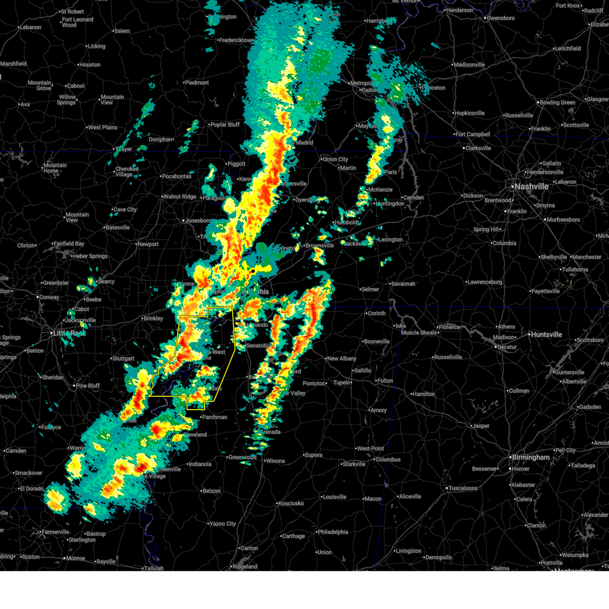
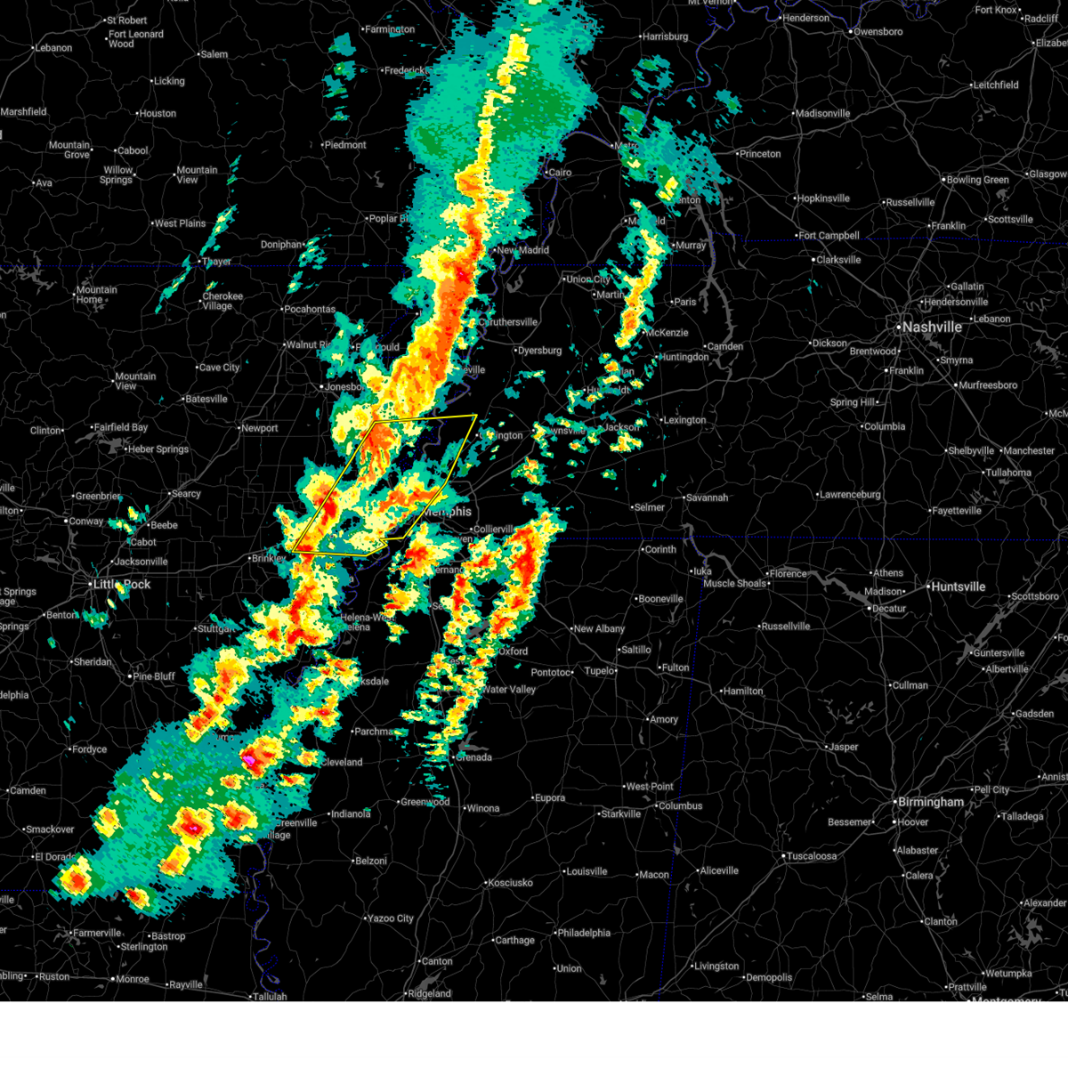
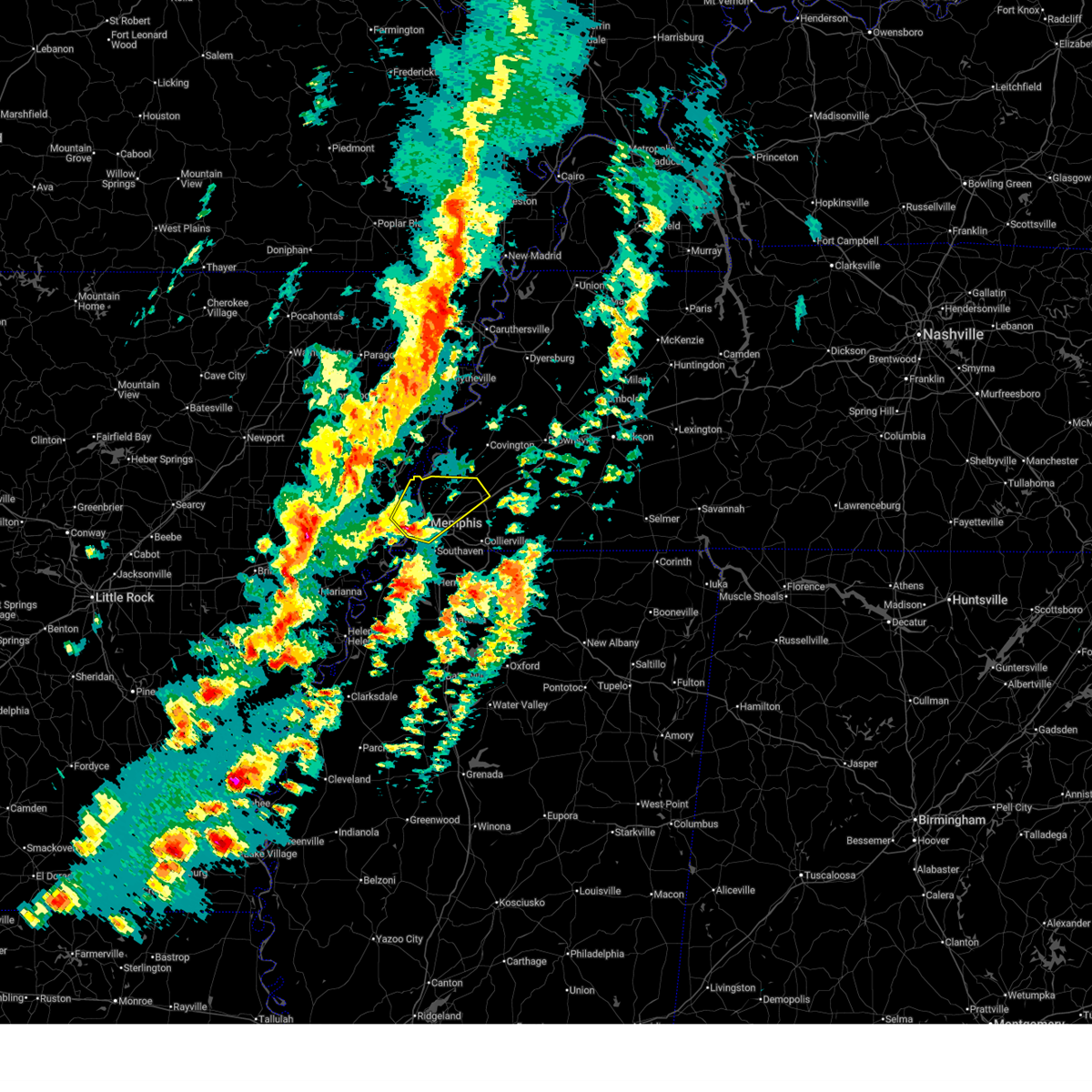
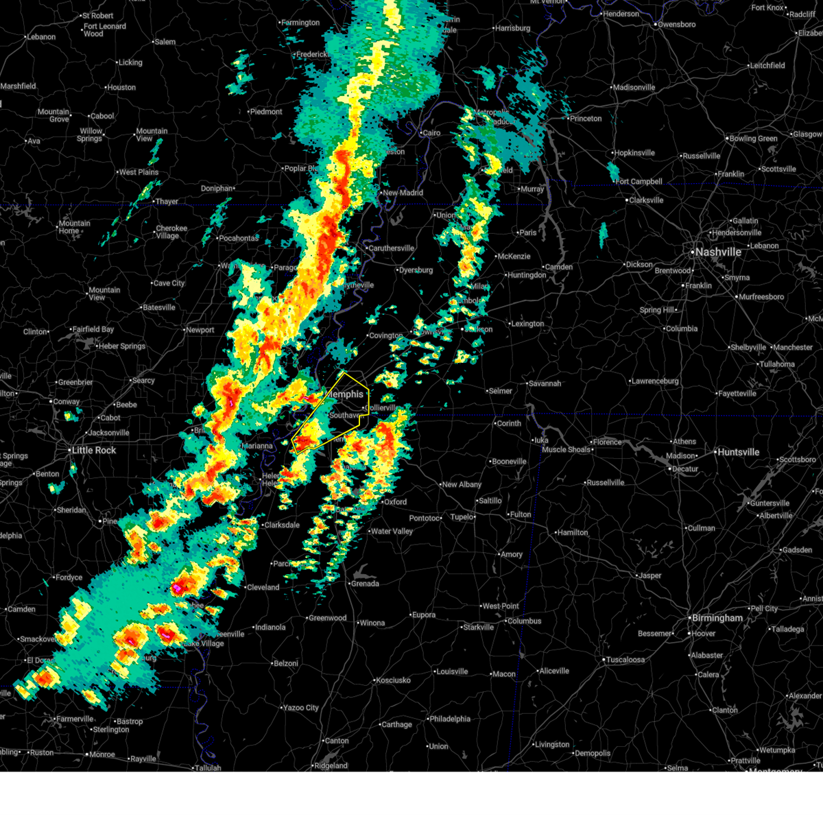
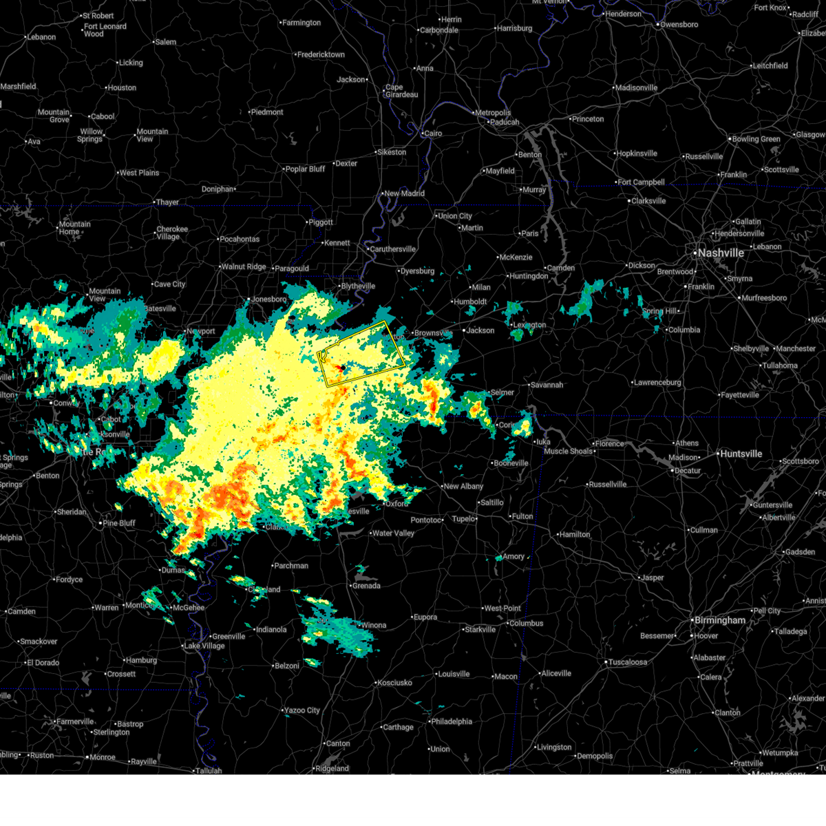
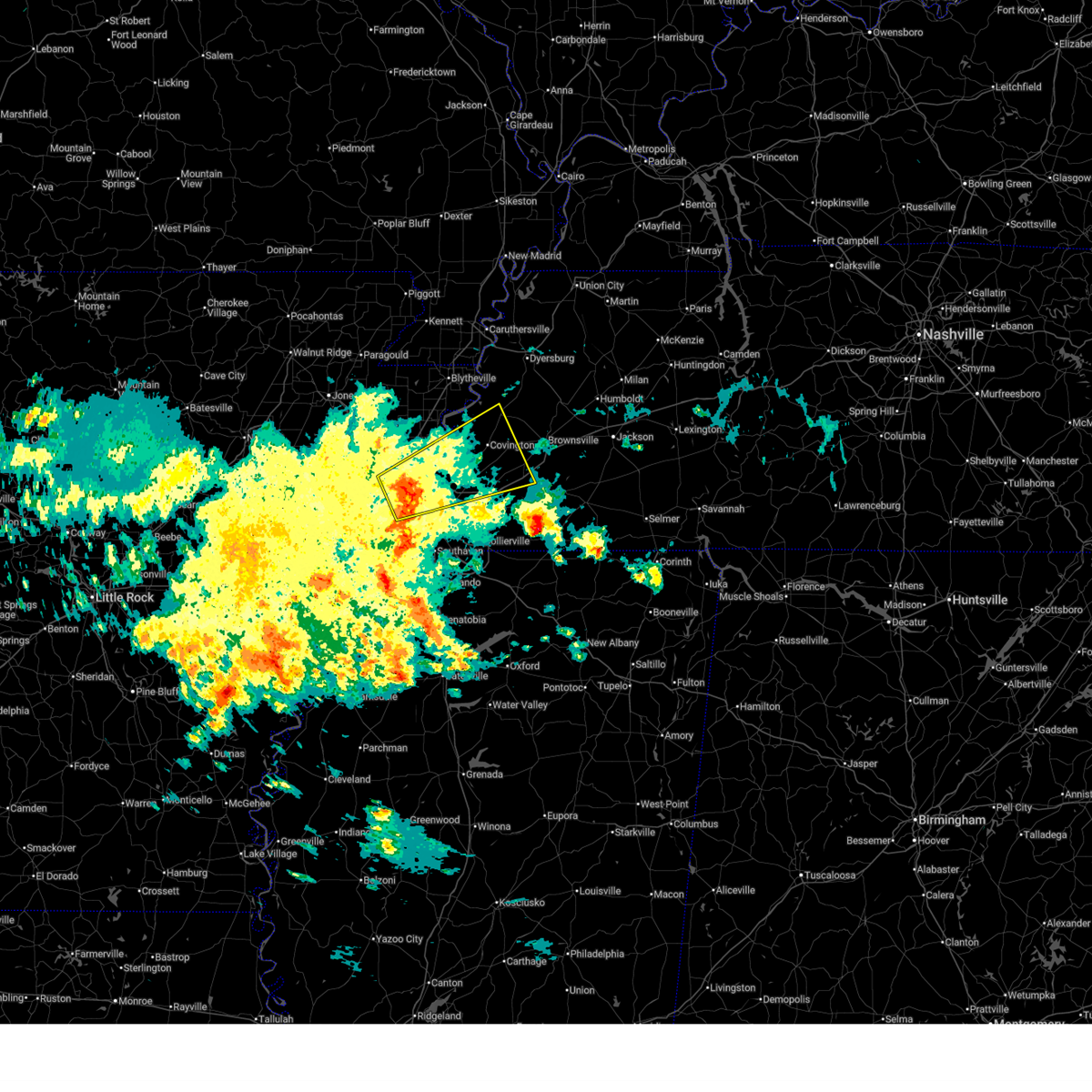
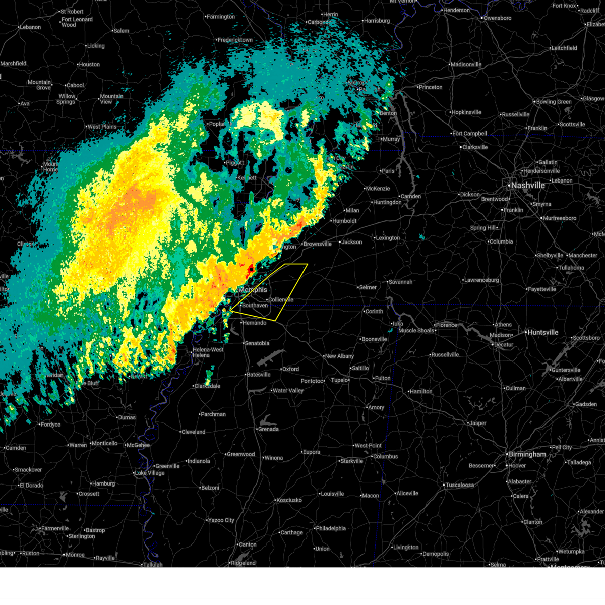
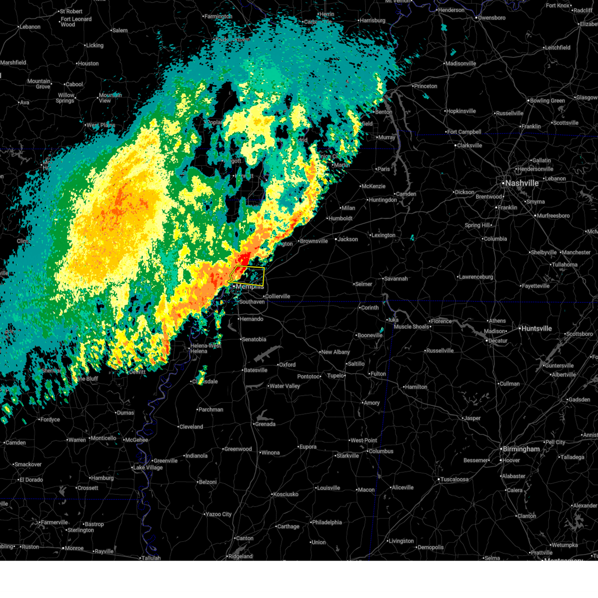
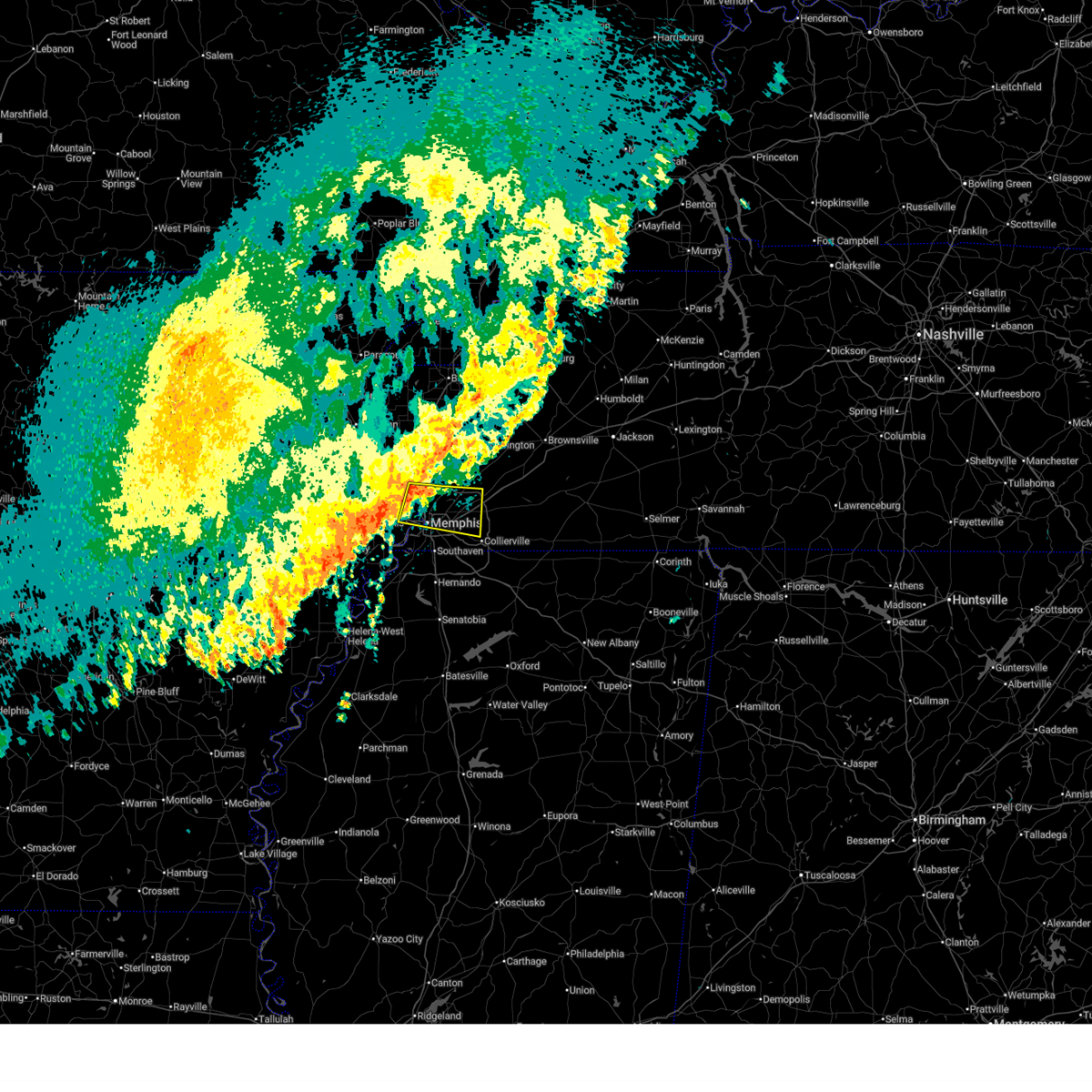
Hail Map for Memphis, TN
The Memphis, TN area has had 50 reports of on-the-ground hail by trained spotters, and has been under severe weather warnings 77 times during the past 12 months. Doppler radar has detected hail at or near Memphis, TN on 172 occasions, including 8 occasions during the past year.
| Name: | Memphis, TN |
| Where Located: | 10.3 miles E of Memphis, TN |
| Map: | Google Map for Memphis, TN |
| Population: | 646889 |
| Housing Units: | 291883 |
| More Info: | Search Google for Memphis, TN |
1
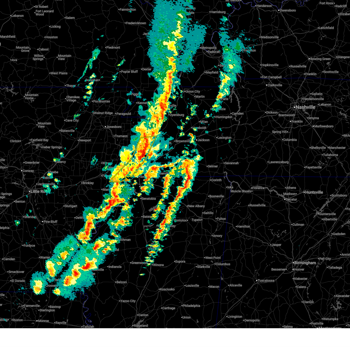
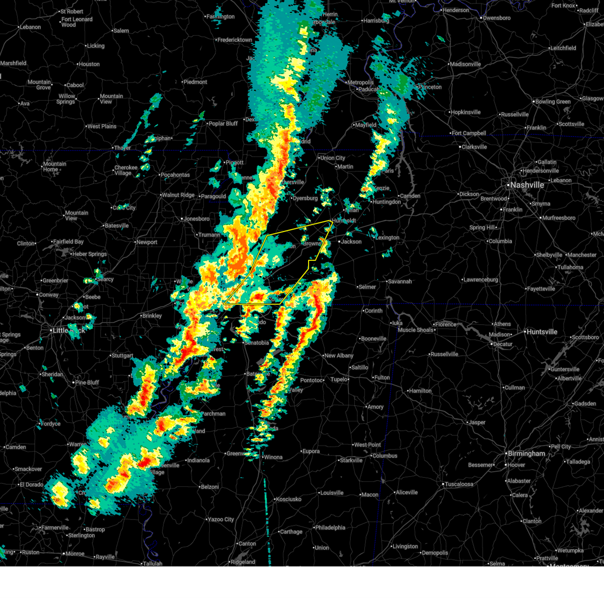
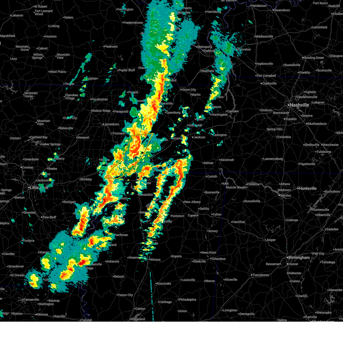
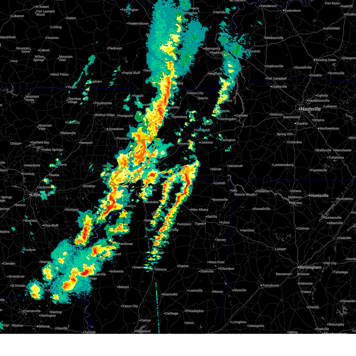
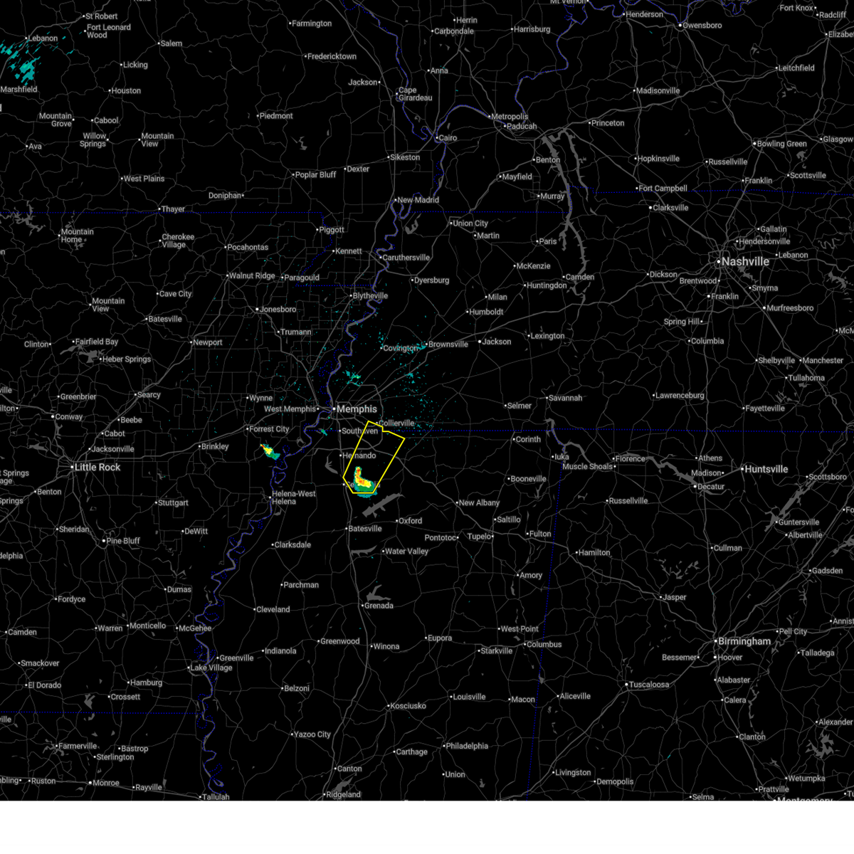
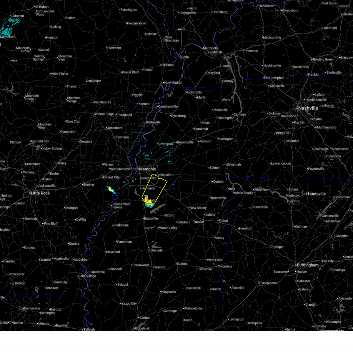
The Top Recent Hail Date for Memphis, TN is Monday, June 1, 2026 (48th out of 172)
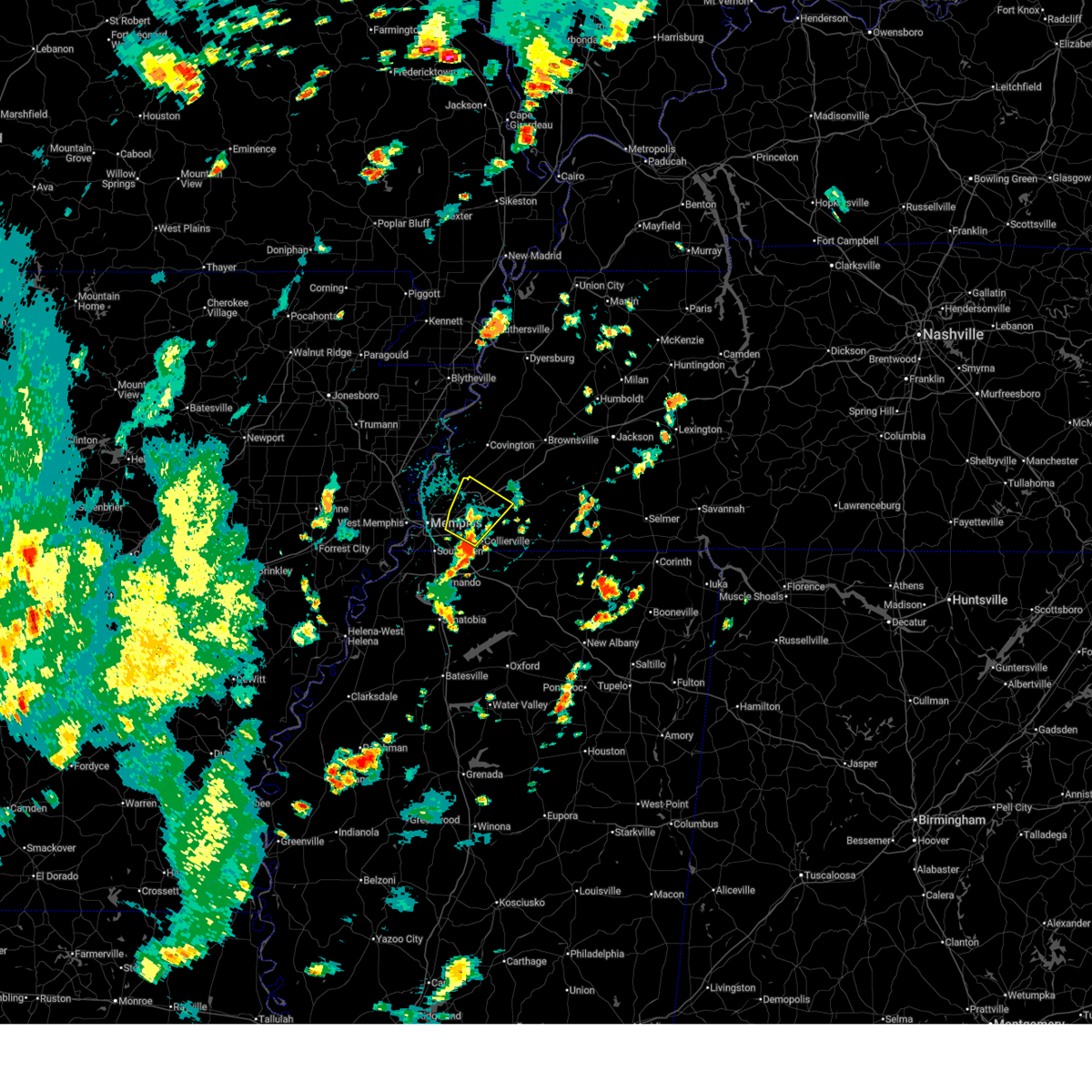
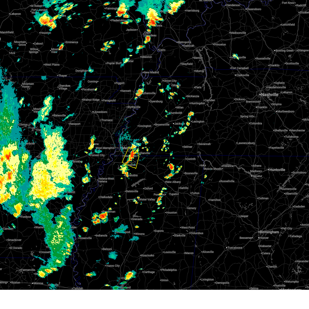
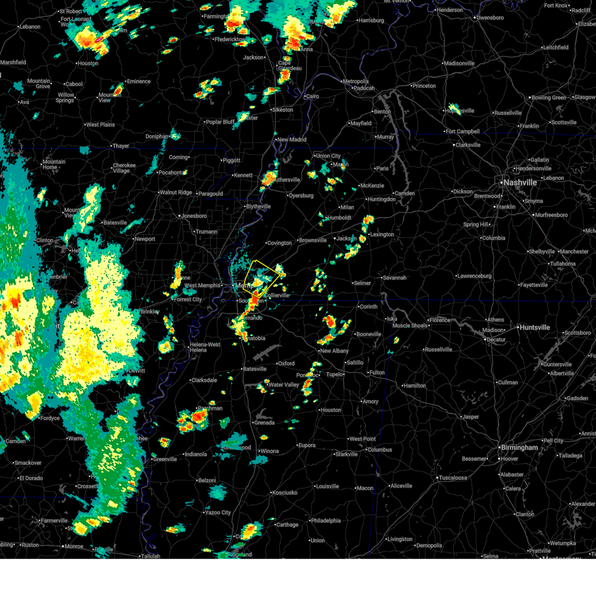
Hail and Wind Damage Spotted near Memphis, TN
| Date / Time | Report Details |
|---|---|
| 7/4/2026 3:54 PM CDT |
 The storm which prompted the warning has moved out of the area. therefore, the warning will be allowed to expire. however, gusty winds and heavy rain are still possible with this thunderstorm. The storm which prompted the warning has moved out of the area. therefore, the warning will be allowed to expire. however, gusty winds and heavy rain are still possible with this thunderstorm.
|
| 7/4/2026 3:45 PM CDT |
 Svrmeg the national weather service in memphis has issued a * severe thunderstorm warning for, northeastern desoto county in northwestern mississippi, northwestern marshall county in northwestern mississippi, southeastern shelby county in west tennessee, * until 430 pm cdt. * at 345 pm cdt, a severe thunderstorm was located near olive branch, and is nearly stationary (radar indicated). Hazards include 60 mph wind gusts. expect damage to roofs, siding, and trees Svrmeg the national weather service in memphis has issued a * severe thunderstorm warning for, northeastern desoto county in northwestern mississippi, northwestern marshall county in northwestern mississippi, southeastern shelby county in west tennessee, * until 430 pm cdt. * at 345 pm cdt, a severe thunderstorm was located near olive branch, and is nearly stationary (radar indicated). Hazards include 60 mph wind gusts. expect damage to roofs, siding, and trees
|
| 7/4/2026 3:40 PM CDT |
 At 340 pm cdt, a severe thunderstorm was located over cordova, moving northeast at 5 mph (radar indicated). Hazards include 60 mph wind gusts and nickel size hail. Expect damage to roofs, siding, and trees. locations impacted include, bartlett, collierville, germantown, cordova, memphis, lakeland, arlington, eads, ellendale, oakland, gallaway, elmore park, brunswick, lenow, fisherville, barretville, canadaville, white station, redwood, and rosemark. this includes the following highways, interstate 40 in tennessee between mile markers 10 and 30. Interstate 240 between mile markers 12 and 16. At 340 pm cdt, a severe thunderstorm was located over cordova, moving northeast at 5 mph (radar indicated). Hazards include 60 mph wind gusts and nickel size hail. Expect damage to roofs, siding, and trees. locations impacted include, bartlett, collierville, germantown, cordova, memphis, lakeland, arlington, eads, ellendale, oakland, gallaway, elmore park, brunswick, lenow, fisherville, barretville, canadaville, white station, redwood, and rosemark. this includes the following highways, interstate 40 in tennessee between mile markers 10 and 30. Interstate 240 between mile markers 12 and 16.
|
| 7/4/2026 3:19 PM CDT |
 Svrmeg the national weather service in memphis has issued a * severe thunderstorm warning for, west central fayette county in west tennessee, eastern shelby county in west tennessee, * until 400 pm cdt. * at 319 pm cdt, a severe thunderstorm was located over cordova, moving northeast at 5 mph (radar indicated). Hazards include 60 mph wind gusts and nickel size hail. expect damage to roofs, siding, and trees Svrmeg the national weather service in memphis has issued a * severe thunderstorm warning for, west central fayette county in west tennessee, eastern shelby county in west tennessee, * until 400 pm cdt. * at 319 pm cdt, a severe thunderstorm was located over cordova, moving northeast at 5 mph (radar indicated). Hazards include 60 mph wind gusts and nickel size hail. expect damage to roofs, siding, and trees
|
| 6/22/2026 9:50 AM CDT |
 The storm which prompted the warning has weakened below severe limits, and has exited the warned area. therefore, the warning will be allowed to expire. however, gusty winds and heavy rain are still possible with this thunderstorm. The storm which prompted the warning has weakened below severe limits, and has exited the warned area. therefore, the warning will be allowed to expire. however, gusty winds and heavy rain are still possible with this thunderstorm.
|
| 6/22/2026 9:32 AM CDT |
 At 932 am cdt, a severe thunderstorm was located over downtown memphis, or 8 miles northeast of t o fuller state park, moving northeast at 50 mph (radar indicated). Hazards include 60 mph wind gusts. Expect damage to roofs, siding, and trees. locations impacted include, bartlett, southaven, collierville, germantown, olive branch, west memphis, marion, millington, t o fuller state park, meeman shelby forest state park, cordova, memphis, lakeland, arlington, crawfordsville, edmondson, sunset, gilmore, anthonyville, and jericho. this includes the following highways, interstate 40 in arkansas between mile markers 265 and 284. interstate 40 in tennessee between mile markers 1 and 26. interstate 240 between mile markers 12 and 30. interstate 55 in arkansas between mile markers 1 and 28. interstate 55 in tennessee between mile markers 1 and 12. Interstate 55 in mississippi near mile marker 292. At 932 am cdt, a severe thunderstorm was located over downtown memphis, or 8 miles northeast of t o fuller state park, moving northeast at 50 mph (radar indicated). Hazards include 60 mph wind gusts. Expect damage to roofs, siding, and trees. locations impacted include, bartlett, southaven, collierville, germantown, olive branch, west memphis, marion, millington, t o fuller state park, meeman shelby forest state park, cordova, memphis, lakeland, arlington, crawfordsville, edmondson, sunset, gilmore, anthonyville, and jericho. this includes the following highways, interstate 40 in arkansas between mile markers 265 and 284. interstate 40 in tennessee between mile markers 1 and 26. interstate 240 between mile markers 12 and 30. interstate 55 in arkansas between mile markers 1 and 28. interstate 55 in tennessee between mile markers 1 and 12. Interstate 55 in mississippi near mile marker 292.
|
| 6/22/2026 9:12 AM CDT |
 Svrmeg the national weather service in memphis has issued a * severe thunderstorm warning for, eastern st. francis county in eastern arkansas, crittenden county in eastern arkansas, desoto county in northwestern mississippi, shelby county in west tennessee, * until 1000 am cdt. * at 912 am cdt, a severe thunderstorm was located near pinckney, or 9 miles southwest of t o fuller state park, moving northeast at 50 mph (radar indicated). Hazards include 60 mph wind gusts. expect damage to roofs, siding, and trees Svrmeg the national weather service in memphis has issued a * severe thunderstorm warning for, eastern st. francis county in eastern arkansas, crittenden county in eastern arkansas, desoto county in northwestern mississippi, shelby county in west tennessee, * until 1000 am cdt. * at 912 am cdt, a severe thunderstorm was located near pinckney, or 9 miles southwest of t o fuller state park, moving northeast at 50 mph (radar indicated). Hazards include 60 mph wind gusts. expect damage to roofs, siding, and trees
|
| 6/13/2026 7:11 PM CDT |
 The storm which prompted the warning has weakened below severe limits, and no longer poses an immediate threat to life or property. therefore, the warning will be allowed to expire. The storm which prompted the warning has weakened below severe limits, and no longer poses an immediate threat to life or property. therefore, the warning will be allowed to expire.
|
| 6/13/2026 6:42 PM CDT |
 At 641 pm cdt, a severe thunderstorm was located over whitehaven, or near horn lake, moving southeast at 30 mph (radar indicated). Hazards include 60 mph wind gusts and nickel size hail. Expect damage to roofs, siding, and trees. locations impacted include, southaven, olive branch, horn lake, hernando, memphis, southwest memphis, lynchburg, whitehaven, alden, fairhaven, twin lakes, cedarview, nesbit, west days, capleville, lake view, jago, and plum point. this includes the following highways, interstate 22 in mississipppi between mile markers 1 and 6. interstate 240 between mile markers 22 and 27. interstate 55 in tennessee between mile markers 1 and 8. Interstate 55 in mississippi between mile markers 281 and 292. At 641 pm cdt, a severe thunderstorm was located over whitehaven, or near horn lake, moving southeast at 30 mph (radar indicated). Hazards include 60 mph wind gusts and nickel size hail. Expect damage to roofs, siding, and trees. locations impacted include, southaven, olive branch, horn lake, hernando, memphis, southwest memphis, lynchburg, whitehaven, alden, fairhaven, twin lakes, cedarview, nesbit, west days, capleville, lake view, jago, and plum point. this includes the following highways, interstate 22 in mississipppi between mile markers 1 and 6. interstate 240 between mile markers 22 and 27. interstate 55 in tennessee between mile markers 1 and 8. Interstate 55 in mississippi between mile markers 281 and 292.
|
| 6/13/2026 6:24 PM CDT |
 Svrmeg the national weather service in memphis has issued a * severe thunderstorm warning for, east central crittenden county in eastern arkansas, northeastern desoto county in northwestern mississippi, southwestern shelby county in west tennessee, * until 715 pm cdt. * at 624 pm cdt, a severe thunderstorm was located over t o fuller state park, moving southeast at 30 mph (radar indicated). Hazards include 60 mph wind gusts and nickel size hail. expect damage to roofs, siding, and trees Svrmeg the national weather service in memphis has issued a * severe thunderstorm warning for, east central crittenden county in eastern arkansas, northeastern desoto county in northwestern mississippi, southwestern shelby county in west tennessee, * until 715 pm cdt. * at 624 pm cdt, a severe thunderstorm was located over t o fuller state park, moving southeast at 30 mph (radar indicated). Hazards include 60 mph wind gusts and nickel size hail. expect damage to roofs, siding, and trees
|
| 6/1/2026 10:07 PM CDT |
 At 1007 pm cdt, a severe thunderstorm was located over walls, or 7 miles southwest of t o fuller state park, moving southeast at 25 mph (radar indicated). Hazards include 60 mph wind gusts and quarter size hail. Hail damage to vehicles is expected. expect wind damage to roofs, siding, and trees. locations impacted include, southaven, west memphis, horn lake, hernando, hughes, memphis, walls, edmondson, horseshoe lake, anthonyville, lake cormorant, simsboro, eudora, pinckney, lynchburg, robinsonville, crittenden, clack, trinity, and browns. this includes the following highways, interstate 40 in arkansas between mile markers 273 and 275. Interstate 55 in mississippi between mile markers 283 and 287. At 1007 pm cdt, a severe thunderstorm was located over walls, or 7 miles southwest of t o fuller state park, moving southeast at 25 mph (radar indicated). Hazards include 60 mph wind gusts and quarter size hail. Hail damage to vehicles is expected. expect wind damage to roofs, siding, and trees. locations impacted include, southaven, west memphis, horn lake, hernando, hughes, memphis, walls, edmondson, horseshoe lake, anthonyville, lake cormorant, simsboro, eudora, pinckney, lynchburg, robinsonville, crittenden, clack, trinity, and browns. this includes the following highways, interstate 40 in arkansas between mile markers 273 and 275. Interstate 55 in mississippi between mile markers 283 and 287.
|
| 6/1/2026 9:45 PM CDT |
 Svrmeg the national weather service in memphis has issued a * severe thunderstorm warning for, eastern lee county in eastern arkansas, southeastern st. francis county in eastern arkansas, southwestern crittenden county in eastern arkansas, western desoto county in northwestern mississippi, northern tunica county in northwestern mississippi, southwestern shelby county in west tennessee, * until 1030 pm cdt. * at 945 pm cdt, a severe thunderstorm was located near anthonyville, or 8 miles southwest of west memphis, moving southeast at 25 mph (radar indicated). Hazards include 60 mph wind gusts and quarter size hail. Hail damage to vehicles is expected. Expect wind damage to roofs, siding, and trees. Svrmeg the national weather service in memphis has issued a * severe thunderstorm warning for, eastern lee county in eastern arkansas, southeastern st. francis county in eastern arkansas, southwestern crittenden county in eastern arkansas, western desoto county in northwestern mississippi, northern tunica county in northwestern mississippi, southwestern shelby county in west tennessee, * until 1030 pm cdt. * at 945 pm cdt, a severe thunderstorm was located near anthonyville, or 8 miles southwest of west memphis, moving southeast at 25 mph (radar indicated). Hazards include 60 mph wind gusts and quarter size hail. Hail damage to vehicles is expected. Expect wind damage to roofs, siding, and trees.
|
| 6/1/2026 6:23 PM CDT |
 At 623 pm cdt, a severe thunderstorm was located over olive branch, moving southeast at 5 mph (radar indicated). Hazards include 60 mph wind gusts and nickel size hail. Expect damage to roofs, siding, and trees. locations impacted include, southaven, collierville, germantown, olive branch, memphis, byhalia, mt pleasant, lewisburg, red banks, slayden, piperton, coal oil corner, cayce, fairhaven, victoria, cedarview, handy corner, taska, capleville, and miller. This includes interstate 22 in mississipppi between mile markers 1 and 23. At 623 pm cdt, a severe thunderstorm was located over olive branch, moving southeast at 5 mph (radar indicated). Hazards include 60 mph wind gusts and nickel size hail. Expect damage to roofs, siding, and trees. locations impacted include, southaven, collierville, germantown, olive branch, memphis, byhalia, mt pleasant, lewisburg, red banks, slayden, piperton, coal oil corner, cayce, fairhaven, victoria, cedarview, handy corner, taska, capleville, and miller. This includes interstate 22 in mississipppi between mile markers 1 and 23.
|
| 6/1/2026 6:05 PM CDT |
 Svrmeg the national weather service in memphis has issued a * severe thunderstorm warning for, northeastern desoto county in northwestern mississippi, northwestern marshall county in northwestern mississippi, southwestern fayette county in west tennessee, southeastern shelby county in west tennessee, * until 645 pm cdt. * at 605 pm cdt, a severe thunderstorm was located near olive branch, moving southeast at 15 mph (radar indicated). Hazards include 60 mph wind gusts and quarter size hail. Hail damage to vehicles is expected. Expect wind damage to roofs, siding, and trees. Svrmeg the national weather service in memphis has issued a * severe thunderstorm warning for, northeastern desoto county in northwestern mississippi, northwestern marshall county in northwestern mississippi, southwestern fayette county in west tennessee, southeastern shelby county in west tennessee, * until 645 pm cdt. * at 605 pm cdt, a severe thunderstorm was located near olive branch, moving southeast at 15 mph (radar indicated). Hazards include 60 mph wind gusts and quarter size hail. Hail damage to vehicles is expected. Expect wind damage to roofs, siding, and trees.
|
| 4/28/2026 9:16 PM CDT |
 At 915 pm cdt, a severe thunderstorm was located over southaven, moving east at 35 mph (radar indicated). Hazards include 60 mph wind gusts. Expect damage to roofs, siding, and trees. locations impacted include, southaven, collierville, olive branch, horn lake, hernando, memphis, byhalia, walls, lake cormorant, lynchburg, whitehaven, lewisburg, newport, cockrum, cedarview, bright, nesbit, handy corner, capleville, and glover. this includes the following highways, interstate 22 in mississipppi between mile markers 1 and 14. interstate 55 in tennessee between mile markers 1 and 4. Interstate 55 in mississippi between mile markers 280 and 292. At 915 pm cdt, a severe thunderstorm was located over southaven, moving east at 35 mph (radar indicated). Hazards include 60 mph wind gusts. Expect damage to roofs, siding, and trees. locations impacted include, southaven, collierville, olive branch, horn lake, hernando, memphis, byhalia, walls, lake cormorant, lynchburg, whitehaven, lewisburg, newport, cockrum, cedarview, bright, nesbit, handy corner, capleville, and glover. this includes the following highways, interstate 22 in mississipppi between mile markers 1 and 14. interstate 55 in tennessee between mile markers 1 and 4. Interstate 55 in mississippi between mile markers 280 and 292.
|
| 4/28/2026 9:16 PM CDT |
 the severe thunderstorm warning has been cancelled and is no longer in effect the severe thunderstorm warning has been cancelled and is no longer in effect
|
| 4/28/2026 8:49 PM CDT |
 Svrmeg the national weather service in memphis has issued a * severe thunderstorm warning for, south central crittenden county in eastern arkansas, desoto county in northwestern mississippi, northwestern marshall county in northwestern mississippi, southern shelby county in west tennessee, * until 930 pm cdt. * at 849 pm cdt, a severe thunderstorm was located over pinckney, or 10 miles southwest of t o fuller state park, moving east at 35 mph (radar indicated). Hazards include 60 mph wind gusts. expect damage to roofs, siding, and trees Svrmeg the national weather service in memphis has issued a * severe thunderstorm warning for, south central crittenden county in eastern arkansas, desoto county in northwestern mississippi, northwestern marshall county in northwestern mississippi, southern shelby county in west tennessee, * until 930 pm cdt. * at 849 pm cdt, a severe thunderstorm was located over pinckney, or 10 miles southwest of t o fuller state park, moving east at 35 mph (radar indicated). Hazards include 60 mph wind gusts. expect damage to roofs, siding, and trees
|
| 4/28/2026 4:50 PM CDT |
 At 449 pm cdt, a severe thunderstorm was located over canaan, or 17 miles northwest of ripley, moving east at 45 mph (radar indicated). Hazards include 60 mph wind gusts and quarter size hail. Hail damage to vehicles is expected. expect wind damage to roofs, siding, and trees. locations impacted include, holly springs, bolivar, ripley, chickasaw state forest, big hill pond state park, chickasaw state park, lamar, lakeland, arlington, whiteville, somerville, snow lake shores, silerton, mt pleasant, theo, michigan city, red banks, canaan, pocahontas, and lagrange. this includes the following highways, interstate 40 in tennessee between mile markers 21 and 42. Interstate 22 in mississipppi between mile markers 21 and 32. At 449 pm cdt, a severe thunderstorm was located over canaan, or 17 miles northwest of ripley, moving east at 45 mph (radar indicated). Hazards include 60 mph wind gusts and quarter size hail. Hail damage to vehicles is expected. expect wind damage to roofs, siding, and trees. locations impacted include, holly springs, bolivar, ripley, chickasaw state forest, big hill pond state park, chickasaw state park, lamar, lakeland, arlington, whiteville, somerville, snow lake shores, silerton, mt pleasant, theo, michigan city, red banks, canaan, pocahontas, and lagrange. this includes the following highways, interstate 40 in tennessee between mile markers 21 and 42. Interstate 22 in mississipppi between mile markers 21 and 32.
|
| 4/28/2026 4:38 PM CDT |
 Svrmeg the national weather service in memphis has issued a * severe thunderstorm warning for, northeastern desoto county in northwestern mississippi, northern marshall county in northwestern mississippi, tippah county in northeastern mississippi, benton county in northeastern mississippi, western alcorn county in northeastern mississippi, fayette county in west tennessee, hardeman county in west tennessee, southwestern mcnairy county in west tennessee, southeastern shelby county in west tennessee, southwestern chester county in west tennessee, * until 530 pm cdt. * at 438 pm cdt, a severe thunderstorm was located over lamar, or 11 miles northeast of holly springs, moving east at 45 mph (radar indicated). Hazards include 60 mph wind gusts and quarter size hail. Hail damage to vehicles is expected. Expect wind damage to roofs, siding, and trees. Svrmeg the national weather service in memphis has issued a * severe thunderstorm warning for, northeastern desoto county in northwestern mississippi, northern marshall county in northwestern mississippi, tippah county in northeastern mississippi, benton county in northeastern mississippi, western alcorn county in northeastern mississippi, fayette county in west tennessee, hardeman county in west tennessee, southwestern mcnairy county in west tennessee, southeastern shelby county in west tennessee, southwestern chester county in west tennessee, * until 530 pm cdt. * at 438 pm cdt, a severe thunderstorm was located over lamar, or 11 miles northeast of holly springs, moving east at 45 mph (radar indicated). Hazards include 60 mph wind gusts and quarter size hail. Hail damage to vehicles is expected. Expect wind damage to roofs, siding, and trees.
|
| 4/28/2026 4:18 PM CDT |
 At 417 pm cdt, a severe thunderstorm was located near dixonville, or near millington, moving east at 40 mph (radar indicated). Hazards include 60 mph wind gusts and penny size hail. Expect damage to roofs, siding, and trees. locations impacted include, bartlett, west memphis, marion, millington, covington, ripley, osceola, luxora, wilson, keiser, meeman shelby forest state park, fort pillow state park, memphis, lakeland, arlington, munford, brighton, bassett, marie, and dixonville. this includes the following highways, interstate 40 in arkansas between mile markers 279 and 284. interstate 40 in tennessee between mile markers 1 and 10, and between mile markers 13 and 35. Interstate 55 in arkansas between mile markers 3 and 4, and between mile markers 39 and 51. At 417 pm cdt, a severe thunderstorm was located near dixonville, or near millington, moving east at 40 mph (radar indicated). Hazards include 60 mph wind gusts and penny size hail. Expect damage to roofs, siding, and trees. locations impacted include, bartlett, west memphis, marion, millington, covington, ripley, osceola, luxora, wilson, keiser, meeman shelby forest state park, fort pillow state park, memphis, lakeland, arlington, munford, brighton, bassett, marie, and dixonville. this includes the following highways, interstate 40 in arkansas between mile markers 279 and 284. interstate 40 in tennessee between mile markers 1 and 10, and between mile markers 13 and 35. Interstate 55 in arkansas between mile markers 3 and 4, and between mile markers 39 and 51.
|
| 4/28/2026 4:15 PM CDT |
 At 415 pm cdt, severe thunderstorms were located along a line extending from arlington to near slayden to near holly springs, moving northeast at 45 mph (radar indicated). Hazards include 60 mph wind gusts and quarter size hail. Hail damage to vehicles is expected. expect wind damage to roofs, siding, and trees. locations impacted include, holly springs, bolivar, lamar, lakeland, arlington, whiteville, somerville, snow lake shores, mt pleasant, michigan city, red banks, canaan, lagrange, eads, slayden, warren, macon, oakland, piperton, and walnut. this includes the following highways, interstate 40 in tennessee between mile markers 21 and 43. Interstate 22 in mississipppi between mile markers 19 and 33. At 415 pm cdt, severe thunderstorms were located along a line extending from arlington to near slayden to near holly springs, moving northeast at 45 mph (radar indicated). Hazards include 60 mph wind gusts and quarter size hail. Hail damage to vehicles is expected. expect wind damage to roofs, siding, and trees. locations impacted include, holly springs, bolivar, lamar, lakeland, arlington, whiteville, somerville, snow lake shores, mt pleasant, michigan city, red banks, canaan, lagrange, eads, slayden, warren, macon, oakland, piperton, and walnut. this includes the following highways, interstate 40 in tennessee between mile markers 21 and 43. Interstate 22 in mississipppi between mile markers 19 and 33.
|
| 4/28/2026 3:59 PM CDT |
 At 359 pm cdt, a severe thunderstorm was located over jericho, or near marion, moving east at 40 mph (radar indicated). Hazards include 60 mph wind gusts and quarter size hail. Hail damage to vehicles is expected. expect wind damage to roofs, siding, and trees. locations impacted include, west memphis, marion, tyronza, meeman shelby forest state park, memphis, joiner, crawfordsville, sunset, gilmore, bassett, jericho, frayser, crittenden, turrell, clarkedale, birdsong, dimple, booker, deckerville, and menesha. this includes the following highways, interstate 40 in arkansas between mile markers 270 and 284. interstate 40 in tennessee between mile markers 1 and 5. Interstate 55 in arkansas between mile markers 3 and 34. At 359 pm cdt, a severe thunderstorm was located over jericho, or near marion, moving east at 40 mph (radar indicated). Hazards include 60 mph wind gusts and quarter size hail. Hail damage to vehicles is expected. expect wind damage to roofs, siding, and trees. locations impacted include, west memphis, marion, tyronza, meeman shelby forest state park, memphis, joiner, crawfordsville, sunset, gilmore, bassett, jericho, frayser, crittenden, turrell, clarkedale, birdsong, dimple, booker, deckerville, and menesha. this includes the following highways, interstate 40 in arkansas between mile markers 270 and 284. interstate 40 in tennessee between mile markers 1 and 5. Interstate 55 in arkansas between mile markers 3 and 34.
|
| 4/28/2026 3:59 PM CDT |
 Svrmeg the national weather service in memphis has issued a * severe thunderstorm warning for, northeastern desoto county in northwestern mississippi, marshall county in northwestern mississippi, northwestern tippah county in northeastern mississippi, benton county in northeastern mississippi, fayette county in west tennessee, western hardeman county in west tennessee, southeastern shelby county in west tennessee, * until 445 pm cdt. * at 359 pm cdt, severe thunderstorms were located along a line extending from near bartlett to 6 miles west of mt pleasant to near wall doxey state park, moving northeast at 45 mph (radar indicated). Hazards include 60 mph wind gusts and quarter size hail. Hail damage to vehicles is expected. Expect wind damage to roofs, siding, and trees. Svrmeg the national weather service in memphis has issued a * severe thunderstorm warning for, northeastern desoto county in northwestern mississippi, marshall county in northwestern mississippi, northwestern tippah county in northeastern mississippi, benton county in northeastern mississippi, fayette county in west tennessee, western hardeman county in west tennessee, southeastern shelby county in west tennessee, * until 445 pm cdt. * at 359 pm cdt, severe thunderstorms were located along a line extending from near bartlett to 6 miles west of mt pleasant to near wall doxey state park, moving northeast at 45 mph (radar indicated). Hazards include 60 mph wind gusts and quarter size hail. Hail damage to vehicles is expected. Expect wind damage to roofs, siding, and trees.
|
| 4/28/2026 3:56 PM CDT |
 Svrmeg the national weather service in memphis has issued a * severe thunderstorm warning for, southwestern mississippi county in eastern arkansas, northeastern crittenden county in eastern arkansas, tipton county in west tennessee, northwestern fayette county in west tennessee, southwestern lauderdale county in west tennessee, northern shelby county in west tennessee, * until 445 pm cdt. * at 355 pm cdt, a severe thunderstorm was located over joiner, or 9 miles southwest of wilson, moving east at 45 mph (radar indicated). Hazards include 60 mph wind gusts and nickel size hail. expect damage to roofs, siding, and trees Svrmeg the national weather service in memphis has issued a * severe thunderstorm warning for, southwestern mississippi county in eastern arkansas, northeastern crittenden county in eastern arkansas, tipton county in west tennessee, northwestern fayette county in west tennessee, southwestern lauderdale county in west tennessee, northern shelby county in west tennessee, * until 445 pm cdt. * at 355 pm cdt, a severe thunderstorm was located over joiner, or 9 miles southwest of wilson, moving east at 45 mph (radar indicated). Hazards include 60 mph wind gusts and nickel size hail. expect damage to roofs, siding, and trees
|
| 4/28/2026 3:50 PM CDT |
 the severe thunderstorm warning has been cancelled and is no longer in effect the severe thunderstorm warning has been cancelled and is no longer in effect
|
| 4/28/2026 3:50 PM CDT |
 At 349 pm cdt, a severe thunderstorm was located over crawfordsville, or near earle, moving east at 40 mph (radar indicated). Hazards include 60 mph wind gusts and quarter size hail. Hail damage to vehicles is expected. expect wind damage to roofs, siding, and trees. locations impacted include, west memphis, marion, earle, meeman shelby forest state park, memphis, joiner, crawfordsville, sunset, gilmore, jericho, jennette, frayser, crittenden, turrell, clarkedale, birdsong, three forks, dimple, booker, and deckerville. this includes the following highways, interstate 40 in arkansas between mile markers 265 and 284. interstate 40 in tennessee between mile markers 1 and 5. Interstate 55 in arkansas between mile markers 3 and 34. At 349 pm cdt, a severe thunderstorm was located over crawfordsville, or near earle, moving east at 40 mph (radar indicated). Hazards include 60 mph wind gusts and quarter size hail. Hail damage to vehicles is expected. expect wind damage to roofs, siding, and trees. locations impacted include, west memphis, marion, earle, meeman shelby forest state park, memphis, joiner, crawfordsville, sunset, gilmore, jericho, jennette, frayser, crittenden, turrell, clarkedale, birdsong, three forks, dimple, booker, and deckerville. this includes the following highways, interstate 40 in arkansas between mile markers 265 and 284. interstate 40 in tennessee between mile markers 1 and 5. Interstate 55 in arkansas between mile markers 3 and 34.
|
| 4/28/2026 3:29 PM CDT |
 Svrmeg the national weather service in memphis has issued a * severe thunderstorm warning for, northeastern st. francis county in eastern arkansas, southeastern poinsett county in eastern arkansas, southwestern mississippi county in eastern arkansas, crittenden county in eastern arkansas, eastern cross county in eastern arkansas, southwestern tipton county in west tennessee, northwestern shelby county in west tennessee, * until 415 pm cdt. * at 328 pm cdt, a severe thunderstorm was located near parkin, moving east at 40 mph (radar indicated). Hazards include 60 mph wind gusts and quarter size hail. Hail damage to vehicles is expected. Expect wind damage to roofs, siding, and trees. Svrmeg the national weather service in memphis has issued a * severe thunderstorm warning for, northeastern st. francis county in eastern arkansas, southeastern poinsett county in eastern arkansas, southwestern mississippi county in eastern arkansas, crittenden county in eastern arkansas, eastern cross county in eastern arkansas, southwestern tipton county in west tennessee, northwestern shelby county in west tennessee, * until 415 pm cdt. * at 328 pm cdt, a severe thunderstorm was located near parkin, moving east at 40 mph (radar indicated). Hazards include 60 mph wind gusts and quarter size hail. Hail damage to vehicles is expected. Expect wind damage to roofs, siding, and trees.
|
| 4/28/2026 3:38 AM CDT |
 At 338 am cdt, a severe thunderstorm was located over cordova, moving southeast at 25 mph (radar indicated). Hazards include 60 mph wind gusts and half dollar size hail. Hail damage to vehicles is expected. expect wind damage to roofs, siding, and trees. locations impacted include, collierville, germantown, cordova, memphis, lakeland, arlington, somerville, eads, warren, macon, oakland, piperton, rossville, lenow, fisherville, elba, canadaville, white station, kirk, and hickory withe. this includes the following highways, interstate 40 in tennessee between mile markers 24 and 29. Interstate 240 between mile markers 14 and 17. At 338 am cdt, a severe thunderstorm was located over cordova, moving southeast at 25 mph (radar indicated). Hazards include 60 mph wind gusts and half dollar size hail. Hail damage to vehicles is expected. expect wind damage to roofs, siding, and trees. locations impacted include, collierville, germantown, cordova, memphis, lakeland, arlington, somerville, eads, warren, macon, oakland, piperton, rossville, lenow, fisherville, elba, canadaville, white station, kirk, and hickory withe. this includes the following highways, interstate 40 in tennessee between mile markers 24 and 29. Interstate 240 between mile markers 14 and 17.
|
| 4/28/2026 3:27 AM CDT |
 Svrmeg the national weather service in memphis has issued a * severe thunderstorm warning for, southwestern fayette county in west tennessee, eastern shelby county in west tennessee, * until 415 am cdt. * at 327 am cdt, a severe thunderstorm was located over bartlett, moving southeast at 25 mph (radar indicated). Hazards include ping pong ball size hail and 60 mph wind gusts. People and animals outdoors will be injured. expect hail damage to roofs, siding, windows, and vehicles. Expect wind damage to roofs, siding, and trees. Svrmeg the national weather service in memphis has issued a * severe thunderstorm warning for, southwestern fayette county in west tennessee, eastern shelby county in west tennessee, * until 415 am cdt. * at 327 am cdt, a severe thunderstorm was located over bartlett, moving southeast at 25 mph (radar indicated). Hazards include ping pong ball size hail and 60 mph wind gusts. People and animals outdoors will be injured. expect hail damage to roofs, siding, windows, and vehicles. Expect wind damage to roofs, siding, and trees.
|
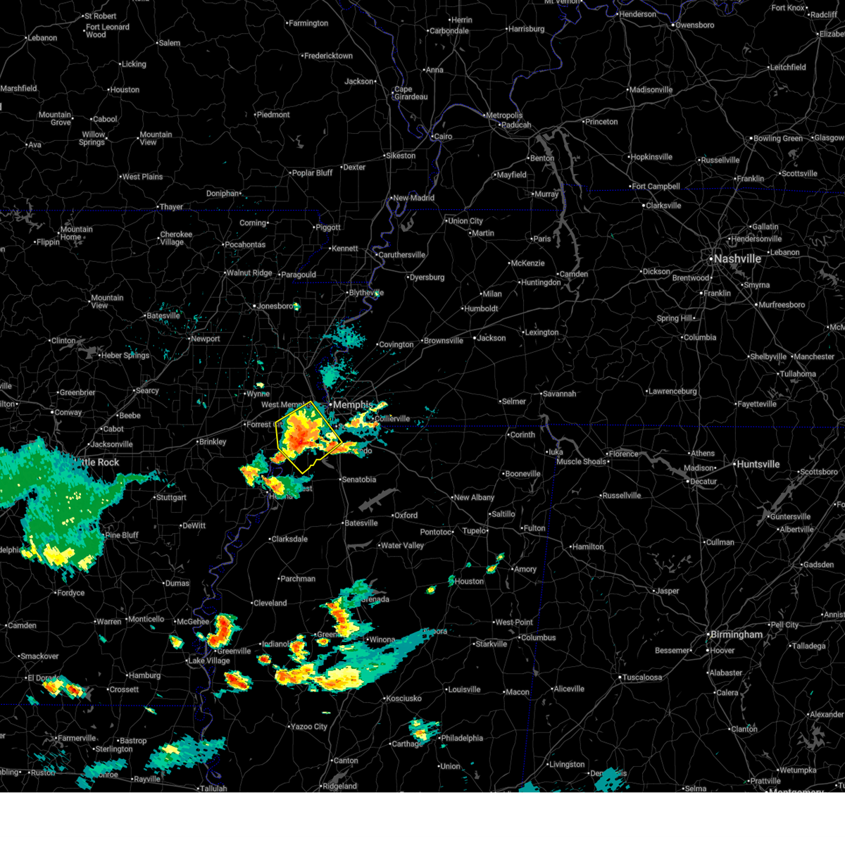
| 4/28/2026 3:20 AM CDT | Quarter sized hail reported 7 miles S of Memphis, TN |
| 4/28/2026 3:18 AM CDT |
 At 317 am cdt, a severe thunderstorm was located near lakeland, or near cordova, moving southeast at 20 mph (radar indicated). Hazards include 60 mph wind gusts and half dollar size hail. Hail damage to vehicles is expected. expect wind damage to roofs, siding, and trees. locations impacted include, bartlett, collierville, germantown, cordova, memphis, lakeland, arlington, ellendale, eads, frayser, midtown memphis, oakland, gallaway, lenow, hickory withe, elmore park, brunswick, fisherville, raleigh, and canadaville. this includes the following highways, interstate 40 in tennessee between mile markers 1 and 31. Interstate 240 between mile markers 12 and 18. At 317 am cdt, a severe thunderstorm was located near lakeland, or near cordova, moving southeast at 20 mph (radar indicated). Hazards include 60 mph wind gusts and half dollar size hail. Hail damage to vehicles is expected. expect wind damage to roofs, siding, and trees. locations impacted include, bartlett, collierville, germantown, cordova, memphis, lakeland, arlington, ellendale, eads, frayser, midtown memphis, oakland, gallaway, lenow, hickory withe, elmore park, brunswick, fisherville, raleigh, and canadaville. this includes the following highways, interstate 40 in tennessee between mile markers 1 and 31. Interstate 240 between mile markers 12 and 18.
|
| 4/28/2026 2:58 AM CDT |
 At 258 am cdt, a severe thunderstorm was located over ellendale, or near bartlett, moving southeast at 20 mph (radar indicated). Hazards include 60 mph wind gusts and half dollar size hail. Hail damage to vehicles is expected. expect wind damage to roofs, siding, and trees. locations impacted include, bartlett, collierville, germantown, millington, cordova, memphis, lakeland, arlington, ellendale, eads, frayser, midtown memphis, oakland, gallaway, lenow, barretville, woodstock, rosemark, hickory withe, and elmore park. this includes the following highways, interstate 40 in tennessee between mile markers 1 and 33. Interstate 240 between mile markers 12 and 18. At 258 am cdt, a severe thunderstorm was located over ellendale, or near bartlett, moving southeast at 20 mph (radar indicated). Hazards include 60 mph wind gusts and half dollar size hail. Hail damage to vehicles is expected. expect wind damage to roofs, siding, and trees. locations impacted include, bartlett, collierville, germantown, millington, cordova, memphis, lakeland, arlington, ellendale, eads, frayser, midtown memphis, oakland, gallaway, lenow, barretville, woodstock, rosemark, hickory withe, and elmore park. this includes the following highways, interstate 40 in tennessee between mile markers 1 and 33. Interstate 240 between mile markers 12 and 18.
|
| 4/28/2026 2:42 AM CDT |
 Svrmeg the national weather service in memphis has issued a * severe thunderstorm warning for, south central tipton county in west tennessee, northwestern fayette county in west tennessee, shelby county in west tennessee, * until 330 am cdt. * at 242 am cdt, a severe thunderstorm was located near millington, moving southeast at 20 mph (radar indicated). Hazards include 60 mph wind gusts and half dollar size hail. Hail damage to vehicles is expected. Expect wind damage to roofs, siding, and trees. Svrmeg the national weather service in memphis has issued a * severe thunderstorm warning for, south central tipton county in west tennessee, northwestern fayette county in west tennessee, shelby county in west tennessee, * until 330 am cdt. * at 242 am cdt, a severe thunderstorm was located near millington, moving southeast at 20 mph (radar indicated). Hazards include 60 mph wind gusts and half dollar size hail. Hail damage to vehicles is expected. Expect wind damage to roofs, siding, and trees.
|
| 4/28/2026 2:25 AM CDT |
 Svrmeg the national weather service in memphis has issued a * severe thunderstorm warning for, northeastern st. francis county in eastern arkansas, crittenden county in eastern arkansas, cross county in eastern arkansas, southwestern tipton county in west tennessee, central shelby county in west tennessee, * until 330 am cdt. * at 225 am cdt, a severe thunderstorm was located near wynne, moving east at 45 mph (radar indicated). Hazards include 60 mph wind gusts and quarter size hail. Hail damage to vehicles is expected. Expect wind damage to roofs, siding, and trees. Svrmeg the national weather service in memphis has issued a * severe thunderstorm warning for, northeastern st. francis county in eastern arkansas, crittenden county in eastern arkansas, cross county in eastern arkansas, southwestern tipton county in west tennessee, central shelby county in west tennessee, * until 330 am cdt. * at 225 am cdt, a severe thunderstorm was located near wynne, moving east at 45 mph (radar indicated). Hazards include 60 mph wind gusts and quarter size hail. Hail damage to vehicles is expected. Expect wind damage to roofs, siding, and trees.
|
| 3/15/2026 8:19 PM CDT |
 At 818 pm cdt, severe thunderstorms were located along a line extending from near parkers crossroads to near jacks creek to 7 miles southeast of bolivar, moving east at 105 mph (radar indicated). Hazards include 60 mph wind gusts and penny size hail. Expect damage to roofs, siding, and trees. locations impacted include, bartlett, collierville, germantown, brownsville, humboldt, cordova, memphis, lakeland, arlington, somerville, alamo, bells, nutbush, hillville, belle eagle, holly grove, southeast memphis, adair, eads, and dancyville. this includes the following highways, interstate 40 in tennessee between mile markers 15 and 71. Interstate 240 between mile markers 14 and 19. At 818 pm cdt, severe thunderstorms were located along a line extending from near parkers crossroads to near jacks creek to 7 miles southeast of bolivar, moving east at 105 mph (radar indicated). Hazards include 60 mph wind gusts and penny size hail. Expect damage to roofs, siding, and trees. locations impacted include, bartlett, collierville, germantown, brownsville, humboldt, cordova, memphis, lakeland, arlington, somerville, alamo, bells, nutbush, hillville, belle eagle, holly grove, southeast memphis, adair, eads, and dancyville. this includes the following highways, interstate 40 in tennessee between mile markers 15 and 71. Interstate 240 between mile markers 14 and 19.
|
| 3/15/2026 8:19 PM CDT |
 the severe thunderstorm warning has been cancelled and is no longer in effect the severe thunderstorm warning has been cancelled and is no longer in effect
|
| 3/15/2026 8:00 PM CDT |
 The storms which prompted the warning have moved out of the area. therefore, the warning will be allowed to expire. a tornado watch remains in effect until 1100 pm cdt for eastern arkansas, northwestern mississippi, and west tennessee. remember, a severe thunderstorm warning still remains in effect. The storms which prompted the warning have moved out of the area. therefore, the warning will be allowed to expire. a tornado watch remains in effect until 1100 pm cdt for eastern arkansas, northwestern mississippi, and west tennessee. remember, a severe thunderstorm warning still remains in effect.
|
| 3/15/2026 7:52 PM CDT |
 Svrmeg the national weather service in memphis has issued a * severe thunderstorm warning for, northwestern lafayette county in northwestern mississippi, desoto county in northwestern mississippi, marshall county in northwestern mississippi, eastern tunica county in northwestern mississippi, tate county in northwestern mississippi, northern quitman county in northwestern mississippi, northern panola county in northwestern mississippi, * until 830 pm cdt. * at 751 pm cdt, severe thunderstorms were located along a line extending from lynchburg to near strayhorn to 7 miles southeast of dundee, moving east at 60 mph (radar indicated). Hazards include 60 mph wind gusts and quarter size hail. Hail damage to vehicles is expected. Expect wind damage to roofs, siding, and trees. Svrmeg the national weather service in memphis has issued a * severe thunderstorm warning for, northwestern lafayette county in northwestern mississippi, desoto county in northwestern mississippi, marshall county in northwestern mississippi, eastern tunica county in northwestern mississippi, tate county in northwestern mississippi, northern quitman county in northwestern mississippi, northern panola county in northwestern mississippi, * until 830 pm cdt. * at 751 pm cdt, severe thunderstorms were located along a line extending from lynchburg to near strayhorn to 7 miles southeast of dundee, moving east at 60 mph (radar indicated). Hazards include 60 mph wind gusts and quarter size hail. Hail damage to vehicles is expected. Expect wind damage to roofs, siding, and trees.
|
| 3/15/2026 7:47 PM CDT |
 the severe thunderstorm warning has been cancelled and is no longer in effect the severe thunderstorm warning has been cancelled and is no longer in effect
|
| 3/15/2026 7:41 PM CDT | Trees down near overton squar in shelby county TN, 7 miles E of Memphis, TN |
| 3/15/2026 7:41 PM CDT |
 At 740 pm cdt, severe thunderstorms were located along a line extending from near pinckney to near dubbs to near crumrod, moving east at 45 mph (radar indicated). Hazards include 60 mph wind gusts and quarter size hail. Hail damage to vehicles is expected. expect wind damage to roofs, siding, and trees. Locations impacted include, clarksdale, elaine, st francis national park, helena-west helena, white river national wildlife refuge, marks, lambert, jonestown, friars point, walls, tunica, crenshaw, sledge, horseshoe lake, belen, lake cormorant, strayhorn, dubbs, north tunica, and crumrod. At 740 pm cdt, severe thunderstorms were located along a line extending from near pinckney to near dubbs to near crumrod, moving east at 45 mph (radar indicated). Hazards include 60 mph wind gusts and quarter size hail. Hail damage to vehicles is expected. expect wind damage to roofs, siding, and trees. Locations impacted include, clarksdale, elaine, st francis national park, helena-west helena, white river national wildlife refuge, marks, lambert, jonestown, friars point, walls, tunica, crenshaw, sledge, horseshoe lake, belen, lake cormorant, strayhorn, dubbs, north tunica, and crumrod.
|
| 3/15/2026 7:36 PM CDT |
 At 736 pm cdt, severe thunderstorms were located along a line extending from near ft pillow to near millington to near walls, moving east at 60 mph (radar indicated). Hazards include 70 mph wind gusts and nickel size hail. Expect considerable tree damage. damage is likely to mobile homes, roofs, and outbuildings. locations impacted include, bartlett, collierville, germantown, brownsville, millington, covington, humboldt, t o fuller state park, cordova, memphis, lakeland, arlington, munford, somerville, brighton, alamo, bells, southwest memphis, hillville, and whitehaven. this includes the following highways, interstate 40 in tennessee near mile marker 1, and between mile markers 4 and 71. interstate 240 between mile markers 12 and 30. Interstate 55 in tennessee between mile markers 1 and 12. At 736 pm cdt, severe thunderstorms were located along a line extending from near ft pillow to near millington to near walls, moving east at 60 mph (radar indicated). Hazards include 70 mph wind gusts and nickel size hail. Expect considerable tree damage. damage is likely to mobile homes, roofs, and outbuildings. locations impacted include, bartlett, collierville, germantown, brownsville, millington, covington, humboldt, t o fuller state park, cordova, memphis, lakeland, arlington, munford, somerville, brighton, alamo, bells, southwest memphis, hillville, and whitehaven. this includes the following highways, interstate 40 in tennessee near mile marker 1, and between mile markers 4 and 71. interstate 240 between mile markers 12 and 30. Interstate 55 in tennessee between mile markers 1 and 12.
|
| 3/15/2026 7:35 PM CDT |
 At 735 pm cdt, a severe thunderstorm was located over olive branch, moving northeast at 50 mph (radar indicated). Hazards include 60 mph wind gusts and quarter size hail. Hail damage to vehicles is expected. expect wind damage to roofs, siding, and trees. locations impacted include, southaven, collierville, germantown, olive branch, memphis, lakeland, piperton, lenow, fisherville, fairhaven, cedarview, handy corner, and miller. This includes interstate 22 in mississipppi between mile markers 1 and 9. At 735 pm cdt, a severe thunderstorm was located over olive branch, moving northeast at 50 mph (radar indicated). Hazards include 60 mph wind gusts and quarter size hail. Hail damage to vehicles is expected. expect wind damage to roofs, siding, and trees. locations impacted include, southaven, collierville, germantown, olive branch, memphis, lakeland, piperton, lenow, fisherville, fairhaven, cedarview, handy corner, and miller. This includes interstate 22 in mississipppi between mile markers 1 and 9.
|
| 3/15/2026 7:34 PM CDT |
 At 734 pm cdt, severe thunderstorms were located along a line extending from ft pillow to near millington to near pinckney, moving east at 45 mph (radar indicated). Hazards include 70 mph wind gusts and nickel size hail. Expect considerable tree damage. damage is likely to mobile homes, roofs, and outbuildings. locations impacted include, west memphis, marion, millington, hughes, t o fuller state park, meeman shelby forest state park, fort pillow state park, memphis, munford, edmondson, sunset, anthonyville, simsboro, frayser, fulton, pinckney, dixonville, downtown memphis, ft pillow, and tipton. this includes the following highways, interstate 40 in arkansas between mile markers 269 and 284. interstate 40 in tennessee between mile markers 1 and 5. interstate 240 near mile marker 30. interstate 55 in arkansas between mile markers 1 and 12. Interstate 55 in tennessee between mile markers 9 and 12. At 734 pm cdt, severe thunderstorms were located along a line extending from ft pillow to near millington to near pinckney, moving east at 45 mph (radar indicated). Hazards include 70 mph wind gusts and nickel size hail. Expect considerable tree damage. damage is likely to mobile homes, roofs, and outbuildings. locations impacted include, west memphis, marion, millington, hughes, t o fuller state park, meeman shelby forest state park, fort pillow state park, memphis, munford, edmondson, sunset, anthonyville, simsboro, frayser, fulton, pinckney, dixonville, downtown memphis, ft pillow, and tipton. this includes the following highways, interstate 40 in arkansas between mile markers 269 and 284. interstate 40 in tennessee between mile markers 1 and 5. interstate 240 near mile marker 30. interstate 55 in arkansas between mile markers 1 and 12. Interstate 55 in tennessee between mile markers 9 and 12.
|
| 3/15/2026 7:30 PM CDT |
 Svrmeg the national weather service in memphis has issued a * severe thunderstorm warning for, southern crockett county in west tennessee, eastern tipton county in west tennessee, fayette county in west tennessee, southeastern lauderdale county in west tennessee, haywood county in west tennessee, northwestern madison county in west tennessee, shelby county in west tennessee, * until 830 pm cdt. * at 730 pm cdt, severe thunderstorms were located along a line extending from near ft pillow to near millington to anthonyville, moving east at 105 mph (radar indicated). Hazards include 70 mph wind gusts and nickel size hail. Expect considerable tree damage. Damage is likely to mobile homes, roofs, and outbuildings. Svrmeg the national weather service in memphis has issued a * severe thunderstorm warning for, southern crockett county in west tennessee, eastern tipton county in west tennessee, fayette county in west tennessee, southeastern lauderdale county in west tennessee, haywood county in west tennessee, northwestern madison county in west tennessee, shelby county in west tennessee, * until 830 pm cdt. * at 730 pm cdt, severe thunderstorms were located along a line extending from near ft pillow to near millington to anthonyville, moving east at 105 mph (radar indicated). Hazards include 70 mph wind gusts and nickel size hail. Expect considerable tree damage. Damage is likely to mobile homes, roofs, and outbuildings.
|
| 3/15/2026 7:27 PM CDT |
 At 726 pm cdt, severe thunderstorms were located along a line extending from fort pillow state park to near meeman shelby forest state park to hughes, moving east at 70 mph (radar indicated). Hazards include 70 mph wind gusts and quarter size hail. Hail damage to vehicles is expected. expect considerable tree damage. wind damage is also likely to mobile homes, roofs, and outbuildings. locations impacted include, west memphis, marion, millington, hughes, wilson, t o fuller state park, meeman shelby forest state park, fort pillow state park, memphis, munford, joiner, crawfordsville, edmondson, sunset, bassett, anthonyville, jericho, jennette, marie, and simsboro. this includes the following highways, interstate 40 in arkansas between mile markers 264 and 284. interstate 40 in tennessee between mile markers 1 and 5. interstate 240 near mile marker 30. interstate 55 in arkansas between mile markers 1 and 18, and between mile markers 41 and 43. Interstate 55 in tennessee between mile markers 9 and 12. At 726 pm cdt, severe thunderstorms were located along a line extending from fort pillow state park to near meeman shelby forest state park to hughes, moving east at 70 mph (radar indicated). Hazards include 70 mph wind gusts and quarter size hail. Hail damage to vehicles is expected. expect considerable tree damage. wind damage is also likely to mobile homes, roofs, and outbuildings. locations impacted include, west memphis, marion, millington, hughes, wilson, t o fuller state park, meeman shelby forest state park, fort pillow state park, memphis, munford, joiner, crawfordsville, edmondson, sunset, bassett, anthonyville, jericho, jennette, marie, and simsboro. this includes the following highways, interstate 40 in arkansas between mile markers 264 and 284. interstate 40 in tennessee between mile markers 1 and 5. interstate 240 near mile marker 30. interstate 55 in arkansas between mile markers 1 and 18, and between mile markers 41 and 43. Interstate 55 in tennessee between mile markers 9 and 12.
|
| 3/15/2026 7:27 PM CDT |
 the severe thunderstorm warning has been cancelled and is no longer in effect the severe thunderstorm warning has been cancelled and is no longer in effect
|
| 3/15/2026 7:22 PM CDT |
 the severe thunderstorm warning has been cancelled and is no longer in effect the severe thunderstorm warning has been cancelled and is no longer in effect
|
| 3/15/2026 7:22 PM CDT |
 At 722 pm cdt, a severe thunderstorm was located near southaven, moving northeast at 50 mph (radar indicated). Hazards include 60 mph wind gusts and quarter size hail. Hail damage to vehicles is expected. expect wind damage to roofs, siding, and trees. locations impacted include, bartlett, southaven, collierville, germantown, olive branch, horn lake, hernando, cordova, memphis, lakeland, southeast memphis, piperton, lenow, cedarview, bright, nesbit, handy corner, capleville, jago, and fisherville. this includes the following highways, interstate 40 in tennessee between mile markers 17 and 20. interstate 22 in mississipppi between mile markers 1 and 9. interstate 240 between mile markers 14 and 19. Interstate 55 in mississippi between mile markers 280 and 292. At 722 pm cdt, a severe thunderstorm was located near southaven, moving northeast at 50 mph (radar indicated). Hazards include 60 mph wind gusts and quarter size hail. Hail damage to vehicles is expected. expect wind damage to roofs, siding, and trees. locations impacted include, bartlett, southaven, collierville, germantown, olive branch, horn lake, hernando, cordova, memphis, lakeland, southeast memphis, piperton, lenow, cedarview, bright, nesbit, handy corner, capleville, jago, and fisherville. this includes the following highways, interstate 40 in tennessee between mile markers 17 and 20. interstate 22 in mississipppi between mile markers 1 and 9. interstate 240 between mile markers 14 and 19. Interstate 55 in mississippi between mile markers 280 and 292.
|
| 3/15/2026 7:22 PM CDT |
 Svrmeg the national weather service in memphis has issued a * severe thunderstorm warning for, eastern lee county in eastern arkansas, phillips county in eastern arkansas, southwestern crittenden county in eastern arkansas, western desoto county in northwestern mississippi, coahoma county in northwestern mississippi, tunica county in northwestern mississippi, western tate county in northwestern mississippi, quitman county in northwestern mississippi, northwestern panola county in northwestern mississippi, * until 800 pm cdt. * at 721 pm cdt, severe thunderstorms were located along a line extending from near new home to helena-west helena to near elaine, moving east at 50 mph (radar indicated). Hazards include 60 mph wind gusts and quarter size hail. Hail damage to vehicles is expected. Expect wind damage to roofs, siding, and trees. Svrmeg the national weather service in memphis has issued a * severe thunderstorm warning for, eastern lee county in eastern arkansas, phillips county in eastern arkansas, southwestern crittenden county in eastern arkansas, western desoto county in northwestern mississippi, coahoma county in northwestern mississippi, tunica county in northwestern mississippi, western tate county in northwestern mississippi, quitman county in northwestern mississippi, northwestern panola county in northwestern mississippi, * until 800 pm cdt. * at 721 pm cdt, severe thunderstorms were located along a line extending from near new home to helena-west helena to near elaine, moving east at 50 mph (radar indicated). Hazards include 60 mph wind gusts and quarter size hail. Hail damage to vehicles is expected. Expect wind damage to roofs, siding, and trees.
|
| 3/15/2026 7:12 PM CDT |
 Svrmeg the national weather service in memphis has issued a * severe thunderstorm warning for, eastern st. francis county in eastern arkansas, southeastern poinsett county in eastern arkansas, southwestern mississippi county in eastern arkansas, crittenden county in eastern arkansas, southeastern cross county in eastern arkansas, central tipton county in west tennessee, southwestern lauderdale county in west tennessee, central shelby county in west tennessee, * until 815 pm cdt. * at 712 pm cdt, severe thunderstorms were located along a line extending from near marie to near haynes, moving east at 45 mph (radar indicated). Hazards include 70 mph wind gusts and quarter size hail. Hail damage to vehicles is expected. expect considerable tree damage. Wind damage is also likely to mobile homes, roofs, and outbuildings. Svrmeg the national weather service in memphis has issued a * severe thunderstorm warning for, eastern st. francis county in eastern arkansas, southeastern poinsett county in eastern arkansas, southwestern mississippi county in eastern arkansas, crittenden county in eastern arkansas, southeastern cross county in eastern arkansas, central tipton county in west tennessee, southwestern lauderdale county in west tennessee, central shelby county in west tennessee, * until 815 pm cdt. * at 712 pm cdt, severe thunderstorms were located along a line extending from near marie to near haynes, moving east at 45 mph (radar indicated). Hazards include 70 mph wind gusts and quarter size hail. Hail damage to vehicles is expected. expect considerable tree damage. Wind damage is also likely to mobile homes, roofs, and outbuildings.
|
| 3/15/2026 7:04 PM CDT |
 At 703 pm cdt, a severe thunderstorm was located near downtown memphis, or 8 miles east of west memphis, moving northeast at 60 mph (radar indicated). Hazards include 60 mph wind gusts and quarter size hail. Hail damage to vehicles is expected. expect wind damage to roofs, siding, and trees. locations impacted include, bartlett, west memphis, marion, millington, t o fuller state park, meeman shelby forest state park, memphis, lakeland, arlington, sunset, southwest memphis, ellendale, frayser, midtown memphis, downtown memphis, atoka, woodstock, st clair, presidents island, and locke. this includes the following highways, interstate 40 in arkansas between mile markers 273 and 284. interstate 40 in tennessee between mile markers 1 and 18. interstate 240 near mile marker 12, and between mile markers 23 and 30. interstate 55 in arkansas between mile markers 1 and 14. Interstate 55 in tennessee between mile markers 5 and 12. At 703 pm cdt, a severe thunderstorm was located near downtown memphis, or 8 miles east of west memphis, moving northeast at 60 mph (radar indicated). Hazards include 60 mph wind gusts and quarter size hail. Hail damage to vehicles is expected. expect wind damage to roofs, siding, and trees. locations impacted include, bartlett, west memphis, marion, millington, t o fuller state park, meeman shelby forest state park, memphis, lakeland, arlington, sunset, southwest memphis, ellendale, frayser, midtown memphis, downtown memphis, atoka, woodstock, st clair, presidents island, and locke. this includes the following highways, interstate 40 in arkansas between mile markers 273 and 284. interstate 40 in tennessee between mile markers 1 and 18. interstate 240 near mile marker 12, and between mile markers 23 and 30. interstate 55 in arkansas between mile markers 1 and 14. Interstate 55 in tennessee between mile markers 5 and 12.
|
| 3/15/2026 7:03 PM CDT |
 Svrmeg the national weather service in memphis has issued a * severe thunderstorm warning for, desoto county in northwestern mississippi, northeastern tunica county in northwestern mississippi, southeastern shelby county in west tennessee, * until 745 pm cdt. * at 703 pm cdt, a severe thunderstorm was located near phillipp, or 12 miles west of hernando, moving northeast at 55 mph (radar indicated). Hazards include 60 mph wind gusts and quarter size hail. Hail damage to vehicles is expected. Expect wind damage to roofs, siding, and trees. Svrmeg the national weather service in memphis has issued a * severe thunderstorm warning for, desoto county in northwestern mississippi, northeastern tunica county in northwestern mississippi, southeastern shelby county in west tennessee, * until 745 pm cdt. * at 703 pm cdt, a severe thunderstorm was located near phillipp, or 12 miles west of hernando, moving northeast at 55 mph (radar indicated). Hazards include 60 mph wind gusts and quarter size hail. Hail damage to vehicles is expected. Expect wind damage to roofs, siding, and trees.
|
| 3/15/2026 6:57 PM CDT |
 At 656 pm cdt, a severe thunderstorm was located near west memphis, moving northeast at 65 mph (radar indicated). Hazards include ping pong ball size hail and 60 mph wind gusts. People and animals outdoors will be injured. expect hail damage to roofs, siding, windows, and vehicles. expect wind damage to roofs, siding, and trees. locations impacted include, bartlett, west memphis, marion, millington, t o fuller state park, meeman shelby forest state park, memphis, lakeland, arlington, edmondson, sunset, jericho, southwest memphis, ellendale, frayser, midtown memphis, downtown memphis, crittenden, atoka, and cunningham corner. this includes the following highways, interstate 40 in arkansas between mile markers 269 and 284. interstate 40 in tennessee between mile markers 1 and 21. interstate 240 near mile marker 12, and between mile markers 23 and 30. interstate 55 in arkansas between mile markers 1 and 14. Interstate 55 in tennessee between mile markers 4 and 12. At 656 pm cdt, a severe thunderstorm was located near west memphis, moving northeast at 65 mph (radar indicated). Hazards include ping pong ball size hail and 60 mph wind gusts. People and animals outdoors will be injured. expect hail damage to roofs, siding, windows, and vehicles. expect wind damage to roofs, siding, and trees. locations impacted include, bartlett, west memphis, marion, millington, t o fuller state park, meeman shelby forest state park, memphis, lakeland, arlington, edmondson, sunset, jericho, southwest memphis, ellendale, frayser, midtown memphis, downtown memphis, crittenden, atoka, and cunningham corner. this includes the following highways, interstate 40 in arkansas between mile markers 269 and 284. interstate 40 in tennessee between mile markers 1 and 21. interstate 240 near mile marker 12, and between mile markers 23 and 30. interstate 55 in arkansas between mile markers 1 and 14. Interstate 55 in tennessee between mile markers 4 and 12.
|
| 3/15/2026 6:51 PM CDT |
 the severe thunderstorm warning has been cancelled and is no longer in effect the severe thunderstorm warning has been cancelled and is no longer in effect
|
| 3/15/2026 6:51 PM CDT |
 At 651 pm cdt, a severe thunderstorm was located near edmondson, or near t o fuller state park, moving northeast at 60 mph (radar indicated). Hazards include ping pong ball size hail and 60 mph wind gusts. People and animals outdoors will be injured. expect hail damage to roofs, siding, windows, and vehicles. expect wind damage to roofs, siding, and trees. locations impacted include, bartlett, west memphis, marion, millington, t o fuller state park, meeman shelby forest state park, memphis, lakeland, arlington, edmondson, sunset, anthonyville, jericho, southwest memphis, ellendale, frayser, midtown memphis, downtown memphis, crittenden, and atoka. this includes the following highways, interstate 40 in arkansas between mile markers 269 and 284. interstate 40 in tennessee between mile markers 1 and 21. interstate 240 near mile marker 12, and between mile markers 23 and 30. interstate 55 in arkansas between mile markers 1 and 14. Interstate 55 in tennessee between mile markers 4 and 12. At 651 pm cdt, a severe thunderstorm was located near edmondson, or near t o fuller state park, moving northeast at 60 mph (radar indicated). Hazards include ping pong ball size hail and 60 mph wind gusts. People and animals outdoors will be injured. expect hail damage to roofs, siding, windows, and vehicles. expect wind damage to roofs, siding, and trees. locations impacted include, bartlett, west memphis, marion, millington, t o fuller state park, meeman shelby forest state park, memphis, lakeland, arlington, edmondson, sunset, anthonyville, jericho, southwest memphis, ellendale, frayser, midtown memphis, downtown memphis, crittenden, and atoka. this includes the following highways, interstate 40 in arkansas between mile markers 269 and 284. interstate 40 in tennessee between mile markers 1 and 21. interstate 240 near mile marker 12, and between mile markers 23 and 30. interstate 55 in arkansas between mile markers 1 and 14. Interstate 55 in tennessee between mile markers 4 and 12.
|
| 3/15/2026 6:47 PM CDT |
 Svrmeg the national weather service in memphis has issued a * severe thunderstorm warning for, central crittenden county in eastern arkansas, northwestern desoto county in northwestern mississippi, shelby county in west tennessee, * until 730 pm cdt. * at 647 pm cdt, a severe thunderstorm was located over pinckney, or 10 miles east of hughes, moving northeast at 60 mph (radar indicated). Hazards include ping pong ball size hail and 60 mph wind gusts. People and animals outdoors will be injured. expect hail damage to roofs, siding, windows, and vehicles. Expect wind damage to roofs, siding, and trees. Svrmeg the national weather service in memphis has issued a * severe thunderstorm warning for, central crittenden county in eastern arkansas, northwestern desoto county in northwestern mississippi, shelby county in west tennessee, * until 730 pm cdt. * at 647 pm cdt, a severe thunderstorm was located over pinckney, or 10 miles east of hughes, moving northeast at 60 mph (radar indicated). Hazards include ping pong ball size hail and 60 mph wind gusts. People and animals outdoors will be injured. expect hail damage to roofs, siding, windows, and vehicles. Expect wind damage to roofs, siding, and trees.
|
| 3/9/2026 2:01 PM CDT |
 the severe thunderstorm warning has been cancelled and is no longer in effect the severe thunderstorm warning has been cancelled and is no longer in effect
|
| 3/9/2026 1:45 PM CDT |
 the severe thunderstorm warning has been cancelled and is no longer in effect the severe thunderstorm warning has been cancelled and is no longer in effect
|
| 3/9/2026 1:45 PM CDT |
 At 145 pm cdt, a severe thunderstorm was located over millington, moving east at 45 mph (radar indicated). Hazards include 60 mph wind gusts and nickel size hail. Expect damage to roofs, siding, and trees. locations impacted include, bartlett, millington, covington, meeman shelby forest state park, memphis, lakeland, arlington, munford, brighton, dixonville, tipton, atoka, mason, gallaway, gilt edge, stanton, burlison, garland, braden, and belmont. This includes interstate 40 in tennessee between mile markers 30 and 44. At 145 pm cdt, a severe thunderstorm was located over millington, moving east at 45 mph (radar indicated). Hazards include 60 mph wind gusts and nickel size hail. Expect damage to roofs, siding, and trees. locations impacted include, bartlett, millington, covington, meeman shelby forest state park, memphis, lakeland, arlington, munford, brighton, dixonville, tipton, atoka, mason, gallaway, gilt edge, stanton, burlison, garland, braden, and belmont. This includes interstate 40 in tennessee between mile markers 30 and 44.
|
| 3/9/2026 1:24 PM CDT |
 Svrmeg the national weather service in memphis has issued a * severe thunderstorm warning for, southwestern mississippi county in eastern arkansas, northeastern crittenden county in eastern arkansas, tipton county in west tennessee, northwestern fayette county in west tennessee, southern lauderdale county in west tennessee, southwestern haywood county in west tennessee, northern shelby county in west tennessee, * until 215 pm cdt. * at 124 pm cdt, a severe thunderstorm was located near jericho, or 7 miles west of meeman shelby forest state park, moving northeast at 50 mph (radar indicated). Hazards include 60 mph wind gusts and nickel size hail. expect damage to roofs, siding, and trees Svrmeg the national weather service in memphis has issued a * severe thunderstorm warning for, southwestern mississippi county in eastern arkansas, northeastern crittenden county in eastern arkansas, tipton county in west tennessee, northwestern fayette county in west tennessee, southern lauderdale county in west tennessee, southwestern haywood county in west tennessee, northern shelby county in west tennessee, * until 215 pm cdt. * at 124 pm cdt, a severe thunderstorm was located near jericho, or 7 miles west of meeman shelby forest state park, moving northeast at 50 mph (radar indicated). Hazards include 60 mph wind gusts and nickel size hail. expect damage to roofs, siding, and trees
|
| 3/7/2026 10:54 AM CST |
 the severe thunderstorm warning has been cancelled and is no longer in effect the severe thunderstorm warning has been cancelled and is no longer in effect
|
| 3/7/2026 10:44 AM CST |
 At 1043 am cst, a severe thunderstorm was located near southaven, moving east at 40 mph (radar indicated). Hazards include 60 mph wind gusts. Expect damage to roofs, siding, and trees. locations impacted include, southaven, collierville, germantown, olive branch, horn lake, cordova, memphis, lakeland, arlington, somerville, byhalia, mt pleasant, southeast memphis, eads, lynchburg, warren, macon, oakland, piperton, and rossville. this includes the following highways, interstate 40 in tennessee between mile markers 19 and 43. interstate 22 in mississipppi between mile markers 1 and 13. interstate 240 between mile markers 14 and 20. interstate 55 in tennessee between mile markers 1 and 2. Interstate 55 in mississippi between mile markers 287 and 292. At 1043 am cst, a severe thunderstorm was located near southaven, moving east at 40 mph (radar indicated). Hazards include 60 mph wind gusts. Expect damage to roofs, siding, and trees. locations impacted include, southaven, collierville, germantown, olive branch, horn lake, cordova, memphis, lakeland, arlington, somerville, byhalia, mt pleasant, southeast memphis, eads, lynchburg, warren, macon, oakland, piperton, and rossville. this includes the following highways, interstate 40 in tennessee between mile markers 19 and 43. interstate 22 in mississipppi between mile markers 1 and 13. interstate 240 between mile markers 14 and 20. interstate 55 in tennessee between mile markers 1 and 2. Interstate 55 in mississippi between mile markers 287 and 292.
|
| 3/7/2026 10:44 AM CST |
 the severe thunderstorm warning has been cancelled and is no longer in effect the severe thunderstorm warning has been cancelled and is no longer in effect
|
| 3/7/2026 10:39 AM CST |
 The storm which prompted the warning has moved out of the area. therefore, the warning will be allowed to expire. a severe thunderstorm watch remains in effect until 200 pm cst for west tennessee. remember, a severe thunderstorm warning still remains in effect for portions of shelby county until 1100 am cst!. The storm which prompted the warning has moved out of the area. therefore, the warning will be allowed to expire. a severe thunderstorm watch remains in effect until 200 pm cst for west tennessee. remember, a severe thunderstorm warning still remains in effect for portions of shelby county until 1100 am cst!.
|
| 3/7/2026 10:32 AM CST |
 Svrmeg the national weather service in memphis has issued a * severe thunderstorm warning for, northeastern desoto county in northwestern mississippi, northwestern marshall county in northwestern mississippi, southeastern tipton county in west tennessee, fayette county in west tennessee, shelby county in west tennessee, * until 1115 am cst. * at 1032 am cst, a severe thunderstorm was located over horn lake, moving east at 40 mph (radar indicated). Hazards include 60 mph wind gusts. expect damage to roofs, siding, and trees Svrmeg the national weather service in memphis has issued a * severe thunderstorm warning for, northeastern desoto county in northwestern mississippi, northwestern marshall county in northwestern mississippi, southeastern tipton county in west tennessee, fayette county in west tennessee, shelby county in west tennessee, * until 1115 am cst. * at 1032 am cst, a severe thunderstorm was located over horn lake, moving east at 40 mph (radar indicated). Hazards include 60 mph wind gusts. expect damage to roofs, siding, and trees
|
| 3/7/2026 10:28 AM CST |
 At 1028 am cst, a severe thunderstorm was located near frayser, or near bartlett, moving east at 25 mph (radar indicated). Hazards include 60 mph wind gusts. Expect damage to roofs, siding, and trees. locations impacted include, bartlett, millington, memphis, lakeland, arlington, ellendale, frayser, elmore park, brunswick, lenow, raleigh, spring lake, bolton, and lucy. This includes interstate 40 in tennessee between mile markers 5 and 9, and between mile markers 13 and 23. At 1028 am cst, a severe thunderstorm was located near frayser, or near bartlett, moving east at 25 mph (radar indicated). Hazards include 60 mph wind gusts. Expect damage to roofs, siding, and trees. locations impacted include, bartlett, millington, memphis, lakeland, arlington, ellendale, frayser, elmore park, brunswick, lenow, raleigh, spring lake, bolton, and lucy. This includes interstate 40 in tennessee between mile markers 5 and 9, and between mile markers 13 and 23.
|
| 3/7/2026 10:25 AM CST | Downed tree on given ave in grahamwoo in shelby county TN, 4.9 miles ESE of Memphis, TN |
| 3/7/2026 10:12 AM CST |
 the severe thunderstorm warning has been cancelled and is no longer in effect the severe thunderstorm warning has been cancelled and is no longer in effect
|
| 3/7/2026 10:12 AM CST |
 At 1012 am cst, a severe thunderstorm was located near frayser, or 7 miles south of meeman shelby forest state park, moving east at 25 mph (radar indicated). Hazards include 60 mph wind gusts. Expect damage to roofs, siding, and trees. locations impacted include, bartlett, millington, memphis, lakeland, arlington, ellendale, frayser, elmore park, brunswick, lenow, raleigh, griffin corner, woodstock, spring lake, benjestown, bolton, lucy, and locke. This includes interstate 40 in tennessee between mile markers 3 and 10, and between mile markers 13 and 23. At 1012 am cst, a severe thunderstorm was located near frayser, or 7 miles south of meeman shelby forest state park, moving east at 25 mph (radar indicated). Hazards include 60 mph wind gusts. Expect damage to roofs, siding, and trees. locations impacted include, bartlett, millington, memphis, lakeland, arlington, ellendale, frayser, elmore park, brunswick, lenow, raleigh, griffin corner, woodstock, spring lake, benjestown, bolton, lucy, and locke. This includes interstate 40 in tennessee between mile markers 3 and 10, and between mile markers 13 and 23.
|
| 3/7/2026 9:58 AM CST |
 Svrmeg the national weather service in memphis has issued a * severe thunderstorm warning for, northeastern crittenden county in eastern arkansas, central shelby county in west tennessee, * until 1045 am cst. * at 958 am cst, a severe thunderstorm was located near sunset, or near marion, moving east at 25 mph (radar indicated). Hazards include 60 mph wind gusts. expect damage to roofs, siding, and trees Svrmeg the national weather service in memphis has issued a * severe thunderstorm warning for, northeastern crittenden county in eastern arkansas, central shelby county in west tennessee, * until 1045 am cst. * at 958 am cst, a severe thunderstorm was located near sunset, or near marion, moving east at 25 mph (radar indicated). Hazards include 60 mph wind gusts. expect damage to roofs, siding, and trees
|
| 3/6/2026 11:00 PM CST |
 the severe thunderstorm warning has been cancelled and is no longer in effect the severe thunderstorm warning has been cancelled and is no longer in effect
|
| 3/6/2026 10:54 PM CST |
 the severe thunderstorm warning has been cancelled and is no longer in effect the severe thunderstorm warning has been cancelled and is no longer in effect
|
| 3/6/2026 10:54 PM CST |
 At 1054 pm cst, a severe thunderstorm was located over independence, or 12 miles northeast of senatobia, moving northeast at 50 mph (radar indicated). Hazards include quarter size hail. Damage to vehicles is expected. locations impacted include, collierville, olive branch, coldwater, byhalia, barr, mt pleasant, independence, lewisburg, red banks, piperton, coal oil corner, wakefield, cayce, cockrum, aiken, cedarview, crossroad, tyro, watson, and handy corner. this includes the following highways, interstate 22 in mississipppi between mile markers 5 and 23. Interstate 55 in mississippi near mile marker 269. At 1054 pm cst, a severe thunderstorm was located over independence, or 12 miles northeast of senatobia, moving northeast at 50 mph (radar indicated). Hazards include quarter size hail. Damage to vehicles is expected. locations impacted include, collierville, olive branch, coldwater, byhalia, barr, mt pleasant, independence, lewisburg, red banks, piperton, coal oil corner, wakefield, cayce, cockrum, aiken, cedarview, crossroad, tyro, watson, and handy corner. this includes the following highways, interstate 22 in mississipppi between mile markers 5 and 23. Interstate 55 in mississippi near mile marker 269.
|
| 3/6/2026 10:44 PM CST |
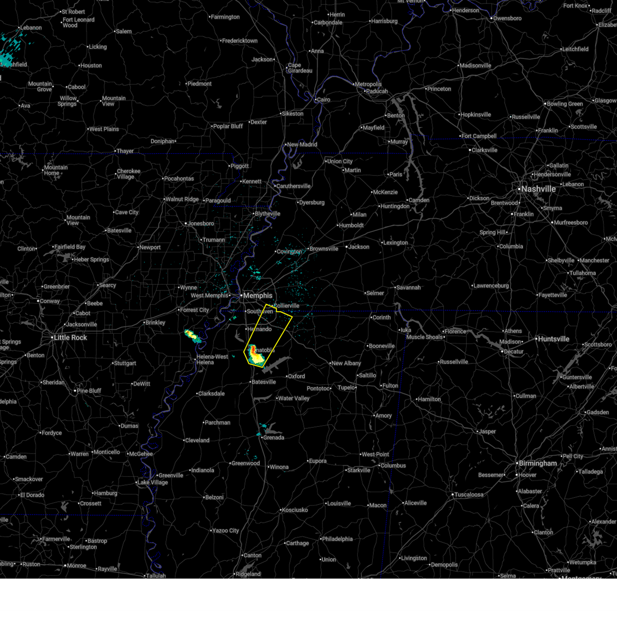 Svrmeg the national weather service in memphis has issued a * severe thunderstorm warning for, eastern desoto county in northwestern mississippi, northwestern marshall county in northwestern mississippi, eastern tate county in northwestern mississippi, northeastern panola county in northwestern mississippi, southeastern shelby county in west tennessee, * until 1130 pm cst. * at 1044 pm cst, a severe thunderstorm was located over senatobia, moving northeast at 45 mph (radar indicated). Hazards include half dollar size hail. damage to vehicles is expected Svrmeg the national weather service in memphis has issued a * severe thunderstorm warning for, eastern desoto county in northwestern mississippi, northwestern marshall county in northwestern mississippi, eastern tate county in northwestern mississippi, northeastern panola county in northwestern mississippi, southeastern shelby county in west tennessee, * until 1130 pm cst. * at 1044 pm cst, a severe thunderstorm was located over senatobia, moving northeast at 45 mph (radar indicated). Hazards include half dollar size hail. damage to vehicles is expected
|
| 9/22/2025 6:44 PM CDT | At 643 pm cdt, a severe thunderstorm was located near eudora, or 7 miles southwest of horn lake, moving northeast at 20 mph (radar indicated). Hazards include 60 mph wind gusts and nickel size hail. Expect damage to roofs, siding, and trees. locations impacted include, horn lake, hernando, memphis, walls, lake cormorant, lynchburg, eudora, newport, alden, twin lakes, frees corners, nesbit, west days, lake view, glover, and norfolk. This includes interstate 55 in mississippi between mile markers 281 and 285. |
| 9/22/2025 6:44 PM CDT | the severe thunderstorm warning has been cancelled and is no longer in effect |
| 9/22/2025 6:26 PM CDT | Svrmeg the national weather service in memphis has issued a * severe thunderstorm warning for, south central crittenden county in eastern arkansas, western desoto county in northwestern mississippi, northeastern tunica county in northwestern mississippi, southwestern shelby county in west tennessee, * until 715 pm cdt. * at 625 pm cdt, a severe thunderstorm was located over robinsonville, or 12 miles southeast of hughes, moving northeast at 15 mph (radar indicated). Hazards include 60 mph wind gusts and nickel size hail. expect damage to roofs, siding, and trees |
| 8/19/2025 7:11 PM CDT |
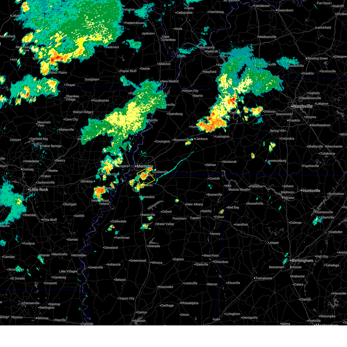 the severe thunderstorm warning has been cancelled and is no longer in effect the severe thunderstorm warning has been cancelled and is no longer in effect
|
| 8/19/2025 6:51 PM CDT |
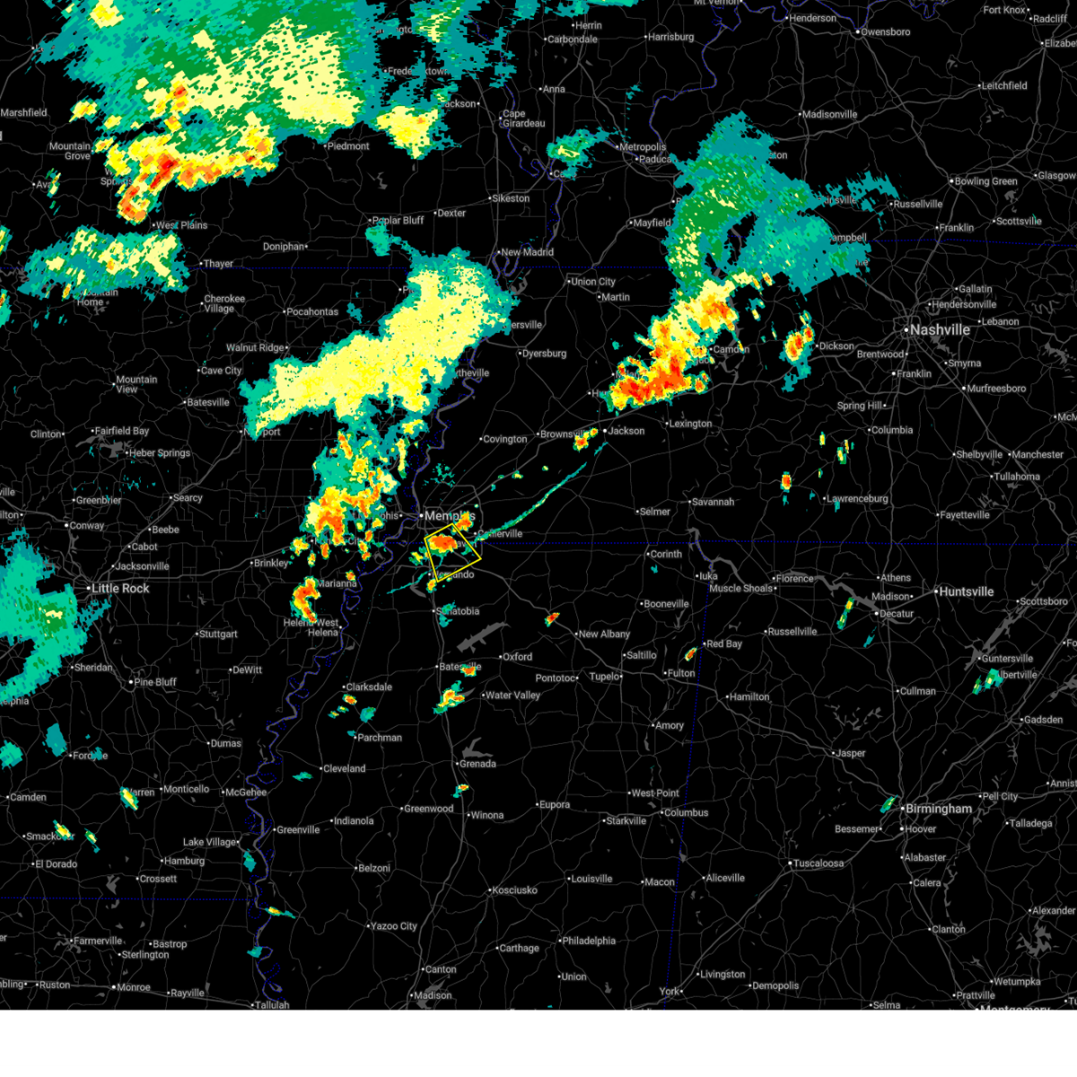 Svrmeg the national weather service in memphis has issued a * severe thunderstorm warning for, northeastern desoto county in northwestern mississippi, western marshall county in northwestern mississippi, south central shelby county in west tennessee, * until 730 pm cdt. * at 651 pm cdt, a severe thunderstorm was located near olive branch, moving southeast at 5 mph (radar indicated). Hazards include 60 mph wind gusts and quarter size hail. Hail damage to vehicles is expected. Expect wind damage to roofs, siding, and trees. Svrmeg the national weather service in memphis has issued a * severe thunderstorm warning for, northeastern desoto county in northwestern mississippi, western marshall county in northwestern mississippi, south central shelby county in west tennessee, * until 730 pm cdt. * at 651 pm cdt, a severe thunderstorm was located near olive branch, moving southeast at 5 mph (radar indicated). Hazards include 60 mph wind gusts and quarter size hail. Hail damage to vehicles is expected. Expect wind damage to roofs, siding, and trees.
|
| 7/17/2025 7:02 PM CDT | Reported tree down on car near e shelby dr and tchulahoma rd. time estimated on rada in shelby county TN, 9.5 miles NNE of Memphis, TN |
| 7/17/2025 6:55 PM CDT | Reported powerlines down near the intersection of e shelby dr and getwell rd. exact time estimated on rada in shelby county TN, 9.2 miles NNE of Memphis, TN |
| 6/28/2025 5:51 PM CDT |
 The severe thunderstorm which prompted the warning has weakened. therefore, the warning will be allowed to expire. however, gusty winds and heavy rain are still possible with this thunderstorm. The severe thunderstorm which prompted the warning has weakened. therefore, the warning will be allowed to expire. however, gusty winds and heavy rain are still possible with this thunderstorm.
|
| 6/28/2025 5:46 PM CDT |
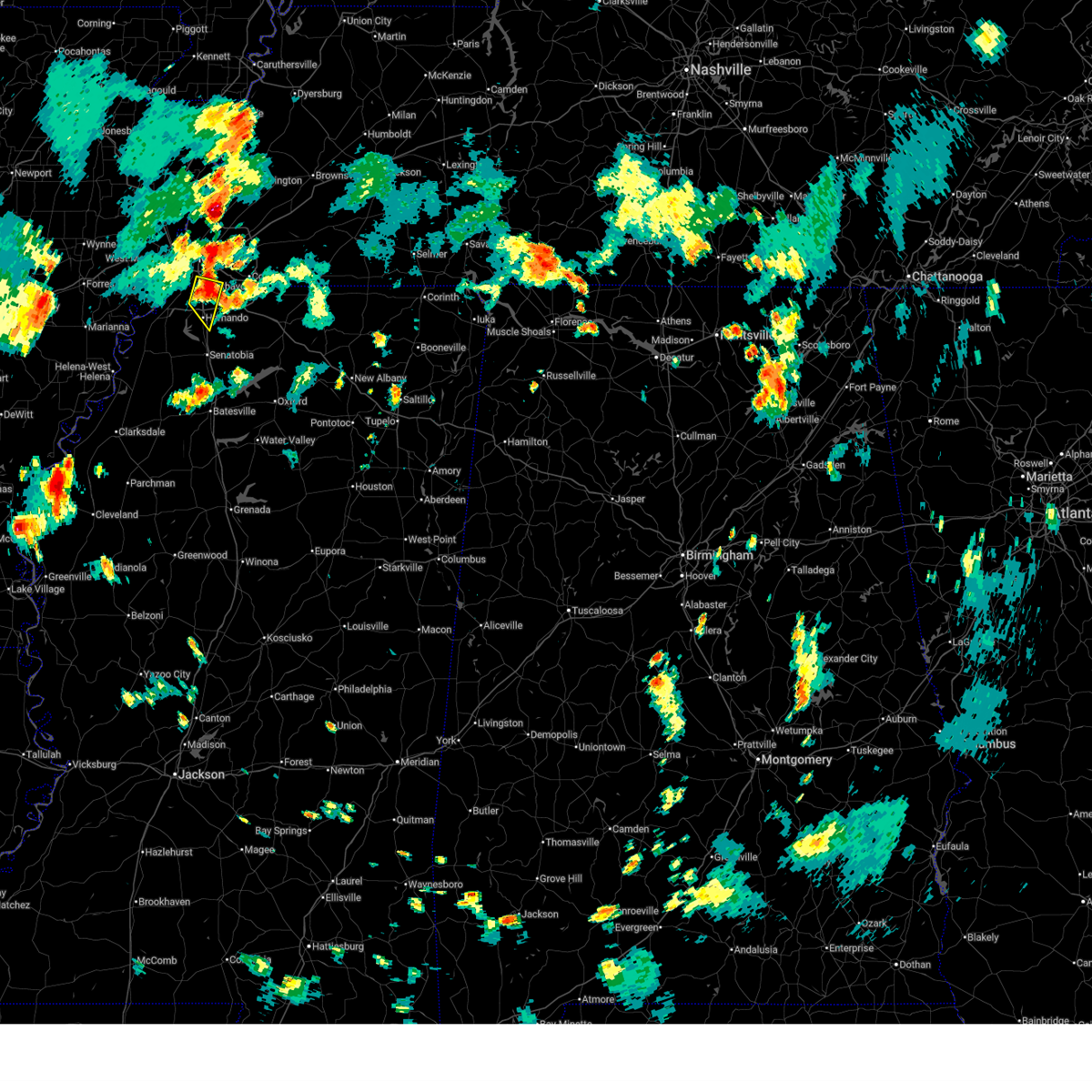 the severe thunderstorm warning has been cancelled and is no longer in effect the severe thunderstorm warning has been cancelled and is no longer in effect
|
| 6/28/2025 5:46 PM CDT |
 At 546 pm cdt, a severe thunderstorm was located near hernando, moving southeast at 25 mph (radar indicated). Hazards include 60 mph wind gusts. Expect damage to roofs, siding, and trees. Locations impacted include, southaven, olive branch, horn lake, hernando, memphis, whitehaven, alden, jago, bright, plum point, and nesbit. At 546 pm cdt, a severe thunderstorm was located near hernando, moving southeast at 25 mph (radar indicated). Hazards include 60 mph wind gusts. Expect damage to roofs, siding, and trees. Locations impacted include, southaven, olive branch, horn lake, hernando, memphis, whitehaven, alden, jago, bright, plum point, and nesbit.
|
| 6/28/2025 5:16 PM CDT |
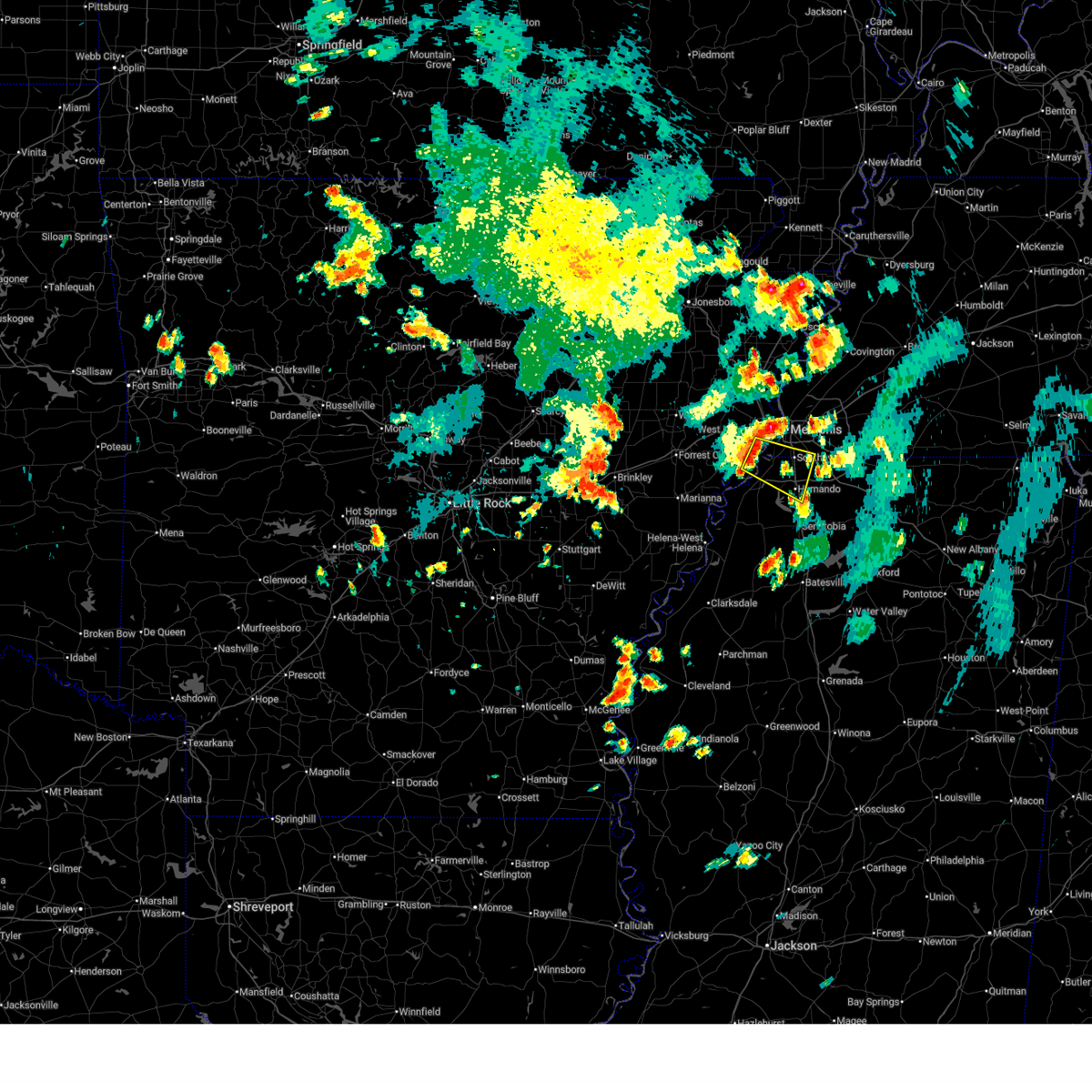 Svrmeg the national weather service in memphis has issued a * severe thunderstorm warning for, south central crittenden county in eastern arkansas, western desoto county in northwestern mississippi, southwestern shelby county in west tennessee, * until 600 pm cdt. * at 516 pm cdt, a severe thunderstorm was located near lake cormorant, or 9 miles southwest of t o fuller state park, moving southeast at 25 mph (radar indicated). Hazards include 60 mph wind gusts. expect damage to roofs, siding, and trees Svrmeg the national weather service in memphis has issued a * severe thunderstorm warning for, south central crittenden county in eastern arkansas, western desoto county in northwestern mississippi, southwestern shelby county in west tennessee, * until 600 pm cdt. * at 516 pm cdt, a severe thunderstorm was located near lake cormorant, or 9 miles southwest of t o fuller state park, moving southeast at 25 mph (radar indicated). Hazards include 60 mph wind gusts. expect damage to roofs, siding, and trees
|
| 6/19/2025 5:28 AM CDT |
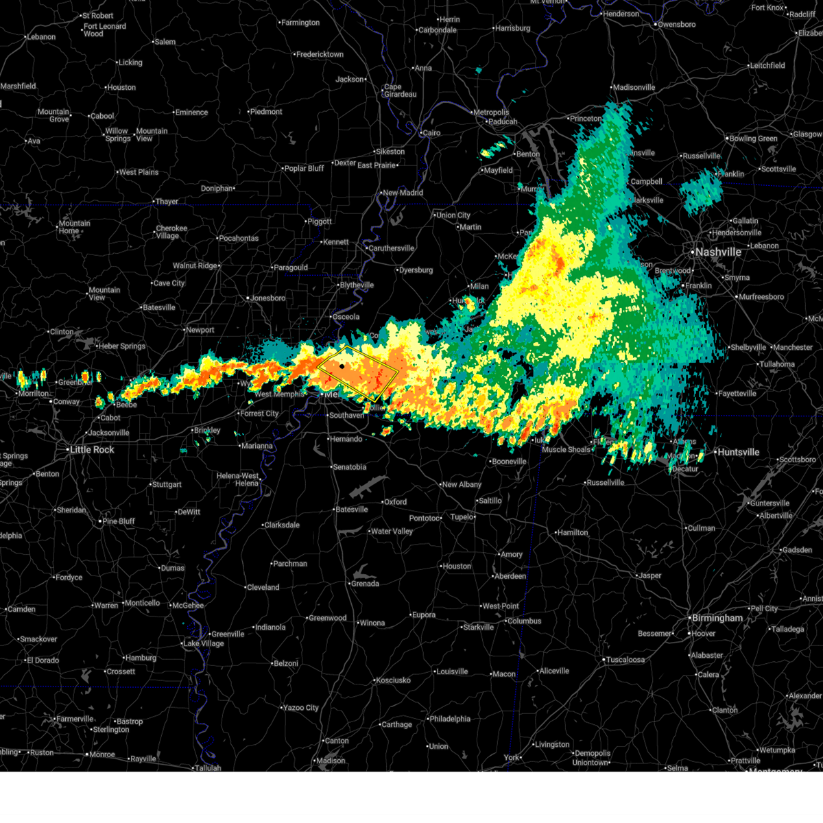 The storm which prompted the warning has moved out of the area. therefore, the warning will be allowed to expire. however, gusty winds and heavy rain are still possible with this thunderstorm. The storm which prompted the warning has moved out of the area. therefore, the warning will be allowed to expire. however, gusty winds and heavy rain are still possible with this thunderstorm.
|
| 6/19/2025 5:14 AM CDT |
 the severe thunderstorm warning has been cancelled and is no longer in effect the severe thunderstorm warning has been cancelled and is no longer in effect
|
| 6/19/2025 5:14 AM CDT |
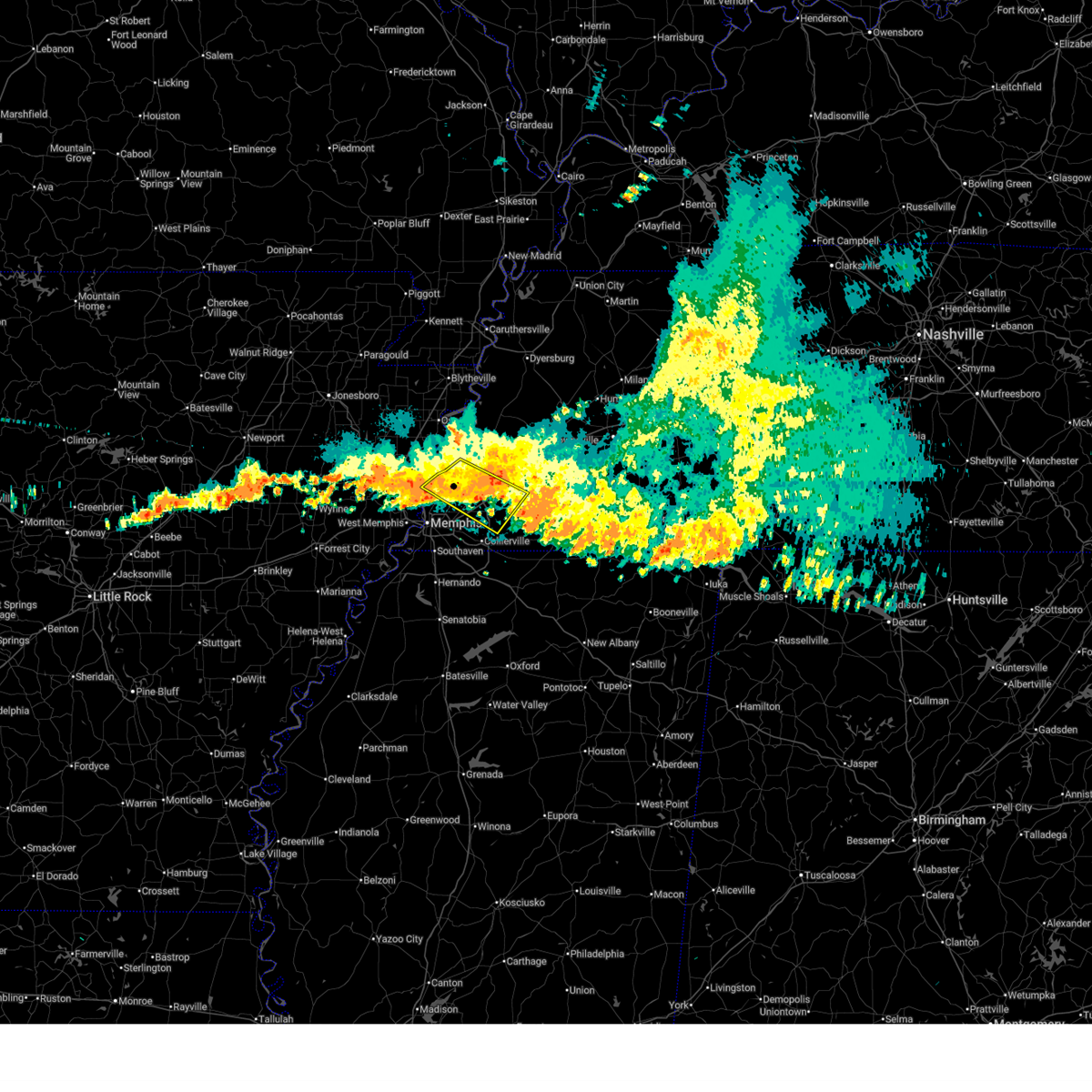 At 513 am cdt, a severe thunderstorm was located over arlington, or 8 miles northeast of bartlett, moving southeast at 50 mph (radar indicated). Hazards include 60 mph wind gusts and penny size hail. Expect damage to roofs, siding, and trees. Locations impacted include, bartlett, millington, meeman shelby forest state park, lakeland, arlington, munford, ellendale, dixonville, eads, tipton, atoka, oakland, piperton, gallaway, braden, lenow, barretville, griffin corner, quito, and redwood. At 513 am cdt, a severe thunderstorm was located over arlington, or 8 miles northeast of bartlett, moving southeast at 50 mph (radar indicated). Hazards include 60 mph wind gusts and penny size hail. Expect damage to roofs, siding, and trees. Locations impacted include, bartlett, millington, meeman shelby forest state park, lakeland, arlington, munford, ellendale, dixonville, eads, tipton, atoka, oakland, piperton, gallaway, braden, lenow, barretville, griffin corner, quito, and redwood.
|
| 6/19/2025 4:53 AM CDT |
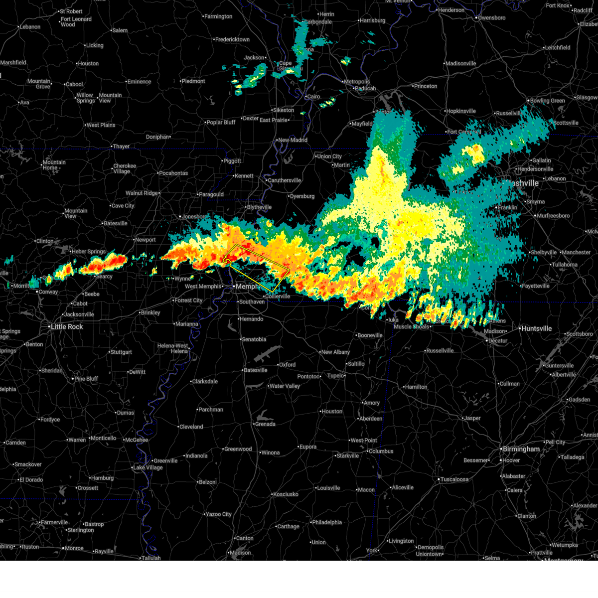 Svrmeg the national weather service in memphis has issued a * severe thunderstorm warning for, south central mississippi county in eastern arkansas, southwestern tipton county in west tennessee, northwestern fayette county in west tennessee, northeastern shelby county in west tennessee, * until 530 am cdt. * at 452 am cdt, a severe thunderstorm was located over dixonville, or 8 miles northeast of meeman shelby forest state park, moving southeast at 50 mph (radar indicated). Hazards include 60 mph wind gusts and penny size hail. expect damage to roofs, siding, and trees Svrmeg the national weather service in memphis has issued a * severe thunderstorm warning for, south central mississippi county in eastern arkansas, southwestern tipton county in west tennessee, northwestern fayette county in west tennessee, northeastern shelby county in west tennessee, * until 530 am cdt. * at 452 am cdt, a severe thunderstorm was located over dixonville, or 8 miles northeast of meeman shelby forest state park, moving southeast at 50 mph (radar indicated). Hazards include 60 mph wind gusts and penny size hail. expect damage to roofs, siding, and trees
|
| 6/18/2025 10:31 PM CDT |
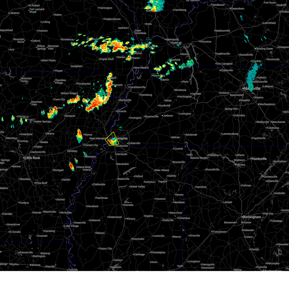 the severe thunderstorm warning has been cancelled and is no longer in effect the severe thunderstorm warning has been cancelled and is no longer in effect
|
| 6/18/2025 10:25 PM CDT |
 At 1024 pm cdt, a severe thunderstorm was located near t o fuller state park, moving northeast at 25 mph (radar indicated). Hazards include 60 mph wind gusts and quarter size hail. Hail damage to vehicles is expected. expect wind damage to roofs, siding, and trees. Locations impacted include, west memphis, t o fuller state park, memphis, downtown memphis, southwest memphis, whitehaven, midtown memphis, riceville, mound city, hulbert, blanton, amanea, wyandoke, st clair, presidents island, briark, benjestown, galet, and bridge junction. At 1024 pm cdt, a severe thunderstorm was located near t o fuller state park, moving northeast at 25 mph (radar indicated). Hazards include 60 mph wind gusts and quarter size hail. Hail damage to vehicles is expected. expect wind damage to roofs, siding, and trees. Locations impacted include, west memphis, t o fuller state park, memphis, downtown memphis, southwest memphis, whitehaven, midtown memphis, riceville, mound city, hulbert, blanton, amanea, wyandoke, st clair, presidents island, briark, benjestown, galet, and bridge junction.
|
| 6/18/2025 10:10 PM CDT |
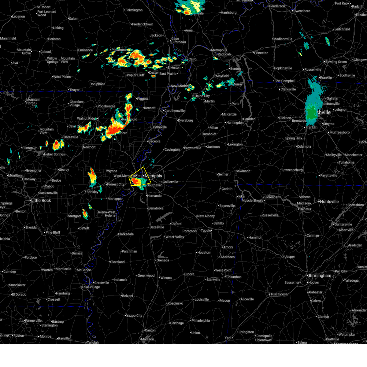 the severe thunderstorm warning has been cancelled and is no longer in effect the severe thunderstorm warning has been cancelled and is no longer in effect
|
| 6/18/2025 10:10 PM CDT |
 At 1009 pm cdt, a severe thunderstorm was located near edmondson, or near west memphis, moving northeast at 20 mph (radar indicated). Hazards include 60 mph wind gusts and quarter size hail. Hail damage to vehicles is expected. expect wind damage to roofs, siding, and trees. Locations impacted include, west memphis, marion, t o fuller state park, memphis, edmondson, southwest memphis, downtown memphis, whitehaven, midtown memphis, crittenden, mound city, louise, brice, amanea, wyandoke, st clair, presidents island, briark, riceville, and hulbert. At 1009 pm cdt, a severe thunderstorm was located near edmondson, or near west memphis, moving northeast at 20 mph (radar indicated). Hazards include 60 mph wind gusts and quarter size hail. Hail damage to vehicles is expected. expect wind damage to roofs, siding, and trees. Locations impacted include, west memphis, marion, t o fuller state park, memphis, edmondson, southwest memphis, downtown memphis, whitehaven, midtown memphis, crittenden, mound city, louise, brice, amanea, wyandoke, st clair, presidents island, briark, riceville, and hulbert.
|
| 6/18/2025 9:59 PM CDT |
 The storm which prompted the warning has moved out of the area. therefore, the warning will be allowed to expire. remember, a severe thunderstorm warning still remains in effect for crittenden, shelby, and desoto counties. The storm which prompted the warning has moved out of the area. therefore, the warning will be allowed to expire. remember, a severe thunderstorm warning still remains in effect for crittenden, shelby, and desoto counties.
|
| 6/18/2025 9:55 PM CDT |
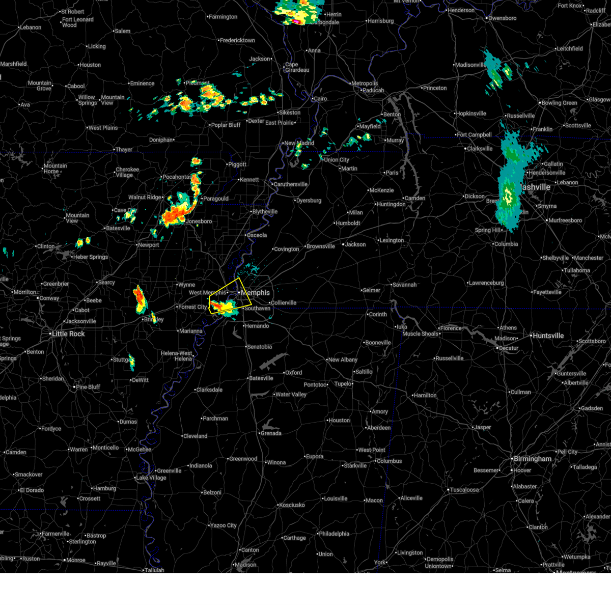 Svrmeg the national weather service in memphis has issued a * severe thunderstorm warning for, central crittenden county in eastern arkansas, northwestern desoto county in northwestern mississippi, southwestern shelby county in west tennessee, * until 1045 pm cdt. * at 953 pm cdt, a severe thunderstorm was located over anthonyville, or 10 miles southwest of west memphis, moving northeast at 20 mph (radar indicated). Hazards include 60 mph wind gusts and quarter size hail. Hail damage to vehicles is expected. Expect wind damage to roofs, siding, and trees. Svrmeg the national weather service in memphis has issued a * severe thunderstorm warning for, central crittenden county in eastern arkansas, northwestern desoto county in northwestern mississippi, southwestern shelby county in west tennessee, * until 1045 pm cdt. * at 953 pm cdt, a severe thunderstorm was located over anthonyville, or 10 miles southwest of west memphis, moving northeast at 20 mph (radar indicated). Hazards include 60 mph wind gusts and quarter size hail. Hail damage to vehicles is expected. Expect wind damage to roofs, siding, and trees.
|
| 6/18/2025 9:22 PM CDT |
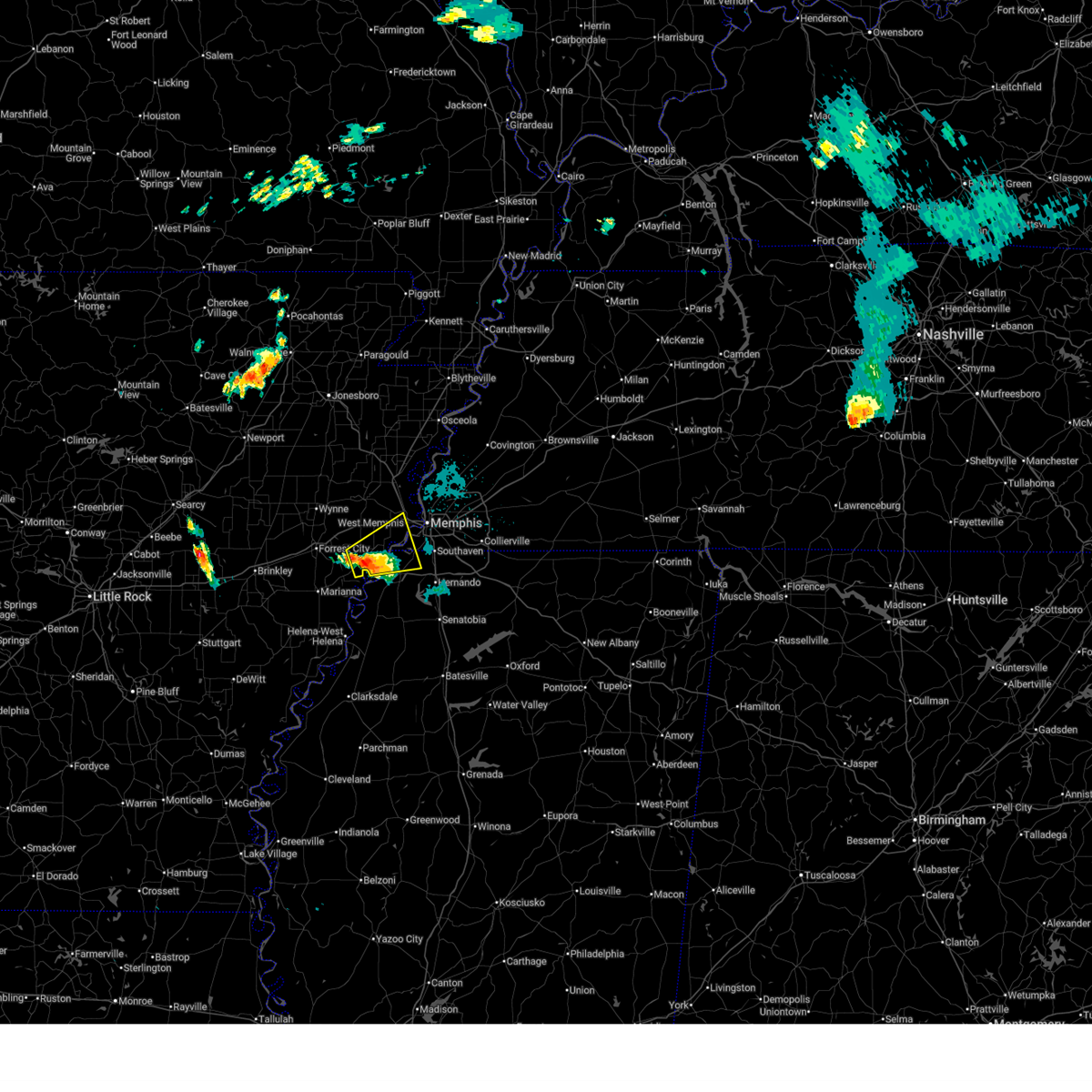 Svrmeg the national weather service in memphis has issued a * severe thunderstorm warning for, northeastern lee county in eastern arkansas, southeastern st. francis county in eastern arkansas, southwestern crittenden county in eastern arkansas, northwestern desoto county in northwestern mississippi, southwestern shelby county in west tennessee, * until 1000 pm cdt. * at 922 pm cdt, a severe thunderstorm was located over hughes, moving northeast at 20 mph (radar indicated). Hazards include 60 mph wind gusts and quarter size hail. Hail damage to vehicles is expected. Expect wind damage to roofs, siding, and trees. Svrmeg the national weather service in memphis has issued a * severe thunderstorm warning for, northeastern lee county in eastern arkansas, southeastern st. francis county in eastern arkansas, southwestern crittenden county in eastern arkansas, northwestern desoto county in northwestern mississippi, southwestern shelby county in west tennessee, * until 1000 pm cdt. * at 922 pm cdt, a severe thunderstorm was located over hughes, moving northeast at 20 mph (radar indicated). Hazards include 60 mph wind gusts and quarter size hail. Hail damage to vehicles is expected. Expect wind damage to roofs, siding, and trees.
|
| 6/7/2025 9:59 PM CDT |
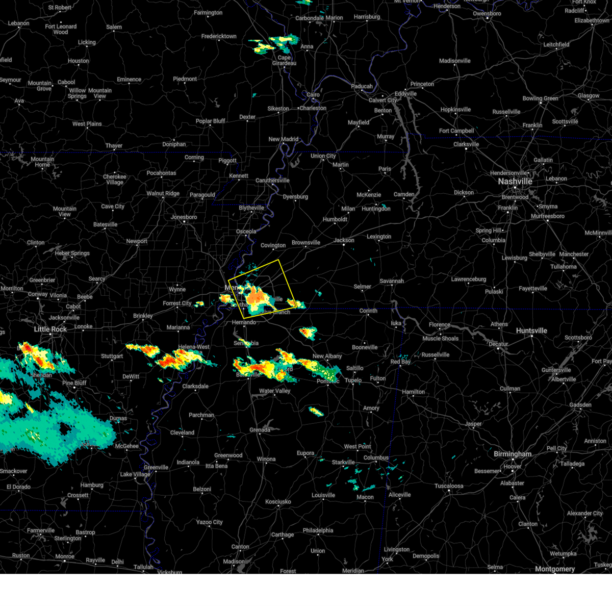 the severe thunderstorm warning has been cancelled and is no longer in effect the severe thunderstorm warning has been cancelled and is no longer in effect
|
| 6/7/2025 9:54 PM CDT |
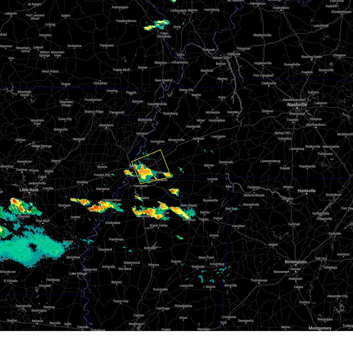 At 954 pm cdt, a severe thunderstorm was located near southeast memphis, or near cordova, moving east at 45 mph (radar indicated). Hazards include 60 mph wind gusts and quarter size hail. Hail damage to vehicles is expected. expect wind damage to roofs, siding, and trees. Locations impacted include, bartlett, southaven, collierville, germantown, olive branch, west memphis, horn lake, millington, cordova, memphis, lakeland, arlington, southwest memphis, ellendale, whitehaven, frayser, midtown memphis, southeast memphis, downtown memphis, and eads. At 954 pm cdt, a severe thunderstorm was located near southeast memphis, or near cordova, moving east at 45 mph (radar indicated). Hazards include 60 mph wind gusts and quarter size hail. Hail damage to vehicles is expected. expect wind damage to roofs, siding, and trees. Locations impacted include, bartlett, southaven, collierville, germantown, olive branch, west memphis, horn lake, millington, cordova, memphis, lakeland, arlington, southwest memphis, ellendale, whitehaven, frayser, midtown memphis, southeast memphis, downtown memphis, and eads.
|
| 6/7/2025 9:43 PM CDT |
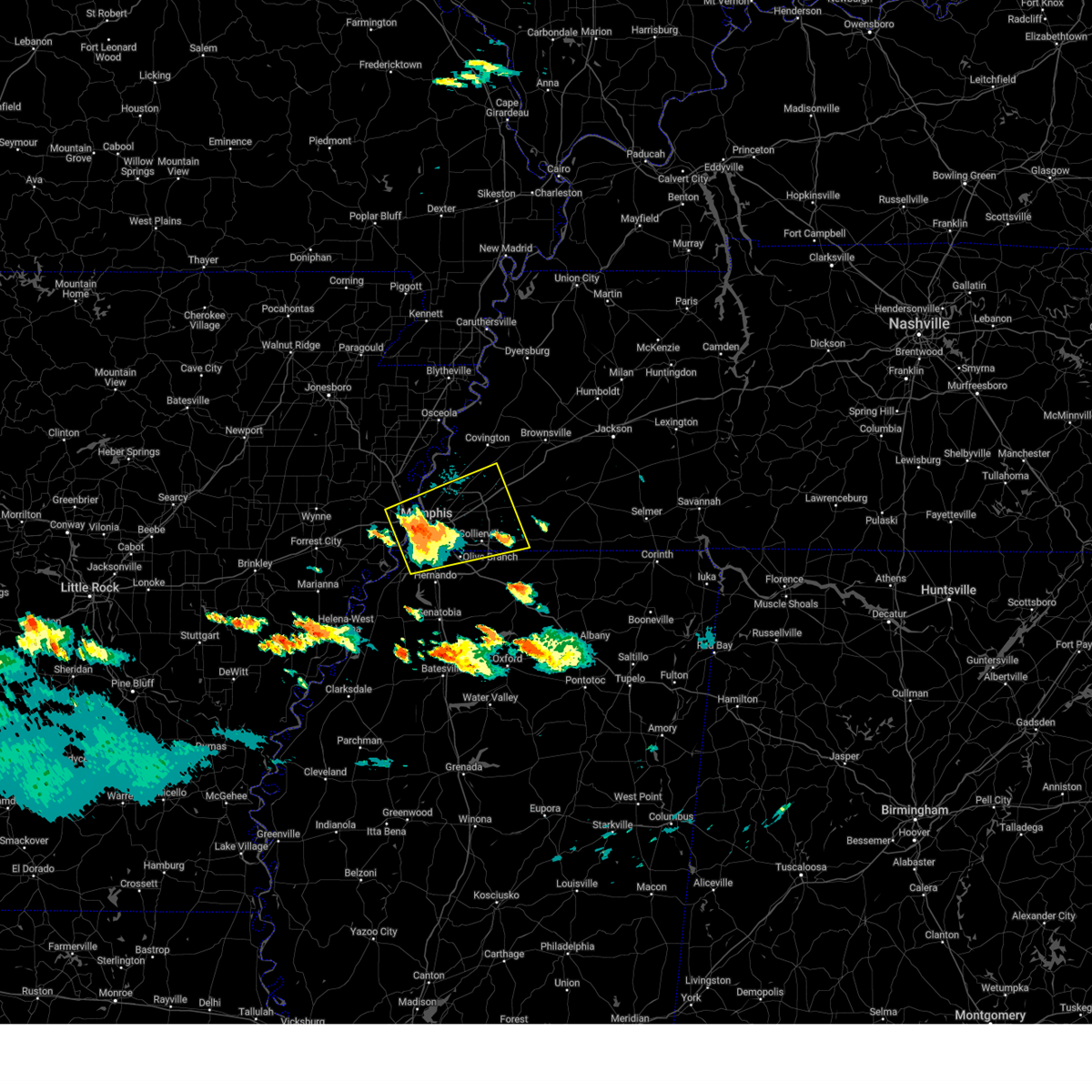 At 943 pm cdt, a severe thunderstorm was located over downtown memphis, or near t o fuller state park, moving east at 45 mph (radar indicated). Hazards include 60 mph wind gusts and quarter size hail. Hail damage to vehicles is expected. expect wind damage to roofs, siding, and trees. Locations impacted include, bartlett, southaven, collierville, germantown, olive branch, west memphis, horn lake, marion, millington, t o fuller state park, cordova, memphis, lakeland, arlington, walls, crawfordsville, sunset, southwest memphis, ellendale, and whitehaven. At 943 pm cdt, a severe thunderstorm was located over downtown memphis, or near t o fuller state park, moving east at 45 mph (radar indicated). Hazards include 60 mph wind gusts and quarter size hail. Hail damage to vehicles is expected. expect wind damage to roofs, siding, and trees. Locations impacted include, bartlett, southaven, collierville, germantown, olive branch, west memphis, horn lake, marion, millington, t o fuller state park, cordova, memphis, lakeland, arlington, walls, crawfordsville, sunset, southwest memphis, ellendale, and whitehaven.
|
| 6/7/2025 9:36 PM CDT |
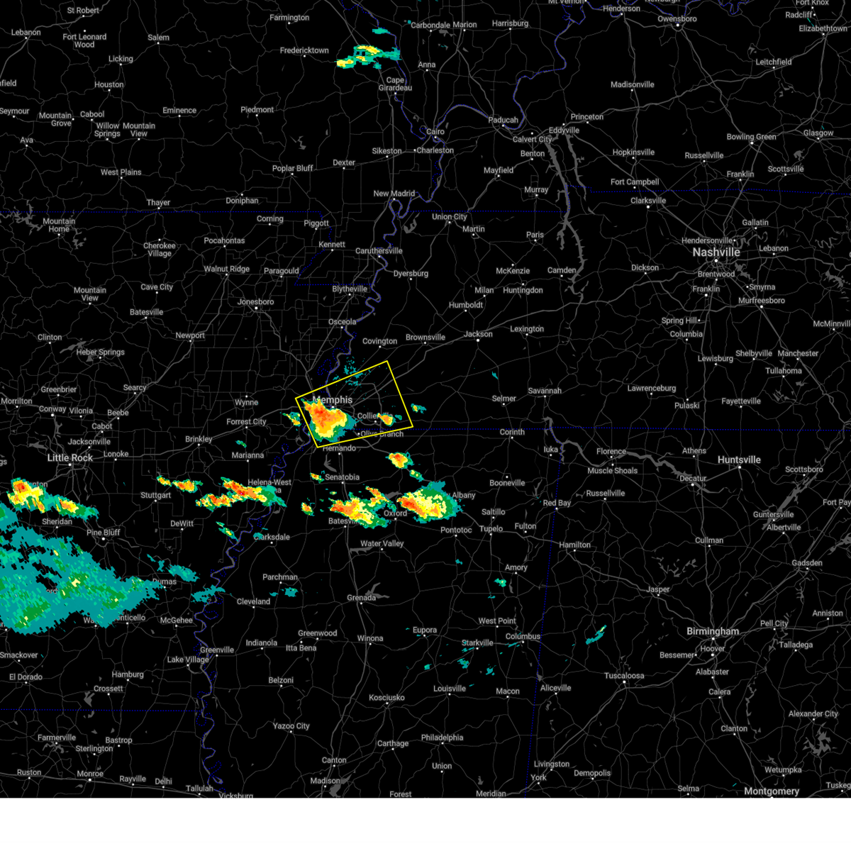 Svrmeg the national weather service in memphis has issued a * severe thunderstorm warning for, east central crittenden county in eastern arkansas, northern desoto county in northwestern mississippi, northwestern marshall county in northwestern mississippi, southeastern tipton county in west tennessee, western fayette county in west tennessee, shelby county in west tennessee, * until 1015 pm cdt. * at 936 pm cdt, a severe thunderstorm was located over t o fuller state park, moving east at 45 mph (radar indicated). Hazards include 60 mph wind gusts and half dollar size hail. Hail damage to vehicles is expected. Expect wind damage to roofs, siding, and trees. Svrmeg the national weather service in memphis has issued a * severe thunderstorm warning for, east central crittenden county in eastern arkansas, northern desoto county in northwestern mississippi, northwestern marshall county in northwestern mississippi, southeastern tipton county in west tennessee, western fayette county in west tennessee, shelby county in west tennessee, * until 1015 pm cdt. * at 936 pm cdt, a severe thunderstorm was located over t o fuller state park, moving east at 45 mph (radar indicated). Hazards include 60 mph wind gusts and half dollar size hail. Hail damage to vehicles is expected. Expect wind damage to roofs, siding, and trees.
|
| 6/7/2025 9:27 PM CDT |
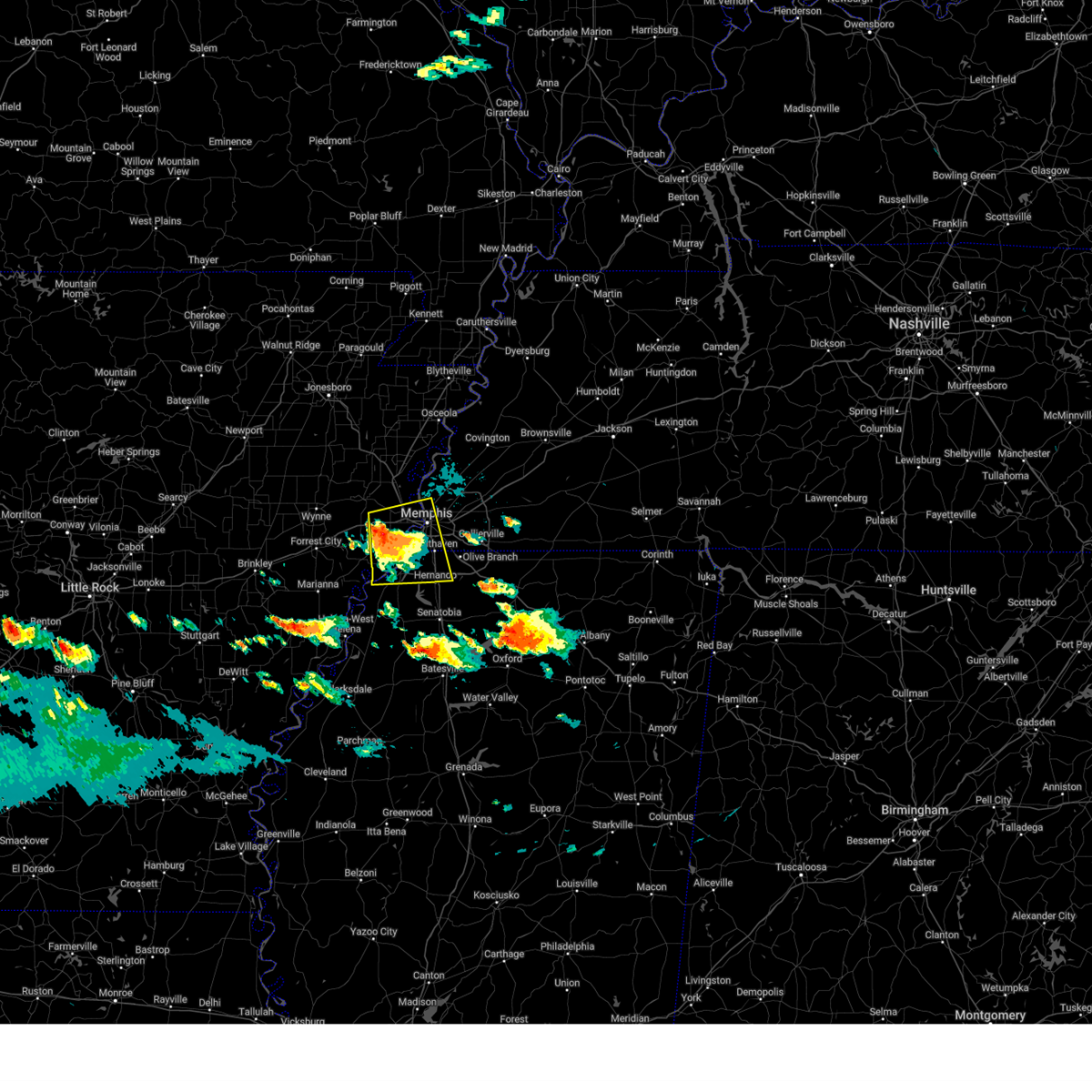 At 927 pm cdt, a severe thunderstorm was located near edmondson, or near west memphis, moving east at 45 mph (radar indicated). Hazards include 60 mph wind gusts and half dollar size hail. Hail damage to vehicles is expected. expect wind damage to roofs, siding, and trees. Locations impacted include, southaven, west memphis, horn lake, hernando, marion, t o fuller state park, memphis, walls, crawfordsville, edmondson, horseshoe lake, sunset, anthonyville, jennette, lake cormorant, southwest memphis, eudora, simsboro, whitehaven, and midtown memphis. At 927 pm cdt, a severe thunderstorm was located near edmondson, or near west memphis, moving east at 45 mph (radar indicated). Hazards include 60 mph wind gusts and half dollar size hail. Hail damage to vehicles is expected. expect wind damage to roofs, siding, and trees. Locations impacted include, southaven, west memphis, horn lake, hernando, marion, t o fuller state park, memphis, walls, crawfordsville, edmondson, horseshoe lake, sunset, anthonyville, jennette, lake cormorant, southwest memphis, eudora, simsboro, whitehaven, and midtown memphis.
|
| 6/7/2025 9:27 PM CDT |
 the severe thunderstorm warning has been cancelled and is no longer in effect the severe thunderstorm warning has been cancelled and is no longer in effect
|
| 6/7/2025 9:16 PM CDT |
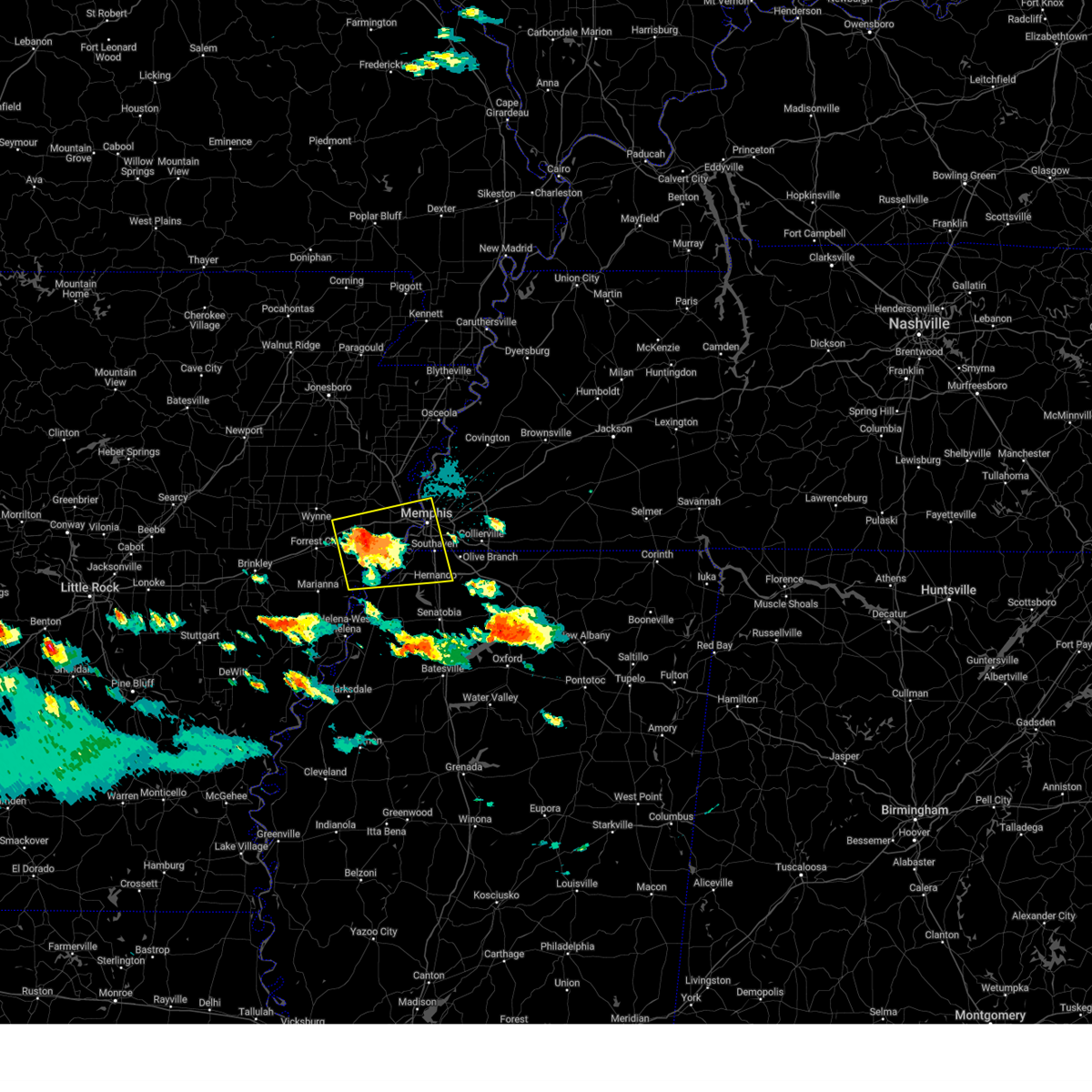 At 916 pm cdt, a severe thunderstorm was located over simsboro, or 7 miles northeast of hughes, moving east at 40 mph (radar indicated). Hazards include golf ball size hail and 60 mph wind gusts. People and animals outdoors will be injured. expect hail damage to roofs, siding, windows, and vehicles. expect wind damage to roofs, siding, and trees. Locations impacted include, southaven, west memphis, horn lake, hernando, marion, hughes, t o fuller state park, memphis, walls, crawfordsville, edmondson, horseshoe lake, sunset, anthonyville, jennette, lake cormorant, southwest memphis, simsboro, brickeys, and whitehaven. At 916 pm cdt, a severe thunderstorm was located over simsboro, or 7 miles northeast of hughes, moving east at 40 mph (radar indicated). Hazards include golf ball size hail and 60 mph wind gusts. People and animals outdoors will be injured. expect hail damage to roofs, siding, windows, and vehicles. expect wind damage to roofs, siding, and trees. Locations impacted include, southaven, west memphis, horn lake, hernando, marion, hughes, t o fuller state park, memphis, walls, crawfordsville, edmondson, horseshoe lake, sunset, anthonyville, jennette, lake cormorant, southwest memphis, simsboro, brickeys, and whitehaven.
|
| 6/7/2025 9:05 PM CDT |
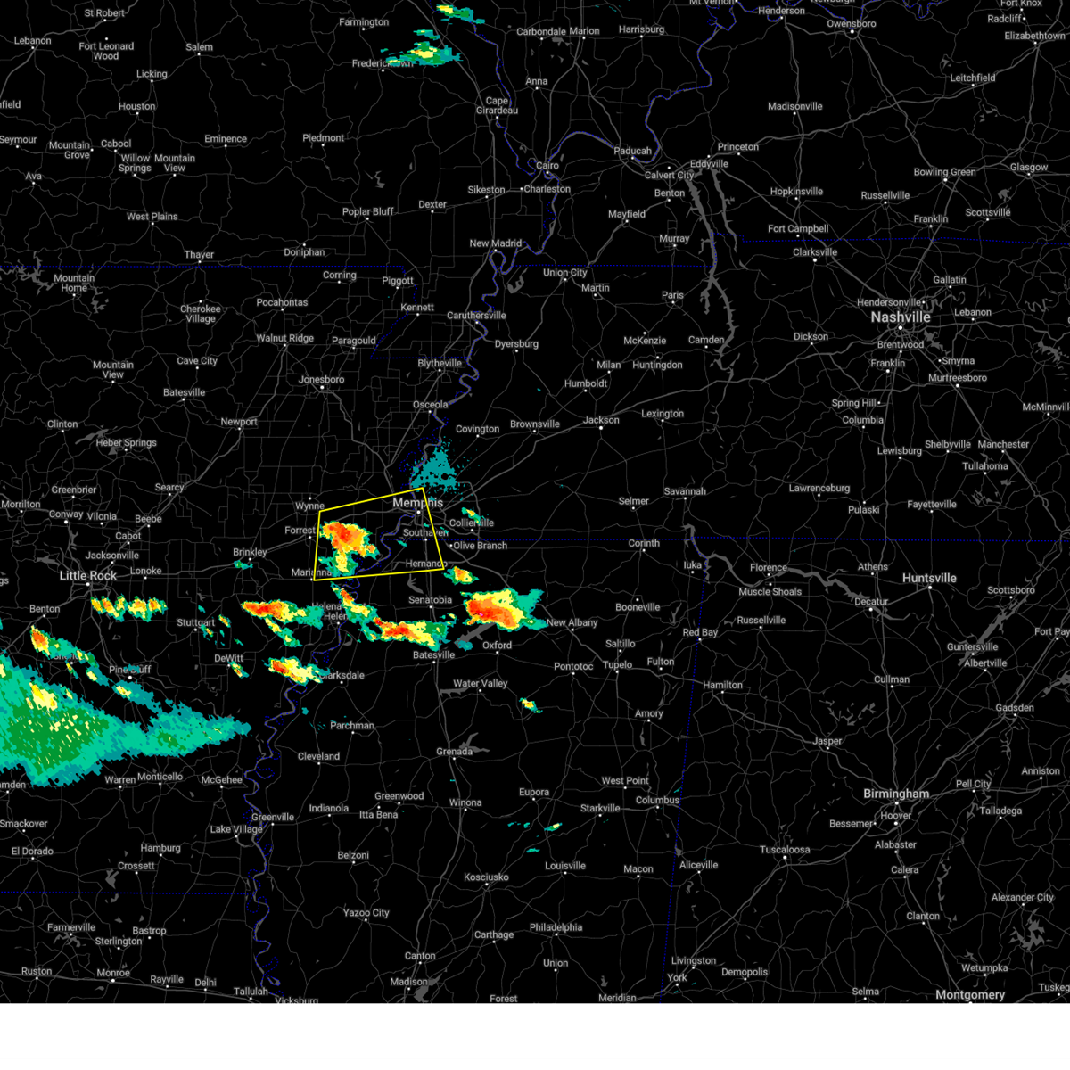 At 905 pm cdt, a severe thunderstorm was located over new home, or near hughes, moving east at 35 mph (radar indicated). Hazards include ping pong ball size hail and 60 mph wind gusts. People and animals outdoors will be injured. expect hail damage to roofs, siding, windows, and vehicles. expect wind damage to roofs, siding, and trees. Locations impacted include, southaven, west memphis, horn lake, hernando, marion, marianna, hughes, madison, t o fuller state park, memphis, walls, crawfordsville, edmondson, horseshoe lake, widener, sunset, anthonyville, jennette, lake cormorant, and southwest memphis. At 905 pm cdt, a severe thunderstorm was located over new home, or near hughes, moving east at 35 mph (radar indicated). Hazards include ping pong ball size hail and 60 mph wind gusts. People and animals outdoors will be injured. expect hail damage to roofs, siding, windows, and vehicles. expect wind damage to roofs, siding, and trees. Locations impacted include, southaven, west memphis, horn lake, hernando, marion, marianna, hughes, madison, t o fuller state park, memphis, walls, crawfordsville, edmondson, horseshoe lake, widener, sunset, anthonyville, jennette, lake cormorant, and southwest memphis.
|
| 6/7/2025 9:01 PM CDT |
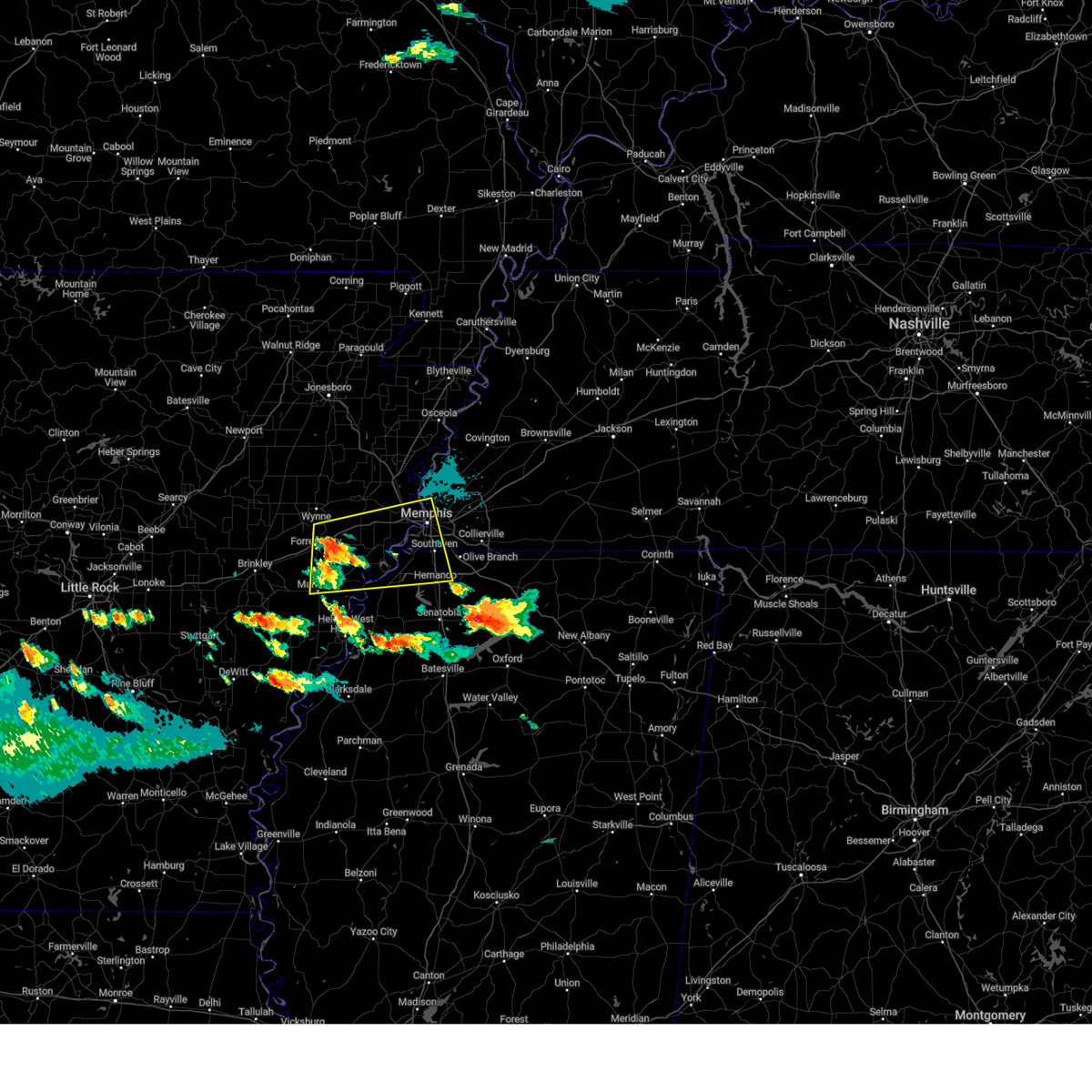 At 901 pm cdt, a severe thunderstorm was located near new home, or near madison, moving east at 35 mph (radar indicated). Hazards include 60 mph wind gusts and quarter size hail. Hail damage to vehicles is expected. expect wind damage to roofs, siding, and trees. Locations impacted include, southaven, west memphis, horn lake, forrest city, hernando, marion, marianna, hughes, madison, t o fuller state park, memphis, walls, caldwell, crawfordsville, edmondson, horseshoe lake, widener, sunset, anthonyville, and haynes. At 901 pm cdt, a severe thunderstorm was located near new home, or near madison, moving east at 35 mph (radar indicated). Hazards include 60 mph wind gusts and quarter size hail. Hail damage to vehicles is expected. expect wind damage to roofs, siding, and trees. Locations impacted include, southaven, west memphis, horn lake, forrest city, hernando, marion, marianna, hughes, madison, t o fuller state park, memphis, walls, caldwell, crawfordsville, edmondson, horseshoe lake, widener, sunset, anthonyville, and haynes.
|
| 6/7/2025 8:55 PM CDT |
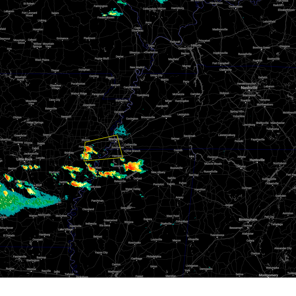 Svrmeg the national weather service in memphis has issued a * severe thunderstorm warning for, northeastern lee county in eastern arkansas, eastern st. francis county in eastern arkansas, central crittenden county in eastern arkansas, southeastern cross county in eastern arkansas, northwestern desoto county in northwestern mississippi, northern tunica county in northwestern mississippi, southwestern shelby county in west tennessee, * until 945 pm cdt. * at 855 pm cdt, a severe thunderstorm was located over widener, or near madison, moving east at 35 mph (radar indicated). Hazards include 60 mph wind gusts and quarter size hail. Hail damage to vehicles is expected. Expect wind damage to roofs, siding, and trees. Svrmeg the national weather service in memphis has issued a * severe thunderstorm warning for, northeastern lee county in eastern arkansas, eastern st. francis county in eastern arkansas, central crittenden county in eastern arkansas, southeastern cross county in eastern arkansas, northwestern desoto county in northwestern mississippi, northern tunica county in northwestern mississippi, southwestern shelby county in west tennessee, * until 945 pm cdt. * at 855 pm cdt, a severe thunderstorm was located over widener, or near madison, moving east at 35 mph (radar indicated). Hazards include 60 mph wind gusts and quarter size hail. Hail damage to vehicles is expected. Expect wind damage to roofs, siding, and trees.
|
| 6/7/2025 9:24 AM CDT |
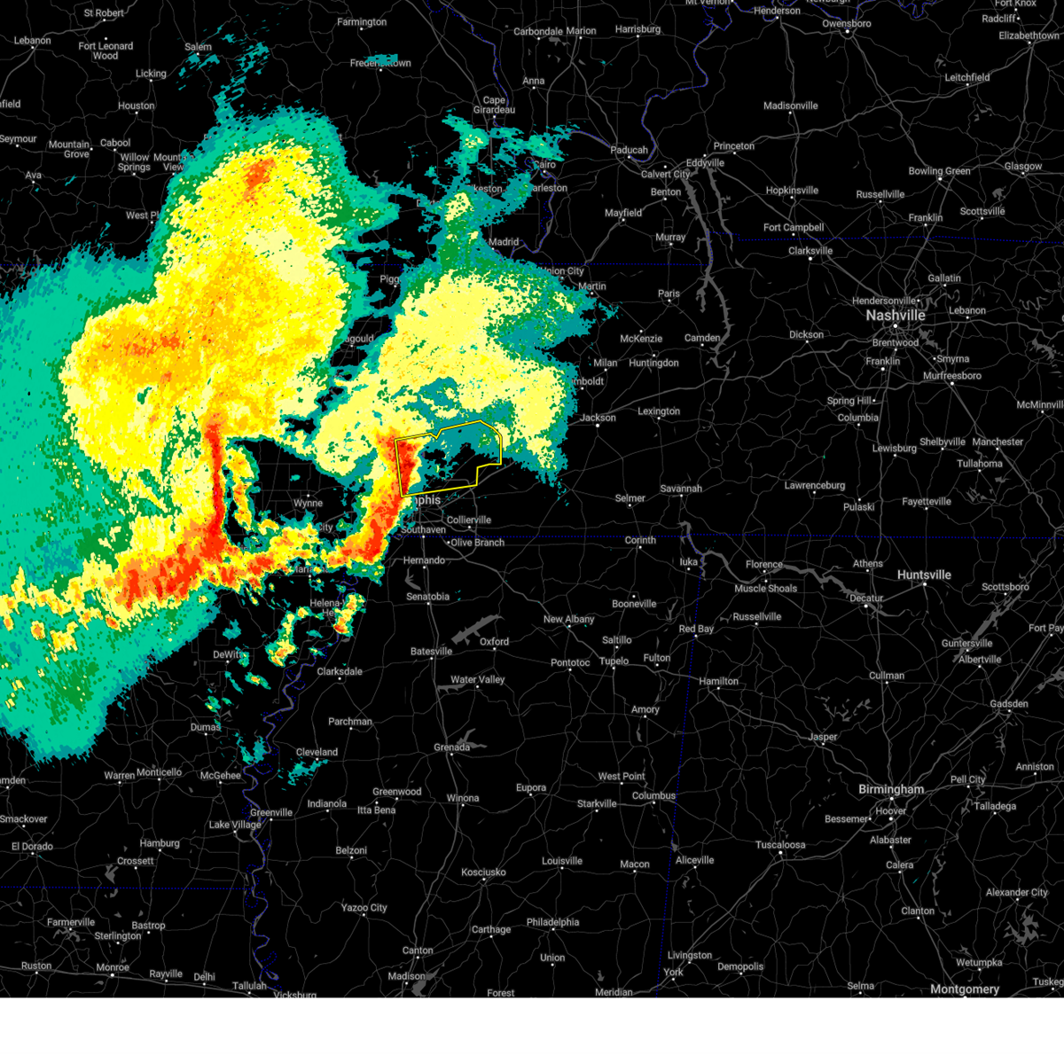 Svrmeg the national weather service in memphis has issued a * severe thunderstorm warning for, southwestern mississippi county in eastern arkansas, northeastern crittenden county in eastern arkansas, tipton county in west tennessee, northeastern shelby county in west tennessee, * until 1015 am cdt. * at 924 am cdt, a severe thunderstorm was located near meeman shelby forest state park, moving east at 40 mph (radar indicated). Hazards include 60 mph wind gusts and nickel size hail. expect damage to roofs, siding, and trees Svrmeg the national weather service in memphis has issued a * severe thunderstorm warning for, southwestern mississippi county in eastern arkansas, northeastern crittenden county in eastern arkansas, tipton county in west tennessee, northeastern shelby county in west tennessee, * until 1015 am cdt. * at 924 am cdt, a severe thunderstorm was located near meeman shelby forest state park, moving east at 40 mph (radar indicated). Hazards include 60 mph wind gusts and nickel size hail. expect damage to roofs, siding, and trees
|
| 5/25/2025 12:51 PM CDT |
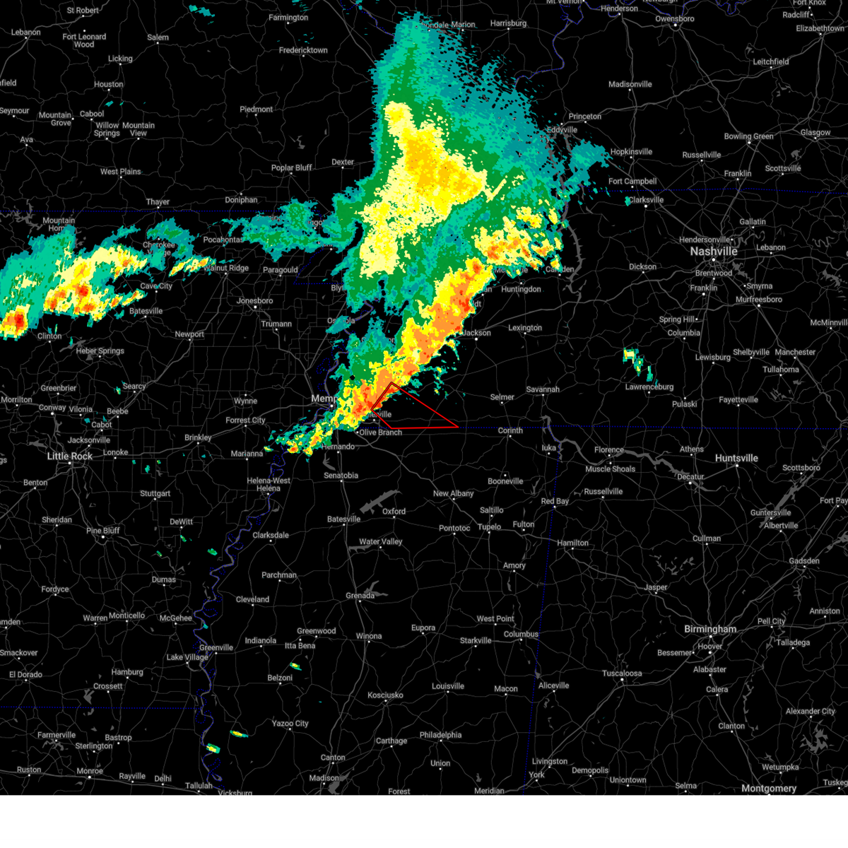 Tormeg the national weather service in memphis has issued a * tornado warning for, southern fayette county in west tennessee, southwestern hardeman county in west tennessee, east central shelby county in west tennessee, * until 130 pm cdt. * at 1251 pm cdt, a severe thunderstorm capable of producing a tornado was located near eads, or 10 miles northeast of collierville, moving southeast at 40 mph (radar indicated rotation). Hazards include tornado. Flying debris will be dangerous to those caught without shelter. mobile homes will be damaged or destroyed. damage to roofs, windows, and vehicles will occur. Tree damage is likely. Tormeg the national weather service in memphis has issued a * tornado warning for, southern fayette county in west tennessee, southwestern hardeman county in west tennessee, east central shelby county in west tennessee, * until 130 pm cdt. * at 1251 pm cdt, a severe thunderstorm capable of producing a tornado was located near eads, or 10 miles northeast of collierville, moving southeast at 40 mph (radar indicated rotation). Hazards include tornado. Flying debris will be dangerous to those caught without shelter. mobile homes will be damaged or destroyed. damage to roofs, windows, and vehicles will occur. Tree damage is likely.
|
| 5/25/2025 12:37 PM CDT | Trees uprooted and fences down off of perkins in southeast memphi in shelby county TN, 5.8 miles NNE of Memphis, TN |
| 5/22/2025 1:49 AM CDT |
 Svrmeg the national weather service in memphis has issued a * severe thunderstorm warning for, fayette county in west tennessee, southwestern hardeman county in west tennessee, east central shelby county in west tennessee, * until 230 am cdt. * at 149 am cdt, a severe thunderstorm was located over eads, or 8 miles northeast of cordova, moving southeast at 45 mph (radar indicated). Hazards include 70 mph wind gusts and penny size hail. Expect considerable tree damage. Damage is likely to mobile homes, roofs, and outbuildings. Svrmeg the national weather service in memphis has issued a * severe thunderstorm warning for, fayette county in west tennessee, southwestern hardeman county in west tennessee, east central shelby county in west tennessee, * until 230 am cdt. * at 149 am cdt, a severe thunderstorm was located over eads, or 8 miles northeast of cordova, moving southeast at 45 mph (radar indicated). Hazards include 70 mph wind gusts and penny size hail. Expect considerable tree damage. Damage is likely to mobile homes, roofs, and outbuildings.
|
| 5/22/2025 1:43 AM CDT |
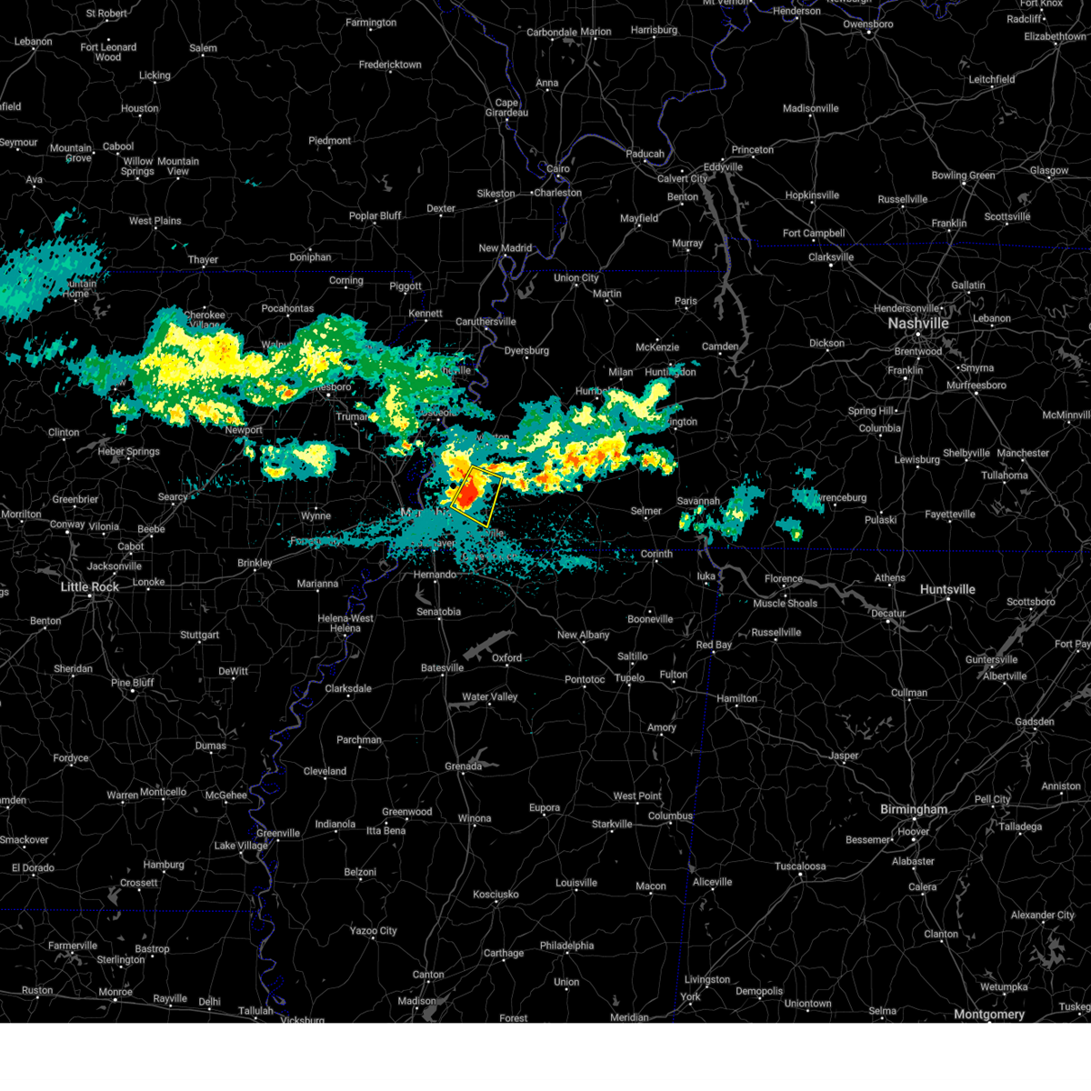 At 143 am cdt, a severe thunderstorm was located over lakeland, or near bartlett, moving southeast at 45 mph (radar indicated). Hazards include 60 mph wind gusts and penny size hail. Expect damage to roofs, siding, and trees. Locations impacted include, brunswick, lenow, fisherville, barretville, eads, ellendale, redwood, braden, rosemark, spring lake, gallaway, lakeland, idaville, bolton, bartlett, arlington, hickory withe, and atoka. At 143 am cdt, a severe thunderstorm was located over lakeland, or near bartlett, moving southeast at 45 mph (radar indicated). Hazards include 60 mph wind gusts and penny size hail. Expect damage to roofs, siding, and trees. Locations impacted include, brunswick, lenow, fisherville, barretville, eads, ellendale, redwood, braden, rosemark, spring lake, gallaway, lakeland, idaville, bolton, bartlett, arlington, hickory withe, and atoka.
|
| 5/22/2025 1:28 AM CDT |
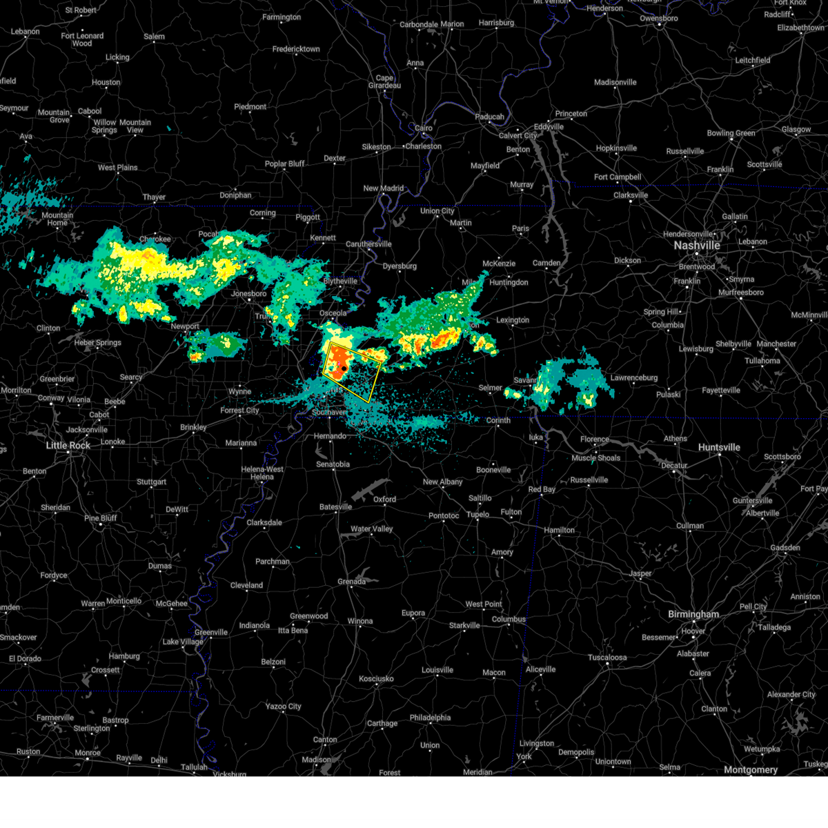 At 127 am cdt, a severe thunderstorm was located over millington, moving southeast at 45 mph (radar indicated). Hazards include 60 mph wind gusts and penny size hail. Expect damage to roofs, siding, and trees. Locations impacted include, lenow, munford, barretville, griffin corner, ellendale, quito, woodstock, redwood, rosemark, idaville, atoka, locke, dixonville, millington, sloanville, arlington, brunswick, fisherville, eads, and tipton. At 127 am cdt, a severe thunderstorm was located over millington, moving southeast at 45 mph (radar indicated). Hazards include 60 mph wind gusts and penny size hail. Expect damage to roofs, siding, and trees. Locations impacted include, lenow, munford, barretville, griffin corner, ellendale, quito, woodstock, redwood, rosemark, idaville, atoka, locke, dixonville, millington, sloanville, arlington, brunswick, fisherville, eads, and tipton.
|
| 5/22/2025 1:28 AM CDT |
 the severe thunderstorm warning has been cancelled and is no longer in effect the severe thunderstorm warning has been cancelled and is no longer in effect
|
| 5/22/2025 1:09 AM CDT |
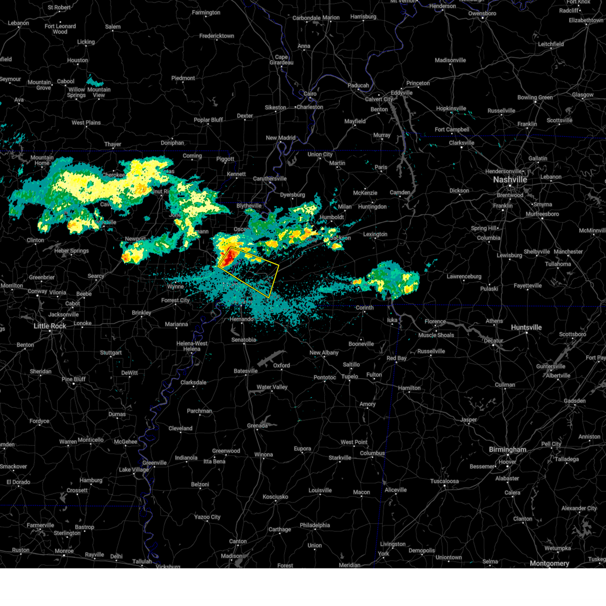 Svrmeg the national weather service in memphis has issued a * severe thunderstorm warning for, southwestern mississippi county in eastern arkansas, northeastern crittenden county in eastern arkansas, southwestern tipton county in west tennessee, northwestern fayette county in west tennessee, northeastern shelby county in west tennessee, * until 200 am cdt. * at 109 am cdt, a severe thunderstorm was located near joiner, or 8 miles northwest of meeman shelby forest state park, moving southeast at 45 mph (radar indicated). Hazards include 60 mph wind gusts and penny size hail. expect damage to roofs, siding, and trees Svrmeg the national weather service in memphis has issued a * severe thunderstorm warning for, southwestern mississippi county in eastern arkansas, northeastern crittenden county in eastern arkansas, southwestern tipton county in west tennessee, northwestern fayette county in west tennessee, northeastern shelby county in west tennessee, * until 200 am cdt. * at 109 am cdt, a severe thunderstorm was located near joiner, or 8 miles northwest of meeman shelby forest state park, moving southeast at 45 mph (radar indicated). Hazards include 60 mph wind gusts and penny size hail. expect damage to roofs, siding, and trees
|
| 5/20/2025 4:06 PM CDT |
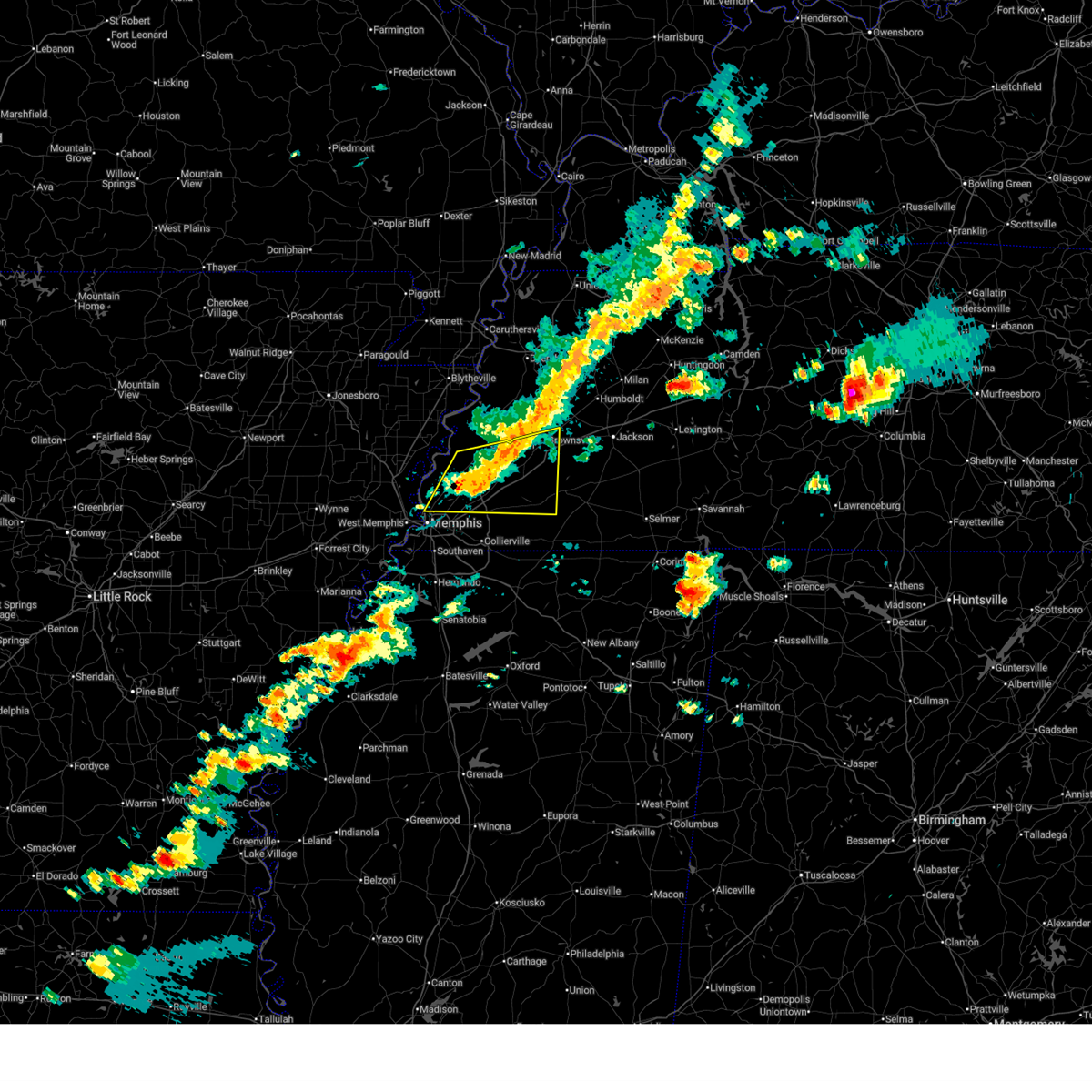 At 406 pm cdt, a severe thunderstorm was located 7 miles north of arlington, or 12 miles east of millington, moving east at 50 mph (radar indicated). Hazards include 60 mph wind gusts and quarter size hail. Hail damage to vehicles is expected. expect wind damage to roofs, siding, and trees. Locations impacted include, yum yum, stanton, brownsville, belmont, ellendale, oakland, woodstock, atoka, sloanville, arlington, brunswick, laconia, tipton, sunnyhill, keeling, frayser, lambert, gainesville, tabernacle, and mason. At 406 pm cdt, a severe thunderstorm was located 7 miles north of arlington, or 12 miles east of millington, moving east at 50 mph (radar indicated). Hazards include 60 mph wind gusts and quarter size hail. Hail damage to vehicles is expected. expect wind damage to roofs, siding, and trees. Locations impacted include, yum yum, stanton, brownsville, belmont, ellendale, oakland, woodstock, atoka, sloanville, arlington, brunswick, laconia, tipton, sunnyhill, keeling, frayser, lambert, gainesville, tabernacle, and mason.
|
| 5/20/2025 3:55 PM CDT |
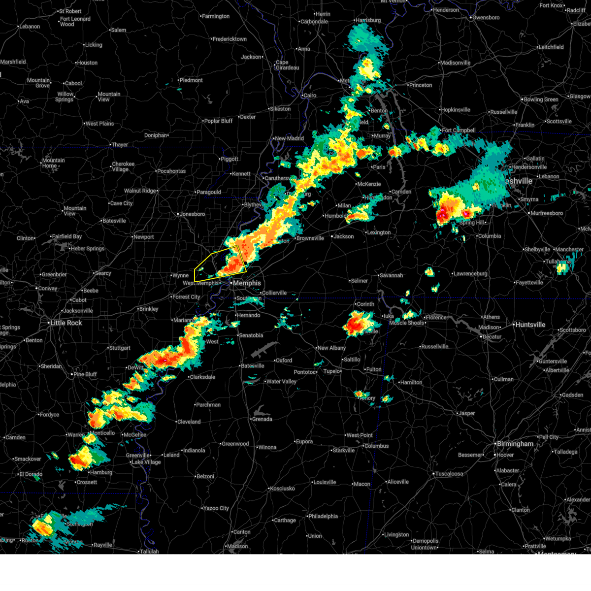 Large hail and damaging winds are still possible with this thunderstorm. a severe thunderstorm warning still remains in effect for northern shelby and tipton counties. a tornado watch remains in effect until 800 pm cdt for eastern arkansas, and west tennessee. Large hail and damaging winds are still possible with this thunderstorm. a severe thunderstorm warning still remains in effect for northern shelby and tipton counties. a tornado watch remains in effect until 800 pm cdt for eastern arkansas, and west tennessee.
|
| 5/20/2025 3:52 PM CDT |
 Svrmeg the national weather service in memphis has issued a * severe thunderstorm warning for, tipton county in west tennessee, northern fayette county in west tennessee, southern haywood county in west tennessee, northeastern shelby county in west tennessee, * until 430 pm cdt. * at 351 pm cdt, a severe thunderstorm was located over millington, moving east at 50 mph (radar indicated). Hazards include 60 mph wind gusts and quarter size hail. Hail damage to vehicles is expected. Expect wind damage to roofs, siding, and trees. Svrmeg the national weather service in memphis has issued a * severe thunderstorm warning for, tipton county in west tennessee, northern fayette county in west tennessee, southern haywood county in west tennessee, northeastern shelby county in west tennessee, * until 430 pm cdt. * at 351 pm cdt, a severe thunderstorm was located over millington, moving east at 50 mph (radar indicated). Hazards include 60 mph wind gusts and quarter size hail. Hail damage to vehicles is expected. Expect wind damage to roofs, siding, and trees.
|
| 5/20/2025 3:32 PM CDT |
 At 332 pm cdt, a severe thunderstorm was located near jericho, or near meeman shelby forest state park, moving east at 50 mph (radar indicated). Hazards include 70 mph wind gusts and half dollar size hail. Hail damage to vehicles is expected. expect considerable tree damage. wind damage is also likely to mobile homes, roofs, and outbuildings. Locations impacted include, wapanocca national wildlife refuge, jericho, booker, griffin corner, turrell, menesha, gammon, quito, cunningham corner, clarkedale, woodstock, st clair, harvard, gilmore, cloar, earle, locke, dixonville, sloanville, and frenchmans bayou. At 332 pm cdt, a severe thunderstorm was located near jericho, or near meeman shelby forest state park, moving east at 50 mph (radar indicated). Hazards include 70 mph wind gusts and half dollar size hail. Hail damage to vehicles is expected. expect considerable tree damage. wind damage is also likely to mobile homes, roofs, and outbuildings. Locations impacted include, wapanocca national wildlife refuge, jericho, booker, griffin corner, turrell, menesha, gammon, quito, cunningham corner, clarkedale, woodstock, st clair, harvard, gilmore, cloar, earle, locke, dixonville, sloanville, and frenchmans bayou.
|
| 5/20/2025 3:32 PM CDT |
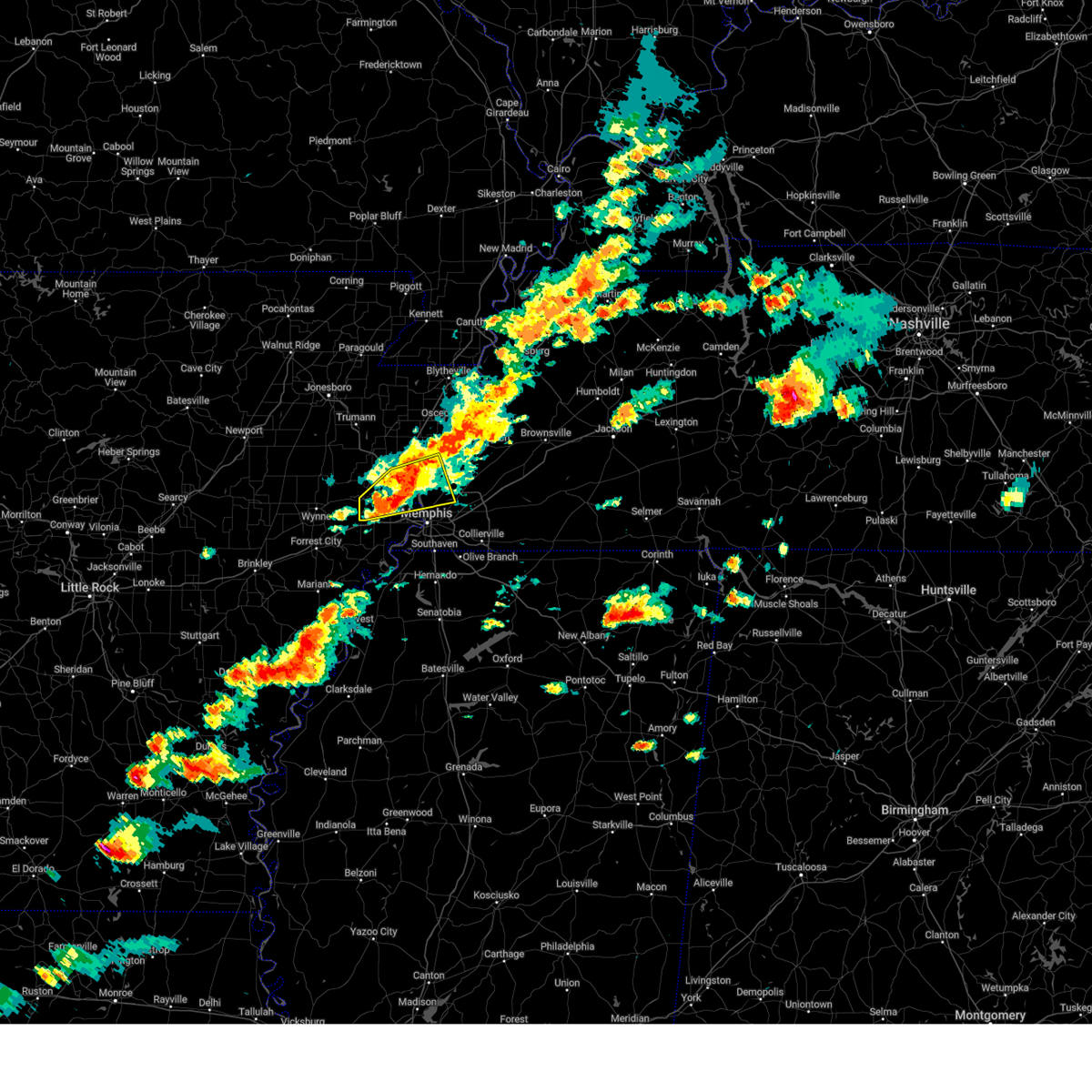 the severe thunderstorm warning has been cancelled and is no longer in effect the severe thunderstorm warning has been cancelled and is no longer in effect
|
| 5/20/2025 3:13 PM CDT |
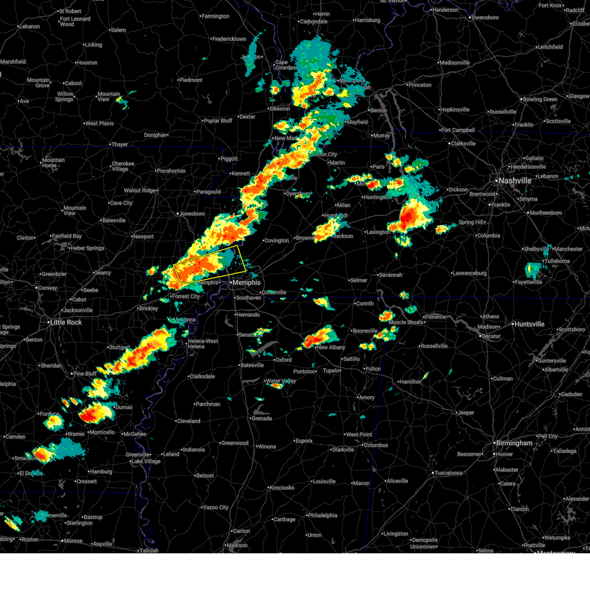 Svrmeg the national weather service in memphis has issued a * severe thunderstorm warning for, southwestern mississippi county in eastern arkansas, northern crittenden county in eastern arkansas, southeastern cross county in eastern arkansas, southwestern tipton county in west tennessee, northwestern shelby county in west tennessee, * until 400 pm cdt. * at 313 pm cdt, a severe thunderstorm was located over parkin, moving east at 45 mph (radar indicated). Hazards include 60 mph wind gusts and half dollar size hail. Hail damage to vehicles is expected. Expect wind damage to roofs, siding, and trees. Svrmeg the national weather service in memphis has issued a * severe thunderstorm warning for, southwestern mississippi county in eastern arkansas, northern crittenden county in eastern arkansas, southeastern cross county in eastern arkansas, southwestern tipton county in west tennessee, northwestern shelby county in west tennessee, * until 400 pm cdt. * at 313 pm cdt, a severe thunderstorm was located over parkin, moving east at 45 mph (radar indicated). Hazards include 60 mph wind gusts and half dollar size hail. Hail damage to vehicles is expected. Expect wind damage to roofs, siding, and trees.
|
| 5/18/2025 11:14 PM CDT |
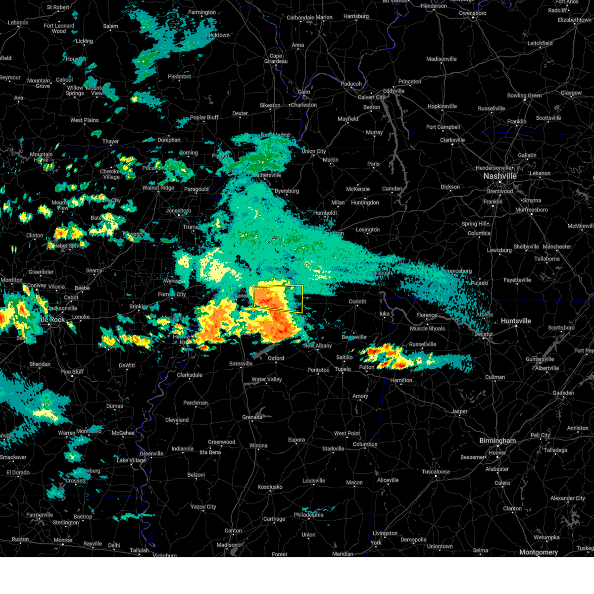 At 1113 pm cdt, a severe thunderstorm was located over mt pleasant, or 10 miles southeast of collierville, moving east at 35 mph (radar indicated). Hazards include 60 mph wind gusts and penny size hail. Expect damage to roofs, siding, and trees. Locations impacted include, piperton, ghost river state natural area, mt pleasant, cayce, collierville, elba, lagrange, la grange, moscow, germantown, early grove, handy corner, taska, michigan city, kirk, lamar, hays crossing, slayden, forty five, and rossville. At 1113 pm cdt, a severe thunderstorm was located over mt pleasant, or 10 miles southeast of collierville, moving east at 35 mph (radar indicated). Hazards include 60 mph wind gusts and penny size hail. Expect damage to roofs, siding, and trees. Locations impacted include, piperton, ghost river state natural area, mt pleasant, cayce, collierville, elba, lagrange, la grange, moscow, germantown, early grove, handy corner, taska, michigan city, kirk, lamar, hays crossing, slayden, forty five, and rossville.
|
| 5/18/2025 10:57 PM CDT |
 At 1057 pm cdt, a severe thunderstorm was located over collierville, moving east at 30 mph (radar indicated). Hazards include 60 mph wind gusts and nickel size hail. Expect damage to roofs, siding, and trees. Locations impacted include, piperton, ghost river state natural area, mt pleasant, cayce, lagrange, la grange, moscow, germantown, handy corner, taska, capleville, kirk, rossville, collierville, southeast memphis, fairhaven, elba, parkway village, olive branch, and early grove. At 1057 pm cdt, a severe thunderstorm was located over collierville, moving east at 30 mph (radar indicated). Hazards include 60 mph wind gusts and nickel size hail. Expect damage to roofs, siding, and trees. Locations impacted include, piperton, ghost river state natural area, mt pleasant, cayce, lagrange, la grange, moscow, germantown, handy corner, taska, capleville, kirk, rossville, collierville, southeast memphis, fairhaven, elba, parkway village, olive branch, and early grove.
|
| 5/18/2025 10:39 PM CDT |
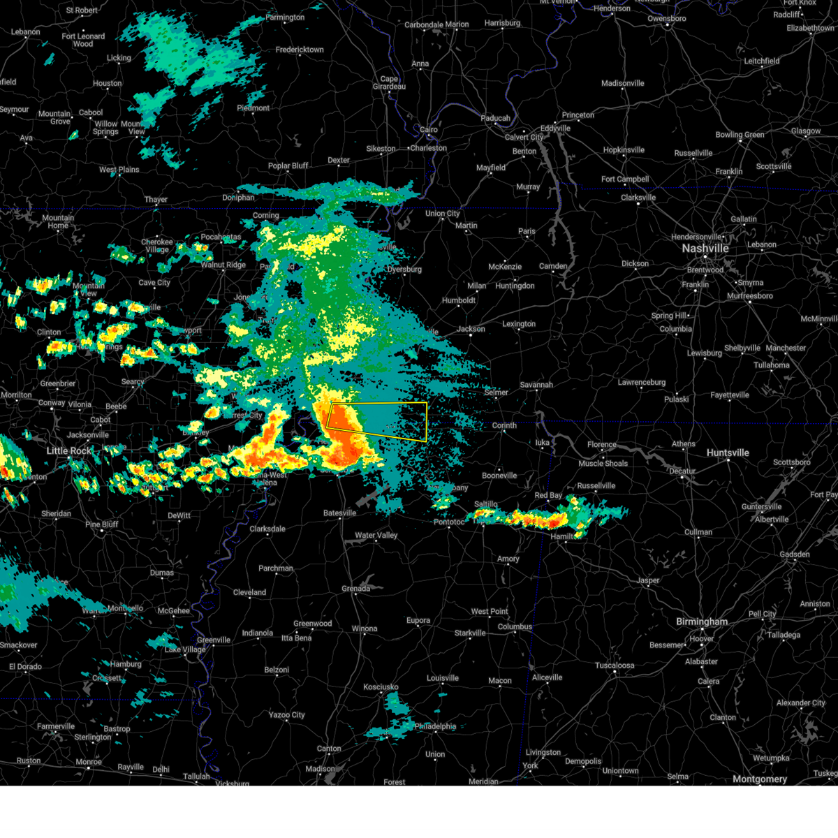 Svrmeg the national weather service in memphis has issued a * severe thunderstorm warning for, northeastern desoto county in northwestern mississippi, northern marshall county in northwestern mississippi, northwestern benton county in northeastern mississippi, southern fayette county in west tennessee, southeastern shelby county in west tennessee, * until 1145 pm cdt. * at 1039 pm cdt, a severe thunderstorm was located over southeast memphis, or near olive branch, moving east at 30 mph (radar indicated). Hazards include 60 mph wind gusts and nickel size hail. expect damage to roofs, siding, and trees Svrmeg the national weather service in memphis has issued a * severe thunderstorm warning for, northeastern desoto county in northwestern mississippi, northern marshall county in northwestern mississippi, northwestern benton county in northeastern mississippi, southern fayette county in west tennessee, southeastern shelby county in west tennessee, * until 1145 pm cdt. * at 1039 pm cdt, a severe thunderstorm was located over southeast memphis, or near olive branch, moving east at 30 mph (radar indicated). Hazards include 60 mph wind gusts and nickel size hail. expect damage to roofs, siding, and trees
|
| 5/18/2025 10:11 PM CDT |
 the severe thunderstorm warning has been cancelled and is no longer in effect the severe thunderstorm warning has been cancelled and is no longer in effect
|
| 5/18/2025 10:11 PM CDT |
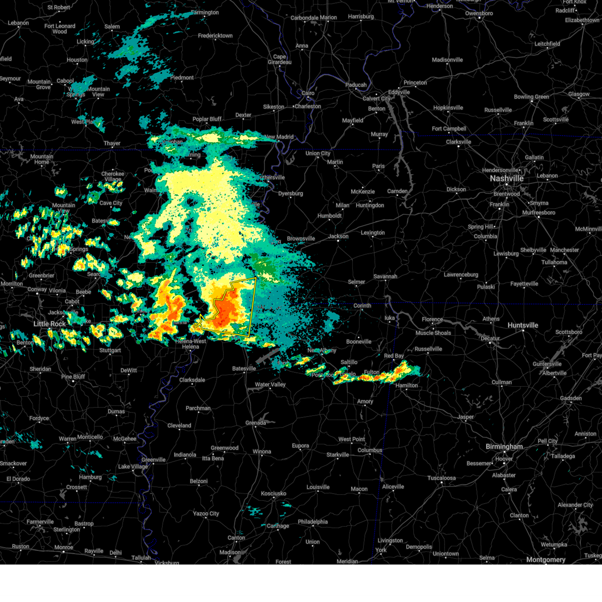 At 1011 pm cdt, a severe thunderstorm was located over eudora, or 7 miles west of hernando, moving east at 35 mph (radar indicated). Hazards include 70 mph wind gusts and half dollar size hail. Hail damage to vehicles is expected. expect considerable tree damage. wind damage is also likely to mobile homes, roofs, and outbuildings. Locations impacted include, clack, trinity, lake cormorant, southwest memphis, horn lake, commerce, ellendale, bright, presidents island, eudora, t o fuller state park, glover, coldwater, memphis, robinson gin, elmore park, alden, twin lakes, whitehaven, and southaven. At 1011 pm cdt, a severe thunderstorm was located over eudora, or 7 miles west of hernando, moving east at 35 mph (radar indicated). Hazards include 70 mph wind gusts and half dollar size hail. Hail damage to vehicles is expected. expect considerable tree damage. wind damage is also likely to mobile homes, roofs, and outbuildings. Locations impacted include, clack, trinity, lake cormorant, southwest memphis, horn lake, commerce, ellendale, bright, presidents island, eudora, t o fuller state park, glover, coldwater, memphis, robinson gin, elmore park, alden, twin lakes, whitehaven, and southaven.
|
| 5/18/2025 10:02 PM CDT |
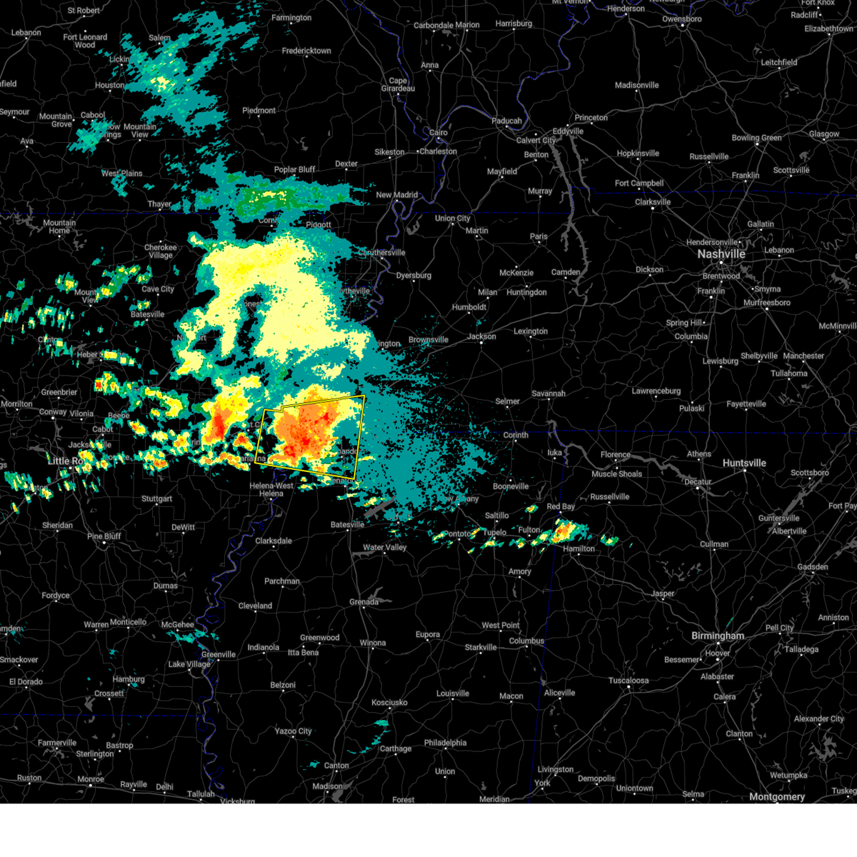 At 1001 pm cdt, a severe thunderstorm was located over walls, or 7 miles west of horn lake, moving east at 50 mph (radar indicated). Hazards include ping pong ball size hail and 60 mph wind gusts. People and animals outdoors will be injured. expect hail damage to roofs, siding, windows, and vehicles. expect wind damage to roofs, siding, and trees. Locations impacted include, cody, lake cormorant, southwest memphis, browns, horn lake, commerce, louise, bright, edmondson, round pond, presidents island, beck, simsboro, glover, brickeys, ball point, whitehall, tongin, elmore park, and alden. At 1001 pm cdt, a severe thunderstorm was located over walls, or 7 miles west of horn lake, moving east at 50 mph (radar indicated). Hazards include ping pong ball size hail and 60 mph wind gusts. People and animals outdoors will be injured. expect hail damage to roofs, siding, windows, and vehicles. expect wind damage to roofs, siding, and trees. Locations impacted include, cody, lake cormorant, southwest memphis, browns, horn lake, commerce, louise, bright, edmondson, round pond, presidents island, beck, simsboro, glover, brickeys, ball point, whitehall, tongin, elmore park, and alden.
|
| 5/18/2025 9:36 PM CDT |
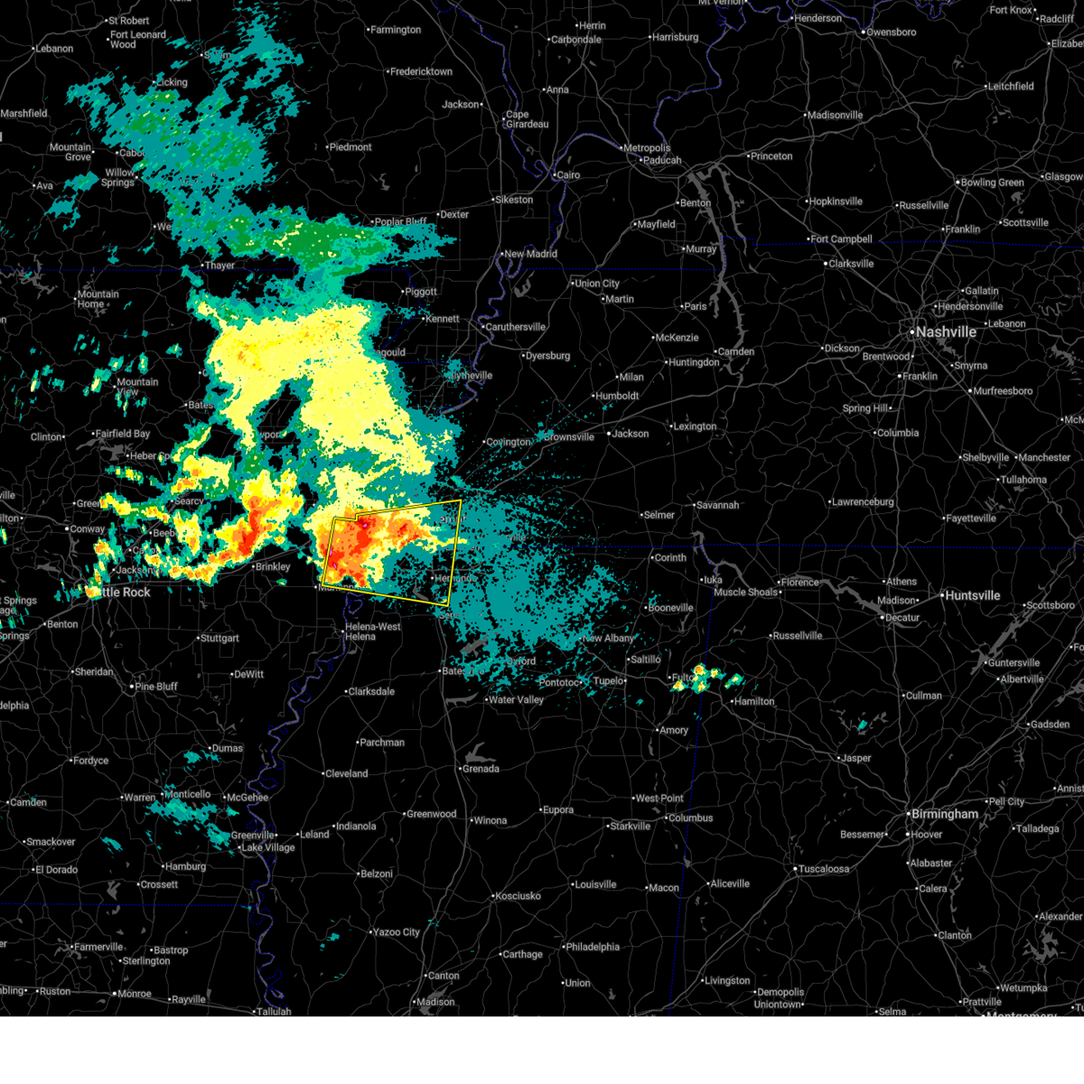 Svrmeg the national weather service in memphis has issued a * severe thunderstorm warning for, northeastern lee county in eastern arkansas, eastern st. francis county in eastern arkansas, southern crittenden county in eastern arkansas, desoto county in northwestern mississippi, northern tunica county in northwestern mississippi, northwestern tate county in northwestern mississippi, southwestern shelby county in west tennessee, * until 1030 pm cdt. * at 936 pm cdt, a severe thunderstorm was located over simsboro, or 8 miles northeast of hughes, moving east at 30 mph (radar indicated). Hazards include golf ball size hail and 60 mph wind gusts. People and animals outdoors will be injured. expect hail damage to roofs, siding, windows, and vehicles. Expect wind damage to roofs, siding, and trees. Svrmeg the national weather service in memphis has issued a * severe thunderstorm warning for, northeastern lee county in eastern arkansas, eastern st. francis county in eastern arkansas, southern crittenden county in eastern arkansas, desoto county in northwestern mississippi, northern tunica county in northwestern mississippi, northwestern tate county in northwestern mississippi, southwestern shelby county in west tennessee, * until 1030 pm cdt. * at 936 pm cdt, a severe thunderstorm was located over simsboro, or 8 miles northeast of hughes, moving east at 30 mph (radar indicated). Hazards include golf ball size hail and 60 mph wind gusts. People and animals outdoors will be injured. expect hail damage to roofs, siding, windows, and vehicles. Expect wind damage to roofs, siding, and trees.
|
| 5/2/2025 11:53 AM CDT |
 At 1153 am cdt, severe thunderstorms were located along a line extending from near joiner to hernando to near crowder, moving east at 45 mph (radar indicated). Hazards include 60 mph wind gusts and quarter size hail. Hail damage to vehicles is expected. expect wind damage to roofs, siding, and trees. Locations impacted include, three forks, charleston, horn lake, louise, austin, bright, falcon, edmondson, strayhorn, prichard, presidents island, beck, dubbs, glover, locke, arlington, elmore park, alden, dooley, and north tunica. At 1153 am cdt, severe thunderstorms were located along a line extending from near joiner to hernando to near crowder, moving east at 45 mph (radar indicated). Hazards include 60 mph wind gusts and quarter size hail. Hail damage to vehicles is expected. expect wind damage to roofs, siding, and trees. Locations impacted include, three forks, charleston, horn lake, louise, austin, bright, falcon, edmondson, strayhorn, prichard, presidents island, beck, dubbs, glover, locke, arlington, elmore park, alden, dooley, and north tunica.
|
| 5/2/2025 11:53 AM CDT |
 the severe thunderstorm warning has been cancelled and is no longer in effect the severe thunderstorm warning has been cancelled and is no longer in effect
|
| 5/2/2025 11:26 AM CDT |
 Svrmeg the national weather service in memphis has issued a * severe thunderstorm warning for, northeastern st. francis county in eastern arkansas, crittenden county in eastern arkansas, northeastern cross county in eastern arkansas, desoto county in northwestern mississippi, northwestern yalobusha county in northwestern mississippi, eastern coahoma county in northwestern mississippi, tunica county in northwestern mississippi, tate county in northwestern mississippi, northern tallahatchie county in northwestern mississippi, quitman county in northwestern mississippi, panola county in northwestern mississippi, shelby county in west tennessee, * until 1230 pm cdt. * at 1126 am cdt, severe thunderstorms were located along a line extending from near tyronza to robinsonville to dublin, moving east at 45 mph (radar indicated). Hazards include 60 mph wind gusts and quarter size hail. Hail damage to vehicles is expected. Expect wind damage to roofs, siding, and trees. Svrmeg the national weather service in memphis has issued a * severe thunderstorm warning for, northeastern st. francis county in eastern arkansas, crittenden county in eastern arkansas, northeastern cross county in eastern arkansas, desoto county in northwestern mississippi, northwestern yalobusha county in northwestern mississippi, eastern coahoma county in northwestern mississippi, tunica county in northwestern mississippi, tate county in northwestern mississippi, northern tallahatchie county in northwestern mississippi, quitman county in northwestern mississippi, panola county in northwestern mississippi, shelby county in west tennessee, * until 1230 pm cdt. * at 1126 am cdt, severe thunderstorms were located along a line extending from near tyronza to robinsonville to dublin, moving east at 45 mph (radar indicated). Hazards include 60 mph wind gusts and quarter size hail. Hail damage to vehicles is expected. Expect wind damage to roofs, siding, and trees.
|
| 5/2/2025 9:56 AM CDT |
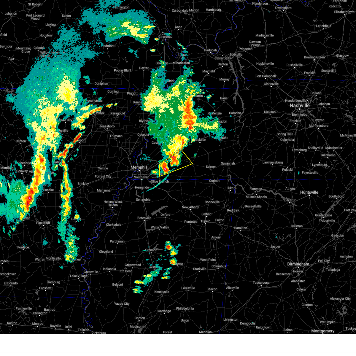 At 955 am cdt, a severe thunderstorm was located over somerville, or 20 miles northeast of collierville, moving northeast at 50 mph (radar indicated). Hazards include ping pong ball size hail and 60 mph wind gusts. People and animals outdoors will be injured. expect hail damage to roofs, siding, windows, and vehicles. expect wind damage to roofs, siding, and trees. Locations impacted include, yum yum, oakland, taylor chapel, warren, whiteville, kirk, bolivar, hickory withe, somerville, fayette corners, laconia, macon, elba, hillville, cedar chapel, canadaville, moorman, dancyville, williston, and lambert. At 955 am cdt, a severe thunderstorm was located over somerville, or 20 miles northeast of collierville, moving northeast at 50 mph (radar indicated). Hazards include ping pong ball size hail and 60 mph wind gusts. People and animals outdoors will be injured. expect hail damage to roofs, siding, windows, and vehicles. expect wind damage to roofs, siding, and trees. Locations impacted include, yum yum, oakland, taylor chapel, warren, whiteville, kirk, bolivar, hickory withe, somerville, fayette corners, laconia, macon, elba, hillville, cedar chapel, canadaville, moorman, dancyville, williston, and lambert.
|
| 5/2/2025 9:46 AM CDT |
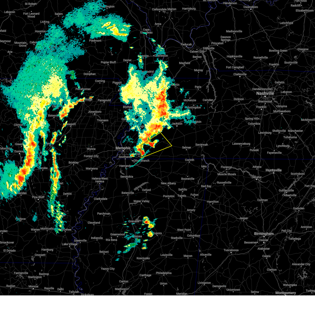 At 946 am cdt, a severe thunderstorm was located 8 miles east of eads, or 12 miles northeast of collierville, moving northeast at 50 mph (radar indicated). Hazards include 60 mph wind gusts and half dollar size hail. Hail damage to vehicles is expected. expect wind damage to roofs, siding, and trees. Locations impacted include, piperton, yum yum, oakland, taylor chapel, warren, whiteville, kirk, bolivar, hickory withe, pattersonville, rossville, somerville, fayette corners, laconia, macon, elba, hillville, cedar chapel, canadaville, and vildo. At 946 am cdt, a severe thunderstorm was located 8 miles east of eads, or 12 miles northeast of collierville, moving northeast at 50 mph (radar indicated). Hazards include 60 mph wind gusts and half dollar size hail. Hail damage to vehicles is expected. expect wind damage to roofs, siding, and trees. Locations impacted include, piperton, yum yum, oakland, taylor chapel, warren, whiteville, kirk, bolivar, hickory withe, pattersonville, rossville, somerville, fayette corners, laconia, macon, elba, hillville, cedar chapel, canadaville, and vildo.
|
| 5/2/2025 9:46 AM CDT |
 the severe thunderstorm warning has been cancelled and is no longer in effect the severe thunderstorm warning has been cancelled and is no longer in effect
|
| 5/2/2025 9:43 AM CDT |
 At 943 am cdt, a severe thunderstorm was located near eads, or 9 miles northeast of collierville, moving northeast at 50 mph (radar indicated). Hazards include 60 mph wind gusts and half dollar size hail. Hail damage to vehicles is expected. expect wind damage to roofs, siding, and trees. Locations impacted include, piperton, lenow, yum yum, oakland, taylor chapel, warren, whiteville, kirk, bolivar, hickory withe, pattersonville, rossville, somerville, fayette corners, fisherville, laconia, collierville, macon, elba, and hillville. At 943 am cdt, a severe thunderstorm was located near eads, or 9 miles northeast of collierville, moving northeast at 50 mph (radar indicated). Hazards include 60 mph wind gusts and half dollar size hail. Hail damage to vehicles is expected. expect wind damage to roofs, siding, and trees. Locations impacted include, piperton, lenow, yum yum, oakland, taylor chapel, warren, whiteville, kirk, bolivar, hickory withe, pattersonville, rossville, somerville, fayette corners, fisherville, laconia, collierville, macon, elba, and hillville.
|
| 5/2/2025 9:39 AM CDT |
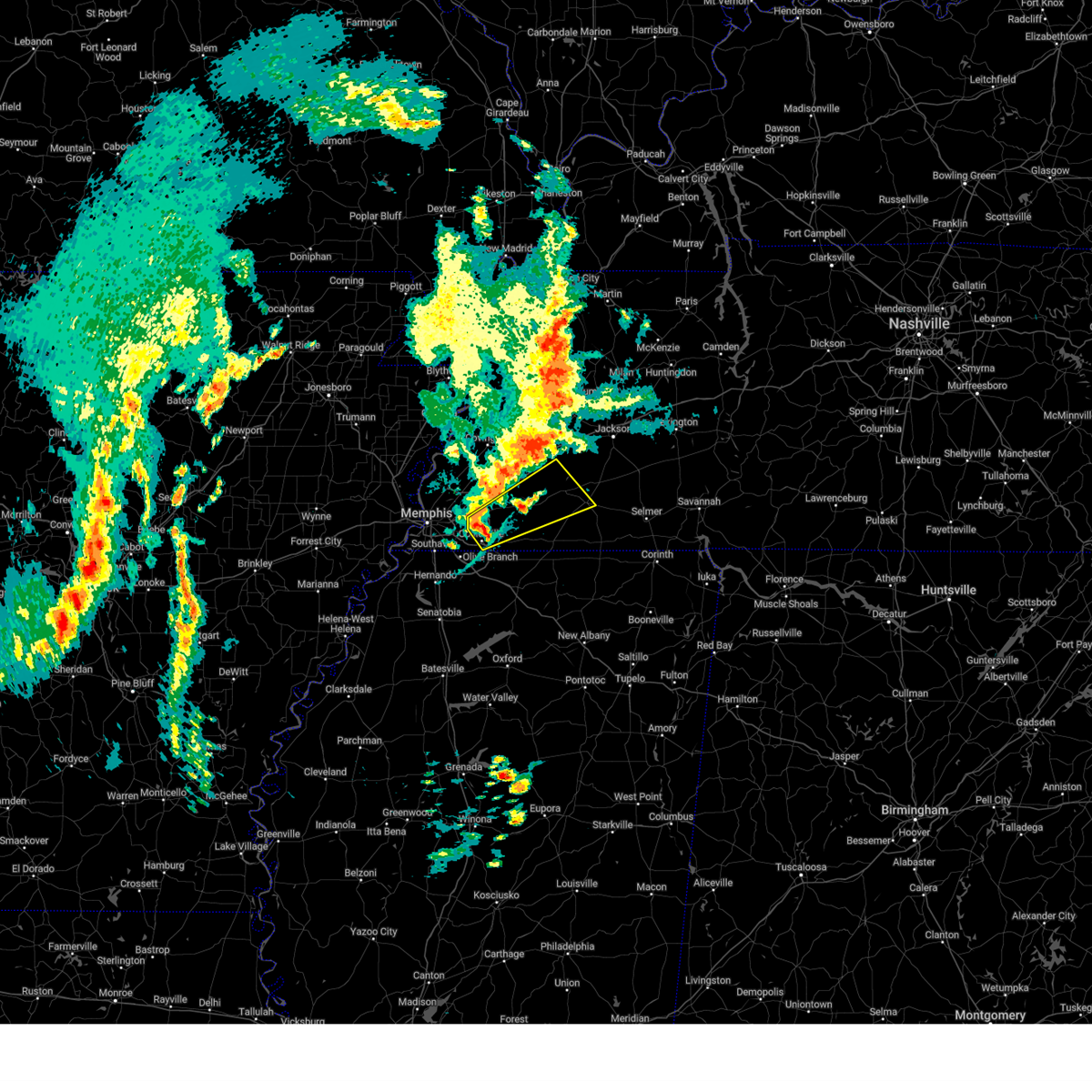 Svrmeg the national weather service in memphis has issued a * severe thunderstorm warning for, fayette county in west tennessee, northwestern hardeman county in west tennessee, south central haywood county in west tennessee, southeastern shelby county in west tennessee, * until 1030 am cdt. * at 939 am cdt, a severe thunderstorm was located near collierville, moving northeast at 50 mph (radar indicated). Hazards include 60 mph wind gusts and quarter size hail. Hail damage to vehicles is expected. Expect wind damage to roofs, siding, and trees. Svrmeg the national weather service in memphis has issued a * severe thunderstorm warning for, fayette county in west tennessee, northwestern hardeman county in west tennessee, south central haywood county in west tennessee, southeastern shelby county in west tennessee, * until 1030 am cdt. * at 939 am cdt, a severe thunderstorm was located near collierville, moving northeast at 50 mph (radar indicated). Hazards include 60 mph wind gusts and quarter size hail. Hail damage to vehicles is expected. Expect wind damage to roofs, siding, and trees.
|
| 5/2/2025 8:56 AM CDT |
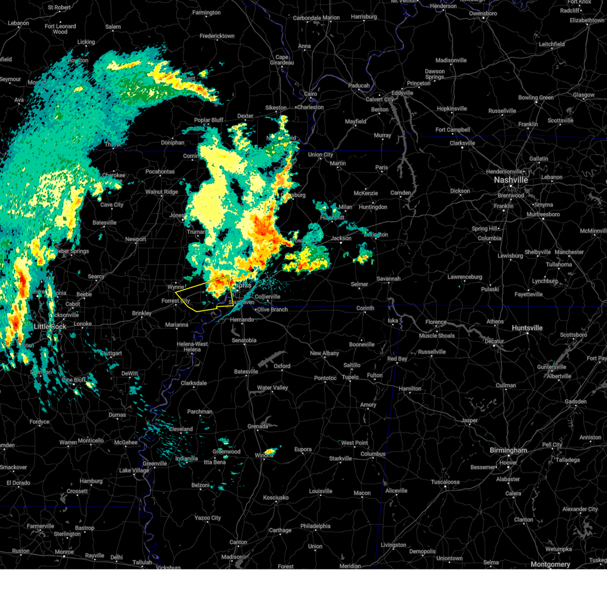 The storm which prompted the warning has weakened below severe limits, and no longer poses an immediate threat to life or property. therefore, the warning will be allowed to expire. The storm which prompted the warning has weakened below severe limits, and no longer poses an immediate threat to life or property. therefore, the warning will be allowed to expire.
|
| 5/2/2025 8:34 AM CDT |
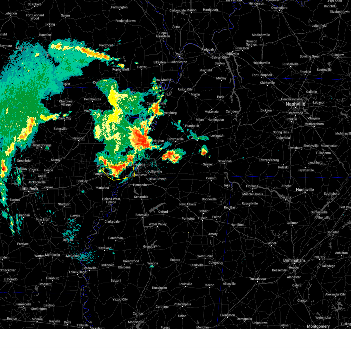 At 833 am cdt, a severe thunderstorm was located near jennette, or 10 miles south of earle, moving northeast at 45 mph (radar indicated). Hazards include quarter size hail. Damage to vehicles is expected. Locations impacted include, hughes, cottonwood corner, browns, louise, west memphis, cunningham corner, edmondson, round pond, presidents island, simsboro, democrat, riceville, hulbert, penjur, julius, burnt cane, patoka, clarks corner, anthonyville, and james mill. At 833 am cdt, a severe thunderstorm was located near jennette, or 10 miles south of earle, moving northeast at 45 mph (radar indicated). Hazards include quarter size hail. Damage to vehicles is expected. Locations impacted include, hughes, cottonwood corner, browns, louise, west memphis, cunningham corner, edmondson, round pond, presidents island, simsboro, democrat, riceville, hulbert, penjur, julius, burnt cane, patoka, clarks corner, anthonyville, and james mill.
|
| 5/2/2025 8:08 AM CDT |
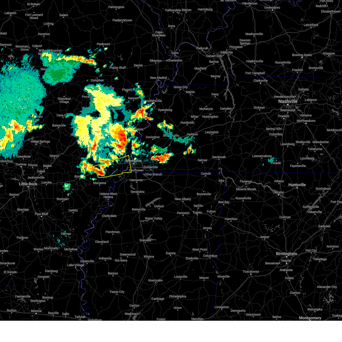 Svrmeg the national weather service in memphis has issued a * severe thunderstorm warning for, eastern st. francis county in eastern arkansas, central crittenden county in eastern arkansas, southeastern cross county in eastern arkansas, southwestern shelby county in west tennessee, * until 900 am cdt. * at 808 am cdt, a severe thunderstorm was located over madison, moving east at 55 mph (radar indicated). Hazards include quarter size hail. damage to vehicles is expected Svrmeg the national weather service in memphis has issued a * severe thunderstorm warning for, eastern st. francis county in eastern arkansas, central crittenden county in eastern arkansas, southeastern cross county in eastern arkansas, southwestern shelby county in west tennessee, * until 900 am cdt. * at 808 am cdt, a severe thunderstorm was located over madison, moving east at 55 mph (radar indicated). Hazards include quarter size hail. damage to vehicles is expected
|
| 5/2/2025 8:02 AM CDT |
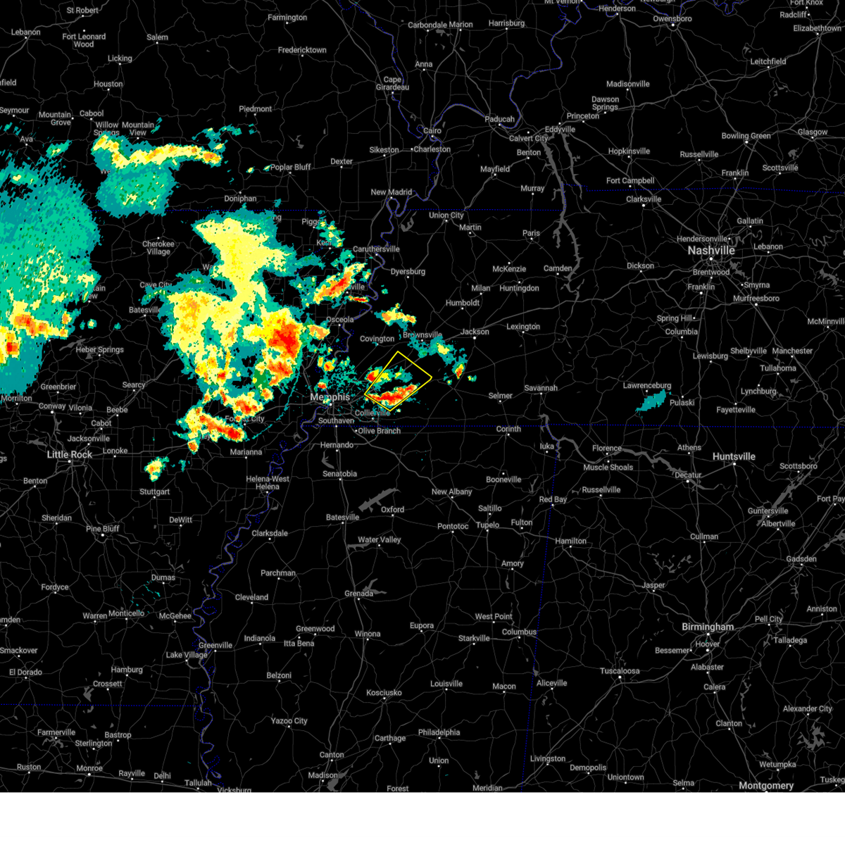 Svrmeg the national weather service in memphis has issued a * severe thunderstorm warning for, southeastern tipton county in west tennessee, northern fayette county in west tennessee, southwestern haywood county in west tennessee, east central shelby county in west tennessee, * until 845 am cdt. * at 802 am cdt, a severe thunderstorm was located near eads, or 13 miles east of cordova, moving northeast at 15 mph (radar indicated). Hazards include quarter size hail. damage to vehicles is expected Svrmeg the national weather service in memphis has issued a * severe thunderstorm warning for, southeastern tipton county in west tennessee, northern fayette county in west tennessee, southwestern haywood county in west tennessee, east central shelby county in west tennessee, * until 845 am cdt. * at 802 am cdt, a severe thunderstorm was located near eads, or 13 miles east of cordova, moving northeast at 15 mph (radar indicated). Hazards include quarter size hail. damage to vehicles is expected
|
| 4/30/2025 9:09 PM CDT |
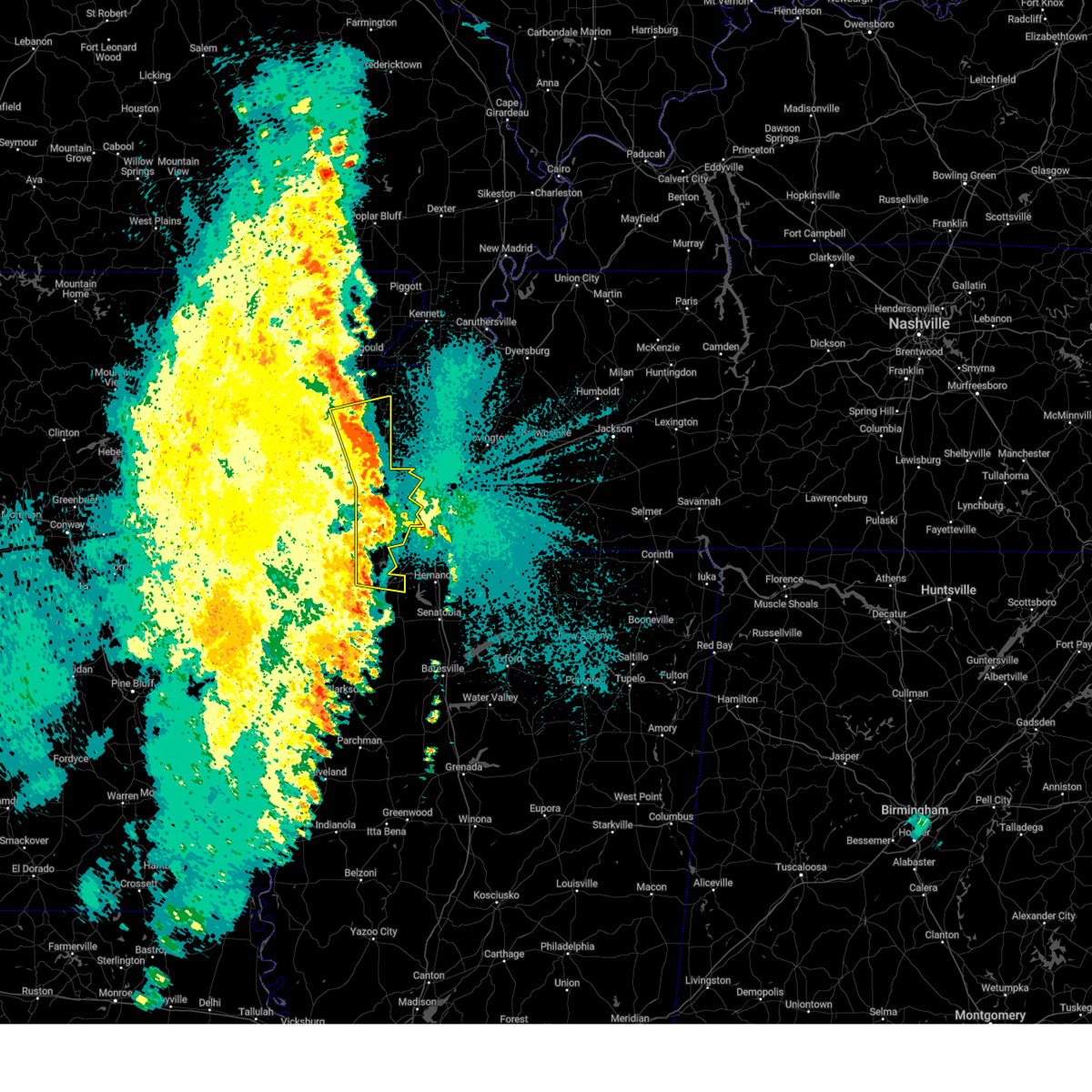 The storms which prompted the warning have moved out of the warned area. therefore, the warning will be allowed to expire. a severe thunderstorm watch remains in effect until 1100 pm cdt for eastern arkansas, northwestern mississippi, and west tennessee. The storms which prompted the warning have moved out of the warned area. therefore, the warning will be allowed to expire. a severe thunderstorm watch remains in effect until 1100 pm cdt for eastern arkansas, northwestern mississippi, and west tennessee.
|
| 4/30/2025 8:56 PM CDT |
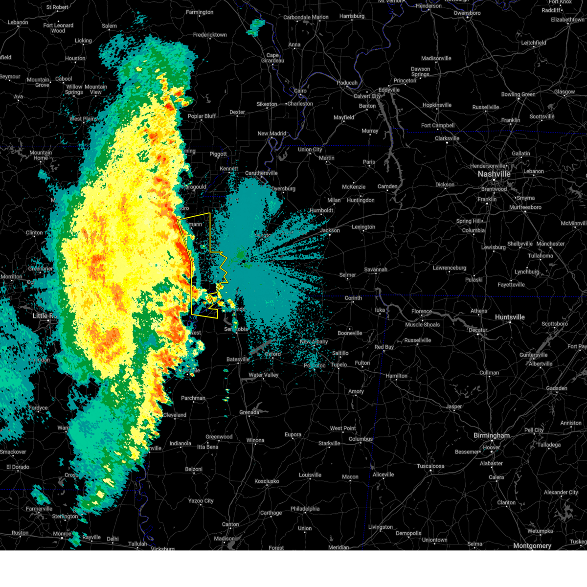 At 855 pm cdt, severe thunderstorms were located along a line extending from near bay to near earle to near hughes, moving east at 30 mph (public). Hazards include 60 mph wind gusts and penny size hail. Expect damage to roofs, siding, and trees. Locations impacted include, three forks, payneway, browns, commerce, louise, menesha, gum point, edmondson, st clair, beck, simsboro, promised land, alto, judd hill, bunney, julius, lost lake, galilee, mccormick, and wilbeth. At 855 pm cdt, severe thunderstorms were located along a line extending from near bay to near earle to near hughes, moving east at 30 mph (public). Hazards include 60 mph wind gusts and penny size hail. Expect damage to roofs, siding, and trees. Locations impacted include, three forks, payneway, browns, commerce, louise, menesha, gum point, edmondson, st clair, beck, simsboro, promised land, alto, judd hill, bunney, julius, lost lake, galilee, mccormick, and wilbeth.
|
| 4/30/2025 8:33 PM CDT |
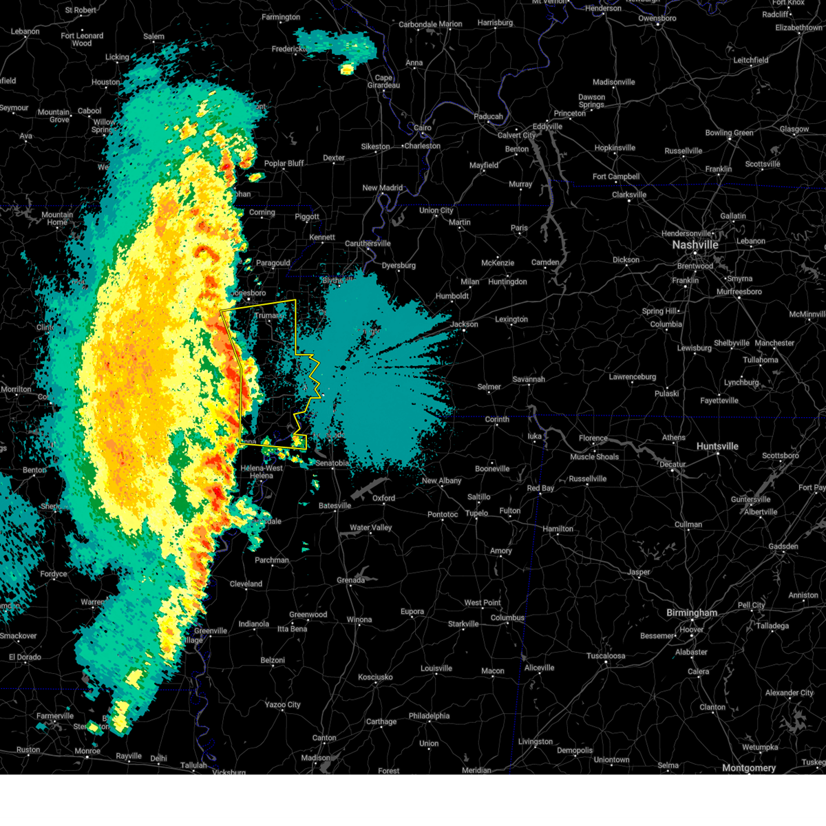 Svrmeg the national weather service in memphis has issued a * severe thunderstorm warning for, northeastern lee county in eastern arkansas, southern craighead county in eastern arkansas, eastern st. francis county in eastern arkansas, poinsett county in eastern arkansas, crittenden county in eastern arkansas, eastern cross county in eastern arkansas, northern tunica county in northwestern mississippi, * until 915 pm cdt. * at 833 pm cdt, severe thunderstorms were located along a line extending from near weiner to near vanndale to near haynes, moving east at 40 mph (public). Hazards include 60 mph wind gusts and penny size hail. expect damage to roofs, siding, and trees Svrmeg the national weather service in memphis has issued a * severe thunderstorm warning for, northeastern lee county in eastern arkansas, southern craighead county in eastern arkansas, eastern st. francis county in eastern arkansas, poinsett county in eastern arkansas, crittenden county in eastern arkansas, eastern cross county in eastern arkansas, northern tunica county in northwestern mississippi, * until 915 pm cdt. * at 833 pm cdt, severe thunderstorms were located along a line extending from near weiner to near vanndale to near haynes, moving east at 40 mph (public). Hazards include 60 mph wind gusts and penny size hail. expect damage to roofs, siding, and trees
|
| 4/29/2025 5:21 PM CDT |
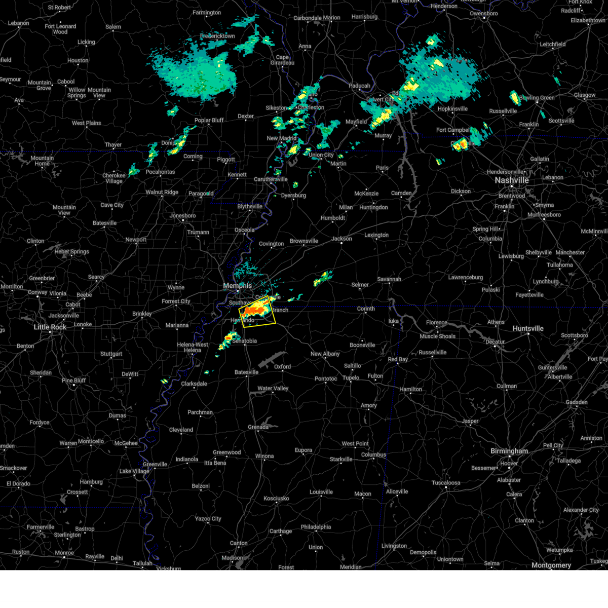 the severe thunderstorm warning has been cancelled and is no longer in effect the severe thunderstorm warning has been cancelled and is no longer in effect
|
| 4/29/2025 5:02 PM CDT |
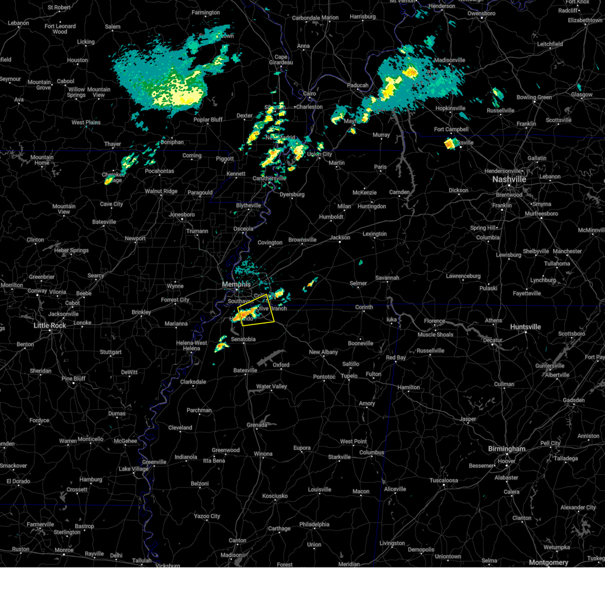 Svrmeg the national weather service in memphis has issued a * severe thunderstorm warning for, northeastern desoto county in northwestern mississippi, northwestern marshall county in northwestern mississippi, southeastern shelby county in west tennessee, * until 545 pm cdt. * at 502 pm cdt, a severe thunderstorm was located near southaven, moving east at 20 mph (radar indicated). Hazards include 60 mph wind gusts and quarter size hail. Hail damage to vehicles is expected. Expect wind damage to roofs, siding, and trees. Svrmeg the national weather service in memphis has issued a * severe thunderstorm warning for, northeastern desoto county in northwestern mississippi, northwestern marshall county in northwestern mississippi, southeastern shelby county in west tennessee, * until 545 pm cdt. * at 502 pm cdt, a severe thunderstorm was located near southaven, moving east at 20 mph (radar indicated). Hazards include 60 mph wind gusts and quarter size hail. Hail damage to vehicles is expected. Expect wind damage to roofs, siding, and trees.
|
| 4/5/2025 4:59 PM CDT |
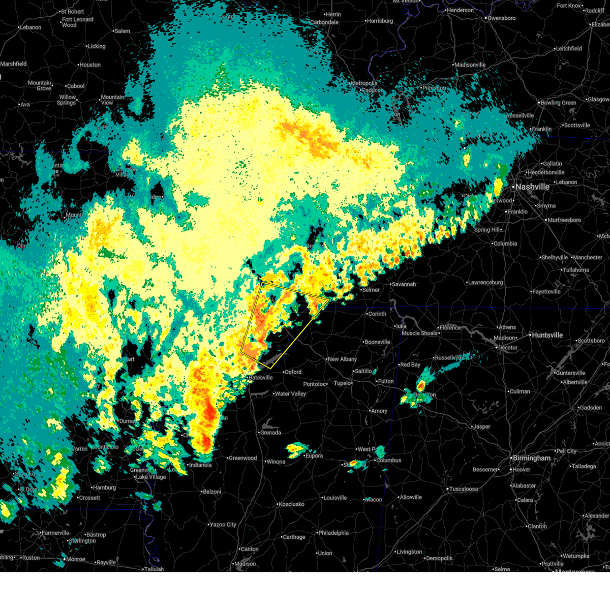 Svrmeg the national weather service in memphis has issued a * severe thunderstorm warning for, northwestern lafayette county in northwestern mississippi, eastern desoto county in northwestern mississippi, marshall county in northwestern mississippi, tate county in northwestern mississippi, northwestern benton county in northeastern mississippi, northeastern panola county in northwestern mississippi, southern fayette county in west tennessee, southwestern hardeman county in west tennessee, southeastern shelby county in west tennessee, * until 600 pm cdt. * at 459 pm cdt, a severe thunderstorm was located near barr, or 8 miles north of john w kyle state park, moving northeast at 30 mph (radar indicated). Hazards include 60 mph wind gusts and quarter size hail. Hail damage to vehicles is expected. Expect wind damage to roofs, siding, and trees. Svrmeg the national weather service in memphis has issued a * severe thunderstorm warning for, northwestern lafayette county in northwestern mississippi, eastern desoto county in northwestern mississippi, marshall county in northwestern mississippi, tate county in northwestern mississippi, northwestern benton county in northeastern mississippi, northeastern panola county in northwestern mississippi, southern fayette county in west tennessee, southwestern hardeman county in west tennessee, southeastern shelby county in west tennessee, * until 600 pm cdt. * at 459 pm cdt, a severe thunderstorm was located near barr, or 8 miles north of john w kyle state park, moving northeast at 30 mph (radar indicated). Hazards include 60 mph wind gusts and quarter size hail. Hail damage to vehicles is expected. Expect wind damage to roofs, siding, and trees.
|
| 4/5/2025 2:43 PM CDT |
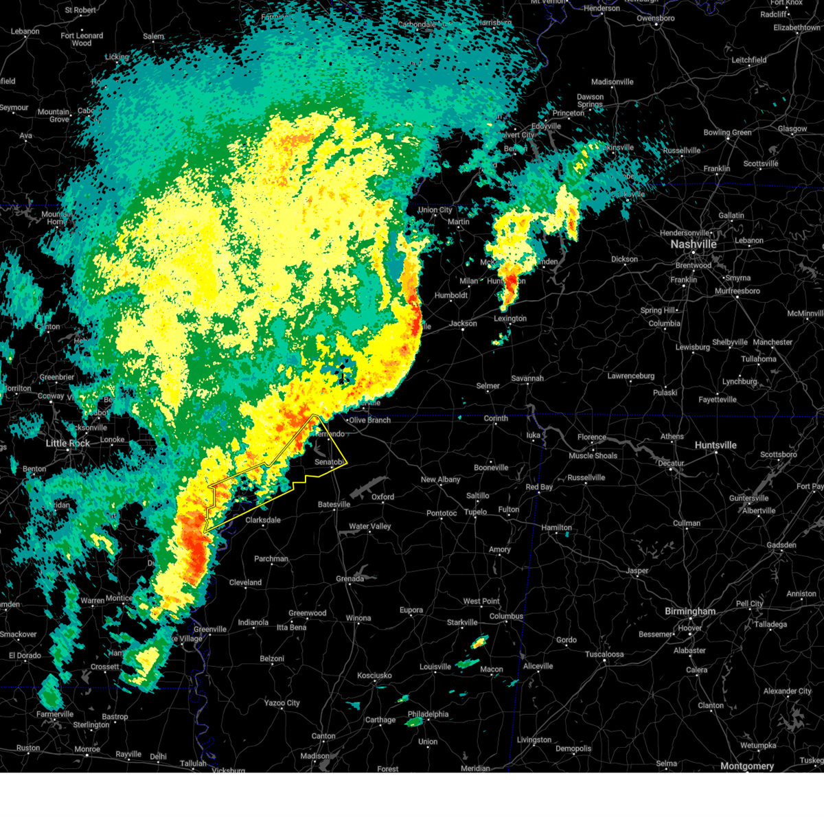 The storm which prompted the warning has moved out of the area. therefore, the warning will be allowed to expire. a tornado watch remains in effect until 700 pm cdt for eastern arkansas, northwestern mississippi, and west tennessee. remember, a severe thunderstorm warning still remains in effect for phillips, coahoma, and tunica counties. The storm which prompted the warning has moved out of the area. therefore, the warning will be allowed to expire. a tornado watch remains in effect until 700 pm cdt for eastern arkansas, northwestern mississippi, and west tennessee. remember, a severe thunderstorm warning still remains in effect for phillips, coahoma, and tunica counties.
|
| 4/5/2025 2:33 PM CDT |
 At 233 pm cdt, a severe thunderstorm was located near watkins corner, or 8 miles northwest of elaine, moving east at 40 mph (radar indicated). Hazards include 60 mph wind gusts and quarter size hail. Hail damage to vehicles is expected. expect wind damage to roofs, siding, and trees. Locations impacted include, tunica, gerlach mill, trinity, lake cormorant, moon, helena-west helena, savage, preston place, quarles, senatobia, austin, hoop spur, westover, strayhorn, prichard, eudora, dubbs, glover, coldwater, and bluff. At 233 pm cdt, a severe thunderstorm was located near watkins corner, or 8 miles northwest of elaine, moving east at 40 mph (radar indicated). Hazards include 60 mph wind gusts and quarter size hail. Hail damage to vehicles is expected. expect wind damage to roofs, siding, and trees. Locations impacted include, tunica, gerlach mill, trinity, lake cormorant, moon, helena-west helena, savage, preston place, quarles, senatobia, austin, hoop spur, westover, strayhorn, prichard, eudora, dubbs, glover, coldwater, and bluff.
|
| 4/5/2025 2:33 PM CDT |
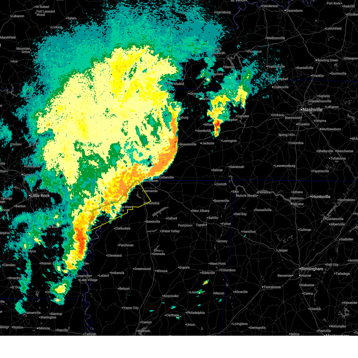 the severe thunderstorm warning has been cancelled and is no longer in effect the severe thunderstorm warning has been cancelled and is no longer in effect
|
| 4/5/2025 2:16 PM CDT |
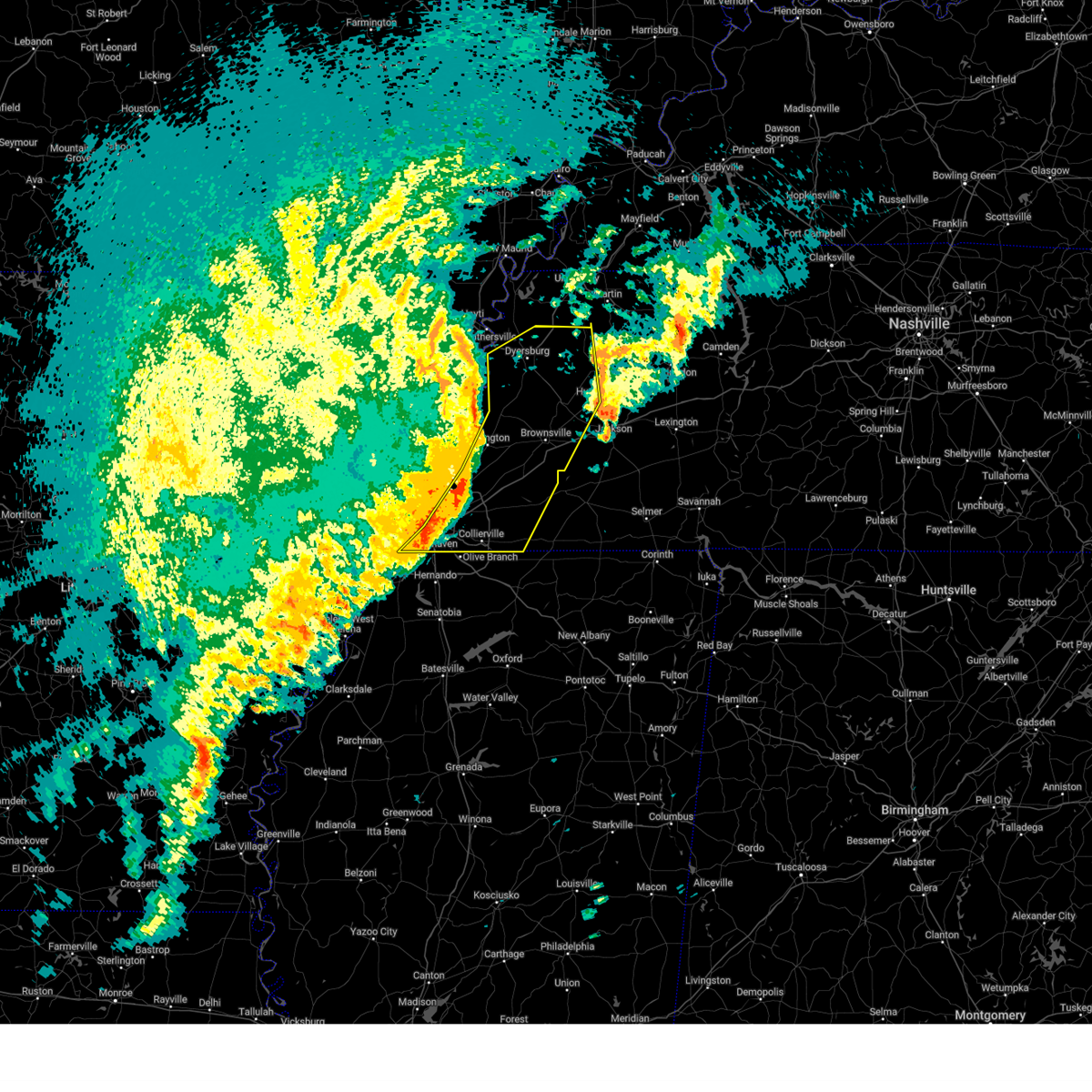 At 215 pm cdt, severe thunderstorms were located along a line extending from near bradleytown to 10 miles south of nutbush to near collierville, moving east at 55 mph (radar indicated). Hazards include 60 mph wind gusts and nickel size hail. Expect damage to roofs, siding, and trees. Locations impacted include, dyer, newbern, stanton, lapata, covington, rohoboth, currie, kirk, arlington, elmore park, poplar grove, laconia, parker, fruitland, lane, brims corner, sunnyhill, durhamville, nauvoo, and clopton. At 215 pm cdt, severe thunderstorms were located along a line extending from near bradleytown to 10 miles south of nutbush to near collierville, moving east at 55 mph (radar indicated). Hazards include 60 mph wind gusts and nickel size hail. Expect damage to roofs, siding, and trees. Locations impacted include, dyer, newbern, stanton, lapata, covington, rohoboth, currie, kirk, arlington, elmore park, poplar grove, laconia, parker, fruitland, lane, brims corner, sunnyhill, durhamville, nauvoo, and clopton.
|
| 4/5/2025 2:16 PM CDT |
 the severe thunderstorm warning has been cancelled and is no longer in effect the severe thunderstorm warning has been cancelled and is no longer in effect
|
| 4/5/2025 2:08 PM CDT |
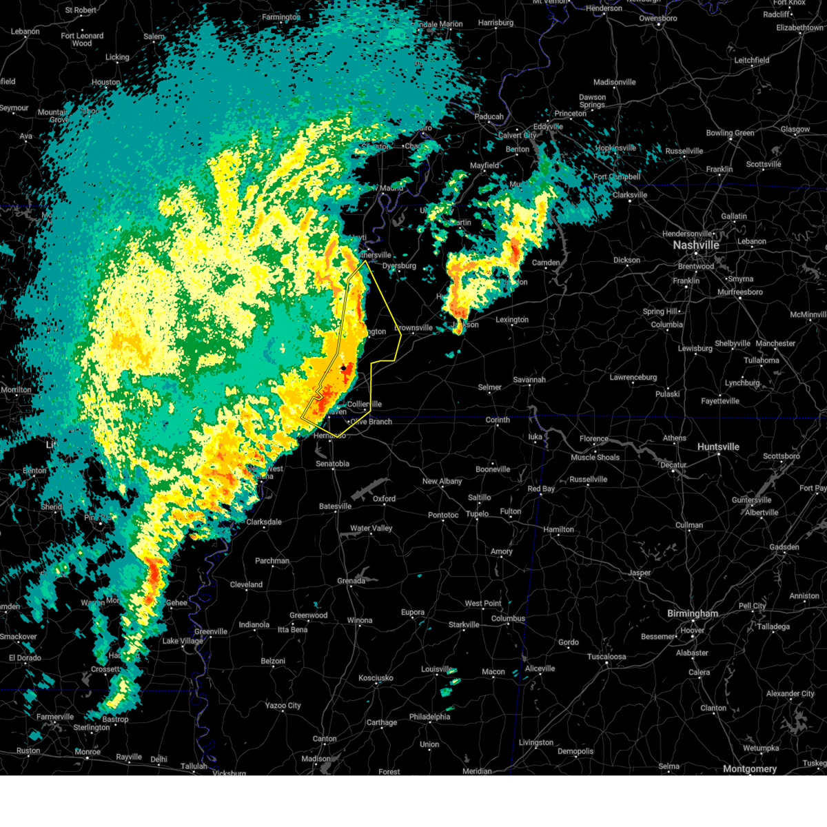 The severe thunderstorm warning has been replaced by a new warning. a tornado watch remains in effect until 700 pm cdt for eastern arkansas, northwestern mississippi, and west tennessee. remember, a severe thunderstorm warning still remains in effect. The severe thunderstorm warning has been replaced by a new warning. a tornado watch remains in effect until 700 pm cdt for eastern arkansas, northwestern mississippi, and west tennessee. remember, a severe thunderstorm warning still remains in effect.
|
| 4/5/2025 2:07 PM CDT |
 At 207 pm cdt, a severe thunderstorm was located over rondo, or 8 miles northeast of marvell, moving east at 50 mph (radar indicated). Hazards include 60 mph wind gusts and quarter size hail. Hail damage to vehicles is expected. expect wind damage to roofs, siding, and trees. Locations impacted include, lake cormorant, moon, savage, haleside, commerce, senatobia, austin, hoop spur, westover, strayhorn, prichard, dubbs, glover, whitehall, poplar grove, dooley, north tunica, clayton, hollywood, and lost lake. At 207 pm cdt, a severe thunderstorm was located over rondo, or 8 miles northeast of marvell, moving east at 50 mph (radar indicated). Hazards include 60 mph wind gusts and quarter size hail. Hail damage to vehicles is expected. expect wind damage to roofs, siding, and trees. Locations impacted include, lake cormorant, moon, savage, haleside, commerce, senatobia, austin, hoop spur, westover, strayhorn, prichard, dubbs, glover, whitehall, poplar grove, dooley, north tunica, clayton, hollywood, and lost lake.
|
| 4/5/2025 2:07 PM CDT |
 the severe thunderstorm warning has been cancelled and is no longer in effect the severe thunderstorm warning has been cancelled and is no longer in effect
|
| 4/5/2025 2:06 PM CDT |
 At 206 pm cdt, severe thunderstorms were located along a line extending from near heloise to near covington to near southeast memphis, moving northeast at 60 mph (radar indicated). Hazards include 60 mph wind gusts and quarter size hail. Hail damage to vehicles is expected. expect wind damage to roofs, siding, and trees. Locations impacted include, dyer, burlison, newbern, stanton, lapata, covington, rohoboth, currie, kirk, arlington, elmore park, poplar grove, laconia, parker, fruitland, lane, brims corner, sunnyhill, durhamville, and nauvoo. At 206 pm cdt, severe thunderstorms were located along a line extending from near heloise to near covington to near southeast memphis, moving northeast at 60 mph (radar indicated). Hazards include 60 mph wind gusts and quarter size hail. Hail damage to vehicles is expected. expect wind damage to roofs, siding, and trees. Locations impacted include, dyer, burlison, newbern, stanton, lapata, covington, rohoboth, currie, kirk, arlington, elmore park, poplar grove, laconia, parker, fruitland, lane, brims corner, sunnyhill, durhamville, and nauvoo.
|
| 4/5/2025 2:01 PM CDT |
 At 201 pm cdt, severe thunderstorms were located along a line extending from near cooter to covington to horn lake, moving east at 55 mph (radar indicated). Hazards include 70 mph wind gusts and quarter size hail. Hail damage to vehicles is expected. expect considerable tree damage. wind damage is also likely to mobile homes, roofs, and outbuildings. Locations impacted include, burlison, southwest memphis, horn lake, covington, presidents island, atoka, arlington, elmore park, brunswick, alden, orysa, whitehaven, southaven, durhamville, keeling, gainesville, tabernacle, mason, clopton, and armorel. At 201 pm cdt, severe thunderstorms were located along a line extending from near cooter to covington to horn lake, moving east at 55 mph (radar indicated). Hazards include 70 mph wind gusts and quarter size hail. Hail damage to vehicles is expected. expect considerable tree damage. wind damage is also likely to mobile homes, roofs, and outbuildings. Locations impacted include, burlison, southwest memphis, horn lake, covington, presidents island, atoka, arlington, elmore park, brunswick, alden, orysa, whitehaven, southaven, durhamville, keeling, gainesville, tabernacle, mason, clopton, and armorel.
|
| 4/5/2025 2:01 PM CDT |
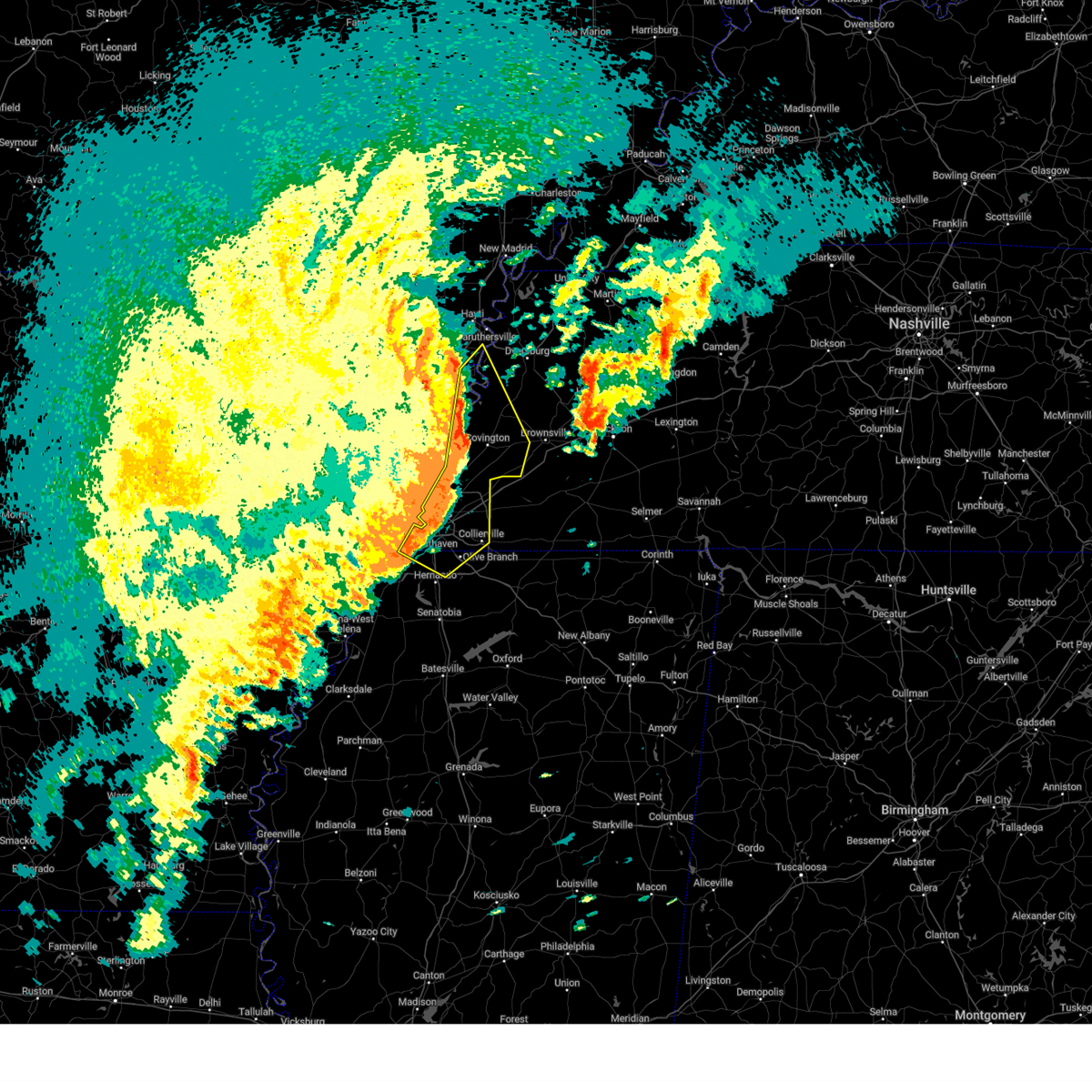 the severe thunderstorm warning has been cancelled and is no longer in effect the severe thunderstorm warning has been cancelled and is no longer in effect
|
| 4/5/2025 1:59 PM CDT |
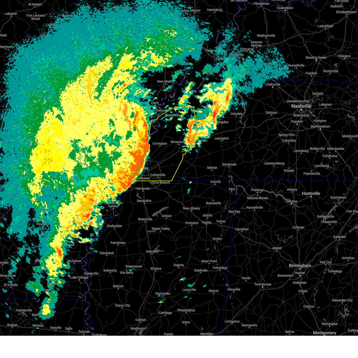 Svrmeg the national weather service in memphis has issued a * severe thunderstorm warning for, eastern mississippi county in eastern arkansas, crockett county in west tennessee, tipton county in west tennessee, dyer county in west tennessee, western gibson county in west tennessee, fayette county in west tennessee, lauderdale county in west tennessee, haywood county in west tennessee, northwestern madison county in west tennessee, shelby county in west tennessee, * until 245 pm cdt. * at 158 pm cdt, severe thunderstorms were located along a line extending from 7 miles southeast of cooter to near covington to whitehaven, moving northeast at 60 mph (radar indicated). Hazards include 70 mph wind gusts and quarter size hail. Hail damage to vehicles is expected. expect considerable tree damage. Wind damage is also likely to mobile homes, roofs, and outbuildings. Svrmeg the national weather service in memphis has issued a * severe thunderstorm warning for, eastern mississippi county in eastern arkansas, crockett county in west tennessee, tipton county in west tennessee, dyer county in west tennessee, western gibson county in west tennessee, fayette county in west tennessee, lauderdale county in west tennessee, haywood county in west tennessee, northwestern madison county in west tennessee, shelby county in west tennessee, * until 245 pm cdt. * at 158 pm cdt, severe thunderstorms were located along a line extending from 7 miles southeast of cooter to near covington to whitehaven, moving northeast at 60 mph (radar indicated). Hazards include 70 mph wind gusts and quarter size hail. Hail damage to vehicles is expected. expect considerable tree damage. Wind damage is also likely to mobile homes, roofs, and outbuildings.
|
| 4/5/2025 1:52 PM CDT |
 Svrmeg the national weather service in memphis has issued a * severe thunderstorm warning for, lee county in eastern arkansas, southeastern st. francis county in eastern arkansas, phillips county in eastern arkansas, southwestern crittenden county in eastern arkansas, western desoto county in northwestern mississippi, northern coahoma county in northwestern mississippi, tunica county in northwestern mississippi, western tate county in northwestern mississippi, southwestern shelby county in west tennessee, * until 245 pm cdt. * at 152 pm cdt, a severe thunderstorm was located near palmer, or near marvell, moving northeast at 60 mph (radar indicated). Hazards include 60 mph wind gusts and quarter size hail. Hail damage to vehicles is expected. Expect wind damage to roofs, siding, and trees. Svrmeg the national weather service in memphis has issued a * severe thunderstorm warning for, lee county in eastern arkansas, southeastern st. francis county in eastern arkansas, phillips county in eastern arkansas, southwestern crittenden county in eastern arkansas, western desoto county in northwestern mississippi, northern coahoma county in northwestern mississippi, tunica county in northwestern mississippi, western tate county in northwestern mississippi, southwestern shelby county in west tennessee, * until 245 pm cdt. * at 152 pm cdt, a severe thunderstorm was located near palmer, or near marvell, moving northeast at 60 mph (radar indicated). Hazards include 60 mph wind gusts and quarter size hail. Hail damage to vehicles is expected. Expect wind damage to roofs, siding, and trees.
|
| 4/5/2025 1:51 PM CDT |
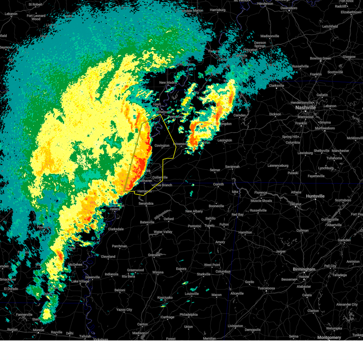 At 151 pm cdt, severe thunderstorms were located along a line extending from near blytheville to near fort pillow state park to near eudora, moving east at 50 mph (radar indicated). Hazards include 70 mph wind gusts and quarter size hail. Hail damage to vehicles is expected. expect considerable tree damage. wind damage is also likely to mobile homes, roofs, and outbuildings. Locations impacted include, burlison, calumet, horn lake, louise, covington, edmondson, osceola, presidents island, glover, locke, arlington, elmore park, alden, durhamville, gilestown, clopton, lightfoot, arp, norfolk, and wapanocca national wildlife refuge. At 151 pm cdt, severe thunderstorms were located along a line extending from near blytheville to near fort pillow state park to near eudora, moving east at 50 mph (radar indicated). Hazards include 70 mph wind gusts and quarter size hail. Hail damage to vehicles is expected. expect considerable tree damage. wind damage is also likely to mobile homes, roofs, and outbuildings. Locations impacted include, burlison, calumet, horn lake, louise, covington, edmondson, osceola, presidents island, glover, locke, arlington, elmore park, alden, durhamville, gilestown, clopton, lightfoot, arp, norfolk, and wapanocca national wildlife refuge.
|
| 4/5/2025 1:51 PM CDT |
 the severe thunderstorm warning has been cancelled and is no longer in effect the severe thunderstorm warning has been cancelled and is no longer in effect
|
| 4/5/2025 1:38 PM CDT |
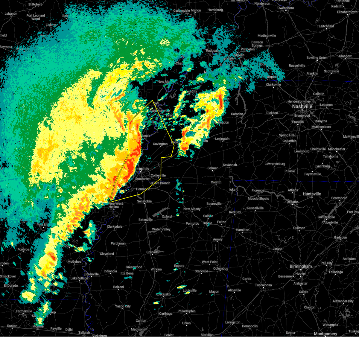 the severe thunderstorm warning has been cancelled and is no longer in effect the severe thunderstorm warning has been cancelled and is no longer in effect
|
| 4/5/2025 1:38 PM CDT |
 At 138 pm cdt, severe thunderstorms were located along a line extending from near hornersville to near wilson to near horseshoe lake, moving east at 50 mph (radar indicated). Hazards include 70 mph wind gusts and quarter size hail. Hail damage to vehicles is expected. expect considerable tree damage. wind damage is also likely to mobile homes, roofs, and outbuildings. Locations impacted include, burlison, calumet, new survey, horn lake, louise, gobler, covington, edmondson, osceola, presidents island, beck, glover, locke, arlington, elmore park, alden, milligan ridge, roseland, julius, and steele. At 138 pm cdt, severe thunderstorms were located along a line extending from near hornersville to near wilson to near horseshoe lake, moving east at 50 mph (radar indicated). Hazards include 70 mph wind gusts and quarter size hail. Hail damage to vehicles is expected. expect considerable tree damage. wind damage is also likely to mobile homes, roofs, and outbuildings. Locations impacted include, burlison, calumet, new survey, horn lake, louise, gobler, covington, edmondson, osceola, presidents island, beck, glover, locke, arlington, elmore park, alden, milligan ridge, roseland, julius, and steele.
|
| 4/5/2025 1:29 PM CDT |
 At 129 pm cdt, severe thunderstorms were located along a line extending from leachville to marie to near hughes, moving east at 50 mph. these are destructive storms for the memphis metro area (radar indicated). Hazards include 80 mph wind gusts and quarter size hail. Flying debris will be dangerous to those caught without shelter. mobile homes will be heavily damaged. expect considerable damage to roofs, windows, and vehicles. extensive tree damage and power outages are likely. Locations impacted include, cody, burlison, paulding, scobeville, calumet, new survey, horn lake, haleside, louise, gobler, covington, edmondson, osceola, presidents island, beck, glover, locke, ball point, arlington, and tongin. At 129 pm cdt, severe thunderstorms were located along a line extending from leachville to marie to near hughes, moving east at 50 mph. these are destructive storms for the memphis metro area (radar indicated). Hazards include 80 mph wind gusts and quarter size hail. Flying debris will be dangerous to those caught without shelter. mobile homes will be heavily damaged. expect considerable damage to roofs, windows, and vehicles. extensive tree damage and power outages are likely. Locations impacted include, cody, burlison, paulding, scobeville, calumet, new survey, horn lake, haleside, louise, gobler, covington, edmondson, osceola, presidents island, beck, glover, locke, ball point, arlington, and tongin.
|
| 4/5/2025 1:29 PM CDT |
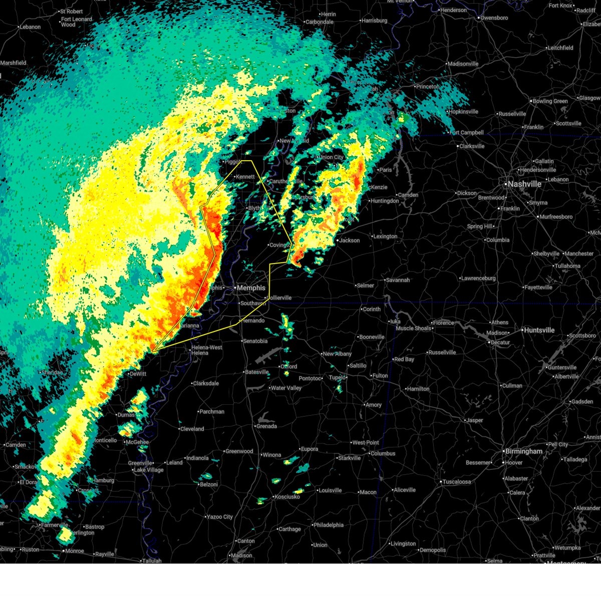 the severe thunderstorm warning has been cancelled and is no longer in effect the severe thunderstorm warning has been cancelled and is no longer in effect
|
| 4/5/2025 1:21 PM CDT |
 Svrmeg the national weather service in memphis has issued a * severe thunderstorm warning for, eastern craighead county in eastern arkansas, eastern st. francis county in eastern arkansas, mississippi county in eastern arkansas, crittenden county in eastern arkansas, southeastern clay county in eastern arkansas, greene county in eastern arkansas, eastern lee county in eastern arkansas, eastern poinsett county in eastern arkansas, northern phillips county in eastern arkansas, desoto county in northwestern mississippi, northwestern tate county in northwestern mississippi, northern tunica county in northwestern mississippi, dunklin county in southeastern missouri, pemiscot county in southeastern missouri, lauderdale county in west tennessee, southwestern haywood county in west tennessee, shelby county in west tennessee, tipton county in west tennessee, southwestern dyer county in west tennessee, * until 215 pm cdt. * at 120 pm cdt, severe thunderstorms were located along a line extending from evening star to joiner to near hughes to near marvell, moving east at 55 mph. this storm system is moving over areas already impacted earlier in the week. these are destructive storms for shelby, mississippi, and desoto (radar indicated). Hazards include 80 mph wind gusts and quarter size hail. Flying debris will be dangerous to those caught without shelter. mobile homes will be heavily damaged. expect considerable damage to roofs, windows, and vehicles. Extensive tree damage and power outages are likely. Svrmeg the national weather service in memphis has issued a * severe thunderstorm warning for, eastern craighead county in eastern arkansas, eastern st. francis county in eastern arkansas, mississippi county in eastern arkansas, crittenden county in eastern arkansas, southeastern clay county in eastern arkansas, greene county in eastern arkansas, eastern lee county in eastern arkansas, eastern poinsett county in eastern arkansas, northern phillips county in eastern arkansas, desoto county in northwestern mississippi, northwestern tate county in northwestern mississippi, northern tunica county in northwestern mississippi, dunklin county in southeastern missouri, pemiscot county in southeastern missouri, lauderdale county in west tennessee, southwestern haywood county in west tennessee, shelby county in west tennessee, tipton county in west tennessee, southwestern dyer county in west tennessee, * until 215 pm cdt. * at 120 pm cdt, severe thunderstorms were located along a line extending from evening star to joiner to near hughes to near marvell, moving east at 55 mph. this storm system is moving over areas already impacted earlier in the week. these are destructive storms for shelby, mississippi, and desoto (radar indicated). Hazards include 80 mph wind gusts and quarter size hail. Flying debris will be dangerous to those caught without shelter. mobile homes will be heavily damaged. expect considerable damage to roofs, windows, and vehicles. Extensive tree damage and power outages are likely.
|
| 4/5/2025 1:12 PM CDT |
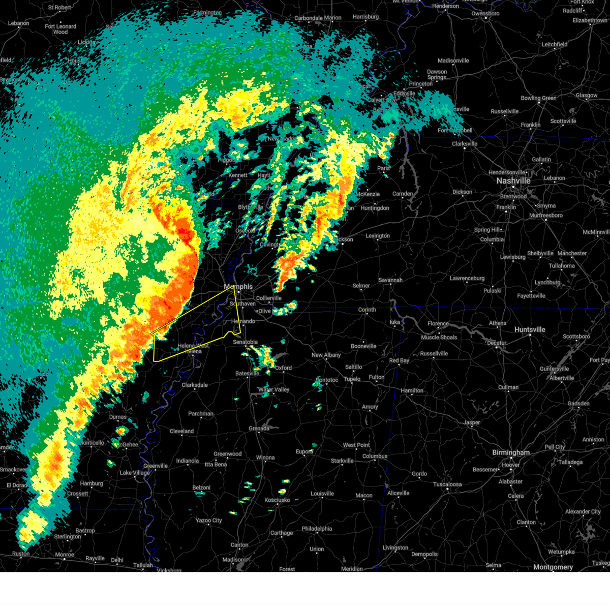 the severe thunderstorm warning has been cancelled and is no longer in effect the severe thunderstorm warning has been cancelled and is no longer in effect
|
| 4/5/2025 1:12 PM CDT |
 At 112 pm cdt, a severe thunderstorm was located over horseshoe lake, or 10 miles southeast of hughes, moving northeast at 80 mph (radar indicated). Hazards include 60 mph wind gusts and penny size hail. Expect damage to roofs, siding, and trees. Locations impacted include, cody, lake cormorant, haleside, commerce, louise, austin, edmondson, presidents island, beck, simsboro, glover, brickeys, ball point, whitehall, tongin, poplar grove, north tunica, hollywood, lost lake, and thomasville. At 112 pm cdt, a severe thunderstorm was located over horseshoe lake, or 10 miles southeast of hughes, moving northeast at 80 mph (radar indicated). Hazards include 60 mph wind gusts and penny size hail. Expect damage to roofs, siding, and trees. Locations impacted include, cody, lake cormorant, haleside, commerce, louise, austin, edmondson, presidents island, beck, simsboro, glover, brickeys, ball point, whitehall, tongin, poplar grove, north tunica, hollywood, lost lake, and thomasville.
|
| 4/5/2025 12:36 PM CDT |
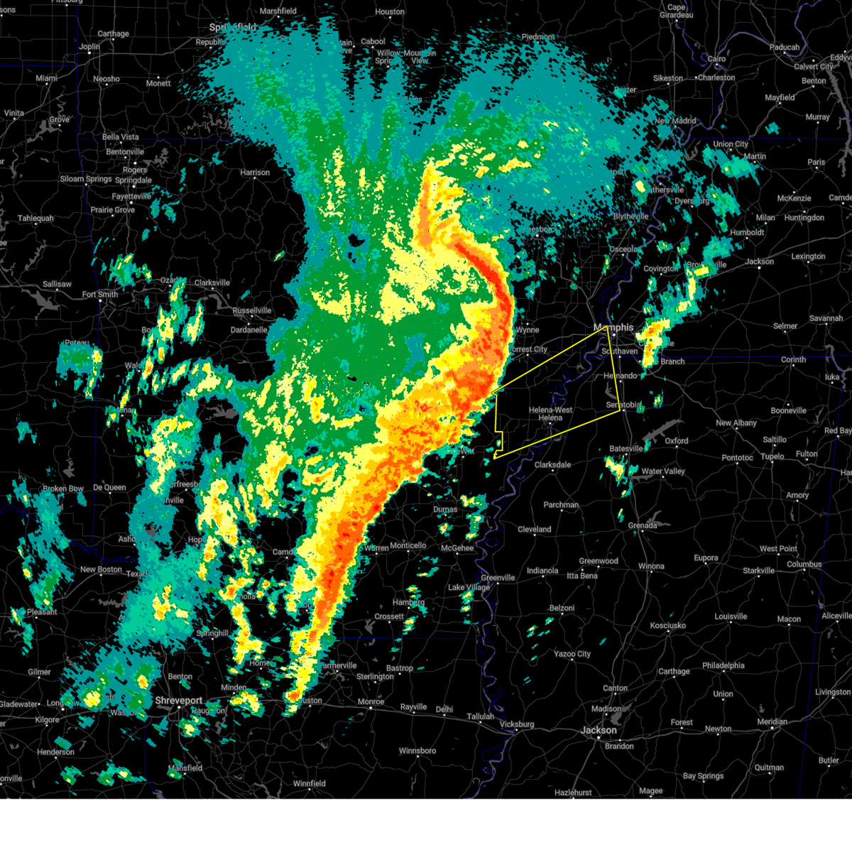 Svrmeg the national weather service in memphis has issued a * severe thunderstorm warning for, lee county in eastern arkansas, southeastern st. francis county in eastern arkansas, phillips county in eastern arkansas, southern crittenden county in eastern arkansas, western desoto county in northwestern mississippi, northern coahoma county in northwestern mississippi, tunica county in northwestern mississippi, western tate county in northwestern mississippi, southwestern shelby county in west tennessee, * until 130 pm cdt. * at 1236 pm cdt, a severe thunderstorm was located over palmer, or 9 miles northwest of marvell, moving northeast at 80 mph (radar indicated). Hazards include 60 mph wind gusts and quarter size hail. Hail damage to vehicles is expected. Expect wind damage to roofs, siding, and trees. Svrmeg the national weather service in memphis has issued a * severe thunderstorm warning for, lee county in eastern arkansas, southeastern st. francis county in eastern arkansas, phillips county in eastern arkansas, southern crittenden county in eastern arkansas, western desoto county in northwestern mississippi, northern coahoma county in northwestern mississippi, tunica county in northwestern mississippi, western tate county in northwestern mississippi, southwestern shelby county in west tennessee, * until 130 pm cdt. * at 1236 pm cdt, a severe thunderstorm was located over palmer, or 9 miles northwest of marvell, moving northeast at 80 mph (radar indicated). Hazards include 60 mph wind gusts and quarter size hail. Hail damage to vehicles is expected. Expect wind damage to roofs, siding, and trees.
|
| 4/5/2025 2:56 AM CDT |
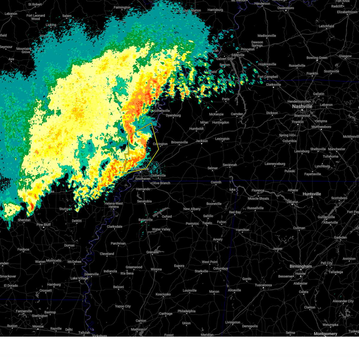 The storms which prompted the warning have weakened below severe limits, and no longer pose an immediate threat to life or property. therefore, the warning will be allowed to expire. a tornado watch remains in effect until 400 am cdt for eastern arkansas, and west tennessee. The storms which prompted the warning have weakened below severe limits, and no longer pose an immediate threat to life or property. therefore, the warning will be allowed to expire. a tornado watch remains in effect until 400 am cdt for eastern arkansas, and west tennessee.
|
| 4/5/2025 2:48 AM CDT |
 the severe thunderstorm warning has been cancelled and is no longer in effect the severe thunderstorm warning has been cancelled and is no longer in effect
|
| 4/5/2025 2:48 AM CDT |
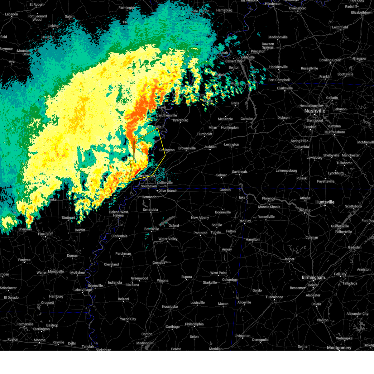 At 248 am cdt, severe thunderstorms were located along a line extending from near osceola to dixonville to marion, moving northeast at 50 mph (radar indicated). Hazards include 60 mph wind gusts and nickel size hail. Expect damage to roofs, siding, and trees. Locations impacted include, burlison, menesha, etowah, grider, hampson archaeological museum state park, st clair, osceola, atoka, locke, shippen, victoria, delpro, julius, bassett, gilestown, whistleville, three way, wapanocca national wildlife refuge, whitton, and mound city. At 248 am cdt, severe thunderstorms were located along a line extending from near osceola to dixonville to marion, moving northeast at 50 mph (radar indicated). Hazards include 60 mph wind gusts and nickel size hail. Expect damage to roofs, siding, and trees. Locations impacted include, burlison, menesha, etowah, grider, hampson archaeological museum state park, st clair, osceola, atoka, locke, shippen, victoria, delpro, julius, bassett, gilestown, whistleville, three way, wapanocca national wildlife refuge, whitton, and mound city.
|
| 4/5/2025 2:35 AM CDT |
 the severe thunderstorm warning has been cancelled and is no longer in effect the severe thunderstorm warning has been cancelled and is no longer in effect
|
| 4/5/2025 2:35 AM CDT |
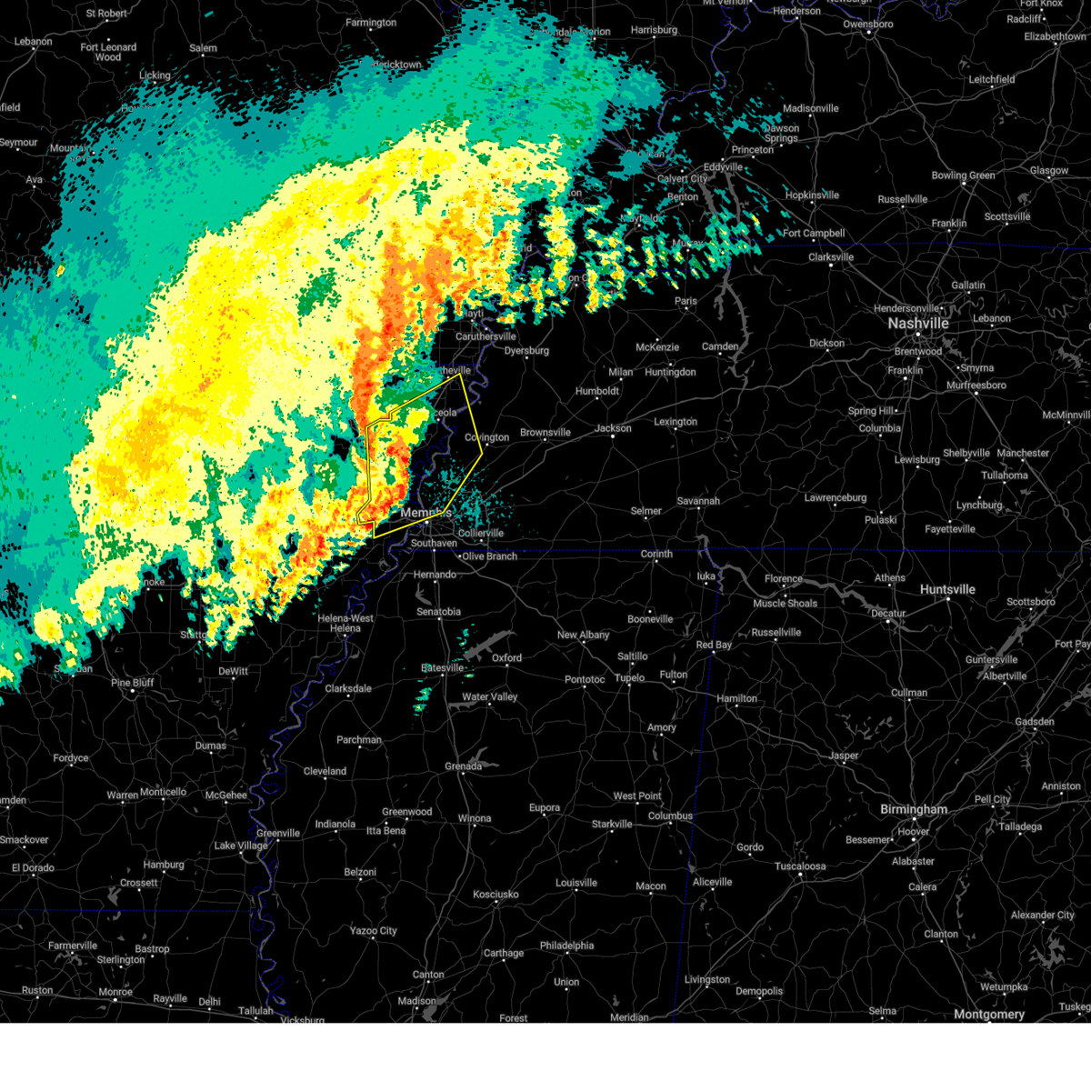 At 234 am cdt, severe thunderstorms were located along a line extending from near keiser to near meeman shelby forest state park to near jennette, moving northeast at 50 mph (radar indicated). Hazards include 60 mph wind gusts and nickel size hail. Expect damage to roofs, siding, and trees. Locations impacted include, burlison, browns, menesha, etowah, grider, edmondson, hampson archaeological museum state park, st clair, osceola, atoka, locke, alto, shippen, victoria, delpro, julius, bassett, gilestown, galilee, and whistleville. At 234 am cdt, severe thunderstorms were located along a line extending from near keiser to near meeman shelby forest state park to near jennette, moving northeast at 50 mph (radar indicated). Hazards include 60 mph wind gusts and nickel size hail. Expect damage to roofs, siding, and trees. Locations impacted include, burlison, browns, menesha, etowah, grider, edmondson, hampson archaeological museum state park, st clair, osceola, atoka, locke, alto, shippen, victoria, delpro, julius, bassett, gilestown, galilee, and whistleville.
|
| 4/5/2025 2:20 AM CDT |
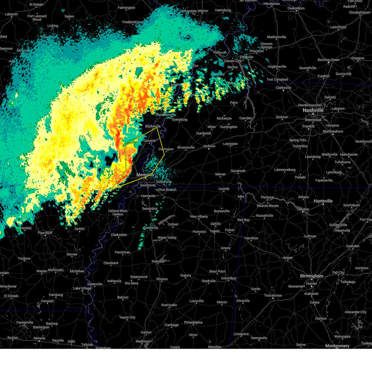 Svrmeg the national weather service in memphis has issued a * severe thunderstorm warning for, northeastern st. francis county in eastern arkansas, eastern poinsett county in eastern arkansas, mississippi county in eastern arkansas, crittenden county in eastern arkansas, central tipton county in west tennessee, southwestern lauderdale county in west tennessee, northwestern shelby county in west tennessee, * until 300 am cdt. * at 220 am cdt, severe thunderstorms were located along a line extending from lepanto to near jericho to new home, moving northeast at 50 mph (radar indicated). Hazards include 60 mph wind gusts and nickel size hail. expect damage to roofs, siding, and trees Svrmeg the national weather service in memphis has issued a * severe thunderstorm warning for, northeastern st. francis county in eastern arkansas, eastern poinsett county in eastern arkansas, mississippi county in eastern arkansas, crittenden county in eastern arkansas, central tipton county in west tennessee, southwestern lauderdale county in west tennessee, northwestern shelby county in west tennessee, * until 300 am cdt. * at 220 am cdt, severe thunderstorms were located along a line extending from lepanto to near jericho to new home, moving northeast at 50 mph (radar indicated). Hazards include 60 mph wind gusts and nickel size hail. expect damage to roofs, siding, and trees
|
| 4/3/2025 7:11 PM CDT |
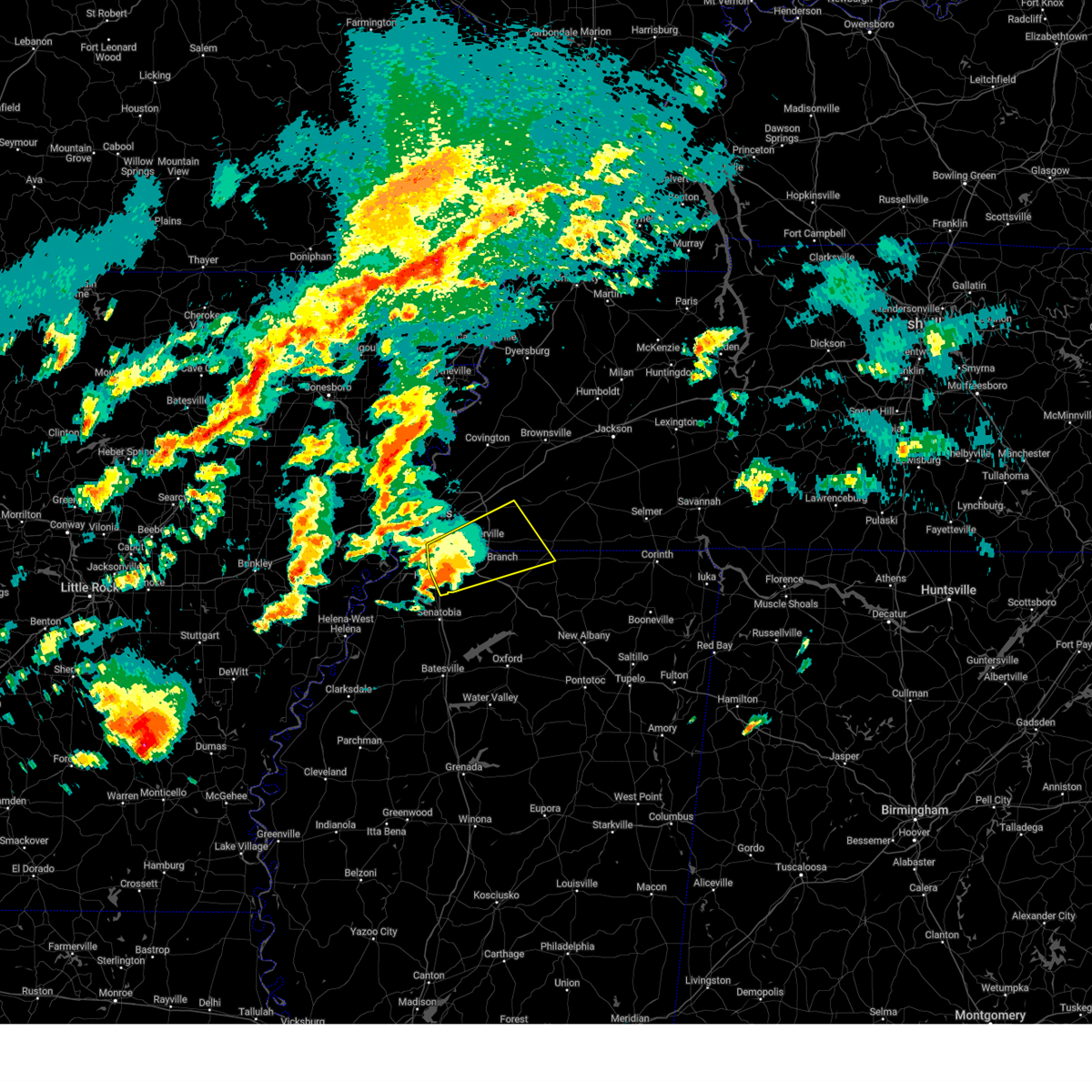 the severe thunderstorm warning has been cancelled and is no longer in effect the severe thunderstorm warning has been cancelled and is no longer in effect
|
| 4/3/2025 7:11 PM CDT |
 At 710 pm cdt, a severe thunderstorm was located over olive branch, moving northeast at 55 mph (radar indicated). Hazards include 60 mph wind gusts and quarter size hail. Hail damage to vehicles is expected. expect wind damage to roofs, siding, and trees. Locations impacted include, piperton, coal oil corner, ghost river state natural area, mt pleasant, cayce, cockrum, horn lake, cedarview, oakland, moscow, germantown, bright, nesbit, handy corner, warren, taska, capleville, kirk, jago, and rossville. At 710 pm cdt, a severe thunderstorm was located over olive branch, moving northeast at 55 mph (radar indicated). Hazards include 60 mph wind gusts and quarter size hail. Hail damage to vehicles is expected. expect wind damage to roofs, siding, and trees. Locations impacted include, piperton, coal oil corner, ghost river state natural area, mt pleasant, cayce, cockrum, horn lake, cedarview, oakland, moscow, germantown, bright, nesbit, handy corner, warren, taska, capleville, kirk, jago, and rossville.
|
| 4/3/2025 6:56 PM CDT |
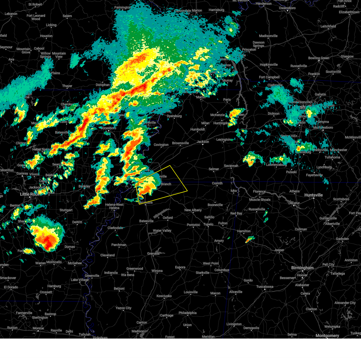 the severe thunderstorm warning has been cancelled and is no longer in effect the severe thunderstorm warning has been cancelled and is no longer in effect
|
| 4/3/2025 6:56 PM CDT |
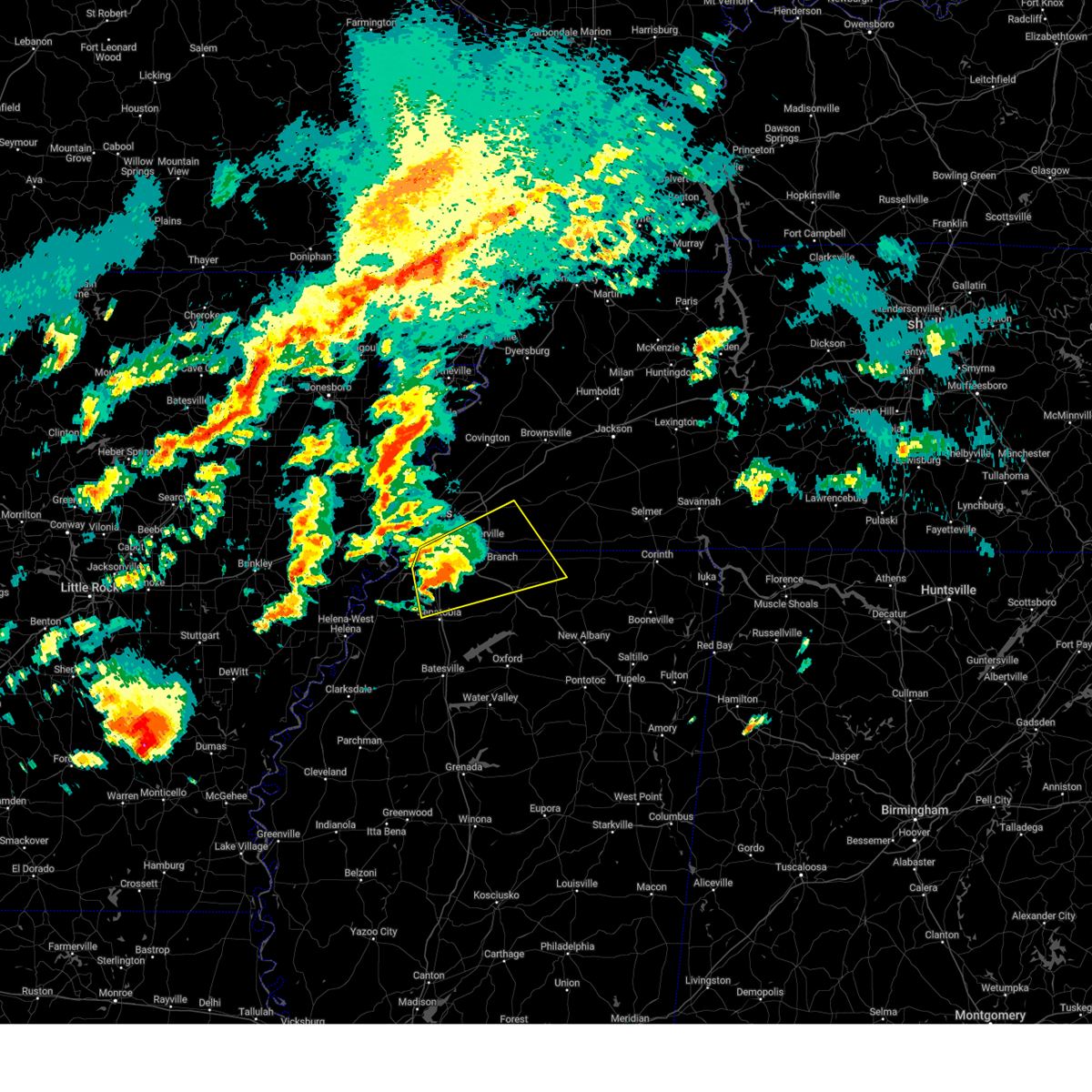 At 656 pm cdt, a severe thunderstorm was located over hernando, moving northeast at 55 mph (radar indicated). Hazards include 60 mph wind gusts and quarter size hail. Hail damage to vehicles is expected. expect wind damage to roofs, siding, and trees. Locations impacted include, ghost river state natural area, snow lake shores, mt pleasant, cayce, horn lake, watson, oakland, bright, taska, kirk, coldwater, rossville, robinson gin, fisherville, collierville, alden, macon, lurline, fairhaven, and twin lakes. At 656 pm cdt, a severe thunderstorm was located over hernando, moving northeast at 55 mph (radar indicated). Hazards include 60 mph wind gusts and quarter size hail. Hail damage to vehicles is expected. expect wind damage to roofs, siding, and trees. Locations impacted include, ghost river state natural area, snow lake shores, mt pleasant, cayce, horn lake, watson, oakland, bright, taska, kirk, coldwater, rossville, robinson gin, fisherville, collierville, alden, macon, lurline, fairhaven, and twin lakes.
|
| 4/3/2025 6:52 PM CDT |
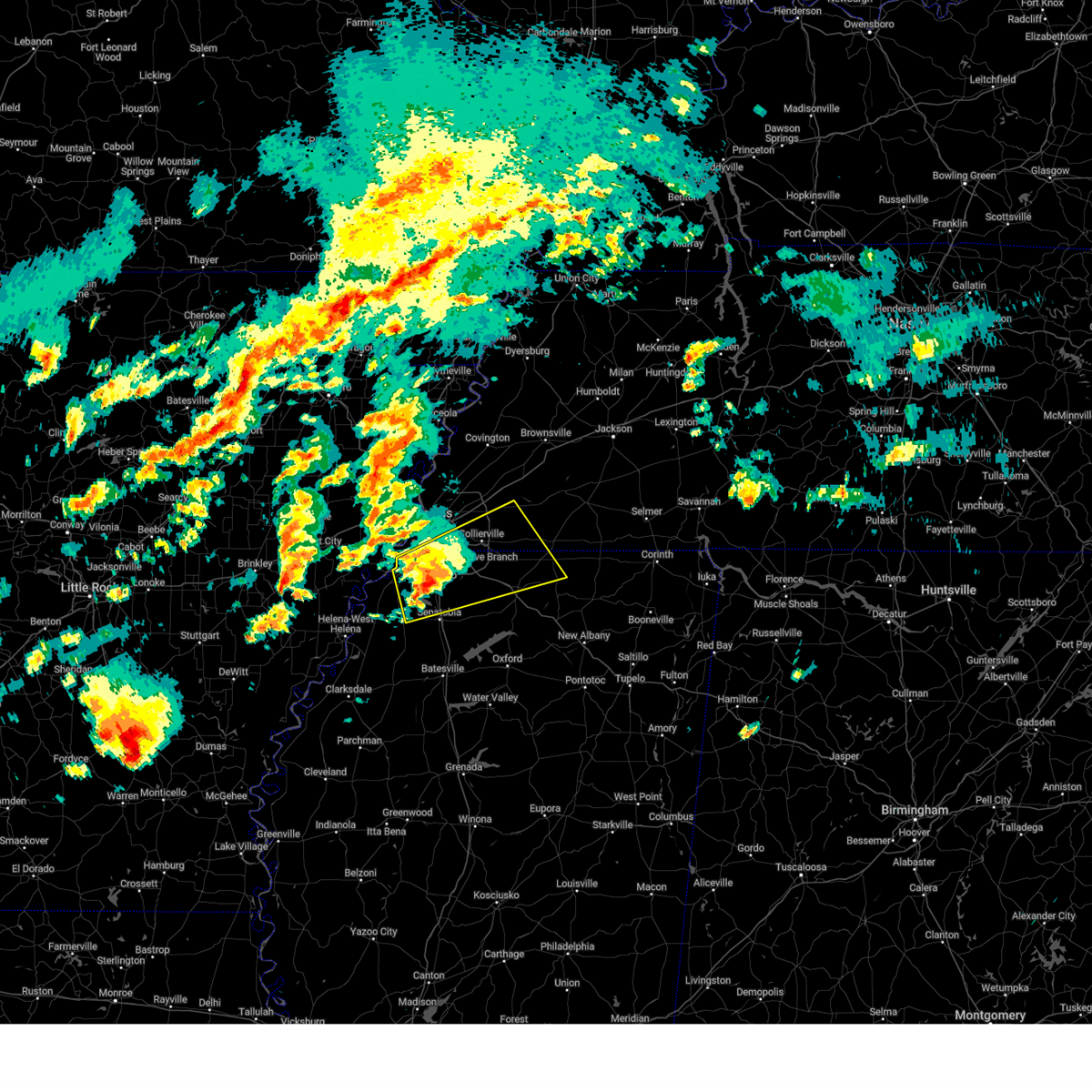 Svrmeg the national weather service in memphis has issued a * severe thunderstorm warning for, desoto county in northwestern mississippi, northern marshall county in northwestern mississippi, northeastern tunica county in northwestern mississippi, northern tate county in northwestern mississippi, northwestern benton county in northeastern mississippi, southwestern fayette county in west tennessee, southeastern shelby county in west tennessee, * until 730 pm cdt. * at 651 pm cdt, a severe thunderstorm was located over hernando, moving northeast at 55 mph (radar indicated). Hazards include 60 mph wind gusts and quarter size hail. Hail damage to vehicles is expected. Expect wind damage to roofs, siding, and trees. Svrmeg the national weather service in memphis has issued a * severe thunderstorm warning for, desoto county in northwestern mississippi, northern marshall county in northwestern mississippi, northeastern tunica county in northwestern mississippi, northern tate county in northwestern mississippi, northwestern benton county in northeastern mississippi, southwestern fayette county in west tennessee, southeastern shelby county in west tennessee, * until 730 pm cdt. * at 651 pm cdt, a severe thunderstorm was located over hernando, moving northeast at 55 mph (radar indicated). Hazards include 60 mph wind gusts and quarter size hail. Hail damage to vehicles is expected. Expect wind damage to roofs, siding, and trees.
|
| 4/3/2025 6:46 PM CDT |
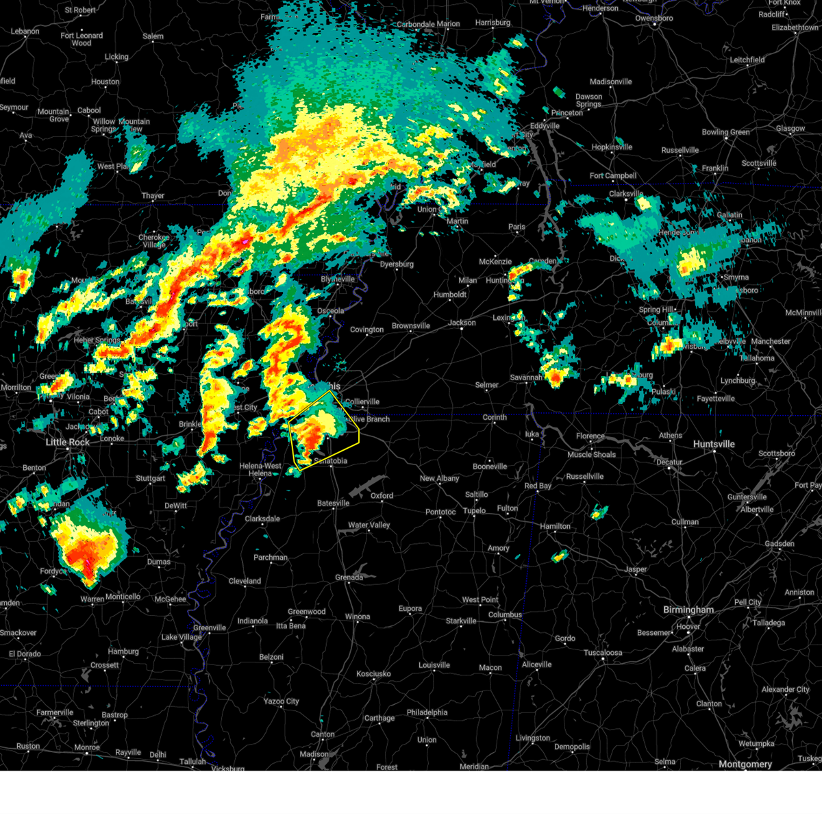 At 646 pm cdt, a severe thunderstorm was located near eudora, or 7 miles southwest of hernando, moving northeast at 55 mph (radar indicated). Hazards include ping pong ball size hail and 60 mph wind gusts. People and animals outdoors will be injured. expect hail damage to roofs, siding, windows, and vehicles. expect wind damage to roofs, siding, and trees. Locations impacted include, clack, trinity, lake cormorant, southwest memphis, savage, horn lake, bright, strayhorn, prichard, eudora, t o fuller state park, glover, memphis, robinson gin, alden, lurline, fairhaven, dooley, twin lakes, and lewisburg. At 646 pm cdt, a severe thunderstorm was located near eudora, or 7 miles southwest of hernando, moving northeast at 55 mph (radar indicated). Hazards include ping pong ball size hail and 60 mph wind gusts. People and animals outdoors will be injured. expect hail damage to roofs, siding, windows, and vehicles. expect wind damage to roofs, siding, and trees. Locations impacted include, clack, trinity, lake cormorant, southwest memphis, savage, horn lake, bright, strayhorn, prichard, eudora, t o fuller state park, glover, memphis, robinson gin, alden, lurline, fairhaven, dooley, twin lakes, and lewisburg.
|
| 4/3/2025 6:42 PM CDT |
 At 642 pm cdt, a severe thunderstorm was located over phillipp, or 11 miles southwest of hernando, moving northeast at 45 mph (radar indicated). Hazards include 60 mph wind gusts and quarter size hail. Hail damage to vehicles is expected. expect wind damage to roofs, siding, and trees. Locations impacted include, clack, trinity, lake cormorant, southwest memphis, savage, horn lake, bright, strayhorn, prichard, eudora, t o fuller state park, glover, memphis, robinson gin, alden, lurline, fairhaven, dooley, twin lakes, and lewisburg. At 642 pm cdt, a severe thunderstorm was located over phillipp, or 11 miles southwest of hernando, moving northeast at 45 mph (radar indicated). Hazards include 60 mph wind gusts and quarter size hail. Hail damage to vehicles is expected. expect wind damage to roofs, siding, and trees. Locations impacted include, clack, trinity, lake cormorant, southwest memphis, savage, horn lake, bright, strayhorn, prichard, eudora, t o fuller state park, glover, memphis, robinson gin, alden, lurline, fairhaven, dooley, twin lakes, and lewisburg.
|
| 4/3/2025 6:42 PM CDT |
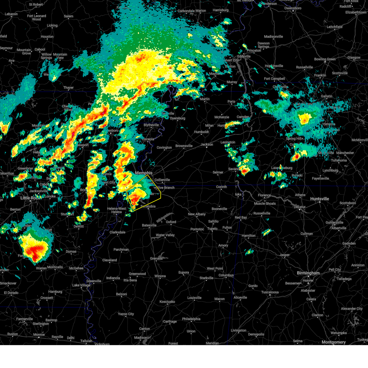 the severe thunderstorm warning has been cancelled and is no longer in effect the severe thunderstorm warning has been cancelled and is no longer in effect
|
| 4/3/2025 6:30 PM CDT |
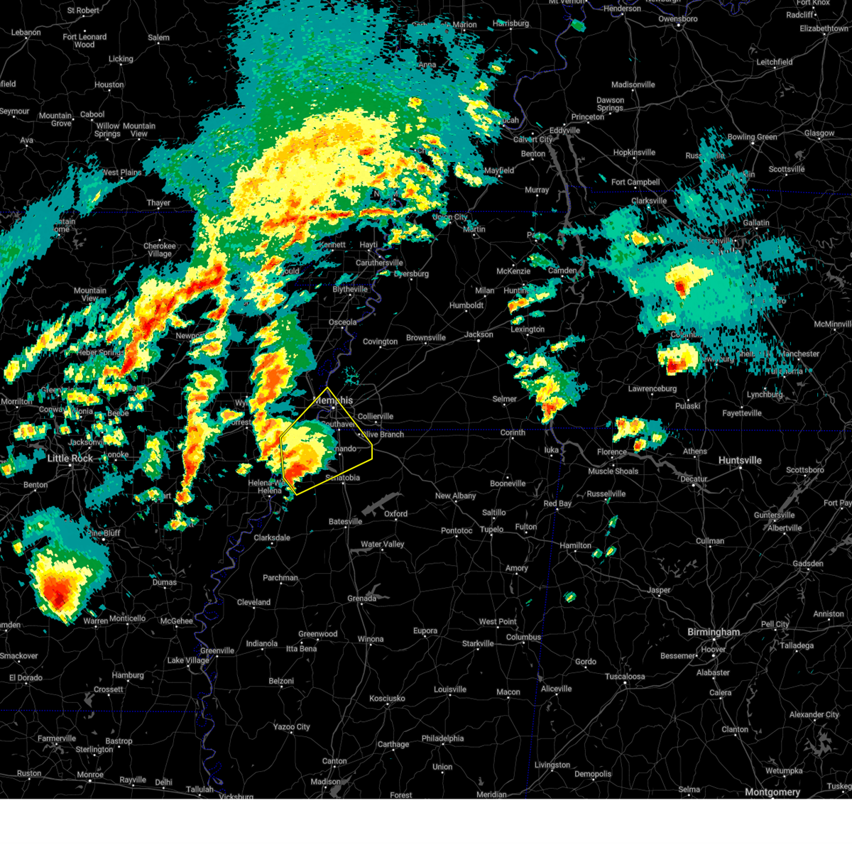 At 630 pm cdt, a severe thunderstorm was located near robinsonville, or 16 miles west of hernando, moving northeast at 55 mph (radar indicated). Hazards include 60 mph wind gusts and quarter size hail. Hail damage to vehicles is expected. expect wind damage to roofs, siding, and trees. Locations impacted include, tunica, hughes, clack, trinity, lake cormorant, southwest memphis, savage, horn lake, commerce, louise, west memphis, austin, bright, edmondson, st clair, strayhorn, prichard, presidents island, beck, and eudora. At 630 pm cdt, a severe thunderstorm was located near robinsonville, or 16 miles west of hernando, moving northeast at 55 mph (radar indicated). Hazards include 60 mph wind gusts and quarter size hail. Hail damage to vehicles is expected. expect wind damage to roofs, siding, and trees. Locations impacted include, tunica, hughes, clack, trinity, lake cormorant, southwest memphis, savage, horn lake, commerce, louise, west memphis, austin, bright, edmondson, st clair, strayhorn, prichard, presidents island, beck, and eudora.
|
| 4/3/2025 6:21 PM CDT |
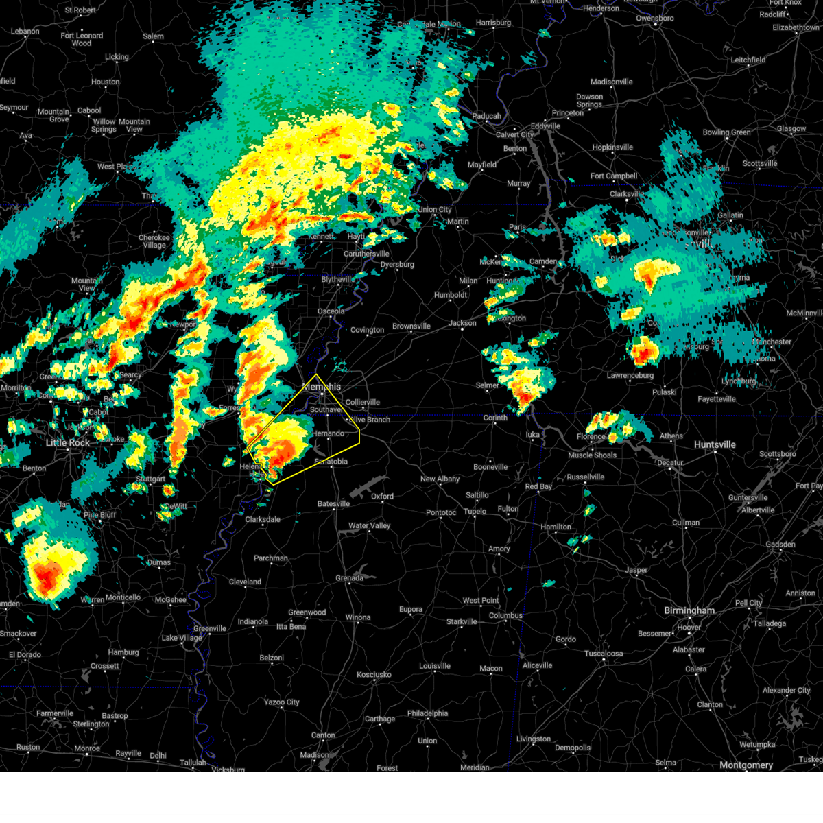 the severe thunderstorm warning has been cancelled and is no longer in effect the severe thunderstorm warning has been cancelled and is no longer in effect
|
| 4/3/2025 6:21 PM CDT |
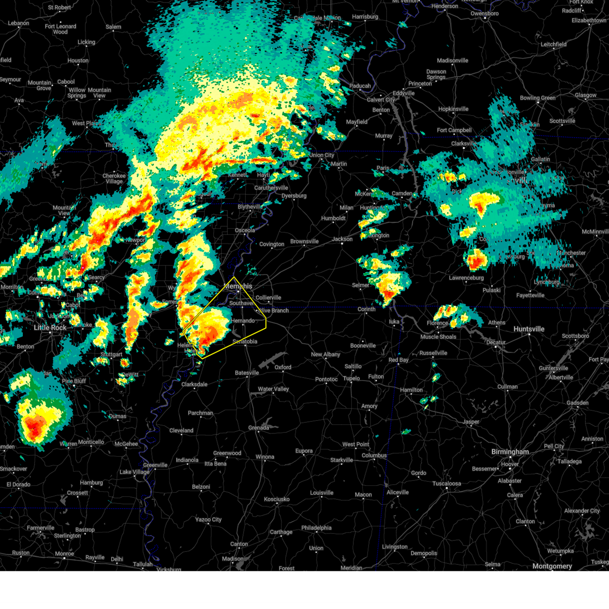 At 621 pm cdt, a severe thunderstorm was located over north tunica, or 15 miles northeast of st francis national park, moving northeast at 55 mph (radar indicated). Hazards include 60 mph wind gusts and quarter size hail. Hail damage to vehicles is expected. expect wind damage to roofs, siding, and trees. Locations impacted include, lake cormorant, southwest memphis, savage, horn lake, haleside, commerce, louise, austin, bright, edmondson, st clair, strayhorn, prichard, presidents island, beck, simsboro, dubbs, glover, brickeys, and whitehall. At 621 pm cdt, a severe thunderstorm was located over north tunica, or 15 miles northeast of st francis national park, moving northeast at 55 mph (radar indicated). Hazards include 60 mph wind gusts and quarter size hail. Hail damage to vehicles is expected. expect wind damage to roofs, siding, and trees. Locations impacted include, lake cormorant, southwest memphis, savage, horn lake, haleside, commerce, louise, austin, bright, edmondson, st clair, strayhorn, prichard, presidents island, beck, simsboro, dubbs, glover, brickeys, and whitehall.
|
| 4/3/2025 6:15 PM CDT |
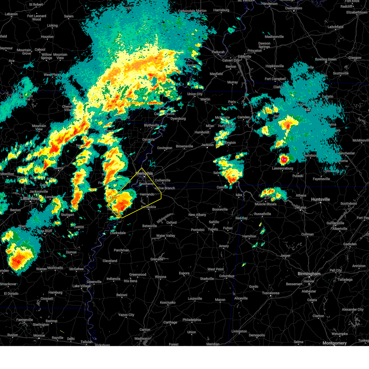 Svrmeg the national weather service in memphis has issued a * severe thunderstorm warning for, eastern lee county in eastern arkansas, southeastern st. francis county in eastern arkansas, northeastern phillips county in eastern arkansas, southern crittenden county in eastern arkansas, desoto county in northwestern mississippi, tunica county in northwestern mississippi, northwestern tate county in northwestern mississippi, southwestern shelby county in west tennessee, * until 700 pm cdt. * at 615 pm cdt, a severe thunderstorm was located near tunica, or 10 miles northeast of st francis national park, moving northeast at 55 mph (radar indicated). Hazards include 60 mph wind gusts and half dollar size hail. Hail damage to vehicles is expected. Expect wind damage to roofs, siding, and trees. Svrmeg the national weather service in memphis has issued a * severe thunderstorm warning for, eastern lee county in eastern arkansas, southeastern st. francis county in eastern arkansas, northeastern phillips county in eastern arkansas, southern crittenden county in eastern arkansas, desoto county in northwestern mississippi, tunica county in northwestern mississippi, northwestern tate county in northwestern mississippi, southwestern shelby county in west tennessee, * until 700 pm cdt. * at 615 pm cdt, a severe thunderstorm was located near tunica, or 10 miles northeast of st francis national park, moving northeast at 55 mph (radar indicated). Hazards include 60 mph wind gusts and half dollar size hail. Hail damage to vehicles is expected. Expect wind damage to roofs, siding, and trees.
|
| 4/3/2025 2:42 PM CDT |
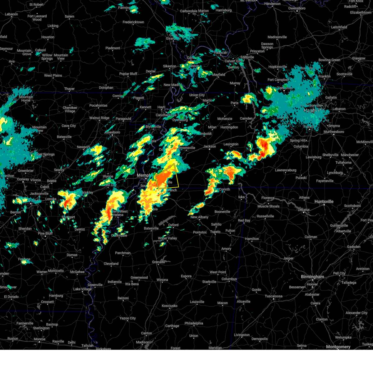 The severe thunderstorm which prompted the warning has weakened. therefore, the warning will be allowed to expire. however, gusty winds and heavy rain are still possible with this thunderstorm. a tornado watch remains in effect until 1000 pm cdt for northwestern mississippi, and west tennessee. The severe thunderstorm which prompted the warning has weakened. therefore, the warning will be allowed to expire. however, gusty winds and heavy rain are still possible with this thunderstorm. a tornado watch remains in effect until 1000 pm cdt for northwestern mississippi, and west tennessee.
|
| 4/3/2025 2:36 PM CDT |
 the severe thunderstorm warning has been cancelled and is no longer in effect the severe thunderstorm warning has been cancelled and is no longer in effect
|
| 4/3/2025 2:36 PM CDT |
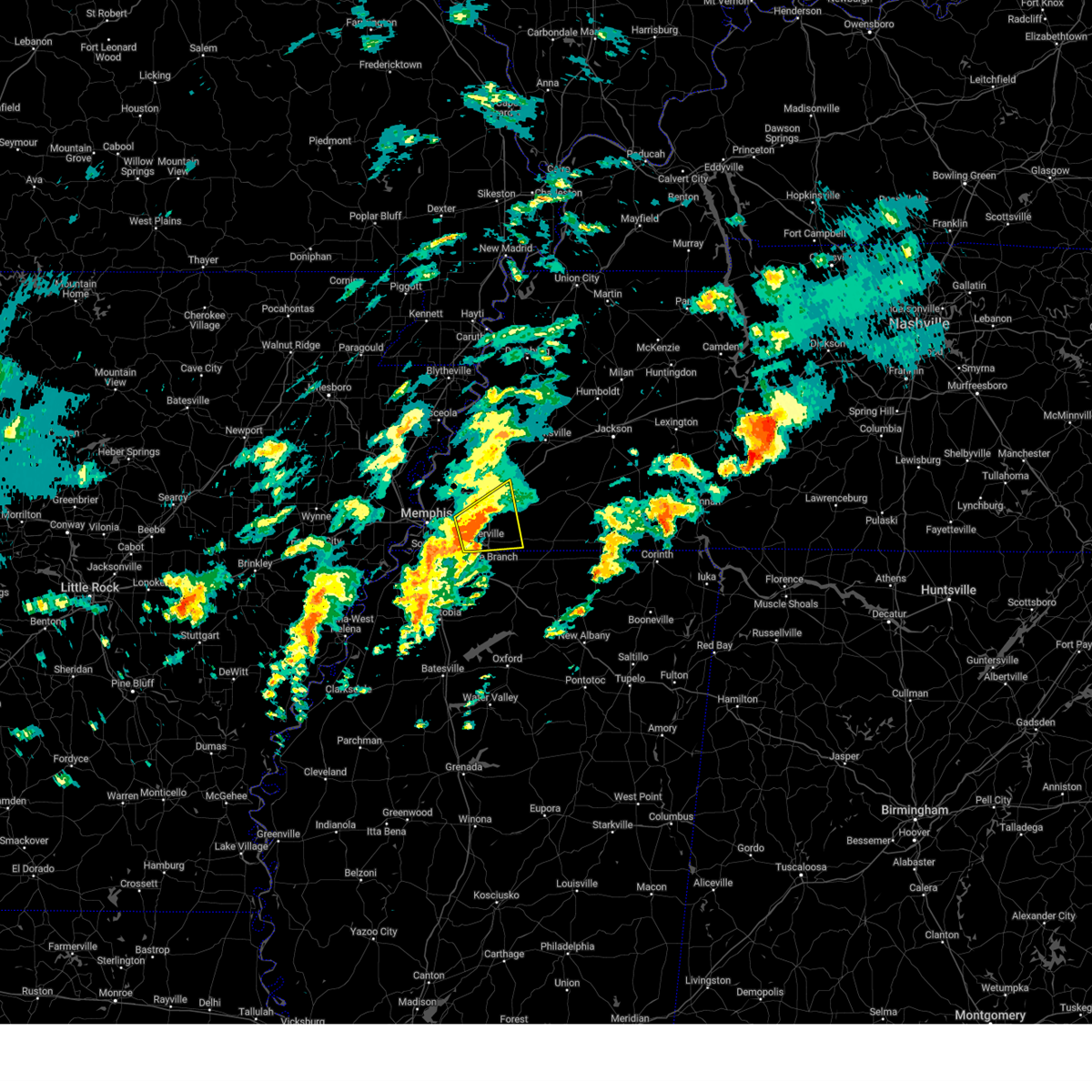 At 235 pm cdt, a severe thunderstorm was located near collierville, moving northeast at 55 mph (radar indicated). Hazards include 60 mph wind gusts and quarter size hail. Hail damage to vehicles is expected. expect wind damage to roofs, siding, and trees. Locations impacted include, piperton, lenow, oakland, germantown, kirk, hickory withe, rossville, arlington, fisherville, collierville, macon, elba, canadaville, eads, longtown, lambert, lakeland, hays crossing, griffen, and cordova. At 235 pm cdt, a severe thunderstorm was located near collierville, moving northeast at 55 mph (radar indicated). Hazards include 60 mph wind gusts and quarter size hail. Hail damage to vehicles is expected. expect wind damage to roofs, siding, and trees. Locations impacted include, piperton, lenow, oakland, germantown, kirk, hickory withe, rossville, arlington, fisherville, collierville, macon, elba, canadaville, eads, longtown, lambert, lakeland, hays crossing, griffen, and cordova.
|
| 4/3/2025 2:23 PM CDT |
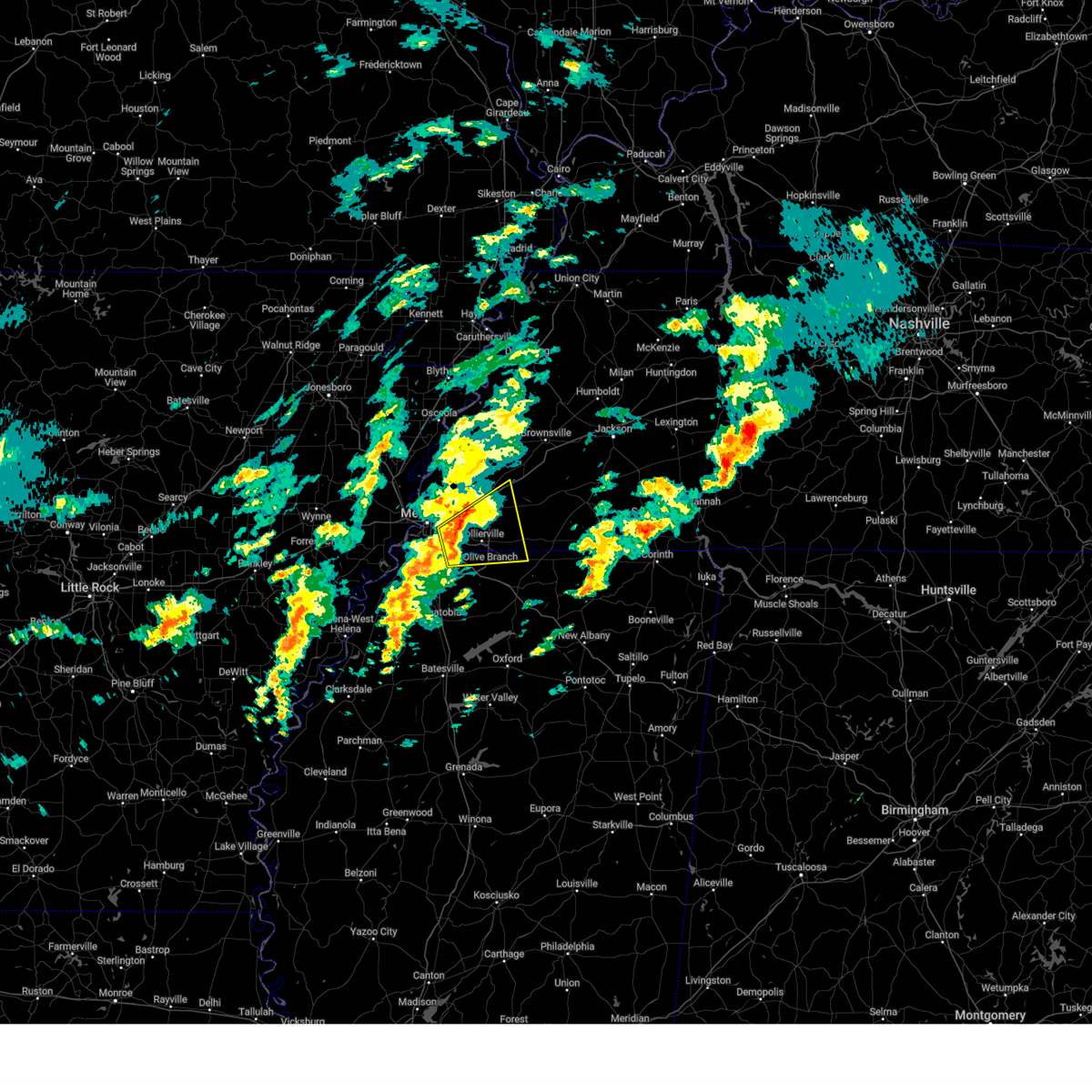 At 223 pm cdt, a severe thunderstorm was located near olive branch, moving northeast at 40 mph (radar indicated). Hazards include 60 mph wind gusts and quarter size hail. Hail damage to vehicles is expected. expect wind damage to roofs, siding, and trees. Locations impacted include, piperton, mt pleasant, lenow, cayce, oakland, germantown, handy corner, capleville, kirk, hickory withe, rossville, arlington, fisherville, collierville, macon, southeast memphis, fairhaven, elba, canadaville, and eads. At 223 pm cdt, a severe thunderstorm was located near olive branch, moving northeast at 40 mph (radar indicated). Hazards include 60 mph wind gusts and quarter size hail. Hail damage to vehicles is expected. expect wind damage to roofs, siding, and trees. Locations impacted include, piperton, mt pleasant, lenow, cayce, oakland, germantown, handy corner, capleville, kirk, hickory withe, rossville, arlington, fisherville, collierville, macon, southeast memphis, fairhaven, elba, canadaville, and eads.
|
| 4/3/2025 2:05 PM CDT |
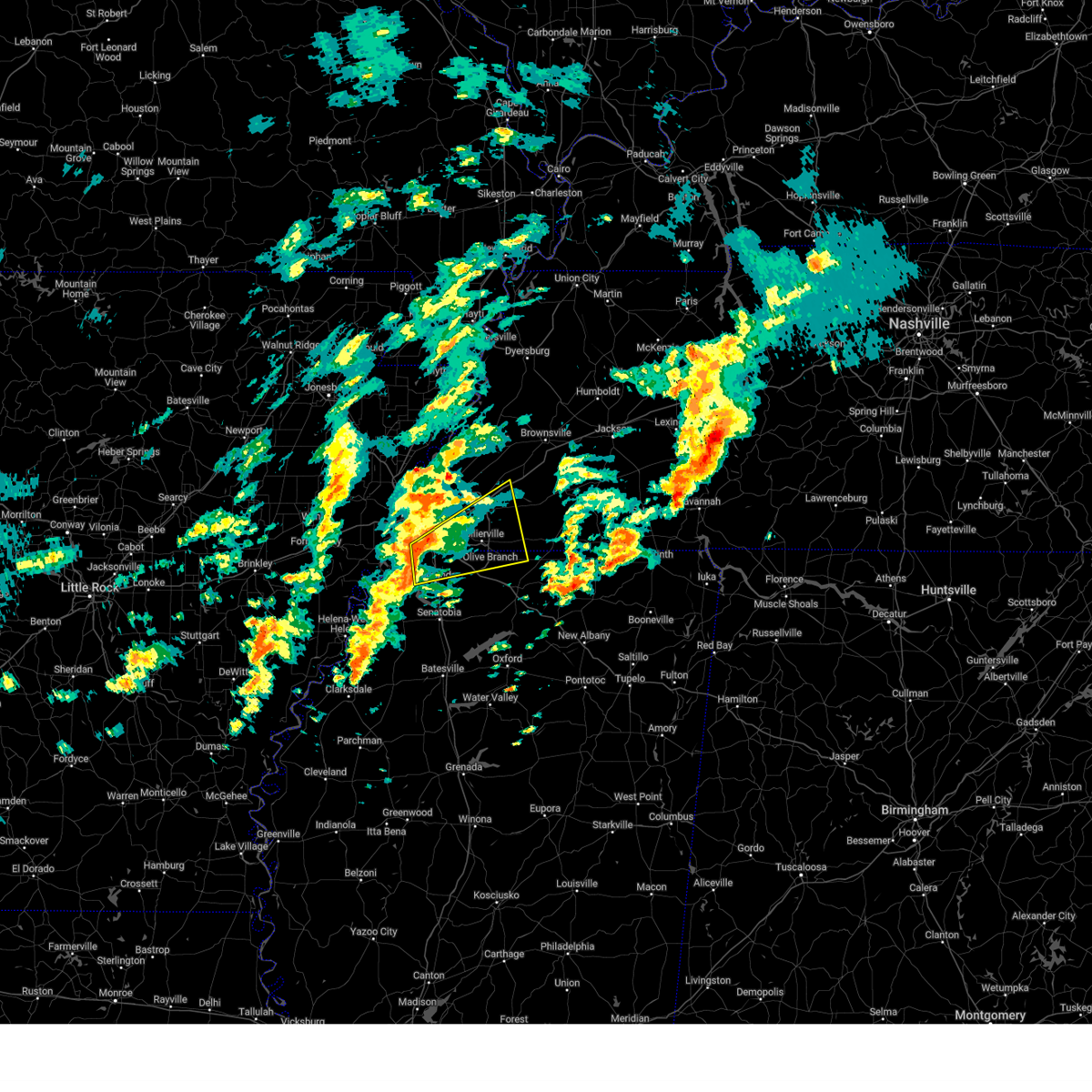 Svrmeg the national weather service in memphis has issued a * severe thunderstorm warning for, northeastern desoto county in northwestern mississippi, northwestern marshall county in northwestern mississippi, western fayette county in west tennessee, southeastern shelby county in west tennessee, * until 245 pm cdt. * at 205 pm cdt, a severe thunderstorm was located over horn lake, moving northeast at 55 mph (radar indicated). Hazards include 60 mph wind gusts and quarter size hail. Hail damage to vehicles is expected. Expect wind damage to roofs, siding, and trees. Svrmeg the national weather service in memphis has issued a * severe thunderstorm warning for, northeastern desoto county in northwestern mississippi, northwestern marshall county in northwestern mississippi, western fayette county in west tennessee, southeastern shelby county in west tennessee, * until 245 pm cdt. * at 205 pm cdt, a severe thunderstorm was located over horn lake, moving northeast at 55 mph (radar indicated). Hazards include 60 mph wind gusts and quarter size hail. Hail damage to vehicles is expected. Expect wind damage to roofs, siding, and trees.
|
| 4/3/2025 1:21 AM CDT |
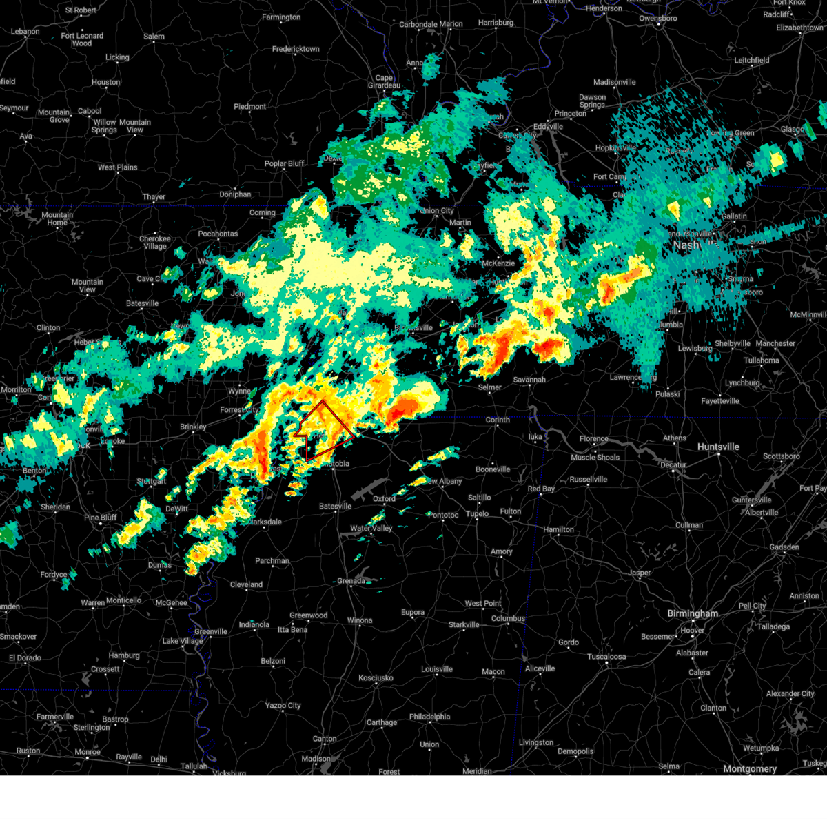 The storm which prompted the warning has weakened below severe limits, and no longer appears capable of producing a tornado. therefore, the warning will be allowed to expire. a tornado watch remains in effect until 600 am cdt for northwestern mississippi. The storm which prompted the warning has weakened below severe limits, and no longer appears capable of producing a tornado. therefore, the warning will be allowed to expire. a tornado watch remains in effect until 600 am cdt for northwestern mississippi.
|
| 4/3/2025 1:05 AM CDT |
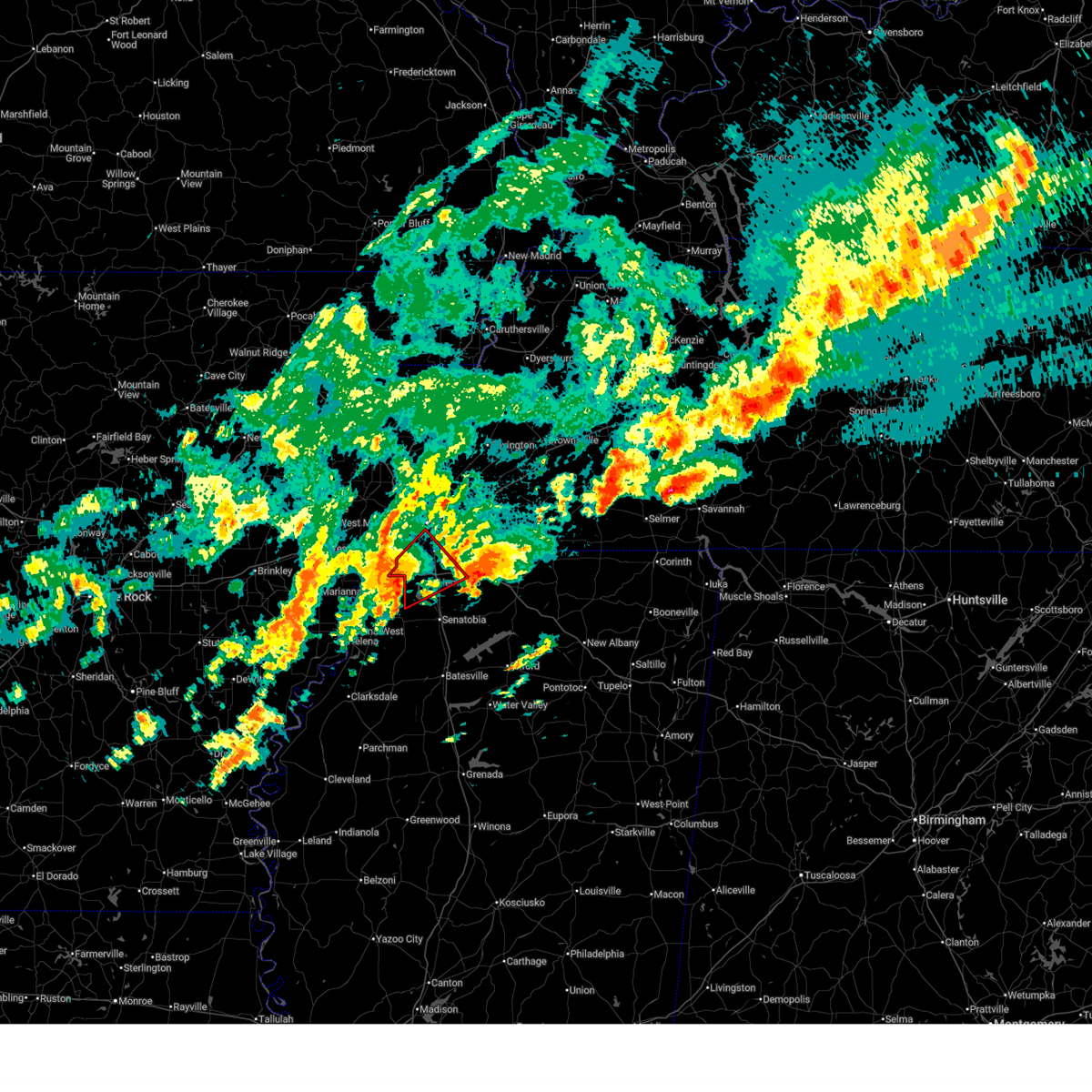 At 104 am cdt, a severe thunderstorm capable of producing a tornado was located over eudora, or 8 miles west of hernando, moving northeast at 50 mph (radar indicated rotation). Hazards include tornado. Flying debris will be dangerous to those caught without shelter. mobile homes will be damaged or destroyed. damage to roofs, windows, and vehicles will occur. tree damage is likely. Locations impacted include, newport, trinity, lake cormorant, southwest memphis, horn lake, frees corners, lynchburg, bright, nesbit, phillipp, eudora, t o fuller state park, glover, jago, robinson gin, alden, twin lakes, lewisburg, whitehaven, and southaven. At 104 am cdt, a severe thunderstorm capable of producing a tornado was located over eudora, or 8 miles west of hernando, moving northeast at 50 mph (radar indicated rotation). Hazards include tornado. Flying debris will be dangerous to those caught without shelter. mobile homes will be damaged or destroyed. damage to roofs, windows, and vehicles will occur. tree damage is likely. Locations impacted include, newport, trinity, lake cormorant, southwest memphis, horn lake, frees corners, lynchburg, bright, nesbit, phillipp, eudora, t o fuller state park, glover, jago, robinson gin, alden, twin lakes, lewisburg, whitehaven, and southaven.
|
| 4/3/2025 1:05 AM CDT |
 the tornado warning has been cancelled and is no longer in effect the tornado warning has been cancelled and is no longer in effect
|
| 4/3/2025 12:50 AM CDT |
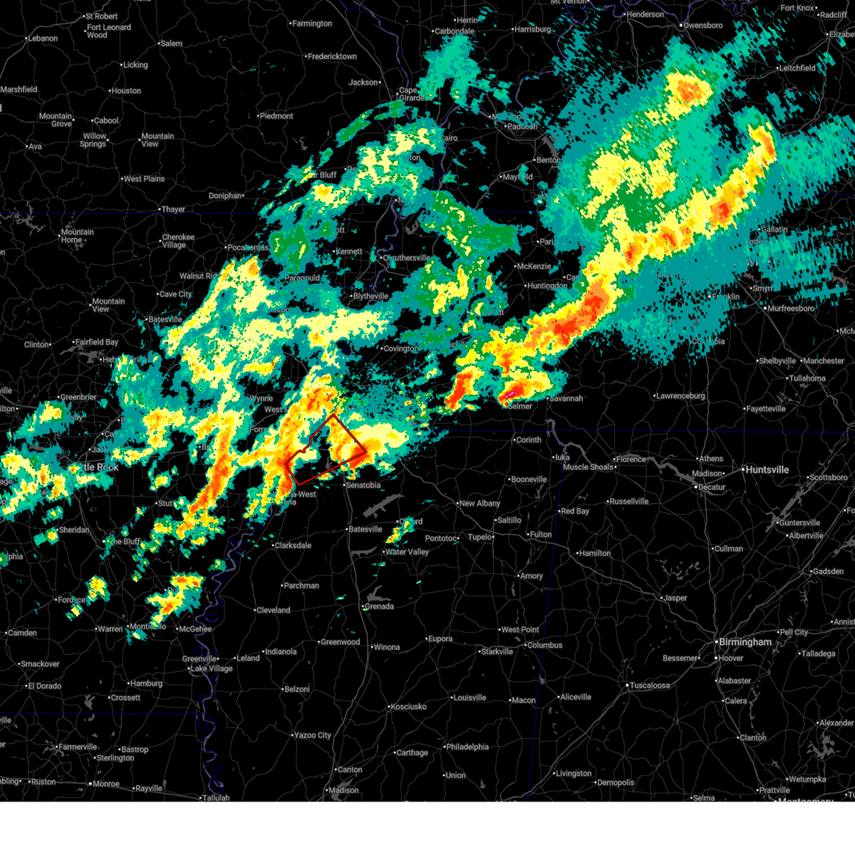 Tormeg the national weather service in memphis has issued a * tornado warning for, desoto county in northwestern mississippi, northeastern tunica county in northwestern mississippi, northwestern tate county in northwestern mississippi, south central shelby county in west tennessee, * until 130 am cdt. * at 1250 am cdt, a severe thunderstorm capable of producing a tornado was located over north tunica, or 16 miles southeast of hughes, moving northeast at 40 mph (radar indicated rotation). Hazards include tornado. Flying debris will be dangerous to those caught without shelter. mobile homes will be damaged or destroyed. damage to roofs, windows, and vehicles will occur. Tree damage is likely. Tormeg the national weather service in memphis has issued a * tornado warning for, desoto county in northwestern mississippi, northeastern tunica county in northwestern mississippi, northwestern tate county in northwestern mississippi, south central shelby county in west tennessee, * until 130 am cdt. * at 1250 am cdt, a severe thunderstorm capable of producing a tornado was located over north tunica, or 16 miles southeast of hughes, moving northeast at 40 mph (radar indicated rotation). Hazards include tornado. Flying debris will be dangerous to those caught without shelter. mobile homes will be damaged or destroyed. damage to roofs, windows, and vehicles will occur. Tree damage is likely.
|
| 4/2/2025 10:33 PM CDT |
 At 1033 pm cdt, a severe thunderstorm was located over walls, or 7 miles southwest of t o fuller state park, moving northeast at 65 mph (radar indicated). Hazards include 60 mph wind gusts and quarter size hail. Hail damage to vehicles is expected. expect wind damage to roofs, siding, and trees. Locations impacted include, tunica, hughes, clack, trinity, lake cormorant, southwest memphis, browns, horn lake, commerce, louise, west memphis, austin, edmondson, st clair, presidents island, beck, eudora, simsboro, democrat, and t o fuller state park. At 1033 pm cdt, a severe thunderstorm was located over walls, or 7 miles southwest of t o fuller state park, moving northeast at 65 mph (radar indicated). Hazards include 60 mph wind gusts and quarter size hail. Hail damage to vehicles is expected. expect wind damage to roofs, siding, and trees. Locations impacted include, tunica, hughes, clack, trinity, lake cormorant, southwest memphis, browns, horn lake, commerce, louise, west memphis, austin, edmondson, st clair, presidents island, beck, eudora, simsboro, democrat, and t o fuller state park.
|
| 4/2/2025 10:31 PM CDT |
 At 1030 pm cdt, a severe thunderstorm was located near bells, or 10 miles northeast of brownsville, moving northeast at 55 mph. this is a destructive storm for holly grove, mercer, and whiteville (radar indicated). Hazards include 80 mph wind gusts and quarter size hail. Flying debris will be dangerous to those caught without shelter. mobile homes will be heavily damaged. expect considerable damage to roofs, windows, and vehicles. extensive tree damage and power outages are likely. Locations impacted include, tuckers corner, neely, yum yum, selmer, atwood, stanton, huntersville, masseyville, belmont, cades, christmasville, westover, madison hall, uptonville, silerton, maury junction, gann, georgetown, pinson mounds state archaeological park, and laneview. At 1030 pm cdt, a severe thunderstorm was located near bells, or 10 miles northeast of brownsville, moving northeast at 55 mph. this is a destructive storm for holly grove, mercer, and whiteville (radar indicated). Hazards include 80 mph wind gusts and quarter size hail. Flying debris will be dangerous to those caught without shelter. mobile homes will be heavily damaged. expect considerable damage to roofs, windows, and vehicles. extensive tree damage and power outages are likely. Locations impacted include, tuckers corner, neely, yum yum, selmer, atwood, stanton, huntersville, masseyville, belmont, cades, christmasville, westover, madison hall, uptonville, silerton, maury junction, gann, georgetown, pinson mounds state archaeological park, and laneview.
|
| 4/2/2025 10:29 PM CDT |
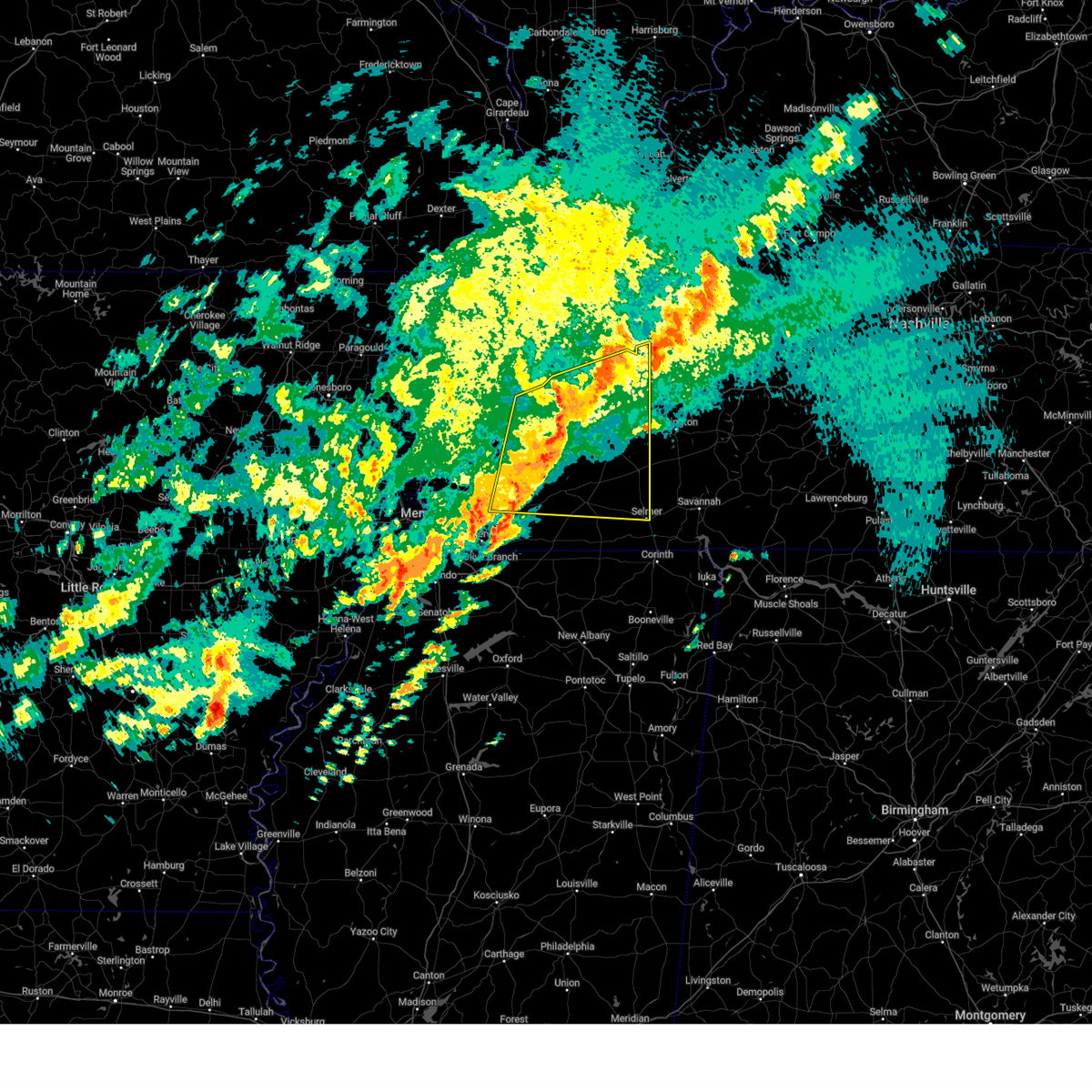 Svrmeg the national weather service in memphis has issued a * severe thunderstorm warning for, crockett county in west tennessee, southeastern tipton county in west tennessee, northwestern henderson county in west tennessee, southern gibson county in west tennessee, northern fayette county in west tennessee, northern hardeman county in west tennessee, northwestern mcnairy county in west tennessee, southeastern lauderdale county in west tennessee, western carroll county in west tennessee, haywood county in west tennessee, madison county in west tennessee, chester county in west tennessee, * until 1115 pm cdt. * at 1027 pm cdt, a severe thunderstorm was located near belle eagle, or 8 miles northeast of brownsville, moving northeast at 55 mph. this is a destructive storm for holly grove, mercer, and whiteville (radar indicated). Hazards include 80 mph wind gusts and quarter size hail. Flying debris will be dangerous to those caught without shelter. mobile homes will be heavily damaged. expect considerable damage to roofs, windows, and vehicles. Extensive tree damage and power outages are likely. Svrmeg the national weather service in memphis has issued a * severe thunderstorm warning for, crockett county in west tennessee, southeastern tipton county in west tennessee, northwestern henderson county in west tennessee, southern gibson county in west tennessee, northern fayette county in west tennessee, northern hardeman county in west tennessee, northwestern mcnairy county in west tennessee, southeastern lauderdale county in west tennessee, western carroll county in west tennessee, haywood county in west tennessee, madison county in west tennessee, chester county in west tennessee, * until 1115 pm cdt. * at 1027 pm cdt, a severe thunderstorm was located near belle eagle, or 8 miles northeast of brownsville, moving northeast at 55 mph. this is a destructive storm for holly grove, mercer, and whiteville (radar indicated). Hazards include 80 mph wind gusts and quarter size hail. Flying debris will be dangerous to those caught without shelter. mobile homes will be heavily damaged. expect considerable damage to roofs, windows, and vehicles. Extensive tree damage and power outages are likely.
|
| 4/2/2025 10:17 PM CDT |
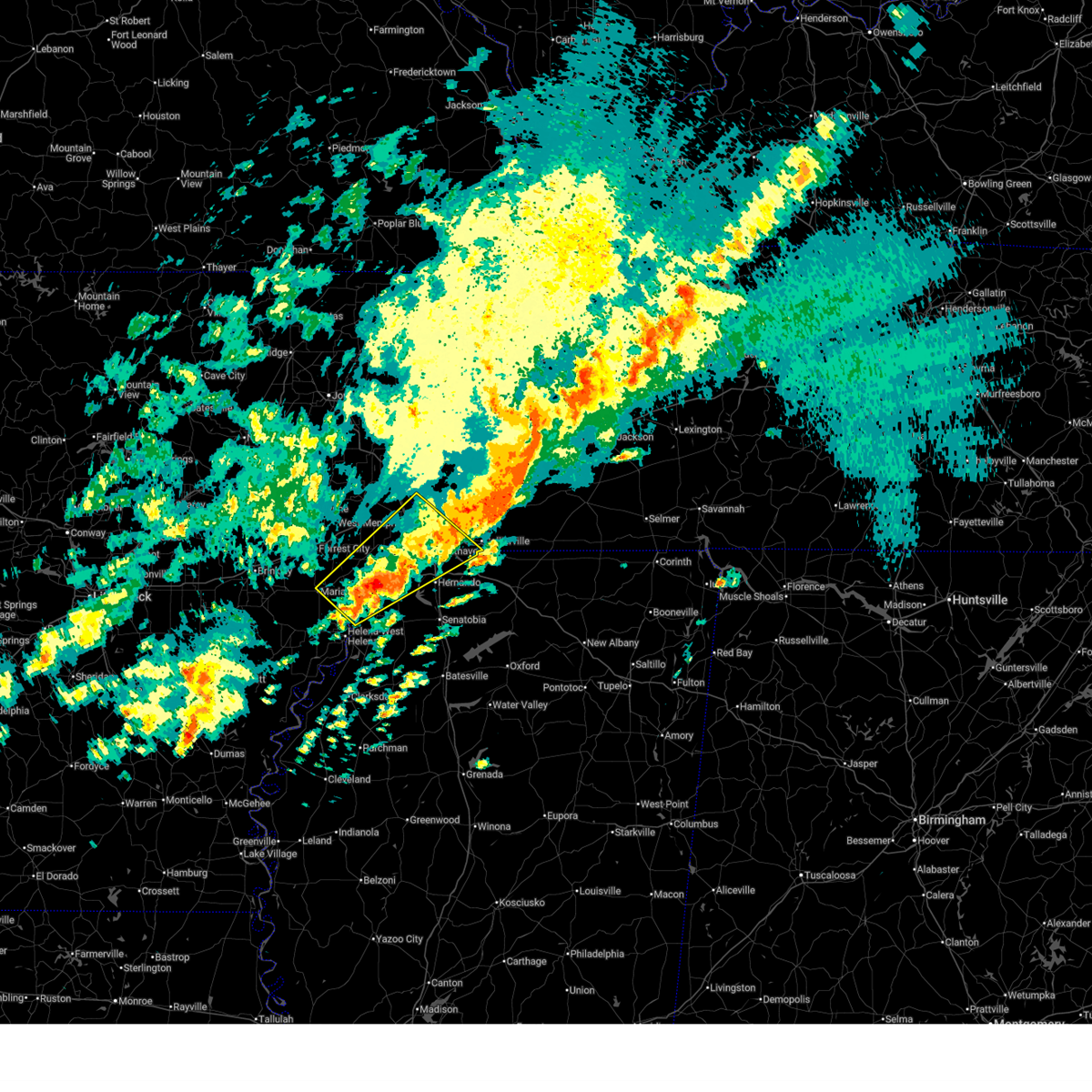 At 1017 pm cdt, a severe thunderstorm was located near robinsonville, or 9 miles south of hughes, moving northeast at 65 mph (radar indicated). Hazards include ping pong ball size hail and 60 mph wind gusts. People and animals outdoors will be injured. expect hail damage to roofs, siding, windows, and vehicles. expect wind damage to roofs, siding, and trees. Locations impacted include, cody, lake cormorant, southwest memphis, browns, horn lake, haleside, commerce, louise, austin, edmondson, st clair, presidents island, beck, simsboro, glover, brickeys, ball point, whitehall, tongin, and alden. At 1017 pm cdt, a severe thunderstorm was located near robinsonville, or 9 miles south of hughes, moving northeast at 65 mph (radar indicated). Hazards include ping pong ball size hail and 60 mph wind gusts. People and animals outdoors will be injured. expect hail damage to roofs, siding, windows, and vehicles. expect wind damage to roofs, siding, and trees. Locations impacted include, cody, lake cormorant, southwest memphis, browns, horn lake, haleside, commerce, louise, austin, edmondson, st clair, presidents island, beck, simsboro, glover, brickeys, ball point, whitehall, tongin, and alden.
|
| 4/2/2025 10:13 PM CDT |
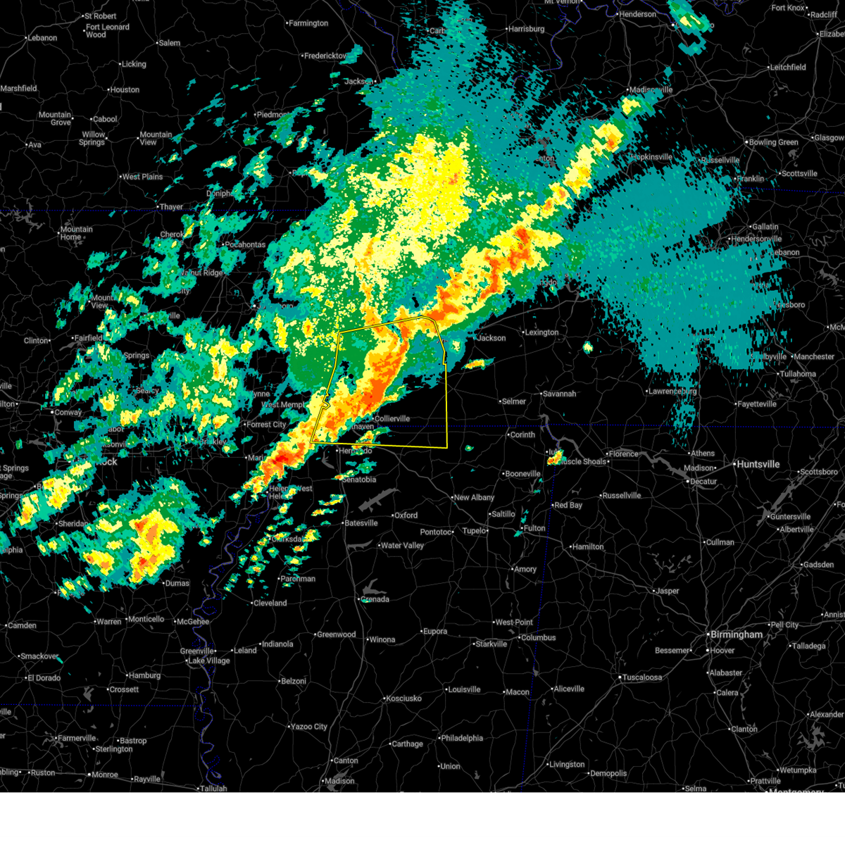 the severe thunderstorm warning has been cancelled and is no longer in effect the severe thunderstorm warning has been cancelled and is no longer in effect
|
| 4/2/2025 10:13 PM CDT |
 At 1013 pm cdt, a severe thunderstorm was located 10 miles northwest of somerville, or 17 miles southeast of covington, moving east at 65 mph (radar indicated). Hazards include 70 mph wind gusts and half dollar size hail. Hail damage to vehicles is expected. expect considerable tree damage. wind damage is also likely to mobile homes, roofs, and outbuildings. Locations impacted include, ghost river state natural area, brody, yum yum, burlison, southwest memphis, stanton, horn lake, belmont, christmasville, covington, kirk, glover, atoka, locke, rossville, arlington, elmore park, brunswick, laconia, and alden. At 1013 pm cdt, a severe thunderstorm was located 10 miles northwest of somerville, or 17 miles southeast of covington, moving east at 65 mph (radar indicated). Hazards include 70 mph wind gusts and half dollar size hail. Hail damage to vehicles is expected. expect considerable tree damage. wind damage is also likely to mobile homes, roofs, and outbuildings. Locations impacted include, ghost river state natural area, brody, yum yum, burlison, southwest memphis, stanton, horn lake, belmont, christmasville, covington, kirk, glover, atoka, locke, rossville, arlington, elmore park, brunswick, laconia, and alden.
|
| 4/2/2025 10:09 PM CDT |
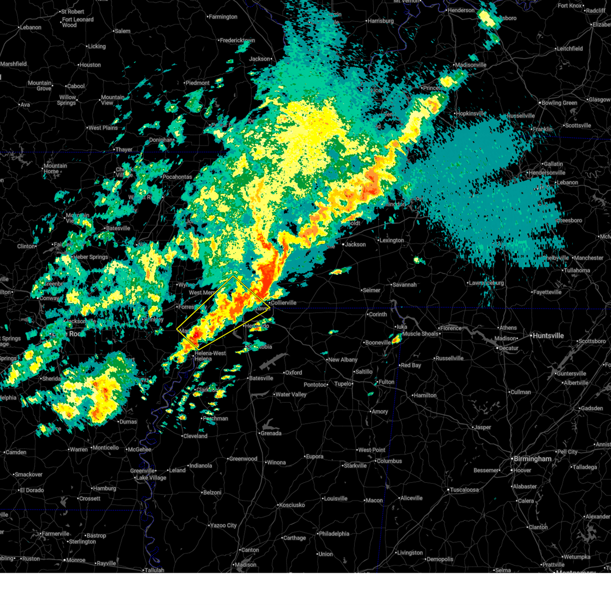 Svrmeg the national weather service in memphis has issued a * severe thunderstorm warning for, eastern lee county in eastern arkansas, southeastern st. francis county in eastern arkansas, central crittenden county in eastern arkansas, northwestern desoto county in northwestern mississippi, northern tunica county in northwestern mississippi, southwestern shelby county in west tennessee, * until 1100 pm cdt. * at 1009 pm cdt, a severe thunderstorm was located 7 miles south of brickeys, or 12 miles north of st francis national park, moving northeast at 65 mph (radar indicated). Hazards include ping pong ball size hail and 60 mph wind gusts. People and animals outdoors will be injured. expect hail damage to roofs, siding, windows, and vehicles. Expect wind damage to roofs, siding, and trees. Svrmeg the national weather service in memphis has issued a * severe thunderstorm warning for, eastern lee county in eastern arkansas, southeastern st. francis county in eastern arkansas, central crittenden county in eastern arkansas, northwestern desoto county in northwestern mississippi, northern tunica county in northwestern mississippi, southwestern shelby county in west tennessee, * until 1100 pm cdt. * at 1009 pm cdt, a severe thunderstorm was located 7 miles south of brickeys, or 12 miles north of st francis national park, moving northeast at 65 mph (radar indicated). Hazards include ping pong ball size hail and 60 mph wind gusts. People and animals outdoors will be injured. expect hail damage to roofs, siding, windows, and vehicles. Expect wind damage to roofs, siding, and trees.
|
| 4/2/2025 9:56 PM CDT |
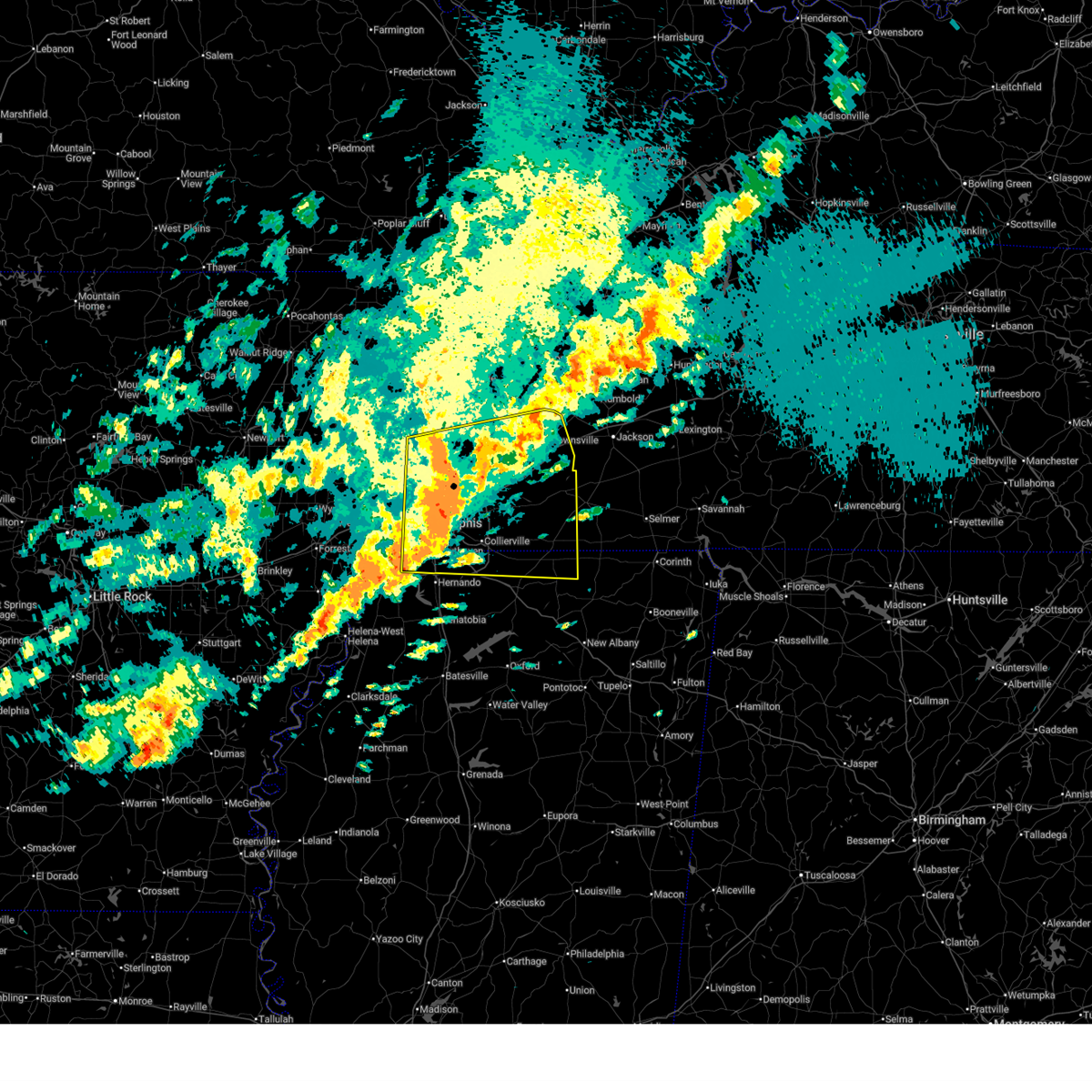 At 956 pm cdt, a severe thunderstorm was located near ellendale, or near millington, moving east at 65 mph (radar indicated). Hazards include 60 mph wind gusts and half dollar size hail. Hail damage to vehicles is expected. expect wind damage to roofs, siding, and trees. Locations impacted include, ghost river state natural area, burlison, stanton, horn lake, covington, presidents island, kirk, glover, locke, arlington, elmore park, laconia, alden, hudsonville, sunnyhill, durhamville, gilestown, clopton, asbury, and mound city. At 956 pm cdt, a severe thunderstorm was located near ellendale, or near millington, moving east at 65 mph (radar indicated). Hazards include 60 mph wind gusts and half dollar size hail. Hail damage to vehicles is expected. expect wind damage to roofs, siding, and trees. Locations impacted include, ghost river state natural area, burlison, stanton, horn lake, covington, presidents island, kirk, glover, locke, arlington, elmore park, laconia, alden, hudsonville, sunnyhill, durhamville, gilestown, clopton, asbury, and mound city.
|
| 4/2/2025 9:55 PM CDT | Quarter sized hail reported 4.7 miles E of Memphis, TN, nickel and quarter sized hail at poplar and highland. |
| 4/2/2025 9:54 PM CDT |
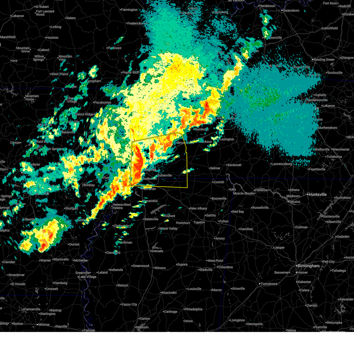 Svrmeg the national weather service in memphis has issued a * severe thunderstorm warning for, southwestern mississippi county in eastern arkansas, northeastern crittenden county in eastern arkansas, northern desoto county in northwestern mississippi, northern marshall county in northwestern mississippi, northern benton county in northeastern mississippi, tipton county in west tennessee, fayette county in west tennessee, western hardeman county in west tennessee, southern lauderdale county in west tennessee, haywood county in west tennessee, shelby county in west tennessee, * until 1045 pm cdt. * at 954 pm cdt, a severe thunderstorm was located near millington, moving east at 65 mph (radar indicated). Hazards include 60 mph wind gusts and quarter size hail. Hail damage to vehicles is expected. Expect wind damage to roofs, siding, and trees. Svrmeg the national weather service in memphis has issued a * severe thunderstorm warning for, southwestern mississippi county in eastern arkansas, northeastern crittenden county in eastern arkansas, northern desoto county in northwestern mississippi, northern marshall county in northwestern mississippi, northern benton county in northeastern mississippi, tipton county in west tennessee, fayette county in west tennessee, western hardeman county in west tennessee, southern lauderdale county in west tennessee, haywood county in west tennessee, shelby county in west tennessee, * until 1045 pm cdt. * at 954 pm cdt, a severe thunderstorm was located near millington, moving east at 65 mph (radar indicated). Hazards include 60 mph wind gusts and quarter size hail. Hail damage to vehicles is expected. Expect wind damage to roofs, siding, and trees.
|
| 4/2/2025 9:47 PM CDT |
 the severe thunderstorm warning has been cancelled and is no longer in effect the severe thunderstorm warning has been cancelled and is no longer in effect
|
| 4/2/2025 9:47 PM CDT |
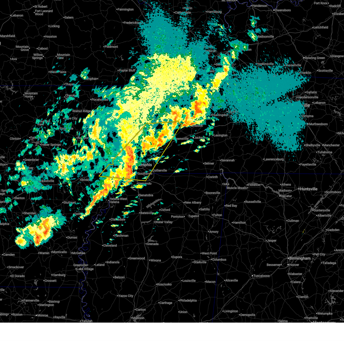 At 947 pm cdt, a severe thunderstorm was located near chestnut bluff, or 8 miles south of dyersburg, moving northeast at 65 mph (radar indicated). Hazards include ping pong ball size hail and 60 mph wind gusts. People and animals outdoors will be injured. expect hail damage to roofs, siding, windows, and vehicles. expect wind damage to roofs, siding, and trees. Locations impacted include, burlison, stanton, horn lake, louise, covington, edmondson, presidents island, beck, glover, locke, arlington, elmore park, alden, julius, brims corner, durhamville, gilestown, clopton, clarks corner, and lightfoot. At 947 pm cdt, a severe thunderstorm was located near chestnut bluff, or 8 miles south of dyersburg, moving northeast at 65 mph (radar indicated). Hazards include ping pong ball size hail and 60 mph wind gusts. People and animals outdoors will be injured. expect hail damage to roofs, siding, windows, and vehicles. expect wind damage to roofs, siding, and trees. Locations impacted include, burlison, stanton, horn lake, louise, covington, edmondson, presidents island, beck, glover, locke, arlington, elmore park, alden, julius, brims corner, durhamville, gilestown, clopton, clarks corner, and lightfoot.
|
| 4/2/2025 9:28 PM CDT |
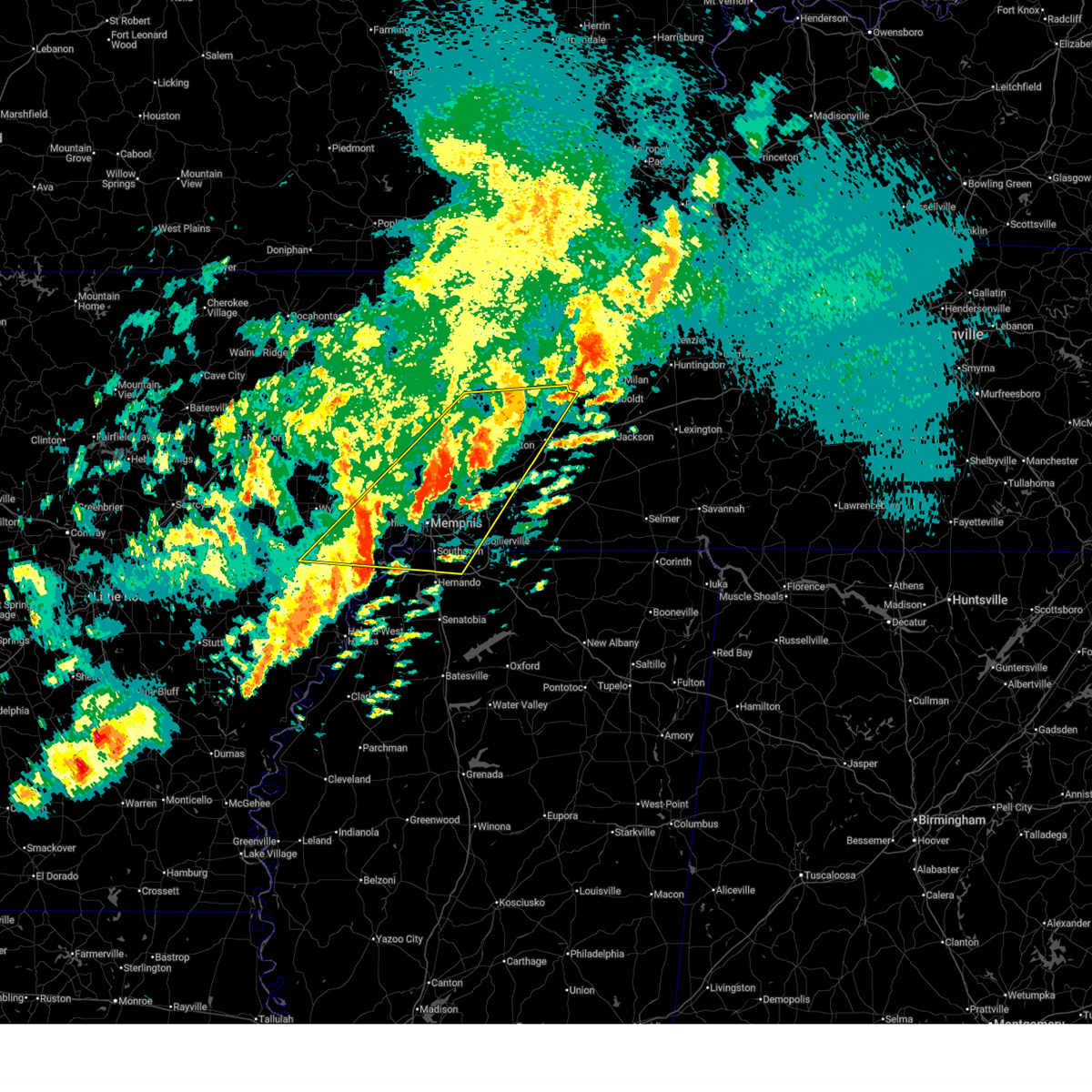 At 928 pm cdt, a severe thunderstorm was located near ripley, moving northeast at 65 mph (radar indicated). Hazards include ping pong ball size hail and 60 mph wind gusts. People and animals outdoors will be injured. expect hail damage to roofs, siding, windows, and vehicles. expect wind damage to roofs, siding, and trees. Locations impacted include, burlison, stanton, horn lake, louise, new castle, covington, edmondson, presidents island, beck, glover, locke, arlington, elmore park, alden, julius, brims corner, durhamville, gilestown, clopton, and clarks corner. At 928 pm cdt, a severe thunderstorm was located near ripley, moving northeast at 65 mph (radar indicated). Hazards include ping pong ball size hail and 60 mph wind gusts. People and animals outdoors will be injured. expect hail damage to roofs, siding, windows, and vehicles. expect wind damage to roofs, siding, and trees. Locations impacted include, burlison, stanton, horn lake, louise, new castle, covington, edmondson, presidents island, beck, glover, locke, arlington, elmore park, alden, julius, brims corner, durhamville, gilestown, clopton, and clarks corner.
|
| 4/2/2025 9:10 PM CDT |
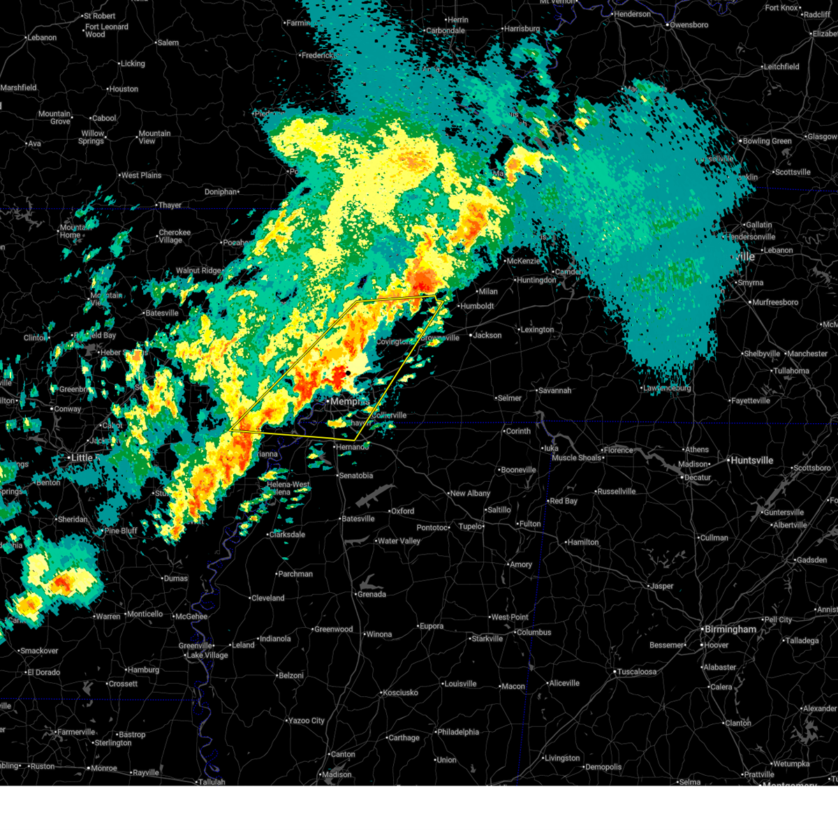 Svrmeg the national weather service in memphis has issued a * severe thunderstorm warning for, eastern st. francis county in eastern arkansas, southern mississippi county in eastern arkansas, crittenden county in eastern arkansas, southeastern cross county in eastern arkansas, northern desoto county in northwestern mississippi, southwestern crockett county in west tennessee, tipton county in west tennessee, northwestern fayette county in west tennessee, lauderdale county in west tennessee, northwestern haywood county in west tennessee, shelby county in west tennessee, * until 1000 pm cdt. * at 910 pm cdt, a severe thunderstorm was located over munford, or 10 miles north of millington, moving northeast at 65 mph (radar indicated). Hazards include 60 mph wind gusts and quarter size hail. Hail damage to vehicles is expected. Expect wind damage to roofs, siding, and trees. Svrmeg the national weather service in memphis has issued a * severe thunderstorm warning for, eastern st. francis county in eastern arkansas, southern mississippi county in eastern arkansas, crittenden county in eastern arkansas, southeastern cross county in eastern arkansas, northern desoto county in northwestern mississippi, southwestern crockett county in west tennessee, tipton county in west tennessee, northwestern fayette county in west tennessee, lauderdale county in west tennessee, northwestern haywood county in west tennessee, shelby county in west tennessee, * until 1000 pm cdt. * at 910 pm cdt, a severe thunderstorm was located over munford, or 10 miles north of millington, moving northeast at 65 mph (radar indicated). Hazards include 60 mph wind gusts and quarter size hail. Hail damage to vehicles is expected. Expect wind damage to roofs, siding, and trees.
|
| 4/2/2025 8:58 PM CDT |
 At 857 pm cdt, severe thunderstorms were located along a line extending from near forked deer to near frayser to near haynes, moving south at 25 mph (radar indicated). Hazards include 60 mph wind gusts and quarter size hail. Hail damage to vehicles is expected. expect wind damage to roofs, siding, and trees. Locations impacted include, three forks, burlison, horn lake, louise, new castle, covington, edmondson, osceola, presidents island, beck, glover, locke, arlington, elmore park, alden, village creek state park, julius, durhamville, gilestown, and clopton. At 857 pm cdt, severe thunderstorms were located along a line extending from near forked deer to near frayser to near haynes, moving south at 25 mph (radar indicated). Hazards include 60 mph wind gusts and quarter size hail. Hail damage to vehicles is expected. expect wind damage to roofs, siding, and trees. Locations impacted include, three forks, burlison, horn lake, louise, new castle, covington, edmondson, osceola, presidents island, beck, glover, locke, arlington, elmore park, alden, village creek state park, julius, durhamville, gilestown, and clopton.
|
| 4/2/2025 8:58 PM CDT |
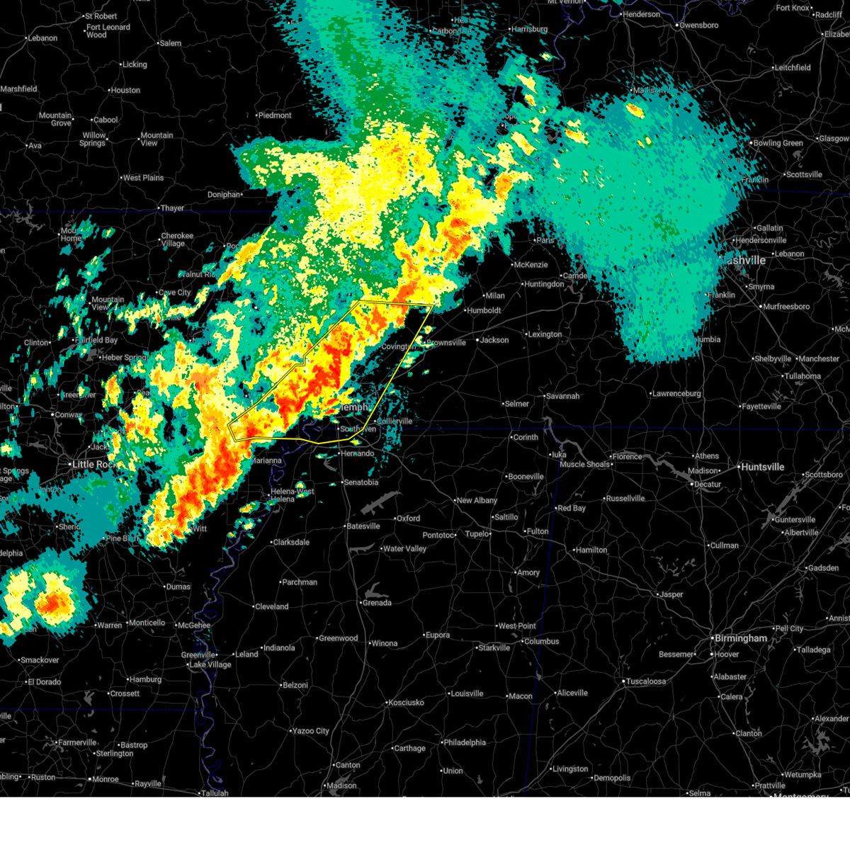 the severe thunderstorm warning has been cancelled and is no longer in effect the severe thunderstorm warning has been cancelled and is no longer in effect
|
| 4/2/2025 8:40 PM CDT |
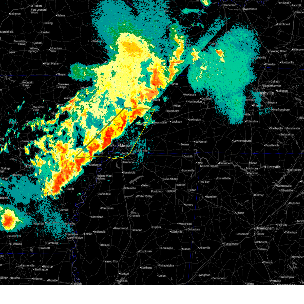 At 839 pm cdt, severe thunderstorms were located along a line extending from near chestnut bluff to near haynes, moving northeast at 65 mph (radar indicated). Hazards include 60 mph wind gusts and quarter size hail. Hail damage to vehicles is expected. expect wind damage to roofs, siding, and trees. Locations impacted include, three forks, burlison, horn lake, louise, new castle, covington, edmondson, osceola, presidents island, beck, glover, locke, arlington, elmore park, alden, village creek state park, julius, durhamville, gilestown, and clopton. At 839 pm cdt, severe thunderstorms were located along a line extending from near chestnut bluff to near haynes, moving northeast at 65 mph (radar indicated). Hazards include 60 mph wind gusts and quarter size hail. Hail damage to vehicles is expected. expect wind damage to roofs, siding, and trees. Locations impacted include, three forks, burlison, horn lake, louise, new castle, covington, edmondson, osceola, presidents island, beck, glover, locke, arlington, elmore park, alden, village creek state park, julius, durhamville, gilestown, and clopton.
|
| 4/2/2025 8:31 PM CDT |
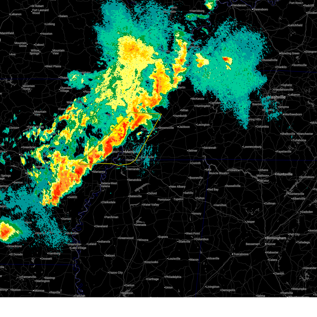 Svrmeg the national weather service in memphis has issued a * severe thunderstorm warning for, st. francis county in eastern arkansas, southeastern poinsett county in eastern arkansas, central mississippi county in eastern arkansas, crittenden county in eastern arkansas, southeastern cross county in eastern arkansas, northwestern desoto county in northwestern mississippi, west central crockett county in west tennessee, tipton county in west tennessee, northwestern fayette county in west tennessee, lauderdale county in west tennessee, northwestern haywood county in west tennessee, shelby county in west tennessee, * until 915 pm cdt. * at 831 pm cdt, severe thunderstorms were located along a line extending from near ft pillow to marianna, moving east at 75 mph (radar indicated). Hazards include 60 mph wind gusts and quarter size hail. Hail damage to vehicles is expected. Expect wind damage to roofs, siding, and trees. Svrmeg the national weather service in memphis has issued a * severe thunderstorm warning for, st. francis county in eastern arkansas, southeastern poinsett county in eastern arkansas, central mississippi county in eastern arkansas, crittenden county in eastern arkansas, southeastern cross county in eastern arkansas, northwestern desoto county in northwestern mississippi, west central crockett county in west tennessee, tipton county in west tennessee, northwestern fayette county in west tennessee, lauderdale county in west tennessee, northwestern haywood county in west tennessee, shelby county in west tennessee, * until 915 pm cdt. * at 831 pm cdt, severe thunderstorms were located along a line extending from near ft pillow to marianna, moving east at 75 mph (radar indicated). Hazards include 60 mph wind gusts and quarter size hail. Hail damage to vehicles is expected. Expect wind damage to roofs, siding, and trees.
|
| 4/2/2025 8:07 PM CDT |
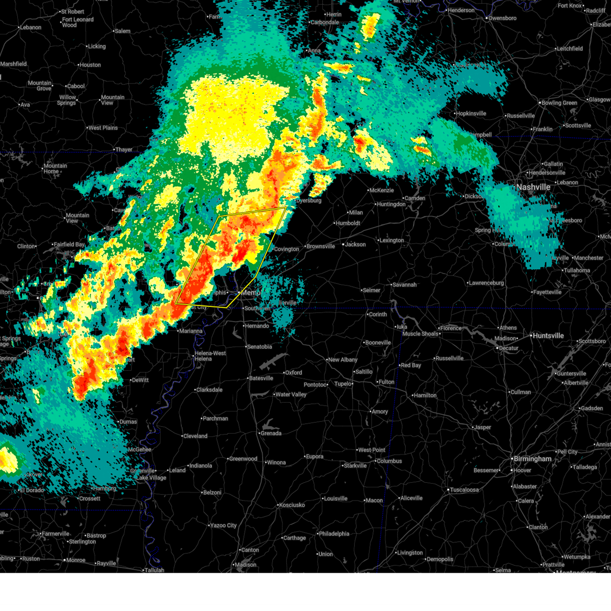 At 807 pm cdt, severe thunderstorms were located along a line extending from dyess to near meeman shelby forest state park to near anthonyville, moving east at 50 mph (radar indicated). Hazards include 60 mph wind gusts and penny size hail. Expect damage to roofs, siding, and trees. Locations impacted include, three forks, burlison, louise, edmondson, osceola, presidents island, locke, alto, bunney, milligan ridge, roseland, village creek state park, julius, gilestown, clarks corner, whistleville, lightfoot, arp, smithdale, and wapanocca national wildlife refuge. At 807 pm cdt, severe thunderstorms were located along a line extending from dyess to near meeman shelby forest state park to near anthonyville, moving east at 50 mph (radar indicated). Hazards include 60 mph wind gusts and penny size hail. Expect damage to roofs, siding, and trees. Locations impacted include, three forks, burlison, louise, edmondson, osceola, presidents island, locke, alto, bunney, milligan ridge, roseland, village creek state park, julius, gilestown, clarks corner, whistleville, lightfoot, arp, smithdale, and wapanocca national wildlife refuge.
|
| 4/2/2025 8:01 PM CDT |
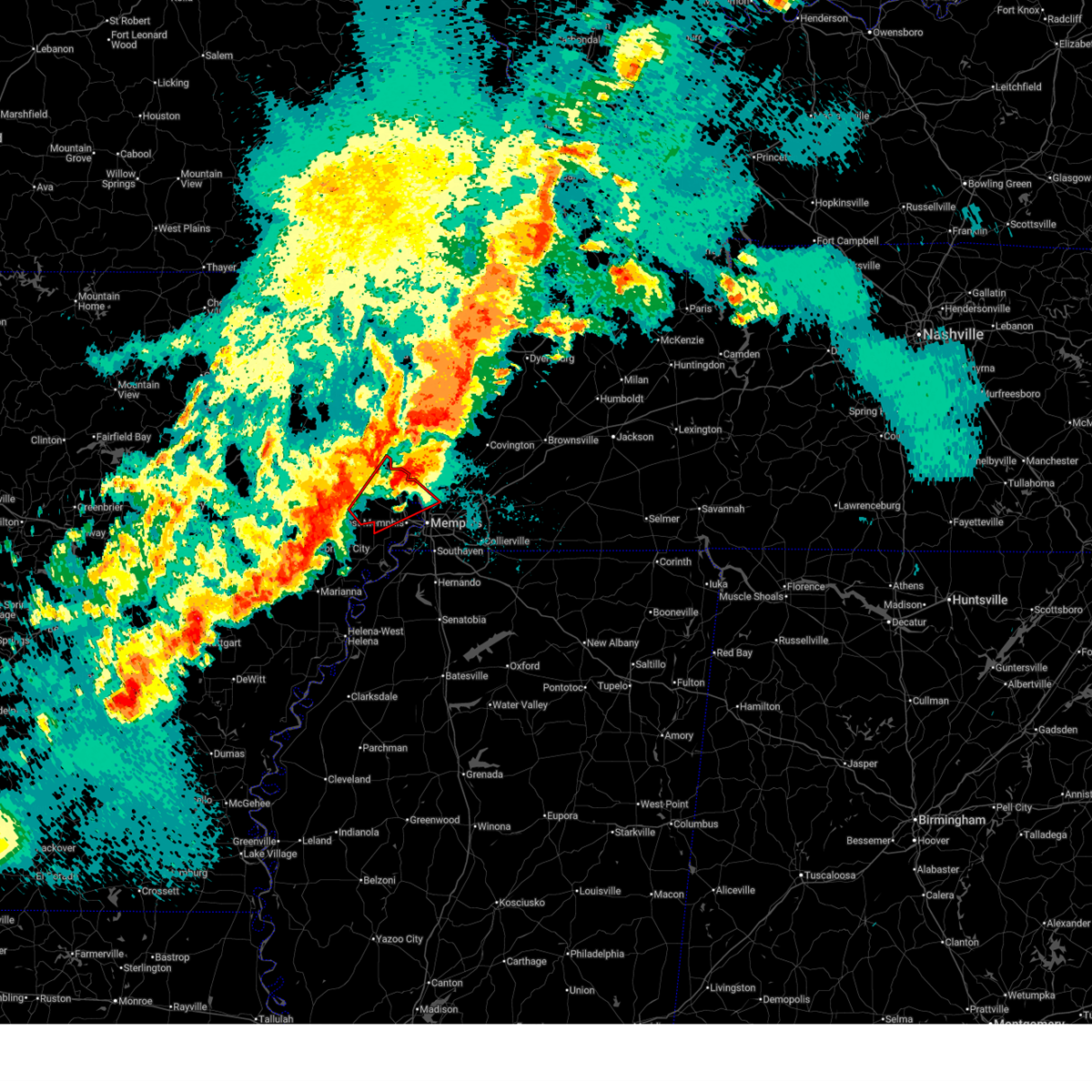 the tornado warning has been cancelled and is no longer in effect the tornado warning has been cancelled and is no longer in effect
|
| 4/2/2025 7:47 PM CDT |
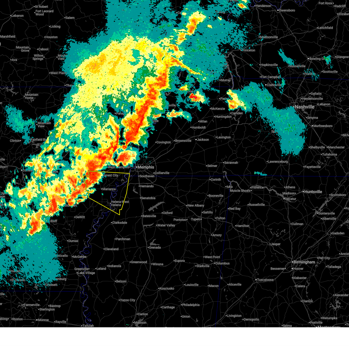 Svrmeg the national weather service in memphis has issued a * severe thunderstorm warning for, lee county in eastern arkansas, st. francis county in eastern arkansas, northeastern phillips county in eastern arkansas, southwestern crittenden county in eastern arkansas, northwestern desoto county in northwestern mississippi, northeastern coahoma county in northwestern mississippi, tunica county in northwestern mississippi, southwestern shelby county in west tennessee, * until 830 pm cdt. * at 746 pm cdt, severe thunderstorms were located along a line extending from near caldwell to near palmer, moving northeast at 50 mph (radar indicated). Hazards include 60 mph wind gusts and quarter size hail. Hail damage to vehicles is expected. Expect wind damage to roofs, siding, and trees. Svrmeg the national weather service in memphis has issued a * severe thunderstorm warning for, lee county in eastern arkansas, st. francis county in eastern arkansas, northeastern phillips county in eastern arkansas, southwestern crittenden county in eastern arkansas, northwestern desoto county in northwestern mississippi, northeastern coahoma county in northwestern mississippi, tunica county in northwestern mississippi, southwestern shelby county in west tennessee, * until 830 pm cdt. * at 746 pm cdt, severe thunderstorms were located along a line extending from near caldwell to near palmer, moving northeast at 50 mph (radar indicated). Hazards include 60 mph wind gusts and quarter size hail. Hail damage to vehicles is expected. Expect wind damage to roofs, siding, and trees.
|
| 4/2/2025 7:43 PM CDT |
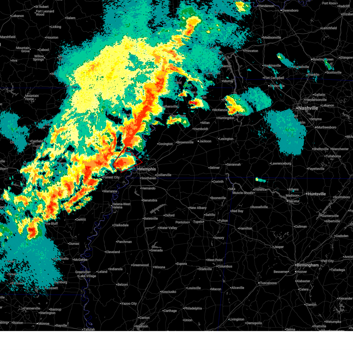 At 743 pm cdt, a severe thunderstorm capable of producing a tornado was located over jennette, or 8 miles south of earle, moving northeast at 50 mph (radar indicated rotation). Hazards include tornado and two inch hail. Flying debris will be dangerous to those caught without shelter. mobile homes will be damaged or destroyed. damage to roofs, windows, and vehicles will occur. tree damage is likely. Locations impacted include, smithdale, three forks, wapanocca national wildlife refuge, jericho, booker, deckerville, turrell, gammon, cunningham corner, clarkedale, woodstock, st clair, harvard, gilmore, cloar, earle, crittenden, vincent, jennette, and ebony. At 743 pm cdt, a severe thunderstorm capable of producing a tornado was located over jennette, or 8 miles south of earle, moving northeast at 50 mph (radar indicated rotation). Hazards include tornado and two inch hail. Flying debris will be dangerous to those caught without shelter. mobile homes will be damaged or destroyed. damage to roofs, windows, and vehicles will occur. tree damage is likely. Locations impacted include, smithdale, three forks, wapanocca national wildlife refuge, jericho, booker, deckerville, turrell, gammon, cunningham corner, clarkedale, woodstock, st clair, harvard, gilmore, cloar, earle, crittenden, vincent, jennette, and ebony.
|
| 4/2/2025 7:43 PM CDT |
 the tornado warning has been cancelled and is no longer in effect the tornado warning has been cancelled and is no longer in effect
|
| 4/2/2025 7:31 PM CDT |
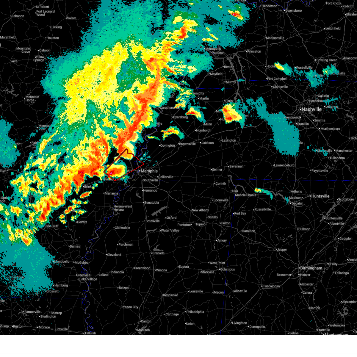 At 731 pm cdt, a severe thunderstorm capable of producing a tornado was located near new home, or 7 miles southeast of village creek state park, moving northeast at 50 mph (radar indicated rotation). Hazards include tornado and half dollar size hail. Flying debris will be dangerous to those caught without shelter. mobile homes will be damaged or destroyed. damage to roofs, windows, and vehicles will occur. tree damage is likely. Locations impacted include, three forks, cottonwood corner, booker, browns, deckerville, west memphis, cunningham corner, edmondson, woodstock, st clair, round pond, lansing, village creek state park, julius, duvall, stacy, redman point, clarks corner, galilee, and benjestown. At 731 pm cdt, a severe thunderstorm capable of producing a tornado was located near new home, or 7 miles southeast of village creek state park, moving northeast at 50 mph (radar indicated rotation). Hazards include tornado and half dollar size hail. Flying debris will be dangerous to those caught without shelter. mobile homes will be damaged or destroyed. damage to roofs, windows, and vehicles will occur. tree damage is likely. Locations impacted include, three forks, cottonwood corner, booker, browns, deckerville, west memphis, cunningham corner, edmondson, woodstock, st clair, round pond, lansing, village creek state park, julius, duvall, stacy, redman point, clarks corner, galilee, and benjestown.
|
| 4/2/2025 7:29 PM CDT |
 Svrmeg the national weather service in memphis has issued a * severe thunderstorm warning for, southeastern craighead county in eastern arkansas, northern st. francis county in eastern arkansas, poinsett county in eastern arkansas, mississippi county in eastern arkansas, crittenden county in eastern arkansas, cross county in eastern arkansas, central tipton county in west tennessee, southwestern dyer county in west tennessee, western lauderdale county in west tennessee, central shelby county in west tennessee, * until 830 pm cdt. * at 728 pm cdt, severe thunderstorms were located along a line extending from greenfield to near cherry valley to near colt, moving northeast at 50 mph (radar indicated). Hazards include 60 mph wind gusts and quarter size hail. Hail damage to vehicles is expected. Expect wind damage to roofs, siding, and trees. Svrmeg the national weather service in memphis has issued a * severe thunderstorm warning for, southeastern craighead county in eastern arkansas, northern st. francis county in eastern arkansas, poinsett county in eastern arkansas, mississippi county in eastern arkansas, crittenden county in eastern arkansas, cross county in eastern arkansas, central tipton county in west tennessee, southwestern dyer county in west tennessee, western lauderdale county in west tennessee, central shelby county in west tennessee, * until 830 pm cdt. * at 728 pm cdt, severe thunderstorms were located along a line extending from greenfield to near cherry valley to near colt, moving northeast at 50 mph (radar indicated). Hazards include 60 mph wind gusts and quarter size hail. Hail damage to vehicles is expected. Expect wind damage to roofs, siding, and trees.
|
| 4/2/2025 7:21 PM CDT |
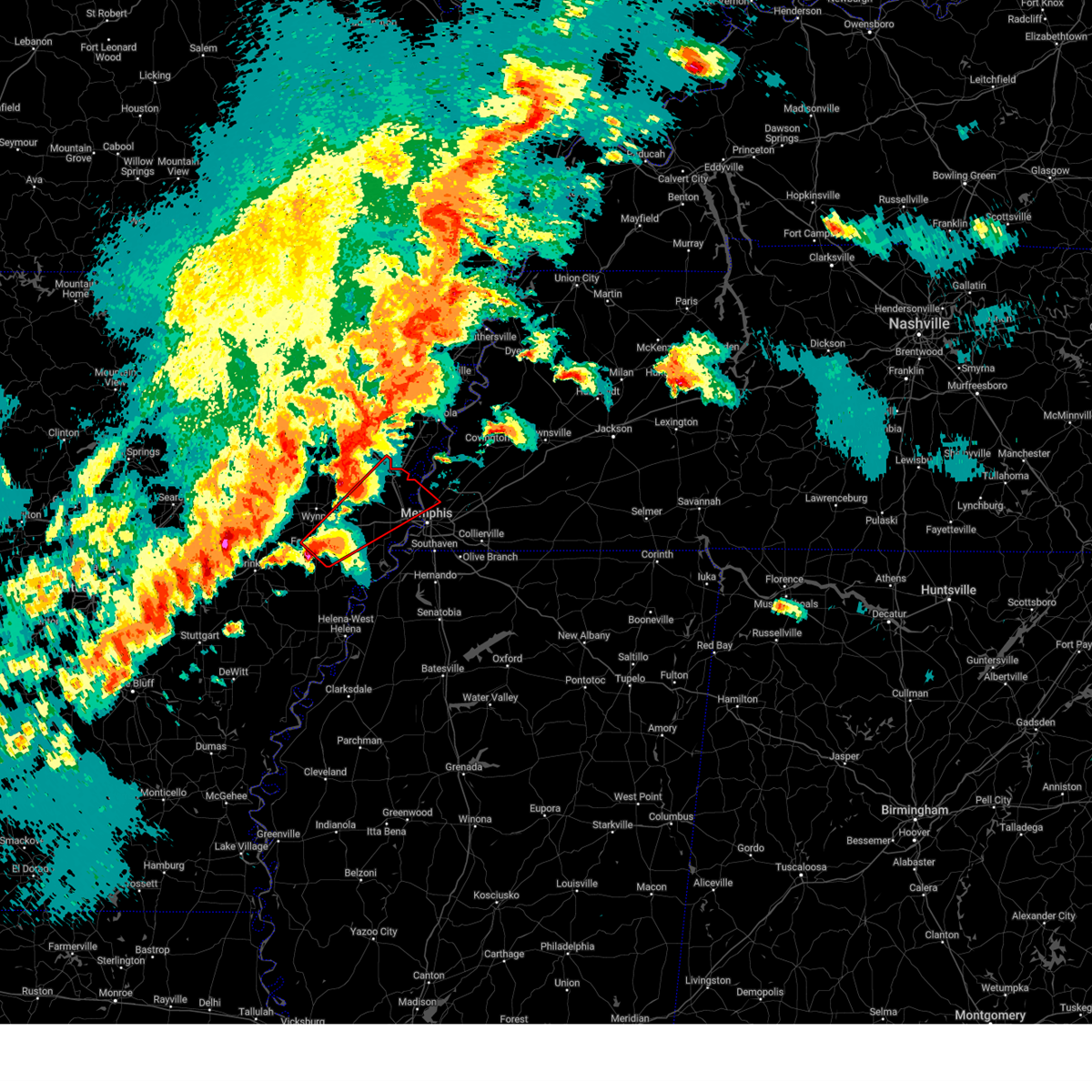 Tormeg the national weather service in memphis has issued a * tornado warning for, eastern st. francis county in eastern arkansas, southeastern poinsett county in eastern arkansas, crittenden county in eastern arkansas, southeastern cross county in eastern arkansas, northwestern shelby county in west tennessee, * until 815 pm cdt. * at 721 pm cdt, a severe thunderstorm capable of producing a tornado was located over madison, moving northeast at 50 mph (radar indicated rotation). Hazards include tornado and baseball size hail. Flying debris will be dangerous to those caught without shelter. mobile homes will be damaged or destroyed. damage to roofs, windows, and vehicles will occur. Tree damage is likely. Tormeg the national weather service in memphis has issued a * tornado warning for, eastern st. francis county in eastern arkansas, southeastern poinsett county in eastern arkansas, crittenden county in eastern arkansas, southeastern cross county in eastern arkansas, northwestern shelby county in west tennessee, * until 815 pm cdt. * at 721 pm cdt, a severe thunderstorm capable of producing a tornado was located over madison, moving northeast at 50 mph (radar indicated rotation). Hazards include tornado and baseball size hail. Flying debris will be dangerous to those caught without shelter. mobile homes will be damaged or destroyed. damage to roofs, windows, and vehicles will occur. Tree damage is likely.
|
| 4/2/2025 6:46 PM CDT | Quarter sized hail reported 8.6 miles SW of Memphis, TN, quarter hail observed at milemarker 93 on interstate 40. |
| 4/2/2025 6:23 PM CDT |
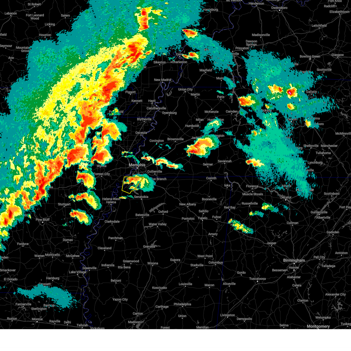 The storm which prompted the warning has weakened below severe limits, and no longer poses an immediate threat to life or property. therefore, the warning will be allowed to expire. a tornado watch remains in effect until midnight cdt for eastern arkansas, northwestern mississippi, and west tennessee. The storm which prompted the warning has weakened below severe limits, and no longer poses an immediate threat to life or property. therefore, the warning will be allowed to expire. a tornado watch remains in effect until midnight cdt for eastern arkansas, northwestern mississippi, and west tennessee.
|
| 4/2/2025 6:10 PM CDT |
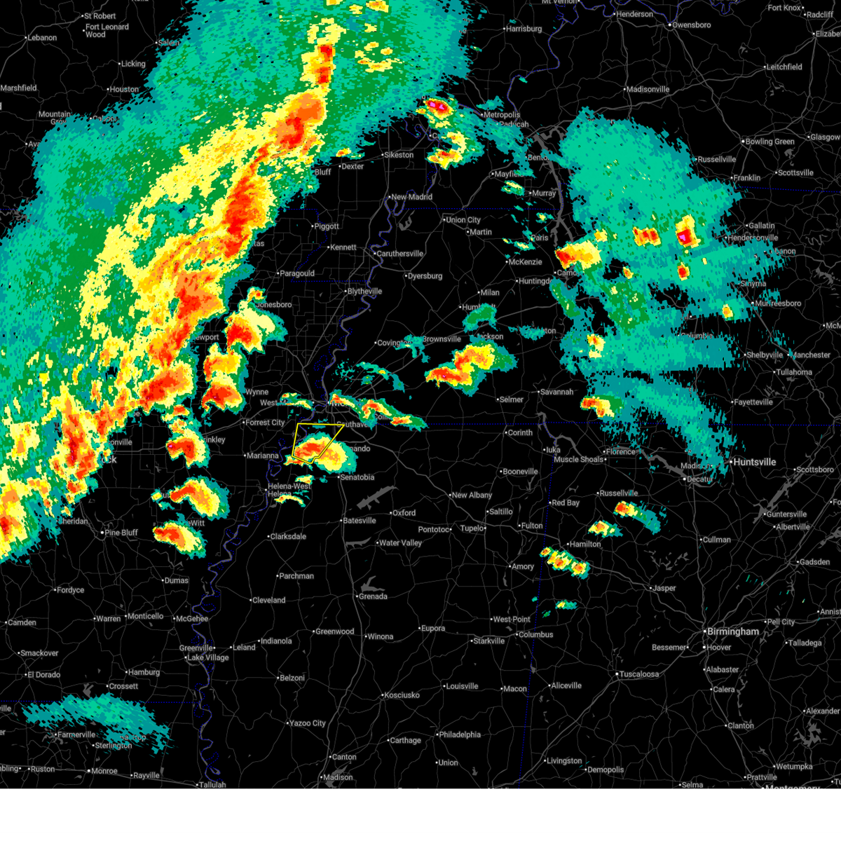 At 610 pm cdt, a severe thunderstorm was located near lake cormorant, or 14 miles southwest of horn lake, moving northeast at 45 mph (radar indicated). Hazards include 60 mph wind gusts and quarter size hail. Hail damage to vehicles is expected. expect wind damage to roofs, siding, and trees. Locations impacted include, newport, clack, pinckney, trinity, lake cormorant, horn lake, frees corners, lynchburg, eudora, glover, banks, jago, bowdre, alden, twin lakes, horseshoe lake, southaven, west days, lost lake, and seyppel. At 610 pm cdt, a severe thunderstorm was located near lake cormorant, or 14 miles southwest of horn lake, moving northeast at 45 mph (radar indicated). Hazards include 60 mph wind gusts and quarter size hail. Hail damage to vehicles is expected. expect wind damage to roofs, siding, and trees. Locations impacted include, newport, clack, pinckney, trinity, lake cormorant, horn lake, frees corners, lynchburg, eudora, glover, banks, jago, bowdre, alden, twin lakes, horseshoe lake, southaven, west days, lost lake, and seyppel.
|
| 4/2/2025 5:53 PM CDT |
 At 553 pm cdt, a severe thunderstorm was located over tunica, or 15 miles northeast of st francis national park, moving northeast at 50 mph (radar indicated). Hazards include two inch hail and 60 mph wind gusts. People and animals outdoors will be injured. expect hail damage to roofs, siding, windows, and vehicles. expect wind damage to roofs, siding, and trees. Locations impacted include, newport, tunica, clack, pinckney, trinity, lake cormorant, horn lake, frees corners, commerce, lynchburg, austin, prichard, bruins, eudora, glover, banks, jago, bowdre, alden, and dooley. At 553 pm cdt, a severe thunderstorm was located over tunica, or 15 miles northeast of st francis national park, moving northeast at 50 mph (radar indicated). Hazards include two inch hail and 60 mph wind gusts. People and animals outdoors will be injured. expect hail damage to roofs, siding, windows, and vehicles. expect wind damage to roofs, siding, and trees. Locations impacted include, newport, tunica, clack, pinckney, trinity, lake cormorant, horn lake, frees corners, commerce, lynchburg, austin, prichard, bruins, eudora, glover, banks, jago, bowdre, alden, and dooley.
|
| 4/2/2025 5:53 PM CDT |
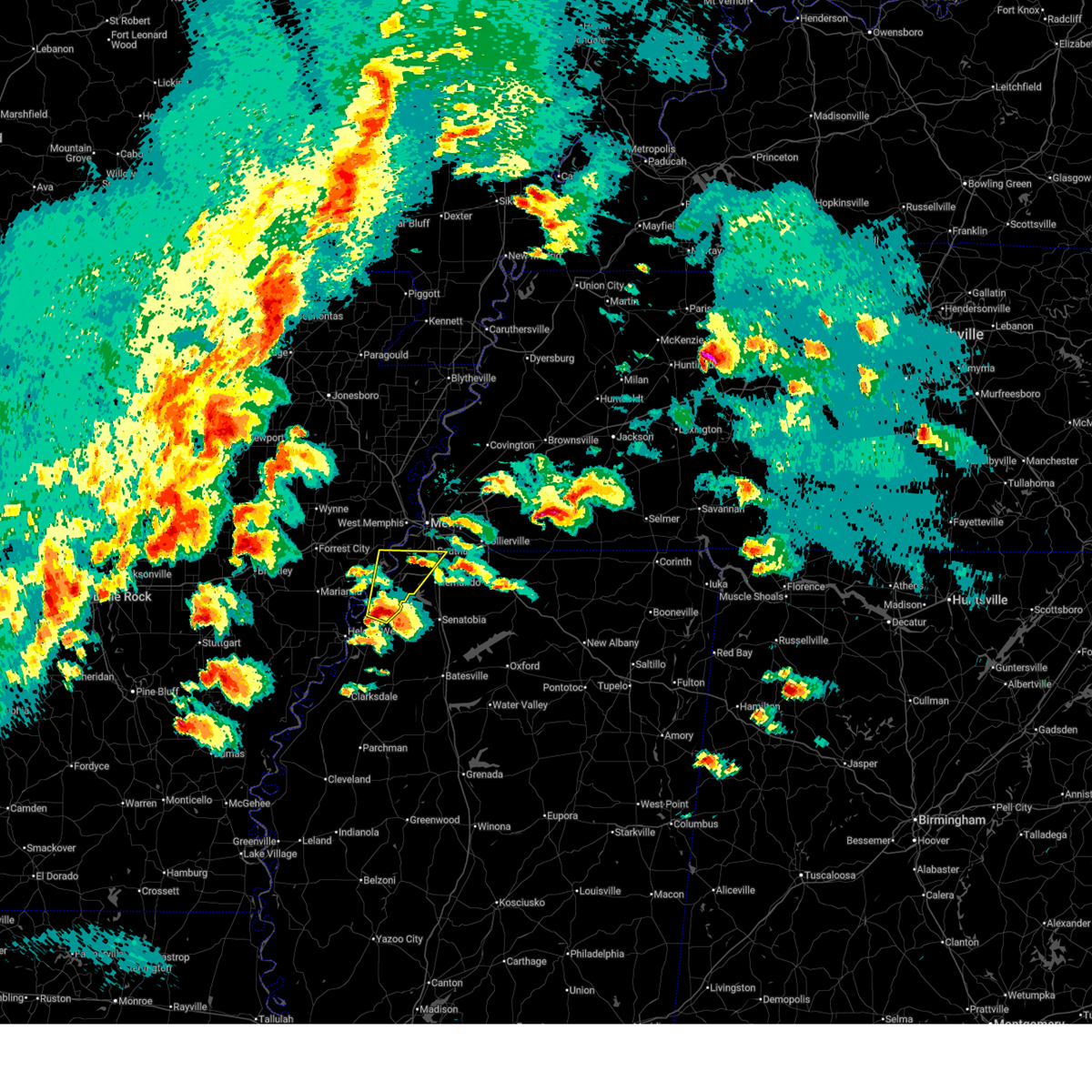 the severe thunderstorm warning has been cancelled and is no longer in effect the severe thunderstorm warning has been cancelled and is no longer in effect
|
| 4/2/2025 5:39 PM CDT | Golf Ball sized hail reported 7.2 miles WSW of Memphis, TN, report from mping: golf ball (1.75 in.). |
| 4/2/2025 5:38 PM CDT |
 At 538 pm cdt, a severe thunderstorm was located near dundee, or near helena-west helena, moving northeast at 45 mph (radar indicated). Hazards include two inch hail and 60 mph wind gusts. People and animals outdoors will be injured. expect hail damage to roofs, siding, windows, and vehicles. expect wind damage to roofs, siding, and trees. Locations impacted include, tunica, hughes, clack, trinity, lake cormorant, horn lake, commerce, austin, prichard, beck, eudora, dubbs, glover, whitehall, alden, dooley, twin lakes, north tunica, penjur, and dundee. At 538 pm cdt, a severe thunderstorm was located near dundee, or near helena-west helena, moving northeast at 45 mph (radar indicated). Hazards include two inch hail and 60 mph wind gusts. People and animals outdoors will be injured. expect hail damage to roofs, siding, windows, and vehicles. expect wind damage to roofs, siding, and trees. Locations impacted include, tunica, hughes, clack, trinity, lake cormorant, horn lake, commerce, austin, prichard, beck, eudora, dubbs, glover, whitehall, alden, dooley, twin lakes, north tunica, penjur, and dundee.
|
| 4/2/2025 5:35 PM CDT | Ping Pong Ball sized hail reported 6.2 miles WSW of Memphis, TN |
| 4/2/2025 5:32 PM CDT |
 Svrmeg the national weather service in memphis has issued a * severe thunderstorm warning for, eastern lee county in eastern arkansas, southeastern st. francis county in eastern arkansas, northeastern phillips county in eastern arkansas, southwestern crittenden county in eastern arkansas, western desoto county in northwestern mississippi, northeastern coahoma county in northwestern mississippi, tunica county in northwestern mississippi, * until 630 pm cdt. * at 532 pm cdt, a severe thunderstorm was located near helena-west helena, moving northeast at 45 mph (radar indicated). Hazards include 60 mph wind gusts and quarter size hail. Hail damage to vehicles is expected. Expect wind damage to roofs, siding, and trees. Svrmeg the national weather service in memphis has issued a * severe thunderstorm warning for, eastern lee county in eastern arkansas, southeastern st. francis county in eastern arkansas, northeastern phillips county in eastern arkansas, southwestern crittenden county in eastern arkansas, western desoto county in northwestern mississippi, northeastern coahoma county in northwestern mississippi, tunica county in northwestern mississippi, * until 630 pm cdt. * at 532 pm cdt, a severe thunderstorm was located near helena-west helena, moving northeast at 45 mph (radar indicated). Hazards include 60 mph wind gusts and quarter size hail. Hail damage to vehicles is expected. Expect wind damage to roofs, siding, and trees.
|
| 4/2/2025 5:30 PM CDT | Quarter sized hail reported 3.8 miles W of Memphis, TN, corrects previous hail report from 3 nnw germantown. one inch hail at nws memphis lasted 2-3 minutes. |
| 4/2/2025 5:30 PM CDT | Tennis Ball sized hail reported 3.8 miles W of Memphis, TN, one inch hail at nws memphis lasted 2-3 minutes. |
| 4/2/2025 5:30 PM CDT |
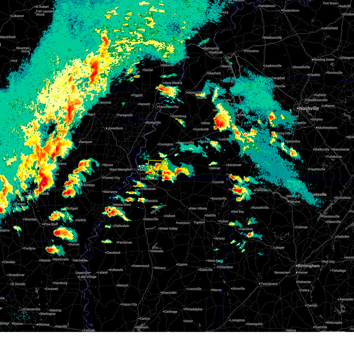 At 530 pm cdt, a severe thunderstorm was located over cordova, moving northeast at 45 mph (radar indicated. at 528 pm cdt, quarter sized hail was reported in east memphis). Hazards include 60 mph wind gusts and quarter size hail. Hail damage to vehicles is expected. expect wind damage to roofs, siding, and trees. Locations impacted include, brunswick, lenow, fisherville, eads, ellendale, germantown, lakeland, hickory withe, cordova, bartlett, arlington, collierville, and memphis. At 530 pm cdt, a severe thunderstorm was located over cordova, moving northeast at 45 mph (radar indicated. at 528 pm cdt, quarter sized hail was reported in east memphis). Hazards include 60 mph wind gusts and quarter size hail. Hail damage to vehicles is expected. expect wind damage to roofs, siding, and trees. Locations impacted include, brunswick, lenow, fisherville, eads, ellendale, germantown, lakeland, hickory withe, cordova, bartlett, arlington, collierville, and memphis.
|
| 4/2/2025 5:26 PM CDT |
 the severe thunderstorm warning has been cancelled and is no longer in effect the severe thunderstorm warning has been cancelled and is no longer in effect
|
| 4/2/2025 5:26 PM CDT |
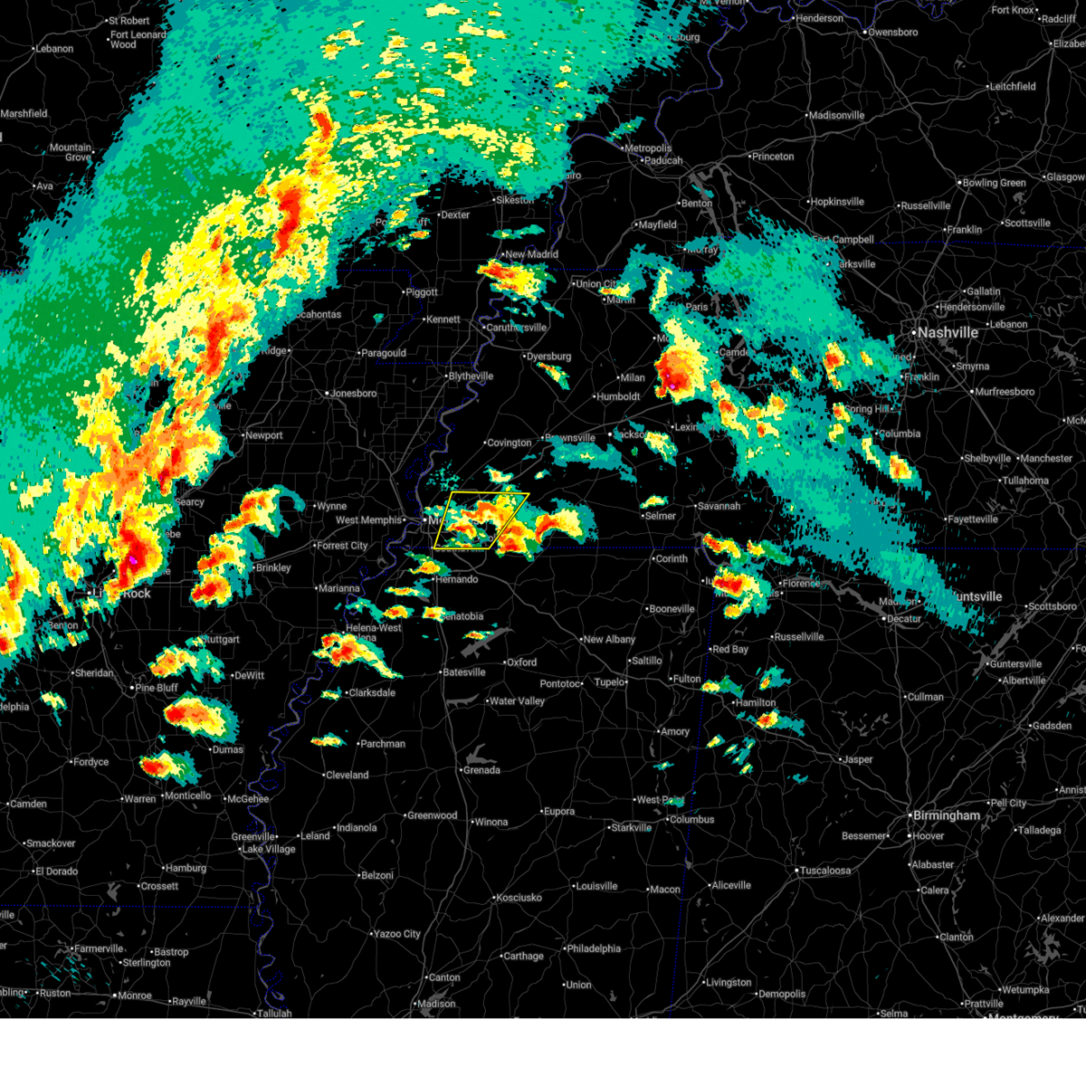 At 525 pm cdt, a severe thunderstorm was located over germantown, moving northeast at 30 mph (radar indicated). Hazards include 60 mph wind gusts and quarter size hail. Hail damage to vehicles is expected. expect wind damage to roofs, siding, and trees. Locations impacted include, piperton, lenow, ellendale, oakland, germantown, warren, capleville, kirk, hickory withe, arlington, elmore park, brunswick, fisherville, collierville, macon, southeast memphis, elba, canadaville, eads, and parkway village. At 525 pm cdt, a severe thunderstorm was located over germantown, moving northeast at 30 mph (radar indicated). Hazards include 60 mph wind gusts and quarter size hail. Hail damage to vehicles is expected. expect wind damage to roofs, siding, and trees. Locations impacted include, piperton, lenow, ellendale, oakland, germantown, warren, capleville, kirk, hickory withe, arlington, elmore park, brunswick, fisherville, collierville, macon, southeast memphis, elba, canadaville, eads, and parkway village.
|
| 4/2/2025 5:06 PM CDT |
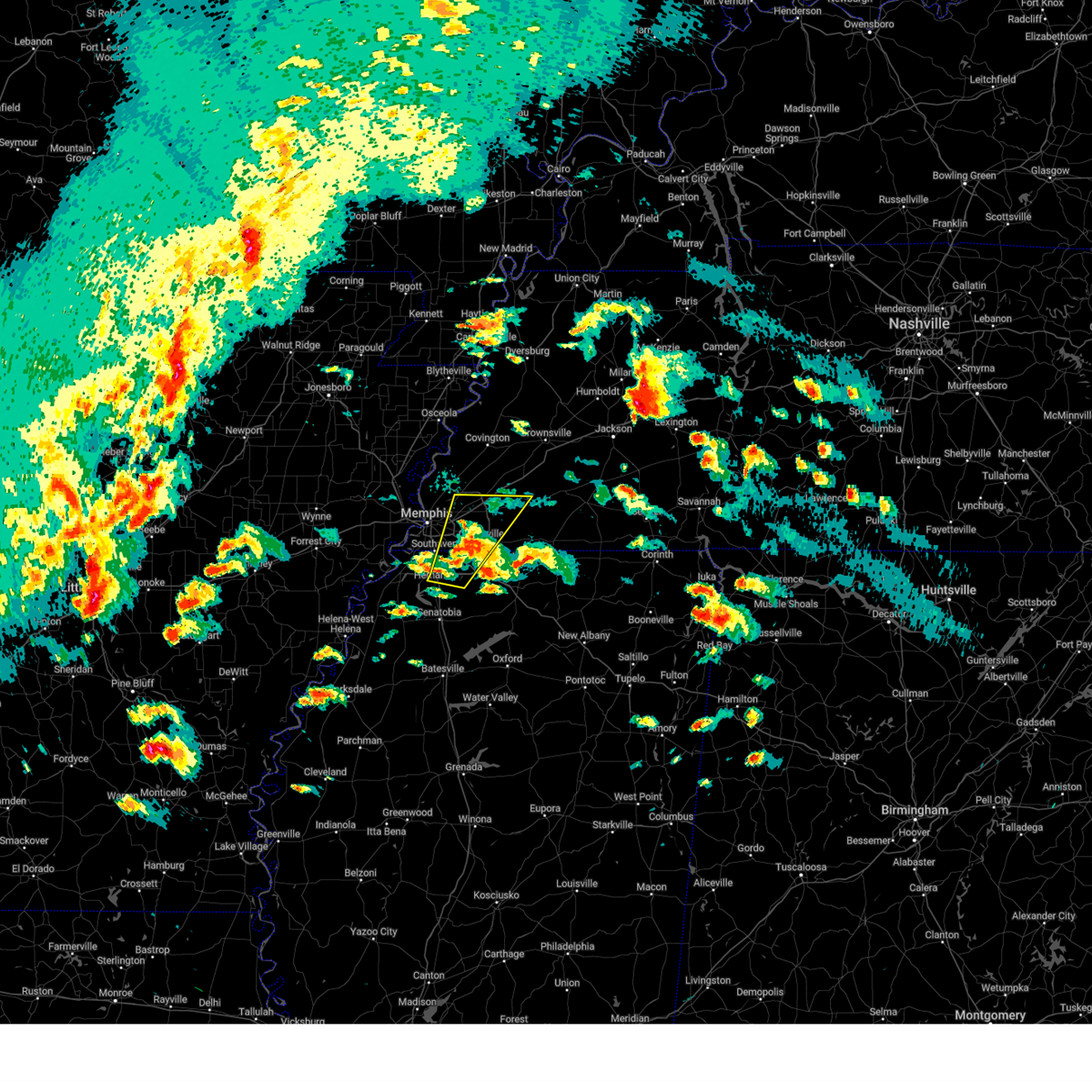 At 506 pm cdt, a severe thunderstorm was located over olive branch, moving northeast at 50 mph (radar indicated. at 503 pm cdt, golf ball sized hail was reported near nesbit along interstate 269). Hazards include ping pong ball size hail and 60 mph wind gusts. People and animals outdoors will be injured. expect hail damage to roofs, siding, windows, and vehicles. expect wind damage to roofs, siding, and trees. Locations impacted include, piperton, lenow, cockrum, cedarview, ellendale, oakland, germantown, bright, nesbit, handy corner, warren, capleville, kirk, hickory withe, jago, arlington, elmore park, brunswick, fisherville, and collierville. At 506 pm cdt, a severe thunderstorm was located over olive branch, moving northeast at 50 mph (radar indicated. at 503 pm cdt, golf ball sized hail was reported near nesbit along interstate 269). Hazards include ping pong ball size hail and 60 mph wind gusts. People and animals outdoors will be injured. expect hail damage to roofs, siding, windows, and vehicles. expect wind damage to roofs, siding, and trees. Locations impacted include, piperton, lenow, cockrum, cedarview, ellendale, oakland, germantown, bright, nesbit, handy corner, warren, capleville, kirk, hickory withe, jago, arlington, elmore park, brunswick, fisherville, and collierville.
|
| 4/2/2025 4:53 PM CDT |
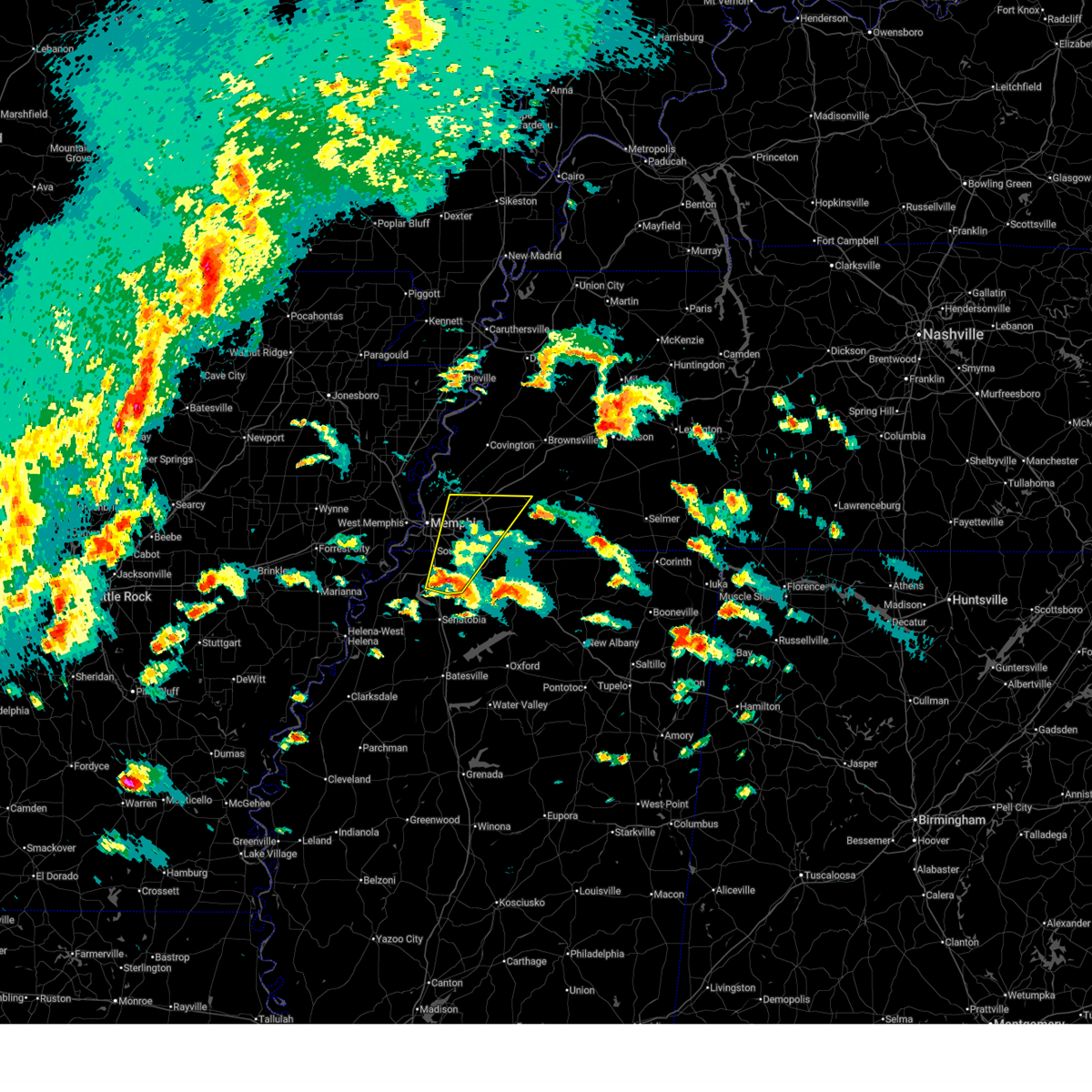 the severe thunderstorm warning has been cancelled and is no longer in effect the severe thunderstorm warning has been cancelled and is no longer in effect
|
| 4/2/2025 4:53 PM CDT |
 At 452 pm cdt, a severe thunderstorm was located over hernando, moving northeast at 50 mph (radar indicated). Hazards include 60 mph wind gusts and quarter size hail. Hail damage to vehicles is expected. expect wind damage to roofs, siding, and trees. Locations impacted include, piperton, lenow, cockrum, cedarview, ellendale, oakland, germantown, bright, nesbit, handy corner, warren, capleville, kirk, hickory withe, jago, arlington, robinson gin, elmore park, brunswick, and fisherville. At 452 pm cdt, a severe thunderstorm was located over hernando, moving northeast at 50 mph (radar indicated). Hazards include 60 mph wind gusts and quarter size hail. Hail damage to vehicles is expected. expect wind damage to roofs, siding, and trees. Locations impacted include, piperton, lenow, cockrum, cedarview, ellendale, oakland, germantown, bright, nesbit, handy corner, warren, capleville, kirk, hickory withe, jago, arlington, robinson gin, elmore park, brunswick, and fisherville.
|
| 4/2/2025 4:38 PM CDT |
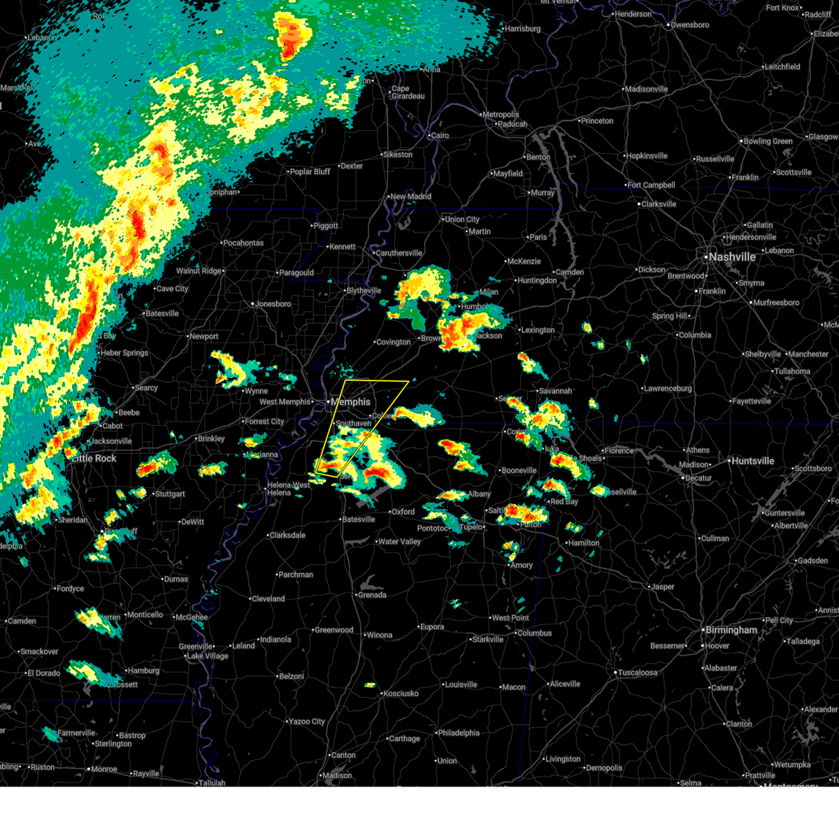 Svrmeg the national weather service in memphis has issued a * severe thunderstorm warning for, desoto county in northwestern mississippi, northwestern marshall county in northwestern mississippi, central tate county in northwestern mississippi, southwestern fayette county in west tennessee, southeastern shelby county in west tennessee, * until 545 pm cdt. * at 438 pm cdt, a severe thunderstorm was located near arkabutla, or near senatobia, moving northeast at 50 mph (radar indicated). Hazards include 60 mph wind gusts and quarter size hail. Hail damage to vehicles is expected. Expect wind damage to roofs, siding, and trees. Svrmeg the national weather service in memphis has issued a * severe thunderstorm warning for, desoto county in northwestern mississippi, northwestern marshall county in northwestern mississippi, central tate county in northwestern mississippi, southwestern fayette county in west tennessee, southeastern shelby county in west tennessee, * until 545 pm cdt. * at 438 pm cdt, a severe thunderstorm was located near arkabutla, or near senatobia, moving northeast at 50 mph (radar indicated). Hazards include 60 mph wind gusts and quarter size hail. Hail damage to vehicles is expected. Expect wind damage to roofs, siding, and trees.
|
| 4/2/2025 4:07 PM CDT |
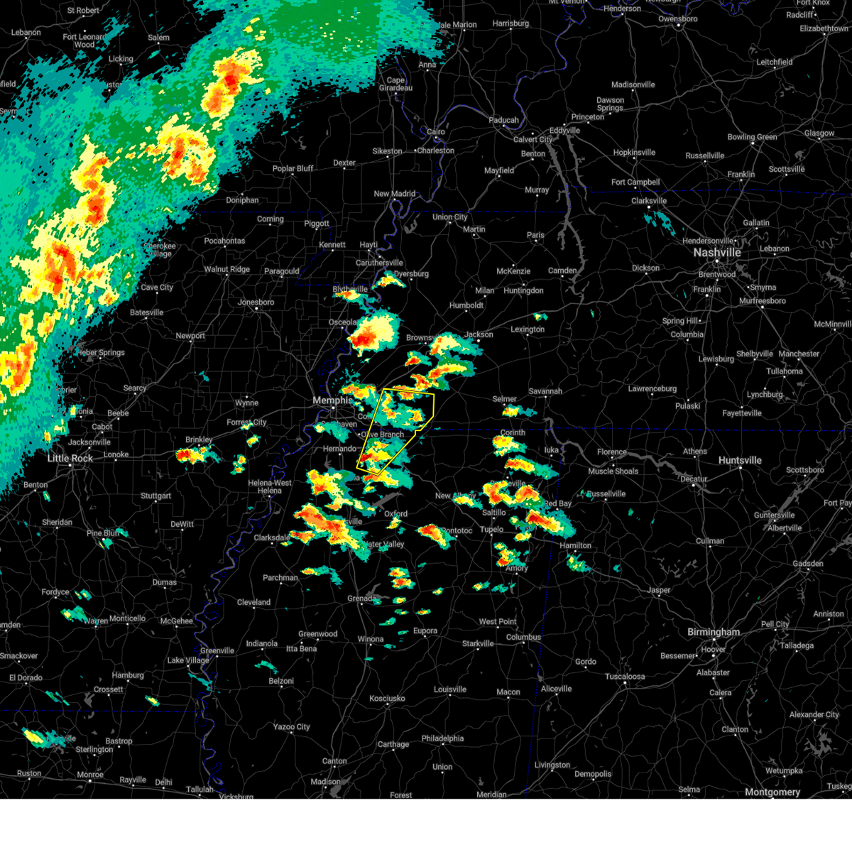 At 407 pm cdt, a severe thunderstorm was located over byhalia, or 10 miles southeast of olive branch, moving northeast at 55 mph (radar indicated). Hazards include 60 mph wind gusts and quarter size hail. Hail damage to vehicles is expected. expect wind damage to roofs, siding, and trees. Locations impacted include, piperton, coal oil corner, wakefield, ghost river state natural area, mt pleasant, cayce, cockrum, watson, oakland, moscow, handy corner, warren, taska, kirk, hickory withe, pattersonville, rossville, somerville, fisherville, and collierville. At 407 pm cdt, a severe thunderstorm was located over byhalia, or 10 miles southeast of olive branch, moving northeast at 55 mph (radar indicated). Hazards include 60 mph wind gusts and quarter size hail. Hail damage to vehicles is expected. expect wind damage to roofs, siding, and trees. Locations impacted include, piperton, coal oil corner, wakefield, ghost river state natural area, mt pleasant, cayce, cockrum, watson, oakland, moscow, handy corner, warren, taska, kirk, hickory withe, pattersonville, rossville, somerville, fisherville, and collierville.
|
| 4/2/2025 3:54 PM CDT | Quarter sized hail reported 5.7 miles SSE of Memphis, TN, report from mping: quarter (1.00 in.). |
| 4/2/2025 3:49 PM CDT |
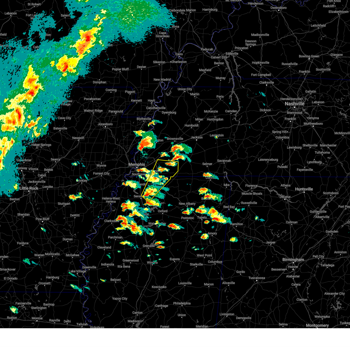 Svrmeg the national weather service in memphis has issued a * severe thunderstorm warning for, northeastern desoto county in northwestern mississippi, northwestern marshall county in northwestern mississippi, eastern tate county in northwestern mississippi, fayette county in west tennessee, southeastern shelby county in west tennessee, * until 445 pm cdt. * at 349 pm cdt, a severe thunderstorm was located near independence, or 8 miles northeast of senatobia, moving northeast at 45 mph (radar indicated). Hazards include 60 mph wind gusts and quarter size hail. Hail damage to vehicles is expected. Expect wind damage to roofs, siding, and trees. Svrmeg the national weather service in memphis has issued a * severe thunderstorm warning for, northeastern desoto county in northwestern mississippi, northwestern marshall county in northwestern mississippi, eastern tate county in northwestern mississippi, fayette county in west tennessee, southeastern shelby county in west tennessee, * until 445 pm cdt. * at 349 pm cdt, a severe thunderstorm was located near independence, or 8 miles northeast of senatobia, moving northeast at 45 mph (radar indicated). Hazards include 60 mph wind gusts and quarter size hail. Hail damage to vehicles is expected. Expect wind damage to roofs, siding, and trees.
|
| 4/2/2025 2:55 PM CDT |
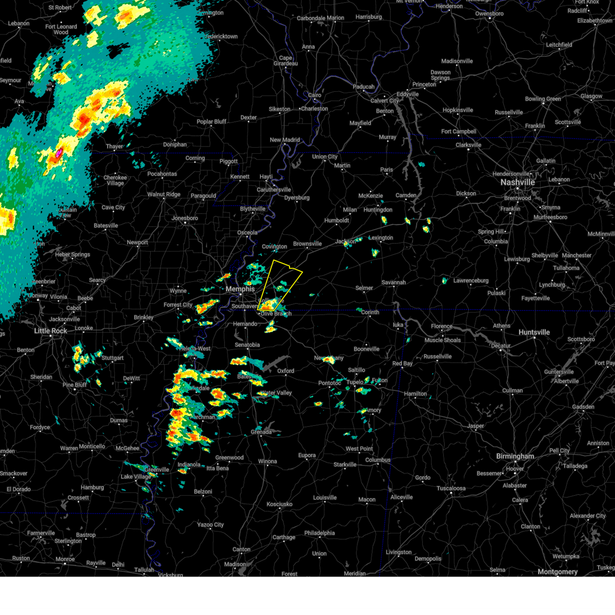 At 255 pm cdt, a severe thunderstorm was located over germantown, moving northeast at 55 mph (radar indicated). Hazards include 60 mph wind gusts and quarter size hail. Hail damage to vehicles is expected. expect wind damage to roofs, siding, and trees. Locations impacted include, piperton, lenow, yum yum, belmont, oakland, germantown, warren, kirk, hickory withe, arlington, fisherville, collierville, elba, canadaville, canaan grove, eads, longtown, moorman, braden, and lambert. At 255 pm cdt, a severe thunderstorm was located over germantown, moving northeast at 55 mph (radar indicated). Hazards include 60 mph wind gusts and quarter size hail. Hail damage to vehicles is expected. expect wind damage to roofs, siding, and trees. Locations impacted include, piperton, lenow, yum yum, belmont, oakland, germantown, warren, kirk, hickory withe, arlington, fisherville, collierville, elba, canadaville, canaan grove, eads, longtown, moorman, braden, and lambert.
|
| 4/2/2025 2:55 PM CDT |
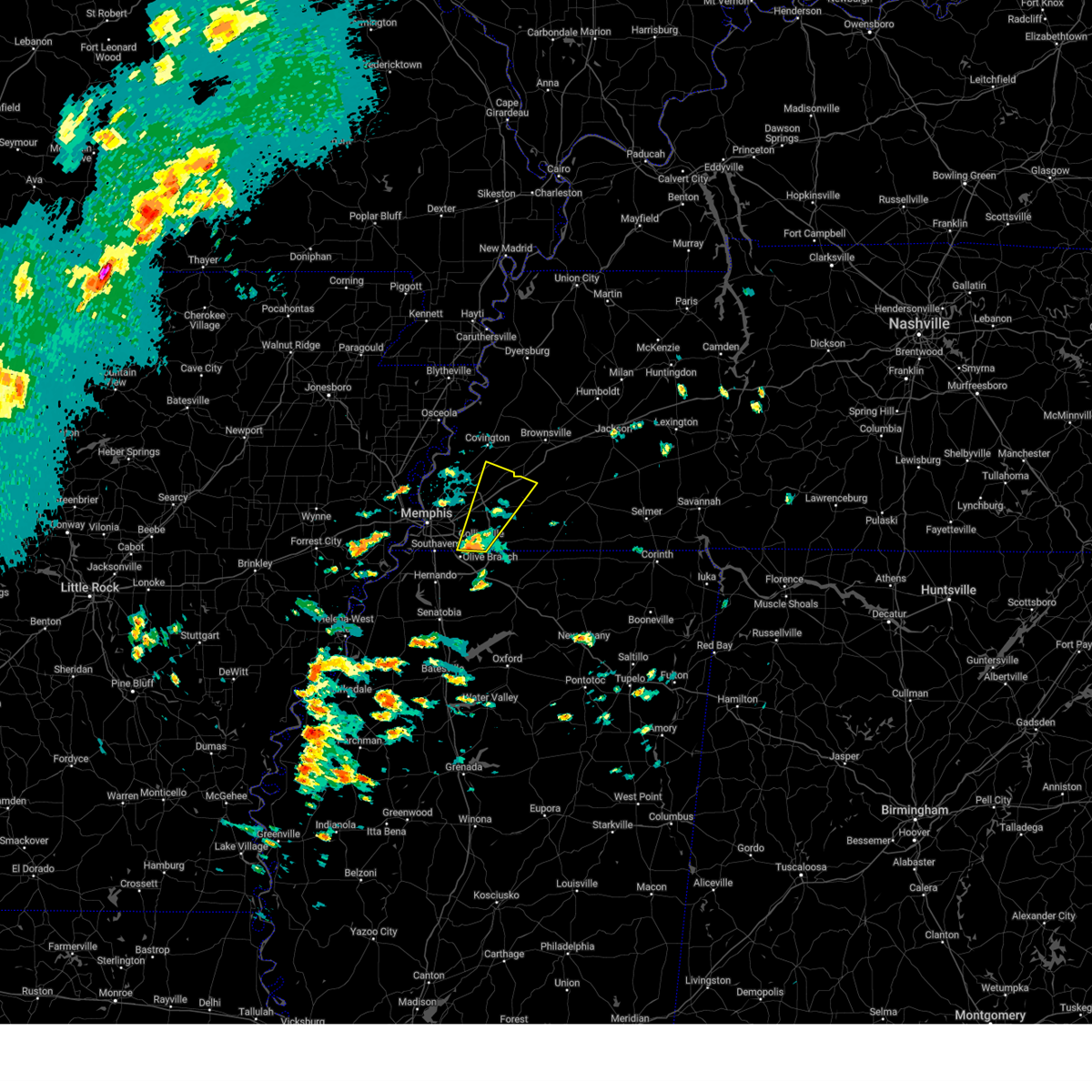 the severe thunderstorm warning has been cancelled and is no longer in effect the severe thunderstorm warning has been cancelled and is no longer in effect
|
| 4/2/2025 2:53 PM CDT | Golf Ball sized hail reported 10.2 miles NW of Memphis, TN, facebook report of golfball size hail near shelby drive and forest hill irene. |
| 4/2/2025 2:45 PM CDT |
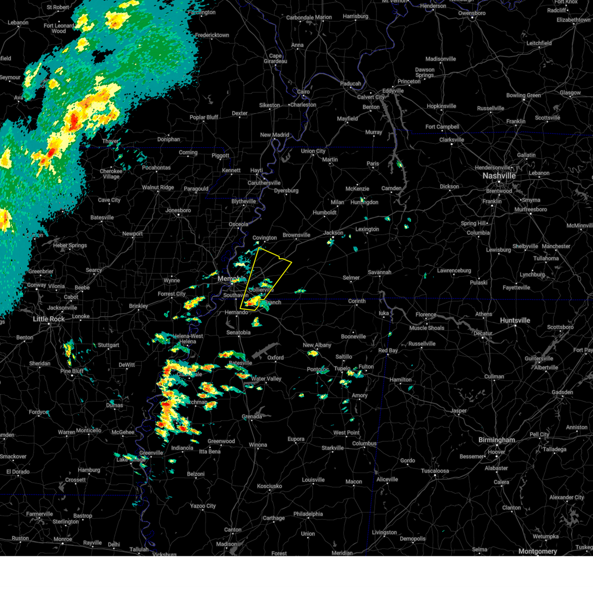 Svrmeg the national weather service in memphis has issued a * severe thunderstorm warning for, northeastern desoto county in northwestern mississippi, southeastern tipton county in west tennessee, northwestern fayette county in west tennessee, eastern shelby county in west tennessee, * until 330 pm cdt. * at 245 pm cdt, a severe thunderstorm was located over olive branch, moving northeast at 55 mph (radar indicated). Hazards include 60 mph wind gusts and quarter size hail. Hail damage to vehicles is expected. Expect wind damage to roofs, siding, and trees. Svrmeg the national weather service in memphis has issued a * severe thunderstorm warning for, northeastern desoto county in northwestern mississippi, southeastern tipton county in west tennessee, northwestern fayette county in west tennessee, eastern shelby county in west tennessee, * until 330 pm cdt. * at 245 pm cdt, a severe thunderstorm was located over olive branch, moving northeast at 55 mph (radar indicated). Hazards include 60 mph wind gusts and quarter size hail. Hail damage to vehicles is expected. Expect wind damage to roofs, siding, and trees.
|
| 3/30/2025 10:22 PM CDT |
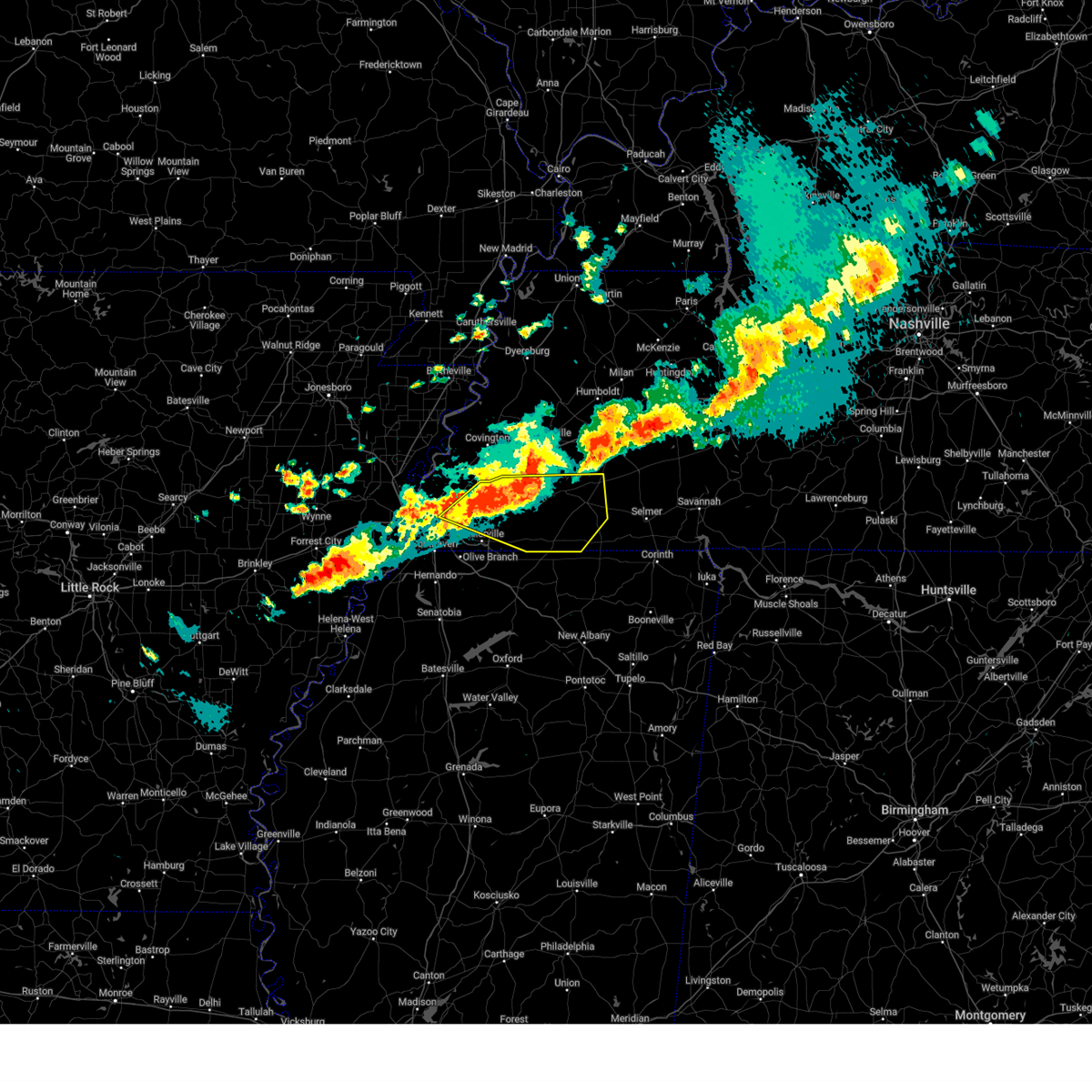 At 1022 pm cdt, a severe thunderstorm was located near eads, or 11 miles northeast of cordova, moving east at 40 mph (radar indicated). Hazards include 60 mph wind gusts and half dollar size hail. Hail damage to vehicles is expected. expect wind damage to roofs, siding, and trees. Locations impacted include, ghost river state natural area, yum yum, belmont, ellendale, oakland, whiteville, kirk, rossville, arlington, rogers springs, elmore park, brunswick, fisherville, laconia, macon, cedar chapel, canadaville, vildo, williston, and lambert. At 1022 pm cdt, a severe thunderstorm was located near eads, or 11 miles northeast of cordova, moving east at 40 mph (radar indicated). Hazards include 60 mph wind gusts and half dollar size hail. Hail damage to vehicles is expected. expect wind damage to roofs, siding, and trees. Locations impacted include, ghost river state natural area, yum yum, belmont, ellendale, oakland, whiteville, kirk, rossville, arlington, rogers springs, elmore park, brunswick, fisherville, laconia, macon, cedar chapel, canadaville, vildo, williston, and lambert.
|
| 3/30/2025 10:20 PM CDT | Quarter sized hail reported 8.8 miles SW of Memphis, TN, several reports coming in of quarter to half dollar sized hail in the bartlett/lakeland/arlington area. |
| 3/30/2025 10:10 PM CDT | Ping Pong Ball sized hail reported 6.6 miles SSW of Memphis, TN |
| 3/30/2025 10:08 PM CDT |
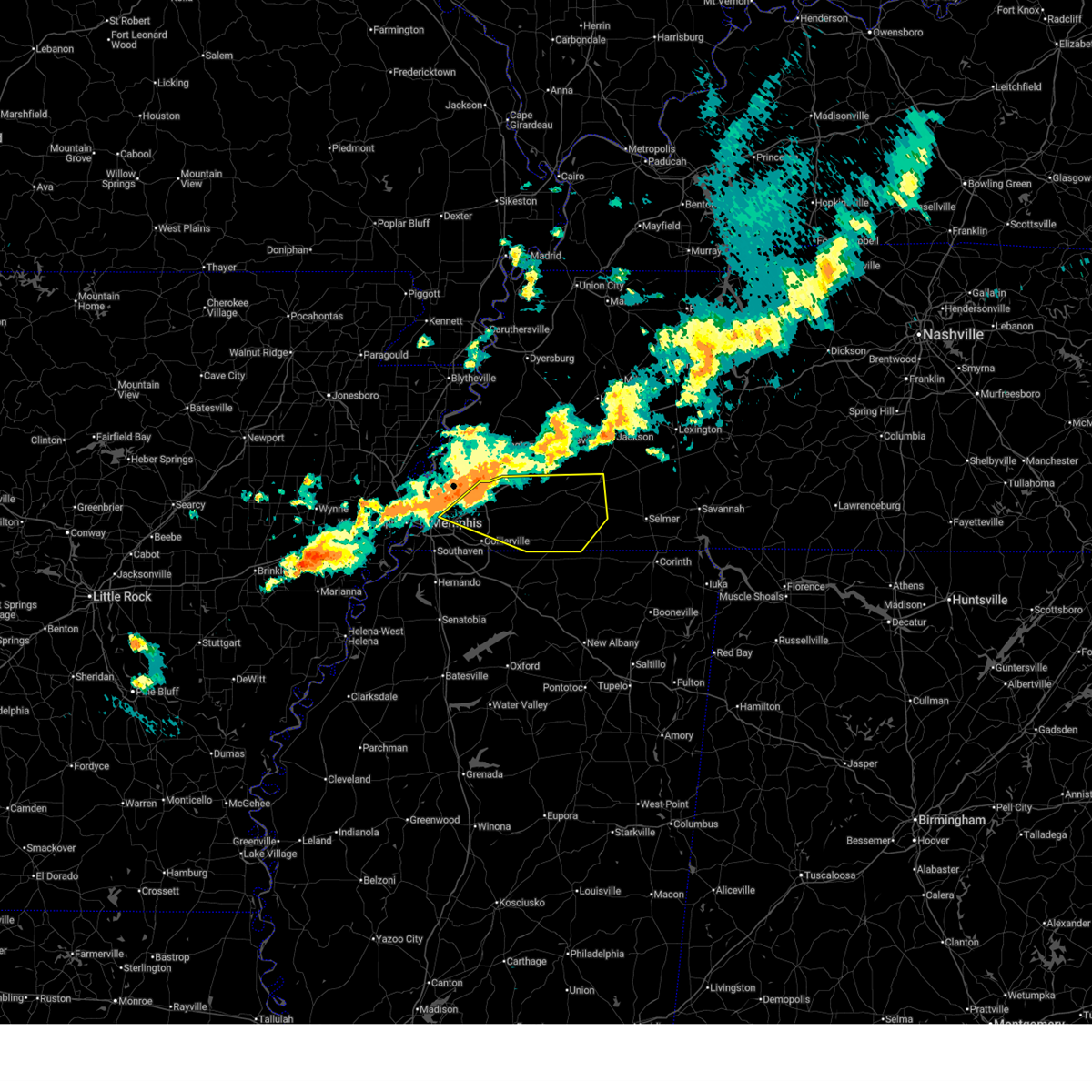 At 1007 pm cdt, a severe thunderstorm was located near arlington, or 13 miles northeast of cordova, moving east at 50 mph (radar indicated. at 1006 pm cdt, ping pong ball sized hail was observed in bartlett). Hazards include ping pong ball size hail and 60 mph wind gusts. People and animals outdoors will be injured. expect hail damage to roofs, siding, windows, and vehicles. expect wind damage to roofs, siding, and trees. Locations impacted include, ghost river state natural area, yum yum, belmont, ellendale, oakland, whiteville, kirk, rossville, arlington, rogers springs, elmore park, brunswick, fisherville, laconia, macon, cedar chapel, canadaville, vildo, williston, and lambert. At 1007 pm cdt, a severe thunderstorm was located near arlington, or 13 miles northeast of cordova, moving east at 50 mph (radar indicated. at 1006 pm cdt, ping pong ball sized hail was observed in bartlett). Hazards include ping pong ball size hail and 60 mph wind gusts. People and animals outdoors will be injured. expect hail damage to roofs, siding, windows, and vehicles. expect wind damage to roofs, siding, and trees. Locations impacted include, ghost river state natural area, yum yum, belmont, ellendale, oakland, whiteville, kirk, rossville, arlington, rogers springs, elmore park, brunswick, fisherville, laconia, macon, cedar chapel, canadaville, vildo, williston, and lambert.
|
| 3/30/2025 10:03 PM CDT |
 Svrmeg the national weather service in memphis has issued a * severe thunderstorm warning for, fayette county in west tennessee, hardeman county in west tennessee, east central shelby county in west tennessee, * until 1045 pm cdt. * at 1003 pm cdt, a severe thunderstorm was located over arlington, or 11 miles northeast of bartlett, moving east at 50 mph (radar indicated). Hazards include 60 mph wind gusts and quarter size hail. Hail damage to vehicles is expected. Expect wind damage to roofs, siding, and trees. Svrmeg the national weather service in memphis has issued a * severe thunderstorm warning for, fayette county in west tennessee, hardeman county in west tennessee, east central shelby county in west tennessee, * until 1045 pm cdt. * at 1003 pm cdt, a severe thunderstorm was located over arlington, or 11 miles northeast of bartlett, moving east at 50 mph (radar indicated). Hazards include 60 mph wind gusts and quarter size hail. Hail damage to vehicles is expected. Expect wind damage to roofs, siding, and trees.
|
| 3/30/2025 9:55 PM CDT |
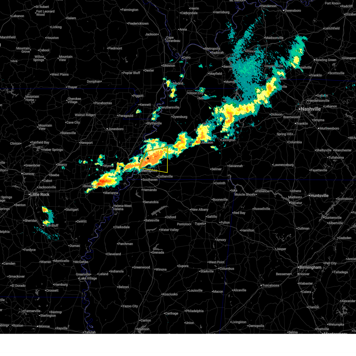 At 954 pm cdt, a severe thunderstorm was located near millington, moving east at 25 mph (public. at 240 pm cdt, quarter sized hail was reported south of munford). Hazards include 60 mph wind gusts and half dollar size hail. Hail damage to vehicles is expected. expect wind damage to roofs, siding, and trees. Locations impacted include, lenow, munford, barretville, belmont, ellendale, quito, oakland, woodstock, redwood, rosemark, idaville, hickory withe, atoka, millington, sloanville, arlington, elmore park, brunswick, fisherville, and raleigh. At 954 pm cdt, a severe thunderstorm was located near millington, moving east at 25 mph (public. at 240 pm cdt, quarter sized hail was reported south of munford). Hazards include 60 mph wind gusts and half dollar size hail. Hail damage to vehicles is expected. expect wind damage to roofs, siding, and trees. Locations impacted include, lenow, munford, barretville, belmont, ellendale, quito, oakland, woodstock, redwood, rosemark, idaville, hickory withe, atoka, millington, sloanville, arlington, elmore park, brunswick, fisherville, and raleigh.
|
| 3/30/2025 9:55 PM CDT |
 the severe thunderstorm warning has been cancelled and is no longer in effect the severe thunderstorm warning has been cancelled and is no longer in effect
|
| 3/30/2025 9:40 PM CDT |
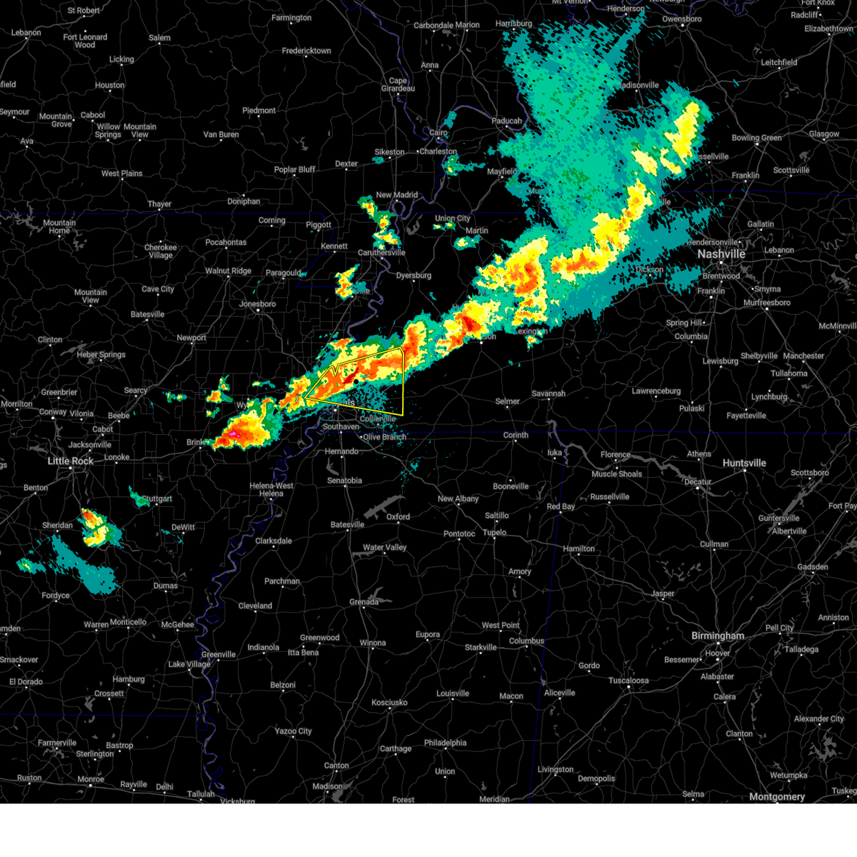 At 939 pm cdt, a severe thunderstorm was located over millington, moving east at 30 mph (radar indicated). Hazards include ping pong ball size hail and 60 mph wind gusts. People and animals outdoors will be injured. expect hail damage to roofs, siding, windows, and vehicles. expect wind damage to roofs, siding, and trees. Locations impacted include, belmont, ellendale, oakland, woodstock, st clair, atoka, locke, sloanville, arlington, elmore park, brunswick, fisherville, macon, canadaville, meeman shelby forest state park, tipton, frayser, lambert, gilestown, and gainesville. At 939 pm cdt, a severe thunderstorm was located over millington, moving east at 30 mph (radar indicated). Hazards include ping pong ball size hail and 60 mph wind gusts. People and animals outdoors will be injured. expect hail damage to roofs, siding, windows, and vehicles. expect wind damage to roofs, siding, and trees. Locations impacted include, belmont, ellendale, oakland, woodstock, st clair, atoka, locke, sloanville, arlington, elmore park, brunswick, fisherville, macon, canadaville, meeman shelby forest state park, tipton, frayser, lambert, gilestown, and gainesville.
|
| 3/30/2025 9:40 PM CDT |
 the severe thunderstorm warning has been cancelled and is no longer in effect the severe thunderstorm warning has been cancelled and is no longer in effect
|
| 3/30/2025 9:28 PM CDT |
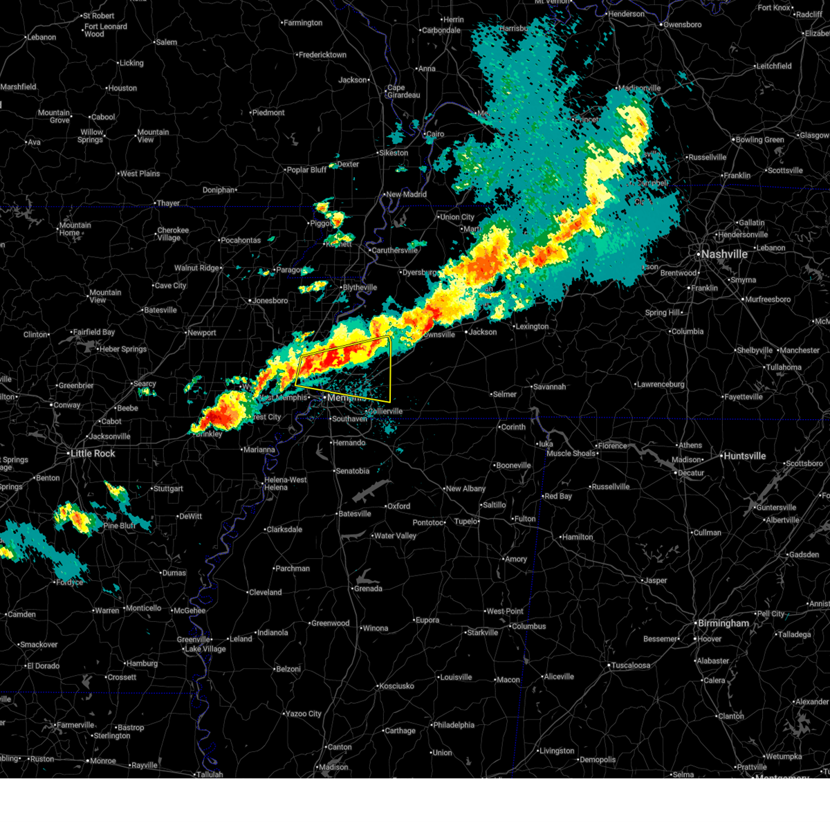 Svrmeg the national weather service in memphis has issued a * severe thunderstorm warning for, southwestern mississippi county in eastern arkansas, northeastern crittenden county in eastern arkansas, tipton county in west tennessee, northwestern fayette county in west tennessee, northern shelby county in west tennessee, * until 1015 pm cdt. * at 927 pm cdt, a severe thunderstorm was located near dixonville, or near meeman shelby forest state park, moving east at 30 mph (radar indicated). Hazards include ping pong ball size hail and 60 mph wind gusts. People and animals outdoors will be injured. expect hail damage to roofs, siding, windows, and vehicles. Expect wind damage to roofs, siding, and trees. Svrmeg the national weather service in memphis has issued a * severe thunderstorm warning for, southwestern mississippi county in eastern arkansas, northeastern crittenden county in eastern arkansas, tipton county in west tennessee, northwestern fayette county in west tennessee, northern shelby county in west tennessee, * until 1015 pm cdt. * at 927 pm cdt, a severe thunderstorm was located near dixonville, or near meeman shelby forest state park, moving east at 30 mph (radar indicated). Hazards include ping pong ball size hail and 60 mph wind gusts. People and animals outdoors will be injured. expect hail damage to roofs, siding, windows, and vehicles. Expect wind damage to roofs, siding, and trees.
|
| 3/30/2025 9:04 PM CDT |
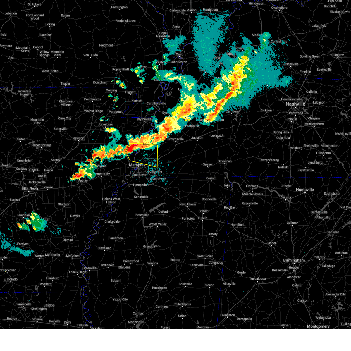 the severe thunderstorm warning has been cancelled and is no longer in effect the severe thunderstorm warning has been cancelled and is no longer in effect
|
| 3/30/2025 9:04 PM CDT |
 At 903 pm cdt, a severe thunderstorm was located near joiner, or 7 miles north of meeman shelby forest state park, moving east at 30 mph (radar indicated. at 853 pm cdt, golf ball sized hail was reported near bassett, mississippi). Hazards include golf ball size hail and 60 mph wind gusts. People and animals outdoors will be injured. expect hail damage to roofs, siding, windows, and vehicles. expect wind damage to roofs, siding, and trees. Locations impacted include, dimple, evadale, menesha, ellendale, woodstock, atoka, locke, randolph, sloanville, arlington, brunswick, delpro, meeman shelby forest state park, tipton, bassett, wardell, gilestown, stacy, clopton, and benjestown. At 903 pm cdt, a severe thunderstorm was located near joiner, or 7 miles north of meeman shelby forest state park, moving east at 30 mph (radar indicated. at 853 pm cdt, golf ball sized hail was reported near bassett, mississippi). Hazards include golf ball size hail and 60 mph wind gusts. People and animals outdoors will be injured. expect hail damage to roofs, siding, windows, and vehicles. expect wind damage to roofs, siding, and trees. Locations impacted include, dimple, evadale, menesha, ellendale, woodstock, atoka, locke, randolph, sloanville, arlington, brunswick, delpro, meeman shelby forest state park, tipton, bassett, wardell, gilestown, stacy, clopton, and benjestown.
|
| 3/30/2025 8:51 PM CDT |
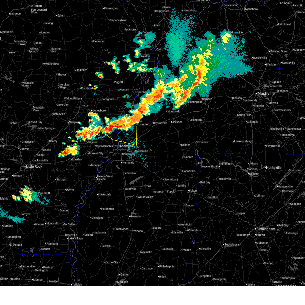 Svrmeg the national weather service in memphis has issued a * severe thunderstorm warning for, southeastern poinsett county in eastern arkansas, southwestern mississippi county in eastern arkansas, northeastern crittenden county in eastern arkansas, southern tipton county in west tennessee, northern shelby county in west tennessee, * until 930 pm cdt. * at 851 pm cdt, a severe thunderstorm was located near gilmore, or 9 miles southeast of tyronza, moving east at 25 mph (radar indicated). Hazards include golf ball size hail and 60 mph wind gusts. People and animals outdoors will be injured. expect hail damage to roofs, siding, windows, and vehicles. Expect wind damage to roofs, siding, and trees. Svrmeg the national weather service in memphis has issued a * severe thunderstorm warning for, southeastern poinsett county in eastern arkansas, southwestern mississippi county in eastern arkansas, northeastern crittenden county in eastern arkansas, southern tipton county in west tennessee, northern shelby county in west tennessee, * until 930 pm cdt. * at 851 pm cdt, a severe thunderstorm was located near gilmore, or 9 miles southeast of tyronza, moving east at 25 mph (radar indicated). Hazards include golf ball size hail and 60 mph wind gusts. People and animals outdoors will be injured. expect hail damage to roofs, siding, windows, and vehicles. Expect wind damage to roofs, siding, and trees.
|
| 3/23/2025 6:07 PM CDT |
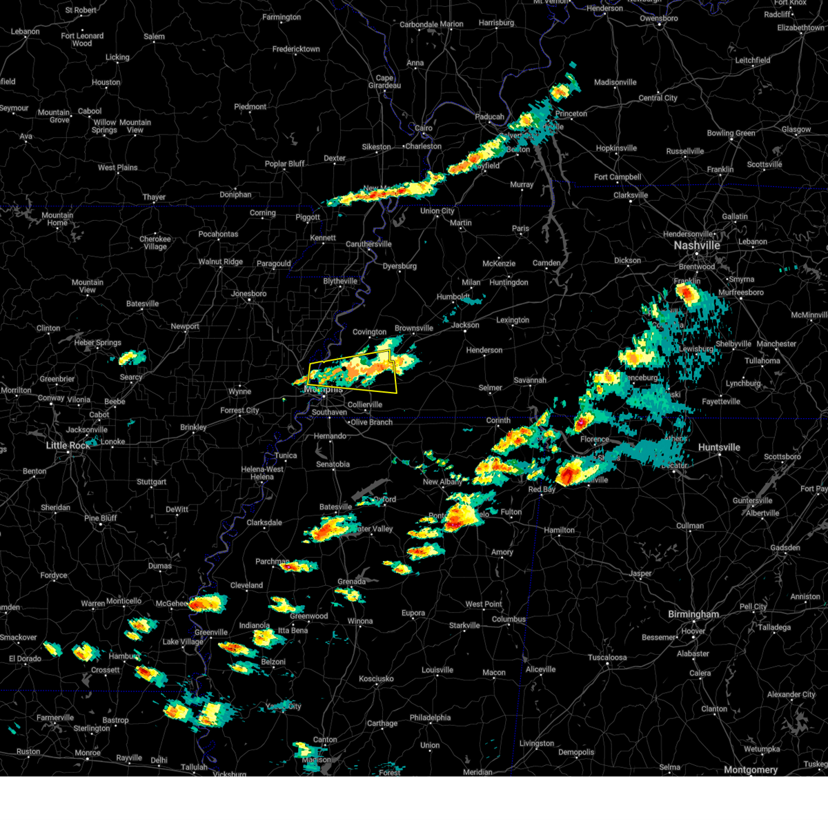 the severe thunderstorm warning has been cancelled and is no longer in effect the severe thunderstorm warning has been cancelled and is no longer in effect
|
| 3/23/2025 5:45 PM CDT |
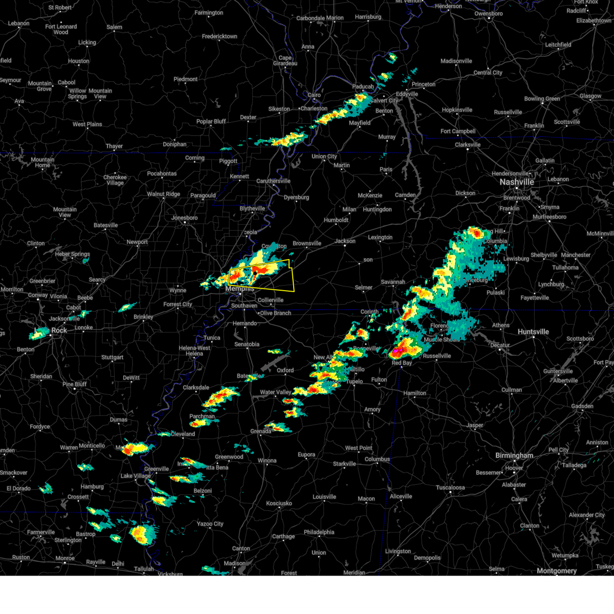 Svrmeg the national weather service in memphis has issued a * severe thunderstorm warning for, northeastern crittenden county in eastern arkansas, southern tipton county in west tennessee, northwestern fayette county in west tennessee, northern shelby county in west tennessee, * until 630 pm cdt. * at 544 pm cdt, a severe thunderstorm was located over meeman shelby forest state park, moving east at 40 mph (radar indicated). Hazards include 60 mph wind gusts and quarter size hail. Hail damage to vehicles is expected. Expect wind damage to roofs, siding, and trees. Svrmeg the national weather service in memphis has issued a * severe thunderstorm warning for, northeastern crittenden county in eastern arkansas, southern tipton county in west tennessee, northwestern fayette county in west tennessee, northern shelby county in west tennessee, * until 630 pm cdt. * at 544 pm cdt, a severe thunderstorm was located over meeman shelby forest state park, moving east at 40 mph (radar indicated). Hazards include 60 mph wind gusts and quarter size hail. Hail damage to vehicles is expected. Expect wind damage to roofs, siding, and trees.
|
| 3/23/2025 5:43 PM CDT |
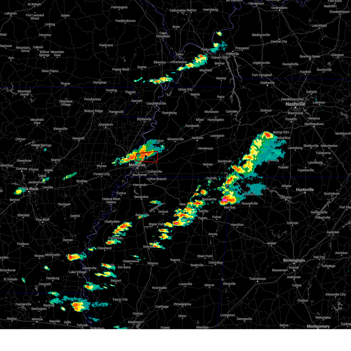 the tornado warning has been cancelled and is no longer in effect the tornado warning has been cancelled and is no longer in effect
|
| 3/23/2025 5:30 PM CDT |
 At 529 pm cdt, a severe thunderstorm capable of producing a tornado was located over meeman shelby forest state park, moving east at 40 mph (radar indicated rotation). Hazards include tornado and quarter size hail. Flying debris will be dangerous to those caught without shelter. mobile homes will be damaged or destroyed. damage to roofs, windows, and vehicles will occur. tree damage is likely. Locations impacted include, brunswick, barretville, griffin corner, meeman shelby forest state park, wilkinsville, woodstock, redwood, rosemark, gilestown, cuba, locke, millington, kerrville, bolton, lucy, sloanville, arlington, lakeland, atoka, and bartlett. At 529 pm cdt, a severe thunderstorm capable of producing a tornado was located over meeman shelby forest state park, moving east at 40 mph (radar indicated rotation). Hazards include tornado and quarter size hail. Flying debris will be dangerous to those caught without shelter. mobile homes will be damaged or destroyed. damage to roofs, windows, and vehicles will occur. tree damage is likely. Locations impacted include, brunswick, barretville, griffin corner, meeman shelby forest state park, wilkinsville, woodstock, redwood, rosemark, gilestown, cuba, locke, millington, kerrville, bolton, lucy, sloanville, arlington, lakeland, atoka, and bartlett.
|
| 3/23/2025 5:30 PM CDT |
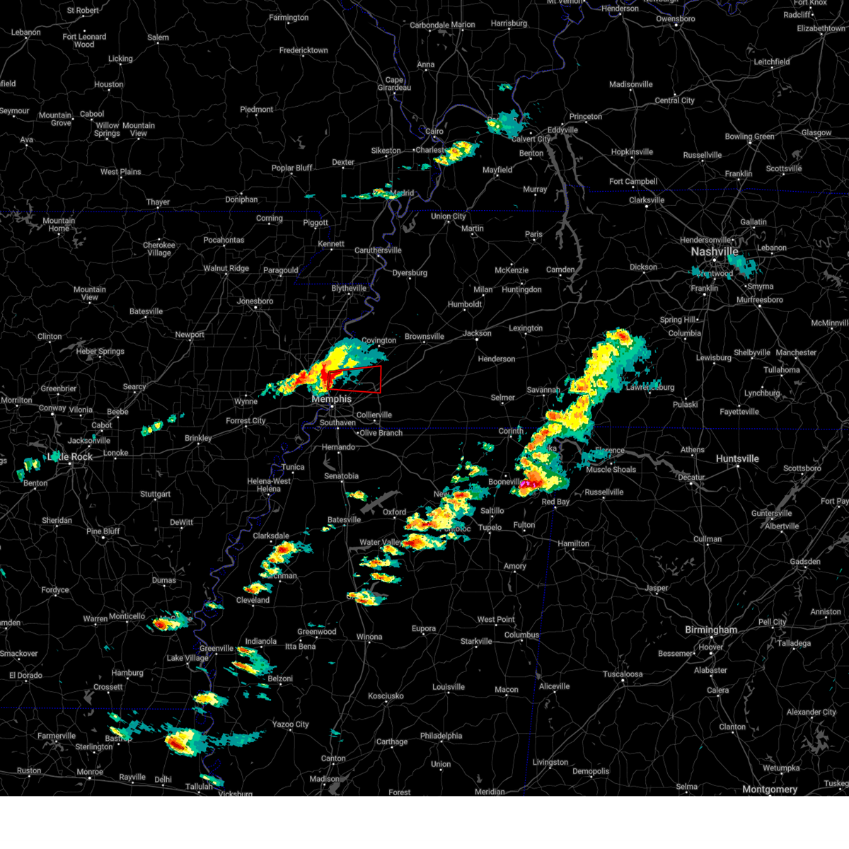 the tornado warning has been cancelled and is no longer in effect the tornado warning has been cancelled and is no longer in effect
|
| 3/23/2025 5:28 PM CDT |
 At 528 pm cdt, a severe thunderstorm was located over meeman shelby forest state park, moving east at 40 mph (radar indicated). Hazards include 60 mph wind gusts and quarter size hail. Hail damage to vehicles is expected. expect wind damage to roofs, siding, and trees. Locations impacted include, three forks, wapanocca national wildlife refuge, munford, jericho, booker, griffin corner, turrell, menesha, gammon, quito, clarkedale, woodstock, st clair, harvard, gilmore, cloar, earle, locke, dixonville, and millington. At 528 pm cdt, a severe thunderstorm was located over meeman shelby forest state park, moving east at 40 mph (radar indicated). Hazards include 60 mph wind gusts and quarter size hail. Hail damage to vehicles is expected. expect wind damage to roofs, siding, and trees. Locations impacted include, three forks, wapanocca national wildlife refuge, munford, jericho, booker, griffin corner, turrell, menesha, gammon, quito, clarkedale, woodstock, st clair, harvard, gilmore, cloar, earle, locke, dixonville, and millington.
|
| 3/23/2025 5:14 PM CDT |
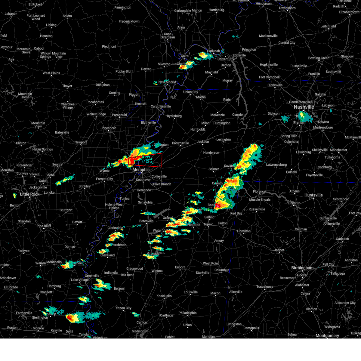 Tormeg the national weather service in memphis has issued a * tornado warning for, northeastern crittenden county in eastern arkansas, southern tipton county in west tennessee, northern shelby county in west tennessee, * until 600 pm cdt. * at 514 pm cdt, a severe thunderstorm capable of producing a tornado was located near jericho, or 8 miles west of meeman shelby forest state park, moving east at 40 mph (radar indicated rotation). Hazards include tornado and quarter size hail. Flying debris will be dangerous to those caught without shelter. mobile homes will be damaged or destroyed. damage to roofs, windows, and vehicles will occur. Tree damage is likely. Tormeg the national weather service in memphis has issued a * tornado warning for, northeastern crittenden county in eastern arkansas, southern tipton county in west tennessee, northern shelby county in west tennessee, * until 600 pm cdt. * at 514 pm cdt, a severe thunderstorm capable of producing a tornado was located near jericho, or 8 miles west of meeman shelby forest state park, moving east at 40 mph (radar indicated rotation). Hazards include tornado and quarter size hail. Flying debris will be dangerous to those caught without shelter. mobile homes will be damaged or destroyed. damage to roofs, windows, and vehicles will occur. Tree damage is likely.
|
| 3/23/2025 5:09 PM CDT |
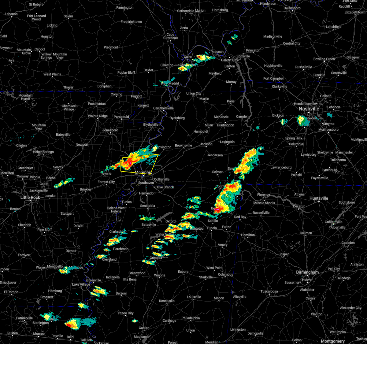 At 509 pm cdt, a severe thunderstorm was located near jericho, or 8 miles north of marion, moving east at 40 mph (radar indicated). Hazards include 60 mph wind gusts and quarter size hail. Hail damage to vehicles is expected. expect wind damage to roofs, siding, and trees. Locations impacted include, three forks, wapanocca national wildlife refuge, munford, jericho, booker, griffin corner, turrell, menesha, gammon, quito, clarkedale, woodstock, st clair, harvard, gilmore, cloar, earle, locke, dixonville, and millington. At 509 pm cdt, a severe thunderstorm was located near jericho, or 8 miles north of marion, moving east at 40 mph (radar indicated). Hazards include 60 mph wind gusts and quarter size hail. Hail damage to vehicles is expected. expect wind damage to roofs, siding, and trees. Locations impacted include, three forks, wapanocca national wildlife refuge, munford, jericho, booker, griffin corner, turrell, menesha, gammon, quito, clarkedale, woodstock, st clair, harvard, gilmore, cloar, earle, locke, dixonville, and millington.
|
| 3/23/2025 5:00 PM CDT |
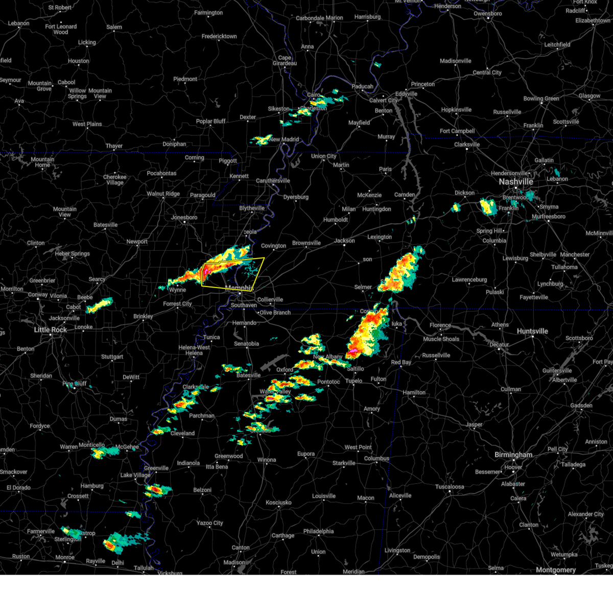 Svrmeg the national weather service in memphis has issued a * severe thunderstorm warning for, southwestern mississippi county in eastern arkansas, northern crittenden county in eastern arkansas, southwestern tipton county in west tennessee, northwestern shelby county in west tennessee, * until 545 pm cdt. * at 500 pm cdt, a severe thunderstorm was located near earle, moving east at 40 mph (radar indicated). Hazards include 60 mph wind gusts and quarter size hail. Hail damage to vehicles is expected. Expect wind damage to roofs, siding, and trees. Svrmeg the national weather service in memphis has issued a * severe thunderstorm warning for, southwestern mississippi county in eastern arkansas, northern crittenden county in eastern arkansas, southwestern tipton county in west tennessee, northwestern shelby county in west tennessee, * until 545 pm cdt. * at 500 pm cdt, a severe thunderstorm was located near earle, moving east at 40 mph (radar indicated). Hazards include 60 mph wind gusts and quarter size hail. Hail damage to vehicles is expected. Expect wind damage to roofs, siding, and trees.
|
| 3/15/2025 9:20 AM CDT |
 The storm which prompted the warning has weakened below severe limits, and has exited the warned area. therefore, the warning will be allowed to expire. however, small hail and gusty winds are still possible with this thunderstorm. a tornado watch remains in effect until 100 pm cdt for northeastern and northwestern mississippi, and west tennessee. The storm which prompted the warning has weakened below severe limits, and has exited the warned area. therefore, the warning will be allowed to expire. however, small hail and gusty winds are still possible with this thunderstorm. a tornado watch remains in effect until 100 pm cdt for northeastern and northwestern mississippi, and west tennessee.
|
| 3/15/2025 9:06 AM CDT |
 The storm which prompted the warning has weakened below severe limits, and has exited the warned area. therefore, the warning will be allowed to expire. however, small hail and gusty winds are still possible with this thunderstorm. a tornado watch remains in effect until 100 pm cdt for northwestern mississippi. The storm which prompted the warning has weakened below severe limits, and has exited the warned area. therefore, the warning will be allowed to expire. however, small hail and gusty winds are still possible with this thunderstorm. a tornado watch remains in effect until 100 pm cdt for northwestern mississippi.
|
| 3/15/2025 9:06 AM CDT |
 The storm which prompted the warning has moved out of the area. therefore, the warning will be allowed to expire. however, small hail and gusty winds are still possible with this thunderstorm. The storm which prompted the warning has moved out of the area. therefore, the warning will be allowed to expire. however, small hail and gusty winds are still possible with this thunderstorm.
|
| 3/15/2025 9:02 AM CDT |
 At 902 am cdt, a severe thunderstorm was located near arlington, or 10 miles northeast of bartlett, moving north at 50 mph (radar indicated). Hazards include 60 mph wind gusts and quarter size hail. Hail damage to vehicles is expected. expect wind damage to roofs, siding, and trees. Locations impacted include, ghost river state natural area, burlison, stanton, huntersville, masseyville, westover, covington, silerton, kirk, arlington, elmore park, laconia, lisbon, hudsonville, brims corner, sunnyhill, durhamville, montezuma, clopton, and lightfoot. At 902 am cdt, a severe thunderstorm was located near arlington, or 10 miles northeast of bartlett, moving north at 50 mph (radar indicated). Hazards include 60 mph wind gusts and quarter size hail. Hail damage to vehicles is expected. expect wind damage to roofs, siding, and trees. Locations impacted include, ghost river state natural area, burlison, stanton, huntersville, masseyville, westover, covington, silerton, kirk, arlington, elmore park, laconia, lisbon, hudsonville, brims corner, sunnyhill, durhamville, montezuma, clopton, and lightfoot.
|
| 3/15/2025 9:00 AM CDT |
 At 900 am cdt, a severe thunderstorm was located over edmondson, or near west memphis, moving north at 55 mph (radar indicated). Hazards include 60 mph wind gusts and quarter size hail. Hail damage to vehicles is expected. expect wind damage to roofs, siding, and trees. Locations impacted include, three forks, lake cormorant, browns, commerce, louise, edmondson, st clair, round pond, presidents island, beck, simsboro, glover, brickeys, river front, julius, duvall, gilestown, clarks corner, walls, and norfolk. At 900 am cdt, a severe thunderstorm was located over edmondson, or near west memphis, moving north at 55 mph (radar indicated). Hazards include 60 mph wind gusts and quarter size hail. Hail damage to vehicles is expected. expect wind damage to roofs, siding, and trees. Locations impacted include, three forks, lake cormorant, browns, commerce, louise, edmondson, st clair, round pond, presidents island, beck, simsboro, glover, brickeys, river front, julius, duvall, gilestown, clarks corner, walls, and norfolk.
|
| 3/15/2025 8:59 AM CDT |
 At 858 am cdt, a severe thunderstorm was located over phillipp, or 11 miles southwest of hernando, moving northeast at 60 mph (radar indicated). Hazards include 60 mph wind gusts and quarter size hail. Hail damage to vehicles is expected. expect wind damage to roofs, siding, and trees. Locations impacted include, askew, belen, moon, southwest memphis, savage, horn lake, senatobia, austin, bright, falcon, como, chulahoma, strayhorn, prichard, jonestown, dubbs, whitehall, alden, lurline, and dooley. At 858 am cdt, a severe thunderstorm was located over phillipp, or 11 miles southwest of hernando, moving northeast at 60 mph (radar indicated). Hazards include 60 mph wind gusts and quarter size hail. Hail damage to vehicles is expected. expect wind damage to roofs, siding, and trees. Locations impacted include, askew, belen, moon, southwest memphis, savage, horn lake, senatobia, austin, bright, falcon, como, chulahoma, strayhorn, prichard, jonestown, dubbs, whitehall, alden, lurline, and dooley.
|
| 3/15/2025 8:59 AM CDT |
 the severe thunderstorm warning has been cancelled and is no longer in effect the severe thunderstorm warning has been cancelled and is no longer in effect
|
| 3/15/2025 8:56 AM CDT |
 Svrmeg the national weather service in memphis has issued a * severe thunderstorm warning for, central mississippi county in eastern arkansas, northeastern crittenden county in eastern arkansas, central tipton county in west tennessee, lauderdale county in west tennessee, northwestern shelby county in west tennessee, * until 945 am cdt. * at 856 am cdt, a severe thunderstorm was located near meeman shelby forest state park, moving northeast at 50 mph (radar indicated). Hazards include 60 mph wind gusts and nickel size hail. expect damage to roofs, siding, and trees Svrmeg the national weather service in memphis has issued a * severe thunderstorm warning for, central mississippi county in eastern arkansas, northeastern crittenden county in eastern arkansas, central tipton county in west tennessee, lauderdale county in west tennessee, northwestern shelby county in west tennessee, * until 945 am cdt. * at 856 am cdt, a severe thunderstorm was located near meeman shelby forest state park, moving northeast at 50 mph (radar indicated). Hazards include 60 mph wind gusts and nickel size hail. expect damage to roofs, siding, and trees
|
| 3/15/2025 8:40 AM CDT | Estimated 60 mph winds at nws memphis offic in shelby county TN, 3.8 miles W of Memphis, TN |
| 3/15/2025 8:39 AM CDT |
 The severe thunderstorm which prompted the warning has moved out of the warned area. therefore, the warning will be allowed to expire. a tornado watch remains in effect until 100 pm cdt for northeastern and northwestern mississippi, and west tennessee. The severe thunderstorm which prompted the warning has moved out of the warned area. therefore, the warning will be allowed to expire. a tornado watch remains in effect until 100 pm cdt for northeastern and northwestern mississippi, and west tennessee.
|
| 3/15/2025 8:38 AM CDT |
 Svrmeg the national weather service in memphis has issued a * severe thunderstorm warning for, northeastern desoto county in northwestern mississippi, northern marshall county in northwestern mississippi, northern benton county in northeastern mississippi, fayette county in west tennessee, hardeman county in west tennessee, eastern lauderdale county in west tennessee, haywood county in west tennessee, madison county in west tennessee, shelby county in west tennessee, chester county in west tennessee, southern crockett county in west tennessee, tipton county in west tennessee, northwestern mcnairy county in west tennessee, * until 930 am cdt. * at 838 am cdt, a severe thunderstorm was located over germantown, moving northeast at 40 mph (radar indicated). Hazards include 60 mph wind gusts and quarter size hail. Hail damage to vehicles is expected. Expect wind damage to roofs, siding, and trees. Svrmeg the national weather service in memphis has issued a * severe thunderstorm warning for, northeastern desoto county in northwestern mississippi, northern marshall county in northwestern mississippi, northern benton county in northeastern mississippi, fayette county in west tennessee, hardeman county in west tennessee, eastern lauderdale county in west tennessee, haywood county in west tennessee, madison county in west tennessee, shelby county in west tennessee, chester county in west tennessee, southern crockett county in west tennessee, tipton county in west tennessee, northwestern mcnairy county in west tennessee, * until 930 am cdt. * at 838 am cdt, a severe thunderstorm was located over germantown, moving northeast at 40 mph (radar indicated). Hazards include 60 mph wind gusts and quarter size hail. Hail damage to vehicles is expected. Expect wind damage to roofs, siding, and trees.
|
| 3/15/2025 8:35 AM CDT |
 Svrmeg the national weather service in memphis has issued a * severe thunderstorm warning for, southern lee county in eastern arkansas, phillips county in eastern arkansas, desoto county in northwestern mississippi, coahoma county in northwestern mississippi, west central marshall county in northwestern mississippi, tunica county in northwestern mississippi, tate county in northwestern mississippi, northern quitman county in northwestern mississippi, northwestern panola county in northwestern mississippi, south central shelby county in west tennessee, * until 915 am cdt. * at 835 am cdt, a severe thunderstorm was located over dubbs, or 13 miles east of st francis national park, moving northeast at 40 mph (radar indicated). Hazards include 60 mph wind gusts and quarter size hail. Hail damage to vehicles is expected. Expect wind damage to roofs, siding, and trees. Svrmeg the national weather service in memphis has issued a * severe thunderstorm warning for, southern lee county in eastern arkansas, phillips county in eastern arkansas, desoto county in northwestern mississippi, coahoma county in northwestern mississippi, west central marshall county in northwestern mississippi, tunica county in northwestern mississippi, tate county in northwestern mississippi, northern quitman county in northwestern mississippi, northwestern panola county in northwestern mississippi, south central shelby county in west tennessee, * until 915 am cdt. * at 835 am cdt, a severe thunderstorm was located over dubbs, or 13 miles east of st francis national park, moving northeast at 40 mph (radar indicated). Hazards include 60 mph wind gusts and quarter size hail. Hail damage to vehicles is expected. Expect wind damage to roofs, siding, and trees.
|
| 3/15/2025 8:31 AM CDT |
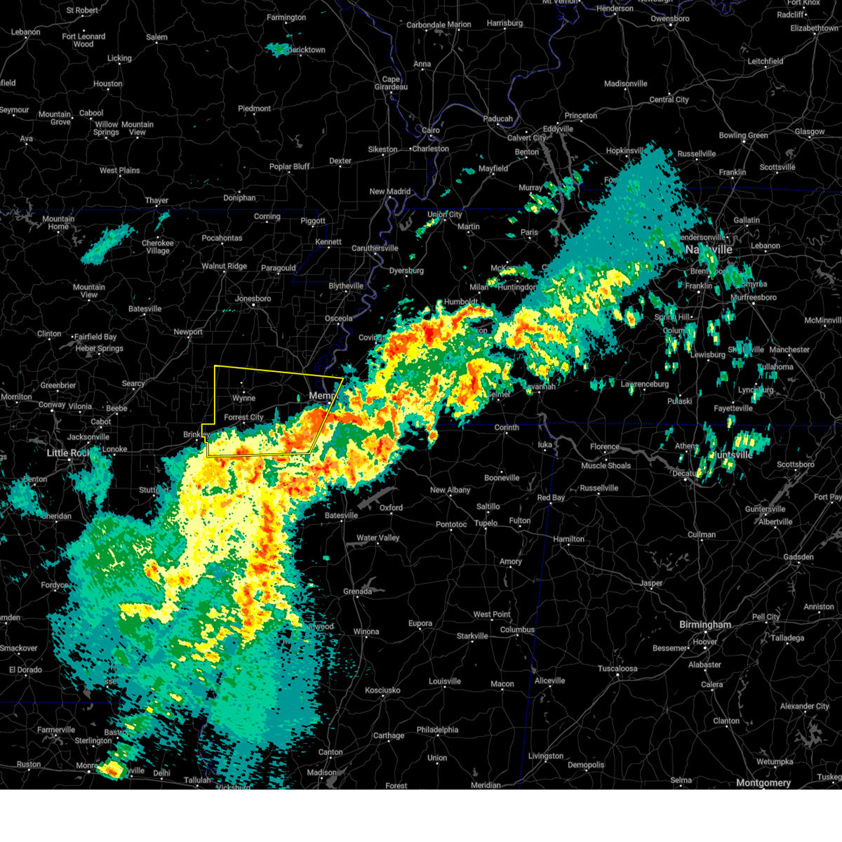 Svrmeg the national weather service in memphis has issued a * severe thunderstorm warning for, northern lee county in eastern arkansas, st. francis county in eastern arkansas, crittenden county in eastern arkansas, cross county in eastern arkansas, northwestern desoto county in northwestern mississippi, northern tunica county in northwestern mississippi, western shelby county in west tennessee, * until 915 am cdt. * at 831 am cdt, a severe thunderstorm was located near robinsonville, or 7 miles south of hughes, moving northeast at 45 mph (radar indicated). Hazards include 60 mph wind gusts and quarter size hail. Hail damage to vehicles is expected. Expect wind damage to roofs, siding, and trees. Svrmeg the national weather service in memphis has issued a * severe thunderstorm warning for, northern lee county in eastern arkansas, st. francis county in eastern arkansas, crittenden county in eastern arkansas, cross county in eastern arkansas, northwestern desoto county in northwestern mississippi, northern tunica county in northwestern mississippi, western shelby county in west tennessee, * until 915 am cdt. * at 831 am cdt, a severe thunderstorm was located near robinsonville, or 7 miles south of hughes, moving northeast at 45 mph (radar indicated). Hazards include 60 mph wind gusts and quarter size hail. Hail damage to vehicles is expected. Expect wind damage to roofs, siding, and trees.
|
| 3/15/2025 8:13 AM CDT |
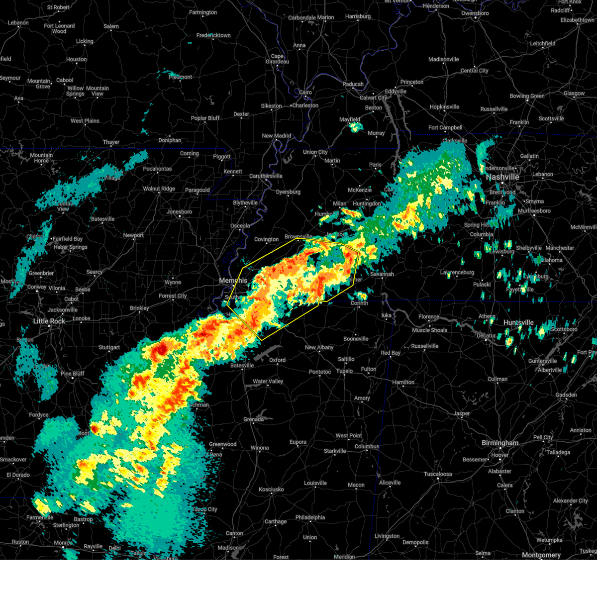 At 813 am cdt, a severe thunderstorm was located near dancyville, or 15 miles south of brownsville, moving northeast at 75 mph (radar indicated). Hazards include 60 mph wind gusts and quarter size hail. Hail damage to vehicles is expected. expect wind damage to roofs, siding, and trees. Locations impacted include, ghost river state natural area, neely, brody, yum yum, selmer, southwest memphis, stanton, horn lake, masseyville, belmont, madison hall, bright, uptonville, chulahoma, silerton, kirk, rossville, arlington, pinson mounds state archaeological park, and rogers springs. At 813 am cdt, a severe thunderstorm was located near dancyville, or 15 miles south of brownsville, moving northeast at 75 mph (radar indicated). Hazards include 60 mph wind gusts and quarter size hail. Hail damage to vehicles is expected. expect wind damage to roofs, siding, and trees. Locations impacted include, ghost river state natural area, neely, brody, yum yum, selmer, southwest memphis, stanton, horn lake, masseyville, belmont, madison hall, bright, uptonville, chulahoma, silerton, kirk, rossville, arlington, pinson mounds state archaeological park, and rogers springs.
|
| 3/15/2025 7:53 AM CDT |
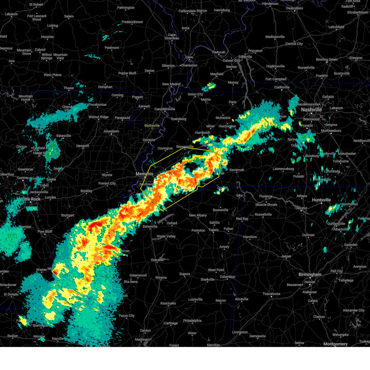 Svrmeg the national weather service in memphis has issued a * severe thunderstorm warning for, northeastern desoto county in northwestern mississippi, marshall county in northwestern mississippi, northeastern tate county in northwestern mississippi, northern benton county in northeastern mississippi, southeastern tipton county in west tennessee, fayette county in west tennessee, hardeman county in west tennessee, northwestern mcnairy county in west tennessee, southern haywood county in west tennessee, southern madison county in west tennessee, shelby county in west tennessee, chester county in west tennessee, * until 845 am cdt. * at 753 am cdt, a severe thunderstorm was located 9 miles west of lagrange, or 17 miles east of collierville, moving northeast at 50 mph (radar indicated). Hazards include 60 mph wind gusts and quarter size hail. Hail damage to vehicles is expected. Expect wind damage to roofs, siding, and trees. Svrmeg the national weather service in memphis has issued a * severe thunderstorm warning for, northeastern desoto county in northwestern mississippi, marshall county in northwestern mississippi, northeastern tate county in northwestern mississippi, northern benton county in northeastern mississippi, southeastern tipton county in west tennessee, fayette county in west tennessee, hardeman county in west tennessee, northwestern mcnairy county in west tennessee, southern haywood county in west tennessee, southern madison county in west tennessee, shelby county in west tennessee, chester county in west tennessee, * until 845 am cdt. * at 753 am cdt, a severe thunderstorm was located 9 miles west of lagrange, or 17 miles east of collierville, moving northeast at 50 mph (radar indicated). Hazards include 60 mph wind gusts and quarter size hail. Hail damage to vehicles is expected. Expect wind damage to roofs, siding, and trees.
|
| 2/15/2025 7:10 PM CST |
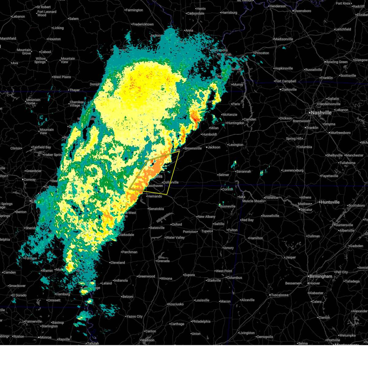 The storm which prompted the warning has weakened below severe limits, and no longer poses an immediate threat to life or property. therefore, the warning will be allowed to expire. however, small hail and gusty winds are still possible with this thunderstorm. a tornado watch remains in effect until 1000 pm cst for northwestern mississippi, and west tennessee. to report severe weather, contact your nearest law enforcement agency. they will relay your report to the national weather service memphis. The storm which prompted the warning has weakened below severe limits, and no longer poses an immediate threat to life or property. therefore, the warning will be allowed to expire. however, small hail and gusty winds are still possible with this thunderstorm. a tornado watch remains in effect until 1000 pm cst for northwestern mississippi, and west tennessee. to report severe weather, contact your nearest law enforcement agency. they will relay your report to the national weather service memphis.
|
| 2/15/2025 6:55 PM CST |
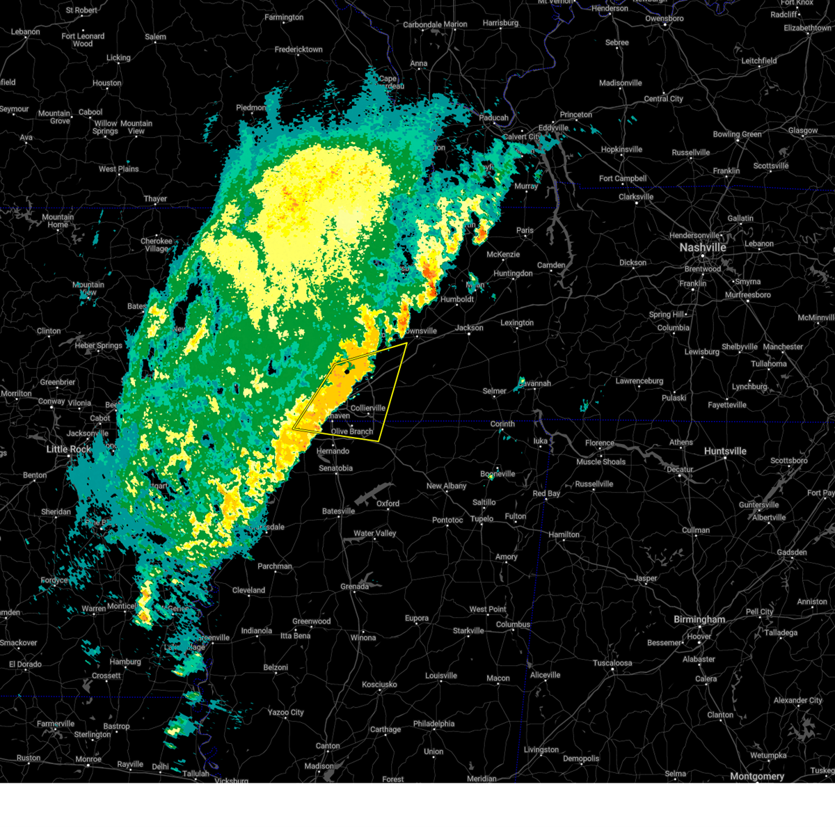 At 655 pm cst, a severe thunderstorm was located near olive branch, moving east at 55 mph (radar indicated). Hazards include 60 mph wind gusts and quarter size hail. Hail damage to vehicles is expected. expect wind damage to roofs, siding, and trees. Locations impacted include, bartlett, southaven, collierville, germantown, olive branch, west memphis, horn lake, millington, t o fuller state park, cordova, memphis, lakeland, arlington, munford, byhalia, walls, southwest memphis, ellendale, whitehaven, and frayser. At 655 pm cst, a severe thunderstorm was located near olive branch, moving east at 55 mph (radar indicated). Hazards include 60 mph wind gusts and quarter size hail. Hail damage to vehicles is expected. expect wind damage to roofs, siding, and trees. Locations impacted include, bartlett, southaven, collierville, germantown, olive branch, west memphis, horn lake, millington, t o fuller state park, cordova, memphis, lakeland, arlington, munford, byhalia, walls, southwest memphis, ellendale, whitehaven, and frayser.
|
| 2/15/2025 6:41 PM CST |
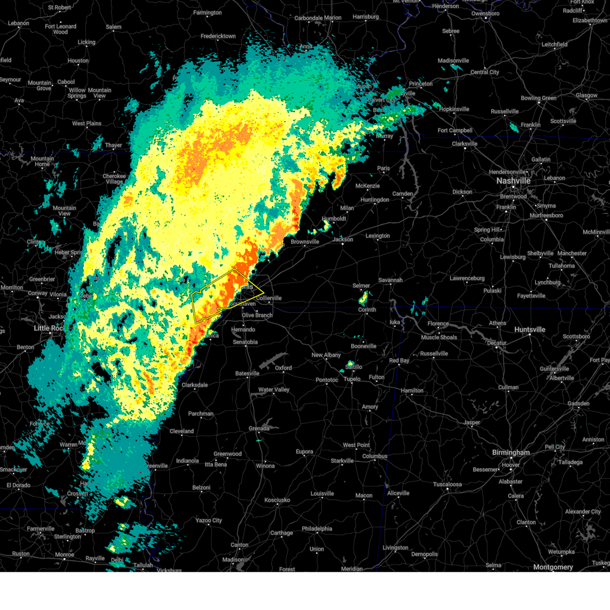 the severe thunderstorm warning has been cancelled and is no longer in effect the severe thunderstorm warning has been cancelled and is no longer in effect
|
| 2/15/2025 6:33 PM CST |
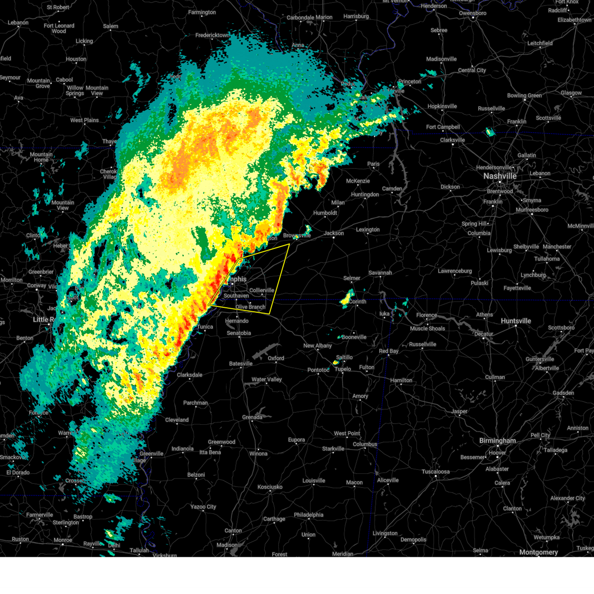 Svrmeg the national weather service in memphis has issued a * severe thunderstorm warning for, southeastern crittenden county in eastern arkansas, northern desoto county in northwestern mississippi, northwestern marshall county in northwestern mississippi, southeastern tipton county in west tennessee, western fayette county in west tennessee, southwestern haywood county in west tennessee, shelby county in west tennessee, * until 715 pm cst. * at 633 pm cst, a severe thunderstorm was located near t o fuller state park, moving east at 55 mph (radar indicated). Hazards include 60 mph wind gusts and quarter size hail. Hail damage to vehicles is expected. Expect wind damage to roofs, siding, and trees. Svrmeg the national weather service in memphis has issued a * severe thunderstorm warning for, southeastern crittenden county in eastern arkansas, northern desoto county in northwestern mississippi, northwestern marshall county in northwestern mississippi, southeastern tipton county in west tennessee, western fayette county in west tennessee, southwestern haywood county in west tennessee, shelby county in west tennessee, * until 715 pm cst. * at 633 pm cst, a severe thunderstorm was located near t o fuller state park, moving east at 55 mph (radar indicated). Hazards include 60 mph wind gusts and quarter size hail. Hail damage to vehicles is expected. Expect wind damage to roofs, siding, and trees.
|
| 2/15/2025 6:15 PM CST |
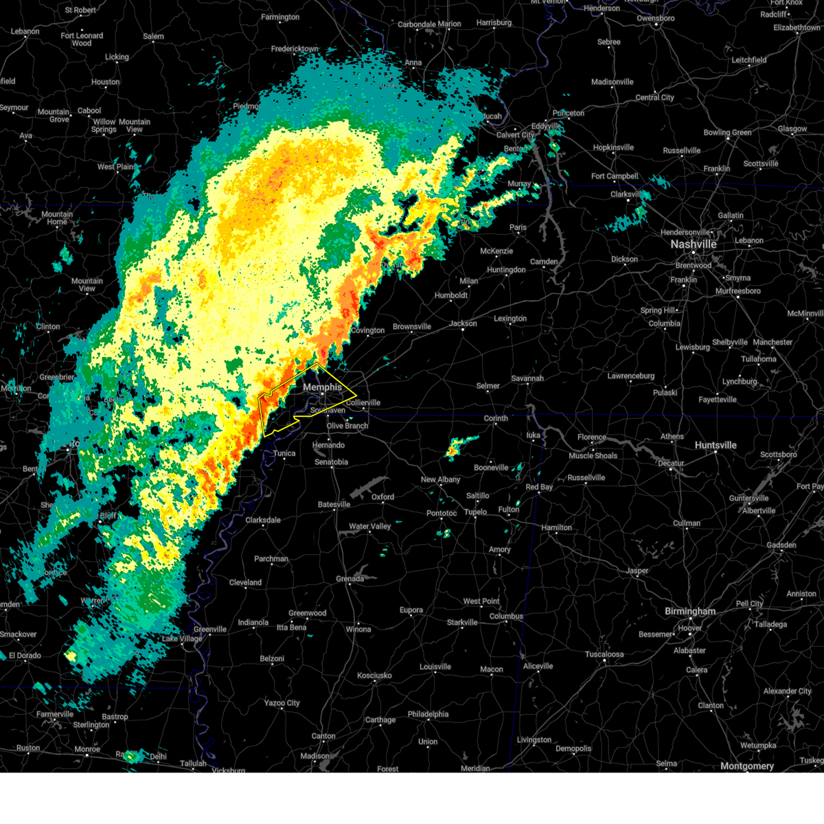 Svrmeg the national weather service in memphis has issued a * severe thunderstorm warning for, northeastern lee county in eastern arkansas, eastern st. francis county in eastern arkansas, central crittenden county in eastern arkansas, central shelby county in west tennessee, * until 700 pm cst. * at 614 pm cst, a severe thunderstorm was located near new home, or near hughes, moving northeast at 55 mph (radar indicated). Hazards include 60 mph wind gusts and quarter size hail. Hail damage to vehicles is expected. Expect wind damage to roofs, siding, and trees. Svrmeg the national weather service in memphis has issued a * severe thunderstorm warning for, northeastern lee county in eastern arkansas, eastern st. francis county in eastern arkansas, central crittenden county in eastern arkansas, central shelby county in west tennessee, * until 700 pm cst. * at 614 pm cst, a severe thunderstorm was located near new home, or near hughes, moving northeast at 55 mph (radar indicated). Hazards include 60 mph wind gusts and quarter size hail. Hail damage to vehicles is expected. Expect wind damage to roofs, siding, and trees.
|
| 2/15/2025 5:59 PM CST |
 At 559 pm cst, a severe thunderstorm capable of producing a tornado was located near jericho, or near meeman shelby forest state park, moving northeast at 60 mph (radar indicated rotation). Hazards include tornado. Flying debris will be dangerous to those caught without shelter. mobile homes will be damaged or destroyed. damage to roofs, windows, and vehicles will occur. tree damage is likely. Locations impacted include, marion, millington, meeman shelby forest state park, memphis, arlington, munford, sunset, gilmore, jericho, dixonville, tipton, atoka, turrell, gilt edge, clarkedale, barretville, booker, griffin corner, menesha, and gammon. At 559 pm cst, a severe thunderstorm capable of producing a tornado was located near jericho, or near meeman shelby forest state park, moving northeast at 60 mph (radar indicated rotation). Hazards include tornado. Flying debris will be dangerous to those caught without shelter. mobile homes will be damaged or destroyed. damage to roofs, windows, and vehicles will occur. tree damage is likely. Locations impacted include, marion, millington, meeman shelby forest state park, memphis, arlington, munford, sunset, gilmore, jericho, dixonville, tipton, atoka, turrell, gilt edge, clarkedale, barretville, booker, griffin corner, menesha, and gammon.
|
| 2/15/2025 5:59 PM CST |
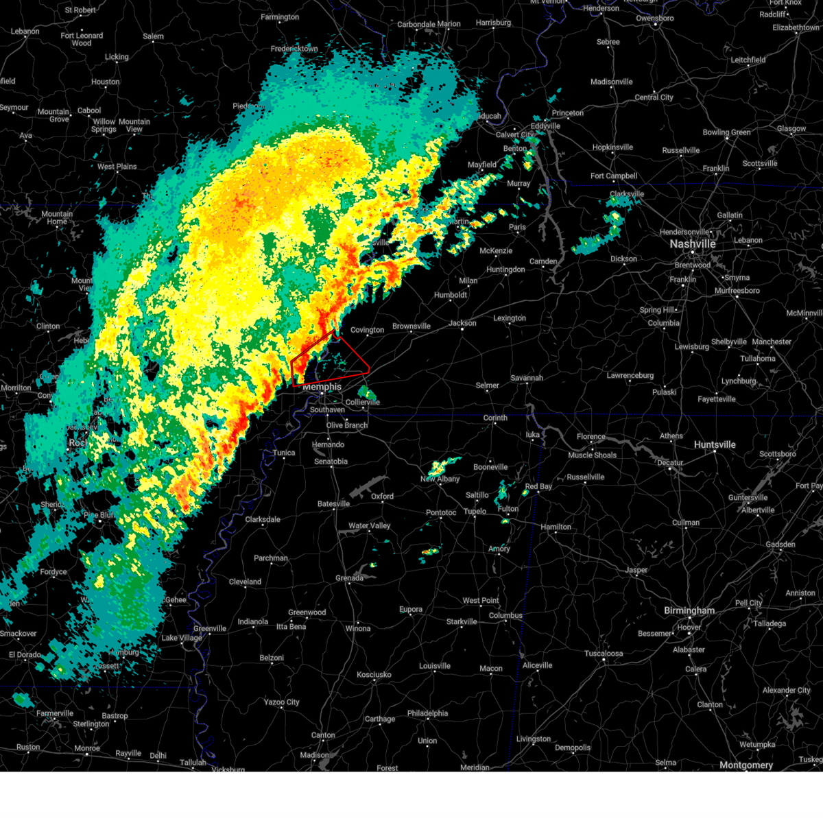 the tornado warning has been cancelled and is no longer in effect the tornado warning has been cancelled and is no longer in effect
|
| 2/15/2025 5:46 PM CST |
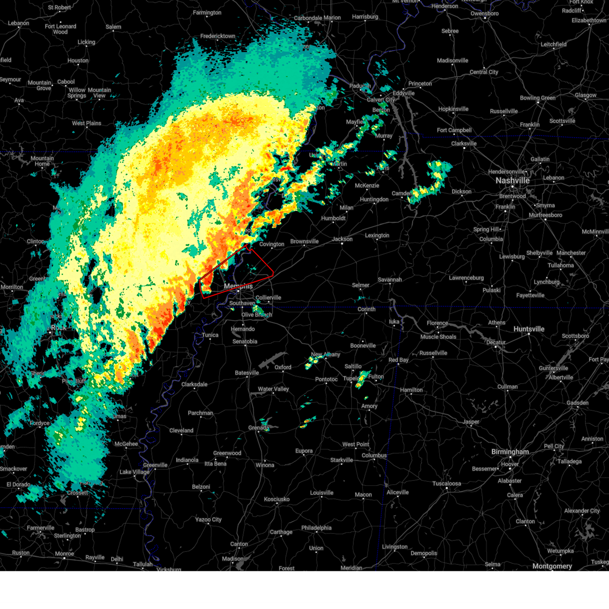 Tormeg the national weather service in memphis has issued a * tornado warning for, northeastern st. francis county in eastern arkansas, south central mississippi county in eastern arkansas, northern crittenden county in eastern arkansas, southwestern tipton county in west tennessee, northern shelby county in west tennessee, * until 630 pm cst. * at 546 pm cst, a severe thunderstorm capable of producing a tornado was located near crawfordsville, or near earle, moving northeast at 60 mph (radar indicated rotation). Hazards include tornado. Flying debris will be dangerous to those caught without shelter. mobile homes will be damaged or destroyed. damage to roofs, windows, and vehicles will occur. Tree damage is likely. Tormeg the national weather service in memphis has issued a * tornado warning for, northeastern st. francis county in eastern arkansas, south central mississippi county in eastern arkansas, northern crittenden county in eastern arkansas, southwestern tipton county in west tennessee, northern shelby county in west tennessee, * until 630 pm cst. * at 546 pm cst, a severe thunderstorm capable of producing a tornado was located near crawfordsville, or near earle, moving northeast at 60 mph (radar indicated rotation). Hazards include tornado. Flying debris will be dangerous to those caught without shelter. mobile homes will be damaged or destroyed. damage to roofs, windows, and vehicles will occur. Tree damage is likely.
|
| 8/30/2024 6:39 PM CDT | Tree down on roadway at intersection of country club lane and southern ave. another tree down on roadway at intersection of south parkway and cooper stree in shelby county TN, 5.4 miles ENE of Memphis, TN |
| 8/30/2024 6:38 PM CDT |
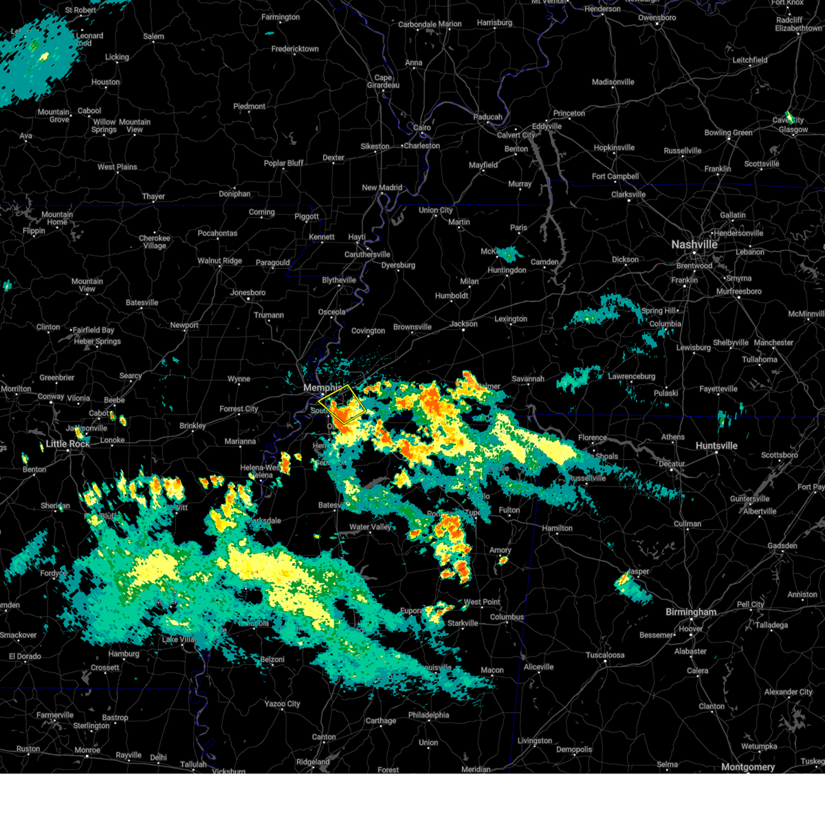 The storm which prompted the warning has weakened below severe limits, and no longer poses an immediate threat to life or property. therefore, the warning will be allowed to expire. however, small hail, gusty winds and heavy rain are still possible with this thunderstorm. The storm which prompted the warning has weakened below severe limits, and no longer poses an immediate threat to life or property. therefore, the warning will be allowed to expire. however, small hail, gusty winds and heavy rain are still possible with this thunderstorm.
|
| 8/30/2024 6:22 PM CDT |
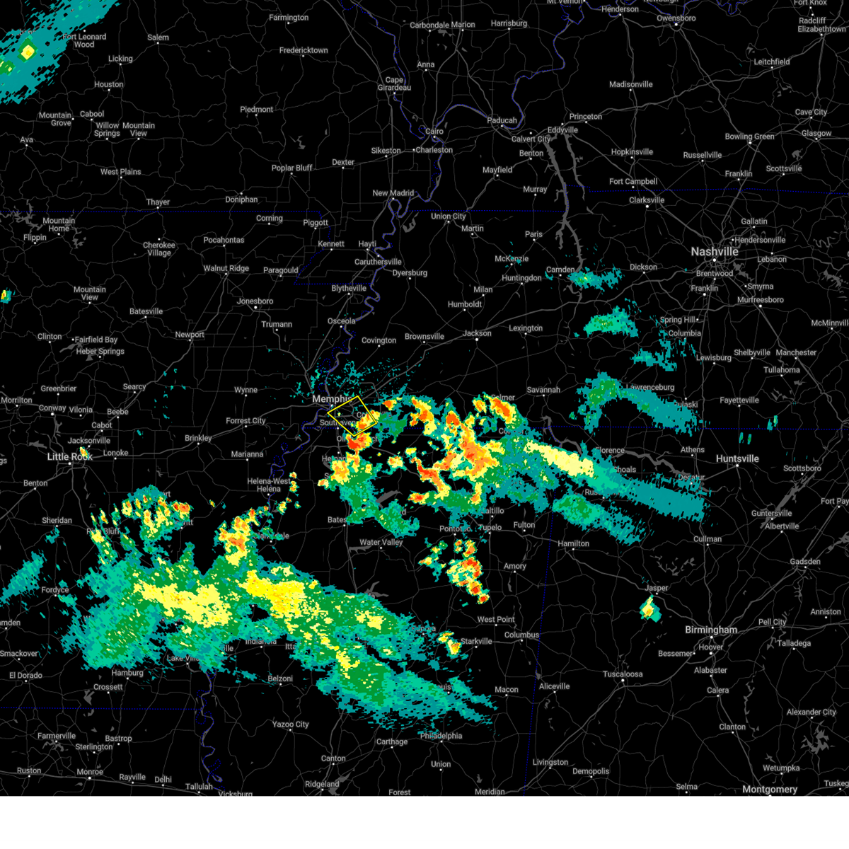 At 621 pm cdt, a severe thunderstorm was located near olive branch, moving northwest at 5 mph (radar indicated). Hazards include 60 mph wind gusts and quarter size hail. Hail damage to vehicles is expected. expect wind damage to roofs, siding, and trees. Locations impacted include, bartlett, collierville, germantown, olive branch, cordova, memphis, southeast memphis, midtown memphis, elmore park, capleville, parkway village, and white station. At 621 pm cdt, a severe thunderstorm was located near olive branch, moving northwest at 5 mph (radar indicated). Hazards include 60 mph wind gusts and quarter size hail. Hail damage to vehicles is expected. expect wind damage to roofs, siding, and trees. Locations impacted include, bartlett, collierville, germantown, olive branch, cordova, memphis, southeast memphis, midtown memphis, elmore park, capleville, parkway village, and white station.
|
| 8/30/2024 5:59 PM CDT |
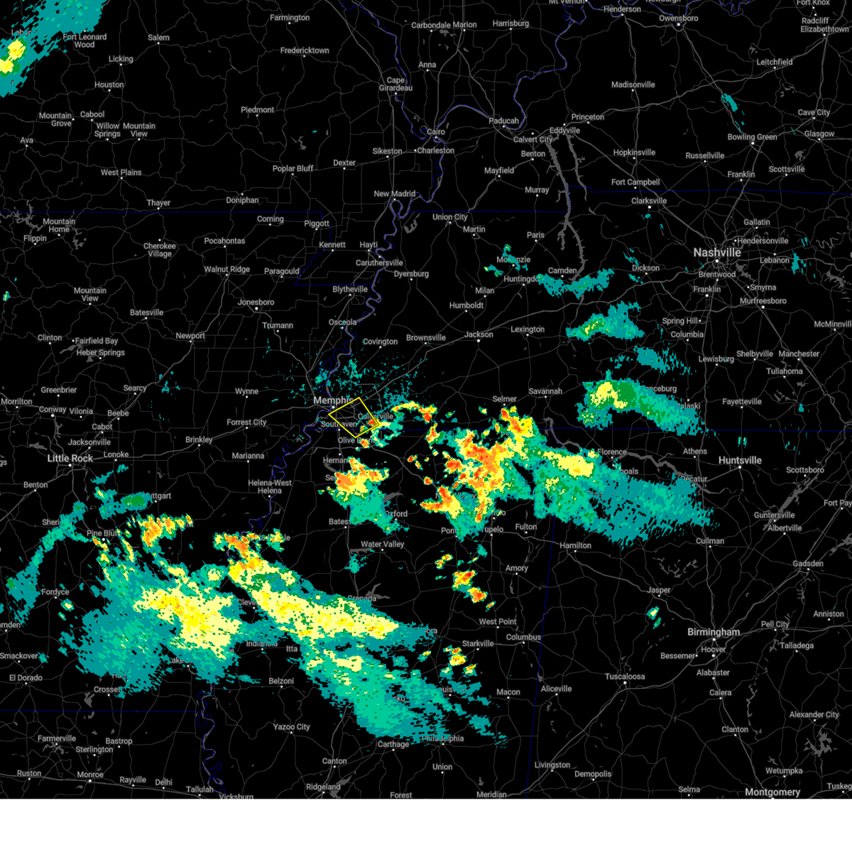 Svrmeg the national weather service in memphis has issued a * severe thunderstorm warning for, northern desoto county in northwestern mississippi, southeastern shelby county in west tennessee, * until 645 pm cdt. * at 559 pm cdt, a severe thunderstorm was located near olive branch, moving northwest at 5 mph (radar indicated). Hazards include 60 mph wind gusts and quarter size hail. Hail damage to vehicles is expected. Expect wind damage to roofs, siding, and trees. Svrmeg the national weather service in memphis has issued a * severe thunderstorm warning for, northern desoto county in northwestern mississippi, southeastern shelby county in west tennessee, * until 645 pm cdt. * at 559 pm cdt, a severe thunderstorm was located near olive branch, moving northwest at 5 mph (radar indicated). Hazards include 60 mph wind gusts and quarter size hail. Hail damage to vehicles is expected. Expect wind damage to roofs, siding, and trees.
|
| 8/17/2024 3:16 AM CDT |
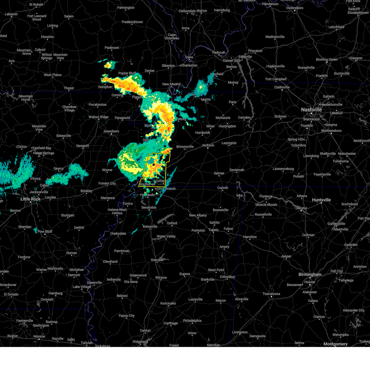 the severe thunderstorm warning has been cancelled and is no longer in effect the severe thunderstorm warning has been cancelled and is no longer in effect
|
| 8/17/2024 3:06 AM CDT |
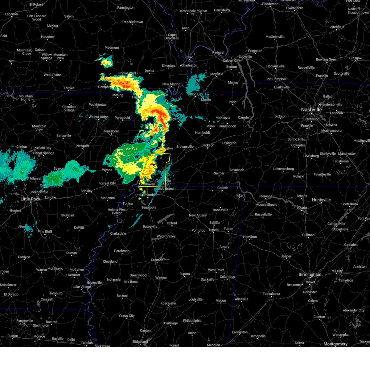 the severe thunderstorm warning has been cancelled and is no longer in effect the severe thunderstorm warning has been cancelled and is no longer in effect
|
| 8/17/2024 3:06 AM CDT |
 At 305 am cdt, a severe thunderstorm was located over millington, moving east at 30 mph (radar indicated). Hazards include 60 mph wind gusts and quarter size hail. Hail damage to vehicles is expected. expect wind damage to roofs, siding, and trees. Locations impacted include, bartlett, collierville, germantown, olive branch, millington, t o fuller state park, cordova, memphis, lakeland, arlington, munford, brighton, southwest memphis, ellendale, whitehaven, frayser, midtown memphis, dixonville, southeast memphis, and downtown memphis. At 305 am cdt, a severe thunderstorm was located over millington, moving east at 30 mph (radar indicated). Hazards include 60 mph wind gusts and quarter size hail. Hail damage to vehicles is expected. expect wind damage to roofs, siding, and trees. Locations impacted include, bartlett, collierville, germantown, olive branch, millington, t o fuller state park, cordova, memphis, lakeland, arlington, munford, brighton, southwest memphis, ellendale, whitehaven, frayser, midtown memphis, dixonville, southeast memphis, and downtown memphis.
|
| 8/17/2024 2:40 AM CDT |
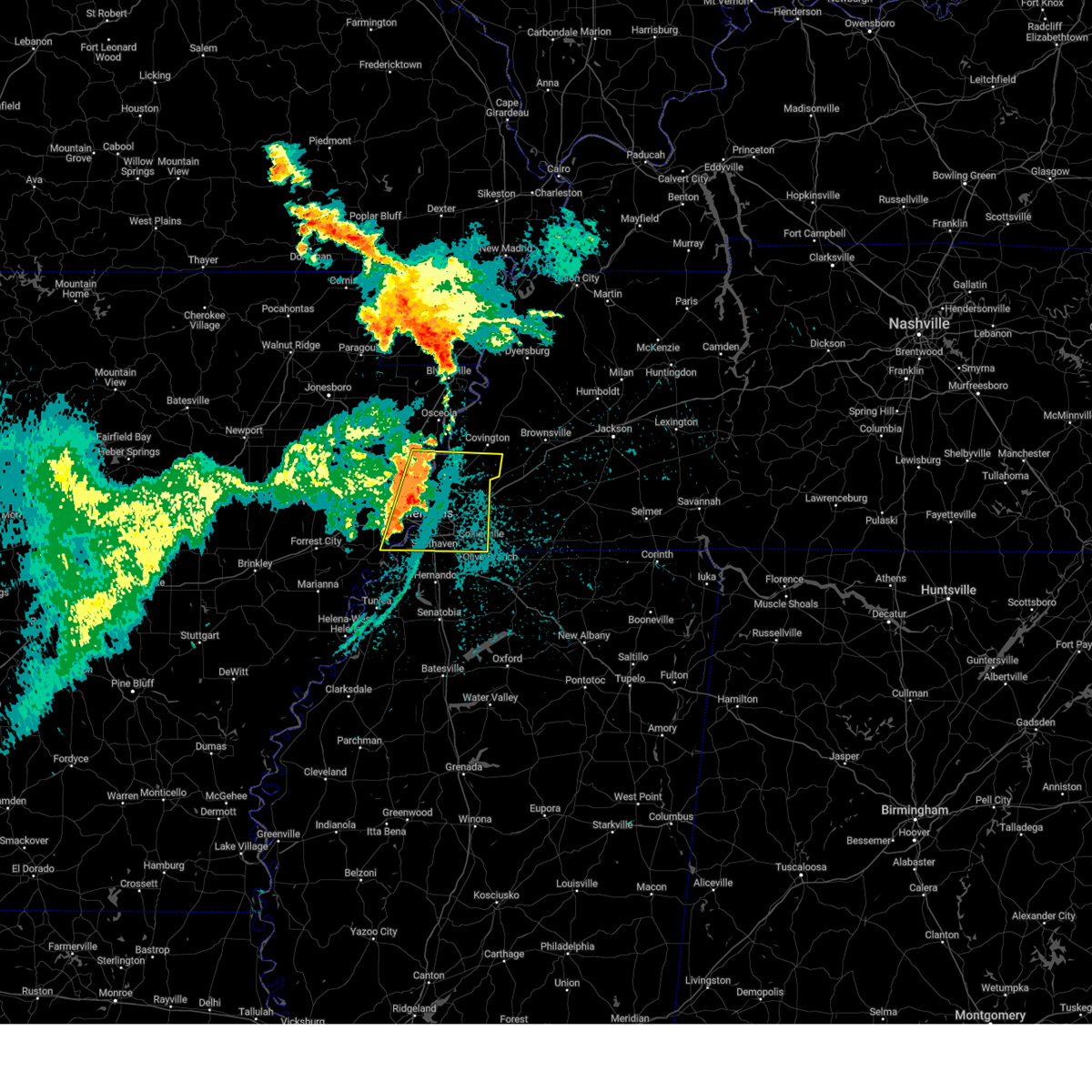 Svrmeg the national weather service in memphis has issued a * severe thunderstorm warning for, southwestern mississippi county in eastern arkansas, northeastern crittenden county in eastern arkansas, southern tipton county in west tennessee, shelby county in west tennessee, * until 330 am cdt. * at 240 am cdt, a severe thunderstorm was located over meeman shelby forest state park, moving east at 30 mph (radar indicated). Hazards include 60 mph wind gusts and quarter size hail. Hail damage to vehicles is expected. Expect wind damage to roofs, siding, and trees. Svrmeg the national weather service in memphis has issued a * severe thunderstorm warning for, southwestern mississippi county in eastern arkansas, northeastern crittenden county in eastern arkansas, southern tipton county in west tennessee, shelby county in west tennessee, * until 330 am cdt. * at 240 am cdt, a severe thunderstorm was located over meeman shelby forest state park, moving east at 30 mph (radar indicated). Hazards include 60 mph wind gusts and quarter size hail. Hail damage to vehicles is expected. Expect wind damage to roofs, siding, and trees.
|
| 7/8/2024 1:50 PM CDT |
 The storm which prompted the warning has weakened below severe limits, and has exited the warned area. therefore, the warning will be allowed to expire. The storm which prompted the warning has weakened below severe limits, and has exited the warned area. therefore, the warning will be allowed to expire.
|
| 7/8/2024 1:40 PM CDT |
 At 139 pm cdt, a severe thunderstorm was located over arlington, or 11 miles east of bartlett, moving northeast at 20 mph (radar indicated). Hazards include 60 mph wind gusts and quarter size hail. Hail damage to vehicles is expected. expect wind damage to roofs, siding, and trees. Locations impacted include, arlington, somerville, warren, oakland, mason, gallaway, braden, belmont, canaan grove, longtown, lambert, gainesville, hickory withe, griffen, and powers. At 139 pm cdt, a severe thunderstorm was located over arlington, or 11 miles east of bartlett, moving northeast at 20 mph (radar indicated). Hazards include 60 mph wind gusts and quarter size hail. Hail damage to vehicles is expected. expect wind damage to roofs, siding, and trees. Locations impacted include, arlington, somerville, warren, oakland, mason, gallaway, braden, belmont, canaan grove, longtown, lambert, gainesville, hickory withe, griffen, and powers.
|
| 7/8/2024 1:31 PM CDT |
 At 131 pm cdt, a severe thunderstorm was located over arlington, or 9 miles east of bartlett, moving northeast at 20 mph (trained weather spotters). Hazards include ping pong ball size hail and 60 mph wind gusts. People and animals outdoors will be injured. expect hail damage to roofs, siding, windows, and vehicles. expect wind damage to roofs, siding, and trees. Locations impacted include, lakeland, arlington, somerville, eads, warren, oakland, mason, gallaway, braden, belmont, canaan grove, longtown, lambert, gainesville, hickory withe, bolton, griffen, and powers. At 131 pm cdt, a severe thunderstorm was located over arlington, or 9 miles east of bartlett, moving northeast at 20 mph (trained weather spotters). Hazards include ping pong ball size hail and 60 mph wind gusts. People and animals outdoors will be injured. expect hail damage to roofs, siding, windows, and vehicles. expect wind damage to roofs, siding, and trees. Locations impacted include, lakeland, arlington, somerville, eads, warren, oakland, mason, gallaway, braden, belmont, canaan grove, longtown, lambert, gainesville, hickory withe, bolton, griffen, and powers.
|
| 7/8/2024 1:27 PM CDT |
 At 127 pm cdt, a severe thunderstorm was located over arlington, or 8 miles east of bartlett, moving northeast at 20 mph (trained weather spotters). Hazards include 60 mph wind gusts and half dollar size hail. Hail damage to vehicles is expected. expect wind damage to roofs, siding, and trees. Locations impacted include, lakeland, arlington, somerville, eads, warren, oakland, mason, gallaway, braden, brunswick, belmont, canaan grove, longtown, lambert, gainesville, hickory withe, bolton, griffen, and powers. At 127 pm cdt, a severe thunderstorm was located over arlington, or 8 miles east of bartlett, moving northeast at 20 mph (trained weather spotters). Hazards include 60 mph wind gusts and half dollar size hail. Hail damage to vehicles is expected. expect wind damage to roofs, siding, and trees. Locations impacted include, lakeland, arlington, somerville, eads, warren, oakland, mason, gallaway, braden, brunswick, belmont, canaan grove, longtown, lambert, gainesville, hickory withe, bolton, griffen, and powers.
|
| 7/8/2024 1:21 PM CDT |
 Svrmeg the national weather service in memphis has issued a * severe thunderstorm warning for, southeastern tipton county in west tennessee, northwestern fayette county in west tennessee, northeastern shelby county in west tennessee, * until 200 pm cdt. * at 121 pm cdt, a severe thunderstorm was located over lakeland, or near bartlett, moving northeast at 20 mph (radar indicated). Hazards include 60 mph wind gusts and quarter size hail. Hail damage to vehicles is expected. Expect wind damage to roofs, siding, and trees. Svrmeg the national weather service in memphis has issued a * severe thunderstorm warning for, southeastern tipton county in west tennessee, northwestern fayette county in west tennessee, northeastern shelby county in west tennessee, * until 200 pm cdt. * at 121 pm cdt, a severe thunderstorm was located over lakeland, or near bartlett, moving northeast at 20 mph (radar indicated). Hazards include 60 mph wind gusts and quarter size hail. Hail damage to vehicles is expected. Expect wind damage to roofs, siding, and trees.
|
| 5/27/2024 12:40 AM CDT |
 the severe thunderstorm warning has been cancelled and is no longer in effect the severe thunderstorm warning has been cancelled and is no longer in effect
|
| 5/27/2024 12:40 AM CDT |
 At 1239 am cdt, a severe thunderstorm was located near somerville, or 19 miles south of brownsville, moving east at 45 mph (radar indicated). Hazards include 60 mph wind gusts and nickel size hail. Expect damage to roofs, siding, and trees. Locations impacted include, whiteville, somerville, dancyville, warren, macon, oakland, mason, gallaway, moscow, williston, braden, la grange, asbury, yum yum, belmont, hickory point, taylor chapel, hickory withe, pattersonville, and meux corner. At 1239 am cdt, a severe thunderstorm was located near somerville, or 19 miles south of brownsville, moving east at 45 mph (radar indicated). Hazards include 60 mph wind gusts and nickel size hail. Expect damage to roofs, siding, and trees. Locations impacted include, whiteville, somerville, dancyville, warren, macon, oakland, mason, gallaway, moscow, williston, braden, la grange, asbury, yum yum, belmont, hickory point, taylor chapel, hickory withe, pattersonville, and meux corner.
|
| 5/27/2024 12:25 AM CDT | Several trees were blown down near the intersection of poplar avenue and galloway in east memphis. time approximate based on rada in shelby county TN, 3.8 miles ENE of Memphis, TN |
| 5/27/2024 12:21 AM CDT |
 Svrmeg the national weather service in memphis has issued a * severe thunderstorm warning for, southeastern tipton county in west tennessee, fayette county in west tennessee, northwestern hardeman county in west tennessee, southern haywood county in west tennessee, northeastern shelby county in west tennessee, * until 100 am cdt. * at 1221 am cdt, a severe thunderstorm was located near arlington, or 14 miles northeast of bartlett, moving east at 45 mph (radar indicated). Hazards include 60 mph wind gusts and nickel size hail. expect damage to roofs, siding, and trees Svrmeg the national weather service in memphis has issued a * severe thunderstorm warning for, southeastern tipton county in west tennessee, fayette county in west tennessee, northwestern hardeman county in west tennessee, southern haywood county in west tennessee, northeastern shelby county in west tennessee, * until 100 am cdt. * at 1221 am cdt, a severe thunderstorm was located near arlington, or 14 miles northeast of bartlett, moving east at 45 mph (radar indicated). Hazards include 60 mph wind gusts and nickel size hail. expect damage to roofs, siding, and trees
|
| 5/27/2024 12:14 AM CDT |
 At 1213 am cdt, a severe thunderstorm was located near millington, moving east at 45 mph (radar indicated). Hazards include 60 mph wind gusts and quarter size hail. Hail damage to vehicles is expected. expect wind damage to roofs, siding, and trees. Locations impacted include, bartlett, marion, millington, meeman shelby forest state park, memphis, lakeland, arlington, munford, crawfordsville, sunset, gilmore, jericho, ellendale, frayser, dixonville, eads, tipton, atoka, turrell, and clarkedale. At 1213 am cdt, a severe thunderstorm was located near millington, moving east at 45 mph (radar indicated). Hazards include 60 mph wind gusts and quarter size hail. Hail damage to vehicles is expected. expect wind damage to roofs, siding, and trees. Locations impacted include, bartlett, marion, millington, meeman shelby forest state park, memphis, lakeland, arlington, munford, crawfordsville, sunset, gilmore, jericho, ellendale, frayser, dixonville, eads, tipton, atoka, turrell, and clarkedale.
|
| 5/27/2024 12:05 AM CDT |
 Svrmeg the national weather service in memphis has issued a * severe thunderstorm warning for, northeastern st. francis county in eastern arkansas, central crittenden county in eastern arkansas, northern desoto county in northwestern mississippi, west central fayette county in west tennessee, southern shelby county in west tennessee, * until 1245 am cdt. * at 1205 am cdt, a severe thunderstorm was located near west memphis, moving east at 45 mph (radar indicated). Hazards include 60 mph wind gusts and nickel size hail. expect damage to roofs, siding, and trees Svrmeg the national weather service in memphis has issued a * severe thunderstorm warning for, northeastern st. francis county in eastern arkansas, central crittenden county in eastern arkansas, northern desoto county in northwestern mississippi, west central fayette county in west tennessee, southern shelby county in west tennessee, * until 1245 am cdt. * at 1205 am cdt, a severe thunderstorm was located near west memphis, moving east at 45 mph (radar indicated). Hazards include 60 mph wind gusts and nickel size hail. expect damage to roofs, siding, and trees
|
| 5/26/2024 11:40 PM CDT |
 Svrmeg the national weather service in memphis has issued a * severe thunderstorm warning for, northeastern crittenden county in eastern arkansas, southwestern tipton county in west tennessee, northern shelby county in west tennessee, * until 1230 am cdt. * at 1140 pm cdt, a severe thunderstorm was located near jericho, or 8 miles west of meeman shelby forest state park, moving east at 40 mph (radar indicated). Hazards include ping pong ball size hail and 60 mph wind gusts. People and animals outdoors will be injured. expect hail damage to roofs, siding, windows, and vehicles. Expect wind damage to roofs, siding, and trees. Svrmeg the national weather service in memphis has issued a * severe thunderstorm warning for, northeastern crittenden county in eastern arkansas, southwestern tipton county in west tennessee, northern shelby county in west tennessee, * until 1230 am cdt. * at 1140 pm cdt, a severe thunderstorm was located near jericho, or 8 miles west of meeman shelby forest state park, moving east at 40 mph (radar indicated). Hazards include ping pong ball size hail and 60 mph wind gusts. People and animals outdoors will be injured. expect hail damage to roofs, siding, windows, and vehicles. Expect wind damage to roofs, siding, and trees.
|
| 5/24/2024 5:12 PM CDT |
 Svrmeg the national weather service in memphis has issued a * severe thunderstorm warning for, south central crittenden county in eastern arkansas, northwestern desoto county in northwestern mississippi, * until 600 pm cdt. * at 511 pm cdt, a severe thunderstorm was located over pinckney, or 9 miles east of hughes, moving southeast at 10 mph (radar indicated). Hazards include 60 mph wind gusts and quarter size hail. Hail damage to vehicles is expected. Expect wind damage to roofs, siding, and trees. Svrmeg the national weather service in memphis has issued a * severe thunderstorm warning for, south central crittenden county in eastern arkansas, northwestern desoto county in northwestern mississippi, * until 600 pm cdt. * at 511 pm cdt, a severe thunderstorm was located over pinckney, or 9 miles east of hughes, moving southeast at 10 mph (radar indicated). Hazards include 60 mph wind gusts and quarter size hail. Hail damage to vehicles is expected. Expect wind damage to roofs, siding, and trees.
|
| 5/24/2024 4:52 PM CDT |
 At 452 pm cdt, a severe thunderstorm was located over pinckney, or 9 miles east of hughes, moving east at 15 mph (radar indicated). Hazards include 60 mph wind gusts and quarter size hail. Hail damage to vehicles is expected. expect wind damage to roofs, siding, and trees. Locations impacted include, southaven, west memphis, horn lake, hernando, t o fuller state park, memphis, walls, horseshoe lake, anthonyville, pinckney, lake cormorant, southwest memphis, lynchburg, simsboro, whitehaven, newport, kate, louise, nesbit, and presidents island. At 452 pm cdt, a severe thunderstorm was located over pinckney, or 9 miles east of hughes, moving east at 15 mph (radar indicated). Hazards include 60 mph wind gusts and quarter size hail. Hail damage to vehicles is expected. expect wind damage to roofs, siding, and trees. Locations impacted include, southaven, west memphis, horn lake, hernando, t o fuller state park, memphis, walls, horseshoe lake, anthonyville, pinckney, lake cormorant, southwest memphis, lynchburg, simsboro, whitehaven, newport, kate, louise, nesbit, and presidents island.
|
| 5/24/2024 4:32 PM CDT |
 Svrmeg the national weather service in memphis has issued a * severe thunderstorm warning for, east central st. francis county in eastern arkansas, southern crittenden county in eastern arkansas, northwestern desoto county in northwestern mississippi, southwestern shelby county in west tennessee, * until 515 pm cdt. * at 432 pm cdt, a severe thunderstorm was located over simsboro, or near hughes, moving east at 20 mph (radar indicated). Hazards include 60 mph wind gusts and quarter size hail. Hail damage to vehicles is expected. Expect wind damage to roofs, siding, and trees. Svrmeg the national weather service in memphis has issued a * severe thunderstorm warning for, east central st. francis county in eastern arkansas, southern crittenden county in eastern arkansas, northwestern desoto county in northwestern mississippi, southwestern shelby county in west tennessee, * until 515 pm cdt. * at 432 pm cdt, a severe thunderstorm was located over simsboro, or near hughes, moving east at 20 mph (radar indicated). Hazards include 60 mph wind gusts and quarter size hail. Hail damage to vehicles is expected. Expect wind damage to roofs, siding, and trees.
|
| 5/22/2024 2:59 PM CDT |
 At 259 pm cdt, severe thunderstorms were located along a line extending from near fairview to near mercer to 8 miles south of somerville, moving northeast at 45 mph (radar indicated). Hazards include 70 mph wind gusts and quarter size hail. Hail damage to vehicles is expected. expect considerable tree damage. wind damage is also likely to mobile homes, roofs, and outbuildings. Locations impacted include, jackson, henderson, bolivar, chickasaw state forest, chickasaw state park, whiteville, somerville, three way, silerton, blue goose, hillville, bemis, lagrange, dancyville, cloverport, mercer, warren, carroll, macon, and oakland. At 259 pm cdt, severe thunderstorms were located along a line extending from near fairview to near mercer to 8 miles south of somerville, moving northeast at 45 mph (radar indicated). Hazards include 70 mph wind gusts and quarter size hail. Hail damage to vehicles is expected. expect considerable tree damage. wind damage is also likely to mobile homes, roofs, and outbuildings. Locations impacted include, jackson, henderson, bolivar, chickasaw state forest, chickasaw state park, whiteville, somerville, three way, silerton, blue goose, hillville, bemis, lagrange, dancyville, cloverport, mercer, warren, carroll, macon, and oakland.
|
| 5/22/2024 2:53 PM CDT |
 The storm which prompted the warning has moved out of the area. therefore, the warning will be allowed to expire. a severe thunderstorm watch remains in effect until 700 pm cdt for west tennessee. The storm which prompted the warning has moved out of the area. therefore, the warning will be allowed to expire. a severe thunderstorm watch remains in effect until 700 pm cdt for west tennessee.
|
| 5/22/2024 2:52 PM CDT |
 At 252 pm cdt, severe thunderstorms were located along a line extending from near bells to near whiteville to 8 miles northeast of collierville, moving east at 40 mph (radar indicated). Hazards include 60 mph wind gusts and quarter size hail. Hail damage to vehicles is expected. expect wind damage to roofs, siding, and trees. Locations impacted include, jackson, henderson, bolivar, chickasaw state forest, chickasaw state park, whiteville, somerville, three way, silerton, blue goose, hillville, bemis, lagrange, dancyville, cloverport, mercer, warren, carroll, macon, and oakland. At 252 pm cdt, severe thunderstorms were located along a line extending from near bells to near whiteville to 8 miles northeast of collierville, moving east at 40 mph (radar indicated). Hazards include 60 mph wind gusts and quarter size hail. Hail damage to vehicles is expected. expect wind damage to roofs, siding, and trees. Locations impacted include, jackson, henderson, bolivar, chickasaw state forest, chickasaw state park, whiteville, somerville, three way, silerton, blue goose, hillville, bemis, lagrange, dancyville, cloverport, mercer, warren, carroll, macon, and oakland.
|
| 5/22/2024 2:52 PM CDT |
 the severe thunderstorm warning has been cancelled and is no longer in effect the severe thunderstorm warning has been cancelled and is no longer in effect
|
| 5/22/2024 2:48 PM CDT |
 Svrmeg the national weather service in memphis has issued a * severe thunderstorm warning for, northwestern henderson county in west tennessee, fayette county in west tennessee, northwestern hardeman county in west tennessee, southwestern carroll county in west tennessee, southeastern haywood county in west tennessee, madison county in west tennessee, southeastern shelby county in west tennessee, northwestern chester county in west tennessee, * until 330 pm cdt. * at 248 pm cdt, severe thunderstorms were located along a line extending from holly grove to near dancyville to near collierville, moving east at 30 mph (radar indicated). Hazards include 60 mph wind gusts and quarter size hail. Hail damage to vehicles is expected. Expect wind damage to roofs, siding, and trees. Svrmeg the national weather service in memphis has issued a * severe thunderstorm warning for, northwestern henderson county in west tennessee, fayette county in west tennessee, northwestern hardeman county in west tennessee, southwestern carroll county in west tennessee, southeastern haywood county in west tennessee, madison county in west tennessee, southeastern shelby county in west tennessee, northwestern chester county in west tennessee, * until 330 pm cdt. * at 248 pm cdt, severe thunderstorms were located along a line extending from holly grove to near dancyville to near collierville, moving east at 30 mph (radar indicated). Hazards include 60 mph wind gusts and quarter size hail. Hail damage to vehicles is expected. Expect wind damage to roofs, siding, and trees.
|
| 5/22/2024 2:35 PM CDT |
 At 234 pm cdt, a severe thunderstorm was located over cordova, moving east at 35 mph (trained weather spotters. at 224 pm cdt, quarter-sized hail was reported in midtown memphis). Hazards include 60 mph wind gusts and quarter size hail. Hail damage to vehicles is expected. expect wind damage to roofs, siding, and trees. Locations impacted include, bartlett, collierville, germantown, millington, cordova, memphis, lakeland, arlington, ellendale, southeast memphis, eads, frayser, midtown memphis, piperton, lenow, woodstock, rosemark, elmore park, brunswick, and fisherville. At 234 pm cdt, a severe thunderstorm was located over cordova, moving east at 35 mph (trained weather spotters. at 224 pm cdt, quarter-sized hail was reported in midtown memphis). Hazards include 60 mph wind gusts and quarter size hail. Hail damage to vehicles is expected. expect wind damage to roofs, siding, and trees. Locations impacted include, bartlett, collierville, germantown, millington, cordova, memphis, lakeland, arlington, ellendale, southeast memphis, eads, frayser, midtown memphis, piperton, lenow, woodstock, rosemark, elmore park, brunswick, and fisherville.
|
| 5/22/2024 2:29 PM CDT |
 the severe thunderstorm warning has been cancelled and is no longer in effect the severe thunderstorm warning has been cancelled and is no longer in effect
|
| 5/22/2024 2:29 PM CDT |
 At 229 pm cdt, a severe thunderstorm was located over cordova, moving east at 40 mph (radar indicated). Hazards include 60 mph wind gusts and quarter size hail. Hail damage to vehicles is expected. expect wind damage to roofs, siding, and trees. Locations impacted include, bartlett, collierville, germantown, millington, cordova, memphis, lakeland, arlington, ellendale, southeast memphis, eads, frayser, midtown memphis, piperton, lenow, woodstock, rosemark, elmore park, brunswick, and fisherville. At 229 pm cdt, a severe thunderstorm was located over cordova, moving east at 40 mph (radar indicated). Hazards include 60 mph wind gusts and quarter size hail. Hail damage to vehicles is expected. expect wind damage to roofs, siding, and trees. Locations impacted include, bartlett, collierville, germantown, millington, cordova, memphis, lakeland, arlington, ellendale, southeast memphis, eads, frayser, midtown memphis, piperton, lenow, woodstock, rosemark, elmore park, brunswick, and fisherville.
|
| 5/22/2024 2:24 PM CDT | Quarter sized hail reported 5.9 miles E of Memphis, TN |
| 5/22/2024 2:14 PM CDT |
 Svrmeg the national weather service in memphis has issued a * severe thunderstorm warning for, east central crittenden county in eastern arkansas, shelby county in west tennessee, * until 300 pm cdt. * at 214 pm cdt, a severe thunderstorm was located near midtown memphis, or 9 miles northeast of t o fuller state park, moving east at 30 mph (radar indicated). Hazards include 60 mph wind gusts and quarter size hail. Hail damage to vehicles is expected. Expect wind damage to roofs, siding, and trees. Svrmeg the national weather service in memphis has issued a * severe thunderstorm warning for, east central crittenden county in eastern arkansas, shelby county in west tennessee, * until 300 pm cdt. * at 214 pm cdt, a severe thunderstorm was located near midtown memphis, or 9 miles northeast of t o fuller state park, moving east at 30 mph (radar indicated). Hazards include 60 mph wind gusts and quarter size hail. Hail damage to vehicles is expected. Expect wind damage to roofs, siding, and trees.
|
| 5/22/2024 2:06 PM CDT |
 At 206 pm cdt, a severe thunderstorm was located 8 miles southeast of brighton, or 11 miles south of covington, moving east at 40 mph (radar indicated). Hazards include 60 mph wind gusts and penny size hail. Expect damage to roofs, siding, and trees. Locations impacted include, bartlett, millington, covington, lakeland, arlington, munford, brighton, ellendale, eads, tipton, warren, atoka, oakland, mason, gallaway, braden, lenow, barretville, egypt, and belmont. At 206 pm cdt, a severe thunderstorm was located 8 miles southeast of brighton, or 11 miles south of covington, moving east at 40 mph (radar indicated). Hazards include 60 mph wind gusts and penny size hail. Expect damage to roofs, siding, and trees. Locations impacted include, bartlett, millington, covington, lakeland, arlington, munford, brighton, ellendale, eads, tipton, warren, atoka, oakland, mason, gallaway, braden, lenow, barretville, egypt, and belmont.
|
| 5/22/2024 1:51 PM CDT |
 At 150 pm cdt, a severe thunderstorm was located near millington, moving east at 45 mph (radar indicated). Hazards include 60 mph wind gusts and quarter size hail. Hail damage to vehicles is expected. expect wind damage to roofs, siding, and trees. Locations impacted include, bartlett, millington, covington, memphis, lakeland, arlington, munford, brighton, ellendale, frayser, dixonville, eads, tipton, warren, atoka, oakland, mason, gallaway, braden, and belmont. At 150 pm cdt, a severe thunderstorm was located near millington, moving east at 45 mph (radar indicated). Hazards include 60 mph wind gusts and quarter size hail. Hail damage to vehicles is expected. expect wind damage to roofs, siding, and trees. Locations impacted include, bartlett, millington, covington, memphis, lakeland, arlington, munford, brighton, ellendale, frayser, dixonville, eads, tipton, warren, atoka, oakland, mason, gallaway, braden, and belmont.
|
| 5/22/2024 1:34 PM CDT |
 the severe thunderstorm warning has been cancelled and is no longer in effect the severe thunderstorm warning has been cancelled and is no longer in effect
|
| 5/22/2024 1:34 PM CDT |
 At 133 pm cdt, a severe thunderstorm was located over meeman shelby forest state park, moving east at 35 mph (radar indicated). Hazards include 70 mph wind gusts and quarter size hail. Hail damage to vehicles is expected. expect considerable tree damage. wind damage is also likely to mobile homes, roofs, and outbuildings. Locations impacted include, west memphis, marion, wilson, tyronza, meeman shelby forest state park, memphis, joiner, sunset, gilmore, bassett, jericho, frayser, turrell, clarkedale, birdsong, dimple, booker, deckerville, evadale, and menesha. At 133 pm cdt, a severe thunderstorm was located over meeman shelby forest state park, moving east at 35 mph (radar indicated). Hazards include 70 mph wind gusts and quarter size hail. Hail damage to vehicles is expected. expect considerable tree damage. wind damage is also likely to mobile homes, roofs, and outbuildings. Locations impacted include, west memphis, marion, wilson, tyronza, meeman shelby forest state park, memphis, joiner, sunset, gilmore, bassett, jericho, frayser, turrell, clarkedale, birdsong, dimple, booker, deckerville, evadale, and menesha.
|
| 5/22/2024 1:28 PM CDT |
 Svrmeg the national weather service in memphis has issued a * severe thunderstorm warning for, southern tipton county in west tennessee, northwestern fayette county in west tennessee, northeastern shelby county in west tennessee, * until 215 pm cdt. * at 128 pm cdt, a severe thunderstorm was located over meeman shelby forest state park, moving east at 40 mph (radar indicated). Hazards include 60 mph wind gusts and quarter size hail. Hail damage to vehicles is expected. Expect wind damage to roofs, siding, and trees. Svrmeg the national weather service in memphis has issued a * severe thunderstorm warning for, southern tipton county in west tennessee, northwestern fayette county in west tennessee, northeastern shelby county in west tennessee, * until 215 pm cdt. * at 128 pm cdt, a severe thunderstorm was located over meeman shelby forest state park, moving east at 40 mph (radar indicated). Hazards include 60 mph wind gusts and quarter size hail. Hail damage to vehicles is expected. Expect wind damage to roofs, siding, and trees.
|
| 5/22/2024 1:09 PM CDT |
 At 109 pm cdt, a severe thunderstorm was located near gilmore, or 10 miles northeast of earle, moving east at 40 mph (radar indicated). Hazards include 70 mph wind gusts and quarter size hail. Hail damage to vehicles is expected. expect considerable tree damage. wind damage is also likely to mobile homes, roofs, and outbuildings. Locations impacted include, west memphis, marion, earle, parkin, wilson, tyronza, meeman shelby forest state park, memphis, joiner, crawfordsville, sunset, gilmore, bassett, jericho, jennette, frayser, turrell, clarkedale, birdsong, and three forks. At 109 pm cdt, a severe thunderstorm was located near gilmore, or 10 miles northeast of earle, moving east at 40 mph (radar indicated). Hazards include 70 mph wind gusts and quarter size hail. Hail damage to vehicles is expected. expect considerable tree damage. wind damage is also likely to mobile homes, roofs, and outbuildings. Locations impacted include, west memphis, marion, earle, parkin, wilson, tyronza, meeman shelby forest state park, memphis, joiner, crawfordsville, sunset, gilmore, bassett, jericho, jennette, frayser, turrell, clarkedale, birdsong, and three forks.
|
| 5/22/2024 12:53 PM CDT |
 Svrmeg the national weather service in memphis has issued a * severe thunderstorm warning for, southeastern poinsett county in eastern arkansas, southwestern mississippi county in eastern arkansas, crittenden county in eastern arkansas, eastern cross county in eastern arkansas, southwestern tipton county in west tennessee, northwestern shelby county in west tennessee, * until 145 pm cdt. * at 1253 pm cdt, a severe thunderstorm was located over parkin, moving east at 35 mph (radar indicated). Hazards include 60 mph wind gusts and quarter size hail. Hail damage to vehicles is expected. Expect wind damage to roofs, siding, and trees. Svrmeg the national weather service in memphis has issued a * severe thunderstorm warning for, southeastern poinsett county in eastern arkansas, southwestern mississippi county in eastern arkansas, crittenden county in eastern arkansas, eastern cross county in eastern arkansas, southwestern tipton county in west tennessee, northwestern shelby county in west tennessee, * until 145 pm cdt. * at 1253 pm cdt, a severe thunderstorm was located over parkin, moving east at 35 mph (radar indicated). Hazards include 60 mph wind gusts and quarter size hail. Hail damage to vehicles is expected. Expect wind damage to roofs, siding, and trees.
|
| 5/22/2024 12:31 PM CDT |
 At 1231 pm cdt, a severe thunderstorm was located 8 miles northeast of arlington, or 16 miles south of covington, moving northeast at 30 mph (radar indicated. at 1220 pm cdt, penny sized hail was reported on the north side of bartlett). Hazards include 60 mph wind gusts and quarter size hail. Hail damage to vehicles is expected. expect wind damage to roofs, siding, and trees. Locations impacted include, bartlett, millington, memphis, lakeland, arlington, ellendale, oakland, mason, gallaway, braden, brunswick, barretville, longtown, redwood, rosemark, lambert, spring lake, gainesville, hickory withe, and bolton. At 1231 pm cdt, a severe thunderstorm was located 8 miles northeast of arlington, or 16 miles south of covington, moving northeast at 30 mph (radar indicated. at 1220 pm cdt, penny sized hail was reported on the north side of bartlett). Hazards include 60 mph wind gusts and quarter size hail. Hail damage to vehicles is expected. expect wind damage to roofs, siding, and trees. Locations impacted include, bartlett, millington, memphis, lakeland, arlington, ellendale, oakland, mason, gallaway, braden, brunswick, barretville, longtown, redwood, rosemark, lambert, spring lake, gainesville, hickory withe, and bolton.
|
| 5/22/2024 12:26 PM CDT |
 The warning will be allowed to expire. however, hail and gusty winds are still possible with this thunderstorm. a severe thunderstorm watch remains in effect until 700 pm cdt for west tennessee. remember, a severe thunderstorm warning still remains in effect for northern shelby, northwest fayette, and southeast tipton counties. The warning will be allowed to expire. however, hail and gusty winds are still possible with this thunderstorm. a severe thunderstorm watch remains in effect until 700 pm cdt for west tennessee. remember, a severe thunderstorm warning still remains in effect for northern shelby, northwest fayette, and southeast tipton counties.
|
| 5/22/2024 12:24 PM CDT | Quarter sized hail reported 7.7 miles S of Memphis, TN |
| 5/22/2024 12:19 PM CDT |
 At 1219 pm cdt, a severe thunderstorm was located near arlington, or 11 miles northeast of bartlett, moving east at 20 mph (radar indicated). Hazards include ping pong ball size hail and 60 mph wind gusts. People and animals outdoors will be injured. expect hail damage to roofs, siding, windows, and vehicles. expect wind damage to roofs, siding, and trees. Locations impacted include, bartlett, millington, memphis, lakeland, arlington, ellendale, eads, frayser, warren, oakland, mason, gallaway, braden, barretville, woodstock, redwood, rosemark, hickory withe, elmore park, and brunswick. At 1219 pm cdt, a severe thunderstorm was located near arlington, or 11 miles northeast of bartlett, moving east at 20 mph (radar indicated). Hazards include ping pong ball size hail and 60 mph wind gusts. People and animals outdoors will be injured. expect hail damage to roofs, siding, windows, and vehicles. expect wind damage to roofs, siding, and trees. Locations impacted include, bartlett, millington, memphis, lakeland, arlington, ellendale, eads, frayser, warren, oakland, mason, gallaway, braden, barretville, woodstock, redwood, rosemark, hickory withe, elmore park, and brunswick.
|
| 5/22/2024 12:12 PM CDT |
 Svrmeg the national weather service in memphis has issued a * severe thunderstorm warning for, southeastern tipton county in west tennessee, northwestern fayette county in west tennessee, northeastern shelby county in west tennessee, * until 100 pm cdt. * at 1212 pm cdt, a severe thunderstorm was located over frayser, or near bartlett, moving northeast at 30 mph (radar indicated). Hazards include 60 mph wind gusts and quarter size hail. Hail damage to vehicles is expected. Expect wind damage to roofs, siding, and trees. Svrmeg the national weather service in memphis has issued a * severe thunderstorm warning for, southeastern tipton county in west tennessee, northwestern fayette county in west tennessee, northeastern shelby county in west tennessee, * until 100 pm cdt. * at 1212 pm cdt, a severe thunderstorm was located over frayser, or near bartlett, moving northeast at 30 mph (radar indicated). Hazards include 60 mph wind gusts and quarter size hail. Hail damage to vehicles is expected. Expect wind damage to roofs, siding, and trees.
|
| 5/22/2024 12:07 PM CDT |
 At 1207 pm cdt, a severe thunderstorm was located near arlington, or 8 miles east of millington, moving east at 35 mph. a second storm is located near frayser, also moving east-northeast at 35 mph (radar indicated). Hazards include 60 mph wind gusts and quarter size hail. Hail damage to vehicles is expected. expect wind damage to roofs, siding, and trees. Locations impacted include, bartlett, millington, covington, memphis, munford, brighton, tipton, atoka, mason, gallaway, braden, barretville, griffin corner, redwood, rosemark, idaville, sloanville, canaan grove, gainesville, and clopton. At 1207 pm cdt, a severe thunderstorm was located near arlington, or 8 miles east of millington, moving east at 35 mph. a second storm is located near frayser, also moving east-northeast at 35 mph (radar indicated). Hazards include 60 mph wind gusts and quarter size hail. Hail damage to vehicles is expected. expect wind damage to roofs, siding, and trees. Locations impacted include, bartlett, millington, covington, memphis, munford, brighton, tipton, atoka, mason, gallaway, braden, barretville, griffin corner, redwood, rosemark, idaville, sloanville, canaan grove, gainesville, and clopton.
|
| 5/22/2024 11:50 AM CDT |
 Svrmeg the national weather service in memphis has issued a * severe thunderstorm warning for, eastern tipton county in west tennessee, northwestern fayette county in west tennessee, northeastern shelby county in west tennessee, * until 1230 pm cdt. * at 1150 am cdt, a severe thunderstorm was located over millington, moving northeast at 30 mph (radar indicated). Hazards include 60 mph wind gusts and quarter size hail. Hail damage to vehicles is expected. Expect wind damage to roofs, siding, and trees. Svrmeg the national weather service in memphis has issued a * severe thunderstorm warning for, eastern tipton county in west tennessee, northwestern fayette county in west tennessee, northeastern shelby county in west tennessee, * until 1230 pm cdt. * at 1150 am cdt, a severe thunderstorm was located over millington, moving northeast at 30 mph (radar indicated). Hazards include 60 mph wind gusts and quarter size hail. Hail damage to vehicles is expected. Expect wind damage to roofs, siding, and trees.
|
| 5/18/2024 5:07 AM CDT |
 The storm which prompted the warning has weakened below severe limits, and no longer poses an immediate threat to life or property. therefore, the warning will be allowed to expire. The storm which prompted the warning has weakened below severe limits, and no longer poses an immediate threat to life or property. therefore, the warning will be allowed to expire.
|
| 5/18/2024 4:51 AM CDT |
 the severe thunderstorm warning has been cancelled and is no longer in effect the severe thunderstorm warning has been cancelled and is no longer in effect
|
| 5/18/2024 4:51 AM CDT |
 At 450 am cdt, a severe thunderstorm was located over jennette, or 9 miles south of earle, moving northeast at 15 mph (radar indicated). Hazards include 60 mph wind gusts and nickel size hail. Expect damage to roofs, siding, and trees. Locations impacted include, west memphis, marion, crawfordsville, edmondson, jennette, crittenden, browns, louise, jonquil, brice, cunningham corner, amanea, tarsus, wyandoke, neuhardt, shearerville, riceville, vincent, proctor, and ebony. At 450 am cdt, a severe thunderstorm was located over jennette, or 9 miles south of earle, moving northeast at 15 mph (radar indicated). Hazards include 60 mph wind gusts and nickel size hail. Expect damage to roofs, siding, and trees. Locations impacted include, west memphis, marion, crawfordsville, edmondson, jennette, crittenden, browns, louise, jonquil, brice, cunningham corner, amanea, tarsus, wyandoke, neuhardt, shearerville, riceville, vincent, proctor, and ebony.
|
| 5/18/2024 4:36 AM CDT |
 Svrmeg the national weather service in memphis has issued a * severe thunderstorm warning for, northeastern st. francis county in eastern arkansas, northwestern crittenden county in eastern arkansas, southeastern cross county in eastern arkansas, * until 515 am cdt. * at 435 am cdt, a severe thunderstorm was located near new home, or 10 miles north of hughes, moving northeast at 15 mph (radar indicated). Hazards include 60 mph wind gusts and quarter size hail. Hail damage to vehicles is expected. Expect wind damage to roofs, siding, and trees. Svrmeg the national weather service in memphis has issued a * severe thunderstorm warning for, northeastern st. francis county in eastern arkansas, northwestern crittenden county in eastern arkansas, southeastern cross county in eastern arkansas, * until 515 am cdt. * at 435 am cdt, a severe thunderstorm was located near new home, or 10 miles north of hughes, moving northeast at 15 mph (radar indicated). Hazards include 60 mph wind gusts and quarter size hail. Hail damage to vehicles is expected. Expect wind damage to roofs, siding, and trees.
|
| 5/9/2024 4:40 AM CDT |
 Svrmeg the national weather service in memphis has issued a * severe thunderstorm warning for, northwestern marshall county in northwestern mississippi, northwestern benton county in northeastern mississippi, southern fayette county in west tennessee, southeastern shelby county in west tennessee, * until 530 am cdt. * at 440 am cdt, a severe thunderstorm was located over collierville, moving east at 40 mph (radar indicated). Hazards include 60 mph wind gusts and quarter size hail. Hail damage to vehicles is expected. Expect wind damage to roofs, siding, and trees. Svrmeg the national weather service in memphis has issued a * severe thunderstorm warning for, northwestern marshall county in northwestern mississippi, northwestern benton county in northeastern mississippi, southern fayette county in west tennessee, southeastern shelby county in west tennessee, * until 530 am cdt. * at 440 am cdt, a severe thunderstorm was located over collierville, moving east at 40 mph (radar indicated). Hazards include 60 mph wind gusts and quarter size hail. Hail damage to vehicles is expected. Expect wind damage to roofs, siding, and trees.
|
| 5/9/2024 4:25 AM CDT |
 The storm which prompted the warning has weakened below severe limits, and no longer poses an immediate threat to life or property. therefore, the warning will be allowed to expire. however, small hail and gusty winds are still possible with this thunderstorm. The storm which prompted the warning has weakened below severe limits, and no longer poses an immediate threat to life or property. therefore, the warning will be allowed to expire. however, small hail and gusty winds are still possible with this thunderstorm.
|
| 5/9/2024 4:14 AM CDT |
 At 414 am cdt, a severe thunderstorm was located over whitehaven, or near horn lake, moving east at 45 mph (radar indicated). Hazards include 60 mph wind gusts and quarter size hail. Hail damage to vehicles is expected. expect wind damage to roofs, siding, and trees. Locations impacted include, southaven, germantown, olive branch, horn lake, hernando, cordova, memphis, southwest memphis, lynchburg, southeast memphis, downtown memphis, lewisburg, whitehaven, midtown memphis, cedarview, nesbit, handy corner, capleville, jago, and alden. At 414 am cdt, a severe thunderstorm was located over whitehaven, or near horn lake, moving east at 45 mph (radar indicated). Hazards include 60 mph wind gusts and quarter size hail. Hail damage to vehicles is expected. expect wind damage to roofs, siding, and trees. Locations impacted include, southaven, germantown, olive branch, horn lake, hernando, cordova, memphis, southwest memphis, lynchburg, southeast memphis, downtown memphis, lewisburg, whitehaven, midtown memphis, cedarview, nesbit, handy corner, capleville, jago, and alden.
|
| 5/9/2024 4:14 AM CDT |
 the severe thunderstorm warning has been cancelled and is no longer in effect the severe thunderstorm warning has been cancelled and is no longer in effect
|
| 5/9/2024 4:00 AM CDT |
 At 359 am cdt, a severe thunderstorm was located near pinckney, or near t o fuller state park, moving east at 45 mph (radar indicated). Hazards include 60 mph wind gusts and quarter size hail. Hail damage to vehicles is expected. expect wind damage to roofs, siding, and trees. Locations impacted include, southaven, germantown, olive branch, west memphis, horn lake, hernando, hughes, t o fuller state park, cordova, memphis, walls, edmondson, horseshoe lake, anthonyville, lake cormorant, southwest memphis, simsboro, lewisburg, whitehaven, and midtown memphis. At 359 am cdt, a severe thunderstorm was located near pinckney, or near t o fuller state park, moving east at 45 mph (radar indicated). Hazards include 60 mph wind gusts and quarter size hail. Hail damage to vehicles is expected. expect wind damage to roofs, siding, and trees. Locations impacted include, southaven, germantown, olive branch, west memphis, horn lake, hernando, hughes, t o fuller state park, cordova, memphis, walls, edmondson, horseshoe lake, anthonyville, lake cormorant, southwest memphis, simsboro, lewisburg, whitehaven, and midtown memphis.
|
| 5/9/2024 3:44 AM CDT |
 Svrmeg the national weather service in memphis has issued a * severe thunderstorm warning for, eastern st. francis county in eastern arkansas, southern crittenden county in eastern arkansas, northern desoto county in northwestern mississippi, southern shelby county in west tennessee, * until 430 am cdt. * at 344 am cdt, a severe thunderstorm was located over simsboro, or near hughes, moving east at 45 mph (radar indicated). Hazards include 60 mph wind gusts and quarter size hail. Hail damage to vehicles is expected. Expect wind damage to roofs, siding, and trees. Svrmeg the national weather service in memphis has issued a * severe thunderstorm warning for, eastern st. francis county in eastern arkansas, southern crittenden county in eastern arkansas, northern desoto county in northwestern mississippi, southern shelby county in west tennessee, * until 430 am cdt. * at 344 am cdt, a severe thunderstorm was located over simsboro, or near hughes, moving east at 45 mph (radar indicated). Hazards include 60 mph wind gusts and quarter size hail. Hail damage to vehicles is expected. Expect wind damage to roofs, siding, and trees.
|
| 5/9/2024 1:48 AM CDT |
 The storms which prompted the warning have weakened below severe limits, and no longer pose an immediate threat to life or property. therefore, the warning has been allowed to expire. a tornado watch remains in effect until 300 am cdt for northeastern mississippi, and west tennessee. The storms which prompted the warning have weakened below severe limits, and no longer pose an immediate threat to life or property. therefore, the warning has been allowed to expire. a tornado watch remains in effect until 300 am cdt for northeastern mississippi, and west tennessee.
|
| 5/9/2024 1:31 AM CDT |
 At 131 am cdt, severe thunderstorms were located along a line extending from near belle eagle to 6 miles northeast of somerville to near mt pleasant, moving east at 50 mph (radar indicated). Hazards include 70 mph wind gusts. Expect considerable tree damage. damage is likely to mobile homes, roofs, and outbuildings. Locations impacted include, bartlett, collierville, germantown, brownsville, millington, cordova, memphis, lakeland, arlington, whiteville, somerville, bells, ellendale, hillville, lagrange, belle eagle, holly grove, southeast memphis, eads, and dancyville. At 131 am cdt, severe thunderstorms were located along a line extending from near belle eagle to 6 miles northeast of somerville to near mt pleasant, moving east at 50 mph (radar indicated). Hazards include 70 mph wind gusts. Expect considerable tree damage. damage is likely to mobile homes, roofs, and outbuildings. Locations impacted include, bartlett, collierville, germantown, brownsville, millington, cordova, memphis, lakeland, arlington, whiteville, somerville, bells, ellendale, hillville, lagrange, belle eagle, holly grove, southeast memphis, eads, and dancyville.
|
| 5/9/2024 1:31 AM CDT |
 the severe thunderstorm warning has been cancelled and is no longer in effect the severe thunderstorm warning has been cancelled and is no longer in effect
|
| 5/9/2024 1:09 AM CDT |
 At 109 am cdt, a severe thunderstorm was located over frayser, or 7 miles southwest of bartlett, moving east at 55 mph (radar indicated). Hazards include 60 mph wind gusts. Expect damage to roofs, siding, and trees. Locations impacted include, bartlett, collierville, germantown, west memphis, marion, millington, covington, wilson, t o fuller state park, meeman shelby forest state park, cordova, memphis, lakeland, arlington, munford, brighton, joiner, edmondson, sunset, and gilmore. At 109 am cdt, a severe thunderstorm was located over frayser, or 7 miles southwest of bartlett, moving east at 55 mph (radar indicated). Hazards include 60 mph wind gusts. Expect damage to roofs, siding, and trees. Locations impacted include, bartlett, collierville, germantown, west memphis, marion, millington, covington, wilson, t o fuller state park, meeman shelby forest state park, cordova, memphis, lakeland, arlington, munford, brighton, joiner, edmondson, sunset, and gilmore.
|
| 5/9/2024 1:06 AM CDT |
 Svrmeg the national weather service in memphis has issued a * severe thunderstorm warning for, southwestern crockett county in west tennessee, tipton county in west tennessee, fayette county in west tennessee, western hardeman county in west tennessee, southern lauderdale county in west tennessee, haywood county in west tennessee, eastern shelby county in west tennessee, * until 145 am cdt. * at 105 am cdt, severe thunderstorms were located along a line extending from near ft pillow to arlington to near southaven, moving east at 50 mph (radar indicated). Hazards include 70 mph wind gusts. Expect considerable tree damage. Damage is likely to mobile homes, roofs, and outbuildings. Svrmeg the national weather service in memphis has issued a * severe thunderstorm warning for, southwestern crockett county in west tennessee, tipton county in west tennessee, fayette county in west tennessee, western hardeman county in west tennessee, southern lauderdale county in west tennessee, haywood county in west tennessee, eastern shelby county in west tennessee, * until 145 am cdt. * at 105 am cdt, severe thunderstorms were located along a line extending from near ft pillow to arlington to near southaven, moving east at 50 mph (radar indicated). Hazards include 70 mph wind gusts. Expect considerable tree damage. Damage is likely to mobile homes, roofs, and outbuildings.
|
| 5/9/2024 12:46 AM CDT |
 Svrmeg the national weather service in memphis has issued a * severe thunderstorm warning for, southwestern mississippi county in eastern arkansas, northeastern crittenden county in eastern arkansas, tipton county in west tennessee, western fayette county in west tennessee, shelby county in west tennessee, * until 130 am cdt. * at 1246 am cdt, a severe thunderstorm was located near millington, moving east at 55 mph (radar indicated). Hazards include 60 mph wind gusts. expect damage to roofs, siding, and trees Svrmeg the national weather service in memphis has issued a * severe thunderstorm warning for, southwestern mississippi county in eastern arkansas, northeastern crittenden county in eastern arkansas, tipton county in west tennessee, western fayette county in west tennessee, shelby county in west tennessee, * until 130 am cdt. * at 1246 am cdt, a severe thunderstorm was located near millington, moving east at 55 mph (radar indicated). Hazards include 60 mph wind gusts. expect damage to roofs, siding, and trees
|
| 5/9/2024 12:35 AM CDT |
 At 1234 am cdt, a severe thunderstorm was located near meeman shelby forest state park, moving east at 65 mph (radar indicated). Hazards include 70 mph wind gusts. Expect considerable tree damage. damage is likely to mobile homes, roofs, and outbuildings. Locations impacted include, bartlett, germantown, west memphis, marion, millington, earle, parkin, t o fuller state park, meeman shelby forest state park, memphis, munford, crawfordsville, edmondson, sunset, gilmore, jericho, jennette, dixonville, southeast memphis, and ellendale. At 1234 am cdt, a severe thunderstorm was located near meeman shelby forest state park, moving east at 65 mph (radar indicated). Hazards include 70 mph wind gusts. Expect considerable tree damage. damage is likely to mobile homes, roofs, and outbuildings. Locations impacted include, bartlett, germantown, west memphis, marion, millington, earle, parkin, t o fuller state park, meeman shelby forest state park, memphis, munford, crawfordsville, edmondson, sunset, gilmore, jericho, jennette, dixonville, southeast memphis, and ellendale.
|
| 5/9/2024 12:15 AM CDT |
 Svrmeg the national weather service in memphis has issued a * severe thunderstorm warning for, northeastern st. francis county in eastern arkansas, southeastern poinsett county in eastern arkansas, southwestern mississippi county in eastern arkansas, crittenden county in eastern arkansas, eastern cross county in eastern arkansas, southwestern tipton county in west tennessee, central shelby county in west tennessee, * until 100 am cdt. * at 1214 am cdt, a severe thunderstorm was located near earle, moving east at 55 mph (radar indicated). Hazards include 70 mph wind gusts. Expect considerable tree damage. Damage is likely to mobile homes, roofs, and outbuildings. Svrmeg the national weather service in memphis has issued a * severe thunderstorm warning for, northeastern st. francis county in eastern arkansas, southeastern poinsett county in eastern arkansas, southwestern mississippi county in eastern arkansas, crittenden county in eastern arkansas, eastern cross county in eastern arkansas, southwestern tipton county in west tennessee, central shelby county in west tennessee, * until 100 am cdt. * at 1214 am cdt, a severe thunderstorm was located near earle, moving east at 55 mph (radar indicated). Hazards include 70 mph wind gusts. Expect considerable tree damage. Damage is likely to mobile homes, roofs, and outbuildings.
|
| 4/7/2024 8:43 PM CDT |
 The storm which prompted the warning has moved out of the area. therefore, the warning will be allowed to expire. The storm which prompted the warning has moved out of the area. therefore, the warning will be allowed to expire.
|
| 4/7/2024 8:26 PM CDT |
 At 825 pm cdt, a severe thunderstorm was located over olive branch, moving east at 30 mph (radar indicated). Hazards include quarter size hail. Damage to vehicles is expected. Locations impacted include, southaven, olive branch, memphis, capleville, and plum point. At 825 pm cdt, a severe thunderstorm was located over olive branch, moving east at 30 mph (radar indicated). Hazards include quarter size hail. Damage to vehicles is expected. Locations impacted include, southaven, olive branch, memphis, capleville, and plum point.
|
| 4/7/2024 8:13 PM CDT |
 At 813 pm cdt, a severe thunderstorm was located over southaven, moving east at 30 mph (radar indicated). Hazards include 60 mph wind gusts and quarter size hail. Hail damage to vehicles is expected. expect wind damage to roofs, siding, and trees. Locations impacted include, southaven, olive branch, horn lake, memphis, whitehaven, capleville, jago, and plum point. At 813 pm cdt, a severe thunderstorm was located over southaven, moving east at 30 mph (radar indicated). Hazards include 60 mph wind gusts and quarter size hail. Hail damage to vehicles is expected. expect wind damage to roofs, siding, and trees. Locations impacted include, southaven, olive branch, horn lake, memphis, whitehaven, capleville, jago, and plum point.
|
| 4/7/2024 7:56 PM CDT |
 Svrmeg the national weather service in memphis has issued a * severe thunderstorm warning for, northern desoto county in northwestern mississippi, south central shelby county in west tennessee, * until 845 pm cdt. * at 756 pm cdt, a severe thunderstorm was located over walls, or near horn lake, moving east at 30 mph (radar indicated). Hazards include 60 mph wind gusts and quarter size hail. Hail damage to vehicles is expected. Expect wind damage to roofs, siding, and trees. Svrmeg the national weather service in memphis has issued a * severe thunderstorm warning for, northern desoto county in northwestern mississippi, south central shelby county in west tennessee, * until 845 pm cdt. * at 756 pm cdt, a severe thunderstorm was located over walls, or near horn lake, moving east at 30 mph (radar indicated). Hazards include 60 mph wind gusts and quarter size hail. Hail damage to vehicles is expected. Expect wind damage to roofs, siding, and trees.
|
| 4/7/2024 7:50 PM CDT |
 At 750 pm cdt, a severe thunderstorm was located over southeast memphis, or near germantown, moving east at 30 mph (radar indicated). Hazards include 60 mph wind gusts and quarter size hail. Hail damage to vehicles is expected. expect wind damage to roofs, siding, and trees. Locations impacted include, germantown, memphis, southeast memphis, parkway village, and white station. At 750 pm cdt, a severe thunderstorm was located over southeast memphis, or near germantown, moving east at 30 mph (radar indicated). Hazards include 60 mph wind gusts and quarter size hail. Hail damage to vehicles is expected. expect wind damage to roofs, siding, and trees. Locations impacted include, germantown, memphis, southeast memphis, parkway village, and white station.
|
| 4/7/2024 7:38 PM CDT |
 the severe thunderstorm warning has been cancelled and is no longer in effect the severe thunderstorm warning has been cancelled and is no longer in effect
|
| 4/7/2024 7:38 PM CDT |
 At 737 pm cdt, a severe thunderstorm was located over memphis, or near t o fuller state park, moving east at 30 mph (radar indicated). Hazards include 60 mph wind gusts and quarter size hail. Hail damage to vehicles is expected. expect wind damage to roofs, siding, and trees. Locations impacted include, germantown, memphis, southeast memphis, downtown memphis, southwest memphis, midtown memphis, parkway village, and white station. At 737 pm cdt, a severe thunderstorm was located over memphis, or near t o fuller state park, moving east at 30 mph (radar indicated). Hazards include 60 mph wind gusts and quarter size hail. Hail damage to vehicles is expected. expect wind damage to roofs, siding, and trees. Locations impacted include, germantown, memphis, southeast memphis, downtown memphis, southwest memphis, midtown memphis, parkway village, and white station.
|
| 4/7/2024 7:29 PM CDT |
 Svrmeg the national weather service in memphis has issued a * severe thunderstorm warning for, southeastern tipton county in west tennessee, northwestern fayette county in west tennessee, northeastern shelby county in west tennessee, * until 815 pm cdt. * at 729 pm cdt, a severe thunderstorm was located near millington, moving east at 35 mph (radar indicated). Hazards include 60 mph wind gusts. expect damage to roofs, siding, and trees Svrmeg the national weather service in memphis has issued a * severe thunderstorm warning for, southeastern tipton county in west tennessee, northwestern fayette county in west tennessee, northeastern shelby county in west tennessee, * until 815 pm cdt. * at 729 pm cdt, a severe thunderstorm was located near millington, moving east at 35 mph (radar indicated). Hazards include 60 mph wind gusts. expect damage to roofs, siding, and trees
|
| 4/7/2024 7:22 PM CDT |
 Svrmeg the national weather service in memphis has issued a * severe thunderstorm warning for, east central crittenden county in eastern arkansas, southwestern shelby county in west tennessee, * until 800 pm cdt. * at 722 pm cdt, a severe thunderstorm was located near t o fuller state park, moving east at 30 mph (radar indicated). Hazards include 60 mph wind gusts and quarter size hail. Hail damage to vehicles is expected. Expect wind damage to roofs, siding, and trees. Svrmeg the national weather service in memphis has issued a * severe thunderstorm warning for, east central crittenden county in eastern arkansas, southwestern shelby county in west tennessee, * until 800 pm cdt. * at 722 pm cdt, a severe thunderstorm was located near t o fuller state park, moving east at 30 mph (radar indicated). Hazards include 60 mph wind gusts and quarter size hail. Hail damage to vehicles is expected. Expect wind damage to roofs, siding, and trees.
|
| 4/2/2024 8:12 AM CDT |
 Svrmeg the national weather service in memphis has issued a * severe thunderstorm warning for, tipton county in west tennessee, western fayette county in west tennessee, southwestern lauderdale county in west tennessee, southwestern haywood county in west tennessee, northeastern shelby county in west tennessee, * until 900 am cdt. * at 812 am cdt, a severe thunderstorm was located near millington, moving northeast at 55 mph (radar indicated). Hazards include 60 mph wind gusts and penny size hail. expect damage to roofs, siding, and trees Svrmeg the national weather service in memphis has issued a * severe thunderstorm warning for, tipton county in west tennessee, western fayette county in west tennessee, southwestern lauderdale county in west tennessee, southwestern haywood county in west tennessee, northeastern shelby county in west tennessee, * until 900 am cdt. * at 812 am cdt, a severe thunderstorm was located near millington, moving northeast at 55 mph (radar indicated). Hazards include 60 mph wind gusts and penny size hail. expect damage to roofs, siding, and trees
|
| 4/2/2024 8:05 AM CDT | Quarter sized hail reported 4.2 miles S of Memphis, TN, tree down across road at sycamore view rd and main st. |
| 4/2/2024 8:05 AM CDT | Corrects previous hail report from 2 wsw bartlett. tree down across road at sycamore view rd and main s in shelby county TN, 4.2 miles S of Memphis, TN |
| 4/2/2024 7:58 AM CDT |
 At 758 am cdt, a severe thunderstorm was located near midtown memphis, or near bartlett, moving northeast at 70 mph (radar indicated). Hazards include 60 mph wind gusts and quarter size hail. Hail damage to vehicles is expected. expect wind damage to roofs, siding, and trees. Locations impacted include, bartlett, southaven, collierville, germantown, olive branch, west memphis, marion, millington, t o fuller state park, meeman shelby forest state park, cordova, memphis, lakeland, arlington, edmondson, sunset, southwest memphis, ellendale, whitehaven, and frayser. At 758 am cdt, a severe thunderstorm was located near midtown memphis, or near bartlett, moving northeast at 70 mph (radar indicated). Hazards include 60 mph wind gusts and quarter size hail. Hail damage to vehicles is expected. expect wind damage to roofs, siding, and trees. Locations impacted include, bartlett, southaven, collierville, germantown, olive branch, west memphis, marion, millington, t o fuller state park, meeman shelby forest state park, cordova, memphis, lakeland, arlington, edmondson, sunset, southwest memphis, ellendale, whitehaven, and frayser.
|
| 4/2/2024 7:58 AM CDT |
 the severe thunderstorm warning has been cancelled and is no longer in effect the severe thunderstorm warning has been cancelled and is no longer in effect
|
| 4/2/2024 7:46 AM CDT |
 the severe thunderstorm warning has been cancelled and is no longer in effect the severe thunderstorm warning has been cancelled and is no longer in effect
|
| 4/2/2024 7:46 AM CDT |
 At 746 am cdt, a severe thunderstorm was located over southwest memphis, or over t o fuller state park, moving northeast at 55 mph (radar indicated). Hazards include 60 mph wind gusts and quarter size hail. Hail damage to vehicles is expected. expect wind damage to roofs, siding, and trees. Locations impacted include, bartlett, southaven, collierville, germantown, olive branch, west memphis, horn lake, hernando, marion, millington, t o fuller state park, meeman shelby forest state park, cordova, memphis, lakeland, arlington, walls, edmondson, horseshoe lake, and sunset. At 746 am cdt, a severe thunderstorm was located over southwest memphis, or over t o fuller state park, moving northeast at 55 mph (radar indicated). Hazards include 60 mph wind gusts and quarter size hail. Hail damage to vehicles is expected. expect wind damage to roofs, siding, and trees. Locations impacted include, bartlett, southaven, collierville, germantown, olive branch, west memphis, horn lake, hernando, marion, millington, t o fuller state park, meeman shelby forest state park, cordova, memphis, lakeland, arlington, walls, edmondson, horseshoe lake, and sunset.
|
| 4/2/2024 7:29 AM CDT |
 Svrmeg the national weather service in memphis has issued a * severe thunderstorm warning for, northeastern lee county in eastern arkansas, southeastern st. francis county in eastern arkansas, southern crittenden county in eastern arkansas, northern desoto county in northwestern mississippi, northern tunica county in northwestern mississippi, shelby county in west tennessee, * until 815 am cdt. * at 729 am cdt, a severe thunderstorm was located over horseshoe lake, or 9 miles east of hughes, moving northeast at 70 mph (radar indicated). Hazards include 60 mph wind gusts and half dollar size hail. Hail damage to vehicles is expected. Expect wind damage to roofs, siding, and trees. Svrmeg the national weather service in memphis has issued a * severe thunderstorm warning for, northeastern lee county in eastern arkansas, southeastern st. francis county in eastern arkansas, southern crittenden county in eastern arkansas, northern desoto county in northwestern mississippi, northern tunica county in northwestern mississippi, shelby county in west tennessee, * until 815 am cdt. * at 729 am cdt, a severe thunderstorm was located over horseshoe lake, or 9 miles east of hughes, moving northeast at 70 mph (radar indicated). Hazards include 60 mph wind gusts and half dollar size hail. Hail damage to vehicles is expected. Expect wind damage to roofs, siding, and trees.
|
| 1/12/2024 7:39 AM CST |
 The severe thunderstorm warning for desoto, northeastern tunica, northwestern tate and eastern shelby counties will expire at 745 am cst, the storms which prompted the warning have weakened below severe limits, and no longer pose an immediate threat to life or property. therefore, the warning will be allowed to expire. however, gusty winds and heavy rain are still possible with these thunderstorms. a tornado watch remains in effect until 1100 am cst for northwestern mississippi, and west tennessee. The severe thunderstorm warning for desoto, northeastern tunica, northwestern tate and eastern shelby counties will expire at 745 am cst, the storms which prompted the warning have weakened below severe limits, and no longer pose an immediate threat to life or property. therefore, the warning will be allowed to expire. however, gusty winds and heavy rain are still possible with these thunderstorms. a tornado watch remains in effect until 1100 am cst for northwestern mississippi, and west tennessee.
|
| 1/12/2024 7:26 AM CST |
 The severe thunderstorm warning for eastern crittenden, northwestern desoto, southwestern tipton and central shelby counties will expire at 730 am cst, the storm which prompted the warning has moved out of the area. therefore, the warning will be allowed to expire. a tornado watch remains in effect until 1100 am cst for eastern arkansas, northwestern mississippi, and west tennessee. The severe thunderstorm warning for eastern crittenden, northwestern desoto, southwestern tipton and central shelby counties will expire at 730 am cst, the storm which prompted the warning has moved out of the area. therefore, the warning will be allowed to expire. a tornado watch remains in effect until 1100 am cst for eastern arkansas, northwestern mississippi, and west tennessee.
|
| 1/12/2024 7:19 AM CST |
 At 718 am cst, severe thunderstorms were located along a line extending from near meeman shelby forest state park to near little texas, moving northeast at 65 mph (radar indicated). Hazards include 60 mph wind gusts. Expect damage to roofs, siding, and trees. locations impacted include, bartlett, southaven, germantown, olive branch, horn lake, hernando, millington, cordova, memphis, lakeland, arlington, coldwater, walls, lake cormorant, ellendale, eudora, lewisburg, arkabutla, lynchburg, and phillipp. hail threat, radar indicated max hail size, <. 75 in wind threat, radar indicated max wind gust, 60 mph. At 718 am cst, severe thunderstorms were located along a line extending from near meeman shelby forest state park to near little texas, moving northeast at 65 mph (radar indicated). Hazards include 60 mph wind gusts. Expect damage to roofs, siding, and trees. locations impacted include, bartlett, southaven, germantown, olive branch, horn lake, hernando, millington, cordova, memphis, lakeland, arlington, coldwater, walls, lake cormorant, ellendale, eudora, lewisburg, arkabutla, lynchburg, and phillipp. hail threat, radar indicated max hail size, <. 75 in wind threat, radar indicated max wind gust, 60 mph.
|
| 1/12/2024 7:15 AM CST |
 At 714 am cst, a severe thunderstorm was located near sunset, or near marion, moving northeast at 55 mph (radar indicated). Hazards include 70 mph wind gusts. Expect considerable tree damage. damage is likely to mobile homes, roofs, and outbuildings. Locations impacted include, southaven, west memphis, marion, millington, t o fuller state park, meeman shelby forest state park, memphis, edmondson, sunset, jericho, southwest memphis, whitehaven, frayser, midtown memphis, pinckney, dixonville, downtown memphis, lynchburg, crittenden, and turrell. At 714 am cst, a severe thunderstorm was located near sunset, or near marion, moving northeast at 55 mph (radar indicated). Hazards include 70 mph wind gusts. Expect considerable tree damage. damage is likely to mobile homes, roofs, and outbuildings. Locations impacted include, southaven, west memphis, marion, millington, t o fuller state park, meeman shelby forest state park, memphis, edmondson, sunset, jericho, southwest memphis, whitehaven, frayser, midtown memphis, pinckney, dixonville, downtown memphis, lynchburg, crittenden, and turrell.
|
| 1/12/2024 6:56 AM CST |
 At 656 am cst, severe thunderstorms were located along a line extending from near jennette to near helena-west helena, moving northeast at 60 mph (radar indicated). Hazards include 60 mph wind gusts. expect damage to roofs, siding, and trees At 656 am cst, severe thunderstorms were located along a line extending from near jennette to near helena-west helena, moving northeast at 60 mph (radar indicated). Hazards include 60 mph wind gusts. expect damage to roofs, siding, and trees
|
| 1/12/2024 6:45 AM CST |
 At 644 am cst, a severe thunderstorm was located over new home, or 7 miles east of madison, moving northeast at 55 mph (radar indicated). Hazards include 70 mph wind gusts. Expect considerable tree damage. Damage is likely to mobile homes, roofs, and outbuildings. At 644 am cst, a severe thunderstorm was located over new home, or 7 miles east of madison, moving northeast at 55 mph (radar indicated). Hazards include 70 mph wind gusts. Expect considerable tree damage. Damage is likely to mobile homes, roofs, and outbuildings.
|
| 9/20/2023 4:28 PM CDT |
 At 427 pm cdt, a severe thunderstorm was located near millington, moving northeast at 20 mph (radar indicated). Hazards include 60 mph wind gusts. Expect damage to roofs, siding, and trees. locations impacted include, millington, memphis, dixonville, atoka, griffin corner, quito, wilkinsville, woodstock, cuba, locke, kerrville, lucy, and sloanville. hail threat, radar indicated max hail size, <. 75 in wind threat, radar indicated max wind gust, 60 mph. At 427 pm cdt, a severe thunderstorm was located near millington, moving northeast at 20 mph (radar indicated). Hazards include 60 mph wind gusts. Expect damage to roofs, siding, and trees. locations impacted include, millington, memphis, dixonville, atoka, griffin corner, quito, wilkinsville, woodstock, cuba, locke, kerrville, lucy, and sloanville. hail threat, radar indicated max hail size, <. 75 in wind threat, radar indicated max wind gust, 60 mph.
|
| 9/20/2023 4:13 PM CDT |
 At 413 pm cdt, a severe thunderstorm was located over frayser, or near meeman shelby forest state park, moving northeast at 20 mph (radar indicated). Hazards include 60 mph wind gusts. Expect damage to roofs, siding, and trees. locations impacted include, bartlett, millington, meeman shelby forest state park, memphis, frayser, dixonville, atoka, raleigh, griffin corner, quito, wilkinsville, woodstock, gilestown, spring lake, cuba, benjestown, locke, kerrville, bolton, and lucy. hail threat, radar indicated max hail size, <. 75 in wind threat, radar indicated max wind gust, 60 mph. At 413 pm cdt, a severe thunderstorm was located over frayser, or near meeman shelby forest state park, moving northeast at 20 mph (radar indicated). Hazards include 60 mph wind gusts. Expect damage to roofs, siding, and trees. locations impacted include, bartlett, millington, meeman shelby forest state park, memphis, frayser, dixonville, atoka, raleigh, griffin corner, quito, wilkinsville, woodstock, gilestown, spring lake, cuba, benjestown, locke, kerrville, bolton, and lucy. hail threat, radar indicated max hail size, <. 75 in wind threat, radar indicated max wind gust, 60 mph.
|
| 9/20/2023 4:03 PM CDT | Large tree down across island dr near the island park apartment comple in shelby county TN, 11.1 miles E of Memphis, TN |
| 9/20/2023 4:03 PM CDT |
 At 403 pm cdt, a severe thunderstorm was located near frayser, or 8 miles south of meeman shelby forest state park, moving northeast at 20 mph (radar indicated). Hazards include 60 mph wind gusts. expect damage to roofs, siding, and trees At 403 pm cdt, a severe thunderstorm was located near frayser, or 8 miles south of meeman shelby forest state park, moving northeast at 20 mph (radar indicated). Hazards include 60 mph wind gusts. expect damage to roofs, siding, and trees
|
| 9/5/2023 5:15 PM CDT | Ping Pong Ball sized hail reported 2.9 miles NNW of Memphis, TN, caller reported large hail up to ping-pong size lasting approximately 5 minutes resulting in small dents on their car. |
| 8/9/2023 11:27 PM CDT |
 The severe thunderstorm warning for eastern mississippi, northeastern crittenden, west central crockett, tipton, southern dyer, northwestern fayette, lauderdale, western haywood and northeastern shelby counties will expire at 1130 pm cdt, the storm which prompted the warning has weakened below severe limits, and no longer poses an immediate threat to life or property. therefore, the warning will be allowed to expire. however gusty winds and heavy rain are still possible with this thunderstorm. a tornado watch remains in effect until 400 am cdt for eastern arkansas, southeastern missouri, and west tennessee. The severe thunderstorm warning for eastern mississippi, northeastern crittenden, west central crockett, tipton, southern dyer, northwestern fayette, lauderdale, western haywood and northeastern shelby counties will expire at 1130 pm cdt, the storm which prompted the warning has weakened below severe limits, and no longer poses an immediate threat to life or property. therefore, the warning will be allowed to expire. however gusty winds and heavy rain are still possible with this thunderstorm. a tornado watch remains in effect until 400 am cdt for eastern arkansas, southeastern missouri, and west tennessee.
|
| 8/9/2023 11:08 PM CDT |
 At 1108 pm cdt, a severe thunderstorm was located over ripley, moving east at 55 mph (radar indicated). Hazards include 60 mph wind gusts and quarter size hail. Hail damage to vehicles is expected. expect wind damage to roofs, siding, and trees. Locations impacted include, bartlett, dyersburg, brownsville, millington, covington, ripley, meeman shelby forest state park, fort pillow state park, lakeland, arlington, munford, brighton, halls, chestnut bluff, bradleytown, dixonville, unionville, ashport, ft pillow and nutbush. At 1108 pm cdt, a severe thunderstorm was located over ripley, moving east at 55 mph (radar indicated). Hazards include 60 mph wind gusts and quarter size hail. Hail damage to vehicles is expected. expect wind damage to roofs, siding, and trees. Locations impacted include, bartlett, dyersburg, brownsville, millington, covington, ripley, meeman shelby forest state park, fort pillow state park, lakeland, arlington, munford, brighton, halls, chestnut bluff, bradleytown, dixonville, unionville, ashport, ft pillow and nutbush.
|
| 8/9/2023 10:51 PM CDT |
 At 1051 pm cdt, a severe thunderstorm was located near ashport, or near luxora, moving east at 50 mph (radar indicated). Hazards include 60 mph wind gusts. Expect damage to roofs, siding, and trees. Locations impacted include, bartlett, dyersburg, blytheville, brownsville, millington, covington, ripley, osceola, gosnell, luxora, wilson, keiser, meeman shelby forest state park, fort pillow state park, memphis, lakeland, arlington, munford, brighton and halls. At 1051 pm cdt, a severe thunderstorm was located near ashport, or near luxora, moving east at 50 mph (radar indicated). Hazards include 60 mph wind gusts. Expect damage to roofs, siding, and trees. Locations impacted include, bartlett, dyersburg, blytheville, brownsville, millington, covington, ripley, osceola, gosnell, luxora, wilson, keiser, meeman shelby forest state park, fort pillow state park, memphis, lakeland, arlington, munford, brighton and halls.
|
| 8/9/2023 10:45 PM CDT |
 At 1045 pm cdt, severe thunderstorms were located along a line extending from near cooter to near osceola to near dyess, moving east at 45 mph (radar indicated). Hazards include 60 mph wind gusts. expect damage to roofs, siding, and trees At 1045 pm cdt, severe thunderstorms were located along a line extending from near cooter to near osceola to near dyess, moving east at 45 mph (radar indicated). Hazards include 60 mph wind gusts. expect damage to roofs, siding, and trees
|
| 8/9/2023 1:15 PM CDT | Herrington creek was out of its banks and flooding nearby parking lot near stage r in shelby county TN, 4.9 miles S of Memphis, TN |
| 8/9/2023 11:47 AM CDT | Major tree damage in sherwood forest area of east memphi in shelby county TN, 5 miles ENE of Memphis, TN |
| 8/9/2023 11:45 AM CDT | Half Dollar sized hail reported 2.8 miles N of Memphis, TN, reported hail near walnut grove and white station. |
| 8/9/2023 11:40 AM CDT | Ping Pong Ball sized hail reported 1.5 miles ENE of Memphis, TN, corrects previous hail report from 3 nne southeast memphis. reported hail near walnut grove and white station. |
| 8/9/2023 11:40 AM CDT |
 At 1140 am cdt, a severe thunderstorm was located over cordova, moving northeast at 45 mph (radar indicated). Hazards include 60 mph wind gusts and quarter size hail. Hail damage to vehicles is expected. Expect wind damage to roofs, siding, and trees. At 1140 am cdt, a severe thunderstorm was located over cordova, moving northeast at 45 mph (radar indicated). Hazards include 60 mph wind gusts and quarter size hail. Hail damage to vehicles is expected. Expect wind damage to roofs, siding, and trees.
|
| 8/9/2023 11:36 AM CDT |
 The severe thunderstorm warning for northeastern desoto, southwestern fayette and southeastern shelby counties will expire at 1145 am cdt, the storm which prompted the warning has moved out of the area. therefore, the warning will be allowed to expire. The severe thunderstorm warning for northeastern desoto, southwestern fayette and southeastern shelby counties will expire at 1145 am cdt, the storm which prompted the warning has moved out of the area. therefore, the warning will be allowed to expire.
|
| 8/9/2023 11:36 AM CDT |
 At 1136 am cdt, a severe thunderstorm was located near cordova, moving northeast at 45 mph (radar indicated). Hazards include 60 mph wind gusts and quarter size hail. Hail damage to vehicles is expected. Expect wind damage to roofs, siding, and trees. At 1136 am cdt, a severe thunderstorm was located near cordova, moving northeast at 45 mph (radar indicated). Hazards include 60 mph wind gusts and quarter size hail. Hail damage to vehicles is expected. Expect wind damage to roofs, siding, and trees.
|
| 8/9/2023 11:30 AM CDT |
 At 1130 am cdt, a severe thunderstorm was located over germantown, moving east at 45 mph (radar indicated). Hazards include 60 mph wind gusts and quarter size hail. Hail damage to vehicles is expected. expect wind damage to roofs, siding, and trees. locations impacted include, bartlett, southaven, collierville, germantown, olive branch, cordova, memphis, lakeland, arlington, ellendale, southeast memphis, downtown memphis, eads, midtown memphis, piperton, gallaway, rossville, lenow, capleville and kirk. hail threat, radar indicated max hail size, 1. 00 in wind threat, radar indicated max wind gust, 60 mph. At 1130 am cdt, a severe thunderstorm was located over germantown, moving east at 45 mph (radar indicated). Hazards include 60 mph wind gusts and quarter size hail. Hail damage to vehicles is expected. expect wind damage to roofs, siding, and trees. locations impacted include, bartlett, southaven, collierville, germantown, olive branch, cordova, memphis, lakeland, arlington, ellendale, southeast memphis, downtown memphis, eads, midtown memphis, piperton, gallaway, rossville, lenow, capleville and kirk. hail threat, radar indicated max hail size, 1. 00 in wind threat, radar indicated max wind gust, 60 mph.
|
| 8/9/2023 11:27 AM CDT | Quarter sized hail reported 4.5 miles NE of Memphis, TN, quarter size hail reported at the university of memphis. |
| 8/9/2023 11:25 AM CDT | Corrects previous tstm wnd dmg report from 3 se midtown memphis. major tree damage in sherwood forest area of east memphis. microburst detected via rada in shelby county TN, 5 miles ENE of Memphis, TN |
| 8/9/2023 11:25 AM CDT | Quarter sized hail reported 6.7 miles NE of Memphis, TN, quarter size hail reported near lamar ave and i-240. |
| 8/9/2023 11:07 AM CDT |
 At 1106 am cdt, a severe thunderstorm was located over southwest memphis, or near t o fuller state park, moving east at 45 mph (radar indicated). Hazards include 60 mph wind gusts and quarter size hail. Hail damage to vehicles is expected. Expect wind damage to roofs, siding, and trees. At 1106 am cdt, a severe thunderstorm was located over southwest memphis, or near t o fuller state park, moving east at 45 mph (radar indicated). Hazards include 60 mph wind gusts and quarter size hail. Hail damage to vehicles is expected. Expect wind damage to roofs, siding, and trees.
|
| 8/7/2023 9:40 AM CDT |
 The severe thunderstorm warning for northern fayette county will expire at 945 am cdt, the storm which prompted the warning has moved out of the area. therefore, the warning will be allowed to expire. The severe thunderstorm warning for northern fayette county will expire at 945 am cdt, the storm which prompted the warning has moved out of the area. therefore, the warning will be allowed to expire.
|
| 8/7/2023 9:10 AM CDT |
 At 910 am cdt, a severe thunderstorm was located 7 miles east of arlington, or 15 miles northeast of cordova, moving east at 70 mph (radar indicated). Hazards include 60 mph wind gusts and penny size hail. expect damage to roofs, siding, and trees At 910 am cdt, a severe thunderstorm was located 7 miles east of arlington, or 15 miles northeast of cordova, moving east at 70 mph (radar indicated). Hazards include 60 mph wind gusts and penny size hail. expect damage to roofs, siding, and trees
|
| 8/7/2023 8:50 AM CDT |
 At 850 am cdt, a severe thunderstorm was located over millington, moving east at 55 mph (radar indicated). Hazards include 60 mph wind gusts. Expect damage to roofs, siding, and trees. locations impacted include, bartlett, millington, meeman shelby forest state park, lakeland, munford, dixonville, tipton, atoka, barretville, griffin corner, quito, woodstock, redwood, rosemark, idaville, locke, sloanville, brunswick, wilkinsville and gilestown. hail threat, radar indicated max hail size, <. 75 in wind threat, radar indicated max wind gust, 60 mph. At 850 am cdt, a severe thunderstorm was located over millington, moving east at 55 mph (radar indicated). Hazards include 60 mph wind gusts. Expect damage to roofs, siding, and trees. locations impacted include, bartlett, millington, meeman shelby forest state park, lakeland, munford, dixonville, tipton, atoka, barretville, griffin corner, quito, woodstock, redwood, rosemark, idaville, locke, sloanville, brunswick, wilkinsville and gilestown. hail threat, radar indicated max hail size, <. 75 in wind threat, radar indicated max wind gust, 60 mph.
|
| 8/7/2023 8:36 AM CDT |
 At 836 am cdt, a severe thunderstorm was located near gilmore, or near meeman shelby forest state park, moving east at 55 mph (radar indicated). Hazards include 60 mph wind gusts. expect damage to roofs, siding, and trees At 836 am cdt, a severe thunderstorm was located near gilmore, or near meeman shelby forest state park, moving east at 55 mph (radar indicated). Hazards include 60 mph wind gusts. expect damage to roofs, siding, and trees
|
| 8/7/2023 8:17 AM CDT |
 At 817 am cdt, a severe thunderstorm was located near dixonville, or near millington, moving east at 45 mph (radar indicated). Hazards include 60 mph wind gusts. expect damage to roofs, siding, and trees At 817 am cdt, a severe thunderstorm was located near dixonville, or near millington, moving east at 45 mph (radar indicated). Hazards include 60 mph wind gusts. expect damage to roofs, siding, and trees
|
| 8/5/2023 5:09 PM CDT |
 The severe thunderstorm warning for western desoto and southwestern shelby counties will expire at 515 pm cdt, the storm which prompted the warning has weakened below severe limits, and no longer poses an immediate threat to life or property. therefore, the warning will be allowed to expire. however gusty winds are still possible with this thunderstorm. a severe thunderstorm watch remains in effect until 900 pm cdt for eastern arkansas, northwestern mississippi, and west tennessee. The severe thunderstorm warning for western desoto and southwestern shelby counties will expire at 515 pm cdt, the storm which prompted the warning has weakened below severe limits, and no longer poses an immediate threat to life or property. therefore, the warning will be allowed to expire. however gusty winds are still possible with this thunderstorm. a severe thunderstorm watch remains in effect until 900 pm cdt for eastern arkansas, northwestern mississippi, and west tennessee.
|
| 8/5/2023 5:04 PM CDT |
 At 503 pm cdt, a severe thunderstorm was located 7 miles east of arlington, or 16 miles northeast of cordova, moving east at 35 mph (radar indicated). Hazards include 60 mph wind gusts and quarter size hail. Hail damage to vehicles is expected. expect wind damage to roofs, siding, and trees. locations impacted include, bartlett, cordova, lakeland, arlington, somerville, eads, warren, macon, oakland, mason, piperton, gallaway, stanton, braden, asbury, lenow, yum yum, belmont, shepp and hickory withe. hail threat, radar indicated max hail size, 1. 00 in wind threat, radar indicated max wind gust, 60 mph. At 503 pm cdt, a severe thunderstorm was located 7 miles east of arlington, or 16 miles northeast of cordova, moving east at 35 mph (radar indicated). Hazards include 60 mph wind gusts and quarter size hail. Hail damage to vehicles is expected. expect wind damage to roofs, siding, and trees. locations impacted include, bartlett, cordova, lakeland, arlington, somerville, eads, warren, macon, oakland, mason, piperton, gallaway, stanton, braden, asbury, lenow, yum yum, belmont, shepp and hickory withe. hail threat, radar indicated max hail size, 1. 00 in wind threat, radar indicated max wind gust, 60 mph.
|
| 8/5/2023 4:51 PM CDT |
 At 451 pm cdt, a severe thunderstorm was located over walls, or near horn lake, moving east at 30 mph (radar indicated). Hazards include 60 mph wind gusts. Expect damage to roofs, siding, and trees. locations impacted include, southaven, horn lake, hernando, memphis, walls, lake cormorant, lynchburg, whitehaven, eudora, robinson gin, newport, trinity, alden, twin lakes, frees corners, nesbit, west days, lake view, glover and jago. hail threat, radar indicated max hail size, <. 75 in wind threat, radar indicated max wind gust, 60 mph. At 451 pm cdt, a severe thunderstorm was located over walls, or near horn lake, moving east at 30 mph (radar indicated). Hazards include 60 mph wind gusts. Expect damage to roofs, siding, and trees. locations impacted include, southaven, horn lake, hernando, memphis, walls, lake cormorant, lynchburg, whitehaven, eudora, robinson gin, newport, trinity, alden, twin lakes, frees corners, nesbit, west days, lake view, glover and jago. hail threat, radar indicated max hail size, <. 75 in wind threat, radar indicated max wind gust, 60 mph.
|
| 8/5/2023 4:41 PM CDT | Several trees dow in shelby county TN, 4.3 miles SSW of Memphis, TN |
| 8/5/2023 4:41 PM CDT |
 The severe thunderstorm warning for eastern shelby county will expire at 445 pm cdt, the storm which prompted the warning has moved out of the area. therefore, the warning will be allowed to expire. a severe thunderstorm watch remains in effect until 900 pm cdt for eastern arkansas, and west tennessee. remember, a severe thunderstorm warning still remains in effect and a new warning has been issued. The severe thunderstorm warning for eastern shelby county will expire at 445 pm cdt, the storm which prompted the warning has moved out of the area. therefore, the warning will be allowed to expire. a severe thunderstorm watch remains in effect until 900 pm cdt for eastern arkansas, and west tennessee. remember, a severe thunderstorm warning still remains in effect and a new warning has been issued.
|
| 8/5/2023 4:40 PM CDT | Large tree uprooted in bartlett near memphis-arlington rd and venson d in shelby county TN, 5.6 miles S of Memphis, TN |
| 8/5/2023 4:39 PM CDT |
 At 439 pm cdt, a severe thunderstorm was located near munford, or 7 miles northeast of millington, moving east at 30 mph (radar indicated). Hazards include 60 mph wind gusts. expect damage to roofs, siding, and trees At 439 pm cdt, a severe thunderstorm was located near munford, or 7 miles northeast of millington, moving east at 30 mph (radar indicated). Hazards include 60 mph wind gusts. expect damage to roofs, siding, and trees
|
| 8/5/2023 4:34 PM CDT |
 At 433 pm cdt, a severe thunderstorm was located over cordova, moving east at 30 mph (radar indicated). Hazards include 60 mph wind gusts and quarter size hail. Hail damage to vehicles is expected. expect wind damage to roofs, siding, and trees. locations impacted include, bartlett, collierville, germantown, millington, cordova, memphis, lakeland, arlington, ellendale, southeast memphis, downtown memphis, eads, frayser, midtown memphis, lenow, woodstock, elmore park, brunswick, fisherville and raleigh. hail threat, radar indicated max hail size, 1. 00 in wind threat, radar indicated max wind gust, 60 mph. At 433 pm cdt, a severe thunderstorm was located over cordova, moving east at 30 mph (radar indicated). Hazards include 60 mph wind gusts and quarter size hail. Hail damage to vehicles is expected. expect wind damage to roofs, siding, and trees. locations impacted include, bartlett, collierville, germantown, millington, cordova, memphis, lakeland, arlington, ellendale, southeast memphis, downtown memphis, eads, frayser, midtown memphis, lenow, woodstock, elmore park, brunswick, fisherville and raleigh. hail threat, radar indicated max hail size, 1. 00 in wind threat, radar indicated max wind gust, 60 mph.
|
| 8/5/2023 4:26 PM CDT |
 At 425 pm cdt, a severe thunderstorm was located near horseshoe lake, or near hughes, moving east at 30 mph (radar indicated). Hazards include 60 mph wind gusts. expect damage to roofs, siding, and trees At 425 pm cdt, a severe thunderstorm was located near horseshoe lake, or near hughes, moving east at 30 mph (radar indicated). Hazards include 60 mph wind gusts. expect damage to roofs, siding, and trees
|
| 8/5/2023 3:58 PM CDT |
 At 358 pm cdt, a severe thunderstorm was located near sunset, or near marion, moving east at 30 mph (radar indicated). Hazards include 60 mph wind gusts and quarter size hail. Hail damage to vehicles is expected. Expect wind damage to roofs, siding, and trees. At 358 pm cdt, a severe thunderstorm was located near sunset, or near marion, moving east at 30 mph (radar indicated). Hazards include 60 mph wind gusts and quarter size hail. Hail damage to vehicles is expected. Expect wind damage to roofs, siding, and trees.
|
| 8/5/2023 3:53 PM CDT |
 The severe thunderstorm warning for central crittenden and western shelby counties will expire at 400 pm cdt, the storm which prompted the warning has moved out of the area. therefore, the warning will be allowed to expire. a severe thunderstorm watch remains in effect until 900 pm cdt for eastern arkansas, and west tennessee. The severe thunderstorm warning for central crittenden and western shelby counties will expire at 400 pm cdt, the storm which prompted the warning has moved out of the area. therefore, the warning will be allowed to expire. a severe thunderstorm watch remains in effect until 900 pm cdt for eastern arkansas, and west tennessee.
|
| 8/5/2023 3:39 PM CDT |
 At 339 pm cdt, a severe thunderstorm was located over marion, moving east at 40 mph (radar indicated). Hazards include 60 mph wind gusts and quarter size hail. Hail damage to vehicles is expected. expect wind damage to roofs, siding, and trees. locations impacted include, west memphis, marion, earle, t o fuller state park, memphis, crawfordsville, edmondson, sunset, jericho, jennette, southwest memphis, downtown memphis, crittenden, clarkedale, three forks, mound city, booker, gammon, cunningham corner and amanea. hail threat, radar indicated max hail size, 1. 00 in wind threat, radar indicated max wind gust, 60 mph. At 339 pm cdt, a severe thunderstorm was located over marion, moving east at 40 mph (radar indicated). Hazards include 60 mph wind gusts and quarter size hail. Hail damage to vehicles is expected. expect wind damage to roofs, siding, and trees. locations impacted include, west memphis, marion, earle, t o fuller state park, memphis, crawfordsville, edmondson, sunset, jericho, jennette, southwest memphis, downtown memphis, crittenden, clarkedale, three forks, mound city, booker, gammon, cunningham corner and amanea. hail threat, radar indicated max hail size, 1. 00 in wind threat, radar indicated max wind gust, 60 mph.
|
| 8/5/2023 3:32 PM CDT |
 At 331 pm cdt, a severe thunderstorm was located over crawfordsville, or 7 miles southeast of earle, moving east at 40 mph (radar indicated). Hazards include 60 mph wind gusts and quarter size hail. Hail damage to vehicles is expected. expect wind damage to roofs, siding, and trees. locations impacted include, west memphis, marion, earle, parkin, t o fuller state park, memphis, crawfordsville, edmondson, sunset, jericho, jennette, southwest memphis, downtown memphis, crittenden, clarkedale, smithdale, three forks, mound city, booker and gammon. hail threat, radar indicated max hail size, 1. 00 in wind threat, radar indicated max wind gust, 60 mph. At 331 pm cdt, a severe thunderstorm was located over crawfordsville, or 7 miles southeast of earle, moving east at 40 mph (radar indicated). Hazards include 60 mph wind gusts and quarter size hail. Hail damage to vehicles is expected. expect wind damage to roofs, siding, and trees. locations impacted include, west memphis, marion, earle, parkin, t o fuller state park, memphis, crawfordsville, edmondson, sunset, jericho, jennette, southwest memphis, downtown memphis, crittenden, clarkedale, smithdale, three forks, mound city, booker and gammon. hail threat, radar indicated max hail size, 1. 00 in wind threat, radar indicated max wind gust, 60 mph.
|
| 8/5/2023 3:15 PM CDT |
 At 315 pm cdt, a severe thunderstorm was located over parkin, moving east at 40 mph (radar indicated). Hazards include 60 mph wind gusts and quarter size hail. Hail damage to vehicles is expected. Expect wind damage to roofs, siding, and trees. At 315 pm cdt, a severe thunderstorm was located over parkin, moving east at 40 mph (radar indicated). Hazards include 60 mph wind gusts and quarter size hail. Hail damage to vehicles is expected. Expect wind damage to roofs, siding, and trees.
|
| 7/21/2023 1:55 PM CDT | Tree down on powerline on holmes road west of forest wind d in shelby county TN, 10.5 miles NNW of Memphis, TN |
| 7/21/2023 1:50 PM CDT |
 At 149 pm cdt, severe thunderstorms were located along a line extending from near dell to near millington to near lewisburg, moving east at 50 mph (radar indicated). Hazards include 60 mph wind gusts. Expect damage to roofs, siding, and trees. locations impacted include, bartlett, southaven, collierville, germantown, olive branch, millington, covington, ripley, fort pillow state park, cordova, memphis, lakeland, arlington, munford, somerville, brighton, mt pleasant, ellendale, fulton and southeast memphis. hail threat, radar indicated max hail size, <. 75 in wind threat, radar indicated max wind gust, 60 mph. At 149 pm cdt, severe thunderstorms were located along a line extending from near dell to near millington to near lewisburg, moving east at 50 mph (radar indicated). Hazards include 60 mph wind gusts. Expect damage to roofs, siding, and trees. locations impacted include, bartlett, southaven, collierville, germantown, olive branch, millington, covington, ripley, fort pillow state park, cordova, memphis, lakeland, arlington, munford, somerville, brighton, mt pleasant, ellendale, fulton and southeast memphis. hail threat, radar indicated max hail size, <. 75 in wind threat, radar indicated max wind gust, 60 mph.
|
| 7/21/2023 1:43 PM CDT | Bartlett pd reports ivanhoe rd at kenwood cv impassable due to tree down. time is radar estimate in shelby county TN, 4.2 miles S of Memphis, TN |
| 7/21/2023 1:43 PM CDT | *** 1 inj *** corrects previous tstm wnd dmg report from 3 n southeast memphis. tree fell on car on park avenue. time is radar estimated. 1 injur in shelby county TN, 2.4 miles NNE of Memphis, TN |
| 7/21/2023 1:43 PM CDT | *** 1 inj *** corrects previous tstm wnd dmg report from 3 n southeast memphis. tree fell on car on park avenue. time is radar estimated. 1 injur in shelby county TN, 2.4 miles NNE of Memphis, TN |
| 7/21/2023 1:40 PM CDT | Tree on two vehicles on allison ave in binghampton. time is radar estimate in shelby county TN, 5.3 miles E of Memphis, TN |
| 7/21/2023 1:38 PM CDT |
 At 138 pm cdt, severe thunderstorms were located along a line extending from near manila to millington to hernando, moving east at 50 mph. these are destructive storms for extreme northern shelby county and southern tipton county (radar indicated). Hazards include 80 mph wind gusts. Flying debris will be dangerous to those caught without shelter. mobile homes will be heavily damaged. expect considerable damage to roofs, windows, and vehicles. extensive tree damage and power outages are likely. locations impacted include, jonesboro, bartlett, southaven, collierville, germantown, olive branch, west memphis, horn lake, blytheville, hernando, marion, millington, covington, ripley, osceola, holly springs, trumann, manila, marked tree and lake city. thunderstorm damage threat, destructive hail threat, radar indicated max hail size, <. 75 in wind threat, radar indicated max wind gust, 80 mph. At 138 pm cdt, severe thunderstorms were located along a line extending from near manila to millington to hernando, moving east at 50 mph. these are destructive storms for extreme northern shelby county and southern tipton county (radar indicated). Hazards include 80 mph wind gusts. Flying debris will be dangerous to those caught without shelter. mobile homes will be heavily damaged. expect considerable damage to roofs, windows, and vehicles. extensive tree damage and power outages are likely. locations impacted include, jonesboro, bartlett, southaven, collierville, germantown, olive branch, west memphis, horn lake, blytheville, hernando, marion, millington, covington, ripley, osceola, holly springs, trumann, manila, marked tree and lake city. thunderstorm damage threat, destructive hail threat, radar indicated max hail size, <. 75 in wind threat, radar indicated max wind gust, 80 mph.
|
| 7/21/2023 1:16 PM CDT |
 At 115 pm cdt, severe thunderstorms were located along a line extending from near lake city to near jericho to near horseshoe lake, moving east at 50 mph (radar indicated). Hazards include 60 mph wind gusts and penny size hail. expect damage to roofs, siding, and trees At 115 pm cdt, severe thunderstorms were located along a line extending from near lake city to near jericho to near horseshoe lake, moving east at 50 mph (radar indicated). Hazards include 60 mph wind gusts and penny size hail. expect damage to roofs, siding, and trees
|
| 7/21/2023 1:00 PM CDT |
 At 1259 pm cdt, severe thunderstorms were located along a line extending from near jonesboro to 6 miles north of parkin to near hughes, moving east at 55 mph (radar indicated). Hazards include 60 mph wind gusts. Expect damage to roofs, siding, and trees. locations impacted include, jonesboro, west memphis, marion, trumann, marked tree, earle, lake city, lepanto, bay, hughes, caraway, parkin, tyronza, keiser, joiner, crawfordsville, edmondson, dyess, horseshoe lake and sunset. hail threat, radar indicated max hail size, <. 75 in wind threat, radar indicated max wind gust, 60 mph. At 1259 pm cdt, severe thunderstorms were located along a line extending from near jonesboro to 6 miles north of parkin to near hughes, moving east at 55 mph (radar indicated). Hazards include 60 mph wind gusts. Expect damage to roofs, siding, and trees. locations impacted include, jonesboro, west memphis, marion, trumann, marked tree, earle, lake city, lepanto, bay, hughes, caraway, parkin, tyronza, keiser, joiner, crawfordsville, edmondson, dyess, horseshoe lake and sunset. hail threat, radar indicated max hail size, <. 75 in wind threat, radar indicated max wind gust, 60 mph.
|
| 7/21/2023 12:42 PM CDT |
 At 1241 pm cdt, severe thunderstorms were located along a line extending from egypt to near cherry valley to near haynes, moving east at 50 mph (radar indicated). Hazards include 60 mph wind gusts and penny size hail. expect damage to roofs, siding, and trees At 1241 pm cdt, severe thunderstorms were located along a line extending from egypt to near cherry valley to near haynes, moving east at 50 mph (radar indicated). Hazards include 60 mph wind gusts and penny size hail. expect damage to roofs, siding, and trees
|
| 7/18/2023 6:38 PM CDT |
 The severe thunderstorm warning for northeastern desoto, northwestern marshall, southwestern fayette and southeastern shelby counties will expire at 645 pm cdt, the storm which prompted the warning has moved out of the area. therefore, the warning will be allowed to expire. a severe thunderstorm watch remains in effect until midnight cdt for northwestern mississippi, and west tennessee. The severe thunderstorm warning for northeastern desoto, northwestern marshall, southwestern fayette and southeastern shelby counties will expire at 645 pm cdt, the storm which prompted the warning has moved out of the area. therefore, the warning will be allowed to expire. a severe thunderstorm watch remains in effect until midnight cdt for northwestern mississippi, and west tennessee.
|
| 7/18/2023 6:17 PM CDT |
 At 617 pm cdt, a severe thunderstorm was located near collierville, moving southeast at 50 mph (radar indicated). Hazards include 60 mph wind gusts. Expect damage to roofs, siding, and trees. locations impacted include, collierville, germantown, olive branch, holly springs, cordova, memphis, byhalia, mt pleasant, southeast memphis, red banks, slayden, marianna, piperton, rossville, coal oil corner, lenow, cayce, handy corner, taska and capleville. hail threat, radar indicated max hail size, <. 75 in wind threat, radar indicated max wind gust, 60 mph. At 617 pm cdt, a severe thunderstorm was located near collierville, moving southeast at 50 mph (radar indicated). Hazards include 60 mph wind gusts. Expect damage to roofs, siding, and trees. locations impacted include, collierville, germantown, olive branch, holly springs, cordova, memphis, byhalia, mt pleasant, southeast memphis, red banks, slayden, marianna, piperton, rossville, coal oil corner, lenow, cayce, handy corner, taska and capleville. hail threat, radar indicated max hail size, <. 75 in wind threat, radar indicated max wind gust, 60 mph.
|
| 7/18/2023 6:08 PM CDT | Eleven power poles and associated power lines were downed along winchester blv in shelby county TN, 6.2 miles N of Memphis, TN |
| 7/18/2023 6:07 PM CDT |
 The severe thunderstorm warning for tipton, northwestern fayette and northeastern shelby counties will expire at 615 pm cdt, the storm which prompted the warning has moved out of the area. therefore, the warning will be allowed to expire. a severe thunderstorm watch remains in effect until midnight cdt for eastern arkansas, and west tennessee. The severe thunderstorm warning for tipton, northwestern fayette and northeastern shelby counties will expire at 615 pm cdt, the storm which prompted the warning has moved out of the area. therefore, the warning will be allowed to expire. a severe thunderstorm watch remains in effect until midnight cdt for eastern arkansas, and west tennessee.
|
| 7/18/2023 6:00 PM CDT | Tree down in east memphis. time is radar estimate in shelby county TN, 3.8 miles ENE of Memphis, TN |
| 7/18/2023 6:00 PM CDT | Large tree limbs down at poplar and yates. time is radar estimate in shelby county TN, 2.2 miles NNE of Memphis, TN |
| 7/18/2023 6:00 PM CDT | Trees and power lines down on white station rd near meadow crest cv in memphis. time is radar estimate in shelby county TN, 1.9 miles NE of Memphis, TN |
| 7/18/2023 6:00 PM CDT | Tree uprooted into street in sea isle park. time is radar estimate in shelby county TN, 2.8 miles NNE of Memphis, TN |
| 7/18/2023 5:56 PM CDT |
 At 556 pm cdt, a severe thunderstorm was located near bartlett, moving southeast at 50 mph (radar indicated). Hazards include 60 mph wind gusts and penny size hail. expect damage to roofs, siding, and trees At 556 pm cdt, a severe thunderstorm was located near bartlett, moving southeast at 50 mph (radar indicated). Hazards include 60 mph wind gusts and penny size hail. expect damage to roofs, siding, and trees
|
| 7/18/2023 5:54 PM CDT | Tree limbs down at sycamore view rd and raleigh lagrang in shelby county TN, 2.8 miles S of Memphis, TN |
| 7/18/2023 5:51 PM CDT |
 At 550 pm cdt, a severe thunderstorm was located over dixonville, or 7 miles northwest of millington, moving southeast at 40 mph (radar indicated). Hazards include 60 mph wind gusts. Expect damage to roofs, siding, and trees. locations impacted include, bartlett, millington, cordova, meeman shelby forest state park, memphis, lakeland, arlington, munford, brighton, ellendale, dixonville, eads, tipton, atoka, mason, gallaway, gilt edge, burlison, braden and lenow. hail threat, radar indicated max hail size, <. 75 in wind threat, radar indicated max wind gust, 60 mph. At 550 pm cdt, a severe thunderstorm was located over dixonville, or 7 miles northwest of millington, moving southeast at 40 mph (radar indicated). Hazards include 60 mph wind gusts. Expect damage to roofs, siding, and trees. locations impacted include, bartlett, millington, cordova, meeman shelby forest state park, memphis, lakeland, arlington, munford, brighton, ellendale, dixonville, eads, tipton, atoka, mason, gallaway, gilt edge, burlison, braden and lenow. hail threat, radar indicated max hail size, <. 75 in wind threat, radar indicated max wind gust, 60 mph.
|
| 7/18/2023 5:34 PM CDT |
 At 533 pm cdt, a severe thunderstorm was located over bassett, or near wilson, moving southeast at 40 mph (radar indicated). Hazards include 60 mph wind gusts and penny size hail. expect damage to roofs, siding, and trees At 533 pm cdt, a severe thunderstorm was located over bassett, or near wilson, moving southeast at 40 mph (radar indicated). Hazards include 60 mph wind gusts and penny size hail. expect damage to roofs, siding, and trees
|
| 7/8/2023 1:06 PM CDT |
 The severe thunderstorm warning for northern desoto and south central shelby counties will expire at 115 pm cdt, the storm which prompted the warning has weakened below severe limits, and no longer poses an immediate threat to life or property. therefore, the warning will be allowed to expire. The severe thunderstorm warning for northern desoto and south central shelby counties will expire at 115 pm cdt, the storm which prompted the warning has weakened below severe limits, and no longer poses an immediate threat to life or property. therefore, the warning will be allowed to expire.
|
| 7/8/2023 12:52 PM CDT |
 At 1252 pm cdt, a severe thunderstorm was located over lynchburg, or over horn lake, moving east at 30 mph (radar indicated). Hazards include 60 mph wind gusts and nickel size hail. expect damage to roofs, siding, and trees At 1252 pm cdt, a severe thunderstorm was located over lynchburg, or over horn lake, moving east at 30 mph (radar indicated). Hazards include 60 mph wind gusts and nickel size hail. expect damage to roofs, siding, and trees
|
| 7/8/2023 12:25 PM CDT |
 At 1225 pm cdt, a severe thunderstorm was located near t o fuller state park, moving east at 30 mph (radar indicated). Hazards include 60 mph wind gusts and nickel size hail. expect damage to roofs, siding, and trees At 1225 pm cdt, a severe thunderstorm was located near t o fuller state park, moving east at 30 mph (radar indicated). Hazards include 60 mph wind gusts and nickel size hail. expect damage to roofs, siding, and trees
|
| 7/5/2023 7:28 PM CDT |
 The severe thunderstorm warning for northwestern desoto and south central shelby counties will expire at 730 pm cdt, the storm which prompted the warning has weakened below severe limits, and has exited the warned area. therefore, the warning will be allowed to expire. The severe thunderstorm warning for northwestern desoto and south central shelby counties will expire at 730 pm cdt, the storm which prompted the warning has weakened below severe limits, and has exited the warned area. therefore, the warning will be allowed to expire.
|
| 7/5/2023 7:18 PM CDT |
 At 717 pm cdt, a severe thunderstorm was located over lynchburg, or near horn lake, moving east at 20 mph (memphis airport weather observation). Hazards include 70 mph wind gusts. Expect considerable tree damage. damage is likely to mobile homes, roofs, and outbuildings. locations impacted include, southaven, olive branch, horn lake, hernando, memphis, walls, lake cormorant, lynchburg, whitehaven, alden, twin lakes, parkway village, nesbit, west days, capleville, lake view, glover, jago, plum point and norfolk. thunderstorm damage threat, considerable hail threat, radar indicated max hail size, <. 75 in wind threat, radar indicated max wind gust, 70 mph. At 717 pm cdt, a severe thunderstorm was located over lynchburg, or near horn lake, moving east at 20 mph (memphis airport weather observation). Hazards include 70 mph wind gusts. Expect considerable tree damage. damage is likely to mobile homes, roofs, and outbuildings. locations impacted include, southaven, olive branch, horn lake, hernando, memphis, walls, lake cormorant, lynchburg, whitehaven, alden, twin lakes, parkway village, nesbit, west days, capleville, lake view, glover, jago, plum point and norfolk. thunderstorm damage threat, considerable hail threat, radar indicated max hail size, <. 75 in wind threat, radar indicated max wind gust, 70 mph.
|
| 7/5/2023 7:13 PM CDT |
 At 713 pm cdt, a severe thunderstorm was located over lynchburg, or near horn lake, moving east at 20 mph (radar indicated). Hazards include 60 mph wind gusts. Expect damage to roofs, siding, and trees. locations impacted include, southaven, olive branch, horn lake, hernando, memphis, walls, lake cormorant, lynchburg, whitehaven, alden, twin lakes, parkway village, nesbit, west days, capleville, lake view, glover, jago, plum point and norfolk. hail threat, radar indicated max hail size, <. 75 in wind threat, radar indicated max wind gust, 60 mph. At 713 pm cdt, a severe thunderstorm was located over lynchburg, or near horn lake, moving east at 20 mph (radar indicated). Hazards include 60 mph wind gusts. Expect damage to roofs, siding, and trees. locations impacted include, southaven, olive branch, horn lake, hernando, memphis, walls, lake cormorant, lynchburg, whitehaven, alden, twin lakes, parkway village, nesbit, west days, capleville, lake view, glover, jago, plum point and norfolk. hail threat, radar indicated max hail size, <. 75 in wind threat, radar indicated max wind gust, 60 mph.
|
| 7/5/2023 7:11 PM CDT | Corrects previous non-tstm wnd gst report from 4 ne whitehaven. asos station kmem memphi in shelby county TN, 8 miles NE of Memphis, TN |
| 7/5/2023 7:05 PM CDT | Power lines down on a house on joy lane near airways boulevard. time is radar estimate in shelby county TN, 7.6 miles ENE of Memphis, TN |
| 7/5/2023 6:58 PM CDT |
 At 657 pm cdt, a severe thunderstorm was located near walls, or near t o fuller state park, moving east at 20 mph (radar indicated). Hazards include 60 mph wind gusts. Expect damage to roofs, siding, and trees. locations impacted include, southaven, olive branch, horn lake, hernando, t o fuller state park, memphis, walls, lake cormorant, southwest memphis, lynchburg, whitehaven, alden, twin lakes, parkway village, nesbit, west days, capleville, lake view, glover and jago. hail threat, radar indicated max hail size, <. 75 in wind threat, radar indicated max wind gust, 60 mph. At 657 pm cdt, a severe thunderstorm was located near walls, or near t o fuller state park, moving east at 20 mph (radar indicated). Hazards include 60 mph wind gusts. Expect damage to roofs, siding, and trees. locations impacted include, southaven, olive branch, horn lake, hernando, t o fuller state park, memphis, walls, lake cormorant, southwest memphis, lynchburg, whitehaven, alden, twin lakes, parkway village, nesbit, west days, capleville, lake view, glover and jago. hail threat, radar indicated max hail size, <. 75 in wind threat, radar indicated max wind gust, 60 mph.
|
| 7/5/2023 6:45 PM CDT |
 At 645 pm cdt, a severe thunderstorm was located near anthonyville, or 9 miles west of t o fuller state park, moving east at 20 mph (radar indicated). Hazards include 60 mph wind gusts. expect damage to roofs, siding, and trees At 645 pm cdt, a severe thunderstorm was located near anthonyville, or 9 miles west of t o fuller state park, moving east at 20 mph (radar indicated). Hazards include 60 mph wind gusts. expect damage to roofs, siding, and trees
|
| 7/2/2023 11:23 PM CDT |
 At 1123 pm cdt, a severe thunderstorm was located over germantown, moving east at 20 mph (radar indicated). Hazards include 60 mph wind gusts. expect damage to roofs, siding, and trees At 1123 pm cdt, a severe thunderstorm was located over germantown, moving east at 20 mph (radar indicated). Hazards include 60 mph wind gusts. expect damage to roofs, siding, and trees
|
| 7/2/2023 8:33 PM CDT |
 At 833 pm cdt, a severe thunderstorm was located near arlington, or 13 miles northeast of bartlett, moving east at 45 mph (radar indicated). Hazards include 60 mph wind gusts and quarter size hail. Hail damage to vehicles is expected. expect wind damage to roofs, siding, and trees. locations impacted include, bartlett, collierville, germantown, millington, cordova, memphis, lakeland, arlington, somerville, ellendale, eads, frayser, warren, macon, oakland, piperton, gallaway, braden, lenow and yum yum. hail threat, radar indicated max hail size, 1. 00 in wind threat, radar indicated max wind gust, 60 mph. At 833 pm cdt, a severe thunderstorm was located near arlington, or 13 miles northeast of bartlett, moving east at 45 mph (radar indicated). Hazards include 60 mph wind gusts and quarter size hail. Hail damage to vehicles is expected. expect wind damage to roofs, siding, and trees. locations impacted include, bartlett, collierville, germantown, millington, cordova, memphis, lakeland, arlington, somerville, ellendale, eads, frayser, warren, macon, oakland, piperton, gallaway, braden, lenow and yum yum. hail threat, radar indicated max hail size, 1. 00 in wind threat, radar indicated max wind gust, 60 mph.
|
| 7/2/2023 8:18 PM CDT |
 At 818 pm cdt, a severe thunderstorm was located near millington, moving east at 40 mph (radar indicated). Hazards include 60 mph wind gusts and quarter size hail. Hail damage to vehicles is expected. Expect wind damage to roofs, siding, and trees. At 818 pm cdt, a severe thunderstorm was located near millington, moving east at 40 mph (radar indicated). Hazards include 60 mph wind gusts and quarter size hail. Hail damage to vehicles is expected. Expect wind damage to roofs, siding, and trees.
|
| 7/2/2023 2:22 PM CDT |
 At 222 pm cdt, a severe thunderstorm was located over germantown, moving northeast at 20 mph (radar indicated). Hazards include 60 mph wind gusts and quarter size hail. Hail damage to vehicles is expected. expect wind damage to roofs, siding, and trees. locations impacted include, collierville, germantown, olive branch, cordova, memphis, lakeland, arlington, eads, lenow and fisherville. hail threat, radar indicated max hail size, 1. 00 in wind threat, radar indicated max wind gust, 60 mph. At 222 pm cdt, a severe thunderstorm was located over germantown, moving northeast at 20 mph (radar indicated). Hazards include 60 mph wind gusts and quarter size hail. Hail damage to vehicles is expected. expect wind damage to roofs, siding, and trees. locations impacted include, collierville, germantown, olive branch, cordova, memphis, lakeland, arlington, eads, lenow and fisherville. hail threat, radar indicated max hail size, 1. 00 in wind threat, radar indicated max wind gust, 60 mph.
|
| 7/2/2023 2:20 PM CDT | Several trees down near winchester and hacks cross roa in shelby county TN, 7.2 miles NNW of Memphis, TN |
| 7/2/2023 2:09 PM CDT |
 At 209 pm cdt, a severe thunderstorm was located over southeast memphis, or near germantown, moving northeast at 20 mph (radar indicated). Hazards include 60 mph wind gusts and quarter size hail. Hail damage to vehicles is expected. Expect wind damage to roofs, siding, and trees. At 209 pm cdt, a severe thunderstorm was located over southeast memphis, or near germantown, moving northeast at 20 mph (radar indicated). Hazards include 60 mph wind gusts and quarter size hail. Hail damage to vehicles is expected. Expect wind damage to roofs, siding, and trees.
|
| 6/25/2023 7:35 PM CDT | Split trees... branches everywher in shelby county TN, 5.8 miles SSW of Memphis, TN |
| 6/25/2023 7:19 PM CDT | Numerous trees down across north bartlet in shelby county TN, 5.8 miles SSW of Memphis, TN |
| 6/25/2023 7:03 PM CDT | 70 mph wind gust recorded in bartlet in shelby county TN, 5.8 miles SSW of Memphis, TN |
| 6/25/2023 7:00 PM CDT | Corrects previous tstm wnd dmg report from bartlett. numerous trees down across north bartlet in shelby county TN, 5.8 miles SSW of Memphis, TN |
| 6/25/2023 7:00 PM CDT | Six utility poles were snapped along us 64 between kate bond road and north germantown parkway. widespread tree damage in the area with power out to most of bartlet in shelby county TN, 5.6 miles SW of Memphis, TN |
| 6/25/2023 6:59 PM CDT | 60-70 mph sind gusts. possilbel trees down as wel in shelby county TN, 5.8 miles SSW of Memphis, TN |
| 6/25/2023 6:48 PM CDT |
 At 648 pm cdt, a severe thunderstorm was located over millington, moving southeast at 55 mph (radar indicated). Hazards include 70 mph wind gusts. Expect considerable tree damage. Damage is likely to mobile homes, roofs, and outbuildings. At 648 pm cdt, a severe thunderstorm was located over millington, moving southeast at 55 mph (radar indicated). Hazards include 70 mph wind gusts. Expect considerable tree damage. Damage is likely to mobile homes, roofs, and outbuildings.
|
| 6/25/2023 6:45 PM CDT | Corrects previous tstm wnd dmg report from bartlett. corrects previous tstm wnd dmg report from bartlett. split trees... branches everywher in shelby county TN, 5.8 miles SSW of Memphis, TN |
| 6/25/2023 6:37 PM CDT |
 At 636 pm cdt, a severe thunderstorm was located over dixonville, or 8 miles northwest of millington, moving east at 60 mph (radar indicated). Hazards include 70 mph wind gusts and quarter size hail. Hail damage to vehicles is expected. expect considerable tree damage. wind damage is also likely to mobile homes, roofs, and outbuildings. locations impacted include, bartlett, germantown, millington, covington, osceola, marked tree, lepanto, caraway, wilson, tyronza, keiser, meeman shelby forest state park, fort pillow state park, cordova, memphis, lakeland, arlington, munford, brighton and joiner. thunderstorm damage threat, considerable hail threat, radar indicated max hail size, 1. 00 in wind threat, radar indicated max wind gust, 70 mph. At 636 pm cdt, a severe thunderstorm was located over dixonville, or 8 miles northwest of millington, moving east at 60 mph (radar indicated). Hazards include 70 mph wind gusts and quarter size hail. Hail damage to vehicles is expected. expect considerable tree damage. wind damage is also likely to mobile homes, roofs, and outbuildings. locations impacted include, bartlett, germantown, millington, covington, osceola, marked tree, lepanto, caraway, wilson, tyronza, keiser, meeman shelby forest state park, fort pillow state park, cordova, memphis, lakeland, arlington, munford, brighton and joiner. thunderstorm damage threat, considerable hail threat, radar indicated max hail size, 1. 00 in wind threat, radar indicated max wind gust, 70 mph.
|
| 6/25/2023 6:35 PM CDT | Corrects previous tstm wnd dmg report from bartlett. split trees... branches everywher in shelby county TN, 5.8 miles SSW of Memphis, TN |
| 6/25/2023 6:10 PM CDT |
 At 610 pm cdt, a severe thunderstorm was located over marked tree, moving east at 60 mph (radar indicated). Hazards include 70 mph wind gusts and quarter size hail. Hail damage to vehicles is expected. expect considerable tree damage. Wind damage is also likely to mobile homes, roofs, and outbuildings. At 610 pm cdt, a severe thunderstorm was located over marked tree, moving east at 60 mph (radar indicated). Hazards include 70 mph wind gusts and quarter size hail. Hail damage to vehicles is expected. expect considerable tree damage. Wind damage is also likely to mobile homes, roofs, and outbuildings.
|
| 6/18/2023 8:36 PM CDT |
 At 836 pm cdt, severe thunderstorms were located along a line extending from 6 miles east of eads to near collierville, moving east at 30 mph (radar indicated). Hazards include 60 mph wind gusts and penny size hail. expect damage to roofs, siding, and trees At 836 pm cdt, severe thunderstorms were located along a line extending from 6 miles east of eads to near collierville, moving east at 30 mph (radar indicated). Hazards include 60 mph wind gusts and penny size hail. expect damage to roofs, siding, and trees
|
| 6/18/2023 6:25 AM CDT |
 The severe thunderstorm warning for southeastern tipton, fayette, western hardeman, southern haywood and eastern shelby counties will expire at 630 am cdt, the storms which prompted the warning have weakened below severe limits, and no longer pose an immediate threat to life or property. therefore, the warning will be allowed to expire. however gusty winds are still possible with these thunderstorms. a severe thunderstorm watch remains in effect until 1000 am cdt for northwestern mississippi, and west tennessee. The severe thunderstorm warning for southeastern tipton, fayette, western hardeman, southern haywood and eastern shelby counties will expire at 630 am cdt, the storms which prompted the warning have weakened below severe limits, and no longer pose an immediate threat to life or property. therefore, the warning will be allowed to expire. however gusty winds are still possible with these thunderstorms. a severe thunderstorm watch remains in effect until 1000 am cdt for northwestern mississippi, and west tennessee.
|
| 6/18/2023 5:43 AM CDT |
 At 543 am cdt, severe thunderstorms were located along a line extending from near munford to near eads to near collierville, moving east at 50 mph (radar indicated). Hazards include 60 mph wind gusts and penny size hail. expect damage to roofs, siding, and trees At 543 am cdt, severe thunderstorms were located along a line extending from near munford to near eads to near collierville, moving east at 50 mph (radar indicated). Hazards include 60 mph wind gusts and penny size hail. expect damage to roofs, siding, and trees
|
| 6/18/2023 5:19 AM CDT |
 At 519 am cdt, severe thunderstorms were located along a line extending from near dixonville to near bartlett to near olive branch, moving east at 50 mph (radar indicated). Hazards include 60 mph wind gusts and penny size hail. expect damage to roofs, siding, and trees At 519 am cdt, severe thunderstorms were located along a line extending from near dixonville to near bartlett to near olive branch, moving east at 50 mph (radar indicated). Hazards include 60 mph wind gusts and penny size hail. expect damage to roofs, siding, and trees
|
| 6/18/2023 5:14 AM CDT | Mem metar measured 26031g50kt at 514am cd in shelby county TN, 9.3 miles NE of Memphis, TN |
| 6/18/2023 5:10 AM CDT |
 The severe thunderstorm warning for northeastern st. francis, southeastern poinsett, southwestern mississippi, crittenden, southwestern tipton and western shelby counties will expire at 515 am cdt, the storms which prompted the warning have weakened below severe limits, and no longer pose an immediate threat to life or property. therefore, the warning will be allowed to expire. however gusty winds are still possible with these thunderstorms. a severe thunderstorm watch remains in effect until 1000 am cdt for eastern arkansas, northwestern mississippi, and west tennessee. The severe thunderstorm warning for northeastern st. francis, southeastern poinsett, southwestern mississippi, crittenden, southwestern tipton and western shelby counties will expire at 515 am cdt, the storms which prompted the warning have weakened below severe limits, and no longer pose an immediate threat to life or property. therefore, the warning will be allowed to expire. however gusty winds are still possible with these thunderstorms. a severe thunderstorm watch remains in effect until 1000 am cdt for eastern arkansas, northwestern mississippi, and west tennessee.
|
| 6/18/2023 5:01 AM CDT |
 At 501 am cdt, severe thunderstorms were located along a line extending from lepanto to near jericho to near walls, moving east at 45 mph (radar indicated). Hazards include 60 mph wind gusts. Expect damage to roofs, siding, and trees. locations impacted include, west memphis, marion, marked tree, earle, wilson, tyronza, t o fuller state park, meeman shelby forest state park, memphis, joiner, crawfordsville, edmondson, dyess, sunset, gilmore, bassett, anthonyville, jericho, jennette and marie. hail threat, radar indicated max hail size, <. 75 in wind threat, radar indicated max wind gust, 60 mph. At 501 am cdt, severe thunderstorms were located along a line extending from lepanto to near jericho to near walls, moving east at 45 mph (radar indicated). Hazards include 60 mph wind gusts. Expect damage to roofs, siding, and trees. locations impacted include, west memphis, marion, marked tree, earle, wilson, tyronza, t o fuller state park, meeman shelby forest state park, memphis, joiner, crawfordsville, edmondson, dyess, sunset, gilmore, bassett, anthonyville, jericho, jennette and marie. hail threat, radar indicated max hail size, <. 75 in wind threat, radar indicated max wind gust, 60 mph.
|
| 6/18/2023 4:42 AM CDT |
 At 442 am cdt, severe thunderstorms were located along a line extending from near trumann to near earle to simsboro, moving east at 40 mph (radar indicated). Hazards include 60 mph wind gusts. Expect damage to roofs, siding, and trees. locations impacted include, west memphis, marion, trumann, marked tree, earle, harrisburg, lepanto, hughes, parkin, wilson, tyronza, keiser, t o fuller state park, meeman shelby forest state park, memphis, joiner, crawfordsville, edmondson, dyess and sunset. hail threat, radar indicated max hail size, <. 75 in wind threat, radar indicated max wind gust, 60 mph. At 442 am cdt, severe thunderstorms were located along a line extending from near trumann to near earle to simsboro, moving east at 40 mph (radar indicated). Hazards include 60 mph wind gusts. Expect damage to roofs, siding, and trees. locations impacted include, west memphis, marion, trumann, marked tree, earle, harrisburg, lepanto, hughes, parkin, wilson, tyronza, keiser, t o fuller state park, meeman shelby forest state park, memphis, joiner, crawfordsville, edmondson, dyess and sunset. hail threat, radar indicated max hail size, <. 75 in wind threat, radar indicated max wind gust, 60 mph.
|
| 6/18/2023 4:30 AM CDT |
 At 430 am cdt, severe thunderstorms were located along a line extending from near greenfield to 6 miles north of parkin to new home, moving east at 40 mph (radar indicated). Hazards include 60 mph wind gusts and penny size hail. expect damage to roofs, siding, and trees At 430 am cdt, severe thunderstorms were located along a line extending from near greenfield to 6 miles north of parkin to new home, moving east at 40 mph (radar indicated). Hazards include 60 mph wind gusts and penny size hail. expect damage to roofs, siding, and trees
|
| 6/16/2023 3:09 PM CDT |
 The severe thunderstorm warning for northwestern marshall, southern fayette and southeastern shelby counties will expire at 315 pm cdt, the storm which prompted the warning has weakened below severe limits, and no longer poses an immediate threat to life or property. therefore, the warning will be allowed to expire. The severe thunderstorm warning for northwestern marshall, southern fayette and southeastern shelby counties will expire at 315 pm cdt, the storm which prompted the warning has weakened below severe limits, and no longer poses an immediate threat to life or property. therefore, the warning will be allowed to expire.
|
| 6/16/2023 3:07 PM CDT | Quarter sized hail reported 11.4 miles ESE of Memphis, TN, quarter size hail fell for several minutes near general dewitt-spain airport. |
| 6/16/2023 2:46 PM CDT |
 At 245 pm cdt, a severe thunderstorm was located over collierville, moving east at 10 mph (radar indicated). Hazards include 60 mph wind gusts and quarter size hail. Hail damage to vehicles is expected. Expect wind damage to roofs, siding, and trees. At 245 pm cdt, a severe thunderstorm was located over collierville, moving east at 10 mph (radar indicated). Hazards include 60 mph wind gusts and quarter size hail. Hail damage to vehicles is expected. Expect wind damage to roofs, siding, and trees.
|
| 6/16/2023 2:20 PM CDT |
 At 219 pm cdt, a severe thunderstorm was located near eads, or near cordova, moving northeast at 10 mph (radar indicated). Hazards include 60 mph wind gusts and half dollar size hail. Hail damage to vehicles is expected. expect wind damage to roofs, siding, and trees. locations impacted include, bartlett, collierville, germantown, cordova, lakeland, arlington, eads, ellendale, macon, oakland, piperton, gallaway, rossville, braden, brunswick, lenow, fisherville, elba, canadaville and kirk. hail threat, radar indicated max hail size, 1. 25 in wind threat, radar indicated max wind gust, 60 mph. At 219 pm cdt, a severe thunderstorm was located near eads, or near cordova, moving northeast at 10 mph (radar indicated). Hazards include 60 mph wind gusts and half dollar size hail. Hail damage to vehicles is expected. expect wind damage to roofs, siding, and trees. locations impacted include, bartlett, collierville, germantown, cordova, lakeland, arlington, eads, ellendale, macon, oakland, piperton, gallaway, rossville, braden, brunswick, lenow, fisherville, elba, canadaville and kirk. hail threat, radar indicated max hail size, 1. 25 in wind threat, radar indicated max wind gust, 60 mph.
|
| 6/16/2023 2:09 PM CDT |
 At 209 pm cdt, a severe thunderstorm was located over cordova, moving northeast at 10 mph (radar indicated). Hazards include 60 mph wind gusts and half dollar size hail. Hail damage to vehicles is expected. Expect wind damage to roofs, siding, and trees. At 209 pm cdt, a severe thunderstorm was located over cordova, moving northeast at 10 mph (radar indicated). Hazards include 60 mph wind gusts and half dollar size hail. Hail damage to vehicles is expected. Expect wind damage to roofs, siding, and trees.
|
| 6/16/2023 1:58 PM CDT |
 At 158 pm cdt, a severe thunderstorm was located over meeman shelby forest state park, moving northeast at 5 mph (radar indicated). Hazards include 60 mph wind gusts and quarter size hail. Hail damage to vehicles is expected. expect wind damage to roofs, siding, and trees. locations impacted include, bartlett, collierville, germantown, olive branch, millington, meeman shelby forest state park, cordova, memphis, lakeland, arlington, munford, ellendale, dixonville, southeast memphis, eads, frayser, tipton, atoka, piperton and lenow. hail threat, radar indicated max hail size, 1. 00 in wind threat, radar indicated max wind gust, 60 mph. At 158 pm cdt, a severe thunderstorm was located over meeman shelby forest state park, moving northeast at 5 mph (radar indicated). Hazards include 60 mph wind gusts and quarter size hail. Hail damage to vehicles is expected. expect wind damage to roofs, siding, and trees. locations impacted include, bartlett, collierville, germantown, olive branch, millington, meeman shelby forest state park, cordova, memphis, lakeland, arlington, munford, ellendale, dixonville, southeast memphis, eads, frayser, tipton, atoka, piperton and lenow. hail threat, radar indicated max hail size, 1. 00 in wind threat, radar indicated max wind gust, 60 mph.
|
| 6/16/2023 1:42 PM CDT |
 At 142 pm cdt, a severe thunderstorm was located over meeman shelby forest state park, moving northeast at 5 mph (radar indicated). Hazards include 60 mph wind gusts and quarter size hail. Hail damage to vehicles is expected. Expect wind damage to roofs, siding, and trees. At 142 pm cdt, a severe thunderstorm was located over meeman shelby forest state park, moving northeast at 5 mph (radar indicated). Hazards include 60 mph wind gusts and quarter size hail. Hail damage to vehicles is expected. Expect wind damage to roofs, siding, and trees.
|
| 6/11/2023 7:13 PM CDT |
 At 713 pm cdt, severe thunderstorms were located along a line extending from lynchburg to 6 miles west of robinsonville, moving east at 40 mph (radar indicated). Hazards include 60 mph wind gusts and quarter size hail. Hail damage to vehicles is expected. Expect wind damage to roofs, siding, and trees. At 713 pm cdt, severe thunderstorms were located along a line extending from lynchburg to 6 miles west of robinsonville, moving east at 40 mph (radar indicated). Hazards include 60 mph wind gusts and quarter size hail. Hail damage to vehicles is expected. Expect wind damage to roofs, siding, and trees.
|
| 6/11/2023 7:12 PM CDT |
 The severe thunderstorm warning for north central marshall, southwestern fayette and southeastern shelby counties will expire at 715 pm cdt, the storm which prompted the warning has weakened below severe limits, and no longer poses an immediate threat to life or property. therefore, the warning will be allowed to expire. a severe thunderstorm watch remains in effect until 1000 pm cdt for northwestern mississippi, and west tennessee. The severe thunderstorm warning for north central marshall, southwestern fayette and southeastern shelby counties will expire at 715 pm cdt, the storm which prompted the warning has weakened below severe limits, and no longer poses an immediate threat to life or property. therefore, the warning will be allowed to expire. a severe thunderstorm watch remains in effect until 1000 pm cdt for northwestern mississippi, and west tennessee.
|
| 6/11/2023 7:05 PM CDT |
 At 705 pm cdt, a severe thunderstorm was located near collierville, moving southeast at 30 mph (radar indicated). Hazards include 60 mph wind gusts and quarter size hail. Hail damage to vehicles is expected. expect wind damage to roofs, siding, and trees. locations impacted include, collierville, germantown, mt pleasant, slayden, piperton, rossville, moscow, cayce, fisherville, elba, canadaville, taska, kirk, hays crossing and hickory withe. hail threat, radar indicated max hail size, 1. 00 in wind threat, radar indicated max wind gust, 60 mph. At 705 pm cdt, a severe thunderstorm was located near collierville, moving southeast at 30 mph (radar indicated). Hazards include 60 mph wind gusts and quarter size hail. Hail damage to vehicles is expected. expect wind damage to roofs, siding, and trees. locations impacted include, collierville, germantown, mt pleasant, slayden, piperton, rossville, moscow, cayce, fisherville, elba, canadaville, taska, kirk, hays crossing and hickory withe. hail threat, radar indicated max hail size, 1. 00 in wind threat, radar indicated max wind gust, 60 mph.
|
| 6/11/2023 6:49 PM CDT |
 At 649 pm cdt, a severe thunderstorm was located over collierville, moving southeast at 35 mph (radar indicated). Hazards include 60 mph wind gusts and quarter size hail. Hail damage to vehicles is expected. expect wind damage to roofs, siding, and trees. locations impacted include, bartlett, collierville, germantown, olive branch, cordova, memphis, lakeland, mt pleasant, eads, slayden, macon, piperton, rossville, moscow, lenow, cayce, fisherville, elba, canadaville and taska. hail threat, radar indicated max hail size, 1. 00 in wind threat, radar indicated max wind gust, 60 mph. At 649 pm cdt, a severe thunderstorm was located over collierville, moving southeast at 35 mph (radar indicated). Hazards include 60 mph wind gusts and quarter size hail. Hail damage to vehicles is expected. expect wind damage to roofs, siding, and trees. locations impacted include, bartlett, collierville, germantown, olive branch, cordova, memphis, lakeland, mt pleasant, eads, slayden, macon, piperton, rossville, moscow, lenow, cayce, fisherville, elba, canadaville and taska. hail threat, radar indicated max hail size, 1. 00 in wind threat, radar indicated max wind gust, 60 mph.
|
| 6/11/2023 6:38 PM CDT | Six power poles were severely bent on germantown parkway south of macon roa in shelby county TN, 3.8 miles W of Memphis, TN |
| 6/11/2023 6:35 PM CDT |
 At 635 pm cdt, a severe thunderstorm was located over cordova, moving southeast at 35 mph (radar indicated). Hazards include 60 mph wind gusts and quarter size hail. Hail damage to vehicles is expected. Expect wind damage to roofs, siding, and trees. At 635 pm cdt, a severe thunderstorm was located over cordova, moving southeast at 35 mph (radar indicated). Hazards include 60 mph wind gusts and quarter size hail. Hail damage to vehicles is expected. Expect wind damage to roofs, siding, and trees.
|
| 6/11/2023 6:32 PM CDT |
 At 631 pm cdt, a severe thunderstorm was located over lynchburg, or near horn lake, moving southeast at 25 mph (radar indicated). Hazards include 60 mph wind gusts and quarter size hail. Hail damage to vehicles is expected. Expect wind damage to roofs, siding, and trees. At 631 pm cdt, a severe thunderstorm was located over lynchburg, or near horn lake, moving southeast at 25 mph (radar indicated). Hazards include 60 mph wind gusts and quarter size hail. Hail damage to vehicles is expected. Expect wind damage to roofs, siding, and trees.
|
| 6/11/2023 6:26 PM CDT |
 The severe thunderstorm warning for southeastern poinsett, southwestern mississippi, northeastern crittenden, southwestern tipton and northwestern shelby counties will expire at 630 pm cdt, the storm which prompted the warning has weakened below severe limits, and no longer poses an immediate threat to life or property. therefore, the warning will be allowed to expire. a severe thunderstorm watch remains in effect until 1000 pm cdt for eastern arkansas, and west tennessee. The severe thunderstorm warning for southeastern poinsett, southwestern mississippi, northeastern crittenden, southwestern tipton and northwestern shelby counties will expire at 630 pm cdt, the storm which prompted the warning has weakened below severe limits, and no longer poses an immediate threat to life or property. therefore, the warning will be allowed to expire. a severe thunderstorm watch remains in effect until 1000 pm cdt for eastern arkansas, and west tennessee.
|
| 6/11/2023 6:15 PM CDT |
 At 615 pm cdt, a severe thunderstorm was located near pinckney, or 8 miles west of t o fuller state park, moving southeast at 35 mph (radar indicated). Hazards include ping pong ball size hail and 60 mph wind gusts. People and animals outdoors will be injured. expect hail damage to roofs, siding, windows, and vehicles. expect wind damage to roofs, siding, and trees. locations impacted include, southaven, west memphis, horn lake, t o fuller state park, memphis, walls, edmondson, horseshoe lake, anthonyville, pinckney, lake cormorant, southwest memphis, lynchburg, eudora, simsboro, whitehaven, crittenden, newport, trinity and kate. hail threat, radar indicated max hail size, 1. 50 in wind threat, radar indicated max wind gust, 60 mph. At 615 pm cdt, a severe thunderstorm was located near pinckney, or 8 miles west of t o fuller state park, moving southeast at 35 mph (radar indicated). Hazards include ping pong ball size hail and 60 mph wind gusts. People and animals outdoors will be injured. expect hail damage to roofs, siding, windows, and vehicles. expect wind damage to roofs, siding, and trees. locations impacted include, southaven, west memphis, horn lake, t o fuller state park, memphis, walls, edmondson, horseshoe lake, anthonyville, pinckney, lake cormorant, southwest memphis, lynchburg, eudora, simsboro, whitehaven, crittenden, newport, trinity and kate. hail threat, radar indicated max hail size, 1. 50 in wind threat, radar indicated max wind gust, 60 mph.
|
| 6/11/2023 6:09 PM CDT |
 At 609 pm cdt, a severe thunderstorm was located over anthonyville, or 9 miles southwest of west memphis, moving southeast at 35 mph (radar indicated). Hazards include 60 mph wind gusts and quarter size hail. Hail damage to vehicles is expected. expect wind damage to roofs, siding, and trees. locations impacted include, southaven, west memphis, horn lake, t o fuller state park, memphis, walls, edmondson, horseshoe lake, anthonyville, pinckney, lake cormorant, southwest memphis, lynchburg, eudora, simsboro, whitehaven, crittenden, newport, trinity and kate. hail threat, radar indicated max hail size, 1. 00 in wind threat, radar indicated max wind gust, 60 mph. At 609 pm cdt, a severe thunderstorm was located over anthonyville, or 9 miles southwest of west memphis, moving southeast at 35 mph (radar indicated). Hazards include 60 mph wind gusts and quarter size hail. Hail damage to vehicles is expected. expect wind damage to roofs, siding, and trees. locations impacted include, southaven, west memphis, horn lake, t o fuller state park, memphis, walls, edmondson, horseshoe lake, anthonyville, pinckney, lake cormorant, southwest memphis, lynchburg, eudora, simsboro, whitehaven, crittenden, newport, trinity and kate. hail threat, radar indicated max hail size, 1. 00 in wind threat, radar indicated max wind gust, 60 mph.
|
| 6/11/2023 5:59 PM CDT |
 At 559 pm cdt, a severe thunderstorm was located over tyronza, moving east at 35 mph (radar indicated). Hazards include ping pong ball size hail and 60 mph wind gusts. People and animals outdoors will be injured. expect hail damage to roofs, siding, windows, and vehicles. expect wind damage to roofs, siding, and trees. locations impacted include, millington, marked tree, tyronza, meeman shelby forest state park, gilmore, jericho, turrell, clarkedale, birdsong, payneway, whitton, dimple, deckerville, griffin corner, menesha, gammon, dub, st clair, locke and sloanville. hail threat, radar indicated max hail size, 1. 50 in wind threat, radar indicated max wind gust, 60 mph. At 559 pm cdt, a severe thunderstorm was located over tyronza, moving east at 35 mph (radar indicated). Hazards include ping pong ball size hail and 60 mph wind gusts. People and animals outdoors will be injured. expect hail damage to roofs, siding, windows, and vehicles. expect wind damage to roofs, siding, and trees. locations impacted include, millington, marked tree, tyronza, meeman shelby forest state park, gilmore, jericho, turrell, clarkedale, birdsong, payneway, whitton, dimple, deckerville, griffin corner, menesha, gammon, dub, st clair, locke and sloanville. hail threat, radar indicated max hail size, 1. 50 in wind threat, radar indicated max wind gust, 60 mph.
|
| 6/11/2023 5:58 PM CDT |
 At 557 pm cdt, a severe thunderstorm was located near anthonyville, or 10 miles north of hughes, moving southeast at 35 mph (radar indicated). Hazards include 60 mph wind gusts and quarter size hail. Hail damage to vehicles is expected. Expect wind damage to roofs, siding, and trees. At 557 pm cdt, a severe thunderstorm was located near anthonyville, or 10 miles north of hughes, moving southeast at 35 mph (radar indicated). Hazards include 60 mph wind gusts and quarter size hail. Hail damage to vehicles is expected. Expect wind damage to roofs, siding, and trees.
|
| 6/11/2023 5:47 PM CDT |
 At 546 pm cdt, a severe thunderstorm was located near marked tree, moving southeast at 35 mph (radar indicated). Hazards include 60 mph wind gusts and quarter size hail. Hail damage to vehicles is expected. Expect wind damage to roofs, siding, and trees. At 546 pm cdt, a severe thunderstorm was located near marked tree, moving southeast at 35 mph (radar indicated). Hazards include 60 mph wind gusts and quarter size hail. Hail damage to vehicles is expected. Expect wind damage to roofs, siding, and trees.
|
| 6/11/2023 5:47 PM CDT |
 At 547 pm cdt, a severe thunderstorm was located over lynchburg, or over horn lake, moving southeast at 30 mph (radar indicated). Hazards include 60 mph wind gusts and quarter size hail. Hail damage to vehicles is expected. Expect wind damage to roofs, siding, and trees. At 547 pm cdt, a severe thunderstorm was located over lynchburg, or over horn lake, moving southeast at 30 mph (radar indicated). Hazards include 60 mph wind gusts and quarter size hail. Hail damage to vehicles is expected. Expect wind damage to roofs, siding, and trees.
|
| 6/11/2023 5:35 PM CDT |
 At 535 pm cdt, a severe thunderstorm was located near village creek state park, moving southeast at 40 mph (radar indicated). Hazards include 60 mph wind gusts and quarter size hail. Hail damage to vehicles is expected. Expect wind damage to roofs, siding, and trees. At 535 pm cdt, a severe thunderstorm was located near village creek state park, moving southeast at 40 mph (radar indicated). Hazards include 60 mph wind gusts and quarter size hail. Hail damage to vehicles is expected. Expect wind damage to roofs, siding, and trees.
|
| 6/11/2023 5:22 PM CDT |
 At 522 pm cdt, a severe thunderstorm was located near t o fuller state park, moving southeast at 30 mph (radar indicated). Hazards include 60 mph wind gusts and quarter size hail. Hail damage to vehicles is expected. expect wind damage to roofs, siding, and trees. locations impacted include, southaven, olive branch, west memphis, horn lake, hernando, t o fuller state park, memphis, walls, southwest memphis, lynchburg, lewisburg, whitehaven, cockrum, cedarview, bright, amanea, nesbit, handy corner, wyandoke and capleville. hail threat, radar indicated max hail size, 1. 00 in wind threat, radar indicated max wind gust, 60 mph. At 522 pm cdt, a severe thunderstorm was located near t o fuller state park, moving southeast at 30 mph (radar indicated). Hazards include 60 mph wind gusts and quarter size hail. Hail damage to vehicles is expected. expect wind damage to roofs, siding, and trees. locations impacted include, southaven, olive branch, west memphis, horn lake, hernando, t o fuller state park, memphis, walls, southwest memphis, lynchburg, lewisburg, whitehaven, cockrum, cedarview, bright, amanea, nesbit, handy corner, wyandoke and capleville. hail threat, radar indicated max hail size, 1. 00 in wind threat, radar indicated max wind gust, 60 mph.
|
| 6/11/2023 5:07 PM CDT |
 At 507 pm cdt, a severe thunderstorm was located over edmondson, or 7 miles southwest of west memphis, moving southeast at 35 mph (radar indicated). Hazards include 60 mph wind gusts and quarter size hail. Hail damage to vehicles is expected. Expect wind damage to roofs, siding, and trees. At 507 pm cdt, a severe thunderstorm was located over edmondson, or 7 miles southwest of west memphis, moving southeast at 35 mph (radar indicated). Hazards include 60 mph wind gusts and quarter size hail. Hail damage to vehicles is expected. Expect wind damage to roofs, siding, and trees.
|
| 6/6/2023 3:53 PM CDT |
 The severe thunderstorm warning for northeastern desoto and southeastern shelby counties will expire at 400 pm cdt, the storm which prompted the warning has moved out of the area. therefore, the warning will be allowed to expire. however small hail is still possible with this thunderstorm. The severe thunderstorm warning for northeastern desoto and southeastern shelby counties will expire at 400 pm cdt, the storm which prompted the warning has moved out of the area. therefore, the warning will be allowed to expire. however small hail is still possible with this thunderstorm.
|
| 6/6/2023 3:44 PM CDT |
 At 344 pm cdt, a severe thunderstorm was located near olive branch, moving east at 5 mph (radar indicated). Hazards include 60 mph wind gusts and quarter size hail. Hail damage to vehicles is expected. expect wind damage to roofs, siding, and trees. locations impacted include, southaven, collierville, germantown, olive branch, horn lake, hernando, memphis, southeast memphis, lewisburg, whitehaven, alden, fairhaven, cedarview, parkway village, nesbit, handy corner, capleville, miller, jago and plum point. hail threat, radar indicated max hail size, 1. 00 in wind threat, radar indicated max wind gust, 60 mph. At 344 pm cdt, a severe thunderstorm was located near olive branch, moving east at 5 mph (radar indicated). Hazards include 60 mph wind gusts and quarter size hail. Hail damage to vehicles is expected. expect wind damage to roofs, siding, and trees. locations impacted include, southaven, collierville, germantown, olive branch, horn lake, hernando, memphis, southeast memphis, lewisburg, whitehaven, alden, fairhaven, cedarview, parkway village, nesbit, handy corner, capleville, miller, jago and plum point. hail threat, radar indicated max hail size, 1. 00 in wind threat, radar indicated max wind gust, 60 mph.
|
| 6/6/2023 3:27 PM CDT |
 At 327 pm cdt, a severe thunderstorm was located over olive branch, moving east at 5 mph (radar indicated). Hazards include 60 mph wind gusts and quarter size hail. Hail damage to vehicles is expected. Expect wind damage to roofs, siding, and trees. At 327 pm cdt, a severe thunderstorm was located over olive branch, moving east at 5 mph (radar indicated). Hazards include 60 mph wind gusts and quarter size hail. Hail damage to vehicles is expected. Expect wind damage to roofs, siding, and trees.
|
| 5/11/2023 4:48 PM CDT |
 At 448 pm cdt, a severe thunderstorm was located over dixonville, or 8 miles north of millington, moving north at 40 mph (radar indicated). Hazards include 60 mph wind gusts. Expect damage to roofs, siding, and trees. locations impacted include, bartlett, millington, covington, wilson, meeman shelby forest state park, memphis, munford, brighton, ellendale, dixonville, tipton, atoka, gilt edge, burlison, barretville, egypt, griffin corner, evadale, quito and golden lake. hail threat, radar indicated max hail size, <. 75 in wind threat, radar indicated max wind gust, 60 mph. At 448 pm cdt, a severe thunderstorm was located over dixonville, or 8 miles north of millington, moving north at 40 mph (radar indicated). Hazards include 60 mph wind gusts. Expect damage to roofs, siding, and trees. locations impacted include, bartlett, millington, covington, wilson, meeman shelby forest state park, memphis, munford, brighton, ellendale, dixonville, tipton, atoka, gilt edge, burlison, barretville, egypt, griffin corner, evadale, quito and golden lake. hail threat, radar indicated max hail size, <. 75 in wind threat, radar indicated max wind gust, 60 mph.
|
| 5/11/2023 4:39 PM CDT | Large tree limb knocked down the power line to a hous in shelby county TN, 4.2 miles NE of Memphis, TN |
| 5/11/2023 4:21 PM CDT |
 At 421 pm cdt, a severe thunderstorm was located near frayser, or 9 miles east of west memphis, moving north at 40 mph (radar indicated). Hazards include 60 mph wind gusts. expect damage to roofs, siding, and trees At 421 pm cdt, a severe thunderstorm was located near frayser, or 9 miles east of west memphis, moving north at 40 mph (radar indicated). Hazards include 60 mph wind gusts. expect damage to roofs, siding, and trees
|
| 5/11/2023 4:14 PM CDT |
 At 414 pm cdt, a severe thunderstorm was located near downtown memphis, or near west memphis, moving north at 40 mph (radar indicated). Hazards include 60 mph wind gusts. Expect damage to roofs, siding, and trees. locations impacted include, bartlett, southaven, west memphis, marion, t o fuller state park, memphis, sunset, jericho, southwest memphis, downtown memphis, whitehaven, frayser, midtown memphis, mound city, gammon, amanea, wyandoke, st clair, harvard and presidents island. hail threat, radar indicated max hail size, <. 75 in wind threat, radar indicated max wind gust, 60 mph. At 414 pm cdt, a severe thunderstorm was located near downtown memphis, or near west memphis, moving north at 40 mph (radar indicated). Hazards include 60 mph wind gusts. Expect damage to roofs, siding, and trees. locations impacted include, bartlett, southaven, west memphis, marion, t o fuller state park, memphis, sunset, jericho, southwest memphis, downtown memphis, whitehaven, frayser, midtown memphis, mound city, gammon, amanea, wyandoke, st clair, harvard and presidents island. hail threat, radar indicated max hail size, <. 75 in wind threat, radar indicated max wind gust, 60 mph.
|
| 5/11/2023 4:05 PM CDT |
 At 405 pm cdt, a severe thunderstorm was located near t o fuller state park, moving north at 35 mph (radar indicated). Hazards include 60 mph wind gusts. Expect damage to roofs, siding, and trees. locations impacted include, bartlett, southaven, west memphis, horn lake, hernando, marion, t o fuller state park, memphis, walls, crawfordsville, edmondson, horseshoe lake, sunset, jericho, lake cormorant, southwest memphis, whitehaven, frayser, midtown memphis and pinckney. hail threat, radar indicated max hail size, <. 75 in wind threat, radar indicated max wind gust, 60 mph. At 405 pm cdt, a severe thunderstorm was located near t o fuller state park, moving north at 35 mph (radar indicated). Hazards include 60 mph wind gusts. Expect damage to roofs, siding, and trees. locations impacted include, bartlett, southaven, west memphis, horn lake, hernando, marion, t o fuller state park, memphis, walls, crawfordsville, edmondson, horseshoe lake, sunset, jericho, lake cormorant, southwest memphis, whitehaven, frayser, midtown memphis and pinckney. hail threat, radar indicated max hail size, <. 75 in wind threat, radar indicated max wind gust, 60 mph.
|
| 5/11/2023 3:52 PM CDT |
 At 352 pm cdt, a severe thunderstorm was located near walls, or 8 miles southwest of t o fuller state park, moving north at 35 mph (radar indicated). Hazards include 60 mph wind gusts. Expect damage to roofs, siding, and trees. locations impacted include, bartlett, southaven, west memphis, horn lake, hernando, marion, t o fuller state park, memphis, walls, crawfordsville, edmondson, horseshoe lake, sunset, anthonyville, jericho, lake cormorant, southwest memphis, eudora, whitehaven and frayser. hail threat, radar indicated max hail size, <. 75 in wind threat, radar indicated max wind gust, 60 mph. At 352 pm cdt, a severe thunderstorm was located near walls, or 8 miles southwest of t o fuller state park, moving north at 35 mph (radar indicated). Hazards include 60 mph wind gusts. Expect damage to roofs, siding, and trees. locations impacted include, bartlett, southaven, west memphis, horn lake, hernando, marion, t o fuller state park, memphis, walls, crawfordsville, edmondson, horseshoe lake, sunset, anthonyville, jericho, lake cormorant, southwest memphis, eudora, whitehaven and frayser. hail threat, radar indicated max hail size, <. 75 in wind threat, radar indicated max wind gust, 60 mph.
|
| 5/11/2023 3:42 PM CDT |
 At 342 pm cdt, a severe thunderstorm was located over lake cormorant, or 11 miles southwest of horn lake, moving north at 35 mph (radar indicated). Hazards include 60 mph wind gusts. expect damage to roofs, siding, and trees At 342 pm cdt, a severe thunderstorm was located over lake cormorant, or 11 miles southwest of horn lake, moving north at 35 mph (radar indicated). Hazards include 60 mph wind gusts. expect damage to roofs, siding, and trees
|
| 4/27/2023 6:35 PM CDT |
 At 635 pm cdt, a severe thunderstorm was located near eads, or 8 miles east of cordova, moving northeast at 15 mph (radar indicated). Hazards include quarter size hail. damage to vehicles is expected At 635 pm cdt, a severe thunderstorm was located near eads, or 8 miles east of cordova, moving northeast at 15 mph (radar indicated). Hazards include quarter size hail. damage to vehicles is expected
|
| 4/27/2023 6:03 PM CDT |
 At 603 pm cdt, a severe thunderstorm was located over collierville, moving northeast at 25 mph (radar indicated). Hazards include quarter size hail. damage to vehicles is expected At 603 pm cdt, a severe thunderstorm was located over collierville, moving northeast at 25 mph (radar indicated). Hazards include quarter size hail. damage to vehicles is expected
|
| 4/15/2023 9:31 PM CDT |
 At 931 pm cdt, severe thunderstorms were located along a line extending from dancyville to 6 miles east of collierville to near phillipp, moving east at 40 mph. strong outflow winds will precede this line of thunderstorms (radar indicated). Hazards include 60 mph wind gusts. Expect damage to roofs, siding, and trees. locations impacted include, bartlett, southaven, collierville, germantown, olive branch, horn lake, hernando, senatobia, holly springs, bolivar, chickasaw state forest, cordova, memphis, lamar, lakeland, arlington, whiteville, somerville, coldwater and byhalia. hail threat, radar indicated max hail size, <. 75 in wind threat, radar indicated max wind gust, 60 mph. At 931 pm cdt, severe thunderstorms were located along a line extending from dancyville to 6 miles east of collierville to near phillipp, moving east at 40 mph. strong outflow winds will precede this line of thunderstorms (radar indicated). Hazards include 60 mph wind gusts. Expect damage to roofs, siding, and trees. locations impacted include, bartlett, southaven, collierville, germantown, olive branch, horn lake, hernando, senatobia, holly springs, bolivar, chickasaw state forest, cordova, memphis, lamar, lakeland, arlington, whiteville, somerville, coldwater and byhalia. hail threat, radar indicated max hail size, <. 75 in wind threat, radar indicated max wind gust, 60 mph.
|
| 4/15/2023 9:10 PM CDT |
 At 908 pm cdt, severe thunderstorms were located along a line extending from 9 miles southeast of covington to germantown to robinsonville, moving east at 50 mph. strong outflow winds will precede this line of thunderstorms (radar indicated). Hazards include 60 mph wind gusts and penny size hail. expect damage to roofs, siding, and trees At 908 pm cdt, severe thunderstorms were located along a line extending from 9 miles southeast of covington to germantown to robinsonville, moving east at 50 mph. strong outflow winds will precede this line of thunderstorms (radar indicated). Hazards include 60 mph wind gusts and penny size hail. expect damage to roofs, siding, and trees
|
| 4/15/2023 9:00 PM CDT | Large tree down along davies plantation road near hillman way driv in shelby county TN, 8.6 miles SW of Memphis, TN |
| 4/15/2023 8:57 PM CDT |
 At 856 pm cdt, severe thunderstorms were located along a line extending from near frayser to near brickeys, moving east at 45 mph (radar indicated). Hazards include 60 mph wind gusts and quarter size hail. Hail damage to vehicles is expected. expect wind damage to roofs, siding, and trees. locations impacted include, bartlett, southaven, collierville, germantown, olive branch, west memphis, horn lake, hernando, marion, hughes, t o fuller state park, cordova, memphis, lakeland, arlington, walls, crawfordsville, edmondson, horseshoe lake and widener. hail threat, radar indicated max hail size, 1. 00 in wind threat, radar indicated max wind gust, 60 mph. At 856 pm cdt, severe thunderstorms were located along a line extending from near frayser to near brickeys, moving east at 45 mph (radar indicated). Hazards include 60 mph wind gusts and quarter size hail. Hail damage to vehicles is expected. expect wind damage to roofs, siding, and trees. locations impacted include, bartlett, southaven, collierville, germantown, olive branch, west memphis, horn lake, hernando, marion, hughes, t o fuller state park, cordova, memphis, lakeland, arlington, walls, crawfordsville, edmondson, horseshoe lake and widener. hail threat, radar indicated max hail size, 1. 00 in wind threat, radar indicated max wind gust, 60 mph.
|
| 4/15/2023 8:55 PM CDT | Trees and power lines down near walnut grove road and yates roa in shelby county TN, 1 miles NE of Memphis, TN |
| 4/15/2023 8:52 PM CDT |
 At 852 pm cdt, severe thunderstorms were located along a line extending from near ripley to near covington to near meeman shelby forest state park, moving east at 55 mph (radar indicated). Hazards include 60 mph wind gusts. Expect damage to roofs, siding, and trees. locations impacted include, bartlett, brownsville, millington, covington, ripley, osceola, luxora, wilson, keiser, meeman shelby forest state park, fort pillow state park, lakeland, arlington, munford, brighton, joiner, gilmore, bassett, jericho and marie. hail threat, radar indicated max hail size, <. 75 in wind threat, radar indicated max wind gust, 60 mph. At 852 pm cdt, severe thunderstorms were located along a line extending from near ripley to near covington to near meeman shelby forest state park, moving east at 55 mph (radar indicated). Hazards include 60 mph wind gusts. Expect damage to roofs, siding, and trees. locations impacted include, bartlett, brownsville, millington, covington, ripley, osceola, luxora, wilson, keiser, meeman shelby forest state park, fort pillow state park, lakeland, arlington, munford, brighton, joiner, gilmore, bassett, jericho and marie. hail threat, radar indicated max hail size, <. 75 in wind threat, radar indicated max wind gust, 60 mph.
|
| 4/15/2023 8:45 PM CDT |
 At 845 pm cdt, severe thunderstorms were located along a line extending from near sunset to near brickeys, moving east at 50 mph. strong outflow winds will precede this line of storms (radar indicated). Hazards include 60 mph wind gusts and quarter size hail. Hail damage to vehicles is expected. expect wind damage to roofs, siding, and trees. locations impacted include, bartlett, southaven, collierville, germantown, olive branch, west memphis, horn lake, forrest city, hernando, marion, marianna, earle, hughes, parkin, madison, t o fuller state park, cordova, memphis, lakeland and arlington. hail threat, radar indicated max hail size, 1. 00 in wind threat, radar indicated max wind gust, 60 mph. At 845 pm cdt, severe thunderstorms were located along a line extending from near sunset to near brickeys, moving east at 50 mph. strong outflow winds will precede this line of storms (radar indicated). Hazards include 60 mph wind gusts and quarter size hail. Hail damage to vehicles is expected. expect wind damage to roofs, siding, and trees. locations impacted include, bartlett, southaven, collierville, germantown, olive branch, west memphis, horn lake, forrest city, hernando, marion, marianna, earle, hughes, parkin, madison, t o fuller state park, cordova, memphis, lakeland and arlington. hail threat, radar indicated max hail size, 1. 00 in wind threat, radar indicated max wind gust, 60 mph.
|
| 4/15/2023 8:29 PM CDT |
 At 828 pm cdt, a line of severe thunderstorm was located near widener, or near village creek state park, moving east at 45 mph (radar indicated). Hazards include 60 mph wind gusts and quarter size hail. Hail damage to vehicles is expected. Expect wind damage to roofs, siding, and trees. At 828 pm cdt, a line of severe thunderstorm was located near widener, or near village creek state park, moving east at 45 mph (radar indicated). Hazards include 60 mph wind gusts and quarter size hail. Hail damage to vehicles is expected. Expect wind damage to roofs, siding, and trees.
|
| 4/15/2023 8:26 PM CDT |
 At 826 pm cdt, severe thunderstorms were located along a line extending from near burdette to near wilson to near earle, moving east at 55 mph (radar indicated). Hazards include 60 mph wind gusts. expect damage to roofs, siding, and trees At 826 pm cdt, severe thunderstorms were located along a line extending from near burdette to near wilson to near earle, moving east at 55 mph (radar indicated). Hazards include 60 mph wind gusts. expect damage to roofs, siding, and trees
|
| 4/15/2023 7:47 PM CDT |
 At 747 pm cdt, severe thunderstorms were located along a line extending from mcfadden to 9 miles northeast of des arc to near stuttgart municipal airport, moving east at 60 mph (radar indicated). Hazards include 60 mph wind gusts and quarter size hail. Hail damage to vehicles is expected. Expect wind damage to roofs, siding, and trees. At 747 pm cdt, severe thunderstorms were located along a line extending from mcfadden to 9 miles northeast of des arc to near stuttgart municipal airport, moving east at 60 mph (radar indicated). Hazards include 60 mph wind gusts and quarter size hail. Hail damage to vehicles is expected. Expect wind damage to roofs, siding, and trees.
|
| 4/15/2023 7:44 PM CDT |
 At 743 pm cdt, severe thunderstorms were located along a line extending from mcfadden to 11 miles northeast of des arc to stuttgart municipal airport, moving east at 75 mph (radar indicated). Hazards include 60 mph wind gusts and quarter size hail. Hail damage to vehicles is expected. Expect wind damage to roofs, siding, and trees. At 743 pm cdt, severe thunderstorms were located along a line extending from mcfadden to 11 miles northeast of des arc to stuttgart municipal airport, moving east at 75 mph (radar indicated). Hazards include 60 mph wind gusts and quarter size hail. Hail damage to vehicles is expected. Expect wind damage to roofs, siding, and trees.
|
| 4/5/2023 1:29 PM CDT | Power poles and powerlines down on riverdale roa in shelby county TN, 7.2 miles NNW of Memphis, TN |
| 4/5/2023 1:26 PM CDT |
 At 126 pm cdt, severe thunderstorms were located along a line extending from near burdette to near munford to near ellendale, moving northeast at 50 mph (radar indicated). Hazards include 60 mph wind gusts and quarter size hail. Hail damage to vehicles is expected. Expect wind damage to roofs, siding, and trees. At 126 pm cdt, severe thunderstorms were located along a line extending from near burdette to near munford to near ellendale, moving northeast at 50 mph (radar indicated). Hazards include 60 mph wind gusts and quarter size hail. Hail damage to vehicles is expected. Expect wind damage to roofs, siding, and trees.
|
| 4/5/2023 1:11 PM CDT |
 At 111 pm cdt, severe thunderstorms were located along a line extending from near marie to near joiner to near meeman shelby forest state park, moving northeast at 60 mph (radar indicated). Hazards include 60 mph wind gusts and half dollar size hail. Hail damage to vehicles is expected. expect wind damage to roofs, siding, and trees. locations impacted include, marion, millington, covington, ripley, osceola, caraway, luxora, wilson, keiser, meeman shelby forest state park, fort pillow state park, munford, brighton, joiner, dyess, dell, sunset, burdette, gilmore and bassett. hail threat, radar indicated max hail size, 1. 25 in wind threat, radar indicated max wind gust, 60 mph. At 111 pm cdt, severe thunderstorms were located along a line extending from near marie to near joiner to near meeman shelby forest state park, moving northeast at 60 mph (radar indicated). Hazards include 60 mph wind gusts and half dollar size hail. Hail damage to vehicles is expected. expect wind damage to roofs, siding, and trees. locations impacted include, marion, millington, covington, ripley, osceola, caraway, luxora, wilson, keiser, meeman shelby forest state park, fort pillow state park, munford, brighton, joiner, dyess, dell, sunset, burdette, gilmore and bassett. hail threat, radar indicated max hail size, 1. 25 in wind threat, radar indicated max wind gust, 60 mph.
|
| 4/5/2023 1:10 PM CDT |
 The severe thunderstorm warning for northeastern st. francis, southeastern poinsett, southwestern mississippi, crittenden, eastern cross and northwestern shelby counties will expire at 115 pm cdt, the storms which prompted the warning have moved out of the area. therefore, the warning will be allowed to expire. however large hail and gusty winds are still possible with these thunderstorms. a tornado watch remains in effect until 400 pm cdt for eastern arkansas, and west tennessee. The severe thunderstorm warning for northeastern st. francis, southeastern poinsett, southwestern mississippi, crittenden, eastern cross and northwestern shelby counties will expire at 115 pm cdt, the storms which prompted the warning have moved out of the area. therefore, the warning will be allowed to expire. however large hail and gusty winds are still possible with these thunderstorms. a tornado watch remains in effect until 400 pm cdt for eastern arkansas, and west tennessee.
|
| 4/5/2023 12:52 PM CDT |
 At 1252 pm cdt, severe thunderstorms were located along a line extending from near lepanto to gilmore to near crawfordsville, moving northeast at 65 mph (radar indicated). Hazards include 60 mph wind gusts and half dollar size hail. Hail damage to vehicles is expected. Expect wind damage to roofs, siding, and trees. At 1252 pm cdt, severe thunderstorms were located along a line extending from near lepanto to gilmore to near crawfordsville, moving northeast at 65 mph (radar indicated). Hazards include 60 mph wind gusts and half dollar size hail. Hail damage to vehicles is expected. Expect wind damage to roofs, siding, and trees.
|
| 4/5/2023 12:45 PM CDT |
 At 1245 pm cdt, severe thunderstorms were located along a line extending from near marked tree to near earle to near jennette, moving east at 50 mph (radar indicated). Hazards include ping pong ball size hail and 60 mph wind gusts. People and animals outdoors will be injured. expect hail damage to roofs, siding, windows, and vehicles. expect wind damage to roofs, siding, and trees. locations impacted include, west memphis, marion, earle, parkin, tyronza, joiner, crawfordsville, sunset, gilmore, jericho, jennette, crittenden, turrell, clarkedale, birdsong, three forks, dimple, booker, deckerville and menesha. hail threat, radar indicated max hail size, 1. 50 in wind threat, radar indicated max wind gust, 60 mph. At 1245 pm cdt, severe thunderstorms were located along a line extending from near marked tree to near earle to near jennette, moving east at 50 mph (radar indicated). Hazards include ping pong ball size hail and 60 mph wind gusts. People and animals outdoors will be injured. expect hail damage to roofs, siding, windows, and vehicles. expect wind damage to roofs, siding, and trees. locations impacted include, west memphis, marion, earle, parkin, tyronza, joiner, crawfordsville, sunset, gilmore, jericho, jennette, crittenden, turrell, clarkedale, birdsong, three forks, dimple, booker, deckerville and menesha. hail threat, radar indicated max hail size, 1. 50 in wind threat, radar indicated max wind gust, 60 mph.
|
| 4/5/2023 12:22 PM CDT |
 At 1222 pm cdt, severe thunderstorms were located along a line extending from near cherry valley to near village creek state park to near widener, moving east at 50 mph (radar indicated). Hazards include 60 mph wind gusts and quarter size hail. Hail damage to vehicles is expected. Expect wind damage to roofs, siding, and trees. At 1222 pm cdt, severe thunderstorms were located along a line extending from near cherry valley to near village creek state park to near widener, moving east at 50 mph (radar indicated). Hazards include 60 mph wind gusts and quarter size hail. Hail damage to vehicles is expected. Expect wind damage to roofs, siding, and trees.
|
| 4/1/2023 1:51 PM CDT | Trees uprooted or snapped; roof blown of in shelby county TN, 3.7 miles NNE of Memphis, TN |
| 3/24/2023 8:04 PM CDT |
 At 804 pm cdt, severe thunderstorms were located along a line extending from 11 miles northeast of arlington to near lewisburg, moving east at 45 mph (radar indicated). Hazards include 70 mph wind gusts. Expect considerable tree damage. damage is likely to mobile homes, roofs, and outbuildings. locations impacted include, collierville, germantown, olive branch, holly springs, lamar, lakeland, arlington, whiteville, somerville, byhalia, snow lake shores, mt pleasant, hillville, lewisburg, michigan city, red banks, canaan, lagrange, eads and dancyville. thunderstorm damage threat, considerable hail threat, radar indicated max hail size, <. 75 in wind threat, radar indicated max wind gust, 70 mph. At 804 pm cdt, severe thunderstorms were located along a line extending from 11 miles northeast of arlington to near lewisburg, moving east at 45 mph (radar indicated). Hazards include 70 mph wind gusts. Expect considerable tree damage. damage is likely to mobile homes, roofs, and outbuildings. locations impacted include, collierville, germantown, olive branch, holly springs, lamar, lakeland, arlington, whiteville, somerville, byhalia, snow lake shores, mt pleasant, hillville, lewisburg, michigan city, red banks, canaan, lagrange, eads and dancyville. thunderstorm damage threat, considerable hail threat, radar indicated max hail size, <. 75 in wind threat, radar indicated max wind gust, 70 mph.
|
| 3/24/2023 7:57 PM CDT |
 At 757 pm cdt, severe thunderstorms were located along a line extending from 8 miles northeast of arlington to lewisburg, moving east at 50 mph (radar indicated). Hazards include 60 mph wind gusts. expect damage to roofs, siding, and trees At 757 pm cdt, severe thunderstorms were located along a line extending from 8 miles northeast of arlington to lewisburg, moving east at 50 mph (radar indicated). Hazards include 60 mph wind gusts. expect damage to roofs, siding, and trees
|
| 3/24/2023 7:39 PM CDT | Asos station kmem memphi in shelby county TN, 8 miles NE of Memphis, TN |
| 3/24/2023 7:33 PM CDT |
 At 733 pm cdt, severe thunderstorms were located along a line extending from near frayser to near walls, moving east at 55 mph (radar indicated). Hazards include 60 mph wind gusts. Expect damage to roofs, siding, and trees. locations impacted include, bartlett, southaven, olive branch, west memphis, horn lake, marion, t o fuller state park, memphis, walls, crawfordsville, edmondson, horseshoe lake, sunset, anthonyville, jericho, southwest memphis, ellendale, simsboro, whitehaven and frayser. hail threat, radar indicated max hail size, <. 75 in wind threat, radar indicated max wind gust, 60 mph. At 733 pm cdt, severe thunderstorms were located along a line extending from near frayser to near walls, moving east at 55 mph (radar indicated). Hazards include 60 mph wind gusts. Expect damage to roofs, siding, and trees. locations impacted include, bartlett, southaven, olive branch, west memphis, horn lake, marion, t o fuller state park, memphis, walls, crawfordsville, edmondson, horseshoe lake, sunset, anthonyville, jericho, southwest memphis, ellendale, simsboro, whitehaven and frayser. hail threat, radar indicated max hail size, <. 75 in wind threat, radar indicated max wind gust, 60 mph.
|
| 3/24/2023 7:22 PM CDT |
 At 722 pm cdt, a severe thunderstorm was located near edmondson, or near west memphis, moving east at 65 mph (radar indicated). Hazards include 60 mph wind gusts. Expect damage to roofs, siding, and trees. locations impacted include, bartlett, southaven, olive branch, west memphis, horn lake, marion, millington, hughes, t o fuller state park, meeman shelby forest state park, memphis, walls, crawfordsville, edmondson, horseshoe lake, sunset, anthonyville, jericho, jennette and southwest memphis. hail threat, radar indicated max hail size, <. 75 in wind threat, radar indicated max wind gust, 60 mph. At 722 pm cdt, a severe thunderstorm was located near edmondson, or near west memphis, moving east at 65 mph (radar indicated). Hazards include 60 mph wind gusts. Expect damage to roofs, siding, and trees. locations impacted include, bartlett, southaven, olive branch, west memphis, horn lake, marion, millington, hughes, t o fuller state park, meeman shelby forest state park, memphis, walls, crawfordsville, edmondson, horseshoe lake, sunset, anthonyville, jericho, jennette and southwest memphis. hail threat, radar indicated max hail size, <. 75 in wind threat, radar indicated max wind gust, 60 mph.
|
| 3/24/2023 7:07 PM CDT |
 At 707 pm cdt, a severe thunderstorm was located near widener, or near madison, moving northeast at 70 mph (radar indicated). Hazards include 60 mph wind gusts and half dollar size hail. Hail damage to vehicles is expected. Expect wind damage to roofs, siding, and trees. At 707 pm cdt, a severe thunderstorm was located near widener, or near madison, moving northeast at 70 mph (radar indicated). Hazards include 60 mph wind gusts and half dollar size hail. Hail damage to vehicles is expected. Expect wind damage to roofs, siding, and trees.
|
| 2/15/2023 9:56 PM CST |
 At 956 pm cst, a severe thunderstorm was located near eads, or 10 miles east of cordova, moving northeast at 45 mph (radar indicated). Hazards include 60 mph wind gusts and quarter size hail. Hail damage to vehicles is expected. expect wind damage to roofs, siding, and trees. locations impacted include, arlington, somerville, eads, warren, oakland, stanton, braden, yum yum, fisherville, belmont, canadaville, longtown, moorman, taylor chapel, lambert, hickory withe, powers, griffen, meux corner and keeling. hail threat, radar indicated max hail size, 1. 00 in wind threat, radar indicated max wind gust, 60 mph. At 956 pm cst, a severe thunderstorm was located near eads, or 10 miles east of cordova, moving northeast at 45 mph (radar indicated). Hazards include 60 mph wind gusts and quarter size hail. Hail damage to vehicles is expected. expect wind damage to roofs, siding, and trees. locations impacted include, arlington, somerville, eads, warren, oakland, stanton, braden, yum yum, fisherville, belmont, canadaville, longtown, moorman, taylor chapel, lambert, hickory withe, powers, griffen, meux corner and keeling. hail threat, radar indicated max hail size, 1. 00 in wind threat, radar indicated max wind gust, 60 mph.
|
| 2/15/2023 9:40 PM CST |
 At 940 pm cst, a severe thunderstorm was located over germantown, moving northeast at 45 mph (radar indicated). Hazards include 60 mph wind gusts and quarter size hail. Hail damage to vehicles is expected. Expect wind damage to roofs, siding, and trees. At 940 pm cst, a severe thunderstorm was located over germantown, moving northeast at 45 mph (radar indicated). Hazards include 60 mph wind gusts and quarter size hail. Hail damage to vehicles is expected. Expect wind damage to roofs, siding, and trees.
|
| 2/15/2023 9:23 PM CST |
 The severe thunderstorm warning for south central mississippi, northeastern crittenden, southwestern tipton and central shelby counties will expire at 930 pm cst, the storm which prompted the warning has moved out of the area. therefore, the warning will be allowed to expire. a tornado watch remains in effect until 500 am cst for eastern arkansas, and west tennessee. The severe thunderstorm warning for south central mississippi, northeastern crittenden, southwestern tipton and central shelby counties will expire at 930 pm cst, the storm which prompted the warning has moved out of the area. therefore, the warning will be allowed to expire. a tornado watch remains in effect until 500 am cst for eastern arkansas, and west tennessee.
|
| 2/15/2023 9:22 PM CST |
 At 922 pm cst, a severe thunderstorm was located over meeman shelby forest state park, moving north at 50 mph (radar indicated). Hazards include 60 mph wind gusts and quarter size hail. Hail damage to vehicles is expected. Expect wind damage to roofs, siding, and trees. At 922 pm cst, a severe thunderstorm was located over meeman shelby forest state park, moving north at 50 mph (radar indicated). Hazards include 60 mph wind gusts and quarter size hail. Hail damage to vehicles is expected. Expect wind damage to roofs, siding, and trees.
|
| 2/15/2023 9:11 PM CST |
 At 911 pm cst, a severe thunderstorm was located near sunset, or near marion, moving north at 60 mph (radar indicated). Hazards include 60 mph wind gusts and half dollar size hail. Hail damage to vehicles is expected. expect wind damage to roofs, siding, and trees. locations impacted include, west memphis, marion, millington, meeman shelby forest state park, memphis, munford, sunset, dixonville, downtown memphis, frayser, midtown memphis, atoka, mound city, griffin corner, gammon, quito, woodstock, st clair, harvard and presidents island. hail threat, radar indicated max hail size, 1. 25 in wind threat, radar indicated max wind gust, 60 mph. At 911 pm cst, a severe thunderstorm was located near sunset, or near marion, moving north at 60 mph (radar indicated). Hazards include 60 mph wind gusts and half dollar size hail. Hail damage to vehicles is expected. expect wind damage to roofs, siding, and trees. locations impacted include, west memphis, marion, millington, meeman shelby forest state park, memphis, munford, sunset, dixonville, downtown memphis, frayser, midtown memphis, atoka, mound city, griffin corner, gammon, quito, woodstock, st clair, harvard and presidents island. hail threat, radar indicated max hail size, 1. 25 in wind threat, radar indicated max wind gust, 60 mph.
|
| 2/15/2023 9:04 PM CST |
 At 903 pm cst, a severe thunderstorm was located near west memphis, moving north at 60 mph (radar indicated). Hazards include 60 mph wind gusts and quarter size hail. Hail damage to vehicles is expected. expect wind damage to roofs, siding, and trees. locations impacted include, west memphis, marion, millington, t o fuller state park, meeman shelby forest state park, memphis, munford, edmondson, sunset, jericho, southwest memphis, frayser, dixonville, downtown memphis, crittenden, atoka, clarkedale, louise, menesha and woodstock. hail threat, radar indicated max hail size, 1. 00 in wind threat, radar indicated max wind gust, 60 mph. At 903 pm cst, a severe thunderstorm was located near west memphis, moving north at 60 mph (radar indicated). Hazards include 60 mph wind gusts and quarter size hail. Hail damage to vehicles is expected. expect wind damage to roofs, siding, and trees. locations impacted include, west memphis, marion, millington, t o fuller state park, meeman shelby forest state park, memphis, munford, edmondson, sunset, jericho, southwest memphis, frayser, dixonville, downtown memphis, crittenden, atoka, clarkedale, louise, menesha and woodstock. hail threat, radar indicated max hail size, 1. 00 in wind threat, radar indicated max wind gust, 60 mph.
|
| 2/15/2023 8:52 PM CST |
 At 851 pm cst, a severe thunderstorm was located near lake cormorant, or 11 miles southwest of t o fuller state park, moving north at 50 mph (radar indicated). Hazards include 60 mph wind gusts and quarter size hail. Hail damage to vehicles is expected. Expect wind damage to roofs, siding, and trees. At 851 pm cst, a severe thunderstorm was located near lake cormorant, or 11 miles southwest of t o fuller state park, moving north at 50 mph (radar indicated). Hazards include 60 mph wind gusts and quarter size hail. Hail damage to vehicles is expected. Expect wind damage to roofs, siding, and trees.
|
| 1/3/2023 5:32 AM CST |
 At 532 am cst, a severe thunderstorm was located over walls, or 7 miles west of horn lake, moving northeast at 30 mph (radar indicated). Hazards include 60 mph wind gusts. expect damage to roofs, siding, and trees At 532 am cst, a severe thunderstorm was located over walls, or 7 miles west of horn lake, moving northeast at 30 mph (radar indicated). Hazards include 60 mph wind gusts. expect damage to roofs, siding, and trees
|
| 1/3/2023 1:29 AM CST | Storm damage reported in shelby county TN, 7.5 miles E of Memphis, TN |
| 11/29/2022 7:36 PM CST |
 At 735 pm cst, a severe thunderstorm was located over eads, or near cordova, moving northeast at 60 mph (radar indicated). Hazards include 60 mph wind gusts and quarter size hail. Hail damage to vehicles is expected. Expect wind damage to roofs, siding, and trees. At 735 pm cst, a severe thunderstorm was located over eads, or near cordova, moving northeast at 60 mph (radar indicated). Hazards include 60 mph wind gusts and quarter size hail. Hail damage to vehicles is expected. Expect wind damage to roofs, siding, and trees.
|
| 11/29/2022 7:21 PM CST |
 At 720 pm cst, a cluster of severe thunderstorms were located over southeast memphis, or 7 miles northeast of southaven, moving northeast at 60 mph (radar indicated). Hazards include 60 mph wind gusts and quarter size hail. Hail damage to vehicles is expected. expect wind damage to roofs, siding, and trees. locations impacted include, bartlett, southaven, collierville, germantown, olive branch, horn lake, hernando, t o fuller state park, cordova, memphis, lakeland, arlington, walls, horseshoe lake, lake cormorant, southwest memphis, ellendale, eudora, lewisburg and whitehaven. hail threat, radar indicated max hail size, 1. 00 in wind threat, radar indicated max wind gust, 60 mph. At 720 pm cst, a cluster of severe thunderstorms were located over southeast memphis, or 7 miles northeast of southaven, moving northeast at 60 mph (radar indicated). Hazards include 60 mph wind gusts and quarter size hail. Hail damage to vehicles is expected. expect wind damage to roofs, siding, and trees. locations impacted include, bartlett, southaven, collierville, germantown, olive branch, horn lake, hernando, t o fuller state park, cordova, memphis, lakeland, arlington, walls, horseshoe lake, lake cormorant, southwest memphis, ellendale, eudora, lewisburg and whitehaven. hail threat, radar indicated max hail size, 1. 00 in wind threat, radar indicated max wind gust, 60 mph.
|
| 11/29/2022 7:15 PM CST | Quarter sized hail reported 4.8 miles N of Memphis, TN, quarter size hail near shelby dr and lamar. |
| 11/29/2022 7:06 PM CST |
 At 706 pm cst, a cluster of severe thunderstorms were located over walls, or near horn lake, moving northeast at 60 mph (radar indicated). Hazards include quarter size hail. damage to vehicles is expected At 706 pm cst, a cluster of severe thunderstorms were located over walls, or near horn lake, moving northeast at 60 mph (radar indicated). Hazards include quarter size hail. damage to vehicles is expected
|
| 5/21/2022 8:30 PM CDT | Downed powerline and leaning utility pole at stage road and elmore park roa in shelby county TN, 4.2 miles S of Memphis, TN |
| 5/21/2022 8:21 PM CDT |
 At 821 pm cdt, a severe thunderstorm was located near meeman shelby forest state park, moving southeast at 45 mph (radar indicated). Hazards include ping pong ball size hail and 60 mph wind gusts. People and animals outdoors will be injured. expect hail damage to roofs, siding, windows, and vehicles. Expect wind damage to roofs, siding, and trees. At 821 pm cdt, a severe thunderstorm was located near meeman shelby forest state park, moving southeast at 45 mph (radar indicated). Hazards include ping pong ball size hail and 60 mph wind gusts. People and animals outdoors will be injured. expect hail damage to roofs, siding, windows, and vehicles. Expect wind damage to roofs, siding, and trees.
|
| 5/21/2022 7:32 PM CDT |
 At 732 pm cdt, a severe thunderstorm was located near robinsonville, or 15 miles west of hernando, moving northeast at 25 mph (radar indicated). Hazards include 60 mph wind gusts and quarter size hail. Hail damage to vehicles is expected. Expect wind damage to roofs, siding, and trees. At 732 pm cdt, a severe thunderstorm was located near robinsonville, or 15 miles west of hernando, moving northeast at 25 mph (radar indicated). Hazards include 60 mph wind gusts and quarter size hail. Hail damage to vehicles is expected. Expect wind damage to roofs, siding, and trees.
|
| 5/13/2022 2:25 PM CDT |
 The severe thunderstorm warning for northeastern desoto, northwestern marshall, southwestern fayette and southeastern shelby counties will expire at 230 pm cdt, the storm which prompted the warning has weakened below severe limits, and no longer poses an immediate threat to life or property. therefore, the warning will be allowed to expire. The severe thunderstorm warning for northeastern desoto, northwestern marshall, southwestern fayette and southeastern shelby counties will expire at 230 pm cdt, the storm which prompted the warning has weakened below severe limits, and no longer poses an immediate threat to life or property. therefore, the warning will be allowed to expire.
|
| 5/13/2022 2:25 PM CDT |
 The severe thunderstorm warning for east central crittenden and southern shelby counties will expire at 230 pm cdt, the storm which prompted the warning has weakened below severe limits, and no longer poses an immediate threat to life or property. therefore, the warning will be allowed to expire. The severe thunderstorm warning for east central crittenden and southern shelby counties will expire at 230 pm cdt, the storm which prompted the warning has weakened below severe limits, and no longer poses an immediate threat to life or property. therefore, the warning will be allowed to expire.
|
| 5/13/2022 2:06 PM CDT |
 At 206 pm cdt, a severe thunderstorm was located near collierville, moving southwest at 15 mph (radar indicated). Hazards include 60 mph wind gusts and quarter size hail. Hail damage to vehicles is expected. Expect wind damage to roofs, siding, and trees. At 206 pm cdt, a severe thunderstorm was located near collierville, moving southwest at 15 mph (radar indicated). Hazards include 60 mph wind gusts and quarter size hail. Hail damage to vehicles is expected. Expect wind damage to roofs, siding, and trees.
|
| 5/13/2022 2:03 PM CDT | Half Dollar sized hail reported 9.8 miles ENE of Memphis, TN, report from mping: half dollar (1.25 in.). |
| 5/13/2022 2:03 PM CDT |
 At 203 pm cdt, a severe thunderstorm was located over downtown memphis, or 7 miles northeast of t o fuller state park, moving east at 15 mph (radar indicated). Hazards include 60 mph wind gusts and quarter size hail. Hail damage to vehicles is expected. Expect wind damage to roofs, siding, and trees. At 203 pm cdt, a severe thunderstorm was located over downtown memphis, or 7 miles northeast of t o fuller state park, moving east at 15 mph (radar indicated). Hazards include 60 mph wind gusts and quarter size hail. Hail damage to vehicles is expected. Expect wind damage to roofs, siding, and trees.
|
| 4/13/2022 5:23 PM CDT |
 At 523 pm cdt, a severe thunderstorm was located near eads, or 7 miles northeast of collierville, moving east at 45 mph (radar indicated). Hazards include 60 mph wind gusts and penny size hail. expect damage to roofs, siding, and trees At 523 pm cdt, a severe thunderstorm was located near eads, or 7 miles northeast of collierville, moving east at 45 mph (radar indicated). Hazards include 60 mph wind gusts and penny size hail. expect damage to roofs, siding, and trees
|
| 4/13/2022 4:50 PM CDT | Large tree down on echles st... blocking roadwa in shelby county TN, 5.4 miles NE of Memphis, TN |
| 4/13/2022 4:49 PM CDT |
 At 449 pm cdt, severe thunderstorms were located along a line extending from near covington to 10 miles east of brighton to lakeland, moving northeast at 45 mph (radar indicated). Hazards include 60 mph wind gusts. Expect damage to roofs, siding, and trees. locations impacted include, bartlett, lakeland, arlington, eads, gallaway, lenow, fisherville and hickory withe. hail threat, radar indicated max hail size, <. 75 in wind threat, radar indicated max wind gust, 60 mph. At 449 pm cdt, severe thunderstorms were located along a line extending from near covington to 10 miles east of brighton to lakeland, moving northeast at 45 mph (radar indicated). Hazards include 60 mph wind gusts. Expect damage to roofs, siding, and trees. locations impacted include, bartlett, lakeland, arlington, eads, gallaway, lenow, fisherville and hickory withe. hail threat, radar indicated max hail size, <. 75 in wind threat, radar indicated max wind gust, 60 mph.
|
| 4/13/2022 4:48 PM CDT |
 At 448 pm cdt, severe thunderstorms were located along a line extending from midtown memphis to near eudora to near north tunica, moving east at 40 mph (radar indicated). Hazards include 60 mph wind gusts. Expect damage to roofs, siding, and trees. locations impacted include, southaven, olive branch, horn lake, hernando, hughes, t o fuller state park, memphis, coldwater, walls, tunica, horseshoe lake, lake cormorant, southwest memphis, eudora, brickeys, north tunica, whitehaven, arkabutla, frayser and midtown memphis. hail threat, radar indicated max hail size, <. 75 in wind threat, radar indicated max wind gust, 60 mph. At 448 pm cdt, severe thunderstorms were located along a line extending from midtown memphis to near eudora to near north tunica, moving east at 40 mph (radar indicated). Hazards include 60 mph wind gusts. Expect damage to roofs, siding, and trees. locations impacted include, southaven, olive branch, horn lake, hernando, hughes, t o fuller state park, memphis, coldwater, walls, tunica, horseshoe lake, lake cormorant, southwest memphis, eudora, brickeys, north tunica, whitehaven, arkabutla, frayser and midtown memphis. hail threat, radar indicated max hail size, <. 75 in wind threat, radar indicated max wind gust, 60 mph.
|
| 4/13/2022 4:39 PM CDT |
 At 439 pm cdt, a severe thunderstorm was located over arlington, or 11 miles northeast of cordova, moving east at 45 mph (radar indicated). Hazards include 60 mph wind gusts. expect damage to roofs, siding, and trees At 439 pm cdt, a severe thunderstorm was located over arlington, or 11 miles northeast of cordova, moving east at 45 mph (radar indicated). Hazards include 60 mph wind gusts. expect damage to roofs, siding, and trees
|
| 4/13/2022 4:35 PM CDT |
 At 435 pm cdt, severe thunderstorms were located along a line extending from near covington to 6 miles southeast of brighton to near cordova, moving northeast at 45 mph (radar indicated). Hazards include 60 mph wind gusts. Expect damage to roofs, siding, and trees. locations impacted include, bartlett, germantown, millington, cordova, memphis, lakeland, arlington, munford, ellendale, eads, tipton, atoka, gallaway, lenow, barretville, redwood, rosemark, hickory withe, elmore park and brunswick. hail threat, radar indicated max hail size, <. 75 in wind threat, radar indicated max wind gust, 60 mph. At 435 pm cdt, severe thunderstorms were located along a line extending from near covington to 6 miles southeast of brighton to near cordova, moving northeast at 45 mph (radar indicated). Hazards include 60 mph wind gusts. Expect damage to roofs, siding, and trees. locations impacted include, bartlett, germantown, millington, cordova, memphis, lakeland, arlington, munford, ellendale, eads, tipton, atoka, gallaway, lenow, barretville, redwood, rosemark, hickory withe, elmore park and brunswick. hail threat, radar indicated max hail size, <. 75 in wind threat, radar indicated max wind gust, 60 mph.
|
| 4/13/2022 4:30 PM CDT |
 At 430 pm cdt, severe thunderstorms were located along a line extending from west memphis to near eudora to near north tunica, moving east at 65 mph (radar indicated). Hazards include 60 mph wind gusts. Expect damage to roofs, siding, and trees. locations impacted include, southaven, olive branch, west memphis, horn lake, hernando, marion, hughes, t o fuller state park, memphis, coldwater, walls, tunica, edmondson, horseshoe lake, anthonyville, jennette, lake cormorant, southwest memphis, simsboro and brickeys. hail threat, radar indicated max hail size, <. 75 in wind threat, radar indicated max wind gust, 60 mph. At 430 pm cdt, severe thunderstorms were located along a line extending from west memphis to near eudora to near north tunica, moving east at 65 mph (radar indicated). Hazards include 60 mph wind gusts. Expect damage to roofs, siding, and trees. locations impacted include, southaven, olive branch, west memphis, horn lake, hernando, marion, hughes, t o fuller state park, memphis, coldwater, walls, tunica, edmondson, horseshoe lake, anthonyville, jennette, lake cormorant, southwest memphis, simsboro and brickeys. hail threat, radar indicated max hail size, <. 75 in wind threat, radar indicated max wind gust, 60 mph.
|
| 4/13/2022 4:09 PM CDT |
 At 408 pm cdt, severe thunderstorms were located along a line extending from near dixonville to near frayser to southwest memphis, moving northeast at 40 mph (radar indicated). Hazards include 60 mph wind gusts. expect damage to roofs, siding, and trees At 408 pm cdt, severe thunderstorms were located along a line extending from near dixonville to near frayser to southwest memphis, moving northeast at 40 mph (radar indicated). Hazards include 60 mph wind gusts. expect damage to roofs, siding, and trees
|
| 4/13/2022 4:08 PM CDT |
 At 407 pm cdt, severe thunderstorms were located along a line extending from near village creek state park to brickeys to near lexa, moving east at 65 mph (radar indicated). Hazards include 60 mph wind gusts. expect damage to roofs, siding, and trees At 407 pm cdt, severe thunderstorms were located along a line extending from near village creek state park to brickeys to near lexa, moving east at 65 mph (radar indicated). Hazards include 60 mph wind gusts. expect damage to roofs, siding, and trees
|
| 4/13/2022 3:51 PM CDT |
 At 351 pm cdt, a severe thunderstorm producing a tornado was located near frayser, or 7 miles south of meeman shelby forest state park, moving northeast at 45 mph (radar indicated rotation). Hazards include tornado. Flying debris will be dangerous to those caught without shelter. mobile homes will be damaged or destroyed. damage to roofs, windows, and vehicles will occur. tree damage is likely. Locations impacted include, bartlett, west memphis, marion, millington, meeman shelby forest state park, memphis, lakeland, arlington, ellendale, downtown memphis, eads, frayser, midtown memphis, atoka, lenow, mound city, barretville, griffin corner, gammon and woodstock. At 351 pm cdt, a severe thunderstorm producing a tornado was located near frayser, or 7 miles south of meeman shelby forest state park, moving northeast at 45 mph (radar indicated rotation). Hazards include tornado. Flying debris will be dangerous to those caught without shelter. mobile homes will be damaged or destroyed. damage to roofs, windows, and vehicles will occur. tree damage is likely. Locations impacted include, bartlett, west memphis, marion, millington, meeman shelby forest state park, memphis, lakeland, arlington, ellendale, downtown memphis, eads, frayser, midtown memphis, atoka, lenow, mound city, barretville, griffin corner, gammon and woodstock.
|
| 4/13/2022 3:39 PM CDT |
 At 339 pm cdt, a severe thunderstorm producing a tornado was located over west memphis, moving east at 55 mph (radar indicated rotation). Hazards include tornado. Flying debris will be dangerous to those caught without shelter. mobile homes will be damaged or destroyed. damage to roofs, windows, and vehicles will occur. tree damage is likely. Locations impacted include, bartlett, west memphis, marion, millington, meeman shelby forest state park, memphis, lakeland, arlington, edmondson, sunset, jericho, ellendale, frayser, midtown memphis, downtown memphis, eads, crittenden, atoka, clarkedale and louise. At 339 pm cdt, a severe thunderstorm producing a tornado was located over west memphis, moving east at 55 mph (radar indicated rotation). Hazards include tornado. Flying debris will be dangerous to those caught without shelter. mobile homes will be damaged or destroyed. damage to roofs, windows, and vehicles will occur. tree damage is likely. Locations impacted include, bartlett, west memphis, marion, millington, meeman shelby forest state park, memphis, lakeland, arlington, edmondson, sunset, jericho, ellendale, frayser, midtown memphis, downtown memphis, eads, crittenden, atoka, clarkedale and louise.
|
| 4/13/2022 3:37 PM CDT |
 At 337 pm cdt, severe thunderstorms were located along a line extending from near gilmore to near west memphis to near robinsonville, moving east at 65 mph (radar indicated). Hazards include 70 mph wind gusts. Expect considerable tree damage. damage is likely to mobile homes, roofs, and outbuildings. locations impacted include, bartlett, southaven, collierville, germantown, olive branch, west memphis, horn lake, hernando, marion, millington, t o fuller state park, meeman shelby forest state park, cordova, memphis, lakeland, arlington, munford, brighton, walls and crawfordsville. thunderstorm damage threat, considerable hail threat, radar indicated max hail size, <. 75 in wind threat, radar indicated max wind gust, 70 mph. At 337 pm cdt, severe thunderstorms were located along a line extending from near gilmore to near west memphis to near robinsonville, moving east at 65 mph (radar indicated). Hazards include 70 mph wind gusts. Expect considerable tree damage. damage is likely to mobile homes, roofs, and outbuildings. locations impacted include, bartlett, southaven, collierville, germantown, olive branch, west memphis, horn lake, hernando, marion, millington, t o fuller state park, meeman shelby forest state park, cordova, memphis, lakeland, arlington, munford, brighton, walls and crawfordsville. thunderstorm damage threat, considerable hail threat, radar indicated max hail size, <. 75 in wind threat, radar indicated max wind gust, 70 mph.
|
| 4/13/2022 3:25 PM CDT |
 At 325 pm cdt, a severe thunderstorm producing a tornado was located over jennette, or 10 miles southwest of marion, moving east at 50 mph (radar indicated rotation). Hazards include tornado. Flying debris will be dangerous to those caught without shelter. mobile homes will be damaged or destroyed. damage to roofs, windows, and vehicles will occur. Tree damage is likely. At 325 pm cdt, a severe thunderstorm producing a tornado was located over jennette, or 10 miles southwest of marion, moving east at 50 mph (radar indicated rotation). Hazards include tornado. Flying debris will be dangerous to those caught without shelter. mobile homes will be damaged or destroyed. damage to roofs, windows, and vehicles will occur. Tree damage is likely.
|
| 4/13/2022 3:20 PM CDT |
 At 320 pm cdt, severe thunderstorms were located along a line extending from 7 miles north of earle to near simsboro to near brickeys, moving east at 65 mph (radar indicated). Hazards include 70 mph wind gusts. Expect considerable tree damage. Damage is likely to mobile homes, roofs, and outbuildings. At 320 pm cdt, severe thunderstorms were located along a line extending from 7 miles north of earle to near simsboro to near brickeys, moving east at 65 mph (radar indicated). Hazards include 70 mph wind gusts. Expect considerable tree damage. Damage is likely to mobile homes, roofs, and outbuildings.
|
| 4/13/2022 3:15 PM CDT |
 At 314 pm cdt, severe thunderstorms were located along a line extending from gilmore to near hughes, moving northeast at 65 mph (radar indicated). Hazards include 60 mph wind gusts and quarter size hail. Hail damage to vehicles is expected. expect wind damage to roofs, siding, and trees. locations impacted include, west memphis, forrest city, marion, marianna, earle, hughes, parkin, madison, village creek state park, crawfordsville, edmondson, horseshoe lake, widener, sunset, anthonyville, haynes, jericho, jennette, simsboro and brickeys. hail threat, radar indicated max hail size, 1. 00 in wind threat, radar indicated max wind gust, 60 mph. At 314 pm cdt, severe thunderstorms were located along a line extending from gilmore to near hughes, moving northeast at 65 mph (radar indicated). Hazards include 60 mph wind gusts and quarter size hail. Hail damage to vehicles is expected. expect wind damage to roofs, siding, and trees. locations impacted include, west memphis, forrest city, marion, marianna, earle, hughes, parkin, madison, village creek state park, crawfordsville, edmondson, horseshoe lake, widener, sunset, anthonyville, haynes, jericho, jennette, simsboro and brickeys. hail threat, radar indicated max hail size, 1. 00 in wind threat, radar indicated max wind gust, 60 mph.
|
| 4/13/2022 2:46 PM CDT |
 At 246 pm cdt, severe thunderstorms were located along a line extending from wynne to moro, moving northeast at 65 mph (radar indicated). Hazards include 60 mph wind gusts and penny size hail. expect damage to roofs, siding, and trees At 246 pm cdt, severe thunderstorms were located along a line extending from wynne to moro, moving northeast at 65 mph (radar indicated). Hazards include 60 mph wind gusts and penny size hail. expect damage to roofs, siding, and trees
|
| 3/30/2022 5:40 PM CDT |
 At 539 pm cdt, severe thunderstorms were located along a line extending from near dancyville to lagrange to gravestown, moving east at 55 mph (radar indicated). Hazards include 70 mph wind gusts. Expect considerable tree damage. damage is likely to mobile homes, roofs, and outbuildings. Locations impacted include, brownsville, holly springs, bolivar, ripley, lamar, lakeland, arlington, whiteville, somerville, blue mountain, jumpertown, snow lake shores, hillville, bethlehem, canaan, lagrange, eads, dancyville, slayden and michigan city. At 539 pm cdt, severe thunderstorms were located along a line extending from near dancyville to lagrange to gravestown, moving east at 55 mph (radar indicated). Hazards include 70 mph wind gusts. Expect considerable tree damage. damage is likely to mobile homes, roofs, and outbuildings. Locations impacted include, brownsville, holly springs, bolivar, ripley, lamar, lakeland, arlington, whiteville, somerville, blue mountain, jumpertown, snow lake shores, hillville, bethlehem, canaan, lagrange, eads, dancyville, slayden and michigan city.
|
| 3/30/2022 5:30 PM CDT |
 At 530 pm cdt, a severe thunderstorm producing a tornado was located near arlington, or 12 miles northeast of cordova, moving east at 35 mph (radar indicated rotation). Hazards include tornado. Flying debris will be dangerous to those caught without shelter. mobile homes will be damaged or destroyed. damage to roofs, windows, and vehicles will occur. tree damage is likely. Locations impacted include, arlington, warren, oakland, gallaway, braden, lambert, hickory withe, longtown and griffen. At 530 pm cdt, a severe thunderstorm producing a tornado was located near arlington, or 12 miles northeast of cordova, moving east at 35 mph (radar indicated rotation). Hazards include tornado. Flying debris will be dangerous to those caught without shelter. mobile homes will be damaged or destroyed. damage to roofs, windows, and vehicles will occur. tree damage is likely. Locations impacted include, arlington, warren, oakland, gallaway, braden, lambert, hickory withe, longtown and griffen.
|
| 3/30/2022 5:23 PM CDT |
 The tornado warning for northeastern desoto and southeastern shelby counties will expire at 530 pm cdt, the storm which prompted the warning has exited the warned area. therefore, the warning will be allowed to expire. a tornado watch remains in effect until 800 pm cdt for northwestern mississippi, and western tennessee. The tornado warning for northeastern desoto and southeastern shelby counties will expire at 530 pm cdt, the storm which prompted the warning has exited the warned area. therefore, the warning will be allowed to expire. a tornado watch remains in effect until 800 pm cdt for northwestern mississippi, and western tennessee.
|
| 3/30/2022 5:17 PM CDT |
 At 516 pm cdt, a severe thunderstorm producing a tornado was located over lakeland, or near cordova, moving east at 30 mph (radar indicated rotation). Hazards include tornado. Flying debris will be dangerous to those caught without shelter. mobile homes will be damaged or destroyed. damage to roofs, windows, and vehicles will occur. tree damage is likely. Locations impacted include, lakeland, arlington, eads, warren, oakland, gallaway, braden, lenow, fisherville, longtown, lambert, hickory withe and griffen. At 516 pm cdt, a severe thunderstorm producing a tornado was located over lakeland, or near cordova, moving east at 30 mph (radar indicated rotation). Hazards include tornado. Flying debris will be dangerous to those caught without shelter. mobile homes will be damaged or destroyed. damage to roofs, windows, and vehicles will occur. tree damage is likely. Locations impacted include, lakeland, arlington, eads, warren, oakland, gallaway, braden, lenow, fisherville, longtown, lambert, hickory withe and griffen.
|
| 3/30/2022 5:12 PM CDT |
 At 512 pm cdt, severe thunderstorms were located along a line extending from 7 miles south of munford to near byhalia to wall doxey state park, moving east at 55 mph (radar indicated). Hazards include 70 mph wind gusts. Expect considerable tree damage. Damage is likely to mobile homes, roofs, and outbuildings. At 512 pm cdt, severe thunderstorms were located along a line extending from 7 miles south of munford to near byhalia to wall doxey state park, moving east at 55 mph (radar indicated). Hazards include 70 mph wind gusts. Expect considerable tree damage. Damage is likely to mobile homes, roofs, and outbuildings.
|
| 3/30/2022 5:11 PM CDT |
 At 511 pm cdt, a severe thunderstorm producing a tornado was located near germantown, moving east at 30 mph (radar indicated rotation). Hazards include tornado. Flying debris will be dangerous to those caught without shelter. mobile homes will be damaged or destroyed. damage to roofs, windows, and vehicles will occur. tree damage is likely. Locations impacted include, collierville, germantown, olive branch and memphis. At 511 pm cdt, a severe thunderstorm producing a tornado was located near germantown, moving east at 30 mph (radar indicated rotation). Hazards include tornado. Flying debris will be dangerous to those caught without shelter. mobile homes will be damaged or destroyed. damage to roofs, windows, and vehicles will occur. tree damage is likely. Locations impacted include, collierville, germantown, olive branch and memphis.
|
| 3/30/2022 5:09 PM CDT |
 At 509 pm cdt, a severe thunderstorm producing a tornado was located over cordova, moving east at 35 mph (radar indicated rotation). Hazards include tornado. Flying debris will be dangerous to those caught without shelter. mobile homes will be damaged or destroyed. damage to roofs, windows, and vehicles will occur. Tree damage is likely. At 509 pm cdt, a severe thunderstorm producing a tornado was located over cordova, moving east at 35 mph (radar indicated rotation). Hazards include tornado. Flying debris will be dangerous to those caught without shelter. mobile homes will be damaged or destroyed. damage to roofs, windows, and vehicles will occur. Tree damage is likely.
|
| 3/30/2022 4:58 PM CDT |
 At 457 pm cdt, severe thunderstorms were located along a line extending from midtown memphis to near hernando to near barr, moving northeast at 45 mph (radar indicated). Hazards include 70 mph wind gusts. Expect considerable tree damage. damage is likely to mobile homes, roofs, and outbuildings. Locations impacted include, bartlett, southaven, collierville, germantown, olive branch, horn lake, hernando, millington, senatobia, t o fuller state park, cordova, memphis, lakeland, arlington, coldwater, byhalia, walls, southwest memphis, ellendale and eudora. At 457 pm cdt, severe thunderstorms were located along a line extending from midtown memphis to near hernando to near barr, moving northeast at 45 mph (radar indicated). Hazards include 70 mph wind gusts. Expect considerable tree damage. damage is likely to mobile homes, roofs, and outbuildings. Locations impacted include, bartlett, southaven, collierville, germantown, olive branch, horn lake, hernando, millington, senatobia, t o fuller state park, cordova, memphis, lakeland, arlington, coldwater, byhalia, walls, southwest memphis, ellendale and eudora.
|
| 3/30/2022 4:53 PM CDT |
 At 453 pm cdt, a severe thunderstorm producing a tornado was located near southaven, moving east at 45 mph (radar indicated rotation). Hazards include tornado. Flying debris will be dangerous to those caught without shelter. mobile homes will be damaged or destroyed. damage to roofs, windows, and vehicles will occur. Tree damage is likely. At 453 pm cdt, a severe thunderstorm producing a tornado was located near southaven, moving east at 45 mph (radar indicated rotation). Hazards include tornado. Flying debris will be dangerous to those caught without shelter. mobile homes will be damaged or destroyed. damage to roofs, windows, and vehicles will occur. Tree damage is likely.
|
| 3/30/2022 4:42 PM CDT |
 At 442 pm cdt, severe thunderstorms were located along a line extending from near t o fuller state park to near eudora to near senatobia, moving northeast at 45 mph (radar indicated). Hazards include 60 mph wind gusts. expect damage to roofs, siding, and trees At 442 pm cdt, severe thunderstorms were located along a line extending from near t o fuller state park to near eudora to near senatobia, moving northeast at 45 mph (radar indicated). Hazards include 60 mph wind gusts. expect damage to roofs, siding, and trees
|
| 3/30/2022 4:26 PM CDT |
 At 426 pm cdt, severe thunderstorms were located along a line extending from near pinckney to near phillipp to near crenshaw, moving northeast at 50 mph (radar indicated). Hazards include 70 mph wind gusts. Expect considerable tree damage. damage is likely to mobile homes, roofs, and outbuildings. locations impacted include, bartlett, southaven, collierville, germantown, olive branch, west memphis, horn lake, hernando, marion, millington, senatobia, t o fuller state park, cordova, memphis, lakeland, coldwater, como, walls, tunica and crenshaw. thunderstorm damage threat, considerable hail threat, radar indicated max hail size, <. 75 in wind threat, radar indicated max wind gust, 70 mph. At 426 pm cdt, severe thunderstorms were located along a line extending from near pinckney to near phillipp to near crenshaw, moving northeast at 50 mph (radar indicated). Hazards include 70 mph wind gusts. Expect considerable tree damage. damage is likely to mobile homes, roofs, and outbuildings. locations impacted include, bartlett, southaven, collierville, germantown, olive branch, west memphis, horn lake, hernando, marion, millington, senatobia, t o fuller state park, cordova, memphis, lakeland, coldwater, como, walls, tunica and crenshaw. thunderstorm damage threat, considerable hail threat, radar indicated max hail size, <. 75 in wind threat, radar indicated max wind gust, 70 mph.
|
| 3/30/2022 4:04 PM CDT |
 At 404 pm cdt, a severe thunderstorm was located over tunica, or 13 miles northeast of st francis national park, moving northeast at 60 mph (radar indicated). Hazards include 70 mph wind gusts. Expect considerable tree damage. Damage is likely to mobile homes, roofs, and outbuildings. At 404 pm cdt, a severe thunderstorm was located over tunica, or 13 miles northeast of st francis national park, moving northeast at 60 mph (radar indicated). Hazards include 70 mph wind gusts. Expect considerable tree damage. Damage is likely to mobile homes, roofs, and outbuildings.
|
| 2/17/2022 1:51 PM CST |
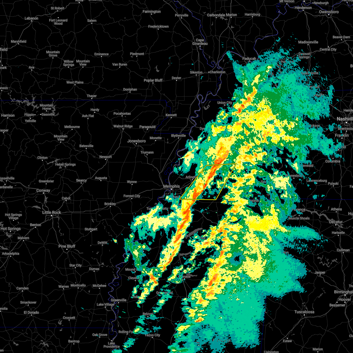 The severe thunderstorm warning for fayette, northwestern hardeman, southern haywood, southwestern madison and southeastern shelby counties will expire at 200 pm cst, the storms which prompted the warning have moved out of the area. therefore, the warning will be allowed to expire. a tornado watch remains in effect until 600 pm cst for northeastern and northwestern mississippi, and western tennessee. The severe thunderstorm warning for fayette, northwestern hardeman, southern haywood, southwestern madison and southeastern shelby counties will expire at 200 pm cst, the storms which prompted the warning have moved out of the area. therefore, the warning will be allowed to expire. a tornado watch remains in effect until 600 pm cst for northeastern and northwestern mississippi, and western tennessee.
|
| 2/17/2022 1:41 PM CST |
 At 141 pm cst, severe thunderstorms were located along a line extending from near dancyville to 6 miles east of collierville, moving east at 40 mph (radar indicated). Hazards include 60 mph wind gusts. Expect damage to roofs, siding, and trees. locations impacted include, collierville, germantown, bolivar, memphis, arlington, whiteville, somerville, hillville, lagrange, eads, dancyville, cloverport, mercer, warren, macon, oakland, piperton, rossville, moscow and stanton. hail threat, radar indicated max hail size, <. 75 in wind threat, radar indicated max wind gust, 60 mph. At 141 pm cst, severe thunderstorms were located along a line extending from near dancyville to 6 miles east of collierville, moving east at 40 mph (radar indicated). Hazards include 60 mph wind gusts. Expect damage to roofs, siding, and trees. locations impacted include, collierville, germantown, bolivar, memphis, arlington, whiteville, somerville, hillville, lagrange, eads, dancyville, cloverport, mercer, warren, macon, oakland, piperton, rossville, moscow and stanton. hail threat, radar indicated max hail size, <. 75 in wind threat, radar indicated max wind gust, 60 mph.
|
| 2/17/2022 1:17 PM CST |
 At 117 pm cst, severe thunderstorms were located along a line extending from 8 miles southeast of covington to southeast memphis, moving east at 55 mph (radar indicated). Hazards include 60 mph wind gusts. expect damage to roofs, siding, and trees At 117 pm cst, severe thunderstorms were located along a line extending from 8 miles southeast of covington to southeast memphis, moving east at 55 mph (radar indicated). Hazards include 60 mph wind gusts. expect damage to roofs, siding, and trees
|
| 2/17/2022 1:15 PM CST | Many tree limbs down one inch and large in shelby county TN, 9.5 miles NNE of Memphis, TN |
| 12/11/2021 1:00 AM CST | Tree down on car on greer st in orange moun in shelby county TN, 5.1 miles ENE of Memphis, TN |
| 12/11/2021 12:30 AM CST |
 At 1230 am cst, a severe thunderstorm was located near arlington, or 15 miles northeast of cordova, moving northeast at 65 mph (radar indicated). Hazards include 60 mph wind gusts and quarter size hail. Hail damage to vehicles is expected. Expect wind damage to roofs, siding, and trees. At 1230 am cst, a severe thunderstorm was located near arlington, or 15 miles northeast of cordova, moving northeast at 65 mph (radar indicated). Hazards include 60 mph wind gusts and quarter size hail. Hail damage to vehicles is expected. Expect wind damage to roofs, siding, and trees.
|
| 12/10/2021 11:59 PM CST |
 At 1158 pm cst, a severe thunderstorm was located over midtown memphis, or 9 miles southwest of bartlett, moving northeast at 65 mph (radar indicated). Hazards include 60 mph wind gusts. Expect damage to roofs, siding, and trees. Locations impacted include, bartlett, southaven, collierville, germantown, olive branch, west memphis, horn lake, marion, millington, t o fuller state park, cordova, memphis, lakeland, arlington, somerville, walls, edmondson, horseshoe lake, anthonyville and southwest memphis. At 1158 pm cst, a severe thunderstorm was located over midtown memphis, or 9 miles southwest of bartlett, moving northeast at 65 mph (radar indicated). Hazards include 60 mph wind gusts. Expect damage to roofs, siding, and trees. Locations impacted include, bartlett, southaven, collierville, germantown, olive branch, west memphis, horn lake, marion, millington, t o fuller state park, cordova, memphis, lakeland, arlington, somerville, walls, edmondson, horseshoe lake, anthonyville and southwest memphis.
|
| 12/10/2021 11:52 PM CST |
 At 1152 pm cst, a severe thunderstorm producing a tornado was located over west memphis, moving northeast at 45 mph (radar indicated rotation). Hazards include tornado. Flying debris will be dangerous to those caught without shelter. mobile homes will be damaged or destroyed. damage to roofs, windows, and vehicles will occur. tree damage is likely. this dangerous storm will be near, memphis and frayser around 1205 am cst. meeman shelby forest state park around 1210 am cst. bartlett around 1215 am cst. dixonville around 1220 am cst. millington around 1225 am cst. munford around 1235 am cst. brighton around 1240 am cst. Other locations impacted by this tornadic thunderstorm include mound city, burlison, barretville, egypt, griffin corner, gammon, quito, woodstock, redwood and wyandoke. At 1152 pm cst, a severe thunderstorm producing a tornado was located over west memphis, moving northeast at 45 mph (radar indicated rotation). Hazards include tornado. Flying debris will be dangerous to those caught without shelter. mobile homes will be damaged or destroyed. damage to roofs, windows, and vehicles will occur. tree damage is likely. this dangerous storm will be near, memphis and frayser around 1205 am cst. meeman shelby forest state park around 1210 am cst. bartlett around 1215 am cst. dixonville around 1220 am cst. millington around 1225 am cst. munford around 1235 am cst. brighton around 1240 am cst. Other locations impacted by this tornadic thunderstorm include mound city, burlison, barretville, egypt, griffin corner, gammon, quito, woodstock, redwood and wyandoke.
|
| 12/10/2021 11:48 PM CST |
 At 1148 pm cst, a severe thunderstorm was located near west memphis, moving northeast at 65 mph (radar indicated). Hazards include 60 mph wind gusts and penny size hail. expect damage to roofs, siding, and trees At 1148 pm cst, a severe thunderstorm was located near west memphis, moving northeast at 65 mph (radar indicated). Hazards include 60 mph wind gusts and penny size hail. expect damage to roofs, siding, and trees
|
| 12/10/2021 11:25 PM CST |
 At 1124 pm cst, a severe thunderstorm was located near new home, or 7 miles west of hughes, moving northeast at 60 mph (radar indicated). Hazards include 60 mph wind gusts and quarter size hail. Hail damage to vehicles is expected. Expect wind damage to roofs, siding, and trees. At 1124 pm cst, a severe thunderstorm was located near new home, or 7 miles west of hughes, moving northeast at 60 mph (radar indicated). Hazards include 60 mph wind gusts and quarter size hail. Hail damage to vehicles is expected. Expect wind damage to roofs, siding, and trees.
|
| 10/15/2021 5:31 PM CDT |
 At 531 pm cdt, a severe thunderstorm was located over haynes, or near forrest city, moving east at 45 mph (radar indicated). Hazards include 60 mph wind gusts and quarter size hail. Hail damage to vehicles is expected. Expect wind damage to roofs, siding, and trees. At 531 pm cdt, a severe thunderstorm was located over haynes, or near forrest city, moving east at 45 mph (radar indicated). Hazards include 60 mph wind gusts and quarter size hail. Hail damage to vehicles is expected. Expect wind damage to roofs, siding, and trees.
|
| 7/11/2021 12:57 AM CDT |
 At 1257 am cdt, severe thunderstorms were located along a line extending from near belle eagle to 6 miles northeast of arlington to near sunset, moving southeast at 40 mph (radar indicated). Hazards include 60 mph wind gusts. Expect damage to roofs, siding, and trees. Locations impacted include, bartlett, southaven, collierville, germantown, west memphis, marion, brownsville, millington, covington, ripley, t o fuller state park, meeman shelby forest state park, cordova, memphis, lakeland, arlington, munford, somerville, brighton and alamo. At 1257 am cdt, severe thunderstorms were located along a line extending from near belle eagle to 6 miles northeast of arlington to near sunset, moving southeast at 40 mph (radar indicated). Hazards include 60 mph wind gusts. Expect damage to roofs, siding, and trees. Locations impacted include, bartlett, southaven, collierville, germantown, west memphis, marion, brownsville, millington, covington, ripley, t o fuller state park, meeman shelby forest state park, cordova, memphis, lakeland, arlington, munford, somerville, brighton and alamo.
|
| 7/11/2021 12:24 AM CDT |
 At 1224 am cdt, severe thunderstorms were located along a line extending from 9 miles southwest of unionville to near fulton to near gilmore, moving southeast at 40 mph (radar indicated). Hazards include 60 mph wind gusts. expect damage to roofs, siding, and trees At 1224 am cdt, severe thunderstorms were located along a line extending from 9 miles southwest of unionville to near fulton to near gilmore, moving southeast at 40 mph (radar indicated). Hazards include 60 mph wind gusts. expect damage to roofs, siding, and trees
|
| 7/9/2021 1:47 PM CDT |
 At 147 pm cdt, a severe thunderstorm was located over lake cormorant, or 8 miles west of horn lake, moving southeast at 15 mph (radar indicated). Hazards include 60 mph wind gusts and penny size hail. Expect damage to roofs, siding, and trees. Locations impacted include, southaven, horn lake, hernando, walls, horseshoe lake, pinckney, lake cormorant, lynchburg, phillipp, eudora, arkabutla, newport, clack, trinity, frees corners, nesbit, bruins, beck, glover and banks. At 147 pm cdt, a severe thunderstorm was located over lake cormorant, or 8 miles west of horn lake, moving southeast at 15 mph (radar indicated). Hazards include 60 mph wind gusts and penny size hail. Expect damage to roofs, siding, and trees. Locations impacted include, southaven, horn lake, hernando, walls, horseshoe lake, pinckney, lake cormorant, lynchburg, phillipp, eudora, arkabutla, newport, clack, trinity, frees corners, nesbit, bruins, beck, glover and banks.
|
| 7/9/2021 1:19 PM CDT |
 At 119 pm cdt, a severe thunderstorm was located over pinckney, or 11 miles east of hughes, moving southeast at 15 mph (radar indicated). Hazards include 60 mph wind gusts and penny size hail. expect damage to roofs, siding, and trees At 119 pm cdt, a severe thunderstorm was located over pinckney, or 11 miles east of hughes, moving southeast at 15 mph (radar indicated). Hazards include 60 mph wind gusts and penny size hail. expect damage to roofs, siding, and trees
|
| 6/7/2021 8:09 PM CDT |
 At 809 pm cdt, a severe thunderstorm was located over olive branch, moving northeast at 45 mph (radar indicated). Hazards include 60 mph wind gusts. Expect damage to roofs, siding, and trees. Locations impacted include, southaven, collierville, olive branch, horn lake, hernando, t o fuller state park, memphis, coldwater, byhalia, walls, lake cormorant, southwest memphis, eudora, lewisburg, whitehaven, red banks, barr, lynchburg, southeast memphis and independence. At 809 pm cdt, a severe thunderstorm was located over olive branch, moving northeast at 45 mph (radar indicated). Hazards include 60 mph wind gusts. Expect damage to roofs, siding, and trees. Locations impacted include, southaven, collierville, olive branch, horn lake, hernando, t o fuller state park, memphis, coldwater, byhalia, walls, lake cormorant, southwest memphis, eudora, lewisburg, whitehaven, red banks, barr, lynchburg, southeast memphis and independence.
|
| 6/7/2021 7:40 PM CDT |
 At 740 pm cdt, a severe thunderstorm was located near arkabutla, or near senatobia, moving northeast at 45 mph (radar indicated). Hazards include 60 mph wind gusts. expect damage to roofs, siding, and trees At 740 pm cdt, a severe thunderstorm was located near arkabutla, or near senatobia, moving northeast at 45 mph (radar indicated). Hazards include 60 mph wind gusts. expect damage to roofs, siding, and trees
|
| 5/4/2021 7:09 PM CDT |
 At 708 pm cdt, a severe thunderstorm was located near jericho, or near meeman shelby forest state park, moving east at 40 mph (radar indicated). Hazards include 60 mph wind gusts and quarter size hail. Hail damage to vehicles is expected. Expect wind damage to roofs, siding, and trees. At 708 pm cdt, a severe thunderstorm was located near jericho, or near meeman shelby forest state park, moving east at 40 mph (radar indicated). Hazards include 60 mph wind gusts and quarter size hail. Hail damage to vehicles is expected. Expect wind damage to roofs, siding, and trees.
|
| 5/4/2021 6:46 PM CDT |
 At 645 pm cdt, a severe thunderstorm was located near gilmore, or 9 miles south of tyronza, moving east at 40 mph (radar indicated). Hazards include 60 mph wind gusts and quarter size hail. Hail damage to vehicles is expected. expect wind damage to roofs, siding, and trees. Locations impacted include, west memphis, marion, marked tree, earle, tyronza, meeman shelby forest state park, memphis, joiner, crawfordsville, sunset, gilmore, jericho, dixonville, turrell, clarkedale, birdsong, three forks, dimple, booker and deckerville. At 645 pm cdt, a severe thunderstorm was located near gilmore, or 9 miles south of tyronza, moving east at 40 mph (radar indicated). Hazards include 60 mph wind gusts and quarter size hail. Hail damage to vehicles is expected. expect wind damage to roofs, siding, and trees. Locations impacted include, west memphis, marion, marked tree, earle, tyronza, meeman shelby forest state park, memphis, joiner, crawfordsville, sunset, gilmore, jericho, dixonville, turrell, clarkedale, birdsong, three forks, dimple, booker and deckerville.
|
| 5/4/2021 6:29 PM CDT |
 At 629 pm cdt, a severe thunderstorm was located 8 miles north of earle, moving east at 40 mph (radar indicated). Hazards include 60 mph wind gusts and quarter size hail. Hail damage to vehicles is expected. Expect wind damage to roofs, siding, and trees. At 629 pm cdt, a severe thunderstorm was located 8 miles north of earle, moving east at 40 mph (radar indicated). Hazards include 60 mph wind gusts and quarter size hail. Hail damage to vehicles is expected. Expect wind damage to roofs, siding, and trees.
|
| 5/4/2021 6:29 PM CDT |
 The national weather service in memphis has issued a * severe thunderstorm warning for. southeastern poinsett county in eastern arkansas. southwestern mississippi county in eastern arkansas. northern crittenden county in eastern arkansas. Northeastern cross county in eastern arkansas. The national weather service in memphis has issued a * severe thunderstorm warning for. southeastern poinsett county in eastern arkansas. southwestern mississippi county in eastern arkansas. northern crittenden county in eastern arkansas. Northeastern cross county in eastern arkansas.
|
| 5/3/2021 1:45 AM CDT |
 At 145 am cdt, a severe thunderstorm was located near hernando, moving east at 45 mph (radar indicated). Hazards include 60 mph wind gusts. expect damage to roofs, siding, and trees At 145 am cdt, a severe thunderstorm was located near hernando, moving east at 45 mph (radar indicated). Hazards include 60 mph wind gusts. expect damage to roofs, siding, and trees
|
| 4/7/2021 7:09 PM CDT |
 At 709 pm cdt, a severe thunderstorm was located over germantown, moving northeast at 35 mph (radar indicated). Hazards include 60 mph wind gusts. Expect damage to roofs, siding, and trees. Locations impacted include, bartlett, collierville, germantown, cordova, memphis, lakeland, arlington, eads, macon, oakland, piperton, gallaway, lenow, fisherville, elba, canadaville, kirk and hickory withe. At 709 pm cdt, a severe thunderstorm was located over germantown, moving northeast at 35 mph (radar indicated). Hazards include 60 mph wind gusts. Expect damage to roofs, siding, and trees. Locations impacted include, bartlett, collierville, germantown, cordova, memphis, lakeland, arlington, eads, macon, oakland, piperton, gallaway, lenow, fisherville, elba, canadaville, kirk and hickory withe.
|
| 4/7/2021 6:54 PM CDT |
 At 654 pm cdt, a severe thunderstorm was located over southeast memphis, or near olive branch, moving northeast at 35 mph (radar indicated). Hazards include 60 mph wind gusts. expect damage to roofs, siding, and trees At 654 pm cdt, a severe thunderstorm was located over southeast memphis, or near olive branch, moving northeast at 35 mph (radar indicated). Hazards include 60 mph wind gusts. expect damage to roofs, siding, and trees
|
| 3/27/2021 10:39 PM CDT |
 At 1039 pm cdt, severe thunderstorms were located along a line extending from near brighton to near independence, moving east at 50 mph (radar indicated). Hazards include 60 mph wind gusts. expect damage to roofs, siding, and trees At 1039 pm cdt, severe thunderstorms were located along a line extending from near brighton to near independence, moving east at 50 mph (radar indicated). Hazards include 60 mph wind gusts. expect damage to roofs, siding, and trees
|
| 3/27/2021 10:20 PM CDT |
 At 1020 pm cdt, severe thunderstorms were located along a line extending from near dixonville to southeast memphis, moving northeast at 65 mph (radar indicated). Hazards include 60 mph wind gusts. Expect damage to roofs, siding, and trees. Locations impacted include, bartlett, southaven, collierville, germantown, olive branch, horn lake, hernando, millington, t o fuller state park, meeman shelby forest state park, cordova, memphis, lakeland, arlington, munford, brighton, walls, lake cormorant, southwest memphis and ellendale. At 1020 pm cdt, severe thunderstorms were located along a line extending from near dixonville to southeast memphis, moving northeast at 65 mph (radar indicated). Hazards include 60 mph wind gusts. Expect damage to roofs, siding, and trees. Locations impacted include, bartlett, southaven, collierville, germantown, olive branch, horn lake, hernando, millington, t o fuller state park, meeman shelby forest state park, cordova, memphis, lakeland, arlington, munford, brighton, walls, lake cormorant, southwest memphis and ellendale.
|
| 3/27/2021 9:53 PM CDT |
 At 953 pm cdt, severe thunderstorms were located along a line extending from near jennette to near robinsonville, moving northeast at 65 mph (radar indicated). Hazards include 60 mph wind gusts. expect damage to roofs, siding, and trees At 953 pm cdt, severe thunderstorms were located along a line extending from near jennette to near robinsonville, moving northeast at 65 mph (radar indicated). Hazards include 60 mph wind gusts. expect damage to roofs, siding, and trees
|
| 3/27/2021 9:32 PM CDT |
 At 931 pm cdt, severe thunderstorms were located along a line extending from 7 miles northwest of dancyville to near olive branch, moving northeast at 40 mph (radar indicated). Hazards include 60 mph wind gusts. expect damage to roofs, siding, and trees At 931 pm cdt, severe thunderstorms were located along a line extending from 7 miles northwest of dancyville to near olive branch, moving northeast at 40 mph (radar indicated). Hazards include 60 mph wind gusts. expect damage to roofs, siding, and trees
|
| 3/27/2021 8:26 PM CDT |
 At 826 pm cdt, a severe thunderstorm was located near horseshoe lake, or near hughes, moving northeast at 30 mph (radar indicated). Hazards include 60 mph wind gusts and quarter size hail. Hail damage to vehicles is expected. Expect wind damage to roofs, siding, and trees. At 826 pm cdt, a severe thunderstorm was located near horseshoe lake, or near hughes, moving northeast at 30 mph (radar indicated). Hazards include 60 mph wind gusts and quarter size hail. Hail damage to vehicles is expected. Expect wind damage to roofs, siding, and trees.
|
| 3/27/2021 6:05 AM CDT |
 The severe thunderstorm warning for northeastern desoto and southeastern shelby counties will expire at 615 am cdt, the storm which prompted the warning has moved out of the area. therefore, the warning will be allowed to expire. however heavy rain is still possible with this thunderstorm. The severe thunderstorm warning for northeastern desoto and southeastern shelby counties will expire at 615 am cdt, the storm which prompted the warning has moved out of the area. therefore, the warning will be allowed to expire. however heavy rain is still possible with this thunderstorm.
|
| 3/27/2021 5:34 AM CDT |
 At 533 am cdt, a severe thunderstorm was located over whitehaven, or near southaven, moving northeast at 30 mph (radar indicated). Hazards include 60 mph wind gusts and quarter size hail. Hail damage to vehicles is expected. Expect wind damage to roofs, siding, and trees. At 533 am cdt, a severe thunderstorm was located over whitehaven, or near southaven, moving northeast at 30 mph (radar indicated). Hazards include 60 mph wind gusts and quarter size hail. Hail damage to vehicles is expected. Expect wind damage to roofs, siding, and trees.
|
| 2/28/2021 6:51 PM CST |
 At 650 pm cst, a severe thunderstorm was located near somerville, or 20 miles northeast of cordova, moving east at 45 mph (radar indicated). Hazards include 60 mph wind gusts and quarter size hail. Hail damage to vehicles is expected. expect wind damage to roofs, siding, and trees. Locations impacted include, somerville, warren, oakland, mason, gallaway, stanton, braden, asbury, yum yum, belmont, canaan grove, longtown, moorman, taylor chapel, keeling, lambert, gainesville, hickory withe, powers and griffen. At 650 pm cst, a severe thunderstorm was located near somerville, or 20 miles northeast of cordova, moving east at 45 mph (radar indicated). Hazards include 60 mph wind gusts and quarter size hail. Hail damage to vehicles is expected. expect wind damage to roofs, siding, and trees. Locations impacted include, somerville, warren, oakland, mason, gallaway, stanton, braden, asbury, yum yum, belmont, canaan grove, longtown, moorman, taylor chapel, keeling, lambert, gainesville, hickory withe, powers and griffen.
|
| 2/28/2021 6:37 PM CST |
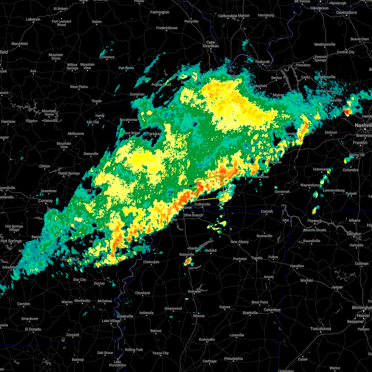 At 636 pm cst, a severe thunderstorm was located over arlington, or 10 miles east of bartlett, moving east at 45 mph (radar indicated). Hazards include 60 mph wind gusts and quarter size hail. Hail damage to vehicles is expected. Expect wind damage to roofs, siding, and trees. At 636 pm cst, a severe thunderstorm was located over arlington, or 10 miles east of bartlett, moving east at 45 mph (radar indicated). Hazards include 60 mph wind gusts and quarter size hail. Hail damage to vehicles is expected. Expect wind damage to roofs, siding, and trees.
|
| 2/28/2021 6:16 PM CST |
 At 613 pm cst, a severe thunderstorm was located near meeman shelby forest state park, moving east at 35 mph (radar indicated). Hazards include 60 mph wind gusts and quarter size hail. Hail damage to vehicles is expected. Expect wind damage to roofs, siding, and trees. At 613 pm cst, a severe thunderstorm was located near meeman shelby forest state park, moving east at 35 mph (radar indicated). Hazards include 60 mph wind gusts and quarter size hail. Hail damage to vehicles is expected. Expect wind damage to roofs, siding, and trees.
|
| 1/25/2021 4:25 PM CST | Hen Egg sized hail reported 7 miles NW of Memphis, TN, 2 inch hail reported on shelby drive. |
| 1/25/2021 4:05 PM CST | Large tree branches down on home... causing significant roof damage. near crump and rosewin in shelby county TN, 7.6 miles N of Memphis, TN |
| 1/25/2021 3:45 PM CST | Quarter sized hail reported 12.4 miles NE of Memphis, TN, one inch hail along with smaller hail in whitehaven. |
| 1/25/2021 3:40 PM CST | Quarter sized hail reported 6.4 miles NNW of Memphis, TN, dime to quarter size hail near kirby and winchester. |
| 1/25/2021 3:35 PM CST | Golf Ball sized hail reported 8.5 miles ENE of Memphis, TN, golfball sized hail near dale's restaraunt on state line road in southaven. |
| 1/25/2021 3:30 PM CST | Quarter sized hail reported 11.7 miles ENE of Memphis, TN, one inch hail in southaven. |
| 9/2/2020 8:36 PM CDT |
 The severe thunderstorm warning for northern marshall, southwestern fayette and eastern shelby counties will expire at 845 pm cdt, the storm which prompted the warning has weakened below severe limits, and no longer poses an immediate threat to life or property. therefore, the warning will be allowed to expire. The severe thunderstorm warning for northern marshall, southwestern fayette and eastern shelby counties will expire at 845 pm cdt, the storm which prompted the warning has weakened below severe limits, and no longer poses an immediate threat to life or property. therefore, the warning will be allowed to expire.
|
| 9/2/2020 8:31 PM CDT |
 At 831 pm cdt, a severe thunderstorm was located near eads, or 7 miles northeast of collierville, moving northeast at 55 mph (radar indicated). Hazards include 60 mph wind gusts. Expect damage to roofs, siding, and trees. Locations impacted include, bartlett, collierville, germantown, cordova, memphis, lakeland, arlington, eads, ellendale, piperton, rossville, elmore park, brunswick, lenow, cayce, fisherville, raleigh, elba, canadaville and spring lake. At 831 pm cdt, a severe thunderstorm was located near eads, or 7 miles northeast of collierville, moving northeast at 55 mph (radar indicated). Hazards include 60 mph wind gusts. Expect damage to roofs, siding, and trees. Locations impacted include, bartlett, collierville, germantown, cordova, memphis, lakeland, arlington, eads, ellendale, piperton, rossville, elmore park, brunswick, lenow, cayce, fisherville, raleigh, elba, canadaville and spring lake.
|
| 9/2/2020 8:22 PM CDT |
 At 822 pm cdt, a severe thunderstorm was located over collierville, moving northeast at 45 mph (radar indicated). Hazards include 60 mph wind gusts. Expect damage to roofs, siding, and trees. Locations impacted include, bartlett, collierville, germantown, olive branch, cordova, memphis, lakeland, arlington, ellendale, southeast memphis, eads, midtown memphis, piperton, rossville, lenow, cayce, handy corner, capleville, kirk and elmore park. At 822 pm cdt, a severe thunderstorm was located over collierville, moving northeast at 45 mph (radar indicated). Hazards include 60 mph wind gusts. Expect damage to roofs, siding, and trees. Locations impacted include, bartlett, collierville, germantown, olive branch, cordova, memphis, lakeland, arlington, ellendale, southeast memphis, eads, midtown memphis, piperton, rossville, lenow, cayce, handy corner, capleville, kirk and elmore park.
|
| 9/2/2020 8:15 PM CDT |
 At 815 pm cdt, a severe thunderstorm was located near germantown, moving northeast at 40 mph (radar indicated). Hazards include 60 mph wind gusts. Expect damage to roofs, siding, and trees. Locations impacted include, bartlett, southaven, collierville, germantown, olive branch, horn lake, cordova, memphis, lakeland, arlington, southwest memphis, ellendale, southeast memphis, eads, lewisburg, whitehaven, midtown memphis, piperton, rossville and lenow. At 815 pm cdt, a severe thunderstorm was located near germantown, moving northeast at 40 mph (radar indicated). Hazards include 60 mph wind gusts. Expect damage to roofs, siding, and trees. Locations impacted include, bartlett, southaven, collierville, germantown, olive branch, horn lake, cordova, memphis, lakeland, arlington, southwest memphis, ellendale, southeast memphis, eads, lewisburg, whitehaven, midtown memphis, piperton, rossville and lenow.
|
| 9/2/2020 7:54 PM CDT |
 At 753 pm cdt, a severe thunderstorm was located near hernando, moving northeast at 55 mph (radar indicated). Hazards include 60 mph wind gusts. expect damage to roofs, siding, and trees At 753 pm cdt, a severe thunderstorm was located near hernando, moving northeast at 55 mph (radar indicated). Hazards include 60 mph wind gusts. expect damage to roofs, siding, and trees
|
| 9/2/2020 7:43 PM CDT |
 At 743 pm cdt, a severe thunderstorm was located over phillipp, or 10 miles southwest of hernando, moving northeast at 45 mph (radar indicated). Hazards include 70 mph wind gusts. Expect considerable tree damage. damage is likely to mobile homes, roofs, and outbuildings. Locations impacted include, southaven, olive branch, horn lake, hernando, coldwater, walls, lake cormorant, lynchburg, phillipp, strayhorn, eudora, lewisburg, arkabutla, newport, trinity, cockrum, frees corners, cedarview, bright and nesbit. At 743 pm cdt, a severe thunderstorm was located over phillipp, or 10 miles southwest of hernando, moving northeast at 45 mph (radar indicated). Hazards include 70 mph wind gusts. Expect considerable tree damage. damage is likely to mobile homes, roofs, and outbuildings. Locations impacted include, southaven, olive branch, horn lake, hernando, coldwater, walls, lake cormorant, lynchburg, phillipp, strayhorn, eudora, lewisburg, arkabutla, newport, trinity, cockrum, frees corners, cedarview, bright and nesbit.
|
| 9/2/2020 7:34 PM CDT |
 At 734 pm cdt, a severe thunderstorm was located near phillipp, or 16 miles west of senatobia, moving northeast at 50 mph (radar indicated). Hazards include 60 mph wind gusts. expect damage to roofs, siding, and trees At 734 pm cdt, a severe thunderstorm was located near phillipp, or 16 miles west of senatobia, moving northeast at 50 mph (radar indicated). Hazards include 60 mph wind gusts. expect damage to roofs, siding, and trees
|
| 9/2/2020 6:43 PM CDT |
 The tornado warning for northeastern st. francis and central crittenden counties will expire at 645 pm cdt, the storm which prompted the warning has weakened below severe limits, and no longer appears capable of producing a tornado. therefore, the warning will be allowed to expire. The tornado warning for northeastern st. francis and central crittenden counties will expire at 645 pm cdt, the storm which prompted the warning has weakened below severe limits, and no longer appears capable of producing a tornado. therefore, the warning will be allowed to expire.
|
| 9/2/2020 6:12 PM CDT |
 At 612 pm cdt, doppler radar indicated a severe thunderstorm producing a tornado was located near new home, or 7 miles north of hughes, moving northeast at 30 mph (radar indicated rotation). Hazards include tornado and quarter size hail. Flying debris will be dangerous to those caught without shelter. mobile homes will be damaged or destroyed. damage to roofs, windows, and vehicles will occur. tree damage is likely. Locations impacted include, west memphis, marion, crawfordsville, edmondson, sunset, anthonyville, jericho, jennette, simsboro, crittenden, kate, browns, louise, jonquil, brice, cunningham corner, amanea, tarsus, wyandoke and harvard. At 612 pm cdt, doppler radar indicated a severe thunderstorm producing a tornado was located near new home, or 7 miles north of hughes, moving northeast at 30 mph (radar indicated rotation). Hazards include tornado and quarter size hail. Flying debris will be dangerous to those caught without shelter. mobile homes will be damaged or destroyed. damage to roofs, windows, and vehicles will occur. tree damage is likely. Locations impacted include, west memphis, marion, crawfordsville, edmondson, sunset, anthonyville, jericho, jennette, simsboro, crittenden, kate, browns, louise, jonquil, brice, cunningham corner, amanea, tarsus, wyandoke and harvard.
|
| 9/2/2020 6:02 PM CDT |
 At 601 pm cdt, doppler radar indicated a severe thunderstorm producing a tornado was located over new home, or near hughes, moving northeast at 25 mph (radar indicated rotation). Hazards include tornado and quarter size hail. Flying debris will be dangerous to those caught without shelter. mobile homes will be damaged or destroyed. damage to roofs, windows, and vehicles will occur. Tree damage is likely. At 601 pm cdt, doppler radar indicated a severe thunderstorm producing a tornado was located over new home, or near hughes, moving northeast at 25 mph (radar indicated rotation). Hazards include tornado and quarter size hail. Flying debris will be dangerous to those caught without shelter. mobile homes will be damaged or destroyed. damage to roofs, windows, and vehicles will occur. Tree damage is likely.
|
| 7/1/2020 3:54 PM CDT |
 At 354 pm cdt, a severe thunderstorm was located over joiner, or 7 miles southwest of wilson, moving southeast at 35 mph (radar indicated). Hazards include 70 mph wind gusts. Expect considerable tree damage. Damage is likely to mobile homes, roofs, and outbuildings. At 354 pm cdt, a severe thunderstorm was located over joiner, or 7 miles southwest of wilson, moving southeast at 35 mph (radar indicated). Hazards include 70 mph wind gusts. Expect considerable tree damage. Damage is likely to mobile homes, roofs, and outbuildings.
|
| 6/5/2020 2:12 PM CDT |
 The severe thunderstorm warning for crittenden, desoto, northern marshall, northeastern tunica, northwestern benton, southern fayette and shelby counties will expire at 215 pm cdt, the storms which prompted the warning have moved out of the area. therefore, the warning will be allowed to expire. however gusty winds are still possible with these thunderstorms. a severe thunderstorm watch remains in effect until 600 pm cdt for eastern arkansas, northeastern and northwestern mississippi, and western tennessee. The severe thunderstorm warning for crittenden, desoto, northern marshall, northeastern tunica, northwestern benton, southern fayette and shelby counties will expire at 215 pm cdt, the storms which prompted the warning have moved out of the area. therefore, the warning will be allowed to expire. however gusty winds are still possible with these thunderstorms. a severe thunderstorm watch remains in effect until 600 pm cdt for eastern arkansas, northeastern and northwestern mississippi, and western tennessee.
|
| 6/5/2020 2:00 PM CDT | Trees and powerlines down across the memphis metr in shelby county TN, 5.9 miles E of Memphis, TN |
| 6/5/2020 1:41 PM CDT |
 At 141 pm cdt, severe thunderstorms were located along a line extending from near pinckney to near olive branch to 9 miles south of somerville, moving southeast at 40 mph (radar indicated). Hazards include 60 mph wind gusts and penny size hail. Expect damage to roofs, siding, and trees. Locations impacted include, bartlett, southaven, collierville, germantown, olive branch, west memphis, horn lake, hernando, marion, millington, t o fuller state park, cordova, memphis, lamar, lakeland, arlington, somerville, byhalia, walls and crawfordsville. At 141 pm cdt, severe thunderstorms were located along a line extending from near pinckney to near olive branch to 9 miles south of somerville, moving southeast at 40 mph (radar indicated). Hazards include 60 mph wind gusts and penny size hail. Expect damage to roofs, siding, and trees. Locations impacted include, bartlett, southaven, collierville, germantown, olive branch, west memphis, horn lake, hernando, marion, millington, t o fuller state park, cordova, memphis, lamar, lakeland, arlington, somerville, byhalia, walls and crawfordsville.
|
| 6/5/2020 1:37 PM CDT | Storm damage reported in shelby county TN, 9.4 miles NE of Memphis, TN |
| 6/5/2020 1:27 PM CDT |
 At 127 pm cdt, severe thunderstorms were located along a line extending from near simsboro to near midtown memphis to 7 miles east of eads, moving southeast at 35 mph (radar indicated). Hazards include 60 mph wind gusts. expect damage to roofs, siding, and trees At 127 pm cdt, severe thunderstorms were located along a line extending from near simsboro to near midtown memphis to 7 miles east of eads, moving southeast at 35 mph (radar indicated). Hazards include 60 mph wind gusts. expect damage to roofs, siding, and trees
|
| 6/4/2020 5:53 PM CDT |
 At 553 pm cdt, a severe thunderstorm was located near collierville, moving southeast at 15 mph (radar indicated). Hazards include 60 mph wind gusts and quarter size hail. Hail damage to vehicles is expected. Expect wind damage to roofs, siding, and trees. At 553 pm cdt, a severe thunderstorm was located near collierville, moving southeast at 15 mph (radar indicated). Hazards include 60 mph wind gusts and quarter size hail. Hail damage to vehicles is expected. Expect wind damage to roofs, siding, and trees.
|
| 5/22/2020 4:49 PM CDT | Large tree snapped at base near the pink palace in memphi in shelby county TN, 6.4 miles E of Memphis, TN |
| 5/22/2020 4:41 PM CDT | Trees uprooted/snapped... shingles blown off roo in shelby county TN, 8.2 miles SW of Memphis, TN |
| 5/22/2020 4:37 PM CDT | Tree uprooted at residents hom in shelby county TN, 8.2 miles SW of Memphis, TN |
| 5/22/2020 4:35 PM CDT | Tree down across holmes street... landed on ca in shelby county TN, 4.7 miles E of Memphis, TN |
| 5/22/2020 4:30 PM CDT | Large tree fell on house near shelby forres in shelby county TN, 13.8 miles SE of Memphis, TN |
| 5/22/2020 4:20 PM CDT |
 At 419 pm cdt, a severe thunderstorm was located near sunset, or near meeman shelby forest state park, moving east at 55 mph (radar indicated). Hazards include 70 mph wind gusts. Expect considerable tree damage. damage is likely to mobile homes, roofs, and outbuildings. Locations impacted include, bartlett, collierville, germantown, west memphis, marion, millington, earle, parkin, t o fuller state park, meeman shelby forest state park, cordova, memphis, lakeland, arlington, munford, brighton, crawfordsville, edmondson, sunset and gilmore. At 419 pm cdt, a severe thunderstorm was located near sunset, or near meeman shelby forest state park, moving east at 55 mph (radar indicated). Hazards include 70 mph wind gusts. Expect considerable tree damage. damage is likely to mobile homes, roofs, and outbuildings. Locations impacted include, bartlett, collierville, germantown, west memphis, marion, millington, earle, parkin, t o fuller state park, meeman shelby forest state park, cordova, memphis, lakeland, arlington, munford, brighton, crawfordsville, edmondson, sunset and gilmore.
|
| 5/22/2020 3:55 PM CDT |
 At 355 pm cdt, a severe thunderstorm was located near jennette, or near earle, moving east at 60 mph (radar indicated). Hazards include 70 mph wind gusts. Expect considerable tree damage. Damage is likely to mobile homes, roofs, and outbuildings. At 355 pm cdt, a severe thunderstorm was located near jennette, or near earle, moving east at 60 mph (radar indicated). Hazards include 70 mph wind gusts. Expect considerable tree damage. Damage is likely to mobile homes, roofs, and outbuildings.
|
| 5/4/2020 3:48 PM CDT |
 At 347 pm cdt, a severe thunderstorm was located near wilson, moving east at 50 mph (radar indicated). Hazards include 60 mph wind gusts and quarter size hail. Hail damage to vehicles is expected. expect wind damage to roofs, siding, and trees. Locations impacted include, bartlett, millington, covington, osceola, wilson, keiser, meeman shelby forest state park, fort pillow state park, memphis, arlington, munford, brighton, joiner, dyess, bassett, marie, fulton, dixonville, ft pillow and tipton. At 347 pm cdt, a severe thunderstorm was located near wilson, moving east at 50 mph (radar indicated). Hazards include 60 mph wind gusts and quarter size hail. Hail damage to vehicles is expected. expect wind damage to roofs, siding, and trees. Locations impacted include, bartlett, millington, covington, osceola, wilson, keiser, meeman shelby forest state park, fort pillow state park, memphis, arlington, munford, brighton, joiner, dyess, bassett, marie, fulton, dixonville, ft pillow and tipton.
|
| 5/4/2020 3:36 PM CDT |
 At 336 pm cdt, a severe thunderstorm was located over dyess, or 8 miles west of wilson, moving east at 50 mph (radar indicated). Hazards include 60 mph wind gusts and quarter size hail. Hail damage to vehicles is expected. Expect wind damage to roofs, siding, and trees. At 336 pm cdt, a severe thunderstorm was located over dyess, or 8 miles west of wilson, moving east at 50 mph (radar indicated). Hazards include 60 mph wind gusts and quarter size hail. Hail damage to vehicles is expected. Expect wind damage to roofs, siding, and trees.
|
| 5/3/2020 4:10 PM CDT |
 At 410 pm cdt, a severe thunderstorm was located over lakeland, or near bartlett, moving east at 55 mph (radar indicated). Hazards include 60 mph wind gusts and quarter size hail. Hail damage to vehicles is expected. Expect wind damage to roofs, siding, and trees. At 410 pm cdt, a severe thunderstorm was located over lakeland, or near bartlett, moving east at 55 mph (radar indicated). Hazards include 60 mph wind gusts and quarter size hail. Hail damage to vehicles is expected. Expect wind damage to roofs, siding, and trees.
|
| 4/29/2020 11:15 AM CDT | Power lines down in bartlett near wj freeman park and stage roa in shelby county TN, 5.8 miles SSW of Memphis, TN |
| 4/29/2020 12:57 AM CDT |
 The severe thunderstorm warning for southeastern crittenden, desoto, northeastern tunica, northwestern tate and southern shelby counties will expire at 100 am cdt, the storms which prompted the warning have weakened below severe limits, and have exited the warned area. therefore, the warning will be allowed to expire. however gusty winds are still possible with these thunderstorms. a severe thunderstorm watch remains in effect until 300 am cdt for eastern arkansas, northwestern mississippi, and western tennessee. The severe thunderstorm warning for southeastern crittenden, desoto, northeastern tunica, northwestern tate and southern shelby counties will expire at 100 am cdt, the storms which prompted the warning have weakened below severe limits, and have exited the warned area. therefore, the warning will be allowed to expire. however gusty winds are still possible with these thunderstorms. a severe thunderstorm watch remains in effect until 300 am cdt for eastern arkansas, northwestern mississippi, and western tennessee.
|
| 4/29/2020 12:36 AM CDT |
 At 1236 am cdt, severe thunderstorms were located along a line extending from near southeast memphis to near north tunica, moving east at 55 mph (radar indicated). Hazards include 70 mph wind gusts. Expect considerable tree damage. damage is likely to mobile homes, roofs, and outbuildings. Locations impacted include, southaven, collierville, germantown, olive branch, west memphis, horn lake, hernando, t o fuller state park, memphis, coldwater, walls, horseshoe lake, lake cormorant, southwest memphis, eudora, lewisburg, whitehaven, arkabutla, pinckney and lynchburg. At 1236 am cdt, severe thunderstorms were located along a line extending from near southeast memphis to near north tunica, moving east at 55 mph (radar indicated). Hazards include 70 mph wind gusts. Expect considerable tree damage. damage is likely to mobile homes, roofs, and outbuildings. Locations impacted include, southaven, collierville, germantown, olive branch, west memphis, horn lake, hernando, t o fuller state park, memphis, coldwater, walls, horseshoe lake, lake cormorant, southwest memphis, eudora, lewisburg, whitehaven, arkabutla, pinckney and lynchburg.
|
| 4/29/2020 12:22 AM CDT |
 At 1222 am cdt, severe thunderstorms were located along a line extending from near downtown memphis to 7 miles west of north tunica, moving east at 55 mph (radar indicated). Hazards include 70 mph wind gusts. Expect considerable tree damage. damage is likely to mobile homes, roofs, and outbuildings. Locations impacted include, bartlett, southaven, collierville, germantown, olive branch, west memphis, horn lake, hernando, marion, hughes, t o fuller state park, cordova, memphis, coldwater, walls, edmondson, horseshoe lake, sunset, anthonyville and lake cormorant. At 1222 am cdt, severe thunderstorms were located along a line extending from near downtown memphis to 7 miles west of north tunica, moving east at 55 mph (radar indicated). Hazards include 70 mph wind gusts. Expect considerable tree damage. damage is likely to mobile homes, roofs, and outbuildings. Locations impacted include, bartlett, southaven, collierville, germantown, olive branch, west memphis, horn lake, hernando, marion, hughes, t o fuller state park, cordova, memphis, coldwater, walls, edmondson, horseshoe lake, sunset, anthonyville and lake cormorant.
|
| 4/29/2020 12:11 AM CDT |
 At 1210 am cdt, severe thunderstorms were located along a line extending from near edmondson to near marianna, moving east at 55 mph (radar indicated). Hazards include 60 mph wind gusts. expect damage to roofs, siding, and trees At 1210 am cdt, severe thunderstorms were located along a line extending from near edmondson to near marianna, moving east at 55 mph (radar indicated). Hazards include 60 mph wind gusts. expect damage to roofs, siding, and trees
|
| 4/29/2020 12:02 AM CDT |
 At 1202 am cdt, a severe thunderstorm was located 8 miles northwest of millington, moving east at 60 mph (radar indicated). Hazards include 60 mph wind gusts. expect damage to roofs, siding, and trees At 1202 am cdt, a severe thunderstorm was located 8 miles northwest of millington, moving east at 60 mph (radar indicated). Hazards include 60 mph wind gusts. expect damage to roofs, siding, and trees
|
| 4/12/2020 10:50 PM CDT |
 At 1050 pm cdt, severe thunderstorms were located along a line extending from near manila to 8 miles east of eads, moving northeast at 65 mph (radar indicated). Hazards include 60 mph wind gusts. Expect damage to roofs, siding, and trees. Locations impacted include, bartlett, southaven, collierville, germantown, olive branch, west memphis, blytheville, marion, millington, covington, osceola, gosnell, marked tree, lepanto, luxora, wilson, tyronza, keiser, meeman shelby forest state park and fort pillow state park. At 1050 pm cdt, severe thunderstorms were located along a line extending from near manila to 8 miles east of eads, moving northeast at 65 mph (radar indicated). Hazards include 60 mph wind gusts. Expect damage to roofs, siding, and trees. Locations impacted include, bartlett, southaven, collierville, germantown, olive branch, west memphis, blytheville, marion, millington, covington, osceola, gosnell, marked tree, lepanto, luxora, wilson, tyronza, keiser, meeman shelby forest state park and fort pillow state park.
|
| 4/12/2020 10:34 PM CDT |
 At 1034 pm cdt, severe thunderstorms were located along a line extending from near lepanto to near collierville, moving northeast at 65 mph (radar indicated). Hazards include 60 mph wind gusts. Expect damage to roofs, siding, and trees. Locations impacted include, bartlett, southaven, collierville, germantown, olive branch, west memphis, blytheville, marion, millington, covington, osceola, gosnell, marked tree, lepanto, luxora, wilson, tyronza, keiser, cordova and t o fuller state park. At 1034 pm cdt, severe thunderstorms were located along a line extending from near lepanto to near collierville, moving northeast at 65 mph (radar indicated). Hazards include 60 mph wind gusts. Expect damage to roofs, siding, and trees. Locations impacted include, bartlett, southaven, collierville, germantown, olive branch, west memphis, blytheville, marion, millington, covington, osceola, gosnell, marked tree, lepanto, luxora, wilson, tyronza, keiser, cordova and t o fuller state park.
|
| 4/12/2020 10:26 PM CDT |
 The severe thunderstorm warning for northeastern st. francis, eastern poinsett, crittenden, eastern cross and southwestern shelby counties will expire at 1030 pm cdt, the warning will be allowed to expire, but a severe thunderstorm warning continues for portions of crittenden, shelby, and poinsett counties. a severe thunderstorm watch remains in effect until 100 am cdt for eastern arkansas, northwestern mississippi, and western tennessee. The severe thunderstorm warning for northeastern st. francis, eastern poinsett, crittenden, eastern cross and southwestern shelby counties will expire at 1030 pm cdt, the warning will be allowed to expire, but a severe thunderstorm warning continues for portions of crittenden, shelby, and poinsett counties. a severe thunderstorm watch remains in effect until 100 am cdt for eastern arkansas, northwestern mississippi, and western tennessee.
|
| 4/12/2020 10:16 PM CDT |
 At 1016 pm cdt, severe thunderstorms were located along a line extending from near marked tree to near hernando, moving northeast at 65 mph (radar indicated). Hazards include 60 mph wind gusts. expect damage to roofs, siding, and trees At 1016 pm cdt, severe thunderstorms were located along a line extending from near marked tree to near hernando, moving northeast at 65 mph (radar indicated). Hazards include 60 mph wind gusts. expect damage to roofs, siding, and trees
|
| 4/12/2020 10:11 PM CDT |
 At 1011 pm cdt, severe thunderstorms were located along a line extending from 8 miles west of marked tree to near pinckney, moving northeast at 60 mph (radar indicated). Hazards include 60 mph wind gusts. Expect damage to roofs, siding, and trees. Locations impacted include, southaven, west memphis, marion, trumann, marked tree, earle, lepanto, hughes, parkin, tyronza, t o fuller state park, memphis, cherry valley, crawfordsville, edmondson, horseshoe lake, sunset, gilmore, anthonyville and jericho. At 1011 pm cdt, severe thunderstorms were located along a line extending from 8 miles west of marked tree to near pinckney, moving northeast at 60 mph (radar indicated). Hazards include 60 mph wind gusts. Expect damage to roofs, siding, and trees. Locations impacted include, southaven, west memphis, marion, trumann, marked tree, earle, lepanto, hughes, parkin, tyronza, t o fuller state park, memphis, cherry valley, crawfordsville, edmondson, horseshoe lake, sunset, gilmore, anthonyville and jericho.
|
| 4/12/2020 9:50 PM CDT |
 At 949 pm cdt, severe thunderstorms were located along a line extending from near vanndale to near brickeys, moving east at 45 mph (radar indicated). Hazards include 60 mph wind gusts. expect damage to roofs, siding, and trees At 949 pm cdt, severe thunderstorms were located along a line extending from near vanndale to near brickeys, moving east at 45 mph (radar indicated). Hazards include 60 mph wind gusts. expect damage to roofs, siding, and trees
|
| 4/8/2020 10:30 PM CDT |
 At 1030 pm cdt, a severe thunderstorm was located 10 miles north of slayden, or 12 miles east of collierville, moving southeast at 40 mph (radar indicated). Hazards include 60 mph wind gusts. Expect damage to roofs, siding, and trees. Locations impacted include, collierville, germantown, cordova, somerville, macon, oakland, piperton, rossville, moscow, williston, la grange, fisherville, elba, canadaville, kirk, hays crossing, pattersonville, forty five, hickory withe and ghost river state natural area. At 1030 pm cdt, a severe thunderstorm was located 10 miles north of slayden, or 12 miles east of collierville, moving southeast at 40 mph (radar indicated). Hazards include 60 mph wind gusts. Expect damage to roofs, siding, and trees. Locations impacted include, collierville, germantown, cordova, somerville, macon, oakland, piperton, rossville, moscow, williston, la grange, fisherville, elba, canadaville, kirk, hays crossing, pattersonville, forty five, hickory withe and ghost river state natural area.
|
| 4/8/2020 10:17 PM CDT |
 At 1017 pm cdt, a severe thunderstorm was located near eads, or 10 miles northeast of collierville, moving southeast at 45 mph (radar indicated). Hazards include 60 mph wind gusts. expect damage to roofs, siding, and trees At 1017 pm cdt, a severe thunderstorm was located near eads, or 10 miles northeast of collierville, moving southeast at 45 mph (radar indicated). Hazards include 60 mph wind gusts. expect damage to roofs, siding, and trees
|
| 4/8/2020 9:59 PM CDT |
 At 959 pm cdt, a severe thunderstorm was located near frayser, or near bartlett, moving southeast at 30 mph (radar indicated). Hazards include 60 mph wind gusts. Expect damage to roofs, siding, and trees. Locations impacted include, bartlett, collierville, germantown, west memphis, marion, millington, t o fuller state park, cordova, memphis, lakeland, arlington, southwest memphis, ellendale, southeast memphis, downtown memphis, eads, whitehaven, frayser, midtown memphis and piperton. At 959 pm cdt, a severe thunderstorm was located near frayser, or near bartlett, moving southeast at 30 mph (radar indicated). Hazards include 60 mph wind gusts. Expect damage to roofs, siding, and trees. Locations impacted include, bartlett, collierville, germantown, west memphis, marion, millington, t o fuller state park, cordova, memphis, lakeland, arlington, southwest memphis, ellendale, southeast memphis, downtown memphis, eads, whitehaven, frayser, midtown memphis and piperton.
|
| 4/8/2020 9:36 PM CDT |
 At 936 pm cdt, a severe thunderstorm was located near meeman shelby forest state park, moving southeast at 40 mph (radar indicated). Hazards include 60 mph wind gusts and quarter size hail. Hail damage to vehicles is expected. Expect wind damage to roofs, siding, and trees. At 936 pm cdt, a severe thunderstorm was located near meeman shelby forest state park, moving southeast at 40 mph (radar indicated). Hazards include 60 mph wind gusts and quarter size hail. Hail damage to vehicles is expected. Expect wind damage to roofs, siding, and trees.
|
| 4/8/2020 9:32 PM CDT |
 At 932 pm cdt, a severe thunderstorm was located near jericho, or near meeman shelby forest state park, moving southeast at 35 mph (radar indicated). Hazards include 60 mph wind gusts and quarter size hail. Hail damage to vehicles is expected. expect wind damage to roofs, siding, and trees. Locations impacted include, west memphis, marion, millington, meeman shelby forest state park, munford, joiner, crawfordsville, sunset, gilmore, jericho, dixonville, crittenden, turrell, gilt edge, clarkedale, booker, egypt, griffin corner, menesha and gammon. At 932 pm cdt, a severe thunderstorm was located near jericho, or near meeman shelby forest state park, moving southeast at 35 mph (radar indicated). Hazards include 60 mph wind gusts and quarter size hail. Hail damage to vehicles is expected. expect wind damage to roofs, siding, and trees. Locations impacted include, west memphis, marion, millington, meeman shelby forest state park, munford, joiner, crawfordsville, sunset, gilmore, jericho, dixonville, crittenden, turrell, gilt edge, clarkedale, booker, egypt, griffin corner, menesha and gammon.
|
| 4/8/2020 9:19 PM CDT |
 At 859 pm cdt, a severe thunderstorm was located over tyronza, moving southeast at 35 mph (radar indicated). Hazards include 60 mph wind gusts and quarter size hail. Hail damage to vehicles is expected. Expect wind damage to roofs, siding, and trees. At 859 pm cdt, a severe thunderstorm was located over tyronza, moving southeast at 35 mph (radar indicated). Hazards include 60 mph wind gusts and quarter size hail. Hail damage to vehicles is expected. Expect wind damage to roofs, siding, and trees.
|
| 4/8/2020 9:19 PM CDT |
 At 918 pm cdt, a severe thunderstorm was located over gilmore, or 9 miles southeast of tyronza, moving southeast at 30 mph (radar indicated). Hazards include 60 mph wind gusts and half dollar size hail. Hail damage to vehicles is expected. expect wind damage to roofs, siding, and trees. Locations impacted include, west memphis, marion, millington, tyronza, meeman shelby forest state park, munford, joiner, crawfordsville, sunset, gilmore, jericho, dixonville, crittenden, turrell, gilt edge, clarkedale, birdsong, dimple, booker and deckerville. At 918 pm cdt, a severe thunderstorm was located over gilmore, or 9 miles southeast of tyronza, moving southeast at 30 mph (radar indicated). Hazards include 60 mph wind gusts and half dollar size hail. Hail damage to vehicles is expected. expect wind damage to roofs, siding, and trees. Locations impacted include, west memphis, marion, millington, tyronza, meeman shelby forest state park, munford, joiner, crawfordsville, sunset, gilmore, jericho, dixonville, crittenden, turrell, gilt edge, clarkedale, birdsong, dimple, booker and deckerville.
|
| 4/8/2020 9:00 PM CDT |
 At 859 pm cdt, a severe thunderstorm was located over tyronza, moving southeast at 35 mph (radar indicated). Hazards include 60 mph wind gusts and quarter size hail. Hail damage to vehicles is expected. Expect wind damage to roofs, siding, and trees. At 859 pm cdt, a severe thunderstorm was located over tyronza, moving southeast at 35 mph (radar indicated). Hazards include 60 mph wind gusts and quarter size hail. Hail damage to vehicles is expected. Expect wind damage to roofs, siding, and trees.
|
| 3/28/2020 8:21 PM CDT |
 At 820 pm cdt, severe thunderstorms were located along a line extending from near arlington to near mt pleasant to near harmontown, moving east at 50 mph (radar indicated. at 815 pm cdt, 60 mph were observed in byhalia). Hazards include 60 mph wind gusts. Expect damage to roofs, siding, and trees. Locations impacted include, collierville, germantown, olive branch, holly springs, wall doxey state park, lamar, lakeland, arlington, whiteville, somerville, byhalia, snow lake shores, bethlehem, red banks, laws hill, canaan, lagrange, independence, eads and slayden. At 820 pm cdt, severe thunderstorms were located along a line extending from near arlington to near mt pleasant to near harmontown, moving east at 50 mph (radar indicated. at 815 pm cdt, 60 mph were observed in byhalia). Hazards include 60 mph wind gusts. Expect damage to roofs, siding, and trees. Locations impacted include, collierville, germantown, olive branch, holly springs, wall doxey state park, lamar, lakeland, arlington, whiteville, somerville, byhalia, snow lake shores, bethlehem, red banks, laws hill, canaan, lagrange, independence, eads and slayden.
|
| 3/28/2020 8:11 PM CDT |
 At 810 pm cdt, severe thunderstorms were located along a line extending from near dixonville to barr, moving east at 45 mph (radar indicated). Hazards include 60 mph wind gusts. expect damage to roofs, siding, and trees At 810 pm cdt, severe thunderstorms were located along a line extending from near dixonville to barr, moving east at 45 mph (radar indicated). Hazards include 60 mph wind gusts. expect damage to roofs, siding, and trees
|
| 3/28/2020 8:06 PM CDT |
 At 806 pm cdt, severe thunderstorms were located along a line extending from 6 miles north of arlington to near senatobia, moving east at 45 mph (radar indicated). Hazards include 70 mph wind gusts. Expect considerable tree damage. damage is likely to mobile homes, roofs, and outbuildings. Locations impacted include, bartlett, southaven, collierville, germantown, olive branch, hernando, millington, senatobia, cordova, memphis, lakeland, arlington, coldwater, byhalia, ellendale, lewisburg, barr, southeast memphis, independence and eads. At 806 pm cdt, severe thunderstorms were located along a line extending from 6 miles north of arlington to near senatobia, moving east at 45 mph (radar indicated). Hazards include 70 mph wind gusts. Expect considerable tree damage. damage is likely to mobile homes, roofs, and outbuildings. Locations impacted include, bartlett, southaven, collierville, germantown, olive branch, hernando, millington, senatobia, cordova, memphis, lakeland, arlington, coldwater, byhalia, ellendale, lewisburg, barr, southeast memphis, independence and eads.
|
| 3/28/2020 7:58 PM CDT |
 At 758 pm cdt, severe thunderstorms were located along a line extending from near dixonville to senatobia, moving east at 25 mph (radar indicated). Hazards include 70 mph wind gusts. Expect considerable tree damage. damage is likely to mobile homes, roofs, and outbuildings. Locations impacted include, bartlett, southaven, collierville, germantown, olive branch, horn lake, hernando, millington, senatobia, cordova, memphis, lakeland, arlington, coldwater, byhalia, ellendale, strayhorn, lewisburg, whitehaven and arkabutla. At 758 pm cdt, severe thunderstorms were located along a line extending from near dixonville to senatobia, moving east at 25 mph (radar indicated). Hazards include 70 mph wind gusts. Expect considerable tree damage. damage is likely to mobile homes, roofs, and outbuildings. Locations impacted include, bartlett, southaven, collierville, germantown, olive branch, horn lake, hernando, millington, senatobia, cordova, memphis, lakeland, arlington, coldwater, byhalia, ellendale, strayhorn, lewisburg, whitehaven and arkabutla.
|
| 3/28/2020 7:26 PM CDT |
 At 725 pm cdt, severe thunderstorms were located along a line extending from near meeman shelby forest state park to little texas, moving east at 40 mph (radar indicated). Hazards include 60 mph wind gusts. expect damage to roofs, siding, and trees At 725 pm cdt, severe thunderstorms were located along a line extending from near meeman shelby forest state park to little texas, moving east at 40 mph (radar indicated). Hazards include 60 mph wind gusts. expect damage to roofs, siding, and trees
|
| 3/28/2020 7:11 PM CDT |
 At 711 pm cdt, severe thunderstorms were located along a line extending from near jericho to near edmondson to near hughes, moving east at 40 mph (radar indicated). Hazards include 60 mph wind gusts. Expect damage to roofs, siding, and trees. Locations impacted include, southaven, west memphis, horn lake, marion, millington, hughes, t o fuller state park, meeman shelby forest state park, memphis, walls, crawfordsville, edmondson, horseshoe lake, sunset, anthonyville, jericho, jennette, lake cormorant, southwest memphis and simsboro. At 711 pm cdt, severe thunderstorms were located along a line extending from near jericho to near edmondson to near hughes, moving east at 40 mph (radar indicated). Hazards include 60 mph wind gusts. Expect damage to roofs, siding, and trees. Locations impacted include, southaven, west memphis, horn lake, marion, millington, hughes, t o fuller state park, meeman shelby forest state park, memphis, walls, crawfordsville, edmondson, horseshoe lake, sunset, anthonyville, jericho, jennette, lake cormorant, southwest memphis and simsboro.
|
| 3/28/2020 7:02 PM CDT |
 At 701 pm cdt, severe thunderstorms were located along a line extending from near crawfordsville to near brickeys, moving northeast at 35 mph (radar indicated). Hazards include 60 mph wind gusts. expect damage to roofs, siding, and trees At 701 pm cdt, severe thunderstorms were located along a line extending from near crawfordsville to near brickeys, moving northeast at 35 mph (radar indicated). Hazards include 60 mph wind gusts. expect damage to roofs, siding, and trees
|
| 1/11/2020 5:11 AM CST |
 At 511 am cst, a severe thunderstorm was located over lakeland, or near bartlett, moving northeast at 60 mph (radar indicated). Hazards include 60 mph wind gusts. Expect damage to roofs, siding, and trees. Locations impacted include, bartlett, collierville, germantown, olive branch, millington, cordova, memphis, lakeland, arlington, munford, brighton, ellendale, frayser, southeast memphis, eads, tipton, atoka, oakland, mason and piperton. At 511 am cst, a severe thunderstorm was located over lakeland, or near bartlett, moving northeast at 60 mph (radar indicated). Hazards include 60 mph wind gusts. Expect damage to roofs, siding, and trees. Locations impacted include, bartlett, collierville, germantown, olive branch, millington, cordova, memphis, lakeland, arlington, munford, brighton, ellendale, frayser, southeast memphis, eads, tipton, atoka, oakland, mason and piperton.
|
| 1/11/2020 5:07 AM CST |
 At 507 am cst, a severe thunderstorm was located near olive branch, moving northeast at 60 mph (radar indicated). Hazards include 70 mph wind gusts. Expect considerable tree damage. damage is likely to mobile homes, roofs, and outbuildings. Locations impacted include, southaven, olive branch, senatobia, coldwater, byhalia, independence, lewisburg, red banks, marianna, coal oil corner, wakefield, cayce, cockrum, watson, cedarview, bright, handy corner, taska, poagville and jago. At 507 am cst, a severe thunderstorm was located near olive branch, moving northeast at 60 mph (radar indicated). Hazards include 70 mph wind gusts. Expect considerable tree damage. damage is likely to mobile homes, roofs, and outbuildings. Locations impacted include, southaven, olive branch, senatobia, coldwater, byhalia, independence, lewisburg, red banks, marianna, coal oil corner, wakefield, cayce, cockrum, watson, cedarview, bright, handy corner, taska, poagville and jago.
|
| 1/11/2020 5:01 AM CST |
 At 501 am cst, doppler radar indicated a severe thunderstorm producing a tornado was located near olive branch, moving northeast at 45 mph (radar indicated rotation). Hazards include tornado. Flying debris will be dangerous to those caught without shelter. mobile homes will be damaged or destroyed. damage to roofs, windows, and vehicles will occur. Tree damage is likely. At 501 am cst, doppler radar indicated a severe thunderstorm producing a tornado was located near olive branch, moving northeast at 45 mph (radar indicated rotation). Hazards include tornado. Flying debris will be dangerous to those caught without shelter. mobile homes will be damaged or destroyed. damage to roofs, windows, and vehicles will occur. Tree damage is likely.
|
| 1/11/2020 4:55 AM CST |
 At 454 am cst, a severe thunderstorm was located over midtown memphis, or 7 miles northeast of t o fuller state park, moving northeast at 45 mph (radar indicated). Hazards include 60 mph wind gusts. expect damage to roofs, siding, and trees At 454 am cst, a severe thunderstorm was located over midtown memphis, or 7 miles northeast of t o fuller state park, moving northeast at 45 mph (radar indicated). Hazards include 60 mph wind gusts. expect damage to roofs, siding, and trees
|
| 1/11/2020 4:40 AM CST |
 At 439 am cst, a severe thunderstorm was located over phillipp, or 12 miles southwest of hernando, moving northeast at 60 mph. this is a very dangerous storm (radar indicated). Hazards include 80 mph wind gusts. Flying debris will be dangerous to those caught without shelter. mobile homes will be heavily damaged. expect considerable damage to roofs, windows, and vehicles. Extensive tree damage and power outages are likely. At 439 am cst, a severe thunderstorm was located over phillipp, or 12 miles southwest of hernando, moving northeast at 60 mph. this is a very dangerous storm (radar indicated). Hazards include 80 mph wind gusts. Flying debris will be dangerous to those caught without shelter. mobile homes will be heavily damaged. expect considerable damage to roofs, windows, and vehicles. Extensive tree damage and power outages are likely.
|
| 1/11/2020 4:32 AM CST |
 At 431 am cst, a severe thunderstorm was located over frayser, or 9 miles west of bartlett, moving northeast at 50 mph. a second severe thunderstorms is located near lake cormorant, also moving northeast at 50 mph (radar indicated). Hazards include 60 mph wind gusts. Expect damage to roofs, siding, and trees. Locations impacted include, bartlett, southaven, collierville, germantown, olive branch, west memphis, horn lake, marion, millington, t o fuller state park, meeman shelby forest state park, cordova, memphis, lakeland, arlington, walls, crawfordsville, edmondson, horseshoe lake and sunset. At 431 am cst, a severe thunderstorm was located over frayser, or 9 miles west of bartlett, moving northeast at 50 mph. a second severe thunderstorms is located near lake cormorant, also moving northeast at 50 mph (radar indicated). Hazards include 60 mph wind gusts. Expect damage to roofs, siding, and trees. Locations impacted include, bartlett, southaven, collierville, germantown, olive branch, west memphis, horn lake, marion, millington, t o fuller state park, meeman shelby forest state park, cordova, memphis, lakeland, arlington, walls, crawfordsville, edmondson, horseshoe lake and sunset.
|
| 1/11/2020 4:18 AM CST |
 At 418 am cst, a severe thunderstorm was located over pinckney, or 9 miles east of hughes, moving northeast at 25 mph (radar indicated). Hazards include 60 mph wind gusts. Expect damage to roofs, siding, and trees. Locations impacted include, tunica, horseshoe lake, anthonyville, pinckney, lake cormorant, eudora, simsboro, north tunica, robinsonville, newport, clack, trinity, kate, commerce, peters, bruins, beck, neuhardt, diamond woods and banks. At 418 am cst, a severe thunderstorm was located over pinckney, or 9 miles east of hughes, moving northeast at 25 mph (radar indicated). Hazards include 60 mph wind gusts. Expect damage to roofs, siding, and trees. Locations impacted include, tunica, horseshoe lake, anthonyville, pinckney, lake cormorant, eudora, simsboro, north tunica, robinsonville, newport, clack, trinity, kate, commerce, peters, bruins, beck, neuhardt, diamond woods and banks.
|
| 1/11/2020 4:09 AM CST |
 At 408 am cst, a severe thunderstorm was located over anthonyville, or 9 miles southwest of west memphis, moving northeast at 55 mph (radar indicated). Hazards include 60 mph wind gusts. expect damage to roofs, siding, and trees At 408 am cst, a severe thunderstorm was located over anthonyville, or 9 miles southwest of west memphis, moving northeast at 55 mph (radar indicated). Hazards include 60 mph wind gusts. expect damage to roofs, siding, and trees
|
| 1/11/2020 3:55 AM CST |
 At 355 am cst, a severe thunderstorm was located near hughes, moving east at 40 mph (radar indicated). Hazards include 60 mph wind gusts. Expect damage to roofs, siding, and trees. Locations impacted include, hughes, tunica, horseshoe lake, anthonyville, lake cormorant, eudora, simsboro, brickeys, north tunica, pinckney, robinsonville, cody, clack, trinity, browns, haleside, commerce, soudan, beck and democrat. At 355 am cst, a severe thunderstorm was located near hughes, moving east at 40 mph (radar indicated). Hazards include 60 mph wind gusts. Expect damage to roofs, siding, and trees. Locations impacted include, hughes, tunica, horseshoe lake, anthonyville, lake cormorant, eudora, simsboro, brickeys, north tunica, pinckney, robinsonville, cody, clack, trinity, browns, haleside, commerce, soudan, beck and democrat.
|
| 1/11/2020 3:45 AM CST |
 At 345 am cst, a severe thunderstorm was located over brickeys, or 9 miles southwest of hughes, moving northeast at 25 mph (radar indicated). Hazards include 60 mph wind gusts. expect damage to roofs, siding, and trees At 345 am cst, a severe thunderstorm was located over brickeys, or 9 miles southwest of hughes, moving northeast at 25 mph (radar indicated). Hazards include 60 mph wind gusts. expect damage to roofs, siding, and trees
|
| 1/11/2020 3:36 AM CST |
 At 336 am cst, a severe thunderstorm was located near jericho, or near marion, moving northeast at 40 mph (radar indicated). Hazards include 60 mph wind gusts. expect damage to roofs, siding, and trees At 336 am cst, a severe thunderstorm was located near jericho, or near marion, moving northeast at 40 mph (radar indicated). Hazards include 60 mph wind gusts. expect damage to roofs, siding, and trees
|
| 1/11/2020 3:28 AM CST |
 At 328 am cst, a severe thunderstorm was located over jennette, or 7 miles southeast of earle, moving east at 35 mph (radar indicated). Hazards include 60 mph wind gusts. Expect damage to roofs, siding, and trees. Locations impacted include, west memphis, marion, earle, crawfordsville, edmondson, sunset, jericho, jennette, crittenden, turrell, clarkedale, mound city, booker, browns, gammon, cunningham corner, st clair, harvard, briark and riceville. At 328 am cst, a severe thunderstorm was located over jennette, or 7 miles southeast of earle, moving east at 35 mph (radar indicated). Hazards include 60 mph wind gusts. Expect damage to roofs, siding, and trees. Locations impacted include, west memphis, marion, earle, crawfordsville, edmondson, sunset, jericho, jennette, crittenden, turrell, clarkedale, mound city, booker, browns, gammon, cunningham corner, st clair, harvard, briark and riceville.
|
| 1/11/2020 3:25 AM CST |
 At 325 am cst, a severe thunderstorm was located over jennette, or 8 miles west of marion, moving east at 45 mph (radar indicated). Hazards include 60 mph wind gusts. Expect damage to roofs, siding, and trees. Locations impacted include, west memphis, marion, earle, parkin, crawfordsville, edmondson, sunset, jericho, jennette, crittenden, turrell, clarkedale, smithdale, mound city, booker, browns, jonquil, gammon, cunningham corner and tarsus. At 325 am cst, a severe thunderstorm was located over jennette, or 8 miles west of marion, moving east at 45 mph (radar indicated). Hazards include 60 mph wind gusts. Expect damage to roofs, siding, and trees. Locations impacted include, west memphis, marion, earle, parkin, crawfordsville, edmondson, sunset, jericho, jennette, crittenden, turrell, clarkedale, smithdale, mound city, booker, browns, jonquil, gammon, cunningham corner and tarsus.
|
| 1/11/2020 3:18 AM CST |
 At 318 am cst, a severe thunderstorm was located near jennette, or 7 miles south of earle, moving northeast at 40 mph (radar indicated). Hazards include 60 mph wind gusts. Expect damage to roofs, siding, and trees. Locations impacted include, west memphis, marion, earle, parkin, crawfordsville, edmondson, sunset, jericho, jennette, crittenden, turrell, clarkedale, smithdale, mound city, booker, browns, jonquil, gammon, cunningham corner and tarsus. At 318 am cst, a severe thunderstorm was located near jennette, or 7 miles south of earle, moving northeast at 40 mph (radar indicated). Hazards include 60 mph wind gusts. Expect damage to roofs, siding, and trees. Locations impacted include, west memphis, marion, earle, parkin, crawfordsville, edmondson, sunset, jericho, jennette, crittenden, turrell, clarkedale, smithdale, mound city, booker, browns, jonquil, gammon, cunningham corner and tarsus.
|
| 1/11/2020 3:06 AM CST |
 At 305 am cst, a severe thunderstorm was located over new home, or 8 miles east of madison, moving east at 45 mph (radar indicated). Hazards include 60 mph wind gusts. expect damage to roofs, siding, and trees At 305 am cst, a severe thunderstorm was located over new home, or 8 miles east of madison, moving east at 45 mph (radar indicated). Hazards include 60 mph wind gusts. expect damage to roofs, siding, and trees
|
| 1/11/2020 2:50 AM CST |
 At 249 am cst, severe thunderstorms were located along a line extending from keiser to earle to near aubrey, moving east at 45 mph (radar indicated). Hazards include 70 mph wind gusts. Expect considerable tree damage. damage is likely to mobile homes, roofs, and outbuildings. Locations impacted include, west memphis, forrest city, marion, wynne, marianna, marked tree, earle, lepanto, hughes, parkin, wilson, madison, tyronza, palestine, village creek state park, fort pillow state park, joiner, caldwell, crawfordsville and edmondson. At 249 am cst, severe thunderstorms were located along a line extending from keiser to earle to near aubrey, moving east at 45 mph (radar indicated). Hazards include 70 mph wind gusts. Expect considerable tree damage. damage is likely to mobile homes, roofs, and outbuildings. Locations impacted include, west memphis, forrest city, marion, wynne, marianna, marked tree, earle, lepanto, hughes, parkin, wilson, madison, tyronza, palestine, village creek state park, fort pillow state park, joiner, caldwell, crawfordsville and edmondson.
|
| 1/11/2020 2:23 AM CST |
 At 222 am cst, severe thunderstorms were located along a line extending from lepanto to wynne to garret grove, moving northeast at 45 mph (radar indicated). Hazards include 70 mph wind gusts. Expect considerable tree damage. Damage is likely to mobile homes, roofs, and outbuildings. At 222 am cst, severe thunderstorms were located along a line extending from lepanto to wynne to garret grove, moving northeast at 45 mph (radar indicated). Hazards include 70 mph wind gusts. Expect considerable tree damage. Damage is likely to mobile homes, roofs, and outbuildings.
|
| 10/21/2019 7:35 AM CDT | Large trees down at 2600 thousand oaks blv in shelby county TN, 3.6 miles E of Memphis, TN |
| 10/21/2019 7:30 AM CDT | Power lines down on mount moriah east of mendenhall near gossett kia auto dealership. winds estimated at 53 mp in shelby county TN, 8.7 miles NNW of Memphis, TN |
| 10/21/2019 7:30 AM CDT | A few trees down and structure damage to cottonwood apartments on cottonwood rd south of american wa in shelby county TN, 3.6 miles E of Memphis, TN |
| 10/21/2019 7:20 AM CDT | Winds were 53 mph and caused some structural damage at memphis international airport terminal. some windows were blown out and damage in parking lot and near runwa in shelby county TN, 8.6 miles NNE of Memphis, TN |
| 10/21/2019 7:19 AM CDT | A few large tree limbs down around fed ex campus on the west side of airport on airway in shelby county TN, 8.6 miles NNE of Memphis, TN |
| 10/21/2019 7:01 AM CDT |
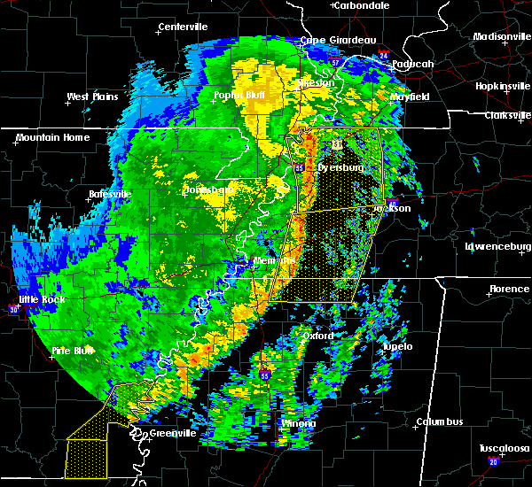 At 701 am cdt, severe thunderstorms were located along a line extending from 9 miles northeast of arlington to near lewisburg, moving east at 45 mph (radar indicated). Hazards include 60 mph wind gusts. expect damage to roofs, siding, and trees At 701 am cdt, severe thunderstorms were located along a line extending from 9 miles northeast of arlington to near lewisburg, moving east at 45 mph (radar indicated). Hazards include 60 mph wind gusts. expect damage to roofs, siding, and trees
|
| 10/21/2019 6:47 AM CDT |
 At 646 am cdt, doppler radar indicated a severe thunderstorm producing a tornado was located over germantown, moving east at 50 mph (radar indicated rotation). Hazards include tornado. Flying debris will be dangerous to those caught without shelter. mobile homes will be damaged or destroyed. damage to roofs, windows, and vehicles will occur. tree damage is likely. Locations impacted include, collierville, germantown, cordova, memphis, eads, lenow and fisherville. At 646 am cdt, doppler radar indicated a severe thunderstorm producing a tornado was located over germantown, moving east at 50 mph (radar indicated rotation). Hazards include tornado. Flying debris will be dangerous to those caught without shelter. mobile homes will be damaged or destroyed. damage to roofs, windows, and vehicles will occur. tree damage is likely. Locations impacted include, collierville, germantown, cordova, memphis, eads, lenow and fisherville.
|
| 10/21/2019 6:40 AM CDT |
 At 639 am cdt, doppler radar indicated a severe thunderstorm producing a tornado was located over southeast memphis, or 7 miles west of germantown, moving east at 50 mph (radar indicated rotation). Hazards include tornado. Flying debris will be dangerous to those caught without shelter. mobile homes will be damaged or destroyed. damage to roofs, windows, and vehicles will occur. Tree damage is likely. At 639 am cdt, doppler radar indicated a severe thunderstorm producing a tornado was located over southeast memphis, or 7 miles west of germantown, moving east at 50 mph (radar indicated rotation). Hazards include tornado. Flying debris will be dangerous to those caught without shelter. mobile homes will be damaged or destroyed. damage to roofs, windows, and vehicles will occur. Tree damage is likely.
|
| 10/21/2019 6:35 AM CDT |
 At 635 am cdt, severe thunderstorms were located along a line extending from munford to horn lake, moving east at 45 mph (radar indicated). Hazards include 60 mph wind gusts and quarter size hail. Hail damage to vehicles is expected. expect wind damage to roofs, siding, and trees. Locations impacted include, southaven, west memphis, horn lake, hernando, millington, t o fuller state park, meeman shelby forest state park, memphis, walls, horseshoe lake, lake cormorant, southwest memphis, lynchburg, eudora, downtown memphis, whitehaven, frayser, robinsonville, midtown memphis and newport. At 635 am cdt, severe thunderstorms were located along a line extending from munford to horn lake, moving east at 45 mph (radar indicated). Hazards include 60 mph wind gusts and quarter size hail. Hail damage to vehicles is expected. expect wind damage to roofs, siding, and trees. Locations impacted include, southaven, west memphis, horn lake, hernando, millington, t o fuller state park, meeman shelby forest state park, memphis, walls, horseshoe lake, lake cormorant, southwest memphis, lynchburg, eudora, downtown memphis, whitehaven, frayser, robinsonville, midtown memphis and newport.
|
| 10/21/2019 6:32 AM CDT |
 At 631 am cdt, doppler radar indicated a severe thunderstorm producing a tornado was located near frayser, moving northeast at 55 mph (radar indicated rotation). Hazards include tornado. Flying debris will be dangerous to those caught without shelter. mobile homes will be damaged or destroyed. damage to roofs, windows, and vehicles will occur. tree damage is likely. Locations impacted include, bartlett, millington, memphis, lakeland, arlington, munford, brighton, tipton, atoka, brunswick, barretville, woodstock, redwood, rosemark, spring lake, crosstown, kerrville, bolton and lucy. At 631 am cdt, doppler radar indicated a severe thunderstorm producing a tornado was located near frayser, moving northeast at 55 mph (radar indicated rotation). Hazards include tornado. Flying debris will be dangerous to those caught without shelter. mobile homes will be damaged or destroyed. damage to roofs, windows, and vehicles will occur. tree damage is likely. Locations impacted include, bartlett, millington, memphis, lakeland, arlington, munford, brighton, tipton, atoka, brunswick, barretville, woodstock, redwood, rosemark, spring lake, crosstown, kerrville, bolton and lucy.
|
| 10/21/2019 6:26 AM CDT |
 At 625 am cdt, doppler radar indicated a severe thunderstorm producing a tornado was located near marion, moving east at 50 mph (radar indicated rotation). Hazards include tornado. Flying debris will be dangerous to those caught without shelter. mobile homes will be damaged or destroyed. damage to roofs, windows, and vehicles will occur. Tree damage is likely. At 625 am cdt, doppler radar indicated a severe thunderstorm producing a tornado was located near marion, moving east at 50 mph (radar indicated rotation). Hazards include tornado. Flying debris will be dangerous to those caught without shelter. mobile homes will be damaged or destroyed. damage to roofs, windows, and vehicles will occur. Tree damage is likely.
|
| 10/21/2019 6:20 AM CDT |
 At 619 am cdt, severe thunderstorms were located along a line extending from near meeman shelby forest state park to near horseshoe lake, moving east at 35 mph (radar indicated). Hazards include 60 mph wind gusts. expect damage to roofs, siding, and trees At 619 am cdt, severe thunderstorms were located along a line extending from near meeman shelby forest state park to near horseshoe lake, moving east at 35 mph (radar indicated). Hazards include 60 mph wind gusts. expect damage to roofs, siding, and trees
|
| 10/21/2019 5:56 AM CDT |
 At 556 am cdt, severe thunderstorms were located along a line extending from near gilmore to near brickeys, moving east at 45 mph (radar indicated). Hazards include 60 mph wind gusts and quarter size hail. Hail damage to vehicles is expected. Expect wind damage to roofs, siding, and trees. At 556 am cdt, severe thunderstorms were located along a line extending from near gilmore to near brickeys, moving east at 45 mph (radar indicated). Hazards include 60 mph wind gusts and quarter size hail. Hail damage to vehicles is expected. Expect wind damage to roofs, siding, and trees.
|
| 8/13/2019 8:07 PM CDT |
 At 807 pm cdt, a severe thunderstorm was located near olive branch, moving east at 30 mph (radar indicated). Hazards include 60 mph wind gusts and quarter size hail. Hail damage to vehicles is expected. expect wind damage to roofs, siding, and trees. Locations impacted include, collierville, germantown, olive branch, memphis, byhalia, mt pleasant, southeast memphis, red banks, slayden, piperton, coal oil corner, cayce, fairhaven, victoria, parkway village, white station, handy corner, taska, capleville and miller. At 807 pm cdt, a severe thunderstorm was located near olive branch, moving east at 30 mph (radar indicated). Hazards include 60 mph wind gusts and quarter size hail. Hail damage to vehicles is expected. expect wind damage to roofs, siding, and trees. Locations impacted include, collierville, germantown, olive branch, memphis, byhalia, mt pleasant, southeast memphis, red banks, slayden, piperton, coal oil corner, cayce, fairhaven, victoria, parkway village, white station, handy corner, taska, capleville and miller.
|
| 8/13/2019 8:06 PM CDT |
 The severe thunderstorm warning for northeastern desoto and south central shelby counties will expire at 815 pm cdt, the storm which prompted the warning has weakened below severe limits, and has exited the warned area. therefore, the warning will be allowed to expire. The severe thunderstorm warning for northeastern desoto and south central shelby counties will expire at 815 pm cdt, the storm which prompted the warning has weakened below severe limits, and has exited the warned area. therefore, the warning will be allowed to expire.
|
| 8/13/2019 7:58 PM CDT |
 At 758 pm cdt, a severe thunderstorm was located near olive branch, moving southeast at 60 mph (radar indicated). Hazards include 60 mph wind gusts. expect damage to roofs, siding, and trees At 758 pm cdt, a severe thunderstorm was located near olive branch, moving southeast at 60 mph (radar indicated). Hazards include 60 mph wind gusts. expect damage to roofs, siding, and trees
|
| 8/13/2019 7:50 PM CDT | Winds strong enough to move two (likely empty) railcars in an uphill direction at the cn railyard in southwest memphi in shelby county TN, 10.9 miles ENE of Memphis, TN |
| 8/13/2019 7:49 PM CDT |
 At 749 pm cdt, a severe thunderstorm was located over southeast memphis, or near southaven, moving east at 30 mph (radar indicated). Hazards include 60 mph wind gusts and quarter size hail. Hail damage to vehicles is expected. Expect wind damage to roofs, siding, and trees. At 749 pm cdt, a severe thunderstorm was located over southeast memphis, or near southaven, moving east at 30 mph (radar indicated). Hazards include 60 mph wind gusts and quarter size hail. Hail damage to vehicles is expected. Expect wind damage to roofs, siding, and trees.
|
| 8/13/2019 7:49 PM CDT |
 The national weather service in memphis has issued a * severe thunderstorm warning for. northeastern desoto county in northwestern mississippi. northwestern marshall county in northwestern mississippi. southeastern shelby county in western tennessee. Until 830 pm cdt. The national weather service in memphis has issued a * severe thunderstorm warning for. northeastern desoto county in northwestern mississippi. northwestern marshall county in northwestern mississippi. southeastern shelby county in western tennessee. Until 830 pm cdt.
|
| 8/13/2019 7:45 PM CDT | Wind gust measured at memphis international airpor in shelby county TN, 9.4 miles NE of Memphis, TN |
| 8/13/2019 7:24 PM CDT |
 At 724 pm cdt, a severe thunderstorm was located near t o fuller state park, moving southeast at 25 mph (radar indicated). Hazards include 70 mph wind gusts and quarter size hail. Hail damage to vehicles is expected. expect considerable tree damage. wind damage is also likely to mobile homes, roofs, and outbuildings. Locations impacted include, southaven, olive branch, west memphis, horn lake, hernando, marion, t o fuller state park, memphis, walls, edmondson, horseshoe lake, sunset, anthonyville, lake cormorant, southwest memphis, eudora, simsboro, whitehaven, pinckney and lynchburg. At 724 pm cdt, a severe thunderstorm was located near t o fuller state park, moving southeast at 25 mph (radar indicated). Hazards include 70 mph wind gusts and quarter size hail. Hail damage to vehicles is expected. expect considerable tree damage. wind damage is also likely to mobile homes, roofs, and outbuildings. Locations impacted include, southaven, olive branch, west memphis, horn lake, hernando, marion, t o fuller state park, memphis, walls, edmondson, horseshoe lake, sunset, anthonyville, lake cormorant, southwest memphis, eudora, simsboro, whitehaven, pinckney and lynchburg.
|
| 8/13/2019 7:13 PM CDT |
 At 713 pm cdt, a severe thunderstorm was located near edmondson, or 7 miles southwest of west memphis, moving southeast at 50 mph (radar indicated). Hazards include 60 mph wind gusts and quarter size hail. Hail damage to vehicles is expected. Expect wind damage to roofs, siding, and trees. At 713 pm cdt, a severe thunderstorm was located near edmondson, or 7 miles southwest of west memphis, moving southeast at 50 mph (radar indicated). Hazards include 60 mph wind gusts and quarter size hail. Hail damage to vehicles is expected. Expect wind damage to roofs, siding, and trees.
|
| 8/7/2019 5:41 PM CDT |
 The severe thunderstorm warning for west central fayette and eastern shelby counties will expire at 545 pm cdt, the storm which prompted the warning has weakened below severe limits, and has exited the warned area. therefore, the warning will be allowed to expire. a severe thunderstorm watch remains in effect until 800 pm cdt for northwestern mississippi, and western tennessee. The severe thunderstorm warning for west central fayette and eastern shelby counties will expire at 545 pm cdt, the storm which prompted the warning has weakened below severe limits, and has exited the warned area. therefore, the warning will be allowed to expire. a severe thunderstorm watch remains in effect until 800 pm cdt for northwestern mississippi, and western tennessee.
|
| 8/7/2019 4:55 PM CDT |
 At 455 pm cdt, a severe thunderstorm was located over bartlett, moving southeast at 20 mph (radar indicated). Hazards include 60 mph wind gusts. expect damage to roofs, siding, and trees At 455 pm cdt, a severe thunderstorm was located over bartlett, moving southeast at 20 mph (radar indicated). Hazards include 60 mph wind gusts. expect damage to roofs, siding, and trees
|
| 7/15/2019 10:05 PM CDT |
 The severe thunderstorm warning for south central tipton and northeastern shelby counties will expire at 1015 pm cdt, the storm which prompted the warning has weakened below severe limits, and has exited the warned area. therefore, the warning will be allowed to expire. The severe thunderstorm warning for south central tipton and northeastern shelby counties will expire at 1015 pm cdt, the storm which prompted the warning has weakened below severe limits, and has exited the warned area. therefore, the warning will be allowed to expire.
|
| 7/15/2019 9:56 PM CDT |
 At 955 pm cdt, a severe thunderstorm was located over dixonville, or 11 miles northeast of millington, moving northeast at 45 mph (radar indicated). Hazards include 60 mph wind gusts. Expect damage to roofs, siding, and trees. Locations impacted include, bartlett, millington, lakeland, arlington, munford, ellendale, tipton, atoka, brunswick, barretville, wilkinsville, redwood, rosemark, idaville, crosstown, kerrville and bolton. At 955 pm cdt, a severe thunderstorm was located over dixonville, or 11 miles northeast of millington, moving northeast at 45 mph (radar indicated). Hazards include 60 mph wind gusts. Expect damage to roofs, siding, and trees. Locations impacted include, bartlett, millington, lakeland, arlington, munford, ellendale, tipton, atoka, brunswick, barretville, wilkinsville, redwood, rosemark, idaville, crosstown, kerrville and bolton.
|
| 7/15/2019 9:35 PM CDT |
 At 935 pm cdt, a severe thunderstorm was located over ellendale, or over bartlett, moving northeast at 45 mph (radar indicated). Hazards include 60 mph wind gusts. expect damage to roofs, siding, and trees At 935 pm cdt, a severe thunderstorm was located over ellendale, or over bartlett, moving northeast at 45 mph (radar indicated). Hazards include 60 mph wind gusts. expect damage to roofs, siding, and trees
|
| 6/23/2019 5:38 PM CDT |
 The severe thunderstorm warning for north central marshall and southern fayette counties will expire at 545 pm cdt, the storm which prompted the warning has weakened below severe limits, and no longer poses an immediate threat to life or property. therefore, the warning will be allowed to expire. however wind gusts to 45 mph, pea size hail and heavy rain are still possible with this thunderstorm. a severe thunderstorm watch remains in effect until 800 pm cdt for northwestern mississippi, and western tennessee. The severe thunderstorm warning for north central marshall and southern fayette counties will expire at 545 pm cdt, the storm which prompted the warning has weakened below severe limits, and no longer poses an immediate threat to life or property. therefore, the warning will be allowed to expire. however wind gusts to 45 mph, pea size hail and heavy rain are still possible with this thunderstorm. a severe thunderstorm watch remains in effect until 800 pm cdt for northwestern mississippi, and western tennessee.
|
| 6/23/2019 5:21 PM CDT |
 At 521 pm cdt, a severe thunderstorm was located 8 miles east of collierville, moving southeast at 55 mph (radar indicated). Hazards include 60 mph wind gusts. Expect damage to roofs, siding, and trees. Locations impacted include, arlington, mt pleasant, slayden, macon, oakland, piperton, rossville, moscow, williston, elba, canadaville, kirk, hays crossing, hickory withe and pattersonville. At 521 pm cdt, a severe thunderstorm was located 8 miles east of collierville, moving southeast at 55 mph (radar indicated). Hazards include 60 mph wind gusts. Expect damage to roofs, siding, and trees. Locations impacted include, arlington, mt pleasant, slayden, macon, oakland, piperton, rossville, moscow, williston, elba, canadaville, kirk, hays crossing, hickory withe and pattersonville.
|
| 6/23/2019 5:05 PM CDT |
 At 505 pm cdt, a severe thunderstorm was located over lakeland, or near cordova, moving southeast at 30 mph (radar indicated). Hazards include 60 mph wind gusts. expect damage to roofs, siding, and trees At 505 pm cdt, a severe thunderstorm was located over lakeland, or near cordova, moving southeast at 30 mph (radar indicated). Hazards include 60 mph wind gusts. expect damage to roofs, siding, and trees
|
| 6/23/2019 5:05 PM CDT |
 The national weather service in memphis has issued a * severe thunderstorm warning for. north central marshall county in northwestern mississippi. southern fayette county in western tennessee. east central shelby county in western tennessee. Until 545 pm cdt. The national weather service in memphis has issued a * severe thunderstorm warning for. north central marshall county in northwestern mississippi. southern fayette county in western tennessee. east central shelby county in western tennessee. Until 545 pm cdt.
|
| 6/22/2019 6:45 PM CDT |
 At 644 pm cdt, a severe thunderstorm was located over southeast memphis, or near olive branch, moving northeast at 15 mph (radar indicated). Hazards include 60 mph wind gusts and dime size hail. Hail damage to vehicles is expected. Expect wind damage to roofs, siding, and trees. At 644 pm cdt, a severe thunderstorm was located over southeast memphis, or near olive branch, moving northeast at 15 mph (radar indicated). Hazards include 60 mph wind gusts and dime size hail. Hail damage to vehicles is expected. Expect wind damage to roofs, siding, and trees.
|
| 6/20/2019 12:06 AM CDT |
 At 1205 am cdt, severe thunderstorms were located along a line extending from near ashport to near lewisburg, moving east at 50 mph (airport weather observation). Hazards include 70 mph wind gusts. Expect considerable tree damage. damage is likely to mobile homes, roofs, and outbuildings. Locations impacted include, bartlett, southaven, collierville, germantown, olive branch, horn lake, brownsville, millington, covington, ripley, osceola, luxora, wilson, keiser, cordova, meeman shelby forest state park, fort pillow state park, memphis, lakeland and arlington. At 1205 am cdt, severe thunderstorms were located along a line extending from near ashport to near lewisburg, moving east at 50 mph (airport weather observation). Hazards include 70 mph wind gusts. Expect considerable tree damage. damage is likely to mobile homes, roofs, and outbuildings. Locations impacted include, bartlett, southaven, collierville, germantown, olive branch, horn lake, brownsville, millington, covington, ripley, osceola, luxora, wilson, keiser, cordova, meeman shelby forest state park, fort pillow state park, memphis, lakeland and arlington.
|
| 6/19/2019 11:58 PM CDT |
 At 1158 pm cdt, severe thunderstorms were located along a line extending from near luxora to near hernando, moving east at 50 mph (radar indicated). Hazards include 60 mph wind gusts. expect damage to roofs, siding, and trees At 1158 pm cdt, severe thunderstorms were located along a line extending from near luxora to near hernando, moving east at 50 mph (radar indicated). Hazards include 60 mph wind gusts. expect damage to roofs, siding, and trees
|
| 6/19/2019 11:54 PM CDT | Memphis airport 58 kt gust in shelby county TN, 9.4 miles NE of Memphis, TN |
| 6/19/2019 11:35 PM CDT |
 At 1134 pm cdt, severe thunderstorms were located along a line extending from near gilmore to phillipp, moving east at 60 mph (radar indicated). Hazards include 70 mph wind gusts. Expect considerable tree damage. damage is likely to mobile homes, roofs, and outbuildings. Locations impacted include, bartlett, southaven, collierville, germantown, olive branch, west memphis, horn lake, hernando, marion, millington, covington, marked tree, earle, hughes, parkin, tyronza, t o fuller state park, meeman shelby forest state park, cordova and memphis. At 1134 pm cdt, severe thunderstorms were located along a line extending from near gilmore to phillipp, moving east at 60 mph (radar indicated). Hazards include 70 mph wind gusts. Expect considerable tree damage. damage is likely to mobile homes, roofs, and outbuildings. Locations impacted include, bartlett, southaven, collierville, germantown, olive branch, west memphis, horn lake, hernando, marion, millington, covington, marked tree, earle, hughes, parkin, tyronza, t o fuller state park, meeman shelby forest state park, cordova and memphis.
|
| 6/19/2019 11:15 PM CDT |
 At 1115 pm cdt, severe thunderstorms were located along a line extending from 7 miles southwest of marked tree to 7 miles northwest of north tunica, moving east at 60 mph (radar indicated). Hazards include 70 mph wind gusts. Expect considerable tree damage. Damage is likely to mobile homes, roofs, and outbuildings. At 1115 pm cdt, severe thunderstorms were located along a line extending from 7 miles southwest of marked tree to 7 miles northwest of north tunica, moving east at 60 mph (radar indicated). Hazards include 70 mph wind gusts. Expect considerable tree damage. Damage is likely to mobile homes, roofs, and outbuildings.
|
| 6/19/2019 11:02 PM CDT |
 At 1101 pm cdt, severe thunderstorms were located along a line extending from 6 miles south of tyronza to near little texas, moving east at 75 mph (radar indicated). Hazards include 70 mph wind gusts. Expect considerable tree damage. damage is likely to mobile homes, roofs, and outbuildings. Locations impacted include, west memphis, forrest city, marion, wynne, marianna, marked tree, earle, hughes, parkin, madison, tyronza, palestine, village creek state park, tunica, cherry valley, caldwell, crawfordsville, edmondson, colt and horseshoe lake. At 1101 pm cdt, severe thunderstorms were located along a line extending from 6 miles south of tyronza to near little texas, moving east at 75 mph (radar indicated). Hazards include 70 mph wind gusts. Expect considerable tree damage. damage is likely to mobile homes, roofs, and outbuildings. Locations impacted include, west memphis, forrest city, marion, wynne, marianna, marked tree, earle, hughes, parkin, madison, tyronza, palestine, village creek state park, tunica, cherry valley, caldwell, crawfordsville, edmondson, colt and horseshoe lake.
|
| 6/19/2019 10:32 PM CDT |
 At 1031 pm cdt, severe thunderstorms were located along a line extending from near fair oaks to near palmer, moving east at 75 mph (radar indicated). Hazards include 70 mph wind gusts. Expect considerable tree damage. Damage is likely to mobile homes, roofs, and outbuildings. At 1031 pm cdt, severe thunderstorms were located along a line extending from near fair oaks to near palmer, moving east at 75 mph (radar indicated). Hazards include 70 mph wind gusts. Expect considerable tree damage. Damage is likely to mobile homes, roofs, and outbuildings.
|
| 6/19/2019 10:32 PM CDT |
 The national weather service in memphis has issued a * severe thunderstorm warning for. lee county in eastern arkansas. st. francis county in eastern arkansas. southeastern poinsett county in eastern arkansas. Northern phillips county in eastern arkansas. The national weather service in memphis has issued a * severe thunderstorm warning for. lee county in eastern arkansas. st. francis county in eastern arkansas. southeastern poinsett county in eastern arkansas. Northern phillips county in eastern arkansas.
|
| 5/18/2019 8:37 PM CDT |
 The severe thunderstorm warning for eastern crittenden, northern desoto and central shelby counties will expire at 845 pm cdt, the storms which prompted the warning have weakened below severe limits, and no longer pose an immediate threat to life or property. therefore, the warning will be allowed to expire. however gusty winds and heavy rain are still possible with these thunderstorms. a severe thunderstorm watch remains in effect until midnight cdt for eastern arkansas, northwestern mississippi, and western tennessee. The severe thunderstorm warning for eastern crittenden, northern desoto and central shelby counties will expire at 845 pm cdt, the storms which prompted the warning have weakened below severe limits, and no longer pose an immediate threat to life or property. therefore, the warning will be allowed to expire. however gusty winds and heavy rain are still possible with these thunderstorms. a severe thunderstorm watch remains in effect until midnight cdt for eastern arkansas, northwestern mississippi, and western tennessee.
|
| 5/18/2019 8:30 PM CDT | Several small trees uproote in shelby county TN, 4.7 miles E of Memphis, TN |
| 5/18/2019 8:30 PM CDT |
 At 830 pm cdt, severe thunderstorms were located along a line extending from meeman shelby forest state park to near frayser to near southaven, moving northeast at 40 mph (radar indicated). Hazards include 60 mph wind gusts. Expect damage to roofs, siding, and trees. Locations impacted include, bartlett, southaven, olive branch, west memphis, horn lake, hernando, marion, millington, t o fuller state park, meeman shelby forest state park, memphis, walls, edmondson, sunset, jericho, southwest memphis, whitehaven, frayser, midtown memphis and lynchburg. At 830 pm cdt, severe thunderstorms were located along a line extending from meeman shelby forest state park to near frayser to near southaven, moving northeast at 40 mph (radar indicated). Hazards include 60 mph wind gusts. Expect damage to roofs, siding, and trees. Locations impacted include, bartlett, southaven, olive branch, west memphis, horn lake, hernando, marion, millington, t o fuller state park, meeman shelby forest state park, memphis, walls, edmondson, sunset, jericho, southwest memphis, whitehaven, frayser, midtown memphis and lynchburg.
|
| 5/18/2019 8:23 PM CDT |
 At 822 pm cdt, severe thunderstorms were located along a line extending from near meeman shelby forest state park to memphis to horn lake, moving northeast at 50 mph (radar indicated). Hazards include 60 mph wind gusts. Expect damage to roofs, siding, and trees. Locations impacted include, bartlett, southaven, olive branch, west memphis, horn lake, hernando, marion, millington, t o fuller state park, meeman shelby forest state park, memphis, walls, crawfordsville, edmondson, sunset, jericho, lake cormorant, southwest memphis, eudora and whitehaven. At 822 pm cdt, severe thunderstorms were located along a line extending from near meeman shelby forest state park to memphis to horn lake, moving northeast at 50 mph (radar indicated). Hazards include 60 mph wind gusts. Expect damage to roofs, siding, and trees. Locations impacted include, bartlett, southaven, olive branch, west memphis, horn lake, hernando, marion, millington, t o fuller state park, meeman shelby forest state park, memphis, walls, crawfordsville, edmondson, sunset, jericho, lake cormorant, southwest memphis, eudora and whitehaven.
|
| 5/18/2019 8:18 PM CDT | Peak wind gust 59 mph at tom lee park in memphis. measured by equipment 35 feet above ground. damage to tents and infrastructure at the par in shelby county TN, 10.4 miles E of Memphis, TN |
| 5/18/2019 8:11 PM CDT |
 The severe thunderstorm warning for eastern lee, eastern st. francis, southwestern crittenden, northwestern desoto and tunica counties will expire at 815 pm cdt, the storms which prompted the warning have moved out of the area. therefore, the warning will be allowed to expire. however gusty winds are still possible with these thunderstorms. a severe thunderstorm watch remains in effect until midnight cdt for eastern arkansas, northwestern mississippi, and western tennessee. The severe thunderstorm warning for eastern lee, eastern st. francis, southwestern crittenden, northwestern desoto and tunica counties will expire at 815 pm cdt, the storms which prompted the warning have moved out of the area. therefore, the warning will be allowed to expire. however gusty winds are still possible with these thunderstorms. a severe thunderstorm watch remains in effect until midnight cdt for eastern arkansas, northwestern mississippi, and western tennessee.
|
| 5/18/2019 7:59 PM CDT |
 The national weather service in memphis has issued a * severe thunderstorm warning for. central crittenden county in eastern arkansas. desoto county in northwestern mississippi. northeastern tunica county in northwestern mississippi. Central shelby county in western tennessee. The national weather service in memphis has issued a * severe thunderstorm warning for. central crittenden county in eastern arkansas. desoto county in northwestern mississippi. northeastern tunica county in northwestern mississippi. Central shelby county in western tennessee.
|
| 5/18/2019 7:59 PM CDT |
 At 759 pm cdt, severe thunderstorms were located along a line extending from near jennette to near phillipp, moving northeast at 40 mph (radar indicated). Hazards include 60 mph wind gusts. expect damage to roofs, siding, and trees At 759 pm cdt, severe thunderstorms were located along a line extending from near jennette to near phillipp, moving northeast at 40 mph (radar indicated). Hazards include 60 mph wind gusts. expect damage to roofs, siding, and trees
|
| 5/18/2019 7:52 PM CDT |
 At 751 pm cdt, severe thunderstorms were located along a line extending from near jennette to near horseshoe lake to near robinsonville, moving northeast at 55 mph (radar indicated). Hazards include 60 mph wind gusts. Expect damage to roofs, siding, and trees. Locations impacted include, hughes, tunica, edmondson, horseshoe lake, anthonyville, jennette, lake cormorant, simsboro, brickeys, north tunica, pinckney, new home, robinsonville, clack, browns, commerce, louise, austin, round pond and beck. At 751 pm cdt, severe thunderstorms were located along a line extending from near jennette to near horseshoe lake to near robinsonville, moving northeast at 55 mph (radar indicated). Hazards include 60 mph wind gusts. Expect damage to roofs, siding, and trees. Locations impacted include, hughes, tunica, edmondson, horseshoe lake, anthonyville, jennette, lake cormorant, simsboro, brickeys, north tunica, pinckney, new home, robinsonville, clack, browns, commerce, louise, austin, round pond and beck.
|
| 5/18/2019 7:36 PM CDT |
 At 736 pm cdt, severe thunderstorms were located along a line extending from new home to near brickeys to near tunica, moving northeast at 45 mph (radar indicated). Hazards include 60 mph wind gusts. Expect damage to roofs, siding, and trees. Locations impacted include, forrest city, hughes, madison, helena-west helena, st francis national park, tunica, edmondson, horseshoe lake, widener, anthonyville, jennette, lake cormorant, simsboro, brickeys, north tunica, pinckney, new home, robinsonville, cody and clack. At 736 pm cdt, severe thunderstorms were located along a line extending from new home to near brickeys to near tunica, moving northeast at 45 mph (radar indicated). Hazards include 60 mph wind gusts. Expect damage to roofs, siding, and trees. Locations impacted include, forrest city, hughes, madison, helena-west helena, st francis national park, tunica, edmondson, horseshoe lake, widener, anthonyville, jennette, lake cormorant, simsboro, brickeys, north tunica, pinckney, new home, robinsonville, cody and clack.
|
| 5/18/2019 7:27 PM CDT |
 At 727 pm cdt, severe thunderstorms were located along a line extending from near haynes to 9 miles southeast of marianna to st francis national park, moving northeast at 40 mph (radar indicated). Hazards include 60 mph wind gusts. expect damage to roofs, siding, and trees At 727 pm cdt, severe thunderstorms were located along a line extending from near haynes to 9 miles southeast of marianna to st francis national park, moving northeast at 40 mph (radar indicated). Hazards include 60 mph wind gusts. expect damage to roofs, siding, and trees
|
| 5/15/2019 8:20 PM CDT |
 The severe thunderstorm warning for northeastern shelby county will expire at 830 pm cdt, the storm which prompted the warning has weakened below severe limits, and no longer poses an immediate threat to life or property. therefore, the warning will be allowed to expire. The severe thunderstorm warning for northeastern shelby county will expire at 830 pm cdt, the storm which prompted the warning has weakened below severe limits, and no longer poses an immediate threat to life or property. therefore, the warning will be allowed to expire.
|
| 5/15/2019 8:09 PM CDT |
 At 808 pm cdt, a severe thunderstorm was located near millington, moving south at 15 mph (radar indicated). Hazards include quarter size hail. Damage to vehicles is expected. Locations impacted include, bartlett, millington, meeman shelby forest state park, memphis, lakeland, ellendale, frayser, elmore park, brunswick, raleigh, griffin corner, woodstock, gilestown, spring lake, locke, bolton and lucy. At 808 pm cdt, a severe thunderstorm was located near millington, moving south at 15 mph (radar indicated). Hazards include quarter size hail. Damage to vehicles is expected. Locations impacted include, bartlett, millington, meeman shelby forest state park, memphis, lakeland, ellendale, frayser, elmore park, brunswick, raleigh, griffin corner, woodstock, gilestown, spring lake, locke, bolton and lucy.
|
| 5/15/2019 7:43 PM CDT |
 At 743 pm cdt, a severe thunderstorm was located 7 miles northwest of millington, moving south at 15 mph (radar indicated). Hazards include quarter size hail. damage to vehicles is expected At 743 pm cdt, a severe thunderstorm was located 7 miles northwest of millington, moving south at 15 mph (radar indicated). Hazards include quarter size hail. damage to vehicles is expected
|
| 5/15/2019 7:24 PM CDT |
 The severe thunderstorm warning for southwestern fayette and southeastern shelby counties will expire at 730 pm cdt, the storm which prompted the warning has weakened below severe limits, and no longer poses an immediate threat to life or property. therefore, the warning will be allowed to expire. The severe thunderstorm warning for southwestern fayette and southeastern shelby counties will expire at 730 pm cdt, the storm which prompted the warning has weakened below severe limits, and no longer poses an immediate threat to life or property. therefore, the warning will be allowed to expire.
|
| 5/15/2019 6:56 PM CDT | Quarter sized hail reported 6.9 miles WSW of Memphis, TN, quarter sized hail reported in cordova tn. |
| 5/15/2019 6:51 PM CDT |
 The national weather service in memphis has issued a * severe thunderstorm warning for. southwestern fayette county in western tennessee. southeastern shelby county in western tennessee. until 730 pm cdt. At 651 pm cdt, a severe thunderstorm was located over lakeland, or. The national weather service in memphis has issued a * severe thunderstorm warning for. southwestern fayette county in western tennessee. southeastern shelby county in western tennessee. until 730 pm cdt. At 651 pm cdt, a severe thunderstorm was located over lakeland, or.
|
| 5/15/2019 6:37 PM CDT |
 At 636 pm cdt, a severe thunderstorm was located over arlington, or 10 miles northeast of bartlett, moving south at 15 mph. dime size hail was reported with this storm in lakeland (radar indicated). Hazards include quarter size hail. Damage to vehicles is expected. Locations impacted include, bartlett, collierville, germantown, cordova, lakeland, arlington, eads, macon, oakland, gallaway, braden, brunswick, lenow, fisherville, canadaville, hickory withe and bolton. At 636 pm cdt, a severe thunderstorm was located over arlington, or 10 miles northeast of bartlett, moving south at 15 mph. dime size hail was reported with this storm in lakeland (radar indicated). Hazards include quarter size hail. Damage to vehicles is expected. Locations impacted include, bartlett, collierville, germantown, cordova, lakeland, arlington, eads, macon, oakland, gallaway, braden, brunswick, lenow, fisherville, canadaville, hickory withe and bolton.
|
| 5/15/2019 6:21 PM CDT |
 At 621 pm cdt, a severe thunderstorm was located near arlington, or 10 miles east of millington, moving south at 15 mph (radar indicated). Hazards include quarter size hail. damage to vehicles is expected At 621 pm cdt, a severe thunderstorm was located near arlington, or 10 miles east of millington, moving south at 15 mph (radar indicated). Hazards include quarter size hail. damage to vehicles is expected
|
| 4/6/2019 9:34 PM CDT |
 At 934 pm cdt, a severe thunderstorm was located over eads, or near cordova, moving northeast at 50 mph (radar indicated). Hazards include 60 mph wind gusts. Expect damage to roofs, siding, and trees. Locations impacted include, collierville, germantown, cordova, memphis, eads, lenow and fisherville. At 934 pm cdt, a severe thunderstorm was located over eads, or near cordova, moving northeast at 50 mph (radar indicated). Hazards include 60 mph wind gusts. Expect damage to roofs, siding, and trees. Locations impacted include, collierville, germantown, cordova, memphis, eads, lenow and fisherville.
|
| 4/6/2019 9:28 PM CDT |
 At 928 pm cdt, a severe thunderstorm was located near collierville, moving northeast at 50 mph (radar indicated). Hazards include 60 mph wind gusts. expect damage to roofs, siding, and trees At 928 pm cdt, a severe thunderstorm was located near collierville, moving northeast at 50 mph (radar indicated). Hazards include 60 mph wind gusts. expect damage to roofs, siding, and trees
|
| 4/6/2019 9:19 PM CDT |
 At 918 pm cdt, a severe thunderstorm was located over southeast memphis, or near germantown, moving northeast at 50 mph (radar indicated). Hazards include 60 mph wind gusts. Expect damage to roofs, siding, and trees. Locations impacted include, southaven, collierville, germantown, olive branch, horn lake, t o fuller state park, cordova, memphis, southwest memphis, southeast memphis, eads, whitehaven, lynchburg, lenow, cedarview, handy corner, capleville, jago, fisherville and alden. At 918 pm cdt, a severe thunderstorm was located over southeast memphis, or near germantown, moving northeast at 50 mph (radar indicated). Hazards include 60 mph wind gusts. Expect damage to roofs, siding, and trees. Locations impacted include, southaven, collierville, germantown, olive branch, horn lake, t o fuller state park, cordova, memphis, southwest memphis, southeast memphis, eads, whitehaven, lynchburg, lenow, cedarview, handy corner, capleville, jago, fisherville and alden.
|
| 4/6/2019 9:09 PM CDT |
 At 909 pm cdt, a severe thunderstorm was located over whitehaven, or over southaven, moving northeast at 50 mph (radar indicated). Hazards include 60 mph wind gusts. Expect damage to roofs, siding, and trees. Locations impacted include, southaven, collierville, germantown, olive branch, horn lake, hernando, t o fuller state park, cordova, memphis, walls, southwest memphis, lynchburg, southeast memphis, eads, whitehaven, lenow, cedarview, nesbit, handy corner and capleville. At 909 pm cdt, a severe thunderstorm was located over whitehaven, or over southaven, moving northeast at 50 mph (radar indicated). Hazards include 60 mph wind gusts. Expect damage to roofs, siding, and trees. Locations impacted include, southaven, collierville, germantown, olive branch, horn lake, hernando, t o fuller state park, cordova, memphis, walls, southwest memphis, lynchburg, southeast memphis, eads, whitehaven, lenow, cedarview, nesbit, handy corner and capleville.
|
| 4/6/2019 8:57 PM CDT |
 At 857 pm cdt, a severe thunderstorm was located over walls, or near horn lake, moving northeast at 50 mph (radar indicated). Hazards include 60 mph wind gusts. expect damage to roofs, siding, and trees At 857 pm cdt, a severe thunderstorm was located over walls, or near horn lake, moving northeast at 50 mph (radar indicated). Hazards include 60 mph wind gusts. expect damage to roofs, siding, and trees
|
| 3/25/2019 12:24 AM CDT |
 At 1223 am cdt, a severe thunderstorm was located near meeman shelby forest state park, moving east at 40 mph (radar indicated). Hazards include 60 mph wind gusts. expect damage to roofs, siding, and trees At 1223 am cdt, a severe thunderstorm was located near meeman shelby forest state park, moving east at 40 mph (radar indicated). Hazards include 60 mph wind gusts. expect damage to roofs, siding, and trees
|
| 2/23/2019 4:21 PM CST |
 The severe thunderstorm warning for south central crittenden, desoto, tunica, western tate and northwestern panola counties will expire at 430 pm cst, the storm which prompted the warning has weakened below severe limits, and no longer poses an immediate threat to life or property. therefore, the warning will be allowed to expire. a tornado watch remains in effect until 800 pm cst for eastern arkansas, northwestern mississippi, and western tennessee. The severe thunderstorm warning for south central crittenden, desoto, tunica, western tate and northwestern panola counties will expire at 430 pm cst, the storm which prompted the warning has weakened below severe limits, and no longer poses an immediate threat to life or property. therefore, the warning will be allowed to expire. a tornado watch remains in effect until 800 pm cst for eastern arkansas, northwestern mississippi, and western tennessee.
|
| 2/23/2019 3:52 PM CST |
 At 351 pm cst, a severe thunderstorm was located over dubbs, or 13 miles east of st francis national park, moving northeast at 55 mph (radar indicated). Hazards include 60 mph wind gusts. expect damage to roofs, siding, and trees At 351 pm cst, a severe thunderstorm was located over dubbs, or 13 miles east of st francis national park, moving northeast at 55 mph (radar indicated). Hazards include 60 mph wind gusts. expect damage to roofs, siding, and trees
|
| 1/19/2019 5:13 AM CST |
 At 513 am cst, a severe thunderstorm was located near robinsonville, or near hughes, moving northeast at 55 mph (radar indicated). Hazards include 60 mph wind gusts. Expect damage to roofs, siding, and trees. Locations impacted include, west memphis, hughes, st francis national park, helena-west helena, tunica, edmondson, horseshoe lake, lexa, anthonyville, jennette, lake cormorant, simsboro, brickeys, north tunica, pinckney, robinsonville, little texas, crittenden, lagrange and cody. At 513 am cst, a severe thunderstorm was located near robinsonville, or near hughes, moving northeast at 55 mph (radar indicated). Hazards include 60 mph wind gusts. Expect damage to roofs, siding, and trees. Locations impacted include, west memphis, hughes, st francis national park, helena-west helena, tunica, edmondson, horseshoe lake, lexa, anthonyville, jennette, lake cormorant, simsboro, brickeys, north tunica, pinckney, robinsonville, little texas, crittenden, lagrange and cody.
|
| 1/19/2019 4:54 AM CST |
 At 454 am cst, a severe thunderstorm was located over brickeys, or 8 miles northeast of marianna, moving east at 50 mph (radar indicated). Hazards include 60 mph wind gusts. expect damage to roofs, siding, and trees At 454 am cst, a severe thunderstorm was located over brickeys, or 8 miles northeast of marianna, moving east at 50 mph (radar indicated). Hazards include 60 mph wind gusts. expect damage to roofs, siding, and trees
|
| 8/30/2018 4:24 PM CDT |
 At 423 pm cdt, a severe thunderstorm was located near frayser, or near bartlett, moving northwest at 15 mph (radar indicated). Hazards include 60 mph wind gusts. Expect damage to roofs, siding, and trees. Locations impacted include, bartlett, millington, meeman shelby forest state park, memphis, lakeland, ellendale, frayser, elmore park, brunswick, raleigh, griffin corner, woodstock, gilestown, spring lake, cuba, benjestown, locke, kerrville, lucy and sloanville. At 423 pm cdt, a severe thunderstorm was located near frayser, or near bartlett, moving northwest at 15 mph (radar indicated). Hazards include 60 mph wind gusts. Expect damage to roofs, siding, and trees. Locations impacted include, bartlett, millington, meeman shelby forest state park, memphis, lakeland, ellendale, frayser, elmore park, brunswick, raleigh, griffin corner, woodstock, gilestown, spring lake, cuba, benjestown, locke, kerrville, lucy and sloanville.
|
| 8/30/2018 4:10 PM CDT |
 At 410 pm cdt, a severe thunderstorm was located over bartlett, moving northwest at 15 mph (radar indicated). Hazards include 60 mph wind gusts. expect damage to roofs, siding, and trees At 410 pm cdt, a severe thunderstorm was located over bartlett, moving northwest at 15 mph (radar indicated). Hazards include 60 mph wind gusts. expect damage to roofs, siding, and trees
|
| 8/20/2018 6:30 PM CDT |
 At 629 pm cdt, a severe thunderstorm was located over collierville, moving east at 35 mph (radar indicated). Hazards include 60 mph wind gusts. expect damage to roofs, siding, and trees At 629 pm cdt, a severe thunderstorm was located over collierville, moving east at 35 mph (radar indicated). Hazards include 60 mph wind gusts. expect damage to roofs, siding, and trees
|
| 8/20/2018 6:26 PM CDT |
 The severe thunderstorm warning for northeastern lee, eastern st. francis, southern crittenden, northern desoto, northeastern tunica and southwestern shelby counties will expire at 630 pm cdt, the storms which prompted the warning have moved out of the area. therefore, the warning will be allowed to expire. however gusty winds are still possible with these thunderstorms. a severe thunderstorm watch remains in effect until 800 pm cdt for eastern arkansas, and northwestern mississippi. a severe thunderstorm watch also remains in effect until midnight cdt for northwestern mississippi, and southwestern tennessee. The severe thunderstorm warning for northeastern lee, eastern st. francis, southern crittenden, northern desoto, northeastern tunica and southwestern shelby counties will expire at 630 pm cdt, the storms which prompted the warning have moved out of the area. therefore, the warning will be allowed to expire. however gusty winds are still possible with these thunderstorms. a severe thunderstorm watch remains in effect until 800 pm cdt for eastern arkansas, and northwestern mississippi. a severe thunderstorm watch also remains in effect until midnight cdt for northwestern mississippi, and southwestern tennessee.
|
| 8/20/2018 6:21 PM CDT |
 The severe thunderstorm warning for southern tipton, northwestern fayette and northeastern shelby counties will expire at 630 pm cdt, the storms which prompted the warning have weakened below severe limits, and no longer pose an immediate threat to life or property. therefore, the warning will be allowed to expire. a severe thunderstorm watch remains in effect until 800 pm cdt for eastern arkansas. a severe thunderstorm watch also remains in effect until midnight cdt for southwestern tennessee. The severe thunderstorm warning for southern tipton, northwestern fayette and northeastern shelby counties will expire at 630 pm cdt, the storms which prompted the warning have weakened below severe limits, and no longer pose an immediate threat to life or property. therefore, the warning will be allowed to expire. a severe thunderstorm watch remains in effect until 800 pm cdt for eastern arkansas. a severe thunderstorm watch also remains in effect until midnight cdt for southwestern tennessee.
|
| 8/20/2018 5:59 PM CDT |
 At 558 pm cdt, severe thunderstorms were located along a line extending from 8 miles northeast of meeman shelby forest state park to near millington to near midtown memphis, moving east at 45 mph (trained weather spotters). Hazards include 60 mph wind gusts. Expect damage to roofs, siding, and trees. Locations impacted include, bartlett, millington, cordova, memphis, lakeland, arlington, munford, brighton, ellendale, dixonville, eads, frayser, tipton, atoka, gallaway, braden, lenow, barretville, griffin corner and quito. At 558 pm cdt, severe thunderstorms were located along a line extending from 8 miles northeast of meeman shelby forest state park to near millington to near midtown memphis, moving east at 45 mph (trained weather spotters). Hazards include 60 mph wind gusts. Expect damage to roofs, siding, and trees. Locations impacted include, bartlett, millington, cordova, memphis, lakeland, arlington, munford, brighton, ellendale, dixonville, eads, frayser, tipton, atoka, gallaway, braden, lenow, barretville, griffin corner and quito.
|
| 8/20/2018 5:41 PM CDT |
 At 541 pm cdt, severe thunderstorms were located along a line extending from near jennette to simsboro to 6 miles southeast of hughes, moving east at 40 mph (radar indicated). Hazards include 60 mph wind gusts. expect damage to roofs, siding, and trees At 541 pm cdt, severe thunderstorms were located along a line extending from near jennette to simsboro to 6 miles southeast of hughes, moving east at 40 mph (radar indicated). Hazards include 60 mph wind gusts. expect damage to roofs, siding, and trees
|
| 8/20/2018 5:39 PM CDT |
 At 538 pm cdt, severe thunderstorms were located along a line extending from near gilmore to near meeman shelby forest state park to west memphis, moving east at 40 mph (trained weather spotters). Hazards include 60 mph wind gusts. expect damage to roofs, siding, and trees At 538 pm cdt, severe thunderstorms were located along a line extending from near gilmore to near meeman shelby forest state park to west memphis, moving east at 40 mph (trained weather spotters). Hazards include 60 mph wind gusts. expect damage to roofs, siding, and trees
|
| 8/20/2018 5:33 PM CDT |
 At 533 pm cdt, a severe thunderstorm was located near sunset, or near marion, moving east at 45 mph (radar indicated). Hazards include 60 mph wind gusts. Expect damage to roofs, siding, and trees. Locations impacted include, west memphis, marion, memphis, crawfordsville, sunset, jericho, jennette, turrell, clarkedale, mound city, booker, gammon, cunningham corner, st clair, harvard, vincent, ebony, julius, blanton and lambethville. At 533 pm cdt, a severe thunderstorm was located near sunset, or near marion, moving east at 45 mph (radar indicated). Hazards include 60 mph wind gusts. Expect damage to roofs, siding, and trees. Locations impacted include, west memphis, marion, memphis, crawfordsville, sunset, jericho, jennette, turrell, clarkedale, mound city, booker, gammon, cunningham corner, st clair, harvard, vincent, ebony, julius, blanton and lambethville.
|
| 8/20/2018 5:15 PM CDT |
 At 515 pm cdt, a severe thunderstorm was located near crawfordsville, or near earle, moving east at 50 mph (radar indicated). Hazards include 60 mph wind gusts. Expect damage to roofs, siding, and trees. Locations impacted include, west memphis, marion, earle, parkin, memphis, crawfordsville, sunset, jericho, jennette, crittenden, turrell, clarkedale, smithdale, three forks, mound city, booker, gammon, cunningham corner, st clair and mcdonald. At 515 pm cdt, a severe thunderstorm was located near crawfordsville, or near earle, moving east at 50 mph (radar indicated). Hazards include 60 mph wind gusts. Expect damage to roofs, siding, and trees. Locations impacted include, west memphis, marion, earle, parkin, memphis, crawfordsville, sunset, jericho, jennette, crittenden, turrell, clarkedale, smithdale, three forks, mound city, booker, gammon, cunningham corner, st clair and mcdonald.
|
| 8/20/2018 4:57 PM CDT |
 The national weather service in memphis has issued a * severe thunderstorm warning for. northeastern st. francis county in eastern arkansas. northern crittenden county in eastern arkansas. southeastern cross county in eastern arkansas. Northwestern shelby county in southwestern tennessee. The national weather service in memphis has issued a * severe thunderstorm warning for. northeastern st. francis county in eastern arkansas. northern crittenden county in eastern arkansas. southeastern cross county in eastern arkansas. Northwestern shelby county in southwestern tennessee.
|
| 8/20/2018 4:57 PM CDT |
 At 457 pm cdt, a severe thunderstorm was located near village creek state park, moving east at 45 mph (radar indicated). Hazards include 70 mph wind gusts. Expect considerable tree damage. Damage is likely to mobile homes, roofs, and outbuildings. At 457 pm cdt, a severe thunderstorm was located near village creek state park, moving east at 45 mph (radar indicated). Hazards include 70 mph wind gusts. Expect considerable tree damage. Damage is likely to mobile homes, roofs, and outbuildings.
|
| 7/19/2018 8:35 PM CDT |
 At 835 pm cdt, a severe thunderstorm was located near germantown, moving southeast at 5 mph (radar indicated). Hazards include 60 mph wind gusts and half dollar size hail. Hail damage to vehicles is expected. Expect wind damage to roofs, siding, and trees. At 835 pm cdt, a severe thunderstorm was located near germantown, moving southeast at 5 mph (radar indicated). Hazards include 60 mph wind gusts and half dollar size hail. Hail damage to vehicles is expected. Expect wind damage to roofs, siding, and trees.
|
| 7/19/2018 8:22 PM CDT |
 At 822 pm cdt, a severe thunderstorm was located near collierville, moving east at 5 mph (radar indicated). Hazards include 60 mph wind gusts and half dollar size hail. Hail damage to vehicles is expected. expect wind damage to roofs, siding, and trees. Locations impacted include, collierville, germantown, olive branch, holly springs, byhalia, mt pleasant, red banks, slayden, piperton, rossville, moscow, coal oil corner, cayce, fairhaven, victoria, hudsonville, early grove, handy corner, taska and miller. At 822 pm cdt, a severe thunderstorm was located near collierville, moving east at 5 mph (radar indicated). Hazards include 60 mph wind gusts and half dollar size hail. Hail damage to vehicles is expected. expect wind damage to roofs, siding, and trees. Locations impacted include, collierville, germantown, olive branch, holly springs, byhalia, mt pleasant, red banks, slayden, piperton, rossville, moscow, coal oil corner, cayce, fairhaven, victoria, hudsonville, early grove, handy corner, taska and miller.
|
| 7/19/2018 7:59 PM CDT |
 At 759 pm cdt, a severe thunderstorm was located near collierville, moving east at 5 mph (radar indicated). Hazards include ping pong ball size hail and 60 mph wind gusts. People and animals outdoors will be injured. expect hail damage to roofs, siding, windows, and vehicles. expect wind damage to roofs, siding, and trees. Locations impacted include, collierville, germantown, olive branch, holly springs, byhalia, mt pleasant, red banks, slayden, piperton, rossville, moscow, coal oil corner, cayce, fairhaven, victoria, hudsonville, early grove, handy corner, taska and miller. At 759 pm cdt, a severe thunderstorm was located near collierville, moving east at 5 mph (radar indicated). Hazards include ping pong ball size hail and 60 mph wind gusts. People and animals outdoors will be injured. expect hail damage to roofs, siding, windows, and vehicles. expect wind damage to roofs, siding, and trees. Locations impacted include, collierville, germantown, olive branch, holly springs, byhalia, mt pleasant, red banks, slayden, piperton, rossville, moscow, coal oil corner, cayce, fairhaven, victoria, hudsonville, early grove, handy corner, taska and miller.
|
| 7/19/2018 7:55 PM CDT |
 At 755 pm cdt, a severe thunderstorm was located near collierville, moving east at 5 mph (radar indicated). Hazards include 60 mph wind gusts and quarter size hail. Hail damage to vehicles is expected. Expect wind damage to roofs, siding, and trees. At 755 pm cdt, a severe thunderstorm was located near collierville, moving east at 5 mph (radar indicated). Hazards include 60 mph wind gusts and quarter size hail. Hail damage to vehicles is expected. Expect wind damage to roofs, siding, and trees.
|
| 7/15/2018 7:57 PM CDT |
 The severe thunderstorm warning for north central desoto and south central shelby counties will expire at 800 pm cdt, the storm which prompted the warning has weakened below severe limits, and no longer poses an immediate threat to life or property. therefore, the warning will be allowed to expire. The severe thunderstorm warning for north central desoto and south central shelby counties will expire at 800 pm cdt, the storm which prompted the warning has weakened below severe limits, and no longer poses an immediate threat to life or property. therefore, the warning will be allowed to expire.
|
| 7/15/2018 7:51 PM CDT |
 At 751 pm cdt, a severe thunderstorm was located near southaven, moving southeast at 25 mph (radar indicated). Hazards include 60 mph wind gusts. Expect damage to roofs, siding, and trees. Locations impacted include, southaven, germantown, olive branch, horn lake, hernando, memphis, southeast memphis, southwest memphis, whitehaven, midtown memphis, lynchburg, alden, parkway village, nesbit, capleville, jago and plum point. At 751 pm cdt, a severe thunderstorm was located near southaven, moving southeast at 25 mph (radar indicated). Hazards include 60 mph wind gusts. Expect damage to roofs, siding, and trees. Locations impacted include, southaven, germantown, olive branch, horn lake, hernando, memphis, southeast memphis, southwest memphis, whitehaven, midtown memphis, lynchburg, alden, parkway village, nesbit, capleville, jago and plum point.
|
| 7/15/2018 7:43 PM CDT |
 At 743 pm cdt, a severe thunderstorm was located near whitehaven, or near southaven, moving southeast at 25 mph (radar indicated). Hazards include 60 mph wind gusts. Expect damage to roofs, siding, and trees. Locations impacted include, southaven, germantown, olive branch, horn lake, hernando, t o fuller state park, memphis, southeast memphis, downtown memphis, southwest memphis, lynchburg, whitehaven, midtown memphis, alden, twin lakes, parkway village, nesbit, capleville, presidents island and lake view. At 743 pm cdt, a severe thunderstorm was located near whitehaven, or near southaven, moving southeast at 25 mph (radar indicated). Hazards include 60 mph wind gusts. Expect damage to roofs, siding, and trees. Locations impacted include, southaven, germantown, olive branch, horn lake, hernando, t o fuller state park, memphis, southeast memphis, downtown memphis, southwest memphis, lynchburg, whitehaven, midtown memphis, alden, twin lakes, parkway village, nesbit, capleville, presidents island and lake view.
|
| 7/15/2018 7:40 PM CDT | Large tree down across saint nick d in shelby county TN, 2.8 miles NE of Memphis, TN |
| 7/15/2018 7:32 PM CDT |
 At 732 pm cdt, a severe thunderstorm was located over southwest memphis, or over t o fuller state park, moving southeast at 20 mph (radar indicated). Hazards include 60 mph wind gusts. expect damage to roofs, siding, and trees At 732 pm cdt, a severe thunderstorm was located over southwest memphis, or over t o fuller state park, moving southeast at 20 mph (radar indicated). Hazards include 60 mph wind gusts. expect damage to roofs, siding, and trees
|
| 7/15/2018 6:45 PM CDT | Large tree snapped and fell onto home in east memphis near charleswood ave and high point terrace. time estimated by rada in shelby county TN, 4.1 miles E of Memphis, TN |
| 7/6/2018 2:53 PM CDT |
 The severe thunderstorm warning for northwestern desoto and southwestern shelby counties will expire at 300 pm cdt, the storm which prompted the warning has weakened below severe limits, and no longer poses an immediate threat to life or property. therefore, the warning will be allowed to expire. The severe thunderstorm warning for northwestern desoto and southwestern shelby counties will expire at 300 pm cdt, the storm which prompted the warning has weakened below severe limits, and no longer poses an immediate threat to life or property. therefore, the warning will be allowed to expire.
|
| 7/6/2018 2:37 PM CDT |
 At 237 pm cdt, a severe thunderstorm was located over lynchburg, or near horn lake, moving south at 35 mph (radar indicated). Hazards include 60 mph wind gusts. Expect damage to roofs, siding, and trees. Locations impacted include, southaven, horn lake, t o fuller state park, walls, southwest memphis, lynchburg, whitehaven, alden, twin lakes, presidents island, lake view, jago, plum point, norfolk and memphis. At 237 pm cdt, a severe thunderstorm was located over lynchburg, or near horn lake, moving south at 35 mph (radar indicated). Hazards include 60 mph wind gusts. Expect damage to roofs, siding, and trees. Locations impacted include, southaven, horn lake, t o fuller state park, walls, southwest memphis, lynchburg, whitehaven, alden, twin lakes, presidents island, lake view, jago, plum point, norfolk and memphis.
|
| 7/6/2018 2:23 PM CDT |
 The national weather service in memphis has issued a * severe thunderstorm warning for. central crittenden county in eastern arkansas. northwestern desoto county in northwestern mississippi. southwestern shelby county in southwestern tennessee. Until 300 pm cdt. The national weather service in memphis has issued a * severe thunderstorm warning for. central crittenden county in eastern arkansas. northwestern desoto county in northwestern mississippi. southwestern shelby county in southwestern tennessee. Until 300 pm cdt.
|
| 7/5/2018 10:07 PM CDT |
 The severe thunderstorm warning for northeastern st. francis and west central crittenden counties will expire at 1015 pm cdt, the storm which prompted the warning has moved out of the area. therefore, the warning will be allowed to expire. however gusty winds are still possible with this thunderstorm. The severe thunderstorm warning for northeastern st. francis and west central crittenden counties will expire at 1015 pm cdt, the storm which prompted the warning has moved out of the area. therefore, the warning will be allowed to expire. however gusty winds are still possible with this thunderstorm.
|
| 7/5/2018 10:01 PM CDT |
 At 1001 pm cdt, a severe thunderstorm was located near edmondson, or near marion, moving west at 30 mph (radar indicated). Hazards include 60 mph wind gusts and quarter size hail. Hail damage to vehicles is expected. expect wind damage to roofs, siding, and trees. Locations impacted include, west memphis, marion, edmondson, jennette, crittenden, riceville, proctor, midway corner, browns, louise, jonquil, julius, brice, amanea, tarsus, patoka, heth, neuhardt, shearerville and lehi. At 1001 pm cdt, a severe thunderstorm was located near edmondson, or near marion, moving west at 30 mph (radar indicated). Hazards include 60 mph wind gusts and quarter size hail. Hail damage to vehicles is expected. expect wind damage to roofs, siding, and trees. Locations impacted include, west memphis, marion, edmondson, jennette, crittenden, riceville, proctor, midway corner, browns, louise, jonquil, julius, brice, amanea, tarsus, patoka, heth, neuhardt, shearerville and lehi.
|
| 7/5/2018 9:46 PM CDT |
 At 946 pm cdt, a severe thunderstorm was located over west memphis, moving west at 30 mph (radar indicated). Hazards include 60 mph wind gusts and quarter size hail. Hail damage to vehicles is expected. expect wind damage to roofs, siding, and trees. Locations impacted include, west memphis, marion, earle, t o fuller state park, memphis, crawfordsville, edmondson, sunset, jennette, crittenden, mound city, browns, louise, jonquil, brice, cunningham corner, amanea, tarsus, wyandoke and presidents island. At 946 pm cdt, a severe thunderstorm was located over west memphis, moving west at 30 mph (radar indicated). Hazards include 60 mph wind gusts and quarter size hail. Hail damage to vehicles is expected. expect wind damage to roofs, siding, and trees. Locations impacted include, west memphis, marion, earle, t o fuller state park, memphis, crawfordsville, edmondson, sunset, jennette, crittenden, mound city, browns, louise, jonquil, brice, cunningham corner, amanea, tarsus, wyandoke and presidents island.
|
| 7/5/2018 9:35 PM CDT | Several trees down across the count in shelby county TN, 10.4 miles E of Memphis, TN |
| 7/5/2018 9:34 PM CDT |
 At 934 pm cdt, a severe thunderstorm was located over downtown memphis, or 7 miles east of west memphis, moving west at 25 mph (radar indicated). Hazards include 60 mph wind gusts. Expect damage to roofs, siding, and trees. Locations impacted include, t o fuller state park, memphis, frayser, downtown memphis, southwest memphis, midtown memphis, presidents island, raleigh and redman point. At 934 pm cdt, a severe thunderstorm was located over downtown memphis, or 7 miles east of west memphis, moving west at 25 mph (radar indicated). Hazards include 60 mph wind gusts. Expect damage to roofs, siding, and trees. Locations impacted include, t o fuller state park, memphis, frayser, downtown memphis, southwest memphis, midtown memphis, presidents island, raleigh and redman point.
|
| 7/5/2018 9:32 PM CDT |
 At 932 pm cdt, a severe thunderstorm was located over downtown memphis, or near t o fuller state park, moving west at 30 mph (radar indicated). Hazards include 60 mph wind gusts and quarter size hail. Hail damage to vehicles is expected. Expect wind damage to roofs, siding, and trees. At 932 pm cdt, a severe thunderstorm was located over downtown memphis, or near t o fuller state park, moving west at 30 mph (radar indicated). Hazards include 60 mph wind gusts and quarter size hail. Hail damage to vehicles is expected. Expect wind damage to roofs, siding, and trees.
|
| 7/5/2018 9:24 PM CDT | Considerable damage to a large gas station sign at the exxon station along poplar avenue near oak court mall. time estimated from rada in shelby county TN, 6 miles ENE of Memphis, TN |
| 7/5/2018 9:19 PM CDT | Large tree down blocking walnut grove at goodlett roa in shelby county TN, 5.9 miles E of Memphis, TN |
| 7/5/2018 9:15 PM CDT |
 At 915 pm cdt, a severe thunderstorm was located near midtown memphis, or near bartlett, moving west at 25 mph (radar indicated). Hazards include 60 mph wind gusts. expect damage to roofs, siding, and trees At 915 pm cdt, a severe thunderstorm was located near midtown memphis, or near bartlett, moving west at 25 mph (radar indicated). Hazards include 60 mph wind gusts. expect damage to roofs, siding, and trees
|
| 7/4/2018 10:33 PM CDT |
 At 1033 pm cdt, a severe thunderstorm was located over whiteville, or 8 miles northwest of bolivar, moving west at 35 mph (radar indicated). Hazards include 60 mph wind gusts. expect damage to roofs, siding, and trees At 1033 pm cdt, a severe thunderstorm was located over whiteville, or 8 miles northwest of bolivar, moving west at 35 mph (radar indicated). Hazards include 60 mph wind gusts. expect damage to roofs, siding, and trees
|
| 7/4/2018 6:01 PM CDT |
 The national weather service in memphis has issued a * severe thunderstorm warning for. south central crittenden county in eastern arkansas. desoto county in northwestern mississippi. northeastern tunica county in northwestern mississippi. Southwestern shelby county in southwestern tennessee. The national weather service in memphis has issued a * severe thunderstorm warning for. south central crittenden county in eastern arkansas. desoto county in northwestern mississippi. northeastern tunica county in northwestern mississippi. Southwestern shelby county in southwestern tennessee.
|
| 7/4/2018 6:01 PM CDT |
 At 600 pm cdt, a severe thunderstorm was located over hernando, moving west at 25 mph (radar indicated). Hazards include 60 mph wind gusts. expect damage to roofs, siding, and trees At 600 pm cdt, a severe thunderstorm was located over hernando, moving west at 25 mph (radar indicated). Hazards include 60 mph wind gusts. expect damage to roofs, siding, and trees
|
| 6/24/2018 7:36 AM CDT |
 The severe thunderstorm warning for west central fayette and eastern shelby counties will expire at 745 am cdt, the storm which prompted the warning has weakened below severe limits, and no longer poses an immediate threat to life or property. therefore, the warning will be allowed to expire. however gusty winds and heavy rain are still possible with this thunderstorm. The severe thunderstorm warning for west central fayette and eastern shelby counties will expire at 745 am cdt, the storm which prompted the warning has weakened below severe limits, and no longer poses an immediate threat to life or property. therefore, the warning will be allowed to expire. however gusty winds and heavy rain are still possible with this thunderstorm.
|
| 6/24/2018 5:07 AM CDT |
 The severe thunderstorm warning for southeastern tipton, northwestern fayette and northeastern shelby counties will expire at 515 am cdt, the storm which prompted the warning has weakened below severe limits, and no longer poses an immediate threat to life or property. therefore, the warning will be allowed to expire. however small hail, gusty winds and heavy rain are still possible with this thunderstorm. The severe thunderstorm warning for southeastern tipton, northwestern fayette and northeastern shelby counties will expire at 515 am cdt, the storm which prompted the warning has weakened below severe limits, and no longer poses an immediate threat to life or property. therefore, the warning will be allowed to expire. however small hail, gusty winds and heavy rain are still possible with this thunderstorm.
|
| 6/24/2018 4:58 AM CDT |
 At 458 am cdt, a severe thunderstorm was located over ellendale, or near bartlett, moving east at 15 mph (radar indicated). Hazards include 60 mph wind gusts and quarter size hail. Hail damage to vehicles is expected. expect wind damage to roofs, siding, and trees. Locations impacted include, bartlett, millington, memphis, lakeland, arlington, munford, ellendale, tipton, atoka, mason, gallaway, braden, barretville, redwood, rosemark, idaville, sloanville, elmore park, brunswick and raleigh. At 458 am cdt, a severe thunderstorm was located over ellendale, or near bartlett, moving east at 15 mph (radar indicated). Hazards include 60 mph wind gusts and quarter size hail. Hail damage to vehicles is expected. expect wind damage to roofs, siding, and trees. Locations impacted include, bartlett, millington, memphis, lakeland, arlington, munford, ellendale, tipton, atoka, mason, gallaway, braden, barretville, redwood, rosemark, idaville, sloanville, elmore park, brunswick and raleigh.
|
| 6/24/2018 4:37 AM CDT |
 At 437 am cdt, a severe thunderstorm was located near frayser, or near bartlett, moving east at 25 mph (radar indicated). Hazards include 60 mph wind gusts and quarter size hail. Hail damage to vehicles is expected. Expect wind damage to roofs, siding, and trees. At 437 am cdt, a severe thunderstorm was located near frayser, or near bartlett, moving east at 25 mph (radar indicated). Hazards include 60 mph wind gusts and quarter size hail. Hail damage to vehicles is expected. Expect wind damage to roofs, siding, and trees.
|
| 6/23/2018 8:25 AM CDT |
 At 825 am cdt, a severe thunderstorm was located near collierville, moving east at 55 mph (radar indicated). Hazards include 70 mph wind gusts. Expect considerable tree damage. damage is likely to mobile homes, roofs, and outbuildings. Locations impacted include, bartlett, collierville, germantown, olive branch, cordova, memphis, lakeland, arlington, mt pleasant, ellendale, southeast memphis, eads, macon, oakland, piperton, rossville, moscow, lenow, cayce and cedarview. At 825 am cdt, a severe thunderstorm was located near collierville, moving east at 55 mph (radar indicated). Hazards include 70 mph wind gusts. Expect considerable tree damage. damage is likely to mobile homes, roofs, and outbuildings. Locations impacted include, bartlett, collierville, germantown, olive branch, cordova, memphis, lakeland, arlington, mt pleasant, ellendale, southeast memphis, eads, macon, oakland, piperton, rossville, moscow, lenow, cayce and cedarview.
|
| 6/23/2018 8:15 AM CDT |
 At 814 am cdt, a severe thunderstorm was located over germantown, moving east at 55 mph (radar indicated). Hazards include 70 mph wind gusts. Expect considerable tree damage. damage is likely to mobile homes, roofs, and outbuildings. Locations impacted include, bartlett, southaven, collierville, germantown, olive branch, horn lake, hernando, t o fuller state park, cordova, memphis, lakeland, arlington, mt pleasant, southwest memphis, ellendale, lewisburg, whitehaven, midtown memphis, southeast memphis and downtown memphis. At 814 am cdt, a severe thunderstorm was located over germantown, moving east at 55 mph (radar indicated). Hazards include 70 mph wind gusts. Expect considerable tree damage. damage is likely to mobile homes, roofs, and outbuildings. Locations impacted include, bartlett, southaven, collierville, germantown, olive branch, horn lake, hernando, t o fuller state park, cordova, memphis, lakeland, arlington, mt pleasant, southwest memphis, ellendale, lewisburg, whitehaven, midtown memphis, southeast memphis and downtown memphis.
|
| 6/23/2018 8:13 AM CDT | The integrated terminal weather system at the memphis international airport reported a wind gust of 65 mp in shelby county TN, 8.5 miles NE of Memphis, TN |
| 6/23/2018 8:07 AM CDT | Picture on social media of large trees uprooted and a power pole snapped in whitehaven. time of event is radar estimate in shelby county TN, 12.4 miles NE of Memphis, TN |
| 6/23/2018 8:05 AM CDT |
 At 805 am cdt, a severe thunderstorm was located over southaven, moving east at 50 mph (radar indicated). Hazards include 70 mph wind gusts. Expect considerable tree damage. damage is likely to mobile homes, roofs, and outbuildings. Locations impacted include, southaven, west memphis, horn lake, hernando, t o fuller state park, walls, southwest memphis, lynchburg, downtown memphis, whitehaven, frees corners, louise, nesbit, wyandoke, presidents island, neuhardt, glover, memphis, robinson gin and alden. At 805 am cdt, a severe thunderstorm was located over southaven, moving east at 50 mph (radar indicated). Hazards include 70 mph wind gusts. Expect considerable tree damage. damage is likely to mobile homes, roofs, and outbuildings. Locations impacted include, southaven, west memphis, horn lake, hernando, t o fuller state park, walls, southwest memphis, lynchburg, downtown memphis, whitehaven, frees corners, louise, nesbit, wyandoke, presidents island, neuhardt, glover, memphis, robinson gin and alden.
|
| 6/23/2018 8:00 AM CDT |
 At 800 am cdt, a severe thunderstorm was located over whitehaven, or near southaven, moving east at 55 mph (radar indicated). Hazards include 70 mph wind gusts. Expect considerable tree damage. damage is likely to mobile homes, roofs, and outbuildings. Locations impacted include, bartlett, southaven, collierville, germantown, olive branch, west memphis, horn lake, hernando, t o fuller state park, cordova, lakeland, arlington, walls, edmondson, mt pleasant, southwest memphis, ellendale, lewisburg, whitehaven and midtown memphis. At 800 am cdt, a severe thunderstorm was located over whitehaven, or near southaven, moving east at 55 mph (radar indicated). Hazards include 70 mph wind gusts. Expect considerable tree damage. damage is likely to mobile homes, roofs, and outbuildings. Locations impacted include, bartlett, southaven, collierville, germantown, olive branch, west memphis, horn lake, hernando, t o fuller state park, cordova, lakeland, arlington, walls, edmondson, mt pleasant, southwest memphis, ellendale, lewisburg, whitehaven and midtown memphis.
|
| 6/23/2018 7:54 AM CDT |
 At 754 am cdt, a severe thunderstorm was located over walls, or near t o fuller state park, moving east at 55 mph (radar indicated). Hazards include 60 mph wind gusts. expect damage to roofs, siding, and trees At 754 am cdt, a severe thunderstorm was located over walls, or near t o fuller state park, moving east at 55 mph (radar indicated). Hazards include 60 mph wind gusts. expect damage to roofs, siding, and trees
|
| 6/23/2018 7:46 AM CDT |
 At 746 am cdt, a severe thunderstorm was located over pinckney, or 11 miles southwest of t o fuller state park, moving east at 50 mph (radar indicated). Hazards include 60 mph wind gusts. Expect damage to roofs, siding, and trees. Locations impacted include, southaven, west memphis, horn lake, hernando, hughes, t o fuller state park, walls, horseshoe lake, anthonyville, lake cormorant, southwest memphis, eudora, simsboro, whitehaven, pinckney, lynchburg, downtown memphis, robinsonville, clack and trinity. At 746 am cdt, a severe thunderstorm was located over pinckney, or 11 miles southwest of t o fuller state park, moving east at 50 mph (radar indicated). Hazards include 60 mph wind gusts. Expect damage to roofs, siding, and trees. Locations impacted include, southaven, west memphis, horn lake, hernando, hughes, t o fuller state park, walls, horseshoe lake, anthonyville, lake cormorant, southwest memphis, eudora, simsboro, whitehaven, pinckney, lynchburg, downtown memphis, robinsonville, clack and trinity.
|
| 6/23/2018 7:24 AM CDT |
 At 723 am cdt, a severe thunderstorm was located near brickeys, or 8 miles west of hughes, moving east at 50 mph (radar indicated). Hazards include 60 mph wind gusts. expect damage to roofs, siding, and trees At 723 am cdt, a severe thunderstorm was located near brickeys, or 8 miles west of hughes, moving east at 50 mph (radar indicated). Hazards include 60 mph wind gusts. expect damage to roofs, siding, and trees
|
| 6/21/2018 5:12 PM CDT |
 At 512 pm cdt, a severe thunderstorm was located over ellendale, or near bartlett, moving east at 45 mph (radar indicated). Hazards include 60 mph wind gusts and penny size hail. Hail damage to vehicles is expected. Expect wind damage to roofs, siding, and trees. At 512 pm cdt, a severe thunderstorm was located over ellendale, or near bartlett, moving east at 45 mph (radar indicated). Hazards include 60 mph wind gusts and penny size hail. Hail damage to vehicles is expected. Expect wind damage to roofs, siding, and trees.
|
| 6/21/2018 5:04 PM CDT |
 At 504 pm cdt, a severe thunderstorm was located 9 miles east of arlington, or 18 miles northeast of cordova, moving east at 45 mph (radar indicated). Hazards include 60 mph wind gusts and quarter size hail. Hail damage to vehicles is expected. expect wind damage to roofs, siding, and trees. Locations impacted include, arlington, somerville, lagrange, warren, macon, oakland, gallaway, williston, grand junction, braden, la grange, yum yum, fayette corners, laconia, belmont, longtown, moorman, taylor chapel, lambert and miller. At 504 pm cdt, a severe thunderstorm was located 9 miles east of arlington, or 18 miles northeast of cordova, moving east at 45 mph (radar indicated). Hazards include 60 mph wind gusts and quarter size hail. Hail damage to vehicles is expected. expect wind damage to roofs, siding, and trees. Locations impacted include, arlington, somerville, lagrange, warren, macon, oakland, gallaway, williston, grand junction, braden, la grange, yum yum, fayette corners, laconia, belmont, longtown, moorman, taylor chapel, lambert and miller.
|
| 6/21/2018 4:51 PM CDT |
 At 450 pm cdt, a severe thunderstorm was located near arlington, or 11 miles east of millington, moving east at 45 mph (radar indicated). Hazards include 70 mph wind gusts and quarter size hail. Hail damage to vehicles is expected. expect considerable tree damage. Wind damage is also likely to mobile homes, roofs, and outbuildings. At 450 pm cdt, a severe thunderstorm was located near arlington, or 11 miles east of millington, moving east at 45 mph (radar indicated). Hazards include 70 mph wind gusts and quarter size hail. Hail damage to vehicles is expected. expect considerable tree damage. Wind damage is also likely to mobile homes, roofs, and outbuildings.
|
| 6/21/2018 4:33 PM CDT |
 At 433 pm cdt, a severe thunderstorm was located near munford, or near millington, moving east at 40 mph (radar indicated). Hazards include 70 mph wind gusts and quarter size hail. Hail damage to vehicles is expected. expect considerable tree damage. wind damage is also likely to mobile homes, roofs, and outbuildings. Locations impacted include, bartlett, millington, meeman shelby forest state park, lakeland, arlington, munford, brighton, dixonville, tipton, atoka, mason, gallaway, gilt edge, braden, barretville, egypt, griffin corner, quito, redwood and rosemark. At 433 pm cdt, a severe thunderstorm was located near munford, or near millington, moving east at 40 mph (radar indicated). Hazards include 70 mph wind gusts and quarter size hail. Hail damage to vehicles is expected. expect considerable tree damage. wind damage is also likely to mobile homes, roofs, and outbuildings. Locations impacted include, bartlett, millington, meeman shelby forest state park, lakeland, arlington, munford, brighton, dixonville, tipton, atoka, mason, gallaway, gilt edge, braden, barretville, egypt, griffin corner, quito, redwood and rosemark.
|
| 6/21/2018 4:24 PM CDT |
 At 424 pm cdt, a severe thunderstorm was located 7 miles south of wilson, moving east at 40 mph (radar indicated). Hazards include 60 mph wind gusts and quarter size hail. Hail damage to vehicles is expected. Expect wind damage to roofs, siding, and trees. At 424 pm cdt, a severe thunderstorm was located 7 miles south of wilson, moving east at 40 mph (radar indicated). Hazards include 60 mph wind gusts and quarter size hail. Hail damage to vehicles is expected. Expect wind damage to roofs, siding, and trees.
|
| 6/12/2018 9:23 PM CDT |
 The severe thunderstorm warning for northwestern fayette and southeastern shelby counties will expire at 930 pm cdt, the storm which prompted the warning has weakened below severe limits, and no longer poses an immediate threat to life or property. therefore, the warning will be allowed to expire. The severe thunderstorm warning for northwestern fayette and southeastern shelby counties will expire at 930 pm cdt, the storm which prompted the warning has weakened below severe limits, and no longer poses an immediate threat to life or property. therefore, the warning will be allowed to expire.
|
| 6/12/2018 9:16 PM CDT |
 At 916 pm cdt, a severe thunderstorm was located near cordova, moving southeast at 15 mph (radar indicated). Hazards include 60 mph wind gusts. Expect damage to roofs, siding, and trees. Locations impacted include, bartlett, collierville, germantown, cordova, memphis, lakeland, arlington, southeast memphis, eads, ellendale, midtown memphis, piperton, gallaway, elmore park, brunswick, lenow, fisherville, raleigh, white station and spring lake. At 916 pm cdt, a severe thunderstorm was located near cordova, moving southeast at 15 mph (radar indicated). Hazards include 60 mph wind gusts. Expect damage to roofs, siding, and trees. Locations impacted include, bartlett, collierville, germantown, cordova, memphis, lakeland, arlington, southeast memphis, eads, ellendale, midtown memphis, piperton, gallaway, elmore park, brunswick, lenow, fisherville, raleigh, white station and spring lake.
|
| 6/12/2018 9:06 PM CDT |
 At 847 pm cdt, a severe thunderstorm was located near millington, moving southeast at 15 mph (radar indicated). Hazards include 60 mph wind gusts. expect damage to roofs, siding, and trees At 847 pm cdt, a severe thunderstorm was located near millington, moving southeast at 15 mph (radar indicated). Hazards include 60 mph wind gusts. expect damage to roofs, siding, and trees
|
| 6/12/2018 8:47 PM CDT |
 At 847 pm cdt, a severe thunderstorm was located near millington, moving southeast at 15 mph (radar indicated). Hazards include 60 mph wind gusts. expect damage to roofs, siding, and trees At 847 pm cdt, a severe thunderstorm was located near millington, moving southeast at 15 mph (radar indicated). Hazards include 60 mph wind gusts. expect damage to roofs, siding, and trees
|
| 5/20/2018 4:21 PM CDT |
 At 421 pm cdt, a severe thunderstorm was located near millington, and is nearly stationary (trained weather spotters reported estimated 70 mph and quarter size hail 3 miles north of bartlett). Hazards include 60 mph wind gusts and quarter size hail. Hail damage to vehicles is expected. expect wind damage to roofs, siding, and trees. Locations impacted include, bartlett, millington, memphis, lakeland, arlington, munford, brighton, ellendale, dixonville, frayser, tipton, atoka, mason, gallaway, gilt edge, barretville, egypt, griffin corner, quito and woodstock. At 421 pm cdt, a severe thunderstorm was located near millington, and is nearly stationary (trained weather spotters reported estimated 70 mph and quarter size hail 3 miles north of bartlett). Hazards include 60 mph wind gusts and quarter size hail. Hail damage to vehicles is expected. expect wind damage to roofs, siding, and trees. Locations impacted include, bartlett, millington, memphis, lakeland, arlington, munford, brighton, ellendale, dixonville, frayser, tipton, atoka, mason, gallaway, gilt edge, barretville, egypt, griffin corner, quito and woodstock.
|
| 5/20/2018 3:56 PM CDT |
 At 356 pm cdt, a severe thunderstorm was located near ellendale, or near bartlett, and is nearly stationary (radar indicated). Hazards include 70 mph wind gusts and half dollar size hail. Hail damage to vehicles is expected. expect considerable tree damage. Wind damage is also likely to mobile homes, roofs, and outbuildings. At 356 pm cdt, a severe thunderstorm was located near ellendale, or near bartlett, and is nearly stationary (radar indicated). Hazards include 70 mph wind gusts and half dollar size hail. Hail damage to vehicles is expected. expect considerable tree damage. Wind damage is also likely to mobile homes, roofs, and outbuildings.
|
| 5/19/2018 6:10 PM CDT |
 At 610 pm cdt, a severe thunderstorm was located near millington, moving east at 25 mph (radar indicated). Hazards include 60 mph wind gusts and quarter size hail. Hail damage to vehicles is expected. Expect wind damage to roofs, siding, and trees. At 610 pm cdt, a severe thunderstorm was located near millington, moving east at 25 mph (radar indicated). Hazards include 60 mph wind gusts and quarter size hail. Hail damage to vehicles is expected. Expect wind damage to roofs, siding, and trees.
|
| 5/19/2018 1:24 PM CDT |
 At 124 pm cdt, a severe thunderstorm was located over eads, or 9 miles northeast of cordova, moving east at 15 mph (radar indicated). Hazards include 60 mph wind gusts and quarter size hail. Hail damage to vehicles is expected. expect wind damage to roofs, siding, and trees. Locations impacted include, lakeland, arlington, somerville, eads, warren, macon, oakland, williston, fisherville, canadaville, moorman, lambert, hickory withe, powers and griffen. At 124 pm cdt, a severe thunderstorm was located over eads, or 9 miles northeast of cordova, moving east at 15 mph (radar indicated). Hazards include 60 mph wind gusts and quarter size hail. Hail damage to vehicles is expected. expect wind damage to roofs, siding, and trees. Locations impacted include, lakeland, arlington, somerville, eads, warren, macon, oakland, williston, fisherville, canadaville, moorman, lambert, hickory withe, powers and griffen.
|
| 5/19/2018 1:07 PM CDT |
 At 107 pm cdt, a severe thunderstorm was located over lakeland, or near cordova, moving east at 20 mph (radar indicated). Hazards include ping pong ball size hail and 60 mph wind gusts. People and animals outdoors will be injured. expect hail damage to roofs, siding, windows, and vehicles. Expect wind damage to roofs, siding, and trees. At 107 pm cdt, a severe thunderstorm was located over lakeland, or near cordova, moving east at 20 mph (radar indicated). Hazards include ping pong ball size hail and 60 mph wind gusts. People and animals outdoors will be injured. expect hail damage to roofs, siding, windows, and vehicles. Expect wind damage to roofs, siding, and trees.
|
| 5/16/2018 4:42 PM CDT |
 At 442 pm cdt, a severe thunderstorm was located near jennette, or 9 miles south of earle, moving southeast at 10 mph (radar indicated). Hazards include 60 mph wind gusts and quarter size hail. Hail damage to vehicles is expected. Expect wind damage to roofs, siding, and trees. At 442 pm cdt, a severe thunderstorm was located near jennette, or 9 miles south of earle, moving southeast at 10 mph (radar indicated). Hazards include 60 mph wind gusts and quarter size hail. Hail damage to vehicles is expected. Expect wind damage to roofs, siding, and trees.
|
| 2/24/2018 7:26 PM CST |
 At 726 pm cst, severe thunderstorms were located along a line extending from near covington to near bartlett, moving east at 65 mph (radar indicated). Hazards include 60 mph wind gusts. expect damage to roofs, siding, and trees At 726 pm cst, severe thunderstorms were located along a line extending from near covington to near bartlett, moving east at 65 mph (radar indicated). Hazards include 60 mph wind gusts. expect damage to roofs, siding, and trees
|
| 2/24/2018 7:16 PM CST |
 At 716 pm cst, severe thunderstorms were located along a line extending from near munford to near downtown memphis, moving east at 40 mph (radar indicated). Hazards include 60 mph wind gusts. Expect damage to roofs, siding, and trees. locations impacted include, bartlett, west memphis, marion, millington, meeman shelby forest state park, memphis, lakeland, munford, brighton, sunset, ellendale, frayser, midtown memphis, dixonville, downtown memphis, tipton, atoka, woodstock, st clair and presidents island. A tornado watch remains in effect until 900 pm cst for eastern arkansas, and southwestern tennessee. At 716 pm cst, severe thunderstorms were located along a line extending from near munford to near downtown memphis, moving east at 40 mph (radar indicated). Hazards include 60 mph wind gusts. Expect damage to roofs, siding, and trees. locations impacted include, bartlett, west memphis, marion, millington, meeman shelby forest state park, memphis, lakeland, munford, brighton, sunset, ellendale, frayser, midtown memphis, dixonville, downtown memphis, tipton, atoka, woodstock, st clair and presidents island. A tornado watch remains in effect until 900 pm cst for eastern arkansas, and southwestern tennessee.
|
| 2/24/2018 6:55 PM CST |
 At 655 pm cst, severe thunderstorms were located along a line extending from near brighton to marion, moving east at 35 mph (radar indicated). Hazards include 60 mph wind gusts. expect damage to roofs, siding, and trees At 655 pm cst, severe thunderstorms were located along a line extending from near brighton to marion, moving east at 35 mph (radar indicated). Hazards include 60 mph wind gusts. expect damage to roofs, siding, and trees
|
| 2/24/2018 6:15 PM CST |
 At 614 pm cst, severe thunderstorms were located along a line extending from near joiner to near widener, moving east at 40 mph (radar indicated). Hazards include 60 mph wind gusts. expect damage to roofs, siding, and trees At 614 pm cst, severe thunderstorms were located along a line extending from near joiner to near widener, moving east at 40 mph (radar indicated). Hazards include 60 mph wind gusts. expect damage to roofs, siding, and trees
|
| 8/31/2017 1:27 PM CDT |
 The tornado warning for central crittenden and southwestern shelby counties will expire at 130 pm cdt, the storm which prompted the warning has weakened below severe limits, and is no longer producing a tornado. therefore, the warning will be allowed to expire. a tornado watch remains in effect until 800 pm cdt for northwestern mississippi, and west tennessee. The tornado warning for central crittenden and southwestern shelby counties will expire at 130 pm cdt, the storm which prompted the warning has weakened below severe limits, and is no longer producing a tornado. therefore, the warning will be allowed to expire. a tornado watch remains in effect until 800 pm cdt for northwestern mississippi, and west tennessee.
|
| 8/31/2017 1:12 PM CDT |
 At 111 pm cdt, a severe thunderstorm capable of producing a tornado was located near t o fuller state park, moving northwest at 25 mph (radar indicated rotation). Hazards include tornado. Flying debris will be dangerous to those caught without shelter. mobile homes will be damaged or destroyed. damage to roofs, windows, and vehicles will occur. tree damage is likely. this dangerous storm will be near, t o fuller state park around 115 pm cdt. west memphis and edmondson around 130 pm cdt. Other locations impacted by this tornadic thunderstorm include riceville, hulbert, ebony, midway corner, louise, julius, brice, cunningham corner, amanea and wyandoke. At 111 pm cdt, a severe thunderstorm capable of producing a tornado was located near t o fuller state park, moving northwest at 25 mph (radar indicated rotation). Hazards include tornado. Flying debris will be dangerous to those caught without shelter. mobile homes will be damaged or destroyed. damage to roofs, windows, and vehicles will occur. tree damage is likely. this dangerous storm will be near, t o fuller state park around 115 pm cdt. west memphis and edmondson around 130 pm cdt. Other locations impacted by this tornadic thunderstorm include riceville, hulbert, ebony, midway corner, louise, julius, brice, cunningham corner, amanea and wyandoke.
|
| 8/31/2017 1:00 PM CDT |
 At 100 pm cdt, a severe thunderstorm capable of producing a tornado was located over whitehaven, or over horn lake, moving northwest at 15 mph (radar indicated rotation). Hazards include tornado. Flying debris will be dangerous to those caught without shelter. mobile homes will be damaged or destroyed. damage to roofs, windows, and vehicles will occur. tree damage is likely. this dangerous storm will be near, walls around 105 pm cdt. southwest memphis around 115 pm cdt. t o fuller state park around 125 pm cdt. Other locations impacted by this tornadic thunderstorm include mound city, louise, gammon, brice, cunningham corner, amanea, wyandoke, st clair, harvard and presidents island. At 100 pm cdt, a severe thunderstorm capable of producing a tornado was located over whitehaven, or over horn lake, moving northwest at 15 mph (radar indicated rotation). Hazards include tornado. Flying debris will be dangerous to those caught without shelter. mobile homes will be damaged or destroyed. damage to roofs, windows, and vehicles will occur. tree damage is likely. this dangerous storm will be near, walls around 105 pm cdt. southwest memphis around 115 pm cdt. t o fuller state park around 125 pm cdt. Other locations impacted by this tornadic thunderstorm include mound city, louise, gammon, brice, cunningham corner, amanea, wyandoke, st clair, harvard and presidents island.
|
| 8/31/2017 12:49 PM CDT |
 At 1249 pm cdt, a severe thunderstorm producing a tornado was located over horn lake, moving northwest at 25 mph (radar indicated rotation). Hazards include tornado. Flying debris will be dangerous to those caught without shelter. mobile homes will be damaged or destroyed. damage to roofs, windows, and vehicles will occur. tree damage is likely. this dangerous storm will be near, walls, whitehaven and lynchburg around 1255 pm cdt. southwest memphis around 105 pm cdt. t o fuller state park around 110 pm cdt. downtown memphis around 115 pm cdt. west memphis, marion, edmondson and sunset around 130 pm cdt. Other locations impacted by this tornadic thunderstorm include mound city, louise, gammon, brice, cunningham corner, amanea, wyandoke, st clair, harvard and presidents island. At 1249 pm cdt, a severe thunderstorm producing a tornado was located over horn lake, moving northwest at 25 mph (radar indicated rotation). Hazards include tornado. Flying debris will be dangerous to those caught without shelter. mobile homes will be damaged or destroyed. damage to roofs, windows, and vehicles will occur. tree damage is likely. this dangerous storm will be near, walls, whitehaven and lynchburg around 1255 pm cdt. southwest memphis around 105 pm cdt. t o fuller state park around 110 pm cdt. downtown memphis around 115 pm cdt. west memphis, marion, edmondson and sunset around 130 pm cdt. Other locations impacted by this tornadic thunderstorm include mound city, louise, gammon, brice, cunningham corner, amanea, wyandoke, st clair, harvard and presidents island.
|
| 8/31/2017 12:20 PM CDT |
 At 1220 pm cdt, a severe thunderstorm producing a tornado was located near slayden, or 16 miles north of holly springs, moving northwest at 30 mph (radar indicated rotation). Hazards include tornado. Flying debris will be dangerous to those caught without shelter. mobile homes will be damaged or destroyed. damage to roofs, windows, and vehicles will occur. tree damage is likely. This tornadic thunderstorm will remain over mainly rural areas of western fayette county, including the following locations: macon, elba, hays crossing, hickory withe, canadaville, oakland, moscow, griffen, rossville and piperton. At 1220 pm cdt, a severe thunderstorm producing a tornado was located near slayden, or 16 miles north of holly springs, moving northwest at 30 mph (radar indicated rotation). Hazards include tornado. Flying debris will be dangerous to those caught without shelter. mobile homes will be damaged or destroyed. damage to roofs, windows, and vehicles will occur. tree damage is likely. This tornadic thunderstorm will remain over mainly rural areas of western fayette county, including the following locations: macon, elba, hays crossing, hickory withe, canadaville, oakland, moscow, griffen, rossville and piperton.
|
| 8/31/2017 12:01 PM CDT |
 At 1201 pm cdt, a severe thunderstorm producing a tornado was located over lamar, or 14 miles northeast of holly springs, moving northwest at 35 mph (radar indicated rotation). Hazards include tornado. Flying debris will be dangerous to those caught without shelter. mobile homes will be damaged or destroyed. damage to roofs, windows, and vehicles will occur. tree damage is likely. this dangerous storm will be near, michigan city around 1205 pm cdt. Other locations impacted by this tornadic thunderstorm include macon, elba, canadaville, oakland, longtown, moscow, early grove, williston, lambert and warren. At 1201 pm cdt, a severe thunderstorm producing a tornado was located over lamar, or 14 miles northeast of holly springs, moving northwest at 35 mph (radar indicated rotation). Hazards include tornado. Flying debris will be dangerous to those caught without shelter. mobile homes will be damaged or destroyed. damage to roofs, windows, and vehicles will occur. tree damage is likely. this dangerous storm will be near, michigan city around 1205 pm cdt. Other locations impacted by this tornadic thunderstorm include macon, elba, canadaville, oakland, longtown, moscow, early grove, williston, lambert and warren.
|
| 8/11/2017 1:55 PM CDT | Large tree down on south parkwa in shelby county TN, 10.4 miles E of Memphis, TN |
| 8/11/2017 1:54 PM CDT |
 The severe thunderstorm warning for south central mississippi, northeastern crittenden, southern tipton and shelby counties will expire at 200 pm cdt, the storm which prompted the warning has weakened below severe limits, and no longer pose an immediate threat to life or property. therefore, the warning will be allowed to expire. The severe thunderstorm warning for south central mississippi, northeastern crittenden, southern tipton and shelby counties will expire at 200 pm cdt, the storm which prompted the warning has weakened below severe limits, and no longer pose an immediate threat to life or property. therefore, the warning will be allowed to expire.
|
| 8/11/2017 1:45 PM CDT | Large limbs split from tree at yale and brother blv in shelby county TN, 6.7 miles SW of Memphis, TN |
| 8/11/2017 1:42 PM CDT |
 At 141 pm cdt, a severe thunderstorm was located over midtown memphis, or 7 miles northeast of t o fuller state park, moving east at 40 mph (radar indicated). Hazards include 60 mph wind gusts. Expect damage to roofs, siding, and trees. Locations impacted include, bartlett, collierville, germantown, olive branch, west memphis, marion, millington, t o fuller state park, meeman shelby forest state park, cordova, memphis, lakeland, arlington, munford, brighton, southwest memphis, ellendale, whitehaven, frayser and midtown memphis. At 141 pm cdt, a severe thunderstorm was located over midtown memphis, or 7 miles northeast of t o fuller state park, moving east at 40 mph (radar indicated). Hazards include 60 mph wind gusts. Expect damage to roofs, siding, and trees. Locations impacted include, bartlett, collierville, germantown, olive branch, west memphis, marion, millington, t o fuller state park, meeman shelby forest state park, cordova, memphis, lakeland, arlington, munford, brighton, southwest memphis, ellendale, whitehaven, frayser and midtown memphis.
|
| 8/11/2017 1:30 PM CDT |
 At 129 pm cdt, a severe thunderstorm was located over west memphis, moving east at 40 mph (radar indicated). Hazards include 60 mph wind gusts. expect damage to roofs, siding, and trees At 129 pm cdt, a severe thunderstorm was located over west memphis, moving east at 40 mph (radar indicated). Hazards include 60 mph wind gusts. expect damage to roofs, siding, and trees
|
| 7/8/2017 2:05 AM CDT |
 The severe thunderstorm warning for south central tipton and shelby counties will expire at 215 am cdt, the storm which prompted the warning has weakened below severe limits, and no longer pose an immediate threat to life or property. therefore, the warning will be allowed to expire. The severe thunderstorm warning for south central tipton and shelby counties will expire at 215 am cdt, the storm which prompted the warning has weakened below severe limits, and no longer pose an immediate threat to life or property. therefore, the warning will be allowed to expire.
|
| 7/8/2017 1:54 AM CDT |
 At 154 am cdt, a severe thunderstorm was located over ellendale, or near bartlett, moving southeast at 20 mph (radar indicated). Hazards include 60 mph wind gusts and quarter size hail. Hail damage to vehicles is expected. expect wind damage to roofs, siding, and trees. Locations impacted include, bartlett, collierville, germantown, millington, cordova, memphis, lakeland, arlington, munford, ellendale, dixonville, eads, frayser, southeast memphis, tipton, atoka, lenow, barretville, griffin corner and quito. At 154 am cdt, a severe thunderstorm was located over ellendale, or near bartlett, moving southeast at 20 mph (radar indicated). Hazards include 60 mph wind gusts and quarter size hail. Hail damage to vehicles is expected. expect wind damage to roofs, siding, and trees. Locations impacted include, bartlett, collierville, germantown, millington, cordova, memphis, lakeland, arlington, munford, ellendale, dixonville, eads, frayser, southeast memphis, tipton, atoka, lenow, barretville, griffin corner and quito.
|
| 7/8/2017 1:25 AM CDT |
 At 125 am cdt, a severe thunderstorm was located near meeman shelby forest state park, moving southeast at 20 mph (radar indicated). Hazards include 60 mph wind gusts and quarter size hail. Hail damage to vehicles is expected. Expect wind damage to roofs, siding, and trees. At 125 am cdt, a severe thunderstorm was located near meeman shelby forest state park, moving southeast at 20 mph (radar indicated). Hazards include 60 mph wind gusts and quarter size hail. Hail damage to vehicles is expected. Expect wind damage to roofs, siding, and trees.
|
| 7/8/2017 1:08 AM CDT |
 At 108 am cdt, a severe thunderstorm was located near meeman shelby forest state park, moving southeast at 25 mph (radar indicated). Hazards include 60 mph wind gusts. Expect damage to roofs, siding, and trees. Locations impacted include, bartlett, millington, meeman shelby forest state park, memphis, lakeland, ellendale, frayser, dixonville, griffin corner, menesha, quito, woodstock, locke, sloanville, brunswick, raleigh, st thomas, wilkinsville, gilestown and spring lake. At 108 am cdt, a severe thunderstorm was located near meeman shelby forest state park, moving southeast at 25 mph (radar indicated). Hazards include 60 mph wind gusts. Expect damage to roofs, siding, and trees. Locations impacted include, bartlett, millington, meeman shelby forest state park, memphis, lakeland, ellendale, frayser, dixonville, griffin corner, menesha, quito, woodstock, locke, sloanville, brunswick, raleigh, st thomas, wilkinsville, gilestown and spring lake.
|
| 7/8/2017 12:49 AM CDT |
 At 1249 am cdt, a severe thunderstorm was located over joiner, or near wilson, moving southeast at 25 mph (radar indicated). Hazards include 60 mph wind gusts. expect damage to roofs, siding, and trees At 1249 am cdt, a severe thunderstorm was located over joiner, or near wilson, moving southeast at 25 mph (radar indicated). Hazards include 60 mph wind gusts. expect damage to roofs, siding, and trees
|
| 7/4/2017 6:12 PM CDT |
 The severe thunderstorm warning for northwestern fayette county will expire at 615 pm cdt, the storm which prompted the warning has weakened below severe limits, and no longer pose an immediate threat to life or property. therefore, the warning will be allowed to expire. however small hail is still possible with this thunderstorm. The severe thunderstorm warning for northwestern fayette county will expire at 615 pm cdt, the storm which prompted the warning has weakened below severe limits, and no longer pose an immediate threat to life or property. therefore, the warning will be allowed to expire. however small hail is still possible with this thunderstorm.
|
| 7/4/2017 6:00 PM CDT |
 At 559 pm cdt, a severe thunderstorm was located near eads, or 10 miles northeast of collierville, moving northeast at 10 mph (public reported quarter size hail near eads). Hazards include 60 mph wind gusts and quarter size hail. Hail damage to vehicles is expected. expect wind damage to roofs, siding, and trees. Locations impacted include, arlington, somerville, warren, macon, oakland, piperton, gallaway, braden, elba, canadaville, kirk, hickory withe, powers and griffen. At 559 pm cdt, a severe thunderstorm was located near eads, or 10 miles northeast of collierville, moving northeast at 10 mph (public reported quarter size hail near eads). Hazards include 60 mph wind gusts and quarter size hail. Hail damage to vehicles is expected. expect wind damage to roofs, siding, and trees. Locations impacted include, arlington, somerville, warren, macon, oakland, piperton, gallaway, braden, elba, canadaville, kirk, hickory withe, powers and griffen.
|
| 7/4/2017 5:50 PM CDT | Quarter sized hail reported 11.9 miles WSW of Memphis, TN, 1 inch hail near eads...latting road and reid-hooker. |
| 7/4/2017 5:33 PM CDT |
 At 533 pm cdt, a severe thunderstorm was located over eads, or near cordova, moving northeast at 10 mph (radar indicated). Hazards include 60 mph wind gusts and quarter size hail. Hail damage to vehicles is expected. Expect wind damage to roofs, siding, and trees. At 533 pm cdt, a severe thunderstorm was located over eads, or near cordova, moving northeast at 10 mph (radar indicated). Hazards include 60 mph wind gusts and quarter size hail. Hail damage to vehicles is expected. Expect wind damage to roofs, siding, and trees.
|
| 7/1/2017 4:15 AM CDT |
 At 415 am cdt, a severe thunderstorm was located over lakeland, or 7 miles northeast of cordova, moving east at 30 mph (radar indicated). Hazards include 60 mph wind gusts. Expect damage to roofs, siding, and trees. Locations impacted include, lakeland, arlington and eads. At 415 am cdt, a severe thunderstorm was located over lakeland, or 7 miles northeast of cordova, moving east at 30 mph (radar indicated). Hazards include 60 mph wind gusts. Expect damage to roofs, siding, and trees. Locations impacted include, lakeland, arlington and eads.
|
| 7/1/2017 4:06 AM CDT |
 At 406 am cdt, a severe thunderstorm was located over lakeland, or near bartlett, moving east at 35 mph (radar indicated). Hazards include 60 mph wind gusts. expect damage to roofs, siding, and trees At 406 am cdt, a severe thunderstorm was located over lakeland, or near bartlett, moving east at 35 mph (radar indicated). Hazards include 60 mph wind gusts. expect damage to roofs, siding, and trees
|
| 7/1/2017 4:01 AM CDT |
 At 400 am cdt, a severe thunderstorm was located over ellendale, or near bartlett, moving east at 30 mph (radar indicated). Hazards include 60 mph wind gusts. expect damage to roofs, siding, and trees At 400 am cdt, a severe thunderstorm was located over ellendale, or near bartlett, moving east at 30 mph (radar indicated). Hazards include 60 mph wind gusts. expect damage to roofs, siding, and trees
|
| 6/23/2017 6:10 PM CDT | Large tree down across sycamore view rd north of raleigh-lagrange rd in shelby county TN, 3.5 miles S of Memphis, TN |
| 6/23/2017 5:40 PM CDT |
 At 540 pm cdt, severe thunderstorms were located along a line extending from near dell to 7 miles north of meeman shelby forest state park to near edmondson, moving east at 40 mph (radar indicated). Hazards include 60 mph wind gusts. Expect damage to roofs, siding, and trees. Locations impacted include, bartlett, southaven, west memphis, blytheville, marion, millington, covington, osceola, gosnell, manila, luxora, wilson, keiser, t o fuller state park, meeman shelby forest state park, fort pillow state park, memphis, lakeland, arlington and munford. At 540 pm cdt, severe thunderstorms were located along a line extending from near dell to 7 miles north of meeman shelby forest state park to near edmondson, moving east at 40 mph (radar indicated). Hazards include 60 mph wind gusts. Expect damage to roofs, siding, and trees. Locations impacted include, bartlett, southaven, west memphis, blytheville, marion, millington, covington, osceola, gosnell, manila, luxora, wilson, keiser, t o fuller state park, meeman shelby forest state park, fort pillow state park, memphis, lakeland, arlington and munford.
|
| 6/23/2017 5:21 PM CDT |
 At 521 pm cdt, severe thunderstorms were located along a line extending from manila to near gilmore to near earle, moving east at 35 mph (radar indicated). Hazards include 60 mph wind gusts. expect damage to roofs, siding, and trees At 521 pm cdt, severe thunderstorms were located along a line extending from manila to near gilmore to near earle, moving east at 35 mph (radar indicated). Hazards include 60 mph wind gusts. expect damage to roofs, siding, and trees
|
| 6/18/2017 2:52 PM CDT |
 The severe thunderstorm warning for southeastern crittenden, northern desoto and southwestern shelby counties will expire at 300 pm cdt, the storm which prompted the warning has weakened below severe limits, and no longer pose an immediate threat to life or property. therefore, the warning will be allowed to expire. a severe thunderstorm watch remains in effect until 400 pm cdt for eastern arkansas, northwestern mississippi, and west tennessee. The severe thunderstorm warning for southeastern crittenden, northern desoto and southwestern shelby counties will expire at 300 pm cdt, the storm which prompted the warning has weakened below severe limits, and no longer pose an immediate threat to life or property. therefore, the warning will be allowed to expire. a severe thunderstorm watch remains in effect until 400 pm cdt for eastern arkansas, northwestern mississippi, and west tennessee.
|
| 6/18/2017 2:45 PM CDT | Downed large tree caused damage to two home in shelby county TN, 6.4 miles E of Memphis, TN |
| 6/18/2017 2:44 PM CDT |
 At 243 pm cdt, a severe thunderstorm was located over memphis, or near t o fuller state park, moving east at 45 mph (radar indicated). Hazards include 60 mph wind gusts. Expect damage to roofs, siding, and trees. Locations impacted include, bartlett, southaven, olive branch, west memphis, horn lake, hernando, t o fuller state park, walls, edmondson, horseshoe lake, lake cormorant, southwest memphis, whitehaven, midtown memphis, pinckney, lynchburg, southeast memphis, downtown memphis, crittenden and louise. At 243 pm cdt, a severe thunderstorm was located over memphis, or near t o fuller state park, moving east at 45 mph (radar indicated). Hazards include 60 mph wind gusts. Expect damage to roofs, siding, and trees. Locations impacted include, bartlett, southaven, olive branch, west memphis, horn lake, hernando, t o fuller state park, walls, edmondson, horseshoe lake, lake cormorant, southwest memphis, whitehaven, midtown memphis, pinckney, lynchburg, southeast memphis, downtown memphis, crittenden and louise.
|
| 6/18/2017 2:42 PM CDT | Traffic light damage from winds at the intersection of main and g.e. patterso in shelby county TN, 10.4 miles E of Memphis, TN |
| 6/18/2017 2:27 PM CDT |
 At 226 pm cdt, a severe thunderstorm was located near pinckney, or 7 miles southwest of t o fuller state park, moving east at 45 mph (radar indicated). Hazards include 60 mph wind gusts. Expect damage to roofs, siding, and trees. Locations impacted include, bartlett, southaven, olive branch, west memphis, horn lake, hernando, marion, t o fuller state park, walls, edmondson, horseshoe lake, anthonyville, lake cormorant, southwest memphis, eudora, simsboro, whitehaven, midtown memphis, pinckney and lynchburg. At 226 pm cdt, a severe thunderstorm was located near pinckney, or 7 miles southwest of t o fuller state park, moving east at 45 mph (radar indicated). Hazards include 60 mph wind gusts. Expect damage to roofs, siding, and trees. Locations impacted include, bartlett, southaven, olive branch, west memphis, horn lake, hernando, marion, t o fuller state park, walls, edmondson, horseshoe lake, anthonyville, lake cormorant, southwest memphis, eudora, simsboro, whitehaven, midtown memphis, pinckney and lynchburg.
|
| 6/18/2017 2:10 PM CDT |
 At 209 pm cdt, a severe thunderstorm was located over hughes, moving east at 45 mph (radar indicated). Hazards include 60 mph wind gusts. expect damage to roofs, siding, and trees At 209 pm cdt, a severe thunderstorm was located over hughes, moving east at 45 mph (radar indicated). Hazards include 60 mph wind gusts. expect damage to roofs, siding, and trees
|
| 6/16/2017 1:54 PM CDT |
 At 153 pm cdt, severe thunderstorms were located along a line extending from near lynchburg to phillipp, moving northeast at 15 mph (radar indicated). Hazards include 60 mph wind gusts. Expect damage to roofs, siding, and trees. Locations impacted include, southaven, horn lake, hernando, t o fuller state park, walls, lake cormorant, southwest memphis, lynchburg, eudora, whitehaven, newport, trinity, frees corners, nesbit, glover, memphis, jago, robinson gin, alden and twin lakes. At 153 pm cdt, severe thunderstorms were located along a line extending from near lynchburg to phillipp, moving northeast at 15 mph (radar indicated). Hazards include 60 mph wind gusts. Expect damage to roofs, siding, and trees. Locations impacted include, southaven, horn lake, hernando, t o fuller state park, walls, lake cormorant, southwest memphis, lynchburg, eudora, whitehaven, newport, trinity, frees corners, nesbit, glover, memphis, jago, robinson gin, alden and twin lakes.
|
| 6/16/2017 1:42 PM CDT |
 The national weather service in memphis has issued a * severe thunderstorm warning for. northeastern st. francis county in eastern arkansas. central crittenden county in eastern arkansas. southwestern shelby county in west tennessee. Until 230 pm cdt. The national weather service in memphis has issued a * severe thunderstorm warning for. northeastern st. francis county in eastern arkansas. central crittenden county in eastern arkansas. southwestern shelby county in west tennessee. Until 230 pm cdt.
|
| 6/16/2017 1:42 PM CDT |
 At 142 pm cdt, a severe thunderstorm was located over edmondson, or 10 miles west of west memphis, moving east at 15 mph (radar indicated). Hazards include 60 mph wind gusts and quarter size hail. Hail damage to vehicles is expected. Expect wind damage to roofs, siding, and trees. At 142 pm cdt, a severe thunderstorm was located over edmondson, or 10 miles west of west memphis, moving east at 15 mph (radar indicated). Hazards include 60 mph wind gusts and quarter size hail. Hail damage to vehicles is expected. Expect wind damage to roofs, siding, and trees.
|
| 6/16/2017 1:33 PM CDT |
 At 133 pm cdt, a severe thunderstorm was located near walls, or near t o fuller state park, moving east at 20 mph (radar indicated). Hazards include 60 mph wind gusts. expect damage to roofs, siding, and trees At 133 pm cdt, a severe thunderstorm was located near walls, or near t o fuller state park, moving east at 20 mph (radar indicated). Hazards include 60 mph wind gusts. expect damage to roofs, siding, and trees
|
| 5/27/2017 11:12 PM CDT | 61 mph gust at memphis internationa in shelby county TN, 12.4 miles NE of Memphis, TN |
| 5/27/2017 11:10 PM CDT | 69 mph gust reported in downtown memphi in shelby county TN, 10.4 miles E of Memphis, TN |
| 5/27/2017 11:07 PM CDT | Large satellite dish blown off of the roof of the memphis office of emergency managemen in shelby county TN, 5.9 miles E of Memphis, TN |
| 5/27/2017 11:05 PM CDT | Partial building collapse and gas leak at the 100 block of harbor town circle on mud island just north of downtown memphi in shelby county TN, 11 miles E of Memphis, TN |
| 5/27/2017 11:00 PM CDT | Trees and powerlines down countywid in shelby county TN, 2.5 miles ENE of Memphis, TN |
| 5/27/2017 11:00 PM CDT | Large tree down at east parkway near sam cooper blv in shelby county TN, 6.4 miles E of Memphis, TN |
| 5/27/2017 10:51 PM CDT |
 At 1051 pm cdt, a severe thunderstorm was located near meeman shelby forest state park, moving southeast at 60 mph. this is a very dangerous storm (radar indicated). Hazards include 80 mph wind gusts and quarter size hail. Flying debris will be dangerous to those caught without shelter. mobile homes will be heavily damaged. expect considerable damage to roofs, windows, and vehicles. Extensive tree damage and power outages are likely. At 1051 pm cdt, a severe thunderstorm was located near meeman shelby forest state park, moving southeast at 60 mph. this is a very dangerous storm (radar indicated). Hazards include 80 mph wind gusts and quarter size hail. Flying debris will be dangerous to those caught without shelter. mobile homes will be heavily damaged. expect considerable damage to roofs, windows, and vehicles. Extensive tree damage and power outages are likely.
|
| 5/27/2017 10:50 PM CDT | Tractor trailer overturned on the hernando desoto i-40 bridg in shelby county TN, 10.4 miles E of Memphis, TN |
| 5/27/2017 10:43 PM CDT |
 At 1042 pm cdt, a severe thunderstorm was located near ft pillow, or near covington, moving southeast at 65 mph. this is a very dangerous storm (radar indicated). Hazards include 80 mph wind gusts and quarter size hail. Flying debris will be dangerous to those caught without shelter. mobile homes will be heavily damaged. expect considerable damage to roofs, windows, and vehicles. extensive tree damage and power outages are likely. locations impacted include, bartlett, west memphis, marion, millington, covington, ripley, osceola, marked tree, earle, luxora, parkin, wilson, tyronza, keiser, meeman shelby forest state park, fort pillow state park, memphis, lakeland, arlington and munford. a tornado watch remains in effect until 200 am cdt for eastern arkansas. A tornado watch also remains in effect until 500 am cdt for eastern arkansas, and western and west tennessee. At 1042 pm cdt, a severe thunderstorm was located near ft pillow, or near covington, moving southeast at 65 mph. this is a very dangerous storm (radar indicated). Hazards include 80 mph wind gusts and quarter size hail. Flying debris will be dangerous to those caught without shelter. mobile homes will be heavily damaged. expect considerable damage to roofs, windows, and vehicles. extensive tree damage and power outages are likely. locations impacted include, bartlett, west memphis, marion, millington, covington, ripley, osceola, marked tree, earle, luxora, parkin, wilson, tyronza, keiser, meeman shelby forest state park, fort pillow state park, memphis, lakeland, arlington and munford. a tornado watch remains in effect until 200 am cdt for eastern arkansas. A tornado watch also remains in effect until 500 am cdt for eastern arkansas, and western and west tennessee.
|
| 5/27/2017 10:29 PM CDT |
 At 1029 pm cdt, a severe thunderstorm was located over luxora, moving southeast at 65 mph (radar indicated). Hazards include 70 mph wind gusts and quarter size hail. Hail damage to vehicles is expected. expect considerable tree damage. Wind damage is also likely to mobile homes, roofs, and outbuildings. At 1029 pm cdt, a severe thunderstorm was located over luxora, moving southeast at 65 mph (radar indicated). Hazards include 70 mph wind gusts and quarter size hail. Hail damage to vehicles is expected. expect considerable tree damage. Wind damage is also likely to mobile homes, roofs, and outbuildings.
|
| 4/30/2017 11:38 AM CDT | Large tree on vehicle and minor roof damage near ellendale road and prosperity wa in shelby county TN, 7.8 miles SSW of Memphis, TN |
| 4/30/2017 11:38 AM CDT |
 At 1137 am cdt, a severe thunderstorm was located over ellendale and bartlett, moving north at 50 mph (radar indicated). Hazards include 60 mph wind gusts. Expect damage to roofs, siding, and trees. Locations impacted include, bartlett, collierville, germantown, millington, cordova, memphis, lakeland, arlington, munford, ellendale, dixonville, southeast memphis, eads, tipton, atoka, mason, gallaway, braden, lenow and barretville. At 1137 am cdt, a severe thunderstorm was located over ellendale and bartlett, moving north at 50 mph (radar indicated). Hazards include 60 mph wind gusts. Expect damage to roofs, siding, and trees. Locations impacted include, bartlett, collierville, germantown, millington, cordova, memphis, lakeland, arlington, munford, ellendale, dixonville, southeast memphis, eads, tipton, atoka, mason, gallaway, braden, lenow and barretville.
|
| 4/30/2017 11:35 AM CDT | Large tree split house in half near memphis-arlington road and centralia. house is uninhabitable. time is radar estimate in shelby county TN, 7.6 miles SSW of Memphis, TN |
| 4/30/2017 11:35 AM CDT | Large trees down near old brownsville road and oak road in bartlet in shelby county TN, 5.8 miles SSW of Memphis, TN |
| 4/30/2017 11:32 AM CDT |
 At 1131 am cdt, a severe thunderstorm was located over germantown, moving north at 55 mph (radar indicated). Hazards include 60 mph wind gusts. expect damage to roofs, siding, and trees At 1131 am cdt, a severe thunderstorm was located over germantown, moving north at 55 mph (radar indicated). Hazards include 60 mph wind gusts. expect damage to roofs, siding, and trees
|
| 4/30/2017 11:27 AM CDT | Large tree down on car in parking lot of owen brennans restaurant. time is radar estimate in shelby county TN, 6.4 miles E of Memphis, TN |
| 4/30/2017 11:27 AM CDT | Multiple powerlines and powerpoles down at shady grove road and briervie in shelby county TN, 1.4 miles NNW of Memphis, TN |
| 4/30/2017 11:27 AM CDT | Multiple powerlines and powerpoles down at shady grove road and briervie in shelby county TN, 1.4 miles NNW of Memphis, TN |
| 4/30/2017 1:54 AM CDT |
 At 153 am cdt, a severe thunderstorm was located near lepanto, moving east at 65 mph (radar indicated). Hazards include 60 mph wind gusts. expect damage to roofs, siding, and trees At 153 am cdt, a severe thunderstorm was located near lepanto, moving east at 65 mph (radar indicated). Hazards include 60 mph wind gusts. expect damage to roofs, siding, and trees
|
| 4/30/2017 1:15 AM CDT |
 At 115 am cdt, severe thunderstorms were located along a line extending from near cash to near brinkley, moving east at 85 mph (radar indicated). Hazards include 60 mph wind gusts. expect damage to roofs, siding, and trees At 115 am cdt, severe thunderstorms were located along a line extending from near cash to near brinkley, moving east at 85 mph (radar indicated). Hazards include 60 mph wind gusts. expect damage to roofs, siding, and trees
|
| 4/29/2017 9:34 PM CDT |
 At 934 pm cdt, a severe thunderstorm was located near collierville, moving northeast at 40 mph (radar indicated). Hazards include 60 mph wind gusts and quarter size hail. Hail damage to vehicles is expected. expect wind damage to roofs, siding, and trees. Locations impacted include, bartlett, collierville, germantown, cordova, memphis, lakeland, arlington, somerville, ellendale, southeast memphis, eads, warren, macon, oakland, piperton, gallaway, rossville, lenow, redwood and capleville. At 934 pm cdt, a severe thunderstorm was located near collierville, moving northeast at 40 mph (radar indicated). Hazards include 60 mph wind gusts and quarter size hail. Hail damage to vehicles is expected. expect wind damage to roofs, siding, and trees. Locations impacted include, bartlett, collierville, germantown, cordova, memphis, lakeland, arlington, somerville, ellendale, southeast memphis, eads, warren, macon, oakland, piperton, gallaway, rossville, lenow, redwood and capleville.
|
| 4/29/2017 9:12 PM CDT |
 At 912 pm cdt, a severe thunderstorm was located near olive branch, moving northeast at 40 mph (radar indicated). Hazards include 60 mph wind gusts and quarter size hail. Hail damage to vehicles is expected. Expect wind damage to roofs, siding, and trees. At 912 pm cdt, a severe thunderstorm was located near olive branch, moving northeast at 40 mph (radar indicated). Hazards include 60 mph wind gusts and quarter size hail. Hail damage to vehicles is expected. Expect wind damage to roofs, siding, and trees.
|
| 4/29/2017 8:25 PM CDT |
 At 824 pm cdt, severe thunderstorms were located along a line extending from near wilson to t o fuller state park, moving northeast at 45 mph (radar indicated). Hazards include 60 mph wind gusts and quarter size hail. Hail damage to vehicles is expected. expect wind damage to roofs, siding, and trees. Locations impacted include, bartlett, collierville, germantown, millington, covington, osceola, wilson, t o fuller state park, meeman shelby forest state park, fort pillow state park, cordova, memphis, lakeland, arlington, munford, brighton, joiner, dyess, bassett and marie. At 824 pm cdt, severe thunderstorms were located along a line extending from near wilson to t o fuller state park, moving northeast at 45 mph (radar indicated). Hazards include 60 mph wind gusts and quarter size hail. Hail damage to vehicles is expected. expect wind damage to roofs, siding, and trees. Locations impacted include, bartlett, collierville, germantown, millington, covington, osceola, wilson, t o fuller state park, meeman shelby forest state park, fort pillow state park, cordova, memphis, lakeland, arlington, munford, brighton, joiner, dyess, bassett and marie.
|
| 4/29/2017 8:00 PM CDT |
 At 800 pm cdt, severe thunderstorms were located along a line extending from near marked tree to near pinckney, moving northeast at 60 mph (radar indicated). Hazards include 60 mph wind gusts and quarter size hail. Hail damage to vehicles is expected. Expect wind damage to roofs, siding, and trees. At 800 pm cdt, severe thunderstorms were located along a line extending from near marked tree to near pinckney, moving northeast at 60 mph (radar indicated). Hazards include 60 mph wind gusts and quarter size hail. Hail damage to vehicles is expected. Expect wind damage to roofs, siding, and trees.
|
| 4/29/2017 7:43 PM CDT |
 At 743 pm cdt, severe thunderstorms were located along a line extending from near tunica to near lambert, moving northeast at 35 mph (radar indicated). Hazards include 60 mph wind gusts. expect damage to roofs, siding, and trees At 743 pm cdt, severe thunderstorms were located along a line extending from near tunica to near lambert, moving northeast at 35 mph (radar indicated). Hazards include 60 mph wind gusts. expect damage to roofs, siding, and trees
|
| 3/27/2017 12:01 PM CDT |
 At 1201 pm cdt, a severe thunderstorm was located near arlington, or 15 miles northeast of cordova, moving northeast at 35 mph (radar indicated). Hazards include quarter size hail. Damage to vehicles is expected. Locations impacted include, arlington, somerville, dancyville, warren, oakland, mason, piperton, gallaway, stanton, braden, asbury, yum yum, belmont, taylor chapel, kirk, hickory withe, meux corner, elba, canadaville and canaan grove. At 1201 pm cdt, a severe thunderstorm was located near arlington, or 15 miles northeast of cordova, moving northeast at 35 mph (radar indicated). Hazards include quarter size hail. Damage to vehicles is expected. Locations impacted include, arlington, somerville, dancyville, warren, oakland, mason, piperton, gallaway, stanton, braden, asbury, yum yum, belmont, taylor chapel, kirk, hickory withe, meux corner, elba, canadaville and canaan grove.
|
| 3/27/2017 11:39 AM CDT |
 At 1139 am cdt, a severe thunderstorm was located near cordova, moving northeast at 35 mph (radar indicated). Hazards include quarter size hail. damage to vehicles is expected At 1139 am cdt, a severe thunderstorm was located near cordova, moving northeast at 35 mph (radar indicated). Hazards include quarter size hail. damage to vehicles is expected
|
| 3/9/2017 11:46 PM CST |
 At 1146 pm cst, severe thunderstorms were located along a line extending from eads to near germantown to near southeast memphis, moving southeast at 55 mph (radar indicated). Hazards include 60 mph wind gusts. expect damage to roofs, siding, and trees At 1146 pm cst, severe thunderstorms were located along a line extending from eads to near germantown to near southeast memphis, moving southeast at 55 mph (radar indicated). Hazards include 60 mph wind gusts. expect damage to roofs, siding, and trees
|
| 3/9/2017 11:42 PM CST |
 At 1141 pm cst, a severe thunderstorm was located near cordova, moving southeast at 55 mph (radar indicated). Hazards include 60 mph wind gusts. Expect damage to roofs, siding, and trees. Locations impacted include, bartlett, collierville, germantown, cordova, memphis, lakeland, lenow and fisherville. At 1141 pm cst, a severe thunderstorm was located near cordova, moving southeast at 55 mph (radar indicated). Hazards include 60 mph wind gusts. Expect damage to roofs, siding, and trees. Locations impacted include, bartlett, collierville, germantown, cordova, memphis, lakeland, lenow and fisherville.
|
| 3/9/2017 11:40 PM CST | Large tree down on highland street near central avenue intersection. time is radar estimate in shelby county TN, 5.4 miles ENE of Memphis, TN |
| 3/9/2017 11:27 PM CST | A large tree is down on a house and car in raleigh. a man was rescued from the house. time is radar estimate in shelby county TN, 5.4 miles SSE of Memphis, TN |
| 3/9/2017 11:26 PM CST |
 At 1126 pm cst, a severe thunderstorm was located over frayser, or near bartlett, moving southeast at 55 mph (radar indicated). Hazards include 60 mph wind gusts. a brief tornado is also possible. expect damage to roofs, siding, and trees At 1126 pm cst, a severe thunderstorm was located over frayser, or near bartlett, moving southeast at 55 mph (radar indicated). Hazards include 60 mph wind gusts. a brief tornado is also possible. expect damage to roofs, siding, and trees
|
| 3/1/2017 7:06 AM CST |
 At 705 am cst, a severe thunderstorm was located near lakeland, or near millington, moving east at 60 mph (trained weather spotters at 703 pm was reported in bartlett). Hazards include 60 mph wind gusts and quarter size hail. Hail damage to vehicles is expected. expect wind damage to roofs, siding, and trees. locations impacted include, bartlett, millington, lakeland, arlington, ellendale, brunswick, spring lake, barretville, kerrville, bolton, redwood and rosemark. A tornado watch remains in effect until 800 am cst for western and west tennessee. At 705 am cst, a severe thunderstorm was located near lakeland, or near millington, moving east at 60 mph (trained weather spotters at 703 pm was reported in bartlett). Hazards include 60 mph wind gusts and quarter size hail. Hail damage to vehicles is expected. expect wind damage to roofs, siding, and trees. locations impacted include, bartlett, millington, lakeland, arlington, ellendale, brunswick, spring lake, barretville, kerrville, bolton, redwood and rosemark. A tornado watch remains in effect until 800 am cst for western and west tennessee.
|
| 3/1/2017 6:54 AM CST |
 At 654 am cst, a severe thunderstorm was located over frayser, or near meeman shelby forest state park, moving east at 60 mph (radar indicated). Hazards include 60 mph wind gusts and quarter size hail. Hail damage to vehicles is expected. Expect wind damage to roofs, siding, and trees. At 654 am cst, a severe thunderstorm was located over frayser, or near meeman shelby forest state park, moving east at 60 mph (radar indicated). Hazards include 60 mph wind gusts and quarter size hail. Hail damage to vehicles is expected. Expect wind damage to roofs, siding, and trees.
|
| 3/1/2017 4:49 AM CST |
 At 448 am cst, severe thunderstorms were located along a line extending from near anthonyville to frayser to near munford, moving east at 55 mph (radar indicated). Hazards include 60 mph wind gusts. Expect damage to roofs, siding, and trees. locations impacted include, west memphis, marion, earle, parkin, village creek state park, crawfordsville, edmondson, sunset, gilmore, jericho, jennette, crittenden, turrell, clarkedale, smithdale, three forks, mound city, booker, menesha and gammon. A tornado watch remains in effect until 800 am cst for eastern arkansas, and western and west tennessee. At 448 am cst, severe thunderstorms were located along a line extending from near anthonyville to frayser to near munford, moving east at 55 mph (radar indicated). Hazards include 60 mph wind gusts. Expect damage to roofs, siding, and trees. locations impacted include, west memphis, marion, earle, parkin, village creek state park, crawfordsville, edmondson, sunset, gilmore, jericho, jennette, crittenden, turrell, clarkedale, smithdale, three forks, mound city, booker, menesha and gammon. A tornado watch remains in effect until 800 am cst for eastern arkansas, and western and west tennessee.
|
| 3/1/2017 4:41 AM CST |
 At 440 am cst, severe thunderstorms were located along a line extending from near jennette to near munford, moving southeast at 30 mph (radar indicated). Hazards include 60 mph wind gusts. expect damage to roofs, siding, and trees At 440 am cst, severe thunderstorms were located along a line extending from near jennette to near munford, moving southeast at 30 mph (radar indicated). Hazards include 60 mph wind gusts. expect damage to roofs, siding, and trees
|
| 3/1/2017 4:30 AM CST |
 At 430 am cst, severe thunderstorms were located along a line extending from near jennette to near jericho to bassett, moving east at 55 mph (radar indicated). Hazards include 70 mph wind gusts. Expect considerable tree damage. damage is likely to mobile homes, roofs, and outbuildings. locations impacted include, west memphis, marion, wynne, marked tree, earle, lepanto, parkin, tyronza, village creek state park, crawfordsville, edmondson, sunset, gilmore, jericho, jennette, crittenden, turrell, clarkedale, three forks and booker. A tornado watch remains in effect until 800 am cst for eastern arkansas, and western and west tennessee. At 430 am cst, severe thunderstorms were located along a line extending from near jennette to near jericho to bassett, moving east at 55 mph (radar indicated). Hazards include 70 mph wind gusts. Expect considerable tree damage. damage is likely to mobile homes, roofs, and outbuildings. locations impacted include, west memphis, marion, wynne, marked tree, earle, lepanto, parkin, tyronza, village creek state park, crawfordsville, edmondson, sunset, gilmore, jericho, jennette, crittenden, turrell, clarkedale, three forks and booker. A tornado watch remains in effect until 800 am cst for eastern arkansas, and western and west tennessee.
|
| 3/1/2017 4:16 AM CST |
 At 415 am cst, severe thunderstorms were located along a line extending from near village creek state park to 7 miles southwest of tyronza to lepanto, moving east at 55 mph (radar indicated). Hazards include 70 mph wind gusts. Expect considerable tree damage. damage is likely to mobile homes, roofs, and outbuildings. A 68 mph gust was reported at the jonesboro airport at 350 am cst. At 415 am cst, severe thunderstorms were located along a line extending from near village creek state park to 7 miles southwest of tyronza to lepanto, moving east at 55 mph (radar indicated). Hazards include 70 mph wind gusts. Expect considerable tree damage. damage is likely to mobile homes, roofs, and outbuildings. A 68 mph gust was reported at the jonesboro airport at 350 am cst.
|
| 2/7/2017 7:18 AM CST |
 At 717 am cst, severe thunderstorms were located along a line extending from near munford to millington to downtown memphis, moving east at 50 mph (radar indicated). Hazards include 60 mph wind gusts. Expect damage to roofs, siding, and trees. Locations impacted include, bartlett, collierville, germantown, millington, cordova, memphis, lakeland, arlington, ellendale, downtown memphis, eads, frayser, midtown memphis, lenow, barretville, griffin corner, woodstock, redwood, rosemark and sloanville. At 717 am cst, severe thunderstorms were located along a line extending from near munford to millington to downtown memphis, moving east at 50 mph (radar indicated). Hazards include 60 mph wind gusts. Expect damage to roofs, siding, and trees. Locations impacted include, bartlett, collierville, germantown, millington, cordova, memphis, lakeland, arlington, ellendale, downtown memphis, eads, frayser, midtown memphis, lenow, barretville, griffin corner, woodstock, redwood, rosemark and sloanville.
|
| 2/7/2017 6:49 AM CST |
 At 649 am cst, severe thunderstorms were located along a line extending from near gilmore to near jericho to near jennette, moving east at 60 mph (radar indicated). Hazards include 60 mph wind gusts and dime size hail. Hail damage to vehicles is expected. Expect wind damage to roofs, siding, and trees. At 649 am cst, severe thunderstorms were located along a line extending from near gilmore to near jericho to near jennette, moving east at 60 mph (radar indicated). Hazards include 60 mph wind gusts and dime size hail. Hail damage to vehicles is expected. Expect wind damage to roofs, siding, and trees.
|
| 12/28/2016 2:15 PM CST |
 At 214 pm cst, a severe thunderstorm was located over lakeland, or near bartlett, moving northeast at 55 mph (radar indicated). Hazards include quarter size hail. Damage to vehicles is expected. Locations impacted include, bartlett, collierville, germantown, millington, cordova, memphis, lakeland, arlington, eads, ellendale, raleigh, fisherville, spring lake, brunswick, elmore park, bolton, lenow and lucy. At 214 pm cst, a severe thunderstorm was located over lakeland, or near bartlett, moving northeast at 55 mph (radar indicated). Hazards include quarter size hail. Damage to vehicles is expected. Locations impacted include, bartlett, collierville, germantown, millington, cordova, memphis, lakeland, arlington, eads, ellendale, raleigh, fisherville, spring lake, brunswick, elmore park, bolton, lenow and lucy.
|
| 12/28/2016 1:59 PM CST |
 At 158 pm cst, a severe thunderstorm was located over memphis, or 7 miles northeast of t o fuller state park, moving northeast at 55 mph (radar indicated). Hazards include quarter size hail. damage to vehicles is expected At 158 pm cst, a severe thunderstorm was located over memphis, or 7 miles northeast of t o fuller state park, moving northeast at 55 mph (radar indicated). Hazards include quarter size hail. damage to vehicles is expected
|
| 12/17/2016 8:54 PM CST |
 At 854 pm cst, a severe thunderstorm was located over olive branch, moving northeast at 85 mph (radar indicated). Hazards include 60 mph wind gusts. expect damage to roofs, siding, and trees At 854 pm cst, a severe thunderstorm was located over olive branch, moving northeast at 85 mph (radar indicated). Hazards include 60 mph wind gusts. expect damage to roofs, siding, and trees
|
| 11/18/2016 5:25 PM CST |
 At 525 pm cst, a severe thunderstorm was located over arlington, or 11 miles northeast of bartlett, moving east at 55 mph (radar indicated). Hazards include 60 mph wind gusts. Expect damage to roofs. siding. And trees. At 525 pm cst, a severe thunderstorm was located over arlington, or 11 miles northeast of bartlett, moving east at 55 mph (radar indicated). Hazards include 60 mph wind gusts. Expect damage to roofs. siding. And trees.
|
| 7/29/2016 5:53 PM CDT |
 The severe thunderstorm warning for northeastern desoto and southeastern shelby counties will expire at 600 pm cdt, the storm which prompted the warning has weakened below severe limits, and no longer pose an immediate threat to life or property. therefore, the warning will be allowed to expire. however gusty winds and heavy rain are still possible with this thunderstorm. to report severe weather, contact your nearest law enforcement agency. they will relay your report to the national weather service memphis. The severe thunderstorm warning for northeastern desoto and southeastern shelby counties will expire at 600 pm cdt, the storm which prompted the warning has weakened below severe limits, and no longer pose an immediate threat to life or property. therefore, the warning will be allowed to expire. however gusty winds and heavy rain are still possible with this thunderstorm. to report severe weather, contact your nearest law enforcement agency. they will relay your report to the national weather service memphis.
|
| 7/29/2016 5:44 PM CDT |
 At 543 pm cdt, a severe thunderstorm was located near southeast memphis, or near southaven, moving southeast at 5 mph (radar indicated). Hazards include 60 mph wind gusts. Expect damage to roofs. siding. and trees. Locations impacted include, southaven, collierville, germantown, olive branch, horn lake, hernando, memphis, southeast memphis, whitehaven, lewisburg, fairhaven, handy corner, cedarview, capleville, plum point, alden, jago, white station, miller and parkway village. At 543 pm cdt, a severe thunderstorm was located near southeast memphis, or near southaven, moving southeast at 5 mph (radar indicated). Hazards include 60 mph wind gusts. Expect damage to roofs. siding. and trees. Locations impacted include, southaven, collierville, germantown, olive branch, horn lake, hernando, memphis, southeast memphis, whitehaven, lewisburg, fairhaven, handy corner, cedarview, capleville, plum point, alden, jago, white station, miller and parkway village.
|
| 7/29/2016 5:35 PM CDT | A large tree fell and broke through the roof of a home in the 700 block of honduras r in shelby county TN, 12.8 miles NE of Memphis, TN |
| 7/29/2016 5:31 PM CDT |
 At 531 pm cdt, a severe thunderstorm was located over t o fuller state park, moving east at 20 mph (radar indicated). Hazards include 60 mph wind gusts. Expect damage to roofs. siding. And trees. At 531 pm cdt, a severe thunderstorm was located over t o fuller state park, moving east at 20 mph (radar indicated). Hazards include 60 mph wind gusts. Expect damage to roofs. siding. And trees.
|
| 7/20/2016 3:24 PM CDT |
 At 324 pm cdt, a severe thunderstorm was located over frayser, or near bartlett, moving north at 5 mph (radar indicated). Hazards include 60 mph wind gusts. Expect damage to roofs. siding. and trees. Locations impacted include, bartlett, millington, memphis, frayser, ellendale, cuba, raleigh, griffin corner, spring lake, woodstock, elmore park, sloanville, lucy and locke. At 324 pm cdt, a severe thunderstorm was located over frayser, or near bartlett, moving north at 5 mph (radar indicated). Hazards include 60 mph wind gusts. Expect damage to roofs. siding. and trees. Locations impacted include, bartlett, millington, memphis, frayser, ellendale, cuba, raleigh, griffin corner, spring lake, woodstock, elmore park, sloanville, lucy and locke.
|
| 7/20/2016 3:11 PM CDT |
 At 311 pm cdt, a severe thunderstorm was located over frayser, or near bartlett, moving north at 5 mph (radar indicated). Hazards include 60 mph wind gusts. Expect damage to roofs. siding. And trees. At 311 pm cdt, a severe thunderstorm was located over frayser, or near bartlett, moving north at 5 mph (radar indicated). Hazards include 60 mph wind gusts. Expect damage to roofs. siding. And trees.
|
| 7/20/2016 2:45 PM CDT | Powerlines down at walnut grove road and cherry lane. time is radar estimate in shelby county TN, 0.8 miles NNW of Memphis, TN |
| 7/20/2016 2:37 PM CDT |
 At 236 pm cdt, a severe thunderstorm was located near whitehaven, or near southaven, and is nearly stationary (measured wind gust. a wind gust of 66 mph was measured at memphis international airport at 225 pm). Hazards include 60 mph wind gusts. Expect damage to roofs. siding. and trees. Locations impacted include, germantown, olive branch, cordova, memphis, downtown memphis, southeast memphis, midtown memphis, southwest memphis, whitehaven, white station, capleville and parkway village. At 236 pm cdt, a severe thunderstorm was located near whitehaven, or near southaven, and is nearly stationary (measured wind gust. a wind gust of 66 mph was measured at memphis international airport at 225 pm). Hazards include 60 mph wind gusts. Expect damage to roofs. siding. and trees. Locations impacted include, germantown, olive branch, cordova, memphis, downtown memphis, southeast memphis, midtown memphis, southwest memphis, whitehaven, white station, capleville and parkway village.
|
| 7/20/2016 2:27 PM CDT |
 At 227 pm cdt, a severe thunderstorm was located near southeast memphis, or near southaven, and is nearly stationary (radar indicated). Hazards include 60 mph wind gusts. Expect damage to roofs. siding. And trees. At 227 pm cdt, a severe thunderstorm was located near southeast memphis, or near southaven, and is nearly stationary (radar indicated). Hazards include 60 mph wind gusts. Expect damage to roofs. siding. And trees.
|
| 7/20/2016 2:25 PM CDT | Storm damage reported in shelby county TN, 6.7 miles NE of Memphis, TN |
| 7/15/2016 5:16 PM CDT |
 At 515 pm cdt, a severe thunderstorm was located over germantown, moving east at 15 mph (radar indicated). Hazards include 60 mph wind gusts and quarter size hail. Hail damage to vehicles is expected. expect wind damage to roofs, siding, and trees. Locations impacted include, collierville, germantown, memphis, southeast memphis, piperton, white station, capleville and parkway village. At 515 pm cdt, a severe thunderstorm was located over germantown, moving east at 15 mph (radar indicated). Hazards include 60 mph wind gusts and quarter size hail. Hail damage to vehicles is expected. expect wind damage to roofs, siding, and trees. Locations impacted include, collierville, germantown, memphis, southeast memphis, piperton, white station, capleville and parkway village.
|
| 7/15/2016 5:11 PM CDT |
 At 508 pm cdt, a severe thunderstorm was located over germantown, moving east at 15 mph (radar indicated). Hazards include 60 mph wind gusts and quarter size hail. Hail damage to vehicles is expected. expect wind damage to roofs, siding, and trees. quarter size hail was reported near mt. moriah and 385. wind damage has occured on lamar avenue and the winchester and perkins area in southeast memphis. Locations impacted include, southaven, collierville, germantown, olive branch, memphis, southeast memphis, piperton, rossville, handy corner, elba, capleville, kirk, cayce, white station, taska and parkway village. At 508 pm cdt, a severe thunderstorm was located over germantown, moving east at 15 mph (radar indicated). Hazards include 60 mph wind gusts and quarter size hail. Hail damage to vehicles is expected. expect wind damage to roofs, siding, and trees. quarter size hail was reported near mt. moriah and 385. wind damage has occured on lamar avenue and the winchester and perkins area in southeast memphis. Locations impacted include, southaven, collierville, germantown, olive branch, memphis, southeast memphis, piperton, rossville, handy corner, elba, capleville, kirk, cayce, white station, taska and parkway village.
|
| 7/15/2016 5:06 PM CDT | Multiple trees down near intersection of winchester and perkins. time is radar estimate in shelby county TN, 6.2 miles N of Memphis, TN |
| 7/15/2016 5:03 PM CDT | An awning was blown off a building on lamar avenu in shelby county TN, 5.1 miles NE of Memphis, TN |
| 7/15/2016 4:39 PM CDT |
 At 439 pm cdt, a severe thunderstorm was located over southeast memphis, or near germantown, moving east at 25 mph (radar indicated). Hazards include 60 mph wind gusts and quarter size hail. Hail damage to vehicles is expected. Expect wind damage to roofs, siding, and trees. At 439 pm cdt, a severe thunderstorm was located over southeast memphis, or near germantown, moving east at 25 mph (radar indicated). Hazards include 60 mph wind gusts and quarter size hail. Hail damage to vehicles is expected. Expect wind damage to roofs, siding, and trees.
|
| 6/27/2016 4:30 PM CDT | Large limb down across the road on humphreys bvld near baptist childrens hospita in shelby county TN, 1 miles NE of Memphis, TN |
| 6/27/2016 3:33 PM CDT |
 At 333 pm cdt, a severe thunderstorm was located 9 miles east of arlington, or 17 miles southeast of covington, moving southeast at 40 mph (radar indicated). Hazards include 60 mph wind gusts. Expect damage to roofs. siding. And trees. At 333 pm cdt, a severe thunderstorm was located 9 miles east of arlington, or 17 miles southeast of covington, moving southeast at 40 mph (radar indicated). Hazards include 60 mph wind gusts. Expect damage to roofs. siding. And trees.
|
| 6/15/2016 8:07 PM CDT |
 At 807 pm cdt, a severe thunderstorm was located near collierville, moving southeast at 25 mph (radar indicated). Hazards include 60 mph wind gusts and penny size hail. Expect damage to roofs. siding. And trees. At 807 pm cdt, a severe thunderstorm was located near collierville, moving southeast at 25 mph (radar indicated). Hazards include 60 mph wind gusts and penny size hail. Expect damage to roofs. siding. And trees.
|
| 6/15/2016 7:58 PM CDT |
 The severe thunderstorm warning for northeastern crittenden, south central mississippi, tipton, southwestern lauderdale and northern shelby counties will expire at 800 pm cdt, the storms which prompted the warning have weakened below severe limits, and no longer pose an immediate threat to life or property. therefore the warning will be allowed to expire. however gusty winds and frequent lightning are still possible with these thunderstorms. a severe thunderstorm watch remains in effect until 900 pm cdt for eastern arkansas and western tennessee. The severe thunderstorm warning for northeastern crittenden, south central mississippi, tipton, southwestern lauderdale and northern shelby counties will expire at 800 pm cdt, the storms which prompted the warning have weakened below severe limits, and no longer pose an immediate threat to life or property. therefore the warning will be allowed to expire. however gusty winds and frequent lightning are still possible with these thunderstorms. a severe thunderstorm watch remains in effect until 900 pm cdt for eastern arkansas and western tennessee.
|
| 6/15/2016 7:19 PM CDT |
 At 719 pm cdt, severe thunderstorms were located along a line extending from keiser to near jericho, moving east at 30 mph (radar indicated). Hazards include 60 mph wind gusts and penny size hail. Expect damage to roofs. siding. And trees. At 719 pm cdt, severe thunderstorms were located along a line extending from keiser to near jericho, moving east at 30 mph (radar indicated). Hazards include 60 mph wind gusts and penny size hail. Expect damage to roofs. siding. And trees.
|
| 5/26/2016 5:51 PM CDT |
 The severe thunderstorm warning for crittenden, southwestern mississippi, northwestern desoto, southwestern tipton and western shelby counties will expire at 600 pm cdt, the storm which prompted the warning has weakened below severe limits, and no longer poses an immediate threat to life or property. therefore the warning will be allowed to expire. however heavy rain is still possible with this thunderstorm. The severe thunderstorm warning for crittenden, southwestern mississippi, northwestern desoto, southwestern tipton and western shelby counties will expire at 600 pm cdt, the storm which prompted the warning has weakened below severe limits, and no longer poses an immediate threat to life or property. therefore the warning will be allowed to expire. however heavy rain is still possible with this thunderstorm.
|
| 5/26/2016 5:10 PM CDT |
 At 510 pm cdt, a severe thunderstorm was located near pinckney, or 9 miles southwest of t o fuller state park, moving north at 20 mph (radar indicated). Hazards include 60 mph wind gusts and quarter size hail. Hail damage to vehicles is expected. Expect wind damage to roofs, siding, and trees. At 510 pm cdt, a severe thunderstorm was located near pinckney, or 9 miles southwest of t o fuller state park, moving north at 20 mph (radar indicated). Hazards include 60 mph wind gusts and quarter size hail. Hail damage to vehicles is expected. Expect wind damage to roofs, siding, and trees.
|
| 5/26/2016 4:52 PM CDT |
 At 452 pm cdt, a severe thunderstorm was located over west memphis, moving north at 25 mph (radar indicated). Hazards include 60 mph wind gusts and quarter size hail. Hail damage to vehicles is expected. Expect wind damage to roofs, siding, and trees. At 452 pm cdt, a severe thunderstorm was located over west memphis, moving north at 25 mph (radar indicated). Hazards include 60 mph wind gusts and quarter size hail. Hail damage to vehicles is expected. Expect wind damage to roofs, siding, and trees.
|
| 5/25/2016 4:25 PM CDT | A tree down reported along the southbound lanes of scenic highway near warford roa in shelby county TN, 8.1 miles SE of Memphis, TN |
| 3/31/2016 5:52 PM CDT |
 The severe thunderstorm warning for northwestern marshall and western fayette counties will expire at 600 pm cdt, the severe thunderstorm which prompted the warning has moved out of the warned area. therefore the warning will be allowed to expire. a tornado watch remains in effect until 1000 pm cdt for northern mississippi and western tennessee. The severe thunderstorm warning for northwestern marshall and western fayette counties will expire at 600 pm cdt, the severe thunderstorm which prompted the warning has moved out of the warned area. therefore the warning will be allowed to expire. a tornado watch remains in effect until 1000 pm cdt for northern mississippi and western tennessee.
|
| 3/31/2016 5:45 PM CDT |
 At 544 pm cdt, a severe thunderstorm was located near mt pleasant, or 7 miles southeast of collierville, moving east at 60 mph (radar indicated). Hazards include 60 mph wind gusts and quarter size hail. Hail damage to vehicles is expected. expect wind damage to roofs, siding, and trees. locations impacted include, arlington, somerville, byhalia, slayden, mt pleasant, warren, macon, oakland, piperton, rossville, moscow, williston, hays crossing, kirk, yum yum, early grove, cayce, canadaville, moorman and powers. A tornado watch remains in effect until 1000 pm cdt for northern mississippi and western tennessee. At 544 pm cdt, a severe thunderstorm was located near mt pleasant, or 7 miles southeast of collierville, moving east at 60 mph (radar indicated). Hazards include 60 mph wind gusts and quarter size hail. Hail damage to vehicles is expected. expect wind damage to roofs, siding, and trees. locations impacted include, arlington, somerville, byhalia, slayden, mt pleasant, warren, macon, oakland, piperton, rossville, moscow, williston, hays crossing, kirk, yum yum, early grove, cayce, canadaville, moorman and powers. A tornado watch remains in effect until 1000 pm cdt for northern mississippi and western tennessee.
|
| 3/31/2016 5:36 PM CDT |
 At 536 pm cdt, a severe thunderstorm was located near lewisburg, or 11 miles south of olive branch, moving east at 50 mph (radar indicated). Hazards include 70 mph wind gusts and quarter size hail. Hail damage to vehicles is expected. expect considerable tree damage. Wind damage is also likely to mobile homes, roofs, and outbuildings. At 536 pm cdt, a severe thunderstorm was located near lewisburg, or 11 miles south of olive branch, moving east at 50 mph (radar indicated). Hazards include 70 mph wind gusts and quarter size hail. Hail damage to vehicles is expected. expect considerable tree damage. Wind damage is also likely to mobile homes, roofs, and outbuildings.
|
| 3/31/2016 5:14 PM CDT |
 At 513 pm cdt, a severe thunderstorm was located near eudora, or near hernando, moving east at 60 mph (radar indicated). Hazards include 60 mph wind gusts and quarter size hail. Hail damage to vehicles is expected. Expect wind damage to roofs, siding, and trees. At 513 pm cdt, a severe thunderstorm was located near eudora, or near hernando, moving east at 60 mph (radar indicated). Hazards include 60 mph wind gusts and quarter size hail. Hail damage to vehicles is expected. Expect wind damage to roofs, siding, and trees.
|
| 3/31/2016 4:54 PM CDT |
 At 453 pm cdt, a severe thunderstorm was located over robinsonville, or 12 miles southeast of hughes, moving northeast at 55 mph (radar indicated). Hazards include 60 mph wind gusts and quarter size hail. Hail damage to vehicles is expected. expect wind damage to roofs, siding, and trees. locations impacted include, southaven, horn lake, hernando, walls, tunica, horseshoe lake, eudora, robinsonville, lynchburg, north tunica, lake cormorant, fox island, trinity, frees corners, penton, west days, newport, alden, lake view and lost lake. A tornado watch remains in effect until 1000 pm cdt for eastern arkansas and northwestern mississippi. At 453 pm cdt, a severe thunderstorm was located over robinsonville, or 12 miles southeast of hughes, moving northeast at 55 mph (radar indicated). Hazards include 60 mph wind gusts and quarter size hail. Hail damage to vehicles is expected. expect wind damage to roofs, siding, and trees. locations impacted include, southaven, horn lake, hernando, walls, tunica, horseshoe lake, eudora, robinsonville, lynchburg, north tunica, lake cormorant, fox island, trinity, frees corners, penton, west days, newport, alden, lake view and lost lake. A tornado watch remains in effect until 1000 pm cdt for eastern arkansas and northwestern mississippi.
|
| 3/31/2016 4:53 PM CDT |
 At 453 pm cdt, a severe thunderstorm was located over downtown memphis, or near t o fuller state park, moving northeast at 55 mph (radar indicated). Hazards include 60 mph wind gusts and half dollar size hail. Hail damage to vehicles is expected. expect wind damage to roofs, siding, and trees. locations impacted include, bartlett, southaven, germantown, west memphis, millington, t o fuller state park, memphis, downtown memphis, pinckney, midtown memphis, whitehaven, southeast memphis, frayser, southwest memphis, galet, cuba, riceville, bridge junction, griffin corner and briark. A tornado watch remains in effect until 1000 pm cdt for northwestern mississippi. At 453 pm cdt, a severe thunderstorm was located over downtown memphis, or near t o fuller state park, moving northeast at 55 mph (radar indicated). Hazards include 60 mph wind gusts and half dollar size hail. Hail damage to vehicles is expected. expect wind damage to roofs, siding, and trees. locations impacted include, bartlett, southaven, germantown, west memphis, millington, t o fuller state park, memphis, downtown memphis, pinckney, midtown memphis, whitehaven, southeast memphis, frayser, southwest memphis, galet, cuba, riceville, bridge junction, griffin corner and briark. A tornado watch remains in effect until 1000 pm cdt for northwestern mississippi.
|
| 3/31/2016 4:42 PM CDT |
 At 442 pm cdt, a severe thunderstorm was located 7 miles northwest of north tunica, or 12 miles south of hughes, moving northeast at 55 mph (radar indicated). Hazards include 60 mph wind gusts and quarter size hail. Hail damage to vehicles is expected. expect wind damage to roofs, siding, and trees. locations impacted include, southaven, horn lake, hernando, marianna, walls, tunica, horseshoe lake, eudora, lynchburg, north tunica, lake cormorant, robinsonville, brickeys, trinity, newport, alden, lake view, bowdre, diamond woods and commerce. A tornado watch remains in effect until 1000 pm cdt for eastern arkansas and northwestern mississippi. At 442 pm cdt, a severe thunderstorm was located 7 miles northwest of north tunica, or 12 miles south of hughes, moving northeast at 55 mph (radar indicated). Hazards include 60 mph wind gusts and quarter size hail. Hail damage to vehicles is expected. expect wind damage to roofs, siding, and trees. locations impacted include, southaven, horn lake, hernando, marianna, walls, tunica, horseshoe lake, eudora, lynchburg, north tunica, lake cormorant, robinsonville, brickeys, trinity, newport, alden, lake view, bowdre, diamond woods and commerce. A tornado watch remains in effect until 1000 pm cdt for eastern arkansas and northwestern mississippi.
|
| 3/31/2016 4:42 PM CDT |
 At 441 pm cdt, a severe thunderstorm was located near pinckney, or 7 miles west of t o fuller state park, moving northeast at 55 mph (radar indicated). Hazards include 60 mph wind gusts and half dollar size hail. Hail damage to vehicles is expected. expect wind damage to roofs, siding, and trees. locations impacted include, bartlett, southaven, germantown, olive branch, west memphis, horn lake, marion, millington, hughes, meeman shelby forest state park, t o fuller state park, walls, edmondson, horseshoe lake, sunset, anthonyville, jennette, pinckney, whitehaven and lynchburg. A tornado watch remains in effect until 1000 pm cdt for eastern arkansas and northwestern mississippi. At 441 pm cdt, a severe thunderstorm was located near pinckney, or 7 miles west of t o fuller state park, moving northeast at 55 mph (radar indicated). Hazards include 60 mph wind gusts and half dollar size hail. Hail damage to vehicles is expected. expect wind damage to roofs, siding, and trees. locations impacted include, bartlett, southaven, germantown, olive branch, west memphis, horn lake, marion, millington, hughes, meeman shelby forest state park, t o fuller state park, walls, edmondson, horseshoe lake, sunset, anthonyville, jennette, pinckney, whitehaven and lynchburg. A tornado watch remains in effect until 1000 pm cdt for eastern arkansas and northwestern mississippi.
|
| 3/31/2016 4:42 PM CDT |
 At 442 pm cdt, a severe thunderstorm was located 7 miles northwest of north tunica, or 12 miles south of hughes, moving northeast at 55 mph (radar indicated). Hazards include 60 mph wind gusts and quarter size hail. Hail damage to vehicles is expected. expect wind damage to roofs, siding, and trees. locations impacted include, southaven, horn lake, hernando, marianna, walls, tunica, horseshoe lake, eudora, lynchburg, north tunica, lake cormorant, robinsonville, brickeys, trinity, newport, alden, lake view, bowdre, diamond woods and commerce. A tornado watch remains in effect until 1000 pm cdt for eastern arkansas and northwestern mississippi. At 442 pm cdt, a severe thunderstorm was located 7 miles northwest of north tunica, or 12 miles south of hughes, moving northeast at 55 mph (radar indicated). Hazards include 60 mph wind gusts and quarter size hail. Hail damage to vehicles is expected. expect wind damage to roofs, siding, and trees. locations impacted include, southaven, horn lake, hernando, marianna, walls, tunica, horseshoe lake, eudora, lynchburg, north tunica, lake cormorant, robinsonville, brickeys, trinity, newport, alden, lake view, bowdre, diamond woods and commerce. A tornado watch remains in effect until 1000 pm cdt for eastern arkansas and northwestern mississippi.
|
| 3/31/2016 4:42 PM CDT |
 At 441 pm cdt, a severe thunderstorm was located near pinckney, or 7 miles west of t o fuller state park, moving northeast at 55 mph (radar indicated). Hazards include 60 mph wind gusts and half dollar size hail. Hail damage to vehicles is expected. expect wind damage to roofs, siding, and trees. locations impacted include, bartlett, southaven, germantown, olive branch, west memphis, horn lake, marion, millington, hughes, meeman shelby forest state park, t o fuller state park, walls, edmondson, horseshoe lake, sunset, anthonyville, jennette, pinckney, whitehaven and lynchburg. A tornado watch remains in effect until 1000 pm cdt for eastern arkansas and northwestern mississippi. At 441 pm cdt, a severe thunderstorm was located near pinckney, or 7 miles west of t o fuller state park, moving northeast at 55 mph (radar indicated). Hazards include 60 mph wind gusts and half dollar size hail. Hail damage to vehicles is expected. expect wind damage to roofs, siding, and trees. locations impacted include, bartlett, southaven, germantown, olive branch, west memphis, horn lake, marion, millington, hughes, meeman shelby forest state park, t o fuller state park, walls, edmondson, horseshoe lake, sunset, anthonyville, jennette, pinckney, whitehaven and lynchburg. A tornado watch remains in effect until 1000 pm cdt for eastern arkansas and northwestern mississippi.
|
| 3/31/2016 4:33 PM CDT |
 At 433 pm cdt, a severe thunderstorm was located 8 miles south of brickeys, or 9 miles east of marianna, moving northeast at 55 mph (radar indicated). Hazards include 60 mph wind gusts and quarter size hail. Hail damage to vehicles is expected. Expect wind damage to roofs, siding, and trees. At 433 pm cdt, a severe thunderstorm was located 8 miles south of brickeys, or 9 miles east of marianna, moving northeast at 55 mph (radar indicated). Hazards include 60 mph wind gusts and quarter size hail. Hail damage to vehicles is expected. Expect wind damage to roofs, siding, and trees.
|
| 3/31/2016 4:29 PM CDT |
 At 428 pm cdt, a severe thunderstorm was located over hughes, moving northeast at 55 mph (radar indicated). Hazards include 60 mph wind gusts and half dollar size hail. Hail damage to vehicles is expected. Expect wind damage to roofs, siding, and trees. At 428 pm cdt, a severe thunderstorm was located over hughes, moving northeast at 55 mph (radar indicated). Hazards include 60 mph wind gusts and half dollar size hail. Hail damage to vehicles is expected. Expect wind damage to roofs, siding, and trees.
|
| 3/31/2016 1:53 PM CDT |
 At 153 pm cdt, a severe thunderstorm was located over lakeland, or near cordova, moving northeast at 55 mph (radar indicated). Hazards include 60 mph wind gusts and quarter size hail. Hail damage to vehicles is expected. Expect wind damage to roofs, siding, and trees. At 153 pm cdt, a severe thunderstorm was located over lakeland, or near cordova, moving northeast at 55 mph (radar indicated). Hazards include 60 mph wind gusts and quarter size hail. Hail damage to vehicles is expected. Expect wind damage to roofs, siding, and trees.
|
| 3/13/2016 11:11 PM CDT |
 At 1110 pm cdt, a severe thunderstorm was located over germantown, moving northeast at 35 mph (radar indicated). Hazards include 60 mph wind gusts. Expect damage to roofs. siding. and trees. locations impacted include, collierville, germantown, cordova, memphis, lakeland, arlington, eads, fisherville and lenow. A tornado watch remains in effect until 200 am cdt for western tennessee. At 1110 pm cdt, a severe thunderstorm was located over germantown, moving northeast at 35 mph (radar indicated). Hazards include 60 mph wind gusts. Expect damage to roofs. siding. and trees. locations impacted include, collierville, germantown, cordova, memphis, lakeland, arlington, eads, fisherville and lenow. A tornado watch remains in effect until 200 am cdt for western tennessee.
|
| 3/13/2016 11:03 PM CDT |
 At 1103 pm cdt, a severe thunderstorm was located over southeast memphis, or near germantown, moving northeast at 35 mph (radar indicated). Hazards include 60 mph wind gusts. Expect damage to roofs. siding. and trees. locations impacted include, collierville, germantown, cordova, memphis, lakeland, arlington, southeast memphis, eads, fisherville, lenow, capleville and parkway village. A tornado watch remains in effect until 200 am cdt for western tennessee. At 1103 pm cdt, a severe thunderstorm was located over southeast memphis, or near germantown, moving northeast at 35 mph (radar indicated). Hazards include 60 mph wind gusts. Expect damage to roofs. siding. and trees. locations impacted include, collierville, germantown, cordova, memphis, lakeland, arlington, southeast memphis, eads, fisherville, lenow, capleville and parkway village. A tornado watch remains in effect until 200 am cdt for western tennessee.
|
| 3/13/2016 10:57 PM CDT |
 At 1057 pm cdt, a severe thunderstorm was located near southeast memphis, or near southaven, moving northeast at 35 mph (radar indicated). Hazards include 60 mph wind gusts. Expect damage to roofs. siding. And trees. At 1057 pm cdt, a severe thunderstorm was located near southeast memphis, or near southaven, moving northeast at 35 mph (radar indicated). Hazards include 60 mph wind gusts. Expect damage to roofs. siding. And trees.
|
| 3/13/2016 10:33 PM CDT |
 At 1033 pm cdt, a severe thunderstorm was located near midtown memphis, or near bartlett, moving northeast at 35 mph (radar indicated). Hazards include 60 mph wind gusts and quarter size hail. Hail damage to vehicles is expected. expect wind damage to roofs, siding, and trees. locations impacted include, bartlett, collierville, germantown, cordova, memphis, lakeland, arlington, southeast memphis, ellendale, raleigh, fisherville, spring lake, brunswick, elmore park, white station, lenow and parkway village. A tornado watch remains in effect until 200 am cdt for northwestern mississippi and western tennessee. At 1033 pm cdt, a severe thunderstorm was located near midtown memphis, or near bartlett, moving northeast at 35 mph (radar indicated). Hazards include 60 mph wind gusts and quarter size hail. Hail damage to vehicles is expected. expect wind damage to roofs, siding, and trees. locations impacted include, bartlett, collierville, germantown, cordova, memphis, lakeland, arlington, southeast memphis, ellendale, raleigh, fisherville, spring lake, brunswick, elmore park, white station, lenow and parkway village. A tornado watch remains in effect until 200 am cdt for northwestern mississippi and western tennessee.
|
| 3/13/2016 10:17 PM CDT |
 At 1017 pm cdt, a severe thunderstorm was located over southwest memphis, or near t o fuller state park, moving northeast at 35 mph (radar indicated). Hazards include 60 mph wind gusts and quarter size hail. Hail damage to vehicles is expected. expect wind damage to roofs, siding, and trees. locations impacted include, bartlett, southaven, collierville, germantown, olive branch, cordova, memphis, lakeland, arlington, downtown memphis, southeast memphis, frayser, midtown memphis, southwest memphis, whitehaven, ellendale, raleigh, fisherville, spring lake and capleville. A tornado watch remains in effect until 200 am cdt for eastern arkansas, northwestern mississippi and western tennessee. At 1017 pm cdt, a severe thunderstorm was located over southwest memphis, or near t o fuller state park, moving northeast at 35 mph (radar indicated). Hazards include 60 mph wind gusts and quarter size hail. Hail damage to vehicles is expected. expect wind damage to roofs, siding, and trees. locations impacted include, bartlett, southaven, collierville, germantown, olive branch, cordova, memphis, lakeland, arlington, downtown memphis, southeast memphis, frayser, midtown memphis, southwest memphis, whitehaven, ellendale, raleigh, fisherville, spring lake and capleville. A tornado watch remains in effect until 200 am cdt for eastern arkansas, northwestern mississippi and western tennessee.
|
| 3/13/2016 10:00 PM CDT |
 The national weather service in memphis has issued a * severe thunderstorm warning for. southeastern crittenden county in eastern arkansas. northwestern desoto county in northwestern mississippi. southeastern shelby county in west tennessee. Until 1045 pm cdt. The national weather service in memphis has issued a * severe thunderstorm warning for. southeastern crittenden county in eastern arkansas. northwestern desoto county in northwestern mississippi. southeastern shelby county in west tennessee. Until 1045 pm cdt.
|
| 3/13/2016 10:00 PM CDT |
 At 1000 pm cdt, a severe thunderstorm was located near walls, or near t o fuller state park, moving northeast at 35 mph (radar indicated). Hazards include 60 mph wind gusts and quarter size hail. Hail damage to vehicles is expected. Expect wind damage to roofs, siding, and trees. At 1000 pm cdt, a severe thunderstorm was located near walls, or near t o fuller state park, moving northeast at 35 mph (radar indicated). Hazards include 60 mph wind gusts and quarter size hail. Hail damage to vehicles is expected. Expect wind damage to roofs, siding, and trees.
|
| 3/13/2016 10:00 PM CDT |
 The national weather service in memphis has issued a * severe thunderstorm warning for. southeastern crittenden county in eastern arkansas. northwestern desoto county in northwestern mississippi. southeastern shelby county in west tennessee. Until 1045 pm cdt. The national weather service in memphis has issued a * severe thunderstorm warning for. southeastern crittenden county in eastern arkansas. northwestern desoto county in northwestern mississippi. southeastern shelby county in west tennessee. Until 1045 pm cdt.
|
| 3/13/2016 9:36 PM CDT |
 At 935 pm cdt, a severe thunderstorm producing a tornado was located near lake cormorant, or 9 miles southwest of t o fuller state park, moving northeast at 30 mph (radar indicated rotation). Hazards include tornado and quarter size hail. Flying debris will be dangerous to those caught without shelter. mobile homes will be damaged or destroyed. damage to roofs, windows, and vehicles will occur. tree damage is likely. this dangerous storm will be near, walls around 940 pm cdt. horn lake and lynchburg around 950 pm cdt. t o fuller state park, southwest memphis and whitehaven around 955 pm cdt. southaven and downtown memphis around 1005 pm cdt. midtown memphis around 1010 pm cdt. germantown, southeast memphis and frayser around 1015 pm cdt. Other locations impacted by this tornadic thunderstorm include raleigh, lake view, white station, fisherville, presidents island, lenow, spring lake, brunswick, elmore park and parkway village. At 935 pm cdt, a severe thunderstorm producing a tornado was located near lake cormorant, or 9 miles southwest of t o fuller state park, moving northeast at 30 mph (radar indicated rotation). Hazards include tornado and quarter size hail. Flying debris will be dangerous to those caught without shelter. mobile homes will be damaged or destroyed. damage to roofs, windows, and vehicles will occur. tree damage is likely. this dangerous storm will be near, walls around 940 pm cdt. horn lake and lynchburg around 950 pm cdt. t o fuller state park, southwest memphis and whitehaven around 955 pm cdt. southaven and downtown memphis around 1005 pm cdt. midtown memphis around 1010 pm cdt. germantown, southeast memphis and frayser around 1015 pm cdt. Other locations impacted by this tornadic thunderstorm include raleigh, lake view, white station, fisherville, presidents island, lenow, spring lake, brunswick, elmore park and parkway village.
|
| 3/13/2016 9:22 PM CDT |
 The tornado warning for east central st. francis. southwestern crittenden and northwestern desoto counties will expire at 930 pm cdt. the storm which prompted the warning has weakened below severe limits. and no longer appears producing a tornado. therefore the warning will be allowed to expire. However gusty winds are still. The tornado warning for east central st. francis. southwestern crittenden and northwestern desoto counties will expire at 930 pm cdt. the storm which prompted the warning has weakened below severe limits. and no longer appears producing a tornado. therefore the warning will be allowed to expire. However gusty winds are still.
|
| 3/13/2016 9:22 PM CDT |
 The tornado warning for east central st. francis, southwestern crittenden and northwestern desoto counties will expire at 930 pm cdt, the storm which prompted the warning has weakened below severe limits, and no longer appears producing a tornado. therefore the warning will be allowed to expire. however gusty winds are still possible with this thunderstorm. a tornado watch remains in effect until 200 am cdt for eastern arkansas, northwestern mississippi and western tennessee. The tornado warning for east central st. francis, southwestern crittenden and northwestern desoto counties will expire at 930 pm cdt, the storm which prompted the warning has weakened below severe limits, and no longer appears producing a tornado. therefore the warning will be allowed to expire. however gusty winds are still possible with this thunderstorm. a tornado watch remains in effect until 200 am cdt for eastern arkansas, northwestern mississippi and western tennessee.
|
| 3/13/2016 9:19 PM CDT |
 At 918 pm cdt, a severe thunderstorm was located over pinckney, or 11 miles southwest of t o fuller state park, moving northeast at 35 mph (radar indicated). Hazards include 60 mph wind gusts and quarter size hail. Hail damage to vehicles is expected. Expect wind damage to roofs, siding, and trees. At 918 pm cdt, a severe thunderstorm was located over pinckney, or 11 miles southwest of t o fuller state park, moving northeast at 35 mph (radar indicated). Hazards include 60 mph wind gusts and quarter size hail. Hail damage to vehicles is expected. Expect wind damage to roofs, siding, and trees.
|
| 3/13/2016 9:17 PM CDT |
 A tornado warning remains in effect until 930 pm cdt for east central st. francis. southwestern crittenden and northwestern desoto counties. at 917 pm cdt. a severe thunderstorm producing a tornado was located over pinckney. or 9 miles east of hughes. Moving northeast at 35 mph. A tornado warning remains in effect until 930 pm cdt for east central st. francis. southwestern crittenden and northwestern desoto counties. at 917 pm cdt. a severe thunderstorm producing a tornado was located over pinckney. or 9 miles east of hughes. Moving northeast at 35 mph.
|
| 3/13/2016 8:57 PM CDT |
 At 857 pm cdt, a severe thunderstorm producing a tornado was located near brickeys, or near hughes, moving northeast at 35 mph (radar indicated rotation). Hazards include tornado and quarter size hail. Flying debris will be dangerous to those caught without shelter. mobile homes will be damaged or destroyed. damage to roofs, windows, and vehicles will occur. tree damage is likely. this dangerous storm will be near, hughes around 905 pm cdt. robinsonville around 910 pm cdt. horseshoe lake and simsboro around 915 pm cdt. anthonyville, pinckney and lake cormorant around 920 pm cdt. Other locations impacted by this tornadic thunderstorm include council, raggio, penton, kokomo, greasy corner, north hughes, newport, penjur, peters and diamond woods. At 857 pm cdt, a severe thunderstorm producing a tornado was located near brickeys, or near hughes, moving northeast at 35 mph (radar indicated rotation). Hazards include tornado and quarter size hail. Flying debris will be dangerous to those caught without shelter. mobile homes will be damaged or destroyed. damage to roofs, windows, and vehicles will occur. tree damage is likely. this dangerous storm will be near, hughes around 905 pm cdt. robinsonville around 910 pm cdt. horseshoe lake and simsboro around 915 pm cdt. anthonyville, pinckney and lake cormorant around 920 pm cdt. Other locations impacted by this tornadic thunderstorm include council, raggio, penton, kokomo, greasy corner, north hughes, newport, penjur, peters and diamond woods.
|
| 3/13/2016 8:38 PM CDT |
 At 838 pm cdt, a confirmed tornado was located near brickeys, or near marianna, moving northeast at 35 mph (weather spotters confirmed tornado). Hazards include damaging tornado and quarter size hail. Flying debris will be dangerous to those caught without shelter. mobile homes will be damaged or destroyed. damage to roofs, windows, and vehicles will occur. tree damage is likely. the tornado will be near, brickeys around 850 pm cdt. hughes around 905 pm cdt. robinsonville around 910 pm cdt. horseshoe lake and simsboro around 915 pm cdt. anthonyville, pinckney and lake cormorant around 920 pm cdt. Other locations impacted by this tornadic thunderstorm include council, raggio, penton, kokomo, greasy corner, north hughes, newport, soudan, penjur and rawlinson. At 838 pm cdt, a confirmed tornado was located near brickeys, or near marianna, moving northeast at 35 mph (weather spotters confirmed tornado). Hazards include damaging tornado and quarter size hail. Flying debris will be dangerous to those caught without shelter. mobile homes will be damaged or destroyed. damage to roofs, windows, and vehicles will occur. tree damage is likely. the tornado will be near, brickeys around 850 pm cdt. hughes around 905 pm cdt. robinsonville around 910 pm cdt. horseshoe lake and simsboro around 915 pm cdt. anthonyville, pinckney and lake cormorant around 920 pm cdt. Other locations impacted by this tornadic thunderstorm include council, raggio, penton, kokomo, greasy corner, north hughes, newport, soudan, penjur and rawlinson.
|
| 12/28/2015 7:23 AM CST |
 The severe thunderstorm warning for mississippi, southeastern craighead, northeastern crittenden, desoto, tate, northwestern panola, western lauderdale, central tipton and shelby counties will expire at 730 am cst, the storms which prompted the warning have weakened below severe limits, and no longer pose an immediate threat to life or property. therefore the warning will be allowed to expire. however gusty winds and heavy rain are still possible with these thunderstorms. The severe thunderstorm warning for mississippi, southeastern craighead, northeastern crittenden, desoto, tate, northwestern panola, western lauderdale, central tipton and shelby counties will expire at 730 am cst, the storms which prompted the warning have weakened below severe limits, and no longer pose an immediate threat to life or property. therefore the warning will be allowed to expire. however gusty winds and heavy rain are still possible with these thunderstorms.
|
| 12/28/2015 7:10 AM CST |
 At 709 am cst, severe thunderstorms were located along a line extending from 7 miles southeast of wilson to near olive branch, moving northeast at 55 mph (radar indicated). Hazards include 60 mph wind gusts and penny size hail. Expect damage to roofs. siding and trees. locations impacted include, bartlett, southaven, germantown, olive branch, west memphis, horn lake, blytheville, hernando, marion, millington, senatobia, osceola, gosnell, manila, leachville, monette, caraway, luxora, wilson and keiser. A tornado watch remains in effect until 800 am cst for northwestern mississippi. At 709 am cst, severe thunderstorms were located along a line extending from 7 miles southeast of wilson to near olive branch, moving northeast at 55 mph (radar indicated). Hazards include 60 mph wind gusts and penny size hail. Expect damage to roofs. siding and trees. locations impacted include, bartlett, southaven, germantown, olive branch, west memphis, horn lake, blytheville, hernando, marion, millington, senatobia, osceola, gosnell, manila, leachville, monette, caraway, luxora, wilson and keiser. A tornado watch remains in effect until 800 am cst for northwestern mississippi.
|
| 12/28/2015 6:23 AM CST |
 At 623 am cst, severe thunderstorms were located along a line extending from near horseshoe lake to sledge, moving northeast at 55 mph (radar indicated). Hazards include 60 mph wind gusts and penny size hail. Expect damage to roofs. Siding and trees. At 623 am cst, severe thunderstorms were located along a line extending from near horseshoe lake to sledge, moving northeast at 55 mph (radar indicated). Hazards include 60 mph wind gusts and penny size hail. Expect damage to roofs. Siding and trees.
|
| 12/28/2015 6:16 AM CST |
 At 616 am cst, a severe thunderstorm was located near trumann, moving north at 50 mph (radar indicated). Hazards include 60 mph wind gusts and nickel size hail. Expect damage to roofs. siding and trees. locations impacted include, jonesboro, west memphis, marion, trumann, marked tree, earle, lake city, lepanto, bay, brookland, monette, hughes, caraway, parkin, madison, tyronza, village creek state park, crawfordsville, edmondson and horseshoe lake. A tornado watch remains in effect until 800 am cst for eastern arkansas and northwestern mississippi. At 616 am cst, a severe thunderstorm was located near trumann, moving north at 50 mph (radar indicated). Hazards include 60 mph wind gusts and nickel size hail. Expect damage to roofs. siding and trees. locations impacted include, jonesboro, west memphis, marion, trumann, marked tree, earle, lake city, lepanto, bay, brookland, monette, hughes, caraway, parkin, madison, tyronza, village creek state park, crawfordsville, edmondson and horseshoe lake. A tornado watch remains in effect until 800 am cst for eastern arkansas and northwestern mississippi.
|
| 12/23/2015 4:03 PM CST | At 403 pm cst, a severe thunderstorm was located near arlington, or 10 miles northeast of bartlett, moving northeast at 60 mph (radar indicated). Hazards include 60 mph wind gusts and quarter size hail. Hail damage to vehicles is expected. expect wind damage to roofs, siding and trees. this severe thunderstorm will remain over mainly rural areas of southeastern tipton, northwestern fayette and northeastern shelby counties, including the following locations, braden, gainesville, rosemark, belmont, idaville, brunswick, barretville, bolton, redwood and mason. A tornado watch remains in effect until 800 pm cst for western tennessee. |
| 12/23/2015 3:51 PM CST | At 351 pm cst, a severe thunderstorm was located near frayser, or near bartlett, moving northeast at 60 mph (radar indicated). Hazards include 60 mph wind gusts and quarter size hail. Hail damage to vehicles is expected. expect wind damage to roofs, siding and trees. this severe thunderstorm will be near, bartlett, cordova and ellendale around 355 pm cst. millington around 400 pm cst. lakeland and arlington around 405 pm cst. other locations impacted by this severe thunderstorm include gainesville, rosemark, belmont, idaville, brunswick, barretville, redwood, gallaway, canaan grove and clopton. A tornado watch remains in effect until 800 pm cst for western tennessee. |
| 8/15/2015 4:25 PM CDT |
 The severe thunderstorm warning for east central crittenden, northwestern desoto and southwestern shelby counties will expire at 430 pm cdt, the storm which prompted the warning has weakened below severe limits, and no longer poses an immediate threat to life or property. therefore the warning will be allowed to expire. The severe thunderstorm warning for east central crittenden, northwestern desoto and southwestern shelby counties will expire at 430 pm cdt, the storm which prompted the warning has weakened below severe limits, and no longer poses an immediate threat to life or property. therefore the warning will be allowed to expire.
|
| 8/15/2015 4:14 PM CDT |
 At 413 pm cdt, a severe thunderstorm was located over downtown memphis, or near t o fuller state park, moving west at 25 mph (radar indicated). Hazards include 60 mph wind gusts and penny size hail. Expect damage to roofs. siding and trees. Locations impacted include, bartlett, southaven, germantown, west memphis, marion, t o fuller state park, memphis, sunset, downtown memphis, midtown memphis, whitehaven, southeast memphis, frayser, southwest memphis, ellendale, lynchburg, galet, riceville, bridge junction and gammon. At 413 pm cdt, a severe thunderstorm was located over downtown memphis, or near t o fuller state park, moving west at 25 mph (radar indicated). Hazards include 60 mph wind gusts and penny size hail. Expect damage to roofs. siding and trees. Locations impacted include, bartlett, southaven, germantown, west memphis, marion, t o fuller state park, memphis, sunset, downtown memphis, midtown memphis, whitehaven, southeast memphis, frayser, southwest memphis, ellendale, lynchburg, galet, riceville, bridge junction and gammon.
|
| 8/15/2015 3:52 PM CDT |
 At 351 pm cdt, a severe thunderstorm was located near midtown memphis, or near bartlett, moving west at 25 mph (radar indicated). Hazards include 60 mph wind gusts and penny size hail. Expect damage to roofs. Siding and trees. At 351 pm cdt, a severe thunderstorm was located near midtown memphis, or near bartlett, moving west at 25 mph (radar indicated). Hazards include 60 mph wind gusts and penny size hail. Expect damage to roofs. Siding and trees.
|
| 8/7/2015 8:42 AM CDT |
 At 841 am cdt, a severe thunderstorm was located over walls, or near t o fuller state park, moving southeast at 55 mph (radar indicated). Hazards include 60 mph wind gusts. Expect damage to roofs. Siding and trees. At 841 am cdt, a severe thunderstorm was located over walls, or near t o fuller state park, moving southeast at 55 mph (radar indicated). Hazards include 60 mph wind gusts. Expect damage to roofs. Siding and trees.
|
| 8/7/2015 8:28 AM CDT |
 At 827 am cdt, severe thunderstorms were located along a line extending from near arlington to lakeland to near germantown, moving southeast at 50 mph (radar indicated). Hazards include 60 mph wind gusts. Expect damage to roofs. siding and trees. Locations impacted include, bartlett, collierville, germantown, millington, cordova, memphis, lakeland, arlington, eads, ellendale, gallaway, kerrville, raleigh, fisherville, rosemark, spring lake, brunswick, woodstock, elmore park and barretville. At 827 am cdt, severe thunderstorms were located along a line extending from near arlington to lakeland to near germantown, moving southeast at 50 mph (radar indicated). Hazards include 60 mph wind gusts. Expect damage to roofs. siding and trees. Locations impacted include, bartlett, collierville, germantown, millington, cordova, memphis, lakeland, arlington, eads, ellendale, gallaway, kerrville, raleigh, fisherville, rosemark, spring lake, brunswick, woodstock, elmore park and barretville.
|
| 8/7/2015 8:22 AM CDT |
 At 822 am cdt, a severe thunderstorm was located near midtown memphis, or 7 miles east of t o fuller state park, moving southeast at 35 mph (radar indicated). Hazards include 60 mph wind gusts. Expect damage to roofs. Siding and trees. At 822 am cdt, a severe thunderstorm was located near midtown memphis, or 7 miles east of t o fuller state park, moving southeast at 35 mph (radar indicated). Hazards include 60 mph wind gusts. Expect damage to roofs. Siding and trees.
|
| 8/7/2015 7:59 AM CDT |
 At 759 am cdt, severe thunderstorms were located along a line extending from near fulton to 7 miles west of munford to 6 miles north of meeman shelby forest state park, moving southeast at 80 mph (radar indicated). Hazards include 60 mph wind gusts. Expect damage to roofs. Siding and trees. At 759 am cdt, severe thunderstorms were located along a line extending from near fulton to 7 miles west of munford to 6 miles north of meeman shelby forest state park, moving southeast at 80 mph (radar indicated). Hazards include 60 mph wind gusts. Expect damage to roofs. Siding and trees.
|
| 8/5/2015 11:41 PM CDT |
 At 1140 pm cdt, a severe thunderstorm was located over germantown, moving southeast at 55 mph (radar indicated). Hazards include 60 mph wind gusts. Expect damage to roofs. Siding and trees. At 1140 pm cdt, a severe thunderstorm was located over germantown, moving southeast at 55 mph (radar indicated). Hazards include 60 mph wind gusts. Expect damage to roofs. Siding and trees.
|
| 8/5/2015 11:08 PM CDT |
 At 1107 pm cdt, severe thunderstorms were located along a line extending from near fulton to near meeman shelby forest state park to parkin, moving southeast at 30 mph (radar indicated). Hazards include 60 mph wind gusts. Expect damage to roofs. Siding and trees. At 1107 pm cdt, severe thunderstorms were located along a line extending from near fulton to near meeman shelby forest state park to parkin, moving southeast at 30 mph (radar indicated). Hazards include 60 mph wind gusts. Expect damage to roofs. Siding and trees.
|
| 8/5/2015 5:25 PM CDT |
 The severe thunderstorm warning for fayette and eastern shelby counties will expire at 530 pm cdt, the storm which prompted the warning has weakened below severe limits and exited the warned area. therefore the warning will be allowed to expire. a severe thunderstorm watch remains in effect until 700 pm cdt for northwestern mississippi and western tennessee. The severe thunderstorm warning for fayette and eastern shelby counties will expire at 530 pm cdt, the storm which prompted the warning has weakened below severe limits and exited the warned area. therefore the warning will be allowed to expire. a severe thunderstorm watch remains in effect until 700 pm cdt for northwestern mississippi and western tennessee.
|
| 8/5/2015 4:57 PM CDT |
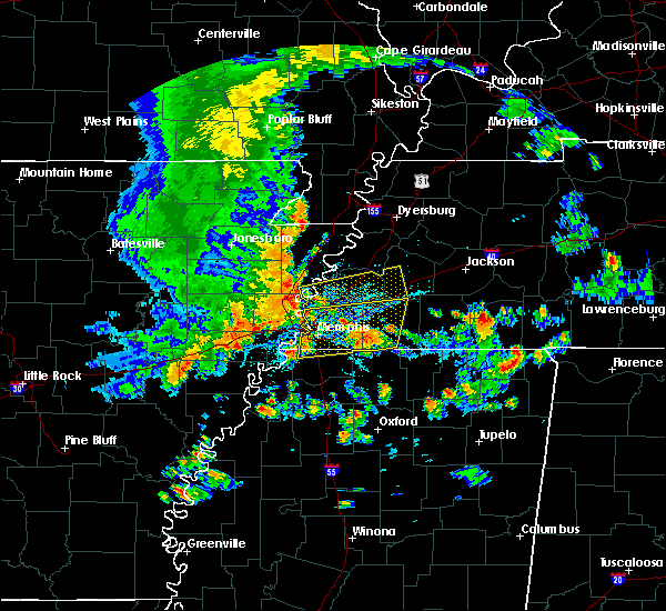 At 456 pm cdt, a severe thunderstorm was located near eads, or 11 miles northeast of collierville, moving east at 40 mph (radar indicated). Hazards include 70 mph wind gusts. Expect considerable tree damage. damage is likely to mobile homes, roofs and outbuildings. Locations impacted include, bartlett, collierville, germantown, cordova, lakeland, arlington, somerville, eads, warren, macon, oakland, piperton, gallaway, rossville, moscow, williston, braden, hays crossing, brunswick and kirk. At 456 pm cdt, a severe thunderstorm was located near eads, or 11 miles northeast of collierville, moving east at 40 mph (radar indicated). Hazards include 70 mph wind gusts. Expect considerable tree damage. damage is likely to mobile homes, roofs and outbuildings. Locations impacted include, bartlett, collierville, germantown, cordova, lakeland, arlington, somerville, eads, warren, macon, oakland, piperton, gallaway, rossville, moscow, williston, braden, hays crossing, brunswick and kirk.
|
| 8/5/2015 4:55 PM CDT | Large tree down near white station and gwynn in shelby county TN, 6.4 miles E of Memphis, TN |
| 8/5/2015 4:50 PM CDT | Fences damaged at briarcrest high school via photo submitted on twitte in shelby county TN, 5 miles W of Memphis, TN |
| 8/5/2015 4:45 PM CDT | Large tree dow in shelby county TN, 12.4 miles NE of Memphis, TN |
| 8/5/2015 4:45 PM CDT | Large tree down at belle meade blocking roadwa in shelby county TN, 6.4 miles E of Memphis, TN |
| 8/5/2015 4:41 PM CDT |
 At 440 pm cdt, a severe thunderstorm was located over southwest memphis, or near t o fuller state park, moving east at 40 mph (radar indicated). Hazards include 70 mph wind gusts. Expect considerable tree damage. Damage is likely to mobile homes, roofs and outbuildings. At 440 pm cdt, a severe thunderstorm was located over southwest memphis, or near t o fuller state park, moving east at 40 mph (radar indicated). Hazards include 70 mph wind gusts. Expect considerable tree damage. Damage is likely to mobile homes, roofs and outbuildings.
|
| 8/5/2015 4:05 PM CDT |
 At 404 pm cdt, a severe thunderstorm was located near jericho, or near meeman shelby forest state park, moving east at 50 mph (radar indicated). Hazards include 60 mph wind gusts. Expect damage to roofs. Siding and trees. At 404 pm cdt, a severe thunderstorm was located near jericho, or near meeman shelby forest state park, moving east at 50 mph (radar indicated). Hazards include 60 mph wind gusts. Expect damage to roofs. Siding and trees.
|
| 7/14/2015 5:05 PM CDT | North wood drive memphis blocked by a tree which fell onto an su in shelby county TN, 10.4 miles E of Memphis, TN |
| 7/14/2015 4:30 PM CDT | Tree down on a house on springdale stree in shelby county TN, 6.4 miles E of Memphis, TN |
| 7/14/2015 4:30 PM CDT | Tree down on robin hood lan in shelby county TN, 6.4 miles E of Memphis, TN |
| 7/14/2015 4:30 PM CDT | Tree down on highlan in shelby county TN, 10.4 miles E of Memphis, TN |
| 7/14/2015 4:16 PM CDT |
 At 414 pm cdt, a severe thunderstorm was located over eads, or near cordova, moving southeast at 50 mph (trained weather spotters). Hazards include 70 mph wind gusts. Expect considerable tree damage. damage is likely to mobile homes, roofs and outbuildings. Locations impacted include, bartlett, southaven, collierville, germantown, olive branch, west memphis, horn lake, marion, millington, covington, wilson, meeman shelby forest state park, fort pillow state park, t o fuller state park, cordova, lakeland, arlington, munford, somerville and brighton. At 414 pm cdt, a severe thunderstorm was located over eads, or near cordova, moving southeast at 50 mph (trained weather spotters). Hazards include 70 mph wind gusts. Expect considerable tree damage. damage is likely to mobile homes, roofs and outbuildings. Locations impacted include, bartlett, southaven, collierville, germantown, olive branch, west memphis, horn lake, marion, millington, covington, wilson, meeman shelby forest state park, fort pillow state park, t o fuller state park, cordova, lakeland, arlington, munford, somerville and brighton.
|
| 7/14/2015 4:08 PM CDT |
 At 407 pm cdt, a severe thunderstorm was located near cordova, moving southeast at 50 mph (radar indicated). Hazards include 60 mph wind gusts. Expect damage to roofs. Siding and trees. At 407 pm cdt, a severe thunderstorm was located near cordova, moving southeast at 50 mph (radar indicated). Hazards include 60 mph wind gusts. Expect damage to roofs. Siding and trees.
|
| 7/14/2015 4:05 PM CDT | Large tree fell on a car near highland av in shelby county TN, 6.4 miles E of Memphis, TN |
| 7/14/2015 4:05 PM CDT | Tree on powerline at echol in shelby county TN, 6.4 miles E of Memphis, TN |
| 7/14/2015 4:00 PM CDT | Tree down on car on mynders av in shelby county TN, 6.4 miles E of Memphis, TN |
| 7/14/2015 3:52 PM CDT |
 At 351 pm cdt, a severe thunderstorm was located near millington, moving southeast at 50 mph (trained weather spotters). Hazards include 70 mph wind gusts. Expect considerable tree damage. Damage is likely to mobile homes, roofs and outbuildings. At 351 pm cdt, a severe thunderstorm was located near millington, moving southeast at 50 mph (trained weather spotters). Hazards include 70 mph wind gusts. Expect considerable tree damage. Damage is likely to mobile homes, roofs and outbuildings.
|
| 7/14/2015 3:37 PM CDT |
 At 335 pm cdt, a severe thunderstorm was located near joiner, or 8 miles north of meeman shelby forest state park, moving southeast at 60 mph (radar indicated). Hazards include 70 mph wind gusts. Expect considerable tree damage. damage is likely to mobile homes, roofs and outbuildings. Locations impacted include, jonesboro, bartlett, west memphis, blytheville, marion, millington, covington, ripley, osceola, trumann, gosnell, manila, marked tree, lake city, leachville, lepanto, bay, senath, monette and caraway. At 335 pm cdt, a severe thunderstorm was located near joiner, or 8 miles north of meeman shelby forest state park, moving southeast at 60 mph (radar indicated). Hazards include 70 mph wind gusts. Expect considerable tree damage. damage is likely to mobile homes, roofs and outbuildings. Locations impacted include, jonesboro, bartlett, west memphis, blytheville, marion, millington, covington, ripley, osceola, trumann, gosnell, manila, marked tree, lake city, leachville, lepanto, bay, senath, monette and caraway.
|
| 7/14/2015 3:21 PM CDT |
 At 320 pm cdt, a severe thunderstorm was located over lepanto, moving southeast at 60 mph. this is a very dangerous storm (radar indicated). Hazards include 80 mph wind gusts. Flying debris will be dangerous to those caught without shelter. mobile homes will be heavily damaged. expect considerable damage to roofs, windows and vehicles. Extensive tree damage and power outages are likely. At 320 pm cdt, a severe thunderstorm was located over lepanto, moving southeast at 60 mph. this is a very dangerous storm (radar indicated). Hazards include 80 mph wind gusts. Flying debris will be dangerous to those caught without shelter. mobile homes will be heavily damaged. expect considerable damage to roofs, windows and vehicles. Extensive tree damage and power outages are likely.
|
| 6/29/2015 11:52 PM CDT |
 At 1151 pm cdt, a severe thunderstorm was located over whitehaven, or near memphis international airport, moving east at 15 mph (radar indicated). Hazards include quarter size hail. Damage to vehicles is expected. Locations impacted include, southaven, collierville, germantown, olive branch, horn lake, memphis, byhalia, lynchburg, southeast memphis, southwest memphis, whitehaven, fairhaven, handy corner, cedarview, capleville, plum point, coal oil corner, alden, jago and miller. At 1151 pm cdt, a severe thunderstorm was located over whitehaven, or near memphis international airport, moving east at 15 mph (radar indicated). Hazards include quarter size hail. Damage to vehicles is expected. Locations impacted include, southaven, collierville, germantown, olive branch, horn lake, memphis, byhalia, lynchburg, southeast memphis, southwest memphis, whitehaven, fairhaven, handy corner, cedarview, capleville, plum point, coal oil corner, alden, jago and miller.
|
| 6/29/2015 11:30 PM CDT |
 At 1130 pm cdt, a severe thunderstorm was located over whitehaven, or near southaven, moving east at 20 mph (radar indicated). Hazards include quarter size hail. damage to vehicles is expected At 1130 pm cdt, a severe thunderstorm was located over whitehaven, or near southaven, moving east at 20 mph (radar indicated). Hazards include quarter size hail. damage to vehicles is expected
|
| 6/29/2015 11:22 PM CDT |
 At 1121 pm cdt, a severe thunderstorm was located over far south memphis, or near southaven, moving east at 20 mph (radar indicated). Hazards include 60 mph wind gusts and quarter size hail. Hail damage to vehicles is expected. expect wind damage to roofs, siding and trees. Locations impacted include, southaven, collierville, germantown, olive branch, west memphis, horn lake, cordova, t o fuller state park, memphis, downtown memphis, midtown memphis, whitehaven, lynchburg, southeast memphis, southwest memphis, galet, bridge junction, plum point, briark and lake view. At 1121 pm cdt, a severe thunderstorm was located over far south memphis, or near southaven, moving east at 20 mph (radar indicated). Hazards include 60 mph wind gusts and quarter size hail. Hail damage to vehicles is expected. expect wind damage to roofs, siding and trees. Locations impacted include, southaven, collierville, germantown, olive branch, west memphis, horn lake, cordova, t o fuller state park, memphis, downtown memphis, midtown memphis, whitehaven, lynchburg, southeast memphis, southwest memphis, galet, bridge junction, plum point, briark and lake view.
|
| 6/29/2015 11:11 PM CDT |
 At 1108 pm cdt, a severe thunderstorm was located over southwest memphis, or 5 miles north of southaven, moving east at 25 mph (radar indicated). Hazards include 60 mph wind gusts and quarter size hail. Hail damage to vehicles is expected. expect wind damage to roofs, siding and trees. Locations impacted include, southaven, collierville, germantown, olive branch, west memphis, horn lake, cordova, t o fuller state park, memphis, downtown memphis, midtown memphis, whitehaven, lynchburg, southeast memphis, southwest memphis, galet, bridge junction, plum point, briark and lake view. At 1108 pm cdt, a severe thunderstorm was located over southwest memphis, or 5 miles north of southaven, moving east at 25 mph (radar indicated). Hazards include 60 mph wind gusts and quarter size hail. Hail damage to vehicles is expected. expect wind damage to roofs, siding and trees. Locations impacted include, southaven, collierville, germantown, olive branch, west memphis, horn lake, cordova, t o fuller state park, memphis, downtown memphis, midtown memphis, whitehaven, lynchburg, southeast memphis, southwest memphis, galet, bridge junction, plum point, briark and lake view.
|
| 6/29/2015 10:47 PM CDT |
 At 1047 pm cdt, a severe thunderstorm was located over downtown memphis, or near t o fuller state park, moving east at 30 mph (radar indicated). Hazards include 60 mph wind gusts and quarter size hail. Hail damage to vehicles is expected. Expect wind damage to roofs, siding and trees. At 1047 pm cdt, a severe thunderstorm was located over downtown memphis, or near t o fuller state park, moving east at 30 mph (radar indicated). Hazards include 60 mph wind gusts and quarter size hail. Hail damage to vehicles is expected. Expect wind damage to roofs, siding and trees.
|
| 6/29/2015 9:56 PM CDT |
 The severe thunderstorm warning for southwestern fayette and southeastern shelby counties will expire at 1000 pm cdt, the storm which prompted the warning has weakened below severe limits, and no longer poses an immediate threat to life or property. therefore the warning will be allowed to expire. however small hail is still possible with this thunderstorm. The severe thunderstorm warning for southwestern fayette and southeastern shelby counties will expire at 1000 pm cdt, the storm which prompted the warning has weakened below severe limits, and no longer poses an immediate threat to life or property. therefore the warning will be allowed to expire. however small hail is still possible with this thunderstorm.
|
| 6/29/2015 9:41 PM CDT |
 At 940 pm cdt, a severe thunderstorm was located over collierville, moving southeast at 15 mph (radar indicated). Hazards include quarter size hail. Damage to vehicles is expected. Locations impacted include, collierville, germantown, cordova, lakeland, piperton, rossville, elba, fisherville, hays crossing, kirk, lenow, canadaville and hickory withe. At 940 pm cdt, a severe thunderstorm was located over collierville, moving southeast at 15 mph (radar indicated). Hazards include quarter size hail. Damage to vehicles is expected. Locations impacted include, collierville, germantown, cordova, lakeland, piperton, rossville, elba, fisherville, hays crossing, kirk, lenow, canadaville and hickory withe.
|
| 6/29/2015 9:18 PM CDT |
 At 918 pm cdt, a severe thunderstorm was located near germantown, moving southeast at 15 mph (radar indicated). Hazards include quarter size hail. damage to vehicles is expected At 918 pm cdt, a severe thunderstorm was located near germantown, moving southeast at 15 mph (radar indicated). Hazards include quarter size hail. damage to vehicles is expected
|
| 6/29/2015 8:07 PM CDT |
 The severe thunderstorm warning for northwestern fayette and east central shelby counties will expire at 815 pm cdt, the storm which prompted the warning has weakened below severe limits, and no longer poses an immediate threat to life or property. therefore the warning will be allowed to expire. however small hail and heavy rain are still possible with this thunderstorm. The severe thunderstorm warning for northwestern fayette and east central shelby counties will expire at 815 pm cdt, the storm which prompted the warning has weakened below severe limits, and no longer poses an immediate threat to life or property. therefore the warning will be allowed to expire. however small hail and heavy rain are still possible with this thunderstorm.
|
| 6/29/2015 7:54 PM CDT |
 At 754 pm cdt, a severe thunderstorm was located over lakeland, or near bartlett, moving east at 10 mph (radar indicated). Hazards include quarter size hail. Damage to vehicles is expected. Locations impacted include, bartlett, lakeland, arlington, eads, oakland, piperton, gallaway, fisherville, elba, brunswick, hickory withe, lenow, canadaville and griffen. At 754 pm cdt, a severe thunderstorm was located over lakeland, or near bartlett, moving east at 10 mph (radar indicated). Hazards include quarter size hail. Damage to vehicles is expected. Locations impacted include, bartlett, lakeland, arlington, eads, oakland, piperton, gallaway, fisherville, elba, brunswick, hickory withe, lenow, canadaville and griffen.
|
| 6/29/2015 7:35 PM CDT |
 At 734 pm cdt, a severe thunderstorm was located over ellendale, or near bartlett, moving east at 10 mph (radar indicated). Hazards include quarter size hail. damage to vehicles is expected At 734 pm cdt, a severe thunderstorm was located over ellendale, or near bartlett, moving east at 10 mph (radar indicated). Hazards include quarter size hail. damage to vehicles is expected
|
| 6/26/2015 5:40 PM CDT | At 539 pm cdt, a severe thunderstorm was located near arlington, or 11 miles northeast of cordova, moving southeast at 15 mph (radar indicated). Hazards include 60 mph wind gusts. Expect damage to roofs. siding and trees. Locations impacted include, bartlett, lakeland, arlington, somerville, eads, warren, macon, oakland, gallaway, braden, moorman, powers, belmont, brunswick, bolton, yum yum, redwood, lambert, hickory withe and canadaville. |
| 6/26/2015 5:13 PM CDT | At 513 pm cdt, a severe thunderstorm was located over arlington, or 9 miles northeast of bartlett, moving southeast at 15 mph (radar indicated). Hazards include 60 mph wind gusts. Expect damage to roofs. Siding and trees. |
| 6/8/2015 10:04 PM CDT | At 1004 pm cdt, a severe thunderstorm was located near collierville, moving east at 30 mph (radar indicated). Hazards include 60 mph wind gusts and half dollar size hail. Hail damage to vehicles is expected. Expect wind damage to roofs, siding and trees. |
| 6/8/2015 10:04 PM CDT | At 1004 pm cdt, a severe thunderstorm was located near collierville, moving east at 30 mph (radar indicated). Hazards include 60 mph wind gusts and half dollar size hail. Hail damage to vehicles is expected. Expect wind damage to roofs, siding and trees. |
| 6/8/2015 8:35 PM CDT | At 834 pm cdt, a severe thunderstorm was located 8 miles west of somerville, or 14 miles northeast of cordova, moving southeast at 35 mph (radar indicated). Hazards include 60 mph wind gusts and penny size hail. Expect damage to roofs. siding and trees. Locations impacted include, bartlett, lakeland, arlington, oakland, brunswick and hickory withe. |
| 6/8/2015 8:28 PM CDT | At 828 pm cdt, a severe thunderstorm was located near arlington, or 14 miles northeast of cordova, moving southeast at 35 mph (radar indicated). Hazards include 60 mph wind gusts and half dollar size hail. Hail damage to vehicles is expected. expect wind damage to roofs, siding and trees. Locations impacted include, bartlett, millington, lakeland, arlington, oakland, gallaway, braden, rosemark, brunswick, barretville, bolton, redwood, lambert, hickory withe, griffen and longtown. |
| 6/8/2015 8:18 PM CDT | At 818 pm cdt, a severe thunderstorm was located over arlington, or 11 miles northeast of bartlett, moving southeast at 35 mph (radar indicated). Hazards include 60 mph wind gusts and penny size hail. Expect damage to roofs. Siding and trees. |
| 5/24/2015 6:24 PM CDT | At 624 pm cdt, a severe thunderstorm was located over millington, moving north at 55 mph (radar indicated). Hazards include 60 mph wind gusts and penny size hail. Expect damage to roofs. siding and trees. locations impacted include, bartlett, millington, meeman shelby forest state park, memphis, frayser, cuba, kerrville, rosemark, spring lake, griffin corner, woodstock, gilestown, sloanville, lucy, locke and benjestown. A tornado watch remains in effect until 1000 pm cdt for eastern arkansas and western tennessee. |
| 5/24/2015 6:05 PM CDT | At 605 pm cdt, a severe thunderstorm was located over memphis, or near t o fuller state park, moving north at 55 mph (radar indicated). Hazards include 60 mph wind gusts and penny size hail. Expect damage to roofs. Siding and trees. |
| 5/24/2015 5:55 PM CDT | At 555 pm cdt, a severe thunderstorm was located over midtown memphis, or 8 miles northeast of t o fuller state park, and is nearly stationary (radar indicated). Hazards include 60 mph wind gusts and penny size hail. Expect damage to roofs. siding and trees. locations impacted include, southaven, west memphis, horn lake, marion, t o fuller state park, walls, edmondson, downtown memphis, midtown memphis, whitehaven, lynchburg, southwest memphis, crittenden, galet, riceville, bridge junction, frees corners, brice, west days and briark. A tornado watch remains in effect until 1000 pm cdt for eastern arkansas, northwestern mississippi and western tennessee. |
| 5/24/2015 5:55 PM CDT | At 555 pm cdt, a severe thunderstorm was located over midtown memphis, or 8 miles northeast of t o fuller state park, and is nearly stationary (radar indicated). Hazards include 60 mph wind gusts and penny size hail. Expect damage to roofs. siding and trees. locations impacted include, southaven, west memphis, horn lake, marion, t o fuller state park, walls, edmondson, downtown memphis, midtown memphis, whitehaven, lynchburg, southwest memphis, crittenden, galet, riceville, bridge junction, frees corners, brice, west days and briark. A tornado watch remains in effect until 1000 pm cdt for eastern arkansas, northwestern mississippi and western tennessee. |
| 5/24/2015 5:55 PM CDT | At 555 pm cdt, a severe thunderstorm was located over midtown memphis, or 8 miles northeast of t o fuller state park, and is nearly stationary (radar indicated). Hazards include 60 mph wind gusts and penny size hail. Expect damage to roofs. siding and trees. locations impacted include, southaven, west memphis, horn lake, marion, t o fuller state park, walls, edmondson, downtown memphis, midtown memphis, whitehaven, lynchburg, southwest memphis, crittenden, galet, riceville, bridge junction, frees corners, brice, west days and briark. A tornado watch remains in effect until 1000 pm cdt for eastern arkansas, northwestern mississippi and western tennessee. |
| 5/24/2015 5:23 PM CDT | At 523 pm cdt, a severe thunderstorm was located over eudora, or 10 miles west of hernando, moving north at 45 mph (radar indicated). Hazards include 60 mph wind gusts and penny size hail. Expect damage to roofs. Siding and trees. |
| 5/24/2015 5:23 PM CDT | At 523 pm cdt, a severe thunderstorm was located over eudora, or 10 miles west of hernando, moving north at 45 mph (radar indicated). Hazards include 60 mph wind gusts and penny size hail. Expect damage to roofs. Siding and trees. |
| 5/24/2015 5:23 PM CDT | At 523 pm cdt, a severe thunderstorm was located over eudora, or 10 miles west of hernando, moving north at 45 mph (radar indicated). Hazards include 60 mph wind gusts and penny size hail. Expect damage to roofs. Siding and trees. |
| 4/3/2015 4:11 PM CDT | The national weather service in memphis has issued a * severe thunderstorm warning for. northern fayette county in southwestern tennessee. until 445 pm cdt * at 411 pm cdt. a severe thunderstorm was located near somerville. or 21 miles northeast of collierville. Moving east at. |
| 4/1/2015 5:39 PM CDT | The severe thunderstorm warning for southwestern lauderdale. tipton. southwestern haywood. northern fayette and northeastern shelby counties will expire at 545 pm cdt. the storm which prompted the warning has weakened below severe limits. and no longer pose an immediate threat to life or property. therefore the warning will be allowed to expire. However small hail. |
| 4/1/2015 5:19 PM CDT | A severe thunderstorm warning remains in effect until 545 pm cdt for southwestern lauderdale. tipton. southwestern haywood. northern fayette and northeastern shelby counties. at 518 pm cdt. a severe thunderstorm was located 8 miles northeast of arlington. or 14 miles south of covington. Moving northeast at 20 mph. |
| 4/1/2015 5:00 PM CDT | The national weather service in memphis has issued a * severe thunderstorm warning for. southwestern lauderdale county in southwestern tennessee. tipton county in southwestern tennessee. southwestern haywood county in southwestern tennessee. Northern fayette county in southwestern tennessee. |
| 4/1/2015 4:22 PM CDT | The national weather service in memphis has issued a * severe thunderstorm warning for. eastern tipton county in southwestern tennessee. northwestern fayette county in southwestern tennessee. northeastern shelby county in southwestern tennessee. Until 500 pm cdt. |
| 3/31/2015 11:53 PM CDT | The national weather service in memphis has issued a * severe thunderstorm warning for. northeastern desoto county in northwestern mississippi. northern marshall county in northwestern mississippi. southern fayette county in southwestern tennessee. Southeastern shelby county in southwestern tennessee. |
| 3/31/2015 11:53 PM CDT | The national weather service in memphis has issued a * severe thunderstorm warning for. northeastern desoto county in northwestern mississippi. northern marshall county in northwestern mississippi. southern fayette county in southwestern tennessee. Southeastern shelby county in southwestern tennessee. |
| 3/31/2015 11:18 PM CDT | The national weather service in memphis has issued a * severe thunderstorm warning for. northern marshall county in northwestern mississippi. southwestern fayette county in southwestern tennessee. southeastern shelby county in southwestern tennessee. Until midnight cdt. |
| 3/31/2015 11:18 PM CDT | The national weather service in memphis has issued a * severe thunderstorm warning for. northern marshall county in northwestern mississippi. southwestern fayette county in southwestern tennessee. southeastern shelby county in southwestern tennessee. Until midnight cdt. |
| 3/31/2015 10:28 PM CDT | The national weather service in memphis has issued a * severe thunderstorm warning for. northern crittenden county in eastern arkansas. shelby county in southwestern tennessee. until 1130 pm cdt * at 1028 pm cdt. Doppler radar indicated a severe thunderstorm. |
| 3/31/2015 10:28 PM CDT | The national weather service in memphis has issued a * severe thunderstorm warning for. northern crittenden county in eastern arkansas. shelby county in southwestern tennessee. until 1130 pm cdt * at 1028 pm cdt. Doppler radar indicated a severe thunderstorm. |
| 3/31/2015 9:58 PM CDT | The national weather service in memphis has issued a * severe thunderstorm warning for. eastern cross county in eastern arkansas. crittenden county in eastern arkansas. southeastern poinsett county in eastern arkansas. Until 1045 pm cdt. |
| 10/7/2014 8:14 AM CDT | Quarter sized hail reported 6.6 miles SSE of Memphis, TN, quarter size hail reported by mpd near frayser and raleigh. |
| 10/2/2014 4:20 PM CDT | Quarter sized hail reported 5.8 miles SSW of Memphis, TN, near bartlett blvd and elmore road. |
| 10/2/2014 4:20 PM CDT | Multiple trees down on mendenhall and popla in shelby county TN, 18.2 miles ENE of Memphis, TN |
| 10/2/2014 4:20 PM CDT | Multiple trees down on mendenhall and popla in shelby county TN, 18.2 miles ENE of Memphis, TN |
| 10/2/2014 4:13 PM CDT | Golf Ball sized hail reported 5.8 miles SSW of Memphis, TN, spotter reported large hail approximately golf ball sized around the area of i-40 and summer avenue. |
| 10/2/2014 3:57 PM CDT | Wind gust to 61 mph reported at memphis international airpor in shelby county TN, 10.4 miles E of Memphis, TN |
| 7/23/2014 4:40 PM CDT | Large tree fell across holmes road between airways blvd and tchulahoma road. the tree caused road to be close in shelby county TN, 10.4 miles E of Memphis, TN |
| 7/14/2014 5:30 PM CDT | Power lines down on whitten road near fletcher creek/kamali r in shelby county TN, 5.7 miles WSW of Memphis, TN |
| 7/14/2014 5:10 PM CDT | Trees down on goodlett between appling and whitten roa in shelby county TN, 1.5 miles W of Memphis, TN |
| 7/14/2014 4:38 PM CDT | A large tree fell on house located on norfolk street vcnty of interstate 240 and east person roa in shelby county TN, 10.4 miles E of Memphis, TN |
| 6/5/2014 2:53 PM CDT | Collierville arlington rd is blocked between donelson and 64 due to down trees in shelby county TN, 11.9 miles WSW of Memphis, TN |
| 8/12/2013 6:05 PM CDT | A tree was downed near the intersection of rembert and harbert streets in midtown memphi in shelby county TN, 6.4 miles E of Memphis, TN |
| 7/18/2013 4:00 PM CDT | Large trees down on raleigh-lagrange roa in shelby county TN, 1.2 miles SW of Memphis, TN |
| 6/28/2013 6:30 AM CDT | A couple large trees fell and blocked macon road 1 mile east of highway 19 in shelby county TN, 5 miles W of Memphis, TN |
| 6/28/2013 6:25 AM CDT | The public reported that a tree fell on a truck in the raleigh/berclair are in shelby county TN, 5.4 miles SSE of Memphis, TN |
| 6/27/2013 6:25 PM CDT | Large tree fell on a house on east dempsey stree in shelby county TN, 12.4 miles NE of Memphis, TN |
| 6/19/2013 3:45 PM CDT | A few large tree branches down. flash flooding occurred in some low lying area in shelby county TN, 4.4 miles W of Memphis, TN |
| 6/19/2013 3:45 PM CDT | Four powerpoles down near macon and berryhill. several large trees and fences down in the are in shelby county TN, 5.7 miles WSW of Memphis, TN |
| 1/29/2013 11:30 PM CST | Very large best buy business sign was broken and blown down by wind. located on west side of germantown road 2755 north germantown roa in shelby county TN, 1.7 miles WNW of Memphis, TN |
| 1/29/2013 11:15 PM CST | Estimated gust with heavy rain in shelby county TN, 8.9 miles NE of Memphis, TN |
| 1/29/2013 11:00 PM CST | Several large trees down in the university of memphis are in shelby county TN, 5.3 miles E of Memphis, TN |
| 12/20/2012 4:10 AM CST | Gas station awning blow over at circle k on madison avenu in shelby county TN, 9.3 miles E of Memphis, TN |
| 11/3/2012 5:35 PM CDT | Quarter sized hail reported 15 miles E of Memphis, TN, quarter size hail reported by a spotter on presidents island. |
| 11/3/2012 5:23 PM CDT | Golf Ball sized hail reported 5.8 miles SSW of Memphis, TN, public report...via local media...of quarter to golfball size hail at intersection of elmore park and yale roads in bartlett. |
| 11/3/2012 5:15 PM CDT | Quarter sized hail reported 6.7 miles SW of Memphis, TN, quarter size hail and 50 mph winds reported by the public at stage and appling roads in bartlett. |
| 11/3/2012 5:15 PM CDT | Quarter sized hail reported 8.2 miles SW of Memphis, TN, spotter reports quarter size hail near the wolfchase mall in bartlett. |
| 11/3/2012 5:10 PM CDT | Quarter sized hail reported 7.1 miles SSW of Memphis, TN, quarter size hail near intersection of yale and old brownsville. |
| 10/5/2012 8:15 PM CDT | Two large trees down on south parkway. one large tree and several large limbs down on cooper and washington streets in midtown memphi in shelby county TN, 7.6 miles E of Memphis, TN |
| 9/7/2012 9:50 PM CDT | Two eastbound lanes of walnut grove between prescott and highland are blocked by huge lim in shelby county TN, 7.6 miles E of Memphis, TN |
| 9/5/2012 7:00 PM CDT | Quarter sized hail reported 2.2 miles SSE of Memphis, TN, report of quarter size hail at pleasant view and bartlett road. |
| 8/13/2012 6:13 PM CDT | Several trees down and telephone poles broken in several locations around south parkway and i-24 in shelby county TN, 9.8 miles ENE of Memphis, TN |
| 7/7/2012 7:41 PM CDT | Quarter sized hail reported 12.4 miles NE of Memphis, TN, hail up to a quarter size. |
| 6/11/2012 4:20 PM CDT | Trees snapped or uprooted on north parkway in shelby county TN, 6.4 miles E of Memphis, TN |
| 6/11/2012 4:00 PM CDT | Very large oak tree down on house. moderate damage to two neighboring homes. half mile south of the memphis botanical garden in shelby county TN, 2.5 miles ENE of Memphis, TN |
| 6/11/2012 3:46 PM CDT | Golf Ball sized hail reported 1.2 miles SW of Memphis, TN, golf ball sized hail reported 4 miles west of cordova. relayed by mspotter. at the intersection of macon and dexter. |
| 6/11/2012 3:46 PM CDT | Golf Ball sized hail reported 5 miles W of Memphis, TN, golf ball sized hail reported 4 miles west of cordova. relayed by mspotter. at the intersection of macon and dexter. |
| 6/11/2012 3:40 PM CDT | Quarter sized hail reported 4.6 miles WNW of Memphis, TN, penny to quarter size hail reported near walnut grove rd |
| 6/11/2012 3:40 PM CDT | Traffic signal knocked down at the intersection of danny thomas and washington in shelby county TN, 10.4 miles E of Memphis, TN |
| 6/11/2012 3:40 PM CDT | Trees snapped or uprooted on north parkway in shelby county TN, 6.4 miles E of Memphis, TN |
| 6/11/2012 3:29 PM CDT | Tree down on north parkway eastbound behind east parkway and university. report relayed by mspotte in shelby county TN, 7 miles E of Memphis, TN |
| 1/1/0001 12:00 AM | Estimated 65 mph wind gust at national weather service forecast offic in shelby county TN, 3.8 miles W of Memphis, TN |
| 1/1/0001 12:00 AM | Estimated wind speed of 105 mph lifted a large roof off a building and dropped it about 200 feet away across railroad tracks. damage was just east of memphis airport ar in shelby county TN, 7.7 miles NNE of Memphis, TN |
| 1/1/0001 12:00 AM | Welcome to tennessee sign blown down on i-55 near the tennessee/mississippi state line in shelby county TN, 12.6 miles NE of Memphis, TN |
| 9/25/2011 5:18 PM CDT | Half Dollar sized hail reported 10.2 miles SE of Memphis, TN |
| 1/1/0001 12:00 AM | Quarter sized hail reported 6.4 miles E of Memphis, TN, quarter size hail reported in the midtown memphis area. |
| 1/1/0001 12:00 AM | A tree at least 3 feet in diameter was down on 2 houses and a ca in shelby county TN, 4.2 miles E of Memphis, TN |
| 1/1/0001 12:00 AM | A large tree branch was downed along n. germantown road to the north of club parkwa in shelby county TN, 5 miles W of Memphis, TN |
| 1/1/0001 12:00 AM | Tree down on house on mclean blvd. report from wreg. time estimate in shelby county TN, 6.4 miles E of Memphis, TN |
| 1/1/0001 12:00 AM | Memphis light gas and water reports broken tree limbs on power lines in the frayser area up toward millington. about 65 outages reported across shelby county...affectin in shelby county TN, 8.1 miles SE of Memphis, TN |
| 6/16/2011 7:20 PM CDT | Quarter sized hail reported 6.1 miles W of Memphis, TN, quarter size hail and 50 mph winds with some trees down near walnut grove and sanga |
| 6/16/2011 7:17 PM CDT | Half Dollar sized hail reported 4.6 miles WNW of Memphis, TN, 1.25 inch hail and high winds about 60 mph. |
| 6/16/2011 7:15 PM CDT | Golf Ball sized hail reported 5 miles W of Memphis, TN |
| 1/1/0001 12:00 AM | Storm damage reported in shelby county TN, 5 miles W of Memphis, TN |
| 1/1/0001 12:00 AM | Spotter measured 60 mph gust on personal weather station in shelby county TN, 5 miles W of Memphis, TN |
| 1/1/0001 12:00 AM | Asos recorded peak wind of 73 mph at 655 in shelby county TN, 10.7 miles ENE of Memphis, TN |
| 1/1/0001 12:00 AM | Second round of wind gusts near 75 mph with bookend vortex. winds shifted from northwest to eas in shelby county TN, 3.2 miles W of Memphis, TN |
| 1/1/0001 12:00 AM | Large tree blown down and completely blocking road at north parkway and montgomer in shelby county TN, 9.3 miles E of Memphis, TN |
| 1/1/0001 12:00 AM | Thunderstorm wind gust reported by contract weather observer at memphis intl airpor in shelby county TN, 9.7 miles NE of Memphis, TN |
| 1/1/0001 12:00 AM | Thunderstorm wind gust reported by contract weather observer at memphis intl airpor in shelby county TN, 9.7 miles NE of Memphis, TN |
| 1/1/0001 12:00 AM | Report of swirling winds and debris in hickory hill area going west of winchester and perkins with damage to roof of a bakery near lamar av in shelby county TN, 9.5 miles ENE of Memphis, TN |
| 1/1/0001 12:00 AM | Thunderstorm wind gust reported by contract weather observer at memphis intl airpor in shelby county TN, 9.7 miles NE of Memphis, TN |
| 1/1/0001 12:00 AM | Prolonged northwest gusts to 75 mph with squall lin in shelby county TN, 3.2 miles W of Memphis, TN |
| 1/1/0001 12:00 AM | Quarter sized hail reported 5.6 miles S of Memphis, TN |
| 4/27/2011 10:24 AM CDT | Golf Ball sized hail reported 10.4 miles E of Memphis, TN, hail cracked a windshield in downtown memphis area |
| 4/27/2011 10:23 AM CDT | Quarter sized hail reported 10.4 miles E of Memphis, TN, quarter size hail at jackson and pope street |
| 1/1/0001 12:00 AM | Memphis international airport reported 58 mph gus in shelby county TN, 12.4 miles NE of Memphis, TN |
| 1/1/0001 12:00 AM | Fence blown over at the corner of raines and kirby across from kirby high s in shelby county TN, 3.5 miles NNE of Memphis, TN |
| 1/1/0001 12:00 AM | Large tree limbs down in the belle trees neigborhoo in shelby county TN, 4.7 miles SW of Memphis, TN |
| 1/1/0001 12:00 AM | Trees down in the belle trees neigborhoo in shelby county TN, 4.7 miles SW of Memphis, TN |
| 1/1/0001 12:00 AM | 70 mph winds at office in shelby county TN, 4.4 miles W of Memphis, TN |
| 1/1/0001 12:00 AM | A large tree fell onto a house near frayser blvd. media is reporting other damage in the are in shelby county TN, 8.1 miles SE of Memphis, TN |
| 1/1/0001 12:00 AM | High winds blew off top of chimney near hickory hill in shelby county TN, 4.8 miles N of Memphis, TN |
| 1/1/0001 12:00 AM | Power poles and several trees down in the cornell street and frayser boulevard are in shelby county TN, 8.1 miles SE of Memphis, TN |
Hail Maps for Memphis, TN
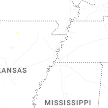
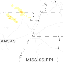
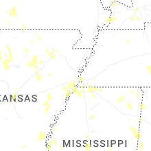
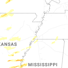
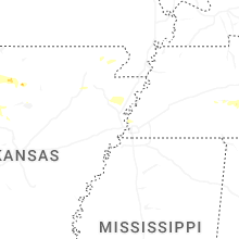
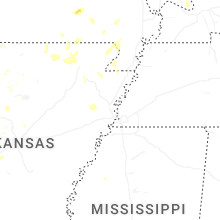
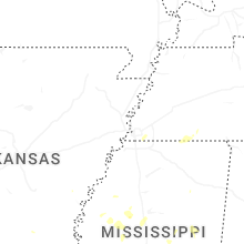
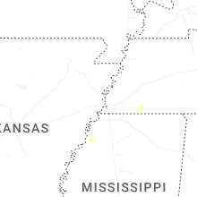
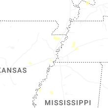
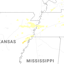
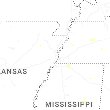
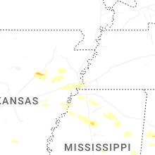
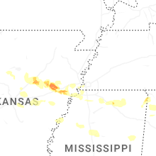

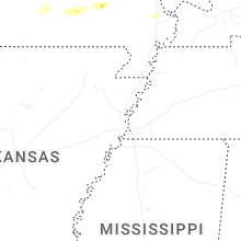
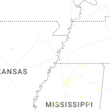
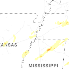


Connect with Interactive Hail Maps