

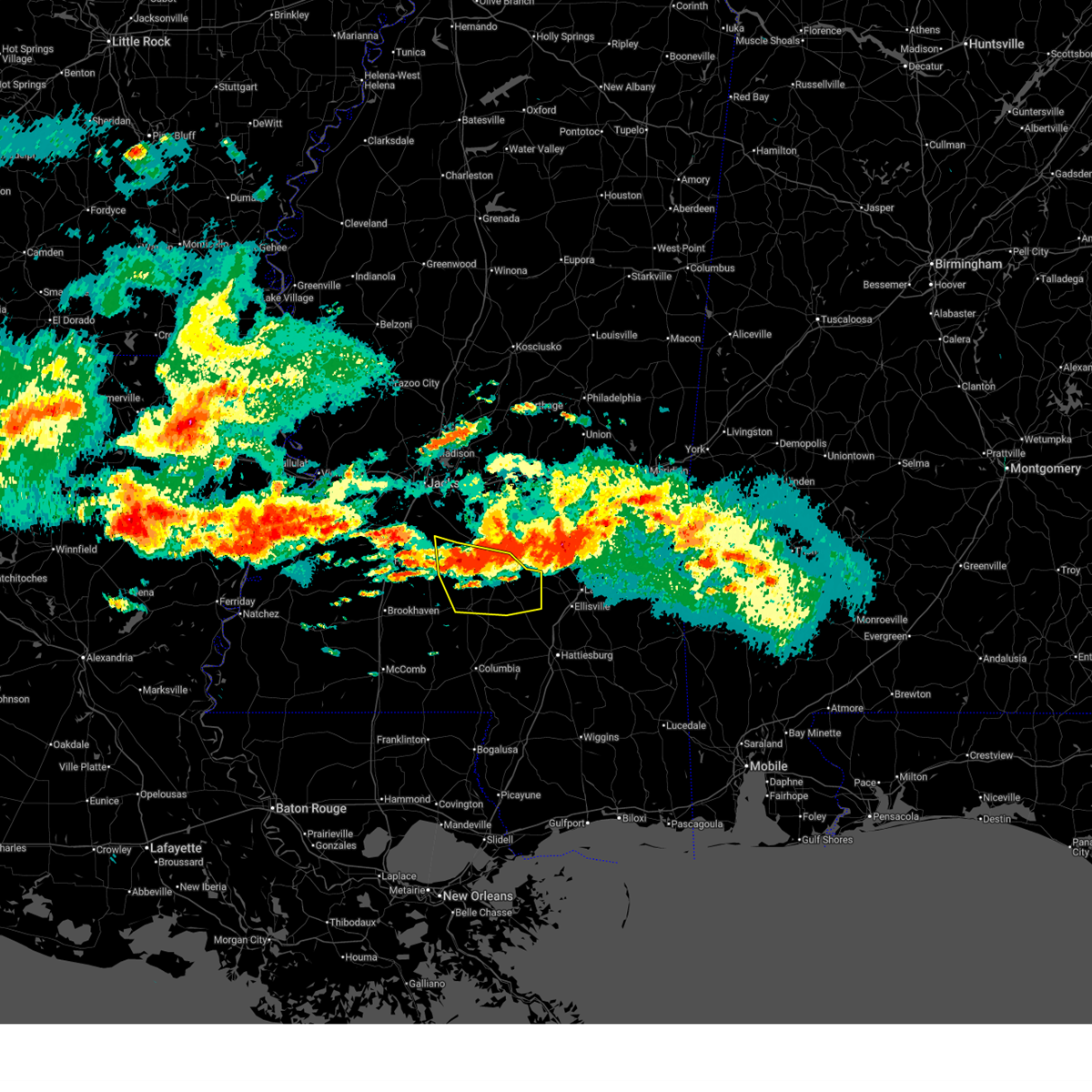
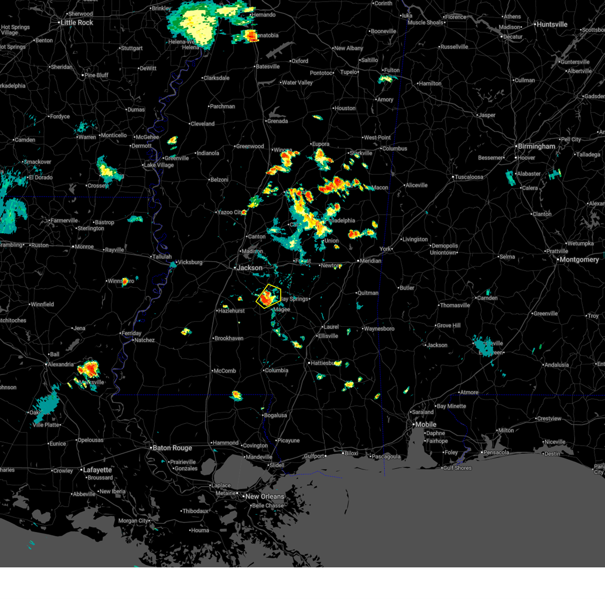
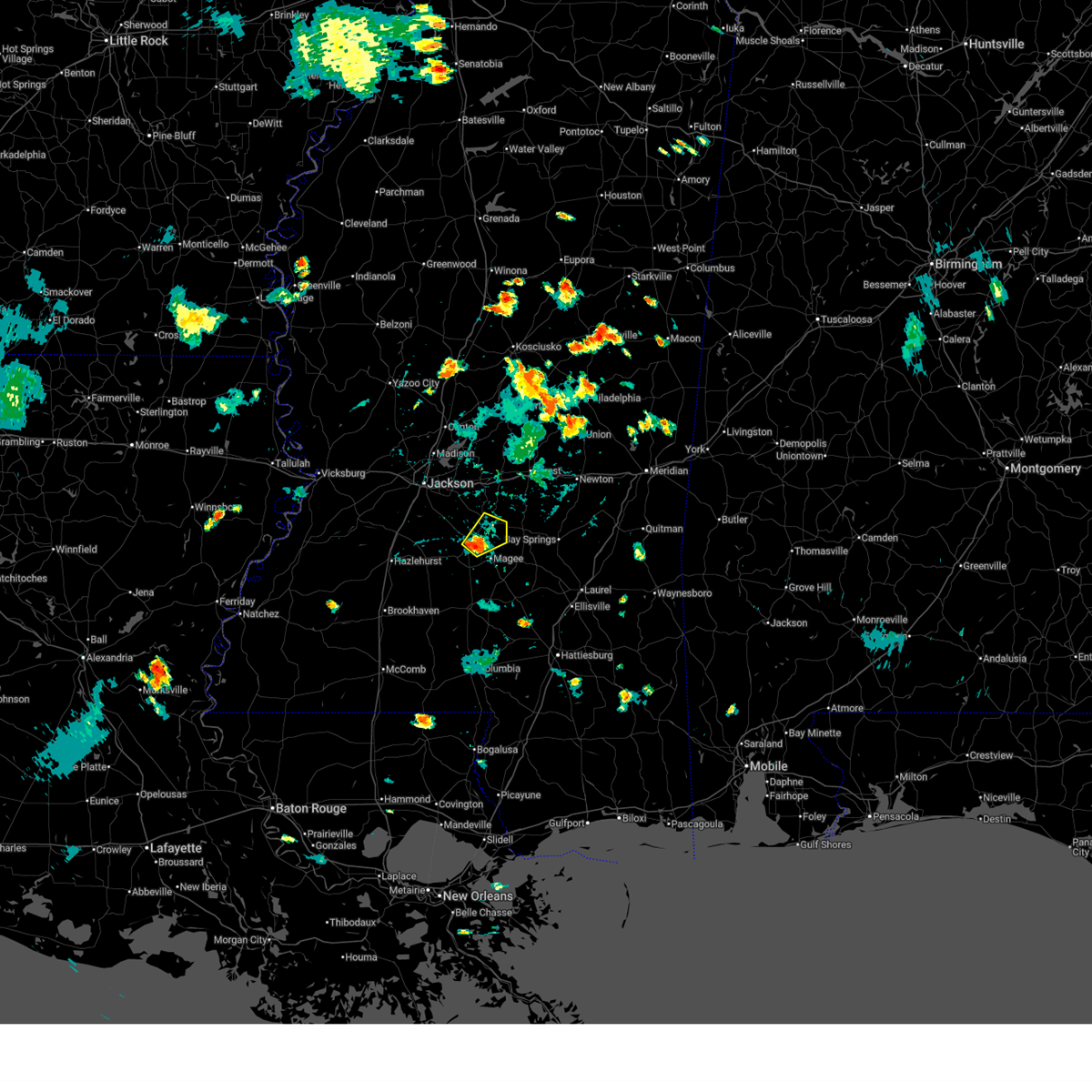
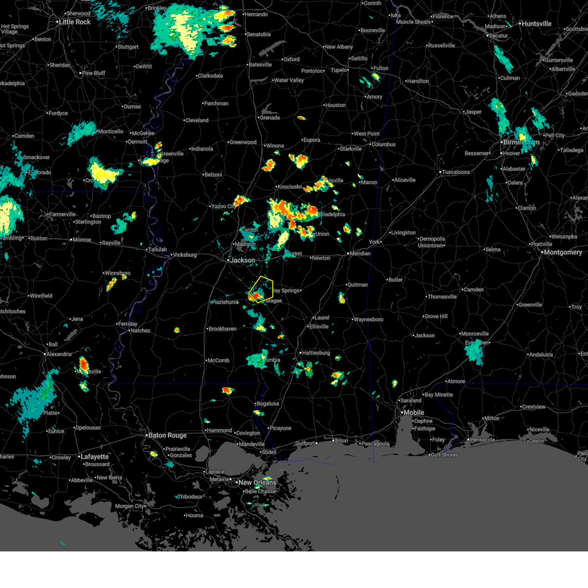
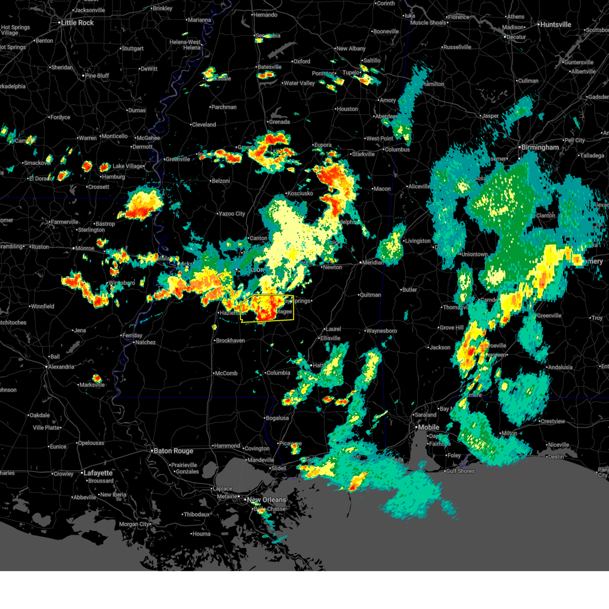
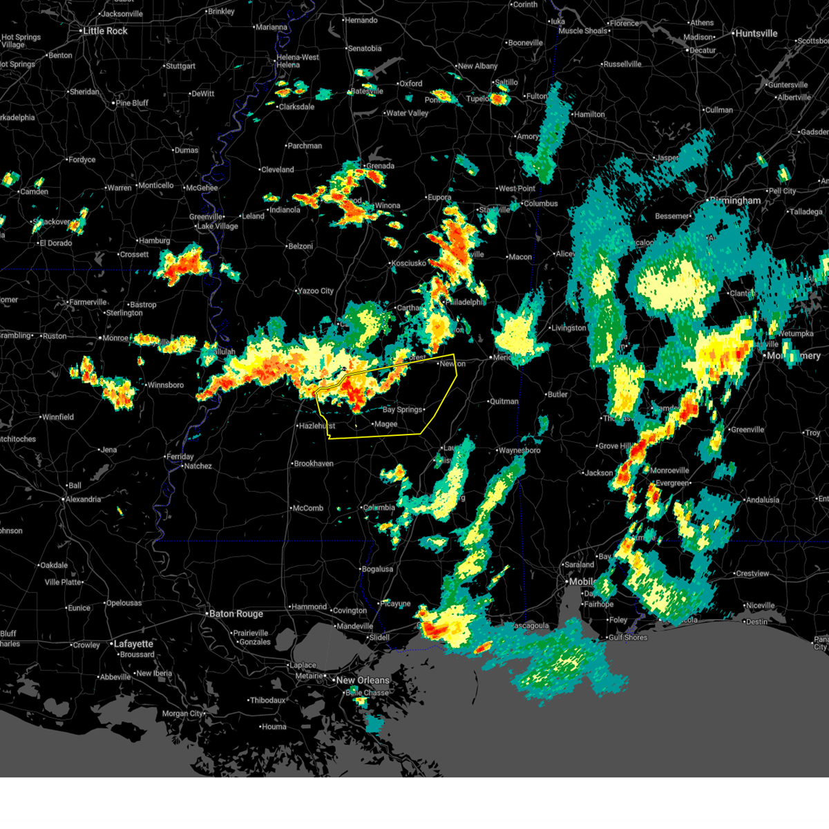
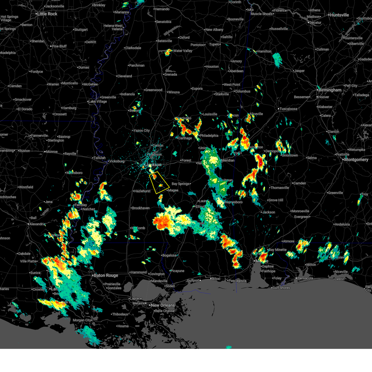
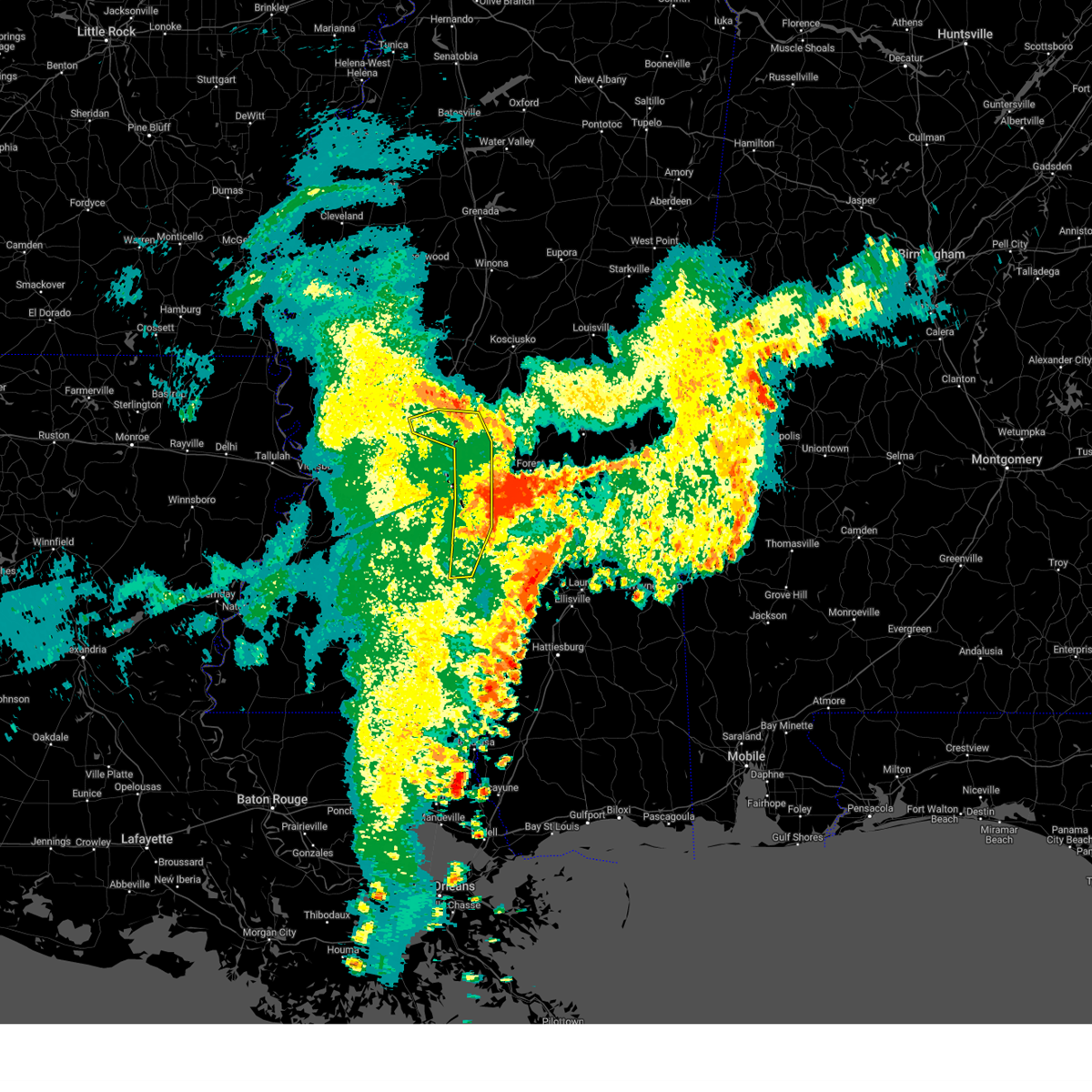
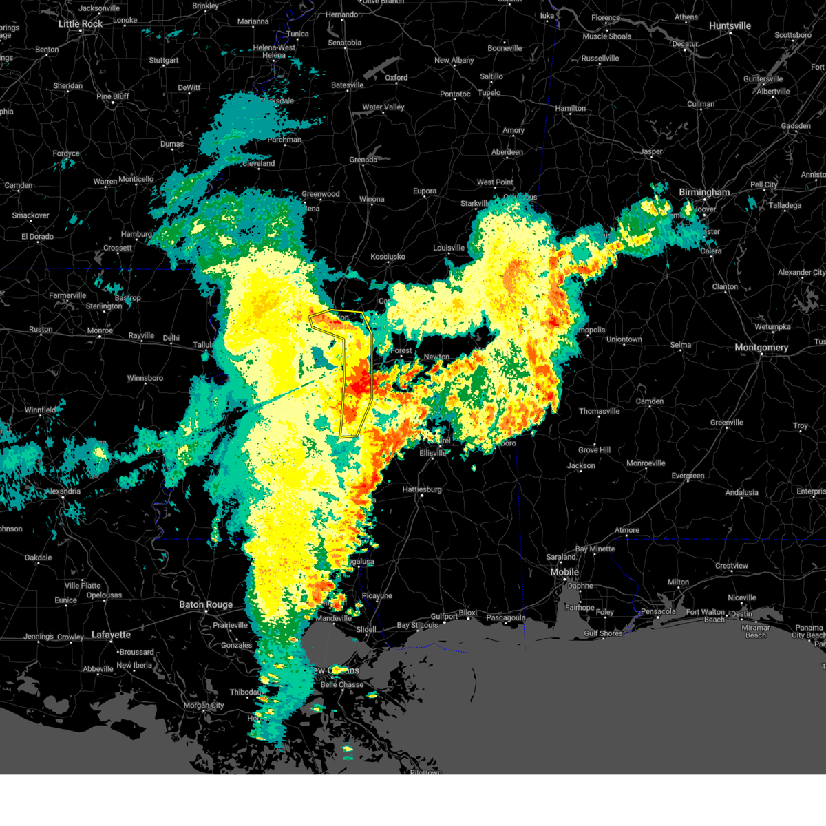
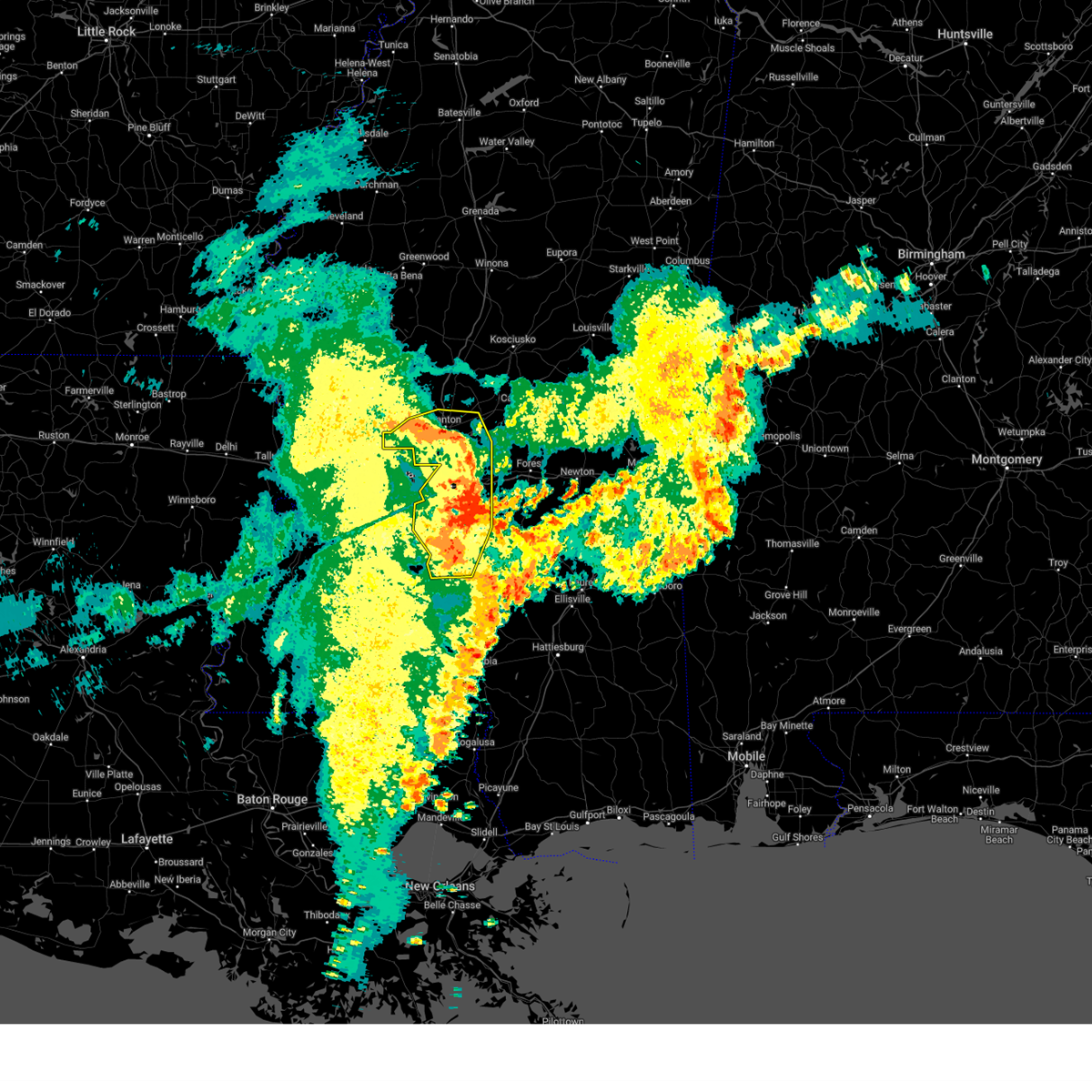
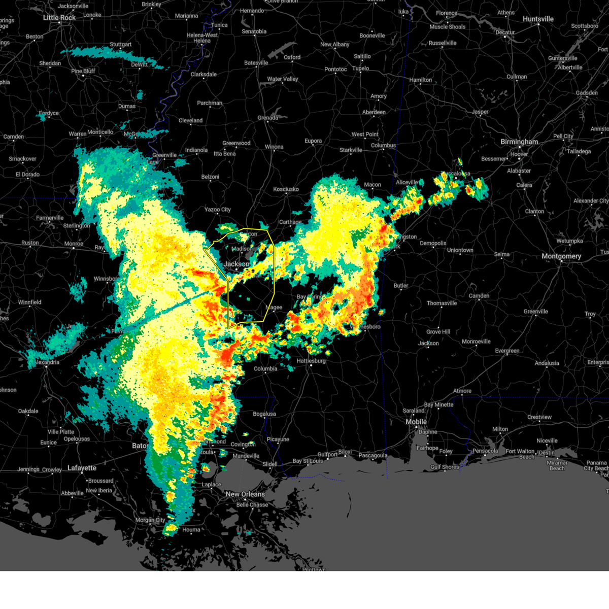
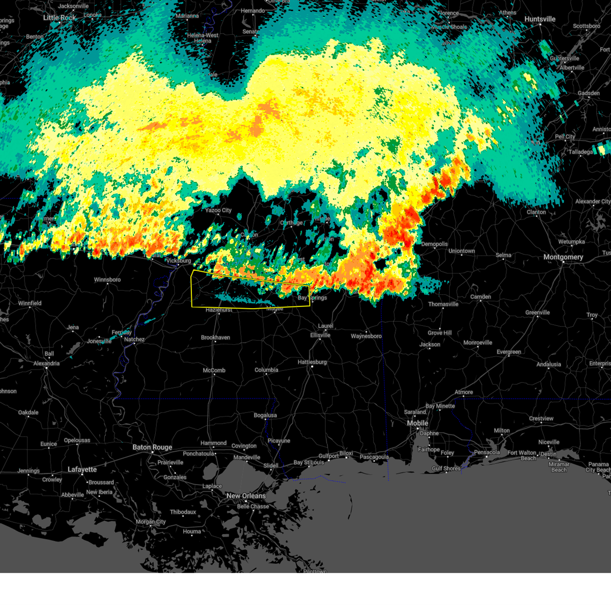
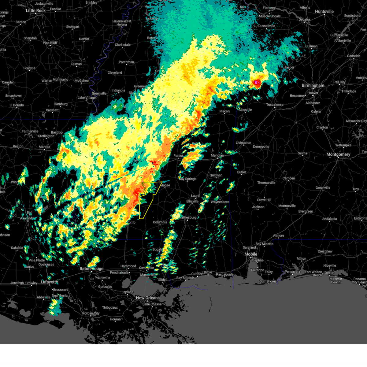
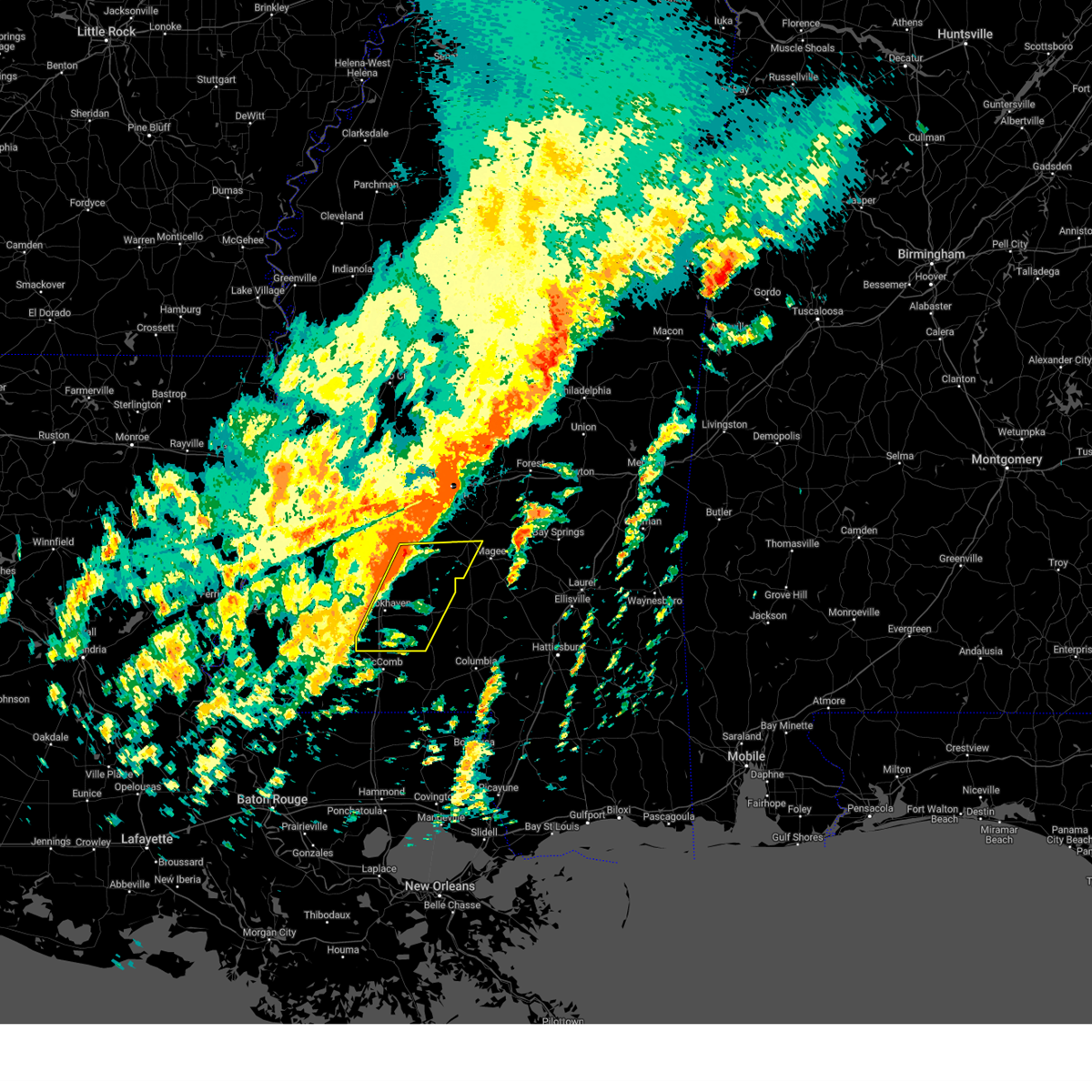
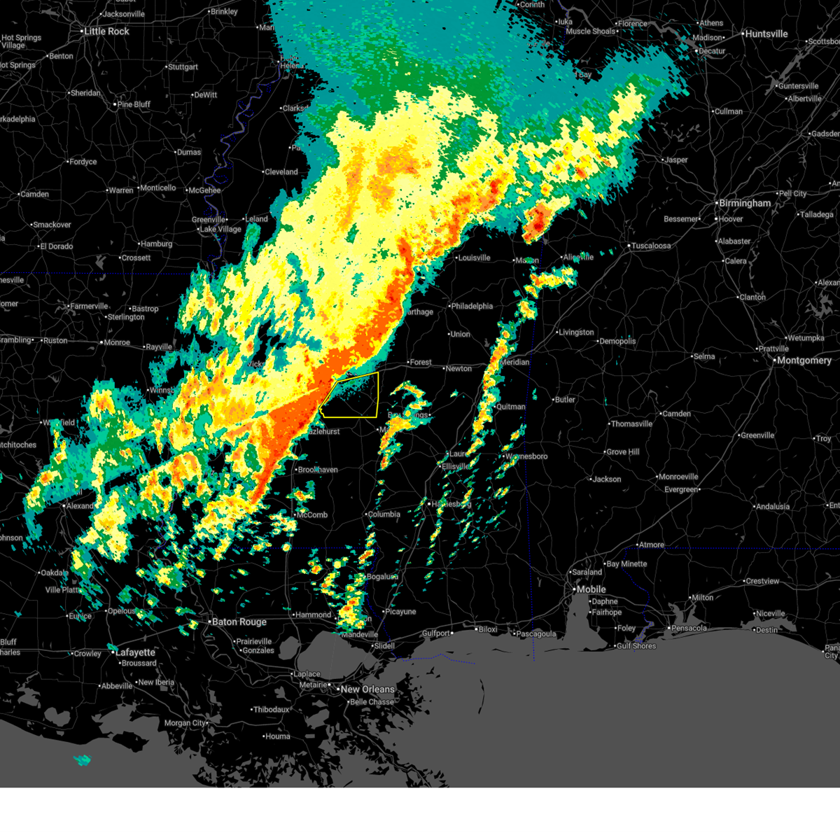
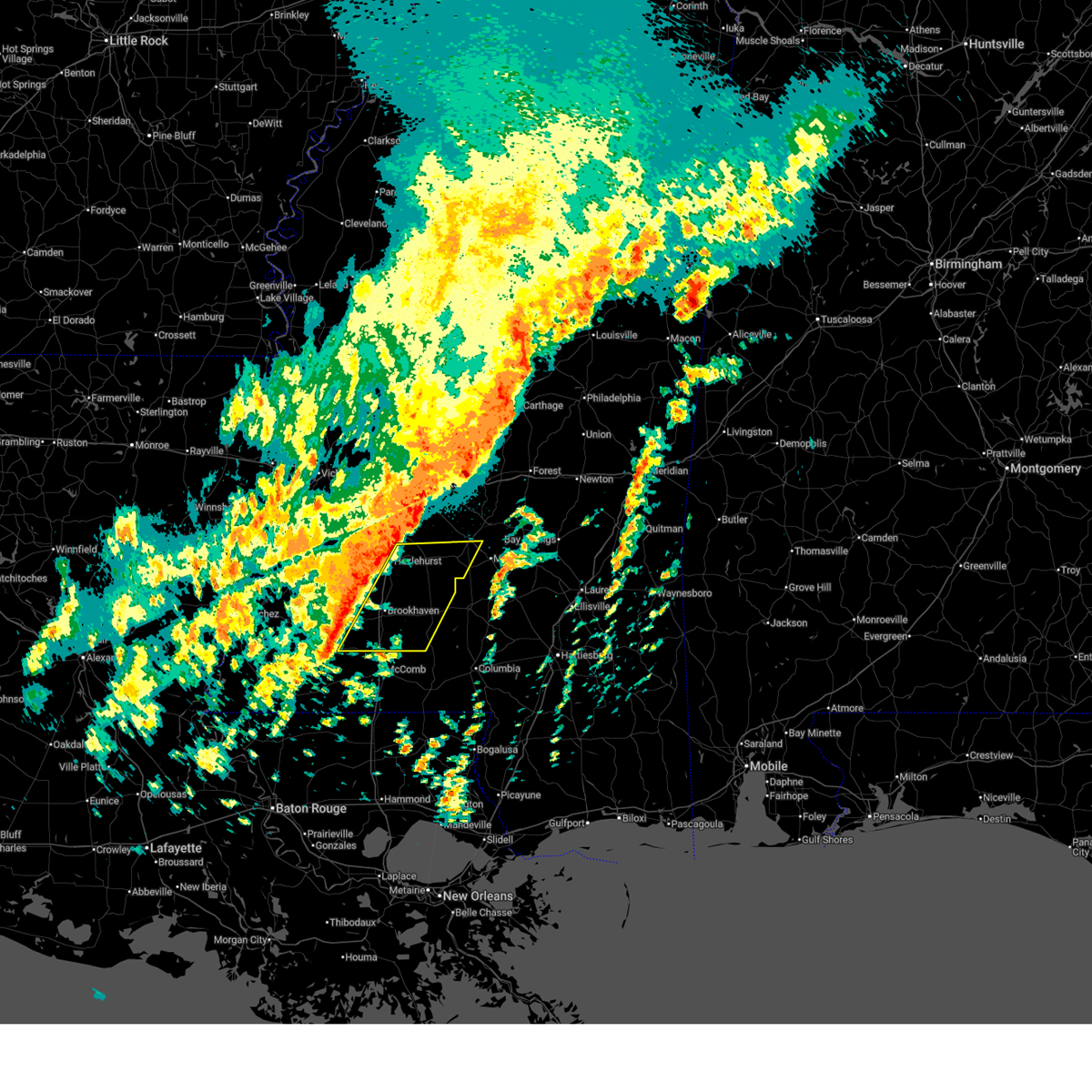
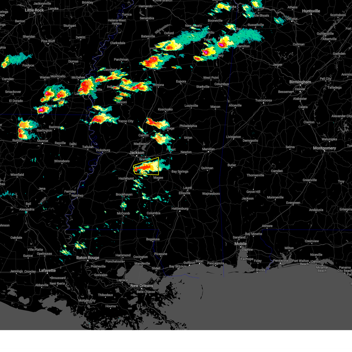
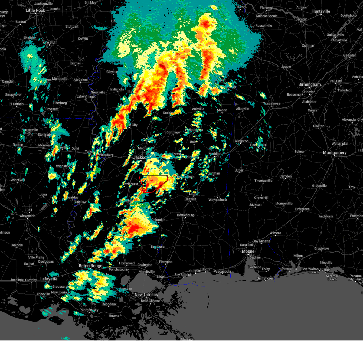
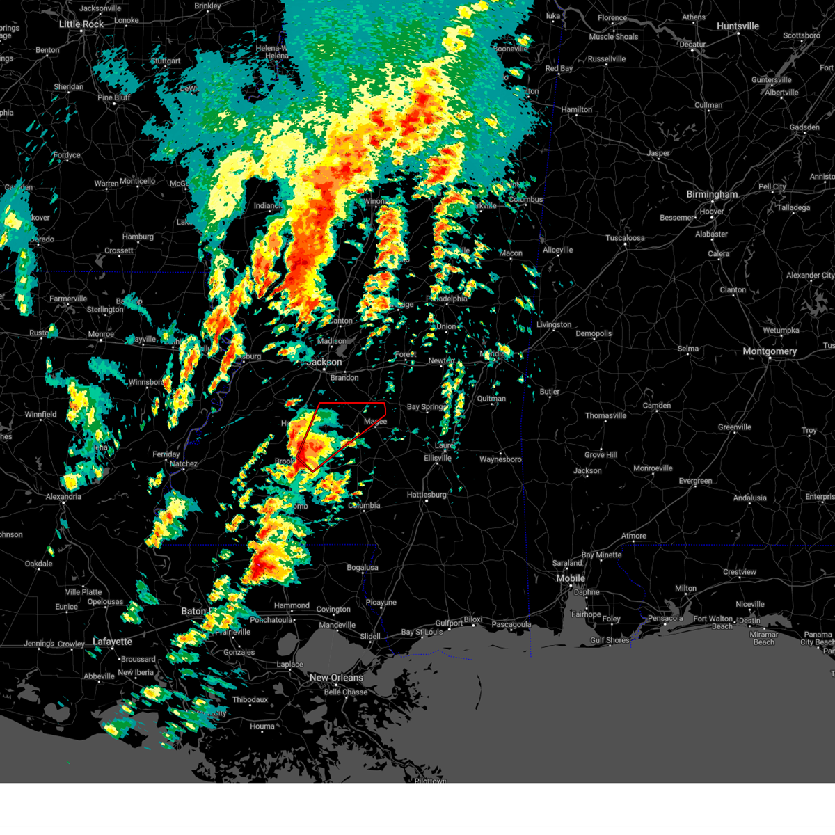
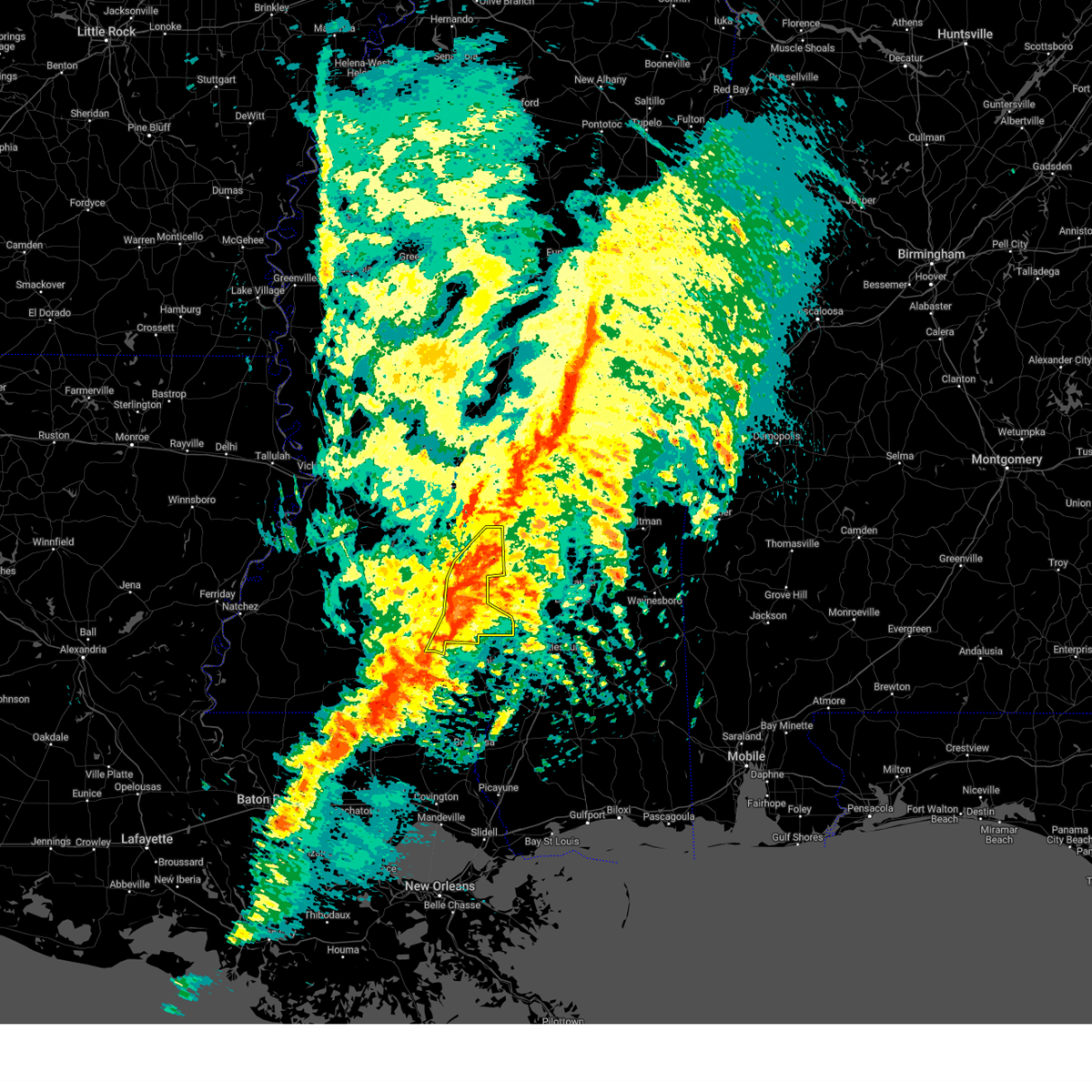
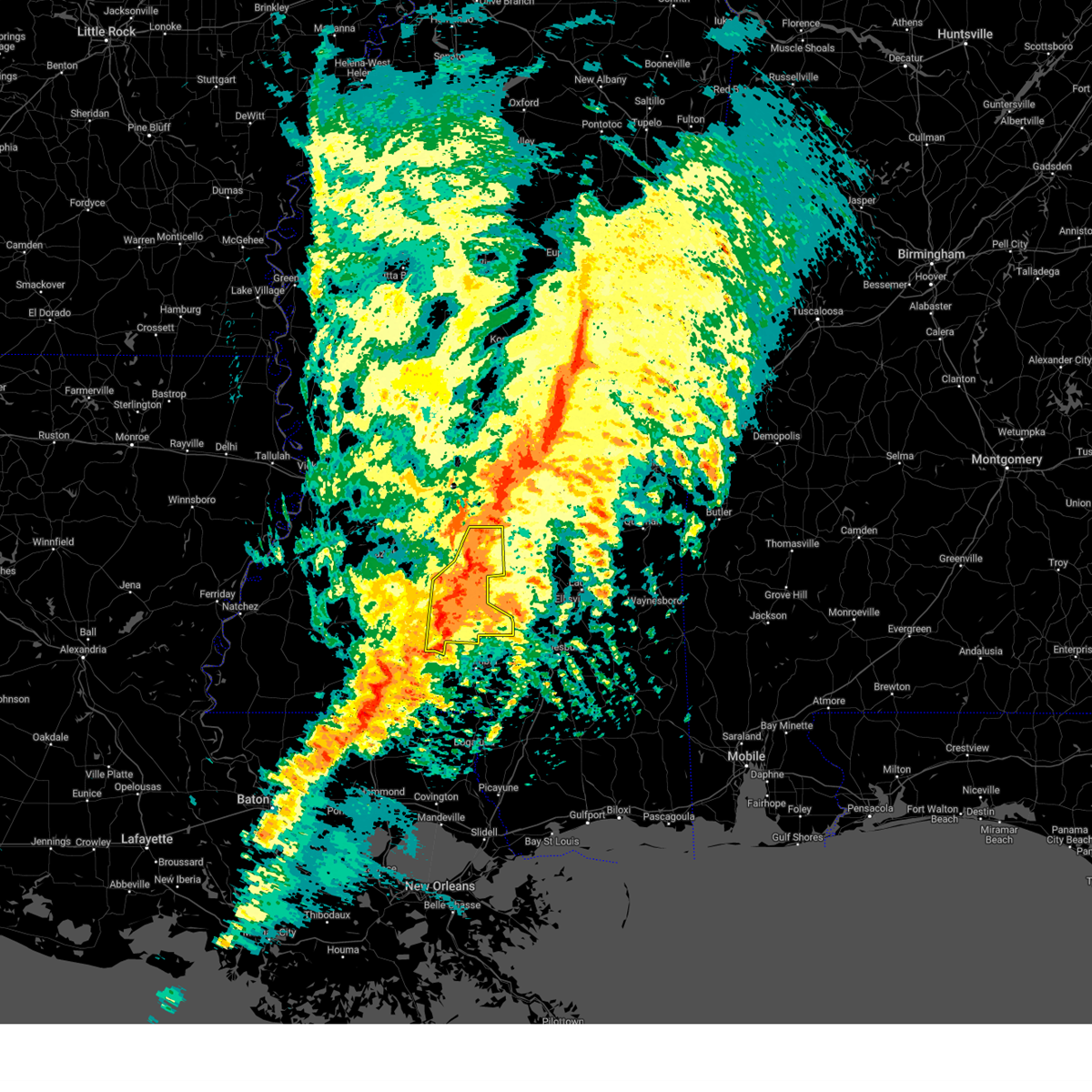
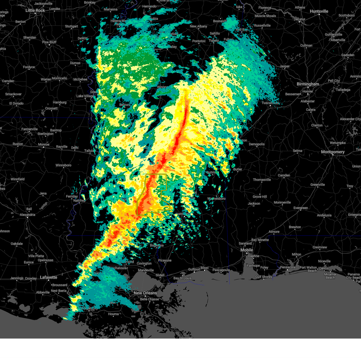
Hail Map for Mendenhall, MS
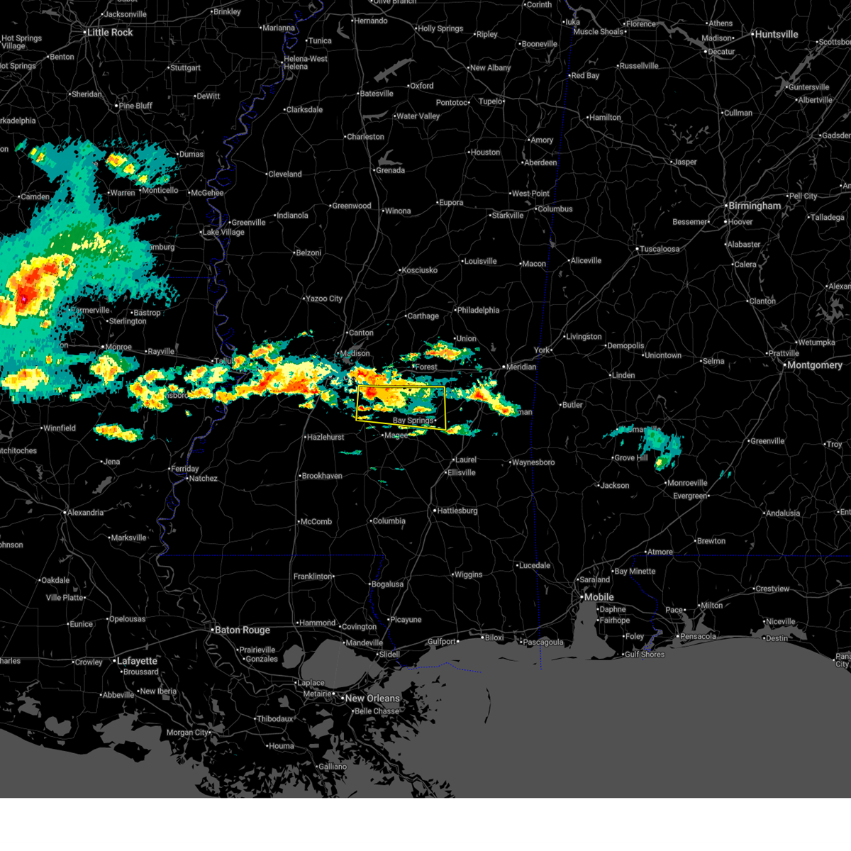
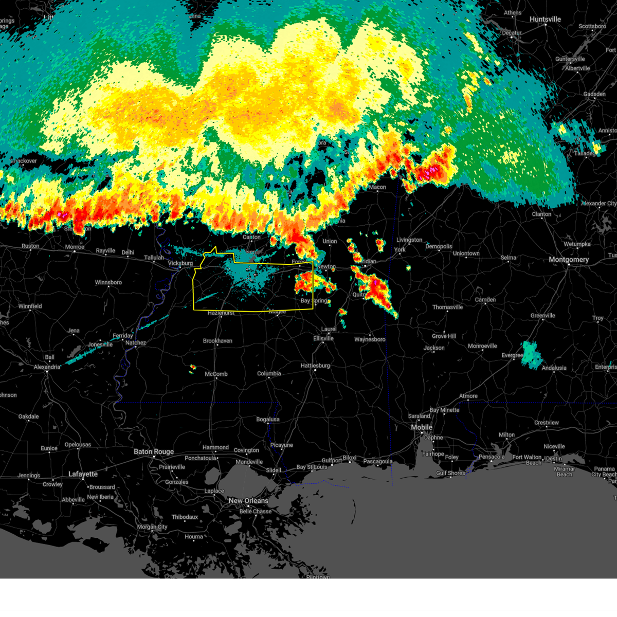
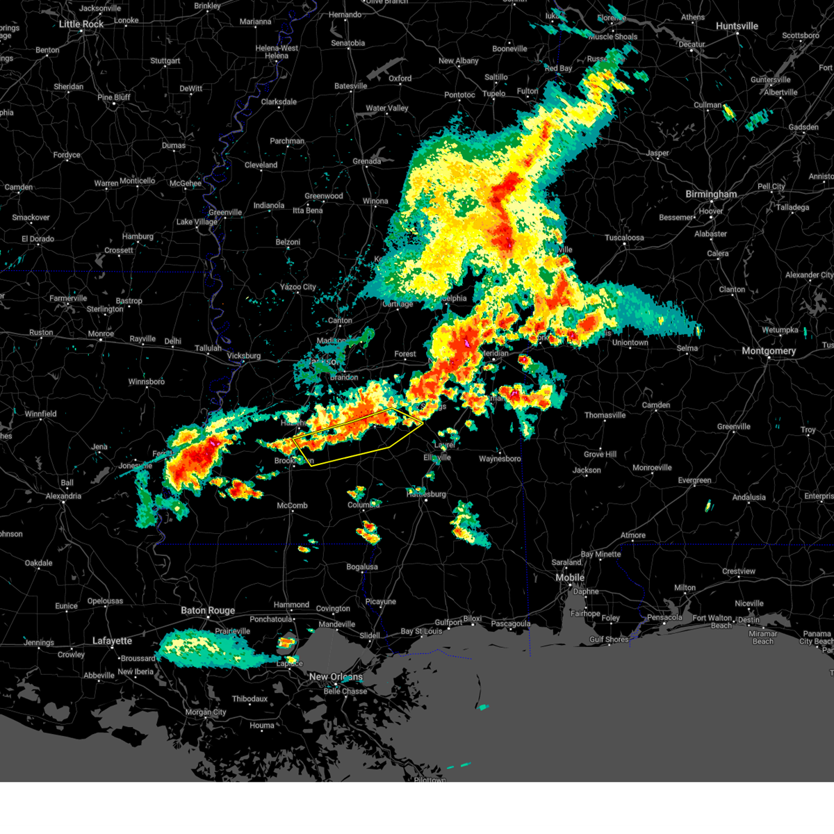
The Mendenhall, MS area has had 7 reports of on-the-ground hail by trained spotters, and has been under severe weather warnings 22 times during the past 12 months. Doppler radar has detected hail at or near Mendenhall, MS on 72 occasions, including 6 occasions during the past year.
| Name: | Mendenhall, MS |
| Where Located: | 30 miles SE of Jackson, MS |
| Map: | Google Map for Mendenhall, MS |
| Population: | 2504 |
| Housing Units: | 1097 |
| More Info: | Search Google for Mendenhall, MS |
1
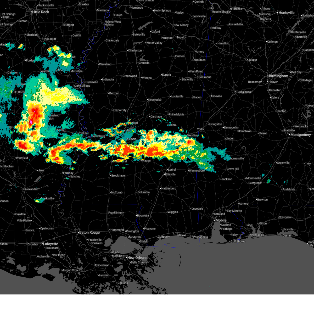
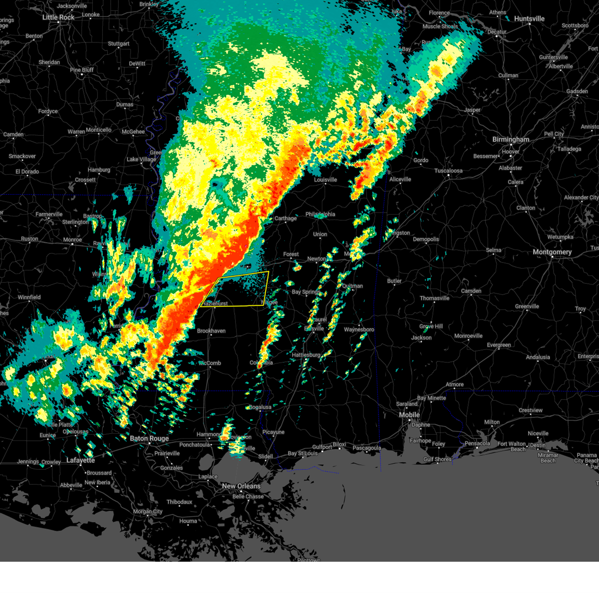
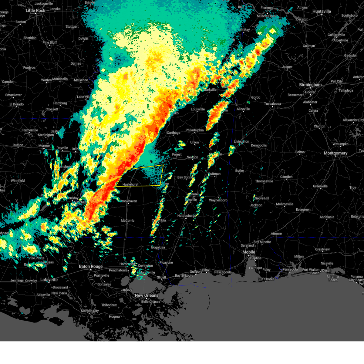
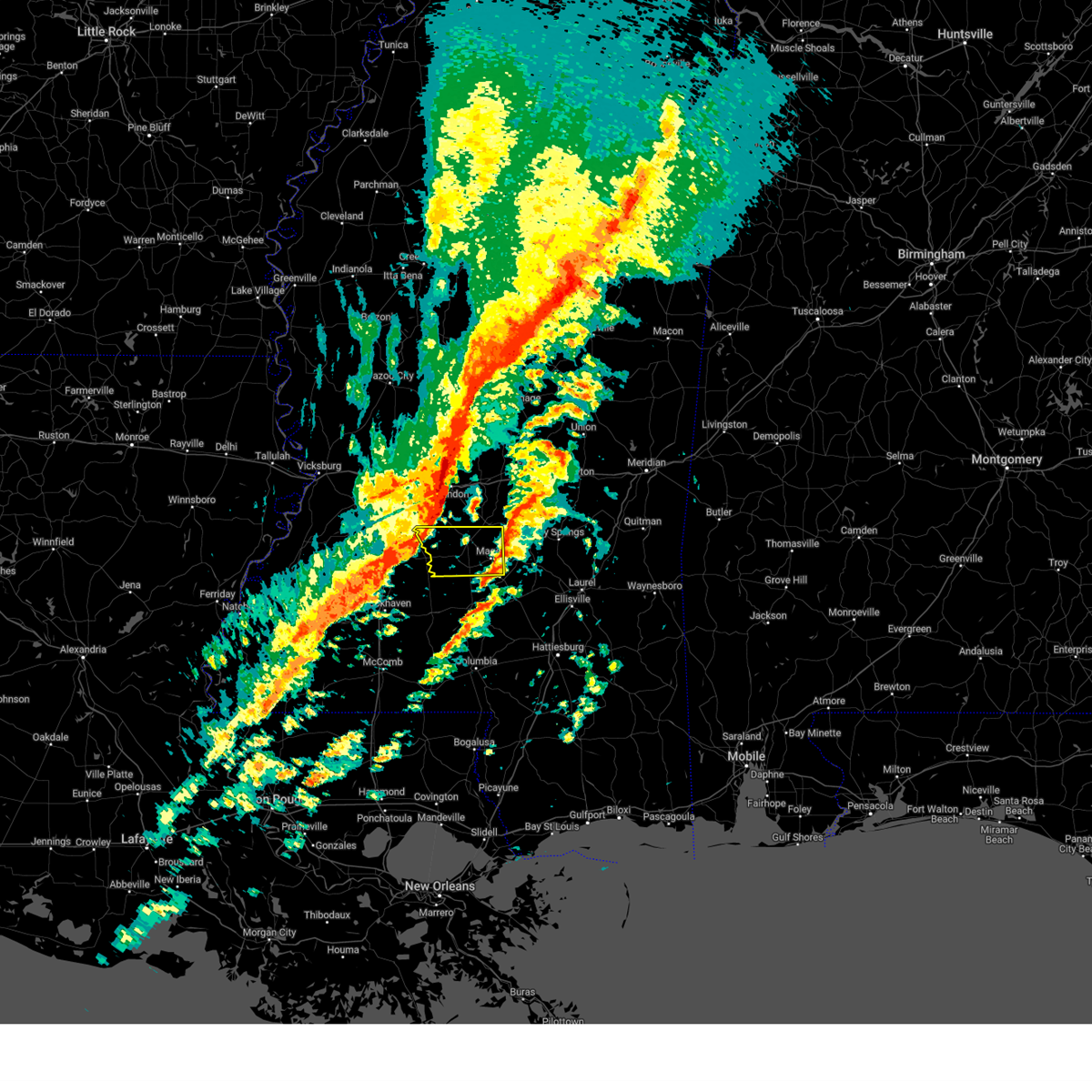
The Top Recent Hail Date for Mendenhall, MS is Saturday, July 12, 2025 (8th out of 72)
Hail and Wind Damage Spotted near Mendenhall, MS
| Date / Time | Report Details |
|---|---|
| 5/6/2026 6:46 PM CDT |
 At 646 pm cdt, a severe thunderstorm was located over piney woods, or 9 miles northwest of mendenhall, moving east at 40 mph (radar indicated). Hazards include 60 mph wind gusts and quarter size hail. Hail damage to vehicles is expected. expect wind damage to roofs, siding, and trees. Locations impacted include, morton, mendenhall, polkville, d'lo, puckett, braxton, martinville, cato, whites, pulaski, johns, harrisville, piney woods, star, and white oak. At 646 pm cdt, a severe thunderstorm was located over piney woods, or 9 miles northwest of mendenhall, moving east at 40 mph (radar indicated). Hazards include 60 mph wind gusts and quarter size hail. Hail damage to vehicles is expected. expect wind damage to roofs, siding, and trees. Locations impacted include, morton, mendenhall, polkville, d'lo, puckett, braxton, martinville, cato, whites, pulaski, johns, harrisville, piney woods, star, and white oak.
|
| 5/6/2026 6:39 PM CDT |
 Svrjan the national weather service in jackson has issued a * severe thunderstorm warning for, southeastern simpson county in central mississippi, southern smith county in central mississippi, northwestern covington county in southeastern mississippi, north central jefferson davis county in south central mississippi, * until 730 pm cdt. * at 639 pm cdt, a severe thunderstorm was located near clem, or 7 miles north of prentiss, moving northeast at 50 mph (radar indicated). Hazards include two inch hail and 60 mph wind gusts. People and animals outdoors will be injured. expect hail damage to roofs, siding, windows, and vehicles. Expect wind damage to roofs, siding, and trees. Svrjan the national weather service in jackson has issued a * severe thunderstorm warning for, southeastern simpson county in central mississippi, southern smith county in central mississippi, northwestern covington county in southeastern mississippi, north central jefferson davis county in south central mississippi, * until 730 pm cdt. * at 639 pm cdt, a severe thunderstorm was located near clem, or 7 miles north of prentiss, moving northeast at 50 mph (radar indicated). Hazards include two inch hail and 60 mph wind gusts. People and animals outdoors will be injured. expect hail damage to roofs, siding, windows, and vehicles. Expect wind damage to roofs, siding, and trees.
|
| 5/6/2026 6:33 PM CDT |
 Svrjan the national weather service in jackson has issued a * severe thunderstorm warning for, southern rankin county in central mississippi, northern simpson county in central mississippi, northwestern smith county in central mississippi, southwestern scott county in central mississippi, * until 730 pm cdt. * at 633 pm cdt, a severe thunderstorm was located near whites, or 7 miles south of florence, moving northeast at 45 mph (radar indicated). Hazards include 60 mph wind gusts and quarter size hail. Hail damage to vehicles is expected. Expect wind damage to roofs, siding, and trees. Svrjan the national weather service in jackson has issued a * severe thunderstorm warning for, southern rankin county in central mississippi, northern simpson county in central mississippi, northwestern smith county in central mississippi, southwestern scott county in central mississippi, * until 730 pm cdt. * at 633 pm cdt, a severe thunderstorm was located near whites, or 7 miles south of florence, moving northeast at 45 mph (radar indicated). Hazards include 60 mph wind gusts and quarter size hail. Hail damage to vehicles is expected. Expect wind damage to roofs, siding, and trees.
|
| 4/29/2026 2:56 PM CDT |
 Svrjan the national weather service in jackson has issued a * severe thunderstorm warning for, eastern simpson county in central mississippi, southwestern smith county in central mississippi, covington county in southeastern mississippi, northeastern lawrence county in south central mississippi, northern jefferson davis county in south central mississippi, * until 400 pm cdt. * at 256 pm cdt, a severe thunderstorm was located over magee, moving east at 30 mph (radar indicated). Hazards include ping pong ball size hail and 60 mph wind gusts. People and animals outdoors will be injured. expect hail damage to roofs, siding, windows, and vehicles. expect wind damage to roofs, siding, and trees. This severe thunderstorm will be near, magee and mount olive around 300 pm cdt. Svrjan the national weather service in jackson has issued a * severe thunderstorm warning for, eastern simpson county in central mississippi, southwestern smith county in central mississippi, covington county in southeastern mississippi, northeastern lawrence county in south central mississippi, northern jefferson davis county in south central mississippi, * until 400 pm cdt. * at 256 pm cdt, a severe thunderstorm was located over magee, moving east at 30 mph (radar indicated). Hazards include ping pong ball size hail and 60 mph wind gusts. People and animals outdoors will be injured. expect hail damage to roofs, siding, windows, and vehicles. expect wind damage to roofs, siding, and trees. This severe thunderstorm will be near, magee and mount olive around 300 pm cdt.
|
| 4/29/2026 2:16 PM CDT |
 At 216 pm cdt, a severe thunderstorm was located near harrisville, or 10 miles west of mendenhall, moving southeast at 40 mph (radar indicated). Hazards include 60 mph wind gusts and quarter size hail. Hail damage to vehicles is expected. expect wind damage to roofs, siding, and trees. this severe storm will be near, mendenhall, d'lo, and braxton around 220 pm cdt. Martinville around 230 pm cdt. At 216 pm cdt, a severe thunderstorm was located near harrisville, or 10 miles west of mendenhall, moving southeast at 40 mph (radar indicated). Hazards include 60 mph wind gusts and quarter size hail. Hail damage to vehicles is expected. expect wind damage to roofs, siding, and trees. this severe storm will be near, mendenhall, d'lo, and braxton around 220 pm cdt. Martinville around 230 pm cdt.
|
| 4/29/2026 2:01 PM CDT |
 At 201 pm cdt, a severe thunderstorm was located near raleigh, moving southeast at 25 mph (radar indicated). Hazards include 60 mph wind gusts and half dollar size hail. Hail damage to vehicles is expected. expect wind damage to roofs, siding, and trees. this severe storm will be near, raleigh and center ridge around 205 pm cdt. sylvarena around 215 pm cdt. Bay springs around 235 pm cdt. At 201 pm cdt, a severe thunderstorm was located near raleigh, moving southeast at 25 mph (radar indicated). Hazards include 60 mph wind gusts and half dollar size hail. Hail damage to vehicles is expected. expect wind damage to roofs, siding, and trees. this severe storm will be near, raleigh and center ridge around 205 pm cdt. sylvarena around 215 pm cdt. Bay springs around 235 pm cdt.
|
| 4/29/2026 1:57 PM CDT |
 Svrjan the national weather service in jackson has issued a * severe thunderstorm warning for, southern rankin county in central mississippi, northern simpson county in central mississippi, southeastern hinds county in central mississippi, * until 245 pm cdt. * at 157 pm cdt, a severe thunderstorm was located near star, or near florence, moving east at 40 mph (radar indicated). Hazards include golf ball size hail. People and animals outdoors will be injured. expect damage to roofs, siding, windows, and vehicles. this severe thunderstorm will be near, braxton, harrisville, star, and piney woods around 200 pm cdt. d'lo and cato around 205 pm cdt. mendenhall around 210 pm cdt. puckett around 215 pm cdt. Martinville around 220 pm cdt. Svrjan the national weather service in jackson has issued a * severe thunderstorm warning for, southern rankin county in central mississippi, northern simpson county in central mississippi, southeastern hinds county in central mississippi, * until 245 pm cdt. * at 157 pm cdt, a severe thunderstorm was located near star, or near florence, moving east at 40 mph (radar indicated). Hazards include golf ball size hail. People and animals outdoors will be injured. expect damage to roofs, siding, windows, and vehicles. this severe thunderstorm will be near, braxton, harrisville, star, and piney woods around 200 pm cdt. d'lo and cato around 205 pm cdt. mendenhall around 210 pm cdt. puckett around 215 pm cdt. Martinville around 220 pm cdt.
|
| 4/29/2026 1:31 PM CDT |
 Svrjan the national weather service in jackson has issued a * severe thunderstorm warning for, northwestern jasper county in east central mississippi, southeastern rankin county in central mississippi, northeastern simpson county in central mississippi, smith county in central mississippi, * until 230 pm cdt. * at 131 pm cdt, a severe thunderstorm was located near polkville, or 14 miles south of morton, moving east at 35 mph (radar indicated). Hazards include golf ball size hail and 60 mph wind gusts. People and animals outdoors will be injured. expect hail damage to roofs, siding, windows, and vehicles. expect wind damage to roofs, siding, and trees. this severe thunderstorm will be near, polkville and white oak around 135 pm cdt. burns around 140 pm cdt. pineville around 155 pm cdt. louin and montrose around 210 pm cdt. Turnerville around 225 pm cdt. Svrjan the national weather service in jackson has issued a * severe thunderstorm warning for, northwestern jasper county in east central mississippi, southeastern rankin county in central mississippi, northeastern simpson county in central mississippi, smith county in central mississippi, * until 230 pm cdt. * at 131 pm cdt, a severe thunderstorm was located near polkville, or 14 miles south of morton, moving east at 35 mph (radar indicated). Hazards include golf ball size hail and 60 mph wind gusts. People and animals outdoors will be injured. expect hail damage to roofs, siding, windows, and vehicles. expect wind damage to roofs, siding, and trees. this severe thunderstorm will be near, polkville and white oak around 135 pm cdt. burns around 140 pm cdt. pineville around 155 pm cdt. louin and montrose around 210 pm cdt. Turnerville around 225 pm cdt.
|
| 4/25/2026 3:16 AM CDT |
 At 316 am cdt, severe thunderstorms were located along a line extending from near hillsboro to near homewood to near magee, moving east at 45 mph (radar indicated). Hazards include 60 mph wind gusts. Expect damage to roofs, siding, and trees. these severe storms will be near, forest, raleigh, mize, homewood, burns, and steele around 320 am cdt. Lake, pineville, and center ridge around 325 am cdt. At 316 am cdt, severe thunderstorms were located along a line extending from near hillsboro to near homewood to near magee, moving east at 45 mph (radar indicated). Hazards include 60 mph wind gusts. Expect damage to roofs, siding, and trees. these severe storms will be near, forest, raleigh, mize, homewood, burns, and steele around 320 am cdt. Lake, pineville, and center ridge around 325 am cdt.
|
| 4/25/2026 3:11 AM CDT | Tree downed on airport r in simpson county MS, 6.9 miles NW of Mendenhall, MS |
| 4/25/2026 3:11 AM CDT |
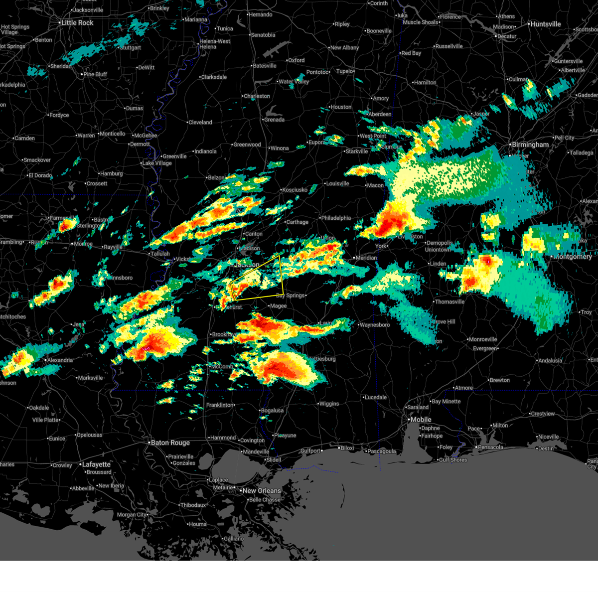
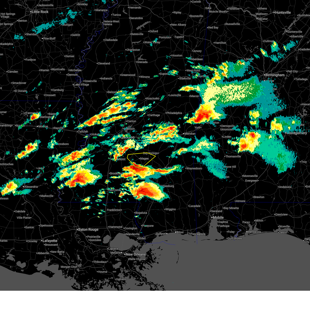
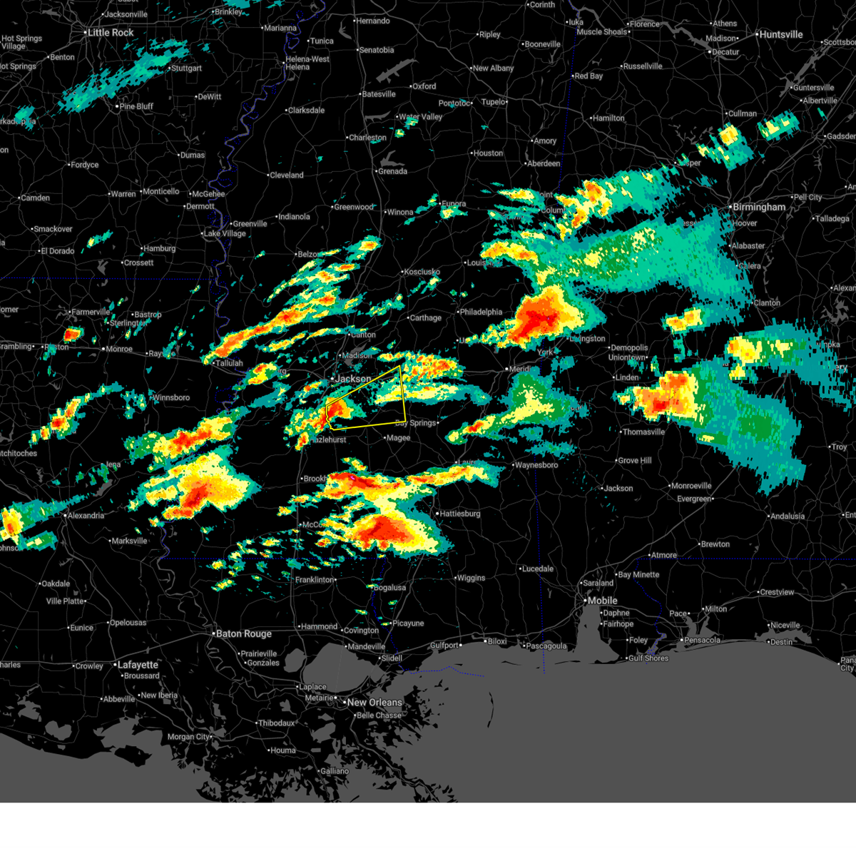
 At 311 am cdt, tornado producing storms were located along a line extending from near puckett to near sanatorium, moving east at 45 mph (radar confirmed tornado). Hazards include damaging tornado. Flying debris will be dangerous to those caught without shelter. mobile homes will be damaged or destroyed. damage to roofs, windows, and vehicles will occur. tree damage is likely. These tornadic storms will be near, magee, sanatorium, white oak, and martinville around 315 am cdt. At 311 am cdt, tornado producing storms were located along a line extending from near puckett to near sanatorium, moving east at 45 mph (radar confirmed tornado). Hazards include damaging tornado. Flying debris will be dangerous to those caught without shelter. mobile homes will be damaged or destroyed. damage to roofs, windows, and vehicles will occur. tree damage is likely. These tornadic storms will be near, magee, sanatorium, white oak, and martinville around 315 am cdt.
|
| 4/25/2026 3:08 AM CDT | Tree downed on athens r in simpson county MS, 4.4 miles NNW of Mendenhall, MS |
| 4/25/2026 2:51 AM CDT |
 Torjan the national weather service in jackson has issued a * tornado warning for, southeastern rankin county in central mississippi, simpson county in central mississippi, southwestern smith county in central mississippi, * until 330 am cdt. * at 251 am cdt, severe thunderstorms capable of producing a tornado were located along a line extending from piney woods to near harrisville, moving east at 45 mph (radar indicated rotation). Hazards include tornado. Flying debris will be dangerous to those caught without shelter. mobile homes will be damaged or destroyed. damage to roofs, windows, and vehicles will occur. tree damage is likely. these dangerous storms will be near, mendenhall, d'lo, braxton, pinola, cato, and piney woods around 255 am cdt. puckett, sanatorium, and martinville around 305 am cdt. Magee and white oak around 310 am cdt. Torjan the national weather service in jackson has issued a * tornado warning for, southeastern rankin county in central mississippi, simpson county in central mississippi, southwestern smith county in central mississippi, * until 330 am cdt. * at 251 am cdt, severe thunderstorms capable of producing a tornado were located along a line extending from piney woods to near harrisville, moving east at 45 mph (radar indicated rotation). Hazards include tornado. Flying debris will be dangerous to those caught without shelter. mobile homes will be damaged or destroyed. damage to roofs, windows, and vehicles will occur. tree damage is likely. these dangerous storms will be near, mendenhall, d'lo, braxton, pinola, cato, and piney woods around 255 am cdt. puckett, sanatorium, and martinville around 305 am cdt. Magee and white oak around 310 am cdt.
|
| 4/25/2026 2:48 AM CDT |
 Svrjan the national weather service in jackson has issued a * severe thunderstorm warning for, eastern rankin county in central mississippi, simpson county in central mississippi, smith county in central mississippi, scott county in central mississippi, * until 345 am cdt. * at 248 am cdt, severe thunderstorms were located along a line extending from fannin to near brandon to near georgetown, moving east at 40 mph (radar indicated). Hazards include 60 mph wind gusts. Expect damage to roofs, siding, and trees. severe thunderstorms will be near, pelahatchie, d'lo, braxton, pinola, pisgah, johns, cato, and shivers around 255 am cdt. mendenhall, puckett, leesburg, and branch around 300 am cdt. morton, polkville, and martinville around 305 am cdt. magee, pulaski, sanatorium, white oak, and forkville around 310 am cdt. homewood and burns around 315 am cdt. forest and hillsboro around 320 am cdt. raleigh and mize around 325 am cdt. Pineville and center ridge around 330 am cdt. Svrjan the national weather service in jackson has issued a * severe thunderstorm warning for, eastern rankin county in central mississippi, simpson county in central mississippi, smith county in central mississippi, scott county in central mississippi, * until 345 am cdt. * at 248 am cdt, severe thunderstorms were located along a line extending from fannin to near brandon to near georgetown, moving east at 40 mph (radar indicated). Hazards include 60 mph wind gusts. Expect damage to roofs, siding, and trees. severe thunderstorms will be near, pelahatchie, d'lo, braxton, pinola, pisgah, johns, cato, and shivers around 255 am cdt. mendenhall, puckett, leesburg, and branch around 300 am cdt. morton, polkville, and martinville around 305 am cdt. magee, pulaski, sanatorium, white oak, and forkville around 310 am cdt. homewood and burns around 315 am cdt. forest and hillsboro around 320 am cdt. raleigh and mize around 325 am cdt. Pineville and center ridge around 330 am cdt.
|
| 7/12/2025 7:07 PM CDT |
 the severe thunderstorm warning has been cancelled and is no longer in effect the severe thunderstorm warning has been cancelled and is no longer in effect
|
| 7/12/2025 6:52 PM CDT |
 At 652 pm cdt, a severe thunderstorm was located over martinville, or near mendenhall, moving northeast at 15 mph (radar indicated). Hazards include 60 mph wind gusts. Expect damage to roofs, siding, and trees. This severe storm will be near, puckett and white oak around 655 pm cdt. At 652 pm cdt, a severe thunderstorm was located over martinville, or near mendenhall, moving northeast at 15 mph (radar indicated). Hazards include 60 mph wind gusts. Expect damage to roofs, siding, and trees. This severe storm will be near, puckett and white oak around 655 pm cdt.
|
| 7/12/2025 6:38 PM CDT |
 Svrjan the national weather service in jackson has issued a * severe thunderstorm warning for, southeastern rankin county in central mississippi, northeastern simpson county in central mississippi, west central smith county in central mississippi, * until 745 pm cdt. * at 638 pm cdt, a severe thunderstorm was located near mendenhall, moving northeast at 15 mph (radar indicated). Hazards include 60 mph wind gusts. Expect damage to roofs, siding, and trees. this severe thunderstorm will be near, puckett and martinville around 645 pm cdt. White oak around 650 pm cdt. Svrjan the national weather service in jackson has issued a * severe thunderstorm warning for, southeastern rankin county in central mississippi, northeastern simpson county in central mississippi, west central smith county in central mississippi, * until 745 pm cdt. * at 638 pm cdt, a severe thunderstorm was located near mendenhall, moving northeast at 15 mph (radar indicated). Hazards include 60 mph wind gusts. Expect damage to roofs, siding, and trees. this severe thunderstorm will be near, puckett and martinville around 645 pm cdt. White oak around 650 pm cdt.
|
| 7/1/2025 6:05 PM CDT |
 At 604 pm cdt, severe thunderstorms were located along a line extending from near taylorsville to shivers, moving south at 30 mph (radar indicated). Hazards include 60 mph wind gusts. Expect damage to roofs, siding, and trees. These severe thunderstorms will remain over mainly rural areas of simpson and southwestern smith counties. At 604 pm cdt, severe thunderstorms were located along a line extending from near taylorsville to shivers, moving south at 30 mph (radar indicated). Hazards include 60 mph wind gusts. Expect damage to roofs, siding, and trees. These severe thunderstorms will remain over mainly rural areas of simpson and southwestern smith counties.
|
| 7/1/2025 6:05 PM CDT |
 the severe thunderstorm warning has been cancelled and is no longer in effect the severe thunderstorm warning has been cancelled and is no longer in effect
|
| 7/1/2025 5:43 PM CDT | A utility line was downed off hwy 49 north of mage in simpson county MS, 6.3 miles NW of Mendenhall, MS |
| 7/1/2025 5:42 PM CDT |
 At 541 pm cdt, severe thunderstorms were located along a line extending from near bay springs to near harrisville, moving southeast at 30 mph (radar indicated). Hazards include 60 mph wind gusts. Expect damage to roofs, siding, and trees. these severe storms will be near, magee, mendenhall, bay springs, sanatorium, pinola, union, and center ridge around 545 pm cdt. mize and stringer around 550 pm cdt. Taylorsville and shivers around 555 pm cdt. At 541 pm cdt, severe thunderstorms were located along a line extending from near bay springs to near harrisville, moving southeast at 30 mph (radar indicated). Hazards include 60 mph wind gusts. Expect damage to roofs, siding, and trees. these severe storms will be near, magee, mendenhall, bay springs, sanatorium, pinola, union, and center ridge around 545 pm cdt. mize and stringer around 550 pm cdt. Taylorsville and shivers around 555 pm cdt.
|
| 7/1/2025 5:07 PM CDT |
 Svrjan the national weather service in jackson has issued a * severe thunderstorm warning for, western jasper county in east central mississippi, southwestern newton county in east central mississippi, rankin county in central mississippi, simpson county in central mississippi, smith county in central mississippi, southern scott county in central mississippi, * until 630 pm cdt. * at 507 pm cdt, severe thunderstorms were located along a line extending from near homewood to florence, moving south at 25 mph (radar indicated). Hazards include 60 mph wind gusts. Expect damage to roofs, siding, and trees. severe thunderstorms will be near, puckett, burns, johns, cato, whites, star, white oak, pineville, and piney woods around 515 pm cdt. braxton around 520 pm cdt. raleigh around 525 pm cdt. d'lo, sylvarena, and harrisville around 530 pm cdt. mendenhall and martinville around 535 pm cdt. center ridge around 540 pm cdt. magee, sanatorium, pinola, and union around 545 pm cdt. Mize around 555 pm cdt. Svrjan the national weather service in jackson has issued a * severe thunderstorm warning for, western jasper county in east central mississippi, southwestern newton county in east central mississippi, rankin county in central mississippi, simpson county in central mississippi, smith county in central mississippi, southern scott county in central mississippi, * until 630 pm cdt. * at 507 pm cdt, severe thunderstorms were located along a line extending from near homewood to florence, moving south at 25 mph (radar indicated). Hazards include 60 mph wind gusts. Expect damage to roofs, siding, and trees. severe thunderstorms will be near, puckett, burns, johns, cato, whites, star, white oak, pineville, and piney woods around 515 pm cdt. braxton around 520 pm cdt. raleigh around 525 pm cdt. d'lo, sylvarena, and harrisville around 530 pm cdt. mendenhall and martinville around 535 pm cdt. center ridge around 540 pm cdt. magee, sanatorium, pinola, and union around 545 pm cdt. Mize around 555 pm cdt.
|
| 6/27/2025 4:24 PM CDT |
 Svrjan the national weather service in jackson has issued a * severe thunderstorm warning for, southwestern rankin county in central mississippi, northern simpson county in central mississippi, southeastern hinds county in central mississippi, * until 530 pm cdt. * at 424 pm cdt, a severe thunderstorm was located over florence, moving southeast at 15 mph (radar indicated). Hazards include 60 mph wind gusts and half dollar size hail. Hail damage to vehicles is expected. expect wind damage to roofs, siding, and trees. this severe thunderstorm will be near, star and piney woods around 430 pm cdt. harrisville around 435 pm cdt. braxton around 440 pm cdt. d'lo and union around 505 pm cdt. Mendenhall around 520 pm cdt. Svrjan the national weather service in jackson has issued a * severe thunderstorm warning for, southwestern rankin county in central mississippi, northern simpson county in central mississippi, southeastern hinds county in central mississippi, * until 530 pm cdt. * at 424 pm cdt, a severe thunderstorm was located over florence, moving southeast at 15 mph (radar indicated). Hazards include 60 mph wind gusts and half dollar size hail. Hail damage to vehicles is expected. expect wind damage to roofs, siding, and trees. this severe thunderstorm will be near, star and piney woods around 430 pm cdt. harrisville around 435 pm cdt. braxton around 440 pm cdt. d'lo and union around 505 pm cdt. Mendenhall around 520 pm cdt.
|
| 6/27/2025 4:10 PM CDT |
 the severe thunderstorm warning has been cancelled and is no longer in effect the severe thunderstorm warning has been cancelled and is no longer in effect
|
| 6/27/2025 3:40 PM CDT |
 Svrjan the national weather service in jackson has issued a * severe thunderstorm warning for, south central rankin county in central mississippi, eastern simpson county in central mississippi, * until 430 pm cdt. * at 339 pm cdt, a severe thunderstorm was located over piney woods, or 10 miles southeast of florence, moving southeast at 15 mph (radar indicated). Hazards include 60 mph wind gusts and half dollar size hail. Hail damage to vehicles is expected. expect wind damage to roofs, siding, and trees. this severe thunderstorm will be near, d'lo, braxton, cato, and piney woods around 345 pm cdt. Mendenhall around 350 pm cdt. Svrjan the national weather service in jackson has issued a * severe thunderstorm warning for, south central rankin county in central mississippi, eastern simpson county in central mississippi, * until 430 pm cdt. * at 339 pm cdt, a severe thunderstorm was located over piney woods, or 10 miles southeast of florence, moving southeast at 15 mph (radar indicated). Hazards include 60 mph wind gusts and half dollar size hail. Hail damage to vehicles is expected. expect wind damage to roofs, siding, and trees. this severe thunderstorm will be near, d'lo, braxton, cato, and piney woods around 345 pm cdt. Mendenhall around 350 pm cdt.
|
| 5/27/2025 8:58 AM CDT |
 The storms which prompted the warning have moved out of the area. therefore, the warning will be allowed to expire. a severe thunderstorm watch remains in effect until 100 pm cdt for central mississippi. The storms which prompted the warning have moved out of the area. therefore, the warning will be allowed to expire. a severe thunderstorm watch remains in effect until 100 pm cdt for central mississippi.
|
| 5/27/2025 8:45 AM CDT |
 At 845 am cdt, severe thunderstorms were located along a line extending from near way to farmhaven to near ludlow to near polkville, moving northeast at 35 mph (radar indicated). Hazards include 60 mph wind gusts. Expect damage to roofs, siding, and trees. These severe storms will be near, farmhaven and sharon around 850 am cdt. At 845 am cdt, severe thunderstorms were located along a line extending from near way to farmhaven to near ludlow to near polkville, moving northeast at 35 mph (radar indicated). Hazards include 60 mph wind gusts. Expect damage to roofs, siding, and trees. These severe storms will be near, farmhaven and sharon around 850 am cdt.
|
| 5/27/2025 8:39 AM CDT |
 the severe thunderstorm warning has been cancelled and is no longer in effect the severe thunderstorm warning has been cancelled and is no longer in effect
|
| 5/27/2025 8:39 AM CDT |
 At 839 am cdt, severe thunderstorms were located along a line extending from near flora to near gluckstadt to near fannin to near braxton, moving northeast at 40 mph (radar indicated). Hazards include 60 mph wind gusts. Expect damage to roofs, siding, and trees. these severe storms will be near, canton, pelahatchie, johns, cato, pisgah, and goshen springs around 845 am cdt. puckett, sharon, and leesburg around 850 am cdt. Farmhaven around 855 am cdt. At 839 am cdt, severe thunderstorms were located along a line extending from near flora to near gluckstadt to near fannin to near braxton, moving northeast at 40 mph (radar indicated). Hazards include 60 mph wind gusts. Expect damage to roofs, siding, and trees. these severe storms will be near, canton, pelahatchie, johns, cato, pisgah, and goshen springs around 845 am cdt. puckett, sharon, and leesburg around 850 am cdt. Farmhaven around 855 am cdt.
|
| 5/27/2025 7:52 AM CDT |
 Svrjan the national weather service in jackson has issued a * severe thunderstorm warning for, rankin county in central mississippi, simpson county in central mississippi, southwestern scott county in central mississippi, central hinds county in central mississippi, eastern copiah county in central mississippi, madison county in central mississippi, * until 900 am cdt. * at 752 am cdt, severe thunderstorms were located along a line extending from near edwards to near raymond to near dry grove to near wesson, moving northeast at 40 mph (radar indicated). Hazards include 60 mph wind gusts. Expect damage to roofs, siding, and trees. severe thunderstorms will be near, jackson and byram around 755 am cdt. clinton and hopewell around 800 am cdt. richland, whites, and brownsville around 805 am cdt. florence, georgetown, and rockport around 810 am cdt. pearl, flowood, harrisville, monterey, union, and pocahontas around 815 am cdt. madison, ridgeland, flora, and star around 820 am cdt. brandon, gluckstadt, annandale, and piney woods around 825 am cdt. Canton, braxton, fannin, and pinola around 830 am cdt. Svrjan the national weather service in jackson has issued a * severe thunderstorm warning for, rankin county in central mississippi, simpson county in central mississippi, southwestern scott county in central mississippi, central hinds county in central mississippi, eastern copiah county in central mississippi, madison county in central mississippi, * until 900 am cdt. * at 752 am cdt, severe thunderstorms were located along a line extending from near edwards to near raymond to near dry grove to near wesson, moving northeast at 40 mph (radar indicated). Hazards include 60 mph wind gusts. Expect damage to roofs, siding, and trees. severe thunderstorms will be near, jackson and byram around 755 am cdt. clinton and hopewell around 800 am cdt. richland, whites, and brownsville around 805 am cdt. florence, georgetown, and rockport around 810 am cdt. pearl, flowood, harrisville, monterey, union, and pocahontas around 815 am cdt. madison, ridgeland, flora, and star around 820 am cdt. brandon, gluckstadt, annandale, and piney woods around 825 am cdt. Canton, braxton, fannin, and pinola around 830 am cdt.
|
| 5/26/2025 2:58 PM CDT |
 Svrjan the national weather service in jackson has issued a * severe thunderstorm warning for, northwestern jasper county in east central mississippi, southwestern newton county in east central mississippi, southeastern rankin county in central mississippi, northeastern simpson county in central mississippi, smith county in central mississippi, southern scott county in central mississippi, * until 400 pm cdt. * at 257 pm cdt, severe thunderstorms were located along a line extending from near pelahatchie to near martinville, moving east at 50 mph (radar indicated). Hazards include 60 mph wind gusts and nickel size hail. expect damage to roofs, siding, and trees Svrjan the national weather service in jackson has issued a * severe thunderstorm warning for, northwestern jasper county in east central mississippi, southwestern newton county in east central mississippi, southeastern rankin county in central mississippi, northeastern simpson county in central mississippi, smith county in central mississippi, southern scott county in central mississippi, * until 400 pm cdt. * at 257 pm cdt, severe thunderstorms were located along a line extending from near pelahatchie to near martinville, moving east at 50 mph (radar indicated). Hazards include 60 mph wind gusts and nickel size hail. expect damage to roofs, siding, and trees
|
| 5/26/2025 2:37 PM CDT |
 the severe thunderstorm warning has been cancelled and is no longer in effect the severe thunderstorm warning has been cancelled and is no longer in effect
|
| 5/26/2025 2:37 PM CDT |
 At 237 pm cdt, severe thunderstorms were located along a line extending from richland to near harrisville, moving east at 50 mph (radar indicated). Hazards include 60 mph wind gusts. Expect damage to roofs, siding, and trees. These severe storms will be near, jackson, brandon, mendenhall, d'lo, braxton, and piney woods around 245 pm cdt. At 237 pm cdt, severe thunderstorms were located along a line extending from richland to near harrisville, moving east at 50 mph (radar indicated). Hazards include 60 mph wind gusts. Expect damage to roofs, siding, and trees. These severe storms will be near, jackson, brandon, mendenhall, d'lo, braxton, and piney woods around 245 pm cdt.
|
| 5/26/2025 1:55 PM CDT |
 Svrjan the national weather service in jackson has issued a * severe thunderstorm warning for, southwestern rankin county in central mississippi, northwestern simpson county in central mississippi, southern hinds county in central mississippi, northeastern copiah county in central mississippi, * until 300 pm cdt. * at 155 pm cdt, severe thunderstorms were located along a line extending from near carpenter to near glancy, moving east at 50 mph (radar indicated). Hazards include 60 mph wind gusts. Expect damage to roofs, siding, and trees. severe thunderstorms will be near, hazlehurst, utica, and glancy around 200 pm cdt. crystal springs, dry grove, and gallman around 205 pm cdt. jackson, terry, and hopewell around 215 pm cdt. byram, georgetown, and whites around 220 pm cdt. richland, florence, and harrisville around 225 pm cdt. star and monterey around 230 pm cdt. pearl, braxton, and piney woods around 235 pm cdt. Brandon and d'lo around 240 pm cdt. Svrjan the national weather service in jackson has issued a * severe thunderstorm warning for, southwestern rankin county in central mississippi, northwestern simpson county in central mississippi, southern hinds county in central mississippi, northeastern copiah county in central mississippi, * until 300 pm cdt. * at 155 pm cdt, severe thunderstorms were located along a line extending from near carpenter to near glancy, moving east at 50 mph (radar indicated). Hazards include 60 mph wind gusts. Expect damage to roofs, siding, and trees. severe thunderstorms will be near, hazlehurst, utica, and glancy around 200 pm cdt. crystal springs, dry grove, and gallman around 205 pm cdt. jackson, terry, and hopewell around 215 pm cdt. byram, georgetown, and whites around 220 pm cdt. richland, florence, and harrisville around 225 pm cdt. star and monterey around 230 pm cdt. pearl, braxton, and piney woods around 235 pm cdt. Brandon and d'lo around 240 pm cdt.
|
| 5/25/2025 10:19 PM CDT |
 At 1018 pm cdt, severe thunderstorms were located along a line extending from near hopewell to near magee to bay springs, moving south at 35 mph (radar indicated). Hazards include 60 mph wind gusts. Expect damage to roofs, siding, and trees. Locations impacted include, jackson, byram, crystal springs, florence, mendenhall, raymond, raleigh, terry, utica, d'lo, puckett, braxton, sylvarena, learned, piney woods, star, center ridge, white oak, dentville, and dry grove. At 1018 pm cdt, severe thunderstorms were located along a line extending from near hopewell to near magee to bay springs, moving south at 35 mph (radar indicated). Hazards include 60 mph wind gusts. Expect damage to roofs, siding, and trees. Locations impacted include, jackson, byram, crystal springs, florence, mendenhall, raymond, raleigh, terry, utica, d'lo, puckett, braxton, sylvarena, learned, piney woods, star, center ridge, white oak, dentville, and dry grove.
|
| 5/25/2025 10:19 PM CDT |
 the severe thunderstorm warning has been cancelled and is no longer in effect the severe thunderstorm warning has been cancelled and is no longer in effect
|
| 5/25/2025 10:08 PM CDT |
 At 1008 pm cdt, severe thunderstorms were located along a line extending from near terry to near martinville to near louin, moving south at 30 mph (radar indicated). Hazards include 60 mph wind gusts. Expect damage to roofs, siding, and trees. Locations impacted include, jackson, clinton, pearl, brandon, byram, flowood, richland, crystal springs, florence, mendenhall, raymond, raleigh, pelahatchie, terry, edwards, polkville, utica, d'lo, puckett, and braxton. At 1008 pm cdt, severe thunderstorms were located along a line extending from near terry to near martinville to near louin, moving south at 30 mph (radar indicated). Hazards include 60 mph wind gusts. Expect damage to roofs, siding, and trees. Locations impacted include, jackson, clinton, pearl, brandon, byram, flowood, richland, crystal springs, florence, mendenhall, raymond, raleigh, pelahatchie, terry, edwards, polkville, utica, d'lo, puckett, and braxton.
|
| 5/25/2025 9:43 PM CDT |
 At 943 pm cdt, severe thunderstorms were located along a line extending from near raymond to 6 miles southeast of brandon to near lake, moving south at 35 mph (radar indicated). Hazards include 60 mph wind gusts. Expect damage to roofs, siding, and trees. these severe storms will be near, jackson, byram, florence, terry, polkville, homewood, johns, dry grove, cato, and whites around 950 pm cdt. puckett, burns, and piney woods around 955 pm cdt. braxton, white oak, and pineville around 1000 pm cdt. crystal springs, mendenhall, d'lo, and harrisville around 1005 pm cdt. raleigh, hopewell, and martinville around 1010 pm cdt. sylvarena and gallman around 1015 pm cdt. Center ridge around 1020 pm cdt. At 943 pm cdt, severe thunderstorms were located along a line extending from near raymond to 6 miles southeast of brandon to near lake, moving south at 35 mph (radar indicated). Hazards include 60 mph wind gusts. Expect damage to roofs, siding, and trees. these severe storms will be near, jackson, byram, florence, terry, polkville, homewood, johns, dry grove, cato, and whites around 950 pm cdt. puckett, burns, and piney woods around 955 pm cdt. braxton, white oak, and pineville around 1000 pm cdt. crystal springs, mendenhall, d'lo, and harrisville around 1005 pm cdt. raleigh, hopewell, and martinville around 1010 pm cdt. sylvarena and gallman around 1015 pm cdt. Center ridge around 1020 pm cdt.
|
| 5/25/2025 9:09 PM CDT |
 Svrjan the national weather service in jackson has issued a * severe thunderstorm warning for, rankin county in central mississippi, northern simpson county in central mississippi, smith county in central mississippi, southern scott county in central mississippi, hinds county in central mississippi, northern copiah county in central mississippi, * until 1045 pm cdt. * at 909 pm cdt, severe thunderstorms were located along a line extending from near phoenix to near gluckstadt to near standing pine, moving south at 35 mph (radar indicated). Hazards include 60 mph wind gusts. Expect damage to roofs, siding, and trees. severe thunderstorms will be near, jackson, brownsville, and pocahontas around 915 pm cdt. clinton, flowood, morton, and bolton around 925 pm cdt. pearl, brandon, forest, pelahatchie, and edwards around 930 pm cdt. richland and raymond around 935 pm cdt. byram, learned, pulaski, and monterey around 940 pm cdt. florence, polkville, and homewood around 945 pm cdt. terry, johns, dry grove, whites, and star around 950 pm cdt. Puckett, burns, cato, and piney woods around 955 pm cdt. Svrjan the national weather service in jackson has issued a * severe thunderstorm warning for, rankin county in central mississippi, northern simpson county in central mississippi, smith county in central mississippi, southern scott county in central mississippi, hinds county in central mississippi, northern copiah county in central mississippi, * until 1045 pm cdt. * at 909 pm cdt, severe thunderstorms were located along a line extending from near phoenix to near gluckstadt to near standing pine, moving south at 35 mph (radar indicated). Hazards include 60 mph wind gusts. Expect damage to roofs, siding, and trees. severe thunderstorms will be near, jackson, brownsville, and pocahontas around 915 pm cdt. clinton, flowood, morton, and bolton around 925 pm cdt. pearl, brandon, forest, pelahatchie, and edwards around 930 pm cdt. richland and raymond around 935 pm cdt. byram, learned, pulaski, and monterey around 940 pm cdt. florence, polkville, and homewood around 945 pm cdt. terry, johns, dry grove, whites, and star around 950 pm cdt. Puckett, burns, cato, and piney woods around 955 pm cdt.
|
| 5/24/2025 5:46 PM CDT | 62.6 mph wind gust measured along athens roa in simpson county MS, 4.7 miles NNW of Mendenhall, MS |
| 5/24/2025 5:46 PM CDT |
 Svrjan the national weather service in jackson has issued a * severe thunderstorm warning for, southern simpson county in central mississippi, southern smith county in central mississippi, northeastern lincoln county in south central mississippi, northern lawrence county in south central mississippi, northwestern covington county in southeastern mississippi, southeastern copiah county in central mississippi, northwestern jefferson davis county in south central mississippi, * until 700 pm cdt. * at 545 pm cdt, severe thunderstorms were located along a line extending from near raleigh to 6 miles southwest of sanatorium to beauregard, moving southeast at 15 mph (radar indicated). Hazards include 60 mph wind gusts and nickel size hail. expect damage to roofs, siding, and trees Svrjan the national weather service in jackson has issued a * severe thunderstorm warning for, southern simpson county in central mississippi, southern smith county in central mississippi, northeastern lincoln county in south central mississippi, northern lawrence county in south central mississippi, northwestern covington county in southeastern mississippi, southeastern copiah county in central mississippi, northwestern jefferson davis county in south central mississippi, * until 700 pm cdt. * at 545 pm cdt, severe thunderstorms were located along a line extending from near raleigh to 6 miles southwest of sanatorium to beauregard, moving southeast at 15 mph (radar indicated). Hazards include 60 mph wind gusts and nickel size hail. expect damage to roofs, siding, and trees
|
| 4/6/2025 3:23 AM CDT |
 At 322 am cdt, severe thunderstorms were located along a line extending from near d'lo to near sanatorium to near clem, moving northeast at 30 mph (radar indicated). Hazards include 60 mph wind gusts and penny size hail. Expect damage to roofs, siding, and trees. These severe storms will be near, sanatorium, magee, and martinville around 330 am cdt. At 322 am cdt, severe thunderstorms were located along a line extending from near d'lo to near sanatorium to near clem, moving northeast at 30 mph (radar indicated). Hazards include 60 mph wind gusts and penny size hail. Expect damage to roofs, siding, and trees. These severe storms will be near, sanatorium, magee, and martinville around 330 am cdt.
|
| 4/6/2025 3:21 AM CDT |
 the tornado warning has been cancelled and is no longer in effect the tornado warning has been cancelled and is no longer in effect
|
| 4/6/2025 3:03 AM CDT |
 At 303 am cdt, a severe thunderstorm was located over pinola, or 7 miles southwest of mendenhall, moving northeast at 30 mph (radar indicated). Hazards include 60 mph wind gusts. Expect damage to roofs, siding, and trees. This severe storm will be near, sanatorium, d'lo, mendenhall, magee, and martinville around 310 am cdt. At 303 am cdt, a severe thunderstorm was located over pinola, or 7 miles southwest of mendenhall, moving northeast at 30 mph (radar indicated). Hazards include 60 mph wind gusts. Expect damage to roofs, siding, and trees. This severe storm will be near, sanatorium, d'lo, mendenhall, magee, and martinville around 310 am cdt.
|
| 4/6/2025 3:03 AM CDT |
 the severe thunderstorm warning has been cancelled and is no longer in effect the severe thunderstorm warning has been cancelled and is no longer in effect
|
| 4/6/2025 3:00 AM CDT | At 300 am cdt, a severe thunderstorm capable of producing a tornado was located near union, or 10 miles southwest of mendenhall, moving northeast at 25 mph (radar indicated rotation). Hazards include tornado. Flying debris will be dangerous to those caught without shelter. mobile homes will be damaged or destroyed. damage to roofs, windows, and vehicles will occur. tree damage is likely. this dangerous storm will be near, braxton, pinola, and d'lo around 305 am cdt. Mendenhall around 310 am cdt. |
| 4/6/2025 2:51 AM CDT | Torjan the national weather service in jackson has issued a * tornado warning for, central simpson county in central mississippi, * until 345 am cdt. * at 249 am cdt, a severe thunderstorm capable of producing a tornado was located near shivers, or 15 miles southwest of mendenhall, moving northeast at 20 mph (radar indicated rotation). Hazards include tornado. Flying debris will be dangerous to those caught without shelter. mobile homes will be damaged or destroyed. damage to roofs, windows, and vehicles will occur. tree damage is likely. this dangerous storm will be near, pinola, shivers, and union around 255 am cdt. d'lo and mendenhall around 310 am cdt. braxton around 320 am cdt. Sanatorium around 325 am cdt. |
| 4/6/2025 2:42 AM CDT |
 Svrjan the national weather service in jackson has issued a * severe thunderstorm warning for, simpson county in central mississippi, northeastern lawrence county in south central mississippi, northwestern jefferson davis county in south central mississippi, * until 345 am cdt. * at 242 am cdt, a severe thunderstorm was located near shivers, or 16 miles southwest of mendenhall, moving northeast at 40 mph (radar indicated). Hazards include 60 mph wind gusts. Expect damage to roofs, siding, and trees. this severe thunderstorm will be near, new hebron, pinola, shivers, and union around 245 am cdt. mendenhall around 255 am cdt. sanatorium and magee around 300 am cdt. Martinville around 305 am cdt. Svrjan the national weather service in jackson has issued a * severe thunderstorm warning for, simpson county in central mississippi, northeastern lawrence county in south central mississippi, northwestern jefferson davis county in south central mississippi, * until 345 am cdt. * at 242 am cdt, a severe thunderstorm was located near shivers, or 16 miles southwest of mendenhall, moving northeast at 40 mph (radar indicated). Hazards include 60 mph wind gusts. Expect damage to roofs, siding, and trees. this severe thunderstorm will be near, new hebron, pinola, shivers, and union around 245 am cdt. mendenhall around 255 am cdt. sanatorium and magee around 300 am cdt. Martinville around 305 am cdt.
|
| 4/6/2025 2:37 AM CDT |
 the severe thunderstorm warning has been cancelled and is no longer in effect the severe thunderstorm warning has been cancelled and is no longer in effect
|
| 4/6/2025 2:37 AM CDT |
 At 237 am cdt, severe thunderstorms were located along a line extending from near georgetown to near oma to near east lincoln, moving east at 35 mph (radar indicated). Hazards include 60 mph wind gusts and penny size hail. Expect damage to roofs, siding, and trees. these severe storms will be near, monticello, new hebron, pinola, topeka, shivers, and wanilla around 245 am cdt. Mendenhall around 255 am cdt. At 237 am cdt, severe thunderstorms were located along a line extending from near georgetown to near oma to near east lincoln, moving east at 35 mph (radar indicated). Hazards include 60 mph wind gusts and penny size hail. Expect damage to roofs, siding, and trees. these severe storms will be near, monticello, new hebron, pinola, topeka, shivers, and wanilla around 245 am cdt. Mendenhall around 255 am cdt.
|
| 4/6/2025 2:01 AM CDT |
 the severe thunderstorm warning has been cancelled and is no longer in effect the severe thunderstorm warning has been cancelled and is no longer in effect
|
| 4/6/2025 2:01 AM CDT |
 At 201 am cdt, severe thunderstorms were located along a line extending from hopewell to near center point, moving east at 25 mph (radar indicated). Hazards include 60 mph wind gusts and quarter size hail. Hail damage to vehicles is expected. expect wind damage to roofs, siding, and trees. these severe storms will be near, bogue chitto, hopewell, brookhaven, georgetown, and enterprise around 205 am cdt. rockport and union around 210 am cdt. sontag and oma around 215 am cdt. east lincoln around 220 am cdt. ruth and wanilla around 225 am cdt. pinola around 230 am cdt. mendenhall and shivers around 235 am cdt. Monticello, new hebron, and topeka around 240 am cdt. At 201 am cdt, severe thunderstorms were located along a line extending from hopewell to near center point, moving east at 25 mph (radar indicated). Hazards include 60 mph wind gusts and quarter size hail. Hail damage to vehicles is expected. expect wind damage to roofs, siding, and trees. these severe storms will be near, bogue chitto, hopewell, brookhaven, georgetown, and enterprise around 205 am cdt. rockport and union around 210 am cdt. sontag and oma around 215 am cdt. east lincoln around 220 am cdt. ruth and wanilla around 225 am cdt. pinola around 230 am cdt. mendenhall and shivers around 235 am cdt. Monticello, new hebron, and topeka around 240 am cdt.
|
| 4/6/2025 1:43 AM CDT |
 Svrjan the national weather service in jackson has issued a * severe thunderstorm warning for, southeastern rankin county in central mississippi, northern simpson county in central mississippi, * until 230 am cdt. * at 143 am cdt, severe thunderstorms were located along a line extending from monterey to near star to near hopewell, moving east at 25 mph (radar indicated). Hazards include 60 mph wind gusts. Expect damage to roofs, siding, and trees. severe thunderstorms will be near, star, harrisville, and piney woods around 150 am cdt. braxton around 200 am cdt. Johns and cato around 210 am cdt. Svrjan the national weather service in jackson has issued a * severe thunderstorm warning for, southeastern rankin county in central mississippi, northern simpson county in central mississippi, * until 230 am cdt. * at 143 am cdt, severe thunderstorms were located along a line extending from monterey to near star to near hopewell, moving east at 25 mph (radar indicated). Hazards include 60 mph wind gusts. Expect damage to roofs, siding, and trees. severe thunderstorms will be near, star, harrisville, and piney woods around 150 am cdt. braxton around 200 am cdt. Johns and cato around 210 am cdt.
|
| 4/6/2025 1:40 AM CDT |
 Svrjan the national weather service in jackson has issued a * severe thunderstorm warning for, central simpson county in central mississippi, lincoln county in south central mississippi, lawrence county in south central mississippi, southeastern franklin county in southwestern mississippi, southeastern copiah county in central mississippi, * until 245 am cdt. * at 139 am cdt, severe thunderstorms were located along a line extending from near gallman to smithdale, moving east at 25 mph (radar indicated). Hazards include 60 mph wind gusts. Expect damage to roofs, siding, and trees. severe thunderstorms will be near, hopewell, center point, west lincoln, brookhaven, martinsville, beauregard, hazlehurst, and wesson around 145 am cdt. bogue chitto around 155 am cdt. georgetown around 200 am cdt. rockport and enterprise around 205 am cdt. union around 210 am cdt. east lincoln, sontag, and oma around 215 am cdt. ruth and wanilla around 225 am cdt. Pinola around 230 am cdt. Svrjan the national weather service in jackson has issued a * severe thunderstorm warning for, central simpson county in central mississippi, lincoln county in south central mississippi, lawrence county in south central mississippi, southeastern franklin county in southwestern mississippi, southeastern copiah county in central mississippi, * until 245 am cdt. * at 139 am cdt, severe thunderstorms were located along a line extending from near gallman to smithdale, moving east at 25 mph (radar indicated). Hazards include 60 mph wind gusts. Expect damage to roofs, siding, and trees. severe thunderstorms will be near, hopewell, center point, west lincoln, brookhaven, martinsville, beauregard, hazlehurst, and wesson around 145 am cdt. bogue chitto around 155 am cdt. georgetown around 200 am cdt. rockport and enterprise around 205 am cdt. union around 210 am cdt. east lincoln, sontag, and oma around 215 am cdt. ruth and wanilla around 225 am cdt. Pinola around 230 am cdt.
|
| 4/6/2025 1:16 AM CDT | At 116 am cdt, a severe thunderstorm was located near whites, or near byram, moving northeast at 35 mph (radar indicated). Hazards include 60 mph wind gusts. Expect damage to roofs, siding, and trees. this severe storm will be near, jackson, monterey, and florence around 120 am cdt. Star around 125 am cdt. |
| 4/6/2025 1:03 AM CDT |
 At 103 am cdt, a severe thunderstorm was located over terry, or near byram, moving east at 40 mph (radar indicated). Hazards include 60 mph wind gusts. Expect damage to roofs, siding, and trees. this severe storm will be near, jackson, whites, star, monterey, and florence around 110 am cdt. piney woods around 120 am cdt. braxton and cato around 125 am cdt. johns around 130 am cdt. Puckett around 135 am cdt. At 103 am cdt, a severe thunderstorm was located over terry, or near byram, moving east at 40 mph (radar indicated). Hazards include 60 mph wind gusts. Expect damage to roofs, siding, and trees. this severe storm will be near, jackson, whites, star, monterey, and florence around 110 am cdt. piney woods around 120 am cdt. braxton and cato around 125 am cdt. johns around 130 am cdt. Puckett around 135 am cdt.
|
| 4/6/2025 12:43 AM CDT |
 Svrjan the national weather service in jackson has issued a * severe thunderstorm warning for, southern rankin county in central mississippi, northwestern simpson county in central mississippi, south central hinds county in central mississippi, northern copiah county in central mississippi, * until 145 am cdt. * at 1243 am cdt, a severe thunderstorm was located near dry grove, or 8 miles northwest of crystal springs, moving northeast at 35 mph (radar indicated). Hazards include 60 mph wind gusts. Expect damage to roofs, siding, and trees. this severe thunderstorm will be near, dry grove, jackson, crystal springs, and terry around 1250 am cdt. whites around 100 am cdt. florence around 105 am cdt. monterey around 110 am cdt. Star around 115 am cdt. Svrjan the national weather service in jackson has issued a * severe thunderstorm warning for, southern rankin county in central mississippi, northwestern simpson county in central mississippi, south central hinds county in central mississippi, northern copiah county in central mississippi, * until 145 am cdt. * at 1243 am cdt, a severe thunderstorm was located near dry grove, or 8 miles northwest of crystal springs, moving northeast at 35 mph (radar indicated). Hazards include 60 mph wind gusts. Expect damage to roofs, siding, and trees. this severe thunderstorm will be near, dry grove, jackson, crystal springs, and terry around 1250 am cdt. whites around 100 am cdt. florence around 105 am cdt. monterey around 110 am cdt. Star around 115 am cdt.
|
| 3/31/2025 5:38 AM CDT |
 Svrjan the national weather service in jackson has issued a * severe thunderstorm warning for, southeastern rankin county in central mississippi, simpson county in central mississippi, smith county in central mississippi, * until 630 am cdt. * at 538 am cdt, a severe thunderstorm was located over union, or 14 miles southwest of mendenhall, moving east at 85 mph (radar indicated). Hazards include 60 mph wind gusts and quarter size hail. Hail damage to vehicles is expected. expect wind damage to roofs, siding, and trees. this severe thunderstorm will be near, sanatorium, pinola, d'lo, mendenhall, and magee around 545 am cdt. martinville around 550 am cdt. mize around 555 am cdt. raleigh and center ridge around 600 am cdt. Sylvarena around 605 am cdt. Svrjan the national weather service in jackson has issued a * severe thunderstorm warning for, southeastern rankin county in central mississippi, simpson county in central mississippi, smith county in central mississippi, * until 630 am cdt. * at 538 am cdt, a severe thunderstorm was located over union, or 14 miles southwest of mendenhall, moving east at 85 mph (radar indicated). Hazards include 60 mph wind gusts and quarter size hail. Hail damage to vehicles is expected. expect wind damage to roofs, siding, and trees. this severe thunderstorm will be near, sanatorium, pinola, d'lo, mendenhall, and magee around 545 am cdt. martinville around 550 am cdt. mize around 555 am cdt. raleigh and center ridge around 600 am cdt. Sylvarena around 605 am cdt.
|
| 3/23/2025 7:29 PM CDT |
 At 729 pm cdt, a severe thunderstorm was located near cato, or 9 miles northwest of mendenhall, moving east at 25 mph (radar indicated). Hazards include two inch hail and 60 mph wind gusts. People and animals outdoors will be injured. expect hail damage to roofs, siding, windows, and vehicles. expect wind damage to roofs, siding, and trees. This severe storm will be near, johns, cato, and puckett around 735 pm cdt. At 729 pm cdt, a severe thunderstorm was located near cato, or 9 miles northwest of mendenhall, moving east at 25 mph (radar indicated). Hazards include two inch hail and 60 mph wind gusts. People and animals outdoors will be injured. expect hail damage to roofs, siding, windows, and vehicles. expect wind damage to roofs, siding, and trees. This severe storm will be near, johns, cato, and puckett around 735 pm cdt.
|
| 3/23/2025 7:01 PM CDT |
 At 701 pm cdt, a severe thunderstorm was located near whites, or near florence, moving east at 25 mph (radar indicated). Hazards include tennis ball size hail and 60 mph wind gusts. People and animals outdoors will be injured. expect hail damage to roofs, siding, windows, and vehicles. expect wind damage to roofs, siding, and trees. this severe storm will be near, braxton, jackson, star, florence, and piney woods around 705 pm cdt. cato around 720 pm cdt. johns around 725 pm cdt. d'lo around 730 pm cdt. Puckett around 735 pm cdt. At 701 pm cdt, a severe thunderstorm was located near whites, or near florence, moving east at 25 mph (radar indicated). Hazards include tennis ball size hail and 60 mph wind gusts. People and animals outdoors will be injured. expect hail damage to roofs, siding, windows, and vehicles. expect wind damage to roofs, siding, and trees. this severe storm will be near, braxton, jackson, star, florence, and piney woods around 705 pm cdt. cato around 720 pm cdt. johns around 725 pm cdt. d'lo around 730 pm cdt. Puckett around 735 pm cdt.
|
| 3/23/2025 6:57 PM CDT |
 Svrjan the national weather service in jackson has issued a * severe thunderstorm warning for, southern rankin county in central mississippi, northern simpson county in central mississippi, * until 815 pm cdt. * at 657 pm cdt, a severe thunderstorm was located near whites, or near florence, moving east at 25 mph (radar indicated). Hazards include golf ball size hail. People and animals outdoors will be injured. expect damage to roofs, siding, windows, and vehicles. this severe thunderstorm will be near, braxton, jackson, star, florence, and piney woods around 705 pm cdt. cato around 720 pm cdt. johns and d'lo around 725 pm cdt. Puckett around 735 pm cdt. Svrjan the national weather service in jackson has issued a * severe thunderstorm warning for, southern rankin county in central mississippi, northern simpson county in central mississippi, * until 815 pm cdt. * at 657 pm cdt, a severe thunderstorm was located near whites, or near florence, moving east at 25 mph (radar indicated). Hazards include golf ball size hail. People and animals outdoors will be injured. expect damage to roofs, siding, windows, and vehicles. this severe thunderstorm will be near, braxton, jackson, star, florence, and piney woods around 705 pm cdt. cato around 720 pm cdt. johns and d'lo around 725 pm cdt. Puckett around 735 pm cdt.
|
| 3/15/2025 2:35 PM CDT |
 Svrjan the national weather service in jackson has issued a * severe thunderstorm warning for, southeastern rankin county in central mississippi, simpson county in central mississippi, eastern lincoln county in south central mississippi, northern lawrence county in south central mississippi, eastern copiah county in central mississippi, * until 315 pm cdt. * at 235 pm cdt, severe thunderstorms were located along a line extending from near harrisville to near brookhaven, moving northeast at 45 mph (radar indicated). Hazards include 60 mph wind gusts. Expect damage to roofs, siding, and trees. severe thunderstorms will be near, hopewell, rockport, star, harrisville, and georgetown around 240 pm cdt. jackson, sontag, union, and piney woods around 245 pm cdt. Braxton and oma around 255 pm cdt. Svrjan the national weather service in jackson has issued a * severe thunderstorm warning for, southeastern rankin county in central mississippi, simpson county in central mississippi, eastern lincoln county in south central mississippi, northern lawrence county in south central mississippi, eastern copiah county in central mississippi, * until 315 pm cdt. * at 235 pm cdt, severe thunderstorms were located along a line extending from near harrisville to near brookhaven, moving northeast at 45 mph (radar indicated). Hazards include 60 mph wind gusts. Expect damage to roofs, siding, and trees. severe thunderstorms will be near, hopewell, rockport, star, harrisville, and georgetown around 240 pm cdt. jackson, sontag, union, and piney woods around 245 pm cdt. Braxton and oma around 255 pm cdt.
|
| 3/15/2025 1:28 PM CDT |
 Svrjan the national weather service in jackson has issued a * severe thunderstorm warning for, western simpson county in central mississippi, northern lincoln county in south central mississippi, eastern copiah county in central mississippi, * until 230 pm cdt. * at 128 pm cdt, a severe thunderstorm was located near wesson, or near brookhaven, moving northeast at 55 mph (radar indicated). Hazards include 60 mph wind gusts and quarter size hail. Hail damage to vehicles is expected. expect wind damage to roofs, siding, and trees. this severe thunderstorm will be near, martinsville, beauregard, hazlehurst, and wesson around 135 pm cdt. hopewell and georgetown around 145 pm cdt. Harrisville around 155 pm cdt. Svrjan the national weather service in jackson has issued a * severe thunderstorm warning for, western simpson county in central mississippi, northern lincoln county in south central mississippi, eastern copiah county in central mississippi, * until 230 pm cdt. * at 128 pm cdt, a severe thunderstorm was located near wesson, or near brookhaven, moving northeast at 55 mph (radar indicated). Hazards include 60 mph wind gusts and quarter size hail. Hail damage to vehicles is expected. expect wind damage to roofs, siding, and trees. this severe thunderstorm will be near, martinsville, beauregard, hazlehurst, and wesson around 135 pm cdt. hopewell and georgetown around 145 pm cdt. Harrisville around 155 pm cdt.
|
| 3/15/2025 12:44 PM CDT |
 At 1244 pm cdt, a large and extremely dangerous tornado was located over mendenhall, moving northeast at 45 mph. this is a particularly dangerous situation. take cover now! (radar indicated rotation). Hazards include damaging tornado. You are in a life-threatening situation. flying debris may be deadly to those caught without shelter. mobile homes will be destroyed. considerable damage to homes, businesses, and vehicles is likely and complete destruction is possible. The tornado will be near, martinville around 1250 pm cdt. At 1244 pm cdt, a large and extremely dangerous tornado was located over mendenhall, moving northeast at 45 mph. this is a particularly dangerous situation. take cover now! (radar indicated rotation). Hazards include damaging tornado. You are in a life-threatening situation. flying debris may be deadly to those caught without shelter. mobile homes will be destroyed. considerable damage to homes, businesses, and vehicles is likely and complete destruction is possible. The tornado will be near, martinville around 1250 pm cdt.
|
| 3/15/2025 12:36 PM CDT |
 At 1236 pm cdt, a severe thunderstorm capable of producing a tornado was located near d'lo, or near mendenhall, moving northeast at 50 mph (radar indicated rotation). Hazards include tornado and quarter size hail. Flying debris will be dangerous to those caught without shelter. mobile homes will be damaged or destroyed. damage to roofs, windows, and vehicles will occur. tree damage is likely. this dangerous storm will be near, braxton, d'lo, and mendenhall around 1240 pm cdt. Martinville around 1245 pm cdt. At 1236 pm cdt, a severe thunderstorm capable of producing a tornado was located near d'lo, or near mendenhall, moving northeast at 50 mph (radar indicated rotation). Hazards include tornado and quarter size hail. Flying debris will be dangerous to those caught without shelter. mobile homes will be damaged or destroyed. damage to roofs, windows, and vehicles will occur. tree damage is likely. this dangerous storm will be near, braxton, d'lo, and mendenhall around 1240 pm cdt. Martinville around 1245 pm cdt.
|
| 3/15/2025 12:30 PM CDT |
 the tornado warning has been cancelled and is no longer in effect the tornado warning has been cancelled and is no longer in effect
|
| 3/15/2025 12:30 PM CDT |
 At 1229 pm cdt, a severe thunderstorm capable of producing a tornado was located near union, or 10 miles southwest of mendenhall, moving northeast at 45 mph (radar indicated rotation). Hazards include tornado and quarter size hail. Flying debris will be dangerous to those caught without shelter. mobile homes will be damaged or destroyed. damage to roofs, windows, and vehicles will occur. tree damage is likely. this dangerous storm will be near, braxton, pinola, d'lo, mendenhall, and harrisville around 1235 pm cdt. Martinville around 1245 pm cdt. At 1229 pm cdt, a severe thunderstorm capable of producing a tornado was located near union, or 10 miles southwest of mendenhall, moving northeast at 45 mph (radar indicated rotation). Hazards include tornado and quarter size hail. Flying debris will be dangerous to those caught without shelter. mobile homes will be damaged or destroyed. damage to roofs, windows, and vehicles will occur. tree damage is likely. this dangerous storm will be near, braxton, pinola, d'lo, mendenhall, and harrisville around 1235 pm cdt. Martinville around 1245 pm cdt.
|
| 3/15/2025 12:02 PM CDT |
 Torjan the national weather service in jackson has issued a * tornado warning for, simpson county in central mississippi, northeastern lincoln county in south central mississippi, northwestern lawrence county in south central mississippi, eastern copiah county in central mississippi, * until 100 pm cdt. * at 1202 pm cdt, a severe thunderstorm capable of producing a tornado was located near sontag, or 10 miles northeast of brookhaven, moving northeast at 50 mph (radar indicated rotation). Hazards include tornado and half dollar size hail. Flying debris will be dangerous to those caught without shelter. mobile homes will be damaged or destroyed. damage to roofs, windows, and vehicles will occur. tree damage is likely. this dangerous storm will be near, sontag, rockport, oma, and wanilla around 1205 pm cdt. union and georgetown around 1215 pm cdt. pinola and shivers around 1220 pm cdt. harrisville around 1225 pm cdt. braxton, d'lo, and mendenhall around 1230 pm cdt. Martinville around 1245 pm cdt. Torjan the national weather service in jackson has issued a * tornado warning for, simpson county in central mississippi, northeastern lincoln county in south central mississippi, northwestern lawrence county in south central mississippi, eastern copiah county in central mississippi, * until 100 pm cdt. * at 1202 pm cdt, a severe thunderstorm capable of producing a tornado was located near sontag, or 10 miles northeast of brookhaven, moving northeast at 50 mph (radar indicated rotation). Hazards include tornado and half dollar size hail. Flying debris will be dangerous to those caught without shelter. mobile homes will be damaged or destroyed. damage to roofs, windows, and vehicles will occur. tree damage is likely. this dangerous storm will be near, sontag, rockport, oma, and wanilla around 1205 pm cdt. union and georgetown around 1215 pm cdt. pinola and shivers around 1220 pm cdt. harrisville around 1225 pm cdt. braxton, d'lo, and mendenhall around 1230 pm cdt. Martinville around 1245 pm cdt.
|
| 3/4/2025 4:27 PM CST |
 At 427 pm cst, severe thunderstorms were located along a line extending from near white oak to near new hebron to near oak vale, moving east at 30 mph (radar indicated). Hazards include 60 mph wind gusts. Expect damage to roofs, siding, and trees. these severe storms will be near, prentiss, sanatorium, magee, progress, clem, and society hill around 430 pm cst. carson around 435 pm cst. bassfield around 440 pm cst. Melba around 455 pm cst. At 427 pm cst, severe thunderstorms were located along a line extending from near white oak to near new hebron to near oak vale, moving east at 30 mph (radar indicated). Hazards include 60 mph wind gusts. Expect damage to roofs, siding, and trees. these severe storms will be near, prentiss, sanatorium, magee, progress, clem, and society hill around 430 pm cst. carson around 435 pm cst. bassfield around 440 pm cst. Melba around 455 pm cst.
|
| 3/4/2025 4:18 PM CST |
 At 417 pm cst, severe thunderstorms were located along a line extending from near white oak to near clem to near tilton, moving east at 40 mph (radar indicated). Hazards include 60 mph wind gusts. Expect damage to roofs, siding, and trees. these severe storms will be near, prentiss, magee, clem, oak vale, society hill, and carson around 425 pm cst. bassfield around 430 pm cst. Melba around 440 pm cst. At 417 pm cst, severe thunderstorms were located along a line extending from near white oak to near clem to near tilton, moving east at 40 mph (radar indicated). Hazards include 60 mph wind gusts. Expect damage to roofs, siding, and trees. these severe storms will be near, prentiss, magee, clem, oak vale, society hill, and carson around 425 pm cst. bassfield around 430 pm cst. Melba around 440 pm cst.
|
| 3/4/2025 4:07 PM CST |
 Svrjan the national weather service in jackson has issued a * severe thunderstorm warning for, simpson county in central mississippi, lawrence county in south central mississippi, jefferson davis county in south central mississippi, * until 515 pm cst. * at 407 pm cst, severe thunderstorms were located along a line extending from near d'lo to near shivers to near jayess, moving east at 40 mph (radar indicated). Hazards include 60 mph wind gusts. Expect damage to roofs, siding, and trees. severe thunderstorms will be near, new hebron, silver creek, mendenhall, shivers, tilton, robinwood, arm, and martinville around 410 pm cst. prentiss, sanatorium, magee, progress, and oak vale around 415 pm cst. clem and society hill around 420 pm cst. carson around 425 pm cst. bassfield around 430 pm cst. Melba around 440 pm cst. Svrjan the national weather service in jackson has issued a * severe thunderstorm warning for, simpson county in central mississippi, lawrence county in south central mississippi, jefferson davis county in south central mississippi, * until 515 pm cst. * at 407 pm cst, severe thunderstorms were located along a line extending from near d'lo to near shivers to near jayess, moving east at 40 mph (radar indicated). Hazards include 60 mph wind gusts. Expect damage to roofs, siding, and trees. severe thunderstorms will be near, new hebron, silver creek, mendenhall, shivers, tilton, robinwood, arm, and martinville around 410 pm cst. prentiss, sanatorium, magee, progress, and oak vale around 415 pm cst. clem and society hill around 420 pm cst. carson around 425 pm cst. bassfield around 430 pm cst. Melba around 440 pm cst.
|
| 3/4/2025 4:01 PM CST |
 At 401 pm cst, severe thunderstorms were located along a line extending from near d'lo to shivers to near jayess, moving east at 45 mph (radar indicated). Hazards include 60 mph wind gusts. Expect damage to roofs, siding, and trees. these severe storms will be near, sanatorium, new hebron, silver creek, mendenhall, tilton, arm, progress, oak vale, and martinville around 405 pm cst. prentiss, magee, clem, and society hill around 410 pm cst. carson around 415 pm cst. bassfield around 420 pm cst. Melba around 430 pm cst. At 401 pm cst, severe thunderstorms were located along a line extending from near d'lo to shivers to near jayess, moving east at 45 mph (radar indicated). Hazards include 60 mph wind gusts. Expect damage to roofs, siding, and trees. these severe storms will be near, sanatorium, new hebron, silver creek, mendenhall, tilton, arm, progress, oak vale, and martinville around 405 pm cst. prentiss, magee, clem, and society hill around 410 pm cst. carson around 415 pm cst. bassfield around 420 pm cst. Melba around 430 pm cst.
|
| 3/4/2025 3:36 PM CST |
 At 335 pm cst, severe thunderstorms were located along a line extending from near star to 6 miles west of oma to near ruth, moving east at 35 mph (radar indicated). Hazards include 60 mph wind gusts. Expect damage to roofs, siding, and trees. these severe storms will be near, braxton, sontag, harrisville, oma, and union around 340 pm cst. jayess, pinola, d'lo, topeka, and wanilla around 345 pm cst. monticello, mendenhall, and shivers around 350 pm cst. new hebron and robinwood around 355 pm cst. silver creek, arm, and martinville around 400 pm cst. sanatorium and tilton around 405 pm cst. prentiss, magee, progress, and oak vale around 410 pm cst. Clem around 415 pm cst. At 335 pm cst, severe thunderstorms were located along a line extending from near star to 6 miles west of oma to near ruth, moving east at 35 mph (radar indicated). Hazards include 60 mph wind gusts. Expect damage to roofs, siding, and trees. these severe storms will be near, braxton, sontag, harrisville, oma, and union around 340 pm cst. jayess, pinola, d'lo, topeka, and wanilla around 345 pm cst. monticello, mendenhall, and shivers around 350 pm cst. new hebron and robinwood around 355 pm cst. silver creek, arm, and martinville around 400 pm cst. sanatorium and tilton around 405 pm cst. prentiss, magee, progress, and oak vale around 410 pm cst. Clem around 415 pm cst.
|
| 3/4/2025 3:05 PM CST |
 Svrjan the national weather service in jackson has issued a * severe thunderstorm warning for, simpson county in central mississippi, lawrence county in south central mississippi, jefferson davis county in south central mississippi, * until 415 pm cst. * at 305 pm cst, severe thunderstorms were located along a line extending from near whites to wesson to smithdale, moving east at 45 mph (radar indicated). Hazards include 60 mph wind gusts. Expect damage to roofs, siding, and trees. severe thunderstorms will be near, harrisville around 310 pm cst. braxton, sontag, oma, and union around 315 pm cst. d'lo and wanilla around 320 pm cst. pinola, mendenhall, and shivers around 325 pm cst. monticello, new hebron, and topeka around 330 pm cst. jayess, sanatorium, silver creek, robinwood, and martinville around 335 pm cst. magee and arm around 340 pm cst. Prentiss, tilton, progress, and clem around 345 pm cst. Svrjan the national weather service in jackson has issued a * severe thunderstorm warning for, simpson county in central mississippi, lawrence county in south central mississippi, jefferson davis county in south central mississippi, * until 415 pm cst. * at 305 pm cst, severe thunderstorms were located along a line extending from near whites to wesson to smithdale, moving east at 45 mph (radar indicated). Hazards include 60 mph wind gusts. Expect damage to roofs, siding, and trees. severe thunderstorms will be near, harrisville around 310 pm cst. braxton, sontag, oma, and union around 315 pm cst. d'lo and wanilla around 320 pm cst. pinola, mendenhall, and shivers around 325 pm cst. monticello, new hebron, and topeka around 330 pm cst. jayess, sanatorium, silver creek, robinwood, and martinville around 335 pm cst. magee and arm around 340 pm cst. Prentiss, tilton, progress, and clem around 345 pm cst.
|
| 2/15/2025 10:31 PM CST |
 Svrjan the national weather service in jackson has issued a * severe thunderstorm warning for, simpson county in central mississippi, * until 1130 pm cst. * at 1031 pm cst, a severe thunderstorm was located near hazlehurst, moving east at 60 mph (radar indicated). Hazards include 60 mph wind gusts and nickel size hail. Expect damage to roofs, siding, and trees. this severe thunderstorm will be near, harrisville and union around 1040 pm cst. braxton around 1045 pm cst. d'lo and mendenhall around 1050 pm cst. Martinville around 1100 pm cst. Svrjan the national weather service in jackson has issued a * severe thunderstorm warning for, simpson county in central mississippi, * until 1130 pm cst. * at 1031 pm cst, a severe thunderstorm was located near hazlehurst, moving east at 60 mph (radar indicated). Hazards include 60 mph wind gusts and nickel size hail. Expect damage to roofs, siding, and trees. this severe thunderstorm will be near, harrisville and union around 1040 pm cst. braxton around 1045 pm cst. d'lo and mendenhall around 1050 pm cst. Martinville around 1100 pm cst.
|
| 2/12/2025 5:05 PM CST |
 Svrjan the national weather service in jackson has issued a * severe thunderstorm warning for, jasper county in east central mississippi, eastern simpson county in central mississippi, smith county in central mississippi, northern covington county in southeastern mississippi, northwestern jones county in southeastern mississippi, northwestern jefferson davis county in south central mississippi, * until 600 pm cst. * at 504 pm cst, a severe thunderstorm was located over magee, moving east at 45 mph (radar indicated). Hazards include 60 mph wind gusts. Expect damage to roofs, siding, and trees. this severe thunderstorm will be near, mize around 510 pm cst. center ridge around 515 pm cst. taylorsville around 520 pm cst. sylvarena around 525 pm cst. bay springs around 530 pm cst. stringer around 535 pm cst. turnerville and louin around 540 pm cst. Vernon around 545 pm cst. Svrjan the national weather service in jackson has issued a * severe thunderstorm warning for, jasper county in east central mississippi, eastern simpson county in central mississippi, smith county in central mississippi, northern covington county in southeastern mississippi, northwestern jones county in southeastern mississippi, northwestern jefferson davis county in south central mississippi, * until 600 pm cst. * at 504 pm cst, a severe thunderstorm was located over magee, moving east at 45 mph (radar indicated). Hazards include 60 mph wind gusts. Expect damage to roofs, siding, and trees. this severe thunderstorm will be near, mize around 510 pm cst. center ridge around 515 pm cst. taylorsville around 520 pm cst. sylvarena around 525 pm cst. bay springs around 530 pm cst. stringer around 535 pm cst. turnerville and louin around 540 pm cst. Vernon around 545 pm cst.
|
| 2/12/2025 4:43 PM CST |
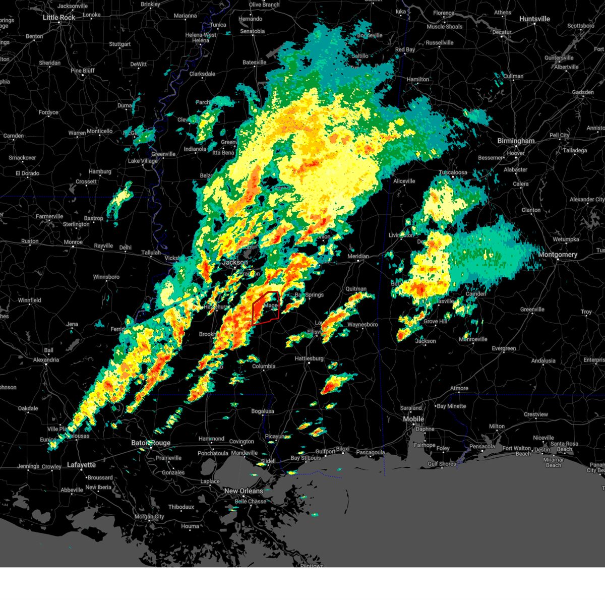 At 442 pm cst, a severe thunderstorm capable of producing a tornado was located near sanatorium, or near magee, moving northeast at 45 mph (radar indicated rotation). Hazards include tornado. Flying debris will be dangerous to those caught without shelter. mobile homes will be damaged or destroyed. damage to roofs, windows, and vehicles will occur. tree damage is likely. This dangerous storm will be near, sanatorium, magee, and martinville around 450 pm cst. At 442 pm cst, a severe thunderstorm capable of producing a tornado was located near sanatorium, or near magee, moving northeast at 45 mph (radar indicated rotation). Hazards include tornado. Flying debris will be dangerous to those caught without shelter. mobile homes will be damaged or destroyed. damage to roofs, windows, and vehicles will occur. tree damage is likely. This dangerous storm will be near, sanatorium, magee, and martinville around 450 pm cst.
|
| 2/12/2025 4:43 PM CST |
 the tornado warning has been cancelled and is no longer in effect the tornado warning has been cancelled and is no longer in effect
|
| 2/12/2025 4:19 PM CST |
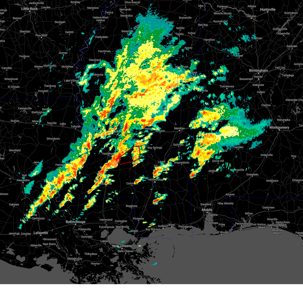 Torjan the national weather service in jackson has issued a * tornado warning for, simpson county in central mississippi, northeastern lawrence county in south central mississippi, northwestern jefferson davis county in south central mississippi, * until 515 pm cst. * at 418 pm cst, a severe thunderstorm capable of producing a tornado was located over oma, or 13 miles north of monticello, moving northeast at 45 mph (radar indicated rotation). Hazards include tornado. Flying debris will be dangerous to those caught without shelter. mobile homes will be damaged or destroyed. damage to roofs, windows, and vehicles will occur. tree damage is likely. this dangerous storm will be near, new hebron, pinola, and shivers around 425 pm cst. sanatorium, mendenhall, and magee around 440 pm cst. Martinville around 445 pm cst. Torjan the national weather service in jackson has issued a * tornado warning for, simpson county in central mississippi, northeastern lawrence county in south central mississippi, northwestern jefferson davis county in south central mississippi, * until 515 pm cst. * at 418 pm cst, a severe thunderstorm capable of producing a tornado was located over oma, or 13 miles north of monticello, moving northeast at 45 mph (radar indicated rotation). Hazards include tornado. Flying debris will be dangerous to those caught without shelter. mobile homes will be damaged or destroyed. damage to roofs, windows, and vehicles will occur. tree damage is likely. this dangerous storm will be near, new hebron, pinola, and shivers around 425 pm cst. sanatorium, mendenhall, and magee around 440 pm cst. Martinville around 445 pm cst.
|
| 1/5/2025 8:53 PM CST |
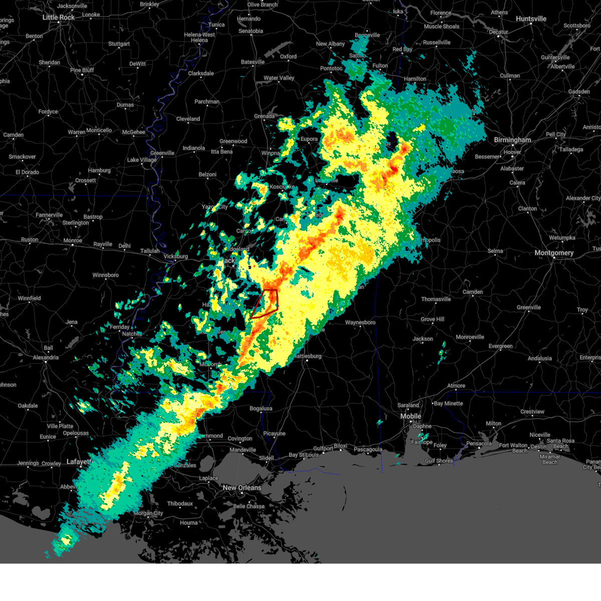 the tornado warning has been cancelled and is no longer in effect the tornado warning has been cancelled and is no longer in effect
|
| 1/5/2025 8:37 PM CST |
 the tornado warning has been cancelled and is no longer in effect the tornado warning has been cancelled and is no longer in effect
|
| 1/5/2025 8:37 PM CST |
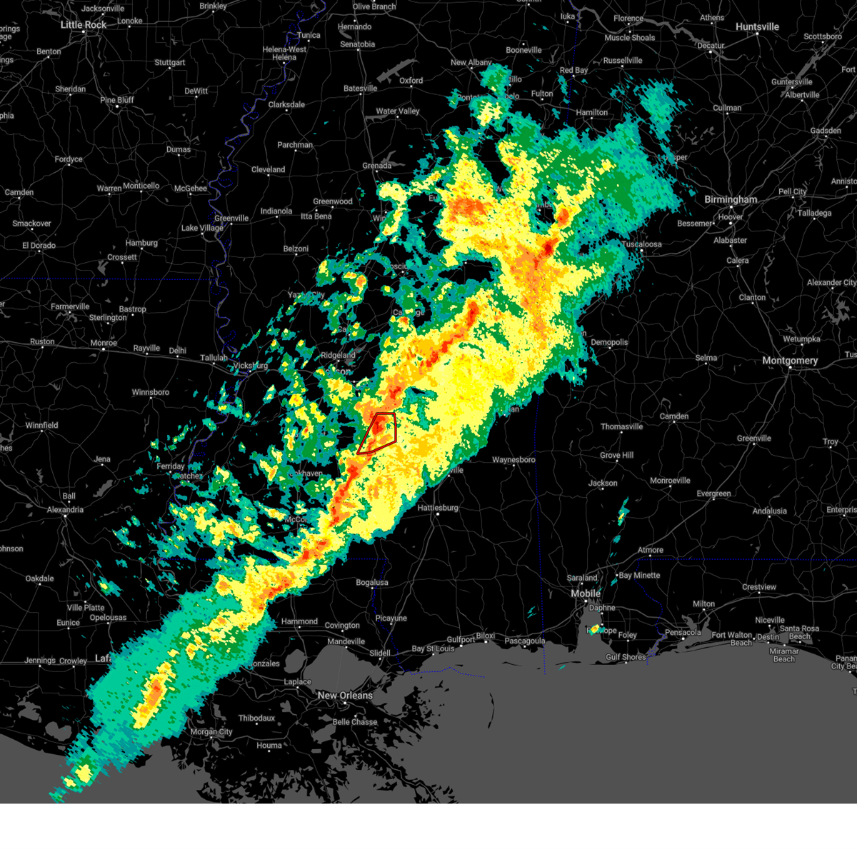 At 837 pm cst, a confirmed tornado was located over pinola, or 8 miles southwest of mendenhall, moving northeast at 35 mph (radar confirmed tornado). Hazards include damaging tornado. Flying debris will be dangerous to those caught without shelter. mobile homes will be damaged or destroyed. damage to roofs, windows, and vehicles will occur. tree damage is likely. this tornado will be near, sanatorium around 840 pm cst. Magee and martinville around 845 pm cst. At 837 pm cst, a confirmed tornado was located over pinola, or 8 miles southwest of mendenhall, moving northeast at 35 mph (radar confirmed tornado). Hazards include damaging tornado. Flying debris will be dangerous to those caught without shelter. mobile homes will be damaged or destroyed. damage to roofs, windows, and vehicles will occur. tree damage is likely. this tornado will be near, sanatorium around 840 pm cst. Magee and martinville around 845 pm cst.
|
| 1/5/2025 8:24 PM CST |
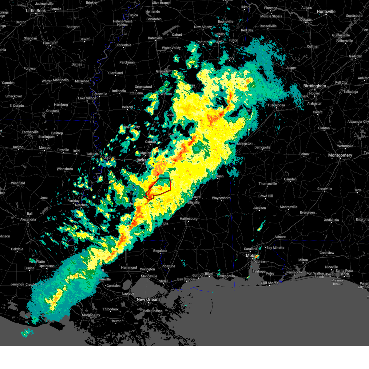 At 824 pm cst, a confirmed tornado was located near shivers, or 15 miles southwest of mendenhall, moving northeast at 35 mph (radar confirmed tornado). Hazards include damaging tornado. Flying debris will be dangerous to those caught without shelter. mobile homes will be damaged or destroyed. damage to roofs, windows, and vehicles will occur. tree damage is likely. this tornado will be near, pinola and shivers around 830 pm cst. sanatorium, d'lo, and mendenhall around 840 pm cst. Magee and martinville around 845 pm cst. At 824 pm cst, a confirmed tornado was located near shivers, or 15 miles southwest of mendenhall, moving northeast at 35 mph (radar confirmed tornado). Hazards include damaging tornado. Flying debris will be dangerous to those caught without shelter. mobile homes will be damaged or destroyed. damage to roofs, windows, and vehicles will occur. tree damage is likely. this tornado will be near, pinola and shivers around 830 pm cst. sanatorium, d'lo, and mendenhall around 840 pm cst. Magee and martinville around 845 pm cst.
|
| 1/5/2025 8:18 PM CST |
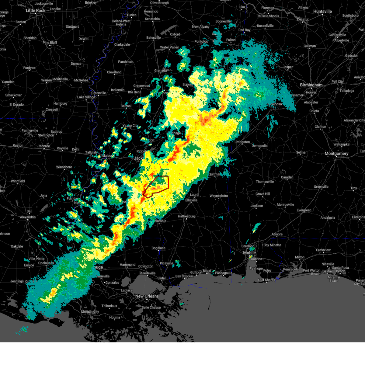 Torjan the national weather service in jackson has issued a * tornado warning for, simpson county in central mississippi, northeastern lawrence county in south central mississippi, * until 915 pm cst. * at 817 pm cst, a severe thunderstorm capable of producing a tornado was located near oma, or 14 miles north of monticello, moving northeast at 35 mph (radar indicated rotation). Hazards include tornado. Flying debris will be dangerous to those caught without shelter. mobile homes will be damaged or destroyed. damage to roofs, windows, and vehicles will occur. tree damage is likely. this dangerous storm will be near, new hebron, pinola, and shivers around 825 pm cst. sanatorium, d'lo, and mendenhall around 840 pm cst. Magee and martinville around 845 pm cst. Torjan the national weather service in jackson has issued a * tornado warning for, simpson county in central mississippi, northeastern lawrence county in south central mississippi, * until 915 pm cst. * at 817 pm cst, a severe thunderstorm capable of producing a tornado was located near oma, or 14 miles north of monticello, moving northeast at 35 mph (radar indicated rotation). Hazards include tornado. Flying debris will be dangerous to those caught without shelter. mobile homes will be damaged or destroyed. damage to roofs, windows, and vehicles will occur. tree damage is likely. this dangerous storm will be near, new hebron, pinola, and shivers around 825 pm cst. sanatorium, d'lo, and mendenhall around 840 pm cst. Magee and martinville around 845 pm cst.
|
| 12/28/2024 7:20 PM CST | Power poles were snapped onto highway 149... and roofs were ripped off. report relayed via spotternetwor in simpson county MS, 1.3 miles SE of Mendenhall, MS |
| 12/28/2024 7:17 PM CST |
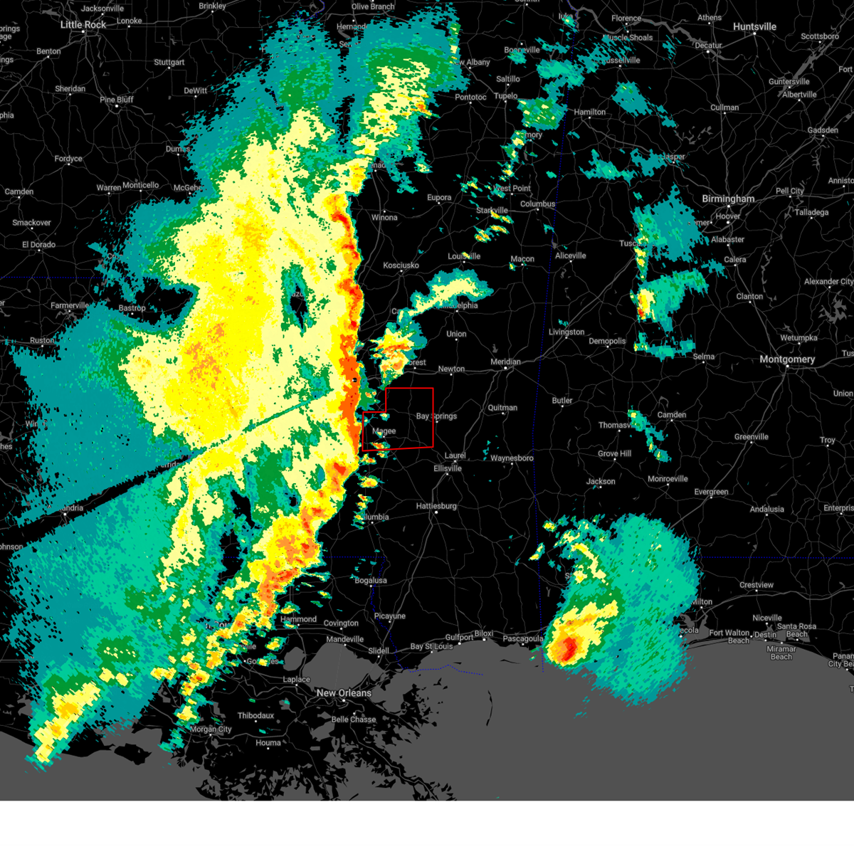 Torjan the national weather service in jackson has issued a * tornado warning for, eastern simpson county in central mississippi, smith county in central mississippi, * until 815 pm cst. * at 716 pm cst, a severe thunderstorm capable of producing a tornado was located near pinola, or near mendenhall, moving northeast at 65 mph (radar indicated rotation). Hazards include tornado. Flying debris will be dangerous to those caught without shelter. mobile homes will be damaged or destroyed. damage to roofs, windows, and vehicles will occur. tree damage is likely. this dangerous storm will be near, sanatorium, d'lo, mendenhall, and martinville around 720 pm cst. white oak around 725 pm cst. polkville, burns, and raleigh around 735 pm cst. Pineville around 740 pm cst. Torjan the national weather service in jackson has issued a * tornado warning for, eastern simpson county in central mississippi, smith county in central mississippi, * until 815 pm cst. * at 716 pm cst, a severe thunderstorm capable of producing a tornado was located near pinola, or near mendenhall, moving northeast at 65 mph (radar indicated rotation). Hazards include tornado. Flying debris will be dangerous to those caught without shelter. mobile homes will be damaged or destroyed. damage to roofs, windows, and vehicles will occur. tree damage is likely. this dangerous storm will be near, sanatorium, d'lo, mendenhall, and martinville around 720 pm cst. white oak around 725 pm cst. polkville, burns, and raleigh around 735 pm cst. Pineville around 740 pm cst.
|
| 12/28/2024 7:01 PM CST |
 the tornado warning has been cancelled and is no longer in effect the tornado warning has been cancelled and is no longer in effect
|
| 12/28/2024 6:58 PM CST |
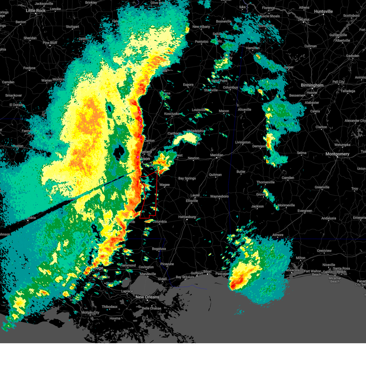 Torjan the national weather service in jackson has issued a * tornado warning for, south central rankin county in central mississippi, western simpson county in central mississippi, lawrence county in south central mississippi, western jefferson davis county in south central mississippi, * until 800 pm cst. * at 658 pm cst, a severe thunderstorm capable of producing a tornado was located over rockport, or 14 miles southeast of hazlehurst, moving northeast at 60 mph (radar indicated rotation). Hazards include tornado. Flying debris will be dangerous to those caught without shelter. mobile homes will be damaged or destroyed. damage to roofs, windows, and vehicles will occur. tree damage is likely. this dangerous storm will be near, pinola, shivers, and union around 705 pm cst. Braxton and d'lo around 715 pm cst. Torjan the national weather service in jackson has issued a * tornado warning for, south central rankin county in central mississippi, western simpson county in central mississippi, lawrence county in south central mississippi, western jefferson davis county in south central mississippi, * until 800 pm cst. * at 658 pm cst, a severe thunderstorm capable of producing a tornado was located over rockport, or 14 miles southeast of hazlehurst, moving northeast at 60 mph (radar indicated rotation). Hazards include tornado. Flying debris will be dangerous to those caught without shelter. mobile homes will be damaged or destroyed. damage to roofs, windows, and vehicles will occur. tree damage is likely. this dangerous storm will be near, pinola, shivers, and union around 705 pm cst. Braxton and d'lo around 715 pm cst.
|
| 12/28/2024 6:49 PM CST |
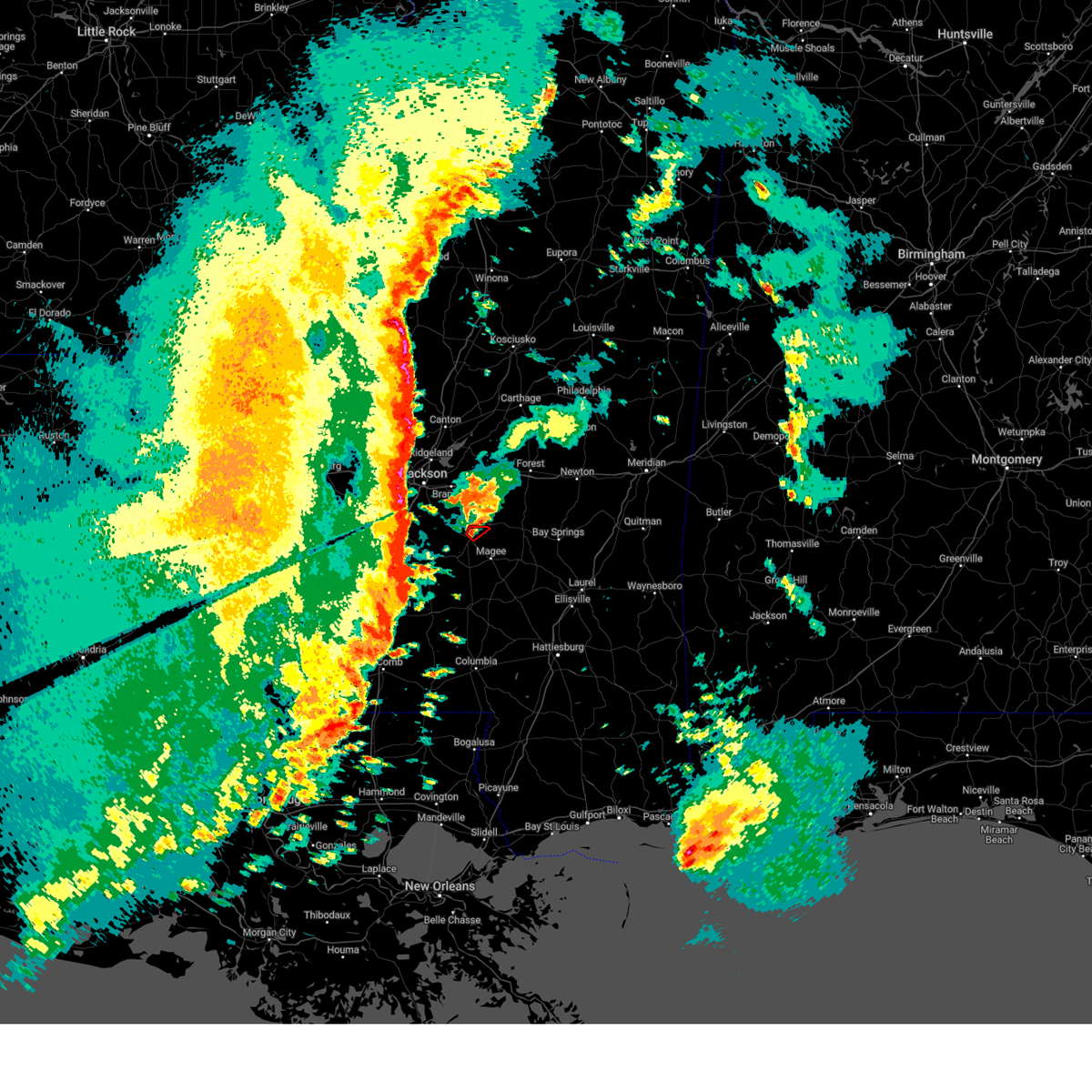 At 649 pm cst, a severe thunderstorm capable of producing a tornado was located over martinville, or 7 miles northeast of mendenhall, moving northeast at 45 mph (radar indicated rotation). Hazards include tornado. Flying debris will be dangerous to those caught without shelter. mobile homes will be damaged or destroyed. damage to roofs, windows, and vehicles will occur. tree damage is likely. This tornadic thunderstorm will remain over mainly rural areas of north central simpson county. At 649 pm cst, a severe thunderstorm capable of producing a tornado was located over martinville, or 7 miles northeast of mendenhall, moving northeast at 45 mph (radar indicated rotation). Hazards include tornado. Flying debris will be dangerous to those caught without shelter. mobile homes will be damaged or destroyed. damage to roofs, windows, and vehicles will occur. tree damage is likely. This tornadic thunderstorm will remain over mainly rural areas of north central simpson county.
|
| 12/28/2024 6:49 PM CST |
 the tornado warning has been cancelled and is no longer in effect the tornado warning has been cancelled and is no longer in effect
|
| 12/28/2024 6:39 PM CST |
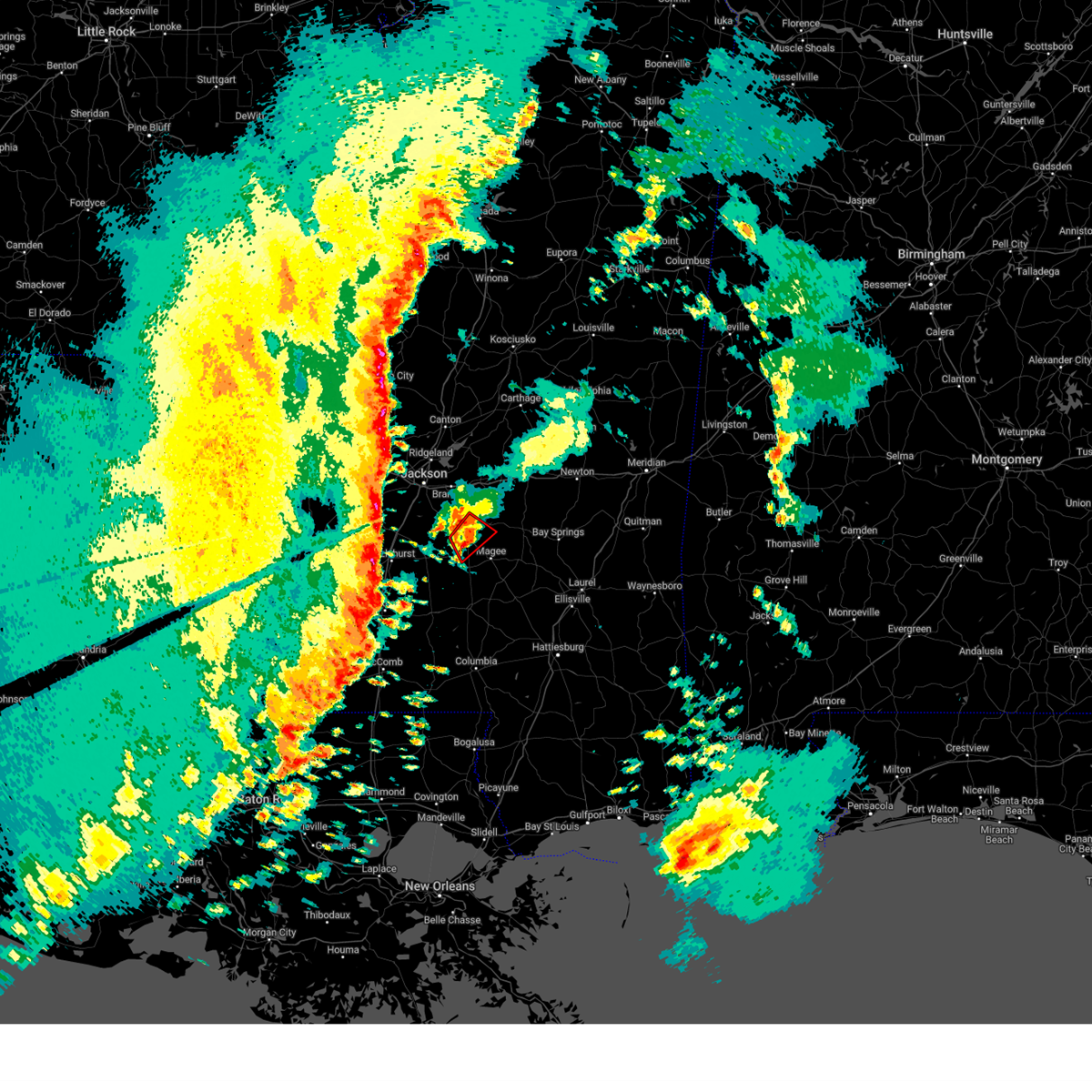 At 639 pm cst, a confirmed tornado was located over mendenhall, moving northeast at 45 mph (radar confirmed tornado). Hazards include damaging tornado. Flying debris will be dangerous to those caught without shelter. mobile homes will be damaged or destroyed. damage to roofs, windows, and vehicles will occur. tree damage is likely. This tornadic thunderstorm will remain over mainly rural areas of south central rankin and northeastern simpson counties. At 639 pm cst, a confirmed tornado was located over mendenhall, moving northeast at 45 mph (radar confirmed tornado). Hazards include damaging tornado. Flying debris will be dangerous to those caught without shelter. mobile homes will be damaged or destroyed. damage to roofs, windows, and vehicles will occur. tree damage is likely. This tornadic thunderstorm will remain over mainly rural areas of south central rankin and northeastern simpson counties.
|
| 12/28/2024 6:29 PM CST |
 At 628 pm cst, a confirmed tornado was located over pinola, or 9 miles southwest of mendenhall, moving northeast at 45 mph (radar confirmed tornado). Hazards include damaging tornado. Flying debris will be dangerous to those caught without shelter. mobile homes will be damaged or destroyed. damage to roofs, windows, and vehicles will occur. tree damage is likely. this tornado will be near, sanatorium, d'lo, mendenhall, and magee around 635 pm cst. Martinville around 640 pm cst. At 628 pm cst, a confirmed tornado was located over pinola, or 9 miles southwest of mendenhall, moving northeast at 45 mph (radar confirmed tornado). Hazards include damaging tornado. Flying debris will be dangerous to those caught without shelter. mobile homes will be damaged or destroyed. damage to roofs, windows, and vehicles will occur. tree damage is likely. this tornado will be near, sanatorium, d'lo, mendenhall, and magee around 635 pm cst. Martinville around 640 pm cst.
|
| 12/28/2024 6:25 PM CST |
 the tornado warning has been cancelled and is no longer in effect the tornado warning has been cancelled and is no longer in effect
|
| 12/28/2024 6:25 PM CST |
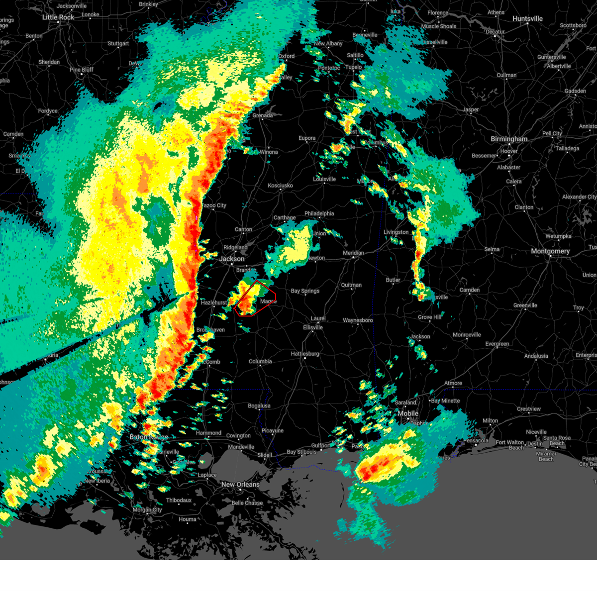 At 624 pm cst, a severe thunderstorm capable of producing a tornado was located over shivers, or 13 miles southwest of mendenhall, moving northeast at 45 mph (radar indicated rotation). Hazards include tornado. Flying debris will be dangerous to those caught without shelter. mobile homes will be damaged or destroyed. damage to roofs, windows, and vehicles will occur. tree damage is likely. this dangerous storm will be near, pinola and mendenhall around 630 pm cst. sanatorium and d'lo around 635 pm cst. Magee and martinville around 640 pm cst. At 624 pm cst, a severe thunderstorm capable of producing a tornado was located over shivers, or 13 miles southwest of mendenhall, moving northeast at 45 mph (radar indicated rotation). Hazards include tornado. Flying debris will be dangerous to those caught without shelter. mobile homes will be damaged or destroyed. damage to roofs, windows, and vehicles will occur. tree damage is likely. this dangerous storm will be near, pinola and mendenhall around 630 pm cst. sanatorium and d'lo around 635 pm cst. Magee and martinville around 640 pm cst.
|
| 12/28/2024 6:11 PM CST |
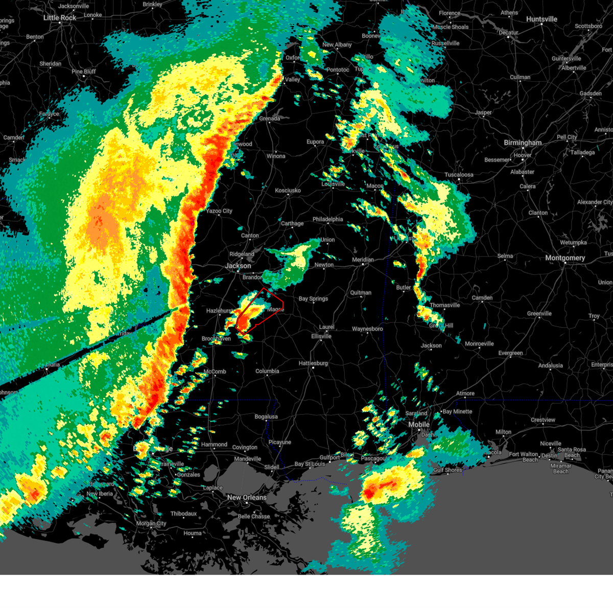 Torjan the national weather service in jackson has issued a * tornado warning for, south central rankin county in central mississippi, simpson county in central mississippi, northeastern lawrence county in south central mississippi, southeastern copiah county in central mississippi, * until 715 pm cst. * at 611 pm cst, a severe thunderstorm capable of producing a tornado was located over oma, or 9 miles north of monticello, moving northeast at 45 mph (radar indicated rotation). Hazards include tornado. Flying debris will be dangerous to those caught without shelter. mobile homes will be damaged or destroyed. damage to roofs, windows, and vehicles will occur. tree damage is likely. this dangerous storm will be near, new hebron, shivers, and rockport around 615 pm cst. pinola and union around 620 pm cst. mendenhall around 630 pm cst. sanatorium and d'lo around 635 pm cst. Magee and martinville around 640 pm cst. Torjan the national weather service in jackson has issued a * tornado warning for, south central rankin county in central mississippi, simpson county in central mississippi, northeastern lawrence county in south central mississippi, southeastern copiah county in central mississippi, * until 715 pm cst. * at 611 pm cst, a severe thunderstorm capable of producing a tornado was located over oma, or 9 miles north of monticello, moving northeast at 45 mph (radar indicated rotation). Hazards include tornado. Flying debris will be dangerous to those caught without shelter. mobile homes will be damaged or destroyed. damage to roofs, windows, and vehicles will occur. tree damage is likely. this dangerous storm will be near, new hebron, shivers, and rockport around 615 pm cst. pinola and union around 620 pm cst. mendenhall around 630 pm cst. sanatorium and d'lo around 635 pm cst. Magee and martinville around 640 pm cst.
|
| 8/18/2024 10:33 PM CDT |
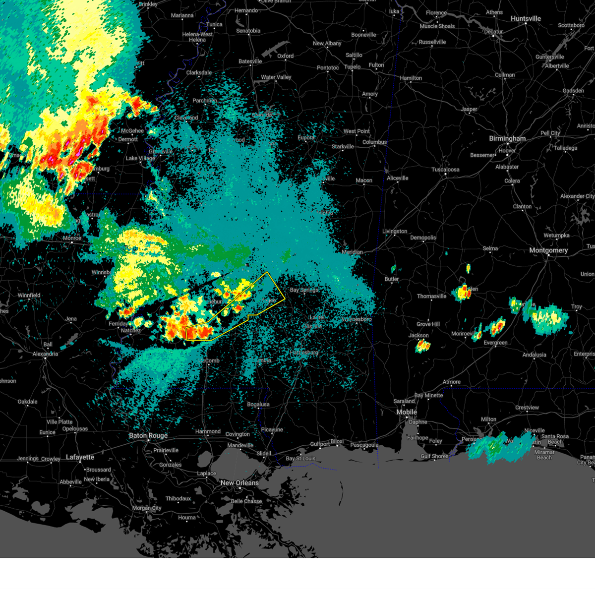 the severe thunderstorm warning has been cancelled and is no longer in effect the severe thunderstorm warning has been cancelled and is no longer in effect
|
| 8/18/2024 10:25 PM CDT |
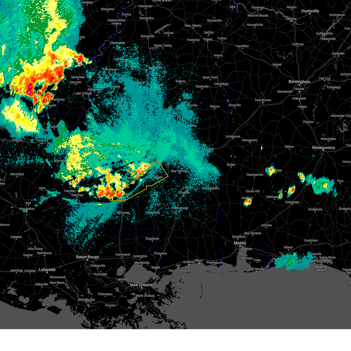 At 1025 pm cdt, severe thunderstorms were located along a line extending from near west lincoln to near white oak, moving southeast at 40 mph (radar indicated). Hazards include 60 mph wind gusts. Expect damage to roofs, siding, and trees. Locations impacted include, brookhaven, magee, mendenhall, wesson, d'lo, new hebron, beauregard, puckett, georgetown, braxton, mccall creek, union, sanatorium, shivers, white oak, sontag, wanilla, oma, martinville, and cato. At 1025 pm cdt, severe thunderstorms were located along a line extending from near west lincoln to near white oak, moving southeast at 40 mph (radar indicated). Hazards include 60 mph wind gusts. Expect damage to roofs, siding, and trees. Locations impacted include, brookhaven, magee, mendenhall, wesson, d'lo, new hebron, beauregard, puckett, georgetown, braxton, mccall creek, union, sanatorium, shivers, white oak, sontag, wanilla, oma, martinville, and cato.
|
| 8/18/2024 10:13 PM CDT |
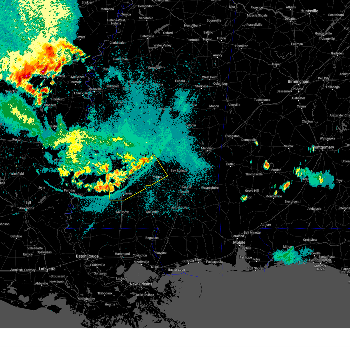 At 1013 pm cdt, severe thunderstorms were located along a line extending from near caseyville to beauregard to johns, moving southeast at 45 mph (radar indicated). Hazards include 60 mph wind gusts. Expect damage to roofs, siding, and trees. Locations impacted include, brookhaven, magee, hazlehurst, mendenhall, wesson, d'lo, new hebron, beauregard, puckett, georgetown, braxton, caseyville, mccall creek, union, piney woods, sanatorium, star, shivers, martinsville, and white oak. At 1013 pm cdt, severe thunderstorms were located along a line extending from near caseyville to beauregard to johns, moving southeast at 45 mph (radar indicated). Hazards include 60 mph wind gusts. Expect damage to roofs, siding, and trees. Locations impacted include, brookhaven, magee, hazlehurst, mendenhall, wesson, d'lo, new hebron, beauregard, puckett, georgetown, braxton, caseyville, mccall creek, union, piney woods, sanatorium, star, shivers, martinsville, and white oak.
|
| 8/18/2024 9:58 PM CDT |
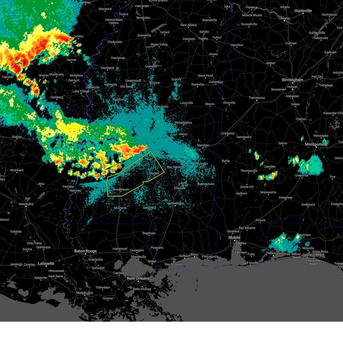 Svrjan the national weather service in jackson has issued a * severe thunderstorm warning for, southeastern rankin county in central mississippi, simpson county in central mississippi, southwestern smith county in central mississippi, northern lincoln county in south central mississippi, northern lawrence county in south central mississippi, northeastern franklin county in southwestern mississippi, copiah county in central mississippi, * until 1100 pm cdt. * at 957 pm cdt, severe thunderstorms were located along a line extending from near mcbride to near gallman to near brandon, moving southeast at 45 mph (radar indicated). Hazards include 60 mph wind gusts. expect damage to roofs, siding, and trees Svrjan the national weather service in jackson has issued a * severe thunderstorm warning for, southeastern rankin county in central mississippi, simpson county in central mississippi, southwestern smith county in central mississippi, northern lincoln county in south central mississippi, northern lawrence county in south central mississippi, northeastern franklin county in southwestern mississippi, copiah county in central mississippi, * until 1100 pm cdt. * at 957 pm cdt, severe thunderstorms were located along a line extending from near mcbride to near gallman to near brandon, moving southeast at 45 mph (radar indicated). Hazards include 60 mph wind gusts. expect damage to roofs, siding, and trees
|
| 8/16/2024 3:10 PM CDT | A tree fell on a store in martinvill in simpson county MS, 6.7 miles W of Mendenhall, MS |
| 7/13/2024 8:06 PM CDT |
 The storm which prompted the warning has weakened below severe limits, and no longer poses an immediate threat to life or property. therefore, the warning will be allowed to expire. The storm which prompted the warning has weakened below severe limits, and no longer poses an immediate threat to life or property. therefore, the warning will be allowed to expire.
|
| 7/13/2024 7:25 PM CDT |
 Svrjan the national weather service in jackson has issued a * severe thunderstorm warning for, western simpson county in central mississippi, northwestern lawrence county in south central mississippi, eastern copiah county in central mississippi, * until 815 pm cdt. * at 725 pm cdt, a severe thunderstorm was located over oma, or 13 miles north of monticello, moving north at 10 mph (radar indicated). Hazards include 60 mph wind gusts and half dollar size hail. Hail damage to vehicles is expected. expect wind damage to roofs, siding, and trees. This severe thunderstorm will be near, georgetown and rockport around 730 pm cdt. Svrjan the national weather service in jackson has issued a * severe thunderstorm warning for, western simpson county in central mississippi, northwestern lawrence county in south central mississippi, eastern copiah county in central mississippi, * until 815 pm cdt. * at 725 pm cdt, a severe thunderstorm was located over oma, or 13 miles north of monticello, moving north at 10 mph (radar indicated). Hazards include 60 mph wind gusts and half dollar size hail. Hail damage to vehicles is expected. expect wind damage to roofs, siding, and trees. This severe thunderstorm will be near, georgetown and rockport around 730 pm cdt.
|
| 6/4/2024 5:40 PM CDT |
 Svrjan the national weather service in jackson has issued a * severe thunderstorm warning for, southeastern rankin county in central mississippi, simpson county in central mississippi, smith county in central mississippi, southern scott county in central mississippi, * until 645 pm cdt. * at 540 pm cdt, a severe thunderstorm was located near polkville, or 11 miles southwest of morton, moving east at 40 mph (radar indicated). Hazards include 60 mph wind gusts and quarter size hail. Hail damage to vehicles is expected. expect wind damage to roofs, siding, and trees. this severe thunderstorm will be near, morton, polkville, and pulaski around 545 pm cdt. homewood and burns around 550 pm cdt. forest around 555 pm cdt. Lake around 605 pm cdt. Svrjan the national weather service in jackson has issued a * severe thunderstorm warning for, southeastern rankin county in central mississippi, simpson county in central mississippi, smith county in central mississippi, southern scott county in central mississippi, * until 645 pm cdt. * at 540 pm cdt, a severe thunderstorm was located near polkville, or 11 miles southwest of morton, moving east at 40 mph (radar indicated). Hazards include 60 mph wind gusts and quarter size hail. Hail damage to vehicles is expected. expect wind damage to roofs, siding, and trees. this severe thunderstorm will be near, morton, polkville, and pulaski around 545 pm cdt. homewood and burns around 550 pm cdt. forest around 555 pm cdt. Lake around 605 pm cdt.
|
| 6/3/2024 11:02 PM CDT |
 At 1102 pm cdt, severe thunderstorms were located along a line extending from thomastown to near pelahatchie to near harrisville, moving east at 50 mph (radar indicated). Hazards include 60 mph wind gusts. Expect damage to roofs, siding, and trees. these severe storms will be near, carthage, pelahatchie, d'lo, braxton, johns, branch, cato, leesburg, ludlow, and forkville around 1105 pm cdt. morton, mendenhall, redwater, puckett, and lena around 1110 pm cdt. polkville, standing pine, pulaski, tuscola, white oak, martinville, and renfroe around 1115 pm cdt. forest, walnut grove, hillsboro, and harperville around 1120 pm cdt. homewood, edinburg, madden, burns, and steele around 1125 pm cdt. raleigh and sebastopol around 1130 pm cdt. lake and pineville around 1135 pm cdt. Sylvarena and center ridge around 1140 pm cdt. At 1102 pm cdt, severe thunderstorms were located along a line extending from thomastown to near pelahatchie to near harrisville, moving east at 50 mph (radar indicated). Hazards include 60 mph wind gusts. Expect damage to roofs, siding, and trees. these severe storms will be near, carthage, pelahatchie, d'lo, braxton, johns, branch, cato, leesburg, ludlow, and forkville around 1105 pm cdt. morton, mendenhall, redwater, puckett, and lena around 1110 pm cdt. polkville, standing pine, pulaski, tuscola, white oak, martinville, and renfroe around 1115 pm cdt. forest, walnut grove, hillsboro, and harperville around 1120 pm cdt. homewood, edinburg, madden, burns, and steele around 1125 pm cdt. raleigh and sebastopol around 1130 pm cdt. lake and pineville around 1135 pm cdt. Sylvarena and center ridge around 1140 pm cdt.
|
| 6/3/2024 10:46 PM CDT |
 Svrjan the national weather service in jackson has issued a * severe thunderstorm warning for, leake county in central mississippi, eastern rankin county in central mississippi, simpson county in central mississippi, smith county in central mississippi, scott county in central mississippi, * until midnight cdt. * at 1045 pm cdt, severe thunderstorms were located along a line extending from near cameron to flowood to near hopewell, moving east at 50 mph (radar indicated). Hazards include 70 mph wind gusts. Expect considerable tree damage. damage is likely to mobile homes, roofs, and outbuildings. severe thunderstorms will be near, harrisville and thomastown around 1050 pm cdt. braxton and ludlow around 1055 pm cdt. carthage, pelahatchie, cato, leesburg around 1100 pm cdt. morton, mendenhall, d'lo, lena, and renfroe around 1105 pm cdt. polkville, puckett around 1110 pm cdt. walnut grove, standing pine, pulaski, edinburg, white oak, and martinville around 1115 pm cdt. forest, madden, and steele around 1120 pm cdt. Sebastopol, homewood, and burns around 1125 pm cdt. Svrjan the national weather service in jackson has issued a * severe thunderstorm warning for, leake county in central mississippi, eastern rankin county in central mississippi, simpson county in central mississippi, smith county in central mississippi, scott county in central mississippi, * until midnight cdt. * at 1045 pm cdt, severe thunderstorms were located along a line extending from near cameron to flowood to near hopewell, moving east at 50 mph (radar indicated). Hazards include 70 mph wind gusts. Expect considerable tree damage. damage is likely to mobile homes, roofs, and outbuildings. severe thunderstorms will be near, harrisville and thomastown around 1050 pm cdt. braxton and ludlow around 1055 pm cdt. carthage, pelahatchie, cato, leesburg around 1100 pm cdt. morton, mendenhall, d'lo, lena, and renfroe around 1105 pm cdt. polkville, puckett around 1110 pm cdt. walnut grove, standing pine, pulaski, edinburg, white oak, and martinville around 1115 pm cdt. forest, madden, and steele around 1120 pm cdt. Sebastopol, homewood, and burns around 1125 pm cdt.
|
| 5/23/2024 3:40 AM CDT |
 The storms which prompted the warning have weakened below severe limits, and no longer pose an immediate threat to life or property. therefore, the warning will be allowed to expire. The storms which prompted the warning have weakened below severe limits, and no longer pose an immediate threat to life or property. therefore, the warning will be allowed to expire.
|
| 5/23/2024 3:29 AM CDT |
 At 329 am cdt, severe thunderstorms were located along a line extending from near pelahatchie to near white oak to near mendenhall, moving east at 50 mph (radar indicated). Hazards include 60 mph wind gusts. Expect damage to roofs, siding, and trees. These severe storms will be near, magee, polkville, sanatorium, white oak, and martinville around 335 am cdt. At 329 am cdt, severe thunderstorms were located along a line extending from near pelahatchie to near white oak to near mendenhall, moving east at 50 mph (radar indicated). Hazards include 60 mph wind gusts. Expect damage to roofs, siding, and trees. These severe storms will be near, magee, polkville, sanatorium, white oak, and martinville around 335 am cdt.
|
| 5/23/2024 3:29 AM CDT |
 the severe thunderstorm warning has been cancelled and is no longer in effect the severe thunderstorm warning has been cancelled and is no longer in effect
|
| 5/23/2024 3:06 AM CDT |
 At 305 am cdt, severe thunderstorms were located along a line extending from near jackson to near harrisville to near beauregard, moving east at 60 mph (radar indicated). Hazards include 60 mph wind gusts. Expect damage to roofs, siding, and trees. these severe storms will be near, jackson, richland, florence, d'lo, georgetown, braxton, pinola, rockport, oma, and star around 310 am cdt. mendenhall, cato, and shivers around 315 am cdt. new hebron, puckett, johns, sanatorium, and martinville around 320 am cdt. magee and white oak around 325 am cdt. Polkville and clem around 330 am cdt. At 305 am cdt, severe thunderstorms were located along a line extending from near jackson to near harrisville to near beauregard, moving east at 60 mph (radar indicated). Hazards include 60 mph wind gusts. Expect damage to roofs, siding, and trees. these severe storms will be near, jackson, richland, florence, d'lo, georgetown, braxton, pinola, rockport, oma, and star around 310 am cdt. mendenhall, cato, and shivers around 315 am cdt. new hebron, puckett, johns, sanatorium, and martinville around 320 am cdt. magee and white oak around 325 am cdt. Polkville and clem around 330 am cdt.
|
| 5/23/2024 2:40 AM CDT |
 Svrjan the national weather service in jackson has issued a * severe thunderstorm warning for, southern rankin county in central mississippi, simpson county in central mississippi, northwestern smith county in central mississippi, northeastern lawrence county in south central mississippi, northwestern covington county in southeastern mississippi, southeastern hinds county in central mississippi, central copiah county in central mississippi, northwestern jefferson davis county in south central mississippi, * until 345 am cdt. * at 240 am cdt, severe thunderstorms were located along a line extending from bolton to dry grove to near glancy, moving east at 55 mph (radar indicated). Hazards include 60 mph wind gusts and penny size hail. Expect damage to roofs, siding, and trees. severe thunderstorms will be near, jackson, byram, crystal springs, hazlehurst, raymond, terry, martinsville, and gallman around 245 am cdt. hopewell and whites around 250 am cdt. richland, florence, and georgetown around 255 am cdt. rockport, oma, star, harrisville, monterey, and union around 300 am cdt. braxton and piney woods around 305 am cdt. d'lo, new hebron, pinola, cato, and shivers around 310 am cdt. mendenhall and johns around 315 am cdt. Magee, puckett, sanatorium, and martinville around 320 am cdt. Svrjan the national weather service in jackson has issued a * severe thunderstorm warning for, southern rankin county in central mississippi, simpson county in central mississippi, northwestern smith county in central mississippi, northeastern lawrence county in south central mississippi, northwestern covington county in southeastern mississippi, southeastern hinds county in central mississippi, central copiah county in central mississippi, northwestern jefferson davis county in south central mississippi, * until 345 am cdt. * at 240 am cdt, severe thunderstorms were located along a line extending from bolton to dry grove to near glancy, moving east at 55 mph (radar indicated). Hazards include 60 mph wind gusts and penny size hail. Expect damage to roofs, siding, and trees. severe thunderstorms will be near, jackson, byram, crystal springs, hazlehurst, raymond, terry, martinsville, and gallman around 245 am cdt. hopewell and whites around 250 am cdt. richland, florence, and georgetown around 255 am cdt. rockport, oma, star, harrisville, monterey, and union around 300 am cdt. braxton and piney woods around 305 am cdt. d'lo, new hebron, pinola, cato, and shivers around 310 am cdt. mendenhall and johns around 315 am cdt. Magee, puckett, sanatorium, and martinville around 320 am cdt.
|
| 5/9/2024 11:01 PM CDT |
 Svrjan the national weather service in jackson has issued a * severe thunderstorm warning for, simpson county in central mississippi, southern smith county in central mississippi, southeastern copiah county in central mississippi, * until midnight cdt. * at 1101 pm cdt, severe thunderstorms were located along a line extending from near johns to near cato to near harrisville, moving east at 45 mph (radar indicated). Hazards include 60 mph wind gusts and quarter size hail. Hail damage to vehicles is expected. Expect wind damage to roofs, siding, and trees. Svrjan the national weather service in jackson has issued a * severe thunderstorm warning for, simpson county in central mississippi, southern smith county in central mississippi, southeastern copiah county in central mississippi, * until midnight cdt. * at 1101 pm cdt, severe thunderstorms were located along a line extending from near johns to near cato to near harrisville, moving east at 45 mph (radar indicated). Hazards include 60 mph wind gusts and quarter size hail. Hail damage to vehicles is expected. Expect wind damage to roofs, siding, and trees.
|
| 4/10/2024 10:09 AM CDT |
 At 1009 am cdt, a severe thunderstorm was located near mendenhall, moving northeast at 45 mph (radar indicated). Hazards include 60 mph wind gusts. Expect damage to roofs, siding, and trees. this severe storm will be near, magee, mendenhall, sanatorium, and martinville around 1015 am cdt. white oak around 1020 am cdt. Burns around 1030 am cdt. At 1009 am cdt, a severe thunderstorm was located near mendenhall, moving northeast at 45 mph (radar indicated). Hazards include 60 mph wind gusts. Expect damage to roofs, siding, and trees. this severe storm will be near, magee, mendenhall, sanatorium, and martinville around 1015 am cdt. white oak around 1020 am cdt. Burns around 1030 am cdt.
|
| 4/10/2024 9:52 AM CDT |
 Svrjan the national weather service in jackson has issued a * severe thunderstorm warning for, simpson county in central mississippi, smith county in central mississippi, * until 1045 am cdt. * at 952 am cdt, a severe thunderstorm was located over new hebron, or 10 miles northwest of prentiss, moving northeast at 55 mph (radar indicated). Hazards include 60 mph wind gusts. Expect damage to roofs, siding, and trees. this severe thunderstorm will be near, pinola and shivers around 955 am cdt. magee and sanatorium around 1000 am cdt. mendenhall and martinville around 1005 am cdt. white oak around 1015 am cdt. raleigh around 1020 am cdt. burns around 1025 am cdt. Pineville around 1030 am cdt. Svrjan the national weather service in jackson has issued a * severe thunderstorm warning for, simpson county in central mississippi, smith county in central mississippi, * until 1045 am cdt. * at 952 am cdt, a severe thunderstorm was located over new hebron, or 10 miles northwest of prentiss, moving northeast at 55 mph (radar indicated). Hazards include 60 mph wind gusts. Expect damage to roofs, siding, and trees. this severe thunderstorm will be near, pinola and shivers around 955 am cdt. magee and sanatorium around 1000 am cdt. mendenhall and martinville around 1005 am cdt. white oak around 1015 am cdt. raleigh around 1020 am cdt. burns around 1025 am cdt. Pineville around 1030 am cdt.
|
| 1/25/2024 9:43 AM CST |
 At 942 am cst, severe thunderstorms were located along a line extending from near braxton to near clem to society hill, moving east at 45 mph (radar indicated). Hazards include 60 mph wind gusts. Expect damage to roofs, siding, and trees. these severe storms will be near, magee, mount olive, bassfield, sanatorium, lone star, martinville, and carson around 950 am cst. melba around 955 am cst. collins and mize around 1000 am cst. hail threat, radar indicated max hail size, <. 75 in wind threat, radar indicated max wind gust, 60 mph. At 942 am cst, severe thunderstorms were located along a line extending from near braxton to near clem to society hill, moving east at 45 mph (radar indicated). Hazards include 60 mph wind gusts. Expect damage to roofs, siding, and trees. these severe storms will be near, magee, mount olive, bassfield, sanatorium, lone star, martinville, and carson around 950 am cst. melba around 955 am cst. collins and mize around 1000 am cst. hail threat, radar indicated max hail size, <. 75 in wind threat, radar indicated max wind gust, 60 mph.
|
| 1/25/2024 9:12 AM CST |
 At 912 am cst, severe thunderstorms were located along a line extending from near crystal springs to near rockport to near jayess, moving east at 45 mph (radar indicated). Hazards include 60 mph wind gusts. Expect damage to roofs, siding, and trees. severe thunderstorms will be near, robinwood around 915 am cst. silver creek, arm, harrisville, and union around 920 am cst. new hebron, pinola, shivers, tilton, and oak vale around 925 am cst. braxton and progress around 930 am cst. mendenhall, prentiss, d`lo, and society hill around 935 am cst. sanatorium, clem, and carson around 940 am cst. magee, bassfield, lone star, and martinville around 945 am cst. mount olive and melba around 950 am cst. hail threat, radar indicated max hail size, <. 75 in wind threat, radar indicated max wind gust, 60 mph. At 912 am cst, severe thunderstorms were located along a line extending from near crystal springs to near rockport to near jayess, moving east at 45 mph (radar indicated). Hazards include 60 mph wind gusts. Expect damage to roofs, siding, and trees. severe thunderstorms will be near, robinwood around 915 am cst. silver creek, arm, harrisville, and union around 920 am cst. new hebron, pinola, shivers, tilton, and oak vale around 925 am cst. braxton and progress around 930 am cst. mendenhall, prentiss, d`lo, and society hill around 935 am cst. sanatorium, clem, and carson around 940 am cst. magee, bassfield, lone star, and martinville around 945 am cst. mount olive and melba around 950 am cst. hail threat, radar indicated max hail size, <. 75 in wind threat, radar indicated max wind gust, 60 mph.
|
| 1/12/2024 8:53 AM CST |
 At 853 am cst, a severe thunderstorm was located near walnut grove, or 13 miles southeast of carthage, moving northeast at 55 mph (radar indicated). Hazards include 60 mph wind gusts. Expect damage to roofs, siding, and trees. this severe storm will be near, madden around 900 am cst. hail threat, radar indicated max hail size, <. 75 in wind threat, radar indicated max wind gust, 60 mph. At 853 am cst, a severe thunderstorm was located near walnut grove, or 13 miles southeast of carthage, moving northeast at 55 mph (radar indicated). Hazards include 60 mph wind gusts. Expect damage to roofs, siding, and trees. this severe storm will be near, madden around 900 am cst. hail threat, radar indicated max hail size, <. 75 in wind threat, radar indicated max wind gust, 60 mph.
|
| 1/12/2024 8:26 AM CST |
 At 826 am cst, a severe thunderstorm was located over pelahatchie, or 9 miles west of morton, moving northeast at 50 mph (radar indicated). Hazards include 60 mph wind gusts. Expect damage to roofs, siding, and trees. this severe thunderstorm will be near, morton, branch, leesburg, and forkville around 830 am cst. hillsboro and ludlow around 840 am cst. harperville and lena around 845 am cst. walnut grove, tuscola, and steele around 850 am cst. standing pine around 855 am cst. sebastopol and madden around 900 am cst. edinburg around 910 am cst. hail threat, radar indicated max hail size, <. 75 in wind threat, radar indicated max wind gust, 60 mph. At 826 am cst, a severe thunderstorm was located over pelahatchie, or 9 miles west of morton, moving northeast at 50 mph (radar indicated). Hazards include 60 mph wind gusts. Expect damage to roofs, siding, and trees. this severe thunderstorm will be near, morton, branch, leesburg, and forkville around 830 am cst. hillsboro and ludlow around 840 am cst. harperville and lena around 845 am cst. walnut grove, tuscola, and steele around 850 am cst. standing pine around 855 am cst. sebastopol and madden around 900 am cst. edinburg around 910 am cst. hail threat, radar indicated max hail size, <. 75 in wind threat, radar indicated max wind gust, 60 mph.
|
| 12/9/2023 9:30 PM CST |
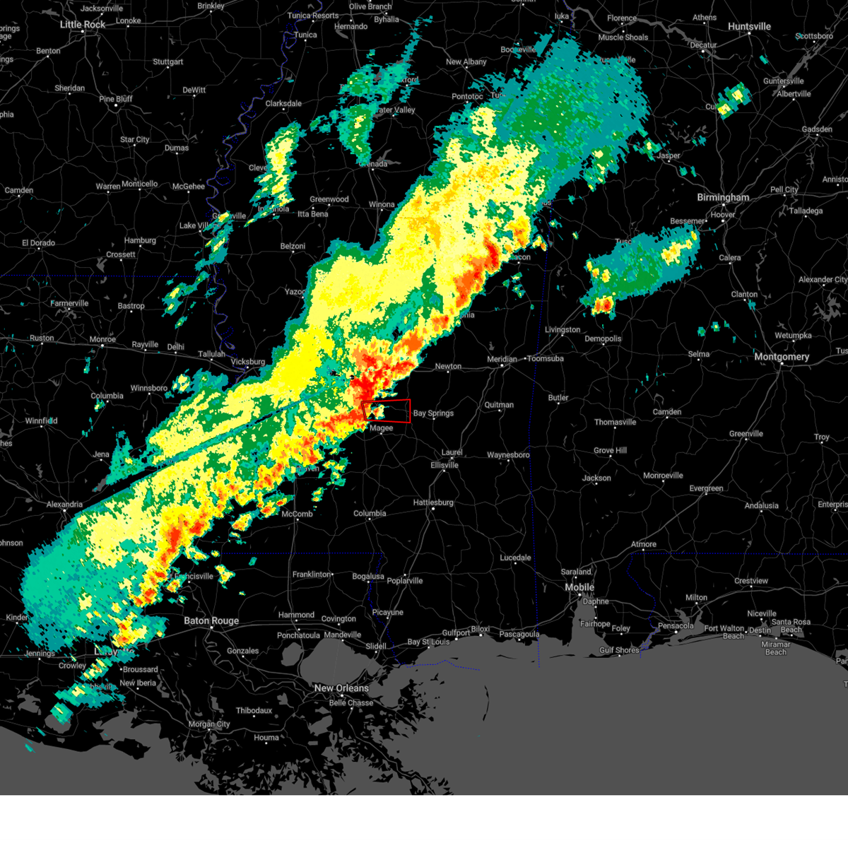 At 930 pm cst, a confirmed tornado was located over puckett, or 7 miles northeast of mendenhall, moving east at 50 mph (radar confirmed tornado). Hazards include damaging tornado. Flying debris will be dangerous to those caught without shelter. mobile homes will be damaged or destroyed. damage to roofs, windows, and vehicles will occur. tree damage is likely. this tornado will be near, puckett, white oak, and martinville around 935 pm cst. Raleigh around 940 pm cst. At 930 pm cst, a confirmed tornado was located over puckett, or 7 miles northeast of mendenhall, moving east at 50 mph (radar confirmed tornado). Hazards include damaging tornado. Flying debris will be dangerous to those caught without shelter. mobile homes will be damaged or destroyed. damage to roofs, windows, and vehicles will occur. tree damage is likely. this tornado will be near, puckett, white oak, and martinville around 935 pm cst. Raleigh around 940 pm cst.
|
| 12/9/2023 9:25 PM CST |
 At 924 pm cst, a confirmed tornado was located over cato, or near mendenhall, moving east at 50 mph (radar confirmed tornado). Hazards include damaging tornado. Flying debris will be dangerous to those caught without shelter. mobile homes will be damaged or destroyed. damage to roofs, windows, and vehicles will occur. tree damage is likely. this tornado will be near, puckett, white oak, and martinville around 930 pm cst. Raleigh around 940 pm cst. At 924 pm cst, a confirmed tornado was located over cato, or near mendenhall, moving east at 50 mph (radar confirmed tornado). Hazards include damaging tornado. Flying debris will be dangerous to those caught without shelter. mobile homes will be damaged or destroyed. damage to roofs, windows, and vehicles will occur. tree damage is likely. this tornado will be near, puckett, white oak, and martinville around 930 pm cst. Raleigh around 940 pm cst.
|
| 12/9/2023 9:20 PM CST |
 At 919 pm cst, a severe thunderstorm capable of producing a tornado was located over braxton, or 7 miles northwest of mendenhall, moving east at 30 mph (radar indicated rotation). Hazards include tornado. Flying debris will be dangerous to those caught without shelter. mobile homes will be damaged or destroyed. damage to roofs, windows, and vehicles will occur. tree damage is likely. this dangerous storm will be near, d`lo, puckett, and cato around 925 pm cst. martinville around 930 pm cst. white oak around 935 pm cst. Raleigh around 955 pm cst. At 919 pm cst, a severe thunderstorm capable of producing a tornado was located over braxton, or 7 miles northwest of mendenhall, moving east at 30 mph (radar indicated rotation). Hazards include tornado. Flying debris will be dangerous to those caught without shelter. mobile homes will be damaged or destroyed. damage to roofs, windows, and vehicles will occur. tree damage is likely. this dangerous storm will be near, d`lo, puckett, and cato around 925 pm cst. martinville around 930 pm cst. white oak around 935 pm cst. Raleigh around 955 pm cst.
|
| 12/9/2023 4:24 PM CST |
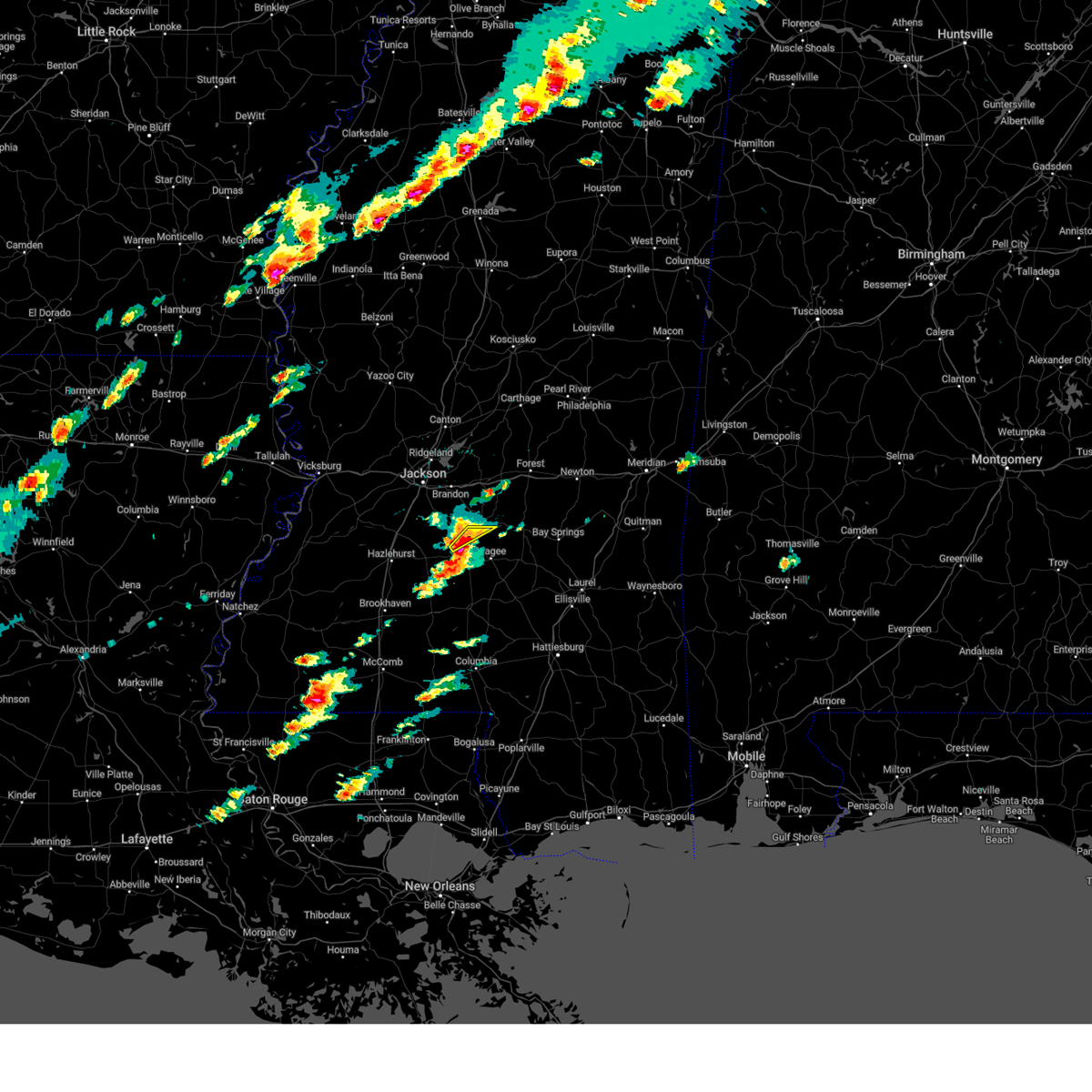 At 423 pm cst, a severe thunderstorm was located near mendenhall, moving east at 40 mph (radar indicated). Hazards include 60 mph wind gusts and half dollar size hail. Hail damage to vehicles is expected. expect wind damage to roofs, siding, and trees. this severe thunderstorm will remain over mainly rural areas of north central simpson county. hail threat, radar indicated max hail size, 1. 25 in wind threat, radar indicated max wind gust, 60 mph. At 423 pm cst, a severe thunderstorm was located near mendenhall, moving east at 40 mph (radar indicated). Hazards include 60 mph wind gusts and half dollar size hail. Hail damage to vehicles is expected. expect wind damage to roofs, siding, and trees. this severe thunderstorm will remain over mainly rural areas of north central simpson county. hail threat, radar indicated max hail size, 1. 25 in wind threat, radar indicated max wind gust, 60 mph.
|
| 12/9/2023 4:22 PM CST |
 At 421 pm cst, a severe thunderstorm was located near pinola, or near mendenhall, moving east at 35 mph (radar indicated). Hazards include 60 mph wind gusts and half dollar size hail. Hail damage to vehicles is expected. expect wind damage to roofs, siding, and trees. this severe thunderstorm will be near, mendenhall and d`lo around 425 pm cst. sanatorium and martinville around 430 pm cst. magee around 435 pm cst. hail threat, radar indicated max hail size, 1. 25 in wind threat, radar indicated max wind gust, 60 mph. At 421 pm cst, a severe thunderstorm was located near pinola, or near mendenhall, moving east at 35 mph (radar indicated). Hazards include 60 mph wind gusts and half dollar size hail. Hail damage to vehicles is expected. expect wind damage to roofs, siding, and trees. this severe thunderstorm will be near, mendenhall and d`lo around 425 pm cst. sanatorium and martinville around 430 pm cst. magee around 435 pm cst. hail threat, radar indicated max hail size, 1. 25 in wind threat, radar indicated max wind gust, 60 mph.
|
| 12/9/2023 4:11 PM CST |
 At 410 pm cst, a severe thunderstorm was located over harrisville, or 10 miles west of mendenhall, moving northeast at 40 mph (radar indicated). Hazards include 60 mph wind gusts and half dollar size hail. Hail damage to vehicles is expected. expect wind damage to roofs, siding, and trees. this severe storm will be near, d`lo and braxton around 415 pm cst. hail threat, radar indicated max hail size, 1. 25 in wind threat, radar indicated max wind gust, 60 mph. At 410 pm cst, a severe thunderstorm was located over harrisville, or 10 miles west of mendenhall, moving northeast at 40 mph (radar indicated). Hazards include 60 mph wind gusts and half dollar size hail. Hail damage to vehicles is expected. expect wind damage to roofs, siding, and trees. this severe storm will be near, d`lo and braxton around 415 pm cst. hail threat, radar indicated max hail size, 1. 25 in wind threat, radar indicated max wind gust, 60 mph.
|
| 12/9/2023 3:50 PM CST |
 At 350 pm cst, a severe thunderstorm was located near georgetown, or 7 miles east of hazlehurst, moving northeast at 35 mph (radar indicated). Hazards include ping pong ball size hail and 60 mph wind gusts. People and animals outdoors will be injured. expect hail damage to roofs, siding, windows, and vehicles. expect wind damage to roofs, siding, and trees. this severe storm will be near, georgetown, hopewell, and union around 355 pm cst. harrisville around 400 pm cst. braxton around 410 pm cst. d`lo around 420 pm cst. hail threat, radar indicated max hail size, 1. 50 in wind threat, radar indicated max wind gust, 60 mph. At 350 pm cst, a severe thunderstorm was located near georgetown, or 7 miles east of hazlehurst, moving northeast at 35 mph (radar indicated). Hazards include ping pong ball size hail and 60 mph wind gusts. People and animals outdoors will be injured. expect hail damage to roofs, siding, windows, and vehicles. expect wind damage to roofs, siding, and trees. this severe storm will be near, georgetown, hopewell, and union around 355 pm cst. harrisville around 400 pm cst. braxton around 410 pm cst. d`lo around 420 pm cst. hail threat, radar indicated max hail size, 1. 50 in wind threat, radar indicated max wind gust, 60 mph.
|
| 12/9/2023 3:44 PM CST |
 At 344 pm cst, a severe thunderstorm was located near hazlehurst, moving northeast at 30 mph (radar indicated). Hazards include 60 mph wind gusts and quarter size hail. Hail damage to vehicles is expected. expect wind damage to roofs, siding, and trees. this severe thunderstorm will be near, georgetown and hopewell around 350 pm cst. union around 400 pm cst. harrisville around 405 pm cst. braxton around 415 pm cst. d`lo around 425 pm cst. hail threat, radar indicated max hail size, 1. 00 in wind threat, radar indicated max wind gust, 60 mph. At 344 pm cst, a severe thunderstorm was located near hazlehurst, moving northeast at 30 mph (radar indicated). Hazards include 60 mph wind gusts and quarter size hail. Hail damage to vehicles is expected. expect wind damage to roofs, siding, and trees. this severe thunderstorm will be near, georgetown and hopewell around 350 pm cst. union around 400 pm cst. harrisville around 405 pm cst. braxton around 415 pm cst. d`lo around 425 pm cst. hail threat, radar indicated max hail size, 1. 00 in wind threat, radar indicated max wind gust, 60 mph.
|
| 11/20/2023 7:58 PM CST |
 At 758 pm cst, a severe thunderstorm was located over mize, or 10 miles south of raleigh, moving east at 40 mph (radar indicated). Hazards include 60 mph wind gusts and quarter size hail. Hail damage to vehicles is expected. expect wind damage to roofs, siding, and trees. this severe storm will be near, taylorsville and center ridge around 805 pm cst. hail threat, radar indicated max hail size, 1. 00 in wind threat, radar indicated max wind gust, 60 mph. At 758 pm cst, a severe thunderstorm was located over mize, or 10 miles south of raleigh, moving east at 40 mph (radar indicated). Hazards include 60 mph wind gusts and quarter size hail. Hail damage to vehicles is expected. expect wind damage to roofs, siding, and trees. this severe storm will be near, taylorsville and center ridge around 805 pm cst. hail threat, radar indicated max hail size, 1. 00 in wind threat, radar indicated max wind gust, 60 mph.
|
| 11/20/2023 7:44 PM CST | Multiple downed trees across simpson county. report via social medi in simpson county MS, 6.3 miles NW of Mendenhall, MS |
| 11/20/2023 7:29 PM CST |
 At 729 pm cst, a severe thunderstorm was located near pinola, or 8 miles south of mendenhall, moving east at 40 mph (radar indicated). Hazards include 60 mph wind gusts and penny size hail. Expect damage to roofs, siding, and trees. this severe thunderstorm will be near, magee and sanatorium around 735 pm cst. mount olive around 740 pm cst. mize around 745 pm cst. center ridge around 755 pm cst. taylorsville around 800 pm cst. hail threat, radar indicated max hail size, 0. 75 in wind threat, radar indicated max wind gust, 60 mph. At 729 pm cst, a severe thunderstorm was located near pinola, or 8 miles south of mendenhall, moving east at 40 mph (radar indicated). Hazards include 60 mph wind gusts and penny size hail. Expect damage to roofs, siding, and trees. this severe thunderstorm will be near, magee and sanatorium around 735 pm cst. mount olive around 740 pm cst. mize around 745 pm cst. center ridge around 755 pm cst. taylorsville around 800 pm cst. hail threat, radar indicated max hail size, 0. 75 in wind threat, radar indicated max wind gust, 60 mph.
|
| 11/20/2023 7:03 PM CST |
 At 703 pm cst, a severe thunderstorm capable of producing a tornado was located near pinola, or near mendenhall, moving east at 35 mph (radar indicated rotation). Hazards include tornado. Flying debris will be dangerous to those caught without shelter. mobile homes will be damaged or destroyed. damage to roofs, windows, and vehicles will occur. tree damage is likely. This dangerous storm will be near, mendenhall and d`lo around 710 pm cst. At 703 pm cst, a severe thunderstorm capable of producing a tornado was located near pinola, or near mendenhall, moving east at 35 mph (radar indicated rotation). Hazards include tornado. Flying debris will be dangerous to those caught without shelter. mobile homes will be damaged or destroyed. damage to roofs, windows, and vehicles will occur. tree damage is likely. This dangerous storm will be near, mendenhall and d`lo around 710 pm cst.
|
| 11/20/2023 6:53 PM CST |
 At 652 pm cst, a severe thunderstorm capable of producing a tornado was located about 5 miles south of braxton, moving northeast at 35 mph (radar indicated rotation). Hazards include tornado. Flying debris will be dangerous to those caught without shelter. mobile homes will be damaged or destroyed. damage to roofs, windows, and vehicles will occur. tree damage is likely. this dangerous storm will be near, d`lo, braxton, and pinola around 655 pm cst. Mendenhall around 700 pm cst. At 652 pm cst, a severe thunderstorm capable of producing a tornado was located about 5 miles south of braxton, moving northeast at 35 mph (radar indicated rotation). Hazards include tornado. Flying debris will be dangerous to those caught without shelter. mobile homes will be damaged or destroyed. damage to roofs, windows, and vehicles will occur. tree damage is likely. this dangerous storm will be near, d`lo, braxton, and pinola around 655 pm cst. Mendenhall around 700 pm cst.
|
| 11/20/2023 6:45 PM CST |
 At 644 pm cst, a confirmed tornado was located just northwest of pinola, moving northeast at 35 mph (radar confirmed tornado). Hazards include damaging tornado. Flying debris will be dangerous to those caught without shelter. mobile homes will be damaged or destroyed. damage to roofs, windows, and vehicles will occur. tree damage is likely. this tornado will be near, pinola, harrisville, and union around 650 pm cst. d`lo and braxton around 655 pm cst. Mendenhall around 700 pm cst. At 644 pm cst, a confirmed tornado was located just northwest of pinola, moving northeast at 35 mph (radar confirmed tornado). Hazards include damaging tornado. Flying debris will be dangerous to those caught without shelter. mobile homes will be damaged or destroyed. damage to roofs, windows, and vehicles will occur. tree damage is likely. this tornado will be near, pinola, harrisville, and union around 650 pm cst. d`lo and braxton around 655 pm cst. Mendenhall around 700 pm cst.
|
| 11/20/2023 6:23 PM CST |
 At 622 pm cst, a severe thunderstorm capable of producing a tornado was located over hazlehurst, moving east at 35 mph (radar indicated rotation). Hazards include tornado. Flying debris will be dangerous to those caught without shelter. mobile homes will be damaged or destroyed. damage to roofs, windows, and vehicles will occur. tree damage is likely. this dangerous storm will be near, crystal springs, georgetown, and hopewell around 630 pm cst. harrisville and union around 640 pm cst. pinola around 650 pm cst. braxton around 655 pm cst. Mendenhall and d`lo around 700 pm cst. At 622 pm cst, a severe thunderstorm capable of producing a tornado was located over hazlehurst, moving east at 35 mph (radar indicated rotation). Hazards include tornado. Flying debris will be dangerous to those caught without shelter. mobile homes will be damaged or destroyed. damage to roofs, windows, and vehicles will occur. tree damage is likely. this dangerous storm will be near, crystal springs, georgetown, and hopewell around 630 pm cst. harrisville and union around 640 pm cst. pinola around 650 pm cst. braxton around 655 pm cst. Mendenhall and d`lo around 700 pm cst.
|
| 7/2/2023 8:44 PM CDT |
 At 844 pm cdt, a severe thunderstorm was located near d`lo, or near mendenhall, moving north at 20 mph (radar indicated). Hazards include 60 mph wind gusts. Expect damage to roofs, siding, and trees. this severe thunderstorm will remain over mainly rural areas of eastern simpson county. hail threat, radar indicated max hail size, <. 75 in wind threat, radar indicated max wind gust, 60 mph. At 844 pm cdt, a severe thunderstorm was located near d`lo, or near mendenhall, moving north at 20 mph (radar indicated). Hazards include 60 mph wind gusts. Expect damage to roofs, siding, and trees. this severe thunderstorm will remain over mainly rural areas of eastern simpson county. hail threat, radar indicated max hail size, <. 75 in wind threat, radar indicated max wind gust, 60 mph.
|
| 7/2/2023 8:20 PM CDT | A few trees downed in the area of ms hwy 13 and ms hwy 2 in simpson county MS, 9.6 miles N of Mendenhall, MS |
| 7/2/2023 8:16 PM CDT |
 At 816 pm cdt, a severe thunderstorm was located near shivers, or 9 miles southwest of magee, moving north at 20 mph (radar indicated). Hazards include 60 mph wind gusts and quarter size hail. Hail damage to vehicles is expected. expect wind damage to roofs, siding, and trees. this severe thunderstorm will be near, shivers around 820 pm cdt. sanatorium around 825 pm cdt. pinola around 830 pm cdt. mendenhall around 845 pm cdt. d`lo around 850 pm cdt. hail threat, radar indicated max hail size, 1. 00 in wind threat, radar indicated max wind gust, 60 mph. At 816 pm cdt, a severe thunderstorm was located near shivers, or 9 miles southwest of magee, moving north at 20 mph (radar indicated). Hazards include 60 mph wind gusts and quarter size hail. Hail damage to vehicles is expected. expect wind damage to roofs, siding, and trees. this severe thunderstorm will be near, shivers around 820 pm cdt. sanatorium around 825 pm cdt. pinola around 830 pm cdt. mendenhall around 845 pm cdt. d`lo around 850 pm cdt. hail threat, radar indicated max hail size, 1. 00 in wind threat, radar indicated max wind gust, 60 mph.
|
| 6/26/2023 12:24 AM CDT |
 The severe thunderstorm warning for simpson, smith and southeastern scott counties will expire at 1230 am cdt, the storms which prompted the warning have moved out of the area. therefore, the warning will be allowed to expire. a severe thunderstorm watch remains in effect until 500 am cdt for central, southeastern and east central mississippi. The severe thunderstorm warning for simpson, smith and southeastern scott counties will expire at 1230 am cdt, the storms which prompted the warning have moved out of the area. therefore, the warning will be allowed to expire. a severe thunderstorm watch remains in effect until 500 am cdt for central, southeastern and east central mississippi.
|
| 6/26/2023 12:04 AM CDT |
 At 1204 am cdt, severe thunderstorms were located along a line extending from near roberts to near turnerville to near stringer to near hebron to near prentiss, moving southeast at 60 mph (radar indicated). Hazards include 70 mph wind gusts and nickel size hail. Expect considerable tree damage. damage is likely to mobile homes, roofs, and outbuildings. these severe thunderstorms will remain over mainly rural areas of simpson, smith and southeastern scott counties. thunderstorm damage threat, considerable hail threat, radar indicated max hail size, 0. 88 in wind threat, radar indicated max wind gust, 70 mph. At 1204 am cdt, severe thunderstorms were located along a line extending from near roberts to near turnerville to near stringer to near hebron to near prentiss, moving southeast at 60 mph (radar indicated). Hazards include 70 mph wind gusts and nickel size hail. Expect considerable tree damage. damage is likely to mobile homes, roofs, and outbuildings. these severe thunderstorms will remain over mainly rural areas of simpson, smith and southeastern scott counties. thunderstorm damage threat, considerable hail threat, radar indicated max hail size, 0. 88 in wind threat, radar indicated max wind gust, 70 mph.
|
| 6/25/2023 11:52 PM CDT |
 At 1151 pm cdt, severe thunderstorms were located along a line extending from near forest to near louin to near center ridge to near mize to near new hebron, moving southeast at 60 mph (radar indicated). Hazards include 70 mph wind gusts and nickel size hail. Expect considerable tree damage. damage is likely to mobile homes, roofs, and outbuildings. these severe storms will be near, taylorsville and sylvarena around 1155 pm cdt. thunderstorm damage threat, considerable hail threat, radar indicated max hail size, 0. 88 in wind threat, radar indicated max wind gust, 70 mph. At 1151 pm cdt, severe thunderstorms were located along a line extending from near forest to near louin to near center ridge to near mize to near new hebron, moving southeast at 60 mph (radar indicated). Hazards include 70 mph wind gusts and nickel size hail. Expect considerable tree damage. damage is likely to mobile homes, roofs, and outbuildings. these severe storms will be near, taylorsville and sylvarena around 1155 pm cdt. thunderstorm damage threat, considerable hail threat, radar indicated max hail size, 0. 88 in wind threat, radar indicated max wind gust, 70 mph.
|
| 6/25/2023 11:32 PM CDT |
 At 1131 pm cdt, severe thunderstorms were located along a line extending from near lena to near burns to near puckett to near hopewell, moving southeast at 60 mph (observed. a wind gust of 76 mph was observed reported at the jackson medgar evers wiley international airport). Hazards include 80 mph wind gusts and penny size hail. Flying debris will be dangerous to those caught without shelter. mobile homes will be heavily damaged. expect considerable damage to roofs, windows, and vehicles. extensive tree damage and power outages are likely. these severe storms will be near, martinville, burns and white oak around 1135 pm cdt. magee, raleigh, steele, rockport and sanatorium around 1140 pm cdt. forest, sylvarena, shivers, center ridge and pinola around 1145 pm cdt. mize around 1150 pm cdt. taylorsville and lake around 1155 pm cdt. thunderstorm damage threat, destructive hail threat, radar indicated max hail size, 0. 75 in wind threat, observed max wind gust, 80 mph. At 1131 pm cdt, severe thunderstorms were located along a line extending from near lena to near burns to near puckett to near hopewell, moving southeast at 60 mph (observed. a wind gust of 76 mph was observed reported at the jackson medgar evers wiley international airport). Hazards include 80 mph wind gusts and penny size hail. Flying debris will be dangerous to those caught without shelter. mobile homes will be heavily damaged. expect considerable damage to roofs, windows, and vehicles. extensive tree damage and power outages are likely. these severe storms will be near, martinville, burns and white oak around 1135 pm cdt. magee, raleigh, steele, rockport and sanatorium around 1140 pm cdt. forest, sylvarena, shivers, center ridge and pinola around 1145 pm cdt. mize around 1150 pm cdt. taylorsville and lake around 1155 pm cdt. thunderstorm damage threat, destructive hail threat, radar indicated max hail size, 0. 75 in wind threat, observed max wind gust, 80 mph.
|
| 6/25/2023 11:23 PM CDT |
 At 1123 pm cdt, severe thunderstorms were located along a line extending from near farmhaven to near pelahatchie to near johns to near whites, moving southeast at 45 mph (observed. a wind gust of 76 mph was observed reported at the jackson medgar evers wiley international airport). Hazards include 80 mph wind gusts and quarter size hail. Flying debris will be dangerous to those caught without shelter. mobile homes will be heavily damaged. expect considerable damage to roofs, windows, and vehicles. extensive tree damage and power outages are likely. these severe storms will be near, polkville and pulaski around 1130 pm cdt. georgetown, burns, harrisville, white oak, martinville and forkville around 1140 pm cdt. harperville and union around 1145 pm cdt. magee, raleigh, hillsboro, pinola and steele around 1150 pm cdt. forest and shivers around 1155 pm cdt. mize, sylvarena and center ridge around 1200 am cdt. taylorsville and lake around 1205 am cdt. thunderstorm damage threat, destructive hail threat, radar indicated max hail size, 1. 00 in wind threat, observed max wind gust, 80 mph. At 1123 pm cdt, severe thunderstorms were located along a line extending from near farmhaven to near pelahatchie to near johns to near whites, moving southeast at 45 mph (observed. a wind gust of 76 mph was observed reported at the jackson medgar evers wiley international airport). Hazards include 80 mph wind gusts and quarter size hail. Flying debris will be dangerous to those caught without shelter. mobile homes will be heavily damaged. expect considerable damage to roofs, windows, and vehicles. extensive tree damage and power outages are likely. these severe storms will be near, polkville and pulaski around 1130 pm cdt. georgetown, burns, harrisville, white oak, martinville and forkville around 1140 pm cdt. harperville and union around 1145 pm cdt. magee, raleigh, hillsboro, pinola and steele around 1150 pm cdt. forest and shivers around 1155 pm cdt. mize, sylvarena and center ridge around 1200 am cdt. taylorsville and lake around 1205 am cdt. thunderstorm damage threat, destructive hail threat, radar indicated max hail size, 1. 00 in wind threat, observed max wind gust, 80 mph.
|
| 6/25/2023 11:13 PM CDT |
 At 1112 pm cdt, severe thunderstorms were located along a line extending from near camden to near brandon to near byram, moving southeast at 60 mph (observed. a wind gust of 76 mph was observed reported at the jackson medgar evers wiley international airport). Hazards include 80 mph wind gusts and quarter size hail. Flying debris will be dangerous to those caught without shelter. mobile homes will be heavily damaged. expect considerable damage to roofs, windows, and vehicles. extensive tree damage and power outages are likely. these severe storms will be near, ludlow around 1125 pm cdt. lena, hopewell and tuscola around 1130 pm cdt. walnut grove, georgetown, harrisville, white oak, martinville and forkville around 1135 pm cdt. hillsboro, harperville, union and steele around 1140 pm cdt. shivers, pinola and center ridge around 1145 pm cdt. forest and mize around 1150 pm cdt. taylorsville and lake around 1155 pm cdt. thunderstorm damage threat, destructive hail threat, radar indicated max hail size, 1. 00 in wind threat, observed max wind gust, 80 mph. At 1112 pm cdt, severe thunderstorms were located along a line extending from near camden to near brandon to near byram, moving southeast at 60 mph (observed. a wind gust of 76 mph was observed reported at the jackson medgar evers wiley international airport). Hazards include 80 mph wind gusts and quarter size hail. Flying debris will be dangerous to those caught without shelter. mobile homes will be heavily damaged. expect considerable damage to roofs, windows, and vehicles. extensive tree damage and power outages are likely. these severe storms will be near, ludlow around 1125 pm cdt. lena, hopewell and tuscola around 1130 pm cdt. walnut grove, georgetown, harrisville, white oak, martinville and forkville around 1135 pm cdt. hillsboro, harperville, union and steele around 1140 pm cdt. shivers, pinola and center ridge around 1145 pm cdt. forest and mize around 1150 pm cdt. taylorsville and lake around 1155 pm cdt. thunderstorm damage threat, destructive hail threat, radar indicated max hail size, 1. 00 in wind threat, observed max wind gust, 80 mph.
|
| 6/25/2023 10:55 PM CDT |
 At 1055 pm cdt, severe thunderstorms were located along a line extending from near pickens to near ridgeland to near bolton, moving southeast at 60 mph (radar indicated). Hazards include 80 mph wind gusts and quarter size hail. Flying debris will be dangerous to those caught without shelter. mobile homes will be heavily damaged. expect considerable damage to roofs, windows, and vehicles. extensive tree damage and power outages are likely. severe thunderstorms will be near, ludlow around 1120 pm cdt. lena, hopewell and tuscola around 1125 pm cdt. georgetown, harrisville, martinville, white oak and forkville around 1130 pm cdt. hillsboro, harperville, union and steele around 1135 pm cdt. magee, shivers and pinola around 1140 pm cdt. forest and mize around 1145 pm cdt. taylorsville and lake around 1150 pm cdt. thunderstorm damage threat, destructive hail threat, radar indicated max hail size, 1. 00 in wind threat, radar indicated max wind gust, 80 mph. At 1055 pm cdt, severe thunderstorms were located along a line extending from near pickens to near ridgeland to near bolton, moving southeast at 60 mph (radar indicated). Hazards include 80 mph wind gusts and quarter size hail. Flying debris will be dangerous to those caught without shelter. mobile homes will be heavily damaged. expect considerable damage to roofs, windows, and vehicles. extensive tree damage and power outages are likely. severe thunderstorms will be near, ludlow around 1120 pm cdt. lena, hopewell and tuscola around 1125 pm cdt. georgetown, harrisville, martinville, white oak and forkville around 1130 pm cdt. hillsboro, harperville, union and steele around 1135 pm cdt. magee, shivers and pinola around 1140 pm cdt. forest and mize around 1145 pm cdt. taylorsville and lake around 1150 pm cdt. thunderstorm damage threat, destructive hail threat, radar indicated max hail size, 1. 00 in wind threat, radar indicated max wind gust, 80 mph.
|
| 6/19/2023 5:17 AM CDT |
 At 517 am cdt, severe thunderstorms were located along a line extending from near magee to georgetown, moving southeast at 10 mph (radar indicated). Hazards include 60 mph wind gusts and quarter size hail. Hail damage to vehicles is expected. expect wind damage to roofs, siding, and trees. these severe storms will be near, sanatorium around 520 am cdt. Magee around 525 am cdt. At 517 am cdt, severe thunderstorms were located along a line extending from near magee to georgetown, moving southeast at 10 mph (radar indicated). Hazards include 60 mph wind gusts and quarter size hail. Hail damage to vehicles is expected. expect wind damage to roofs, siding, and trees. these severe storms will be near, sanatorium around 520 am cdt. Magee around 525 am cdt.
|
| 6/19/2023 4:39 AM CDT |
 At 439 am cdt, severe thunderstorms were located along a line extending from near martinville to near hopewell, moving southeast at 20 mph (radar indicated). Hazards include 60 mph wind gusts. Expect damage to roofs, siding, and trees. severe thunderstorms will be near, mendenhall around 445 am cdt. martinville around 450 am cdt. sanatorium and harrisville around 500 am cdt. georgetown around 510 am cdt. Magee and union around 515 am cdt. At 439 am cdt, severe thunderstorms were located along a line extending from near martinville to near hopewell, moving southeast at 20 mph (radar indicated). Hazards include 60 mph wind gusts. Expect damage to roofs, siding, and trees. severe thunderstorms will be near, mendenhall around 445 am cdt. martinville around 450 am cdt. sanatorium and harrisville around 500 am cdt. georgetown around 510 am cdt. Magee and union around 515 am cdt.
|
| 6/18/2023 6:14 AM CDT |
 At 614 am cdt, a severe thunderstorm was located near gallman, or near crystal springs, moving southeast at 35 mph (radar indicated). Hazards include golf ball size hail and 60 mph wind gusts. People and animals outdoors will be injured. expect hail damage to roofs, siding, windows, and vehicles. expect wind damage to roofs, siding, and trees. this severe storm will be near, hopewell around 630 am cdt. georgetown around 640 am cdt. rockport around 650 am cdt. thunderstorm damage threat, considerable hail threat, radar indicated max hail size, 1. 75 in wind threat, radar indicated max wind gust, 60 mph. At 614 am cdt, a severe thunderstorm was located near gallman, or near crystal springs, moving southeast at 35 mph (radar indicated). Hazards include golf ball size hail and 60 mph wind gusts. People and animals outdoors will be injured. expect hail damage to roofs, siding, windows, and vehicles. expect wind damage to roofs, siding, and trees. this severe storm will be near, hopewell around 630 am cdt. georgetown around 640 am cdt. rockport around 650 am cdt. thunderstorm damage threat, considerable hail threat, radar indicated max hail size, 1. 75 in wind threat, radar indicated max wind gust, 60 mph.
|
| 6/18/2023 5:49 AM CDT |
 At 549 am cdt, severe thunderstorms were located along a line extending from near clinton to near byram to near dry grove, moving southeast at 45 mph (radar indicated). Hazards include golf ball size hail and 70 mph wind gusts. People and animals outdoors will be injured. expect hail damage to roofs, siding, windows, and vehicles. expect considerable tree damage. wind damage is also likely to mobile homes, roofs, and outbuildings. severe thunderstorms will be near, jackson and byram around 555 am cdt. pearl, flowood and richland around 600 am cdt. florence, terry, monterey and whites around 605 am cdt. brandon around 610 am cdt. star and hopewell around 615 am cdt. braxton and piney woods around 620 am cdt. georgetown, johns, cato and harrisville around 625 am cdt. mendenhall, d`lo and union around 630 am cdt. thunderstorm damage threat, considerable hail threat, radar indicated max hail size, 1. 75 in wind threat, radar indicated max wind gust, 70 mph. At 549 am cdt, severe thunderstorms were located along a line extending from near clinton to near byram to near dry grove, moving southeast at 45 mph (radar indicated). Hazards include golf ball size hail and 70 mph wind gusts. People and animals outdoors will be injured. expect hail damage to roofs, siding, windows, and vehicles. expect considerable tree damage. wind damage is also likely to mobile homes, roofs, and outbuildings. severe thunderstorms will be near, jackson and byram around 555 am cdt. pearl, flowood and richland around 600 am cdt. florence, terry, monterey and whites around 605 am cdt. brandon around 610 am cdt. star and hopewell around 615 am cdt. braxton and piney woods around 620 am cdt. georgetown, johns, cato and harrisville around 625 am cdt. mendenhall, d`lo and union around 630 am cdt. thunderstorm damage threat, considerable hail threat, radar indicated max hail size, 1. 75 in wind threat, radar indicated max wind gust, 70 mph.
|
| 6/16/2023 10:42 PM CDT |
 At 1042 pm cdt, severe thunderstorms were located along a line extending from near white oak to sanatorium to near pinola, moving southeast at 40 mph (radar indicated). Hazards include golf ball size hail and 60 mph wind gusts. People and animals outdoors will be injured. expect hail damage to roofs, siding, windows, and vehicles. expect wind damage to roofs, siding, and trees. these severe storms will be near, new hebron, mize and center ridge around 1055 pm cdt. mount olive around 1100 pm cdt. taylorsville and clem around 1105 pm cdt. thunderstorm damage threat, considerable hail threat, radar indicated max hail size, 1. 75 in wind threat, radar indicated max wind gust, 60 mph. At 1042 pm cdt, severe thunderstorms were located along a line extending from near white oak to sanatorium to near pinola, moving southeast at 40 mph (radar indicated). Hazards include golf ball size hail and 60 mph wind gusts. People and animals outdoors will be injured. expect hail damage to roofs, siding, windows, and vehicles. expect wind damage to roofs, siding, and trees. these severe storms will be near, new hebron, mize and center ridge around 1055 pm cdt. mount olive around 1100 pm cdt. taylorsville and clem around 1105 pm cdt. thunderstorm damage threat, considerable hail threat, radar indicated max hail size, 1. 75 in wind threat, radar indicated max wind gust, 60 mph.
|
| 6/16/2023 10:12 PM CDT |
 At 1012 pm cdt, severe thunderstorms were located along a line extending from near polkville to near piney woods to near whites, moving south at 40 mph (radar indicated). Hazards include 70 mph wind gusts and quarter size hail. Hail damage to vehicles is expected. expect considerable tree damage. wind damage is also likely to mobile homes, roofs, and outbuildings. severe thunderstorms will be near, piney woods and cato around 1015 pm cdt. braxton and harrisville around 1020 pm cdt. d`lo and puckett around 1025 pm cdt. mendenhall, white oak and union around 1030 pm cdt. sanatorium, martinville and pinola around 1035 pm cdt. shivers around 1040 pm cdt. new hebron around 1045 pm cdt. magee and mize around 1050 pm cdt. thunderstorm damage threat, considerable hail threat, radar indicated max hail size, 1. 00 in wind threat, radar indicated max wind gust, 70 mph. At 1012 pm cdt, severe thunderstorms were located along a line extending from near polkville to near piney woods to near whites, moving south at 40 mph (radar indicated). Hazards include 70 mph wind gusts and quarter size hail. Hail damage to vehicles is expected. expect considerable tree damage. wind damage is also likely to mobile homes, roofs, and outbuildings. severe thunderstorms will be near, piney woods and cato around 1015 pm cdt. braxton and harrisville around 1020 pm cdt. d`lo and puckett around 1025 pm cdt. mendenhall, white oak and union around 1030 pm cdt. sanatorium, martinville and pinola around 1035 pm cdt. shivers around 1040 pm cdt. new hebron around 1045 pm cdt. magee and mize around 1050 pm cdt. thunderstorm damage threat, considerable hail threat, radar indicated max hail size, 1. 00 in wind threat, radar indicated max wind gust, 70 mph.
|
| 6/16/2023 5:45 AM CDT |
 At 544 am cdt, severe thunderstorms were located along a line extending from near martinville to 6 miles southwest of magee to prentiss, moving east at 60 mph. these are destructive storms for parts of central mississippi (radar indicated). Hazards include 80 mph wind gusts and quarter size hail. Flying debris will be dangerous to those caught without shelter. mobile homes will be heavily damaged. expect considerable damage to roofs, windows, and vehicles. extensive tree damage and power outages are likely. these severe storms will be near, magee around 550 am cdt. thunderstorm damage threat, destructive hail threat, radar indicated max hail size, 1. 00 in wind threat, radar indicated max wind gust, 80 mph. At 544 am cdt, severe thunderstorms were located along a line extending from near martinville to 6 miles southwest of magee to prentiss, moving east at 60 mph. these are destructive storms for parts of central mississippi (radar indicated). Hazards include 80 mph wind gusts and quarter size hail. Flying debris will be dangerous to those caught without shelter. mobile homes will be heavily damaged. expect considerable damage to roofs, windows, and vehicles. extensive tree damage and power outages are likely. these severe storms will be near, magee around 550 am cdt. thunderstorm damage threat, destructive hail threat, radar indicated max hail size, 1. 00 in wind threat, radar indicated max wind gust, 80 mph.
|
| 6/16/2023 5:16 AM CDT |
 At 516 am cdt, severe thunderstorms were located along a line extending from near hopewell to near sontag, moving east at 60 mph (radar indicated). Hazards include 70 mph wind gusts and quarter size hail. Hail damage to vehicles is expected. expect considerable tree damage. wind damage is also likely to mobile homes, roofs, and outbuildings. these severe storms will be near, sontag around 520 am cdt. wanilla, oma and rockport around 525 am cdt. harrisville around 530 am cdt. new hebron, silver creek, braxton and pinola around 535 am cdt. mendenhall, prentiss and d`lo around 540 am cdt. clem and sanatorium around 545 am cdt. martinville around 550 am cdt. thunderstorm damage threat, considerable hail threat, radar indicated max hail size, 1. 00 in wind threat, radar indicated max wind gust, 70 mph. At 516 am cdt, severe thunderstorms were located along a line extending from near hopewell to near sontag, moving east at 60 mph (radar indicated). Hazards include 70 mph wind gusts and quarter size hail. Hail damage to vehicles is expected. expect considerable tree damage. wind damage is also likely to mobile homes, roofs, and outbuildings. these severe storms will be near, sontag around 520 am cdt. wanilla, oma and rockport around 525 am cdt. harrisville around 530 am cdt. new hebron, silver creek, braxton and pinola around 535 am cdt. mendenhall, prentiss and d`lo around 540 am cdt. clem and sanatorium around 545 am cdt. martinville around 550 am cdt. thunderstorm damage threat, considerable hail threat, radar indicated max hail size, 1. 00 in wind threat, radar indicated max wind gust, 70 mph.
|
| 6/16/2023 4:49 AM CDT |
 At 449 am cdt, severe thunderstorms were located along a line extending from carpenter to near caseyville, moving east at 55 mph (radar indicated). Hazards include 70 mph wind gusts and quarter size hail. Hail damage to vehicles is expected. expect considerable tree damage. wind damage is also likely to mobile homes, roofs, and outbuildings. severe thunderstorms will be near, loyd star around 455 am cdt. glancy around 505 am cdt. crystal springs, wesson, beauregard and martinsville around 510 am cdt. sontag around 520 am cdt. georgetown, rockport and oma around 525 am cdt. union and harrisville around 530 am cdt. new hebron, braxton and shivers around 535 am cdt. d`lo and pinola around 540 am cdt. thunderstorm damage threat, considerable hail threat, radar indicated max hail size, 1. 00 in wind threat, radar indicated max wind gust, 70 mph. At 449 am cdt, severe thunderstorms were located along a line extending from carpenter to near caseyville, moving east at 55 mph (radar indicated). Hazards include 70 mph wind gusts and quarter size hail. Hail damage to vehicles is expected. expect considerable tree damage. wind damage is also likely to mobile homes, roofs, and outbuildings. severe thunderstorms will be near, loyd star around 455 am cdt. glancy around 505 am cdt. crystal springs, wesson, beauregard and martinsville around 510 am cdt. sontag around 520 am cdt. georgetown, rockport and oma around 525 am cdt. union and harrisville around 530 am cdt. new hebron, braxton and shivers around 535 am cdt. d`lo and pinola around 540 am cdt. thunderstorm damage threat, considerable hail threat, radar indicated max hail size, 1. 00 in wind threat, radar indicated max wind gust, 70 mph.
|
| 5/12/2023 4:14 PM CDT |
 At 414 pm cdt, severe thunderstorms were located along a line extending from mendenhall to rockport, moving north at 10 mph (radar indicated). Hazards include 60 mph wind gusts and quarter size hail. Hail damage to vehicles is expected. Expect wind damage to roofs, siding, and trees. At 414 pm cdt, severe thunderstorms were located along a line extending from mendenhall to rockport, moving north at 10 mph (radar indicated). Hazards include 60 mph wind gusts and quarter size hail. Hail damage to vehicles is expected. Expect wind damage to roofs, siding, and trees.
|
| 5/12/2023 3:54 PM CDT |
 At 354 pm cdt, severe thunderstorms were located along a line extending from near braxton to near magee, moving north at 10 mph (radar indicated). Hazards include 60 mph wind gusts and quarter size hail. Hail damage to vehicles is expected. expect wind damage to roofs, siding, and trees. locations impacted include, magee, mendenhall, d`lo, braxton, pinola, sanatorium and martinville. hail threat, radar indicated max hail size, 1. 00 in wind threat, radar indicated max wind gust, 60 mph. At 354 pm cdt, severe thunderstorms were located along a line extending from near braxton to near magee, moving north at 10 mph (radar indicated). Hazards include 60 mph wind gusts and quarter size hail. Hail damage to vehicles is expected. expect wind damage to roofs, siding, and trees. locations impacted include, magee, mendenhall, d`lo, braxton, pinola, sanatorium and martinville. hail threat, radar indicated max hail size, 1. 00 in wind threat, radar indicated max wind gust, 60 mph.
|
| 5/12/2023 3:32 PM CDT |
 At 331 pm cdt, severe thunderstorms were located along a line extending from near harrisville to near clem, moving north at 10 mph (radar indicated). Hazards include 60 mph wind gusts and quarter size hail. Hail damage to vehicles is expected. Expect wind damage to roofs, siding, and trees. At 331 pm cdt, severe thunderstorms were located along a line extending from near harrisville to near clem, moving north at 10 mph (radar indicated). Hazards include 60 mph wind gusts and quarter size hail. Hail damage to vehicles is expected. Expect wind damage to roofs, siding, and trees.
|
| 4/15/2023 12:37 PM CDT |
 At 1237 pm cdt, a severe thunderstorm was located over clem, or 9 miles south of magee, moving northeast at 25 mph (radar indicated). Hazards include 60 mph wind gusts and quarter size hail. Hail damage to vehicles is expected. expect wind damage to roofs, siding, and trees. this severe thunderstorm will be near, mount olive around 1255 pm cdt. magee and sanatorium around 100 pm cdt. other locations impacted by this severe thunderstorm include mize. hail threat, radar indicated max hail size, 1. 00 in wind threat, radar indicated max wind gust, 60 mph. At 1237 pm cdt, a severe thunderstorm was located over clem, or 9 miles south of magee, moving northeast at 25 mph (radar indicated). Hazards include 60 mph wind gusts and quarter size hail. Hail damage to vehicles is expected. expect wind damage to roofs, siding, and trees. this severe thunderstorm will be near, mount olive around 1255 pm cdt. magee and sanatorium around 100 pm cdt. other locations impacted by this severe thunderstorm include mize. hail threat, radar indicated max hail size, 1. 00 in wind threat, radar indicated max wind gust, 60 mph.
|
| 4/3/2023 5:07 AM CDT |
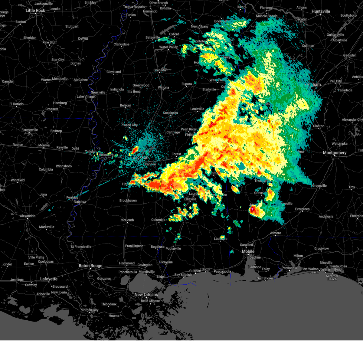 At 507 am cdt, a severe thunderstorm was located over sanatorium, or near magee, moving east at 35 mph (radar indicated). Hazards include 60 mph wind gusts and quarter size hail. Hail damage to vehicles is expected. expect wind damage to roofs, siding, and trees. locations impacted include, mendenhall, pinola and union. hail threat, radar indicated max hail size, 1. 00 in wind threat, radar indicated max wind gust, 60 mph. At 507 am cdt, a severe thunderstorm was located over sanatorium, or near magee, moving east at 35 mph (radar indicated). Hazards include 60 mph wind gusts and quarter size hail. Hail damage to vehicles is expected. expect wind damage to roofs, siding, and trees. locations impacted include, mendenhall, pinola and union. hail threat, radar indicated max hail size, 1. 00 in wind threat, radar indicated max wind gust, 60 mph.
|
| 4/3/2023 4:54 AM CDT |
 At 454 am cdt, a severe thunderstorm was located over pinola, moving east at 35 mph (radar indicated). Hazards include 60 mph wind gusts and quarter size hail. Hail damage to vehicles is expected. expect wind damage to roofs, siding, and trees. this severe thunderstorm will remain over mainly rural areas of southeastern rankin, simpson, east central copiah and northwestern jefferson davis counties, including the following locations, d`lo, braxton, puckett and georgetown. hail threat, radar indicated max hail size, 1. 00 in wind threat, radar indicated max wind gust, 60 mph. At 454 am cdt, a severe thunderstorm was located over pinola, moving east at 35 mph (radar indicated). Hazards include 60 mph wind gusts and quarter size hail. Hail damage to vehicles is expected. expect wind damage to roofs, siding, and trees. this severe thunderstorm will remain over mainly rural areas of southeastern rankin, simpson, east central copiah and northwestern jefferson davis counties, including the following locations, d`lo, braxton, puckett and georgetown. hail threat, radar indicated max hail size, 1. 00 in wind threat, radar indicated max wind gust, 60 mph.
|
| 4/3/2023 4:44 AM CDT |
 At 444 am cdt, a confirmed tornado was located near sanatorium, or near mendenhall, moving east at 30 mph (radar confirmed tornado). Hazards include damaging tornado. Flying debris will be dangerous to those caught without shelter. mobile homes will be damaged or destroyed. damage to roofs, windows, and vehicles will occur. tree damage is likely. this tornado will be near, magee around 455 am cdt. center ridge around 520 am cdt. taylorsville around 530 am cdt. Other locations impacted by this tornadic thunderstorm include mize. At 444 am cdt, a confirmed tornado was located near sanatorium, or near mendenhall, moving east at 30 mph (radar confirmed tornado). Hazards include damaging tornado. Flying debris will be dangerous to those caught without shelter. mobile homes will be damaged or destroyed. damage to roofs, windows, and vehicles will occur. tree damage is likely. this tornado will be near, magee around 455 am cdt. center ridge around 520 am cdt. taylorsville around 530 am cdt. Other locations impacted by this tornadic thunderstorm include mize.
|
| 4/3/2023 4:41 AM CDT |
 At 441 am cdt, a severe thunderstorm capable of producing a tornado was located over mendenhall, moving east at 30 mph (radar indicated rotation). Hazards include tornado. Flying debris will be dangerous to those caught without shelter. mobile homes will be damaged or destroyed. damage to roofs, windows, and vehicles will occur. tree damage is likely. this dangerous storm will be near, martinville and sanatorium around 450 am cdt. magee around 455 am cdt. center ridge around 520 am cdt. taylorsville around 530 am cdt. Other locations impacted by this tornadic thunderstorm include mize. At 441 am cdt, a severe thunderstorm capable of producing a tornado was located over mendenhall, moving east at 30 mph (radar indicated rotation). Hazards include tornado. Flying debris will be dangerous to those caught without shelter. mobile homes will be damaged or destroyed. damage to roofs, windows, and vehicles will occur. tree damage is likely. this dangerous storm will be near, martinville and sanatorium around 450 am cdt. magee around 455 am cdt. center ridge around 520 am cdt. taylorsville around 530 am cdt. Other locations impacted by this tornadic thunderstorm include mize.
|
| 4/3/2023 4:32 AM CDT |
 At 432 am cdt, a severe thunderstorm was located near hopewell, or 11 miles west of pinola, moving east at 35 mph (radar indicated). Hazards include 60 mph wind gusts and half dollar size hail. Hail damage to vehicles is expected. expect wind damage to roofs, siding, and trees. this severe storm will be near, union and harrisville around 440 am cdt. pinola and shivers around 450 am cdt. mendenhall around 500 am cdt. other locations impacted by this severe thunderstorm include d`lo, braxton, puckett and georgetown. hail threat, radar indicated max hail size, 1. 25 in wind threat, radar indicated max wind gust, 60 mph. At 432 am cdt, a severe thunderstorm was located near hopewell, or 11 miles west of pinola, moving east at 35 mph (radar indicated). Hazards include 60 mph wind gusts and half dollar size hail. Hail damage to vehicles is expected. expect wind damage to roofs, siding, and trees. this severe storm will be near, union and harrisville around 440 am cdt. pinola and shivers around 450 am cdt. mendenhall around 500 am cdt. other locations impacted by this severe thunderstorm include d`lo, braxton, puckett and georgetown. hail threat, radar indicated max hail size, 1. 25 in wind threat, radar indicated max wind gust, 60 mph.
|
| 4/3/2023 4:15 AM CDT |
 At 414 am cdt, a severe thunderstorm was located over crystal springs, moving east at 35 mph (radar indicated). Hazards include ping pong ball size hail and 60 mph wind gusts. People and animals outdoors will be injured. expect hail damage to roofs, siding, windows, and vehicles. expect wind damage to roofs, siding, and trees. this severe thunderstorm will be near, hopewell around 425 am cdt. union and harrisville around 440 am cdt. pinola and shivers around 450 am cdt. mendenhall around 500 am cdt. other locations impacted by this severe thunderstorm include d`lo, braxton, puckett and georgetown. hail threat, radar indicated max hail size, 1. 50 in wind threat, radar indicated max wind gust, 60 mph. At 414 am cdt, a severe thunderstorm was located over crystal springs, moving east at 35 mph (radar indicated). Hazards include ping pong ball size hail and 60 mph wind gusts. People and animals outdoors will be injured. expect hail damage to roofs, siding, windows, and vehicles. expect wind damage to roofs, siding, and trees. this severe thunderstorm will be near, hopewell around 425 am cdt. union and harrisville around 440 am cdt. pinola and shivers around 450 am cdt. mendenhall around 500 am cdt. other locations impacted by this severe thunderstorm include d`lo, braxton, puckett and georgetown. hail threat, radar indicated max hail size, 1. 50 in wind threat, radar indicated max wind gust, 60 mph.
|
| 3/24/2023 6:27 PM CDT |
 At 627 pm cdt, a severe thunderstorm capable of producing a tornado was located over mendenhall, moving northeast at 35 mph (radar indicated rotation). Hazards include tornado. Flying debris will be dangerous to those caught without shelter. mobile homes will be damaged or destroyed. damage to roofs, windows, and vehicles will occur. tree damage is likely. this dangerous storm will be near, cato around 635 pm cdt. martinville and johns around 640 pm cdt. white oak around 650 pm cdt. burns around 705 pm cdt. Other locations impacted by this tornadic thunderstorm include polkville, d`lo, braxton and puckett. At 627 pm cdt, a severe thunderstorm capable of producing a tornado was located over mendenhall, moving northeast at 35 mph (radar indicated rotation). Hazards include tornado. Flying debris will be dangerous to those caught without shelter. mobile homes will be damaged or destroyed. damage to roofs, windows, and vehicles will occur. tree damage is likely. this dangerous storm will be near, cato around 635 pm cdt. martinville and johns around 640 pm cdt. white oak around 650 pm cdt. burns around 705 pm cdt. Other locations impacted by this tornadic thunderstorm include polkville, d`lo, braxton and puckett.
|
| 3/24/2023 6:17 PM CDT |
 At 617 pm cdt, a severe thunderstorm capable of producing a tornado was located over pinola, moving northeast at 35 mph (radar indicated rotation). Hazards include tornado. Flying debris will be dangerous to those caught without shelter. mobile homes will be damaged or destroyed. damage to roofs, windows, and vehicles will occur. tree damage is likely. this dangerous storm will be near, mendenhall around 630 pm cdt. cato around 635 pm cdt. martinville and johns around 640 pm cdt. white oak around 650 pm cdt. burns around 705 pm cdt. Other locations impacted by this tornadic thunderstorm include polkville, d`lo, braxton and puckett. At 617 pm cdt, a severe thunderstorm capable of producing a tornado was located over pinola, moving northeast at 35 mph (radar indicated rotation). Hazards include tornado. Flying debris will be dangerous to those caught without shelter. mobile homes will be damaged or destroyed. damage to roofs, windows, and vehicles will occur. tree damage is likely. this dangerous storm will be near, mendenhall around 630 pm cdt. cato around 635 pm cdt. martinville and johns around 640 pm cdt. white oak around 650 pm cdt. burns around 705 pm cdt. Other locations impacted by this tornadic thunderstorm include polkville, d`lo, braxton and puckett.
|
| 3/24/2023 6:11 PM CDT |
 At 611 pm cdt, a severe thunderstorm capable of producing a tornado was located over union, or near pinola, moving northeast at 45 mph (radar indicated rotation). Hazards include tornado. Flying debris will be dangerous to those caught without shelter. mobile homes will be damaged or destroyed. damage to roofs, windows, and vehicles will occur. tree damage is likely. this dangerous storm will be near, pinola around 615 pm cdt. mendenhall and piney woods around 625 pm cdt. cato and martinville around 635 pm cdt. johns around 640 pm cdt. white oak around 645 pm cdt. burns around 655 pm cdt. Other locations impacted by this tornadic thunderstorm include polkville, d`lo, braxton and puckett. At 611 pm cdt, a severe thunderstorm capable of producing a tornado was located over union, or near pinola, moving northeast at 45 mph (radar indicated rotation). Hazards include tornado. Flying debris will be dangerous to those caught without shelter. mobile homes will be damaged or destroyed. damage to roofs, windows, and vehicles will occur. tree damage is likely. this dangerous storm will be near, pinola around 615 pm cdt. mendenhall and piney woods around 625 pm cdt. cato and martinville around 635 pm cdt. johns around 640 pm cdt. white oak around 645 pm cdt. burns around 655 pm cdt. Other locations impacted by this tornadic thunderstorm include polkville, d`lo, braxton and puckett.
|
| 3/12/2023 5:03 PM CDT |
 At 503 pm cdt, a severe thunderstorm was located near magee, moving east at 55 mph (radar indicated). Hazards include quarter size hail. Damage to vehicles is expected. this severe thunderstorm will remain over mainly rural areas of eastern simpson county. hail threat, radar indicated max hail size, 1. 00 in wind threat, radar indicated max wind gust, <50 mph. At 503 pm cdt, a severe thunderstorm was located near magee, moving east at 55 mph (radar indicated). Hazards include quarter size hail. Damage to vehicles is expected. this severe thunderstorm will remain over mainly rural areas of eastern simpson county. hail threat, radar indicated max hail size, 1. 00 in wind threat, radar indicated max wind gust, <50 mph.
|
| 3/12/2023 4:47 PM CDT |
 At 447 pm cdt, a severe thunderstorm was located near mendenhall, moving east at 55 mph (radar indicated). Hazards include quarter size hail. Damage to vehicles is expected. this severe storm will be near, sanatorium and martinville around 455 pm cdt. magee around 500 pm cdt. other locations impacted by this severe thunderstorm include d`lo. hail threat, radar indicated max hail size, 1. 00 in wind threat, radar indicated max wind gust, <50 mph. At 447 pm cdt, a severe thunderstorm was located near mendenhall, moving east at 55 mph (radar indicated). Hazards include quarter size hail. Damage to vehicles is expected. this severe storm will be near, sanatorium and martinville around 455 pm cdt. magee around 500 pm cdt. other locations impacted by this severe thunderstorm include d`lo. hail threat, radar indicated max hail size, 1. 00 in wind threat, radar indicated max wind gust, <50 mph.
|
| 3/12/2023 4:35 PM CDT |
 At 435 pm cdt, a severe thunderstorm was located over union, or 8 miles west of pinola, moving east at 55 mph (radar indicated). Hazards include half dollar size hail. Damage to vehicles is expected. this severe storm will be near, pinola around 445 pm cdt. mendenhall around 450 pm cdt. sanatorium around 455 pm cdt. magee and martinville around 500 pm cdt. other locations impacted by this severe thunderstorm include d`lo and georgetown. hail threat, radar indicated max hail size, 1. 25 in wind threat, radar indicated max wind gust, <50 mph. At 435 pm cdt, a severe thunderstorm was located over union, or 8 miles west of pinola, moving east at 55 mph (radar indicated). Hazards include half dollar size hail. Damage to vehicles is expected. this severe storm will be near, pinola around 445 pm cdt. mendenhall around 450 pm cdt. sanatorium around 455 pm cdt. magee and martinville around 500 pm cdt. other locations impacted by this severe thunderstorm include d`lo and georgetown. hail threat, radar indicated max hail size, 1. 25 in wind threat, radar indicated max wind gust, <50 mph.
|
| 3/12/2023 4:23 PM CDT |
 At 423 pm cdt, a severe thunderstorm was located near hopewell, or near crystal springs, moving east at 55 mph (radar indicated). Hazards include half dollar size hail. Damage to vehicles is expected. this severe thunderstorm will be near, union and harrisville around 435 pm cdt. pinola around 445 pm cdt. mendenhall around 450 pm cdt. sanatorium around 455 pm cdt. magee and martinville around 500 pm cdt. other locations impacted by this severe thunderstorm include d`lo and georgetown. hail threat, radar indicated max hail size, 1. 25 in wind threat, radar indicated max wind gust, <50 mph. At 423 pm cdt, a severe thunderstorm was located near hopewell, or near crystal springs, moving east at 55 mph (radar indicated). Hazards include half dollar size hail. Damage to vehicles is expected. this severe thunderstorm will be near, union and harrisville around 435 pm cdt. pinola around 445 pm cdt. mendenhall around 450 pm cdt. sanatorium around 455 pm cdt. magee and martinville around 500 pm cdt. other locations impacted by this severe thunderstorm include d`lo and georgetown. hail threat, radar indicated max hail size, 1. 25 in wind threat, radar indicated max wind gust, <50 mph.
|
| 3/12/2023 4:21 PM CDT |
 At 420 pm cdt, a severe thunderstorm was located near pineville, or 13 miles northwest of stringer, moving east at 55 mph (radar indicated). Hazards include quarter size hail. Damage to vehicles is expected. this severe storm will be near, bay springs around 430 pm cdt. turnerville around 435 pm cdt. paulding around 445 pm cdt. orange around 450 pm cdt. other locations impacted by this severe thunderstorm include sylvarena and louin. hail threat, radar indicated max hail size, 1. 00 in wind threat, radar indicated max wind gust, <50 mph. At 420 pm cdt, a severe thunderstorm was located near pineville, or 13 miles northwest of stringer, moving east at 55 mph (radar indicated). Hazards include quarter size hail. Damage to vehicles is expected. this severe storm will be near, bay springs around 430 pm cdt. turnerville around 435 pm cdt. paulding around 445 pm cdt. orange around 450 pm cdt. other locations impacted by this severe thunderstorm include sylvarena and louin. hail threat, radar indicated max hail size, 1. 00 in wind threat, radar indicated max wind gust, <50 mph.
|
| 3/12/2023 4:09 PM CDT |
 At 409 pm cdt, a severe thunderstorm was located over raleigh, or 14 miles northeast of magee, moving east at 55 mph (radar indicated). Hazards include quarter size hail. Damage to vehicles is expected. this severe thunderstorm will be near, center ridge around 415 pm cdt. bay springs around 430 pm cdt. turnerville around 435 pm cdt. paulding around 445 pm cdt. orange around 450 pm cdt. other locations impacted by this severe thunderstorm include sylvarena, d`lo, louin, braxton and puckett. hail threat, radar indicated max hail size, 1. 00 in wind threat, radar indicated max wind gust, <50 mph. At 409 pm cdt, a severe thunderstorm was located over raleigh, or 14 miles northeast of magee, moving east at 55 mph (radar indicated). Hazards include quarter size hail. Damage to vehicles is expected. this severe thunderstorm will be near, center ridge around 415 pm cdt. bay springs around 430 pm cdt. turnerville around 435 pm cdt. paulding around 445 pm cdt. orange around 450 pm cdt. other locations impacted by this severe thunderstorm include sylvarena, d`lo, louin, braxton and puckett. hail threat, radar indicated max hail size, 1. 00 in wind threat, radar indicated max wind gust, <50 mph.
|
| 2/8/2023 8:51 PM CST |
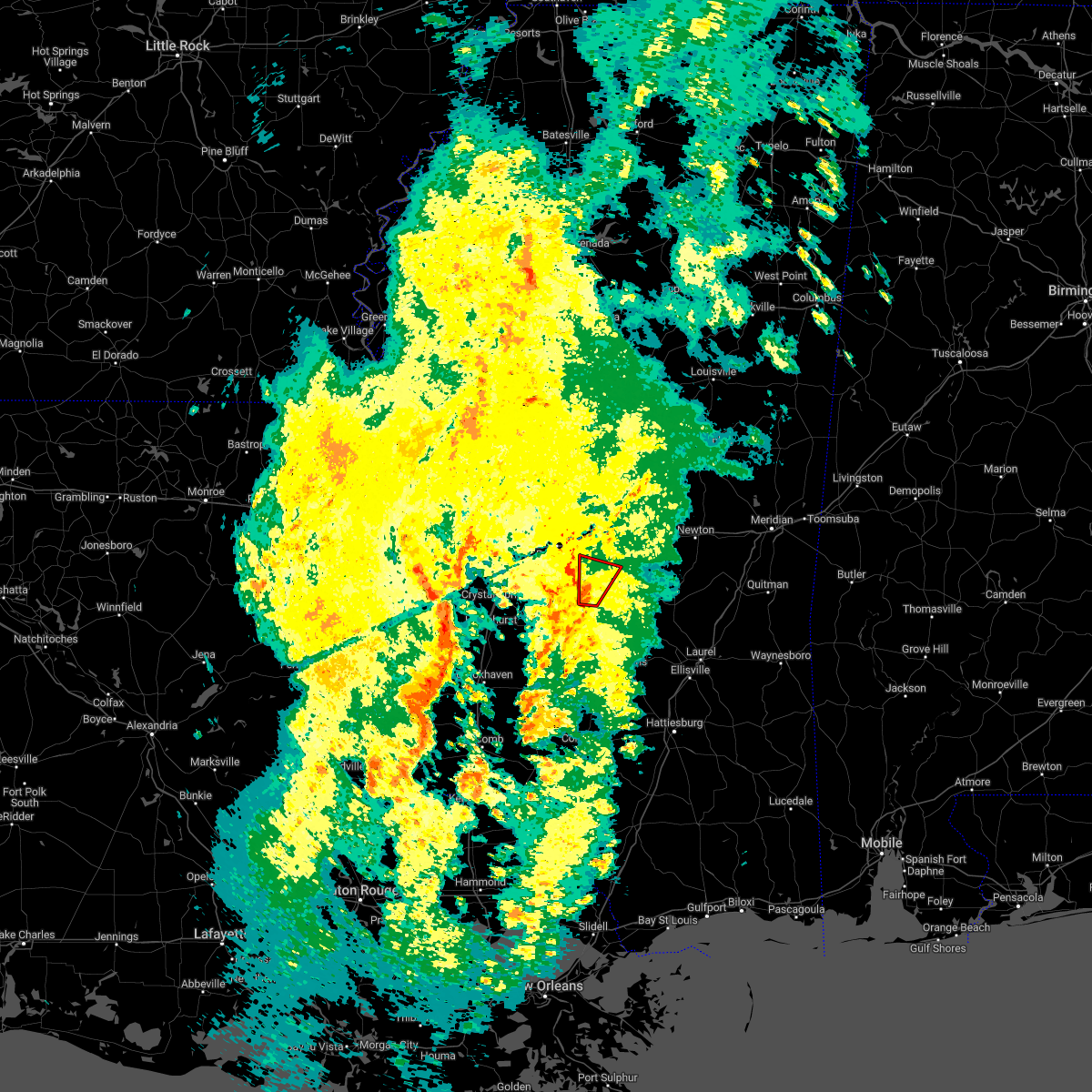 At 851 pm cst, a severe thunderstorm capable of producing a tornado was located near martinville, or near mendenhall, moving north at 35 mph (radar indicated rotation). Hazards include tornado. Flying debris will be dangerous to those caught without shelter. mobile homes will be damaged or destroyed. damage to roofs, windows, and vehicles will occur. tree damage is likely. Locations impacted include, white oak, johns and puckett. At 851 pm cst, a severe thunderstorm capable of producing a tornado was located near martinville, or near mendenhall, moving north at 35 mph (radar indicated rotation). Hazards include tornado. Flying debris will be dangerous to those caught without shelter. mobile homes will be damaged or destroyed. damage to roofs, windows, and vehicles will occur. tree damage is likely. Locations impacted include, white oak, johns and puckett.
|
| 2/8/2023 8:37 PM CST |
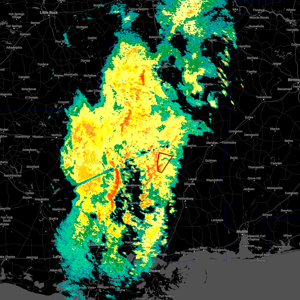 At 837 pm cst, a severe thunderstorm capable of producing a tornado was located over sanatorium, or near mendenhall, moving north at 35 mph (radar indicated rotation). Hazards include tornado. Flying debris will be dangerous to those caught without shelter. mobile homes will be damaged or destroyed. damage to roofs, windows, and vehicles will occur. tree damage is likely. Locations impacted include, mendenhall, white oak, martinville, johns, cato and puckett. At 837 pm cst, a severe thunderstorm capable of producing a tornado was located over sanatorium, or near mendenhall, moving north at 35 mph (radar indicated rotation). Hazards include tornado. Flying debris will be dangerous to those caught without shelter. mobile homes will be damaged or destroyed. damage to roofs, windows, and vehicles will occur. tree damage is likely. Locations impacted include, mendenhall, white oak, martinville, johns, cato and puckett.
|
| 2/8/2023 8:27 PM CST |
 At 827 pm cst, a confirmed tornado was located 7 miles southwest of sanatorium, or 7 miles southeast of pinola, moving north at 30 mph (radar confirmed tornado). Hazards include damaging tornado. Flying debris will be dangerous to those caught without shelter. mobile homes will be damaged or destroyed. damage to roofs, windows, and vehicles will occur. tree damage is likely. this tornado will be near, sanatorium around 840 pm cst. mendenhall around 845 pm cst. martinville around 850 pm cst. white oak and johns around 905 pm cst. Other locations impacted by this tornadic thunderstorm include d`lo and puckett. At 827 pm cst, a confirmed tornado was located 7 miles southwest of sanatorium, or 7 miles southeast of pinola, moving north at 30 mph (radar confirmed tornado). Hazards include damaging tornado. Flying debris will be dangerous to those caught without shelter. mobile homes will be damaged or destroyed. damage to roofs, windows, and vehicles will occur. tree damage is likely. this tornado will be near, sanatorium around 840 pm cst. mendenhall around 845 pm cst. martinville around 850 pm cst. white oak and johns around 905 pm cst. Other locations impacted by this tornadic thunderstorm include d`lo and puckett.
|
| 2/8/2023 8:23 PM CST |
 At 823 pm cst, a severe thunderstorm capable of producing a tornado was located near pinola, moving north at 35 mph (radar indicated rotation). Hazards include tornado. Flying debris will be dangerous to those caught without shelter. mobile homes will be damaged or destroyed. damage to roofs, windows, and vehicles will occur. tree damage is likely. this dangerous storm will be near, sanatorium around 835 pm cst. mendenhall around 840 pm cst. martinville around 845 pm cst. cato around 855 pm cst. johns and white oak around 900 pm cst. Other locations impacted by this tornadic thunderstorm include d`lo and puckett. At 823 pm cst, a severe thunderstorm capable of producing a tornado was located near pinola, moving north at 35 mph (radar indicated rotation). Hazards include tornado. Flying debris will be dangerous to those caught without shelter. mobile homes will be damaged or destroyed. damage to roofs, windows, and vehicles will occur. tree damage is likely. this dangerous storm will be near, sanatorium around 835 pm cst. mendenhall around 840 pm cst. martinville around 845 pm cst. cato around 855 pm cst. johns and white oak around 900 pm cst. Other locations impacted by this tornadic thunderstorm include d`lo and puckett.
|
| 2/8/2023 8:22 PM CST | Trees down on mt zion roa in simpson county MS, 11.6 miles N of Mendenhall, MS |
| 2/8/2023 8:19 PM CST |
 At 819 pm cst, a severe thunderstorm capable of producing a tornado was located near shivers, or 8 miles southeast of pinola, moving north at 35 mph (radar indicated rotation). Hazards include tornado. Flying debris will be dangerous to those caught without shelter. mobile homes will be damaged or destroyed. damage to roofs, windows, and vehicles will occur. tree damage is likely. this dangerous storm will be near, magee around 830 pm cst. sanatorium around 835 pm cst. mendenhall around 840 pm cst. martinville around 845 pm cst. cato around 855 pm cst. white oak and johns around 900 pm cst. Other locations impacted by this tornadic thunderstorm include d`lo and puckett. At 819 pm cst, a severe thunderstorm capable of producing a tornado was located near shivers, or 8 miles southeast of pinola, moving north at 35 mph (radar indicated rotation). Hazards include tornado. Flying debris will be dangerous to those caught without shelter. mobile homes will be damaged or destroyed. damage to roofs, windows, and vehicles will occur. tree damage is likely. this dangerous storm will be near, magee around 830 pm cst. sanatorium around 835 pm cst. mendenhall around 840 pm cst. martinville around 845 pm cst. cato around 855 pm cst. white oak and johns around 900 pm cst. Other locations impacted by this tornadic thunderstorm include d`lo and puckett.
|
| 1/18/2023 11:25 PM CST |
 At 1124 pm cst, a severe thunderstorm was located over sanatorium, or near magee, moving east at 40 mph (radar indicated). Hazards include 60 mph wind gusts. Expect damage to roofs, siding, and trees. this severe thunderstorm will remain over mainly rural areas of eastern simpson and northwestern jefferson davis counties. hail threat, radar indicated max hail size, <. 75 in wind threat, radar indicated max wind gust, 60 mph. At 1124 pm cst, a severe thunderstorm was located over sanatorium, or near magee, moving east at 40 mph (radar indicated). Hazards include 60 mph wind gusts. Expect damage to roofs, siding, and trees. this severe thunderstorm will remain over mainly rural areas of eastern simpson and northwestern jefferson davis counties. hail threat, radar indicated max hail size, <. 75 in wind threat, radar indicated max wind gust, 60 mph.
|
| 1/18/2023 11:00 PM CST |
 At 1059 pm cst, a severe thunderstorm was located near shivers, or near pinola, moving east at 40 mph (radar indicated). Hazards include 60 mph wind gusts. Expect damage to roofs, siding, and trees. this severe storm will be near, pinola around 1110 pm cst. mendenhall around 1120 pm cst. magee and sanatorium around 1125 pm cst. martinville around 1130 pm cst. other locations impacted by this severe thunderstorm include new hebron. hail threat, radar indicated max hail size, <. 75 in wind threat, radar indicated max wind gust, 60 mph. At 1059 pm cst, a severe thunderstorm was located near shivers, or near pinola, moving east at 40 mph (radar indicated). Hazards include 60 mph wind gusts. Expect damage to roofs, siding, and trees. this severe storm will be near, pinola around 1110 pm cst. mendenhall around 1120 pm cst. magee and sanatorium around 1125 pm cst. martinville around 1130 pm cst. other locations impacted by this severe thunderstorm include new hebron. hail threat, radar indicated max hail size, <. 75 in wind threat, radar indicated max wind gust, 60 mph.
|
| 1/18/2023 10:38 PM CST |
 At 1038 pm cst, a severe thunderstorm was located 7 miles southwest of rockport, or 11 miles southeast of hazlehurst, moving east at 40 mph (radar indicated). Hazards include 60 mph wind gusts. Expect damage to roofs, siding, and trees. this severe thunderstorm will be near, rockport and oma around 1050 pm cst. union around 1100 pm cst. shivers around 1105 pm cst. pinola around 1110 pm cst. mendenhall around 1120 pm cst. sanatorium around 1125 pm cst. magee and martinville around 1130 pm cst. Other locations impacted by this severe thunderstorm include new hebron and georgetown. At 1038 pm cst, a severe thunderstorm was located 7 miles southwest of rockport, or 11 miles southeast of hazlehurst, moving east at 40 mph (radar indicated). Hazards include 60 mph wind gusts. Expect damage to roofs, siding, and trees. this severe thunderstorm will be near, rockport and oma around 1050 pm cst. union around 1100 pm cst. shivers around 1105 pm cst. pinola around 1110 pm cst. mendenhall around 1120 pm cst. sanatorium around 1125 pm cst. magee and martinville around 1130 pm cst. Other locations impacted by this severe thunderstorm include new hebron and georgetown.
|
| 1/12/2023 9:13 AM CST |
 The severe thunderstorm warning for southeastern simpson and southern smith counties will expire at 915 am cst, the storm which prompted the warning has weakened below severe limits, and no longer poses an immediate threat to life or property. therefore, the warning will be allowed to expire. however gusty winds are still possible with this thunderstorm. a tornado watch remains in effect until 100 pm cst for south central and central mississippi. The severe thunderstorm warning for southeastern simpson and southern smith counties will expire at 915 am cst, the storm which prompted the warning has weakened below severe limits, and no longer poses an immediate threat to life or property. therefore, the warning will be allowed to expire. however gusty winds are still possible with this thunderstorm. a tornado watch remains in effect until 100 pm cst for south central and central mississippi.
|
| 1/12/2023 8:34 AM CST |
 At 834 am cst, a severe thunderstorm was located over shivers, or near pinola, moving east at 50 mph (radar indicated). Hazards include 60 mph wind gusts. Expect damage to roofs, siding, and trees. this severe thunderstorm will be near, magee and sanatorium around 850 am cst. taylorsville and center ridge around 910 am cst. Other locations impacted by this severe thunderstorm include sylvarena and mize. At 834 am cst, a severe thunderstorm was located over shivers, or near pinola, moving east at 50 mph (radar indicated). Hazards include 60 mph wind gusts. Expect damage to roofs, siding, and trees. this severe thunderstorm will be near, magee and sanatorium around 850 am cst. taylorsville and center ridge around 910 am cst. Other locations impacted by this severe thunderstorm include sylvarena and mize.
|
| 1/3/2023 9:36 AM CST |
 At 936 am cst, a severe thunderstorm was located near gallman, or near hazlehurst, moving northeast at 45 mph (radar indicated). Hazards include 60 mph wind gusts and quarter size hail. Hail damage to vehicles is expected. expect wind damage to roofs, siding, and trees. this severe thunderstorm will be near, gallman around 940 am cst. crystal springs around 945 am cst. terry and hopewell around 955 am cst. whites around 1000 am cst. florence and harrisville around 1005 am cst. star and monterey around 1010 am cst. piney woods around 1015 am cst. cato around 1020 am cst. other locations impacted by this severe thunderstorm include d`lo, braxton, puckett and georgetown. hail threat, radar indicated max hail size, 1. 00 in wind threat, radar indicated max wind gust, 60 mph. At 936 am cst, a severe thunderstorm was located near gallman, or near hazlehurst, moving northeast at 45 mph (radar indicated). Hazards include 60 mph wind gusts and quarter size hail. Hail damage to vehicles is expected. expect wind damage to roofs, siding, and trees. this severe thunderstorm will be near, gallman around 940 am cst. crystal springs around 945 am cst. terry and hopewell around 955 am cst. whites around 1000 am cst. florence and harrisville around 1005 am cst. star and monterey around 1010 am cst. piney woods around 1015 am cst. cato around 1020 am cst. other locations impacted by this severe thunderstorm include d`lo, braxton, puckett and georgetown. hail threat, radar indicated max hail size, 1. 00 in wind threat, radar indicated max wind gust, 60 mph.
|
| 12/14/2022 12:14 PM CST |
 At 1213 pm cst, a severe thunderstorm capable of producing a tornado was located near clem, or 10 miles southeast of pinola, moving northeast at 35 mph (radar indicated rotation). Hazards include tornado. Flying debris will be dangerous to those caught without shelter. mobile homes will be damaged or destroyed. damage to roofs, windows, and vehicles will occur. tree damage is likely. this dangerous storm will be near, magee and sanatorium around 1230 pm cst. Martinville around 1235 pm cst. At 1213 pm cst, a severe thunderstorm capable of producing a tornado was located near clem, or 10 miles southeast of pinola, moving northeast at 35 mph (radar indicated rotation). Hazards include tornado. Flying debris will be dangerous to those caught without shelter. mobile homes will be damaged or destroyed. damage to roofs, windows, and vehicles will occur. tree damage is likely. this dangerous storm will be near, magee and sanatorium around 1230 pm cst. Martinville around 1235 pm cst.
|
| 12/14/2022 11:57 AM CST |
 At 1157 am cst, a severe thunderstorm capable of producing a tornado was located near prentiss, or 15 miles south of pinola, moving northeast at 35 mph (radar indicated rotation). Hazards include tornado. Flying debris will be dangerous to those caught without shelter. mobile homes will be damaged or destroyed. damage to roofs, windows, and vehicles will occur. tree damage is likely. this dangerous storm will be near, clem around 1215 pm cst. magee and sanatorium around 1230 pm cst. Martinville around 1240 pm cst. At 1157 am cst, a severe thunderstorm capable of producing a tornado was located near prentiss, or 15 miles south of pinola, moving northeast at 35 mph (radar indicated rotation). Hazards include tornado. Flying debris will be dangerous to those caught without shelter. mobile homes will be damaged or destroyed. damage to roofs, windows, and vehicles will occur. tree damage is likely. this dangerous storm will be near, clem around 1215 pm cst. magee and sanatorium around 1230 pm cst. Martinville around 1240 pm cst.
|
| 11/29/2022 10:36 PM CST |
 At 1036 pm cst, a severe thunderstorm capable of producing a tornado was located near magee, moving northeast at 45 mph (radar indicated rotation). Hazards include tornado. Flying debris will be dangerous to those caught without shelter. mobile homes will be damaged or destroyed. damage to roofs, windows, and vehicles will occur. tree damage is likely. This tornadic thunderstorm will remain over mainly rural areas of eastern simpson, southwestern smith and north central jefferson davis counties. At 1036 pm cst, a severe thunderstorm capable of producing a tornado was located near magee, moving northeast at 45 mph (radar indicated rotation). Hazards include tornado. Flying debris will be dangerous to those caught without shelter. mobile homes will be damaged or destroyed. damage to roofs, windows, and vehicles will occur. tree damage is likely. This tornadic thunderstorm will remain over mainly rural areas of eastern simpson, southwestern smith and north central jefferson davis counties.
|
| 11/29/2022 10:20 PM CST |
 At 1020 pm cst, a severe thunderstorm capable of producing a tornado was located near clem, or near magee, moving northeast at 40 mph (radar indicated rotation). Hazards include tornado. Flying debris will be dangerous to those caught without shelter. mobile homes will be damaged or destroyed. damage to roofs, windows, and vehicles will occur. tree damage is likely. this dangerous storm will be near, magee, mount olive and sanatorium around 1030 pm cst. Other locations impacted by this tornadic thunderstorm include new hebron. At 1020 pm cst, a severe thunderstorm capable of producing a tornado was located near clem, or near magee, moving northeast at 40 mph (radar indicated rotation). Hazards include tornado. Flying debris will be dangerous to those caught without shelter. mobile homes will be damaged or destroyed. damage to roofs, windows, and vehicles will occur. tree damage is likely. this dangerous storm will be near, magee, mount olive and sanatorium around 1030 pm cst. Other locations impacted by this tornadic thunderstorm include new hebron.
|
| 11/29/2022 10:04 PM CST |
 At 1004 pm cst, a severe thunderstorm capable of producing a tornado was located 7 miles south of shivers, or 12 miles south of pinola, moving northeast at 45 mph (radar indicated rotation). Hazards include tornado. Flying debris will be dangerous to those caught without shelter. mobile homes will be damaged or destroyed. damage to roofs, windows, and vehicles will occur. tree damage is likely. this dangerous storm will be near, clem around 1015 pm cst. magee, mount olive and sanatorium around 1025 pm cst. Other locations impacted by this tornadic thunderstorm include new hebron and silver creek. At 1004 pm cst, a severe thunderstorm capable of producing a tornado was located 7 miles south of shivers, or 12 miles south of pinola, moving northeast at 45 mph (radar indicated rotation). Hazards include tornado. Flying debris will be dangerous to those caught without shelter. mobile homes will be damaged or destroyed. damage to roofs, windows, and vehicles will occur. tree damage is likely. this dangerous storm will be near, clem around 1015 pm cst. magee, mount olive and sanatorium around 1025 pm cst. Other locations impacted by this tornadic thunderstorm include new hebron and silver creek.
|
| 11/29/2022 9:41 PM CST |
 At 941 pm cst, a severe thunderstorm capable of producing a tornado was located near monticello, or 16 miles east of brookhaven, moving northeast at 45 mph (radar indicated rotation). Hazards include tornado. Flying debris will be dangerous to those caught without shelter. mobile homes will be damaged or destroyed. damage to roofs, windows, and vehicles will occur. tree damage is likely. this dangerous storm will be near, wanilla around 945 pm cst. oma around 950 pm cst. shivers around 1005 pm cst. clem around 1010 pm cst. magee and sanatorium around 1025 pm cst. martinville around 1030 pm cst. Other locations impacted by this tornadic thunderstorm include new hebron and silver creek. At 941 pm cst, a severe thunderstorm capable of producing a tornado was located near monticello, or 16 miles east of brookhaven, moving northeast at 45 mph (radar indicated rotation). Hazards include tornado. Flying debris will be dangerous to those caught without shelter. mobile homes will be damaged or destroyed. damage to roofs, windows, and vehicles will occur. tree damage is likely. this dangerous storm will be near, wanilla around 945 pm cst. oma around 950 pm cst. shivers around 1005 pm cst. clem around 1010 pm cst. magee and sanatorium around 1025 pm cst. martinville around 1030 pm cst. Other locations impacted by this tornadic thunderstorm include new hebron and silver creek.
|
| 7/13/2022 6:15 PM CDT | Via social media... report of several trees fell onto primitive baptist church and a large limb in the yard of the new home church. there are also trees down on high 54 in simpson county MS, 7 miles WSW of Mendenhall, MS |
| 6/16/2022 8:54 PM CDT |
 The severe thunderstorm warning for south central rankin and western simpson counties will expire at 900 pm cdt, the storm which prompted the warning has weakened below severe limits, and no longer poses an immediate threat to life or property. therefore, the warning will be allowed to expire. however gusty winds are still possible with this thunderstorm. to report severe weather, contact your nearest law enforcement agency. they will relay your report to the national weather service jackson. The severe thunderstorm warning for south central rankin and western simpson counties will expire at 900 pm cdt, the storm which prompted the warning has weakened below severe limits, and no longer poses an immediate threat to life or property. therefore, the warning will be allowed to expire. however gusty winds are still possible with this thunderstorm. to report severe weather, contact your nearest law enforcement agency. they will relay your report to the national weather service jackson.
|
| 6/16/2022 8:37 PM CDT |
 At 837 pm cdt, a severe thunderstorm was located near harrisville, or near pinola, moving northwest at 15 mph (radar indicated). Hazards include 60 mph wind gusts and penny size hail. Expect damage to roofs, siding, and trees. locations impacted include, mendenhall, union, harrisville, piney woods, d`lo and braxton. hail threat, radar indicated max hail size, 0. 75 in wind threat, radar indicated max wind gust, 60 mph. At 837 pm cdt, a severe thunderstorm was located near harrisville, or near pinola, moving northwest at 15 mph (radar indicated). Hazards include 60 mph wind gusts and penny size hail. Expect damage to roofs, siding, and trees. locations impacted include, mendenhall, union, harrisville, piney woods, d`lo and braxton. hail threat, radar indicated max hail size, 0. 75 in wind threat, radar indicated max wind gust, 60 mph.
|
| 6/16/2022 8:19 PM CDT | Power lines downed off ms hwy 1 in simpson county MS, 1.8 miles SE of Mendenhall, MS |
| 6/16/2022 8:18 PM CDT |
 At 818 pm cdt, a severe thunderstorm was located over mendenhall, moving northwest at 10 mph (radar indicated). Hazards include 60 mph wind gusts and penny size hail. expect damage to roofs, siding, and trees At 818 pm cdt, a severe thunderstorm was located over mendenhall, moving northwest at 10 mph (radar indicated). Hazards include 60 mph wind gusts and penny size hail. expect damage to roofs, siding, and trees
|
| 6/10/2022 12:33 PM CDT |
 At 1232 pm cdt, severe thunderstorms were located along a line extending from near johns to oma, moving southeast at 40 mph (radar indicated). Hazards include 60 mph wind gusts. Expect damage to roofs, siding, and trees. These severe thunderstorms will remain over mainly rural areas of southeastern rankin and simpson counties, including the following locations, d`lo, braxton and puckett. At 1232 pm cdt, severe thunderstorms were located along a line extending from near johns to oma, moving southeast at 40 mph (radar indicated). Hazards include 60 mph wind gusts. Expect damage to roofs, siding, and trees. These severe thunderstorms will remain over mainly rural areas of southeastern rankin and simpson counties, including the following locations, d`lo, braxton and puckett.
|
| 6/10/2022 12:03 PM CDT |
 At 1202 pm cdt, severe thunderstorms were located along a line extending from near florence to near glancy, moving east at 45 mph (radar indicated). Hazards include 60 mph wind gusts. Expect damage to roofs, siding, and trees. severe thunderstorms will be near, richland, star, florence and monterey around 1210 pm cdt. brandon around 1215 pm cdt. cato around 1225 pm cdt. rockport and johns around 1230 pm cdt. union and pelahatchie around 1235 pm cdt. pinola and shivers around 1245 pm cdt. magee and sanatorium around 100 pm cdt. Other locations impacted by these severe thunderstorms include d`lo, beauregard, braxton, puckett and georgetown. At 1202 pm cdt, severe thunderstorms were located along a line extending from near florence to near glancy, moving east at 45 mph (radar indicated). Hazards include 60 mph wind gusts. Expect damage to roofs, siding, and trees. severe thunderstorms will be near, richland, star, florence and monterey around 1210 pm cdt. brandon around 1215 pm cdt. cato around 1225 pm cdt. rockport and johns around 1230 pm cdt. union and pelahatchie around 1235 pm cdt. pinola and shivers around 1245 pm cdt. magee and sanatorium around 100 pm cdt. Other locations impacted by these severe thunderstorms include d`lo, beauregard, braxton, puckett and georgetown.
|
| 5/25/2022 12:08 PM CDT |
 At 1208 pm cdt, a severe thunderstorm was located over sanatorium, or over magee, moving northeast at 35 mph (radar indicated). Hazards include 60 mph wind gusts. Expect damage to roofs, siding, and trees. this severe thunderstorm will be near, white oak around 1225 pm cdt. raleigh and center ridge around 1235 pm cdt. burns around 1240 pm cdt. pineville around 1250 pm cdt. other locations impacted by this severe thunderstorm include sylvarena, polkville and mize. hail threat, radar indicated max hail size, <. 75 in wind threat, radar indicated max wind gust, 60 mph. At 1208 pm cdt, a severe thunderstorm was located over sanatorium, or over magee, moving northeast at 35 mph (radar indicated). Hazards include 60 mph wind gusts. Expect damage to roofs, siding, and trees. this severe thunderstorm will be near, white oak around 1225 pm cdt. raleigh and center ridge around 1235 pm cdt. burns around 1240 pm cdt. pineville around 1250 pm cdt. other locations impacted by this severe thunderstorm include sylvarena, polkville and mize. hail threat, radar indicated max hail size, <. 75 in wind threat, radar indicated max wind gust, 60 mph.
|
| 5/12/2022 8:22 PM CDT |
 The severe thunderstorm warning for simpson county will expire at 830 pm cdt, the storm which prompted the warning has weakened below severe limits, and no longer poses an immediate threat to life or property. therefore, the warning will be allowed to expire. however, gusty winds are still possible with this thunderstorm. The severe thunderstorm warning for simpson county will expire at 830 pm cdt, the storm which prompted the warning has weakened below severe limits, and no longer poses an immediate threat to life or property. therefore, the warning will be allowed to expire. however, gusty winds are still possible with this thunderstorm.
|
| 5/12/2022 8:16 PM CDT |
 At 816 pm cdt, a severe thunderstorm was located over shivers, or near pinola, moving southwest at 40 mph (radar indicated). Hazards include 60 mph wind gusts. Expect damage to roofs, siding, and trees. this severe thunderstorm will remain over mainly rural areas of simpson county. hail threat, radar indicated max hail size, <. 75 in wind threat, radar indicated max wind gust, 60 mph. At 816 pm cdt, a severe thunderstorm was located over shivers, or near pinola, moving southwest at 40 mph (radar indicated). Hazards include 60 mph wind gusts. Expect damage to roofs, siding, and trees. this severe thunderstorm will remain over mainly rural areas of simpson county. hail threat, radar indicated max hail size, <. 75 in wind threat, radar indicated max wind gust, 60 mph.
|
| 5/12/2022 8:05 PM CDT |
 At 805 pm cdt, a severe thunderstorm was located over pinola, moving southwest at 40 mph (radar indicated). Hazards include 60 mph wind gusts. Expect damage to roofs, siding, and trees. this severe storm will be near, union and shivers around 815 pm cdt. other locations impacted by this severe thunderstorm include d`lo and braxton. hail threat, radar indicated max hail size, <. 75 in wind threat, radar indicated max wind gust, 60 mph. At 805 pm cdt, a severe thunderstorm was located over pinola, moving southwest at 40 mph (radar indicated). Hazards include 60 mph wind gusts. Expect damage to roofs, siding, and trees. this severe storm will be near, union and shivers around 815 pm cdt. other locations impacted by this severe thunderstorm include d`lo and braxton. hail threat, radar indicated max hail size, <. 75 in wind threat, radar indicated max wind gust, 60 mph.
|
| 5/12/2022 8:02 PM CDT |
 At 802 pm cdt, a severe thunderstorm was located over mendenhall, moving southwest at 40 mph (radar indicated). Hazards include 60 mph wind gusts. Expect damage to roofs, siding, and trees. this severe storm will be near, pinola around 810 pm cdt. union around 815 pm cdt. shivers around 820 pm cdt. other locations impacted by this severe thunderstorm include d`lo and puckett. hail threat, radar indicated max hail size, <. 75 in wind threat, radar indicated max wind gust, 60 mph. At 802 pm cdt, a severe thunderstorm was located over mendenhall, moving southwest at 40 mph (radar indicated). Hazards include 60 mph wind gusts. Expect damage to roofs, siding, and trees. this severe storm will be near, pinola around 810 pm cdt. union around 815 pm cdt. shivers around 820 pm cdt. other locations impacted by this severe thunderstorm include d`lo and puckett. hail threat, radar indicated max hail size, <. 75 in wind threat, radar indicated max wind gust, 60 mph.
|
| 5/12/2022 7:48 PM CDT |
 At 748 pm cdt, a severe thunderstorm was located near cato, or 8 miles northeast of mendenhall, moving southwest at 40 mph (radar indicated). Hazards include 60 mph wind gusts. Expect damage to roofs, siding, and trees. this severe thunderstorm will be near, mendenhall and sanatorium around 800 pm cdt. pinola around 815 pm cdt. union and shivers around 820 pm cdt. other locations impacted by this severe thunderstorm include d`lo and puckett. hail threat, radar indicated max hail size, <. 75 in wind threat, radar indicated max wind gust, 60 mph. At 748 pm cdt, a severe thunderstorm was located near cato, or 8 miles northeast of mendenhall, moving southwest at 40 mph (radar indicated). Hazards include 60 mph wind gusts. Expect damage to roofs, siding, and trees. this severe thunderstorm will be near, mendenhall and sanatorium around 800 pm cdt. pinola around 815 pm cdt. union and shivers around 820 pm cdt. other locations impacted by this severe thunderstorm include d`lo and puckett. hail threat, radar indicated max hail size, <. 75 in wind threat, radar indicated max wind gust, 60 mph.
|
| 4/17/2022 7:03 PM CDT |
 At 703 pm cdt, a severe thunderstorm was located near mendenhall, moving southeast at 30 mph (radar indicated). Hazards include 70 mph wind gusts and quarter size hail. Hail damage to vehicles is expected. expect considerable tree damage. wind damage is also likely to mobile homes, roofs, and outbuildings. this severe storm will be near, martinville, sanatorium and white oak around 715 pm cdt. magee around 725 pm cdt. center ridge around 740 pm cdt. Other locations impacted by this severe thunderstorm include sylvarena, d`lo, mize, braxton and puckett. At 703 pm cdt, a severe thunderstorm was located near mendenhall, moving southeast at 30 mph (radar indicated). Hazards include 70 mph wind gusts and quarter size hail. Hail damage to vehicles is expected. expect considerable tree damage. wind damage is also likely to mobile homes, roofs, and outbuildings. this severe storm will be near, martinville, sanatorium and white oak around 715 pm cdt. magee around 725 pm cdt. center ridge around 740 pm cdt. Other locations impacted by this severe thunderstorm include sylvarena, d`lo, mize, braxton and puckett.
|
| 4/17/2022 7:00 PM CDT | Tree fell on an apartment comple in simpson county MS, 0.5 miles ESE of Mendenhall, MS |
| 4/17/2022 7:00 PM CDT | Awning blown off of gas station pumps at cefco near hwy 49 in mendenhal in simpson county MS, 1.8 miles NW of Mendenhall, MS |
| 4/17/2022 6:57 PM CDT | Multiple pine trees down at hwy 13 and pine hill circle off hwy 49... where trees blocked the road. tops of pine trees snapped off. possible tornad in simpson county MS, 1.6 miles SSE of Mendenhall, MS |
| 4/17/2022 6:52 PM CDT |
 At 652 pm cdt, a severe thunderstorm was located near cato, or 7 miles east of star, moving southeast at 30 mph (radar indicated). Hazards include 60 mph wind gusts and quarter size hail. Hail damage to vehicles is expected. expect wind damage to roofs, siding, and trees. this severe thunderstorm will be near, cato and johns around 655 pm cdt. mendenhall around 705 pm cdt. martinville, sanatorium and white oak around 715 pm cdt. magee around 725 pm cdt. center ridge around 740 pm cdt. Other locations impacted by this severe thunderstorm include sylvarena, d`lo, mize, braxton and puckett. At 652 pm cdt, a severe thunderstorm was located near cato, or 7 miles east of star, moving southeast at 30 mph (radar indicated). Hazards include 60 mph wind gusts and quarter size hail. Hail damage to vehicles is expected. expect wind damage to roofs, siding, and trees. this severe thunderstorm will be near, cato and johns around 655 pm cdt. mendenhall around 705 pm cdt. martinville, sanatorium and white oak around 715 pm cdt. magee around 725 pm cdt. center ridge around 740 pm cdt. Other locations impacted by this severe thunderstorm include sylvarena, d`lo, mize, braxton and puckett.
|
| 4/13/2022 8:04 PM CDT |
 At 803 pm cdt, a severe thunderstorm was located over mendenhall, moving east at 60 mph (radar indicated). Hazards include 60 mph wind gusts. Expect damage to roofs, siding, and trees. this severe storm will be near, martinville around 810 pm cdt. magee around 815 pm cdt. other locations impacted by this severe thunderstorm include d`lo. hail threat, radar indicated max hail size, <. 75 in wind threat, radar indicated max wind gust, 60 mph. At 803 pm cdt, a severe thunderstorm was located over mendenhall, moving east at 60 mph (radar indicated). Hazards include 60 mph wind gusts. Expect damage to roofs, siding, and trees. this severe storm will be near, martinville around 810 pm cdt. magee around 815 pm cdt. other locations impacted by this severe thunderstorm include d`lo. hail threat, radar indicated max hail size, <. 75 in wind threat, radar indicated max wind gust, 60 mph.
|
| 4/13/2022 7:45 PM CDT |
 At 745 pm cdt, a severe thunderstorm was located over hopewell, or 10 miles southeast of crystal springs, moving east at 55 mph (radar indicated). Hazards include 70 mph wind gusts. Expect considerable tree damage. damage is likely to mobile homes, roofs, and outbuildings. this severe storm will be near, union and harrisville around 755 pm cdt. pinola around 800 pm cdt. mendenhall around 805 pm cdt. magee, martinville and sanatorium around 815 pm cdt. other locations impacted by this severe thunderstorm include d`lo, beauregard, braxton and georgetown. thunderstorm damage threat, considerable hail threat, radar indicated max hail size, <. 75 in wind threat, radar indicated max wind gust, 70 mph. At 745 pm cdt, a severe thunderstorm was located over hopewell, or 10 miles southeast of crystal springs, moving east at 55 mph (radar indicated). Hazards include 70 mph wind gusts. Expect considerable tree damage. damage is likely to mobile homes, roofs, and outbuildings. this severe storm will be near, union and harrisville around 755 pm cdt. pinola around 800 pm cdt. mendenhall around 805 pm cdt. magee, martinville and sanatorium around 815 pm cdt. other locations impacted by this severe thunderstorm include d`lo, beauregard, braxton and georgetown. thunderstorm damage threat, considerable hail threat, radar indicated max hail size, <. 75 in wind threat, radar indicated max wind gust, 70 mph.
|
| 4/13/2022 7:26 PM CDT |
 At 726 pm cdt, a severe thunderstorm was located near gallman, or near hazlehurst, moving east at 60 mph (radar indicated). Hazards include 70 mph wind gusts. Expect considerable tree damage. damage is likely to mobile homes, roofs, and outbuildings. this severe thunderstorm will be near, crystal springs, hazlehurst and gallman around 730 pm cdt. hopewell around 740 pm cdt. union and harrisville around 750 pm cdt. pinola around 755 pm cdt. mendenhall around 800 pm cdt. sanatorium around 805 pm cdt. magee and martinville around 810 pm cdt. other locations impacted by this severe thunderstorm include d`lo, beauregard, braxton and georgetown. thunderstorm damage threat, considerable hail threat, radar indicated max hail size, <. 75 in wind threat, radar indicated max wind gust, 70 mph. At 726 pm cdt, a severe thunderstorm was located near gallman, or near hazlehurst, moving east at 60 mph (radar indicated). Hazards include 70 mph wind gusts. Expect considerable tree damage. damage is likely to mobile homes, roofs, and outbuildings. this severe thunderstorm will be near, crystal springs, hazlehurst and gallman around 730 pm cdt. hopewell around 740 pm cdt. union and harrisville around 750 pm cdt. pinola around 755 pm cdt. mendenhall around 800 pm cdt. sanatorium around 805 pm cdt. magee and martinville around 810 pm cdt. other locations impacted by this severe thunderstorm include d`lo, beauregard, braxton and georgetown. thunderstorm damage threat, considerable hail threat, radar indicated max hail size, <. 75 in wind threat, radar indicated max wind gust, 70 mph.
|
| 4/5/2022 7:00 AM CDT | At 659 am cdt, severe thunderstorms were located along a line extending from near sanatorium to near monticello, moving east at 50 mph (radar indicated). Hazards include 60 mph wind gusts. Expect damage to roofs, siding, and trees. these severe storms will be near, magee, martinville and sanatorium around 705 am cdt. raleigh around 715 am cdt. taylorsville, center ridge, carson and clem around 720 am cdt. lone star around 725 am cdt. collins around 735 am cdt. Other locations impacted by these severe thunderstorms include sylvarena, new hebron, seminary, mize and silver creek. |
| 4/5/2022 6:43 AM CDT |
 At 643 am cdt, severe thunderstorms were located along a line extending from near pinola to brookhaven, moving east at 65 mph (radar indicated). Hazards include 60 mph wind gusts. Expect damage to roofs, siding, and trees. locations impacted include, brookhaven, mendenhall, pinola, union, wesson, enterprise, oma, bogue chitto, west lincoln, vaughn, east lincoln, harrisville, little springs, center point, shivers, sontag, rockport, wanilla, d`lo and beauregard. hail threat, radar indicated max hail size, <. 75 in wind threat, radar indicated max wind gust, 60 mph. At 643 am cdt, severe thunderstorms were located along a line extending from near pinola to brookhaven, moving east at 65 mph (radar indicated). Hazards include 60 mph wind gusts. Expect damage to roofs, siding, and trees. locations impacted include, brookhaven, mendenhall, pinola, union, wesson, enterprise, oma, bogue chitto, west lincoln, vaughn, east lincoln, harrisville, little springs, center point, shivers, sontag, rockport, wanilla, d`lo and beauregard. hail threat, radar indicated max hail size, <. 75 in wind threat, radar indicated max wind gust, 60 mph.
|
| 4/5/2022 6:40 AM CDT |
 At 640 am cdt, severe thunderstorms were located along a line extending from near mendenhall to near east lincoln, moving east at 60 mph (radar indicated). Hazards include 60 mph wind gusts. Expect damage to roofs, siding, and trees. severe thunderstorms will be near, sanatorium around 645 am cdt. magee and martinville around 650 am cdt. arm around 655 am cdt. progress around 700 am cdt. raleigh, prentiss, center ridge and carson around 705 am cdt. lone star around 710 am cdt. collins around 720 am cdt. other locations impacted by these severe thunderstorms include sylvarena, new hebron, seminary, mize and silver creek. hail threat, radar indicated max hail size, <. 75 in wind threat, radar indicated max wind gust, 60 mph. At 640 am cdt, severe thunderstorms were located along a line extending from near mendenhall to near east lincoln, moving east at 60 mph (radar indicated). Hazards include 60 mph wind gusts. Expect damage to roofs, siding, and trees. severe thunderstorms will be near, sanatorium around 645 am cdt. magee and martinville around 650 am cdt. arm around 655 am cdt. progress around 700 am cdt. raleigh, prentiss, center ridge and carson around 705 am cdt. lone star around 710 am cdt. collins around 720 am cdt. other locations impacted by these severe thunderstorms include sylvarena, new hebron, seminary, mize and silver creek. hail threat, radar indicated max hail size, <. 75 in wind threat, radar indicated max wind gust, 60 mph.
|
| 4/5/2022 6:26 AM CDT |
 At 626 am cdt, severe thunderstorms were located along a line extending from near hopewell to near vaughn, moving east at 50 mph (radar indicated). Hazards include 60 mph wind gusts. Expect damage to roofs, siding, and trees. locations impacted include, brookhaven, crystal springs, hazlehurst, mendenhall, pinola, union, wesson, bude, enterprise, mccall creek, bogue chitto, west lincoln, little springs, center point, shivers, kirby, martinsville, sontag, new hope and wanilla. hail threat, radar indicated max hail size, <. 75 in wind threat, radar indicated max wind gust, 60 mph. At 626 am cdt, severe thunderstorms were located along a line extending from near hopewell to near vaughn, moving east at 50 mph (radar indicated). Hazards include 60 mph wind gusts. Expect damage to roofs, siding, and trees. locations impacted include, brookhaven, crystal springs, hazlehurst, mendenhall, pinola, union, wesson, bude, enterprise, mccall creek, bogue chitto, west lincoln, little springs, center point, shivers, kirby, martinsville, sontag, new hope and wanilla. hail threat, radar indicated max hail size, <. 75 in wind threat, radar indicated max wind gust, 60 mph.
|
| 4/5/2022 6:00 AM CDT |
 At 600 am cdt, severe thunderstorms were located along a line extending from near peyton to near hamburg, moving east at 60 mph (radar indicated). Hazards include 60 mph wind gusts. expect damage to roofs, siding, and trees At 600 am cdt, severe thunderstorms were located along a line extending from near peyton to near hamburg, moving east at 60 mph (radar indicated). Hazards include 60 mph wind gusts. expect damage to roofs, siding, and trees
|
| 3/30/2022 6:57 PM CDT |
 The severe thunderstorm warning for southeastern simpson, lawrence, northwestern covington and jefferson davis counties will expire at 700 pm cdt, the storms which prompted the warning have moved out of the area. therefore, the warning will be allowed to expire. however gusty winds are still possible with these thunderstorms. a tornado watch remains in effect until 800 pm cdt for south central, central and southeastern mississippi. The severe thunderstorm warning for southeastern simpson, lawrence, northwestern covington and jefferson davis counties will expire at 700 pm cdt, the storms which prompted the warning have moved out of the area. therefore, the warning will be allowed to expire. however gusty winds are still possible with these thunderstorms. a tornado watch remains in effect until 800 pm cdt for south central, central and southeastern mississippi.
|
| 3/30/2022 6:29 PM CDT |
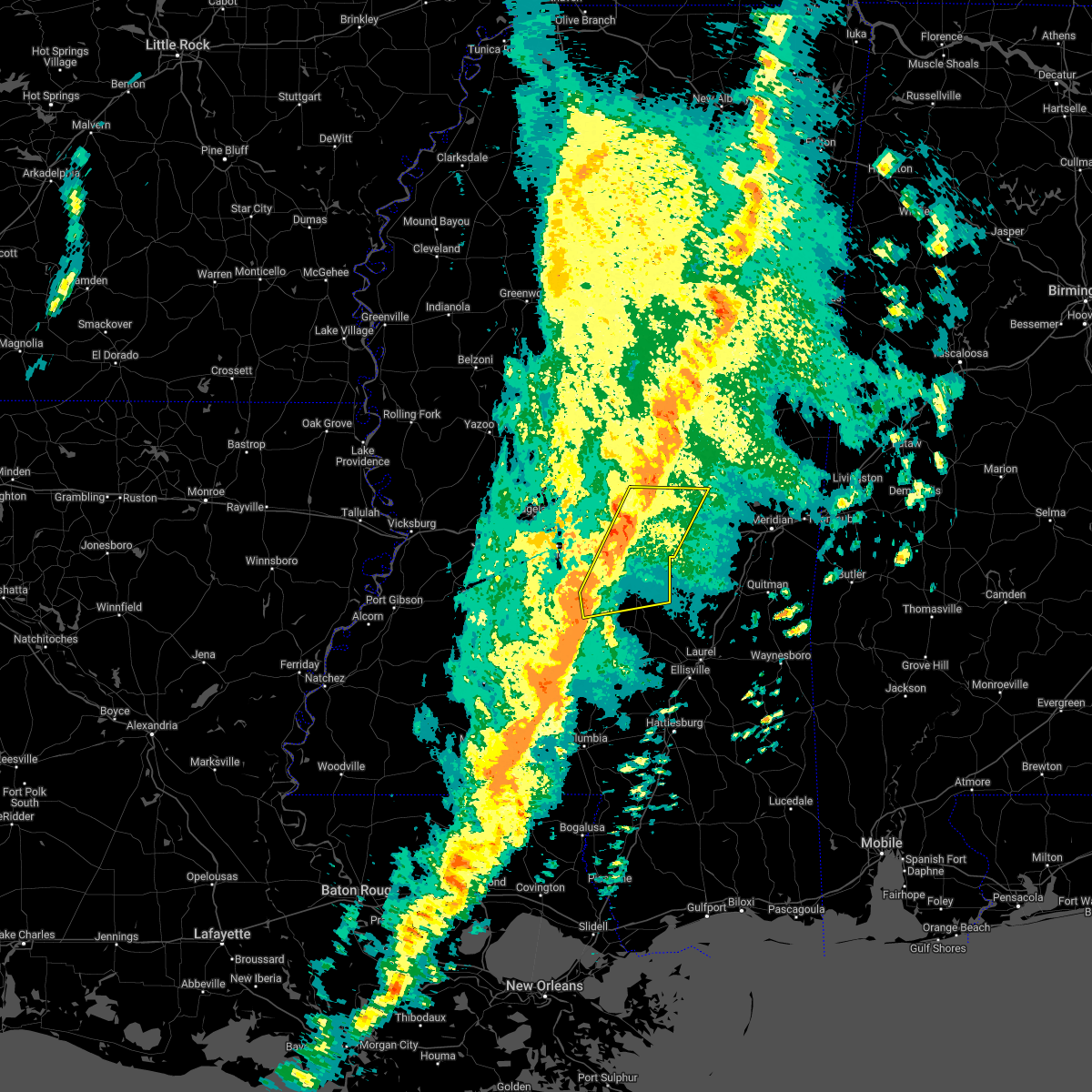 At 627 pm cdt, severe thunderstorms were located along a line extending from steele to near martinville, moving east at 30 mph (radar indicated). Hazards include 60 mph wind gusts. Expect damage to roofs, siding, and trees. severe thunderstorms will be near, harperville and steele around 635 pm cdt. conehatta around 645 pm cdt. prospect around 650 pm cdt. raleigh and burns around 655 pm cdt. stratton around 700 pm cdt. pineville around 715 pm cdt. Other locations impacted by these severe thunderstorms include sylvarena, polkville, lake, sebastopol and puckett. At 627 pm cdt, severe thunderstorms were located along a line extending from steele to near martinville, moving east at 30 mph (radar indicated). Hazards include 60 mph wind gusts. Expect damage to roofs, siding, and trees. severe thunderstorms will be near, harperville and steele around 635 pm cdt. conehatta around 645 pm cdt. prospect around 650 pm cdt. raleigh and burns around 655 pm cdt. stratton around 700 pm cdt. pineville around 715 pm cdt. Other locations impacted by these severe thunderstorms include sylvarena, polkville, lake, sebastopol and puckett.
|
| 3/30/2022 6:21 PM CDT |
 At 621 pm cdt, severe thunderstorms were located along a line extending from harperville to near martinville, moving northeast at 25 mph (radar indicated). Hazards include 60 mph wind gusts. Expect damage to roofs, siding, and trees. these severe storms will be near, harperville, steele and hillsboro around 625 pm cdt. burns around 650 pm cdt. other locations impacted by these severe thunderstorms include polkville, d`lo, sebastopol and puckett. hail threat, radar indicated max hail size, <. 75 in wind threat, radar indicated max wind gust, 60 mph. At 621 pm cdt, severe thunderstorms were located along a line extending from harperville to near martinville, moving northeast at 25 mph (radar indicated). Hazards include 60 mph wind gusts. Expect damage to roofs, siding, and trees. these severe storms will be near, harperville, steele and hillsboro around 625 pm cdt. burns around 650 pm cdt. other locations impacted by these severe thunderstorms include polkville, d`lo, sebastopol and puckett. hail threat, radar indicated max hail size, <. 75 in wind threat, radar indicated max wind gust, 60 mph.
|
| 3/30/2022 6:14 PM CDT |
 At 613 pm cdt, severe thunderstorms were located along a line extending from near pinola to near hebron to near topeka, moving east at 30 mph (radar indicated). Hazards include 60 mph wind gusts. Expect damage to roofs, siding, and trees. severe thunderstorms will be near, pinola and shivers around 620 pm cdt. sanatorium around 630 pm cdt. magee around 635 pm cdt. clem and progress around 640 pm cdt. prentiss, society hill and lone star around 645 pm cdt. mount olive and carson around 655 pm cdt. other locations impacted by these severe thunderstorms include new hebron and silver creek. hail threat, radar indicated max hail size, <. 75 in wind threat, radar indicated max wind gust, 60 mph. At 613 pm cdt, severe thunderstorms were located along a line extending from near pinola to near hebron to near topeka, moving east at 30 mph (radar indicated). Hazards include 60 mph wind gusts. Expect damage to roofs, siding, and trees. severe thunderstorms will be near, pinola and shivers around 620 pm cdt. sanatorium around 630 pm cdt. magee around 635 pm cdt. clem and progress around 640 pm cdt. prentiss, society hill and lone star around 645 pm cdt. mount olive and carson around 655 pm cdt. other locations impacted by these severe thunderstorms include new hebron and silver creek. hail threat, radar indicated max hail size, <. 75 in wind threat, radar indicated max wind gust, 60 mph.
|
| 3/30/2022 5:44 PM CDT |
 At 544 pm cdt, severe thunderstorms were located along a line extending from near leesburg to near harrisville, moving east at 40 mph (radar indicated). Hazards include 60 mph wind gusts. Expect damage to roofs, siding, and trees. severe thunderstorms will be near, forkville, ludlow, branch and leesburg around 550 pm cdt. cato around 600 pm cdt. harperville and hillsboro around 605 pm cdt. martinville and steele around 610 pm cdt. white oak around 620 pm cdt. burns around 630 pm cdt. other locations impacted by these severe thunderstorms include polkville, d`lo, sebastopol, braxton and puckett. hail threat, radar indicated max hail size, <. 75 in wind threat, radar indicated max wind gust, 60 mph. At 544 pm cdt, severe thunderstorms were located along a line extending from near leesburg to near harrisville, moving east at 40 mph (radar indicated). Hazards include 60 mph wind gusts. Expect damage to roofs, siding, and trees. severe thunderstorms will be near, forkville, ludlow, branch and leesburg around 550 pm cdt. cato around 600 pm cdt. harperville and hillsboro around 605 pm cdt. martinville and steele around 610 pm cdt. white oak around 620 pm cdt. burns around 630 pm cdt. other locations impacted by these severe thunderstorms include polkville, d`lo, sebastopol, braxton and puckett. hail threat, radar indicated max hail size, <. 75 in wind threat, radar indicated max wind gust, 60 mph.
|
| 3/30/2022 4:57 PM CDT |
 At 456 pm cdt, severe thunderstorms were located along a line extending from near canton to near gallman, moving east at 30 mph (radar indicated). Hazards include 60 mph wind gusts. Expect damage to roofs, siding, and trees. severe thunderstorms will be near, goshen springs around 505 pm cdt. pisgah around 510 pm cdt. harrisville around 525 pm cdt. ludlow around 530 pm cdt. mendenhall and tuscola around 545 pm cdt. other locations impacted by these severe thunderstorms include lena, d`lo, braxton and puckett. hail threat, radar indicated max hail size, <. 75 in wind threat, radar indicated max wind gust, 60 mph. At 456 pm cdt, severe thunderstorms were located along a line extending from near canton to near gallman, moving east at 30 mph (radar indicated). Hazards include 60 mph wind gusts. Expect damage to roofs, siding, and trees. severe thunderstorms will be near, goshen springs around 505 pm cdt. pisgah around 510 pm cdt. harrisville around 525 pm cdt. ludlow around 530 pm cdt. mendenhall and tuscola around 545 pm cdt. other locations impacted by these severe thunderstorms include lena, d`lo, braxton and puckett. hail threat, radar indicated max hail size, <. 75 in wind threat, radar indicated max wind gust, 60 mph.
|
| 3/22/2022 1:48 PM CDT |
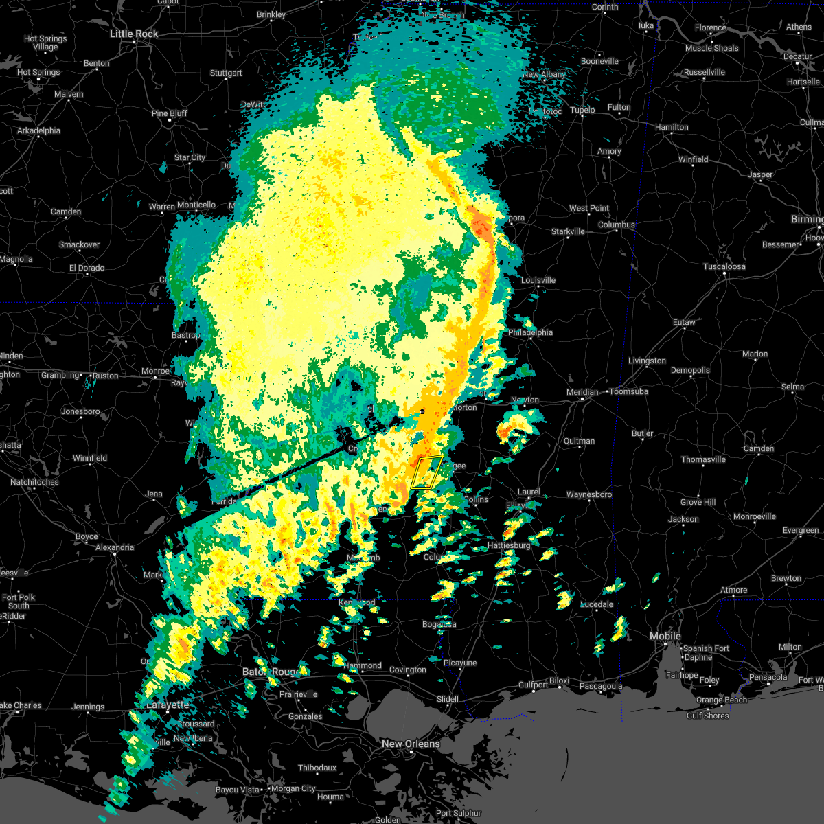 At 148 pm cdt, severe thunderstorms were located along a line extending from near mendenhall to near hebron, moving northeast at 40 mph (radar indicated). Hazards include 60 mph wind gusts and quarter size hail. Hail damage to vehicles is expected. expect wind damage to roofs, siding, and trees. these severe storms will be near, mendenhall around 155 pm cdt. hail threat, radar indicated max hail size, 1. 00 in wind threat, radar indicated max wind gust, 60 mph. At 148 pm cdt, severe thunderstorms were located along a line extending from near mendenhall to near hebron, moving northeast at 40 mph (radar indicated). Hazards include 60 mph wind gusts and quarter size hail. Hail damage to vehicles is expected. expect wind damage to roofs, siding, and trees. these severe storms will be near, mendenhall around 155 pm cdt. hail threat, radar indicated max hail size, 1. 00 in wind threat, radar indicated max wind gust, 60 mph.
|
| 3/22/2022 1:46 PM CDT |
 At 146 pm cdt, severe thunderstorms were located along a line extending from near cato to near shivers, moving east at 30 mph (radar indicated). Hazards include 60 mph wind gusts. Expect damage to roofs, siding, and trees. severe thunderstorms will be near, martinville around 210 pm cdt. raleigh around 235 pm cdt. center ridge around 240 pm cdt. Other locations impacted by these severe thunderstorms include sylvarena, d`lo and mize. At 146 pm cdt, severe thunderstorms were located along a line extending from near cato to near shivers, moving east at 30 mph (radar indicated). Hazards include 60 mph wind gusts. Expect damage to roofs, siding, and trees. severe thunderstorms will be near, martinville around 210 pm cdt. raleigh around 235 pm cdt. center ridge around 240 pm cdt. Other locations impacted by these severe thunderstorms include sylvarena, d`lo and mize.
|
| 3/22/2022 1:36 PM CDT |
 At 136 pm cdt, severe thunderstorms were located along a line extending from near harrisville to wanilla, moving east at 35 mph (radar indicated). Hazards include 60 mph wind gusts and quarter size hail. Hail damage to vehicles is expected. expect wind damage to roofs, siding, and trees. locations impacted include, mendenhall, pinola, union, oma, shivers, sontag, wanilla and new hebron. hail threat, radar indicated max hail size, 1. 00 in wind threat, radar indicated max wind gust, 60 mph. At 136 pm cdt, severe thunderstorms were located along a line extending from near harrisville to wanilla, moving east at 35 mph (radar indicated). Hazards include 60 mph wind gusts and quarter size hail. Hail damage to vehicles is expected. expect wind damage to roofs, siding, and trees. locations impacted include, mendenhall, pinola, union, oma, shivers, sontag, wanilla and new hebron. hail threat, radar indicated max hail size, 1. 00 in wind threat, radar indicated max wind gust, 60 mph.
|
| 3/22/2022 1:32 PM CDT |
 At 131 pm cdt, severe thunderstorms capable of producing tornadoes were located along a line extending from 7 miles east of monterey to harrisville, moving east at 40 mph (radar indicated rotation). Hazards include tornado. Flying debris will be dangerous to those caught without shelter. mobile homes will be damaged or destroyed. damage to roofs, windows, and vehicles will occur. tree damage is likely. these dangerous storms will be near, cato around 135 pm cdt. johns around 140 pm cdt. Other locations impacted by these tornadic storms include d`lo, braxton and puckett. At 131 pm cdt, severe thunderstorms capable of producing tornadoes were located along a line extending from 7 miles east of monterey to harrisville, moving east at 40 mph (radar indicated rotation). Hazards include tornado. Flying debris will be dangerous to those caught without shelter. mobile homes will be damaged or destroyed. damage to roofs, windows, and vehicles will occur. tree damage is likely. these dangerous storms will be near, cato around 135 pm cdt. johns around 140 pm cdt. Other locations impacted by these tornadic storms include d`lo, braxton and puckett.
|
| 3/22/2022 1:26 PM CDT |
 At 126 pm cdt, severe thunderstorms were located along a line extending from near hopewell to 6 miles southwest of sontag, moving northeast at 30 mph (radar indicated). Hazards include 60 mph wind gusts and quarter size hail. Hail damage to vehicles is expected. Expect wind damage to roofs, siding, and trees. At 126 pm cdt, severe thunderstorms were located along a line extending from near hopewell to 6 miles southwest of sontag, moving northeast at 30 mph (radar indicated). Hazards include 60 mph wind gusts and quarter size hail. Hail damage to vehicles is expected. Expect wind damage to roofs, siding, and trees.
|
| 3/22/2022 1:15 PM CDT |
 At 114 pm cdt, severe thunderstorms capable of producing tornadoes were located along a line extending from florence to hopewell, moving east at 35 mph (radar indicated rotation). Hazards include tornado. Flying debris will be dangerous to those caught without shelter. mobile homes will be damaged or destroyed. damage to roofs, windows, and vehicles will occur. tree damage is likely. these dangerous storms will be near, star around 120 pm cdt. harrisville around 125 pm cdt. cato and piney woods around 135 pm cdt. johns around 140 pm cdt. Other locations impacted by these tornadic storms include d`lo, braxton and puckett. At 114 pm cdt, severe thunderstorms capable of producing tornadoes were located along a line extending from florence to hopewell, moving east at 35 mph (radar indicated rotation). Hazards include tornado. Flying debris will be dangerous to those caught without shelter. mobile homes will be damaged or destroyed. damage to roofs, windows, and vehicles will occur. tree damage is likely. these dangerous storms will be near, star around 120 pm cdt. harrisville around 125 pm cdt. cato and piney woods around 135 pm cdt. johns around 140 pm cdt. Other locations impacted by these tornadic storms include d`lo, braxton and puckett.
|
| 3/22/2022 1:02 PM CDT |
 At 102 pm cdt, severe thunderstorms capable of producing tornadoes were located along a line extending from near byram to near gallman, moving east at 45 mph (radar indicated rotation). Hazards include tornado. Flying debris will be dangerous to those caught without shelter. mobile homes will be damaged or destroyed. damage to roofs, windows, and vehicles will occur. tree damage is likely. these dangerous storms will be near, whites around 105 pm cdt. hopewell around 110 pm cdt. florence and monterey around 115 pm cdt. star and harrisville around 120 pm cdt. cato and piney woods around 130 pm cdt. johns around 135 pm cdt. Other locations impacted by these tornadic storms include d`lo, braxton and puckett. At 102 pm cdt, severe thunderstorms capable of producing tornadoes were located along a line extending from near byram to near gallman, moving east at 45 mph (radar indicated rotation). Hazards include tornado. Flying debris will be dangerous to those caught without shelter. mobile homes will be damaged or destroyed. damage to roofs, windows, and vehicles will occur. tree damage is likely. these dangerous storms will be near, whites around 105 pm cdt. hopewell around 110 pm cdt. florence and monterey around 115 pm cdt. star and harrisville around 120 pm cdt. cato and piney woods around 130 pm cdt. johns around 135 pm cdt. Other locations impacted by these tornadic storms include d`lo, braxton and puckett.
|
| 3/22/2022 12:49 PM CDT |
 At 1249 pm cdt, severe thunderstorms capable of producing a tornado were located along a line extending from dry grove to near hazlehurst, moving east at 45 mph (radar indicated rotation). Hazards include tornado. Flying debris will be dangerous to those caught without shelter. mobile homes will be damaged or destroyed. damage to roofs, windows, and vehicles will occur. tree damage is likely. these dangerous storms will be near, crystal springs around 1255 pm cdt. terry around 100 pm cdt. hopewell around 105 pm cdt. whites around 110 pm cdt. florence, harrisville and monterey around 115 pm cdt. star around 120 pm cdt. piney woods around 125 pm cdt. cato around 130 pm cdt. Other locations impacted by these tornadic storms include d`lo, braxton and puckett. At 1249 pm cdt, severe thunderstorms capable of producing a tornado were located along a line extending from dry grove to near hazlehurst, moving east at 45 mph (radar indicated rotation). Hazards include tornado. Flying debris will be dangerous to those caught without shelter. mobile homes will be damaged or destroyed. damage to roofs, windows, and vehicles will occur. tree damage is likely. these dangerous storms will be near, crystal springs around 1255 pm cdt. terry around 100 pm cdt. hopewell around 105 pm cdt. whites around 110 pm cdt. florence, harrisville and monterey around 115 pm cdt. star around 120 pm cdt. piney woods around 125 pm cdt. cato around 130 pm cdt. Other locations impacted by these tornadic storms include d`lo, braxton and puckett.
|
| 3/18/2022 4:20 AM CDT |
 At 420 am cdt, severe thunderstorms were located along a line extending from white oak to clem to near tilton, moving east at 45 mph (radar indicated). Hazards include 60 mph wind gusts. Expect damage to roofs, siding, and trees. severe thunderstorms will be near, white oak, clem and lone star around 425 am cdt. magee, mount olive and arm around 430 am cdt. raleigh, society hill and burns around 435 am cdt. pineville and carson around 445 am cdt. taylorsville and hebron around 450 am cdt. melba around 455 am cdt. stringer around 500 am cdt. garlandville around 505 am cdt. other locations impacted by these severe thunderstorms include sylvarena, new hebron, mize, silver creek, bassfield, louin, polkville, seminary, montrose and soso. hail threat, radar indicated max hail size, <. 75 in wind threat, radar indicated max wind gust, 60 mph. At 420 am cdt, severe thunderstorms were located along a line extending from white oak to clem to near tilton, moving east at 45 mph (radar indicated). Hazards include 60 mph wind gusts. Expect damage to roofs, siding, and trees. severe thunderstorms will be near, white oak, clem and lone star around 425 am cdt. magee, mount olive and arm around 430 am cdt. raleigh, society hill and burns around 435 am cdt. pineville and carson around 445 am cdt. taylorsville and hebron around 450 am cdt. melba around 455 am cdt. stringer around 500 am cdt. garlandville around 505 am cdt. other locations impacted by these severe thunderstorms include sylvarena, new hebron, mize, silver creek, bassfield, louin, polkville, seminary, montrose and soso. hail threat, radar indicated max hail size, <. 75 in wind threat, radar indicated max wind gust, 60 mph.
|
| 6/14/2021 5:35 PM CDT |
 At 535 pm cdt, a severe thunderstorm was located over martinville, or near magee, moving southwest at 15 mph (radar indicated). Hazards include 60 mph wind gusts. Expect damage to roofs, siding, and trees. Locations impacted include, magee, mendenhall, sanatorium, martinville and mize. At 535 pm cdt, a severe thunderstorm was located over martinville, or near magee, moving southwest at 15 mph (radar indicated). Hazards include 60 mph wind gusts. Expect damage to roofs, siding, and trees. Locations impacted include, magee, mendenhall, sanatorium, martinville and mize.
|
| 6/14/2021 5:25 PM CDT |
 At 525 pm cdt, a severe thunderstorm was located near traxler, or 8 miles northeast of magee, moving south at 15 mph (radar indicated). Hazards include 60 mph wind gusts and penny size hail. Expect damage to roofs, siding, and trees. Locations impacted include, magee, mendenhall, sanatorium, martinville and mize. At 525 pm cdt, a severe thunderstorm was located near traxler, or 8 miles northeast of magee, moving south at 15 mph (radar indicated). Hazards include 60 mph wind gusts and penny size hail. Expect damage to roofs, siding, and trees. Locations impacted include, magee, mendenhall, sanatorium, martinville and mize.
|
| 6/14/2021 5:04 PM CDT |
 At 504 pm cdt, a severe thunderstorm was located near raleigh, or 13 miles northeast of magee, moving southwest at 15 mph (radar indicated). Hazards include 60 mph wind gusts and quarter size hail. Hail damage to vehicles is expected. Expect wind damage to roofs, siding, and trees. At 504 pm cdt, a severe thunderstorm was located near raleigh, or 13 miles northeast of magee, moving southwest at 15 mph (radar indicated). Hazards include 60 mph wind gusts and quarter size hail. Hail damage to vehicles is expected. Expect wind damage to roofs, siding, and trees.
|
| 5/4/2021 3:39 PM CDT |
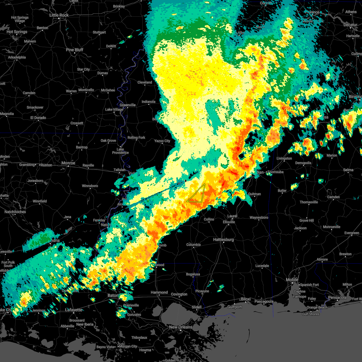 The severe thunderstorm warning for southeastern rankin, northeastern simpson and northwestern smith counties will expire at 345 pm cdt, the storms which prompted the warning have moved out of the area. therefore, the warning will be allowed to expire. a tornado watch remains in effect until 1000 pm cdt for central mississippi. The severe thunderstorm warning for southeastern rankin, northeastern simpson and northwestern smith counties will expire at 345 pm cdt, the storms which prompted the warning have moved out of the area. therefore, the warning will be allowed to expire. a tornado watch remains in effect until 1000 pm cdt for central mississippi.
|
| 5/4/2021 3:35 PM CDT |
 At 335 pm cdt, severe thunderstorms were located along a line extending from near martinville to near summit, moving east at 50 mph (radar indicated). Hazards include 70 mph wind gusts and nickel size hail. Expect considerable tree damage. damage is likely to mobile homes, roofs, and outbuildings. these severe thunderstorms will remain over mainly rural areas of southern simpson, lincoln, lawrence, southeastern copiah and western jefferson davis counties, including the following locations, new hebron and silver creek. A tornado watch remains in effect until 1000 pm cdt for south central and southeastern mississippi. At 335 pm cdt, severe thunderstorms were located along a line extending from near martinville to near summit, moving east at 50 mph (radar indicated). Hazards include 70 mph wind gusts and nickel size hail. Expect considerable tree damage. damage is likely to mobile homes, roofs, and outbuildings. these severe thunderstorms will remain over mainly rural areas of southern simpson, lincoln, lawrence, southeastern copiah and western jefferson davis counties, including the following locations, new hebron and silver creek. A tornado watch remains in effect until 1000 pm cdt for south central and southeastern mississippi.
|
| 5/4/2021 3:34 PM CDT |
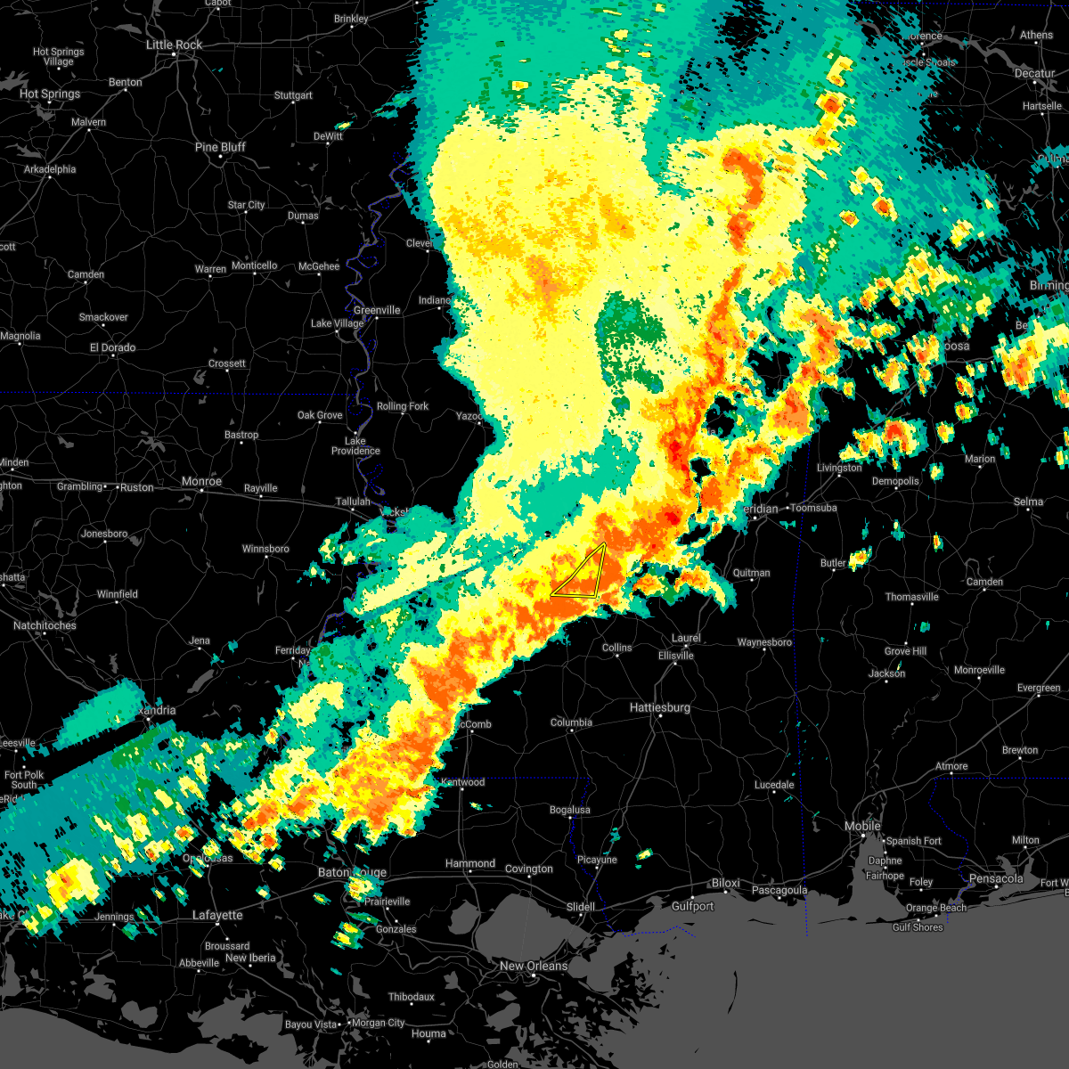 At 333 pm cdt, severe thunderstorms were located along a line extending from near homewood to near pinola, moving southeast at 40 mph (radar indicated). Hazards include 70 mph wind gusts and quarter size hail. Hail damage to vehicles is expected. expect considerable tree damage. wind damage is also likely to mobile homes, roofs, and outbuildings. these severe thunderstorms will remain over mainly rural areas of southeastern rankin, northeastern simpson and northwestern smith counties, including the following locations, d`lo and puckett. A tornado watch remains in effect until 1000 pm cdt for central mississippi. At 333 pm cdt, severe thunderstorms were located along a line extending from near homewood to near pinola, moving southeast at 40 mph (radar indicated). Hazards include 70 mph wind gusts and quarter size hail. Hail damage to vehicles is expected. expect considerable tree damage. wind damage is also likely to mobile homes, roofs, and outbuildings. these severe thunderstorms will remain over mainly rural areas of southeastern rankin, northeastern simpson and northwestern smith counties, including the following locations, d`lo and puckett. A tornado watch remains in effect until 1000 pm cdt for central mississippi.
|
| 5/4/2021 3:20 PM CDT |
 At 320 pm cdt, severe thunderstorms were located along a line extending from near piney woods to 7 miles southwest of smithdale, moving east at 60 mph (radar indicated). Hazards include 70 mph wind gusts and nickel size hail. Expect considerable tree damage. damage is likely to mobile homes, roofs, and outbuildings. these severe storms will be near, center point around 330 pm cdt. ruth around 350 pm cdt. jayess and topeka around 355 pm cdt. tilton around 405 pm cdt. oak vale around 410 pm cdt. society hill around 415 pm cdt. other locations impacted by these severe thunderstorms include new hebron, silver creek, beauregard and georgetown. a tornado watch remains in effect until 400 pm cdt for central, south central and southeastern mississippi. A tornado watch also remains in effect until 600 pm cdt for southwestern mississippi. At 320 pm cdt, severe thunderstorms were located along a line extending from near piney woods to 7 miles southwest of smithdale, moving east at 60 mph (radar indicated). Hazards include 70 mph wind gusts and nickel size hail. Expect considerable tree damage. damage is likely to mobile homes, roofs, and outbuildings. these severe storms will be near, center point around 330 pm cdt. ruth around 350 pm cdt. jayess and topeka around 355 pm cdt. tilton around 405 pm cdt. oak vale around 410 pm cdt. society hill around 415 pm cdt. other locations impacted by these severe thunderstorms include new hebron, silver creek, beauregard and georgetown. a tornado watch remains in effect until 400 pm cdt for central, south central and southeastern mississippi. A tornado watch also remains in effect until 600 pm cdt for southwestern mississippi.
|
| 5/4/2021 3:19 PM CDT |
 At 319 pm cdt, severe thunderstorms were located along a line extending from near pulaski to near union, moving east at 65 mph. these are very dangerous storms (radar indicated). Hazards include 80 mph wind gusts and quarter size hail. Flying debris will be dangerous to those caught without shelter. mobile homes will be heavily damaged. expect considerable damage to roofs, windows, and vehicles. extensive tree damage and power outages are likely. these severe storms will be near, martinville around 335 pm cdt. other locations impacted by these severe thunderstorms include polkville, d`lo, braxton and puckett. A tornado watch remains in effect until 400 pm cdt for central mississippi. At 319 pm cdt, severe thunderstorms were located along a line extending from near pulaski to near union, moving east at 65 mph. these are very dangerous storms (radar indicated). Hazards include 80 mph wind gusts and quarter size hail. Flying debris will be dangerous to those caught without shelter. mobile homes will be heavily damaged. expect considerable damage to roofs, windows, and vehicles. extensive tree damage and power outages are likely. these severe storms will be near, martinville around 335 pm cdt. other locations impacted by these severe thunderstorms include polkville, d`lo, braxton and puckett. A tornado watch remains in effect until 400 pm cdt for central mississippi.
|
| 5/4/2021 3:02 PM CDT |
 At 301 pm cdt, severe thunderstorms were located along a line extending from near pisgah to near hopewell, moving east at 60 mph. these are very dangerous storms (radar indicated). Hazards include 80 mph wind gusts and quarter size hail. Flying debris will be dangerous to those caught without shelter. mobile homes will be heavily damaged. expect considerable damage to roofs, windows, and vehicles. extensive tree damage and power outages are likely. these severe storms will be near, leesburg and pisgah around 305 pm cdt. morton, forkville and branch around 310 pm cdt. piney woods around 315 pm cdt. mendenhall around 320 pm cdt. martinville around 325 pm cdt. white oak around 330 pm cdt. other locations impacted by these severe thunderstorms include polkville, d`lo, braxton and puckett. A tornado watch remains in effect until 400 pm cdt for central mississippi. At 301 pm cdt, severe thunderstorms were located along a line extending from near pisgah to near hopewell, moving east at 60 mph. these are very dangerous storms (radar indicated). Hazards include 80 mph wind gusts and quarter size hail. Flying debris will be dangerous to those caught without shelter. mobile homes will be heavily damaged. expect considerable damage to roofs, windows, and vehicles. extensive tree damage and power outages are likely. these severe storms will be near, leesburg and pisgah around 305 pm cdt. morton, forkville and branch around 310 pm cdt. piney woods around 315 pm cdt. mendenhall around 320 pm cdt. martinville around 325 pm cdt. white oak around 330 pm cdt. other locations impacted by these severe thunderstorms include polkville, d`lo, braxton and puckett. A tornado watch remains in effect until 400 pm cdt for central mississippi.
|
| 5/4/2021 2:40 PM CDT |
 At 240 pm cdt, severe thunderstorms were located along a line extending from near carpenter to 8 miles northeast of woodville, moving east at 60 mph (radar indicated). Hazards include 70 mph wind gusts and nickel size hail. Expect considerable tree damage. damage is likely to mobile homes, roofs, and outbuildings. severe thunderstorms will be near, dentville around 250 pm cdt. hazlehurst around 255 pm cdt. crystal springs and gallman around 300 pm cdt. hopewell around 310 pm cdt. union around 315 pm cdt. sanatorium around 335 pm cdt. other locations impacted by these severe thunderstorms include new hebron, silver creek, beauregard and georgetown. a tornado watch remains in effect until 400 pm cdt for central, south central and southeastern mississippi. A tornado watch also remains in effect until 600 pm cdt for southwestern mississippi. At 240 pm cdt, severe thunderstorms were located along a line extending from near carpenter to 8 miles northeast of woodville, moving east at 60 mph (radar indicated). Hazards include 70 mph wind gusts and nickel size hail. Expect considerable tree damage. damage is likely to mobile homes, roofs, and outbuildings. severe thunderstorms will be near, dentville around 250 pm cdt. hazlehurst around 255 pm cdt. crystal springs and gallman around 300 pm cdt. hopewell around 310 pm cdt. union around 315 pm cdt. sanatorium around 335 pm cdt. other locations impacted by these severe thunderstorms include new hebron, silver creek, beauregard and georgetown. a tornado watch remains in effect until 400 pm cdt for central, south central and southeastern mississippi. A tornado watch also remains in effect until 600 pm cdt for southwestern mississippi.
|
| 5/4/2021 2:12 PM CDT |
 At 212 pm cdt, severe thunderstorms were located along a line extending from near oak ridge to 7 miles northwest of port gibson, moving east at 60 mph. these are very dangerous storms (radar indicated). Hazards include 80 mph wind gusts and nickel size hail. Flying debris will be dangerous to those caught without shelter. mobile homes will be heavily damaged. expect considerable damage to roofs, windows, and vehicles. extensive tree damage and power outages are likely. severe thunderstorms will be near, brownsville around 230 pm cdt. pocahontas and dentville around 240 pm cdt. dry grove around 250 pm cdt. crystal springs around 255 pm cdt. byram, terry and goshen springs around 300 pm cdt. whites and pisgah around 305 pm cdt. florence, harrisville and monterey around 310 pm cdt. star and piney woods around 315 pm cdt. other locations impacted by these severe thunderstorms include polkville, d`lo, learned, braxton and puckett. A tornado watch remains in effect until 400 pm cdt for central mississippi. At 212 pm cdt, severe thunderstorms were located along a line extending from near oak ridge to 7 miles northwest of port gibson, moving east at 60 mph. these are very dangerous storms (radar indicated). Hazards include 80 mph wind gusts and nickel size hail. Flying debris will be dangerous to those caught without shelter. mobile homes will be heavily damaged. expect considerable damage to roofs, windows, and vehicles. extensive tree damage and power outages are likely. severe thunderstorms will be near, brownsville around 230 pm cdt. pocahontas and dentville around 240 pm cdt. dry grove around 250 pm cdt. crystal springs around 255 pm cdt. byram, terry and goshen springs around 300 pm cdt. whites and pisgah around 305 pm cdt. florence, harrisville and monterey around 310 pm cdt. star and piney woods around 315 pm cdt. other locations impacted by these severe thunderstorms include polkville, d`lo, learned, braxton and puckett. A tornado watch remains in effect until 400 pm cdt for central mississippi.
|
| 3/31/2021 11:38 AM CDT |
 At 1138 am cdt, a severe thunderstorm was located near sanatorium, or near mendenhall, moving east at 45 mph (radar indicated). Hazards include 60 mph wind gusts and quarter size hail. Hail damage to vehicles is expected. expect wind damage to roofs, siding, and trees. this severe storm will be near, sanatorium around 1145 am cdt. magee around 1150 am cdt. mount olive around 1155 am cdt. center ridge around 1210 pm cdt. taylorsville around 1215 pm cdt. Other locations impacted by this severe thunderstorm include mize. At 1138 am cdt, a severe thunderstorm was located near sanatorium, or near mendenhall, moving east at 45 mph (radar indicated). Hazards include 60 mph wind gusts and quarter size hail. Hail damage to vehicles is expected. expect wind damage to roofs, siding, and trees. this severe storm will be near, sanatorium around 1145 am cdt. magee around 1150 am cdt. mount olive around 1155 am cdt. center ridge around 1210 pm cdt. taylorsville around 1215 pm cdt. Other locations impacted by this severe thunderstorm include mize.
|
| 3/31/2021 11:29 AM CDT |
 At 1129 am cdt, a severe thunderstorm was located over pinola, moving east at 45 mph (radar indicated). Hazards include 60 mph wind gusts and penny size hail. Expect damage to roofs, siding, and trees. this severe thunderstorm will be near, mendenhall around 1135 am cdt. sanatorium around 1145 am cdt. magee around 1150 am cdt. mount olive around 1155 am cdt. center ridge around 1205 pm cdt. taylorsville around 1210 pm cdt. Other locations impacted by this severe thunderstorm include mize. At 1129 am cdt, a severe thunderstorm was located over pinola, moving east at 45 mph (radar indicated). Hazards include 60 mph wind gusts and penny size hail. Expect damage to roofs, siding, and trees. this severe thunderstorm will be near, mendenhall around 1135 am cdt. sanatorium around 1145 am cdt. magee around 1150 am cdt. mount olive around 1155 am cdt. center ridge around 1205 pm cdt. taylorsville around 1210 pm cdt. Other locations impacted by this severe thunderstorm include mize.
|
| 3/25/2021 4:03 PM CDT |
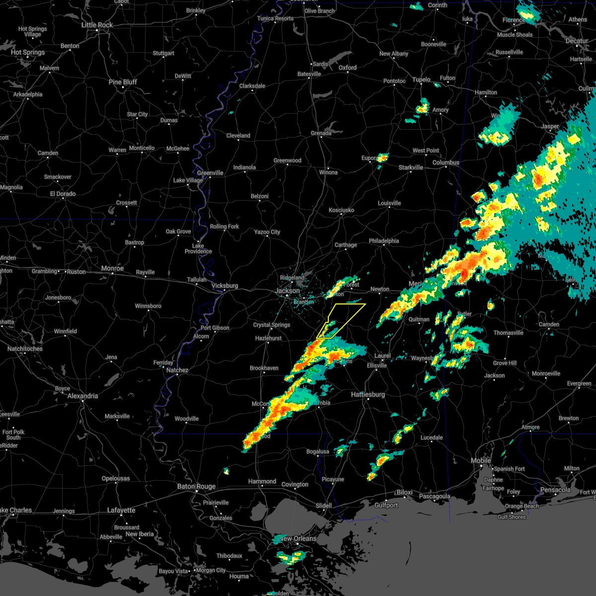 At 403 pm cdt, a severe thunderstorm was located over martinville, or near magee, moving northeast at 70 mph (radar indicated). Hazards include 60 mph wind gusts and quarter size hail. Hail damage to vehicles is expected. expect wind damage to roofs, siding, and trees. this severe storm will be near, white oak around 410 pm cdt. burns around 420 pm cdt. A tornado watch remains in effect until 800 pm cdt for central and east central mississippi. At 403 pm cdt, a severe thunderstorm was located over martinville, or near magee, moving northeast at 70 mph (radar indicated). Hazards include 60 mph wind gusts and quarter size hail. Hail damage to vehicles is expected. expect wind damage to roofs, siding, and trees. this severe storm will be near, white oak around 410 pm cdt. burns around 420 pm cdt. A tornado watch remains in effect until 800 pm cdt for central and east central mississippi.
|
| 3/25/2021 4:00 PM CDT | Half Dollar sized hail reported 4.1 miles NW of Mendenhall, MS |
| 3/25/2021 3:51 PM CDT |
 At 351 pm cdt, a severe thunderstorm was located near shivers, or near pinola, moving northeast at 65 mph (radar indicated). Hazards include 60 mph wind gusts and quarter size hail. Hail damage to vehicles is expected. expect wind damage to roofs, siding, and trees. this severe storm will be near, magee, mendenhall and sanatorium around 400 pm cdt. martinville around 405 pm cdt. white oak around 410 pm cdt. burns around 420 pm cdt. other locations impacted by this severe thunderstorm include polkville, d`lo and puckett. A tornado watch remains in effect until 800 pm cdt for central and east central mississippi. At 351 pm cdt, a severe thunderstorm was located near shivers, or near pinola, moving northeast at 65 mph (radar indicated). Hazards include 60 mph wind gusts and quarter size hail. Hail damage to vehicles is expected. expect wind damage to roofs, siding, and trees. this severe storm will be near, magee, mendenhall and sanatorium around 400 pm cdt. martinville around 405 pm cdt. white oak around 410 pm cdt. burns around 420 pm cdt. other locations impacted by this severe thunderstorm include polkville, d`lo and puckett. A tornado watch remains in effect until 800 pm cdt for central and east central mississippi.
|
| 3/25/2021 3:40 PM CDT |
 At 340 pm cdt, a severe thunderstorm was located near wanilla, or 15 miles southwest of pinola, moving northeast at 65 mph (radar indicated). Hazards include 60 mph wind gusts and quarter size hail. Hail damage to vehicles is expected. expect wind damage to roofs, siding, and trees. this severe thunderstorm will be near, shivers around 350 pm cdt. pinola around 355 pm cdt. mendenhall and sanatorium around 400 pm cdt. martinville around 405 pm cdt. white oak around 415 pm cdt. burns around 420 pm cdt. other locations impacted by this severe thunderstorm include polkville, new hebron, d`lo and puckett. A tornado watch remains in effect until 800 pm cdt for central, south central and east central mississippi. At 340 pm cdt, a severe thunderstorm was located near wanilla, or 15 miles southwest of pinola, moving northeast at 65 mph (radar indicated). Hazards include 60 mph wind gusts and quarter size hail. Hail damage to vehicles is expected. expect wind damage to roofs, siding, and trees. this severe thunderstorm will be near, shivers around 350 pm cdt. pinola around 355 pm cdt. mendenhall and sanatorium around 400 pm cdt. martinville around 405 pm cdt. white oak around 415 pm cdt. burns around 420 pm cdt. other locations impacted by this severe thunderstorm include polkville, new hebron, d`lo and puckett. A tornado watch remains in effect until 800 pm cdt for central, south central and east central mississippi.
|
| 3/16/2021 7:50 PM CDT |
 At 750 pm cdt, a severe thunderstorm was located over shivers, or near pinola, moving east at 30 mph (radar indicated). Hazards include 60 mph wind gusts and quarter size hail. Hail damage to vehicles is expected. expect wind damage to roofs, siding, and trees. this severe storm will be near, sanatorium around 815 pm cdt. Magee around 825 pm cdt. At 750 pm cdt, a severe thunderstorm was located over shivers, or near pinola, moving east at 30 mph (radar indicated). Hazards include 60 mph wind gusts and quarter size hail. Hail damage to vehicles is expected. expect wind damage to roofs, siding, and trees. this severe storm will be near, sanatorium around 815 pm cdt. Magee around 825 pm cdt.
|
| 3/16/2021 7:32 PM CDT |
 At 732 pm cdt, a severe thunderstorm was located near union, or 10 miles west of pinola, moving east at 25 mph (radar indicated). Hazards include 60 mph wind gusts and quarter size hail. Hail damage to vehicles is expected. expect wind damage to roofs, siding, and trees. this severe thunderstorm will be near, union around 740 pm cdt. harrisville around 745 pm cdt. shivers around 750 pm cdt. pinola around 755 pm cdt. mendenhall around 810 pm cdt. sanatorium around 820 pm cdt. martinville around 825 pm cdt. Other locations impacted by this severe thunderstorm include d`lo, braxton and new hebron. At 732 pm cdt, a severe thunderstorm was located near union, or 10 miles west of pinola, moving east at 25 mph (radar indicated). Hazards include 60 mph wind gusts and quarter size hail. Hail damage to vehicles is expected. expect wind damage to roofs, siding, and trees. this severe thunderstorm will be near, union around 740 pm cdt. harrisville around 745 pm cdt. shivers around 750 pm cdt. pinola around 755 pm cdt. mendenhall around 810 pm cdt. sanatorium around 820 pm cdt. martinville around 825 pm cdt. Other locations impacted by this severe thunderstorm include d`lo, braxton and new hebron.
|
| 12/13/2020 9:19 PM CST |
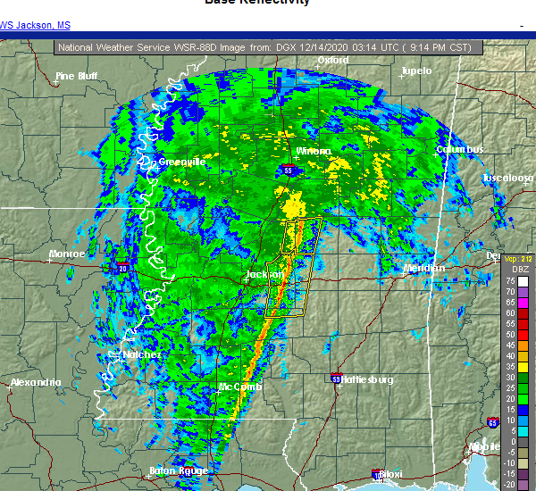 At 919 pm cst, severe thunderstorms were located along a line extending from near ludlow to near mendenhall, moving east at 35 mph (radar indicated). Hazards include 60 mph wind gusts. Expect damage to roofs, siding, and trees. these severe storms will be near, ludlow around 925 pm cst. white oak around 940 pm cst. Other locations impacted by these severe thunderstorms include polkville, d`lo and puckett. At 919 pm cst, severe thunderstorms were located along a line extending from near ludlow to near mendenhall, moving east at 35 mph (radar indicated). Hazards include 60 mph wind gusts. Expect damage to roofs, siding, and trees. these severe storms will be near, ludlow around 925 pm cst. white oak around 940 pm cst. Other locations impacted by these severe thunderstorms include polkville, d`lo and puckett.
|
| 12/13/2020 8:48 PM CST |
 At 848 pm cst, severe thunderstorms were located along a line extending from near sharon to hopewell, moving east at 35 mph (radar indicated). Hazards include 60 mph wind gusts. Expect damage to roofs, siding, and trees. severe thunderstorms will be near, piney woods and ludlow around 910 pm cst. cato around 920 pm cst. johns around 925 pm cst. white oak around 940 pm cst. Other locations impacted by these severe thunderstorms include polkville, d`lo, braxton and puckett. At 848 pm cst, severe thunderstorms were located along a line extending from near sharon to hopewell, moving east at 35 mph (radar indicated). Hazards include 60 mph wind gusts. Expect damage to roofs, siding, and trees. severe thunderstorms will be near, piney woods and ludlow around 910 pm cst. cato around 920 pm cst. johns around 925 pm cst. white oak around 940 pm cst. Other locations impacted by these severe thunderstorms include polkville, d`lo, braxton and puckett.
|
| 7/1/2020 8:39 PM CDT |
 At 838 pm cdt, severe thunderstorms were located along a line extending from near little rock to near forest to fannin, moving south at 40 mph (radar indicated). Hazards include 60 mph wind gusts and penny size hail. Expect damage to roofs, siding, and trees. severe thunderstorms will be near, pulaski around 845 pm cdt. homewood around 850 pm cdt. pineville and burns around 900 pm cdt. raleigh around 910 pm cdt. cato, johns and rose hill around 915 pm cdt. bay springs, center ridge and piney woods around 920 pm cdt. orange around 925 pm cdt. mendenhall and martinville around 930 pm cdt. Other locations impacted by these severe thunderstorms include sylvarena, mize, louin, puckett, polkville, d`lo, chunky, montrose, braxton and hickory. At 838 pm cdt, severe thunderstorms were located along a line extending from near little rock to near forest to fannin, moving south at 40 mph (radar indicated). Hazards include 60 mph wind gusts and penny size hail. Expect damage to roofs, siding, and trees. severe thunderstorms will be near, pulaski around 845 pm cdt. homewood around 850 pm cdt. pineville and burns around 900 pm cdt. raleigh around 910 pm cdt. cato, johns and rose hill around 915 pm cdt. bay springs, center ridge and piney woods around 920 pm cdt. orange around 925 pm cdt. mendenhall and martinville around 930 pm cdt. Other locations impacted by these severe thunderstorms include sylvarena, mize, louin, puckett, polkville, d`lo, chunky, montrose, braxton and hickory.
|
| 6/25/2020 5:23 PM CDT |
 The severe thunderstorm warning for claiborne, simpson and copiah counties will expire at 530 pm cdt, the storms which prompted the warning have moved out of the area. therefore, the warning will be allowed to expire. however, gusty winds are still possible with these thunderstorms. The severe thunderstorm warning for claiborne, simpson and copiah counties will expire at 530 pm cdt, the storms which prompted the warning have moved out of the area. therefore, the warning will be allowed to expire. however, gusty winds are still possible with these thunderstorms.
|
| 6/25/2020 4:54 PM CDT |
 At 454 pm cdt, severe thunderstorms were located along a line extending from near hermanville to near harrisville to mendenhall to near mount olive, moving northeast at 60 mph (radar indicated). Hazards include 60 mph wind gusts. Expect damage to roofs, siding, and trees. these severe storms will be near, magee, mendenhall, martinville, harrisville and sanatorium around 500 pm cdt. Other locations impacted by these severe thunderstorms include d`lo, beauregard, braxton and georgetown. At 454 pm cdt, severe thunderstorms were located along a line extending from near hermanville to near harrisville to mendenhall to near mount olive, moving northeast at 60 mph (radar indicated). Hazards include 60 mph wind gusts. Expect damage to roofs, siding, and trees. these severe storms will be near, magee, mendenhall, martinville, harrisville and sanatorium around 500 pm cdt. Other locations impacted by these severe thunderstorms include d`lo, beauregard, braxton and georgetown.
|
| 6/25/2020 4:21 PM CDT |
 At 421 pm cdt, severe thunderstorms were located along a line extending from near church hill to near caseyville to near east lincoln to near salem, moving northeast at 40 mph (radar indicated). Hazards include 70 mph wind gusts. Expect considerable tree damage. damage is likely to mobile homes, roofs, and outbuildings. severe thunderstorms will be near, allen around 425 pm cdt. alcorn, glancy and martinsville around 440 pm cdt. hazlehurst around 450 pm cdt. port gibson, gallman and pattison around 455 pm cdt. crystal springs and rockport around 500 pm cdt. hermanville and hopewell around 505 pm cdt. union and shivers around 510 pm cdt. pinola and rocky springs around 515 pm cdt. Other locations impacted by these severe thunderstorms include d`lo, beauregard, braxton and georgetown. At 421 pm cdt, severe thunderstorms were located along a line extending from near church hill to near caseyville to near east lincoln to near salem, moving northeast at 40 mph (radar indicated). Hazards include 70 mph wind gusts. Expect considerable tree damage. damage is likely to mobile homes, roofs, and outbuildings. severe thunderstorms will be near, allen around 425 pm cdt. alcorn, glancy and martinsville around 440 pm cdt. hazlehurst around 450 pm cdt. port gibson, gallman and pattison around 455 pm cdt. crystal springs and rockport around 500 pm cdt. hermanville and hopewell around 505 pm cdt. union and shivers around 510 pm cdt. pinola and rocky springs around 515 pm cdt. Other locations impacted by these severe thunderstorms include d`lo, beauregard, braxton and georgetown.
|
| 6/5/2020 7:20 PM CDT |
 At 720 pm cdt, severe thunderstorms were located along a line extending from near dentville to near union to sanatorium, moving south at 40 mph (radar indicated). Hazards include 60 mph wind gusts. Expect damage to roofs, siding, and trees. these severe storms will be near, hazlehurst around 725 pm cdt. rockport around 730 pm cdt. glancy and martinsville around 735 pm cdt. wesson around 745 pm cdt. Other locations impacted by these severe thunderstorms include beauregard and georgetown. At 720 pm cdt, severe thunderstorms were located along a line extending from near dentville to near union to sanatorium, moving south at 40 mph (radar indicated). Hazards include 60 mph wind gusts. Expect damage to roofs, siding, and trees. these severe storms will be near, hazlehurst around 725 pm cdt. rockport around 730 pm cdt. glancy and martinsville around 735 pm cdt. wesson around 745 pm cdt. Other locations impacted by these severe thunderstorms include beauregard and georgetown.
|
| 6/5/2020 7:04 PM CDT |
 At 704 pm cdt, severe thunderstorms were located along a line extending from near dry grove to near star to white oak, moving south at 35 mph (radar indicated). Hazards include 60 mph wind gusts. Expect damage to roofs, siding, and trees. these severe storms will be near, harrisville around 715 pm cdt. crystal springs and hopewell around 720 pm cdt. magee, union, gallman, sanatorium and dentville around 725 pm cdt. hazlehurst and shivers around 730 pm cdt. rockport around 735 pm cdt. glancy and martinsville around 740 pm cdt. wesson around 750 pm cdt. Other locations impacted by these severe thunderstorms include d`lo, beauregard, learned, braxton and georgetown. At 704 pm cdt, severe thunderstorms were located along a line extending from near dry grove to near star to white oak, moving south at 35 mph (radar indicated). Hazards include 60 mph wind gusts. Expect damage to roofs, siding, and trees. these severe storms will be near, harrisville around 715 pm cdt. crystal springs and hopewell around 720 pm cdt. magee, union, gallman, sanatorium and dentville around 725 pm cdt. hazlehurst and shivers around 730 pm cdt. rockport around 735 pm cdt. glancy and martinsville around 740 pm cdt. wesson around 750 pm cdt. Other locations impacted by these severe thunderstorms include d`lo, beauregard, learned, braxton and georgetown.
|
| 6/5/2020 6:41 PM CDT |
 At 641 pm cdt, severe thunderstorms were located along a line extending from near clinton to near pearl to 6 miles west of pulaski, moving south at 35 mph (radar indicated). Hazards include 60 mph wind gusts. Expect damage to roofs, siding, and trees. severe thunderstorms will be near, star around 700 pm cdt. dry grove and whites around 705 pm cdt. martinville and harrisville around 715 pm cdt. mendenhall and hopewell around 720 pm cdt. union and sanatorium around 725 pm cdt. dentville around 730 pm cdt. pinola and rockport around 735 pm cdt. glancy around 740 pm cdt. Other locations impacted by these severe thunderstorms include d`lo, beauregard, learned, braxton and georgetown. At 641 pm cdt, severe thunderstorms were located along a line extending from near clinton to near pearl to 6 miles west of pulaski, moving south at 35 mph (radar indicated). Hazards include 60 mph wind gusts. Expect damage to roofs, siding, and trees. severe thunderstorms will be near, star around 700 pm cdt. dry grove and whites around 705 pm cdt. martinville and harrisville around 715 pm cdt. mendenhall and hopewell around 720 pm cdt. union and sanatorium around 725 pm cdt. dentville around 730 pm cdt. pinola and rockport around 735 pm cdt. glancy around 740 pm cdt. Other locations impacted by these severe thunderstorms include d`lo, beauregard, learned, braxton and georgetown.
|
| 5/27/2020 4:20 PM CDT |
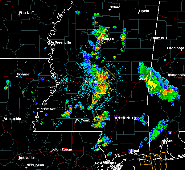 The severe thunderstorm warning for eastern simpson county will expire at 430 pm cdt, the storm which prompted the warning has weakened below severe limits, and has exited the warned area. therefore, the warning will be allowed to expire. The severe thunderstorm warning for eastern simpson county will expire at 430 pm cdt, the storm which prompted the warning has weakened below severe limits, and has exited the warned area. therefore, the warning will be allowed to expire.
|
| 5/27/2020 4:14 PM CDT | Quarter sized hail reported 1.6 miles NE of Mendenhall, MS, social media picture of dime to quarter size hail. |
| 5/27/2020 4:03 PM CDT |
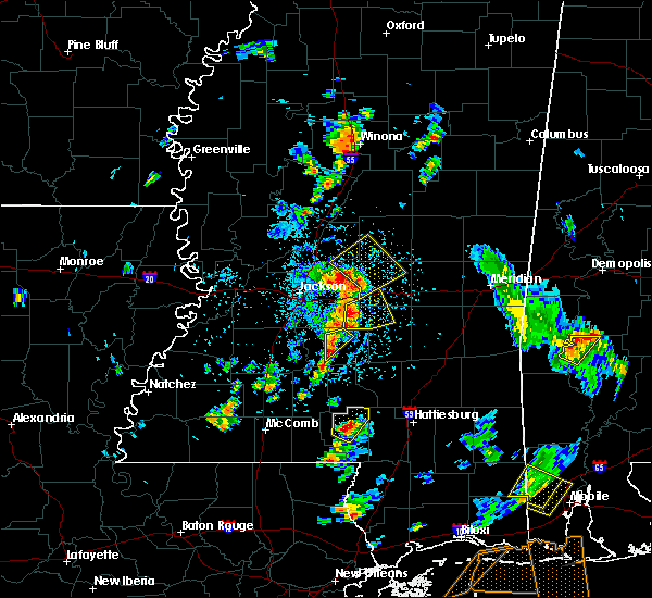 At 403 pm cdt, a severe thunderstorm was located near cato, or near mendenhall, moving northeast at 15 mph (radar indicated). Hazards include 60 mph wind gusts and nickel size hail. Expect damage to roofs, siding, and trees. This severe thunderstorm will remain over mainly rural areas of eastern simpson county, including the following locations, d`lo. At 403 pm cdt, a severe thunderstorm was located near cato, or near mendenhall, moving northeast at 15 mph (radar indicated). Hazards include 60 mph wind gusts and nickel size hail. Expect damage to roofs, siding, and trees. This severe thunderstorm will remain over mainly rural areas of eastern simpson county, including the following locations, d`lo.
|
| 5/27/2020 3:43 PM CDT |
 At 343 pm cdt, a severe thunderstorm was located near mendenhall, moving northeast at 15 mph (radar indicated). Hazards include 60 mph wind gusts and quarter size hail. Hail damage to vehicles is expected. expect wind damage to roofs, siding, and trees. this severe thunderstorm will be near, mendenhall and piney woods around 355 pm cdt. cato around 420 pm cdt. Other locations impacted by this severe thunderstorm include d`lo and braxton. At 343 pm cdt, a severe thunderstorm was located near mendenhall, moving northeast at 15 mph (radar indicated). Hazards include 60 mph wind gusts and quarter size hail. Hail damage to vehicles is expected. expect wind damage to roofs, siding, and trees. this severe thunderstorm will be near, mendenhall and piney woods around 355 pm cdt. cato around 420 pm cdt. Other locations impacted by this severe thunderstorm include d`lo and braxton.
|
| 4/23/2020 1:33 AM CDT |
 At 132 am cdt, a severe thunderstorm was located near dry grove, or 7 miles northwest of crystal springs, moving east at 55 mph (radar indicated). Hazards include 60 mph wind gusts. Expect damage to roofs, siding, and trees. this severe thunderstorm will be near, terry around 140 am cdt. whites around 150 am cdt. florence and harrisville around 155 am cdt. star and piney woods around 200 am cdt. cato and johns around 210 am cdt. martinville around 215 am cdt. white oak around 220 am cdt. other locations impacted by this severe thunderstorm include polkville, d`lo, braxton and puckett. A tornado watch remains in effect until 500 am cdt for central mississippi. At 132 am cdt, a severe thunderstorm was located near dry grove, or 7 miles northwest of crystal springs, moving east at 55 mph (radar indicated). Hazards include 60 mph wind gusts. Expect damage to roofs, siding, and trees. this severe thunderstorm will be near, terry around 140 am cdt. whites around 150 am cdt. florence and harrisville around 155 am cdt. star and piney woods around 200 am cdt. cato and johns around 210 am cdt. martinville around 215 am cdt. white oak around 220 am cdt. other locations impacted by this severe thunderstorm include polkville, d`lo, braxton and puckett. A tornado watch remains in effect until 500 am cdt for central mississippi.
|
| 4/23/2020 1:00 AM CDT |
 At 100 am cdt, severe thunderstorms were located along a line extending from near burns to near magee, moving east at 40 mph (radar indicated). Hazards include 60 mph wind gusts and nickel size hail. Expect damage to roofs, siding, and trees. these severe storms will be near, pineville and burns around 105 am cdt. center ridge around 125 am cdt. other locations impacted by these severe thunderstorms include sylvarena. A tornado watch remains in effect until 500 am cdt for central mississippi. At 100 am cdt, severe thunderstorms were located along a line extending from near burns to near magee, moving east at 40 mph (radar indicated). Hazards include 60 mph wind gusts and nickel size hail. Expect damage to roofs, siding, and trees. these severe storms will be near, pineville and burns around 105 am cdt. center ridge around 125 am cdt. other locations impacted by these severe thunderstorms include sylvarena. A tornado watch remains in effect until 500 am cdt for central mississippi.
|
| 4/23/2020 12:47 AM CDT | Tree downed on a power line. report via social medi in simpson county MS, 0.5 miles ESE of Mendenhall, MS |
| 4/23/2020 12:43 AM CDT |
 At 1243 am cdt, severe thunderstorms were located along a line extending from near white oak to shivers, moving east at 40 mph (radar indicated). Hazards include 60 mph wind gusts and nickel size hail. Expect damage to roofs, siding, and trees. severe thunderstorms will be near, white oak around 1250 am cdt. burns around 1255 am cdt. raleigh around 100 am cdt. magee and sanatorium around 105 am cdt. pineville around 110 am cdt. center ridge around 130 am cdt. other locations impacted by these severe thunderstorms include sylvarena, polkville, d`lo, braxton and puckett. A tornado watch remains in effect until 500 am cdt for central mississippi. At 1243 am cdt, severe thunderstorms were located along a line extending from near white oak to shivers, moving east at 40 mph (radar indicated). Hazards include 60 mph wind gusts and nickel size hail. Expect damage to roofs, siding, and trees. severe thunderstorms will be near, white oak around 1250 am cdt. burns around 1255 am cdt. raleigh around 100 am cdt. magee and sanatorium around 105 am cdt. pineville around 110 am cdt. center ridge around 130 am cdt. other locations impacted by these severe thunderstorms include sylvarena, polkville, d`lo, braxton and puckett. A tornado watch remains in effect until 500 am cdt for central mississippi.
|
| 4/22/2020 10:47 PM CDT |
 At 1046 pm cdt, severe thunderstorms were located along a line extending from near piney woods to near hebron to near wanilla, moving east at 55 mph (radar indicated). Hazards include 60 mph wind gusts and half dollar size hail. Hail damage to vehicles is expected. expect wind damage to roofs, siding, and trees. these severe storms will be near, mendenhall around 1050 pm cdt. martinville and clem around 1100 pm cdt. magee and mount olive around 1105 pm cdt. lone star around 1110 pm cdt. other locations impacted by these severe thunderstorms include new hebron, d`lo, braxton and silver creek. A tornado watch remains in effect until 500 am cdt for south central, central and southeastern mississippi. At 1046 pm cdt, severe thunderstorms were located along a line extending from near piney woods to near hebron to near wanilla, moving east at 55 mph (radar indicated). Hazards include 60 mph wind gusts and half dollar size hail. Hail damage to vehicles is expected. expect wind damage to roofs, siding, and trees. these severe storms will be near, mendenhall around 1050 pm cdt. martinville and clem around 1100 pm cdt. magee and mount olive around 1105 pm cdt. lone star around 1110 pm cdt. other locations impacted by these severe thunderstorms include new hebron, d`lo, braxton and silver creek. A tornado watch remains in effect until 500 am cdt for south central, central and southeastern mississippi.
|
| 4/22/2020 10:21 PM CDT |
 At 1021 pm cdt, severe thunderstorms were located along a line extending from crystal springs to near martinsville to brookhaven, moving east at 55 mph (radar indicated). Hazards include golf ball size hail and 60 mph wind gusts. People and animals outdoors will be injured. expect hail damage to roofs, siding, windows, and vehicles. expect wind damage to roofs, siding, and trees. severe thunderstorms will be near, union, oma and sontag around 1035 pm cdt. harrisville and wanilla around 1040 pm cdt. pinola and shivers around 1045 pm cdt. mendenhall around 1050 pm cdt. clem around 1055 pm cdt. magee, martinville and sanatorium around 1100 pm cdt. mount olive and lone star around 1105 pm cdt. other locations impacted by these severe thunderstorms include new hebron, d`lo, braxton and silver creek. A tornado watch remains in effect until 500 am cdt for central, south central and southeastern mississippi. At 1021 pm cdt, severe thunderstorms were located along a line extending from crystal springs to near martinsville to brookhaven, moving east at 55 mph (radar indicated). Hazards include golf ball size hail and 60 mph wind gusts. People and animals outdoors will be injured. expect hail damage to roofs, siding, windows, and vehicles. expect wind damage to roofs, siding, and trees. severe thunderstorms will be near, union, oma and sontag around 1035 pm cdt. harrisville and wanilla around 1040 pm cdt. pinola and shivers around 1045 pm cdt. mendenhall around 1050 pm cdt. clem around 1055 pm cdt. magee, martinville and sanatorium around 1100 pm cdt. mount olive and lone star around 1105 pm cdt. other locations impacted by these severe thunderstorms include new hebron, d`lo, braxton and silver creek. A tornado watch remains in effect until 500 am cdt for central, south central and southeastern mississippi.
|
| 4/19/2020 4:14 PM CDT |
 At 414 pm cdt, severe thunderstorms were located along a line extending from near pulaski to white oak to near mendenhall, moving east at 55 mph (radar indicated). Hazards include 60 mph wind gusts. Expect damage to roofs, siding, and trees. these severe storms will be near, burns around 420 pm cdt. raleigh and pineville around 425 pm cdt. center ridge around 435 pm cdt. bay springs and taylorsville around 440 pm cdt. turnerville and garlandville around 445 pm cdt. other locations impacted by these severe thunderstorms include sylvarena, polkville, mize, montrose, louin and puckett. A tornado watch remains in effect until 700 pm cdt for central, southeastern and east central mississippi. At 414 pm cdt, severe thunderstorms were located along a line extending from near pulaski to white oak to near mendenhall, moving east at 55 mph (radar indicated). Hazards include 60 mph wind gusts. Expect damage to roofs, siding, and trees. these severe storms will be near, burns around 420 pm cdt. raleigh and pineville around 425 pm cdt. center ridge around 435 pm cdt. bay springs and taylorsville around 440 pm cdt. turnerville and garlandville around 445 pm cdt. other locations impacted by these severe thunderstorms include sylvarena, polkville, mize, montrose, louin and puckett. A tornado watch remains in effect until 700 pm cdt for central, southeastern and east central mississippi.
|
| 4/19/2020 4:00 PM CDT |
 At 400 pm cdt, severe thunderstorms were located along a line extending from pelahatchie to near johns to near piney woods, moving east at 50 mph (radar indicated). Hazards include 60 mph wind gusts. Expect damage to roofs, siding, and trees. severe thunderstorms will be near, martinville, white oak and sanatorium around 415 pm cdt. magee and burns around 420 pm cdt. raleigh around 425 pm cdt. pineville around 430 pm cdt. center ridge around 435 pm cdt. taylorsville around 440 pm cdt. bay springs and garlandville around 445 pm cdt. turnerville around 450 pm cdt. other locations impacted by these severe thunderstorms include sylvarena, mize, louin, puckett, polkville, d`lo, montrose and braxton. A tornado watch remains in effect until 700 pm cdt for central, southeastern and east central mississippi. At 400 pm cdt, severe thunderstorms were located along a line extending from pelahatchie to near johns to near piney woods, moving east at 50 mph (radar indicated). Hazards include 60 mph wind gusts. Expect damage to roofs, siding, and trees. severe thunderstorms will be near, martinville, white oak and sanatorium around 415 pm cdt. magee and burns around 420 pm cdt. raleigh around 425 pm cdt. pineville around 430 pm cdt. center ridge around 435 pm cdt. taylorsville around 440 pm cdt. bay springs and garlandville around 445 pm cdt. turnerville around 450 pm cdt. other locations impacted by these severe thunderstorms include sylvarena, mize, louin, puckett, polkville, d`lo, montrose and braxton. A tornado watch remains in effect until 700 pm cdt for central, southeastern and east central mississippi.
|
| 4/18/2020 11:39 PM CDT |
 At 1139 pm cdt, a severe thunderstorm was located near sanatorium, or near mendenhall, moving northeast at 45 mph (radar indicated). Hazards include ping pong ball size hail. People and animals outdoors will be injured. expect damage to roofs, siding, windows, and vehicles. this severe storm will be near, white oak around 1155 pm cdt. raleigh around 1205 am cdt. Other locations impacted by this severe thunderstorm include d`lo and mize. At 1139 pm cdt, a severe thunderstorm was located near sanatorium, or near mendenhall, moving northeast at 45 mph (radar indicated). Hazards include ping pong ball size hail. People and animals outdoors will be injured. expect damage to roofs, siding, windows, and vehicles. this severe storm will be near, white oak around 1155 pm cdt. raleigh around 1205 am cdt. Other locations impacted by this severe thunderstorm include d`lo and mize.
|
| 4/18/2020 11:28 PM CDT |
 At 1128 pm cdt, a severe thunderstorm was located over pinola, moving northeast at 45 mph (radar indicated). Hazards include quarter size hail. Damage to vehicles is expected. this severe thunderstorm will be near, mendenhall around 1140 pm cdt. magee, martinville and sanatorium around 1145 pm cdt. white oak around 1155 pm cdt. raleigh around 1205 am cdt. Other locations impacted by this severe thunderstorm include d`lo and mize. At 1128 pm cdt, a severe thunderstorm was located over pinola, moving northeast at 45 mph (radar indicated). Hazards include quarter size hail. Damage to vehicles is expected. this severe thunderstorm will be near, mendenhall around 1140 pm cdt. magee, martinville and sanatorium around 1145 pm cdt. white oak around 1155 pm cdt. raleigh around 1205 am cdt. Other locations impacted by this severe thunderstorm include d`lo and mize.
|
| 4/12/2020 6:17 PM CDT |
 At 617 pm cdt, a severe thunderstorm was located near pinola, moving northeast at 60 mph (radar indicated). Hazards include ping pong ball size hail and 60 mph wind gusts. People and animals outdoors will be injured. expect hail damage to roofs, siding, windows, and vehicles. expect wind damage to roofs, siding, and trees. this severe thunderstorm will be near, mendenhall around 625 pm cdt. magee, sanatorium and martinville around 630 pm cdt. white oak around 640 pm cdt. raleigh around 645 pm cdt. burns around 650 pm cdt. pineville around 655 pm cdt. other locations impacted by this severe thunderstorm include sylvarena. A tornado watch remains in effect until 800 pm cdt for central and east central mississippi. At 617 pm cdt, a severe thunderstorm was located near pinola, moving northeast at 60 mph (radar indicated). Hazards include ping pong ball size hail and 60 mph wind gusts. People and animals outdoors will be injured. expect hail damage to roofs, siding, windows, and vehicles. expect wind damage to roofs, siding, and trees. this severe thunderstorm will be near, mendenhall around 625 pm cdt. magee, sanatorium and martinville around 630 pm cdt. white oak around 640 pm cdt. raleigh around 645 pm cdt. burns around 650 pm cdt. pineville around 655 pm cdt. other locations impacted by this severe thunderstorm include sylvarena. A tornado watch remains in effect until 800 pm cdt for central and east central mississippi.
|
| 4/12/2020 4:25 PM CDT |
 At 425 pm cdt, a severe thunderstorm was located over piney woods, or near star, moving northeast at 80 mph (radar indicated). Hazards include 60 mph wind gusts and nickel size hail. Expect damage to roofs, siding, and trees. this severe thunderstorm will be near, johns around 430 pm cdt. pelahatchie around 440 pm cdt. morton, branch and pulaski around 445 pm cdt. forkville around 450 pm cdt. other locations impacted by this severe thunderstorm include polkville, d`lo, braxton and puckett. A tornado watch remains in effect until 800 pm cdt for central mississippi. At 425 pm cdt, a severe thunderstorm was located over piney woods, or near star, moving northeast at 80 mph (radar indicated). Hazards include 60 mph wind gusts and nickel size hail. Expect damage to roofs, siding, and trees. this severe thunderstorm will be near, johns around 430 pm cdt. pelahatchie around 440 pm cdt. morton, branch and pulaski around 445 pm cdt. forkville around 450 pm cdt. other locations impacted by this severe thunderstorm include polkville, d`lo, braxton and puckett. A tornado watch remains in effect until 800 pm cdt for central mississippi.
|
| 3/31/2020 6:13 AM CDT |
 At 613 am cdt, a severe thunderstorm was located over pinola, moving east at 45 mph (radar indicated). Hazards include 60 mph wind gusts. Expect damage to roofs, siding, and trees. this severe storm will be near, mendenhall around 625 am cdt. sanatorium around 630 am cdt. magee and martinville around 635 am cdt. Other locations impacted by this severe thunderstorm include d`lo and braxton. At 613 am cdt, a severe thunderstorm was located over pinola, moving east at 45 mph (radar indicated). Hazards include 60 mph wind gusts. Expect damage to roofs, siding, and trees. this severe storm will be near, mendenhall around 625 am cdt. sanatorium around 630 am cdt. magee and martinville around 635 am cdt. Other locations impacted by this severe thunderstorm include d`lo and braxton.
|
| 3/31/2020 5:57 AM CDT |
 At 557 am cdt, a severe thunderstorm was located near hopewell, or 11 miles southeast of crystal springs, moving east at 45 mph (radar indicated). Hazards include 60 mph wind gusts. Expect damage to roofs, siding, and trees. this severe storm will be near, rockport around 600 am cdt. union and harrisville around 605 am cdt. pinola and shivers around 615 am cdt. mendenhall around 625 am cdt. magee, sanatorium and martinville around 630 am cdt. Other locations impacted by this severe thunderstorm include d`lo, braxton and georgetown. At 557 am cdt, a severe thunderstorm was located near hopewell, or 11 miles southeast of crystal springs, moving east at 45 mph (radar indicated). Hazards include 60 mph wind gusts. Expect damage to roofs, siding, and trees. this severe storm will be near, rockport around 600 am cdt. union and harrisville around 605 am cdt. pinola and shivers around 615 am cdt. mendenhall around 625 am cdt. magee, sanatorium and martinville around 630 am cdt. Other locations impacted by this severe thunderstorm include d`lo, braxton and georgetown.
|
| 3/31/2020 5:41 AM CDT |
 At 541 am cdt, a severe thunderstorm was located over hazlehurst, moving east at 50 mph (radar indicated). Hazards include 60 mph wind gusts. Expect damage to roofs, siding, and trees. this severe thunderstorm will be near, crystal springs around 545 am cdt. hopewell around 555 am cdt. rockport around 600 am cdt. union and harrisville around 605 am cdt. shivers around 610 am cdt. pinola around 615 am cdt. mendenhall around 620 am cdt. sanatorium around 625 am cdt. Other locations impacted by this severe thunderstorm include d`lo, braxton and georgetown. At 541 am cdt, a severe thunderstorm was located over hazlehurst, moving east at 50 mph (radar indicated). Hazards include 60 mph wind gusts. Expect damage to roofs, siding, and trees. this severe thunderstorm will be near, crystal springs around 545 am cdt. hopewell around 555 am cdt. rockport around 600 am cdt. union and harrisville around 605 am cdt. shivers around 610 am cdt. pinola around 615 am cdt. mendenhall around 620 am cdt. sanatorium around 625 am cdt. Other locations impacted by this severe thunderstorm include d`lo, braxton and georgetown.
|
| 2/5/2020 2:49 PM CST |
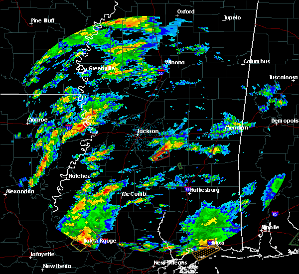 At 249 pm cst, a severe thunderstorm capable of producing a tornado was located near mendenhall, moving northeast at 45 mph (radar indicated rotation). Hazards include tornado and quarter size hail. Flying debris will be dangerous to those caught without shelter. mobile homes will be damaged or destroyed. damage to roofs, windows, and vehicles will occur. tree damage is likely. This dangerous storm will be near, martinville around 255 pm cst. At 249 pm cst, a severe thunderstorm capable of producing a tornado was located near mendenhall, moving northeast at 45 mph (radar indicated rotation). Hazards include tornado and quarter size hail. Flying debris will be dangerous to those caught without shelter. mobile homes will be damaged or destroyed. damage to roofs, windows, and vehicles will occur. tree damage is likely. This dangerous storm will be near, martinville around 255 pm cst.
|
| 2/5/2020 2:32 PM CST |
 At 232 pm cst, a severe thunderstorm capable of producing a tornado was located near shivers, or near pinola, moving northeast at 45 mph (radar indicated rotation). Hazards include tornado and quarter size hail. Flying debris will be dangerous to those caught without shelter. mobile homes will be damaged or destroyed. damage to roofs, windows, and vehicles will occur. tree damage is likely. this dangerous storm will be near, mendenhall and sanatorium around 250 pm cst. martinville around 255 pm cst. Other locations impacted by this tornadic thunderstorm include d`lo. At 232 pm cst, a severe thunderstorm capable of producing a tornado was located near shivers, or near pinola, moving northeast at 45 mph (radar indicated rotation). Hazards include tornado and quarter size hail. Flying debris will be dangerous to those caught without shelter. mobile homes will be damaged or destroyed. damage to roofs, windows, and vehicles will occur. tree damage is likely. this dangerous storm will be near, mendenhall and sanatorium around 250 pm cst. martinville around 255 pm cst. Other locations impacted by this tornadic thunderstorm include d`lo.
|
| 2/5/2020 2:24 PM CST |
 At 224 pm cst, a severe thunderstorm capable of producing a tornado was located near rockport, or 9 miles southwest of pinola, moving northeast at 40 mph (radar indicated rotation). Hazards include tornado and quarter size hail. Flying debris will be dangerous to those caught without shelter. mobile homes will be damaged or destroyed. damage to roofs, windows, and vehicles will occur. tree damage is likely. this dangerous storm will be near, shivers around 230 pm cst. pinola around 240 pm cst. mendenhall and sanatorium around 250 pm cst. martinville around 255 pm cst. Other locations impacted by this tornadic thunderstorm include d`lo and braxton. At 224 pm cst, a severe thunderstorm capable of producing a tornado was located near rockport, or 9 miles southwest of pinola, moving northeast at 40 mph (radar indicated rotation). Hazards include tornado and quarter size hail. Flying debris will be dangerous to those caught without shelter. mobile homes will be damaged or destroyed. damage to roofs, windows, and vehicles will occur. tree damage is likely. this dangerous storm will be near, shivers around 230 pm cst. pinola around 240 pm cst. mendenhall and sanatorium around 250 pm cst. martinville around 255 pm cst. Other locations impacted by this tornadic thunderstorm include d`lo and braxton.
|
| 2/5/2020 2:07 PM CST |
 At 207 pm cst, a severe thunderstorm capable of producing a tornado was located near sontag, or 13 miles northeast of brookhaven, moving northeast at 45 mph (radar indicated rotation). Hazards include tornado and golf ball size hail. Flying debris will be dangerous to those caught without shelter. mobile homes will be damaged or destroyed. damage to roofs, windows, and vehicles will occur. tree damage is likely. this dangerous storm will be near, oma around 215 pm cst. rockport around 220 pm cst. union and shivers around 230 pm cst. pinola around 235 pm cst. mendenhall around 245 pm cst. magee and sanatorium around 250 pm cst. martinville around 255 pm cst. Other locations impacted by this tornadic thunderstorm include new hebron, d`lo and braxton. At 207 pm cst, a severe thunderstorm capable of producing a tornado was located near sontag, or 13 miles northeast of brookhaven, moving northeast at 45 mph (radar indicated rotation). Hazards include tornado and golf ball size hail. Flying debris will be dangerous to those caught without shelter. mobile homes will be damaged or destroyed. damage to roofs, windows, and vehicles will occur. tree damage is likely. this dangerous storm will be near, oma around 215 pm cst. rockport around 220 pm cst. union and shivers around 230 pm cst. pinola around 235 pm cst. mendenhall around 245 pm cst. magee and sanatorium around 250 pm cst. martinville around 255 pm cst. Other locations impacted by this tornadic thunderstorm include new hebron, d`lo and braxton.
|
| 1/11/2020 9:21 AM CST |
 The severe thunderstorm warning for eastern simpson and northwestern jefferson davis counties will expire at 930 am cst, the storms which prompted the warning have moved out of the area. therefore, the warning will be allowed to expire. a tornado watch remains in effect until 1100 am cst for south central and central mississippi. a tornado watch also remains in effect until 400 pm cst for south central, central and southeastern mississippi. The severe thunderstorm warning for eastern simpson and northwestern jefferson davis counties will expire at 930 am cst, the storms which prompted the warning have moved out of the area. therefore, the warning will be allowed to expire. a tornado watch remains in effect until 1100 am cst for south central and central mississippi. a tornado watch also remains in effect until 400 pm cst for south central, central and southeastern mississippi.
|
| 1/11/2020 9:06 AM CST |
 At 906 am cst, severe thunderstorms were located along a line extending from near martinville to near sanatorium, moving northeast at 70 mph (radar indicated). Hazards include 60 mph wind gusts. Expect damage to roofs, siding, and trees. these severe thunderstorms will remain over mainly rural areas of eastern simpson and northwestern jefferson davis counties, including the following locations, d`lo. a tornado watch remains in effect until 1100 am cst for south central and central mississippi. A tornado watch also remains in effect until 400 pm cst for south central, central and southeastern mississippi. At 906 am cst, severe thunderstorms were located along a line extending from near martinville to near sanatorium, moving northeast at 70 mph (radar indicated). Hazards include 60 mph wind gusts. Expect damage to roofs, siding, and trees. these severe thunderstorms will remain over mainly rural areas of eastern simpson and northwestern jefferson davis counties, including the following locations, d`lo. a tornado watch remains in effect until 1100 am cst for south central and central mississippi. A tornado watch also remains in effect until 400 pm cst for south central, central and southeastern mississippi.
|
| 1/11/2020 8:57 AM CST | Picture of a tree on a truc in simpson county MS, 0.5 miles ESE of Mendenhall, MS |
| 1/11/2020 8:40 AM CST |
 At 840 am cst, severe thunderstorms were located along a line extending from near oma to near robinwood, moving northeast at 70 mph (radar indicated). Hazards include 60 mph wind gusts. Expect damage to roofs, siding, and trees. these severe storms will be near, oma around 845 am cst. shivers and progress around 850 am cst. pinola and prentiss around 855 am cst. mendenhall and clem around 900 am cst. magee and sanatorium around 910 am cst. martinville around 915 am cst. other locations impacted by these severe thunderstorms include new hebron, d`lo and silver creek. a tornado watch remains in effect until 900 am cst for central and south central mississippi. A tornado watch also remains in effect until 400 pm cst for south central, central and southeastern mississippi. At 840 am cst, severe thunderstorms were located along a line extending from near oma to near robinwood, moving northeast at 70 mph (radar indicated). Hazards include 60 mph wind gusts. Expect damage to roofs, siding, and trees. these severe storms will be near, oma around 845 am cst. shivers and progress around 850 am cst. pinola and prentiss around 855 am cst. mendenhall and clem around 900 am cst. magee and sanatorium around 910 am cst. martinville around 915 am cst. other locations impacted by these severe thunderstorms include new hebron, d`lo and silver creek. a tornado watch remains in effect until 900 am cst for central and south central mississippi. A tornado watch also remains in effect until 400 pm cst for south central, central and southeastern mississippi.
|
| 1/11/2020 8:38 AM CST |
 At 838 am cst, a severe thunderstorm capable of producing a tornado was located near harrisville, or 9 miles northwest of pinola, moving northeast at 50 mph (radar indicated rotation). Hazards include tornado. Flying debris will be dangerous to those caught without shelter. mobile homes will be damaged or destroyed. damage to roofs, windows, and vehicles will occur. tree damage is likely. This tornadic thunderstorm will remain over mainly rural areas of western simpson county, including the following locations, d`lo and braxton. At 838 am cst, a severe thunderstorm capable of producing a tornado was located near harrisville, or 9 miles northwest of pinola, moving northeast at 50 mph (radar indicated rotation). Hazards include tornado. Flying debris will be dangerous to those caught without shelter. mobile homes will be damaged or destroyed. damage to roofs, windows, and vehicles will occur. tree damage is likely. This tornadic thunderstorm will remain over mainly rural areas of western simpson county, including the following locations, d`lo and braxton.
|
| 1/11/2020 8:28 AM CST |
 At 828 am cst, a severe thunderstorm capable of producing a tornado was located near hazlehurst, moving northeast at 45 mph (radar indicated rotation). Hazards include tornado. Flying debris will be dangerous to those caught without shelter. mobile homes will be damaged or destroyed. damage to roofs, windows, and vehicles will occur. tree damage is likely. this dangerous storm will be near, union and hopewell around 840 am cst. harrisville around 845 am cst. Other locations impacted by this tornadic thunderstorm include d`lo, braxton and georgetown. At 828 am cst, a severe thunderstorm capable of producing a tornado was located near hazlehurst, moving northeast at 45 mph (radar indicated rotation). Hazards include tornado. Flying debris will be dangerous to those caught without shelter. mobile homes will be damaged or destroyed. damage to roofs, windows, and vehicles will occur. tree damage is likely. this dangerous storm will be near, union and hopewell around 840 am cst. harrisville around 845 am cst. Other locations impacted by this tornadic thunderstorm include d`lo, braxton and georgetown.
|
| 1/11/2020 8:24 AM CST |
 At 823 am cst, severe thunderstorms were located along a line extending from near east lincoln to 6 miles south of ruth, moving northeast at 70 mph (radar indicated). Hazards include 60 mph wind gusts. Expect damage to roofs, siding, and trees. severe thunderstorms will be near, topeka, sontag and wanilla around 835 am cst. monticello, robinwood, oma and tilton around 840 am cst. arm and progress around 845 am cst. prentiss and shivers around 850 am cst. pinola around 855 am cst. mendenhall and clem around 900 am cst. martinville around 905 am cst. magee and sanatorium around 910 am cst. other locations impacted by these severe thunderstorms include new hebron, d`lo and silver creek. a tornado watch remains in effect until 900 am cst for central and south central mississippi. A tornado watch also remains in effect until 400 pm cst for south central, central and southeastern mississippi. At 823 am cst, severe thunderstorms were located along a line extending from near east lincoln to 6 miles south of ruth, moving northeast at 70 mph (radar indicated). Hazards include 60 mph wind gusts. Expect damage to roofs, siding, and trees. severe thunderstorms will be near, topeka, sontag and wanilla around 835 am cst. monticello, robinwood, oma and tilton around 840 am cst. arm and progress around 845 am cst. prentiss and shivers around 850 am cst. pinola around 855 am cst. mendenhall and clem around 900 am cst. martinville around 905 am cst. magee and sanatorium around 910 am cst. other locations impacted by these severe thunderstorms include new hebron, d`lo and silver creek. a tornado watch remains in effect until 900 am cst for central and south central mississippi. A tornado watch also remains in effect until 400 pm cst for south central, central and southeastern mississippi.
|
| 1/11/2020 8:08 AM CST |
 At 808 am cst, a severe thunderstorm capable of producing a tornado was located near wesson, or 7 miles north of brookhaven, moving northeast at 45 mph (radar indicated rotation). Hazards include tornado. Flying debris will be dangerous to those caught without shelter. mobile homes will be damaged or destroyed. damage to roofs, windows, and vehicles will occur. tree damage is likely. this dangerous storm will be near, martinsville around 820 am cst. hazlehurst around 825 am cst. rockport around 835 am cst. union and hopewell around 840 am cst. harrisville around 850 am cst. Other locations impacted by this tornadic thunderstorm include d`lo, beauregard, braxton and georgetown. At 808 am cst, a severe thunderstorm capable of producing a tornado was located near wesson, or 7 miles north of brookhaven, moving northeast at 45 mph (radar indicated rotation). Hazards include tornado. Flying debris will be dangerous to those caught without shelter. mobile homes will be damaged or destroyed. damage to roofs, windows, and vehicles will occur. tree damage is likely. this dangerous storm will be near, martinsville around 820 am cst. hazlehurst around 825 am cst. rockport around 835 am cst. union and hopewell around 840 am cst. harrisville around 850 am cst. Other locations impacted by this tornadic thunderstorm include d`lo, beauregard, braxton and georgetown.
|
| 12/16/2019 4:54 PM CST |
 At 454 pm cst, a severe thunderstorm capable of producing a tornado was located near mendenhall, moving northeast at 30 mph (radar indicated rotation). Hazards include tornado. Flying debris will be dangerous to those caught without shelter. mobile homes will be damaged or destroyed. damage to roofs, windows, and vehicles will occur. tree damage is likely. this dangerous storm will be near, sanatorium around 500 pm cst. Martinville around 510 pm cst. At 454 pm cst, a severe thunderstorm capable of producing a tornado was located near mendenhall, moving northeast at 30 mph (radar indicated rotation). Hazards include tornado. Flying debris will be dangerous to those caught without shelter. mobile homes will be damaged or destroyed. damage to roofs, windows, and vehicles will occur. tree damage is likely. this dangerous storm will be near, sanatorium around 500 pm cst. Martinville around 510 pm cst.
|
| 12/16/2019 4:37 PM CST |
 At 436 pm cst, a severe thunderstorm capable of producing a tornado was located over shivers, or near pinola, moving northeast at 30 mph (radar indicated rotation). Hazards include tornado. Flying debris will be dangerous to those caught without shelter. mobile homes will be damaged or destroyed. damage to roofs, windows, and vehicles will occur. tree damage is likely. this dangerous storm will be near, pinola around 445 pm cst. mendenhall and sanatorium around 500 pm cst. Martinville around 510 pm cst. At 436 pm cst, a severe thunderstorm capable of producing a tornado was located over shivers, or near pinola, moving northeast at 30 mph (radar indicated rotation). Hazards include tornado. Flying debris will be dangerous to those caught without shelter. mobile homes will be damaged or destroyed. damage to roofs, windows, and vehicles will occur. tree damage is likely. this dangerous storm will be near, pinola around 445 pm cst. mendenhall and sanatorium around 500 pm cst. Martinville around 510 pm cst.
|
| 11/27/2019 12:21 AM CST |
 At 1221 am cst, severe thunderstorms were located along a line extending from near pelahatchie to johns to near mendenhall, moving northeast at 45 mph (radar indicated). Hazards include 60 mph wind gusts. Expect damage to roofs, siding, and trees. severe thunderstorms will be near, pelahatchie around 1225 am cst. morton around 1235 am cst. white oak and pulaski around 1245 am cst. forest, homewood and hillsboro around 1250 am cst. burns around 1255 am cst. steele around 100 am cst. pineville around 105 am cst. Other locations impacted by these severe thunderstorms include polkville, d`lo, lake and puckett. At 1221 am cst, severe thunderstorms were located along a line extending from near pelahatchie to johns to near mendenhall, moving northeast at 45 mph (radar indicated). Hazards include 60 mph wind gusts. Expect damage to roofs, siding, and trees. severe thunderstorms will be near, pelahatchie around 1225 am cst. morton around 1235 am cst. white oak and pulaski around 1245 am cst. forest, homewood and hillsboro around 1250 am cst. burns around 1255 am cst. steele around 100 am cst. pineville around 105 am cst. Other locations impacted by these severe thunderstorms include polkville, d`lo, lake and puckett.
|
| 11/26/2019 11:50 PM CST |
 At 1149 pm cst, severe thunderstorms were located along a line extending from clear branch to near martinsville, moving east at 40 mph (radar indicated). Hazards include 60 mph wind gusts. Expect damage to roofs, siding, and trees. these severe storms will be near, clear branch around 1155 pm cst. star, hopewell and piney woods around 1205 am cst. pinola, union, harrisville, johns and cato around 1215 am cst. Other locations impacted by these severe thunderstorms include d`lo, braxton and georgetown. At 1149 pm cst, severe thunderstorms were located along a line extending from clear branch to near martinsville, moving east at 40 mph (radar indicated). Hazards include 60 mph wind gusts. Expect damage to roofs, siding, and trees. these severe storms will be near, clear branch around 1155 pm cst. star, hopewell and piney woods around 1205 am cst. pinola, union, harrisville, johns and cato around 1215 am cst. Other locations impacted by these severe thunderstorms include d`lo, braxton and georgetown.
|
| 11/26/2019 11:32 PM CST |
 At 1132 pm cst, severe thunderstorms were located along a line extending from near crystal springs to near glancy, moving east at 40 mph (radar indicated). Hazards include 60 mph wind gusts. Expect damage to roofs, siding, and trees. severe thunderstorms will be near, crystal springs around 1135 pm cst. hazlehurst around 1145 pm cst. whites around 1150 pm cst. star around 1200 am cst. hopewell and piney woods around 1205 am cst. union around 1210 am cst. harrisville, johns and cato around 1215 am cst. pinola around 1220 am cst. Other locations impacted by these severe thunderstorms include d`lo, braxton and georgetown. At 1132 pm cst, severe thunderstorms were located along a line extending from near crystal springs to near glancy, moving east at 40 mph (radar indicated). Hazards include 60 mph wind gusts. Expect damage to roofs, siding, and trees. severe thunderstorms will be near, crystal springs around 1135 pm cst. hazlehurst around 1145 pm cst. whites around 1150 pm cst. star around 1200 am cst. hopewell and piney woods around 1205 am cst. union around 1210 am cst. harrisville, johns and cato around 1215 am cst. pinola around 1220 am cst. Other locations impacted by these severe thunderstorms include d`lo, braxton and georgetown.
|
| 10/26/2019 7:26 AM CDT |
 At 726 am cdt, severe thunderstorms were located along a line extending from near mendenhall to 7 miles northwest of bay springs, moving north at 40 mph (radar indicated). Hazards include 60 mph wind gusts. Expect damage to roofs, siding, and trees. these severe storms will be near, pineville around 735 am cdt. burns around 740 am cdt. Other locations impacted by these severe thunderstorms include d`lo, braxton and mize. At 726 am cdt, severe thunderstorms were located along a line extending from near mendenhall to 7 miles northwest of bay springs, moving north at 40 mph (radar indicated). Hazards include 60 mph wind gusts. Expect damage to roofs, siding, and trees. these severe storms will be near, pineville around 735 am cdt. burns around 740 am cdt. Other locations impacted by these severe thunderstorms include d`lo, braxton and mize.
|
| 10/26/2019 6:55 AM CDT |
 At 654 am cdt, severe thunderstorms were located along a line extending from near sontag to near collins, moving north at 35 mph (radar indicated). Hazards include 60 mph wind gusts. Expect damage to roofs, siding, and trees. severe thunderstorms will be near, mount olive and oma around 705 am cdt. center ridge around 720 am cdt. raleigh around 730 am cdt. white oak around 740 am cdt. burns around 745 am cdt. Other locations impacted by these severe thunderstorms include new hebron, d`lo, mize, silver creek and braxton. At 654 am cdt, severe thunderstorms were located along a line extending from near sontag to near collins, moving north at 35 mph (radar indicated). Hazards include 60 mph wind gusts. Expect damage to roofs, siding, and trees. severe thunderstorms will be near, mount olive and oma around 705 am cdt. center ridge around 720 am cdt. raleigh around 730 am cdt. white oak around 740 am cdt. burns around 745 am cdt. Other locations impacted by these severe thunderstorms include new hebron, d`lo, mize, silver creek and braxton.
|
| 9/9/2019 5:08 PM CDT |
 The severe thunderstorm warning for simpson county will expire at 515 pm cdt, the storm which prompted the warning has weakened below severe limits, and no longer poses an immediate threat to life or property. therefore, the warning will be allowed to expire. however, gusty winds are still possible with this thunderstorm. The severe thunderstorm warning for simpson county will expire at 515 pm cdt, the storm which prompted the warning has weakened below severe limits, and no longer poses an immediate threat to life or property. therefore, the warning will be allowed to expire. however, gusty winds are still possible with this thunderstorm.
|
| 9/9/2019 4:30 PM CDT | Around 5-6 trees down... with some large limbs downed as well. mainly on rural roads near magee... south of mendenhall and near the braxton are in simpson county MS, 4.8 miles NNE of Mendenhall, MS |
| 9/9/2019 4:09 PM CDT |
 At 409 pm cdt, a severe thunderstorm was located near magee, moving west at 25 mph (radar indicated). Hazards include 60 mph wind gusts and penny size hail. Expect damage to roofs, siding, and trees. this severe thunderstorm will be near, magee around 415 pm cdt. sanatorium and martinville around 425 pm cdt. mendenhall around 440 pm cdt. pinola around 450 pm cdt. Other locations impacted by this severe thunderstorm include d`lo. At 409 pm cdt, a severe thunderstorm was located near magee, moving west at 25 mph (radar indicated). Hazards include 60 mph wind gusts and penny size hail. Expect damage to roofs, siding, and trees. this severe thunderstorm will be near, magee around 415 pm cdt. sanatorium and martinville around 425 pm cdt. mendenhall around 440 pm cdt. pinola around 450 pm cdt. Other locations impacted by this severe thunderstorm include d`lo.
|
| 7/14/2019 12:57 PM CDT |
 At 1257 pm cdt, a severe thunderstorm was located over hebron, or 11 miles south of pinola, moving north at 50 mph (radar indicated). Hazards include 60 mph wind gusts. Expect damage to roofs, siding, and trees. this severe storm will be near, shivers around 105 pm cdt. pinola and union around 110 pm cdt. mendenhall around 115 pm cdt. harrisville around 120 pm cdt. other locations impacted by this severe thunderstorm include new hebron, d`lo, braxton and georgetown. A tornado watch remains in effect until 700 pm cdt for central and south central mississippi. At 1257 pm cdt, a severe thunderstorm was located over hebron, or 11 miles south of pinola, moving north at 50 mph (radar indicated). Hazards include 60 mph wind gusts. Expect damage to roofs, siding, and trees. this severe storm will be near, shivers around 105 pm cdt. pinola and union around 110 pm cdt. mendenhall around 115 pm cdt. harrisville around 120 pm cdt. other locations impacted by this severe thunderstorm include new hebron, d`lo, braxton and georgetown. A tornado watch remains in effect until 700 pm cdt for central and south central mississippi.
|
| 7/14/2019 12:37 PM CDT |
 At 1237 pm cdt, a severe thunderstorm was located over tilton, or 16 miles north of kokomo, moving north at 45 mph (radar indicated). Hazards include 60 mph wind gusts. Expect damage to roofs, siding, and trees. this severe thunderstorm will be near, progress around 1245 pm cdt. monticello around 1250 pm cdt. wanilla around 1255 pm cdt. sontag around 100 pm cdt. oma around 105 pm cdt. rockport and shivers around 110 pm cdt. union around 115 pm cdt. harrisville and hopewell around 125 pm cdt. other locations impacted by this severe thunderstorm include new hebron, d`lo, silver creek, bassfield, braxton and georgetown. A tornado watch remains in effect until 700 pm cdt for central and south central mississippi. At 1237 pm cdt, a severe thunderstorm was located over tilton, or 16 miles north of kokomo, moving north at 45 mph (radar indicated). Hazards include 60 mph wind gusts. Expect damage to roofs, siding, and trees. this severe thunderstorm will be near, progress around 1245 pm cdt. monticello around 1250 pm cdt. wanilla around 1255 pm cdt. sontag around 100 pm cdt. oma around 105 pm cdt. rockport and shivers around 110 pm cdt. union around 115 pm cdt. harrisville and hopewell around 125 pm cdt. other locations impacted by this severe thunderstorm include new hebron, d`lo, silver creek, bassfield, braxton and georgetown. A tornado watch remains in effect until 700 pm cdt for central and south central mississippi.
|
| 6/27/2019 4:57 PM CDT |
 At 457 pm cdt, a severe thunderstorm was located near hebron, or 8 miles southeast of pinola, moving south at 25 mph (radar indicated). Hazards include 60 mph wind gusts and nickel size hail. expect damage to roofs, siding, and trees At 457 pm cdt, a severe thunderstorm was located near hebron, or 8 miles southeast of pinola, moving south at 25 mph (radar indicated). Hazards include 60 mph wind gusts and nickel size hail. expect damage to roofs, siding, and trees
|
| 5/9/2019 10:58 AM CDT |
 At 1058 am cdt, a severe thunderstorm was located near cato, or near mendenhall, moving northeast at 25 mph (radar indicated). Hazards include 60 mph wind gusts and quarter size hail. Hail damage to vehicles is expected. expect wind damage to roofs, siding, and trees. this severe storm will be near, johns around 1110 am cdt. white oak around 1125 am cdt. burns around 1145 am cdt. Other locations impacted by this severe thunderstorm include polkville, d`lo, braxton and puckett. At 1058 am cdt, a severe thunderstorm was located near cato, or near mendenhall, moving northeast at 25 mph (radar indicated). Hazards include 60 mph wind gusts and quarter size hail. Hail damage to vehicles is expected. expect wind damage to roofs, siding, and trees. this severe storm will be near, johns around 1110 am cdt. white oak around 1125 am cdt. burns around 1145 am cdt. Other locations impacted by this severe thunderstorm include polkville, d`lo, braxton and puckett.
|
| 5/9/2019 10:37 AM CDT |
 At 1037 am cdt, a severe thunderstorm was located near harrisville, or near pinola, moving northeast at 35 mph (radar indicated). Hazards include 60 mph wind gusts. Expect damage to roofs, siding, and trees. this severe thunderstorm will be near, mendenhall around 1050 am cdt. cato around 1100 am cdt. johns around 1105 am cdt. white oak around 1115 am cdt. burns around 1130 am cdt. Other locations impacted by this severe thunderstorm include polkville, d`lo, braxton and puckett. At 1037 am cdt, a severe thunderstorm was located near harrisville, or near pinola, moving northeast at 35 mph (radar indicated). Hazards include 60 mph wind gusts. Expect damage to roofs, siding, and trees. this severe thunderstorm will be near, mendenhall around 1050 am cdt. cato around 1100 am cdt. johns around 1105 am cdt. white oak around 1115 am cdt. burns around 1130 am cdt. Other locations impacted by this severe thunderstorm include polkville, d`lo, braxton and puckett.
|
| 5/3/2019 4:59 PM CDT |
 At 458 pm cdt, a severe thunderstorm was located over cato, or 7 miles north of mendenhall, moving north at 15 mph (radar indicated). Hazards include ping pong ball size hail and 60 mph wind gusts. People and animals outdoors will be injured. expect hail damage to roofs, siding, windows, and vehicles. expect wind damage to roofs, siding, and trees. this severe storm will be near, johns around 515 pm cdt. Other locations impacted by this severe thunderstorm include d`lo and puckett. At 458 pm cdt, a severe thunderstorm was located over cato, or 7 miles north of mendenhall, moving north at 15 mph (radar indicated). Hazards include ping pong ball size hail and 60 mph wind gusts. People and animals outdoors will be injured. expect hail damage to roofs, siding, windows, and vehicles. expect wind damage to roofs, siding, and trees. this severe storm will be near, johns around 515 pm cdt. Other locations impacted by this severe thunderstorm include d`lo and puckett.
|
| 5/3/2019 4:28 PM CDT |
 At 428 pm cdt, a severe thunderstorm was located over mendenhall, moving north at 15 mph (radar indicated). Hazards include 60 mph wind gusts and quarter size hail. Hail damage to vehicles is expected. expect wind damage to roofs, siding, and trees. this severe thunderstorm will be near, martinville around 440 pm cdt. cato around 505 pm cdt. johns around 515 pm cdt. Other locations impacted by this severe thunderstorm include d`lo and puckett. At 428 pm cdt, a severe thunderstorm was located over mendenhall, moving north at 15 mph (radar indicated). Hazards include 60 mph wind gusts and quarter size hail. Hail damage to vehicles is expected. expect wind damage to roofs, siding, and trees. this severe thunderstorm will be near, martinville around 440 pm cdt. cato around 505 pm cdt. johns around 515 pm cdt. Other locations impacted by this severe thunderstorm include d`lo and puckett.
|
| 4/18/2019 3:01 PM CDT | Trees on house on county line rd near pucket in rankin county MS, 7 miles SSW of Mendenhall, MS |
| 4/18/2019 2:59 PM CDT |
 At 259 pm cdt, a confirmed tornado was located near cato, or near mendenhall, moving northeast at 50 mph (radar confirmed tornado). Hazards include damaging tornado. Flying debris will be dangerous to those caught without shelter. mobile homes will be damaged or destroyed. damage to roofs, windows, and vehicles will occur. tree damage is likely. this tornado will be near, johns around 310 pm cdt. Other locations impacted by this tornadic thunderstorm include d`lo, braxton and puckett. At 259 pm cdt, a confirmed tornado was located near cato, or near mendenhall, moving northeast at 50 mph (radar confirmed tornado). Hazards include damaging tornado. Flying debris will be dangerous to those caught without shelter. mobile homes will be damaged or destroyed. damage to roofs, windows, and vehicles will occur. tree damage is likely. this tornado will be near, johns around 310 pm cdt. Other locations impacted by this tornadic thunderstorm include d`lo, braxton and puckett.
|
| 4/18/2019 2:40 PM CDT |
 At 240 pm cdt, a tornado producing storm was located near harrisville, or 10 miles west of pinola, moving northeast at 35 mph (radar confirmed tornado). Hazards include damaging tornado. Flying debris will be dangerous to those caught without shelter. mobile homes will be damaged or destroyed. damage to roofs, windows, and vehicles will occur. tree damage is likely. this tornadic storm will be near, harrisville around 245 pm cdt. pinola around 250 pm cdt. piney woods around 300 pm cdt. mendenhall around 305 pm cdt. cato around 310 pm cdt. johns and martinville around 315 pm cdt. Other locations impacted by this tornadic thunderstorm include d`lo, braxton and puckett. At 240 pm cdt, a tornado producing storm was located near harrisville, or 10 miles west of pinola, moving northeast at 35 mph (radar confirmed tornado). Hazards include damaging tornado. Flying debris will be dangerous to those caught without shelter. mobile homes will be damaged or destroyed. damage to roofs, windows, and vehicles will occur. tree damage is likely. this tornadic storm will be near, harrisville around 245 pm cdt. pinola around 250 pm cdt. piney woods around 300 pm cdt. mendenhall around 305 pm cdt. cato around 310 pm cdt. johns and martinville around 315 pm cdt. Other locations impacted by this tornadic thunderstorm include d`lo, braxton and puckett.
|
| 4/18/2019 2:16 PM CDT |
 At 216 pm cdt, severe thunderstorms were located along a line extending from edwards to near crystal springs to near martinsville, moving northeast at 45 mph (radar indicated). Hazards include 60 mph wind gusts. Expect damage to roofs, siding, and trees. severe thunderstorms will be near, whites around 230 pm cdt. richland and florence around 240 pm cdt. pearl, star, union and monterey around 245 pm cdt. harrisville and shivers around 250 pm cdt. ridgeland, brandon, pinola and annandale around 255 pm cdt. madison, gluckstadt and johns around 300 pm cdt. canton and mendenhall around 305 pm cdt. pelahatchie and sanatorium around 310 pm cdt. other locations impacted by these severe thunderstorms include d`lo, braxton and puckett. a tornado watch remains in effect until 700 pm cdt for central and south central mississippi. A tornado watch also remains in effect until 900 pm cdt for south central, central and southeastern mississippi. At 216 pm cdt, severe thunderstorms were located along a line extending from edwards to near crystal springs to near martinsville, moving northeast at 45 mph (radar indicated). Hazards include 60 mph wind gusts. Expect damage to roofs, siding, and trees. severe thunderstorms will be near, whites around 230 pm cdt. richland and florence around 240 pm cdt. pearl, star, union and monterey around 245 pm cdt. harrisville and shivers around 250 pm cdt. ridgeland, brandon, pinola and annandale around 255 pm cdt. madison, gluckstadt and johns around 300 pm cdt. canton and mendenhall around 305 pm cdt. pelahatchie and sanatorium around 310 pm cdt. other locations impacted by these severe thunderstorms include d`lo, braxton and puckett. a tornado watch remains in effect until 700 pm cdt for central and south central mississippi. A tornado watch also remains in effect until 900 pm cdt for south central, central and southeastern mississippi.
|
| 4/13/2019 8:47 PM CDT |
 At 846 pm cdt, severe thunderstorms were located along a line extending from mendenhall to 6 miles southeast of pinola, moving northeast at 35 mph (radar indicated). Hazards include 60 mph wind gusts and quarter size hail. Hail damage to vehicles is expected. expect wind damage to roofs, siding, and trees. severe thunderstorms will be near, sanatorium around 855 pm cdt. magee and martinville around 900 pm cdt. white oak around 910 pm cdt. raleigh, center ridge and burns around 925 pm cdt. pineville around 935 pm cdt. other locations impacted by these severe thunderstorms include sylvarena and mize. a tornado watch remains in effect until midnight cdt for central mississippi. A tornado watch also remains in effect until 300 am cdt for central and east central mississippi. At 846 pm cdt, severe thunderstorms were located along a line extending from mendenhall to 6 miles southeast of pinola, moving northeast at 35 mph (radar indicated). Hazards include 60 mph wind gusts and quarter size hail. Hail damage to vehicles is expected. expect wind damage to roofs, siding, and trees. severe thunderstorms will be near, sanatorium around 855 pm cdt. magee and martinville around 900 pm cdt. white oak around 910 pm cdt. raleigh, center ridge and burns around 925 pm cdt. pineville around 935 pm cdt. other locations impacted by these severe thunderstorms include sylvarena and mize. a tornado watch remains in effect until midnight cdt for central mississippi. A tornado watch also remains in effect until 300 am cdt for central and east central mississippi.
|
| 4/13/2019 8:18 PM CDT |
 At 817 pm cdt, severe thunderstorms were located along a line extending from near harrisville to near wanilla, moving northeast at 60 mph (radar indicated). Hazards include 60 mph wind gusts and quarter size hail. Hail damage to vehicles is expected. expect wind damage to roofs, siding, and trees. these severe storms will be near, pinola and harrisville around 835 pm cdt. mendenhall around 845 pm cdt. other locations impacted by these severe thunderstorms include d`lo, braxton and georgetown. a tornado watch remains in effect until 900 pm cdt for central mississippi. A tornado watch also remains in effect until 300 am cdt for south central and southeastern mississippi. At 817 pm cdt, severe thunderstorms were located along a line extending from near harrisville to near wanilla, moving northeast at 60 mph (radar indicated). Hazards include 60 mph wind gusts and quarter size hail. Hail damage to vehicles is expected. expect wind damage to roofs, siding, and trees. these severe storms will be near, pinola and harrisville around 835 pm cdt. mendenhall around 845 pm cdt. other locations impacted by these severe thunderstorms include d`lo, braxton and georgetown. a tornado watch remains in effect until 900 pm cdt for central mississippi. A tornado watch also remains in effect until 300 am cdt for south central and southeastern mississippi.
|
| 4/13/2019 7:43 PM CDT |
 At 743 pm cdt, severe thunderstorms were located along a line extending from near sharon to monterey to near rockport, moving northeast at 35 mph (radar indicated). Hazards include 60 mph wind gusts and quarter size hail. Hail damage to vehicles is expected. expect wind damage to roofs, siding, and trees. these severe storms will be near, brandon around 800 pm cdt. harrisville and shivers around 805 pm cdt. pinola around 810 pm cdt. pelahatchie around 815 pm cdt. mendenhall and leesburg around 825 pm cdt. sanatorium and cato around 830 pm cdt. martinville around 835 pm cdt. other locations impacted by these severe thunderstorms include d`lo, braxton, puckett and georgetown. A tornado watch remains in effect until 900 pm cdt for central and south central mississippi. At 743 pm cdt, severe thunderstorms were located along a line extending from near sharon to monterey to near rockport, moving northeast at 35 mph (radar indicated). Hazards include 60 mph wind gusts and quarter size hail. Hail damage to vehicles is expected. expect wind damage to roofs, siding, and trees. these severe storms will be near, brandon around 800 pm cdt. harrisville and shivers around 805 pm cdt. pinola around 810 pm cdt. pelahatchie around 815 pm cdt. mendenhall and leesburg around 825 pm cdt. sanatorium and cato around 830 pm cdt. martinville around 835 pm cdt. other locations impacted by these severe thunderstorms include d`lo, braxton, puckett and georgetown. A tornado watch remains in effect until 900 pm cdt for central and south central mississippi.
|
| 4/13/2019 7:22 PM CDT |
 At 722 pm cdt, severe thunderstorms were located along a line extending from gluckstadt to terry to near wesson, moving northeast at 35 mph (radar indicated). Hazards include 60 mph wind gusts and quarter size hail. Hail damage to vehicles is expected. expect wind damage to roofs, siding, and trees. severe thunderstorms will be near, goshen springs around 735 pm cdt. richland, florence and pisgah around 740 pm cdt. star and monterey around 745 pm cdt. pearl and rockport around 750 pm cdt. brandon around 755 pm cdt. union around 800 pm cdt. harrisville and shivers around 805 pm cdt. pinola around 810 pm cdt. other locations impacted by these severe thunderstorms include d`lo, beauregard, braxton, puckett and georgetown. A tornado watch remains in effect until 900 pm cdt for central and south central mississippi. At 722 pm cdt, severe thunderstorms were located along a line extending from gluckstadt to terry to near wesson, moving northeast at 35 mph (radar indicated). Hazards include 60 mph wind gusts and quarter size hail. Hail damage to vehicles is expected. expect wind damage to roofs, siding, and trees. severe thunderstorms will be near, goshen springs around 735 pm cdt. richland, florence and pisgah around 740 pm cdt. star and monterey around 745 pm cdt. pearl and rockport around 750 pm cdt. brandon around 755 pm cdt. union around 800 pm cdt. harrisville and shivers around 805 pm cdt. pinola around 810 pm cdt. other locations impacted by these severe thunderstorms include d`lo, beauregard, braxton, puckett and georgetown. A tornado watch remains in effect until 900 pm cdt for central and south central mississippi.
|
| 4/12/2019 11:52 PM CDT |
 At 1151 pm cdt, a severe thunderstorm was located over hopewell, or 9 miles southeast of crystal springs, moving northeast at 55 mph (radar indicated). Hazards include 60 mph wind gusts and quarter size hail. Hail damage to vehicles is expected. expect wind damage to roofs, siding, and trees. this severe thunderstorm will be near, union around 1155 pm cdt. harrisville around 1200 am cdt. star around 1205 am cdt. piney woods around 1210 am cdt. cato around 1215 am cdt. johns around 1220 am cdt. white oak around 1225 am cdt. Other locations impacted by this severe thunderstorm include polkville, d`lo, braxton, puckett and georgetown. At 1151 pm cdt, a severe thunderstorm was located over hopewell, or 9 miles southeast of crystal springs, moving northeast at 55 mph (radar indicated). Hazards include 60 mph wind gusts and quarter size hail. Hail damage to vehicles is expected. expect wind damage to roofs, siding, and trees. this severe thunderstorm will be near, union around 1155 pm cdt. harrisville around 1200 am cdt. star around 1205 am cdt. piney woods around 1210 am cdt. cato around 1215 am cdt. johns around 1220 am cdt. white oak around 1225 am cdt. Other locations impacted by this severe thunderstorm include polkville, d`lo, braxton, puckett and georgetown.
|
| 3/14/2019 2:19 PM CDT |
 At 218 pm cdt, a severe thunderstorm was located near oma, or 11 miles southwest of pinola, moving northeast at 50 mph (radar indicated). Hazards include 60 mph wind gusts and quarter size hail. Hail damage to vehicles is expected. expect wind damage to roofs, siding, and trees. this severe storm will be near, shivers around 225 pm cdt. pinola around 230 pm cdt. mendenhall around 240 pm cdt. magee, sanatorium and martinville around 245 pm cdt. Other locations impacted by this severe thunderstorm include new hebron. At 218 pm cdt, a severe thunderstorm was located near oma, or 11 miles southwest of pinola, moving northeast at 50 mph (radar indicated). Hazards include 60 mph wind gusts and quarter size hail. Hail damage to vehicles is expected. expect wind damage to roofs, siding, and trees. this severe storm will be near, shivers around 225 pm cdt. pinola around 230 pm cdt. mendenhall around 240 pm cdt. magee, sanatorium and martinville around 245 pm cdt. Other locations impacted by this severe thunderstorm include new hebron.
|
| 3/14/2019 2:03 PM CDT |
 At 203 pm cdt, a severe thunderstorm was located near sontag, or 11 miles east of brookhaven, moving northeast at 50 mph (radar indicated). Hazards include 60 mph wind gusts and quarter size hail. Hail damage to vehicles is expected. expect wind damage to roofs, siding, and trees. this severe thunderstorm will be near, wanilla around 210 pm cdt. oma and rockport around 215 pm cdt. shivers around 225 pm cdt. pinola around 235 pm cdt. magee, mendenhall, sanatorium and martinville around 245 pm cdt. Other locations impacted by this severe thunderstorm include new hebron. At 203 pm cdt, a severe thunderstorm was located near sontag, or 11 miles east of brookhaven, moving northeast at 50 mph (radar indicated). Hazards include 60 mph wind gusts and quarter size hail. Hail damage to vehicles is expected. expect wind damage to roofs, siding, and trees. this severe thunderstorm will be near, wanilla around 210 pm cdt. oma and rockport around 215 pm cdt. shivers around 225 pm cdt. pinola around 235 pm cdt. magee, mendenhall, sanatorium and martinville around 245 pm cdt. Other locations impacted by this severe thunderstorm include new hebron.
|
| 2/20/2019 7:53 AM CST |
 At 751 am cst, a severe thunderstorm was located over mendenhall, moving northeast at 45 mph (radar indicated). Hazards include 60 mph wind gusts and quarter size hail. Hail damage to vehicles is expected. expect wind damage to roofs, siding, and trees. this severe storm will be near, mendenhall around 800 am cst. Other locations impacted by this severe thunderstorm include sylvarena and puckett. At 751 am cst, a severe thunderstorm was located over mendenhall, moving northeast at 45 mph (radar indicated). Hazards include 60 mph wind gusts and quarter size hail. Hail damage to vehicles is expected. expect wind damage to roofs, siding, and trees. this severe storm will be near, mendenhall around 800 am cst. Other locations impacted by this severe thunderstorm include sylvarena and puckett.
|
| 2/20/2019 7:40 AM CST | Tree down on brandon-williamsburg r in simpson county MS, 5.3 miles SSW of Mendenhall, MS |
| 2/20/2019 7:37 AM CST |
 At 737 am cst, a severe thunderstorm was located over martinville, or near mendenhall, moving east at 45 mph (radar indicated). Hazards include 60 mph wind gusts and quarter size hail. Hail damage to vehicles is expected. expect wind damage to roofs, siding, and trees. this severe thunderstorm will be near, white oak around 745 am cst. raleigh around 755 am cst. burns around 800 am cst. pineville around 810 am cst. Other locations impacted by this severe thunderstorm include sylvarena and puckett. At 737 am cst, a severe thunderstorm was located over martinville, or near mendenhall, moving east at 45 mph (radar indicated). Hazards include 60 mph wind gusts and quarter size hail. Hail damage to vehicles is expected. expect wind damage to roofs, siding, and trees. this severe thunderstorm will be near, white oak around 745 am cst. raleigh around 755 am cst. burns around 800 am cst. pineville around 810 am cst. Other locations impacted by this severe thunderstorm include sylvarena and puckett.
|
| 1/19/2019 8:47 AM CST |
 At 847 am cst, severe thunderstorms were located along a line extending from near mendenhall to hebron to 6 miles northeast of monticello, moving northeast at 60 mph (radar indicated). Hazards include 60 mph wind gusts. Expect damage to roofs, siding, and trees. severe thunderstorms will be near, mendenhall and sanatorium around 850 am cst. martinville around 855 am cst. white oak around 900 am cst. magee, clem and lone star around 905 am cst. raleigh and burns around 910 am cst. mount olive around 915 am cst. pineville and center ridge around 920 am cst. taylorsville around 925 am cst. other locations impacted by these severe thunderstorms include sylvarena, mize, montrose, louin, soso and d`lo. A tornado watch remains in effect until 100 pm cst for south central, central, southeastern and east central mississippi. At 847 am cst, severe thunderstorms were located along a line extending from near mendenhall to hebron to 6 miles northeast of monticello, moving northeast at 60 mph (radar indicated). Hazards include 60 mph wind gusts. Expect damage to roofs, siding, and trees. severe thunderstorms will be near, mendenhall and sanatorium around 850 am cst. martinville around 855 am cst. white oak around 900 am cst. magee, clem and lone star around 905 am cst. raleigh and burns around 910 am cst. mount olive around 915 am cst. pineville and center ridge around 920 am cst. taylorsville around 925 am cst. other locations impacted by these severe thunderstorms include sylvarena, mize, montrose, louin, soso and d`lo. A tornado watch remains in effect until 100 pm cst for south central, central, southeastern and east central mississippi.
|
| 1/19/2019 8:01 AM CST |
 At 801 am cst, severe thunderstorms were located along a line extending from forest to near martinville to near oma, moving northeast at 65 mph (radar indicated). Hazards include 60 mph wind gusts. Expect damage to roofs, siding, and trees. these severe storms will be near, pinola around 810 am cst. other locations impacted by these severe thunderstorms include d`lo, braxton, puckett and georgetown. A tornado watch remains in effect until 100 pm cst for central and south central mississippi. At 801 am cst, severe thunderstorms were located along a line extending from forest to near martinville to near oma, moving northeast at 65 mph (radar indicated). Hazards include 60 mph wind gusts. Expect damage to roofs, siding, and trees. these severe storms will be near, pinola around 810 am cst. other locations impacted by these severe thunderstorms include d`lo, braxton, puckett and georgetown. A tornado watch remains in effect until 100 pm cst for central and south central mississippi.
|
| 1/19/2019 7:45 AM CST |
 At 745 am cst, severe thunderstorms were located along a line extending from near pelahatchie to near harrisville to 6 miles west of sontag, moving northeast at 65 mph (radar indicated). Hazards include 60 mph wind gusts. Expect damage to roofs, siding, and trees. these severe storms will be near, mendenhall and cato around 755 am cst. shivers around 805 am cst. other locations impacted by these severe thunderstorms include d`lo, beauregard, braxton, puckett and georgetown. A tornado watch remains in effect until 100 pm cst for central and south central mississippi. At 745 am cst, severe thunderstorms were located along a line extending from near pelahatchie to near harrisville to 6 miles west of sontag, moving northeast at 65 mph (radar indicated). Hazards include 60 mph wind gusts. Expect damage to roofs, siding, and trees. these severe storms will be near, mendenhall and cato around 755 am cst. shivers around 805 am cst. other locations impacted by these severe thunderstorms include d`lo, beauregard, braxton, puckett and georgetown. A tornado watch remains in effect until 100 pm cst for central and south central mississippi.
|
| 1/19/2019 7:11 AM CST |
 At 711 am cst, severe thunderstorms were located along a line extending from near terry to near caseyville to near bude, moving northeast at 65 mph (radar indicated). Hazards include 60 mph wind gusts. Expect damage to roofs, siding, and trees. severe thunderstorms will be near, wesson and glancy around 720 am cst. hazlehurst, star, martinsville, mccall creek and center point around 725 am cst. west lincoln and vaughn around 730 am cst. rockport, hopewell, bogue chitto and johns around 735 am cst. brookhaven, union and enterprise around 740 am cst. pinola and harrisville around 745 am cst. sontag around 750 am cst. mendenhall, wanilla, oma and cato around 755 am cst. other locations impacted by these severe thunderstorms include d`lo, beauregard, braxton, puckett and georgetown. A tornado watch remains in effect until 100 pm cst for central, south central and southwestern mississippi. At 711 am cst, severe thunderstorms were located along a line extending from near terry to near caseyville to near bude, moving northeast at 65 mph (radar indicated). Hazards include 60 mph wind gusts. Expect damage to roofs, siding, and trees. severe thunderstorms will be near, wesson and glancy around 720 am cst. hazlehurst, star, martinsville, mccall creek and center point around 725 am cst. west lincoln and vaughn around 730 am cst. rockport, hopewell, bogue chitto and johns around 735 am cst. brookhaven, union and enterprise around 740 am cst. pinola and harrisville around 745 am cst. sontag around 750 am cst. mendenhall, wanilla, oma and cato around 755 am cst. other locations impacted by these severe thunderstorms include d`lo, beauregard, braxton, puckett and georgetown. A tornado watch remains in effect until 100 pm cst for central, south central and southwestern mississippi.
|
| 11/1/2018 4:25 AM CDT |
 At 425 am cdt, severe thunderstorms were located along a line extending from near cato to near hebron to near tilton, moving east at 30 mph (radar indicated). Hazards include 60 mph wind gusts. Expect damage to roofs, siding, and trees. locations impacted include, magee, mendenhall, pinola, prentiss, progress, martinville, tilton, oak vale, clem, sanatorium, society hill, arm, melba, carson, d`lo, new hebron, bassfield and silver creek. A tornado watch remains in effect until 700 am cdt for south central, central and southeastern mississippi. At 425 am cdt, severe thunderstorms were located along a line extending from near cato to near hebron to near tilton, moving east at 30 mph (radar indicated). Hazards include 60 mph wind gusts. Expect damage to roofs, siding, and trees. locations impacted include, magee, mendenhall, pinola, prentiss, progress, martinville, tilton, oak vale, clem, sanatorium, society hill, arm, melba, carson, d`lo, new hebron, bassfield and silver creek. A tornado watch remains in effect until 700 am cdt for south central, central and southeastern mississippi.
|
| 11/1/2018 3:32 AM CDT |
 At 332 am cdt, severe thunderstorms were located along a line extending from near terry to wesson to near center point, moving east at 30 mph (radar indicated). Hazards include 60 mph wind gusts. expect damage to roofs, siding, and trees At 332 am cdt, severe thunderstorms were located along a line extending from near terry to wesson to near center point, moving east at 30 mph (radar indicated). Hazards include 60 mph wind gusts. expect damage to roofs, siding, and trees
|
| 5/22/2018 4:05 PM CDT |
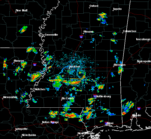 At 405 pm cdt, a severe thunderstorm was located over pinola, moving north at 10 mph (radar indicated). Hazards include 60 mph wind gusts and quarter size hail. Hail damage to vehicles is expected. Expect wind damage to roofs, siding, and trees. At 405 pm cdt, a severe thunderstorm was located over pinola, moving north at 10 mph (radar indicated). Hazards include 60 mph wind gusts and quarter size hail. Hail damage to vehicles is expected. Expect wind damage to roofs, siding, and trees.
|
| 4/14/2018 8:46 AM CDT |
 At 823 am cdt, a severe thunderstorm was located over pinola, moving east at 50 mph (radar indicated). Hazards include 60 mph wind gusts. Expect damage to roofs, siding, and trees. this severe thunderstorm will be near, mendenhall around 830 am cdt. sanatorium around 835 am cdt. magee and martinville around 840 am cdt. raleigh around 855 am cdt. center ridge around 900 am cdt. other locations impacted by this severe thunderstorm include d`lo, braxton and mize. A tornado watch remains in effect until 200 pm cdt for central mississippi. At 823 am cdt, a severe thunderstorm was located over pinola, moving east at 50 mph (radar indicated). Hazards include 60 mph wind gusts. Expect damage to roofs, siding, and trees. this severe thunderstorm will be near, mendenhall around 830 am cdt. sanatorium around 835 am cdt. magee and martinville around 840 am cdt. raleigh around 855 am cdt. center ridge around 900 am cdt. other locations impacted by this severe thunderstorm include d`lo, braxton and mize. A tornado watch remains in effect until 200 pm cdt for central mississippi.
|
| 4/14/2018 8:24 AM CDT |
 At 823 am cdt, a severe thunderstorm was located over pinola, moving east at 50 mph (radar indicated). Hazards include 60 mph wind gusts. Expect damage to roofs, siding, and trees. this severe thunderstorm will be near, mendenhall around 830 am cdt. sanatorium around 835 am cdt. magee and martinville around 840 am cdt. raleigh around 855 am cdt. center ridge around 900 am cdt. other locations impacted by this severe thunderstorm include d`lo, braxton and mize. A tornado watch remains in effect until 200 pm cdt for central mississippi. At 823 am cdt, a severe thunderstorm was located over pinola, moving east at 50 mph (radar indicated). Hazards include 60 mph wind gusts. Expect damage to roofs, siding, and trees. this severe thunderstorm will be near, mendenhall around 830 am cdt. sanatorium around 835 am cdt. magee and martinville around 840 am cdt. raleigh around 855 am cdt. center ridge around 900 am cdt. other locations impacted by this severe thunderstorm include d`lo, braxton and mize. A tornado watch remains in effect until 200 pm cdt for central mississippi.
|
| 4/6/2018 10:48 PM CDT |
 At 1048 pm cdt, severe thunderstorms were located along a line extending from near white oak to near sanatorium, moving east at 35 mph (radar indicated). Hazards include 60 mph wind gusts. Expect damage to roofs, siding, and trees. these severe thunderstorms will remain over mainly rural areas of northeastern simpson county. A tornado watch remains in effect until 1100 pm cdt for central mississippi. At 1048 pm cdt, severe thunderstorms were located along a line extending from near white oak to near sanatorium, moving east at 35 mph (radar indicated). Hazards include 60 mph wind gusts. Expect damage to roofs, siding, and trees. these severe thunderstorms will remain over mainly rural areas of northeastern simpson county. A tornado watch remains in effect until 1100 pm cdt for central mississippi.
|
| 4/6/2018 10:23 PM CDT |
 At 1023 pm cdt, a severe thunderstorm was located over mendenhall, moving east at 35 mph (radar indicated). Hazards include 60 mph wind gusts. Expect damage to roofs, siding, and trees. this severe storm will be near, martinville and sanatorium around 1035 pm cdt. other locations impacted by this severe thunderstorm include d`lo and braxton. A tornado watch remains in effect until 1100 pm cdt for central mississippi. At 1023 pm cdt, a severe thunderstorm was located over mendenhall, moving east at 35 mph (radar indicated). Hazards include 60 mph wind gusts. Expect damage to roofs, siding, and trees. this severe storm will be near, martinville and sanatorium around 1035 pm cdt. other locations impacted by this severe thunderstorm include d`lo and braxton. A tornado watch remains in effect until 1100 pm cdt for central mississippi.
|
| 4/6/2018 10:05 PM CDT |
 At 1005 pm cdt, a severe thunderstorm was located over harrisville, or near star, moving east at 35 mph (radar indicated). Hazards include 60 mph wind gusts. Expect damage to roofs, siding, and trees. this severe thunderstorm will be near, mendenhall around 1025 pm cdt. sanatorium around 1035 pm cdt. martinville around 1040 pm cdt. other locations impacted by this severe thunderstorm include d`lo and braxton. A tornado watch remains in effect until 1100 pm cdt for central mississippi. At 1005 pm cdt, a severe thunderstorm was located over harrisville, or near star, moving east at 35 mph (radar indicated). Hazards include 60 mph wind gusts. Expect damage to roofs, siding, and trees. this severe thunderstorm will be near, mendenhall around 1025 pm cdt. sanatorium around 1035 pm cdt. martinville around 1040 pm cdt. other locations impacted by this severe thunderstorm include d`lo and braxton. A tornado watch remains in effect until 1100 pm cdt for central mississippi.
|
| 4/6/2018 5:50 PM CDT |
 At 550 pm cdt, a severe thunderstorm was located over rockport, or 11 miles west of pinola, moving east at 35 mph (radar indicated). Hazards include 60 mph wind gusts and quarter size hail. Hail damage to vehicles is expected. expect wind damage to roofs, siding, and trees. this severe thunderstorm will be near, union around 600 pm cdt. shivers around 605 pm cdt. pinola around 610 pm cdt. mendenhall around 620 pm cdt. magee and sanatorium around 630 pm cdt. martinville around 635 pm cdt. other locations impacted by this severe thunderstorm include d`lo. A tornado watch remains in effect until 1100 pm cdt for central mississippi. At 550 pm cdt, a severe thunderstorm was located over rockport, or 11 miles west of pinola, moving east at 35 mph (radar indicated). Hazards include 60 mph wind gusts and quarter size hail. Hail damage to vehicles is expected. expect wind damage to roofs, siding, and trees. this severe thunderstorm will be near, union around 600 pm cdt. shivers around 605 pm cdt. pinola around 610 pm cdt. mendenhall around 620 pm cdt. magee and sanatorium around 630 pm cdt. martinville around 635 pm cdt. other locations impacted by this severe thunderstorm include d`lo. A tornado watch remains in effect until 1100 pm cdt for central mississippi.
|
| 4/3/2018 10:25 PM CDT |
 The severe thunderstorm warning for northwestern jasper, eastern simpson, smith, northwestern covington and northwestern jefferson davis counties will expire at 1030 pm cdt, the storms which prompted the warning have weakened below severe limits, and no longer pose an immediate threat to life or property. therefore the warning will be allowed to expire. however gusty winds up to 50 mph are still possible with these thunderstorms. a severe thunderstorm watch remains in effect until midnight cdt for south central, central, southeastern and east central mississippi. The severe thunderstorm warning for northwestern jasper, eastern simpson, smith, northwestern covington and northwestern jefferson davis counties will expire at 1030 pm cdt, the storms which prompted the warning have weakened below severe limits, and no longer pose an immediate threat to life or property. therefore the warning will be allowed to expire. however gusty winds up to 50 mph are still possible with these thunderstorms. a severe thunderstorm watch remains in effect until midnight cdt for south central, central, southeastern and east central mississippi.
|
| 4/3/2018 10:05 PM CDT |
 At 1004 pm cdt, severe thunderstorms were located along a line extending from near roberts to 6 miles south of raleigh to near hebron, moving east at 35 mph (radar indicated). Hazards include 60 mph wind gusts. Expect damage to roofs, siding, and trees. these severe storms will be near, taylorsville and center ridge around 1010 pm cdt. bay springs around 1025 pm cdt. mount olive around 1030 pm cdt. Other locations impacted by these severe thunderstorms include sylvarena, mize, montrose and louin. At 1004 pm cdt, severe thunderstorms were located along a line extending from near roberts to 6 miles south of raleigh to near hebron, moving east at 35 mph (radar indicated). Hazards include 60 mph wind gusts. Expect damage to roofs, siding, and trees. these severe storms will be near, taylorsville and center ridge around 1010 pm cdt. bay springs around 1025 pm cdt. mount olive around 1030 pm cdt. Other locations impacted by these severe thunderstorms include sylvarena, mize, montrose and louin.
|
| 4/3/2018 9:48 PM CDT |
 At 946 pm cdt, severe thunderstorms were located along a line extending from near homewood to near sanatorium to rockport, moving east at 30 mph (emergency management). Hazards include 60 mph wind gusts. Expect damage to roofs, siding, and trees. these severe storms will be near, sanatorium, martinville and burns around 950 pm cdt. magee around 1000 pm cdt. pineville around 1005 pm cdt. shivers around 1010 pm cdt. center ridge around 1025 pm cdt. taylorsville, clem and lone star around 1030 pm cdt. Other locations impacted by these severe thunderstorms include sylvarena, new hebron, mize, silver creek, louin, puckett, polkville, d`lo, montrose and braxton. At 946 pm cdt, severe thunderstorms were located along a line extending from near homewood to near sanatorium to rockport, moving east at 30 mph (emergency management). Hazards include 60 mph wind gusts. Expect damage to roofs, siding, and trees. these severe storms will be near, sanatorium, martinville and burns around 950 pm cdt. magee around 1000 pm cdt. pineville around 1005 pm cdt. shivers around 1010 pm cdt. center ridge around 1025 pm cdt. taylorsville, clem and lone star around 1030 pm cdt. Other locations impacted by these severe thunderstorms include sylvarena, new hebron, mize, silver creek, louin, puckett, polkville, d`lo, montrose and braxton.
|
| 4/3/2018 9:11 PM CDT |
 At 910 pm cdt, severe thunderstorms were located along a line extending from 7 miles southeast of pelahatchie to hazlehurst, moving southeast at 30 mph (emergency management). Hazards include 60 mph wind gusts. Expect damage to roofs, siding, and trees. severe thunderstorms will be near, white oak around 930 pm cdt. burns around 935 pm cdt. rockport around 940 pm cdt. oma and sontag around 945 pm cdt. raleigh around 950 pm cdt. wanilla around 955 pm cdt. center ridge around 1000 pm cdt. monticello around 1005 pm cdt. Other locations impacted by these severe thunderstorms include sylvarena, new hebron, mize, silver creek, beauregard, louin, puckett, polkville, d`lo and montrose. At 910 pm cdt, severe thunderstorms were located along a line extending from 7 miles southeast of pelahatchie to hazlehurst, moving southeast at 30 mph (emergency management). Hazards include 60 mph wind gusts. Expect damage to roofs, siding, and trees. severe thunderstorms will be near, white oak around 930 pm cdt. burns around 935 pm cdt. rockport around 940 pm cdt. oma and sontag around 945 pm cdt. raleigh around 950 pm cdt. wanilla around 955 pm cdt. center ridge around 1000 pm cdt. monticello around 1005 pm cdt. Other locations impacted by these severe thunderstorms include sylvarena, new hebron, mize, silver creek, beauregard, louin, puckett, polkville, d`lo and montrose.
|
| 6/16/2017 8:59 PM CDT |
 At 858 pm cdt, severe thunderstorms were located along a line extending from near sanatorium to oma to near glancy, moving south at 50 mph (radar indicated). Hazards include 70 mph wind gusts and penny size hail. Expect considerable tree damage. damage is likely to mobile homes, roofs, and outbuildings. these severe storms will be near, wesson around 915 pm cdt. Other locations impacted by these severe thunderstorms include d`lo, beauregard, braxton and georgetown. At 858 pm cdt, severe thunderstorms were located along a line extending from near sanatorium to oma to near glancy, moving south at 50 mph (radar indicated). Hazards include 70 mph wind gusts and penny size hail. Expect considerable tree damage. damage is likely to mobile homes, roofs, and outbuildings. these severe storms will be near, wesson around 915 pm cdt. Other locations impacted by these severe thunderstorms include d`lo, beauregard, braxton and georgetown.
|
| 6/16/2017 8:45 PM CDT | Trees downed on woodrow barnes rd. report via social medi in simpson county MS, 3.5 miles ESE of Mendenhall, MS |
| 6/16/2017 8:41 PM CDT |
 At 841 pm cdt, severe thunderstorms were located along a line extending from piney woods to hopewell to near carpenter, moving south at 50 mph (radar indicated). Hazards include 70 mph wind gusts and penny size hail. Expect considerable tree damage. damage is likely to mobile homes, roofs, and outbuildings. these severe storms will be near, hopewell and harrisville around 845 pm cdt. mendenhall and union around 850 pm cdt. pinola and rockport around 855 pm cdt. hazlehurst, glancy, shivers and barlow around 900 pm cdt. martinsville around 905 pm cdt. wesson around 915 pm cdt. Other locations impacted by these severe thunderstorms include d`lo, beauregard, braxton and georgetown. At 841 pm cdt, severe thunderstorms were located along a line extending from piney woods to hopewell to near carpenter, moving south at 50 mph (radar indicated). Hazards include 70 mph wind gusts and penny size hail. Expect considerable tree damage. damage is likely to mobile homes, roofs, and outbuildings. these severe storms will be near, hopewell and harrisville around 845 pm cdt. mendenhall and union around 850 pm cdt. pinola and rockport around 855 pm cdt. hazlehurst, glancy, shivers and barlow around 900 pm cdt. martinsville around 905 pm cdt. wesson around 915 pm cdt. Other locations impacted by these severe thunderstorms include d`lo, beauregard, braxton and georgetown.
|
| 6/16/2017 8:24 PM CDT |
 At 824 pm cdt, severe thunderstorms were located along a line extending from near monterey to near byram to near newman, moving south at 45 mph (radar indicated). Hazards include 60 mph wind gusts and penny size hail. Expect damage to roofs, siding, and trees. severe thunderstorms will be near, crystal springs, carpenter and harrisville around 845 pm cdt. mendenhall and hopewell around 850 pm cdt. pinola and dentville around 855 pm cdt. shivers around 900 pm cdt. rockport and barlow around 905 pm cdt. glancy and allen around 910 pm cdt. wesson around 920 pm cdt. Other locations impacted by these severe thunderstorms include d`lo, beauregard, braxton and georgetown. At 824 pm cdt, severe thunderstorms were located along a line extending from near monterey to near byram to near newman, moving south at 45 mph (radar indicated). Hazards include 60 mph wind gusts and penny size hail. Expect damage to roofs, siding, and trees. severe thunderstorms will be near, crystal springs, carpenter and harrisville around 845 pm cdt. mendenhall and hopewell around 850 pm cdt. pinola and dentville around 855 pm cdt. shivers around 900 pm cdt. rockport and barlow around 905 pm cdt. glancy and allen around 910 pm cdt. wesson around 920 pm cdt. Other locations impacted by these severe thunderstorms include d`lo, beauregard, braxton and georgetown.
|
| 5/21/2017 4:11 PM CDT |
 At 411 pm cdt, severe thunderstorms were located along a line extending from 6 miles southeast of fannin to near mendenhall to rockport, moving east at 40 mph (radar indicated). Hazards include 60 mph wind gusts and quarter size hail. Hail damage to vehicles is expected. expect wind damage to roofs, siding, and trees. severe thunderstorms will be near, mendenhall and pelahatchie around 420 pm cdt. sanatorium, branch and leesburg around 425 pm cdt. magee, morton and martinville around 430 pm cdt. pulaski around 440 pm cdt. forest, raleigh and homewood around 445 pm cdt. center ridge around 450 pm cdt. taylorsville around 455 pm cdt. Other locations impacted by these severe thunderstorms include sylvarena, mize, puckett, polkville, d`lo, lake and braxton. At 411 pm cdt, severe thunderstorms were located along a line extending from 6 miles southeast of fannin to near mendenhall to rockport, moving east at 40 mph (radar indicated). Hazards include 60 mph wind gusts and quarter size hail. Hail damage to vehicles is expected. expect wind damage to roofs, siding, and trees. severe thunderstorms will be near, mendenhall and pelahatchie around 420 pm cdt. sanatorium, branch and leesburg around 425 pm cdt. magee, morton and martinville around 430 pm cdt. pulaski around 440 pm cdt. forest, raleigh and homewood around 445 pm cdt. center ridge around 450 pm cdt. taylorsville around 455 pm cdt. Other locations impacted by these severe thunderstorms include sylvarena, mize, puckett, polkville, d`lo, lake and braxton.
|
| 5/21/2017 4:06 PM CDT |
 At 405 pm cdt, severe thunderstorms were located along a line extending from near piney woods to near wesson, moving east at 45 mph (radar indicated). Hazards include 60 mph wind gusts and nickel size hail. Expect damage to roofs, siding, and trees. these severe storms will be near, piney woods around 410 pm cdt. mendenhall and cato around 415 pm cdt. rockport around 420 pm cdt. shivers around 430 pm cdt. Other locations impacted by these severe thunderstorms include d`lo, beauregard, braxton, puckett and georgetown. At 405 pm cdt, severe thunderstorms were located along a line extending from near piney woods to near wesson, moving east at 45 mph (radar indicated). Hazards include 60 mph wind gusts and nickel size hail. Expect damage to roofs, siding, and trees. these severe storms will be near, piney woods around 410 pm cdt. mendenhall and cato around 415 pm cdt. rockport around 420 pm cdt. shivers around 430 pm cdt. Other locations impacted by these severe thunderstorms include d`lo, beauregard, braxton, puckett and georgetown.
|
| 5/21/2017 3:31 PM CDT |
 At 331 pm cdt, severe thunderstorms were located along a line extending from near dry grove to caseyville, moving southeast at 30 mph (radar indicated). Hazards include 60 mph wind gusts and quarter size hail. Hail damage to vehicles is expected. expect wind damage to roofs, siding, and trees. severe thunderstorms will be near, gallman around 355 pm cdt. hazlehurst around 400 pm cdt. hopewell around 405 pm cdt. rockport around 430 pm cdt. Other locations impacted by these severe thunderstorms include d`lo, beauregard, braxton, puckett and georgetown. At 331 pm cdt, severe thunderstorms were located along a line extending from near dry grove to caseyville, moving southeast at 30 mph (radar indicated). Hazards include 60 mph wind gusts and quarter size hail. Hail damage to vehicles is expected. expect wind damage to roofs, siding, and trees. severe thunderstorms will be near, gallman around 355 pm cdt. hazlehurst around 400 pm cdt. hopewell around 405 pm cdt. rockport around 430 pm cdt. Other locations impacted by these severe thunderstorms include d`lo, beauregard, braxton, puckett and georgetown.
|
| 5/20/2017 1:41 PM CDT |
 The severe thunderstorm warning for southeastern rankin and northeastern simpson counties will expire at 145 pm cdt, the storm which prompted the warning has weakened below severe limits, and no longer poses an immediate threat to life or property. therefore the warning will be allowed to expire. however small hail and gusty winds up to 55mph are still possible with this thunderstorm. The severe thunderstorm warning for southeastern rankin and northeastern simpson counties will expire at 145 pm cdt, the storm which prompted the warning has weakened below severe limits, and no longer poses an immediate threat to life or property. therefore the warning will be allowed to expire. however small hail and gusty winds up to 55mph are still possible with this thunderstorm.
|
| 5/20/2017 1:32 PM CDT |
 At 132 pm cdt, a severe thunderstorm was located near martinville, or near mendenhall, moving north at 35 mph (radar indicated). Hazards include 60 mph wind gusts and quarter size hail. Hail damage to vehicles is expected. expect wind damage to roofs, siding, and trees. this severe storm will be near, cato around 140 pm cdt. johns around 145 pm cdt. Other locations impacted by this severe thunderstorm include d`lo and puckett. At 132 pm cdt, a severe thunderstorm was located near martinville, or near mendenhall, moving north at 35 mph (radar indicated). Hazards include 60 mph wind gusts and quarter size hail. Hail damage to vehicles is expected. expect wind damage to roofs, siding, and trees. this severe storm will be near, cato around 140 pm cdt. johns around 145 pm cdt. Other locations impacted by this severe thunderstorm include d`lo and puckett.
|
| 5/20/2017 1:11 PM CDT |
 At 111 pm cdt, a severe thunderstorm was located near pinola, moving north at 60 mph (radar indicated). Hazards include 60 mph wind gusts and quarter size hail. Hail damage to vehicles is expected. expect wind damage to roofs, siding, and trees. this severe thunderstorm will be near, mendenhall and martinville around 120 pm cdt. cato and piney woods around 125 pm cdt. johns around 130 pm cdt. Other locations impacted by this severe thunderstorm include d`lo, braxton and puckett. At 111 pm cdt, a severe thunderstorm was located near pinola, moving north at 60 mph (radar indicated). Hazards include 60 mph wind gusts and quarter size hail. Hail damage to vehicles is expected. expect wind damage to roofs, siding, and trees. this severe thunderstorm will be near, mendenhall and martinville around 120 pm cdt. cato and piney woods around 125 pm cdt. johns around 130 pm cdt. Other locations impacted by this severe thunderstorm include d`lo, braxton and puckett.
|
| 4/30/2017 9:06 AM CDT |
 At 906 am cdt, severe thunderstorms were located along a line extending from near goshen springs to near pelahatchie to near pinola, moving northeast at 45 mph (radar indicated). Hazards include 60 mph wind gusts. Expect damage to roofs, siding, and trees. locations impacted include, forest, magee, morton, mendenhall, pinola, harperville, raleigh, taylorsville, pelahatchie, homewood, leesburg, ludlow, pulaski, sanatorium, forkville, pisgah, branch, shivers, white oak and martinville. A tornado watch remains in effect until 300 pm cdt for central, southeastern and east central mississippi. At 906 am cdt, severe thunderstorms were located along a line extending from near goshen springs to near pelahatchie to near pinola, moving northeast at 45 mph (radar indicated). Hazards include 60 mph wind gusts. Expect damage to roofs, siding, and trees. locations impacted include, forest, magee, morton, mendenhall, pinola, harperville, raleigh, taylorsville, pelahatchie, homewood, leesburg, ludlow, pulaski, sanatorium, forkville, pisgah, branch, shivers, white oak and martinville. A tornado watch remains in effect until 300 pm cdt for central, southeastern and east central mississippi.
|
| 4/30/2017 8:59 AM CDT |
 At 859 am cdt, severe thunderstorms were located along a line extending from near goshen springs to pelahatchie to near shivers, moving northeast at 55 mph (radar indicated). Hazards include 60 mph wind gusts. expect damage to roofs, siding, and trees At 859 am cdt, severe thunderstorms were located along a line extending from near goshen springs to pelahatchie to near shivers, moving northeast at 55 mph (radar indicated). Hazards include 60 mph wind gusts. expect damage to roofs, siding, and trees
|
| 4/30/2017 8:47 AM CDT |
 At 846 am cdt, severe thunderstorms were located along a line extending from near gluckstadt to 6 miles northwest of cato, moving northeast at 50 mph. a tornado warning remains in effect for portions of madison county (radar indicated). Hazards include 60 mph wind gusts and penny size hail. Expect damage to roofs, siding, and trees. locations impacted include, jackson, pearl, madison, ridgeland, brandon, flowood, richland, star, florence, union, cato, gluckstadt, whites, johns, harrisville, piney woods, annandale, monterey, d`lo and puckett. A tornado watch remains in effect until 300 pm cdt for central mississippi. At 846 am cdt, severe thunderstorms were located along a line extending from near gluckstadt to 6 miles northwest of cato, moving northeast at 50 mph. a tornado warning remains in effect for portions of madison county (radar indicated). Hazards include 60 mph wind gusts and penny size hail. Expect damage to roofs, siding, and trees. locations impacted include, jackson, pearl, madison, ridgeland, brandon, flowood, richland, star, florence, union, cato, gluckstadt, whites, johns, harrisville, piney woods, annandale, monterey, d`lo and puckett. A tornado watch remains in effect until 300 pm cdt for central mississippi.
|
| 4/30/2017 7:56 AM CDT |
 At 756 am cdt, severe thunderstorms were located along a line extending from near carpenter to martinsville, moving northeast at 55 mph (radar indicated). Hazards include 60 mph wind gusts and quarter size hail. Hail damage to vehicles is expected. Expect wind damage to roofs, siding, and trees. At 756 am cdt, severe thunderstorms were located along a line extending from near carpenter to martinsville, moving northeast at 55 mph (radar indicated). Hazards include 60 mph wind gusts and quarter size hail. Hail damage to vehicles is expected. Expect wind damage to roofs, siding, and trees.
|
| 4/3/2017 1:54 AM CDT |
 At 154 am cdt, severe thunderstorms were located along a line extending from near florence to near hebron, moving east at 35 mph (radar indicated). Hazards include 70 mph wind gusts and quarter size hail. Hail damage to vehicles is expected. expect considerable tree damage. wind damage is also likely to mobile homes, roofs, and outbuildings. severe thunderstorms will be near, prentiss around 200 am cdt. clem around 210 am cdt. lone star and cato around 215 am cdt. johns around 220 am cdt. mount olive around 225 am cdt. A tornado watch remains in effect until 900 am cdt for south central, central and southeastern mississippi. At 154 am cdt, severe thunderstorms were located along a line extending from near florence to near hebron, moving east at 35 mph (radar indicated). Hazards include 70 mph wind gusts and quarter size hail. Hail damage to vehicles is expected. expect considerable tree damage. wind damage is also likely to mobile homes, roofs, and outbuildings. severe thunderstorms will be near, prentiss around 200 am cdt. clem around 210 am cdt. lone star and cato around 215 am cdt. johns around 220 am cdt. mount olive around 225 am cdt. A tornado watch remains in effect until 900 am cdt for south central, central and southeastern mississippi.
|
| 4/2/2017 7:56 PM CDT |
 At 756 pm cdt, a severe thunderstorm was located over hebron, or 8 miles south of pinola, moving northeast at 40 mph (radar indicated). Hazards include 60 mph wind gusts. Expect damage to roofs, siding, and trees. this severe thunderstorm will be near, pinola around 805 pm cdt. magee, mendenhall and sanatorium around 820 pm cdt. martinville around 825 pm cdt. other locations impacted by this severe thunderstorm include d`lo. A tornado watch remains in effect until 200 am cdt for south central, central and southeastern mississippi. At 756 pm cdt, a severe thunderstorm was located over hebron, or 8 miles south of pinola, moving northeast at 40 mph (radar indicated). Hazards include 60 mph wind gusts. Expect damage to roofs, siding, and trees. this severe thunderstorm will be near, pinola around 805 pm cdt. magee, mendenhall and sanatorium around 820 pm cdt. martinville around 825 pm cdt. other locations impacted by this severe thunderstorm include d`lo. A tornado watch remains in effect until 200 am cdt for south central, central and southeastern mississippi.
|
| 3/27/2017 5:00 PM CDT |
 At 459 pm cdt, a severe thunderstorm was located over union, or 8 miles west of pinola, moving northeast at 20 mph (radar indicated). Hazards include golf ball size hail and 60 mph wind gusts. People and animals outdoors will be injured. expect hail damage to roofs, siding, windows, and vehicles. expect wind damage to roofs, siding, and trees. this severe storm will be near, shivers around 510 pm cdt. pinola around 520 pm cdt. mendenhall around 545 pm cdt. sanatorium around 550 pm cdt. martinville around 600 pm cdt. Other locations impacted by this severe thunderstorm include d`lo. At 459 pm cdt, a severe thunderstorm was located over union, or 8 miles west of pinola, moving northeast at 20 mph (radar indicated). Hazards include golf ball size hail and 60 mph wind gusts. People and animals outdoors will be injured. expect hail damage to roofs, siding, windows, and vehicles. expect wind damage to roofs, siding, and trees. this severe storm will be near, shivers around 510 pm cdt. pinola around 520 pm cdt. mendenhall around 545 pm cdt. sanatorium around 550 pm cdt. martinville around 600 pm cdt. Other locations impacted by this severe thunderstorm include d`lo.
|
| 3/27/2017 4:39 PM CDT |
 At 439 pm cdt, a severe thunderstorm was located over rockport, or 12 miles east of hazlehurst, moving east at 25 mph (radar indicated). Hazards include 60 mph wind gusts and quarter size hail. Hail damage to vehicles is expected. expect wind damage to roofs, siding, and trees. this severe thunderstorm will be near, union around 500 pm cdt. shivers around 505 pm cdt. pinola around 515 pm cdt. mendenhall around 530 pm cdt. sanatorium around 540 pm cdt. magee and martinville around 545 pm cdt. Other locations impacted by this severe thunderstorm include d`lo and georgetown. At 439 pm cdt, a severe thunderstorm was located over rockport, or 12 miles east of hazlehurst, moving east at 25 mph (radar indicated). Hazards include 60 mph wind gusts and quarter size hail. Hail damage to vehicles is expected. expect wind damage to roofs, siding, and trees. this severe thunderstorm will be near, union around 500 pm cdt. shivers around 505 pm cdt. pinola around 515 pm cdt. mendenhall around 530 pm cdt. sanatorium around 540 pm cdt. magee and martinville around 545 pm cdt. Other locations impacted by this severe thunderstorm include d`lo and georgetown.
|
| 3/27/2017 4:11 PM CDT |
 The severe thunderstorm warning for northeastern simpson county will expire at 415 pm cdt, the storm which prompted the warning has weakened below severe limits, and no longer poses an immediate threat to life or property. therefore the warning will be allowed to expire. a severe thunderstorm watch remains in effect until 900 pm cdt for central mississippi. The severe thunderstorm warning for northeastern simpson county will expire at 415 pm cdt, the storm which prompted the warning has weakened below severe limits, and no longer poses an immediate threat to life or property. therefore the warning will be allowed to expire. a severe thunderstorm watch remains in effect until 900 pm cdt for central mississippi.
|
| 3/27/2017 3:56 PM CDT |
 At 355 pm cdt, a severe thunderstorm was located over piney woods, or near star, moving northeast at 30 mph (radar indicated). Hazards include 60 mph wind gusts and quarter size hail. Hail damage to vehicles is expected. expect wind damage to roofs, siding, and trees. this severe storm will be near, mendenhall around 400 pm cdt. Other locations impacted by this severe thunderstorm include d`lo and braxton. At 355 pm cdt, a severe thunderstorm was located over piney woods, or near star, moving northeast at 30 mph (radar indicated). Hazards include 60 mph wind gusts and quarter size hail. Hail damage to vehicles is expected. expect wind damage to roofs, siding, and trees. this severe storm will be near, mendenhall around 400 pm cdt. Other locations impacted by this severe thunderstorm include d`lo and braxton.
|
| 3/27/2017 3:55 PM CDT | A utility wire was downed off woodrow barnes r in simpson county MS, 3.5 miles ESE of Mendenhall, MS |
| 3/27/2017 3:37 PM CDT |
 At 337 pm cdt, a severe thunderstorm was located over harrisville, or 8 miles southwest of star, moving northeast at 30 mph (radar indicated). Hazards include 60 mph wind gusts and quarter size hail. Hail damage to vehicles is expected. expect wind damage to roofs, siding, and trees. this severe thunderstorm will be near, harrisville around 340 pm cdt. mendenhall around 400 pm cdt. Other locations impacted by this severe thunderstorm include d`lo and braxton. At 337 pm cdt, a severe thunderstorm was located over harrisville, or 8 miles southwest of star, moving northeast at 30 mph (radar indicated). Hazards include 60 mph wind gusts and quarter size hail. Hail damage to vehicles is expected. expect wind damage to roofs, siding, and trees. this severe thunderstorm will be near, harrisville around 340 pm cdt. mendenhall around 400 pm cdt. Other locations impacted by this severe thunderstorm include d`lo and braxton.
|
| 2/14/2017 10:06 PM CST |
 At 1005 pm cst, a severe thunderstorm was located over hopewell, or 10 miles east of crystal springs, moving northeast at 35 mph (radar indicated). Hazards include 60 mph wind gusts. Expect damage to roofs, siding, and trees. this severe thunderstorm will be near, union around 1010 pm cst. harrisville around 1015 pm cst. star around 1025 pm cst. piney woods around 1030 pm cst. cato around 1040 pm cst. Other locations impacted by this severe thunderstorm include braxton, d`lo and georgetown. At 1005 pm cst, a severe thunderstorm was located over hopewell, or 10 miles east of crystal springs, moving northeast at 35 mph (radar indicated). Hazards include 60 mph wind gusts. Expect damage to roofs, siding, and trees. this severe thunderstorm will be near, union around 1010 pm cst. harrisville around 1015 pm cst. star around 1025 pm cst. piney woods around 1030 pm cst. cato around 1040 pm cst. Other locations impacted by this severe thunderstorm include braxton, d`lo and georgetown.
|
| 1/21/2017 9:38 PM CST |
 At 938 pm cst, a severe thunderstorm was located near mendenhall, moving northeast at 30 mph (radar indicated). Hazards include 60 mph wind gusts and half dollar size hail. Hail damage to vehicles is expected. expect wind damage to roofs, siding, and trees. this severe thunderstorm will remain over mainly rural areas of southeastern rankin and northeastern simpson counties, including the following locations: braxton, puckett and d`lo. A tornado watch remains in effect until 300 am cst for central mississippi. At 938 pm cst, a severe thunderstorm was located near mendenhall, moving northeast at 30 mph (radar indicated). Hazards include 60 mph wind gusts and half dollar size hail. Hail damage to vehicles is expected. expect wind damage to roofs, siding, and trees. this severe thunderstorm will remain over mainly rural areas of southeastern rankin and northeastern simpson counties, including the following locations: braxton, puckett and d`lo. A tornado watch remains in effect until 300 am cst for central mississippi.
|
| 1/21/2017 9:26 PM CST |
 At 926 pm cst, a severe thunderstorm was located over harrisville, or 7 miles northwest of pinola, moving east at 30 mph (radar indicated). Hazards include 60 mph wind gusts and half dollar size hail. Hail damage to vehicles is expected. expect wind damage to roofs, siding, and trees. this severe thunderstorm will be near, mendenhall around 945 pm cst. martinville around 1000 pm cst. other locations impacted by this severe thunderstorm include braxton, puckett and d`lo. A tornado watch remains in effect until 300 am cst for central mississippi. At 926 pm cst, a severe thunderstorm was located over harrisville, or 7 miles northwest of pinola, moving east at 30 mph (radar indicated). Hazards include 60 mph wind gusts and half dollar size hail. Hail damage to vehicles is expected. expect wind damage to roofs, siding, and trees. this severe thunderstorm will be near, mendenhall around 945 pm cst. martinville around 1000 pm cst. other locations impacted by this severe thunderstorm include braxton, puckett and d`lo. A tornado watch remains in effect until 300 am cst for central mississippi.
|
| 1/2/2017 2:12 PM CST |
 At 212 pm cst, a confirmed tornado was located near mendenhall, moving northeast at 55 mph (radar confirmed tornado). Hazards include damaging tornado. Flying debris will be dangerous to those caught without shelter. mobile homes will be damaged or destroyed. damage to roofs, windows, and vehicles will occur. tree damage is likely. This tornadic thunderstorm will remain over mainly rural areas of northeastern simpson county, including the following locations: d`lo. At 212 pm cst, a confirmed tornado was located near mendenhall, moving northeast at 55 mph (radar confirmed tornado). Hazards include damaging tornado. Flying debris will be dangerous to those caught without shelter. mobile homes will be damaged or destroyed. damage to roofs, windows, and vehicles will occur. tree damage is likely. This tornadic thunderstorm will remain over mainly rural areas of northeastern simpson county, including the following locations: d`lo.
|
| 1/2/2017 2:09 PM CST |
 At 208 pm cst, a confirmed tornado was located over mendenhall, moving northeast at 50 mph (radar confirmed tornado). Hazards include damaging tornado. Flying debris will be dangerous to those caught without shelter. mobile homes will be damaged or destroyed. damage to roofs, windows, and vehicles will occur. tree damage is likely. this tornado will be near, martinville around 215 pm cst. Other locations impacted by this tornadic thunderstorm include d`lo. At 208 pm cst, a confirmed tornado was located over mendenhall, moving northeast at 50 mph (radar confirmed tornado). Hazards include damaging tornado. Flying debris will be dangerous to those caught without shelter. mobile homes will be damaged or destroyed. damage to roofs, windows, and vehicles will occur. tree damage is likely. this tornado will be near, martinville around 215 pm cst. Other locations impacted by this tornadic thunderstorm include d`lo.
|
| 1/2/2017 2:03 PM CST |
 At 203 pm cst, a severe thunderstorm capable of producing a tornado was located over pinola, moving northeast at 60 mph (radar indicated rotation). Hazards include tornado. Flying debris will be dangerous to those caught without shelter. mobile homes will be damaged or destroyed. damage to roofs, windows, and vehicles will occur. tree damage is likely. this dangerous storm will be near, sanatorium around 210 pm cst. martinville around 215 pm cst. Other locations impacted by this tornadic thunderstorm include d`lo. At 203 pm cst, a severe thunderstorm capable of producing a tornado was located over pinola, moving northeast at 60 mph (radar indicated rotation). Hazards include tornado. Flying debris will be dangerous to those caught without shelter. mobile homes will be damaged or destroyed. damage to roofs, windows, and vehicles will occur. tree damage is likely. this dangerous storm will be near, sanatorium around 210 pm cst. martinville around 215 pm cst. Other locations impacted by this tornadic thunderstorm include d`lo.
|
| 1/2/2017 1:46 PM CST |
 At 145 pm cst, severe thunderstorms were located along a line extending from near dry grove to rockport, moving northeast at 50 mph (radar indicated). Hazards include 70 mph wind gusts. Expect considerable tree damage. damage is likely to mobile homes, roofs, and outbuildings. severe thunderstorms will be near, jackson, union and shivers around 155 pm cst. pinola and whites around 200 pm cst. richland and florence around 205 pm cst. pearl, mendenhall, monterey and sanatorium around 210 pm cst. flowood and martinville around 215 pm cst. brandon around 220 pm cst. fannin around 225 pm cst. Pelahatchie around 230 pm cst. At 145 pm cst, severe thunderstorms were located along a line extending from near dry grove to rockport, moving northeast at 50 mph (radar indicated). Hazards include 70 mph wind gusts. Expect considerable tree damage. damage is likely to mobile homes, roofs, and outbuildings. severe thunderstorms will be near, jackson, union and shivers around 155 pm cst. pinola and whites around 200 pm cst. richland and florence around 205 pm cst. pearl, mendenhall, monterey and sanatorium around 210 pm cst. flowood and martinville around 215 pm cst. brandon around 220 pm cst. fannin around 225 pm cst. Pelahatchie around 230 pm cst.
|
| 11/28/2016 5:27 PM CST |
 At 526 pm cst, severe thunderstorms were located along a line extending from near pelahatchie to near star, moving east at 50 mph (radar indicated). Hazards include 60 mph wind gusts and penny size hail. Expect damage to roofs. siding. and trees. severe thunderstorms will be near, pulaski around 600 pm cst. homewood around 605 pm cst. other locations impacted by these severe thunderstorms include puckett, polkville, lake, braxton and d`lo. A tornado watch remains in effect until 900 pm cst for east central and central mississippi. At 526 pm cst, severe thunderstorms were located along a line extending from near pelahatchie to near star, moving east at 50 mph (radar indicated). Hazards include 60 mph wind gusts and penny size hail. Expect damage to roofs. siding. and trees. severe thunderstorms will be near, pulaski around 600 pm cst. homewood around 605 pm cst. other locations impacted by these severe thunderstorms include puckett, polkville, lake, braxton and d`lo. A tornado watch remains in effect until 900 pm cst for east central and central mississippi.
|
| 8/6/2016 5:08 PM CDT |
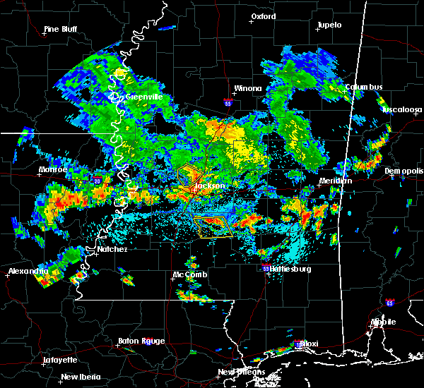 At 508 pm cdt, a severe thunderstorm was located near pinola, moving south at 10 mph (radar indicated). Hazards include 60 mph wind gusts. Expect damage to roofs. siding. and trees. this severe thunderstorm will be near, shivers around 540 pm cdt. Other locations impacted by this severe thunderstorm include d`lo. At 508 pm cdt, a severe thunderstorm was located near pinola, moving south at 10 mph (radar indicated). Hazards include 60 mph wind gusts. Expect damage to roofs. siding. and trees. this severe thunderstorm will be near, shivers around 540 pm cdt. Other locations impacted by this severe thunderstorm include d`lo.
|
| 7/14/2016 9:44 PM CDT |
 At 943 pm cdt, a severe thunderstorm was located over richland, moving southeast at 25 mph (radar indicated). Hazards include 60 mph wind gusts and penny size hail. Expect damage to roofs. siding. And trees. At 943 pm cdt, a severe thunderstorm was located over richland, moving southeast at 25 mph (radar indicated). Hazards include 60 mph wind gusts and penny size hail. Expect damage to roofs. siding. And trees.
|
| 4/1/2016 1:17 AM CDT |
 At 117 am cdt, a severe thunderstorm was located near whites, or near star, moving east at 35 mph (radar indicated). Hazards include ping pong ball size hail and 60 mph wind gusts. People and animals outdoors will be injured. expect hail damage to roofs, siding, windows and vehicles. expect wind damage to roofs, siding and trees. this severe thunderstorm will be near, florence and harrisville around 120 am cdt. star and monterey around 125 am cdt. piney woods around 130 am cdt. cato around 140 am cdt. johns around 145 am cdt. Other locations impacted by this severe thunderstorm include braxton, puckett and d`lo. At 117 am cdt, a severe thunderstorm was located near whites, or near star, moving east at 35 mph (radar indicated). Hazards include ping pong ball size hail and 60 mph wind gusts. People and animals outdoors will be injured. expect hail damage to roofs, siding, windows and vehicles. expect wind damage to roofs, siding and trees. this severe thunderstorm will be near, florence and harrisville around 120 am cdt. star and monterey around 125 am cdt. piney woods around 130 am cdt. cato around 140 am cdt. johns around 145 am cdt. Other locations impacted by this severe thunderstorm include braxton, puckett and d`lo.
|
| 3/31/2016 7:21 PM CDT |
 The severe thunderstorm warning for southeastern rankin and northern simpson counties will expire at 730 pm cdt, the storm which prompted the warning has moved out of the area. therefore the warning will be allowed to expire. a tornado watch remains in effect until 1000 pm cdt for central mississippi. The severe thunderstorm warning for southeastern rankin and northern simpson counties will expire at 730 pm cdt, the storm which prompted the warning has moved out of the area. therefore the warning will be allowed to expire. a tornado watch remains in effect until 1000 pm cdt for central mississippi.
|
| 3/31/2016 7:12 PM CDT |
 At 711 pm cdt, a severe thunderstorm was located near martinville, or 8 miles northeast of mendenhall, moving east at 60 mph (radar indicated). Hazards include golf ball size hail and 60 mph wind gusts. People and animals outdoors will be injured. expect hail damage to roofs, siding, windows and vehicles. expect wind damage to roofs, siding and trees. this severe storm will be near, raleigh and center ridge around 725 pm cdt. other locations impacted by this severe thunderstorm include d`lo, mize and sylvarena. A tornado watch remains in effect until 1000 pm cdt for east central mississippi. At 711 pm cdt, a severe thunderstorm was located near martinville, or 8 miles northeast of mendenhall, moving east at 60 mph (radar indicated). Hazards include golf ball size hail and 60 mph wind gusts. People and animals outdoors will be injured. expect hail damage to roofs, siding, windows and vehicles. expect wind damage to roofs, siding and trees. this severe storm will be near, raleigh and center ridge around 725 pm cdt. other locations impacted by this severe thunderstorm include d`lo, mize and sylvarena. A tornado watch remains in effect until 1000 pm cdt for east central mississippi.
|
| 3/31/2016 7:10 PM CDT | Some trees and power lines dow in simpson county MS, 0.5 miles ESE of Mendenhall, MS |
| 3/31/2016 7:07 PM CDT | Multiple trees down. multiple roads closed due to debris. some structure damage from tree in simpson county MS, 7.2 miles WSW of Mendenhall, MS |
| 3/31/2016 7:03 PM CDT |
 At 701 pm cdt, a severe thunderstorm was located over mendenhall, moving east at 55 mph (radar indicated). Hazards include 60 mph wind gusts and half dollar size hail. Hail damage to vehicles is expected. expect wind damage to roofs, siding and trees. this severe thunderstorm will be near, sanatorium around 705 pm cdt. martinville around 710 pm cdt. raleigh and center ridge around 725 pm cdt. other locations impacted by this severe thunderstorm include d`lo, mize and sylvarena. A tornado watch remains in effect until 1000 pm cdt for east central mississippi. At 701 pm cdt, a severe thunderstorm was located over mendenhall, moving east at 55 mph (radar indicated). Hazards include 60 mph wind gusts and half dollar size hail. Hail damage to vehicles is expected. expect wind damage to roofs, siding and trees. this severe thunderstorm will be near, sanatorium around 705 pm cdt. martinville around 710 pm cdt. raleigh and center ridge around 725 pm cdt. other locations impacted by this severe thunderstorm include d`lo, mize and sylvarena. A tornado watch remains in effect until 1000 pm cdt for east central mississippi.
|
| 3/31/2016 6:53 PM CDT |
 At 653 pm cdt, a severe thunderstorm was located over piney woods, or near star, moving east at 60 mph (radar indicated). Hazards include two inch hail and 60 mph wind gusts. People and animals outdoors will be injured. expect hail damage to roofs, siding, windows and vehicles. expect wind damage to roofs, siding and trees. this severe storm will be near, johns around 705 pm cdt. other locations impacted by this severe thunderstorm include braxton, puckett and d`lo. A tornado watch remains in effect until 1000 pm cdt for central mississippi. At 653 pm cdt, a severe thunderstorm was located over piney woods, or near star, moving east at 60 mph (radar indicated). Hazards include two inch hail and 60 mph wind gusts. People and animals outdoors will be injured. expect hail damage to roofs, siding, windows and vehicles. expect wind damage to roofs, siding and trees. this severe storm will be near, johns around 705 pm cdt. other locations impacted by this severe thunderstorm include braxton, puckett and d`lo. A tornado watch remains in effect until 1000 pm cdt for central mississippi.
|
| 3/31/2016 6:47 PM CDT |
 At 646 pm cdt, a severe thunderstorm was located over star, moving east at 45 mph (radar indicated). Hazards include two inch hail and 60 mph wind gusts. People and animals outdoors will be injured. expect hail damage to roofs, siding, windows and vehicles. expect wind damage to roofs, siding and trees. this severe storm will be near, piney woods around 650 pm cdt. cato around 700 pm cdt. johns around 705 pm cdt. other locations impacted by this severe thunderstorm include braxton, puckett and d`lo. A tornado watch remains in effect until 1000 pm cdt for central mississippi. At 646 pm cdt, a severe thunderstorm was located over star, moving east at 45 mph (radar indicated). Hazards include two inch hail and 60 mph wind gusts. People and animals outdoors will be injured. expect hail damage to roofs, siding, windows and vehicles. expect wind damage to roofs, siding and trees. this severe storm will be near, piney woods around 650 pm cdt. cato around 700 pm cdt. johns around 705 pm cdt. other locations impacted by this severe thunderstorm include braxton, puckett and d`lo. A tornado watch remains in effect until 1000 pm cdt for central mississippi.
|
| 3/31/2016 6:40 PM CDT |
 At 640 pm cdt, a severe thunderstorm was located near whites, or near star, moving east at 45 mph (radar indicated). Hazards include 60 mph wind gusts and half dollar size hail. Hail damage to vehicles is expected. expect wind damage to roofs, siding and trees. this severe thunderstorm will be near, monterey around 645 pm cdt. star and piney woods around 650 pm cdt. cato around 700 pm cdt. johns around 705 pm cdt. other locations impacted by this severe thunderstorm include braxton, puckett and d`lo. A tornado watch remains in effect until 1000 pm cdt for central mississippi. At 640 pm cdt, a severe thunderstorm was located near whites, or near star, moving east at 45 mph (radar indicated). Hazards include 60 mph wind gusts and half dollar size hail. Hail damage to vehicles is expected. expect wind damage to roofs, siding and trees. this severe thunderstorm will be near, monterey around 645 pm cdt. star and piney woods around 650 pm cdt. cato around 700 pm cdt. johns around 705 pm cdt. other locations impacted by this severe thunderstorm include braxton, puckett and d`lo. A tornado watch remains in effect until 1000 pm cdt for central mississippi.
|
| 3/31/2016 3:23 PM CDT |
 At 322 pm cdt, a severe thunderstorm was located 7 miles northwest of clem, or 8 miles southeast of pinola, moving northeast at 35 mph (radar indicated). Hazards include 60 mph wind gusts and quarter size hail. Hail damage to vehicles is expected. expect wind damage to roofs, siding and trees. this severe thunderstorm will be near, magee and sanatorium around 335 pm cdt. martinville around 345 pm cdt. white oak around 400 pm cdt. raleigh around 405 pm cdt. burns around 415 pm cdt. A tornado watch remains in effect until 1000 pm cdt for central mississippi. At 322 pm cdt, a severe thunderstorm was located 7 miles northwest of clem, or 8 miles southeast of pinola, moving northeast at 35 mph (radar indicated). Hazards include 60 mph wind gusts and quarter size hail. Hail damage to vehicles is expected. expect wind damage to roofs, siding and trees. this severe thunderstorm will be near, magee and sanatorium around 335 pm cdt. martinville around 345 pm cdt. white oak around 400 pm cdt. raleigh around 405 pm cdt. burns around 415 pm cdt. A tornado watch remains in effect until 1000 pm cdt for central mississippi.
|
| 3/18/2016 4:18 AM CDT |
 At 418 am cdt, a severe thunderstorm was located over sanatorium, moving east at 40 mph (radar indicated). Hazards include 60 mph wind gusts and quarter size hail. Hail damage to vehicles is expected. expect wind damage to roofs, siding and trees. This severe thunderstorm will remain over mainly rural areas of northeastern simpson county. At 418 am cdt, a severe thunderstorm was located over sanatorium, moving east at 40 mph (radar indicated). Hazards include 60 mph wind gusts and quarter size hail. Hail damage to vehicles is expected. expect wind damage to roofs, siding and trees. This severe thunderstorm will remain over mainly rural areas of northeastern simpson county.
|
| 3/18/2016 4:06 AM CDT |
 At 406 am cdt, a severe thunderstorm was located over mendenhall, moving east at 40 mph (radar indicated). Hazards include 60 mph wind gusts and quarter size hail. Hail damage to vehicles is expected. expect wind damage to roofs, siding and trees. this severe thunderstorm will be near, mendenhall around 410 am cdt. martinville and sanatorium around 420 am cdt. magee around 425 am cdt. Other locations impacted by this severe thunderstorm include braxton and d`lo. At 406 am cdt, a severe thunderstorm was located over mendenhall, moving east at 40 mph (radar indicated). Hazards include 60 mph wind gusts and quarter size hail. Hail damage to vehicles is expected. expect wind damage to roofs, siding and trees. this severe thunderstorm will be near, mendenhall around 410 am cdt. martinville and sanatorium around 420 am cdt. magee around 425 am cdt. Other locations impacted by this severe thunderstorm include braxton and d`lo.
|
| 3/17/2016 10:17 AM CDT |
 At 1016 am cdt, a severe thunderstorm was located near hebron, or 7 miles southeast of pinola, moving east at 45 mph (radar indicated). Hazards include ping pong ball size hail. People and animals outdoors will be injured. expect damage to roofs, siding, windows and vehicles. this severe thunderstorm will be near, magee and sanatorium around 1030 am cdt. taylorsville and center ridge around 1055 am cdt. Other locations impacted by this severe thunderstorm include mize and sylvarena. At 1016 am cdt, a severe thunderstorm was located near hebron, or 7 miles southeast of pinola, moving east at 45 mph (radar indicated). Hazards include ping pong ball size hail. People and animals outdoors will be injured. expect damage to roofs, siding, windows and vehicles. this severe thunderstorm will be near, magee and sanatorium around 1030 am cdt. taylorsville and center ridge around 1055 am cdt. Other locations impacted by this severe thunderstorm include mize and sylvarena.
|
| 3/3/2016 4:27 PM CST | The severe thunderstorm warning for southern rankin and north central simpson counties will expire at 430 pm cst, the severe thunderstorm which prompted the warning has moved out of the warned area. therefore the warning will be allowed to expire. |
| 3/3/2016 4:14 PM CST |
 At 414 pm cst, a severe thunderstorm was located near cato, or 7 miles north of mendenhall, moving east at 50 mph (radar indicated). Hazards include 60 mph wind gusts and quarter size hail. Hail damage to vehicles is expected. expect wind damage to roofs, siding and trees. This severe thunderstorm will remain over mainly rural areas of southern rankin and north central simpson counties, including the following locations, braxton, puckett and d`lo. At 414 pm cst, a severe thunderstorm was located near cato, or 7 miles north of mendenhall, moving east at 50 mph (radar indicated). Hazards include 60 mph wind gusts and quarter size hail. Hail damage to vehicles is expected. expect wind damage to roofs, siding and trees. This severe thunderstorm will remain over mainly rural areas of southern rankin and north central simpson counties, including the following locations, braxton, puckett and d`lo.
|
| 3/3/2016 3:45 PM CST |
 At 344 pm cst, a severe thunderstorm was located near richland, moving southeast at 35 mph (radar indicated). Hazards include 60 mph wind gusts and quarter size hail. Hail damage to vehicles is expected. expect wind damage to roofs, siding and trees. this severe thunderstorm will be near, florence around 350 pm cst. monterey around 355 pm cst. star around 400 pm cst. piney woods around 405 pm cst. cato and johns around 415 pm cst. mendenhall around 425 pm cst. Other locations impacted by this severe thunderstorm include braxton, puckett and d`lo. At 344 pm cst, a severe thunderstorm was located near richland, moving southeast at 35 mph (radar indicated). Hazards include 60 mph wind gusts and quarter size hail. Hail damage to vehicles is expected. expect wind damage to roofs, siding and trees. this severe thunderstorm will be near, florence around 350 pm cst. monterey around 355 pm cst. star around 400 pm cst. piney woods around 405 pm cst. cato and johns around 415 pm cst. mendenhall around 425 pm cst. Other locations impacted by this severe thunderstorm include braxton, puckett and d`lo.
|
| 2/23/2016 10:02 PM CST |
 At 1002 pm cst, a severe thunderstorm was located over martinville, or 7 miles northeast of mendenhall, moving northeast at 55 mph (radar indicated). Hazards include 60 mph wind gusts and penny size hail. Expect damage to roofs. siding and trees. This severe thunderstorm will remain over mainly rural areas of northeastern simpson county. At 1002 pm cst, a severe thunderstorm was located over martinville, or 7 miles northeast of mendenhall, moving northeast at 55 mph (radar indicated). Hazards include 60 mph wind gusts and penny size hail. Expect damage to roofs. siding and trees. This severe thunderstorm will remain over mainly rural areas of northeastern simpson county.
|
| 2/23/2016 9:45 PM CST |
 At 944 pm cst, severe thunderstorms were located along a line extending from near piney woods to shivers, moving northeast at 55 mph (radar indicated). Hazards include 60 mph wind gusts and penny size hail. Expect damage to roofs. siding and trees. severe thunderstorms will be near, magee, mendenhall and sanatorium around 1000 pm cst. martinville around 1005 pm cst. Other locations impacted by these severe thunderstorms include braxton and d`lo. At 944 pm cst, severe thunderstorms were located along a line extending from near piney woods to shivers, moving northeast at 55 mph (radar indicated). Hazards include 60 mph wind gusts and penny size hail. Expect damage to roofs. siding and trees. severe thunderstorms will be near, magee, mendenhall and sanatorium around 1000 pm cst. martinville around 1005 pm cst. Other locations impacted by these severe thunderstorms include braxton and d`lo.
|
| 2/15/2016 2:08 PM CST |
 At 208 pm cst, a severe thunderstorm capable of producing a tornado was located over sanatorium, or near magee, moving east at 45 mph (radar indicated rotation). Hazards include tornado. Flying debris will be dangerous to those caught without shelter. mobile homes will be damaged or destroyed. damage to roofs, windows and vehicles will occur. tree damage is likely. this dangerous storm will be near, center ridge around 235 pm cst. taylorsville around 240 pm cst. Other locations impacted by this tornadic thunderstorm include mize and sylvarena. At 208 pm cst, a severe thunderstorm capable of producing a tornado was located over sanatorium, or near magee, moving east at 45 mph (radar indicated rotation). Hazards include tornado. Flying debris will be dangerous to those caught without shelter. mobile homes will be damaged or destroyed. damage to roofs, windows and vehicles will occur. tree damage is likely. this dangerous storm will be near, center ridge around 235 pm cst. taylorsville around 240 pm cst. Other locations impacted by this tornadic thunderstorm include mize and sylvarena.
|
| 2/15/2016 2:05 PM CST |
 At 205 pm cst, severe thunderstorms were located along a line extending from near martinville to 7 miles southeast of pinola to near prentiss to jayess, moving east at 60 mph (radar indicated). Hazards include 60 mph wind gusts. Expect damage to roofs. siding and trees. these severe storms will be near, sanatorium and martinville around 210 pm cst. magee, lone star, clem and arm around 215 pm cst. mount olive and oak vale around 220 pm cst. society hill around 225 pm cst. carson around 230 pm cst. other locations impacted by these severe thunderstorms include silver creek, new hebron, bassfield and d`lo. A tornado watch remains in effect until 600 pm cst for southeastern mississippi. At 205 pm cst, severe thunderstorms were located along a line extending from near martinville to 7 miles southeast of pinola to near prentiss to jayess, moving east at 60 mph (radar indicated). Hazards include 60 mph wind gusts. Expect damage to roofs. siding and trees. these severe storms will be near, sanatorium and martinville around 210 pm cst. magee, lone star, clem and arm around 215 pm cst. mount olive and oak vale around 220 pm cst. society hill around 225 pm cst. carson around 230 pm cst. other locations impacted by these severe thunderstorms include silver creek, new hebron, bassfield and d`lo. A tornado watch remains in effect until 600 pm cst for southeastern mississippi.
|
| 2/15/2016 1:46 PM CST |
 At 146 pm cst, severe thunderstorms were located along a line extending from near piney woods to near rockport to sontag to near ruth, moving east at 40 mph (radar indicated). Hazards include 60 mph wind gusts. Expect damage to roofs. siding and trees. severe thunderstorms will be near, wanilla and harrisville around 150 pm cst. union around 155 pm cst. shivers around 200 pm cst. pinola, jayess and topeka around 205 pm cst. mendenhall, prentiss and robinwood around 215 pm cst. sanatorium and tilton around 220 pm cst. magee, clem, lone star, martinville and arm around 225 pm cst. oak vale around 230 pm cst. other locations impacted by these severe thunderstorms include silver creek, new hebron, braxton, bassfield and d`lo. A tornado watch remains in effect until 600 pm cst for southeastern mississippi. At 146 pm cst, severe thunderstorms were located along a line extending from near piney woods to near rockport to sontag to near ruth, moving east at 40 mph (radar indicated). Hazards include 60 mph wind gusts. Expect damage to roofs. siding and trees. severe thunderstorms will be near, wanilla and harrisville around 150 pm cst. union around 155 pm cst. shivers around 200 pm cst. pinola, jayess and topeka around 205 pm cst. mendenhall, prentiss and robinwood around 215 pm cst. sanatorium and tilton around 220 pm cst. magee, clem, lone star, martinville and arm around 225 pm cst. oak vale around 230 pm cst. other locations impacted by these severe thunderstorms include silver creek, new hebron, braxton, bassfield and d`lo. A tornado watch remains in effect until 600 pm cst for southeastern mississippi.
|
| 2/15/2016 1:12 PM CST |
 At 112 pm cst, a severe thunderstorm capable of producing a tornado was located over magee, moving east at 40 mph (radar indicated rotation). Hazards include tornado and quarter size hail. Flying debris will be dangerous to those caught without shelter. mobile homes will be damaged or destroyed. damage to roofs, windows and vehicles will occur. tree damage is likely. This tornadic thunderstorm will remain over mainly rural areas of eastern simpson and western smith counties, including the following locations, mize. At 112 pm cst, a severe thunderstorm capable of producing a tornado was located over magee, moving east at 40 mph (radar indicated rotation). Hazards include tornado and quarter size hail. Flying debris will be dangerous to those caught without shelter. mobile homes will be damaged or destroyed. damage to roofs, windows and vehicles will occur. tree damage is likely. This tornadic thunderstorm will remain over mainly rural areas of eastern simpson and western smith counties, including the following locations, mize.
|
| 2/15/2016 12:40 PM CST |
 At 1240 pm cst, a severe thunderstorm capable of producing a tornado was located near union, or 8 miles southwest of pinola, moving northeast at 40 mph (radar indicated rotation). Hazards include tornado and quarter size hail. Flying debris will be dangerous to those caught without shelter. mobile homes will be damaged or destroyed. damage to roofs, windows and vehicles will occur. tree damage is likely. this dangerous storm will be near, pinola around 1255 pm cst. mendenhall around 105 pm cst. magee and sanatorium around 110 pm cst. martinville around 115 pm cst. white oak around 125 pm cst. Other locations impacted by this tornadic thunderstorm include d`lo, mize and braxton. At 1240 pm cst, a severe thunderstorm capable of producing a tornado was located near union, or 8 miles southwest of pinola, moving northeast at 40 mph (radar indicated rotation). Hazards include tornado and quarter size hail. Flying debris will be dangerous to those caught without shelter. mobile homes will be damaged or destroyed. damage to roofs, windows and vehicles will occur. tree damage is likely. this dangerous storm will be near, pinola around 1255 pm cst. mendenhall around 105 pm cst. magee and sanatorium around 110 pm cst. martinville around 115 pm cst. white oak around 125 pm cst. Other locations impacted by this tornadic thunderstorm include d`lo, mize and braxton.
|
| 2/2/2016 5:54 PM CST |
 The severe thunderstorm warning for southeastern rankin, northeastern simpson and northwestern smith counties will expire at 600 pm cst, the storm which prompted the warning has weakened below severe limits and exited the warned area. therefore the warning will be allowed to expire. a tornado watch remains in effect until 700 pm cst for central mississippi. The severe thunderstorm warning for southeastern rankin, northeastern simpson and northwestern smith counties will expire at 600 pm cst, the storm which prompted the warning has weakened below severe limits and exited the warned area. therefore the warning will be allowed to expire. a tornado watch remains in effect until 700 pm cst for central mississippi.
|
| 2/2/2016 5:14 PM CST |
 At 514 pm cst, a severe thunderstorm was located near martinville, or near mendenhall, moving northeast at 40 mph (radar indicated). Hazards include 60 mph wind gusts. Expect damage to roofs. siding and trees. this severe thunderstorm will be near, johns around 520 pm cst. white oak around 525 pm cst. burns around 535 pm cst. other locations impacted by this severe thunderstorm include puckett, d`lo and polkville. A tornado watch remains in effect until 700 pm cst for central mississippi. At 514 pm cst, a severe thunderstorm was located near martinville, or near mendenhall, moving northeast at 40 mph (radar indicated). Hazards include 60 mph wind gusts. Expect damage to roofs. siding and trees. this severe thunderstorm will be near, johns around 520 pm cst. white oak around 525 pm cst. burns around 535 pm cst. other locations impacted by this severe thunderstorm include puckett, d`lo and polkville. A tornado watch remains in effect until 700 pm cst for central mississippi.
|
| 2/2/2016 4:30 PM CST |
 The national weather service in jackson has issued a * severe thunderstorm warning for. central simpson county in central mississippi. until 515 pm cst * at 429 pm cst. a severe thunderstorm was located over pinola. Moving northeast at 40 mph. The national weather service in jackson has issued a * severe thunderstorm warning for. central simpson county in central mississippi. until 515 pm cst * at 429 pm cst. a severe thunderstorm was located over pinola. Moving northeast at 40 mph.
|
| 2/2/2016 12:59 PM CST |
 The national weather service in jackson has issued a * severe thunderstorm warning for. southeastern rankin county in central mississippi. southwestern scott county in central mississippi. northeastern simpson county in central mississippi. Northwestern smith county in central mississippi. The national weather service in jackson has issued a * severe thunderstorm warning for. southeastern rankin county in central mississippi. southwestern scott county in central mississippi. northeastern simpson county in central mississippi. Northwestern smith county in central mississippi.
|
| 1/21/2016 6:05 PM CST | The tornado warning for eastern simpson county will expire at 615 pm cst, the storm which prompted the warning has moved out of the area. therefore the warning will be allowed to expire. a tornado watch remains in effect until 1000 pm cst for south central mississippi. |
| 1/21/2016 5:56 PM CST | At 556 pm cst, a severe thunderstorm was located over union, or near pinola, moving northeast at 30 mph (radar indicated). Hazards include 60 mph wind gusts and quarter size hail. Hail damage to vehicles is expected. expect wind damage to roofs, siding and trees. this severe storm will be near, pinola around 605 pm cst. mendenhall around 615 pm cst. other locations impacted by this severe thunderstorm include braxton and d`lo. A tornado watch remains in effect until 1000 pm cst for south central mississippi. |
| 1/21/2016 5:27 PM CST | Multiple trees and power lines down in the pinola area...hwy 43 n blocked by trees with other trees down along hwy 28. likely tornado. other trees were down across part in simpson county MS, 7.9 miles NE of Mendenhall, MS |
| 1/21/2016 5:27 PM CST | The national weather service in jackson has issued a * tornado warning for. eastern simpson county in central mississippi. until 615 pm cst * at 526 pm cst. a severe thunderstorm capable of producing a tornado was located over pinola. Moving east at 30 mph. |
| 1/21/2016 5:17 PM CST | At 517 pm cst, a severe thunderstorm was located near wesson, or 10 miles northeast of brookhaven, moving northeast at 30 mph (radar indicated). Hazards include ping pong ball size hail and 60 mph wind gusts. People and animals outdoors will be injured. expect hail damage to roofs, siding, windows and vehicles. expect wind damage to roofs, siding and trees. this severe thunderstorm will be near, sontag around 525 pm cst. oma around 535 pm cst. rockport around 540 pm cst. union and shivers around 555 pm cst. pinola around 605 pm cst. mendenhall around 615 pm cst. other locations impacted by this severe thunderstorm include beauregard, georgetown, braxton and d`lo. A tornado watch remains in effect until 1000 pm cst for south central mississippi. |
| 12/28/2015 5:01 AM CST |
 At 500 am cst, severe thunderstorms were located along a line extending from ridgeland to near shivers, moving east at 30 mph (radar indicated). Hazards include 60 mph wind gusts. Expect damage to roofs. siding and trees. severe thunderstorms will be near, pinola and fannin around 515 am cst. goshen springs around 525 am cst. pisgah around 530 am cst. sanatorium around 535 am cst. magee and leesburg around 540 am cst. other locations impacted by these severe thunderstorms include braxton, puckett and d`lo. A tornado watch remains in effect until 800 am cst for southeastern mississippi. At 500 am cst, severe thunderstorms were located along a line extending from ridgeland to near shivers, moving east at 30 mph (radar indicated). Hazards include 60 mph wind gusts. Expect damage to roofs. siding and trees. severe thunderstorms will be near, pinola and fannin around 515 am cst. goshen springs around 525 am cst. pisgah around 530 am cst. sanatorium around 535 am cst. magee and leesburg around 540 am cst. other locations impacted by these severe thunderstorms include braxton, puckett and d`lo. A tornado watch remains in effect until 800 am cst for southeastern mississippi.
|
| 12/23/2015 2:40 PM CST | At 240 pm cst, a severe thunderstorm capable of producing a tornado was located over sanatorium, or near magee, moving northeast at 55 mph (radar indicated rotation). Hazards include tornado and quarter size hail. Flying debris will be dangerous to those caught without shelter. mobile homes will be damaged or destroyed. damage to roofs, windows and vehicles will occur. tree damage is likely. this dangerous storm will be near, martinville around 245 pm cst. white oak around 255 pm cst. raleigh around 300 pm cst. burns around 305 pm cst. pineville around 315 pm cst. Other locations impacted by this tornadic thunderstorm include sylvarena. |
| 12/23/2015 2:30 PM CST | At 230 pm cst, a severe thunderstorm capable of producing a tornado was located near shivers, or near pinola, moving northeast at 60 mph (radar indicated rotation). Hazards include tornado and quarter size hail. Flying debris will be dangerous to those caught without shelter. mobile homes will be damaged or destroyed. damage to roofs, windows and vehicles will occur. tree damage is likely. this dangerous storm will be near, magee and sanatorium around 240 pm cst. martinville around 245 pm cst. white oak around 250 pm cst. raleigh around 255 pm cst. burns around 300 pm cst. pineville around 305 pm cst. Other locations impacted by this tornadic thunderstorm include mize and sylvarena. |
| 12/23/2015 2:23 PM CST | At 223 pm cst, a severe thunderstorm was located near shivers, or near pinola, moving northeast at 60 mph (radar indicated). Hazards include 60 mph wind gusts and quarter size hail. Hail damage to vehicles is expected. expect wind damage to roofs, siding and trees. this severe storm will be near, magee, mendenhall and sanatorium around 235 pm cst. martinville around 240 pm cst. other locations impacted by this severe thunderstorm include new hebron. A tornado watch remains in effect until 800 pm cst for south central mississippi. |
| 12/23/2015 2:17 PM CST | At 216 pm cst, a severe thunderstorm was located near hebron, or 11 miles south of pinola, moving northeast at 60 mph (radar indicated). Hazards include 60 mph wind gusts. Expect damage to roofs. siding and trees. this severe thunderstorm will be near, shivers around 220 pm cst. pinola around 225 pm cst. magee, mendenhall and sanatorium around 235 pm cst. martinville around 240 pm cst. other locations impacted by this severe thunderstorm include new hebron. A tornado watch remains in effect until 800 pm cst for south central mississippi. |
| 6/24/2015 2:55 PM CDT |
 At 254 pm cdt, a severe thunderstorm was located over mendenhall, moving west at 25 mph (radar indicated). Hazards include golf ball size hail and 60 mph wind gusts. People and animals outdoors will be injured. expect hail damage to roofs, siding, windows and vehicles. expect wind damage to roofs, siding and trees. Locations impacted include, mendenhall, pinola, union, shivers, sanatorium, harrisville, martinville, d`lo and braxton. At 254 pm cdt, a severe thunderstorm was located over mendenhall, moving west at 25 mph (radar indicated). Hazards include golf ball size hail and 60 mph wind gusts. People and animals outdoors will be injured. expect hail damage to roofs, siding, windows and vehicles. expect wind damage to roofs, siding and trees. Locations impacted include, mendenhall, pinola, union, shivers, sanatorium, harrisville, martinville, d`lo and braxton.
|
| 6/24/2015 2:37 PM CDT |
 At 237 pm cdt, a severe thunderstorm was located over sanatorium, or near magee, moving west at 15 mph (radar indicated). Hazards include 60 mph wind gusts and quarter size hail. Hail damage to vehicles is expected. expect wind damage to roofs, siding and trees. Locations impacted include, magee, mendenhall, pinola, union, martinville, shivers, sanatorium, harrisville, d`lo and braxton. At 237 pm cdt, a severe thunderstorm was located over sanatorium, or near magee, moving west at 15 mph (radar indicated). Hazards include 60 mph wind gusts and quarter size hail. Hail damage to vehicles is expected. expect wind damage to roofs, siding and trees. Locations impacted include, magee, mendenhall, pinola, union, martinville, shivers, sanatorium, harrisville, d`lo and braxton.
|
| 6/24/2015 2:24 PM CDT |
 At 224 pm cdt, a severe thunderstorm was located over martinville, or near magee, moving west at 20 mph (radar indicated). Hazards include 60 mph wind gusts and quarter size hail. Hail damage to vehicles is expected. Expect wind damage to roofs, siding and trees. At 224 pm cdt, a severe thunderstorm was located over martinville, or near magee, moving west at 20 mph (radar indicated). Hazards include 60 mph wind gusts and quarter size hail. Hail damage to vehicles is expected. Expect wind damage to roofs, siding and trees.
|
| 6/15/2015 5:14 PM CDT |
 At 513 pm cdt, severe thunderstorms were located along a line extending from near star to mendenhall, moving north at 30 mph (radar indicated). Hazards include 60 mph wind gusts. Expect damage to roofs. siding and trees. these severe storms will be near, star and florence around 520 pm cdt. johns around 530 pm cdt. Other locations impacted by these severe thunderstorms include braxton, puckett and d`lo. At 513 pm cdt, severe thunderstorms were located along a line extending from near star to mendenhall, moving north at 30 mph (radar indicated). Hazards include 60 mph wind gusts. Expect damage to roofs. siding and trees. these severe storms will be near, star and florence around 520 pm cdt. johns around 530 pm cdt. Other locations impacted by these severe thunderstorms include braxton, puckett and d`lo.
|
| 6/15/2015 5:03 PM CDT |
 At 502 pm cdt, a severe thunderstorm was located near mendenhall, moving north at 35 mph (radar indicated). Hazards include 60 mph wind gusts. Expect damage to roofs. siding and trees. this severe thunderstorm will be near, piney woods around 520 pm cdt. cato around 525 pm cdt. johns around 530 pm cdt. Other locations impacted by this severe thunderstorm include braxton, puckett and d`lo. At 502 pm cdt, a severe thunderstorm was located near mendenhall, moving north at 35 mph (radar indicated). Hazards include 60 mph wind gusts. Expect damage to roofs. siding and trees. this severe thunderstorm will be near, piney woods around 520 pm cdt. cato around 525 pm cdt. johns around 530 pm cdt. Other locations impacted by this severe thunderstorm include braxton, puckett and d`lo.
|
| 5/27/2015 1:27 PM CDT | At 127 pm cdt, a severe thunderstorm was located over shivers, or near pinola, moving north at 20 mph (radar indicated). Hazards include 60 mph wind gusts. Expect damage to roofs. siding and trees. this severe thunderstorm will be near, shivers around 130 pm cdt. union around 145 pm cdt. pinola around 150 pm cdt. harrisville around 205 pm cdt. mendenhall around 210 pm cdt. Other locations impacted by this severe thunderstorm include braxton and d`lo. |
| 5/18/2015 12:39 AM CDT | At 1239 am cdt, a severe thunderstorm was located near whites, or 7 miles east of crystal springs, moving northeast at 50 mph (radar indicated). Hazards include 60 mph wind gusts. Expect damage to roofs. siding and trees. this severe thunderstorm will be near, harrisville around 1245 am cdt. florence around 1250 am cdt. star, piney woods and monterey around 1255 am cdt. cato around 105 am cdt. johns around 110 am cdt. other locations impacted by this severe thunderstorm include puckett, braxton, d`lo and georgetown. 75in. |
| 5/15/2015 1:51 PM CDT | At 151 pm cdt, a severe thunderstorm was located near martinville, or near mendenhall, moving north at 25 mph (radar indicated). Hazards include 60 mph wind gusts and penny size hail. Expect damage to roofs. siding and trees. locations impacted include, mendenhall, martinville, d`lo and braxton. 0. 75in. |
| 5/15/2015 1:39 PM CDT | At 139 pm cdt, a severe thunderstorm was located near mendenhall, moving north at 15 mph (radar indicated). Hazards include 60 mph wind gusts and quarter size hail. Hail damage to vehicles is expected. expect wind damage to roofs, siding and trees. this severe thunderstorm will remain over mainly rural areas of northeastern simpson county, including the following locations, braxton and d`lo. 1. 00in. |
| 5/15/2015 1:28 PM CDT | At 128 pm cdt, a severe thunderstorm was located over sanatorium, or near magee, moving north at 30 mph (radar indicated). Hazards include 60 mph wind gusts and quarter size hail. Hail damage to vehicles is expected. expect wind damage to roofs, siding and trees. this severe thunderstorm will be near, mendenhall and martinville around 145 pm cdt. other locations impacted by this severe thunderstorm include braxton and d`lo. 1. 00in. |
| 4/15/2015 7:51 PM CDT | The national weather service in jackson has issued a * severe thunderstorm warning for. southeastern rankin county in central mississippi. northeastern simpson county in central mississippi. until 830 pm cdt * at 751 pm cdt. A severe thunderstorm was located near pinola. |
| 3/18/2015 7:16 PM CDT | The national weather service in jackson has issued a * severe thunderstorm warning for. southeastern rankin county in central mississippi. northeastern simpson county in central mississippi. northwestern smith county in central mississippi. Until 745 pm cdt. |
| 10/13/2014 4:00 PM CDT | A few trees down in simpson county MS, 2.7 miles NW of Mendenhall, MS |
| 8/9/2014 3:19 PM CDT | Tree down on highway 43n between mendenhall and pinol in simpson county MS, 6.1 miles NE of Mendenhall, MS |
| 6/28/2013 10:20 PM CDT | Trees were blown down in mendenhall...as well as in the old pearl area in simpson county MS, 0.5 miles ESE of Mendenhall, MS |
| 1/30/2013 4:30 AM CST | Several large tree limbs down around the county in simpson county MS, 0.5 miles ESE of Mendenhall, MS |
| 12/25/2012 3:45 PM CST | Reports of a tree down in pinol in simpson county MS, 7.9 miles NE of Mendenhall, MS |
| 7/5/2012 4:57 PM CDT | Trees down on rj walk in simpson county MS, 0.6 miles NNW of Mendenhall, MS |
| 7/5/2012 4:57 PM CDT | Trees down on rj walk in simpson county MS, 1.2 miles ENE of Mendenhall, MS |
| 7/5/2012 3:57 PM CDT | Trees down on rj walk in simpson county MS, 1.2 miles ENE of Mendenhall, MS |
| 7/5/2012 3:45 PM CDT | Trees down around hwy 540 and hwy 13 near mendenhall in simpson county MS, 0.5 miles ESE of Mendenhall, MS |
| 5/31/2012 4:05 PM CDT | Tree down on a garage in simpson county MS, 0.5 miles ESE of Mendenhall, MS |
| 5/21/2012 3:30 PM CDT | Quarter sized hail reported 1.6 miles SSE of Mendenhall, MS, penny to quarter hail...reported by nssl shave project. |
| 4/2/2012 4:00 PM CDT | Six reports of trees down across simpson county in simpson county MS, 0.5 miles ESE of Mendenhall, MS |
| 1/1/0001 12:00 AM | Trees down across hwy 13...poplar springs road...and hwy 540 in simpson county MS, 2.9 miles SW of Mendenhall, MS |
| 1/1/0001 12:00 AM | Hen Egg sized hail reported 0.5 miles ESE of Mendenhall, MS, quarter to hen egg size hail reported in mendenhall. |
| 1/1/0001 12:00 AM | Trees down around braxton...pinola and mendenhal in simpson county MS, 0.5 miles ESE of Mendenhall, MS |
| 1/1/0001 12:00 AM | Trees down off athens r in simpson county MS, 2 miles NNE of Mendenhall, MS |
| 1/1/0001 12:00 AM | Couple trees down off hwy 28 in simpson county MS, 7.9 miles NE of Mendenhall, MS |
| 1/1/0001 12:00 AM | Couple trees down off hwy 28 in simpson county MS, 7.9 miles NE of Mendenhall, MS |
| 1/1/0001 12:00 AM | Several trees were downed around mendenhall. three homes were damaged by fallen trees. power lines were downed across us highway 4 in simpson county MS, 0.5 miles ESE of Mendenhall, MS |
| 1/1/0001 12:00 AM | Ping Pong Ball sized hail reported 1.3 miles W of Mendenhall, MS |
| 1/1/0001 12:00 AM | Tennis Ball sized hail reported 2.5 miles W of Mendenhall, MS |
| 1/1/0001 12:00 AM | Hen Egg sized hail reported 0.5 miles ESE of Mendenhall, MS, larger than golf ball sized hail |
| 1/1/0001 12:00 AM | A swath of straight line wind damage affected the south through east sides of mendenhall between 215 and 230 pm. numerous trees were uprooted and snapped...a number fel in simpson county MS, 4 miles NNE of Mendenhall, MS |
| 1/1/0001 12:00 AM | Few trees down...including one across state highway 13 in simpson county MS, 2.7 miles N of Mendenhall, MS |
Hail Maps for Mendenhall, MS
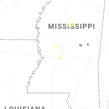
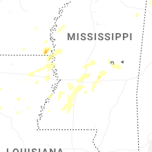
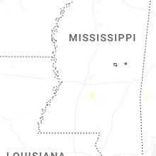
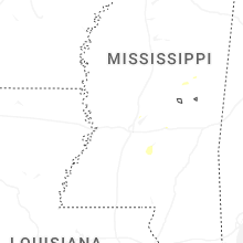
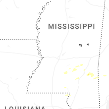
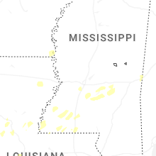

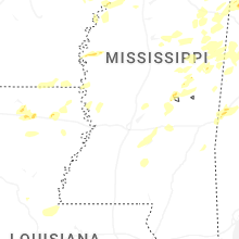
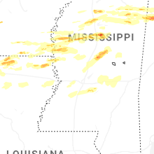


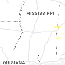


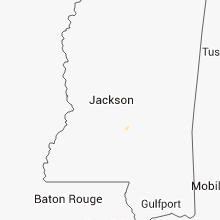


Connect with Interactive Hail Maps