

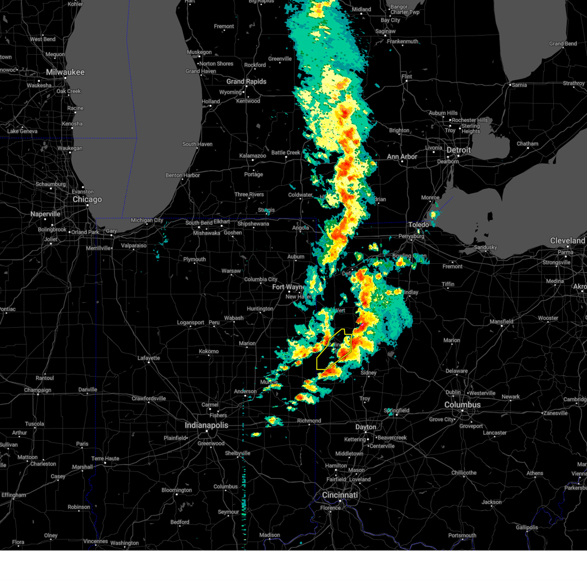
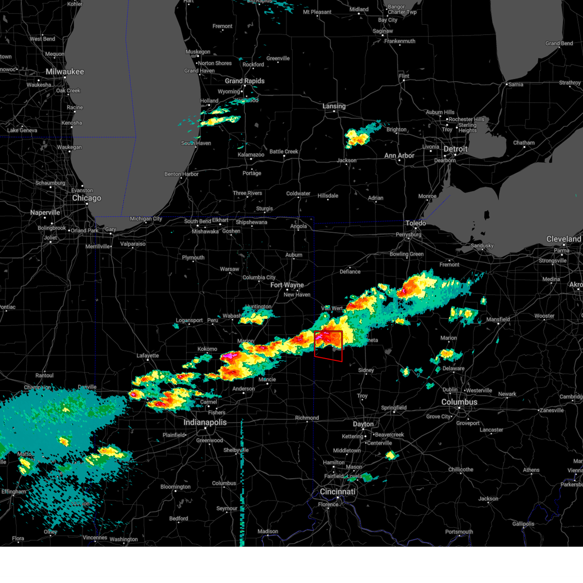
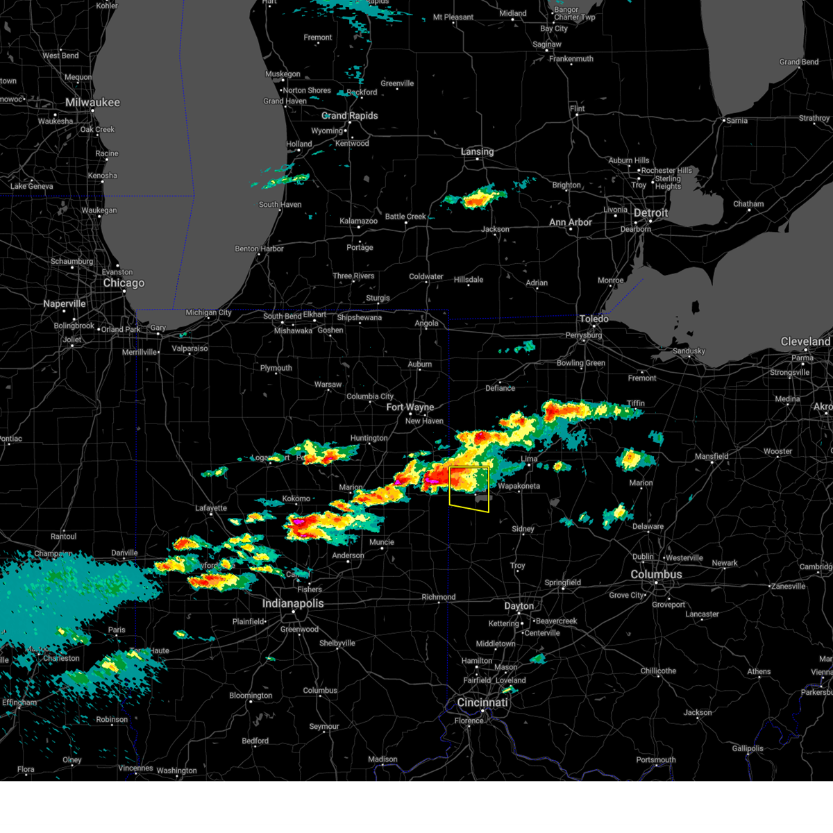
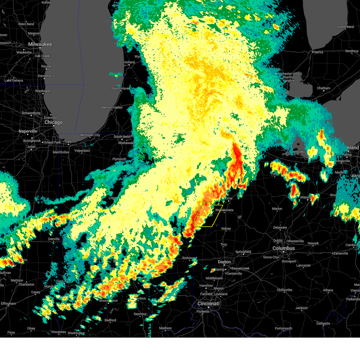
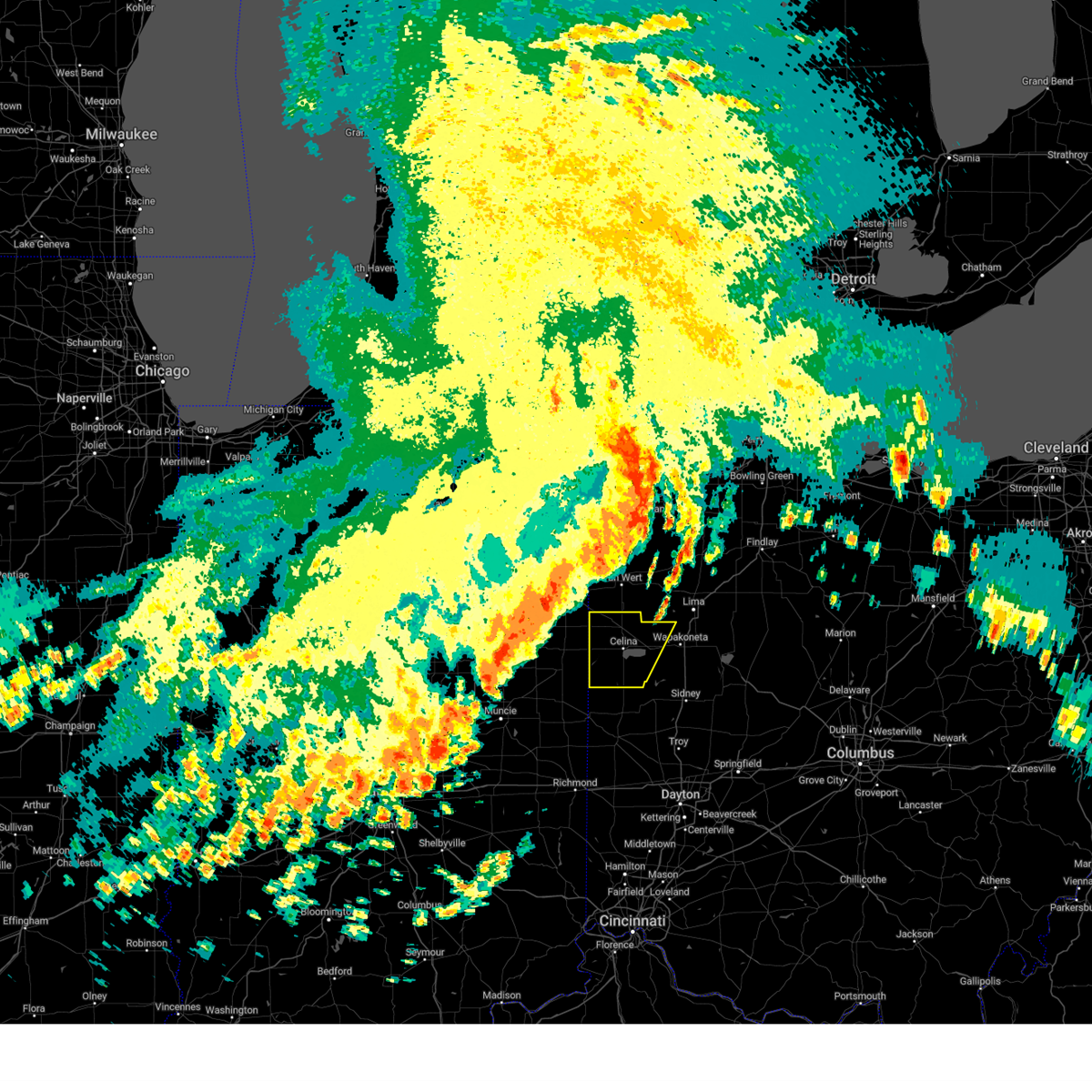
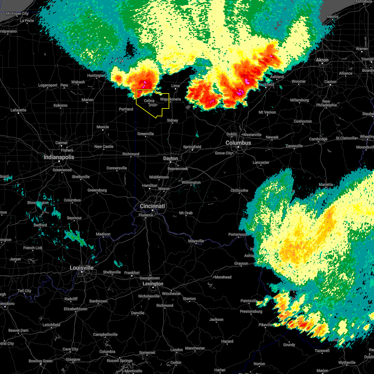
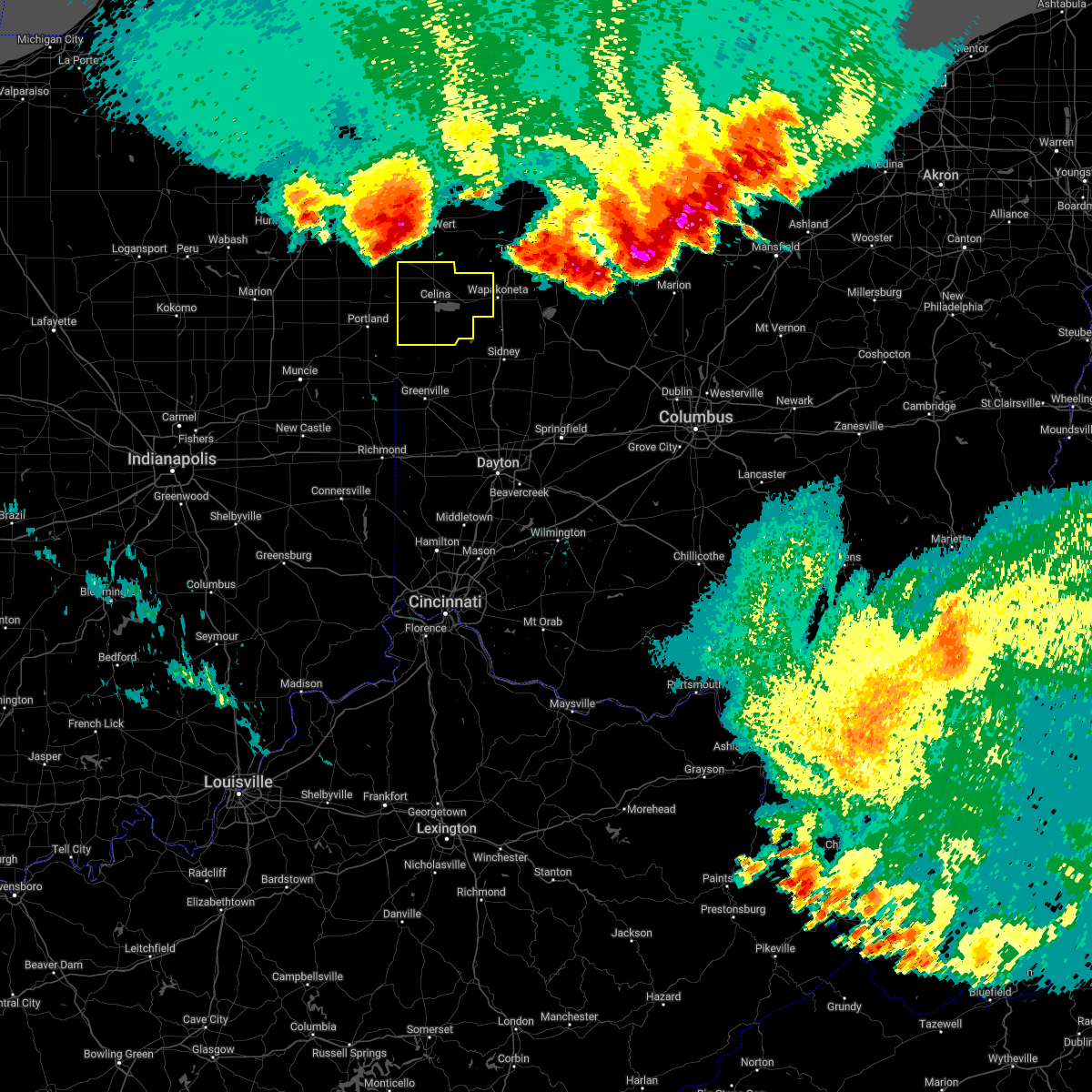
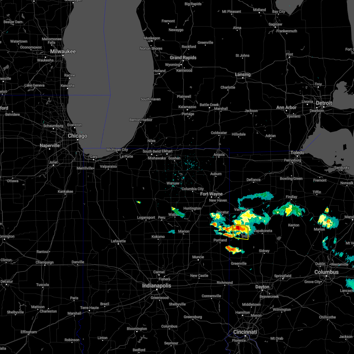
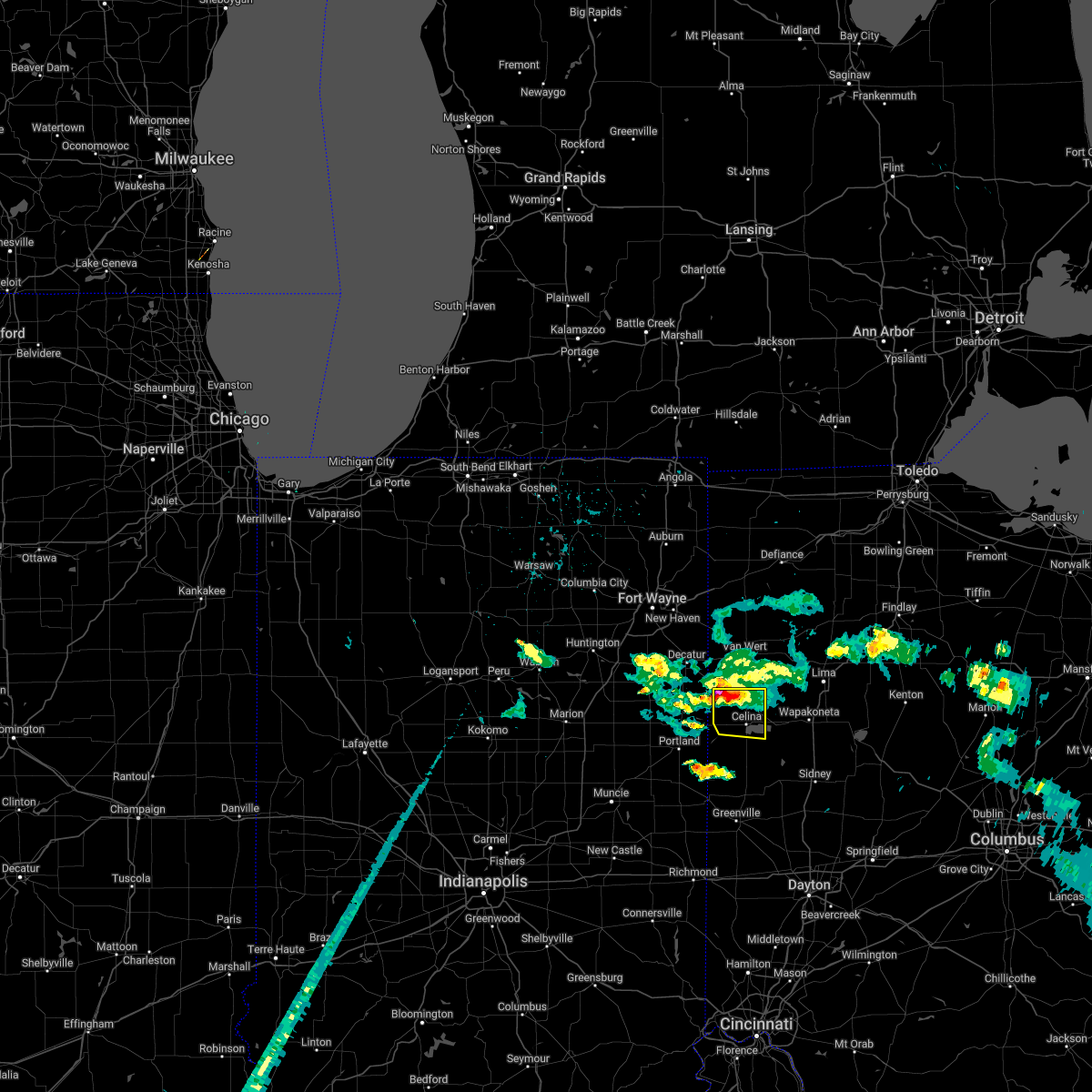
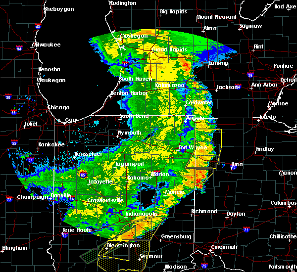
Hail Map for Mendon, OH
The Mendon, OH area has had 2 reports of on-the-ground hail by trained spotters, and has been under severe weather warnings 14 times during the past 12 months. Doppler radar has detected hail at or near Mendon, OH on 33 occasions, including 1 occasion during the past year.
| Name: | Mendon, OH |
| Where Located: | 41.1 miles SE of Fort Wayne, IN |
| Map: | Google Map for Mendon, OH |
| Population: | 662 |
| Housing Units: | 288 |
| More Info: | Search Google for Mendon, OH |
1
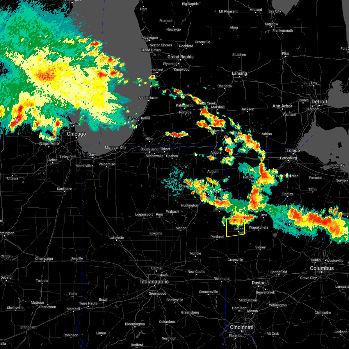
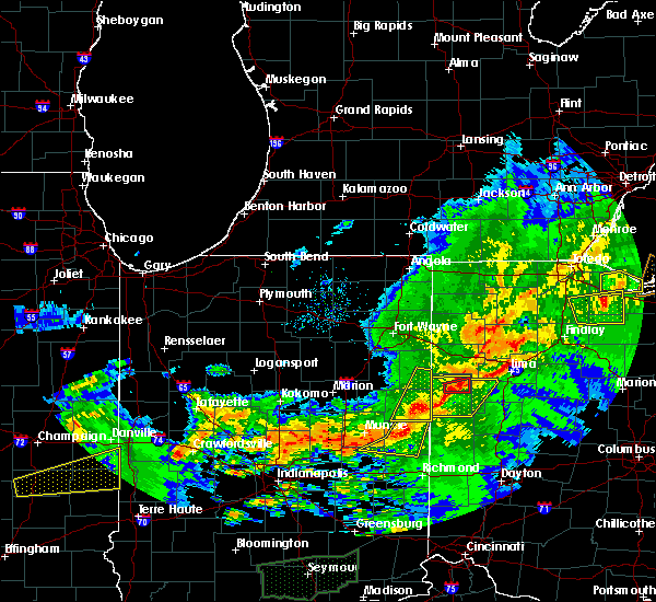
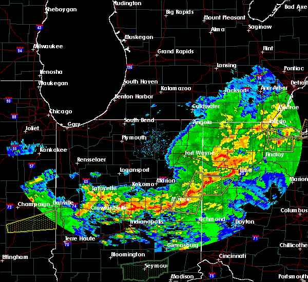
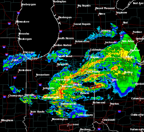
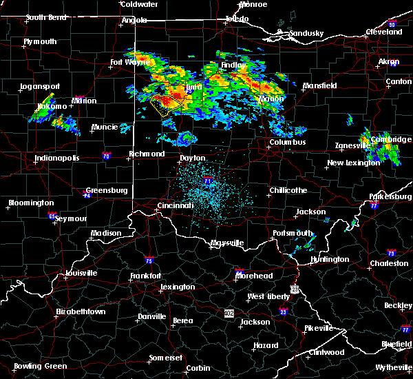
The Top Recent Hail Date for Mendon, OH is Thursday, March 14, 2024 (5th out of 33)

Hail and Wind Damage Spotted near Mendon, OH
| Date / Time | Report Details |
|---|---|
| 4/17/2024 2:09 PM EDT |
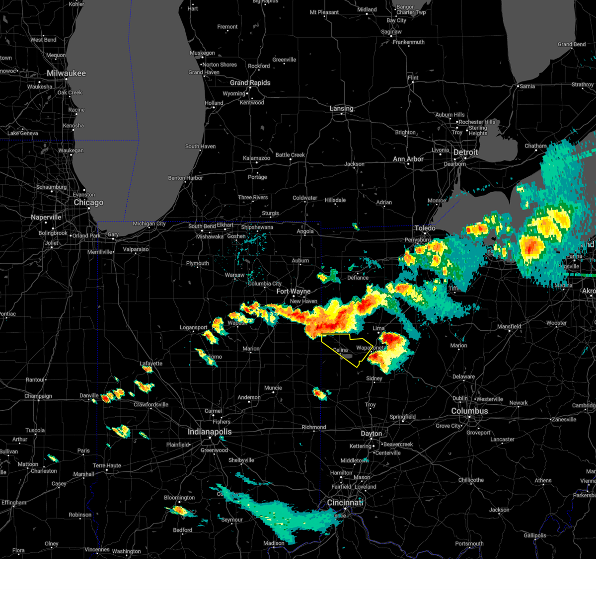
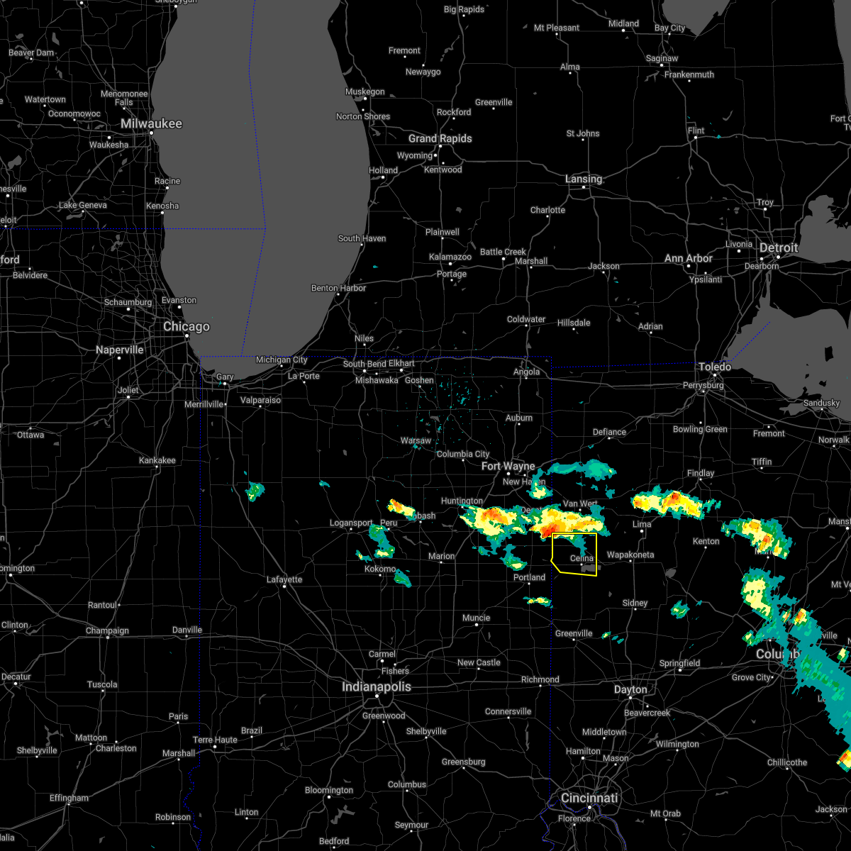
 The storm which prompted the warning has weakened below severe limits and is exiting the warned area. therefore, the warning will be allowed to expire. a tornado watch remains in effect until 700 pm edt for west central ohio. please report previous wind damage or hail to the national weather service by going to our website at weather.gov/iln and submitting your report via social media. The storm which prompted the warning has weakened below severe limits and is exiting the warned area. therefore, the warning will be allowed to expire. a tornado watch remains in effect until 700 pm edt for west central ohio. please report previous wind damage or hail to the national weather service by going to our website at weather.gov/iln and submitting your report via social media.
|
| 4/17/2024 1:50 PM EDT |
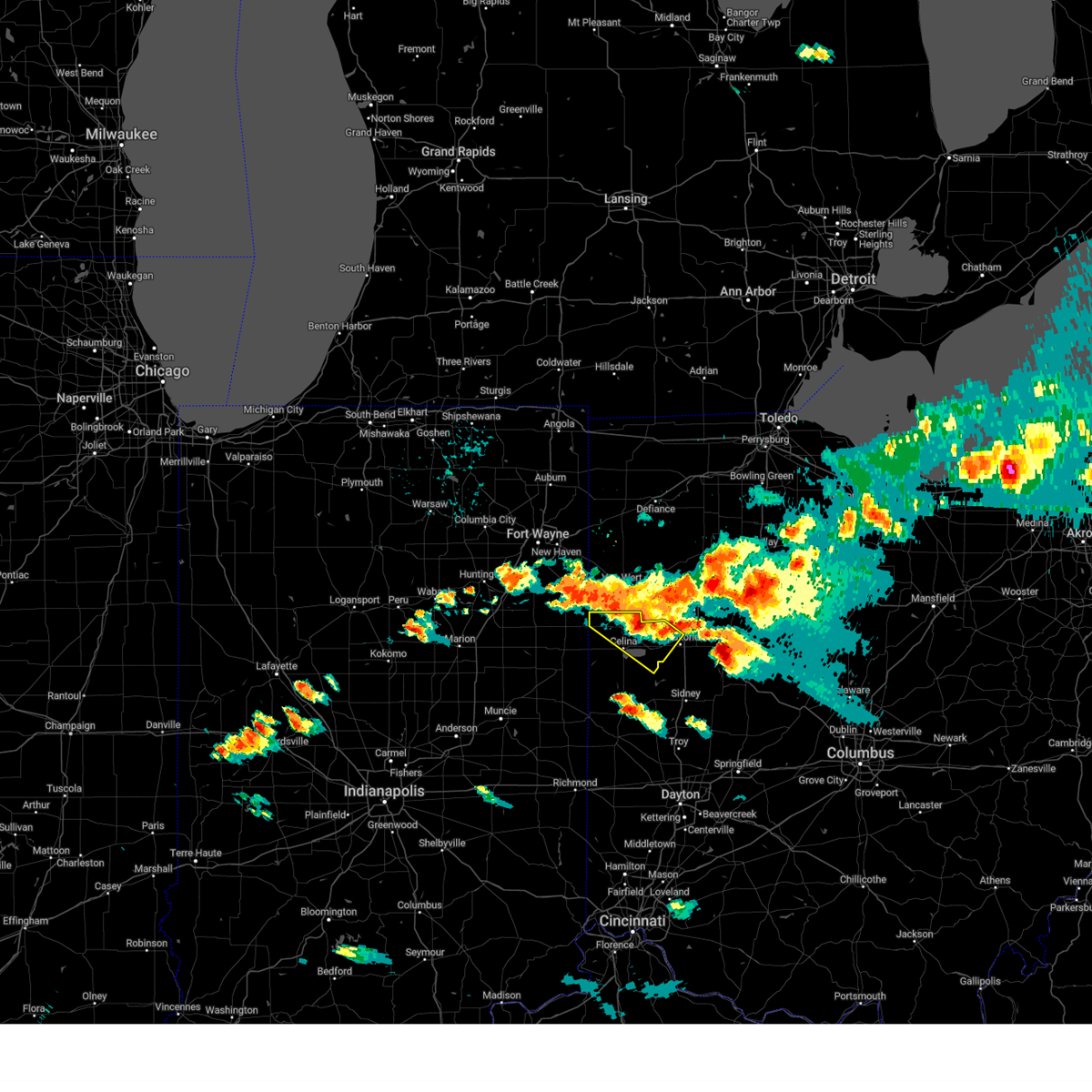
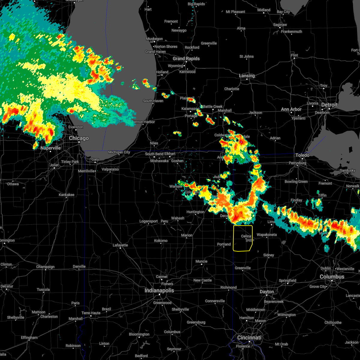
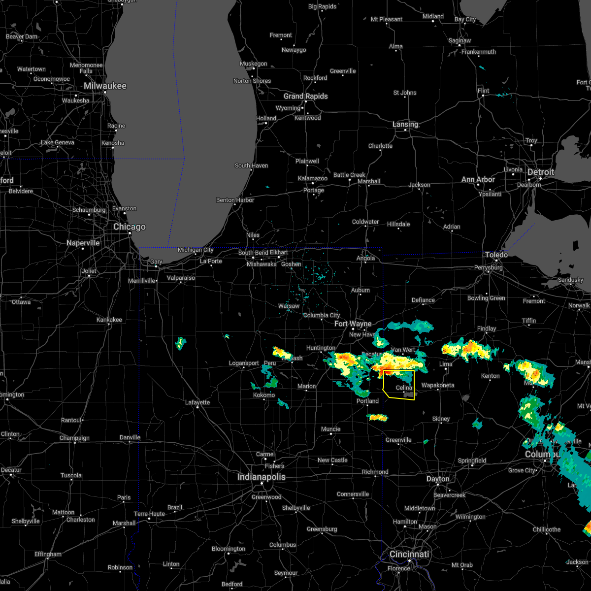
 At 150 pm edt, a severe thunderstorm was located over celina, moving northeast at 40 mph (radar indicated). Hazards include 60 mph wind gusts and quarter size hail. Minor hail damage to vehicles is possible. expect wind damage to trees and power lines. locations impacted include, celina, st. marys, coldwater, st. Henry, fort recovery, mendon, montezuma, neptune, carthagena, bulkhead and tama. At 150 pm edt, a severe thunderstorm was located over celina, moving northeast at 40 mph (radar indicated). Hazards include 60 mph wind gusts and quarter size hail. Minor hail damage to vehicles is possible. expect wind damage to trees and power lines. locations impacted include, celina, st. marys, coldwater, st. Henry, fort recovery, mendon, montezuma, neptune, carthagena, bulkhead and tama.
|
| 4/17/2024 1:37 PM EDT |
 Svriln the national weather service in wilmington has issued a * severe thunderstorm warning for, northwestern auglaize county in west central ohio, mercer county in west central ohio, * until 215 pm edt. * at 137 pm edt, a severe thunderstorm was located near fort recovery, moving northeast at 45 mph (radar indicated). Hazards include 60 mph wind gusts and quarter size hail. Minor hail damage to vehicles is possible. Expect wind damage to trees and power lines. Svriln the national weather service in wilmington has issued a * severe thunderstorm warning for, northwestern auglaize county in west central ohio, mercer county in west central ohio, * until 215 pm edt. * at 137 pm edt, a severe thunderstorm was located near fort recovery, moving northeast at 45 mph (radar indicated). Hazards include 60 mph wind gusts and quarter size hail. Minor hail damage to vehicles is possible. Expect wind damage to trees and power lines.
|
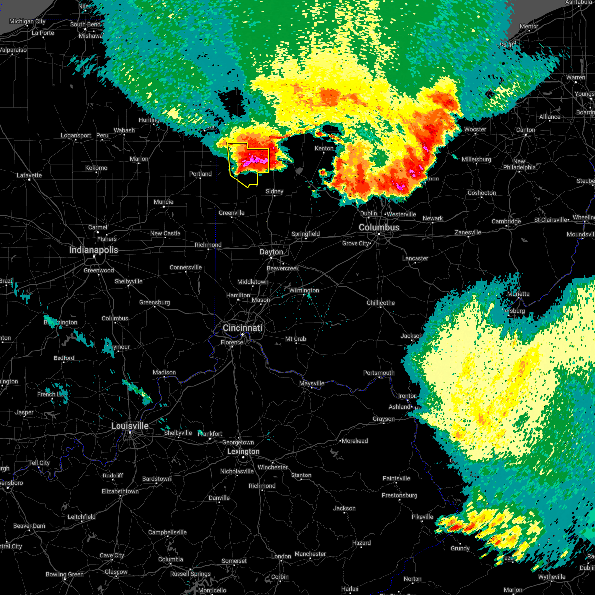
| 3/14/2024 6:57 PM EDT |
 At 656 pm edt, a severe thunderstorm capable of producing a tornado was located 2 miles west of celina, moving east at 45 mph (radar indicated rotation). Hazards include tornado and half dollar size hail. Flying debris will be dangerous to those caught without shelter. mobile homes will be damaged or destroyed. damage to roofs, windows, and vehicles will occur. tree damage is likely. Locations impacted include, celina, coldwater, rockford, mendon, montezuma, neptune, and tama. At 656 pm edt, a severe thunderstorm capable of producing a tornado was located 2 miles west of celina, moving east at 45 mph (radar indicated rotation). Hazards include tornado and half dollar size hail. Flying debris will be dangerous to those caught without shelter. mobile homes will be damaged or destroyed. damage to roofs, windows, and vehicles will occur. tree damage is likely. Locations impacted include, celina, coldwater, rockford, mendon, montezuma, neptune, and tama.
|
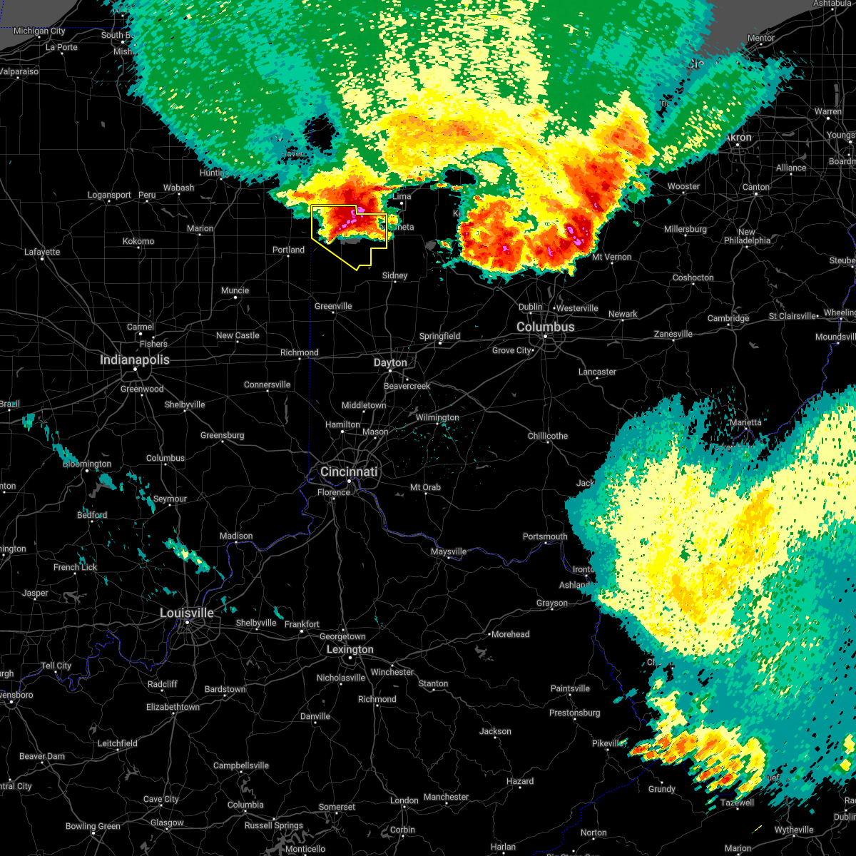
| 3/14/2024 6:47 PM EDT |
 Toriln the national weather service in wilmington has issued a * tornado warning for, mercer county in west central ohio, * until 715 pm edt. * at 647 pm edt, a severe thunderstorm capable of producing a tornado was located 7 miles northwest of coldwater, moving east at 45 mph (radar indicated rotation). Hazards include tornado and golf ball size hail. Flying debris will be dangerous to those caught without shelter. mobile homes will be damaged or destroyed. damage to roofs, windows, and vehicles will occur. Tree damage is likely. Toriln the national weather service in wilmington has issued a * tornado warning for, mercer county in west central ohio, * until 715 pm edt. * at 647 pm edt, a severe thunderstorm capable of producing a tornado was located 7 miles northwest of coldwater, moving east at 45 mph (radar indicated rotation). Hazards include tornado and golf ball size hail. Flying debris will be dangerous to those caught without shelter. mobile homes will be damaged or destroyed. damage to roofs, windows, and vehicles will occur. Tree damage is likely.
|
| 3/14/2024 6:31 PM EDT |
 Svriln the national weather service in wilmington has issued a * severe thunderstorm warning for, mercer county in west central ohio, * until 715 pm edt. * at 631 pm edt, a severe thunderstorm was located over geneva, moving east at 50 mph (radar indicated). Hazards include ping pong ball size hail and 60 mph wind gusts. People and animals outdoors will be injured. expect hail damage to roofs, siding, windows, and vehicles. Expect wind damage to trees and power lines. Svriln the national weather service in wilmington has issued a * severe thunderstorm warning for, mercer county in west central ohio, * until 715 pm edt. * at 631 pm edt, a severe thunderstorm was located over geneva, moving east at 50 mph (radar indicated). Hazards include ping pong ball size hail and 60 mph wind gusts. People and animals outdoors will be injured. expect hail damage to roofs, siding, windows, and vehicles. Expect wind damage to trees and power lines.
|
| 7/29/2023 3:48 AM EDT |
 At 347 am edt, severe thunderstorms were located along a line extending from spencerville to st. henry, moving east at 50 mph (radar indicated). Hazards include 60 mph wind gusts and penny size hail. Expect damage to trees and power lines. locations impacted include, celina, st. marys, coldwater, new bremen, st. Henry, fort recovery, mendon, chickasaw, burkettsville, buckland, montezuma, kossuth, tama, egypt, maria stein, neptune, carthagena and bulkhead. At 347 am edt, severe thunderstorms were located along a line extending from spencerville to st. henry, moving east at 50 mph (radar indicated). Hazards include 60 mph wind gusts and penny size hail. Expect damage to trees and power lines. locations impacted include, celina, st. marys, coldwater, new bremen, st. Henry, fort recovery, mendon, chickasaw, burkettsville, buckland, montezuma, kossuth, tama, egypt, maria stein, neptune, carthagena and bulkhead.
|
| 7/29/2023 3:34 AM EDT |
 At 334 am edt, severe thunderstorms were located along a line extending from ohio city to portland, moving east at 55 mph (radar indicated). Hazards include 60 mph wind gusts and penny size hail. Expect damage to trees and power lines. locations impacted include, celina, st. marys, coldwater, new bremen, st. Henry, fort recovery, rockford, wabash, mendon, chickasaw, burkettsville, buckland, montezuma, chattanooga, kossuth, tama, egypt, maria stein, neptune and state route 116 at state route 197. At 334 am edt, severe thunderstorms were located along a line extending from ohio city to portland, moving east at 55 mph (radar indicated). Hazards include 60 mph wind gusts and penny size hail. Expect damage to trees and power lines. locations impacted include, celina, st. marys, coldwater, new bremen, st. Henry, fort recovery, rockford, wabash, mendon, chickasaw, burkettsville, buckland, montezuma, chattanooga, kossuth, tama, egypt, maria stein, neptune and state route 116 at state route 197.
|
| 7/29/2023 3:30 AM EDT |
 At 329 am edt, severe thunderstorms were located along a line extending from ohio city to portland, moving east at 55 mph (radar indicated). Hazards include 60 mph wind gusts and penny size hail. Expect damage to trees and power lines. locations impacted include, celina, st. marys, coldwater, new bremen, st. henry, fort recovery, rockford, wabash, mendon, chickasaw, burkettsville, buckland, montezuma, chattanooga, kossuth, tama, maria stein and neptune. hail threat, radar indicated max hail size, 0. 75 in wind threat, radar indicated max wind gust, 60 mph. At 329 am edt, severe thunderstorms were located along a line extending from ohio city to portland, moving east at 55 mph (radar indicated). Hazards include 60 mph wind gusts and penny size hail. Expect damage to trees and power lines. locations impacted include, celina, st. marys, coldwater, new bremen, st. henry, fort recovery, rockford, wabash, mendon, chickasaw, burkettsville, buckland, montezuma, chattanooga, kossuth, tama, maria stein and neptune. hail threat, radar indicated max hail size, 0. 75 in wind threat, radar indicated max wind gust, 60 mph.
|
| 7/29/2023 3:16 AM EDT |
 At 315 am edt, severe thunderstorms were located along a line extending from convoy to geneva, moving east at 40 mph (radar indicated). Hazards include 60 mph wind gusts. expect damage to trees and power lines At 315 am edt, severe thunderstorms were located along a line extending from convoy to geneva, moving east at 40 mph (radar indicated). Hazards include 60 mph wind gusts. expect damage to trees and power lines
|
| 7/20/2023 6:57 PM EDT |
 The severe thunderstorm warning for northwestern auglaize and northern mercer counties will expire at 700 pm edt, the storm which prompted the warning has moved into eastern mercer and western auglaize county, and a new severe thunderstorm warning has been issued to cover this threat. a severe thunderstorm watch remains in effect until 1100 pm edt for west central ohio. please report previous wind damage or hail to the national weather service by going to our website at weather.gov/iln and submitting your report via social media. remember, a severe thunderstorm warning still remains in effect until 7:45 pm edt. The severe thunderstorm warning for northwestern auglaize and northern mercer counties will expire at 700 pm edt, the storm which prompted the warning has moved into eastern mercer and western auglaize county, and a new severe thunderstorm warning has been issued to cover this threat. a severe thunderstorm watch remains in effect until 1100 pm edt for west central ohio. please report previous wind damage or hail to the national weather service by going to our website at weather.gov/iln and submitting your report via social media. remember, a severe thunderstorm warning still remains in effect until 7:45 pm edt.
|
| 7/20/2023 6:54 PM EDT |
 At 654 pm edt, a severe thunderstorm was located 7 miles northeast of celina, moving southeast at 45 mph (radar indicated). Hazards include 60 mph wind gusts and quarter size hail. Minor hail damage to vehicles is possible. Expect wind damage to trees and power lines. At 654 pm edt, a severe thunderstorm was located 7 miles northeast of celina, moving southeast at 45 mph (radar indicated). Hazards include 60 mph wind gusts and quarter size hail. Minor hail damage to vehicles is possible. Expect wind damage to trees and power lines.
|
| 7/20/2023 6:28 PM EDT |
 At 627 pm edt, a severe thunderstorm was located over rockford, moving southeast at 35 mph (radar indicated). Hazards include 60 mph wind gusts and quarter size hail. Minor hail damage to vehicles is possible. expect wind damage to trees and power lines. locations impacted include, celina, wapakoneta, st. Marys, new bremen, rockford, new knoxville, moulton, mendon, buckland, kossuth, tama, neptune, state route 116 at state route 197 and bulkhead. At 627 pm edt, a severe thunderstorm was located over rockford, moving southeast at 35 mph (radar indicated). Hazards include 60 mph wind gusts and quarter size hail. Minor hail damage to vehicles is possible. expect wind damage to trees and power lines. locations impacted include, celina, wapakoneta, st. Marys, new bremen, rockford, new knoxville, moulton, mendon, buckland, kossuth, tama, neptune, state route 116 at state route 197 and bulkhead.
|
| 7/20/2023 6:12 PM EDT |
 At 612 pm edt, a severe thunderstorm was located 8 miles west of ohio city, moving southeast at 35 mph (radar indicated). Hazards include 60 mph wind gusts and quarter size hail. Minor hail damage to vehicles is possible. Expect wind damage to trees and power lines. At 612 pm edt, a severe thunderstorm was located 8 miles west of ohio city, moving southeast at 35 mph (radar indicated). Hazards include 60 mph wind gusts and quarter size hail. Minor hail damage to vehicles is possible. Expect wind damage to trees and power lines.
|
| 4/5/2023 2:13 PM EDT |
 The severe thunderstorm warning for southeastern mercer county will expire at 215 pm edt, the storm which prompted the warning has weakened below severe limits, and has exited the warned area. therefore, the warning will be allowed to expire. however gusty winds and heavy rain are still possible with this thunderstorm. a tornado watch remains in effect until 500 pm edt for west central ohio. please report previous wind damage or hail to the national weather service by going to our website at weather.gov/iln and submitting your report via social media. The severe thunderstorm warning for southeastern mercer county will expire at 215 pm edt, the storm which prompted the warning has weakened below severe limits, and has exited the warned area. therefore, the warning will be allowed to expire. however gusty winds and heavy rain are still possible with this thunderstorm. a tornado watch remains in effect until 500 pm edt for west central ohio. please report previous wind damage or hail to the national weather service by going to our website at weather.gov/iln and submitting your report via social media.
|
| 4/5/2023 2:04 PM EDT |
 At 204 pm edt, a severe thunderstorm was located over celina, moving east at 45 mph (radar indicated). Hazards include 60 mph wind gusts. Expect damage to trees and power lines. locations impacted include, celina, coldwater, st. Henry, mendon, chickasaw, montezuma, neptune, carthagena and tama. At 204 pm edt, a severe thunderstorm was located over celina, moving east at 45 mph (radar indicated). Hazards include 60 mph wind gusts. Expect damage to trees and power lines. locations impacted include, celina, coldwater, st. Henry, mendon, chickasaw, montezuma, neptune, carthagena and tama.
|
| 4/5/2023 1:58 PM EDT |
 At 158 pm edt, a severe thunderstorm was located near rockford, moving northeast at 50 mph (radar indicated). Hazards include 60 mph wind gusts. Expect damage to trees and power lines. locations impacted include, celina, coldwater, st. Henry, fort recovery, rockford, wabash, mendon, chickasaw, montezuma, neptune, carthagena and tama. At 158 pm edt, a severe thunderstorm was located near rockford, moving northeast at 50 mph (radar indicated). Hazards include 60 mph wind gusts. Expect damage to trees and power lines. locations impacted include, celina, coldwater, st. Henry, fort recovery, rockford, wabash, mendon, chickasaw, montezuma, neptune, carthagena and tama.
|
| 4/5/2023 1:48 PM EDT |
 At 147 pm edt, a severe thunderstorm was located 8 miles southwest of rockford, moving northeast at 45 mph (radar indicated). Hazards include 60 mph wind gusts. Expect damage to trees and power lines. locations impacted include, celina, coldwater, st. Henry, fort recovery, rockford, wabash, mendon, chickasaw, montezuma, chattanooga, tama, neptune and carthagena. At 147 pm edt, a severe thunderstorm was located 8 miles southwest of rockford, moving northeast at 45 mph (radar indicated). Hazards include 60 mph wind gusts. Expect damage to trees and power lines. locations impacted include, celina, coldwater, st. Henry, fort recovery, rockford, wabash, mendon, chickasaw, montezuma, chattanooga, tama, neptune and carthagena.
|
| 4/5/2023 1:30 PM EDT |
 At 130 pm edt, a severe thunderstorm was located near pennville, moving northeast at 55 mph (radar indicated). Hazards include 60 mph wind gusts. expect damage to trees and power lines At 130 pm edt, a severe thunderstorm was located near pennville, moving northeast at 55 mph (radar indicated). Hazards include 60 mph wind gusts. expect damage to trees and power lines
|
| 7/23/2022 10:10 AM EDT |
 The severe thunderstorm warning for auglaize and mercer counties will expire at 1015 am edt, the storms which prompted the warning have weakened below severe limits, and no longer pose an immediate threat to life or property. therefore, the warning will be allowed to expire. however gusty winds are still possible with these thunderstorms. a severe thunderstorm watch remains in effect until 200 pm edt for west central ohio. please report previous wind damage or hail to the national weather service by going to our website at weather.gov/iln and submitting your report via social media. remember, a severe thunderstorm warning still remains in effect for southern mercer county. The severe thunderstorm warning for auglaize and mercer counties will expire at 1015 am edt, the storms which prompted the warning have weakened below severe limits, and no longer pose an immediate threat to life or property. therefore, the warning will be allowed to expire. however gusty winds are still possible with these thunderstorms. a severe thunderstorm watch remains in effect until 200 pm edt for west central ohio. please report previous wind damage or hail to the national weather service by going to our website at weather.gov/iln and submitting your report via social media. remember, a severe thunderstorm warning still remains in effect for southern mercer county.
|
| 7/23/2022 9:51 AM EDT |
 At 951 am edt, severe thunderstorms were located along a line extending from near spencerville to coldwater, moving east at 40 mph (radar indicated). Hazards include 60 mph wind gusts and penny size hail. Expect damage to trees and power lines. locations impacted include, celina, wapakoneta, st. marys, coldwater, fort shawnee, new bremen, minster, st. henry, cridersville, fort recovery, rockford, new knoxville, moulton, wabash, mendon, chickasaw, burkettsville, buckland, montezuma and tama. this includes i-75 in ohio between mile markers 113 and 118. hail threat, radar indicated max hail size, 0. 75 in wind threat, radar indicated max wind gust, 60 mph. At 951 am edt, severe thunderstorms were located along a line extending from near spencerville to coldwater, moving east at 40 mph (radar indicated). Hazards include 60 mph wind gusts and penny size hail. Expect damage to trees and power lines. locations impacted include, celina, wapakoneta, st. marys, coldwater, fort shawnee, new bremen, minster, st. henry, cridersville, fort recovery, rockford, new knoxville, moulton, wabash, mendon, chickasaw, burkettsville, buckland, montezuma and tama. this includes i-75 in ohio between mile markers 113 and 118. hail threat, radar indicated max hail size, 0. 75 in wind threat, radar indicated max wind gust, 60 mph.
|
| 7/23/2022 9:34 AM EDT |
 At 933 am edt, severe thunderstorms were located along a line extending from near van wert to 8 miles east of geneva, moving east at 50 mph (radar indicated). Hazards include 60 mph wind gusts and penny size hail. Expect damage to trees and power lines. locations impacted include, celina, wapakoneta, st. marys, coldwater, fort shawnee, new bremen, minster, st. henry, cridersville, fort recovery, rockford, new knoxville, moulton, wabash, mendon, chickasaw, burkettsville, buckland, montezuma and tama. this includes i-75 in ohio between mile markers 113 and 118. hail threat, radar indicated max hail size, 0. 75 in wind threat, radar indicated max wind gust, 60 mph. At 933 am edt, severe thunderstorms were located along a line extending from near van wert to 8 miles east of geneva, moving east at 50 mph (radar indicated). Hazards include 60 mph wind gusts and penny size hail. Expect damage to trees and power lines. locations impacted include, celina, wapakoneta, st. marys, coldwater, fort shawnee, new bremen, minster, st. henry, cridersville, fort recovery, rockford, new knoxville, moulton, wabash, mendon, chickasaw, burkettsville, buckland, montezuma and tama. this includes i-75 in ohio between mile markers 113 and 118. hail threat, radar indicated max hail size, 0. 75 in wind threat, radar indicated max wind gust, 60 mph.
|
| 7/23/2022 9:18 AM EDT |
 At 917 am edt, severe thunderstorms were located along a line extending from near convoy to near geneva, moving east at 40 mph (radar indicated). Hazards include 60 mph wind gusts and penny size hail. expect damage to trees and power lines At 917 am edt, severe thunderstorms were located along a line extending from near convoy to near geneva, moving east at 40 mph (radar indicated). Hazards include 60 mph wind gusts and penny size hail. expect damage to trees and power lines
|
| 7/5/2022 10:06 PM EDT |
 At 1005 pm edt, a severe thunderstorm was located near rockford, moving south at 20 mph (radar indicated). Hazards include 60 mph wind gusts. Expect damage to trees and power lines. locations impacted include, celina, coldwater, rockford, wabash, mendon, chattanooga, neptune and tama. hail threat, radar indicated max hail size, <. 75 in wind threat, radar indicated max wind gust, 60 mph. At 1005 pm edt, a severe thunderstorm was located near rockford, moving south at 20 mph (radar indicated). Hazards include 60 mph wind gusts. Expect damage to trees and power lines. locations impacted include, celina, coldwater, rockford, wabash, mendon, chattanooga, neptune and tama. hail threat, radar indicated max hail size, <. 75 in wind threat, radar indicated max wind gust, 60 mph.
|
| 7/5/2022 9:38 PM EDT |
 At 938 pm edt, a severe thunderstorm was located 7 miles west of ohio city, moving south at 30 mph (radar indicated). Hazards include 60 mph wind gusts and nickel size hail. expect damage to trees and power lines At 938 pm edt, a severe thunderstorm was located 7 miles west of ohio city, moving south at 30 mph (radar indicated). Hazards include 60 mph wind gusts and nickel size hail. expect damage to trees and power lines
|
| 6/13/2022 11:36 PM EDT |
 At 1135 pm edt, a severe thunderstorm was located over st. marys, moving southeast at 40 mph. this is a destructive storm for mercer and auglaize counties (radar indicated). Hazards include 80 mph wind gusts and penny size hail. Flying debris will be dangerous to those caught without shelter. mobile homes will be heavily damaged. expect considerable damage to roofs, windows, and vehicles. extensive tree damage and power outages are likely. locations impacted include, celina, wapakoneta, st. marys, coldwater, new bremen, minster, rockford, new knoxville, moulton, mendon, chickasaw, buckland, montezuma, kossuth, tama, egypt, maria stein, neptune, state route 116 at state route 197 and carthagena. thunderstorm damage threat, destructive hail threat, radar indicated max hail size, 0. 75 in wind threat, radar indicated max wind gust, 80 mph. At 1135 pm edt, a severe thunderstorm was located over st. marys, moving southeast at 40 mph. this is a destructive storm for mercer and auglaize counties (radar indicated). Hazards include 80 mph wind gusts and penny size hail. Flying debris will be dangerous to those caught without shelter. mobile homes will be heavily damaged. expect considerable damage to roofs, windows, and vehicles. extensive tree damage and power outages are likely. locations impacted include, celina, wapakoneta, st. marys, coldwater, new bremen, minster, rockford, new knoxville, moulton, mendon, chickasaw, buckland, montezuma, kossuth, tama, egypt, maria stein, neptune, state route 116 at state route 197 and carthagena. thunderstorm damage threat, destructive hail threat, radar indicated max hail size, 0. 75 in wind threat, radar indicated max wind gust, 80 mph.
|
| 6/13/2022 11:27 PM EDT |
 At 1126 pm edt, a severe thunderstorm was located near celina, moving southeast at 40 mph. this is a destructive storm for mercer and auglaize counties (radar indicated). Hazards include 80 mph wind gusts and penny size hail. Flying debris will be dangerous to those caught without shelter. mobile homes will be heavily damaged. expect considerable damage to roofs, windows, and vehicles. extensive tree damage and power outages are likely. locations impacted include, celina, wapakoneta, st. marys, coldwater, new bremen, minster, rockford, new knoxville, moulton, wabash, mendon, chickasaw, buckland, montezuma, chattanooga, kossuth, tama, egypt, maria stein and neptune. thunderstorm damage threat, destructive hail threat, radar indicated max hail size, 0. 75 in wind threat, radar indicated max wind gust, 80 mph. At 1126 pm edt, a severe thunderstorm was located near celina, moving southeast at 40 mph. this is a destructive storm for mercer and auglaize counties (radar indicated). Hazards include 80 mph wind gusts and penny size hail. Flying debris will be dangerous to those caught without shelter. mobile homes will be heavily damaged. expect considerable damage to roofs, windows, and vehicles. extensive tree damage and power outages are likely. locations impacted include, celina, wapakoneta, st. marys, coldwater, new bremen, minster, rockford, new knoxville, moulton, wabash, mendon, chickasaw, buckland, montezuma, chattanooga, kossuth, tama, egypt, maria stein and neptune. thunderstorm damage threat, destructive hail threat, radar indicated max hail size, 0. 75 in wind threat, radar indicated max wind gust, 80 mph.
|
| 6/13/2022 11:16 PM EDT | Roof damage to home on south wayne street. time estimated from rada in mercer county OH, 0.5 miles NNE of Mendon, OH |
| 6/13/2022 11:13 PM EDT |
 At 1112 pm edt, a severe thunderstorm was located over rockford, moving southeast at 40 mph (radar indicated). Hazards include 70 mph wind gusts and penny size hail. Expect considerable tree damage. damage is likely to mobile homes, roofs, and outbuildings. locations impacted include, celina, wapakoneta, st. marys, coldwater, new bremen, minster, rockford, new knoxville, moulton, wabash, mendon, chickasaw, buckland, montezuma, chattanooga, kossuth, tama, egypt, maria stein and neptune. thunderstorm damage threat, considerable hail threat, radar indicated max hail size, 0. 75 in wind threat, radar indicated max wind gust, 70 mph. At 1112 pm edt, a severe thunderstorm was located over rockford, moving southeast at 40 mph (radar indicated). Hazards include 70 mph wind gusts and penny size hail. Expect considerable tree damage. damage is likely to mobile homes, roofs, and outbuildings. locations impacted include, celina, wapakoneta, st. marys, coldwater, new bremen, minster, rockford, new knoxville, moulton, wabash, mendon, chickasaw, buckland, montezuma, chattanooga, kossuth, tama, egypt, maria stein and neptune. thunderstorm damage threat, considerable hail threat, radar indicated max hail size, 0. 75 in wind threat, radar indicated max wind gust, 70 mph.
|
| 6/13/2022 11:02 PM EDT |
 At 1102 pm edt, a severe thunderstorm was located 7 miles west of ohio city, moving southeast at 55 mph (radar indicated). Hazards include 70 mph wind gusts and penny size hail. Expect considerable tree damage. damage is likely to mobile homes, roofs, and outbuildings. locations impacted include, celina, wapakoneta, st. marys, coldwater, new bremen, minster, st. henry, fort recovery, rockford, new knoxville, moulton, wabash, mendon, chickasaw, burkettsville, buckland, montezuma, tama, egypt and maria stein. thunderstorm damage threat, considerable hail threat, radar indicated max hail size, 0. 75 in wind threat, radar indicated max wind gust, 70 mph. At 1102 pm edt, a severe thunderstorm was located 7 miles west of ohio city, moving southeast at 55 mph (radar indicated). Hazards include 70 mph wind gusts and penny size hail. Expect considerable tree damage. damage is likely to mobile homes, roofs, and outbuildings. locations impacted include, celina, wapakoneta, st. marys, coldwater, new bremen, minster, st. henry, fort recovery, rockford, new knoxville, moulton, wabash, mendon, chickasaw, burkettsville, buckland, montezuma, tama, egypt and maria stein. thunderstorm damage threat, considerable hail threat, radar indicated max hail size, 0. 75 in wind threat, radar indicated max wind gust, 70 mph.
|
| 6/13/2022 10:47 PM EDT |
 At 1047 pm edt, a severe thunderstorm was located near ossian, moving southeast at 40 mph (radar indicated). Hazards include 70 mph wind gusts and penny size hail. Expect considerable tree damage. Damage is likely to mobile homes, roofs, and outbuildings. At 1047 pm edt, a severe thunderstorm was located near ossian, moving southeast at 40 mph (radar indicated). Hazards include 70 mph wind gusts and penny size hail. Expect considerable tree damage. Damage is likely to mobile homes, roofs, and outbuildings.
|
| 6/12/2022 5:08 PM EDT |
 At 508 pm edt, a severe thunderstorm was located near celina, moving southeast at 30 mph (radar indicated). Hazards include 60 mph wind gusts and quarter size hail. Minor hail damage to vehicles is possible. expect wind damage to trees and power lines. locations impacted include, celina, mendon, montezuma, neptune and tama. hail threat, radar indicated max hail size, 1. 00 in wind threat, radar indicated max wind gust, 60 mph. At 508 pm edt, a severe thunderstorm was located near celina, moving southeast at 30 mph (radar indicated). Hazards include 60 mph wind gusts and quarter size hail. Minor hail damage to vehicles is possible. expect wind damage to trees and power lines. locations impacted include, celina, mendon, montezuma, neptune and tama. hail threat, radar indicated max hail size, 1. 00 in wind threat, radar indicated max wind gust, 60 mph.
|
| 6/12/2022 5:00 PM EDT |
 At 459 pm edt, a severe thunderstorm was located near rockford, moving southeast at 25 mph (radar indicated). Hazards include 60 mph wind gusts and half dollar size hail. Minor hail damage to vehicles is possible. expect wind damage to trees and power lines. locations impacted include, celina, coldwater, rockford, wabash, mendon, montezuma, neptune and tama. hail threat, radar indicated max hail size, 1. 25 in wind threat, radar indicated max wind gust, 60 mph. At 459 pm edt, a severe thunderstorm was located near rockford, moving southeast at 25 mph (radar indicated). Hazards include 60 mph wind gusts and half dollar size hail. Minor hail damage to vehicles is possible. expect wind damage to trees and power lines. locations impacted include, celina, coldwater, rockford, wabash, mendon, montezuma, neptune and tama. hail threat, radar indicated max hail size, 1. 25 in wind threat, radar indicated max wind gust, 60 mph.
|
| 6/12/2022 4:51 PM EDT |
 At 451 pm edt, a severe thunderstorm was located near rockford, moving southeast at 25 mph (radar indicated). Hazards include ping pong ball size hail and 60 mph wind gusts. People and animals outdoors will be injured. expect hail damage to roofs, siding, windows, and vehicles. expect wind damage to trees and power lines. locations impacted include, celina, coldwater, rockford, wabash, mendon, montezuma, chattanooga, neptune and tama. hail threat, radar indicated max hail size, 1. 50 in wind threat, radar indicated max wind gust, 60 mph. At 451 pm edt, a severe thunderstorm was located near rockford, moving southeast at 25 mph (radar indicated). Hazards include ping pong ball size hail and 60 mph wind gusts. People and animals outdoors will be injured. expect hail damage to roofs, siding, windows, and vehicles. expect wind damage to trees and power lines. locations impacted include, celina, coldwater, rockford, wabash, mendon, montezuma, chattanooga, neptune and tama. hail threat, radar indicated max hail size, 1. 50 in wind threat, radar indicated max wind gust, 60 mph.
|
| 6/12/2022 4:46 PM EDT |
 At 445 pm edt, a severe thunderstorm was located near rockford, moving southeast at 30 mph (radar indicated). Hazards include 60 mph wind gusts and quarter size hail. Minor hail damage to vehicles is possible. Expect wind damage to trees and power lines. At 445 pm edt, a severe thunderstorm was located near rockford, moving southeast at 30 mph (radar indicated). Hazards include 60 mph wind gusts and quarter size hail. Minor hail damage to vehicles is possible. Expect wind damage to trees and power lines.
|
| 3/6/2022 4:02 AM EST |
 At 402 am est, severe thunderstorms were located along a line extending from near spencerville to 8 miles south of union city, moving east at 55 mph (radar indicated). Hazards include 60 mph wind gusts. Expect damage to trees and power lines. locations impacted include, troy, sidney, piqua, greenville, celina, wapakoneta, st. marys, coldwater, new bremen, minster, versailles, covington, st. henry, newport, cridersville, bradford, union city, anna, fort loramie and jackson center. this includes i-75 in ohio between mile markers 76 and 117. hail threat, radar indicated max hail size, <. 75 in wind threat, radar indicated max wind gust, 60 mph. At 402 am est, severe thunderstorms were located along a line extending from near spencerville to 8 miles south of union city, moving east at 55 mph (radar indicated). Hazards include 60 mph wind gusts. Expect damage to trees and power lines. locations impacted include, troy, sidney, piqua, greenville, celina, wapakoneta, st. marys, coldwater, new bremen, minster, versailles, covington, st. henry, newport, cridersville, bradford, union city, anna, fort loramie and jackson center. this includes i-75 in ohio between mile markers 76 and 117. hail threat, radar indicated max hail size, <. 75 in wind threat, radar indicated max wind gust, 60 mph.
|
| 3/6/2022 3:38 AM EST |
 At 338 am est, severe thunderstorms were located along a line extending from near decatur to near albany, moving east at 55 mph (radar indicated). Hazards include 70 mph wind gusts. Expect considerable tree damage. damage is likely to mobile homes, roofs, and outbuildings. locations impacted include, troy, sidney, piqua, greenville, celina, wapakoneta, st. marys, coldwater, new bremen, minster, versailles, covington, st. henry, newport, cridersville, bradford, union city, anna, fort loramie and jackson center. this includes i-75 in ohio between mile markers 76 and 117. thunderstorm damage threat, considerable hail threat, radar indicated max hail size, <. 75 in wind threat, radar indicated max wind gust, 70 mph. At 338 am est, severe thunderstorms were located along a line extending from near decatur to near albany, moving east at 55 mph (radar indicated). Hazards include 70 mph wind gusts. Expect considerable tree damage. damage is likely to mobile homes, roofs, and outbuildings. locations impacted include, troy, sidney, piqua, greenville, celina, wapakoneta, st. marys, coldwater, new bremen, minster, versailles, covington, st. henry, newport, cridersville, bradford, union city, anna, fort loramie and jackson center. this includes i-75 in ohio between mile markers 76 and 117. thunderstorm damage threat, considerable hail threat, radar indicated max hail size, <. 75 in wind threat, radar indicated max wind gust, 70 mph.
|
| 3/6/2022 3:25 AM EST |
 At 325 am est, severe thunderstorms were located along a line extending from 6 miles west of decatur to near muncie, moving east at 55 mph (radar indicated). Hazards include 60 mph wind gusts. expect damage to trees and power lines At 325 am est, severe thunderstorms were located along a line extending from 6 miles west of decatur to near muncie, moving east at 55 mph (radar indicated). Hazards include 60 mph wind gusts. expect damage to trees and power lines
|
| 8/11/2021 3:01 PM EDT |
 At 301 pm edt, severe thunderstorms were located along a line extending from spencerville to st. henry, moving east at 40 mph (radar indicated). Hazards include 60 mph wind gusts. Expect damage to trees and power lines. locations impacted include, celina, wapakoneta, st. marys, coldwater, fort shawnee, new bremen, minster, st. henry, cridersville, fort recovery, rockford, new knoxville, moulton, wabash, mendon, chickasaw, burkettsville, buckland, montezuma and tama. this includes i-75 in ohio near mile marker 118. hail threat, radar indicated max hail size, <. 75 in wind threat, radar indicated max wind gust, 60 mph. At 301 pm edt, severe thunderstorms were located along a line extending from spencerville to st. henry, moving east at 40 mph (radar indicated). Hazards include 60 mph wind gusts. Expect damage to trees and power lines. locations impacted include, celina, wapakoneta, st. marys, coldwater, fort shawnee, new bremen, minster, st. henry, cridersville, fort recovery, rockford, new knoxville, moulton, wabash, mendon, chickasaw, burkettsville, buckland, montezuma and tama. this includes i-75 in ohio near mile marker 118. hail threat, radar indicated max hail size, <. 75 in wind threat, radar indicated max wind gust, 60 mph.
|
| 8/11/2021 2:51 PM EDT |
 At 251 pm edt, severe thunderstorms were located along a line extending from spencerville to fort recovery, moving east at 45 mph (radar indicated). Hazards include 60 mph wind gusts. Expect damage to trees and power lines. locations impacted include, celina, coldwater, wapakoneta, st. marys, fort shawnee, new bremen, minster, st. henry, cridersville, fort recovery, rockford, new knoxville, moulton, wabash, mendon, chickasaw, burkettsville, buckland, montezuma and tama. this includes i-75 in ohio near mile marker 118. hail threat, radar indicated max hail size, <. 75 in wind threat, radar indicated max wind gust, 60 mph. At 251 pm edt, severe thunderstorms were located along a line extending from spencerville to fort recovery, moving east at 45 mph (radar indicated). Hazards include 60 mph wind gusts. Expect damage to trees and power lines. locations impacted include, celina, coldwater, wapakoneta, st. marys, fort shawnee, new bremen, minster, st. henry, cridersville, fort recovery, rockford, new knoxville, moulton, wabash, mendon, chickasaw, burkettsville, buckland, montezuma and tama. this includes i-75 in ohio near mile marker 118. hail threat, radar indicated max hail size, <. 75 in wind threat, radar indicated max wind gust, 60 mph.
|
| 8/11/2021 2:33 PM EDT |
 At 233 pm edt, severe thunderstorms were located along a line extending from ohio city to geneva, moving southeast at 55 mph (radar indicated). Hazards include 60 mph wind gusts. Expect damage to trees and power lines. locations impacted include, celina, coldwater, fort shawnee, new bremen, minster, st. henry, wapakoneta, st. marys, cridersville, fort recovery, rockford, new knoxville, moulton, wabash, mendon, chickasaw, burkettsville, buckland, montezuma and tama. this includes i-75 in ohio near mile marker 118. hail threat, radar indicated max hail size, <. 75 in wind threat, radar indicated max wind gust, 60 mph. At 233 pm edt, severe thunderstorms were located along a line extending from ohio city to geneva, moving southeast at 55 mph (radar indicated). Hazards include 60 mph wind gusts. Expect damage to trees and power lines. locations impacted include, celina, coldwater, fort shawnee, new bremen, minster, st. henry, wapakoneta, st. marys, cridersville, fort recovery, rockford, new knoxville, moulton, wabash, mendon, chickasaw, burkettsville, buckland, montezuma and tama. this includes i-75 in ohio near mile marker 118. hail threat, radar indicated max hail size, <. 75 in wind threat, radar indicated max wind gust, 60 mph.
|
| 8/11/2021 2:18 PM EDT |
 At 216 pm edt, severe thunderstorms were located along a line extending from monroeville to bluffton, moving east at 50 mph (radar indicated). Hazards include 60 mph wind gusts. expect damage to trees and power lines At 216 pm edt, severe thunderstorms were located along a line extending from monroeville to bluffton, moving east at 50 mph (radar indicated). Hazards include 60 mph wind gusts. expect damage to trees and power lines
|
| 6/18/2021 3:57 PM EDT |
 At 357 pm edt, a severe thunderstorm was located near geneva, moving east at 30 mph (radar indicated). Hazards include 60 mph wind gusts and half dollar size hail. Minor hail damage to vehicles is possible. expect wind damage to trees and power lines. locations impacted include, celina, coldwater, st. Henry, rockford, wabash, mendon, montezuma, chattanooga, carthagena and tama. At 357 pm edt, a severe thunderstorm was located near geneva, moving east at 30 mph (radar indicated). Hazards include 60 mph wind gusts and half dollar size hail. Minor hail damage to vehicles is possible. expect wind damage to trees and power lines. locations impacted include, celina, coldwater, st. Henry, rockford, wabash, mendon, montezuma, chattanooga, carthagena and tama.
|
| 6/18/2021 3:47 PM EDT |
 At 347 pm edt, a severe thunderstorm was located over geneva, moving east at 25 mph (radar indicated). Hazards include 60 mph wind gusts and quarter size hail. Minor hail damage to vehicles is possible. Expect wind damage to trees and power lines. At 347 pm edt, a severe thunderstorm was located over geneva, moving east at 25 mph (radar indicated). Hazards include 60 mph wind gusts and quarter size hail. Minor hail damage to vehicles is possible. Expect wind damage to trees and power lines.
|
| 8/10/2020 8:41 PM EDT |
 The severe thunderstorm warning for northern mercer county will expire at 845 pm edt, the storms which prompted the warning have moved out of the area. therefore, the warning will be allowed to expire. however gusty winds and heavy rain are still possible with these thunderstorms. a severe thunderstorm watch remains in effect until 100 am edt for west central ohio. please report previous wind damage or hail to the national weather service by going to our website at weather.gov/iln and submitting your report via social media. remember, a severe thunderstorm warning still remains in effect for mercer county. The severe thunderstorm warning for northern mercer county will expire at 845 pm edt, the storms which prompted the warning have moved out of the area. therefore, the warning will be allowed to expire. however gusty winds and heavy rain are still possible with these thunderstorms. a severe thunderstorm watch remains in effect until 100 am edt for west central ohio. please report previous wind damage or hail to the national weather service by going to our website at weather.gov/iln and submitting your report via social media. remember, a severe thunderstorm warning still remains in effect for mercer county.
|
| 8/10/2020 8:23 PM EDT |
 At 823 pm edt, severe thunderstorms were located along a line extending from rockford to near fort recovery, moving east at 40 mph (radar indicated). Hazards include 60 mph wind gusts. Expect damage to trees and power lines. Locations impacted include, celina, coldwater, rockford, wabash, mendon, chattanooga and tama. At 823 pm edt, severe thunderstorms were located along a line extending from rockford to near fort recovery, moving east at 40 mph (radar indicated). Hazards include 60 mph wind gusts. Expect damage to trees and power lines. Locations impacted include, celina, coldwater, rockford, wabash, mendon, chattanooga and tama.
|
| 8/10/2020 8:03 PM EDT |
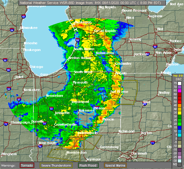 At 803 pm edt, severe thunderstorms were located along a line extending from near monroe to near pennville, moving east at 35 mph (radar indicated). Hazards include 60 mph wind gusts. expect damage to trees and power lines At 803 pm edt, severe thunderstorms were located along a line extending from near monroe to near pennville, moving east at 35 mph (radar indicated). Hazards include 60 mph wind gusts. expect damage to trees and power lines
|
| 7/8/2020 5:50 PM EDT |
 At 550 pm edt, a severe thunderstorm was located over celina, moving northeast at 15 mph (radar indicated). Hazards include 60 mph wind gusts and penny size hail. Expect damage to trees and power lines. Locations impacted include, celina, coldwater, mendon and tama. At 550 pm edt, a severe thunderstorm was located over celina, moving northeast at 15 mph (radar indicated). Hazards include 60 mph wind gusts and penny size hail. Expect damage to trees and power lines. Locations impacted include, celina, coldwater, mendon and tama.
|
| 7/8/2020 5:35 PM EDT |
 At 535 pm edt, a severe thunderstorm was located near coldwater, and was nearly stationary (radar indicated). Hazards include 60 mph wind gusts and penny size hail. expect damage to trees and power lines At 535 pm edt, a severe thunderstorm was located near coldwater, and was nearly stationary (radar indicated). Hazards include 60 mph wind gusts and penny size hail. expect damage to trees and power lines
|
| 3/28/2020 11:43 PM EDT |
 At 1143 pm edt, a severe thunderstorm was located over celina, moving northeast at 60 mph (radar indicated). Hazards include 70 mph wind gusts. Expect considerable tree damage. damage is likely to mobile homes, roofs, and outbuildings. locations impacted include, celina, coldwater, st. Henry, fort recovery, mendon, chickasaw, burkettsville, montezuma, neptune, carthagena, tama and maria stein. At 1143 pm edt, a severe thunderstorm was located over celina, moving northeast at 60 mph (radar indicated). Hazards include 70 mph wind gusts. Expect considerable tree damage. damage is likely to mobile homes, roofs, and outbuildings. locations impacted include, celina, coldwater, st. Henry, fort recovery, mendon, chickasaw, burkettsville, montezuma, neptune, carthagena, tama and maria stein.
|
| 3/28/2020 11:25 PM EDT |
 At 1124 pm edt, a severe thunderstorm was located near fort recovery, moving northeast at 50 mph (radar indicated). Hazards include 70 mph wind gusts. Expect considerable tree damage. damage is likely to mobile homes, roofs, and outbuildings. locations impacted include, celina, coldwater, st. Henry, fort recovery, rockford, wabash, mendon, chickasaw, burkettsville, montezuma, chattanooga, tama, maria stein, neptune and carthagena. At 1124 pm edt, a severe thunderstorm was located near fort recovery, moving northeast at 50 mph (radar indicated). Hazards include 70 mph wind gusts. Expect considerable tree damage. damage is likely to mobile homes, roofs, and outbuildings. locations impacted include, celina, coldwater, st. Henry, fort recovery, rockford, wabash, mendon, chickasaw, burkettsville, montezuma, chattanooga, tama, maria stein, neptune and carthagena.
|
| 3/28/2020 11:14 PM EDT |
 At 1114 pm edt, a severe thunderstorm was located near portland, moving northeast at 50 mph (radar indicated). Hazards include 60 mph wind gusts. expect damage to trees and power lines At 1114 pm edt, a severe thunderstorm was located near portland, moving northeast at 50 mph (radar indicated). Hazards include 60 mph wind gusts. expect damage to trees and power lines
|
| 9/13/2019 5:02 PM EDT |
 At 502 pm edt, a severe thunderstorm was located over celina, moving northeast at 55 mph (radar indicated). Hazards include 60 mph wind gusts and quarter size hail. Minor hail damage to vehicles is possible. expect wind damage to trees and power lines. Locations impacted include, celina, mendon, neptune, kossuth and state route 116 at state route 197. At 502 pm edt, a severe thunderstorm was located over celina, moving northeast at 55 mph (radar indicated). Hazards include 60 mph wind gusts and quarter size hail. Minor hail damage to vehicles is possible. expect wind damage to trees and power lines. Locations impacted include, celina, mendon, neptune, kossuth and state route 116 at state route 197.
|
| 9/13/2019 4:53 PM EDT |
 At 453 pm edt, a severe thunderstorm was located near coldwater, moving northeast at 40 mph (radar indicated). Hazards include 60 mph wind gusts and quarter size hail. Minor hail damage to vehicles is possible. Expect wind damage to trees and power lines. At 453 pm edt, a severe thunderstorm was located near coldwater, moving northeast at 40 mph (radar indicated). Hazards include 60 mph wind gusts and quarter size hail. Minor hail damage to vehicles is possible. Expect wind damage to trees and power lines.
|
| 6/2/2019 12:13 AM EDT |
 The severe thunderstorm warning for northwestern auglaize and northern mercer counties will expire at 1215 am edt, the storm which prompted the warning has moved out of the current warning area. however, a new severe thunderstorm warning is in effect for parts of auglaize county downstream. please report previous wind damage or hail to the national weather service by going to our website at weather.gov/iln and submitting your report via social media. The severe thunderstorm warning for northwestern auglaize and northern mercer counties will expire at 1215 am edt, the storm which prompted the warning has moved out of the current warning area. however, a new severe thunderstorm warning is in effect for parts of auglaize county downstream. please report previous wind damage or hail to the national weather service by going to our website at weather.gov/iln and submitting your report via social media.
|
| 6/1/2019 11:52 PM EDT |
 At 1152 pm edt, a severe thunderstorm was located near st. marys, moving east at 40 mph (radar indicated). Hazards include 60 mph wind gusts. Expect damage to trees and power lines. locations impacted include, celina, st. Marys, rockford, new knoxville, moulton, mendon, buckland, neptune, kossuth, state route 116 at state route 197, bulkhead and tama. At 1152 pm edt, a severe thunderstorm was located near st. marys, moving east at 40 mph (radar indicated). Hazards include 60 mph wind gusts. Expect damage to trees and power lines. locations impacted include, celina, st. Marys, rockford, new knoxville, moulton, mendon, buckland, neptune, kossuth, state route 116 at state route 197, bulkhead and tama.
|
| 6/1/2019 11:39 PM EDT |
 The national weather service in wilmington has issued a * severe thunderstorm warning for. northwestern auglaize county in west central ohio. northern mercer county in west central ohio. until 1215 am edt. At 1138 pm edt, a severe thunderstorm was located near rockford,. The national weather service in wilmington has issued a * severe thunderstorm warning for. northwestern auglaize county in west central ohio. northern mercer county in west central ohio. until 1215 am edt. At 1138 pm edt, a severe thunderstorm was located near rockford,.
|
| 5/28/2019 6:24 PM EDT |
 The severe thunderstorm warning for northwestern auglaize and northeastern mercer counties will expire at 630 pm edt, the storm which prompted the warning has weakened below severe limits, and no longer poses an immediate threat to life or property. therefore, the warning will be allowed to expire. however gusty winds are still possible with this thunderstorm. a severe thunderstorm watch remains in effect until 800 pm edt for west central ohio. please report previous wind damage or hail to the national weather service by going to our website at weather.gov/iln and submitting your report via social media. The severe thunderstorm warning for northwestern auglaize and northeastern mercer counties will expire at 630 pm edt, the storm which prompted the warning has weakened below severe limits, and no longer poses an immediate threat to life or property. therefore, the warning will be allowed to expire. however gusty winds are still possible with this thunderstorm. a severe thunderstorm watch remains in effect until 800 pm edt for west central ohio. please report previous wind damage or hail to the national weather service by going to our website at weather.gov/iln and submitting your report via social media.
|
| 5/28/2019 6:12 PM EDT |
 At 611 pm edt, a severe thunderstorm was located near st. marys, moving east at 30 mph (radar indicated). Hazards include ping pong ball size hail and 60 mph wind gusts. People and animals outdoors will be injured. expect hail damage to roofs, siding, windows, and vehicles. expect wind damage to trees and power lines. locations impacted include, celina, st. Marys, rockford, new knoxville, moulton, mendon, buckland, neptune, kossuth, state route 116 at state route 197, bulkhead and tama. At 611 pm edt, a severe thunderstorm was located near st. marys, moving east at 30 mph (radar indicated). Hazards include ping pong ball size hail and 60 mph wind gusts. People and animals outdoors will be injured. expect hail damage to roofs, siding, windows, and vehicles. expect wind damage to trees and power lines. locations impacted include, celina, st. Marys, rockford, new knoxville, moulton, mendon, buckland, neptune, kossuth, state route 116 at state route 197, bulkhead and tama.
|
| 5/28/2019 5:49 PM EDT |
 At 549 pm edt, a severe thunderstorm was located near celina, moving east at 30 mph (radar indicated). Hazards include ping pong ball size hail and 60 mph wind gusts. People and animals outdoors will be injured. expect hail damage to roofs, siding, windows, and vehicles. expect wind damage to trees and power lines. locations impacted include, celina, st. Marys, rockford, new knoxville, moulton, wabash, mendon, buckland, chattanooga, kossuth, tama, neptune, state route 116 at state route 197 and bulkhead. At 549 pm edt, a severe thunderstorm was located near celina, moving east at 30 mph (radar indicated). Hazards include ping pong ball size hail and 60 mph wind gusts. People and animals outdoors will be injured. expect hail damage to roofs, siding, windows, and vehicles. expect wind damage to trees and power lines. locations impacted include, celina, st. Marys, rockford, new knoxville, moulton, wabash, mendon, buckland, chattanooga, kossuth, tama, neptune, state route 116 at state route 197 and bulkhead.
|
| 5/28/2019 5:40 PM EDT |
 At 539 pm edt, a severe thunderstorm was located 8 miles southwest of rockford, moving east at 30 mph (radar indicated). Hazards include 60 mph wind gusts and quarter size hail. Minor hail damage to vehicles is possible. Expect wind damage to trees and power lines. At 539 pm edt, a severe thunderstorm was located 8 miles southwest of rockford, moving east at 30 mph (radar indicated). Hazards include 60 mph wind gusts and quarter size hail. Minor hail damage to vehicles is possible. Expect wind damage to trees and power lines.
|
| 5/27/2019 10:19 PM EDT |
 At 1018 pm edt, a confirmed tornado was located near st. marys, moving east at 35 mph (radar confirmed tornado. radar shows tornado debris in the air). Hazards include damaging tornado and quarter size hail. Flying debris will be dangerous to those caught without shelter. mobile homes will be damaged or destroyed. damage to roofs, windows, and vehicles will occur. tree damage is likely. locations impacted include, celina, st. Marys, coldwater, new knoxville, moulton, mendon, montezuma, neptune, kossuth, state route 116 at state route 197 and bulkhead. At 1018 pm edt, a confirmed tornado was located near st. marys, moving east at 35 mph (radar confirmed tornado. radar shows tornado debris in the air). Hazards include damaging tornado and quarter size hail. Flying debris will be dangerous to those caught without shelter. mobile homes will be damaged or destroyed. damage to roofs, windows, and vehicles will occur. tree damage is likely. locations impacted include, celina, st. Marys, coldwater, new knoxville, moulton, mendon, montezuma, neptune, kossuth, state route 116 at state route 197 and bulkhead.
|
| 5/27/2019 10:13 PM EDT |
 At 1012 pm edt, a confirmed tornado was located over celina, moving east at 35 mph (radar confirmed tornado. radar shows tornado debris in the air). Hazards include damaging tornado and quarter size hail. Flying debris will be dangerous to those caught without shelter. mobile homes will be damaged or destroyed. damage to roofs, windows, and vehicles will occur. tree damage is likely. locations impacted include, celina, st. Marys, coldwater, new knoxville, moulton, wabash, mendon, montezuma, kossuth, tama, neptune, state route 116 at state route 197 and bulkhead. At 1012 pm edt, a confirmed tornado was located over celina, moving east at 35 mph (radar confirmed tornado. radar shows tornado debris in the air). Hazards include damaging tornado and quarter size hail. Flying debris will be dangerous to those caught without shelter. mobile homes will be damaged or destroyed. damage to roofs, windows, and vehicles will occur. tree damage is likely. locations impacted include, celina, st. Marys, coldwater, new knoxville, moulton, wabash, mendon, montezuma, kossuth, tama, neptune, state route 116 at state route 197 and bulkhead.
|
| 5/27/2019 10:05 PM EDT |
 At 1005 pm edt, a severe thunderstorm capable of producing a tornado was located near celina, moving east at 35 mph (radar indicated rotation). Hazards include tornado and quarter size hail. Flying debris will be dangerous to those caught without shelter. mobile homes will be damaged or destroyed. damage to roofs, windows, and vehicles will occur. tree damage is likely. locations impacted include, celina, st. Marys, coldwater, new knoxville, moulton, wabash, mendon, montezuma, kossuth, tama, neptune, state route 116 at state route 197 and bulkhead. At 1005 pm edt, a severe thunderstorm capable of producing a tornado was located near celina, moving east at 35 mph (radar indicated rotation). Hazards include tornado and quarter size hail. Flying debris will be dangerous to those caught without shelter. mobile homes will be damaged or destroyed. damage to roofs, windows, and vehicles will occur. tree damage is likely. locations impacted include, celina, st. Marys, coldwater, new knoxville, moulton, wabash, mendon, montezuma, kossuth, tama, neptune, state route 116 at state route 197 and bulkhead.
|
| 5/27/2019 9:55 PM EDT |
 At 955 pm edt, a severe thunderstorm capable of producing a tornado was located near coldwater, moving east at 35 mph (radar indicated rotation). Hazards include tornado and quarter size hail. Flying debris will be dangerous to those caught without shelter. mobile homes will be damaged or destroyed. damage to roofs, windows, and vehicles will occur. Tree damage is likely. At 955 pm edt, a severe thunderstorm capable of producing a tornado was located near coldwater, moving east at 35 mph (radar indicated rotation). Hazards include tornado and quarter size hail. Flying debris will be dangerous to those caught without shelter. mobile homes will be damaged or destroyed. damage to roofs, windows, and vehicles will occur. Tree damage is likely.
|
| 5/27/2019 9:44 PM EDT |
 At 944 pm edt, a severe thunderstorm was located 7 miles southeast of geneva, moving east at 35 mph (radar indicated). Hazards include 60 mph wind gusts. expect damage to trees and power lines At 944 pm edt, a severe thunderstorm was located 7 miles southeast of geneva, moving east at 35 mph (radar indicated). Hazards include 60 mph wind gusts. expect damage to trees and power lines
|
| 5/23/2019 6:12 AM EDT |
 The severe thunderstorm warning for mercer county will expire at 615 am edt, the storms which prompted the warning have weakened below severe limits, and no longer pose an immediate threat to life or property. therefore, the warning will be allowed to expire. however gusty winds are still possible with these thunderstorms. please report previous wind damage or hail to the national weather service by going to our website at weather.gov/iln and submitting your report via social media. The severe thunderstorm warning for mercer county will expire at 615 am edt, the storms which prompted the warning have weakened below severe limits, and no longer pose an immediate threat to life or property. therefore, the warning will be allowed to expire. however gusty winds are still possible with these thunderstorms. please report previous wind damage or hail to the national weather service by going to our website at weather.gov/iln and submitting your report via social media.
|
| 5/23/2019 5:49 AM EDT |
 At 549 am edt, severe thunderstorms were located along a line extending from near decatur to near portland, moving east at 60 mph (radar indicated). Hazards include 60 mph wind gusts. expect damage to trees and power lines At 549 am edt, severe thunderstorms were located along a line extending from near decatur to near portland, moving east at 60 mph (radar indicated). Hazards include 60 mph wind gusts. expect damage to trees and power lines
|
| 5/17/2019 12:01 AM EDT |
 At 1201 am edt, a severe thunderstorm was located near spencerville, moving southeast at 35 mph (radar indicated). Hazards include quarter size hail. Minor damage to vehicles is possible. locations impacted include, celina, wapakoneta, st. marys, fort shawnee, cridersville, rockford, moulton, mendon, buckland, kossuth, tama, neptune and state route 116 at state route 197. This includes i-75 in ohio between mile markers 110 and 118. At 1201 am edt, a severe thunderstorm was located near spencerville, moving southeast at 35 mph (radar indicated). Hazards include quarter size hail. Minor damage to vehicles is possible. locations impacted include, celina, wapakoneta, st. marys, fort shawnee, cridersville, rockford, moulton, mendon, buckland, kossuth, tama, neptune and state route 116 at state route 197. This includes i-75 in ohio between mile markers 110 and 118.
|
| 5/16/2019 11:43 PM EDT |
 At 1142 pm edt, a severe thunderstorm was located near ohio city, moving southeast at 35 mph (radar indicated). Hazards include quarter size hail. minor damage to vehicles is possible At 1142 pm edt, a severe thunderstorm was located near ohio city, moving southeast at 35 mph (radar indicated). Hazards include quarter size hail. minor damage to vehicles is possible
|
| 11/5/2017 4:41 PM EDT |
 At 341 pm est, a severe thunderstorm capable of producing a tornado was located near celina, moving east at 55 mph (radar indicated rotation). Hazards include tornado and quarter size hail. Flying debris will be dangerous to those caught without shelter. mobile homes will be damaged or destroyed. damage to roofs, windows, and vehicles will occur. tree damage is likely. Locations impacted include, celina, mendon and neptune. At 341 pm est, a severe thunderstorm capable of producing a tornado was located near celina, moving east at 55 mph (radar indicated rotation). Hazards include tornado and quarter size hail. Flying debris will be dangerous to those caught without shelter. mobile homes will be damaged or destroyed. damage to roofs, windows, and vehicles will occur. tree damage is likely. Locations impacted include, celina, mendon and neptune.
|
| 11/5/2017 4:38 PM EDT |
 At 337 pm est, severe thunderstorms were located along a line extending from 6 miles east of rockford to near fort recovery, moving east at 50 mph (radar indicated). Hazards include 60 mph wind gusts and quarter size hail. Minor hail damage to vehicles is possible. expect wind damage to trees and power lines. locations impacted include, celina, st. marys, coldwater, new bremen, st. henry, fort recovery, rockford, moulton, wabash, mendon, chickasaw, burkettsville, buckland, montezuma, kossuth, tama, egypt, maria stein, neptune and state route 116 at state route 197. A tornado watch remains in effect until 700 pm est for west central ohio. At 337 pm est, severe thunderstorms were located along a line extending from 6 miles east of rockford to near fort recovery, moving east at 50 mph (radar indicated). Hazards include 60 mph wind gusts and quarter size hail. Minor hail damage to vehicles is possible. expect wind damage to trees and power lines. locations impacted include, celina, st. marys, coldwater, new bremen, st. henry, fort recovery, rockford, moulton, wabash, mendon, chickasaw, burkettsville, buckland, montezuma, kossuth, tama, egypt, maria stein, neptune and state route 116 at state route 197. A tornado watch remains in effect until 700 pm est for west central ohio.
|
| 11/5/2017 4:33 PM EDT |
 At 333 pm est, a severe thunderstorm capable of producing a tornado was located near celina, moving east at 55 mph (radar indicated rotation). Hazards include tornado and quarter size hail. Flying debris will be dangerous to those caught without shelter. mobile homes will be damaged or destroyed. damage to roofs, windows, and vehicles will occur. Tree damage is likely. At 333 pm est, a severe thunderstorm capable of producing a tornado was located near celina, moving east at 55 mph (radar indicated rotation). Hazards include tornado and quarter size hail. Flying debris will be dangerous to those caught without shelter. mobile homes will be damaged or destroyed. damage to roofs, windows, and vehicles will occur. Tree damage is likely.
|
| 11/5/2017 4:27 PM EDT |
 At 327 pm est, severe thunderstorms were located along a line extending from near rockford to 6 miles east of redkey, moving east at 50 mph (radar indicated). Hazards include 60 mph wind gusts and quarter size hail. Minor hail damage to vehicles is possible. Expect wind damage to trees and power lines. At 327 pm est, severe thunderstorms were located along a line extending from near rockford to 6 miles east of redkey, moving east at 50 mph (radar indicated). Hazards include 60 mph wind gusts and quarter size hail. Minor hail damage to vehicles is possible. Expect wind damage to trees and power lines.
|
| 11/5/2017 3:58 PM EDT |
 The tornado warning for northeastern mercer county will expire at 300 pm est, the storm which prompted the warning has moved out of the area. therefore, the warning will be allowed to expire. a tornado watch remains in effect until 700 pm est for west central ohio. please report previous tornadoes, wind damage or hail to the national weather service by going to our website at weather.gov/iln and submitting your report via social media. The tornado warning for northeastern mercer county will expire at 300 pm est, the storm which prompted the warning has moved out of the area. therefore, the warning will be allowed to expire. a tornado watch remains in effect until 700 pm est for west central ohio. please report previous tornadoes, wind damage or hail to the national weather service by going to our website at weather.gov/iln and submitting your report via social media.
|
| 11/5/2017 3:42 PM EDT |
 At 242 pm est, a severe thunderstorm capable of producing a tornado was located 7 miles northeast of celina, moving northeast at 45 mph (radar indicated rotation). Hazards include tornado and quarter size hail. Flying debris will be dangerous to those caught without shelter. mobile homes will be damaged or destroyed. damage to roofs, windows, and vehicles will occur. tree damage is likely. Locations impacted include, celina, mendon, neptune and tama. At 242 pm est, a severe thunderstorm capable of producing a tornado was located 7 miles northeast of celina, moving northeast at 45 mph (radar indicated rotation). Hazards include tornado and quarter size hail. Flying debris will be dangerous to those caught without shelter. mobile homes will be damaged or destroyed. damage to roofs, windows, and vehicles will occur. tree damage is likely. Locations impacted include, celina, mendon, neptune and tama.
|
| 11/5/2017 3:35 PM EDT |
 At 235 pm est, a confirmed tornado was located north of celina, moving northeast at 45 mph (radar confirmed tornado. radar shows tornado debris in the air). Hazards include damaging tornado and quarter size hail. Flying debris will be dangerous to those caught without shelter. mobile homes will be damaged or destroyed. damage to roofs, windows, and vehicles will occur. tree damage is likely. Locations impacted include, celina, mendon, neptune and tama. At 235 pm est, a confirmed tornado was located north of celina, moving northeast at 45 mph (radar confirmed tornado. radar shows tornado debris in the air). Hazards include damaging tornado and quarter size hail. Flying debris will be dangerous to those caught without shelter. mobile homes will be damaged or destroyed. damage to roofs, windows, and vehicles will occur. tree damage is likely. Locations impacted include, celina, mendon, neptune and tama.
|
| 11/5/2017 3:25 PM EDT |
 At 224 pm est, a tornado-producing storm was located near wabash, moving northeast at 45 mph (radar confirmed tornado. radar shows tornado debris in the air). Hazards include damaging tornado and quarter size hail. Flying debris will be dangerous to those caught without shelter. mobile homes will be damaged or destroyed. damage to roofs, windows, and vehicles will occur. Tree damage is likely. At 224 pm est, a tornado-producing storm was located near wabash, moving northeast at 45 mph (radar confirmed tornado. radar shows tornado debris in the air). Hazards include damaging tornado and quarter size hail. Flying debris will be dangerous to those caught without shelter. mobile homes will be damaged or destroyed. damage to roofs, windows, and vehicles will occur. Tree damage is likely.
|
| 7/10/2017 10:33 PM EDT |
 At 1032 pm edt, a severe thunderstorm was located near st. marys, moving southeast at 20 mph (trained weather spotters). Hazards include tennis ball size hail and 60 mph wind gusts. People and animals outdoors will be injured. expect hail damage to roofs, siding, windows, and vehicles. expect wind damage to trees and power lines. locations impacted include, celina, wapakoneta, st. marys, new bremen, new knoxville, moulton, mendon, buckland, neptune, kossuth and bulkhead. This includes i-75 in ohio between mile markers 111 and 112. At 1032 pm edt, a severe thunderstorm was located near st. marys, moving southeast at 20 mph (trained weather spotters). Hazards include tennis ball size hail and 60 mph wind gusts. People and animals outdoors will be injured. expect hail damage to roofs, siding, windows, and vehicles. expect wind damage to trees and power lines. locations impacted include, celina, wapakoneta, st. marys, new bremen, new knoxville, moulton, mendon, buckland, neptune, kossuth and bulkhead. This includes i-75 in ohio between mile markers 111 and 112.
|
| 7/10/2017 10:31 PM EDT | Tennis Ball sized hail reported 0.5 miles NNE of Mendon, OH |
| 7/10/2017 10:19 PM EDT |
 At 1018 pm edt, a severe thunderstorm was located near rockford, moving southeast at 20 mph (radar indicated). Hazards include 60 mph wind gusts and quarter size hail. Minor hail damage to vehicles is possible. Expect wind damage to trees and power lines. At 1018 pm edt, a severe thunderstorm was located near rockford, moving southeast at 20 mph (radar indicated). Hazards include 60 mph wind gusts and quarter size hail. Minor hail damage to vehicles is possible. Expect wind damage to trees and power lines.
|
| 7/10/2017 9:00 PM EDT |
 At 900 pm edt, a severe thunderstorm was located near celina, moving southeast at 15 mph (radar indicated). Hazards include 60 mph wind gusts and penny size hail. Expect damage to trees and power lines. locations impacted include, celina, wapakoneta, st. marys, new bremen, minster, new knoxville, moulton, mendon, buckland, kettlersville, kossuth, lake loramie state park, neptune, state route 116 at state route 197 and bulkhead. This includes i-75 in ohio between mile markers 109 and 113. At 900 pm edt, a severe thunderstorm was located near celina, moving southeast at 15 mph (radar indicated). Hazards include 60 mph wind gusts and penny size hail. Expect damage to trees and power lines. locations impacted include, celina, wapakoneta, st. marys, new bremen, minster, new knoxville, moulton, mendon, buckland, kettlersville, kossuth, lake loramie state park, neptune, state route 116 at state route 197 and bulkhead. This includes i-75 in ohio between mile markers 109 and 113.
|
| 7/10/2017 8:58 PM EDT |
 At 857 pm edt, a severe thunderstorm was located near celina, moving southeast at 15 mph (radar indicated). Hazards include 60 mph wind gusts and penny size hail. expect damage to trees and power lines At 857 pm edt, a severe thunderstorm was located near celina, moving southeast at 15 mph (radar indicated). Hazards include 60 mph wind gusts and penny size hail. expect damage to trees and power lines
|
| 7/10/2017 8:47 PM EDT |
 At 846 pm edt, a severe thunderstorm was located near celina, moving southeast at 25 mph (radar indicated). Hazards include 60 mph wind gusts and quarter size hail. Minor hail damage to vehicles is possible. expect wind damage to trees and power lines. Locations impacted include, celina, rockford, mendon, chickasaw, montezuma, neptune and tama. At 846 pm edt, a severe thunderstorm was located near celina, moving southeast at 25 mph (radar indicated). Hazards include 60 mph wind gusts and quarter size hail. Minor hail damage to vehicles is possible. expect wind damage to trees and power lines. Locations impacted include, celina, rockford, mendon, chickasaw, montezuma, neptune and tama.
|
| 7/10/2017 8:46 PM EDT |
 At 846 pm edt, a severe thunderstorm capable of producing a tornado was located near rockford, moving southeast at 20 mph (radar indicated rotation). Hazards include tornado. Flying debris will be dangerous to those caught without shelter. mobile homes will be damaged or destroyed. damage to roofs, windows, and vehicles will occur. tree damage is likely. Locations impacted include, celina, mendon, neptune and tama. At 846 pm edt, a severe thunderstorm capable of producing a tornado was located near rockford, moving southeast at 20 mph (radar indicated rotation). Hazards include tornado. Flying debris will be dangerous to those caught without shelter. mobile homes will be damaged or destroyed. damage to roofs, windows, and vehicles will occur. tree damage is likely. Locations impacted include, celina, mendon, neptune and tama.
|
| 7/10/2017 8:38 PM EDT |
 At 837 pm edt, radar indicated that a tornado-producing storm was located over rockford, moving southeast at 20 mph (public confirmed tornado touched down near rockford around 837 pm but has now lifted). Hazards include damaging tornado. Flying debris will be dangerous to those caught without shelter. mobile homes will be damaged or destroyed. damage to roofs, windows, and vehicles will occur. tree damage is likely. Locations impacted include, celina, rockford, mendon, neptune and tama. At 837 pm edt, radar indicated that a tornado-producing storm was located over rockford, moving southeast at 20 mph (public confirmed tornado touched down near rockford around 837 pm but has now lifted). Hazards include damaging tornado. Flying debris will be dangerous to those caught without shelter. mobile homes will be damaged or destroyed. damage to roofs, windows, and vehicles will occur. tree damage is likely. Locations impacted include, celina, rockford, mendon, neptune and tama.
|
| 7/10/2017 8:33 PM EDT |
 At 832 pm edt, a severe thunderstorm was located over rockford, moving southeast at 25 mph (radar indicated). Hazards include 60 mph wind gusts and quarter size hail. Minor hail damage to vehicles is possible. expect wind damage to trees and power lines. Locations impacted include, celina, coldwater, rockford, mendon, chickasaw, montezuma, neptune and tama. At 832 pm edt, a severe thunderstorm was located over rockford, moving southeast at 25 mph (radar indicated). Hazards include 60 mph wind gusts and quarter size hail. Minor hail damage to vehicles is possible. expect wind damage to trees and power lines. Locations impacted include, celina, coldwater, rockford, mendon, chickasaw, montezuma, neptune and tama.
|
| 7/10/2017 8:33 PM EDT |
 At 833 pm edt, a severe thunderstorm capable of producing a tornado was located over rockford, moving southeast at 20 mph (radar indicated rotation). Hazards include tornado. Flying debris will be dangerous to those caught without shelter. mobile homes will be damaged or destroyed. damage to roofs, windows, and vehicles will occur. tree damage is likely. Locations impacted include, celina, rockford, mendon, neptune and tama. At 833 pm edt, a severe thunderstorm capable of producing a tornado was located over rockford, moving southeast at 20 mph (radar indicated rotation). Hazards include tornado. Flying debris will be dangerous to those caught without shelter. mobile homes will be damaged or destroyed. damage to roofs, windows, and vehicles will occur. tree damage is likely. Locations impacted include, celina, rockford, mendon, neptune and tama.
|
| 7/10/2017 8:26 PM EDT |
 At 826 pm edt, a severe thunderstorm capable of producing a tornado was located near rockford, moving southeast at 20 mph (radar indicated rotation). Hazards include tornado. Flying debris will be dangerous to those caught without shelter. mobile homes will be damaged or destroyed. damage to roofs, windows, and vehicles will occur. Tree damage is likely. At 826 pm edt, a severe thunderstorm capable of producing a tornado was located near rockford, moving southeast at 20 mph (radar indicated rotation). Hazards include tornado. Flying debris will be dangerous to those caught without shelter. mobile homes will be damaged or destroyed. damage to roofs, windows, and vehicles will occur. Tree damage is likely.
|
| 7/10/2017 8:12 PM EDT |
 At 811 pm edt, a severe thunderstorm was located 7 miles west of rockford, moving southeast at 25 mph (radar indicated). Hazards include 60 mph wind gusts and quarter size hail. Minor hail damage to vehicles is possible. Expect wind damage to trees and power lines. At 811 pm edt, a severe thunderstorm was located 7 miles west of rockford, moving southeast at 25 mph (radar indicated). Hazards include 60 mph wind gusts and quarter size hail. Minor hail damage to vehicles is possible. Expect wind damage to trees and power lines.
|
| 6/5/2017 3:58 PM EDT |
 At 358 pm edt, a severe thunderstorm was located near rockford, moving south at 20 mph (trained weather spotters). Hazards include 60 mph wind gusts and quarter size hail. Hail damage to vehicles is expected. expect wind damage to roofs, siding, and trees. locations impacted include, celina, st. marys, coldwater, new bremen, minster, st. Henry, rockford, mendon, chickasaw, montezuma, tama, maria stein, neptune, carthagena and bulkhead. At 358 pm edt, a severe thunderstorm was located near rockford, moving south at 20 mph (trained weather spotters). Hazards include 60 mph wind gusts and quarter size hail. Hail damage to vehicles is expected. expect wind damage to roofs, siding, and trees. locations impacted include, celina, st. marys, coldwater, new bremen, minster, st. Henry, rockford, mendon, chickasaw, montezuma, tama, maria stein, neptune, carthagena and bulkhead.
|
| 6/5/2017 3:56 PM EDT |
 At 356 pm edt, a severe thunderstorm was located near rockford, moving south at 20 mph (radar indicated). Hazards include 60 mph wind gusts and quarter size hail. Hail damage to vehicles is expected. Expect wind damage to roofs, siding, and trees. At 356 pm edt, a severe thunderstorm was located near rockford, moving south at 20 mph (radar indicated). Hazards include 60 mph wind gusts and quarter size hail. Hail damage to vehicles is expected. Expect wind damage to roofs, siding, and trees.
|
| 7/13/2016 6:46 PM EDT |
 At 646 pm edt, severe thunderstorms were located along a line extending from near celina to near minster to near bradford, moving northeast at 50 mph (radar indicated). Hazards include 60 mph wind gusts. Expect damage to roofs. siding. and trees. locations impacted include, sidney, celina, wapakoneta, st. Marys, coldwater, fort shawnee, new bremen, minster, versailles, cridersville, anna, fort loramie, botkins, new knoxville, hardin, moulton, webster, mendon, russia and port jefferson. At 646 pm edt, severe thunderstorms were located along a line extending from near celina to near minster to near bradford, moving northeast at 50 mph (radar indicated). Hazards include 60 mph wind gusts. Expect damage to roofs. siding. and trees. locations impacted include, sidney, celina, wapakoneta, st. Marys, coldwater, fort shawnee, new bremen, minster, versailles, cridersville, anna, fort loramie, botkins, new knoxville, hardin, moulton, webster, mendon, russia and port jefferson.
|
| 7/13/2016 6:33 PM EDT |
 At 633 pm edt, severe thunderstorms were located along a line extending from 7 miles northwest of coldwater to near st. henry to near greenville, moving northeast at 50 mph (radar indicated). Hazards include 60 mph wind gusts. Expect damage to roofs. siding. And trees. At 633 pm edt, severe thunderstorms were located along a line extending from 7 miles northwest of coldwater to near st. henry to near greenville, moving northeast at 50 mph (radar indicated). Hazards include 60 mph wind gusts. Expect damage to roofs. siding. And trees.
|
| 9/4/2015 2:27 PM EDT |
 At 227 pm edt, radar indicated severe thunderstorms located along a line extending from near spencerville to 8 miles southwest of rockford, moving east at 15 mph. storm hazards include, winds to 60 mph, penny size hail, very heavy rain which may cause minor flooding,. At 227 pm edt, radar indicated severe thunderstorms located along a line extending from near spencerville to 8 miles southwest of rockford, moving east at 15 mph. storm hazards include, winds to 60 mph, penny size hail, very heavy rain which may cause minor flooding,.
|
| 5/30/2015 7:56 PM EDT | The severe thunderstorm warning for mercer county will expire at 800 pm edt, the storm has weakened below severe limits, therefore the severe thunderstorm warning will be allowed to expire. small hail, gusty winds and heavy rain are still possible with this storm. please report previous wind damage or hail to the national weather service by going to our website at weather.gov/iln and submitting your report via social media. |
| 5/30/2015 7:40 PM EDT | At 737 pm edt, radar continued to indicate a severe thunderstorm located near wabash, moving northeast at 30 mph. storm hazards include, winds to 60 mph, frequent cloud to ground lightning, very heavy rain which may cause minor flooding, locations impacted include, celina and rockford. in addition, tama, neptune and mendon are near the path of this storm. |
| 5/30/2015 7:15 PM EDT | At 713 pm edt, radar indicated a severe thunderstorm located 7 miles southwest of wabash, moving northeast at 30 mph. storm hazards include, winds to 60 mph, frequent cloud to ground lightning, very heavy rain which may cause minor flooding,. |
| 5/11/2015 3:45 PM EDT | At 343 pm edt, radar continued to indicate a severe thunderstorm located near tama, moving northeast at 55 mph. storm hazards include, winds to 60 mph, penny size hail, this storm will affect mainly rural areas of northeastern mercer and northwestern auglaize counties, including neptune, mendon, state route 116 at state route 197 and kossuth. , 0.75in. |
| 5/11/2015 3:35 PM EDT | At 334 pm edt, radar indicated a severe thunderstorm located near wabash, moving northeast at 55 mph. storm hazards include, winds to 60 mph, penny size hail,. |
| 8/26/2014 5:02 PM EDT | A large tree was blown down near the intersection of us routes 33 and 12 in mercer county OH, 3.8 miles ENE of Mendon, OH |
| 1/1/0001 12:00 AM | Golf Ball sized hail reported 0.5 miles NNE of Mendon, OH |
Hail Maps for Mendon, OH


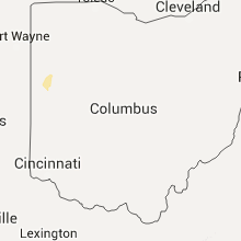

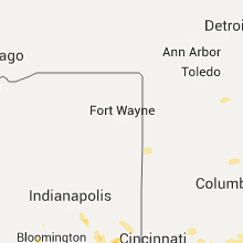


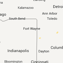


Connect with Interactive Hail Maps