

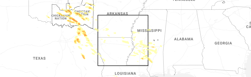
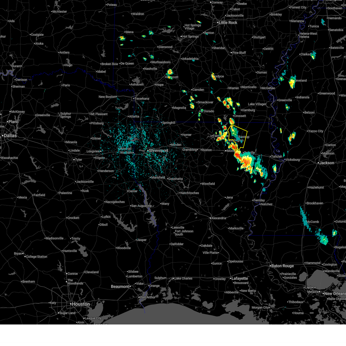
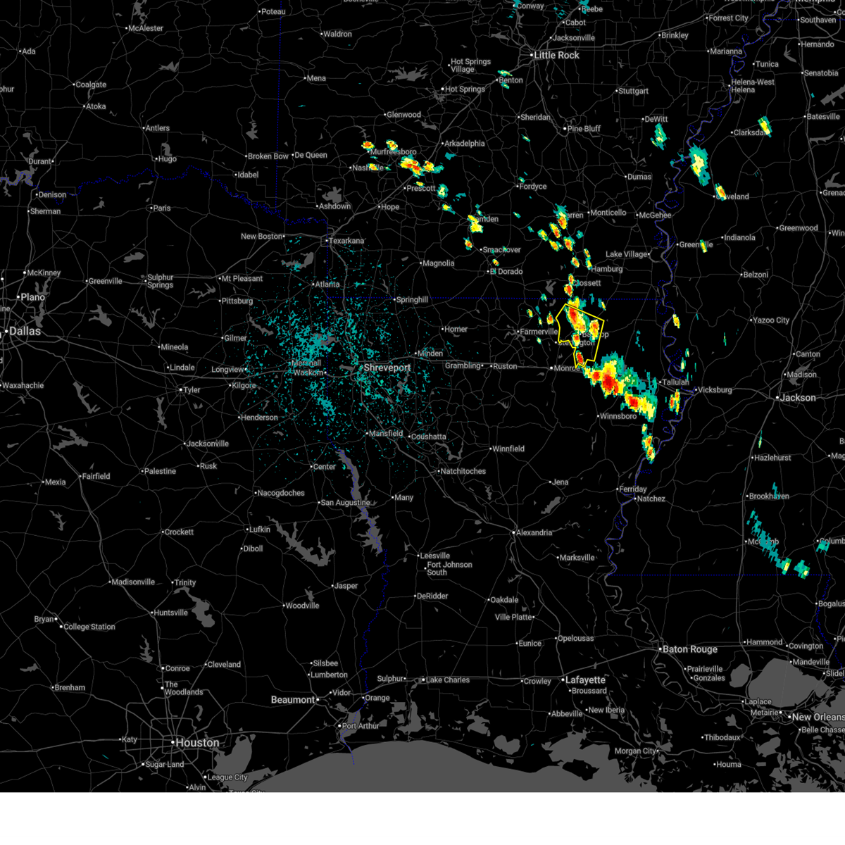
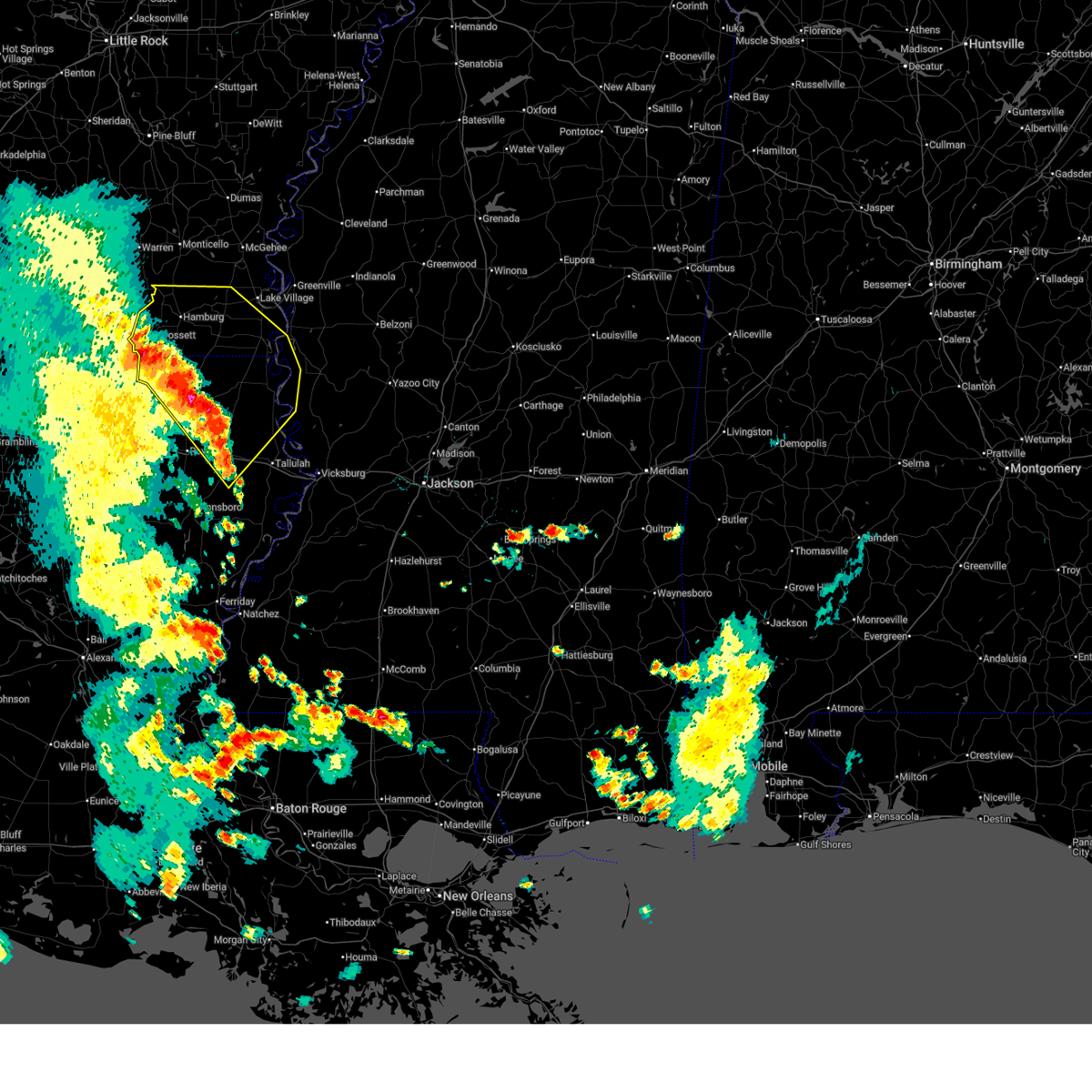
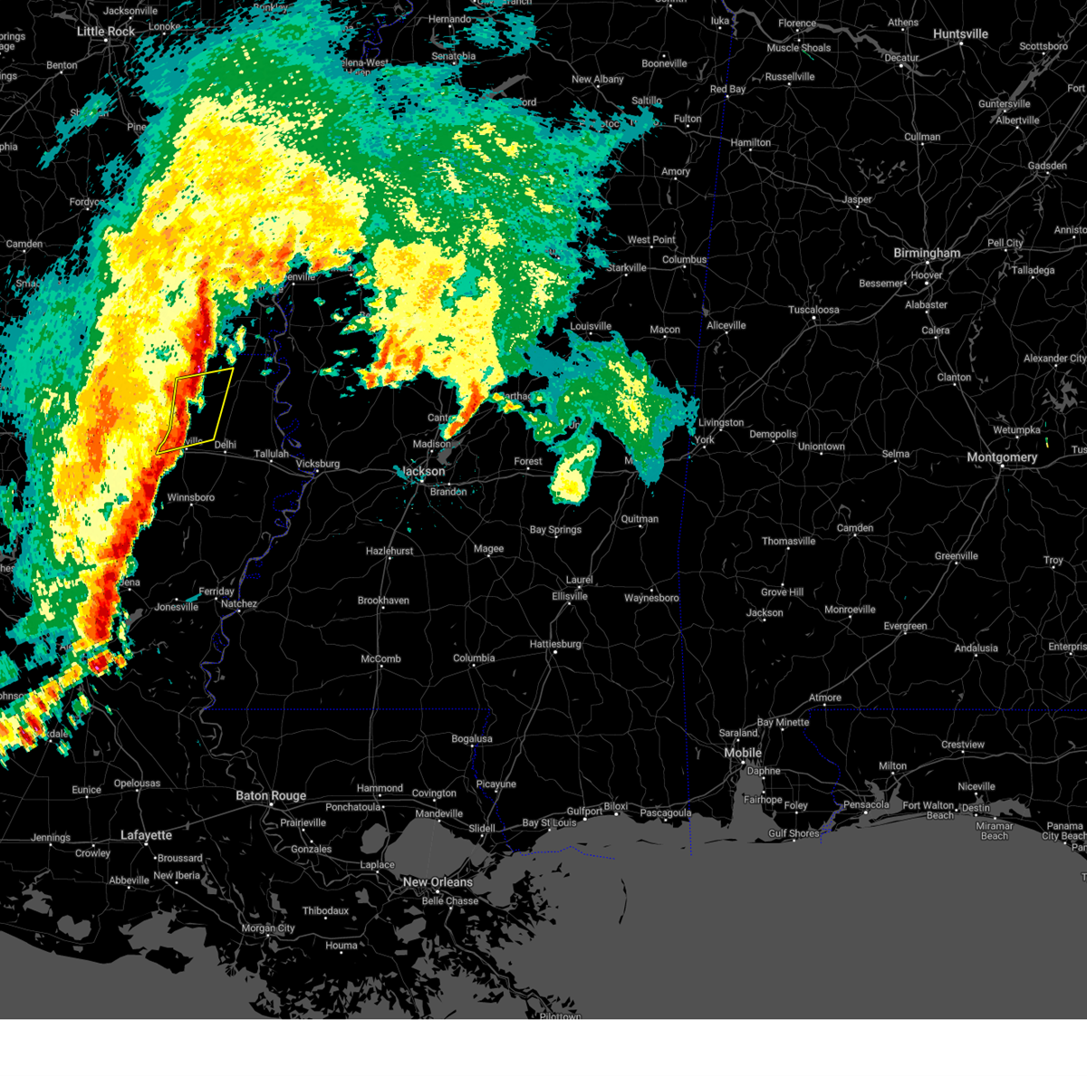
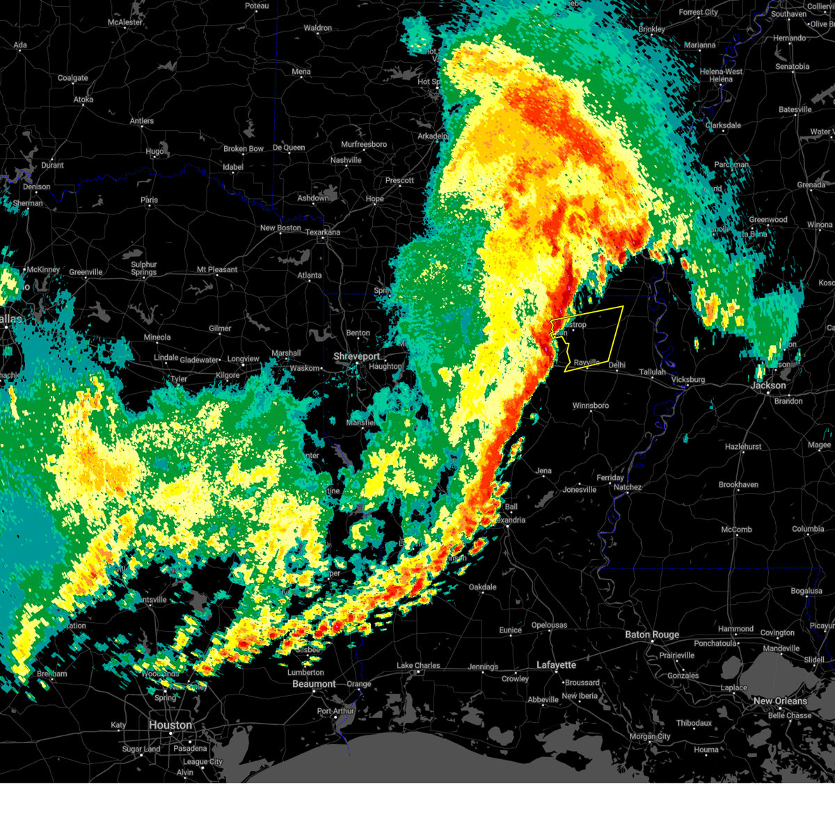
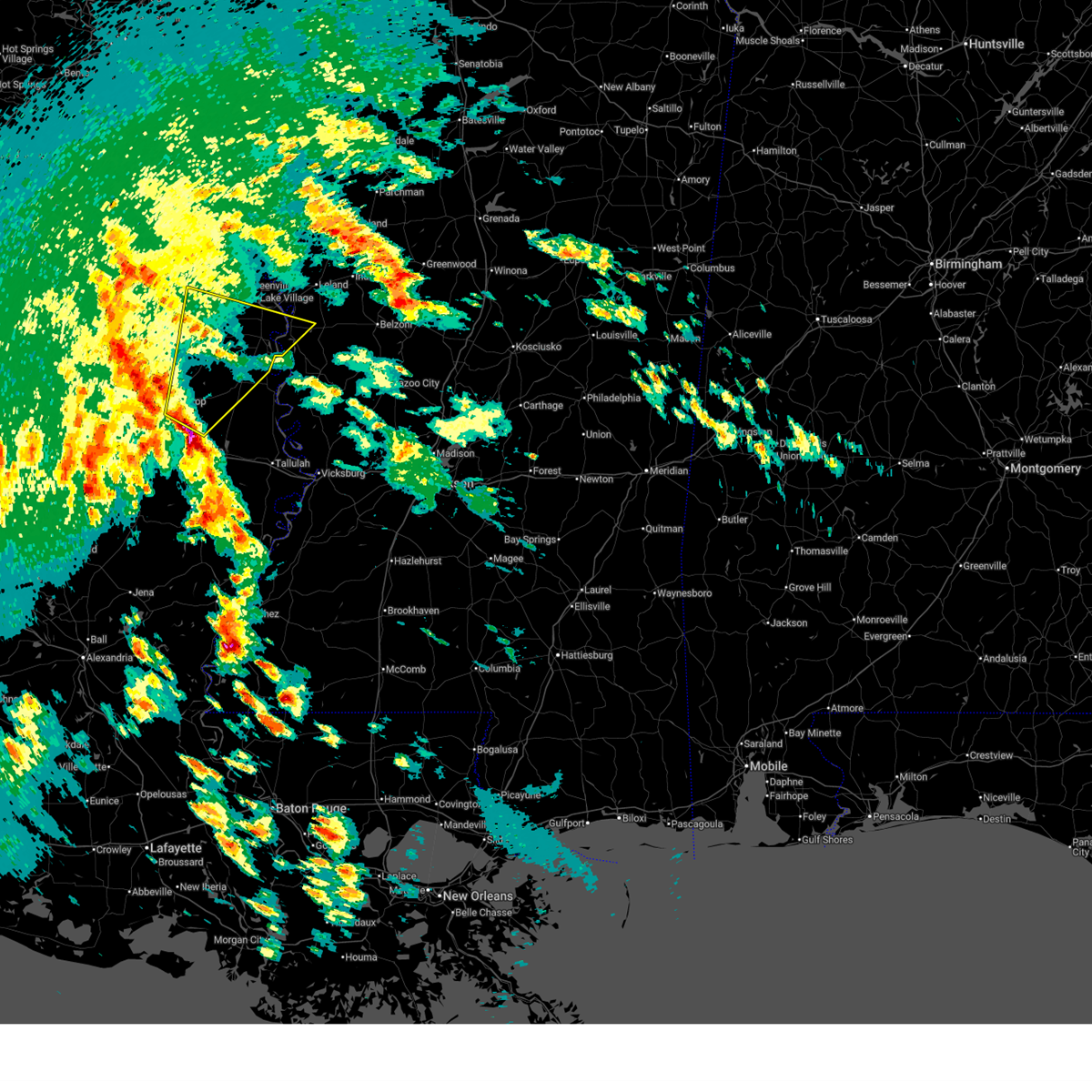
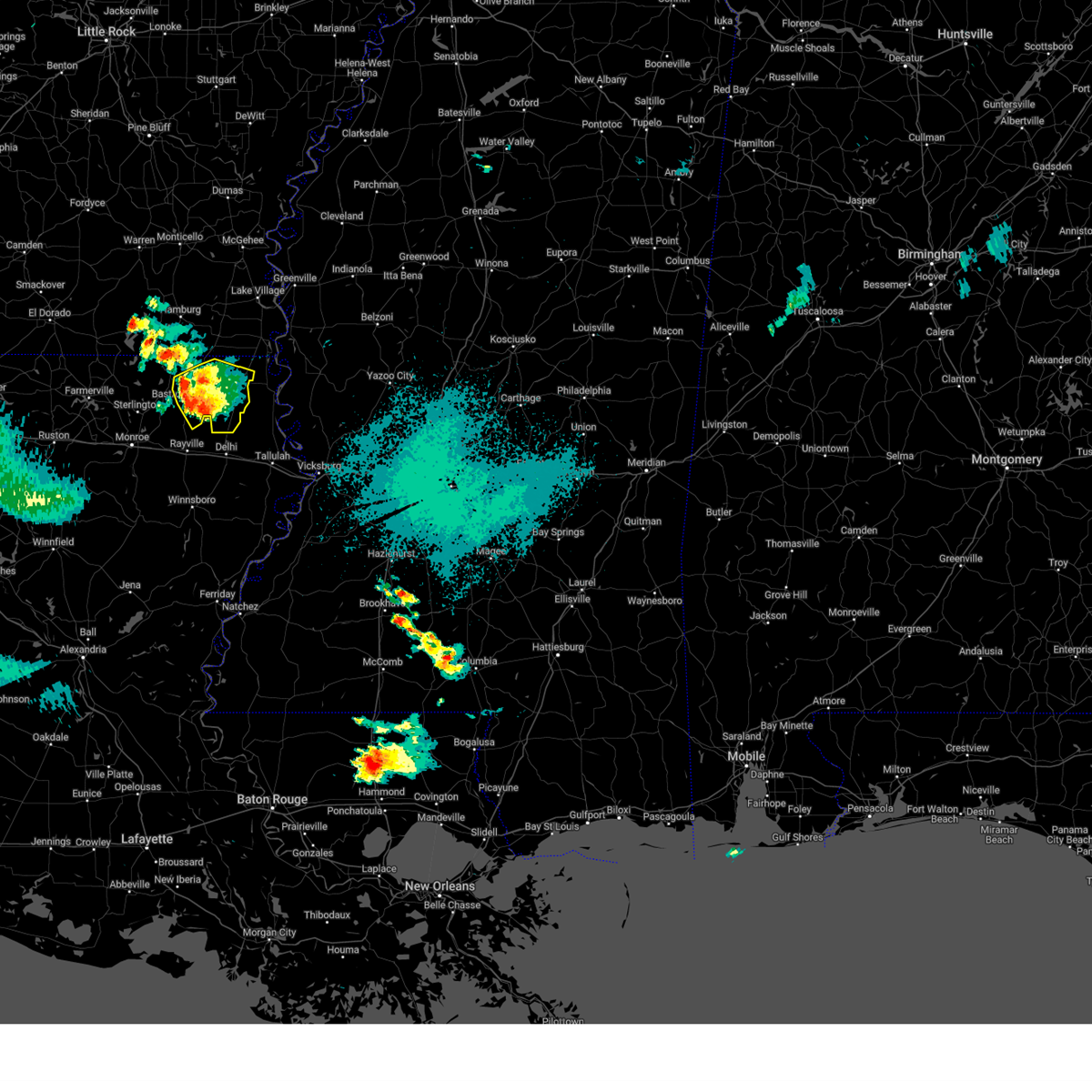
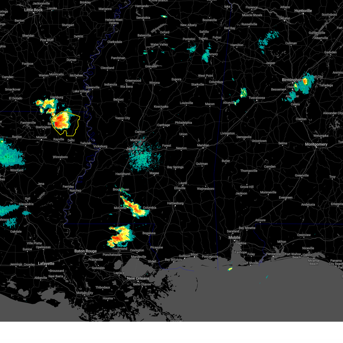
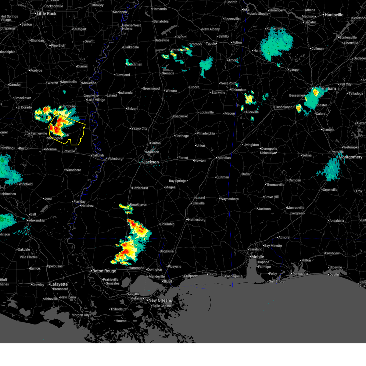
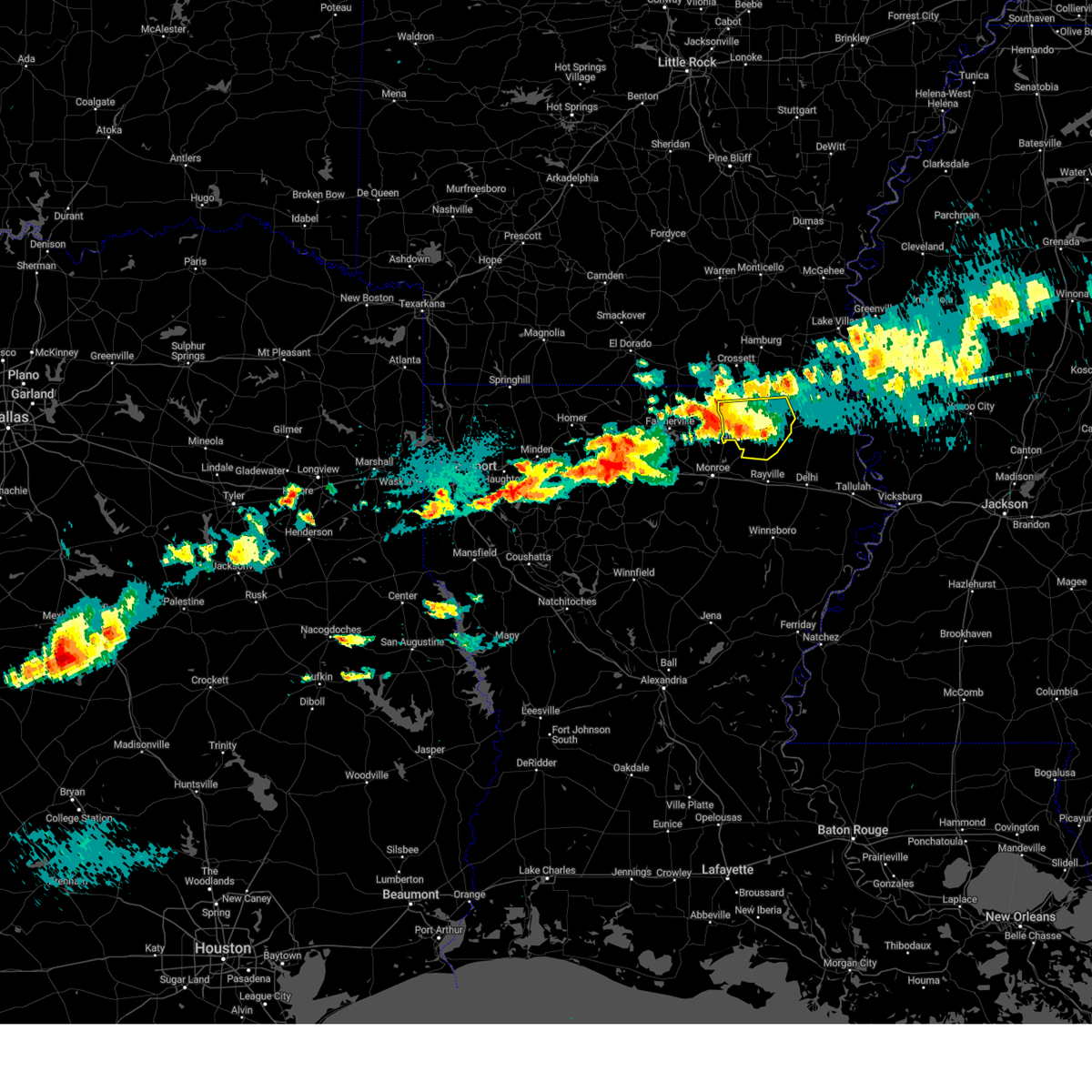
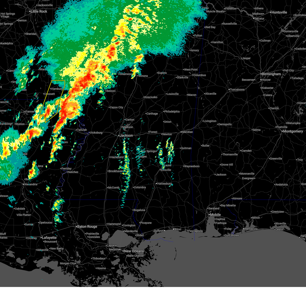
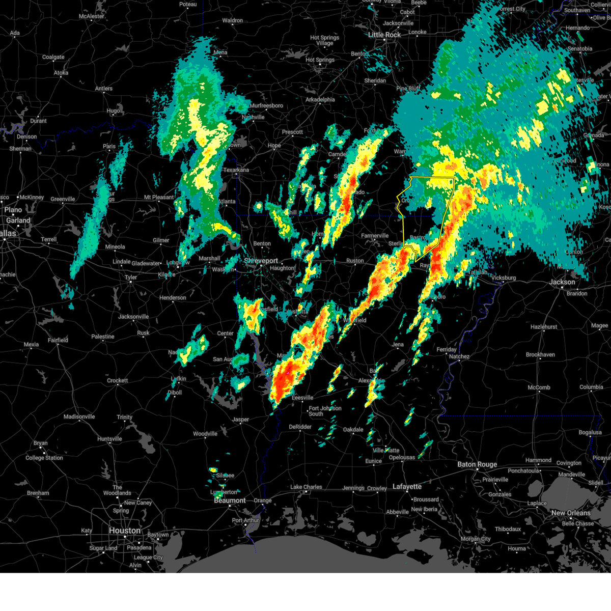
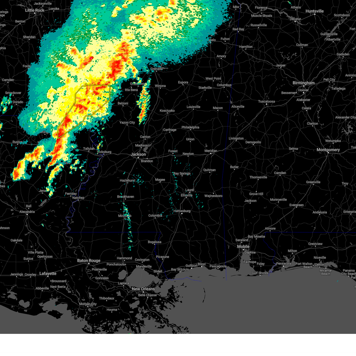
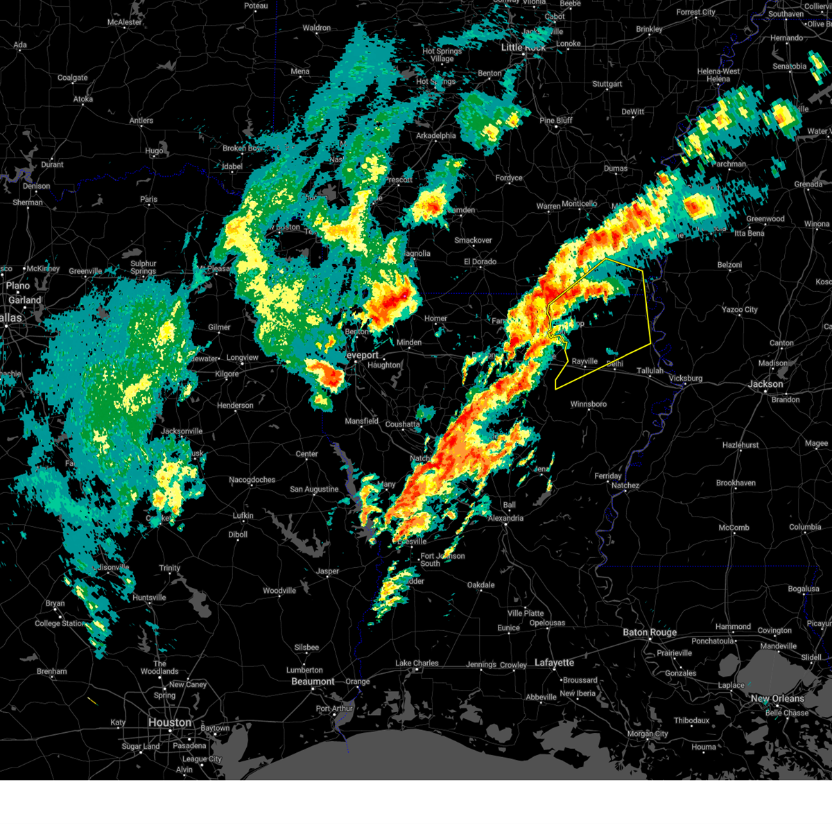
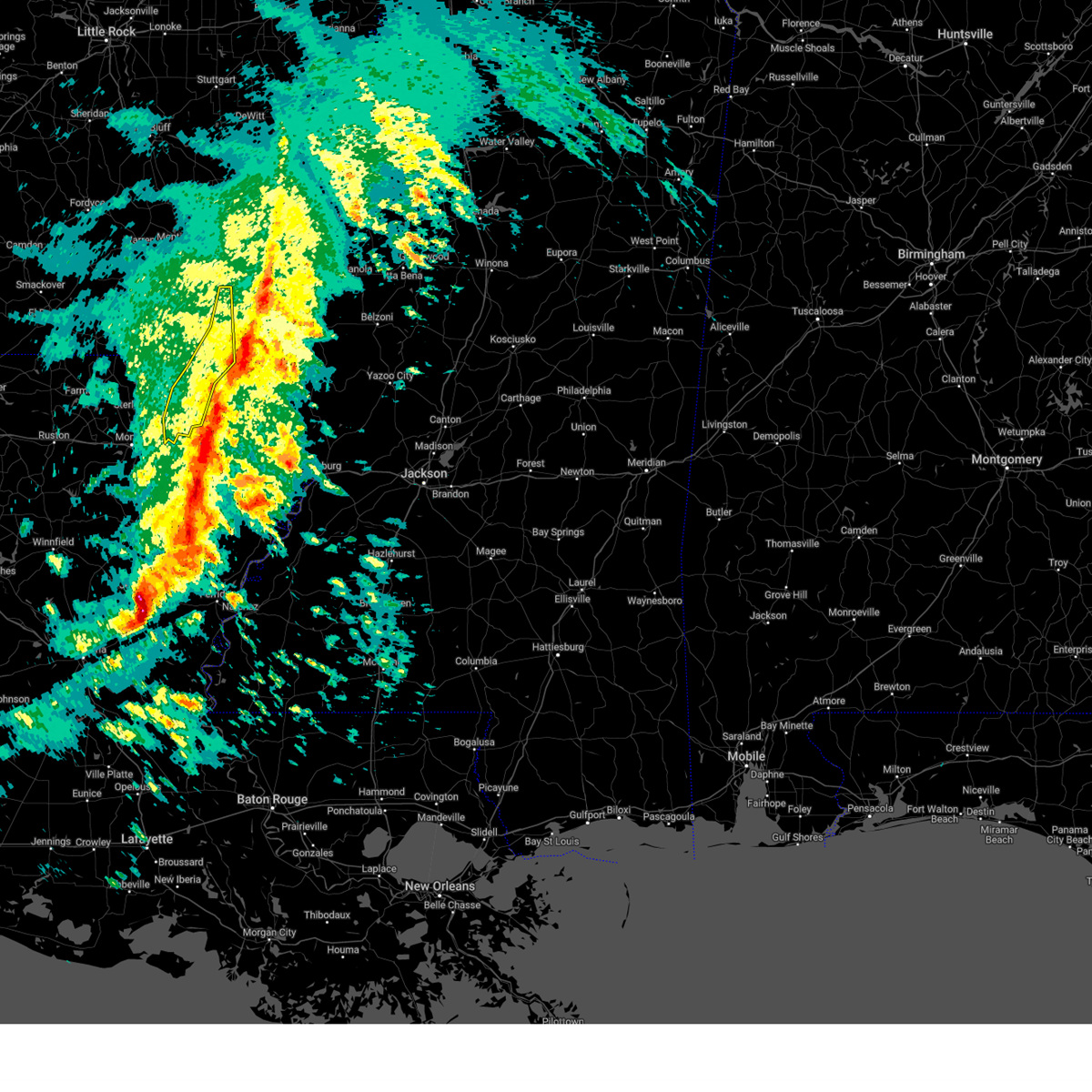
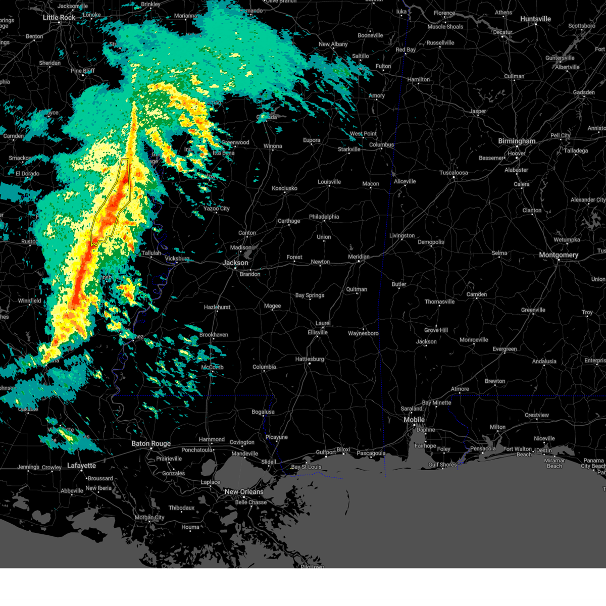
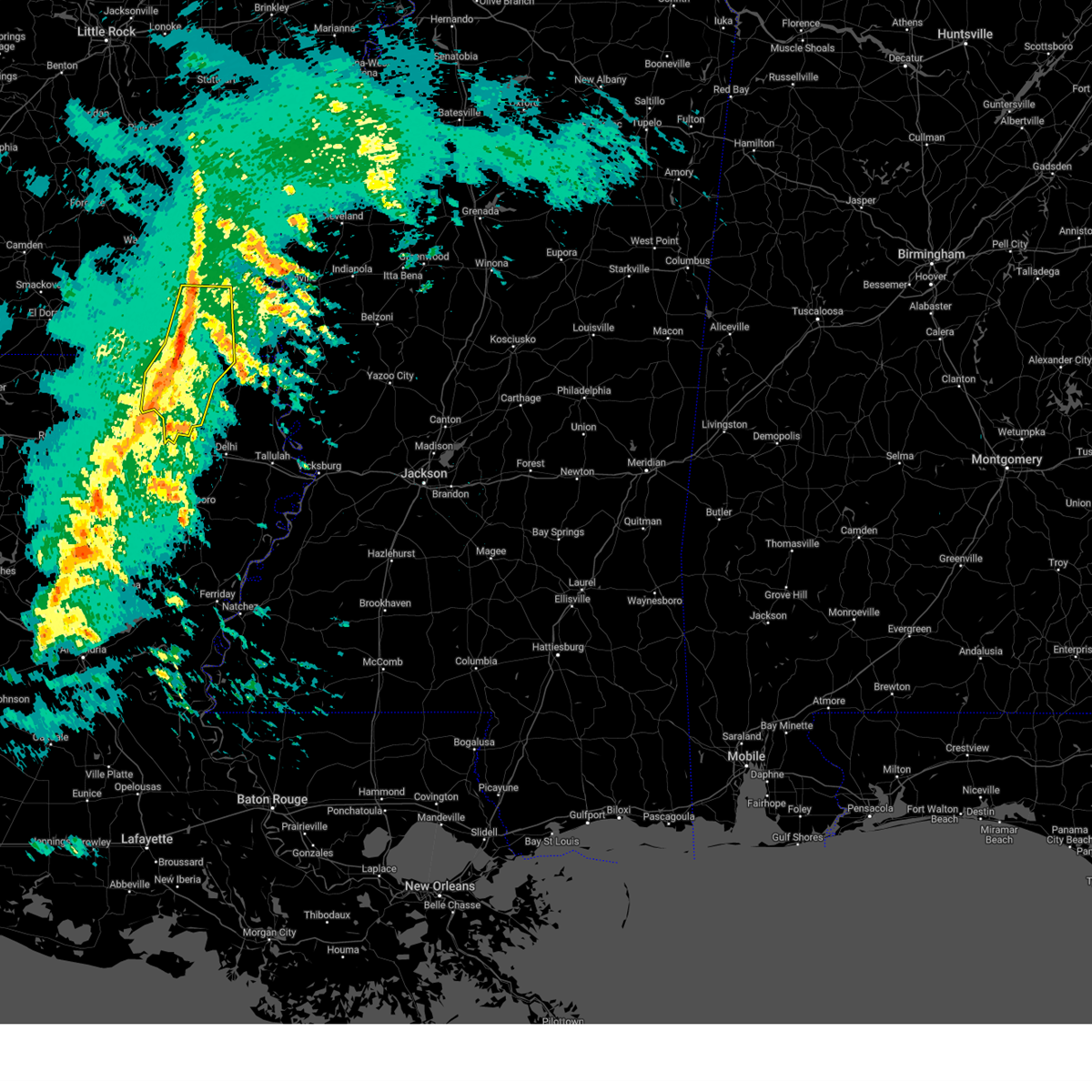
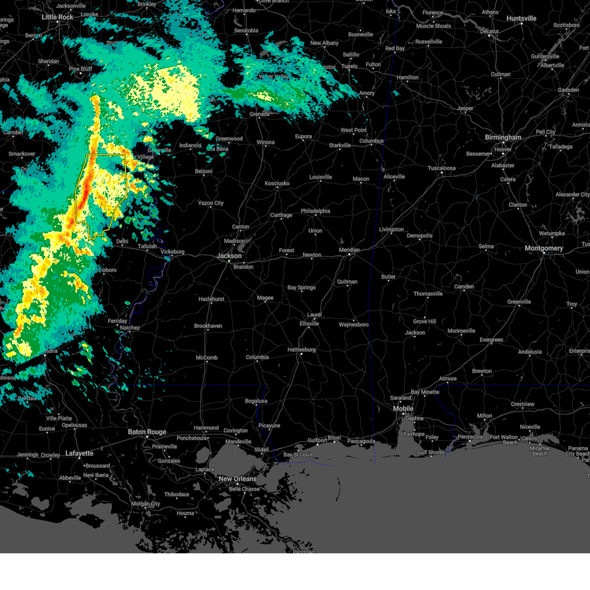
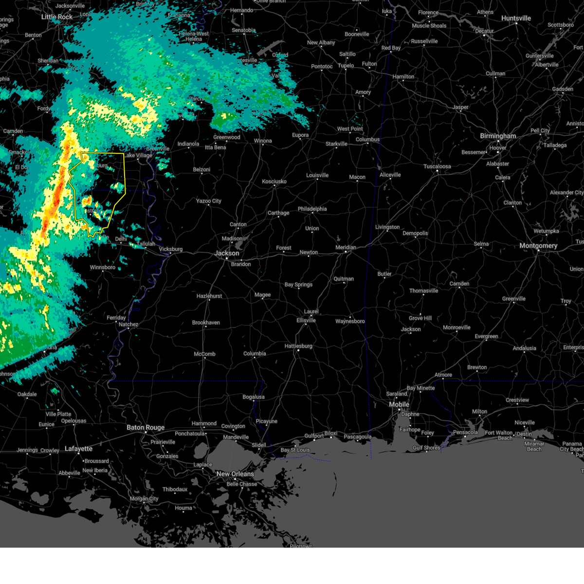
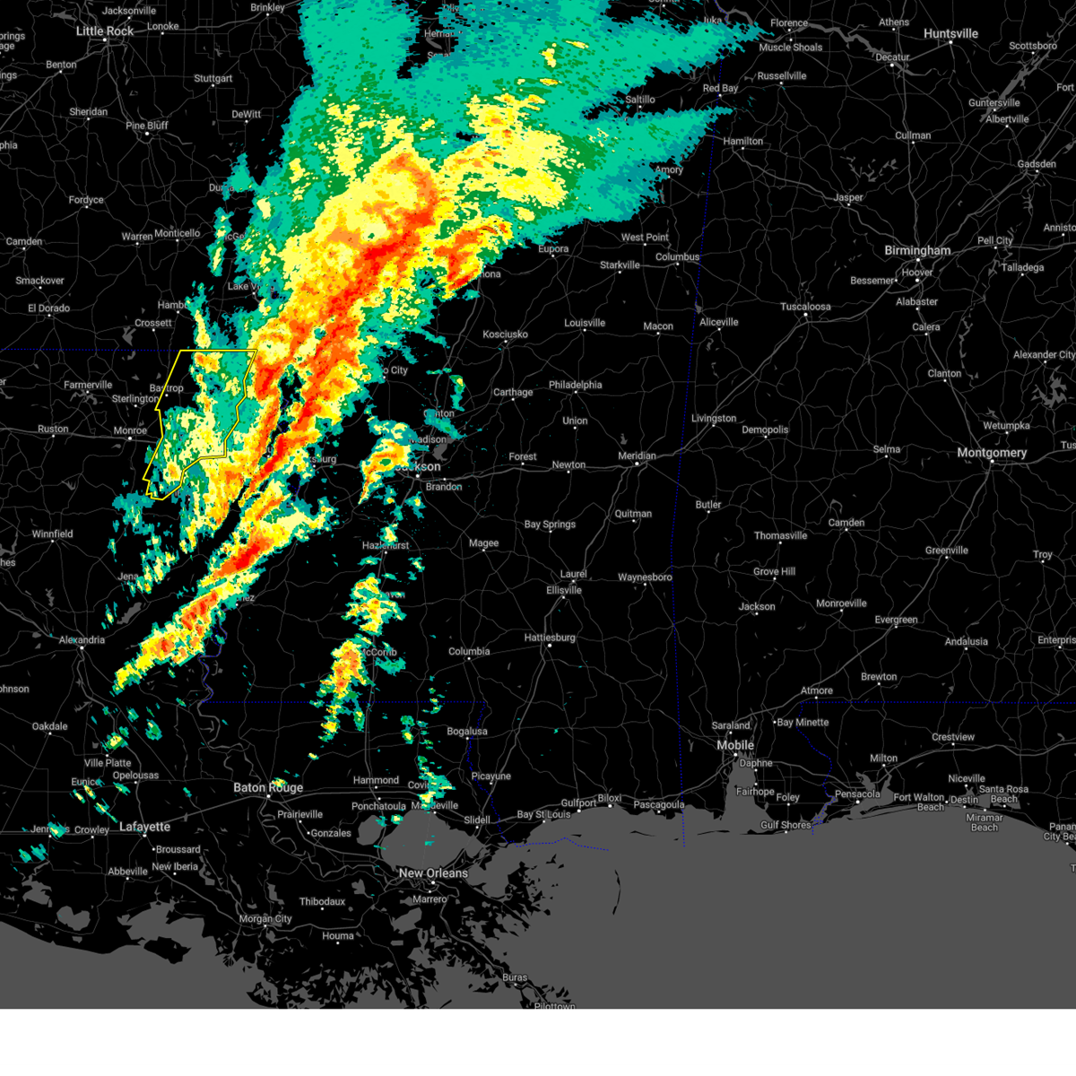
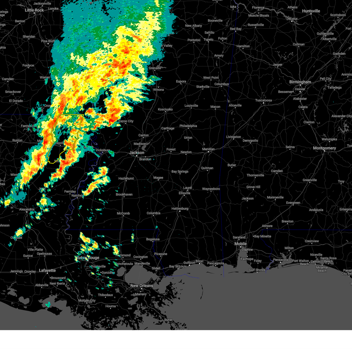
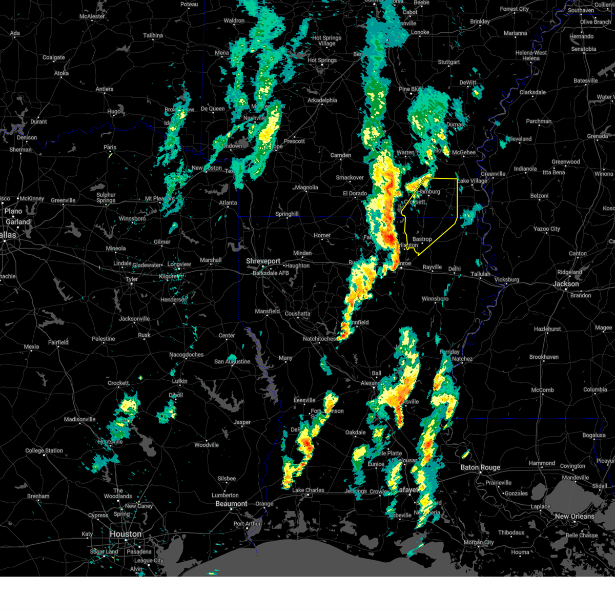
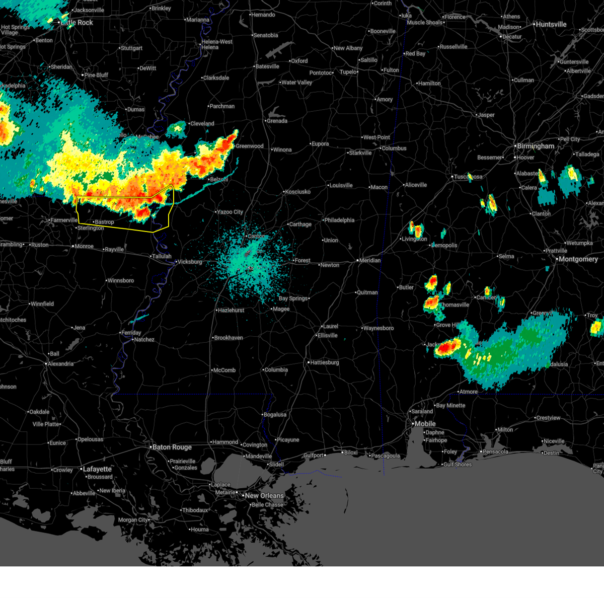
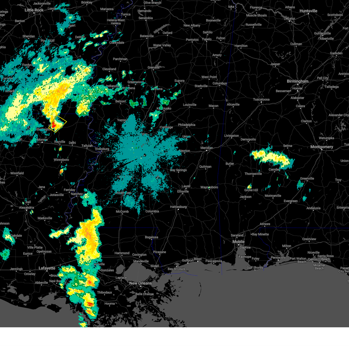
Hail Map for Mer Rouge, LA
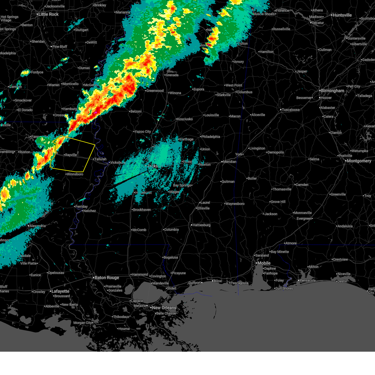
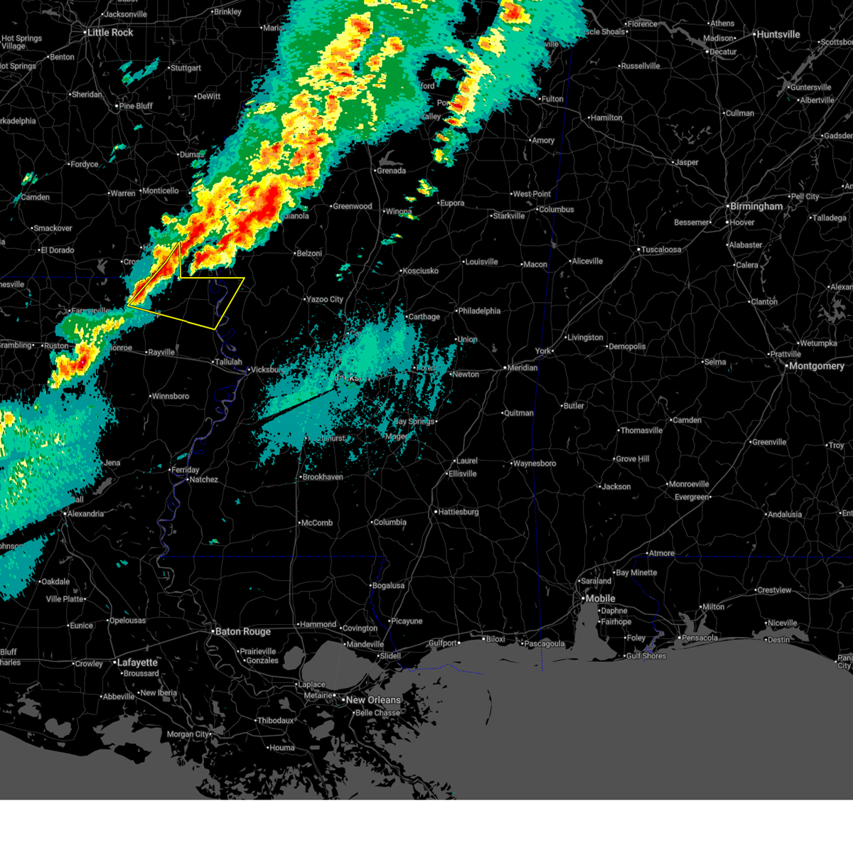
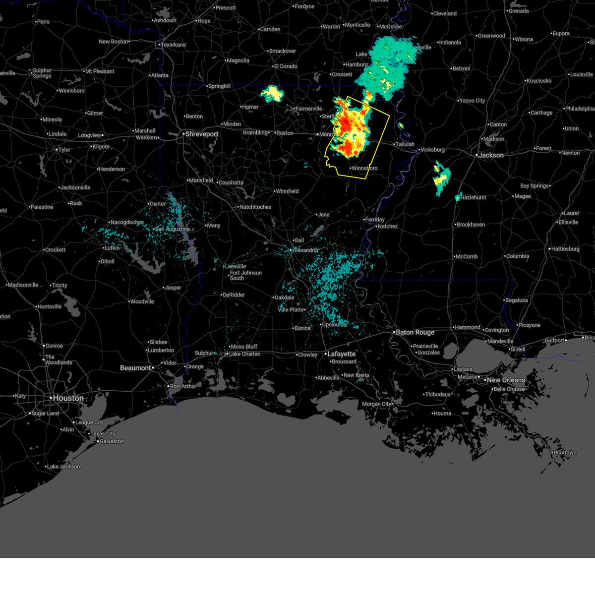
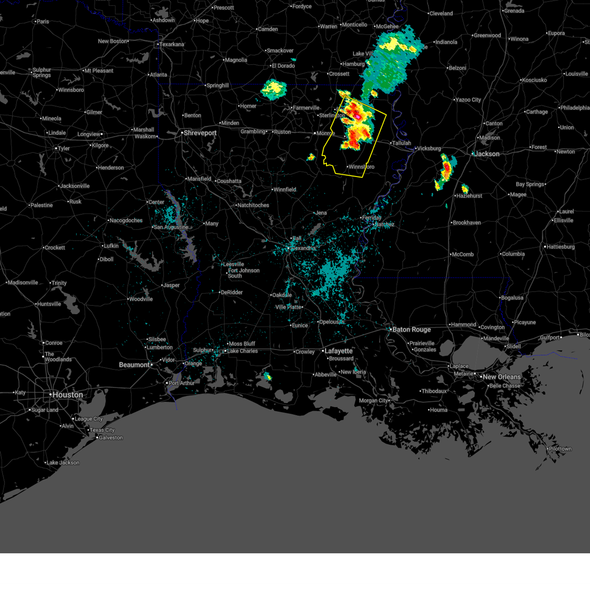
The Mer Rouge, LA area has had 5 reports of on-the-ground hail by trained spotters, and has been under severe weather warnings 13 times during the past 12 months. Doppler radar has detected hail at or near Mer Rouge, LA on 70 occasions, including 5 occasions during the past year.
| Name: | Mer Rouge, LA |
| Where Located: | 6.9 miles E of Bastrop, LA |
| Map: | Google Map for Mer Rouge, LA |
| Population: | 628 |
| Housing Units: | 255 |
| More Info: | Search Google for Mer Rouge, LA |
1
The Top Recent Hail Date for Mer Rouge, LA is Friday, April 24, 2026 (23rd out of 70)
Hail and Wind Damage Spotted near Mer Rouge, LA
| Date / Time | Report Details |
|---|---|
| 5/22/2026 6:42 PM CDT |
 Svrjan the national weather service in jackson has issued a * severe thunderstorm warning for, central morehouse parish in northeastern louisiana, northeastern richland parish in northeastern louisiana, west carroll parish in northeastern louisiana, * until 745 pm cdt. * at 642 pm cdt, severe thunderstorms were located along a line extending from 6 miles east of mer rouge to near swartz, moving east at 30 mph (radar indicated). Hazards include 60 mph wind gusts and quarter size hail. Hail damage to vehicles is expected. expect wind damage to roofs, siding, and trees. severe thunderstorms will be near, oak ridge around 645 pm cdt. goodwill around 650 pm cdt. pioneer around 700 pm cdt. darnell around 705 pm cdt. epps and forest around 710 pm cdt. Warden around 715 pm cdt. Svrjan the national weather service in jackson has issued a * severe thunderstorm warning for, central morehouse parish in northeastern louisiana, northeastern richland parish in northeastern louisiana, west carroll parish in northeastern louisiana, * until 745 pm cdt. * at 642 pm cdt, severe thunderstorms were located along a line extending from 6 miles east of mer rouge to near swartz, moving east at 30 mph (radar indicated). Hazards include 60 mph wind gusts and quarter size hail. Hail damage to vehicles is expected. expect wind damage to roofs, siding, and trees. severe thunderstorms will be near, oak ridge around 645 pm cdt. goodwill around 650 pm cdt. pioneer around 700 pm cdt. darnell around 705 pm cdt. epps and forest around 710 pm cdt. Warden around 715 pm cdt.
|
| 4/29/2026 2:45 PM CDT |
 At 245 pm cdt, a severe thunderstorm was located over oak ridge, or 8 miles north of rayville, moving southeast at 40 mph (radar indicated). Hazards include 60 mph wind gusts and quarter size hail. Hail damage to vehicles is expected. expect wind damage to roofs, siding, and trees. this severe storm will be near, rayville around 250 pm cdt. Holly ridge around 255 pm cdt. At 245 pm cdt, a severe thunderstorm was located over oak ridge, or 8 miles north of rayville, moving southeast at 40 mph (radar indicated). Hazards include 60 mph wind gusts and quarter size hail. Hail damage to vehicles is expected. expect wind damage to roofs, siding, and trees. this severe storm will be near, rayville around 250 pm cdt. Holly ridge around 255 pm cdt.
|
| 4/29/2026 2:33 PM CDT |
 At 233 pm cdt, a severe thunderstorm was located near oak ridge, or 8 miles east of swartz, moving southeast at 50 mph (radar indicated). Hazards include 60 mph wind gusts and quarter size hail. Hail damage to vehicles is expected. expect wind damage to roofs, siding, and trees. this severe storm will be near, rayville and oak ridge around 240 pm cdt. Holly ridge around 245 pm cdt. At 233 pm cdt, a severe thunderstorm was located near oak ridge, or 8 miles east of swartz, moving southeast at 50 mph (radar indicated). Hazards include 60 mph wind gusts and quarter size hail. Hail damage to vehicles is expected. expect wind damage to roofs, siding, and trees. this severe storm will be near, rayville and oak ridge around 240 pm cdt. Holly ridge around 245 pm cdt.
|
| 4/29/2026 2:08 PM CDT |
 Svrjan the national weather service in jackson has issued a * severe thunderstorm warning for, southwestern morehouse parish in northeastern louisiana, central richland parish in northeastern louisiana, southwestern west carroll parish in northeastern louisiana, north central franklin parish in northeastern louisiana, * until 315 pm cdt. * at 207 pm cdt, a severe thunderstorm was located 10 miles northwest of sterlington, or 15 miles west of bastrop, moving east at 45 mph (radar indicated). Hazards include 60 mph wind gusts and quarter size hail. Hail damage to vehicles is expected. expect wind damage to roofs, siding, and trees. this severe thunderstorm will be near, bastrop around 215 pm cdt. collinston around 225 pm cdt. mer rouge around 230 pm cdt. Oak ridge around 235 pm cdt. Svrjan the national weather service in jackson has issued a * severe thunderstorm warning for, southwestern morehouse parish in northeastern louisiana, central richland parish in northeastern louisiana, southwestern west carroll parish in northeastern louisiana, north central franklin parish in northeastern louisiana, * until 315 pm cdt. * at 207 pm cdt, a severe thunderstorm was located 10 miles northwest of sterlington, or 15 miles west of bastrop, moving east at 45 mph (radar indicated). Hazards include 60 mph wind gusts and quarter size hail. Hail damage to vehicles is expected. expect wind damage to roofs, siding, and trees. this severe thunderstorm will be near, bastrop around 215 pm cdt. collinston around 225 pm cdt. mer rouge around 230 pm cdt. Oak ridge around 235 pm cdt.
|
| 4/28/2026 1:31 PM CDT |
 At 131 pm cdt, a severe thunderstorm was located near oak ridge, or 12 miles southeast of bastrop, moving east at 45 mph (radar indicated). Hazards include 60 mph wind gusts and half dollar size hail. Hail damage to vehicles is expected. expect wind damage to roofs, siding, and trees. this severe storm will be near, goodwill around 135 pm cdt. darnell around 140 pm cdt. epps and pioneer around 145 pm cdt. Forest around 150 pm cdt. At 131 pm cdt, a severe thunderstorm was located near oak ridge, or 12 miles southeast of bastrop, moving east at 45 mph (radar indicated). Hazards include 60 mph wind gusts and half dollar size hail. Hail damage to vehicles is expected. expect wind damage to roofs, siding, and trees. this severe storm will be near, goodwill around 135 pm cdt. darnell around 140 pm cdt. epps and pioneer around 145 pm cdt. Forest around 150 pm cdt.
|
| 4/28/2026 1:17 PM CDT |
 Svrjan the national weather service in jackson has issued a * severe thunderstorm warning for, morehouse parish in northeastern louisiana, northeastern richland parish in northeastern louisiana, west carroll parish in northeastern louisiana, * until 215 pm cdt. * at 117 pm cdt, severe thunderstorms were located along a line extending from near bastrop to near swartz, moving east at 40 mph (radar indicated). Hazards include 60 mph wind gusts and quarter size hail. Hail damage to vehicles is expected. expect wind damage to roofs, siding, and trees. severe thunderstorms will be near, bastrop, mer rouge, collinston, and oak ridge around 125 pm cdt. galion around 130 pm cdt. bonita around 135 pm cdt. jones and goodwill around 145 pm cdt. forest, pioneer, and darnell around 155 pm cdt. Oak grove around 200 pm cdt. Svrjan the national weather service in jackson has issued a * severe thunderstorm warning for, morehouse parish in northeastern louisiana, northeastern richland parish in northeastern louisiana, west carroll parish in northeastern louisiana, * until 215 pm cdt. * at 117 pm cdt, severe thunderstorms were located along a line extending from near bastrop to near swartz, moving east at 40 mph (radar indicated). Hazards include 60 mph wind gusts and quarter size hail. Hail damage to vehicles is expected. expect wind damage to roofs, siding, and trees. severe thunderstorms will be near, bastrop, mer rouge, collinston, and oak ridge around 125 pm cdt. galion around 130 pm cdt. bonita around 135 pm cdt. jones and goodwill around 145 pm cdt. forest, pioneer, and darnell around 155 pm cdt. Oak grove around 200 pm cdt.
|
| 4/26/2026 3:50 AM CDT |
 Svrjan the national weather service in jackson has issued a * severe thunderstorm warning for, southwestern morehouse parish in northeastern louisiana, richland parish in northeastern louisiana, southwestern west carroll parish in northeastern louisiana, northwestern franklin parish in northeastern louisiana, * until 445 am cdt. * at 350 am cdt, a severe thunderstorm was located over swartz, moving southeast at 40 mph (radar indicated). Hazards include 60 mph wind gusts and quarter size hail. Hail damage to vehicles is expected. expect wind damage to roofs, siding, and trees. this severe thunderstorm will be near, start around 355 am cdt. rayville around 400 am cdt. alto and archibald around 410 am cdt. Mangham and holly ridge around 420 am cdt. Svrjan the national weather service in jackson has issued a * severe thunderstorm warning for, southwestern morehouse parish in northeastern louisiana, richland parish in northeastern louisiana, southwestern west carroll parish in northeastern louisiana, northwestern franklin parish in northeastern louisiana, * until 445 am cdt. * at 350 am cdt, a severe thunderstorm was located over swartz, moving southeast at 40 mph (radar indicated). Hazards include 60 mph wind gusts and quarter size hail. Hail damage to vehicles is expected. expect wind damage to roofs, siding, and trees. this severe thunderstorm will be near, start around 355 am cdt. rayville around 400 am cdt. alto and archibald around 410 am cdt. Mangham and holly ridge around 420 am cdt.
|
| 3/15/2026 8:30 PM CDT |
 Svrjan the national weather service in jackson has issued a * severe thunderstorm warning for, southwestern morehouse parish in northeastern louisiana, southwestern east carroll parish in northeastern louisiana, western madison parish in northeastern louisiana, richland parish in northeastern louisiana, southwestern west carroll parish in northeastern louisiana, northeastern franklin parish in northeastern louisiana, * until 945 pm cdt. * at 830 pm cdt, a severe thunderstorm was located near richwood, or 7 miles southeast of brownsville-bawcomville, moving east at 45 mph (radar indicated). Hazards include 60 mph wind gusts and quarter size hail. Hail damage to vehicles is expected. expect wind damage to roofs, siding, and trees. this severe thunderstorm will be near, buckner around 835 pm cdt. start and alto around 840 pm cdt. rayville and archibald around 845 pm cdt. mangham around 850 pm cdt. holly ridge around 900 pm cdt. delhi and bakers around 905 pm cdt. Waverly and tendal around 915 pm cdt. Svrjan the national weather service in jackson has issued a * severe thunderstorm warning for, southwestern morehouse parish in northeastern louisiana, southwestern east carroll parish in northeastern louisiana, western madison parish in northeastern louisiana, richland parish in northeastern louisiana, southwestern west carroll parish in northeastern louisiana, northeastern franklin parish in northeastern louisiana, * until 945 pm cdt. * at 830 pm cdt, a severe thunderstorm was located near richwood, or 7 miles southeast of brownsville-bawcomville, moving east at 45 mph (radar indicated). Hazards include 60 mph wind gusts and quarter size hail. Hail damage to vehicles is expected. expect wind damage to roofs, siding, and trees. this severe thunderstorm will be near, buckner around 835 pm cdt. start and alto around 840 pm cdt. rayville and archibald around 845 pm cdt. mangham around 850 pm cdt. holly ridge around 900 pm cdt. delhi and bakers around 905 pm cdt. Waverly and tendal around 915 pm cdt.
|
| 3/15/2026 8:17 PM CDT |
 Svrjan the national weather service in jackson has issued a * severe thunderstorm warning for, southeastern ashley county in southeastern arkansas, northeastern morehouse parish in northeastern louisiana, central east carroll parish in northeastern louisiana, west carroll parish in northeastern louisiana, northwestern issaquena county in west central mississippi, * until 915 pm cdt. * at 817 pm cdt, severe thunderstorms were located along a line extending from wilmot to galion, moving east at 45 mph (radar indicated). Hazards include 60 mph wind gusts and quarter size hail. Hail damage to vehicles is expected. expect wind damage to roofs, siding, and trees. severe thunderstorms will be near, wilmot, bonita, jones, and galion around 820 pm cdt. kilbourne and goodwill around 830 pm cdt. oak grove around 835 pm cdt. forest, gassoway, and millikin around 840 pm cdt. pioneer and shelburn around 845 pm cdt. lake providence around 850 pm cdt. mayersville around 855 pm cdt. Grace around 900 pm cdt. Svrjan the national weather service in jackson has issued a * severe thunderstorm warning for, southeastern ashley county in southeastern arkansas, northeastern morehouse parish in northeastern louisiana, central east carroll parish in northeastern louisiana, west carroll parish in northeastern louisiana, northwestern issaquena county in west central mississippi, * until 915 pm cdt. * at 817 pm cdt, severe thunderstorms were located along a line extending from wilmot to galion, moving east at 45 mph (radar indicated). Hazards include 60 mph wind gusts and quarter size hail. Hail damage to vehicles is expected. expect wind damage to roofs, siding, and trees. severe thunderstorms will be near, wilmot, bonita, jones, and galion around 820 pm cdt. kilbourne and goodwill around 830 pm cdt. oak grove around 835 pm cdt. forest, gassoway, and millikin around 840 pm cdt. pioneer and shelburn around 845 pm cdt. lake providence around 850 pm cdt. mayersville around 855 pm cdt. Grace around 900 pm cdt.
|
| 8/19/2025 10:53 PM CDT |
 The storm which prompted the warning has weakened below severe limits, and has exited the warned area. therefore, the warning will be allowed to expire. The storm which prompted the warning has weakened below severe limits, and has exited the warned area. therefore, the warning will be allowed to expire.
|
| 8/19/2025 10:04 PM CDT |
 Svrjan the national weather service in jackson has issued a * severe thunderstorm warning for, central morehouse parish in northeastern louisiana, southwestern east carroll parish in northeastern louisiana, northwestern madison parish in northeastern louisiana, richland parish in northeastern louisiana, southwestern west carroll parish in northeastern louisiana, franklin parish in northeastern louisiana, * until 1100 pm cdt. * at 1004 pm cdt, a severe thunderstorm was located 7 miles southwest of goodwill, or 17 miles northeast of rayville, moving southwest at 25 mph (radar indicated). Hazards include 60 mph wind gusts and penny size hail. Expect damage to roofs, siding, and trees. this severe thunderstorm will be near, oak ridge around 1010 pm cdt. rayville around 1020 pm cdt. start around 1030 pm cdt. alto and archibald around 1040 pm cdt. Mangham around 1045 pm cdt. Svrjan the national weather service in jackson has issued a * severe thunderstorm warning for, central morehouse parish in northeastern louisiana, southwestern east carroll parish in northeastern louisiana, northwestern madison parish in northeastern louisiana, richland parish in northeastern louisiana, southwestern west carroll parish in northeastern louisiana, franklin parish in northeastern louisiana, * until 1100 pm cdt. * at 1004 pm cdt, a severe thunderstorm was located 7 miles southwest of goodwill, or 17 miles northeast of rayville, moving southwest at 25 mph (radar indicated). Hazards include 60 mph wind gusts and penny size hail. Expect damage to roofs, siding, and trees. this severe thunderstorm will be near, oak ridge around 1010 pm cdt. rayville around 1020 pm cdt. start around 1030 pm cdt. alto and archibald around 1040 pm cdt. Mangham around 1045 pm cdt.
|
| 7/29/2025 2:57 PM CDT |
 the severe thunderstorm warning has been cancelled and is no longer in effect the severe thunderstorm warning has been cancelled and is no longer in effect
|
| 7/29/2025 2:24 PM CDT |
 Svrjan the national weather service in jackson has issued a * severe thunderstorm warning for, western morehouse parish in northeastern louisiana, * until 315 pm cdt. * at 224 pm cdt, a severe thunderstorm was located near beekman, or near bastrop, moving south at 20 mph (radar indicated). Hazards include 60 mph wind gusts and quarter size hail. Hail damage to vehicles is expected. expect wind damage to roofs, siding, and trees. this severe thunderstorm will be near, bastrop around 230 pm cdt. Collinston around 245 pm cdt. Svrjan the national weather service in jackson has issued a * severe thunderstorm warning for, western morehouse parish in northeastern louisiana, * until 315 pm cdt. * at 224 pm cdt, a severe thunderstorm was located near beekman, or near bastrop, moving south at 20 mph (radar indicated). Hazards include 60 mph wind gusts and quarter size hail. Hail damage to vehicles is expected. expect wind damage to roofs, siding, and trees. this severe thunderstorm will be near, bastrop around 230 pm cdt. Collinston around 245 pm cdt.
|
| 6/11/2025 6:52 PM CDT |
 Svrjan the national weather service in jackson has issued a * severe thunderstorm warning for, southern chicot county in southeastern arkansas, ashley county in southeastern arkansas, morehouse parish in northeastern louisiana, east carroll parish in northeastern louisiana, northwestern madison parish in northeastern louisiana, northeastern richland parish in northeastern louisiana, west carroll parish in northeastern louisiana, northeastern franklin parish in northeastern louisiana, southwestern washington county in northwestern mississippi, northwestern issaquena county in west central mississippi, * until 745 pm cdt. * at 651 pm cdt, severe thunderstorms were located along a line extending from 6 miles south of west crossett to near goodwill, moving northeast at 35 mph (radar indicated). Hazards include 60 mph wind gusts and quarter size hail. Hail damage to vehicles is expected. expect wind damage to roofs, siding, and trees. severe thunderstorms will be near, crossett, bonita, pioneer, and goodwill around 655 pm cdt. north crossett, forest, jones, and berlin around 700 pm cdt. oak grove around 705 pm cdt. hamburg and wilmot around 710 pm cdt. parkdale and shelburn around 720 pm cdt. kilbourne and millikin around 725 pm cdt. Portland, snyder, and gassoway around 730 pm cdt. Svrjan the national weather service in jackson has issued a * severe thunderstorm warning for, southern chicot county in southeastern arkansas, ashley county in southeastern arkansas, morehouse parish in northeastern louisiana, east carroll parish in northeastern louisiana, northwestern madison parish in northeastern louisiana, northeastern richland parish in northeastern louisiana, west carroll parish in northeastern louisiana, northeastern franklin parish in northeastern louisiana, southwestern washington county in northwestern mississippi, northwestern issaquena county in west central mississippi, * until 745 pm cdt. * at 651 pm cdt, severe thunderstorms were located along a line extending from 6 miles south of west crossett to near goodwill, moving northeast at 35 mph (radar indicated). Hazards include 60 mph wind gusts and quarter size hail. Hail damage to vehicles is expected. expect wind damage to roofs, siding, and trees. severe thunderstorms will be near, crossett, bonita, pioneer, and goodwill around 655 pm cdt. north crossett, forest, jones, and berlin around 700 pm cdt. oak grove around 705 pm cdt. hamburg and wilmot around 710 pm cdt. parkdale and shelburn around 720 pm cdt. kilbourne and millikin around 725 pm cdt. Portland, snyder, and gassoway around 730 pm cdt.
|
| 5/26/2025 11:29 AM CDT |
 At 1129 am cdt, severe thunderstorms were located along a line extending from near bonita to near rayville, moving east at 40 mph (radar indicated). Hazards include 60 mph wind gusts and penny size hail. Expect damage to roofs, siding, and trees. These severe storms will be near, goodwill around 1135 am cdt. At 1129 am cdt, severe thunderstorms were located along a line extending from near bonita to near rayville, moving east at 40 mph (radar indicated). Hazards include 60 mph wind gusts and penny size hail. Expect damage to roofs, siding, and trees. These severe storms will be near, goodwill around 1135 am cdt.
|
| 5/26/2025 11:00 AM CDT |
 Svrjan the national weather service in jackson has issued a * severe thunderstorm warning for, central morehouse parish in northeastern louisiana, northern richland parish in northeastern louisiana, western west carroll parish in northeastern louisiana, * until noon cdt. * at 1059 am cdt, a severe thunderstorm was located over swartz, moving northeast at 40 mph (radar indicated). Hazards include 60 mph wind gusts and nickel size hail. Expect damage to roofs, siding, and trees. this severe thunderstorm will be near, collinston around 1105 am cdt. bastrop and oak ridge around 1110 am cdt. mer rouge around 1120 am cdt. Goodwill around 1135 am cdt. Svrjan the national weather service in jackson has issued a * severe thunderstorm warning for, central morehouse parish in northeastern louisiana, northern richland parish in northeastern louisiana, western west carroll parish in northeastern louisiana, * until noon cdt. * at 1059 am cdt, a severe thunderstorm was located over swartz, moving northeast at 40 mph (radar indicated). Hazards include 60 mph wind gusts and nickel size hail. Expect damage to roofs, siding, and trees. this severe thunderstorm will be near, collinston around 1105 am cdt. bastrop and oak ridge around 1110 am cdt. mer rouge around 1120 am cdt. Goodwill around 1135 am cdt.
|
| 5/24/2025 2:37 PM CDT | Couple of trees reported down in mer roug in morehouse county LA, 0.4 miles SW of Mer Rouge, LA |
| 5/24/2025 2:33 PM CDT |
 At 233 pm cdt, a severe thunderstorm was located near wilmot, or 15 miles northwest of oak grove, moving east at 30 mph (radar indicated). Hazards include 60 mph wind gusts and quarter size hail. Hail damage to vehicles is expected. expect wind damage to roofs, siding, and trees. this severe storm will be near, kilbourne around 250 pm cdt. Oak grove around 255 pm cdt. At 233 pm cdt, a severe thunderstorm was located near wilmot, or 15 miles northwest of oak grove, moving east at 30 mph (radar indicated). Hazards include 60 mph wind gusts and quarter size hail. Hail damage to vehicles is expected. expect wind damage to roofs, siding, and trees. this severe storm will be near, kilbourne around 250 pm cdt. Oak grove around 255 pm cdt.
|
| 5/24/2025 2:05 PM CDT |
 Svrjan the national weather service in jackson has issued a * severe thunderstorm warning for, morehouse parish in northeastern louisiana, west carroll parish in northeastern louisiana, * until 300 pm cdt. * at 204 pm cdt, a severe thunderstorm was located near berlin, or 7 miles southeast of crossett, moving east at 30 mph (radar indicated). Hazards include 60 mph wind gusts and quarter size hail. Hail damage to vehicles is expected. expect wind damage to roofs, siding, and trees. this severe thunderstorm will be near, jones around 215 pm cdt. bonita around 225 pm cdt. Oak grove around 255 pm cdt. Svrjan the national weather service in jackson has issued a * severe thunderstorm warning for, morehouse parish in northeastern louisiana, west carroll parish in northeastern louisiana, * until 300 pm cdt. * at 204 pm cdt, a severe thunderstorm was located near berlin, or 7 miles southeast of crossett, moving east at 30 mph (radar indicated). Hazards include 60 mph wind gusts and quarter size hail. Hail damage to vehicles is expected. expect wind damage to roofs, siding, and trees. this severe thunderstorm will be near, jones around 215 pm cdt. bonita around 225 pm cdt. Oak grove around 255 pm cdt.
|
| 5/20/2025 4:59 PM CDT |
 the severe thunderstorm warning has been cancelled and is no longer in effect the severe thunderstorm warning has been cancelled and is no longer in effect
|
| 5/20/2025 4:50 PM CDT |
 At 449 pm cdt, a severe thunderstorm was located over collinston, or near bastrop, moving east at 35 mph (radar indicated). Hazards include 60 mph wind gusts and quarter size hail. Hail damage to vehicles is expected. expect wind damage to roofs, siding, and trees. this severe storm will be near, mer rouge and oak ridge around 455 pm cdt. Goodwill around 505 pm cdt. At 449 pm cdt, a severe thunderstorm was located over collinston, or near bastrop, moving east at 35 mph (radar indicated). Hazards include 60 mph wind gusts and quarter size hail. Hail damage to vehicles is expected. expect wind damage to roofs, siding, and trees. this severe storm will be near, mer rouge and oak ridge around 455 pm cdt. Goodwill around 505 pm cdt.
|
| 5/20/2025 4:25 PM CDT |
 Svrjan the national weather service in jackson has issued a * severe thunderstorm warning for, central morehouse parish in northeastern louisiana, northeastern richland parish in northeastern louisiana, southwestern west carroll parish in northeastern louisiana, * until 530 pm cdt. * at 424 pm cdt, a severe thunderstorm was located over sterlington, or 9 miles northwest of swartz, moving east at 35 mph (radar indicated). Hazards include golf ball size hail and 60 mph wind gusts. People and animals outdoors will be injured. expect hail damage to roofs, siding, windows, and vehicles. expect wind damage to roofs, siding, and trees. this severe thunderstorm will be near, bastrop around 430 pm cdt. collinston around 435 pm cdt. mer rouge and oak ridge around 445 pm cdt. Goodwill around 505 pm cdt. Svrjan the national weather service in jackson has issued a * severe thunderstorm warning for, central morehouse parish in northeastern louisiana, northeastern richland parish in northeastern louisiana, southwestern west carroll parish in northeastern louisiana, * until 530 pm cdt. * at 424 pm cdt, a severe thunderstorm was located over sterlington, or 9 miles northwest of swartz, moving east at 35 mph (radar indicated). Hazards include golf ball size hail and 60 mph wind gusts. People and animals outdoors will be injured. expect hail damage to roofs, siding, windows, and vehicles. expect wind damage to roofs, siding, and trees. this severe thunderstorm will be near, bastrop around 430 pm cdt. collinston around 435 pm cdt. mer rouge and oak ridge around 445 pm cdt. Goodwill around 505 pm cdt.
|
| 5/6/2025 5:36 PM CDT |
 At 536 pm cdt, severe thunderstorms were located along a line extending from near monroe to 9 miles south of richwood to 7 miles east of winnfield, moving east at 50 mph (radar indicated). Hazards include 70 mph wind gusts and penny size hail. Expect considerable tree damage. damage is likely to mobile homes, roofs, and outbuildings. these severe storms will be near, start and buckner around 545 pm cdt. rayville and alto around 550 pm cdt. oak ridge, mangham, and archibald around 555 pm cdt. baskin around 600 pm cdt. holly ridge and liddieville around 605 pm cdt. winnsboro around 610 pm cdt. warden, delhi, bakers, crowville, and epps around 615 pm cdt. Jigger and waverly around 620 pm cdt. At 536 pm cdt, severe thunderstorms were located along a line extending from near monroe to 9 miles south of richwood to 7 miles east of winnfield, moving east at 50 mph (radar indicated). Hazards include 70 mph wind gusts and penny size hail. Expect considerable tree damage. damage is likely to mobile homes, roofs, and outbuildings. these severe storms will be near, start and buckner around 545 pm cdt. rayville and alto around 550 pm cdt. oak ridge, mangham, and archibald around 555 pm cdt. baskin around 600 pm cdt. holly ridge and liddieville around 605 pm cdt. winnsboro around 610 pm cdt. warden, delhi, bakers, crowville, and epps around 615 pm cdt. Jigger and waverly around 620 pm cdt.
|
| 5/6/2025 5:16 PM CDT |
 Svrjan the national weather service in jackson has issued a * severe thunderstorm warning for, central morehouse parish in northeastern louisiana, northwestern madison parish in northeastern louisiana, richland parish in northeastern louisiana, southwestern west carroll parish in northeastern louisiana, franklin parish in northeastern louisiana, * until 615 pm cdt. * at 516 pm cdt, severe thunderstorms were located along a line extending from near claiborne to 15 miles southwest of brownsville-bawcomville to near winnfield, moving east at 50 mph (radar indicated). Hazards include 70 mph wind gusts and penny size hail. Expect considerable tree damage. damage is likely to mobile homes, roofs, and outbuildings. severe thunderstorms will be near, buckner around 540 pm cdt. start, rayville, and alto around 545 pm cdt. oak ridge, mangham, and archibald around 550 pm cdt. baskin around 555 pm cdt. holly ridge and liddieville around 600 pm cdt. Winnsboro around 605 pm cdt. Svrjan the national weather service in jackson has issued a * severe thunderstorm warning for, central morehouse parish in northeastern louisiana, northwestern madison parish in northeastern louisiana, richland parish in northeastern louisiana, southwestern west carroll parish in northeastern louisiana, franklin parish in northeastern louisiana, * until 615 pm cdt. * at 516 pm cdt, severe thunderstorms were located along a line extending from near claiborne to 15 miles southwest of brownsville-bawcomville to near winnfield, moving east at 50 mph (radar indicated). Hazards include 70 mph wind gusts and penny size hail. Expect considerable tree damage. damage is likely to mobile homes, roofs, and outbuildings. severe thunderstorms will be near, buckner around 540 pm cdt. start, rayville, and alto around 545 pm cdt. oak ridge, mangham, and archibald around 550 pm cdt. baskin around 555 pm cdt. holly ridge and liddieville around 600 pm cdt. Winnsboro around 605 pm cdt.
|
| 5/6/2025 4:34 PM CDT | Quarter sized hail reported 3.3 miles W of Mer Rouge, LA |
| 5/6/2025 4:32 PM CDT |
 Svrjan the national weather service in jackson has issued a * severe thunderstorm warning for, southern chicot county in southeastern arkansas, eastern ashley county in southeastern arkansas, eastern morehouse parish in northeastern louisiana, north central east carroll parish in northeastern louisiana, north central richland parish in northeastern louisiana, west carroll parish in northeastern louisiana, southwestern washington county in northwestern mississippi, * until 515 pm cdt. * at 431 pm cdt, a severe thunderstorm was located near oak ridge, or 14 miles north of rayville, moving northeast at 65 mph (radar indicated). Hazards include 70 mph wind gusts and ping pong ball size hail. People and animals outdoors will be injured. expect hail damage to roofs, siding, windows, and vehicles. expect considerable tree damage. wind damage is also likely to mobile homes, roofs, and outbuildings. this severe thunderstorm will be near, goodwill around 435 pm cdt. bonita around 440 pm cdt. jones around 445 pm cdt. wilmot around 450 pm cdt. parkdale around 455 pm cdt. portland around 505 pm cdt. Chicot junction around 510 pm cdt. Svrjan the national weather service in jackson has issued a * severe thunderstorm warning for, southern chicot county in southeastern arkansas, eastern ashley county in southeastern arkansas, eastern morehouse parish in northeastern louisiana, north central east carroll parish in northeastern louisiana, north central richland parish in northeastern louisiana, west carroll parish in northeastern louisiana, southwestern washington county in northwestern mississippi, * until 515 pm cdt. * at 431 pm cdt, a severe thunderstorm was located near oak ridge, or 14 miles north of rayville, moving northeast at 65 mph (radar indicated). Hazards include 70 mph wind gusts and ping pong ball size hail. People and animals outdoors will be injured. expect hail damage to roofs, siding, windows, and vehicles. expect considerable tree damage. wind damage is also likely to mobile homes, roofs, and outbuildings. this severe thunderstorm will be near, goodwill around 435 pm cdt. bonita around 440 pm cdt. jones around 445 pm cdt. wilmot around 450 pm cdt. parkdale around 455 pm cdt. portland around 505 pm cdt. Chicot junction around 510 pm cdt.
|
| 5/1/2025 8:21 PM CDT |
 At 821 pm cdt, severe thunderstorms were located along a line extending from 7 miles east of jones to 7 miles southwest of goodwill, moving east at 30 mph (radar indicated). Hazards include ping pong ball size hail and 60 mph wind gusts. People and animals outdoors will be injured. expect hail damage to roofs, siding, windows, and vehicles. expect wind damage to roofs, siding, and trees. these severe storms will be near, goodwill around 825 pm cdt. oak grove, pioneer, forest, and darnell around 830 pm cdt. Epps around 835 pm cdt. At 821 pm cdt, severe thunderstorms were located along a line extending from 7 miles east of jones to 7 miles southwest of goodwill, moving east at 30 mph (radar indicated). Hazards include ping pong ball size hail and 60 mph wind gusts. People and animals outdoors will be injured. expect hail damage to roofs, siding, windows, and vehicles. expect wind damage to roofs, siding, and trees. these severe storms will be near, goodwill around 825 pm cdt. oak grove, pioneer, forest, and darnell around 830 pm cdt. Epps around 835 pm cdt.
|
| 5/1/2025 8:04 PM CDT |
 the severe thunderstorm warning has been cancelled and is no longer in effect the severe thunderstorm warning has been cancelled and is no longer in effect
|
| 5/1/2025 8:04 PM CDT |
 At 803 pm cdt, severe thunderstorms were located along a line extending from jones to near mer rouge, moving east at 30 mph (radar indicated). Hazards include ping pong ball size hail and 60 mph wind gusts. People and animals outdoors will be injured. expect hail damage to roofs, siding, windows, and vehicles. expect wind damage to roofs, siding, and trees. these severe storms will be near, goodwill around 810 pm cdt. oak grove, pioneer, forest, and darnell around 830 pm cdt. Epps around 835 pm cdt. At 803 pm cdt, severe thunderstorms were located along a line extending from jones to near mer rouge, moving east at 30 mph (radar indicated). Hazards include ping pong ball size hail and 60 mph wind gusts. People and animals outdoors will be injured. expect hail damage to roofs, siding, windows, and vehicles. expect wind damage to roofs, siding, and trees. these severe storms will be near, goodwill around 810 pm cdt. oak grove, pioneer, forest, and darnell around 830 pm cdt. Epps around 835 pm cdt.
|
| 5/1/2025 7:43 PM CDT |
 Svrjan the national weather service in jackson has issued a * severe thunderstorm warning for, south central ashley county in southeastern arkansas, morehouse parish in northeastern louisiana, west carroll parish in northeastern louisiana, * until 845 pm cdt. * at 743 pm cdt, severe thunderstorms were located along a line extending from near berlin to bastrop, moving east at 25 mph (radar indicated). Hazards include ping pong ball size hail and 60 mph wind gusts. People and animals outdoors will be injured. expect hail damage to roofs, siding, windows, and vehicles. expect wind damage to roofs, siding, and trees. severe thunderstorms will be near, bonita, jones, mer rouge, and galion around 750 pm cdt. goodwill around 810 pm cdt. Oak grove, pioneer, forest, and darnell around 830 pm cdt. Svrjan the national weather service in jackson has issued a * severe thunderstorm warning for, south central ashley county in southeastern arkansas, morehouse parish in northeastern louisiana, west carroll parish in northeastern louisiana, * until 845 pm cdt. * at 743 pm cdt, severe thunderstorms were located along a line extending from near berlin to bastrop, moving east at 25 mph (radar indicated). Hazards include ping pong ball size hail and 60 mph wind gusts. People and animals outdoors will be injured. expect hail damage to roofs, siding, windows, and vehicles. expect wind damage to roofs, siding, and trees. severe thunderstorms will be near, bonita, jones, mer rouge, and galion around 750 pm cdt. goodwill around 810 pm cdt. Oak grove, pioneer, forest, and darnell around 830 pm cdt.
|
| 3/23/2025 9:36 PM CDT |
 Svrjan the national weather service in jackson has issued a * severe thunderstorm warning for, morehouse parish in northeastern louisiana, * until 1030 pm cdt. * at 936 pm cdt, a severe thunderstorm was located near bastrop, moving east at 25 mph (radar indicated). Hazards include 60 mph wind gusts and quarter size hail. Hail damage to vehicles is expected. expect wind damage to roofs, siding, and trees. this severe thunderstorm will be near, bastrop around 940 pm cdt. collinston around 945 pm cdt. mer rouge around 950 pm cdt. Galion around 1000 pm cdt. Svrjan the national weather service in jackson has issued a * severe thunderstorm warning for, morehouse parish in northeastern louisiana, * until 1030 pm cdt. * at 936 pm cdt, a severe thunderstorm was located near bastrop, moving east at 25 mph (radar indicated). Hazards include 60 mph wind gusts and quarter size hail. Hail damage to vehicles is expected. expect wind damage to roofs, siding, and trees. this severe thunderstorm will be near, bastrop around 940 pm cdt. collinston around 945 pm cdt. mer rouge around 950 pm cdt. Galion around 1000 pm cdt.
|
| 3/15/2025 9:37 AM CDT |
 At 937 am cdt, a severe thunderstorm was located near jones, or 12 miles northwest of oak grove, moving northeast at 40 mph (radar indicated). Hazards include 60 mph wind gusts and quarter size hail. Hail damage to vehicles is expected. expect wind damage to roofs, siding, and trees. This severe storm will be near, parkdale and wilmot around 945 am cdt. At 937 am cdt, a severe thunderstorm was located near jones, or 12 miles northwest of oak grove, moving northeast at 40 mph (radar indicated). Hazards include 60 mph wind gusts and quarter size hail. Hail damage to vehicles is expected. expect wind damage to roofs, siding, and trees. This severe storm will be near, parkdale and wilmot around 945 am cdt.
|
| 3/15/2025 9:18 AM CDT |
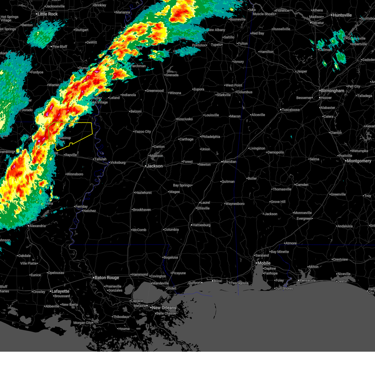
 Svrjan the national weather service in jackson has issued a * severe thunderstorm warning for, ashley county in southeastern arkansas, morehouse parish in northeastern louisiana, * until 1015 am cdt. * at 918 am cdt, a severe thunderstorm was located near mer rouge, or 11 miles east of bastrop, moving northeast at 40 mph (radar indicated). Hazards include 60 mph wind gusts and quarter size hail. Hail damage to vehicles is expected. expect wind damage to roofs, siding, and trees. this severe thunderstorm will be near, bonita and galion around 925 am cdt. jones around 930 am cdt. wilmot around 940 am cdt. Parkdale around 950 am cdt. Svrjan the national weather service in jackson has issued a * severe thunderstorm warning for, ashley county in southeastern arkansas, morehouse parish in northeastern louisiana, * until 1015 am cdt. * at 918 am cdt, a severe thunderstorm was located near mer rouge, or 11 miles east of bastrop, moving northeast at 40 mph (radar indicated). Hazards include 60 mph wind gusts and quarter size hail. Hail damage to vehicles is expected. expect wind damage to roofs, siding, and trees. this severe thunderstorm will be near, bonita and galion around 925 am cdt. jones around 930 am cdt. wilmot around 940 am cdt. Parkdale around 950 am cdt.
|
| 3/15/2025 8:53 AM CDT |
 At 853 am cdt, severe thunderstorms were located along a line extending from near wilmot to 8 miles northwest of oak grove to near rayville, moving northeast at 60 mph (radar indicated). Hazards include 60 mph wind gusts. Expect damage to roofs, siding, and trees. these severe storms will be near, parkdale and goodwill around 900 am cdt. kilbourne around 905 am cdt. chicot junction and eudora around 910 am cdt. lake village around 915 am cdt. mcmillan corner around 920 am cdt. greenville around 925 am cdt. wayside around 930 am cdt. Metcalfe, avon, and winterville around 935 am cdt. At 853 am cdt, severe thunderstorms were located along a line extending from near wilmot to 8 miles northwest of oak grove to near rayville, moving northeast at 60 mph (radar indicated). Hazards include 60 mph wind gusts. Expect damage to roofs, siding, and trees. these severe storms will be near, parkdale and goodwill around 900 am cdt. kilbourne around 905 am cdt. chicot junction and eudora around 910 am cdt. lake village around 915 am cdt. mcmillan corner around 920 am cdt. greenville around 925 am cdt. wayside around 930 am cdt. Metcalfe, avon, and winterville around 935 am cdt.
|
| 3/15/2025 8:05 AM CDT | Report of downed tre in morehouse county LA, 5.1 miles WNW of Mer Rouge, LA |
| 3/15/2025 7:56 AM CDT |
 Svrjan the national weather service in jackson has issued a * severe thunderstorm warning for, chicot county in southeastern arkansas, ashley county in southeastern arkansas, morehouse parish in northeastern louisiana, northern west carroll parish in northeastern louisiana, washington county in northwestern mississippi, * until 900 am cdt. * at 756 am cdt, severe thunderstorms were located along a line extending from near arkansas city to near greenville to near eudora to mer rouge, moving east at 35 mph (radar indicated). Hazards include 60 mph wind gusts and quarter size hail. Hail damage to vehicles is expected. expect wind damage to roofs, siding, and trees. severe thunderstorms will be near, chicot junction, metcalfe, winterville, eudora, lake village, and greenville around 800 am cdt. wayside, kilbourne, goodwill, and leland around 810 am cdt. avon around 815 am cdt. oak grove around 820 am cdt. arcola around 830 am cdt. tribbett around 835 am cdt. estill around 840 am cdt. Other locations impacted by these severe thunderstorms include perryville. Svrjan the national weather service in jackson has issued a * severe thunderstorm warning for, chicot county in southeastern arkansas, ashley county in southeastern arkansas, morehouse parish in northeastern louisiana, northern west carroll parish in northeastern louisiana, washington county in northwestern mississippi, * until 900 am cdt. * at 756 am cdt, severe thunderstorms were located along a line extending from near arkansas city to near greenville to near eudora to mer rouge, moving east at 35 mph (radar indicated). Hazards include 60 mph wind gusts and quarter size hail. Hail damage to vehicles is expected. expect wind damage to roofs, siding, and trees. severe thunderstorms will be near, chicot junction, metcalfe, winterville, eudora, lake village, and greenville around 800 am cdt. wayside, kilbourne, goodwill, and leland around 810 am cdt. avon around 815 am cdt. oak grove around 820 am cdt. arcola around 830 am cdt. tribbett around 835 am cdt. estill around 840 am cdt. Other locations impacted by these severe thunderstorms include perryville.
|
| 3/15/2025 6:53 AM CDT |
 At 653 am cdt, a severe thunderstorm was located near bastrop, moving northeast at 60 mph (radar indicated). Hazards include 60 mph wind gusts and quarter size hail. Hail damage to vehicles is expected. expect wind damage to roofs, siding, and trees. this severe storm will be near, beekman and galion around 700 am cdt. bonita around 705 am cdt. Jones around 710 am cdt. At 653 am cdt, a severe thunderstorm was located near bastrop, moving northeast at 60 mph (radar indicated). Hazards include 60 mph wind gusts and quarter size hail. Hail damage to vehicles is expected. expect wind damage to roofs, siding, and trees. this severe storm will be near, beekman and galion around 700 am cdt. bonita around 705 am cdt. Jones around 710 am cdt.
|
| 3/15/2025 6:53 AM CDT |
 the severe thunderstorm warning has been cancelled and is no longer in effect the severe thunderstorm warning has been cancelled and is no longer in effect
|
| 3/15/2025 6:43 AM CDT |
 Svrjan the national weather service in jackson has issued a * severe thunderstorm warning for, southwestern chicot county in southeastern arkansas, southeastern ashley county in southeastern arkansas, morehouse parish in northeastern louisiana, central east carroll parish in northeastern louisiana, northern richland parish in northeastern louisiana, west carroll parish in northeastern louisiana, * until 745 am cdt. * at 643 am cdt, a severe thunderstorm was located over sterlington, or 8 miles northwest of swartz, moving northeast at 60 mph (radar indicated). Hazards include 60 mph wind gusts and quarter size hail. Hail damage to vehicles is expected. expect wind damage to roofs, siding, and trees. this severe thunderstorm will be near, bastrop around 650 am cdt. beekman around 655 am cdt. mer rouge and galion around 700 am cdt. bonita around 705 am cdt. jones and berlin around 710 am cdt. wilmot around 715 am cdt. parkdale around 720 am cdt. Portland around 725 am cdt. Svrjan the national weather service in jackson has issued a * severe thunderstorm warning for, southwestern chicot county in southeastern arkansas, southeastern ashley county in southeastern arkansas, morehouse parish in northeastern louisiana, central east carroll parish in northeastern louisiana, northern richland parish in northeastern louisiana, west carroll parish in northeastern louisiana, * until 745 am cdt. * at 643 am cdt, a severe thunderstorm was located over sterlington, or 8 miles northwest of swartz, moving northeast at 60 mph (radar indicated). Hazards include 60 mph wind gusts and quarter size hail. Hail damage to vehicles is expected. expect wind damage to roofs, siding, and trees. this severe thunderstorm will be near, bastrop around 650 am cdt. beekman around 655 am cdt. mer rouge and galion around 700 am cdt. bonita around 705 am cdt. jones and berlin around 710 am cdt. wilmot around 715 am cdt. parkdale around 720 am cdt. Portland around 725 am cdt.
|
| 3/4/2025 12:41 PM CST |
 The storms which prompted the warning have moved out of the area. therefore, the warning will be allowed to expire. a tornado watch remains in effect until 300 pm cst for southeastern arkansas, and northeastern louisiana. The storms which prompted the warning have moved out of the area. therefore, the warning will be allowed to expire. a tornado watch remains in effect until 300 pm cst for southeastern arkansas, and northeastern louisiana.
|
| 3/4/2025 12:17 PM CST |
 At 1217 pm cst, severe thunderstorms were located along a line extending from near mcgehee to near portland to near oak ridge, moving east at 50 mph (radar indicated). Hazards include 60 mph wind gusts. Expect damage to roofs, siding, and trees. These severe thunderstorms will remain over mainly rural areas of eastern ashley county in southeastern arkansas and central morehouse parishes. At 1217 pm cst, severe thunderstorms were located along a line extending from near mcgehee to near portland to near oak ridge, moving east at 50 mph (radar indicated). Hazards include 60 mph wind gusts. Expect damage to roofs, siding, and trees. These severe thunderstorms will remain over mainly rural areas of eastern ashley county in southeastern arkansas and central morehouse parishes.
|
| 3/4/2025 11:52 AM CST |
 At 1152 am cst, severe thunderstorms were located along a line extending from 8 miles east of monticello to berlin to near collinston, moving east at 40 mph (radar indicated). Hazards include 60 mph wind gusts. Expect damage to roofs, siding, and trees. these severe storms will be near, parkdale, collinston, bonita, jones, mer rouge, snyder, galion, and wilmot around 1200 pm cst. Montrose and portland around 1205 pm cst. At 1152 am cst, severe thunderstorms were located along a line extending from 8 miles east of monticello to berlin to near collinston, moving east at 40 mph (radar indicated). Hazards include 60 mph wind gusts. Expect damage to roofs, siding, and trees. these severe storms will be near, parkdale, collinston, bonita, jones, mer rouge, snyder, galion, and wilmot around 1200 pm cst. Montrose and portland around 1205 pm cst.
|
| 3/4/2025 11:38 AM CST |
 At 1138 am cst, severe thunderstorms were located along a line extending from near monticello to near berlin to near sterlington, moving east at 50 mph (radar indicated). Hazards include 60 mph wind gusts. Expect damage to roofs, siding, and trees. these severe storms will be near, collinston, mer rouge, snyder, galion, berlin, and bastrop around 1145 am cst. bonita and jones around 1150 am cst. Parkdale, wilmot, montrose, and portland around 1155 am cst. At 1138 am cst, severe thunderstorms were located along a line extending from near monticello to near berlin to near sterlington, moving east at 50 mph (radar indicated). Hazards include 60 mph wind gusts. Expect damage to roofs, siding, and trees. these severe storms will be near, collinston, mer rouge, snyder, galion, berlin, and bastrop around 1145 am cst. bonita and jones around 1150 am cst. Parkdale, wilmot, montrose, and portland around 1155 am cst.
|
| 3/4/2025 11:11 AM CST |
 Svrjan the national weather service in jackson has issued a * severe thunderstorm warning for, ashley county in southeastern arkansas, morehouse parish in northeastern louisiana, * until 1245 pm cst. * at 1110 am cst, severe thunderstorms were located along a line extending from near hermitage to huttig to 12 miles west of claiborne, moving east at 50 mph (radar indicated). Hazards include 60 mph wind gusts. Expect damage to roofs, siding, and trees. severe thunderstorms will be near, west crossett around 1115 am cst. north crossett and crossett around 1120 am cst. old milo and fountain hill around 1125 am cst. hamburg around 1130 am cst. beekman and bastrop around 1135 am cst. berlin around 1140 am cst. collinston and snyder around 1145 am cst. Mer rouge and galion around 1150 am cst. Svrjan the national weather service in jackson has issued a * severe thunderstorm warning for, ashley county in southeastern arkansas, morehouse parish in northeastern louisiana, * until 1245 pm cst. * at 1110 am cst, severe thunderstorms were located along a line extending from near hermitage to huttig to 12 miles west of claiborne, moving east at 50 mph (radar indicated). Hazards include 60 mph wind gusts. Expect damage to roofs, siding, and trees. severe thunderstorms will be near, west crossett around 1115 am cst. north crossett and crossett around 1120 am cst. old milo and fountain hill around 1125 am cst. hamburg around 1130 am cst. beekman and bastrop around 1135 am cst. berlin around 1140 am cst. collinston and snyder around 1145 am cst. Mer rouge and galion around 1150 am cst.
|
| 2/15/2025 9:03 PM CST |
 the severe thunderstorm warning has been cancelled and is no longer in effect the severe thunderstorm warning has been cancelled and is no longer in effect
|
| 2/15/2025 8:19 PM CST | Law enforcement reported multiple trees down across morehouse paris in morehouse county LA, 1 miles WSW of Mer Rouge, LA |
| 2/15/2025 8:10 PM CST |
 Svrjan the national weather service in jackson has issued a * severe thunderstorm warning for, morehouse parish in northeastern louisiana, richland parish in northeastern louisiana, west carroll parish in northeastern louisiana, * until 930 pm cst. * at 810 pm cst, severe thunderstorms were located along a line extending from near bonita to near olla, moving northeast at 45 mph (radar indicated). Hazards include 60 mph wind gusts and nickel size hail. Expect damage to roofs, siding, and trees. severe thunderstorms will be near, start, collinston, bonita, buckner, jones, oak ridge, mer rouge, and galion around 815 pm cst. rayville and alto around 820 pm cst. archibald and goodwill around 830 pm cst. mangham around 835 pm cst. holly ridge around 840 pm cst. oak grove and kilbourne around 845 pm cst. pioneer, forest, epps, and darnell around 850 pm cst. Warden and delhi around 855 pm cst. Svrjan the national weather service in jackson has issued a * severe thunderstorm warning for, morehouse parish in northeastern louisiana, richland parish in northeastern louisiana, west carroll parish in northeastern louisiana, * until 930 pm cst. * at 810 pm cst, severe thunderstorms were located along a line extending from near bonita to near olla, moving northeast at 45 mph (radar indicated). Hazards include 60 mph wind gusts and nickel size hail. Expect damage to roofs, siding, and trees. severe thunderstorms will be near, start, collinston, bonita, buckner, jones, oak ridge, mer rouge, and galion around 815 pm cst. rayville and alto around 820 pm cst. archibald and goodwill around 830 pm cst. mangham around 835 pm cst. holly ridge around 840 pm cst. oak grove and kilbourne around 845 pm cst. pioneer, forest, epps, and darnell around 850 pm cst. Warden and delhi around 855 pm cst.
|
| 1/5/2025 3:24 PM CST |
 At 323 pm cst, a severe thunderstorm capable of producing a tornado was located near bonita, or 15 miles northeast of bastrop, moving east at 45 mph (radar indicated rotation). Hazards include tornado. Flying debris will be dangerous to those caught without shelter. mobile homes will be damaged or destroyed. damage to roofs, windows, and vehicles will occur. tree damage is likely. this dangerous storm will be near, jones and goodwill around 330 pm cst. Oak grove around 335 pm cst. At 323 pm cst, a severe thunderstorm capable of producing a tornado was located near bonita, or 15 miles northeast of bastrop, moving east at 45 mph (radar indicated rotation). Hazards include tornado. Flying debris will be dangerous to those caught without shelter. mobile homes will be damaged or destroyed. damage to roofs, windows, and vehicles will occur. tree damage is likely. this dangerous storm will be near, jones and goodwill around 330 pm cst. Oak grove around 335 pm cst.
|
| 1/5/2025 2:53 PM CST |
 Torjan the national weather service in jackson has issued a * tornado warning for, northern morehouse parish in northeastern louisiana, northern west carroll parish in northeastern louisiana, * until 400 pm cst. * at 253 pm cst, a severe thunderstorm capable of producing a tornado was located near sterlington, or near bastrop, moving east at 50 mph (radar indicated rotation). Hazards include tornado. Flying debris will be dangerous to those caught without shelter. mobile homes will be damaged or destroyed. damage to roofs, windows, and vehicles will occur. tree damage is likely. this dangerous storm will be near, mer rouge and bastrop around 300 pm cst. galion around 305 pm cst. bonita around 310 pm cst. jones around 315 pm cst. Oak grove around 330 pm cst. Torjan the national weather service in jackson has issued a * tornado warning for, northern morehouse parish in northeastern louisiana, northern west carroll parish in northeastern louisiana, * until 400 pm cst. * at 253 pm cst, a severe thunderstorm capable of producing a tornado was located near sterlington, or near bastrop, moving east at 50 mph (radar indicated rotation). Hazards include tornado. Flying debris will be dangerous to those caught without shelter. mobile homes will be damaged or destroyed. damage to roofs, windows, and vehicles will occur. tree damage is likely. this dangerous storm will be near, mer rouge and bastrop around 300 pm cst. galion around 305 pm cst. bonita around 310 pm cst. jones around 315 pm cst. Oak grove around 330 pm cst.
|
| 1/5/2025 1:26 PM CST |
 At 125 pm cst, a severe thunderstorm was located over mer rouge, or 9 miles east of bastrop, moving northeast at 50 mph (radar indicated). Hazards include 60 mph wind gusts and quarter size hail. Hail damage to vehicles is expected. expect wind damage to roofs, siding, and trees. this severe storm will be near, bonita, galion, and goodwill around 130 pm cst. oak grove around 145 pm cst. Kilbourne around 155 pm cst. At 125 pm cst, a severe thunderstorm was located over mer rouge, or 9 miles east of bastrop, moving northeast at 50 mph (radar indicated). Hazards include 60 mph wind gusts and quarter size hail. Hail damage to vehicles is expected. expect wind damage to roofs, siding, and trees. this severe storm will be near, bonita, galion, and goodwill around 130 pm cst. oak grove around 145 pm cst. Kilbourne around 155 pm cst.
|
| 1/5/2025 1:16 PM CST |
 Svrjan the national weather service in jackson has issued a * severe thunderstorm warning for, morehouse parish in northeastern louisiana, west carroll parish in northeastern louisiana, * until 215 pm cst. * at 115 pm cst, a severe thunderstorm was located over collinston, or near bastrop, moving northeast at 50 mph (radar indicated). Hazards include 60 mph wind gusts and quarter size hail. Hail damage to vehicles is expected. expect wind damage to roofs, siding, and trees. this severe thunderstorm will be near, oak ridge, mer rouge, and bastrop around 120 pm cst. galion around 125 pm cst. goodwill around 130 pm cst. bonita around 135 pm cst. oak grove around 145 pm cst. Kilbourne around 155 pm cst. Svrjan the national weather service in jackson has issued a * severe thunderstorm warning for, morehouse parish in northeastern louisiana, west carroll parish in northeastern louisiana, * until 215 pm cst. * at 115 pm cst, a severe thunderstorm was located over collinston, or near bastrop, moving northeast at 50 mph (radar indicated). Hazards include 60 mph wind gusts and quarter size hail. Hail damage to vehicles is expected. expect wind damage to roofs, siding, and trees. this severe thunderstorm will be near, oak ridge, mer rouge, and bastrop around 120 pm cst. galion around 125 pm cst. goodwill around 130 pm cst. bonita around 135 pm cst. oak grove around 145 pm cst. Kilbourne around 155 pm cst.
|
| 12/28/2024 3:49 PM CST |
 At 349 pm cst, a severe thunderstorm was located near jones, or 12 miles northwest of oak grove, moving northeast at 60 mph (radar indicated). Hazards include 60 mph wind gusts and penny size hail. Expect damage to roofs, siding, and trees. this severe storm will be near, kilbourne and eudora around 400 pm cst. Chicot junction around 405 pm cst. At 349 pm cst, a severe thunderstorm was located near jones, or 12 miles northwest of oak grove, moving northeast at 60 mph (radar indicated). Hazards include 60 mph wind gusts and penny size hail. Expect damage to roofs, siding, and trees. this severe storm will be near, kilbourne and eudora around 400 pm cst. Chicot junction around 405 pm cst.
|
| 12/28/2024 3:33 PM CST |
 At 333 pm cst, a severe thunderstorm was located near galion, or 7 miles northeast of bastrop, moving east at 40 mph (radar indicated). Hazards include 60 mph wind gusts and penny size hail. Expect damage to roofs, siding, and trees. this severe storm will be near, bonita, jones, and galion around 340 pm cst. oak grove around 400 pm cst. kilbourne around 405 pm cst. gassoway and millikin around 415 pm cst. Eudora around 420 pm cst. At 333 pm cst, a severe thunderstorm was located near galion, or 7 miles northeast of bastrop, moving east at 40 mph (radar indicated). Hazards include 60 mph wind gusts and penny size hail. Expect damage to roofs, siding, and trees. this severe storm will be near, bonita, jones, and galion around 340 pm cst. oak grove around 400 pm cst. kilbourne around 405 pm cst. gassoway and millikin around 415 pm cst. Eudora around 420 pm cst.
|
| 12/28/2024 3:13 PM CST |
 Svrjan the national weather service in jackson has issued a * severe thunderstorm warning for, southern chicot county in southeastern arkansas, southeastern ashley county in southeastern arkansas, morehouse parish in northeastern louisiana, north central east carroll parish in northeastern louisiana, northern west carroll parish in northeastern louisiana, * until 415 pm cst. * at 312 pm cst, a severe thunderstorm was located over bastrop, moving northeast at 60 mph (radar indicated). Hazards include 60 mph wind gusts and quarter size hail. Hail damage to vehicles is expected. expect wind damage to roofs, siding, and trees. this severe thunderstorm will be near, mer rouge, galion, and bastrop around 320 pm cst. bonita around 325 pm cst. jones around 330 pm cst. wilmot around 340 pm cst. kilbourne around 345 pm cst. gassoway and eudora around 355 pm cst. Chicot junction around 400 pm cst. Svrjan the national weather service in jackson has issued a * severe thunderstorm warning for, southern chicot county in southeastern arkansas, southeastern ashley county in southeastern arkansas, morehouse parish in northeastern louisiana, north central east carroll parish in northeastern louisiana, northern west carroll parish in northeastern louisiana, * until 415 pm cst. * at 312 pm cst, a severe thunderstorm was located over bastrop, moving northeast at 60 mph (radar indicated). Hazards include 60 mph wind gusts and quarter size hail. Hail damage to vehicles is expected. expect wind damage to roofs, siding, and trees. this severe thunderstorm will be near, mer rouge, galion, and bastrop around 320 pm cst. bonita around 325 pm cst. jones around 330 pm cst. wilmot around 340 pm cst. kilbourne around 345 pm cst. gassoway and eudora around 355 pm cst. Chicot junction around 400 pm cst.
|
| 11/5/2024 11:41 AM CST |
 Svrjan the national weather service in jackson has issued a * severe thunderstorm warning for, ashley county in southeastern arkansas, morehouse parish in northeastern louisiana, * until 100 pm cst. * at 1141 am cst, a severe thunderstorm was located 11 miles northwest of sterlington, or 14 miles west of bastrop, moving northeast at 50 mph (radar indicated). Hazards include 60 mph wind gusts. Expect damage to roofs, siding, and trees. this severe thunderstorm will be near, crossett around 1200 pm cst. north crossett and west crossett around 1205 pm cst. hamburg and berlin around 1210 pm cst. Snyder around 1225 pm cst. Svrjan the national weather service in jackson has issued a * severe thunderstorm warning for, ashley county in southeastern arkansas, morehouse parish in northeastern louisiana, * until 100 pm cst. * at 1141 am cst, a severe thunderstorm was located 11 miles northwest of sterlington, or 14 miles west of bastrop, moving northeast at 50 mph (radar indicated). Hazards include 60 mph wind gusts. Expect damage to roofs, siding, and trees. this severe thunderstorm will be near, crossett around 1200 pm cst. north crossett and west crossett around 1205 pm cst. hamburg and berlin around 1210 pm cst. Snyder around 1225 pm cst.
|
| 8/18/2024 8:33 PM CDT |
 At 833 pm cdt, severe thunderstorms were located along a line extending from near oak ridge to near alsatia to onward, moving south at 50 mph (radar indicated). Hazards include 60 mph wind gusts. Expect damage to roofs, siding, and trees. Locations impacted include, bastrop, lake providence, oak grove, mayersville, mer rouge, forest, bonita, pioneer, goodwill, beekman, galion, shelburn, transylvania, and fitler. At 833 pm cdt, severe thunderstorms were located along a line extending from near oak ridge to near alsatia to onward, moving south at 50 mph (radar indicated). Hazards include 60 mph wind gusts. Expect damage to roofs, siding, and trees. Locations impacted include, bastrop, lake providence, oak grove, mayersville, mer rouge, forest, bonita, pioneer, goodwill, beekman, galion, shelburn, transylvania, and fitler.
|
| 8/18/2024 8:33 PM CDT |
 the severe thunderstorm warning has been cancelled and is no longer in effect the severe thunderstorm warning has been cancelled and is no longer in effect
|
| 8/18/2024 8:18 PM CDT |
 At 817 pm cdt, severe thunderstorms were located along a line extending from near mer rouge to near lake providence to near anguilla, moving southeast at 50 mph (radar indicated). Hazards include 60 mph wind gusts and quarter size hail. Hail damage to vehicles is expected. expect wind damage to roofs, siding, and trees. Locations impacted include, bastrop, lake providence, oak grove, mayersville, mer rouge, kilbourne, forest, glen allan, bonita, pioneer, grace, goodwill, beekman, galion, shelburn, gassoway, transylvania, jones, millikin, and fitler. At 817 pm cdt, severe thunderstorms were located along a line extending from near mer rouge to near lake providence to near anguilla, moving southeast at 50 mph (radar indicated). Hazards include 60 mph wind gusts and quarter size hail. Hail damage to vehicles is expected. expect wind damage to roofs, siding, and trees. Locations impacted include, bastrop, lake providence, oak grove, mayersville, mer rouge, kilbourne, forest, glen allan, bonita, pioneer, grace, goodwill, beekman, galion, shelburn, gassoway, transylvania, jones, millikin, and fitler.
|
| 8/18/2024 8:18 PM CDT |
 the severe thunderstorm warning has been cancelled and is no longer in effect the severe thunderstorm warning has been cancelled and is no longer in effect
|
| 8/18/2024 7:59 PM CDT |
 At 759 pm cdt, severe thunderstorms were located along a line extending from 8 miles northwest of beekman to near kilbourne to near hollandale, moving southeast at 45 mph (radar indicated). Hazards include 60 mph wind gusts and penny size hail. Expect damage to roofs, siding, and trees. Locations impacted include, bastrop, crossett, lake providence, oak grove, mayersville, north crossett, eudora, west crossett, mer rouge, wilmot, kilbourne, forest, glen allan, bonita, parkdale, pioneer, grace, wayside, goodwill, and beekman. At 759 pm cdt, severe thunderstorms were located along a line extending from 8 miles northwest of beekman to near kilbourne to near hollandale, moving southeast at 45 mph (radar indicated). Hazards include 60 mph wind gusts and penny size hail. Expect damage to roofs, siding, and trees. Locations impacted include, bastrop, crossett, lake providence, oak grove, mayersville, north crossett, eudora, west crossett, mer rouge, wilmot, kilbourne, forest, glen allan, bonita, parkdale, pioneer, grace, wayside, goodwill, and beekman.
|
| 8/18/2024 7:43 PM CDT |
 Svrjan the national weather service in jackson has issued a * severe thunderstorm warning for, southern chicot county in southeastern arkansas, southwestern ashley county in southeastern arkansas, morehouse parish in northeastern louisiana, east carroll parish in northeastern louisiana, west carroll parish in northeastern louisiana, southwestern washington county in northwestern mississippi, northwestern issaquena county in west central mississippi, * until 845 pm cdt. * at 742 pm cdt, severe thunderstorms were located along a line extending from near west crossett to near parkdale to near wayside, moving southeast at 50 mph (radar indicated). Hazards include 60 mph wind gusts and nickel size hail. expect damage to roofs, siding, and trees Svrjan the national weather service in jackson has issued a * severe thunderstorm warning for, southern chicot county in southeastern arkansas, southwestern ashley county in southeastern arkansas, morehouse parish in northeastern louisiana, east carroll parish in northeastern louisiana, west carroll parish in northeastern louisiana, southwestern washington county in northwestern mississippi, northwestern issaquena county in west central mississippi, * until 845 pm cdt. * at 742 pm cdt, severe thunderstorms were located along a line extending from near west crossett to near parkdale to near wayside, moving southeast at 50 mph (radar indicated). Hazards include 60 mph wind gusts and nickel size hail. expect damage to roofs, siding, and trees
|
| 7/7/2024 9:26 PM CDT |
 At 926 pm cdt, a severe thunderstorm was located near mer rouge, or 10 miles east of bastrop, moving northeast at 25 mph (radar indicated). Hazards include 60 mph wind gusts. Expect damage to roofs, siding, and trees. This severe storm will be near, galion around 930 pm cdt. At 926 pm cdt, a severe thunderstorm was located near mer rouge, or 10 miles east of bastrop, moving northeast at 25 mph (radar indicated). Hazards include 60 mph wind gusts. Expect damage to roofs, siding, and trees. This severe storm will be near, galion around 930 pm cdt.
|
| 7/7/2024 9:26 PM CDT |
 the severe thunderstorm warning has been cancelled and is no longer in effect the severe thunderstorm warning has been cancelled and is no longer in effect
|
| 7/7/2024 8:52 PM CDT |
 Svrjan the national weather service in jackson has issued a * severe thunderstorm warning for, morehouse parish in northeastern louisiana, west central west carroll parish in northeastern louisiana, * until 945 pm cdt. * at 852 pm cdt, a severe thunderstorm was located near swartz, moving northeast at 25 mph (radar indicated). Hazards include 60 mph wind gusts. Expect damage to roofs, siding, and trees. this severe thunderstorm will be near, collinston and oak ridge around 855 pm cdt. bastrop around 900 pm cdt. mer rouge around 905 pm cdt. Galion around 920 pm cdt. Svrjan the national weather service in jackson has issued a * severe thunderstorm warning for, morehouse parish in northeastern louisiana, west central west carroll parish in northeastern louisiana, * until 945 pm cdt. * at 852 pm cdt, a severe thunderstorm was located near swartz, moving northeast at 25 mph (radar indicated). Hazards include 60 mph wind gusts. Expect damage to roofs, siding, and trees. this severe thunderstorm will be near, collinston and oak ridge around 855 pm cdt. bastrop around 900 pm cdt. mer rouge around 905 pm cdt. Galion around 920 pm cdt.
|
| 6/3/2024 8:52 PM CDT |
 The storms which prompted the warning have moved out of the area. therefore, the warning will be allowed to expire. however, gusty winds are still possible with these thunderstorms. a severe thunderstorm watch remains in effect until midnight cdt for northeastern louisiana. The storms which prompted the warning have moved out of the area. therefore, the warning will be allowed to expire. however, gusty winds are still possible with these thunderstorms. a severe thunderstorm watch remains in effect until midnight cdt for northeastern louisiana.
|
| 6/3/2024 8:32 PM CDT |
 At 832 pm cdt, severe thunderstorms were located along a line extending from goodwill to near oak ridge, moving east at 40 mph (radar indicated). Hazards include 60 mph wind gusts and penny size hail. Expect damage to roofs, siding, and trees. These severe thunderstorms will remain over mainly rural areas of southwestern morehouse parish. At 832 pm cdt, severe thunderstorms were located along a line extending from goodwill to near oak ridge, moving east at 40 mph (radar indicated). Hazards include 60 mph wind gusts and penny size hail. Expect damage to roofs, siding, and trees. These severe thunderstorms will remain over mainly rural areas of southwestern morehouse parish.
|
| 6/3/2024 7:54 PM CDT |
 Svrjan the national weather service in jackson has issued a * severe thunderstorm warning for, central morehouse parish in northeastern louisiana, * until 900 pm cdt. * at 754 pm cdt, severe thunderstorms were located along a line extending from near bastrop to near sterlington to 7 miles north of claiborne, moving east at 40 mph (radar indicated). Hazards include 60 mph wind gusts and penny size hail. Expect damage to roofs, siding, and trees. severe thunderstorms will be near, bastrop, mer rouge, and collinston around 800 pm cdt. Oak ridge around 815 pm cdt. Svrjan the national weather service in jackson has issued a * severe thunderstorm warning for, central morehouse parish in northeastern louisiana, * until 900 pm cdt. * at 754 pm cdt, severe thunderstorms were located along a line extending from near bastrop to near sterlington to 7 miles north of claiborne, moving east at 40 mph (radar indicated). Hazards include 60 mph wind gusts and penny size hail. Expect damage to roofs, siding, and trees. severe thunderstorms will be near, bastrop, mer rouge, and collinston around 800 pm cdt. Oak ridge around 815 pm cdt.
|
| 5/9/2024 9:15 PM CDT |
 At 915 pm cdt, a severe thunderstorm was located near monticello, or 13 miles northwest of tallulah, moving northeast at 15 mph (radar indicated). Hazards include 60 mph wind gusts and half dollar size hail. Hail damage to vehicles is expected. expect wind damage to roofs, siding, and trees. this severe storm will be near, transylvania, alsatia, and sondheimer around 920 pm cdt. omega around 930 pm cdt. Other locations impacted by this severe thunderstorm include richmond. At 915 pm cdt, a severe thunderstorm was located near monticello, or 13 miles northwest of tallulah, moving northeast at 15 mph (radar indicated). Hazards include 60 mph wind gusts and half dollar size hail. Hail damage to vehicles is expected. expect wind damage to roofs, siding, and trees. this severe storm will be near, transylvania, alsatia, and sondheimer around 920 pm cdt. omega around 930 pm cdt. Other locations impacted by this severe thunderstorm include richmond.
|
| 5/9/2024 8:56 PM CDT |
 At 855 pm cdt, a severe thunderstorm was located near monticello, or 9 miles northeast of delhi, moving northeast at 15 mph (radar indicated). Hazards include 60 mph wind gusts and half dollar size hail. Hail damage to vehicles is expected. expect wind damage to roofs, siding, and trees. this severe storm will be near, alsatia and sondheimer around 910 pm cdt. transylvania around 920 pm cdt. omega around 925 pm cdt. Other locations impacted by this severe thunderstorm include richmond. At 855 pm cdt, a severe thunderstorm was located near monticello, or 9 miles northeast of delhi, moving northeast at 15 mph (radar indicated). Hazards include 60 mph wind gusts and half dollar size hail. Hail damage to vehicles is expected. expect wind damage to roofs, siding, and trees. this severe storm will be near, alsatia and sondheimer around 910 pm cdt. transylvania around 920 pm cdt. omega around 925 pm cdt. Other locations impacted by this severe thunderstorm include richmond.
|
| 5/9/2024 8:42 PM CDT |
 Svrjan the national weather service in jackson has issued a * severe thunderstorm warning for, southwestern morehouse parish in northeastern louisiana, southwestern east carroll parish in northeastern louisiana, northwestern tensas parish in northeastern louisiana, madison parish in northeastern louisiana, richland parish in northeastern louisiana, west carroll parish in northeastern louisiana, northern franklin parish in northeastern louisiana, * until 945 pm cdt. * at 842 pm cdt, a severe thunderstorm was located near warden, or near delhi, moving east at 15 mph (radar indicated). Hazards include 60 mph wind gusts and quarter size hail. Hail damage to vehicles is expected. expect wind damage to roofs, siding, and trees. this severe thunderstorm will be near, monticello around 850 pm cdt. alsatia and sondheimer around 910 pm cdt. omega around 925 pm cdt. Other locations impacted by this severe thunderstorm include richmond. Svrjan the national weather service in jackson has issued a * severe thunderstorm warning for, southwestern morehouse parish in northeastern louisiana, southwestern east carroll parish in northeastern louisiana, northwestern tensas parish in northeastern louisiana, madison parish in northeastern louisiana, richland parish in northeastern louisiana, west carroll parish in northeastern louisiana, northern franklin parish in northeastern louisiana, * until 945 pm cdt. * at 842 pm cdt, a severe thunderstorm was located near warden, or near delhi, moving east at 15 mph (radar indicated). Hazards include 60 mph wind gusts and quarter size hail. Hail damage to vehicles is expected. expect wind damage to roofs, siding, and trees. this severe thunderstorm will be near, monticello around 850 pm cdt. alsatia and sondheimer around 910 pm cdt. omega around 925 pm cdt. Other locations impacted by this severe thunderstorm include richmond.
|
| 4/9/2024 7:05 PM CDT |
 The storms which prompted the warning have moved out of the area. therefore, the warning will be allowed to expire. however, heavy rain is still possible with these thunderstorms. a severe thunderstorm watch remains in effect until 900 pm cdt for northeastern louisiana. to report severe weather, contact your nearest law enforcement agency. they will relay your report to the national weather service jackson. The storms which prompted the warning have moved out of the area. therefore, the warning will be allowed to expire. however, heavy rain is still possible with these thunderstorms. a severe thunderstorm watch remains in effect until 900 pm cdt for northeastern louisiana. to report severe weather, contact your nearest law enforcement agency. they will relay your report to the national weather service jackson.
|
| 4/9/2024 6:42 PM CDT |
 At 641 pm cdt, severe thunderstorms were located along a line extending from near mer rouge to near rayville to near alto, moving east at 45 mph (radar indicated). Hazards include 60 mph wind gusts and penny size hail. Expect damage to roofs, siding, and trees. these severe storms will be near, rayville, mangham, holly ridge, and archibald around 645 pm cdt. baskin around 650 pm cdt. delhi, epps, warden, and goodwill around 655 pm cdt. Bakers around 700 pm cdt. At 641 pm cdt, severe thunderstorms were located along a line extending from near mer rouge to near rayville to near alto, moving east at 45 mph (radar indicated). Hazards include 60 mph wind gusts and penny size hail. Expect damage to roofs, siding, and trees. these severe storms will be near, rayville, mangham, holly ridge, and archibald around 645 pm cdt. baskin around 650 pm cdt. delhi, epps, warden, and goodwill around 655 pm cdt. Bakers around 700 pm cdt.
|
| 4/9/2024 6:13 PM CDT |
 Svrjan the national weather service in jackson has issued a * severe thunderstorm warning for, southwestern morehouse parish in northeastern louisiana, richland parish in northeastern louisiana, southwestern west carroll parish in northeastern louisiana, northeastern franklin parish in northeastern louisiana, * until 715 pm cdt. * at 613 pm cdt, severe thunderstorms were located along a line extending from 6 miles west of sterlington to monroe to 13 miles southwest of richwood, moving east at 45 mph (radar indicated). Hazards include 60 mph wind gusts and quarter size hail. Hail damage to vehicles is expected. expect wind damage to roofs, siding, and trees. severe thunderstorms will be near, start and buckner around 625 pm cdt. bastrop, rayville, collinston, and alto around 630 pm cdt. oak ridge and archibald around 635 pm cdt. mangham and baskin around 640 pm cdt. holly ridge around 645 pm cdt. delhi, bakers, and warden around 655 pm cdt. Epps around 700 pm cdt. Svrjan the national weather service in jackson has issued a * severe thunderstorm warning for, southwestern morehouse parish in northeastern louisiana, richland parish in northeastern louisiana, southwestern west carroll parish in northeastern louisiana, northeastern franklin parish in northeastern louisiana, * until 715 pm cdt. * at 613 pm cdt, severe thunderstorms were located along a line extending from 6 miles west of sterlington to monroe to 13 miles southwest of richwood, moving east at 45 mph (radar indicated). Hazards include 60 mph wind gusts and quarter size hail. Hail damage to vehicles is expected. expect wind damage to roofs, siding, and trees. severe thunderstorms will be near, start and buckner around 625 pm cdt. bastrop, rayville, collinston, and alto around 630 pm cdt. oak ridge and archibald around 635 pm cdt. mangham and baskin around 640 pm cdt. holly ridge around 645 pm cdt. delhi, bakers, and warden around 655 pm cdt. Epps around 700 pm cdt.
|
| 3/4/2024 2:30 PM CST |
 Svrjan the national weather service in jackson has issued a * severe thunderstorm warning for, west central morehouse parish in northeastern louisiana, * until 315 pm cst. * at 229 pm cst, a severe thunderstorm was located near bastrop, moving northeast at 20 mph (radar indicated). Hazards include 60 mph wind gusts and quarter size hail. Hail damage to vehicles is expected. expect wind damage to roofs, siding, and trees. This severe thunderstorm will be near, bastrop, mer rouge, and collinston around 235 pm cst. Svrjan the national weather service in jackson has issued a * severe thunderstorm warning for, west central morehouse parish in northeastern louisiana, * until 315 pm cst. * at 229 pm cst, a severe thunderstorm was located near bastrop, moving northeast at 20 mph (radar indicated). Hazards include 60 mph wind gusts and quarter size hail. Hail damage to vehicles is expected. expect wind damage to roofs, siding, and trees. This severe thunderstorm will be near, bastrop, mer rouge, and collinston around 235 pm cst.
|
| 2/11/2024 11:26 AM CST |
 At 1126 am cst, a severe thunderstorm was located near beekman, or 13 miles northeast of bastrop, moving northeast at 40 mph (radar indicated). Hazards include 60 mph wind gusts and half dollar size hail. Hail damage to vehicles is expected. expect wind damage to roofs, siding, and trees. this severe storm will be near, bonita, jones, and berlin around 1130 am cst. wilmot around 1135 am cst. parkdale around 1140 am cst. portland around 1155 am cst. other locations impacted by this severe thunderstorm include blanchton. hail threat, radar indicated max hail size, 1. 25 in wind threat, radar indicated max wind gust, 60 mph. At 1126 am cst, a severe thunderstorm was located near beekman, or 13 miles northeast of bastrop, moving northeast at 40 mph (radar indicated). Hazards include 60 mph wind gusts and half dollar size hail. Hail damage to vehicles is expected. expect wind damage to roofs, siding, and trees. this severe storm will be near, bonita, jones, and berlin around 1130 am cst. wilmot around 1135 am cst. parkdale around 1140 am cst. portland around 1155 am cst. other locations impacted by this severe thunderstorm include blanchton. hail threat, radar indicated max hail size, 1. 25 in wind threat, radar indicated max wind gust, 60 mph.
|
| 2/11/2024 10:51 AM CST |
 At 1051 am cst, a severe thunderstorm was located 8 miles north of sterlington, or 11 miles west of bastrop, moving northeast at 45 mph (radar indicated). Hazards include ping pong ball size hail and 60 mph wind gusts. People and animals outdoors will be injured. expect hail damage to roofs, siding, windows, and vehicles. expect wind damage to roofs, siding, and trees. this severe thunderstorm will be near, bastrop around 1055 am cst. beekman around 1100 am cst. berlin around 1115 am cst. bonita and jones around 1120 am cst. wilmot around 1125 am cst. parkdale around 1130 am cst. portland around 1140 am cst. other locations impacted by this severe thunderstorm include blanchton. hail threat, radar indicated max hail size, 1. 50 in wind threat, radar indicated max wind gust, 60 mph. At 1051 am cst, a severe thunderstorm was located 8 miles north of sterlington, or 11 miles west of bastrop, moving northeast at 45 mph (radar indicated). Hazards include ping pong ball size hail and 60 mph wind gusts. People and animals outdoors will be injured. expect hail damage to roofs, siding, windows, and vehicles. expect wind damage to roofs, siding, and trees. this severe thunderstorm will be near, bastrop around 1055 am cst. beekman around 1100 am cst. berlin around 1115 am cst. bonita and jones around 1120 am cst. wilmot around 1125 am cst. parkdale around 1130 am cst. portland around 1140 am cst. other locations impacted by this severe thunderstorm include blanchton. hail threat, radar indicated max hail size, 1. 50 in wind threat, radar indicated max wind gust, 60 mph.
|
| 12/9/2023 5:34 PM CST |
 At 534 pm cst, a severe thunderstorm was located near oak ridge, or 10 miles southeast of bastrop, moving east at 45 mph (radar indicated). Hazards include golf ball size hail and 60 mph wind gusts. People and animals outdoors will be injured. expect hail damage to roofs, siding, windows, and vehicles. expect wind damage to roofs, siding, and trees. this severe thunderstorm will remain over mainly rural areas of central morehouse parish. thunderstorm damage threat, considerable hail threat, radar indicated max hail size, 1. 75 in wind threat, radar indicated max wind gust, 60 mph. At 534 pm cst, a severe thunderstorm was located near oak ridge, or 10 miles southeast of bastrop, moving east at 45 mph (radar indicated). Hazards include golf ball size hail and 60 mph wind gusts. People and animals outdoors will be injured. expect hail damage to roofs, siding, windows, and vehicles. expect wind damage to roofs, siding, and trees. this severe thunderstorm will remain over mainly rural areas of central morehouse parish. thunderstorm damage threat, considerable hail threat, radar indicated max hail size, 1. 75 in wind threat, radar indicated max wind gust, 60 mph.
|
| 12/9/2023 5:18 PM CST |
 At 518 pm cst, a severe thunderstorm was located near swartz, moving east at 40 mph (radar indicated). Hazards include tennis ball size hail and 60 mph wind gusts. People and animals outdoors will be injured. expect hail damage to roofs, siding, windows, and vehicles. expect wind damage to roofs, siding, and trees. this severe storm will be near, bastrop, collinston, and oak ridge around 525 pm cst. mer rouge around 530 pm cst. thunderstorm damage threat, considerable hail threat, radar indicated max hail size, 2. 50 in wind threat, radar indicated max wind gust, 60 mph. At 518 pm cst, a severe thunderstorm was located near swartz, moving east at 40 mph (radar indicated). Hazards include tennis ball size hail and 60 mph wind gusts. People and animals outdoors will be injured. expect hail damage to roofs, siding, windows, and vehicles. expect wind damage to roofs, siding, and trees. this severe storm will be near, bastrop, collinston, and oak ridge around 525 pm cst. mer rouge around 530 pm cst. thunderstorm damage threat, considerable hail threat, radar indicated max hail size, 2. 50 in wind threat, radar indicated max wind gust, 60 mph.
|
| 12/9/2023 5:07 PM CST |
 At 507 pm cst, a severe thunderstorm was located over sterlington, or near swartz, moving east at 45 mph (radar indicated). Hazards include two inch hail and 60 mph wind gusts. People and animals outdoors will be injured. expect hail damage to roofs, siding, windows, and vehicles. expect wind damage to roofs, siding, and trees. this severe thunderstorm will be near, bastrop and collinston around 515 pm cst. mer rouge and oak ridge around 520 pm cst. thunderstorm damage threat, considerable hail threat, radar indicated max hail size, 2. 00 in wind threat, radar indicated max wind gust, 60 mph. At 507 pm cst, a severe thunderstorm was located over sterlington, or near swartz, moving east at 45 mph (radar indicated). Hazards include two inch hail and 60 mph wind gusts. People and animals outdoors will be injured. expect hail damage to roofs, siding, windows, and vehicles. expect wind damage to roofs, siding, and trees. this severe thunderstorm will be near, bastrop and collinston around 515 pm cst. mer rouge and oak ridge around 520 pm cst. thunderstorm damage threat, considerable hail threat, radar indicated max hail size, 2. 00 in wind threat, radar indicated max wind gust, 60 mph.
|
| 9/7/2023 4:59 PM CDT |
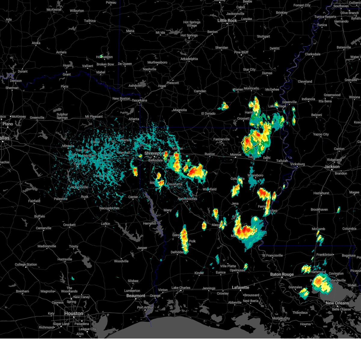 At 459 pm cdt, a severe thunderstorm was located near collinston, or near bastrop, moving southeast at 15 mph (radar indicated). Hazards include 60 mph wind gusts and quarter size hail. Hail damage to vehicles is expected. expect wind damage to roofs, siding, and trees. this severe storm will be near, collinston around 505 pm cdt. hail threat, radar indicated max hail size, 1. 00 in wind threat, radar indicated max wind gust, 60 mph. At 459 pm cdt, a severe thunderstorm was located near collinston, or near bastrop, moving southeast at 15 mph (radar indicated). Hazards include 60 mph wind gusts and quarter size hail. Hail damage to vehicles is expected. expect wind damage to roofs, siding, and trees. this severe storm will be near, collinston around 505 pm cdt. hail threat, radar indicated max hail size, 1. 00 in wind threat, radar indicated max wind gust, 60 mph.
|
| 9/7/2023 4:33 PM CDT |
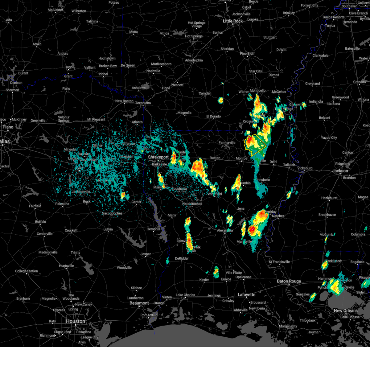 At 433 pm cdt, a severe thunderstorm was located near bastrop, moving southeast at 15 mph (radar indicated). Hazards include 60 mph wind gusts and quarter size hail. Hail damage to vehicles is expected. expect wind damage to roofs, siding, and trees. this severe storm will be near, bastrop, mer rouge, and collinston around 440 pm cdt. hail threat, radar indicated max hail size, 1. 00 in wind threat, radar indicated max wind gust, 60 mph. At 433 pm cdt, a severe thunderstorm was located near bastrop, moving southeast at 15 mph (radar indicated). Hazards include 60 mph wind gusts and quarter size hail. Hail damage to vehicles is expected. expect wind damage to roofs, siding, and trees. this severe storm will be near, bastrop, mer rouge, and collinston around 440 pm cdt. hail threat, radar indicated max hail size, 1. 00 in wind threat, radar indicated max wind gust, 60 mph.
|
| 9/7/2023 4:17 PM CDT |
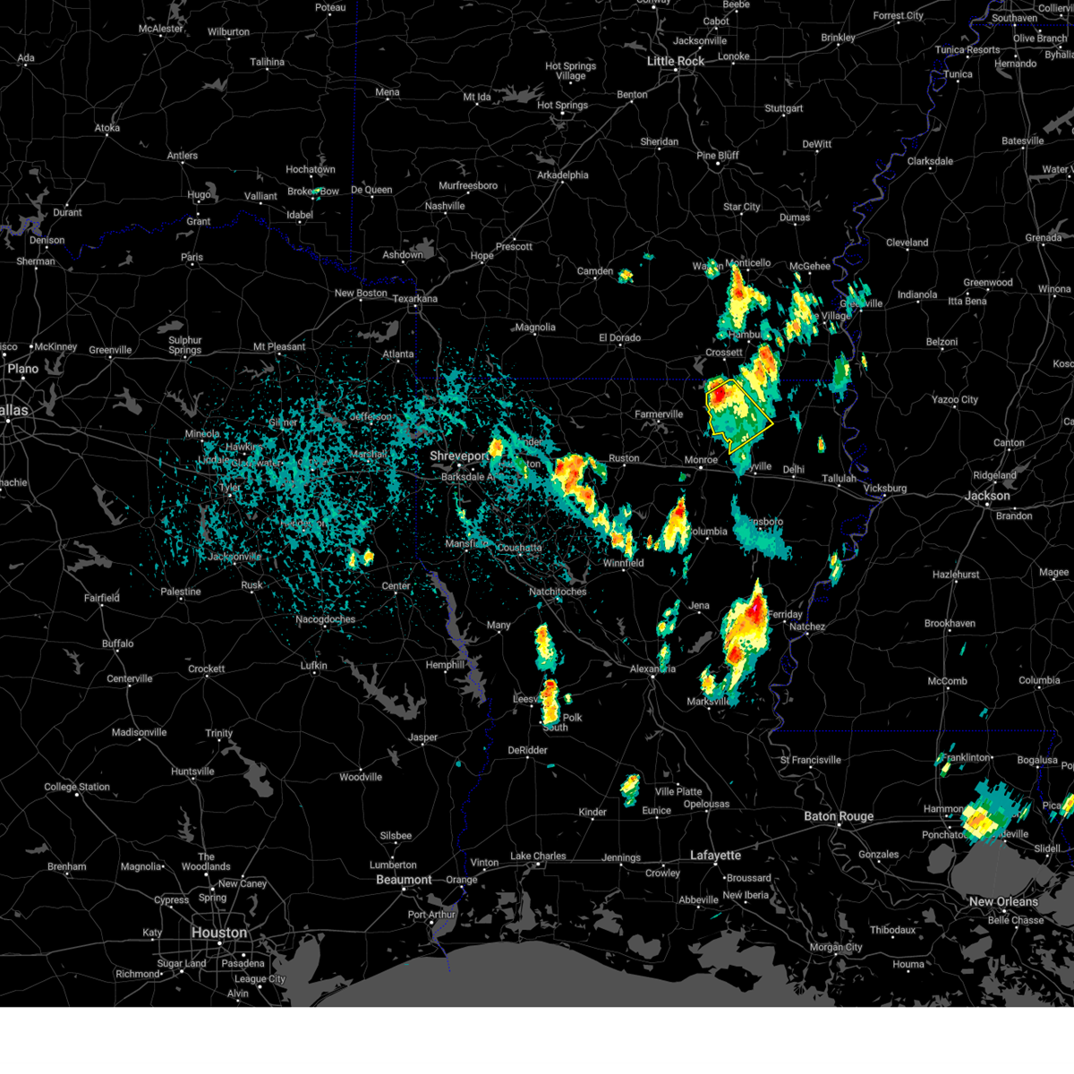 At 417 pm cdt, a severe thunderstorm was located near beekman, or 8 miles northwest of bastrop, moving southeast at 15 mph (radar indicated). Hazards include 60 mph wind gusts and quarter size hail. Hail damage to vehicles is expected. expect wind damage to roofs, siding, and trees. this severe thunderstorm will be near, bastrop and beekman around 420 pm cdt. mer rouge around 440 pm cdt. collinston around 445 pm cdt. hail threat, radar indicated max hail size, 1. 00 in wind threat, radar indicated max wind gust, 60 mph. At 417 pm cdt, a severe thunderstorm was located near beekman, or 8 miles northwest of bastrop, moving southeast at 15 mph (radar indicated). Hazards include 60 mph wind gusts and quarter size hail. Hail damage to vehicles is expected. expect wind damage to roofs, siding, and trees. this severe thunderstorm will be near, bastrop and beekman around 420 pm cdt. mer rouge around 440 pm cdt. collinston around 445 pm cdt. hail threat, radar indicated max hail size, 1. 00 in wind threat, radar indicated max wind gust, 60 mph.
|
| 7/16/2023 5:06 PM CDT |
 At 506 pm cdt, severe thunderstorms were located along a line extending from near galion to near jigger, moving east at 55 mph (radar indicated). Hazards include 60 mph wind gusts and quarter size hail. Hail damage to vehicles is expected. expect wind damage to roofs, siding, and trees. these severe storms will be near, jigger around 510 pm cdt. wisner, gilbert and jones around 515 pm cdt. other locations impacted by these severe thunderstorms include perryville. hail threat, radar indicated max hail size, 1. 00 in wind threat, radar indicated max wind gust, 60 mph. At 506 pm cdt, severe thunderstorms were located along a line extending from near galion to near jigger, moving east at 55 mph (radar indicated). Hazards include 60 mph wind gusts and quarter size hail. Hail damage to vehicles is expected. expect wind damage to roofs, siding, and trees. these severe storms will be near, jigger around 510 pm cdt. wisner, gilbert and jones around 515 pm cdt. other locations impacted by these severe thunderstorms include perryville. hail threat, radar indicated max hail size, 1. 00 in wind threat, radar indicated max wind gust, 60 mph.
|
| 7/16/2023 4:34 PM CDT |
 At 434 pm cdt, severe thunderstorms were located along a line extending from near huttig to 7 miles north of columbia, moving east at 35 mph (radar indicated). Hazards include 60 mph wind gusts and quarter size hail. Hail damage to vehicles is expected. expect wind damage to roofs, siding, and trees. severe thunderstorms will be near, west crossett around 445 pm cdt. crossett and buckner around 450 pm cdt. north crossett around 455 pm cdt. liddieville around 500 pm cdt. winnsboro, mangham, baskin and berlin around 510 pm cdt. crowville around 525 pm cdt. wilmot around 530 pm cdt. parkdale around 535 pm cdt. other locations impacted by these severe thunderstorms include perryville. hail threat, radar indicated max hail size, 1. 00 in wind threat, radar indicated max wind gust, 60 mph. At 434 pm cdt, severe thunderstorms were located along a line extending from near huttig to 7 miles north of columbia, moving east at 35 mph (radar indicated). Hazards include 60 mph wind gusts and quarter size hail. Hail damage to vehicles is expected. expect wind damage to roofs, siding, and trees. severe thunderstorms will be near, west crossett around 445 pm cdt. crossett and buckner around 450 pm cdt. north crossett around 455 pm cdt. liddieville around 500 pm cdt. winnsboro, mangham, baskin and berlin around 510 pm cdt. crowville around 525 pm cdt. wilmot around 530 pm cdt. parkdale around 535 pm cdt. other locations impacted by these severe thunderstorms include perryville. hail threat, radar indicated max hail size, 1. 00 in wind threat, radar indicated max wind gust, 60 mph.
|
| 7/6/2023 4:09 PM CDT |
 At 408 pm cdt, a severe thunderstorm was located near beekman, or 11 miles south of crossett, moving southeast at 25 mph (radar indicated). Hazards include 60 mph wind gusts and quarter size hail. Hail damage to vehicles is expected. expect wind damage to roofs, siding, and trees. this severe thunderstorm will be near, beekman around 420 pm cdt. galion around 440 pm cdt. mer rouge and bonita around 445 pm cdt. hail threat, radar indicated max hail size, 1. 00 in wind threat, radar indicated max wind gust, 60 mph. At 408 pm cdt, a severe thunderstorm was located near beekman, or 11 miles south of crossett, moving southeast at 25 mph (radar indicated). Hazards include 60 mph wind gusts and quarter size hail. Hail damage to vehicles is expected. expect wind damage to roofs, siding, and trees. this severe thunderstorm will be near, beekman around 420 pm cdt. galion around 440 pm cdt. mer rouge and bonita around 445 pm cdt. hail threat, radar indicated max hail size, 1. 00 in wind threat, radar indicated max wind gust, 60 mph.
|
| 6/27/2023 5:21 PM CDT |
 At 520 pm cdt, severe thunderstorms were located along a line extending from tribbett to near mer rouge, moving southeast at 45 mph (radar indicated). Hazards include 60 mph wind gusts and quarter size hail. Hail damage to vehicles is expected. expect wind damage to roofs, siding, and trees. these severe storms will be near, arcola and tribbett around 525 pm cdt. hail threat, radar indicated max hail size, 1. 00 in wind threat, radar indicated max wind gust, 60 mph. At 520 pm cdt, severe thunderstorms were located along a line extending from tribbett to near mer rouge, moving southeast at 45 mph (radar indicated). Hazards include 60 mph wind gusts and quarter size hail. Hail damage to vehicles is expected. expect wind damage to roofs, siding, and trees. these severe storms will be near, arcola and tribbett around 525 pm cdt. hail threat, radar indicated max hail size, 1. 00 in wind threat, radar indicated max wind gust, 60 mph.
|
| 6/27/2023 4:18 PM CDT |
 At 418 pm cdt, severe thunderstorms were located along a line extending from near rohwer to near lapile, moving southeast at 35 mph (radar indicated). Hazards include 60 mph wind gusts and quarter size hail. Hail damage to vehicles is expected. expect wind damage to roofs, siding, and trees. severe thunderstorms will be near, west crossett around 440 pm cdt. crossett around 445 pm cdt. winterville around 455 pm cdt. greenville around 500 pm cdt. metcalfe and beekman around 505 pm cdt. leland around 515 pm cdt. galion around 520 pm cdt. mer rouge, bonita and tribbett around 525 pm cdt. hail threat, radar indicated max hail size, 1. 00 in wind threat, radar indicated max wind gust, 60 mph. At 418 pm cdt, severe thunderstorms were located along a line extending from near rohwer to near lapile, moving southeast at 35 mph (radar indicated). Hazards include 60 mph wind gusts and quarter size hail. Hail damage to vehicles is expected. expect wind damage to roofs, siding, and trees. severe thunderstorms will be near, west crossett around 440 pm cdt. crossett around 445 pm cdt. winterville around 455 pm cdt. greenville around 500 pm cdt. metcalfe and beekman around 505 pm cdt. leland around 515 pm cdt. galion around 520 pm cdt. mer rouge, bonita and tribbett around 525 pm cdt. hail threat, radar indicated max hail size, 1. 00 in wind threat, radar indicated max wind gust, 60 mph.
|
| 6/27/2023 4:15 PM CDT | Report of tree downe in morehouse county LA, 6.7 miles SW of Mer Rouge, LA |
| 6/16/2023 4:12 AM CDT |
 At 412 am cdt, severe thunderstorms were located along a line extending from near goodwill to waverly to near newlight, moving east at 55 mph. these are destructive storms for portions of northeast louisiana (radar indicated). Hazards include 80 mph wind gusts and quarter size hail. Flying debris will be dangerous to those caught without shelter. mobile homes will be heavily damaged. expect considerable damage to roofs, windows, and vehicles. extensive tree damage and power outages are likely. these severe storms will be near, tendal around 415 am cdt. newellton and somerset around 420 am cdt. forest and afton around 425 am cdt. tallulah and sondheimer around 430 am cdt. other locations impacted by these severe thunderstorms include richmond. thunderstorm damage threat, destructive hail threat, radar indicated max hail size, 1. 00 in wind threat, radar indicated max wind gust, 80 mph. At 412 am cdt, severe thunderstorms were located along a line extending from near goodwill to waverly to near newlight, moving east at 55 mph. these are destructive storms for portions of northeast louisiana (radar indicated). Hazards include 80 mph wind gusts and quarter size hail. Flying debris will be dangerous to those caught without shelter. mobile homes will be heavily damaged. expect considerable damage to roofs, windows, and vehicles. extensive tree damage and power outages are likely. these severe storms will be near, tendal around 415 am cdt. newellton and somerset around 420 am cdt. forest and afton around 425 am cdt. tallulah and sondheimer around 430 am cdt. other locations impacted by these severe thunderstorms include richmond. thunderstorm damage threat, destructive hail threat, radar indicated max hail size, 1. 00 in wind threat, radar indicated max wind gust, 80 mph.
|
| 6/16/2023 3:50 AM CDT |
 At 350 am cdt, severe thunderstorms were located along a line extending from near collinston to near archibald to winnsboro, moving east at 45 mph (radar indicated). Hazards include 70 mph wind gusts and penny size hail. Expect considerable tree damage. damage is likely to mobile homes, roofs, and outbuildings. these severe storms will be near, gilbert around 355 am cdt. mer rouge, holly ridge and crowville around 400 am cdt. bakers around 405 am cdt. delhi, newlight and warden around 410 am cdt. waverly and goodwill around 415 am cdt. epps and tendal around 420 am cdt. pioneer, somerset and darnell around 425 am cdt. forest and afton around 430 am cdt. other locations impacted by these severe thunderstorms include richmond. thunderstorm damage threat, considerable hail threat, radar indicated max hail size, 0. 75 in wind threat, radar indicated max wind gust, 70 mph. At 350 am cdt, severe thunderstorms were located along a line extending from near collinston to near archibald to winnsboro, moving east at 45 mph (radar indicated). Hazards include 70 mph wind gusts and penny size hail. Expect considerable tree damage. damage is likely to mobile homes, roofs, and outbuildings. these severe storms will be near, gilbert around 355 am cdt. mer rouge, holly ridge and crowville around 400 am cdt. bakers around 405 am cdt. delhi, newlight and warden around 410 am cdt. waverly and goodwill around 415 am cdt. epps and tendal around 420 am cdt. pioneer, somerset and darnell around 425 am cdt. forest and afton around 430 am cdt. other locations impacted by these severe thunderstorms include richmond. thunderstorm damage threat, considerable hail threat, radar indicated max hail size, 0. 75 in wind threat, radar indicated max wind gust, 70 mph.
|
| 6/16/2023 3:26 AM CDT |
 At 325 am cdt, severe thunderstorms were located along a line extending from near claiborne to 7 miles south of richwood to 6 miles northeast of columbia, moving east at 50 mph (radar indicated). Hazards include 70 mph wind gusts and penny size hail. Expect considerable tree damage. damage is likely to mobile homes, roofs, and outbuildings. severe thunderstorms will be near, liddieville and buckner around 335 am cdt. alto and start around 340 am cdt. bastrop, winnsboro, rayville, mangham, baskin and archibald around 345 am cdt. collinston around 350 am cdt. mer rouge, oak ridge, crowville and holly ridge around 355 am cdt. bakers around 400 am cdt. delhi and warden around 405 am cdt. waverly and goodwill around 410 am cdt. other locations impacted by these severe thunderstorms include richmond. thunderstorm damage threat, considerable hail threat, radar indicated max hail size, 0. 75 in wind threat, radar indicated max wind gust, 70 mph. At 325 am cdt, severe thunderstorms were located along a line extending from near claiborne to 7 miles south of richwood to 6 miles northeast of columbia, moving east at 50 mph (radar indicated). Hazards include 70 mph wind gusts and penny size hail. Expect considerable tree damage. damage is likely to mobile homes, roofs, and outbuildings. severe thunderstorms will be near, liddieville and buckner around 335 am cdt. alto and start around 340 am cdt. bastrop, winnsboro, rayville, mangham, baskin and archibald around 345 am cdt. collinston around 350 am cdt. mer rouge, oak ridge, crowville and holly ridge around 355 am cdt. bakers around 400 am cdt. delhi and warden around 405 am cdt. waverly and goodwill around 410 am cdt. other locations impacted by these severe thunderstorms include richmond. thunderstorm damage threat, considerable hail threat, radar indicated max hail size, 0. 75 in wind threat, radar indicated max wind gust, 70 mph.
|
| 6/14/2023 3:43 PM CDT |
 At 343 pm cdt, a severe thunderstorm was located near oak ridge, or 8 miles northeast of rayville, moving east at 50 mph (radar indicated). Hazards include 60 mph wind gusts and quarter size hail. Hail damage to vehicles is expected. expect wind damage to roofs, siding, and trees. this severe thunderstorm will be near, epps and warden around 355 pm cdt. hail threat, radar indicated max hail size, 1. 00 in wind threat, radar indicated max wind gust, 60 mph. At 343 pm cdt, a severe thunderstorm was located near oak ridge, or 8 miles northeast of rayville, moving east at 50 mph (radar indicated). Hazards include 60 mph wind gusts and quarter size hail. Hail damage to vehicles is expected. expect wind damage to roofs, siding, and trees. this severe thunderstorm will be near, epps and warden around 355 pm cdt. hail threat, radar indicated max hail size, 1. 00 in wind threat, radar indicated max wind gust, 60 mph.
|
| 6/14/2023 4:43 AM CDT |
 The severe thunderstorm warning for central morehouse, north central richland and west carroll parishes will expire at 445 am cdt, the storms which prompted the warning have moved out of the area. therefore, the warning will be allowed to expire. a severe thunderstorm watch remains in effect until 600 am cdt for northeastern louisiana. The severe thunderstorm warning for central morehouse, north central richland and west carroll parishes will expire at 445 am cdt, the storms which prompted the warning have moved out of the area. therefore, the warning will be allowed to expire. a severe thunderstorm watch remains in effect until 600 am cdt for northeastern louisiana.
|
| 6/14/2023 4:16 AM CDT |
 At 416 am cdt, severe thunderstorms were located along a line extending from near galion to near oak ridge to near start, moving east at 35 mph (radar indicated). Hazards include 60 mph wind gusts and quarter size hail. Hail damage to vehicles is expected. expect wind damage to roofs, siding, and trees. these severe storms will be near, goodwill around 425 am cdt. forest, pioneer and darnell around 440 am cdt. oak grove around 445 am cdt. hail threat, radar indicated max hail size, 1. 00 in wind threat, radar indicated max wind gust, 60 mph. At 416 am cdt, severe thunderstorms were located along a line extending from near galion to near oak ridge to near start, moving east at 35 mph (radar indicated). Hazards include 60 mph wind gusts and quarter size hail. Hail damage to vehicles is expected. expect wind damage to roofs, siding, and trees. these severe storms will be near, goodwill around 425 am cdt. forest, pioneer and darnell around 440 am cdt. oak grove around 445 am cdt. hail threat, radar indicated max hail size, 1. 00 in wind threat, radar indicated max wind gust, 60 mph.
|
| 6/14/2023 4:00 AM CDT |
 At 400 am cdt, severe thunderstorms were located along a line extending from near galion to collinston to swartz, moving east at 40 mph (radar indicated). Hazards include 60 mph wind gusts and quarter size hail. Hail damage to vehicles is expected. expect wind damage to roofs, siding, and trees. these severe storms will be near, mer rouge, oak ridge and galion around 405 am cdt. bonita around 410 am cdt. goodwill around 420 am cdt. oak grove, forest, pioneer and darnell around 435 am cdt. hail threat, radar indicated max hail size, 1. 00 in wind threat, radar indicated max wind gust, 60 mph. At 400 am cdt, severe thunderstorms were located along a line extending from near galion to collinston to swartz, moving east at 40 mph (radar indicated). Hazards include 60 mph wind gusts and quarter size hail. Hail damage to vehicles is expected. expect wind damage to roofs, siding, and trees. these severe storms will be near, mer rouge, oak ridge and galion around 405 am cdt. bonita around 410 am cdt. goodwill around 420 am cdt. oak grove, forest, pioneer and darnell around 435 am cdt. hail threat, radar indicated max hail size, 1. 00 in wind threat, radar indicated max wind gust, 60 mph.
|
| 6/14/2023 3:37 AM CDT |
 At 337 am cdt, severe thunderstorms were located along a line extending from 8 miles west of beekman to near sterlington to 7 miles north of claiborne, moving east at 35 mph (radar indicated). Hazards include ping pong ball size hail and 60 mph wind gusts. People and animals outdoors will be injured. expect hail damage to roofs, siding, windows, and vehicles. expect wind damage to roofs, siding, and trees. severe thunderstorms will be near, bastrop and beekman around 350 am cdt. collinston around 400 am cdt. bonita and jones around 415 am cdt. oak ridge around 425 am cdt. goodwill around 430 am cdt. oak grove, forest and pioneer around 445 am cdt. hail threat, radar indicated max hail size, 1. 50 in wind threat, radar indicated max wind gust, 60 mph. At 337 am cdt, severe thunderstorms were located along a line extending from 8 miles west of beekman to near sterlington to 7 miles north of claiborne, moving east at 35 mph (radar indicated). Hazards include ping pong ball size hail and 60 mph wind gusts. People and animals outdoors will be injured. expect hail damage to roofs, siding, windows, and vehicles. expect wind damage to roofs, siding, and trees. severe thunderstorms will be near, bastrop and beekman around 350 am cdt. collinston around 400 am cdt. bonita and jones around 415 am cdt. oak ridge around 425 am cdt. goodwill around 430 am cdt. oak grove, forest and pioneer around 445 am cdt. hail threat, radar indicated max hail size, 1. 50 in wind threat, radar indicated max wind gust, 60 mph.
|
| 5/11/2023 12:24 PM CDT |
 At 1223 pm cdt, a severe thunderstorm was located 7 miles east of oak ridge, or 14 miles northeast of rayville, moving northeast at 40 mph (radar indicated). Hazards include 60 mph wind gusts. Expect damage to roofs, siding, and trees. this severe storm will be near, goodwill around 1235 pm cdt. darnell around 1240 pm cdt. pioneer around 1245 pm cdt. forest around 1250 pm cdt. oak grove around 1255 pm cdt. hail threat, radar indicated max hail size, <. 75 in wind threat, radar indicated max wind gust, 60 mph. At 1223 pm cdt, a severe thunderstorm was located 7 miles east of oak ridge, or 14 miles northeast of rayville, moving northeast at 40 mph (radar indicated). Hazards include 60 mph wind gusts. Expect damage to roofs, siding, and trees. this severe storm will be near, goodwill around 1235 pm cdt. darnell around 1240 pm cdt. pioneer around 1245 pm cdt. forest around 1250 pm cdt. oak grove around 1255 pm cdt. hail threat, radar indicated max hail size, <. 75 in wind threat, radar indicated max wind gust, 60 mph.
|
| 5/11/2023 11:56 AM CDT |
 At 1155 am cdt, a severe thunderstorm was located near start, or 7 miles southeast of swartz, moving northeast at 45 mph (radar indicated). Hazards include 60 mph wind gusts. Expect damage to roofs, siding, and trees. this severe thunderstorm will be near, collinston and oak ridge around 1205 pm cdt. goodwill and darnell around 1230 pm cdt. pioneer around 1235 pm cdt. forest around 1240 pm cdt. oak grove around 1245 pm cdt. hail threat, radar indicated max hail size, <. 75 in wind threat, radar indicated max wind gust, 60 mph. At 1155 am cdt, a severe thunderstorm was located near start, or 7 miles southeast of swartz, moving northeast at 45 mph (radar indicated). Hazards include 60 mph wind gusts. Expect damage to roofs, siding, and trees. this severe thunderstorm will be near, collinston and oak ridge around 1205 pm cdt. goodwill and darnell around 1230 pm cdt. pioneer around 1235 pm cdt. forest around 1240 pm cdt. oak grove around 1245 pm cdt. hail threat, radar indicated max hail size, <. 75 in wind threat, radar indicated max wind gust, 60 mph.
|
| 4/5/2023 1:39 PM CDT |
 At 139 pm cdt, a severe thunderstorm was located near bastrop, moving northeast at 40 mph (radar indicated). Hazards include 60 mph wind gusts and quarter size hail. Hail damage to vehicles is expected. expect wind damage to roofs, siding, and trees. this severe thunderstorm will be near, beekman around 150 pm cdt. galion around 155 pm cdt. berlin and jones around 210 pm cdt. wilmot around 220 pm cdt. parkdale around 225 pm cdt. other locations impacted by this severe thunderstorm include mer rouge and bonita. hail threat, radar indicated max hail size, 1. 00 in wind threat, radar indicated max wind gust, 60 mph. At 139 pm cdt, a severe thunderstorm was located near bastrop, moving northeast at 40 mph (radar indicated). Hazards include 60 mph wind gusts and quarter size hail. Hail damage to vehicles is expected. expect wind damage to roofs, siding, and trees. this severe thunderstorm will be near, beekman around 150 pm cdt. galion around 155 pm cdt. berlin and jones around 210 pm cdt. wilmot around 220 pm cdt. parkdale around 225 pm cdt. other locations impacted by this severe thunderstorm include mer rouge and bonita. hail threat, radar indicated max hail size, 1. 00 in wind threat, radar indicated max wind gust, 60 mph.
|
| 3/24/2023 5:32 PM CDT |
 At 532 pm cdt, severe thunderstorms were located along a line extending from near fountain hill to near crossett to 10 miles south of huttig, moving northeast at 55 mph (radar indicated). Hazards include 60 mph wind gusts and penny size hail. Expect damage to roofs, siding, and trees. these severe storms will be near, north crossett, fountain hill and old milo around 535 pm cdt. hamburg and beekman around 545 pm cdt. snyder around 555 pm cdt. berlin around 600 pm cdt. montrose around 605 pm cdt. parkdale around 610 pm cdt. portland around 620 pm cdt. other locations impacted by these severe thunderstorms include bonita and blanchton. hail threat, radar indicated max hail size, 0. 75 in wind threat, radar indicated max wind gust, 60 mph. At 532 pm cdt, severe thunderstorms were located along a line extending from near fountain hill to near crossett to 10 miles south of huttig, moving northeast at 55 mph (radar indicated). Hazards include 60 mph wind gusts and penny size hail. Expect damage to roofs, siding, and trees. these severe storms will be near, north crossett, fountain hill and old milo around 535 pm cdt. hamburg and beekman around 545 pm cdt. snyder around 555 pm cdt. berlin around 600 pm cdt. montrose around 605 pm cdt. parkdale around 610 pm cdt. portland around 620 pm cdt. other locations impacted by these severe thunderstorms include bonita and blanchton. hail threat, radar indicated max hail size, 0. 75 in wind threat, radar indicated max wind gust, 60 mph.
|
| 3/24/2023 5:13 PM CDT |
 At 512 pm cdt, severe thunderstorms were located along a line extending from 8 miles northwest of west crossett to near huttig to 9 miles east of farmerville, moving northeast at 65 mph (radar indicated). Hazards include 60 mph wind gusts and nickel size hail. Expect damage to roofs, siding, and trees. severe thunderstorms will be near, crossett, west crossett and old milo around 525 pm cdt. north crossett and fountain hill around 530 pm cdt. beekman around 535 pm cdt. hamburg around 540 pm cdt. berlin around 545 pm cdt. wilmot and snyder around 550 pm cdt. montrose and parkdale around 555 pm cdt. portland around 600 pm cdt. hail threat, radar indicated max hail size, 0. 88 in wind threat, radar indicated max wind gust, 60 mph. At 512 pm cdt, severe thunderstorms were located along a line extending from 8 miles northwest of west crossett to near huttig to 9 miles east of farmerville, moving northeast at 65 mph (radar indicated). Hazards include 60 mph wind gusts and nickel size hail. Expect damage to roofs, siding, and trees. severe thunderstorms will be near, crossett, west crossett and old milo around 525 pm cdt. north crossett and fountain hill around 530 pm cdt. beekman around 535 pm cdt. hamburg around 540 pm cdt. berlin around 545 pm cdt. wilmot and snyder around 550 pm cdt. montrose and parkdale around 555 pm cdt. portland around 600 pm cdt. hail threat, radar indicated max hail size, 0. 88 in wind threat, radar indicated max wind gust, 60 mph.
|
| 1/2/2023 8:27 PM CST |
 At 827 pm cst, a severe thunderstorm was located near galion, or 13 miles east of bastrop, moving northeast at 30 mph (radar indicated). Hazards include 60 mph wind gusts and quarter size hail. Hail damage to vehicles is expected. expect wind damage to roofs, siding, and trees. this severe thunderstorm will be near, jones around 845 pm cst. wilmot around 900 pm cst. other locations impacted by this severe thunderstorm include mer rouge and bonita. hail threat, radar indicated max hail size, 1. 00 in wind threat, radar indicated max wind gust, 60 mph. At 827 pm cst, a severe thunderstorm was located near galion, or 13 miles east of bastrop, moving northeast at 30 mph (radar indicated). Hazards include 60 mph wind gusts and quarter size hail. Hail damage to vehicles is expected. expect wind damage to roofs, siding, and trees. this severe thunderstorm will be near, jones around 845 pm cst. wilmot around 900 pm cst. other locations impacted by this severe thunderstorm include mer rouge and bonita. hail threat, radar indicated max hail size, 1. 00 in wind threat, radar indicated max wind gust, 60 mph.
|
| 1/2/2023 8:19 PM CST |
 At 819 pm cst, a severe thunderstorm was located near galion, or 13 miles east of bastrop, moving northeast at 35 mph (radar indicated). Hazards include 60 mph wind gusts and half dollar size hail. Hail damage to vehicles is expected. expect wind damage to roofs, siding, and trees. This severe thunderstorm will remain over mainly rural areas of morehouse parish, including the following locations, bonita, collinston, mer rouge and oak ridge. At 819 pm cst, a severe thunderstorm was located near galion, or 13 miles east of bastrop, moving northeast at 35 mph (radar indicated). Hazards include 60 mph wind gusts and half dollar size hail. Hail damage to vehicles is expected. expect wind damage to roofs, siding, and trees. This severe thunderstorm will remain over mainly rural areas of morehouse parish, including the following locations, bonita, collinston, mer rouge and oak ridge.
|
| 1/2/2023 7:32 PM CST |
 At 732 pm cst, a severe thunderstorm was located over swartz, moving northeast at 35 mph (radar indicated). Hazards include 60 mph wind gusts and quarter size hail. Hail damage to vehicles is expected. expect wind damage to roofs, siding, and trees. this severe thunderstorm will be near, bastrop around 755 pm cst. galion around 815 pm cst. Other locations impacted by this severe thunderstorm include bonita, collinston, mer rouge and oak ridge. At 732 pm cst, a severe thunderstorm was located over swartz, moving northeast at 35 mph (radar indicated). Hazards include 60 mph wind gusts and quarter size hail. Hail damage to vehicles is expected. expect wind damage to roofs, siding, and trees. this severe thunderstorm will be near, bastrop around 755 pm cst. galion around 815 pm cst. Other locations impacted by this severe thunderstorm include bonita, collinston, mer rouge and oak ridge.
|
| 1/2/2023 6:11 PM CST |
 At 611 pm cst, a severe thunderstorm was located 8 miles northwest of sterlington, or 15 miles west of bastrop, moving northeast at 40 mph (radar indicated). Hazards include 60 mph wind gusts. Expect damage to roofs, siding, and trees. this severe thunderstorm will be near, beekman around 640 pm cst. crossett around 650 pm cst. north crossett around 655 pm cst. berlin around 700 pm cst. Other locations impacted by this severe thunderstorm include mer rouge, bonita and blanchton. At 611 pm cst, a severe thunderstorm was located 8 miles northwest of sterlington, or 15 miles west of bastrop, moving northeast at 40 mph (radar indicated). Hazards include 60 mph wind gusts. Expect damage to roofs, siding, and trees. this severe thunderstorm will be near, beekman around 640 pm cst. crossett around 650 pm cst. north crossett around 655 pm cst. berlin around 700 pm cst. Other locations impacted by this severe thunderstorm include mer rouge, bonita and blanchton.
|
| 12/13/2022 8:37 PM CST |
 At 837 pm cst, a severe thunderstorm capable of producing a tornado was located near swartz, moving northeast at 50 mph (radar indicated rotation). Hazards include tornado and quarter size hail. Flying debris will be dangerous to those caught without shelter. mobile homes will be damaged or destroyed. damage to roofs, windows, and vehicles will occur. tree damage is likely. this dangerous storm will be near, goodwill around 910 pm cst. Other locations impacted by this tornadic thunderstorm include forest, collinston, mer rouge, pioneer and oak ridge. At 837 pm cst, a severe thunderstorm capable of producing a tornado was located near swartz, moving northeast at 50 mph (radar indicated rotation). Hazards include tornado and quarter size hail. Flying debris will be dangerous to those caught without shelter. mobile homes will be damaged or destroyed. damage to roofs, windows, and vehicles will occur. tree damage is likely. this dangerous storm will be near, goodwill around 910 pm cst. Other locations impacted by this tornadic thunderstorm include forest, collinston, mer rouge, pioneer and oak ridge.
|
| 11/5/2022 1:23 AM CDT |
 The severe thunderstorm warning for ashley county in southeastern arkansas and morehouse parishes will expire at 130 am cdt, the storms which prompted the warning have weakened below severe limits, and no longer pose an immediate threat to life or property. therefore, the warning will be allowed to expire. however gusty winds are still possible with these thunderstorms. a tornado watch remains in effect until 400 am cdt for southeastern arkansas, and northeastern louisiana. The severe thunderstorm warning for ashley county in southeastern arkansas and morehouse parishes will expire at 130 am cdt, the storms which prompted the warning have weakened below severe limits, and no longer pose an immediate threat to life or property. therefore, the warning will be allowed to expire. however gusty winds are still possible with these thunderstorms. a tornado watch remains in effect until 400 am cdt for southeastern arkansas, and northeastern louisiana.
|
| 11/5/2022 12:57 AM CDT |
 At 1257 am cdt, severe thunderstorms were located along a line extending from 10 miles east of monticello to near bastrop, moving east at 40 mph (radar indicated). Hazards include 60 mph wind gusts. Expect damage to roofs, siding, and trees. these severe storms will be near, galion around 115 am cdt. jones around 125 am cdt. other locations impacted by these severe thunderstorms include mer rouge and bonita. hail threat, radar indicated max hail size, <. 75 in wind threat, radar indicated max wind gust, 60 mph. At 1257 am cdt, severe thunderstorms were located along a line extending from 10 miles east of monticello to near bastrop, moving east at 40 mph (radar indicated). Hazards include 60 mph wind gusts. Expect damage to roofs, siding, and trees. these severe storms will be near, galion around 115 am cdt. jones around 125 am cdt. other locations impacted by these severe thunderstorms include mer rouge and bonita. hail threat, radar indicated max hail size, <. 75 in wind threat, radar indicated max wind gust, 60 mph.
|
| 11/5/2022 12:31 AM CDT |
 At 1230 am cdt, severe thunderstorms were located along a line extending from near green hill to 10 miles south of huttig, moving east at 35 mph (radar indicated). Hazards include 60 mph wind gusts. Expect damage to roofs, siding, and trees. severe thunderstorms will be near, beekman around 1255 am cdt. galion around 110 am cdt. jones around 120 am cdt. other locations impacted by these severe thunderstorms include mer rouge, bonita and blanchton. hail threat, radar indicated max hail size, <. 75 in wind threat, radar indicated max wind gust, 60 mph. At 1230 am cdt, severe thunderstorms were located along a line extending from near green hill to 10 miles south of huttig, moving east at 35 mph (radar indicated). Hazards include 60 mph wind gusts. Expect damage to roofs, siding, and trees. severe thunderstorms will be near, beekman around 1255 am cdt. galion around 110 am cdt. jones around 120 am cdt. other locations impacted by these severe thunderstorms include mer rouge, bonita and blanchton. hail threat, radar indicated max hail size, <. 75 in wind threat, radar indicated max wind gust, 60 mph.
|
| 6/10/2022 9:07 AM CDT |
 At 907 am cdt, severe thunderstorms were located along a line extending from near ladelle to near huttig to 8 miles south of strong, moving southeast at 55 mph (radar indicated). Hazards include 60 mph wind gusts. Expect damage to roofs, siding, and trees. severe thunderstorms will be near, portland, montrose and beekman around 925 am cdt. parkdale around 930 am cdt. bastrop and wilmot around 935 am cdt. other locations impacted by these severe thunderstorms include bonita, collinston, mer rouge and oak ridge. hail threat, radar indicated max hail size, <. 75 in wind threat, radar indicated max wind gust, 60 mph. At 907 am cdt, severe thunderstorms were located along a line extending from near ladelle to near huttig to 8 miles south of strong, moving southeast at 55 mph (radar indicated). Hazards include 60 mph wind gusts. Expect damage to roofs, siding, and trees. severe thunderstorms will be near, portland, montrose and beekman around 925 am cdt. parkdale around 930 am cdt. bastrop and wilmot around 935 am cdt. other locations impacted by these severe thunderstorms include bonita, collinston, mer rouge and oak ridge. hail threat, radar indicated max hail size, <. 75 in wind threat, radar indicated max wind gust, 60 mph.
|
| 5/15/2022 7:22 PM CDT |
 At 721 pm cdt, severe thunderstorms were located along a line extending from near murphy to near shelburn to near galion, moving southeast at 60 mph (radar indicated). Hazards include 60 mph wind gusts and half dollar size hail. Hail damage to vehicles is expected. expect wind damage to roofs, siding, and trees. these severe storms will be near, shelburn around 725 pm cdt. lake providence around 730 pm cdt. transylvania, alsatia and fitler around 740 pm cdt. other locations impacted by these severe thunderstorms include mayersville, perryville, collinston, mer rouge, pioneer, kilbourne, forest, cary, bonita and oak ridge. hail threat, radar indicated max hail size, 1. 25 in wind threat, radar indicated max wind gust, 60 mph. At 721 pm cdt, severe thunderstorms were located along a line extending from near murphy to near shelburn to near galion, moving southeast at 60 mph (radar indicated). Hazards include 60 mph wind gusts and half dollar size hail. Hail damage to vehicles is expected. expect wind damage to roofs, siding, and trees. these severe storms will be near, shelburn around 725 pm cdt. lake providence around 730 pm cdt. transylvania, alsatia and fitler around 740 pm cdt. other locations impacted by these severe thunderstorms include mayersville, perryville, collinston, mer rouge, pioneer, kilbourne, forest, cary, bonita and oak ridge. hail threat, radar indicated max hail size, 1. 25 in wind threat, radar indicated max wind gust, 60 mph.
|
| 5/15/2022 7:06 PM CDT |
 At 706 pm cdt, severe thunderstorms were located along a line extending from near tribbett to 7 miles east of parkdale to near crossett, moving southeast at 50 mph (radar indicated). Hazards include 60 mph wind gusts and quarter size hail. Hail damage to vehicles is expected. expect wind damage to roofs, siding, and trees. severe thunderstorms will be near, millikin and gassoway around 720 pm cdt. oak grove and galion around 725 pm cdt. shelburn around 730 pm cdt. lake providence around 735 pm cdt. transylvania and alsatia around 745 pm cdt. other locations impacted by these severe thunderstorms include mayersville, perryville, collinston, mer rouge, pioneer, kilbourne, forest, cary, bonita and oak ridge. hail threat, radar indicated max hail size, 1. 00 in wind threat, radar indicated max wind gust, 60 mph. At 706 pm cdt, severe thunderstorms were located along a line extending from near tribbett to 7 miles east of parkdale to near crossett, moving southeast at 50 mph (radar indicated). Hazards include 60 mph wind gusts and quarter size hail. Hail damage to vehicles is expected. expect wind damage to roofs, siding, and trees. severe thunderstorms will be near, millikin and gassoway around 720 pm cdt. oak grove and galion around 725 pm cdt. shelburn around 730 pm cdt. lake providence around 735 pm cdt. transylvania and alsatia around 745 pm cdt. other locations impacted by these severe thunderstorms include mayersville, perryville, collinston, mer rouge, pioneer, kilbourne, forest, cary, bonita and oak ridge. hail threat, radar indicated max hail size, 1. 00 in wind threat, radar indicated max wind gust, 60 mph.
|
| 5/1/2022 12:23 AM CDT |
 At 1223 am cdt, a severe thunderstorm was located 10 miles southeast of bastrop, moving southeast at 20 mph (radar indicated). Hazards include 60 mph wind gusts and penny size hail. Expect damage to roofs, siding, and trees. locations impacted include, mer rouge, collinston and oak ridge. hail threat, radar indicated max hail size, 0. 75 in wind threat, radar indicated max wind gust, 60 mph. At 1223 am cdt, a severe thunderstorm was located 10 miles southeast of bastrop, moving southeast at 20 mph (radar indicated). Hazards include 60 mph wind gusts and penny size hail. Expect damage to roofs, siding, and trees. locations impacted include, mer rouge, collinston and oak ridge. hail threat, radar indicated max hail size, 0. 75 in wind threat, radar indicated max wind gust, 60 mph.
|
| 5/1/2022 12:22 AM CDT |
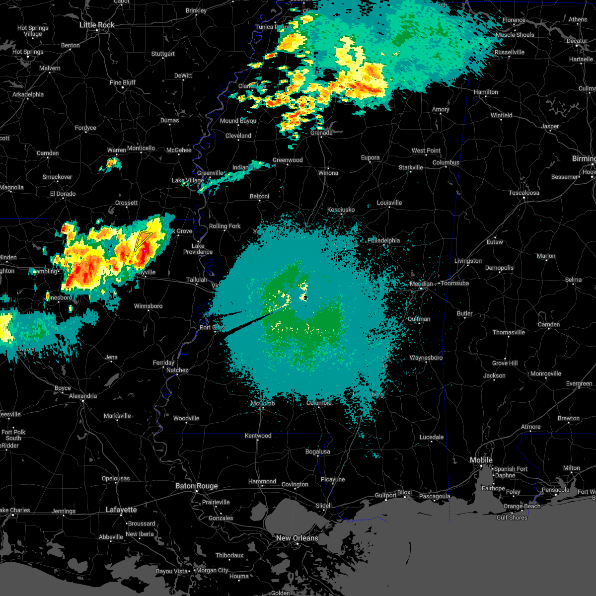 At 1222 am cdt, a severe thunderstorm was located 10 miles southeast of bastrop, moving southeast at 20 mph (radar indicated). Hazards include 60 mph wind gusts and penny size hail. Expect damage to roofs, siding, and trees. locations impacted include, galion. hail threat, radar indicated max hail size, 0. 75 in wind threat, radar indicated max wind gust, 60 mph. At 1222 am cdt, a severe thunderstorm was located 10 miles southeast of bastrop, moving southeast at 20 mph (radar indicated). Hazards include 60 mph wind gusts and penny size hail. Expect damage to roofs, siding, and trees. locations impacted include, galion. hail threat, radar indicated max hail size, 0. 75 in wind threat, radar indicated max wind gust, 60 mph.
|
| 5/1/2022 12:09 AM CDT |
 At 1209 am cdt, a severe thunderstorm was located near bastrop, moving southeast at 25 mph (radar indicated). Hazards include 60 mph wind gusts and penny size hail. Expect damage to roofs, siding, and trees. locations impacted include, bastrop, galion and bonita. hail threat, radar indicated max hail size, 0. 75 in wind threat, radar indicated max wind gust, 60 mph. At 1209 am cdt, a severe thunderstorm was located near bastrop, moving southeast at 25 mph (radar indicated). Hazards include 60 mph wind gusts and penny size hail. Expect damage to roofs, siding, and trees. locations impacted include, bastrop, galion and bonita. hail threat, radar indicated max hail size, 0. 75 in wind threat, radar indicated max wind gust, 60 mph.
|
| 5/1/2022 12:05 AM CDT |
 At 1205 am cdt, a severe thunderstorm was located near bastrop, moving southeast at 20 mph (radar indicated). Hazards include 60 mph wind gusts and penny size hail. Expect damage to roofs, siding, and trees. this severe thunderstorm will remain over mainly rural areas of central morehouse parish, including the following locations, collinston, mer rouge and oak ridge. hail threat, radar indicated max hail size, 0. 75 in wind threat, radar indicated max wind gust, 60 mph. At 1205 am cdt, a severe thunderstorm was located near bastrop, moving southeast at 20 mph (radar indicated). Hazards include 60 mph wind gusts and penny size hail. Expect damage to roofs, siding, and trees. this severe thunderstorm will remain over mainly rural areas of central morehouse parish, including the following locations, collinston, mer rouge and oak ridge. hail threat, radar indicated max hail size, 0. 75 in wind threat, radar indicated max wind gust, 60 mph.
|
| 4/30/2022 11:45 PM CDT |
 At 1145 pm cdt, severe thunderstorms were located along a line extending from near berlin to near sterlington, moving southeast at 20 mph (radar indicated). Hazards include 60 mph wind gusts and penny size hail. Expect damage to roofs, siding, and trees. locations impacted include, bastrop, jones, beekman, galion and bonita. hail threat, radar indicated max hail size, 0. 75 in wind threat, radar indicated max wind gust, 60 mph. At 1145 pm cdt, severe thunderstorms were located along a line extending from near berlin to near sterlington, moving southeast at 20 mph (radar indicated). Hazards include 60 mph wind gusts and penny size hail. Expect damage to roofs, siding, and trees. locations impacted include, bastrop, jones, beekman, galion and bonita. hail threat, radar indicated max hail size, 0. 75 in wind threat, radar indicated max wind gust, 60 mph.
|
| 4/30/2022 11:24 PM CDT |
 At 1123 pm cdt, severe thunderstorms were located along a line extending from near crossett to 10 miles northwest of sterlington, moving southeast at 20 mph (radar indicated). Hazards include 60 mph wind gusts and quarter size hail. Hail damage to vehicles is expected. Expect wind damage to roofs, siding, and trees. At 1123 pm cdt, severe thunderstorms were located along a line extending from near crossett to 10 miles northwest of sterlington, moving southeast at 20 mph (radar indicated). Hazards include 60 mph wind gusts and quarter size hail. Hail damage to vehicles is expected. Expect wind damage to roofs, siding, and trees.
|
| 4/13/2022 12:12 AM CDT |
 At 1212 am cdt, severe thunderstorms were located along a line extending from near berlin to near goodwill to 6 miles northwest of warden to rayville to near mangham to near liddieville to columbia, moving east at 40 mph (radar indicated). Hazards include 60 mph wind gusts and nickel size hail. Expect damage to roofs, siding, and trees. these severe storms will be near, goodwill and warden around 1220 am cdt. holly ridge, jones and darnell around 1225 am cdt. winnsboro, oak grove and crowville around 1230 am cdt. delhi and bakers around 1235 am cdt. jigger around 1240 am cdt. wisner around 1245 am cdt. Other locations impacted by these severe thunderstorms include baskin, mer rouge, pioneer, gilbert, kilbourne, forest, bonita, oak ridge, epps and collinston. At 1212 am cdt, severe thunderstorms were located along a line extending from near berlin to near goodwill to 6 miles northwest of warden to rayville to near mangham to near liddieville to columbia, moving east at 40 mph (radar indicated). Hazards include 60 mph wind gusts and nickel size hail. Expect damage to roofs, siding, and trees. these severe storms will be near, goodwill and warden around 1220 am cdt. holly ridge, jones and darnell around 1225 am cdt. winnsboro, oak grove and crowville around 1230 am cdt. delhi and bakers around 1235 am cdt. jigger around 1240 am cdt. wisner around 1245 am cdt. Other locations impacted by these severe thunderstorms include baskin, mer rouge, pioneer, gilbert, kilbourne, forest, bonita, oak ridge, epps and collinston.
|
| 4/12/2022 11:39 PM CDT |
 At 1137 pm cdt, severe thunderstorms were located along a line extending from 6 miles southwest of huttig, to 9 miles northwest of sterlington, to near claiborne, to 14 miles northwest of columbia, to 15 miles west of clarks to 7 miles east of winnfield, moving east at 50 mph (radar indicated). Hazards include 60 mph wind gusts and nickel size hail. Expect damage to roofs, siding, and trees. severe thunderstorms will be near, bastrop and start around 1155 pm cdt. rayville and beekman around 1200 am cdt. alto around 1205 am cdt. mangham and archibald around 1210 am cdt. goodwill and jones around 1220 am cdt. winnsboro and crowville around 1225 am cdt. oak grove and jigger around 1230 am cdt. Other locations impacted by these severe thunderstorms include perryville, mer rouge, pioneer, kilbourne, and oak ridge. At 1137 pm cdt, severe thunderstorms were located along a line extending from 6 miles southwest of huttig, to 9 miles northwest of sterlington, to near claiborne, to 14 miles northwest of columbia, to 15 miles west of clarks to 7 miles east of winnfield, moving east at 50 mph (radar indicated). Hazards include 60 mph wind gusts and nickel size hail. Expect damage to roofs, siding, and trees. severe thunderstorms will be near, bastrop and start around 1155 pm cdt. rayville and beekman around 1200 am cdt. alto around 1205 am cdt. mangham and archibald around 1210 am cdt. goodwill and jones around 1220 am cdt. winnsboro and crowville around 1225 am cdt. oak grove and jigger around 1230 am cdt. Other locations impacted by these severe thunderstorms include perryville, mer rouge, pioneer, kilbourne, and oak ridge.
|
| 4/5/2022 4:34 AM CDT |
 At 434 am cdt, severe thunderstorms were located along a line extending from 6 miles south of snyder to 7 miles south of galion, moving east at 55 mph (radar indicated). Hazards include 60 mph wind gusts. Expect damage to roofs, siding, and trees. these severe storms will be near, parkdale around 440 am cdt. portland and montrose around 445 am cdt. other locations impacted by these severe thunderstorms include bonita, collinston, mer rouge and oak ridge. hail threat, radar indicated max hail size, <. 75 in wind threat, radar indicated max wind gust, 60 mph. At 434 am cdt, severe thunderstorms were located along a line extending from 6 miles south of snyder to 7 miles south of galion, moving east at 55 mph (radar indicated). Hazards include 60 mph wind gusts. Expect damage to roofs, siding, and trees. these severe storms will be near, parkdale around 440 am cdt. portland and montrose around 445 am cdt. other locations impacted by these severe thunderstorms include bonita, collinston, mer rouge and oak ridge. hail threat, radar indicated max hail size, <. 75 in wind threat, radar indicated max wind gust, 60 mph.
|
| 4/5/2022 4:25 AM CDT |
 At 424 am cdt, severe thunderstorms were located along a line extending from hamburg to bastrop, moving east at 55 mph (radar indicated). Hazards include 60 mph wind gusts. Expect damage to roofs, siding, and trees. these severe storms will be near, snyder and galion around 435 am cdt. portland, montrose and parkdale around 445 am cdt. other locations impacted by these severe thunderstorms include bonita, collinston, mer rouge and oak ridge. hail threat, radar indicated max hail size, <. 75 in wind threat, radar indicated max wind gust, 60 mph. At 424 am cdt, severe thunderstorms were located along a line extending from hamburg to bastrop, moving east at 55 mph (radar indicated). Hazards include 60 mph wind gusts. Expect damage to roofs, siding, and trees. these severe storms will be near, snyder and galion around 435 am cdt. portland, montrose and parkdale around 445 am cdt. other locations impacted by these severe thunderstorms include bonita, collinston, mer rouge and oak ridge. hail threat, radar indicated max hail size, <. 75 in wind threat, radar indicated max wind gust, 60 mph.
|
| 4/5/2022 4:14 AM CDT |
 At 414 am cdt, severe thunderstorms were located along a line extending from near north crossett to 7 miles north of sterlington, moving east at 50 mph (radar indicated). Hazards include 60 mph wind gusts. Expect damage to roofs, siding, and trees. these severe storms will be near, old milo around 420 am cdt. bastrop and hamburg around 425 am cdt. galion around 435 am cdt. snyder around 440 am cdt. portland and parkdale around 445 am cdt. other locations impacted by these severe thunderstorms include bonita, collinston, mer rouge and oak ridge. hail threat, radar indicated max hail size, <. 75 in wind threat, radar indicated max wind gust, 60 mph. At 414 am cdt, severe thunderstorms were located along a line extending from near north crossett to 7 miles north of sterlington, moving east at 50 mph (radar indicated). Hazards include 60 mph wind gusts. Expect damage to roofs, siding, and trees. these severe storms will be near, old milo around 420 am cdt. bastrop and hamburg around 425 am cdt. galion around 435 am cdt. snyder around 440 am cdt. portland and parkdale around 445 am cdt. other locations impacted by these severe thunderstorms include bonita, collinston, mer rouge and oak ridge. hail threat, radar indicated max hail size, <. 75 in wind threat, radar indicated max wind gust, 60 mph.
|
| 4/5/2022 3:52 AM CDT |
 At 351 am cdt, severe thunderstorms were located along a line extending from near moro bay state park to near farmerville, moving east at 50 mph (radar indicated). Hazards include 60 mph wind gusts. Expect damage to roofs, siding, and trees. severe thunderstorms will be near, west crossett around 410 am cdt. crossett and north crossett around 415 am cdt. old milo around 420 am cdt. hamburg around 425 am cdt. bastrop around 430 am cdt. snyder around 435 am cdt. portland, montrose and parkdale around 445 am cdt. other locations impacted by these severe thunderstorms include bonita, collinston, mer rouge and oak ridge. hail threat, radar indicated max hail size, <. 75 in wind threat, radar indicated max wind gust, 60 mph. At 351 am cdt, severe thunderstorms were located along a line extending from near moro bay state park to near farmerville, moving east at 50 mph (radar indicated). Hazards include 60 mph wind gusts. Expect damage to roofs, siding, and trees. severe thunderstorms will be near, west crossett around 410 am cdt. crossett and north crossett around 415 am cdt. old milo around 420 am cdt. hamburg around 425 am cdt. bastrop around 430 am cdt. snyder around 435 am cdt. portland, montrose and parkdale around 445 am cdt. other locations impacted by these severe thunderstorms include bonita, collinston, mer rouge and oak ridge. hail threat, radar indicated max hail size, <. 75 in wind threat, radar indicated max wind gust, 60 mph.
|
| 3/30/2022 1:57 PM CDT |
 At 157 pm cdt, tornado producing storms were located along a line extending from near galion to 9 miles north of rayville to near mangham, moving northeast at 65 mph (weather spotters confirmed tornado). Hazards include damaging tornado. Flying debris will be dangerous to those caught without shelter. mobile homes will be damaged or destroyed. damage to roofs, windows, and vehicles will occur. tree damage is likely. these tornadic storms will be near, goodwill, bakers, darnell and holly ridge around 210 pm cdt. delhi around 215 pm cdt. warden around 220 pm cdt. Other locations impacted by these tornadic storms include mer rouge, pioneer, oak ridge and epps. At 157 pm cdt, tornado producing storms were located along a line extending from near galion to 9 miles north of rayville to near mangham, moving northeast at 65 mph (weather spotters confirmed tornado). Hazards include damaging tornado. Flying debris will be dangerous to those caught without shelter. mobile homes will be damaged or destroyed. damage to roofs, windows, and vehicles will occur. tree damage is likely. these tornadic storms will be near, goodwill, bakers, darnell and holly ridge around 210 pm cdt. delhi around 215 pm cdt. warden around 220 pm cdt. Other locations impacted by these tornadic storms include mer rouge, pioneer, oak ridge and epps.
|
| 3/30/2022 1:51 PM CDT |
 At 151 pm cdt, severe thunderstorms were located along a line extending from near ladelle to near jones to near archibald, moving northeast at 50 mph (radar indicated). Hazards include 60 mph wind gusts. Expect damage to roofs, siding, and trees. these severe storms will be near, jones around 155 pm cdt. wilmot and holly ridge around 205 pm cdt. delhi around 210 pm cdt. warden around 215 pm cdt. darnell around 225 pm cdt. Other locations impacted by these severe thunderstorms include baskin, collinston, mer rouge, pioneer, bonita, oak ridge and epps. At 151 pm cdt, severe thunderstorms were located along a line extending from near ladelle to near jones to near archibald, moving northeast at 50 mph (radar indicated). Hazards include 60 mph wind gusts. Expect damage to roofs, siding, and trees. these severe storms will be near, jones around 155 pm cdt. wilmot and holly ridge around 205 pm cdt. delhi around 210 pm cdt. warden around 215 pm cdt. darnell around 225 pm cdt. Other locations impacted by these severe thunderstorms include baskin, collinston, mer rouge, pioneer, bonita, oak ridge and epps.
|
| 3/30/2022 1:39 PM CDT |
 At 139 pm cdt, severe thunderstorms capable of producing a tornado were located along a line extending from bastrop to near swartz to 7 miles northeast of columbia, moving northeast at 55 mph (radar indicated rotation). Hazards include tornado. Flying debris will be dangerous to those caught without shelter. mobile homes will be damaged or destroyed. damage to roofs, windows, and vehicles will occur. tree damage is likely. these dangerous storms will be near, rayville around 145 pm cdt. mangham and alto around 155 pm cdt. archibald around 200 pm cdt. goodwill, holly ridge, bakers and darnell around 210 pm cdt. delhi and warden around 220 pm cdt. Other locations impacted by these tornadic storms include collinston, mer rouge, pioneer, oak ridge and epps. At 139 pm cdt, severe thunderstorms capable of producing a tornado were located along a line extending from bastrop to near swartz to 7 miles northeast of columbia, moving northeast at 55 mph (radar indicated rotation). Hazards include tornado. Flying debris will be dangerous to those caught without shelter. mobile homes will be damaged or destroyed. damage to roofs, windows, and vehicles will occur. tree damage is likely. these dangerous storms will be near, rayville around 145 pm cdt. mangham and alto around 155 pm cdt. archibald around 200 pm cdt. goodwill, holly ridge, bakers and darnell around 210 pm cdt. delhi and warden around 220 pm cdt. Other locations impacted by these tornadic storms include collinston, mer rouge, pioneer, oak ridge and epps.
|
| 3/30/2022 1:04 PM CDT |
 At 104 pm cdt, severe thunderstorms were located along a line extending from near moro bay state park to near sterlington to 12 miles northwest of clarks, moving northeast at 55 mph (radar indicated). Hazards include 60 mph wind gusts. Expect damage to roofs, siding, and trees. severe thunderstorms will be near, bastrop around 120 pm cdt. buckner and beekman around 130 pm cdt. alto and galion around 135 pm cdt. mangham, start and archibald around 140 pm cdt. rayville and jones around 145 pm cdt. wilmot and holly ridge around 150 pm cdt. parkdale around 155 pm cdt. delhi and warden around 200 pm cdt. Other locations impacted by these severe thunderstorms include baskin, collinston, mer rouge, pioneer, bonita, oak ridge and epps. At 104 pm cdt, severe thunderstorms were located along a line extending from near moro bay state park to near sterlington to 12 miles northwest of clarks, moving northeast at 55 mph (radar indicated). Hazards include 60 mph wind gusts. Expect damage to roofs, siding, and trees. severe thunderstorms will be near, bastrop around 120 pm cdt. buckner and beekman around 130 pm cdt. alto and galion around 135 pm cdt. mangham, start and archibald around 140 pm cdt. rayville and jones around 145 pm cdt. wilmot and holly ridge around 150 pm cdt. parkdale around 155 pm cdt. delhi and warden around 200 pm cdt. Other locations impacted by these severe thunderstorms include baskin, collinston, mer rouge, pioneer, bonita, oak ridge and epps.
|
| 6/8/2021 3:12 PM CDT |
 At 310 pm cdt, severe thunderstorms were located along a line extending from 6 miles south of bastrop to near start to near buckner, moving east at 40 mph (radar indicated. at 252 pm, wind damage was reported in the monroe, la area). Hazards include 70 mph wind gusts and penny size hail. Expect considerable tree damage. damage is likely to mobile homes, roofs, and outbuildings. these severe storms will be near, bastrop and rayville around 315 pm cdt. alto around 320 pm cdt. winnsboro, mangham and archibald around 325 pm cdt. holly ridge around 330 pm cdt. delhi, warden, goodwill and crowville around 340 pm cdt. bakers around 345 pm cdt. darnell around 350 pm cdt. Other locations impacted by these severe thunderstorms include baskin, collinston, mer rouge, pioneer, gilbert, bonita, oak ridge and epps. At 310 pm cdt, severe thunderstorms were located along a line extending from 6 miles south of bastrop to near start to near buckner, moving east at 40 mph (radar indicated. at 252 pm, wind damage was reported in the monroe, la area). Hazards include 70 mph wind gusts and penny size hail. Expect considerable tree damage. damage is likely to mobile homes, roofs, and outbuildings. these severe storms will be near, bastrop and rayville around 315 pm cdt. alto around 320 pm cdt. winnsboro, mangham and archibald around 325 pm cdt. holly ridge around 330 pm cdt. delhi, warden, goodwill and crowville around 340 pm cdt. bakers around 345 pm cdt. darnell around 350 pm cdt. Other locations impacted by these severe thunderstorms include baskin, collinston, mer rouge, pioneer, gilbert, bonita, oak ridge and epps.
|
| 6/8/2021 2:33 PM CDT |
 At 230 pm cdt, severe thunderstorms were located along a line extending from 6 miles northwest of claiborne to 10 miles southwest of brownsville-bawcom to 11 miles northwest of clarks, moving east at 45 mph (emergency management. at 139 pm, wind damage was reported 7 miles east northeast of saline, la). Hazards include 70 mph wind gusts and penny size hail. Expect considerable tree damage. damage is likely to mobile homes, roofs, and outbuildings. severe thunderstorms will be near, alto around 300 pm cdt. bastrop, start and buckner around 305 pm cdt. rayville and liddieville around 310 pm cdt. winnsboro around 315 pm cdt. mangham and archibald around 320 pm cdt. holly ridge around 325 pm cdt. crowville around 330 pm cdt. delhi, warden and goodwill around 335 pm cdt. Other locations impacted by these severe thunderstorms include baskin, collinston, mer rouge, pioneer, gilbert, bonita, oak ridge and epps. At 230 pm cdt, severe thunderstorms were located along a line extending from 6 miles northwest of claiborne to 10 miles southwest of brownsville-bawcom to 11 miles northwest of clarks, moving east at 45 mph (emergency management. at 139 pm, wind damage was reported 7 miles east northeast of saline, la). Hazards include 70 mph wind gusts and penny size hail. Expect considerable tree damage. damage is likely to mobile homes, roofs, and outbuildings. severe thunderstorms will be near, alto around 300 pm cdt. bastrop, start and buckner around 305 pm cdt. rayville and liddieville around 310 pm cdt. winnsboro around 315 pm cdt. mangham and archibald around 320 pm cdt. holly ridge around 325 pm cdt. crowville around 330 pm cdt. delhi, warden and goodwill around 335 pm cdt. Other locations impacted by these severe thunderstorms include baskin, collinston, mer rouge, pioneer, gilbert, bonita, oak ridge and epps.
|
| 6/7/2021 6:55 PM CDT |
 The severe thunderstorm warning for morehouse, richland, west carroll and northern franklin parishes will expire at 700 pm cdt, the storms which prompted the warning have weakened below severe limits, and have exited the warned area. therefore, the warning will be allowed to expire. however gusty winds and heavy rain are still possible with these thunderstorms. a severe thunderstorm watch remains in effect until 900 pm cdt for southeastern arkansas, and northeastern louisiana. The severe thunderstorm warning for morehouse, richland, west carroll and northern franklin parishes will expire at 700 pm cdt, the storms which prompted the warning have weakened below severe limits, and have exited the warned area. therefore, the warning will be allowed to expire. however gusty winds and heavy rain are still possible with these thunderstorms. a severe thunderstorm watch remains in effect until 900 pm cdt for southeastern arkansas, and northeastern louisiana.
|
| 6/7/2021 5:36 PM CDT |
 At 536 pm cdt, severe thunderstorms were located along a line extending from 7 miles east of huttig to near sterlington to 19 miles southwest of brownsville-bawcom, moving east at 30 mph (radar indicated). Hazards include 60 mph wind gusts and nickel size hail. Expect damage to roofs, siding, and trees. severe thunderstorms will be near, beekman around 555 pm cdt. bastrop around 600 pm cdt. jones around 625 pm cdt. buckner around 630 pm cdt. alto around 640 pm cdt. goodwill around 645 pm cdt. mangham and archibald around 650 pm cdt. darnell around 655 pm cdt. Other locations impacted by these severe thunderstorms include baskin, collinston, mer rouge, pioneer, kilbourne, forest, bonita, oak ridge and epps. At 536 pm cdt, severe thunderstorms were located along a line extending from 7 miles east of huttig to near sterlington to 19 miles southwest of brownsville-bawcom, moving east at 30 mph (radar indicated). Hazards include 60 mph wind gusts and nickel size hail. Expect damage to roofs, siding, and trees. severe thunderstorms will be near, beekman around 555 pm cdt. bastrop around 600 pm cdt. jones around 625 pm cdt. buckner around 630 pm cdt. alto around 640 pm cdt. goodwill around 645 pm cdt. mangham and archibald around 650 pm cdt. darnell around 655 pm cdt. Other locations impacted by these severe thunderstorms include baskin, collinston, mer rouge, pioneer, kilbourne, forest, bonita, oak ridge and epps.
|
| 5/4/2021 1:06 PM CDT |
 At 106 pm cdt, severe thunderstorms were located along a line extending from near galion to near start, moving east at 40 mph (radar indicated). Hazards include 70 mph wind gusts. Expect considerable tree damage. damage is likely to mobile homes, roofs, and outbuildings. locations impacted include, bastrop, hamburg, wilmot, portland, montrose, parkdale, berlin, beekman, galion, jones, snyder, mer rouge, collinston, bonita and oak ridge. A tornado watch remains in effect until 600 pm cdt for southeastern arkansas, and northeastern louisiana. At 106 pm cdt, severe thunderstorms were located along a line extending from near galion to near start, moving east at 40 mph (radar indicated). Hazards include 70 mph wind gusts. Expect considerable tree damage. damage is likely to mobile homes, roofs, and outbuildings. locations impacted include, bastrop, hamburg, wilmot, portland, montrose, parkdale, berlin, beekman, galion, jones, snyder, mer rouge, collinston, bonita and oak ridge. A tornado watch remains in effect until 600 pm cdt for southeastern arkansas, and northeastern louisiana.
|
| 5/4/2021 12:59 PM CDT |
 At 1221 pm cdt, a severe thunderstorm was located near galion, or 13 miles east of bastrop, moving northeast at 30 mph (radar indicated). Hazards include 60 mph wind gusts and quarter size hail. Hail damage to vehicles is expected. expect wind damage to roofs, siding, and trees. this severe storm will be near, jones around 1235 pm cdt. wilmot around 1250 pm cdt. other locations impacted by this severe thunderstorm include bonita, collinston, mer rouge and oak ridge. A tornado watch remains in effect until 600 pm cdt for southeastern arkansas, and northeastern louisiana. At 1221 pm cdt, a severe thunderstorm was located near galion, or 13 miles east of bastrop, moving northeast at 30 mph (radar indicated). Hazards include 60 mph wind gusts and quarter size hail. Hail damage to vehicles is expected. expect wind damage to roofs, siding, and trees. this severe storm will be near, jones around 1235 pm cdt. wilmot around 1250 pm cdt. other locations impacted by this severe thunderstorm include bonita, collinston, mer rouge and oak ridge. A tornado watch remains in effect until 600 pm cdt for southeastern arkansas, and northeastern louisiana.
|
| 5/4/2021 12:30 PM CDT |
 At 1221 pm cdt, a severe thunderstorm was located near galion, or 13 miles east of bastrop, moving northeast at 30 mph (radar indicated). Hazards include 60 mph wind gusts and quarter size hail. Hail damage to vehicles is expected. expect wind damage to roofs, siding, and trees. this severe storm will be near, jones around 1235 pm cdt. wilmot around 1250 pm cdt. other locations impacted by this severe thunderstorm include bonita, collinston, mer rouge and oak ridge. A tornado watch remains in effect until 600 pm cdt for southeastern arkansas, and northeastern louisiana. At 1221 pm cdt, a severe thunderstorm was located near galion, or 13 miles east of bastrop, moving northeast at 30 mph (radar indicated). Hazards include 60 mph wind gusts and quarter size hail. Hail damage to vehicles is expected. expect wind damage to roofs, siding, and trees. this severe storm will be near, jones around 1235 pm cdt. wilmot around 1250 pm cdt. other locations impacted by this severe thunderstorm include bonita, collinston, mer rouge and oak ridge. A tornado watch remains in effect until 600 pm cdt for southeastern arkansas, and northeastern louisiana.
|
| 5/4/2021 11:57 AM CDT |
 At 1157 am cdt, a severe thunderstorm was located over bastrop, moving northeast at 35 mph (radar indicated). Hazards include 60 mph wind gusts and quarter size hail. Hail damage to vehicles is expected. expect wind damage to roofs, siding, and trees. this severe thunderstorm will be near, galion around 1215 pm cdt. jones around 1230 pm cdt. wilmot around 1245 pm cdt. parkdale around 1255 pm cdt. other locations impacted by this severe thunderstorm include bonita, collinston, mer rouge and oak ridge. A tornado watch remains in effect until 600 pm cdt for southeastern arkansas, and northeastern louisiana. At 1157 am cdt, a severe thunderstorm was located over bastrop, moving northeast at 35 mph (radar indicated). Hazards include 60 mph wind gusts and quarter size hail. Hail damage to vehicles is expected. expect wind damage to roofs, siding, and trees. this severe thunderstorm will be near, galion around 1215 pm cdt. jones around 1230 pm cdt. wilmot around 1245 pm cdt. parkdale around 1255 pm cdt. other locations impacted by this severe thunderstorm include bonita, collinston, mer rouge and oak ridge. A tornado watch remains in effect until 600 pm cdt for southeastern arkansas, and northeastern louisiana.
|
| 4/9/2021 8:12 PM CDT |
 At 812 pm cdt, a severe thunderstorm was located 10 miles southwest of goodwill, or 14 miles southeast of bastrop, moving northeast at 30 mph (radar indicated). Hazards include 60 mph wind gusts and nickel size hail. Expect damage to roofs, siding, and trees. Locations impacted include, bastrop, galion and mer rouge. At 812 pm cdt, a severe thunderstorm was located 10 miles southwest of goodwill, or 14 miles southeast of bastrop, moving northeast at 30 mph (radar indicated). Hazards include 60 mph wind gusts and nickel size hail. Expect damage to roofs, siding, and trees. Locations impacted include, bastrop, galion and mer rouge.
|
| 4/9/2021 7:49 PM CDT |
 The national weather service in jackson has issued a * severe thunderstorm warning for. central morehouse parish in northeastern louisiana. northwestern richland parish in northeastern louisiana. until 900 pm cdt. At 749 pm cdt, a severe thunderstorm was located near swartz,. The national weather service in jackson has issued a * severe thunderstorm warning for. central morehouse parish in northeastern louisiana. northwestern richland parish in northeastern louisiana. until 900 pm cdt. At 749 pm cdt, a severe thunderstorm was located near swartz,.
|
| 4/9/2021 6:43 PM CDT |
 At 643 pm cdt, a severe thunderstorm was located over goodwill, or 19 miles east of bastrop, moving east at 45 mph (radar indicated). Hazards include 60 mph wind gusts and quarter size hail. Hail damage to vehicles is expected. expect wind damage to roofs, siding, and trees. this severe storm will be near, darnell around 650 pm cdt. oak grove around 700 pm cdt. Other locations impacted by this severe thunderstorm include forest, mer rouge, pioneer, oak ridge and epps. At 643 pm cdt, a severe thunderstorm was located over goodwill, or 19 miles east of bastrop, moving east at 45 mph (radar indicated). Hazards include 60 mph wind gusts and quarter size hail. Hail damage to vehicles is expected. expect wind damage to roofs, siding, and trees. this severe storm will be near, darnell around 650 pm cdt. oak grove around 700 pm cdt. Other locations impacted by this severe thunderstorm include forest, mer rouge, pioneer, oak ridge and epps.
|
| 4/9/2021 6:29 PM CDT |
 At 629 pm cdt, a severe thunderstorm was located 9 miles south of galion, or 10 miles east of bastrop, moving east at 45 mph (radar indicated). Hazards include two inch hail and 70 mph wind gusts. People and animals outdoors will be injured. expect hail damage to roofs, siding, windows, and vehicles. expect considerable tree damage. wind damage is also likely to mobile homes, roofs, and outbuildings. this severe storm will be near, goodwill around 645 pm cdt. darnell around 650 pm cdt. oak grove around 700 pm cdt. Other locations impacted by this severe thunderstorm include forest, collinston, mer rouge, pioneer, oak ridge and epps. At 629 pm cdt, a severe thunderstorm was located 9 miles south of galion, or 10 miles east of bastrop, moving east at 45 mph (radar indicated). Hazards include two inch hail and 70 mph wind gusts. People and animals outdoors will be injured. expect hail damage to roofs, siding, windows, and vehicles. expect considerable tree damage. wind damage is also likely to mobile homes, roofs, and outbuildings. this severe storm will be near, goodwill around 645 pm cdt. darnell around 650 pm cdt. oak grove around 700 pm cdt. Other locations impacted by this severe thunderstorm include forest, collinston, mer rouge, pioneer, oak ridge and epps.
|
| 4/9/2021 6:12 PM CDT |
 At 612 pm cdt, a severe thunderstorm was located near bastrop, moving east at 45 mph (radar indicated). Hazards include two inch hail and 60 mph wind gusts. People and animals outdoors will be injured. expect hail damage to roofs, siding, windows, and vehicles. expect wind damage to roofs, siding, and trees. this severe storm will be near, goodwill around 640 pm cdt. darnell around 650 pm cdt. oak grove around 655 pm cdt. Other locations impacted by this severe thunderstorm include forest, collinston, mer rouge, pioneer, oak ridge and epps. At 612 pm cdt, a severe thunderstorm was located near bastrop, moving east at 45 mph (radar indicated). Hazards include two inch hail and 60 mph wind gusts. People and animals outdoors will be injured. expect hail damage to roofs, siding, windows, and vehicles. expect wind damage to roofs, siding, and trees. this severe storm will be near, goodwill around 640 pm cdt. darnell around 650 pm cdt. oak grove around 655 pm cdt. Other locations impacted by this severe thunderstorm include forest, collinston, mer rouge, pioneer, oak ridge and epps.
|
| 4/9/2021 5:47 PM CDT |
 At 547 pm cdt, a severe thunderstorm was located 7 miles west of sterlington, or 7 miles north of claiborne, moving east at 45 mph (radar indicated). Hazards include ping pong ball size hail and 60 mph wind gusts. People and animals outdoors will be injured. expect hail damage to roofs, siding, windows, and vehicles. expect wind damage to roofs, siding, and trees. this severe thunderstorm will be near, bastrop around 610 pm cdt. goodwill around 635 pm cdt. darnell around 645 pm cdt. oak grove around 650 pm cdt. Other locations impacted by this severe thunderstorm include forest, collinston, mer rouge, pioneer, oak ridge and epps. At 547 pm cdt, a severe thunderstorm was located 7 miles west of sterlington, or 7 miles north of claiborne, moving east at 45 mph (radar indicated). Hazards include ping pong ball size hail and 60 mph wind gusts. People and animals outdoors will be injured. expect hail damage to roofs, siding, windows, and vehicles. expect wind damage to roofs, siding, and trees. this severe thunderstorm will be near, bastrop around 610 pm cdt. goodwill around 635 pm cdt. darnell around 645 pm cdt. oak grove around 650 pm cdt. Other locations impacted by this severe thunderstorm include forest, collinston, mer rouge, pioneer, oak ridge and epps.
|
| 4/7/2021 7:41 PM CDT |
 At 741 pm cdt, a confirmed tornado was located near galion, or 9 miles northeast of bastrop, moving east at 45 mph (radar confirmed tornado). Hazards include damaging tornado. Flying debris will be dangerous to those caught without shelter. mobile homes will be damaged or destroyed. damage to roofs, windows, and vehicles will occur. tree damage is likely. this tornado will be near, galion around 745 pm cdt. jones around 755 pm cdt. wilmot around 805 pm cdt. Other locations impacted by this tornadic thunderstorm include mer rouge and bonita. At 741 pm cdt, a confirmed tornado was located near galion, or 9 miles northeast of bastrop, moving east at 45 mph (radar confirmed tornado). Hazards include damaging tornado. Flying debris will be dangerous to those caught without shelter. mobile homes will be damaged or destroyed. damage to roofs, windows, and vehicles will occur. tree damage is likely. this tornado will be near, galion around 745 pm cdt. jones around 755 pm cdt. wilmot around 805 pm cdt. Other locations impacted by this tornadic thunderstorm include mer rouge and bonita.
|
| 4/7/2021 7:39 PM CDT |
 At 709 pm cdt, a severe thunderstorm was located 9 miles east of farmerville, or 16 miles north of claiborne, moving east at 65 mph (radar indicated). Hazards include 60 mph wind gusts. Expect damage to roofs, siding, and trees. this severe thunderstorm will be near, beekman around 730 pm cdt. galion around 735 pm cdt. jones around 745 pm cdt. wilmot around 750 pm cdt. parkdale around 755 pm cdt. Other locations impacted by this severe thunderstorm include mer rouge and bonita. At 709 pm cdt, a severe thunderstorm was located 9 miles east of farmerville, or 16 miles north of claiborne, moving east at 65 mph (radar indicated). Hazards include 60 mph wind gusts. Expect damage to roofs, siding, and trees. this severe thunderstorm will be near, beekman around 730 pm cdt. galion around 735 pm cdt. jones around 745 pm cdt. wilmot around 750 pm cdt. parkdale around 755 pm cdt. Other locations impacted by this severe thunderstorm include mer rouge and bonita.
|
| 4/7/2021 7:38 PM CDT |
 At 738 pm cdt, a severe thunderstorm capable of producing a tornado was located near beekman, or 8 miles northeast of bastrop, moving northeast at 55 mph (radar indicated rotation). Hazards include tornado. Flying debris will be dangerous to those caught without shelter. mobile homes will be damaged or destroyed. damage to roofs, windows, and vehicles will occur. tree damage is likely. this dangerous storm will be near, jones around 750 pm cdt. wilmot around 800 pm cdt. Other locations impacted by this tornadic thunderstorm include mer rouge and bonita. At 738 pm cdt, a severe thunderstorm capable of producing a tornado was located near beekman, or 8 miles northeast of bastrop, moving northeast at 55 mph (radar indicated rotation). Hazards include tornado. Flying debris will be dangerous to those caught without shelter. mobile homes will be damaged or destroyed. damage to roofs, windows, and vehicles will occur. tree damage is likely. this dangerous storm will be near, jones around 750 pm cdt. wilmot around 800 pm cdt. Other locations impacted by this tornadic thunderstorm include mer rouge and bonita.
|
| 4/7/2021 7:28 PM CDT |
 At 728 pm cdt, a severe thunderstorm capable of producing a tornado was located near bastrop, moving northeast at 55 mph (radar indicated rotation). Hazards include tornado. Flying debris will be dangerous to those caught without shelter. mobile homes will be damaged or destroyed. damage to roofs, windows, and vehicles will occur. tree damage is likely. this dangerous storm will be near, beekman around 735 pm cdt. galion around 740 pm cdt. jones around 750 pm cdt. wilmot around 800 pm cdt. Other locations impacted by this tornadic thunderstorm include mer rouge and bonita. At 728 pm cdt, a severe thunderstorm capable of producing a tornado was located near bastrop, moving northeast at 55 mph (radar indicated rotation). Hazards include tornado. Flying debris will be dangerous to those caught without shelter. mobile homes will be damaged or destroyed. damage to roofs, windows, and vehicles will occur. tree damage is likely. this dangerous storm will be near, beekman around 735 pm cdt. galion around 740 pm cdt. jones around 750 pm cdt. wilmot around 800 pm cdt. Other locations impacted by this tornadic thunderstorm include mer rouge and bonita.
|
| 4/7/2021 7:09 PM CDT |
 At 709 pm cdt, a severe thunderstorm was located 9 miles east of farmerville, or 16 miles north of claiborne, moving east at 65 mph (radar indicated). Hazards include 60 mph wind gusts. Expect damage to roofs, siding, and trees. this severe thunderstorm will be near, beekman around 730 pm cdt. galion around 735 pm cdt. jones around 745 pm cdt. wilmot around 750 pm cdt. parkdale around 755 pm cdt. Other locations impacted by this severe thunderstorm include mer rouge and bonita. At 709 pm cdt, a severe thunderstorm was located 9 miles east of farmerville, or 16 miles north of claiborne, moving east at 65 mph (radar indicated). Hazards include 60 mph wind gusts. Expect damage to roofs, siding, and trees. this severe thunderstorm will be near, beekman around 730 pm cdt. galion around 735 pm cdt. jones around 745 pm cdt. wilmot around 750 pm cdt. parkdale around 755 pm cdt. Other locations impacted by this severe thunderstorm include mer rouge and bonita.
|
| 11/27/2020 8:16 AM CST |
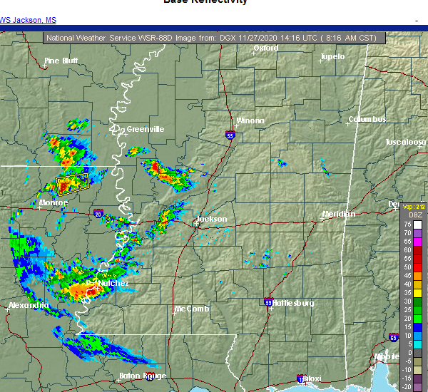 At 816 am cst, a severe thunderstorm was located near galion, or 8 miles east of bastrop, moving east at 35 mph (radar indicated). Hazards include 60 mph wind gusts and penny size hail. Expect damage to roofs, siding, and trees. this severe thunderstorm will be near, goodwill around 835 am cst. Other locations impacted by this severe thunderstorm include mer rouge. At 816 am cst, a severe thunderstorm was located near galion, or 8 miles east of bastrop, moving east at 35 mph (radar indicated). Hazards include 60 mph wind gusts and penny size hail. Expect damage to roofs, siding, and trees. this severe thunderstorm will be near, goodwill around 835 am cst. Other locations impacted by this severe thunderstorm include mer rouge.
|
| 7/31/2020 2:23 PM CDT |
 At 223 pm cdt, severe thunderstorms were located along a line extending from near jones to 7 miles southwest of goodwill, moving east at 60 mph (radar indicated). Hazards include 60 mph wind gusts. Expect damage to roofs, siding, and trees. these severe storms will be near, darnell around 235 pm cdt. oak grove around 245 pm cdt. Other locations impacted by these severe thunderstorms include kilbourne, forest, collinston, pioneer, oak ridge and epps. At 223 pm cdt, severe thunderstorms were located along a line extending from near jones to 7 miles southwest of goodwill, moving east at 60 mph (radar indicated). Hazards include 60 mph wind gusts. Expect damage to roofs, siding, and trees. these severe storms will be near, darnell around 235 pm cdt. oak grove around 245 pm cdt. Other locations impacted by these severe thunderstorms include kilbourne, forest, collinston, pioneer, oak ridge and epps.
|
| 7/31/2020 2:07 PM CDT |
 At 206 pm cdt, severe thunderstorms were located along a line extending from near beekman to 6 miles east of sterlington, moving east at 60 mph (radar indicated). Hazards include 60 mph wind gusts. Expect damage to roofs, siding, and trees. these severe storms will be near, galion around 210 pm cdt. jones around 220 pm cdt. goodwill around 230 pm cdt. darnell around 235 pm cdt. oak grove around 240 pm cdt. Other locations impacted by these severe thunderstorms include collinston, mer rouge, pioneer, kilbourne, forest, bonita, oak ridge and epps. At 206 pm cdt, severe thunderstorms were located along a line extending from near beekman to 6 miles east of sterlington, moving east at 60 mph (radar indicated). Hazards include 60 mph wind gusts. Expect damage to roofs, siding, and trees. these severe storms will be near, galion around 210 pm cdt. jones around 220 pm cdt. goodwill around 230 pm cdt. darnell around 235 pm cdt. oak grove around 240 pm cdt. Other locations impacted by these severe thunderstorms include collinston, mer rouge, pioneer, kilbourne, forest, bonita, oak ridge and epps.
|
| 7/31/2020 1:52 PM CDT |
 At 152 pm cdt, severe thunderstorms were located along a line extending from 9 miles north of sterlington to 6 miles north of claiborne, moving east at 50 mph (radar indicated). Hazards include 60 mph wind gusts. Expect damage to roofs, siding, and trees. severe thunderstorms will be near, beekman around 210 pm cdt. bastrop and galion around 215 pm cdt. jones around 225 pm cdt. goodwill around 240 pm cdt. oak grove around 245 pm cdt. Other locations impacted by these severe thunderstorms include collinston, mer rouge, pioneer, kilbourne, forest, bonita, oak ridge and epps. At 152 pm cdt, severe thunderstorms were located along a line extending from 9 miles north of sterlington to 6 miles north of claiborne, moving east at 50 mph (radar indicated). Hazards include 60 mph wind gusts. Expect damage to roofs, siding, and trees. severe thunderstorms will be near, beekman around 210 pm cdt. bastrop and galion around 215 pm cdt. jones around 225 pm cdt. goodwill around 240 pm cdt. oak grove around 245 pm cdt. Other locations impacted by these severe thunderstorms include collinston, mer rouge, pioneer, kilbourne, forest, bonita, oak ridge and epps.
|
| 6/21/2020 5:20 PM CDT |
 At 520 pm cdt, a severe thunderstorm was located 9 miles southwest of goodwill, or 15 miles northeast of rayville, moving northeast at 15 mph (radar indicated). Hazards include 60 mph wind gusts and quarter size hail. Hail damage to vehicles is expected. expect wind damage to roofs, siding, and trees. this severe thunderstorm will be near, goodwill around 555 pm cdt. Other locations impacted by this severe thunderstorm include collinston, mer rouge, pioneer, oak ridge and epps. At 520 pm cdt, a severe thunderstorm was located 9 miles southwest of goodwill, or 15 miles northeast of rayville, moving northeast at 15 mph (radar indicated). Hazards include 60 mph wind gusts and quarter size hail. Hail damage to vehicles is expected. expect wind damage to roofs, siding, and trees. this severe thunderstorm will be near, goodwill around 555 pm cdt. Other locations impacted by this severe thunderstorm include collinston, mer rouge, pioneer, oak ridge and epps.
|
| 6/5/2020 7:05 PM CDT |
 At 705 pm cdt, a severe thunderstorm was located over goodwill, or 20 miles west of lake providence, moving southwest at 40 mph (radar indicated). Hazards include 60 mph wind gusts and nickel size hail. Expect damage to roofs, siding, and trees. this severe storm will be near, holly ridge around 735 pm cdt. rayville around 740 pm cdt. start around 745 pm cdt. Other locations impacted by this severe thunderstorm include forest, collinston, mer rouge, pioneer, oak ridge and epps. At 705 pm cdt, a severe thunderstorm was located over goodwill, or 20 miles west of lake providence, moving southwest at 40 mph (radar indicated). Hazards include 60 mph wind gusts and nickel size hail. Expect damage to roofs, siding, and trees. this severe storm will be near, holly ridge around 735 pm cdt. rayville around 740 pm cdt. start around 745 pm cdt. Other locations impacted by this severe thunderstorm include forest, collinston, mer rouge, pioneer, oak ridge and epps.
|
| 6/5/2020 6:54 PM CDT |
 At 654 pm cdt, a severe thunderstorm was located near oak grove, or 15 miles southeast of wilmot, moving south at 45 mph (radar indicated). Hazards include 60 mph wind gusts and nickel size hail. Expect damage to roofs, siding, and trees. this severe storm will be near, goodwill around 705 pm cdt. darnell around 710 pm cdt. warden around 725 pm cdt. holly ridge around 735 pm cdt. Other locations impacted by this severe thunderstorm include collinston, mer rouge, pioneer, kilbourne, forest, bonita, oak ridge and epps. At 654 pm cdt, a severe thunderstorm was located near oak grove, or 15 miles southeast of wilmot, moving south at 45 mph (radar indicated). Hazards include 60 mph wind gusts and nickel size hail. Expect damage to roofs, siding, and trees. this severe storm will be near, goodwill around 705 pm cdt. darnell around 710 pm cdt. warden around 725 pm cdt. holly ridge around 735 pm cdt. Other locations impacted by this severe thunderstorm include collinston, mer rouge, pioneer, kilbourne, forest, bonita, oak ridge and epps.
|
| 6/5/2020 6:32 PM CDT |
 At 632 pm cdt, a severe thunderstorm was located 8 miles west of gassoway, or 9 miles southwest of eudora, moving southwest at 40 mph (radar indicated). Hazards include 60 mph wind gusts and nickel size hail. Expect damage to roofs, siding, and trees. this severe thunderstorm will be near, oak grove around 645 pm cdt. goodwill around 700 pm cdt. holly ridge around 730 pm cdt. rayville and start around 740 pm cdt. Other locations impacted by this severe thunderstorm include collinston, mer rouge, pioneer, kilbourne, forest, bonita, oak ridge and epps. At 632 pm cdt, a severe thunderstorm was located 8 miles west of gassoway, or 9 miles southwest of eudora, moving southwest at 40 mph (radar indicated). Hazards include 60 mph wind gusts and nickel size hail. Expect damage to roofs, siding, and trees. this severe thunderstorm will be near, oak grove around 645 pm cdt. goodwill around 700 pm cdt. holly ridge around 730 pm cdt. rayville and start around 740 pm cdt. Other locations impacted by this severe thunderstorm include collinston, mer rouge, pioneer, kilbourne, forest, bonita, oak ridge and epps.
|
| 4/12/2020 8:36 PM CDT |
 At 836 pm cdt, a severe thunderstorm was located near galion, or 8 miles east of bastrop, moving east at 35 mph (radar indicated). Hazards include ping pong ball size hail and 60 mph wind gusts. People and animals outdoors will be injured. expect hail damage to roofs, siding, windows, and vehicles. expect wind damage to roofs, siding, and trees. This severe thunderstorm will remain over mainly rural areas of morehouse parish, including the following locations, collinston, mer rouge and bonita. At 836 pm cdt, a severe thunderstorm was located near galion, or 8 miles east of bastrop, moving east at 35 mph (radar indicated). Hazards include ping pong ball size hail and 60 mph wind gusts. People and animals outdoors will be injured. expect hail damage to roofs, siding, windows, and vehicles. expect wind damage to roofs, siding, and trees. This severe thunderstorm will remain over mainly rural areas of morehouse parish, including the following locations, collinston, mer rouge and bonita.
|
| 4/12/2020 8:35 PM CDT | Quarter sized hail reported 0.4 miles SW of Mer Rouge, LA |
| 4/12/2020 8:14 PM CDT |
 At 814 pm cdt, a severe thunderstorm was located near bastrop, moving northeast at 70 mph (radar indicated). Hazards include ping pong ball size hail and 60 mph wind gusts. People and animals outdoors will be injured. expect hail damage to roofs, siding, windows, and vehicles. expect wind damage to roofs, siding, and trees. this severe thunderstorm will be near, beekman around 820 pm cdt. galion around 825 pm cdt. jones around 835 pm cdt. Other locations impacted by this severe thunderstorm include collinston, mer rouge and bonita. At 814 pm cdt, a severe thunderstorm was located near bastrop, moving northeast at 70 mph (radar indicated). Hazards include ping pong ball size hail and 60 mph wind gusts. People and animals outdoors will be injured. expect hail damage to roofs, siding, windows, and vehicles. expect wind damage to roofs, siding, and trees. this severe thunderstorm will be near, beekman around 820 pm cdt. galion around 825 pm cdt. jones around 835 pm cdt. Other locations impacted by this severe thunderstorm include collinston, mer rouge and bonita.
|
| 4/12/2020 12:09 PM CDT |
 At 1208 pm cdt, a confirmed tornado was located 11 miles southwest of goodwill, or 13 miles north of rayville, moving northeast at 55 mph (radar confirmed tornado). Hazards include damaging tornado and quarter size hail. Flying debris will be dangerous to those caught without shelter. mobile homes will be damaged or destroyed. damage to roofs, windows, and vehicles will occur. tree damage is likely. this tornado will be near, goodwill around 1220 pm cdt. darnell around 1225 pm cdt. Other locations impacted by this tornadic thunderstorm include forest, mer rouge, pioneer, oak ridge and epps. At 1208 pm cdt, a confirmed tornado was located 11 miles southwest of goodwill, or 13 miles north of rayville, moving northeast at 55 mph (radar confirmed tornado). Hazards include damaging tornado and quarter size hail. Flying debris will be dangerous to those caught without shelter. mobile homes will be damaged or destroyed. damage to roofs, windows, and vehicles will occur. tree damage is likely. this tornado will be near, goodwill around 1220 pm cdt. darnell around 1225 pm cdt. Other locations impacted by this tornadic thunderstorm include forest, mer rouge, pioneer, oak ridge and epps.
|
| 4/12/2020 12:01 PM CDT | Corrects time of previous tstm wnd dmg report from 5 nne oak ridge. reports of trees down south of bastrop on higginbotham r in morehouse county LA, 6.2 miles NNW of Mer Rouge, LA |
| 4/12/2020 11:42 AM CDT |
 At 1142 am cdt, a confirmed tornado was located over monroe, moving east at 55 mph (radar confirmed tornado). Hazards include damaging tornado. Flying debris will be dangerous to those caught without shelter. mobile homes will be damaged or destroyed. damage to roofs, windows, and vehicles will occur. tree damage is likely. this tornadic storm will be near, start around 1155 am cdt. goodwill around 1220 pm cdt. darnell around 1225 pm cdt. Other locations impacted by this tornadic thunderstorm include forest, collinston, mer rouge, pioneer, oak ridge and epps. At 1142 am cdt, a confirmed tornado was located over monroe, moving east at 55 mph (radar confirmed tornado). Hazards include damaging tornado. Flying debris will be dangerous to those caught without shelter. mobile homes will be damaged or destroyed. damage to roofs, windows, and vehicles will occur. tree damage is likely. this tornadic storm will be near, start around 1155 am cdt. goodwill around 1220 pm cdt. darnell around 1225 pm cdt. Other locations impacted by this tornadic thunderstorm include forest, collinston, mer rouge, pioneer, oak ridge and epps.
|
| 4/12/2020 11:38 AM CDT |
 At 1137 am cdt, a severe thunderstorm was located over sterlington, or 9 miles southwest of bastrop, moving east at 55 mph (radar indicated). Hazards include 60 mph wind gusts. Expect damage to roofs, siding, and trees. this severe thunderstorm will be near, bastrop around 1145 am cdt. galion around 1200 pm cdt. goodwill around 1210 pm cdt. oak grove around 1220 pm cdt. other locations impacted by this severe thunderstorm include kilbourne, forest, bonita, collinston, mer rouge and pioneer. A tornado watch remains in effect until 800 pm cdt for northeastern louisiana. At 1137 am cdt, a severe thunderstorm was located over sterlington, or 9 miles southwest of bastrop, moving east at 55 mph (radar indicated). Hazards include 60 mph wind gusts. Expect damage to roofs, siding, and trees. this severe thunderstorm will be near, bastrop around 1145 am cdt. galion around 1200 pm cdt. goodwill around 1210 pm cdt. oak grove around 1220 pm cdt. other locations impacted by this severe thunderstorm include kilbourne, forest, bonita, collinston, mer rouge and pioneer. A tornado watch remains in effect until 800 pm cdt for northeastern louisiana.
|
| 4/12/2020 10:48 AM CDT | Reports of trees down south of bastrop on higginbotham r in morehouse county LA, 6.2 miles NNW of Mer Rouge, LA |
| 3/4/2020 12:27 AM CST |
 At 1227 am cst, a severe thunderstorm was located near bastrop, moving northeast at 55 mph (radar indicated). Hazards include 60 mph wind gusts and quarter size hail. Hail damage to vehicles is expected. expect wind damage to roofs, siding, and trees. this severe thunderstorm will be near, goodwill around 1245 am cst. oak grove around 1255 am cst. Other locations impacted by this severe thunderstorm include forest, collinston, mer rouge, pioneer and oak ridge. At 1227 am cst, a severe thunderstorm was located near bastrop, moving northeast at 55 mph (radar indicated). Hazards include 60 mph wind gusts and quarter size hail. Hail damage to vehicles is expected. expect wind damage to roofs, siding, and trees. this severe thunderstorm will be near, goodwill around 1245 am cst. oak grove around 1255 am cst. Other locations impacted by this severe thunderstorm include forest, collinston, mer rouge, pioneer and oak ridge.
|
| 1/11/2020 3:58 AM CST |
 At 358 am cst, severe thunderstorms were located along a line extending from 6 miles east of lake village to near galion, moving northeast at 65 mph (radar indicated). Hazards include 60 mph wind gusts. Expect damage to roofs, siding, and trees. these severe storms will be near, oak grove around 415 am cst. shelburn around 425 am cst. gassoway and millikin around 430 am cst. other locations impacted by these severe thunderstorms include kilbourne, forest, collinston, pioneer, oak ridge and epps. a tornado watch remains in effect until 700 am cst for southeastern arkansas, and northwestern mississippi. A tornado watch also remains in effect until 900 am cst for northeastern louisiana, and west central mississippi. At 358 am cst, severe thunderstorms were located along a line extending from 6 miles east of lake village to near galion, moving northeast at 65 mph (radar indicated). Hazards include 60 mph wind gusts. Expect damage to roofs, siding, and trees. these severe storms will be near, oak grove around 415 am cst. shelburn around 425 am cst. gassoway and millikin around 430 am cst. other locations impacted by these severe thunderstorms include kilbourne, forest, collinston, pioneer, oak ridge and epps. a tornado watch remains in effect until 700 am cst for southeastern arkansas, and northwestern mississippi. A tornado watch also remains in effect until 900 am cst for northeastern louisiana, and west central mississippi.
|
| 1/11/2020 3:33 AM CST |
 At 333 am cst, severe thunderstorms were located along a line extending from near portland to near sterlington, moving northeast at 65 mph (radar indicated). Hazards include 60 mph wind gusts. Expect damage to roofs, siding, and trees. severe thunderstorms will be near, lake village and chicot junction around 345 am cst. galion around 355 am cst. goodwill around 400 am cst. oak grove around 410 am cst. shelburn around 420 am cst. gassoway and millikin around 425 am cst. other locations impacted by these severe thunderstorms include perryville, collinston, mer rouge, pioneer, kilbourne, forest, bonita, oak ridge and epps. a tornado watch remains in effect until 700 am cst for southeastern arkansas, and northwestern mississippi. A tornado watch also remains in effect until 900 am cst for northeastern louisiana, and west central mississippi. At 333 am cst, severe thunderstorms were located along a line extending from near portland to near sterlington, moving northeast at 65 mph (radar indicated). Hazards include 60 mph wind gusts. Expect damage to roofs, siding, and trees. severe thunderstorms will be near, lake village and chicot junction around 345 am cst. galion around 355 am cst. goodwill around 400 am cst. oak grove around 410 am cst. shelburn around 420 am cst. gassoway and millikin around 425 am cst. other locations impacted by these severe thunderstorms include perryville, collinston, mer rouge, pioneer, kilbourne, forest, bonita, oak ridge and epps. a tornado watch remains in effect until 700 am cst for southeastern arkansas, and northwestern mississippi. A tornado watch also remains in effect until 900 am cst for northeastern louisiana, and west central mississippi.
|
| 1/11/2020 3:15 AM CST |
 At 315 am cst, a severe thunderstorm capable of producing a tornado was located over beekman, or 7 miles north of bastrop, moving east at 35 mph (radar indicated rotation). Hazards include tornado. Flying debris will be dangerous to those caught without shelter. mobile homes will be damaged or destroyed. damage to roofs, windows, and vehicles will occur. tree damage is likely. this dangerous storm will be near, galion around 330 am cst. jones around 345 am cst. Other locations impacted by this tornadic thunderstorm include mer rouge and bonita. At 315 am cst, a severe thunderstorm capable of producing a tornado was located over beekman, or 7 miles north of bastrop, moving east at 35 mph (radar indicated rotation). Hazards include tornado. Flying debris will be dangerous to those caught without shelter. mobile homes will be damaged or destroyed. damage to roofs, windows, and vehicles will occur. tree damage is likely. this dangerous storm will be near, galion around 330 am cst. jones around 345 am cst. Other locations impacted by this tornadic thunderstorm include mer rouge and bonita.
|
| 1/11/2020 2:56 AM CST |
 At 256 am cst, a severe thunderstorm capable of producing a tornado was located 11 miles southeast of huttig, moving east at 45 mph (radar indicated rotation). Hazards include tornado. Flying debris will be dangerous to those caught without shelter. mobile homes will be damaged or destroyed. damage to roofs, windows, and vehicles will occur. tree damage is likely. this dangerous storm will be near, beekman around 315 am cst. galion around 325 am cst. jones around 335 am cst. goodwill around 340 am cst. Other locations impacted by this tornadic thunderstorm include mer rouge and bonita. At 256 am cst, a severe thunderstorm capable of producing a tornado was located 11 miles southeast of huttig, moving east at 45 mph (radar indicated rotation). Hazards include tornado. Flying debris will be dangerous to those caught without shelter. mobile homes will be damaged or destroyed. damage to roofs, windows, and vehicles will occur. tree damage is likely. this dangerous storm will be near, beekman around 315 am cst. galion around 325 am cst. jones around 335 am cst. goodwill around 340 am cst. Other locations impacted by this tornadic thunderstorm include mer rouge and bonita.
|
| 12/16/2019 2:14 PM CST |
 At 214 pm cst, a severe thunderstorm capable of producing a tornado was located near galion, or 11 miles east of bastrop, moving northeast at 50 mph (radar indicated rotation). Hazards include tornado. Flying debris will be dangerous to those caught without shelter. mobile homes will be damaged or destroyed. damage to roofs, windows, and vehicles will occur. tree damage is likely. this dangerous storm will be near, goodwill around 225 pm cst. oak grove around 235 pm cst. Other locations impacted by this tornadic thunderstorm include forest, bonita, collinston, mer rouge and pioneer. At 214 pm cst, a severe thunderstorm capable of producing a tornado was located near galion, or 11 miles east of bastrop, moving northeast at 50 mph (radar indicated rotation). Hazards include tornado. Flying debris will be dangerous to those caught without shelter. mobile homes will be damaged or destroyed. damage to roofs, windows, and vehicles will occur. tree damage is likely. this dangerous storm will be near, goodwill around 225 pm cst. oak grove around 235 pm cst. Other locations impacted by this tornadic thunderstorm include forest, bonita, collinston, mer rouge and pioneer.
|
| 12/16/2019 2:09 PM CST | Social media report of a tree down in the mer rouge are in morehouse county LA, 0.4 miles SW of Mer Rouge, LA |
| 12/16/2019 2:05 PM CST |
 At 204 pm cst, a severe thunderstorm capable of producing a tornado was located over bastrop, moving northeast at 50 mph (radar indicated rotation). Hazards include tornado. Flying debris will be dangerous to those caught without shelter. mobile homes will be damaged or destroyed. damage to roofs, windows, and vehicles will occur. tree damage is likely. this dangerous storm will be near, galion around 215 pm cst. goodwill and jones around 225 pm cst. Other locations impacted by this tornadic thunderstorm include forest, bonita, collinston, mer rouge and pioneer. At 204 pm cst, a severe thunderstorm capable of producing a tornado was located over bastrop, moving northeast at 50 mph (radar indicated rotation). Hazards include tornado. Flying debris will be dangerous to those caught without shelter. mobile homes will be damaged or destroyed. damage to roofs, windows, and vehicles will occur. tree damage is likely. this dangerous storm will be near, galion around 215 pm cst. goodwill and jones around 225 pm cst. Other locations impacted by this tornadic thunderstorm include forest, bonita, collinston, mer rouge and pioneer.
|
| 12/16/2019 1:52 PM CST |
 At 152 pm cst, a severe thunderstorm capable of producing a tornado was located near sterlington, or near bastrop, moving northeast at 50 mph (radar indicated rotation). Hazards include tornado. Flying debris will be dangerous to those caught without shelter. mobile homes will be damaged or destroyed. damage to roofs, windows, and vehicles will occur. tree damage is likely. this dangerous storm will be near, bastrop around 155 pm cst. galion around 210 pm cst. goodwill around 220 pm cst. oak grove around 235 pm cst. Other locations impacted by this tornadic thunderstorm include forest, bonita, collinston, mer rouge and pioneer. At 152 pm cst, a severe thunderstorm capable of producing a tornado was located near sterlington, or near bastrop, moving northeast at 50 mph (radar indicated rotation). Hazards include tornado. Flying debris will be dangerous to those caught without shelter. mobile homes will be damaged or destroyed. damage to roofs, windows, and vehicles will occur. tree damage is likely. this dangerous storm will be near, bastrop around 155 pm cst. galion around 210 pm cst. goodwill around 220 pm cst. oak grove around 235 pm cst. Other locations impacted by this tornadic thunderstorm include forest, bonita, collinston, mer rouge and pioneer.
|
| 12/16/2019 12:53 PM CST |
 At 1253 pm cst, severe thunderstorms were located along a line extending from near huttig to 15 miles south of lapile to 6 miles southeast of farmerville, moving east at 45 mph (radar indicated). Hazards include 60 mph wind gusts. Expect damage to roofs, siding, and trees. severe thunderstorms will be near, crossett around 105 pm cst. beekman and berlin around 120 pm cst. bastrop around 125 pm cst. galion around 130 pm cst. wilmot and parkdale around 135 pm cst. jones around 140 pm cst. other locations impacted by these severe thunderstorms include collinston, mer rouge and bonita. A tornado watch remains in effect until 600 pm cst for southeastern arkansas, and northeastern louisiana. At 1253 pm cst, severe thunderstorms were located along a line extending from near huttig to 15 miles south of lapile to 6 miles southeast of farmerville, moving east at 45 mph (radar indicated). Hazards include 60 mph wind gusts. Expect damage to roofs, siding, and trees. severe thunderstorms will be near, crossett around 105 pm cst. beekman and berlin around 120 pm cst. bastrop around 125 pm cst. galion around 130 pm cst. wilmot and parkdale around 135 pm cst. jones around 140 pm cst. other locations impacted by these severe thunderstorms include collinston, mer rouge and bonita. A tornado watch remains in effect until 600 pm cst for southeastern arkansas, and northeastern louisiana.
|
| 12/16/2019 12:53 PM CST |
 The national weather service in jackson has issued a * severe thunderstorm warning for. southern ashley county in southeastern arkansas. morehouse parish in northeastern louisiana. until 145 pm cst. At 1253 pm cst, severe thunderstorms were located along a line. The national weather service in jackson has issued a * severe thunderstorm warning for. southern ashley county in southeastern arkansas. morehouse parish in northeastern louisiana. until 145 pm cst. At 1253 pm cst, severe thunderstorms were located along a line.
|
| 6/24/2019 2:06 AM CDT |
 At 206 am cdt, a severe thunderstorm was located near goodwill, or 17 miles east of bastrop, moving east at 45 mph (radar indicated). Hazards include 60 mph wind gusts. Expect damage to roofs, siding, and trees. this severe storm will be near, goodwill around 210 am cdt. darnell around 220 am cdt. Other locations impacted by this severe thunderstorm include forest, pioneer, oak ridge and epps. At 206 am cdt, a severe thunderstorm was located near goodwill, or 17 miles east of bastrop, moving east at 45 mph (radar indicated). Hazards include 60 mph wind gusts. Expect damage to roofs, siding, and trees. this severe storm will be near, goodwill around 210 am cdt. darnell around 220 am cdt. Other locations impacted by this severe thunderstorm include forest, pioneer, oak ridge and epps.
|
| 6/24/2019 1:55 AM CDT | One lane of us 425 was blocked by a downed tre in morehouse county LA, 7.6 miles NNW of Mer Rouge, LA |
| 6/24/2019 1:48 AM CDT |
 At 148 am cdt, a severe thunderstorm was located 7 miles southeast of bastrop, moving east at 45 mph (radar indicated). Hazards include 60 mph wind gusts. Expect damage to roofs, siding, and trees. this severe thunderstorm will be near, goodwill around 210 am cdt. darnell around 220 am cdt. Other locations impacted by this severe thunderstorm include forest, collinston, pioneer, oak ridge, epps and mer rouge. At 148 am cdt, a severe thunderstorm was located 7 miles southeast of bastrop, moving east at 45 mph (radar indicated). Hazards include 60 mph wind gusts. Expect damage to roofs, siding, and trees. this severe thunderstorm will be near, goodwill around 210 am cdt. darnell around 220 am cdt. Other locations impacted by this severe thunderstorm include forest, collinston, pioneer, oak ridge, epps and mer rouge.
|
| 6/20/2019 1:37 AM CDT |
 At 137 am cdt, a severe thunderstorm was located near bastrop, moving east at 35 mph (radar indicated). Hazards include 60 mph wind gusts and quarter size hail. Hail damage to vehicles is expected. expect wind damage to roofs, siding, and trees. this severe thunderstorm will be near, goodwill around 215 am cdt. darnell around 225 am cdt. Other locations impacted by this severe thunderstorm include forest, collinston, mer rouge, pioneer, oak ridge and epps. At 137 am cdt, a severe thunderstorm was located near bastrop, moving east at 35 mph (radar indicated). Hazards include 60 mph wind gusts and quarter size hail. Hail damage to vehicles is expected. expect wind damage to roofs, siding, and trees. this severe thunderstorm will be near, goodwill around 215 am cdt. darnell around 225 am cdt. Other locations impacted by this severe thunderstorm include forest, collinston, mer rouge, pioneer, oak ridge and epps.
|
| 6/20/2019 12:39 AM CDT |
 At 1238 am cdt, severe thunderstorms were located along a line extending from 6 miles southeast of moro bay state park to 7 miles south of huttig to 6 miles southeast of farmerville, moving east at 45 mph (radar indicated). Hazards include 60 mph wind gusts and quarter size hail. Hail damage to vehicles is expected. expect wind damage to roofs, siding, and trees. severe thunderstorms will be near, west crossett and beekman around 100 am cdt. crossett and north crossett around 105 am cdt. bastrop and old milo around 110 am cdt. galion around 115 am cdt. hamburg, jones and berlin around 120 am cdt. goodwill around 130 am cdt. wilmot and parkdale around 135 am cdt. portland around 140 am cdt. Other locations impacted by these severe thunderstorms include collinston, mer rouge and bonita. At 1238 am cdt, severe thunderstorms were located along a line extending from 6 miles southeast of moro bay state park to 7 miles south of huttig to 6 miles southeast of farmerville, moving east at 45 mph (radar indicated). Hazards include 60 mph wind gusts and quarter size hail. Hail damage to vehicles is expected. expect wind damage to roofs, siding, and trees. severe thunderstorms will be near, west crossett and beekman around 100 am cdt. crossett and north crossett around 105 am cdt. bastrop and old milo around 110 am cdt. galion around 115 am cdt. hamburg, jones and berlin around 120 am cdt. goodwill around 130 am cdt. wilmot and parkdale around 135 am cdt. portland around 140 am cdt. Other locations impacted by these severe thunderstorms include collinston, mer rouge and bonita.
|
| 5/8/2019 7:19 PM CDT |
 At 719 pm cdt, severe thunderstorms were located along a line extending from near wilmot to near goodwill to near monticello to near tendal to 7 miles south of newlight, moving east at 45 mph (radar indicated). Hazards include 60 mph wind gusts. Expect damage to roofs, siding, and trees. these severe thunderstorms will remain over mainly rural areas of eastern morehouse, northeastern richland and franklin parishes, including the following locations, gilbert, mer rouge and bonita. A tornado watch remains in effect until 1100 pm cdt for southeastern arkansas, and northeastern louisiana. At 719 pm cdt, severe thunderstorms were located along a line extending from near wilmot to near goodwill to near monticello to near tendal to 7 miles south of newlight, moving east at 45 mph (radar indicated). Hazards include 60 mph wind gusts. Expect damage to roofs, siding, and trees. these severe thunderstorms will remain over mainly rural areas of eastern morehouse, northeastern richland and franklin parishes, including the following locations, gilbert, mer rouge and bonita. A tornado watch remains in effect until 1100 pm cdt for southeastern arkansas, and northeastern louisiana.
|
| 5/8/2019 7:05 PM CDT |
 At 705 pm cdt, severe thunderstorms were located along a line extending from near jones to 10 miles southeast of bastrop to warden to near delhi to near wisner, moving northeast at 50 mph (radar indicated). Hazards include 70 mph wind gusts. Expect considerable tree damage. damage is likely to mobile homes, roofs, and outbuildings. these severe storms will be near, delhi, jones and warden around 710 pm cdt. other locations impacted by these severe thunderstorms include gilbert, baskin, bonita, collinston, mer rouge and oak ridge. A tornado watch remains in effect until 1100 pm cdt for southeastern arkansas, and northeastern louisiana. At 705 pm cdt, severe thunderstorms were located along a line extending from near jones to 10 miles southeast of bastrop to warden to near delhi to near wisner, moving northeast at 50 mph (radar indicated). Hazards include 70 mph wind gusts. Expect considerable tree damage. damage is likely to mobile homes, roofs, and outbuildings. these severe storms will be near, delhi, jones and warden around 710 pm cdt. other locations impacted by these severe thunderstorms include gilbert, baskin, bonita, collinston, mer rouge and oak ridge. A tornado watch remains in effect until 1100 pm cdt for southeastern arkansas, and northeastern louisiana.
|
| 5/8/2019 6:24 PM CDT |
 At 623 pm cdt, severe thunderstorms were located along a line extending from 11 miles northeast of farmerville to near claiborne to 6 miles west of buckner to near clarks, moving east at 45 mph (radar indicated). Hazards include 70 mph wind gusts. Expect considerable tree damage. damage is likely to mobile homes, roofs, and outbuildings. these severe storms will be near, buckner around 630 pm cdt. alto around 640 pm cdt. mangham and archibald around 645 pm cdt. beekman around 650 pm cdt. jigger and holly ridge around 655 pm cdt. wisner, bakers and galion around 700 pm cdt. delhi around 705 pm cdt. jones around 710 pm cdt. other locations impacted by these severe thunderstorms include baskin, perryville, collinston, mer rouge, gilbert, bonita and oak ridge. A tornado watch remains in effect until 1100 pm cdt for southeastern arkansas, and northeastern louisiana. At 623 pm cdt, severe thunderstorms were located along a line extending from 11 miles northeast of farmerville to near claiborne to 6 miles west of buckner to near clarks, moving east at 45 mph (radar indicated). Hazards include 70 mph wind gusts. Expect considerable tree damage. damage is likely to mobile homes, roofs, and outbuildings. these severe storms will be near, buckner around 630 pm cdt. alto around 640 pm cdt. mangham and archibald around 645 pm cdt. beekman around 650 pm cdt. jigger and holly ridge around 655 pm cdt. wisner, bakers and galion around 700 pm cdt. delhi around 705 pm cdt. jones around 710 pm cdt. other locations impacted by these severe thunderstorms include baskin, perryville, collinston, mer rouge, gilbert, bonita and oak ridge. A tornado watch remains in effect until 1100 pm cdt for southeastern arkansas, and northeastern louisiana.
|
| 5/8/2019 6:11 PM CDT |
 At 610 pm cdt, severe thunderstorms were located along a line extending from 6 miles north of farmerville to 13 miles west of claiborne to 12 miles southwest of richwood to near olla, moving east at 50 mph (radar indicated). Hazards include 60 mph wind gusts. Expect damage to roofs, siding, and trees. severe thunderstorms will be near, buckner around 630 pm cdt. alto around 635 pm cdt. mangham and archibald around 640 pm cdt. beekman around 650 pm cdt. jigger and holly ridge around 655 pm cdt. wisner, bakers and galion around 700 pm cdt. delhi around 705 pm cdt. jones around 710 pm cdt. other locations impacted by these severe thunderstorms include baskin, perryville, collinston, mer rouge, gilbert, bonita and oak ridge. A tornado watch remains in effect until 1100 pm cdt for southeastern arkansas, and northeastern louisiana. At 610 pm cdt, severe thunderstorms were located along a line extending from 6 miles north of farmerville to 13 miles west of claiborne to 12 miles southwest of richwood to near olla, moving east at 50 mph (radar indicated). Hazards include 60 mph wind gusts. Expect damage to roofs, siding, and trees. severe thunderstorms will be near, buckner around 630 pm cdt. alto around 635 pm cdt. mangham and archibald around 640 pm cdt. beekman around 650 pm cdt. jigger and holly ridge around 655 pm cdt. wisner, bakers and galion around 700 pm cdt. delhi around 705 pm cdt. jones around 710 pm cdt. other locations impacted by these severe thunderstorms include baskin, perryville, collinston, mer rouge, gilbert, bonita and oak ridge. A tornado watch remains in effect until 1100 pm cdt for southeastern arkansas, and northeastern louisiana.
|
| 4/25/2019 2:35 AM CDT |
 At 235 am cdt, a severe thunderstorm was located 9 miles south of bastrop, moving northeast at 30 mph (radar indicated). Hazards include 60 mph wind gusts. Expect damage to roofs, siding, and trees. this severe thunderstorm will be near, goodwill around 310 am cdt. Other locations impacted by this severe thunderstorm include collinston, mer rouge and oak ridge. At 235 am cdt, a severe thunderstorm was located 9 miles south of bastrop, moving northeast at 30 mph (radar indicated). Hazards include 60 mph wind gusts. Expect damage to roofs, siding, and trees. this severe thunderstorm will be near, goodwill around 310 am cdt. Other locations impacted by this severe thunderstorm include collinston, mer rouge and oak ridge.
|
| 4/13/2019 3:32 PM CDT |
 At 332 pm cdt, severe thunderstorms were located along a line extending from near hamburg to 8 miles north of start, moving northeast at 55 mph (radar indicated). Hazards include 60 mph wind gusts and quarter size hail. Hail damage to vehicles is expected. expect wind damage to roofs, siding, and trees. severe thunderstorms will be near, snyder around 340 pm cdt. montrose around 350 pm cdt. goodwill around 355 pm cdt. dermott around 400 pm cdt. eudora around 425 pm cdt. other locations impacted by these severe thunderstorms include bonita. A tornado watch remains in effect until 900 pm cdt for southeastern arkansas, northeastern louisiana, and northwestern mississippi. At 332 pm cdt, severe thunderstorms were located along a line extending from near hamburg to 8 miles north of start, moving northeast at 55 mph (radar indicated). Hazards include 60 mph wind gusts and quarter size hail. Hail damage to vehicles is expected. expect wind damage to roofs, siding, and trees. severe thunderstorms will be near, snyder around 340 pm cdt. montrose around 350 pm cdt. goodwill around 355 pm cdt. dermott around 400 pm cdt. eudora around 425 pm cdt. other locations impacted by these severe thunderstorms include bonita. A tornado watch remains in effect until 900 pm cdt for southeastern arkansas, northeastern louisiana, and northwestern mississippi.
|
| 4/13/2019 3:14 PM CDT |
 At 314 pm cdt, severe thunderstorms were located along a line extending from 6 miles northwest of fountain hill to bastrop, moving northeast at 45 mph (radar indicated). Hazards include 60 mph wind gusts and quarter size hail. Hail damage to vehicles is expected. expect wind damage to roofs, siding, and trees. these severe storms will be near, fountain hill around 320 pm cdt. other locations impacted by these severe thunderstorms include collinston and mer rouge. A tornado watch remains in effect until 900 pm cdt for southeastern arkansas, and northeastern louisiana. At 314 pm cdt, severe thunderstorms were located along a line extending from 6 miles northwest of fountain hill to bastrop, moving northeast at 45 mph (radar indicated). Hazards include 60 mph wind gusts and quarter size hail. Hail damage to vehicles is expected. expect wind damage to roofs, siding, and trees. these severe storms will be near, fountain hill around 320 pm cdt. other locations impacted by these severe thunderstorms include collinston and mer rouge. A tornado watch remains in effect until 900 pm cdt for southeastern arkansas, and northeastern louisiana.
|
| 4/13/2019 2:44 PM CDT |
 At 244 pm cdt, severe thunderstorms were located along a line extending from 9 miles north of lapile to near claiborne, moving northeast at 45 mph (radar indicated). Hazards include 60 mph wind gusts and quarter size hail. Hail damage to vehicles is expected. expect wind damage to roofs, siding, and trees. severe thunderstorms will be near, bastrop around 310 pm cdt. beekman and galion around 325 pm cdt. berlin around 345 pm cdt. other locations impacted by these severe thunderstorms include collinston and mer rouge. A tornado watch remains in effect until 900 pm cdt for southeastern arkansas, and northeastern louisiana. At 244 pm cdt, severe thunderstorms were located along a line extending from 9 miles north of lapile to near claiborne, moving northeast at 45 mph (radar indicated). Hazards include 60 mph wind gusts and quarter size hail. Hail damage to vehicles is expected. expect wind damage to roofs, siding, and trees. severe thunderstorms will be near, bastrop around 310 pm cdt. beekman and galion around 325 pm cdt. berlin around 345 pm cdt. other locations impacted by these severe thunderstorms include collinston and mer rouge. A tornado watch remains in effect until 900 pm cdt for southeastern arkansas, and northeastern louisiana.
|
| 4/13/2019 12:53 PM CDT |
 At 1252 pm cdt, a severe thunderstorm was located 8 miles south of galion, or 11 miles east of bastrop, moving northeast at 50 mph (radar indicated). Hazards include 60 mph wind gusts and half dollar size hail. Hail damage to vehicles is expected. expect wind damage to roofs, siding, and trees. this severe thunderstorm will be near, galion and goodwill around 100 pm cdt. jones around 110 pm cdt. wilmot around 120 pm cdt. parkdale around 125 pm cdt. Other locations impacted by this severe thunderstorm include mer rouge, bonita and oak ridge. At 1252 pm cdt, a severe thunderstorm was located 8 miles south of galion, or 11 miles east of bastrop, moving northeast at 50 mph (radar indicated). Hazards include 60 mph wind gusts and half dollar size hail. Hail damage to vehicles is expected. expect wind damage to roofs, siding, and trees. this severe thunderstorm will be near, galion and goodwill around 100 pm cdt. jones around 110 pm cdt. wilmot around 120 pm cdt. parkdale around 125 pm cdt. Other locations impacted by this severe thunderstorm include mer rouge, bonita and oak ridge.
|
| 4/13/2019 5:59 AM CDT |
 At 559 am cdt, a severe thunderstorm was located 11 miles southeast of bastrop, moving northeast at 35 mph (radar indicated). Hazards include 60 mph wind gusts and half dollar size hail. Hail damage to vehicles is expected. expect wind damage to roofs, siding, and trees. Locations impacted include, mer rouge, collinston and oak ridge. At 559 am cdt, a severe thunderstorm was located 11 miles southeast of bastrop, moving northeast at 35 mph (radar indicated). Hazards include 60 mph wind gusts and half dollar size hail. Hail damage to vehicles is expected. expect wind damage to roofs, siding, and trees. Locations impacted include, mer rouge, collinston and oak ridge.
|
| 4/13/2019 5:36 AM CDT |
 At 535 am cdt, a severe thunderstorm was located over swartz, moving northeast at 35 mph (radar indicated). Hazards include 60 mph wind gusts and quarter size hail. Hail damage to vehicles is expected. expect wind damage to roofs, siding, and trees. This severe thunderstorm will remain over mainly rural areas of southwestern morehouse parish, including the following locations, collinston, mer rouge and oak ridge. At 535 am cdt, a severe thunderstorm was located over swartz, moving northeast at 35 mph (radar indicated). Hazards include 60 mph wind gusts and quarter size hail. Hail damage to vehicles is expected. expect wind damage to roofs, siding, and trees. This severe thunderstorm will remain over mainly rural areas of southwestern morehouse parish, including the following locations, collinston, mer rouge and oak ridge.
|
| 4/7/2019 1:57 PM CDT |
 At 157 pm cdt, a severe thunderstorm was located 10 miles southeast of bastrop, moving northeast at 25 mph (radar indicated). Hazards include 60 mph wind gusts and half dollar size hail. Hail damage to vehicles is expected. expect wind damage to roofs, siding, and trees. this severe thunderstorm will be near, goodwill and galion around 220 pm cdt. jones around 240 pm cdt. Other locations impacted by this severe thunderstorm include bonita, collinston, mer rouge and oak ridge. At 157 pm cdt, a severe thunderstorm was located 10 miles southeast of bastrop, moving northeast at 25 mph (radar indicated). Hazards include 60 mph wind gusts and half dollar size hail. Hail damage to vehicles is expected. expect wind damage to roofs, siding, and trees. this severe thunderstorm will be near, goodwill and galion around 220 pm cdt. jones around 240 pm cdt. Other locations impacted by this severe thunderstorm include bonita, collinston, mer rouge and oak ridge.
|
| 4/4/2019 5:07 PM CDT |
 At 506 pm cdt, a severe thunderstorm was located near bastrop, moving northeast at 50 mph (radar indicated). Hazards include 60 mph wind gusts and quarter size hail. Hail damage to vehicles is expected. expect wind damage to roofs, siding, and trees. this severe thunderstorm will be near, galion around 520 pm cdt. goodwill around 530 pm cdt. oak grove around 540 pm cdt. Other locations impacted by this severe thunderstorm include forest, bonita, collinston and mer rouge. At 506 pm cdt, a severe thunderstorm was located near bastrop, moving northeast at 50 mph (radar indicated). Hazards include 60 mph wind gusts and quarter size hail. Hail damage to vehicles is expected. expect wind damage to roofs, siding, and trees. this severe thunderstorm will be near, galion around 520 pm cdt. goodwill around 530 pm cdt. oak grove around 540 pm cdt. Other locations impacted by this severe thunderstorm include forest, bonita, collinston and mer rouge.
|
| 2/19/2019 10:33 PM CST |
 At 1033 pm cst, a severe thunderstorm was located over galion, or 9 miles northeast of bastrop, moving northeast at 80 mph (radar indicated). Hazards include quarter size hail. Damage to vehicles is expected. this severe thunderstorm will be near, jones around 1040 pm cst. berlin around 1045 pm cst. wilmot and parkdale around 1050 pm cst. portland around 1055 pm cst. montrose and snyder around 1100 pm cst. dermott and mcmillan corner around 1110 pm cst. Other locations impacted by this severe thunderstorm include mer rouge and bonita. At 1033 pm cst, a severe thunderstorm was located over galion, or 9 miles northeast of bastrop, moving northeast at 80 mph (radar indicated). Hazards include quarter size hail. Damage to vehicles is expected. this severe thunderstorm will be near, jones around 1040 pm cst. berlin around 1045 pm cst. wilmot and parkdale around 1050 pm cst. portland around 1055 pm cst. montrose and snyder around 1100 pm cst. dermott and mcmillan corner around 1110 pm cst. Other locations impacted by this severe thunderstorm include mer rouge and bonita.
|
| 11/5/2018 7:12 PM CST |
 At 711 pm cst, a severe thunderstorm capable of producing a tornado was located 7 miles north of sterlington, or 10 miles west of bastrop, moving east at 45 mph (radar indicated rotation). Hazards include tornado. Flying debris will be dangerous to those caught without shelter. mobile homes will be damaged or destroyed. damage to roofs, windows, and vehicles will occur. tree damage is likely. this dangerous storm will be near, bastrop around 725 pm cst. beekman around 730 pm cst. galion around 740 pm cst. jones around 750 pm cst. Other locations impacted by this tornadic thunderstorm include mer rouge and bonita. At 711 pm cst, a severe thunderstorm capable of producing a tornado was located 7 miles north of sterlington, or 10 miles west of bastrop, moving east at 45 mph (radar indicated rotation). Hazards include tornado. Flying debris will be dangerous to those caught without shelter. mobile homes will be damaged or destroyed. damage to roofs, windows, and vehicles will occur. tree damage is likely. this dangerous storm will be near, bastrop around 725 pm cst. beekman around 730 pm cst. galion around 740 pm cst. jones around 750 pm cst. Other locations impacted by this tornadic thunderstorm include mer rouge and bonita.
|
| 11/1/2018 12:05 AM CDT |
 At 1205 am cdt, a severe thunderstorm was located over berlin, or 8 miles southeast of hamburg, moving northeast at 45 mph (radar indicated). Hazards include 60 mph wind gusts. Expect damage to roofs, siding, and trees. this severe thunderstorm will remain over mainly rural areas of eastern ashley county in southeastern arkansas and northeastern morehouse parishes, including the following locations, mer rouge and bonita. A tornado watch remains in effect until 400 am cdt for southeastern arkansas, and northeastern louisiana. At 1205 am cdt, a severe thunderstorm was located over berlin, or 8 miles southeast of hamburg, moving northeast at 45 mph (radar indicated). Hazards include 60 mph wind gusts. Expect damage to roofs, siding, and trees. this severe thunderstorm will remain over mainly rural areas of eastern ashley county in southeastern arkansas and northeastern morehouse parishes, including the following locations, mer rouge and bonita. A tornado watch remains in effect until 400 am cdt for southeastern arkansas, and northeastern louisiana.
|
| 10/31/2018 11:35 PM CDT |
 At 1135 pm cdt, a severe thunderstorm was located 9 miles west of beekman, or 12 miles southeast of huttig, moving northeast at 45 mph (radar indicated). Hazards include 60 mph wind gusts. Expect damage to roofs, siding, and trees. this severe thunderstorm will be near, beekman around 1145 pm cdt. berlin around 1200 am cdt. other locations impacted by this severe thunderstorm include mer rouge and bonita. A tornado watch remains in effect until 400 am cdt for southeastern arkansas, and northeastern louisiana. At 1135 pm cdt, a severe thunderstorm was located 9 miles west of beekman, or 12 miles southeast of huttig, moving northeast at 45 mph (radar indicated). Hazards include 60 mph wind gusts. Expect damage to roofs, siding, and trees. this severe thunderstorm will be near, beekman around 1145 pm cdt. berlin around 1200 am cdt. other locations impacted by this severe thunderstorm include mer rouge and bonita. A tornado watch remains in effect until 400 am cdt for southeastern arkansas, and northeastern louisiana.
|
| 8/20/2018 6:21 PM CDT |
 At 620 pm cdt, severe thunderstorms were located along a line extending from 7 miles southeast of wilmot to 6 miles west of goodwill to near bastrop, moving east at 45 mph. a 48 mph wind gust was recorded at the bastrop airport at 555 pm (radar indicated). Hazards include 60 mph wind gusts. Expect damage to roofs, siding, and trees. Locations impacted include, bastrop, jones, galion, mer rouge, collinston and bonita. At 620 pm cdt, severe thunderstorms were located along a line extending from 7 miles southeast of wilmot to 6 miles west of goodwill to near bastrop, moving east at 45 mph. a 48 mph wind gust was recorded at the bastrop airport at 555 pm (radar indicated). Hazards include 60 mph wind gusts. Expect damage to roofs, siding, and trees. Locations impacted include, bastrop, jones, galion, mer rouge, collinston and bonita.
|
| 8/20/2018 6:02 PM CDT |
 At 601 pm cdt, severe thunderstorms were located along a line extending from 6 miles south of berlin to near bastrop to 10 miles northwest of sterlington, moving east at 40 mph (radar indicated). Hazards include 60 mph wind gusts and penny size hail. Expect damage to roofs, siding, and trees. Locations impacted include, bastrop, jones, beekman, galion, mer rouge, collinston and bonita. At 601 pm cdt, severe thunderstorms were located along a line extending from 6 miles south of berlin to near bastrop to 10 miles northwest of sterlington, moving east at 40 mph (radar indicated). Hazards include 60 mph wind gusts and penny size hail. Expect damage to roofs, siding, and trees. Locations impacted include, bastrop, jones, beekman, galion, mer rouge, collinston and bonita.
|
| 8/20/2018 5:39 PM CDT |
 At 539 pm cdt, severe thunderstorms were located along a line extending from 8 miles southwest of crossett to 10 miles north of sterlington to farmerville, moving east at 40 mph (radar indicated). Hazards include 60 mph wind gusts and penny size hail. expect damage to roofs, siding, and trees At 539 pm cdt, severe thunderstorms were located along a line extending from 8 miles southwest of crossett to 10 miles north of sterlington to farmerville, moving east at 40 mph (radar indicated). Hazards include 60 mph wind gusts and penny size hail. expect damage to roofs, siding, and trees
|
| 8/18/2018 6:05 PM CDT |
 At 605 pm cdt, a severe thunderstorm was located near galion, or 12 miles east of bastrop, moving southeast at 15 mph. a second severe thunderstorm was located just east of bonita (radar indicated). Hazards include 60 mph wind gusts and quarter size hail. Hail damage to vehicles is expected. expect wind damage to roofs, siding, and trees. this severe thunderstorm will be near, goodwill around 635 pm cdt. Other locations impacted by this severe thunderstorm include mer rouge. At 605 pm cdt, a severe thunderstorm was located near galion, or 12 miles east of bastrop, moving southeast at 15 mph. a second severe thunderstorm was located just east of bonita (radar indicated). Hazards include 60 mph wind gusts and quarter size hail. Hail damage to vehicles is expected. expect wind damage to roofs, siding, and trees. this severe thunderstorm will be near, goodwill around 635 pm cdt. Other locations impacted by this severe thunderstorm include mer rouge.
|
| 7/29/2018 4:09 PM CDT |
 At 409 pm cdt, severe thunderstorms were located along a line extending from near bastrop to near swartz, moving southeast at 20 mph (radar indicated). Hazards include 60 mph wind gusts and quarter size hail. Hail damage to vehicles is expected. expect wind damage to roofs, siding, and trees. These severe thunderstorms will remain over mainly rural areas of south central morehouse parish, including the following locations, collinston, mer rouge and oak ridge. At 409 pm cdt, severe thunderstorms were located along a line extending from near bastrop to near swartz, moving southeast at 20 mph (radar indicated). Hazards include 60 mph wind gusts and quarter size hail. Hail damage to vehicles is expected. expect wind damage to roofs, siding, and trees. These severe thunderstorms will remain over mainly rural areas of south central morehouse parish, including the following locations, collinston, mer rouge and oak ridge.
|
| 6/22/2018 6:56 PM CDT |
 At 655 pm cdt, a severe thunderstorm was located 10 miles southeast of bastrop, moving east at 15 mph (radar indicated). Hazards include 60 mph wind gusts and quarter size hail. Hail damage to vehicles is expected. expect wind damage to roofs, siding, and trees. Locations impacted include, oak ridge. At 655 pm cdt, a severe thunderstorm was located 10 miles southeast of bastrop, moving east at 15 mph (radar indicated). Hazards include 60 mph wind gusts and quarter size hail. Hail damage to vehicles is expected. expect wind damage to roofs, siding, and trees. Locations impacted include, oak ridge.
|
| 6/22/2018 6:41 PM CDT |
 At 641 pm cdt, a severe thunderstorm was located 7 miles southeast of bastrop, moving east at 15 mph (radar indicated). Hazards include 60 mph wind gusts and half dollar size hail. Hail damage to vehicles is expected. expect wind damage to roofs, siding, and trees. This severe thunderstorm will remain over mainly rural areas of south central morehouse parish, including the following locations, collinston, mer rouge and oak ridge. At 641 pm cdt, a severe thunderstorm was located 7 miles southeast of bastrop, moving east at 15 mph (radar indicated). Hazards include 60 mph wind gusts and half dollar size hail. Hail damage to vehicles is expected. expect wind damage to roofs, siding, and trees. This severe thunderstorm will remain over mainly rural areas of south central morehouse parish, including the following locations, collinston, mer rouge and oak ridge.
|
| 6/22/2018 10:31 AM CDT |
 At 1031 am cdt, severe thunderstorms were located along a line extending from millikin to near oak grove to 7 miles southeast of galion to sterlington, moving southeast at 30 mph (radar indicated). Hazards include 60 mph wind gusts and quarter size hail. Hail damage to vehicles is expected. expect wind damage to roofs, siding, and trees. severe thunderstorms will be near, millikin and gassoway around 1035 am cdt. shelburn and goodwill around 1040 am cdt. lake providence around 1050 am cdt. darnell around 1100 am cdt. start and transylvania around 1110 am cdt. rayville, alsatia, warden, fitler and monticello around 1115 am cdt. holly ridge around 1130 am cdt. Other locations impacted by these severe thunderstorms include mayersville, collinston, mer rouge, oak ridge and epps. At 1031 am cdt, severe thunderstorms were located along a line extending from millikin to near oak grove to 7 miles southeast of galion to sterlington, moving southeast at 30 mph (radar indicated). Hazards include 60 mph wind gusts and quarter size hail. Hail damage to vehicles is expected. expect wind damage to roofs, siding, and trees. severe thunderstorms will be near, millikin and gassoway around 1035 am cdt. shelburn and goodwill around 1040 am cdt. lake providence around 1050 am cdt. darnell around 1100 am cdt. start and transylvania around 1110 am cdt. rayville, alsatia, warden, fitler and monticello around 1115 am cdt. holly ridge around 1130 am cdt. Other locations impacted by these severe thunderstorms include mayersville, collinston, mer rouge, oak ridge and epps.
|
| 6/13/2018 7:21 PM CDT |
 At 721 pm cdt, a severe thunderstorm was located near jones, or 12 miles south of wilmot, moving south at 15 mph (radar indicated). Hazards include 60 mph wind gusts and quarter size hail. Hail damage to vehicles is expected. expect wind damage to roofs, siding, and trees. this severe storm will be near, goodwill around 755 pm cdt. Other locations impacted by this severe thunderstorm include mer rouge, bonita and perryville. At 721 pm cdt, a severe thunderstorm was located near jones, or 12 miles south of wilmot, moving south at 15 mph (radar indicated). Hazards include 60 mph wind gusts and quarter size hail. Hail damage to vehicles is expected. expect wind damage to roofs, siding, and trees. this severe storm will be near, goodwill around 755 pm cdt. Other locations impacted by this severe thunderstorm include mer rouge, bonita and perryville.
|
| 6/13/2018 7:02 PM CDT |
 At 702 pm cdt, a severe thunderstorm was located near berlin, or 8 miles west of wilmot, moving southeast at 20 mph (radar indicated). Hazards include golf ball size hail and 60 mph wind gusts. People and animals outdoors will be injured. expect hail damage to roofs, siding, windows, and vehicles. expect wind damage to roofs, siding, and trees. this severe storm will be near, jones around 725 pm cdt. galion around 735 pm cdt. goodwill around 800 pm cdt. Other locations impacted by this severe thunderstorm include mer rouge, bonita and perryville. At 702 pm cdt, a severe thunderstorm was located near berlin, or 8 miles west of wilmot, moving southeast at 20 mph (radar indicated). Hazards include golf ball size hail and 60 mph wind gusts. People and animals outdoors will be injured. expect hail damage to roofs, siding, windows, and vehicles. expect wind damage to roofs, siding, and trees. this severe storm will be near, jones around 725 pm cdt. galion around 735 pm cdt. goodwill around 800 pm cdt. Other locations impacted by this severe thunderstorm include mer rouge, bonita and perryville.
|
| 6/13/2018 6:57 PM CDT |
 At 657 pm cdt, a severe thunderstorm was located near jones, or 11 miles south of wilmot, moving south at 10 mph (radar indicated). Hazards include 60 mph wind gusts and half dollar size hail. Hail damage to vehicles is expected. expect wind damage to roofs, siding, and trees. this severe thunderstorm will be near, goodwill around 750 pm cdt. Other locations impacted by this severe thunderstorm include mer rouge, bonita and perryville. At 657 pm cdt, a severe thunderstorm was located near jones, or 11 miles south of wilmot, moving south at 10 mph (radar indicated). Hazards include 60 mph wind gusts and half dollar size hail. Hail damage to vehicles is expected. expect wind damage to roofs, siding, and trees. this severe thunderstorm will be near, goodwill around 750 pm cdt. Other locations impacted by this severe thunderstorm include mer rouge, bonita and perryville.
|
| 5/26/2018 5:05 PM CDT |
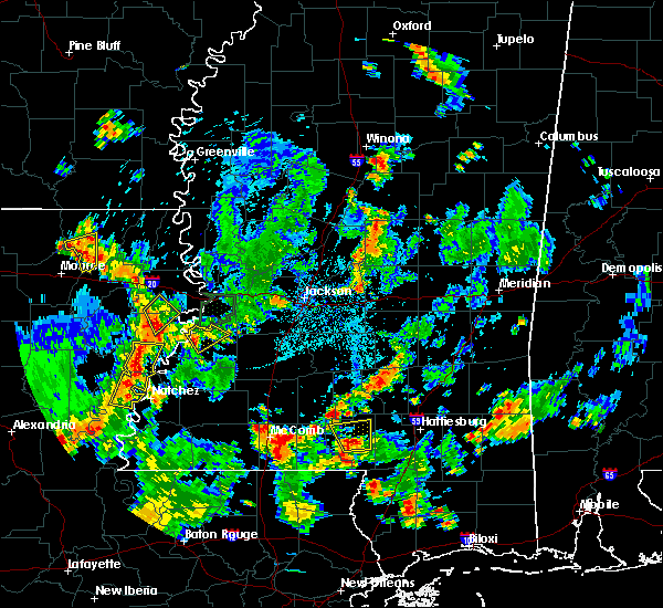 At 505 pm cdt, a severe thunderstorm was located 7 miles northeast of swartz, moving east at 10 mph (radar indicated). Hazards include 60 mph wind gusts and quarter size hail. Hail damage to vehicles is expected. expect wind damage to roofs, siding, and trees. this severe thunderstorm will be near, bastrop around 510 pm cdt. Other locations impacted by this severe thunderstorm include collinston and mer rouge. At 505 pm cdt, a severe thunderstorm was located 7 miles northeast of swartz, moving east at 10 mph (radar indicated). Hazards include 60 mph wind gusts and quarter size hail. Hail damage to vehicles is expected. expect wind damage to roofs, siding, and trees. this severe thunderstorm will be near, bastrop around 510 pm cdt. Other locations impacted by this severe thunderstorm include collinston and mer rouge.
|
| 4/14/2018 3:15 AM CDT |
 At 315 am cdt, a severe thunderstorm capable of producing a tornado was located near bastrop, moving east at 45 mph (radar indicated rotation). Hazards include tornado. Flying debris will be dangerous to those caught without shelter. mobile homes will be damaged or destroyed. damage to roofs, windows, and vehicles will occur. tree damage is likely. this dangerous storm will be near, galion around 320 am cdt. Other locations impacted by this tornadic thunderstorm include bonita, collinston, mer rouge and oak ridge. At 315 am cdt, a severe thunderstorm capable of producing a tornado was located near bastrop, moving east at 45 mph (radar indicated rotation). Hazards include tornado. Flying debris will be dangerous to those caught without shelter. mobile homes will be damaged or destroyed. damage to roofs, windows, and vehicles will occur. tree damage is likely. this dangerous storm will be near, galion around 320 am cdt. Other locations impacted by this tornadic thunderstorm include bonita, collinston, mer rouge and oak ridge.
|
| 4/14/2018 2:54 AM CDT |
 At 253 am cdt, a severe thunderstorm capable of producing a tornado was located over sterlington, or 8 miles southwest of bastrop, moving east at 50 mph (radar indicated rotation). Hazards include tornado. Flying debris will be dangerous to those caught without shelter. mobile homes will be damaged or destroyed. damage to roofs, windows, and vehicles will occur. tree damage is likely. this dangerous storm will be near, bastrop around 305 am cdt. galion around 315 am cdt. Other locations impacted by this tornadic thunderstorm include bonita, collinston, mer rouge and oak ridge. At 253 am cdt, a severe thunderstorm capable of producing a tornado was located over sterlington, or 8 miles southwest of bastrop, moving east at 50 mph (radar indicated rotation). Hazards include tornado. Flying debris will be dangerous to those caught without shelter. mobile homes will be damaged or destroyed. damage to roofs, windows, and vehicles will occur. tree damage is likely. this dangerous storm will be near, bastrop around 305 am cdt. galion around 315 am cdt. Other locations impacted by this tornadic thunderstorm include bonita, collinston, mer rouge and oak ridge.
|
| 4/13/2018 9:59 PM CDT |
 At 959 pm cdt, a severe thunderstorm was located near goodwill, or 16 miles east of bastrop, moving northeast at 40 mph (radar indicated). Hazards include 60 mph wind gusts and half dollar size hail. Hail damage to vehicles is expected. expect wind damage to roofs, siding, and trees. this severe thunderstorm will be near, oak grove around 1020 pm cdt. gassoway and millikin around 1035 pm cdt. other locations impacted by this severe thunderstorm include kilbourne, forest and bonita. A tornado watch remains in effect until 300 am cdt for southeastern arkansas, northeastern louisiana, and west central mississippi. At 959 pm cdt, a severe thunderstorm was located near goodwill, or 16 miles east of bastrop, moving northeast at 40 mph (radar indicated). Hazards include 60 mph wind gusts and half dollar size hail. Hail damage to vehicles is expected. expect wind damage to roofs, siding, and trees. this severe thunderstorm will be near, oak grove around 1020 pm cdt. gassoway and millikin around 1035 pm cdt. other locations impacted by this severe thunderstorm include kilbourne, forest and bonita. A tornado watch remains in effect until 300 am cdt for southeastern arkansas, northeastern louisiana, and west central mississippi.
|
| 4/6/2018 5:39 PM CDT |
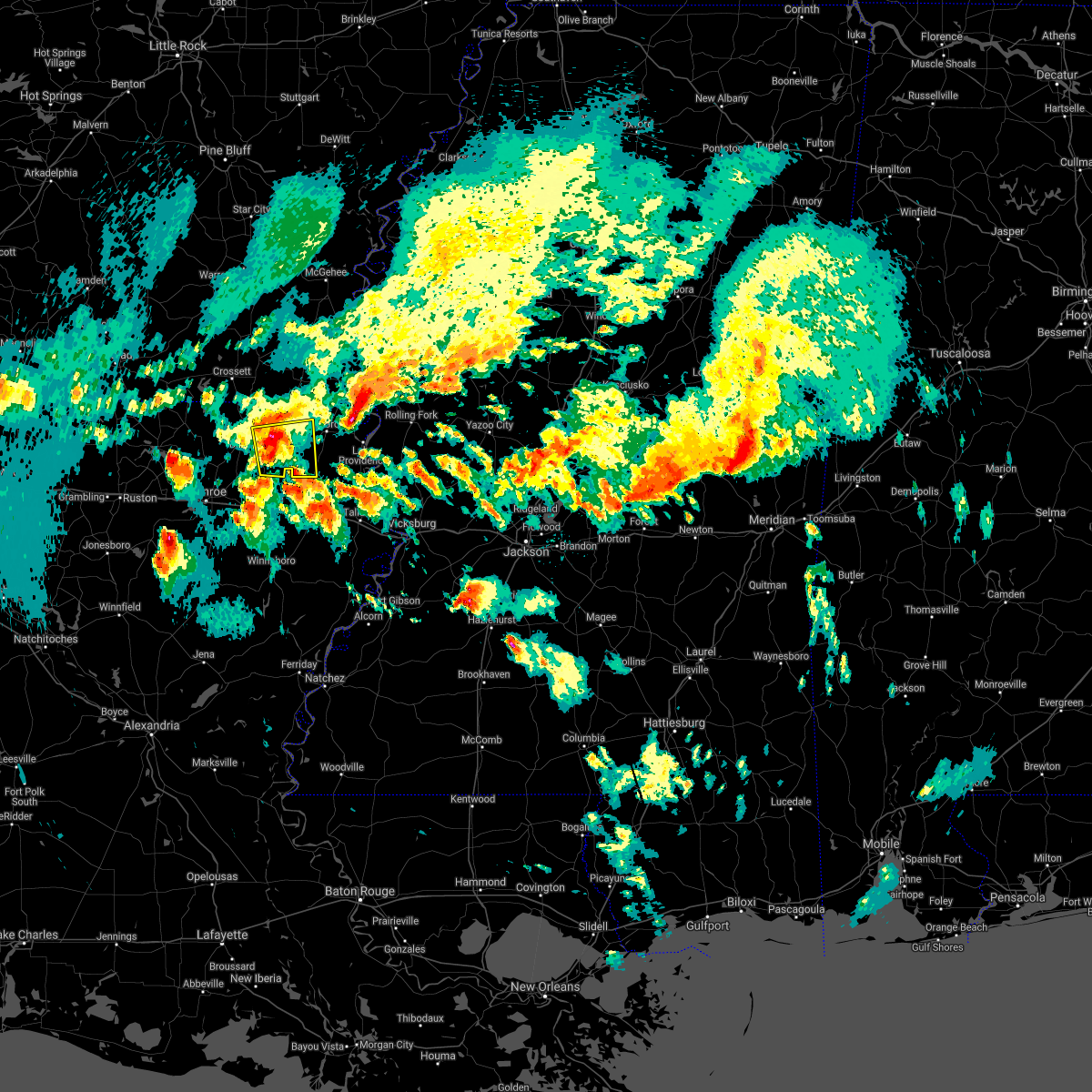 At 539 pm cdt, a severe thunderstorm was located near galion, or 12 miles east of bastrop, moving east at 40 mph (radar indicated). Hazards include 60 mph wind gusts and half dollar size hail. Hail damage to vehicles is expected. expect wind damage to roofs, siding, and trees. this severe storm will be near, goodwill around 550 pm cdt. other locations impacted by this severe thunderstorm include mer rouge. A tornado watch remains in effect until 1100 pm cdt for northeastern louisiana. At 539 pm cdt, a severe thunderstorm was located near galion, or 12 miles east of bastrop, moving east at 40 mph (radar indicated). Hazards include 60 mph wind gusts and half dollar size hail. Hail damage to vehicles is expected. expect wind damage to roofs, siding, and trees. this severe storm will be near, goodwill around 550 pm cdt. other locations impacted by this severe thunderstorm include mer rouge. A tornado watch remains in effect until 1100 pm cdt for northeastern louisiana.
|
| 4/6/2018 5:20 PM CDT |
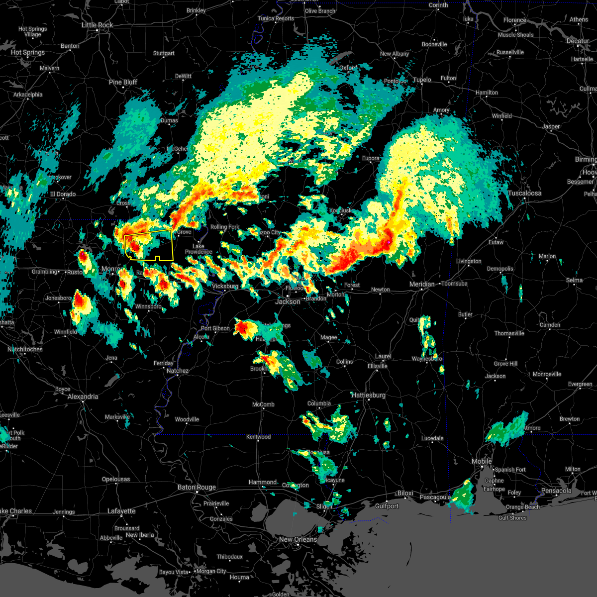 At 520 pm cdt, a severe thunderstorm was located over bastrop, moving east at 40 mph (radar indicated). Hazards include 60 mph wind gusts and quarter size hail. Hail damage to vehicles is expected. expect wind damage to roofs, siding, and trees. this severe thunderstorm will be near, galion around 535 pm cdt. goodwill around 550 pm cdt. other locations impacted by this severe thunderstorm include collinston and mer rouge. A tornado watch remains in effect until 1100 pm cdt for northeastern louisiana. At 520 pm cdt, a severe thunderstorm was located over bastrop, moving east at 40 mph (radar indicated). Hazards include 60 mph wind gusts and quarter size hail. Hail damage to vehicles is expected. expect wind damage to roofs, siding, and trees. this severe thunderstorm will be near, galion around 535 pm cdt. goodwill around 550 pm cdt. other locations impacted by this severe thunderstorm include collinston and mer rouge. A tornado watch remains in effect until 1100 pm cdt for northeastern louisiana.
|
| 4/3/2018 6:22 PM CDT |
 At 621 pm cdt, severe thunderstorms were located along a line extending from near sterlington to monroe to 8 miles north of columbia, moving east at 45 mph (radar indicated). Hazards include 70 mph wind gusts. Expect considerable tree damage. damage is likely to mobile homes, roofs, and outbuildings. Locations impacted include, bastrop, rayville, mangham, start, delhi, oak grove, warden, goodwill, buckner, darnell, holly ridge, archibald, alto, epps, mer rouge, kilbourne, forest, collinston, pioneer and oak ridge. At 621 pm cdt, severe thunderstorms were located along a line extending from near sterlington to monroe to 8 miles north of columbia, moving east at 45 mph (radar indicated). Hazards include 70 mph wind gusts. Expect considerable tree damage. damage is likely to mobile homes, roofs, and outbuildings. Locations impacted include, bastrop, rayville, mangham, start, delhi, oak grove, warden, goodwill, buckner, darnell, holly ridge, archibald, alto, epps, mer rouge, kilbourne, forest, collinston, pioneer and oak ridge.
|
| 4/3/2018 6:01 PM CDT |
 At 601 pm cdt, severe thunderstorms were located along a line extending from farmerville to calhoun to sikes, moving east at 45 mph (radar indicated). Hazards include 60 mph wind gusts. expect damage to roofs, siding, and trees At 601 pm cdt, severe thunderstorms were located along a line extending from farmerville to calhoun to sikes, moving east at 45 mph (radar indicated). Hazards include 60 mph wind gusts. expect damage to roofs, siding, and trees
|
| 3/28/2018 4:36 PM CDT |
 At 436 pm cdt, severe thunderstorms were located along a line extending from 6 miles west of sterlington to 8 miles southwest of buckner to olla, moving east at 50 mph (radar indicated). Hazards include 60 mph wind gusts. Expect damage to roofs, siding, and trees. severe thunderstorms will be near, buckner around 445 pm cdt. bastrop and alto around 455 pm cdt. mangham and archibald around 500 pm cdt. galion around 510 pm cdt. jigger, holly ridge, bakers and liddieville around 515 pm cdt. winnsboro, delhi, jones and goodwill around 520 pm cdt. warden around 525 pm cdt. other locations impacted by these severe thunderstorms include baskin, perryville, collinston, mer rouge, gilbert, bonita and oak ridge. A tornado watch remains in effect until 1100 pm cdt for southeastern arkansas, and northeastern louisiana. At 436 pm cdt, severe thunderstorms were located along a line extending from 6 miles west of sterlington to 8 miles southwest of buckner to olla, moving east at 50 mph (radar indicated). Hazards include 60 mph wind gusts. Expect damage to roofs, siding, and trees. severe thunderstorms will be near, buckner around 445 pm cdt. bastrop and alto around 455 pm cdt. mangham and archibald around 500 pm cdt. galion around 510 pm cdt. jigger, holly ridge, bakers and liddieville around 515 pm cdt. winnsboro, delhi, jones and goodwill around 520 pm cdt. warden around 525 pm cdt. other locations impacted by these severe thunderstorms include baskin, perryville, collinston, mer rouge, gilbert, bonita and oak ridge. A tornado watch remains in effect until 1100 pm cdt for southeastern arkansas, and northeastern louisiana.
|
| 3/5/2018 5:21 PM CST |
 The severe thunderstorm warning for central morehouse parish will expire at 530 pm cst, the storm which prompted the warning has moved out of the area. therefore the warning will be allowed to expire. The severe thunderstorm warning for central morehouse parish will expire at 530 pm cst, the storm which prompted the warning has moved out of the area. therefore the warning will be allowed to expire.
|
| 3/5/2018 5:05 PM CST |
 At 505 pm cst, a severe thunderstorm was located 10 miles southeast of bastrop, moving east at 25 mph (radar indicated). Hazards include 60 mph wind gusts and quarter size hail. Hail damage to vehicles is expected. expect wind damage to roofs, siding, and trees. This severe thunderstorm will remain over mainly rural areas of central morehouse parish, including the following locations: collinston, mer rouge and oak ridge. At 505 pm cst, a severe thunderstorm was located 10 miles southeast of bastrop, moving east at 25 mph (radar indicated). Hazards include 60 mph wind gusts and quarter size hail. Hail damage to vehicles is expected. expect wind damage to roofs, siding, and trees. This severe thunderstorm will remain over mainly rural areas of central morehouse parish, including the following locations: collinston, mer rouge and oak ridge.
|
| 3/5/2018 4:43 PM CST |
 The national weather service in jackson has issued a * severe thunderstorm warning for. central morehouse parish in northeastern louisiana. Until 530 pm cst * at 442 pm cst, a severe thunderstorm was located near bastrop, moving east at 35 mph. The national weather service in jackson has issued a * severe thunderstorm warning for. central morehouse parish in northeastern louisiana. Until 530 pm cst * at 442 pm cst, a severe thunderstorm was located near bastrop, moving east at 35 mph.
|
| 7/14/2017 5:49 PM CDT |
 At 548 pm cdt, a severe thunderstorm was located over galion, or 10 miles northeast of bastrop, and is nearly stationary (radar indicated). Hazards include 60 mph wind gusts and nickel size hail. Expect damage to roofs, siding, and trees. This severe thunderstorm will remain over mainly rural areas of northeastern morehouse parish, including the following locations: mer rouge and bonita. At 548 pm cdt, a severe thunderstorm was located over galion, or 10 miles northeast of bastrop, and is nearly stationary (radar indicated). Hazards include 60 mph wind gusts and nickel size hail. Expect damage to roofs, siding, and trees. This severe thunderstorm will remain over mainly rural areas of northeastern morehouse parish, including the following locations: mer rouge and bonita.
|
| 7/1/2017 4:49 PM CDT |
 At 449 pm cdt, a severe thunderstorm was located over beekman, or 7 miles north of bastrop, moving northeast at 20 mph (radar indicated). Hazards include 60 mph wind gusts and penny size hail. Expect damage to roofs, siding, and trees. this severe thunderstorm will be near, beekman around 455 pm cdt. galion around 500 pm cdt. jones around 535 pm cdt. berlin around 540 pm cdt. wilmot around 545 pm cdt. Other locations impacted by this severe thunderstorm include mer rouge and bonita. At 449 pm cdt, a severe thunderstorm was located over beekman, or 7 miles north of bastrop, moving northeast at 20 mph (radar indicated). Hazards include 60 mph wind gusts and penny size hail. Expect damage to roofs, siding, and trees. this severe thunderstorm will be near, beekman around 455 pm cdt. galion around 500 pm cdt. jones around 535 pm cdt. berlin around 540 pm cdt. wilmot around 545 pm cdt. Other locations impacted by this severe thunderstorm include mer rouge and bonita.
|
| 4/30/2017 4:57 AM CDT |
 At 456 am cdt, a severe thunderstorm capable of producing a tornado was located 12 miles southeast of bastrop, moving northeast at 35 mph (radar indicated rotation). Hazards include tornado. Flying debris will be dangerous to those caught without shelter. mobile homes will be damaged or destroyed. damage to roofs, windows, and vehicles will occur. tree damage is likely. this dangerous storm will be near, goodwill around 520 am cdt. oak grove around 530 am cdt. Other locations impacted by this tornadic thunderstorm include forest, bonita, collinston, mer rouge, pioneer and oak ridge. At 456 am cdt, a severe thunderstorm capable of producing a tornado was located 12 miles southeast of bastrop, moving northeast at 35 mph (radar indicated rotation). Hazards include tornado. Flying debris will be dangerous to those caught without shelter. mobile homes will be damaged or destroyed. damage to roofs, windows, and vehicles will occur. tree damage is likely. this dangerous storm will be near, goodwill around 520 am cdt. oak grove around 530 am cdt. Other locations impacted by this tornadic thunderstorm include forest, bonita, collinston, mer rouge, pioneer and oak ridge.
|
| 4/30/2017 4:34 AM CDT |
 At 433 am cdt, a severe thunderstorm capable of producing a tornado was located over swartz, moving northeast at 45 mph (radar indicated rotation). Hazards include tornado and quarter size hail. Flying debris will be dangerous to those caught without shelter. mobile homes will be damaged or destroyed. damage to roofs, windows, and vehicles will occur. tree damage is likely. this dangerous storm will be near, galion around 505 am cdt. goodwill around 510 am cdt. jones around 520 am cdt. Other locations impacted by this tornadic thunderstorm include forest, bonita, collinston, mer rouge, pioneer and oak ridge. At 433 am cdt, a severe thunderstorm capable of producing a tornado was located over swartz, moving northeast at 45 mph (radar indicated rotation). Hazards include tornado and quarter size hail. Flying debris will be dangerous to those caught without shelter. mobile homes will be damaged or destroyed. damage to roofs, windows, and vehicles will occur. tree damage is likely. this dangerous storm will be near, galion around 505 am cdt. goodwill around 510 am cdt. jones around 520 am cdt. Other locations impacted by this tornadic thunderstorm include forest, bonita, collinston, mer rouge, pioneer and oak ridge.
|
| 4/29/2017 5:15 PM CDT |
 At 514 pm cdt, severe thunderstorms were located along a line extending from near montrose, to near parkdale to 8 miles southeast of wilmot, to 10 miles east of farmerville, moving northeast at 55 mph (radar indicated). Hazards include 60 mph wind gusts and penny size hail. Expect damage to roofs, siding, and trees. these severe storms will be near, portland, montrose and parkdale around 520 pm cdt. Other locations impacted by these severe thunderstorms include bonita, collinston, mer rouge and oak ridge. At 514 pm cdt, severe thunderstorms were located along a line extending from near montrose, to near parkdale to 8 miles southeast of wilmot, to 10 miles east of farmerville, moving northeast at 55 mph (radar indicated). Hazards include 60 mph wind gusts and penny size hail. Expect damage to roofs, siding, and trees. these severe storms will be near, portland, montrose and parkdale around 520 pm cdt. Other locations impacted by these severe thunderstorms include bonita, collinston, mer rouge and oak ridge.
|
| 4/29/2017 4:23 PM CDT |
 At 423 pm cdt, severe thunderstorms were located along a line extending from 7 miles west of west crossett to near beekman to near monroe, moving northeast at 65 mph (radar indicated). Hazards include 60 mph wind gusts. Expect damage to roofs, siding, and trees. these severe storms will be near, crossett and west crossett around 430 pm cdt. north crossett and berlin around 435 pm cdt. bastrop, hamburg and old milo around 440 pm cdt. fountain hill around 445 pm cdt. galion, snyder and beekman around 450 pm cdt. jones around 500 pm cdt. wilmot around 505 pm cdt. parkdale around 510 pm cdt. Other locations impacted by these severe thunderstorms include bonita, collinston, mer rouge and oak ridge. At 423 pm cdt, severe thunderstorms were located along a line extending from 7 miles west of west crossett to near beekman to near monroe, moving northeast at 65 mph (radar indicated). Hazards include 60 mph wind gusts. Expect damage to roofs, siding, and trees. these severe storms will be near, crossett and west crossett around 430 pm cdt. north crossett and berlin around 435 pm cdt. bastrop, hamburg and old milo around 440 pm cdt. fountain hill around 445 pm cdt. galion, snyder and beekman around 450 pm cdt. jones around 500 pm cdt. wilmot around 505 pm cdt. parkdale around 510 pm cdt. Other locations impacted by these severe thunderstorms include bonita, collinston, mer rouge and oak ridge.
|
| 4/29/2017 4:23 PM CDT |
 At 404 pm cdt, severe thunderstorms were located along a line extending from 8 miles southwest of huttig to near sterlington to near brownsville-bawcom, moving northeast at 40 mph (radar indicated). Hazards include 60 mph wind gusts. Expect damage to roofs, siding, and trees. severe thunderstorms will be near, bastrop around 420 pm cdt. crossett, west crossett and beekman around 435 pm cdt. north crossett and galion around 440 pm cdt. old milo, jones and berlin around 450 pm cdt. hamburg and fountain hill around 455 pm cdt. wilmot around 500 pm cdt. parkdale around 510 pm cdt. portland around 515 pm cdt. Other locations impacted by these severe thunderstorms include bonita, collinston, mer rouge and oak ridge. At 404 pm cdt, severe thunderstorms were located along a line extending from 8 miles southwest of huttig to near sterlington to near brownsville-bawcom, moving northeast at 40 mph (radar indicated). Hazards include 60 mph wind gusts. Expect damage to roofs, siding, and trees. severe thunderstorms will be near, bastrop around 420 pm cdt. crossett, west crossett and beekman around 435 pm cdt. north crossett and galion around 440 pm cdt. old milo, jones and berlin around 450 pm cdt. hamburg and fountain hill around 455 pm cdt. wilmot around 500 pm cdt. parkdale around 510 pm cdt. portland around 515 pm cdt. Other locations impacted by these severe thunderstorms include bonita, collinston, mer rouge and oak ridge.
|
| 4/29/2017 4:05 PM CDT |
 At 404 pm cdt, severe thunderstorms were located along a line extending from 8 miles southwest of huttig to near sterlington to near brownsville-bawcom, moving northeast at 40 mph (radar indicated). Hazards include 60 mph wind gusts. Expect damage to roofs, siding, and trees. severe thunderstorms will be near, bastrop around 420 pm cdt. crossett, west crossett and beekman around 435 pm cdt. north crossett and galion around 440 pm cdt. old milo, jones and berlin around 450 pm cdt. hamburg and fountain hill around 455 pm cdt. wilmot around 500 pm cdt. parkdale around 510 pm cdt. portland around 515 pm cdt. Other locations impacted by these severe thunderstorms include bonita, collinston, mer rouge and oak ridge. At 404 pm cdt, severe thunderstorms were located along a line extending from 8 miles southwest of huttig to near sterlington to near brownsville-bawcom, moving northeast at 40 mph (radar indicated). Hazards include 60 mph wind gusts. Expect damage to roofs, siding, and trees. severe thunderstorms will be near, bastrop around 420 pm cdt. crossett, west crossett and beekman around 435 pm cdt. north crossett and galion around 440 pm cdt. old milo, jones and berlin around 450 pm cdt. hamburg and fountain hill around 455 pm cdt. wilmot around 500 pm cdt. parkdale around 510 pm cdt. portland around 515 pm cdt. Other locations impacted by these severe thunderstorms include bonita, collinston, mer rouge and oak ridge.
|
| 4/26/2017 7:10 PM CDT |
 At 710 pm cdt, severe thunderstorms were located along a line extending from 7 miles southeast of wilmot to buckner, moving northeast at 50 mph (radar indicated). Hazards include 60 mph wind gusts and quarter size hail. Hail damage to vehicles is expected. expect wind damage to roofs, siding, and trees. these severe thunderstorms will remain over mainly rural areas of southwestern chicot county, central morehouse, northwestern richland and northwestern west carroll parishes, including the following locations: bonita, collinston, mer rouge and oak ridge. A tornado watch remains in effect until 1100 pm cdt for southeastern arkansas, and northeastern louisiana. At 710 pm cdt, severe thunderstorms were located along a line extending from 7 miles southeast of wilmot to buckner, moving northeast at 50 mph (radar indicated). Hazards include 60 mph wind gusts and quarter size hail. Hail damage to vehicles is expected. expect wind damage to roofs, siding, and trees. these severe thunderstorms will remain over mainly rural areas of southwestern chicot county, central morehouse, northwestern richland and northwestern west carroll parishes, including the following locations: bonita, collinston, mer rouge and oak ridge. A tornado watch remains in effect until 1100 pm cdt for southeastern arkansas, and northeastern louisiana.
|
| 4/26/2017 6:28 PM CDT |
 At 628 pm cdt, severe thunderstorms were located along a line extending from near bastrop to 7 miles southeast of jonesboro, moving east at 40 mph (radar indicated). Hazards include 60 mph wind gusts and quarter size hail. Hail damage to vehicles is expected. expect wind damage to roofs, siding, and trees. severe thunderstorms will be near, bastrop around 635 pm cdt. galion around 640 pm cdt. goodwill around 700 pm cdt. other locations impacted by these severe thunderstorms include bonita, collinston, mer rouge and oak ridge. A tornado watch remains in effect until 1100 pm cdt for southeastern arkansas, and northeastern louisiana. At 628 pm cdt, severe thunderstorms were located along a line extending from near bastrop to 7 miles southeast of jonesboro, moving east at 40 mph (radar indicated). Hazards include 60 mph wind gusts and quarter size hail. Hail damage to vehicles is expected. expect wind damage to roofs, siding, and trees. severe thunderstorms will be near, bastrop around 635 pm cdt. galion around 640 pm cdt. goodwill around 700 pm cdt. other locations impacted by these severe thunderstorms include bonita, collinston, mer rouge and oak ridge. A tornado watch remains in effect until 1100 pm cdt for southeastern arkansas, and northeastern louisiana.
|
| 4/2/2017 4:12 PM CDT |
 At 411 pm cdt, severe thunderstorms were located along a line extending from 6 miles west of beekman to near sterlington to monroe, moving northeast at 65 mph (radar indicated). Hazards include 60 mph wind gusts. Expect damage to roofs, siding, and trees. severe thunderstorms will be near, bastrop and start around 420 pm cdt. galion around 430 pm cdt. other locations impacted by these severe thunderstorms include bonita, collinston, mer rouge and oak ridge. A tornado watch remains in effect until 900 pm cdt for northeastern louisiana. At 411 pm cdt, severe thunderstorms were located along a line extending from 6 miles west of beekman to near sterlington to monroe, moving northeast at 65 mph (radar indicated). Hazards include 60 mph wind gusts. Expect damage to roofs, siding, and trees. severe thunderstorms will be near, bastrop and start around 420 pm cdt. galion around 430 pm cdt. other locations impacted by these severe thunderstorms include bonita, collinston, mer rouge and oak ridge. A tornado watch remains in effect until 900 pm cdt for northeastern louisiana.
|
| 4/2/2017 1:13 PM CDT |
 At 112 pm cdt, a severe thunderstorm was located 9 miles southeast of bastrop, moving northeast at 35 mph (radar indicated). Hazards include golf ball size hail and 60 mph wind gusts. People and animals outdoors will be injured. expect hail damage to roofs, siding, windows, and vehicles. expect wind damage to roofs, siding, and trees. Locations impacted include, mer rouge, collinston and oak ridge. At 112 pm cdt, a severe thunderstorm was located 9 miles southeast of bastrop, moving northeast at 35 mph (radar indicated). Hazards include golf ball size hail and 60 mph wind gusts. People and animals outdoors will be injured. expect hail damage to roofs, siding, windows, and vehicles. expect wind damage to roofs, siding, and trees. Locations impacted include, mer rouge, collinston and oak ridge.
|
| 4/2/2017 12:59 PM CDT |
 At 1258 pm cdt, a severe thunderstorm was located near start, moving northeast at 35 mph (radar indicated). Hazards include golf ball size hail. People and animals outdoors will be injured. expect damage to roofs, siding, windows, and vehicles. this severe thunderstorm will remain over mainly rural areas of south central morehouse and northwestern richland parishes, including the following locations: collinston, mer rouge and oak ridge. Golf ball hail was reported in start. At 1258 pm cdt, a severe thunderstorm was located near start, moving northeast at 35 mph (radar indicated). Hazards include golf ball size hail. People and animals outdoors will be injured. expect damage to roofs, siding, windows, and vehicles. this severe thunderstorm will remain over mainly rural areas of south central morehouse and northwestern richland parishes, including the following locations: collinston, mer rouge and oak ridge. Golf ball hail was reported in start.
|
| 3/25/2017 1:41 AM CDT |
 The severe thunderstorm warning for morehouse, richland and southwestern west carroll parishes will expire at 145 am cdt, the storms which prompted the warning have moved out of the area. therefore the warning will be allowed to expire. however gusty winds are still possible with these thunderstorms. a severe thunderstorm watch remains in effect until 600 am cdt for northeastern louisiana. The severe thunderstorm warning for morehouse, richland and southwestern west carroll parishes will expire at 145 am cdt, the storms which prompted the warning have moved out of the area. therefore the warning will be allowed to expire. however gusty winds are still possible with these thunderstorms. a severe thunderstorm watch remains in effect until 600 am cdt for northeastern louisiana.
|
| 3/25/2017 1:19 AM CDT |
 At 119 am cdt, severe thunderstorms were located along a line extending from near crossett to near rayville, moving northeast at 45 mph (radar indicated). Hazards include 60 mph wind gusts and nickel size hail. Expect damage to roofs, siding, and trees. these severe storms will be near, darnell and goodwill around 140 am cdt. Other locations impacted by these severe thunderstorms include bonita, collinston, mer rouge, oak ridge and epps. At 119 am cdt, severe thunderstorms were located along a line extending from near crossett to near rayville, moving northeast at 45 mph (radar indicated). Hazards include 60 mph wind gusts and nickel size hail. Expect damage to roofs, siding, and trees. these severe storms will be near, darnell and goodwill around 140 am cdt. Other locations impacted by these severe thunderstorms include bonita, collinston, mer rouge, oak ridge and epps.
|
| 3/25/2017 12:50 AM CDT |
 At 1249 am cdt, severe thunderstorms were located along a line extending from 11 miles south of huttig to near buckner, moving northeast at 45 mph (radar indicated). Hazards include 60 mph wind gusts and nickel size hail. Expect damage to roofs, siding, and trees. severe thunderstorms will be near, rayville and start around 110 am cdt. holly ridge around 120 am cdt. darnell and goodwill around 140 am cdt. Other locations impacted by these severe thunderstorms include bonita, collinston, mer rouge, oak ridge and epps. At 1249 am cdt, severe thunderstorms were located along a line extending from 11 miles south of huttig to near buckner, moving northeast at 45 mph (radar indicated). Hazards include 60 mph wind gusts and nickel size hail. Expect damage to roofs, siding, and trees. severe thunderstorms will be near, rayville and start around 110 am cdt. holly ridge around 120 am cdt. darnell and goodwill around 140 am cdt. Other locations impacted by these severe thunderstorms include bonita, collinston, mer rouge, oak ridge and epps.
|
| 1/21/2017 9:43 PM CST |
 At 943 pm cst, severe thunderstorms were located along a line extending from near jones to bastrop, moving east at 35 mph (radar indicated). Hazards include 60 mph wind gusts and quarter size hail. Hail damage to vehicles is expected. expect wind damage to roofs, siding, and trees. severe thunderstorms will be near, jones around 950 pm cst. goodwill around 1020 pm cst. gassoway and millikin around 1030 pm cst. oak grove around 1040 pm cst. shelburn around 1045 pm cst. other locations impacted by these severe thunderstorms include forest, collinston, bonita, pioneer, oak ridge, mer rouge and kilbourne. A tornado watch remains in effect until 300 am cst for northeastern louisiana, and west central mississippi. At 943 pm cst, severe thunderstorms were located along a line extending from near jones to bastrop, moving east at 35 mph (radar indicated). Hazards include 60 mph wind gusts and quarter size hail. Hail damage to vehicles is expected. expect wind damage to roofs, siding, and trees. severe thunderstorms will be near, jones around 950 pm cst. goodwill around 1020 pm cst. gassoway and millikin around 1030 pm cst. oak grove around 1040 pm cst. shelburn around 1045 pm cst. other locations impacted by these severe thunderstorms include forest, collinston, bonita, pioneer, oak ridge, mer rouge and kilbourne. A tornado watch remains in effect until 300 am cst for northeastern louisiana, and west central mississippi.
|
| 1/21/2017 9:14 PM CST |
 At 914 pm cst, a severe thunderstorm capable of producing a tornado was located near bastrop, moving east at 30 mph (radar indicated rotation). Hazards include tornado and golf ball size hail. Flying debris will be dangerous to those caught without shelter. mobile homes will be damaged or destroyed. damage to roofs, windows, and vehicles will occur. tree damage is likely. this dangerous storm will be near, beekman around 925 pm cst. galion around 940 pm cst. jones around 945 pm cst. Other locations impacted by this tornadic thunderstorm include bonita, collinston and mer rouge. At 914 pm cst, a severe thunderstorm capable of producing a tornado was located near bastrop, moving east at 30 mph (radar indicated rotation). Hazards include tornado and golf ball size hail. Flying debris will be dangerous to those caught without shelter. mobile homes will be damaged or destroyed. damage to roofs, windows, and vehicles will occur. tree damage is likely. this dangerous storm will be near, beekman around 925 pm cst. galion around 940 pm cst. jones around 945 pm cst. Other locations impacted by this tornadic thunderstorm include bonita, collinston and mer rouge.
|
| 1/21/2017 8:49 PM CST | Power lines down in mer roug in morehouse county LA, 0.4 miles SW of Mer Rouge, LA |
| 1/21/2017 8:46 PM CST |
 At 845 pm cst, a severe thunderstorm capable of producing a tornado was located near bastrop, moving northeast at 30 mph (radar indicated rotation). Hazards include tornado and half dollar size hail. Flying debris will be dangerous to those caught without shelter. mobile homes will be damaged or destroyed. damage to roofs, windows, and vehicles will occur. tree damage is likely. this dangerous storm will be near, galion around 910 pm cst. jones around 925 pm cst. Other locations impacted by this tornadic thunderstorm include bonita, collinston and mer rouge. At 845 pm cst, a severe thunderstorm capable of producing a tornado was located near bastrop, moving northeast at 30 mph (radar indicated rotation). Hazards include tornado and half dollar size hail. Flying debris will be dangerous to those caught without shelter. mobile homes will be damaged or destroyed. damage to roofs, windows, and vehicles will occur. tree damage is likely. this dangerous storm will be near, galion around 910 pm cst. jones around 925 pm cst. Other locations impacted by this tornadic thunderstorm include bonita, collinston and mer rouge.
|
| 12/17/2016 11:05 PM CST | Report of roof damage to a home in mer roug in morehouse county LA, 0.4 miles SW of Mer Rouge, LA |
| 11/29/2016 6:06 PM CST |
 At 606 pm cst, a severe thunderstorm was located over bastrop, moving northeast at 50 mph (radar indicated). Hazards include 60 mph wind gusts and half dollar size hail. Hail damage to vehicles is expected. expect wind damage to roofs, siding, and trees. this severe thunderstorm will be near, galion around 620 pm cst. jones around 630 pm cst. other locations impacted by this severe thunderstorm include bonita and mer rouge. A tornado watch remains in effect until 900 pm cst for southeastern arkansas, and northeastern louisiana. At 606 pm cst, a severe thunderstorm was located over bastrop, moving northeast at 50 mph (radar indicated). Hazards include 60 mph wind gusts and half dollar size hail. Hail damage to vehicles is expected. expect wind damage to roofs, siding, and trees. this severe thunderstorm will be near, galion around 620 pm cst. jones around 630 pm cst. other locations impacted by this severe thunderstorm include bonita and mer rouge. A tornado watch remains in effect until 900 pm cst for southeastern arkansas, and northeastern louisiana.
|
| 7/14/2016 8:19 PM CDT |
 At 818 pm cdt, severe thunderstorms were located along a line extending from near lake village to near jones to near swartz, moving east at 40 mph (radar indicated). Hazards include 70 mph wind gusts and quarter size hail. Hail damage to vehicles is expected. expect considerable tree damage. wind damage is also likely to mobile homes, roofs, and outbuildings. severe thunderstorms will be near, lake village around 825 pm cdt. wilmot around 830 pm cdt. oak grove around 845 pm cdt. warden around 855 pm cdt. gassoway, millikin, darnell, monticello and shelburn around 900 pm cdt. Other locations impacted by these severe thunderstorms include forest, collinston, epps, kilbourne, bonita, pioneer, oak ridge and mer rouge. At 818 pm cdt, severe thunderstorms were located along a line extending from near lake village to near jones to near swartz, moving east at 40 mph (radar indicated). Hazards include 70 mph wind gusts and quarter size hail. Hail damage to vehicles is expected. expect considerable tree damage. wind damage is also likely to mobile homes, roofs, and outbuildings. severe thunderstorms will be near, lake village around 825 pm cdt. wilmot around 830 pm cdt. oak grove around 845 pm cdt. warden around 855 pm cdt. gassoway, millikin, darnell, monticello and shelburn around 900 pm cdt. Other locations impacted by these severe thunderstorms include forest, collinston, epps, kilbourne, bonita, pioneer, oak ridge and mer rouge.
|
| 7/14/2016 7:50 PM CDT |
 At 749 pm cdt, severe thunderstorms were located along a line extending from 6 miles southwest of merrisach lake to near portland to 6 miles northwest of farmerville, moving southeast at 40 mph (radar indicated). Hazards include 70 mph wind gusts and quarter size hail. Hail damage to vehicles is expected. expect considerable tree damage. wind damage is also likely to mobile homes, roofs, and outbuildings. these severe storms will be near, wilmot, portland and parkdale around 755 pm cdt. Other locations impacted by these severe thunderstorms include forest, collinston, kilbourne, bonita, oak ridge, perryville and mer rouge. At 749 pm cdt, severe thunderstorms were located along a line extending from 6 miles southwest of merrisach lake to near portland to 6 miles northwest of farmerville, moving southeast at 40 mph (radar indicated). Hazards include 70 mph wind gusts and quarter size hail. Hail damage to vehicles is expected. expect considerable tree damage. wind damage is also likely to mobile homes, roofs, and outbuildings. these severe storms will be near, wilmot, portland and parkdale around 755 pm cdt. Other locations impacted by these severe thunderstorms include forest, collinston, kilbourne, bonita, oak ridge, perryville and mer rouge.
|
| 7/14/2016 7:31 PM CDT |
 At 729 pm cdt, severe thunderstorms were located along a line extending from near richardson to near fountain hill to near junction city, moving southeast at 40 mph (radar indicated). Hazards include 70 mph wind gusts and quarter size hail. Hail damage to vehicles is expected. expect considerable tree damage. wind damage is also likely to mobile homes, roofs, and outbuildings. severe thunderstorms will be near, fountain hill and old milo around 735 pm cdt. hamburg around 745 pm cdt. snyder around 750 pm cdt. portland around 800 pm cdt. wilmot and parkdale around 805 pm cdt. Other locations impacted by these severe thunderstorms include forest, collinston, kilbourne, bonita, oak ridge, perryville and mer rouge. At 729 pm cdt, severe thunderstorms were located along a line extending from near richardson to near fountain hill to near junction city, moving southeast at 40 mph (radar indicated). Hazards include 70 mph wind gusts and quarter size hail. Hail damage to vehicles is expected. expect considerable tree damage. wind damage is also likely to mobile homes, roofs, and outbuildings. severe thunderstorms will be near, fountain hill and old milo around 735 pm cdt. hamburg around 745 pm cdt. snyder around 750 pm cdt. portland around 800 pm cdt. wilmot and parkdale around 805 pm cdt. Other locations impacted by these severe thunderstorms include forest, collinston, kilbourne, bonita, oak ridge, perryville and mer rouge.
|
| 4/29/2016 3:47 PM CDT |
 At 347 pm cdt, a severe thunderstorm was located near galion, or 10 miles east of bastrop, moving east at 30 mph (radar indicated). Hazards include tennis ball size hail and 60 mph wind gusts. People and animals outdoors will be injured. expect hail damage to roofs, siding, windows, and vehicles. expect wind damage to roofs, siding, and trees. this severe storm will be near, goodwill around 405 pm cdt. oak grove around 425 pm cdt. Other locations impacted by this severe thunderstorm include bonita, forest, pioneer and mer rouge. At 347 pm cdt, a severe thunderstorm was located near galion, or 10 miles east of bastrop, moving east at 30 mph (radar indicated). Hazards include tennis ball size hail and 60 mph wind gusts. People and animals outdoors will be injured. expect hail damage to roofs, siding, windows, and vehicles. expect wind damage to roofs, siding, and trees. this severe storm will be near, goodwill around 405 pm cdt. oak grove around 425 pm cdt. Other locations impacted by this severe thunderstorm include bonita, forest, pioneer and mer rouge.
|
| 4/29/2016 3:44 PM CDT | Quarter sized hail reported 0.4 miles SW of Mer Rouge, LA |
| 4/29/2016 3:38 PM CDT |
 At 338 pm cdt, a severe thunderstorm was located near bastrop, moving east at 40 mph (radar indicated). Hazards include tennis ball size hail and 60 mph wind gusts. People and animals outdoors will be injured. expect hail damage to roofs, siding, windows, and vehicles. expect wind damage to roofs, siding, and trees. this severe storm will be near, galion around 345 pm cdt. goodwill around 400 pm cdt. oak grove around 415 pm cdt. Other locations impacted by this severe thunderstorm include bonita, forest, pioneer, collinston and mer rouge. At 338 pm cdt, a severe thunderstorm was located near bastrop, moving east at 40 mph (radar indicated). Hazards include tennis ball size hail and 60 mph wind gusts. People and animals outdoors will be injured. expect hail damage to roofs, siding, windows, and vehicles. expect wind damage to roofs, siding, and trees. this severe storm will be near, galion around 345 pm cdt. goodwill around 400 pm cdt. oak grove around 415 pm cdt. Other locations impacted by this severe thunderstorm include bonita, forest, pioneer, collinston and mer rouge.
|
| 4/29/2016 3:21 PM CDT |
 At 321 pm cdt, a severe thunderstorm was located near sterlington, or near bastrop, moving east at 40 mph (radar indicated). Hazards include tennis ball size hail and 60 mph wind gusts. People and animals outdoors will be injured. expect hail damage to roofs, siding, windows, and vehicles. expect wind damage to roofs, siding, and trees. this severe storm will be near, bastrop around 330 pm cdt. galion around 345 pm cdt. goodwill around 400 pm cdt. oak grove around 420 pm cdt. Other locations impacted by this severe thunderstorm include forest, bonita, pioneer, collinston, oak ridge and mer rouge. At 321 pm cdt, a severe thunderstorm was located near sterlington, or near bastrop, moving east at 40 mph (radar indicated). Hazards include tennis ball size hail and 60 mph wind gusts. People and animals outdoors will be injured. expect hail damage to roofs, siding, windows, and vehicles. expect wind damage to roofs, siding, and trees. this severe storm will be near, bastrop around 330 pm cdt. galion around 345 pm cdt. goodwill around 400 pm cdt. oak grove around 420 pm cdt. Other locations impacted by this severe thunderstorm include forest, bonita, pioneer, collinston, oak ridge and mer rouge.
|
| 4/29/2016 3:13 PM CDT |
 At 312 pm cdt, a severe thunderstorm was located near bastrop, moving east at 25 mph (public). Hazards include golf ball size hail and 60 mph wind gusts. People and animals outdoors will be injured. expect hail damage to roofs, siding, windows, and vehicles. expect wind damage to roofs, siding, and trees. this severe thunderstorm will be near, galion around 325 pm cdt. goodwill around 345 pm cdt. oak grove around 415 pm cdt. Other locations impacted by this severe thunderstorm include forest, bonita, pioneer, collinston, oak ridge and mer rouge. At 312 pm cdt, a severe thunderstorm was located near bastrop, moving east at 25 mph (public). Hazards include golf ball size hail and 60 mph wind gusts. People and animals outdoors will be injured. expect hail damage to roofs, siding, windows, and vehicles. expect wind damage to roofs, siding, and trees. this severe thunderstorm will be near, galion around 325 pm cdt. goodwill around 345 pm cdt. oak grove around 415 pm cdt. Other locations impacted by this severe thunderstorm include forest, bonita, pioneer, collinston, oak ridge and mer rouge.
|
| 4/29/2016 3:10 PM CDT |
 At 310 pm cdt, a severe thunderstorm was located near bastrop, moving east at 25 mph (public). Hazards include golf ball size hail and 60 mph wind gusts. People and animals outdoors will be injured. expect hail damage to roofs, siding, windows, and vehicles. expect wind damage to roofs, siding, and trees. Locations impacted include, bastrop and collinston. At 310 pm cdt, a severe thunderstorm was located near bastrop, moving east at 25 mph (public). Hazards include golf ball size hail and 60 mph wind gusts. People and animals outdoors will be injured. expect hail damage to roofs, siding, windows, and vehicles. expect wind damage to roofs, siding, and trees. Locations impacted include, bastrop and collinston.
|
| 4/29/2016 3:01 PM CDT |
 At 301 pm cdt, a severe thunderstorm was located over bastrop, moving east at 30 mph (radar indicated). Hazards include golf ball size hail and 60 mph wind gusts. People and animals outdoors will be injured. expect hail damage to roofs, siding, windows, and vehicles. expect wind damage to roofs, siding, and trees. This severe thunderstorm will remain over mainly rural areas of northwestern morehouse parish, including the following locations: collinston. At 301 pm cdt, a severe thunderstorm was located over bastrop, moving east at 30 mph (radar indicated). Hazards include golf ball size hail and 60 mph wind gusts. People and animals outdoors will be injured. expect hail damage to roofs, siding, windows, and vehicles. expect wind damage to roofs, siding, and trees. This severe thunderstorm will remain over mainly rural areas of northwestern morehouse parish, including the following locations: collinston.
|
| 4/29/2016 2:47 PM CDT |
 At 247 pm cdt, a severe thunderstorm was located near sterlington, or near bastrop, moving east at 30 mph (radar indicated). Hazards include golf ball size hail and 60 mph wind gusts. People and animals outdoors will be injured. expect hail damage to roofs, siding, windows, and vehicles. expect wind damage to roofs, siding, and trees. this severe storm will be near, bastrop around 300 pm cdt. Other locations impacted by this severe thunderstorm include collinston. At 247 pm cdt, a severe thunderstorm was located near sterlington, or near bastrop, moving east at 30 mph (radar indicated). Hazards include golf ball size hail and 60 mph wind gusts. People and animals outdoors will be injured. expect hail damage to roofs, siding, windows, and vehicles. expect wind damage to roofs, siding, and trees. this severe storm will be near, bastrop around 300 pm cdt. Other locations impacted by this severe thunderstorm include collinston.
|
| 4/29/2016 2:40 PM CDT |
 At 240 pm cdt, a severe thunderstorm was located over sterlington, or 10 miles west of bastrop, moving east at 30 mph (radar indicated). Hazards include 60 mph wind gusts and half dollar size hail. Hail damage to vehicles is expected. expect wind damage to roofs, siding, and trees. this severe thunderstorm will be near, bastrop around 300 pm cdt. Other locations impacted by this severe thunderstorm include collinston. At 240 pm cdt, a severe thunderstorm was located over sterlington, or 10 miles west of bastrop, moving east at 30 mph (radar indicated). Hazards include 60 mph wind gusts and half dollar size hail. Hail damage to vehicles is expected. expect wind damage to roofs, siding, and trees. this severe thunderstorm will be near, bastrop around 300 pm cdt. Other locations impacted by this severe thunderstorm include collinston.
|
| 3/30/2016 9:58 PM CDT |
 At 957 pm cdt, a severe thunderstorm was located 9 miles north of start, moving northeast at 50 mph (radar indicated). Hazards include 60 mph wind gusts and nickel size hail. Expect damage to roofs. siding and trees. this severe thunderstorm will be near, goodwill around 1015 pm cdt. oak grove around 1030 pm cdt. other locations impacted by this severe thunderstorm include forest, collinston, epps, kilbourne, bonita, pioneer, oak ridge and mer rouge. A tornado watch remains in effect until 300 am cdt for southeastern arkansas and northeastern louisiana. At 957 pm cdt, a severe thunderstorm was located 9 miles north of start, moving northeast at 50 mph (radar indicated). Hazards include 60 mph wind gusts and nickel size hail. Expect damage to roofs. siding and trees. this severe thunderstorm will be near, goodwill around 1015 pm cdt. oak grove around 1030 pm cdt. other locations impacted by this severe thunderstorm include forest, collinston, epps, kilbourne, bonita, pioneer, oak ridge and mer rouge. A tornado watch remains in effect until 300 am cdt for southeastern arkansas and northeastern louisiana.
|
| 3/18/2016 1:32 PM CDT |
 At 132 pm cdt, a severe thunderstorm was located 9 miles southeast of bastrop, moving east at 30 mph (radar indicated). Hazards include 60 mph wind gusts and quarter size hail. Hail damage to vehicles is expected. expect wind damage to roofs, siding and trees. This severe thunderstorm will remain over mainly rural areas of central morehouse parish, including the following locations, oak ridge, collinston and mer rouge. At 132 pm cdt, a severe thunderstorm was located 9 miles southeast of bastrop, moving east at 30 mph (radar indicated). Hazards include 60 mph wind gusts and quarter size hail. Hail damage to vehicles is expected. expect wind damage to roofs, siding and trees. This severe thunderstorm will remain over mainly rural areas of central morehouse parish, including the following locations, oak ridge, collinston and mer rouge.
|
| 3/18/2016 1:12 PM CDT |
 At 112 pm cdt, a severe thunderstorm was located near swartz, moving east at 30 mph (radar indicated). Hazards include 60 mph wind gusts and half dollar size hail. Hail damage to vehicles is expected. expect wind damage to roofs, siding and trees. this severe thunderstorm will be near, bastrop around 120 pm cdt. Other locations impacted by this severe thunderstorm include oak ridge, collinston and mer rouge. At 112 pm cdt, a severe thunderstorm was located near swartz, moving east at 30 mph (radar indicated). Hazards include 60 mph wind gusts and half dollar size hail. Hail damage to vehicles is expected. expect wind damage to roofs, siding and trees. this severe thunderstorm will be near, bastrop around 120 pm cdt. Other locations impacted by this severe thunderstorm include oak ridge, collinston and mer rouge.
|
| 3/9/2016 3:23 PM CST |
 At 322 pm cst, a severe thunderstorm was located near jones, or near wilmot, moving northeast at 35 mph (radar indicated). Hazards include 60 mph wind gusts and quarter size hail. Hail damage to vehicles is expected. expect wind damage to roofs, siding and trees. This severe thunderstorm will remain over mainly rural areas of south central ashley county in southeastern arkansas and northeastern morehouse parishes, including the following locations, bonita. At 322 pm cst, a severe thunderstorm was located near jones, or near wilmot, moving northeast at 35 mph (radar indicated). Hazards include 60 mph wind gusts and quarter size hail. Hail damage to vehicles is expected. expect wind damage to roofs, siding and trees. This severe thunderstorm will remain over mainly rural areas of south central ashley county in southeastern arkansas and northeastern morehouse parishes, including the following locations, bonita.
|
| 3/9/2016 3:05 PM CST |
 At 305 pm cst, a severe thunderstorm was located over galion, or 12 miles northeast of bastrop, moving northeast at 35 mph (radar indicated). Hazards include 60 mph wind gusts and quarter size hail. Hail damage to vehicles is expected. expect wind damage to roofs, siding and trees. this severe storm will be near, jones around 320 pm cst. Other locations impacted by this severe thunderstorm include bonita, collinston and mer rouge. At 305 pm cst, a severe thunderstorm was located over galion, or 12 miles northeast of bastrop, moving northeast at 35 mph (radar indicated). Hazards include 60 mph wind gusts and quarter size hail. Hail damage to vehicles is expected. expect wind damage to roofs, siding and trees. this severe storm will be near, jones around 320 pm cst. Other locations impacted by this severe thunderstorm include bonita, collinston and mer rouge.
|
| 3/9/2016 2:45 PM CST |
 At 244 pm cst, a severe thunderstorm was located over bastrop, moving northeast at 35 mph (radar indicated). Hazards include 60 mph wind gusts and quarter size hail. Hail damage to vehicles is expected. expect wind damage to roofs, siding and trees. this severe thunderstorm will be near, beekman and galion around 300 pm cst. jones around 315 pm cst. Other locations impacted by this severe thunderstorm include bonita, collinston, perryville and mer rouge. At 244 pm cst, a severe thunderstorm was located over bastrop, moving northeast at 35 mph (radar indicated). Hazards include 60 mph wind gusts and quarter size hail. Hail damage to vehicles is expected. expect wind damage to roofs, siding and trees. this severe thunderstorm will be near, beekman and galion around 300 pm cst. jones around 315 pm cst. Other locations impacted by this severe thunderstorm include bonita, collinston, perryville and mer rouge.
|
| 12/28/2015 2:11 AM CST |
 At 210 am cst, severe thunderstorms were located along a line extending from near old milo to near start, moving northeast at 50 mph (radar indicated). Hazards include 60 mph wind gusts. Expect damage to roofs. siding and trees. these severe storms will be near, old milo around 215 am cst. fountain hill around 220 am cst. galion around 235 am cst. jones around 250 am cst. wilmot around 255 am cst. parkdale around 300 am cst. other locations impacted by these severe thunderstorms include bonita, collinston, oak ridge and mer rouge. A tornado watch remains in effect until 500 am cst for southeastern arkansas and northeastern louisiana. At 210 am cst, severe thunderstorms were located along a line extending from near old milo to near start, moving northeast at 50 mph (radar indicated). Hazards include 60 mph wind gusts. Expect damage to roofs. siding and trees. these severe storms will be near, old milo around 215 am cst. fountain hill around 220 am cst. galion around 235 am cst. jones around 250 am cst. wilmot around 255 am cst. parkdale around 300 am cst. other locations impacted by these severe thunderstorms include bonita, collinston, oak ridge and mer rouge. A tornado watch remains in effect until 500 am cst for southeastern arkansas and northeastern louisiana.
|
| 12/28/2015 1:44 AM CST |
 At 143 am cst, severe thunderstorms were located along a line extending from near moro bay state park to near buckner, moving northeast at 40 mph (radar indicated). Hazards include 60 mph wind gusts. Expect damage to roofs. siding and trees. severe thunderstorms will be near, fountain hill around 220 am cst. other locations impacted by these severe thunderstorms include bonita, collinston, oak ridge and mer rouge. A tornado watch remains in effect until 500 am cst for southeastern arkansas and northeastern louisiana. At 143 am cst, severe thunderstorms were located along a line extending from near moro bay state park to near buckner, moving northeast at 40 mph (radar indicated). Hazards include 60 mph wind gusts. Expect damage to roofs. siding and trees. severe thunderstorms will be near, fountain hill around 220 am cst. other locations impacted by these severe thunderstorms include bonita, collinston, oak ridge and mer rouge. A tornado watch remains in effect until 500 am cst for southeastern arkansas and northeastern louisiana.
|
| 11/17/2015 3:19 PM CST |
 A severe thunderstorm warning remains in effect until 330 pm cst for ashley county in southeastern arkansas and northeastern morehouse parishes. at 319 pm cst. severe thunderstorms were located along a line extending from 8 miles east of ladelle to 7 miles west of parkdale to near galion. Moving northeast at 40 mph. A severe thunderstorm warning remains in effect until 330 pm cst for ashley county in southeastern arkansas and northeastern morehouse parishes. at 319 pm cst. severe thunderstorms were located along a line extending from 8 miles east of ladelle to 7 miles west of parkdale to near galion. Moving northeast at 40 mph.
|
| 11/17/2015 2:53 PM CST |
 At 252 pm cst, severe thunderstorms were located along a line extending from 6 miles west of old milo to 7 miles north of beekman to bastrop, moving northeast at 55 mph (radar indicated). Hazards include 60 mph wind gusts. Expect damage to roofs. siding and trees. these severe storms will be near, berlin and old milo around 300 pm cst. hamburg and fountain hill around 305 pm cst. jones around 315 pm cst. portland and snyder around 320 pm cst. wilmot, montrose and parkdale around 325 pm cst. other locations impacted by these severe thunderstorms include bonita and mer rouge. A tornado watch remains in effect until 800 pm cst for southeastern arkansas and northeastern louisiana. At 252 pm cst, severe thunderstorms were located along a line extending from 6 miles west of old milo to 7 miles north of beekman to bastrop, moving northeast at 55 mph (radar indicated). Hazards include 60 mph wind gusts. Expect damage to roofs. siding and trees. these severe storms will be near, berlin and old milo around 300 pm cst. hamburg and fountain hill around 305 pm cst. jones around 315 pm cst. portland and snyder around 320 pm cst. wilmot, montrose and parkdale around 325 pm cst. other locations impacted by these severe thunderstorms include bonita and mer rouge. A tornado watch remains in effect until 800 pm cst for southeastern arkansas and northeastern louisiana.
|
| 11/17/2015 2:28 PM CST |
 At 227 pm cst, severe thunderstorms were located along a line extending from lapile to 7 miles west of sterlington, moving northeast at 50 mph (radar indicated). Hazards include 60 mph wind gusts. Expect damage to roofs. siding and trees. severe thunderstorms will be near, bastrop and west crossett around 245 pm cst. beekman around 255 pm cst. old milo around 300 pm cst. fountain hill around 305 pm cst. berlin around 310 pm cst. wilmot around 320 pm cst. parkdale around 325 pm cst. portland, montrose and snyder around 330 pm cst. other locations impacted by these severe thunderstorms include bonita and mer rouge. A tornado watch remains in effect until 800 pm cst for southeastern arkansas and northeastern louisiana. At 227 pm cst, severe thunderstorms were located along a line extending from lapile to 7 miles west of sterlington, moving northeast at 50 mph (radar indicated). Hazards include 60 mph wind gusts. Expect damage to roofs. siding and trees. severe thunderstorms will be near, bastrop and west crossett around 245 pm cst. beekman around 255 pm cst. old milo around 300 pm cst. fountain hill around 305 pm cst. berlin around 310 pm cst. wilmot around 320 pm cst. parkdale around 325 pm cst. portland, montrose and snyder around 330 pm cst. other locations impacted by these severe thunderstorms include bonita and mer rouge. A tornado watch remains in effect until 800 pm cst for southeastern arkansas and northeastern louisiana.
|
| 6/24/2015 7:22 PM CDT |
 At 722 pm cdt, severe thunderstorms were located along a line extending from beekman to mangham, moving east at 40 mph (radar indicated). Hazards include 60 mph wind gusts. Expect damage to roofs. siding and trees. these severe storms will be near, mangham and archibald around 725 pm cdt. galion around 730 pm cdt. jones around 740 pm cdt. Other locations impacted by these severe thunderstorms include bonita, collinston, baskin, oak ridge and mer rouge. At 722 pm cdt, severe thunderstorms were located along a line extending from beekman to mangham, moving east at 40 mph (radar indicated). Hazards include 60 mph wind gusts. Expect damage to roofs. siding and trees. these severe storms will be near, mangham and archibald around 725 pm cdt. galion around 730 pm cdt. jones around 740 pm cdt. Other locations impacted by these severe thunderstorms include bonita, collinston, baskin, oak ridge and mer rouge.
|
| 6/24/2015 7:05 PM CDT |
 At 705 pm cdt, severe thunderstorms were located along a line extending from near jones to near bakers, moving west at 40 mph (radar indicated). Hazards include 60 mph wind gusts. Expect damage to roofs. siding and trees. severe thunderstorms will be near, galion around 710 pm cdt. mangham and archibald around 720 pm cdt. beekman and alto around 725 pm cdt. buckner around 735 pm cdt. Other locations impacted by these severe thunderstorms include epps, bonita, collinston, baskin, oak ridge and mer rouge. At 705 pm cdt, severe thunderstorms were located along a line extending from near jones to near bakers, moving west at 40 mph (radar indicated). Hazards include 60 mph wind gusts. Expect damage to roofs. siding and trees. severe thunderstorms will be near, galion around 710 pm cdt. mangham and archibald around 720 pm cdt. beekman and alto around 725 pm cdt. buckner around 735 pm cdt. Other locations impacted by these severe thunderstorms include epps, bonita, collinston, baskin, oak ridge and mer rouge.
|
| 5/29/2015 9:20 PM CDT | At 920 pm cdt, a severe thunderstorm was located over galion, or 10 miles east of bastrop, moving northeast at 25 mph (radar indicated). Hazards include 60 mph wind gusts. Expect damage to roofs. siding and trees. this severe storm will be near, jones around 940 pm cdt. Other locations impacted by this severe thunderstorm include bonita and mer rouge. |
| 5/29/2015 9:08 PM CDT | At 908 pm cdt, a severe thunderstorm was located near galion, or near bastrop, moving northeast at 30 mph (radar indicated). Hazards include 60 mph wind gusts. Expect damage to roofs. siding and trees. this severe storm will be near, galion around 920 pm cdt. jones around 935 pm cdt. Other locations impacted by this severe thunderstorm include bonita, collinston and mer rouge. |
| 5/29/2015 8:58 PM CDT | At 858 pm cdt, a severe thunderstorm was located over bastrop, moving northeast at 30 mph (radar indicated). Hazards include 60 mph wind gusts. Expect damage to roofs. siding and trees. this severe thunderstorm will be near, beekman around 910 pm cdt. galion around 920 pm cdt. jones around 935 pm cdt. Other locations impacted by this severe thunderstorm include bonita, collinston and mer rouge. |
| 5/25/2015 10:54 PM CDT | Some trees downed in the area...with one on cooper lake road north of the city and one in the city limit in morehouse county LA, 0.4 miles SW of Mer Rouge, LA |
| 5/25/2015 10:40 PM CDT | At 1039 pm cdt, severe thunderstorms were located along a line extending from near beekman to 6 miles southwest of olla, moving east at 45 mph (radar indicated). Hazards include 60 mph wind gusts and penny size hail. Expect damage to roofs. siding and trees. severe thunderstorms will be near, galion and beekman around 1045 pm cdt. jones around 1050 pm cdt. oak grove around 1115 pm cdt. other locations impacted by these severe thunderstorms include forest, collinston, gilbert, epps, bonita, pioneer, baskin, oak ridge and mer rouge. A tornado watch remains in effect until 500 am cdt for northeastern louisiana. |
| 5/24/2015 4:13 PM CDT | At 413 pm cdt, severe thunderstorms were located along a line extending from near galion to 8 miles southwest of lake providence to near eagle bend, moving northeast at 50 mph (radar indicated). Hazards include 60 mph wind gusts. Expect damage to roofs. siding and trees. severe thunderstorms will be near, valley park around 420 pm cdt. lake providence, shelburn and onward around 425 pm cdt. jones and millikin around 430 pm cdt. gassoway around 435 pm cdt. rolling fork, wilmot and glen allan around 440 pm cdt. anguilla and parkdale around 445 pm cdt. avon and portland around 455 pm cdt. montrose, wayside, murphy and estill around 500 pm cdt. other locations impacted by these severe thunderstorms include forest, mayersville, arcola, kilbourne, bonita, pioneer, cary and mer rouge. A tornado watch remains in effect until 800 pm cdt for southeastern arkansas, northeastern louisiana and northwestern mississippi. |
| 5/24/2015 4:13 PM CDT | At 413 pm cdt, severe thunderstorms were located along a line extending from near galion to 8 miles southwest of lake providence to near eagle bend, moving northeast at 50 mph (radar indicated). Hazards include 60 mph wind gusts. Expect damage to roofs. siding and trees. severe thunderstorms will be near, valley park around 420 pm cdt. lake providence, shelburn and onward around 425 pm cdt. jones and millikin around 430 pm cdt. gassoway around 435 pm cdt. rolling fork, wilmot and glen allan around 440 pm cdt. anguilla and parkdale around 445 pm cdt. avon and portland around 455 pm cdt. montrose, wayside, murphy and estill around 500 pm cdt. other locations impacted by these severe thunderstorms include forest, mayersville, arcola, kilbourne, bonita, pioneer, cary and mer rouge. A tornado watch remains in effect until 800 pm cdt for southeastern arkansas, northeastern louisiana and northwestern mississippi. |
| 5/24/2015 4:13 PM CDT | At 413 pm cdt, severe thunderstorms were located along a line extending from near galion to 8 miles southwest of lake providence to near eagle bend, moving northeast at 50 mph (radar indicated). Hazards include 60 mph wind gusts. Expect damage to roofs. siding and trees. severe thunderstorms will be near, valley park around 420 pm cdt. lake providence, shelburn and onward around 425 pm cdt. jones and millikin around 430 pm cdt. gassoway around 435 pm cdt. rolling fork, wilmot and glen allan around 440 pm cdt. anguilla and parkdale around 445 pm cdt. avon and portland around 455 pm cdt. montrose, wayside, murphy and estill around 500 pm cdt. other locations impacted by these severe thunderstorms include forest, mayersville, arcola, kilbourne, bonita, pioneer, cary and mer rouge. A tornado watch remains in effect until 800 pm cdt for southeastern arkansas, northeastern louisiana and northwestern mississippi. |
| 5/17/2015 4:47 PM CDT | At 447 pm cdt, severe thunderstorms were located along a line extending from near galion to near warden, moving northeast at 45 mph (radar indicated). Hazards include 60 mph wind gusts and penny size hail. Expect damage to roofs. siding and trees. these severe storms will be near, galion and beekman around 450 pm cdt. darnell, jones and goodwill around 500 pm cdt. other locations impacted by these severe thunderstorms include forest, collinston, epps, bonita, pioneer, oak ridge and mer rouge. 0. 75in. |
| 5/17/2015 4:22 PM CDT | At 421 pm cdt, severe thunderstorms were located along a line extending from near sterlington to near rayville, moving northeast at 45 mph (radar indicated). Hazards include 60 mph wind gusts and penny size hail. Expect damage to roofs. siding and trees. severe thunderstorms will be near, holly ridge around 425 pm cdt. bastrop around 430 pm cdt. warden around 440 pm cdt. galion and beekman around 445 pm cdt. darnell and goodwill around 450 pm cdt. oak grove and jones around 500 pm cdt. 0. 75in. |
| 4/25/2015 12:21 AM CDT | The severe thunderstorm warning for ashley county in southeastern arkansas and morehouse parishes will expire at 1230 am cdt, the storms which prompted the warning have weakened below severe limits, and no longer pose an immediate threat to life or property. therefore the warning will be allowed to expire. a tornado watch remains in effect until 400 am cdt for southeastern arkansas and northeastern louisiana. |
| 4/25/2015 12:21 AM CDT | The severe thunderstorm warning for ashley county in southeastern arkansas and morehouse parishes will expire at 1230 am cdt, the storms which prompted the warning have weakened below severe limits, and no longer pose an immediate threat to life or property. therefore the warning will be allowed to expire. a tornado watch remains in effect until 400 am cdt for southeastern arkansas and northeastern louisiana. |
| 4/24/2015 11:46 PM CDT | At 1146 pm cdt, a severe thunderstorm capable of producing a tornado was located over sterlington, or 7 miles north of swartz, moving east at 65 mph (radar indicated rotation). Hazards include tornado. Flying debris will be dangerous to those caught without shelter. mobile homes will be damaged or destroyed. damage to roofs, windows and vehicles will occur. tree damage is likely. this dangerous storm will be near, bastrop around 1150 pm cdt. other locations impacted by this tornadic thunderstorm include oak ridge, collinston and mer rouge. Radar indicated. |
| 4/24/2015 11:23 PM CDT | At 1122 pm cdt, severe thunderstorms were located along a line extending from near lapile to 12 miles southwest of huttig to near farmerville, moving east at 55 mph (radar indicated). Hazards include 70 mph wind gusts and quarter size hail. Hail damage to vehicles is expected. expect considerable tree damage. wind damage is also likely to mobile homes, roofs and outbuildings. severe thunderstorms will be near, crossett and west crossett around 1140 pm cdt. north crossett around 1145 pm cdt. beekman around 1150 pm cdt. bastrop, berlin and galion around 1155 pm cdt. jones around 1200 am cdt. wilmot around 1205 am cdt. parkdale around 1210 am cdt. other locations impacted by these severe thunderstorms include bonita, collinston, oak ridge and mer rouge. a tornado watch remains in effect until 400 am cdt for southeastern arkansas and northeastern louisiana. Possible. |
| 4/24/2015 11:23 PM CDT | At 1122 pm cdt, severe thunderstorms were located along a line extending from near lapile to 12 miles southwest of huttig to near farmerville, moving east at 55 mph (radar indicated). Hazards include 70 mph wind gusts and quarter size hail. Hail damage to vehicles is expected. expect considerable tree damage. wind damage is also likely to mobile homes, roofs and outbuildings. severe thunderstorms will be near, crossett and west crossett around 1140 pm cdt. north crossett around 1145 pm cdt. beekman around 1150 pm cdt. bastrop, berlin and galion around 1155 pm cdt. jones around 1200 am cdt. wilmot around 1205 am cdt. parkdale around 1210 am cdt. other locations impacted by these severe thunderstorms include bonita, collinston, oak ridge and mer rouge. a tornado watch remains in effect until 400 am cdt for southeastern arkansas and northeastern louisiana. Possible. |
| 4/22/2015 5:11 PM CDT | At 510 pm cdt, a severe thunderstorm was located 10 miles north of rayville, moving southeast at 35 mph (radar indicated). Hazards include 70 mph wind gusts and ping pong ball size hail. People and animals outdoors will be injured. expect hail damage to roofs, siding, windows and vehicles. expect considerable tree damage. wind damage is also likely to mobile homes, roofs and outbuildings. locations impacted include, oak ridge. 1. 50in. |
| 4/22/2015 4:46 PM CDT | At 446 pm cdt, a severe thunderstorm was located near bastrop, moving southeast at 35 mph (radar indicated). Hazards include 60 mph wind gusts and half dollar size hail. Hail damage to vehicles is expected. expect wind damage to roofs, siding and trees. this severe thunderstorm will remain over mainly rural areas of southwestern morehouse parish, including the following locations, oak ridge and collinston. 1. 25in. |
| 4/22/2015 4:22 PM CDT | At 422 pm cdt, a severe thunderstorm was located 9 miles northwest of sterlington, or 15 miles west of bastrop, moving southeast at 35 mph (radar indicated). Hazards include golf ball size hail and 60 mph wind gusts. People and animals outdoors will be injured. expect hail damage to roofs, siding, windows and vehicles. expect wind damage to roofs, siding and trees. this severe thunderstorm will be near, bastrop around 450 pm cdt. other locations impacted by this severe thunderstorm include oak ridge, collinston and mer rouge. 1. 75in. |
| 4/19/2015 9:55 PM CDT | Tree down on kiwi dr in morehouse county LA, 5.9 miles NW of Mer Rouge, LA |
| 4/19/2015 9:47 PM CDT | At 947 pm cdt, a severe thunderstorm was located 10 miles southwest of goodwill, or 13 miles southeast of bastrop, moving east at 35 mph (radar indicated). Hazards include golf ball size hail and 60 mph wind gusts. People and animals outdoors will be injured. expect hail damage to roofs, siding, windows and vehicles. expect wind damage to roofs, siding and trees. this severe storm will be near, goodwill around 1005 pm cdt. darnell around 1010 pm cdt. other locations impacted by this severe thunderstorm include forest, pioneer, oak ridge and mer rouge. a tornado watch remains in effect until 100 am cdt for northeastern louisiana. 1. 75in. |
| 4/19/2015 9:36 PM CDT | At 936 pm cdt, a severe thunderstorm was located 8 miles southeast of bastrop, moving east at 40 mph (radar indicated). Hazards include golf ball size hail and 60 mph wind gusts. People and animals outdoors will be injured. expect hail damage to roofs, siding, windows and vehicles. expect wind damage to roofs, siding and trees. this severe storm will be near, goodwill around 1000 pm cdt. darnell around 1005 pm cdt. other locations impacted by this severe thunderstorm include forest, pioneer, collinston, oak ridge and mer rouge. a tornado watch remains in effect until 100 am cdt for northeastern louisiana. 1. 75in. |
| 4/19/2015 9:27 PM CDT | The national weather service in jackson has issued a * severe thunderstorm warning for. western west carroll parish in northeastern louisiana. central morehouse parish in northeastern louisiana. until 1015 pm cdt * at 927 pm cdt. A severe thunderstorm was located 7 miles south of. |
| 4/19/2015 4:40 AM CDT | At 440 am cdt, severe thunderstorms were located along a line extending from near beekman to 6 miles southwest of goodwill to near warden, moving northeast at 45 mph (radar indicated). Hazards include 60 mph wind gusts and penny size hail. Expect damage to roofs. siding and trees. these severe storms will be near, warden around 445 am cdt. goodwill and darnell around 450 am cdt. jones around 455 am cdt. oak grove around 500 am cdt. other locations impacted by these severe thunderstorms include epps, forest, kilbourne, bonita, pioneer and mer rouge. 0. 75in. |
| 4/19/2015 4:27 AM CDT | At 426 am cdt, severe thunderstorms were located along a line extending from 9 miles west of beekman to 9 miles southeast of bastrop to near rayville, moving northeast at 45 mph (radar indicated). Hazards include 60 mph wind gusts and quarter size hail. Hail damage to vehicles is expected. expect wind damage to roofs, siding and trees. these severe storms will be near, beekman and warden around 440 am cdt. goodwill and darnell around 450 am cdt. oak grove around 500 am cdt. other locations impacted by these severe thunderstorms include forest, collinston, epps, kilbourne, bonita, pioneer, oak ridge and mer rouge. 1. 00in. |
| 4/19/2015 4:00 AM CDT | At 400 am cdt, severe thunderstorms were located along a line extending from near sterlington to near richwood, moving northeast at 45 mph (radar indicated). Hazards include 60 mph wind gusts and quarter size hail. Hail damage to vehicles is expected. expect wind damage to roofs, siding and trees. severe thunderstorms will be near, start around 415 am cdt. bastrop and rayville around 420 am cdt. galion around 435 am cdt. warden around 440 am cdt. jones and goodwill around 445 am cdt. darnell around 450 am cdt. oak grove around 500 am cdt. other locations impacted by these severe thunderstorms include forest, collinston, epps, kilbourne, bonita, pioneer, oak ridge and mer rouge. 1. 00in. |
| 10/13/2014 12:15 PM CDT | Power pole snapped along hwy in morehouse county LA, 7.9 miles W of Mer Rouge, LA |
| 10/13/2014 12:00 PM CDT | A few trees blown down...one damaged a pei in morehouse county LA, 0.4 miles SW of Mer Rouge, LA |
| 3/28/2014 8:40 PM CDT | Trees and powerlines down near cooper lake road and yeldell roa in morehouse county LA, 4.5 miles S of Mer Rouge, LA |
| 1/29/2013 9:53 PM CST | Lines down in morehouse county LA, 0.4 miles SW of Mer Rouge, LA |
| 6/12/2012 6:20 AM CDT | Reports of a tree down on a powerline just east of highway 13 in morehouse county LA, 2.6 miles NNE of Mer Rouge, LA |
| 3/11/2012 7:45 PM CDT | Recorded at bayou bonne idee aero service east of mer rouge in morehouse county LA, 7.3 miles W of Mer Rouge, LA |
| 3/11/2012 7:45 PM CDT | Strong straight-line winds produced a 2 to 3 mile wide swath of damage between mer rouge and the west carroll parish line. along louisiana high in morehouse county LA, 3.3 miles W of Mer Rouge, LA |
| 3/11/2012 7:45 PM CDT | Along la highway 2 between mer rouge and the west carroll parish border at least 20 trees were blown down...an 18 wheeler was blown over...a grain silo was blown over in morehouse county LA, 5 miles W of Mer Rouge, LA |
| 3/11/2012 7:38 PM CDT | Powerlines down in morehouse county LA, 3.6 miles NW of Mer Rouge, LA |
| 1/1/0001 12:00 AM | Reports of a few trees down on highway 14 in morehouse county LA, 6.6 miles SSE of Mer Rouge, LA |
| 1/1/0001 12:00 AM | Quarter sized hail reported 0.4 miles SW of Mer Rouge, LA |
| 1/1/0001 12:00 AM | Quarter sized hail reported 3.9 miles N of Mer Rouge, LA |
Hail Maps for Mer Rouge, LA
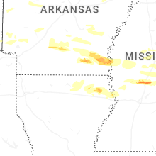
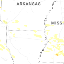
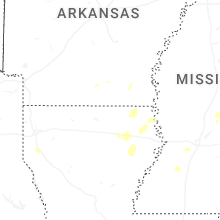
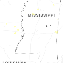
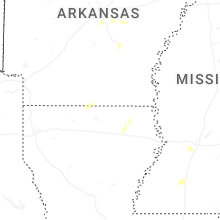
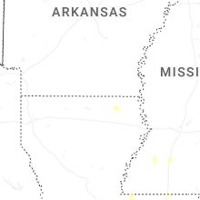
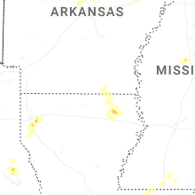


Connect with Interactive Hail Maps