

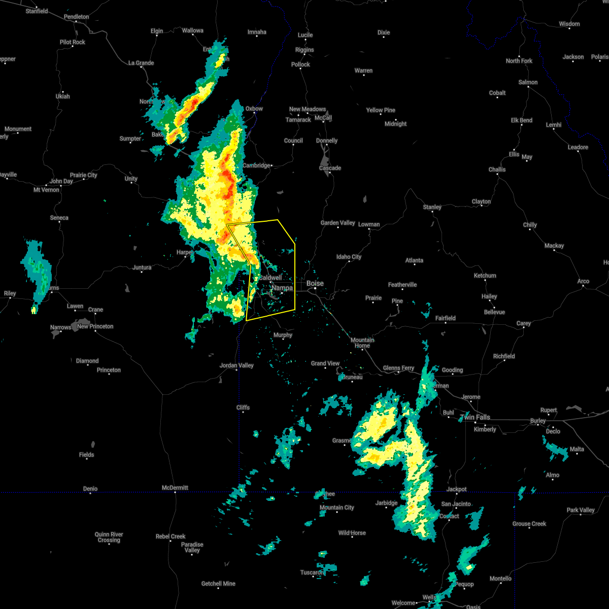
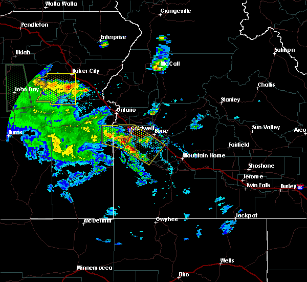
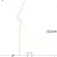
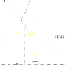
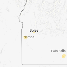
Hail Map for Meridian, ID
The Meridian, ID area has had 3 reports of on-the-ground hail by trained spotters, and has been under severe weather warnings 11 times during the past 12 months. Doppler radar has detected hail at or near Meridian, ID on 9 occasions, including 2 occasions during the past year.
| Name: | Meridian, ID |
| Where Located: | 10.2 miles W of Boise, ID |
| Map: | Google Map for Meridian, ID |
| Population: | 75092 |
| Housing Units: | 26674 |
| More Info: | Search Google for Meridian, ID |
3
The Top Recent Hail Date for Meridian, ID is Friday, June 26, 2026 (2nd out of 9)
Hail and Wind Damage Spotted near Meridian, ID
| Date / Time | Report Details |
|---|---|
| 6/26/2026 8:52 PM MDT |
 At 851 pm mdt, severe thunderstorms were located along a line extending from near meridian to near kuna, moving east at 25 mph (radar indicated). Hazards include 60 mph wind gusts. Expect damage to roofs, siding, and trees. Locations impacted include, northwestern boise, nampa, meridian, eagle, kuna, garden city, and star. At 851 pm mdt, severe thunderstorms were located along a line extending from near meridian to near kuna, moving east at 25 mph (radar indicated). Hazards include 60 mph wind gusts. Expect damage to roofs, siding, and trees. Locations impacted include, northwestern boise, nampa, meridian, eagle, kuna, garden city, and star.
|
| 6/26/2026 8:22 PM MDT |
 Svrboi the national weather service in boise has issued a * severe thunderstorm warning for, northwestern ada county in southwestern idaho, east central canyon county in southwestern idaho, * until 900 pm mdt. * at 821 pm mdt, severe thunderstorms were located along a line extending from near caldwell to near lake lowell, moving east at 25 mph (radar indicated). Hazards include 60 mph wind gusts. expect damage to roofs, siding, and trees Svrboi the national weather service in boise has issued a * severe thunderstorm warning for, northwestern ada county in southwestern idaho, east central canyon county in southwestern idaho, * until 900 pm mdt. * at 821 pm mdt, severe thunderstorms were located along a line extending from near caldwell to near lake lowell, moving east at 25 mph (radar indicated). Hazards include 60 mph wind gusts. expect damage to roofs, siding, and trees
|
| 5/28/2026 5:30 PM MDT | Over 10 reports compiled from social media of pine trees and their root systems brought dow in ada county ID, 2.9 miles S of Meridian, ID |
| 5/28/2026 4:53 PM MDT |
 the severe thunderstorm warning has been cancelled and is no longer in effect the severe thunderstorm warning has been cancelled and is no longer in effect
|
| 5/28/2026 4:39 PM MDT |
 At 438 pm mdt, severe thunderstorms were located along a line extending from near fruitland to 6 miles southwest of ola to near pioneerville, moving north at 50 mph (radar indicated). Hazards include 60 mph wind gusts. Expect damage to roofs, siding, and trees. these severe storms will be near, new plymouth, banks, ola, and garden valley around 440 pm mdt. Smiths ferry, big eddy, high valley, and hardscrabble campground around 450 pm mdt. At 438 pm mdt, severe thunderstorms were located along a line extending from near fruitland to 6 miles southwest of ola to near pioneerville, moving north at 50 mph (radar indicated). Hazards include 60 mph wind gusts. Expect damage to roofs, siding, and trees. these severe storms will be near, new plymouth, banks, ola, and garden valley around 440 pm mdt. Smiths ferry, big eddy, high valley, and hardscrabble campground around 450 pm mdt.
|
| 5/28/2026 4:39 PM MDT |
 the severe thunderstorm warning has been cancelled and is no longer in effect the severe thunderstorm warning has been cancelled and is no longer in effect
|
| 5/28/2026 4:09 PM MDT |
 Svrboi the national weather service in boise has issued a * severe thunderstorm warning for, northern ada county in southwestern idaho, boise county in southwestern idaho, southwestern valley county in southwestern idaho, payette county in southwestern idaho, northwestern elmore county in southwestern idaho, northeastern canyon county in southwestern idaho, gem county in southwestern idaho, southeastern washington county in southwestern idaho, * until 515 pm mdt. * at 409 pm mdt, severe thunderstorms were located along a line extending from greenleaf to near hidden springs to near thorn creek summit, moving north at 50 mph (radar indicated). Hazards include 70 mph wind gusts. Expect considerable tree damage. damage is likely to mobile homes, roofs, and outbuildings. severe thunderstorms will be near, caldwell, emmett, idaho city, and eagle around 410 pm mdt. horseshoe bend, gardena, centerville, and sweet around 420 pm mdt. new plymouth, banks, pioneerville, and french corner around 430 pm mdt. ola, garden valley, crouch, and big eddy around 440 pm mdt. Smiths ferry, hardscrabble campground, and bear creek summit around 450 pm mdt. Svrboi the national weather service in boise has issued a * severe thunderstorm warning for, northern ada county in southwestern idaho, boise county in southwestern idaho, southwestern valley county in southwestern idaho, payette county in southwestern idaho, northwestern elmore county in southwestern idaho, northeastern canyon county in southwestern idaho, gem county in southwestern idaho, southeastern washington county in southwestern idaho, * until 515 pm mdt. * at 409 pm mdt, severe thunderstorms were located along a line extending from greenleaf to near hidden springs to near thorn creek summit, moving north at 50 mph (radar indicated). Hazards include 70 mph wind gusts. Expect considerable tree damage. damage is likely to mobile homes, roofs, and outbuildings. severe thunderstorms will be near, caldwell, emmett, idaho city, and eagle around 410 pm mdt. horseshoe bend, gardena, centerville, and sweet around 420 pm mdt. new plymouth, banks, pioneerville, and french corner around 430 pm mdt. ola, garden valley, crouch, and big eddy around 440 pm mdt. Smiths ferry, hardscrabble campground, and bear creek summit around 450 pm mdt.
|
| 5/28/2026 3:38 PM MDT |
 Svrboi the national weather service in boise has issued a * severe thunderstorm warning for, ada county in southwestern idaho, southwestern boise county in southwestern idaho, central elmore county in southwestern idaho, canyon county in southwestern idaho, northwestern owyhee county in southwestern idaho, southwestern gem county in southwestern idaho, * until 415 pm mdt. * at 336 pm mdt, blowing dust and damaging winds were located along a line extending from near reynolds to near initial point to 10 miles northeast of cinder cone butte to near hot springs creek reservoir, moving north at 40 mph (radar indicated). Hazards include 60-70 mph wind gusts. Expect considerable tree damage. damage is likely to mobile homes, roofs, and outbuildings. severe thunderstorms will be near, kuna, melba, blacks creek reservoir, and initial point around 340 pm mdt. boise, nampa, meridian, and danskin peak around 350 pm mdt. caldwell, eagle, garden city, and marsing around 400 pm mdt. Star, aldape summit, and huston around 410 pm mdt. Svrboi the national weather service in boise has issued a * severe thunderstorm warning for, ada county in southwestern idaho, southwestern boise county in southwestern idaho, central elmore county in southwestern idaho, canyon county in southwestern idaho, northwestern owyhee county in southwestern idaho, southwestern gem county in southwestern idaho, * until 415 pm mdt. * at 336 pm mdt, blowing dust and damaging winds were located along a line extending from near reynolds to near initial point to 10 miles northeast of cinder cone butte to near hot springs creek reservoir, moving north at 40 mph (radar indicated). Hazards include 60-70 mph wind gusts. Expect considerable tree damage. damage is likely to mobile homes, roofs, and outbuildings. severe thunderstorms will be near, kuna, melba, blacks creek reservoir, and initial point around 340 pm mdt. boise, nampa, meridian, and danskin peak around 350 pm mdt. caldwell, eagle, garden city, and marsing around 400 pm mdt. Star, aldape summit, and huston around 410 pm mdt.
|
| 5/25/2026 4:17 PM MDT |
 At 417 pm mdt, severe thunderstorms were located along a line extending from near firebird speedway to near lucky peak reservoir, moving east at 30 mph (radar indicated). Hazards include 60 mph wind gusts. Expect damage to roofs, siding, and trees. Locations impacted include, boise, emmett, idaho city, meridian, eagle, garden city, star, middleton, horseshoe bend, sweet, arrowrock dam, aldape summit, thorn creek summit, lucky peak reservoir, harris creek summit, montour, hidden springs, twin springs, lucky peak spring shores marina, and arrowrock reservoir. At 417 pm mdt, severe thunderstorms were located along a line extending from near firebird speedway to near lucky peak reservoir, moving east at 30 mph (radar indicated). Hazards include 60 mph wind gusts. Expect damage to roofs, siding, and trees. Locations impacted include, boise, emmett, idaho city, meridian, eagle, garden city, star, middleton, horseshoe bend, sweet, arrowrock dam, aldape summit, thorn creek summit, lucky peak reservoir, harris creek summit, montour, hidden springs, twin springs, lucky peak spring shores marina, and arrowrock reservoir.
|
| 5/25/2026 4:00 PM MDT |
 Svrboi the national weather service in boise has issued a * severe thunderstorm warning for, northern ada county in southwestern idaho, southwestern boise county in southwestern idaho, central elmore county in southwestern idaho, east central canyon county in southwestern idaho, southeastern gem county in southwestern idaho, * until 445 pm mdt. * at 359 pm mdt, severe thunderstorms were located along a line extending from near nampa to near blacks creek reservoir, moving north at 30 mph (radar indicated). Hazards include 60 mph wind gusts. expect damage to roofs, siding, and trees Svrboi the national weather service in boise has issued a * severe thunderstorm warning for, northern ada county in southwestern idaho, southwestern boise county in southwestern idaho, central elmore county in southwestern idaho, east central canyon county in southwestern idaho, southeastern gem county in southwestern idaho, * until 445 pm mdt. * at 359 pm mdt, severe thunderstorms were located along a line extending from near nampa to near blacks creek reservoir, moving north at 30 mph (radar indicated). Hazards include 60 mph wind gusts. expect damage to roofs, siding, and trees
|
| 5/25/2026 3:48 PM MDT |
 Svrboi the national weather service in boise has issued a * severe thunderstorm warning for, west central ada county in southwestern idaho, southeastern canyon county in southwestern idaho, * until 415 pm mdt. * at 347 pm mdt, severe thunderstorms were located along a line extending from near lake lowell to near initial point, moving northeast at 35 mph (radar indicated). Hazards include 60 mph wind gusts. expect damage to roofs, siding, and trees Svrboi the national weather service in boise has issued a * severe thunderstorm warning for, west central ada county in southwestern idaho, southeastern canyon county in southwestern idaho, * until 415 pm mdt. * at 347 pm mdt, severe thunderstorms were located along a line extending from near lake lowell to near initial point, moving northeast at 35 mph (radar indicated). Hazards include 60 mph wind gusts. expect damage to roofs, siding, and trees
|
| 7/26/2025 6:11 PM MDT |
 Svrboi the national weather service in boise has issued a * severe thunderstorm warning for, ada county in southwestern idaho, western elmore county in southwestern idaho, canyon county in southwestern idaho, northwestern owyhee county in southwestern idaho, * until 715 pm mdt. * at 610 pm mdt, severe thunderstorms were located along a line extending from near squaw butte to near guffey to near oreana, moving northeast at 35 mph (radar indicated). Hazards include 60 mph wind gusts and penny size hail. Expect damage to roofs, siding, and trees. severe thunderstorms will be near, melba, swan falls, murphy, and givens hot springs around 620 pm mdt. kuna, elephant butte, big foot butte, and initial point around 630 pm mdt. nampa, marsing, and lake lowell around 640 pm mdt. boise, caldwell, meridian, and huston around 650 pm mdt. Eagle, garden city, star, and middleton around 700 pm mdt. Svrboi the national weather service in boise has issued a * severe thunderstorm warning for, ada county in southwestern idaho, western elmore county in southwestern idaho, canyon county in southwestern idaho, northwestern owyhee county in southwestern idaho, * until 715 pm mdt. * at 610 pm mdt, severe thunderstorms were located along a line extending from near squaw butte to near guffey to near oreana, moving northeast at 35 mph (radar indicated). Hazards include 60 mph wind gusts and penny size hail. Expect damage to roofs, siding, and trees. severe thunderstorms will be near, melba, swan falls, murphy, and givens hot springs around 620 pm mdt. kuna, elephant butte, big foot butte, and initial point around 630 pm mdt. nampa, marsing, and lake lowell around 640 pm mdt. boise, caldwell, meridian, and huston around 650 pm mdt. Eagle, garden city, star, and middleton around 700 pm mdt.
|
| 9/16/2024 8:49 PM MDT |
 At 849 pm mdt, a severe thunderstorm was located over lucky peak dam, or 8 miles southeast of boise, moving northwest at 30 mph (radar indicated). Hazards include 60 mph wind gusts and penny size hail. Expect damage to roofs, siding, and trees. this severe storm will be near, boise, lucky peak dam, and lucky peak reservoir around 850 pm mdt. garden city around 900 pm mdt. Meridian and eagle around 910 pm mdt. At 849 pm mdt, a severe thunderstorm was located over lucky peak dam, or 8 miles southeast of boise, moving northwest at 30 mph (radar indicated). Hazards include 60 mph wind gusts and penny size hail. Expect damage to roofs, siding, and trees. this severe storm will be near, boise, lucky peak dam, and lucky peak reservoir around 850 pm mdt. garden city around 900 pm mdt. Meridian and eagle around 910 pm mdt.
|
| 9/16/2024 8:19 PM MDT |
 Svrboi the national weather service in boise has issued a * severe thunderstorm warning for, central ada county in southwestern idaho, west central elmore county in southwestern idaho, * until 915 pm mdt.. * at 818 pm mdt, a severe thunderstorm was located near boise stage stop, or 19 miles northwest of mountain home, moving northwest at 30 mph (radar indicated). Hazards include 60 mph wind gusts and penny size hail. Expect damage to roofs, siding, and trees. this severe thunderstorm will be near, boise, lucky peak dam, and lucky peak reservoir around 840 pm mdt. garden city around 900 pm mdt. Meridian and eagle around 910 pm mdt. Svrboi the national weather service in boise has issued a * severe thunderstorm warning for, central ada county in southwestern idaho, west central elmore county in southwestern idaho, * until 915 pm mdt.. * at 818 pm mdt, a severe thunderstorm was located near boise stage stop, or 19 miles northwest of mountain home, moving northwest at 30 mph (radar indicated). Hazards include 60 mph wind gusts and penny size hail. Expect damage to roofs, siding, and trees. this severe thunderstorm will be near, boise, lucky peak dam, and lucky peak reservoir around 840 pm mdt. garden city around 900 pm mdt. Meridian and eagle around 910 pm mdt.
|
| 7/24/2024 6:01 PM MDT |
 the severe thunderstorm warning has been cancelled and is no longer in effect the severe thunderstorm warning has been cancelled and is no longer in effect
|
| 7/24/2024 5:23 PM MDT |
 Svrboi the national weather service in boise has issued a * severe thunderstorm warning for, northwestern ada county in southwestern idaho, west central boise county in southwestern idaho, central payette county in southwestern idaho, northeastern canyon county in southwestern idaho, gem county in southwestern idaho, southern washington county in southwestern idaho, * until 615 pm mdt.. * at 522 pm mdt, severe thunderstorms were located along a line extending from near letha to near meridian, moving northeast at 35 mph. damaging winds associated with numerous gusts fronts were moving through canyon and ada counties (radar indicated). Hazards include 60 mph wind gusts. Expect damage to roofs, siding, and trees. severe thunderstorms will be near, northwestern boise, emmett, meridian, and eagle around 530 pm mdt. montour and french corner around 540 pm mdt. horseshoe bend, sweet, and bogus basin ski area around 550 pm mdt. Gardena and harris creek summit around 600 pm mdt. Svrboi the national weather service in boise has issued a * severe thunderstorm warning for, northwestern ada county in southwestern idaho, west central boise county in southwestern idaho, central payette county in southwestern idaho, northeastern canyon county in southwestern idaho, gem county in southwestern idaho, southern washington county in southwestern idaho, * until 615 pm mdt.. * at 522 pm mdt, severe thunderstorms were located along a line extending from near letha to near meridian, moving northeast at 35 mph. damaging winds associated with numerous gusts fronts were moving through canyon and ada counties (radar indicated). Hazards include 60 mph wind gusts. Expect damage to roofs, siding, and trees. severe thunderstorms will be near, northwestern boise, emmett, meridian, and eagle around 530 pm mdt. montour and french corner around 540 pm mdt. horseshoe bend, sweet, and bogus basin ski area around 550 pm mdt. Gardena and harris creek summit around 600 pm mdt.
|
| 4/3/2024 5:56 PM MDT |
 The storm which prompted the warning has weakened below severe limits, and no longer poses an immediate threat to life or property. therefore, the warning will be allowed to expire. when safe to do so, please relay storm reports to the national weather service in boise via local law enforcement, or national weather service boise facebook and twitter accounts. The storm which prompted the warning has weakened below severe limits, and no longer poses an immediate threat to life or property. therefore, the warning will be allowed to expire. when safe to do so, please relay storm reports to the national weather service in boise via local law enforcement, or national weather service boise facebook and twitter accounts.
|
| 4/3/2024 5:24 PM MDT |
 Svrboi the national weather service in boise has issued a * severe thunderstorm warning for, northeastern ada county in southwestern idaho, southwestern boise county in southwestern idaho, * until 600 pm mdt.. * at 523 pm mdt, a severe thunderstorm was located over garden city, or near boise, moving northeast at 35 mph (radar indicated). Hazards include quarter size hail. Damage to vehicles is expected. this severe thunderstorm will be near, northern boise, hidden springs, and bogus basin ski area around 530 pm mdt. Idaho city around 600 pm mdt. Svrboi the national weather service in boise has issued a * severe thunderstorm warning for, northeastern ada county in southwestern idaho, southwestern boise county in southwestern idaho, * until 600 pm mdt.. * at 523 pm mdt, a severe thunderstorm was located over garden city, or near boise, moving northeast at 35 mph (radar indicated). Hazards include quarter size hail. Damage to vehicles is expected. this severe thunderstorm will be near, northern boise, hidden springs, and bogus basin ski area around 530 pm mdt. Idaho city around 600 pm mdt.
|
| 6/7/2023 6:11 PM MDT |
 The severe thunderstorm warning for central ada and southwestern boise counties will expire at 615 pm mdt, the storm which prompted the warning has moved out of the area. therefore, the warning will be allowed to expire. however gusty winds and heavy rain are still possible with these thunderstorms near caldwell, id and kuna, id. when safe to do so, please relay storm reports to the national weather service in boise via local law enforcement, or national weather service boise facebook and twitter accounts. The severe thunderstorm warning for central ada and southwestern boise counties will expire at 615 pm mdt, the storm which prompted the warning has moved out of the area. therefore, the warning will be allowed to expire. however gusty winds and heavy rain are still possible with these thunderstorms near caldwell, id and kuna, id. when safe to do so, please relay storm reports to the national weather service in boise via local law enforcement, or national weather service boise facebook and twitter accounts.
|
| 6/7/2023 5:24 PM MDT |
 At 523 pm mdt, a severe thunderstorm with strong outflow winds was located near boise, moving west at 15 mph (radar indicated). Hazards include 60 mph wind gusts. Expect damage to roofs, siding, and trees. this severe thunderstorm will be near, boise around 530 pm mdt. garden city and hidden springs around 550 pm mdt. kuna, meridian and eagle around 610 pm mdt. hail threat, radar indicated max hail size, <. 75 in wind threat, radar indicated max wind gust, 60 mph. At 523 pm mdt, a severe thunderstorm with strong outflow winds was located near boise, moving west at 15 mph (radar indicated). Hazards include 60 mph wind gusts. Expect damage to roofs, siding, and trees. this severe thunderstorm will be near, boise around 530 pm mdt. garden city and hidden springs around 550 pm mdt. kuna, meridian and eagle around 610 pm mdt. hail threat, radar indicated max hail size, <. 75 in wind threat, radar indicated max wind gust, 60 mph.
|
| 6/6/2023 8:54 PM MDT |
 At 853 pm mdt, severe thunderstorms were located along a line extending from near blacks creek reservoir to near murphy to near reynolds, moving northwest at 30 mph (radar indicated). Hazards include 60 mph wind gusts and penny size hail. Expect damage to roofs, siding, and trees. severe thunderstorms will be near, reynolds and guffey around 900 pm mdt. boise, kuna, melba and walters ferry around 910 pm mdt. garden city and squaw butte around 920 pm mdt. givens hot springs around 930 pm mdt. nampa, caldwell, meridian and marsing around 940 pm mdt. hail threat, radar indicated max hail size, 0. 75 in wind threat, observed max wind gust, 60 mph. At 853 pm mdt, severe thunderstorms were located along a line extending from near blacks creek reservoir to near murphy to near reynolds, moving northwest at 30 mph (radar indicated). Hazards include 60 mph wind gusts and penny size hail. Expect damage to roofs, siding, and trees. severe thunderstorms will be near, reynolds and guffey around 900 pm mdt. boise, kuna, melba and walters ferry around 910 pm mdt. garden city and squaw butte around 920 pm mdt. givens hot springs around 930 pm mdt. nampa, caldwell, meridian and marsing around 940 pm mdt. hail threat, radar indicated max hail size, 0. 75 in wind threat, observed max wind gust, 60 mph.
|
| 9/7/2022 6:08 PM MDT |
 At 606 pm mdt/506 pm pdt/, severe thunderstorms were located along a line extending from near brogan to castro ridge, moving east at 60 mph (radar indicated). Hazards include 70 mph wind gusts. Expect considerable tree damage. damage is likely to mobile homes, roofs, and outbuildings. severe thunderstorms will be near, castro ridge, parsnip peak, little grassy reservoir and antelope reservoir around 610 pm mdt. reynolds, south mountain, henley basin and black warrior mountain around 620 pm mdt. weiser, silver city, murphy and melba around 630 pm mdt. payette, ontario, parma and emmett around 640 pm mdt. thunderstorm damage threat, considerable hail threat, radar indicated max hail size, <. 75 in wind threat, radar indicated max wind gust, 70 mph. At 606 pm mdt/506 pm pdt/, severe thunderstorms were located along a line extending from near brogan to castro ridge, moving east at 60 mph (radar indicated). Hazards include 70 mph wind gusts. Expect considerable tree damage. damage is likely to mobile homes, roofs, and outbuildings. severe thunderstorms will be near, castro ridge, parsnip peak, little grassy reservoir and antelope reservoir around 610 pm mdt. reynolds, south mountain, henley basin and black warrior mountain around 620 pm mdt. weiser, silver city, murphy and melba around 630 pm mdt. payette, ontario, parma and emmett around 640 pm mdt. thunderstorm damage threat, considerable hail threat, radar indicated max hail size, <. 75 in wind threat, radar indicated max wind gust, 70 mph.
|
| 9/10/2021 7:31 PM MDT |
 At 730 pm mdt, severe thunderstorms were located along a line extending from near payette to 7 miles northeast of parma to elephant butte, moving northeast at 40 mph (radar indicated). Hazards include 60 mph wind gusts. Expect damage to roofs, siding, and trees. severe thunderstorms will be near, new plymouth and middleton around 740 pm mdt. emmett, caldwell, letha and firebird speedway around 750 pm mdt. nampa, meridian, kuna and star around 800 pm mdt. hail threat, radar indicated max hail size, <. 75 in wind threat, radar indicated max wind gust, 60 mph. At 730 pm mdt, severe thunderstorms were located along a line extending from near payette to 7 miles northeast of parma to elephant butte, moving northeast at 40 mph (radar indicated). Hazards include 60 mph wind gusts. Expect damage to roofs, siding, and trees. severe thunderstorms will be near, new plymouth and middleton around 740 pm mdt. emmett, caldwell, letha and firebird speedway around 750 pm mdt. nampa, meridian, kuna and star around 800 pm mdt. hail threat, radar indicated max hail size, <. 75 in wind threat, radar indicated max wind gust, 60 mph.
|
| 6/22/2021 8:00 PM MDT | Tree broken in half due to thunderstorm outflow winds. estimated 60 mph gus in ada county ID, 3 miles NNW of Meridian, ID |
| 6/22/2021 6:40 PM MDT |
 At 639 pm mdt, severe thunderstorms were located along a line extending from near freezeout mountain to near elephant butte, moving northeast at 30 mph (radar indicated). Hazards include 60 mph wind gusts and penny size hail. Expect damage to roofs, siding, and trees. severe thunderstorms will be near, homedale, elephant butte and succor creek campground around 640 pm mdt. marsing, wilder and givens hot springs around 650 pm mdt. greenleaf, notus, lake lowell and huston around 700 pm mdt. caldwell, sand hollow and board corral mountain around 710 pm mdt. Nampa, kuna, double mountain and owyhee dam around 720 pm mdt. At 639 pm mdt, severe thunderstorms were located along a line extending from near freezeout mountain to near elephant butte, moving northeast at 30 mph (radar indicated). Hazards include 60 mph wind gusts and penny size hail. Expect damage to roofs, siding, and trees. severe thunderstorms will be near, homedale, elephant butte and succor creek campground around 640 pm mdt. marsing, wilder and givens hot springs around 650 pm mdt. greenleaf, notus, lake lowell and huston around 700 pm mdt. caldwell, sand hollow and board corral mountain around 710 pm mdt. Nampa, kuna, double mountain and owyhee dam around 720 pm mdt.
|
| 5/1/2021 3:56 PM MDT |
 The severe thunderstorm warning for ada, southwestern boise, southwestern elmore, east central canyon and northwestern owyhee counties will expire at 400 pm mdt, the storm which prompted the warning has weakened below severe limits, and has exited the warned area. therefore, the warning will be allowed to expire. however gusty winds and heavy rain are still possible in the wake of this storm. strong winds with the gust front are now moving east through elmore county, but have dropped below severe levels. when safe to do so, please relay storm reports to the national weather service in boise via local law enforcement, or national weather service boise facebook and twitter accounts. The severe thunderstorm warning for ada, southwestern boise, southwestern elmore, east central canyon and northwestern owyhee counties will expire at 400 pm mdt, the storm which prompted the warning has weakened below severe limits, and has exited the warned area. therefore, the warning will be allowed to expire. however gusty winds and heavy rain are still possible in the wake of this storm. strong winds with the gust front are now moving east through elmore county, but have dropped below severe levels. when safe to do so, please relay storm reports to the national weather service in boise via local law enforcement, or national weather service boise facebook and twitter accounts.
|
| 5/1/2021 3:15 PM MDT | 1471 customers without powe in ada county ID, 1 miles NW of Meridian, ID |
| 5/1/2021 3:14 PM MDT | Power outage for 5500 customers in north meridia in ada county ID, 0.8 miles SSE of Meridian, ID |
| 5/1/2021 3:13 PM MDT |
 At 313 pm mdt, a severe thunderstorm was located over southwestern boise, moving east at 35 mph (62 mph gust at the airport a at 3:11 pm mdt). Hazards include 70 mph wind gusts. Expect considerable tree damage. damage is likely to mobile homes, roofs, and outbuildings. this severe thunderstorm will be near, big foot butte around 320 pm mdt. lucky peak dam, aldape summit and blacks creek reservoir around 330 pm mdt. lucky peak spring shores marina, lucky peak reservoir, arrowrock dam and boise stage stop around 340 pm mdt. mountain home air force base around 350 pm mdt. Arrowrock reservoir and twin springs around 400 pm mdt. At 313 pm mdt, a severe thunderstorm was located over southwestern boise, moving east at 35 mph (62 mph gust at the airport a at 3:11 pm mdt). Hazards include 70 mph wind gusts. Expect considerable tree damage. damage is likely to mobile homes, roofs, and outbuildings. this severe thunderstorm will be near, big foot butte around 320 pm mdt. lucky peak dam, aldape summit and blacks creek reservoir around 330 pm mdt. lucky peak spring shores marina, lucky peak reservoir, arrowrock dam and boise stage stop around 340 pm mdt. mountain home air force base around 350 pm mdt. Arrowrock reservoir and twin springs around 400 pm mdt.
|
| 4/30/2020 3:08 PM MDT |
 The severe thunderstorm warning for northern ada, southwestern boise, northwestern elmore, northeastern canyon and south central gem counties will expire at 315 pm mdt, the storm which prompted the warning has weakened below severe limits, and has exited the warned area. therefore, the warning will be allowed to expire. when safe to do so, please relay storm reports to the national weather service in boise via local law enforcement, or national weather service boise facebook and twitter accounts. The severe thunderstorm warning for northern ada, southwestern boise, northwestern elmore, northeastern canyon and south central gem counties will expire at 315 pm mdt, the storm which prompted the warning has weakened below severe limits, and has exited the warned area. therefore, the warning will be allowed to expire. when safe to do so, please relay storm reports to the national weather service in boise via local law enforcement, or national weather service boise facebook and twitter accounts.
|
| 4/30/2020 2:28 PM MDT |
 At 228 pm mdt, a severe thunderstorm was located over western boise, moving east at 40 mph (radar indicated). Hazards include 60 mph wind gusts. Expect damage to roofs, siding, and trees. this severe thunderstorm will be near, boise and hidden springs around 230 pm mdt. bogus basin ski area around 240 pm mdt. lucky peak reservoir, lucky peak spring shores marina, aldape summit and harris creek summit around 250 pm mdt. arrowrock dam and placerville around 300 pm mdt. Arrowrock reservoir around 310 pm mdt. At 228 pm mdt, a severe thunderstorm was located over western boise, moving east at 40 mph (radar indicated). Hazards include 60 mph wind gusts. Expect damage to roofs, siding, and trees. this severe thunderstorm will be near, boise and hidden springs around 230 pm mdt. bogus basin ski area around 240 pm mdt. lucky peak reservoir, lucky peak spring shores marina, aldape summit and harris creek summit around 250 pm mdt. arrowrock dam and placerville around 300 pm mdt. Arrowrock reservoir around 310 pm mdt.
|
| 5/25/2018 8:00 PM MDT |
 At 759 pm mdt, a severe thunderstorm was located over notus, or 7 miles southeast of parma, moving north at 25 mph (trained weather spotters and doppler radar). Hazards include 60 mph wind gusts and half dollar size hail. Hail damage to vehicles is expected. expect wind damage to roofs, siding, and trees. this severe thunderstorm will be near, sand hollow around 800 pm mdt. parma and emmett around 810 pm mdt. owyhee and letha around 820 pm mdt. Nyssa around 830 pm mdt. At 759 pm mdt, a severe thunderstorm was located over notus, or 7 miles southeast of parma, moving north at 25 mph (trained weather spotters and doppler radar). Hazards include 60 mph wind gusts and half dollar size hail. Hail damage to vehicles is expected. expect wind damage to roofs, siding, and trees. this severe thunderstorm will be near, sand hollow around 800 pm mdt. parma and emmett around 810 pm mdt. owyhee and letha around 820 pm mdt. Nyssa around 830 pm mdt.
|
| 5/25/2018 7:29 PM MDT |
 At 729 pm mdt, severe thunderstorms were located along a line extending from near givens hot springs to swan falls, moving northeast at 25 mph (radar indicated). Hazards include 60 mph wind gusts and quarter size hail. Hail damage to vehicles is expected. expect wind damage to roofs, siding, and trees. severe thunderstorms will be near, melba, givens hot springs and big foot butte around 730 pm mdt. lake lowell and initial point around 750 pm mdt. Caldwell, nampa, southwestern boise and middleton around 800 pm mdt. At 729 pm mdt, severe thunderstorms were located along a line extending from near givens hot springs to swan falls, moving northeast at 25 mph (radar indicated). Hazards include 60 mph wind gusts and quarter size hail. Hail damage to vehicles is expected. expect wind damage to roofs, siding, and trees. severe thunderstorms will be near, melba, givens hot springs and big foot butte around 730 pm mdt. lake lowell and initial point around 750 pm mdt. Caldwell, nampa, southwestern boise and middleton around 800 pm mdt.
|
| 8/30/2017 11:22 PM MDT |
 The severe thunderstorm warning for northern ada, southwestern boise and west central elmore counties will expire at 1130 pm mdt, the outflow winds which prompted the warning have weakened below severe limits, and no longer pose an immediate threat to life or property. therefore the warning will be allowed to expire. when safe to do so, please relay storm reports to the national weather service in boise via local law enforcement, or national weather service boise facebook and twitter accounts. The severe thunderstorm warning for northern ada, southwestern boise and west central elmore counties will expire at 1130 pm mdt, the outflow winds which prompted the warning have weakened below severe limits, and no longer pose an immediate threat to life or property. therefore the warning will be allowed to expire. when safe to do so, please relay storm reports to the national weather service in boise via local law enforcement, or national weather service boise facebook and twitter accounts.
|
| 8/30/2017 10:47 PM MDT |
 At 1046 pm mdt, severe outflow winds were located along a line extending from near meridian to near lucky peak reservoir, moving north at 20 mph. there is no thunder and very little rain at this time, but these winds will be severe (radar indicated). Hazards include 60 mph wind gusts. Expect damage to roofs, siding, and trees. severe thunderstorms will be near, boise around 1050 pm mdt. lucky peak spring shores marina and arrowrock dam around 1100 pm mdt. meridian, garden city, lucky peak reservoir and aldape summit around 1110 pm mdt. star and hidden springs around 1120 pm mdt. Idaho city, eagle, firebird speedway and bogus basin ski area around 1130 pm mdt. At 1046 pm mdt, severe outflow winds were located along a line extending from near meridian to near lucky peak reservoir, moving north at 20 mph. there is no thunder and very little rain at this time, but these winds will be severe (radar indicated). Hazards include 60 mph wind gusts. Expect damage to roofs, siding, and trees. severe thunderstorms will be near, boise around 1050 pm mdt. lucky peak spring shores marina and arrowrock dam around 1100 pm mdt. meridian, garden city, lucky peak reservoir and aldape summit around 1110 pm mdt. star and hidden springs around 1120 pm mdt. Idaho city, eagle, firebird speedway and bogus basin ski area around 1130 pm mdt.
|
| 8/24/2017 7:42 PM MDT |
 At 742 pm mdt, a severe thunderstorm was located over boise, moving northeast at 20 mph (radar indicated). Hazards include 60 mph wind gusts. Expect damage to roofs, siding, and trees. this severe thunderstorm will be near, hidden springs around 750 pm mdt. lucky peak dam around 800 pm mdt. aldape summit, lucky peak reservoir and lucky peak spring shores marina around 810 pm mdt. bogus basin ski area and arrowrock dam around 820 pm mdt. Arrowrock reservoir around 830 pm mdt. At 742 pm mdt, a severe thunderstorm was located over boise, moving northeast at 20 mph (radar indicated). Hazards include 60 mph wind gusts. Expect damage to roofs, siding, and trees. this severe thunderstorm will be near, hidden springs around 750 pm mdt. lucky peak dam around 800 pm mdt. aldape summit, lucky peak reservoir and lucky peak spring shores marina around 810 pm mdt. bogus basin ski area and arrowrock dam around 820 pm mdt. Arrowrock reservoir around 830 pm mdt.
|
| 8/11/2015 5:58 PM MDT |
 At 558 pm mdt, doppler radar indicated a line of severe thunderstorms capable of producing damaging winds in excess of 60 mph. these storms were located along a line extending from near lucky peak dam to 6 miles east of initial point, and moving northwest at 40 mph. * severe thunderstorms will be near, boise around 600 pm mdt. initial point around 610 pm mdt. kuna, garden city, melba and hidden springs around 620 pm mdt. nampa, eagle and meridian around 630 pm mdt. At 558 pm mdt, doppler radar indicated a line of severe thunderstorms capable of producing damaging winds in excess of 60 mph. these storms were located along a line extending from near lucky peak dam to 6 miles east of initial point, and moving northwest at 40 mph. * severe thunderstorms will be near, boise around 600 pm mdt. initial point around 610 pm mdt. kuna, garden city, melba and hidden springs around 620 pm mdt. nampa, eagle and meridian around 630 pm mdt.
|
| 8/11/2015 5:45 PM MDT |
 At 542 pm mdt, doppler radar indicated a thunderstorm outflow capable of producing damaging winds in excess of 60 mph. this outflow was located along a line extending from 6 miles northeast of boise stage stop to near big foot butte, moving northwest at 45 mph. in addition, at 515pm mdt a wind gust of 54 mph was reported mountain home afb. these severe storms will be near, swan falls, lucky peak dam and blacks creek reservoir around 550 pm mdt. south boise, nampa, kuna and melba around 600 pm mdt. At 542 pm mdt, doppler radar indicated a thunderstorm outflow capable of producing damaging winds in excess of 60 mph. this outflow was located along a line extending from 6 miles northeast of boise stage stop to near big foot butte, moving northwest at 45 mph. in addition, at 515pm mdt a wind gust of 54 mph was reported mountain home afb. these severe storms will be near, swan falls, lucky peak dam and blacks creek reservoir around 550 pm mdt. south boise, nampa, kuna and melba around 600 pm mdt.
|
| 8/11/2015 5:17 PM MDT |
 At 515 pm mdt, doppler radar indicated a thunderstorm outflow producing damaging winds in excess of 60 mph. this outflow was located along a line extending from near tollgate to 7 miles west of mountain home air force base, and moving northwest at 50 mph. * severe thunderstorms will be near, cinder cone butte around 520 pm mdt. big foot butte around 530 pm mdt. swan falls and boise stage stop around 540 pm mdt. boise, melba, initial point and lucky peak dam around 550 pm mdt. nampa, kuna, garden city and eagle around 600 pm mdt. At 515 pm mdt, doppler radar indicated a thunderstorm outflow producing damaging winds in excess of 60 mph. this outflow was located along a line extending from near tollgate to 7 miles west of mountain home air force base, and moving northwest at 50 mph. * severe thunderstorms will be near, cinder cone butte around 520 pm mdt. big foot butte around 530 pm mdt. swan falls and boise stage stop around 540 pm mdt. boise, melba, initial point and lucky peak dam around 550 pm mdt. nampa, kuna, garden city and eagle around 600 pm mdt.
|
| 8/10/2015 4:42 PM MDT | The severe thunderstorm warning for central ada county will expire at 445 pm mdt, the storm which prompted the warning has weakened below severe limits, and no longer poses an immediate threat to life or property. therefore the warning will be allowed to expire. when safe to do so, please relay storm reports to the national weather service in boise idaho via local law enforcement, or national weather service boise facebook and twitter accounts. |
| 8/10/2015 4:20 PM MDT |
 At 419 pm mdt, doppler radar indicated a severe thunderstorm capable of producing destructive winds in excess of 70 mph. this storm was located near blacks creek reservoir, or 7 miles south of boise, and moving north at 40 mph. wind gusts to 61 mph have been reported with this storm. * this severe thunderstorm will be near, boise around 425 pm mdt. garden city and meridian around 440 pm mdt. At 419 pm mdt, doppler radar indicated a severe thunderstorm capable of producing destructive winds in excess of 70 mph. this storm was located near blacks creek reservoir, or 7 miles south of boise, and moving north at 40 mph. wind gusts to 61 mph have been reported with this storm. * this severe thunderstorm will be near, boise around 425 pm mdt. garden city and meridian around 440 pm mdt.
|
| 8/10/2015 4:08 PM MDT |
 At 407 pm mdt, doppler radar indicated a severe thunderstorm capable of producing destructive winds in excess of 70 mph. the boise airport reported a wind gusts 63 mph. this storm was located over western boise, and moving north at 35 mph. * this severe thunderstorm will be near, garden city, meridian and hidden springs around 420 pm mdt. eagle around 430 pm mdt. At 407 pm mdt, doppler radar indicated a severe thunderstorm capable of producing destructive winds in excess of 70 mph. the boise airport reported a wind gusts 63 mph. this storm was located over western boise, and moving north at 35 mph. * this severe thunderstorm will be near, garden city, meridian and hidden springs around 420 pm mdt. eagle around 430 pm mdt.
|
| 5/26/2015 10:04 PM MDT | At 1003 pm mdt, doppler radar indicated a severe thunderstorm capable of producing quarter size hail. this storm was located over eagle, or 10 miles northwest of boise, moving east at 20 mph. this severe storm will be near, garden city around 1010 pm mdt. hidden springs around 1020 pm mdt. northwestern boise around 1030 pm mdt. |
| 5/26/2015 9:46 PM MDT | At 946 pm mdt, doppler radar indicated a severe thunderstorm capable of producing quarter size hail. this storm was located over star, or 9 miles northeast of caldwell, and moving southeast at 20 mph. * this severe thunderstorm will be near, nampa, star and firebird speedway around 950 pm mdt. meridian around 1000 pm mdt. eagle around 1010 pm mdt. garden city and hidden springs around 1020 pm mdt. northwestern boise around 1030 pm mdt. |
| 9/5/2013 4:00 PM MDT | Quarter sized hail reported 0.6 miles NNE of Meridian, ID, photo of hail slightly larger than a quarter. |
| 9/5/2013 3:45 PM MDT | Ping Pong Ball sized hail reported 0.6 miles NNE of Meridian, ID, hail greater than 1 inch. half size of small yoyo. |
| 9/5/2013 3:41 PM MDT | Half Dollar sized hail reported 3.2 miles E of Meridian, ID, spotter reports thunderstorm with 1/2 inch to golfball size hail almost covering the surface of the ground. |
| 3/6/2013 12:15 PM MST | Nws storm survey estimated 60 to 65 mph wind gust destroyed announcers booth at meridian lions club rodeo grounds. in addition...4 sets of unsecured grandstand bleacher in ada county ID, 1.4 miles ENE of Meridian, ID |
| 1/1/0001 12:00 AM | Portions of a fence and tree branches blown down along merdian roa in ada county ID, 0.6 miles NNE of Meridian, ID |
Hail Maps for Meridian, ID


Connect with Interactive Hail Maps