

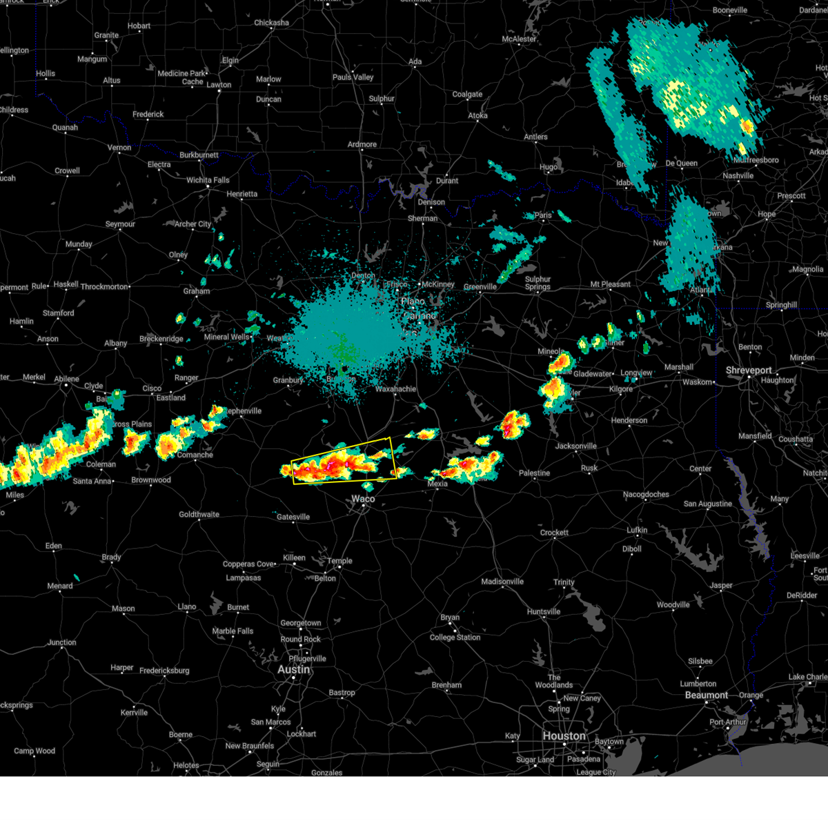
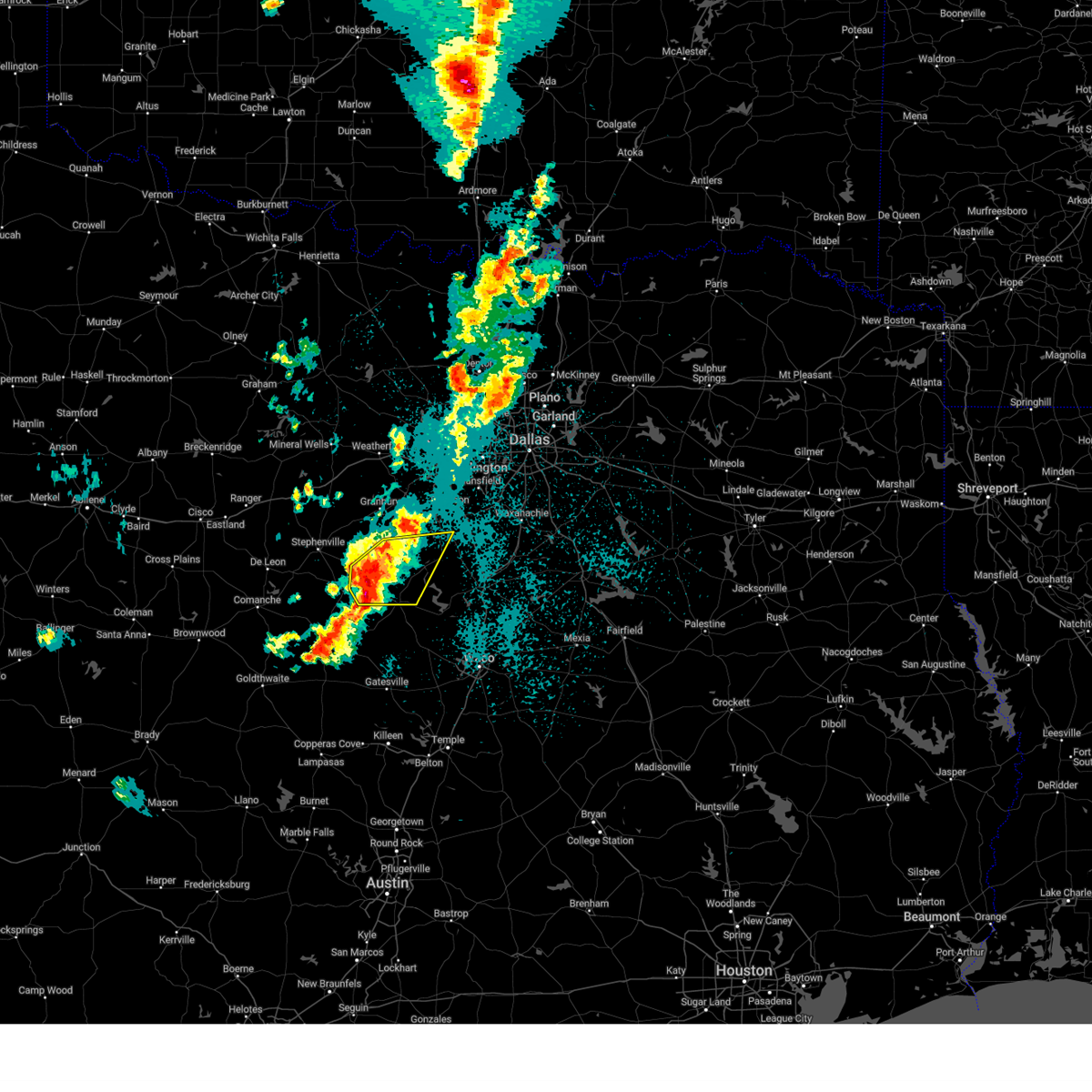
Hail Map for Meridian, TX
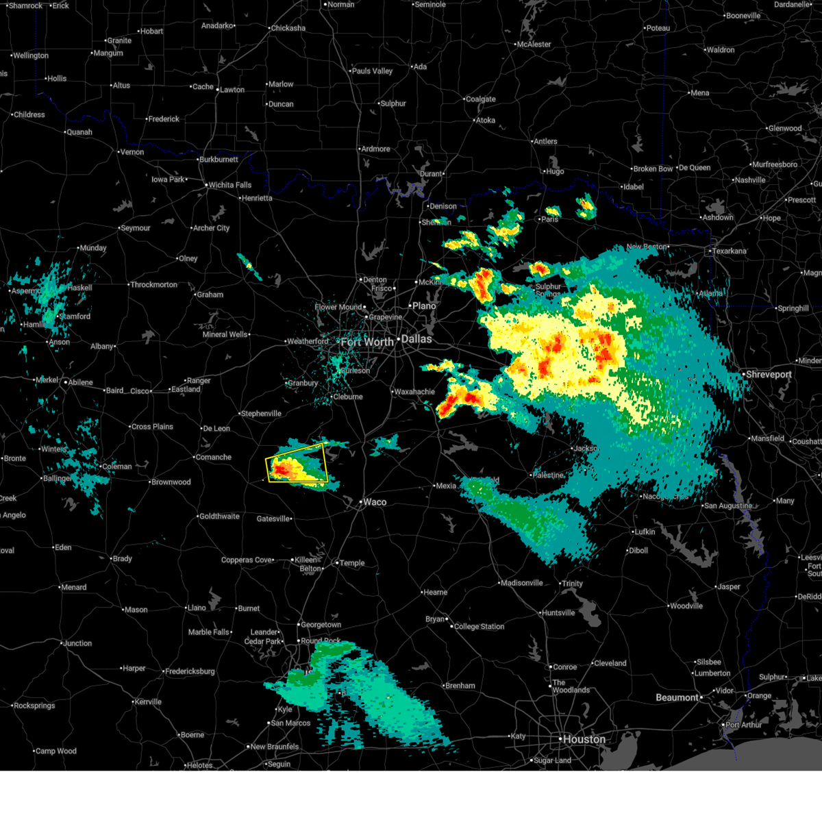
The Meridian, TX area has had 14 reports of on-the-ground hail by trained spotters, and has been under severe weather warnings 19 times during the past 12 months. Doppler radar has detected hail at or near Meridian, TX on 90 occasions, including 4 occasions during the past year.
| Name: | Meridian, TX |
| Where Located: | 55.6 miles N of Killeen, TX |
| Map: | Google Map for Meridian, TX |
| Population: | 1493 |
| Housing Units: | 629 |
| More Info: | Search Google for Meridian, TX |
1
The Top Recent Hail Date for Meridian, TX is Tuesday, April 28, 2026 (28th out of 90)
Hail and Wind Damage Spotted near Meridian, TX
| Date / Time | Report Details |
|---|---|
| 5/19/2026 5:56 PM CDT |
 the severe thunderstorm warning has been cancelled and is no longer in effect the severe thunderstorm warning has been cancelled and is no longer in effect
|
| 5/19/2026 5:37 PM CDT |
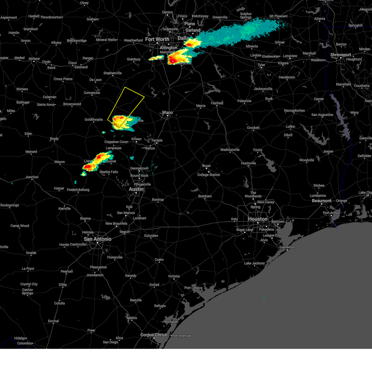
 At 536 pm cdt, a severe thunderstorm was located over clifton, and is nearly stationary (radar indicated). Hazards include 60 mph wind gusts and quarter size hail. Hail damage to vehicles is expected. expect wind damage to roofs, siding, and trees. this severe storm will be near, clifton around 540 pm cdt. Other locations impacted by this severe thunderstorm include womack, lakewood harbor, cayote, cedar shores, and norse. At 536 pm cdt, a severe thunderstorm was located over clifton, and is nearly stationary (radar indicated). Hazards include 60 mph wind gusts and quarter size hail. Hail damage to vehicles is expected. expect wind damage to roofs, siding, and trees. this severe storm will be near, clifton around 540 pm cdt. Other locations impacted by this severe thunderstorm include womack, lakewood harbor, cayote, cedar shores, and norse.
|
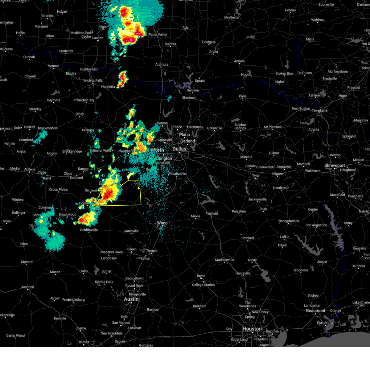
| 5/19/2026 5:08 PM CDT |
 Svrfwd the national weather service in fort worth has issued a * severe thunderstorm warning for, northeastern hamilton county in central texas, bosque county in central texas, * until 615 pm cdt. * at 508 pm cdt, severe thunderstorms were located near cranfills gap and near meridian, moving east at 5 mph (radar indicated). Hazards include 60 mph wind gusts and quarter size hail. Hail damage to vehicles is expected. expect wind damage to roofs, siding, and trees. this severe thunderstorm will be near, cranfills gap around 515 pm cdt. Other locations impacted by this severe thunderstorm include womack, lakewood harbor, cayote, morgan, kopperl, cedar shores, norse, fairy, and lakeside village. Svrfwd the national weather service in fort worth has issued a * severe thunderstorm warning for, northeastern hamilton county in central texas, bosque county in central texas, * until 615 pm cdt. * at 508 pm cdt, severe thunderstorms were located near cranfills gap and near meridian, moving east at 5 mph (radar indicated). Hazards include 60 mph wind gusts and quarter size hail. Hail damage to vehicles is expected. expect wind damage to roofs, siding, and trees. this severe thunderstorm will be near, cranfills gap around 515 pm cdt. Other locations impacted by this severe thunderstorm include womack, lakewood harbor, cayote, morgan, kopperl, cedar shores, norse, fairy, and lakeside village.
|
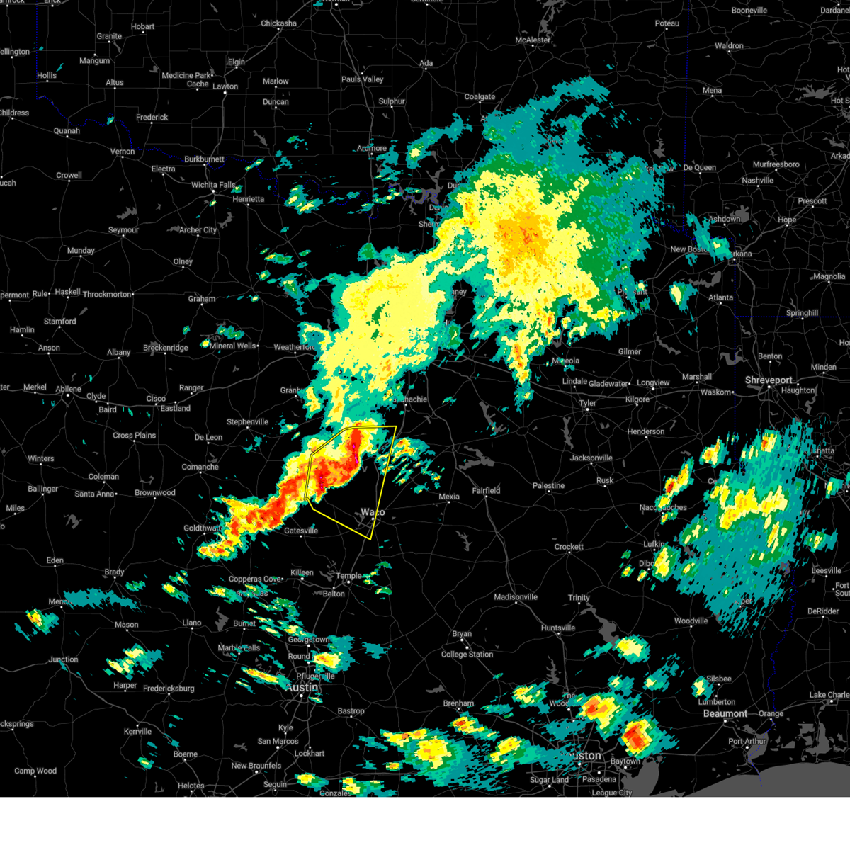
| 4/29/2026 3:25 PM CDT |
 At 325 pm cdt, a severe thunderstorm was located over cranfills gap, or 15 miles west of clifton, moving east at 45 mph (radar indicated). Hazards include quarter size hail. Damage to vehicles is possible. Locations impacted include, clifton, meridian, cranfills gap, meridian state park, norse, womack, and cayote. At 325 pm cdt, a severe thunderstorm was located over cranfills gap, or 15 miles west of clifton, moving east at 45 mph (radar indicated). Hazards include quarter size hail. Damage to vehicles is possible. Locations impacted include, clifton, meridian, cranfills gap, meridian state park, norse, womack, and cayote.
|
| 4/29/2026 3:12 PM CDT |
 the severe thunderstorm warning has been cancelled and is no longer in effect the severe thunderstorm warning has been cancelled and is no longer in effect
|
| 4/29/2026 3:12 PM CDT |
 At 311 pm cdt, a severe thunderstorm was located 8 miles northeast of hamilton, moving east at 40 mph (radar indicated). Hazards include golf ball size hail. People and animals outdoors will be injured. expect damage to roofs, siding, windows, and vehicles. Locations impacted include, clifton, hamilton, meridian, cranfills gap, meridian state park, norse, womack, cayote, olin, and fairy. At 311 pm cdt, a severe thunderstorm was located 8 miles northeast of hamilton, moving east at 40 mph (radar indicated). Hazards include golf ball size hail. People and animals outdoors will be injured. expect damage to roofs, siding, windows, and vehicles. Locations impacted include, clifton, hamilton, meridian, cranfills gap, meridian state park, norse, womack, cayote, olin, and fairy.
|
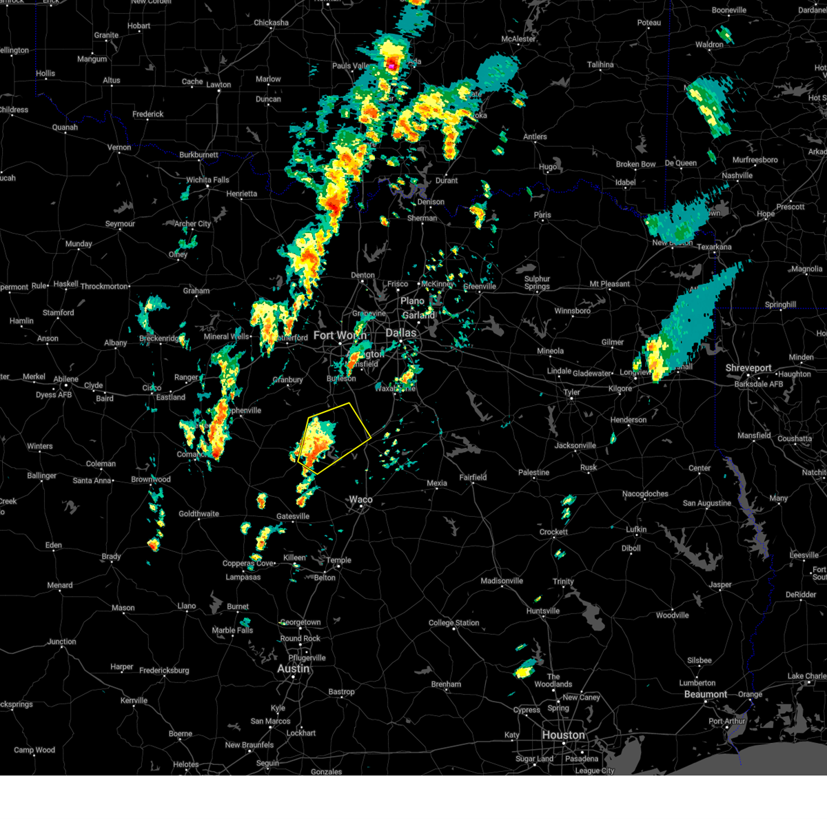
| 4/29/2026 2:53 PM CDT |
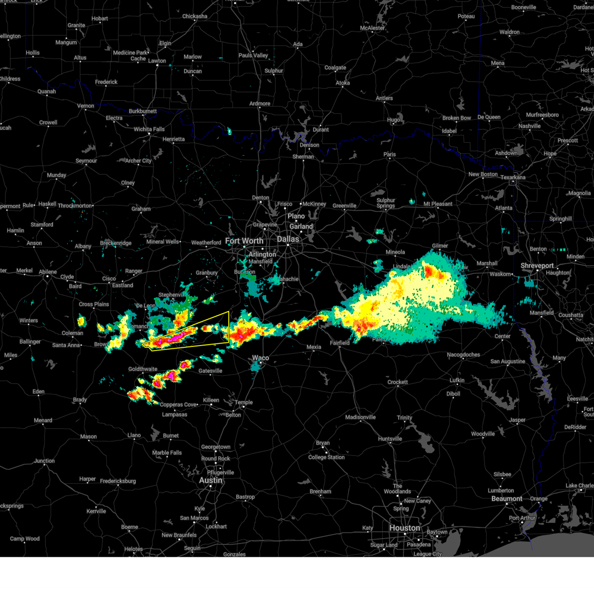
 Svrfwd the national weather service in fort worth has issued a * severe thunderstorm warning for, central hamilton county in central texas, central bosque county in central texas, southeastern comanche county in central texas, * until 345 pm cdt. * at 252 pm cdt, a severe thunderstorm was located near lamkin, or 8 miles northwest of hamilton, moving east at 45 mph. this is a destructive storm for lamkin, hamilton, crafills gap, and surrounding areas of southeast comanche, northern hamilton, and southwest bosque counties!! (radar indicated). Hazards include baseball size hail. People and animals outdoors will be severely injured. Expect shattered windows, extensive damage to roofs, siding, and vehicles. Svrfwd the national weather service in fort worth has issued a * severe thunderstorm warning for, central hamilton county in central texas, central bosque county in central texas, southeastern comanche county in central texas, * until 345 pm cdt. * at 252 pm cdt, a severe thunderstorm was located near lamkin, or 8 miles northwest of hamilton, moving east at 45 mph. this is a destructive storm for lamkin, hamilton, crafills gap, and surrounding areas of southeast comanche, northern hamilton, and southwest bosque counties!! (radar indicated). Hazards include baseball size hail. People and animals outdoors will be severely injured. Expect shattered windows, extensive damage to roofs, siding, and vehicles.
|
| 4/28/2026 9:12 PM CDT |
 At 912 pm cdt, a severe thunderstorm was located near meridian, or 10 miles north of clifton, moving southeast at 30 mph (radar indicated). Hazards include golf ball size hail and 60 mph wind gusts. People and animals outdoors will be injured. expect hail damage to roofs, siding, windows, and vehicles. expect wind damage to roofs, siding, and trees. Locations impacted include, meridian, laguna park, lake whitney state park, lake whitney, meridian state park, morgan, cedar shores, lakewood harbor, womack, cayote, kopperl, and lakeside village. At 912 pm cdt, a severe thunderstorm was located near meridian, or 10 miles north of clifton, moving southeast at 30 mph (radar indicated). Hazards include golf ball size hail and 60 mph wind gusts. People and animals outdoors will be injured. expect hail damage to roofs, siding, windows, and vehicles. expect wind damage to roofs, siding, and trees. Locations impacted include, meridian, laguna park, lake whitney state park, lake whitney, meridian state park, morgan, cedar shores, lakewood harbor, womack, cayote, kopperl, and lakeside village.
|
| 4/28/2026 8:52 PM CDT |
 At 852 pm cdt, a severe thunderstorm was located near meridian, or 15 miles north of clifton, moving southeast at 30 mph (radar indicated). Hazards include golf ball size hail and 60 mph wind gusts. People and animals outdoors will be injured. expect hail damage to roofs, siding, windows, and vehicles. expect wind damage to roofs, siding, and trees. this severe storm will be near, meridian around 855 pm cdt. lake whitney around 915 pm cdt. laguna park around 920 pm cdt. lake whitney state park around 925 pm cdt. Other locations impacted by this severe thunderstorm include womack, lakewood harbor, cayote, walnut springs, morgan, kopperl, cedar shores, and lakeside village. At 852 pm cdt, a severe thunderstorm was located near meridian, or 15 miles north of clifton, moving southeast at 30 mph (radar indicated). Hazards include golf ball size hail and 60 mph wind gusts. People and animals outdoors will be injured. expect hail damage to roofs, siding, windows, and vehicles. expect wind damage to roofs, siding, and trees. this severe storm will be near, meridian around 855 pm cdt. lake whitney around 915 pm cdt. laguna park around 920 pm cdt. lake whitney state park around 925 pm cdt. Other locations impacted by this severe thunderstorm include womack, lakewood harbor, cayote, walnut springs, morgan, kopperl, cedar shores, and lakeside village.
|
| 4/28/2026 8:44 PM CDT |
 At 844 pm cdt, a severe thunderstorm was located 7 miles northwest of meridian, or 17 miles northwest of clifton, moving east at 25 mph (radar indicated). Hazards include 60 mph wind gusts and quarter size hail. Hail damage to vehicles is expected. expect wind damage to roofs, siding, and trees. this severe storm will be near, lake whitney around 910 pm cdt. lake whitney state park around 925 pm cdt. Other locations impacted by this severe thunderstorm include womack, lakewood harbor, cayote, walnut springs, morgan, kopperl, cedar shores, and lakeside village. At 844 pm cdt, a severe thunderstorm was located 7 miles northwest of meridian, or 17 miles northwest of clifton, moving east at 25 mph (radar indicated). Hazards include 60 mph wind gusts and quarter size hail. Hail damage to vehicles is expected. expect wind damage to roofs, siding, and trees. this severe storm will be near, lake whitney around 910 pm cdt. lake whitney state park around 925 pm cdt. Other locations impacted by this severe thunderstorm include womack, lakewood harbor, cayote, walnut springs, morgan, kopperl, cedar shores, and lakeside village.
|
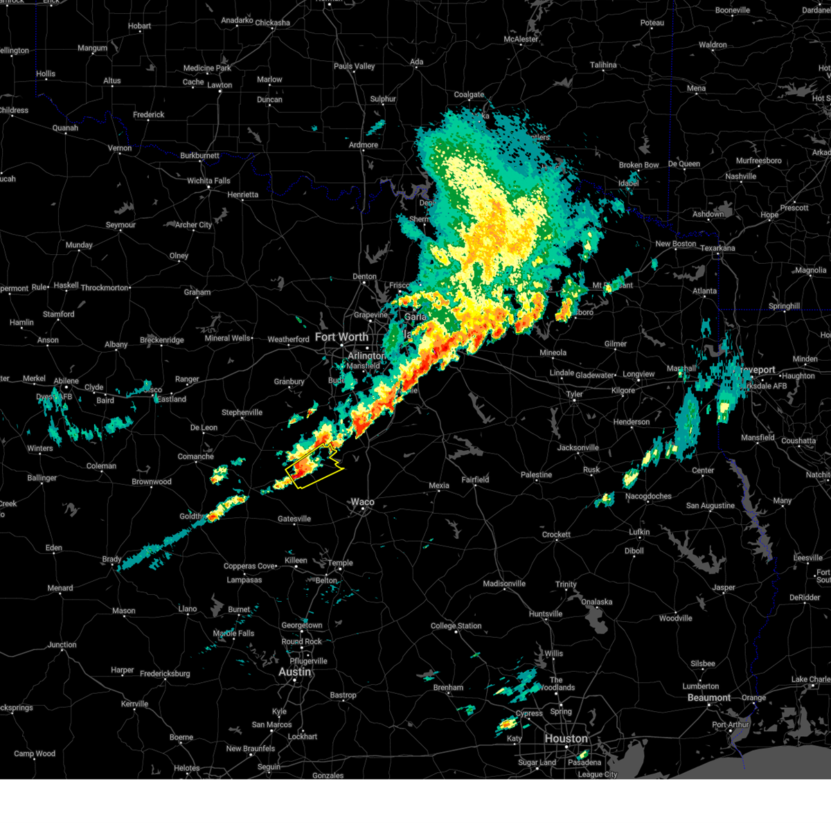
| 4/28/2026 8:23 PM CDT |
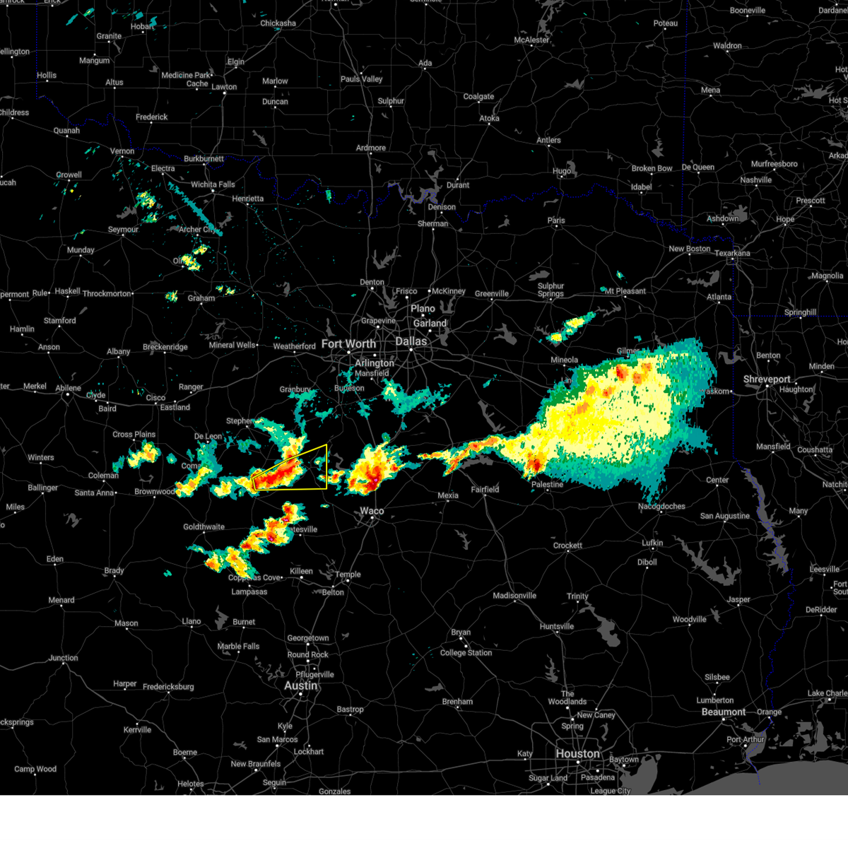
 Svrfwd the national weather service in fort worth has issued a * severe thunderstorm warning for, bosque county in central texas, west central hill county in central texas, * until 930 pm cdt. * at 823 pm cdt, a severe thunderstorm was located near iredell, or 23 miles northwest of clifton, moving southeast at 30 mph (radar indicated). Hazards include 60 mph wind gusts and quarter size hail. Hail damage to vehicles is expected. expect wind damage to roofs, siding, and trees. this severe thunderstorm will be near, meridian around 840 pm cdt. meridian state park around 845 pm cdt. laguna park and lake whitney around 910 pm cdt. Other locations impacted by this severe thunderstorm include womack, lakewood harbor, walnut springs, cayote, morgan, eulogy, brazos point, kopperl, cedar shores, and norse. Svrfwd the national weather service in fort worth has issued a * severe thunderstorm warning for, bosque county in central texas, west central hill county in central texas, * until 930 pm cdt. * at 823 pm cdt, a severe thunderstorm was located near iredell, or 23 miles northwest of clifton, moving southeast at 30 mph (radar indicated). Hazards include 60 mph wind gusts and quarter size hail. Hail damage to vehicles is expected. expect wind damage to roofs, siding, and trees. this severe thunderstorm will be near, meridian around 840 pm cdt. meridian state park around 845 pm cdt. laguna park and lake whitney around 910 pm cdt. Other locations impacted by this severe thunderstorm include womack, lakewood harbor, walnut springs, cayote, morgan, eulogy, brazos point, kopperl, cedar shores, and norse.
|
| 4/18/2026 10:06 AM CDT |
 the severe thunderstorm warning has been cancelled and is no longer in effect the severe thunderstorm warning has been cancelled and is no longer in effect
|
| 4/18/2026 10:06 AM CDT |
 At 1005 am cdt, a severe thunderstorm was located near clifton, moving east at 60 mph (radar indicated). Hazards include quarter size hail. Damage to vehicles is possible. this severe storm will be near, clifton around 1010 am cdt. Other locations impacted by this severe thunderstorm include womack, lakewood harbor, cayote, cedar shores, norse, mosheim, and hurst springs. At 1005 am cdt, a severe thunderstorm was located near clifton, moving east at 60 mph (radar indicated). Hazards include quarter size hail. Damage to vehicles is possible. this severe storm will be near, clifton around 1010 am cdt. Other locations impacted by this severe thunderstorm include womack, lakewood harbor, cayote, cedar shores, norse, mosheim, and hurst springs.
|
| 4/18/2026 9:51 AM CDT |
 Svrfwd the national weather service in fort worth has issued a * severe thunderstorm warning for, northeastern hamilton county in central texas, north central coryell county in central texas, bosque county in central texas, * until 1030 am cdt. * at 951 am cdt, a severe thunderstorm was located over cranfills gap, or 13 miles west of clifton, moving east at 65 mph (radar indicated). Hazards include quarter size hail. Damage to vehicles is possible. this severe thunderstorm will be near, clifton around 1000 am cdt. laguna park and lake whitney around 1010 am cdt. Other locations impacted by this severe thunderstorm include pancake, womack, lakewood harbor, cayote, jonesboro, cedar shores, norse, mosheim, turnersville, and hurst springs. Svrfwd the national weather service in fort worth has issued a * severe thunderstorm warning for, northeastern hamilton county in central texas, north central coryell county in central texas, bosque county in central texas, * until 1030 am cdt. * at 951 am cdt, a severe thunderstorm was located over cranfills gap, or 13 miles west of clifton, moving east at 65 mph (radar indicated). Hazards include quarter size hail. Damage to vehicles is possible. this severe thunderstorm will be near, clifton around 1000 am cdt. laguna park and lake whitney around 1010 am cdt. Other locations impacted by this severe thunderstorm include pancake, womack, lakewood harbor, cayote, jonesboro, cedar shores, norse, mosheim, turnersville, and hurst springs.
|
| 1/9/2026 1:23 PM CST |
 Svrfwd the national weather service in fort worth has issued a * severe thunderstorm warning for, east central hamilton county in central texas, north central coryell county in central texas, southern bosque county in central texas, * until 215 pm cst. * at 123 pm cst, a severe thunderstorm was located 9 miles south of cranfills gap, or 14 miles north of gatesville, moving northeast at 45 mph (radar indicated). Hazards include 60 mph wind gusts and quarter size hail. Hail damage to vehicles is expected. Expect wind damage to roofs, siding, and trees. Svrfwd the national weather service in fort worth has issued a * severe thunderstorm warning for, east central hamilton county in central texas, north central coryell county in central texas, southern bosque county in central texas, * until 215 pm cst. * at 123 pm cst, a severe thunderstorm was located 9 miles south of cranfills gap, or 14 miles north of gatesville, moving northeast at 45 mph (radar indicated). Hazards include 60 mph wind gusts and quarter size hail. Hail damage to vehicles is expected. Expect wind damage to roofs, siding, and trees.
|
| 10/24/2025 8:53 PM CDT | The storms which prompted the warning have moved out of the area. therefore the warning will be allowed to expire. however gusty winds and heavy rain are still possible with these thunderstorms. a severe thunderstorm watch remains in effect until midnight cdt for central and north central texas. |
| 10/24/2025 8:36 PM CDT | At 835 pm cdt, severe thunderstorms were located along a line extending from 6 miles southeast of western lake to near meridian, moving east at 30 mph (radar indicated). Hazards include 60 mph wind gusts. Expect damage to roofs, siding, and trees. these severe storms will be near, granbury, pecan plantation, and lake whitney around 840 pm cdt. Other locations impacted by these severe thunderstorms include walnut springs, eulogy, stockton bend, kopperl, brazos point, mambrino, morgan, acton, lake granbury, and waples. |
| 10/24/2025 8:07 PM CDT | At 806 pm cdt, severe thunderstorms were located along a line extending from near lipan to near meridian state park, moving east at 30 mph (radar indicated). Hazards include 60 mph wind gusts. Expect damage to roofs, siding, and trees. these severe storms will be near, granbury, glen rose, meridian state park, oak trail shores, dinosaur valley state park, and squaw creek reservoir around 810 pm cdt. meridian around 815 pm cdt. pecan plantation around 820 pm cdt. lake whitney around 835 pm cdt. Other locations impacted by these severe thunderstorms include walnut springs, eulogy, stockton bend, kopperl, brazos point, mambrino, tolar, morgan, acton, and lake granbury. |
| 10/24/2025 7:42 PM CDT | Svrfwd the national weather service in fort worth has issued a * severe thunderstorm warning for, somervell county in north central texas, northern bosque county in central texas, hood county in north central texas, * until 900 pm cdt. * at 741 pm cdt, severe thunderstorms were located along a line extending from near lipan to hico, moving east at 30 mph (radar indicated). Hazards include 70 mph wind gusts. Expect considerable tree damage. damage is likely to mobile homes, roofs, and outbuildings. severe thunderstorms will be near, lipan around 745 pm cdt. iredell around 750 pm cdt. meridian state park, dinosaur valley state park, and squaw creek reservoir around 805 pm cdt. granbury, glen rose, meridian, and oak trail shores around 810 pm cdt. pecan plantation around 820 pm cdt. lake whitney around 835 pm cdt. Other locations impacted by these severe thunderstorms include walnut springs, eulogy, stockton bend, kopperl, brazos point, mambrino, tolar, morgan, acton, and lake granbury. |
| 6/8/2025 7:32 PM CDT |
 the severe thunderstorm warning has been cancelled and is no longer in effect the severe thunderstorm warning has been cancelled and is no longer in effect
|
| 6/8/2025 7:16 PM CDT |
 the severe thunderstorm warning has been cancelled and is no longer in effect the severe thunderstorm warning has been cancelled and is no longer in effect
|
| 6/8/2025 7:16 PM CDT |
 At 716 pm cdt, a severe thunderstorm was located 9 miles northeast of iredell, or 23 miles south of granbury, moving southeast at 15 mph (radar indicated). Hazards include 60 mph wind gusts and quarter size hail. Hail damage to vehicles is expected. expect wind damage to roofs, siding, and trees. This severe thunderstorm will remain over mainly rural areas of southwestern somervell and northern bosque counties, including the following locations, walnut springs, morgan, lakeside village, and cedar shores. At 716 pm cdt, a severe thunderstorm was located 9 miles northeast of iredell, or 23 miles south of granbury, moving southeast at 15 mph (radar indicated). Hazards include 60 mph wind gusts and quarter size hail. Hail damage to vehicles is expected. expect wind damage to roofs, siding, and trees. This severe thunderstorm will remain over mainly rural areas of southwestern somervell and northern bosque counties, including the following locations, walnut springs, morgan, lakeside village, and cedar shores.
|
| 6/8/2025 6:55 PM CDT |
 Svrfwd the national weather service in fort worth has issued a * severe thunderstorm warning for, southwestern somervell county in north central texas, southeastern erath county in north central texas, central bosque county in central texas, * until 800 pm cdt. * at 655 pm cdt, a severe thunderstorm was located 9 miles southwest of dinosaur valley state park, or 20 miles east of stephenville, moving southeast at 20 mph (radar indicated). Hazards include 60 mph wind gusts and quarter size hail. Hail damage to vehicles is expected. expect wind damage to roofs, siding, and trees. this severe thunderstorm will be near, meridian around 740 pm cdt. meridian state park around 745 pm cdt. Other locations impacted by this severe thunderstorm include walnut springs, morgan, johnsville, cedar shores, chalk mountain, lakeside village, and duffau. Svrfwd the national weather service in fort worth has issued a * severe thunderstorm warning for, southwestern somervell county in north central texas, southeastern erath county in north central texas, central bosque county in central texas, * until 800 pm cdt. * at 655 pm cdt, a severe thunderstorm was located 9 miles southwest of dinosaur valley state park, or 20 miles east of stephenville, moving southeast at 20 mph (radar indicated). Hazards include 60 mph wind gusts and quarter size hail. Hail damage to vehicles is expected. expect wind damage to roofs, siding, and trees. this severe thunderstorm will be near, meridian around 740 pm cdt. meridian state park around 745 pm cdt. Other locations impacted by this severe thunderstorm include walnut springs, morgan, johnsville, cedar shores, chalk mountain, lakeside village, and duffau.
|
| 6/4/2025 12:04 AM CDT |
 At 1204 am cdt, severe thunderstorms were located along a line extending from meridian to near zephyr, moving southeast at 30 mph (radar indicated). Hazards include 60 mph wind gusts and quarter size hail. Hail damage to vehicles is expected. expect wind damage to roofs, siding, and trees. Locations impacted include, shive, goldthwaite, meridian state park, olin, bozar, whiteway, iredell, center city, energy, star, democrat, hamilton, gentrys mill, carlton, gustine, lamkin, mullin, cranfills gap, clifton, and priddy. At 1204 am cdt, severe thunderstorms were located along a line extending from meridian to near zephyr, moving southeast at 30 mph (radar indicated). Hazards include 60 mph wind gusts and quarter size hail. Hail damage to vehicles is expected. expect wind damage to roofs, siding, and trees. Locations impacted include, shive, goldthwaite, meridian state park, olin, bozar, whiteway, iredell, center city, energy, star, democrat, hamilton, gentrys mill, carlton, gustine, lamkin, mullin, cranfills gap, clifton, and priddy.
|
| 6/4/2025 12:04 AM CDT |
 the severe thunderstorm warning has been cancelled and is no longer in effect the severe thunderstorm warning has been cancelled and is no longer in effect
|
| 6/3/2025 11:28 PM CDT |
 Svrfwd the national weather service in fort worth has issued a * severe thunderstorm warning for, southwestern somervell county in north central texas, hamilton county in central texas, southeastern erath county in north central texas, western bosque county in central texas, mills county in central texas, southern comanche county in central texas, * until 1245 am cdt. * at 1128 pm cdt, severe thunderstorms were located along a line extending from iredell to near early, moving southeast at 20 mph (radar indicated). Hazards include 60 mph wind gusts and quarter size hail. Hail damage to vehicles is expected. Expect wind damage to roofs, siding, and trees. Svrfwd the national weather service in fort worth has issued a * severe thunderstorm warning for, southwestern somervell county in north central texas, hamilton county in central texas, southeastern erath county in north central texas, western bosque county in central texas, mills county in central texas, southern comanche county in central texas, * until 1245 am cdt. * at 1128 pm cdt, severe thunderstorms were located along a line extending from iredell to near early, moving southeast at 20 mph (radar indicated). Hazards include 60 mph wind gusts and quarter size hail. Hail damage to vehicles is expected. Expect wind damage to roofs, siding, and trees.
|
| 5/26/2025 4:58 AM CDT |
 At 458 am cdt, a severe thunderstorm was located over whitney, or 11 miles west of hillsboro, moving southeast at 30 mph (radar indicated). Hazards include 65 mph wind gusts. Expect damage to roofs, siding, and trees. this severe storm will be near, aquilla lake around 505 am cdt. Other locations impacted by this severe thunderstorm include cayote, lovelace, cedar shores, brandon, mayfield, abbott, womack, lakewood harbor, osceola, and woodbury. At 458 am cdt, a severe thunderstorm was located over whitney, or 11 miles west of hillsboro, moving southeast at 30 mph (radar indicated). Hazards include 65 mph wind gusts. Expect damage to roofs, siding, and trees. this severe storm will be near, aquilla lake around 505 am cdt. Other locations impacted by this severe thunderstorm include cayote, lovelace, cedar shores, brandon, mayfield, abbott, womack, lakewood harbor, osceola, and woodbury.
|
| 5/26/2025 4:42 AM CDT |
 At 442 am cdt, a severe thunderstorm was located near blum, or 17 miles west of hillsboro, moving southeast at 30 mph (radar indicated). Hazards include 60 mph wind gusts and quarter size hail. Hail damage to vehicles is expected. expect wind damage to roofs, siding, and trees. this severe storm will be near, lake whitney and whitney around 450 am cdt. lake whitney state park around 455 am cdt. aquilla lake around 500 am cdt. Other locations impacted by this severe thunderstorm include cayote, lovelace, kopperl, cedar shores, brandon, mayfield, abbott, womack, lakewood harbor, and morgan. At 442 am cdt, a severe thunderstorm was located near blum, or 17 miles west of hillsboro, moving southeast at 30 mph (radar indicated). Hazards include 60 mph wind gusts and quarter size hail. Hail damage to vehicles is expected. expect wind damage to roofs, siding, and trees. this severe storm will be near, lake whitney and whitney around 450 am cdt. lake whitney state park around 455 am cdt. aquilla lake around 500 am cdt. Other locations impacted by this severe thunderstorm include cayote, lovelace, kopperl, cedar shores, brandon, mayfield, abbott, womack, lakewood harbor, and morgan.
|
| 5/26/2025 4:42 AM CDT |
 the severe thunderstorm warning has been cancelled and is no longer in effect the severe thunderstorm warning has been cancelled and is no longer in effect
|
| 5/26/2025 4:26 AM CDT |
 Svrfwd the national weather service in fort worth has issued a * severe thunderstorm warning for, central somervell county in north central texas, southern johnson county in north central texas, bosque county in central texas, hill county in central texas, * until 530 am cdt. * at 425 am cdt, a severe thunderstorm was located near cleburne state park, or 12 miles southwest of cleburne, moving southeast at 30 mph (radar indicated). Hazards include 60 mph wind gusts. Expect damage to roofs, siding, and trees. this severe thunderstorm will be near, lake whitney and blum around 430 am cdt. whitney around 450 am cdt. aquilla lake and lake whitney state park around 500 am cdt. other locations impacted by this severe thunderstorm include brazos point, cedar shores, morgan, osceola, woodbury, aquilla, retreat, peoria, lakeside village, and nemo. this includes the following highways, interstate 35 between mile markers 356 and 369. interstate 35w between mile markers 1 and 17. Interstate 35e between mile markers 371 and 377. Svrfwd the national weather service in fort worth has issued a * severe thunderstorm warning for, central somervell county in north central texas, southern johnson county in north central texas, bosque county in central texas, hill county in central texas, * until 530 am cdt. * at 425 am cdt, a severe thunderstorm was located near cleburne state park, or 12 miles southwest of cleburne, moving southeast at 30 mph (radar indicated). Hazards include 60 mph wind gusts. Expect damage to roofs, siding, and trees. this severe thunderstorm will be near, lake whitney and blum around 430 am cdt. whitney around 450 am cdt. aquilla lake and lake whitney state park around 500 am cdt. other locations impacted by this severe thunderstorm include brazos point, cedar shores, morgan, osceola, woodbury, aquilla, retreat, peoria, lakeside village, and nemo. this includes the following highways, interstate 35 between mile markers 356 and 369. interstate 35w between mile markers 1 and 17. Interstate 35e between mile markers 371 and 377.
|
| 5/26/2025 4:07 AM CDT |
 At 406 am cdt, a severe thunderstorm was located near blum, or 12 miles south of cleburne, moving southeast at 30 mph (radar indicated). Hazards include 60 mph wind gusts and quarter size hail. Hail damage to vehicles is expected. expect wind damage to roofs, siding, and trees. this severe storm will be near, lake whitney and blum around 410 am cdt. whitney around 430 am cdt. Other locations impacted by this severe thunderstorm include brazos point, cedar shores, egan, mambrino, morgan, osceola, acton, woodbury, waples, and rainbow. At 406 am cdt, a severe thunderstorm was located near blum, or 12 miles south of cleburne, moving southeast at 30 mph (radar indicated). Hazards include 60 mph wind gusts and quarter size hail. Hail damage to vehicles is expected. expect wind damage to roofs, siding, and trees. this severe storm will be near, lake whitney and blum around 410 am cdt. whitney around 430 am cdt. Other locations impacted by this severe thunderstorm include brazos point, cedar shores, egan, mambrino, morgan, osceola, acton, woodbury, waples, and rainbow.
|
| 5/26/2025 4:07 AM CDT |
 the severe thunderstorm warning has been cancelled and is no longer in effect the severe thunderstorm warning has been cancelled and is no longer in effect
|
| 5/26/2025 3:53 AM CDT |
 At 352 am cdt, a severe thunderstorm was located over cleburne state park, or 10 miles southwest of cleburne, moving southeast at 25 mph (radar indicated). Hazards include 60 mph wind gusts and quarter size hail. Hail damage to vehicles is expected. expect wind damage to roofs, siding, and trees. this severe storm will be near, lake whitney around 400 am cdt. blum around 415 am cdt. whitney around 440 am cdt. Other locations impacted by this severe thunderstorm include dennis, brazos point, cedar shores, egan, mambrino, morgan, osceola, acton, bennett, and woodbury. At 352 am cdt, a severe thunderstorm was located over cleburne state park, or 10 miles southwest of cleburne, moving southeast at 25 mph (radar indicated). Hazards include 60 mph wind gusts and quarter size hail. Hail damage to vehicles is expected. expect wind damage to roofs, siding, and trees. this severe storm will be near, lake whitney around 400 am cdt. blum around 415 am cdt. whitney around 440 am cdt. Other locations impacted by this severe thunderstorm include dennis, brazos point, cedar shores, egan, mambrino, morgan, osceola, acton, bennett, and woodbury.
|
| 5/26/2025 3:23 AM CDT |
 Svrfwd the national weather service in fort worth has issued a * severe thunderstorm warning for, somervell county in north central texas, johnson county in north central texas, southern parker county in north central texas, northern bosque county in central texas, southwestern tarrant county in north central texas, northwestern hill county in central texas, hood county in north central texas, * until 430 am cdt. * at 322 am cdt, a severe thunderstorm was located near pecan plantation, or 7 miles east of granbury, moving southeast at 35 mph (radar indicated). Hazards include 60 mph wind gusts and nickel size hail. Expect damage to roofs, siding, and trees. this severe thunderstorm will be near, pecan plantation around 330 am cdt. cleburne state park around 335 am cdt. lake whitney around 350 am cdt. blum around 405 am cdt. other locations impacted by this severe thunderstorm include dennis, brazos point, cedar shores, egan, mambrino, morgan, osceola, acton, bennett, and woodbury. this includes the following highways, interstate 35w between mile markers 3 and 30. interstate 20 between mile markers 390 and 425. Interstate 30 near mile marker 1. Svrfwd the national weather service in fort worth has issued a * severe thunderstorm warning for, somervell county in north central texas, johnson county in north central texas, southern parker county in north central texas, northern bosque county in central texas, southwestern tarrant county in north central texas, northwestern hill county in central texas, hood county in north central texas, * until 430 am cdt. * at 322 am cdt, a severe thunderstorm was located near pecan plantation, or 7 miles east of granbury, moving southeast at 35 mph (radar indicated). Hazards include 60 mph wind gusts and nickel size hail. Expect damage to roofs, siding, and trees. this severe thunderstorm will be near, pecan plantation around 330 am cdt. cleburne state park around 335 am cdt. lake whitney around 350 am cdt. blum around 405 am cdt. other locations impacted by this severe thunderstorm include dennis, brazos point, cedar shores, egan, mambrino, morgan, osceola, acton, bennett, and woodbury. this includes the following highways, interstate 35w between mile markers 3 and 30. interstate 20 between mile markers 390 and 425. Interstate 30 near mile marker 1.
|
| 5/17/2025 5:14 PM CDT |
 At 513 pm cdt, a severe thunderstorm was located 10 miles northeast of meridian, or 16 miles north of clifton, moving northeast at 45 mph (radar indicated). Hazards include 60 mph wind gusts and quarter size hail. Hail damage to vehicles is expected. expect wind damage to roofs, siding, and trees. this severe storm will be near, lake whitney around 520 pm cdt. Other locations impacted by this severe thunderstorm include eulogy, rio vista, kopperl, parker, brazos point, cedar shores, mayfield, abbott, womack, and lakewood harbor. At 513 pm cdt, a severe thunderstorm was located 10 miles northeast of meridian, or 16 miles north of clifton, moving northeast at 45 mph (radar indicated). Hazards include 60 mph wind gusts and quarter size hail. Hail damage to vehicles is expected. expect wind damage to roofs, siding, and trees. this severe storm will be near, lake whitney around 520 pm cdt. Other locations impacted by this severe thunderstorm include eulogy, rio vista, kopperl, parker, brazos point, cedar shores, mayfield, abbott, womack, and lakewood harbor.
|
| 5/17/2025 5:14 PM CDT |
 the severe thunderstorm warning has been cancelled and is no longer in effect the severe thunderstorm warning has been cancelled and is no longer in effect
|
| 5/17/2025 4:45 PM CDT |
 Svrfwd the national weather service in fort worth has issued a * severe thunderstorm warning for, somervell county in north central texas, southeastern erath county in north central texas, western johnson county in north central texas, bosque county in central texas, northwestern hill county in central texas, east central hood county in north central texas, * until 545 pm cdt. * at 445 pm cdt, a severe thunderstorm was located near iredell, or 18 miles northwest of clifton, moving northeast at 40 mph (radar indicated). Hazards include 60 mph wind gusts and quarter size hail. Hail damage to vehicles is expected. expect wind damage to roofs, siding, and trees. this severe thunderstorm will be near, lake whitney around 510 pm cdt. blum around 520 pm cdt. covington around 535 pm cdt. other locations impacted by this severe thunderstorm include walnut springs, eulogy, rio vista, kopperl, parker, brazos point, cedar shores, mayfield, abbott, and womack. This includes interstate 35 between mile markers 356 and 366. Svrfwd the national weather service in fort worth has issued a * severe thunderstorm warning for, somervell county in north central texas, southeastern erath county in north central texas, western johnson county in north central texas, bosque county in central texas, northwestern hill county in central texas, east central hood county in north central texas, * until 545 pm cdt. * at 445 pm cdt, a severe thunderstorm was located near iredell, or 18 miles northwest of clifton, moving northeast at 40 mph (radar indicated). Hazards include 60 mph wind gusts and quarter size hail. Hail damage to vehicles is expected. expect wind damage to roofs, siding, and trees. this severe thunderstorm will be near, lake whitney around 510 pm cdt. blum around 520 pm cdt. covington around 535 pm cdt. other locations impacted by this severe thunderstorm include walnut springs, eulogy, rio vista, kopperl, parker, brazos point, cedar shores, mayfield, abbott, and womack. This includes interstate 35 between mile markers 356 and 366.
|
| 5/16/2025 8:27 PM CDT |
 At 826 pm cdt, a severe thunderstorm was located near morgan, or 14 miles north of clifton, moving northeast at 30 mph (trained weather spotters. at 824 pm cdt...hail over 2 inches in diameter was reported north of meridian with this storm). Hazards include golf ball size hail and 60 mph wind gusts. People and animals outdoors will be injured. expect hail damage to roofs, siding, windows, and vehicles. expect wind damage to roofs, siding, and trees. Locations impacted include, walnut springs, cleburne state park, eulogy, meridian state park, kopperl, brazos point, meridian, morgan, retreat, blum, lakeside village, nemo, covington, rainbow, and lake whitney. At 826 pm cdt, a severe thunderstorm was located near morgan, or 14 miles north of clifton, moving northeast at 30 mph (trained weather spotters. at 824 pm cdt...hail over 2 inches in diameter was reported north of meridian with this storm). Hazards include golf ball size hail and 60 mph wind gusts. People and animals outdoors will be injured. expect hail damage to roofs, siding, windows, and vehicles. expect wind damage to roofs, siding, and trees. Locations impacted include, walnut springs, cleburne state park, eulogy, meridian state park, kopperl, brazos point, meridian, morgan, retreat, blum, lakeside village, nemo, covington, rainbow, and lake whitney.
|
| 5/16/2025 8:26 PM CDT | Baseball sized hail reported 4.8 miles SSW of Meridian, TX, photo of measured 2.76 inch hail. |
| 5/16/2025 8:23 PM CDT | Hen Egg sized hail reported 1.4 miles SSW of Meridian, TX, photo of 2.11 inch hail measured. |
| 5/16/2025 8:08 PM CDT |
 Svrfwd the national weather service in fort worth has issued a * severe thunderstorm warning for, eastern somervell county in north central texas, southwestern johnson county in north central texas, central bosque county in central texas, northwestern hill county in central texas, * until 915 pm cdt. * at 807 pm cdt, a severe thunderstorm was located near meridian, moving northeast at 30 mph (radar indicated). Hazards include 60 mph wind gusts and half dollar size hail. Hail damage to vehicles is expected. Expect wind damage to roofs, siding, and trees. Svrfwd the national weather service in fort worth has issued a * severe thunderstorm warning for, eastern somervell county in north central texas, southwestern johnson county in north central texas, central bosque county in central texas, northwestern hill county in central texas, * until 915 pm cdt. * at 807 pm cdt, a severe thunderstorm was located near meridian, moving northeast at 30 mph (radar indicated). Hazards include 60 mph wind gusts and half dollar size hail. Hail damage to vehicles is expected. Expect wind damage to roofs, siding, and trees.
|
| 5/16/2025 7:45 PM CDT |
 At 745 pm cdt, a severe thunderstorm was located 7 miles west of cranfills gap, or 10 miles east of hamilton, moving northeast at 35 mph (radar indicated). Hazards include 60 mph wind gusts and quarter size hail. Hail damage to vehicles is expected. expect wind damage to roofs, siding, and trees. Locations impacted include, iredell, meridian state park, jonesboro, cranfills gap, hamilton, whiteway, aleman, fairy, and norse. At 745 pm cdt, a severe thunderstorm was located 7 miles west of cranfills gap, or 10 miles east of hamilton, moving northeast at 35 mph (radar indicated). Hazards include 60 mph wind gusts and quarter size hail. Hail damage to vehicles is expected. expect wind damage to roofs, siding, and trees. Locations impacted include, iredell, meridian state park, jonesboro, cranfills gap, hamilton, whiteway, aleman, fairy, and norse.
|
| 5/16/2025 7:31 PM CDT |
 the severe thunderstorm warning has been cancelled and is no longer in effect the severe thunderstorm warning has been cancelled and is no longer in effect
|
| 5/16/2025 7:31 PM CDT |
 At 730 pm cdt, a severe thunderstorm was located near hamilton, moving northeast at 35 mph (radar indicated). Hazards include 60 mph wind gusts and quarter size hail. Hail damage to vehicles is expected. expect wind damage to roofs, siding, and trees. this severe storm will be near, hamilton around 735 pm cdt. iredell around 810 pm cdt. Other locations impacted by this severe thunderstorm include whiteway, aleman, fairy, jonesboro, norse, and ireland. At 730 pm cdt, a severe thunderstorm was located near hamilton, moving northeast at 35 mph (radar indicated). Hazards include 60 mph wind gusts and quarter size hail. Hail damage to vehicles is expected. expect wind damage to roofs, siding, and trees. this severe storm will be near, hamilton around 735 pm cdt. iredell around 810 pm cdt. Other locations impacted by this severe thunderstorm include whiteway, aleman, fairy, jonesboro, norse, and ireland.
|
| 5/16/2025 7:12 PM CDT |
 Svrfwd the national weather service in fort worth has issued a * severe thunderstorm warning for, hamilton county in central texas, northwestern coryell county in central texas, southwestern bosque county in central texas, * until 815 pm cdt. * at 712 pm cdt, a severe thunderstorm was located over evant, or 13 miles south of hamilton, moving northeast at 35 mph (radar indicated). Hazards include 60 mph wind gusts and quarter size hail. Hail damage to vehicles is expected. expect wind damage to roofs, siding, and trees. this severe thunderstorm will be near, cranfills gap around 750 pm cdt. Other locations impacted by this severe thunderstorm include pearl, south purmela, bee house, jonesboro, ireland, purmela, whiteway, aleman, fairy, and norse. Svrfwd the national weather service in fort worth has issued a * severe thunderstorm warning for, hamilton county in central texas, northwestern coryell county in central texas, southwestern bosque county in central texas, * until 815 pm cdt. * at 712 pm cdt, a severe thunderstorm was located over evant, or 13 miles south of hamilton, moving northeast at 35 mph (radar indicated). Hazards include 60 mph wind gusts and quarter size hail. Hail damage to vehicles is expected. expect wind damage to roofs, siding, and trees. this severe thunderstorm will be near, cranfills gap around 750 pm cdt. Other locations impacted by this severe thunderstorm include pearl, south purmela, bee house, jonesboro, ireland, purmela, whiteway, aleman, fairy, and norse.
|
| 5/2/2025 2:03 PM CDT |
 Svrfwd the national weather service in fort worth has issued a * severe thunderstorm warning for, central mclennan county in central texas, eastern bosque county in central texas, hill county in central texas, southwestern ellis county in north central texas, * until 300 pm cdt. * at 202 pm cdt, a severe thunderstorm was located near clifton, moving east at 25 mph (radar indicated). Hazards include 65 mph wind gusts and quarter size hail. Hail damage to vehicles is expected. expect wind damage to roofs, siding, and trees. this severe thunderstorm will be near, lake whitney and laguna park around 215 pm cdt. other locations impacted by this severe thunderstorm include rock creek, willow grove, cedar shores, morgan, osceola, woodbury, gholson, aquilla, retreat, and peoria. this includes the following highways, interstate 35 between mile markers 325 and 369. interstate 35w between mile markers 1 and 12. Interstate 35e between mile markers 371 and 380. Svrfwd the national weather service in fort worth has issued a * severe thunderstorm warning for, central mclennan county in central texas, eastern bosque county in central texas, hill county in central texas, southwestern ellis county in north central texas, * until 300 pm cdt. * at 202 pm cdt, a severe thunderstorm was located near clifton, moving east at 25 mph (radar indicated). Hazards include 65 mph wind gusts and quarter size hail. Hail damage to vehicles is expected. expect wind damage to roofs, siding, and trees. this severe thunderstorm will be near, lake whitney and laguna park around 215 pm cdt. other locations impacted by this severe thunderstorm include rock creek, willow grove, cedar shores, morgan, osceola, woodbury, gholson, aquilla, retreat, and peoria. this includes the following highways, interstate 35 between mile markers 325 and 369. interstate 35w between mile markers 1 and 12. Interstate 35e between mile markers 371 and 380.
|
| 3/30/2025 6:23 AM CDT |
 the severe thunderstorm warning has been cancelled and is no longer in effect the severe thunderstorm warning has been cancelled and is no longer in effect
|
| 3/30/2025 6:20 AM CDT |
 At 620 am cdt, severe thunderstorms were located along a line extending from 6 miles south of iredell to 6 miles south of gustine, moving east at 25 mph (radar indicated). Hazards include quarter size hail. Damage to vehicles is possible. these severe storms will be near, meridian state park around 630 am cdt. meridian around 635 am cdt. cranfills gap around 655 am cdt. Other locations impacted by these severe thunderstorms include morgan, fairy, norse, and olin. At 620 am cdt, severe thunderstorms were located along a line extending from 6 miles south of iredell to 6 miles south of gustine, moving east at 25 mph (radar indicated). Hazards include quarter size hail. Damage to vehicles is possible. these severe storms will be near, meridian state park around 630 am cdt. meridian around 635 am cdt. cranfills gap around 655 am cdt. Other locations impacted by these severe thunderstorms include morgan, fairy, norse, and olin.
|
| 3/30/2025 6:20 AM CDT |
 the severe thunderstorm warning has been cancelled and is no longer in effect the severe thunderstorm warning has been cancelled and is no longer in effect
|
| 3/30/2025 6:04 AM CDT |
 Svrfwd the national weather service in fort worth has issued a * severe thunderstorm warning for, central hamilton county in central texas, central bosque county in central texas, southeastern comanche county in central texas, * until 700 am cdt. * at 604 am cdt, severe thunderstorms were located along a line extending from 7 miles southeast of hico to 10 miles southwest of gustine, moving east at 25 mph (radar indicated). Hazards include ping pong ball size hail. People and animals outdoors will be injured. expect damage to roofs, siding, windows, and vehicles. severe thunderstorms will be near, meridian state park around 630 am cdt. meridian around 635 am cdt. hamilton around 645 am cdt. Other locations impacted by these severe thunderstorms include morgan, newburg, lamkin, energy, olin, gentrys mill, norse, and fairy. Svrfwd the national weather service in fort worth has issued a * severe thunderstorm warning for, central hamilton county in central texas, central bosque county in central texas, southeastern comanche county in central texas, * until 700 am cdt. * at 604 am cdt, severe thunderstorms were located along a line extending from 7 miles southeast of hico to 10 miles southwest of gustine, moving east at 25 mph (radar indicated). Hazards include ping pong ball size hail. People and animals outdoors will be injured. expect damage to roofs, siding, windows, and vehicles. severe thunderstorms will be near, meridian state park around 630 am cdt. meridian around 635 am cdt. hamilton around 645 am cdt. Other locations impacted by these severe thunderstorms include morgan, newburg, lamkin, energy, olin, gentrys mill, norse, and fairy.
|
| 3/30/2025 4:12 AM CDT |
 At 412 am cdt, severe thunderstorms were located along a line extending from near aquilla lake to 6 miles south of meridian state park, moving east at 30 mph (radar indicated). Hazards include quarter size hail. Damage to vehicles is possible. these severe storms will be near, lake whitney, aquilla lake, lake whitney state park, clifton, hillsboro, and laguna park around 420 am cdt. bynum around 435 am cdt. Other locations impacted by these severe thunderstorms include malone, birome, cayote, cedar shores, brandon, tours, penelope, abbott, womack, and lakewood harbor. At 412 am cdt, severe thunderstorms were located along a line extending from near aquilla lake to 6 miles south of meridian state park, moving east at 30 mph (radar indicated). Hazards include quarter size hail. Damage to vehicles is possible. these severe storms will be near, lake whitney, aquilla lake, lake whitney state park, clifton, hillsboro, and laguna park around 420 am cdt. bynum around 435 am cdt. Other locations impacted by these severe thunderstorms include malone, birome, cayote, cedar shores, brandon, tours, penelope, abbott, womack, and lakewood harbor.
|
| 3/30/2025 4:04 AM CDT |
 the severe thunderstorm warning has been cancelled and is no longer in effect the severe thunderstorm warning has been cancelled and is no longer in effect
|
| 3/30/2025 4:04 AM CDT |
 At 403 am cdt, a severe thunderstorm was located near meridian state park, or 8 miles west of clifton, moving east at 40 mph (radar indicated). Hazards include half dollar size hail. Damage to vehicles is possible. this severe storm will be near, clifton around 410 am cdt. Other locations impacted by this severe thunderstorm include norse. At 403 am cdt, a severe thunderstorm was located near meridian state park, or 8 miles west of clifton, moving east at 40 mph (radar indicated). Hazards include half dollar size hail. Damage to vehicles is possible. this severe storm will be near, clifton around 410 am cdt. Other locations impacted by this severe thunderstorm include norse.
|
| 3/30/2025 4:02 AM CDT |
 At 402 am cdt, severe thunderstorms were located along a line extending from near laguna park to cranfills gap, moving east at 35 mph (radar indicated). Hazards include half dollar size hail. Damage to vehicles is possible. these severe storms will be near, lake whitney, aquilla lake, clifton, and laguna park around 410 am cdt. west around 420 am cdt. Other locations impacted by these severe thunderstorms include malone, birome, cayote, cedar shores, brandon, tours, penelope, abbott, womack, and lakewood harbor. At 402 am cdt, severe thunderstorms were located along a line extending from near laguna park to cranfills gap, moving east at 35 mph (radar indicated). Hazards include half dollar size hail. Damage to vehicles is possible. these severe storms will be near, lake whitney, aquilla lake, clifton, and laguna park around 410 am cdt. west around 420 am cdt. Other locations impacted by these severe thunderstorms include malone, birome, cayote, cedar shores, brandon, tours, penelope, abbott, womack, and lakewood harbor.
|
| 3/30/2025 3:48 AM CDT |
 Svrfwd the national weather service in fort worth has issued a * severe thunderstorm warning for, north central mclennan county in central texas, central bosque county in central texas, southern hill county in central texas, * until 445 am cdt. * at 347 am cdt, severe thunderstorms were located along a line extending from near laguna park to 6 miles west of cranfills gap, moving east at 35 mph (radar indicated). Hazards include ping pong ball size hail. People and animals outdoors will be injured. expect damage to roofs, siding, windows, and vehicles. severe thunderstorms will be near, lake whitney, clifton, and laguna park around 355 am cdt. aquilla lake around 405 am cdt. west around 420 am cdt. other locations impacted by these severe thunderstorms include malone, birome, cayote, cedar shores, brandon, tours, penelope, abbott, womack, and lakewood harbor. This includes interstate 35 between mile markers 349 and 368. Svrfwd the national weather service in fort worth has issued a * severe thunderstorm warning for, north central mclennan county in central texas, central bosque county in central texas, southern hill county in central texas, * until 445 am cdt. * at 347 am cdt, severe thunderstorms were located along a line extending from near laguna park to 6 miles west of cranfills gap, moving east at 35 mph (radar indicated). Hazards include ping pong ball size hail. People and animals outdoors will be injured. expect damage to roofs, siding, windows, and vehicles. severe thunderstorms will be near, lake whitney, clifton, and laguna park around 355 am cdt. aquilla lake around 405 am cdt. west around 420 am cdt. other locations impacted by these severe thunderstorms include malone, birome, cayote, cedar shores, brandon, tours, penelope, abbott, womack, and lakewood harbor. This includes interstate 35 between mile markers 349 and 368.
|
| 3/30/2025 3:44 AM CDT |
 At 344 am cdt, a severe thunderstorm was located near cranfills gap, or 11 miles west of clifton, moving east at 50 mph (radar indicated). Hazards include ping pong ball size hail. People and animals outdoors will be injured. expect damage to roofs, siding, windows, and vehicles. this severe storm will be near, clifton around 355 am cdt. Other locations impacted by this severe thunderstorm include norse and fairy. At 344 am cdt, a severe thunderstorm was located near cranfills gap, or 11 miles west of clifton, moving east at 50 mph (radar indicated). Hazards include ping pong ball size hail. People and animals outdoors will be injured. expect damage to roofs, siding, windows, and vehicles. this severe storm will be near, clifton around 355 am cdt. Other locations impacted by this severe thunderstorm include norse and fairy.
|
| 3/30/2025 3:27 AM CDT |
 the severe thunderstorm warning has been cancelled and is no longer in effect the severe thunderstorm warning has been cancelled and is no longer in effect
|
| 3/30/2025 3:27 AM CDT |
 At 326 am cdt, a severe thunderstorm was located near hamilton, moving east at 40 mph (radar indicated). Hazards include ping pong ball size hail. People and animals outdoors will be injured. expect damage to roofs, siding, windows, and vehicles. this severe storm will be near, hamilton around 330 am cdt. cranfills gap around 345 am cdt. clifton around 410 am cdt. Other locations impacted by this severe thunderstorm include gentrys mill, norse, fairy, and pottsville. At 326 am cdt, a severe thunderstorm was located near hamilton, moving east at 40 mph (radar indicated). Hazards include ping pong ball size hail. People and animals outdoors will be injured. expect damage to roofs, siding, windows, and vehicles. this severe storm will be near, hamilton around 330 am cdt. cranfills gap around 345 am cdt. clifton around 410 am cdt. Other locations impacted by this severe thunderstorm include gentrys mill, norse, fairy, and pottsville.
|
| 3/30/2025 3:16 AM CDT |
 Svrfwd the national weather service in fort worth has issued a * severe thunderstorm warning for, central hamilton county in central texas, southwestern bosque county in central texas, southeastern comanche county in central texas, * until 415 am cdt. * at 316 am cdt, a severe thunderstorm was located 9 miles west of hamilton, moving east at 45 mph (radar indicated). Hazards include ping pong ball size hail. People and animals outdoors will be injured. expect damage to roofs, siding, windows, and vehicles. this severe thunderstorm will be near, hamilton around 325 am cdt. cranfills gap around 345 am cdt. clifton around 410 am cdt. Other locations impacted by this severe thunderstorm include gentrys mill, energy, norse, fairy, indian gap, and pottsville. Svrfwd the national weather service in fort worth has issued a * severe thunderstorm warning for, central hamilton county in central texas, southwestern bosque county in central texas, southeastern comanche county in central texas, * until 415 am cdt. * at 316 am cdt, a severe thunderstorm was located 9 miles west of hamilton, moving east at 45 mph (radar indicated). Hazards include ping pong ball size hail. People and animals outdoors will be injured. expect damage to roofs, siding, windows, and vehicles. this severe thunderstorm will be near, hamilton around 325 am cdt. cranfills gap around 345 am cdt. clifton around 410 am cdt. Other locations impacted by this severe thunderstorm include gentrys mill, energy, norse, fairy, indian gap, and pottsville.
|
| 3/29/2025 11:30 PM CDT |
 At 1130 pm cdt, severe thunderstorms were located along a line extending from near lake pat cleburne to 6 miles east of meridian, moving east at 35 mph (radar indicated). Hazards include ping pong ball size hail and 60 mph wind gusts. People and animals outdoors will be injured. expect hail damage to roofs, siding, windows, and vehicles. expect wind damage to roofs, siding, and trees. these severe storms will be near, lake whitney around 1135 pm cdt. Other locations impacted by these severe thunderstorms include morgan, lakeside village, rio vista, kopperl, and retreat. At 1130 pm cdt, severe thunderstorms were located along a line extending from near lake pat cleburne to 6 miles east of meridian, moving east at 35 mph (radar indicated). Hazards include ping pong ball size hail and 60 mph wind gusts. People and animals outdoors will be injured. expect hail damage to roofs, siding, windows, and vehicles. expect wind damage to roofs, siding, and trees. these severe storms will be near, lake whitney around 1135 pm cdt. Other locations impacted by these severe thunderstorms include morgan, lakeside village, rio vista, kopperl, and retreat.
|
| 3/29/2025 11:22 PM CDT |
 the severe thunderstorm warning has been cancelled and is no longer in effect the severe thunderstorm warning has been cancelled and is no longer in effect
|
| 3/29/2025 11:22 PM CDT |
 At 1122 pm cdt, severe thunderstorms were located along a line extending from near cleburne to near meridian, moving east at 40 mph (radar indicated). Hazards include ping pong ball size hail and 60 mph wind gusts. People and animals outdoors will be injured. expect hail damage to roofs, siding, windows, and vehicles. expect wind damage to roofs, siding, and trees. these severe storms will be near, lake whitney, cleburne, and lake pat cleburne around 1130 pm cdt. Other locations impacted by these severe thunderstorms include walnut springs, morgan, eulogy, rio vista, kopperl, retreat, brazos point, and lakeside village. At 1122 pm cdt, severe thunderstorms were located along a line extending from near cleburne to near meridian, moving east at 40 mph (radar indicated). Hazards include ping pong ball size hail and 60 mph wind gusts. People and animals outdoors will be injured. expect hail damage to roofs, siding, windows, and vehicles. expect wind damage to roofs, siding, and trees. these severe storms will be near, lake whitney, cleburne, and lake pat cleburne around 1130 pm cdt. Other locations impacted by these severe thunderstorms include walnut springs, morgan, eulogy, rio vista, kopperl, retreat, brazos point, and lakeside village.
|
| 3/29/2025 11:20 PM CDT |
 Svrfwd the national weather service in fort worth has issued a * severe thunderstorm warning for, johnson county in north central texas, northeastern bosque county in central texas, northwestern hill county in central texas, northwestern ellis county in north central texas, * until 1215 am cdt. * at 1119 pm cdt, severe thunderstorms were located along a line extending from near cross timber to near lake pat cleburne to near meridian, moving northeast at 45 mph (radar indicated). Hazards include ping pong ball size hail and 60 mph wind gusts. People and animals outdoors will be injured. expect hail damage to roofs, siding, windows, and vehicles. expect wind damage to roofs, siding, and trees. severe thunderstorms will be near, lake whitney, burleson, alvarado, keene, mansfield, and blum around 1125 pm cdt. venus around 1130 pm cdt. grandview, grand prairie, and covington around 1135 pm cdt. cedar hill and midlothian around 1140 pm cdt. ovilla around 1150 pm cdt. itasca and glenn heights around 1155 pm cdt. maypearl, red oak, oak leaf, and waxahachie around 1200 am cdt. other locations impacted by these severe thunderstorms include rio vista, kopperl, parker, cedar shores, mayfield, griffith, sand flat, egan, morgan, and lillian. this includes the following highways, interstate 35w between mile markers 6 and 37. Interstate 35e between mile markers 410 and 411. Svrfwd the national weather service in fort worth has issued a * severe thunderstorm warning for, johnson county in north central texas, northeastern bosque county in central texas, northwestern hill county in central texas, northwestern ellis county in north central texas, * until 1215 am cdt. * at 1119 pm cdt, severe thunderstorms were located along a line extending from near cross timber to near lake pat cleburne to near meridian, moving northeast at 45 mph (radar indicated). Hazards include ping pong ball size hail and 60 mph wind gusts. People and animals outdoors will be injured. expect hail damage to roofs, siding, windows, and vehicles. expect wind damage to roofs, siding, and trees. severe thunderstorms will be near, lake whitney, burleson, alvarado, keene, mansfield, and blum around 1125 pm cdt. venus around 1130 pm cdt. grandview, grand prairie, and covington around 1135 pm cdt. cedar hill and midlothian around 1140 pm cdt. ovilla around 1150 pm cdt. itasca and glenn heights around 1155 pm cdt. maypearl, red oak, oak leaf, and waxahachie around 1200 am cdt. other locations impacted by these severe thunderstorms include rio vista, kopperl, parker, cedar shores, mayfield, griffith, sand flat, egan, morgan, and lillian. this includes the following highways, interstate 35w between mile markers 6 and 37. Interstate 35e between mile markers 410 and 411.
|
| 3/29/2025 11:19 PM CDT | Quarter sized hail reported 0.2 miles NNW of Meridian, TX |
| 3/29/2025 11:00 PM CDT |
 At 1059 pm cdt, severe thunderstorms were located along a line extending from 6 miles south of iredell to 8 miles northwest of evant, moving east at 30 mph (radar indicated). Hazards include 60 mph wind gusts and quarter size hail. Hail damage to vehicles is expected. expect wind damage to roofs, siding, and trees. these severe storms will be near, cranfills gap and hamilton around 1105 pm cdt. meridian state park around 1110 pm cdt. Other locations impacted by these severe thunderstorms include shive, jonesboro, whiteway, aleman, norse, fairy, and ireland. At 1059 pm cdt, severe thunderstorms were located along a line extending from 6 miles south of iredell to 8 miles northwest of evant, moving east at 30 mph (radar indicated). Hazards include 60 mph wind gusts and quarter size hail. Hail damage to vehicles is expected. expect wind damage to roofs, siding, and trees. these severe storms will be near, cranfills gap and hamilton around 1105 pm cdt. meridian state park around 1110 pm cdt. Other locations impacted by these severe thunderstorms include shive, jonesboro, whiteway, aleman, norse, fairy, and ireland.
|
| 3/29/2025 11:00 PM CDT |
 the severe thunderstorm warning has been cancelled and is no longer in effect the severe thunderstorm warning has been cancelled and is no longer in effect
|
| 3/29/2025 10:58 PM CDT |
 Svrfwd the national weather service in fort worth has issued a * severe thunderstorm warning for, somervell county in north central texas, east central erath county in north central texas, southwestern johnson county in north central texas, northwestern bosque county in central texas, northwestern hill county in central texas, * until 1145 pm cdt. * at 1058 pm cdt, severe thunderstorms were located along a line extending from near glen rose to near iredell, moving northeast at 40 mph (radar indicated). Hazards include golf ball size hail and 60 mph wind gusts. People and animals outdoors will be injured. expect hail damage to roofs, siding, windows, and vehicles. expect wind damage to roofs, siding, and trees. severe thunderstorms will be near, cleburne state park around 1105 pm cdt. cleburne, meridian, and lake pat cleburne around 1115 pm cdt. lake whitney around 1120 pm cdt. Other locations impacted by these severe thunderstorms include walnut springs, morgan, eulogy, rio vista, rainbow, kopperl, retreat, brazos point, chalk mountain, and lakeside village. Svrfwd the national weather service in fort worth has issued a * severe thunderstorm warning for, somervell county in north central texas, east central erath county in north central texas, southwestern johnson county in north central texas, northwestern bosque county in central texas, northwestern hill county in central texas, * until 1145 pm cdt. * at 1058 pm cdt, severe thunderstorms were located along a line extending from near glen rose to near iredell, moving northeast at 40 mph (radar indicated). Hazards include golf ball size hail and 60 mph wind gusts. People and animals outdoors will be injured. expect hail damage to roofs, siding, windows, and vehicles. expect wind damage to roofs, siding, and trees. severe thunderstorms will be near, cleburne state park around 1105 pm cdt. cleburne, meridian, and lake pat cleburne around 1115 pm cdt. lake whitney around 1120 pm cdt. Other locations impacted by these severe thunderstorms include walnut springs, morgan, eulogy, rio vista, rainbow, kopperl, retreat, brazos point, chalk mountain, and lakeside village.
|
| 3/29/2025 10:44 PM CDT |
 At 1043 pm cdt, severe thunderstorms were located along a line extending from squaw creek reservoir to near hico, moving east at 20 mph (radar indicated). Hazards include ping pong ball size hail and 60 mph wind gusts. People and animals outdoors will be injured. expect hail damage to roofs, siding, windows, and vehicles. expect wind damage to roofs, siding, and trees. Locations impacted include, walnut springs, eulogy, clairette, brazos point, dinosaur valley state park, meridian, duffau, glen rose, hico, iredell, morgan, rainbow, johnsville, selden, squaw creek reservoir, chalk mountain, and nemo. At 1043 pm cdt, severe thunderstorms were located along a line extending from squaw creek reservoir to near hico, moving east at 20 mph (radar indicated). Hazards include ping pong ball size hail and 60 mph wind gusts. People and animals outdoors will be injured. expect hail damage to roofs, siding, windows, and vehicles. expect wind damage to roofs, siding, and trees. Locations impacted include, walnut springs, eulogy, clairette, brazos point, dinosaur valley state park, meridian, duffau, glen rose, hico, iredell, morgan, rainbow, johnsville, selden, squaw creek reservoir, chalk mountain, and nemo.
|
| 3/29/2025 10:44 PM CDT |
 the severe thunderstorm warning has been cancelled and is no longer in effect the severe thunderstorm warning has been cancelled and is no longer in effect
|
| 3/29/2025 10:38 PM CDT |
 Svrfwd the national weather service in fort worth has issued a * severe thunderstorm warning for, hamilton county in central texas, southwestern bosque county in central texas, northeastern mills county in central texas, * until 1145 pm cdt. * at 1038 pm cdt, severe thunderstorms were located along a line extending from 6 miles south of hico to 14 miles northeast of goldthwaite, moving east at 35 mph (radar indicated). Hazards include 60 mph wind gusts and half dollar size hail. Hail damage to vehicles is expected. expect wind damage to roofs, siding, and trees. severe thunderstorms will be near, hamilton around 1045 pm cdt. meridian state park around 1100 pm cdt. cranfills gap around 1105 pm cdt. Other locations impacted by these severe thunderstorms include shive, jonesboro, pottsville, olin, gentrys mill, whiteway, aleman, pecan wells, norse, and fairy. Svrfwd the national weather service in fort worth has issued a * severe thunderstorm warning for, hamilton county in central texas, southwestern bosque county in central texas, northeastern mills county in central texas, * until 1145 pm cdt. * at 1038 pm cdt, severe thunderstorms were located along a line extending from 6 miles south of hico to 14 miles northeast of goldthwaite, moving east at 35 mph (radar indicated). Hazards include 60 mph wind gusts and half dollar size hail. Hail damage to vehicles is expected. expect wind damage to roofs, siding, and trees. severe thunderstorms will be near, hamilton around 1045 pm cdt. meridian state park around 1100 pm cdt. cranfills gap around 1105 pm cdt. Other locations impacted by these severe thunderstorms include shive, jonesboro, pottsville, olin, gentrys mill, whiteway, aleman, pecan wells, norse, and fairy.
|
| 3/29/2025 9:54 PM CDT |
 Svrfwd the national weather service in fort worth has issued a * severe thunderstorm warning for, somervell county in north central texas, north central hamilton county in central texas, southeastern erath county in north central texas, northwestern bosque county in central texas, east central comanche county in central texas, * until 1100 pm cdt. * at 954 pm cdt, a severe thunderstorm was located 9 miles east of dublin, moving east at 30 mph (public). Hazards include two inch hail and 60 mph wind gusts. People and animals outdoors will be injured. expect hail damage to roofs, siding, windows, and vehicles. expect wind damage to roofs, siding, and trees. This severe thunderstorm will remain over mainly rural areas of somervell, north central hamilton, southeastern erath, northwestern bosque and east central comanche counties, including the following locations, walnut springs, alexander, eulogy, clairette, brazos point, harbin, duffau, edna hill, morgan, and rainbow. Svrfwd the national weather service in fort worth has issued a * severe thunderstorm warning for, somervell county in north central texas, north central hamilton county in central texas, southeastern erath county in north central texas, northwestern bosque county in central texas, east central comanche county in central texas, * until 1100 pm cdt. * at 954 pm cdt, a severe thunderstorm was located 9 miles east of dublin, moving east at 30 mph (public). Hazards include two inch hail and 60 mph wind gusts. People and animals outdoors will be injured. expect hail damage to roofs, siding, windows, and vehicles. expect wind damage to roofs, siding, and trees. This severe thunderstorm will remain over mainly rural areas of somervell, north central hamilton, southeastern erath, northwestern bosque and east central comanche counties, including the following locations, walnut springs, alexander, eulogy, clairette, brazos point, harbin, duffau, edna hill, morgan, and rainbow.
|
| 12/24/2024 2:15 PM CST |
 Svrfwd the national weather service in fort worth has issued a * severe thunderstorm warning for, central bosque county in central texas, * until 300 pm cst. * at 214 pm cst, a severe thunderstorm was located near meridian state park, or near clifton, moving northeast at 20 mph (radar indicated). Hazards include quarter size hail. Damage to vehicles is possible. this severe thunderstorm will be near, clifton around 225 pm cst. Other locations impacted by this severe thunderstorm include womack, lakewood harbor, norse, lakeside village, and cedar shores. Svrfwd the national weather service in fort worth has issued a * severe thunderstorm warning for, central bosque county in central texas, * until 300 pm cst. * at 214 pm cst, a severe thunderstorm was located near meridian state park, or near clifton, moving northeast at 20 mph (radar indicated). Hazards include quarter size hail. Damage to vehicles is possible. this severe thunderstorm will be near, clifton around 225 pm cst. Other locations impacted by this severe thunderstorm include womack, lakewood harbor, norse, lakeside village, and cedar shores.
|
| 11/4/2024 12:49 PM CST |
 Svrfwd the national weather service in fort worth has issued a * severe thunderstorm warning for, southern johnson county in north central texas, central bosque county in central texas, northwestern hill county in central texas, * until 130 pm cst. * at 1249 pm cst, a severe thunderstorm was located near meridian, or 9 miles north of clifton, moving northeast at 40 mph (radar indicated). Hazards include 60 mph wind gusts and quarter size hail. Hail damage to vehicles is expected. expect wind damage to roofs, siding, and trees. this severe thunderstorm will be near, lake whitney around 1255 pm cst. blum around 110 pm cst. covington around 120 pm cst. other locations impacted by this severe thunderstorm include lovelace, rio vista, parker, kopperl, cedar shores, mayfield, womack, lakewood harbor, morgan, and osceola. this includes the following highways, interstate 35w between mile markers 1 and 6. Interstate 35e between mile markers 371 and 372. Svrfwd the national weather service in fort worth has issued a * severe thunderstorm warning for, southern johnson county in north central texas, central bosque county in central texas, northwestern hill county in central texas, * until 130 pm cst. * at 1249 pm cst, a severe thunderstorm was located near meridian, or 9 miles north of clifton, moving northeast at 40 mph (radar indicated). Hazards include 60 mph wind gusts and quarter size hail. Hail damage to vehicles is expected. expect wind damage to roofs, siding, and trees. this severe thunderstorm will be near, lake whitney around 1255 pm cst. blum around 110 pm cst. covington around 120 pm cst. other locations impacted by this severe thunderstorm include lovelace, rio vista, parker, kopperl, cedar shores, mayfield, womack, lakewood harbor, morgan, and osceola. this includes the following highways, interstate 35w between mile markers 1 and 6. Interstate 35e between mile markers 371 and 372.
|
| 5/31/2024 3:15 AM CDT |
 At 314 am cdt, severe thunderstorms were located along a line extending from 8 miles northeast of meridian to 6 miles northwest of mother neff state park to 7 miles northeast of lampasas, moving east- southeast at 50 mph (radar indicated). Hazards include 65 mph wind gusts and nickel size hail. Expect damage to roofs, siding, and trees. these severe storms will be near, killeen, copperas cove, mcgregor, fort cavazos, moody, laguna park, valley mills, kempner, crawford, and mother neff state park around 320 am cdt. waco, woodway, bruceville-eddy, and lake waco around 325 am cdt. temple, harker heights, hewitt, nolanville, morgan's point resort, lorena, and troy around 330 am cdt. belton and stillhouse hollow lake around 335 am cdt. salado around 340 am cdt. Other locations impacted by these severe thunderstorms include cedar valley, whitson, rock creek, moffat, willow grove, cedar shores, oglesby, owl creek, meadow grove, and woodland. At 314 am cdt, severe thunderstorms were located along a line extending from 8 miles northeast of meridian to 6 miles northwest of mother neff state park to 7 miles northeast of lampasas, moving east- southeast at 50 mph (radar indicated). Hazards include 65 mph wind gusts and nickel size hail. Expect damage to roofs, siding, and trees. these severe storms will be near, killeen, copperas cove, mcgregor, fort cavazos, moody, laguna park, valley mills, kempner, crawford, and mother neff state park around 320 am cdt. waco, woodway, bruceville-eddy, and lake waco around 325 am cdt. temple, harker heights, hewitt, nolanville, morgan's point resort, lorena, and troy around 330 am cdt. belton and stillhouse hollow lake around 335 am cdt. salado around 340 am cdt. Other locations impacted by these severe thunderstorms include cedar valley, whitson, rock creek, moffat, willow grove, cedar shores, oglesby, owl creek, meadow grove, and woodland.
|
| 5/31/2024 3:15 AM CDT |
 the severe thunderstorm warning has been cancelled and is no longer in effect the severe thunderstorm warning has been cancelled and is no longer in effect
|
| 5/31/2024 2:46 AM CDT |
 Svrfwd the national weather service in fort worth has issued a * severe thunderstorm warning for, eastern hamilton county in central texas, western mclennan county in central texas, coryell county in central texas, lampasas county in central texas, bosque county in central texas, bell county in central texas, southwestern hill county in central texas, southeastern mills county in central texas, * until 330 am cdt. * at 245 am cdt, severe thunderstorms were located along a line extending from 6 miles northeast of hico to near evant to 7 miles east of san saba, moving southeast at 50 mph (radar indicated). Hazards include 65 mph wind gusts and nickel size hail. Expect damage to roofs, siding, and trees. severe thunderstorms will be near, iredell around 250 am cdt. cranfills gap around 255 am cdt. gatesville, lampasas, meridian, and meridian state park around 300 am cdt. fort gates around 305 am cdt. copperas cove, clifton, fort cavazos, and kempner around 310 am cdt. killeen, valley mills, and belton lake around 315 am cdt. harker heights, mcgregor, laguna park, crawford, and mother neff state park around 320 am cdt. nolanville and morgan's point resort around 325 am cdt. other locations impacted by these severe thunderstorms include pancake, moline, whitson, rock creek, moffat, oglesby, adamsville, whiteway, levita, and meadow grove. This includes interstate 35 between mile markers 285 and 312, and between mile markers 315 and 321. Svrfwd the national weather service in fort worth has issued a * severe thunderstorm warning for, eastern hamilton county in central texas, western mclennan county in central texas, coryell county in central texas, lampasas county in central texas, bosque county in central texas, bell county in central texas, southwestern hill county in central texas, southeastern mills county in central texas, * until 330 am cdt. * at 245 am cdt, severe thunderstorms were located along a line extending from 6 miles northeast of hico to near evant to 7 miles east of san saba, moving southeast at 50 mph (radar indicated). Hazards include 65 mph wind gusts and nickel size hail. Expect damage to roofs, siding, and trees. severe thunderstorms will be near, iredell around 250 am cdt. cranfills gap around 255 am cdt. gatesville, lampasas, meridian, and meridian state park around 300 am cdt. fort gates around 305 am cdt. copperas cove, clifton, fort cavazos, and kempner around 310 am cdt. killeen, valley mills, and belton lake around 315 am cdt. harker heights, mcgregor, laguna park, crawford, and mother neff state park around 320 am cdt. nolanville and morgan's point resort around 325 am cdt. other locations impacted by these severe thunderstorms include pancake, moline, whitson, rock creek, moffat, oglesby, adamsville, whiteway, levita, and meadow grove. This includes interstate 35 between mile markers 285 and 312, and between mile markers 315 and 321.
|
| 5/30/2024 11:21 PM CDT |
 The storms which prompted the warning have weakened below severe limits. therefore the warning will be allowed to expire. however gusty winds and heavy rain are still possible with these thunderstorms. The storms which prompted the warning have weakened below severe limits. therefore the warning will be allowed to expire. however gusty winds and heavy rain are still possible with these thunderstorms.
|
| 5/30/2024 11:09 PM CDT |
 At 1108 pm cdt, severe thunderstorms were located along a line extending from cleburne state park to near clifton, moving east at 40 mph (radar indicated). Hazards include 65 mph wind gusts and quarter size hail. Hail damage to vehicles is expected. expect wind damage to roofs, siding, and trees. these severe storms will be near, laguna park, valley mills, blum, and lake whitney around 1115 pm cdt. lake whitney state park around 1120 pm cdt. whitney around 1125 pm cdt. waco and covington around 1130 pm cdt. Other locations impacted by these severe thunderstorms include pancake, brazos point, cedar shores, whiteway, hurst springs, morgan, rainbow, retreat, lakeside village, and nemo. At 1108 pm cdt, severe thunderstorms were located along a line extending from cleburne state park to near clifton, moving east at 40 mph (radar indicated). Hazards include 65 mph wind gusts and quarter size hail. Hail damage to vehicles is expected. expect wind damage to roofs, siding, and trees. these severe storms will be near, laguna park, valley mills, blum, and lake whitney around 1115 pm cdt. lake whitney state park around 1120 pm cdt. whitney around 1125 pm cdt. waco and covington around 1130 pm cdt. Other locations impacted by these severe thunderstorms include pancake, brazos point, cedar shores, whiteway, hurst springs, morgan, rainbow, retreat, lakeside village, and nemo.
|
| 5/30/2024 11:09 PM CDT |
 the severe thunderstorm warning has been cancelled and is no longer in effect the severe thunderstorm warning has been cancelled and is no longer in effect
|
| 5/30/2024 10:34 PM CDT |
 Svrfwd the national weather service in fort worth has issued a * severe thunderstorm warning for, central hamilton county in central texas, somervell county in north central texas, southeastern erath county in north central texas, northwestern mclennan county in central texas, north central coryell county in central texas, southwestern johnson county in north central texas, bosque county in central texas, western hill county in central texas, * until 1130 pm cdt. * at 1032 pm cdt, severe thunderstorms were located along a line extending from 8 miles southwest of dinosaur valley state park to 8 miles east of hamilton, moving east at 40 mph (radar indicated). Hazards include 65 mph wind gusts and quarter size hail. Hail damage to vehicles is expected. expect wind damage to roofs, siding, and trees. severe thunderstorms will be near, iredell and cranfills gap around 1040 pm cdt. glen rose around 1045 pm cdt. meridian and meridian state park around 1050 pm cdt. clifton around 1100 pm cdt. lake whitney around 1105 pm cdt. valley mills around 1110 pm cdt. laguna park and blum around 1115 pm cdt. lake whitney state park around 1120 pm cdt. Other locations impacted by these severe thunderstorms include pancake, olin, brazos point, cedar shores, whiteway, duffau, hurst springs, morgan, rainbow, and retreat. Svrfwd the national weather service in fort worth has issued a * severe thunderstorm warning for, central hamilton county in central texas, somervell county in north central texas, southeastern erath county in north central texas, northwestern mclennan county in central texas, north central coryell county in central texas, southwestern johnson county in north central texas, bosque county in central texas, western hill county in central texas, * until 1130 pm cdt. * at 1032 pm cdt, severe thunderstorms were located along a line extending from 8 miles southwest of dinosaur valley state park to 8 miles east of hamilton, moving east at 40 mph (radar indicated). Hazards include 65 mph wind gusts and quarter size hail. Hail damage to vehicles is expected. expect wind damage to roofs, siding, and trees. severe thunderstorms will be near, iredell and cranfills gap around 1040 pm cdt. glen rose around 1045 pm cdt. meridian and meridian state park around 1050 pm cdt. clifton around 1100 pm cdt. lake whitney around 1105 pm cdt. valley mills around 1110 pm cdt. laguna park and blum around 1115 pm cdt. lake whitney state park around 1120 pm cdt. Other locations impacted by these severe thunderstorms include pancake, olin, brazos point, cedar shores, whiteway, duffau, hurst springs, morgan, rainbow, and retreat.
|
| 5/24/2024 3:02 PM CDT |
 the severe thunderstorm warning has been cancelled and is no longer in effect the severe thunderstorm warning has been cancelled and is no longer in effect
|
| 5/24/2024 3:02 PM CDT |
 At 302 pm cdt, a severe thunderstorm was located near meridian state park, or 7 miles west of clifton, moving east at 40 mph (radar indicated). Hazards include 60 mph wind gusts and quarter size hail. Hail damage to vehicles is expected. expect wind damage to roofs, siding, and trees. this severe storm will be near, clifton around 305 pm cdt. Other locations impacted by this severe thunderstorm include norse and walnut springs. At 302 pm cdt, a severe thunderstorm was located near meridian state park, or 7 miles west of clifton, moving east at 40 mph (radar indicated). Hazards include 60 mph wind gusts and quarter size hail. Hail damage to vehicles is expected. expect wind damage to roofs, siding, and trees. this severe storm will be near, clifton around 305 pm cdt. Other locations impacted by this severe thunderstorm include norse and walnut springs.
|
| 5/24/2024 2:40 PM CDT |
 At 240 pm cdt, a severe thunderstorm was located near cranfills gap, or 12 miles northeast of hamilton, moving northeast at 35 mph (radar indicated). Hazards include 60 mph wind gusts and quarter size hail. Hail damage to vehicles is expected. expect wind damage to roofs, siding, and trees. this severe storm will be near, meridian state park around 300 pm cdt. meridian around 305 pm cdt. Other locations impacted by this severe thunderstorm include norse, walnut springs, and fairy. At 240 pm cdt, a severe thunderstorm was located near cranfills gap, or 12 miles northeast of hamilton, moving northeast at 35 mph (radar indicated). Hazards include 60 mph wind gusts and quarter size hail. Hail damage to vehicles is expected. expect wind damage to roofs, siding, and trees. this severe storm will be near, meridian state park around 300 pm cdt. meridian around 305 pm cdt. Other locations impacted by this severe thunderstorm include norse, walnut springs, and fairy.
|
| 5/24/2024 2:27 PM CDT |
 Svrfwd the national weather service in fort worth has issued a * severe thunderstorm warning for, northeastern hamilton county in central texas, western bosque county in central texas, * until 330 pm cdt. * at 227 pm cdt, a severe thunderstorm was located near hamilton, moving northeast at 30 mph (radar indicated). Hazards include 60 mph wind gusts and quarter size hail. Hail damage to vehicles is expected. expect wind damage to roofs, siding, and trees. this severe thunderstorm will be near, meridian state park around 310 pm cdt. meridian around 315 pm cdt. Other locations impacted by this severe thunderstorm include walnut springs, whiteway, aleman, norse, and fairy. Svrfwd the national weather service in fort worth has issued a * severe thunderstorm warning for, northeastern hamilton county in central texas, western bosque county in central texas, * until 330 pm cdt. * at 227 pm cdt, a severe thunderstorm was located near hamilton, moving northeast at 30 mph (radar indicated). Hazards include 60 mph wind gusts and quarter size hail. Hail damage to vehicles is expected. expect wind damage to roofs, siding, and trees. this severe thunderstorm will be near, meridian state park around 310 pm cdt. meridian around 315 pm cdt. Other locations impacted by this severe thunderstorm include walnut springs, whiteway, aleman, norse, and fairy.
|
| 5/22/2024 9:58 PM CDT |
 Svrfwd the national weather service in fort worth has issued a * severe thunderstorm warning for, east central bosque county in central texas, northwestern hill county in central texas, * until 1100 pm cdt. * at 958 pm cdt, a severe thunderstorm was located 5 miles east of meridian, or 10 miles northeast of clifton, moving northeast at 35 mph (radar indicated). Hazards include half dollar size hail. Damage to vehicles is possible. this severe thunderstorm will be near, lake whitney around 1005 pm cdt. whitney and lake whitney state park around 1010 pm cdt. itasca around 1040 pm cdt. carl's corner around 1045 pm cdt. other locations impacted by this severe thunderstorm include womack, lakewood harbor, osceola, lovelace, woodbury, peoria, cedar shores, mayfield, lakeside village, and cayote. This includes the following highways, interstate 35 between mile markers 361 and 369. Svrfwd the national weather service in fort worth has issued a * severe thunderstorm warning for, east central bosque county in central texas, northwestern hill county in central texas, * until 1100 pm cdt. * at 958 pm cdt, a severe thunderstorm was located 5 miles east of meridian, or 10 miles northeast of clifton, moving northeast at 35 mph (radar indicated). Hazards include half dollar size hail. Damage to vehicles is possible. this severe thunderstorm will be near, lake whitney around 1005 pm cdt. whitney and lake whitney state park around 1010 pm cdt. itasca around 1040 pm cdt. carl's corner around 1045 pm cdt. other locations impacted by this severe thunderstorm include womack, lakewood harbor, osceola, lovelace, woodbury, peoria, cedar shores, mayfield, lakeside village, and cayote. This includes the following highways, interstate 35 between mile markers 361 and 369.
|
| 5/9/2024 5:52 PM CDT |
 the severe thunderstorm warning has been cancelled and is no longer in effect the severe thunderstorm warning has been cancelled and is no longer in effect
|
| 5/9/2024 5:52 PM CDT |
 At 551 pm cdt, a severe thunderstorm was located near clifton, moving southeast at 30 mph (radar indicated). Hazards include golf ball size hail and 60 mph wind gusts. People and animals outdoors will be injured. expect hail damage to roofs, siding, windows, and vehicles. expect wind damage to roofs, siding, and trees. this severe storm will be near, clifton around 555 pm cdt. Other locations impacted by this severe thunderstorm include norse. At 551 pm cdt, a severe thunderstorm was located near clifton, moving southeast at 30 mph (radar indicated). Hazards include golf ball size hail and 60 mph wind gusts. People and animals outdoors will be injured. expect hail damage to roofs, siding, windows, and vehicles. expect wind damage to roofs, siding, and trees. this severe storm will be near, clifton around 555 pm cdt. Other locations impacted by this severe thunderstorm include norse.
|
| 5/9/2024 5:42 PM CDT | Tennis Ball sized hail reported 7.7 miles NE of Meridian, TX, media picture of estimated tennis-ball sized hail in between meridian and cranfills gap in bosque county. |
| 5/9/2024 5:26 PM CDT |
 the severe thunderstorm warning has been cancelled and is no longer in effect the severe thunderstorm warning has been cancelled and is no longer in effect
|
| 5/9/2024 5:26 PM CDT |
 At 526 pm cdt, a severe thunderstorm was located 7 miles south of iredell, or 18 miles northeast of hamilton, moving southeast at 30 mph (radar indicated). Hazards include tennis ball size hail and 60 mph wind gusts. People and animals outdoors will be injured. expect hail damage to roofs, siding, windows, and vehicles. expect wind damage to roofs, siding, and trees. this severe storm will be near, cranfills gap around 535 pm cdt. clifton around 600 pm cdt. Other locations impacted by this severe thunderstorm include norse and fairy. At 526 pm cdt, a severe thunderstorm was located 7 miles south of iredell, or 18 miles northeast of hamilton, moving southeast at 30 mph (radar indicated). Hazards include tennis ball size hail and 60 mph wind gusts. People and animals outdoors will be injured. expect hail damage to roofs, siding, windows, and vehicles. expect wind damage to roofs, siding, and trees. this severe storm will be near, cranfills gap around 535 pm cdt. clifton around 600 pm cdt. Other locations impacted by this severe thunderstorm include norse and fairy.
|
| 5/9/2024 4:55 PM CDT |
 Svrfwd the national weather service in fort worth has issued a * severe thunderstorm warning for, northeastern hamilton county in central texas, southeastern erath county in north central texas, western bosque county in central texas, * until 600 pm cdt. * at 455 pm cdt, a severe thunderstorm was located near hico, or 14 miles east of dublin, moving southeast at 30 mph (radar indicated). Hazards include tennis ball size hail and 60 mph wind gusts. People and animals outdoors will be injured. expect hail damage to roofs, siding, windows, and vehicles. expect wind damage to roofs, siding, and trees. this severe thunderstorm will be near, hico around 500 pm cdt. clifton around 555 pm cdt. Other locations impacted by this severe thunderstorm include norse, fairy, clairette, duffau, and olin. Svrfwd the national weather service in fort worth has issued a * severe thunderstorm warning for, northeastern hamilton county in central texas, southeastern erath county in north central texas, western bosque county in central texas, * until 600 pm cdt. * at 455 pm cdt, a severe thunderstorm was located near hico, or 14 miles east of dublin, moving southeast at 30 mph (radar indicated). Hazards include tennis ball size hail and 60 mph wind gusts. People and animals outdoors will be injured. expect hail damage to roofs, siding, windows, and vehicles. expect wind damage to roofs, siding, and trees. this severe thunderstorm will be near, hico around 500 pm cdt. clifton around 555 pm cdt. Other locations impacted by this severe thunderstorm include norse, fairy, clairette, duffau, and olin.
|
| 5/4/2024 9:40 PM CDT |
 The storm which prompted the warning has weakened below severe limits. therefore the warning will be allowed to expire. however gusty winds and heavy rain are still possible with this thunderstorm. a severe thunderstorm watch remains in effect until 200 am cdt for central texas. The storm which prompted the warning has weakened below severe limits. therefore the warning will be allowed to expire. however gusty winds and heavy rain are still possible with this thunderstorm. a severe thunderstorm watch remains in effect until 200 am cdt for central texas.
|
| 5/4/2024 9:24 PM CDT |
 At 924 pm cdt, a severe thunderstorm was located over clifton, moving northeast at 30 mph (radar indicated). Hazards include 60 mph wind gusts. Expect damage to roofs, siding, and trees. this severe storm will be near, clifton around 930 pm cdt. lake whitney around 950 pm cdt. Other locations impacted by this severe thunderstorm include womack, lakewood harbor, cayote, norse, mosheim, and cedar shores. At 924 pm cdt, a severe thunderstorm was located over clifton, moving northeast at 30 mph (radar indicated). Hazards include 60 mph wind gusts. Expect damage to roofs, siding, and trees. this severe storm will be near, clifton around 930 pm cdt. lake whitney around 950 pm cdt. Other locations impacted by this severe thunderstorm include womack, lakewood harbor, cayote, norse, mosheim, and cedar shores.
|
| 5/4/2024 9:10 PM CDT |
 At 909 pm cdt, a severe thunderstorm was located 8 miles southwest of clifton, moving north at 30 mph (radar indicated). Hazards include 60 mph wind gusts and quarter size hail. Hail damage to vehicles is expected. expect wind damage to roofs, siding, and trees. this severe storm will be near, clifton around 915 pm cdt. Other locations impacted by this severe thunderstorm include womack, lakewood harbor, cayote, norse, mosheim, and cedar shores. At 909 pm cdt, a severe thunderstorm was located 8 miles southwest of clifton, moving north at 30 mph (radar indicated). Hazards include 60 mph wind gusts and quarter size hail. Hail damage to vehicles is expected. expect wind damage to roofs, siding, and trees. this severe storm will be near, clifton around 915 pm cdt. Other locations impacted by this severe thunderstorm include womack, lakewood harbor, cayote, norse, mosheim, and cedar shores.
|
| 5/4/2024 9:10 PM CDT |
 the severe thunderstorm warning has been cancelled and is no longer in effect the severe thunderstorm warning has been cancelled and is no longer in effect
|
| 5/4/2024 8:41 PM CDT |
 Svrfwd the national weather service in fort worth has issued a * severe thunderstorm warning for, northeastern hamilton county in central texas, northeastern coryell county in central texas, bosque county in central texas, * until 945 pm cdt. * at 841 pm cdt, a severe thunderstorm was located 10 miles north of gatesville, moving northeast at 30 mph (radar indicated). Hazards include 60 mph wind gusts and quarter size hail. Hail damage to vehicles is expected. expect wind damage to roofs, siding, and trees. this severe thunderstorm will be near, clifton around 905 pm cdt. Other locations impacted by this severe thunderstorm include pancake, womack, lakewood harbor, cayote, coryell city, jonesboro, cedar shores, norse, mosheim, and turnersville. Svrfwd the national weather service in fort worth has issued a * severe thunderstorm warning for, northeastern hamilton county in central texas, northeastern coryell county in central texas, bosque county in central texas, * until 945 pm cdt. * at 841 pm cdt, a severe thunderstorm was located 10 miles north of gatesville, moving northeast at 30 mph (radar indicated). Hazards include 60 mph wind gusts and quarter size hail. Hail damage to vehicles is expected. expect wind damage to roofs, siding, and trees. this severe thunderstorm will be near, clifton around 905 pm cdt. Other locations impacted by this severe thunderstorm include pancake, womack, lakewood harbor, cayote, coryell city, jonesboro, cedar shores, norse, mosheim, and turnersville.
|
| 5/1/2024 6:05 PM CDT |
 Svrfwd the national weather service in fort worth has issued a * severe thunderstorm warning for, central somervell county in north central texas, southwestern johnson county in north central texas, north central bosque county in central texas, * until 645 pm cdt. * at 605 pm cdt, a severe thunderstorm was located near meridian, or 13 miles northwest of clifton, moving north at 20 mph (radar indicated). Hazards include 60 mph wind gusts and quarter size hail. Hail damage to vehicles is expected. Expect wind damage to roofs, siding, and trees. Svrfwd the national weather service in fort worth has issued a * severe thunderstorm warning for, central somervell county in north central texas, southwestern johnson county in north central texas, north central bosque county in central texas, * until 645 pm cdt. * at 605 pm cdt, a severe thunderstorm was located near meridian, or 13 miles northwest of clifton, moving north at 20 mph (radar indicated). Hazards include 60 mph wind gusts and quarter size hail. Hail damage to vehicles is expected. Expect wind damage to roofs, siding, and trees.
|
| 4/26/2024 1:20 PM CDT |
 Svrfwd the national weather service in fort worth has issued a * severe thunderstorm warning for, eastern bosque county in central texas, hill county in central texas, * until 215 pm cdt. * at 119 pm cdt, a severe thunderstorm was located near lake whitney state park, or 13 miles northeast of clifton, moving northeast at 30 mph (radar indicated). Hazards include 60 mph wind gusts and half dollar size hail. Hail damage to vehicles is expected. expect wind damage to roofs, siding, and trees. this severe thunderstorm will be near, lake whitney state park and lake whitney around 125 pm cdt. whitney around 130 pm cdt. itasca around 200 pm cdt. Other locations impacted by this severe thunderstorm include cayote, lovelace, kopperl, cedar shores, mayfield, abbott, womack, lakewood harbor, morgan, and osceola. Svrfwd the national weather service in fort worth has issued a * severe thunderstorm warning for, eastern bosque county in central texas, hill county in central texas, * until 215 pm cdt. * at 119 pm cdt, a severe thunderstorm was located near lake whitney state park, or 13 miles northeast of clifton, moving northeast at 30 mph (radar indicated). Hazards include 60 mph wind gusts and half dollar size hail. Hail damage to vehicles is expected. expect wind damage to roofs, siding, and trees. this severe thunderstorm will be near, lake whitney state park and lake whitney around 125 pm cdt. whitney around 130 pm cdt. itasca around 200 pm cdt. Other locations impacted by this severe thunderstorm include cayote, lovelace, kopperl, cedar shores, mayfield, abbott, womack, lakewood harbor, morgan, and osceola.
|
| 4/1/2024 7:59 PM CDT |
 At 759 pm cdt, a severe thunderstorm was located near meridian, moving east at 40 mph (radar indicated). Hazards include golf ball size hail and 60 mph wind gusts. People and animals outdoors will be injured. expect damage to roofs, siding, windows, and vehicles. Locations impacted include, meridian, laguna park, meridian state park, lake whitney, morgan, cedar shores, lakewood harbor, kopperl, and lakeside village. At 759 pm cdt, a severe thunderstorm was located near meridian, moving east at 40 mph (radar indicated). Hazards include golf ball size hail and 60 mph wind gusts. People and animals outdoors will be injured. expect damage to roofs, siding, windows, and vehicles. Locations impacted include, meridian, laguna park, meridian state park, lake whitney, morgan, cedar shores, lakewood harbor, kopperl, and lakeside village.
|
| 4/1/2024 7:35 PM CDT |
 the severe thunderstorm warning has been cancelled and is no longer in effect the severe thunderstorm warning has been cancelled and is no longer in effect
|
| 4/1/2024 7:35 PM CDT |
 At 734 pm cdt, a severe thunderstorm was located 7 miles east of iredell, moving east at 50 mph (radar indicated). Hazards include golf ball size hail and 60 mph wind gusts. People and animals outdoors will be injured. expect damage to roofs, siding, windows, and vehicles. this severe storm will be near, lake whitney and walnut springs around 745 pm cdt. Other locations impacted by this severe thunderstorm include lakewood harbor, morgan, lakeside village, kopperl, and cedar shores. At 734 pm cdt, a severe thunderstorm was located 7 miles east of iredell, moving east at 50 mph (radar indicated). Hazards include golf ball size hail and 60 mph wind gusts. People and animals outdoors will be injured. expect damage to roofs, siding, windows, and vehicles. this severe storm will be near, lake whitney and walnut springs around 745 pm cdt. Other locations impacted by this severe thunderstorm include lakewood harbor, morgan, lakeside village, kopperl, and cedar shores.
|
| 4/1/2024 7:16 PM CDT |
 Svrfwd the national weather service in fort worth has issued a * severe thunderstorm warning for, northeastern hamilton county in central texas, southwestern somervell county in north central texas, southeastern erath county in north central texas, northern bosque county in central texas, * until 815 pm cdt. * at 715 pm cdt, a severe thunderstorm was located over hico, moving east at 60 mph (radar indicated). Hazards include 60 mph wind gusts and half dollar size hail. Hail damage to vehicles is expected. expect wind damage to roofs, siding, and trees. this severe thunderstorm will be near, iredell around 720 pm cdt. meridian around 735 pm cdt. lake whitney around 745 pm cdt. Other locations impacted by this severe thunderstorm include lakewood harbor, walnut springs, morgan, clairette, kopperl, cedar shores, lakeside village, and duffau. Svrfwd the national weather service in fort worth has issued a * severe thunderstorm warning for, northeastern hamilton county in central texas, southwestern somervell county in north central texas, southeastern erath county in north central texas, northern bosque county in central texas, * until 815 pm cdt. * at 715 pm cdt, a severe thunderstorm was located over hico, moving east at 60 mph (radar indicated). Hazards include 60 mph wind gusts and half dollar size hail. Hail damage to vehicles is expected. expect wind damage to roofs, siding, and trees. this severe thunderstorm will be near, iredell around 720 pm cdt. meridian around 735 pm cdt. lake whitney around 745 pm cdt. Other locations impacted by this severe thunderstorm include lakewood harbor, walnut springs, morgan, clairette, kopperl, cedar shores, lakeside village, and duffau.
|
| 2/11/2024 3:58 AM CST |
 At 357 am cst, a severe thunderstorm was located over clifton, moving east at 55 mph (radar indicated). Hazards include quarter size hail. Damage to vehicles is possible. this severe storm will be near, laguna park and lake whitney around 405 am cst. other locations impacted by this severe thunderstorm include womack, lakewood harbor, walnut springs, cayote, morgan, eulogy, kopperl, brazos point, cedar shores, and norse. hail threat, radar indicated max hail size, 1. 00 in wind threat, radar indicated max wind gust, <50 mph. At 357 am cst, a severe thunderstorm was located over clifton, moving east at 55 mph (radar indicated). Hazards include quarter size hail. Damage to vehicles is possible. this severe storm will be near, laguna park and lake whitney around 405 am cst. other locations impacted by this severe thunderstorm include womack, lakewood harbor, walnut springs, cayote, morgan, eulogy, kopperl, brazos point, cedar shores, and norse. hail threat, radar indicated max hail size, 1. 00 in wind threat, radar indicated max wind gust, <50 mph.
|
| 2/11/2024 3:42 AM CST |
 At 342 am cst, severe thunderstorms were located along a line extending from near iredell to near cranfills gap, moving east at 45 mph (radar indicated). Hazards include quarter size hail. Damage to vehicles is possible. severe thunderstorms will be near, meridian and meridian state park around 345 am cst. clifton around 350 am cst. lake whitney around 400 am cst. laguna park around 410 am cst. other locations impacted by these severe thunderstorms include pancake, walnut springs, cayote, eulogy, kopperl, brazos point, cedar shores, hurst springs, womack, and lakewood harbor. hail threat, radar indicated max hail size, 1. 00 in wind threat, radar indicated max wind gust, <50 mph. At 342 am cst, severe thunderstorms were located along a line extending from near iredell to near cranfills gap, moving east at 45 mph (radar indicated). Hazards include quarter size hail. Damage to vehicles is possible. severe thunderstorms will be near, meridian and meridian state park around 345 am cst. clifton around 350 am cst. lake whitney around 400 am cst. laguna park around 410 am cst. other locations impacted by these severe thunderstorms include pancake, walnut springs, cayote, eulogy, kopperl, brazos point, cedar shores, hurst springs, womack, and lakewood harbor. hail threat, radar indicated max hail size, 1. 00 in wind threat, radar indicated max wind gust, <50 mph.
|
| 6/8/2023 6:09 PM CDT |
 The severe thunderstorm warning for central bosque county will expire at 615 pm cdt, the storm which prompted the warning has weakened below severe limits. therefore the warning will be allowed to expire. however gusty winds and heavy rain are still possible with this thunderstorm. The severe thunderstorm warning for central bosque county will expire at 615 pm cdt, the storm which prompted the warning has weakened below severe limits. therefore the warning will be allowed to expire. however gusty winds and heavy rain are still possible with this thunderstorm.
|
| 6/8/2023 5:44 PM CDT |
 At 544 pm cdt, a severe thunderstorm was located near meridian state park, or 13 miles northwest of clifton, moving south at 10 mph (radar indicated). Hazards include 60 mph wind gusts and penny size hail. expect damage to roofs, siding, and trees At 544 pm cdt, a severe thunderstorm was located near meridian state park, or 13 miles northwest of clifton, moving south at 10 mph (radar indicated). Hazards include 60 mph wind gusts and penny size hail. expect damage to roofs, siding, and trees
|
| 4/28/2023 3:55 PM CDT |
 The severe thunderstorm warning for south central johnson, central bosque and western hill counties will expire at 400 pm cdt, the storm which prompted the warning has weakened below severe limits. therefore the warning will be allowed to expire. however small hail is still possible with this thunderstorm. a tornado watch remains in effect until 800 pm cdt for central texas. a severe thunderstorm watch remains in effect until 800 pm cdt for north central texas. The severe thunderstorm warning for south central johnson, central bosque and western hill counties will expire at 400 pm cdt, the storm which prompted the warning has weakened below severe limits. therefore the warning will be allowed to expire. however small hail is still possible with this thunderstorm. a tornado watch remains in effect until 800 pm cdt for central texas. a severe thunderstorm watch remains in effect until 800 pm cdt for north central texas.
|
| 4/28/2023 3:45 PM CDT |
 At 344 pm cdt, a severe thunderstorm was located near lake whitney state park, or 17 miles west of hillsboro, moving east at 45 mph (trained weather spotters). Hazards include 60 mph wind gusts and quarter size hail. Hail damage to vehicles is expected. expect wind damage to roofs, siding, and trees. locations impacted include, whitney, meridian, laguna park, blum, covington, meridian state park, lake whitney, lake whitney state park, parker, rio vista, morgan, retreat, coyote flats, cedar shores, lakewood harbor, sand flat, kopperl, womack and lakeside village. hail threat, radar indicated max hail size, 1. 00 in wind threat, radar indicated max wind gust, 60 mph. At 344 pm cdt, a severe thunderstorm was located near lake whitney state park, or 17 miles west of hillsboro, moving east at 45 mph (trained weather spotters). Hazards include 60 mph wind gusts and quarter size hail. Hail damage to vehicles is expected. expect wind damage to roofs, siding, and trees. locations impacted include, whitney, meridian, laguna park, blum, covington, meridian state park, lake whitney, lake whitney state park, parker, rio vista, morgan, retreat, coyote flats, cedar shores, lakewood harbor, sand flat, kopperl, womack and lakeside village. hail threat, radar indicated max hail size, 1. 00 in wind threat, radar indicated max wind gust, 60 mph.
|
| 4/28/2023 3:22 PM CDT |
 At 320 pm cdt, a severe thunderstorm was located 7 miles east of iredell, or 18 miles northwest of clifton, moving east at 45 mph. quarter size hail was reported 1.5 miles north of iredell (trained weather spotters). Hazards include 60 mph wind gusts and quarter size hail. Hail damage to vehicles is expected. expect wind damage to roofs, siding, and trees. locations impacted include, cleburne, whitney, meridian, laguna park, blum, iredell, covington, cleburne state park, meridian state park, lake pat cleburne, lake whitney state park, lake whitney, parker, rio vista, walnut springs, morgan, retreat, coyote flats, cedar shores and lakewood harbor. hail threat, observed max hail size, 1. 00 in wind threat, radar indicated max wind gust, 60 mph. At 320 pm cdt, a severe thunderstorm was located 7 miles east of iredell, or 18 miles northwest of clifton, moving east at 45 mph. quarter size hail was reported 1.5 miles north of iredell (trained weather spotters). Hazards include 60 mph wind gusts and quarter size hail. Hail damage to vehicles is expected. expect wind damage to roofs, siding, and trees. locations impacted include, cleburne, whitney, meridian, laguna park, blum, iredell, covington, cleburne state park, meridian state park, lake pat cleburne, lake whitney state park, lake whitney, parker, rio vista, walnut springs, morgan, retreat, coyote flats, cedar shores and lakewood harbor. hail threat, observed max hail size, 1. 00 in wind threat, radar indicated max wind gust, 60 mph.
|
| 4/28/2023 3:12 PM CDT |
 At 312 pm cdt, a severe thunderstorm was located over iredell, or 22 miles northwest of clifton, moving east at 45 mph (radar indicated). Hazards include 60 mph wind gusts and quarter size hail. Hail damage to vehicles is expected. Expect wind damage to roofs, siding, and trees. At 312 pm cdt, a severe thunderstorm was located over iredell, or 22 miles northwest of clifton, moving east at 45 mph (radar indicated). Hazards include 60 mph wind gusts and quarter size hail. Hail damage to vehicles is expected. Expect wind damage to roofs, siding, and trees.
|
| 4/26/2023 6:55 PM CDT |
 At 654 pm cdt, a severe thunderstorm was located near clifton, moving east at 35 mph. this is a destructive storm for areas near clifton, meridian, valley mills, and gholson (radar indicated). Hazards include baseball size hail and 65 mph wind gusts. People and animals outdoors will be severely injured. Expect shattered windows, extensive damage to roofs, siding, and vehicles. At 654 pm cdt, a severe thunderstorm was located near clifton, moving east at 35 mph. this is a destructive storm for areas near clifton, meridian, valley mills, and gholson (radar indicated). Hazards include baseball size hail and 65 mph wind gusts. People and animals outdoors will be severely injured. Expect shattered windows, extensive damage to roofs, siding, and vehicles.
|
| 4/26/2023 6:35 PM CDT |
 At 635 pm cdt, a severe thunderstorm capable of producing a tornado was located over cranfills gap, or 13 miles west of clifton, moving east at 35 mph (radar indicated rotation). Hazards include tornado and baseball size hail. Flying debris will be dangerous to those caught without shelter. mobile homes will be damaged or destroyed. damage to roofs, windows, and vehicles will occur. tree damage is likely. this dangerous storm will be near, clifton around 655 pm cdt. Other locations impacted by this tornadic thunderstorm include norse. At 635 pm cdt, a severe thunderstorm capable of producing a tornado was located over cranfills gap, or 13 miles west of clifton, moving east at 35 mph (radar indicated rotation). Hazards include tornado and baseball size hail. Flying debris will be dangerous to those caught without shelter. mobile homes will be damaged or destroyed. damage to roofs, windows, and vehicles will occur. tree damage is likely. this dangerous storm will be near, clifton around 655 pm cdt. Other locations impacted by this tornadic thunderstorm include norse.
|
| 4/26/2023 6:17 PM CDT |
 At 617 pm cdt, a severe thunderstorm capable of producing a tornado was located 9 miles south of hico, or 12 miles northeast of hamilton, moving east at 30 mph (radar indicated rotation). Hazards include tornado and baseball size hail. Flying debris will be dangerous to those caught without shelter. mobile homes will be damaged or destroyed. damage to roofs, windows, and vehicles will occur. tree damage is likely. this dangerous storm will be near, cranfills gap around 635 pm cdt. meridian state park around 650 pm cdt. meridian around 655 pm cdt. clifton around 700 pm cdt. Other locations impacted by this tornadic thunderstorm include norse and fairy. At 617 pm cdt, a severe thunderstorm capable of producing a tornado was located 9 miles south of hico, or 12 miles northeast of hamilton, moving east at 30 mph (radar indicated rotation). Hazards include tornado and baseball size hail. Flying debris will be dangerous to those caught without shelter. mobile homes will be damaged or destroyed. damage to roofs, windows, and vehicles will occur. tree damage is likely. this dangerous storm will be near, cranfills gap around 635 pm cdt. meridian state park around 650 pm cdt. meridian around 655 pm cdt. clifton around 700 pm cdt. Other locations impacted by this tornadic thunderstorm include norse and fairy.
|
| 4/26/2023 6:17 PM CDT |
 At 615 pm cdt, a severe thunderstorm was located 10 miles south of glen rose, or 22 miles north of clifton, moving east at 30 mph. this is a destructive storm for walnut springs and morgan in bosque county (trained weather spotters. at 610 pm, 4.5 inch hail was reported near walnut springs). Hazards include softball size hail and 65 mph wind gusts. People and animals outdoors will be severely injured. expect shattered windows, extensive damage to roofs, siding, and vehicles. locations impacted include, glen rose, meridian, laguna park, iredell, lake whitney, walnut springs, morgan, cedar shores, lakewood harbor, eulogy, kopperl, brazos point and lakeside village. thunderstorm damage threat, destructive hail threat, observed max hail size, 4. 00 in wind threat, radar indicated max wind gust, 65 mph. At 615 pm cdt, a severe thunderstorm was located 10 miles south of glen rose, or 22 miles north of clifton, moving east at 30 mph. this is a destructive storm for walnut springs and morgan in bosque county (trained weather spotters. at 610 pm, 4.5 inch hail was reported near walnut springs). Hazards include softball size hail and 65 mph wind gusts. People and animals outdoors will be severely injured. expect shattered windows, extensive damage to roofs, siding, and vehicles. locations impacted include, glen rose, meridian, laguna park, iredell, lake whitney, walnut springs, morgan, cedar shores, lakewood harbor, eulogy, kopperl, brazos point and lakeside village. thunderstorm damage threat, destructive hail threat, observed max hail size, 4. 00 in wind threat, radar indicated max wind gust, 65 mph.
|
| 4/26/2023 5:52 PM CDT |
 At 552 pm cdt, a severe thunderstorm was located 9 miles southwest of dinosaur valley state park, or 19 miles east of stephenville, moving east at 30 mph. this is a destructive storm for southeast erath county and northern bosque county, including walnut springs (radar indicated). Hazards include baseball size hail and 65 mph wind gusts. People and animals outdoors will be severely injured. Expect shattered windows, extensive damage to roofs, siding, and vehicles. At 552 pm cdt, a severe thunderstorm was located 9 miles southwest of dinosaur valley state park, or 19 miles east of stephenville, moving east at 30 mph. this is a destructive storm for southeast erath county and northern bosque county, including walnut springs (radar indicated). Hazards include baseball size hail and 65 mph wind gusts. People and animals outdoors will be severely injured. Expect shattered windows, extensive damage to roofs, siding, and vehicles.
|
| 4/26/2023 5:00 PM CDT |
 At 457 pm cdt, a severe thunderstorm was located near morgan, moving east at 25 mph (radar indicated). Hazards include golf ball size hail and 65 mph wind gusts. People and animals outdoors will be injured. expect hail damage to roofs, siding, windows, and vehicles. expect wind damage to roofs, siding, and trees. the tornado potential will remain south of the hail core, impacting areas near lakeside and the western shores of lake whitney. thunderstorm damage threat, considerable hail threat, radar indicated max hail size, 1. 75 in wind threat, radar indicated max wind gust, 65 mph. At 457 pm cdt, a severe thunderstorm was located near morgan, moving east at 25 mph (radar indicated). Hazards include golf ball size hail and 65 mph wind gusts. People and animals outdoors will be injured. expect hail damage to roofs, siding, windows, and vehicles. expect wind damage to roofs, siding, and trees. the tornado potential will remain south of the hail core, impacting areas near lakeside and the western shores of lake whitney. thunderstorm damage threat, considerable hail threat, radar indicated max hail size, 1. 75 in wind threat, radar indicated max wind gust, 65 mph.
|
| 4/26/2023 4:46 PM CDT |
 At 445 pm cdt, a severe thunderstorm capable of producing a tornado was located just north of meridian, or 12 miles northwest of clifton, moving east at 25 mph (radar indicated rotation). Hazards include tornado and ping pong ball size hail. Flying debris will be dangerous to those caught without shelter. mobile homes will be damaged or destroyed. damage to roofs, windows, and vehicles will occur. tree damage is likely. This tornadic thunderstorm will remain over central bosque county, which includes morgan. At 445 pm cdt, a severe thunderstorm capable of producing a tornado was located just north of meridian, or 12 miles northwest of clifton, moving east at 25 mph (radar indicated rotation). Hazards include tornado and ping pong ball size hail. Flying debris will be dangerous to those caught without shelter. mobile homes will be damaged or destroyed. damage to roofs, windows, and vehicles will occur. tree damage is likely. This tornadic thunderstorm will remain over central bosque county, which includes morgan.
|
| 4/26/2023 4:31 PM CDT |
 At 430 pm cdt, a severe thunderstorm capable of producing a tornado was located near iredell, or 16 miles northwest of clifton, moving east at 25 mph (radar indicated rotation). Hazards include tornado. Flying debris will be dangerous to those caught without shelter. mobile homes will be damaged or destroyed. damage to roofs, windows, and vehicles will occur. tree damage is likely. this dangerous storm will be near, meridian state park around 445 pm cdt. Meridian around 450 pm cdt. At 430 pm cdt, a severe thunderstorm capable of producing a tornado was located near iredell, or 16 miles northwest of clifton, moving east at 25 mph (radar indicated rotation). Hazards include tornado. Flying debris will be dangerous to those caught without shelter. mobile homes will be damaged or destroyed. damage to roofs, windows, and vehicles will occur. tree damage is likely. this dangerous storm will be near, meridian state park around 445 pm cdt. Meridian around 450 pm cdt.
|
| 4/26/2023 4:11 PM CDT |
 At 410 pm cdt, a severe thunderstorm was located near iredell, or 22 miles southeast of stephenville, moving northeast at 30 mph (radar indicated). Hazards include 60 mph wind gusts and half dollar size hail. Hail damage to vehicles is expected. expect wind damage to roofs, siding, and trees. this severe thunderstorm will be near, iredell around 415 pm cdt. lake whitney around 510 pm cdt. hail threat, radar indicated max hail size, 1. 25 in wind threat, radar indicated max wind gust, 60 mph. At 410 pm cdt, a severe thunderstorm was located near iredell, or 22 miles southeast of stephenville, moving northeast at 30 mph (radar indicated). Hazards include 60 mph wind gusts and half dollar size hail. Hail damage to vehicles is expected. expect wind damage to roofs, siding, and trees. this severe thunderstorm will be near, iredell around 415 pm cdt. lake whitney around 510 pm cdt. hail threat, radar indicated max hail size, 1. 25 in wind threat, radar indicated max wind gust, 60 mph.
|
| 4/3/2023 7:42 PM CDT |
 At 741 pm cdt, a severe thunderstorm was located 8 miles north of meridian, or 17 miles north of clifton, moving northeast at 55 mph (radar indicated). Hazards include golf ball size hail and 60 mph wind gusts. People and animals outdoors will be injured. expect hail damage to roofs, siding, windows, and vehicles. expect wind damage to roofs, siding, and trees. locations impacted include, meridian, laguna park, meridian state park, lake whitney, walnut springs, morgan, cedar shores, lakewood harbor, eulogy, kopperl, brazos point, womack, lakeside village and nemo. thunderstorm damage threat, considerable hail threat, radar indicated max hail size, 1. 75 in wind threat, radar indicated max wind gust, 60 mph. At 741 pm cdt, a severe thunderstorm was located 8 miles north of meridian, or 17 miles north of clifton, moving northeast at 55 mph (radar indicated). Hazards include golf ball size hail and 60 mph wind gusts. People and animals outdoors will be injured. expect hail damage to roofs, siding, windows, and vehicles. expect wind damage to roofs, siding, and trees. locations impacted include, meridian, laguna park, meridian state park, lake whitney, walnut springs, morgan, cedar shores, lakewood harbor, eulogy, kopperl, brazos point, womack, lakeside village and nemo. thunderstorm damage threat, considerable hail threat, radar indicated max hail size, 1. 75 in wind threat, radar indicated max wind gust, 60 mph.
|
| 4/3/2023 7:37 PM CDT | Ping Pong Ball sized hail reported 7.9 miles SSE of Meridian, TX, ping pong ball size hail 3s of walnut springs on hwy 144. |
| 4/3/2023 7:31 PM CDT | Tennis Ball sized hail reported 7.5 miles ESE of Meridian, TX, 2.48 inch hail measured on hwy 6 east of iredell. tweet by ibhshailstudy. |
| 4/3/2023 7:31 PM CDT |
 At 730 pm cdt, a severe thunderstorm was located near iredell, or 17 miles northwest of clifton, moving northeast at 50 mph (radar indicated). Hazards include golf ball size hail and 60 mph wind gusts. People and animals outdoors will be injured. expect hail damage to roofs, siding, windows, and vehicles. expect wind damage to roofs, siding, and trees. locations impacted include, clifton, glen rose, meridian, laguna park, iredell, cranfills gap, meridian state park, dinosaur valley state park, squaw creek reservoir, lake whitney, walnut springs, morgan, cedar shores, lakewood harbor, norse, eulogy, kopperl, brazos point, womack and rainbow. thunderstorm damage threat, considerable hail threat, radar indicated max hail size, 1. 75 in wind threat, radar indicated max wind gust, 60 mph. At 730 pm cdt, a severe thunderstorm was located near iredell, or 17 miles northwest of clifton, moving northeast at 50 mph (radar indicated). Hazards include golf ball size hail and 60 mph wind gusts. People and animals outdoors will be injured. expect hail damage to roofs, siding, windows, and vehicles. expect wind damage to roofs, siding, and trees. locations impacted include, clifton, glen rose, meridian, laguna park, iredell, cranfills gap, meridian state park, dinosaur valley state park, squaw creek reservoir, lake whitney, walnut springs, morgan, cedar shores, lakewood harbor, norse, eulogy, kopperl, brazos point, womack and rainbow. thunderstorm damage threat, considerable hail threat, radar indicated max hail size, 1. 75 in wind threat, radar indicated max wind gust, 60 mph.
|
| 4/3/2023 7:17 PM CDT |
 At 717 pm cdt, a severe thunderstorm was located 7 miles northwest of cranfills gap, or 15 miles northeast of hamilton, moving northeast at 50 mph (radar indicated). Hazards include tennis ball size hail and 60 mph wind gusts. People and animals outdoors will be injured. expect hail damage to roofs, siding, windows, and vehicles. Expect wind damage to roofs, siding, and trees. At 717 pm cdt, a severe thunderstorm was located 7 miles northwest of cranfills gap, or 15 miles northeast of hamilton, moving northeast at 50 mph (radar indicated). Hazards include tennis ball size hail and 60 mph wind gusts. People and animals outdoors will be injured. expect hail damage to roofs, siding, windows, and vehicles. Expect wind damage to roofs, siding, and trees.
|
| 4/2/2023 6:56 PM CDT |
 At 656 pm cdt, a severe thunderstorm capable of producing a tornado was located over meridian, or 10 miles northwest of clifton, moving southeast at 30 mph (radar indicated rotation). Hazards include tornado and half dollar size hail. Flying debris will be dangerous to those caught without shelter. mobile homes will be damaged or destroyed. damage to roofs, windows, and vehicles will occur. tree damage is likely. this dangerous storm will be near, clifton around 715 pm cdt. laguna park around 730 pm cdt. Other locations impacted by this tornadic thunderstorm include womack, lakewood harbor, cayote, morgan, cedar shores and lakeside village. At 656 pm cdt, a severe thunderstorm capable of producing a tornado was located over meridian, or 10 miles northwest of clifton, moving southeast at 30 mph (radar indicated rotation). Hazards include tornado and half dollar size hail. Flying debris will be dangerous to those caught without shelter. mobile homes will be damaged or destroyed. damage to roofs, windows, and vehicles will occur. tree damage is likely. this dangerous storm will be near, clifton around 715 pm cdt. laguna park around 730 pm cdt. Other locations impacted by this tornadic thunderstorm include womack, lakewood harbor, cayote, morgan, cedar shores and lakeside village.
|
| 4/2/2023 6:39 PM CDT |
 At 638 pm cdt, a severe thunderstorm was located near meridian, or 16 miles northwest of clifton, moving east at 35 mph (radar indicated). Hazards include 60 mph wind gusts and half dollar size hail. Hail damage to vehicles is expected. expect wind damage to roofs, siding, and trees. locations impacted include, clifton, meridian, laguna park, iredell, meridian state park, lake whitney, walnut springs, morgan, cedar shores, lakewood harbor, norse, cayote, kopperl, womack, lakeside village and mosheim. hail threat, radar indicated max hail size, 1. 25 in wind threat, radar indicated max wind gust, 60 mph. At 638 pm cdt, a severe thunderstorm was located near meridian, or 16 miles northwest of clifton, moving east at 35 mph (radar indicated). Hazards include 60 mph wind gusts and half dollar size hail. Hail damage to vehicles is expected. expect wind damage to roofs, siding, and trees. locations impacted include, clifton, meridian, laguna park, iredell, meridian state park, lake whitney, walnut springs, morgan, cedar shores, lakewood harbor, norse, cayote, kopperl, womack, lakeside village and mosheim. hail threat, radar indicated max hail size, 1. 25 in wind threat, radar indicated max wind gust, 60 mph.
|
| 4/2/2023 6:18 PM CDT |
 At 618 pm cdt, a severe thunderstorm was located near iredell, or 23 miles southeast of stephenville, moving east at 35 mph (radar indicated). Hazards include 60 mph wind gusts and half dollar size hail. Hail damage to vehicles is expected. expect wind damage to roofs, siding, and trees. locations impacted include, clifton, meridian, laguna park, iredell, meridian state park, lake whitney, walnut springs, morgan, cedar shores, lakewood harbor, norse, cayote, kopperl, duffau, womack, chalk mountain, lakeside village and mosheim. hail threat, radar indicated max hail size, 1. 25 in wind threat, radar indicated max wind gust, 60 mph. At 618 pm cdt, a severe thunderstorm was located near iredell, or 23 miles southeast of stephenville, moving east at 35 mph (radar indicated). Hazards include 60 mph wind gusts and half dollar size hail. Hail damage to vehicles is expected. expect wind damage to roofs, siding, and trees. locations impacted include, clifton, meridian, laguna park, iredell, meridian state park, lake whitney, walnut springs, morgan, cedar shores, lakewood harbor, norse, cayote, kopperl, duffau, womack, chalk mountain, lakeside village and mosheim. hail threat, radar indicated max hail size, 1. 25 in wind threat, radar indicated max wind gust, 60 mph.
|
| 4/2/2023 5:58 PM CDT |
 At 558 pm cdt, a severe thunderstorm was located near hico, or 14 miles southeast of stephenville, moving east at 40 mph (radar indicated). Hazards include 60 mph wind gusts and half dollar size hail. Hail damage to vehicles is expected. Expect wind damage to roofs, siding, and trees. At 558 pm cdt, a severe thunderstorm was located near hico, or 14 miles southeast of stephenville, moving east at 40 mph (radar indicated). Hazards include 60 mph wind gusts and half dollar size hail. Hail damage to vehicles is expected. Expect wind damage to roofs, siding, and trees.
|
| 3/2/2023 6:05 PM CST |
 At 603 pm cst, severe thunderstorms were located along a line extending from 7 miles southwest of dinosaur valley state park to 8 miles southwest of hamilton, moving east at 45 mph (radar indicated). Hazards include 60 mph wind gusts and penny size hail. expect damage to roofs, siding, and trees At 603 pm cst, severe thunderstorms were located along a line extending from 7 miles southwest of dinosaur valley state park to 8 miles southwest of hamilton, moving east at 45 mph (radar indicated). Hazards include 60 mph wind gusts and penny size hail. expect damage to roofs, siding, and trees
|
| 5/21/2022 6:06 PM CDT |
 The severe thunderstorm warning for central bosque county will expire at 615 pm cdt, the storm which prompted the warning has weakened below severe limits. therefore the warning will be allowed to expire. however gusty winds and heavy rain are still possible with this thunderstorm. a severe thunderstorm watch remains in effect until 1100 pm cdt for central texas. The severe thunderstorm warning for central bosque county will expire at 615 pm cdt, the storm which prompted the warning has weakened below severe limits. therefore the warning will be allowed to expire. however gusty winds and heavy rain are still possible with this thunderstorm. a severe thunderstorm watch remains in effect until 1100 pm cdt for central texas.
|
| 5/21/2022 5:49 PM CDT |
 At 549 pm cdt, a severe thunderstorm was located near cranfills gap, or 10 miles west of clifton, moving east at 10 mph (radar indicated). Hazards include quarter size hail. Damage to vehicles is possible. locations impacted include, clifton and cranfills gap. hail threat, radar indicated max hail size, 1. 00 in wind threat, radar indicated max wind gust, <50 mph. At 549 pm cdt, a severe thunderstorm was located near cranfills gap, or 10 miles west of clifton, moving east at 10 mph (radar indicated). Hazards include quarter size hail. Damage to vehicles is possible. locations impacted include, clifton and cranfills gap. hail threat, radar indicated max hail size, 1. 00 in wind threat, radar indicated max wind gust, <50 mph.
|
| 5/21/2022 5:26 PM CDT |
 At 525 pm cdt, a severe thunderstorm was located over meridian state park, or 10 miles northwest of clifton, moving east at 15 mph (radar indicated). Hazards include 60 mph wind gusts and nickel size hail. Expect damage to roofs, siding, and trees. locations impacted include, meridian, cranfills gap, meridian state park. hail threat, radar indicated max hail size, 0. 88 in wind threat, radar indicated max wind gust, 60 mph. At 525 pm cdt, a severe thunderstorm was located over meridian state park, or 10 miles northwest of clifton, moving east at 15 mph (radar indicated). Hazards include 60 mph wind gusts and nickel size hail. Expect damage to roofs, siding, and trees. locations impacted include, meridian, cranfills gap, meridian state park. hail threat, radar indicated max hail size, 0. 88 in wind threat, radar indicated max wind gust, 60 mph.
|
| 5/21/2022 5:09 PM CDT |
 At 508 pm cdt, a severe thunderstorm was located near meridian state park, or 15 miles northwest of clifton, moving east at 15 mph (radar indicated). Hazards include ping pong ball size hail and 60 mph wind gusts. People and animals outdoors will be injured. expect hail damage to roofs, siding, windows, and vehicles. Expect wind damage to roofs, siding, and trees. At 508 pm cdt, a severe thunderstorm was located near meridian state park, or 15 miles northwest of clifton, moving east at 15 mph (radar indicated). Hazards include ping pong ball size hail and 60 mph wind gusts. People and animals outdoors will be injured. expect hail damage to roofs, siding, windows, and vehicles. Expect wind damage to roofs, siding, and trees.
|
| 4/12/2022 5:20 PM CDT |
 At 520 pm cdt, a severe thunderstorm was located near meridian, or 14 miles north of clifton, moving northeast at 35 mph (radar indicated). Hazards include 65 mph wind gusts and quarter size hail. Hail damage to vehicles is expected. expect wind damage to roofs, siding, and trees. locations impacted include, cleburne, hillsboro, clifton, whitney, meridian, valley mills, blum, covington, meridian state park, lake whitney state park, rio vista, walnut springs, morgan, abbott and aquilla. hail threat, radar indicated max hail size, 1. 00 in wind threat, radar indicated max wind gust, 65 mph. At 520 pm cdt, a severe thunderstorm was located near meridian, or 14 miles north of clifton, moving northeast at 35 mph (radar indicated). Hazards include 65 mph wind gusts and quarter size hail. Hail damage to vehicles is expected. expect wind damage to roofs, siding, and trees. locations impacted include, cleburne, hillsboro, clifton, whitney, meridian, valley mills, blum, covington, meridian state park, lake whitney state park, rio vista, walnut springs, morgan, abbott and aquilla. hail threat, radar indicated max hail size, 1. 00 in wind threat, radar indicated max wind gust, 65 mph.
|
| 4/12/2022 5:03 PM CDT |
 At 502 pm cdt, a severe thunderstorm was located near meridian state park, moving east at 30 mph (radar indicated). Hazards include 65 mph wind gusts and quarter size hail. Hail damage to vehicles is expected. Expect wind damage to roofs, siding, and trees. At 502 pm cdt, a severe thunderstorm was located near meridian state park, moving east at 30 mph (radar indicated). Hazards include 65 mph wind gusts and quarter size hail. Hail damage to vehicles is expected. Expect wind damage to roofs, siding, and trees.
|
| 3/21/2022 6:38 PM CDT |
 At 637 pm cdt, a severe thunderstorm was located over grandview, or 10 miles south of alvarado, moving northeast at 50 mph (radar indicated). Hazards include 60 mph wind gusts and quarter size hail. Hail damage to vehicles is expected. expect wind damage to roofs, siding, and trees. locations impacted include, mansfield, burleson, cleburne, crowley, hillsboro, keene, joshua, alvarado, clifton, venus, whitney, itasca, grandview, meridian, valley mills, blum, covington, cross timber, cleburne state park and lake whitney state park. hail threat, radar indicated max hail size, 1. 00 in wind threat, radar indicated max wind gust, 60 mph. At 637 pm cdt, a severe thunderstorm was located over grandview, or 10 miles south of alvarado, moving northeast at 50 mph (radar indicated). Hazards include 60 mph wind gusts and quarter size hail. Hail damage to vehicles is expected. expect wind damage to roofs, siding, and trees. locations impacted include, mansfield, burleson, cleburne, crowley, hillsboro, keene, joshua, alvarado, clifton, venus, whitney, itasca, grandview, meridian, valley mills, blum, covington, cross timber, cleburne state park and lake whitney state park. hail threat, radar indicated max hail size, 1. 00 in wind threat, radar indicated max wind gust, 60 mph.
|
| 3/21/2022 5:57 PM CDT |
 At 557 pm cdt, a severe thunderstorm was located over meridian, or 12 miles northwest of clifton, moving northeast at 60 mph (radar indicated). Hazards include 60 mph wind gusts and half dollar size hail. Hail damage to vehicles is expected. Expect wind damage to roofs, siding, and trees. At 557 pm cdt, a severe thunderstorm was located over meridian, or 12 miles northwest of clifton, moving northeast at 60 mph (radar indicated). Hazards include 60 mph wind gusts and half dollar size hail. Hail damage to vehicles is expected. Expect wind damage to roofs, siding, and trees.
|
| 10/10/2021 9:16 PM CDT |
 At 916 pm cdt, severe thunderstorms were located along a line extending from near godley to 7 miles southwest of cleburne state park to near meridian state park, moving east at 55 mph (radar indicated). Hazards include 60 mph wind gusts and penny size hail. expect damage to roofs, siding, and trees At 916 pm cdt, severe thunderstorms were located along a line extending from near godley to 7 miles southwest of cleburne state park to near meridian state park, moving east at 55 mph (radar indicated). Hazards include 60 mph wind gusts and penny size hail. expect damage to roofs, siding, and trees
|
| 10/10/2021 8:23 PM CDT |
 At 822 pm cdt, severe thunderstorms were located along a line extending from 6 miles southeast of gordon to 7 miles north of gustine to near skeeterville, moving east at 45 mph (radar indicated). Hazards include 60 mph wind gusts and quarter size hail. Hail damage to vehicles is expected. Expect wind damage to roofs, siding, and trees. At 822 pm cdt, severe thunderstorms were located along a line extending from 6 miles southeast of gordon to 7 miles north of gustine to near skeeterville, moving east at 45 mph (radar indicated). Hazards include 60 mph wind gusts and quarter size hail. Hail damage to vehicles is expected. Expect wind damage to roofs, siding, and trees.
|
| 5/31/2021 4:59 PM CDT |
 At 458 pm cdt, severe thunderstorms were located along a line extending from near keene to near covington to near clifton, moving east at 40 mph (radar indicated). Hazards include 60 mph wind gusts and penny size hail. Expect damage to roofs, siding, and trees. Locations impacted include, cleburne, hillsboro, keene, alvarado, clifton, venus, whitney, itasca, grandview, meridian, blum, covington, meridian state park, lake whitney state park, rio vista, morgan, abbott and aquilla. At 458 pm cdt, severe thunderstorms were located along a line extending from near keene to near covington to near clifton, moving east at 40 mph (radar indicated). Hazards include 60 mph wind gusts and penny size hail. Expect damage to roofs, siding, and trees. Locations impacted include, cleburne, hillsboro, keene, alvarado, clifton, venus, whitney, itasca, grandview, meridian, blum, covington, meridian state park, lake whitney state park, rio vista, morgan, abbott and aquilla.
|
| 5/31/2021 4:25 PM CDT |
 At 424 pm cdt, severe thunderstorms were located along a line extending from near pecan plantation to 6 miles southwest of cleburne state park to near cranfills gap, moving east at 35 mph (radar indicated). Hazards include 60 mph wind gusts and penny size hail. expect damage to roofs, siding, and trees At 424 pm cdt, severe thunderstorms were located along a line extending from near pecan plantation to 6 miles southwest of cleburne state park to near cranfills gap, moving east at 35 mph (radar indicated). Hazards include 60 mph wind gusts and penny size hail. expect damage to roofs, siding, and trees
|
| 5/3/2021 6:14 PM CDT |
 At 613 pm cdt, a severe thunderstorm was located 7 miles northwest of meridian, and another storm located 6 miles north of glen rose, moving northeast at 20 mph (radar indicated). Hazards include 60 mph wind gusts and half dollar size hail. Hail damage to vehicles is expected. expect wind damage to roofs, siding, and trees. locations impacted include, pecan plantation, glen rose, meridian, iredell, cleburne state park, meridian state park, dinosaur valley state park, walnut springs and tolar. A tornado watch remains in effect until 1100 pm cdt for central and north central texas. At 613 pm cdt, a severe thunderstorm was located 7 miles northwest of meridian, and another storm located 6 miles north of glen rose, moving northeast at 20 mph (radar indicated). Hazards include 60 mph wind gusts and half dollar size hail. Hail damage to vehicles is expected. expect wind damage to roofs, siding, and trees. locations impacted include, pecan plantation, glen rose, meridian, iredell, cleburne state park, meridian state park, dinosaur valley state park, walnut springs and tolar. A tornado watch remains in effect until 1100 pm cdt for central and north central texas.
|
| 5/3/2021 5:49 PM CDT |
 At 549 pm cdt, a severe thunderstorm was located over iredell, moving north at 30 mph (radar indicated). Hazards include 60 mph wind gusts and half dollar size hail. Hail damage to vehicles is expected. Expect wind damage to roofs, siding, and trees. At 549 pm cdt, a severe thunderstorm was located over iredell, moving north at 30 mph (radar indicated). Hazards include 60 mph wind gusts and half dollar size hail. Hail damage to vehicles is expected. Expect wind damage to roofs, siding, and trees.
|
| 4/8/2021 5:49 PM CDT |
 At 548 pm cdt, a severe thunderstorm was located near cranfills gap, or 8 miles west of clifton, moving east southeast at 20 mph (radar indicated). Hazards include accumulating golf ball size hail and 60 mph wind gusts. People and animals outdoors will be injured. expect hail damage to roofs, siding, windows, and vehicles. expect wind damage to roofs, siding, and trees. Locations impacted include, clifton, meridian, valley mills, crawford, cranfills gap and meridian state park. At 548 pm cdt, a severe thunderstorm was located near cranfills gap, or 8 miles west of clifton, moving east southeast at 20 mph (radar indicated). Hazards include accumulating golf ball size hail and 60 mph wind gusts. People and animals outdoors will be injured. expect hail damage to roofs, siding, windows, and vehicles. expect wind damage to roofs, siding, and trees. Locations impacted include, clifton, meridian, valley mills, crawford, cranfills gap and meridian state park.
|
| 4/8/2021 5:33 PM CDT |
 At 532 pm cdt, a severe thunderstorm was located near cranfills gap, moving east at 25 mph (radar indicated). Hazards include golf ball size hail and 60 mph wind gusts. People and animals outdoors will be injured. expect hail damage to roofs, siding, windows, and vehicles. Expect wind damage to roofs, siding, and trees. At 532 pm cdt, a severe thunderstorm was located near cranfills gap, moving east at 25 mph (radar indicated). Hazards include golf ball size hail and 60 mph wind gusts. People and animals outdoors will be injured. expect hail damage to roofs, siding, windows, and vehicles. Expect wind damage to roofs, siding, and trees.
|
| 3/25/2021 12:13 AM CDT |
 At 1212 am cdt, a severe thunderstorm was located 5 miles north of morgan moving northeast at 10 mph (radar indicated). Hazards include quarter size hail. Damage to vehicles is possible. locations impacted include, meridian, walnut springs and morgan. A tornado watch remains in effect until 400 am cdt for central and north central texas. At 1212 am cdt, a severe thunderstorm was located 5 miles north of morgan moving northeast at 10 mph (radar indicated). Hazards include quarter size hail. Damage to vehicles is possible. locations impacted include, meridian, walnut springs and morgan. A tornado watch remains in effect until 400 am cdt for central and north central texas.
|
| 3/24/2021 11:52 PM CDT |
 At 1150 pm cdt, a severe thunderstorm was located between walnut springs and morgan, slowly moving northeast less than 10 mph (radar indicated). Hazards include half dollar size hail. damage to vehicles is possible At 1150 pm cdt, a severe thunderstorm was located between walnut springs and morgan, slowly moving northeast less than 10 mph (radar indicated). Hazards include half dollar size hail. damage to vehicles is possible
|
| 3/24/2021 8:12 PM CDT |
 At 811 pm cdt, a severe thunderstorm capable of producing a tornado was located near meridian, or 11 miles north of clifton, moving northeast at 25 mph (radar indicated rotation). Hazards include tornado and golf ball size hail. Flying debris will be dangerous to those caught without shelter. mobile homes will be damaged or destroyed. damage to roofs, windows, and vehicles will occur. tree damage is likely. Locations impacted include, meridian. At 811 pm cdt, a severe thunderstorm capable of producing a tornado was located near meridian, or 11 miles north of clifton, moving northeast at 25 mph (radar indicated rotation). Hazards include tornado and golf ball size hail. Flying debris will be dangerous to those caught without shelter. mobile homes will be damaged or destroyed. damage to roofs, windows, and vehicles will occur. tree damage is likely. Locations impacted include, meridian.
|
| 3/24/2021 7:55 PM CDT | Half Dollar sized hail reported 1.7 miles NNW of Meridian, TX, time estimated via radar. |
| 3/24/2021 7:55 PM CDT |
 At 754 pm cdt, a severe thunderstorm capable of producing a tornado was located over meridian, or 9 miles northwest of clifton, moving northeast at 25 mph (radar indicated rotation). Hazards include tornado and golf ball size hail. Flying debris will be dangerous to those caught without shelter. mobile homes will be damaged or destroyed. damage to roofs, windows, and vehicles will occur. tree damage is likely. This tornadic thunderstorm will remain over mainly rural areas of central bosque and west central hill counties, including the following locations, morgan. At 754 pm cdt, a severe thunderstorm capable of producing a tornado was located over meridian, or 9 miles northwest of clifton, moving northeast at 25 mph (radar indicated rotation). Hazards include tornado and golf ball size hail. Flying debris will be dangerous to those caught without shelter. mobile homes will be damaged or destroyed. damage to roofs, windows, and vehicles will occur. tree damage is likely. This tornadic thunderstorm will remain over mainly rural areas of central bosque and west central hill counties, including the following locations, morgan.
|
| 3/24/2021 7:47 PM CDT |
 At 747 pm cdt, a severe thunderstorm was located over meridian, or 12 miles northwest of clifton, moving northeast at 25 mph (radar indicated). Hazards include golf ball size hail and 60 mph wind gusts. People and animals outdoors will be injured. expect hail damage to roofs, siding, windows, and vehicles. Expect wind damage to roofs, siding, and trees. At 747 pm cdt, a severe thunderstorm was located over meridian, or 12 miles northwest of clifton, moving northeast at 25 mph (radar indicated). Hazards include golf ball size hail and 60 mph wind gusts. People and animals outdoors will be injured. expect hail damage to roofs, siding, windows, and vehicles. Expect wind damage to roofs, siding, and trees.
|
| 3/24/2021 7:37 PM CDT |
 At 737 pm cdt, a severe thunderstorm capable of producing a tornado was located over meridian state park, or 10 miles northwest of clifton, moving northeast at 25 mph (radar indicated rotation). Hazards include tornado and golf ball size hail. Flying debris will be dangerous to those caught without shelter. mobile homes will be damaged or destroyed. damage to roofs, windows, and vehicles will occur. tree damage is likely. This dangerous storm will be near, meridian state park around 740 pm cdt. At 737 pm cdt, a severe thunderstorm capable of producing a tornado was located over meridian state park, or 10 miles northwest of clifton, moving northeast at 25 mph (radar indicated rotation). Hazards include tornado and golf ball size hail. Flying debris will be dangerous to those caught without shelter. mobile homes will be damaged or destroyed. damage to roofs, windows, and vehicles will occur. tree damage is likely. This dangerous storm will be near, meridian state park around 740 pm cdt.
|
| 3/24/2021 7:20 PM CDT |
 At 719 pm cdt, a severe thunderstorm capable of producing a tornado was located near cranfills gap, or 13 miles west of clifton, moving northeast at 30 mph (radar indicated rotation). Hazards include tornado and golf ball size hail. Flying debris will be dangerous to those caught without shelter. mobile homes will be damaged or destroyed. damage to roofs, windows, and vehicles will occur. tree damage is likely. This dangerous storm will be near, meridian state park around 735 pm cdt. At 719 pm cdt, a severe thunderstorm capable of producing a tornado was located near cranfills gap, or 13 miles west of clifton, moving northeast at 30 mph (radar indicated rotation). Hazards include tornado and golf ball size hail. Flying debris will be dangerous to those caught without shelter. mobile homes will be damaged or destroyed. damage to roofs, windows, and vehicles will occur. tree damage is likely. This dangerous storm will be near, meridian state park around 735 pm cdt.
|
| 3/24/2021 7:08 PM CDT |
 At 708 pm cdt, a confirmed tornado was located near cranfills gap, or 10 miles east of hamilton, moving northeast at 30 mph (weather spotters confirmed tornado). Hazards include damaging tornado and golf ball size hail. Flying debris will be dangerous to those caught without shelter. mobile homes will be damaged or destroyed. damage to roofs, windows, and vehicles will occur. tree damage is likely. the tornado will be near, cranfills gap around 720 pm cdt. Meridian state park around 740 pm cdt. At 708 pm cdt, a confirmed tornado was located near cranfills gap, or 10 miles east of hamilton, moving northeast at 30 mph (weather spotters confirmed tornado). Hazards include damaging tornado and golf ball size hail. Flying debris will be dangerous to those caught without shelter. mobile homes will be damaged or destroyed. damage to roofs, windows, and vehicles will occur. tree damage is likely. the tornado will be near, cranfills gap around 720 pm cdt. Meridian state park around 740 pm cdt.
|
| 3/24/2021 6:50 PM CDT |
 At 650 pm cdt, a severe thunderstorm was located near hamilton, moving northeast at 25 mph (radar indicated). Hazards include 60 mph wind gusts and half dollar size hail. Hail damage to vehicles is expected. expect wind damage to roofs, siding, and trees. locations impacted include, clifton, hamilton, iredell, cranfills gap and meridian state park. A tornado watch remains in effect until 1000 pm cdt for central and north central texas. At 650 pm cdt, a severe thunderstorm was located near hamilton, moving northeast at 25 mph (radar indicated). Hazards include 60 mph wind gusts and half dollar size hail. Hail damage to vehicles is expected. expect wind damage to roofs, siding, and trees. locations impacted include, clifton, hamilton, iredell, cranfills gap and meridian state park. A tornado watch remains in effect until 1000 pm cdt for central and north central texas.
|
| 3/24/2021 6:26 PM CDT |
 At 625 pm cdt, a severe thunderstorm was located near hamilton, moving northeast at 30 mph (radar indicated). Hazards include ping pong ball size hail and 60 mph wind gusts. People and animals outdoors will be injured. expect hail damage to roofs, siding, windows, and vehicles. Expect wind damage to roofs, siding, and trees. At 625 pm cdt, a severe thunderstorm was located near hamilton, moving northeast at 30 mph (radar indicated). Hazards include ping pong ball size hail and 60 mph wind gusts. People and animals outdoors will be injured. expect hail damage to roofs, siding, windows, and vehicles. Expect wind damage to roofs, siding, and trees.
|
| 3/17/2021 4:15 AM CDT |
 At 414 am cdt, severe thunderstorms were located along a line extending from near granbury to meridian, moving east at 55 mph (radar indicated). Hazards include 65 mph wind gusts and nickel size hail. Expect damage to roofs, siding, and trees. Locations impacted include, mansfield, burleson, cleburne, granbury, keene, joshua, alvarado, pecan plantation, venus, glen rose, itasca, grandview, meridian, godley, blum, covington, cross timber, cleburne state park, meridian state park and dinosaur valley state park. At 414 am cdt, severe thunderstorms were located along a line extending from near granbury to meridian, moving east at 55 mph (radar indicated). Hazards include 65 mph wind gusts and nickel size hail. Expect damage to roofs, siding, and trees. Locations impacted include, mansfield, burleson, cleburne, granbury, keene, joshua, alvarado, pecan plantation, venus, glen rose, itasca, grandview, meridian, godley, blum, covington, cross timber, cleburne state park, meridian state park and dinosaur valley state park.
|
| 3/17/2021 3:38 AM CDT |
 At 337 am cdt, severe thunderstorms were located along a line extending from near huckabay to hico, moving east at 55 mph (radar indicated). Hazards include 60 mph wind gusts and quarter size hail. Hail damage to vehicles is expected. Expect wind damage to roofs, siding, and trees. At 337 am cdt, severe thunderstorms were located along a line extending from near huckabay to hico, moving east at 55 mph (radar indicated). Hazards include 60 mph wind gusts and quarter size hail. Hail damage to vehicles is expected. Expect wind damage to roofs, siding, and trees.
|
| 10/23/2020 8:54 AM CDT |
 The severe thunderstorm warning for somervell, southern johnson, bosque and northwestern hill counties will expire at 900 am cdt, the storms which prompted the warning have weakened below severe limits. therefore the warning will be allowed to expire. however gusty winds are still possible with these thunderstorms. The severe thunderstorm warning for somervell, southern johnson, bosque and northwestern hill counties will expire at 900 am cdt, the storms which prompted the warning have weakened below severe limits. therefore the warning will be allowed to expire. however gusty winds are still possible with these thunderstorms.
|
| 10/23/2020 7:54 AM CDT |
 At 753 am cdt, severe thunderstorms were located along a line extending from joshua to near dinosaur valley state park, moving southeast at 35 mph (trained weather spotters). Hazards include 60 mph wind gusts. expect damage to roofs, siding, and trees At 753 am cdt, severe thunderstorms were located along a line extending from joshua to near dinosaur valley state park, moving southeast at 35 mph (trained weather spotters). Hazards include 60 mph wind gusts. expect damage to roofs, siding, and trees
|
| 5/15/2020 11:41 PM CDT |
 At 1141 pm cdt, a severe thunderstorm was located near clifton, moving east at 25 mph (radar indicated). Hazards include 60 mph wind gusts. Expect damage to roofs, siding, and trees. Locations impacted include, gatesville, mcgregor, clifton, meridian, valley mills, crawford, meridian state park, gholson, walnut springs, morgan, oglesby and south mountain. At 1141 pm cdt, a severe thunderstorm was located near clifton, moving east at 25 mph (radar indicated). Hazards include 60 mph wind gusts. Expect damage to roofs, siding, and trees. Locations impacted include, gatesville, mcgregor, clifton, meridian, valley mills, crawford, meridian state park, gholson, walnut springs, morgan, oglesby and south mountain.
|
| 5/15/2020 11:10 PM CDT |
 At 1109 pm cdt, a cluster of severe thunderstorms was located from near glen rose to evant, moving northeast at 35 mph (radar indicated). Hazards include 60 mph wind gusts. expect damage to roofs, siding, and trees At 1109 pm cdt, a cluster of severe thunderstorms was located from near glen rose to evant, moving northeast at 35 mph (radar indicated). Hazards include 60 mph wind gusts. expect damage to roofs, siding, and trees
|
| 1/10/2020 6:09 PM CST |
 At 609 pm cst, a severe thunderstorm was located over meridian, or 11 miles north of clifton, moving northeast at 45 mph (radar indicated). Hazards include 60 mph wind gusts and quarter size hail. Hail damage to vehicles is expected. Expect wind damage to roofs, siding, and trees. At 609 pm cst, a severe thunderstorm was located over meridian, or 11 miles north of clifton, moving northeast at 45 mph (radar indicated). Hazards include 60 mph wind gusts and quarter size hail. Hail damage to vehicles is expected. Expect wind damage to roofs, siding, and trees.
|
| 1/10/2020 5:49 PM CST |
 At 548 pm cst, a severe thunderstorm was located near cranfills gap, or 15 miles west of clifton, moving northeast at 25 mph (radar indicated). Hazards include 60 mph wind gusts and quarter size hail. Hail damage to vehicles is expected. expect wind damage to roofs, siding, and trees. locations impacted include, clifton, meridian, valley mills, cranfills gap, meridian state park, and morgan. A tornado watch remains in effect until 9 pm. At 548 pm cst, a severe thunderstorm was located near cranfills gap, or 15 miles west of clifton, moving northeast at 25 mph (radar indicated). Hazards include 60 mph wind gusts and quarter size hail. Hail damage to vehicles is expected. expect wind damage to roofs, siding, and trees. locations impacted include, clifton, meridian, valley mills, cranfills gap, meridian state park, and morgan. A tornado watch remains in effect until 9 pm.
|
| 1/10/2020 5:38 PM CST |
 At 538 pm cst, a severe thunderstorm was located near cranfills gap, or 14 miles east of hamilton, moving east at 35 mph (radar indicated). Hazards include 60 mph wind gusts and quarter size hail. Hail damage to vehicles is expected. Expect wind damage to roofs, siding, and trees. At 538 pm cst, a severe thunderstorm was located near cranfills gap, or 14 miles east of hamilton, moving east at 35 mph (radar indicated). Hazards include 60 mph wind gusts and quarter size hail. Hail damage to vehicles is expected. Expect wind damage to roofs, siding, and trees.
|
| 10/21/2019 1:42 AM CDT |
 At 142 am cdt, a severe thunderstorm was located just east of hamilton, moving east at 30 mph (radar indicated). Hazards include 60 mph wind gusts. Expect damage to roofs, siding, and trees. locations impacted include, clifton, hamilton, meridian, evant, iredell, cranfills gap, meridian state park, walnut springs and morgan. A tornado watch remains in effect until 200 am cdt for central texas. At 142 am cdt, a severe thunderstorm was located just east of hamilton, moving east at 30 mph (radar indicated). Hazards include 60 mph wind gusts. Expect damage to roofs, siding, and trees. locations impacted include, clifton, hamilton, meridian, evant, iredell, cranfills gap, meridian state park, walnut springs and morgan. A tornado watch remains in effect until 200 am cdt for central texas.
|
| 10/21/2019 1:15 AM CDT |
 At 115 am cdt, a severe thunderstorm was located near hamilton, moving east at 45 mph (radar indicated). Hazards include 60 mph wind gusts. Expect damage to roofs, siding, and trees. locations impacted include, clifton, hamilton, meridian, hico, evant, iredell, cranfills gap, meridian state park, walnut springs and morgan. A tornado watch remains in effect until 200 am cdt for central and north central texas. At 115 am cdt, a severe thunderstorm was located near hamilton, moving east at 45 mph (radar indicated). Hazards include 60 mph wind gusts. Expect damage to roofs, siding, and trees. locations impacted include, clifton, hamilton, meridian, hico, evant, iredell, cranfills gap, meridian state park, walnut springs and morgan. A tornado watch remains in effect until 200 am cdt for central and north central texas.
|
| 10/21/2019 1:01 AM CDT |
 At 101 am cdt, a severe thunderstorm was located bteween hamilton and gustine, moving east at 45 mph (radar indicated). Hazards include 60 mph wind gusts. expect damage to roofs, siding, and trees At 101 am cdt, a severe thunderstorm was located bteween hamilton and gustine, moving east at 45 mph (radar indicated). Hazards include 60 mph wind gusts. expect damage to roofs, siding, and trees
|
| 10/10/2019 10:55 PM CDT |
 At 1053 pm cdt, a severe thunderstorm was located 8 miles southwest of blum, or 18 miles north of clifton, moving east at 25 mph. nickel to quarter size hail has been reported on the north side of lake whitney (trained weather spotters). Hazards include 60 mph wind gusts and quarter size hail. Hail damage to vehicles is expected. expect wind damage to roofs, siding, and trees. Locations impacted include, hillsboro, whitney, itasca, meridian, blum, covington, carl`s corner, walnut springs and morgan. At 1053 pm cdt, a severe thunderstorm was located 8 miles southwest of blum, or 18 miles north of clifton, moving east at 25 mph. nickel to quarter size hail has been reported on the north side of lake whitney (trained weather spotters). Hazards include 60 mph wind gusts and quarter size hail. Hail damage to vehicles is expected. expect wind damage to roofs, siding, and trees. Locations impacted include, hillsboro, whitney, itasca, meridian, blum, covington, carl`s corner, walnut springs and morgan.
|
| 10/10/2019 10:24 PM CDT |
 At 1023 pm cdt, a severe thunderstorm was located 10 miles south of glen rose, or 22 miles north of clifton, moving east at 35 mph (radar indicated). Hazards include 60 mph wind gusts and quarter size hail. Hail damage to vehicles is expected. Expect wind damage to roofs, siding, and trees. At 1023 pm cdt, a severe thunderstorm was located 10 miles south of glen rose, or 22 miles north of clifton, moving east at 35 mph (radar indicated). Hazards include 60 mph wind gusts and quarter size hail. Hail damage to vehicles is expected. Expect wind damage to roofs, siding, and trees.
|
| 10/10/2019 9:56 PM CDT |
 The severe thunderstorm warning for somervell, northeastern hamilton, southeastern erath and northwestern bosque counties will expire at 1000 pm cdt, the storm which prompted the warning has weakened below severe limits. therefore the warning will be allowed to expire. however heavy rain is still possible with this thunderstorm. a severe thunderstorm watch remains in effect until 100 am cdt for central and north central texas. The severe thunderstorm warning for somervell, northeastern hamilton, southeastern erath and northwestern bosque counties will expire at 1000 pm cdt, the storm which prompted the warning has weakened below severe limits. therefore the warning will be allowed to expire. however heavy rain is still possible with this thunderstorm. a severe thunderstorm watch remains in effect until 100 am cdt for central and north central texas.
|
| 10/10/2019 9:05 PM CDT |
 At 905 pm cdt, a severe thunderstorm was located 9 miles northwest of hico, or 9 miles southeast of stephenville, moving east at 30 mph (radar indicated). Hazards include 60 mph wind gusts and quarter size hail. Hail damage to vehicles is expected. Expect wind damage to roofs, siding, and trees. At 905 pm cdt, a severe thunderstorm was located 9 miles northwest of hico, or 9 miles southeast of stephenville, moving east at 30 mph (radar indicated). Hazards include 60 mph wind gusts and quarter size hail. Hail damage to vehicles is expected. Expect wind damage to roofs, siding, and trees.
|
| 6/20/2019 2:24 AM CDT |
 At 222 am cdt, a severe thunderstorm was located 8 miles northeast of iredell, or just south of glass, moving east at 20 mph (radar indicated). Hazards include quarter size hail. Damage to vehicles is possible. Locations impacted include, meridian, walnut springs and morgan. At 222 am cdt, a severe thunderstorm was located 8 miles northeast of iredell, or just south of glass, moving east at 20 mph (radar indicated). Hazards include quarter size hail. Damage to vehicles is possible. Locations impacted include, meridian, walnut springs and morgan.
|
| 6/20/2019 1:54 AM CDT |
 At 154 am cdt, a severe thunderstorm was located near iredell, or 21 miles southeast of stephenville, moving east at 25 mph (radar indicated). Hazards include quarter size hail. damage to vehicles is possible At 154 am cdt, a severe thunderstorm was located near iredell, or 21 miles southeast of stephenville, moving east at 25 mph (radar indicated). Hazards include quarter size hail. damage to vehicles is possible
|
| 5/3/2019 6:02 PM CDT |
 A severe thunderstorm warning remains in effect until 630 pm cdt for hamilton and southwestern bosque counties. at 602 pm cdt, a severe thunderstorm was located near cranfills gap, or 14 miles northeast of hamilton, moving east at 30 mph. hazard. 65 mph wind gusts and quarter size hail. source. Radar indicated. A severe thunderstorm warning remains in effect until 630 pm cdt for hamilton and southwestern bosque counties. at 602 pm cdt, a severe thunderstorm was located near cranfills gap, or 14 miles northeast of hamilton, moving east at 30 mph. hazard. 65 mph wind gusts and quarter size hail. source. Radar indicated.
|
| 5/3/2019 5:50 PM CDT |
 At 549 pm cdt, a severe thunderstorm was located 8 miles west of cranfills gap, or 11 miles northeast of hamilton, moving southeast at 30 mph (radar indicated). Hazards include 65 mph wind gusts and quarter size hail. Hail damage to vehicles is expected. expect wind damage to roofs, siding, and trees. Locations impacted include, hamilton, meridian, hico, gustine, iredell, cranfills gap and meridian state park. At 549 pm cdt, a severe thunderstorm was located 8 miles west of cranfills gap, or 11 miles northeast of hamilton, moving southeast at 30 mph (radar indicated). Hazards include 65 mph wind gusts and quarter size hail. Hail damage to vehicles is expected. expect wind damage to roofs, siding, and trees. Locations impacted include, hamilton, meridian, hico, gustine, iredell, cranfills gap and meridian state park.
|
| 5/3/2019 5:28 PM CDT |
 At 528 pm cdt, a severe thunderstorm was located 8 miles north of hamilton, moving east at 30 mph (radar indicated). Hazards include 65 mph wind gusts and quarter size hail. Hail damage to vehicles is expected. Expect wind damage to roofs, siding, and trees. At 528 pm cdt, a severe thunderstorm was located 8 miles north of hamilton, moving east at 30 mph (radar indicated). Hazards include 65 mph wind gusts and quarter size hail. Hail damage to vehicles is expected. Expect wind damage to roofs, siding, and trees.
|
| 5/1/2019 9:10 PM CDT |
 The tornado warning for east central hamilton and central bosque counties will expire at 915 pm cdt, the rotation associated with the storm that prompted the tornado warning has weakened, and no longer appears capable of producing a. The tornado warning for east central hamilton and central bosque counties will expire at 915 pm cdt, the rotation associated with the storm that prompted the tornado warning has weakened, and no longer appears capable of producing a.
|
| 5/1/2019 8:58 PM CDT |
 At 857 pm cdt, a severe thunderstorm capable of producing a tornado was located near cranfills gap, or 14 miles west of clifton, moving north at 20 mph (radar indicated rotation). Hazards include tornado and half dollar size hail. Flying debris will be dangerous to those caught without shelter. mobile homes will be damaged or destroyed. damage to roofs, windows, and vehicles will occur. tree damage is likely. This dangerous storm will be near, cranfills gap around 905 pm cdt. At 857 pm cdt, a severe thunderstorm capable of producing a tornado was located near cranfills gap, or 14 miles west of clifton, moving north at 20 mph (radar indicated rotation). Hazards include tornado and half dollar size hail. Flying debris will be dangerous to those caught without shelter. mobile homes will be damaged or destroyed. damage to roofs, windows, and vehicles will occur. tree damage is likely. This dangerous storm will be near, cranfills gap around 905 pm cdt.
|
| 5/1/2019 8:39 PM CDT |
 At 839 pm cdt, a severe thunderstorm capable of producing a tornado was located 10 miles south of cranfills gap, or 13 miles northwest of gatesville, moving north at 15 mph (radar indicated rotation). Hazards include tornado and golf ball size hail. Flying debris will be dangerous to those caught without shelter. mobile homes will be damaged or destroyed. damage to roofs, windows, and vehicles will occur. tree damage is likely. This dangerous storm will be near, cranfills gap around 915 pm cdt. At 839 pm cdt, a severe thunderstorm capable of producing a tornado was located 10 miles south of cranfills gap, or 13 miles northwest of gatesville, moving north at 15 mph (radar indicated rotation). Hazards include tornado and golf ball size hail. Flying debris will be dangerous to those caught without shelter. mobile homes will be damaged or destroyed. damage to roofs, windows, and vehicles will occur. tree damage is likely. This dangerous storm will be near, cranfills gap around 915 pm cdt.
|
| 5/1/2019 8:27 PM CDT |
 At 826 pm cdt, a confirmed tornado was located 11 miles northwest of gatesville, moving north at 20 mph (weather spotters confirmed tornado). Hazards include observed tornado and golf ball size hail. Flying debris will be dangerous to those caught without shelter. mobile homes will be damaged or destroyed. damage to roofs, windows, and vehicles will occur. tree damage is likely. The tornado will be near, cranfills gap around 915 pm cdt. At 826 pm cdt, a confirmed tornado was located 11 miles northwest of gatesville, moving north at 20 mph (weather spotters confirmed tornado). Hazards include observed tornado and golf ball size hail. Flying debris will be dangerous to those caught without shelter. mobile homes will be damaged or destroyed. damage to roofs, windows, and vehicles will occur. tree damage is likely. The tornado will be near, cranfills gap around 915 pm cdt.
|
| 3/13/2019 3:38 AM CDT |
 At 337 am cdt, severe thunderstorms were located along a line extending from near dublin to goldthwaite, moving east at 50 mph (radar indicated). Hazards include 60 mph wind gusts. expect damage to roofs, siding, and trees At 337 am cdt, severe thunderstorms were located along a line extending from near dublin to goldthwaite, moving east at 50 mph (radar indicated). Hazards include 60 mph wind gusts. expect damage to roofs, siding, and trees
|
| 10/13/2018 1:39 PM CDT |
 At 139 pm cdt, a severe thunderstorm was located over meridian state park, or 8 miles northwest of clifton, moving east at 35 mph (radar indicated). Hazards include 60 mph wind gusts. expect damage to roofs, siding, and trees At 139 pm cdt, a severe thunderstorm was located over meridian state park, or 8 miles northwest of clifton, moving east at 35 mph (radar indicated). Hazards include 60 mph wind gusts. expect damage to roofs, siding, and trees
|
| 4/21/2018 7:09 PM CDT |
 At 708 pm cdt, severe thunderstorms were located along a line extending from near covington to 7 miles northeast of meridian, moving east at 35 mph (radar indicated). Hazards include 60 mph wind gusts and quarter size hail. Hail damage to vehicles is expected. expect wind damage to roofs, siding, and trees. Locations impacted include, hillsboro, whitney, italy, itasca, grandview, meridian, blum, covington, carl`s corner, lake whitney state park, rio vista, milford and morgan. At 708 pm cdt, severe thunderstorms were located along a line extending from near covington to 7 miles northeast of meridian, moving east at 35 mph (radar indicated). Hazards include 60 mph wind gusts and quarter size hail. Hail damage to vehicles is expected. expect wind damage to roofs, siding, and trees. Locations impacted include, hillsboro, whitney, italy, itasca, grandview, meridian, blum, covington, carl`s corner, lake whitney state park, rio vista, milford and morgan.
|
| 4/21/2018 6:43 PM CDT |
 At 643 pm cdt, severe thunderstorms were located along a line extending from near cleburne to near iredell, moving east at 35 mph (radar indicated). Hazards include 60 mph wind gusts and half dollar size hail. Hail damage to vehicles is expected. Expect wind damage to roofs, siding, and trees. At 643 pm cdt, severe thunderstorms were located along a line extending from near cleburne to near iredell, moving east at 35 mph (radar indicated). Hazards include 60 mph wind gusts and half dollar size hail. Hail damage to vehicles is expected. Expect wind damage to roofs, siding, and trees.
|
| 4/13/2018 6:59 PM CDT |
 At 658 pm cdt, severe thunderstorms were located along a line extending from 6 miles northwest of whitney to valley mills to 8 miles west of crawford to gatesville, moving east at 25 mph (radar indicated). Hazards include two inch hail and 70 mph wind gusts. People and animals outdoors will be injured. expect hail damage to roofs, siding, windows, and vehicles. expect considerable tree damage. wind damage is also likely to mobile homes, roofs, and outbuildings. locations impacted include, waco, gatesville, mcgregor, clifton, meridian, valley mills, crawford, cranfills gap, meridian state park, fort gates, gholson, morgan, oglesby and south mountain. A tornado watch remains in effect until 1000 pm cdt for central texas. At 658 pm cdt, severe thunderstorms were located along a line extending from 6 miles northwest of whitney to valley mills to 8 miles west of crawford to gatesville, moving east at 25 mph (radar indicated). Hazards include two inch hail and 70 mph wind gusts. People and animals outdoors will be injured. expect hail damage to roofs, siding, windows, and vehicles. expect considerable tree damage. wind damage is also likely to mobile homes, roofs, and outbuildings. locations impacted include, waco, gatesville, mcgregor, clifton, meridian, valley mills, crawford, cranfills gap, meridian state park, fort gates, gholson, morgan, oglesby and south mountain. A tornado watch remains in effect until 1000 pm cdt for central texas.
|
| 4/13/2018 6:41 PM CDT |
 At 639 pm cdt, severe thunderstorms were located along a line extending from near lake whitney state park to near gatesville to 11 miles north of lampasas, moving east at 25 mph (radar indicated). Hazards include golf ball size hail and 70 mph wind gusts. People and animals outdoors will be injured. expect hail damage to roofs, siding, windows, and vehicles. expect considerable tree damage. wind damage is also likely to mobile homes, roofs, and outbuildings. locations impacted include, waco, gatesville, mcgregor, clifton, meridian, valley mills, crawford, cranfills gap, meridian state park, fort gates, gholson, morgan, oglesby and south mountain. A tornado watch remains in effect until 1000 pm cdt for central texas. At 639 pm cdt, severe thunderstorms were located along a line extending from near lake whitney state park to near gatesville to 11 miles north of lampasas, moving east at 25 mph (radar indicated). Hazards include golf ball size hail and 70 mph wind gusts. People and animals outdoors will be injured. expect hail damage to roofs, siding, windows, and vehicles. expect considerable tree damage. wind damage is also likely to mobile homes, roofs, and outbuildings. locations impacted include, waco, gatesville, mcgregor, clifton, meridian, valley mills, crawford, cranfills gap, meridian state park, fort gates, gholson, morgan, oglesby and south mountain. A tornado watch remains in effect until 1000 pm cdt for central texas.
|
| 4/13/2018 6:30 PM CDT |
 At 629 pm cdt, severe thunderstorms were located along a line extending from near meridian to 8 miles northwest of gatesville to 11 miles northeast of bend, moving east at 25 mph (radar indicated). Hazards include 70 mph wind gusts and half dollar size hail. Hail damage to vehicles is expected. expect considerable tree damage. Wind damage is also likely to mobile homes, roofs, and outbuildings. At 629 pm cdt, severe thunderstorms were located along a line extending from near meridian to 8 miles northwest of gatesville to 11 miles northeast of bend, moving east at 25 mph (radar indicated). Hazards include 70 mph wind gusts and half dollar size hail. Hail damage to vehicles is expected. expect considerable tree damage. Wind damage is also likely to mobile homes, roofs, and outbuildings.
|
| 4/13/2018 6:22 PM CDT |
 At 621 pm cdt, severe thunderstorms were located along a line extending from near meridian state park to 10 miles northeast of evant to 16 miles southeast of goldthwaite, moving east at 20 mph (radar indicated). Hazards include 70 mph wind gusts and quarter size hail. Hail damage to vehicles is expected. expect considerable tree damage. wind damage is also likely to mobile homes, roofs, and outbuildings. locations impacted include, hamilton, meridian, evant, iredell, cranfills gap, meridian state park, lometa and walnut springs. A tornado watch remains in effect until 1000 pm cdt for central texas. At 621 pm cdt, severe thunderstorms were located along a line extending from near meridian state park to 10 miles northeast of evant to 16 miles southeast of goldthwaite, moving east at 20 mph (radar indicated). Hazards include 70 mph wind gusts and quarter size hail. Hail damage to vehicles is expected. expect considerable tree damage. wind damage is also likely to mobile homes, roofs, and outbuildings. locations impacted include, hamilton, meridian, evant, iredell, cranfills gap, meridian state park, lometa and walnut springs. A tornado watch remains in effect until 1000 pm cdt for central texas.
|
| 4/13/2018 6:08 PM CDT |
 At 605 pm cdt, severe thunderstorms were located along a line extending from near cranfills gap to 6 miles northeast of evant to 12 miles southeast of goldthwaite, moving east at 20 mph (trained weather spotters reported quarter size hail just south of hamilton). Hazards include 65 mph wind gusts and quarter size hail. Hail damage to vehicles is expected. expect wind damage to roofs, siding, and trees. locations impacted include, hamilton, meridian, hico, evant, iredell, cranfills gap, meridian state park, lometa and walnut springs. A tornado watch remains in effect until 1000 pm cdt for central texas. At 605 pm cdt, severe thunderstorms were located along a line extending from near cranfills gap to 6 miles northeast of evant to 12 miles southeast of goldthwaite, moving east at 20 mph (trained weather spotters reported quarter size hail just south of hamilton). Hazards include 65 mph wind gusts and quarter size hail. Hail damage to vehicles is expected. expect wind damage to roofs, siding, and trees. locations impacted include, hamilton, meridian, hico, evant, iredell, cranfills gap, meridian state park, lometa and walnut springs. A tornado watch remains in effect until 1000 pm cdt for central texas.
|
| 4/13/2018 5:46 PM CDT |
 At 545 pm cdt, severe thunderstorms were located along a line extending from 9 miles southeast of hico to 6 miles northwest of evant to 6 miles south of goldthwaite, moving east at 20 mph (radar indicated). Hazards include 65 mph wind gusts and quarter size hail. Hail damage to vehicles is expected. Expect wind damage to roofs, siding, and trees. At 545 pm cdt, severe thunderstorms were located along a line extending from 9 miles southeast of hico to 6 miles northwest of evant to 6 miles south of goldthwaite, moving east at 20 mph (radar indicated). Hazards include 65 mph wind gusts and quarter size hail. Hail damage to vehicles is expected. Expect wind damage to roofs, siding, and trees.
|
| 3/18/2018 5:23 PM CDT |
 The national weather service in fort worth has issued a * severe thunderstorm warning for. northeastern mclennan county in central texas. east central bosque county in central texas. central hill county in central texas. Until 630 pm cdt. The national weather service in fort worth has issued a * severe thunderstorm warning for. northeastern mclennan county in central texas. east central bosque county in central texas. central hill county in central texas. Until 630 pm cdt.
|
| 3/18/2018 5:18 PM CDT |
 At 517 pm cdt, a severe thunderstorm was located over meridian, or 10 miles north of clifton, moving east at 25 mph (radar indicated). Hazards include 60 mph wind gusts and quarter size hail. Hail damage to vehicles is expected. expect wind damage to roofs, siding, and trees. Locations impacted include, meridian and morgan. At 517 pm cdt, a severe thunderstorm was located over meridian, or 10 miles north of clifton, moving east at 25 mph (radar indicated). Hazards include 60 mph wind gusts and quarter size hail. Hail damage to vehicles is expected. expect wind damage to roofs, siding, and trees. Locations impacted include, meridian and morgan.
|
| 3/18/2018 5:03 PM CDT | Quarter sized hail reported 0.5 miles S of Meridian, TX, quarter size hail 0.5 miles north of the meridian city limits. |
| 3/18/2018 4:57 PM CDT |
 At 456 pm cdt, a severe thunderstorm was located near meridian, or 15 miles northwest of clifton, moving east at 35 mph (radar indicated). Hazards include 60 mph wind gusts and quarter size hail. Hail damage to vehicles is expected. expect wind damage to roofs, siding, and trees. Locations impacted include, meridian, iredell, meridian state park, walnut springs and morgan. At 456 pm cdt, a severe thunderstorm was located near meridian, or 15 miles northwest of clifton, moving east at 35 mph (radar indicated). Hazards include 60 mph wind gusts and quarter size hail. Hail damage to vehicles is expected. expect wind damage to roofs, siding, and trees. Locations impacted include, meridian, iredell, meridian state park, walnut springs and morgan.
|
| 3/18/2018 4:39 PM CDT |
 At 439 pm cdt, a severe thunderstorm was located over iredell, or 20 miles northwest of clifton, moving east at 35 mph (radar indicated). Hazards include 60 mph wind gusts and quarter size hail. Hail damage to vehicles is expected. Expect wind damage to roofs, siding, and trees. At 439 pm cdt, a severe thunderstorm was located over iredell, or 20 miles northwest of clifton, moving east at 35 mph (radar indicated). Hazards include 60 mph wind gusts and quarter size hail. Hail damage to vehicles is expected. Expect wind damage to roofs, siding, and trees.
|
| 5/19/2017 8:13 PM CDT |
 At 810 pm cdt, a severe thunderstorm was located near cranfills gap, or 13 miles west of clifton, moving northeast at 20 mph (radar indicated). Hazards include ping pong ball size hail and 60 mph wind gusts. People and animals outdoors will be injured. expect hail damage to roofs, siding, windows, and vehicles. if the storm holds together, it will be near, meridian around 845 pm cdt. A tornado watch remains in effect until 11 pm. At 810 pm cdt, a severe thunderstorm was located near cranfills gap, or 13 miles west of clifton, moving northeast at 20 mph (radar indicated). Hazards include ping pong ball size hail and 60 mph wind gusts. People and animals outdoors will be injured. expect hail damage to roofs, siding, windows, and vehicles. if the storm holds together, it will be near, meridian around 845 pm cdt. A tornado watch remains in effect until 11 pm.
|
| 5/19/2017 7:56 PM CDT |
 At 753 pm cdt, a severe thunderstorm was located 6 miles south of cranfills gap, moving northeast at 25 mph (radar indicated). Hazards include ping pong ball size hail and 60 mph wind gusts. People and animals outdoors will be injured. expect hail damage to roofs, siding, windows, and vehicles. if the storm holds together, it will be near, meridian around 830 pm cdt. another storm near iredell may be capable of dime size hail. A tornado watch remains in effect until 11 pm. At 753 pm cdt, a severe thunderstorm was located 6 miles south of cranfills gap, moving northeast at 25 mph (radar indicated). Hazards include ping pong ball size hail and 60 mph wind gusts. People and animals outdoors will be injured. expect hail damage to roofs, siding, windows, and vehicles. if the storm holds together, it will be near, meridian around 830 pm cdt. another storm near iredell may be capable of dime size hail. A tornado watch remains in effect until 11 pm.
|
| 5/19/2017 7:31 PM CDT |
 At 729 pm cdt, severe thunderstorms were located near iredell and near cranfills gap, moving north at 35 mph (radar indicated). Hazards include golf ball size hail and 60 mph wind gusts. People and animals outdoors will be injured. expect hail damage to roofs, siding, windows, and vehicles. severe thunderstorms will be near, dinosaur valley state park around 800 pm cdt. glen rose around 820 pm cdt. A tornado watch remains in effect until 11 pm. At 729 pm cdt, severe thunderstorms were located near iredell and near cranfills gap, moving north at 35 mph (radar indicated). Hazards include golf ball size hail and 60 mph wind gusts. People and animals outdoors will be injured. expect hail damage to roofs, siding, windows, and vehicles. severe thunderstorms will be near, dinosaur valley state park around 800 pm cdt. glen rose around 820 pm cdt. A tornado watch remains in effect until 11 pm.
|
| 5/3/2017 1:24 PM CDT |
 At 112 pm cdt, a severe thunderstorm with confirmed quarter size hail was located over meridian, or 12 miles north of clifton, moving east at 25 mph (trained weather spotters). Hazards include 60 mph wind gusts and quarter size hail. Hail damage to vehicles is expected. expect wind damage to roofs, siding, and trees. Locations impacted include, meridian, meridian state park and morgan. At 112 pm cdt, a severe thunderstorm with confirmed quarter size hail was located over meridian, or 12 miles north of clifton, moving east at 25 mph (trained weather spotters). Hazards include 60 mph wind gusts and quarter size hail. Hail damage to vehicles is expected. expect wind damage to roofs, siding, and trees. Locations impacted include, meridian, meridian state park and morgan.
|
| 5/3/2017 1:12 PM CDT | Quarter sized hail reported 0.6 miles WNW of Meridian, TX, meridian vfd reports quarter size hail. |
| 5/3/2017 1:12 PM CDT |
 At 112 pm cdt, a severe thunderstorm with confirmed quarter size hail was located over meridian, or 12 miles north of clifton, moving east at 25 mph (trained weather spotters). Hazards include 60 mph wind gusts and quarter size hail. Hail damage to vehicles is expected. expect wind damage to roofs, siding, and trees. Locations impacted include, meridian, meridian state park and morgan. At 112 pm cdt, a severe thunderstorm with confirmed quarter size hail was located over meridian, or 12 miles north of clifton, moving east at 25 mph (trained weather spotters). Hazards include 60 mph wind gusts and quarter size hail. Hail damage to vehicles is expected. expect wind damage to roofs, siding, and trees. Locations impacted include, meridian, meridian state park and morgan.
|
| 5/3/2017 1:00 PM CDT |
 At 100 pm cdt, a severe thunderstorm was located near meridian state park, or 14 miles northwest of clifton, moving east at 25 mph (radar indicated). Hazards include 60 mph wind gusts and quarter size hail. Hail damage to vehicles is expected. Expect wind damage to roofs, siding, and trees. At 100 pm cdt, a severe thunderstorm was located near meridian state park, or 14 miles northwest of clifton, moving east at 25 mph (radar indicated). Hazards include 60 mph wind gusts and quarter size hail. Hail damage to vehicles is expected. Expect wind damage to roofs, siding, and trees.
|
| 4/10/2017 5:04 PM CDT |
 At 503 pm cdt, a severe thunderstorm was located over clifton, moving east at 15 mph (radar indicated). Hazards include golf ball size hail and 60 mph wind gusts. People and animals outdoors will be injured. expect hail damage to roofs, siding, windows, and vehicles. Expect wind damage to roofs, siding, and trees. At 503 pm cdt, a severe thunderstorm was located over clifton, moving east at 15 mph (radar indicated). Hazards include golf ball size hail and 60 mph wind gusts. People and animals outdoors will be injured. expect hail damage to roofs, siding, windows, and vehicles. Expect wind damage to roofs, siding, and trees.
|
| 4/10/2017 4:56 PM CDT |
 At 455 pm cdt, a severe thunderstorm was located 7 miles south of blum, or 18 miles west of hillsboro, moving northeast at 20 mph. this storm earlier produced quarter-sized hail near lakeside village (radar indicated). Hazards include 60 mph wind gusts and half dollar size hail. Hail damage to vehicles is expected. expect wind damage to roofs, siding, and trees. Locations impacted include, hillsboro, clifton, whitney, itasca, meridian, blum, covington, carl`s corner, lake whitney state park, meridian state park and morgan. At 455 pm cdt, a severe thunderstorm was located 7 miles south of blum, or 18 miles west of hillsboro, moving northeast at 20 mph. this storm earlier produced quarter-sized hail near lakeside village (radar indicated). Hazards include 60 mph wind gusts and half dollar size hail. Hail damage to vehicles is expected. expect wind damage to roofs, siding, and trees. Locations impacted include, hillsboro, clifton, whitney, itasca, meridian, blum, covington, carl`s corner, lake whitney state park, meridian state park and morgan.
|
| 4/10/2017 4:28 PM CDT |
 At 427 pm cdt, a severe thunderstorm was located near meridian state park, or near clifton, moving northeast at 40 mph. in addition, severe thunderstorms were located near morgan and blum. these storms will also move northeast at 40 mph (radar indicated). Hazards include 60 mph wind gusts and half dollar size hail. Hail damage to vehicles is expected. Expect wind damage to roofs, siding, and trees. At 427 pm cdt, a severe thunderstorm was located near meridian state park, or near clifton, moving northeast at 40 mph. in addition, severe thunderstorms were located near morgan and blum. these storms will also move northeast at 40 mph (radar indicated). Hazards include 60 mph wind gusts and half dollar size hail. Hail damage to vehicles is expected. Expect wind damage to roofs, siding, and trees.
|
| 3/29/2017 1:34 AM CDT |
 At 133 am cdt, a severe thunderstorm was located over meridian, or 13 miles northwest of clifton, moving northeast at 60 mph (radar indicated). Hazards include 65 mph wind gusts. Expect damage to roofs, siding, and trees. Locations impacted include, meridian, iredell, cranfills gap, meridian state park and walnut springs. At 133 am cdt, a severe thunderstorm was located over meridian, or 13 miles northwest of clifton, moving northeast at 60 mph (radar indicated). Hazards include 65 mph wind gusts. Expect damage to roofs, siding, and trees. Locations impacted include, meridian, iredell, cranfills gap, meridian state park and walnut springs.
|
| 3/29/2017 1:04 AM CDT |
 At 103 am cdt, a severe thunderstorm was located over hamilton, moving northeast at 60 mph (radar indicated). Hazards include 60 mph wind gusts. expect damage to roofs, siding, and trees At 103 am cdt, a severe thunderstorm was located over hamilton, moving northeast at 60 mph (radar indicated). Hazards include 60 mph wind gusts. expect damage to roofs, siding, and trees
|
| 3/26/2017 8:56 PM CDT |
 At 856 pm cdt, a severe thunderstorm was located near hillsboro, moving east at 35 mph. there is also a severe thunderstorm located just east of meridian. this activity is also moving east at around 35 mph (radar indicated). Hazards include golf ball size hail and 60 mph wind gusts. People and animals outdoors will be injured. expect hail damage to roofs, siding, windows, and vehicles. expect wind damage to roofs, siding, and trees. this severe thunderstorm will be near, hillsboro around 905 pm cdt. bynum around 915 pm cdt. other locations impacted by this severe thunderstorm include abbott, malone, morgan, mertens, penelope and aquilla. this includes the following interstates, interstate 35 between mile markers 350 and 369. interstate 35w between mile markers 1 and 7. Interstate 35e between mile markers 371 and 378. At 856 pm cdt, a severe thunderstorm was located near hillsboro, moving east at 35 mph. there is also a severe thunderstorm located just east of meridian. this activity is also moving east at around 35 mph (radar indicated). Hazards include golf ball size hail and 60 mph wind gusts. People and animals outdoors will be injured. expect hail damage to roofs, siding, windows, and vehicles. expect wind damage to roofs, siding, and trees. this severe thunderstorm will be near, hillsboro around 905 pm cdt. bynum around 915 pm cdt. other locations impacted by this severe thunderstorm include abbott, malone, morgan, mertens, penelope and aquilla. this includes the following interstates, interstate 35 between mile markers 350 and 369. interstate 35w between mile markers 1 and 7. Interstate 35e between mile markers 371 and 378.
|
| 3/26/2017 8:48 PM CDT |
 At 846 pm cdt, a severe thunderstorm was located near lake whitney state park, or 11 miles northeast of clifton, moving east at 35 mph. another severe thunderstorm was located around 12 miles west of hillsboro. this storm was also moving east at 35 mph (emergency manager reported at 8:40 p.m. golf ball sized hail near lake whitney). Hazards include golf ball size hail and 65 mph wind gusts. People and animals outdoors will be injured. expect hail damage to roofs, siding, windows, and vehicles. expect wind damage to roofs, siding, and trees. Locations impacted include, hillsboro, whitney, meridian, blum, covington, lake whitney state park, morgan and aquilla. At 846 pm cdt, a severe thunderstorm was located near lake whitney state park, or 11 miles northeast of clifton, moving east at 35 mph. another severe thunderstorm was located around 12 miles west of hillsboro. this storm was also moving east at 35 mph (emergency manager reported at 8:40 p.m. golf ball sized hail near lake whitney). Hazards include golf ball size hail and 65 mph wind gusts. People and animals outdoors will be injured. expect hail damage to roofs, siding, windows, and vehicles. expect wind damage to roofs, siding, and trees. Locations impacted include, hillsboro, whitney, meridian, blum, covington, lake whitney state park, morgan and aquilla.
|
| 3/26/2017 8:23 PM CDT |
 At 822 pm cdt, a severe thunderstorm was located over meridian state park, or 8 miles northwest of clifton, moving east at 30 mph (radar indicated). Hazards include 65 mph wind gusts and half dollar size hail. Hail damage to vehicles is expected. expect wind damage to roofs, siding, and trees. Locations impacted include, hillsboro, whitney, meridian, blum, cranfills gap, covington, lake whitney state park, meridian state park, morgan and aquilla. At 822 pm cdt, a severe thunderstorm was located over meridian state park, or 8 miles northwest of clifton, moving east at 30 mph (radar indicated). Hazards include 65 mph wind gusts and half dollar size hail. Hail damage to vehicles is expected. expect wind damage to roofs, siding, and trees. Locations impacted include, hillsboro, whitney, meridian, blum, cranfills gap, covington, lake whitney state park, meridian state park, morgan and aquilla.
|
| 3/26/2017 8:07 PM CDT |
 At 807 pm cdt, a severe thunderstorm was located near meridian state park, or 14 miles northwest of clifton, moving east at 35 mph (radar indicated). Hazards include golf ball size hail and 65 mph wind gusts. People and animals outdoors will be injured. expect hail damage to roofs, siding, windows, and vehicles. expect wind damage to roofs, siding, and trees. this severe thunderstorm will be near, meridian state park around 820 pm cdt. meridian around 825 pm cdt. lake whitney state park around 855 pm cdt. whitney around 900 pm cdt. Other locations impacted by this severe thunderstorm include morgan and aquilla. At 807 pm cdt, a severe thunderstorm was located near meridian state park, or 14 miles northwest of clifton, moving east at 35 mph (radar indicated). Hazards include golf ball size hail and 65 mph wind gusts. People and animals outdoors will be injured. expect hail damage to roofs, siding, windows, and vehicles. expect wind damage to roofs, siding, and trees. this severe thunderstorm will be near, meridian state park around 820 pm cdt. meridian around 825 pm cdt. lake whitney state park around 855 pm cdt. whitney around 900 pm cdt. Other locations impacted by this severe thunderstorm include morgan and aquilla.
|
| 3/26/2017 7:24 PM CDT |
 At 723 pm cdt, a severe thunderstorm was located near iredell, or 18 miles northwest of clifton, moving east at 20 mph (trained weather spotters reported ping pong ball sized hail in iredell). Hazards include golf ball size hail and 65 mph wind gusts. People and animals outdoors will be injured. expect hail damage to roofs, siding, windows, and vehicles. expect wind damage to roofs, siding, and trees. Locations impacted include, cleburne, glen rose, meridian, hico, iredell, cleburne state park, meridian state park, dinosaur valley state park, walnut springs and morgan. At 723 pm cdt, a severe thunderstorm was located near iredell, or 18 miles northwest of clifton, moving east at 20 mph (trained weather spotters reported ping pong ball sized hail in iredell). Hazards include golf ball size hail and 65 mph wind gusts. People and animals outdoors will be injured. expect hail damage to roofs, siding, windows, and vehicles. expect wind damage to roofs, siding, and trees. Locations impacted include, cleburne, glen rose, meridian, hico, iredell, cleburne state park, meridian state park, dinosaur valley state park, walnut springs and morgan.
|
| 3/26/2017 7:11 PM CDT |
 At 710 pm cdt, a severe thunderstorm was located near iredell, or 20 miles northeast of hamilton, moving east at 20 mph. another possible severe storm was located near walnut springs and was moving east at 20 mph (radar indicated). Hazards include golf ball size hail and 65 mph wind gusts. People and animals outdoors will be injured. expect hail damage to roofs, siding, windows, and vehicles. Expect wind damage to roofs, siding, and trees. At 710 pm cdt, a severe thunderstorm was located near iredell, or 20 miles northeast of hamilton, moving east at 20 mph. another possible severe storm was located near walnut springs and was moving east at 20 mph (radar indicated). Hazards include golf ball size hail and 65 mph wind gusts. People and animals outdoors will be injured. expect hail damage to roofs, siding, windows, and vehicles. Expect wind damage to roofs, siding, and trees.
|
| 1/15/2017 6:10 PM CST |
 At 609 pm cst, a severe thunderstorm capable of producing a tornado was located near clifton, moving north at 30 mph (radar indicated rotation). Hazards include tornado. Flying debris will be dangerous to those caught without shelter. mobile homes will be damaged or destroyed. damage to roofs, windows, and vehicles will occur. tree damage is likely. this dangerous storm will be near, clifton around 625 pm cst. meridian around 640 pm cst. Other locations impacted by this tornadic thunderstorm include morgan. At 609 pm cst, a severe thunderstorm capable of producing a tornado was located near clifton, moving north at 30 mph (radar indicated rotation). Hazards include tornado. Flying debris will be dangerous to those caught without shelter. mobile homes will be damaged or destroyed. damage to roofs, windows, and vehicles will occur. tree damage is likely. this dangerous storm will be near, clifton around 625 pm cst. meridian around 640 pm cst. Other locations impacted by this tornadic thunderstorm include morgan.
|
| 1/2/2017 4:07 AM CST |
 At 406 am cst, severe thunderstorms were located along a line extending from near glen rose to 6 miles northeast of killeen, moving east at 45 mph (radar indicated). Hazards include 60 mph wind gusts. Expect damage to roofs, siding, and trees. Locations impacted include, killeen, waco, temple, copperas cove, harker heights, belton, gatesville, mcgregor, clifton, fort hood. At 406 am cst, severe thunderstorms were located along a line extending from near glen rose to 6 miles northeast of killeen, moving east at 45 mph (radar indicated). Hazards include 60 mph wind gusts. Expect damage to roofs, siding, and trees. Locations impacted include, killeen, waco, temple, copperas cove, harker heights, belton, gatesville, mcgregor, clifton, fort hood.
|
| 1/2/2017 3:34 AM CST |
 At 333 am cst, severe thunderstorms were located along a line extending from 7 miles east of dublin to near hamilton to 8 miles northwest of kempner, moving east at 50 mph (radar indicated. at 330 am...winds exceeding 70 mph were reported near hamilton). Hazards include 70 mph wind gusts and quarter size hail. Hail damage to vehicles is expected. expect considerable tree damage. wind damage is also likely to mobile homes, roofs, and outbuildings. severe thunderstorms will be near, cranfills gap around 350 am cst. meridian state park and fort gates around 400 am cst. clifton, meridian and dinosaur valley state park around 405 am cst. glen rose around 410 am cst. mother neff state park around 415 am cst. mcgregor and moody around 425 am cst. Other locations impacted by these severe thunderstorms include morgan, walnut springs, oglesby, south mountain and gholson. At 333 am cst, severe thunderstorms were located along a line extending from 7 miles east of dublin to near hamilton to 8 miles northwest of kempner, moving east at 50 mph (radar indicated. at 330 am...winds exceeding 70 mph were reported near hamilton). Hazards include 70 mph wind gusts and quarter size hail. Hail damage to vehicles is expected. expect considerable tree damage. wind damage is also likely to mobile homes, roofs, and outbuildings. severe thunderstorms will be near, cranfills gap around 350 am cst. meridian state park and fort gates around 400 am cst. clifton, meridian and dinosaur valley state park around 405 am cst. glen rose around 410 am cst. mother neff state park around 415 am cst. mcgregor and moody around 425 am cst. Other locations impacted by these severe thunderstorms include morgan, walnut springs, oglesby, south mountain and gholson.
|
| 5/26/2016 9:47 PM CDT |
 At 947 pm cdt, a severe thunderstorm was located 8 miles southwest of hico, or 14 miles north of hamilton, moving east at 20 mph (radar indicated). Hazards include 70 mph wind gusts and quarter size hail. Hail damage to vehicles is expected. expect considerable tree damage. wind damage is also likely to mobile homes, roofs, and outbuildings. this severe thunderstorm will be near, hico around 1010 pm cdt. iredell around 1035 pm cdt. Other locations impacted by this severe thunderstorm include walnut springs and morgan. At 947 pm cdt, a severe thunderstorm was located 8 miles southwest of hico, or 14 miles north of hamilton, moving east at 20 mph (radar indicated). Hazards include 70 mph wind gusts and quarter size hail. Hail damage to vehicles is expected. expect considerable tree damage. wind damage is also likely to mobile homes, roofs, and outbuildings. this severe thunderstorm will be near, hico around 1010 pm cdt. iredell around 1035 pm cdt. Other locations impacted by this severe thunderstorm include walnut springs and morgan.
|
| 5/10/2016 7:28 PM CDT |
 At 728 pm cdt, a severe thunderstorm was located near clifton, moving east at 25 mph (radar indicated). Hazards include 60 mph wind gusts and quarter size hail. Hail damage to vehicles is expected. expect wind damage to roofs, siding, and trees. This severe thunderstorm will be near, valley mills around 735 pm cdt. At 728 pm cdt, a severe thunderstorm was located near clifton, moving east at 25 mph (radar indicated). Hazards include 60 mph wind gusts and quarter size hail. Hail damage to vehicles is expected. expect wind damage to roofs, siding, and trees. This severe thunderstorm will be near, valley mills around 735 pm cdt.
|
| 5/10/2016 6:58 PM CDT |
 At 657 pm cdt, severe thunderstorms were located along a line extending from near meridian state park to 9 miles southeast of cranfills gap, moving east at 35 mph (radar indicated). Hazards include 60 mph wind gusts and half dollar size hail. Hail damage to vehicles is expected. expect wind damage to roofs, siding, and trees. these severe storms will be near, clifton around 705 pm cdt. Valley mills around 725 pm cdt. At 657 pm cdt, severe thunderstorms were located along a line extending from near meridian state park to 9 miles southeast of cranfills gap, moving east at 35 mph (radar indicated). Hazards include 60 mph wind gusts and half dollar size hail. Hail damage to vehicles is expected. expect wind damage to roofs, siding, and trees. these severe storms will be near, clifton around 705 pm cdt. Valley mills around 725 pm cdt.
|
| 5/10/2016 6:37 PM CDT |
 At 636 pm cdt, a severe thunderstorm was located near cranfills gap, or 10 miles east of hamilton, moving east at 25 mph (radar indicated). Hazards include 60 mph wind gusts and half dollar size hail. Hail damage to vehicles is expected. expect wind damage to roofs, siding, and trees. this severe thunderstorm will be near, cranfills gap around 650 pm cdt. meridian state park around 715 pm cdt. clifton around 730 pm cdt. Other locations impacted by this severe thunderstorm include morgan. At 636 pm cdt, a severe thunderstorm was located near cranfills gap, or 10 miles east of hamilton, moving east at 25 mph (radar indicated). Hazards include 60 mph wind gusts and half dollar size hail. Hail damage to vehicles is expected. expect wind damage to roofs, siding, and trees. this severe thunderstorm will be near, cranfills gap around 650 pm cdt. meridian state park around 715 pm cdt. clifton around 730 pm cdt. Other locations impacted by this severe thunderstorm include morgan.
|
| 4/29/2016 7:56 PM CDT |
 The severe thunderstorm warning for central bosque county will expire at 800 pm cdt, the storm which prompted the warning has moved out of the area. therefore the warning will be allowed to expire. a tornado watch remains in effect until 1000 pm cdt for central texas. The severe thunderstorm warning for central bosque county will expire at 800 pm cdt, the storm which prompted the warning has moved out of the area. therefore the warning will be allowed to expire. a tornado watch remains in effect until 1000 pm cdt for central texas.
|
| 4/29/2016 7:33 PM CDT |
 At 732 pm cdt, a severe thunderstorm was located over meridian, or 12 miles northwest of clifton, moving northeast at 40 mph (radar indicated). Hazards include 60 mph wind gusts and quarter size hail. Hail damage to vehicles is possible. expect wind damage to roofs, siding, and trees. locations impacted include, meridian, meridian state park, walnut springs and morgan. A tornado watch remains in effect until 1000 pm cdt for central texas. At 732 pm cdt, a severe thunderstorm was located over meridian, or 12 miles northwest of clifton, moving northeast at 40 mph (radar indicated). Hazards include 60 mph wind gusts and quarter size hail. Hail damage to vehicles is possible. expect wind damage to roofs, siding, and trees. locations impacted include, meridian, meridian state park, walnut springs and morgan. A tornado watch remains in effect until 1000 pm cdt for central texas.
|
| 4/29/2016 7:23 PM CDT |
 At 723 pm cdt, severe thunderstorms were located along a line extending from 6 miles west of blum to near hamilton, moving east at 15 mph (radar indicated). Hazards include 60 mph wind gusts and quarter size hail. Hail damage to vehicles is expected. expect wind damage to roofs, siding, and trees. these severe thunderstorms will remain over mainly rural areas of central bosque and hamilton counties, including the following locations: walnut springs and morgan. A tornado watch remains in effect until 1000 pm cdt for central texas. At 723 pm cdt, severe thunderstorms were located along a line extending from 6 miles west of blum to near hamilton, moving east at 15 mph (radar indicated). Hazards include 60 mph wind gusts and quarter size hail. Hail damage to vehicles is expected. expect wind damage to roofs, siding, and trees. these severe thunderstorms will remain over mainly rural areas of central bosque and hamilton counties, including the following locations: walnut springs and morgan. A tornado watch remains in effect until 1000 pm cdt for central texas.
|
| 4/29/2016 6:59 PM CDT |
 At 658 pm cdt, a line of severe thunderstorms was located along a line extending from 10 miles north of meridian to near hamilton, moving northeast at 25 mph (radar indicated). Hazards include 60 mph wind gusts and quarter size hail. Hail damage to vehicles is expected. expect wind damage to roofs, siding, and trees. severe thunderstorms will be near, cranfills gap around 745 pm cdt. meridian state park around 800 pm cdt. other locations impacted by these severe thunderstorms include walnut springs and morgan. A tornado watch remains in effect until 1000 pm cdt for central texas. At 658 pm cdt, a line of severe thunderstorms was located along a line extending from 10 miles north of meridian to near hamilton, moving northeast at 25 mph (radar indicated). Hazards include 60 mph wind gusts and quarter size hail. Hail damage to vehicles is expected. expect wind damage to roofs, siding, and trees. severe thunderstorms will be near, cranfills gap around 745 pm cdt. meridian state park around 800 pm cdt. other locations impacted by these severe thunderstorms include walnut springs and morgan. A tornado watch remains in effect until 1000 pm cdt for central texas.
|
| 4/29/2016 6:45 PM CDT |
 At 644 pm cdt, severe thunderstorms were located along a line extending from 7 miles south of cleburne state park to 8 miles north of meridian to near iredell, moving south at 10 mph (radar and storm spotter indicated). Hazards include golf ball size hail and 60 mph wind gusts. People and animals outdoors will be injured. expect hail damage to roofs, siding, windows, and vehicles. expect wind damage to roofs, siding, and trees. locations impacted include, meridian, iredell, meridian state park, walnut springs and morgan. A tornado watch remains in effect until 1000 pm cdt for north central texas. At 644 pm cdt, severe thunderstorms were located along a line extending from 7 miles south of cleburne state park to 8 miles north of meridian to near iredell, moving south at 10 mph (radar and storm spotter indicated). Hazards include golf ball size hail and 60 mph wind gusts. People and animals outdoors will be injured. expect hail damage to roofs, siding, windows, and vehicles. expect wind damage to roofs, siding, and trees. locations impacted include, meridian, iredell, meridian state park, walnut springs and morgan. A tornado watch remains in effect until 1000 pm cdt for north central texas.
|
| 4/29/2016 6:25 PM CDT |
 At 624 pm cdt, a severe thunderstorm capable of producing a tornado was located near 4 miles north of meridian, or 6 miles southwest of morgan, moving northeast at 20 mph (radar indicated rotation. spotters are reporting a rotating wall cloud with this storm). Hazards include tornado and hen egg size. Flying debris will be dangerous to those caught without shelter. mobile homes will be damaged or destroyed. damage to roofs, windows, and vehicles will occur. tree damage is likely. This tornadic thunderstorm will remain over mainly rural areas of northeastern bosque county, including the following locations: walnut springs and morgan. At 624 pm cdt, a severe thunderstorm capable of producing a tornado was located near 4 miles north of meridian, or 6 miles southwest of morgan, moving northeast at 20 mph (radar indicated rotation. spotters are reporting a rotating wall cloud with this storm). Hazards include tornado and hen egg size. Flying debris will be dangerous to those caught without shelter. mobile homes will be damaged or destroyed. damage to roofs, windows, and vehicles will occur. tree damage is likely. This tornadic thunderstorm will remain over mainly rural areas of northeastern bosque county, including the following locations: walnut springs and morgan.
|
| 4/29/2016 6:08 PM CDT |
 At 608 pm cdt, a severe thunderstorm capable of producing a tornado was located near meridian state park, or 16 miles northwest of clifton, moving northeast at 25 mph (radar indicated rotation). Hazards include tornado and hail up to two inches in diameter. Flying debris will be dangerous to those caught without shelter. mobile homes will be damaged or destroyed. damage to roofs, windows, and vehicles will occur. tree damage is likely. this dangerous storm will be near, meridian around 620 pm cdt. Other locations impacted by this tornadic thunderstorm include walnut springs and morgan. At 608 pm cdt, a severe thunderstorm capable of producing a tornado was located near meridian state park, or 16 miles northwest of clifton, moving northeast at 25 mph (radar indicated rotation). Hazards include tornado and hail up to two inches in diameter. Flying debris will be dangerous to those caught without shelter. mobile homes will be damaged or destroyed. damage to roofs, windows, and vehicles will occur. tree damage is likely. this dangerous storm will be near, meridian around 620 pm cdt. Other locations impacted by this tornadic thunderstorm include walnut springs and morgan.
|
| 4/29/2016 5:59 PM CDT |
 At 559 pm cdt, a severe thunderstorm was located near iredell, or 18 miles northwest of clifton, moving northeast at 35 mph (radar indicated). Hazards include 60 mph wind gusts and quarter size hail. Hail damage to vehicles is expected. expect wind damage to roofs, siding, and trees. this severe thunderstorm will remain over mainly rural areas of southeastern somervell, southwestern johnson, northern bosque and west central hill counties, including the following locations: walnut springs and morgan. A tornado watch remains in effect until 1000 pm cdt for north central texas. At 559 pm cdt, a severe thunderstorm was located near iredell, or 18 miles northwest of clifton, moving northeast at 35 mph (radar indicated). Hazards include 60 mph wind gusts and quarter size hail. Hail damage to vehicles is expected. expect wind damage to roofs, siding, and trees. this severe thunderstorm will remain over mainly rural areas of southeastern somervell, southwestern johnson, northern bosque and west central hill counties, including the following locations: walnut springs and morgan. A tornado watch remains in effect until 1000 pm cdt for north central texas.
|
| 4/29/2016 3:28 PM CDT |
 At 327 pm cdt, severe thunderstorms were located along a line extending from near blum to near clifton, moving north at 45 mph (radar indicated). Hazards include 60 mph wind gusts and quarter size hail. Hail damage to vehicles is expected. expect wind damage to roofs, siding, and trees. severe thunderstorms will be near, blum around 335 pm cdt. covington and meridian state park around 340 pm cdt. meridian around 345 pm cdt. keene and alvarado around 400 pm cdt. joshua and cross timber around 405 pm cdt. burleson around 410 pm cdt. cleburne state park around 415 pm cdt. mansfield around 420 pm cdt. other locations impacted by these severe thunderstorms include mount calm, morgan, rio vista, abbott, aquilla, penelope, mertens, malone, briaroaks and walnut springs. this includes the following interstates, interstate 35 between mile markers 355 and 369. interstate 35w between mile markers 1 and 37. interstate 35e between mile markers 371 and 378. A tornado watch remains in effect until 1000 pm cdt for north central texas. At 327 pm cdt, severe thunderstorms were located along a line extending from near blum to near clifton, moving north at 45 mph (radar indicated). Hazards include 60 mph wind gusts and quarter size hail. Hail damage to vehicles is expected. expect wind damage to roofs, siding, and trees. severe thunderstorms will be near, blum around 335 pm cdt. covington and meridian state park around 340 pm cdt. meridian around 345 pm cdt. keene and alvarado around 400 pm cdt. joshua and cross timber around 405 pm cdt. burleson around 410 pm cdt. cleburne state park around 415 pm cdt. mansfield around 420 pm cdt. other locations impacted by these severe thunderstorms include mount calm, morgan, rio vista, abbott, aquilla, penelope, mertens, malone, briaroaks and walnut springs. this includes the following interstates, interstate 35 between mile markers 355 and 369. interstate 35w between mile markers 1 and 37. interstate 35e between mile markers 371 and 378. A tornado watch remains in effect until 1000 pm cdt for north central texas.
|
| 4/21/2016 4:39 AM CDT |
 The severe thunderstorm warning for southeastern somervell, western bosque and northeastern hamilton counties will expire at 445 am cdt, the storm which prompted the warning has weakened below severe limits, and have exited the warned area. therefore the warning will be allowed to expire. however gusty winds and heavy rain are still possible with this thunderstorm. The severe thunderstorm warning for southeastern somervell, western bosque and northeastern hamilton counties will expire at 445 am cdt, the storm which prompted the warning has weakened below severe limits, and have exited the warned area. therefore the warning will be allowed to expire. however gusty winds and heavy rain are still possible with this thunderstorm.
|
| 4/21/2016 4:24 AM CDT |
 At 424 am cdt, a severe thunderstorm was located near iredell, or 18 miles northwest of clifton, moving east at 35 mph (radar indicated). Hazards include 60 mph wind gusts and quarter size hail. Expect wind damage to roofs. siding. and trees. this severe storm will be near, meridian and meridian state park around 440 am cdt. Other locations impacted by this severe thunderstorm include walnut springs and morgan. At 424 am cdt, a severe thunderstorm was located near iredell, or 18 miles northwest of clifton, moving east at 35 mph (radar indicated). Hazards include 60 mph wind gusts and quarter size hail. Expect wind damage to roofs. siding. and trees. this severe storm will be near, meridian and meridian state park around 440 am cdt. Other locations impacted by this severe thunderstorm include walnut springs and morgan.
|
| 4/21/2016 3:51 AM CDT |
 At 350 am cdt, a severe thunderstorm was located 7 miles west of hico, or 11 miles east of dublin, moving east at 35 mph (radar indicated). Hazards include 60 mph wind gusts and quarter size hail. Hail damage to vehicles is expected. expect wind damage to roofs, siding, and trees. this severe thunderstorm will be near, hico around 405 am cdt. iredell around 420 am cdt. meridian and meridian state park around 440 am cdt. Other locations impacted by this severe thunderstorm include walnut springs and morgan. At 350 am cdt, a severe thunderstorm was located 7 miles west of hico, or 11 miles east of dublin, moving east at 35 mph (radar indicated). Hazards include 60 mph wind gusts and quarter size hail. Hail damage to vehicles is expected. expect wind damage to roofs, siding, and trees. this severe thunderstorm will be near, hico around 405 am cdt. iredell around 420 am cdt. meridian and meridian state park around 440 am cdt. Other locations impacted by this severe thunderstorm include walnut springs and morgan.
|
| 3/8/2016 6:10 PM CST |
 A severe thunderstorm warning remains in effect until 645 pm cst for central bosque county. at 609 pm cst. a severe thunderstorm was located near clifton. moving northeast at 25 mph. hazard. quarter size hail. source. Radar indicated. A severe thunderstorm warning remains in effect until 645 pm cst for central bosque county. at 609 pm cst. a severe thunderstorm was located near clifton. moving northeast at 25 mph. hazard. quarter size hail. source. Radar indicated.
|
| 3/8/2016 5:52 PM CST |
 At 552 pm cst, a severe thunderstorm was located near cranfills gap, or 15 miles west of clifton, moving northeast at 30 mph (radar indicated). Hazards include 60 mph wind gusts and half dollar size hail. Hail damage to vehicles is expected. expect wind damage to roofs, siding, and trees. this severe thunderstorm will be near, cranfills gap around 600 pm cst. meridian state park around 620 pm cst. clifton around 625 pm cst. Meridian around 630 pm cst. At 552 pm cst, a severe thunderstorm was located near cranfills gap, or 15 miles west of clifton, moving northeast at 30 mph (radar indicated). Hazards include 60 mph wind gusts and half dollar size hail. Hail damage to vehicles is expected. expect wind damage to roofs, siding, and trees. this severe thunderstorm will be near, cranfills gap around 600 pm cst. meridian state park around 620 pm cst. clifton around 625 pm cst. Meridian around 630 pm cst.
|
| 5/26/2015 11:49 PM CDT | At 1148 pm cdt, severe thunderstorms were located along a line extending from near lake whitney state park to 8 miles southwest of valley mills to 8 miles east of evant, moving southeast at 45 mph (radar indicated). Hazards include 60 mph wind gusts and nickel size hail. Expect damage to roofs. siding and trees. these severe storms will be near, whitney and lake whitney state park around 1155 pm cdt. crawford around 1200 am cdt. gatesville around 1210 am cdt. west and fort gates around 1215 am cdt. other locations impacted by these severe thunderstorms include morgan, abbott, gholson, aquilla and south mountain. This includes interstate 35 between mile markers 352 and 369. |
| 5/26/2015 11:22 PM CDT | At 1120 pm cdt, severe thunderstorms were located along a line extending from near meridian to near cranfills gap to southwest of hamilton, moving east at 30 mph (radar indicated). Hazards include 65 mph wind gusts and nickel size hail. Expect damage to roofs. siding and trees. severe thunderstorms will be near, meridian around 1125 pm cdt. evant around 1140 pm cdt. whitney and lake whitney state park around 1155 pm cdt. valley mills around 1205 am cdt. gatesville and crawford around 1215 am cdt. Other locations impacted by these severe thunderstorms include morgan, abbott, gholson, walnut springs, aquilla and south mountain. |
| 5/23/2015 5:26 PM CDT | The severe thunderstorm warning for hill and eastern bosque counties will expire at 530 pm cdt, the storm which prompted the warning has weakened below severe limits and exited the warned area. therefore the warning will be allowed to expire. |
| 5/23/2015 4:58 PM CDT | At 457 pm cdt, a severe thunderstorm was located over lake whitney state park, or 15 miles southwest of hillsboro, moving north at 50 mph (radar indicated). Hazards include 60 mph wind gusts. Expect damage to roofs. siding and trees. this severe storm will be near, blum around 515 pm cdt. covington around 520 pm cdt. Other locations impacted by this severe thunderstorm include morgan, aquilla and abbott. |
| 5/23/2015 4:34 PM CDT | At 434 pm cdt, a severe thunderstorm was located near crawford, or 7 miles north of mcgregor, moving north at 40 mph (radar indicated). Hazards include 60 mph wind gusts. Expect damage to roofs. Siding and trees. |
| 5/18/2015 4:50 PM CDT | At 450 pm cdt, a severe thunderstorm was located 8 miles north of iredell, or 19 miles southeast of stephenville, moving east at 25 mph (radar indicated). Hazards include 60 mph wind gusts and penny size hail. Expect damage to roofs. Siding and trees. |
| 5/10/2015 5:20 PM CDT | At 520 pm cdt, a severe thunderstorm was located 7 miles east of meridian, or 8 miles north of clifton, moving northeast at 40 mph (radar indicated). Hazards include 60 mph wind gusts and quarter size hail. Hail damage to vehicles is expected. expect wind damage to roofs, siding and trees. locations impacted include, clifton, meridian, iredell, cranfills gap, meridian state park, walnut springs and morgan. a tornado watch remains in effect until 900 pm cdt for north central texas. 1. 00in. |
| 5/10/2015 5:15 PM CDT | At 514 pm cdt, a severe thunderstorm capable of producing a tornado was located near clifton, moving northeast at 25 mph (radar indicated rotation). Hazards include tornado and quarter size hail. Flying debris will be dangerous to those caught without shelter. mobile homes will be damaged or destroyed. damage to roofs, windows and vehicles will occur. tree damage is likely. this dangerous storm will be near, whitney and lake whitney state park around 545 pm cdt. other locations impacted by this tornadic thunderstorm include aquilla and morgan. Radar indicated. |
| 5/10/2015 5:08 PM CDT | Quarter sized hail reported 0.6 miles WNW of Meridian, TX, quarter size hail in meridian. |
| 5/10/2015 4:57 PM CDT | At 456 pm cdt, a severe thunderstorm capable of producing a tornado was located near meridian state park, or near clifton, moving northeast at 30 mph (radar indicated rotation). Hazards include tornado and quarter size hail. Flying debris will be dangerous to those caught without shelter. mobile homes will be damaged or destroyed. damage to roofs, windows and vehicles will occur. tree damage is likely. this dangerous storm will be near, clifton around 510 pm cdt. lake whitney state park around 540 pm cdt. whitney around 545 pm cdt. other locations impacted by this tornadic thunderstorm include aquilla and morgan. Radar indicated. |
| 5/10/2015 4:41 PM CDT | At 441 pm cdt, a severe thunderstorm was located near cranfills gap, or 15 miles east of hamilton, moving northeast at 40 mph (radar indicated). Hazards include 60 mph wind gusts and quarter size hail. Hail damage to vehicles is expected. Expect wind damage to roofs, siding and trees. |
| 5/10/2015 4:37 PM CDT | At 436 pm cdt, a severe thunderstorm capable of producing a tornado was located over cranfills gap, or 12 miles west of clifton, moving northeast at 35 mph (radar indicated rotation). Hazards include tornado and quarter size hail. Flying debris will be dangerous to those caught without shelter. mobile homes will be damaged or destroyed. damage to roofs, windows and vehicles will occur. tree damage is likely. radar indicates that a tornado is developing directly over cranfills gap, if you are in cranfills gap, takek cover immediately! this dangerous storm will be near, meridian state park around 450 pm cdt. clifton around 500 pm cdt. Radar indicated. |
| 5/10/2015 4:23 PM CDT | At 422 pm cdt, a severe thunderstorm capable of producing a tornado was located 7 miles southwest of cranfills gap, or 11 miles east of hamilton, moving northeast at 30 mph (radar indicated rotation). Hazards include tornado and half dollar size hail. Flying debris will be dangerous to those caught without shelter. mobile homes will be damaged or destroyed. damage to roofs, windows and vehicles will occur. tree damage is likely. this dangerous storm will be near, cranfills gap around 435 pm cdt. clifton, meridian and meridian state park around 500 pm cdt. Radar indicated. |
| 6/12/2014 10:40 PM CDT | Half Dollar sized hail reported 4.4 miles SE of Meridian, TX, along state highway 6 |
| 4/21/2014 5:29 PM CDT | Quarter sized hail reported 4.7 miles S of Meridian, TX, quarter size hail 5 miles north of meridian |
| 3/28/2014 3:02 PM CDT | Ping Pong Ball sized hail reported 1.5 miles NW of Meridian, TX |
| 3/28/2014 2:58 PM CDT | Ping Pong Ball sized hail reported 0.6 miles WNW of Meridian, TX |
| 1/1/0001 12:00 AM | 50 to 60 mph wind gusts in meridian in bosque county TX, 0.6 miles WNW of Meridian, TX |
| 1/1/0001 12:00 AM | Large trees were down 1-2 miles south of highway 22 on high in bosque county TX, 2.3 miles NNW of Meridian, TX |
Hail Maps for Meridian, TX
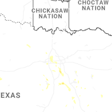
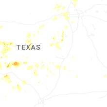


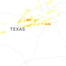
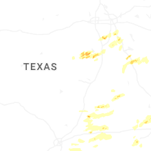


Connect with Interactive Hail Maps