

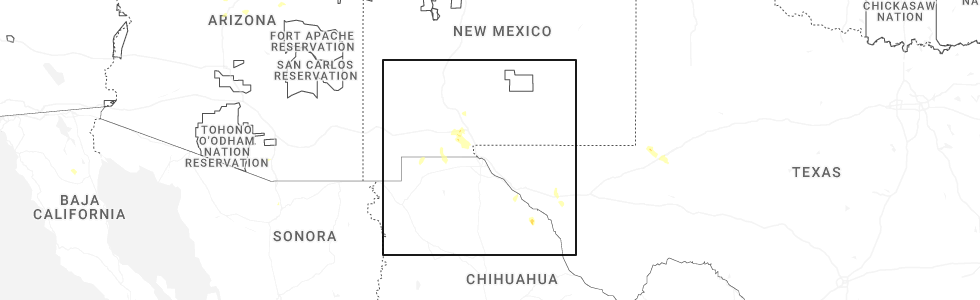
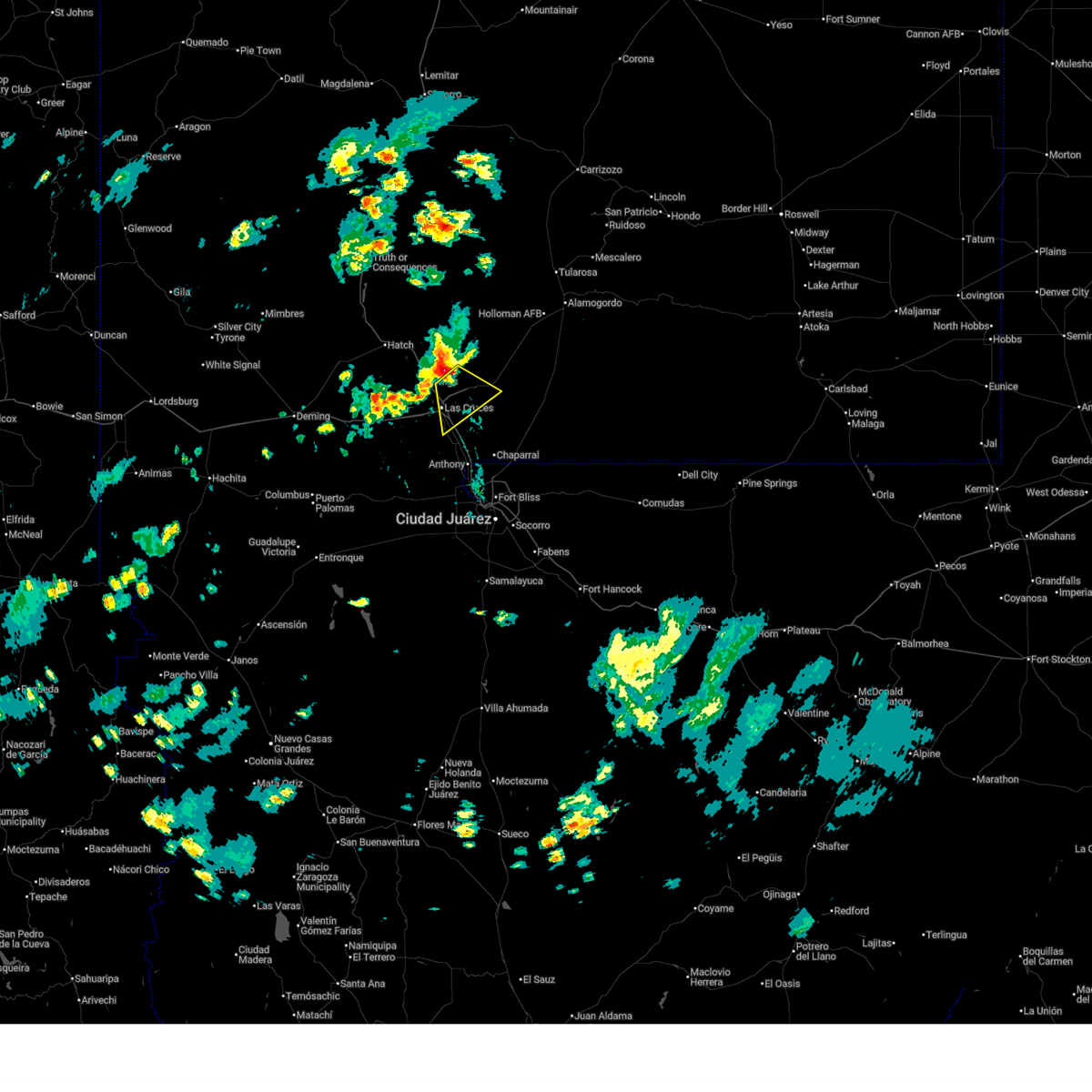
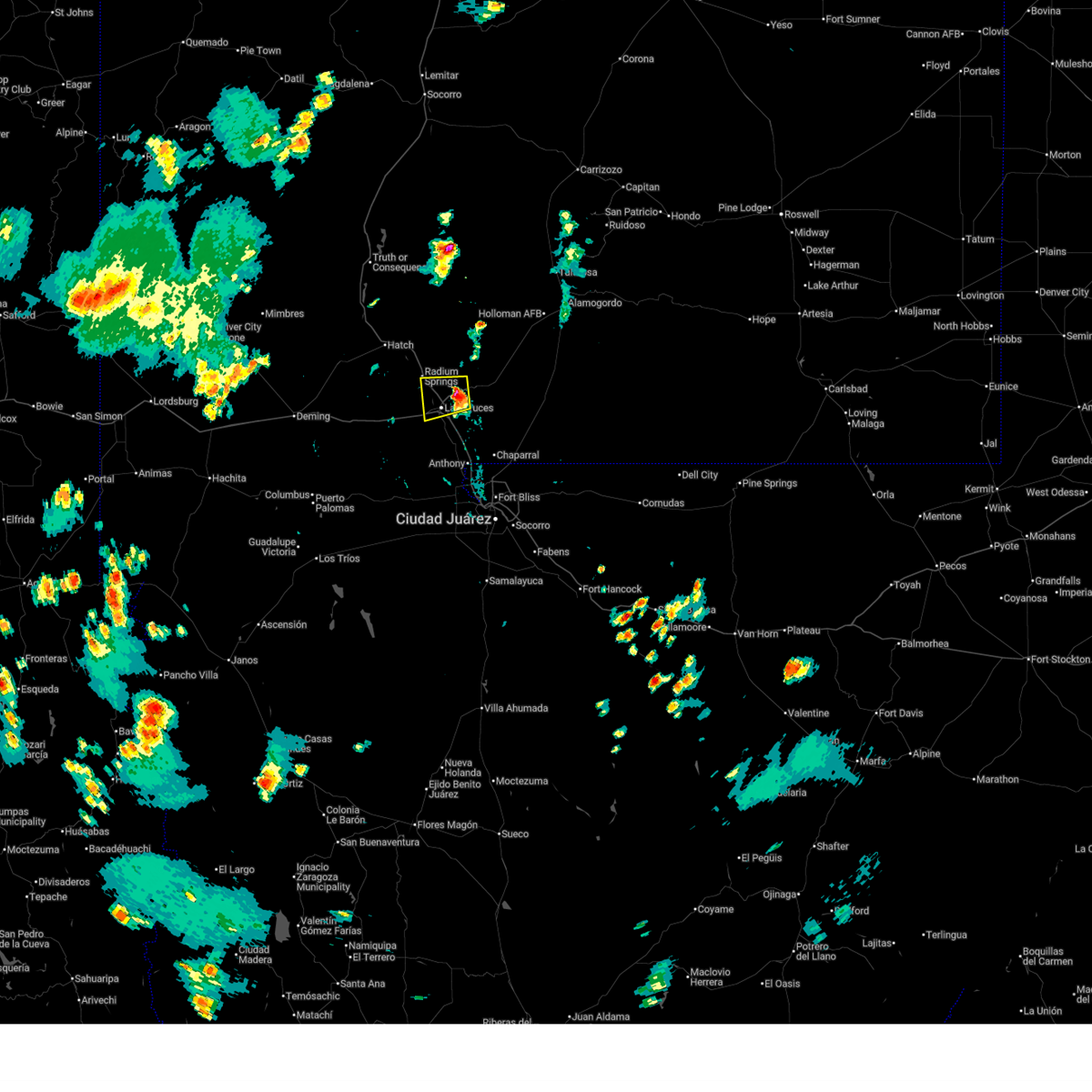
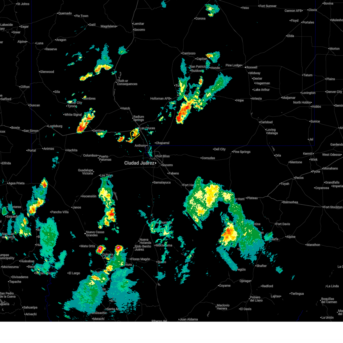
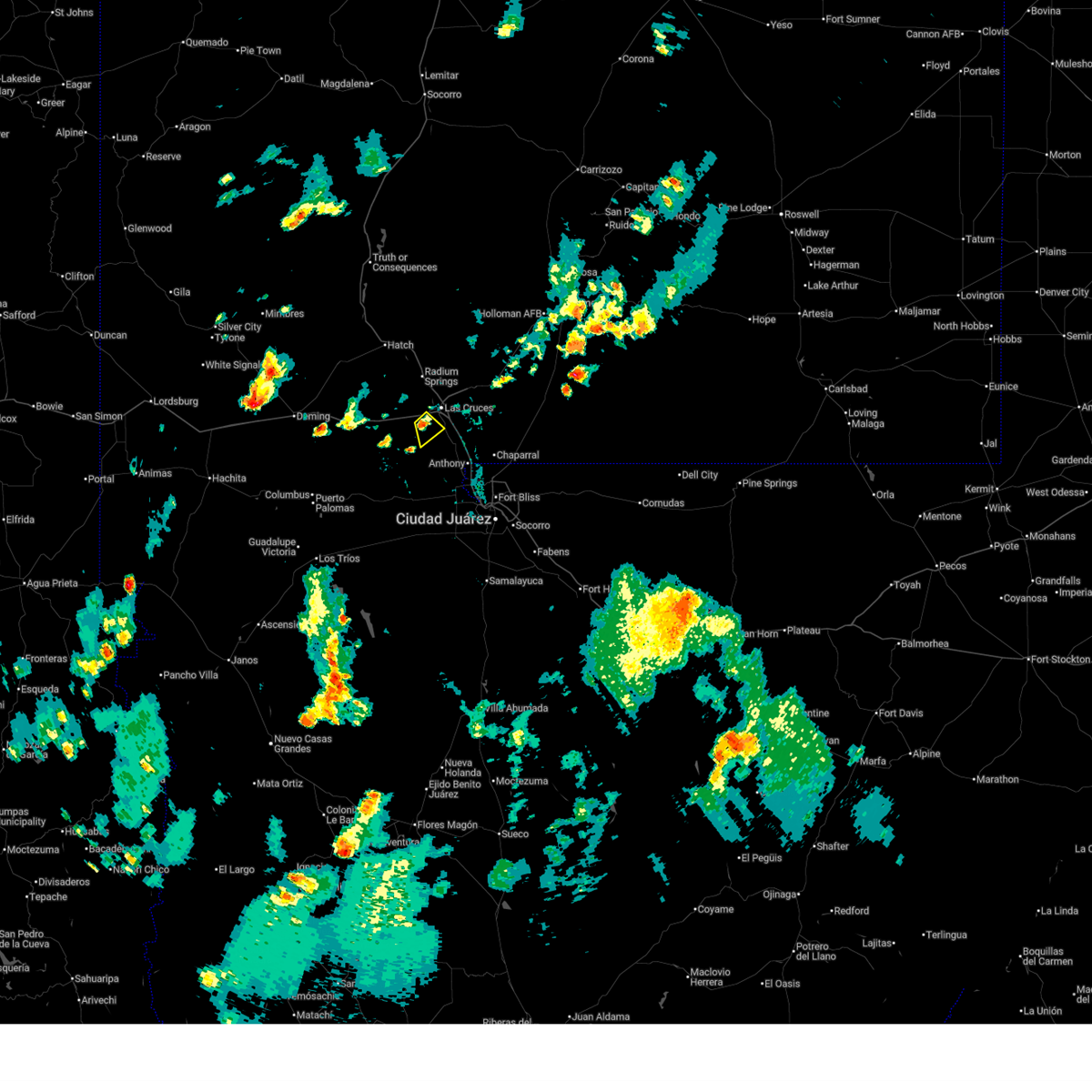
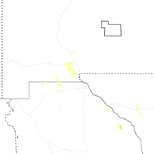
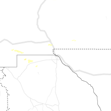
Hail Map for Mesilla, NM
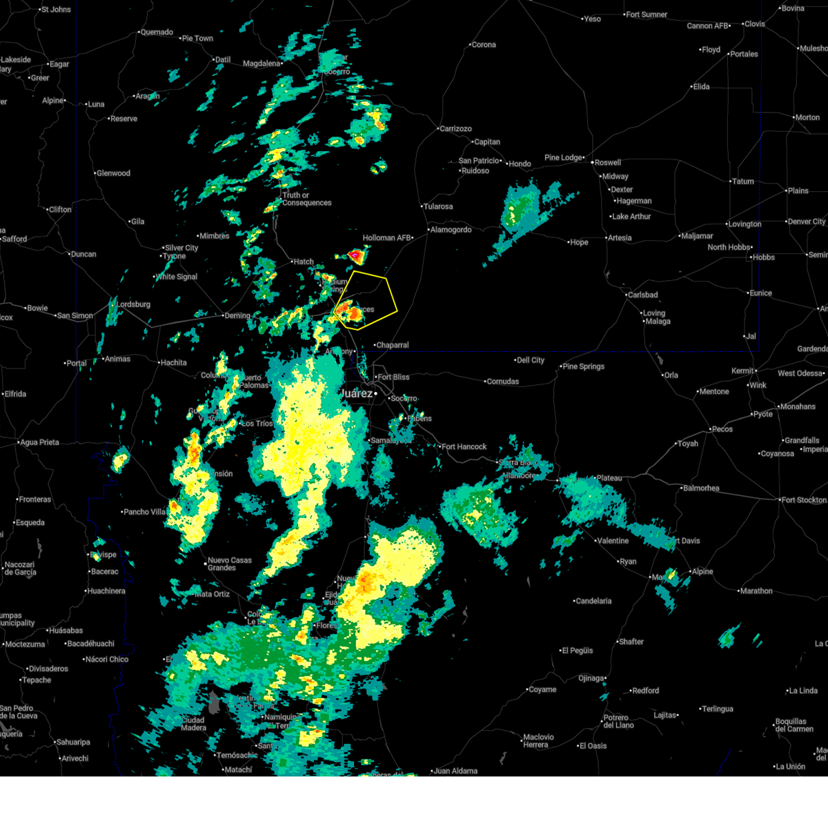
The Mesilla, NM area has had 0 reports of on-the-ground hail by trained spotters, and has been under severe weather warnings 7 times during the past 12 months. Doppler radar has detected hail at or near Mesilla, NM on 28 occasions, including 3 occasions during the past year.
| Name: | Mesilla, NM |
| Where Located: | 40.3 miles NNW of El Paso, TX |
| Map: | Google Map for Mesilla, NM |
| Population: | 2196 |
| Housing Units: | 1076 |
| More Info: | Search Google for Mesilla, NM |
1
The Top Recent Hail Date for Mesilla, NM is Sunday, June 14, 2026 (10th out of 28)
Hail and Wind Damage Spotted near Mesilla, NM
| Date / Time | Report Details |
|---|---|
| 6/14/2026 5:07 PM MDT |
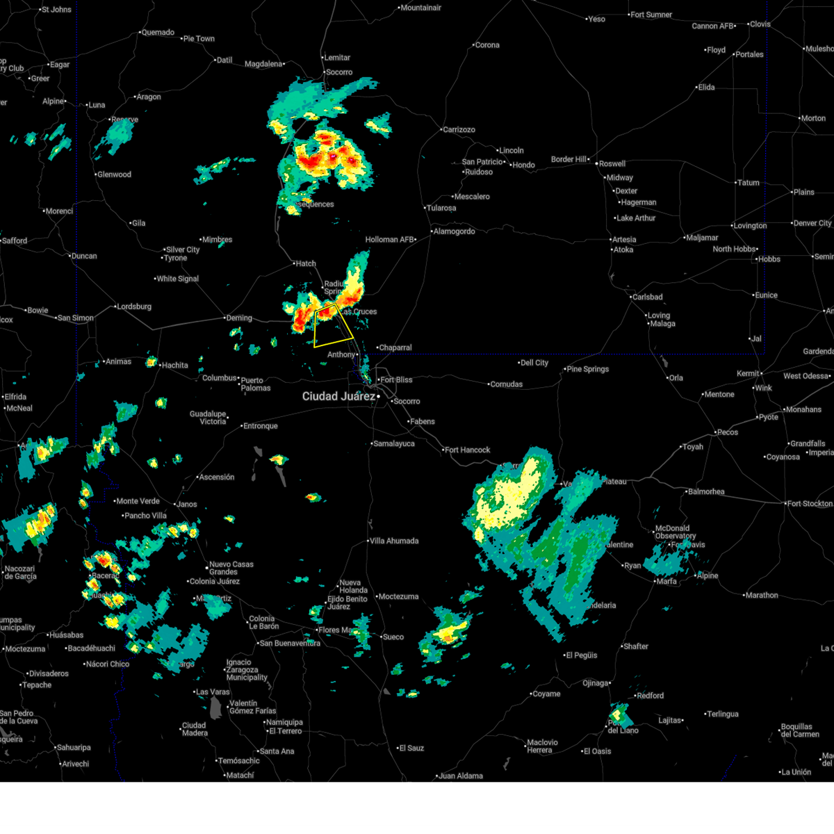 At 506 pm mdt, a severe thunderstorm was located near fairacres, moving southeast at 15 mph (radar indicated). Hazards include 60 mph wind gusts and quarter size hail. Hail damage to vehicles is expected. expect wind damage to roofs, siding, and trees. Locations impacted include, las cruces, vado, nmsu main campus, afton, mesquite, mesilla, san miguel, fairacres, la mesa, afton generating plant, san pablo, picacho, and mesilla valley bosque state park. At 506 pm mdt, a severe thunderstorm was located near fairacres, moving southeast at 15 mph (radar indicated). Hazards include 60 mph wind gusts and quarter size hail. Hail damage to vehicles is expected. expect wind damage to roofs, siding, and trees. Locations impacted include, las cruces, vado, nmsu main campus, afton, mesquite, mesilla, san miguel, fairacres, la mesa, afton generating plant, san pablo, picacho, and mesilla valley bosque state park.
|
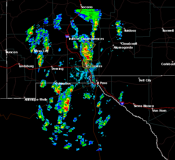
| 6/14/2026 4:57 PM MDT |
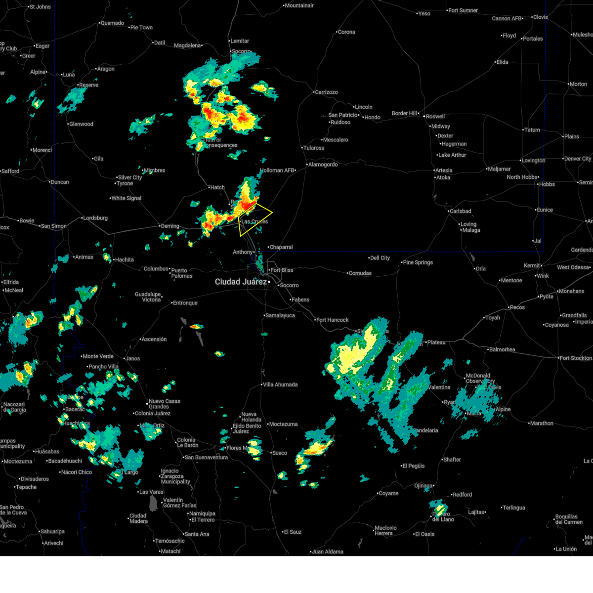 At 457 pm mdt, a severe thunderstorm was located near organ, moving southeast at 25 mph (radar indicated). Hazards include 60 mph wind gusts. Expect damage to roofs, siding, and trees. Locations impacted include, las cruces, white sands missile range headquarters, nmsu main campus, organ, mesilla, talavera, east mesa, san pablo, northeast las cruces, dripping springs, aguirre springs, portions of organ mountains desert peaks national monument, and soledad canyon. At 457 pm mdt, a severe thunderstorm was located near organ, moving southeast at 25 mph (radar indicated). Hazards include 60 mph wind gusts. Expect damage to roofs, siding, and trees. Locations impacted include, las cruces, white sands missile range headquarters, nmsu main campus, organ, mesilla, talavera, east mesa, san pablo, northeast las cruces, dripping springs, aguirre springs, portions of organ mountains desert peaks national monument, and soledad canyon.
|
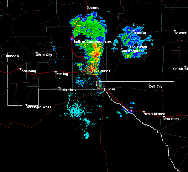
| 6/14/2026 4:53 PM MDT |
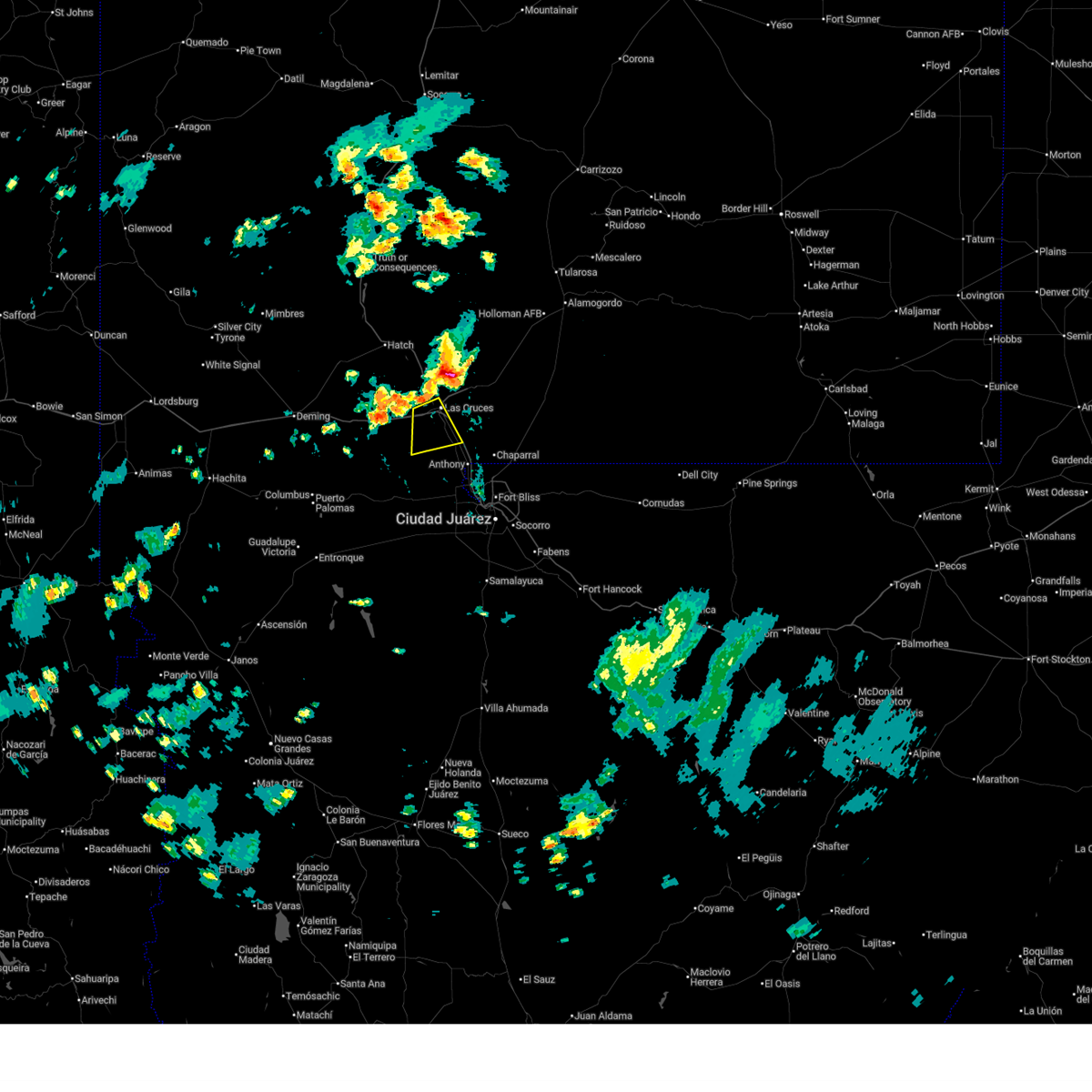 Svrepz the national weather service in el paso has issued a * severe thunderstorm warning for, south central dona ana county in south central new mexico, * until 530 pm mdt. * at 453 pm mdt, a severe thunderstorm was located over mesilla, moving southeast at 20 mph (radar indicated). Hazards include 60 mph wind gusts. expect damage to roofs, siding, and trees Svrepz the national weather service in el paso has issued a * severe thunderstorm warning for, south central dona ana county in south central new mexico, * until 530 pm mdt. * at 453 pm mdt, a severe thunderstorm was located over mesilla, moving southeast at 20 mph (radar indicated). Hazards include 60 mph wind gusts. expect damage to roofs, siding, and trees
|
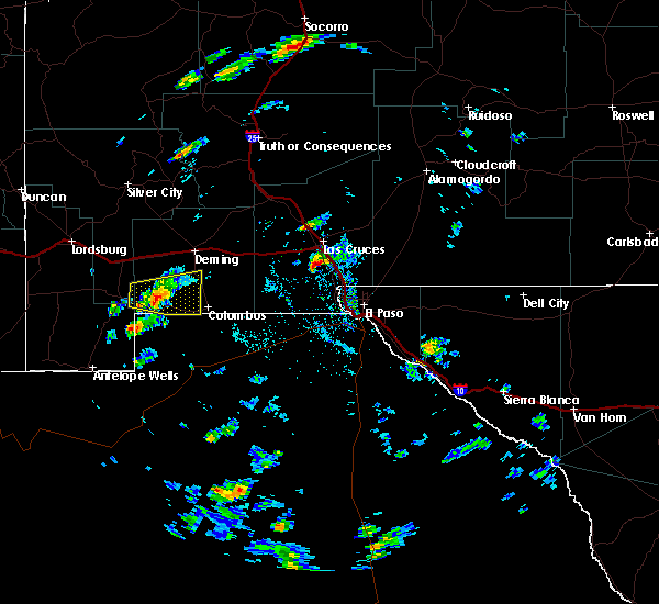
| 6/14/2026 4:42 PM MDT |
 Svrepz the national weather service in el paso has issued a * severe thunderstorm warning for, east central dona ana county in south central new mexico, * until 515 pm mdt. * at 442 pm mdt, a severe thunderstorm was located 6 miles west of organ, moving southeast at 25 mph (radar indicated). Hazards include 70 mph wind gusts and penny size hail. Expect considerable tree damage. Damage is likely to mobile homes, roofs, and outbuildings. Svrepz the national weather service in el paso has issued a * severe thunderstorm warning for, east central dona ana county in south central new mexico, * until 515 pm mdt. * at 442 pm mdt, a severe thunderstorm was located 6 miles west of organ, moving southeast at 25 mph (radar indicated). Hazards include 70 mph wind gusts and penny size hail. Expect considerable tree damage. Damage is likely to mobile homes, roofs, and outbuildings.
|
| 9/20/2025 5:36 PM MDT | The storm which prompted the warning has weakened below severe limits, and no longer poses an immediate threat to life or property. therefore, the warning will be allowed to expire. |
| 9/20/2025 5:04 PM MDT | Svrepz the national weather service in el paso has issued a * severe thunderstorm warning for, southwestern dona ana county in south central new mexico, * until 545 pm mdt. * at 502 pm mdt, a severe thunderstorm was located 13 miles southeast of akela, moving east at 25 mph (radar indicated). Hazards include 60 mph wind gusts. expect damage to roofs, siding, and trees |
| 7/13/2025 4:13 PM MDT |
 Svrepz the national weather service in el paso has issued a * severe thunderstorm warning for, central dona ana county in south central new mexico, * until 500 pm mdt. * at 413 pm mdt, a severe thunderstorm was located 6 miles east of dona ana and las cruces, moving west at 10 mph (radar indicated). Hazards include 60 mph wind gusts and quarter size hail. Hail damage to vehicles is expected. Expect wind damage to roofs, siding, and trees. Svrepz the national weather service in el paso has issued a * severe thunderstorm warning for, central dona ana county in south central new mexico, * until 500 pm mdt. * at 413 pm mdt, a severe thunderstorm was located 6 miles east of dona ana and las cruces, moving west at 10 mph (radar indicated). Hazards include 60 mph wind gusts and quarter size hail. Hail damage to vehicles is expected. Expect wind damage to roofs, siding, and trees.
|
| 6/25/2025 7:24 PM MDT |
 The storm which prompted the warning has weakened below severe limits, and no longer poses an immediate threat to life or property. therefore, the warning will be allowed to expire. The storm which prompted the warning has weakened below severe limits, and no longer poses an immediate threat to life or property. therefore, the warning will be allowed to expire.
|
| 6/25/2025 6:57 PM MDT |
 Svrepz the national weather service in el paso has issued a * severe thunderstorm warning for, central dona ana county in south central new mexico, * until 730 pm mdt. * at 656 pm mdt, a severe thunderstorm was located 7 miles southwest of fairacres, moving southeast at 5 mph (radar indicated). Hazards include 60 mph wind gusts and quarter size hail. Hail damage to vehicles is expected. Expect wind damage to roofs, siding, and trees. Svrepz the national weather service in el paso has issued a * severe thunderstorm warning for, central dona ana county in south central new mexico, * until 730 pm mdt. * at 656 pm mdt, a severe thunderstorm was located 7 miles southwest of fairacres, moving southeast at 5 mph (radar indicated). Hazards include 60 mph wind gusts and quarter size hail. Hail damage to vehicles is expected. Expect wind damage to roofs, siding, and trees.
|
| 6/23/2025 8:47 PM MDT |
 Svrepz the national weather service in el paso has issued a * severe thunderstorm warning for, west central otero county in south central new mexico, east central dona ana county in south central new mexico, * until 930 pm mdt. * at 845 pm mdt, a severe thunderstorm was located near soledad canyon, moving northeast at 25 mph (radar indicated). Hazards include 60 mph wind gusts and quarter size hail. Hail damage to vehicles is expected. Expect wind damage to roofs, siding, and trees. Svrepz the national weather service in el paso has issued a * severe thunderstorm warning for, west central otero county in south central new mexico, east central dona ana county in south central new mexico, * until 930 pm mdt. * at 845 pm mdt, a severe thunderstorm was located near soledad canyon, moving northeast at 25 mph (radar indicated). Hazards include 60 mph wind gusts and quarter size hail. Hail damage to vehicles is expected. Expect wind damage to roofs, siding, and trees.
|
| 10/2/2023 5:51 PM MDT |
 At 551 pm mdt, a severe thunderstorm was located over nmsu main campus, moving northeast at 30 mph (radar indicated). Hazards include 60 mph wind gusts. Expect damage to roofs, siding, and trees. locations impacted include, las cruces, nmsu main campus, mesquite, mesilla, talavera, san pablo, northeast las cruces, and soledad canyon. this includes the following highways, interstate 10 in new mexico between mile markers 141 and 153. interstate 25 in new mexico between mile markers 1 and 7. highway 70 in new mexico between mile markers 150 and 153. hail threat, radar indicated max hail size, <. 75 in wind threat, radar indicated max wind gust, 60 mph. At 551 pm mdt, a severe thunderstorm was located over nmsu main campus, moving northeast at 30 mph (radar indicated). Hazards include 60 mph wind gusts. Expect damage to roofs, siding, and trees. locations impacted include, las cruces, nmsu main campus, mesquite, mesilla, talavera, san pablo, northeast las cruces, and soledad canyon. this includes the following highways, interstate 10 in new mexico between mile markers 141 and 153. interstate 25 in new mexico between mile markers 1 and 7. highway 70 in new mexico between mile markers 150 and 153. hail threat, radar indicated max hail size, <. 75 in wind threat, radar indicated max wind gust, 60 mph.
|
| 10/2/2023 5:35 PM MDT |
 At 532 pm mdt, a severe thunderstorm was located near san miguel, moving northeast at 30 mph (radar indicated). Hazards include 60 mph wind gusts. expect damage to roofs, siding, and trees At 532 pm mdt, a severe thunderstorm was located near san miguel, moving northeast at 30 mph (radar indicated). Hazards include 60 mph wind gusts. expect damage to roofs, siding, and trees
|
| 6/6/2023 5:36 PM MDT |
 At 535 pm mdt, severe thunderstorms were located along a line extending from 10 miles south of afton to 10 miles southwest of la union to 4 miles west of santa teresa to near west el paso, moving north at 45 mph (radar indicated). Hazards include 70 mph wind gusts with dust blow visibility of 1/4 mile. Expect considerable tree damage. damage is likely to mobile homes, roofs, and outbuildings. locations impacted include, west el paso, central el paso, northeast el paso, chaparral, las cruces, santa teresa, anthony, vado, sunland park, nmsu main campus, dona ana, canutillo, afton, anthony gap, berino, vinton, mesilla, san miguel, westway and fort bliss. this includes the following highways, interstate 10 in new mexico between mile markers 129 and 164. interstate 10 in texas between mile markers 1 and 23. interstate 25 in new mexico between mile markers 1 and 11. highway 70 in new mexico between mile markers 150 and 153. highway 54 in new mexico near mile marker 1. thunderstorm damage threat, considerable hail threat, radar indicated max hail size, <. 75 in wind threat, radar indicated max wind gust, 70 mph. At 535 pm mdt, severe thunderstorms were located along a line extending from 10 miles south of afton to 10 miles southwest of la union to 4 miles west of santa teresa to near west el paso, moving north at 45 mph (radar indicated). Hazards include 70 mph wind gusts with dust blow visibility of 1/4 mile. Expect considerable tree damage. damage is likely to mobile homes, roofs, and outbuildings. locations impacted include, west el paso, central el paso, northeast el paso, chaparral, las cruces, santa teresa, anthony, vado, sunland park, nmsu main campus, dona ana, canutillo, afton, anthony gap, berino, vinton, mesilla, san miguel, westway and fort bliss. this includes the following highways, interstate 10 in new mexico between mile markers 129 and 164. interstate 10 in texas between mile markers 1 and 23. interstate 25 in new mexico between mile markers 1 and 11. highway 70 in new mexico between mile markers 150 and 153. highway 54 in new mexico near mile marker 1. thunderstorm damage threat, considerable hail threat, radar indicated max hail size, <. 75 in wind threat, radar indicated max wind gust, 70 mph.
|
| 6/6/2023 5:22 PM MDT |
 At 520 pm mdt, strong thunderstorms with very strong outflow winds were located along a line extending from 17 miles south of afton to 16 miles southwest of la union to 8 miles southwest of santa teresa to 5 miles south of sunland park, moving north at 45 mph (radar indicated). Hazards include 70 mph wind gusts. Expect considerable tree damage. Damage is likely to mobile homes, roofs, and outbuildings. At 520 pm mdt, strong thunderstorms with very strong outflow winds were located along a line extending from 17 miles south of afton to 16 miles southwest of la union to 8 miles southwest of santa teresa to 5 miles south of sunland park, moving north at 45 mph (radar indicated). Hazards include 70 mph wind gusts. Expect considerable tree damage. Damage is likely to mobile homes, roofs, and outbuildings.
|
| 7/23/2021 3:26 PM MDT |
 At 326 pm mdt, a severe thunderstorm was located over fairacres, moving east at 15 mph (radar indicated). Hazards include 60 mph wind gusts and quarter size hail. Hail damage to vehicles is expected. Expect wind damage to roofs, siding, and trees. At 326 pm mdt, a severe thunderstorm was located over fairacres, moving east at 15 mph (radar indicated). Hazards include 60 mph wind gusts and quarter size hail. Hail damage to vehicles is expected. Expect wind damage to roofs, siding, and trees.
|
| 7/11/2021 7:45 PM MDT |
 At 745 pm mdt, severe thunderstorms were located along a line extending from near nmsu main campus to 9 miles south of white sands missile range headquarters to 10 miles southeast of orogrande, moving south at 30 mph (radar indicated). Hazards include 70 mph wind gusts and penny size hail. Expect considerable tree damage. Damage is likely to mobile homes, roofs, and outbuildings. At 745 pm mdt, severe thunderstorms were located along a line extending from near nmsu main campus to 9 miles south of white sands missile range headquarters to 10 miles southeast of orogrande, moving south at 30 mph (radar indicated). Hazards include 70 mph wind gusts and penny size hail. Expect considerable tree damage. Damage is likely to mobile homes, roofs, and outbuildings.
|
| 7/11/2021 7:14 PM MDT |
 At 713 pm mdt, severe thunderstorms were located along a line extending from 3 miles northeast of nmsu main campus to 6 miles southeast of talavera to 10 miles southwest of orogrande, moving south at 25 mph (radar indicated). Hazards include 70 mph wind gusts and ping pong ball size hail. near zero visibilities have been reported around las cruces ahead of the rain. People and animals outdoors will be injured. expect hail damage to roofs, siding, windows, and vehicles. expect considerable tree damage. wind damage is also likely to mobile homes, roofs, and outbuildings. locations impacted include, chaparral, las cruces, vado, anthony, white sands missile range headquarters, nmsu main campus, dona ana, berino, mesilla, san miguel, mesquite, chamberino, fairacres, mcgregor range base, talavera, la mesa, afton generating plant, high valley, east mesa and san pablo. this includes the following highways, interstate 10 in new mexico between mile markers 138 and 162. interstate 25 in new mexico between mile markers 1 and 10. highway 70 in new mexico between mile markers 150 and 154. Highway 54 in new mexico between mile markers 3 and 19. At 713 pm mdt, severe thunderstorms were located along a line extending from 3 miles northeast of nmsu main campus to 6 miles southeast of talavera to 10 miles southwest of orogrande, moving south at 25 mph (radar indicated). Hazards include 70 mph wind gusts and ping pong ball size hail. near zero visibilities have been reported around las cruces ahead of the rain. People and animals outdoors will be injured. expect hail damage to roofs, siding, windows, and vehicles. expect considerable tree damage. wind damage is also likely to mobile homes, roofs, and outbuildings. locations impacted include, chaparral, las cruces, vado, anthony, white sands missile range headquarters, nmsu main campus, dona ana, berino, mesilla, san miguel, mesquite, chamberino, fairacres, mcgregor range base, talavera, la mesa, afton generating plant, high valley, east mesa and san pablo. this includes the following highways, interstate 10 in new mexico between mile markers 138 and 162. interstate 25 in new mexico between mile markers 1 and 10. highway 70 in new mexico between mile markers 150 and 154. Highway 54 in new mexico between mile markers 3 and 19.
|
| 7/11/2021 7:00 PM MDT |
 At 700 pm mdt, severe thunderstorms were located along a line extending from 6 miles west of organ to 4 miles southwest of white sands missile range headquarters to 10 miles west of orogrande, moving south at 25 mph (radar indicated). Hazards include 70 mph wind gusts and ping pong ball size hail. People and animals outdoors will be injured. expect hail damage to roofs, siding, windows, and vehicles. expect considerable tree damage. Wind damage is also likely to mobile homes, roofs, and outbuildings. At 700 pm mdt, severe thunderstorms were located along a line extending from 6 miles west of organ to 4 miles southwest of white sands missile range headquarters to 10 miles west of orogrande, moving south at 25 mph (radar indicated). Hazards include 70 mph wind gusts and ping pong ball size hail. People and animals outdoors will be injured. expect hail damage to roofs, siding, windows, and vehicles. expect considerable tree damage. Wind damage is also likely to mobile homes, roofs, and outbuildings.
|
| 3/19/2020 12:08 AM MDT |
 The severe thunderstorm warning for southwestern otero, southeastern dona ana, western hudspeth and el paso counties will expire at 1215 am mdt, the storm which prompted the warning has weakened below severe limits, and no longer poses an immediate threat to life or property. therefore, the warning will be allowed to expire. however gusty winds to near 50 mph are still possible with this line of showers and thunderstorms as it moves across northern el paso county and into southwest otero county. The severe thunderstorm warning for southwestern otero, southeastern dona ana, western hudspeth and el paso counties will expire at 1215 am mdt, the storm which prompted the warning has weakened below severe limits, and no longer poses an immediate threat to life or property. therefore, the warning will be allowed to expire. however gusty winds to near 50 mph are still possible with this line of showers and thunderstorms as it moves across northern el paso county and into southwest otero county.
|
| 3/18/2020 11:54 PM MDT |
 At 1152 pm mdt, a line of fast moving showers and thunderstorm, with very strong winds, was moving across the i-10 corridor between las cruces and el paso. this line was moving east at 60 mph (radar indicated). Hazards include 60 mph wind gusts and penny size hail. Expect damage to roofs, siding, and trees. Locations impacted include, west el paso, east el paso, central el paso, northeast el paso, far east el paso, mission valley, chaparral, santa teresa, anthony, hueco tanks, vado, las cruces, white sands missile range headquarters, sunland park, nmsu main campus, canutillo, anthony gap, berino, vinton and san miguel. At 1152 pm mdt, a line of fast moving showers and thunderstorm, with very strong winds, was moving across the i-10 corridor between las cruces and el paso. this line was moving east at 60 mph (radar indicated). Hazards include 60 mph wind gusts and penny size hail. Expect damage to roofs, siding, and trees. Locations impacted include, west el paso, east el paso, central el paso, northeast el paso, far east el paso, mission valley, chaparral, santa teresa, anthony, hueco tanks, vado, las cruces, white sands missile range headquarters, sunland park, nmsu main campus, canutillo, anthony gap, berino, vinton and san miguel.
|
| 3/18/2020 11:38 PM MDT |
 At 1136 pm mdt, a severe thunderstorm was located near santa teresa, moving east at 50 mph (radar indicated). Hazards include 60 mph wind gusts and penny size hail. expect damage to roofs, siding, and trees At 1136 pm mdt, a severe thunderstorm was located near santa teresa, moving east at 50 mph (radar indicated). Hazards include 60 mph wind gusts and penny size hail. expect damage to roofs, siding, and trees
|
| 3/18/2020 10:43 PM MDT |
 At 1041 pm mdt, severe thunderstorms were approaching the las cruces area and surrounding locations, moving northeast at 50 mph (radar indicated). Hazards include 60 mph wind gusts and penny size hail. expect damage to roofs, siding, and trees At 1041 pm mdt, severe thunderstorms were approaching the las cruces area and surrounding locations, moving northeast at 50 mph (radar indicated). Hazards include 60 mph wind gusts and penny size hail. expect damage to roofs, siding, and trees
|
| 10/4/2019 4:33 PM MDT |
 At 430 pm mdt, severe thunderstorms were moving over or around the vicinity of vado, la mesa, mesquite and san miguel, moving east at 35 mph (radar indicated). Hazards include 60 mph wind gusts and half dollar size hail. Hail damage to vehicles is expected. expect wind damage to roofs, siding, and trees. Locations impacted include, vado, berino, san miguel, mesquite, mesilla, la mesa, afton generating plant, high valley, san pablo and mesilla valley bosque state park. At 430 pm mdt, severe thunderstorms were moving over or around the vicinity of vado, la mesa, mesquite and san miguel, moving east at 35 mph (radar indicated). Hazards include 60 mph wind gusts and half dollar size hail. Hail damage to vehicles is expected. expect wind damage to roofs, siding, and trees. Locations impacted include, vado, berino, san miguel, mesquite, mesilla, la mesa, afton generating plant, high valley, san pablo and mesilla valley bosque state park.
|
| 10/4/2019 4:07 PM MDT |
 At 406 pm mdt, a severe thunderstorm was located near afton moving east at 35 mph (radar indicated). Hazards include 60 mph wind gusts and half dollar size hail. Hail damage to vehicles is expected. Expect wind damage to roofs, siding, and trees. At 406 pm mdt, a severe thunderstorm was located near afton moving east at 35 mph (radar indicated). Hazards include 60 mph wind gusts and half dollar size hail. Hail damage to vehicles is expected. Expect wind damage to roofs, siding, and trees.
|
| 6/4/2019 3:55 PM MDT |
 At 354 pm mdt, severe thunderstorms were located along a line extending from 4 miles northwest of chaparral to 5 miles west of afton, moving northeast at 25 mph (radar indicated). Hazards include 60 mph wind gusts and penny size hail. expect damage to roofs, siding, and trees At 354 pm mdt, severe thunderstorms were located along a line extending from 4 miles northwest of chaparral to 5 miles west of afton, moving northeast at 25 mph (radar indicated). Hazards include 60 mph wind gusts and penny size hail. expect damage to roofs, siding, and trees
|
| 6/4/2019 3:47 PM MDT |
 At 346 pm mdt, a severe thunderstorm was located 6 miles northeast of dona ana, moving northeast at 20 mph (radar indicated). Hazards include 60 mph wind gusts and quarter size hail. Hail damage to vehicles is expected. expect wind damage to roofs, siding, and trees. Locations impacted include, leasburg, las cruces, jornada range, dona ana, nmsu main campus, mesilla, fairacres, organ, east mesa, picacho, portions of jornada experimental range, hill, northeast las cruces, dripping springs, aguirre springs and portions of organ mountains desert peaks national monument. At 346 pm mdt, a severe thunderstorm was located 6 miles northeast of dona ana, moving northeast at 20 mph (radar indicated). Hazards include 60 mph wind gusts and quarter size hail. Hail damage to vehicles is expected. expect wind damage to roofs, siding, and trees. Locations impacted include, leasburg, las cruces, jornada range, dona ana, nmsu main campus, mesilla, fairacres, organ, east mesa, picacho, portions of jornada experimental range, hill, northeast las cruces, dripping springs, aguirre springs and portions of organ mountains desert peaks national monument.
|
| 6/4/2019 3:23 PM MDT |
 At 323 pm mdt, a severe thunderstorm was located near dona ana, moving northeast at 10 mph (radar indicated). Hazards include 60 mph wind gusts and quarter size hail. Hail damage to vehicles is expected. Expect wind damage to roofs, siding, and trees. At 323 pm mdt, a severe thunderstorm was located near dona ana, moving northeast at 10 mph (radar indicated). Hazards include 60 mph wind gusts and quarter size hail. Hail damage to vehicles is expected. Expect wind damage to roofs, siding, and trees.
|
| 10/31/2018 12:23 PM MDT |
 At 1220 pm mdt, a severe thunderstorm was located 17 miles northwest of las cruces, moving southeast at 20 mph (radar indicated). Hazards include 60 mph wind gusts and quarter size hail. Hail damage to vehicles is possible. Expect wind damage to roofs, siding, and trees. At 1220 pm mdt, a severe thunderstorm was located 17 miles northwest of las cruces, moving southeast at 20 mph (radar indicated). Hazards include 60 mph wind gusts and quarter size hail. Hail damage to vehicles is possible. Expect wind damage to roofs, siding, and trees.
|
| 6/3/2018 4:52 PM MDT |
 At 451 pm mdt, a severe thunderstorm was located near talavera, or 6 miles east of las cruces, moving northeast at 20 mph (radar indicated). Hazards include 70 mph wind gusts and quarter size hail. Hail damage to vehicles is expected. expect considerable tree damage. wind damage is also likely to mobile homes, roofs, and outbuildings. Locations impacted include, san miguel, la mesa, san miguel in dona ana county, mesquite, and vado. At 451 pm mdt, a severe thunderstorm was located near talavera, or 6 miles east of las cruces, moving northeast at 20 mph (radar indicated). Hazards include 70 mph wind gusts and quarter size hail. Hail damage to vehicles is expected. expect considerable tree damage. wind damage is also likely to mobile homes, roofs, and outbuildings. Locations impacted include, san miguel, la mesa, san miguel in dona ana county, mesquite, and vado.
|
| 6/3/2018 4:30 PM MDT |
 At 429 pm mdt, a severe thunderstorm was located 8 miles southwest of mesilla, or 11 miles southwest of las cruces, moving east northeast at 20 mph (radar indicated). Hazards include 70 mph wind gusts and quarter size hail. Hail damage to vehicles is expected. expect considerable tree damage. Wind damage is also likely to mobile homes, roofs, and outbuildings. At 429 pm mdt, a severe thunderstorm was located 8 miles southwest of mesilla, or 11 miles southwest of las cruces, moving east northeast at 20 mph (radar indicated). Hazards include 70 mph wind gusts and quarter size hail. Hail damage to vehicles is expected. expect considerable tree damage. Wind damage is also likely to mobile homes, roofs, and outbuildings.
|
| 1/14/2017 6:07 PM MST |
 At 606 pm mst, a severe thunderstorm was located over las cruces. moving northeast at 40 mph (public). Hazards include 60 mph wind gusts and quarter size hail. Hail damage to vehicles is expected. Expect wind damage to roofs, siding, and trees. At 606 pm mst, a severe thunderstorm was located over las cruces. moving northeast at 40 mph (public). Hazards include 60 mph wind gusts and quarter size hail. Hail damage to vehicles is expected. Expect wind damage to roofs, siding, and trees.
|
| 1/14/2017 5:37 PM MST |
 At 535 pm mst, a severe thunderstorm was located near afton moving northeast at 40 mph (radar indicated). Hazards include 60 mph wind gusts and quarter size hail. Hail damage to vehicles is expected. Expect wind damage to roofs, siding, and trees. At 535 pm mst, a severe thunderstorm was located near afton moving northeast at 40 mph (radar indicated). Hazards include 60 mph wind gusts and quarter size hail. Hail damage to vehicles is expected. Expect wind damage to roofs, siding, and trees.
|
| 11/4/2016 9:43 PM MDT |
 At 943 pm mdt, a severe thunderstorm was located near talavera, or 5 miles east of las cruces, moving east at 20 mph (radar indicated). Hazards include half dollar size hail. Damage to vehicles is expected. Locations impacted include, las cruces, talavera, organ, nmsu main campus, mesilla, northeast las cruces, east mesa, san pablo, soledad canyon, and dripping springs. At 943 pm mdt, a severe thunderstorm was located near talavera, or 5 miles east of las cruces, moving east at 20 mph (radar indicated). Hazards include half dollar size hail. Damage to vehicles is expected. Locations impacted include, las cruces, talavera, organ, nmsu main campus, mesilla, northeast las cruces, east mesa, san pablo, soledad canyon, and dripping springs.
|
| 11/4/2016 9:27 PM MDT |
 At 926 pm mdt, a severe thunderstorm was located over nmsu main campus, or near las cruces, moving east at 20 mph (radar indicated). Hazards include quarter size hail. damage to vehicles is expected At 926 pm mdt, a severe thunderstorm was located over nmsu main campus, or near las cruces, moving east at 20 mph (radar indicated). Hazards include quarter size hail. damage to vehicles is expected
|
| 11/4/2016 8:54 PM MDT |
 At 854 pm mdt, a severe thunderstorm was located 6 miles southwest of fairacres, or 10 miles west of las cruces, moving northeast at 40 mph (radar indicated). Hazards include quarter size hail. damage to vehicles is expected At 854 pm mdt, a severe thunderstorm was located 6 miles southwest of fairacres, or 10 miles west of las cruces, moving northeast at 40 mph (radar indicated). Hazards include quarter size hail. damage to vehicles is expected
|
| 10/9/2016 11:52 PM MDT |
 At 1150 pm mdt, severe thunderstorms were located over 10 miles northwest of las cruces moving southeast at 25 mph (radar indicated). Hazards include 60 mph wind gusts and quarter size hail. Hail damage to vehicles is expected. Expect wind damage to roofs, siding, and trees. At 1150 pm mdt, severe thunderstorms were located over 10 miles northwest of las cruces moving southeast at 25 mph (radar indicated). Hazards include 60 mph wind gusts and quarter size hail. Hail damage to vehicles is expected. Expect wind damage to roofs, siding, and trees.
|
| 8/27/2016 6:49 PM MDT |
 At 649 pm mdt, a severe thunderstorm was located near san miguel, or 5 miles northwest of vado, moving east at 25 mph (radar indicated). Hazards include 60 mph wind gusts and quarter size hail. Hail damage to vehicles is expected. Expect wind damage to roofs, siding, and trees. At 649 pm mdt, a severe thunderstorm was located near san miguel, or 5 miles northwest of vado, moving east at 25 mph (radar indicated). Hazards include 60 mph wind gusts and quarter size hail. Hail damage to vehicles is expected. Expect wind damage to roofs, siding, and trees.
|
| 8/27/2016 6:13 PM MDT |
 At 612 pm mdt, a severe thunderstorm was located near dona ana, or 5 miles northwest of las cruces, moving east at 25 mph (radar indicated). Hazards include 60 mph wind gusts and quarter size hail. Hail damage to vehicles is expected. Expect wind damage to roofs, siding, and trees. At 612 pm mdt, a severe thunderstorm was located near dona ana, or 5 miles northwest of las cruces, moving east at 25 mph (radar indicated). Hazards include 60 mph wind gusts and quarter size hail. Hail damage to vehicles is expected. Expect wind damage to roofs, siding, and trees.
|
| 6/5/2016 7:56 PM MDT | The severe thunderstorm warning for west central dona ana county will expire at 800 pm mdt. the storm which prompted the warning has weakened below severe limits and exited the warned area. therefore the warning will be allowed to expire. However gusty winds are still possible with this thunderstorm. |
| 6/5/2016 7:38 PM MDT |
 At 736 pm mdt, a severe thunderstorm was located 7 miles southwest of corralitos, or 17 miles hwest of las cruces and was moving south at 15 mph (radar indicated). Hazards include 60 mph wind gusts and penny size hail. Expect damage to roofs. siding. and trees. Locations impacted include, las cruces, mesilla, talavera, fairacres, nmsu main campus, dona ana, corralitos, lookout peak. At 736 pm mdt, a severe thunderstorm was located 7 miles southwest of corralitos, or 17 miles hwest of las cruces and was moving south at 15 mph (radar indicated). Hazards include 60 mph wind gusts and penny size hail. Expect damage to roofs. siding. and trees. Locations impacted include, las cruces, mesilla, talavera, fairacres, nmsu main campus, dona ana, corralitos, lookout peak.
|
| 6/5/2016 7:17 PM MDT |
 At 717 pm mdt, a severe thunderstorm was located 5 miles northwest of corralitos, or 12 miles southwest of leasburg, moving southeast at 15 mph (radar indicated). Hazards include 60 mph wind gusts and penny size hail. Expect damage to roofs. siding. And trees. At 717 pm mdt, a severe thunderstorm was located 5 miles northwest of corralitos, or 12 miles southwest of leasburg, moving southeast at 15 mph (radar indicated). Hazards include 60 mph wind gusts and penny size hail. Expect damage to roofs. siding. And trees.
|
| 5/18/2016 4:07 PM MDT |
 At 407 pm mdt, a severe thunderstorm was located over nmsu main campus, or 4 miles southeast of las cruces, moving east at 25 mph (radar indicated. at 405 pm quarter inch hail was reported at the new mexico state university bookstore). Hazards include 60 mph wind gusts and quarter size hail. Hail damage to vehicles is expected. expect wind damage to roofs, siding, and trees. Locations impacted include, las cruces, san miguel, mesilla, talavera, la mesa, nmsu main campus, san miguel in dona ana county, mesquite, east mesa, fairacres, vado. At 407 pm mdt, a severe thunderstorm was located over nmsu main campus, or 4 miles southeast of las cruces, moving east at 25 mph (radar indicated. at 405 pm quarter inch hail was reported at the new mexico state university bookstore). Hazards include 60 mph wind gusts and quarter size hail. Hail damage to vehicles is expected. expect wind damage to roofs, siding, and trees. Locations impacted include, las cruces, san miguel, mesilla, talavera, la mesa, nmsu main campus, san miguel in dona ana county, mesquite, east mesa, fairacres, vado.
|
| 5/18/2016 3:50 PM MDT |
 At 349 pm mdt, a severe thunderstorm was located near fairacres, or 5 miles southwest of las cruces, moving southeast at 30 mph (radar indicated). Hazards include 60 mph wind gusts and quarter size hail. Hail damage to vehicles is expected. Expect wind damage to roofs, siding, and trees. At 349 pm mdt, a severe thunderstorm was located near fairacres, or 5 miles southwest of las cruces, moving southeast at 30 mph (radar indicated). Hazards include 60 mph wind gusts and quarter size hail. Hail damage to vehicles is expected. Expect wind damage to roofs, siding, and trees.
|
| 10/21/2015 1:37 PM MDT |
 At 134 pm mdt, a severe thunderstorm was located near las cruces, moving northeast at 20 mph. another storm was located just north of jornada range, moving northeast at 20 mph (trained weather spotters). Hazards include golf ball size hail. People and animals outdoors will be injured. Expect damage to roofs, siding, windows and vehicles. At 134 pm mdt, a severe thunderstorm was located near las cruces, moving northeast at 20 mph. another storm was located just north of jornada range, moving northeast at 20 mph (trained weather spotters). Hazards include golf ball size hail. People and animals outdoors will be injured. Expect damage to roofs, siding, windows and vehicles.
|
| 10/21/2015 1:25 PM MDT |
 At 124 pm mdt, a severe thunderstorm was located over nmsu main campus, or over las cruces, moving northeast at 20 mph (trained weather spotters). Hazards include ping pong ball size hail and 60 mph wind gusts. People and animals outdoors will be injured. expect hail damage to roofs, siding, windows and vehicles. expect wind damage to roofs, siding and trees. locations impacted include, las cruces, mesilla, talavera, fairacres, nmsu main campus, dona ana, east mesa, soledad canyon, twin peaks. At 124 pm mdt, trained spotters reported golf ball sized hail in mesilla. At 124 pm mdt, a severe thunderstorm was located over nmsu main campus, or over las cruces, moving northeast at 20 mph (trained weather spotters). Hazards include ping pong ball size hail and 60 mph wind gusts. People and animals outdoors will be injured. expect hail damage to roofs, siding, windows and vehicles. expect wind damage to roofs, siding and trees. locations impacted include, las cruces, mesilla, talavera, fairacres, nmsu main campus, dona ana, east mesa, soledad canyon, twin peaks. At 124 pm mdt, trained spotters reported golf ball sized hail in mesilla.
|
| 10/21/2015 1:15 PM MDT |
 At 114 pm mdt, a severe thunderstorm was located over mesilla, or near las cruces, moving northeast at 20 mph (trained weather spotters). Hazards include ping pong ball size hail and 60 mph wind gusts. People and animals outdoors will be injured. expect hail damage to roofs, siding, windows and vehicles. expect wind damage to roofs, siding and trees. locations impacted include, las cruces, mesilla, talavera, fairacres, nmsu main campus, dona ana, east mesa, soledad canyon, twin peaks. Trained spotters recently reported quarter size hail and torrential rainfall in las cruces. At 114 pm mdt, a severe thunderstorm was located over mesilla, or near las cruces, moving northeast at 20 mph (trained weather spotters). Hazards include ping pong ball size hail and 60 mph wind gusts. People and animals outdoors will be injured. expect hail damage to roofs, siding, windows and vehicles. expect wind damage to roofs, siding and trees. locations impacted include, las cruces, mesilla, talavera, fairacres, nmsu main campus, dona ana, east mesa, soledad canyon, twin peaks. Trained spotters recently reported quarter size hail and torrential rainfall in las cruces.
|
| 10/21/2015 12:55 PM MDT |
 At 1253 pm mdt, a severe thunderstorm was located 5 miles southwest of mesilla, or 9 miles southwest of las cruces, moving northeast at 20 mph. there are two strong portions of this storm, one currently over the west mesa, and another southwest of mesilla (radar indicated). Hazards include golf ball size hail and 60 mph wind gusts. People and animals outdoors will be injured. expect hail damage to roofs, siding, windows and vehicles. expect wind damage to roofs, siding and trees. Locations impacted include, las cruces, mesilla, fairacres, nmsu main campus, dona ana, east mesa, soledad canyon, twin peaks. At 1253 pm mdt, a severe thunderstorm was located 5 miles southwest of mesilla, or 9 miles southwest of las cruces, moving northeast at 20 mph. there are two strong portions of this storm, one currently over the west mesa, and another southwest of mesilla (radar indicated). Hazards include golf ball size hail and 60 mph wind gusts. People and animals outdoors will be injured. expect hail damage to roofs, siding, windows and vehicles. expect wind damage to roofs, siding and trees. Locations impacted include, las cruces, mesilla, fairacres, nmsu main campus, dona ana, east mesa, soledad canyon, twin peaks.
|
| 10/21/2015 12:43 PM MDT |
 At 1242 pm mdt, a severe thunderstorm was located 9 miles southwest of mesilla, or 13 miles southwest of las cruces, moving northeast at 20 mph (radar indicated). Hazards include 60 mph wind gusts and quarter size hail. Hail damage to vehicles is expected. Expect wind damage to roofs, siding and trees. At 1242 pm mdt, a severe thunderstorm was located 9 miles southwest of mesilla, or 13 miles southwest of las cruces, moving northeast at 20 mph (radar indicated). Hazards include 60 mph wind gusts and quarter size hail. Hail damage to vehicles is expected. Expect wind damage to roofs, siding and trees.
|
| 10/7/2015 2:26 PM MDT | The severe thunderstorm warning for central dona ana county will expire at 230 pm mdt, the storm which prompted the warning has moved out of the area. therefore the warning will be allowed to expire. however gusty winds are still possible with this thunderstorm. strong to severe storms continue across the southern portions of dona ana county. a severe thunderstorm watch remains in effect until 800 pm mdt for south central new mexico. |
| 10/7/2015 1:42 PM MDT |
 At 142 pm mdt, a severe thunderstorm was located 9 miles southwest of mesilla, or 12 miles southwest of las cruces, moving east at 30 mph (radar indicated). Hazards include 60 mph wind gusts and quarter size hail. Hail damage to vehicles is expected. Expect wind damage to roofs, siding and trees. At 142 pm mdt, a severe thunderstorm was located 9 miles southwest of mesilla, or 12 miles southwest of las cruces, moving east at 30 mph (radar indicated). Hazards include 60 mph wind gusts and quarter size hail. Hail damage to vehicles is expected. Expect wind damage to roofs, siding and trees.
|
| 10/3/2015 4:16 PM MDT |
 At 416 pm mdt, a severe thunderstorm was located 7 miles northeast of vado, or 12 miles north of anthony, moving east at 20 mph (radar indicated). Hazards include 70 mph wind gusts and ping pong ball size hail. People and animals outdoors will be injured. expect hail damage to roofs, siding, windows and vehicles. expect considerable tree damage. wind damage is also likely to mobile homes, roofs and outbuildings. Locations impacted include, las cruces, san miguel, mesilla, la mesa, talavera, berino, nmsu main campus, san miguel in dona ana county, mesquite, chamberino, vado, soledad canyon, dripping springs. At 416 pm mdt, a severe thunderstorm was located 7 miles northeast of vado, or 12 miles north of anthony, moving east at 20 mph (radar indicated). Hazards include 70 mph wind gusts and ping pong ball size hail. People and animals outdoors will be injured. expect hail damage to roofs, siding, windows and vehicles. expect considerable tree damage. wind damage is also likely to mobile homes, roofs and outbuildings. Locations impacted include, las cruces, san miguel, mesilla, la mesa, talavera, berino, nmsu main campus, san miguel in dona ana county, mesquite, chamberino, vado, soledad canyon, dripping springs.
|
| 10/3/2015 3:39 PM MDT |
 At 339 pm mdt, a severe thunderstorm was located near la mesa, or 11 miles northwest of anthony, moving east northeast at 30 mph (radar indicated). Hazards include 70 mph wind gusts and ping pong ball size hail. People and animals outdoors will be injured. expect hail damage to roofs, siding, windows and vehicles. expect considerable tree damage. Wind damage is also likely to mobile homes, roofs and outbuildings. At 339 pm mdt, a severe thunderstorm was located near la mesa, or 11 miles northwest of anthony, moving east northeast at 30 mph (radar indicated). Hazards include 70 mph wind gusts and ping pong ball size hail. People and animals outdoors will be injured. expect hail damage to roofs, siding, windows and vehicles. expect considerable tree damage. Wind damage is also likely to mobile homes, roofs and outbuildings.
|
| 10/3/2015 2:27 PM MDT |
 At 227 pm mdt, a severe thunderstorm was located over mesilla, or near las cruces, moving northeast at 30 mph (radar indicated). Hazards include golf ball size hail and 70 mph wind gusts. People and animals outdoors will be injured. expect hail damage to roofs, siding, windows and vehicles. expect considerable tree damage. Wind damage is also likely to mobile homes, roofs and outbuildings. At 227 pm mdt, a severe thunderstorm was located over mesilla, or near las cruces, moving northeast at 30 mph (radar indicated). Hazards include golf ball size hail and 70 mph wind gusts. People and animals outdoors will be injured. expect hail damage to roofs, siding, windows and vehicles. expect considerable tree damage. Wind damage is also likely to mobile homes, roofs and outbuildings.
|
| 10/3/2015 1:53 PM MDT |
 At 152 pm mdt, a severe thunderstorm was located near organ, or 16 miles northeast of las cruces, moving northeast at 25 mph (broadcast media). Hazards include at 150 pm...quarter size hail was reported in west las cruces. Hail damage to vehicles is expected. expect wind damage to roofs, siding and trees. Locations impacted include, las cruces, mesilla, talavera, nmsu main campus, dona ana, fairacres, organ, corralitos, east mesa, twin peaks, aguirre springs, soledad canyon, dripping springs. At 152 pm mdt, a severe thunderstorm was located near organ, or 16 miles northeast of las cruces, moving northeast at 25 mph (broadcast media). Hazards include at 150 pm...quarter size hail was reported in west las cruces. Hail damage to vehicles is expected. expect wind damage to roofs, siding and trees. Locations impacted include, las cruces, mesilla, talavera, nmsu main campus, dona ana, fairacres, organ, corralitos, east mesa, twin peaks, aguirre springs, soledad canyon, dripping springs.
|
| 10/3/2015 1:33 PM MDT |
 At 133 pm mdt, a severe thunderstorm was located over las cruces, moving northeast at 55 mph (radar indicated). Hazards include 60 mph wind gusts and quarter size hail. Hail damage to vehicles is expected. Expect wind damage to roofs, siding and trees. At 133 pm mdt, a severe thunderstorm was located over las cruces, moving northeast at 55 mph (radar indicated). Hazards include 60 mph wind gusts and quarter size hail. Hail damage to vehicles is expected. Expect wind damage to roofs, siding and trees.
|
| 8/10/2015 11:22 PM MDT |
 At 1120 pm mdt, severe thunderstorms were located around western portions of las cruces and corralitos. storms were moving northeast at 40 mph (radar indicated). Hazards include 60 mph wind gusts and quarter size hail. Hail damage to vehicles is expected. expect wind damage to roofs, siding and trees. Locations impacted include, las cruces, mesilla, fairacres, corralitos. At 1120 pm mdt, severe thunderstorms were located around western portions of las cruces and corralitos. storms were moving northeast at 40 mph (radar indicated). Hazards include 60 mph wind gusts and quarter size hail. Hail damage to vehicles is expected. expect wind damage to roofs, siding and trees. Locations impacted include, las cruces, mesilla, fairacres, corralitos.
|
| 8/10/2015 10:54 PM MDT |
 At 1052 pm mdt, a severe thunderstorm was located over south central dona ana county near san miguel (radar indicated). Hazards include 60 mph wind gusts and quarter size hail. Hail damage to vehicles is expected. Expect wind damage to roofs, siding and trees. At 1052 pm mdt, a severe thunderstorm was located over south central dona ana county near san miguel (radar indicated). Hazards include 60 mph wind gusts and quarter size hail. Hail damage to vehicles is expected. Expect wind damage to roofs, siding and trees.
|
| 7/10/2015 2:44 PM MDT |
 At 244 pm mdt, a severe thunderstorm was located near fairacres, or 5 miles northwest of las cruces, moving northeast at 15 mph (radar indicated). Hazards include 60 mph wind gusts and penny size hail. Expect damage to roofs. siding and trees. Locations impacted include, las cruces, leasburg, fairacres, dona ana, radium springs, and lookout peak. At 244 pm mdt, a severe thunderstorm was located near fairacres, or 5 miles northwest of las cruces, moving northeast at 15 mph (radar indicated). Hazards include 60 mph wind gusts and penny size hail. Expect damage to roofs. siding and trees. Locations impacted include, las cruces, leasburg, fairacres, dona ana, radium springs, and lookout peak.
|
| 7/10/2015 2:14 PM MDT |
 At 214 pm mdt, a severe thunderstorm was located over corralitos, or 11 miles southwest of leasburg, moving northeast at 15 mph (radar indicated). Hazards include 60 mph wind gusts and nickel size hail. Expect damage to roofs. Siding and trees. At 214 pm mdt, a severe thunderstorm was located over corralitos, or 11 miles southwest of leasburg, moving northeast at 15 mph (radar indicated). Hazards include 60 mph wind gusts and nickel size hail. Expect damage to roofs. Siding and trees.
|
| 7/7/2015 4:30 PM MDT |
 At 429 pm mdt, a severe thunderstorm was located near san miguel, or 7 miles south of las cruces, moving southeast at 5 mph. another severe storm was located about 10 miles north of kilbourne hole (radar indicated). Hazards include 60 mph wind gusts and quarter size hail. Hail damage to vehicles is expected. Expect wind damage to roofs, siding and trees. At 429 pm mdt, a severe thunderstorm was located near san miguel, or 7 miles south of las cruces, moving southeast at 5 mph. another severe storm was located about 10 miles north of kilbourne hole (radar indicated). Hazards include 60 mph wind gusts and quarter size hail. Hail damage to vehicles is expected. Expect wind damage to roofs, siding and trees.
|
| 6/27/2015 2:11 PM MDT |
 The severe thunderstorm warning for southwestern dona ana county will expire at 215 pm mdt, the storm which prompted the warning has weakened below severe limits, and no longer poses an immediate threat to life or property. therefore the warning will be allowed to expire. however gusty winds and heavy rain are still possible with this thunderstorm. The severe thunderstorm warning for southwestern dona ana county will expire at 215 pm mdt, the storm which prompted the warning has weakened below severe limits, and no longer poses an immediate threat to life or property. therefore the warning will be allowed to expire. however gusty winds and heavy rain are still possible with this thunderstorm.
|
| 6/27/2015 1:33 PM MDT |
 At 133 pm mdt, doppler radar indicated a severe thunderstorm capable of producing damaging winds in excess of 60 mph. this storm was located over mesilla, or near las cruces, and moving south at 5 mph. penny size hail may also accompany the damaging winds. At 133 pm mdt, doppler radar indicated a severe thunderstorm capable of producing damaging winds in excess of 60 mph. this storm was located over mesilla, or near las cruces, and moving south at 5 mph. penny size hail may also accompany the damaging winds.
|
| 5/30/2015 6:00 PM MDT | At 548 pm mdt, a severe thunderstorm was reported, producing quarter size hail, and damaging winds in excess of 60 mph. this storm was located 12 miles east of leasburg, moving southeast at 5 mph. radar indicates this storm continues to pulse between strong and severe. locations impacted include, leasburg, las cruces, chaparral, anthony, east mesa, talavera, berino, san miguel, san miguel in dona ana county, fairacres, lookout peak, twin peaks, aguirre springs, soledad canyon,. |
| 5/30/2015 6:00 PM MDT | At 548 pm mdt, a severe thunderstorm was reported, producing quarter size hail, and damaging winds in excess of 60 mph. this storm was located 12 miles east of leasburg, moving southeast at 5 mph. radar indicates this storm continues to pulse between strong and severe. locations impacted include, leasburg, las cruces, chaparral, anthony, east mesa, talavera, berino, san miguel, san miguel in dona ana county, fairacres, lookout peak, twin peaks, aguirre springs, soledad canyon,. |
| 5/30/2015 5:23 PM MDT | At 516 pm mdt, national weather service meteorologists detected a severe thunderstorm capable of producing quarter size hail, and damaging winds in excess of 60 mph. this storm was located 11 miles northeast of leasburg, moving southeast at 5 mph. |
| 5/30/2015 5:23 PM MDT | At 516 pm mdt, national weather service meteorologists detected a severe thunderstorm capable of producing quarter size hail, and damaging winds in excess of 60 mph. this storm was located 11 miles northeast of leasburg, moving southeast at 5 mph. |
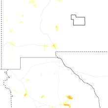
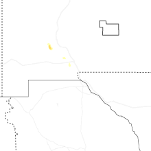
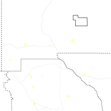
Hail Maps for Mesilla, NM


Connect with Interactive Hail Maps