

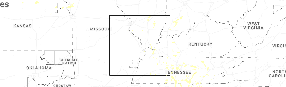
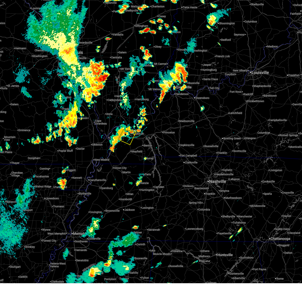
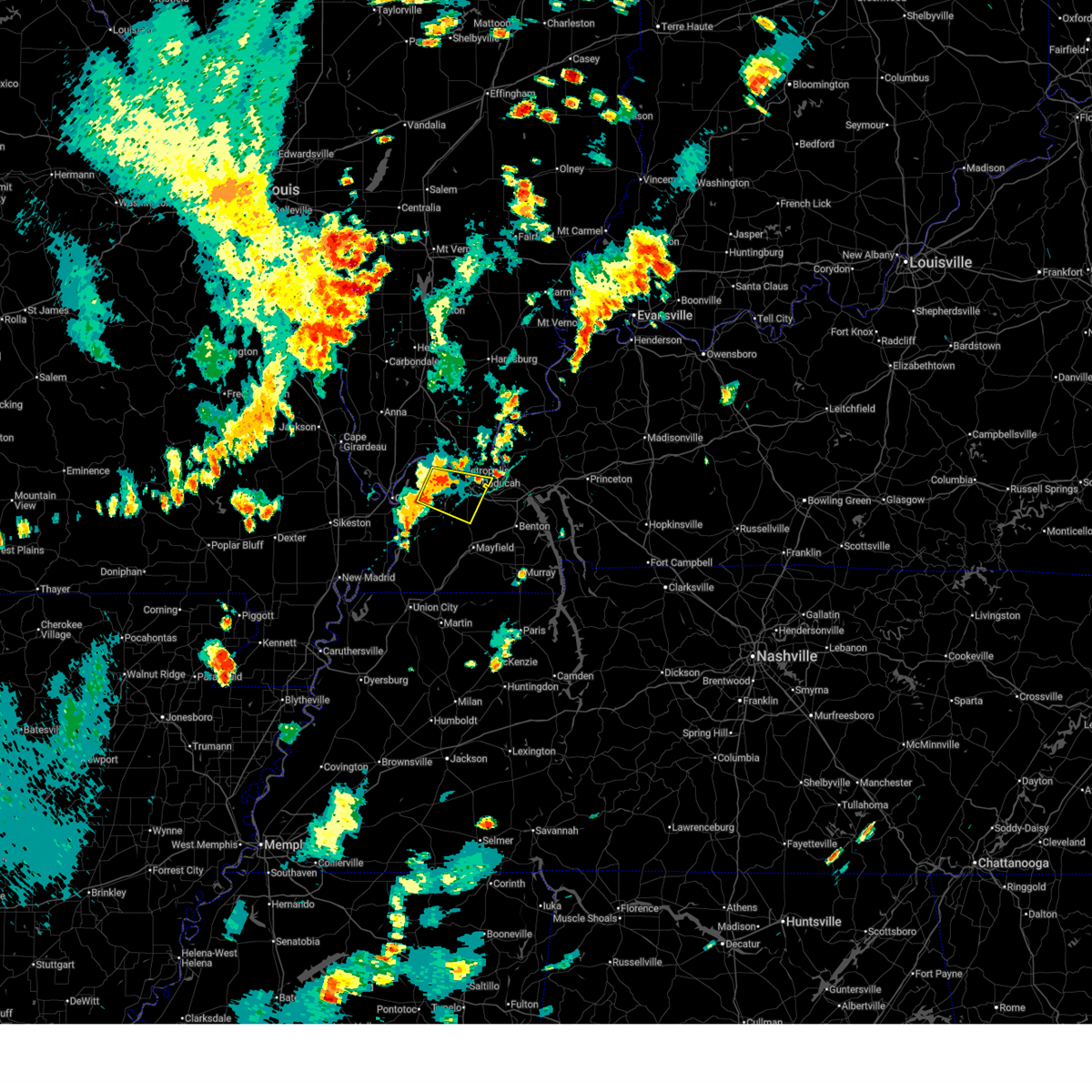
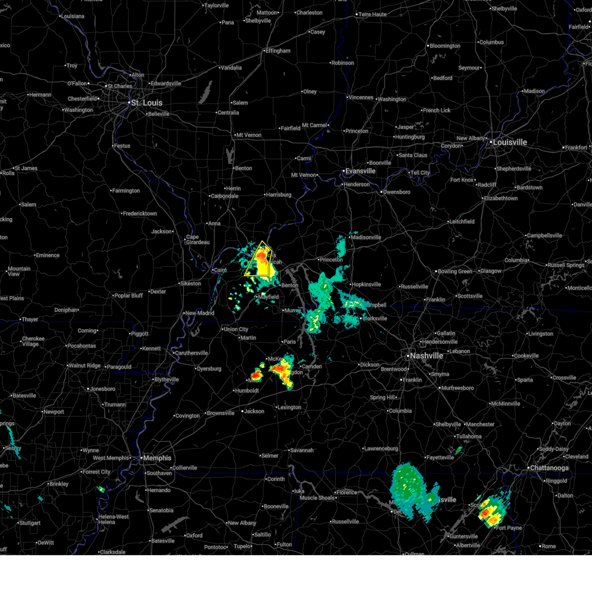
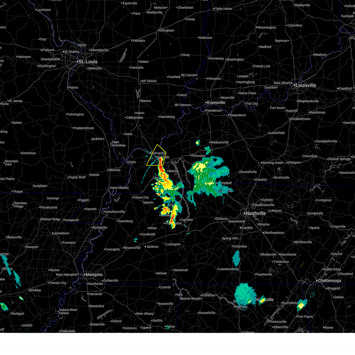
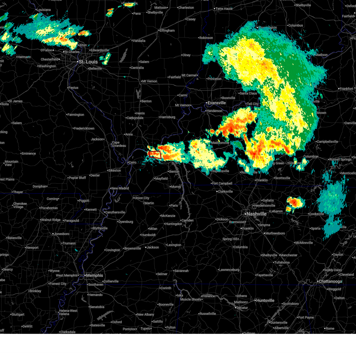
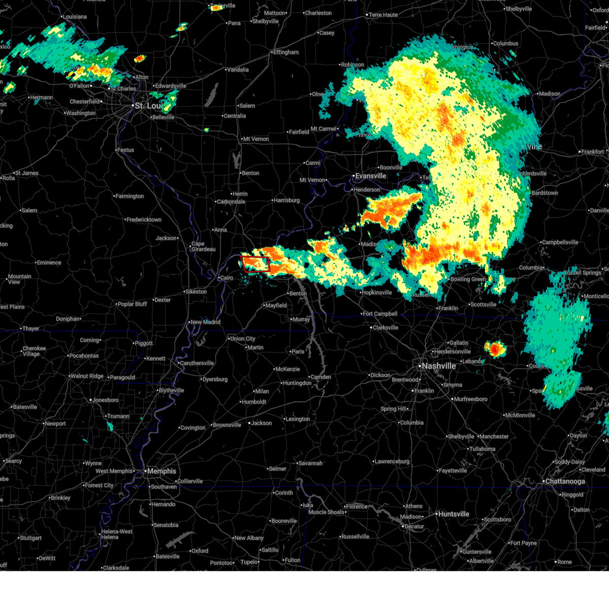
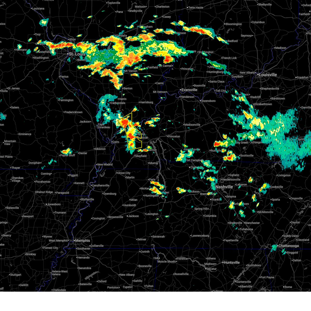
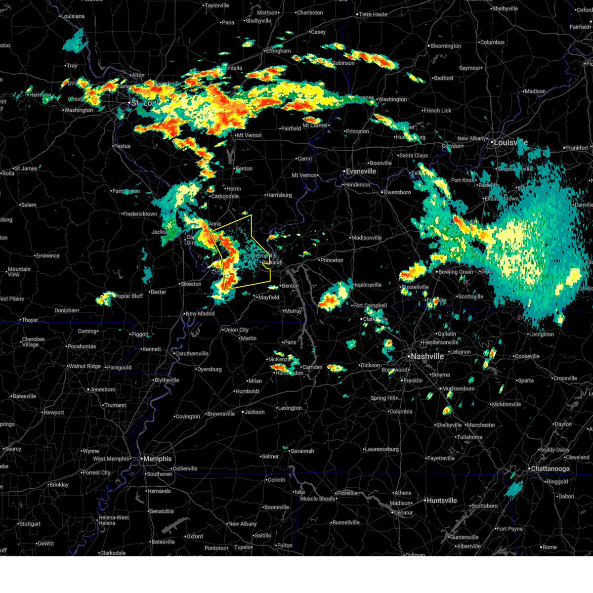
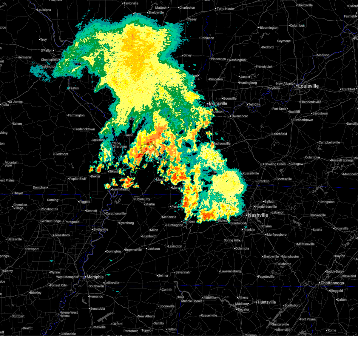
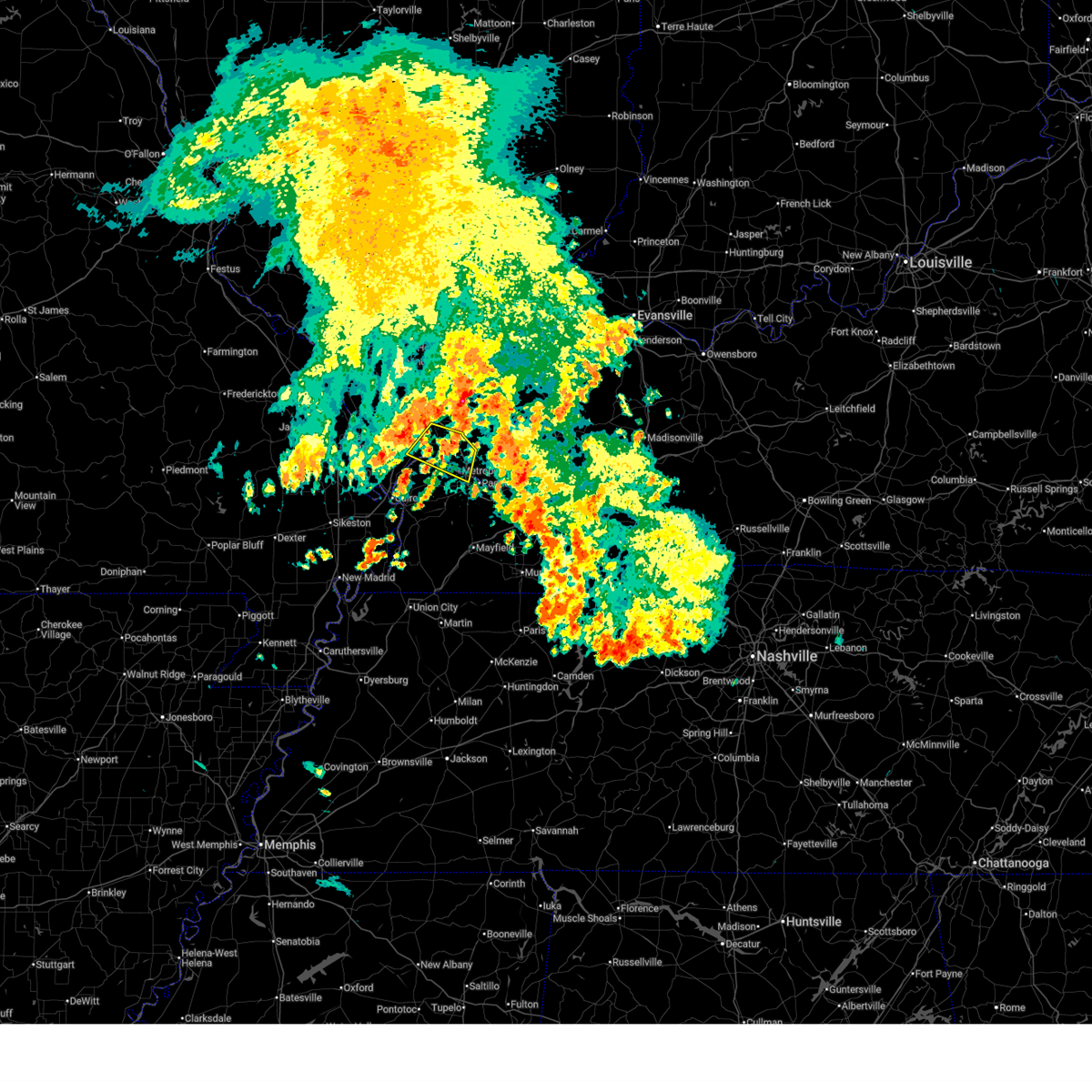
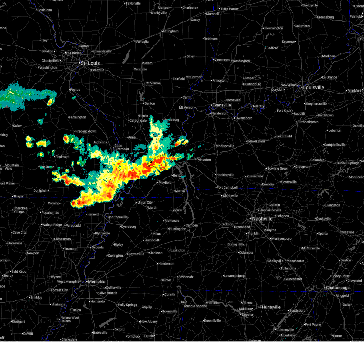
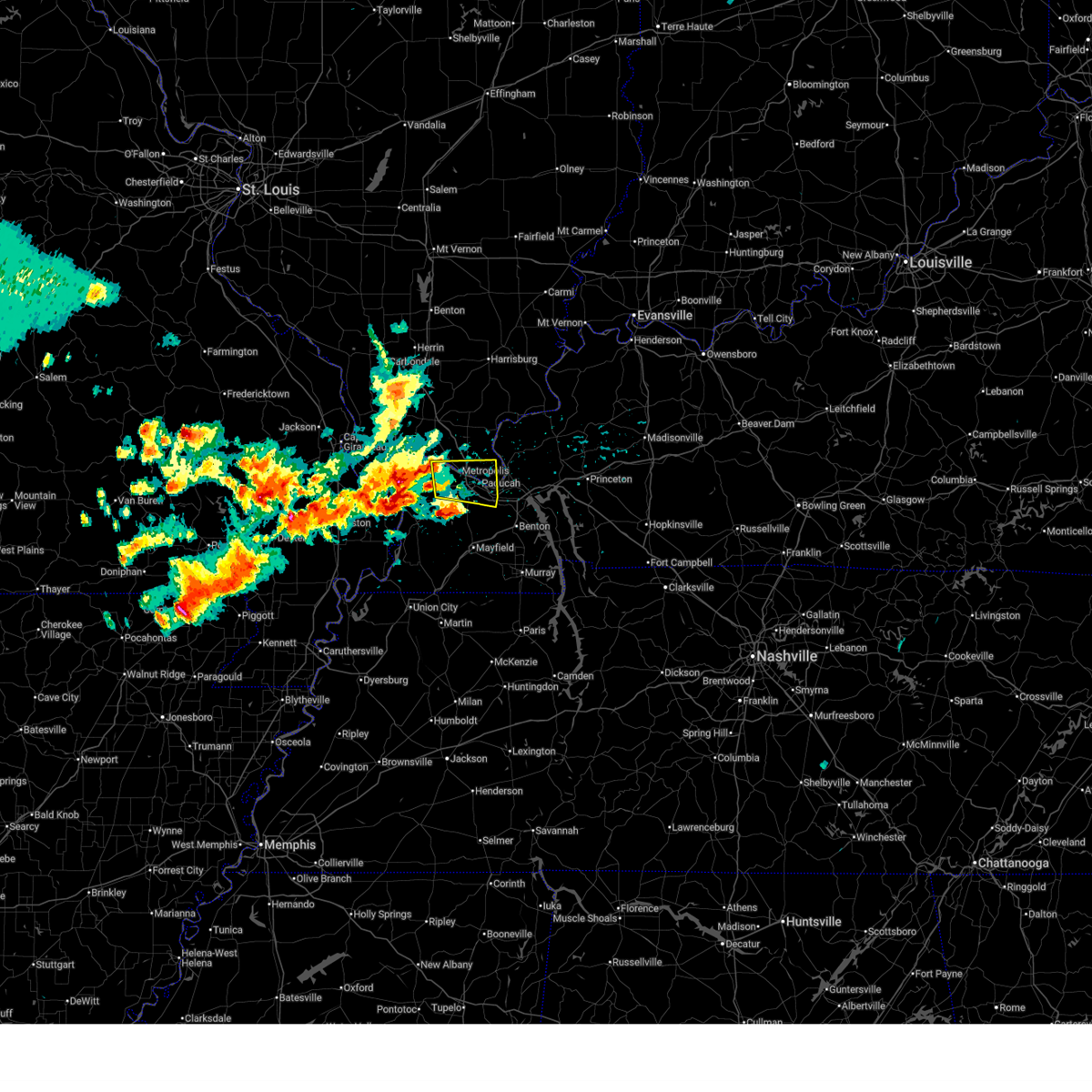
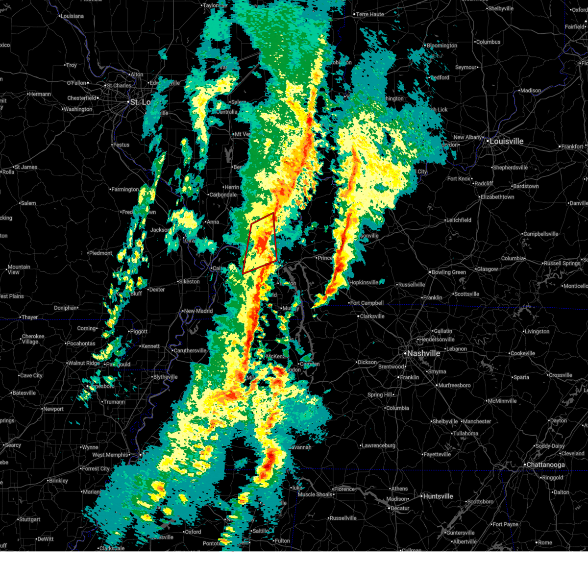
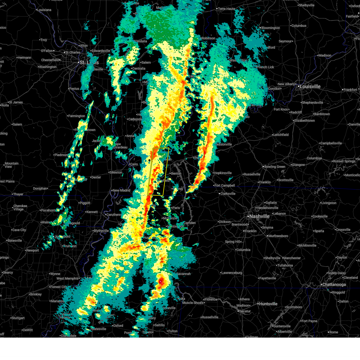
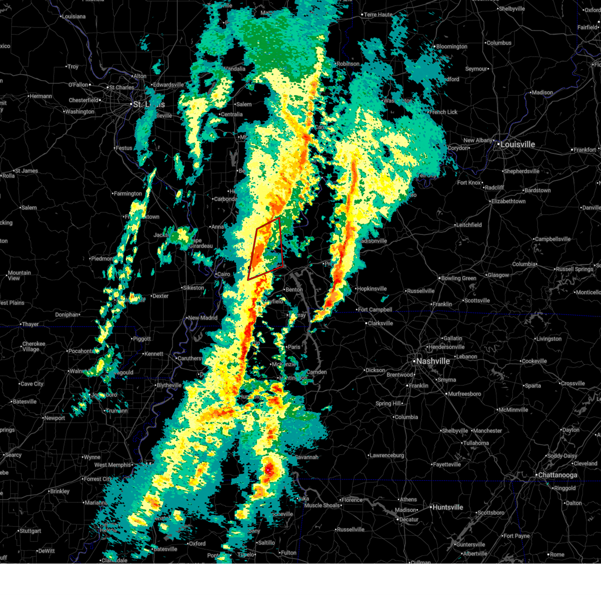
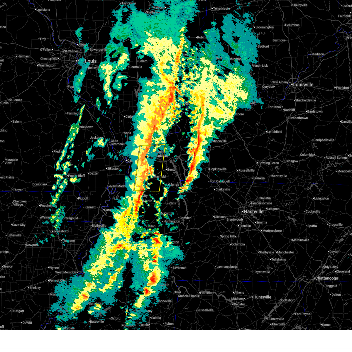
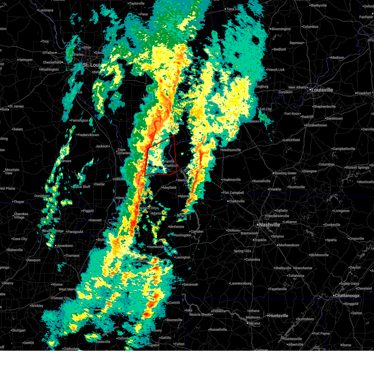
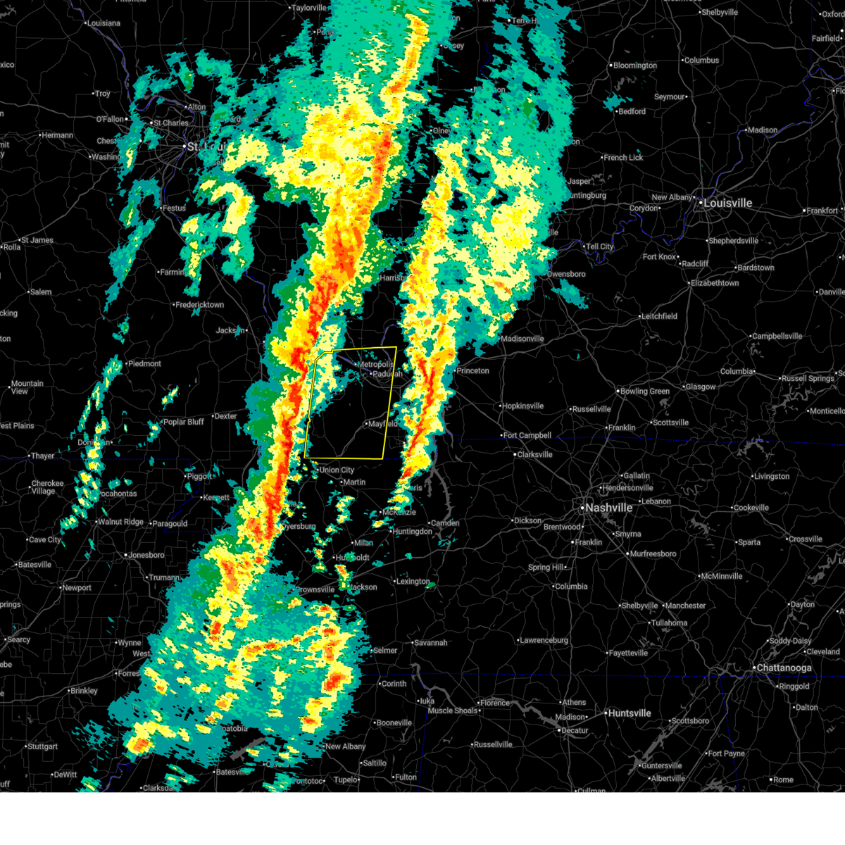
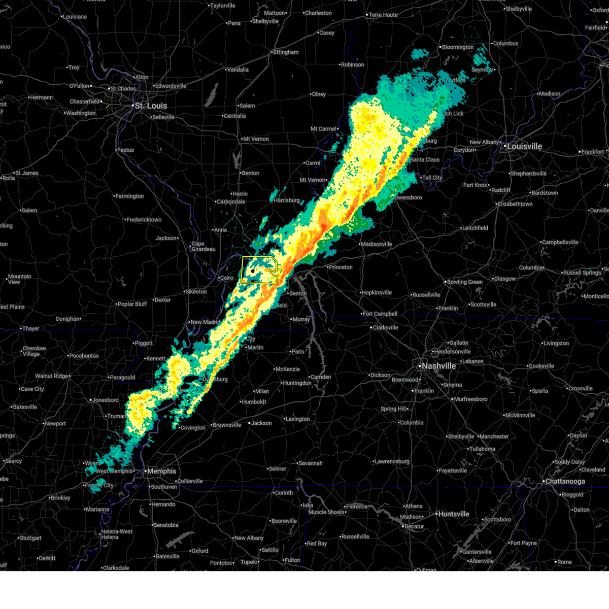
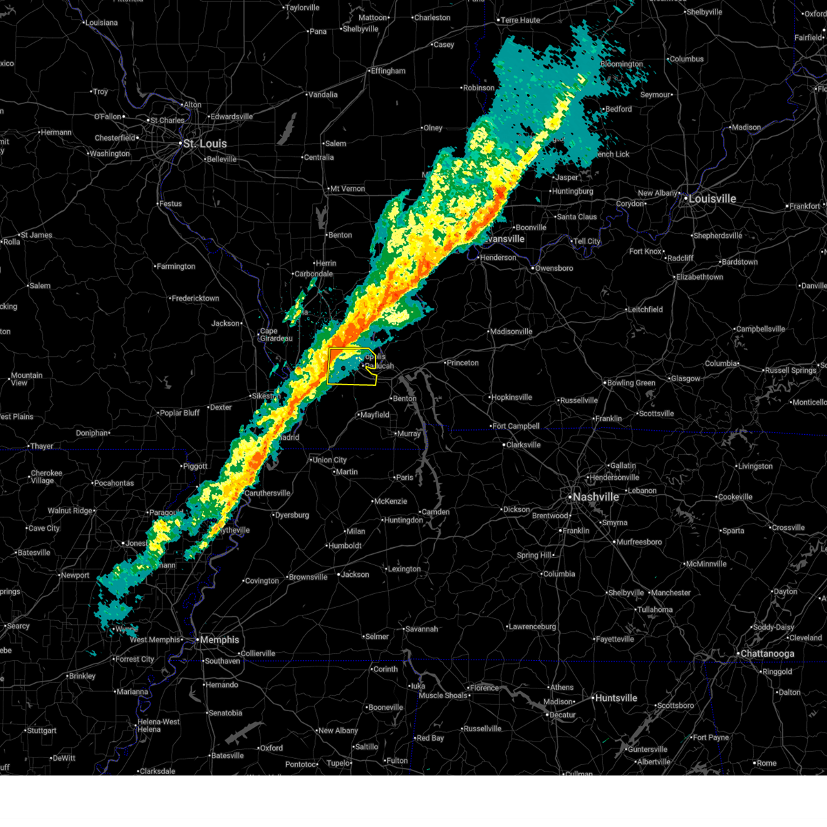
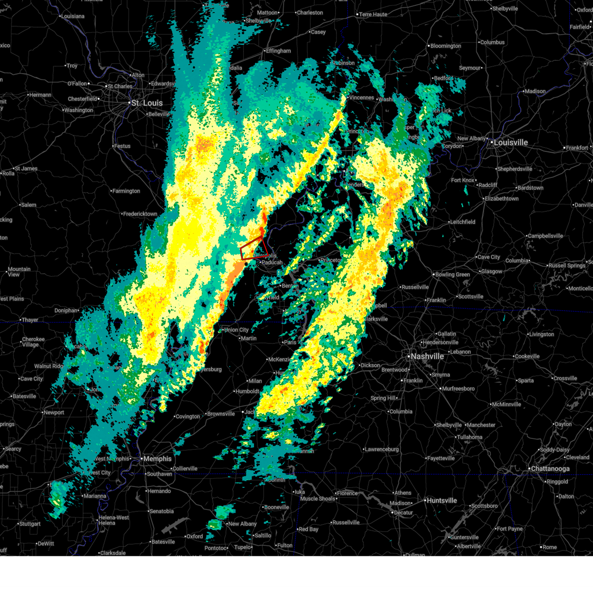
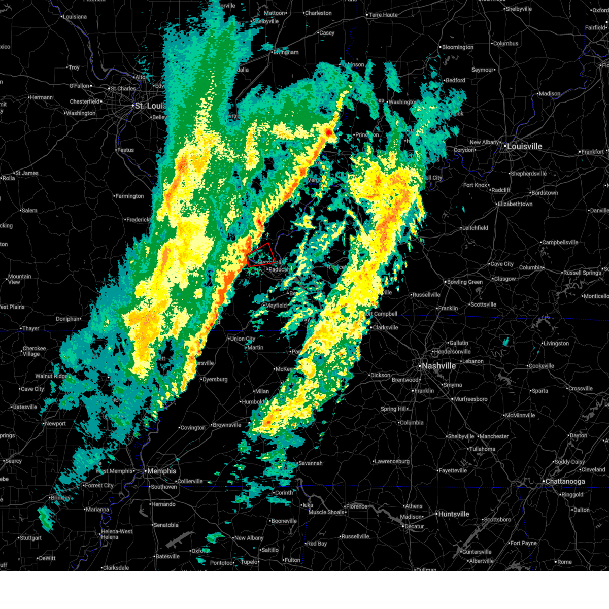
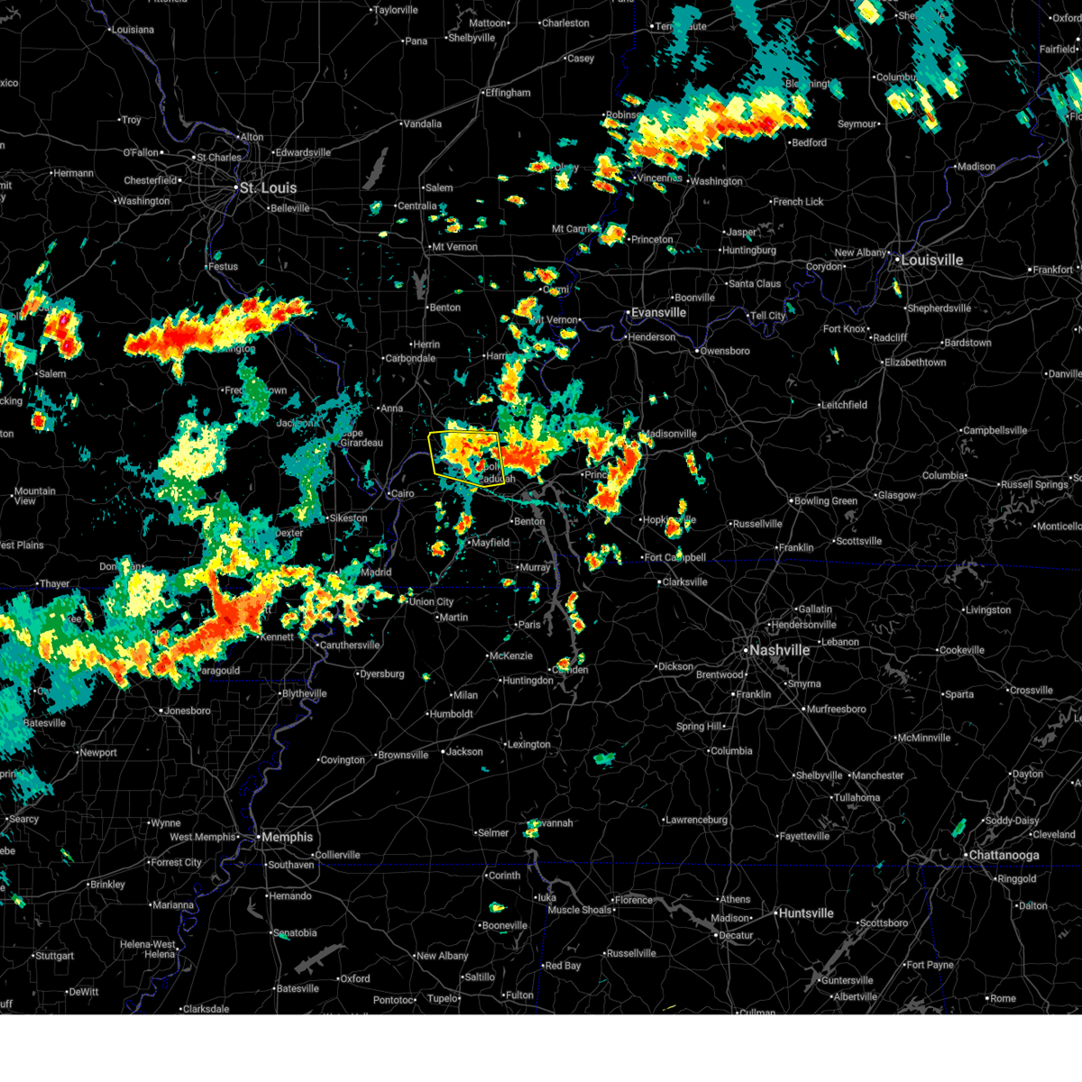
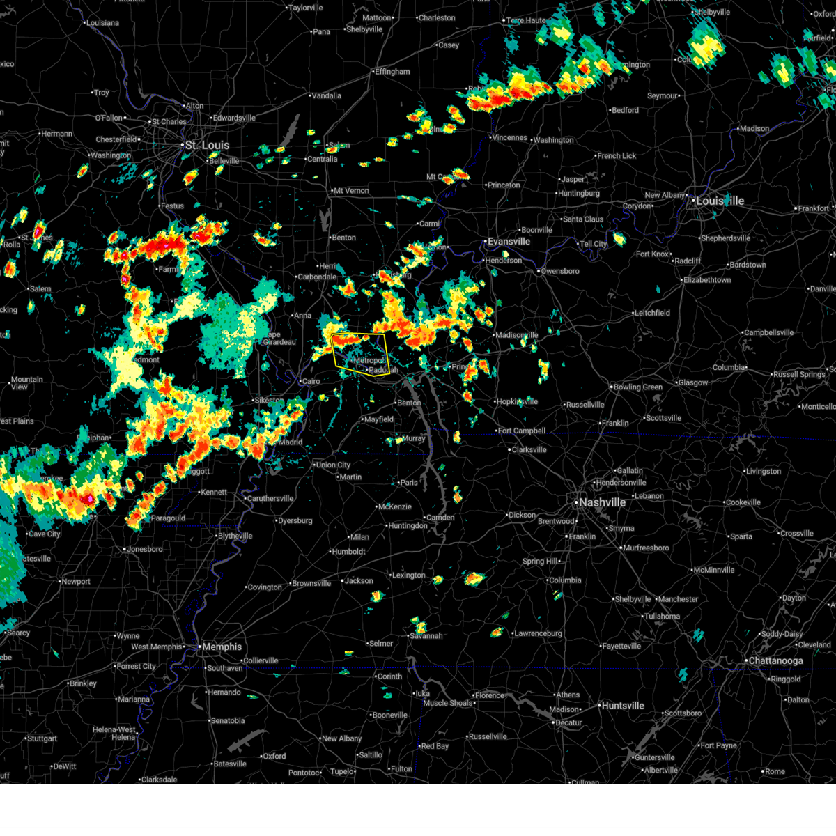
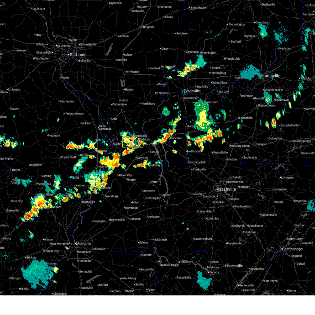
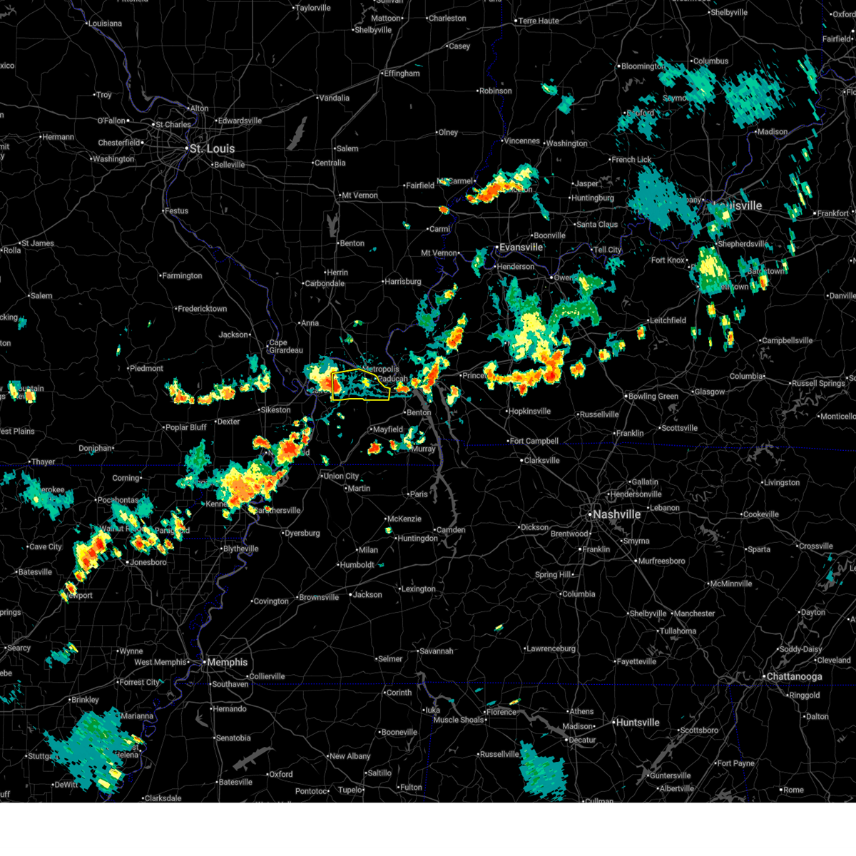
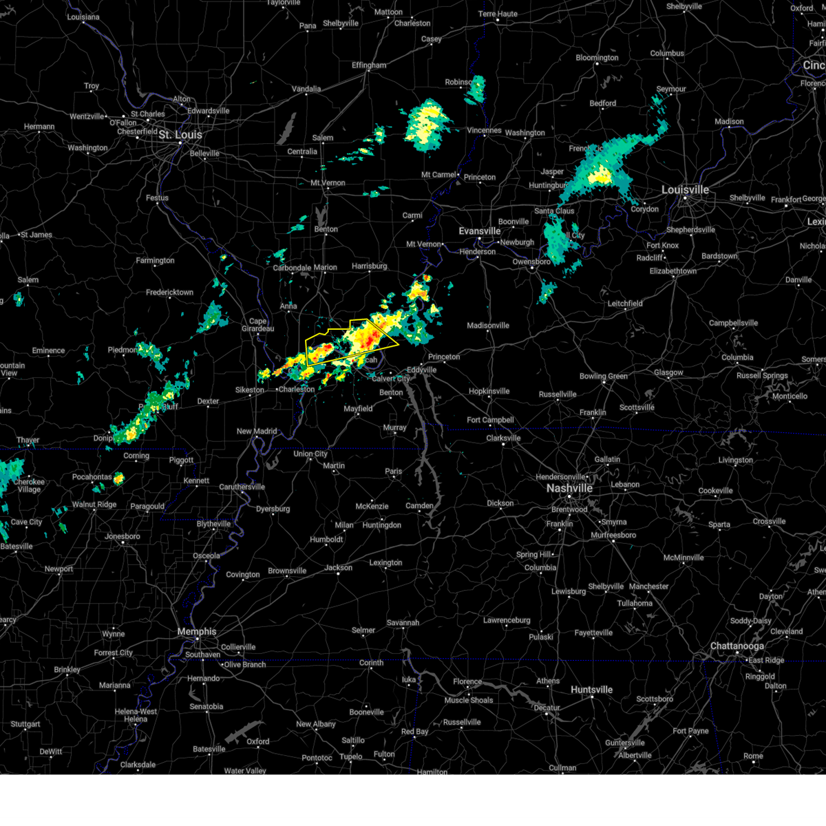
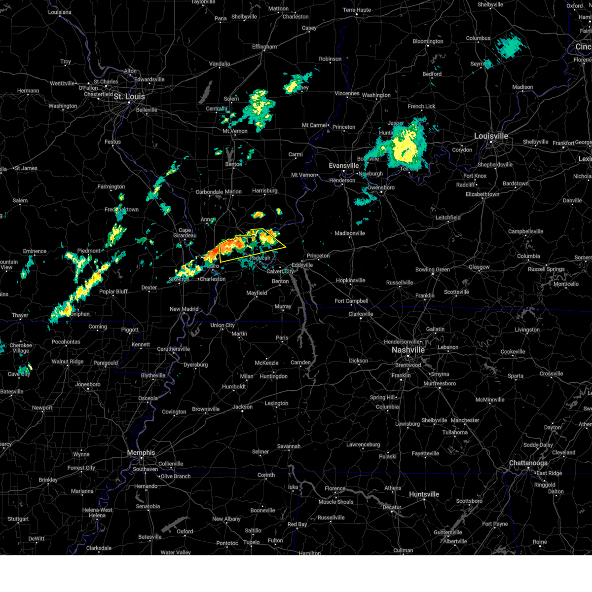
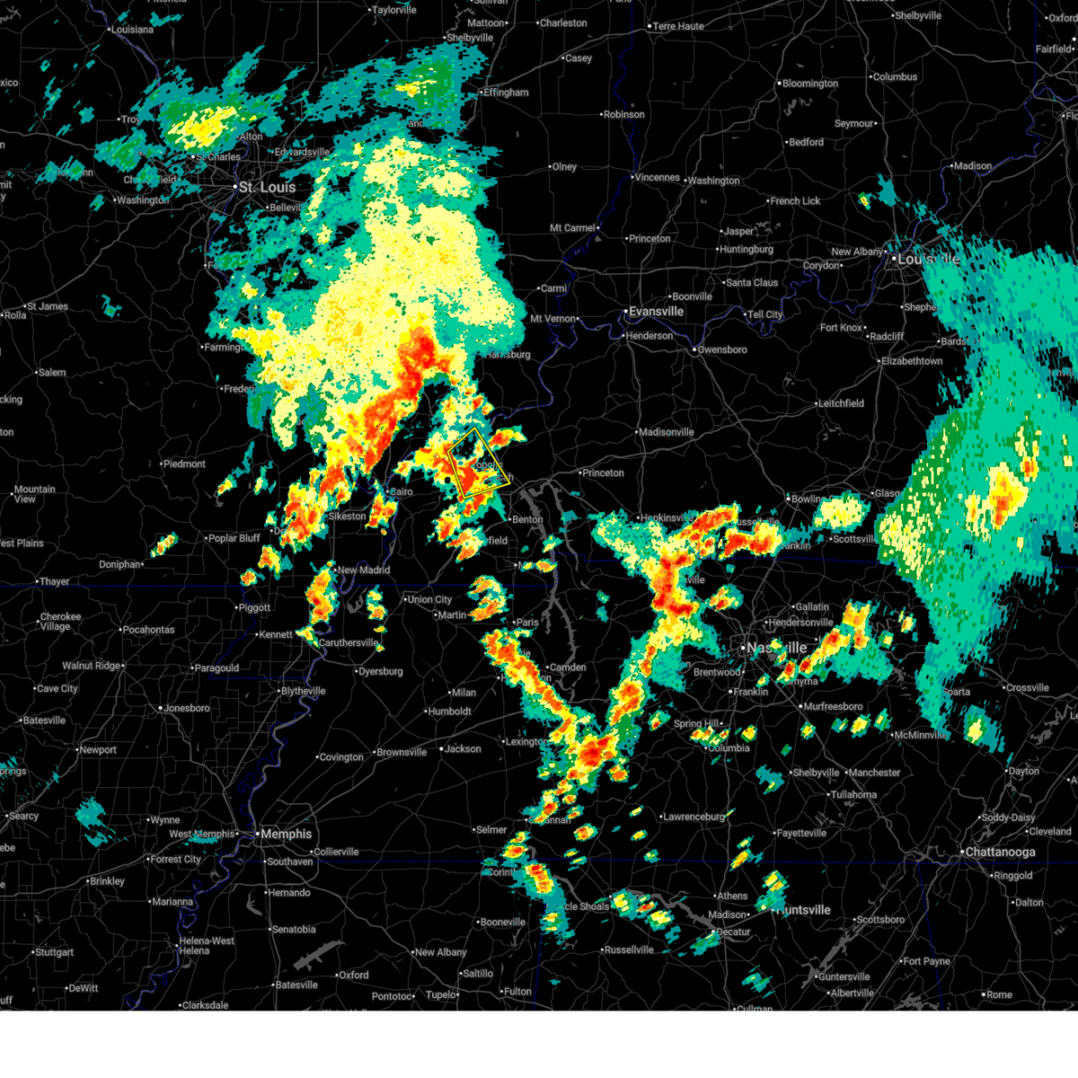
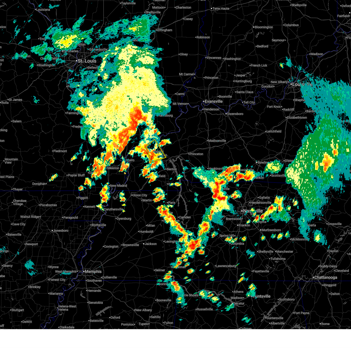
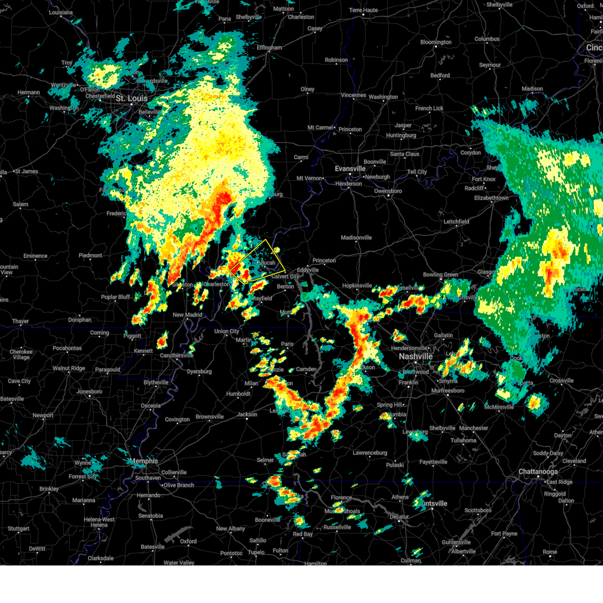
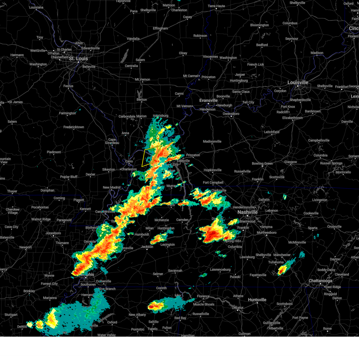
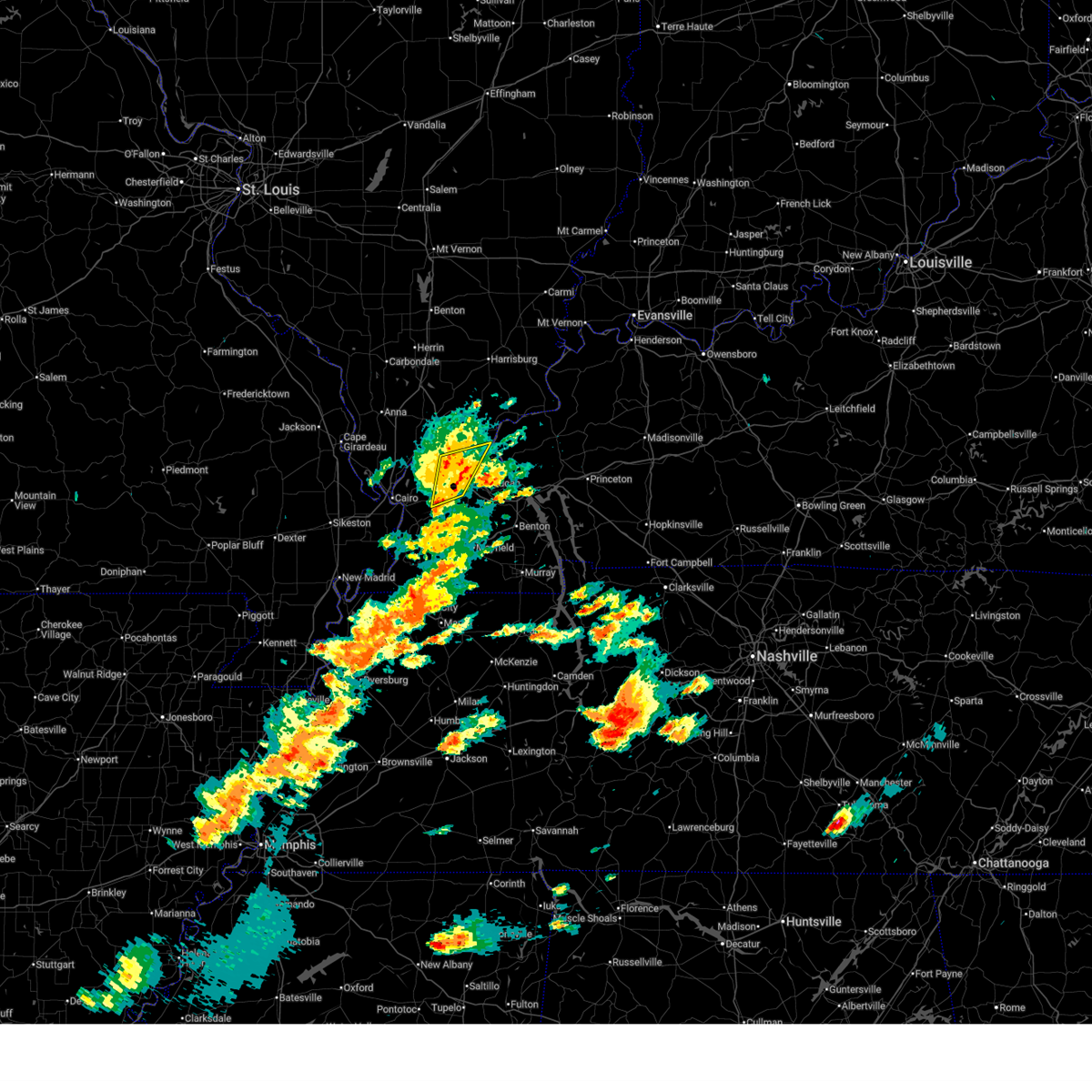
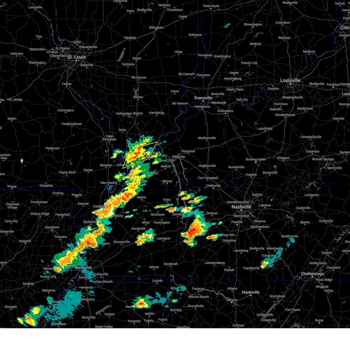
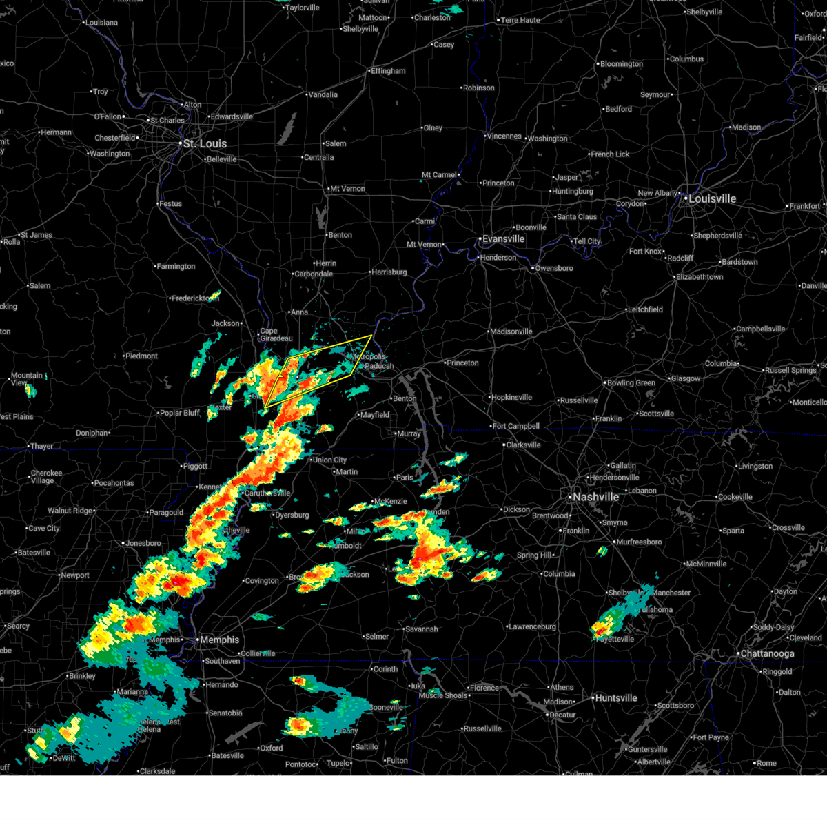
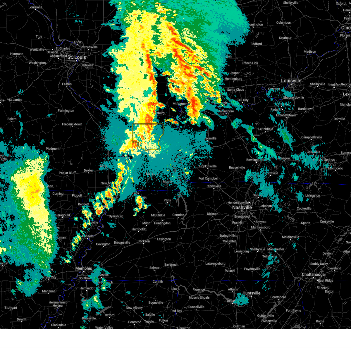
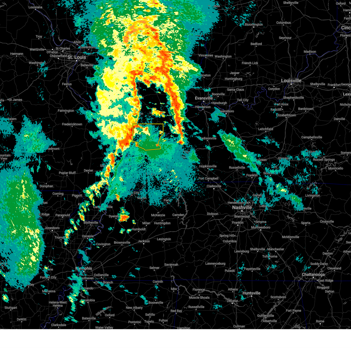
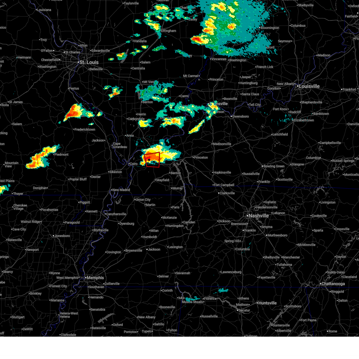
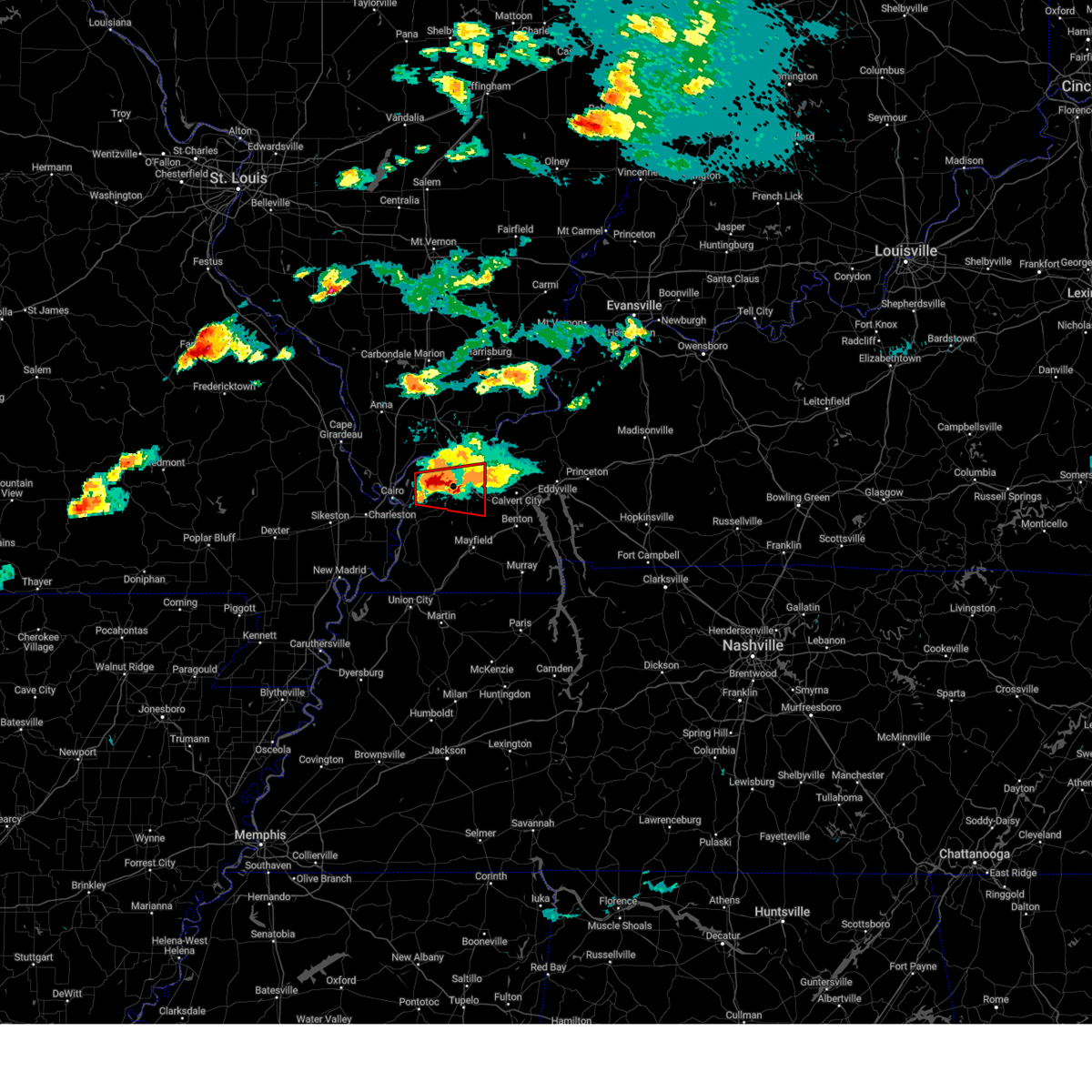
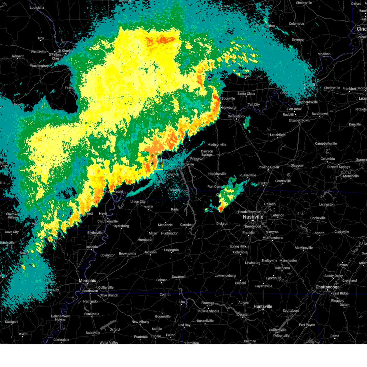
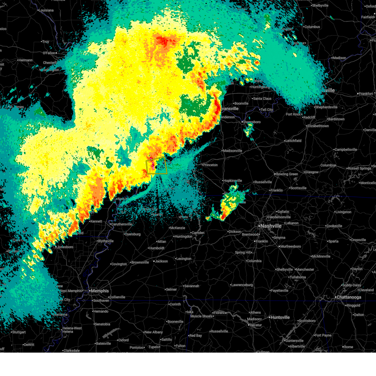
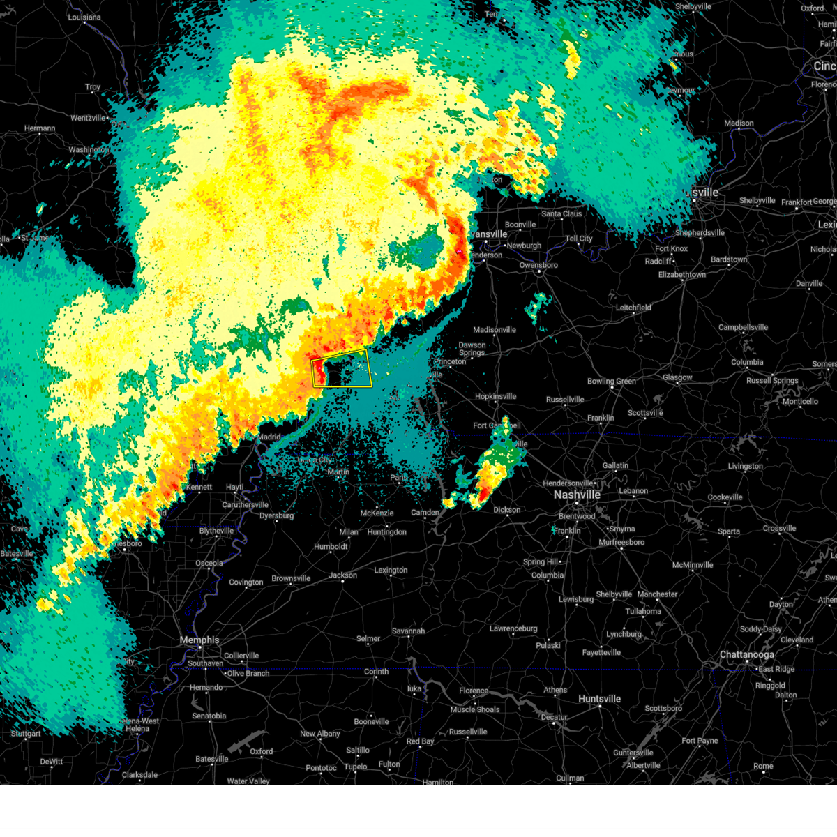
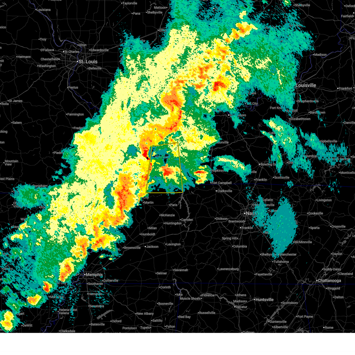
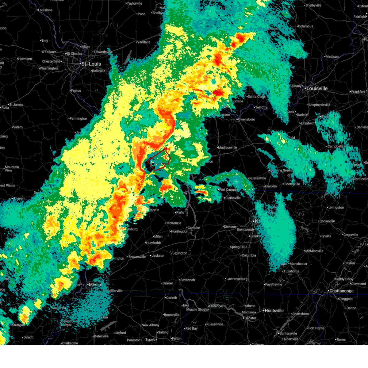
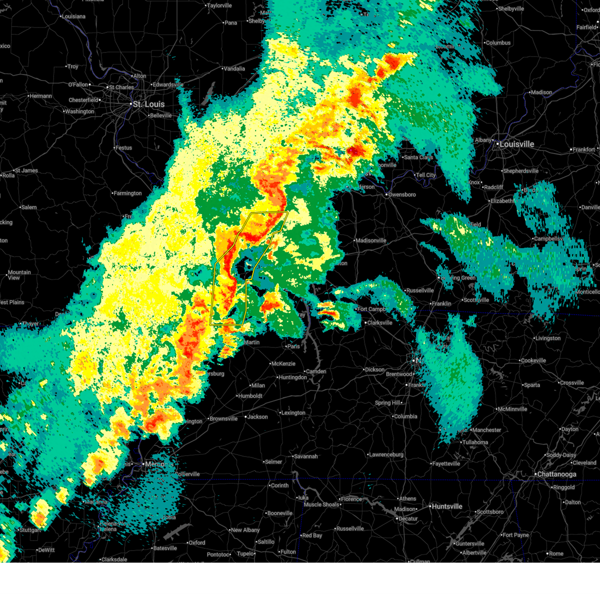
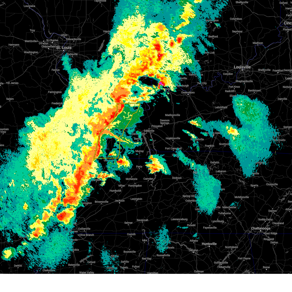
Hail Map for Metropolis, IL
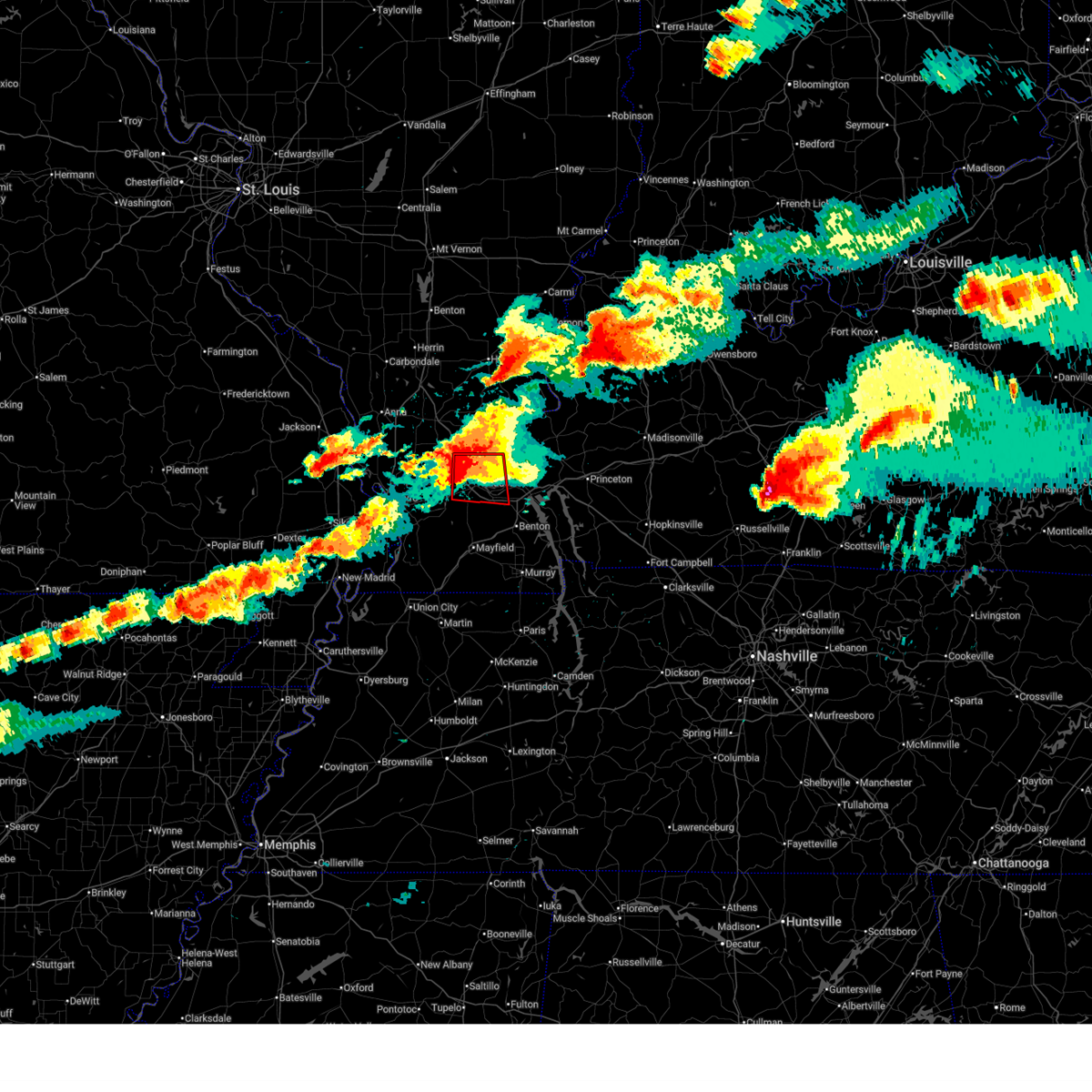
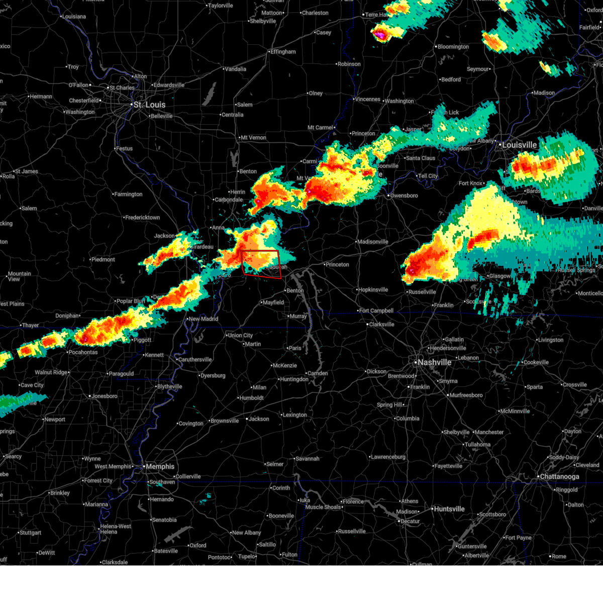
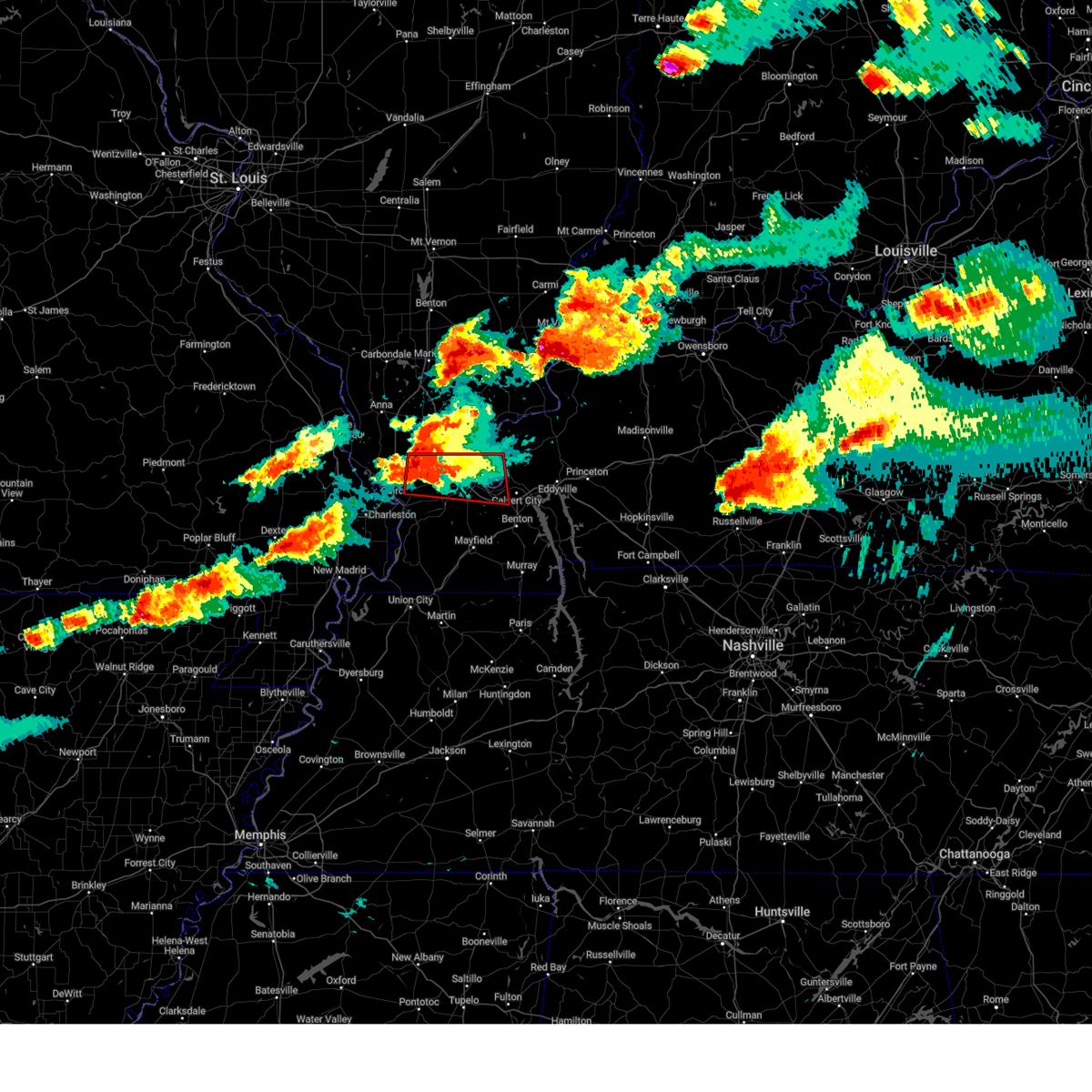
The Metropolis, IL area has had 9 reports of on-the-ground hail by trained spotters, and has been under severe weather warnings 32 times during the past 12 months. Doppler radar has detected hail at or near Metropolis, IL on 83 occasions, including 5 occasions during the past year.
| Name: | Metropolis, IL |
| Where Located: | 47 miles ESE of Cape Girardeau, MO |
| Map: | Google Map for Metropolis, IL |
| Population: | 6537 |
| Housing Units: | 3207 |
| More Info: | Search Google for Metropolis, IL |
1
The Top Recent Hail Date for Metropolis, IL is Friday, July 3, 2026 (22nd out of 83)
Hail and Wind Damage Spotted near Metropolis, IL
| Date / Time | Report Details |
|---|---|
| 7/9/2026 1:17 PM CDT |
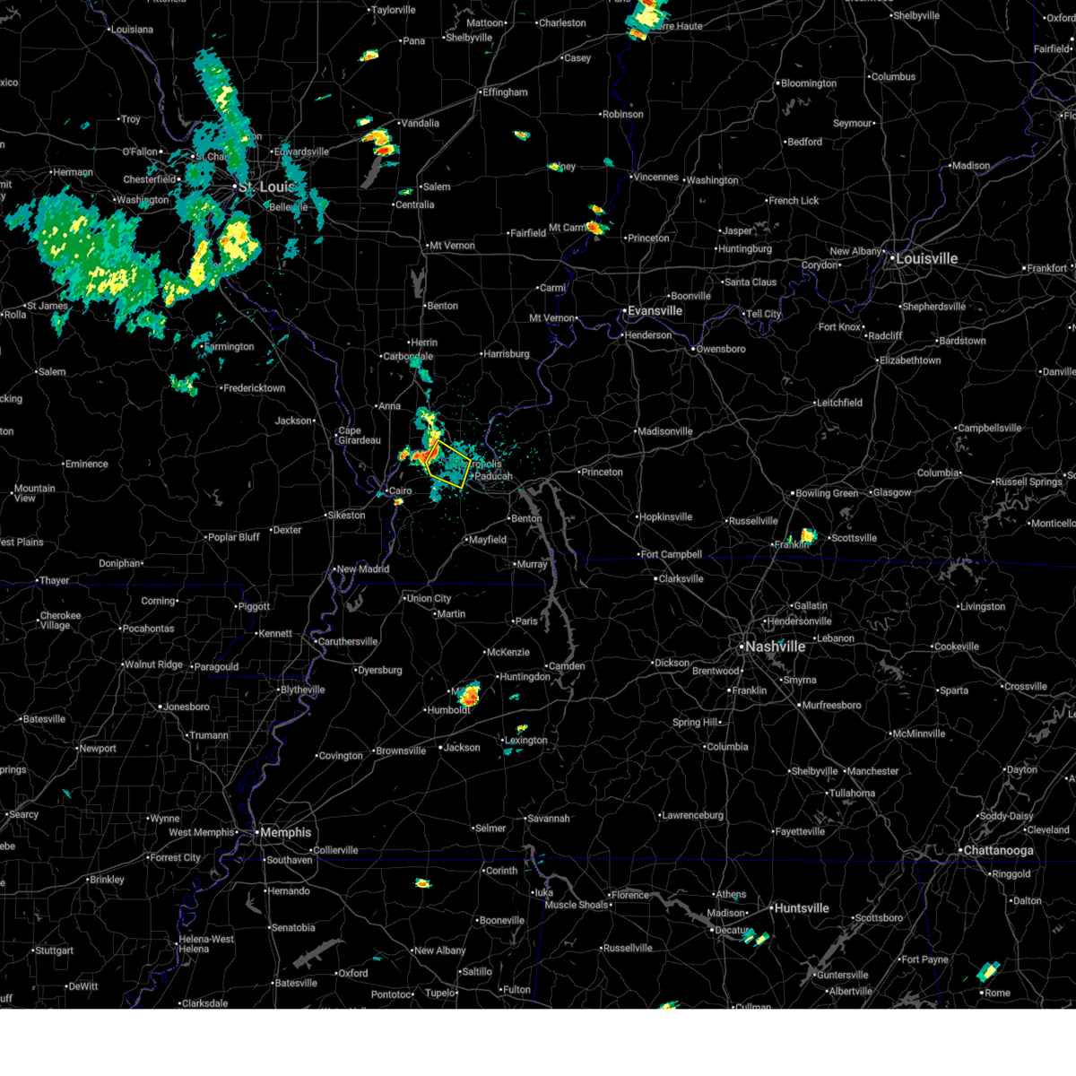 Svrpah the national weather service in paducah has issued a * severe thunderstorm warning for, central massac county in southern illinois, northwestern mccracken county in western kentucky, * until 130 pm cdt. * at 117 pm cdt, a severe thunderstorm was located near metropolis, moving southeast at 30 mph (radar indicated). Hazards include 60 mph wind gusts and penny size hail. expect damage to roofs, siding, and trees Svrpah the national weather service in paducah has issued a * severe thunderstorm warning for, central massac county in southern illinois, northwestern mccracken county in western kentucky, * until 130 pm cdt. * at 117 pm cdt, a severe thunderstorm was located near metropolis, moving southeast at 30 mph (radar indicated). Hazards include 60 mph wind gusts and penny size hail. expect damage to roofs, siding, and trees
|
| 7/4/2026 6:07 PM CDT |
 The storm which prompted the warning has weakened below severe limits, and no longer poses an immediate threat to life or property. therefore, the warning will be allowed to expire. however, gusty winds are still possible with this thunderstorm. The storm which prompted the warning has weakened below severe limits, and no longer poses an immediate threat to life or property. therefore, the warning will be allowed to expire. however, gusty winds are still possible with this thunderstorm.
|
| 7/4/2026 5:59 PM CDT |
 At 559 pm cdt, a severe thunderstorm was located over lone oak, moving east at 25 mph (radar indicated). Hazards include 60 mph wind gusts. Expect damage to roofs, siding, and trees. locations impacted include, paducah, lone oak, and brookport. This includes interstate 24 in kentucky between mile markers 2 and 12. At 559 pm cdt, a severe thunderstorm was located over lone oak, moving east at 25 mph (radar indicated). Hazards include 60 mph wind gusts. Expect damage to roofs, siding, and trees. locations impacted include, paducah, lone oak, and brookport. This includes interstate 24 in kentucky between mile markers 2 and 12.
|
| 7/4/2026 5:47 PM CDT |
 At 546 pm cdt, a severe thunderstorm was located over barkley regional airport, or near lone oak, moving east at 25 mph (radar indicated). Hazards include 60 mph wind gusts. Expect damage to roofs, siding, and trees. locations impacted include, paducah, metropolis, lone oak, brookport, barkley regional airport, west paducah, lovelaceville, and kevil. This includes interstate 24 in kentucky between mile markers 1 and 11. At 546 pm cdt, a severe thunderstorm was located over barkley regional airport, or near lone oak, moving east at 25 mph (radar indicated). Hazards include 60 mph wind gusts. Expect damage to roofs, siding, and trees. locations impacted include, paducah, metropolis, lone oak, brookport, barkley regional airport, west paducah, lovelaceville, and kevil. This includes interstate 24 in kentucky between mile markers 1 and 11.
|
| 7/4/2026 5:31 PM CDT |
 Svrpah the national weather service in paducah has issued a * severe thunderstorm warning for, southeastern massac county in southern illinois, northeastern carlisle county in western kentucky, eastern ballard county in western kentucky, mccracken county in western kentucky, northwestern graves county in western kentucky, * until 615 pm cdt. * at 531 pm cdt, a severe thunderstorm was located near la center, moving east at 25 mph (radar indicated). Hazards include 60 mph wind gusts and penny size hail. expect damage to roofs, siding, and trees Svrpah the national weather service in paducah has issued a * severe thunderstorm warning for, southeastern massac county in southern illinois, northeastern carlisle county in western kentucky, eastern ballard county in western kentucky, mccracken county in western kentucky, northwestern graves county in western kentucky, * until 615 pm cdt. * at 531 pm cdt, a severe thunderstorm was located near la center, moving east at 25 mph (radar indicated). Hazards include 60 mph wind gusts and penny size hail. expect damage to roofs, siding, and trees
|
| 7/2/2026 7:51 PM CDT |
 At 751 pm cdt, severe thunderstorms were located along a line extending from 6 miles west of burna to near ledbetter to near reidland, moving northwest at 10 mph (radar indicated). Hazards include 60 mph wind gusts and penny size hail. Expect damage to roofs, siding, and trees. locations impacted include, paducah, lone oak, reidland, brookport, and ledbetter. This includes interstate 24 in kentucky between mile markers 2 and 17. At 751 pm cdt, severe thunderstorms were located along a line extending from 6 miles west of burna to near ledbetter to near reidland, moving northwest at 10 mph (radar indicated). Hazards include 60 mph wind gusts and penny size hail. Expect damage to roofs, siding, and trees. locations impacted include, paducah, lone oak, reidland, brookport, and ledbetter. This includes interstate 24 in kentucky between mile markers 2 and 17.
|
| 7/2/2026 7:25 PM CDT |
 Svrpah the national weather service in paducah has issued a * severe thunderstorm warning for, southeastern massac county in southern illinois, southeastern pope county in southern illinois, southwestern livingston county in western kentucky, northwestern marshall county in western kentucky, southeastern mccracken county in western kentucky, * until 815 pm cdt. * at 725 pm cdt, severe thunderstorms were located along a line extending from near burna to reidland to 8 miles south of ledbetter, moving northwest at 5 mph (radar indicated). Hazards include 60 mph wind gusts and penny size hail. expect damage to roofs, siding, and trees Svrpah the national weather service in paducah has issued a * severe thunderstorm warning for, southeastern massac county in southern illinois, southeastern pope county in southern illinois, southwestern livingston county in western kentucky, northwestern marshall county in western kentucky, southeastern mccracken county in western kentucky, * until 815 pm cdt. * at 725 pm cdt, severe thunderstorms were located along a line extending from near burna to reidland to 8 miles south of ledbetter, moving northwest at 5 mph (radar indicated). Hazards include 60 mph wind gusts and penny size hail. expect damage to roofs, siding, and trees
|
| 6/27/2026 6:01 PM CDT |
 Torpah the national weather service in paducah has issued a * tornado warning for, southeastern massac county in southern illinois, central mccracken county in western kentucky, * until 645 pm cdt. * at 601 pm cdt, a severe thunderstorm capable of producing a tornado was located over metropolis, moving east at 20 mph (radar indicated rotation). Hazards include tornado. Flying debris will be dangerous to those caught without shelter. mobile homes will be damaged or destroyed. damage to roofs, windows, and vehicles will occur. tree damage is likely. this dangerous storm will be near, paducah and brookport around 605 pm cdt. this includes the following highways, interstate 24 in kentucky between mile markers 1 and 3. Interstate 24 in illinois between mile markers 36 and 38. Torpah the national weather service in paducah has issued a * tornado warning for, southeastern massac county in southern illinois, central mccracken county in western kentucky, * until 645 pm cdt. * at 601 pm cdt, a severe thunderstorm capable of producing a tornado was located over metropolis, moving east at 20 mph (radar indicated rotation). Hazards include tornado. Flying debris will be dangerous to those caught without shelter. mobile homes will be damaged or destroyed. damage to roofs, windows, and vehicles will occur. tree damage is likely. this dangerous storm will be near, paducah and brookport around 605 pm cdt. this includes the following highways, interstate 24 in kentucky between mile markers 1 and 3. Interstate 24 in illinois between mile markers 36 and 38.
|
| 6/27/2026 5:34 PM CDT |
 Torpah the national weather service in paducah has issued a * tornado warning for, southern massac county in southern illinois, northern mccracken county in western kentucky, * until 600 pm cdt. * at 534 pm cdt, a severe thunderstorm capable of producing a tornado was located near barkley regional airport, or 7 miles west of metropolis, moving east at 20 mph (radar indicated rotation). Hazards include tornado. Flying debris will be dangerous to those caught without shelter. mobile homes will be damaged or destroyed. damage to roofs, windows, and vehicles will occur. tree damage is likely. this dangerous storm will be near, paducah, metropolis, west paducah, and barkley regional airport around 540 pm cdt. other locations impacted by this tornadic thunderstorm include joppa. this includes the following highways, interstate 24 in kentucky between mile markers 1 and 5. Interstate 24 in illinois between mile markers 35 and 38. Torpah the national weather service in paducah has issued a * tornado warning for, southern massac county in southern illinois, northern mccracken county in western kentucky, * until 600 pm cdt. * at 534 pm cdt, a severe thunderstorm capable of producing a tornado was located near barkley regional airport, or 7 miles west of metropolis, moving east at 20 mph (radar indicated rotation). Hazards include tornado. Flying debris will be dangerous to those caught without shelter. mobile homes will be damaged or destroyed. damage to roofs, windows, and vehicles will occur. tree damage is likely. this dangerous storm will be near, paducah, metropolis, west paducah, and barkley regional airport around 540 pm cdt. other locations impacted by this tornadic thunderstorm include joppa. this includes the following highways, interstate 24 in kentucky between mile markers 1 and 5. Interstate 24 in illinois between mile markers 35 and 38.
|
| 6/27/2026 1:19 PM CDT |
 At 119 pm cdt, severe thunderstorms were located along a line extending from near vienna to near metropolis to near lovelaceville, moving east at 40 mph (radar indicated). Hazards include 60 mph wind gusts. Expect damage to roofs, siding, and trees. locations impacted include, paducah, metropolis, vienna, reidland, lone oak, brookport, barkley regional airport, west paducah, new columbia, joppa, belknap, simpson, lowes, and symsonia. this includes the following highways, interstate 24 in kentucky between mile markers 1 and 17. Interstate 24 in illinois between mile markers 13 and 38. At 119 pm cdt, severe thunderstorms were located along a line extending from near vienna to near metropolis to near lovelaceville, moving east at 40 mph (radar indicated). Hazards include 60 mph wind gusts. Expect damage to roofs, siding, and trees. locations impacted include, paducah, metropolis, vienna, reidland, lone oak, brookport, barkley regional airport, west paducah, new columbia, joppa, belknap, simpson, lowes, and symsonia. this includes the following highways, interstate 24 in kentucky between mile markers 1 and 17. Interstate 24 in illinois between mile markers 13 and 38.
|
| 6/27/2026 12:59 PM CDT |
 Svrpah the national weather service in paducah has issued a * severe thunderstorm warning for, southeastern union county in southern illinois, northeastern pulaski county in southern illinois, massac county in southern illinois, johnson county in southern illinois, northeastern carlisle county in western kentucky, ballard county in western kentucky, mccracken county in western kentucky, northern graves county in western kentucky, * until 145 pm cdt. * at 1258 pm cdt, severe thunderstorms were located along a line extending from near dongola to 6 miles north of la center to near bardwell, moving east at 40 mph (radar indicated). Hazards include 60 mph wind gusts. expect damage to roofs, siding, and trees Svrpah the national weather service in paducah has issued a * severe thunderstorm warning for, southeastern union county in southern illinois, northeastern pulaski county in southern illinois, massac county in southern illinois, johnson county in southern illinois, northeastern carlisle county in western kentucky, ballard county in western kentucky, mccracken county in western kentucky, northern graves county in western kentucky, * until 145 pm cdt. * at 1258 pm cdt, severe thunderstorms were located along a line extending from near dongola to 6 miles north of la center to near bardwell, moving east at 40 mph (radar indicated). Hazards include 60 mph wind gusts. expect damage to roofs, siding, and trees
|
| 6/1/2026 8:26 AM CDT |
 At 826 am cdt, severe thunderstorms were located along a line extending from near new columbia to 7 miles southeast of karnak, moving southeast at 45 mph (radar indicated). Hazards include 60 mph wind gusts. Expect damage to roofs, siding, and trees. locations impacted include, metropolis, new columbia, and joppa. this includes the following highways, interstate 24 in kentucky between mile markers 1 and 2. Interstate 24 in illinois between mile markers 26 and 38. At 826 am cdt, severe thunderstorms were located along a line extending from near new columbia to 7 miles southeast of karnak, moving southeast at 45 mph (radar indicated). Hazards include 60 mph wind gusts. Expect damage to roofs, siding, and trees. locations impacted include, metropolis, new columbia, and joppa. this includes the following highways, interstate 24 in kentucky between mile markers 1 and 2. Interstate 24 in illinois between mile markers 26 and 38.
|
| 6/1/2026 8:15 AM CDT |
 Svrpah the national weather service in paducah has issued a * severe thunderstorm warning for, northeastern pulaski county in southern illinois, massac county in southern illinois, southeastern johnson county in southern illinois, north central ballard county in western kentucky, northwestern mccracken county in western kentucky, * until 900 am cdt. * at 815 am cdt, severe thunderstorms were located along a line extending from 6 miles south of vienna to near karnak, moving southeast at 40 mph (radar indicated). Hazards include 60 mph wind gusts. expect damage to roofs, siding, and trees Svrpah the national weather service in paducah has issued a * severe thunderstorm warning for, northeastern pulaski county in southern illinois, massac county in southern illinois, southeastern johnson county in southern illinois, north central ballard county in western kentucky, northwestern mccracken county in western kentucky, * until 900 am cdt. * at 815 am cdt, severe thunderstorms were located along a line extending from 6 miles south of vienna to near karnak, moving southeast at 40 mph (radar indicated). Hazards include 60 mph wind gusts. expect damage to roofs, siding, and trees
|
| 4/16/2026 4:34 PM CDT |
 At 434 pm cdt, a severe thunderstorm was located near paducah, moving east at 40 mph (radar indicated). Hazards include 60 mph wind gusts and quarter size hail. Hail damage to vehicles is expected. expect wind damage to roofs, siding, and trees. locations impacted include, paducah, lone oak, reidland, brookport, barkley regional airport, west paducah, and ledbetter. This includes interstate 24 in kentucky between mile markers 1 and 17. At 434 pm cdt, a severe thunderstorm was located near paducah, moving east at 40 mph (radar indicated). Hazards include 60 mph wind gusts and quarter size hail. Hail damage to vehicles is expected. expect wind damage to roofs, siding, and trees. locations impacted include, paducah, lone oak, reidland, brookport, barkley regional airport, west paducah, and ledbetter. This includes interstate 24 in kentucky between mile markers 1 and 17.
|
| 4/16/2026 4:04 PM CDT |
 Svrpah the national weather service in paducah has issued a * severe thunderstorm warning for, southern massac county in southern illinois, south central pope county in southern illinois, southwestern livingston county in western kentucky, northeastern ballard county in western kentucky, mccracken county in western kentucky, * until 500 pm cdt. * at 404 pm cdt, a severe thunderstorm was located over la center, moving east at 40 mph (radar indicated). Hazards include 60 mph wind gusts and half dollar size hail. Hail damage to vehicles is expected. Expect wind damage to roofs, siding, and trees. Svrpah the national weather service in paducah has issued a * severe thunderstorm warning for, southern massac county in southern illinois, south central pope county in southern illinois, southwestern livingston county in western kentucky, northeastern ballard county in western kentucky, mccracken county in western kentucky, * until 500 pm cdt. * at 404 pm cdt, a severe thunderstorm was located over la center, moving east at 40 mph (radar indicated). Hazards include 60 mph wind gusts and half dollar size hail. Hail damage to vehicles is expected. Expect wind damage to roofs, siding, and trees.
|
| 3/15/2026 8:27 PM CDT |
 The storms which prompted the warning have moved out of the area. therefore, the warning will be allowed to expire. a tornado watch remains in effect until 1100 pm cdt for southern illinois, and western kentucky. The storms which prompted the warning have moved out of the area. therefore, the warning will be allowed to expire. a tornado watch remains in effect until 1100 pm cdt for southern illinois, and western kentucky.
|
| 3/15/2026 8:24 PM CDT |
 the tornado warning has been cancelled and is no longer in effect the tornado warning has been cancelled and is no longer in effect
|
| 3/15/2026 8:17 PM CDT |
 the severe thunderstorm warning has been cancelled and is no longer in effect the severe thunderstorm warning has been cancelled and is no longer in effect
|
| 3/15/2026 8:17 PM CDT |
 At 816 pm cdt, severe thunderstorms were located along a line extending from near brookport to near latham, moving east at 50 mph (radar indicated). Hazards include 60 mph wind gusts. Expect damage to roofs, siding, and trees. locations impacted include, paducah, mayfield, reidland, lone oak, brookport, burna, ledbetter, lynnville, sedalia, wingo, smithland, hamletsburg, and symsonia. this includes the following highways, interstate 24 in kentucky between mile markers 1 and 20. interstate 24 in illinois between mile markers 34 and 38. Interstate 69 in kentucky between mile markers 11 and 36. At 816 pm cdt, severe thunderstorms were located along a line extending from near brookport to near latham, moving east at 50 mph (radar indicated). Hazards include 60 mph wind gusts. Expect damage to roofs, siding, and trees. locations impacted include, paducah, mayfield, reidland, lone oak, brookport, burna, ledbetter, lynnville, sedalia, wingo, smithland, hamletsburg, and symsonia. this includes the following highways, interstate 24 in kentucky between mile markers 1 and 20. interstate 24 in illinois between mile markers 34 and 38. Interstate 69 in kentucky between mile markers 11 and 36.
|
| 3/15/2026 8:14 PM CDT |
 the tornado warning has been cancelled and is no longer in effect the tornado warning has been cancelled and is no longer in effect
|
| 3/15/2026 8:14 PM CDT |
 At 814 pm cdt, a severe squall line capable of producing both tornadoes and extensive straight line wind damage was located along a line extending from 6 miles northeast of dixon springs to near lovelaceville, moving northeast at 60 mph (radar indicated rotation). Hazards include tornado. Flying debris will be dangerous to those caught without shelter. mobile homes will be damaged or destroyed. damage to roofs, windows, and vehicles will occur. tree damage is likely. these dangerous storms will be near, paducah, reidland, lone oak, brookport, golconda, and ledbetter around 820 pm cdt. burna around 825 pm cdt. other locations impacted by these tornadic storms include smithland and hamletsburg. this includes the following highways, interstate 24 in kentucky between mile markers 1 and 11. Interstate 24 in illinois between mile markers 31 and 38. At 814 pm cdt, a severe squall line capable of producing both tornadoes and extensive straight line wind damage was located along a line extending from 6 miles northeast of dixon springs to near lovelaceville, moving northeast at 60 mph (radar indicated rotation). Hazards include tornado. Flying debris will be dangerous to those caught without shelter. mobile homes will be damaged or destroyed. damage to roofs, windows, and vehicles will occur. tree damage is likely. these dangerous storms will be near, paducah, reidland, lone oak, brookport, golconda, and ledbetter around 820 pm cdt. burna around 825 pm cdt. other locations impacted by these tornadic storms include smithland and hamletsburg. this includes the following highways, interstate 24 in kentucky between mile markers 1 and 11. Interstate 24 in illinois between mile markers 31 and 38.
|
| 3/15/2026 8:06 PM CDT |
 At 806 pm cdt, severe thunderstorms were located along a line extending from metropolis to near martin, moving east at 50 mph (radar indicated). Hazards include 60 mph wind gusts. Expect damage to roofs, siding, and trees. locations impacted include, paducah, mayfield, metropolis, fulton, clinton, reidland, lone oak, brookport, barkley regional airport, burna, ledbetter, lynnville, fulgham, sedalia, lovelaceville, west paducah, wingo, kevil, joppa, and smithland. this includes the following highways, interstate 24 in kentucky between mile markers 1 and 20. interstate 24 in illinois between mile markers 30 and 38. Interstate 69 in kentucky between mile markers 1 and 36. At 806 pm cdt, severe thunderstorms were located along a line extending from metropolis to near martin, moving east at 50 mph (radar indicated). Hazards include 60 mph wind gusts. Expect damage to roofs, siding, and trees. locations impacted include, paducah, mayfield, metropolis, fulton, clinton, reidland, lone oak, brookport, barkley regional airport, burna, ledbetter, lynnville, fulgham, sedalia, lovelaceville, west paducah, wingo, kevil, joppa, and smithland. this includes the following highways, interstate 24 in kentucky between mile markers 1 and 20. interstate 24 in illinois between mile markers 30 and 38. Interstate 69 in kentucky between mile markers 1 and 36.
|
| 3/15/2026 7:56 PM CDT |
 Torpah the national weather service in paducah has issued a * tornado warning for, massac county in southern illinois, pope county in southern illinois, southeastern johnson county in southern illinois, western livingston county in western kentucky, northwestern marshall county in western kentucky, eastern ballard county in western kentucky, mccracken county in western kentucky, * until 845 pm cdt. * at 756 pm cdt, severe thunderstorms capable of producing both tornadoes and extensive straight line wind damage were located along a line extending from near karnak to near bardwell, moving northeast at 50 mph (radar indicated rotation). Hazards include tornado. Flying debris will be dangerous to those caught without shelter. mobile homes will be damaged or destroyed. damage to roofs, windows, and vehicles will occur. tree damage is likely. these dangerous storms will be near, new columbia, barkley regional airport, and lovelaceville around 800 pm cdt. paducah, metropolis, dixon springs, and west paducah around 805 pm cdt. lone oak and brookport around 810 pm cdt. reidland, golconda, and ledbetter around 820 pm cdt. burna around 830 pm cdt. calvert city around 835 pm cdt. other locations impacted by these tornadic storms include smithland, joppa, hamletsburg, kevil, and blandville. this includes the following highways, interstate 24 in kentucky between mile markers 1 and 24. Interstate 24 in illinois between mile markers 20 and 38. Torpah the national weather service in paducah has issued a * tornado warning for, massac county in southern illinois, pope county in southern illinois, southeastern johnson county in southern illinois, western livingston county in western kentucky, northwestern marshall county in western kentucky, eastern ballard county in western kentucky, mccracken county in western kentucky, * until 845 pm cdt. * at 756 pm cdt, severe thunderstorms capable of producing both tornadoes and extensive straight line wind damage were located along a line extending from near karnak to near bardwell, moving northeast at 50 mph (radar indicated rotation). Hazards include tornado. Flying debris will be dangerous to those caught without shelter. mobile homes will be damaged or destroyed. damage to roofs, windows, and vehicles will occur. tree damage is likely. these dangerous storms will be near, new columbia, barkley regional airport, and lovelaceville around 800 pm cdt. paducah, metropolis, dixon springs, and west paducah around 805 pm cdt. lone oak and brookport around 810 pm cdt. reidland, golconda, and ledbetter around 820 pm cdt. burna around 830 pm cdt. calvert city around 835 pm cdt. other locations impacted by these tornadic storms include smithland, joppa, hamletsburg, kevil, and blandville. this includes the following highways, interstate 24 in kentucky between mile markers 1 and 24. Interstate 24 in illinois between mile markers 20 and 38.
|
| 3/15/2026 7:43 PM CDT |
 Svrpah the national weather service in paducah has issued a * severe thunderstorm warning for, massac county in southern illinois, southeastern pope county in southern illinois, eastern fulton county in western kentucky, northwestern calloway county in western kentucky, southwestern livingston county in western kentucky, western marshall county in western kentucky, carlisle county in western kentucky, hickman county in western kentucky, ballard county in western kentucky, mccracken county in western kentucky, graves county in western kentucky, * until 830 pm cdt. * at 743 pm cdt, severe thunderstorms were located along a line extending from 8 miles northwest of la center to near troy, moving east at 50 mph (radar indicated). Hazards include 70 mph wind gusts. Expect considerable tree damage. Damage is likely to mobile homes, roofs, and outbuildings. Svrpah the national weather service in paducah has issued a * severe thunderstorm warning for, massac county in southern illinois, southeastern pope county in southern illinois, eastern fulton county in western kentucky, northwestern calloway county in western kentucky, southwestern livingston county in western kentucky, western marshall county in western kentucky, carlisle county in western kentucky, hickman county in western kentucky, ballard county in western kentucky, mccracken county in western kentucky, graves county in western kentucky, * until 830 pm cdt. * at 743 pm cdt, severe thunderstorms were located along a line extending from 8 miles northwest of la center to near troy, moving east at 50 mph (radar indicated). Hazards include 70 mph wind gusts. Expect considerable tree damage. Damage is likely to mobile homes, roofs, and outbuildings.
|
| 12/28/2025 7:27 PM CST |
 The storm which prompted the warning has moved out of the area. therefore, the warning will be allowed to expire. a tornado watch remains in effect until 900 pm cst for southern illinois, and western kentucky. The storm which prompted the warning has moved out of the area. therefore, the warning will be allowed to expire. a tornado watch remains in effect until 900 pm cst for southern illinois, and western kentucky.
|
| 12/28/2025 6:50 PM CST |
 Svrpah the national weather service in paducah has issued a * severe thunderstorm warning for, southern massac county in southern illinois, southeastern ballard county in western kentucky, mccracken county in western kentucky, * until 730 pm cst. * at 649 pm cst, a severe thunderstorm was located near la center, moving east at 50 mph (radar indicated). Hazards include 60 mph wind gusts. expect damage to roofs, siding, and trees Svrpah the national weather service in paducah has issued a * severe thunderstorm warning for, southern massac county in southern illinois, southeastern ballard county in western kentucky, mccracken county in western kentucky, * until 730 pm cst. * at 649 pm cst, a severe thunderstorm was located near la center, moving east at 50 mph (radar indicated). Hazards include 60 mph wind gusts. expect damage to roofs, siding, and trees
|
| 12/18/2025 3:47 PM CST |
 the tornado warning has been cancelled and is no longer in effect the tornado warning has been cancelled and is no longer in effect
|
| 12/18/2025 3:38 PM CST |
 the tornado warning has been cancelled and is no longer in effect the tornado warning has been cancelled and is no longer in effect
|
| 12/18/2025 3:38 PM CST |
 At 338 pm cst, a severe thunderstorm capable of producing a tornado was located over metropolis, moving east at 45 mph (radar indicated rotation). Hazards include tornado. Flying debris will be dangerous to those caught without shelter. mobile homes will be damaged or destroyed. damage to roofs, windows, and vehicles will occur. tree damage is likely. this dangerous storm will be near, brookport around 345 pm cst. This includes interstate 24 in illinois between mile markers 29 and 38. At 338 pm cst, a severe thunderstorm capable of producing a tornado was located over metropolis, moving east at 45 mph (radar indicated rotation). Hazards include tornado. Flying debris will be dangerous to those caught without shelter. mobile homes will be damaged or destroyed. damage to roofs, windows, and vehicles will occur. tree damage is likely. this dangerous storm will be near, brookport around 345 pm cst. This includes interstate 24 in illinois between mile markers 29 and 38.
|
| 12/18/2025 3:25 PM CST |
 Torpah the national weather service in paducah has issued a * tornado warning for, massac county in southern illinois, central pope county in southern illinois, central ballard county in western kentucky, northwestern mccracken county in western kentucky, * until 400 pm cst. * at 325 pm cst, a severe thunderstorm capable of producing a tornado was located over la center, moving northeast at 65 mph (radar indicated rotation). Hazards include tornado. Flying debris will be dangerous to those caught without shelter. mobile homes will be damaged or destroyed. damage to roofs, windows, and vehicles will occur. tree damage is likely. this dangerous storm will be near, paducah, metropolis, and west paducah around 330 pm cst. brookport around 335 pm cst. other locations impacted by this tornadic thunderstorm include joppa and kevil. this includes the following highways, interstate 24 in kentucky between mile markers 1 and 3. Interstate 24 in illinois between mile markers 29 and 38. Torpah the national weather service in paducah has issued a * tornado warning for, massac county in southern illinois, central pope county in southern illinois, central ballard county in western kentucky, northwestern mccracken county in western kentucky, * until 400 pm cst. * at 325 pm cst, a severe thunderstorm capable of producing a tornado was located over la center, moving northeast at 65 mph (radar indicated rotation). Hazards include tornado. Flying debris will be dangerous to those caught without shelter. mobile homes will be damaged or destroyed. damage to roofs, windows, and vehicles will occur. tree damage is likely. this dangerous storm will be near, paducah, metropolis, and west paducah around 330 pm cst. brookport around 335 pm cst. other locations impacted by this tornadic thunderstorm include joppa and kevil. this includes the following highways, interstate 24 in kentucky between mile markers 1 and 3. Interstate 24 in illinois between mile markers 29 and 38.
|
| 8/19/2025 4:39 PM CDT |
 The storms which prompted the warning have weakened below severe limits, and have exited the warned area. therefore, the warning will be allowed to expire. The storms which prompted the warning have weakened below severe limits, and have exited the warned area. therefore, the warning will be allowed to expire.
|
| 8/19/2025 3:53 PM CDT |
 Svrpah the national weather service in paducah has issued a * severe thunderstorm warning for, massac county in southern illinois, southern pope county in southern illinois, western livingston county in western kentucky, central mccracken county in western kentucky, * until 445 pm cdt. * at 353 pm cdt, severe thunderstorms were located along a line extending from near new columbia to 7 miles southwest of golconda, moving south at 10 mph (radar indicated). Hazards include 60 mph wind gusts. expect damage to roofs, siding, and trees Svrpah the national weather service in paducah has issued a * severe thunderstorm warning for, massac county in southern illinois, southern pope county in southern illinois, western livingston county in western kentucky, central mccracken county in western kentucky, * until 445 pm cdt. * at 353 pm cdt, severe thunderstorms were located along a line extending from near new columbia to 7 miles southwest of golconda, moving south at 10 mph (radar indicated). Hazards include 60 mph wind gusts. expect damage to roofs, siding, and trees
|
| 7/12/2025 6:01 PM CDT |
 the severe thunderstorm warning has been cancelled and is no longer in effect the severe thunderstorm warning has been cancelled and is no longer in effect
|
| 7/12/2025 5:36 PM CDT |
 Svrpah the national weather service in paducah has issued a * severe thunderstorm warning for, southeastern ballard county in western kentucky, mccracken county in western kentucky, * until 615 pm cdt. * at 535 pm cdt, a severe thunderstorm was located near lovelaceville, or near la center, moving east at 30 mph (radar indicated). Hazards include 60 mph wind gusts. expect damage to roofs, siding, and trees Svrpah the national weather service in paducah has issued a * severe thunderstorm warning for, southeastern ballard county in western kentucky, mccracken county in western kentucky, * until 615 pm cdt. * at 535 pm cdt, a severe thunderstorm was located near lovelaceville, or near la center, moving east at 30 mph (radar indicated). Hazards include 60 mph wind gusts. expect damage to roofs, siding, and trees
|
| 6/9/2025 6:15 AM CDT |
 the severe thunderstorm warning has been cancelled and is no longer in effect the severe thunderstorm warning has been cancelled and is no longer in effect
|
| 6/9/2025 5:42 AM CDT |
 Svrpah the national weather service in paducah has issued a * severe thunderstorm warning for, northeastern pulaski county in southern illinois, massac county in southern illinois, central pope county in southern illinois, central livingston county in western kentucky, northeastern ballard county in western kentucky, northwestern mccracken county in western kentucky, * until 630 am cdt. * at 542 am cdt, a severe thunderstorm was located near karnak, or 9 miles north of la center, moving east at 55 mph (radar indicated). Hazards include 60 mph wind gusts. expect damage to roofs, siding, and trees Svrpah the national weather service in paducah has issued a * severe thunderstorm warning for, northeastern pulaski county in southern illinois, massac county in southern illinois, central pope county in southern illinois, central livingston county in western kentucky, northeastern ballard county in western kentucky, northwestern mccracken county in western kentucky, * until 630 am cdt. * at 542 am cdt, a severe thunderstorm was located near karnak, or 9 miles north of la center, moving east at 55 mph (radar indicated). Hazards include 60 mph wind gusts. expect damage to roofs, siding, and trees
|
| 6/6/2025 2:10 PM CDT |
 the severe thunderstorm warning has been cancelled and is no longer in effect the severe thunderstorm warning has been cancelled and is no longer in effect
|
| 6/6/2025 2:10 PM CDT |
 At 209 pm cdt, a severe thunderstorm was located over brookport, or near paducah, moving northeast at 35 mph (radar indicated). Hazards include 60 mph wind gusts and quarter size hail. Hail damage to vehicles is expected. expect wind damage to roofs, siding, and trees. locations impacted include, paducah, metropolis, calvert city, lone oak, reidland, brookport, ledbetter, and hamletsburg. this includes the following highways, interstate 24 in kentucky between mile markers 1 and 13. Interstate 24 in illinois between mile markers 31 and 38. At 209 pm cdt, a severe thunderstorm was located over brookport, or near paducah, moving northeast at 35 mph (radar indicated). Hazards include 60 mph wind gusts and quarter size hail. Hail damage to vehicles is expected. expect wind damage to roofs, siding, and trees. locations impacted include, paducah, metropolis, calvert city, lone oak, reidland, brookport, ledbetter, and hamletsburg. this includes the following highways, interstate 24 in kentucky between mile markers 1 and 13. Interstate 24 in illinois between mile markers 31 and 38.
|
| 6/6/2025 1:47 PM CDT |
 Svrpah the national weather service in paducah has issued a * severe thunderstorm warning for, eastern massac county in southern illinois, southern pope county in southern illinois, southwestern livingston county in western kentucky, northwestern marshall county in western kentucky, northeastern carlisle county in western kentucky, southeastern ballard county in western kentucky, mccracken county in western kentucky, * until 230 pm cdt. * at 146 pm cdt, a severe thunderstorm was located over lovelaceville, or 9 miles west of lone oak, moving northeast at 35 mph (radar indicated). Hazards include 60 mph wind gusts and quarter size hail. Hail damage to vehicles is expected. Expect wind damage to roofs, siding, and trees. Svrpah the national weather service in paducah has issued a * severe thunderstorm warning for, eastern massac county in southern illinois, southern pope county in southern illinois, southwestern livingston county in western kentucky, northwestern marshall county in western kentucky, northeastern carlisle county in western kentucky, southeastern ballard county in western kentucky, mccracken county in western kentucky, * until 230 pm cdt. * at 146 pm cdt, a severe thunderstorm was located over lovelaceville, or 9 miles west of lone oak, moving northeast at 35 mph (radar indicated). Hazards include 60 mph wind gusts and quarter size hail. Hail damage to vehicles is expected. Expect wind damage to roofs, siding, and trees.
|
| 5/20/2025 3:44 PM CDT |
 The storms which prompted the warning have moved out of the area. therefore, the warning will be allowed to expire. a tornado watch remains in effect until 800 pm cdt for southern illinois, and western kentucky. The storms which prompted the warning have moved out of the area. therefore, the warning will be allowed to expire. a tornado watch remains in effect until 800 pm cdt for southern illinois, and western kentucky.
|
| 5/20/2025 3:34 PM CDT |
 Svrpah the national weather service in paducah has issued a * severe thunderstorm warning for, eastern massac county in southern illinois, southeastern pope county in southern illinois, crittenden county in western kentucky, livingston county in western kentucky, central caldwell county in western kentucky, northwestern marshall county in western kentucky, northeastern carlisle county in western kentucky, mccracken county in western kentucky, west central hopkins county in northwestern kentucky, southwestern webster county in northwestern kentucky, northwestern graves county in western kentucky, northwestern lyon county in western kentucky, * until 415 pm cdt. * at 334 pm cdt, severe thunderstorms were located along a line extending from near golconda to near ledbetter to near lovelaceville, moving east at 60 mph (radar indicated). Hazards include 60 mph wind gusts. expect damage to roofs, siding, and trees Svrpah the national weather service in paducah has issued a * severe thunderstorm warning for, eastern massac county in southern illinois, southeastern pope county in southern illinois, crittenden county in western kentucky, livingston county in western kentucky, central caldwell county in western kentucky, northwestern marshall county in western kentucky, northeastern carlisle county in western kentucky, mccracken county in western kentucky, west central hopkins county in northwestern kentucky, southwestern webster county in northwestern kentucky, northwestern graves county in western kentucky, northwestern lyon county in western kentucky, * until 415 pm cdt. * at 334 pm cdt, severe thunderstorms were located along a line extending from near golconda to near ledbetter to near lovelaceville, moving east at 60 mph (radar indicated). Hazards include 60 mph wind gusts. expect damage to roofs, siding, and trees
|
| 5/20/2025 3:33 PM CDT |
 the severe thunderstorm warning has been cancelled and is no longer in effect the severe thunderstorm warning has been cancelled and is no longer in effect
|
| 5/20/2025 3:33 PM CDT |
 At 333 pm cdt, severe thunderstorms were located along a line extending from near dixon springs to near barkley regional airport, moving northeast at 55 mph (radar indicated). Hazards include 60 mph wind gusts. Expect damage to roofs, siding, and trees. locations impacted include, paducah, metropolis, west paducah, barkley regional airport, kevil, and joppa. this includes the following highways, interstate 24 in kentucky between mile markers 1 and 4. Interstate 24 in illinois between mile markers 30 and 38. At 333 pm cdt, severe thunderstorms were located along a line extending from near dixon springs to near barkley regional airport, moving northeast at 55 mph (radar indicated). Hazards include 60 mph wind gusts. Expect damage to roofs, siding, and trees. locations impacted include, paducah, metropolis, west paducah, barkley regional airport, kevil, and joppa. this includes the following highways, interstate 24 in kentucky between mile markers 1 and 4. Interstate 24 in illinois between mile markers 30 and 38.
|
| 5/20/2025 3:16 PM CDT |
 At 316 pm cdt, severe thunderstorms were located along a line extending from 6 miles southwest of new columbia to wickliffe, moving northeast at 55 mph (radar indicated). Hazards include 60 mph wind gusts and nickel size hail. Expect damage to roofs, siding, and trees. locations impacted include, paducah, metropolis, cairo, la center, wickliffe, barlow, wyatt, barkley regional airport, west paducah, kevil, joppa, and blandville. this includes the following highways, interstate 24 in kentucky between mile markers 1 and 4. Interstate 24 in illinois between mile markers 30 and 38. At 316 pm cdt, severe thunderstorms were located along a line extending from 6 miles southwest of new columbia to wickliffe, moving northeast at 55 mph (radar indicated). Hazards include 60 mph wind gusts and nickel size hail. Expect damage to roofs, siding, and trees. locations impacted include, paducah, metropolis, cairo, la center, wickliffe, barlow, wyatt, barkley regional airport, west paducah, kevil, joppa, and blandville. this includes the following highways, interstate 24 in kentucky between mile markers 1 and 4. Interstate 24 in illinois between mile markers 30 and 38.
|
| 5/20/2025 3:16 PM CDT |
 the severe thunderstorm warning has been cancelled and is no longer in effect the severe thunderstorm warning has been cancelled and is no longer in effect
|
| 5/20/2025 3:01 PM CDT |
 Svrpah the national weather service in paducah has issued a * severe thunderstorm warning for, southwestern pulaski county in southern illinois, central massac county in southern illinois, central pope county in southern illinois, southeastern alexander county in southern illinois, northwestern carlisle county in western kentucky, ballard county in western kentucky, western mccracken county in western kentucky, northern mississippi county in southeastern missouri, * until 345 pm cdt. * at 301 pm cdt, severe thunderstorms were located along a line extending from 6 miles northeast of mound city to near anniston, moving northeast at 55 mph (radar indicated). Hazards include 60 mph wind gusts and quarter size hail. Hail damage to vehicles is expected. Expect wind damage to roofs, siding, and trees. Svrpah the national weather service in paducah has issued a * severe thunderstorm warning for, southwestern pulaski county in southern illinois, central massac county in southern illinois, central pope county in southern illinois, southeastern alexander county in southern illinois, northwestern carlisle county in western kentucky, ballard county in western kentucky, western mccracken county in western kentucky, northern mississippi county in southeastern missouri, * until 345 pm cdt. * at 301 pm cdt, severe thunderstorms were located along a line extending from 6 miles northeast of mound city to near anniston, moving northeast at 55 mph (radar indicated). Hazards include 60 mph wind gusts and quarter size hail. Hail damage to vehicles is expected. Expect wind damage to roofs, siding, and trees.
|
| 5/20/2025 2:26 AM CDT |
 the severe thunderstorm warning has been cancelled and is no longer in effect the severe thunderstorm warning has been cancelled and is no longer in effect
|
| 5/20/2025 1:54 AM CDT |
 Svrpah the national weather service in paducah has issued a * severe thunderstorm warning for, massac county in southern illinois, pope county in southern illinois, johnson county in southern illinois, * until 245 am cdt. * at 154 am cdt, severe thunderstorms were located along a line extending from near lake of egypt area to 8 miles east of tamms, moving east at 40 mph (radar indicated). Hazards include 60 mph wind gusts. expect damage to roofs, siding, and trees Svrpah the national weather service in paducah has issued a * severe thunderstorm warning for, massac county in southern illinois, pope county in southern illinois, johnson county in southern illinois, * until 245 am cdt. * at 154 am cdt, severe thunderstorms were located along a line extending from near lake of egypt area to 8 miles east of tamms, moving east at 40 mph (radar indicated). Hazards include 60 mph wind gusts. expect damage to roofs, siding, and trees
|
| 5/16/2025 7:35 PM CDT |
 the tornado warning has been cancelled and is no longer in effect the tornado warning has been cancelled and is no longer in effect
|
| 5/16/2025 7:34 PM CDT |
 Svrpah the national weather service in paducah has issued a * severe thunderstorm warning for, eastern massac county in southern illinois, southeastern pope county in southern illinois, south central crittenden county in western kentucky, livingston county in western kentucky, west central caldwell county in western kentucky, northwestern marshall county in western kentucky, southeastern mccracken county in western kentucky, lyon county in western kentucky, * until 815 pm cdt. * at 734 pm cdt, a severe thunderstorm was located over brookport, or near metropolis, moving east at 50 mph (radar indicated). Hazards include 60 mph wind gusts and quarter size hail. Hail damage to vehicles is expected. Expect wind damage to roofs, siding, and trees. Svrpah the national weather service in paducah has issued a * severe thunderstorm warning for, eastern massac county in southern illinois, southeastern pope county in southern illinois, south central crittenden county in western kentucky, livingston county in western kentucky, west central caldwell county in western kentucky, northwestern marshall county in western kentucky, southeastern mccracken county in western kentucky, lyon county in western kentucky, * until 815 pm cdt. * at 734 pm cdt, a severe thunderstorm was located over brookport, or near metropolis, moving east at 50 mph (radar indicated). Hazards include 60 mph wind gusts and quarter size hail. Hail damage to vehicles is expected. Expect wind damage to roofs, siding, and trees.
|
| 5/16/2025 7:30 PM CDT |
 At 730 pm cdt, a severe thunderstorm capable of producing a tornado was located over brookport, or near paducah, moving east at 45 mph (radar indicated rotation). Hazards include tornado and half dollar size hail. Flying debris will be dangerous to those caught without shelter. mobile homes will be damaged or destroyed. damage to roofs, windows, and vehicles will occur. tree damage is likely. this dangerous storm will be near, paducah, reidland, and ledbetter around 735 pm cdt. other locations impacted by this tornadic thunderstorm include hamletsburg. this includes the following highways, interstate 24 in kentucky between mile markers 1 and 21. Interstate 24 in illinois between mile markers 32 and 38. At 730 pm cdt, a severe thunderstorm capable of producing a tornado was located over brookport, or near paducah, moving east at 45 mph (radar indicated rotation). Hazards include tornado and half dollar size hail. Flying debris will be dangerous to those caught without shelter. mobile homes will be damaged or destroyed. damage to roofs, windows, and vehicles will occur. tree damage is likely. this dangerous storm will be near, paducah, reidland, and ledbetter around 735 pm cdt. other locations impacted by this tornadic thunderstorm include hamletsburg. this includes the following highways, interstate 24 in kentucky between mile markers 1 and 21. Interstate 24 in illinois between mile markers 32 and 38.
|
| 5/16/2025 7:21 PM CDT |
 the tornado warning has been cancelled and is no longer in effect the tornado warning has been cancelled and is no longer in effect
|
| 5/16/2025 7:21 PM CDT |
 At 721 pm cdt, a severe thunderstorm capable of producing a tornado was located over west paducah, or near metropolis, moving east at 60 mph (radar indicated rotation). Hazards include tornado and two inch hail. Flying debris will be dangerous to those caught without shelter. mobile homes will be damaged or destroyed. damage to roofs, windows, and vehicles will occur. tree damage is likely. this dangerous storm will be near, paducah, metropolis, lone oak, brookport, and west paducah around 725 pm cdt. reidland and ledbetter around 730 pm cdt. other locations impacted by this tornadic thunderstorm include joppa and hamletsburg. this includes the following highways, interstate 24 in kentucky between mile markers 1 and 21. Interstate 24 in illinois between mile markers 32 and 38. At 721 pm cdt, a severe thunderstorm capable of producing a tornado was located over west paducah, or near metropolis, moving east at 60 mph (radar indicated rotation). Hazards include tornado and two inch hail. Flying debris will be dangerous to those caught without shelter. mobile homes will be damaged or destroyed. damage to roofs, windows, and vehicles will occur. tree damage is likely. this dangerous storm will be near, paducah, metropolis, lone oak, brookport, and west paducah around 725 pm cdt. reidland and ledbetter around 730 pm cdt. other locations impacted by this tornadic thunderstorm include joppa and hamletsburg. this includes the following highways, interstate 24 in kentucky between mile markers 1 and 21. Interstate 24 in illinois between mile markers 32 and 38.
|
| 5/16/2025 7:09 PM CDT |
 Torpah the national weather service in paducah has issued a * tornado warning for, east central pulaski county in southern illinois, central massac county in southern illinois, southeastern pope county in southern illinois, southwestern livingston county in western kentucky, northwestern marshall county in western kentucky, central ballard county in western kentucky, mccracken county in western kentucky, * until 800 pm cdt. * at 708 pm cdt, a severe thunderstorm capable of producing a tornado was located over la center, moving east at 45 mph (radar indicated rotation). Hazards include tornado and baseball size hail. Flying debris will be dangerous to those caught without shelter. mobile homes will be damaged or destroyed. damage to roofs, windows, and vehicles will occur. tree damage is likely. this dangerous storm will be near, west paducah and barkley regional airport around 715 pm cdt. paducah and metropolis around 720 pm cdt. lone oak and brookport around 725 pm cdt. reidland around 730 pm cdt. ledbetter around 735 pm cdt. other locations impacted by this tornadic thunderstorm include joppa, hamletsburg, kevil, and olmsted. this includes the following highways, interstate 24 in kentucky between mile markers 1 and 21. Interstate 24 in illinois between mile markers 32 and 38. Torpah the national weather service in paducah has issued a * tornado warning for, east central pulaski county in southern illinois, central massac county in southern illinois, southeastern pope county in southern illinois, southwestern livingston county in western kentucky, northwestern marshall county in western kentucky, central ballard county in western kentucky, mccracken county in western kentucky, * until 800 pm cdt. * at 708 pm cdt, a severe thunderstorm capable of producing a tornado was located over la center, moving east at 45 mph (radar indicated rotation). Hazards include tornado and baseball size hail. Flying debris will be dangerous to those caught without shelter. mobile homes will be damaged or destroyed. damage to roofs, windows, and vehicles will occur. tree damage is likely. this dangerous storm will be near, west paducah and barkley regional airport around 715 pm cdt. paducah and metropolis around 720 pm cdt. lone oak and brookport around 725 pm cdt. reidland around 730 pm cdt. ledbetter around 735 pm cdt. other locations impacted by this tornadic thunderstorm include joppa, hamletsburg, kevil, and olmsted. this includes the following highways, interstate 24 in kentucky between mile markers 1 and 21. Interstate 24 in illinois between mile markers 32 and 38.
|
| 5/16/2025 5:04 PM CDT |
 At 503 pm cdt, a severe thunderstorm capable of producing a tornado was located near barkley regional airport, or near lone oak, moving east at 55 mph (radar indicated rotation). Hazards include tornado and three inch hail. Flying debris will be dangerous to those caught without shelter. mobile homes will be damaged or destroyed. damage to roofs, windows, and vehicles will occur. tree damage is likely. this dangerous storm will be near, paducah, lone oak, and brookport around 510 pm cdt. this includes the following highways, interstate 24 in kentucky between mile markers 1 and 12. Interstate 24 in illinois between mile markers 37 and 38. At 503 pm cdt, a severe thunderstorm capable of producing a tornado was located near barkley regional airport, or near lone oak, moving east at 55 mph (radar indicated rotation). Hazards include tornado and three inch hail. Flying debris will be dangerous to those caught without shelter. mobile homes will be damaged or destroyed. damage to roofs, windows, and vehicles will occur. tree damage is likely. this dangerous storm will be near, paducah, lone oak, and brookport around 510 pm cdt. this includes the following highways, interstate 24 in kentucky between mile markers 1 and 12. Interstate 24 in illinois between mile markers 37 and 38.
|
| 5/16/2025 5:04 PM CDT |
 the tornado warning has been cancelled and is no longer in effect the tornado warning has been cancelled and is no longer in effect
|
| 5/16/2025 5:02 PM CDT |
 Torpah the national weather service in paducah has issued a * tornado warning for, southeastern massac county in southern illinois, southeastern pope county in southern illinois, south central crittenden county in western kentucky, southern livingston county in western kentucky, northern marshall county in western kentucky, southeastern mccracken county in western kentucky, western lyon county in western kentucky, * until 545 pm cdt. * at 502 pm cdt, a severe thunderstorm capable of producing a tornado was located over barkley regional airport, or near lone oak, moving east at 55 mph (radar indicated rotation). Hazards include tornado and hail up to three inches in diameter. Flying debris will be dangerous to those caught without shelter. mobile homes will be damaged or destroyed. damage to roofs, windows, and vehicles will occur. tree damage is likely. this dangerous storm will be near, paducah, reidland, lone oak, brookport, and ledbetter around 505 pm cdt. calvert city around 515 pm cdt. land between the lakes area around 525 pm cdt. eddyville and demumbers bay campground around 530 pm cdt. other locations impacted by this tornadic thunderstorm include smithland, dycusburg, grand rivers, kuttawa, and hamletsburg. this includes the following highways, interstate 24 in kentucky between mile markers 5 and 42. Interstate 69 in kentucky between mile markers 49 and 69. Torpah the national weather service in paducah has issued a * tornado warning for, southeastern massac county in southern illinois, southeastern pope county in southern illinois, south central crittenden county in western kentucky, southern livingston county in western kentucky, northern marshall county in western kentucky, southeastern mccracken county in western kentucky, western lyon county in western kentucky, * until 545 pm cdt. * at 502 pm cdt, a severe thunderstorm capable of producing a tornado was located over barkley regional airport, or near lone oak, moving east at 55 mph (radar indicated rotation). Hazards include tornado and hail up to three inches in diameter. Flying debris will be dangerous to those caught without shelter. mobile homes will be damaged or destroyed. damage to roofs, windows, and vehicles will occur. tree damage is likely. this dangerous storm will be near, paducah, reidland, lone oak, brookport, and ledbetter around 505 pm cdt. calvert city around 515 pm cdt. land between the lakes area around 525 pm cdt. eddyville and demumbers bay campground around 530 pm cdt. other locations impacted by this tornadic thunderstorm include smithland, dycusburg, grand rivers, kuttawa, and hamletsburg. this includes the following highways, interstate 24 in kentucky between mile markers 5 and 42. Interstate 69 in kentucky between mile markers 49 and 69.
|
| 5/16/2025 4:53 PM CDT |
 At 452 pm cdt, a confirmed tornado was located near la center, moving east at 45 mph (weather spotters confirmed tornado. baseball sized hail was reported in barlow, kentucky). Hazards include damaging tornado and three inch hail. Flying debris will be dangerous to those caught without shelter. mobile homes will be damaged or destroyed. damage to roofs, windows, and vehicles will occur. tree damage is likely. this tornado will be near, barkley regional airport and lovelaceville around 455 pm cdt. paducah, lone oak, and west paducah around 500 pm cdt. brookport around 510 pm cdt. other locations impacted by this tornadic thunderstorm include kevil. this includes the following highways, interstate 24 in kentucky between mile markers 1 and 12. Interstate 24 in illinois between mile markers 36 and 38. At 452 pm cdt, a confirmed tornado was located near la center, moving east at 45 mph (weather spotters confirmed tornado. baseball sized hail was reported in barlow, kentucky). Hazards include damaging tornado and three inch hail. Flying debris will be dangerous to those caught without shelter. mobile homes will be damaged or destroyed. damage to roofs, windows, and vehicles will occur. tree damage is likely. this tornado will be near, barkley regional airport and lovelaceville around 455 pm cdt. paducah, lone oak, and west paducah around 500 pm cdt. brookport around 510 pm cdt. other locations impacted by this tornadic thunderstorm include kevil. this includes the following highways, interstate 24 in kentucky between mile markers 1 and 12. Interstate 24 in illinois between mile markers 36 and 38.
|
| 5/16/2025 4:53 PM CDT |
 the tornado warning has been cancelled and is no longer in effect the tornado warning has been cancelled and is no longer in effect
|
| 5/16/2025 4:27 PM CDT |
 Torpah the national weather service in paducah has issued a * tornado warning for, southwestern pulaski county in southern illinois, southeastern massac county in southern illinois, southeastern alexander county in southern illinois, northern carlisle county in western kentucky, ballard county in western kentucky, mccracken county in western kentucky, northwestern graves county in western kentucky, northeastern mississippi county in southeastern missouri, * until 515 pm cdt. * at 427 pm cdt, a confirmed tornado was located near cairo, moving east at 55 mph (weather spotters confirmed tornado). Hazards include damaging tornado and hail up to three inches in diameter. Flying debris will be dangerous to those caught without shelter. mobile homes will be damaged or destroyed. damage to roofs, windows, and vehicles will occur. tree damage is likely. the tornado will be near, cairo, wickliffe, mounds, and mound city around 430 pm cdt. la center and barlow around 435 pm cdt. lovelaceville around 445 pm cdt. west paducah and barkley regional airport around 450 pm cdt. paducah and lone oak around 455 pm cdt. brookport around 500 pm cdt. other locations impacted by this tornadic thunderstorm include kevil, blandville, and lowes. this includes the following highways, interstate 24 in kentucky between mile markers 1 and 12. interstate 24 in illinois between mile markers 36 and 38. Interstate 57 in illinois between mile markers 1 and 7. Torpah the national weather service in paducah has issued a * tornado warning for, southwestern pulaski county in southern illinois, southeastern massac county in southern illinois, southeastern alexander county in southern illinois, northern carlisle county in western kentucky, ballard county in western kentucky, mccracken county in western kentucky, northwestern graves county in western kentucky, northeastern mississippi county in southeastern missouri, * until 515 pm cdt. * at 427 pm cdt, a confirmed tornado was located near cairo, moving east at 55 mph (weather spotters confirmed tornado). Hazards include damaging tornado and hail up to three inches in diameter. Flying debris will be dangerous to those caught without shelter. mobile homes will be damaged or destroyed. damage to roofs, windows, and vehicles will occur. tree damage is likely. the tornado will be near, cairo, wickliffe, mounds, and mound city around 430 pm cdt. la center and barlow around 435 pm cdt. lovelaceville around 445 pm cdt. west paducah and barkley regional airport around 450 pm cdt. paducah and lone oak around 455 pm cdt. brookport around 500 pm cdt. other locations impacted by this tornadic thunderstorm include kevil, blandville, and lowes. this includes the following highways, interstate 24 in kentucky between mile markers 1 and 12. interstate 24 in illinois between mile markers 36 and 38. Interstate 57 in illinois between mile markers 1 and 7.
|
| 4/4/2025 10:59 PM CDT |
 the severe thunderstorm warning has been cancelled and is no longer in effect the severe thunderstorm warning has been cancelled and is no longer in effect
|
| 4/4/2025 10:59 PM CDT |
 At 1058 pm cdt, severe thunderstorms were located along a line extending from near metropolis to near brookport to near lone oak, moving east at 45 mph (radar indicated). Hazards include 60 mph wind gusts and quarter size hail. Hail damage to vehicles is expected. expect wind damage to roofs, siding, and trees. locations impacted include, paducah, west paducah, lone oak, metropolis, and brookport. this includes the following highways, interstate 24 in kentucky between mile markers 1 and 12. Interstate 24 in illinois between mile markers 34 and 38. At 1058 pm cdt, severe thunderstorms were located along a line extending from near metropolis to near brookport to near lone oak, moving east at 45 mph (radar indicated). Hazards include 60 mph wind gusts and quarter size hail. Hail damage to vehicles is expected. expect wind damage to roofs, siding, and trees. locations impacted include, paducah, west paducah, lone oak, metropolis, and brookport. this includes the following highways, interstate 24 in kentucky between mile markers 1 and 12. Interstate 24 in illinois between mile markers 34 and 38.
|
| 4/4/2025 10:55 PM CDT | Quarter sized hail reported 2.4 miles SSE of Metropolis, IL |
| 4/4/2025 10:47 PM CDT |
 At 1047 pm cdt, a severe thunderstorm was located over barkley regional airport, or 7 miles southwest of metropolis, moving east at 35 mph (radar indicated). Hazards include 60 mph wind gusts and quarter size hail. Hail damage to vehicles is expected. expect wind damage to roofs, siding, and trees. locations impacted include, lone oak, barkley regional airport, metropolis, paducah, west paducah, brookport, and kevil. this includes the following highways, interstate 24 in kentucky between mile markers 1 and 12. Interstate 24 in illinois between mile markers 34 and 38. At 1047 pm cdt, a severe thunderstorm was located over barkley regional airport, or 7 miles southwest of metropolis, moving east at 35 mph (radar indicated). Hazards include 60 mph wind gusts and quarter size hail. Hail damage to vehicles is expected. expect wind damage to roofs, siding, and trees. locations impacted include, lone oak, barkley regional airport, metropolis, paducah, west paducah, brookport, and kevil. this includes the following highways, interstate 24 in kentucky between mile markers 1 and 12. Interstate 24 in illinois between mile markers 34 and 38.
|
| 4/4/2025 10:33 PM CDT |
 Svrpah the national weather service in paducah has issued a * severe thunderstorm warning for, central massac county in southern illinois, central ballard county in western kentucky, mccracken county in western kentucky, * until 1115 pm cdt. * at 1032 pm cdt, a severe thunderstorm was located over la center, moving east at 35 mph (radar indicated). Hazards include 60 mph wind gusts and quarter size hail. Hail damage to vehicles is expected. Expect wind damage to roofs, siding, and trees. Svrpah the national weather service in paducah has issued a * severe thunderstorm warning for, central massac county in southern illinois, central ballard county in western kentucky, mccracken county in western kentucky, * until 1115 pm cdt. * at 1032 pm cdt, a severe thunderstorm was located over la center, moving east at 35 mph (radar indicated). Hazards include 60 mph wind gusts and quarter size hail. Hail damage to vehicles is expected. Expect wind damage to roofs, siding, and trees.
|
| 4/2/2025 8:52 PM CDT |
 The storm which prompted the warning has moved out of the area. therefore, the warning will be allowed to expire. a tornado watch remains in effect until midnight cdt for southern illinois, and western kentucky. The storm which prompted the warning has moved out of the area. therefore, the warning will be allowed to expire. a tornado watch remains in effect until midnight cdt for southern illinois, and western kentucky.
|
| 4/2/2025 8:46 PM CDT |
 the tornado warning has been cancelled and is no longer in effect the tornado warning has been cancelled and is no longer in effect
|
| 4/2/2025 8:46 PM CDT |
 At 846 pm cdt, a severe thunderstorm capable of producing a tornado was located near ledbetter, or 9 miles north of reidland, moving northeast at 70 mph (radar indicated rotation). Hazards include tornado. Flying debris will be dangerous to those caught without shelter. mobile homes will be damaged or destroyed. damage to roofs, windows, and vehicles will occur. tree damage is likely. this tornadic thunderstorm will remain over mainly rural areas of southeastern massac and southeastern pope counties. This includes interstate 24 in illinois between mile markers 34 and 38. At 846 pm cdt, a severe thunderstorm capable of producing a tornado was located near ledbetter, or 9 miles north of reidland, moving northeast at 70 mph (radar indicated rotation). Hazards include tornado. Flying debris will be dangerous to those caught without shelter. mobile homes will be damaged or destroyed. damage to roofs, windows, and vehicles will occur. tree damage is likely. this tornadic thunderstorm will remain over mainly rural areas of southeastern massac and southeastern pope counties. This includes interstate 24 in illinois between mile markers 34 and 38.
|
| 4/2/2025 8:42 PM CDT |
 The storms which prompted the warning have moved out of the area. therefore, the warning will be allowed to expire. however, gusty winds and heavy rain are still possible with these thunderstorms. a tornado watch remains in effect until midnight cdt for southern illinois, western kentucky, and southeastern missouri. The storms which prompted the warning have moved out of the area. therefore, the warning will be allowed to expire. however, gusty winds and heavy rain are still possible with these thunderstorms. a tornado watch remains in effect until midnight cdt for southern illinois, western kentucky, and southeastern missouri.
|
| 4/2/2025 8:36 PM CDT |
 At 835 pm cdt, a confirmed tornado was located over midtown paducah near park avenue , moving east at 50 mph (radar confirmed tornado). Hazards include damaging tornado. Flying debris will be dangerous to those caught without shelter. mobile homes will be damaged or destroyed. damage to roofs, windows, and vehicles will occur. tree damage is likely. this tornado will be near, paducah, reidland, and brookport around 840 pm cdt. this includes the following highways, interstate 24 in kentucky between mile markers 1 and 11. Interstate 24 in illinois between mile markers 34 and 38. At 835 pm cdt, a confirmed tornado was located over midtown paducah near park avenue , moving east at 50 mph (radar confirmed tornado). Hazards include damaging tornado. Flying debris will be dangerous to those caught without shelter. mobile homes will be damaged or destroyed. damage to roofs, windows, and vehicles will occur. tree damage is likely. this tornado will be near, paducah, reidland, and brookport around 840 pm cdt. this includes the following highways, interstate 24 in kentucky between mile markers 1 and 11. Interstate 24 in illinois between mile markers 34 and 38.
|
| 4/2/2025 8:32 PM CDT |
 Svrpah the national weather service in paducah has issued a * severe thunderstorm warning for, southeastern massac county in southern illinois, southeastern pope county in southern illinois, calloway county in western kentucky, southwestern crittenden county in western kentucky, livingston county in western kentucky, marshall county in western kentucky, west central trigg county in western kentucky, southeastern mccracken county in western kentucky, graves county in western kentucky, western lyon county in western kentucky, * until 915 pm cdt. * at 832 pm cdt, severe thunderstorms were located along a line extending from 6 miles north of brookport to 7 miles west of lynnville, moving northeast at 90 mph (radar indicated). Hazards include 70 mph wind gusts. Expect considerable tree damage. Damage is likely to mobile homes, roofs, and outbuildings. Svrpah the national weather service in paducah has issued a * severe thunderstorm warning for, southeastern massac county in southern illinois, southeastern pope county in southern illinois, calloway county in western kentucky, southwestern crittenden county in western kentucky, livingston county in western kentucky, marshall county in western kentucky, west central trigg county in western kentucky, southeastern mccracken county in western kentucky, graves county in western kentucky, western lyon county in western kentucky, * until 915 pm cdt. * at 832 pm cdt, severe thunderstorms were located along a line extending from 6 miles north of brookport to 7 miles west of lynnville, moving northeast at 90 mph (radar indicated). Hazards include 70 mph wind gusts. Expect considerable tree damage. Damage is likely to mobile homes, roofs, and outbuildings.
|
| 4/2/2025 8:18 PM CDT |
 Torpah the national weather service in paducah has issued a * tornado warning for, southeastern massac county in southern illinois, southeastern pope county in southern illinois, central mccracken county in western kentucky, * until 900 pm cdt. * at 817 pm cdt, a severe thunderstorm capable of producing a tornado was located over lovelaceville, or 8 miles southeast of la center, moving northeast at 75 mph (radar indicated rotation). Hazards include tornado. Flying debris will be dangerous to those caught without shelter. mobile homes will be damaged or destroyed. damage to roofs, windows, and vehicles will occur. tree damage is likely. this dangerous storm will be near, paducah, metropolis, west paducah, lone oak, brookport, and barkley regional airport around 825 pm cdt. reidland around 830 pm cdt. this includes the following highways, interstate 24 in kentucky between mile markers 1 and 11. Interstate 24 in illinois between mile markers 34 and 38. Torpah the national weather service in paducah has issued a * tornado warning for, southeastern massac county in southern illinois, southeastern pope county in southern illinois, central mccracken county in western kentucky, * until 900 pm cdt. * at 817 pm cdt, a severe thunderstorm capable of producing a tornado was located over lovelaceville, or 8 miles southeast of la center, moving northeast at 75 mph (radar indicated rotation). Hazards include tornado. Flying debris will be dangerous to those caught without shelter. mobile homes will be damaged or destroyed. damage to roofs, windows, and vehicles will occur. tree damage is likely. this dangerous storm will be near, paducah, metropolis, west paducah, lone oak, brookport, and barkley regional airport around 825 pm cdt. reidland around 830 pm cdt. this includes the following highways, interstate 24 in kentucky between mile markers 1 and 11. Interstate 24 in illinois between mile markers 34 and 38.
|
| 4/2/2025 8:16 PM CDT |
 At 815 pm cdt, severe thunderstorms were located along a line extending from near carrier mills to 12 miles south of harrisburg to dixon springs to la center to hickman, moving east at 45 mph (radar indicated). Hazards include 70 mph wind gusts and quarter size hail. Hail damage to vehicles is expected. expect considerable tree damage. wind damage is also likely to mobile homes, roofs, and outbuildings. locations impacted include, karbers ridge, barkley regional airport, cayce, mound city, kevil, bardwell, fulgham, joppa, lovelaceville, olmsted, arlington, new columbia, simpson, la center, hickman, dixon springs, blandville, clinton, barlow, and wickliffe. this includes the following highways, interstate 24 in kentucky between mile markers 1 and 3. interstate 24 in illinois between mile markers 16 and 38. Interstate 69 in kentucky between mile markers 1 and 5. At 815 pm cdt, severe thunderstorms were located along a line extending from near carrier mills to 12 miles south of harrisburg to dixon springs to la center to hickman, moving east at 45 mph (radar indicated). Hazards include 70 mph wind gusts and quarter size hail. Hail damage to vehicles is expected. expect considerable tree damage. wind damage is also likely to mobile homes, roofs, and outbuildings. locations impacted include, karbers ridge, barkley regional airport, cayce, mound city, kevil, bardwell, fulgham, joppa, lovelaceville, olmsted, arlington, new columbia, simpson, la center, hickman, dixon springs, blandville, clinton, barlow, and wickliffe. this includes the following highways, interstate 24 in kentucky between mile markers 1 and 3. interstate 24 in illinois between mile markers 16 and 38. Interstate 69 in kentucky between mile markers 1 and 5.
|
| 4/2/2025 8:16 PM CDT |
 the severe thunderstorm warning has been cancelled and is no longer in effect the severe thunderstorm warning has been cancelled and is no longer in effect
|
| 4/2/2025 7:53 PM CDT |
 Svrpah the national weather service in paducah has issued a * severe thunderstorm warning for, central pulaski county in southern illinois, pope county in southern illinois, eastern johnson county in southern illinois, southeastern alexander county in southern illinois, northwestern hardin county in southern illinois, massac county in southern illinois, ballard county in western kentucky, western mccracken county in western kentucky, fulton county in western kentucky, carlisle county in western kentucky, hickman county in western kentucky, mississippi county in southeastern missouri, east central new madrid county in southeastern missouri, * until 845 pm cdt. * at 753 pm cdt, severe thunderstorms were located along a line extending from near lake of egypt area to near vienna to karnak to near cairo to 8 miles north of tiptonville, moving east at 45 mph (radar indicated). Hazards include 70 mph wind gusts and quarter size hail. Hail damage to vehicles is expected. expect considerable tree damage. Wind damage is also likely to mobile homes, roofs, and outbuildings. Svrpah the national weather service in paducah has issued a * severe thunderstorm warning for, central pulaski county in southern illinois, pope county in southern illinois, eastern johnson county in southern illinois, southeastern alexander county in southern illinois, northwestern hardin county in southern illinois, massac county in southern illinois, ballard county in western kentucky, western mccracken county in western kentucky, fulton county in western kentucky, carlisle county in western kentucky, hickman county in western kentucky, mississippi county in southeastern missouri, east central new madrid county in southeastern missouri, * until 845 pm cdt. * at 753 pm cdt, severe thunderstorms were located along a line extending from near lake of egypt area to near vienna to karnak to near cairo to 8 miles north of tiptonville, moving east at 45 mph (radar indicated). Hazards include 70 mph wind gusts and quarter size hail. Hail damage to vehicles is expected. expect considerable tree damage. Wind damage is also likely to mobile homes, roofs, and outbuildings.
|
| 4/2/2025 6:37 PM CDT |
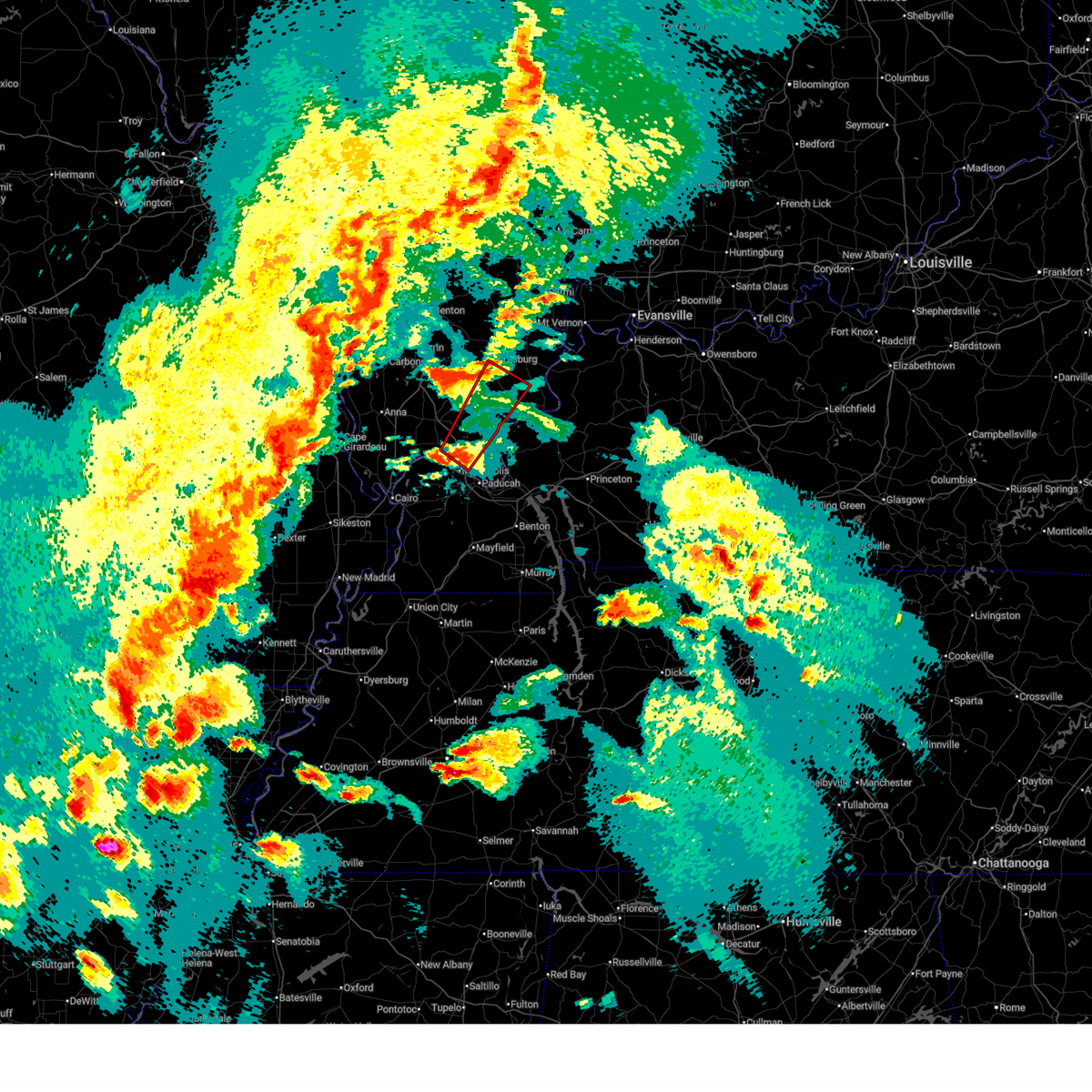 Torpah the national weather service in paducah has issued a * tornado warning for, northwestern hardin county in southern illinois, northwestern massac county in southern illinois, pope county in southern illinois, southeastern johnson county in southern illinois, southeastern saline county in southern illinois, southwestern gallatin county in southern illinois, * until 715 pm cdt. * at 637 pm cdt, a severe thunderstorm capable of producing a tornado was located near new columbia, or near metropolis, moving northeast at 60 mph (radar indicated rotation). Hazards include tornado. Flying debris will be dangerous to those caught without shelter. mobile homes will be damaged or destroyed. damage to roofs, windows, and vehicles will occur. tree damage is likely. this dangerous storm will be near, dixon springs around 645 pm cdt. golconda around 650 pm cdt. harrisburg around 710 pm cdt. other locations impacted by this tornadic thunderstorm include karbers ridge and eddyville. This includes interstate 24 in illinois between mile markers 22 and 37. Torpah the national weather service in paducah has issued a * tornado warning for, northwestern hardin county in southern illinois, northwestern massac county in southern illinois, pope county in southern illinois, southeastern johnson county in southern illinois, southeastern saline county in southern illinois, southwestern gallatin county in southern illinois, * until 715 pm cdt. * at 637 pm cdt, a severe thunderstorm capable of producing a tornado was located near new columbia, or near metropolis, moving northeast at 60 mph (radar indicated rotation). Hazards include tornado. Flying debris will be dangerous to those caught without shelter. mobile homes will be damaged or destroyed. damage to roofs, windows, and vehicles will occur. tree damage is likely. this dangerous storm will be near, dixon springs around 645 pm cdt. golconda around 650 pm cdt. harrisburg around 710 pm cdt. other locations impacted by this tornadic thunderstorm include karbers ridge and eddyville. This includes interstate 24 in illinois between mile markers 22 and 37.
|
| 3/30/2025 6:48 PM CDT |
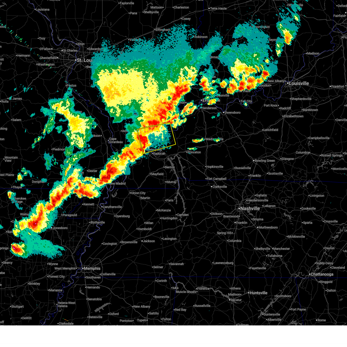 Svrpah the national weather service in paducah has issued a * severe thunderstorm warning for, hardin county in southern illinois, massac county in southern illinois, pope county in southern illinois, southeastern johnson county in southern illinois, western crittenden county in western kentucky, northern livingston county in western kentucky, central mccracken county in western kentucky, * until 730 pm cdt. * at 648 pm cdt, severe thunderstorms were located along a line extending from near vienna to near metropolis, moving east at 60 mph (radar indicated). Hazards include 60 mph wind gusts. expect damage to roofs, siding, and trees Svrpah the national weather service in paducah has issued a * severe thunderstorm warning for, hardin county in southern illinois, massac county in southern illinois, pope county in southern illinois, southeastern johnson county in southern illinois, western crittenden county in western kentucky, northern livingston county in western kentucky, central mccracken county in western kentucky, * until 730 pm cdt. * at 648 pm cdt, severe thunderstorms were located along a line extending from near vienna to near metropolis, moving east at 60 mph (radar indicated). Hazards include 60 mph wind gusts. expect damage to roofs, siding, and trees
|
| 3/30/2025 6:46 PM CDT |
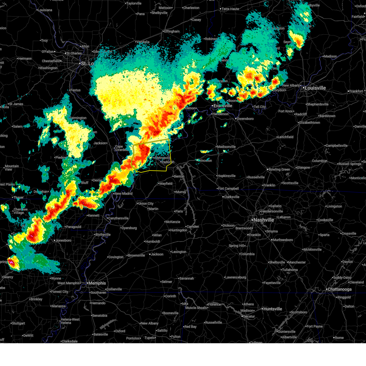 At 645 pm cdt, severe thunderstorms were located along a line extending from near new columbia to la center, moving east at 55 mph (radar indicated). Hazards include 70 mph wind gusts. Expect considerable tree damage. damage is likely to mobile homes, roofs, and outbuildings. locations impacted include, barkley regional airport, mound city, ledbetter, kevil, reidland, smithland, paducah, joppa, karnak, brookport, lovelaceville, olmsted, new columbia, golconda, la center, belknap, hamletsburg, dixon springs, blandville, and barlow. this includes the following highways, interstate 24 in kentucky between mile markers 1 and 17. Interstate 24 in illinois between mile markers 19 and 38. At 645 pm cdt, severe thunderstorms were located along a line extending from near new columbia to la center, moving east at 55 mph (radar indicated). Hazards include 70 mph wind gusts. Expect considerable tree damage. damage is likely to mobile homes, roofs, and outbuildings. locations impacted include, barkley regional airport, mound city, ledbetter, kevil, reidland, smithland, paducah, joppa, karnak, brookport, lovelaceville, olmsted, new columbia, golconda, la center, belknap, hamletsburg, dixon springs, blandville, and barlow. this includes the following highways, interstate 24 in kentucky between mile markers 1 and 17. Interstate 24 in illinois between mile markers 19 and 38.
|
| 3/30/2025 6:36 PM CDT |
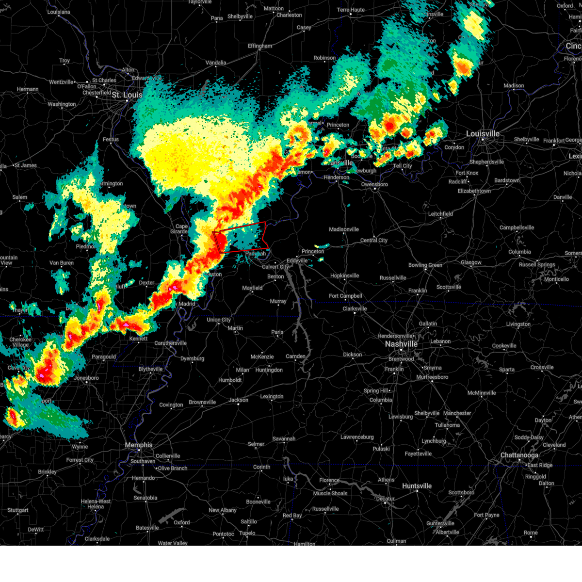 the tornado warning has been cancelled and is no longer in effect the tornado warning has been cancelled and is no longer in effect
|
| 3/30/2025 6:33 PM CDT |
 At 633 pm cdt, a severe thunderstorm capable of producing a tornado was located over karnak, or 10 miles south of vienna, moving east at 65 mph (radar indicated rotation). Hazards include tornado. Flying debris will be dangerous to those caught without shelter. mobile homes will be damaged or destroyed. damage to roofs, windows, and vehicles will occur. tree damage is likely. this dangerous storm will be near, new columbia and dixon springs around 640 pm cdt. golconda around 650 pm cdt. other locations impacted by this tornadic thunderstorm include new grand chain, joppa, and belknap. This includes interstate 24 in illinois between mile markers 20 and 37. At 633 pm cdt, a severe thunderstorm capable of producing a tornado was located over karnak, or 10 miles south of vienna, moving east at 65 mph (radar indicated rotation). Hazards include tornado. Flying debris will be dangerous to those caught without shelter. mobile homes will be damaged or destroyed. damage to roofs, windows, and vehicles will occur. tree damage is likely. this dangerous storm will be near, new columbia and dixon springs around 640 pm cdt. golconda around 650 pm cdt. other locations impacted by this tornadic thunderstorm include new grand chain, joppa, and belknap. This includes interstate 24 in illinois between mile markers 20 and 37.
|
| 3/30/2025 6:24 PM CDT |
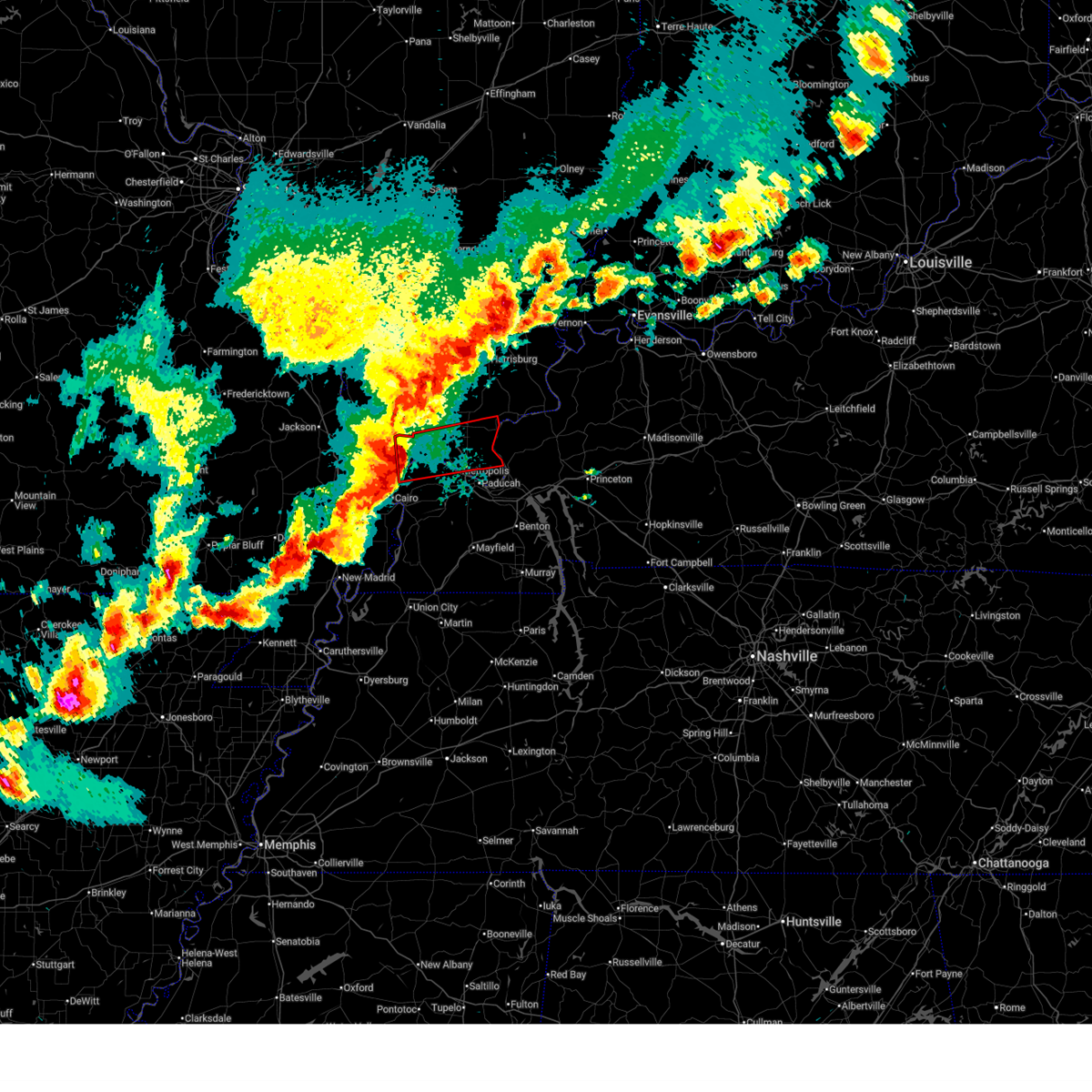 Torpah the national weather service in paducah has issued a * tornado warning for, eastern pulaski county in southern illinois, massac county in southern illinois, central pope county in southern illinois, southern johnson county in southern illinois, northern ballard county in western kentucky, northwestern mccracken county in western kentucky, * until 700 pm cdt. * at 624 pm cdt, a severe thunderstorm capable of producing a tornado was located 7 miles east of tamms, or 13 miles northwest of la center, moving east at 60 mph (radar indicated rotation). Hazards include tornado. Flying debris will be dangerous to those caught without shelter. mobile homes will be damaged or destroyed. damage to roofs, windows, and vehicles will occur. tree damage is likely. this dangerous storm will be near, karnak around 630 pm cdt. new columbia around 635 pm cdt. metropolis around 640 pm cdt. dixon springs around 645 pm cdt. golconda around 650 pm cdt. other locations impacted by this tornadic thunderstorm include new grand chain, joppa, belknap, and olmsted. this includes the following highways, interstate 24 in illinois between mile markers 20 and 37. Interstate 57 in illinois between mile markers 20 and 21. Torpah the national weather service in paducah has issued a * tornado warning for, eastern pulaski county in southern illinois, massac county in southern illinois, central pope county in southern illinois, southern johnson county in southern illinois, northern ballard county in western kentucky, northwestern mccracken county in western kentucky, * until 700 pm cdt. * at 624 pm cdt, a severe thunderstorm capable of producing a tornado was located 7 miles east of tamms, or 13 miles northwest of la center, moving east at 60 mph (radar indicated rotation). Hazards include tornado. Flying debris will be dangerous to those caught without shelter. mobile homes will be damaged or destroyed. damage to roofs, windows, and vehicles will occur. tree damage is likely. this dangerous storm will be near, karnak around 630 pm cdt. new columbia around 635 pm cdt. metropolis around 640 pm cdt. dixon springs around 645 pm cdt. golconda around 650 pm cdt. other locations impacted by this tornadic thunderstorm include new grand chain, joppa, belknap, and olmsted. this includes the following highways, interstate 24 in illinois between mile markers 20 and 37. Interstate 57 in illinois between mile markers 20 and 21.
|
| 3/30/2025 6:22 PM CDT |
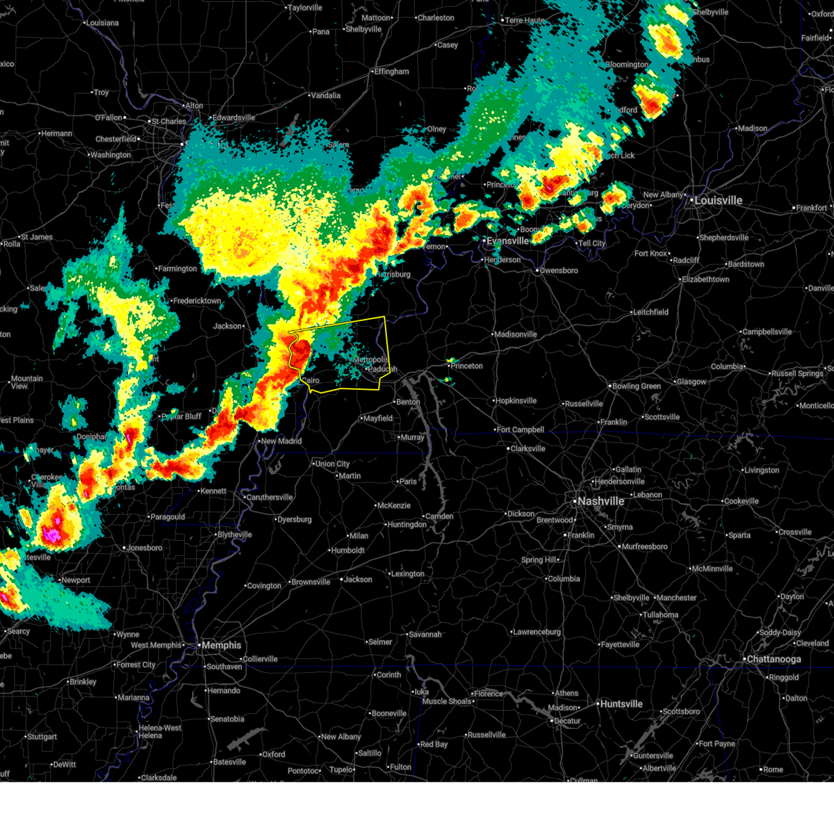 Svrpah the national weather service in paducah has issued a * severe thunderstorm warning for, southeastern union county in southern illinois, pulaski county in southern illinois, massac county in southern illinois, central pope county in southern illinois, southern johnson county in southern illinois, western livingston county in western kentucky, ballard county in western kentucky, mccracken county in western kentucky, * until 700 pm cdt. * at 622 pm cdt, severe thunderstorms were located along a line extending from near tamms to near cairo, moving east at 55 mph (radar indicated). Hazards include 70 mph wind gusts. Expect considerable tree damage. Damage is likely to mobile homes, roofs, and outbuildings. Svrpah the national weather service in paducah has issued a * severe thunderstorm warning for, southeastern union county in southern illinois, pulaski county in southern illinois, massac county in southern illinois, central pope county in southern illinois, southern johnson county in southern illinois, western livingston county in western kentucky, ballard county in western kentucky, mccracken county in western kentucky, * until 700 pm cdt. * at 622 pm cdt, severe thunderstorms were located along a line extending from near tamms to near cairo, moving east at 55 mph (radar indicated). Hazards include 70 mph wind gusts. Expect considerable tree damage. Damage is likely to mobile homes, roofs, and outbuildings.
|
| 3/15/2025 10:50 AM CDT |
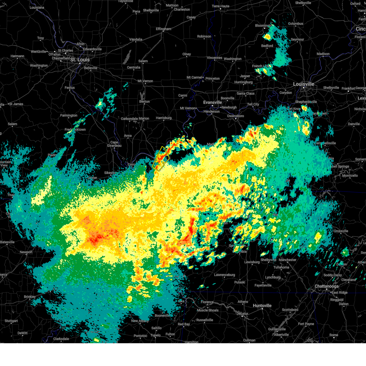 the severe thunderstorm warning has been cancelled and is no longer in effect the severe thunderstorm warning has been cancelled and is no longer in effect
|
| 3/15/2025 10:44 AM CDT |
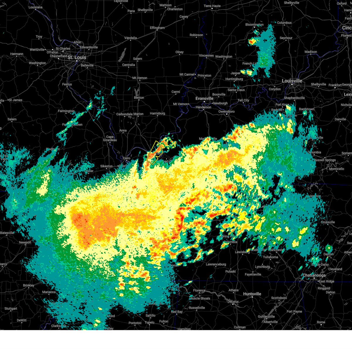 the severe thunderstorm warning has been cancelled and is no longer in effect the severe thunderstorm warning has been cancelled and is no longer in effect
|
| 3/15/2025 10:44 AM CDT |
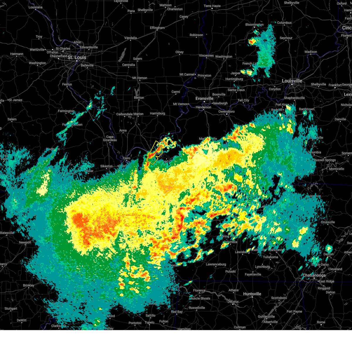 At 1044 am cdt, a severe thunderstorm was located over brookport, or near paducah, moving northeast at 45 mph (radar indicated). Hazards include 60 mph wind gusts and quarter size hail. Hail damage to vehicles is expected. expect wind damage to roofs, siding, and trees. locations impacted include, paducah, lone oak, brookport, hamletsburg, and reidland. this includes the following highways, interstate 24 in kentucky between mile markers 1 and 12. Interstate 24 in illinois near mile marker 38. At 1044 am cdt, a severe thunderstorm was located over brookport, or near paducah, moving northeast at 45 mph (radar indicated). Hazards include 60 mph wind gusts and quarter size hail. Hail damage to vehicles is expected. expect wind damage to roofs, siding, and trees. locations impacted include, paducah, lone oak, brookport, hamletsburg, and reidland. this includes the following highways, interstate 24 in kentucky between mile markers 1 and 12. Interstate 24 in illinois near mile marker 38.
|
| 3/15/2025 10:33 AM CDT |
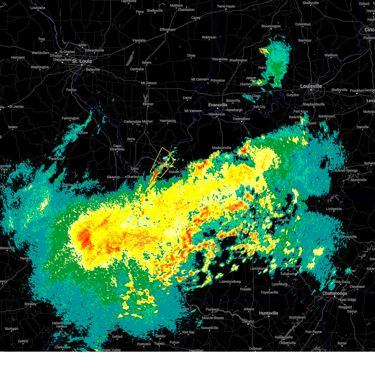 Svrpah the national weather service in paducah has issued a * severe thunderstorm warning for, eastern massac county in southern illinois, southern pope county in southern illinois, southeastern ballard county in western kentucky, mccracken county in western kentucky, north central graves county in western kentucky, * until 1115 am cdt. * at 1032 am cdt, a severe thunderstorm was located near barkley regional airport, or near lone oak, moving northeast at 45 mph (public). Hazards include 60 mph wind gusts and quarter size hail. Hail damage to vehicles is expected. Expect wind damage to roofs, siding, and trees. Svrpah the national weather service in paducah has issued a * severe thunderstorm warning for, eastern massac county in southern illinois, southern pope county in southern illinois, southeastern ballard county in western kentucky, mccracken county in western kentucky, north central graves county in western kentucky, * until 1115 am cdt. * at 1032 am cdt, a severe thunderstorm was located near barkley regional airport, or near lone oak, moving northeast at 45 mph (public). Hazards include 60 mph wind gusts and quarter size hail. Hail damage to vehicles is expected. Expect wind damage to roofs, siding, and trees.
|
| 3/15/2025 2:32 AM CDT |
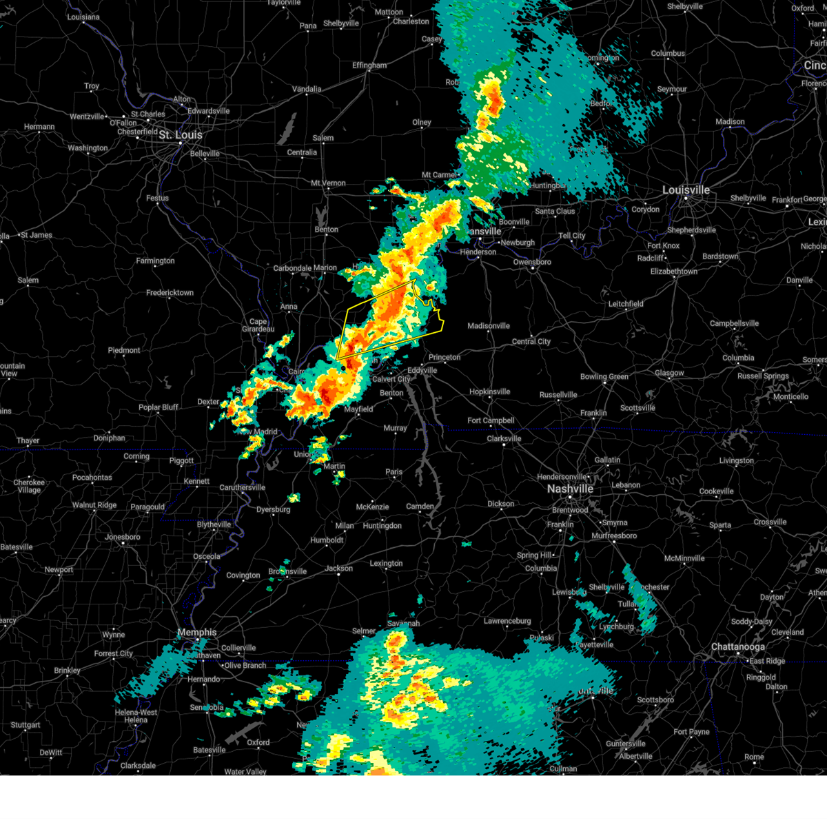 At 232 am cdt, severe thunderstorms were located along a line extending from 10 miles northeast of rosiclare to near brookport, moving northeast at 45 mph (trained weather spotters). Hazards include 70 mph wind gusts. Expect considerable tree damage. damage is likely to mobile homes, roofs, and outbuildings. locations impacted include, golconda, karbers ridge, dixon springs, burna, metropolis, cave-in-rock, rosiclare, joy, salem, gross, elizabethtown, marion, carrsville, eddyville, new columbia, and sturgis. This includes interstate 24 in illinois between mile markers 25 and 36. At 232 am cdt, severe thunderstorms were located along a line extending from 10 miles northeast of rosiclare to near brookport, moving northeast at 45 mph (trained weather spotters). Hazards include 70 mph wind gusts. Expect considerable tree damage. damage is likely to mobile homes, roofs, and outbuildings. locations impacted include, golconda, karbers ridge, dixon springs, burna, metropolis, cave-in-rock, rosiclare, joy, salem, gross, elizabethtown, marion, carrsville, eddyville, new columbia, and sturgis. This includes interstate 24 in illinois between mile markers 25 and 36.
|
| 3/15/2025 2:15 AM CDT |
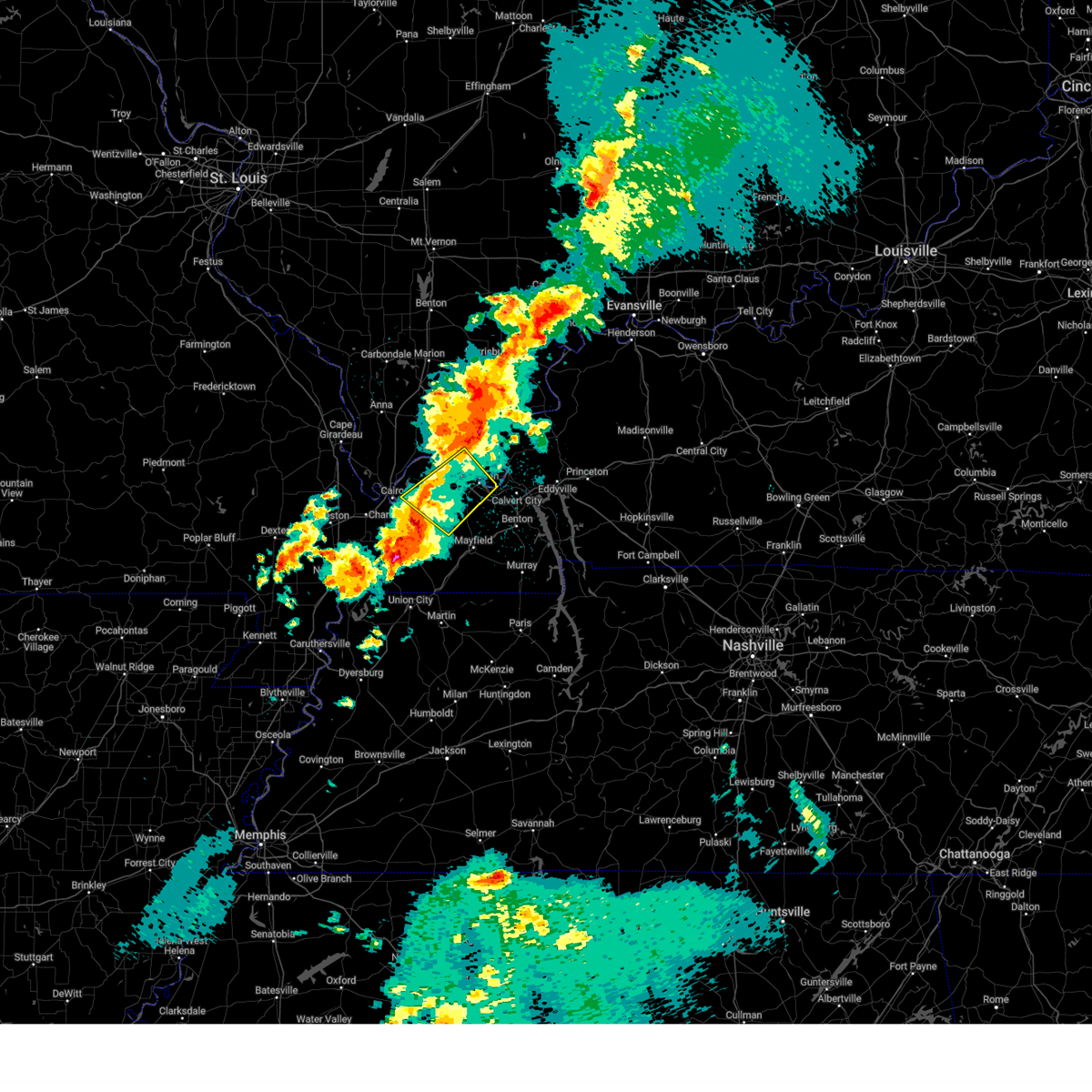 Svrpah the national weather service in paducah has issued a * severe thunderstorm warning for, central massac county in southern illinois, southwestern livingston county in western kentucky, northeastern carlisle county in western kentucky, southern ballard county in western kentucky, mccracken county in western kentucky, northwestern graves county in western kentucky, * until 300 am cdt. * at 215 am cdt, a severe thunderstorm was located near lovelaceville, or near bardwell, moving northeast at 70 mph (radar indicated). Hazards include 70 mph wind gusts. Expect considerable tree damage. Damage is likely to mobile homes, roofs, and outbuildings. Svrpah the national weather service in paducah has issued a * severe thunderstorm warning for, central massac county in southern illinois, southwestern livingston county in western kentucky, northeastern carlisle county in western kentucky, southern ballard county in western kentucky, mccracken county in western kentucky, northwestern graves county in western kentucky, * until 300 am cdt. * at 215 am cdt, a severe thunderstorm was located near lovelaceville, or near bardwell, moving northeast at 70 mph (radar indicated). Hazards include 70 mph wind gusts. Expect considerable tree damage. Damage is likely to mobile homes, roofs, and outbuildings.
|
| 3/15/2025 2:08 AM CDT |
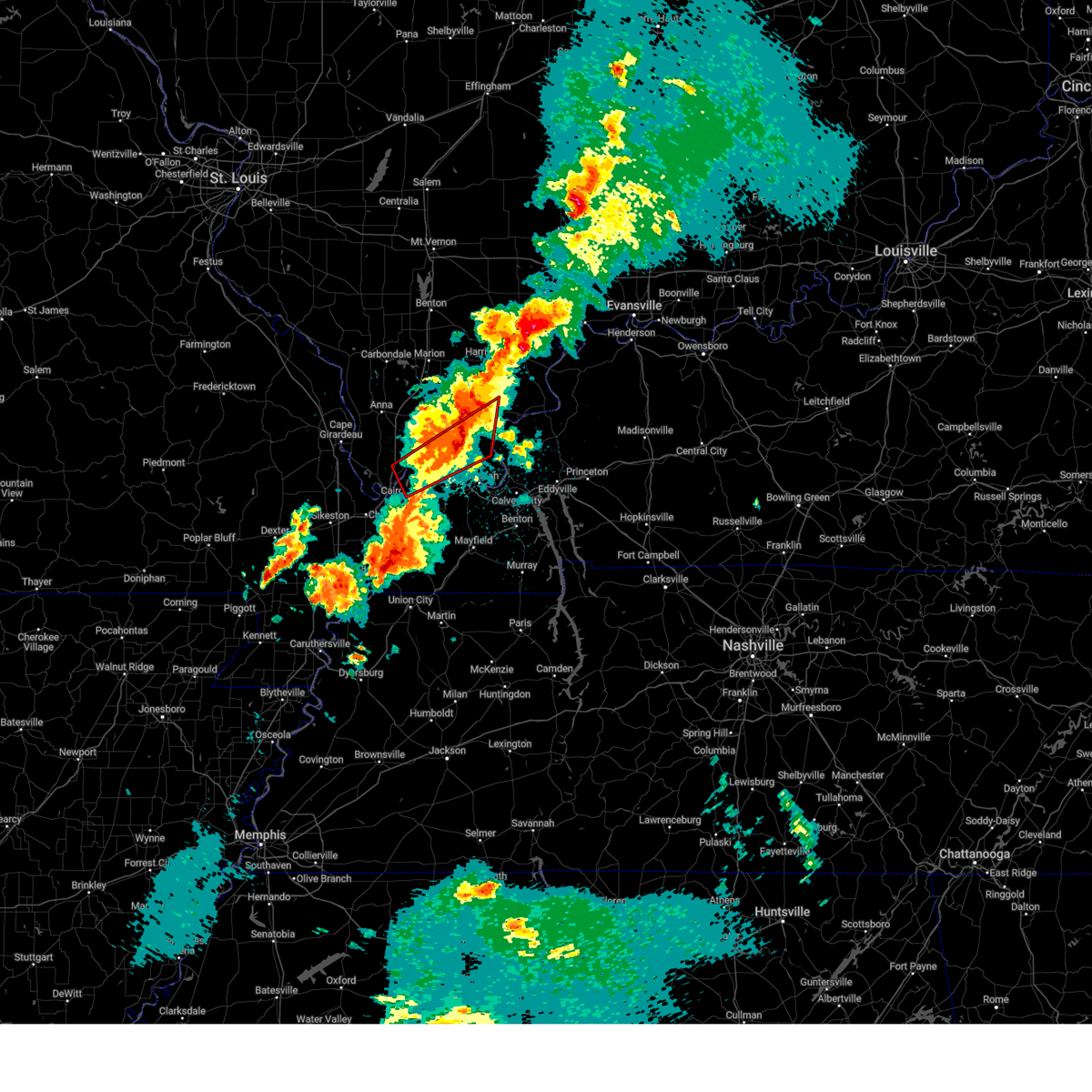 The storm which prompted the warning has moved out of the area. therefore, the warning will be allowed to expire. a tornado watch remains in effect until 400 am cdt for southern illinois, and western kentucky. The storm which prompted the warning has moved out of the area. therefore, the warning will be allowed to expire. a tornado watch remains in effect until 400 am cdt for southern illinois, and western kentucky.
|
| 3/15/2025 2:05 AM CDT |
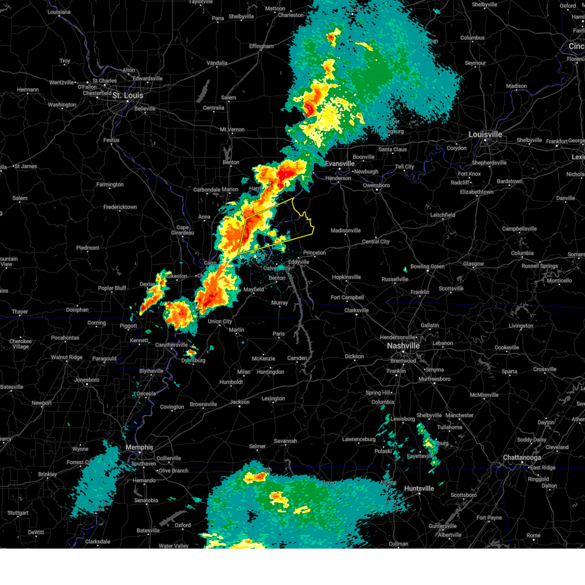 Svrpah the national weather service in paducah has issued a * severe thunderstorm warning for, hardin county in southern illinois, central massac county in southern illinois, pope county in southern illinois, southeastern johnson county in southern illinois, southwestern gallatin county in southern illinois, crittenden county in western kentucky, northern livingston county in western kentucky, north central mccracken county in western kentucky, * until 245 am cdt. * at 205 am cdt, severe thunderstorms were located along a line extending from near dixon springs to near metropolis, moving east at 55 mph (radar indicated). Hazards include 70 mph wind gusts. Expect considerable tree damage. Damage is likely to mobile homes, roofs, and outbuildings. Svrpah the national weather service in paducah has issued a * severe thunderstorm warning for, hardin county in southern illinois, central massac county in southern illinois, pope county in southern illinois, southeastern johnson county in southern illinois, southwestern gallatin county in southern illinois, crittenden county in western kentucky, northern livingston county in western kentucky, north central mccracken county in western kentucky, * until 245 am cdt. * at 205 am cdt, severe thunderstorms were located along a line extending from near dixon springs to near metropolis, moving east at 55 mph (radar indicated). Hazards include 70 mph wind gusts. Expect considerable tree damage. Damage is likely to mobile homes, roofs, and outbuildings.
|
| 3/15/2025 1:55 AM CDT |
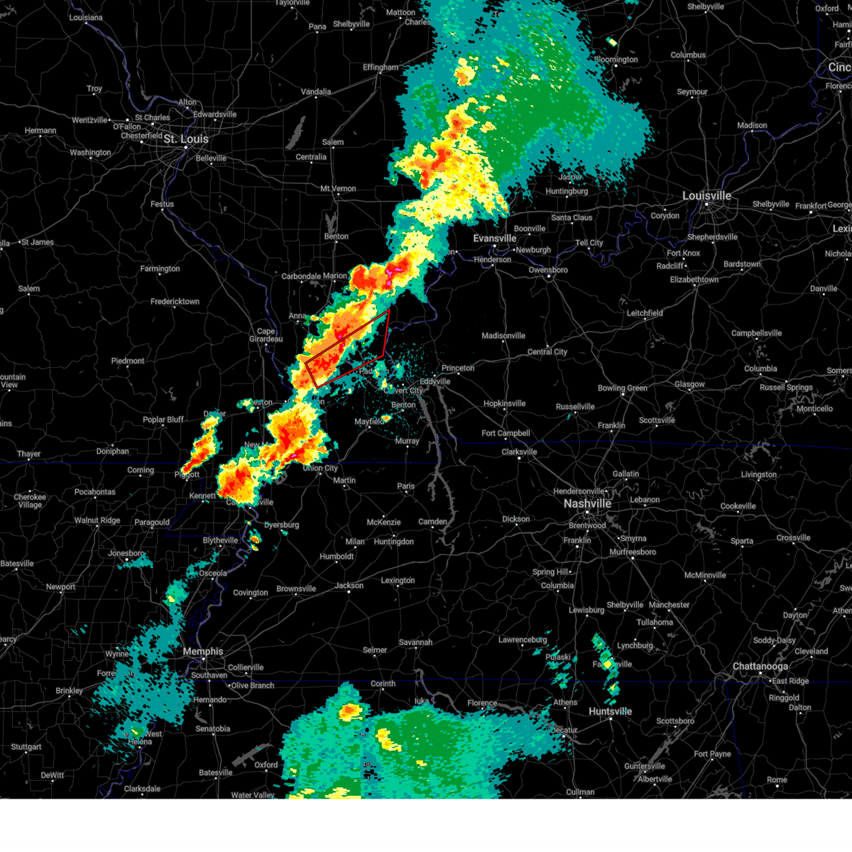 At 155 am cdt, a severe thunderstorm capable of producing a tornado was located 7 miles northeast of la center, moving northeast at 45 mph. spotters report a funnel cloud rapidly developing with this storm (radar indicated rotation). Hazards include tornado. Flying debris will be dangerous to those caught without shelter. mobile homes will be damaged or destroyed. damage to roofs, windows, and vehicles will occur. tree damage is likely. this dangerous storm will be near, metropolis around 200 am cdt. new columbia around 205 am cdt. other locations impacted by this tornadic thunderstorm include new grand chain, joppa, olmsted, and kevil. this includes the following highways, interstate 24 in illinois between mile markers 21 and 36. Interstate 57 in illinois between mile markers 10 and 12. At 155 am cdt, a severe thunderstorm capable of producing a tornado was located 7 miles northeast of la center, moving northeast at 45 mph. spotters report a funnel cloud rapidly developing with this storm (radar indicated rotation). Hazards include tornado. Flying debris will be dangerous to those caught without shelter. mobile homes will be damaged or destroyed. damage to roofs, windows, and vehicles will occur. tree damage is likely. this dangerous storm will be near, metropolis around 200 am cdt. new columbia around 205 am cdt. other locations impacted by this tornadic thunderstorm include new grand chain, joppa, olmsted, and kevil. this includes the following highways, interstate 24 in illinois between mile markers 21 and 36. Interstate 57 in illinois between mile markers 10 and 12.
|
| 3/15/2025 1:33 AM CDT |
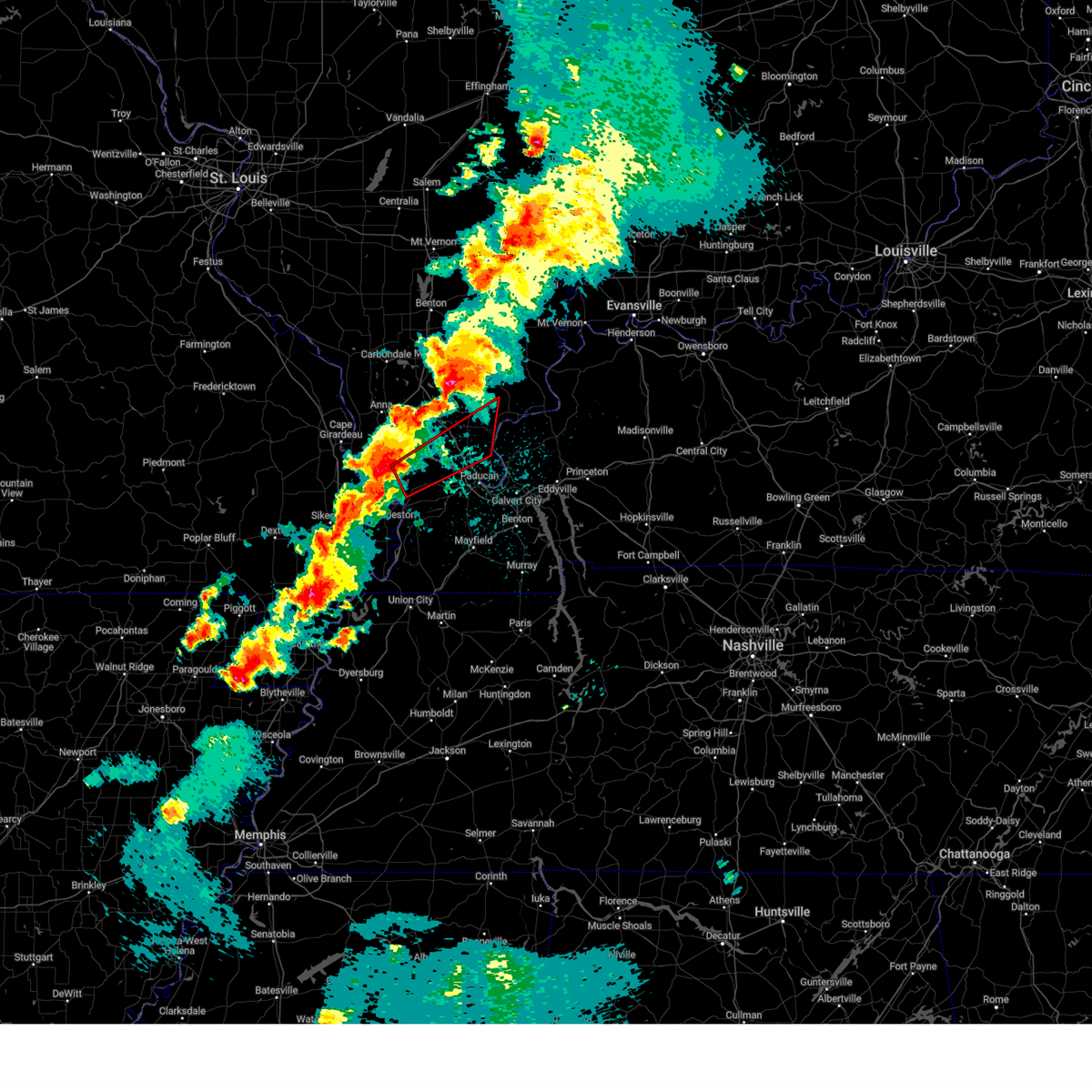 Torpah the national weather service in paducah has issued a * tornado warning for, central pulaski county in southern illinois, massac county in southern illinois, central pope county in southern illinois, southeastern johnson county in southern illinois, northern ballard county in western kentucky, northwestern mccracken county in western kentucky, * until 215 am cdt. * at 133 am cdt, a severe thunderstorm capable of producing a tornado was located over mound city, or near cairo, moving northeast at 55 mph (radar indicated rotation). Hazards include tornado. Flying debris will be dangerous to those caught without shelter. mobile homes will be damaged or destroyed. damage to roofs, windows, and vehicles will occur. tree damage is likely. this dangerous storm will be near, la center and barlow around 140 am cdt. new columbia and metropolis around 155 am cdt. dixon springs around 205 am cdt. other locations impacted by this tornadic thunderstorm include new grand chain, joppa, olmsted, and kevil. this includes the following highways, interstate 24 in illinois between mile markers 21 and 36. Interstate 57 in illinois between mile markers 10 and 12. Torpah the national weather service in paducah has issued a * tornado warning for, central pulaski county in southern illinois, massac county in southern illinois, central pope county in southern illinois, southeastern johnson county in southern illinois, northern ballard county in western kentucky, northwestern mccracken county in western kentucky, * until 215 am cdt. * at 133 am cdt, a severe thunderstorm capable of producing a tornado was located over mound city, or near cairo, moving northeast at 55 mph (radar indicated rotation). Hazards include tornado. Flying debris will be dangerous to those caught without shelter. mobile homes will be damaged or destroyed. damage to roofs, windows, and vehicles will occur. tree damage is likely. this dangerous storm will be near, la center and barlow around 140 am cdt. new columbia and metropolis around 155 am cdt. dixon springs around 205 am cdt. other locations impacted by this tornadic thunderstorm include new grand chain, joppa, olmsted, and kevil. this includes the following highways, interstate 24 in illinois between mile markers 21 and 36. Interstate 57 in illinois between mile markers 10 and 12.
|
| 8/15/2024 9:27 PM CDT |
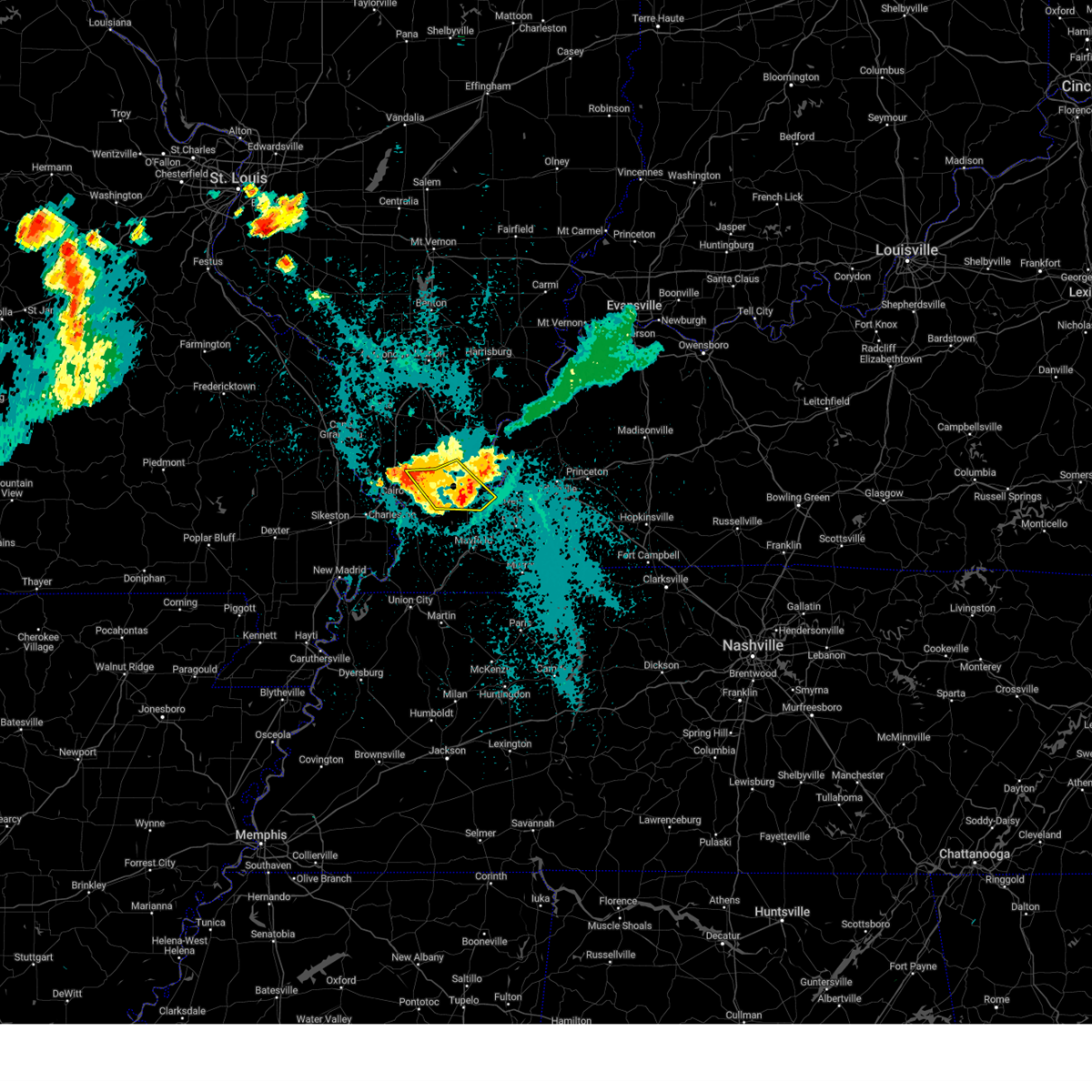 The storms which prompted the warning have weakened below severe limits, and no longer pose an immediate threat to life or property. therefore, the warning will be allowed to expire. however, gusty winds and heavy rain are still possible with these thunderstorms. a severe thunderstorm watch remains in effect until midnight cdt for southern illinois, and western kentucky. The storms which prompted the warning have weakened below severe limits, and no longer pose an immediate threat to life or property. therefore, the warning will be allowed to expire. however, gusty winds and heavy rain are still possible with these thunderstorms. a severe thunderstorm watch remains in effect until midnight cdt for southern illinois, and western kentucky.
|
| 8/15/2024 9:10 PM CDT |
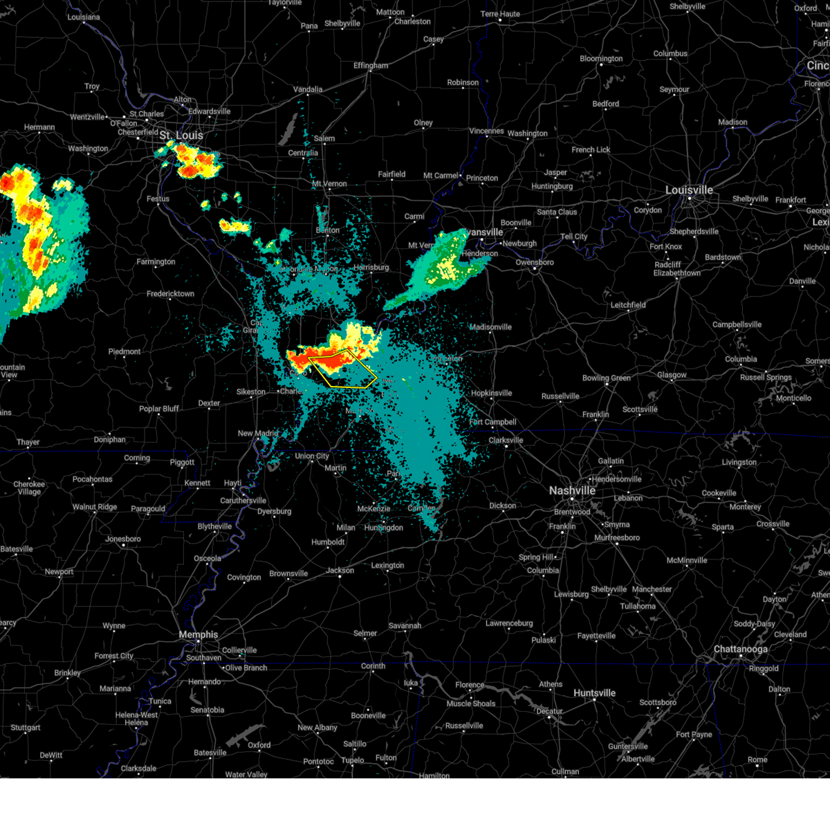 the severe thunderstorm warning has been cancelled and is no longer in effect the severe thunderstorm warning has been cancelled and is no longer in effect
|
| 8/15/2024 9:10 PM CDT |
 At 909 pm cdt, severe thunderstorms were located along a line extending from metropolis to near barkley regional airport to near la center, moving southeast at 20 mph (radar indicated). Hazards include 60 mph wind gusts. Expect damage to roofs, siding, and trees. locations impacted include, paducah, metropolis, la center, lone oak, reidland, barkley regional airport, west paducah, lovelaceville, and kevil. this includes the following highways, interstate 24 in kentucky between mile markers 1 and 15. Interstate 24 in illinois near mile marker 38. At 909 pm cdt, severe thunderstorms were located along a line extending from metropolis to near barkley regional airport to near la center, moving southeast at 20 mph (radar indicated). Hazards include 60 mph wind gusts. Expect damage to roofs, siding, and trees. locations impacted include, paducah, metropolis, la center, lone oak, reidland, barkley regional airport, west paducah, lovelaceville, and kevil. this includes the following highways, interstate 24 in kentucky between mile markers 1 and 15. Interstate 24 in illinois near mile marker 38.
|
| 8/15/2024 8:49 PM CDT |
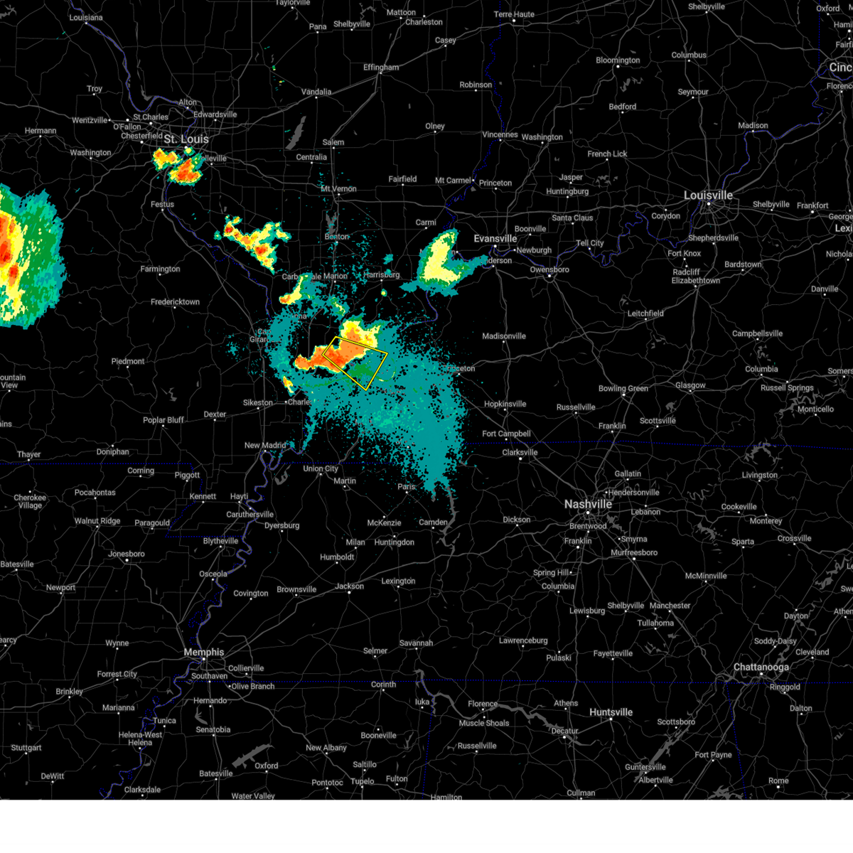 the severe thunderstorm warning has been cancelled and is no longer in effect the severe thunderstorm warning has been cancelled and is no longer in effect
|
| 8/15/2024 8:45 PM CDT |
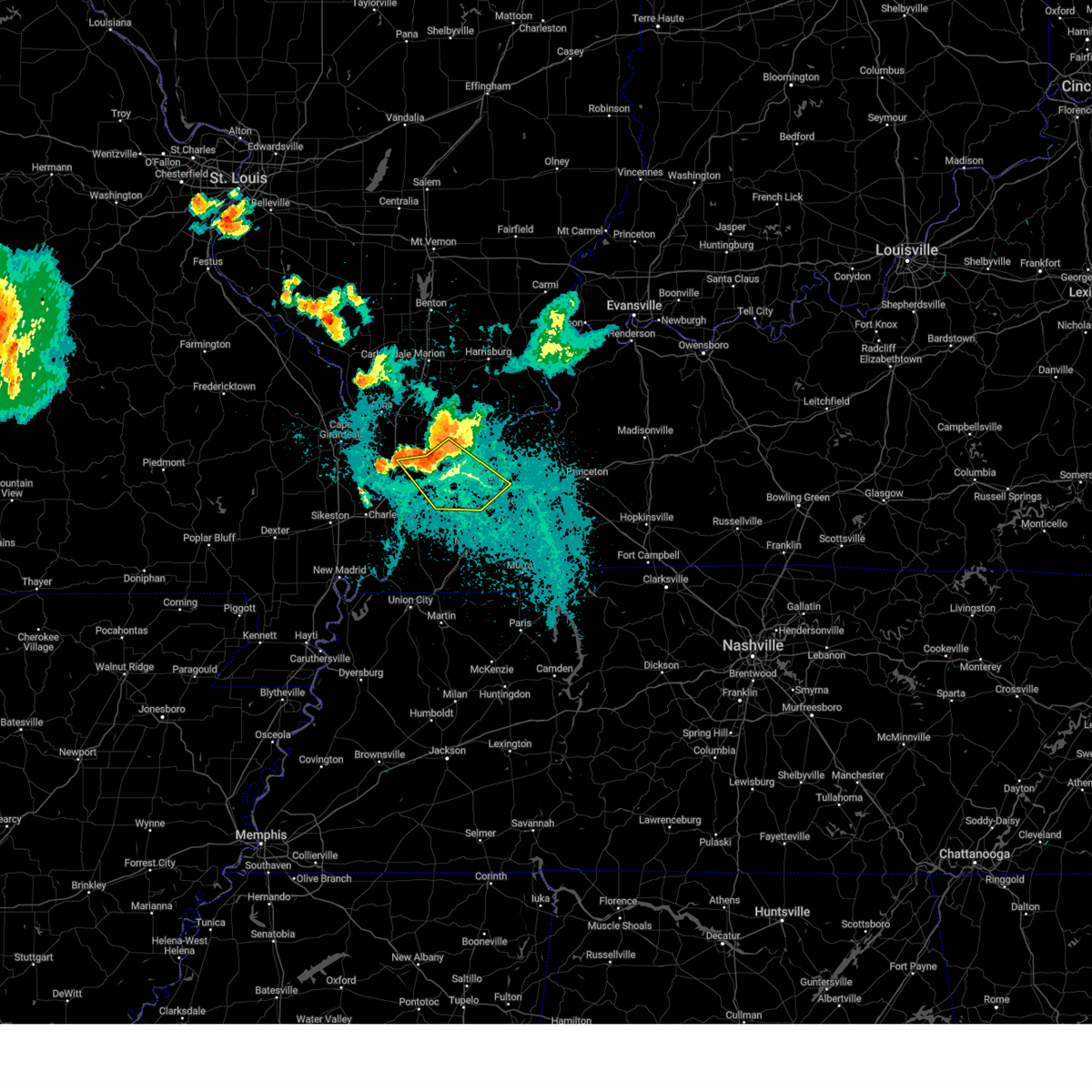 Svrpah the national weather service in paducah has issued a * severe thunderstorm warning for, central pulaski county in southern illinois, massac county in southern illinois, southern pope county in southern illinois, southwestern livingston county in western kentucky, central ballard county in western kentucky, mccracken county in western kentucky, * until 930 pm cdt. * at 844 pm cdt, severe thunderstorms were located along a line extending from near metropolis to 7 miles northwest of barkley regional airport to near la center, moving southeast at 20 mph (law enforcement). Hazards include 70 mph wind gusts and quarter size hail. Hail damage to vehicles is expected. expect considerable tree damage. Wind damage is also likely to mobile homes, roofs, and outbuildings. Svrpah the national weather service in paducah has issued a * severe thunderstorm warning for, central pulaski county in southern illinois, massac county in southern illinois, southern pope county in southern illinois, southwestern livingston county in western kentucky, central ballard county in western kentucky, mccracken county in western kentucky, * until 930 pm cdt. * at 844 pm cdt, severe thunderstorms were located along a line extending from near metropolis to 7 miles northwest of barkley regional airport to near la center, moving southeast at 20 mph (law enforcement). Hazards include 70 mph wind gusts and quarter size hail. Hail damage to vehicles is expected. expect considerable tree damage. Wind damage is also likely to mobile homes, roofs, and outbuildings.
|
| 8/15/2024 8:25 PM CDT |
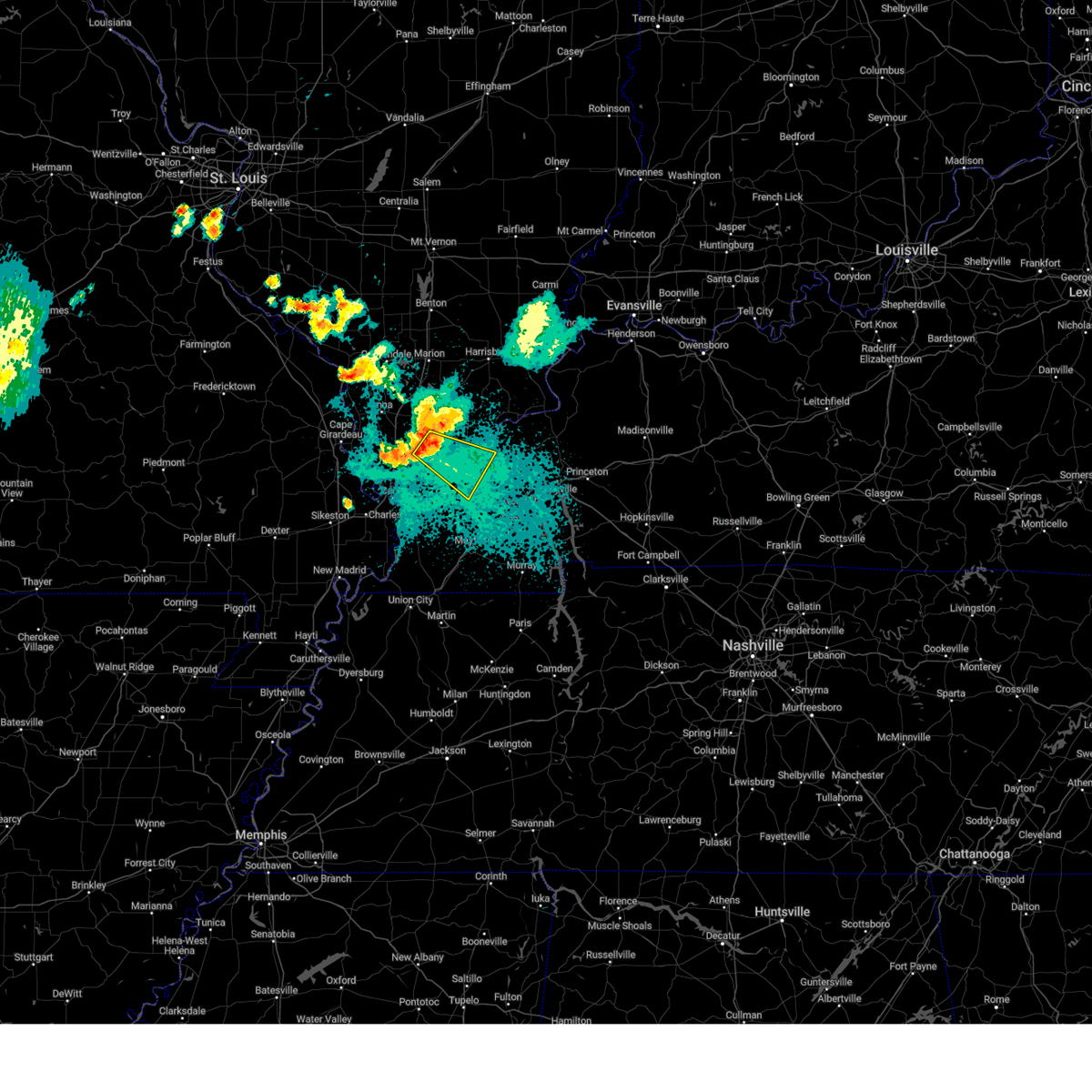 Svrpah the national weather service in paducah has issued a * severe thunderstorm warning for, northeastern pulaski county in southern illinois, massac county in southern illinois, west central pope county in southern illinois, south central johnson county in southern illinois, northeastern ballard county in western kentucky, central mccracken county in western kentucky, * until 900 pm cdt. * at 822 pm cdt, a severe thunderstorm was located near karnak, or 9 miles south of vienna, moving southeast at 30 mph (law enforcement. wind damage was reported in southern union and johnson counties). Hazards include 70 mph wind gusts and quarter size hail. Hail damage to vehicles is expected. expect considerable tree damage. Wind damage is also likely to mobile homes, roofs, and outbuildings. Svrpah the national weather service in paducah has issued a * severe thunderstorm warning for, northeastern pulaski county in southern illinois, massac county in southern illinois, west central pope county in southern illinois, south central johnson county in southern illinois, northeastern ballard county in western kentucky, central mccracken county in western kentucky, * until 900 pm cdt. * at 822 pm cdt, a severe thunderstorm was located near karnak, or 9 miles south of vienna, moving southeast at 30 mph (law enforcement. wind damage was reported in southern union and johnson counties). Hazards include 70 mph wind gusts and quarter size hail. Hail damage to vehicles is expected. expect considerable tree damage. Wind damage is also likely to mobile homes, roofs, and outbuildings.
|
| 5/26/2024 9:18 PM CDT |
 the severe thunderstorm warning has been cancelled and is no longer in effect the severe thunderstorm warning has been cancelled and is no longer in effect
|
| 5/26/2024 8:41 PM CDT |
 Svrpah the national weather service in paducah has issued a * severe thunderstorm warning for, central pulaski county in southern illinois, southern massac county in southern illinois, southeastern alexander county in southern illinois, carlisle county in western kentucky, northwestern hickman county in western kentucky, ballard county in western kentucky, mccracken county in western kentucky, northwestern graves county in western kentucky, mississippi county in southeastern missouri, northeastern new madrid county in southeastern missouri, * until 945 pm cdt. * at 841 pm cdt, severe thunderstorms were located along a line extending from near karnak to near charleston to near bernie, moving southeast at 40 mph (radar indicated). Hazards include 60 mph wind gusts and quarter size hail. Hail damage to vehicles is expected. Expect wind damage to roofs, siding, and trees. Svrpah the national weather service in paducah has issued a * severe thunderstorm warning for, central pulaski county in southern illinois, southern massac county in southern illinois, southeastern alexander county in southern illinois, carlisle county in western kentucky, northwestern hickman county in western kentucky, ballard county in western kentucky, mccracken county in western kentucky, northwestern graves county in western kentucky, mississippi county in southeastern missouri, northeastern new madrid county in southeastern missouri, * until 945 pm cdt. * at 841 pm cdt, severe thunderstorms were located along a line extending from near karnak to near charleston to near bernie, moving southeast at 40 mph (radar indicated). Hazards include 60 mph wind gusts and quarter size hail. Hail damage to vehicles is expected. Expect wind damage to roofs, siding, and trees.
|
| 5/26/2024 8:29 PM CDT |
 Svrpah the national weather service in paducah has issued a * severe thunderstorm warning for, hardin county in southern illinois, east central pulaski county in southern illinois, massac county in southern illinois, pope county in southern illinois, eastern johnson county in southern illinois, saline county in southern illinois, gallatin county in southern illinois, * until 930 pm cdt. * at 828 pm cdt, severe thunderstorms were located along a line extending from near galatia to near carrier mills to near vienna to 6 miles east of tamms, moving east at 65 mph (radar indicated). Hazards include 60 mph wind gusts and quarter size hail. Hail damage to vehicles is expected. Expect wind damage to roofs, siding, and trees. Svrpah the national weather service in paducah has issued a * severe thunderstorm warning for, hardin county in southern illinois, east central pulaski county in southern illinois, massac county in southern illinois, pope county in southern illinois, eastern johnson county in southern illinois, saline county in southern illinois, gallatin county in southern illinois, * until 930 pm cdt. * at 828 pm cdt, severe thunderstorms were located along a line extending from near galatia to near carrier mills to near vienna to 6 miles east of tamms, moving east at 65 mph (radar indicated). Hazards include 60 mph wind gusts and quarter size hail. Hail damage to vehicles is expected. Expect wind damage to roofs, siding, and trees.
|
| 5/26/2024 8:02 AM CDT |
 the severe thunderstorm warning has been cancelled and is no longer in effect the severe thunderstorm warning has been cancelled and is no longer in effect
|
| 5/26/2024 8:02 AM CDT |
 At 802 am cdt, severe thunderstorms were located along a line extending from 6 miles east of anna to 6 miles northeast of la center to 6 miles south of bardwell to near hickman, moving northeast at 75 mph (radar indicated). Hazards include 70 mph wind gusts and penny size hail. Expect considerable tree damage. damage is likely to mobile homes, roofs, and outbuildings. locations impacted include, paducah, mayfield, metropolis, anna, fulton, hickman, jonesboro, vienna, clinton, la center, bardwell, wickliffe, lone oak, reidland, cobden, goreville, brookport, mounds, dongola, and barlow. this includes the following highways, interstate 24 in kentucky between mile markers 1 and 16. interstate 24 in illinois between mile markers 1 and 38. interstate 57 in illinois between mile markers 5 and 43. Interstate 69 in kentucky between mile markers 1 and 28. At 802 am cdt, severe thunderstorms were located along a line extending from 6 miles east of anna to 6 miles northeast of la center to 6 miles south of bardwell to near hickman, moving northeast at 75 mph (radar indicated). Hazards include 70 mph wind gusts and penny size hail. Expect considerable tree damage. damage is likely to mobile homes, roofs, and outbuildings. locations impacted include, paducah, mayfield, metropolis, anna, fulton, hickman, jonesboro, vienna, clinton, la center, bardwell, wickliffe, lone oak, reidland, cobden, goreville, brookport, mounds, dongola, and barlow. this includes the following highways, interstate 24 in kentucky between mile markers 1 and 16. interstate 24 in illinois between mile markers 1 and 38. interstate 57 in illinois between mile markers 5 and 43. Interstate 69 in kentucky between mile markers 1 and 28.
|
| 5/26/2024 7:42 AM CDT |
 Svrpah the national weather service in paducah has issued a * severe thunderstorm warning for, union county in southern illinois, pulaski county in southern illinois, southern pope county in southern illinois, johnson county in southern illinois, alexander county in southern illinois, massac county in southern illinois, south central williamson county in southern illinois, ballard county in western kentucky, mccracken county in western kentucky, fulton county in western kentucky, southwestern livingston county in western kentucky, carlisle county in western kentucky, hickman county in western kentucky, graves county in western kentucky, mississippi county in southeastern missouri, southeastern new madrid county in southeastern missouri, east central cape girardeau county in southeastern missouri, * until 830 am cdt. * at 741 am cdt, severe thunderstorms were located along a line extending from near cape girardeau to near cairo to near big oak tree state park to near tiptonville, moving northeast at 75 mph (radar indicated). Hazards include 70 mph wind gusts and penny size hail. Expect considerable tree damage. Damage is likely to mobile homes, roofs, and outbuildings. Svrpah the national weather service in paducah has issued a * severe thunderstorm warning for, union county in southern illinois, pulaski county in southern illinois, southern pope county in southern illinois, johnson county in southern illinois, alexander county in southern illinois, massac county in southern illinois, south central williamson county in southern illinois, ballard county in western kentucky, mccracken county in western kentucky, fulton county in western kentucky, southwestern livingston county in western kentucky, carlisle county in western kentucky, hickman county in western kentucky, graves county in western kentucky, mississippi county in southeastern missouri, southeastern new madrid county in southeastern missouri, east central cape girardeau county in southeastern missouri, * until 830 am cdt. * at 741 am cdt, severe thunderstorms were located along a line extending from near cape girardeau to near cairo to near big oak tree state park to near tiptonville, moving northeast at 75 mph (radar indicated). Hazards include 70 mph wind gusts and penny size hail. Expect considerable tree damage. Damage is likely to mobile homes, roofs, and outbuildings.
|
| 5/8/2024 10:12 PM CDT |
 Svrpah the national weather service in paducah has issued a * severe thunderstorm warning for, central pulaski county in southern illinois, west central massac county in southern illinois, southeastern alexander county in southern illinois, central ballard county in western kentucky, northwestern mccracken county in western kentucky, north central mississippi county in southeastern missouri, * until 1100 pm cdt. * at 1012 pm cdt, a severe thunderstorm was located over mound city, or near cairo, moving northeast at 35 mph (radar indicated). Hazards include 60 mph wind gusts and half dollar size hail. Hail damage to vehicles is expected. Expect wind damage to roofs, siding, and trees. Svrpah the national weather service in paducah has issued a * severe thunderstorm warning for, central pulaski county in southern illinois, west central massac county in southern illinois, southeastern alexander county in southern illinois, central ballard county in western kentucky, northwestern mccracken county in western kentucky, north central mississippi county in southeastern missouri, * until 1100 pm cdt. * at 1012 pm cdt, a severe thunderstorm was located over mound city, or near cairo, moving northeast at 35 mph (radar indicated). Hazards include 60 mph wind gusts and half dollar size hail. Hail damage to vehicles is expected. Expect wind damage to roofs, siding, and trees.
|
| 5/8/2024 1:35 AM CDT |
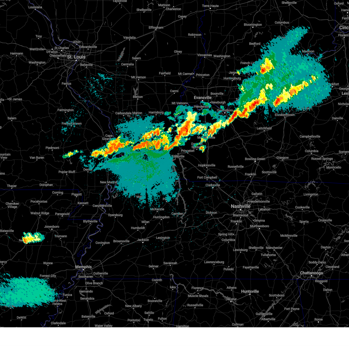 the severe thunderstorm warning has been cancelled and is no longer in effect the severe thunderstorm warning has been cancelled and is no longer in effect
|
| 5/8/2024 1:35 AM CDT |
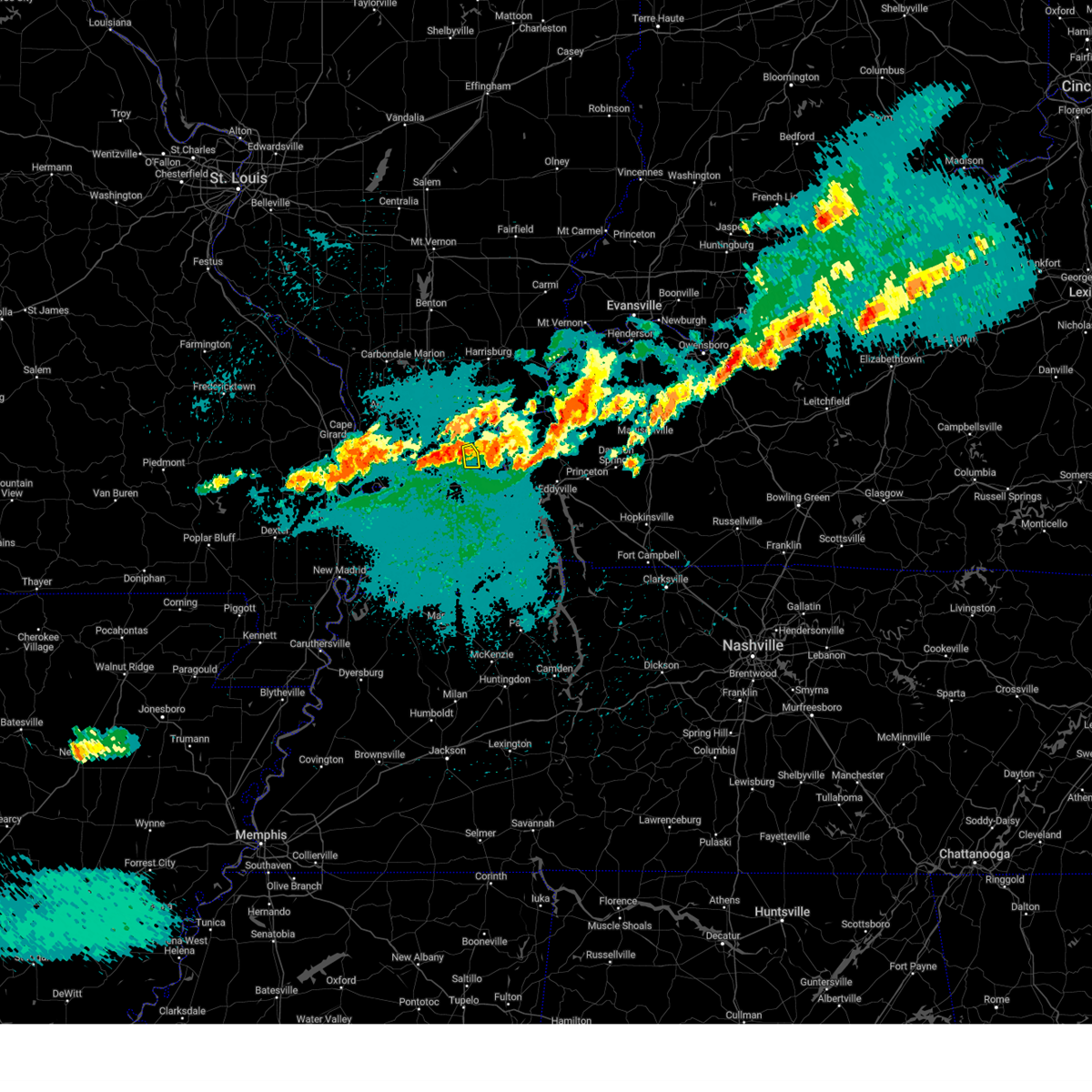 At 135 am cdt, a severe thunderstorm was located near brookport, or 7 miles northeast of metropolis, moving east at 30 mph (radar indicated). Hazards include 60 mph wind gusts. Expect damage to roofs, siding, and trees. this severe thunderstorm will remain over mainly rural areas of central massac county. This includes interstate 24 in illinois between mile markers 34 and 36. At 135 am cdt, a severe thunderstorm was located near brookport, or 7 miles northeast of metropolis, moving east at 30 mph (radar indicated). Hazards include 60 mph wind gusts. Expect damage to roofs, siding, and trees. this severe thunderstorm will remain over mainly rural areas of central massac county. This includes interstate 24 in illinois between mile markers 34 and 36.
|
| 5/8/2024 1:21 AM CDT |
 At 121 am cdt, a severe thunderstorm was located near metropolis, moving east at 30 mph (radar indicated). Hazards include 60 mph wind gusts. Expect damage to roofs, siding, and trees. locations impacted include, paducah, metropolis, and brookport. this includes the following highways, interstate 24 in kentucky near mile marker 1. Interstate 24 in illinois between mile markers 29 and 38. At 121 am cdt, a severe thunderstorm was located near metropolis, moving east at 30 mph (radar indicated). Hazards include 60 mph wind gusts. Expect damage to roofs, siding, and trees. locations impacted include, paducah, metropolis, and brookport. this includes the following highways, interstate 24 in kentucky near mile marker 1. Interstate 24 in illinois between mile markers 29 and 38.
|
| 5/8/2024 1:12 AM CDT | Healthy tree approximately 15 inches in diameter across joppa road. took power lines down as wel in massac county IL, 7.5 miles ESE of Metropolis, IL |
| 5/8/2024 1:09 AM CDT |
 At 109 am cdt, a severe thunderstorm was located near metropolis, moving east at 30 mph (radar indicated). Hazards include 60 mph wind gusts and penny size hail. Expect damage to roofs, siding, and trees. locations impacted include, paducah, metropolis, brookport, and joppa. this includes the following highways, interstate 24 in kentucky near mile marker 1. Interstate 24 in illinois between mile markers 29 and 38. At 109 am cdt, a severe thunderstorm was located near metropolis, moving east at 30 mph (radar indicated). Hazards include 60 mph wind gusts and penny size hail. Expect damage to roofs, siding, and trees. locations impacted include, paducah, metropolis, brookport, and joppa. this includes the following highways, interstate 24 in kentucky near mile marker 1. Interstate 24 in illinois between mile markers 29 and 38.
|
| 5/8/2024 1:09 AM CDT |
 the severe thunderstorm warning has been cancelled and is no longer in effect the severe thunderstorm warning has been cancelled and is no longer in effect
|
| 5/8/2024 12:56 AM CDT |
 Svrpah the national weather service in paducah has issued a * severe thunderstorm warning for, central massac county in southern illinois, northeastern ballard county in western kentucky, northwestern mccracken county in western kentucky, * until 145 am cdt. * at 1255 am cdt, a severe thunderstorm was located near la center, moving east at 30 mph (radar indicated). Hazards include 60 mph wind gusts. expect damage to roofs, siding, and trees Svrpah the national weather service in paducah has issued a * severe thunderstorm warning for, central massac county in southern illinois, northeastern ballard county in western kentucky, northwestern mccracken county in western kentucky, * until 145 am cdt. * at 1255 am cdt, a severe thunderstorm was located near la center, moving east at 30 mph (radar indicated). Hazards include 60 mph wind gusts. expect damage to roofs, siding, and trees
|
| 4/18/2024 6:06 PM CDT |
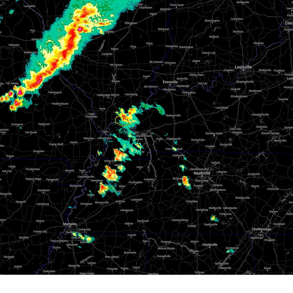 The storm which prompted the warning has moved out of the area. therefore, the warning will be allowed to expire. however, gusty winds are still possible with this thunderstorm. a severe thunderstorm watch remains in effect until 800 pm cdt for southern illinois. The storm which prompted the warning has moved out of the area. therefore, the warning will be allowed to expire. however, gusty winds are still possible with this thunderstorm. a severe thunderstorm watch remains in effect until 800 pm cdt for southern illinois.
|
| 4/18/2024 5:54 PM CDT |
 the severe thunderstorm warning has been cancelled and is no longer in effect the severe thunderstorm warning has been cancelled and is no longer in effect
|
| 4/18/2024 5:54 PM CDT |
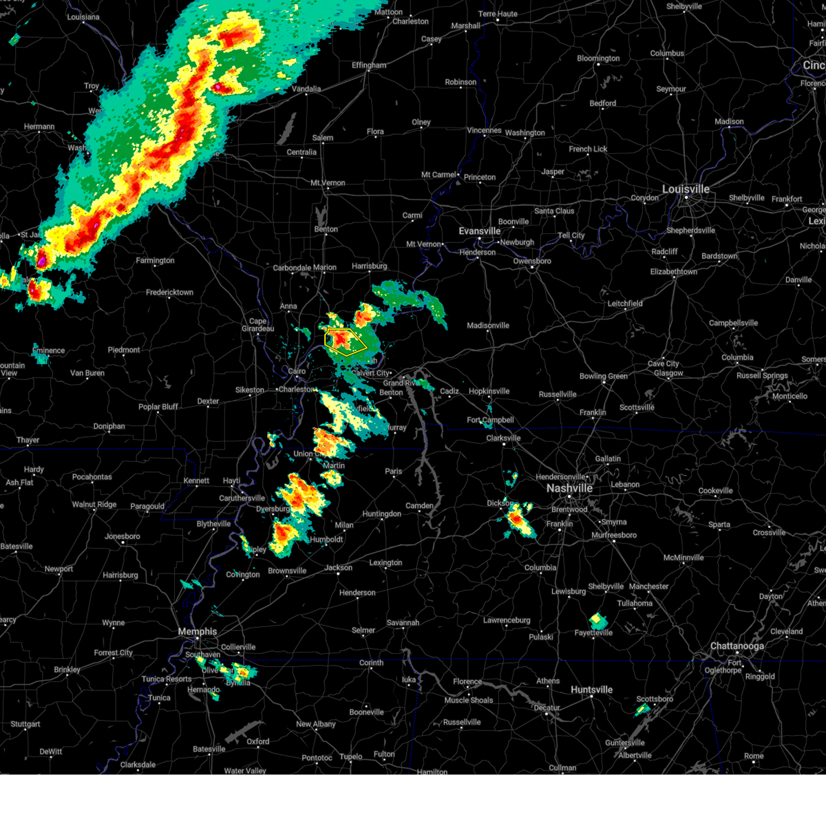 At 553 pm cdt, a severe thunderstorm was located near new columbia, or 7 miles northwest of metropolis, moving northeast at 35 mph (radar indicated). Hazards include 60 mph wind gusts and quarter size hail. Hail damage to vehicles is expected. expect wind damage to roofs, siding, and trees. locations impacted include, metropolis, new columbia, and joppa. This includes interstate 24 in illinois between mile markers 24 and 36. At 553 pm cdt, a severe thunderstorm was located near new columbia, or 7 miles northwest of metropolis, moving northeast at 35 mph (radar indicated). Hazards include 60 mph wind gusts and quarter size hail. Hail damage to vehicles is expected. expect wind damage to roofs, siding, and trees. locations impacted include, metropolis, new columbia, and joppa. This includes interstate 24 in illinois between mile markers 24 and 36.
|
| 4/18/2024 5:34 PM CDT |
 Svrpah the national weather service in paducah has issued a * severe thunderstorm warning for, east central pulaski county in southern illinois, massac county in southern illinois, northeastern ballard county in western kentucky, northwestern mccracken county in western kentucky, * until 615 pm cdt. * at 533 pm cdt, a severe thunderstorm was located near la center, moving northeast at 35 mph (radar indicated). Hazards include 60 mph wind gusts and quarter size hail. Hail damage to vehicles is expected. Expect wind damage to roofs, siding, and trees. Svrpah the national weather service in paducah has issued a * severe thunderstorm warning for, east central pulaski county in southern illinois, massac county in southern illinois, northeastern ballard county in western kentucky, northwestern mccracken county in western kentucky, * until 615 pm cdt. * at 533 pm cdt, a severe thunderstorm was located near la center, moving northeast at 35 mph (radar indicated). Hazards include 60 mph wind gusts and quarter size hail. Hail damage to vehicles is expected. Expect wind damage to roofs, siding, and trees.
|
| 4/2/2024 5:26 AM CDT |
 the tornado warning has been cancelled and is no longer in effect the tornado warning has been cancelled and is no longer in effect
|
| 4/2/2024 5:15 AM CDT |
 the tornado warning has been cancelled and is no longer in effect the tornado warning has been cancelled and is no longer in effect
|
| 4/2/2024 5:15 AM CDT |
 At 514 am cdt, a severe squall line capable of producing both tornadoes and extensive straight line wind damage was located over metropolis, moving east at 45 mph (radar indicated rotation). Hazards include tornado. Flying debris will be dangerous to those caught without shelter. mobile homes will be damaged or destroyed. damage to roofs, windows, and vehicles will occur. tree damage is likely. these dangerous storms will be near, paducah and brookport around 520 am cdt. this includes the following highways, interstate 24 in kentucky between mile markers 1 and 4. Interstate 24 in illinois between mile markers 27 and 38. At 514 am cdt, a severe squall line capable of producing both tornadoes and extensive straight line wind damage was located over metropolis, moving east at 45 mph (radar indicated rotation). Hazards include tornado. Flying debris will be dangerous to those caught without shelter. mobile homes will be damaged or destroyed. damage to roofs, windows, and vehicles will occur. tree damage is likely. these dangerous storms will be near, paducah and brookport around 520 am cdt. this includes the following highways, interstate 24 in kentucky between mile markers 1 and 4. Interstate 24 in illinois between mile markers 27 and 38.
|
| 4/2/2024 5:11 AM CDT |
 Svrpah the national weather service in paducah has issued a * severe thunderstorm warning for, east central johnson county in southern illinois, southwestern white county in southeastern illinois, massac county in southern illinois, southeastern hamilton county in south central illinois, gallatin county in southern illinois, pope county in southern illinois, saline county in southern illinois, hardin county in southern illinois, southern vanderburgh county in southwestern indiana, southwestern posey county in southwestern indiana, henderson county in northwestern kentucky, western hopkins county in northwestern kentucky, northern lyon county in western kentucky, livingston county in western kentucky, northwestern christian county in south central kentucky, northwestern mclean county in northwestern kentucky, northwestern graves county in western kentucky, caldwell county in western kentucky, northwestern marshall county in western kentucky, southeastern ballard county in western kentucky, mccracken county in western kentucky, crittenden county in western kentucky, northeastern carlisle county in western kentucky, union county in northwestern kentucky, webster county in northwestern kentucky, * until 615 am cdt. * at 511 am cdt, severe thunderstorms were located along a line extending from near harrisburg to near west paducah, moving east at 65 mph (radar indicated). Hazards include 70 mph wind gusts. Expect considerable tree damage. Damage is likely to mobile homes, roofs, and outbuildings. Svrpah the national weather service in paducah has issued a * severe thunderstorm warning for, east central johnson county in southern illinois, southwestern white county in southeastern illinois, massac county in southern illinois, southeastern hamilton county in south central illinois, gallatin county in southern illinois, pope county in southern illinois, saline county in southern illinois, hardin county in southern illinois, southern vanderburgh county in southwestern indiana, southwestern posey county in southwestern indiana, henderson county in northwestern kentucky, western hopkins county in northwestern kentucky, northern lyon county in western kentucky, livingston county in western kentucky, northwestern christian county in south central kentucky, northwestern mclean county in northwestern kentucky, northwestern graves county in western kentucky, caldwell county in western kentucky, northwestern marshall county in western kentucky, southeastern ballard county in western kentucky, mccracken county in western kentucky, crittenden county in western kentucky, northeastern carlisle county in western kentucky, union county in northwestern kentucky, webster county in northwestern kentucky, * until 615 am cdt. * at 511 am cdt, severe thunderstorms were located along a line extending from near harrisburg to near west paducah, moving east at 65 mph (radar indicated). Hazards include 70 mph wind gusts. Expect considerable tree damage. Damage is likely to mobile homes, roofs, and outbuildings.
|
| 4/2/2024 5:00 AM CDT |
 Torpah the national weather service in paducah has issued a * tornado warning for, east central pulaski county in southern illinois, massac county in southern illinois, southern pope county in southern illinois, northeastern ballard county in western kentucky, northern mccracken county in western kentucky, * until 545 am cdt. * at 500 am cdt, a severe thunderstorm capable of producing a tornado was located near la center, moving east at 50 mph (radar indicated rotation). Hazards include tornado. Flying debris will be dangerous to those caught without shelter. mobile homes will be damaged or destroyed. damage to roofs, windows, and vehicles will occur. tree damage is likely. this dangerous storm will be near, metropolis, west paducah, and barkley regional airport around 505 am cdt. paducah and brookport around 510 am cdt. other locations impacted by this tornadic thunderstorm include joppa and kevil. this includes the following highways, interstate 24 in kentucky between mile markers 1 and 4. Interstate 24 in illinois between mile markers 27 and 38. Torpah the national weather service in paducah has issued a * tornado warning for, east central pulaski county in southern illinois, massac county in southern illinois, southern pope county in southern illinois, northeastern ballard county in western kentucky, northern mccracken county in western kentucky, * until 545 am cdt. * at 500 am cdt, a severe thunderstorm capable of producing a tornado was located near la center, moving east at 50 mph (radar indicated rotation). Hazards include tornado. Flying debris will be dangerous to those caught without shelter. mobile homes will be damaged or destroyed. damage to roofs, windows, and vehicles will occur. tree damage is likely. this dangerous storm will be near, metropolis, west paducah, and barkley regional airport around 505 am cdt. paducah and brookport around 510 am cdt. other locations impacted by this tornadic thunderstorm include joppa and kevil. this includes the following highways, interstate 24 in kentucky between mile markers 1 and 4. Interstate 24 in illinois between mile markers 27 and 38.
|
| 4/2/2024 4:56 AM CDT |
 the severe thunderstorm warning has been cancelled and is no longer in effect the severe thunderstorm warning has been cancelled and is no longer in effect
|
| 4/2/2024 4:56 AM CDT |
 At 456 am cdt, severe thunderstorms were located along a line extending from near pittsburg to near la center, moving east at 55 mph (trained weather spotters). Hazards include 70 mph wind gusts. Expect considerable tree damage. damage is likely to mobile homes, roofs, and outbuildings. locations impacted include, paducah, marion, herrin, harrisburg, west frankfort, metropolis, eldorado, johnston city, vienna, la center, reidland, lone oak, energy, goreville, brookport, galatia, barlow, golconda, mound city, and pittsburg. this includes the following highways, interstate 24 in kentucky between mile markers 1 and 13. interstate 24 in illinois between mile markers 1 and 38. Interstate 57 in illinois between mile markers 37 and 64. At 456 am cdt, severe thunderstorms were located along a line extending from near pittsburg to near la center, moving east at 55 mph (trained weather spotters). Hazards include 70 mph wind gusts. Expect considerable tree damage. damage is likely to mobile homes, roofs, and outbuildings. locations impacted include, paducah, marion, herrin, harrisburg, west frankfort, metropolis, eldorado, johnston city, vienna, la center, reidland, lone oak, energy, goreville, brookport, galatia, barlow, golconda, mound city, and pittsburg. this includes the following highways, interstate 24 in kentucky between mile markers 1 and 13. interstate 24 in illinois between mile markers 1 and 38. Interstate 57 in illinois between mile markers 37 and 64.
|
| 4/2/2024 4:35 AM CDT |
 Svrpah the national weather service in paducah has issued a * severe thunderstorm warning for, union county in southern illinois, pulaski county in southern illinois, pope county in southern illinois, johnson county in southern illinois, saline county in southern illinois, alexander county in southern illinois, southeastern franklin county in south central illinois, massac county in southern illinois, williamson county in southern illinois, southeastern jackson county in southern illinois, ballard county in western kentucky, mccracken county in western kentucky, western livingston county in western kentucky, north central mississippi county in southeastern missouri, east central scott county in southeastern missouri, * until 515 am cdt. * at 435 am cdt, severe thunderstorms were located along a line extending from near hurst to near olive branch, moving east at 55 mph (trained weather spotters. cape girardeau airport reported gusts to 66 mph). Hazards include 70 mph wind gusts. Expect considerable tree damage. Damage is likely to mobile homes, roofs, and outbuildings. Svrpah the national weather service in paducah has issued a * severe thunderstorm warning for, union county in southern illinois, pulaski county in southern illinois, pope county in southern illinois, johnson county in southern illinois, saline county in southern illinois, alexander county in southern illinois, southeastern franklin county in south central illinois, massac county in southern illinois, williamson county in southern illinois, southeastern jackson county in southern illinois, ballard county in western kentucky, mccracken county in western kentucky, western livingston county in western kentucky, north central mississippi county in southeastern missouri, east central scott county in southeastern missouri, * until 515 am cdt. * at 435 am cdt, severe thunderstorms were located along a line extending from near hurst to near olive branch, moving east at 55 mph (trained weather spotters. cape girardeau airport reported gusts to 66 mph). Hazards include 70 mph wind gusts. Expect considerable tree damage. Damage is likely to mobile homes, roofs, and outbuildings.
|
| 3/14/2024 8:29 PM CDT |
 Svrpah the national weather service in paducah has issued a * severe thunderstorm warning for, massac county in southern illinois, pope county in southern illinois, southeastern johnson county in southern illinois, fulton county in western kentucky, eastern carlisle county in western kentucky, hickman county in western kentucky, southeastern ballard county in western kentucky, mccracken county in western kentucky, graves county in western kentucky, * until 915 pm cdt. * at 829 pm cdt, severe thunderstorms were located along a line extending from near vienna to bardwell to near clayton, moving east at 45 mph (radar indicated). Hazards include 60 mph wind gusts. expect damage to roofs, siding, and trees Svrpah the national weather service in paducah has issued a * severe thunderstorm warning for, massac county in southern illinois, pope county in southern illinois, southeastern johnson county in southern illinois, fulton county in western kentucky, eastern carlisle county in western kentucky, hickman county in western kentucky, southeastern ballard county in western kentucky, mccracken county in western kentucky, graves county in western kentucky, * until 915 pm cdt. * at 829 pm cdt, severe thunderstorms were located along a line extending from near vienna to bardwell to near clayton, moving east at 45 mph (radar indicated). Hazards include 60 mph wind gusts. expect damage to roofs, siding, and trees
|
| 8/3/2023 1:06 AM CDT |
 The severe thunderstorm warning for eastern union, pulaski, northwestern massac, johnson, eastern alexander, northwestern carlisle, ballard, western mccracken, northeastern mississippi and east central scott counties will expire at 115 am cdt, the storms which prompted the warning have weakened below severe limits, and no longer pose an immediate threat to life or property. therefore, the warning will be allowed to expire. however gusty winds are still possible with these thunderstorms. a severe thunderstorm watch remains in effect until 300 am cdt for southern illinois, western kentucky, and southeastern missouri. The severe thunderstorm warning for eastern union, pulaski, northwestern massac, johnson, eastern alexander, northwestern carlisle, ballard, western mccracken, northeastern mississippi and east central scott counties will expire at 115 am cdt, the storms which prompted the warning have weakened below severe limits, and no longer pose an immediate threat to life or property. therefore, the warning will be allowed to expire. however gusty winds are still possible with these thunderstorms. a severe thunderstorm watch remains in effect until 300 am cdt for southern illinois, western kentucky, and southeastern missouri.
|
| 8/3/2023 12:47 AM CDT |
 At 1247 am cdt, severe thunderstorms were located along a line extending from goreville to 6 miles south of karnak to near charleston, moving southeast at 50 mph (radar indicated). Hazards include 60 mph wind gusts. Expect damage to roofs, siding, and trees. locations impacted include, paducah, metropolis, cairo, vienna, la center, wickliffe, goreville, mounds, dongola, barlow, mound city, karnak, lake of egypt area, barkley regional airport, horseshoe lake conservation area, new columbia, olive branch, west paducah, ullin and kevil. this includes the following highways, interstate 24 in illinois between mile markers 2 and 32. interstate 57 in illinois between mile markers 1 and 43. interstate 57 in missouri between mile markers 16 and 21. interstate 55 between mile markers 79 and 80. hail threat, radar indicated max hail size, <. 75 in wind threat, radar indicated max wind gust, 60 mph. At 1247 am cdt, severe thunderstorms were located along a line extending from goreville to 6 miles south of karnak to near charleston, moving southeast at 50 mph (radar indicated). Hazards include 60 mph wind gusts. Expect damage to roofs, siding, and trees. locations impacted include, paducah, metropolis, cairo, vienna, la center, wickliffe, goreville, mounds, dongola, barlow, mound city, karnak, lake of egypt area, barkley regional airport, horseshoe lake conservation area, new columbia, olive branch, west paducah, ullin and kevil. this includes the following highways, interstate 24 in illinois between mile markers 2 and 32. interstate 57 in illinois between mile markers 1 and 43. interstate 57 in missouri between mile markers 16 and 21. interstate 55 between mile markers 79 and 80. hail threat, radar indicated max hail size, <. 75 in wind threat, radar indicated max wind gust, 60 mph.
|
| 8/3/2023 12:29 AM CDT |
 At 1229 am cdt, severe thunderstorms were located along a line extending from near cedar lake area to near tamms to near oran, moving southeast at 45 mph (radar indicated). Hazards include 60 mph wind gusts. expect damage to roofs, siding, and trees At 1229 am cdt, severe thunderstorms were located along a line extending from near cedar lake area to near tamms to near oran, moving southeast at 45 mph (radar indicated). Hazards include 60 mph wind gusts. expect damage to roofs, siding, and trees
|
| 7/29/2023 6:32 PM CDT | Large tree down. also limbs down elsewhere in county. measured gust 54 mph at round kno in massac county IL, 8.3 miles ESE of Metropolis, IL |
| 7/29/2023 6:28 PM CDT |
 At 627 pm cdt, severe thunderstorms were located along a line extending from near carrier mills to near vienna to olive branch, moving southeast at 35 mph (radar indicated). Hazards include 60 mph wind gusts. expect damage to roofs, siding, and trees At 627 pm cdt, severe thunderstorms were located along a line extending from near carrier mills to near vienna to olive branch, moving southeast at 35 mph (radar indicated). Hazards include 60 mph wind gusts. expect damage to roofs, siding, and trees
|
| 7/20/2023 10:21 AM CDT | Trees down over roa in massac county IL, 1.8 miles SW of Metropolis, IL |
| 7/20/2023 10:21 AM CDT | Trees and powerlines dow in massac county IL, 1.3 miles SE of Metropolis, IL |
| 7/20/2023 10:21 AM CDT | Reports of trees and powerlines dow in massac county IL, 1.1 miles E of Metropolis, IL |
| 7/20/2023 10:21 AM CDT | Trees and powerlines down blocking roa in massac county IL, 0.9 miles SE of Metropolis, IL |
| 7/20/2023 10:21 AM CDT |
 At 1021 am cdt, a severe thunderstorm was located over metropolis, moving southeast at 45 mph (trained weather spotters). Hazards include 60 mph wind gusts and quarter size hail. Hail damage to vehicles is expected. expect wind damage to roofs, siding, and trees. locations impacted include, paducah, metropolis, la center, reidland, lone oak, brookport, barkley regional airport, ledbetter, west paducah, kevil, joppa, hamletsburg and symsonia. this includes the following highways, interstate 24 in kentucky between mile markers 1 and 19. interstate 24 in illinois between mile markers 30 and 38. hail threat, observed max hail size, 1. 00 in wind threat, radar indicated max wind gust, 60 mph. At 1021 am cdt, a severe thunderstorm was located over metropolis, moving southeast at 45 mph (trained weather spotters). Hazards include 60 mph wind gusts and quarter size hail. Hail damage to vehicles is expected. expect wind damage to roofs, siding, and trees. locations impacted include, paducah, metropolis, la center, reidland, lone oak, brookport, barkley regional airport, ledbetter, west paducah, kevil, joppa, hamletsburg and symsonia. this includes the following highways, interstate 24 in kentucky between mile markers 1 and 19. interstate 24 in illinois between mile markers 30 and 38. hail threat, observed max hail size, 1. 00 in wind threat, radar indicated max wind gust, 60 mph.
|
| 7/20/2023 10:04 AM CDT |
 At 1004 am cdt, a severe thunderstorm was located near karnak, or 8 miles north of la center, moving southeast at 45 mph (radar indicated). Hazards include 70 mph wind gusts and quarter size hail. Hail damage to vehicles is expected. expect considerable tree damage. Wind damage is also likely to mobile homes, roofs, and outbuildings. At 1004 am cdt, a severe thunderstorm was located near karnak, or 8 miles north of la center, moving southeast at 45 mph (radar indicated). Hazards include 70 mph wind gusts and quarter size hail. Hail damage to vehicles is expected. expect considerable tree damage. Wind damage is also likely to mobile homes, roofs, and outbuildings.
|
| 7/19/2023 7:43 AM CDT |
 At 742 am cdt, severe thunderstorms were located along a line extending from near vienna to karnak to dongola, moving east at 45 mph (radar indicated). Hazards include 60 mph wind gusts. Expect damage to roofs, siding, and trees. locations impacted include, paducah, metropolis, brookport, karnak, new columbia, joppa, new grand chain and belknap. this includes the following highways, interstate 24 in kentucky between mile markers 1 and 4. interstate 24 in illinois between mile markers 19 and 38. hail threat, radar indicated max hail size, <. 75 in wind threat, radar indicated max wind gust, 60 mph. At 742 am cdt, severe thunderstorms were located along a line extending from near vienna to karnak to dongola, moving east at 45 mph (radar indicated). Hazards include 60 mph wind gusts. Expect damage to roofs, siding, and trees. locations impacted include, paducah, metropolis, brookport, karnak, new columbia, joppa, new grand chain and belknap. this includes the following highways, interstate 24 in kentucky between mile markers 1 and 4. interstate 24 in illinois between mile markers 19 and 38. hail threat, radar indicated max hail size, <. 75 in wind threat, radar indicated max wind gust, 60 mph.
|
| 7/19/2023 7:30 AM CDT |
 At 729 am cdt, severe thunderstorms were located along a line extending from near vienna to near dongola to near jonesboro, moving east at 45 mph (radar indicated). Hazards include 60 mph wind gusts. expect damage to roofs, siding, and trees At 729 am cdt, severe thunderstorms were located along a line extending from near vienna to near dongola to near jonesboro, moving east at 45 mph (radar indicated). Hazards include 60 mph wind gusts. expect damage to roofs, siding, and trees
|
| 7/18/2023 1:13 PM CDT |
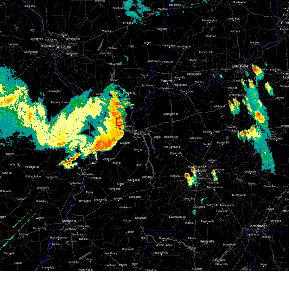 The tornado warning for central massac, west central pope and northwestern mccracken counties will expire at 115 pm cdt, the tornado threat has diminished and the tornado warning has been cancelled. however, large hail and damaging winds remain likely and a severe thunderstorm warning remains in effect for the area. a severe thunderstorm watch remains in effect until 400 pm cdt for southern illinois, and western kentucky. The tornado warning for central massac, west central pope and northwestern mccracken counties will expire at 115 pm cdt, the tornado threat has diminished and the tornado warning has been cancelled. however, large hail and damaging winds remain likely and a severe thunderstorm warning remains in effect for the area. a severe thunderstorm watch remains in effect until 400 pm cdt for southern illinois, and western kentucky.
|
| 7/18/2023 1:07 PM CDT |
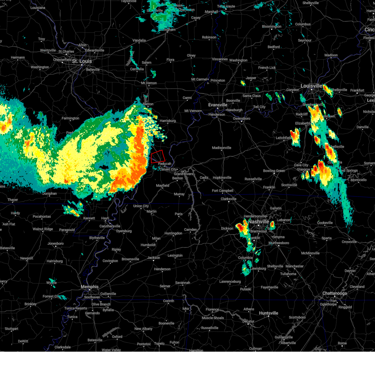 At 106 pm cdt, a severe thunderstorm capable of producing a tornado was located near metropolis, moving east at 40 mph (radar indicated rotation). Hazards include tornado. Flying debris will be dangerous to those caught without shelter. mobile homes will be damaged or destroyed. damage to roofs, windows, and vehicles will occur. tree damage is likely. locations impacted include, metropolis and joppa. This includes interstate 24 in illinois between mile markers 27 and 37. At 106 pm cdt, a severe thunderstorm capable of producing a tornado was located near metropolis, moving east at 40 mph (radar indicated rotation). Hazards include tornado. Flying debris will be dangerous to those caught without shelter. mobile homes will be damaged or destroyed. damage to roofs, windows, and vehicles will occur. tree damage is likely. locations impacted include, metropolis and joppa. This includes interstate 24 in illinois between mile markers 27 and 37.
|
| 7/18/2023 1:00 PM CDT |
 At 100 pm cdt, a severe thunderstorm capable of producing a tornado was located 7 miles southeast of karnak, or 8 miles northwest of metropolis, moving east at 45 mph (radar indicated rotation). Hazards include tornado. Flying debris will be dangerous to those caught without shelter. mobile homes will be damaged or destroyed. damage to roofs, windows, and vehicles will occur. tree damage is likely. locations impacted include, metropolis and joppa. This includes interstate 24 in illinois between mile markers 26 and 37. At 100 pm cdt, a severe thunderstorm capable of producing a tornado was located 7 miles southeast of karnak, or 8 miles northwest of metropolis, moving east at 45 mph (radar indicated rotation). Hazards include tornado. Flying debris will be dangerous to those caught without shelter. mobile homes will be damaged or destroyed. damage to roofs, windows, and vehicles will occur. tree damage is likely. locations impacted include, metropolis and joppa. This includes interstate 24 in illinois between mile markers 26 and 37.
|
| 7/18/2023 12:53 PM CDT |
 At 1253 pm cdt, a severe thunderstorm capable of producing a tornado was located near karnak, or 10 miles north of la center, moving east at 45 mph (radar indicated rotation). Hazards include tornado. Flying debris will be dangerous to those caught without shelter. mobile homes will be damaged or destroyed. damage to roofs, windows, and vehicles will occur. tree damage is likely. locations impacted include, metropolis, karnak, dixon springs, new columbia, joppa, new grand chain and belknap. This includes interstate 24 in illinois between mile markers 21 and 37. At 1253 pm cdt, a severe thunderstorm capable of producing a tornado was located near karnak, or 10 miles north of la center, moving east at 45 mph (radar indicated rotation). Hazards include tornado. Flying debris will be dangerous to those caught without shelter. mobile homes will be damaged or destroyed. damage to roofs, windows, and vehicles will occur. tree damage is likely. locations impacted include, metropolis, karnak, dixon springs, new columbia, joppa, new grand chain and belknap. This includes interstate 24 in illinois between mile markers 21 and 37.
|
| 7/18/2023 12:49 PM CDT |
 At 1249 pm cdt, a severe thunderstorm capable of producing a tornado was located near karnak, or 11 miles north of la center, moving east at 45 mph (radar indicated rotation). Hazards include tornado. Flying debris will be dangerous to those caught without shelter. mobile homes will be damaged or destroyed. damage to roofs, windows, and vehicles will occur. Tree damage is likely. At 1249 pm cdt, a severe thunderstorm capable of producing a tornado was located near karnak, or 11 miles north of la center, moving east at 45 mph (radar indicated rotation). Hazards include tornado. Flying debris will be dangerous to those caught without shelter. mobile homes will be damaged or destroyed. damage to roofs, windows, and vehicles will occur. Tree damage is likely.
|
| 7/18/2023 12:41 PM CDT |
 At 1240 pm cdt, severe thunderstorms were located along a line extending from 7 miles east of cobden to 6 miles east of tamms to cairo to near anniston, moving east at 50 mph (radar indicated). Hazards include 70 mph wind gusts and penny size hail. Expect considerable tree damage. Damage is likely to mobile homes, roofs, and outbuildings. At 1240 pm cdt, severe thunderstorms were located along a line extending from 7 miles east of cobden to 6 miles east of tamms to cairo to near anniston, moving east at 50 mph (radar indicated). Hazards include 70 mph wind gusts and penny size hail. Expect considerable tree damage. Damage is likely to mobile homes, roofs, and outbuildings.
|
| 7/2/2023 5:12 PM CDT |
 At 512 pm cdt, severe thunderstorms were located along a line extending from near brookport to ledbetter to 6 miles northwest of mayfield, moving east at 50 mph (radar indicated). Hazards include 60 mph wind gusts and penny size hail. Expect damage to roofs, siding, and trees. locations impacted include, paducah, mayfield, metropolis, benton, calvert city, reidland, lone oak, brookport, barkley regional airport, ledbetter, west paducah, grand rivers, smithland, lowes, fancy farm, hamletsburg and symsonia. this includes the following highways, interstate 24 in kentucky between mile markers 1 and 33. interstate 24 in illinois between mile markers 33 and 38. interstate 69 in kentucky between mile markers 29 and 51. hail threat, radar indicated max hail size, 0. 75 in wind threat, radar indicated max wind gust, 60 mph. At 512 pm cdt, severe thunderstorms were located along a line extending from near brookport to ledbetter to 6 miles northwest of mayfield, moving east at 50 mph (radar indicated). Hazards include 60 mph wind gusts and penny size hail. Expect damage to roofs, siding, and trees. locations impacted include, paducah, mayfield, metropolis, benton, calvert city, reidland, lone oak, brookport, barkley regional airport, ledbetter, west paducah, grand rivers, smithland, lowes, fancy farm, hamletsburg and symsonia. this includes the following highways, interstate 24 in kentucky between mile markers 1 and 33. interstate 24 in illinois between mile markers 33 and 38. interstate 69 in kentucky between mile markers 29 and 51. hail threat, radar indicated max hail size, 0. 75 in wind threat, radar indicated max wind gust, 60 mph.
|
| 7/2/2023 5:05 PM CDT |
 At 504 pm cdt, severe thunderstorms were located along a line extending from near metropolis to paducah to 10 miles southeast of bardwell, moving east at 50 mph (radar indicated). Hazards include 60 mph wind gusts and nickel size hail. Expect damage to roofs, siding, and trees. locations impacted include, paducah, mayfield, metropolis, benton, calvert city, reidland, lone oak, brookport, barkley regional airport, ledbetter, west paducah, lovelaceville, grand rivers, kevil, joppa, smithland, lowes, fancy farm, hamletsburg and symsonia. this includes the following highways, interstate 24 in kentucky between mile markers 1 and 33. interstate 24 in illinois between mile markers 32 and 38. interstate 69 in kentucky between mile markers 28 and 51. hail threat, radar indicated max hail size, 0. 88 in wind threat, radar indicated max wind gust, 60 mph. At 504 pm cdt, severe thunderstorms were located along a line extending from near metropolis to paducah to 10 miles southeast of bardwell, moving east at 50 mph (radar indicated). Hazards include 60 mph wind gusts and nickel size hail. Expect damage to roofs, siding, and trees. locations impacted include, paducah, mayfield, metropolis, benton, calvert city, reidland, lone oak, brookport, barkley regional airport, ledbetter, west paducah, lovelaceville, grand rivers, kevil, joppa, smithland, lowes, fancy farm, hamletsburg and symsonia. this includes the following highways, interstate 24 in kentucky between mile markers 1 and 33. interstate 24 in illinois between mile markers 32 and 38. interstate 69 in kentucky between mile markers 28 and 51. hail threat, radar indicated max hail size, 0. 88 in wind threat, radar indicated max wind gust, 60 mph.
|
| 7/2/2023 4:54 PM CDT | Pole bent ove in massac county IL, 6.5 miles SSE of Metropolis, IL |
| 7/2/2023 4:51 PM CDT |
 At 451 pm cdt, severe thunderstorms were located along a line extending from 6 miles south of karnak to near barkley regional airport to near bardwell, moving east at 50 mph (radar indicated). Hazards include 60 mph wind gusts and half dollar size hail. Hail damage to vehicles is expected. Expect wind damage to roofs, siding, and trees. At 451 pm cdt, severe thunderstorms were located along a line extending from 6 miles south of karnak to near barkley regional airport to near bardwell, moving east at 50 mph (radar indicated). Hazards include 60 mph wind gusts and half dollar size hail. Hail damage to vehicles is expected. Expect wind damage to roofs, siding, and trees.
|
| 7/2/2023 4:18 PM CDT |
 At 418 pm cdt, a severe thunderstorm was located over mound city, or near cairo, moving east at 45 mph (radar indicated). Hazards include 60 mph wind gusts. expect damage to roofs, siding, and trees At 418 pm cdt, a severe thunderstorm was located over mound city, or near cairo, moving east at 45 mph (radar indicated). Hazards include 60 mph wind gusts. expect damage to roofs, siding, and trees
|
| 7/2/2023 3:55 PM CDT |
 At 355 pm cdt, severe thunderstorms were located along a line extending from near rosiclare to near brookport, moving east at 45 mph (trained weather spotters). Hazards include 60 mph wind gusts. Expect damage to roofs, siding, and trees. locations impacted include, rosiclare, brookport, salem, golconda, joy, burna, cave-in-rock, smithland, elizabethtown, carrsville and hamletsburg. hail threat, radar indicated max hail size, <. 75 in wind threat, radar indicated max wind gust, 60 mph. At 355 pm cdt, severe thunderstorms were located along a line extending from near rosiclare to near brookport, moving east at 45 mph (trained weather spotters). Hazards include 60 mph wind gusts. Expect damage to roofs, siding, and trees. locations impacted include, rosiclare, brookport, salem, golconda, joy, burna, cave-in-rock, smithland, elizabethtown, carrsville and hamletsburg. hail threat, radar indicated max hail size, <. 75 in wind threat, radar indicated max wind gust, 60 mph.
|
| 7/2/2023 3:38 PM CDT |
 At 338 pm cdt, severe thunderstorms were located along a line extending from near dixon springs to near metropolis, moving east at 45 mph (trained weather spotters). Hazards include 70 mph wind gusts. Expect considerable tree damage. Damage is likely to mobile homes, roofs, and outbuildings. At 338 pm cdt, severe thunderstorms were located along a line extending from near dixon springs to near metropolis, moving east at 45 mph (trained weather spotters). Hazards include 70 mph wind gusts. Expect considerable tree damage. Damage is likely to mobile homes, roofs, and outbuildings.
|
| 7/2/2023 3:36 PM CDT | Multiple tree branches scattered around... some larg in massac county IL, 6.5 miles SSE of Metropolis, IL |
| 7/2/2023 3:36 PM CDT | Tree limb down on power line in massac county IL, 1.1 miles E of Metropolis, IL |
| 7/2/2023 3:34 PM CDT | Tree blown down. outbuildings los in massac county IL, 6.5 miles SSE of Metropolis, IL |
| 7/2/2023 3:19 PM CDT |
 At 319 pm cdt, severe thunderstorms were located along a line extending from near karnak to 6 miles north of la center, moving east at 45 mph (radar indicated). Hazards include 60 mph wind gusts. Expect damage to roofs, siding, and trees. locations impacted include, paducah, metropolis, vienna, brookport, karnak, dixon springs, new columbia, joppa, cypress, new grand chain, belknap, eddyville and simpson. this includes the following highways, interstate 24 in kentucky between mile markers 1 and 3. interstate 24 in illinois between mile markers 12 and 38. hail threat, radar indicated max hail size, <. 75 in wind threat, radar indicated max wind gust, 60 mph. At 319 pm cdt, severe thunderstorms were located along a line extending from near karnak to 6 miles north of la center, moving east at 45 mph (radar indicated). Hazards include 60 mph wind gusts. Expect damage to roofs, siding, and trees. locations impacted include, paducah, metropolis, vienna, brookport, karnak, dixon springs, new columbia, joppa, cypress, new grand chain, belknap, eddyville and simpson. this includes the following highways, interstate 24 in kentucky between mile markers 1 and 3. interstate 24 in illinois between mile markers 12 and 38. hail threat, radar indicated max hail size, <. 75 in wind threat, radar indicated max wind gust, 60 mph.
|
| 7/2/2023 3:10 PM CDT |
 At 309 pm cdt, severe thunderstorms were located along a line extending from near dongola to near mound city, moving east at 45 mph (radar indicated). Hazards include 60 mph wind gusts. Expect damage to roofs, siding, and trees. locations impacted include, paducah, metropolis, vienna, brookport, mounds, dongola, tamms, mound city, karnak, dixon springs, new columbia, ullin, joppa, olmsted, cypress, new grand chain, pulaski, belknap, eddyville and mill creek. this includes the following highways, interstate 24 in kentucky between mile markers 1 and 2. interstate 24 in illinois between mile markers 12 and 38. interstate 57 in illinois between mile markers 5 and 29. hail threat, radar indicated max hail size, <. 75 in wind threat, radar indicated max wind gust, 60 mph. At 309 pm cdt, severe thunderstorms were located along a line extending from near dongola to near mound city, moving east at 45 mph (radar indicated). Hazards include 60 mph wind gusts. Expect damage to roofs, siding, and trees. locations impacted include, paducah, metropolis, vienna, brookport, mounds, dongola, tamms, mound city, karnak, dixon springs, new columbia, ullin, joppa, olmsted, cypress, new grand chain, pulaski, belknap, eddyville and mill creek. this includes the following highways, interstate 24 in kentucky between mile markers 1 and 2. interstate 24 in illinois between mile markers 12 and 38. interstate 57 in illinois between mile markers 5 and 29. hail threat, radar indicated max hail size, <. 75 in wind threat, radar indicated max wind gust, 60 mph.
|
| 7/2/2023 3:00 PM CDT |
 At 300 pm cdt, severe thunderstorms were located along a line extending from near dongola to near mounds, moving east at 45 mph (radar indicated). Hazards include 70 mph wind gusts. Expect considerable tree damage. Damage is likely to mobile homes, roofs, and outbuildings. At 300 pm cdt, severe thunderstorms were located along a line extending from near dongola to near mounds, moving east at 45 mph (radar indicated). Hazards include 70 mph wind gusts. Expect considerable tree damage. Damage is likely to mobile homes, roofs, and outbuildings.
|
| 7/1/2023 9:39 PM CDT |
 At 939 pm cdt, severe thunderstorms were located along a line extending from near west paducah to near mayfield, moving northeast at 45 mph (radar indicated). Hazards include 60 mph wind gusts. Expect damage to roofs, siding, and trees. locations impacted include, paducah, mayfield, metropolis, benton, calvert city, lone oak, reidland, brookport, barkley regional airport, west paducah and symsonia. this includes the following highways, interstate 24 in kentucky between mile markers 1 and 29. interstate 24 in illinois between mile markers 31 and 38. interstate 69 in kentucky between mile markers 20 and 51. hail threat, radar indicated max hail size, <. 75 in wind threat, radar indicated max wind gust, 60 mph. At 939 pm cdt, severe thunderstorms were located along a line extending from near west paducah to near mayfield, moving northeast at 45 mph (radar indicated). Hazards include 60 mph wind gusts. Expect damage to roofs, siding, and trees. locations impacted include, paducah, mayfield, metropolis, benton, calvert city, lone oak, reidland, brookport, barkley regional airport, west paducah and symsonia. this includes the following highways, interstate 24 in kentucky between mile markers 1 and 29. interstate 24 in illinois between mile markers 31 and 38. interstate 69 in kentucky between mile markers 20 and 51. hail threat, radar indicated max hail size, <. 75 in wind threat, radar indicated max wind gust, 60 mph.
|
| 7/1/2023 9:32 PM CDT |
 At 932 pm cdt, severe thunderstorms were located along a line extending from near la center to 8 miles west of mayfield, moving northeast at 45 mph (nws forecasters. wind estimated at 60 mph as it passed through barkley airport at 929 pm). Hazards include 60 mph wind gusts. Expect damage to roofs, siding, and trees. locations impacted include, paducah, mayfield, metropolis, benton, calvert city, la center, reidland, lone oak, brookport, barkley regional airport, west paducah, lovelaceville, kevil, lowes, fancy farm, blandville and symsonia. this includes the following highways, interstate 24 in kentucky between mile markers 1 and 29. interstate 24 in illinois between mile markers 30 and 38. interstate 69 in kentucky between mile markers 20 and 51. hail threat, radar indicated max hail size, <. 75 in wind threat, radar indicated max wind gust, 60 mph. At 932 pm cdt, severe thunderstorms were located along a line extending from near la center to 8 miles west of mayfield, moving northeast at 45 mph (nws forecasters. wind estimated at 60 mph as it passed through barkley airport at 929 pm). Hazards include 60 mph wind gusts. Expect damage to roofs, siding, and trees. locations impacted include, paducah, mayfield, metropolis, benton, calvert city, la center, reidland, lone oak, brookport, barkley regional airport, west paducah, lovelaceville, kevil, lowes, fancy farm, blandville and symsonia. this includes the following highways, interstate 24 in kentucky between mile markers 1 and 29. interstate 24 in illinois between mile markers 30 and 38. interstate 69 in kentucky between mile markers 20 and 51. hail threat, radar indicated max hail size, <. 75 in wind threat, radar indicated max wind gust, 60 mph.
|
| 7/1/2023 9:28 PM CDT |
 At 928 pm cdt, severe thunderstorms were located along a line extending from near la center to 8 miles west of mayfield, moving northeast at 45 mph (radar indicated). Hazards include 60 mph wind gusts. expect damage to roofs, siding, and trees At 928 pm cdt, severe thunderstorms were located along a line extending from near la center to 8 miles west of mayfield, moving northeast at 45 mph (radar indicated). Hazards include 60 mph wind gusts. expect damage to roofs, siding, and trees
|
| 5/8/2023 11:10 PM CDT |
 At 1110 pm cdt, severe thunderstorms were located along a line extending from 8 miles southwest of karnak to near barlow to near wickliffe, moving east at 40 mph (radar indicated). Hazards include 70 mph wind gusts and nickel size hail. Expect considerable tree damage. Damage is likely to mobile homes, roofs, and outbuildings. At 1110 pm cdt, severe thunderstorms were located along a line extending from 8 miles southwest of karnak to near barlow to near wickliffe, moving east at 40 mph (radar indicated). Hazards include 70 mph wind gusts and nickel size hail. Expect considerable tree damage. Damage is likely to mobile homes, roofs, and outbuildings.
|
| 5/7/2023 2:27 PM CDT |
 At 227 pm cdt, severe thunderstorms were located along a line extending from 7 miles northeast of vienna to near metropolis, moving northeast at 35 mph (radar indicated). Hazards include 60 mph wind gusts and quarter size hail. Hail damage to vehicles is expected. Expect wind damage to roofs, siding, and trees. At 227 pm cdt, severe thunderstorms were located along a line extending from 7 miles northeast of vienna to near metropolis, moving northeast at 35 mph (radar indicated). Hazards include 60 mph wind gusts and quarter size hail. Hail damage to vehicles is expected. Expect wind damage to roofs, siding, and trees.
|
| 5/7/2023 2:06 PM CDT |
 At 206 pm cdt, a severe thunderstorm was located 7 miles west of metropolis, moving east at 35 mph (radar indicated). Hazards include 60 mph wind gusts and quarter size hail. Hail damage to vehicles is expected. expect wind damage to roofs, siding, and trees. locations impacted include, paducah, metropolis, la center, brookport, karnak, west paducah, new columbia, barkley regional airport, kevil, joppa and new grand chain. this includes the following highways, interstate 24 in kentucky between mile markers 1 and 4. interstate 24 in illinois between mile markers 24 and 38. hail threat, radar indicated max hail size, 1. 00 in wind threat, radar indicated max wind gust, 60 mph. At 206 pm cdt, a severe thunderstorm was located 7 miles west of metropolis, moving east at 35 mph (radar indicated). Hazards include 60 mph wind gusts and quarter size hail. Hail damage to vehicles is expected. expect wind damage to roofs, siding, and trees. locations impacted include, paducah, metropolis, la center, brookport, karnak, west paducah, new columbia, barkley regional airport, kevil, joppa and new grand chain. this includes the following highways, interstate 24 in kentucky between mile markers 1 and 4. interstate 24 in illinois between mile markers 24 and 38. hail threat, radar indicated max hail size, 1. 00 in wind threat, radar indicated max wind gust, 60 mph.
|
| 5/7/2023 1:54 PM CDT |
 At 154 pm cdt, a severe thunderstorm was located near la center, moving east at 35 mph (radar indicated). Hazards include 60 mph wind gusts and quarter size hail. Hail damage to vehicles is expected. expect wind damage to roofs, siding, and trees. locations impacted include, paducah, metropolis, la center, brookport, barlow, karnak, west paducah, new columbia, barkley regional airport, kevil, joppa, olmsted and new grand chain. this includes the following highways, interstate 24 in kentucky between mile markers 1 and 4. interstate 24 in illinois between mile markers 24 and 38. hail threat, radar indicated max hail size, 1. 00 in wind threat, radar indicated max wind gust, 60 mph. At 154 pm cdt, a severe thunderstorm was located near la center, moving east at 35 mph (radar indicated). Hazards include 60 mph wind gusts and quarter size hail. Hail damage to vehicles is expected. expect wind damage to roofs, siding, and trees. locations impacted include, paducah, metropolis, la center, brookport, barlow, karnak, west paducah, new columbia, barkley regional airport, kevil, joppa, olmsted and new grand chain. this includes the following highways, interstate 24 in kentucky between mile markers 1 and 4. interstate 24 in illinois between mile markers 24 and 38. hail threat, radar indicated max hail size, 1. 00 in wind threat, radar indicated max wind gust, 60 mph.
|
| 5/7/2023 1:41 PM CDT |
 At 141 pm cdt, a severe thunderstorm was located near mound city, or 9 miles north of cairo, moving east at 35 mph (radar indicated). Hazards include 60 mph wind gusts and quarter size hail. Hail damage to vehicles is expected. Expect wind damage to roofs, siding, and trees. At 141 pm cdt, a severe thunderstorm was located near mound city, or 9 miles north of cairo, moving east at 35 mph (radar indicated). Hazards include 60 mph wind gusts and quarter size hail. Hail damage to vehicles is expected. Expect wind damage to roofs, siding, and trees.
|
| 4/15/2023 3:08 PM CDT | Several trees and large limbs down at airport and upper salem roa in massac county IL, 4.7 miles SSE of Metropolis, IL |
| 4/15/2023 3:01 PM CDT |
 At 301 pm cdt, a severe thunderstorm was located near metropolis, moving east at 40 mph (radar indicated). Hazards include 60 mph wind gusts and half dollar size hail. Hail damage to vehicles is expected. expect wind damage to roofs, siding, and trees. locations impacted include, paducah, metropolis, reidland, brookport, west paducah, barkley regional airport, kevil and joppa. this includes the following highways, interstate 24 in kentucky between mile markers 1 and 7. interstate 24 in illinois between mile markers 31 and 38. hail threat, radar indicated max hail size, 1. 25 in wind threat, radar indicated max wind gust, 60 mph. At 301 pm cdt, a severe thunderstorm was located near metropolis, moving east at 40 mph (radar indicated). Hazards include 60 mph wind gusts and half dollar size hail. Hail damage to vehicles is expected. expect wind damage to roofs, siding, and trees. locations impacted include, paducah, metropolis, reidland, brookport, west paducah, barkley regional airport, kevil and joppa. this includes the following highways, interstate 24 in kentucky between mile markers 1 and 7. interstate 24 in illinois between mile markers 31 and 38. hail threat, radar indicated max hail size, 1. 25 in wind threat, radar indicated max wind gust, 60 mph.
|
| 4/15/2023 2:47 PM CDT |
 At 245 pm cdt, a severe thunderstorm was located over mainly rural areas of northern ballard county, moving east at 35 mph (radar indicated). Hazards include 60 mph wind gusts and half dollar size hail. Hail damage to vehicles is expected. Expect wind damage to roofs, siding, and trees. At 245 pm cdt, a severe thunderstorm was located over mainly rural areas of northern ballard county, moving east at 35 mph (radar indicated). Hazards include 60 mph wind gusts and half dollar size hail. Hail damage to vehicles is expected. Expect wind damage to roofs, siding, and trees.
|
| 4/5/2023 1:35 PM CDT |
 At 135 pm cdt, severe thunderstorms were located along a line extending from near metropolis to 9 miles southeast of lovelaceville to near south fulton, moving northeast at 55 mph (radar indicated). Hazards include 60 mph wind gusts. expect damage to roofs, siding, and trees At 135 pm cdt, severe thunderstorms were located along a line extending from near metropolis to 9 miles southeast of lovelaceville to near south fulton, moving northeast at 55 mph (radar indicated). Hazards include 60 mph wind gusts. expect damage to roofs, siding, and trees
|
| 4/5/2023 1:23 PM CDT |
 At 122 pm cdt, severe thunderstorms were located along a line extending from near mounds to near wickliffe to near clinton, moving northeast at 45 mph (radar indicated). Hazards include 60 mph wind gusts. Expect damage to roofs, siding, and trees. Locations impacted include, metropolis, la center, bardwell, wickliffe, barlow, mound city, barkley regional airport, west paducah, lovelaceville, kevil, joppa, arlington, belknap, lowes, fancy farm and blandville. At 122 pm cdt, severe thunderstorms were located along a line extending from near mounds to near wickliffe to near clinton, moving northeast at 45 mph (radar indicated). Hazards include 60 mph wind gusts. Expect damage to roofs, siding, and trees. Locations impacted include, metropolis, la center, bardwell, wickliffe, barlow, mound city, barkley regional airport, west paducah, lovelaceville, kevil, joppa, arlington, belknap, lowes, fancy farm and blandville.
|
| 4/5/2023 1:07 PM CDT |
 At 105 pm cdt, severe thunderstorms were located from near miller city illinois to wyatt and wolf island missouri, moving northeast at 45 mph (radar indicated). Hazards include 60 mph wind gusts. expect damage to roofs, siding, and trees At 105 pm cdt, severe thunderstorms were located from near miller city illinois to wyatt and wolf island missouri, moving northeast at 45 mph (radar indicated). Hazards include 60 mph wind gusts. expect damage to roofs, siding, and trees
|
| 3/3/2023 11:38 AM CST |
 The severe thunderstorm warning for eastern massac, calloway, western marshall, eastern mccracken and eastern graves counties will expire at 1145 am cst, the storms which prompted the warning have moved out of the area. therefore, the warning will be allowed to expire. a warning continues for the easternmost parts of calloway and marshall counties. a tornado watch remains in effect until 100 pm cst for southern illinois, and western kentucky. The severe thunderstorm warning for eastern massac, calloway, western marshall, eastern mccracken and eastern graves counties will expire at 1145 am cst, the storms which prompted the warning have moved out of the area. therefore, the warning will be allowed to expire. a warning continues for the easternmost parts of calloway and marshall counties. a tornado watch remains in effect until 100 pm cst for southern illinois, and western kentucky.
|
| 3/3/2023 11:19 AM CST |
 At 1119 am cst, severe thunderstorms were located over mainly rural from about 6 miles south of murray to just east of metropolis, moving east at 60 mph (trained weather spotters). Hazards include 70 mph wind gusts. Expect considerable tree damage. damage is likely to mobile homes, roofs, and outbuildings. locations impacted include, paducah, murray, mayfield, metropolis, benton, reidland, lone oak, brookport, lynnville, hardin, hazel, new concord, kirksey, brewers, harris grove and symsonia. this includes the following highways, interstate 24 in kentucky between mile markers 1 and 24. interstate 24 in illinois between mile markers 32 and 38. interstate 69 in kentucky between mile markers 27 and 49. thunderstorm damage threat, considerable hail threat, radar indicated max hail size, <. 75 in wind threat, radar indicated max wind gust, 70 mph. At 1119 am cst, severe thunderstorms were located over mainly rural from about 6 miles south of murray to just east of metropolis, moving east at 60 mph (trained weather spotters). Hazards include 70 mph wind gusts. Expect considerable tree damage. damage is likely to mobile homes, roofs, and outbuildings. locations impacted include, paducah, murray, mayfield, metropolis, benton, reidland, lone oak, brookport, lynnville, hardin, hazel, new concord, kirksey, brewers, harris grove and symsonia. this includes the following highways, interstate 24 in kentucky between mile markers 1 and 24. interstate 24 in illinois between mile markers 32 and 38. interstate 69 in kentucky between mile markers 27 and 49. thunderstorm damage threat, considerable hail threat, radar indicated max hail size, <. 75 in wind threat, radar indicated max wind gust, 70 mph.
|
| 3/3/2023 11:15 AM CST |
 At 1115 am cst, severe thunderstorms were located along a line extending from 7 miles north of brookport to 6 miles west of benton to near murray, moving northeast at 65 mph (radar indicated). Hazards include 70 mph wind gusts. Expect considerable tree damage. Damage is likely to mobile homes, roofs, and outbuildings. At 1115 am cst, severe thunderstorms were located along a line extending from 7 miles north of brookport to 6 miles west of benton to near murray, moving northeast at 65 mph (radar indicated). Hazards include 70 mph wind gusts. Expect considerable tree damage. Damage is likely to mobile homes, roofs, and outbuildings.
|
| 3/3/2023 11:10 AM CST | Large section of shingles removed on a home. estimated at least 60 mph wind in massac county IL, 6.5 miles SSE of Metropolis, IL |
| 3/3/2023 11:04 AM CST |
 At 1103 am cst, severe thunderstorms were located from near kevil to just west of mayfield to near cuba, kentucky, moving northeast at 65 mph. multiple reports of wind gusts of 60 to 75 mph have been received with this line (trained weather spotters). Hazards include 70 mph wind gusts. Expect considerable tree damage. damage is likely to mobile homes, roofs, and outbuildings. locations impacted include, paducah, murray, mayfield, metropolis, benton, la center, wickliffe, reidland, lone oak, brookport, barlow, barkley regional airport, lynnville, sedalia, lovelaceville, west paducah, wingo, hardin, hazel and kevil. this includes the following highways, interstate 24 in kentucky between mile markers 1 and 24. interstate 24 in illinois between mile markers 31 and 38. interstate 69 in kentucky between mile markers 9 and 49. thunderstorm damage threat, considerable hail threat, radar indicated max hail size, <. 75 in wind threat, radar indicated max wind gust, 70 mph. At 1103 am cst, severe thunderstorms were located from near kevil to just west of mayfield to near cuba, kentucky, moving northeast at 65 mph. multiple reports of wind gusts of 60 to 75 mph have been received with this line (trained weather spotters). Hazards include 70 mph wind gusts. Expect considerable tree damage. damage is likely to mobile homes, roofs, and outbuildings. locations impacted include, paducah, murray, mayfield, metropolis, benton, la center, wickliffe, reidland, lone oak, brookport, barlow, barkley regional airport, lynnville, sedalia, lovelaceville, west paducah, wingo, hardin, hazel and kevil. this includes the following highways, interstate 24 in kentucky between mile markers 1 and 24. interstate 24 in illinois between mile markers 31 and 38. interstate 69 in kentucky between mile markers 9 and 49. thunderstorm damage threat, considerable hail threat, radar indicated max hail size, <. 75 in wind threat, radar indicated max wind gust, 70 mph.
|
| 3/3/2023 10:44 AM CST |
 At 1044 am cst, severe thunderstorms were located along a line extending from wickliffe to fulton, moving east at 60 mph (trained weather spotters. mesonet reported a 74 mph wind gust at fulton). Hazards include 70 mph wind gusts. Expect considerable tree damage. Damage is likely to mobile homes, roofs, and outbuildings. At 1044 am cst, severe thunderstorms were located along a line extending from wickliffe to fulton, moving east at 60 mph (trained weather spotters. mesonet reported a 74 mph wind gust at fulton). Hazards include 70 mph wind gusts. Expect considerable tree damage. Damage is likely to mobile homes, roofs, and outbuildings.
|
| 2/22/2023 3:29 PM CST |
 At 329 pm cst, severe thunderstorms were located along a line extending from 7 miles southeast of karnak to near clinton, moving east at 50 mph (radar indicated). Hazards include 60 mph wind gusts. Expect damage to roofs, siding, and trees. severe thunderstorms will be near, metropolis and new columbia around 340 pm cst. other locations in the path of these severe thunderstorms include mayfield. this includes the following highways, interstate 24 in kentucky between mile markers 1 and 17. interstate 24 in illinois between mile markers 24 and 38. interstate 69 in kentucky between mile markers 17 and 34. hail threat, radar indicated max hail size, <. 75 in wind threat, radar indicated max wind gust, 60 mph. At 329 pm cst, severe thunderstorms were located along a line extending from 7 miles southeast of karnak to near clinton, moving east at 50 mph (radar indicated). Hazards include 60 mph wind gusts. Expect damage to roofs, siding, and trees. severe thunderstorms will be near, metropolis and new columbia around 340 pm cst. other locations in the path of these severe thunderstorms include mayfield. this includes the following highways, interstate 24 in kentucky between mile markers 1 and 17. interstate 24 in illinois between mile markers 24 and 38. interstate 69 in kentucky between mile markers 17 and 34. hail threat, radar indicated max hail size, <. 75 in wind threat, radar indicated max wind gust, 60 mph.
|
| 2/8/2023 8:31 PM CST | Large tree blown dow in massac county IL, 2.8 miles S of Metropolis, IL |
| 7/17/2022 10:23 PM CDT |
 At 1023 pm cdt, severe thunderstorms were located along a line extending from near dixon springs to near ledbetter to 6 miles northwest of mayfield to near clinton to near cayce, moving east at 30 mph (radar indicated). Hazards include 60 mph wind gusts and penny size hail. Expect damage to roofs, siding, and trees. locations impacted include, reidland, ledbetter and mayfield. this includes the following highways, interstate 24 in kentucky between mile markers 1 and 16. interstate 24 in illinois between mile markers 25 and 38. interstate 69 in kentucky between mile markers 16 and 33. hail threat, radar indicated max hail size, 0. 75 in wind threat, radar indicated max wind gust, 60 mph. At 1023 pm cdt, severe thunderstorms were located along a line extending from near dixon springs to near ledbetter to 6 miles northwest of mayfield to near clinton to near cayce, moving east at 30 mph (radar indicated). Hazards include 60 mph wind gusts and penny size hail. Expect damage to roofs, siding, and trees. locations impacted include, reidland, ledbetter and mayfield. this includes the following highways, interstate 24 in kentucky between mile markers 1 and 16. interstate 24 in illinois between mile markers 25 and 38. interstate 69 in kentucky between mile markers 16 and 33. hail threat, radar indicated max hail size, 0. 75 in wind threat, radar indicated max wind gust, 60 mph.
|
| 7/17/2022 9:47 PM CDT |
 At 947 pm cdt, severe thunderstorms were located along a line extending from near karnak to near barkley regional airport to near bardwell to near anniston to near big oak tree state park, moving southeast at 45 mph (radar indicated). Hazards include 70 mph wind gusts and penny size hail. Expect considerable tree damage. damage is likely to mobile homes, roofs, and outbuildings. severe thunderstorms will be near, bardwell, barkley regional airport, west paducah and lovelaceville around 955 pm cdt. paducah and lone oak around 1000 pm cdt. other locations in the path of these severe thunderstorms include metropolis, clinton, mayfield, brookport, reidland and ledbetter. this includes the following highways, interstate 24 in kentucky between mile markers 1 and 16. interstate 24 in illinois between mile markers 24 and 38. interstate 69 in kentucky between mile markers 16 and 33. thunderstorm damage threat, considerable hail threat, radar indicated max hail size, 0. 75 in wind threat, radar indicated max wind gust, 70 mph. At 947 pm cdt, severe thunderstorms were located along a line extending from near karnak to near barkley regional airport to near bardwell to near anniston to near big oak tree state park, moving southeast at 45 mph (radar indicated). Hazards include 70 mph wind gusts and penny size hail. Expect considerable tree damage. damage is likely to mobile homes, roofs, and outbuildings. severe thunderstorms will be near, bardwell, barkley regional airport, west paducah and lovelaceville around 955 pm cdt. paducah and lone oak around 1000 pm cdt. other locations in the path of these severe thunderstorms include metropolis, clinton, mayfield, brookport, reidland and ledbetter. this includes the following highways, interstate 24 in kentucky between mile markers 1 and 16. interstate 24 in illinois between mile markers 24 and 38. interstate 69 in kentucky between mile markers 16 and 33. thunderstorm damage threat, considerable hail threat, radar indicated max hail size, 0. 75 in wind threat, radar indicated max wind gust, 70 mph.
|
| 6/17/2022 7:55 AM CDT | Tree down across road on us 45 at mt mission r in massac county IL, 7.7 miles S of Metropolis, IL |
| 6/17/2022 7:49 AM CDT |
 At 749 am cdt, severe thunderstorms were located along a line extending from near sturgis to golconda to near mound city, moving southeast at 40 mph (radar indicated). Hazards include 60 mph wind gusts. Expect damage to roofs, siding, and trees. severe thunderstorms will be near, joy around 755 am cdt. wickliffe and burna around 800 am cdt. other locations in the path of these severe thunderstorms include salem, lovelaceville and eddyville. this includes interstate 24 in kentucky between mile markers 1 and 24, and between mile markers 27 and 41. hail threat, radar indicated max hail size, <. 75 in wind threat, radar indicated max wind gust, 60 mph. At 749 am cdt, severe thunderstorms were located along a line extending from near sturgis to golconda to near mound city, moving southeast at 40 mph (radar indicated). Hazards include 60 mph wind gusts. Expect damage to roofs, siding, and trees. severe thunderstorms will be near, joy around 755 am cdt. wickliffe and burna around 800 am cdt. other locations in the path of these severe thunderstorms include salem, lovelaceville and eddyville. this includes interstate 24 in kentucky between mile markers 1 and 24, and between mile markers 27 and 41. hail threat, radar indicated max hail size, <. 75 in wind threat, radar indicated max wind gust, 60 mph.
|
| 6/17/2022 7:32 AM CDT |
 At 731 am cdt, severe thunderstorms were located along a line extending from equality to 8 miles north of dixon springs to near karnak, moving southeast at 50 mph (radar indicated). Hazards include 60 mph wind gusts and penny size hail. Expect damage to roofs, siding, and trees. severe thunderstorms will be near, ridgway and equality around 735 am cdt. shawneetown around 740 am cdt. golconda and new columbia around 750 am cdt. other locations in the path of these severe thunderstorms include metropolis, rosiclare and brookport. this includes interstate 24 in illinois between mile markers 12 and 38. hail threat, radar indicated max hail size, 0. 75 in wind threat, radar indicated max wind gust, 60 mph. At 731 am cdt, severe thunderstorms were located along a line extending from equality to 8 miles north of dixon springs to near karnak, moving southeast at 50 mph (radar indicated). Hazards include 60 mph wind gusts and penny size hail. Expect damage to roofs, siding, and trees. severe thunderstorms will be near, ridgway and equality around 735 am cdt. shawneetown around 740 am cdt. golconda and new columbia around 750 am cdt. other locations in the path of these severe thunderstorms include metropolis, rosiclare and brookport. this includes interstate 24 in illinois between mile markers 12 and 38. hail threat, radar indicated max hail size, 0. 75 in wind threat, radar indicated max wind gust, 60 mph.
|
| 5/21/2022 2:35 PM CDT |
 The severe thunderstorm warning for southeastern massac, southeastern pope and livingston counties will expire at 245 pm cdt, the storm which prompted the warning has weakened below severe limits, and no longer poses an immediate threat to life or property. therefore, the warning will be allowed to expire. however small hail is still possible with this thunderstorm. a severe thunderstorm watch remains in effect until 600 pm cdt for southern illinois, and western kentucky. The severe thunderstorm warning for southeastern massac, southeastern pope and livingston counties will expire at 245 pm cdt, the storm which prompted the warning has weakened below severe limits, and no longer poses an immediate threat to life or property. therefore, the warning will be allowed to expire. however small hail is still possible with this thunderstorm. a severe thunderstorm watch remains in effect until 600 pm cdt for southern illinois, and western kentucky.
|
| 5/21/2022 2:26 PM CDT |
 At 225 pm cdt, a severe thunderstorm was located over burna, or 14 miles north of calvert city, moving northeast at 30 mph (radar indicated). Hazards include quarter size hail. Damage to vehicles is expected. locations impacted include, joy. this includes interstate 24 in illinois between mile markers 35 and 38. hail threat, radar indicated max hail size, 1. 00 in wind threat, radar indicated max wind gust, <50 mph. At 225 pm cdt, a severe thunderstorm was located over burna, or 14 miles north of calvert city, moving northeast at 30 mph (radar indicated). Hazards include quarter size hail. Damage to vehicles is expected. locations impacted include, joy. this includes interstate 24 in illinois between mile markers 35 and 38. hail threat, radar indicated max hail size, 1. 00 in wind threat, radar indicated max wind gust, <50 mph.
|
| 5/21/2022 2:11 PM CDT |
 At 210 pm cdt, a severe thunderstorm was located near brookport, or 9 miles northeast of paducah, moving northeast at 30 mph. other strong storms extended back to west paducah (radar indicated). Hazards include quarter size hail. Damage to vehicles is expected. locations impacted include, burna and joy. this includes the following highways, interstate 24 in kentucky between mile markers 1 and 12. interstate 24 in illinois between mile markers 34 and 38. hail threat, radar indicated max hail size, 1. 00 in wind threat, radar indicated max wind gust, <50 mph. At 210 pm cdt, a severe thunderstorm was located near brookport, or 9 miles northeast of paducah, moving northeast at 30 mph. other strong storms extended back to west paducah (radar indicated). Hazards include quarter size hail. Damage to vehicles is expected. locations impacted include, burna and joy. this includes the following highways, interstate 24 in kentucky between mile markers 1 and 12. interstate 24 in illinois between mile markers 34 and 38. hail threat, radar indicated max hail size, 1. 00 in wind threat, radar indicated max wind gust, <50 mph.
|
| 5/21/2022 1:56 PM CDT |
 At 155 pm cdt, a severe thunderstorm was located over brookport, or near paducah, moving northeast at 30 mph (radar indicated). Hazards include quarter size hail. Damage to vehicles is expected. this severe thunderstorm will be near, brookport around 205 pm cdt. other locations in the path of this severe thunderstorm include burna and joy. this includes the following highways, interstate 24 in kentucky between mile markers 1 and 12. interstate 24 in illinois between mile markers 34 and 38. hail threat, radar indicated max hail size, 1. 00 in wind threat, radar indicated max wind gust, <50 mph. At 155 pm cdt, a severe thunderstorm was located over brookport, or near paducah, moving northeast at 30 mph (radar indicated). Hazards include quarter size hail. Damage to vehicles is expected. this severe thunderstorm will be near, brookport around 205 pm cdt. other locations in the path of this severe thunderstorm include burna and joy. this includes the following highways, interstate 24 in kentucky between mile markers 1 and 12. interstate 24 in illinois between mile markers 34 and 38. hail threat, radar indicated max hail size, 1. 00 in wind threat, radar indicated max wind gust, <50 mph.
|
| 5/2/2022 11:06 PM CDT |
 At 1106 pm cdt, severe thunderstorms were located along a line extending from west paducah to lone oak, moving northeast at 30 mph (radar indicated). Hazards include 60 mph wind gusts and penny size hail. Expect damage to roofs, siding, and trees. severe thunderstorms will be near, paducah around 1110 pm cdt. metropolis around 1115 pm cdt. brookport around 1125 pm cdt. other locations in the path of these severe thunderstorms include ledbetter. this includes the following highways, interstate 24 in kentucky between mile markers 1 and 11. interstate 24 in illinois between mile markers 35 and 38. hail threat, radar indicated max hail size, 0. 75 in wind threat, radar indicated max wind gust, 60 mph. At 1106 pm cdt, severe thunderstorms were located along a line extending from west paducah to lone oak, moving northeast at 30 mph (radar indicated). Hazards include 60 mph wind gusts and penny size hail. Expect damage to roofs, siding, and trees. severe thunderstorms will be near, paducah around 1110 pm cdt. metropolis around 1115 pm cdt. brookport around 1125 pm cdt. other locations in the path of these severe thunderstorms include ledbetter. this includes the following highways, interstate 24 in kentucky between mile markers 1 and 11. interstate 24 in illinois between mile markers 35 and 38. hail threat, radar indicated max hail size, 0. 75 in wind threat, radar indicated max wind gust, 60 mph.
|
| 3/30/2022 5:39 PM CDT |
 The severe thunderstorm warning for northeastern pulaski, massac, southern pope, southeastern fulton, hickman, carlisle, mccracken, ballard and western graves counties will expire at 545 pm cdt, the storms which prompted the warning have moved out of the area. therefore, the warning will be allowed to expire. a tornado watch remains in effect until 1000 pm cdt for southern illinois, and western kentucky. The severe thunderstorm warning for northeastern pulaski, massac, southern pope, southeastern fulton, hickman, carlisle, mccracken, ballard and western graves counties will expire at 545 pm cdt, the storms which prompted the warning have moved out of the area. therefore, the warning will be allowed to expire. a tornado watch remains in effect until 1000 pm cdt for southern illinois, and western kentucky.
|
| 3/30/2022 4:58 PM CDT |
 At 458 pm cdt, severe thunderstorms were located along a line extending from 6 miles west of karnak to near union city, moving northeast at 45 mph (radar indicated). Hazards include 60 mph wind gusts. Expect damage to roofs, siding, and trees. severe thunderstorms will be near, karnak around 505 pm cdt. clinton around 515 pm cdt. other locations in the path of these severe thunderstorms include fulgham and mayfield. this includes the following highways, interstate 24 in kentucky between mile markers 1 and 12. interstate 24 in illinois between mile markers 24 and 38. Interstate 69 in kentucky between mile markers 1 and 23. At 458 pm cdt, severe thunderstorms were located along a line extending from 6 miles west of karnak to near union city, moving northeast at 45 mph (radar indicated). Hazards include 60 mph wind gusts. Expect damage to roofs, siding, and trees. severe thunderstorms will be near, karnak around 505 pm cdt. clinton around 515 pm cdt. other locations in the path of these severe thunderstorms include fulgham and mayfield. this includes the following highways, interstate 24 in kentucky between mile markers 1 and 12. interstate 24 in illinois between mile markers 24 and 38. Interstate 69 in kentucky between mile markers 1 and 23.
|
| 12/5/2021 7:24 PM CST |
 At 723 pm cst, severe thunderstorms were located along a line extending from near barkley regional airport to near lovelaceville, moving northeast at 60 mph (radar indicated). Hazards include 60 mph wind gusts and penny size hail. Expect damage to roofs, siding, and trees. these severe storms will be near, paducah, metropolis and lone oak around 730 pm cst. other locations in the path of these severe thunderstorms include brookport, reidland and ledbetter. this includes the following highways, interstate 24 in kentucky between mile markers 1 and 17. interstate 24 in illinois between mile markers 35 and 38. hail threat, radar indicated max hail size, 0. 75 in wind threat, radar indicated max wind gust, 60 mph. At 723 pm cst, severe thunderstorms were located along a line extending from near barkley regional airport to near lovelaceville, moving northeast at 60 mph (radar indicated). Hazards include 60 mph wind gusts and penny size hail. Expect damage to roofs, siding, and trees. these severe storms will be near, paducah, metropolis and lone oak around 730 pm cst. other locations in the path of these severe thunderstorms include brookport, reidland and ledbetter. this includes the following highways, interstate 24 in kentucky between mile markers 1 and 17. interstate 24 in illinois between mile markers 35 and 38. hail threat, radar indicated max hail size, 0. 75 in wind threat, radar indicated max wind gust, 60 mph.
|
| 12/5/2021 7:11 PM CST |
 At 711 pm cst, severe thunderstorms were located along a line extending from near barlow to 7 miles southwest of lovelaceville to near bardwell, moving northeast at 60 mph (radar indicated). Hazards include 60 mph wind gusts and penny size hail. Expect damage to roofs, siding, and trees. severe thunderstorms will be near, lovelaceville around 720 pm cst. west paducah and barkley regional airport around 725 pm cst. paducah, metropolis and lone oak around 730 pm cst. other locations in the path of these severe thunderstorms include brookport, reidland and ledbetter. this includes the following highways, interstate 24 in kentucky between mile markers 1 and 17. interstate 24 in illinois between mile markers 35 and 38. hail threat, radar indicated max hail size, 0. 75 in wind threat, radar indicated max wind gust, 60 mph. At 711 pm cst, severe thunderstorms were located along a line extending from near barlow to 7 miles southwest of lovelaceville to near bardwell, moving northeast at 60 mph (radar indicated). Hazards include 60 mph wind gusts and penny size hail. Expect damage to roofs, siding, and trees. severe thunderstorms will be near, lovelaceville around 720 pm cst. west paducah and barkley regional airport around 725 pm cst. paducah, metropolis and lone oak around 730 pm cst. other locations in the path of these severe thunderstorms include brookport, reidland and ledbetter. this includes the following highways, interstate 24 in kentucky between mile markers 1 and 17. interstate 24 in illinois between mile markers 35 and 38. hail threat, radar indicated max hail size, 0. 75 in wind threat, radar indicated max wind gust, 60 mph.
|
| 10/15/2021 6:23 PM CDT |
 At 621 pm cdt, a severe thunderstorm was located near metropolis, moving east at 35 mph (radar indicated). Hazards include 60 mph wind gusts and penny size hail. Expect damage to roofs, siding, and trees. locations impacted include, paducah, metropolis, brookport and joppa. this includes the following highways, interstate 24 in kentucky between mile markers 1 and 3. interstate 24 in illinois between mile markers 32 and 38. hail threat, radar indicated max hail size, 0. 75 in wind threat, radar indicated max wind gust, 60 mph. At 621 pm cdt, a severe thunderstorm was located near metropolis, moving east at 35 mph (radar indicated). Hazards include 60 mph wind gusts and penny size hail. Expect damage to roofs, siding, and trees. locations impacted include, paducah, metropolis, brookport and joppa. this includes the following highways, interstate 24 in kentucky between mile markers 1 and 3. interstate 24 in illinois between mile markers 32 and 38. hail threat, radar indicated max hail size, 0. 75 in wind threat, radar indicated max wind gust, 60 mph.
|
| 10/15/2021 6:07 PM CDT |
 At 606 pm cdt, a severe thunderstorm was located near la center, moving east at 35 mph (public). Hazards include 60 mph wind gusts and penny size hail. expect damage to roofs, siding, and trees At 606 pm cdt, a severe thunderstorm was located near la center, moving east at 35 mph (public). Hazards include 60 mph wind gusts and penny size hail. expect damage to roofs, siding, and trees
|
| 6/13/2021 12:43 AM CDT |
 At 1226 am cdt, a severe thunderstorm was located near brookport, or near paducah, moving south at 25 mph (radar indicated). Hazards include 60 mph wind gusts and quarter size hail. Hail damage to vehicles is expected. expect wind damage to roofs, siding, and trees. Locations impacted include, reidland, lone oak and paducah. At 1226 am cdt, a severe thunderstorm was located near brookport, or near paducah, moving south at 25 mph (radar indicated). Hazards include 60 mph wind gusts and quarter size hail. Hail damage to vehicles is expected. expect wind damage to roofs, siding, and trees. Locations impacted include, reidland, lone oak and paducah.
|
| 6/13/2021 12:43 AM CDT |
 The severe thunderstorm warning for southeastern massac, southeastern pope, southwestern livingston, northwestern marshall and southeastern mccracken counties will expire at 1245 am cdt, the storm which prompted the warning has weakened below severe limits, and no longer poses an immediate threat to life or property. therefore, the warning will be allowed to expire. however small hail, gusty winds and heavy rain are still possible with this thunderstorm. The severe thunderstorm warning for southeastern massac, southeastern pope, southwestern livingston, northwestern marshall and southeastern mccracken counties will expire at 1245 am cdt, the storm which prompted the warning has weakened below severe limits, and no longer poses an immediate threat to life or property. therefore, the warning will be allowed to expire. however small hail, gusty winds and heavy rain are still possible with this thunderstorm.
|
| 6/13/2021 12:26 AM CDT |
 At 1226 am cdt, a severe thunderstorm was located near brookport, or near paducah, moving south at 25 mph (radar indicated). Hazards include 60 mph wind gusts and quarter size hail. Hail damage to vehicles is expected. expect wind damage to roofs, siding, and trees. Locations impacted include, reidland, lone oak and paducah. At 1226 am cdt, a severe thunderstorm was located near brookport, or near paducah, moving south at 25 mph (radar indicated). Hazards include 60 mph wind gusts and quarter size hail. Hail damage to vehicles is expected. expect wind damage to roofs, siding, and trees. Locations impacted include, reidland, lone oak and paducah.
|
| 6/13/2021 12:02 AM CDT |
 At 1201 am cdt, a severe thunderstorm was located near burna, or 13 miles east of metropolis, moving south at 25 mph (radar indicated). Hazards include 60 mph wind gusts and half dollar size hail. Hail damage to vehicles is expected. expect wind damage to roofs, siding, and trees. this severe thunderstorm will be near, brookport around 1220 am cdt. Other locations in the path of this severe thunderstorm include ledbetter, reidland, lone oak and paducah. At 1201 am cdt, a severe thunderstorm was located near burna, or 13 miles east of metropolis, moving south at 25 mph (radar indicated). Hazards include 60 mph wind gusts and half dollar size hail. Hail damage to vehicles is expected. expect wind damage to roofs, siding, and trees. this severe thunderstorm will be near, brookport around 1220 am cdt. Other locations in the path of this severe thunderstorm include ledbetter, reidland, lone oak and paducah.
|
| 6/12/2021 11:52 PM CDT |
 At 1151 pm cdt, a severe thunderstorm was located near burna, or 14 miles northeast of metropolis, moving southwest at 15 mph (radar indicated). Hazards include 60 mph wind gusts and quarter size hail. Hail damage to vehicles is expected. expect wind damage to roofs, siding, and trees. Locations impacted include, brookport. At 1151 pm cdt, a severe thunderstorm was located near burna, or 14 miles northeast of metropolis, moving southwest at 15 mph (radar indicated). Hazards include 60 mph wind gusts and quarter size hail. Hail damage to vehicles is expected. expect wind damage to roofs, siding, and trees. Locations impacted include, brookport.
|
| 6/12/2021 11:22 PM CDT |
 At 1120 pm cdt, a severe thunderstorm was located over joy, or 18 miles west of marion kentucky, moving southwest at 20 mph (radar indicated). Hazards include ping pong ball size hail and 60 mph wind gusts. People and animals outdoors will be injured. expect hail damage to roofs, siding, windows, and vehicles. expect wind damage to roofs, siding, and trees. this severe thunderstorm will be near, burna around 1135 pm cdt. Other locations in the path of this severe thunderstorm include brookport. At 1120 pm cdt, a severe thunderstorm was located over joy, or 18 miles west of marion kentucky, moving southwest at 20 mph (radar indicated). Hazards include ping pong ball size hail and 60 mph wind gusts. People and animals outdoors will be injured. expect hail damage to roofs, siding, windows, and vehicles. expect wind damage to roofs, siding, and trees. this severe thunderstorm will be near, burna around 1135 pm cdt. Other locations in the path of this severe thunderstorm include brookport.
|
| 4/29/2020 2:23 PM CDT | Report from mping: 3-inch tree limbs broken; power poles broke in massac county IL, 0.6 miles W of Metropolis, IL |
| 4/8/2020 8:17 PM CDT |
 At 817 pm cdt, a severe thunderstorm was located 7 miles south of karnak, or 8 miles north of la center, moving southeast at 35 mph (radar indicated). Hazards include 60 mph wind gusts and half dollar size hail. Hail damage to vehicles is expected. Expect wind damage to roofs, siding, and trees. At 817 pm cdt, a severe thunderstorm was located 7 miles south of karnak, or 8 miles north of la center, moving southeast at 35 mph (radar indicated). Hazards include 60 mph wind gusts and half dollar size hail. Hail damage to vehicles is expected. Expect wind damage to roofs, siding, and trees.
|
| 3/28/2020 7:46 PM CDT |
 At 745 pm cdt, severe thunderstorms were located along a line extending from near paducah to 6 miles southeast of bardwell, moving east at 50 mph (radar indicated). Hazards include 60 mph wind gusts and quarter size hail. Hail damage to vehicles is expected. Expect wind damage to roofs, siding, and trees. At 745 pm cdt, severe thunderstorms were located along a line extending from near paducah to 6 miles southeast of bardwell, moving east at 50 mph (radar indicated). Hazards include 60 mph wind gusts and quarter size hail. Hail damage to vehicles is expected. Expect wind damage to roofs, siding, and trees.
|
| 3/28/2020 7:36 PM CDT |
 At 736 pm cdt, a severe thunderstorm capable of producing a tornado was located over metropolis, moving northeast at 55 mph (radar indicated rotation). Hazards include tornado and quarter size hail. Flying debris will be dangerous to those caught without shelter. mobile homes will be damaged or destroyed. damage to roofs, windows, and vehicles will occur. tree damage is likely. this tornadic thunderstorm will remain over mainly rural areas of central massac county. This includes interstate 24 in illinois between mile markers 30 and 38. At 736 pm cdt, a severe thunderstorm capable of producing a tornado was located over metropolis, moving northeast at 55 mph (radar indicated rotation). Hazards include tornado and quarter size hail. Flying debris will be dangerous to those caught without shelter. mobile homes will be damaged or destroyed. damage to roofs, windows, and vehicles will occur. tree damage is likely. this tornadic thunderstorm will remain over mainly rural areas of central massac county. This includes interstate 24 in illinois between mile markers 30 and 38.
|
| 3/28/2020 7:08 PM CDT |
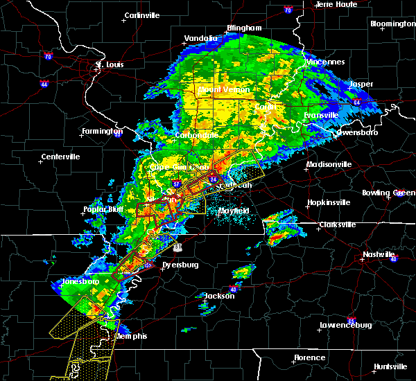 At 708 pm cdt, a severe thunderstorm capable of producing a tornado was located near dixon springs, or 9 miles northeast of metropolis, moving northeast at 45 mph (radar indicated rotation). Hazards include tornado and quarter size hail. Flying debris will be dangerous to those caught without shelter. mobile homes will be damaged or destroyed. damage to roofs, windows, and vehicles will occur. tree damage is likely. Locations impacted include, metropolis and joppa. At 708 pm cdt, a severe thunderstorm capable of producing a tornado was located near dixon springs, or 9 miles northeast of metropolis, moving northeast at 45 mph (radar indicated rotation). Hazards include tornado and quarter size hail. Flying debris will be dangerous to those caught without shelter. mobile homes will be damaged or destroyed. damage to roofs, windows, and vehicles will occur. tree damage is likely. Locations impacted include, metropolis and joppa.
|
| 3/28/2020 6:42 PM CDT |
 At 642 pm cdt, a severe thunderstorm capable of producing a tornado was located near la center, moving northeast at 30 mph (radar indicated rotation). Hazards include tornado and quarter size hail. Flying debris will be dangerous to those caught without shelter. mobile homes will be damaged or destroyed. damage to roofs, windows, and vehicles will occur. Tree damage is likely. At 642 pm cdt, a severe thunderstorm capable of producing a tornado was located near la center, moving northeast at 30 mph (radar indicated rotation). Hazards include tornado and quarter size hail. Flying debris will be dangerous to those caught without shelter. mobile homes will be damaged or destroyed. damage to roofs, windows, and vehicles will occur. Tree damage is likely.
|
| 3/28/2020 6:37 PM CDT |
 At 637 pm cdt, a severe thunderstorm was located over barlow, or over la center, moving northeast at 45 mph (radar indicated). Hazards include 60 mph wind gusts. expect damage to roofs, siding, and trees At 637 pm cdt, a severe thunderstorm was located over barlow, or over la center, moving northeast at 45 mph (radar indicated). Hazards include 60 mph wind gusts. expect damage to roofs, siding, and trees
|
| 3/2/2020 9:53 PM CST |
 At 953 pm cst, severe thunderstorms were located along a line extending from 8 miles southwest of golconda to 7 miles south of lone oak to near bardwell, moving east at 50 mph (radar indicated). Hazards include 60 mph wind gusts and quarter size hail. Hail damage to vehicles is expected. expect wind damage to roofs, siding, and trees. Locations impacted include, paducah, metropolis, calvert city, lone oak, reidland, brookport, west paducah, ledbetter, barkley regional airport, smithland, hamletsburg and symsonia. At 953 pm cst, severe thunderstorms were located along a line extending from 8 miles southwest of golconda to 7 miles south of lone oak to near bardwell, moving east at 50 mph (radar indicated). Hazards include 60 mph wind gusts and quarter size hail. Hail damage to vehicles is expected. expect wind damage to roofs, siding, and trees. Locations impacted include, paducah, metropolis, calvert city, lone oak, reidland, brookport, west paducah, ledbetter, barkley regional airport, smithland, hamletsburg and symsonia.
|
| 3/2/2020 9:32 PM CST |
 At 932 pm cst, severe thunderstorms were located along a line extending from 6 miles southeast of karnak to near bardwell to near wyatt, moving east at 45 mph (radar indicated). Hazards include 60 mph wind gusts and quarter size hail. Hail damage to vehicles is expected. Expect wind damage to roofs, siding, and trees. At 932 pm cst, severe thunderstorms were located along a line extending from 6 miles southeast of karnak to near bardwell to near wyatt, moving east at 45 mph (radar indicated). Hazards include 60 mph wind gusts and quarter size hail. Hail damage to vehicles is expected. Expect wind damage to roofs, siding, and trees.
|
| 3/2/2020 5:53 PM CST |
 At 552 pm cst, a severe thunderstorm was located over brookport, or near paducah, moving east at 30 mph (at 5:50 pm trained weather spotters reported heavy dime to quarter size hail covering the ground across western mccracken county, ky). Hazards include 60 mph wind gusts and quarter size hail. Hail damage to vehicles is expected. Expect wind damage to roofs, siding, and trees. At 552 pm cst, a severe thunderstorm was located over brookport, or near paducah, moving east at 30 mph (at 5:50 pm trained weather spotters reported heavy dime to quarter size hail covering the ground across western mccracken county, ky). Hazards include 60 mph wind gusts and quarter size hail. Hail damage to vehicles is expected. Expect wind damage to roofs, siding, and trees.
|
| 3/2/2020 5:45 PM CST | Quarter sized hail reported 0.7 miles N of Metropolis, IL, photograph posted on social media |
| 3/2/2020 5:45 PM CST | Quarter sized hail reported 0.8 miles NE of Metropolis, IL, relayed via twitter. |
| 3/2/2020 5:37 PM CST |
 At 536 pm cst, a severe thunderstorm was located over west paducah, or near metropolis, moving east at 30 mph (trained weather spotters. at 5:30 pm trained weather spotters reported hail up to quarter size and larger in kevil in ballard county). Hazards include 60 mph wind gusts and half dollar size hail. Hail damage to vehicles is expected. expect wind damage to roofs, siding, and trees. Locations impacted include, paducah, metropolis, lone oak, brookport, west paducah and barkley regional airport. At 536 pm cst, a severe thunderstorm was located over west paducah, or near metropolis, moving east at 30 mph (trained weather spotters. at 5:30 pm trained weather spotters reported hail up to quarter size and larger in kevil in ballard county). Hazards include 60 mph wind gusts and half dollar size hail. Hail damage to vehicles is expected. expect wind damage to roofs, siding, and trees. Locations impacted include, paducah, metropolis, lone oak, brookport, west paducah and barkley regional airport.
|
| 3/2/2020 5:22 PM CST |
 At 522 pm cst, a severe thunderstorm was located near la center, moving east at 25 mph (radar indicated). Hazards include golf ball size hail and 60 mph wind gusts. People and animals outdoors will be injured. expect hail damage to roofs, siding, windows, and vehicles. expect wind damage to roofs, siding, and trees. Locations impacted include, paducah, metropolis, la center, lone oak, brookport, barkley regional airport, west paducah and kevil. At 522 pm cst, a severe thunderstorm was located near la center, moving east at 25 mph (radar indicated). Hazards include golf ball size hail and 60 mph wind gusts. People and animals outdoors will be injured. expect hail damage to roofs, siding, windows, and vehicles. expect wind damage to roofs, siding, and trees. Locations impacted include, paducah, metropolis, la center, lone oak, brookport, barkley regional airport, west paducah and kevil.
|
| 3/2/2020 5:13 PM CST |
 At 512 pm cst, a severe thunderstorm was located over la center, moving east at 30 mph (radar indicated). Hazards include 60 mph wind gusts and quarter size hail. Hail damage to vehicles is expected. Expect wind damage to roofs, siding, and trees. At 512 pm cst, a severe thunderstorm was located over la center, moving east at 30 mph (radar indicated). Hazards include 60 mph wind gusts and quarter size hail. Hail damage to vehicles is expected. Expect wind damage to roofs, siding, and trees.
|
| 1/11/2020 3:20 AM CST |
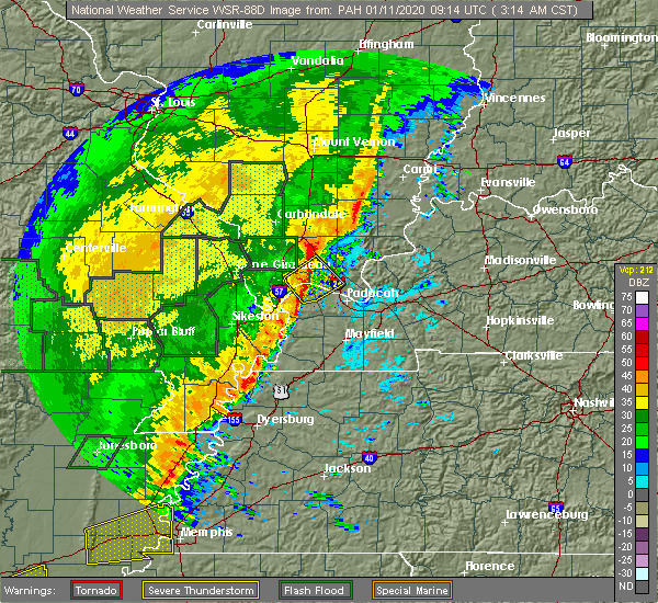 At 319 am cst, a severe thunderstorm was located near new columbia, or 8 miles south of vienna, moving northeast at 50 mph (radar indicated). Hazards include 60 mph wind gusts. Expect damage to roofs, siding, and trees. Locations impacted include, metropolis, vienna, la center, karnak, new columbia, kevil, joppa and belknap. At 319 am cst, a severe thunderstorm was located near new columbia, or 8 miles south of vienna, moving northeast at 50 mph (radar indicated). Hazards include 60 mph wind gusts. Expect damage to roofs, siding, and trees. Locations impacted include, metropolis, vienna, la center, karnak, new columbia, kevil, joppa and belknap.
|
| 1/11/2020 2:57 AM CST |
 The national weather service in paducah has issued a * severe thunderstorm warning for. northeastern pulaski county in southern illinois. northwestern massac county in southern illinois. southwestern johnson county in southern illinois. Northwestern mccracken county in western kentucky. The national weather service in paducah has issued a * severe thunderstorm warning for. northeastern pulaski county in southern illinois. northwestern massac county in southern illinois. southwestern johnson county in southern illinois. Northwestern mccracken county in western kentucky.
|
| 8/20/2019 3:52 PM CDT | Power lines down... power outages east half of the county and down to the metropolis area. strong winds also reported along 146 highway in pope count in massac county IL, 4.4 miles SW of Metropolis, IL |
| 8/20/2019 3:36 PM CDT |
 The national weather service in paducah has issued a * severe thunderstorm warning for. central massac county in southern illinois. southern pope county in southern illinois. until 400 pm cdt. At 336 pm cdt, a severe thunderstorm was located 7 miles east of. The national weather service in paducah has issued a * severe thunderstorm warning for. central massac county in southern illinois. southern pope county in southern illinois. until 400 pm cdt. At 336 pm cdt, a severe thunderstorm was located 7 miles east of.
|
| 7/17/2019 8:23 PM CDT |
 The severe thunderstorm warning for northwestern massac, mccracken and ballard counties will expire at 830 pm cdt, the storm which prompted the warning will be exiting the warned area. it has produced winds generally around 40 mph. no damage reports have been received. therefore, the warning will be allowed to expire. a severe thunderstorm watch remains in effect until 900 pm cdt for southern illinois. The severe thunderstorm warning for northwestern massac, mccracken and ballard counties will expire at 830 pm cdt, the storm which prompted the warning will be exiting the warned area. it has produced winds generally around 40 mph. no damage reports have been received. therefore, the warning will be allowed to expire. a severe thunderstorm watch remains in effect until 900 pm cdt for southern illinois.
|
| 7/17/2019 7:51 PM CDT |
 At 750 pm cdt, a severe thunderstorm was located near karnak, or 8 miles north of la center, moving southeast at 15 mph (radar indicated). Hazards include 60 mph wind gusts. expect damage to roofs, siding, and trees At 750 pm cdt, a severe thunderstorm was located near karnak, or 8 miles north of la center, moving southeast at 15 mph (radar indicated). Hazards include 60 mph wind gusts. expect damage to roofs, siding, and trees
|
| 6/26/2019 6:46 PM CDT |
 At 644 pm cdt, an outflow boundary ahead of approaching thunderstorms is producing winds up to 60 mph. this boundary extended from 9 miles north of rosiclare to near barkley regional airport, moving east at 50 mph (radar indicated). Hazards include 60 mph wind gusts. Expect damage to roofs, siding, and trees. severe thunderstorms will be near, reidland around 700 pm cdt. ledbetter around 705 pm cdt. burna around 715 pm cdt. Other locations impacted by these severe thunderstorms include carrsville, smithland and hamletsburg. At 644 pm cdt, an outflow boundary ahead of approaching thunderstorms is producing winds up to 60 mph. this boundary extended from 9 miles north of rosiclare to near barkley regional airport, moving east at 50 mph (radar indicated). Hazards include 60 mph wind gusts. Expect damage to roofs, siding, and trees. severe thunderstorms will be near, reidland around 700 pm cdt. ledbetter around 705 pm cdt. burna around 715 pm cdt. Other locations impacted by these severe thunderstorms include carrsville, smithland and hamletsburg.
|
| 6/23/2019 4:51 PM CDT |
 At 450 pm cdt, severe thunderstorms were located along a line extending from 6 miles northeast of vienna to near metropolis to near lone oak to near mayfield to near fulgham, moving east at 40 mph (radar indicated). Hazards include 70 mph wind gusts and quarter size hail. Hail damage to vehicles is expected. expect considerable tree damage. wind damage is also likely to mobile homes, roofs, and outbuildings. Locations impacted include, paducah, murray, mayfield, metropolis, benton, calvert city, vienna, reidland, lone oak, rosiclare, brookport, salem, golconda, barkley regional airport, burna, ledbetter, sedalia, new columbia, dixon springs and joy. At 450 pm cdt, severe thunderstorms were located along a line extending from 6 miles northeast of vienna to near metropolis to near lone oak to near mayfield to near fulgham, moving east at 40 mph (radar indicated). Hazards include 70 mph wind gusts and quarter size hail. Hail damage to vehicles is expected. expect considerable tree damage. wind damage is also likely to mobile homes, roofs, and outbuildings. Locations impacted include, paducah, murray, mayfield, metropolis, benton, calvert city, vienna, reidland, lone oak, rosiclare, brookport, salem, golconda, barkley regional airport, burna, ledbetter, sedalia, new columbia, dixon springs and joy.
|
| 6/23/2019 4:37 PM CDT |
 At 436 pm cdt, severe thunderstorms were located along a line extending from near vienna to 7 miles west of metropolis to near lovelaceville to near fulgham, moving east at 40 mph (radar indicated). Hazards include 60 mph wind gusts and half dollar size hail. Hail damage to vehicles is expected. Expect wind damage to roofs, siding, and trees. At 436 pm cdt, severe thunderstorms were located along a line extending from near vienna to 7 miles west of metropolis to near lovelaceville to near fulgham, moving east at 40 mph (radar indicated). Hazards include 60 mph wind gusts and half dollar size hail. Hail damage to vehicles is expected. Expect wind damage to roofs, siding, and trees.
|
| 6/21/2019 5:22 PM CDT |
 The severe thunderstorm warning for pulaski, northwestern massac, west central pope, johnson and williamson counties will expire at 530 pm cdt, the storms which prompted the warning have moved out of the area. therefore, the warning will be allowed to expire. these storms produced widespread wind damage. there is still a lot of lightning. if power lines are down in your area, do not try to pick them up or move them. a severe thunderstorm watch remains in effect until 700 pm cdt for southern illinois. a severe thunderstorm watch also remains in effect until 1000 pm cdt for southern illinois, and western kentucky. The severe thunderstorm warning for pulaski, northwestern massac, west central pope, johnson and williamson counties will expire at 530 pm cdt, the storms which prompted the warning have moved out of the area. therefore, the warning will be allowed to expire. these storms produced widespread wind damage. there is still a lot of lightning. if power lines are down in your area, do not try to pick them up or move them. a severe thunderstorm watch remains in effect until 700 pm cdt for southern illinois. a severe thunderstorm watch also remains in effect until 1000 pm cdt for southern illinois, and western kentucky.
|
| 6/21/2019 5:19 PM CDT |
 At 516 pm cdt, severe thunderstorms were located along a line extending from near dixon springs to near bardwell to big oak tree state park to near marston to clarkton, moving east at 65 mph (trained weather spotters and automated weather observation systems indicated winds of 60 to 70 mph along with tree damage and power outages, as well as torrential rainfall. ). Hazards include 70 mph wind gusts and nickel size hail. Expect considerable tree damage. damage is likely to mobile homes, roofs, and outbuildings. Locations impacted include, metropolis, charleston, portageville, east prairie, new madrid, cairo, lilbourn, la center, bardwell, wickliffe, towosahgy state historic site, big oak tree state park, hunter-dawson state historic site, gideon, barlow, mound city, marston, howardville, risco and wyatt. At 516 pm cdt, severe thunderstorms were located along a line extending from near dixon springs to near bardwell to big oak tree state park to near marston to clarkton, moving east at 65 mph (trained weather spotters and automated weather observation systems indicated winds of 60 to 70 mph along with tree damage and power outages, as well as torrential rainfall. ). Hazards include 70 mph wind gusts and nickel size hail. Expect considerable tree damage. damage is likely to mobile homes, roofs, and outbuildings. Locations impacted include, metropolis, charleston, portageville, east prairie, new madrid, cairo, lilbourn, la center, bardwell, wickliffe, towosahgy state historic site, big oak tree state park, hunter-dawson state historic site, gideon, barlow, mound city, marston, howardville, risco and wyatt.
|
| 6/21/2019 5:19 PM CDT |
 A severe thunderstorm warning remains in effect until 530 pm cdt for western fulton. northwestern hickman. carlisle. western mccracken. ballard. mississippi and new madrid counties. At 516 pm cdt, severe thunderstorms were located along a line extending from near dixon springs to near bardwell to big oak tree state park to near marston to clarkton, moving east at 65 mph. A severe thunderstorm warning remains in effect until 530 pm cdt for western fulton. northwestern hickman. carlisle. western mccracken. ballard. mississippi and new madrid counties. At 516 pm cdt, severe thunderstorms were located along a line extending from near dixon springs to near bardwell to big oak tree state park to near marston to clarkton, moving east at 65 mph.
|
| 6/21/2019 5:11 PM CDT |
 At 509 pm cdt, severe thunderstorms were located along a line extending from near thompsonville to 9 miles southeast of carrier mills to west paducah, moving east at 50 mph (trained weather spotters). Hazards include 70 mph wind gusts and penny size hail. numerous reports of trees down and reports of damaging winds. Expect considerable tree damage. damage is likely to mobile homes, roofs, and outbuildings. Locations impacted include, harrisburg, eldorado, shawneetown, rosiclare, brookport, galatia, ridgway, salem, golconda, equality, burna, ledbetter, dixon springs, carrier mills, joy, new haven, grand rivers, raleigh, cave-in-rock and smithland. At 509 pm cdt, severe thunderstorms were located along a line extending from near thompsonville to 9 miles southeast of carrier mills to west paducah, moving east at 50 mph (trained weather spotters). Hazards include 70 mph wind gusts and penny size hail. numerous reports of trees down and reports of damaging winds. Expect considerable tree damage. damage is likely to mobile homes, roofs, and outbuildings. Locations impacted include, harrisburg, eldorado, shawneetown, rosiclare, brookport, galatia, ridgway, salem, golconda, equality, burna, ledbetter, dixon springs, carrier mills, joy, new haven, grand rivers, raleigh, cave-in-rock and smithland.
|
| 6/21/2019 5:04 PM CDT |
 The national weather service in paducah has issued a * severe thunderstorm warning for. hardin county in southern illinois. eastern massac county in southern illinois. pope county in southern illinois. Saline county in southern illinois. The national weather service in paducah has issued a * severe thunderstorm warning for. hardin county in southern illinois. eastern massac county in southern illinois. pope county in southern illinois. Saline county in southern illinois.
|
| 6/21/2019 5:04 PM CDT |
 At 504 pm cdt, severe thunderstorms were located along a line extending from near thompsonville to 8 miles southeast of carrier mills to near west paducah, moving east at 50 mph (radar indicated). Hazards include 60 mph wind gusts and penny size hail. expect damage to roofs, siding, and trees At 504 pm cdt, severe thunderstorms were located along a line extending from near thompsonville to 8 miles southeast of carrier mills to near west paducah, moving east at 50 mph (radar indicated). Hazards include 60 mph wind gusts and penny size hail. expect damage to roofs, siding, and trees
|
| 6/21/2019 4:49 PM CDT |
 The national weather service in paducah has issued a * severe thunderstorm warning for. western fulton county in western kentucky. northwestern hickman county in western kentucky. carlisle county in western kentucky. Western mccracken county in western kentucky. The national weather service in paducah has issued a * severe thunderstorm warning for. western fulton county in western kentucky. northwestern hickman county in western kentucky. carlisle county in western kentucky. Western mccracken county in western kentucky.
|
| 6/21/2019 4:49 PM CDT |
 At 447 pm cdt, severe thunderstorms were located along a line extending from 6 miles northeast of dongola to near horseshoe lake conservation area to near dexter to naylor, moving east at 55 mph (trained weather spotters and automated weather observation sites have been reporting winds of 60 to 70 mph, along with trees down and power outages with the line of storms). Hazards include 70 mph wind gusts and nickel size hail. Expect considerable tree damage. Damage is likely to mobile homes, roofs, and outbuildings. At 447 pm cdt, severe thunderstorms were located along a line extending from 6 miles northeast of dongola to near horseshoe lake conservation area to near dexter to naylor, moving east at 55 mph (trained weather spotters and automated weather observation sites have been reporting winds of 60 to 70 mph, along with trees down and power outages with the line of storms). Hazards include 70 mph wind gusts and nickel size hail. Expect considerable tree damage. Damage is likely to mobile homes, roofs, and outbuildings.
|
| 6/21/2019 4:43 PM CDT |
 At 441 pm cdt, severe thunderstorms were located along a line extending from cambria to near tamms, moving southeast at 50 mph (trained weather spotters). Hazards include 70 mph wind gusts. a 72 mph wind gust was reported in cape girardeau as these storms moved through. Expect considerable tree damage. Damage is likely to mobile homes, roofs, and outbuildings. At 441 pm cdt, severe thunderstorms were located along a line extending from cambria to near tamms, moving southeast at 50 mph (trained weather spotters). Hazards include 70 mph wind gusts. a 72 mph wind gust was reported in cape girardeau as these storms moved through. Expect considerable tree damage. Damage is likely to mobile homes, roofs, and outbuildings.
|
| 6/19/2019 3:00 PM CDT | Trees down in the round knob area. winds gusted to over 60 mp in massac county IL, 6.5 miles SSE of Metropolis, IL |
| 6/16/2019 6:50 PM CDT | Trees down around massac county. time estimate in massac county IL, 9.1 miles ESE of Metropolis, IL |
| 3/14/2019 10:42 AM CDT |
 At 1042 am cdt, a severe thunderstorm was located near brookport, or near metropolis, moving northeast at 60 mph (radar indicated). Hazards include 60 mph wind gusts. Expect damage to roofs, siding, and trees. locations impacted include, paducah, metropolis, brookport and hamletsburg. A tornado watch remains in effect until 400 pm cdt for southern illinois, and western kentucky. At 1042 am cdt, a severe thunderstorm was located near brookport, or near metropolis, moving northeast at 60 mph (radar indicated). Hazards include 60 mph wind gusts. Expect damage to roofs, siding, and trees. locations impacted include, paducah, metropolis, brookport and hamletsburg. A tornado watch remains in effect until 400 pm cdt for southern illinois, and western kentucky.
|
| 3/14/2019 10:34 AM CDT |
 At 1034 am cdt, a severe thunderstorm was located over west paducah, or near metropolis, moving northeast at 60 mph (radar indicated). Hazards include 60 mph wind gusts. expect damage to roofs, siding, and trees At 1034 am cdt, a severe thunderstorm was located over west paducah, or near metropolis, moving northeast at 60 mph (radar indicated). Hazards include 60 mph wind gusts. expect damage to roofs, siding, and trees
|
| 3/14/2019 9:56 AM CDT |
 At 956 am cdt, a severe thunderstorm capable of producing a tornado was located over brookport, or over paducah, moving northeast at 65 mph (radar indicated rotation). Hazards include tornado. Flying debris will be dangerous to those caught without shelter. mobile homes will be damaged or destroyed. damage to roofs, windows, and vehicles will occur. tree damage is likely. This tornadic thunderstorm will remain over mainly rural areas of southeastern massac, southeastern pope, central livingston and central mccracken counties, including the following locations, smithland and hamletsburg. At 956 am cdt, a severe thunderstorm capable of producing a tornado was located over brookport, or over paducah, moving northeast at 65 mph (radar indicated rotation). Hazards include tornado. Flying debris will be dangerous to those caught without shelter. mobile homes will be damaged or destroyed. damage to roofs, windows, and vehicles will occur. tree damage is likely. This tornadic thunderstorm will remain over mainly rural areas of southeastern massac, southeastern pope, central livingston and central mccracken counties, including the following locations, smithland and hamletsburg.
|
| 3/14/2019 9:27 AM CDT |
 At 926 am cdt, a confirmed tornado was located near lovelaceville, or 7 miles southwest of lone oak, moving northeast at 55 mph (weather spotters confirmed tornado). Hazards include damaging tornado. Flying debris will be dangerous to those caught without shelter. mobile homes will be damaged or destroyed. damage to roofs, windows, and vehicles will occur. tree damage is likely. the tornado will be near, paducah around 930 am cdt. lone oak and west paducah around 935 am cdt. brookport around 940 am cdt. ledbetter around 945 am cdt. Other locations impacted by this tornadic thunderstorm include smithland and hamletsburg. At 926 am cdt, a confirmed tornado was located near lovelaceville, or 7 miles southwest of lone oak, moving northeast at 55 mph (weather spotters confirmed tornado). Hazards include damaging tornado. Flying debris will be dangerous to those caught without shelter. mobile homes will be damaged or destroyed. damage to roofs, windows, and vehicles will occur. tree damage is likely. the tornado will be near, paducah around 930 am cdt. lone oak and west paducah around 935 am cdt. brookport around 940 am cdt. ledbetter around 945 am cdt. Other locations impacted by this tornadic thunderstorm include smithland and hamletsburg.
|
| 3/14/2019 8:36 AM CDT |
 At 836 am cdt, a severe thunderstorm was located near metropolis, moving northeast at 60 mph (radar indicated). Hazards include 60 mph wind gusts. expect damage to roofs, siding, and trees At 836 am cdt, a severe thunderstorm was located near metropolis, moving northeast at 60 mph (radar indicated). Hazards include 60 mph wind gusts. expect damage to roofs, siding, and trees
|
| 2/7/2019 10:47 AM CST |
 At 1046 am cst, a severe thunderstorm was located near brookport, or near metropolis, moving northeast at 55 mph (radar indicated). Hazards include 60 mph wind gusts. 60 mph winds were measured at the airport in paducah at 1039am. Expect damage to roofs, siding, and trees. Locations impacted include, paducah, metropolis, lone oak, brookport and west paducah. At 1046 am cst, a severe thunderstorm was located near brookport, or near metropolis, moving northeast at 55 mph (radar indicated). Hazards include 60 mph wind gusts. 60 mph winds were measured at the airport in paducah at 1039am. Expect damage to roofs, siding, and trees. Locations impacted include, paducah, metropolis, lone oak, brookport and west paducah.
|
| 2/7/2019 10:39 AM CST |
 At 1039 am cst, a severe thunderstorm was located over metropolis, moving northeast at 55 mph (radar indicated). Hazards include 60 mph wind gusts. expect damage to roofs, siding, and trees At 1039 am cst, a severe thunderstorm was located over metropolis, moving northeast at 55 mph (radar indicated). Hazards include 60 mph wind gusts. expect damage to roofs, siding, and trees
|
| 12/31/2018 11:46 AM CST | A large oak tree fell across a driveway 1 mile south of round kno in massac county IL, 5.6 miles S of Metropolis, IL |
| 8/20/2018 7:02 PM CDT |
 The national weather service in paducah has issued a * severe thunderstorm warning for. southeastern massac county in southern illinois. southeastern pope county in southern illinois. southwestern livingston county in western kentucky. East central mccracken county in western kentucky. The national weather service in paducah has issued a * severe thunderstorm warning for. southeastern massac county in southern illinois. southeastern pope county in southern illinois. southwestern livingston county in western kentucky. East central mccracken county in western kentucky.
|
| 6/28/2018 8:00 PM CDT | Roof lifted off quint excavating on west 10th stree in massac county IL, 0.7 miles N of Metropolis, IL |
| 6/28/2018 8:00 PM CDT | Tree fell on a traile in massac county IL, 4.3 miles SSE of Metropolis, IL |
| 6/28/2018 7:35 PM CDT |
 At 734 pm cdt, severe thunderstorms were located along a line extending from near equality to 10 miles north of dixon springs to near goreville to near cobden, moving southeast at 70 mph (trained weather spotters). Hazards include 70 mph wind gusts and quarter size hail. Hail damage to vehicles is expected. expect considerable tree damage. Wind damage is also likely to mobile homes, roofs, and outbuildings. At 734 pm cdt, severe thunderstorms were located along a line extending from near equality to 10 miles north of dixon springs to near goreville to near cobden, moving southeast at 70 mph (trained weather spotters). Hazards include 70 mph wind gusts and quarter size hail. Hail damage to vehicles is expected. expect considerable tree damage. Wind damage is also likely to mobile homes, roofs, and outbuildings.
|
| 6/28/2018 10:36 AM CDT |
 At 1036 am cdt, a severe thunderstorm was located near barlow, or near la center, moving east at 25 mph (radar indicated). Hazards include 60 mph wind gusts and penny size hail. expect damage to roofs, siding, and trees At 1036 am cdt, a severe thunderstorm was located near barlow, or near la center, moving east at 25 mph (radar indicated). Hazards include 60 mph wind gusts and penny size hail. expect damage to roofs, siding, and trees
|
| 6/23/2018 8:30 PM CDT | Large tree limbs down blocking intersection of highway 145 and country club road...in addition to rosebud and commer road in massac county IL, 2.4 miles SSW of Metropolis, IL |
| 6/12/2018 2:00 PM CDT | Shed under construction blown down. number of trees down as wel in massac county IL, 7 miles SW of Metropolis, IL |
| 5/31/2018 5:10 PM CDT |
 The severe thunderstorm warning for southeastern massac and central mccracken counties will expire at 515 pm cdt, the storm which prompted the warning has moved out of the area. therefore, the warning will be allowed to expire. a tornado watch remains in effect until 800 pm cdt for southern illinois, and western kentucky. The severe thunderstorm warning for southeastern massac and central mccracken counties will expire at 515 pm cdt, the storm which prompted the warning has moved out of the area. therefore, the warning will be allowed to expire. a tornado watch remains in effect until 800 pm cdt for southern illinois, and western kentucky.
|
| 5/31/2018 5:10 PM CDT |
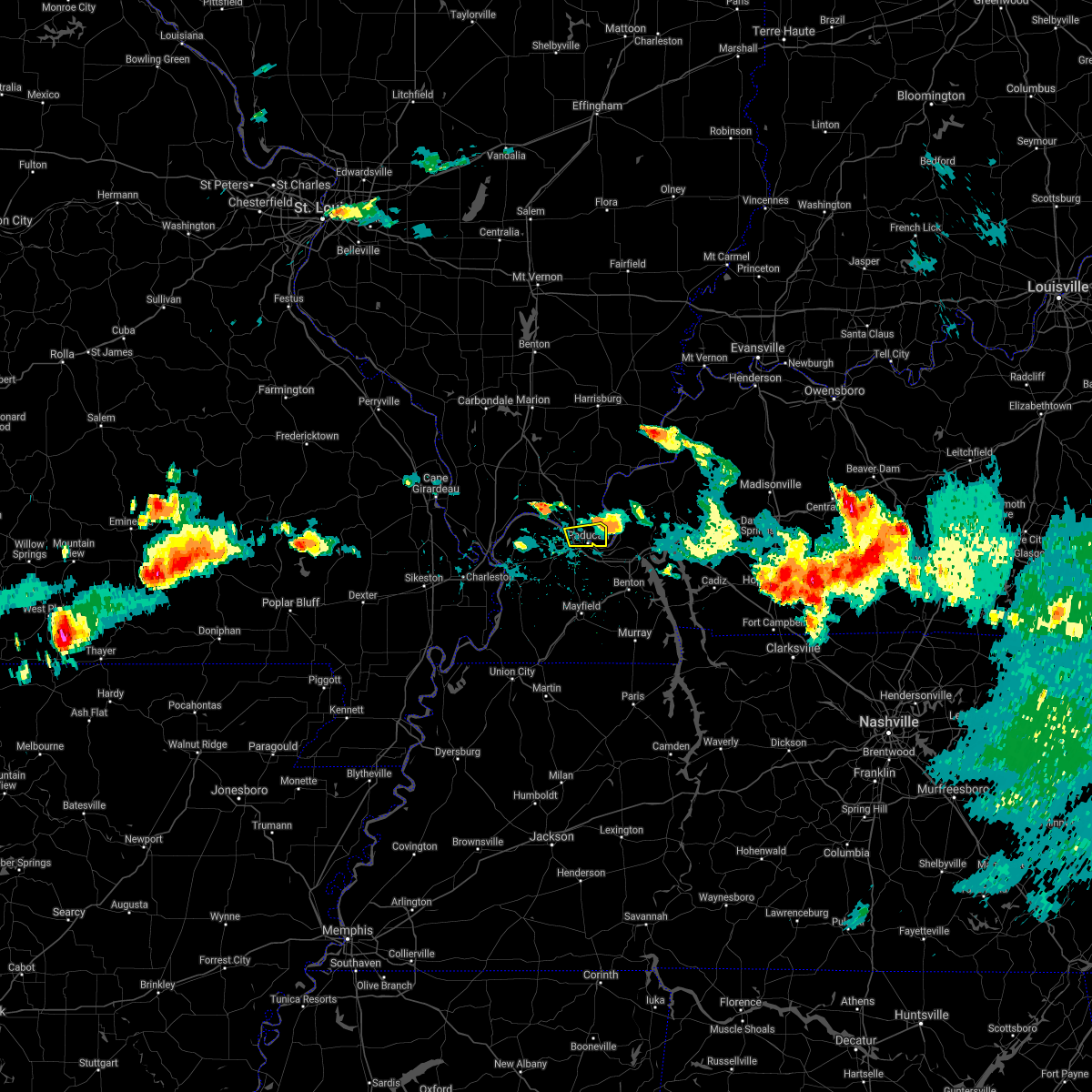 The severe thunderstorm warning for southeastern massac and central mccracken counties will expire at 515 pm cdt, the storm which prompted the warning has moved out of the area. therefore, the warning will be allowed to expire. a tornado watch remains in effect until 800 pm cdt for southern illinois, and western kentucky. The severe thunderstorm warning for southeastern massac and central mccracken counties will expire at 515 pm cdt, the storm which prompted the warning has moved out of the area. therefore, the warning will be allowed to expire. a tornado watch remains in effect until 800 pm cdt for southern illinois, and western kentucky.
|
| 5/31/2018 4:47 PM CDT |
 At 446 pm cdt, a severe thunderstorm was located over metropolis, moving east at 35 mph (radar indicated). Hazards include 60 mph wind gusts and quarter size hail. Hail damage to vehicles is expected. Expect wind damage to roofs, siding, and trees. At 446 pm cdt, a severe thunderstorm was located over metropolis, moving east at 35 mph (radar indicated). Hazards include 60 mph wind gusts and quarter size hail. Hail damage to vehicles is expected. Expect wind damage to roofs, siding, and trees.
|
| 5/31/2018 4:34 PM CDT |
 At 433 pm cdt, a severe thunderstorm was located near la center, moving east at 20 mph (radar indicated). Hazards include 60 mph wind gusts and quarter size hail. Hail damage to vehicles is expected. Expect wind damage to roofs, siding, and trees. At 433 pm cdt, a severe thunderstorm was located near la center, moving east at 20 mph (radar indicated). Hazards include 60 mph wind gusts and quarter size hail. Hail damage to vehicles is expected. Expect wind damage to roofs, siding, and trees.
|
| 5/31/2018 4:05 PM CDT |
 At 404 pm cdt, a severe thunderstorm was located over brookport, or near paducah, moving east at 30 to 35 mph. this storm has a history of producing quarter sized hail and winds gusting to 40 to 60 mph. with how wet the grounds are, even sub severe wind speeds could down trees (radar indicated). Hazards include 60 mph wind gusts and quarter size hail. Hail damage to vehicles is expected. Expect wind damage to roofs, siding, and trees. At 404 pm cdt, a severe thunderstorm was located over brookport, or near paducah, moving east at 30 to 35 mph. this storm has a history of producing quarter sized hail and winds gusting to 40 to 60 mph. with how wet the grounds are, even sub severe wind speeds could down trees (radar indicated). Hazards include 60 mph wind gusts and quarter size hail. Hail damage to vehicles is expected. Expect wind damage to roofs, siding, and trees.
|
| 5/31/2018 3:45 PM CDT |
 At 344 pm cdt, a severe thunderstorm was located near west paducah, or 8 miles east of la center, moving east at 35 mph (radar indicated). Hazards include 60 mph wind gusts and quarter size hail. Hail damage to vehicles is expected. Expect wind damage to roofs, siding, and trees. At 344 pm cdt, a severe thunderstorm was located near west paducah, or 8 miles east of la center, moving east at 35 mph (radar indicated). Hazards include 60 mph wind gusts and quarter size hail. Hail damage to vehicles is expected. Expect wind damage to roofs, siding, and trees.
|
| 5/31/2018 3:13 PM CDT |
 At 312 pm cdt, a severe thunderstorm was located over barlow, or near wickliffe, moving east at 35 mph. this storm produced quarter sized hail as it moved over cairo (radar indicated). Hazards include 60 mph wind gusts and quarter size hail. Hail damage to vehicles is expected. Expect wind damage to roofs, siding, and trees. At 312 pm cdt, a severe thunderstorm was located over barlow, or near wickliffe, moving east at 35 mph. this storm produced quarter sized hail as it moved over cairo (radar indicated). Hazards include 60 mph wind gusts and quarter size hail. Hail damage to vehicles is expected. Expect wind damage to roofs, siding, and trees.
|
| 5/27/2018 6:16 PM CDT |
 At 613 pm cdt, a severe thunderstorm was located north of kevil, moving south at 10 mph (radar indicated). Hazards include 60 mph wind gusts and nickel size hail. another severe storm was developing near grahamville. Expect damage to roofs, siding, and trees. Locations impacted include, paducah, metropolis, west paducah and joppa. At 613 pm cdt, a severe thunderstorm was located north of kevil, moving south at 10 mph (radar indicated). Hazards include 60 mph wind gusts and nickel size hail. another severe storm was developing near grahamville. Expect damage to roofs, siding, and trees. Locations impacted include, paducah, metropolis, west paducah and joppa.
|
| 5/27/2018 5:49 PM CDT |
 At 546 pm cdt, a severe thunderstorm was located 8 miles southeast of karnak, or 9 miles northeast of la center, moving southwest at 10 mph (radar indicated). Hazards include 60 mph wind gusts and nickel size hail. expect damage to roofs, siding, and trees At 546 pm cdt, a severe thunderstorm was located 8 miles southeast of karnak, or 9 miles northeast of la center, moving southwest at 10 mph (radar indicated). Hazards include 60 mph wind gusts and nickel size hail. expect damage to roofs, siding, and trees
|
| 4/3/2018 6:50 PM CDT |
 The tornado warning for southeastern massac county will expire at 700 pm cdt, the storm which prompted the warning has moved out of the area. therefore the warning will be allowed to expire. a tornado watch remains in effect until 800 pm cdt for southern illinois, and western kentucky. The tornado warning for southeastern massac county will expire at 700 pm cdt, the storm which prompted the warning has moved out of the area. therefore the warning will be allowed to expire. a tornado watch remains in effect until 800 pm cdt for southern illinois, and western kentucky.
|
| 4/3/2018 6:39 PM CDT |
 At 638 pm cdt, a severe thunderstorm capable of producing a tornado was located near brookport, or near metropolis, moving east at 50 mph (radar indicated rotation). Hazards include tornado and quarter size hail. Flying debris will be dangerous to those caught without shelter. mobile homes will be damaged or destroyed. damage to roofs, windows, and vehicles will occur. tree damage is likely. Locations impacted include, metropolis and brookport. At 638 pm cdt, a severe thunderstorm capable of producing a tornado was located near brookport, or near metropolis, moving east at 50 mph (radar indicated rotation). Hazards include tornado and quarter size hail. Flying debris will be dangerous to those caught without shelter. mobile homes will be damaged or destroyed. damage to roofs, windows, and vehicles will occur. tree damage is likely. Locations impacted include, metropolis and brookport.
|
| 4/3/2018 6:29 PM CDT |
 At 629 pm cdt, a severe thunderstorm capable of producing a tornado was located near metropolis, moving east at 35 mph (radar indicated rotation). Hazards include tornado and quarter size hail. Flying debris will be dangerous to those caught without shelter. mobile homes will be damaged or destroyed. damage to roofs, windows, and vehicles will occur. Tree damage is likely. At 629 pm cdt, a severe thunderstorm capable of producing a tornado was located near metropolis, moving east at 35 mph (radar indicated rotation). Hazards include tornado and quarter size hail. Flying debris will be dangerous to those caught without shelter. mobile homes will be damaged or destroyed. damage to roofs, windows, and vehicles will occur. Tree damage is likely.
|
| 4/3/2018 6:19 PM CDT |
 At 619 pm cdt, a severe thunderstorm was located near la center, moving east at 35 mph (radar indicated). Hazards include 60 mph wind gusts and quarter size hail. Hail damage to vehicles is expected. Expect wind damage to roofs, siding, and trees. At 619 pm cdt, a severe thunderstorm was located near la center, moving east at 35 mph (radar indicated). Hazards include 60 mph wind gusts and quarter size hail. Hail damage to vehicles is expected. Expect wind damage to roofs, siding, and trees.
|
| 11/18/2017 1:44 PM CST |
 At 143 pm cst, severe thunderstorms were located along a line extending from near new columbia to near barlow to wyatt, moving east at 35 mph (radar indicated). Hazards include 60 mph wind gusts. expect damage to roofs, siding, and trees At 143 pm cst, severe thunderstorms were located along a line extending from near new columbia to near barlow to wyatt, moving east at 35 mph (radar indicated). Hazards include 60 mph wind gusts. expect damage to roofs, siding, and trees
|
| 5/27/2017 6:10 PM CDT |
 At 608 pm cdt, severe thunderstorms were located along a line extending from goreville to near barlow to near east prairie, moving east at 65 mph. these are very dangerous storms (law enforcement. structural damage has been reported in stoddard county with 80 mph winds reported near sikeston missouri). Hazards include 80 mph wind gusts and nickel size hail. Flying debris will be dangerous to those caught without shelter. mobile homes will be heavily damaged. expect considerable damage to roofs, windows, and vehicles. Extensive tree damage and power outages are likely. At 608 pm cdt, severe thunderstorms were located along a line extending from goreville to near barlow to near east prairie, moving east at 65 mph. these are very dangerous storms (law enforcement. structural damage has been reported in stoddard county with 80 mph winds reported near sikeston missouri). Hazards include 80 mph wind gusts and nickel size hail. Flying debris will be dangerous to those caught without shelter. mobile homes will be heavily damaged. expect considerable damage to roofs, windows, and vehicles. Extensive tree damage and power outages are likely.
|
| 5/27/2017 4:41 PM CDT |
 At 440 pm cdt, a severe thunderstorm was located near metropolis, moving southeast at 30 mph (radar indicated). Hazards include 60 mph wind gusts and quarter size hail. Hail damage to vehicles is expected. expect wind damage to roofs, siding, and trees. Locations impacted include, metropolis, brookport and joppa. At 440 pm cdt, a severe thunderstorm was located near metropolis, moving southeast at 30 mph (radar indicated). Hazards include 60 mph wind gusts and quarter size hail. Hail damage to vehicles is expected. expect wind damage to roofs, siding, and trees. Locations impacted include, metropolis, brookport and joppa.
|
| 5/27/2017 4:14 PM CDT |
 At 414 pm cdt, a severe thunderstorm was located near new columbia, or 8 miles south of vienna, moving east at 50 mph (radar indicated). Hazards include 60 mph wind gusts and quarter size hail. Hail damage to vehicles is expected. Expect wind damage to roofs, siding, and trees. At 414 pm cdt, a severe thunderstorm was located near new columbia, or 8 miles south of vienna, moving east at 50 mph (radar indicated). Hazards include 60 mph wind gusts and quarter size hail. Hail damage to vehicles is expected. Expect wind damage to roofs, siding, and trees.
|
| 4/30/2017 3:34 AM CDT |
 At 331 am cdt, severe thunderstorms were located along a line extending from near wickliffe to near lovelaceville, moving northeast at 80 mph (radar indicated). Hazards include 60 mph wind gusts. expect damage to roofs, siding, and trees At 331 am cdt, severe thunderstorms were located along a line extending from near wickliffe to near lovelaceville, moving northeast at 80 mph (radar indicated). Hazards include 60 mph wind gusts. expect damage to roofs, siding, and trees
|
| 4/26/2017 7:44 PM CDT |
 At 743 pm cdt, severe thunderstorms were located along a line extending from near metropolis to 7 miles northeast of sedalia, moving east at 65 mph (radar indicated). Hazards include 60 mph wind gusts. expect damage to roofs, siding, and trees At 743 pm cdt, severe thunderstorms were located along a line extending from near metropolis to 7 miles northeast of sedalia, moving east at 65 mph (radar indicated). Hazards include 60 mph wind gusts. expect damage to roofs, siding, and trees
|
| 4/26/2017 7:30 PM CDT |
 At 729 pm cdt, severe thunderstorms were located along a line extending from near la center to 9 miles south of lovelaceville, moving northeast at 65 mph (radar indicated). Hazards include 60 mph wind gusts and quarter size hail. Hail damage to vehicles is expected. expect wind damage to roofs, siding, and trees. Locations impacted include, paducah, metropolis, reidland, lone oak, brookport, massac, hendron, woodlawn-oakdale, west paducah, lovelaceville, kevil, lowes, fancy farm, blandville and symsonia. At 729 pm cdt, severe thunderstorms were located along a line extending from near la center to 9 miles south of lovelaceville, moving northeast at 65 mph (radar indicated). Hazards include 60 mph wind gusts and quarter size hail. Hail damage to vehicles is expected. expect wind damage to roofs, siding, and trees. Locations impacted include, paducah, metropolis, reidland, lone oak, brookport, massac, hendron, woodlawn-oakdale, west paducah, lovelaceville, kevil, lowes, fancy farm, blandville and symsonia.
|
| 4/26/2017 7:11 PM CDT |
 At 710 pm cdt, severe thunderstorms were located along a line extending from near wyatt to near clinton, moving northeast at 65 mph (radar indicated). Hazards include 60 mph wind gusts and quarter size hail. Hail damage to vehicles is expected. Expect wind damage to roofs, siding, and trees. At 710 pm cdt, severe thunderstorms were located along a line extending from near wyatt to near clinton, moving northeast at 65 mph (radar indicated). Hazards include 60 mph wind gusts and quarter size hail. Hail damage to vehicles is expected. Expect wind damage to roofs, siding, and trees.
|
| 3/7/2017 4:15 AM CST | Downed tree limbs and power lines reporte in massac county IL, 0.7 miles N of Metropolis, IL |
| 3/1/2017 5:06 AM CST |
 At 506 am cst, severe thunderstorms were located along a line extending from near dongola to near wickliffe, moving east at 110 mph. these are very dangerous storms (radar indicated). Hazards include 80 mph wind gusts and penny size hail. Flying debris will be dangerous to those caught without shelter. mobile homes will be heavily damaged. expect considerable damage to roofs, windows, and vehicles. Extensive tree damage and power outages are likely. At 506 am cst, severe thunderstorms were located along a line extending from near dongola to near wickliffe, moving east at 110 mph. these are very dangerous storms (radar indicated). Hazards include 80 mph wind gusts and penny size hail. Flying debris will be dangerous to those caught without shelter. mobile homes will be heavily damaged. expect considerable damage to roofs, windows, and vehicles. Extensive tree damage and power outages are likely.
|
| 8/5/2016 4:56 PM CDT |
 At 455 pm cdt, a severe thunderstorm was located near la center, moving south at 15 mph (radar indicated). Hazards include 60 mph wind gusts. Expect damage to roofs. siding. And trees. At 455 pm cdt, a severe thunderstorm was located near la center, moving south at 15 mph (radar indicated). Hazards include 60 mph wind gusts. Expect damage to roofs. siding. And trees.
|
| 7/8/2016 6:11 PM CDT |
 At 610 pm cdt, severe thunderstorms were located along a line extending from barlow to 6 miles southeast of bardwell, moving northeast at 50 mph (radar indicated). Hazards include 60 mph wind gusts. Expect damage to roofs. siding. And trees. At 610 pm cdt, severe thunderstorms were located along a line extending from barlow to 6 miles southeast of bardwell, moving northeast at 50 mph (radar indicated). Hazards include 60 mph wind gusts. Expect damage to roofs. siding. And trees.
|
| 7/7/2016 1:00 PM CDT |
 At 1259 pm cdt, severe thunderstorms were located along a line extending from 7 miles southeast of new columbia to 9 miles northwest of mayfield, moving east at 50 mph (radar indicated). Hazards include 60 mph wind gusts. Expect damage to roofs. siding. and trees. Locations impacted include, paducah, metropolis, reidland, lone oak, brookport, golconda, hendron, lovelaceville, dixon springs, massac, west paducah, woodlawn-oakdale, kevil, joppa, lowes and symsonia. At 1259 pm cdt, severe thunderstorms were located along a line extending from 7 miles southeast of new columbia to 9 miles northwest of mayfield, moving east at 50 mph (radar indicated). Hazards include 60 mph wind gusts. Expect damage to roofs. siding. and trees. Locations impacted include, paducah, metropolis, reidland, lone oak, brookport, golconda, hendron, lovelaceville, dixon springs, massac, west paducah, woodlawn-oakdale, kevil, joppa, lowes and symsonia.
|
| 7/7/2016 12:40 PM CDT |
 At 1240 pm cdt, severe thunderstorms were located along a line extending from near karnak to bardwell, moving east at 50 mph (radar indicated). Hazards include 60 mph wind gusts. Expect damage to roofs. siding. And trees. At 1240 pm cdt, severe thunderstorms were located along a line extending from near karnak to bardwell, moving east at 50 mph (radar indicated). Hazards include 60 mph wind gusts. Expect damage to roofs. siding. And trees.
|
| 7/6/2016 2:00 PM CDT | Roof off of maintenance building. other outbuildings destroye in massac county IL, 0.7 miles N of Metropolis, IL |
| 7/6/2016 2:00 PM CDT | Over 30 trees down or uproote in massac county IL, 0.5 miles E of Metropolis, IL |
| 7/6/2016 1:56 PM CDT | Power poles and trees snapped. roof damage. in massac county IL, 1.3 miles ENE of Metropolis, IL |
| 7/6/2016 1:53 PM CDT | Power out at hospital additio in massac county IL, 1.1 miles E of Metropolis, IL |
| 7/6/2016 1:49 PM CDT | Significant damage to trees. spotter report of 70 mph winds in metropoli in massac county IL, 1.3 miles ENE of Metropolis, IL |
| 7/6/2016 1:45 PM CDT |
 At 144 pm cdt, severe thunderstorms were located along a line extending from dixon springs to 7 miles southeast of lovelaceville to south fulton, moving east at 60 mph (trained weather spotters). Hazards include 70 mph wind gusts and penny size hail. Expect considerable tree damage. damage is likely to mobile homes, roofs, and outbuildings. Locations impacted include, paducah, mayfield, metropolis, calvert city, fulton, reidland, lone oak, brookport, golconda, west paducah, woodlawn-oakdale, joy, fulgham, hendron, massac, lynnville, sedalia, burna, ledbetter and wingo. At 144 pm cdt, severe thunderstorms were located along a line extending from dixon springs to 7 miles southeast of lovelaceville to south fulton, moving east at 60 mph (trained weather spotters). Hazards include 70 mph wind gusts and penny size hail. Expect considerable tree damage. damage is likely to mobile homes, roofs, and outbuildings. Locations impacted include, paducah, mayfield, metropolis, calvert city, fulton, reidland, lone oak, brookport, golconda, west paducah, woodlawn-oakdale, joy, fulgham, hendron, massac, lynnville, sedalia, burna, ledbetter and wingo.
|
| 7/6/2016 1:28 PM CDT |
 At 127 pm cdt, severe thunderstorms were located along a line extending from near vienna to near wickliffe to near hickman, moving east at 55 mph (trained weather spotters). Hazards include 60 mph wind gusts and nickel size hail. Expect damage to roofs. siding. And trees. At 127 pm cdt, severe thunderstorms were located along a line extending from near vienna to near wickliffe to near hickman, moving east at 55 mph (trained weather spotters). Hazards include 60 mph wind gusts and nickel size hail. Expect damage to roofs. siding. And trees.
|
| 4/26/2016 5:17 PM CDT | Quarter sized hail reported 6.3 miles S of Metropolis, IL |
| 4/26/2016 5:14 PM CDT |
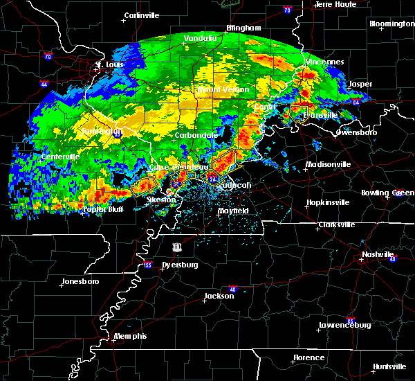 At 514 pm cdt, a severe thunderstorm was located near metropolis, moving northeast at 30 mph (radar indicated). Hazards include 60 mph wind gusts and quarter size hail. Hail damage to vehicles is expected. Expect wind damage to roofs, siding, and trees. At 514 pm cdt, a severe thunderstorm was located near metropolis, moving northeast at 30 mph (radar indicated). Hazards include 60 mph wind gusts and quarter size hail. Hail damage to vehicles is expected. Expect wind damage to roofs, siding, and trees.
|
| 12/23/2015 3:04 PM CST | At 303 pm cst, severe thunderstorms were located along a line extending from near dixon springs to near lovelaceville, moving east at 60 mph (radar indicated). Hazards include 60 mph wind gusts. Expect damage to roofs. Siding and trees. |
| 12/23/2015 3:04 PM CST | At 303 pm cst, severe thunderstorms were located along a line extending from near dixon springs to near lovelaceville, moving east at 60 mph (radar indicated). Hazards include 60 mph wind gusts. Expect damage to roofs. Siding and trees. |
| 7/9/2015 7:16 PM CDT |
 At 716 pm cdt, a severe thunderstorm was located 7 miles southwest of new columbia, or 8 miles northwest of metropolis, moving east at 20 mph (radar indicated). Hazards include 60 mph wind gusts. Expect damage to roofs. Siding and trees. At 716 pm cdt, a severe thunderstorm was located 7 miles southwest of new columbia, or 8 miles northwest of metropolis, moving east at 20 mph (radar indicated). Hazards include 60 mph wind gusts. Expect damage to roofs. Siding and trees.
|
| 10/31/2013 9:48 PM CDT | Large tree fell against house at 18th and gibbons in metropolis.tree severely damaged trusses separating front wall of house from side wal in massac county IL, 0.7 miles N of Metropolis, IL |
| 10/31/2013 8:48 PM CDT | Large tree fell against house at 18th and gibbons in metropolis.tree severely damaged trusses separating front wall of house from side wal in massac county IL, 0.7 miles N of Metropolis, IL |
| 8/9/2013 3:01 PM CDT | 2 foot diameter tree down...snappe in massac county IL, 4.5 miles SSE of Metropolis, IL |
| 5/30/2013 7:58 PM CDT | Large tree limbs down in metropolis in massac county IL, 0.7 miles N of Metropolis, IL |
| 5/21/2013 3:20 AM CDT | A large tree blew down landing on a car in metropoli in massac county IL, 0.7 miles N of Metropolis, IL |
| 1/29/2013 11:04 PM CST | Storm damage reported in massac county IL, 0.7 miles N of Metropolis, IL |
| 1/29/2013 11:04 PM CST | Power lines down. large awning and 2 plate glass windows blown out in downtown are in massac county IL, 0.7 miles N of Metropolis, IL |
| 9/6/2012 7:15 PM CDT | Window blown out of a house. power lines and tree limbs dow in massac county IL, 0.7 miles N of Metropolis, IL |
| 9/6/2012 7:04 PM CDT | Storm damage reported in massac county IL, 4.3 miles SSE of Metropolis, IL |
| 9/1/2012 7:29 PM CDT | Power outages with half the city out. large tree limbs down. time estimate in massac county IL, 0.7 miles N of Metropolis, IL |
| 9/1/2012 7:20 PM CDT | Large trees down...several trees down...tree tops blown out from 2 miles south of round knob and then scattered about metropoli in massac county IL, 2.4 miles SSE of Metropolis, IL |
| 6/4/2012 8:50 PM CDT | Quarter sized hail reported 4.7 miles SSE of Metropolis, IL |
| 1/1/0001 12:00 AM | Storm damage reported in massac county IL, 4.3 miles SSE of Metropolis, IL |
| 1/1/0001 12:00 AM | 60 plus mph winds reported and dime size hail in massac county IL, 4.3 miles SSE of Metropolis, IL |
| 1/1/0001 12:00 AM | Large tree dow in massac county IL, 0.7 miles N of Metropolis, IL |
| 1/1/0001 12:00 AM | Storm damage reported in massac county IL, 0.7 miles N of Metropolis, IL |
| 1/1/0001 12:00 AM | Storm damage reported in massac county IL, 4.3 miles SSE of Metropolis, IL |
| 1/1/0001 12:00 AM | Quarter sized hail reported 4.3 miles SSE of Metropolis, IL, 1+ inch hail reported in massac county near round knob |
| 1/1/0001 12:00 AM | Half Dollar sized hail reported 4.3 miles SSE of Metropolis, IL |
| 1/1/0001 12:00 AM | Downed and uprooted trees reported along north street. downed power poles. one tree is laying across a hous in massac county IL, 0.7 miles N of Metropolis, IL |
| 1/1/0001 12:00 AM | Widespread trees and power pole damage on the north side of town near the honeywell plan in massac county IL, 0.7 miles N of Metropolis, IL |
| 1/1/0001 12:00 AM | Widespread power outages in tow in massac county IL, 0.7 miles N of Metropolis, IL |
| 1/1/0001 12:00 AM | Storm damage reported in massac county IL, 0.7 miles N of Metropolis, IL |
| 1/1/0001 12:00 AM | Between joppa and metropolis. multiple power flashes of blown transformers in massac county IL, 4.3 miles SSE of Metropolis, IL |
| 1/1/0001 12:00 AM | Storm damage reported in massac county IL, 4.3 miles SSE of Metropolis, IL |
| 1/1/0001 12:00 AM | A few trees down on market street in the city limits in massac county IL, 0.7 miles N of Metropolis, IL |
| 1/1/0001 12:00 AM | Quarter sized hail reported 0.7 miles N of Metropolis, IL |
| 1/1/0001 12:00 AM | Quarter sized hail reported 0.7 miles N of Metropolis, IL, quarter size hail reported. |
| 1/1/0001 12:00 AM | 1 tree down over road in massac county IL, 5.7 miles SW of Metropolis, IL |
Hail Maps for Metropolis, IL
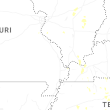
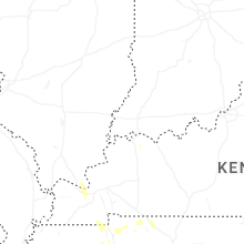


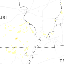
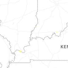


Connect with Interactive Hail Maps