

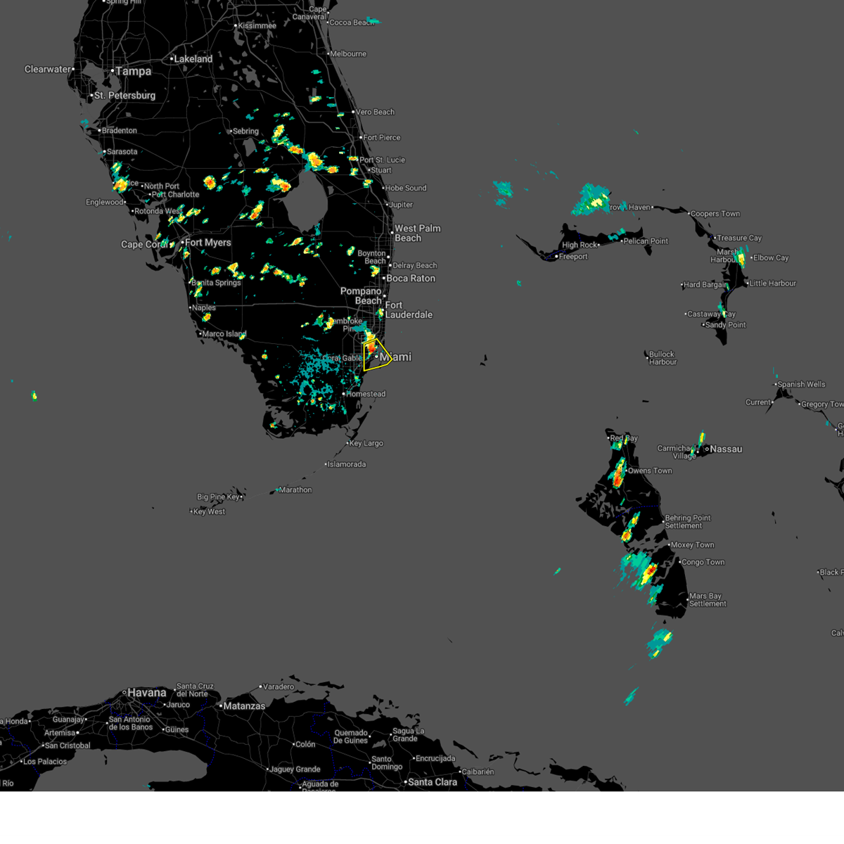
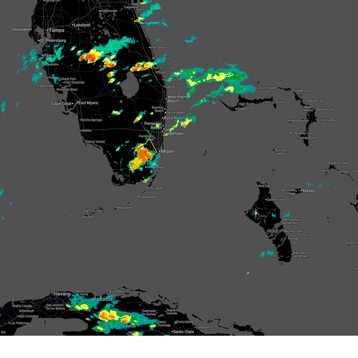
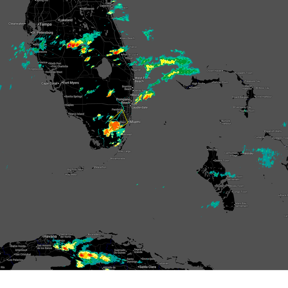
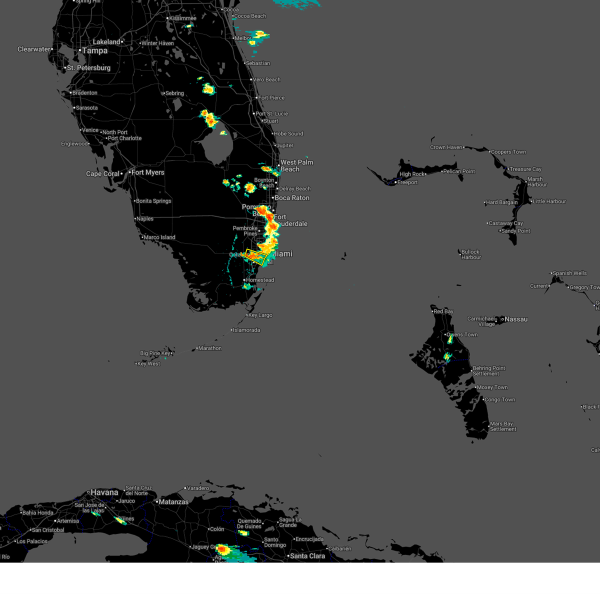
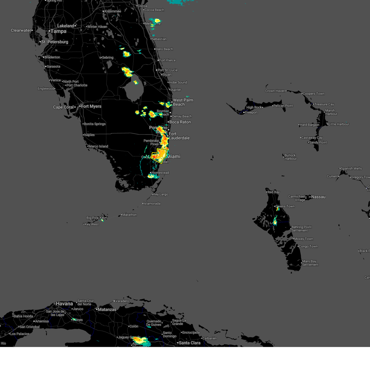
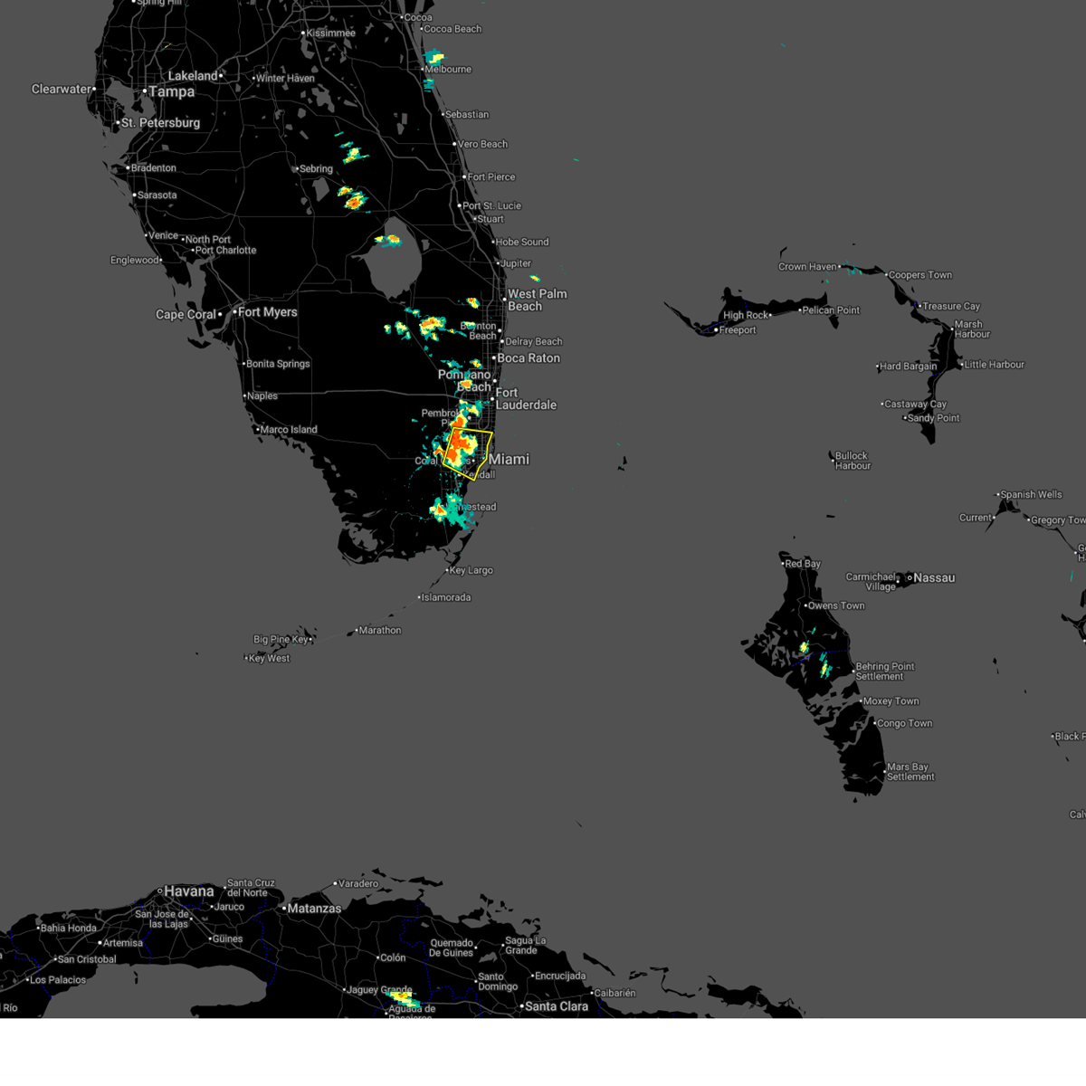
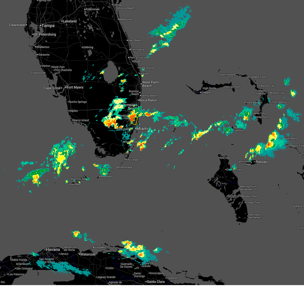
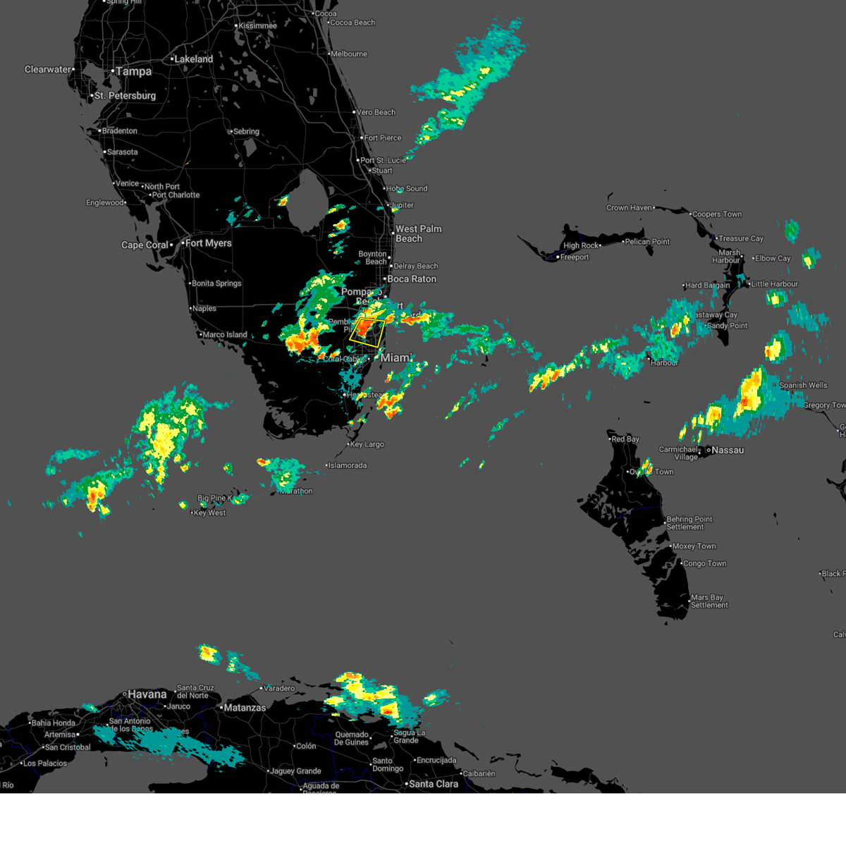
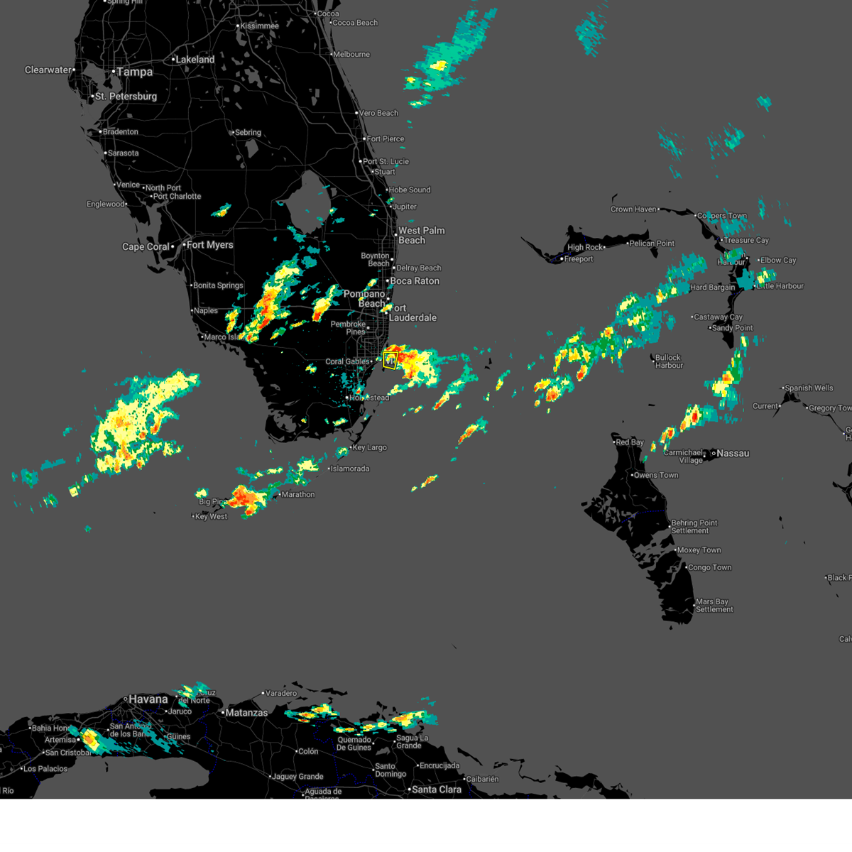
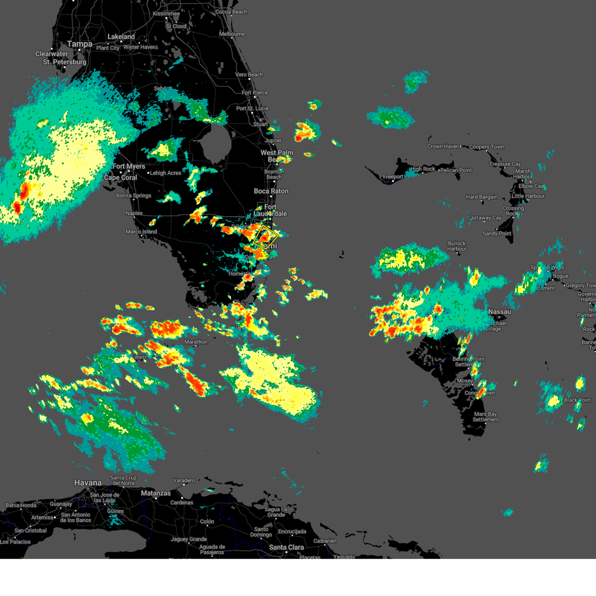
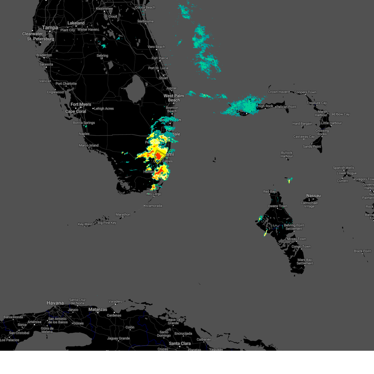
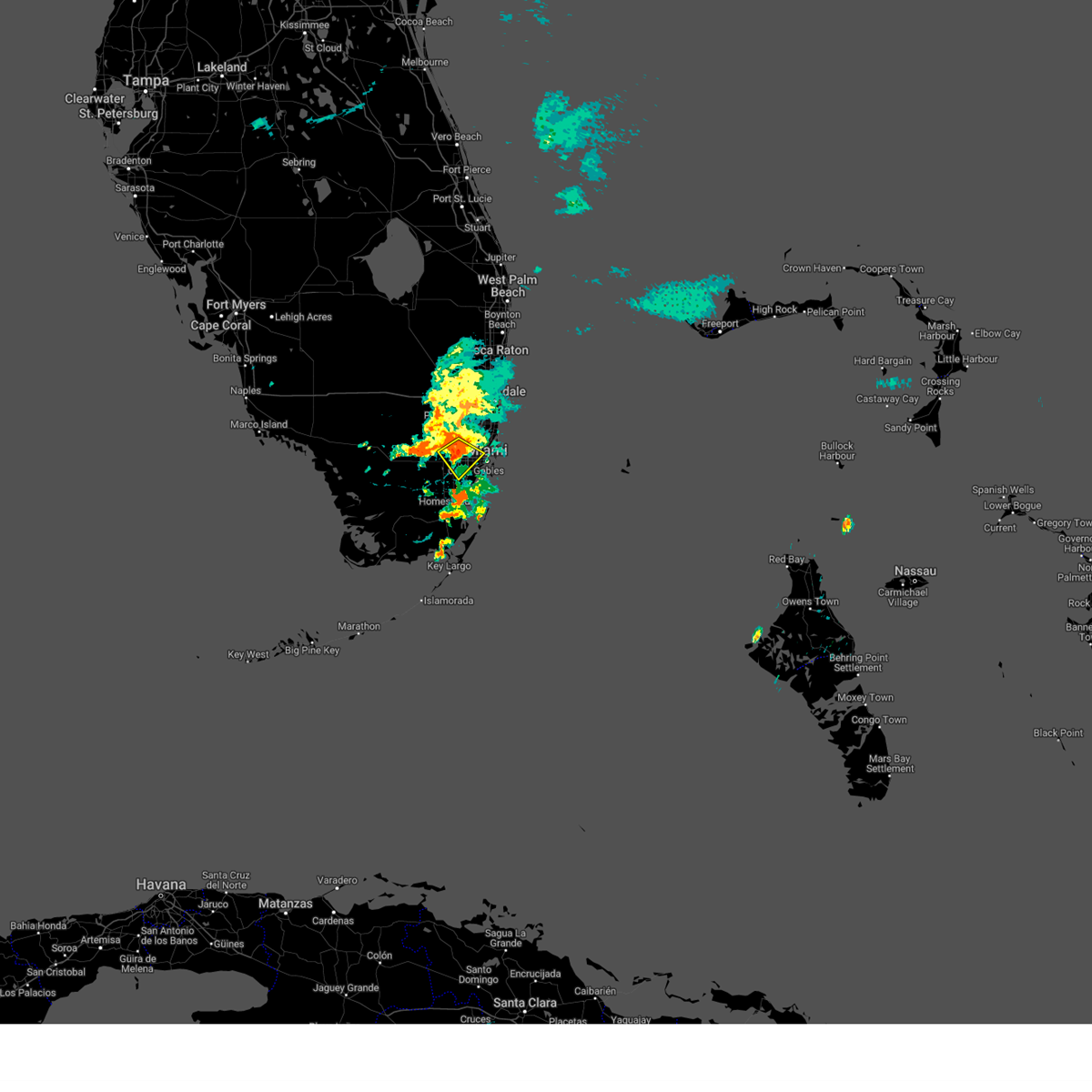
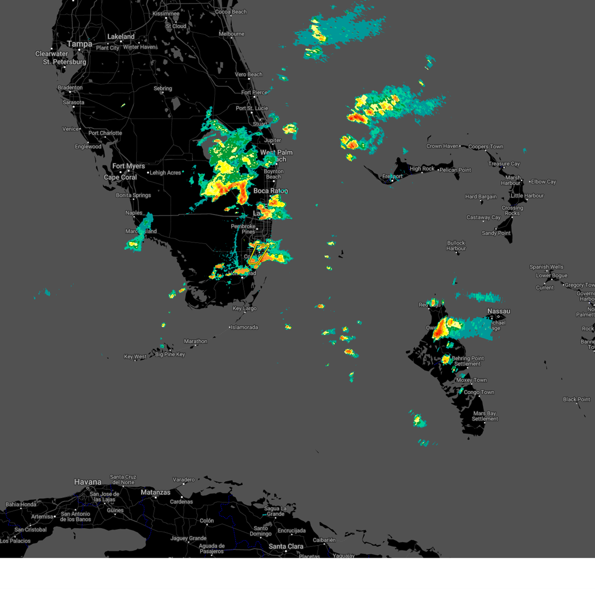
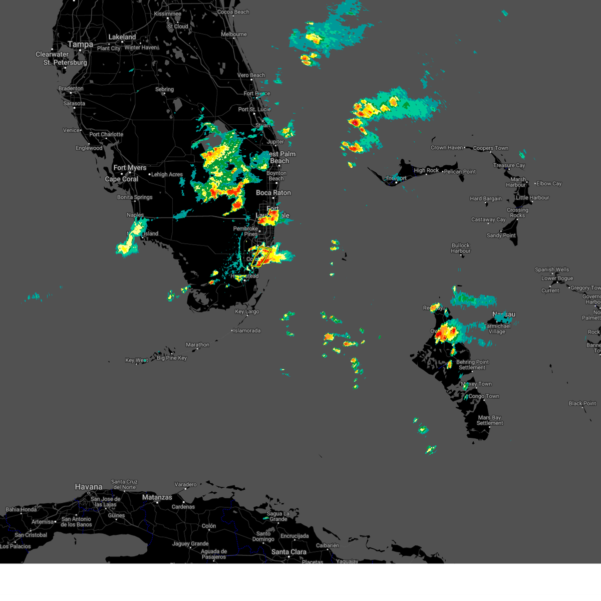
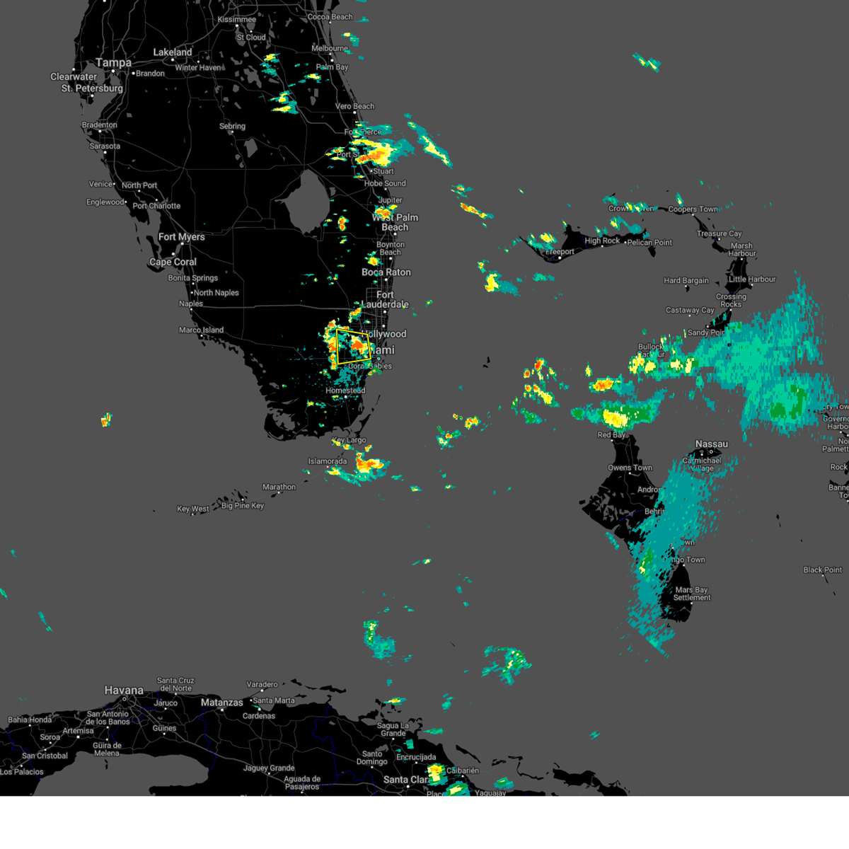
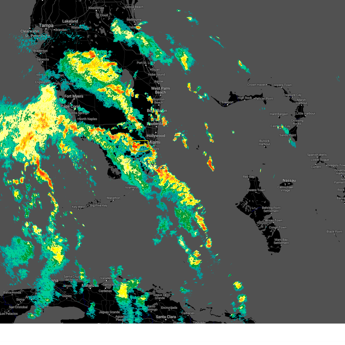
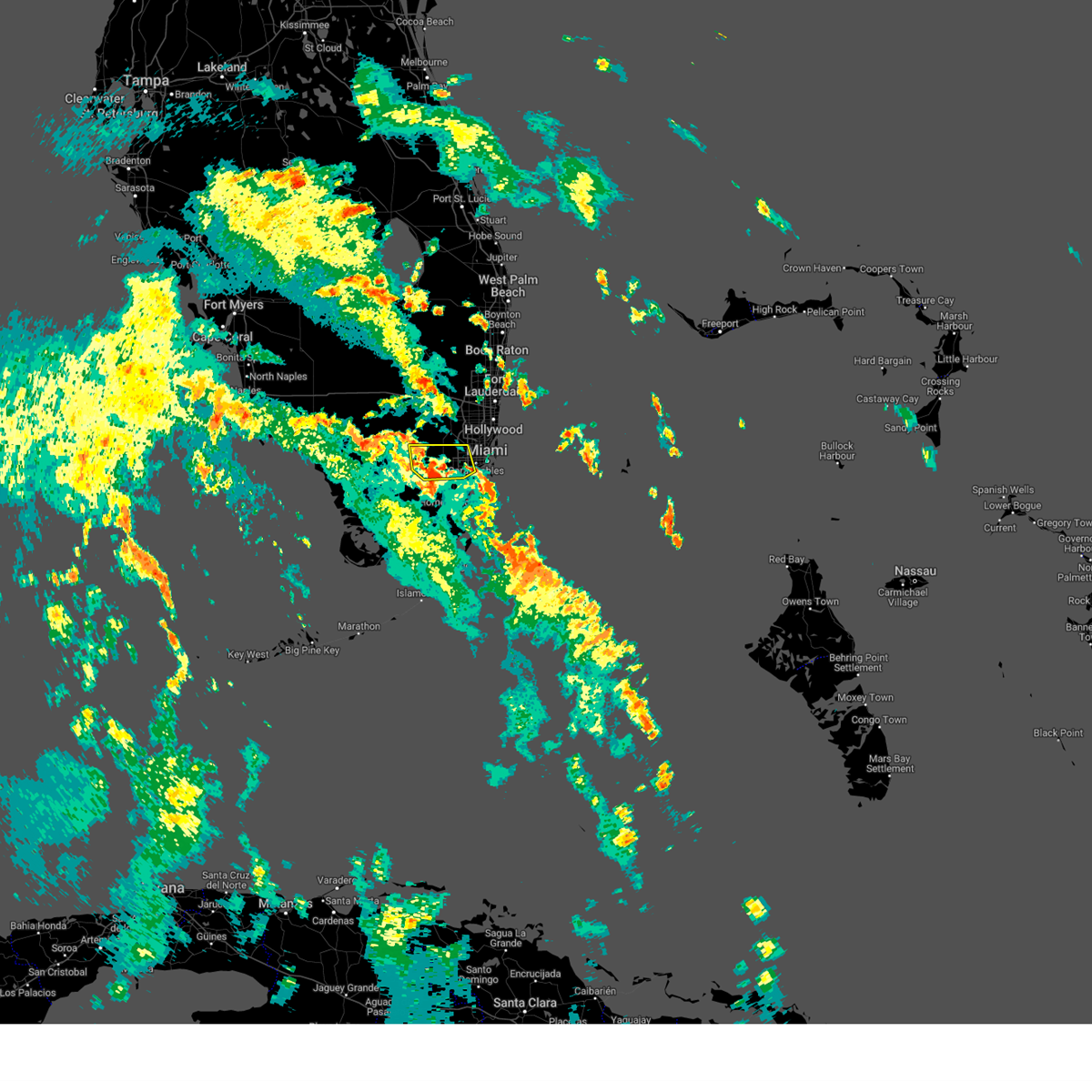
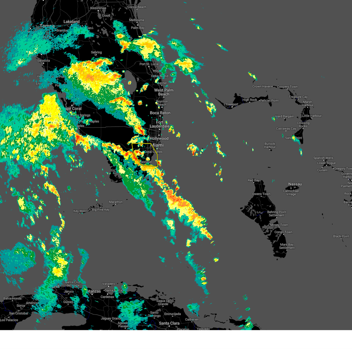
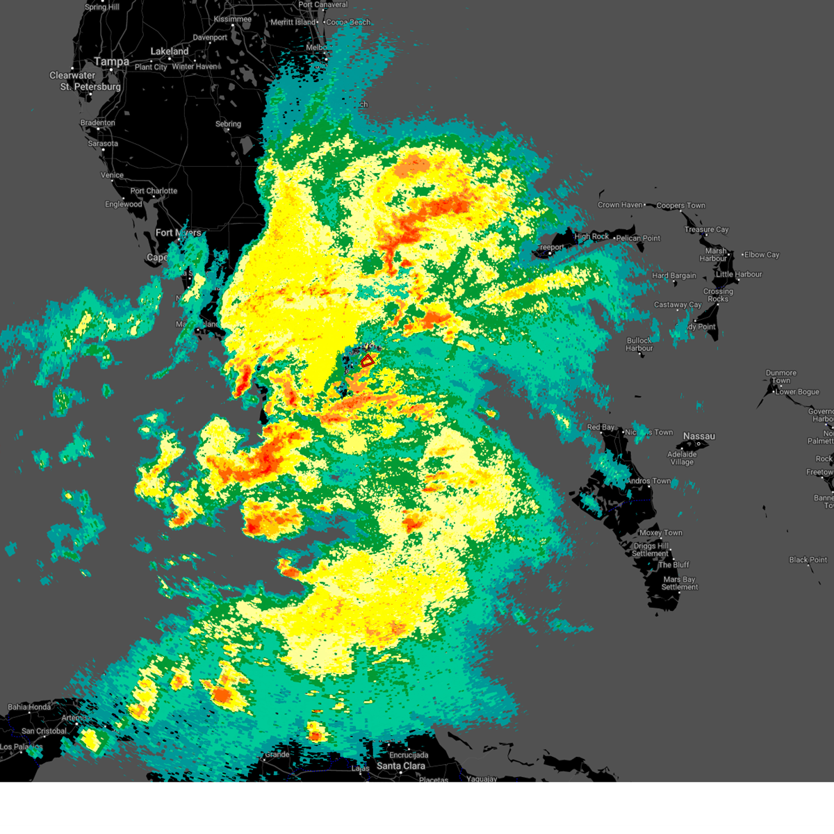
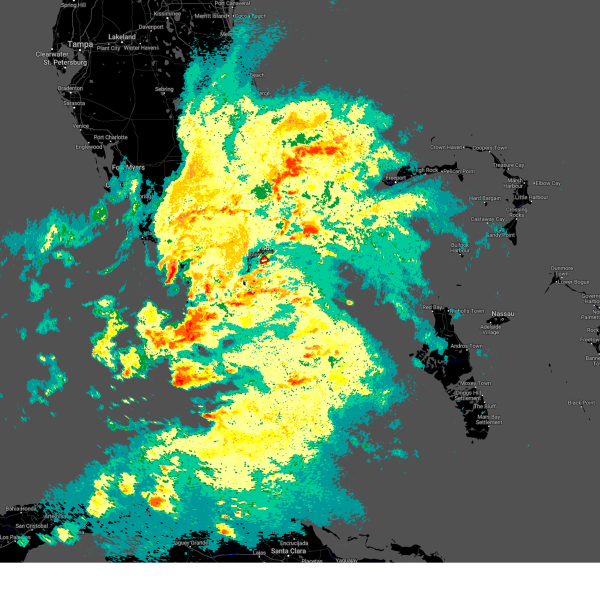
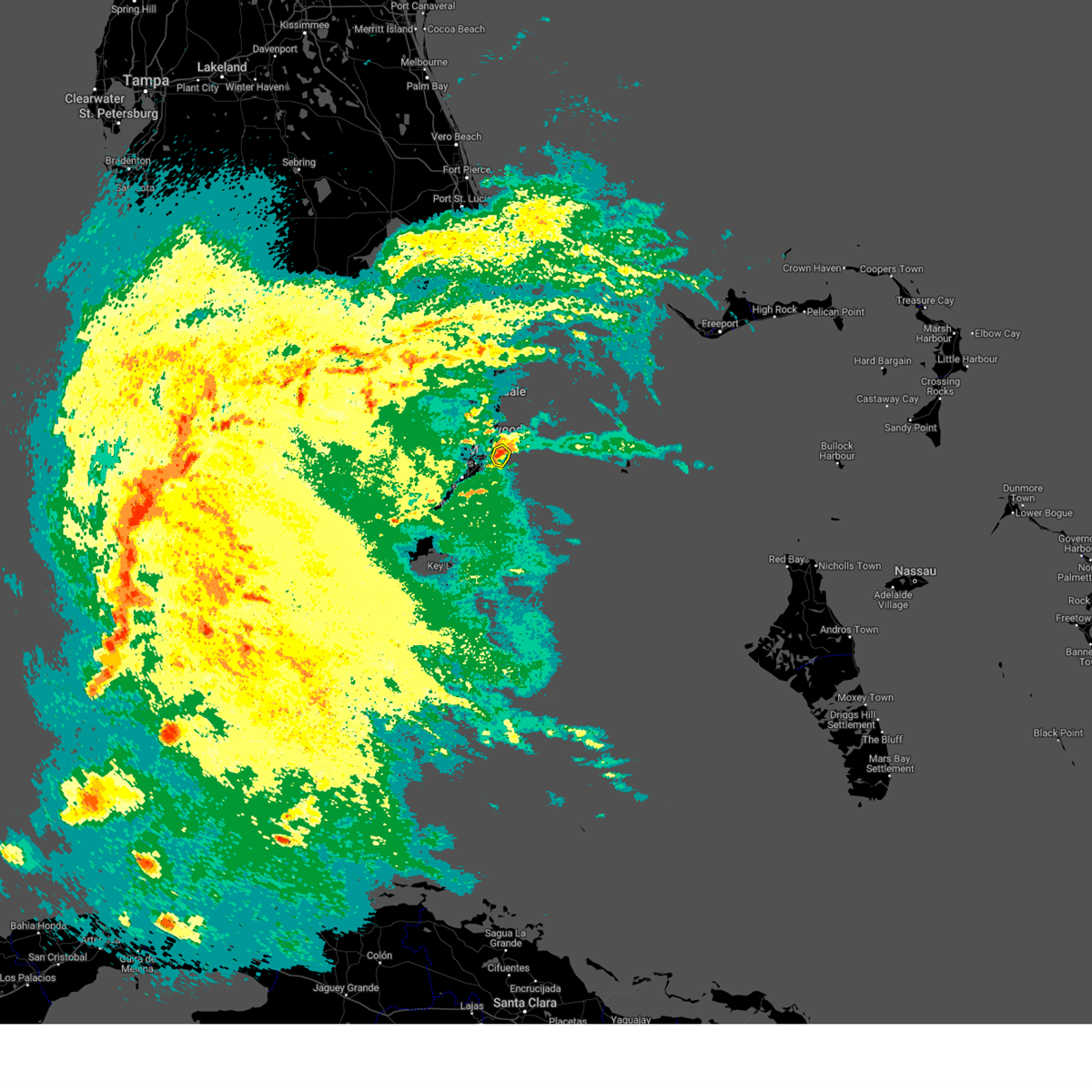
Hail Map for Miami, FL
The Miami, FL area has had 25 reports of on-the-ground hail by trained spotters, and has been under severe weather warnings 15 times during the past 12 months. Doppler radar has detected hail at or near Miami, FL on 56 occasions, including 6 occasions during the past year.
| Name: | Miami, FL |
| Where Located: | 3.7 miles N of Miami, FL |
| Map: | Google Map for Miami, FL |
| Population: | 399457 |
| Housing Units: | 183994 |
| More Info: | Search Google for Miami, FL |
2
The Top Recent Hail Date for Miami, FL is Sunday, March 1, 2026 (7th out of 56)

Hail and Wind Damage Spotted near Miami, FL
| Date / Time | Report Details |
|---|---|
| 7/2/2026 1:43 PM EDT |
 Svrmfl the national weather service in miami has issued a * severe thunderstorm warning for, northern miami-dade county in southeastern florida, * until 215 pm edt. * at 143 pm edt, a severe thunderstorm was located over liberty city, or over miami, moving south at 15 mph (radar indicated). Hazards include 60 mph wind gusts and penny size hail. expect damage to roofs, siding, and trees Svrmfl the national weather service in miami has issued a * severe thunderstorm warning for, northern miami-dade county in southeastern florida, * until 215 pm edt. * at 143 pm edt, a severe thunderstorm was located over liberty city, or over miami, moving south at 15 mph (radar indicated). Hazards include 60 mph wind gusts and penny size hail. expect damage to roofs, siding, and trees
|
| 6/2/2026 6:11 PM EDT | Off duty nws employee shared photos of a large tree down on the northbound lanes of northwest 102nd avenue in doral... florida as a result of severe wind gusts as a sev in miami-dade county FL, 7.8 miles ESE of Miami, FL |
| 6/2/2026 6:00 PM EDT |
 At 600 pm edt, a severe thunderstorm was located over doral, or near hialeah, moving northeast at 20 mph (radar indicated). Hazards include 60 mph wind gusts and quarter size hail. Hail damage to vehicles is expected. expect wind damage to roofs, siding, and trees. locations impacted include, miami, hialeah, miramar, coral gables, south miami, kendall, doral, miami lakes, hialeah gardens, miami springs, sweetwater, west miami, medley, westchester, glenvar heights, fountainbleau, kendale lakes, pennsuco, intersection krome and u. s. 27, and the hammocks. At 600 pm edt, a severe thunderstorm was located over doral, or near hialeah, moving northeast at 20 mph (radar indicated). Hazards include 60 mph wind gusts and quarter size hail. Hail damage to vehicles is expected. expect wind damage to roofs, siding, and trees. locations impacted include, miami, hialeah, miramar, coral gables, south miami, kendall, doral, miami lakes, hialeah gardens, miami springs, sweetwater, west miami, medley, westchester, glenvar heights, fountainbleau, kendale lakes, pennsuco, intersection krome and u. s. 27, and the hammocks.
|
| 6/2/2026 5:39 PM EDT |
 Svrmfl the national weather service in miami has issued a * severe thunderstorm warning for, northern miami-dade county in southeastern florida, southern broward county in southeastern florida, * until 630 pm edt. * at 539 pm edt, a severe thunderstorm was located over miccosukee resort, or 8 miles northwest of kendall, moving northeast at 20 mph (radar indicated). Hazards include 60 mph wind gusts and quarter size hail. Hail damage to vehicles is expected. Expect wind damage to roofs, siding, and trees. Svrmfl the national weather service in miami has issued a * severe thunderstorm warning for, northern miami-dade county in southeastern florida, southern broward county in southeastern florida, * until 630 pm edt. * at 539 pm edt, a severe thunderstorm was located over miccosukee resort, or 8 miles northwest of kendall, moving northeast at 20 mph (radar indicated). Hazards include 60 mph wind gusts and quarter size hail. Hail damage to vehicles is expected. Expect wind damage to roofs, siding, and trees.
|
| 4/26/2026 5:30 PM EDT |
 At 530 pm edt, severe thunderstorms were located along a line extending from gladeview to university park, moving east at 15 mph (radar indicated). Hazards include 60 mph wind gusts and penny size hail. Expect damage to roofs, siding, and trees. Locations impacted include, miami, coral gables, south miami, kendall, doral, pinecrest, sweetwater, west miami, westchester, coral terrace, glenvar heights, fountainbleau, kendale lakes, olympia heights, sunset, university of miami, tamiami, university park, coconut grove, and coral way village. At 530 pm edt, severe thunderstorms were located along a line extending from gladeview to university park, moving east at 15 mph (radar indicated). Hazards include 60 mph wind gusts and penny size hail. Expect damage to roofs, siding, and trees. Locations impacted include, miami, coral gables, south miami, kendall, doral, pinecrest, sweetwater, west miami, westchester, coral terrace, glenvar heights, fountainbleau, kendale lakes, olympia heights, sunset, university of miami, tamiami, university park, coconut grove, and coral way village.
|
| 4/26/2026 5:22 PM EDT |
 At 522 pm edt, severe thunderstorms were located along a line extending from west little river to tamiami, moving southeast at 5 mph (radar indicated). Hazards include 60 mph wind gusts and penny size hail. Expect damage to roofs, siding, and trees. Locations impacted include, miami, hialeah, coral gables, south miami, kendall, north miami, doral, hialeah gardens, pinecrest, opa-locka, miami springs, sweetwater, miami shores, west miami, el portal, medley, westchester, gladeview, glenvar heights, and fountainbleau. At 522 pm edt, severe thunderstorms were located along a line extending from west little river to tamiami, moving southeast at 5 mph (radar indicated). Hazards include 60 mph wind gusts and penny size hail. Expect damage to roofs, siding, and trees. Locations impacted include, miami, hialeah, coral gables, south miami, kendall, north miami, doral, hialeah gardens, pinecrest, opa-locka, miami springs, sweetwater, miami shores, west miami, el portal, medley, westchester, gladeview, glenvar heights, and fountainbleau.
|
| 4/26/2026 5:01 PM EDT |
 Svrmfl the national weather service in miami has issued a * severe thunderstorm warning for, northern miami-dade county in southeastern florida, * until 545 pm edt. * at 501 pm edt, severe thunderstorms were located along a line extending from hialeah gardens to university park, moving east at 15 mph (radar indicated). Hazards include 60 mph wind gusts and nickel size hail. expect damage to roofs, siding, and trees Svrmfl the national weather service in miami has issued a * severe thunderstorm warning for, northern miami-dade county in southeastern florida, * until 545 pm edt. * at 501 pm edt, severe thunderstorms were located along a line extending from hialeah gardens to university park, moving east at 15 mph (radar indicated). Hazards include 60 mph wind gusts and nickel size hail. expect damage to roofs, siding, and trees
|
| 4/7/2026 5:05 PM EDT |
 At 505 pm edt, a severe thunderstorm was located over hard rock stadium, or over miami gardens, moving east at 20 mph (radar indicated). Hazards include 60 mph wind gusts and quarter size hail. Hail damage to vehicles is expected. expect wind damage to roofs, siding, and trees. Locations impacted include, miami, hialeah, pembroke pines, hollywood, miramar, miami gardens, hallandale, north miami, north miami beach, opa-locka, west park, miami shores, el portal, west little river, westview, hard rock stadium, miramar parkway and university drive, golden glades, pinewood, and ojus. At 505 pm edt, a severe thunderstorm was located over hard rock stadium, or over miami gardens, moving east at 20 mph (radar indicated). Hazards include 60 mph wind gusts and quarter size hail. Hail damage to vehicles is expected. expect wind damage to roofs, siding, and trees. Locations impacted include, miami, hialeah, pembroke pines, hollywood, miramar, miami gardens, hallandale, north miami, north miami beach, opa-locka, west park, miami shores, el portal, west little river, westview, hard rock stadium, miramar parkway and university drive, golden glades, pinewood, and ojus.
|
| 4/7/2026 4:47 PM EDT |
 Svrmfl the national weather service in miami has issued a * severe thunderstorm warning for, northern miami-dade county in southeastern florida, southern broward county in southeastern florida, * until 515 pm edt. * at 447 pm edt, a severe thunderstorm was located over miramar, moving east at 20 mph (radar indicated). Hazards include 60 mph wind gusts and quarter size hail. Hail damage to vehicles is expected. Expect wind damage to roofs, siding, and trees. Svrmfl the national weather service in miami has issued a * severe thunderstorm warning for, northern miami-dade county in southeastern florida, southern broward county in southeastern florida, * until 515 pm edt. * at 447 pm edt, a severe thunderstorm was located over miramar, moving east at 20 mph (radar indicated). Hazards include 60 mph wind gusts and quarter size hail. Hail damage to vehicles is expected. Expect wind damage to roofs, siding, and trees.
|
| 4/7/2026 3:40 PM EDT |
 The storm which prompted the warning has moved out of the area. therefore, the warning will be allowed to expire. however, gusty winds are still possible with this thunderstorm. The storm which prompted the warning has moved out of the area. therefore, the warning will be allowed to expire. however, gusty winds are still possible with this thunderstorm.
|
| 4/7/2026 3:29 PM EDT |
 At 329 pm edt, a severe thunderstorm was located over fisher island, or over virginia key, moving north at 10 mph (radar indicated). Hazards include 70 mph wind gusts and quarter size hail. Hail damage to vehicles is expected. expect considerable tree damage. wind damage is also likely to mobile homes, roofs, and outbuildings. Locations impacted include, miami, miami beach, virginia key, and fisher island. At 329 pm edt, a severe thunderstorm was located over fisher island, or over virginia key, moving north at 10 mph (radar indicated). Hazards include 70 mph wind gusts and quarter size hail. Hail damage to vehicles is expected. expect considerable tree damage. wind damage is also likely to mobile homes, roofs, and outbuildings. Locations impacted include, miami, miami beach, virginia key, and fisher island.
|
| 4/7/2026 3:17 PM EDT | Mesonet station xgvt government cut measured a 73 mph gust under the core of a downburs in amz651 county FL, 9.1 miles WNW of Miami, FL |
| 4/7/2026 3:17 PM EDT |
 Svrmfl the national weather service in miami has issued a * severe thunderstorm warning for, northern miami-dade county in southeastern florida, * until 345 pm edt. * at 317 pm edt, a severe thunderstorm was located over virginia key, moving north at 10 mph (radar indicated). Hazards include 60 mph wind gusts and quarter size hail. Hail damage to vehicles is expected. Expect wind damage to roofs, siding, and trees. Svrmfl the national weather service in miami has issued a * severe thunderstorm warning for, northern miami-dade county in southeastern florida, * until 345 pm edt. * at 317 pm edt, a severe thunderstorm was located over virginia key, moving north at 10 mph (radar indicated). Hazards include 60 mph wind gusts and quarter size hail. Hail damage to vehicles is expected. Expect wind damage to roofs, siding, and trees.
|
| 3/1/2026 1:47 PM EST |
 Svrmfl the national weather service in miami has issued a * severe thunderstorm warning for, central miami-dade county in southeastern florida, * until 215 pm est. * at 147 pm est, a severe thunderstorm was located over marlins park, or over miami, moving east at 10 mph (radar indicated). Hazards include 60 mph wind gusts and quarter size hail. Hail damage to vehicles is expected. Expect wind damage to roofs, siding, and trees. Svrmfl the national weather service in miami has issued a * severe thunderstorm warning for, central miami-dade county in southeastern florida, * until 215 pm est. * at 147 pm est, a severe thunderstorm was located over marlins park, or over miami, moving east at 10 mph (radar indicated). Hazards include 60 mph wind gusts and quarter size hail. Hail damage to vehicles is expected. Expect wind damage to roofs, siding, and trees.
|
| 9/23/2025 11:55 AM EDT | Broken tree limbs and branches at a home in the hammocks near sw 147 avenue and n. kendall drive. time is estimated based on radar indicated wind gusts near the surface in miami-dade county FL, 13.7 miles ENE of Miami, FL |
| 9/16/2025 2:49 PM EDT | Svrmfl the national weather service in miami has issued a * severe thunderstorm warning for, northern miami-dade county in southeastern florida, southern broward county in southeastern florida, * until 315 pm edt. * at 249 pm edt, a severe thunderstorm was located over hard rock stadium, or over miami gardens, moving southeast at 10 mph (radar indicated). Hazards include 60 mph wind gusts and nickel size hail. expect damage to roofs, siding, and trees |
| 9/13/2025 7:22 PM EDT | The storm which prompted the warning has weakened below severe limits, and no longer poses an immediate threat to life or property. therefore, the warning will be allowed to expire. however, gusty winds and heavy rain are still possible with this thunderstorm. |
| 9/13/2025 6:48 PM EDT | Svrmfl the national weather service in miami has issued a * severe thunderstorm warning for, central miami-dade county in southeastern florida, * until 730 pm edt. * at 648 pm edt, a severe thunderstorm was located over kendall, moving south at 10 mph (radar indicated). Hazards include 60 mph wind gusts. expect damage to roofs, siding, and trees |
| 9/11/2025 5:15 PM EDT | Corrects previous tstm wnd dmg report from 2 nnw coral gables. reports of downed power lines... tree limbs and side fencing associated with a strong thunderstorm that m in miami-dade county FL, 3.3 miles NE of Miami, FL |
| 6/2/2025 1:33 PM EDT |
 Svrmfl the national weather service in miami has issued a * severe thunderstorm warning for, northern miami-dade county in southeastern florida, southern broward county in southeastern florida, * until 200 pm edt. * at 133 pm edt, a severe thunderstorm was located over golden glades, or near miami gardens, and is nearly stationary (radar indicated). Hazards include 60 mph wind gusts and quarter size hail. Hail damage to vehicles is expected. Expect wind damage to roofs, siding, and trees. Svrmfl the national weather service in miami has issued a * severe thunderstorm warning for, northern miami-dade county in southeastern florida, southern broward county in southeastern florida, * until 200 pm edt. * at 133 pm edt, a severe thunderstorm was located over golden glades, or near miami gardens, and is nearly stationary (radar indicated). Hazards include 60 mph wind gusts and quarter size hail. Hail damage to vehicles is expected. Expect wind damage to roofs, siding, and trees.
|
| 5/22/2025 8:06 PM EDT |
 The storm which prompted the warning has weakened below severe limits, and no longer poses an immediate threat to life or property. therefore, the warning will be allowed to expire. however, heavy rain is still possible with this thunderstorm. The storm which prompted the warning has weakened below severe limits, and no longer poses an immediate threat to life or property. therefore, the warning will be allowed to expire. however, heavy rain is still possible with this thunderstorm.
|
| 5/22/2025 8:00 PM EDT |
 At 800 pm edt, a severe thunderstorm was located over westchester, or near south miami, moving southeast at 15 mph (radar indicated). Hazards include 60 mph wind gusts and quarter size hail. Hail damage to vehicles is expected. expect wind damage to roofs, siding, and trees. Locations impacted include, miami, hialeah, coral gables, south miami, kendall, doral, hialeah gardens, miami springs, sweetwater, west miami, medley, westchester, fountainbleau, kendale lakes, pennsuco, coral terrace, olympia heights, sunset, miami international airport, and tamiami. At 800 pm edt, a severe thunderstorm was located over westchester, or near south miami, moving southeast at 15 mph (radar indicated). Hazards include 60 mph wind gusts and quarter size hail. Hail damage to vehicles is expected. expect wind damage to roofs, siding, and trees. Locations impacted include, miami, hialeah, coral gables, south miami, kendall, doral, hialeah gardens, miami springs, sweetwater, west miami, medley, westchester, fountainbleau, kendale lakes, pennsuco, coral terrace, olympia heights, sunset, miami international airport, and tamiami.
|
| 5/22/2025 7:45 PM EDT |
 Svrmfl the national weather service in miami has issued a * severe thunderstorm warning for, northern miami-dade county in southeastern florida, * until 815 pm edt. * at 745 pm edt, a severe thunderstorm was located over sweetwater, or near south miami, moving southeast at 15 mph (radar indicated). Hazards include 60 mph wind gusts and quarter size hail. Hail damage to vehicles is expected. Expect wind damage to roofs, siding, and trees. Svrmfl the national weather service in miami has issued a * severe thunderstorm warning for, northern miami-dade county in southeastern florida, * until 815 pm edt. * at 745 pm edt, a severe thunderstorm was located over sweetwater, or near south miami, moving southeast at 15 mph (radar indicated). Hazards include 60 mph wind gusts and quarter size hail. Hail damage to vehicles is expected. Expect wind damage to roofs, siding, and trees.
|
| 5/4/2025 2:24 PM EDT |
 The storms which prompted the warning have moved out of the area and into biscayne bay waters. therefore, the warning will be allowed to expire. however, small hail, gusty winds and heavy rain are still possible with these thunderstorms. to report severe weather, contact your nearest law enforcement agency. they will relay your report to the national weather service miami. you can also share your report with nws miami on facebook and twitter. The storms which prompted the warning have moved out of the area and into biscayne bay waters. therefore, the warning will be allowed to expire. however, small hail, gusty winds and heavy rain are still possible with these thunderstorms. to report severe weather, contact your nearest law enforcement agency. they will relay your report to the national weather service miami. you can also share your report with nws miami on facebook and twitter.
|
| 5/4/2025 2:11 PM EDT |
 At 209 pm edt, severe thunderstorms were located along a line extending from marlins park to pinecrest moving slowly east into biscayne bay. there is also another area of strong thunderstorms near sweetwater that could become severe with hail, frequent lightning, and strong winds that will be moving slowly eastward (radar indicated). Hazards include 60 mph wind gusts and quarter size hail. Hail damage to vehicles is expected. expect wind damage to roofs, siding, and trees. Locations impacted include, miami, hialeah, miami beach, coral gables, south miami, kendall, doral, pinecrest, miami springs, west miami, westchester, glenvar heights, richmond heights, university of miami, downtown miami, coconut grove, coral terrace, olympia heights, sunset, and marlins park. At 209 pm edt, severe thunderstorms were located along a line extending from marlins park to pinecrest moving slowly east into biscayne bay. there is also another area of strong thunderstorms near sweetwater that could become severe with hail, frequent lightning, and strong winds that will be moving slowly eastward (radar indicated). Hazards include 60 mph wind gusts and quarter size hail. Hail damage to vehicles is expected. expect wind damage to roofs, siding, and trees. Locations impacted include, miami, hialeah, miami beach, coral gables, south miami, kendall, doral, pinecrest, miami springs, west miami, westchester, glenvar heights, richmond heights, university of miami, downtown miami, coconut grove, coral terrace, olympia heights, sunset, and marlins park.
|
| 5/4/2025 2:03 PM EDT | Multiple 3 to 4 inch diameter black olive tree branches snappe in miami-dade county FL, 6.2 miles NNE of Miami, FL |
| 5/4/2025 1:52 PM EDT |
 Svrmfl the national weather service in miami has issued a * severe thunderstorm warning for, central east miami-dade county in southeastern florida, * until 230 pm edt. * at 152 pm edt, severe thunderstorms were located along a line extending from miami to kendall, moving slowly east (radar indicated). Hazards include 60 mph wind gusts and quarter size hail. Hail damage to vehicles is expected. Expect wind damage to roofs, siding, and trees. Svrmfl the national weather service in miami has issued a * severe thunderstorm warning for, central east miami-dade county in southeastern florida, * until 230 pm edt. * at 152 pm edt, severe thunderstorms were located along a line extending from miami to kendall, moving slowly east (radar indicated). Hazards include 60 mph wind gusts and quarter size hail. Hail damage to vehicles is expected. Expect wind damage to roofs, siding, and trees.
|
| 5/4/2025 1:30 PM EDT | A large tree was blown over from a thunderstorm that damage a car shiel in miami-dade county FL, 6.8 miles NNE of Miami, FL |
| 5/4/2025 1:25 PM EDT | Tree on powerline relayed by media reporter in the fiel in miami-dade county FL, 7 miles NE of Miami, FL |
| 3/25/2025 2:39 PM EDT |
 The storm which prompted the warning has weakened below severe limits, and no longer poses an immediate threat to life or property. therefore, the warning will be allowed to expire. however, small hail is still possible with this thunderstorm. The storm which prompted the warning has weakened below severe limits, and no longer poses an immediate threat to life or property. therefore, the warning will be allowed to expire. however, small hail is still possible with this thunderstorm.
|
| 3/25/2025 2:19 PM EDT |
 Svrmfl the national weather service in miami has issued a * severe thunderstorm warning for, northern miami-dade county in southeastern florida, * until 245 pm edt. * at 219 pm edt, a severe thunderstorm was located over liberty city, or near miami, moving north at 10 mph (radar indicated). Hazards include 60 mph wind gusts and quarter size hail. Hail damage to vehicles is expected. Expect wind damage to roofs, siding, and trees. Svrmfl the national weather service in miami has issued a * severe thunderstorm warning for, northern miami-dade county in southeastern florida, * until 245 pm edt. * at 219 pm edt, a severe thunderstorm was located over liberty city, or near miami, moving north at 10 mph (radar indicated). Hazards include 60 mph wind gusts and quarter size hail. Hail damage to vehicles is expected. Expect wind damage to roofs, siding, and trees.
|
| 3/25/2025 2:05 PM EDT | Ares operator relayed a report of downed power lines near sw 87th ave and sw 131 st near the falls. time estimated from rada in miami-dade county FL, 10.7 miles NNE of Miami, FL |
| 9/18/2024 5:07 PM EDT |
 Svrmfl the national weather service in miami has issued a * severe thunderstorm warning for, northeast miami-dade county in southeastern florida, southeast broward county in southeastern florida, * until 545 pm edt. * at 507 pm edt, a severe thunderstorm was located over golden glades, or over miami gardens, and is nearly stationary (radar indicated). Hazards include 60 mph wind gusts and quarter size hail. Hail damage to vehicles is expected. Expect wind damage to roofs, siding, and trees. Svrmfl the national weather service in miami has issued a * severe thunderstorm warning for, northeast miami-dade county in southeastern florida, southeast broward county in southeastern florida, * until 545 pm edt. * at 507 pm edt, a severe thunderstorm was located over golden glades, or over miami gardens, and is nearly stationary (radar indicated). Hazards include 60 mph wind gusts and quarter size hail. Hail damage to vehicles is expected. Expect wind damage to roofs, siding, and trees.
|
| 8/30/2024 11:11 AM EDT |
 Svrmfl the national weather service in miami has issued a * severe thunderstorm warning for, northern miami-dade county in southeastern florida, south central broward county in southeastern florida, * until 1130 am edt. * at 1111 am edt, a severe thunderstorm was located over medley, or near hialeah, moving west at 20 mph (radar indicated). Hazards include 60 mph wind gusts. expect damage to roofs, siding, and trees Svrmfl the national weather service in miami has issued a * severe thunderstorm warning for, northern miami-dade county in southeastern florida, south central broward county in southeastern florida, * until 1130 am edt. * at 1111 am edt, a severe thunderstorm was located over medley, or near hialeah, moving west at 20 mph (radar indicated). Hazards include 60 mph wind gusts. expect damage to roofs, siding, and trees
|
| 8/3/2024 8:24 PM EDT |
 The storm which prompted the warning has weakened below severe limits, and no longer poses an immediate threat to life or property. therefore, the warning will be allowed to expire. however, gusty winds are still possible with this thunderstorm. The storm which prompted the warning has weakened below severe limits, and no longer poses an immediate threat to life or property. therefore, the warning will be allowed to expire. however, gusty winds are still possible with this thunderstorm.
|
| 8/3/2024 8:16 PM EDT |
 At 816 pm edt, a severe thunderstorm was located over kendale lakes, or near kendall, moving northwest at 45 mph (radar indicated). Hazards include 60 mph wind gusts. Expect damage to roofs, siding, and trees. Locations impacted include, miami, coral gables, south miami, kendall, doral, hialeah gardens, pinecrest, sweetwater, west miami, medley, westchester, glenvar heights, fountainbleau, kendale lakes, university of miami, the hammocks, coral terrace, olympia heights, west kendall, and intersection krome and kendall drive. At 816 pm edt, a severe thunderstorm was located over kendale lakes, or near kendall, moving northwest at 45 mph (radar indicated). Hazards include 60 mph wind gusts. Expect damage to roofs, siding, and trees. Locations impacted include, miami, coral gables, south miami, kendall, doral, hialeah gardens, pinecrest, sweetwater, west miami, medley, westchester, glenvar heights, fountainbleau, kendale lakes, university of miami, the hammocks, coral terrace, olympia heights, west kendall, and intersection krome and kendall drive.
|
| 8/3/2024 7:55 PM EDT |
 Svrmfl the national weather service in miami has issued a * severe thunderstorm warning for, northern miami-dade county in southeastern florida, * until 830 pm edt. * at 755 pm edt, a severe thunderstorm was located over homestead bayfront park, or near black point, moving northwest at 45 mph (radar indicated). Hazards include 60 mph wind gusts. expect damage to roofs, siding, and trees Svrmfl the national weather service in miami has issued a * severe thunderstorm warning for, northern miami-dade county in southeastern florida, * until 830 pm edt. * at 755 pm edt, a severe thunderstorm was located over homestead bayfront park, or near black point, moving northwest at 45 mph (radar indicated). Hazards include 60 mph wind gusts. expect damage to roofs, siding, and trees
|
| 6/12/2024 4:59 PM EDT |
 The storm which prompted the warning has weakened below severe limits, and no longer poses an immediate threat to life or property. therefore, the warning will be allowed to expire. The storm which prompted the warning has weakened below severe limits, and no longer poses an immediate threat to life or property. therefore, the warning will be allowed to expire.
|
| 6/12/2024 4:49 PM EDT |
 At 449 pm edt, a severe thunderstorm was located over liberty city, or over miami, moving east at 25 mph (radar indicated). Hazards include 60 mph wind gusts. Expect damage to roofs, siding, and trees. Locations impacted include, miami, hialeah, miramar, miami beach, coral gables, key biscayne, south miami, surfside, miami gardens, virginia key, kendall, north miami, doral, north miami beach, aventura, miami lakes, hialeah gardens, sunny isles beach, pinecrest, and opa-locka. At 449 pm edt, a severe thunderstorm was located over liberty city, or over miami, moving east at 25 mph (radar indicated). Hazards include 60 mph wind gusts. Expect damage to roofs, siding, and trees. Locations impacted include, miami, hialeah, miramar, miami beach, coral gables, key biscayne, south miami, surfside, miami gardens, virginia key, kendall, north miami, doral, north miami beach, aventura, miami lakes, hialeah gardens, sunny isles beach, pinecrest, and opa-locka.
|
| 6/12/2024 4:13 PM EDT |
 Svrmfl the national weather service in miami has issued a * severe thunderstorm warning for, northern miami-dade county in southeastern florida, * until 500 pm edt. * at 413 pm edt, a severe thunderstorm was located over miccosukee resort, or 11 miles northwest of kendall, moving east at 20 mph (radar indicated). Hazards include 60 mph wind gusts. expect damage to roofs, siding, and trees Svrmfl the national weather service in miami has issued a * severe thunderstorm warning for, northern miami-dade county in southeastern florida, * until 500 pm edt. * at 413 pm edt, a severe thunderstorm was located over miccosukee resort, or 11 miles northwest of kendall, moving east at 20 mph (radar indicated). Hazards include 60 mph wind gusts. expect damage to roofs, siding, and trees
|
| 5/30/2024 2:57 PM EDT |
 The storm which prompted the warning has weakened below severe limits, and has exited the warned area. therefore, the warning will be allowed to expire. The storm which prompted the warning has weakened below severe limits, and has exited the warned area. therefore, the warning will be allowed to expire.
|
| 5/30/2024 2:47 PM EDT |
 At 246 pm edt, a severe thunderstorm was located over west miami, or near south miami, moving south at 10 mph (radar indicated). Hazards include 60 mph wind gusts and penny size hail. Expect damage to roofs, siding, and trees. Locations impacted include, miami, coral gables, south miami, kendall, pinecrest, west miami, westchester, coral terrace, glenvar heights, palmetto bay, olympia heights, university of miami, coconut grove, miami international airport, sunset, fountainbleau, the falls, coral way village, and allapattah. At 246 pm edt, a severe thunderstorm was located over west miami, or near south miami, moving south at 10 mph (radar indicated). Hazards include 60 mph wind gusts and penny size hail. Expect damage to roofs, siding, and trees. Locations impacted include, miami, coral gables, south miami, kendall, pinecrest, west miami, westchester, coral terrace, glenvar heights, palmetto bay, olympia heights, university of miami, coconut grove, miami international airport, sunset, fountainbleau, the falls, coral way village, and allapattah.
|
| 5/30/2024 2:28 PM EDT |
 Svrmfl the national weather service in miami has issued a * severe thunderstorm warning for, northern miami-dade county in southeastern florida, * until 300 pm edt. * at 228 pm edt, a severe thunderstorm was located over miami springs, or over hialeah, moving south at 10 mph (radar indicated). Hazards include 60 mph wind gusts and quarter size hail. Hail damage to vehicles is expected. Expect wind damage to roofs, siding, and trees. Svrmfl the national weather service in miami has issued a * severe thunderstorm warning for, northern miami-dade county in southeastern florida, * until 300 pm edt. * at 228 pm edt, a severe thunderstorm was located over miami springs, or over hialeah, moving south at 10 mph (radar indicated). Hazards include 60 mph wind gusts and quarter size hail. Hail damage to vehicles is expected. Expect wind damage to roofs, siding, and trees.
|
| 5/21/2024 5:17 PM EDT |
 the severe thunderstorm warning has been cancelled and is no longer in effect the severe thunderstorm warning has been cancelled and is no longer in effect
|
| 5/21/2024 5:00 PM EDT |
 At 459 pm edt, a severe thunderstorm was located over surfside, moving northeast at 10 mph (radar indicated). Hazards include 60 mph wind gusts and quarter size hail. Hail damage to vehicles is expected. expect wind damage to roofs, siding, and trees. Locations impacted include, miami, miami beach, surfside, north miami, north miami beach, aventura, sunny isles beach, opa-locka, miami shores, north bay village, el portal, westview, port of miami, downtown miami, liberty city, marlins park, golden glades, pinewood, little haiti, and west little river. At 459 pm edt, a severe thunderstorm was located over surfside, moving northeast at 10 mph (radar indicated). Hazards include 60 mph wind gusts and quarter size hail. Hail damage to vehicles is expected. expect wind damage to roofs, siding, and trees. Locations impacted include, miami, miami beach, surfside, north miami, north miami beach, aventura, sunny isles beach, opa-locka, miami shores, north bay village, el portal, westview, port of miami, downtown miami, liberty city, marlins park, golden glades, pinewood, little haiti, and west little river.
|
| 5/21/2024 5:00 PM EDT |
 the severe thunderstorm warning has been cancelled and is no longer in effect the severe thunderstorm warning has been cancelled and is no longer in effect
|
| 5/21/2024 4:46 PM EDT | Social media footage of straight-line winds resulting from the downburst of a severe thunderstorm. winds are estimated via the video to be in the 50-60mph range. time w in miami-dade county FL, 8 miles SSW of Miami, FL |
| 5/21/2024 4:38 PM EDT |
 Svrmfl the national weather service in miami has issued a * severe thunderstorm warning for, northern miami-dade county in southeastern florida, southern broward county in southeastern florida, * until 530 pm edt. * at 437 pm edt, a severe thunderstorm was located over miami shores, or near surfside, moving northeast at 10 mph (radar indicated). Hazards include 60 mph wind gusts and quarter size hail. Hail damage to vehicles is expected. Expect wind damage to roofs, siding, and trees. Svrmfl the national weather service in miami has issued a * severe thunderstorm warning for, northern miami-dade county in southeastern florida, southern broward county in southeastern florida, * until 530 pm edt. * at 437 pm edt, a severe thunderstorm was located over miami shores, or near surfside, moving northeast at 10 mph (radar indicated). Hazards include 60 mph wind gusts and quarter size hail. Hail damage to vehicles is expected. Expect wind damage to roofs, siding, and trees.
|
| 5/21/2024 4:11 PM EDT |
 The storm which prompted the warning has weakened below severe limits, and no longer poses an immediate threat to life or property. therefore, the warning will be allowed to expire. however, small hail, gusty winds and heavy rain are still possible with this thunderstorm. to report severe weather, contact your nearest law enforcement agency. they will relay your report to the national weather service miami. you can also share your report with nws miami on facebook and twitter. The storm which prompted the warning has weakened below severe limits, and no longer poses an immediate threat to life or property. therefore, the warning will be allowed to expire. however, small hail, gusty winds and heavy rain are still possible with this thunderstorm. to report severe weather, contact your nearest law enforcement agency. they will relay your report to the national weather service miami. you can also share your report with nws miami on facebook and twitter.
|
| 5/21/2024 4:04 PM EDT |
 At 403 pm edt, a severe thunderstorm was located over coconut grove, or over coral gables, moving east at 10 mph (radar indicated). Hazards include 60 mph wind gusts and quarter size hail. Hail damage to vehicles is expected. expect wind damage to roofs, siding, and trees. Locations impacted include, miami, miami beach, coral gables, key biscayne, south miami, black point, virginia key, kendall, pinecrest, west miami, westchester, glenvar heights, palmetto bay, cutler bay, port of miami, university of miami, downtown miami, coconut grove, coral terrace, and olympia heights. At 403 pm edt, a severe thunderstorm was located over coconut grove, or over coral gables, moving east at 10 mph (radar indicated). Hazards include 60 mph wind gusts and quarter size hail. Hail damage to vehicles is expected. expect wind damage to roofs, siding, and trees. Locations impacted include, miami, miami beach, coral gables, key biscayne, south miami, black point, virginia key, kendall, pinecrest, west miami, westchester, glenvar heights, palmetto bay, cutler bay, port of miami, university of miami, downtown miami, coconut grove, coral terrace, and olympia heights.
|
| 5/21/2024 4:00 PM EDT | Power pole down from thunderstorm wind gust in miami-dade county FL, 7.5 miles NE of Miami, FL |
| 5/21/2024 3:49 PM EDT | Quarter sized hail reported 8.6 miles NNE of Miami, FL, public sent in video showing quarter size hail falling from thunderstorm in the pinecrest... fl. area. |
| 5/21/2024 3:49 PM EDT | Public reported palm tree in the middle of the roa in miami-dade county FL, 8.9 miles NNE of Miami, FL |
| 5/21/2024 3:46 PM EDT | Public reported uprooted tree in the intersectio in miami-dade county FL, 12.3 miles NE of Miami, FL |
| 5/21/2024 3:45 PM EDT |
 At 344 pm edt, a severe thunderstorm was located over south miami, moving northeast at 15 mph (radar indicated). Hazards include 60 mph wind gusts and quarter size hail. Hail damage to vehicles is expected. expect wind damage to roofs, siding, and trees. Locations impacted include, miami, miami beach, homestead, coral gables, key biscayne, south miami, homestead miami speedway, black point, virginia key, kendall, the redland, pinecrest, west miami, westchester, naranja, glenvar heights, palmetto bay, university of miami, zoo miami, and goulds. At 344 pm edt, a severe thunderstorm was located over south miami, moving northeast at 15 mph (radar indicated). Hazards include 60 mph wind gusts and quarter size hail. Hail damage to vehicles is expected. expect wind damage to roofs, siding, and trees. Locations impacted include, miami, miami beach, homestead, coral gables, key biscayne, south miami, homestead miami speedway, black point, virginia key, kendall, the redland, pinecrest, west miami, westchester, naranja, glenvar heights, palmetto bay, university of miami, zoo miami, and goulds.
|
| 5/21/2024 3:40 PM EDT | Ping Pong Ball sized hail reported 10.3 miles NE of Miami, FL, public reported ping pong ball size hail (1.5 inches) from the thunderstorm. |
| 5/21/2024 3:38 PM EDT |
 At 338 pm edt, a severe thunderstorm was located over palmetto bay, or over kendall, moving east at 10 mph (radar indicated). Hazards include 60 mph wind gusts and quarter size hail. Hail damage to vehicles is expected. expect wind damage to roofs, siding, and trees. Locations impacted include, miami, miami beach, homestead, coral gables, key biscayne, south miami, homestead miami speedway, black point, virginia key, kendall, the redland, pinecrest, west miami, westchester, naranja, glenvar heights, palmetto bay, university of miami, zoo miami, and goulds. At 338 pm edt, a severe thunderstorm was located over palmetto bay, or over kendall, moving east at 10 mph (radar indicated). Hazards include 60 mph wind gusts and quarter size hail. Hail damage to vehicles is expected. expect wind damage to roofs, siding, and trees. Locations impacted include, miami, miami beach, homestead, coral gables, key biscayne, south miami, homestead miami speedway, black point, virginia key, kendall, the redland, pinecrest, west miami, westchester, naranja, glenvar heights, palmetto bay, university of miami, zoo miami, and goulds.
|
| 5/21/2024 3:32 PM EDT |
 Svrmfl the national weather service in miami has issued a * severe thunderstorm warning for, central miami-dade county in southeastern florida, * until 415 pm edt. * at 332 pm edt, a severe thunderstorm was located over palmetto bay, or near kendall, moving east at 10 mph (radar indicated). Hazards include 60 mph wind gusts and quarter size hail. Hail damage to vehicles is expected. Expect wind damage to roofs, siding, and trees. Svrmfl the national weather service in miami has issued a * severe thunderstorm warning for, central miami-dade county in southeastern florida, * until 415 pm edt. * at 332 pm edt, a severe thunderstorm was located over palmetto bay, or near kendall, moving east at 10 mph (radar indicated). Hazards include 60 mph wind gusts and quarter size hail. Hail damage to vehicles is expected. Expect wind damage to roofs, siding, and trees.
|
| 3/22/2024 11:08 PM EDT |
 The storm which prompted the warning has weakened below severe limits, and no longer appears capable of producing a tornado. therefore, the warning will be allowed to expire. however, gusty winds are still possible with this thunderstorm. a tornado watch remains in effect until 300 am edt for southeastern florida. The storm which prompted the warning has weakened below severe limits, and no longer appears capable of producing a tornado. therefore, the warning will be allowed to expire. however, gusty winds are still possible with this thunderstorm. a tornado watch remains in effect until 300 am edt for southeastern florida.
|
| 3/22/2024 10:52 PM EDT |
 Tormfl the national weather service in miami has issued a * tornado warning for, central miami-dade county in southeastern florida, * until 1115 pm edt. * at 1052 pm edt, a severe thunderstorm capable of producing a tornado was located over coral gables, moving northeast at 10 mph (radar indicated rotation). Hazards include tornado. Flying debris will be dangerous to those caught without shelter. mobile homes will be damaged or destroyed. damage to roofs, windows, and vehicles will occur. Tree damage is likely. Tormfl the national weather service in miami has issued a * tornado warning for, central miami-dade county in southeastern florida, * until 1115 pm edt. * at 1052 pm edt, a severe thunderstorm capable of producing a tornado was located over coral gables, moving northeast at 10 mph (radar indicated rotation). Hazards include tornado. Flying debris will be dangerous to those caught without shelter. mobile homes will be damaged or destroyed. damage to roofs, windows, and vehicles will occur. Tree damage is likely.
|
| 3/22/2024 9:17 PM EDT |
 At 916 pm edt, a severe thunderstorm was located over downtown miami, or over miami, moving northeast at 10 mph (radar indicated). Hazards include 60 mph wind gusts and penny size hail. Expect damage to roofs, siding, and trees. Locations impacted include, miami, miami beach, surfside, north miami, miami shores, north bay village, el portal, liberty city, port of miami, fisher island, little haiti, downtown miami, gladeview, west little river, bay harbor islands, biscayne park, bal harbour, and allapattah. At 916 pm edt, a severe thunderstorm was located over downtown miami, or over miami, moving northeast at 10 mph (radar indicated). Hazards include 60 mph wind gusts and penny size hail. Expect damage to roofs, siding, and trees. Locations impacted include, miami, miami beach, surfside, north miami, miami shores, north bay village, el portal, liberty city, port of miami, fisher island, little haiti, downtown miami, gladeview, west little river, bay harbor islands, biscayne park, bal harbour, and allapattah.
|
| 3/22/2024 9:17 PM EDT |
 the severe thunderstorm warning has been cancelled and is no longer in effect the severe thunderstorm warning has been cancelled and is no longer in effect
|
| 3/22/2024 8:58 PM EDT |
 Svrmfl the national weather service in miami has issued a * severe thunderstorm warning for, northern miami-dade county in southeastern florida, southern broward county in southeastern florida, * until 930 pm edt. * at 858 pm edt, a severe thunderstorm was located over marlins park, or over miami, moving northeast at 10 mph (radar indicated). Hazards include 60 mph wind gusts and quarter size hail. Hail damage to vehicles is expected. Expect wind damage to roofs, siding, and trees. Svrmfl the national weather service in miami has issued a * severe thunderstorm warning for, northern miami-dade county in southeastern florida, southern broward county in southeastern florida, * until 930 pm edt. * at 858 pm edt, a severe thunderstorm was located over marlins park, or over miami, moving northeast at 10 mph (radar indicated). Hazards include 60 mph wind gusts and quarter size hail. Hail damage to vehicles is expected. Expect wind damage to roofs, siding, and trees.
|
| 3/22/2024 8:10 PM EDT |
 Svrmfl the national weather service in miami has issued a * severe thunderstorm warning for, miami-dade county in southeastern florida, * until 830 pm edt. * at 810 pm edt, a severe thunderstorm was located over fisher island, or near virginia key, moving northeast at 10 mph (radar indicated). Hazards include 60 mph wind gusts and penny size hail. expect damage to roofs, siding, and trees Svrmfl the national weather service in miami has issued a * severe thunderstorm warning for, miami-dade county in southeastern florida, * until 830 pm edt. * at 810 pm edt, a severe thunderstorm was located over fisher island, or near virginia key, moving northeast at 10 mph (radar indicated). Hazards include 60 mph wind gusts and penny size hail. expect damage to roofs, siding, and trees
|
| 3/6/2024 5:52 AM EST |
 The storm which prompted the warning has weakened below severe limits, and no longer poses an immediate threat to life or property. therefore, the warning will be allowed to expire. however, gusty winds and heavy rain are still possible with this thunderstorm. to report severe weather, contact your nearest law enforcement agency. they will relay your report to the national weather service miami. you can also share your report with nws miami on facebook and twitter. The storm which prompted the warning has weakened below severe limits, and no longer poses an immediate threat to life or property. therefore, the warning will be allowed to expire. however, gusty winds and heavy rain are still possible with this thunderstorm. to report severe weather, contact your nearest law enforcement agency. they will relay your report to the national weather service miami. you can also share your report with nws miami on facebook and twitter.
|
| 3/6/2024 5:34 AM EST |
 Svrmfl the national weather service in miami has issued a * severe thunderstorm warning for, northern miami-dade county in southeastern florida, southern broward county in southeastern florida, * until 600 am est. * at 534 am est, a severe thunderstorm was located over west miami, or over south miami, moving northeast at 30 mph (radar indicated). Hazards include 60 mph wind gusts and penny size hail. expect damage to roofs, siding, and trees Svrmfl the national weather service in miami has issued a * severe thunderstorm warning for, northern miami-dade county in southeastern florida, southern broward county in southeastern florida, * until 600 am est. * at 534 am est, a severe thunderstorm was located over west miami, or over south miami, moving northeast at 30 mph (radar indicated). Hazards include 60 mph wind gusts and penny size hail. expect damage to roofs, siding, and trees
|
| 2/4/2024 11:42 AM EST |
 The severe thunderstorm warning for northern miami-dade and southern broward counties will expire at 1145 am est, the storm which prompted the warning has moved out of the area. therefore, the warning will be allowed to expire. a tornado watch remains in effect until 200 pm est for southeastern florida. The severe thunderstorm warning for northern miami-dade and southern broward counties will expire at 1145 am est, the storm which prompted the warning has moved out of the area. therefore, the warning will be allowed to expire. a tornado watch remains in effect until 200 pm est for southeastern florida.
|
| 2/4/2024 11:33 AM EST |
 At 1132 am est, a severe thunderstorm was located near miami beach, moving northeast at 40 mph (radar indicated). Hazards include 60 mph wind gusts. Expect damage to roofs, siding, and trees. Locations impacted include, miami, pembroke pines, hollywood, miramar, miami beach, surfside, hallandale, miami gardens, north miami, north miami beach, aventura, dania beach, sunny isles beach, opa-locka, west park, miami shores, north bay village, el portal, estates of fort lauderdale, and miramar parkway and university drive. At 1132 am est, a severe thunderstorm was located near miami beach, moving northeast at 40 mph (radar indicated). Hazards include 60 mph wind gusts. Expect damage to roofs, siding, and trees. Locations impacted include, miami, pembroke pines, hollywood, miramar, miami beach, surfside, hallandale, miami gardens, north miami, north miami beach, aventura, dania beach, sunny isles beach, opa-locka, west park, miami shores, north bay village, el portal, estates of fort lauderdale, and miramar parkway and university drive.
|
| 2/4/2024 11:21 AM EST |
 The tornado warning for northern miami-dade county will expire at 1130 am est, the storm which prompted the warning has moved out of the area. therefore, the warning will be allowed to expire. a tornado watch remains in effect until 200 pm est for southeastern florida. remember, a severe thunderstorm warning still remains in effect. The tornado warning for northern miami-dade county will expire at 1130 am est, the storm which prompted the warning has moved out of the area. therefore, the warning will be allowed to expire. a tornado watch remains in effect until 200 pm est for southeastern florida. remember, a severe thunderstorm warning still remains in effect.
|
| 2/4/2024 11:21 AM EST |
 At 1120 am est, a severe thunderstorm was located over virginia key, moving northeast at 40 mph (radar indicated). Hazards include 60 mph wind gusts. expect damage to roofs, siding, and trees At 1120 am est, a severe thunderstorm was located over virginia key, moving northeast at 40 mph (radar indicated). Hazards include 60 mph wind gusts. expect damage to roofs, siding, and trees
|
| 2/4/2024 11:20 AM EST | University of miami health system mesonet site reported a 67 mph wind gust at 1120 am with a line of severe thunderstorms moving through the are in miami-dade county FL, 1.4 miles WSW of Miami, FL |
| 2/4/2024 11:18 AM EST |
 At 1117 am est, severe thunderstorms were located along a line extending from miramar to near coconut grove to near black point, moving east at 40 mph (radar indicated). Hazards include 60 mph wind gusts and penny size hail. Expect damage to roofs, siding, and trees. Locations impacted include, miami, hialeah, miramar, miami beach, homestead, coral gables, south miami, surfside, hallandale, homestead miami speedway, black point, miami gardens, turkey point, kendall, north miami, doral, north miami beach, aventura, miami lakes, and hialeah gardens. At 1117 am est, severe thunderstorms were located along a line extending from miramar to near coconut grove to near black point, moving east at 40 mph (radar indicated). Hazards include 60 mph wind gusts and penny size hail. Expect damage to roofs, siding, and trees. Locations impacted include, miami, hialeah, miramar, miami beach, homestead, coral gables, south miami, surfside, hallandale, homestead miami speedway, black point, miami gardens, turkey point, kendall, north miami, doral, north miami beach, aventura, miami lakes, and hialeah gardens.
|
| 2/4/2024 11:07 AM EST | Nws storm survey found a swath of straight-line wind damage that began with the overturned semi-tractor trailer on krome ave/sw 104th st and cut through several areas o in miami-dade county FL, 4.3 miles ENE of Miami, FL |
| 2/4/2024 11:03 AM EST |
 At 1103 am est, a severe thunderstorm capable of producing a tornado was located over coconut grove, or near miami, moving northeast at 40 mph (radar indicated rotation). Hazards include tornado. Flying debris will be dangerous to those caught without shelter. mobile homes will be damaged or destroyed. damage to roofs, windows, and vehicles will occur. Tree damage is likely. At 1103 am est, a severe thunderstorm capable of producing a tornado was located over coconut grove, or near miami, moving northeast at 40 mph (radar indicated rotation). Hazards include tornado. Flying debris will be dangerous to those caught without shelter. mobile homes will be damaged or destroyed. damage to roofs, windows, and vehicles will occur. Tree damage is likely.
|
| 2/4/2024 10:53 AM EST | Miami dade police/fire rescue reported that miami-dade transit called in a report of a downed tree blocking the roadway causing traffic disruptions. it has since been c in miami-dade county FL, 15.6 miles ENE of Miami, FL |
| 2/4/2024 10:52 AM EST | Nws storm survey found a few snapped trees near sw 88th street and sw 157th avenue. all the trees were damaged in the same direction with no signs of rotation detecte in miami-dade county FL, 14.8 miles ENE of Miami, FL |
| 2/4/2024 10:51 AM EST | Florida highway patrol dispatch reported an empty semi-truck that was blown over (and into another vehicle) as a severe thunderstorm moved through the area. time of eve in miami-dade county FL, 16.8 miles ENE of Miami, FL |
| 2/4/2024 10:50 AM EST |
 At 1049 am est, severe thunderstorms were located along a line extending from 10 miles northwest of miccosukee resort to near country walk to near royal palm ranger, moving east at 40 mph (radar indicated). Hazards include 60 mph wind gusts and penny size hail. expect damage to roofs, siding, and trees At 1049 am est, severe thunderstorms were located along a line extending from 10 miles northwest of miccosukee resort to near country walk to near royal palm ranger, moving east at 40 mph (radar indicated). Hazards include 60 mph wind gusts and penny size hail. expect damage to roofs, siding, and trees
|
| 2/4/2024 10:47 AM EST | Florida highway patrol reported that strong winds blew a semi-tractor trailer onto another vehicle on krome avenue south of sw 104 street. time estimated from rada in miami-dade county FL, 16.8 miles ENE of Miami, FL |
| 9/25/2023 12:15 AM EDT | An off-duty nws employee reported large limbs downed from laurel oak trees in the kendalltown neighborhood. time estimated from rada in miami-dade county FL, 9.3 miles NE of Miami, FL |
| 9/25/2023 12:02 AM EDT |
 At 1201 am edt, a severe thunderstorm was located over the hammocks, or near the redland, moving northeast at 30 mph (radar indicated). Hazards include 60 mph wind gusts. expect damage to roofs, siding, and trees At 1201 am edt, a severe thunderstorm was located over the hammocks, or near the redland, moving northeast at 30 mph (radar indicated). Hazards include 60 mph wind gusts. expect damage to roofs, siding, and trees
|
| 9/19/2023 8:11 PM EDT |
 The severe thunderstorm warning for north central miami-dade and southern broward counties will expire at 815 pm edt, the storm which prompted the warning has weakened below severe limits, and no longer poses an immediate threat to life or property. therefore, the warning will be allowed to expire. The severe thunderstorm warning for north central miami-dade and southern broward counties will expire at 815 pm edt, the storm which prompted the warning has weakened below severe limits, and no longer poses an immediate threat to life or property. therefore, the warning will be allowed to expire.
|
| 9/19/2023 7:55 PM EDT | Miami kendall-tamiami executive airport asos (ktmb) gusts to 59mph at 7:55 pm... with a peak gust of 60mph at 8:05p in miami-dade county FL, 15.3 miles NE of Miami, FL |
| 9/19/2023 7:44 PM EDT |
 At 744 pm edt, a severe thunderstorm was located near miccosukee resort, or 13 miles west of hialeah, moving east at 15 mph (radar indicated). Hazards include 60 mph wind gusts. expect damage to roofs, siding, and trees At 744 pm edt, a severe thunderstorm was located near miccosukee resort, or 13 miles west of hialeah, moving east at 15 mph (radar indicated). Hazards include 60 mph wind gusts. expect damage to roofs, siding, and trees
|
| 8/29/2023 6:12 PM EDT |
 The severe thunderstorm warning for northern miami-dade and broward counties will expire at 615 pm edt, the storms which prompted the warning have moved out of the area. therefore, the warning will be allowed to expire. however gusty winds are still possible with these thunderstorms. The severe thunderstorm warning for northern miami-dade and broward counties will expire at 615 pm edt, the storms which prompted the warning have moved out of the area. therefore, the warning will be allowed to expire. however gusty winds are still possible with these thunderstorms.
|
| 8/29/2023 5:38 PM EDT |
 At 538 pm edt, severe thunderstorms were located along a line extending from 6 miles north of intersection alligator alley and miami canal to intersection i-75 and griffin road to near fisher island, moving north at 40 mph (radar indicated). Hazards include 60 mph wind gusts. expect damage to roofs, siding, and trees At 538 pm edt, severe thunderstorms were located along a line extending from 6 miles north of intersection alligator alley and miami canal to intersection i-75 and griffin road to near fisher island, moving north at 40 mph (radar indicated). Hazards include 60 mph wind gusts. expect damage to roofs, siding, and trees
|
| 8/29/2023 5:22 PM EDT |
 The severe thunderstorm warning for northern miami-dade county will expire at 530 pm edt, the storms which prompted the warning have weakened below severe limits, and no longer pose an immediate threat to life or property. therefore, the warning will be allowed to expire. however gusty winds are still possible with these thunderstorms. to report severe weather, contact your nearest law enforcement agency. they will relay your report to the national weather service miami. you can also share your report with nws miami on facebook and twitter. The severe thunderstorm warning for northern miami-dade county will expire at 530 pm edt, the storms which prompted the warning have weakened below severe limits, and no longer pose an immediate threat to life or property. therefore, the warning will be allowed to expire. however gusty winds are still possible with these thunderstorms. to report severe weather, contact your nearest law enforcement agency. they will relay your report to the national weather service miami. you can also share your report with nws miami on facebook and twitter.
|
| 8/29/2023 5:10 PM EDT |
 At 510 pm edt, severe thunderstorms were located along a line extending from 10 miles west of intersection krome and u.s. 27 to near black point, moving north at 35 to 40 mph (radar indicated). Hazards include 60 mph wind gusts. Expect damage to roofs, siding, and trees. Locations impacted include, miami, hialeah, miramar, miami beach and coral gables. At 510 pm edt, severe thunderstorms were located along a line extending from 10 miles west of intersection krome and u.s. 27 to near black point, moving north at 35 to 40 mph (radar indicated). Hazards include 60 mph wind gusts. Expect damage to roofs, siding, and trees. Locations impacted include, miami, hialeah, miramar, miami beach and coral gables.
|
| 8/29/2023 5:03 PM EDT |
 At 502 pm edt, severe thunderstorms were located along a line extending from 9 miles northwest of miccosukee resort to near black point, moving north at 40 mph (radar indicated). Hazards include 60 mph wind gusts. Expect damage to roofs, siding, and trees. Locations impacted include, miami, hialeah, miramar, miami beach and coral gables. At 502 pm edt, severe thunderstorms were located along a line extending from 9 miles northwest of miccosukee resort to near black point, moving north at 40 mph (radar indicated). Hazards include 60 mph wind gusts. Expect damage to roofs, siding, and trees. Locations impacted include, miami, hialeah, miramar, miami beach and coral gables.
|
| 8/29/2023 4:55 PM EDT |
 At 454 pm edt, severe thunderstorms were located along a line extending from 10 miles west of miccosukee resort to homestead bayfront park, moving north at 40 mph (radar indicated). Hazards include 70 mph wind gusts. Expect considerable tree damage. damage is likely to mobile homes, roofs, and outbuildings. Locations impacted include, miami, hialeah, miramar, miami beach and homestead. At 454 pm edt, severe thunderstorms were located along a line extending from 10 miles west of miccosukee resort to homestead bayfront park, moving north at 40 mph (radar indicated). Hazards include 70 mph wind gusts. Expect considerable tree damage. damage is likely to mobile homes, roofs, and outbuildings. Locations impacted include, miami, hialeah, miramar, miami beach and homestead.
|
| 8/29/2023 4:42 PM EDT |
 At 442 pm edt, severe thunderstorms were located along a line extending from near shark valley obs tower to near ocean reef, moving north at 35 mph (radar indicated). Hazards include 70 mph wind gusts. Expect considerable tree damage. Damage is likely to mobile homes, roofs, and outbuildings. At 442 pm edt, severe thunderstorms were located along a line extending from near shark valley obs tower to near ocean reef, moving north at 35 mph (radar indicated). Hazards include 70 mph wind gusts. Expect considerable tree damage. Damage is likely to mobile homes, roofs, and outbuildings.
|
| 6/19/2023 3:45 PM EDT | Power lines down and large tree branches snappe in miami-dade county FL, 5.6 miles NE of Miami, FL |
| 6/19/2023 3:39 PM EDT | Social media video showing a large tree down partially blocking traffic on north kendall drive near sw 112th avenue. this damage is associated with a severe thunderstor in miami-dade county FL, 10.8 miles NE of Miami, FL |
| 6/19/2023 3:30 PM EDT | Large tree branches snapped. time estimated from rada in miami-dade county FL, 6 miles ENE of Miami, FL |
| 6/19/2023 3:21 PM EDT | Asos station kmia miami reported a wind gust of 59mph at 3:21pm as a severe thunderstorm moved through the are in miami-dade county FL, 2.7 miles ESE of Miami, FL |
| 6/19/2023 3:14 PM EDT |
 At 314 pm edt, a severe thunderstorm was located over sweetwater, or near kendall, and is nearly stationary (radar indicated). Hazards include 60 mph wind gusts and quarter size hail. Hail damage to vehicles is expected. Expect wind damage to roofs, siding, and trees. At 314 pm edt, a severe thunderstorm was located over sweetwater, or near kendall, and is nearly stationary (radar indicated). Hazards include 60 mph wind gusts and quarter size hail. Hail damage to vehicles is expected. Expect wind damage to roofs, siding, and trees.
|
| 6/19/2023 3:05 PM EDT | Corrects time from previous tstm wnd dmg report from 1 ene coral way village. power lines down and large tree branches snappe in miami-dade county FL, 5.6 miles NE of Miami, FL |
| 6/19/2023 3:01 PM EDT |
 At 301 pm edt, a severe thunderstorm was located over olympia heights, or near south miami, moving east at 5 mph (radar indicated). Hazards include 60 mph wind gusts and quarter size hail. Hail damage to vehicles is expected. Expect wind damage to roofs, siding, and trees. At 301 pm edt, a severe thunderstorm was located over olympia heights, or near south miami, moving east at 5 mph (radar indicated). Hazards include 60 mph wind gusts and quarter size hail. Hail damage to vehicles is expected. Expect wind damage to roofs, siding, and trees.
|
| 6/19/2023 2:44 PM EDT |
 At 244 pm edt, a severe thunderstorm was located over university of miami, or over coral gables, moving southeast at 15 mph (radar indicated). Hazards include 60 mph wind gusts and quarter size hail. Hail damage to vehicles is expected. Expect wind damage to roofs, siding, and trees. At 244 pm edt, a severe thunderstorm was located over university of miami, or over coral gables, moving southeast at 15 mph (radar indicated). Hazards include 60 mph wind gusts and quarter size hail. Hail damage to vehicles is expected. Expect wind damage to roofs, siding, and trees.
|
| 6/6/2023 8:42 AM EDT |
 The severe thunderstorm warning for northern miami-dade county will expire at 845 am edt, the storm which prompted the warning has weakened below severe limits, and has exited the warned area. therefore, the warning will be allowed to expire. The severe thunderstorm warning for northern miami-dade county will expire at 845 am edt, the storm which prompted the warning has weakened below severe limits, and has exited the warned area. therefore, the warning will be allowed to expire.
|
| 6/6/2023 8:26 AM EDT |
 At 826 am edt, a severe thunderstorm was located over north bay village, or over surfside, moving northeast at 20 mph (radar indicated). Hazards include 60 mph wind gusts and quarter size hail. Hail damage to vehicles is expected. expect wind damage to roofs, siding, and trees. locations impacted include, miami, hialeah, miami beach, surfside and virginia key. hail threat, radar indicated max hail size, 1. 00 in wind threat, radar indicated max wind gust, 60 mph. At 826 am edt, a severe thunderstorm was located over north bay village, or over surfside, moving northeast at 20 mph (radar indicated). Hazards include 60 mph wind gusts and quarter size hail. Hail damage to vehicles is expected. expect wind damage to roofs, siding, and trees. locations impacted include, miami, hialeah, miami beach, surfside and virginia key. hail threat, radar indicated max hail size, 1. 00 in wind threat, radar indicated max wind gust, 60 mph.
|
| 6/6/2023 8:08 AM EDT |
 At 808 am edt, a severe thunderstorm was located over miami, moving northeast at 20 mph (radar indicated). Hazards include 60 mph wind gusts and quarter size hail. Hail damage to vehicles is expected. Expect wind damage to roofs, siding, and trees. At 808 am edt, a severe thunderstorm was located over miami, moving northeast at 20 mph (radar indicated). Hazards include 60 mph wind gusts and quarter size hail. Hail damage to vehicles is expected. Expect wind damage to roofs, siding, and trees.
|
| 6/3/2023 1:22 PM EDT |
 The severe thunderstorm warning for northern miami-dade and south central broward counties will expire at 130 pm edt, the storm which prompted the warning has moved out of the area. therefore, the warning will be allowed to expire. The severe thunderstorm warning for northern miami-dade and south central broward counties will expire at 130 pm edt, the storm which prompted the warning has moved out of the area. therefore, the warning will be allowed to expire.
|
| 6/3/2023 12:43 PM EDT |
 At 1243 pm edt, a severe thunderstorm was located over hialeah, moving north at 10 mph (radar indicated). Hazards include 60 mph wind gusts and quarter size hail. Hail damage to vehicles is expected. expect wind damage to roofs, siding, and trees. locations impacted include, miami, hialeah, pembroke pines, miramar and miami gardens. hail threat, radar indicated max hail size, 1. 00 in wind threat, radar indicated max wind gust, 60 mph. At 1243 pm edt, a severe thunderstorm was located over hialeah, moving north at 10 mph (radar indicated). Hazards include 60 mph wind gusts and quarter size hail. Hail damage to vehicles is expected. expect wind damage to roofs, siding, and trees. locations impacted include, miami, hialeah, pembroke pines, miramar and miami gardens. hail threat, radar indicated max hail size, 1. 00 in wind threat, radar indicated max wind gust, 60 mph.
|
| 6/3/2023 12:39 PM EDT |
 At 1239 pm edt, a severe thunderstorm was located over hialeah, moving north at 10 mph (radar indicated). Hazards include 60 mph wind gusts and quarter size hail. Hail damage to vehicles is expected. Expect wind damage to roofs, siding, and trees. At 1239 pm edt, a severe thunderstorm was located over hialeah, moving north at 10 mph (radar indicated). Hazards include 60 mph wind gusts and quarter size hail. Hail damage to vehicles is expected. Expect wind damage to roofs, siding, and trees.
|
| 5/18/2023 3:03 PM EDT |
 At 302 pm edt, a severe thunderstorm was located over homestead base, or near black point, moving east at 10 mph (radar indicated). Hazards include 60 mph wind gusts and quarter size hail. Hail damage to vehicles is expected. expect wind damage to roofs, siding, and trees. Locations impacted include, homestead, coral gables, south miami, black point and the redland. At 302 pm edt, a severe thunderstorm was located over homestead base, or near black point, moving east at 10 mph (radar indicated). Hazards include 60 mph wind gusts and quarter size hail. Hail damage to vehicles is expected. expect wind damage to roofs, siding, and trees. Locations impacted include, homestead, coral gables, south miami, black point and the redland.
|
| 5/18/2023 2:45 PM EDT |
 At 244 pm edt, a severe thunderstorm was located over zoo miami, or near kendall, moving east at 5 mph (radar indicated). Hazards include 60 mph wind gusts and quarter size hail. Hail damage to vehicles is expected. expect wind damage to roofs, siding, and trees. Locations impacted include, homestead, coral gables, south miami, black point and the redland. At 244 pm edt, a severe thunderstorm was located over zoo miami, or near kendall, moving east at 5 mph (radar indicated). Hazards include 60 mph wind gusts and quarter size hail. Hail damage to vehicles is expected. expect wind damage to roofs, siding, and trees. Locations impacted include, homestead, coral gables, south miami, black point and the redland.
|
| 5/18/2023 2:43 PM EDT |
 The severe thunderstorm warning for northern miami-dade county will expire at 245 pm edt, the storm which prompted the warning has weakened below severe limits, and has exited the warned area. therefore, the warning will be allowed to expire. however gusty winds and heavy rain are still possible with this thunderstorm. to report severe weather, contact your nearest law enforcement agency. they will relay your report to the national weather service miami. you can also share your report with nws miami on facebook and twitter. remember, a severe thunderstorm warning still remains in effect for southern miami-dade county. The severe thunderstorm warning for northern miami-dade county will expire at 245 pm edt, the storm which prompted the warning has weakened below severe limits, and has exited the warned area. therefore, the warning will be allowed to expire. however gusty winds and heavy rain are still possible with this thunderstorm. to report severe weather, contact your nearest law enforcement agency. they will relay your report to the national weather service miami. you can also share your report with nws miami on facebook and twitter. remember, a severe thunderstorm warning still remains in effect for southern miami-dade county.
|
| 5/18/2023 2:38 PM EDT |
 At 238 pm edt, a severe thunderstorm was located over zoo miami, or near kendall, moving east at 5 mph (radar indicated). Hazards include 60 mph wind gusts and quarter size hail. Hail damage to vehicles is expected. Expect wind damage to roofs, siding, and trees. At 238 pm edt, a severe thunderstorm was located over zoo miami, or near kendall, moving east at 5 mph (radar indicated). Hazards include 60 mph wind gusts and quarter size hail. Hail damage to vehicles is expected. Expect wind damage to roofs, siding, and trees.
|
| 5/18/2023 2:18 PM EDT |
 At 218 pm edt, a severe thunderstorm was located over sweetwater, or near south miami, moving northeast at 10 mph (radar indicated). Hazards include 60 mph wind gusts and quarter size hail. Hail damage to vehicles is expected. Expect wind damage to roofs, siding, and trees. At 218 pm edt, a severe thunderstorm was located over sweetwater, or near south miami, moving northeast at 10 mph (radar indicated). Hazards include 60 mph wind gusts and quarter size hail. Hail damage to vehicles is expected. Expect wind damage to roofs, siding, and trees.
|
| 4/17/2023 3:25 AM EDT |
 The severe thunderstorm warning for central miami-dade county will expire at 330 am edt, the storms which prompted the warning have weakened below severe limits, and no longer pose an immediate threat to life or property. therefore, the warning will be allowed to expire. The severe thunderstorm warning for central miami-dade county will expire at 330 am edt, the storms which prompted the warning have weakened below severe limits, and no longer pose an immediate threat to life or property. therefore, the warning will be allowed to expire.
|
| 4/17/2023 2:54 AM EDT |
 At 253 am edt, severe thunderstorms were located along a line extending from near fortymile bend to near the redland to near turkey point, moving northeast at 35 mph (radar indicated). Hazards include 60 mph wind gusts. expect damage to roofs, siding, and trees At 253 am edt, severe thunderstorms were located along a line extending from near fortymile bend to near the redland to near turkey point, moving northeast at 35 mph (radar indicated). Hazards include 60 mph wind gusts. expect damage to roofs, siding, and trees
|
| 4/14/2023 5:05 PM EDT |
 The severe thunderstorm warning for northern miami-dade county will expire at 515 pm edt, the storm which prompted the warning has weakened below severe limits, and no longer poses an immediate threat to life or property. therefore, the warning will be allowed to expire. however heavy rain is still possible with this thunderstorm. to report severe weather, contact your nearest law enforcement agency. they will relay your report to the national weather service miami. you can also share your report with nws miami on facebook and twitter. The severe thunderstorm warning for northern miami-dade county will expire at 515 pm edt, the storm which prompted the warning has weakened below severe limits, and no longer poses an immediate threat to life or property. therefore, the warning will be allowed to expire. however heavy rain is still possible with this thunderstorm. to report severe weather, contact your nearest law enforcement agency. they will relay your report to the national weather service miami. you can also share your report with nws miami on facebook and twitter.
|
| 4/14/2023 4:55 PM EDT |
 At 455 pm edt, a severe thunderstorm was located over coral terrace, or over south miami, moving east at 10 mph (radar indicated). Hazards include 60 mph wind gusts. Expect damage to roofs, siding, and trees. locations impacted include, miami, coral gables, south miami, kendall and doral. hail threat, radar indicated max hail size, <. 75 in wind threat, radar indicated max wind gust, 60 mph. At 455 pm edt, a severe thunderstorm was located over coral terrace, or over south miami, moving east at 10 mph (radar indicated). Hazards include 60 mph wind gusts. Expect damage to roofs, siding, and trees. locations impacted include, miami, coral gables, south miami, kendall and doral. hail threat, radar indicated max hail size, <. 75 in wind threat, radar indicated max wind gust, 60 mph.
|
| 4/14/2023 4:30 PM EDT | Social media report photo of a large tree uprooted/knocked down across the street from wesley mathews elementary school as a severe thunderstorm moved through the are in miami-dade county FL, 10.1 miles ENE of Miami, FL |
| 4/14/2023 4:28 PM EDT |
 At 428 pm edt, a severe thunderstorm was located over sweetwater, or near kendall, moving east at 10 mph (radar indicated). Hazards include 60 mph wind gusts and penny size hail. expect damage to roofs, siding, and trees At 428 pm edt, a severe thunderstorm was located over sweetwater, or near kendall, moving east at 10 mph (radar indicated). Hazards include 60 mph wind gusts and penny size hail. expect damage to roofs, siding, and trees
|
| 4/14/2023 4:24 PM EDT | Earthnetworks bpjsm belen jesuit preparatory school mesonet reported a wind gust of 61mph at 4:24pm as a severe thunderstorm moved through the area. site elevation is 5 in miami-dade county FL, 9.9 miles E of Miami, FL |
| 6/1/2022 6:13 PM EDT | Off-duty nws employee reported a downed large tree limb blocking sw 121st ave around 8:17 pm. damage time estimate from radar velocity dat in miami-dade county FL, 9.7 miles ENE of Miami, FL |
| 6/1/2022 6:09 PM EDT |
 At 609 pm edt, a severe thunderstorm was located over university park, or near kendall, and is nearly stationary (radar indicated). Hazards include 60 mph wind gusts and quarter size hail. Hail damage to vehicles is expected. Expect wind damage to roofs, siding, and trees. At 609 pm edt, a severe thunderstorm was located over university park, or near kendall, and is nearly stationary (radar indicated). Hazards include 60 mph wind gusts and quarter size hail. Hail damage to vehicles is expected. Expect wind damage to roofs, siding, and trees.
|
| 5/20/2022 2:11 AM EDT | Mesonet station xgvt government cut reported a 60 mph/52 kt wind gust at 2:11 am from marine thunderstorms. station elevation: 75 f in amz651 county FL, 9.1 miles WNW of Miami, FL |
| 5/12/2022 6:31 PM EDT |
 At 631 pm edt, severe thunderstorms were located along a line extending from near pennsuco to near fortymile bend, moving southeast at 10 mph (radar indicated). Hazards include 60 mph wind gusts and quarter size hail. Hail damage to vehicles is expected. Expect wind damage to roofs, siding, and trees. At 631 pm edt, severe thunderstorms were located along a line extending from near pennsuco to near fortymile bend, moving southeast at 10 mph (radar indicated). Hazards include 60 mph wind gusts and quarter size hail. Hail damage to vehicles is expected. Expect wind damage to roofs, siding, and trees.
|
| 4/3/2022 6:57 PM EDT | Quarter sized hail reported 8.9 miles NE of Miami, FL, trained spotter reported quarter sized hail near baptist hospital in kendall (88th and 90th). |
| 4/3/2022 6:55 PM EDT | Quarter sized hail reported 9.5 miles ENE of Miami, FL, trained weather spotter reported quarter sized hail (1 inch in diameter) between kendale lakes and sunset. |
| 4/3/2022 6:43 PM EDT | Quarter sized hail reported 12.1 miles NE of Miami, FL, trained weather spotter report quarter sized hail near 122nd at 106th in west kendall. |
| 4/3/2022 6:41 PM EDT |
 At 640 pm edt, a severe thunderstorm was located over kendall, moving northeast at 20 mph (radar indicated). Hazards include 60 mph wind gusts and quarter size hail. Hail damage to vehicles is expected. Expect wind damage to roofs, siding, and trees. At 640 pm edt, a severe thunderstorm was located over kendall, moving northeast at 20 mph (radar indicated). Hazards include 60 mph wind gusts and quarter size hail. Hail damage to vehicles is expected. Expect wind damage to roofs, siding, and trees.
|
| 4/3/2022 6:26 PM EDT | Quarter sized hail reported 16.7 miles NE of Miami, FL, trained spotter reports quarter sized hail on 154th terrace south of tmb in country walk. |
| 4/3/2022 6:20 PM EDT |
 At 619 pm edt, a severe thunderstorm was located over richmond west, or near kendall, moving northeast at 20 mph (radar indicated). Hazards include 60 mph wind gusts and quarter size hail. Hail damage to vehicles is expected. Expect wind damage to roofs, siding, and trees. At 619 pm edt, a severe thunderstorm was located over richmond west, or near kendall, moving northeast at 20 mph (radar indicated). Hazards include 60 mph wind gusts and quarter size hail. Hail damage to vehicles is expected. Expect wind damage to roofs, siding, and trees.
|
| 1/16/2022 1:14 PM EST | Umiami rsmas station on virginia key reported a wind gust of 68 knots associated with a line of strong thunderstorm in miami-dade county FL, 6.2 miles NW of Miami, FL |
| 1/16/2022 12:47 PM EST | Public reported via social media a downed tree at the university of miami near dickinson dr. as a result of a severe storm moving through the area. radar estimated time in miami-dade county FL, 5 miles NNE of Miami, FL |
| 1/16/2022 12:26 PM EST |
 At 1226 pm est, severe thunderstorms were located along a line extending from 11 miles west of intersection krome and u.s. 27 to near leisure city to 7 miles northwest of plantation, moving east at 50 mph (radar indicated). Hazards include 60 mph wind gusts. expect damage to roofs, siding, and trees At 1226 pm est, severe thunderstorms were located along a line extending from 11 miles west of intersection krome and u.s. 27 to near leisure city to 7 miles northwest of plantation, moving east at 50 mph (radar indicated). Hazards include 60 mph wind gusts. expect damage to roofs, siding, and trees
|
| 1/16/2022 11:56 AM EST |
 At 1156 am est, severe thunderstorms were located along a line extending from near big cypress national preserve to near everglades national park to 6 miles northeast of east cape sable, moving east at 50 mph (radar indicated). Hazards include 60 mph wind gusts. expect damage to roofs, siding, and trees At 1156 am est, severe thunderstorms were located along a line extending from near big cypress national preserve to near everglades national park to 6 miles northeast of east cape sable, moving east at 50 mph (radar indicated). Hazards include 60 mph wind gusts. expect damage to roofs, siding, and trees
|
| 12/21/2021 11:20 AM EST |
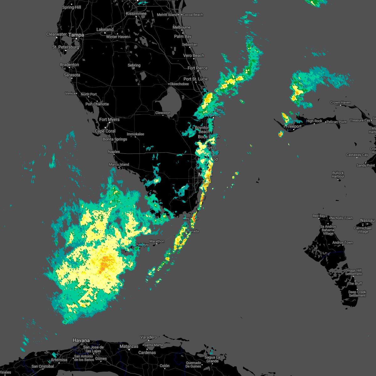 The severe thunderstorm warning for central miami-dade county will expire at 1130 am est, the storm which prompted the warning has moved out of the area. therefore, the warning will be allowed to expire. The severe thunderstorm warning for central miami-dade county will expire at 1130 am est, the storm which prompted the warning has moved out of the area. therefore, the warning will be allowed to expire.
|
| 12/21/2021 11:08 AM EST |
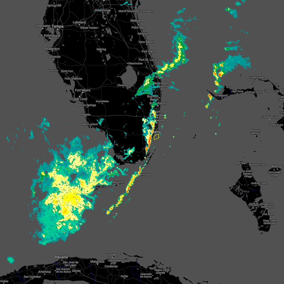 At 1107 am est, a severe thunderstorm was located over key biscayne, moving east at 30 mph (radar indicated). Hazards include 60 mph wind gusts. expect damage to roofs, siding, and trees At 1107 am est, a severe thunderstorm was located over key biscayne, moving east at 30 mph (radar indicated). Hazards include 60 mph wind gusts. expect damage to roofs, siding, and trees
|
| 12/21/2021 11:00 AM EST | A member of the public reported via social media car damage due to a wind driven coconut associated with a strong thunderstorm wind gust moving through the area. wind o in miami-dade county FL, 3 miles NW of Miami, FL |
| 11/5/2021 6:51 AM EDT |
 The severe thunderstorm warning for northern miami-dade county will expire at 700 am edt, the storm which prompted the warning has moved out of the area. therefore, the warning will be allowed to expire. however gusty winds and heavy rain are still possible with this thunderstorm. The severe thunderstorm warning for northern miami-dade county will expire at 700 am edt, the storm which prompted the warning has moved out of the area. therefore, the warning will be allowed to expire. however gusty winds and heavy rain are still possible with this thunderstorm.
|
| 11/5/2021 6:23 AM EDT |
 At 623 am edt, a severe thunderstorm was located over miami beach, moving northeast at 10 mph (radar indicated). Hazards include 60 mph wind gusts and quarter size hail. Hail damage to vehicles is expected. Expect wind damage to roofs, siding, and trees. At 623 am edt, a severe thunderstorm was located over miami beach, moving northeast at 10 mph (radar indicated). Hazards include 60 mph wind gusts and quarter size hail. Hail damage to vehicles is expected. Expect wind damage to roofs, siding, and trees.
|
| 9/1/2021 5:10 PM EDT | Emergency management reports a fence blown over and large hardwood tree branch down due to a thunderstorm wind gust. time is radar estimate in miami-dade county FL, 5.3 miles NE of Miami, FL |
| 8/25/2021 6:35 AM EDT |
 The severe thunderstorm warning for eastern miami-dade county will expire at 645 am edt, the storm which prompted the warning has weakened below severe limits, and no longer poses an immediate threat to life or property. therefore, the warning will be allowed to expire. however gusty winds and heavy rain are still possible with this thunderstorm. to report severe weather, contact your nearest law enforcement agency. they will relay your report to the national weather service miami. you can also share your report with nws miami on facebook and twitter. The severe thunderstorm warning for eastern miami-dade county will expire at 645 am edt, the storm which prompted the warning has weakened below severe limits, and no longer poses an immediate threat to life or property. therefore, the warning will be allowed to expire. however gusty winds and heavy rain are still possible with this thunderstorm. to report severe weather, contact your nearest law enforcement agency. they will relay your report to the national weather service miami. you can also share your report with nws miami on facebook and twitter.
|
| 8/25/2021 6:33 AM EDT |
 At 632 am edt, a severe thunderstorm was located over glenvar heights, or over south miami, moving west at 20 mph (radar indicated). Hazards include 60 mph wind gusts. Expect damage to roofs, siding, and trees. Locations impacted include, miami, coral gables, south miami, kendall and the redland. At 632 am edt, a severe thunderstorm was located over glenvar heights, or over south miami, moving west at 20 mph (radar indicated). Hazards include 60 mph wind gusts. Expect damage to roofs, siding, and trees. Locations impacted include, miami, coral gables, south miami, kendall and the redland.
|
| 8/25/2021 6:16 AM EDT |
 At 615 am edt, a severe thunderstorm was located over key biscayne, moving west at 30 mph (radar indicated). Hazards include 60 mph wind gusts. Expect damage to roofs, siding, and trees. Locations impacted include, miami, miami beach, coral gables, key biscayne and south miami. At 615 am edt, a severe thunderstorm was located over key biscayne, moving west at 30 mph (radar indicated). Hazards include 60 mph wind gusts. Expect damage to roofs, siding, and trees. Locations impacted include, miami, miami beach, coral gables, key biscayne and south miami.
|
| 8/25/2021 6:12 AM EDT |
 At 612 am edt, a severe thunderstorm was located near key biscayne, moving west at 30 mph (radar indicated). Hazards include 60 mph wind gusts. expect damage to roofs, siding, and trees At 612 am edt, a severe thunderstorm was located near key biscayne, moving west at 30 mph (radar indicated). Hazards include 60 mph wind gusts. expect damage to roofs, siding, and trees
|
| 8/12/2021 5:05 PM EDT |
 The severe thunderstorm warning for northern miami-dade and southern broward counties will expire at 515 pm edt, the storms which prompted the warning have weakened below severe limits, and no longer pose an immediate threat to life or property. therefore, the warning will be allowed to expire. however gusty winds and heavy rain are still possible with these thunderstorms. to report severe weather, contact your nearest law enforcement agency. they will relay your report to the national weather service miami. you can also share your report with nws miami on facebook and twitter. The severe thunderstorm warning for northern miami-dade and southern broward counties will expire at 515 pm edt, the storms which prompted the warning have weakened below severe limits, and no longer pose an immediate threat to life or property. therefore, the warning will be allowed to expire. however gusty winds and heavy rain are still possible with these thunderstorms. to report severe weather, contact your nearest law enforcement agency. they will relay your report to the national weather service miami. you can also share your report with nws miami on facebook and twitter.
|
| 8/3/2021 8:06 PM EDT |
 The severe thunderstorm warning for northern miami-dade and broward counties will expire at 815 pm edt, the storms which prompted the warning have weakened below severe limits, and no longer pose an immediate threat to life or property. therefore, the warning will be allowed to expire. however gusty winds and heavy rain are still possible with these thunderstorms. The severe thunderstorm warning for northern miami-dade and broward counties will expire at 815 pm edt, the storms which prompted the warning have weakened below severe limits, and no longer pose an immediate threat to life or property. therefore, the warning will be allowed to expire. however gusty winds and heavy rain are still possible with these thunderstorms.
|
| 8/3/2021 7:43 PM EDT |
 At 743 pm edt, severe thunderstorms were located along a line extending from coconut creek to miami springs, moving east at 20 mph (radar indicated). Hazards include 60 mph wind gusts. expect damage to roofs, siding, and trees At 743 pm edt, severe thunderstorms were located along a line extending from coconut creek to miami springs, moving east at 20 mph (radar indicated). Hazards include 60 mph wind gusts. expect damage to roofs, siding, and trees
|
| 8/3/2021 7:36 PM EDT |
 At 736 pm edt, severe thunderstorms were located along a line extending from margate to doral, moving east at 30 mph (radar indicated). Hazards include 60 mph wind gusts and penny size hail. Expect damage to roofs, siding, and trees. Locations impacted include, miami, hialeah, fort lauderdale, pembroke pines and hollywood. At 736 pm edt, severe thunderstorms were located along a line extending from margate to doral, moving east at 30 mph (radar indicated). Hazards include 60 mph wind gusts and penny size hail. Expect damage to roofs, siding, and trees. Locations impacted include, miami, hialeah, fort lauderdale, pembroke pines and hollywood.
|
| 8/3/2021 7:05 PM EDT |
 At 705 pm edt, severe thunderstorms were located along a line extending from 6 miles north of intersection i-75 and u.s. 27 to near miccosukee resort, moving east at 30 mph (radar indicated). Hazards include 60 mph wind gusts and penny size hail. expect damage to roofs, siding, and trees At 705 pm edt, severe thunderstorms were located along a line extending from 6 miles north of intersection i-75 and u.s. 27 to near miccosukee resort, moving east at 30 mph (radar indicated). Hazards include 60 mph wind gusts and penny size hail. expect damage to roofs, siding, and trees
|
| 7/23/2021 6:22 PM EDT |
 At 622 pm edt, a severe thunderstorm was located over dania beach, or over hollywood, moving southeast at 15 mph (radar indicated). Hazards include 60 mph wind gusts and quarter size hail. Hail damage to vehicles is expected. Expect wind damage to roofs, siding, and trees. At 622 pm edt, a severe thunderstorm was located over dania beach, or over hollywood, moving southeast at 15 mph (radar indicated). Hazards include 60 mph wind gusts and quarter size hail. Hail damage to vehicles is expected. Expect wind damage to roofs, siding, and trees.
|
| 7/12/2021 8:42 PM EDT |
 At 842 pm edt, severe thunderstorms were located along a line extending from opa-locka to sweetwater to princeton, moving west at 30 mph (radar indicated). Hazards include 60 mph wind gusts. Expect damage to roofs, siding, and trees. Locations impacted include, miami, hialeah, miramar, south miami and miami gardens. At 842 pm edt, severe thunderstorms were located along a line extending from opa-locka to sweetwater to princeton, moving west at 30 mph (radar indicated). Hazards include 60 mph wind gusts. Expect damage to roofs, siding, and trees. Locations impacted include, miami, hialeah, miramar, south miami and miami gardens.
|
| 7/12/2021 8:38 PM EDT | Local broadcast media relayed report of a large tree that fell on a car on near the intersection of the venetian causeway and herald plaza. time estimated from rada in miami-dade county FL, 3.2 miles W of Miami, FL |
| 7/12/2021 8:35 PM EDT |
 At 835 pm edt, severe thunderstorms were located along a line extending from golden glades to near black point, moving west at 25 mph (radar indicated). Hazards include 60 mph wind gusts. expect damage to roofs, siding, and trees At 835 pm edt, severe thunderstorms were located along a line extending from golden glades to near black point, moving west at 25 mph (radar indicated). Hazards include 60 mph wind gusts. expect damage to roofs, siding, and trees
|
| 7/12/2021 11:44 AM EDT |
 At 1143 am edt, a severe thunderstorm was located over miami beach, moving northwest at 15 mph (radar indicated). Hazards include 60 mph wind gusts. expect damage to roofs, siding, and trees At 1143 am edt, a severe thunderstorm was located over miami beach, moving northwest at 15 mph (radar indicated). Hazards include 60 mph wind gusts. expect damage to roofs, siding, and trees
|
| 7/5/2021 3:56 PM EDT |
 The severe thunderstorm warning for northern miami-dade county will expire at 400 pm edt, the storms which prompted the warning have weakened below severe limits, and no longer pose an immediate threat to life or property. therefore, the warning will be allowed to expire. however gusty winds and heavy rain are still possible with these thunderstorms. to report severe weather, contact your nearest law enforcement agency. they will relay your report to the national weather service miami. The severe thunderstorm warning for northern miami-dade county will expire at 400 pm edt, the storms which prompted the warning have weakened below severe limits, and no longer pose an immediate threat to life or property. therefore, the warning will be allowed to expire. however gusty winds and heavy rain are still possible with these thunderstorms. to report severe weather, contact your nearest law enforcement agency. they will relay your report to the national weather service miami.
|
| 7/5/2021 3:52 PM EDT |
 The tornado warning for northern miami-dade county will expire at 400 pm edt, the tornado threat has diminished and the tornado warning has been cancelled. however, damaging winds remain likely and a severe thunderstorm warning remains in effect for the area. heavy rain is also still possible. to report severe weather, contact your nearest law enforcement agency. they will relay your report to the national weather service miami. remember, a severe thunderstorm warning still remains in effect for eastern miami-dade county until 400 pm edt. The tornado warning for northern miami-dade county will expire at 400 pm edt, the tornado threat has diminished and the tornado warning has been cancelled. however, damaging winds remain likely and a severe thunderstorm warning remains in effect for the area. heavy rain is also still possible. to report severe weather, contact your nearest law enforcement agency. they will relay your report to the national weather service miami. remember, a severe thunderstorm warning still remains in effect for eastern miami-dade county until 400 pm edt.
|
| 7/5/2021 3:37 PM EDT |
 At 336 pm edt, severe thunderstorms capable of producing both tornadoes and extensive straight line wind damage were located over miami international airport, or near hialeah, moving north at 30 mph (radar indicated rotation). Hazards include tornado. Expect damage to mobile homes, roofs, and vehicles. Tree damage is likely. At 336 pm edt, severe thunderstorms capable of producing both tornadoes and extensive straight line wind damage were located over miami international airport, or near hialeah, moving north at 30 mph (radar indicated rotation). Hazards include tornado. Expect damage to mobile homes, roofs, and vehicles. Tree damage is likely.
|
| 7/5/2021 3:35 PM EDT |
 At 335 pm edt, severe thunderstorms were located along a line extending from 8 miles east of fisher island to coconut grove, moving northwest at 30 mph (radar indicated). Hazards include 60 mph wind gusts. Expect damage to roofs, siding, and trees. Locations impacted include, miami, hialeah, miami beach, coral gables and key biscayne. At 335 pm edt, severe thunderstorms were located along a line extending from 8 miles east of fisher island to coconut grove, moving northwest at 30 mph (radar indicated). Hazards include 60 mph wind gusts. Expect damage to roofs, siding, and trees. Locations impacted include, miami, hialeah, miami beach, coral gables and key biscayne.
|
| 7/5/2021 3:08 PM EDT |
 At 307 pm edt, severe thunderstorms were located along a line extending from 16 miles east of key biscayne to 9 miles east of black point, moving north at 30 mph (radar indicated). Hazards include 60 mph wind gusts. expect damage to roofs, siding, and trees At 307 pm edt, severe thunderstorms were located along a line extending from 16 miles east of key biscayne to 9 miles east of black point, moving north at 30 mph (radar indicated). Hazards include 60 mph wind gusts. expect damage to roofs, siding, and trees
|
| 6/29/2021 5:40 PM EDT |
 At 539 pm edt, a severe thunderstorm was located over miami, moving northwest at 15 mph (radar indicated). Hazards include 60 mph wind gusts. Expect damage to roofs, siding, and trees. Locations impacted include, miami, hialeah, coral gables, south miami and doral. At 539 pm edt, a severe thunderstorm was located over miami, moving northwest at 15 mph (radar indicated). Hazards include 60 mph wind gusts. Expect damage to roofs, siding, and trees. Locations impacted include, miami, hialeah, coral gables, south miami and doral.
|
| 6/29/2021 5:26 PM EDT |
 At 526 pm edt, a severe thunderstorm was located over downtown miami, or over virginia key, moving northwest at 15 mph (radar indicated). Hazards include 60 mph wind gusts. expect damage to roofs, siding, and trees At 526 pm edt, a severe thunderstorm was located over downtown miami, or over virginia key, moving northwest at 15 mph (radar indicated). Hazards include 60 mph wind gusts. expect damage to roofs, siding, and trees
|
| 5/6/2021 8:25 PM EDT | Off-duty nws employee reported downed small to medium sized branches (wind speed estimated at 50 to 55 mph) and about 3 inches of standing water in the right lane aroun in miami-dade county FL, 2.6 miles NNW of Miami, FL |
| 5/6/2021 8:10 PM EDT | Corrects previous tstm wnd dmg report from 2 sw miami. off-duty nws employee reported downed small to medium sized branches (wind speed estimated at 50 to 55 mph) and a in miami-dade county FL, 2.6 miles NNW of Miami, FL |
| 5/6/2021 7:52 PM EDT |
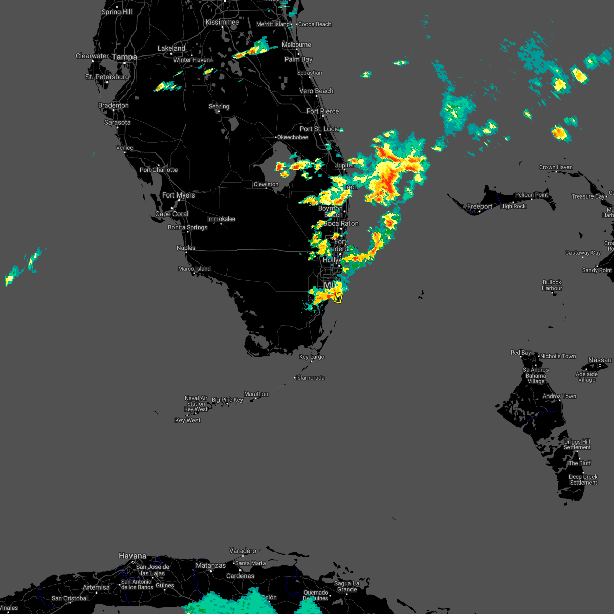 At 751 pm edt, a severe thunderstorm was located over key biscayne, moving southeast at 15 mph (radar indicated). Hazards include 60 mph wind gusts and quarter size hail. Hail damage to vehicles is expected. Expect wind damage to roofs, siding, and trees. At 751 pm edt, a severe thunderstorm was located over key biscayne, moving southeast at 15 mph (radar indicated). Hazards include 60 mph wind gusts and quarter size hail. Hail damage to vehicles is expected. Expect wind damage to roofs, siding, and trees.
|
| 4/11/2021 5:40 PM EDT | Relayed via broadcast media. lanai destroyed. gutters also removed surrounding the lanai. time estimated from rada in miami-dade county FL, 16.1 miles NNE of Miami, FL |
| 3/6/2021 5:24 PM EST |
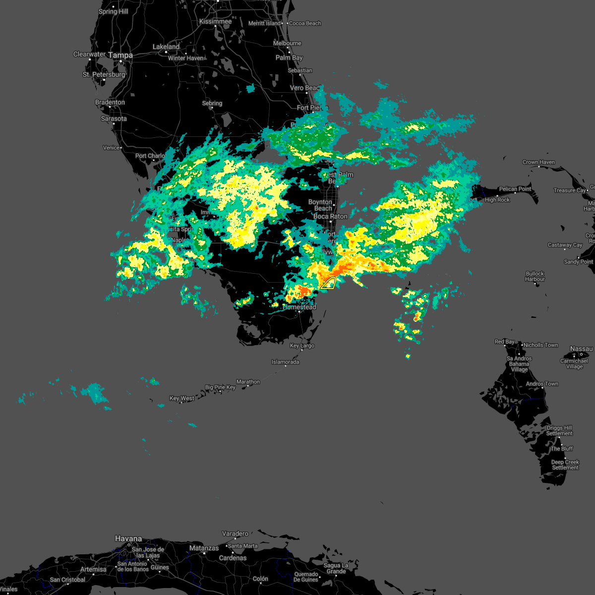 At 523 pm est, severe thunderstorms were located along a line extending from miami beach to downtown miami to coral gables, moving east at 15 mph (radar indicated). Hazards include 60 mph wind gusts and penny size hail. expect damage to roofs, siding, and trees At 523 pm est, severe thunderstorms were located along a line extending from miami beach to downtown miami to coral gables, moving east at 15 mph (radar indicated). Hazards include 60 mph wind gusts and penny size hail. expect damage to roofs, siding, and trees
|
| 3/6/2021 4:51 PM EST |
 At 451 pm est, severe thunderstorms were located along a line extending from hallandale to miami springs, moving east at 15 mph (radar indicated). Hazards include 60 mph wind gusts and penny size hail. Expect damage to roofs, siding, and trees. Locations impacted include, miami, hialeah, miami beach, surfside and north miami. At 451 pm est, severe thunderstorms were located along a line extending from hallandale to miami springs, moving east at 15 mph (radar indicated). Hazards include 60 mph wind gusts and penny size hail. Expect damage to roofs, siding, and trees. Locations impacted include, miami, hialeah, miami beach, surfside and north miami.
|
| 3/6/2021 4:47 PM EST |
 At 447 pm est, severe thunderstorms were located along a line extending from aventura to miami springs, moving east at 15 mph (radar indicated). Hazards include 60 mph wind gusts and penny size hail. Expect damage to roofs, siding, and trees. Locations impacted include, miami, hialeah, miami beach, surfside and miami gardens. At 447 pm est, severe thunderstorms were located along a line extending from aventura to miami springs, moving east at 15 mph (radar indicated). Hazards include 60 mph wind gusts and penny size hail. Expect damage to roofs, siding, and trees. Locations impacted include, miami, hialeah, miami beach, surfside and miami gardens.
|
| 3/6/2021 4:27 PM EST |
 At 426 pm est, severe thunderstorms were located along a line extending from near hard rock stadium to doral, moving east at 15 mph (radar indicated). Hazards include 60 mph wind gusts and penny size hail. expect damage to roofs, siding, and trees At 426 pm est, severe thunderstorms were located along a line extending from near hard rock stadium to doral, moving east at 15 mph (radar indicated). Hazards include 60 mph wind gusts and penny size hail. expect damage to roofs, siding, and trees
|
| 8/24/2020 2:26 PM EDT |
 The severe thunderstorm warning for northern miami-dade county will expire at 230 pm edt, the storms which prompted the warning have weakened below severe limits, and no longer pose an immediate threat to life or property. therefore, the warning will be allowed to expire. however gusty winds are still possible with these thunderstorms. The severe thunderstorm warning for northern miami-dade county will expire at 230 pm edt, the storms which prompted the warning have weakened below severe limits, and no longer pose an immediate threat to life or property. therefore, the warning will be allowed to expire. however gusty winds are still possible with these thunderstorms.
|
| 8/24/2020 2:14 PM EDT |
 At 213 pm edt, severe thunderstorms were located along a line extending from 13 miles east of miami beach to tamiami, moving northwest at 45 mph (radar indicated). Hazards include 60 mph wind gusts. Expect damage to roofs, siding, and trees. Locations impacted include, miami, hialeah, miramar, miami beach and coral gables. At 213 pm edt, severe thunderstorms were located along a line extending from 13 miles east of miami beach to tamiami, moving northwest at 45 mph (radar indicated). Hazards include 60 mph wind gusts. Expect damage to roofs, siding, and trees. Locations impacted include, miami, hialeah, miramar, miami beach and coral gables.
|
| 8/24/2020 2:10 PM EDT | Earth networks site mmmch at nicklaus children hospital recorded a 60 mph wind gust associated with a quick-moving thunderstor in miami-dade county FL, 4.2 miles NE of Miami, FL |
| 8/24/2020 1:50 PM EDT |
 At 149 pm edt, severe thunderstorms were located along a line extending from 25 miles southeast of key biscayne to near black point, moving northwest at 55 mph (radar indicated). Hazards include 60 mph wind gusts. expect damage to roofs, siding, and trees At 149 pm edt, severe thunderstorms were located along a line extending from 25 miles southeast of key biscayne to near black point, moving northwest at 55 mph (radar indicated). Hazards include 60 mph wind gusts. expect damage to roofs, siding, and trees
|
| 5/18/2020 8:30 PM EDT |
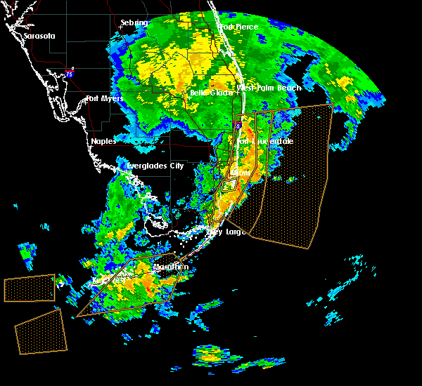 At 830 pm edt, a severe thunderstorm was located over key biscayne, moving east at 15 mph (radar indicated). Hazards include 60 mph wind gusts. Expect damage to roofs, siding, and trees. Locations impacted include, miami, miami beach, key biscayne, virginia key and fisher island. At 830 pm edt, a severe thunderstorm was located over key biscayne, moving east at 15 mph (radar indicated). Hazards include 60 mph wind gusts. Expect damage to roofs, siding, and trees. Locations impacted include, miami, miami beach, key biscayne, virginia key and fisher island.
|
| 5/18/2020 8:17 PM EDT |
 At 816 pm edt, a severe thunderstorm was approaching key biscayne, moving east at 25 mph (radar indicated). Hazards include 70 mph wind gusts and quarter size hail. Hail damage to vehicles is expected. expect considerable tree damage. wind damage is also likely to mobile homes, roofs, and outbuildings. Locations impacted include, miami, miami beach, coral gables, key biscayne and south miami. At 816 pm edt, a severe thunderstorm was approaching key biscayne, moving east at 25 mph (radar indicated). Hazards include 70 mph wind gusts and quarter size hail. Hail damage to vehicles is expected. expect considerable tree damage. wind damage is also likely to mobile homes, roofs, and outbuildings. Locations impacted include, miami, miami beach, coral gables, key biscayne and south miami.
|
| 5/18/2020 8:10 PM EDT |
 At 810 pm edt, a severe thunderstorm was located over coral gables, moving east at 30 mph (radar indicated). Hazards include 60 mph wind gusts and penny size hail. expect damage to roofs, siding, and trees At 810 pm edt, a severe thunderstorm was located over coral gables, moving east at 30 mph (radar indicated). Hazards include 60 mph wind gusts and penny size hail. expect damage to roofs, siding, and trees
|
| 5/17/2020 4:30 PM EDT | An off-duty nws employee reported multiple medium sized tree branches down near hammock oaks and old cutler road. time estimated via rada in miami-dade county FL, 7.5 miles NNE of Miami, FL |
| 5/17/2020 4:25 PM EDT | An off-duty nws employee reported multiple medium and large tree branches down near percival and oaks avenues. time estimated via rada in miami-dade county FL, 3.7 miles N of Miami, FL |
| 5/17/2020 4:22 PM EDT |
 At 422 pm edt, a severe thunderstorm was located over palmetto bay, or near kendall, moving south at 10 mph (radar indicated). Hazards include 60 mph wind gusts and nickel size hail. Expect damage to roofs, siding, and trees. Locations impacted include, miami, miami beach, coral gables, key biscayne and south miami. At 422 pm edt, a severe thunderstorm was located over palmetto bay, or near kendall, moving south at 10 mph (radar indicated). Hazards include 60 mph wind gusts and nickel size hail. Expect damage to roofs, siding, and trees. Locations impacted include, miami, miami beach, coral gables, key biscayne and south miami.
|
| 5/17/2020 4:15 PM EDT | An off-duty nws employee reported large tree branches down near the intersection of 104th street and 115th avenue. time estimated via rada in miami-dade county FL, 11.2 miles NE of Miami, FL |
| 5/17/2020 4:15 PM EDT | Public reported a few downed softwood trees in their backyard in the glenvar heights/south miami area via social media. radar estimated time of 415 p in miami-dade county FL, 9.9 miles NE of Miami, FL |
| 5/17/2020 4:00 PM EDT | Public reported a large tree downed onto their roof and fence around 400 p in miami-dade county FL, 3.7 miles N of Miami, FL |
| 5/17/2020 3:59 PM EDT |
 At 359 pm edt, a severe thunderstorm was located over university of miami, or over south miami, moving east at 5 mph (radar indicated). Hazards include 60 mph wind gusts and nickel size hail. expect damage to roofs, siding, and trees At 359 pm edt, a severe thunderstorm was located over university of miami, or over south miami, moving east at 5 mph (radar indicated). Hazards include 60 mph wind gusts and nickel size hail. expect damage to roofs, siding, and trees
|
| 5/17/2020 3:28 PM EDT |
 At 328 pm edt, severe thunderstorms were located along a line extending from hard rock stadium to golden glades to port of miami, moving east at 25 mph (radar indicated). Hazards include 60 mph wind gusts and half dollar size hail. Hail damage to vehicles is expected. expect wind damage to roofs, siding, and trees. Locations impacted include, miami, hialeah, fort lauderdale, pembroke pines and hollywood. At 328 pm edt, severe thunderstorms were located along a line extending from hard rock stadium to golden glades to port of miami, moving east at 25 mph (radar indicated). Hazards include 60 mph wind gusts and half dollar size hail. Hail damage to vehicles is expected. expect wind damage to roofs, siding, and trees. Locations impacted include, miami, hialeah, fort lauderdale, pembroke pines and hollywood.
|
| 5/17/2020 3:21 PM EDT |
 At 321 pm edt, severe thunderstorms were located along a line extending from west park to near opa-locka to port of miami, moving east at 25 mph (radar indicated). Hazards include 60 mph wind gusts and half dollar size hail. Hail damage to vehicles is expected. Expect wind damage to roofs, siding, and trees. At 321 pm edt, severe thunderstorms were located along a line extending from west park to near opa-locka to port of miami, moving east at 25 mph (radar indicated). Hazards include 60 mph wind gusts and half dollar size hail. Hail damage to vehicles is expected. Expect wind damage to roofs, siding, and trees.
|
| 4/30/2020 2:13 PM EDT | Roadside-display unit and ancillary items blown over and disaggregated on biscayne boulevard across the street from american airlines aren in miami-dade county FL, 3.3 miles WNW of Miami, FL |
| 4/30/2020 2:10 PM EDT | National weather service meteorologist estimates winds at least 60 mph on biscayne boulevard across the street from american airlines aren in miami-dade county FL, 3.2 miles W of Miami, FL |
| 4/30/2020 2:07 PM EDT |
 At 207 pm edt, severe thunderstorms were located along a line extending from miramar parkway and university drive to coconut grove to near black point, moving east at 20 mph. winds in excess of 60 mph are ongoing (national weather service employee). Hazards include 70 mph wind gusts and penny size hail. Expect considerable tree damage. damage is likely to mobile homes, roofs, and outbuildings. Locations impacted include, miami, hialeah, pembroke pines, hollywood and miramar. At 207 pm edt, severe thunderstorms were located along a line extending from miramar parkway and university drive to coconut grove to near black point, moving east at 20 mph. winds in excess of 60 mph are ongoing (national weather service employee). Hazards include 70 mph wind gusts and penny size hail. Expect considerable tree damage. damage is likely to mobile homes, roofs, and outbuildings. Locations impacted include, miami, hialeah, pembroke pines, hollywood and miramar.
|
| 4/30/2020 2:00 PM EDT | Social media indicates large... rod-supported... outdoors shelter unit flipped over and damaged in backyard of a member of the public near intersection of northwest 24t in miami-dade county FL, 1.8 miles SW of Miami, FL |
| 4/30/2020 1:56 PM EDT | Thin metal carport and associated tarp destroyed with cluster of thunderstorms that earlier moved through the miami area. these items were described as ligh in miami-dade county FL, 7.1 miles ENE of Miami, FL |
| 4/30/2020 1:55 PM EDT | Miami international airport-south terminal on earthnetworks in miami-dade county FL, 1.9 miles ESE of Miami, FL |
| 4/30/2020 1:50 PM EDT |
 At 150 pm edt, severe thunderstorms were located along a line extending from near pembroke pines to doral to country walk, moving east at 35 mph (radar indicated). Hazards include 60 mph wind gusts and penny size hail. Expect damage to roofs, siding, and trees. Locations impacted include, miami, hialeah, miramar, coral gables and south miami. At 150 pm edt, severe thunderstorms were located along a line extending from near pembroke pines to doral to country walk, moving east at 35 mph (radar indicated). Hazards include 60 mph wind gusts and penny size hail. Expect damage to roofs, siding, and trees. Locations impacted include, miami, hialeah, miramar, coral gables and south miami.
|
| 4/30/2020 1:42 PM EDT | Photo of tree split... with large branch down on twitter. sw 8th st and sw 127th ave in miami in miami-dade county FL, 10 miles E of Miami, FL |
| 4/30/2020 1:42 PM EDT | Picture received of a moderate- to large-size tree split... with much of the tree having fallen over in the kendalltown area. this is in association with a cluster of s in miami-dade county FL, 9.8 miles NE of Miami, FL |
| 4/30/2020 1:42 PM EDT |
 At 142 pm edt, severe thunderstorms were located along a line extending from near intersection krome and u.s. 27 to near tamiami to the redland, moving east at 35 mph (radar indicated). Hazards include 70 mph wind gusts and penny size hail. Expect considerable tree damage. Damage is likely to mobile homes, roofs, and outbuildings. At 142 pm edt, severe thunderstorms were located along a line extending from near intersection krome and u.s. 27 to near tamiami to the redland, moving east at 35 mph (radar indicated). Hazards include 70 mph wind gusts and penny size hail. Expect considerable tree damage. Damage is likely to mobile homes, roofs, and outbuildings.
|
| 4/30/2020 1:31 PM EDT |
 At 131 pm edt, severe thunderstorms were located along a line extending from 7 miles west of intersection krome and u.s. 27 to miccosukee resort to 6 miles northwest of homestead general airport, moving east at 35 mph (radar indicated). Hazards include 70 mph wind gusts and penny size hail. Expect considerable tree damage. damage is likely to mobile homes, roofs, and outbuildings. Locations impacted include, miami, hialeah, miramar, coral gables and south miami. At 131 pm edt, severe thunderstorms were located along a line extending from 7 miles west of intersection krome and u.s. 27 to miccosukee resort to 6 miles northwest of homestead general airport, moving east at 35 mph (radar indicated). Hazards include 70 mph wind gusts and penny size hail. Expect considerable tree damage. damage is likely to mobile homes, roofs, and outbuildings. Locations impacted include, miami, hialeah, miramar, coral gables and south miami.
|
| 4/30/2020 1:20 PM EDT |
 At 120 pm edt, severe thunderstorms were located along a line extending from 13 miles west of intersection krome and u.s. 27 to 8 miles west of miccosukee resort to 8 miles southeast of shark valley obs tower, moving east at 35 mph (radar indicated). Hazards include 60 mph wind gusts and penny size hail. expect damage to roofs, siding, and trees At 120 pm edt, severe thunderstorms were located along a line extending from 13 miles west of intersection krome and u.s. 27 to 8 miles west of miccosukee resort to 8 miles southeast of shark valley obs tower, moving east at 35 mph (radar indicated). Hazards include 60 mph wind gusts and penny size hail. expect damage to roofs, siding, and trees
|
| 4/18/2020 4:06 PM EDT |
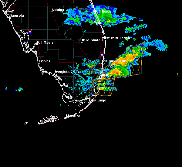 At 406 pm edt, severe thunderstorms were located along a line extending from coral gables to near miami beach, moving south at 25 mph (radar indicated). Hazards include 60 mph wind gusts and quarter size hail. Hail damage to vehicles is expected. expect wind damage to roofs, siding, and trees. Locations impacted include, miami, miami beach, coral gables, key biscayne and virginia key. At 406 pm edt, severe thunderstorms were located along a line extending from coral gables to near miami beach, moving south at 25 mph (radar indicated). Hazards include 60 mph wind gusts and quarter size hail. Hail damage to vehicles is expected. expect wind damage to roofs, siding, and trees. Locations impacted include, miami, miami beach, coral gables, key biscayne and virginia key.
|
| 4/18/2020 3:59 PM EDT |
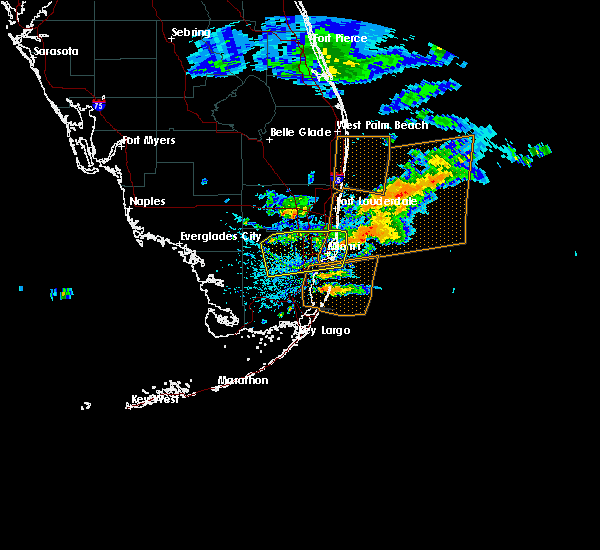 At 353 pm edt, thunderstorms were located along a line extending from near miami international airport to 13 miles east of sunny isles beach, moving east at 30 mph. while this activity has weakened, it will have the potential to re-intensify to severe levels during the next half hour or so (radar indicated). Hazards include 60 mph wind gusts and quarter size hail. Hail damage to vehicles is expected. expect wind damage to roofs, siding, and trees. Locations impacted include, miami, hialeah, miami beach, coral gables and key biscayne. At 353 pm edt, thunderstorms were located along a line extending from near miami international airport to 13 miles east of sunny isles beach, moving east at 30 mph. while this activity has weakened, it will have the potential to re-intensify to severe levels during the next half hour or so (radar indicated). Hazards include 60 mph wind gusts and quarter size hail. Hail damage to vehicles is expected. expect wind damage to roofs, siding, and trees. Locations impacted include, miami, hialeah, miami beach, coral gables and key biscayne.
|
| 4/18/2020 3:54 PM EDT |
 At 353 pm edt, thunderstorms were located along a line extending from near miami international airport to 13 miles east of sunny isles beach, moving east at 30 mph. while this activity has weakened, it will have the potential to re-intensify to severe levels during the next half hour or so (radar indicated). Hazards include 60 mph wind gusts and quarter size hail. Hail damage to vehicles is expected. expect wind damage to roofs, siding, and trees. Locations impacted include, miami, hialeah, miami beach, coral gables and key biscayne. At 353 pm edt, thunderstorms were located along a line extending from near miami international airport to 13 miles east of sunny isles beach, moving east at 30 mph. while this activity has weakened, it will have the potential to re-intensify to severe levels during the next half hour or so (radar indicated). Hazards include 60 mph wind gusts and quarter size hail. Hail damage to vehicles is expected. expect wind damage to roofs, siding, and trees. Locations impacted include, miami, hialeah, miami beach, coral gables and key biscayne.
|
| 4/18/2020 3:49 PM EDT |
 At 347 pm edt, thunderstorms were located along a line extending from 13 miles northwest of miccosukee resort to 12 miles east of hallandale, moving south at 20 mph. this activity has weakened during the past 15 to 20 minutes. however, radar and satellite imagery indicate potential thunderstorms redeveloping over northern miami-dade county, and this activity could intensify to severe levels during the duration of the severe thunderstorm warning. as a result, the warning remains in effect (radar indicated). Hazards include 60 mph wind gusts and quarter size hail. Hail damage to vehicles is expected. expect wind damage to roofs, siding, and trees. Locations impacted include, miami, hialeah, miramar, miami beach and coral gables. At 347 pm edt, thunderstorms were located along a line extending from 13 miles northwest of miccosukee resort to 12 miles east of hallandale, moving south at 20 mph. this activity has weakened during the past 15 to 20 minutes. however, radar and satellite imagery indicate potential thunderstorms redeveloping over northern miami-dade county, and this activity could intensify to severe levels during the duration of the severe thunderstorm warning. as a result, the warning remains in effect (radar indicated). Hazards include 60 mph wind gusts and quarter size hail. Hail damage to vehicles is expected. expect wind damage to roofs, siding, and trees. Locations impacted include, miami, hialeah, miramar, miami beach and coral gables.
|
| 4/18/2020 3:38 PM EDT |
 At 338 pm edt, severe thunderstorms were located along a line extending from near intersection krome and u.s. 27 to 11 miles east of hallandale, moving southeast at 30 mph (radar indicated). Hazards include 60 mph wind gusts and quarter size hail. Hail damage to vehicles is expected. expect wind damage to roofs, siding, and trees. Locations impacted include, miami, hialeah, miramar, miami beach and coral gables. At 338 pm edt, severe thunderstorms were located along a line extending from near intersection krome and u.s. 27 to 11 miles east of hallandale, moving southeast at 30 mph (radar indicated). Hazards include 60 mph wind gusts and quarter size hail. Hail damage to vehicles is expected. expect wind damage to roofs, siding, and trees. Locations impacted include, miami, hialeah, miramar, miami beach and coral gables.
|
| 4/18/2020 3:23 PM EDT |
 At 323 pm edt, severe thunderstorms were located along a line extending from 13 miles northwest of miccosukee resort to 8 miles east of hollywood, moving southeast at 25 mph (radar indicated). Hazards include 60 mph wind gusts and quarter size hail. Hail damage to vehicles is expected. expect wind damage to roofs, siding, and trees. Locations impacted include, miami, hialeah, pembroke pines, hollywood and miramar. At 323 pm edt, severe thunderstorms were located along a line extending from 13 miles northwest of miccosukee resort to 8 miles east of hollywood, moving southeast at 25 mph (radar indicated). Hazards include 60 mph wind gusts and quarter size hail. Hail damage to vehicles is expected. expect wind damage to roofs, siding, and trees. Locations impacted include, miami, hialeah, pembroke pines, hollywood and miramar.
|
| 4/18/2020 3:08 PM EDT |
 At 308 pm edt, severe thunderstorms were located along a line extending from 13 miles south of intersection alligator alley and miami canal to near lauderdale-by-the-sea, moving southeast at 25 mph (radar indicated). Hazards include 60 mph wind gusts and quarter size hail. Hail damage to vehicles is expected. Expect wind damage to roofs, siding, and trees. At 308 pm edt, severe thunderstorms were located along a line extending from 13 miles south of intersection alligator alley and miami canal to near lauderdale-by-the-sea, moving southeast at 25 mph (radar indicated). Hazards include 60 mph wind gusts and quarter size hail. Hail damage to vehicles is expected. Expect wind damage to roofs, siding, and trees.
|
| 3/6/2020 9:08 AM EST |
 The severe thunderstorm warning for central miami-dade county will expire at 915 am est, the storm which prompted the warning has moved out of the area. therefore, the warning will be allowed to expire. The severe thunderstorm warning for central miami-dade county will expire at 915 am est, the storm which prompted the warning has moved out of the area. therefore, the warning will be allowed to expire.
|
| 3/6/2020 8:41 AM EST |
 At 841 am est, a severe thunderstorm was located over richmond heights, or near kendall, moving east at 30 mph (radar indicated). Hazards include 60 mph wind gusts. expect damage to roofs, siding, and trees At 841 am est, a severe thunderstorm was located over richmond heights, or near kendall, moving east at 30 mph (radar indicated). Hazards include 60 mph wind gusts. expect damage to roofs, siding, and trees
|
| 2/1/2020 12:31 AM EST |
 At 1231 am est, severe thunderstorms were located along a line extending from miami springs to port of miami to virginia key, moving northeast at 35 mph (radar indicated). Hazards include 60 mph wind gusts. Expect damage to roofs, siding, and trees. Locations impacted include, miami, hialeah, miami beach, surfside and virginia key. At 1231 am est, severe thunderstorms were located along a line extending from miami springs to port of miami to virginia key, moving northeast at 35 mph (radar indicated). Hazards include 60 mph wind gusts. Expect damage to roofs, siding, and trees. Locations impacted include, miami, hialeah, miami beach, surfside and virginia key.
|
| 2/1/2020 12:21 AM EST |
 At 1212 am est, severe thunderstorms were located along a line extending from miami beach to 14 miles southeast of key biscayne to 23 miles east of black point, moving east at 50 mph (radar indicated). Hazards include 70 mph wind gusts. Expect considerable tree damage. damage is likely to mobile homes, roofs, and outbuildings. Locations impacted include, miami, hialeah, miami beach, key biscayne and surfside. At 1212 am est, severe thunderstorms were located along a line extending from miami beach to 14 miles southeast of key biscayne to 23 miles east of black point, moving east at 50 mph (radar indicated). Hazards include 70 mph wind gusts. Expect considerable tree damage. damage is likely to mobile homes, roofs, and outbuildings. Locations impacted include, miami, hialeah, miami beach, key biscayne and surfside.
|
| 2/1/2020 12:13 AM EST |
 At 1200 am est, severe thunderstorms were located along a line extending from west miami to 8 miles south of key biscayne to 13 miles east of turkey point, moving northeast at 50 mph (radar indicated). Hazards include 70 mph wind gusts. Expect considerable tree damage. damage is likely to mobile homes, roofs, and outbuildings. Locations impacted include, miami, hialeah, miami beach, coral gables and key biscayne. At 1200 am est, severe thunderstorms were located along a line extending from west miami to 8 miles south of key biscayne to 13 miles east of turkey point, moving northeast at 50 mph (radar indicated). Hazards include 70 mph wind gusts. Expect considerable tree damage. damage is likely to mobile homes, roofs, and outbuildings. Locations impacted include, miami, hialeah, miami beach, coral gables and key biscayne.
|
| 2/1/2020 12:01 AM EST |
 At 1200 am est, severe thunderstorms were located along a line extending from west miami to 8 miles south of key biscayne to 13 miles east of turkey point, moving northeast at 50 mph (radar indicated). Hazards include 70 mph wind gusts. Expect considerable tree damage. damage is likely to mobile homes, roofs, and outbuildings. Locations impacted include, miami, hialeah, miami beach, coral gables and key biscayne. At 1200 am est, severe thunderstorms were located along a line extending from west miami to 8 miles south of key biscayne to 13 miles east of turkey point, moving northeast at 50 mph (radar indicated). Hazards include 70 mph wind gusts. Expect considerable tree damage. damage is likely to mobile homes, roofs, and outbuildings. Locations impacted include, miami, hialeah, miami beach, coral gables and key biscayne.
|
| 1/31/2020 11:47 PM EST |
 At 1147 pm est, severe thunderstorms were located along a line extending from fountainbleau to 8 miles east of black point to 6 miles east of ocean reef to 12 miles southeast of route 1/card sound, moving east at 40 mph (radar indicated). Hazards include 70 mph wind gusts. Expect considerable tree damage. damage is likely to mobile homes, roofs, and outbuildings. Locations impacted include, miami, hialeah, miami beach, coral gables and key biscayne. At 1147 pm est, severe thunderstorms were located along a line extending from fountainbleau to 8 miles east of black point to 6 miles east of ocean reef to 12 miles southeast of route 1/card sound, moving east at 40 mph (radar indicated). Hazards include 70 mph wind gusts. Expect considerable tree damage. damage is likely to mobile homes, roofs, and outbuildings. Locations impacted include, miami, hialeah, miami beach, coral gables and key biscayne.
|
| 1/31/2020 11:25 PM EST |
 At 1123 pm est, severe thunderstorms were located along a line extending from 6 miles southeast of shark valley obs tower to homestead miami speedway to 7 miles west of ocean reef to 6 miles west of jewfish creek bridge, moving east at 50 mph (radar indicated). Hazards include 70 mph wind gusts. Expect considerable tree damage. damage is likely to mobile homes, roofs, and outbuildings. Locations impacted include, miami, hialeah, miami beach, homestead and coral gables. At 1123 pm est, severe thunderstorms were located along a line extending from 6 miles southeast of shark valley obs tower to homestead miami speedway to 7 miles west of ocean reef to 6 miles west of jewfish creek bridge, moving east at 50 mph (radar indicated). Hazards include 70 mph wind gusts. Expect considerable tree damage. damage is likely to mobile homes, roofs, and outbuildings. Locations impacted include, miami, hialeah, miami beach, homestead and coral gables.
|
| 1/31/2020 11:09 PM EST |
 The national weather service in miami has issued a * severe thunderstorm warning for. central miami-dade county in southeastern florida. until 1245 am est. At 1108 pm est, severe thunderstorms were located along a line extending from 8 miles southwest of shark valley obs tower to royal. The national weather service in miami has issued a * severe thunderstorm warning for. central miami-dade county in southeastern florida. until 1245 am est. At 1108 pm est, severe thunderstorms were located along a line extending from 8 miles southwest of shark valley obs tower to royal.
|
| 8/28/2019 5:11 PM EDT | Tree down in miami-dade county FL, 12.7 miles ENE of Miami, FL |
| 7/25/2019 2:50 PM EDT |
 The severe thunderstorm warning for northern miami-dade and southern broward counties will expire at 300 pm edt, the storm which prompted the warning has weakened below severe limits, and no longer poses an immediate threat to life or property. therefore, the warning will be allowed to expire. however small hail, gusty winds and heavy rain are still possible with this thunderstorm. The severe thunderstorm warning for northern miami-dade and southern broward counties will expire at 300 pm edt, the storm which prompted the warning has weakened below severe limits, and no longer poses an immediate threat to life or property. therefore, the warning will be allowed to expire. however small hail, gusty winds and heavy rain are still possible with this thunderstorm.
|
| 7/25/2019 2:30 PM EDT |
 At 229 pm edt, a severe thunderstorm was located over miami gardens, moving southeast at 10 mph (radar indicated). Hazards include 60 mph wind gusts and nickel size hail. Expect damage to roofs, siding, and trees. Locations impacted include, miami, hollywood, miramar, miami beach and surfside. At 229 pm edt, a severe thunderstorm was located over miami gardens, moving southeast at 10 mph (radar indicated). Hazards include 60 mph wind gusts and nickel size hail. Expect damage to roofs, siding, and trees. Locations impacted include, miami, hollywood, miramar, miami beach and surfside.
|
| 7/25/2019 2:15 PM EDT |
 At 214 pm edt, a severe thunderstorm was located over west park, or over miami gardens, moving southeast at 10 mph (radar indicated). Hazards include 60 mph wind gusts and quarter size hail. Hail damage to vehicles is expected. Expect wind damage to roofs, siding, and trees. At 214 pm edt, a severe thunderstorm was located over west park, or over miami gardens, moving southeast at 10 mph (radar indicated). Hazards include 60 mph wind gusts and quarter size hail. Hail damage to vehicles is expected. Expect wind damage to roofs, siding, and trees.
|
| 6/24/2019 3:42 PM EDT | Quarter sized hail reported 5.4 miles S of Miami, FL, public reported relayed via cbs4 of quarter sized hail in the west little river area of miami-dade county... near the intersection of nw 22nd ave and nw 95th street. ti |
| 6/24/2019 3:22 PM EDT |
 At 302 pm edt, a severe thunderstorm was located over aventura, or over hallandale, moving south at 5 mph (radar indicated). Hazards include 60 mph wind gusts and quarter size hail. Hail damage to vehicles is expected. Expect wind damage to roofs, siding, and trees. At 302 pm edt, a severe thunderstorm was located over aventura, or over hallandale, moving south at 5 mph (radar indicated). Hazards include 60 mph wind gusts and quarter size hail. Hail damage to vehicles is expected. Expect wind damage to roofs, siding, and trees.
|
| 6/24/2019 3:03 PM EDT |
 At 302 pm edt, a severe thunderstorm was located over aventura, or over hallandale, moving south at 5 mph (radar indicated). Hazards include 60 mph wind gusts and quarter size hail. Hail damage to vehicles is expected. Expect wind damage to roofs, siding, and trees. At 302 pm edt, a severe thunderstorm was located over aventura, or over hallandale, moving south at 5 mph (radar indicated). Hazards include 60 mph wind gusts and quarter size hail. Hail damage to vehicles is expected. Expect wind damage to roofs, siding, and trees.
|
| 5/6/2019 4:05 PM EDT |
 The severe thunderstorm warning for central miami-dade county will expire at 415 pm edt, the storms which prompted the warning have weakened below severe limits, and no longer pose an immediate threat to life or property. therefore, the warning will be allowed to expire. however gusty winds and heavy rain are still possible with these thunderstorms. The severe thunderstorm warning for central miami-dade county will expire at 415 pm edt, the storms which prompted the warning have weakened below severe limits, and no longer pose an immediate threat to life or property. therefore, the warning will be allowed to expire. however gusty winds and heavy rain are still possible with these thunderstorms.
|
| 5/6/2019 3:45 PM EDT |
 At 345 pm edt, severe thunderstorms were located along a line extending from palmetto bay to near homestead general airport, moving east at 10 mph (radar indicated). Hazards include 60 mph wind gusts. Expect damage to roofs, siding, and trees. Locations impacted include, coral gables, key biscayne, south miami, black point and the redland. At 345 pm edt, severe thunderstorms were located along a line extending from palmetto bay to near homestead general airport, moving east at 10 mph (radar indicated). Hazards include 60 mph wind gusts. Expect damage to roofs, siding, and trees. Locations impacted include, coral gables, key biscayne, south miami, black point and the redland.
|
| 5/6/2019 3:31 PM EDT |
 At 320 pm edt, severe thunderstorms were located along a line extending from coral gables to near the redland, moving east at 25 mph (radar indicated). Hazards include 60 mph wind gusts. Expect damage to roofs, siding, and trees. Locations impacted include, miami, miami beach, coral gables, key biscayne and south miami. At 320 pm edt, severe thunderstorms were located along a line extending from coral gables to near the redland, moving east at 25 mph (radar indicated). Hazards include 60 mph wind gusts. Expect damage to roofs, siding, and trees. Locations impacted include, miami, miami beach, coral gables, key biscayne and south miami.
|
| 5/6/2019 3:20 PM EDT |
 At 320 pm edt, severe thunderstorms were located along a line extending from coral gables to near the redland, moving east at 25 mph (radar indicated). Hazards include 60 mph wind gusts. Expect damage to roofs, siding, and trees. Locations impacted include, miami, miami beach, coral gables, key biscayne and south miami. At 320 pm edt, severe thunderstorms were located along a line extending from coral gables to near the redland, moving east at 25 mph (radar indicated). Hazards include 60 mph wind gusts. Expect damage to roofs, siding, and trees. Locations impacted include, miami, miami beach, coral gables, key biscayne and south miami.
|
| 5/6/2019 3:10 PM EDT | Pictures on the univision channel 23 website of damage to trees... fences... street signs... sheds... and house siding in the area of horse country from the florida tur in miami-dade county FL, 10.2 miles ENE of Miami, FL |
| 5/6/2019 3:10 PM EDT |
 At 310 pm edt, severe thunderstorms were located along a line extending from westchester to country walk, moving east at 30 mph (radar indicated). Hazards include 60 mph wind gusts. expect damage to roofs, siding, and trees At 310 pm edt, severe thunderstorms were located along a line extending from westchester to country walk, moving east at 30 mph (radar indicated). Hazards include 60 mph wind gusts. expect damage to roofs, siding, and trees
|
| 5/6/2019 2:17 PM EDT | Power poles and lines reported down in the vicinity of sw 122nd ave and sw 152s in miami-dade county FL, 14 miles NE of Miami, FL |
| 5/6/2019 2:10 PM EDT | Power lines and downed trees reported by office of emergency managment in the vicinity of sw 42st to sw 52st and sw 125 and 132 avenue in miami-dade county FL, 10.8 miles ENE of Miami, FL |
| 5/5/2019 7:02 PM EDT |
 At 701 pm edt, a severe thunderstorm was located near marlins park, or over miami, and is nearly stationary (radar indicated). Hazards include 60 mph wind gusts. Expect damage to roofs, siding, and trees. Locations impacted include, miami, hialeah, miami beach, coral gables and surfside. At 701 pm edt, a severe thunderstorm was located near marlins park, or over miami, and is nearly stationary (radar indicated). Hazards include 60 mph wind gusts. Expect damage to roofs, siding, and trees. Locations impacted include, miami, hialeah, miami beach, coral gables and surfside.
|
| 5/5/2019 6:55 PM EDT | Several snapchat public reports of downed trees in the liberty city area. time estimated from radar of 655 pm ed in miami-dade county FL, 3.5 miles SSW of Miami, FL |
| 5/5/2019 6:44 PM EDT |
 At 643 pm edt, a severe thunderstorm was located over downtown miami, or over miami, moving northeast at 20 mph (radar indicated). Hazards include 60 mph wind gusts and quarter size hail. Hail damage to vehicles is expected. expect wind damage to roofs, siding, and trees. Locations impacted include, miami, hialeah, miami beach, coral gables and surfside. At 643 pm edt, a severe thunderstorm was located over downtown miami, or over miami, moving northeast at 20 mph (radar indicated). Hazards include 60 mph wind gusts and quarter size hail. Hail damage to vehicles is expected. expect wind damage to roofs, siding, and trees. Locations impacted include, miami, hialeah, miami beach, coral gables and surfside.
|
| 5/5/2019 6:28 PM EDT |
 At 627 pm edt, a severe thunderstorm was located over port of miami, or over miami, moving east at 20 mph (radar indicated). Hazards include 60 mph wind gusts and quarter size hail. Hail damage to vehicles is expected. Expect wind damage to roofs, siding, and trees. At 627 pm edt, a severe thunderstorm was located over port of miami, or over miami, moving east at 20 mph (radar indicated). Hazards include 60 mph wind gusts and quarter size hail. Hail damage to vehicles is expected. Expect wind damage to roofs, siding, and trees.
|
| 4/19/2019 10:00 PM EDT |
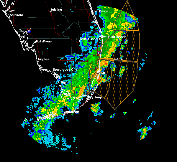 At 1000 pm edt, severe thunderstorms were located along a line extending from port of miami to near key biscayne, moving northeast at 55 mph (radar indicated). Hazards include 60 mph wind gusts. Expect damage to roofs, siding, and trees. Locations impacted include, miami, miami beach, key biscayne, virginia key and port of miami. At 1000 pm edt, severe thunderstorms were located along a line extending from port of miami to near key biscayne, moving northeast at 55 mph (radar indicated). Hazards include 60 mph wind gusts. Expect damage to roofs, siding, and trees. Locations impacted include, miami, miami beach, key biscayne, virginia key and port of miami.
|
| 4/19/2019 9:54 PM EDT |
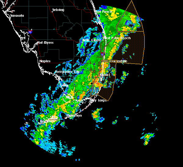 At 953 pm edt, a severe thunderstorm was located near key biscayne, moving northeast at 55 mph (radar indicated). Hazards include 60 mph wind gusts. expect damage to roofs, siding, and trees At 953 pm edt, a severe thunderstorm was located near key biscayne, moving northeast at 55 mph (radar indicated). Hazards include 60 mph wind gusts. expect damage to roofs, siding, and trees
|
| 4/9/2019 12:42 PM EDT |
 At 1241 pm edt, a severe thunderstorm was located over homestead, moving east at 20 mph (radar indicated). Hazards include 60 mph wind gusts. Expect damage to roofs, siding, and trees. Locations impacted include, homestead, coral gables, south miami, homestead miami speedway and black point. At 1241 pm edt, a severe thunderstorm was located over homestead, moving east at 20 mph (radar indicated). Hazards include 60 mph wind gusts. Expect damage to roofs, siding, and trees. Locations impacted include, homestead, coral gables, south miami, homestead miami speedway and black point.
|
| 4/9/2019 12:21 PM EDT |
 At 1220 pm edt, a severe thunderstorm was located over homestead general airport, moving east at 25 mph (radar indicated). Hazards include 60 mph wind gusts. expect damage to roofs, siding, and trees At 1220 pm edt, a severe thunderstorm was located over homestead general airport, moving east at 25 mph (radar indicated). Hazards include 60 mph wind gusts. expect damage to roofs, siding, and trees
|
| 6/23/2018 5:36 PM EDT |
 The severe thunderstorm warning for northern miami-dade county will expire at 545 pm edt, the storm which prompted the warning has weakened below severe limits, and no longer poses an immediate threat to life or property. therefore, the warning will be allowed to expire. however small hail, gusty winds and heavy rain are still possible with this thunderstorm. to report severe weather, contact your nearest law enforcement agency. they will relay your report to the national weather service miami. The severe thunderstorm warning for northern miami-dade county will expire at 545 pm edt, the storm which prompted the warning has weakened below severe limits, and no longer poses an immediate threat to life or property. therefore, the warning will be allowed to expire. however small hail, gusty winds and heavy rain are still possible with this thunderstorm. to report severe weather, contact your nearest law enforcement agency. they will relay your report to the national weather service miami.
|
| 6/23/2018 5:29 PM EDT |
 At 528 pm edt, a severe thunderstorm was located over coconut grove, or over coral gables, moving south at 10 mph (radar indicated). Hazards include 60 mph wind gusts and quarter size hail. Hail damage to vehicles is expected. expect wind damage to roofs, siding, and trees. Locations impacted include, miami, hialeah, miami beach, coral gables and key biscayne. At 528 pm edt, a severe thunderstorm was located over coconut grove, or over coral gables, moving south at 10 mph (radar indicated). Hazards include 60 mph wind gusts and quarter size hail. Hail damage to vehicles is expected. expect wind damage to roofs, siding, and trees. Locations impacted include, miami, hialeah, miami beach, coral gables and key biscayne.
|
| 6/23/2018 5:14 PM EDT |
 At 514 pm edt, a severe thunderstorm was located over marlins park, or over miami, moving south at 15 mph (radar indicated). Hazards include 60 mph wind gusts and quarter size hail. Hail damage to vehicles is expected. Expect wind damage to roofs, siding, and trees. At 514 pm edt, a severe thunderstorm was located over marlins park, or over miami, moving south at 15 mph (radar indicated). Hazards include 60 mph wind gusts and quarter size hail. Hail damage to vehicles is expected. Expect wind damage to roofs, siding, and trees.
|
| 5/16/2018 4:02 PM EDT |
 At 401 pm edt, severe thunderstorms were located along a line extending from 9 miles northwest of coral springs to near doral, moving east at 15 mph (radar indicated). Hazards include 60 mph wind gusts and quarter size hail. Hail damage to vehicles is expected. expect wind damage to roofs, siding, and trees. Locations impacted include, miami, hialeah, pembroke pines, miramar and coral springs. At 401 pm edt, severe thunderstorms were located along a line extending from 9 miles northwest of coral springs to near doral, moving east at 15 mph (radar indicated). Hazards include 60 mph wind gusts and quarter size hail. Hail damage to vehicles is expected. expect wind damage to roofs, siding, and trees. Locations impacted include, miami, hialeah, pembroke pines, miramar and coral springs.
|
| 5/16/2018 3:37 PM EDT |
 At 335 pm edt, severe thunderstorms were located along a line extending from 13 miles northwest of coral springs to near miccosukee resort, moving east at 15 mph (radar indicated). Hazards include 60 mph wind gusts and quarter size hail. Hail damage to vehicles is expected. Expect wind damage to roofs, siding, and trees. At 335 pm edt, severe thunderstorms were located along a line extending from 13 miles northwest of coral springs to near miccosukee resort, moving east at 15 mph (radar indicated). Hazards include 60 mph wind gusts and quarter size hail. Hail damage to vehicles is expected. Expect wind damage to roofs, siding, and trees.
|
| 9/10/2017 3:22 PM EDT |
 The tornado warning for northeastern miami-dade county will expire at 330 pm edt, the storm which prompted the warning has weakened below severe limits, and no longer appears capable of producing a tornado. therefore the warning will be allowed to expire. The tornado warning for northeastern miami-dade county will expire at 330 pm edt, the storm which prompted the warning has weakened below severe limits, and no longer appears capable of producing a tornado. therefore the warning will be allowed to expire.
|
| 9/10/2017 3:15 PM EDT |
 At 315 pm edt, a severe thunderstorm capable of producing a tornado was located near key biscayne, moving north at 35 mph (radar indicated rotation). Hazards include tornado. Flying debris will be dangerous to those caught without shelter. mobile homes will be damaged or destroyed. damage to roofs, windows, and vehicles will occur. tree damage is likely. this dangerous storm will be near, key biscayne around 325 pm edt. virginia key, fisher island, port of miami, downtown miami and marlins park around 330 pm edt. Other locations impacted by this tornadic thunderstorm include allapattah. At 315 pm edt, a severe thunderstorm capable of producing a tornado was located near key biscayne, moving north at 35 mph (radar indicated rotation). Hazards include tornado. Flying debris will be dangerous to those caught without shelter. mobile homes will be damaged or destroyed. damage to roofs, windows, and vehicles will occur. tree damage is likely. this dangerous storm will be near, key biscayne around 325 pm edt. virginia key, fisher island, port of miami, downtown miami and marlins park around 330 pm edt. Other locations impacted by this tornadic thunderstorm include allapattah.
|
| 9/10/2017 7:52 AM EDT |
 The tornado warning for northeastern miami-dade and eastern broward counties will expire at 800 am edt, the storm which prompted the warning has weakened below severe limits, and no longer appears capable of producing a tornado. therefore the warning will be allowed to expire. however gusty winds are still possible with this thunderstorm. a tornado watch remains in effect until noon edt for southeastern florida. The tornado warning for northeastern miami-dade and eastern broward counties will expire at 800 am edt, the storm which prompted the warning has weakened below severe limits, and no longer appears capable of producing a tornado. therefore the warning will be allowed to expire. however gusty winds are still possible with this thunderstorm. a tornado watch remains in effect until noon edt for southeastern florida.
|
| 9/10/2017 7:36 AM EDT |
 At 735 am edt, a severe thunderstorm capable of producing a tornado was located 8 miles southeast of miami beach, moving northwest at 80 mph (radar indicated rotation). Hazards include tornado. Flying debris will be dangerous to those caught without shelter. mobile homes will be damaged or destroyed. damage to roofs, windows, and vehicles will occur. tree damage is likely. this dangerous storm will be near, virginia key, fisher island and port of miami around 740 am edt. miami, miami beach, surfside, north miami beach, miami shores, north bay village, el portal, little haiti, gladeview and liberty city around 745 am edt. miramar, miami gardens, hallandale, north miami, aventura, sunny isles beach, opa-locka, west park, golden glades and sun life stadium around 750 am edt. miami lakes, cooper city, royal palm ranches, miramar parkway and university drive, sunshine acres, nova southeastern university, palm springs north, chambers estates, oak point and estates of fort lauderdale around 755 am edt. pembroke pines, davie, plantation, weston, intersection i-75 and griffin road, sawgrass mills mall, pine island ridge and intersection i-75 and u. s. 27 around 800 am edt. Other locations impacted by this tornadic thunderstorm include markham park, saint thomas university, fiu north campus, ives estates, downtown davie, bay harbor islands, allapattah, biscayne park, pembroke park and bal harbour. At 735 am edt, a severe thunderstorm capable of producing a tornado was located 8 miles southeast of miami beach, moving northwest at 80 mph (radar indicated rotation). Hazards include tornado. Flying debris will be dangerous to those caught without shelter. mobile homes will be damaged or destroyed. damage to roofs, windows, and vehicles will occur. tree damage is likely. this dangerous storm will be near, virginia key, fisher island and port of miami around 740 am edt. miami, miami beach, surfside, north miami beach, miami shores, north bay village, el portal, little haiti, gladeview and liberty city around 745 am edt. miramar, miami gardens, hallandale, north miami, aventura, sunny isles beach, opa-locka, west park, golden glades and sun life stadium around 750 am edt. miami lakes, cooper city, royal palm ranches, miramar parkway and university drive, sunshine acres, nova southeastern university, palm springs north, chambers estates, oak point and estates of fort lauderdale around 755 am edt. pembroke pines, davie, plantation, weston, intersection i-75 and griffin road, sawgrass mills mall, pine island ridge and intersection i-75 and u. s. 27 around 800 am edt. Other locations impacted by this tornadic thunderstorm include markham park, saint thomas university, fiu north campus, ives estates, downtown davie, bay harbor islands, allapattah, biscayne park, pembroke park and bal harbour.
|
| 6/8/2017 3:15 PM EDT |
 At 314 pm edt, a severe thunderstorm was located over fountainbleau, or near south miami, moving east at 25 mph (radar indicated). Hazards include 60 mph wind gusts and penny size hail. expect damage to roofs, siding, and trees At 314 pm edt, a severe thunderstorm was located over fountainbleau, or near south miami, moving east at 25 mph (radar indicated). Hazards include 60 mph wind gusts and penny size hail. expect damage to roofs, siding, and trees
|
| 1/23/2017 4:15 AM EST |
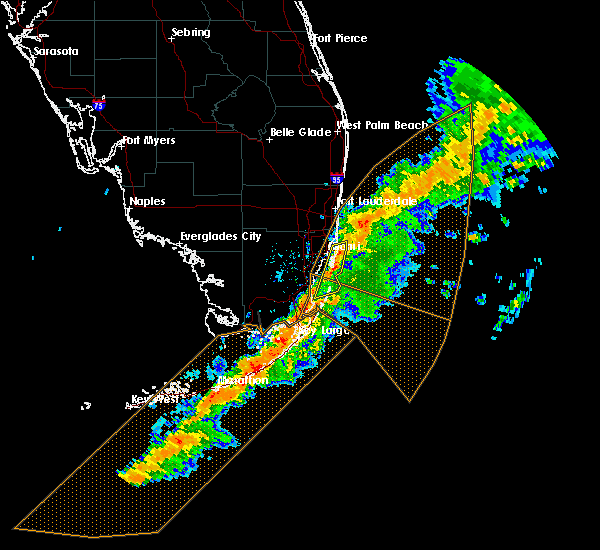 At 414 am est, severe thunderstorms were located along a line extending from key biscayne to near black point, moving east at 50 mph (radar indicated). Hazards include 70 mph wind gusts. Expect considerable tree damage. Damage is likely to mobile homes, roofs, and outbuildings. At 414 am est, severe thunderstorms were located along a line extending from key biscayne to near black point, moving east at 50 mph (radar indicated). Hazards include 70 mph wind gusts. Expect considerable tree damage. Damage is likely to mobile homes, roofs, and outbuildings.
|
| 1/23/2017 3:55 AM EST | Downed power lines... busted gates and mailboxes near nw 118th street and 5th ave in miami-dade county in miami-dade county FL, 7 miles SSW of Miami, FL |
| 1/23/2017 3:49 AM EST |
 At 349 am est, a severe squall line capable of producing both tornadoes and extensive straight line wind damage was located over gladeview, or over hialeah, moving east at 50 mph (radar indicated rotation). Hazards include tornado. Flying debris will be dangerous to those caught without shelter. mobile homes will be damaged or destroyed. damage to roofs, windows, and vehicles will occur. tree damage is likely. these dangerous storms will be near, north miami, miami shores, north bay village and golden glades around 355 am est. miami beach, surfside and north miami beach around 400 am est. sunny isles beach around 405 am est. Other locations impacted by this tornadic thunderstorm include fiu north campus, bay harbor islands, allapattah, virginia gardens, biscayne park and bal harbour. At 349 am est, a severe squall line capable of producing both tornadoes and extensive straight line wind damage was located over gladeview, or over hialeah, moving east at 50 mph (radar indicated rotation). Hazards include tornado. Flying debris will be dangerous to those caught without shelter. mobile homes will be damaged or destroyed. damage to roofs, windows, and vehicles will occur. tree damage is likely. these dangerous storms will be near, north miami, miami shores, north bay village and golden glades around 355 am est. miami beach, surfside and north miami beach around 400 am est. sunny isles beach around 405 am est. Other locations impacted by this tornadic thunderstorm include fiu north campus, bay harbor islands, allapattah, virginia gardens, biscayne park and bal harbour.
|
| 1/23/2017 3:46 AM EST | Tractor trailed overturned near nw 50th st and 74th ave in miami-dade reported by news media in miami-dade county FL, 5.5 miles ESE of Miami, FL |
| 1/23/2017 3:44 AM EST |
 At 343 am est, severe thunderstorms capable of producing both tornadoes and extensive straight line wind damage were located over miami springs, or over hialeah, moving east at 50 mph (radar indicated rotation). Hazards include tornado. Flying debris will be dangerous to those caught without shelter. mobile homes will be damaged or destroyed. damage to roofs, windows, and vehicles will occur. tree damage is likely. these dangerous storms will be near, north miami, miami shores, el portal, little haiti and pinewood around 350 am est. miami beach, north bay village and golden glades around 355 am est. surfside, north miami beach and sunny isles beach around 400 am est. Other locations impacted by this tornadic thunderstorm include fiu north campus, bay harbor islands, allapattah, virginia gardens, biscayne park and bal harbour. At 343 am est, severe thunderstorms capable of producing both tornadoes and extensive straight line wind damage were located over miami springs, or over hialeah, moving east at 50 mph (radar indicated rotation). Hazards include tornado. Flying debris will be dangerous to those caught without shelter. mobile homes will be damaged or destroyed. damage to roofs, windows, and vehicles will occur. tree damage is likely. these dangerous storms will be near, north miami, miami shores, el portal, little haiti and pinewood around 350 am est. miami beach, north bay village and golden glades around 355 am est. surfside, north miami beach and sunny isles beach around 400 am est. Other locations impacted by this tornadic thunderstorm include fiu north campus, bay harbor islands, allapattah, virginia gardens, biscayne park and bal harbour.
|
| 1/23/2017 3:35 AM EST |
 At 335 am est, severe thunderstorms were located along a line extending from west park to 8 miles northeast of pa-hay-okee overlook to near flamingo, moving east at 45 mph (radar indicated). Hazards include 60 mph wind gusts. expect damage to roofs, siding, and trees At 335 am est, severe thunderstorms were located along a line extending from west park to 8 miles northeast of pa-hay-okee overlook to near flamingo, moving east at 45 mph (radar indicated). Hazards include 60 mph wind gusts. expect damage to roofs, siding, and trees
|
| 1/7/2017 1:20 PM EST | A wind gust from a thunderstorm snapped a medium sized tree at ne 207 terrace between i-95 and us 441 in ives estates. highest measured winds from nearby stations was i in miami-dade county FL, 13.4 miles SSW of Miami, FL |
| 9/20/2016 2:55 PM EDT |
 The severe thunderstorm warning for northeastern miami-dade county will expire at 300 pm edt, the storm which prompted the warning has weakened below severe limits, and no longer pose an immediate threat to life or property. therefore the warning will be allowed to expire. however heavy rain is still possible with this thunderstorm. The severe thunderstorm warning for northeastern miami-dade county will expire at 300 pm edt, the storm which prompted the warning has weakened below severe limits, and no longer pose an immediate threat to life or property. therefore the warning will be allowed to expire. however heavy rain is still possible with this thunderstorm.
|
| 9/20/2016 2:36 PM EDT |
 At 235 pm edt, a severe thunderstorm was located over miami international airport, or near south miami, and is nearly stationary (radar indicated). Hazards include 60 mph wind gusts and quarter size hail. Hail damage to vehicles is expected. expect wind damage to roofs, siding, and trees. Locations impacted include, miami, hialeah, coral gables, south miami and kendall. At 235 pm edt, a severe thunderstorm was located over miami international airport, or near south miami, and is nearly stationary (radar indicated). Hazards include 60 mph wind gusts and quarter size hail. Hail damage to vehicles is expected. expect wind damage to roofs, siding, and trees. Locations impacted include, miami, hialeah, coral gables, south miami and kendall.
|
| 9/20/2016 2:05 PM EDT |
 At 204 pm edt, a severe thunderstorm was located over miami international airport, or near hialeah, and is nearly stationary (radar indicated). Hazards include 60 mph wind gusts and quarter size hail. Hail damage to vehicles is expected. Expect wind damage to roofs, siding, and trees. At 204 pm edt, a severe thunderstorm was located over miami international airport, or near hialeah, and is nearly stationary (radar indicated). Hazards include 60 mph wind gusts and quarter size hail. Hail damage to vehicles is expected. Expect wind damage to roofs, siding, and trees.
|
| 9/20/2016 1:49 PM EDT | A thunderstorm wind gust of 58mph...50kts... was recorded by a weather bug mesonet site...mmrms... located at the robert morgan ed center at 149pm ed in miami-dade county FL, 15.6 miles NE of Miami, FL |
| 8/9/2016 7:50 PM EDT |
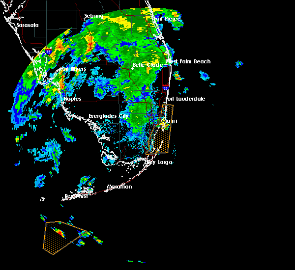 The severe thunderstorm warning for eastern miami-dade county will expire at 800 pm edt, the storm which prompted the warning has weakened below severe limits, and has exited the warned area. therefore, the warning will be allowed to expire. however gusty winds and heavy rain are still possible with this thunderstorm. The severe thunderstorm warning for eastern miami-dade county will expire at 800 pm edt, the storm which prompted the warning has weakened below severe limits, and has exited the warned area. therefore, the warning will be allowed to expire. however gusty winds and heavy rain are still possible with this thunderstorm.
|
| 8/9/2016 7:42 PM EDT |
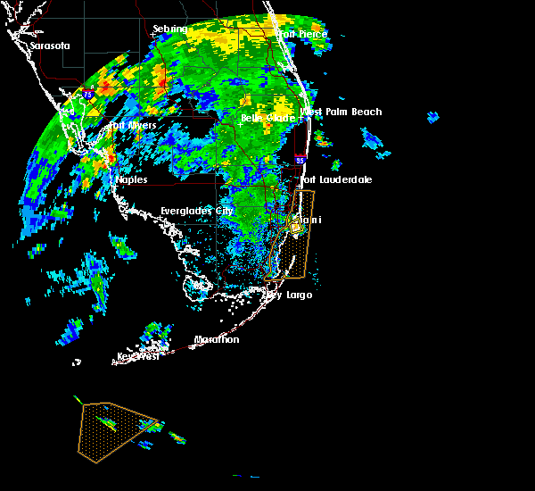 At 742 pm edt, a severe thunderstorm was located over miami beach, moving east at 10 mph (radar indicated). Hazards include 60 mph wind gusts. Expect damage to roofs. siding. and trees. Locations impacted include, miami, miami beach, virginia key, north bay village and port of miami. At 742 pm edt, a severe thunderstorm was located over miami beach, moving east at 10 mph (radar indicated). Hazards include 60 mph wind gusts. Expect damage to roofs. siding. and trees. Locations impacted include, miami, miami beach, virginia key, north bay village and port of miami.
|
| 8/9/2016 7:36 PM EDT |
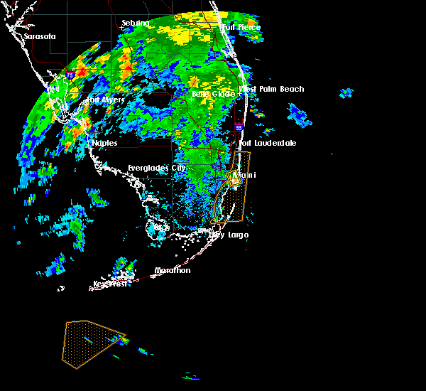 At 736 pm edt, a severe thunderstorm was located over fisher island, or over virginia key, moving east at 10 mph (radar indicated). Hazards include 60 mph wind gusts. Expect damage to roofs. siding. and trees. Locations impacted include, miami, miami beach, virginia key, north bay village and port of miami. At 736 pm edt, a severe thunderstorm was located over fisher island, or over virginia key, moving east at 10 mph (radar indicated). Hazards include 60 mph wind gusts. Expect damage to roofs. siding. and trees. Locations impacted include, miami, miami beach, virginia key, north bay village and port of miami.
|
| 8/9/2016 7:30 PM EDT |
 At 730 pm edt, a severe thunderstorm was located over port of miami, or over miami beach, moving east at 10 mph (radar indicated). Hazards include 60 mph wind gusts. Expect damage to roofs. siding. and trees. Locations impacted include, miami, hialeah, miami beach, virginia key and north miami. At 730 pm edt, a severe thunderstorm was located over port of miami, or over miami beach, moving east at 10 mph (radar indicated). Hazards include 60 mph wind gusts. Expect damage to roofs. siding. and trees. Locations impacted include, miami, hialeah, miami beach, virginia key and north miami.
|
| 8/9/2016 7:24 PM EDT |
 At 723 pm edt, a severe thunderstorm was located over marlins park, or over miami, moving east at 10 mph (radar indicated). Hazards include 60 mph wind gusts. Expect damage to roofs. siding. and trees. Locations impacted include, miami, hialeah, miami beach, coral gables and south miami. At 723 pm edt, a severe thunderstorm was located over marlins park, or over miami, moving east at 10 mph (radar indicated). Hazards include 60 mph wind gusts. Expect damage to roofs. siding. and trees. Locations impacted include, miami, hialeah, miami beach, coral gables and south miami.
|
| 8/9/2016 7:18 PM EDT |
 At 718 pm edt, a severe thunderstorm was located over marlins park, or near miami, moving east at 10 mph (radar indicated). Hazards include 60 mph wind gusts. Expect damage to roofs. siding. And trees. At 718 pm edt, a severe thunderstorm was located over marlins park, or near miami, moving east at 10 mph (radar indicated). Hazards include 60 mph wind gusts. Expect damage to roofs. siding. And trees.
|
| 6/18/2016 6:14 PM EDT |
 At 613 pm edt, severe thunderstorms were located along a line extending from north bay village to near key biscayne, moving east at 25 mph. numerous wind gusts between 50 and 60 mph have been reported over central miami (radar indicated). Hazards include 60 mph wind gusts and penny size hail. Expect damage to roofs. siding. and trees. Locations impacted include, miami, hialeah, miami beach, coral gables and key biscayne. At 613 pm edt, severe thunderstorms were located along a line extending from north bay village to near key biscayne, moving east at 25 mph. numerous wind gusts between 50 and 60 mph have been reported over central miami (radar indicated). Hazards include 60 mph wind gusts and penny size hail. Expect damage to roofs. siding. and trees. Locations impacted include, miami, hialeah, miami beach, coral gables and key biscayne.
|
| 6/18/2016 6:13 PM EDT | A thunderstorm wind gust to 56 kts...65 mph was measure in miami-dade county FL, 6.2 miles NW of Miami, FL |
| 6/18/2016 6:12 PM EDT | Fence blown down... near intersection of sw 43rd st and sw 82nd st in miami-dade county FL, 6.6 miles ENE of Miami, FL |
| 6/18/2016 6:11 PM EDT | A thunderstorm produced a wind gust of 66 mph at marlins park. this was measured at 100 feet above the surfac in miami-dade county FL, 0.7 miles WNW of Miami, FL |
| 6/18/2016 6:06 PM EDT | Power lines have been knocked down at sw 84th ave and bird r in miami-dade county FL, 6.6 miles ENE of Miami, FL |
| 6/18/2016 5:58 PM EDT |
 At 558 pm edt, a severe thunderstorm was located over miami springs, or near hialeah, moving northeast at 25 mph (radar indicated). Hazards include 60 mph wind gusts and penny size hail. Expect damage to roofs. siding. And trees. At 558 pm edt, a severe thunderstorm was located over miami springs, or near hialeah, moving northeast at 25 mph (radar indicated). Hazards include 60 mph wind gusts and penny size hail. Expect damage to roofs. siding. And trees.
|
| 5/24/2016 4:24 PM EDT | Quarter sized hail reported 11.4 miles ENE of Miami, FL, quarter size hail reported at sw 127 ave and sw 72 street via twitter at 424 pm |
| 5/24/2016 4:15 PM EDT | Quarter sized hail reported 12.3 miles ENE of Miami, FL, a trained spotter called to report quarter size hail falling at sw 80th street and sw 134 avenue....at 415pm |
| 5/24/2016 4:09 PM EDT | Quarter sized hail reported 9.5 miles ENE of Miami, FL, a trained storm spotter called to report quarter size hail falling at sw 56th street and sw 109 ave at 409pm |
| 5/24/2016 4:08 PM EDT | Quarter sized hail reported 8.8 miles ENE of Miami, FL, a trained storm spotter called to report quarter size hail falling at 107th avenue and bird road at 408pm |
| 5/24/2016 10:16 AM EDT | A severe thunderstorm warning remains in effect until 430 pm edt for northeastern miami-dade county. at 414 pm edt. a severe thunderstorm was located over kendall. moving southwest at 10 mph. hazard. 60 mph wind gusts and quarter size hail. source. trained weather spotters. at 410 pm edt. Quarter size hail. |
| 5/21/2016 4:39 PM EDT | A n wind gust of 62 mph was recorded at the wxflow site ...xdge...at 439 pm edt...sustained winds above 40 mph were observed for over 10 minutes in amz630 county FL, 5.8 miles W of Miami, FL |
| 4/15/2016 8:35 PM EDT |
 The severe thunderstorm warning for northeastern miami-dade county will expire at 845 pm edt, the storms which prompted the warning have moved out of the area. therefore the warning will be allowed to expire. however heavy rain is still possible with these thunderstorms. a severe thunderstorm watch remains in effect until 1000 pm edt for southeastern florida. The severe thunderstorm warning for northeastern miami-dade county will expire at 845 pm edt, the storms which prompted the warning have moved out of the area. therefore the warning will be allowed to expire. however heavy rain is still possible with these thunderstorms. a severe thunderstorm watch remains in effect until 1000 pm edt for southeastern florida.
|
| 4/15/2016 8:15 PM EDT |
 At 814 pm edt, severe thunderstorms were located along a line extending from , moving southeast at 15 mph (radar indicated). Hazards include 60 mph wind gusts and half dollar size hail. Hail damage to vehicles is expected. expect wind damage to roofs, siding, and trees. Locations impacted include, miami, hialeah, miami beach, coral gables and key biscayne. At 814 pm edt, severe thunderstorms were located along a line extending from , moving southeast at 15 mph (radar indicated). Hazards include 60 mph wind gusts and half dollar size hail. Hail damage to vehicles is expected. expect wind damage to roofs, siding, and trees. Locations impacted include, miami, hialeah, miami beach, coral gables and key biscayne.
|
| 4/15/2016 7:59 PM EDT |
 At 759 pm edt, severe thunderstorms were located along a line extending from , moving southeast at 20 mph (radar indicated). Hazards include 60 mph wind gusts and half dollar size hail. Hail damage to vehicles is expected. Expect wind damage to roofs, siding, and trees. At 759 pm edt, severe thunderstorms were located along a line extending from , moving southeast at 20 mph (radar indicated). Hazards include 60 mph wind gusts and half dollar size hail. Hail damage to vehicles is expected. Expect wind damage to roofs, siding, and trees.
|
| 4/15/2016 7:32 PM EDT |
 At 731 pm edt, severe thunderstorms were located along a line extending from , moving east at 25 mph (public). Hazards include golf ball size hail and 60 mph wind gusts. People and animals outdoors will be injured. expect wind and hail damage to roofs, siding, windows, and vehicles. Locations impacted include, miami, hialeah, fort lauderdale, pembroke pines and hollywood. At 731 pm edt, severe thunderstorms were located along a line extending from , moving east at 25 mph (public). Hazards include golf ball size hail and 60 mph wind gusts. People and animals outdoors will be injured. expect wind and hail damage to roofs, siding, windows, and vehicles. Locations impacted include, miami, hialeah, fort lauderdale, pembroke pines and hollywood.
|
| 4/15/2016 6:56 PM EDT |
 At 655 pm edt, severe thunderstorms were located along a line extending from , and are nearly stationary (radar indicated). Hazards include golf ball size hail and 60 mph wind gusts. People and animals outdoors will be injured. Expect wind and hail damage to roofs, siding, windows, and vehicles. At 655 pm edt, severe thunderstorms were located along a line extending from , and are nearly stationary (radar indicated). Hazards include golf ball size hail and 60 mph wind gusts. People and animals outdoors will be injured. Expect wind and hail damage to roofs, siding, windows, and vehicles.
|
| 1/17/2016 8:05 AM EST | Reports of trees falling on five cars and two homes near nw 12 avenue and nw 28 street in the allapattah area of miami. time based on radar and nearby wind measurements in miami-dade county FL, 1.8 miles SW of Miami, FL |
| 6/29/2015 5:00 PM EDT |
 At 500 pm edt, doppler radar indicated a severe thunderstorm capable of producing damaging winds in excess of 60 mph. this storm was located over hialeah, and moving east at 15 mph. penny size hail may also accompany the damaging winds. At 500 pm edt, doppler radar indicated a severe thunderstorm capable of producing damaging winds in excess of 60 mph. this storm was located over hialeah, and moving east at 15 mph. penny size hail may also accompany the damaging winds.
|
| 6/29/2015 4:36 PM EDT |
 At 436 pm edt, doppler radar indicated a severe thunderstorm capable of producing damaging winds in excess of 60 mph. this storm was located over fountainbleau, or near south miami, and moving northeast at 15 mph. penny size hail may also accompany the damaging winds. At 436 pm edt, doppler radar indicated a severe thunderstorm capable of producing damaging winds in excess of 60 mph. this storm was located over fountainbleau, or near south miami, and moving northeast at 15 mph. penny size hail may also accompany the damaging winds.
|
| 5/21/2015 3:40 PM EDT | At 340 pm edt, doppler radar indicated a severe thunderstorm capable of producing quarter size hail. this storm was located over west little river, or over hialeah, and moving southeast at 5 mph. |
| 4/20/2015 1:48 PM EDT | At 148 pm edt, trained weather spotters reported a funnel cloud. a tornado may develop at any time. this dangerous storm was located over pinewood, or near miami gardens, moving northeast at 15 mph. locations impacted include, miami, hialeah, miami beach, surfside and miami gardens. |
| 4/20/2015 1:33 PM EDT | At 133 pm edt, doppler radar indicated a severe thunderstorm capable of producing a tornado. this dangerous storm was located over opa-locka, or over hialeah, and moving northeast at 15 mph. |
| 6/20/2014 3:07 PM EDT | A thunderstorm produced a wind gust of 64 mph at miami city hal in miami-dade county FL, 3.7 miles N of Miami, FL |
| 9/15/2013 11:40 AM EDT | A member of the public measured a 58 mph wind gust near the intersection of w flagler st and sw 32nd ave. report relayed via social medi in miami-dade county FL, 1 miles NNE of Miami, FL |
| 6/15/2012 4:20 PM EDT | Golf Ball sized hail reported 3.6 miles N of Miami, FL, time of the event corrected...golf ball sized hail reported at coconut grove. |
| 6/15/2012 4:20 PM EDT | Quarter sized hail reported 2.7 miles WNW of Miami, FL, off-duty nws employee reported quarter size hail near brickel ave. |
| 6/15/2012 3:20 PM EDT | Golf Ball sized hail reported 3.6 miles N of Miami, FL, golf ball sized hail reported at coconut grove. |
| 6/15/2012 3:20 PM EDT | Hen Egg sized hail reported 4.1 miles NNE of Miami, FL, multiple reports of hail near in coral g |
| 6/6/2012 8:32 AM EDT | Quarter sized hail reported 15.3 miles NE of Miami, FL, a trained spotter reported quarter-sized hail just west of the cutler bay area...near the intersection of us 1 and caribbean boulevard at 832 am edt. |
| 5/24/2012 12:02 PM EDT | Virginia key - site vik - recorded a wind gust to 53 knots...or 61 mph. site elevation approx. 70 fee in miami-dade county FL, 7.2 miles NW of Miami, FL |
| 5/18/2012 2:20 PM EDT | Quarter sized hail reported 5.8 miles ESE of Miami, FL, quarter size hail reported near the intersection of palmetto expressway and doral blvd. |
| 5/18/2012 2:17 PM EDT | Quarter sized hail reported 8.4 miles ESE of Miami, FL, quarter sized hail was reported near nw 41 and nw 58th streets in doral. |
| 5/18/2012 2:17 PM EDT | Quarter sized hail reported 8.4 miles ESE of Miami, FL, quarter sized hail was reported near nw 41 and nw 58th streets |
| 5/18/2012 2:15 PM EDT | Half Dollar sized hail reported 8.4 miles ESE of Miami, FL, hail slightly larger than a quarter was reported near nw 41st and 107th ave at doral. |
| 5/18/2012 2:15 PM EDT | Half Dollar sized hail reported 8.2 miles ESE of Miami, FL, hail slightly larger than a quarter was reported near nw 41st and 107th ave in doral |
| 5/9/2012 4:10 PM EDT | Quarter sized hail reported 2.7 miles WNW of Miami, FL, public reported hail up to 1.25 in diameter near downtown miami. |
| 5/9/2012 4:10 PM EDT | Quarter sized hail reported 7.2 miles WSW of Miami, FL, media reported one inch hail near miami beach. |
| 5/9/2012 4:10 PM EDT | Half Dollar sized hail reported 5.6 miles WNW of Miami, FL, multiple reports were gathered from aoml about hail... ranging from an inch to an inch and a half. |
| 1/1/0001 12:00 AM | Quarter sized hail reported 16.3 miles NE of Miami, FL, a member of the media relayed reports of dime to quarter-sized hail near the intersection of sw 154th avenue and eureka drive/184th street. |
| 1/1/0001 12:00 AM | Amateur radio reports indicate trees down and construction debris around sw 9th st and sw 36th ct in miam in miami-dade county FL, 7.2 miles WSW of Miami, FL |
| 1/1/0001 12:00 AM | Amateur radio reports indicate trees down and construction debris around sw 9th st and sw 36th ct in miam in miami-dade county FL, 7.2 miles WSW of Miami, FL |
| 1/1/0001 12:00 AM | Power line down on brickell avenue near alice wainwright par in miami-dade county FL, 3.5 miles NNW of Miami, FL |
Hail Maps for Miami, FL
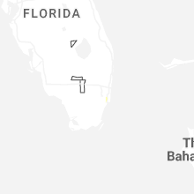
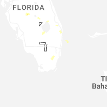
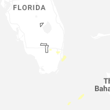
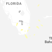
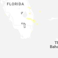
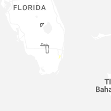
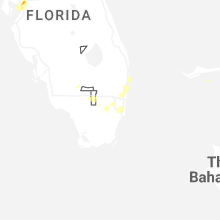
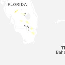
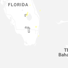
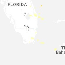


Connect with Interactive Hail Maps