

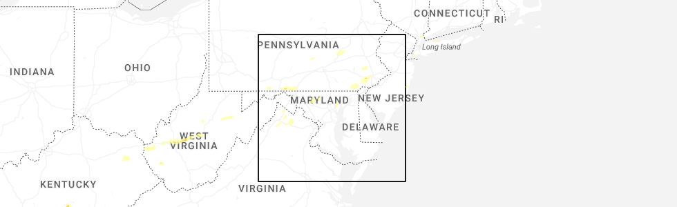
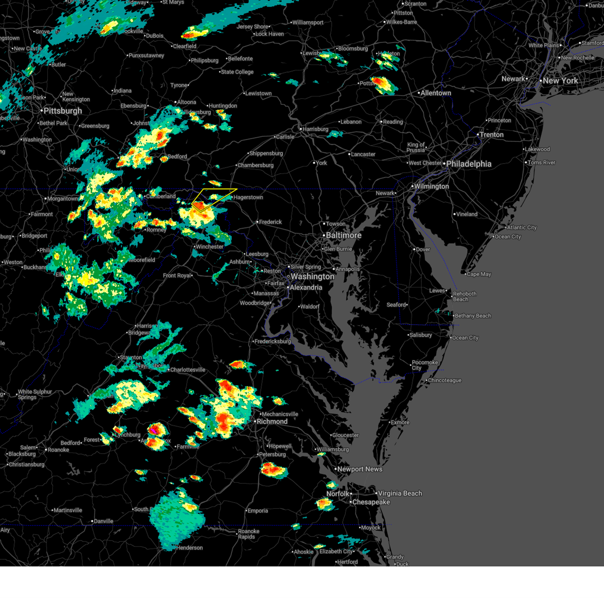
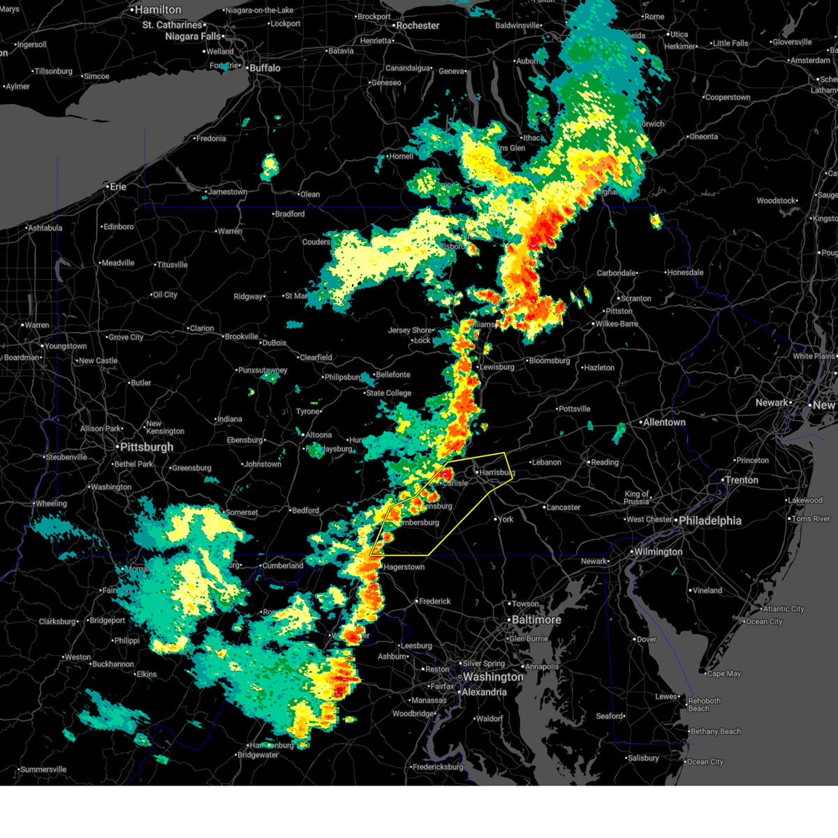
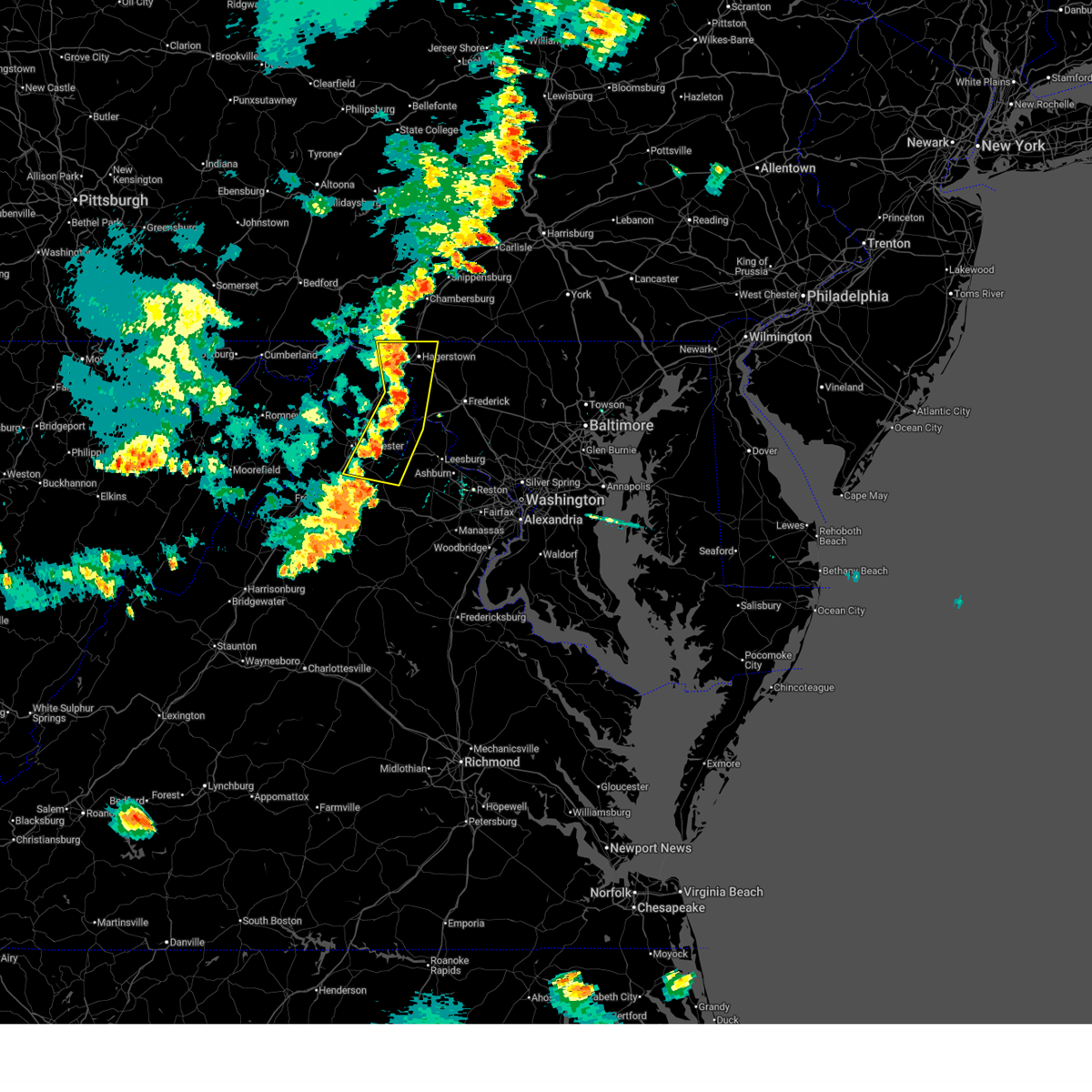
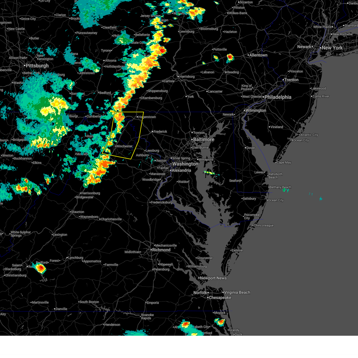
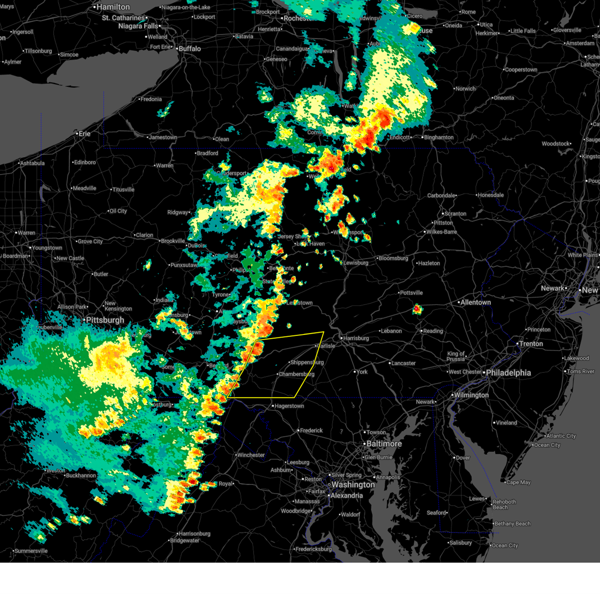
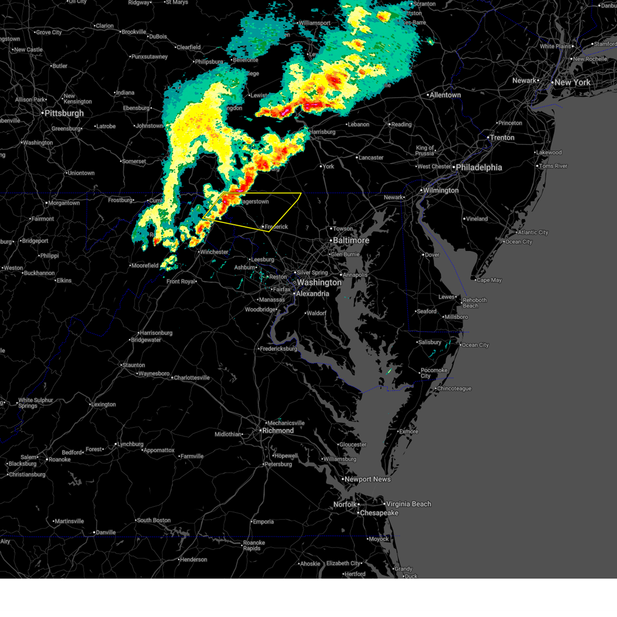
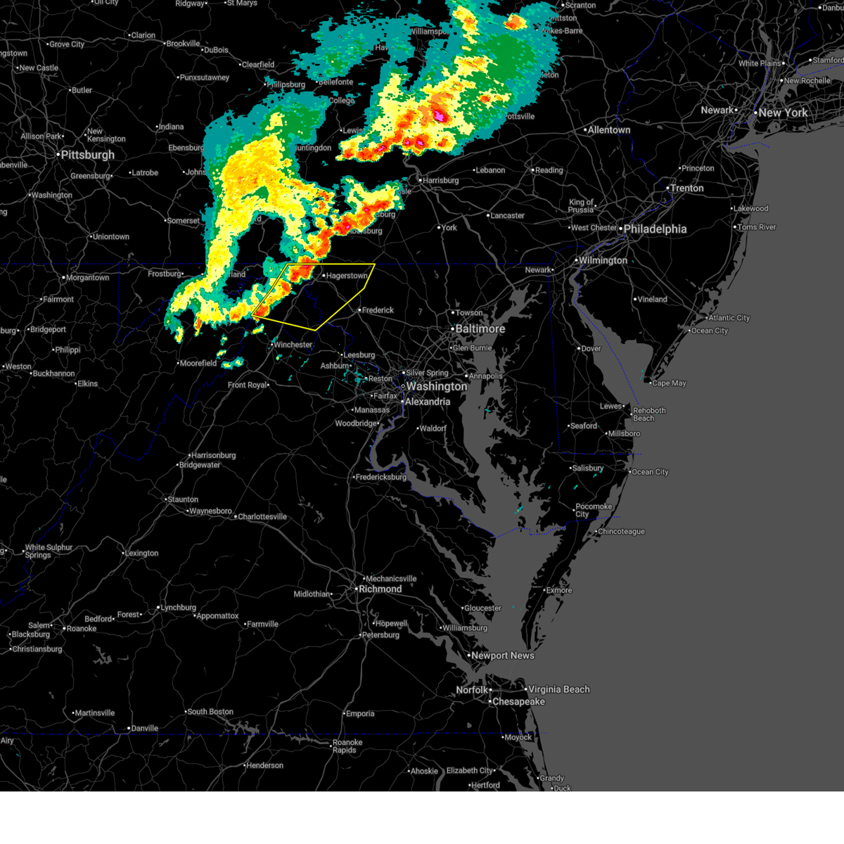
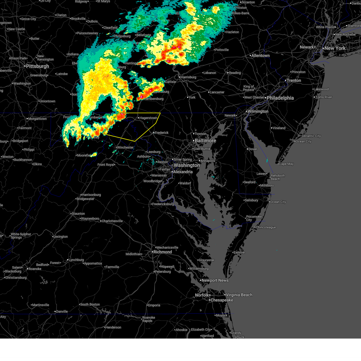
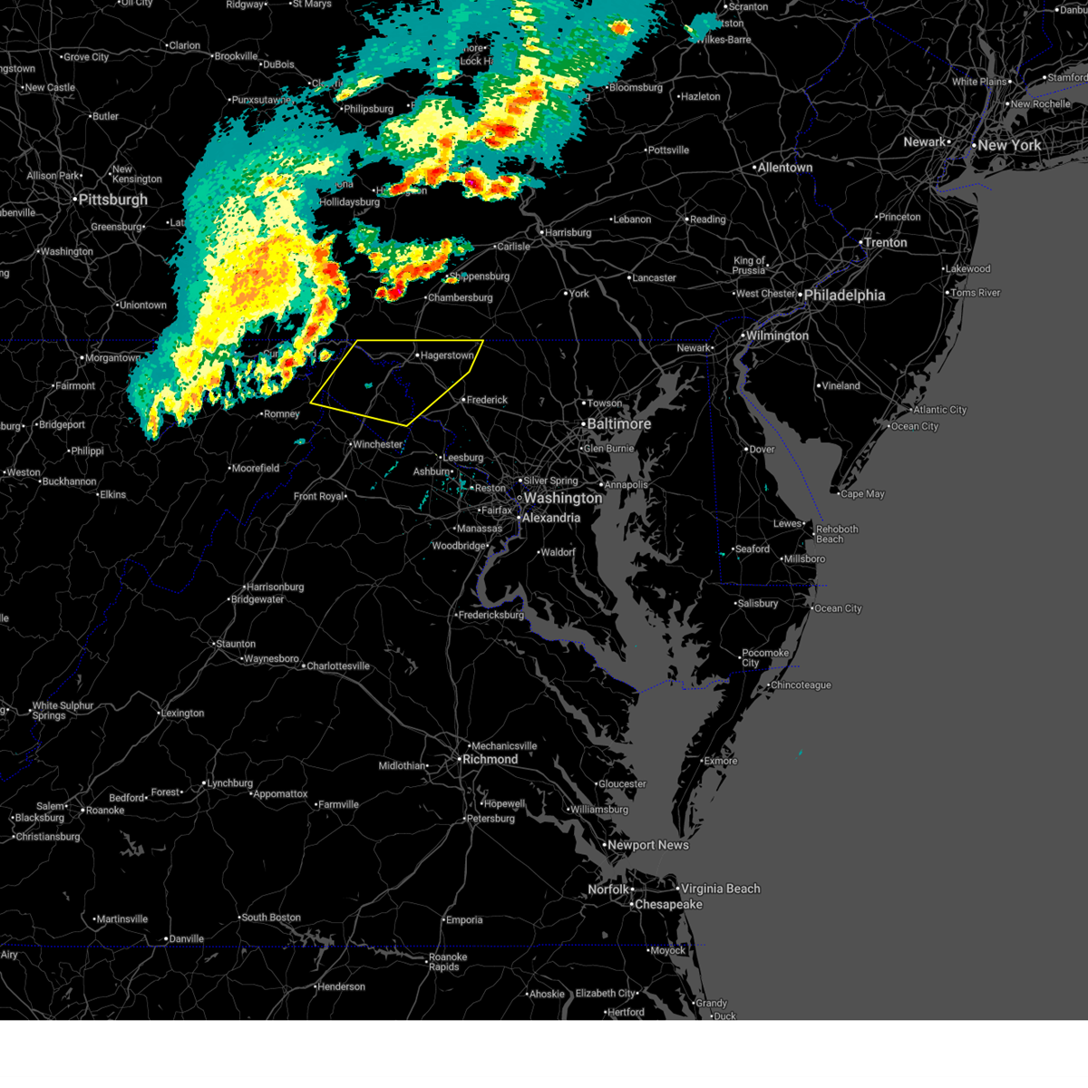
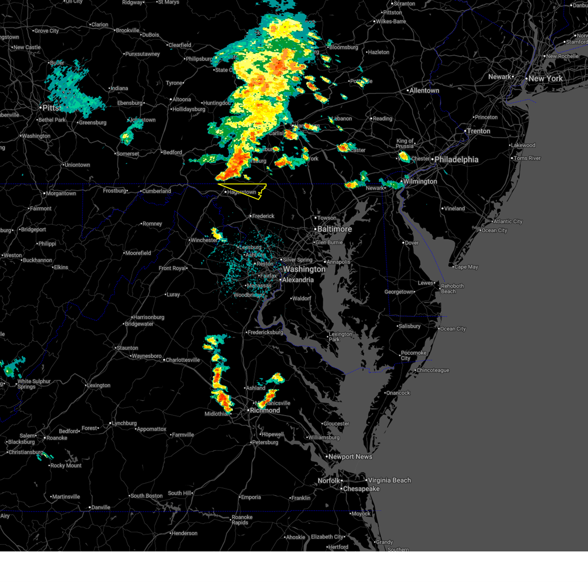
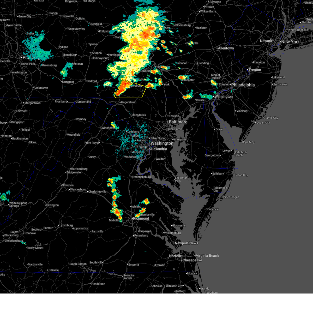
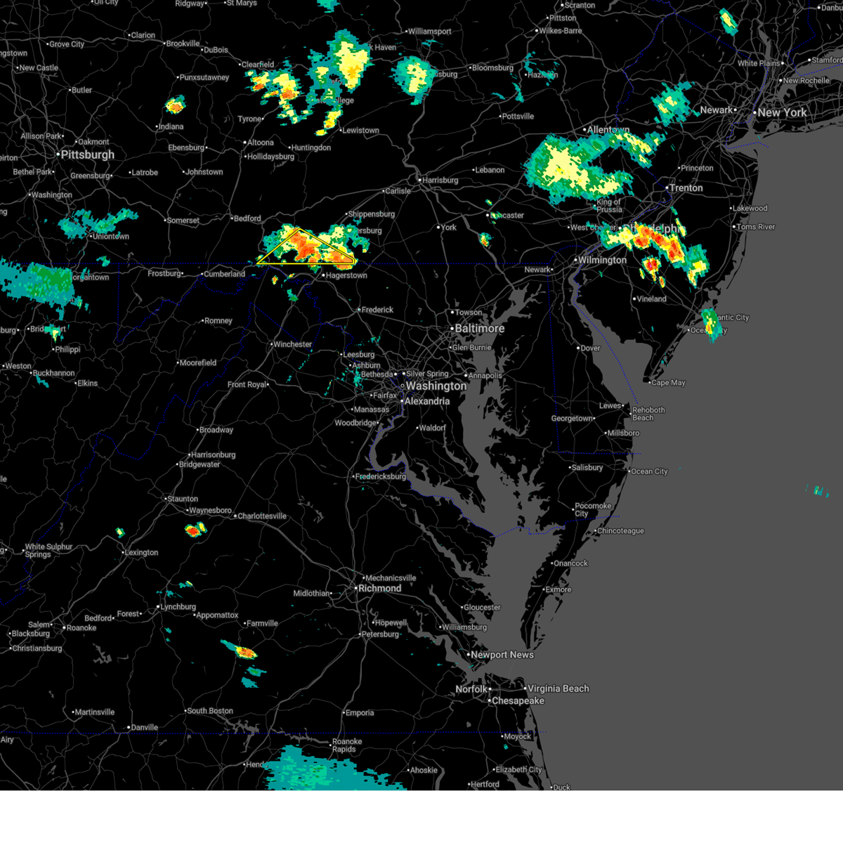
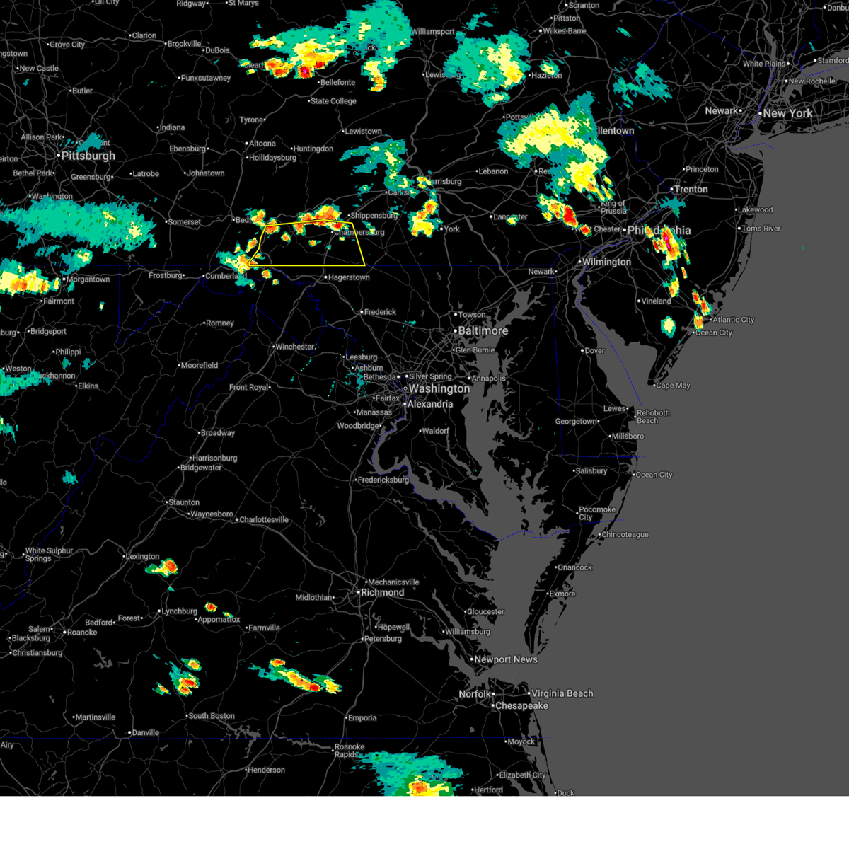
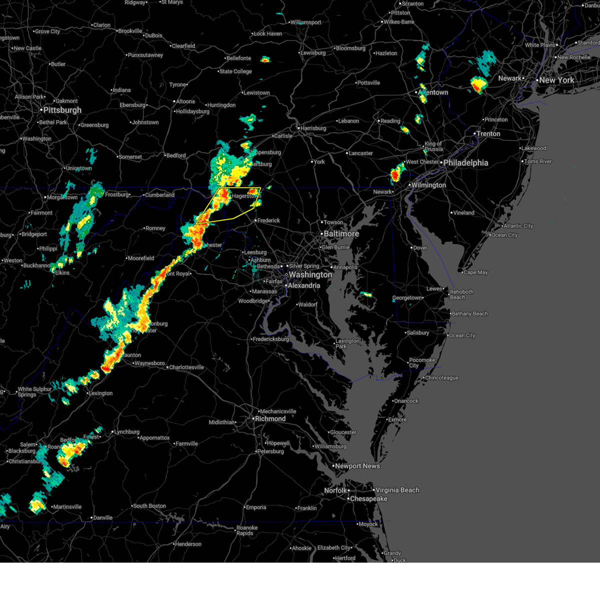
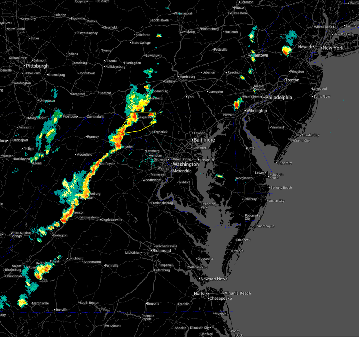
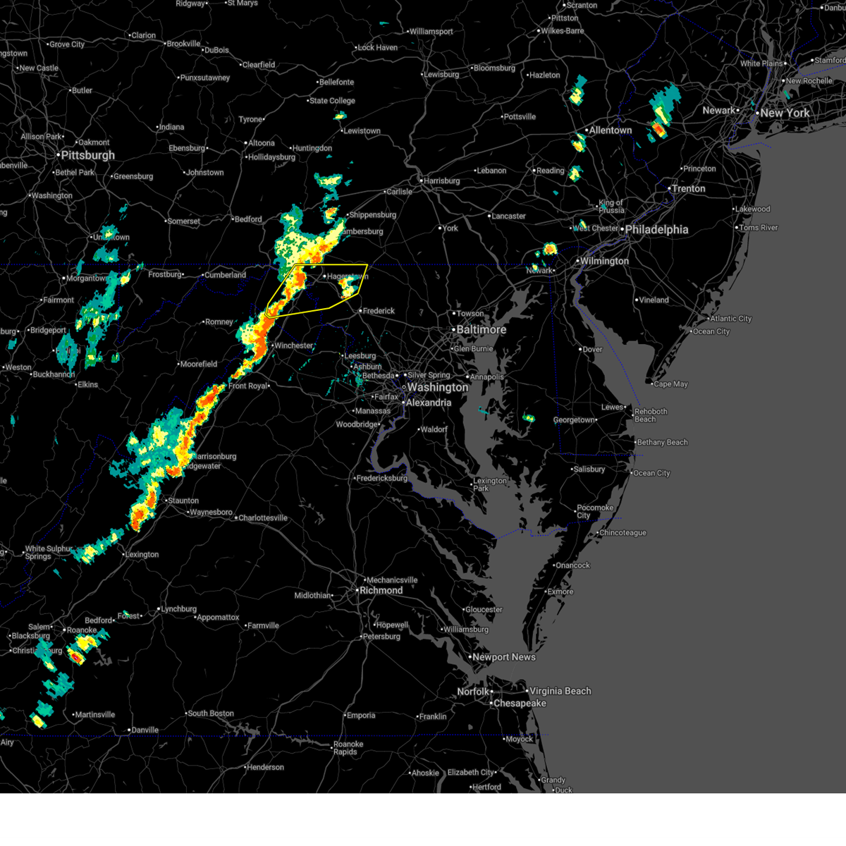
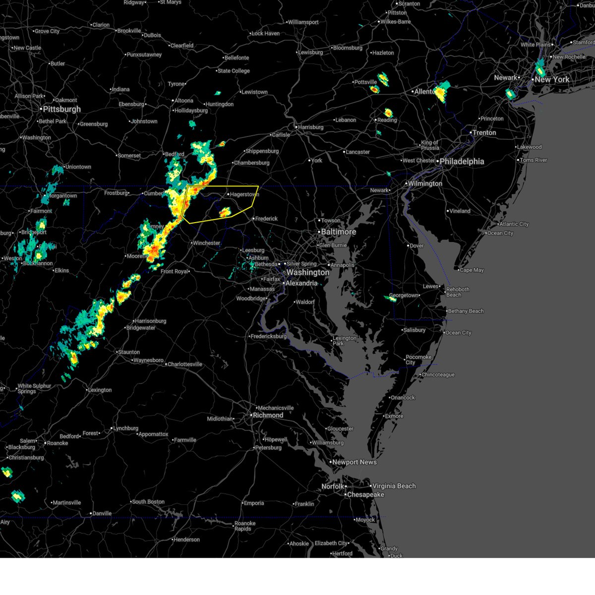
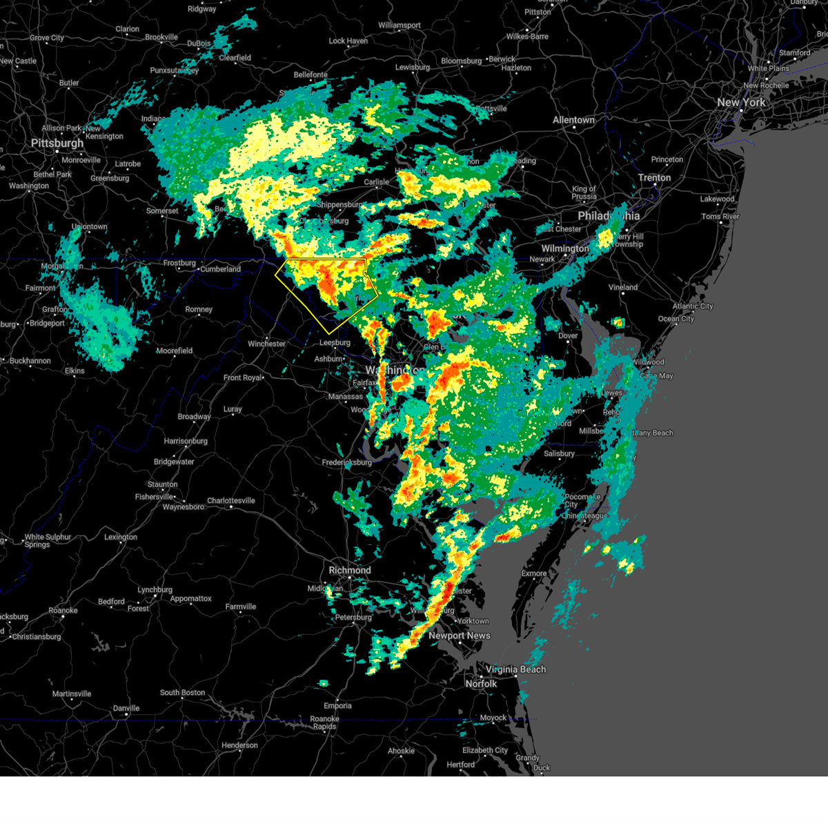
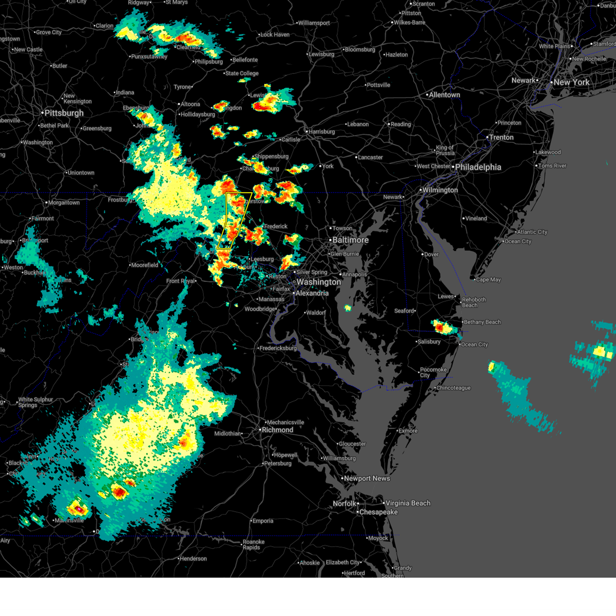
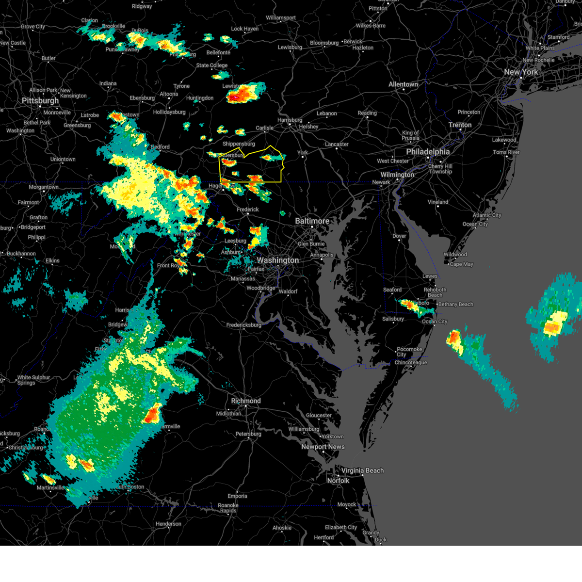
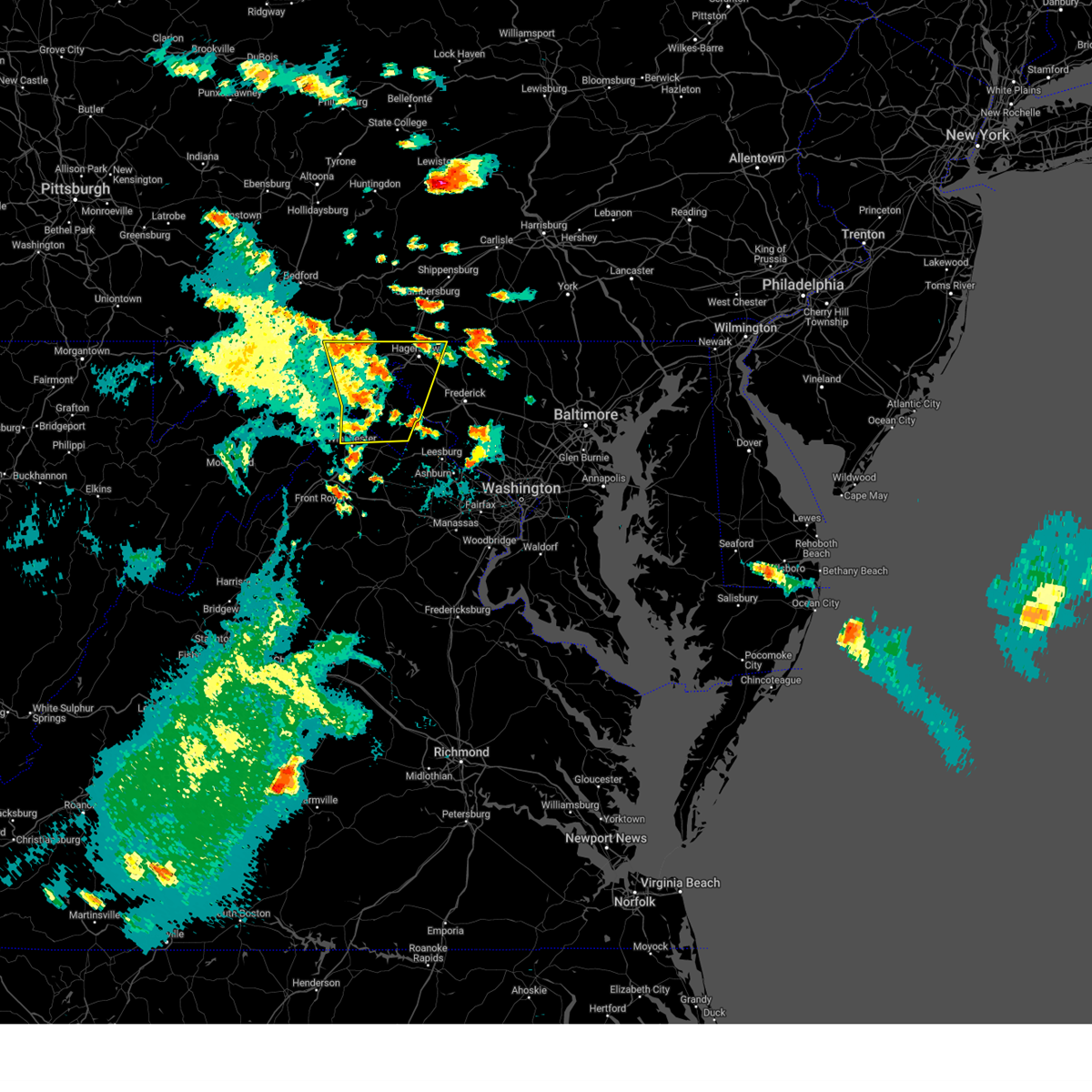
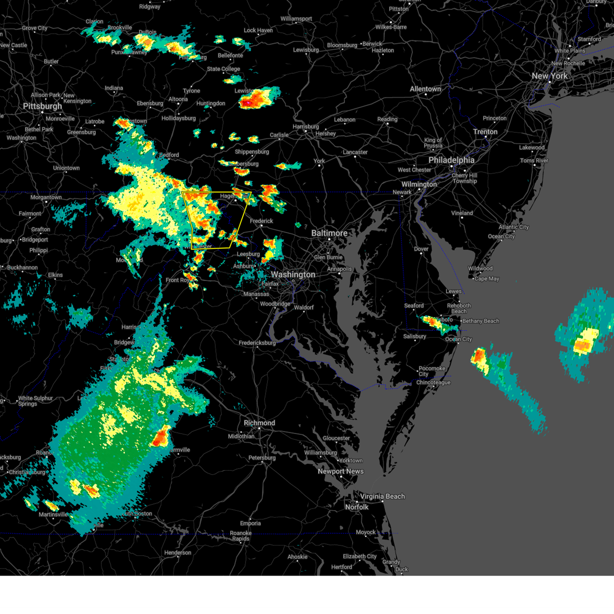
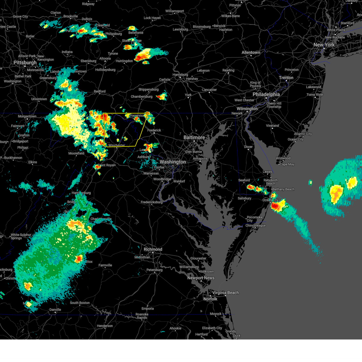
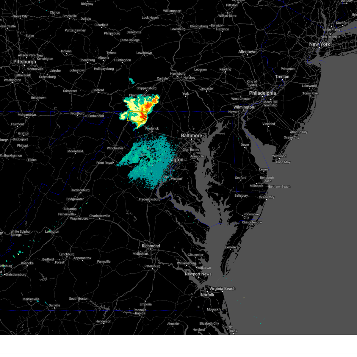
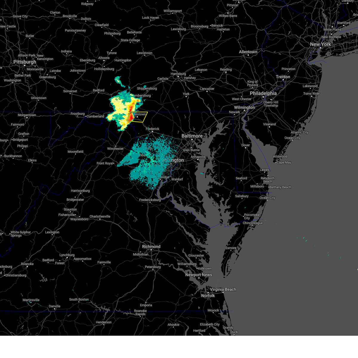
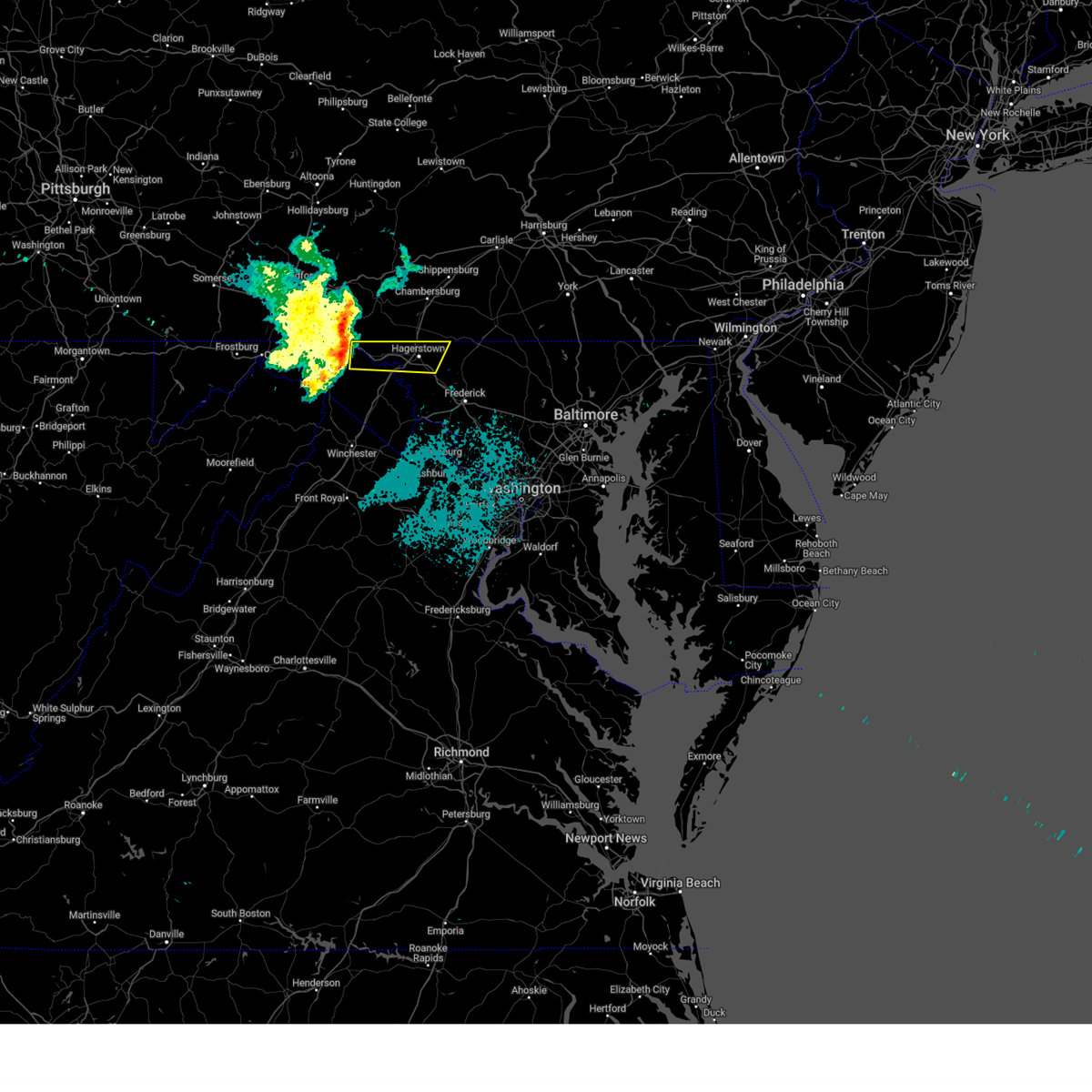
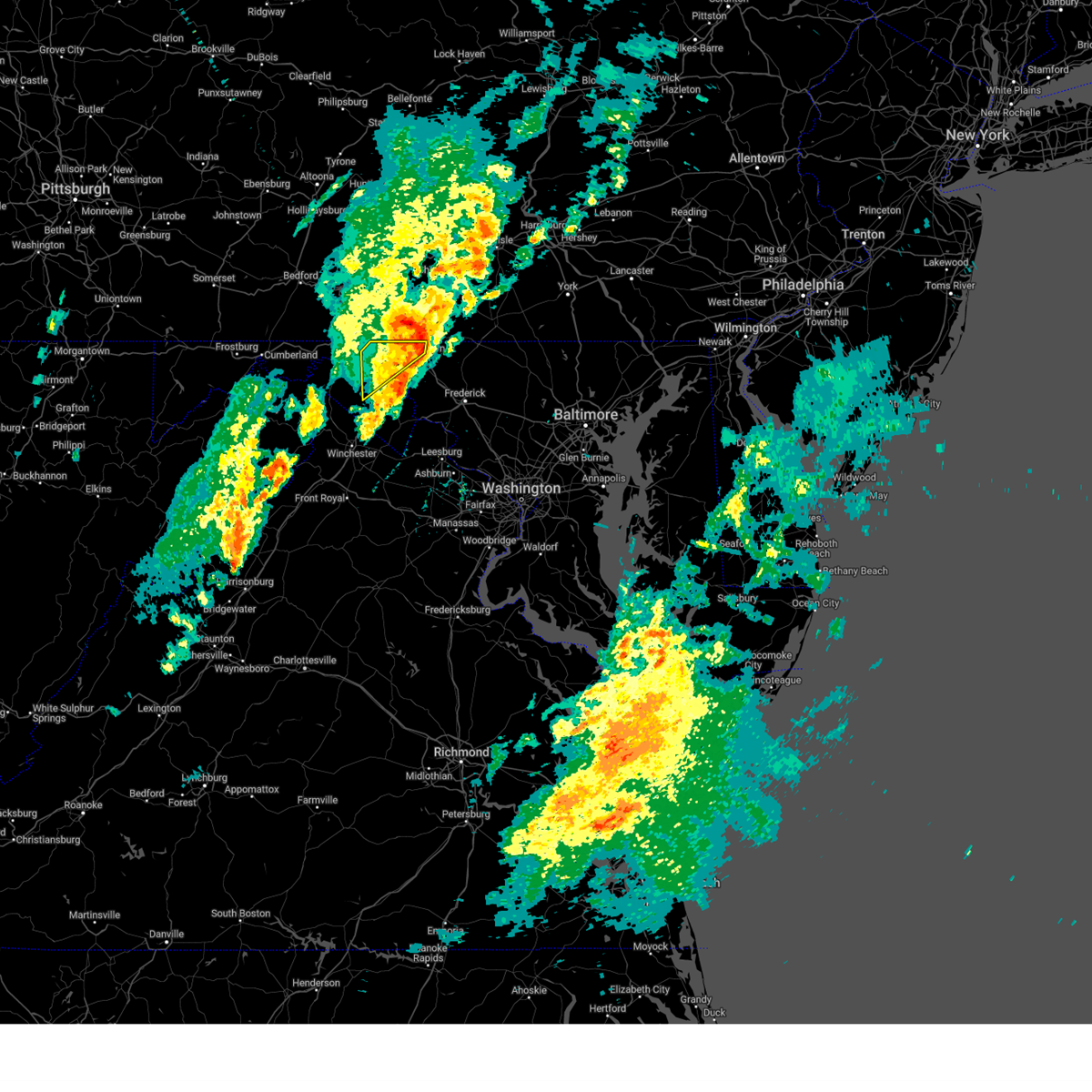
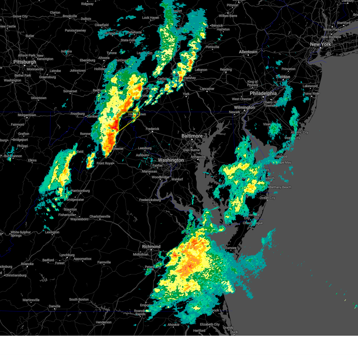
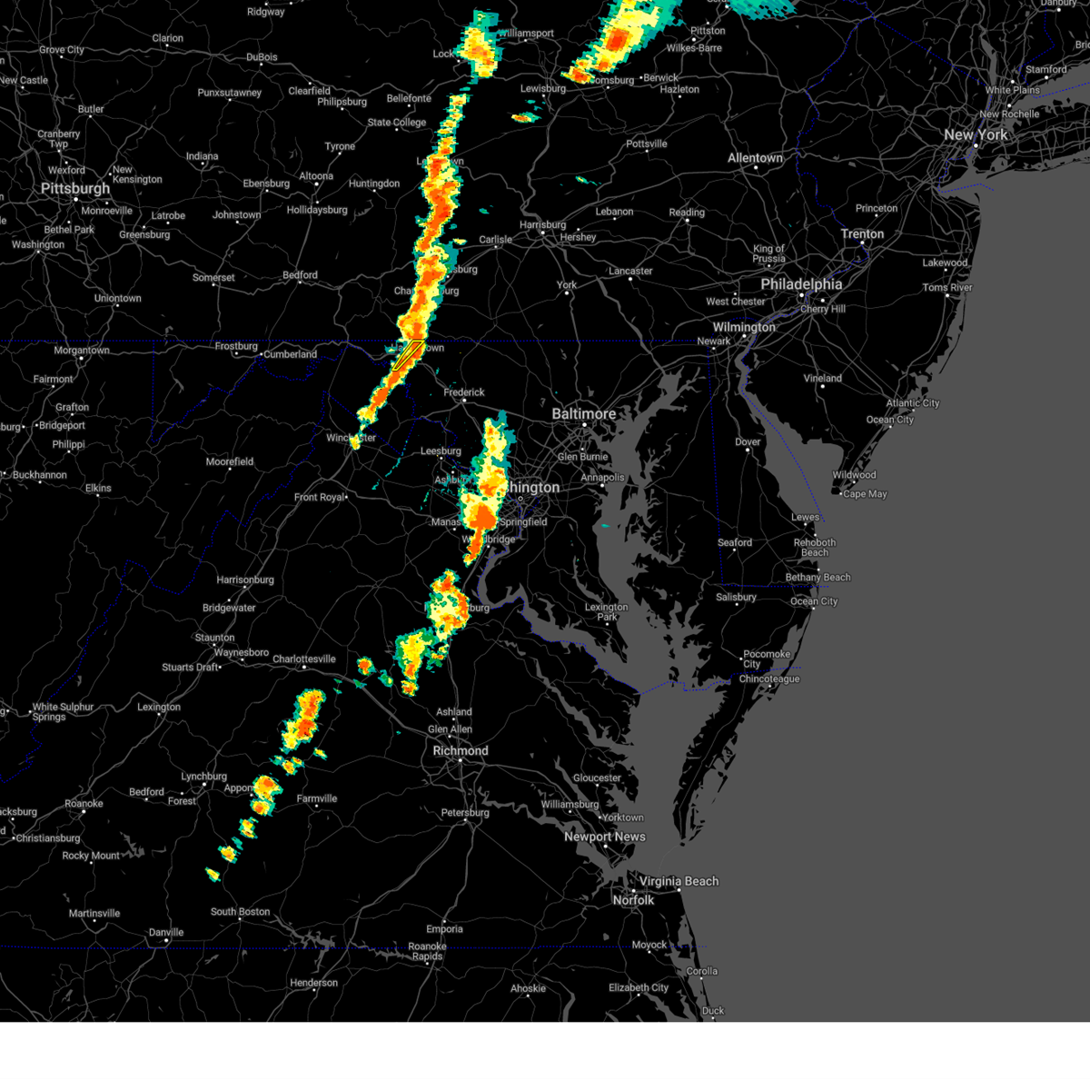
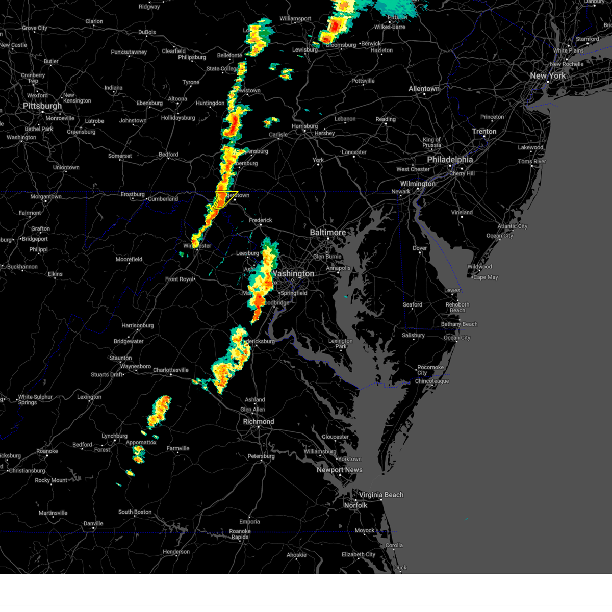
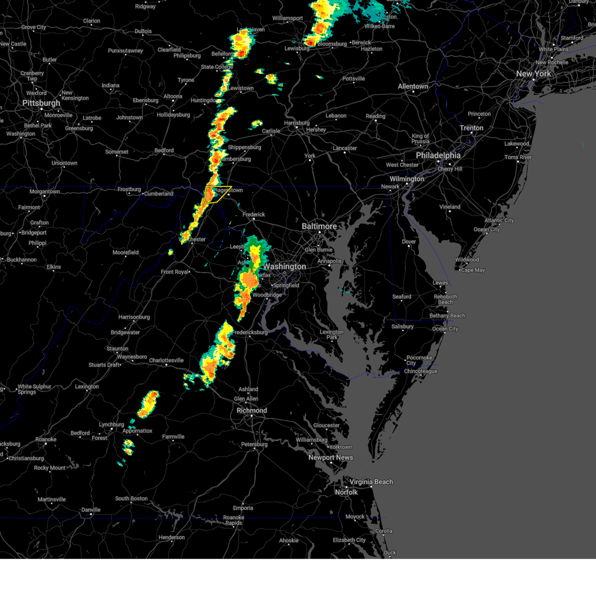
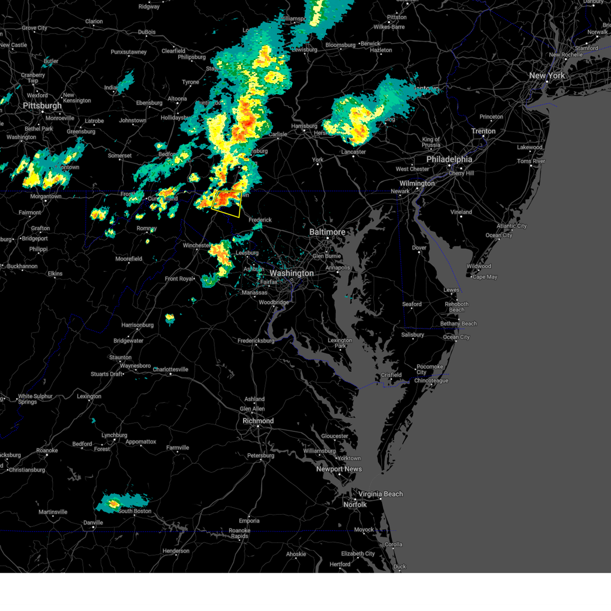
Hail Map for Middleburg, MD
The Middleburg, MD area has had 0 reports of on-the-ground hail by trained spotters, and has been under severe weather warnings 24 times during the past 12 months. Doppler radar has detected hail at or near Middleburg, MD on 37 occasions, including 4 occasions during the past year.
| Name: | Middleburg, MD |
| Where Located: | 66.4 miles WNW of Baltimore, MD |
| Map: | Google Map for Middleburg, MD |
| Population: | 70 |
| Housing Units: | 26 |
| More Info: | Search Google for Middleburg, MD |
0
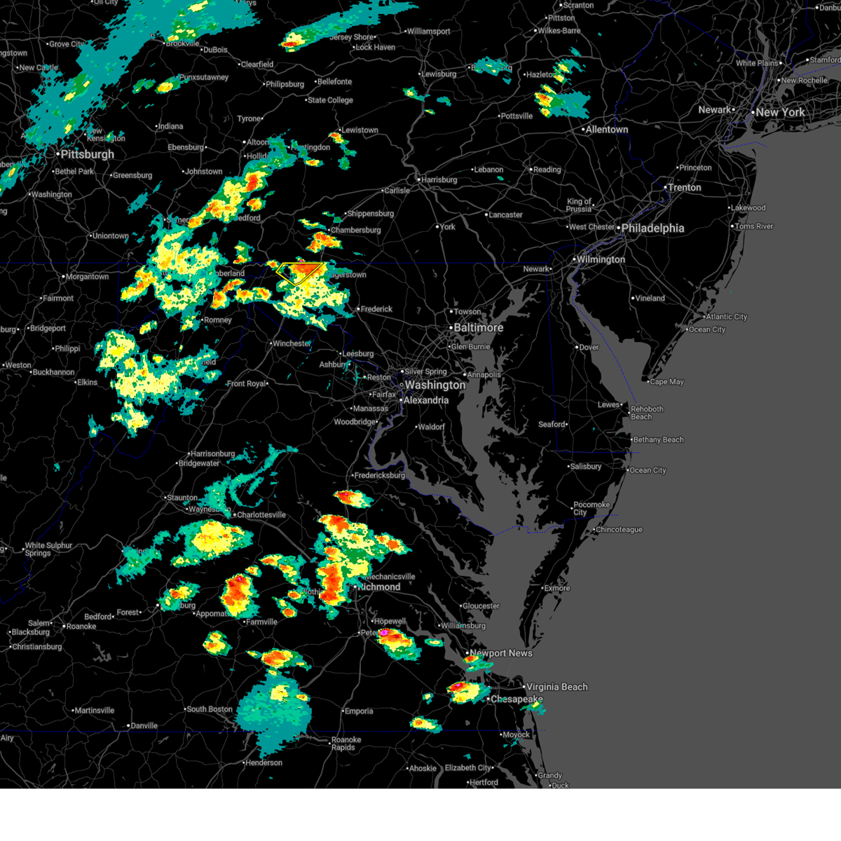
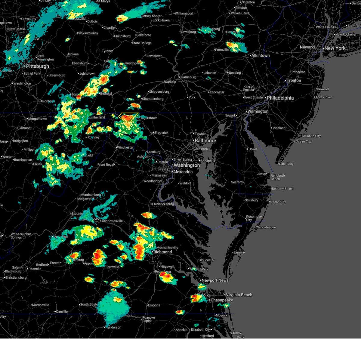
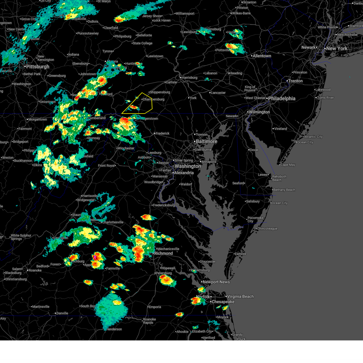
The Top Recent Hail Date for Middleburg, MD is Wednesday, May 20, 2026 (37th out of 37)
Hail and Wind Damage Spotted near Middleburg, MD
| Date / Time | Report Details |
|---|---|
| 6/14/2026 6:20 PM EDT |
 the severe thunderstorm warning has been cancelled and is no longer in effect the severe thunderstorm warning has been cancelled and is no longer in effect
|
| 6/14/2026 6:09 PM EDT |
 At 609 pm edt, a severe thunderstorm was located near claylick, or 10 miles east of hancock, moving northeast at 35 mph (radar indicated). Hazards include 60 mph wind gusts and quarter size hail. Damaging winds will cause some trees and large branches to fall. this could injure those outdoors, as well as damage homes and vehicles. roadways may become blocked by downed trees. localized power outages are possible. unsecured light objects may become projectiles. Locations impacted include, wilson-conococheague, maugansville, clear spring, pecktonville, big spring, big pool, middleburg, cherry run, warrenton, and sleepy creek. At 609 pm edt, a severe thunderstorm was located near claylick, or 10 miles east of hancock, moving northeast at 35 mph (radar indicated). Hazards include 60 mph wind gusts and quarter size hail. Damaging winds will cause some trees and large branches to fall. this could injure those outdoors, as well as damage homes and vehicles. roadways may become blocked by downed trees. localized power outages are possible. unsecured light objects may become projectiles. Locations impacted include, wilson-conococheague, maugansville, clear spring, pecktonville, big spring, big pool, middleburg, cherry run, warrenton, and sleepy creek.
|
| 6/14/2026 6:06 PM EDT |
 Svrctp the national weather service in state college pa has issued a * severe thunderstorm warning for, southeastern franklin county in south central pennsylvania, * until 645 pm edt. * at 606 pm edt, a severe thunderstorm was located near wilson-conococheague, moving northeast at 40 mph (radar indicated). Hazards include 70 mph wind gusts and half dollar size hail. Hail damage to vehicles is expected. expect considerable tree damage. Wind damage is also likely to mobile homes, roofs, and outbuildings. Svrctp the national weather service in state college pa has issued a * severe thunderstorm warning for, southeastern franklin county in south central pennsylvania, * until 645 pm edt. * at 606 pm edt, a severe thunderstorm was located near wilson-conococheague, moving northeast at 40 mph (radar indicated). Hazards include 70 mph wind gusts and half dollar size hail. Hail damage to vehicles is expected. expect considerable tree damage. Wind damage is also likely to mobile homes, roofs, and outbuildings.
|
| 6/14/2026 6:00 PM EDT |
 Svrlwx the national weather service in sterling virginia has issued a * severe thunderstorm warning for, north central washington county in north central maryland, northeastern morgan county in the panhandle of west virginia, northwestern berkeley county in the panhandle of west virginia, * until 630 pm edt. * at 559 pm edt, a severe thunderstorm was located 9 miles southeast of hancock, moving northeast at 35 mph (radar indicated). Hazards include 60 mph wind gusts and quarter size hail. Damaging winds will cause some trees and large branches to fall. this could injure those outdoors, as well as damage homes and vehicles. roadways may become blocked by downed trees. localized power outages are possible. Unsecured light objects may become projectiles. Svrlwx the national weather service in sterling virginia has issued a * severe thunderstorm warning for, north central washington county in north central maryland, northeastern morgan county in the panhandle of west virginia, northwestern berkeley county in the panhandle of west virginia, * until 630 pm edt. * at 559 pm edt, a severe thunderstorm was located 9 miles southeast of hancock, moving northeast at 35 mph (radar indicated). Hazards include 60 mph wind gusts and quarter size hail. Damaging winds will cause some trees and large branches to fall. this could injure those outdoors, as well as damage homes and vehicles. roadways may become blocked by downed trees. localized power outages are possible. Unsecured light objects may become projectiles.
|
| 6/11/2026 7:12 PM EDT |
 Svrctp the national weather service in state college pa has issued a * severe thunderstorm warning for, adams county in south central pennsylvania, cumberland county in south central pennsylvania, southern dauphin county in south central pennsylvania, southeastern franklin county in south central pennsylvania, east central perry county in south central pennsylvania, northwestern york county in south central pennsylvania, * until 800 pm edt. * at 712 pm edt, severe thunderstorms were located along a line extending from wertzville to mount holly springs to shippensburg to greencastle, moving east at 50 mph (radar indicated). Hazards include 60 mph wind gusts. expect damage to roofs, siding, and trees Svrctp the national weather service in state college pa has issued a * severe thunderstorm warning for, adams county in south central pennsylvania, cumberland county in south central pennsylvania, southern dauphin county in south central pennsylvania, southeastern franklin county in south central pennsylvania, east central perry county in south central pennsylvania, northwestern york county in south central pennsylvania, * until 800 pm edt. * at 712 pm edt, severe thunderstorms were located along a line extending from wertzville to mount holly springs to shippensburg to greencastle, moving east at 50 mph (radar indicated). Hazards include 60 mph wind gusts. expect damage to roofs, siding, and trees
|
| 6/11/2026 7:04 PM EDT |
 At 704 pm edt, severe thunderstorms were located along a line extending from near fountainhead-orchard hills to near kearneysville to 7 miles north of linden, moving east at 45 mph (radar indicated). Hazards include 60 mph wind gusts. Damaging winds will cause some trees and large branches to fall. this could injure those outdoors, as well as damage homes and vehicles. roadways may become blocked by downed trees. localized power outages are possible. unsecured light objects may become projectiles. Locations impacted include, hagerstown, charles town, shepherdstown, municipal stadium, robinwood, fountainhead-orchard hills, ranson, berryville, boonsboro, paramount-long meadow, wilson-conococheague, williamsport, mount aetna, round hill, mount lena, san mar, harpers ferry, long meadow, corporation of ranson, and kearneysville. At 704 pm edt, severe thunderstorms were located along a line extending from near fountainhead-orchard hills to near kearneysville to 7 miles north of linden, moving east at 45 mph (radar indicated). Hazards include 60 mph wind gusts. Damaging winds will cause some trees and large branches to fall. this could injure those outdoors, as well as damage homes and vehicles. roadways may become blocked by downed trees. localized power outages are possible. unsecured light objects may become projectiles. Locations impacted include, hagerstown, charles town, shepherdstown, municipal stadium, robinwood, fountainhead-orchard hills, ranson, berryville, boonsboro, paramount-long meadow, wilson-conococheague, williamsport, mount aetna, round hill, mount lena, san mar, harpers ferry, long meadow, corporation of ranson, and kearneysville.
|
| 6/11/2026 6:45 PM EDT |
 Svrlwx the national weather service in sterling virginia has issued a * severe thunderstorm warning for, washington county in north central maryland, southwestern frederick county in north central maryland, northwestern loudoun county in northern virginia, northeastern shenandoah county in northwestern virginia, frederick county in northwestern virginia, north central warren county in northwestern virginia, clarke county in northwestern virginia, north central fauquier county in northern virginia, the city of winchester in northwestern virginia, jefferson county in the panhandle of west virginia, eastern morgan county in the panhandle of west virginia, berkeley county in the panhandle of west virginia, * until 730 pm edt. * at 645 pm edt, severe thunderstorms were located along a line extending from near hancock to 7 miles west of inwood to near star tannery, moving east at 35 mph (radar indicated). Hazards include 60 mph wind gusts. Damaging winds will cause some trees and large branches to fall. this could injure those outdoors, as well as damage homes and vehicles. roadways may become blocked by downed trees. localized power outages are possible. Unsecured light objects may become projectiles. Svrlwx the national weather service in sterling virginia has issued a * severe thunderstorm warning for, washington county in north central maryland, southwestern frederick county in north central maryland, northwestern loudoun county in northern virginia, northeastern shenandoah county in northwestern virginia, frederick county in northwestern virginia, north central warren county in northwestern virginia, clarke county in northwestern virginia, north central fauquier county in northern virginia, the city of winchester in northwestern virginia, jefferson county in the panhandle of west virginia, eastern morgan county in the panhandle of west virginia, berkeley county in the panhandle of west virginia, * until 730 pm edt. * at 645 pm edt, severe thunderstorms were located along a line extending from near hancock to 7 miles west of inwood to near star tannery, moving east at 35 mph (radar indicated). Hazards include 60 mph wind gusts. Damaging winds will cause some trees and large branches to fall. this could injure those outdoors, as well as damage homes and vehicles. roadways may become blocked by downed trees. localized power outages are possible. Unsecured light objects may become projectiles.
|
| 6/11/2026 6:13 PM EDT |
 Svrctp the national weather service in state college pa has issued a * severe thunderstorm warning for, western adams county in south central pennsylvania, cumberland county in south central pennsylvania, franklin county in south central pennsylvania, central fulton county in south central pennsylvania, southeastern huntingdon county in central pennsylvania, southwestern perry county in south central pennsylvania, * until 715 pm edt. * at 613 pm edt, severe thunderstorms were located along a line extending from rockhill furnace to harrisonville to warfordsburg, moving east at 45 mph (radar indicated). Hazards include 60 mph wind gusts. expect damage to roofs, siding, and trees Svrctp the national weather service in state college pa has issued a * severe thunderstorm warning for, western adams county in south central pennsylvania, cumberland county in south central pennsylvania, franklin county in south central pennsylvania, central fulton county in south central pennsylvania, southeastern huntingdon county in central pennsylvania, southwestern perry county in south central pennsylvania, * until 715 pm edt. * at 613 pm edt, severe thunderstorms were located along a line extending from rockhill furnace to harrisonville to warfordsburg, moving east at 45 mph (radar indicated). Hazards include 60 mph wind gusts. expect damage to roofs, siding, and trees
|
| 6/6/2026 5:11 PM EDT |
 Svrlwx the national weather service in sterling virginia has issued a * severe thunderstorm warning for, washington county in north central maryland, northwestern carroll county in north central maryland, frederick county in north central maryland, north central jefferson county in the panhandle of west virginia, northeastern berkeley county in the panhandle of west virginia, * until 615 pm edt. * at 510 pm edt, severe thunderstorms were located along a line extending from waynesboro to municipal stadium to near martinsburg, moving east at 40 mph (radar indicated). Hazards include 70 mph wind gusts. Damaging winds will cause some trees and large branches to fall. this could injure those outdoors, as well as damage homes and vehicles. roadways may become blocked by downed trees. localized power outages are possible. Unsecured light objects may become projectiles. Svrlwx the national weather service in sterling virginia has issued a * severe thunderstorm warning for, washington county in north central maryland, northwestern carroll county in north central maryland, frederick county in north central maryland, north central jefferson county in the panhandle of west virginia, northeastern berkeley county in the panhandle of west virginia, * until 615 pm edt. * at 510 pm edt, severe thunderstorms were located along a line extending from waynesboro to municipal stadium to near martinsburg, moving east at 40 mph (radar indicated). Hazards include 70 mph wind gusts. Damaging winds will cause some trees and large branches to fall. this could injure those outdoors, as well as damage homes and vehicles. roadways may become blocked by downed trees. localized power outages are possible. Unsecured light objects may become projectiles.
|
| 6/6/2026 5:03 PM EDT |
 At 502 pm edt, severe thunderstorms were located along a line extending from near long meadow to 6 miles southwest of williamsport to near inwood, moving east at 50 mph (radar indicated). Hazards include 70 mph wind gusts. Damaging winds will cause some trees and large branches to fall. this could injure those outdoors, as well as damage homes and vehicles. roadways may become blocked by downed trees. localized power outages are possible. unsecured light objects may become projectiles. Locations impacted include, hagerstown, martinsburg, thurmont, charles town, emmitsburg, shepherdstown, municipal stadium, greenwood, robinwood, fountainhead-orchard hills, ranson, boonsboro, smithsburg, inwood, paramount-long meadow, wilson-conococheague, williamsport, mount aetna, mount lena, and san mar. At 502 pm edt, severe thunderstorms were located along a line extending from near long meadow to 6 miles southwest of williamsport to near inwood, moving east at 50 mph (radar indicated). Hazards include 70 mph wind gusts. Damaging winds will cause some trees and large branches to fall. this could injure those outdoors, as well as damage homes and vehicles. roadways may become blocked by downed trees. localized power outages are possible. unsecured light objects may become projectiles. Locations impacted include, hagerstown, martinsburg, thurmont, charles town, emmitsburg, shepherdstown, municipal stadium, greenwood, robinwood, fountainhead-orchard hills, ranson, boonsboro, smithsburg, inwood, paramount-long meadow, wilson-conococheague, williamsport, mount aetna, mount lena, and san mar.
|
| 6/6/2026 4:51 PM EDT |
 At 451 pm edt, severe thunderstorms were located along a line extending from near claylick to 6 miles northwest of martinsburg to near greenwood, moving east at 45 mph (radar indicated). Hazards include 60 mph wind gusts. Damaging winds will cause some trees and large branches to fall. this could injure those outdoors, as well as damage homes and vehicles. roadways may become blocked by downed trees. localized power outages are possible. unsecured light objects may become projectiles. Locations impacted include, hagerstown, martinsburg, thurmont, charles town, emmitsburg, shepherdstown, municipal stadium, greenwood, robinwood, fountainhead-orchard hills, ranson, boonsboro, smithsburg, inwood, paramount-long meadow, wilson-conococheague, williamsport, mount aetna, mount lena, and san mar. At 451 pm edt, severe thunderstorms were located along a line extending from near claylick to 6 miles northwest of martinsburg to near greenwood, moving east at 45 mph (radar indicated). Hazards include 60 mph wind gusts. Damaging winds will cause some trees and large branches to fall. this could injure those outdoors, as well as damage homes and vehicles. roadways may become blocked by downed trees. localized power outages are possible. unsecured light objects may become projectiles. Locations impacted include, hagerstown, martinsburg, thurmont, charles town, emmitsburg, shepherdstown, municipal stadium, greenwood, robinwood, fountainhead-orchard hills, ranson, boonsboro, smithsburg, inwood, paramount-long meadow, wilson-conococheague, williamsport, mount aetna, mount lena, and san mar.
|
| 6/6/2026 4:29 PM EDT |
 Svrlwx the national weather service in sterling virginia has issued a * severe thunderstorm warning for, washington county in north central maryland, northwestern frederick county in north central maryland, north central frederick county in northwestern virginia, central jefferson county in the panhandle of west virginia, central morgan county in the panhandle of west virginia, berkeley county in the panhandle of west virginia, northeastern hampshire county in eastern west virginia, * until 515 pm edt. * at 428 pm edt, severe thunderstorms were located along a line extending from near needmore to near berkeley springs to paw paw, moving east at 50 mph (radar indicated). Hazards include 60 mph wind gusts. Damaging winds will cause some trees and large branches to fall. this could injure those outdoors, as well as damage homes and vehicles. roadways may become blocked by downed trees. localized power outages are possible. Unsecured light objects may become projectiles. Svrlwx the national weather service in sterling virginia has issued a * severe thunderstorm warning for, washington county in north central maryland, northwestern frederick county in north central maryland, north central frederick county in northwestern virginia, central jefferson county in the panhandle of west virginia, central morgan county in the panhandle of west virginia, berkeley county in the panhandle of west virginia, northeastern hampshire county in eastern west virginia, * until 515 pm edt. * at 428 pm edt, severe thunderstorms were located along a line extending from near needmore to near berkeley springs to paw paw, moving east at 50 mph (radar indicated). Hazards include 60 mph wind gusts. Damaging winds will cause some trees and large branches to fall. this could injure those outdoors, as well as damage homes and vehicles. roadways may become blocked by downed trees. localized power outages are possible. Unsecured light objects may become projectiles.
|
| 5/20/2026 1:59 PM EDT |
 At 159 pm edt, a severe thunderstorm was located over waynesboro, moving east at 25 mph (radar indicated). Hazards include 60 mph wind gusts and quarter size hail. Hail damage to vehicles is expected. expect wind damage to roofs, siding, and trees. locations impacted include, waynesboro, greencastle, wayne heights, mont alto, rouzerville, maugansville, state line, middleburg, quincy, and penn state mont alto. This includes interstate 81 from mile markers 0 to 6. At 159 pm edt, a severe thunderstorm was located over waynesboro, moving east at 25 mph (radar indicated). Hazards include 60 mph wind gusts and quarter size hail. Hail damage to vehicles is expected. expect wind damage to roofs, siding, and trees. locations impacted include, waynesboro, greencastle, wayne heights, mont alto, rouzerville, maugansville, state line, middleburg, quincy, and penn state mont alto. This includes interstate 81 from mile markers 0 to 6.
|
| 5/20/2026 1:43 PM EDT |
 Svrctp the national weather service in state college pa has issued a * severe thunderstorm warning for, southeastern franklin county in south central pennsylvania, * until 230 pm edt. * at 143 pm edt, a severe thunderstorm was located over greencastle, moving east at 25 mph (radar indicated). Hazards include 60 mph wind gusts and quarter size hail. Hail damage to vehicles is expected. Expect wind damage to roofs, siding, and trees. Svrctp the national weather service in state college pa has issued a * severe thunderstorm warning for, southeastern franklin county in south central pennsylvania, * until 230 pm edt. * at 143 pm edt, a severe thunderstorm was located over greencastle, moving east at 25 mph (radar indicated). Hazards include 60 mph wind gusts and quarter size hail. Hail damage to vehicles is expected. Expect wind damage to roofs, siding, and trees.
|
| 3/16/2026 11:27 AM EDT |
 Svrctp the national weather service in state college pa has issued a * severe thunderstorm warning for, southwestern adams county in south central pennsylvania, franklin county in south central pennsylvania, * until 1215 pm edt. * at 1127 am edt, severe thunderstorms were located along a line extending from claylick to near braddock heights, moving northeast at 45 mph (radar indicated). Hazards include 60 mph wind gusts. expect damage to roofs, siding, and trees Svrctp the national weather service in state college pa has issued a * severe thunderstorm warning for, southwestern adams county in south central pennsylvania, franklin county in south central pennsylvania, * until 1215 pm edt. * at 1127 am edt, severe thunderstorms were located along a line extending from claylick to near braddock heights, moving northeast at 45 mph (radar indicated). Hazards include 60 mph wind gusts. expect damage to roofs, siding, and trees
|
| 11/5/2025 9:41 PM EST | The storms which prompted the warning have weakened below severe limits, and have exited the warned area. therefore, the warning will be allowed to expire. to report severe weather, contact your nearest law enforcement agency. they will relay your report to the national weather service sterling virginia. |
| 11/5/2025 9:15 PM EST | At 915 pm est, severe thunderstorms were located along a line extending from near thurmont to near wolfsville to boonsboro to inwood, moving east at 45 mph (radar indicated and observed wind at hagerstown regional airport and near thurmont). Hazards include 60 mph wind gusts. Damaging winds will cause some trees and large branches to fall. this could injure those outdoors, as well as damage homes and vehicles. roadways may become blocked by downed trees. localized power outages are possible. unsecured light objects may become projectiles. Locations impacted include, frederick, hagerstown, martinsburg, thurmont, charles town, emmitsburg, shepherdstown, municipal stadium, harry grove stadium, ballenger creek, purcellville, robinwood, brunswick, walkersville, fountainhead-orchard hills, ranson, boonsboro, smithsburg, inwood, and braddock heights. |
| 11/5/2025 8:56 PM EST | Svrlwx the national weather service in sterling virginia has issued a * severe thunderstorm warning for, washington county in north central maryland, frederick county in north central maryland, northwestern loudoun county in northern virginia, jefferson county in the panhandle of west virginia, berkeley county in the panhandle of west virginia, * until 945 pm est. * at 856 pm est, severe thunderstorms were located along a line extending from near rouzerville to robinwood to near williamsport to greenwood, moving east at 50 mph (radar indicated and observed wind at hagerstown airport). Hazards include 60 mph wind gusts. Damaging winds will cause some trees and large branches to fall. this could injure those outdoors, as well as damage homes and vehicles. roadways may become blocked by downed trees. localized power outages are possible. Unsecured light objects may become projectiles. |
| 7/26/2025 11:11 PM EDT |
 At 1110 pm edt, severe thunderstorms were located along a line extending from near cashtown to near carroll valley to smithsburg, moving southeast at 20 mph (radar indicated). Hazards include 60 mph wind gusts. Expect damage to roofs, siding, and trees. locations impacted include, waynesboro, gettysburg, greencastle, carroll valley, fayetteville, wayne heights, mont alto, lake heritage, rouzerville, cashtown, orrtanna, and maugansville. This includes interstate 81 from mile markers 0 to 6. At 1110 pm edt, severe thunderstorms were located along a line extending from near cashtown to near carroll valley to smithsburg, moving southeast at 20 mph (radar indicated). Hazards include 60 mph wind gusts. Expect damage to roofs, siding, and trees. locations impacted include, waynesboro, gettysburg, greencastle, carroll valley, fayetteville, wayne heights, mont alto, lake heritage, rouzerville, cashtown, orrtanna, and maugansville. This includes interstate 81 from mile markers 0 to 6.
|
| 7/26/2025 11:00 PM EDT |
 Svrlwx the national weather service in sterling virginia has issued a * severe thunderstorm warning for, northeastern washington county in north central maryland, north central frederick county in north central maryland, * until 1145 pm edt. * at 1100 pm edt, severe thunderstorms were located along a line extending from mont alto to near greencastle, moving southeast at 15 mph (radar indicated). Hazards include 60 mph wind gusts. Damaging winds will cause some trees and large branches to fall. this could injure those outdoors, as well as damage homes and vehicles. roadways may become blocked by downed trees. localized power outages are possible. Unsecured light objects may become projectiles. Svrlwx the national weather service in sterling virginia has issued a * severe thunderstorm warning for, northeastern washington county in north central maryland, north central frederick county in north central maryland, * until 1145 pm edt. * at 1100 pm edt, severe thunderstorms were located along a line extending from mont alto to near greencastle, moving southeast at 15 mph (radar indicated). Hazards include 60 mph wind gusts. Damaging winds will cause some trees and large branches to fall. this could injure those outdoors, as well as damage homes and vehicles. roadways may become blocked by downed trees. localized power outages are possible. Unsecured light objects may become projectiles.
|
| 7/26/2025 10:47 PM EDT |
 Svrctp the national weather service in state college pa has issued a * severe thunderstorm warning for, southwestern adams county in south central pennsylvania, southeastern franklin county in south central pennsylvania, * until 1130 pm edt. * at 1047 pm edt, severe thunderstorms were located along a line extending from scotland to mont alto to greencastle, moving southeast at 20 mph (radar indicated). Hazards include 60 mph wind gusts. expect damage to roofs, siding, and trees Svrctp the national weather service in state college pa has issued a * severe thunderstorm warning for, southwestern adams county in south central pennsylvania, southeastern franklin county in south central pennsylvania, * until 1130 pm edt. * at 1047 pm edt, severe thunderstorms were located along a line extending from scotland to mont alto to greencastle, moving southeast at 20 mph (radar indicated). Hazards include 60 mph wind gusts. expect damage to roofs, siding, and trees
|
| 6/25/2025 8:30 PM EDT |
 the severe thunderstorm warning has been cancelled and is no longer in effect the severe thunderstorm warning has been cancelled and is no longer in effect
|
| 6/25/2025 8:30 PM EDT |
 At 829 pm edt, severe thunderstorms were located along a line extending from mont alto to mercersburg to locust grove, moving south at 5 mph (radar indicated). Hazards include 60 mph wind gusts and penny size hail. Expect damage to roofs, siding, and trees. locations impacted include, waynesboro, greencastle, warfordsburg, wayne heights, mercersburg, rouzerville, marion, fort loudon, big cove tannery, claylick, maugansville, and state line. this includes the following interstates, interstate 70 from mile markers 167 to 170. Interstate 81 from mile markers 0 to 9. At 829 pm edt, severe thunderstorms were located along a line extending from mont alto to mercersburg to locust grove, moving south at 5 mph (radar indicated). Hazards include 60 mph wind gusts and penny size hail. Expect damage to roofs, siding, and trees. locations impacted include, waynesboro, greencastle, warfordsburg, wayne heights, mercersburg, rouzerville, marion, fort loudon, big cove tannery, claylick, maugansville, and state line. this includes the following interstates, interstate 70 from mile markers 167 to 170. Interstate 81 from mile markers 0 to 9.
|
| 6/25/2025 7:34 PM EDT |
 Svrctp the national weather service in state college pa has issued a * severe thunderstorm warning for, southwestern adams county in south central pennsylvania, franklin county in south central pennsylvania, fulton county in south central pennsylvania, * until 845 pm edt. * at 733 pm edt, severe thunderstorms were located along a line extending from fayetteville to fort loudon to crystal springs, moving south at 5 mph (radar indicated). Hazards include 60 mph wind gusts and penny size hail. expect damage to roofs, siding, and trees Svrctp the national weather service in state college pa has issued a * severe thunderstorm warning for, southwestern adams county in south central pennsylvania, franklin county in south central pennsylvania, fulton county in south central pennsylvania, * until 845 pm edt. * at 733 pm edt, severe thunderstorms were located along a line extending from fayetteville to fort loudon to crystal springs, moving south at 5 mph (radar indicated). Hazards include 60 mph wind gusts and penny size hail. expect damage to roofs, siding, and trees
|
| 6/19/2025 2:26 PM EDT |
 At 225 pm edt, a severe thunderstorm was located near williamsport, or 8 miles north of shepherdstown, moving east at 35 mph (radar indicated). Hazards include 60 mph wind gusts. Damaging winds will cause some trees and large branches to fall. this could injure those outdoors, as well as damage homes and vehicles. roadways may become blocked by downed trees. localized power outages are possible. unsecured light objects may become projectiles. Locations impacted include, hagerstown, martinsburg, thurmont, shepherdstown, municipal stadium, robinwood, fountainhead-orchard hills, boonsboro, smithsburg, paramount-long meadow, wilson-conococheague, williamsport, mount aetna, mount lena, san mar, long meadow, wolfsville, saint james, berkeley, and halfway. At 225 pm edt, a severe thunderstorm was located near williamsport, or 8 miles north of shepherdstown, moving east at 35 mph (radar indicated). Hazards include 60 mph wind gusts. Damaging winds will cause some trees and large branches to fall. this could injure those outdoors, as well as damage homes and vehicles. roadways may become blocked by downed trees. localized power outages are possible. unsecured light objects may become projectiles. Locations impacted include, hagerstown, martinsburg, thurmont, shepherdstown, municipal stadium, robinwood, fountainhead-orchard hills, boonsboro, smithsburg, paramount-long meadow, wilson-conococheague, williamsport, mount aetna, mount lena, san mar, long meadow, wolfsville, saint james, berkeley, and halfway.
|
| 6/19/2025 2:26 PM EDT |
 the severe thunderstorm warning has been cancelled and is no longer in effect the severe thunderstorm warning has been cancelled and is no longer in effect
|
| 6/19/2025 2:08 PM EDT |
 At 208 pm edt, a severe thunderstorm was located 7 miles west of williamsport, or 7 miles north of martinsburg, moving east at 35 mph (radar indicated). Hazards include 60 mph wind gusts. Damaging winds will cause some trees and large branches to fall. this could injure those outdoors, as well as damage homes and vehicles. roadways may become blocked by downed trees. localized power outages are possible. unsecured light objects may become projectiles. Locations impacted include, hagerstown, martinsburg, thurmont, shepherdstown, municipal stadium, robinwood, fountainhead-orchard hills, boonsboro, smithsburg, paramount-long meadow, wilson-conococheague, williamsport, mount aetna, mount lena, san mar, long meadow, wolfsville, saint james, berkeley, and halfway. At 208 pm edt, a severe thunderstorm was located 7 miles west of williamsport, or 7 miles north of martinsburg, moving east at 35 mph (radar indicated). Hazards include 60 mph wind gusts. Damaging winds will cause some trees and large branches to fall. this could injure those outdoors, as well as damage homes and vehicles. roadways may become blocked by downed trees. localized power outages are possible. unsecured light objects may become projectiles. Locations impacted include, hagerstown, martinsburg, thurmont, shepherdstown, municipal stadium, robinwood, fountainhead-orchard hills, boonsboro, smithsburg, paramount-long meadow, wilson-conococheague, williamsport, mount aetna, mount lena, san mar, long meadow, wolfsville, saint james, berkeley, and halfway.
|
| 6/19/2025 1:44 PM EDT |
 Svrlwx the national weather service in sterling virginia has issued a * severe thunderstorm warning for, washington county in north central maryland, northwestern frederick county in north central maryland, northeastern jefferson county in the panhandle of west virginia, central morgan county in the panhandle of west virginia, berkeley county in the panhandle of west virginia, * until 245 pm edt. * at 144 pm edt, a severe thunderstorm was located 7 miles northeast of greenwood, moving east at 50 mph (radar indicated). Hazards include 60 mph wind gusts. Damaging winds will cause some trees and large branches to fall. this could injure those outdoors, as well as damage homes and vehicles. roadways may become blocked by downed trees. localized power outages are possible. Unsecured light objects may become projectiles. Svrlwx the national weather service in sterling virginia has issued a * severe thunderstorm warning for, washington county in north central maryland, northwestern frederick county in north central maryland, northeastern jefferson county in the panhandle of west virginia, central morgan county in the panhandle of west virginia, berkeley county in the panhandle of west virginia, * until 245 pm edt. * at 144 pm edt, a severe thunderstorm was located 7 miles northeast of greenwood, moving east at 50 mph (radar indicated). Hazards include 60 mph wind gusts. Damaging winds will cause some trees and large branches to fall. this could injure those outdoors, as well as damage homes and vehicles. roadways may become blocked by downed trees. localized power outages are possible. Unsecured light objects may become projectiles.
|
| 5/30/2025 8:25 PM EDT |
 The storms which prompted the warning have weakened below severe limits, and no longer pose an immediate threat to life or property. therefore, the warning will be allowed to expire. however, gusty winds are still possible with these thunderstorms. a tornado watch remains in effect until midnight edt for north central maryland, and northern virginia. The storms which prompted the warning have weakened below severe limits, and no longer pose an immediate threat to life or property. therefore, the warning will be allowed to expire. however, gusty winds are still possible with these thunderstorms. a tornado watch remains in effect until midnight edt for north central maryland, and northern virginia.
|
| 5/30/2025 8:01 PM EDT |
 Svrlwx the national weather service in sterling virginia has issued a * severe thunderstorm warning for, washington county in north central maryland, frederick county in north central maryland, north central loudoun county in northern virginia, northeastern jefferson county in the panhandle of west virginia, northeastern morgan county in the panhandle of west virginia, northeastern berkeley county in the panhandle of west virginia, * until 830 pm edt. * at 801 pm edt, severe thunderstorms were located along a line extending from 9 miles west of williamsport to near shepherdstown to near brunswick, moving northeast at 30 mph (radar indicated). Hazards include 60 mph wind gusts. Damaging winds will cause some trees and large branches to fall. this could injure those outdoors, as well as damage homes and vehicles. roadways may become blocked by downed trees. localized power outages are possible. Unsecured light objects may become projectiles. Svrlwx the national weather service in sterling virginia has issued a * severe thunderstorm warning for, washington county in north central maryland, frederick county in north central maryland, north central loudoun county in northern virginia, northeastern jefferson county in the panhandle of west virginia, northeastern morgan county in the panhandle of west virginia, northeastern berkeley county in the panhandle of west virginia, * until 830 pm edt. * at 801 pm edt, severe thunderstorms were located along a line extending from 9 miles west of williamsport to near shepherdstown to near brunswick, moving northeast at 30 mph (radar indicated). Hazards include 60 mph wind gusts. Damaging winds will cause some trees and large branches to fall. this could injure those outdoors, as well as damage homes and vehicles. roadways may become blocked by downed trees. localized power outages are possible. Unsecured light objects may become projectiles.
|
| 5/16/2025 4:37 PM EDT |
 At 437 pm edt, severe thunderstorms were located along a line extending from near claylick to municipal stadium to ranson, moving east at 50 mph (law enforcement has reported tree damage with these storms. the martinsburg airport gusted to 62 mph). Hazards include 60 mph wind gusts and quarter size hail. Damaging winds will cause some trees and large branches to fall. this could injure those outdoors, as well as damage homes and vehicles. roadways may become blocked by downed trees. localized power outages are possible. unsecured light objects may become projectiles. Locations impacted include, municipal stadium, warrenton, shepherdstown, ranson, wilson-conococheague, fairplay, bridgeport, keedysville, robinwood, halfway, bolivar, san mar, pleasantville, williamsport, millville, hagerstown, charles town, antietam, rippon, and mount lena. At 437 pm edt, severe thunderstorms were located along a line extending from near claylick to municipal stadium to ranson, moving east at 50 mph (law enforcement has reported tree damage with these storms. the martinsburg airport gusted to 62 mph). Hazards include 60 mph wind gusts and quarter size hail. Damaging winds will cause some trees and large branches to fall. this could injure those outdoors, as well as damage homes and vehicles. roadways may become blocked by downed trees. localized power outages are possible. unsecured light objects may become projectiles. Locations impacted include, municipal stadium, warrenton, shepherdstown, ranson, wilson-conococheague, fairplay, bridgeport, keedysville, robinwood, halfway, bolivar, san mar, pleasantville, williamsport, millville, hagerstown, charles town, antietam, rippon, and mount lena.
|
| 5/16/2025 4:37 PM EDT |
 the severe thunderstorm warning has been cancelled and is no longer in effect the severe thunderstorm warning has been cancelled and is no longer in effect
|
| 5/16/2025 4:18 PM EDT |
 Svrctp the national weather service in state college pa has issued a * severe thunderstorm warning for, adams county in south central pennsylvania, southeastern franklin county in south central pennsylvania, * until 515 pm edt. * at 418 pm edt, severe thunderstorms were located along a line extending from scotland to taneytown, moving east at 40 mph (radar indicated). Hazards include 60 mph wind gusts and quarter size hail. Hail damage to vehicles is expected. Expect wind damage to roofs, siding, and trees. Svrctp the national weather service in state college pa has issued a * severe thunderstorm warning for, adams county in south central pennsylvania, southeastern franklin county in south central pennsylvania, * until 515 pm edt. * at 418 pm edt, severe thunderstorms were located along a line extending from scotland to taneytown, moving east at 40 mph (radar indicated). Hazards include 60 mph wind gusts and quarter size hail. Hail damage to vehicles is expected. Expect wind damage to roofs, siding, and trees.
|
| 5/16/2025 4:17 PM EDT |
 At 417 pm edt, severe thunderstorms were located along a line extending from near hancock to 7 miles north of martinsburg to 6 miles southwest of inwood, moving east at 45 mph (law enforcement reported trees down in eastern allegany county in maryland). Hazards include 60 mph wind gusts and quarter size hail. Damaging winds will cause some trees and large branches to fall. this could injure those outdoors, as well as damage homes and vehicles. roadways may become blocked by downed trees. localized power outages are possible. unsecured light objects may become projectiles. Locations impacted include, winebrenners cross, municipal stadium, johnsontown, valley view, berkeley, ridgeway, oakland, big spring, fairplay, bridgeport, keedysville, robinwood, san mar, pleasantville, falling waters, jones springs, williamsport, albin, millville, and new hope. At 417 pm edt, severe thunderstorms were located along a line extending from near hancock to 7 miles north of martinsburg to 6 miles southwest of inwood, moving east at 45 mph (law enforcement reported trees down in eastern allegany county in maryland). Hazards include 60 mph wind gusts and quarter size hail. Damaging winds will cause some trees and large branches to fall. this could injure those outdoors, as well as damage homes and vehicles. roadways may become blocked by downed trees. localized power outages are possible. unsecured light objects may become projectiles. Locations impacted include, winebrenners cross, municipal stadium, johnsontown, valley view, berkeley, ridgeway, oakland, big spring, fairplay, bridgeport, keedysville, robinwood, san mar, pleasantville, falling waters, jones springs, williamsport, albin, millville, and new hope.
|
| 5/16/2025 4:17 PM EDT |
 the severe thunderstorm warning has been cancelled and is no longer in effect the severe thunderstorm warning has been cancelled and is no longer in effect
|
| 5/16/2025 3:53 PM EDT |
 Svrlwx the national weather service in sterling virginia has issued a * severe thunderstorm warning for, washington county in north central maryland, northeastern allegany county in western maryland, central frederick county in northwestern virginia, north central clarke county in northwestern virginia, the northwestern city of winchester in northwestern virginia, jefferson county in the panhandle of west virginia, morgan county in the panhandle of west virginia, berkeley county in the panhandle of west virginia, east central hampshire county in eastern west virginia, * until 445 pm edt. * at 353 pm edt, severe thunderstorms were located along a line extending from near barnes gap to near greenwood to 12 miles north of star tannery, moving east at 50 mph (radar indicated). Hazards include 60 mph wind gusts and quarter size hail. Damaging winds will cause some trees and large branches to fall. this could injure those outdoors, as well as damage homes and vehicles. roadways may become blocked by downed trees. localized power outages are possible. Unsecured light objects may become projectiles. Svrlwx the national weather service in sterling virginia has issued a * severe thunderstorm warning for, washington county in north central maryland, northeastern allegany county in western maryland, central frederick county in northwestern virginia, north central clarke county in northwestern virginia, the northwestern city of winchester in northwestern virginia, jefferson county in the panhandle of west virginia, morgan county in the panhandle of west virginia, berkeley county in the panhandle of west virginia, east central hampshire county in eastern west virginia, * until 445 pm edt. * at 353 pm edt, severe thunderstorms were located along a line extending from near barnes gap to near greenwood to 12 miles north of star tannery, moving east at 50 mph (radar indicated). Hazards include 60 mph wind gusts and quarter size hail. Damaging winds will cause some trees and large branches to fall. this could injure those outdoors, as well as damage homes and vehicles. roadways may become blocked by downed trees. localized power outages are possible. Unsecured light objects may become projectiles.
|
| 4/19/2025 10:06 PM EDT |
 The storm which prompted the warning has moved out of the area. therefore, the warning will be allowed to expire. The storm which prompted the warning has moved out of the area. therefore, the warning will be allowed to expire.
|
| 4/19/2025 9:56 PM EDT |
 the severe thunderstorm warning has been cancelled and is no longer in effect the severe thunderstorm warning has been cancelled and is no longer in effect
|
| 4/19/2025 9:56 PM EDT |
 At 956 pm edt, a severe thunderstorm was located over paramount-long meadow, or over hagerstown, moving east at 75 mph (radar indicated). Hazards include 60 mph wind gusts. Damaging winds will cause some trees and large branches to fall. this could injure those outdoors, as well as damage homes and vehicles. roadways may become blocked by downed trees. localized power outages are possible. unsecured light objects may become projectiles. Locations impacted include, long meadow, municipal stadium, fountainhead-orchard hills, smithsburg, warrenton, mount aetna, middleburg, wilson-conococheague, maugansville, ringgold, bridgeport, leitersburg, cavetown, robinwood, halfway, funkstown, williamsport, chewsville, hagerstown, and saint james. At 956 pm edt, a severe thunderstorm was located over paramount-long meadow, or over hagerstown, moving east at 75 mph (radar indicated). Hazards include 60 mph wind gusts. Damaging winds will cause some trees and large branches to fall. this could injure those outdoors, as well as damage homes and vehicles. roadways may become blocked by downed trees. localized power outages are possible. unsecured light objects may become projectiles. Locations impacted include, long meadow, municipal stadium, fountainhead-orchard hills, smithsburg, warrenton, mount aetna, middleburg, wilson-conococheague, maugansville, ringgold, bridgeport, leitersburg, cavetown, robinwood, halfway, funkstown, williamsport, chewsville, hagerstown, and saint james.
|
| 4/19/2025 9:39 PM EDT |
 Svrlwx the national weather service in sterling virginia has issued a * severe thunderstorm warning for, northeastern washington county in north central maryland, northeastern morgan county in the panhandle of west virginia, northeastern berkeley county in the panhandle of west virginia, * until 1015 pm edt. * at 938 pm edt, a severe thunderstorm was located over hancock, moving east at 75 mph (observation from cumberland regional airport). Hazards include 60 mph wind gusts. Damaging winds will cause some trees and large branches to fall. this could injure those outdoors, as well as damage homes and vehicles. roadways may become blocked by downed trees. localized power outages are possible. Unsecured light objects may become projectiles. Svrlwx the national weather service in sterling virginia has issued a * severe thunderstorm warning for, northeastern washington county in north central maryland, northeastern morgan county in the panhandle of west virginia, northeastern berkeley county in the panhandle of west virginia, * until 1015 pm edt. * at 938 pm edt, a severe thunderstorm was located over hancock, moving east at 75 mph (observation from cumberland regional airport). Hazards include 60 mph wind gusts. Damaging winds will cause some trees and large branches to fall. this could injure those outdoors, as well as damage homes and vehicles. roadways may become blocked by downed trees. localized power outages are possible. Unsecured light objects may become projectiles.
|
| 3/16/2025 7:20 PM EDT |
 the severe thunderstorm warning has been cancelled and is no longer in effect the severe thunderstorm warning has been cancelled and is no longer in effect
|
| 3/16/2025 6:53 PM EDT |
 Svrlwx the national weather service in sterling virginia has issued a * severe thunderstorm warning for, north central washington county in north central maryland, northeastern morgan county in the panhandle of west virginia, northeastern berkeley county in the panhandle of west virginia, * until 745 pm edt. * at 653 pm edt, a severe thunderstorm was located near martinsburg, moving northeast at 60 mph (radar indicated). Hazards include 60 mph wind gusts and quarter size hail. Damaging winds will cause some trees and large branches to fall. this could injure those outdoors, as well as damage homes and vehicles. roadways may become blocked by downed trees. localized power outages are possible. Unsecured light objects may become projectiles. Svrlwx the national weather service in sterling virginia has issued a * severe thunderstorm warning for, north central washington county in north central maryland, northeastern morgan county in the panhandle of west virginia, northeastern berkeley county in the panhandle of west virginia, * until 745 pm edt. * at 653 pm edt, a severe thunderstorm was located near martinsburg, moving northeast at 60 mph (radar indicated). Hazards include 60 mph wind gusts and quarter size hail. Damaging winds will cause some trees and large branches to fall. this could injure those outdoors, as well as damage homes and vehicles. roadways may become blocked by downed trees. localized power outages are possible. Unsecured light objects may become projectiles.
|
| 7/22/2024 7:56 PM EDT |
 the severe thunderstorm warning has been cancelled and is no longer in effect the severe thunderstorm warning has been cancelled and is no longer in effect
|
| 7/22/2024 7:30 PM EDT |
 Svrlwx the national weather service in sterling virginia has issued a * severe thunderstorm warning for, northeastern washington county in north central maryland, * until 815 pm edt. * at 730 pm edt, a severe thunderstorm was located near wilson-conococheague, or 8 miles west of hagerstown, moving east at 20 mph (radar indicated). Hazards include 60 mph wind gusts. Damaging winds will cause some trees and large branches to fall. this could injure those outdoors, as well as damage homes and vehicles. roadways may become blocked by downed trees. localized power outages are possible. Unsecured light objects may become projectiles. Svrlwx the national weather service in sterling virginia has issued a * severe thunderstorm warning for, northeastern washington county in north central maryland, * until 815 pm edt. * at 730 pm edt, a severe thunderstorm was located near wilson-conococheague, or 8 miles west of hagerstown, moving east at 20 mph (radar indicated). Hazards include 60 mph wind gusts. Damaging winds will cause some trees and large branches to fall. this could injure those outdoors, as well as damage homes and vehicles. roadways may become blocked by downed trees. localized power outages are possible. Unsecured light objects may become projectiles.
|
| 7/10/2024 7:57 PM EDT |
 The storms which prompted the warning have weakened below severe limits, and no longer pose an immediate threat to life or property. therefore, the warning will be allowed to expire. however, gusty winds are still possible with these thunderstorms. a severe thunderstorm watch remains in effect until 1000 pm edt for north central maryland, and the panhandle of west virginia. The storms which prompted the warning have weakened below severe limits, and no longer pose an immediate threat to life or property. therefore, the warning will be allowed to expire. however, gusty winds are still possible with these thunderstorms. a severe thunderstorm watch remains in effect until 1000 pm edt for north central maryland, and the panhandle of west virginia.
|
| 7/10/2024 7:43 PM EDT |
 At 743 pm edt, severe thunderstorms were located along a line extending from near paramount-long meadow to municipal stadium to near saint james to near shepherdstown, moving east at 20 mph (radar indicated). Hazards include 60 mph wind gusts. Damaging winds will cause some trees and large branches to fall. this could injure those outdoors, as well as damage homes and vehicles. roadways may become blocked by downed trees. localized power outages are possible. unsecured light objects may become projectiles. Locations impacted include, hagerstown, martinsburg, shepherdstown, municipal stadium, robinwood, fountainhead-orchard hills, boonsboro, smithsburg, paramount-long meadow, williamsport, mount aetna, mount lena, san mar, long meadow, wolfsville, saint james, berkeley, halfway, maugansville, and cavetown. At 743 pm edt, severe thunderstorms were located along a line extending from near paramount-long meadow to municipal stadium to near saint james to near shepherdstown, moving east at 20 mph (radar indicated). Hazards include 60 mph wind gusts. Damaging winds will cause some trees and large branches to fall. this could injure those outdoors, as well as damage homes and vehicles. roadways may become blocked by downed trees. localized power outages are possible. unsecured light objects may become projectiles. Locations impacted include, hagerstown, martinsburg, shepherdstown, municipal stadium, robinwood, fountainhead-orchard hills, boonsboro, smithsburg, paramount-long meadow, williamsport, mount aetna, mount lena, san mar, long meadow, wolfsville, saint james, berkeley, halfway, maugansville, and cavetown.
|
| 7/10/2024 7:35 PM EDT |
 At 735 pm edt, severe thunderstorms were located along a line extending from marion to near greencastle to near fountainhead-orchard hills, moving northeast at 30 mph (radar indicated). Hazards include 60 mph wind gusts. Damaging winds will cause some trees and large branches to fall. this could injure those outdoors, as well as damage homes and vehicles. roadways may become blocked by downed trees. localized power outages are possible. unsecured light objects may become projectiles. Locations impacted include, hagerstown, fountainhead-orchard hills, wilson-conococheague, williamsport, maugansville, falling waters, and middleburg. At 735 pm edt, severe thunderstorms were located along a line extending from marion to near greencastle to near fountainhead-orchard hills, moving northeast at 30 mph (radar indicated). Hazards include 60 mph wind gusts. Damaging winds will cause some trees and large branches to fall. this could injure those outdoors, as well as damage homes and vehicles. roadways may become blocked by downed trees. localized power outages are possible. unsecured light objects may become projectiles. Locations impacted include, hagerstown, fountainhead-orchard hills, wilson-conococheague, williamsport, maugansville, falling waters, and middleburg.
|
| 7/10/2024 7:23 PM EDT |
 Svrctp the national weather service in state college pa has issued a * severe thunderstorm warning for, southwestern adams county in south central pennsylvania, southeastern franklin county in south central pennsylvania, * until 815 pm edt. * at 723 pm edt, severe thunderstorms were located along a line extending from claylick to fountainhead-orchard hills to williamsport, moving northeast at 30 mph (radar indicated). Hazards include 60 mph wind gusts. expect damage to roofs, siding, and trees Svrctp the national weather service in state college pa has issued a * severe thunderstorm warning for, southwestern adams county in south central pennsylvania, southeastern franklin county in south central pennsylvania, * until 815 pm edt. * at 723 pm edt, severe thunderstorms were located along a line extending from claylick to fountainhead-orchard hills to williamsport, moving northeast at 30 mph (radar indicated). Hazards include 60 mph wind gusts. expect damage to roofs, siding, and trees
|
| 7/10/2024 7:18 PM EDT |
 At 717 pm edt, severe thunderstorms were located along a line extending from near claylick to wilson-conococheague, moving northeast at 30 mph (radar indicated). Hazards include 60 mph wind gusts. Damaging winds will cause some trees and large branches to fall. this could injure those outdoors, as well as damage homes and vehicles. roadways may become blocked by downed trees. localized power outages are possible. unsecured light objects may become projectiles. Locations impacted include, hagerstown, fountainhead-orchard hills, wilson-conococheague, williamsport, maugansville, falling waters, middleburg, and warrenton. At 717 pm edt, severe thunderstorms were located along a line extending from near claylick to wilson-conococheague, moving northeast at 30 mph (radar indicated). Hazards include 60 mph wind gusts. Damaging winds will cause some trees and large branches to fall. this could injure those outdoors, as well as damage homes and vehicles. roadways may become blocked by downed trees. localized power outages are possible. unsecured light objects may become projectiles. Locations impacted include, hagerstown, fountainhead-orchard hills, wilson-conococheague, williamsport, maugansville, falling waters, middleburg, and warrenton.
|
| 7/10/2024 7:17 PM EDT |
 Svrlwx the national weather service in sterling virginia has issued a * severe thunderstorm warning for, northeastern washington county in north central maryland, northwestern frederick county in north central maryland, north central jefferson county in the panhandle of west virginia, northeastern berkeley county in the panhandle of west virginia, * until 800 pm edt. * at 717 pm edt, severe thunderstorms were located along a line extending from near wilson-conococheague to near williamsport to near martinsburg, moving east at 25 mph (radar indicated). Hazards include 60 mph wind gusts. Damaging winds will cause some trees and large branches to fall. this could injure those outdoors, as well as damage homes and vehicles. roadways may become blocked by downed trees. localized power outages are possible. Unsecured light objects may become projectiles. Svrlwx the national weather service in sterling virginia has issued a * severe thunderstorm warning for, northeastern washington county in north central maryland, northwestern frederick county in north central maryland, north central jefferson county in the panhandle of west virginia, northeastern berkeley county in the panhandle of west virginia, * until 800 pm edt. * at 717 pm edt, severe thunderstorms were located along a line extending from near wilson-conococheague to near williamsport to near martinsburg, moving east at 25 mph (radar indicated). Hazards include 60 mph wind gusts. Damaging winds will cause some trees and large branches to fall. this could injure those outdoors, as well as damage homes and vehicles. roadways may become blocked by downed trees. localized power outages are possible. Unsecured light objects may become projectiles.
|
| 7/10/2024 7:04 PM EDT |
 Svrlwx the national weather service in sterling virginia has issued a * severe thunderstorm warning for, north central washington county in north central maryland, northeastern berkeley county in the panhandle of west virginia, * until 745 pm edt. * at 704 pm edt, severe thunderstorms were located along a line extending from near claylick to near wilson-conococheague to 7 miles west of williamsport, moving northeast at 35 mph (radar indicated). Hazards include 60 mph wind gusts. Damaging winds will cause some trees and large branches to fall. this could injure those outdoors, as well as damage homes and vehicles. roadways may become blocked by downed trees. localized power outages are possible. Unsecured light objects may become projectiles. Svrlwx the national weather service in sterling virginia has issued a * severe thunderstorm warning for, north central washington county in north central maryland, northeastern berkeley county in the panhandle of west virginia, * until 745 pm edt. * at 704 pm edt, severe thunderstorms were located along a line extending from near claylick to near wilson-conococheague to 7 miles west of williamsport, moving northeast at 35 mph (radar indicated). Hazards include 60 mph wind gusts. Damaging winds will cause some trees and large branches to fall. this could injure those outdoors, as well as damage homes and vehicles. roadways may become blocked by downed trees. localized power outages are possible. Unsecured light objects may become projectiles.
|
| 6/29/2024 8:13 PM EDT |
 The storm which prompted the warning has moved out of the area. therefore, the warning will be allowed to expire. a severe thunderstorm watch remains in effect until 1000 pm edt for north central maryland. to report severe weather, contact your nearest law enforcement agency. they will relay your report to the national weather service sterling virginia. The storm which prompted the warning has moved out of the area. therefore, the warning will be allowed to expire. a severe thunderstorm watch remains in effect until 1000 pm edt for north central maryland. to report severe weather, contact your nearest law enforcement agency. they will relay your report to the national weather service sterling virginia.
|
| 6/29/2024 8:02 PM EDT |
 At 802 pm edt, a severe thunderstorm was located near rouzerville, or near thurmont, moving northeast at 35 mph (radar indicated). Hazards include 60 mph wind gusts. Damaging winds will cause some trees and large branches to fall. this could injure those outdoors, as well as damage homes and vehicles. roadways may become blocked by downed trees. localized power outages are possible. unsecured light objects may become projectiles. Locations impacted include, thurmont, emmitsburg, smithsburg, paramount-long meadow, cavetown, leitersburg, sabillasville, fort ritchie, chewsville, ringgold, middleburg, highfield, and cascade. At 802 pm edt, a severe thunderstorm was located near rouzerville, or near thurmont, moving northeast at 35 mph (radar indicated). Hazards include 60 mph wind gusts. Damaging winds will cause some trees and large branches to fall. this could injure those outdoors, as well as damage homes and vehicles. roadways may become blocked by downed trees. localized power outages are possible. unsecured light objects may become projectiles. Locations impacted include, thurmont, emmitsburg, smithsburg, paramount-long meadow, cavetown, leitersburg, sabillasville, fort ritchie, chewsville, ringgold, middleburg, highfield, and cascade.
|
| 6/29/2024 7:49 PM EDT |
 Svrlwx the national weather service in sterling virginia has issued a * severe thunderstorm warning for, northeastern washington county in north central maryland, northwestern frederick county in north central maryland, * until 815 pm edt. * at 749 pm edt, a severe thunderstorm was located over smithsburg, or near waynesboro, moving northeast at 35 mph (radar indicated). Hazards include 60 mph wind gusts. Damaging winds will cause some trees and large branches to fall. this could injure those outdoors, as well as damage homes and vehicles. roadways may become blocked by downed trees. localized power outages are possible. Unsecured light objects may become projectiles. Svrlwx the national weather service in sterling virginia has issued a * severe thunderstorm warning for, northeastern washington county in north central maryland, northwestern frederick county in north central maryland, * until 815 pm edt. * at 749 pm edt, a severe thunderstorm was located over smithsburg, or near waynesboro, moving northeast at 35 mph (radar indicated). Hazards include 60 mph wind gusts. Damaging winds will cause some trees and large branches to fall. this could injure those outdoors, as well as damage homes and vehicles. roadways may become blocked by downed trees. localized power outages are possible. Unsecured light objects may become projectiles.
|
| 6/26/2024 9:50 PM EDT |
 The storms which prompted the warning have moved out of the area. therefore, the warning will be allowed to expire. a severe thunderstorm watch remains in effect until midnight edt for central and north central maryland. The storms which prompted the warning have moved out of the area. therefore, the warning will be allowed to expire. a severe thunderstorm watch remains in effect until midnight edt for central and north central maryland.
|
| 6/26/2024 9:27 PM EDT |
 the severe thunderstorm warning has been cancelled and is no longer in effect the severe thunderstorm warning has been cancelled and is no longer in effect
|
| 6/26/2024 9:27 PM EDT |
 At 926 pm edt, severe thunderstorms were located along a line extending from near robinwood to harry grove stadium, moving east at 50 mph (trained weather spotter reported a 65 mph wind gust in shepherdstown, wv). Hazards include 60 mph wind gusts. Damaging winds will cause some trees and large branches to fall. this could injure those outdoors, as well as damage homes and vehicles. roadways may become blocked by downed trees. localized power outages are possible. unsecured light objects may become projectiles. Locations impacted include, frederick, hagerstown, thurmont, emmitsburg, municipal stadium, harry grove stadium, ballenger creek, mount airy, robinwood, walkersville, fountainhead-orchard hills, boonsboro, smithsburg, braddock heights, paramount-long meadow, new market, mount aetna, mount lena, san mar, and long meadow. At 926 pm edt, severe thunderstorms were located along a line extending from near robinwood to harry grove stadium, moving east at 50 mph (trained weather spotter reported a 65 mph wind gust in shepherdstown, wv). Hazards include 60 mph wind gusts. Damaging winds will cause some trees and large branches to fall. this could injure those outdoors, as well as damage homes and vehicles. roadways may become blocked by downed trees. localized power outages are possible. unsecured light objects may become projectiles. Locations impacted include, frederick, hagerstown, thurmont, emmitsburg, municipal stadium, harry grove stadium, ballenger creek, mount airy, robinwood, walkersville, fountainhead-orchard hills, boonsboro, smithsburg, braddock heights, paramount-long meadow, new market, mount aetna, mount lena, san mar, and long meadow.
|
| 6/26/2024 9:10 PM EDT |
 Svrlwx the national weather service in sterling virginia has issued a * severe thunderstorm warning for, washington county in north central maryland, frederick county in north central maryland, north central loudoun county in northern virginia, northeastern jefferson county in the panhandle of west virginia, northeastern berkeley county in the panhandle of west virginia, * until 1000 pm edt. * at 909 pm edt, severe thunderstorms were located along a line extending from near williamsport to near harpers ferry, moving east at 45 mph (trained weather spotter reported a 65 mph wind gust in shepherdstown, wv). Hazards include 60 mph wind gusts. Damaging winds will cause some trees and large branches to fall. this could injure those outdoors, as well as damage homes and vehicles. roadways may become blocked by downed trees. localized power outages are possible. Unsecured light objects may become projectiles. Svrlwx the national weather service in sterling virginia has issued a * severe thunderstorm warning for, washington county in north central maryland, frederick county in north central maryland, north central loudoun county in northern virginia, northeastern jefferson county in the panhandle of west virginia, northeastern berkeley county in the panhandle of west virginia, * until 1000 pm edt. * at 909 pm edt, severe thunderstorms were located along a line extending from near williamsport to near harpers ferry, moving east at 45 mph (trained weather spotter reported a 65 mph wind gust in shepherdstown, wv). Hazards include 60 mph wind gusts. Damaging winds will cause some trees and large branches to fall. this could injure those outdoors, as well as damage homes and vehicles. roadways may become blocked by downed trees. localized power outages are possible. Unsecured light objects may become projectiles.
|
| 5/29/2024 4:43 PM EDT |
 The storm which prompted the warning has weakened below severe limits, and no longer poses an immediate threat to life or property. therefore, the warning will be allowed to expire. however, gusty winds are still possible with this thunderstorm. to report severe weather, contact your nearest law enforcement agency. they will relay your report to the national weather service state college pa. The storm which prompted the warning has weakened below severe limits, and no longer poses an immediate threat to life or property. therefore, the warning will be allowed to expire. however, gusty winds are still possible with this thunderstorm. to report severe weather, contact your nearest law enforcement agency. they will relay your report to the national weather service state college pa.
|
| 5/29/2024 4:35 PM EDT |
 At 434 pm edt, a severe thunderstorm was located over greencastle, moving east at 20 mph (radar indicated). Hazards include 60 mph wind gusts. Expect damage to roofs, siding, and trees. locations impacted include, chambersburg, greencastle, st. thomas, mercersburg, marion, fort loudon, claylick, state line, middleburg, williamson, upton, and whitetail ski area. This includes interstate 81 from mile markers 0 to 13. At 434 pm edt, a severe thunderstorm was located over greencastle, moving east at 20 mph (radar indicated). Hazards include 60 mph wind gusts. Expect damage to roofs, siding, and trees. locations impacted include, chambersburg, greencastle, st. thomas, mercersburg, marion, fort loudon, claylick, state line, middleburg, williamson, upton, and whitetail ski area. This includes interstate 81 from mile markers 0 to 13.
|
| 5/29/2024 4:24 PM EDT |
 At 423 pm edt, a severe thunderstorm was located over mercersburg, moving east at 20 mph (radar indicated). Hazards include 60 mph wind gusts and quarter size hail. Expect wind damage to roofs, siding, and trees. hail damage to vehicles is expected. locations impacted include, chambersburg, greencastle, guilford, st. thomas, fayetteville, mercersburg, scotland, marion, fort loudon, claylick, maugansville, and state line. This includes interstate 81 from mile markers 0 to 24. At 423 pm edt, a severe thunderstorm was located over mercersburg, moving east at 20 mph (radar indicated). Hazards include 60 mph wind gusts and quarter size hail. Expect wind damage to roofs, siding, and trees. hail damage to vehicles is expected. locations impacted include, chambersburg, greencastle, guilford, st. thomas, fayetteville, mercersburg, scotland, marion, fort loudon, claylick, maugansville, and state line. This includes interstate 81 from mile markers 0 to 24.
|
| 5/29/2024 4:24 PM EDT |
 the severe thunderstorm warning has been cancelled and is no longer in effect the severe thunderstorm warning has been cancelled and is no longer in effect
|
| 5/29/2024 3:48 PM EDT |
 Svrctp the national weather service in state college pa has issued a * severe thunderstorm warning for, franklin county in south central pennsylvania, southeastern fulton county in south central pennsylvania, * until 445 pm edt. * at 348 pm edt, severe thunderstorms were located along a line extending from fort littleton to needmore, moving east at 20 mph (radar indicated). Hazards include 60 mph wind gusts and quarter size hail. Hail damage to vehicles is expected. Expect wind damage to roofs, siding, and trees. Svrctp the national weather service in state college pa has issued a * severe thunderstorm warning for, franklin county in south central pennsylvania, southeastern fulton county in south central pennsylvania, * until 445 pm edt. * at 348 pm edt, severe thunderstorms were located along a line extending from fort littleton to needmore, moving east at 20 mph (radar indicated). Hazards include 60 mph wind gusts and quarter size hail. Hail damage to vehicles is expected. Expect wind damage to roofs, siding, and trees.
|
| 5/26/2024 11:11 PM EDT |
 The storms which prompted the warning have weakened below severe limits, and no longer pose an immediate threat to life or property. therefore, the warning will be allowed to expire. a severe thunderstorm watch remains in effect until midnight edt for north central maryland, northern virginia, and the panhandle of west virginia. The storms which prompted the warning have weakened below severe limits, and no longer pose an immediate threat to life or property. therefore, the warning will be allowed to expire. a severe thunderstorm watch remains in effect until midnight edt for north central maryland, northern virginia, and the panhandle of west virginia.
|
| 5/26/2024 10:38 PM EDT |
 Svrlwx the national weather service in sterling virginia has issued a * severe thunderstorm warning for, washington county in north central maryland, western carroll county in north central maryland, frederick county in north central maryland, north central loudoun county in northern virginia, northeastern jefferson county in the panhandle of west virginia, northeastern berkeley county in the panhandle of west virginia, * until 1115 pm edt. * at 1037 pm edt, severe thunderstorms were located along a line extending from near wilson-conococheague to near shepherdstown to harpers ferry to near charles town, moving east at 40 mph (radar indicated). Hazards include 60 mph wind gusts. Damaging winds will cause some trees and large branches to fall. this could injure those outdoors, as well as damage homes and vehicles. roadways may become blocked by downed trees. localized power outages are possible. Unsecured light objects may become projectiles. Svrlwx the national weather service in sterling virginia has issued a * severe thunderstorm warning for, washington county in north central maryland, western carroll county in north central maryland, frederick county in north central maryland, north central loudoun county in northern virginia, northeastern jefferson county in the panhandle of west virginia, northeastern berkeley county in the panhandle of west virginia, * until 1115 pm edt. * at 1037 pm edt, severe thunderstorms were located along a line extending from near wilson-conococheague to near shepherdstown to harpers ferry to near charles town, moving east at 40 mph (radar indicated). Hazards include 60 mph wind gusts. Damaging winds will cause some trees and large branches to fall. this could injure those outdoors, as well as damage homes and vehicles. roadways may become blocked by downed trees. localized power outages are possible. Unsecured light objects may become projectiles.
|
| 5/25/2024 7:14 PM EDT |
 Svrlwx the national weather service in sterling virginia has issued a * severe thunderstorm warning for, northeastern washington county in north central maryland, northwestern frederick county in north central maryland, north central jefferson county in the panhandle of west virginia, northeastern berkeley county in the panhandle of west virginia, * until 745 pm edt. * at 713 pm edt, a severe thunderstorm was located over robinwood, or near municipal stadium, moving east at 30 mph (radar indicated). Hazards include 60 mph wind gusts. Damaging winds will cause some trees and large branches to fall. this could injure those outdoors, as well as damage homes and vehicles. roadways may become blocked by downed trees. localized power outages are possible. Unsecured light objects may become projectiles. Svrlwx the national weather service in sterling virginia has issued a * severe thunderstorm warning for, northeastern washington county in north central maryland, northwestern frederick county in north central maryland, north central jefferson county in the panhandle of west virginia, northeastern berkeley county in the panhandle of west virginia, * until 745 pm edt. * at 713 pm edt, a severe thunderstorm was located over robinwood, or near municipal stadium, moving east at 30 mph (radar indicated). Hazards include 60 mph wind gusts. Damaging winds will cause some trees and large branches to fall. this could injure those outdoors, as well as damage homes and vehicles. roadways may become blocked by downed trees. localized power outages are possible. Unsecured light objects may become projectiles.
|
| 5/25/2024 6:57 PM EDT |
 At 657 pm edt, a severe thunderstorm was located over williamsport, or near hagerstown, moving east at 25 mph (radar indicated). Hazards include 60 mph wind gusts. Damaging winds will cause some trees and large branches to fall. this could injure those outdoors, as well as damage homes and vehicles. roadways may become blocked by downed trees. localized power outages are possible. unsecured light objects may become projectiles. Locations impacted include, hagerstown, municipal stadium, robinwood, fountainhead-orchard hills, boonsboro, paramount-long meadow, wilson-conococheague, williamsport, long meadow, saint james, halfway, maugansville, keedysville, funkstown, falling waters, fairplay, leitersburg, clear spring, chewsville, and big spring. At 657 pm edt, a severe thunderstorm was located over williamsport, or near hagerstown, moving east at 25 mph (radar indicated). Hazards include 60 mph wind gusts. Damaging winds will cause some trees and large branches to fall. this could injure those outdoors, as well as damage homes and vehicles. roadways may become blocked by downed trees. localized power outages are possible. unsecured light objects may become projectiles. Locations impacted include, hagerstown, municipal stadium, robinwood, fountainhead-orchard hills, boonsboro, paramount-long meadow, wilson-conococheague, williamsport, long meadow, saint james, halfway, maugansville, keedysville, funkstown, falling waters, fairplay, leitersburg, clear spring, chewsville, and big spring.
|
| 5/25/2024 6:38 PM EDT |
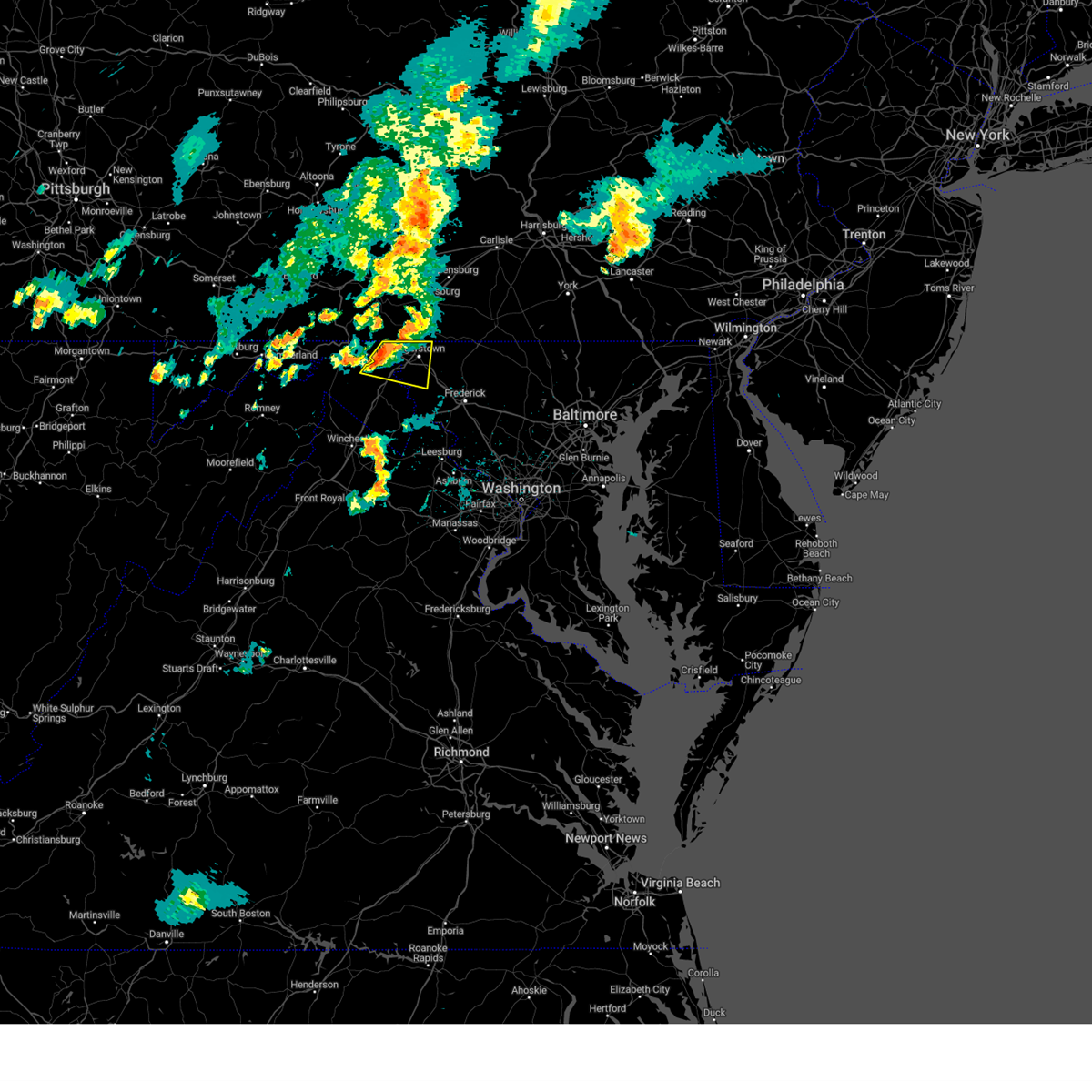 Svrlwx the national weather service in sterling virginia has issued a * severe thunderstorm warning for, northeastern washington county in north central maryland, northeastern berkeley county in the panhandle of west virginia, * until 715 pm edt. * at 638 pm edt, a severe thunderstorm was located 7 miles west of wilson-conococheague, or 10 miles north of martinsburg, moving east at 25 mph (radar indicated). Hazards include 60 mph wind gusts. Damaging winds will cause some trees and large branches to fall. this could injure those outdoors, as well as damage homes and vehicles. roadways may become blocked by downed trees. localized power outages are possible. Unsecured light objects may become projectiles. Svrlwx the national weather service in sterling virginia has issued a * severe thunderstorm warning for, northeastern washington county in north central maryland, northeastern berkeley county in the panhandle of west virginia, * until 715 pm edt. * at 638 pm edt, a severe thunderstorm was located 7 miles west of wilson-conococheague, or 10 miles north of martinsburg, moving east at 25 mph (radar indicated). Hazards include 60 mph wind gusts. Damaging winds will cause some trees and large branches to fall. this could injure those outdoors, as well as damage homes and vehicles. roadways may become blocked by downed trees. localized power outages are possible. Unsecured light objects may become projectiles.
|
| 5/11/2024 10:14 PM EDT |
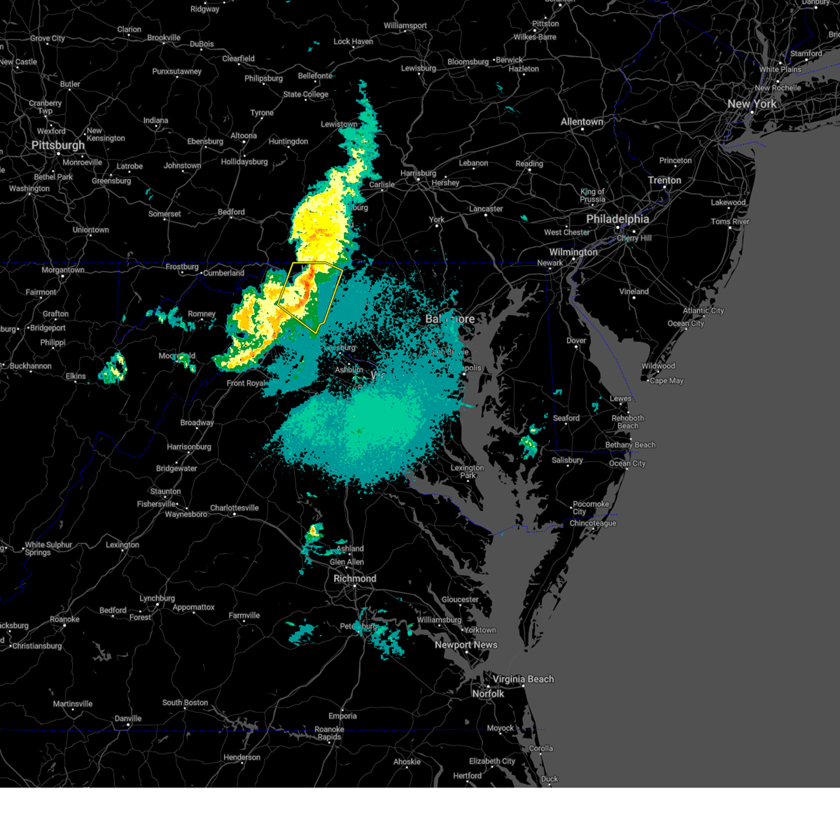 The storms which prompted the warning have weakened below severe limits, and no longer pose an immediate threat to life or property. therefore, the warning will be allowed to expire. to report severe weather, contact your nearest law enforcement agency. they will relay your report to the national weather service sterling virginia. The storms which prompted the warning have weakened below severe limits, and no longer pose an immediate threat to life or property. therefore, the warning will be allowed to expire. to report severe weather, contact your nearest law enforcement agency. they will relay your report to the national weather service sterling virginia.
|
| 5/11/2024 9:59 PM EDT |
 the severe thunderstorm warning has been cancelled and is no longer in effect the severe thunderstorm warning has been cancelled and is no longer in effect
|
| 5/11/2024 9:59 PM EDT |
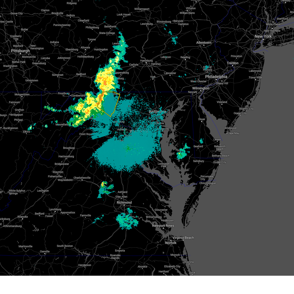 At 958 pm edt, severe thunderstorms were located along a line extending from near wilson-conococheague to martinsburg, moving southeast at 35 mph (radar indicated). Hazards include 60 mph wind gusts. Damaging winds will cause some trees and large branches to fall. this could injure those outdoors, as well as damage homes and vehicles. roadways may become blocked by downed trees. localized power outages are possible. unsecured light objects may become projectiles. Locations impacted include, hagerstown, martinsburg, charles town, shepherdstown, municipal stadium, robinwood, fountainhead-orchard hills, ranson, boonsboro, smithsburg, paramount-long meadow, wilson-conococheague, williamsport, mount aetna, mount lena, san mar, harpers ferry, long meadow, kearneysville, and saint james. At 958 pm edt, severe thunderstorms were located along a line extending from near wilson-conococheague to martinsburg, moving southeast at 35 mph (radar indicated). Hazards include 60 mph wind gusts. Damaging winds will cause some trees and large branches to fall. this could injure those outdoors, as well as damage homes and vehicles. roadways may become blocked by downed trees. localized power outages are possible. unsecured light objects may become projectiles. Locations impacted include, hagerstown, martinsburg, charles town, shepherdstown, municipal stadium, robinwood, fountainhead-orchard hills, ranson, boonsboro, smithsburg, paramount-long meadow, wilson-conococheague, williamsport, mount aetna, mount lena, san mar, harpers ferry, long meadow, kearneysville, and saint james.
|
| 5/11/2024 9:42 PM EDT |
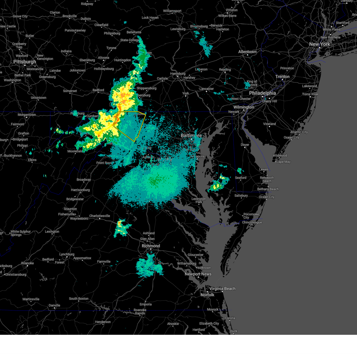 Svrlwx the national weather service in sterling virginia has issued a * severe thunderstorm warning for, washington county in north central maryland, northeastern jefferson county in the panhandle of west virginia, northeastern morgan county in the panhandle of west virginia, berkeley county in the panhandle of west virginia, * until 1015 pm edt. * at 942 pm edt, severe thunderstorms were located along a line extending from 6 miles east of hancock to 8 miles southeast of berkeley springs, moving southeast at 35 mph (radar indicated). Hazards include 60 mph wind gusts. Damaging winds will cause some trees and large branches to fall. this could injure those outdoors, as well as damage homes and vehicles. roadways may become blocked by downed trees. localized power outages are possible. Unsecured light objects may become projectiles. Svrlwx the national weather service in sterling virginia has issued a * severe thunderstorm warning for, washington county in north central maryland, northeastern jefferson county in the panhandle of west virginia, northeastern morgan county in the panhandle of west virginia, berkeley county in the panhandle of west virginia, * until 1015 pm edt. * at 942 pm edt, severe thunderstorms were located along a line extending from 6 miles east of hancock to 8 miles southeast of berkeley springs, moving southeast at 35 mph (radar indicated). Hazards include 60 mph wind gusts. Damaging winds will cause some trees and large branches to fall. this could injure those outdoors, as well as damage homes and vehicles. roadways may become blocked by downed trees. localized power outages are possible. Unsecured light objects may become projectiles.
|
| 9/7/2023 1:56 PM EDT |
 At 156 pm edt, a severe thunderstorm was located over hagerstown, moving northeast at 30 mph (radar indicated). Hazards include golf ball size hail and 60 mph wind gusts. Expect wind damage to trees and power lines. hail is large enough to dent and damage vehicles. some hail damage to roofs, siding, and windows is possible. locations impacted include, hagerstown, municipal stadium, robinwood, fountainhead-orchard hills, smithsburg, paramount-long meadow, wilson-conococheague, williamsport, long meadow, saint james, halfway, maugansville, cavetown, funkstown, leitersburg, clear spring, fort ritchie, chewsville, ringgold, and middleburg. thunderstorm damage threat, considerable hail threat, radar indicated max hail size, 1. 75 in wind threat, radar indicated max wind gust, 60 mph. At 156 pm edt, a severe thunderstorm was located over hagerstown, moving northeast at 30 mph (radar indicated). Hazards include golf ball size hail and 60 mph wind gusts. Expect wind damage to trees and power lines. hail is large enough to dent and damage vehicles. some hail damage to roofs, siding, and windows is possible. locations impacted include, hagerstown, municipal stadium, robinwood, fountainhead-orchard hills, smithsburg, paramount-long meadow, wilson-conococheague, williamsport, long meadow, saint james, halfway, maugansville, cavetown, funkstown, leitersburg, clear spring, fort ritchie, chewsville, ringgold, and middleburg. thunderstorm damage threat, considerable hail threat, radar indicated max hail size, 1. 75 in wind threat, radar indicated max wind gust, 60 mph.
|
| 9/7/2023 1:34 PM EDT |
 At 134 pm edt, a severe thunderstorm was located near williamsport, or 8 miles north of martinsburg, moving northeast at 30 mph (radar indicated). Hazards include golf ball size hail and 70 mph wind gusts. Expect wind damage to trees and power lines. hail is large enough to dent and damage vehicles. some hail damage to roofs, siding, and windows is possible. locations impacted include, hagerstown, martinsburg, municipal stadium, robinwood, fountainhead-orchard hills, smithsburg, paramount-long meadow, wilson-conococheague, williamsport, long meadow, saint james, berkeley, halfway, maugansville, cavetown, funkstown, falling waters, leitersburg, clear spring, and hedgesville. thunderstorm damage threat, considerable hail threat, radar indicated max hail size, 1. 75 in wind threat, radar indicated max wind gust, 70 mph. At 134 pm edt, a severe thunderstorm was located near williamsport, or 8 miles north of martinsburg, moving northeast at 30 mph (radar indicated). Hazards include golf ball size hail and 70 mph wind gusts. Expect wind damage to trees and power lines. hail is large enough to dent and damage vehicles. some hail damage to roofs, siding, and windows is possible. locations impacted include, hagerstown, martinsburg, municipal stadium, robinwood, fountainhead-orchard hills, smithsburg, paramount-long meadow, wilson-conococheague, williamsport, long meadow, saint james, berkeley, halfway, maugansville, cavetown, funkstown, falling waters, leitersburg, clear spring, and hedgesville. thunderstorm damage threat, considerable hail threat, radar indicated max hail size, 1. 75 in wind threat, radar indicated max wind gust, 70 mph.
|
| 9/7/2023 1:23 PM EDT |
 At 123 pm edt, a severe thunderstorm was located 7 miles northwest of martinsburg, moving northeast at 35 mph (radar indicated). Hazards include 60 mph wind gusts and quarter size hail. Damaging winds will cause some trees and large branches to fall. this could injure those outdoors, as well as damage homes and vehicles. roadways may become blocked by downed trees. localized power outages are possible. Unsecured light objects may become projectiles. At 123 pm edt, a severe thunderstorm was located 7 miles northwest of martinsburg, moving northeast at 35 mph (radar indicated). Hazards include 60 mph wind gusts and quarter size hail. Damaging winds will cause some trees and large branches to fall. this could injure those outdoors, as well as damage homes and vehicles. roadways may become blocked by downed trees. localized power outages are possible. Unsecured light objects may become projectiles.
|
| 8/7/2023 3:49 PM EDT |
 At 349 pm edt, severe thunderstorms were located along a line extending from near wilson-conococheague to 8 miles west of inwood, moving east at 40 mph (radar indicated). Hazards include 70 mph wind gusts and quarter size hail. Damaging winds will cause some trees and large branches to fall. this could injure those outdoors, as well as damage homes and vehicles. roadways may become blocked by downed trees. localized power outages are possible. Unsecured light objects may become projectiles. At 349 pm edt, severe thunderstorms were located along a line extending from near wilson-conococheague to 8 miles west of inwood, moving east at 40 mph (radar indicated). Hazards include 70 mph wind gusts and quarter size hail. Damaging winds will cause some trees and large branches to fall. this could injure those outdoors, as well as damage homes and vehicles. roadways may become blocked by downed trees. localized power outages are possible. Unsecured light objects may become projectiles.
|
| 8/7/2023 2:42 PM EDT |
 The severe thunderstorm warning for northeastern washington, northwestern carroll and northwestern frederick counties in north central maryland will expire at 245 pm edt, the storm which prompted the warning has weakened below severe limits, and no longer poses an immediate threat to life or property. therefore, the warning will be allowed to expire. a tornado watch remains in effect until 900 pm edt for north central maryland. to report severe weather, contact your nearest law enforcement agency. they will relay your report to the national weather service sterling virginia. The severe thunderstorm warning for northeastern washington, northwestern carroll and northwestern frederick counties in north central maryland will expire at 245 pm edt, the storm which prompted the warning has weakened below severe limits, and no longer poses an immediate threat to life or property. therefore, the warning will be allowed to expire. a tornado watch remains in effect until 900 pm edt for north central maryland. to report severe weather, contact your nearest law enforcement agency. they will relay your report to the national weather service sterling virginia.
|
| 8/7/2023 2:17 PM EDT |
 At 217 pm edt, a severe thunderstorm was located over fountainhead-orchard hills, or near hagerstown, moving east at 20 mph (radar indicated). Hazards include golf ball size hail and 70 mph wind gusts. Expect wind damage to trees and power lines. hail is large enough to dent and damage vehicles. some hail damage to roofs, siding, and windows is possible. locations impacted include, hagerstown, thurmont, emmitsburg, municipal stadium, robinwood, fountainhead-orchard hills, smithsburg, paramount-long meadow, wilson-conococheague, williamsport, mount aetna, long meadow, halfway, maugansville, cavetown, funkstown, leitersburg, sabillasville, fort ritchie and chewsville. thunderstorm damage threat, considerable hail threat, radar indicated max hail size, 1. 75 in wind threat, radar indicated max wind gust, 70 mph. At 217 pm edt, a severe thunderstorm was located over fountainhead-orchard hills, or near hagerstown, moving east at 20 mph (radar indicated). Hazards include golf ball size hail and 70 mph wind gusts. Expect wind damage to trees and power lines. hail is large enough to dent and damage vehicles. some hail damage to roofs, siding, and windows is possible. locations impacted include, hagerstown, thurmont, emmitsburg, municipal stadium, robinwood, fountainhead-orchard hills, smithsburg, paramount-long meadow, wilson-conococheague, williamsport, mount aetna, long meadow, halfway, maugansville, cavetown, funkstown, leitersburg, sabillasville, fort ritchie and chewsville. thunderstorm damage threat, considerable hail threat, radar indicated max hail size, 1. 75 in wind threat, radar indicated max wind gust, 70 mph.
|
| 8/7/2023 1:56 PM EDT |
 At 156 pm edt, a severe thunderstorm was located near wilson-conococheague, or near hagerstown, moving east at 40 mph (radar indicated). Hazards include golf ball size hail and 70 mph wind gusts. Expect wind damage to trees and power lines. hail is large enough to dent and damage vehicles. Some hail damage to roofs, siding, and windows is possible. At 156 pm edt, a severe thunderstorm was located near wilson-conococheague, or near hagerstown, moving east at 40 mph (radar indicated). Hazards include golf ball size hail and 70 mph wind gusts. Expect wind damage to trees and power lines. hail is large enough to dent and damage vehicles. Some hail damage to roofs, siding, and windows is possible.
|
| 8/7/2023 1:41 PM EDT |
 At 141 pm edt, a severe thunderstorm was located near claylick, or 11 miles east of hancock, moving northeast at 35 mph (radar indicated). Hazards include golf ball size hail and 60 mph wind gusts. Expect wind damage to trees and power lines. hail is large enough to dent and damage vehicles. some hail damage to roofs, siding, and windows is possible. locations impacted include, hagerstown, hancock, fountainhead-orchard hills, paramount-long meadow, wilson-conococheague, long meadow, maugansville, leitersburg, clear spring, pecktonville, ringgold, big spring, big pool, middleburg, cherry run, johnsontown, warrenton, spruce pine hollow and sleepy creek. thunderstorm damage threat, considerable hail threat, radar indicated max hail size, 1. 75 in wind threat, radar indicated max wind gust, 60 mph. At 141 pm edt, a severe thunderstorm was located near claylick, or 11 miles east of hancock, moving northeast at 35 mph (radar indicated). Hazards include golf ball size hail and 60 mph wind gusts. Expect wind damage to trees and power lines. hail is large enough to dent and damage vehicles. some hail damage to roofs, siding, and windows is possible. locations impacted include, hagerstown, hancock, fountainhead-orchard hills, paramount-long meadow, wilson-conococheague, long meadow, maugansville, leitersburg, clear spring, pecktonville, ringgold, big spring, big pool, middleburg, cherry run, johnsontown, warrenton, spruce pine hollow and sleepy creek. thunderstorm damage threat, considerable hail threat, radar indicated max hail size, 1. 75 in wind threat, radar indicated max wind gust, 60 mph.
|
| 8/7/2023 1:39 PM EDT |
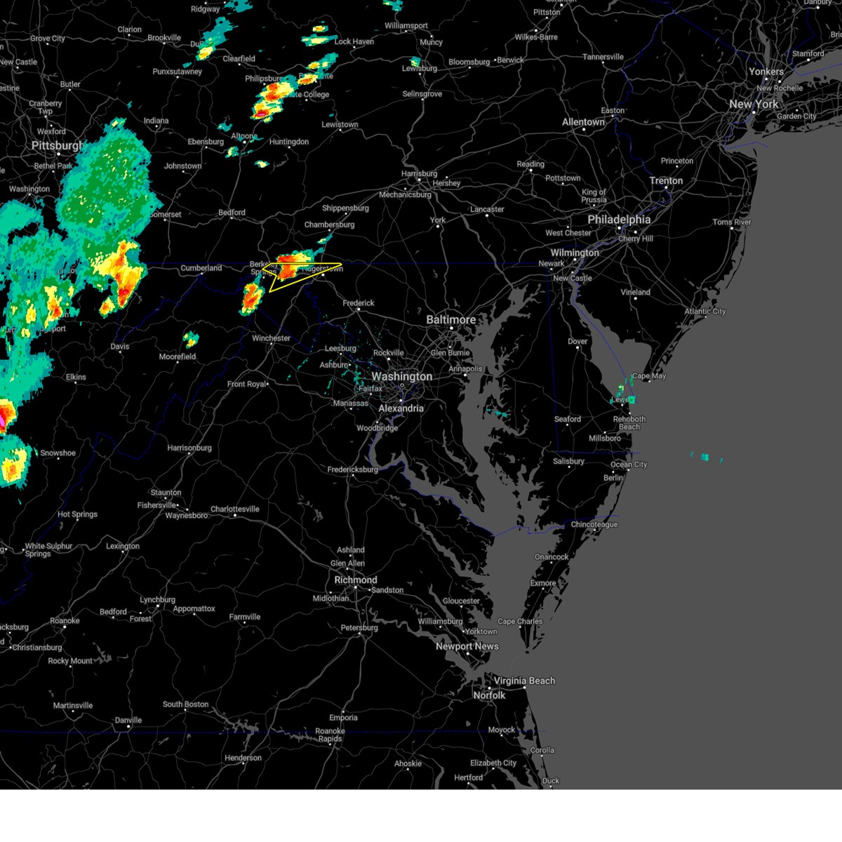 At 139 pm edt, a severe thunderstorm was located 7 miles southwest of claylick, or 9 miles east of hancock, moving northeast at 30 mph (radar indicated). Hazards include 60 mph wind gusts and quarter size hail. Damaging winds will cause some trees and large branches to fall. this could injure those outdoors, as well as damage homes and vehicles. roadways may become blocked by downed trees. localized power outages are possible. unsecured light objects may become projectiles. locations impacted include, hagerstown, hancock, fountainhead-orchard hills, paramount-long meadow, wilson-conococheague, long meadow, maugansville, leitersburg, clear spring, pecktonville, ringgold, big spring, big pool, middleburg, cherry run, johnsontown, warrenton, spruce pine hollow and sleepy creek. hail threat, radar indicated max hail size, 1. 00 in wind threat, radar indicated max wind gust, 60 mph. At 139 pm edt, a severe thunderstorm was located 7 miles southwest of claylick, or 9 miles east of hancock, moving northeast at 30 mph (radar indicated). Hazards include 60 mph wind gusts and quarter size hail. Damaging winds will cause some trees and large branches to fall. this could injure those outdoors, as well as damage homes and vehicles. roadways may become blocked by downed trees. localized power outages are possible. unsecured light objects may become projectiles. locations impacted include, hagerstown, hancock, fountainhead-orchard hills, paramount-long meadow, wilson-conococheague, long meadow, maugansville, leitersburg, clear spring, pecktonville, ringgold, big spring, big pool, middleburg, cherry run, johnsontown, warrenton, spruce pine hollow and sleepy creek. hail threat, radar indicated max hail size, 1. 00 in wind threat, radar indicated max wind gust, 60 mph.
|
| 8/7/2023 1:39 PM EDT |
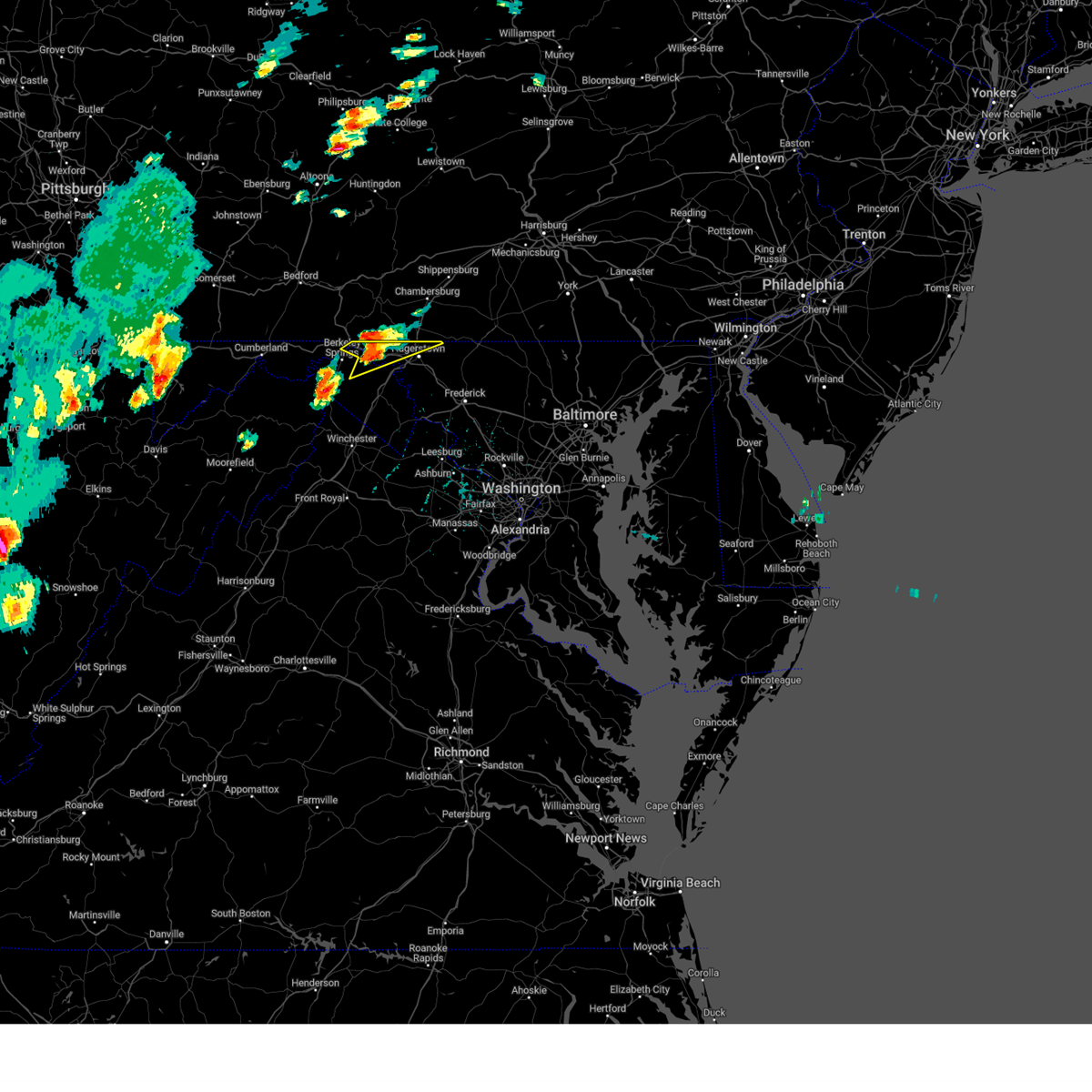 At 139 pm edt, a severe thunderstorm was located 7 miles southwest of claylick, or 9 miles east of hancock, moving northeast at 30 mph (radar indicated). Hazards include 60 mph wind gusts and quarter size hail. Damaging winds will cause some trees and large branches to fall. this could injure those outdoors, as well as damage homes and vehicles. roadways may become blocked by downed trees. localized power outages are possible. unsecured light objects may become projectiles. locations impacted include, hagerstown, hancock, fountainhead-orchard hills, paramount-long meadow, wilson-conococheague, long meadow, maugansville, leitersburg, clear spring, pecktonville, ringgold, big spring, big pool, middleburg, cherry run, johnsontown, warrenton, spruce pine hollow and sleepy creek. hail threat, radar indicated max hail size, 1. 00 in wind threat, radar indicated max wind gust, 60 mph. At 139 pm edt, a severe thunderstorm was located 7 miles southwest of claylick, or 9 miles east of hancock, moving northeast at 30 mph (radar indicated). Hazards include 60 mph wind gusts and quarter size hail. Damaging winds will cause some trees and large branches to fall. this could injure those outdoors, as well as damage homes and vehicles. roadways may become blocked by downed trees. localized power outages are possible. unsecured light objects may become projectiles. locations impacted include, hagerstown, hancock, fountainhead-orchard hills, paramount-long meadow, wilson-conococheague, long meadow, maugansville, leitersburg, clear spring, pecktonville, ringgold, big spring, big pool, middleburg, cherry run, johnsontown, warrenton, spruce pine hollow and sleepy creek. hail threat, radar indicated max hail size, 1. 00 in wind threat, radar indicated max wind gust, 60 mph.
|
| 8/7/2023 1:14 PM EDT |
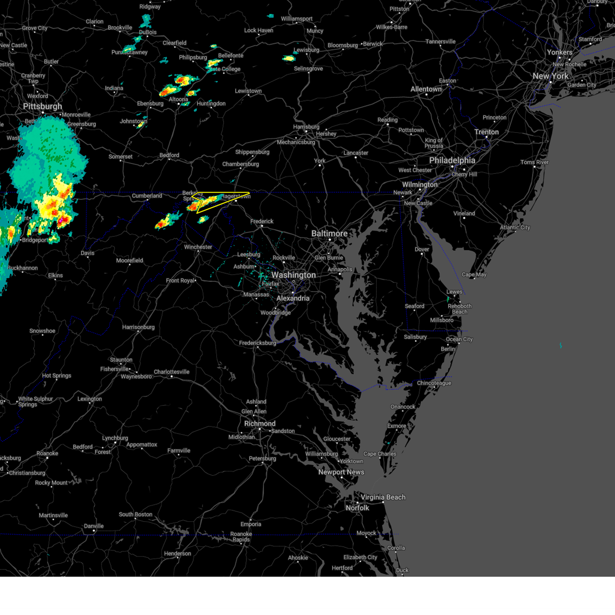 At 113 pm edt, a severe thunderstorm was located over berkeley springs, or 7 miles south of hancock, moving northeast at 35 mph (radar indicated). Hazards include 60 mph wind gusts and quarter size hail. Damaging winds will cause some trees and large branches to fall. this could injure those outdoors, as well as damage homes and vehicles. roadways may become blocked by downed trees. localized power outages are possible. Unsecured light objects may become projectiles. At 113 pm edt, a severe thunderstorm was located over berkeley springs, or 7 miles south of hancock, moving northeast at 35 mph (radar indicated). Hazards include 60 mph wind gusts and quarter size hail. Damaging winds will cause some trees and large branches to fall. this could injure those outdoors, as well as damage homes and vehicles. roadways may become blocked by downed trees. localized power outages are possible. Unsecured light objects may become projectiles.
|
| 8/7/2023 1:14 PM EDT |
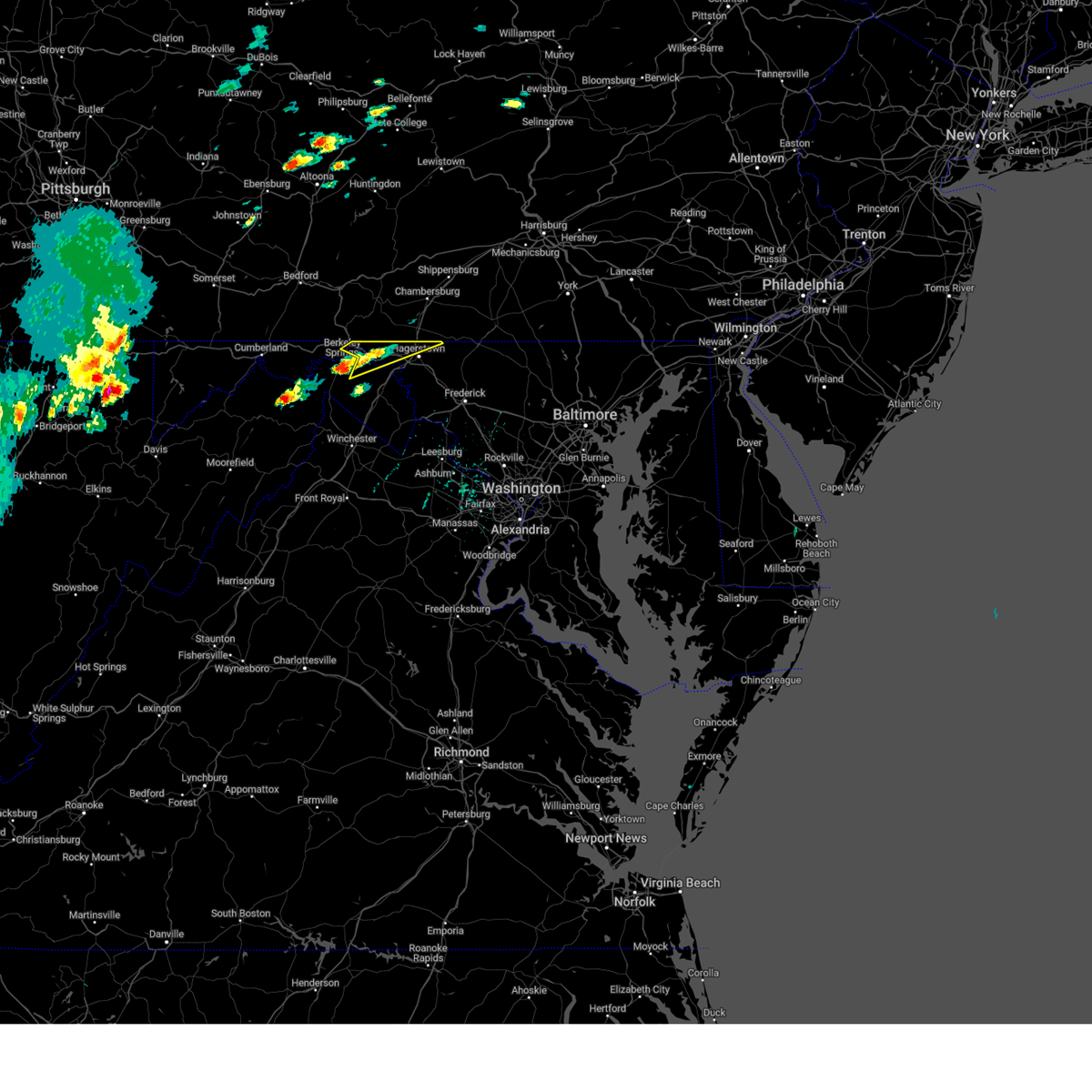 At 113 pm edt, a severe thunderstorm was located over berkeley springs, or 7 miles south of hancock, moving northeast at 35 mph (radar indicated). Hazards include 60 mph wind gusts and quarter size hail. Damaging winds will cause some trees and large branches to fall. this could injure those outdoors, as well as damage homes and vehicles. roadways may become blocked by downed trees. localized power outages are possible. Unsecured light objects may become projectiles. At 113 pm edt, a severe thunderstorm was located over berkeley springs, or 7 miles south of hancock, moving northeast at 35 mph (radar indicated). Hazards include 60 mph wind gusts and quarter size hail. Damaging winds will cause some trees and large branches to fall. this could injure those outdoors, as well as damage homes and vehicles. roadways may become blocked by downed trees. localized power outages are possible. Unsecured light objects may become projectiles.
|
| 6/26/2023 7:10 PM EDT |
 The severe thunderstorm warning for franklin county will expire at 715 pm edt, the storms which prompted the warning have moved out of the area. therefore, the warning will be allowed to expire. a severe thunderstorm watch remains in effect until 900 pm edt for south central pennsylvania. to report severe weather, contact your nearest law enforcement agency. they will relay your report to the national weather service state college pa. The severe thunderstorm warning for franklin county will expire at 715 pm edt, the storms which prompted the warning have moved out of the area. therefore, the warning will be allowed to expire. a severe thunderstorm watch remains in effect until 900 pm edt for south central pennsylvania. to report severe weather, contact your nearest law enforcement agency. they will relay your report to the national weather service state college pa.
|
| 6/26/2023 6:22 PM EDT |
 At 622 pm edt, severe thunderstorms were located along a line extending from fort loudon to claylick, moving east at 15 mph (radar indicated). Hazards include 60 mph wind gusts and quarter size hail. Hail damage to vehicles is expected. Expect wind damage to roofs, siding, and trees. At 622 pm edt, severe thunderstorms were located along a line extending from fort loudon to claylick, moving east at 15 mph (radar indicated). Hazards include 60 mph wind gusts and quarter size hail. Hail damage to vehicles is expected. Expect wind damage to roofs, siding, and trees.
|
| 11/30/2022 1:53 PM EST |
 The severe thunderstorm warning for north central washington county in north central maryland, shenandoah, frederick, northwestern warren and northwestern clarke counties in northwestern virginia, northwestern jefferson and central morgan counties in the panhandle of west virginia, southeastern hardy county in eastern west virginia, berkeley county in the panhandle of west virginia and southeastern hampshire counties in eastern west virginia and the city of winchester will expire at 200 pm est, the storms which prompted the warning have moved out of the area. therefore, the warning will be allowed to expire. however gusty winds are still possible with these thunderstorms. The severe thunderstorm warning for north central washington county in north central maryland, shenandoah, frederick, northwestern warren and northwestern clarke counties in northwestern virginia, northwestern jefferson and central morgan counties in the panhandle of west virginia, southeastern hardy county in eastern west virginia, berkeley county in the panhandle of west virginia and southeastern hampshire counties in eastern west virginia and the city of winchester will expire at 200 pm est, the storms which prompted the warning have moved out of the area. therefore, the warning will be allowed to expire. however gusty winds are still possible with these thunderstorms.
|
| 11/30/2022 1:15 PM EST |
 At 115 pm est, severe thunderstorms were located along a line extending from 7 miles southeast of berkeley springs to near star tannery to near mathias, moving east at 45 mph (radar indicated). Hazards include 60 mph wind gusts. Damaging winds will cause some trees and large branches to fall. this could injure those outdoors, as well as damage homes and vehicles. roadways may become blocked by downed trees. localized power outages are possible. Unsecured light objects may become projectiles. At 115 pm est, severe thunderstorms were located along a line extending from 7 miles southeast of berkeley springs to near star tannery to near mathias, moving east at 45 mph (radar indicated). Hazards include 60 mph wind gusts. Damaging winds will cause some trees and large branches to fall. this could injure those outdoors, as well as damage homes and vehicles. roadways may become blocked by downed trees. localized power outages are possible. Unsecured light objects may become projectiles.
|
| 7/24/2022 5:40 PM EDT |
 At 540 pm edt, a severe thunderstorm was located over greencastle, moving east at 20 mph (radar indicated). Hazards include 60 mph wind gusts and penny size hail. expect damage to roofs, siding, and trees At 540 pm edt, a severe thunderstorm was located over greencastle, moving east at 20 mph (radar indicated). Hazards include 60 mph wind gusts and penny size hail. expect damage to roofs, siding, and trees
|
| 7/23/2022 6:51 PM EDT |
 At 650 pm edt, severe thunderstorms were located along a line extending from near paramount-long meadow to near berryville, moving east at 40 mph (radar indicated). Hazards include 60 mph wind gusts and quarter size hail. Damaging winds will cause some trees and large branches to fall. this could injure those outdoors, as well as damage homes and vehicles. roadways may become blocked by downed trees. localized power outages are possible. Unsecured light objects may become projectiles. At 650 pm edt, severe thunderstorms were located along a line extending from near paramount-long meadow to near berryville, moving east at 40 mph (radar indicated). Hazards include 60 mph wind gusts and quarter size hail. Damaging winds will cause some trees and large branches to fall. this could injure those outdoors, as well as damage homes and vehicles. roadways may become blocked by downed trees. localized power outages are possible. Unsecured light objects may become projectiles.
|
| 7/23/2022 6:46 PM EDT |
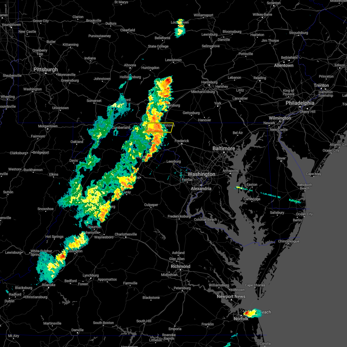 At 646 pm edt, a severe thunderstorm was located over wilson-conococheague, or near hagerstown, moving east at 30 mph (radar indicated). Hazards include 60 mph wind gusts and quarter size hail. Damaging winds will cause some trees and large branches to fall. this could injure those outdoors, as well as damage homes and vehicles. roadways may become blocked by downed trees. localized power outages are possible. unsecured light objects may become projectiles. locations impacted include, hagerstown, municipal stadium, robinwood, fountainhead-orchard hills, paramount-long meadow, wilson-conococheague, williamsport, mount aetna, long meadow, saint james, halfway, maugansville, cavetown, funkstown, leitersburg, clear spring, chewsville, pecktonville, big spring and big pool. hail threat, radar indicated max hail size, 1. 00 in wind threat, radar indicated max wind gust, 60 mph. At 646 pm edt, a severe thunderstorm was located over wilson-conococheague, or near hagerstown, moving east at 30 mph (radar indicated). Hazards include 60 mph wind gusts and quarter size hail. Damaging winds will cause some trees and large branches to fall. this could injure those outdoors, as well as damage homes and vehicles. roadways may become blocked by downed trees. localized power outages are possible. unsecured light objects may become projectiles. locations impacted include, hagerstown, municipal stadium, robinwood, fountainhead-orchard hills, paramount-long meadow, wilson-conococheague, williamsport, mount aetna, long meadow, saint james, halfway, maugansville, cavetown, funkstown, leitersburg, clear spring, chewsville, pecktonville, big spring and big pool. hail threat, radar indicated max hail size, 1. 00 in wind threat, radar indicated max wind gust, 60 mph.
|
| 7/23/2022 6:19 PM EDT |
 At 619 pm edt, a severe thunderstorm was located near hancock, moving east at 40 mph (radar indicated). Hazards include 60 mph wind gusts and quarter size hail. Damaging winds will cause some trees and large branches to fall. this could injure those outdoors, as well as damage homes and vehicles. roadways may become blocked by downed trees. localized power outages are possible. Unsecured light objects may become projectiles. At 619 pm edt, a severe thunderstorm was located near hancock, moving east at 40 mph (radar indicated). Hazards include 60 mph wind gusts and quarter size hail. Damaging winds will cause some trees and large branches to fall. this could injure those outdoors, as well as damage homes and vehicles. roadways may become blocked by downed trees. localized power outages are possible. Unsecured light objects may become projectiles.
|
| 7/12/2022 3:57 PM EDT |
 The severe thunderstorm warning for northeastern washington, northwestern frederick counties in north central maryland and northeastern berkeley counties in the panhandle of west virginia will expire at 400 pm edt, the storm which prompted the warning has moved out of the area. therefore, the warning will be allowed to expire. a severe thunderstorm watch remains in effect until 1000 pm edt for north central maryland, and the panhandle of west virginia. remember, a severe thunderstorm warning still remains in effect for much of northern and central frederick county. The severe thunderstorm warning for northeastern washington, northwestern frederick counties in north central maryland and northeastern berkeley counties in the panhandle of west virginia will expire at 400 pm edt, the storm which prompted the warning has moved out of the area. therefore, the warning will be allowed to expire. a severe thunderstorm watch remains in effect until 1000 pm edt for north central maryland, and the panhandle of west virginia. remember, a severe thunderstorm warning still remains in effect for much of northern and central frederick county.
|
| 7/12/2022 3:33 PM EDT |
 At 333 pm edt, a severe thunderstorm was located over williamsport, or near hagerstown, moving east at 50 mph (radar indicated). Hazards include 70 mph wind gusts and quarter size hail. Damaging winds will cause some trees and large branches to fall. this could injure those outdoors, as well as damage homes and vehicles. roadways may become blocked by downed trees. localized power outages are possible. unsecured light objects may become projectiles. locations impacted include, hagerstown, thurmont, municipal stadium, robinwood, fountainhead-orchard hills, smithsburg, paramount-long meadow, wilson-conococheague, williamsport, mount aetna, mount lena, san mar, long meadow, wolfsville, saint james, halfway, maugansville, cavetown, funkstown and falling waters. thunderstorm damage threat, considerable hail threat, radar indicated max hail size, 1. 00 in wind threat, radar indicated max wind gust, 70 mph. At 333 pm edt, a severe thunderstorm was located over williamsport, or near hagerstown, moving east at 50 mph (radar indicated). Hazards include 70 mph wind gusts and quarter size hail. Damaging winds will cause some trees and large branches to fall. this could injure those outdoors, as well as damage homes and vehicles. roadways may become blocked by downed trees. localized power outages are possible. unsecured light objects may become projectiles. locations impacted include, hagerstown, thurmont, municipal stadium, robinwood, fountainhead-orchard hills, smithsburg, paramount-long meadow, wilson-conococheague, williamsport, mount aetna, mount lena, san mar, long meadow, wolfsville, saint james, halfway, maugansville, cavetown, funkstown and falling waters. thunderstorm damage threat, considerable hail threat, radar indicated max hail size, 1. 00 in wind threat, radar indicated max wind gust, 70 mph.
|
| 7/12/2022 3:22 PM EDT |
 At 322 pm edt, a severe thunderstorm was located near claylick, or 12 miles west of hagerstown, moving east at 40 mph (radar indicated). Hazards include 60 mph wind gusts and quarter size hail. Damaging winds will cause some trees and large branches to fall. this could injure those outdoors, as well as damage homes and vehicles. roadways may become blocked by downed trees. localized power outages are possible. Unsecured light objects may become projectiles. At 322 pm edt, a severe thunderstorm was located near claylick, or 12 miles west of hagerstown, moving east at 40 mph (radar indicated). Hazards include 60 mph wind gusts and quarter size hail. Damaging winds will cause some trees and large branches to fall. this could injure those outdoors, as well as damage homes and vehicles. roadways may become blocked by downed trees. localized power outages are possible. Unsecured light objects may become projectiles.
|
| 7/12/2022 3:04 PM EDT |
 At 304 pm edt, a severe thunderstorm was located over st. thomas, moving east at 25 mph (radar indicated). Hazards include 60 mph wind gusts and quarter size hail. Hail damage to vehicles is expected. Expect wind damage to roofs, siding, and trees. At 304 pm edt, a severe thunderstorm was located over st. thomas, moving east at 25 mph (radar indicated). Hazards include 60 mph wind gusts and quarter size hail. Hail damage to vehicles is expected. Expect wind damage to roofs, siding, and trees.
|
| 7/12/2022 2:37 PM EDT |
 At 237 pm edt, a severe thunderstorm was located over warfordsburg, moving east at 30 mph (radar indicated). Hazards include 60 mph wind gusts. expect damage to roofs, siding, and trees At 237 pm edt, a severe thunderstorm was located over warfordsburg, moving east at 30 mph (radar indicated). Hazards include 60 mph wind gusts. expect damage to roofs, siding, and trees
|
| 6/22/2022 3:12 PM EDT |
 At 311 pm edt, severe thunderstorms were located along a line extending from near randallstown to san mar, moving southeast at 85 mph (radar indicated). Hazards include 60 mph wind gusts. Damaging winds will cause some trees and large branches to fall. this could injure those outdoors, as well as damage homes and vehicles. roadways may become blocked by downed trees. localized power outages are possible. unsecured light objects may become projectiles. locations impacted include, columbia, germantown, frederick, hagerstown, olney, westminster, damascus, thurmont, charles town, shepherdstown, municipal stadium, harry grove stadium, montgomery village, eldersburg, ballenger creek, mount airy, robinwood, brunswick, walkersville and fountainhead-orchard hills. hail threat, radar indicated max hail size, <. 75 in wind threat, radar indicated max wind gust, 60 mph. At 311 pm edt, severe thunderstorms were located along a line extending from near randallstown to san mar, moving southeast at 85 mph (radar indicated). Hazards include 60 mph wind gusts. Damaging winds will cause some trees and large branches to fall. this could injure those outdoors, as well as damage homes and vehicles. roadways may become blocked by downed trees. localized power outages are possible. unsecured light objects may become projectiles. locations impacted include, columbia, germantown, frederick, hagerstown, olney, westminster, damascus, thurmont, charles town, shepherdstown, municipal stadium, harry grove stadium, montgomery village, eldersburg, ballenger creek, mount airy, robinwood, brunswick, walkersville and fountainhead-orchard hills. hail threat, radar indicated max hail size, <. 75 in wind threat, radar indicated max wind gust, 60 mph.
|
| 6/22/2022 2:56 PM EDT |
 At 255 pm edt, severe thunderstorms were located along a line extending from near manchester to paramount-long meadow, moving south at 50 mph (radar indicated). Hazards include 60 mph wind gusts. Damaging winds will cause some trees and large branches to fall. this could injure those outdoors, as well as damage homes and vehicles. roadways may become blocked by downed trees. localized power outages are possible. Unsecured light objects may become projectiles. At 255 pm edt, severe thunderstorms were located along a line extending from near manchester to paramount-long meadow, moving south at 50 mph (radar indicated). Hazards include 60 mph wind gusts. Damaging winds will cause some trees and large branches to fall. this could injure those outdoors, as well as damage homes and vehicles. roadways may become blocked by downed trees. localized power outages are possible. Unsecured light objects may become projectiles.
|
| 6/16/2022 3:38 PM EDT |
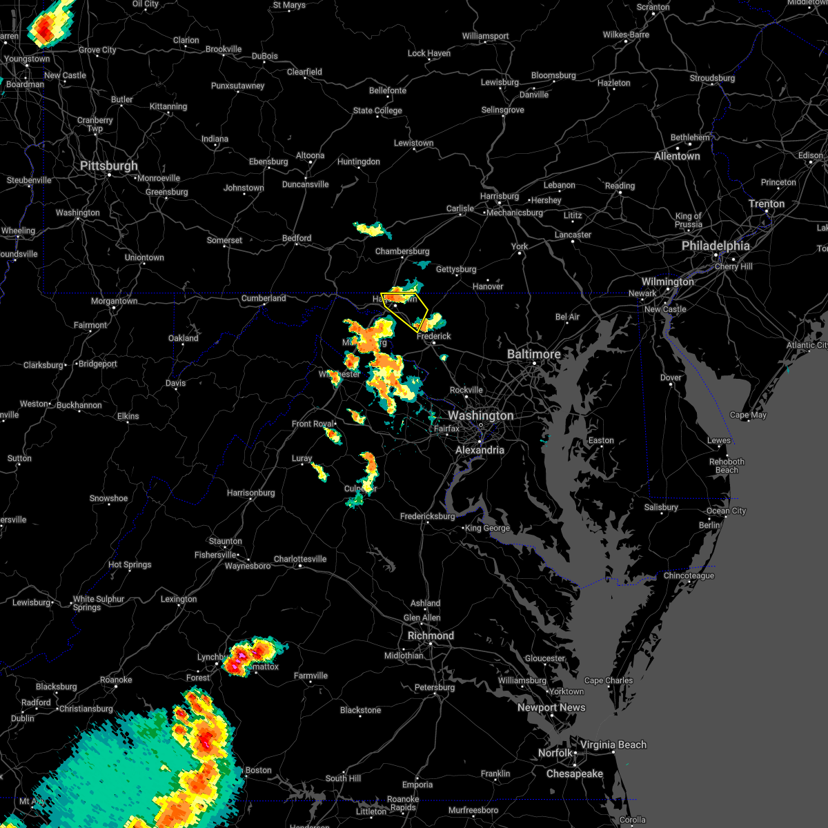 At 338 pm edt, a severe thunderstorm was located over fountainhead-orchard hills, or near hagerstown, moving southeast at 25 mph (radar indicated). Hazards include 60 mph wind gusts and quarter size hail. Damaging winds will cause some trees and large branches to fall. this could injure those outdoors, as well as damage homes and vehicles. roadways may become blocked by downed trees. localized power outages are possible. unsecured light objects may become projectiles. locations impacted include, hagerstown, municipal stadium, robinwood, fountainhead-orchard hills, smithsburg, paramount-long meadow, wilson-conococheague, mount aetna, mount lena, san mar, long meadow, wolfsville, halfway, maugansville, myersville, cavetown, funkstown, leitersburg, chewsville and ringgold. hail threat, radar indicated max hail size, 1. 00 in wind threat, radar indicated max wind gust, 60 mph. At 338 pm edt, a severe thunderstorm was located over fountainhead-orchard hills, or near hagerstown, moving southeast at 25 mph (radar indicated). Hazards include 60 mph wind gusts and quarter size hail. Damaging winds will cause some trees and large branches to fall. this could injure those outdoors, as well as damage homes and vehicles. roadways may become blocked by downed trees. localized power outages are possible. unsecured light objects may become projectiles. locations impacted include, hagerstown, municipal stadium, robinwood, fountainhead-orchard hills, smithsburg, paramount-long meadow, wilson-conococheague, mount aetna, mount lena, san mar, long meadow, wolfsville, halfway, maugansville, myersville, cavetown, funkstown, leitersburg, chewsville and ringgold. hail threat, radar indicated max hail size, 1. 00 in wind threat, radar indicated max wind gust, 60 mph.
|
| 6/16/2022 3:24 PM EDT |
 At 324 pm edt, a severe thunderstorm was located near claylick, or near greencastle, moving southeast at 25 mph (radar indicated). Hazards include 60 mph wind gusts and quarter size hail. Damaging winds will cause some trees and large branches to fall. this could injure those outdoors, as well as damage homes and vehicles. roadways may become blocked by downed trees. localized power outages are possible. Unsecured light objects may become projectiles. At 324 pm edt, a severe thunderstorm was located near claylick, or near greencastle, moving southeast at 25 mph (radar indicated). Hazards include 60 mph wind gusts and quarter size hail. Damaging winds will cause some trees and large branches to fall. this could injure those outdoors, as well as damage homes and vehicles. roadways may become blocked by downed trees. localized power outages are possible. Unsecured light objects may become projectiles.
|
| 6/16/2022 3:04 PM EDT |
 At 303 pm edt, a severe thunderstorm was located over mercersburg, moving east at 35 mph (radar indicated). Hazards include 60 mph wind gusts and quarter size hail. Hail damage to vehicles is expected. expect wind damage to roofs, siding, and trees. this severe thunderstorm will be near, greencastle and marion around 320 pm edt. waynesboro, wayne heights and rouzerville around 340 pm edt. other locations impacted by this severe thunderstorm include williamson, upton, state line, quincy and penn state mont alto. This includes interstate 81 from mile markers 0 to 10. At 303 pm edt, a severe thunderstorm was located over mercersburg, moving east at 35 mph (radar indicated). Hazards include 60 mph wind gusts and quarter size hail. Hail damage to vehicles is expected. expect wind damage to roofs, siding, and trees. this severe thunderstorm will be near, greencastle and marion around 320 pm edt. waynesboro, wayne heights and rouzerville around 340 pm edt. other locations impacted by this severe thunderstorm include williamson, upton, state line, quincy and penn state mont alto. This includes interstate 81 from mile markers 0 to 10.
|
| 6/14/2022 4:27 AM EDT |
 At 427 am edt, severe thunderstorms were located along a line extending from mercersburg to wilson-conococheague to near saint james to near shepherdstown, moving east at 25 mph (radar indicated). Hazards include 60 mph wind gusts and quarter size hail. Damaging winds will cause some trees and large branches to fall. this could injure those outdoors, as well as damage homes and vehicles. roadways may become blocked by downed trees. localized power outages are possible. unsecured light objects may become projectiles. locations impacted include, hagerstown, shepherdstown, municipal stadium, robinwood, fountainhead-orchard hills, boonsboro, smithsburg, paramount-long meadow, wilson-conococheague, williamsport, mount aetna, mount lena, san mar, long meadow, saint james, halfway, maugansville, cavetown, keedysville and funkstown. hail threat, radar indicated max hail size, 1. 00 in wind threat, radar indicated max wind gust, 60 mph. At 427 am edt, severe thunderstorms were located along a line extending from mercersburg to wilson-conococheague to near saint james to near shepherdstown, moving east at 25 mph (radar indicated). Hazards include 60 mph wind gusts and quarter size hail. Damaging winds will cause some trees and large branches to fall. this could injure those outdoors, as well as damage homes and vehicles. roadways may become blocked by downed trees. localized power outages are possible. unsecured light objects may become projectiles. locations impacted include, hagerstown, shepherdstown, municipal stadium, robinwood, fountainhead-orchard hills, boonsboro, smithsburg, paramount-long meadow, wilson-conococheague, williamsport, mount aetna, mount lena, san mar, long meadow, saint james, halfway, maugansville, cavetown, keedysville and funkstown. hail threat, radar indicated max hail size, 1. 00 in wind threat, radar indicated max wind gust, 60 mph.
|
| 6/14/2022 4:07 AM EDT |
 At 406 am edt, a severe thunderstorm was located over big cove tannery, moving east at 25 mph (radar indicated). Hazards include 60 mph wind gusts and quarter size hail. Hail damage to vehicles is expected. expect wind damage to roofs, siding, and trees. this severe thunderstorm will be near, big cove tannery around 410 am edt. mercersburg and claylick around 430 am edt. greencastle, marion and st. thomas around 440 am edt. other locations impacted by this severe thunderstorm include williamson, upton, state line, quincy and whitetail ski area. this includes interstate 81 from mile markers 0 to 17. hail threat, radar indicated max hail size, 1. 00 in wind threat, radar indicated max wind gust, 60 mph. At 406 am edt, a severe thunderstorm was located over big cove tannery, moving east at 25 mph (radar indicated). Hazards include 60 mph wind gusts and quarter size hail. Hail damage to vehicles is expected. expect wind damage to roofs, siding, and trees. this severe thunderstorm will be near, big cove tannery around 410 am edt. mercersburg and claylick around 430 am edt. greencastle, marion and st. thomas around 440 am edt. other locations impacted by this severe thunderstorm include williamson, upton, state line, quincy and whitetail ski area. this includes interstate 81 from mile markers 0 to 17. hail threat, radar indicated max hail size, 1. 00 in wind threat, radar indicated max wind gust, 60 mph.
|
| 6/14/2022 4:01 AM EDT |
 At 401 am edt, severe thunderstorms were located along a line extending from near big cove tannery to 8 miles west of wilson-conococheague to martinsburg to near inwood, moving east at 25 mph (radar indicated). Hazards include 60 mph wind gusts and quarter size hail. Damaging winds will cause some trees and large branches to fall. this could injure those outdoors, as well as damage homes and vehicles. roadways may become blocked by downed trees. localized power outages are possible. Unsecured light objects may become projectiles. At 401 am edt, severe thunderstorms were located along a line extending from near big cove tannery to 8 miles west of wilson-conococheague to martinsburg to near inwood, moving east at 25 mph (radar indicated). Hazards include 60 mph wind gusts and quarter size hail. Damaging winds will cause some trees and large branches to fall. this could injure those outdoors, as well as damage homes and vehicles. roadways may become blocked by downed trees. localized power outages are possible. Unsecured light objects may become projectiles.
|
| 3/7/2022 6:26 PM EST |
 At 625 pm est, severe thunderstorms were located along a line extending from near rockhill furnace to warfordsburg, moving east at 55 mph (radar indicated). Hazards include 60 mph wind gusts. expect damage to roofs, siding, and trees At 625 pm est, severe thunderstorms were located along a line extending from near rockhill furnace to warfordsburg, moving east at 55 mph (radar indicated). Hazards include 60 mph wind gusts. expect damage to roofs, siding, and trees
|
| 9/15/2021 6:08 PM EDT |
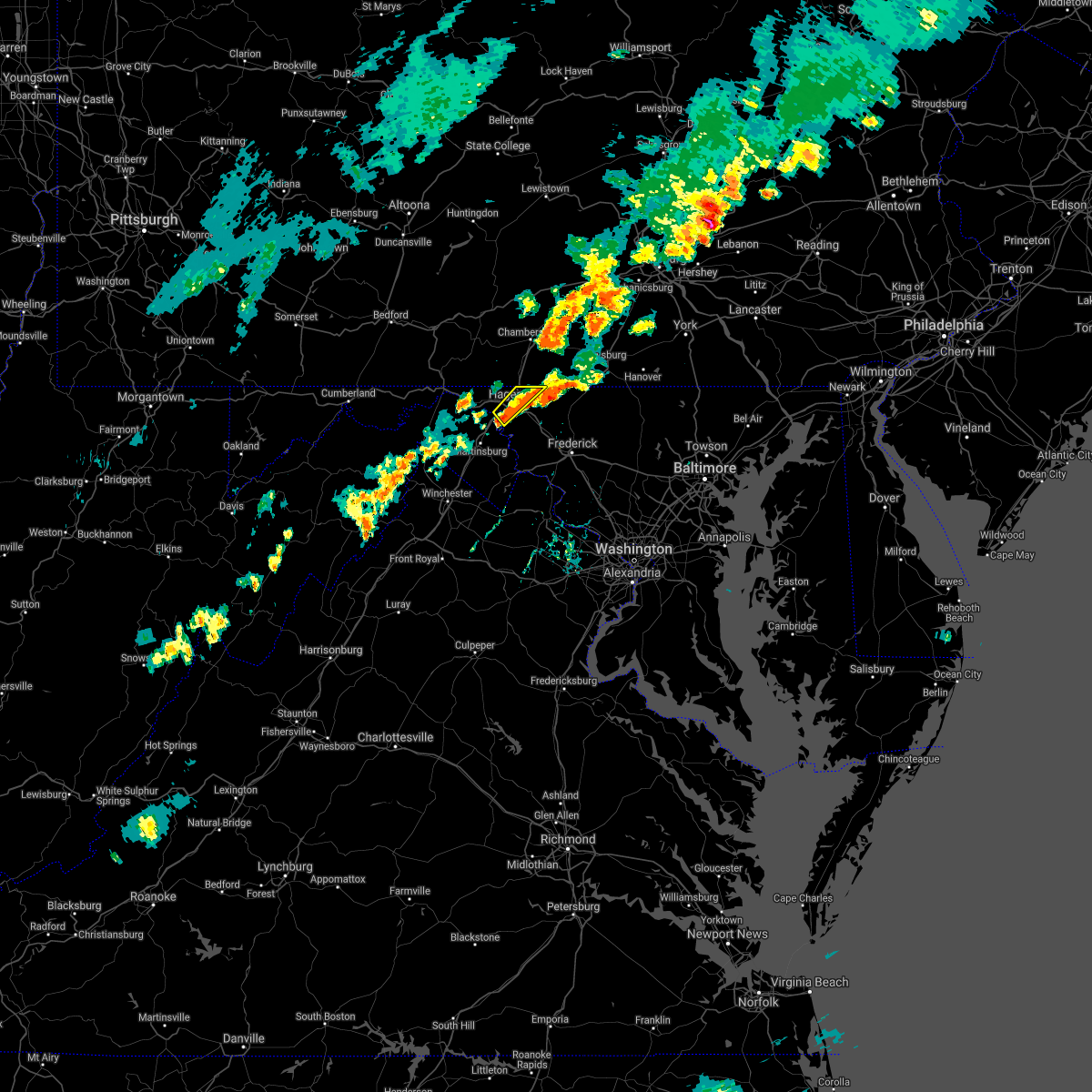 At 608 pm edt, a severe thunderstorm was located over fountainhead-orchard hills, or over hagerstown, moving northeast at 25 mph (radar indicated). Hazards include 60 mph wind gusts and quarter size hail. Damaging winds will cause some trees and large branches to fall. this could injure those outdoors, as well as damage homes and vehicles. roadways may become blocked by downed trees. localized power outages are possible. unsecured light objects may become projectiles. locations impacted include, hagerstown, municipal stadium, fountainhead-orchard hills, paramount-long meadow, wilson-conococheague, williamsport, long meadow, saint james, halfway, maugansville, leitersburg and middleburg. hail threat, radar indicated max hail size, 1. 00 in wind threat, radar indicated max wind gust, 60 mph. At 608 pm edt, a severe thunderstorm was located over fountainhead-orchard hills, or over hagerstown, moving northeast at 25 mph (radar indicated). Hazards include 60 mph wind gusts and quarter size hail. Damaging winds will cause some trees and large branches to fall. this could injure those outdoors, as well as damage homes and vehicles. roadways may become blocked by downed trees. localized power outages are possible. unsecured light objects may become projectiles. locations impacted include, hagerstown, municipal stadium, fountainhead-orchard hills, paramount-long meadow, wilson-conococheague, williamsport, long meadow, saint james, halfway, maugansville, leitersburg and middleburg. hail threat, radar indicated max hail size, 1. 00 in wind threat, radar indicated max wind gust, 60 mph.
|
| 9/15/2021 5:52 PM EDT |
 At 552 pm edt, a severe thunderstorm was located over williamsport, or near hagerstown, moving northeast at 25 mph (radar indicated). Hazards include 60 mph wind gusts and quarter size hail. Damaging winds will cause some trees and large branches to fall. this could injure those outdoors, as well as damage homes and vehicles. roadways may become blocked by downed trees. localized power outages are possible. Unsecured light objects may become projectiles. At 552 pm edt, a severe thunderstorm was located over williamsport, or near hagerstown, moving northeast at 25 mph (radar indicated). Hazards include 60 mph wind gusts and quarter size hail. Damaging winds will cause some trees and large branches to fall. this could injure those outdoors, as well as damage homes and vehicles. roadways may become blocked by downed trees. localized power outages are possible. Unsecured light objects may become projectiles.
|
| 9/15/2021 5:52 PM EDT |
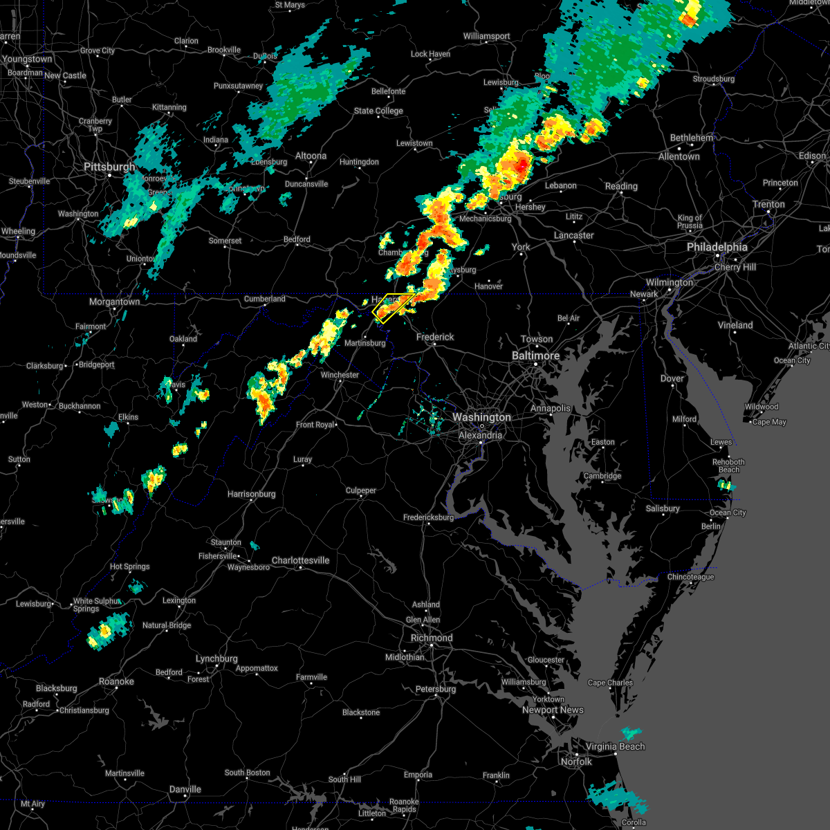 At 552 pm edt, a severe thunderstorm was located over williamsport, or near hagerstown, moving northeast at 25 mph (radar indicated). Hazards include 60 mph wind gusts and quarter size hail. Damaging winds will cause some trees and large branches to fall. this could injure those outdoors, as well as damage homes and vehicles. roadways may become blocked by downed trees. localized power outages are possible. Unsecured light objects may become projectiles. At 552 pm edt, a severe thunderstorm was located over williamsport, or near hagerstown, moving northeast at 25 mph (radar indicated). Hazards include 60 mph wind gusts and quarter size hail. Damaging winds will cause some trees and large branches to fall. this could injure those outdoors, as well as damage homes and vehicles. roadways may become blocked by downed trees. localized power outages are possible. Unsecured light objects may become projectiles.
|
| 8/28/2021 4:56 PM EDT |
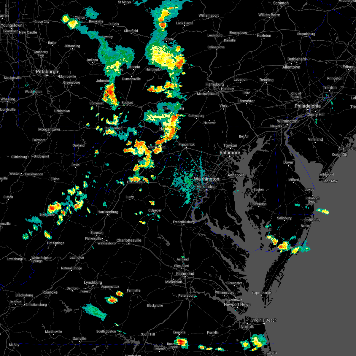 The severe thunderstorm warning for northeastern washington county will expire at 500 pm edt, the storm which prompted the warning has weakened below severe limits, and no longer poses an immediate threat to life or property. therefore, the warning will be allowed to expire. The severe thunderstorm warning for northeastern washington county will expire at 500 pm edt, the storm which prompted the warning has weakened below severe limits, and no longer poses an immediate threat to life or property. therefore, the warning will be allowed to expire.
|
| 8/28/2021 4:38 PM EDT |
 At 438 pm edt, a severe thunderstorm was located over fountainhead-orchard hills, or over hagerstown, moving southeast at 15 mph (radar indicated). Hazards include 60 mph wind gusts and quarter size hail. Damaging winds will cause some trees and large branches to fall. this could injure those outdoors, as well as damage homes and vehicles. roadways may become blocked by downed trees. localized power outages are possible. unsecured light objects may become projectiles. locations impacted include, hagerstown, municipal stadium, robinwood, fountainhead-orchard hills, paramount-long meadow, wilson-conococheague, long meadow, saint james, halfway, maugansville, cavetown, funkstown, leitersburg, chewsville, middleburg and bridgeport. hail threat, radar indicated max hail size, 1. 00 in wind threat, radar indicated max wind gust, 60 mph. At 438 pm edt, a severe thunderstorm was located over fountainhead-orchard hills, or over hagerstown, moving southeast at 15 mph (radar indicated). Hazards include 60 mph wind gusts and quarter size hail. Damaging winds will cause some trees and large branches to fall. this could injure those outdoors, as well as damage homes and vehicles. roadways may become blocked by downed trees. localized power outages are possible. unsecured light objects may become projectiles. locations impacted include, hagerstown, municipal stadium, robinwood, fountainhead-orchard hills, paramount-long meadow, wilson-conococheague, long meadow, saint james, halfway, maugansville, cavetown, funkstown, leitersburg, chewsville, middleburg and bridgeport. hail threat, radar indicated max hail size, 1. 00 in wind threat, radar indicated max wind gust, 60 mph.
|
| 8/28/2021 4:20 PM EDT |
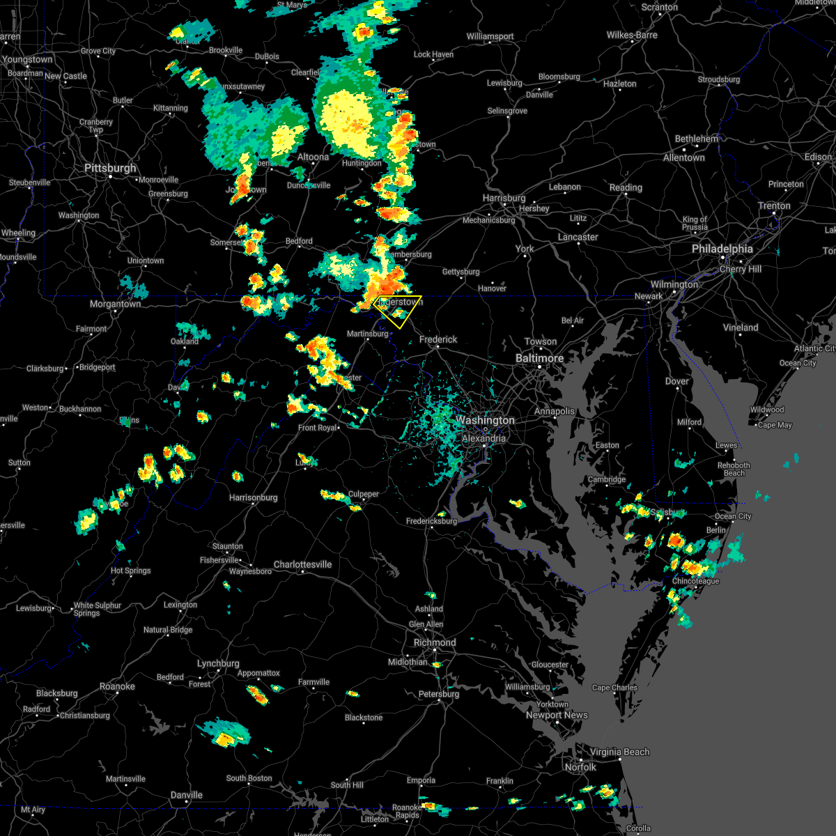 At 420 pm edt, a severe thunderstorm was located near fountainhead-orchard hills, or near hagerstown, moving southeast at 15 mph (radar indicated). Hazards include 60 mph wind gusts and quarter size hail. Damaging winds will cause some trees and large branches to fall. this could injure those outdoors, as well as damage homes and vehicles. roadways may become blocked by downed trees. localized power outages are possible. Unsecured light objects may become projectiles. At 420 pm edt, a severe thunderstorm was located near fountainhead-orchard hills, or near hagerstown, moving southeast at 15 mph (radar indicated). Hazards include 60 mph wind gusts and quarter size hail. Damaging winds will cause some trees and large branches to fall. this could injure those outdoors, as well as damage homes and vehicles. roadways may become blocked by downed trees. localized power outages are possible. Unsecured light objects may become projectiles.
|
| 8/13/2021 3:12 PM EDT |
 At 310 pm edt, a severe thunderstorm was located near carroll valley, moving east at 30 mph (radar indicated). Hazards include 60 mph wind gusts and penny size hail. expect damage to roofs, siding, and trees At 310 pm edt, a severe thunderstorm was located near carroll valley, moving east at 30 mph (radar indicated). Hazards include 60 mph wind gusts and penny size hail. expect damage to roofs, siding, and trees
|
| 8/13/2021 2:12 PM EDT |
 At 211 pm edt, severe thunderstorms were located along a line extending from near spruce hill to near claylick, moving east at 25 mph (radar indicated). Hazards include 60 mph wind gusts and penny size hail. expect damage to roofs, siding, and trees At 211 pm edt, severe thunderstorms were located along a line extending from near spruce hill to near claylick, moving east at 25 mph (radar indicated). Hazards include 60 mph wind gusts and penny size hail. expect damage to roofs, siding, and trees
|
| 8/11/2021 5:05 PM EDT |
 The severe thunderstorm warning for north central washington, morgan and northern berkeley counties will expire at 515 pm edt, the storms which prompted the warning have weakened below severe limits, and no longer pose an immediate threat to life or property. therefore, the warning will be allowed to expire. a severe thunderstorm watch remains in effect until 900 pm edt for north central maryland, northwestern virginia, and the panhandle of west virginia. The severe thunderstorm warning for north central washington, morgan and northern berkeley counties will expire at 515 pm edt, the storms which prompted the warning have weakened below severe limits, and no longer pose an immediate threat to life or property. therefore, the warning will be allowed to expire. a severe thunderstorm watch remains in effect until 900 pm edt for north central maryland, northwestern virginia, and the panhandle of west virginia.
|
| 8/11/2021 5:05 PM EDT |
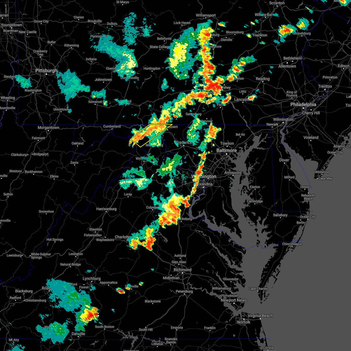 The severe thunderstorm warning for north central washington, morgan and northern berkeley counties will expire at 515 pm edt, the storms which prompted the warning have weakened below severe limits, and no longer pose an immediate threat to life or property. therefore, the warning will be allowed to expire. a severe thunderstorm watch remains in effect until 900 pm edt for north central maryland, northwestern virginia, and the panhandle of west virginia. The severe thunderstorm warning for north central washington, morgan and northern berkeley counties will expire at 515 pm edt, the storms which prompted the warning have weakened below severe limits, and no longer pose an immediate threat to life or property. therefore, the warning will be allowed to expire. a severe thunderstorm watch remains in effect until 900 pm edt for north central maryland, northwestern virginia, and the panhandle of west virginia.
|
| 8/11/2021 4:57 PM EDT |
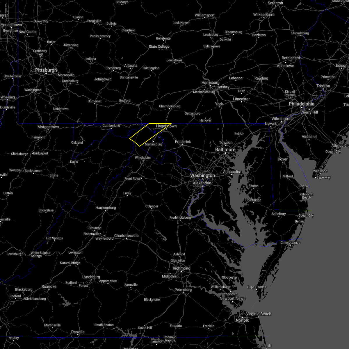 At 457 pm edt, severe thunderstorms were located along a line extending from near wilson-conococheague to near greenwood, moving southeast at 25 mph (radar indicated). Hazards include 60 mph wind gusts. Damaging winds will cause some trees and large branches to fall. this could injure those outdoors, as well as damage homes and vehicles. roadways may become blocked by downed trees. localized power outages are possible. unsecured light objects may become projectiles. locations impacted include, hagerstown, greenwood, fountainhead-orchard hills, paramount-long meadow, wilson-conococheague, long meadow, maugansville, clear spring, hedgesville, pecktonville, big spring, big pool, middleburg, johnsons mill, tomahawk, johnsontown, warrenton, valley view, fishers bridge and spohrs crossroads. hail threat, radar indicated max hail size, <. 75 in wind threat, radar indicated max wind gust, 60 mph. At 457 pm edt, severe thunderstorms were located along a line extending from near wilson-conococheague to near greenwood, moving southeast at 25 mph (radar indicated). Hazards include 60 mph wind gusts. Damaging winds will cause some trees and large branches to fall. this could injure those outdoors, as well as damage homes and vehicles. roadways may become blocked by downed trees. localized power outages are possible. unsecured light objects may become projectiles. locations impacted include, hagerstown, greenwood, fountainhead-orchard hills, paramount-long meadow, wilson-conococheague, long meadow, maugansville, clear spring, hedgesville, pecktonville, big spring, big pool, middleburg, johnsons mill, tomahawk, johnsontown, warrenton, valley view, fishers bridge and spohrs crossroads. hail threat, radar indicated max hail size, <. 75 in wind threat, radar indicated max wind gust, 60 mph.
|
| 8/11/2021 4:34 PM EDT |
 At 434 pm edt, severe thunderstorms were located along a line extending from 8 miles southwest of claylick to near paw paw, moving southeast at 25 mph (radar indicated). Hazards include 60 mph wind gusts. Damaging winds will cause some trees and large branches to fall. this could injure those outdoors, as well as damage homes and vehicles. roadways may become blocked by downed trees. localized power outages are possible. Unsecured light objects may become projectiles. At 434 pm edt, severe thunderstorms were located along a line extending from 8 miles southwest of claylick to near paw paw, moving southeast at 25 mph (radar indicated). Hazards include 60 mph wind gusts. Damaging winds will cause some trees and large branches to fall. this could injure those outdoors, as well as damage homes and vehicles. roadways may become blocked by downed trees. localized power outages are possible. Unsecured light objects may become projectiles.
|
| 8/11/2021 4:34 PM EDT |
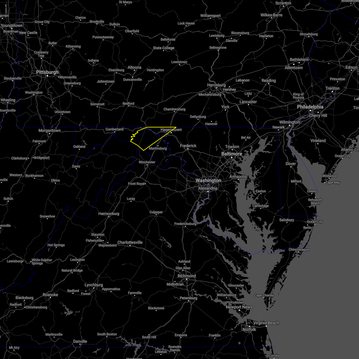 At 434 pm edt, severe thunderstorms were located along a line extending from 8 miles southwest of claylick to near paw paw, moving southeast at 25 mph (radar indicated). Hazards include 60 mph wind gusts. Damaging winds will cause some trees and large branches to fall. this could injure those outdoors, as well as damage homes and vehicles. roadways may become blocked by downed trees. localized power outages are possible. Unsecured light objects may become projectiles. At 434 pm edt, severe thunderstorms were located along a line extending from 8 miles southwest of claylick to near paw paw, moving southeast at 25 mph (radar indicated). Hazards include 60 mph wind gusts. Damaging winds will cause some trees and large branches to fall. this could injure those outdoors, as well as damage homes and vehicles. roadways may become blocked by downed trees. localized power outages are possible. Unsecured light objects may become projectiles.
|
| 7/21/2021 1:27 PM EDT |
 At 127 pm edt, a severe thunderstorm was located over paramount-long meadow, or near greencastle, moving southeast at 25 mph (radar indicated). Hazards include 60 mph wind gusts and quarter size hail. Damaging winds will cause some trees and large branches to fall. this could injure those outdoors, as well as damage homes and vehicles. roadways may become blocked by downed trees. localized power outages are possible. Unsecured light objects may become projectiles. At 127 pm edt, a severe thunderstorm was located over paramount-long meadow, or near greencastle, moving southeast at 25 mph (radar indicated). Hazards include 60 mph wind gusts and quarter size hail. Damaging winds will cause some trees and large branches to fall. this could injure those outdoors, as well as damage homes and vehicles. roadways may become blocked by downed trees. localized power outages are possible. Unsecured light objects may become projectiles.
|
| 6/21/2021 4:27 PM EDT |
 At 427 pm edt, severe thunderstorms were located along a line extending from near wilson-conococheague to near shepherdstown, moving east at 45 mph (radar indicated). Hazards include 60 mph wind gusts. Damaging winds will cause some trees and large branches to fall. this could injure those outdoors, as well as damage homes and vehicles. roadways may become blocked by downed trees. localized power outages are possible. unsecured light objects may become projectiles. Locations impacted include, hagerstown, municipal stadium, robinwood, fountainhead-orchard hills, boonsboro, smithsburg, paramount-long meadow, wilson-conococheague, williamsport, mount aetna, mount lena, san mar, long meadow, saint james, halfway, maugansville, cavetown, funkstown, falling waters and fairplay. At 427 pm edt, severe thunderstorms were located along a line extending from near wilson-conococheague to near shepherdstown, moving east at 45 mph (radar indicated). Hazards include 60 mph wind gusts. Damaging winds will cause some trees and large branches to fall. this could injure those outdoors, as well as damage homes and vehicles. roadways may become blocked by downed trees. localized power outages are possible. unsecured light objects may become projectiles. Locations impacted include, hagerstown, municipal stadium, robinwood, fountainhead-orchard hills, boonsboro, smithsburg, paramount-long meadow, wilson-conococheague, williamsport, mount aetna, mount lena, san mar, long meadow, saint james, halfway, maugansville, cavetown, funkstown, falling waters and fairplay.
|
| 6/21/2021 3:59 PM EDT |
 At 358 pm edt, severe thunderstorms were located along a line extending from near hancock to near greenwood, moving east at 50 mph (law enforcement. this storm has a history of downing numerous trees). Hazards include 60 mph wind gusts. Damaging winds will cause some trees and large branches to fall. this could injure those outdoors, as well as damage homes and vehicles. roadways may become blocked by downed trees. localized power outages are possible. Unsecured light objects may become projectiles. At 358 pm edt, severe thunderstorms were located along a line extending from near hancock to near greenwood, moving east at 50 mph (law enforcement. this storm has a history of downing numerous trees). Hazards include 60 mph wind gusts. Damaging winds will cause some trees and large branches to fall. this could injure those outdoors, as well as damage homes and vehicles. roadways may become blocked by downed trees. localized power outages are possible. Unsecured light objects may become projectiles.
|
| 6/21/2021 3:59 PM EDT |
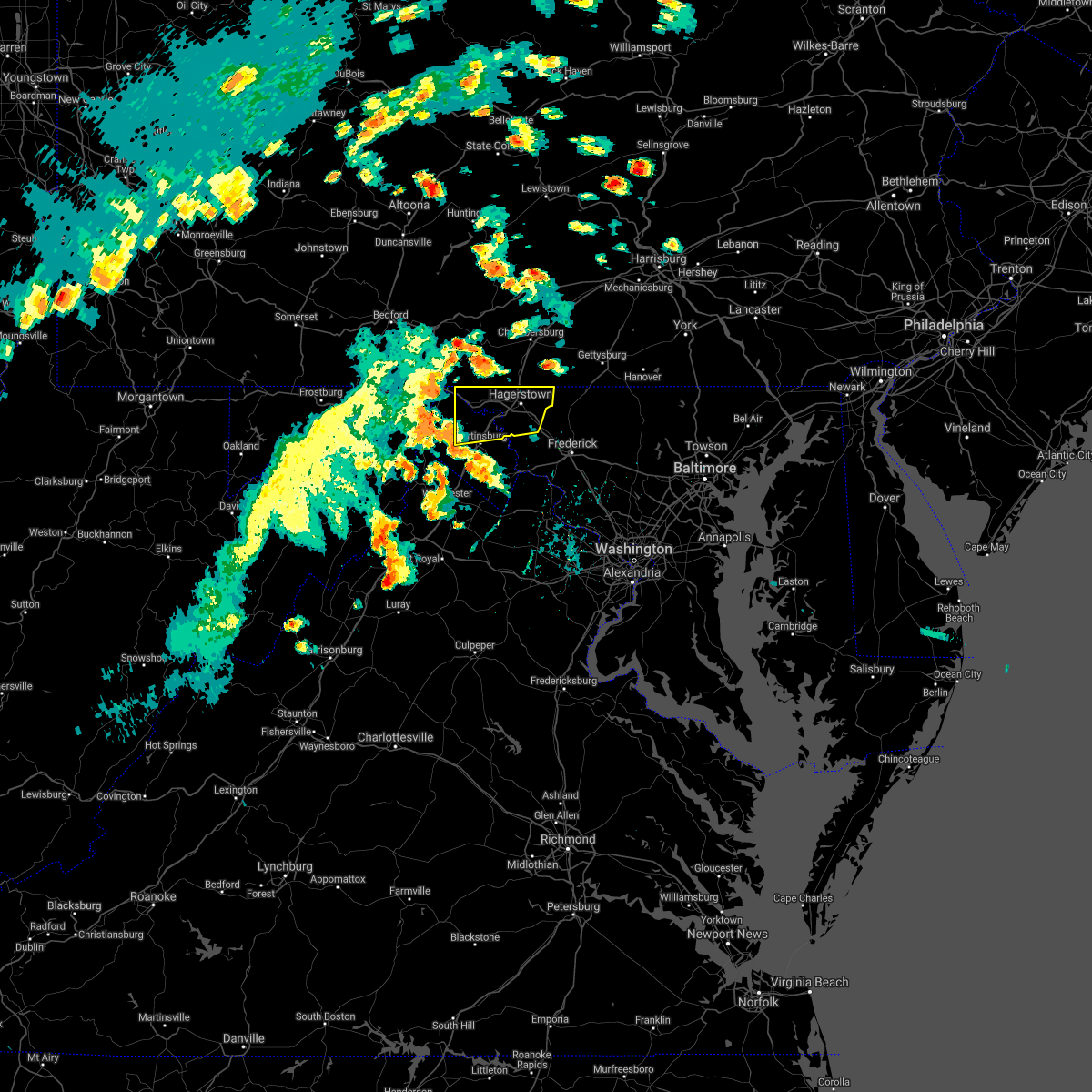 At 358 pm edt, severe thunderstorms were located along a line extending from near hancock to near greenwood, moving east at 50 mph (law enforcement. this storm has a history of downing numerous trees). Hazards include 60 mph wind gusts. Damaging winds will cause some trees and large branches to fall. this could injure those outdoors, as well as damage homes and vehicles. roadways may become blocked by downed trees. localized power outages are possible. Unsecured light objects may become projectiles. At 358 pm edt, severe thunderstorms were located along a line extending from near hancock to near greenwood, moving east at 50 mph (law enforcement. this storm has a history of downing numerous trees). Hazards include 60 mph wind gusts. Damaging winds will cause some trees and large branches to fall. this could injure those outdoors, as well as damage homes and vehicles. roadways may become blocked by downed trees. localized power outages are possible. Unsecured light objects may become projectiles.
|
| 4/30/2021 4:31 PM EDT |
 At 430 pm edt, severe thunderstorms were located along a line extending from near smithsburg to braddock heights to near purcellville, moving east at 60 mph (radar indicated). Hazards include 60 mph wind gusts. Damaging winds will cause some trees and large branches to fall. this could injure those outdoors, as well as damage homes and vehicles. roadways may become blocked by downed trees. localized power outages are possible. Unsecured light objects may become projectiles. At 430 pm edt, severe thunderstorms were located along a line extending from near smithsburg to braddock heights to near purcellville, moving east at 60 mph (radar indicated). Hazards include 60 mph wind gusts. Damaging winds will cause some trees and large branches to fall. this could injure those outdoors, as well as damage homes and vehicles. roadways may become blocked by downed trees. localized power outages are possible. Unsecured light objects may become projectiles.
|
| 3/28/2021 4:24 PM EDT |
 At 424 pm edt, severe thunderstorms were located along a line extending from near smithsburg to san mar to shepherdstown, moving east at 60 mph (radar indicated). Hazards include 60 mph wind gusts. Damaging winds will cause some trees and large branches to fall. this could injure those outdoors, as well as damage homes and vehicles. roadways may become blocked by downed trees. localized power outages are possible. unsecured light objects may become projectiles. Locations impacted include, frederick, hagerstown, thurmont, charles town, emmitsburg, shepherdstown, municipal stadium, harry grove stadium, ballenger creek, robinwood, brunswick, walkersville, fountainhead-orchard hills, ranson, boonsboro, smithsburg, braddock heights, paramount-long meadow, williamsport and mount aetna. At 424 pm edt, severe thunderstorms were located along a line extending from near smithsburg to san mar to shepherdstown, moving east at 60 mph (radar indicated). Hazards include 60 mph wind gusts. Damaging winds will cause some trees and large branches to fall. this could injure those outdoors, as well as damage homes and vehicles. roadways may become blocked by downed trees. localized power outages are possible. unsecured light objects may become projectiles. Locations impacted include, frederick, hagerstown, thurmont, charles town, emmitsburg, shepherdstown, municipal stadium, harry grove stadium, ballenger creek, robinwood, brunswick, walkersville, fountainhead-orchard hills, ranson, boonsboro, smithsburg, braddock heights, paramount-long meadow, williamsport and mount aetna.
|
| 3/28/2021 4:09 PM EDT |
 At 356 pm edt, severe thunderstorms were located along a line extending from 10 miles east of berkeley springs to 6 miles west of martinsburg to near greenwood, moving east at 50 mph (radar indicated). Hazards include 60 mph wind gusts. Damaging winds will cause some trees and large branches to fall. this could injure those outdoors, as well as damage homes and vehicles. roadways may become blocked by downed trees. localized power outages are possible. unsecured light objects may become projectiles. Locations impacted include, frederick, hagerstown, martinsburg, thurmont, charles town, emmitsburg, shepherdstown, municipal stadium, harry grove stadium, greenwood, ballenger creek, robinwood, brunswick, walkersville, fountainhead-orchard hills, ranson, boonsboro, smithsburg, inwood and braddock heights. At 356 pm edt, severe thunderstorms were located along a line extending from 10 miles east of berkeley springs to 6 miles west of martinsburg to near greenwood, moving east at 50 mph (radar indicated). Hazards include 60 mph wind gusts. Damaging winds will cause some trees and large branches to fall. this could injure those outdoors, as well as damage homes and vehicles. roadways may become blocked by downed trees. localized power outages are possible. unsecured light objects may become projectiles. Locations impacted include, frederick, hagerstown, martinsburg, thurmont, charles town, emmitsburg, shepherdstown, municipal stadium, harry grove stadium, greenwood, ballenger creek, robinwood, brunswick, walkersville, fountainhead-orchard hills, ranson, boonsboro, smithsburg, inwood and braddock heights.
|
| 3/28/2021 4:09 PM EDT |
 At 409 pm edt, severe thunderstorms were located along a line extending from wilson-conococheague to near martinsburg to near inwood, moving east at 45 mph (radar indicated). Hazards include 60 mph wind gusts. Damaging winds will cause some trees and large branches to fall. this could injure those outdoors, as well as damage homes and vehicles. roadways may become blocked by downed trees. localized power outages are possible. unsecured light objects may become projectiles. Locations impacted include, frederick, hagerstown, martinsburg, thurmont, charles town, emmitsburg, shepherdstown, municipal stadium, harry grove stadium, ballenger creek, robinwood, brunswick, walkersville, fountainhead-orchard hills, ranson, boonsboro, smithsburg, inwood, braddock heights and paramount-long meadow. At 409 pm edt, severe thunderstorms were located along a line extending from wilson-conococheague to near martinsburg to near inwood, moving east at 45 mph (radar indicated). Hazards include 60 mph wind gusts. Damaging winds will cause some trees and large branches to fall. this could injure those outdoors, as well as damage homes and vehicles. roadways may become blocked by downed trees. localized power outages are possible. unsecured light objects may become projectiles. Locations impacted include, frederick, hagerstown, martinsburg, thurmont, charles town, emmitsburg, shepherdstown, municipal stadium, harry grove stadium, ballenger creek, robinwood, brunswick, walkersville, fountainhead-orchard hills, ranson, boonsboro, smithsburg, inwood, braddock heights and paramount-long meadow.
|
| 3/28/2021 3:56 PM EDT |
 At 356 pm edt, severe thunderstorms were located along a line extending from 10 miles east of berkeley springs to 6 miles west of martinsburg to near greenwood, moving east at 50 mph (radar indicated). Hazards include 60 mph wind gusts. Damaging winds will cause some trees and large branches to fall. this could injure those outdoors, as well as damage homes and vehicles. roadways may become blocked by downed trees. localized power outages are possible. unsecured light objects may become projectiles. Locations impacted include, frederick, hagerstown, martinsburg, thurmont, charles town, emmitsburg, shepherdstown, municipal stadium, harry grove stadium, greenwood, ballenger creek, robinwood, brunswick, walkersville, fountainhead-orchard hills, ranson, boonsboro, smithsburg, inwood and braddock heights. At 356 pm edt, severe thunderstorms were located along a line extending from 10 miles east of berkeley springs to 6 miles west of martinsburg to near greenwood, moving east at 50 mph (radar indicated). Hazards include 60 mph wind gusts. Damaging winds will cause some trees and large branches to fall. this could injure those outdoors, as well as damage homes and vehicles. roadways may become blocked by downed trees. localized power outages are possible. unsecured light objects may become projectiles. Locations impacted include, frederick, hagerstown, martinsburg, thurmont, charles town, emmitsburg, shepherdstown, municipal stadium, harry grove stadium, greenwood, ballenger creek, robinwood, brunswick, walkersville, fountainhead-orchard hills, ranson, boonsboro, smithsburg, inwood and braddock heights.
|
| 3/28/2021 3:47 PM EDT |
 At 346 pm edt, severe thunderstorms were located along a line extending from near berkeley springs to near greenwood to 11 miles southeast of paw paw, moving east at 60 mph (radar indicated). Hazards include 60 mph wind gusts. Damaging winds will cause some trees and large branches to fall. this could injure those outdoors, as well as damage homes and vehicles. roadways may become blocked by downed trees. localized power outages are possible. Unsecured light objects may become projectiles. At 346 pm edt, severe thunderstorms were located along a line extending from near berkeley springs to near greenwood to 11 miles southeast of paw paw, moving east at 60 mph (radar indicated). Hazards include 60 mph wind gusts. Damaging winds will cause some trees and large branches to fall. this could injure those outdoors, as well as damage homes and vehicles. roadways may become blocked by downed trees. localized power outages are possible. Unsecured light objects may become projectiles.
|
| 11/15/2020 4:56 PM EST |
 At 455 pm est, severe thunderstorms were located along a line extending from near mont alto to near wilson-conococheague to near greenwood, moving east at 40 mph (radar indicated). Hazards include 60 mph wind gusts. Damaging winds will cause some trees and large branches to fall. this could injure those outdoors, as well as damage homes and vehicles. roadways may become blocked by downed trees. localized power outages are possible. Unsecured light objects may become projectiles. At 455 pm est, severe thunderstorms were located along a line extending from near mont alto to near wilson-conococheague to near greenwood, moving east at 40 mph (radar indicated). Hazards include 60 mph wind gusts. Damaging winds will cause some trees and large branches to fall. this could injure those outdoors, as well as damage homes and vehicles. roadways may become blocked by downed trees. localized power outages are possible. Unsecured light objects may become projectiles.
|
| 11/15/2020 4:55 PM EST |
 At 454 pm est, severe thunderstorms were located along a line extending from near bloserville to near shippensburg to near fountainhead-orchard hills, moving northeast at 50 mph (radar indicated). Hazards include 60 mph wind gusts. expect damage to trees, roofs, and siding At 454 pm est, severe thunderstorms were located along a line extending from near bloserville to near shippensburg to near fountainhead-orchard hills, moving northeast at 50 mph (radar indicated). Hazards include 60 mph wind gusts. expect damage to trees, roofs, and siding
|
| 8/24/2020 2:38 PM EDT |
 At 238 pm edt, a severe thunderstorm was located near claylick, or 11 miles east of hancock, moving southeast at 30 mph (radar indicated). Hazards include 60 mph wind gusts and quarter size hail. Damaging winds will cause some trees and large branches to fall. this could injure those outdoors, as well as damage homes and vehicles. roadways may become blocked by downed trees. localized power outages are possible. Unsecured light objects may become projectiles. At 238 pm edt, a severe thunderstorm was located near claylick, or 11 miles east of hancock, moving southeast at 30 mph (radar indicated). Hazards include 60 mph wind gusts and quarter size hail. Damaging winds will cause some trees and large branches to fall. this could injure those outdoors, as well as damage homes and vehicles. roadways may become blocked by downed trees. localized power outages are possible. Unsecured light objects may become projectiles.
|
| 8/1/2020 9:54 PM EDT |
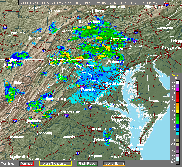 At 954 pm edt, a severe thunderstorm was located over wilson-conococheague, or near hagerstown, moving east at 15 mph (radar indicated). Hazards include 60 mph wind gusts. Damaging winds will cause some trees and large branches to fall. this could injure those outdoors, as well as damage homes and vehicles. roadways may become blocked by downed trees. localized power outages are possible. Unsecured light objects may become projectiles. At 954 pm edt, a severe thunderstorm was located over wilson-conococheague, or near hagerstown, moving east at 15 mph (radar indicated). Hazards include 60 mph wind gusts. Damaging winds will cause some trees and large branches to fall. this could injure those outdoors, as well as damage homes and vehicles. roadways may become blocked by downed trees. localized power outages are possible. Unsecured light objects may become projectiles.
|
| 8/1/2020 9:17 PM EDT |
 At 917 pm edt, a severe thunderstorm with a history of producing wind damage located near wilson-conococheague, or 11 miles west of hagerstown, moving east at 15 mph (observed wind damage and doppler radar). Hazards include 60 mph wind gusts and quarter size hail. Damaging winds will cause some trees and large branches to fall. this could injure those outdoors, as well as damage homes and vehicles. roadways may become blocked by downed trees. localized power outages are possible. unsecured light objects may become projectiles. Locations impacted include, hagerstown, fountainhead-orchard hills, paramount-long meadow, wilson-conococheague, williamsport, long meadow, saint james, halfway, maugansville, funkstown, clear spring, big spring, middleburg and warrenton. At 917 pm edt, a severe thunderstorm with a history of producing wind damage located near wilson-conococheague, or 11 miles west of hagerstown, moving east at 15 mph (observed wind damage and doppler radar). Hazards include 60 mph wind gusts and quarter size hail. Damaging winds will cause some trees and large branches to fall. this could injure those outdoors, as well as damage homes and vehicles. roadways may become blocked by downed trees. localized power outages are possible. unsecured light objects may become projectiles. Locations impacted include, hagerstown, fountainhead-orchard hills, paramount-long meadow, wilson-conococheague, williamsport, long meadow, saint james, halfway, maugansville, funkstown, clear spring, big spring, middleburg and warrenton.
|
| 8/1/2020 9:07 PM EDT |
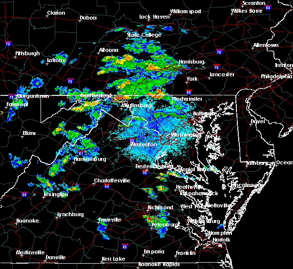 At 906 pm edt, a severe thunderstorm with a history of producing wind damage was located 8 miles west of wilson-conococheague, or 10 miles east of hancock, moving east at 15 mph (observed wind damage and doppler radar). Hazards include 65 mph wind gusts and quarter size hail. Damaging winds will cause some trees and large branches to fall. this could injure those outdoors, as well as damage homes and vehicles. roadways may become blocked by downed trees. localized power outages are possible. Unsecured light objects may become projectiles. At 906 pm edt, a severe thunderstorm with a history of producing wind damage was located 8 miles west of wilson-conococheague, or 10 miles east of hancock, moving east at 15 mph (observed wind damage and doppler radar). Hazards include 65 mph wind gusts and quarter size hail. Damaging winds will cause some trees and large branches to fall. this could injure those outdoors, as well as damage homes and vehicles. roadways may become blocked by downed trees. localized power outages are possible. Unsecured light objects may become projectiles.
|
| 7/24/2020 9:48 PM EDT |
 At 948 pm edt, a severe thunderstorm was located near paramount-long meadow, or near waynesboro, moving south at 15 mph (radar indicated). Hazards include 60 mph wind gusts. Damaging winds will cause some trees and large branches to fall. this could injure those outdoors, as well as damage homes and vehicles. roadways may become blocked by downed trees. localized power outages are possible. unsecured light objects may become projectiles. Locations impacted include, hagerstown, robinwood, fountainhead-orchard hills, smithsburg, paramount-long meadow, long meadow, maugansville, cavetown, leitersburg, fort ritchie, chewsville, ringgold, middleburg and bridgeport. At 948 pm edt, a severe thunderstorm was located near paramount-long meadow, or near waynesboro, moving south at 15 mph (radar indicated). Hazards include 60 mph wind gusts. Damaging winds will cause some trees and large branches to fall. this could injure those outdoors, as well as damage homes and vehicles. roadways may become blocked by downed trees. localized power outages are possible. unsecured light objects may become projectiles. Locations impacted include, hagerstown, robinwood, fountainhead-orchard hills, smithsburg, paramount-long meadow, long meadow, maugansville, cavetown, leitersburg, fort ritchie, chewsville, ringgold, middleburg and bridgeport.
|
| 7/24/2020 9:36 PM EDT |
 At 936 pm edt, a severe thunderstorm was located near waynesboro, moving south at 20 mph (radar indicated). Hazards include 60 mph wind gusts and quarter size hail. Hail damage to vehicles is expected. expect wind damage to trees, roofs, and siding. locations impacted include, waynesboro, greencastle, wayne heights, mont alto, rouzerville, marion, state line, quincy and penn state mont alto. This includes interstate 81 from mile markers 0 to 12. At 936 pm edt, a severe thunderstorm was located near waynesboro, moving south at 20 mph (radar indicated). Hazards include 60 mph wind gusts and quarter size hail. Hail damage to vehicles is expected. expect wind damage to trees, roofs, and siding. locations impacted include, waynesboro, greencastle, wayne heights, mont alto, rouzerville, marion, state line, quincy and penn state mont alto. This includes interstate 81 from mile markers 0 to 12.
|
| 7/24/2020 9:32 PM EDT |
 At 931 pm edt, a severe thunderstorm was located near greencastle, moving south at 10 mph (radar indicated). Hazards include 60 mph wind gusts and quarter size hail. Damaging winds will cause some trees and large branches to fall. this could injure those outdoors, as well as damage homes and vehicles. roadways may become blocked by downed trees. localized power outages are possible. Unsecured light objects may become projectiles. At 931 pm edt, a severe thunderstorm was located near greencastle, moving south at 10 mph (radar indicated). Hazards include 60 mph wind gusts and quarter size hail. Damaging winds will cause some trees and large branches to fall. this could injure those outdoors, as well as damage homes and vehicles. roadways may become blocked by downed trees. localized power outages are possible. Unsecured light objects may become projectiles.
|
| 7/24/2020 9:21 PM EDT |
 At 920 pm edt, a severe thunderstorm was located near mont alto, moving south at 20 mph (radar indicated). Hazards include 60 mph wind gusts and quarter size hail. Hail damage to vehicles is expected. Expect wind damage to trees, roofs, and siding. At 920 pm edt, a severe thunderstorm was located near mont alto, moving south at 20 mph (radar indicated). Hazards include 60 mph wind gusts and quarter size hail. Hail damage to vehicles is expected. Expect wind damage to trees, roofs, and siding.
|
| 7/21/2020 5:05 PM EDT |
 At 504 pm edt, a severe thunderstorm was located near needmore, moving east at 35 mph (radar indicated). Hazards include 60 mph wind gusts and penny size hail. Expect damage to trees, roofs, and siding. this severe thunderstorm will be near, big cove tannery and harrisonville around 510 pm edt. mcconnellsburg around 520 pm edt. fort loudon and mercersburg around 530 pm edt. marion and st. thomas around 540 pm edt. other locations impacted by this severe thunderstorm include williamson, upton, state line, quincy, penn state mont alto and whitetail ski area. this includes the following interstates, interstate 70 near mile marker 156, and from mile markers 160 to 170. Interstate 81 from mile markers 0 to 22. At 504 pm edt, a severe thunderstorm was located near needmore, moving east at 35 mph (radar indicated). Hazards include 60 mph wind gusts and penny size hail. Expect damage to trees, roofs, and siding. this severe thunderstorm will be near, big cove tannery and harrisonville around 510 pm edt. mcconnellsburg around 520 pm edt. fort loudon and mercersburg around 530 pm edt. marion and st. thomas around 540 pm edt. other locations impacted by this severe thunderstorm include williamson, upton, state line, quincy, penn state mont alto and whitetail ski area. this includes the following interstates, interstate 70 near mile marker 156, and from mile markers 160 to 170. Interstate 81 from mile markers 0 to 22.
|
| 6/4/2020 6:20 PM EDT |
 At 619 pm edt, a severe thunderstorm was located near fort loudon, moving northeast at 35 mph. this storm has already produced wind damage in antrim township and mercersburg (radar indicated). Hazards include 60 mph wind gusts. Expect damage to trees, roofs, and siding. locations impacted include, chambersburg, waynesboro, shippensburg, greencastle, breezewood, guilford, st. thomas, fayetteville, wayne heights, mont alto, mercersburg, scotland, mcconnellsburg, harrisonville, rouzerville, marion, fort loudon, big cove tannery, crystal springs and fort littleton. this includes the following interstates, interstate 70 from mile markers 147 to 155. the pennsylvania turnpike from mile markers 160 to 181. Interstate 81 from mile markers 0 to 25. At 619 pm edt, a severe thunderstorm was located near fort loudon, moving northeast at 35 mph. this storm has already produced wind damage in antrim township and mercersburg (radar indicated). Hazards include 60 mph wind gusts. Expect damage to trees, roofs, and siding. locations impacted include, chambersburg, waynesboro, shippensburg, greencastle, breezewood, guilford, st. thomas, fayetteville, wayne heights, mont alto, mercersburg, scotland, mcconnellsburg, harrisonville, rouzerville, marion, fort loudon, big cove tannery, crystal springs and fort littleton. this includes the following interstates, interstate 70 from mile markers 147 to 155. the pennsylvania turnpike from mile markers 160 to 181. Interstate 81 from mile markers 0 to 25.
|
| 6/4/2020 6:05 PM EDT |
 The severe thunderstorm warning for northwestern washington, northeastern morgan and north central berkeley counties will expire at 615 pm edt, the storm which prompted the warning has moved out of the area. therefore, the warning will be allowed to expire. a severe thunderstorm watch remains in effect until 1000 pm edt for north central maryland, and the panhandle of west virginia. The severe thunderstorm warning for northwestern washington, northeastern morgan and north central berkeley counties will expire at 615 pm edt, the storm which prompted the warning has moved out of the area. therefore, the warning will be allowed to expire. a severe thunderstorm watch remains in effect until 1000 pm edt for north central maryland, and the panhandle of west virginia.
|
| 6/4/2020 6:05 PM EDT |
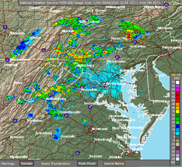 The severe thunderstorm warning for northwestern washington, northeastern morgan and north central berkeley counties will expire at 615 pm edt, the storm which prompted the warning has moved out of the area. therefore, the warning will be allowed to expire. a severe thunderstorm watch remains in effect until 1000 pm edt for north central maryland, and the panhandle of west virginia. The severe thunderstorm warning for northwestern washington, northeastern morgan and north central berkeley counties will expire at 615 pm edt, the storm which prompted the warning has moved out of the area. therefore, the warning will be allowed to expire. a severe thunderstorm watch remains in effect until 1000 pm edt for north central maryland, and the panhandle of west virginia.
|
| 6/4/2020 5:40 PM EDT |
 At 539 pm edt, a severe thunderstorm was located near berkeley springs, or near hancock, moving northeast at 35 mph (emergency management received reports of trees down near great cacapon). Hazards include 60 mph wind gusts and quarter size hail. Damaging winds will cause some trees and large branches to fall. this could injure those outdoors, as well as damage homes and vehicles. roadways may become blocked by downed trees. localized power outages are possible. Unsecured light objects may become projectiles. At 539 pm edt, a severe thunderstorm was located near berkeley springs, or near hancock, moving northeast at 35 mph (emergency management received reports of trees down near great cacapon). Hazards include 60 mph wind gusts and quarter size hail. Damaging winds will cause some trees and large branches to fall. this could injure those outdoors, as well as damage homes and vehicles. roadways may become blocked by downed trees. localized power outages are possible. Unsecured light objects may become projectiles.
|
| 6/4/2020 5:40 PM EDT |
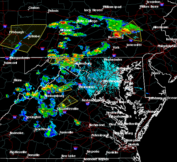 At 539 pm edt, a severe thunderstorm was located near berkeley springs, or near hancock, moving northeast at 35 mph (emergency management received reports of trees down near great cacapon). Hazards include 60 mph wind gusts and quarter size hail. Damaging winds will cause some trees and large branches to fall. this could injure those outdoors, as well as damage homes and vehicles. roadways may become blocked by downed trees. localized power outages are possible. Unsecured light objects may become projectiles. At 539 pm edt, a severe thunderstorm was located near berkeley springs, or near hancock, moving northeast at 35 mph (emergency management received reports of trees down near great cacapon). Hazards include 60 mph wind gusts and quarter size hail. Damaging winds will cause some trees and large branches to fall. this could injure those outdoors, as well as damage homes and vehicles. roadways may become blocked by downed trees. localized power outages are possible. Unsecured light objects may become projectiles.
|
| 4/13/2020 1:02 PM EDT |
 At 101 pm edt, severe thunderstorms were located along a line extending from near paramount-long meadow to near saint james, moving east at 45 mph (radar indicated). Hazards include 60 mph wind gusts and quarter size hail. Damaging winds will cause some trees and large branches to fall. this could injure those outdoors, as well as damage homes and vehicles. roadways may become blocked by downed trees. localized power outages are possible. unsecured light objects may become projectiles. Locations impacted include, hagerstown, thurmont, emmitsburg, municipal st**!adium, robinwood, fountainhead-orchard hills, boonsboro, smithsburg, paramount-long meadow, mount aetna, mount lena, san mar, long meadow, wolfsville, saint james, halfway, maugansville, cavetown, funkstown and fairplay. At 101 pm edt, severe thunderstorms were located along a line extending from near paramount-long meadow to near saint james, moving east at 45 mph (radar indicated). Hazards include 60 mph wind gusts and quarter size hail. Damaging winds will cause some trees and large branches to fall. this could injure those outdoors, as well as damage homes and vehicles. roadways may become blocked by downed trees. localized power outages are possible. unsecured light objects may become projectiles. Locations impacted include, hagerstown, thurmont, emmitsburg, municipal st**!adium, robinwood, fountainhead-orchard hills, boonsboro, smithsburg, paramount-long meadow, mount aetna, mount lena, san mar, long meadow, wolfsville, saint james, halfway, maugansville, cavetown, funkstown and fairplay.
|
| 4/13/2020 12:56 PM EDT |
 At 1255 pm edt, a severe thunderstorm was located over greencastle, moving east at 55 mph (radar indicated). Hazards include 70 mph wind gusts and quarter size hail. Hail damage to vehicles is expected. expect considerable tree damage. wind damage is also likely to mobile homes, roofs, and outbuildings. locations impacted include, chambersburg, waynesboro, greencastle, guilford, fayetteville, wayne heights, mont alto, scotland, rouzerville, marion, claylick, state line, quincy, williamson, upton and penn state mont alto. This includes interstate 81 from mile markers 0 to 21. At 1255 pm edt, a severe thunderstorm was located over greencastle, moving east at 55 mph (radar indicated). Hazards include 70 mph wind gusts and quarter size hail. Hail damage to vehicles is expected. expect considerable tree damage. wind damage is also likely to mobile homes, roofs, and outbuildings. locations impacted include, chambersburg, waynesboro, greencastle, guilford, fayetteville, wayne heights, mont alto, scotland, rouzerville, marion, claylick, state line, quincy, williamson, upton and penn state mont alto. This includes interstate 81 from mile markers 0 to 21.
|
| 4/13/2020 12:42 PM EDT |
 At 1241 pm edt, severe thunderstorms were located along a line extending from near wilson-conococheague to near martinsburg, moving east at 35 mph (radar indicated). Hazards include 60 mph wind gusts and quarter size hail. Damaging winds will cause some trees and large branches to fall. this could injure those outdoors, as well as damage homes and vehicles. roadways may become blocked by downed trees. localized power outages are possible. Unsecured light objects may become projectiles. At 1241 pm edt, severe thunderstorms were located along a line extending from near wilson-conococheague to near martinsburg, moving east at 35 mph (radar indicated). Hazards include 60 mph wind gusts and quarter size hail. Damaging winds will cause some trees and large branches to fall. this could injure those outdoors, as well as damage homes and vehicles. roadways may become blocked by downed trees. localized power outages are possible. Unsecured light objects may become projectiles.
|
| 4/13/2020 12:32 PM EDT |
 At 1230 pm edt, a severe thunderstorm was located 8 miles west of wilson-conococheague, moving east at 50 mph (radar indicated). Hazards include 60 mph wind gusts and quarter size hail. Hail damage to vehicles is expected. Expect wind damage to trees, roofs, and siding. At 1230 pm edt, a severe thunderstorm was located 8 miles west of wilson-conococheague, moving east at 50 mph (radar indicated). Hazards include 60 mph wind gusts and quarter size hail. Hail damage to vehicles is expected. Expect wind damage to trees, roofs, and siding.
|
| 4/8/2020 3:18 AM EDT |
 At 317 am edt, severe thunderstorms were located along a line extending from near fountainhead-orchard hills to near martinsburg to 10 miles south of paw paw, moving southeast at 55 mph (radar indicated). Hazards include 60 mph wind gusts. Damaging winds will cause some trees and large branches to fall. this could injure those outdoors, as well as damage homes and vehicles. roadways may become blocked by downed trees. localized power outages are possible. unsecured light objects may become projectiles. Locations impacted include, hagerstown, martinsburg, charles town, shepherdstown, municipal stadium, greenwood, robinwood, fountainhead-orchard hills, ranson, boonsboro, smithsburg, inwood, paramount-long meadow, wilson-conococheague, williamsport, mount aetna, mount lena, san mar, harpers ferry and long meadow. At 317 am edt, severe thunderstorms were located along a line extending from near fountainhead-orchard hills to near martinsburg to 10 miles south of paw paw, moving southeast at 55 mph (radar indicated). Hazards include 60 mph wind gusts. Damaging winds will cause some trees and large branches to fall. this could injure those outdoors, as well as damage homes and vehicles. roadways may become blocked by downed trees. localized power outages are possible. unsecured light objects may become projectiles. Locations impacted include, hagerstown, martinsburg, charles town, shepherdstown, municipal stadium, greenwood, robinwood, fountainhead-orchard hills, ranson, boonsboro, smithsburg, inwood, paramount-long meadow, wilson-conococheague, williamsport, mount aetna, mount lena, san mar, harpers ferry and long meadow.
|
| 4/8/2020 2:50 AM EDT |
 At 250 am edt, severe thunderstorms were located along a line extending from near saluvia to near warfordsburg to 6 miles southwest of inglesmith, moving southeast at 55 mph (radar indicated). Hazards include 60 mph wind gusts. Damaging winds will cause some trees and large branches to fall. this could injure those outdoors, as well as damage homes and vehicles. roadways may become blocked by downed trees. localized power outages are possible. Unsecured light objects may become projectiles. At 250 am edt, severe thunderstorms were located along a line extending from near saluvia to near warfordsburg to 6 miles southwest of inglesmith, moving southeast at 55 mph (radar indicated). Hazards include 60 mph wind gusts. Damaging winds will cause some trees and large branches to fall. this could injure those outdoors, as well as damage homes and vehicles. roadways may become blocked by downed trees. localized power outages are possible. Unsecured light objects may become projectiles.
|
| 3/3/2020 10:48 PM EST |
 At 1048 pm est, severe thunderstorms were located along a line extending from near rouzerville to 6 miles northeast of winchester, moving east at 75 mph (emergency management). Hazards include 60 mph wind gusts. Damaging winds will cause some trees and large branches to fall. this could injure those outdoors, as well as damage homes and vehicles. roadways may become blocked by downed trees. localized power outages are possible. unsecured light objects may become projectiles. Locations impacted include, hagerstown, winchester, martinsburg, thurmont, charles town, emmitsburg, shepherdstown, municipal stadium, robinwood, brunswick, fountainhead-orchard hills, ranson, berryville, boonsboro, smithsburg, inwood, paramount-long meadow, wilson-conococheague, williamsport and mount aetna. At 1048 pm est, severe thunderstorms were located along a line extending from near rouzerville to 6 miles northeast of winchester, moving east at 75 mph (emergency management). Hazards include 60 mph wind gusts. Damaging winds will cause some trees and large branches to fall. this could injure those outdoors, as well as damage homes and vehicles. roadways may become blocked by downed trees. localized power outages are possible. unsecured light objects may become projectiles. Locations impacted include, hagerstown, winchester, martinsburg, thurmont, charles town, emmitsburg, shepherdstown, municipal stadium, robinwood, brunswick, fountainhead-orchard hills, ranson, berryville, boonsboro, smithsburg, inwood, paramount-long meadow, wilson-conococheague, williamsport and mount aetna.
|
| 3/3/2020 10:40 PM EST |
 At 1040 pm est, severe thunderstorms were located along a line extending from paramount-long meadow to 7 miles northwest of winchester, moving east at 75 mph (emergency management). Hazards include 60 mph wind gusts. Damaging winds will cause some trees and large branches to fall. this could injure those outdoors, as well as damage homes and vehicles. roadways may become blocked by downed trees. localized power outages are possible. unsecured light objects may become projectiles. Locations impacted include, hagerstown, winchester, martinsburg, thurmont, charles town, emmitsburg, shepherdstown, municipal stadium, robinwood, brunswick, fountainhead-orchard hills, ranson, berryville, boonsboro, smithsburg, inwood, paramount-long meadow, wilson-conococheague, williamsport and mount aetna. At 1040 pm est, severe thunderstorms were located along a line extending from paramount-long meadow to 7 miles northwest of winchester, moving east at 75 mph (emergency management). Hazards include 60 mph wind gusts. Damaging winds will cause some trees and large branches to fall. this could injure those outdoors, as well as damage homes and vehicles. roadways may become blocked by downed trees. localized power outages are possible. unsecured light objects may become projectiles. Locations impacted include, hagerstown, winchester, martinsburg, thurmont, charles town, emmitsburg, shepherdstown, municipal stadium, robinwood, brunswick, fountainhead-orchard hills, ranson, berryville, boonsboro, smithsburg, inwood, paramount-long meadow, wilson-conococheague, williamsport and mount aetna.
|
| 3/3/2020 10:26 PM EST |
 At 1026 pm est, severe thunderstorms were located along a line extending from 6 miles southwest of claylick to 11 miles southeast of romney, moving east at 75 mph (emergency management). Hazards include 60 mph wind gusts. Damaging winds will cause some trees and large branches to fall. this could injure those outdoors, as well as damage homes and vehicles. roadways may become blocked by downed trees. localized power outages are possible. Unsecured light objects may become projectiles. At 1026 pm est, severe thunderstorms were located along a line extending from 6 miles southwest of claylick to 11 miles southeast of romney, moving east at 75 mph (emergency management). Hazards include 60 mph wind gusts. Damaging winds will cause some trees and large branches to fall. this could injure those outdoors, as well as damage homes and vehicles. roadways may become blocked by downed trees. localized power outages are possible. Unsecured light objects may become projectiles.
|
| 3/3/2020 10:18 PM EST |
 At 1018 pm est, severe thunderstorms were located along a line extending from near berkeley springs to near romney, moving east at 55 mph (trained weather spotters). Hazards include 60 mph wind gusts. Damaging winds will cause some trees and large branches to fall. this could injure those outdoors, as well as damage homes and vehicles. roadways may become blocked by downed trees. localized power outages are possible. unsecured light objects may become projectiles. Locations impacted include, romney, hancock, paw paw, greenwood, wilson-conococheague, fort ashby, berkeley springs, maugansville, springfield, great cacapon, clear spring, capon bridge, hedgesville, green spring, pecktonville, oldtown, big spring, big pool, middleburg and little orleans. At 1018 pm est, severe thunderstorms were located along a line extending from near berkeley springs to near romney, moving east at 55 mph (trained weather spotters). Hazards include 60 mph wind gusts. Damaging winds will cause some trees and large branches to fall. this could injure those outdoors, as well as damage homes and vehicles. roadways may become blocked by downed trees. localized power outages are possible. unsecured light objects may become projectiles. Locations impacted include, romney, hancock, paw paw, greenwood, wilson-conococheague, fort ashby, berkeley springs, maugansville, springfield, great cacapon, clear spring, capon bridge, hedgesville, green spring, pecktonville, oldtown, big spring, big pool, middleburg and little orleans.
|
| 3/3/2020 10:03 PM EST |
 At 1003 pm est, severe thunderstorms were located along a line extending from 6 miles southwest of inglesmith to near keyser, moving east at 55 mph (trained weather spotters). Hazards include 60 mph wind gusts. Damaging winds will cause some trees and large branches to fall. this could injure those outdoors, as well as damage homes and vehicles. roadways may become blocked by downed trees. localized power outages are possible. Unsecured light objects may become projectiles. At 1003 pm est, severe thunderstorms were located along a line extending from 6 miles southwest of inglesmith to near keyser, moving east at 55 mph (trained weather spotters). Hazards include 60 mph wind gusts. Damaging winds will cause some trees and large branches to fall. this could injure those outdoors, as well as damage homes and vehicles. roadways may become blocked by downed trees. localized power outages are possible. Unsecured light objects may become projectiles.
|
| 8/22/2019 5:52 PM EDT |
 At 552 pm edt, a severe thunderstorm was located over long meadow, or near hagerstown, moving east at 25 mph (radar indicated). Hazards include 60 mph wind gusts and quarter size hail. Damaging winds will cause some trees and large branches to fall. this could injure those outdoors, as well as damage homes and vehicles. roadways may become blocked by downed trees. localized power outages are possible. Unsecured light objects may become projectiles. At 552 pm edt, a severe thunderstorm was located over long meadow, or near hagerstown, moving east at 25 mph (radar indicated). Hazards include 60 mph wind gusts and quarter size hail. Damaging winds will cause some trees and large branches to fall. this could injure those outdoors, as well as damage homes and vehicles. roadways may become blocked by downed trees. localized power outages are possible. Unsecured light objects may become projectiles.
|
| 7/21/2019 5:34 PM EDT |
 At 534 pm edt, a severe thunderstorm was located near st. thomas, moving southeast at 25 mph (radar indicated). Hazards include 60 mph wind gusts. Expect damage to trees, roofs, and siding. locations impacted include, chambersburg, waynesboro, greencastle, guilford, st. thomas, fayetteville, wayne heights, mont alto, mercersburg, rouzerville, marion, fort loudon, state line, quincy, williamson, upton and penn state mont alto. This includes interstate 81 from mile markers 0 to 16. At 534 pm edt, a severe thunderstorm was located near st. thomas, moving southeast at 25 mph (radar indicated). Hazards include 60 mph wind gusts. Expect damage to trees, roofs, and siding. locations impacted include, chambersburg, waynesboro, greencastle, guilford, st. thomas, fayetteville, wayne heights, mont alto, mercersburg, rouzerville, marion, fort loudon, state line, quincy, williamson, upton and penn state mont alto. This includes interstate 81 from mile markers 0 to 16.
|
| 7/21/2019 5:12 PM EDT |
 At 512 pm edt, a severe thunderstorm was located over mcconnellsburg, moving east at 25 mph (radar indicated). Hazards include 60 mph wind gusts. expect damage to trees, roofs, and siding At 512 pm edt, a severe thunderstorm was located over mcconnellsburg, moving east at 25 mph (radar indicated). Hazards include 60 mph wind gusts. expect damage to trees, roofs, and siding
|
| 7/6/2019 7:24 PM EDT |
 At 724 pm edt, severe thunderstorms were located along a line extending from near churchtown to greencastle, moving east at 30 mph (radar indicated). Hazards include 60 mph wind gusts and quarter size hail. Hail damage to vehicles is expected. expect wind damage to trees, roofs, and siding. locations impacted include, york, chambersburg, hanover, weigelstown, waynesboro, gettysburg, parkville, greencastle, hampton, guilford, shiloh, west york, littlestown, carroll valley, codorus, grantley, fayetteville, mcsherrystown, manchester and emigsville. this includes the following interstates, interstate 81 from mile markers 0 to 16. Interstate 83 from mile markers 20 to 25. At 724 pm edt, severe thunderstorms were located along a line extending from near churchtown to greencastle, moving east at 30 mph (radar indicated). Hazards include 60 mph wind gusts and quarter size hail. Hail damage to vehicles is expected. expect wind damage to trees, roofs, and siding. locations impacted include, york, chambersburg, hanover, weigelstown, waynesboro, gettysburg, parkville, greencastle, hampton, guilford, shiloh, west york, littlestown, carroll valley, codorus, grantley, fayetteville, mcsherrystown, manchester and emigsville. this includes the following interstates, interstate 81 from mile markers 0 to 16. Interstate 83 from mile markers 20 to 25.
|
| 7/6/2019 7:21 PM EDT |
 At 720 pm edt, a severe thunderstorm was located over smithsburg, or near waynesboro, moving southeast at 30 mph (radar indicated). Hazards include 60 mph wind gusts and quarter size hail. Damaging winds will cause some trees and large branches to fall. this could injure those outdoors, as well as damage homes and vehicles. roadways may become blocked by downed trees. localized power outages are possible. unsecured light objects may become projectiles. Locations impacted include, hagerstown, thurmont, emmitsburg, robinwood, taneytown, walkersville, fountainhead-orchard hills, smithsburg, paramount-long meadow, mount aetna, long meadow, discovery-spring garden, wolfsville, linganore-bartonsville, maugansville, cavetown, woodsboro, union bridge, libertytown and leitersburg. At 720 pm edt, a severe thunderstorm was located over smithsburg, or near waynesboro, moving southeast at 30 mph (radar indicated). Hazards include 60 mph wind gusts and quarter size hail. Damaging winds will cause some trees and large branches to fall. this could injure those outdoors, as well as damage homes and vehicles. roadways may become blocked by downed trees. localized power outages are possible. unsecured light objects may become projectiles. Locations impacted include, hagerstown, thurmont, emmitsburg, robinwood, taneytown, walkersville, fountainhead-orchard hills, smithsburg, paramount-long meadow, mount aetna, long meadow, discovery-spring garden, wolfsville, linganore-bartonsville, maugansville, cavetown, woodsboro, union bridge, libertytown and leitersburg.
|
| 7/6/2019 6:58 PM EDT |
 At 657 pm edt, a severe thunderstorm was located near mercersburg, or 9 miles northwest of greencastle, moving southeast at 35 mph (radar indicated). Hazards include 60 mph wind gusts and quarter size hail. Damaging winds will cause some trees and large branches to fall. this could injure those outdoors, as well as damage homes and vehicles. roadways may become blocked by downed trees. localized power outages are possible. Unsecured light objects may become projectiles. At 657 pm edt, a severe thunderstorm was located near mercersburg, or 9 miles northwest of greencastle, moving southeast at 35 mph (radar indicated). Hazards include 60 mph wind gusts and quarter size hail. Damaging winds will cause some trees and large branches to fall. this could injure those outdoors, as well as damage homes and vehicles. roadways may become blocked by downed trees. localized power outages are possible. Unsecured light objects may become projectiles.
|
| 7/6/2019 6:44 PM EDT |
 At 644 pm edt, severe thunderstorms were located along a line extending from near cornwall to big cove tannery, moving east at 30 mph (radar indicated). Hazards include 60 mph wind gusts and quarter size hail. Hail damage to vehicles is expected. Expect wind damage to trees, roofs, and siding. At 644 pm edt, severe thunderstorms were located along a line extending from near cornwall to big cove tannery, moving east at 30 mph (radar indicated). Hazards include 60 mph wind gusts and quarter size hail. Hail damage to vehicles is expected. Expect wind damage to trees, roofs, and siding.
|
| 6/29/2019 9:18 PM EDT |
 At 917 pm edt, severe thunderstorms were located along a line extending from near williamsport to near greenwood, moving southeast at 25 mph (radar indicated). Hazards include 60 mph wind gusts. Damaging winds will cause some trees and large branches to fall. this could injure those outdoors, as well as damage homes and vehicles. roadways may become blocked by downed trees. localized power outages are possible. Unsecured light objects may become projectiles. At 917 pm edt, severe thunderstorms were located along a line extending from near williamsport to near greenwood, moving southeast at 25 mph (radar indicated). Hazards include 60 mph wind gusts. Damaging winds will cause some trees and large branches to fall. this could injure those outdoors, as well as damage homes and vehicles. roadways may become blocked by downed trees. localized power outages are possible. Unsecured light objects may become projectiles.
|
| 6/29/2019 3:05 PM EDT |
 At 246 pm edt, a severe thunderstorm was located near mercersburg, or near greencastle, moving southeast at 20 mph (radar indicated). Hazards include 60 mph wind gusts and quarter size hail. Damaging winds will cause some trees and large branches to fall. this could injure those outdoors, as well as damage homes and vehicles. roadways may become blocked by downed trees. localized power outages are possible. Unsecured light objects may become projectiles. At 246 pm edt, a severe thunderstorm was located near mercersburg, or near greencastle, moving southeast at 20 mph (radar indicated). Hazards include 60 mph wind gusts and quarter size hail. Damaging winds will cause some trees and large branches to fall. this could injure those outdoors, as well as damage homes and vehicles. roadways may become blocked by downed trees. localized power outages are possible. Unsecured light objects may become projectiles.
|
| 6/29/2019 2:48 PM EDT |
 At 248 pm edt, a severe thunderstorm was located near greencastle, moving southeast at 25 mph (radar indicated). Hazards include 60 mph wind gusts and quarter size hail. Hail damage to vehicles is expected. expect wind damage to trees, roofs, and siding. locations impacted include, waynesboro, greencastle, wayne heights, mercersburg, rouzerville, marion, fort loudon, claylick, state line, williamson, quincy and upton. This includes interstate 81 from mile markers 0 to 9. At 248 pm edt, a severe thunderstorm was located near greencastle, moving southeast at 25 mph (radar indicated). Hazards include 60 mph wind gusts and quarter size hail. Hail damage to vehicles is expected. expect wind damage to trees, roofs, and siding. locations impacted include, waynesboro, greencastle, wayne heights, mercersburg, rouzerville, marion, fort loudon, claylick, state line, williamson, quincy and upton. This includes interstate 81 from mile markers 0 to 9.
|
| 6/29/2019 2:46 PM EDT |
 At 246 pm edt, a severe thunderstorm was located near mercersburg, or near greencastle, moving southeast at 20 mph (radar indicated). Hazards include 60 mph wind gusts and quarter size hail. Damaging winds will cause some trees and large branches to fall. this could injure those outdoors, as well as damage homes and vehicles. roadways may become blocked by downed trees. localized power outages are possible. Unsecured light objects may become projectiles. At 246 pm edt, a severe thunderstorm was located near mercersburg, or near greencastle, moving southeast at 20 mph (radar indicated). Hazards include 60 mph wind gusts and quarter size hail. Damaging winds will cause some trees and large branches to fall. this could injure those outdoors, as well as damage homes and vehicles. roadways may become blocked by downed trees. localized power outages are possible. Unsecured light objects may become projectiles.
|
| 6/29/2019 2:26 PM EDT |
 At 225 pm edt, a severe thunderstorm was located over fort loudon, moving southeast at 35 mph (radar indicated). Hazards include 60 mph wind gusts and quarter size hail. Hail damage to vehicles is expected. Expect wind damage to trees, roofs, and siding. At 225 pm edt, a severe thunderstorm was located over fort loudon, moving southeast at 35 mph (radar indicated). Hazards include 60 mph wind gusts and quarter size hail. Hail damage to vehicles is expected. Expect wind damage to trees, roofs, and siding.
|
| 6/13/2019 4:19 PM EDT |
 At 419 pm edt, severe thunderstorms were located along a line extending from wilson-conococheague to williamsport to near shepherdstown, moving northeast at 30 mph (radar indicated). Hazards include 60 mph wind gusts and quarter size hail. Damaging winds will cause some trees and large branches to fall. this could injure those outdoors, as well as damage homes and vehicles. roadways may become blocked by downed trees. localized power outages are possible. unsecured light objects may become projectiles. Locations impacted include, hagerstown, municipal stadium, robinwood, fountainhead-orchard hills, paramount-long meadow, wilson-conococheague, williamsport, long meadow, saint james, halfway, maugansville, funkstown, fairplay and middleburg. At 419 pm edt, severe thunderstorms were located along a line extending from wilson-conococheague to williamsport to near shepherdstown, moving northeast at 30 mph (radar indicated). Hazards include 60 mph wind gusts and quarter size hail. Damaging winds will cause some trees and large branches to fall. this could injure those outdoors, as well as damage homes and vehicles. roadways may become blocked by downed trees. localized power outages are possible. unsecured light objects may become projectiles. Locations impacted include, hagerstown, municipal stadium, robinwood, fountainhead-orchard hills, paramount-long meadow, wilson-conococheague, williamsport, long meadow, saint james, halfway, maugansville, funkstown, fairplay and middleburg.
|
| 6/13/2019 4:19 PM EDT |
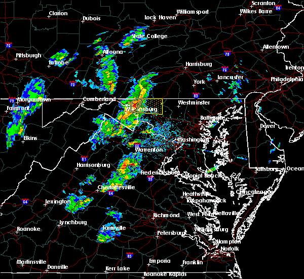 At 419 pm edt, severe thunderstorms were located along a line extending from wilson-conococheague to williamsport to near shepherdstown, moving northeast at 30 mph (radar indicated). Hazards include 60 mph wind gusts and quarter size hail. Damaging winds will cause some trees and large branches to fall. this could injure those outdoors, as well as damage homes and vehicles. roadways may become blocked by downed trees. localized power outages are possible. unsecured light objects may become projectiles. Locations impacted include, hagerstown, municipal stadium, robinwood, fountainhead-orchard hills, paramount-long meadow, wilson-conococheague, williamsport, long meadow, saint james, halfway, maugansville, funkstown, fairplay and middleburg. At 419 pm edt, severe thunderstorms were located along a line extending from wilson-conococheague to williamsport to near shepherdstown, moving northeast at 30 mph (radar indicated). Hazards include 60 mph wind gusts and quarter size hail. Damaging winds will cause some trees and large branches to fall. this could injure those outdoors, as well as damage homes and vehicles. roadways may become blocked by downed trees. localized power outages are possible. unsecured light objects may become projectiles. Locations impacted include, hagerstown, municipal stadium, robinwood, fountainhead-orchard hills, paramount-long meadow, wilson-conococheague, williamsport, long meadow, saint james, halfway, maugansville, funkstown, fairplay and middleburg.
|
| 6/13/2019 4:05 PM EDT |
 At 404 pm edt, severe thunderstorms were located along a line extending from near wilson-conococheague to near martinsburg to near inwood, moving northeast at 30 mph (radar indicated). Hazards include 60 mph wind gusts and quarter size hail. Damaging winds will cause some trees and large branches to fall. this could injure those outdoors, as well as damage homes and vehicles. roadways may become blocked by downed trees. localized power outages are possible. unsecured light objects may become projectiles. Locations impacted include, hagerstown, martinsburg, municipal stadium, robinwood, fountainhead-orchard hills, inwood, paramount-long meadow, wilson-conococheague, williamsport, long meadow, saint james, berkeley, halfway, maugansville, funkstown, falling waters, fairplay, clear spring, hedgesville and big spring. At 404 pm edt, severe thunderstorms were located along a line extending from near wilson-conococheague to near martinsburg to near inwood, moving northeast at 30 mph (radar indicated). Hazards include 60 mph wind gusts and quarter size hail. Damaging winds will cause some trees and large branches to fall. this could injure those outdoors, as well as damage homes and vehicles. roadways may become blocked by downed trees. localized power outages are possible. unsecured light objects may become projectiles. Locations impacted include, hagerstown, martinsburg, municipal stadium, robinwood, fountainhead-orchard hills, inwood, paramount-long meadow, wilson-conococheague, williamsport, long meadow, saint james, berkeley, halfway, maugansville, funkstown, falling waters, fairplay, clear spring, hedgesville and big spring.
|
| 6/13/2019 3:49 PM EDT |
 At 349 pm edt, severe thunderstorms were located along a line extending from 10 miles west of wilson-conococheague to near martinsburg to near greenwood, moving east at 30 mph (radar indicated). Hazards include 60 mph wind gusts and quarter size hail. Damaging winds will cause some trees and large branches to fall. this could injure those outdoors, as well as damage homes and vehicles. roadways may become blocked by downed trees. localized power outages are possible. Unsecured light objects may become projectiles. At 349 pm edt, severe thunderstorms were located along a line extending from 10 miles west of wilson-conococheague to near martinsburg to near greenwood, moving east at 30 mph (radar indicated). Hazards include 60 mph wind gusts and quarter size hail. Damaging winds will cause some trees and large branches to fall. this could injure those outdoors, as well as damage homes and vehicles. roadways may become blocked by downed trees. localized power outages are possible. Unsecured light objects may become projectiles.
|
| 6/13/2019 3:49 PM EDT |
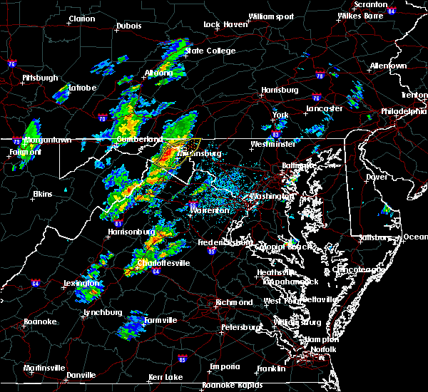 At 349 pm edt, severe thunderstorms were located along a line extending from 10 miles west of wilson-conococheague to near martinsburg to near greenwood, moving east at 30 mph (radar indicated). Hazards include 60 mph wind gusts and quarter size hail. Damaging winds will cause some trees and large branches to fall. this could injure those outdoors, as well as damage homes and vehicles. roadways may become blocked by downed trees. localized power outages are possible. Unsecured light objects may become projectiles. At 349 pm edt, severe thunderstorms were located along a line extending from 10 miles west of wilson-conococheague to near martinsburg to near greenwood, moving east at 30 mph (radar indicated). Hazards include 60 mph wind gusts and quarter size hail. Damaging winds will cause some trees and large branches to fall. this could injure those outdoors, as well as damage homes and vehicles. roadways may become blocked by downed trees. localized power outages are possible. Unsecured light objects may become projectiles.
|
| 6/2/2019 3:59 PM EDT |
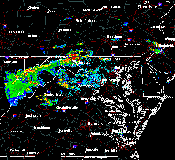 At 359 pm edt, a severe thunderstorm was located near wilson-conococheague, or 11 miles west of hagerstown, moving east at 15 mph (radar indicated). Hazards include 60 mph wind gusts and quarter size hail. Damaging winds will cause some trees and large branches to fall. this could injure those outdoors, as well as damage homes and vehicles. roadways may become blocked by downed trees. localized power outages are possible. unsecured light objects may become projectiles. Locations impacted include, hagerstown, fountainhead-orchard hills, wilson-conococheague, williamsport, long meadow, saint james, halfway, maugansville, falling waters, clear spring, big spring, middleburg and warrenton. At 359 pm edt, a severe thunderstorm was located near wilson-conococheague, or 11 miles west of hagerstown, moving east at 15 mph (radar indicated). Hazards include 60 mph wind gusts and quarter size hail. Damaging winds will cause some trees and large branches to fall. this could injure those outdoors, as well as damage homes and vehicles. roadways may become blocked by downed trees. localized power outages are possible. unsecured light objects may become projectiles. Locations impacted include, hagerstown, fountainhead-orchard hills, wilson-conococheague, williamsport, long meadow, saint james, halfway, maugansville, falling waters, clear spring, big spring, middleburg and warrenton.
|
| 6/2/2019 3:59 PM EDT |
 At 349 pm edt, a severe thunderstorm was located 7 miles southwest of claylick, or 10 miles east of hancock, moving east at 15 mph (radar indicated). Hazards include golf ball size hail and 60 mph wind gusts. Expect wind damage to trees and power lines. hail is large enough to dent and damage vehicles. some hail damage to roofs, siding, and windows is possible. Locations impacted include, hagerstown, fountainhead-orchard hills, wilson-conococheague, williamsport, long meadow, saint james, halfway, maugansville, falling waters, clear spring, hedgesville, pecktonville, big spring, big pool, middleburg, johnsontown, warrenton and sleepy creek. At 349 pm edt, a severe thunderstorm was located 7 miles southwest of claylick, or 10 miles east of hancock, moving east at 15 mph (radar indicated). Hazards include golf ball size hail and 60 mph wind gusts. Expect wind damage to trees and power lines. hail is large enough to dent and damage vehicles. some hail damage to roofs, siding, and windows is possible. Locations impacted include, hagerstown, fountainhead-orchard hills, wilson-conococheague, williamsport, long meadow, saint james, halfway, maugansville, falling waters, clear spring, hedgesville, pecktonville, big spring, big pool, middleburg, johnsontown, warrenton and sleepy creek.
|
| 6/2/2019 3:49 PM EDT |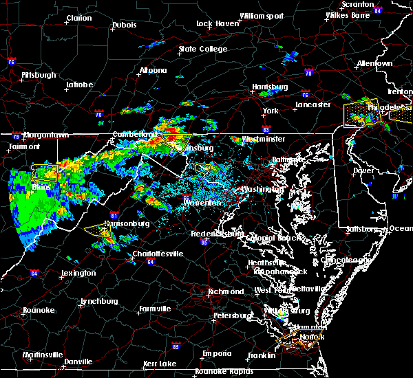
 At 349 pm edt, a severe thunderstorm was located 7 miles southwest of claylick, or 10 miles east of hancock, moving east at 15 mph (radar indicated). Hazards include golf ball size hail and 60 mph wind gusts. Expect wind damage to trees and power lines. hail is large enough to dent and damage vehicles. some hail damage to roofs, siding, and windows is possible. Locations impacted include, hagerstown, fountainhead-orchard hills, wilson-conococheague, williamsport, long meadow, saint james, halfway, maugansville, falling waters, clear spring, hedgesville, pecktonville, big spring, big pool, middleburg, johnsontown, warrenton and sleepy creek. At 349 pm edt, a severe thunderstorm was located 7 miles southwest of claylick, or 10 miles east of hancock, moving east at 15 mph (radar indicated). Hazards include golf ball size hail and 60 mph wind gusts. Expect wind damage to trees and power lines. hail is large enough to dent and damage vehicles. some hail damage to roofs, siding, and windows is possible. Locations impacted include, hagerstown, fountainhead-orchard hills, wilson-conococheague, williamsport, long meadow, saint james, halfway, maugansville, falling waters, clear spring, hedgesville, pecktonville, big spring, big pool, middleburg, johnsontown, warrenton and sleepy creek.
|
| 6/2/2019 3:45 PM EDT |
 At 345 pm edt, a severe thunderstorm was located 8 miles southwest of claylick, or 9 miles east of hancock, moving east at 15 mph (radar indicated). Hazards include 60 mph wind gusts and half dollar size hail. Damaging winds will cause some trees and large branches to fall. this could injure those outdoors, as well as damage homes and vehicles. roadways may become blocked by downed trees. localized power outages are possible. Unsecured light objects may become projectiles. At 345 pm edt, a severe thunderstorm was located 8 miles southwest of claylick, or 9 miles east of hancock, moving east at 15 mph (radar indicated). Hazards include 60 mph wind gusts and half dollar size hail. Damaging winds will cause some trees and large branches to fall. this could injure those outdoors, as well as damage homes and vehicles. roadways may become blocked by downed trees. localized power outages are possible. Unsecured light objects may become projectiles.
|
| 6/2/2019 3:45 PM EDT |
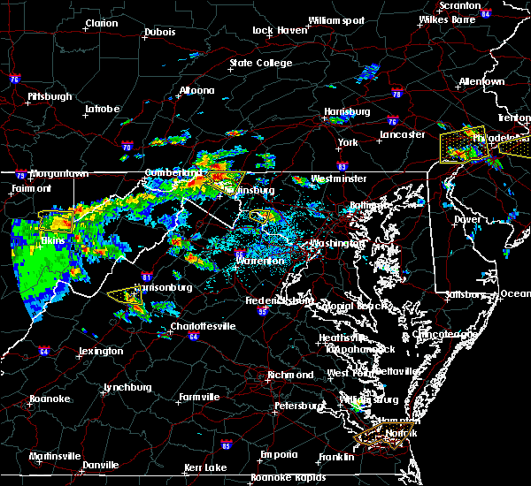 The national weather service in sterling virginia has issued a * severe thunderstorm warning for. north central washington county in north central maryland. northeastern berkeley county in the panhandle of west virginia. until 430 pm edt. At 345 pm edt, a severe thunderstorm was located 8 miles southwest. The national weather service in sterling virginia has issued a * severe thunderstorm warning for. north central washington county in north central maryland. northeastern berkeley county in the panhandle of west virginia. until 430 pm edt. At 345 pm edt, a severe thunderstorm was located 8 miles southwest.
|
| 5/23/2019 10:36 PM EDT |
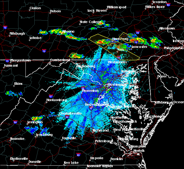 At 1034 pm edt, a severe thunderstorm was located over big cove tannery, or 11 miles northeast of hancock, moving southeast at 45 mph (radar indicated). Hazards include 60 mph wind gusts and quarter size hail. Damaging winds will cause some trees and large branches to fall. this could injure those outdoors, as well as damage homes and vehicles. roadways may become blocked by downed trees. localized power outages are possible. Unsecured light objects may become projectiles. At 1034 pm edt, a severe thunderstorm was located over big cove tannery, or 11 miles northeast of hancock, moving southeast at 45 mph (radar indicated). Hazards include 60 mph wind gusts and quarter size hail. Damaging winds will cause some trees and large branches to fall. this could injure those outdoors, as well as damage homes and vehicles. roadways may become blocked by downed trees. localized power outages are possible. Unsecured light objects may become projectiles.
|
| 5/23/2019 2:03 PM EDT |
 At 201 pm edt, a severe thunderstorm was located over mount aetna, or near municipal stadium, moving east at 60 mph (radar indicated. at 149 pm edt, the wind gusted to 40 mph at hagerstown municipal airport). Hazards include 60 mph wind gusts. Damaging winds will cause some trees and large branches to fall. this could injure those outdoors, as well as damage homes and vehicles. roadways may become blocked by downed trees. localized power outages are possible. unsecured light objects may become projectiles. Locations impacted include, hagerstown, thurmont, emmitsburg, municipal stadium, robinwood, walkersville, fountainhead-orchard hills, boonsboro, smithsburg, paramount-long meadow, mount aetna, mount lena, san mar, long meadow, wolfsville, saint james, halfway, maugansville, myersville and cavetown. At 201 pm edt, a severe thunderstorm was located over mount aetna, or near municipal stadium, moving east at 60 mph (radar indicated. at 149 pm edt, the wind gusted to 40 mph at hagerstown municipal airport). Hazards include 60 mph wind gusts. Damaging winds will cause some trees and large branches to fall. this could injure those outdoors, as well as damage homes and vehicles. roadways may become blocked by downed trees. localized power outages are possible. unsecured light objects may become projectiles. Locations impacted include, hagerstown, thurmont, emmitsburg, municipal stadium, robinwood, walkersville, fountainhead-orchard hills, boonsboro, smithsburg, paramount-long meadow, mount aetna, mount lena, san mar, long meadow, wolfsville, saint james, halfway, maugansville, myersville and cavetown.
|
| 5/23/2019 1:41 PM EDT |
 At 141 pm edt, a severe thunderstorm was located over wilson-conococheague, or 7 miles west of hagerstown, moving east at 50 mph (radar indicated). Hazards include 60 mph wind gusts. Damaging winds will cause some trees and large branches to fall. this could injure those outdoors, as well as damage homes and vehicles. roadways may become blocked by downed trees. localized power outages are possible. Unsecured light objects may become projectiles. At 141 pm edt, a severe thunderstorm was located over wilson-conococheague, or 7 miles west of hagerstown, moving east at 50 mph (radar indicated). Hazards include 60 mph wind gusts. Damaging winds will cause some trees and large branches to fall. this could injure those outdoors, as well as damage homes and vehicles. roadways may become blocked by downed trees. localized power outages are possible. Unsecured light objects may become projectiles.
|
| 5/19/2019 6:28 PM EDT |
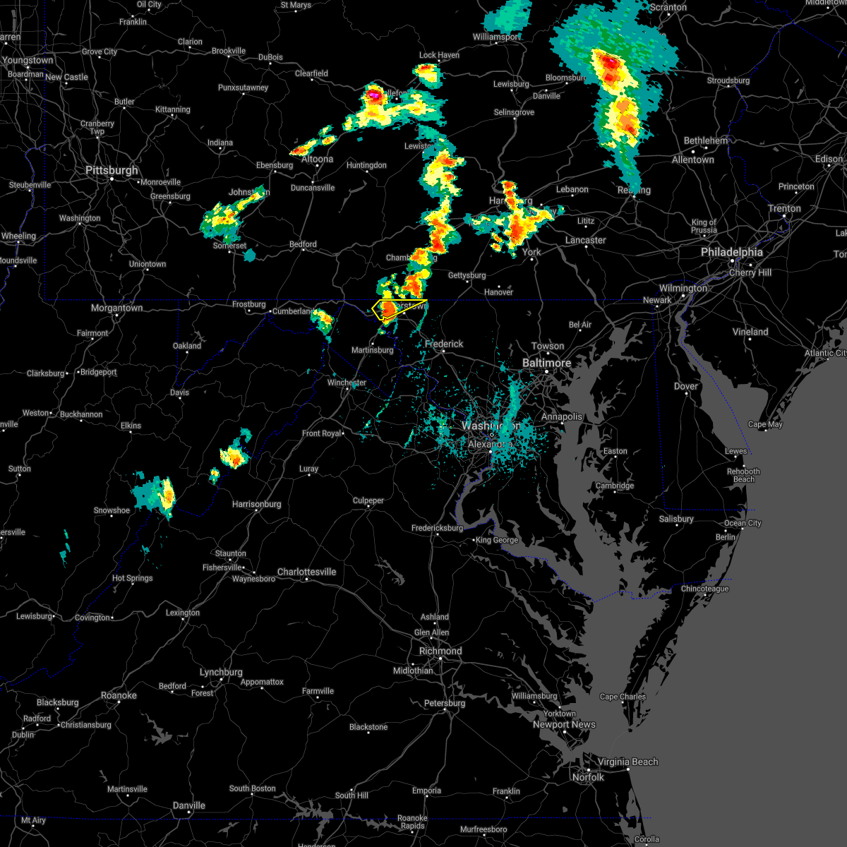 The severe thunderstorm warning for north central washington county will expire at 630 pm edt, the storm which prompted the warning has weakened below severe limits, and no longer poses an immediate threat to life or property. therefore, the warning will be allowed to expire. however small hail and gusty winds are still possible with this thunderstorm. a severe thunderstorm watch remains in effect until 900 pm edt for north central maryland, and the panhandle of west virginia. The severe thunderstorm warning for north central washington county will expire at 630 pm edt, the storm which prompted the warning has weakened below severe limits, and no longer poses an immediate threat to life or property. therefore, the warning will be allowed to expire. however small hail and gusty winds are still possible with this thunderstorm. a severe thunderstorm watch remains in effect until 900 pm edt for north central maryland, and the panhandle of west virginia.
|
| 5/19/2019 6:24 PM EDT |
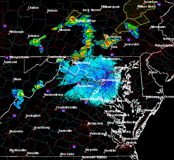 At 624 pm edt, a severe thunderstorm was located over wilson-conococheague, or 7 miles west of hagerstown, moving northeast at 35 mph (radar indicated). Hazards include 60 mph wind gusts and quarter size hail. Damaging winds will cause some trees and large branches to fall. this could injure those outdoors, as well as damage homes and vehicles. roadways may become blocked by downed trees. localized power outages are possible. unsecured light objects may become projectiles. Locations impacted include, hagerstown, fountainhead-orchard hills, paramount-long meadow, wilson-conococheague, long meadow, maugansville, leitersburg, clear spring, ringgold, middleburg and warrenton. At 624 pm edt, a severe thunderstorm was located over wilson-conococheague, or 7 miles west of hagerstown, moving northeast at 35 mph (radar indicated). Hazards include 60 mph wind gusts and quarter size hail. Damaging winds will cause some trees and large branches to fall. this could injure those outdoors, as well as damage homes and vehicles. roadways may become blocked by downed trees. localized power outages are possible. unsecured light objects may become projectiles. Locations impacted include, hagerstown, fountainhead-orchard hills, paramount-long meadow, wilson-conococheague, long meadow, maugansville, leitersburg, clear spring, ringgold, middleburg and warrenton.
|
| 5/19/2019 5:58 PM EDT |
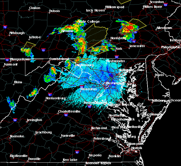 At 557 pm edt, a severe thunderstorm was located over wilson-conococheague, or 7 miles west of hagerstown, moving northeast at 40 mph (radar indicated). Hazards include 60 mph wind gusts and quarter size hail. Damaging winds will cause some trees and large branches to fall. this could injure those outdoors, as well as damage homes and vehicles. roadways may become blocked by downed trees. localized power outages are possible. Unsecured light objects may become projectiles. At 557 pm edt, a severe thunderstorm was located over wilson-conococheague, or 7 miles west of hagerstown, moving northeast at 40 mph (radar indicated). Hazards include 60 mph wind gusts and quarter size hail. Damaging winds will cause some trees and large branches to fall. this could injure those outdoors, as well as damage homes and vehicles. roadways may become blocked by downed trees. localized power outages are possible. Unsecured light objects may become projectiles.
|
| 5/19/2019 5:07 PM EDT |
 At 506 pm edt, a severe thunderstorm was located near cashtown, moving northeast at 30 mph. another thunderstorm was developing near greencastle (radar indicated). Hazards include 60 mph wind gusts and quarter size hail. Hail damage to vehicles is expected. Expect wind damage to trees, roofs, and siding. At 506 pm edt, a severe thunderstorm was located near cashtown, moving northeast at 30 mph. another thunderstorm was developing near greencastle (radar indicated). Hazards include 60 mph wind gusts and quarter size hail. Hail damage to vehicles is expected. Expect wind damage to trees, roofs, and siding.
|
| 5/19/2019 4:40 PM EDT |
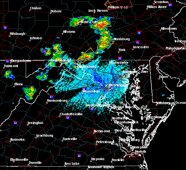 The severe thunderstorm warning for north central washington county will expire at 445 pm edt, the storm which prompted the warning has moved out of the area. therefore, the warning will be allowed to expire. a severe thunderstorm watch remains in effect until 900 pm edt for north central maryland. The severe thunderstorm warning for north central washington county will expire at 445 pm edt, the storm which prompted the warning has moved out of the area. therefore, the warning will be allowed to expire. a severe thunderstorm watch remains in effect until 900 pm edt for north central maryland.
|
| 5/19/2019 4:35 PM EDT |
 At 435 pm edt, a severe thunderstorm was located over greencastle, moving northeast at 25 mph (radar indicated). Hazards include 60 mph wind gusts and half dollar size hail. Hail damage to vehicles is expected. Expect wind damage to trees, roofs, and siding. At 435 pm edt, a severe thunderstorm was located over greencastle, moving northeast at 25 mph (radar indicated). Hazards include 60 mph wind gusts and half dollar size hail. Hail damage to vehicles is expected. Expect wind damage to trees, roofs, and siding.
|
| 5/19/2019 4:25 PM EDT |
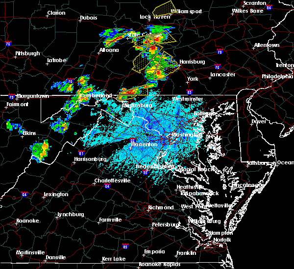 At 425 pm edt, a severe thunderstorm was located 8 miles southwest of claylick, or 9 miles east of hancock, moving northeast at 25 mph (radar indicated). Hazards include 60 mph wind gusts and quarter size hail. Damaging winds will cause some trees and large branches to fall. this could injure those outdoors, as well as damage homes and vehicles. roadways may become blocked by downed trees. localized power outages are possible. unsecured light objects may become projectiles. Locations impacted include, hagerstown, fountainhead-orchard hills, wilson-conococheague, long meadow, maugansville, clear spring, big spring, middleburg and warrenton. At 425 pm edt, a severe thunderstorm was located 8 miles southwest of claylick, or 9 miles east of hancock, moving northeast at 25 mph (radar indicated). Hazards include 60 mph wind gusts and quarter size hail. Damaging winds will cause some trees and large branches to fall. this could injure those outdoors, as well as damage homes and vehicles. roadways may become blocked by downed trees. localized power outages are possible. unsecured light objects may become projectiles. Locations impacted include, hagerstown, fountainhead-orchard hills, wilson-conococheague, long meadow, maugansville, clear spring, big spring, middleburg and warrenton.
|
| 5/19/2019 4:00 PM EDT |
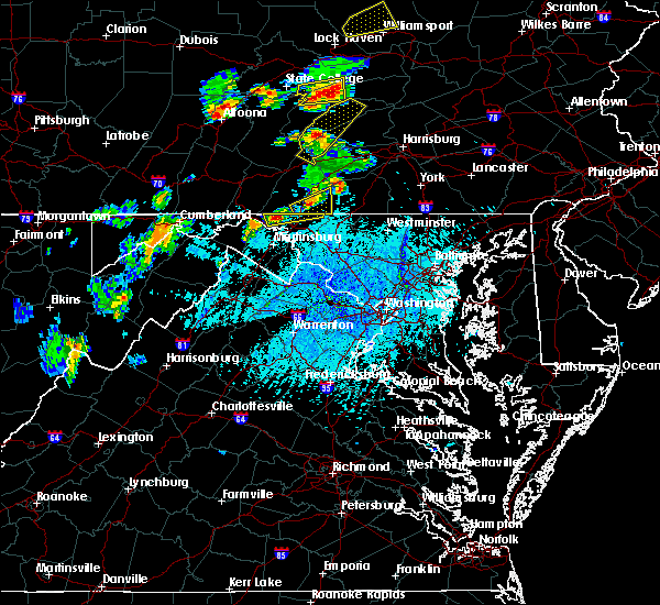 At 400 pm edt, a severe thunderstorm was located near wilson-conococheague, or 11 miles west of hagerstown, moving northeast at 25 mph (radar indicated). Hazards include 60 mph wind gusts and quarter size hail. Damaging winds will cause some trees and large branches to fall. this could injure those outdoors, as well as damage homes and vehicles. roadways may become blocked by downed trees. localized power outages are possible. Unsecured light objects may become projectiles. At 400 pm edt, a severe thunderstorm was located near wilson-conococheague, or 11 miles west of hagerstown, moving northeast at 25 mph (radar indicated). Hazards include 60 mph wind gusts and quarter size hail. Damaging winds will cause some trees and large branches to fall. this could injure those outdoors, as well as damage homes and vehicles. roadways may become blocked by downed trees. localized power outages are possible. Unsecured light objects may become projectiles.
|
| 5/19/2019 3:23 PM EDT |
 At 323 pm edt, a severe thunderstorm was located near greencastle, moving northeast at 20 mph (radar indicated). Hazards include 60 mph wind gusts and half dollar size hail. Hail damage to vehicles is expected. expect wind damage to trees, roofs, and siding. this severe thunderstorm will be near, waynesboro, wayne heights and rouzerville around 340 pm edt. mont alto around 350 pm edt. other locations impacted by this severe thunderstorm include state line, quincy and penn state mont alto. This includes interstate 81 from mile markers 0 to 9. At 323 pm edt, a severe thunderstorm was located near greencastle, moving northeast at 20 mph (radar indicated). Hazards include 60 mph wind gusts and half dollar size hail. Hail damage to vehicles is expected. expect wind damage to trees, roofs, and siding. this severe thunderstorm will be near, waynesboro, wayne heights and rouzerville around 340 pm edt. mont alto around 350 pm edt. other locations impacted by this severe thunderstorm include state line, quincy and penn state mont alto. This includes interstate 81 from mile markers 0 to 9.
|
| 5/19/2019 3:18 PM EDT |
 At 318 pm edt, a severe thunderstorm was located over fountainhead-orchard hills, or near hagerstown, moving east at 25 mph (radar indicated). Hazards include ping pong ball size hail and 60 mph wind gusts. Damaging winds will cause some trees and large branches to fall. this could injure those outdoors, as well as damage homes and vehicles. roadways may become blocked by downed trees. localized power outages are possible. unsecured light objects may become projectiles. Locations impacted include, hagerstown, fountainhead-orchard hills, smithsburg, paramount-long meadow, wilson-conococheague, long meadow, maugansville, cavetown, leitersburg, sabillasville, fort ritchie, chewsville, ringgold, middleburg, warrenton, highfield and cascade. At 318 pm edt, a severe thunderstorm was located over fountainhead-orchard hills, or near hagerstown, moving east at 25 mph (radar indicated). Hazards include ping pong ball size hail and 60 mph wind gusts. Damaging winds will cause some trees and large branches to fall. this could injure those outdoors, as well as damage homes and vehicles. roadways may become blocked by downed trees. localized power outages are possible. unsecured light objects may become projectiles. Locations impacted include, hagerstown, fountainhead-orchard hills, smithsburg, paramount-long meadow, wilson-conococheague, long meadow, maugansville, cavetown, leitersburg, sabillasville, fort ritchie, chewsville, ringgold, middleburg, warrenton, highfield and cascade.
|
| 5/19/2019 3:02 PM EDT |
 At 302 pm edt, a severe thunderstorm was located over wilson-conococheague, or 7 miles northwest of hagerstown, moving east at 25 mph (radar indicated). Hazards include golf ball size hail and 60 mph wind gusts. Expect wind damage to trees and power lines. hail is large enough to dent and damage vehicles. Some hail damage to roofs, siding, and windows is possible. At 302 pm edt, a severe thunderstorm was located over wilson-conococheague, or 7 miles northwest of hagerstown, moving east at 25 mph (radar indicated). Hazards include golf ball size hail and 60 mph wind gusts. Expect wind damage to trees and power lines. hail is large enough to dent and damage vehicles. Some hail damage to roofs, siding, and windows is possible.
|
| 5/19/2019 2:59 PM EDT |
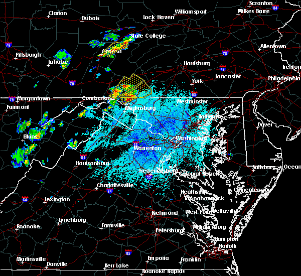 At 259 pm edt, a severe thunderstorm was located near wilson-conococheague, or 8 miles northwest of hagerstown, moving northeast at 25 mph (radar indicated). Hazards include golf ball size hail and 60 mph wind gusts. Expect wind damage to trees and power lines. hail is large enough to dent and damage vehicles. some hail damage to roofs, siding, and windows is possible. Locations impacted include, wilson-conococheague, maugansville, clear spring, middleburg and warrenton. At 259 pm edt, a severe thunderstorm was located near wilson-conococheague, or 8 miles northwest of hagerstown, moving northeast at 25 mph (radar indicated). Hazards include golf ball size hail and 60 mph wind gusts. Expect wind damage to trees and power lines. hail is large enough to dent and damage vehicles. some hail damage to roofs, siding, and windows is possible. Locations impacted include, wilson-conococheague, maugansville, clear spring, middleburg and warrenton.
|
| 5/19/2019 2:48 PM EDT |
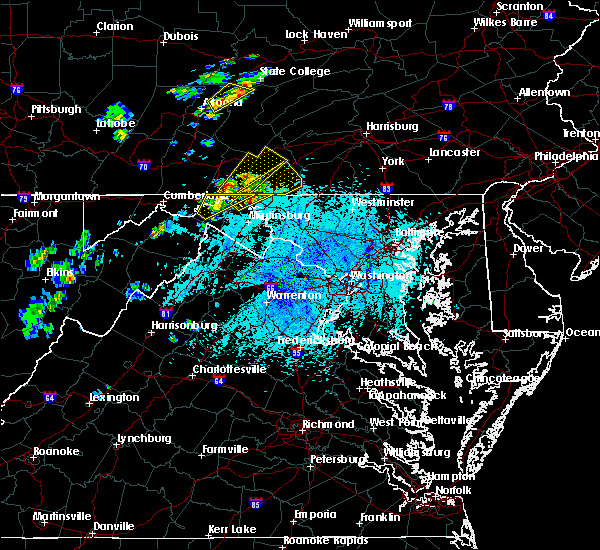 At 247 pm edt, a severe thunderstorm was located near wilson-conococheague, or 12 miles east of hancock, moving northeast at 25 mph (radar indicated). Hazards include ping pong ball size hail and 60 mph wind gusts. Damaging winds will cause some trees and large branches to fall. this could injure those outdoors, as well as damage homes and vehicles. roadways may become blocked by downed trees. localized power outages are possible. unsecured light objects may become projectiles. Locations impacted include, wilson-conococheague, maugansville, clear spring, big spring, middleburg and warrenton. At 247 pm edt, a severe thunderstorm was located near wilson-conococheague, or 12 miles east of hancock, moving northeast at 25 mph (radar indicated). Hazards include ping pong ball size hail and 60 mph wind gusts. Damaging winds will cause some trees and large branches to fall. this could injure those outdoors, as well as damage homes and vehicles. roadways may become blocked by downed trees. localized power outages are possible. unsecured light objects may become projectiles. Locations impacted include, wilson-conococheague, maugansville, clear spring, big spring, middleburg and warrenton.
|
| 5/19/2019 2:46 PM EDT |
 At 234 pm edt, a severe thunderstorm was located 8 miles southeast of hancock, moving northeast at 25 mph (radar indicated). Hazards include 60 mph wind gusts and quarter size hail. Damaging winds will cause some trees and large branches to fall. this could injure those outdoors, as well as damage homes and vehicles. roadways may become blocked by downed trees. localized power outages are possible. Unsecured light objects may become projectiles. At 234 pm edt, a severe thunderstorm was located 8 miles southeast of hancock, moving northeast at 25 mph (radar indicated). Hazards include 60 mph wind gusts and quarter size hail. Damaging winds will cause some trees and large branches to fall. this could injure those outdoors, as well as damage homes and vehicles. roadways may become blocked by downed trees. localized power outages are possible. Unsecured light objects may become projectiles.
|
| 5/19/2019 2:46 PM EDT |
 At 246 pm edt, a severe thunderstorm was located near wilson-conococheague, or 11 miles east of hancock, moving northeast at 25 mph (radar indicated). Hazards include ping pong ball size hail and 60 mph wind gusts. Damaging winds will cause some trees and large branches to fall. this could injure those outdoors, as well as damage homes and vehicles. roadways may become blocked by downed trees. localized power outages are possible. unsecured light objects may become projectiles. Locations impacted include, wilson-conococheague, maugansville, clear spring, pecktonville, big spring, big pool, middleburg, cherry run, johnsontown, warrenton, spruce pine hollow and sleepy creek. At 246 pm edt, a severe thunderstorm was located near wilson-conococheague, or 11 miles east of hancock, moving northeast at 25 mph (radar indicated). Hazards include ping pong ball size hail and 60 mph wind gusts. Damaging winds will cause some trees and large branches to fall. this could injure those outdoors, as well as damage homes and vehicles. roadways may become blocked by downed trees. localized power outages are possible. unsecured light objects may become projectiles. Locations impacted include, wilson-conococheague, maugansville, clear spring, pecktonville, big spring, big pool, middleburg, cherry run, johnsontown, warrenton, spruce pine hollow and sleepy creek.
|
| 5/19/2019 2:35 PM EDT |
 At 234 pm edt, a severe thunderstorm was located 8 miles southeast of hancock, moving northeast at 25 mph (radar indicated). Hazards include 60 mph wind gusts and quarter size hail. Damaging winds will cause some trees and large branches to fall. this could injure those outdoors, as well as damage homes and vehicles. roadways may become blocked by downed trees. localized power outages are possible. Unsecured light objects may become projectiles. At 234 pm edt, a severe thunderstorm was located 8 miles southeast of hancock, moving northeast at 25 mph (radar indicated). Hazards include 60 mph wind gusts and quarter size hail. Damaging winds will cause some trees and large branches to fall. this could injure those outdoors, as well as damage homes and vehicles. roadways may become blocked by downed trees. localized power outages are possible. Unsecured light objects may become projectiles.
|
| 4/19/2019 8:11 PM EDT |
 At 811 pm edt, a severe thunderstorm was located over paramount-long meadow, moving northeast at 25 mph (radar indicated). Hazards include 60 mph wind gusts. Expect damage to roofs, siding, and trees. this severe thunderstorm will be near, waynesboro, wayne heights and rouzerville around 830 pm edt. mont alto around 840 pm edt. carroll valley around 850 pm edt. orrtanna and cashtown around 900 pm edt. other locations impacted by this severe thunderstorm include mcknightstown, fairfield, state line, quincy, penn state mont alto and liberty mountain resort. This includes interstate 81 from mile markers 0 to 5. At 811 pm edt, a severe thunderstorm was located over paramount-long meadow, moving northeast at 25 mph (radar indicated). Hazards include 60 mph wind gusts. Expect damage to roofs, siding, and trees. this severe thunderstorm will be near, waynesboro, wayne heights and rouzerville around 830 pm edt. mont alto around 840 pm edt. carroll valley around 850 pm edt. orrtanna and cashtown around 900 pm edt. other locations impacted by this severe thunderstorm include mcknightstown, fairfield, state line, quincy, penn state mont alto and liberty mountain resort. This includes interstate 81 from mile markers 0 to 5.
|
| 4/19/2019 7:07 PM EDT |
 At 707 pm edt, a severe thunderstorm was located near claylick, moving northeast at 50 mph (radar indicated). Hazards include 60 mph wind gusts. expect damage to roofs, siding, and trees At 707 pm edt, a severe thunderstorm was located near claylick, moving northeast at 50 mph (radar indicated). Hazards include 60 mph wind gusts. expect damage to roofs, siding, and trees
|
| 4/15/2019 12:01 AM EDT |
 At 1200 am edt, severe thunderstorms were located along a line extending from east waterford to near roxbury to near greencastle, moving east at 55 mph (radar indicated). Hazards include 60 mph wind gusts and penny size hail. Expect damage to roofs, siding, and trees. locations impacted include, chambersburg, waynesboro, shippensburg, greencastle, guilford, plainfield, st. thomas, fayetteville, wayne heights, mont alto, scotland, newville, honey grove, rouzerville, marion, east waterford, loysville, ickesburg, colonel denning state park and claylick. this includes the following interstates, the pennsylvania turnpike from mile markers 195 to 218. interstate 81 from mile markers 0 to 39. A tornado watch remains in effect until 300 am edt for south central and central pennsylvania. At 1200 am edt, severe thunderstorms were located along a line extending from east waterford to near roxbury to near greencastle, moving east at 55 mph (radar indicated). Hazards include 60 mph wind gusts and penny size hail. Expect damage to roofs, siding, and trees. locations impacted include, chambersburg, waynesboro, shippensburg, greencastle, guilford, plainfield, st. thomas, fayetteville, wayne heights, mont alto, scotland, newville, honey grove, rouzerville, marion, east waterford, loysville, ickesburg, colonel denning state park and claylick. this includes the following interstates, the pennsylvania turnpike from mile markers 195 to 218. interstate 81 from mile markers 0 to 39. A tornado watch remains in effect until 300 am edt for south central and central pennsylvania.
|
| 4/14/2019 11:41 PM EDT |
 At 1140 pm edt, severe thunderstorms were located along a line extending from near mount union to near fannettsburg to 6 miles east of hancock, moving east at 50 mph (radar indicated). Hazards include 60 mph wind gusts and penny size hail. expect damage to roofs, siding, and trees At 1140 pm edt, severe thunderstorms were located along a line extending from near mount union to near fannettsburg to 6 miles east of hancock, moving east at 50 mph (radar indicated). Hazards include 60 mph wind gusts and penny size hail. expect damage to roofs, siding, and trees
|
| 9/17/2018 3:42 PM EDT |
 The severe thunderstorm warning for southeastern franklin county will expire at 345 pm edt, the storm which prompted the warning has weakened below severe limits, and no longer poses an immediate threat to life or property. therefore, the warning will be allowed to expire. The severe thunderstorm warning for southeastern franklin county will expire at 345 pm edt, the storm which prompted the warning has weakened below severe limits, and no longer poses an immediate threat to life or property. therefore, the warning will be allowed to expire.
|
| 9/17/2018 3:06 PM EDT |
 At 305 pm edt, a severe thunderstorm was located near waynesboro, moving north at 40 mph (radar indicated). Hazards include 60 mph wind gusts. Expect damage to roofs, siding, and trees. this severe thunderstorm will be near, mont alto and marion around 310 pm edt. chambersburg, guilford, fayetteville and scotland around 320 pm edt. other locations impacted by this severe thunderstorm include orrstown, state line, quincy and penn state mont alto. This includes interstate 81 from mile markers 0 to 24. At 305 pm edt, a severe thunderstorm was located near waynesboro, moving north at 40 mph (radar indicated). Hazards include 60 mph wind gusts. Expect damage to roofs, siding, and trees. this severe thunderstorm will be near, mont alto and marion around 310 pm edt. chambersburg, guilford, fayetteville and scotland around 320 pm edt. other locations impacted by this severe thunderstorm include orrstown, state line, quincy and penn state mont alto. This includes interstate 81 from mile markers 0 to 24.
|
| 8/21/2018 9:07 PM EDT |
 The severe thunderstorm warning for central washington, northwestern loudoun, northeastern warren, clarke, northwestern fauquier, jefferson, northeastern morgan and eastern berkeley counties will expire at 915 pm edt, the storms which prompted the warning have weakened below severe limits, and no longer pose an immediate threat to life or property. therefore the warning will be allowed to expire. a severe thunderstorm watch remains in effect until 1000 pm edt for north central maryland, northern and northwestern virginia, and the panhandle of west virginia. The severe thunderstorm warning for central washington, northwestern loudoun, northeastern warren, clarke, northwestern fauquier, jefferson, northeastern morgan and eastern berkeley counties will expire at 915 pm edt, the storms which prompted the warning have weakened below severe limits, and no longer pose an immediate threat to life or property. therefore the warning will be allowed to expire. a severe thunderstorm watch remains in effect until 1000 pm edt for north central maryland, northern and northwestern virginia, and the panhandle of west virginia.
|
| 8/21/2018 8:58 PM EDT |
 At 858 pm edt, severe thunderstorms were located along a line extending from near claylick to near berryville, moving northeast at 45 mph (radar indicated). Hazards include 60 mph wind gusts. Damaging winds will cause some trees and large branches to fall. this could injure those outdoors, as well as damage homes and vehicles. roadways may become blocked by downed trees. localized power outages are possible. unsecured light objects may become projectiles. Locations impacted include, hagerstown, martinsburg, charles town, shepherdstown, municipal stadium, purcellville, fountainhead-orchard hills, ranson, berryville, inwood, wilson-conococheague, williamsport, round hill, harpers ferry, long meadow, corporation of ranson, kearneysville, bluemont, saint james and berkeley. At 858 pm edt, severe thunderstorms were located along a line extending from near claylick to near berryville, moving northeast at 45 mph (radar indicated). Hazards include 60 mph wind gusts. Damaging winds will cause some trees and large branches to fall. this could injure those outdoors, as well as damage homes and vehicles. roadways may become blocked by downed trees. localized power outages are possible. unsecured light objects may become projectiles. Locations impacted include, hagerstown, martinsburg, charles town, shepherdstown, municipal stadium, purcellville, fountainhead-orchard hills, ranson, berryville, inwood, wilson-conococheague, williamsport, round hill, harpers ferry, long meadow, corporation of ranson, kearneysville, bluemont, saint james and berkeley.
|
| 8/21/2018 8:50 PM EDT |
 At 850 pm edt, severe thunderstorms were located along a line extending from 7 miles southwest of claylick to near berryville, moving northeast at 45 mph (radar indicated). Hazards include 60 mph wind gusts. Damaging winds will cause some trees and large branches to fall. this could injure those outdoors, as well as damage homes and vehicles. roadways may become blocked by downed trees. localized power outages are possible. unsecured light objects may become projectiles. Locations impacted include, hagerstown, martinsburg, charles town, shepherdstown, municipal stadium, purcellville, fountainhead-orchard hills, ranson, berryville, inwood, wilson-conococheague, williamsport, round hill, harpers ferry, long meadow, corporation of ranson, kearneysville, bluemont, saint james and berkeley. At 850 pm edt, severe thunderstorms were located along a line extending from 7 miles southwest of claylick to near berryville, moving northeast at 45 mph (radar indicated). Hazards include 60 mph wind gusts. Damaging winds will cause some trees and large branches to fall. this could injure those outdoors, as well as damage homes and vehicles. roadways may become blocked by downed trees. localized power outages are possible. unsecured light objects may become projectiles. Locations impacted include, hagerstown, martinsburg, charles town, shepherdstown, municipal stadium, purcellville, fountainhead-orchard hills, ranson, berryville, inwood, wilson-conococheague, williamsport, round hill, harpers ferry, long meadow, corporation of ranson, kearneysville, bluemont, saint james and berkeley.
|
| 8/21/2018 8:25 PM EDT |
 At 825 pm edt, severe thunderstorms were located along a line extending from near berkeley springs to near strasburg, moving northeast at 45 mph (radar indicated). Hazards include 60 mph wind gusts. Damaging winds will cause some trees and large branches to fall. this could injure those outdoors, as well as damage homes and vehicles. roadways may become blocked by downed trees. localized power outages are possible. Unsecured light objects may become projectiles. At 825 pm edt, severe thunderstorms were located along a line extending from near berkeley springs to near strasburg, moving northeast at 45 mph (radar indicated). Hazards include 60 mph wind gusts. Damaging winds will cause some trees and large branches to fall. this could injure those outdoors, as well as damage homes and vehicles. roadways may become blocked by downed trees. localized power outages are possible. Unsecured light objects may become projectiles.
|
| 8/21/2018 8:25 PM EDT |
 The national weather service in sterling virginia has issued a * severe thunderstorm warning for. central washington county in north central maryland. northwestern loudoun county in northern virginia. eastern frederick county in northwestern virginia. Northeastern warren county in northwestern virginia. The national weather service in sterling virginia has issued a * severe thunderstorm warning for. central washington county in north central maryland. northwestern loudoun county in northern virginia. eastern frederick county in northwestern virginia. Northeastern warren county in northwestern virginia.
|
| 8/21/2018 8:25 PM EDT |
 At 825 pm edt, severe thunderstorms were located along a line extending from near berkeley springs to near strasburg, moving northeast at 45 mph (radar indicated). Hazards include 60 mph wind gusts. Damaging winds will cause some trees and large branches to fall. this could injure those outdoors, as well as damage homes and vehicles. roadways may become blocked by downed trees. localized power outages are possible. Unsecured light objects may become projectiles. At 825 pm edt, severe thunderstorms were located along a line extending from near berkeley springs to near strasburg, moving northeast at 45 mph (radar indicated). Hazards include 60 mph wind gusts. Damaging winds will cause some trees and large branches to fall. this could injure those outdoors, as well as damage homes and vehicles. roadways may become blocked by downed trees. localized power outages are possible. Unsecured light objects may become projectiles.
|
| 8/21/2018 5:57 PM EDT |
 At 556 pm edt, severe thunderstorms were located along a line extending from wilson-conococheague to 14 miles southwest of greenwood, moving northeast at 35 mph (radar indicated). Hazards include 60 mph wind gusts and quarter size hail. Damaging winds will cause some trees and large branches to fall. this could injure those outdoors, as well as damage homes and vehicles. roadways may become blocked by downed trees. localized power outages are possible. unsecured light objects may become projectiles. Locations impacted include, hagerstown, martinsburg, municipal stadium, greenwood, robinwood, fountainhead-orchard hills, smithsburg, inwood, paramount-long meadow, wilson-conococheague, williamsport, long meadow, saint james, berkeley, halfway, maugansville, cavetown, funkstown, falling waters and fairplay. At 556 pm edt, severe thunderstorms were located along a line extending from wilson-conococheague to 14 miles southwest of greenwood, moving northeast at 35 mph (radar indicated). Hazards include 60 mph wind gusts and quarter size hail. Damaging winds will cause some trees and large branches to fall. this could injure those outdoors, as well as damage homes and vehicles. roadways may become blocked by downed trees. localized power outages are possible. unsecured light objects may become projectiles. Locations impacted include, hagerstown, martinsburg, municipal stadium, greenwood, robinwood, fountainhead-orchard hills, smithsburg, inwood, paramount-long meadow, wilson-conococheague, williamsport, long meadow, saint james, berkeley, halfway, maugansville, cavetown, funkstown, falling waters and fairplay.
|
| 8/21/2018 5:57 PM EDT |
 At 552 pm edt, severe thunderstorms were located along a line extending from near wilson-conococheague to 13 miles north of star tannery, moving northeast at 35 mph (radar indicated). Hazards include 60 mph wind gusts and quarter size hail. Damaging winds will cause some trees and large branches to fall. this could injure those outdoors, as well as damage homes and vehicles. roadways may become blocked by downed trees. localized power outages are possible. Unsecured light objects may become projectiles. At 552 pm edt, severe thunderstorms were located along a line extending from near wilson-conococheague to 13 miles north of star tannery, moving northeast at 35 mph (radar indicated). Hazards include 60 mph wind gusts and quarter size hail. Damaging winds will cause some trees and large branches to fall. this could injure those outdoors, as well as damage homes and vehicles. roadways may become blocked by downed trees. localized power outages are possible. Unsecured light objects may become projectiles.
|
| 8/21/2018 5:52 PM EDT |
 At 552 pm edt, severe thunderstorms were located along a line extending from near wilson-conococheague to 13 miles north of star tannery, moving northeast at 35 mph (radar indicated). Hazards include 60 mph wind gusts and quarter size hail. Damaging winds will cause some trees and large branches to fall. this could injure those outdoors, as well as damage homes and vehicles. roadways may become blocked by downed trees. localized power outages are possible. Unsecured light objects may become projectiles. At 552 pm edt, severe thunderstorms were located along a line extending from near wilson-conococheague to 13 miles north of star tannery, moving northeast at 35 mph (radar indicated). Hazards include 60 mph wind gusts and quarter size hail. Damaging winds will cause some trees and large branches to fall. this could injure those outdoors, as well as damage homes and vehicles. roadways may become blocked by downed trees. localized power outages are possible. Unsecured light objects may become projectiles.
|
| 8/8/2018 9:09 PM EDT |
 The severe thunderstorm warning for northeastern washington county will expire at 915 pm edt, the storm which prompted the warning has moved out of the area. therefore the warning will be allowed to expire. The severe thunderstorm warning for northeastern washington county will expire at 915 pm edt, the storm which prompted the warning has moved out of the area. therefore the warning will be allowed to expire.
|
| 8/8/2018 9:01 PM EDT |
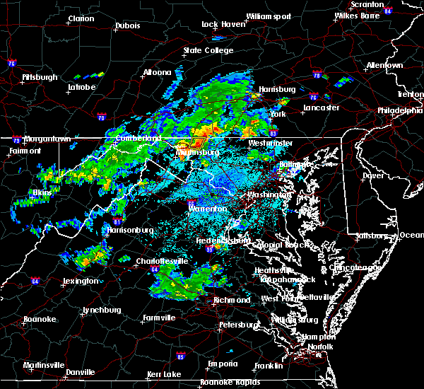 At 901 pm edt, a severe thunderstorm was located over robinwood, or over municipal stadium, moving east at 25 mph (radar indicated). Hazards include 60 mph wind gusts and quarter size hail. Damaging winds will cause some trees and large branches to fall. this could injure those outdoors, as well as damage homes and vehicles. roadways may become blocked by downed trees. localized power outages are possible. unsecured light objects may become projectiles. Locations impacted include, hagerstown, municipal stadium, robinwood, fountainhead-orchard hills, paramount-long meadow, mount aetna, san mar, long meadow, saint james, halfway, maugansville, cavetown, funkstown, leitersburg, chewsville, middleburg and bridgeport. At 901 pm edt, a severe thunderstorm was located over robinwood, or over municipal stadium, moving east at 25 mph (radar indicated). Hazards include 60 mph wind gusts and quarter size hail. Damaging winds will cause some trees and large branches to fall. this could injure those outdoors, as well as damage homes and vehicles. roadways may become blocked by downed trees. localized power outages are possible. unsecured light objects may become projectiles. Locations impacted include, hagerstown, municipal stadium, robinwood, fountainhead-orchard hills, paramount-long meadow, mount aetna, san mar, long meadow, saint james, halfway, maugansville, cavetown, funkstown, leitersburg, chewsville, middleburg and bridgeport.
|
| 8/8/2018 8:44 PM EDT |
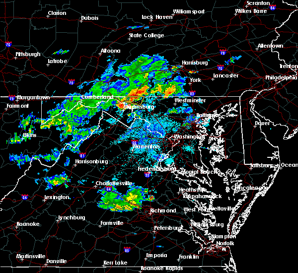 At 844 pm edt, a severe thunderstorm was located over wilson-conococheague, or near hagerstown, moving east at 20 mph (radar indicated). Hazards include 60 mph wind gusts and quarter size hail. Damaging winds will cause some trees and large branches to fall. this could injure those outdoors, as well as damage homes and vehicles. roadways may become blocked by downed trees. localized power outages are possible. unsecured light objects may become projectiles. Locations impacted include, hagerstown, municipal stadium, robinwood, fountainhead-orchard hills, paramount-long meadow, wilson-conococheague, williamsport, mount aetna, san mar, long meadow, saint james, halfway, maugansville, cavetown, funkstown, leitersburg, chewsville, middleburg, warrenton and bridgeport. At 844 pm edt, a severe thunderstorm was located over wilson-conococheague, or near hagerstown, moving east at 20 mph (radar indicated). Hazards include 60 mph wind gusts and quarter size hail. Damaging winds will cause some trees and large branches to fall. this could injure those outdoors, as well as damage homes and vehicles. roadways may become blocked by downed trees. localized power outages are possible. unsecured light objects may become projectiles. Locations impacted include, hagerstown, municipal stadium, robinwood, fountainhead-orchard hills, paramount-long meadow, wilson-conococheague, williamsport, mount aetna, san mar, long meadow, saint james, halfway, maugansville, cavetown, funkstown, leitersburg, chewsville, middleburg, warrenton and bridgeport.
|
| 8/8/2018 8:28 PM EDT |
 At 828 pm edt, a severe thunderstorm was located near claylick, or 12 miles east of hancock, moving east at 20 mph (radar indicated). Hazards include 60 mph wind gusts and quarter size hail. Damaging winds will cause some trees and large branches to fall. this could injure those outdoors, as well as damage homes and vehicles. roadways may become blocked by downed trees. localized power outages are possible. Unsecured light objects may become projectiles. At 828 pm edt, a severe thunderstorm was located near claylick, or 12 miles east of hancock, moving east at 20 mph (radar indicated). Hazards include 60 mph wind gusts and quarter size hail. Damaging winds will cause some trees and large branches to fall. this could injure those outdoors, as well as damage homes and vehicles. roadways may become blocked by downed trees. localized power outages are possible. Unsecured light objects may become projectiles.
|
| 6/20/2018 5:16 PM EDT |
 At 516 pm edt, severe thunderstorms were located along a line extending from near hancock to 6 miles southwest of berkeley springs to 8 miles southwest of paw paw, moving southeast at 30 mph (radar indicated). Hazards include 60 mph wind gusts. Damaging winds will cause some trees and large branches to fall. this could injure those outdoors, as well as damage homes and vehicles. roadways may become blocked by downed trees. localized power outages are possible. unsecured light objects may become projectiles. Locations impacted include, hagerstown, martinsburg, hancock, paw paw, greenwood, fountainhead-orchard hills, inwood, wilson-conococheague, williamsport, berkeley springs, berkeley, halfway, maugansville, falling waters, springfield, clear spring, capon bridge, hedgesville, pecktonville and big spring. At 516 pm edt, severe thunderstorms were located along a line extending from near hancock to 6 miles southwest of berkeley springs to 8 miles southwest of paw paw, moving southeast at 30 mph (radar indicated). Hazards include 60 mph wind gusts. Damaging winds will cause some trees and large branches to fall. this could injure those outdoors, as well as damage homes and vehicles. roadways may become blocked by downed trees. localized power outages are possible. unsecured light objects may become projectiles. Locations impacted include, hagerstown, martinsburg, hancock, paw paw, greenwood, fountainhead-orchard hills, inwood, wilson-conococheague, williamsport, berkeley springs, berkeley, halfway, maugansville, falling waters, springfield, clear spring, capon bridge, hedgesville, pecktonville and big spring.
|
| 6/20/2018 4:59 PM EDT |
 At 459 pm edt, severe thunderstorms were located along a line extending from near warfordsburg to 7 miles northeast of paw paw to near fort ashby, moving southeast at 30 mph (radar indicated). Hazards include 60 mph wind gusts. Damaging winds will cause some trees and large branches to fall. this could injure those outdoors, as well as damage homes and vehicles. roadways may become blocked by downed trees. localized power outages are possible. Unsecured light objects may become projectiles. At 459 pm edt, severe thunderstorms were located along a line extending from near warfordsburg to 7 miles northeast of paw paw to near fort ashby, moving southeast at 30 mph (radar indicated). Hazards include 60 mph wind gusts. Damaging winds will cause some trees and large branches to fall. this could injure those outdoors, as well as damage homes and vehicles. roadways may become blocked by downed trees. localized power outages are possible. Unsecured light objects may become projectiles.
|
| 5/26/2018 4:38 PM EDT |
 At 438 pm edt, a severe thunderstorm was located over wilson-conococheague, or near hagerstown, moving east at 10 mph (radar indicated). Hazards include 60 mph wind gusts and quarter size hail. Damaging winds will cause some trees and large branches to fall. this could injure those outdoors, as well as damage homes and vehicles. roadways may become blocked by downed trees. localized power outages are possible. Unsecured light objects may become projectiles. At 438 pm edt, a severe thunderstorm was located over wilson-conococheague, or near hagerstown, moving east at 10 mph (radar indicated). Hazards include 60 mph wind gusts and quarter size hail. Damaging winds will cause some trees and large branches to fall. this could injure those outdoors, as well as damage homes and vehicles. roadways may become blocked by downed trees. localized power outages are possible. Unsecured light objects may become projectiles.
|
| 1/12/2018 7:02 PM EST |
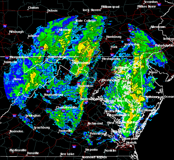 At 701 pm est, a severe thunderstorm was located near cashtown, moving northeast at 40 mph (radar indicated). Hazards include 60 mph wind gusts. Expect damage to trees and power lines. Locations impacted include, gettysburg, waynesboro, wayne heights, bonneauville, pine grove furnace, carroll valley, fayetteville, mont alto, walnut bottom and lake heritage. At 701 pm est, a severe thunderstorm was located near cashtown, moving northeast at 40 mph (radar indicated). Hazards include 60 mph wind gusts. Expect damage to trees and power lines. Locations impacted include, gettysburg, waynesboro, wayne heights, bonneauville, pine grove furnace, carroll valley, fayetteville, mont alto, walnut bottom and lake heritage.
|
| 1/12/2018 6:40 PM EST |
 The severe thunderstorm warning for washington county will expire at 645 pm est, the storm which prompted the warning is weakening and exiting the warned area. therefore, the warning will be allowed to expire. The severe thunderstorm warning for washington county will expire at 645 pm est, the storm which prompted the warning is weakening and exiting the warned area. therefore, the warning will be allowed to expire.
|
| 1/12/2018 6:28 PM EST |
 At 627 pm est, a severe thunderstorm was located over robinwood, moving northeast at 45 mph (radar indicated). Hazards include 60 mph wind gusts. expect damage to trees and power lines At 627 pm est, a severe thunderstorm was located over robinwood, moving northeast at 45 mph (radar indicated). Hazards include 60 mph wind gusts. expect damage to trees and power lines
|
| 1/12/2018 6:18 PM EST |
 At 617 pm est, a severe thunderstorm was located over saint james, or 7 miles south of municipal stadium, moving northeast at 40 mph (radar indicated). Hazards include 60 mph wind gusts. Damaging winds will cause some trees and large branches to fall. this could injure those outdoors, as well as damage homes and vehicles. roadways may become blocked by downed trees. localized power outages are possible. unsecured light objects may become projectiles. Locations impacted include, hagerstown, municipal stadium, robinwood, fountainhead-orchard hills, boonsboro, smithsburg, paramount-long meadow, wilson-conococheague, williamsport, mount aetna, mount lena, san mar, harpers ferry, long meadow, saint james, halfway, maugansville, cavetown, keedysville and funkstown. At 617 pm est, a severe thunderstorm was located over saint james, or 7 miles south of municipal stadium, moving northeast at 40 mph (radar indicated). Hazards include 60 mph wind gusts. Damaging winds will cause some trees and large branches to fall. this could injure those outdoors, as well as damage homes and vehicles. roadways may become blocked by downed trees. localized power outages are possible. unsecured light objects may become projectiles. Locations impacted include, hagerstown, municipal stadium, robinwood, fountainhead-orchard hills, boonsboro, smithsburg, paramount-long meadow, wilson-conococheague, williamsport, mount aetna, mount lena, san mar, harpers ferry, long meadow, saint james, halfway, maugansville, cavetown, keedysville and funkstown.
|
| 1/12/2018 5:56 PM EST |
 At 555 pm est, a severe thunderstorm was located over ranson, or near charles town, moving northeast at 40 mph (radar indicated). Hazards include 60 mph wind gusts. Damaging winds will cause some trees and large branches to fall. this could injure those outdoors, as well as damage homes and vehicles. roadways may become blocked by downed trees. localized power outages are possible. unsecured light objects may become projectiles. Locations impacted include, hagerstown, charles town, shepherdstown, municipal stadium, robinwood, fountainhead-orchard hills, ranson, boonsboro, smithsburg, paramount-long meadow, wilson-conococheague, williamsport, mount aetna, mount lena, san mar, harpers ferry, long meadow, corporation of ranson, kearneysville and saint james. At 555 pm est, a severe thunderstorm was located over ranson, or near charles town, moving northeast at 40 mph (radar indicated). Hazards include 60 mph wind gusts. Damaging winds will cause some trees and large branches to fall. this could injure those outdoors, as well as damage homes and vehicles. roadways may become blocked by downed trees. localized power outages are possible. unsecured light objects may become projectiles. Locations impacted include, hagerstown, charles town, shepherdstown, municipal stadium, robinwood, fountainhead-orchard hills, ranson, boonsboro, smithsburg, paramount-long meadow, wilson-conococheague, williamsport, mount aetna, mount lena, san mar, harpers ferry, long meadow, corporation of ranson, kearneysville and saint james.
|
| 1/12/2018 5:49 PM EST |
 At 548 pm est, a severe thunderstorm was located over charles town, moving northeast at 40 mph (radar indicated). Hazards include 60 mph wind gusts. Damaging winds will cause some trees and large branches to fall. this could injure those outdoors, as well as damage homes and vehicles. roadways may become blocked by downed trees. localized power outages are possible. Unsecured light objects may become projectiles. At 548 pm est, a severe thunderstorm was located over charles town, moving northeast at 40 mph (radar indicated). Hazards include 60 mph wind gusts. Damaging winds will cause some trees and large branches to fall. this could injure those outdoors, as well as damage homes and vehicles. roadways may become blocked by downed trees. localized power outages are possible. Unsecured light objects may become projectiles.
|
| 9/5/2017 3:47 PM EDT |
 At 347 pm edt, severe thunderstorms were located along a line extending from near waynesboro to shepherdstown, moving east at 45 mph (radar indicated). Hazards include 70 mph wind gusts and quarter size hail. Damaging winds will cause some trees and large branches to fall. this could injure those outdoors, as well as damage homes and vehicles. roadways may become blocked by downed trees. localized power outages are possible. unsecured light objects may become projectiles. Locations impacted include, frederick, hagerstown, thurmont, emmitsburg, shepherdstown, municipal stadium, harry grove stadium, ballenger creek, robinwood, brunswick, walkersville, fountainhead-orchard hills, ranson, boonsboro, smithsburg, braddock heights, paramount-long meadow, wilson-conococheague, williamsport and mount aetna. At 347 pm edt, severe thunderstorms were located along a line extending from near waynesboro to shepherdstown, moving east at 45 mph (radar indicated). Hazards include 70 mph wind gusts and quarter size hail. Damaging winds will cause some trees and large branches to fall. this could injure those outdoors, as well as damage homes and vehicles. roadways may become blocked by downed trees. localized power outages are possible. unsecured light objects may become projectiles. Locations impacted include, frederick, hagerstown, thurmont, emmitsburg, shepherdstown, municipal stadium, harry grove stadium, ballenger creek, robinwood, brunswick, walkersville, fountainhead-orchard hills, ranson, boonsboro, smithsburg, braddock heights, paramount-long meadow, wilson-conococheague, williamsport and mount aetna.
|
| 9/5/2017 3:30 PM EDT |
 At 329 pm edt, severe thunderstorms were located along a line extending from st. thomas to near fountainhead-orchard hills, moving east at 35 mph (radar indicated). Hazards include 70 mph wind gusts and quarter size hail. Hail damage to vehicles is possible. expect considerable tree damage. wind damage is also likely to mobile homes, roofs, and outbuildings. these severe storms will be near, marion around 330 pm edt. chambersburg, greencastle, guilford and scotland around 340 pm edt. waynesboro, wayne heights, rouzerville, fayetteville and mont alto around 350 pm edt. carroll valley, cashtown and orrtanna around 400 pm edt. Other locations impacted by these severe thunderstorms include arendtsville, quincy, biglerville, williamson, state line, mcknightstown, upton, fairfield, bendersville and liberty mountain resort. At 329 pm edt, severe thunderstorms were located along a line extending from st. thomas to near fountainhead-orchard hills, moving east at 35 mph (radar indicated). Hazards include 70 mph wind gusts and quarter size hail. Hail damage to vehicles is possible. expect considerable tree damage. wind damage is also likely to mobile homes, roofs, and outbuildings. these severe storms will be near, marion around 330 pm edt. chambersburg, greencastle, guilford and scotland around 340 pm edt. waynesboro, wayne heights, rouzerville, fayetteville and mont alto around 350 pm edt. carroll valley, cashtown and orrtanna around 400 pm edt. Other locations impacted by these severe thunderstorms include arendtsville, quincy, biglerville, williamson, state line, mcknightstown, upton, fairfield, bendersville and liberty mountain resort.
|
| 9/5/2017 3:20 PM EDT |
 At 320 pm edt, severe thunderstorms were located along a line extending from near claylick to near inwood, moving east at 45 mph (radar indicated). Hazards include 60 mph wind gusts. Damaging winds will cause some trees and large branches to fall. this could injure those outdoors, as well as damage homes and vehicles. roadways may become blocked by downed trees. localized power outages are possible. Unsecured light objects may become projectiles. At 320 pm edt, severe thunderstorms were located along a line extending from near claylick to near inwood, moving east at 45 mph (radar indicated). Hazards include 60 mph wind gusts. Damaging winds will cause some trees and large branches to fall. this could injure those outdoors, as well as damage homes and vehicles. roadways may become blocked by downed trees. localized power outages are possible. Unsecured light objects may become projectiles.
|
| 9/5/2017 3:02 PM EDT |
 At 301 pm edt, a severe thunderstorm was located near big cove tannery, moving northeast at 45 mph (radar indicated). Hazards include 60 mph wind gusts and quarter size hail. Hail damage to vehicles is possible. Expect wind damage to trees and power lines. At 301 pm edt, a severe thunderstorm was located near big cove tannery, moving northeast at 45 mph (radar indicated). Hazards include 60 mph wind gusts and quarter size hail. Hail damage to vehicles is possible. Expect wind damage to trees and power lines.
|
| 8/12/2017 4:12 PM EDT |
 At 411 pm edt, severe thunderstorms were located along a line extending from fountainhead-orchard hills to williamsport to 6 miles north of martinsburg, moving east at 45 mph (radar indicated). Hazards include 60 mph wind gusts and quarter size hail. Damaging winds will cause some trees and large branches to fall. this could injure those outdoors, as well as damage homes and vehicles. roadways may become blocked by downed trees. localized power outages are possible. unsecured light objects may become projectiles. Locations impacted include, hagerstown, martinsburg, municipal stadium, robinwood, fountainhead-orchard hills, paramount-long meadow, wilson-conococheague, williamsport, long meadow, saint james, berkeley, halfway, maugansville, funkstown, falling waters, leitersburg, clear spring, hedgesville, big spring and big pool. At 411 pm edt, severe thunderstorms were located along a line extending from fountainhead-orchard hills to williamsport to 6 miles north of martinsburg, moving east at 45 mph (radar indicated). Hazards include 60 mph wind gusts and quarter size hail. Damaging winds will cause some trees and large branches to fall. this could injure those outdoors, as well as damage homes and vehicles. roadways may become blocked by downed trees. localized power outages are possible. unsecured light objects may become projectiles. Locations impacted include, hagerstown, martinsburg, municipal stadium, robinwood, fountainhead-orchard hills, paramount-long meadow, wilson-conococheague, williamsport, long meadow, saint james, berkeley, halfway, maugansville, funkstown, falling waters, leitersburg, clear spring, hedgesville, big spring and big pool.
|
| 8/12/2017 4:12 PM EDT |
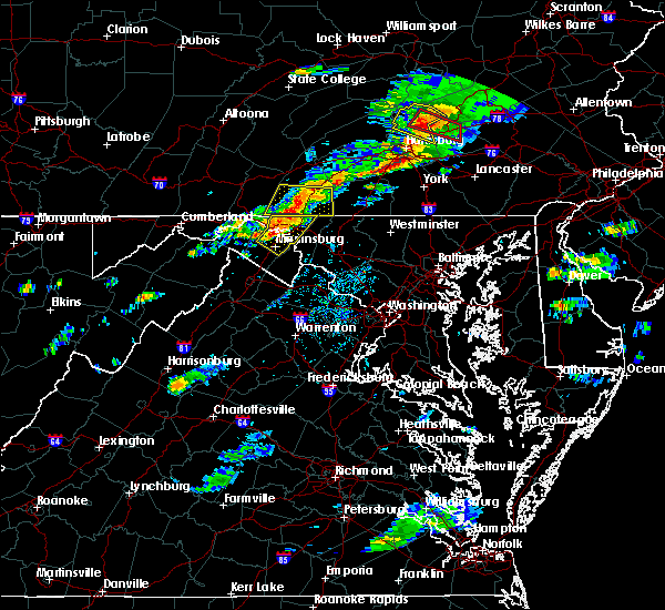 At 411 pm edt, severe thunderstorms were located along a line extending from fountainhead-orchard hills to williamsport to 6 miles north of martinsburg, moving east at 45 mph (radar indicated). Hazards include 60 mph wind gusts and quarter size hail. Damaging winds will cause some trees and large branches to fall. this could injure those outdoors, as well as damage homes and vehicles. roadways may become blocked by downed trees. localized power outages are possible. unsecured light objects may become projectiles. Locations impacted include, hagerstown, martinsburg, municipal stadium, robinwood, fountainhead-orchard hills, paramount-long meadow, wilson-conococheague, williamsport, long meadow, saint james, berkeley, halfway, maugansville, funkstown, falling waters, leitersburg, clear spring, hedgesville, big spring and big pool. At 411 pm edt, severe thunderstorms were located along a line extending from fountainhead-orchard hills to williamsport to 6 miles north of martinsburg, moving east at 45 mph (radar indicated). Hazards include 60 mph wind gusts and quarter size hail. Damaging winds will cause some trees and large branches to fall. this could injure those outdoors, as well as damage homes and vehicles. roadways may become blocked by downed trees. localized power outages are possible. unsecured light objects may become projectiles. Locations impacted include, hagerstown, martinsburg, municipal stadium, robinwood, fountainhead-orchard hills, paramount-long meadow, wilson-conococheague, williamsport, long meadow, saint james, berkeley, halfway, maugansville, funkstown, falling waters, leitersburg, clear spring, hedgesville, big spring and big pool.
|
| 8/12/2017 3:50 PM EDT |
 At 349 pm edt, a severe thunderstorm was located near berkeley springs, or 7 miles south of hancock, moving east at 30 mph (radar indicated). Hazards include ping pong ball size hail and 60 mph wind gusts. Damaging winds will cause some trees and large branches to fall. this could injure those outdoors, as well as damage homes and vehicles. roadways may become blocked by downed trees. localized power outages are possible. Unsecured light objects may become projectiles. At 349 pm edt, a severe thunderstorm was located near berkeley springs, or 7 miles south of hancock, moving east at 30 mph (radar indicated). Hazards include ping pong ball size hail and 60 mph wind gusts. Damaging winds will cause some trees and large branches to fall. this could injure those outdoors, as well as damage homes and vehicles. roadways may become blocked by downed trees. localized power outages are possible. Unsecured light objects may become projectiles.
|
| 8/4/2017 9:43 PM EDT |
 The severe thunderstorm warning for northeastern washington, northwestern frederick counties in north central maryland and northeastern jefferson counties in the panhandle of west virginia will expire at 945 pm edt, the storms which prompted the warning have weakened below severe limits, and no longer pose an immediate threat to life or property. therefore the warning will be allowed to expire. The severe thunderstorm warning for northeastern washington, northwestern frederick counties in north central maryland and northeastern jefferson counties in the panhandle of west virginia will expire at 945 pm edt, the storms which prompted the warning have weakened below severe limits, and no longer pose an immediate threat to life or property. therefore the warning will be allowed to expire.
|
| 8/4/2017 9:35 PM EDT |
 At 935 pm edt, severe thunderstorms were located along a line extending from near greencastle to near saint james, moving northeast at 35 mph (radar indicated). Hazards include 60 mph wind gusts. Damaging winds will cause some trees and large branches to fall. this could injure those outdoors, as well as damage homes and vehicles. roadways may become blocked by downed trees. localized power outages are possible. unsecured light objects may become projectiles. Locations impacted include, hagerstown, municipal stadium, robinwood, fountainhead-orchard hills, smithsburg, paramount-long meadow, wilson-conococheague, mount aetna, long meadow, saint james, halfway, maugansville, cavetown, funkstown, fairplay, leitersburg, sabillasville, fort ritchie, chewsville and ringgold. At 935 pm edt, severe thunderstorms were located along a line extending from near greencastle to near saint james, moving northeast at 35 mph (radar indicated). Hazards include 60 mph wind gusts. Damaging winds will cause some trees and large branches to fall. this could injure those outdoors, as well as damage homes and vehicles. roadways may become blocked by downed trees. localized power outages are possible. unsecured light objects may become projectiles. Locations impacted include, hagerstown, municipal stadium, robinwood, fountainhead-orchard hills, smithsburg, paramount-long meadow, wilson-conococheague, mount aetna, long meadow, saint james, halfway, maugansville, cavetown, funkstown, fairplay, leitersburg, sabillasville, fort ritchie, chewsville and ringgold.
|
| 8/4/2017 9:22 PM EDT |
 At 922 pm edt, severe thunderstorms were located along a line extending from claylick to near shepherdstown, moving northeast at 35 mph (radar indicated). Hazards include 60 mph wind gusts. Damaging winds will cause some trees and large branches to fall. this could injure those outdoors, as well as damage homes and vehicles. roadways may become blocked by downed trees. localized power outages are possible. Unsecured light objects may become projectiles. At 922 pm edt, severe thunderstorms were located along a line extending from claylick to near shepherdstown, moving northeast at 35 mph (radar indicated). Hazards include 60 mph wind gusts. Damaging winds will cause some trees and large branches to fall. this could injure those outdoors, as well as damage homes and vehicles. roadways may become blocked by downed trees. localized power outages are possible. Unsecured light objects may become projectiles.
|
| 7/4/2017 4:45 PM EDT |
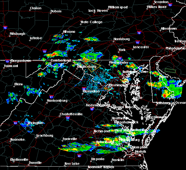 At 444 pm edt, a severe thunderstorm was located over paramount- long meadow, or near hagerstown municipal stadium, moving southeast at 35 mph (radar indicated). Hazards include 60 mph wind gusts and quarter size hail. Damaging winds will cause some trees and large branches to fall. this could injure those outdoors, as well as damage homes and vehicles. roadways may become blocked by downed trees. localized power outages are possible. Unsecured light objects may become projectiles. At 444 pm edt, a severe thunderstorm was located over paramount- long meadow, or near hagerstown municipal stadium, moving southeast at 35 mph (radar indicated). Hazards include 60 mph wind gusts and quarter size hail. Damaging winds will cause some trees and large branches to fall. this could injure those outdoors, as well as damage homes and vehicles. roadways may become blocked by downed trees. localized power outages are possible. Unsecured light objects may become projectiles.
|
| 6/19/2017 12:50 PM EDT |
 At 1250 pm edt, severe thunderstorms were located along a line extending from near shepherdstown to wilson-conococheague, moving northeast at 50 mph (radar indicated). Hazards include 60 mph wind gusts. Damaging winds will cause some trees and large branches to fall. this could injure those outdoors, as well as damage homes and vehicles. roadways may become blocked by downed trees. localized power outages are possible. Unsecured light objects may become projectiles. At 1250 pm edt, severe thunderstorms were located along a line extending from near shepherdstown to wilson-conococheague, moving northeast at 50 mph (radar indicated). Hazards include 60 mph wind gusts. Damaging winds will cause some trees and large branches to fall. this could injure those outdoors, as well as damage homes and vehicles. roadways may become blocked by downed trees. localized power outages are possible. Unsecured light objects may become projectiles.
|
| 3/1/2017 1:22 PM EST |
 The severe thunderstorm warning for eastern washington and western frederick counties in north central maryland, northern loudoun county in northern virginia and eastern jefferson counties in the panhandle of west virginia will expire at 130 pm est, the storms which prompted the warning have moved out of the area. therefore the warning will be allowed to expire. a severe thunderstorm watch remains in effect until 500 pm est for central and north central maryland, northern virginia, and the panhandle of west virginia. remember, a severe thunderstorm warning still remains in effect for portions of frederick and loudoun counties. The severe thunderstorm warning for eastern washington and western frederick counties in north central maryland, northern loudoun county in northern virginia and eastern jefferson counties in the panhandle of west virginia will expire at 130 pm est, the storms which prompted the warning have moved out of the area. therefore the warning will be allowed to expire. a severe thunderstorm watch remains in effect until 500 pm est for central and north central maryland, northern virginia, and the panhandle of west virginia. remember, a severe thunderstorm warning still remains in effect for portions of frederick and loudoun counties.
|
| 3/1/2017 1:10 PM EST |
 At 110 pm est, severe thunderstorms were located along a line extending from near paramount-long meadow to 6 miles northwest of delaplane, moving east at 50 mph (radar indicated). Hazards include 60 mph wind gusts. Damaging winds will cause some trees and large branches to fall. this could injure those outdoors, as well as damage homes and vehicles. roadways may become blocked by downed trees. localized power outages are possible. unsecured light objects may become projectiles. Locations impacted include, frederick, leesburg, hagerstown, lansdowne, thurmont, emmitsburg, municipal stadium, harry grove stadium, ballenger creek, purcellville, robinwood, brunswick, fountainhead-orchard hills, boonsboro, smithsburg, braddock heights, paramount-long meadow, mount aetna, round hill and mount lena. At 110 pm est, severe thunderstorms were located along a line extending from near paramount-long meadow to 6 miles northwest of delaplane, moving east at 50 mph (radar indicated). Hazards include 60 mph wind gusts. Damaging winds will cause some trees and large branches to fall. this could injure those outdoors, as well as damage homes and vehicles. roadways may become blocked by downed trees. localized power outages are possible. unsecured light objects may become projectiles. Locations impacted include, frederick, leesburg, hagerstown, lansdowne, thurmont, emmitsburg, municipal stadium, harry grove stadium, ballenger creek, purcellville, robinwood, brunswick, fountainhead-orchard hills, boonsboro, smithsburg, braddock heights, paramount-long meadow, mount aetna, round hill and mount lena.
|
| 3/1/2017 12:53 PM EST |
 At 1252 pm est, severe thunderstorms were located along a line extending from near claylick to near stephens city, moving east at 50 mph (radar indicated). Hazards include 60 mph wind gusts. Damaging winds will cause some trees and large branches to fall. this could injure those outdoors, as well as damage homes and vehicles. roadways may become blocked by downed trees. localized power outages are possible. unsecured light objects may become projectiles. Locations impacted include, frederick, leesburg, hagerstown, winchester, martinsburg, lansdowne, thurmont, charles town, emmitsburg, shepherdstown, municipal stadium, harry grove stadium, millwood pike, ballenger creek, purcellville, robinwood, brunswick, fountainhead-orchard hills, ranson and berryville. At 1252 pm est, severe thunderstorms were located along a line extending from near claylick to near stephens city, moving east at 50 mph (radar indicated). Hazards include 60 mph wind gusts. Damaging winds will cause some trees and large branches to fall. this could injure those outdoors, as well as damage homes and vehicles. roadways may become blocked by downed trees. localized power outages are possible. unsecured light objects may become projectiles. Locations impacted include, frederick, leesburg, hagerstown, winchester, martinsburg, lansdowne, thurmont, charles town, emmitsburg, shepherdstown, municipal stadium, harry grove stadium, millwood pike, ballenger creek, purcellville, robinwood, brunswick, fountainhead-orchard hills, ranson and berryville.
|
| 3/1/2017 12:42 PM EST |
 At 1241 pm est, severe thunderstorms were located along a line extending from 7 miles east of hancock to near strasburg, moving east at 50 mph (radar indicated). Hazards include 60 mph wind gusts. Damaging winds will cause some trees and large branches to fall. this could injure those outdoors, as well as damage homes and vehicles. roadways may become blocked by downed trees. localized power outages are possible. Unsecured light objects may become projectiles. At 1241 pm est, severe thunderstorms were located along a line extending from 7 miles east of hancock to near strasburg, moving east at 50 mph (radar indicated). Hazards include 60 mph wind gusts. Damaging winds will cause some trees and large branches to fall. this could injure those outdoors, as well as damage homes and vehicles. roadways may become blocked by downed trees. localized power outages are possible. Unsecured light objects may become projectiles.
|
| 2/12/2017 10:09 PM EST |
 The severe thunderstorm warning for washington and northwestern carroll counties in north central maryland, southern allegany county in western maryland, northwestern frederick county in north central maryland, north central frederick county in northwestern virginia, north central jefferson and morgan counties in the panhandle of west virginia, east central mineral county in eastern west virginia, berkeley county in the panhandle of west virginia and northeastern hampshire counties in eastern west virginia will expire at 1015 pm est, the storms which prompted the warning have moved out of the area. therefore the warning will be allowed to expire. to report severe weather, contact your nearest law enforcement agency. they will relay your report to the national weather service sterling virginia. The severe thunderstorm warning for washington and northwestern carroll counties in north central maryland, southern allegany county in western maryland, northwestern frederick county in north central maryland, north central frederick county in northwestern virginia, north central jefferson and morgan counties in the panhandle of west virginia, east central mineral county in eastern west virginia, berkeley county in the panhandle of west virginia and northeastern hampshire counties in eastern west virginia will expire at 1015 pm est, the storms which prompted the warning have moved out of the area. therefore the warning will be allowed to expire. to report severe weather, contact your nearest law enforcement agency. they will relay your report to the national weather service sterling virginia.
|
| 2/12/2017 10:01 PM EST |
 At 1001 pm est, severe thunderstorms were located along a line extending from hagerstown to near inwood to 6 miles south of romney, moving southeast at 45 mph (radar indicated). Hazards include 60 mph wind gusts. Damaging winds will cause some trees and large branches to fall. this could injure those outdoors, as well as damage homes and vehicles. roadways may become blocked by downed trees. localized power outages are possible. Unsecured light objects may become projectiles. At 1001 pm est, severe thunderstorms were located along a line extending from hagerstown to near inwood to 6 miles south of romney, moving southeast at 45 mph (radar indicated). Hazards include 60 mph wind gusts. Damaging winds will cause some trees and large branches to fall. this could injure those outdoors, as well as damage homes and vehicles. roadways may become blocked by downed trees. localized power outages are possible. Unsecured light objects may become projectiles.
|
| 2/12/2017 9:55 PM EST |
 At 955 pm est, severe thunderstorms were located along a line extending from near dillsburg to near williamsport to 12 miles east of romney, moving east at 60 mph (radar indicated). Hazards include 60 mph wind gusts. Damaging winds will cause some trees and large branches to fall. this could injure those outdoors, as well as damage homes and vehicles. roadways may become blocked by downed trees. localized power outages are possible. unsecured light objects may become projectiles. Locations impacted include, hagerstown, martinsburg, thurmont, keyser, emmitsburg, shepherdstown, paw paw, municipal stadium, greenwood, robinwood, taneytown, fountainhead-orchard hills, boonsboro, smithsburg, paramount-long meadow, wilson-conococheague, williamsport, fort ashby, berkeley springs and mount aetna. At 955 pm est, severe thunderstorms were located along a line extending from near dillsburg to near williamsport to 12 miles east of romney, moving east at 60 mph (radar indicated). Hazards include 60 mph wind gusts. Damaging winds will cause some trees and large branches to fall. this could injure those outdoors, as well as damage homes and vehicles. roadways may become blocked by downed trees. localized power outages are possible. unsecured light objects may become projectiles. Locations impacted include, hagerstown, martinsburg, thurmont, keyser, emmitsburg, shepherdstown, paw paw, municipal stadium, greenwood, robinwood, taneytown, fountainhead-orchard hills, boonsboro, smithsburg, paramount-long meadow, wilson-conococheague, williamsport, fort ashby, berkeley springs and mount aetna.
|
| 2/12/2017 9:37 PM EST |
 At 936 pm est, severe thunderstorms were located along a line extending from bloserville to near hancock, moving southeast at 65 mph (radar indicated). Hazards include 60 mph wind gusts. expect damage to roofs, siding, and trees At 936 pm est, severe thunderstorms were located along a line extending from bloserville to near hancock, moving southeast at 65 mph (radar indicated). Hazards include 60 mph wind gusts. expect damage to roofs, siding, and trees
|
| 2/12/2017 9:32 PM EST |
 At 931 pm est, severe thunderstorms were located along a line extending from 6 miles west of newville to hancock to near westernport, moving east at 45 mph (radar indicated). Hazards include 60 mph wind gusts. Damaging winds will cause some trees and large branches to fall. this could injure those outdoors, as well as damage homes and vehicles. roadways may become blocked by downed trees. localized power outages are possible. Unsecured light objects may become projectiles. At 931 pm est, severe thunderstorms were located along a line extending from 6 miles west of newville to hancock to near westernport, moving east at 45 mph (radar indicated). Hazards include 60 mph wind gusts. Damaging winds will cause some trees and large branches to fall. this could injure those outdoors, as well as damage homes and vehicles. roadways may become blocked by downed trees. localized power outages are possible. Unsecured light objects may become projectiles.
|
| 8/13/2016 8:11 PM EDT |
 The severe thunderstorm warning for northern washington county will expire at 815 pm edt, the storm which prompted the warning has weakened below severe limits, and no longer pose an immediate threat to life or property. therefore the warning will be allowed to expire. The severe thunderstorm warning for northern washington county will expire at 815 pm edt, the storm which prompted the warning has weakened below severe limits, and no longer pose an immediate threat to life or property. therefore the warning will be allowed to expire.
|
| 8/13/2016 7:55 PM EDT |
 At 754 pm edt, a severe thunderstorm was located near wilson-conococheague, or near hagerstown, moving northeast at 35 mph (radar indicated). Hazards include 60 mph wind gusts. Damaging winds will cause some trees and large branches to fall. this could injure those outdoors, as well as damage homes and vehicles. roadways may become blocked by downed trees. localized power outages are possible. unsecured light objects may become projectiles. Locations impacted include, fountainhead-orchard hills, wilson-conococheague, maugansville, middleburg and warrenton. At 754 pm edt, a severe thunderstorm was located near wilson-conococheague, or near hagerstown, moving northeast at 35 mph (radar indicated). Hazards include 60 mph wind gusts. Damaging winds will cause some trees and large branches to fall. this could injure those outdoors, as well as damage homes and vehicles. roadways may become blocked by downed trees. localized power outages are possible. unsecured light objects may become projectiles. Locations impacted include, fountainhead-orchard hills, wilson-conococheague, maugansville, middleburg and warrenton.
|
| 8/13/2016 7:41 PM EDT |
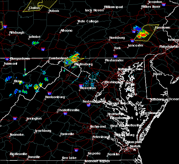 At 741 pm edt, a severe thunderstorm was located near wilson-conococheague, or 11 miles west of hagerstown, moving northeast at 20 mph (radar indicated). Hazards include 60 mph wind gusts. Damaging winds will cause some trees and large branches to fall. this could injure those outdoors, as well as damage homes and vehicles. roadways may become blocked by downed trees. localized power outages are possible. unsecured light objects may become projectiles. Locations impacted include, fountainhead-orchard hills, wilson-conococheague, maugansville, clear spring, pecktonville, big spring, big pool, middleburg and warrenton. At 741 pm edt, a severe thunderstorm was located near wilson-conococheague, or 11 miles west of hagerstown, moving northeast at 20 mph (radar indicated). Hazards include 60 mph wind gusts. Damaging winds will cause some trees and large branches to fall. this could injure those outdoors, as well as damage homes and vehicles. roadways may become blocked by downed trees. localized power outages are possible. unsecured light objects may become projectiles. Locations impacted include, fountainhead-orchard hills, wilson-conococheague, maugansville, clear spring, pecktonville, big spring, big pool, middleburg and warrenton.
|
| 8/13/2016 7:26 PM EDT |
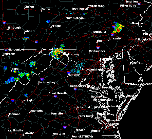 At 725 pm edt, a severe thunderstorm was located 9 miles southeast of hancock, moving northeast at 40 mph (radar indicated). Hazards include 60 mph wind gusts. Damaging winds will cause some trees and large branches to fall. this could injure those outdoors, as well as damage homes and vehicles. roadways may become blocked by downed trees. localized power outages are possible. Unsecured light objects may become projectiles. At 725 pm edt, a severe thunderstorm was located 9 miles southeast of hancock, moving northeast at 40 mph (radar indicated). Hazards include 60 mph wind gusts. Damaging winds will cause some trees and large branches to fall. this could injure those outdoors, as well as damage homes and vehicles. roadways may become blocked by downed trees. localized power outages are possible. Unsecured light objects may become projectiles.
|
| 6/21/2016 12:25 PM EDT |
 At 1225 pm edt, severe thunderstorms were located along a line extending from near mont alto to near hancock, moving southeast at 30 mph (radar indicated). Hazards include 60 mph wind gusts. Damaging winds will cause some trees and large branches to fall. this could injure those outdoors, as well as damage homes and vehicles. roadways may become blocked by downed trees. localized power outages are possible. unsecured light objects may become projectiles. Locations impacted include, hagerstown, thurmont, emmitsburg, municipal stadium, robinwood, fountainhead-orchard hills, smithsburg, paramount-long meadow, wilson-conococheague, williamsport, mount aetna, mount lena, san mar, long meadow, saint james, wolfsville, halfway, maugansville, cavetown and funkstown. At 1225 pm edt, severe thunderstorms were located along a line extending from near mont alto to near hancock, moving southeast at 30 mph (radar indicated). Hazards include 60 mph wind gusts. Damaging winds will cause some trees and large branches to fall. this could injure those outdoors, as well as damage homes and vehicles. roadways may become blocked by downed trees. localized power outages are possible. unsecured light objects may become projectiles. Locations impacted include, hagerstown, thurmont, emmitsburg, municipal stadium, robinwood, fountainhead-orchard hills, smithsburg, paramount-long meadow, wilson-conococheague, williamsport, mount aetna, mount lena, san mar, long meadow, saint james, wolfsville, halfway, maugansville, cavetown and funkstown.
|
| 6/21/2016 12:01 PM EDT |
 At 1201 pm edt, severe thunderstorms were located along a line extending from marion to warfordsburg, moving southeast at 25 mph (radar indicated). Hazards include 60 mph wind gusts. Damaging winds will cause some trees and large branches to fall. this could injure those outdoors, as well as damage homes and vehicles. roadways may become blocked by downed trees. localized power outages are possible. Unsecured light objects may become projectiles. At 1201 pm edt, severe thunderstorms were located along a line extending from marion to warfordsburg, moving southeast at 25 mph (radar indicated). Hazards include 60 mph wind gusts. Damaging winds will cause some trees and large branches to fall. this could injure those outdoors, as well as damage homes and vehicles. roadways may become blocked by downed trees. localized power outages are possible. Unsecured light objects may become projectiles.
|
| 6/5/2016 3:13 PM EDT |
 At 312 pm edt, severe thunderstorms were located along a line extending from near long meadow to boonsboro to ranson, moving east at 35 mph. numerous trees down have been reported in and around hagerstown (radar indicated). Hazards include 60 mph wind gusts. Damaging winds will cause some trees and large branches to fall. this could injure those outdoors, as well as damage homes and vehicles. roadways may become blocked by downed trees. localized power outages are possible. Unsecured light objects may become projectiles. At 312 pm edt, severe thunderstorms were located along a line extending from near long meadow to boonsboro to ranson, moving east at 35 mph. numerous trees down have been reported in and around hagerstown (radar indicated). Hazards include 60 mph wind gusts. Damaging winds will cause some trees and large branches to fall. this could injure those outdoors, as well as damage homes and vehicles. roadways may become blocked by downed trees. localized power outages are possible. Unsecured light objects may become projectiles.
|
| 6/5/2016 3:08 PM EDT |
 At 307 pm edt, severe thunderstorms were located along a line extending from near fountainhead-orchard hills to near shepherdstown to ranson, moving east at 35 mph. numerous trees down have been reported just south of hagerstown in washington county maryland (radar indicated). Hazards include 60 mph wind gusts. Damaging winds will cause some trees and large branches to fall. this could injure those outdoors, as well as damage homes and vehicles. roadways may become blocked by downed trees. localized power outages are possible. unsecured light objects may become projectiles. Locations impacted include, frederick, hagerstown, thurmont, charles town, emmitsburg, shepherdstown, harry grove stadium, municipal stadium, ballenger creek, robinwood, brunswick, walkersville, fountainhead-orchard hills, ranson, boonsboro, smithsburg, braddock heights, paramount-long meadow, wilson-conococheague and williamsport. At 307 pm edt, severe thunderstorms were located along a line extending from near fountainhead-orchard hills to near shepherdstown to ranson, moving east at 35 mph. numerous trees down have been reported just south of hagerstown in washington county maryland (radar indicated). Hazards include 60 mph wind gusts. Damaging winds will cause some trees and large branches to fall. this could injure those outdoors, as well as damage homes and vehicles. roadways may become blocked by downed trees. localized power outages are possible. unsecured light objects may become projectiles. Locations impacted include, frederick, hagerstown, thurmont, charles town, emmitsburg, shepherdstown, harry grove stadium, municipal stadium, ballenger creek, robinwood, brunswick, walkersville, fountainhead-orchard hills, ranson, boonsboro, smithsburg, braddock heights, paramount-long meadow, wilson-conococheague and williamsport.
|
| 6/5/2016 2:40 PM EDT |
 At 240 pm edt, severe thunderstorms were located along a line extending from 6 miles southwest of claylick to near martinsburg to near inwood, moving east at 35 mph (radar indicated). Hazards include 60 mph wind gusts. Damaging winds will cause some trees and large branches to fall. this could injure those outdoors, as well as damage homes and vehicles. roadways may become blocked by downed trees. localized power outages are possible. Unsecured light objects may become projectiles. At 240 pm edt, severe thunderstorms were located along a line extending from 6 miles southwest of claylick to near martinsburg to near inwood, moving east at 35 mph (radar indicated). Hazards include 60 mph wind gusts. Damaging winds will cause some trees and large branches to fall. this could injure those outdoors, as well as damage homes and vehicles. roadways may become blocked by downed trees. localized power outages are possible. Unsecured light objects may become projectiles.
|
| 8/4/2015 2:27 AM EDT |
 At 227 am edt, doppler radar indicated a severe thunderstorm capable of producing quarter size hail and damaging winds in excess of 60 mph. this storm was located over fountainhead-orchard hills, or near hagerstown, moving east at 45 mph. locations impacted include, hagerstown, thurmont, emmitsburg, smithsburg, long meadow, fountainhead-orchard hills, paramount-long meadow, wilson-conococheague, robinwood, maugansville, highfield, fort ritchie, rocky ridge, warrenton, graceham, leitersburg, cavetown, bridgeport, cascade and sabillasville. At 227 am edt, doppler radar indicated a severe thunderstorm capable of producing quarter size hail and damaging winds in excess of 60 mph. this storm was located over fountainhead-orchard hills, or near hagerstown, moving east at 45 mph. locations impacted include, hagerstown, thurmont, emmitsburg, smithsburg, long meadow, fountainhead-orchard hills, paramount-long meadow, wilson-conococheague, robinwood, maugansville, highfield, fort ritchie, rocky ridge, warrenton, graceham, leitersburg, cavetown, bridgeport, cascade and sabillasville.
|
| 8/4/2015 2:13 AM EDT |
 At 213 am edt, doppler radar indicated a severe thunderstorm capable of producing quarter size hail and damaging winds in excess of 60 mph. this storm was located near claylick, or 12 miles east of hancock, and moving east at 45 mph. At 213 am edt, doppler radar indicated a severe thunderstorm capable of producing quarter size hail and damaging winds in excess of 60 mph. this storm was located near claylick, or 12 miles east of hancock, and moving east at 45 mph.
|
| 6/20/2015 7:47 PM EDT |
 At 747 pm edt, doppler radar indicated a severe thunderstorm capable of producing damaging winds around 60 mph. this storm was located over greencastle, and moving northeast at 30 mph. At 747 pm edt, doppler radar indicated a severe thunderstorm capable of producing damaging winds around 60 mph. this storm was located over greencastle, and moving northeast at 30 mph.
|
| 6/18/2015 7:40 PM EDT | At 740 pm edt, doppler radar indicated a severe thunderstorm capable of producing damaging winds around 60 mph. this storm was located near waynesboro, and moving southeast at 10 mph. |
| 6/15/2015 1:46 AM EDT |
 At 146 am edt, doppler radar indicated a line of severe thunderstorms capable of producing damaging winds in excess of 60 mph. these storms were located along a line extending from wayne heights to smithsburg to mount aetna, moving southeast at 35 mph. locations impacted include, hagerstown, municipal stadium, smithsburg, long meadow, wolfsville, mount lena, fountainhead-orchard hills, robinwood, paramount-long meadow, mount aetna, san mar, saint james, funkstown, pleasant walk, maugansville, highfield, fort ritchie, leitersburg, cavetown and bridgeport. At 146 am edt, doppler radar indicated a line of severe thunderstorms capable of producing damaging winds in excess of 60 mph. these storms were located along a line extending from wayne heights to smithsburg to mount aetna, moving southeast at 35 mph. locations impacted include, hagerstown, municipal stadium, smithsburg, long meadow, wolfsville, mount lena, fountainhead-orchard hills, robinwood, paramount-long meadow, mount aetna, san mar, saint james, funkstown, pleasant walk, maugansville, highfield, fort ritchie, leitersburg, cavetown and bridgeport.
|
| 6/15/2015 1:27 AM EDT |
 At 127 am edt, doppler radar indicated a line of severe thunderstorms capable of producing damaging winds in excess of 60 mph. these storms were located along a line extending from near greencastle to near fountainhead-orchard hills to near wilson-conococheague, and moving southeast at 35 mph. At 127 am edt, doppler radar indicated a line of severe thunderstorms capable of producing damaging winds in excess of 60 mph. these storms were located along a line extending from near greencastle to near fountainhead-orchard hills to near wilson-conococheague, and moving southeast at 35 mph.
|
| 6/8/2015 5:12 PM EDT | At 511 pm edt, doppler radar indicated a line of severe thunderstorms capable of producing damaging winds of 60 to 70 mph. these storms were located along a line extending from plainfield to near st. thomas to near claylick, and moving southeast at 15 mph. |
| 5/16/2015 4:08 PM EDT | At 408 pm edt, doppler radar indicated a line of severe thunderstorms capable of producing damaging winds in excess of 60 mph. these storms were located along a line extending from near wilson-conococheague to williamsport to near shepherdstown, and moving east at 30 mph. |
| 5/16/2015 4:08 PM EDT | At 408 pm edt, doppler radar indicated a line of severe thunderstorms capable of producing damaging winds in excess of 60 mph. these storms were located along a line extending from near wilson-conococheague to williamsport to near shepherdstown, and moving east at 30 mph. |
| 4/20/2015 8:36 PM EDT | At 835 pm edt, doppler radar indicated a line of severe thunderstorms capable of producing damaging winds in excess of 60 mph. these storms were located along a line extending from near sleepy creek to near claylick to near wilson-conococheague, moving northeast at 30 mph. locations impacted include, hagerstown, municipal stadium, fountainhead-orchard hills, wilson-conococheague, long meadow, paramount-long meadow, clear spring, maugansville, leitersburg, warrenton in washington county, big spring, chewsville and halfway in washington county. a tornado watch remains in effect until 1000 pm edt for north central maryland. |
| 4/20/2015 8:30 PM EDT | At 830 pm edt, doppler radar indicated a severe thunderstorm capable of producing damaging winds around 60 mph. this storm was located near claylick, and moving northeast at 35 mph. |
| 4/20/2015 8:24 PM EDT | At 824 pm edt, doppler radar indicated a line of severe thunderstorms capable of producing damaging winds in excess of 60 mph. these storms were located along a line extending from near warfordsburg to near sleepy creek to 6 miles southeast of spruce pine hollow, and moving northeast at 25 mph. |
| 4/20/2015 8:24 PM EDT | At 824 pm edt, doppler radar indicated a line of severe thunderstorms capable of producing damaging winds in excess of 60 mph. these storms were located along a line extending from near warfordsburg to near sleepy creek to 6 miles southeast of spruce pine hollow, and moving northeast at 25 mph. |
| 1/1/0001 12:00 AM | Storm damage reported in washington county MD, 0.6 miles NE of Middleburg, MD |
Hail Maps for Middleburg, MD
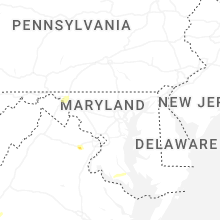


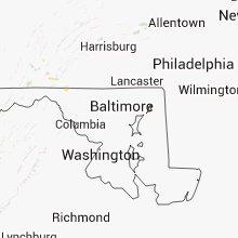


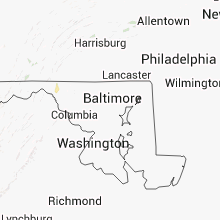


Connect with Interactive Hail Maps