

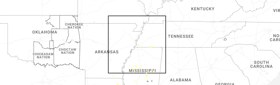
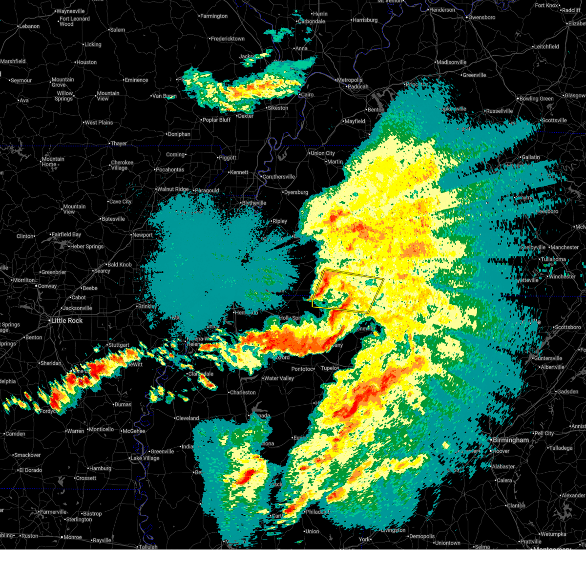
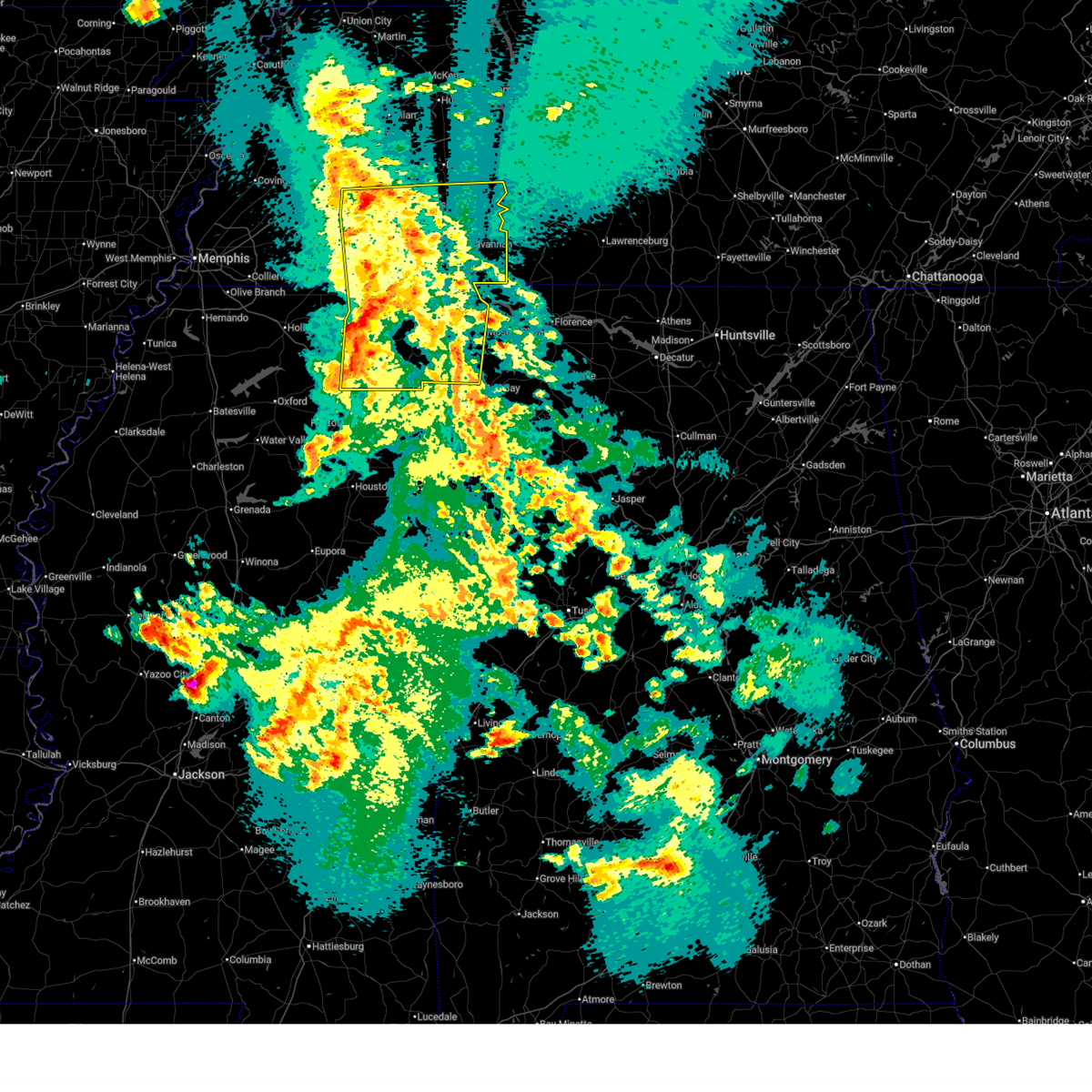
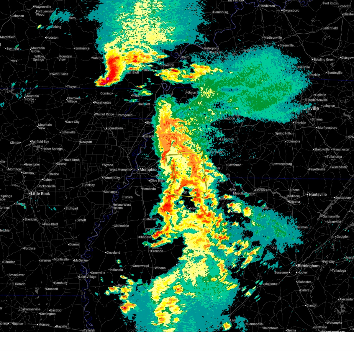
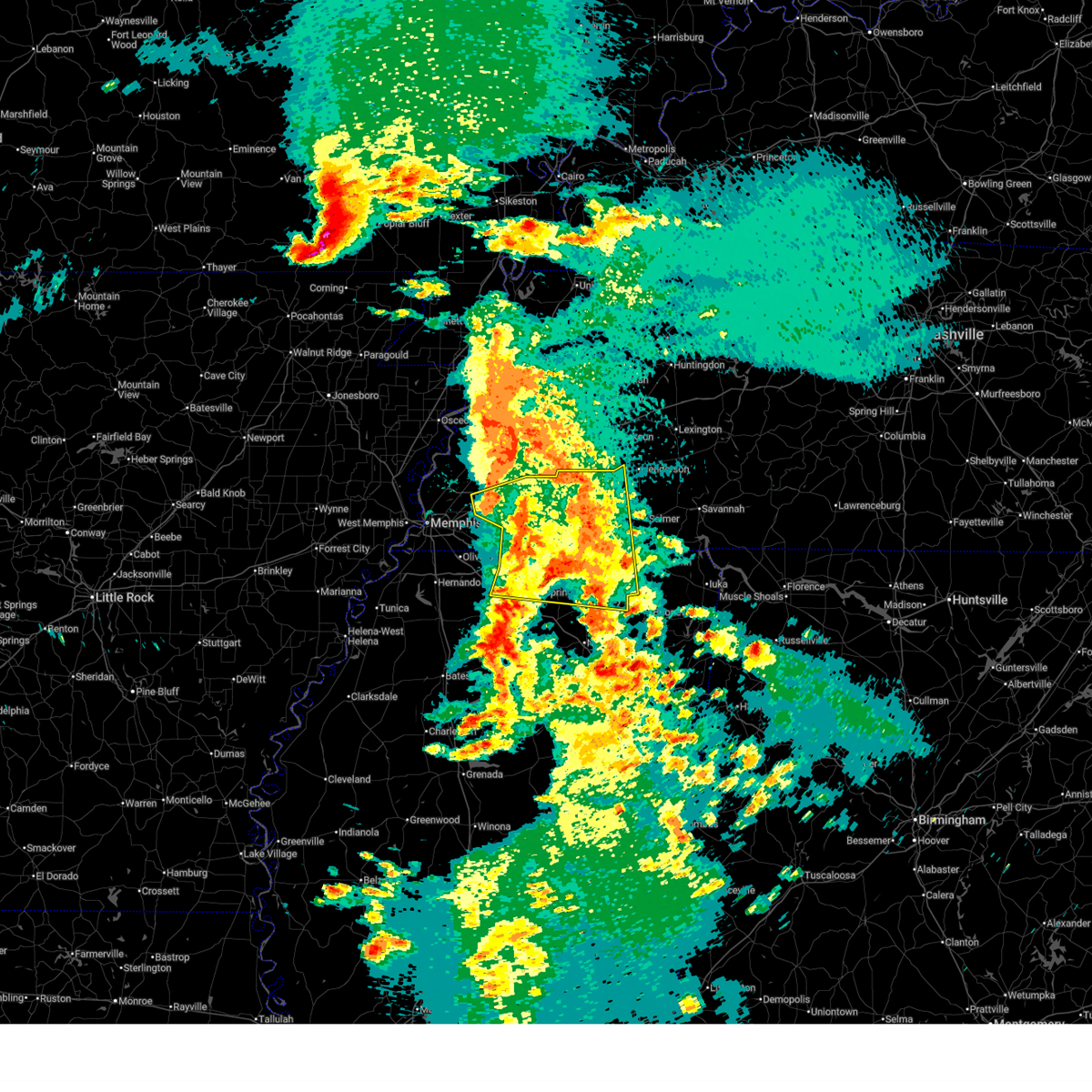
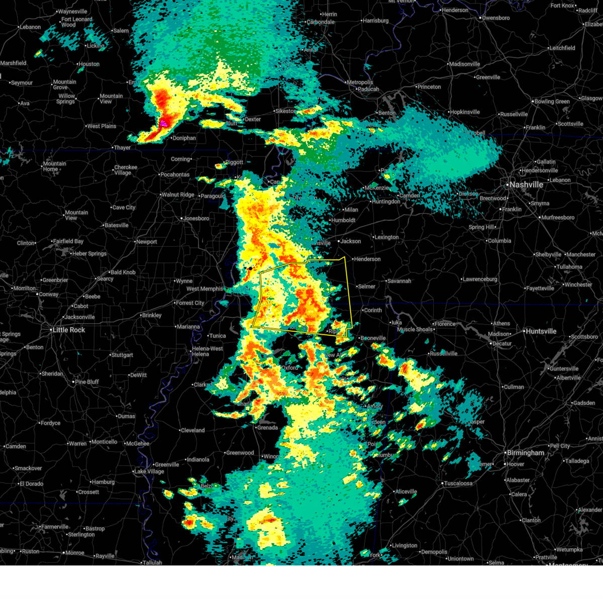
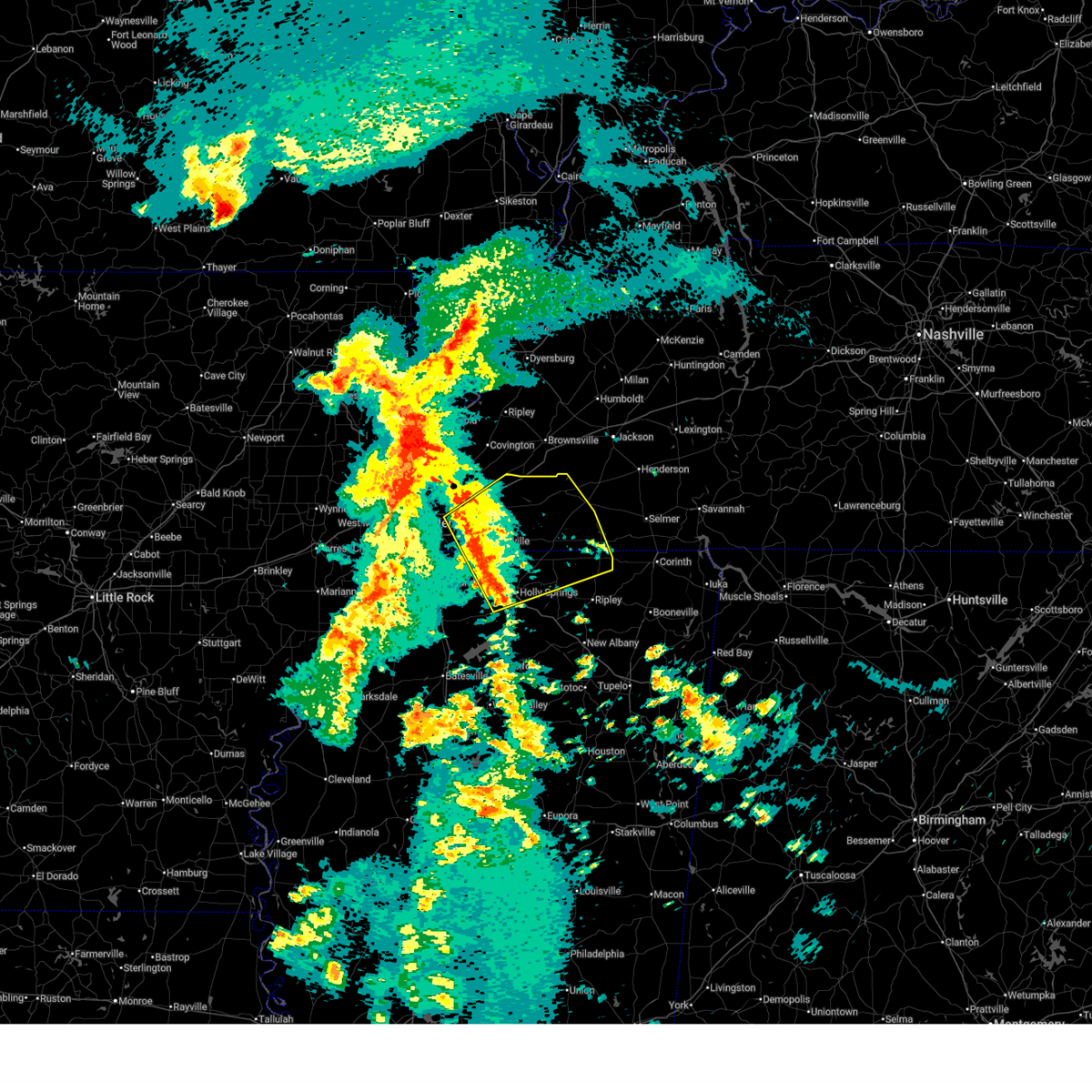
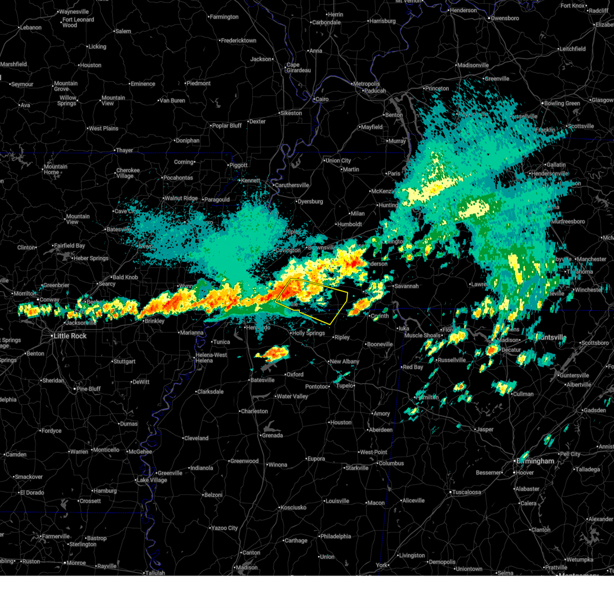
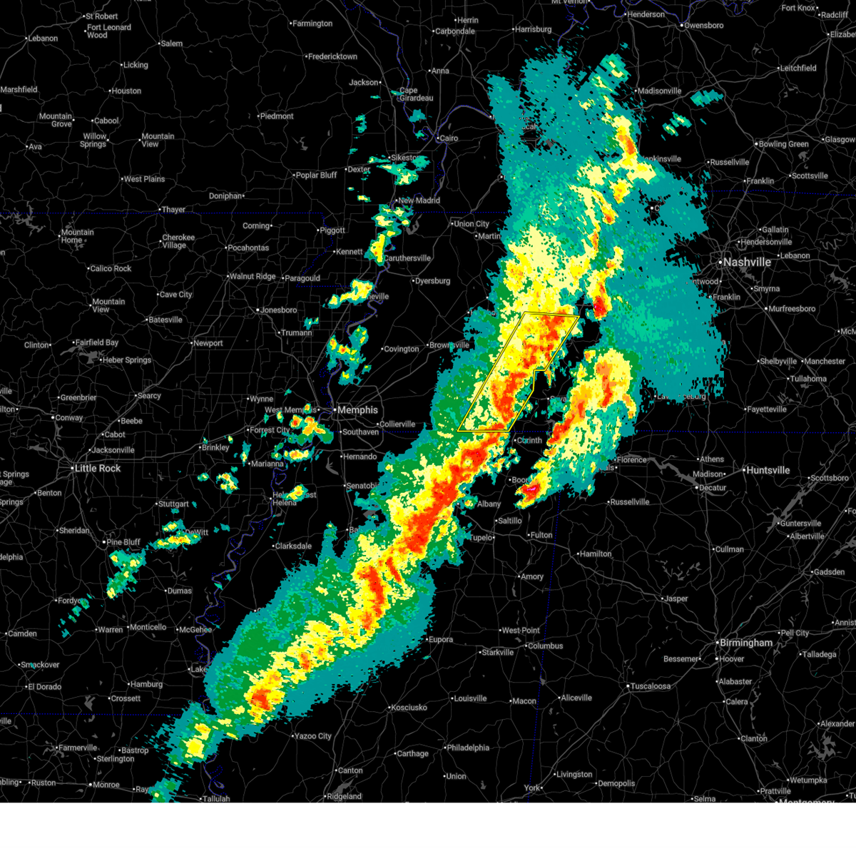
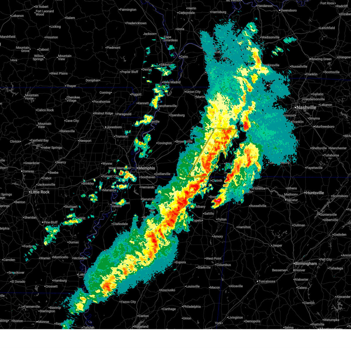
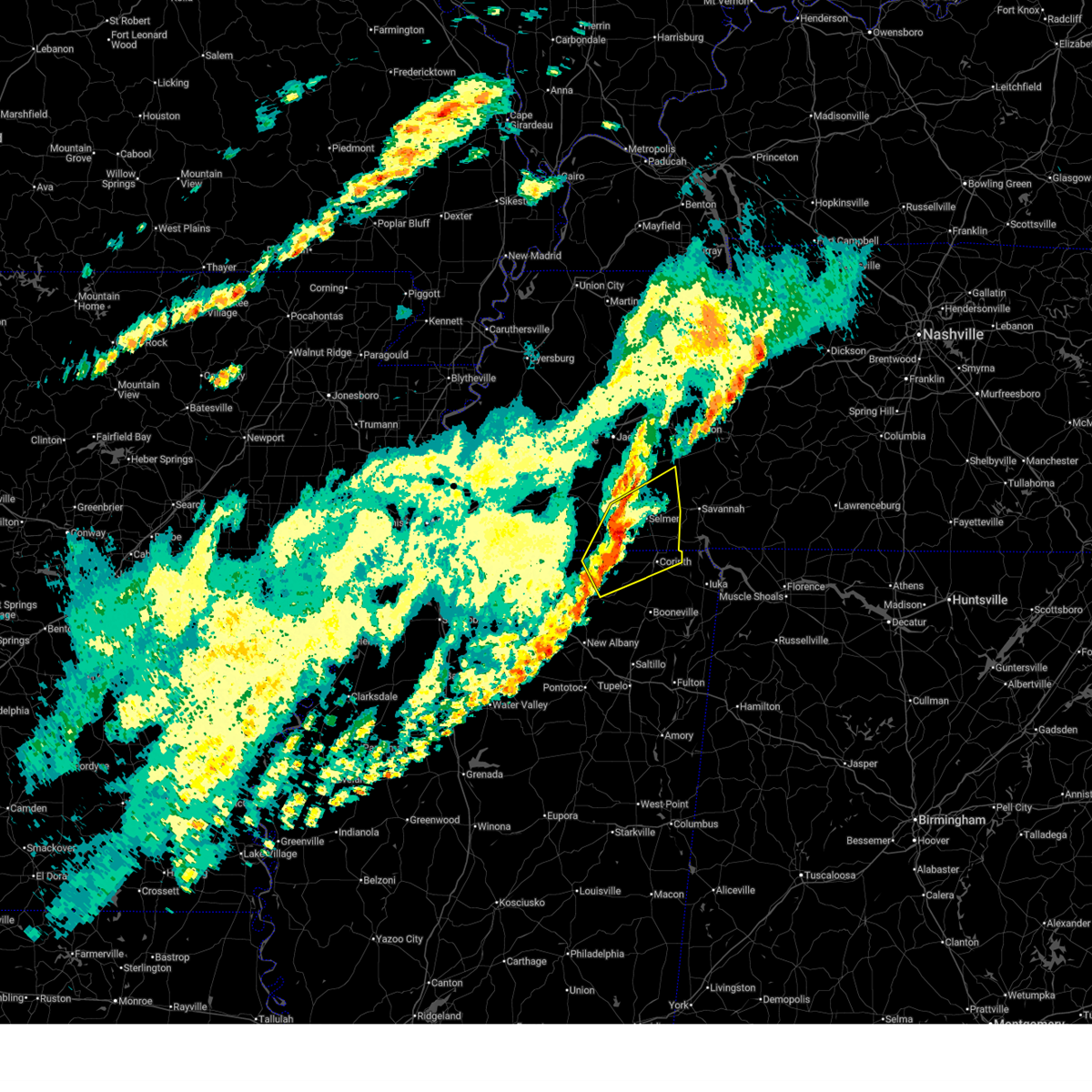
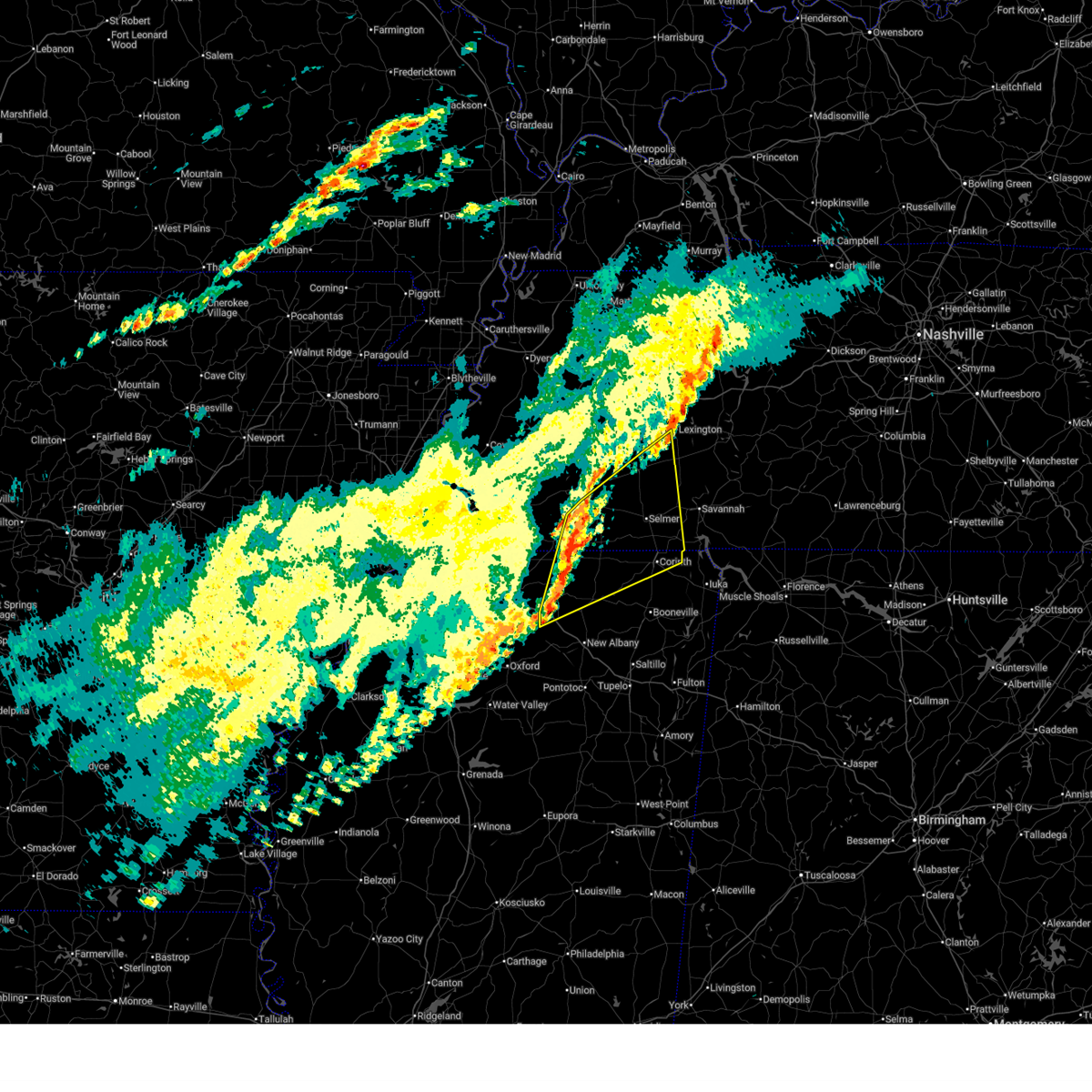
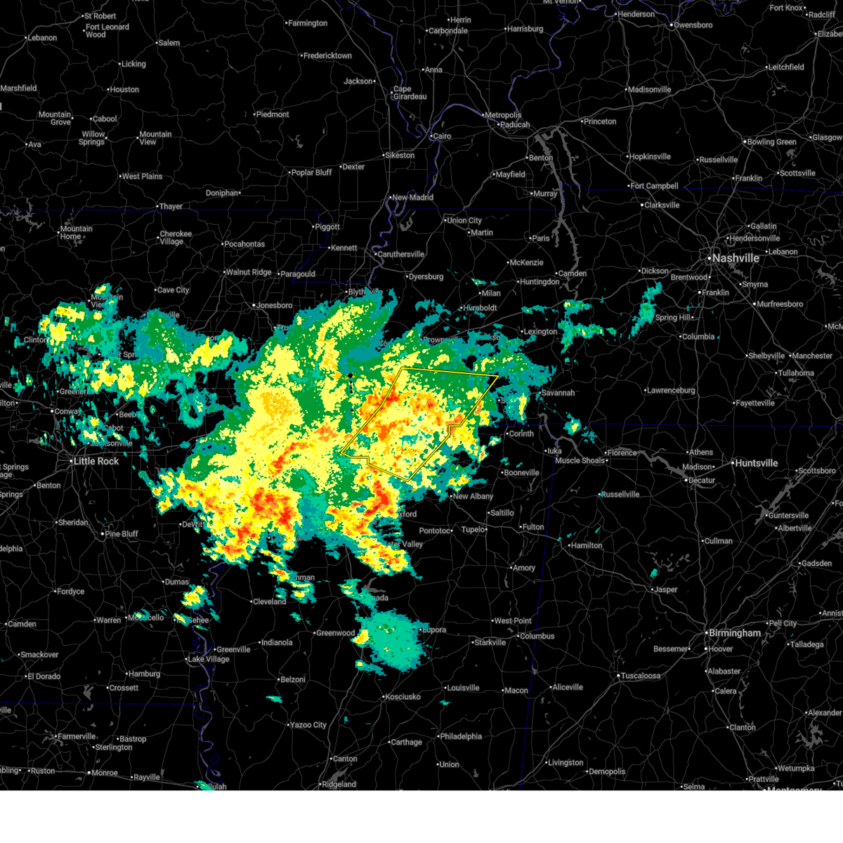
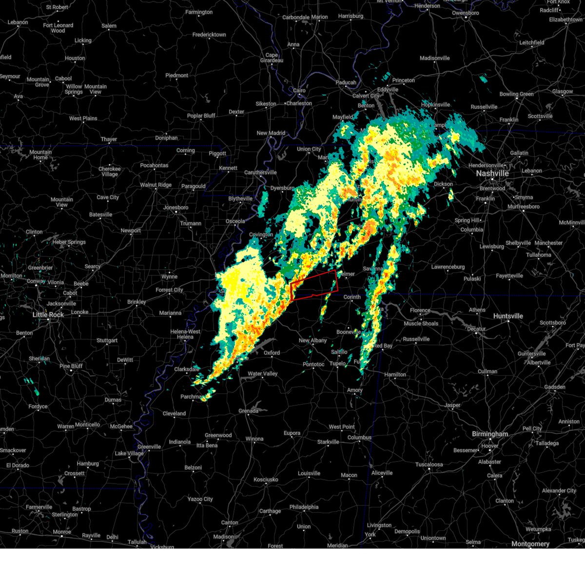
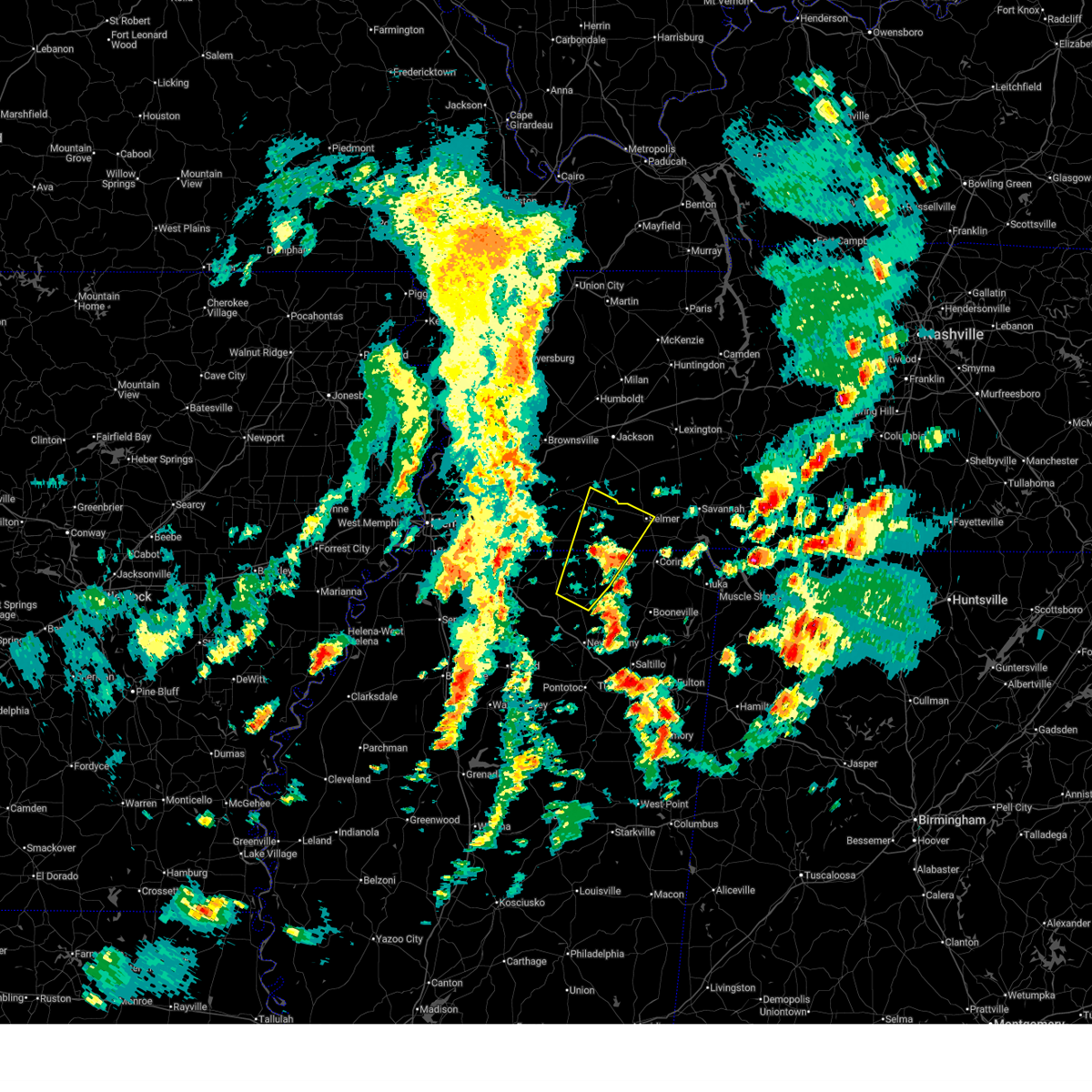
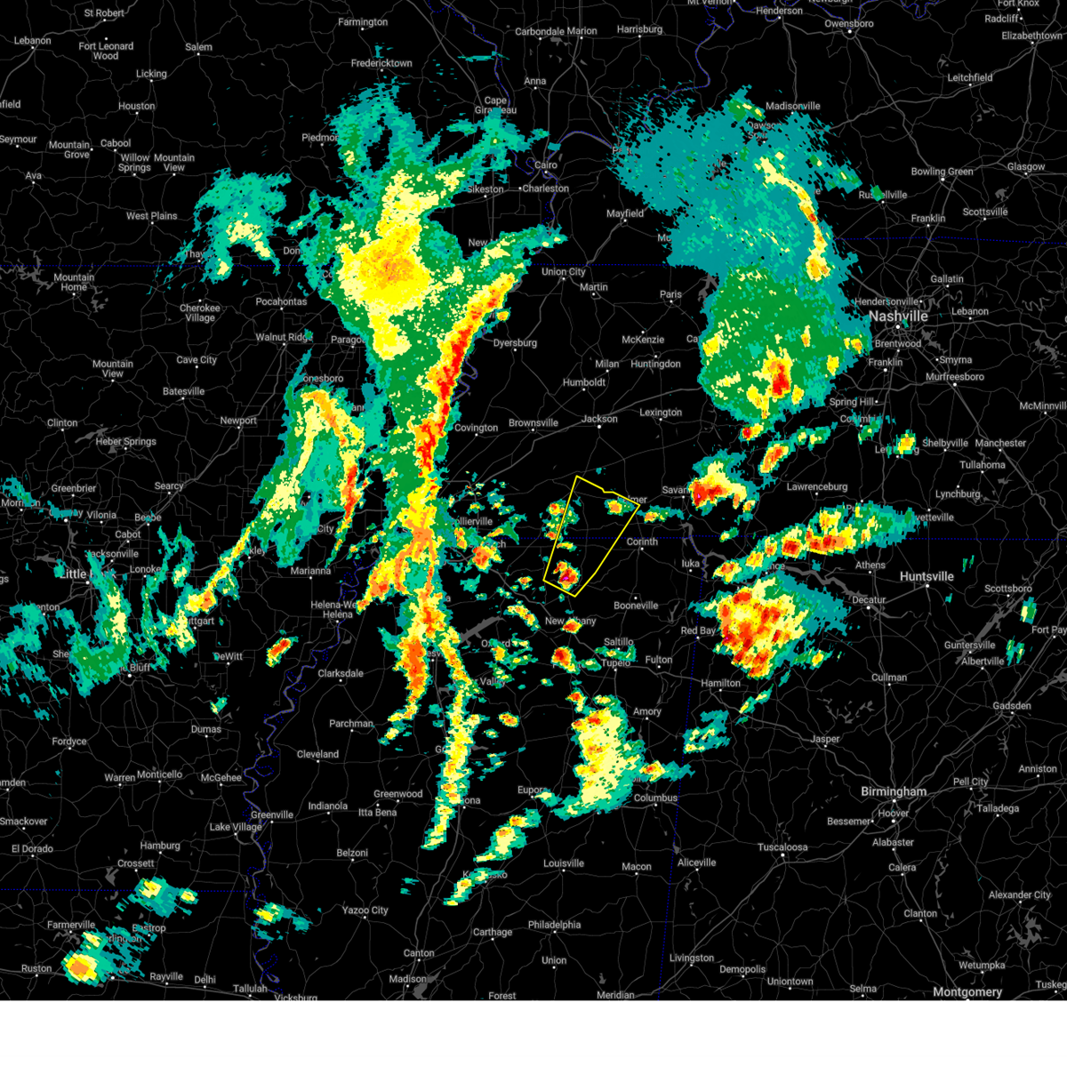
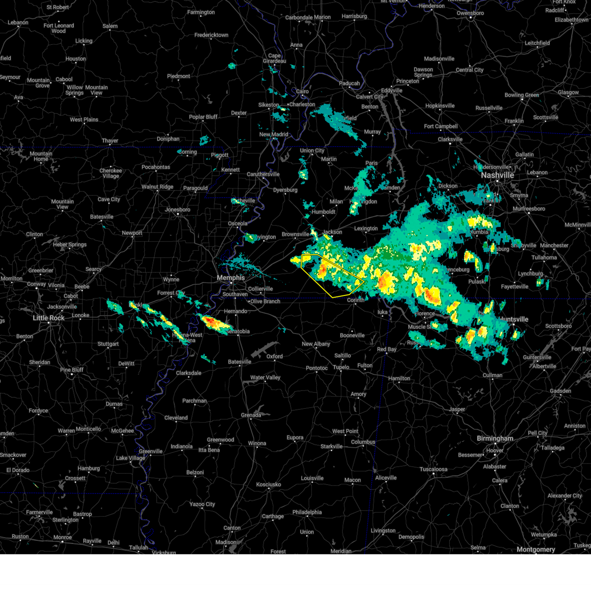
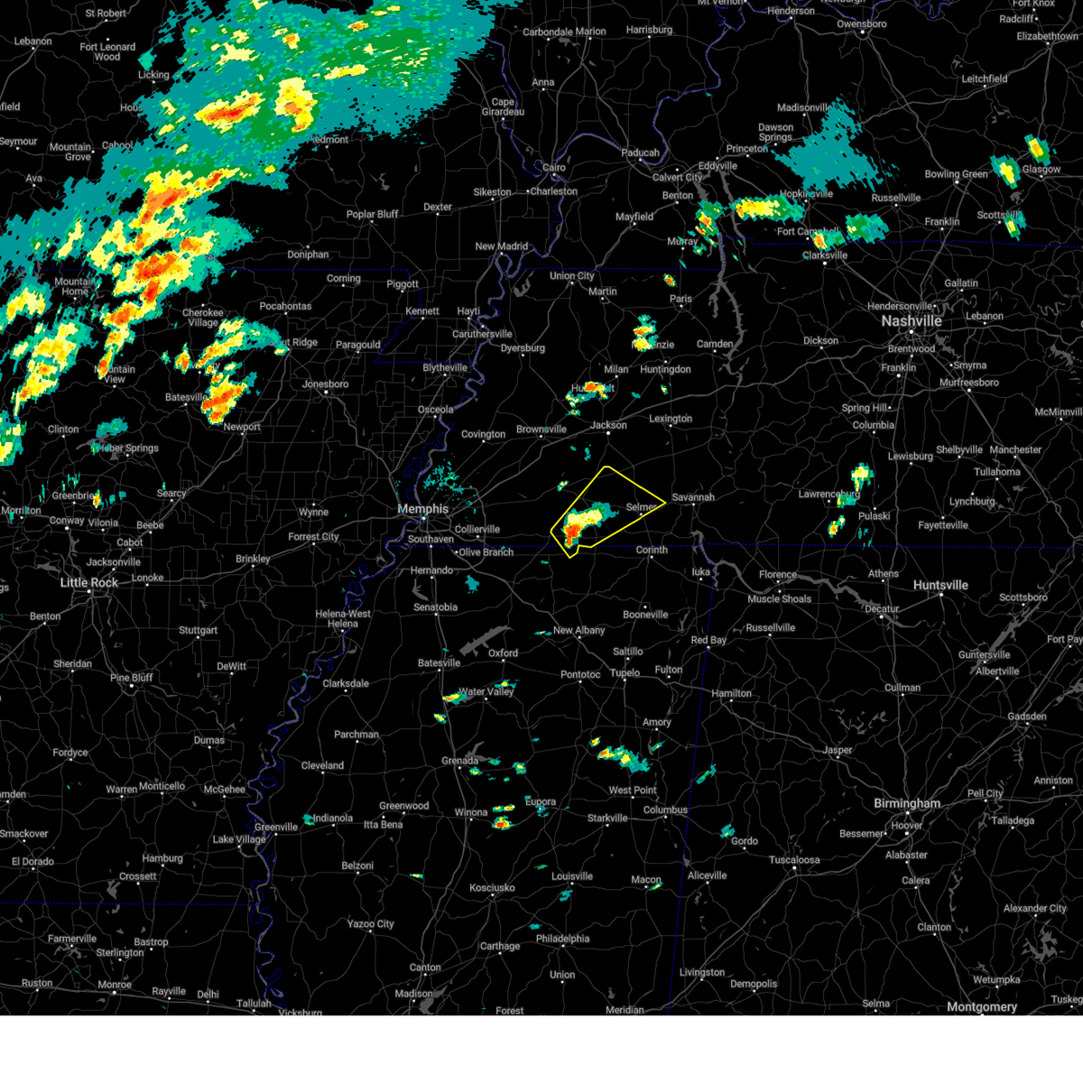
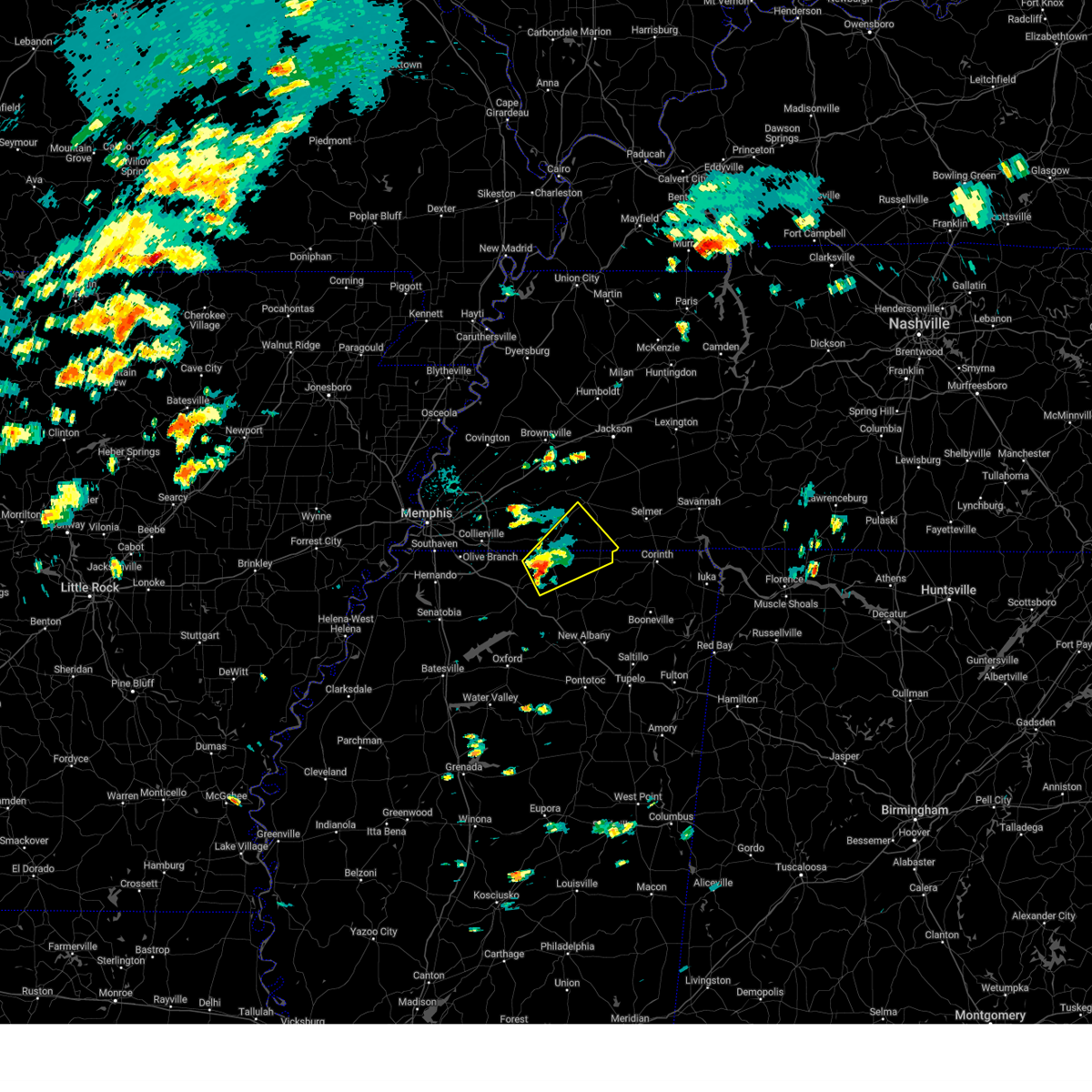
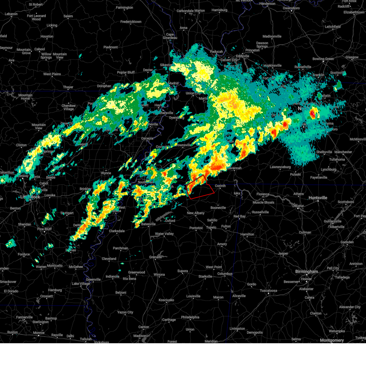
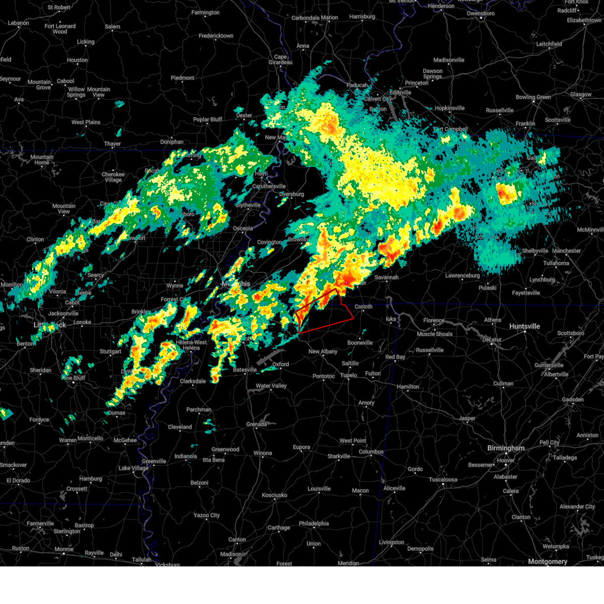
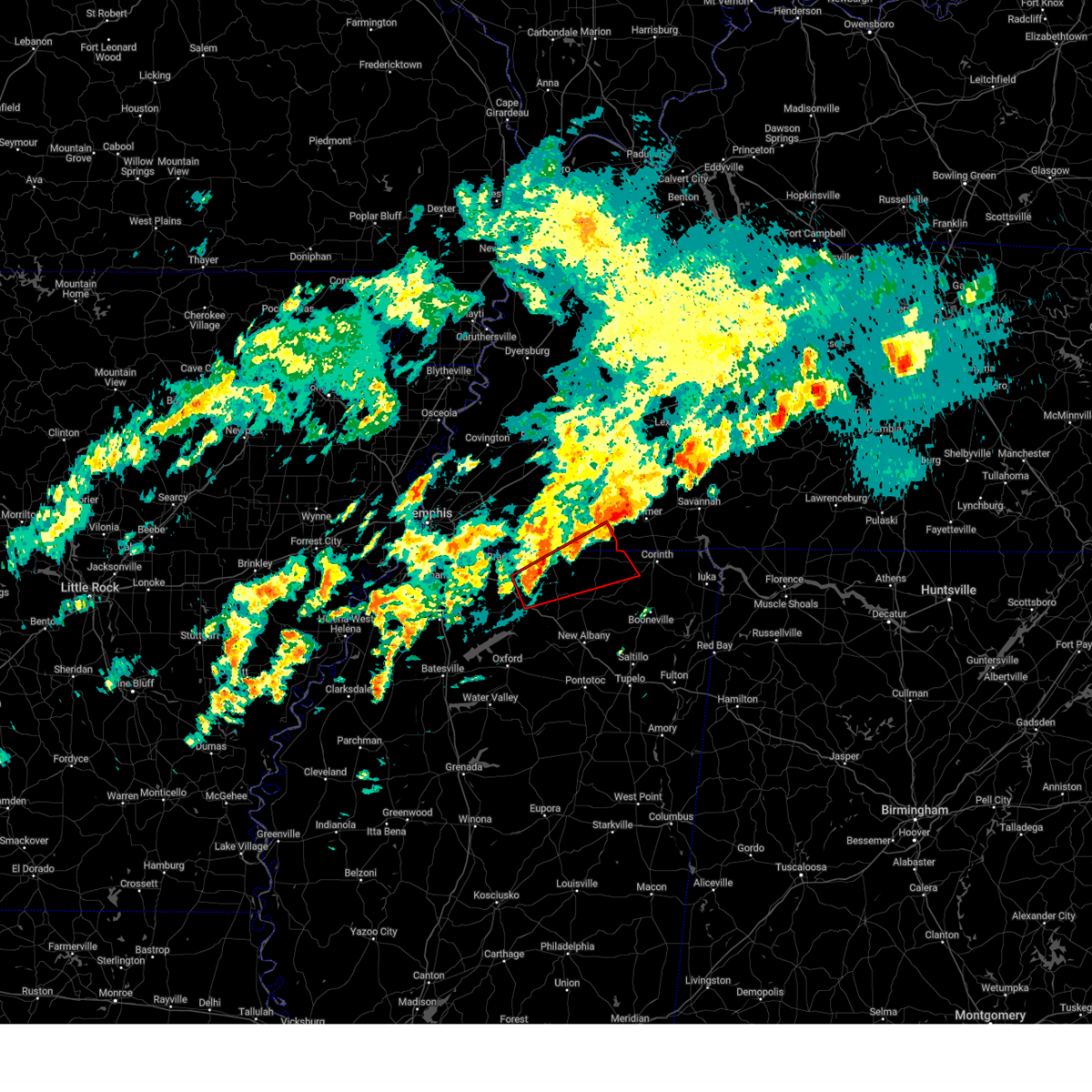
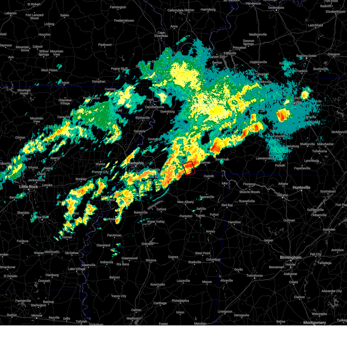
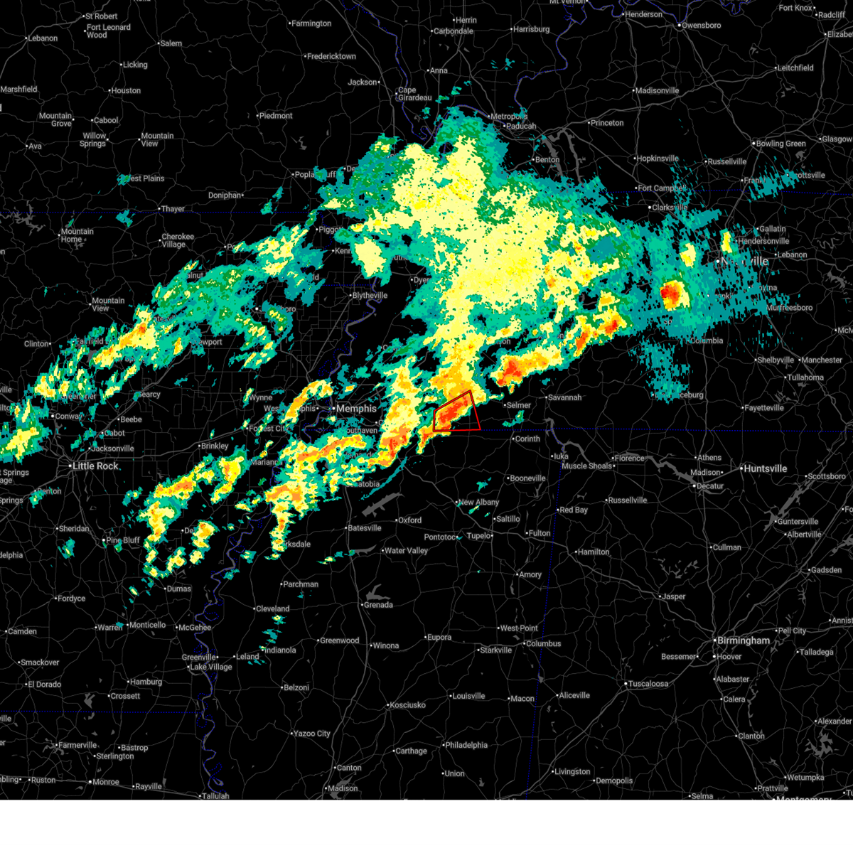
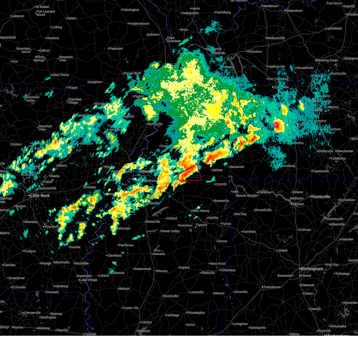
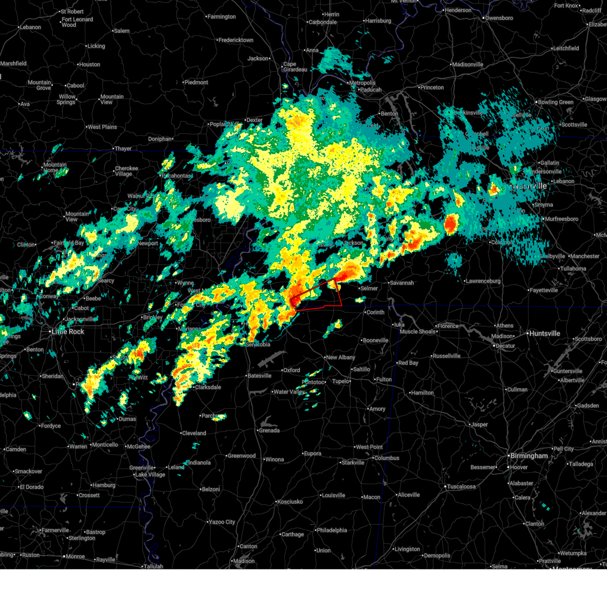
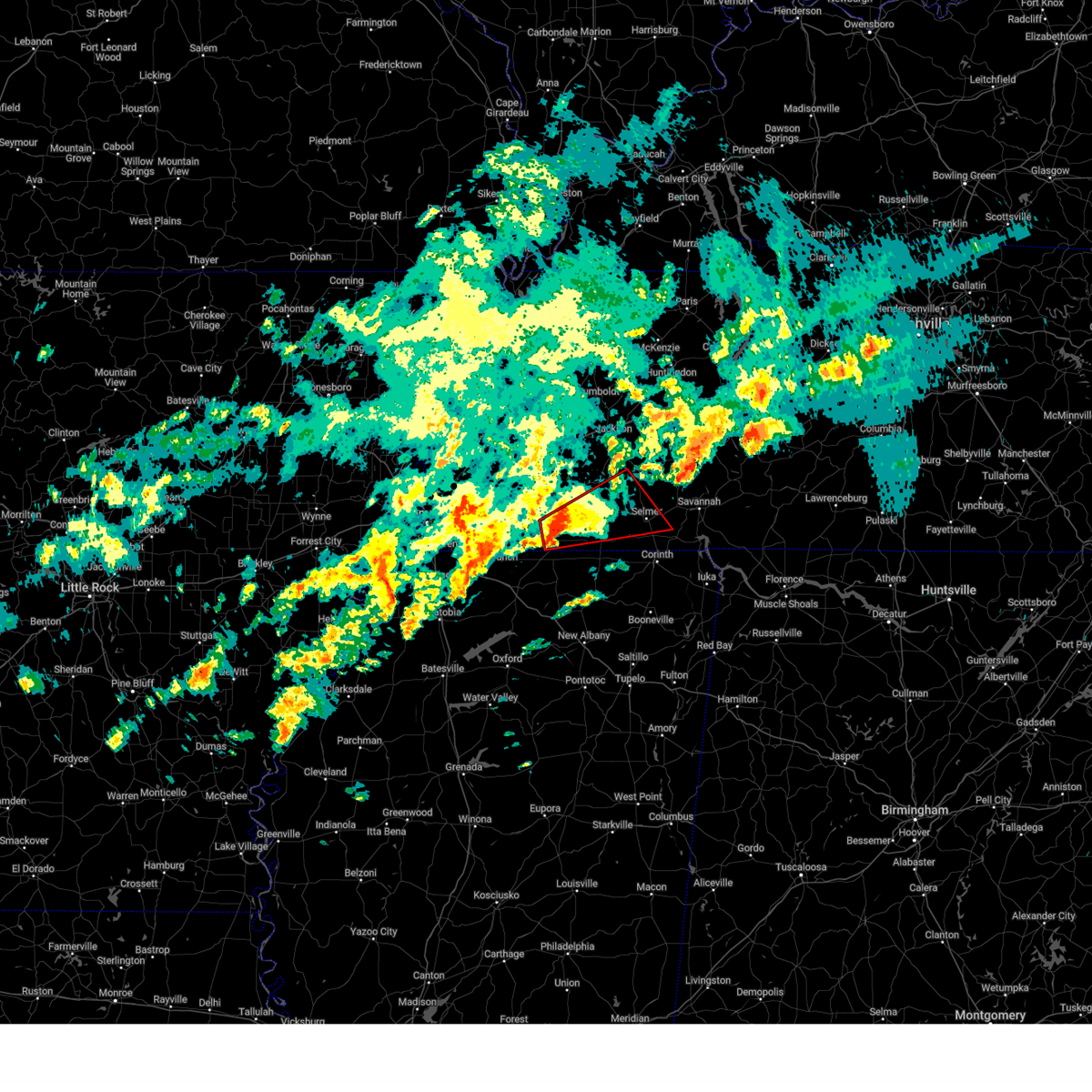
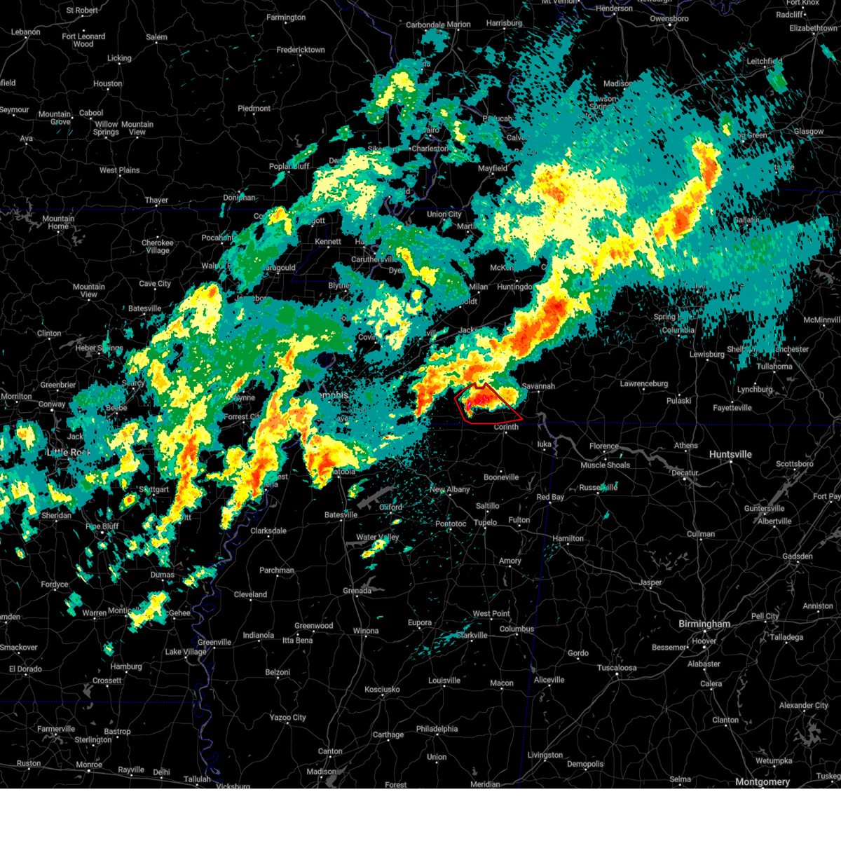
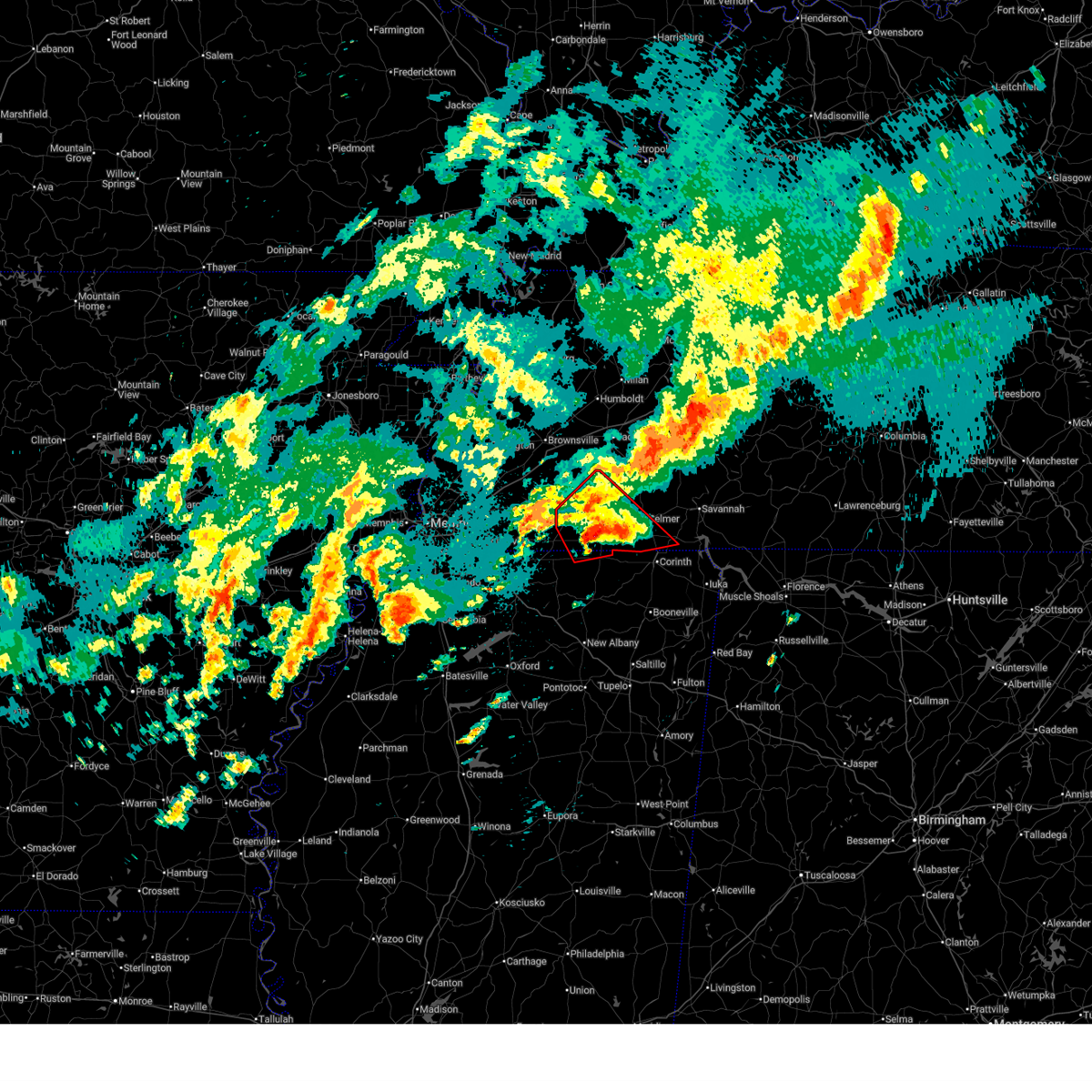
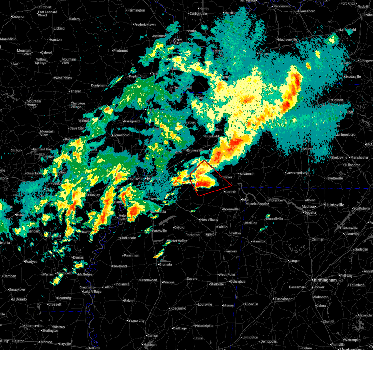
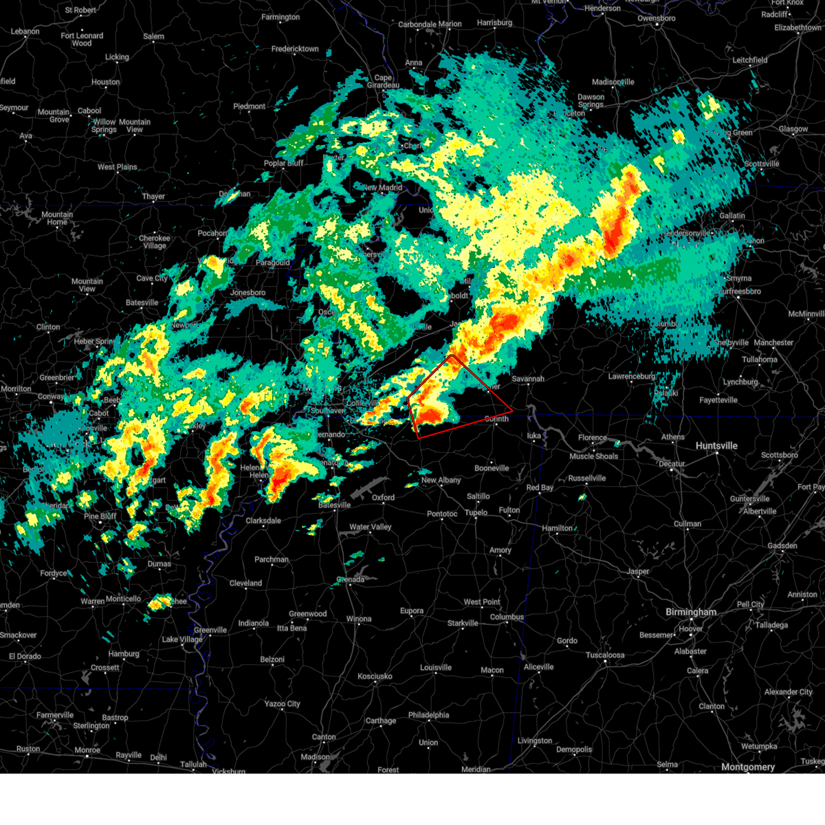
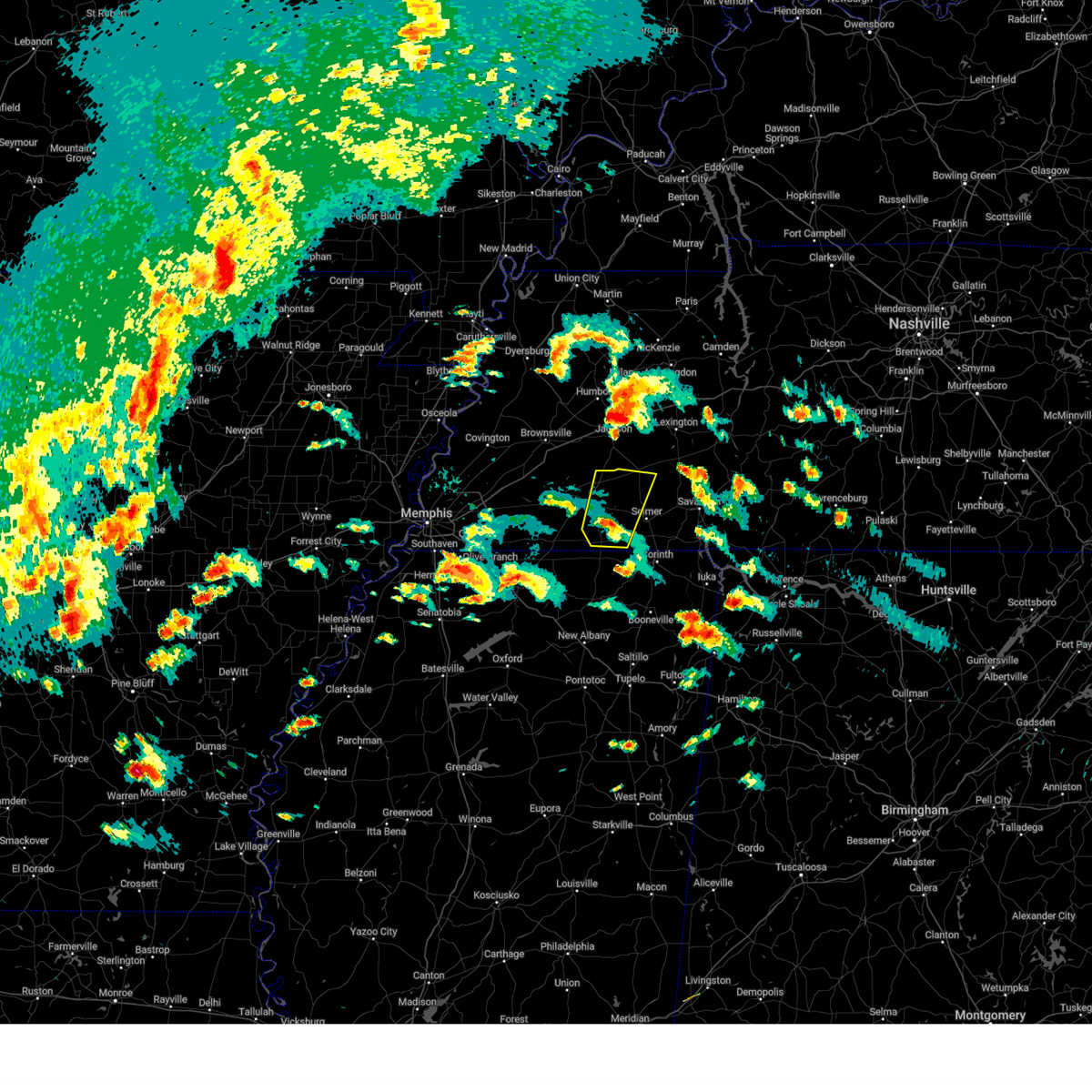
Hail Map for Middleton, TN
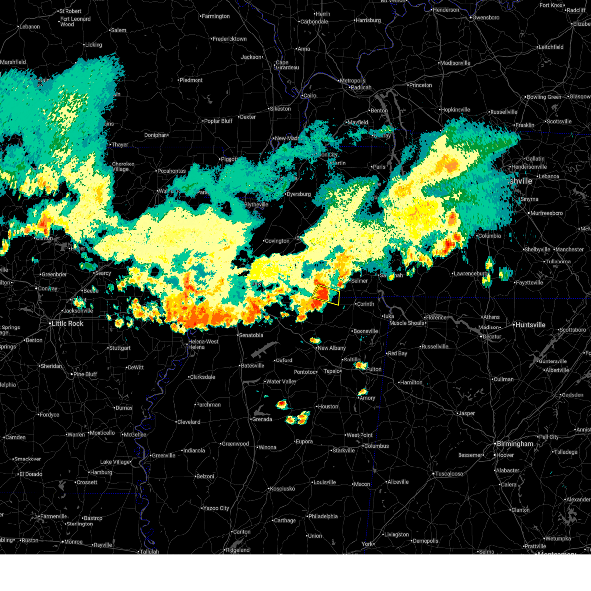
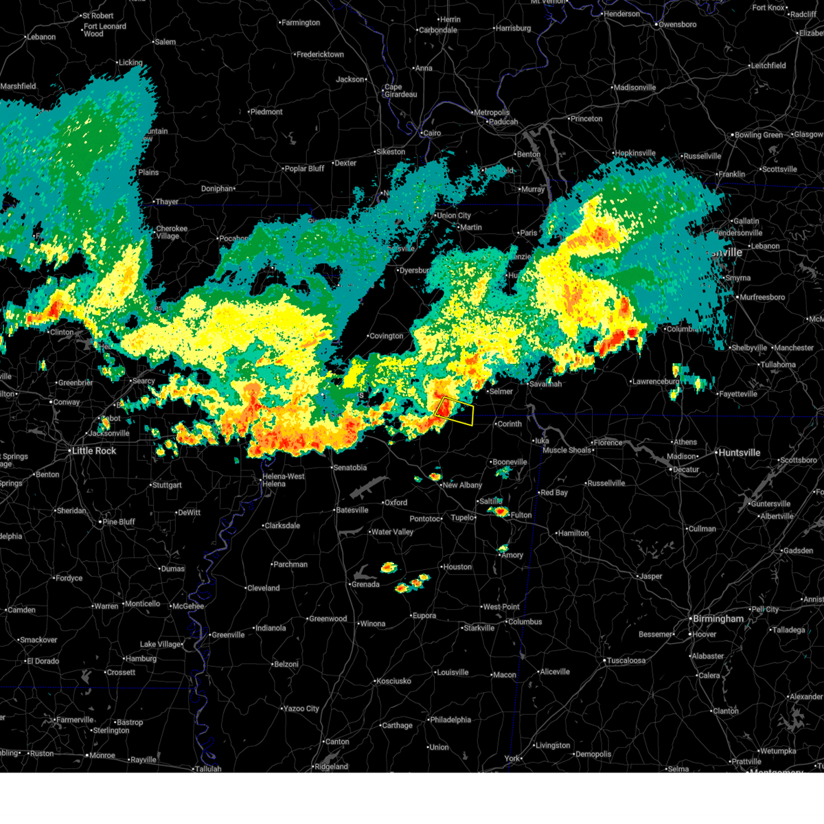
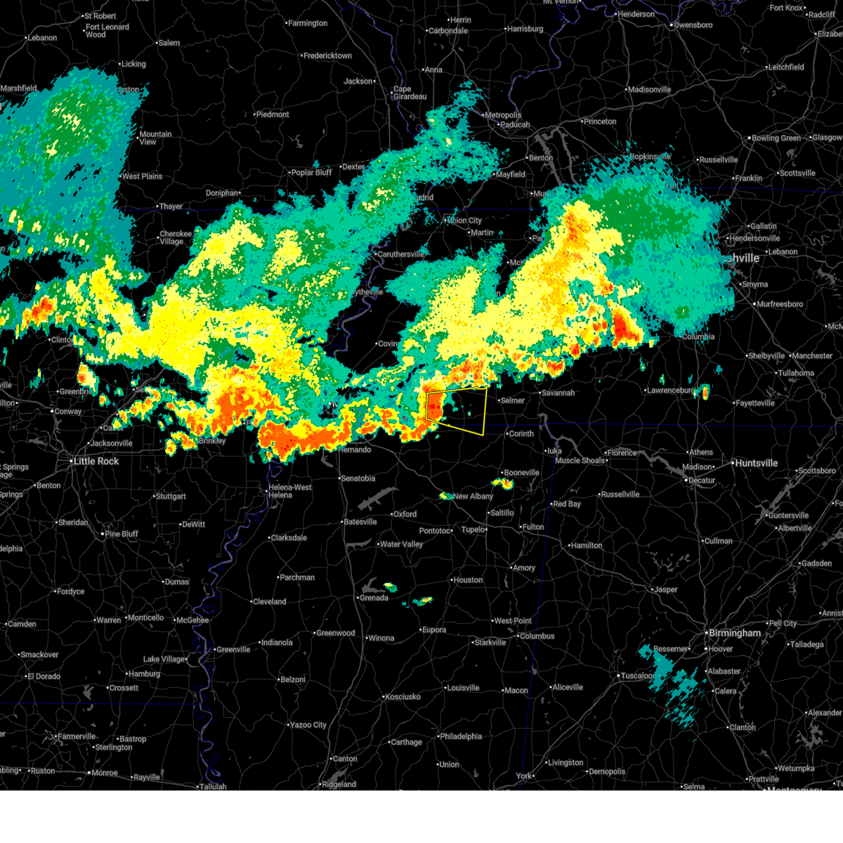
The Middleton, TN area has had 2 reports of on-the-ground hail by trained spotters, and has been under severe weather warnings 29 times during the past 12 months. Doppler radar has detected hail at or near Middleton, TN on 56 occasions, including 3 occasions during the past year.
| Name: | Middleton, TN |
| Where Located: | 66 miles E of Memphis, TN |
| Map: | Google Map for Middleton, TN |
| Population: | 706 |
| Housing Units: | 307 |
| More Info: | Search Google for Middleton, TN |
1
The Top Recent Hail Date for Middleton, TN is Thursday, August 14, 2025 (16th out of 56)
Hail and Wind Damage Spotted near Middleton, TN
| Date / Time | Report Details |
|---|---|
| 6/13/2026 7:52 PM CDT |
 The storm which prompted the warning has weakened below severe limits, and no longer poses an immediate threat to life or property. therefore, the warning will be allowed to expire. however, gusty winds are still possible with this thunderstorm. The storm which prompted the warning has weakened below severe limits, and no longer poses an immediate threat to life or property. therefore, the warning will be allowed to expire. however, gusty winds are still possible with this thunderstorm.
|
| 6/13/2026 7:42 PM CDT |
 At 741 pm cdt, a severe thunderstorm was located 7 miles west of pocahontas, or 12 miles west of big hill pond state park, moving southeast at 30 mph (radar indicated). Hazards include 60 mph wind gusts and nickel size hail. Expect damage to roofs, siding, and trees. Locations impacted include, big hill pond state park, pocahontas, middleton, brownfield, rogers springs, lone pine, lisbon, and essary springs. At 741 pm cdt, a severe thunderstorm was located 7 miles west of pocahontas, or 12 miles west of big hill pond state park, moving southeast at 30 mph (radar indicated). Hazards include 60 mph wind gusts and nickel size hail. Expect damage to roofs, siding, and trees. Locations impacted include, big hill pond state park, pocahontas, middleton, brownfield, rogers springs, lone pine, lisbon, and essary springs.
|
| 6/13/2026 7:42 PM CDT |
 the severe thunderstorm warning has been cancelled and is no longer in effect the severe thunderstorm warning has been cancelled and is no longer in effect
|
| 6/13/2026 7:17 PM CDT |
 Svrmeg the national weather service in memphis has issued a * severe thunderstorm warning for, north central tippah county in northeastern mississippi, northwestern alcorn county in northeastern mississippi, east central fayette county in west tennessee, southern hardeman county in west tennessee, southwestern mcnairy county in west tennessee, * until 800 pm cdt. * at 717 pm cdt, a severe thunderstorm was located 7 miles northeast of lagrange, or 10 miles southwest of bolivar, moving east at 20 mph (radar indicated). Hazards include 60 mph wind gusts and nickel size hail. expect damage to roofs, siding, and trees Svrmeg the national weather service in memphis has issued a * severe thunderstorm warning for, north central tippah county in northeastern mississippi, northwestern alcorn county in northeastern mississippi, east central fayette county in west tennessee, southern hardeman county in west tennessee, southwestern mcnairy county in west tennessee, * until 800 pm cdt. * at 717 pm cdt, a severe thunderstorm was located 7 miles northeast of lagrange, or 10 miles southwest of bolivar, moving east at 20 mph (radar indicated). Hazards include 60 mph wind gusts and nickel size hail. expect damage to roofs, siding, and trees
|
| 4/28/2026 11:20 PM CDT |
 Svrmeg the national weather service in memphis has issued a * severe thunderstorm warning for, northwestern tippah county in northeastern mississippi, northwestern tishomingo county in northeastern mississippi, alcorn county in northeastern mississippi, southeastern hardeman county in west tennessee, mcnairy county in west tennessee, southwestern hardin county in west tennessee, * until midnight cdt. * at 1120 pm cdt, a severe thunderstorm was located near pocahontas, or near big hill pond state park, moving southeast at 35 mph (radar indicated). Hazards include 60 mph wind gusts. expect damage to roofs, siding, and trees Svrmeg the national weather service in memphis has issued a * severe thunderstorm warning for, northwestern tippah county in northeastern mississippi, northwestern tishomingo county in northeastern mississippi, alcorn county in northeastern mississippi, southeastern hardeman county in west tennessee, mcnairy county in west tennessee, southwestern hardin county in west tennessee, * until midnight cdt. * at 1120 pm cdt, a severe thunderstorm was located near pocahontas, or near big hill pond state park, moving southeast at 35 mph (radar indicated). Hazards include 60 mph wind gusts. expect damage to roofs, siding, and trees
|
| 4/28/2026 5:19 PM CDT |
 Svrmeg the national weather service in memphis has issued a * severe thunderstorm warning for, northeastern union county in northeastern mississippi, northern lee county in northeastern mississippi, tishomingo county in northeastern mississippi, alcorn county in northeastern mississippi, tippah county in northeastern mississippi, prentiss county in northeastern mississippi, southern henderson county in west tennessee, hardeman county in west tennessee, hardin county in west tennessee, southern madison county in west tennessee, chester county in west tennessee, mcnairy county in west tennessee, southern decatur county in west tennessee, * until 615 pm cdt. * at 518 pm cdt, severe thunderstorms were located along a line extending from near chickasaw state forest to near pocahontas to keownville, moving east at 65 mph (radar indicated). Hazards include 60 mph wind gusts and quarter size hail. Hail damage to vehicles is expected. Expect wind damage to roofs, siding, and trees. Svrmeg the national weather service in memphis has issued a * severe thunderstorm warning for, northeastern union county in northeastern mississippi, northern lee county in northeastern mississippi, tishomingo county in northeastern mississippi, alcorn county in northeastern mississippi, tippah county in northeastern mississippi, prentiss county in northeastern mississippi, southern henderson county in west tennessee, hardeman county in west tennessee, hardin county in west tennessee, southern madison county in west tennessee, chester county in west tennessee, mcnairy county in west tennessee, southern decatur county in west tennessee, * until 615 pm cdt. * at 518 pm cdt, severe thunderstorms were located along a line extending from near chickasaw state forest to near pocahontas to keownville, moving east at 65 mph (radar indicated). Hazards include 60 mph wind gusts and quarter size hail. Hail damage to vehicles is expected. Expect wind damage to roofs, siding, and trees.
|
| 4/28/2026 5:02 PM CDT |
 the severe thunderstorm warning has been cancelled and is no longer in effect the severe thunderstorm warning has been cancelled and is no longer in effect
|
| 4/28/2026 5:02 PM CDT |
 At 502 pm cdt, a severe thunderstorm was located 9 miles east of canaan, or 15 miles southwest of big hill pond state park, moving east at 45 mph (radar indicated). Hazards include 60 mph wind gusts and quarter size hail. Hail damage to vehicles is expected. expect wind damage to roofs, siding, and trees. locations impacted include, holly springs, bolivar, ripley, chickasaw state forest, big hill pond state park, chickasaw state park, lamar, whiteville, somerville, snow lake shores, silerton, theo, michigan city, canaan, pocahontas, lagrange, gravestown, cloverport, robertson, and walnut. this includes the following highways, interstate 40 in tennessee between mile markers 38 and 42. Interstate 22 in mississipppi near mile marker 32. At 502 pm cdt, a severe thunderstorm was located 9 miles east of canaan, or 15 miles southwest of big hill pond state park, moving east at 45 mph (radar indicated). Hazards include 60 mph wind gusts and quarter size hail. Hail damage to vehicles is expected. expect wind damage to roofs, siding, and trees. locations impacted include, holly springs, bolivar, ripley, chickasaw state forest, big hill pond state park, chickasaw state park, lamar, whiteville, somerville, snow lake shores, silerton, theo, michigan city, canaan, pocahontas, lagrange, gravestown, cloverport, robertson, and walnut. this includes the following highways, interstate 40 in tennessee between mile markers 38 and 42. Interstate 22 in mississipppi near mile marker 32.
|
| 4/28/2026 4:50 PM CDT |
 At 449 pm cdt, a severe thunderstorm was located over canaan, or 17 miles northwest of ripley, moving east at 45 mph (radar indicated). Hazards include 60 mph wind gusts and quarter size hail. Hail damage to vehicles is expected. expect wind damage to roofs, siding, and trees. locations impacted include, holly springs, bolivar, ripley, chickasaw state forest, big hill pond state park, chickasaw state park, lamar, lakeland, arlington, whiteville, somerville, snow lake shores, silerton, mt pleasant, theo, michigan city, red banks, canaan, pocahontas, and lagrange. this includes the following highways, interstate 40 in tennessee between mile markers 21 and 42. Interstate 22 in mississipppi between mile markers 21 and 32. At 449 pm cdt, a severe thunderstorm was located over canaan, or 17 miles northwest of ripley, moving east at 45 mph (radar indicated). Hazards include 60 mph wind gusts and quarter size hail. Hail damage to vehicles is expected. expect wind damage to roofs, siding, and trees. locations impacted include, holly springs, bolivar, ripley, chickasaw state forest, big hill pond state park, chickasaw state park, lamar, lakeland, arlington, whiteville, somerville, snow lake shores, silerton, mt pleasant, theo, michigan city, red banks, canaan, pocahontas, and lagrange. this includes the following highways, interstate 40 in tennessee between mile markers 21 and 42. Interstate 22 in mississipppi between mile markers 21 and 32.
|
| 4/28/2026 4:38 PM CDT |
 Svrmeg the national weather service in memphis has issued a * severe thunderstorm warning for, northeastern desoto county in northwestern mississippi, northern marshall county in northwestern mississippi, tippah county in northeastern mississippi, benton county in northeastern mississippi, western alcorn county in northeastern mississippi, fayette county in west tennessee, hardeman county in west tennessee, southwestern mcnairy county in west tennessee, southeastern shelby county in west tennessee, southwestern chester county in west tennessee, * until 530 pm cdt. * at 438 pm cdt, a severe thunderstorm was located over lamar, or 11 miles northeast of holly springs, moving east at 45 mph (radar indicated). Hazards include 60 mph wind gusts and quarter size hail. Hail damage to vehicles is expected. Expect wind damage to roofs, siding, and trees. Svrmeg the national weather service in memphis has issued a * severe thunderstorm warning for, northeastern desoto county in northwestern mississippi, northern marshall county in northwestern mississippi, tippah county in northeastern mississippi, benton county in northeastern mississippi, western alcorn county in northeastern mississippi, fayette county in west tennessee, hardeman county in west tennessee, southwestern mcnairy county in west tennessee, southeastern shelby county in west tennessee, southwestern chester county in west tennessee, * until 530 pm cdt. * at 438 pm cdt, a severe thunderstorm was located over lamar, or 11 miles northeast of holly springs, moving east at 45 mph (radar indicated). Hazards include 60 mph wind gusts and quarter size hail. Hail damage to vehicles is expected. Expect wind damage to roofs, siding, and trees.
|
| 4/28/2026 4:15 PM CDT |
 At 415 pm cdt, severe thunderstorms were located along a line extending from arlington to near slayden to near holly springs, moving northeast at 45 mph (radar indicated). Hazards include 60 mph wind gusts and quarter size hail. Hail damage to vehicles is expected. expect wind damage to roofs, siding, and trees. locations impacted include, holly springs, bolivar, lamar, lakeland, arlington, whiteville, somerville, snow lake shores, mt pleasant, michigan city, red banks, canaan, lagrange, eads, slayden, warren, macon, oakland, piperton, and walnut. this includes the following highways, interstate 40 in tennessee between mile markers 21 and 43. Interstate 22 in mississipppi between mile markers 19 and 33. At 415 pm cdt, severe thunderstorms were located along a line extending from arlington to near slayden to near holly springs, moving northeast at 45 mph (radar indicated). Hazards include 60 mph wind gusts and quarter size hail. Hail damage to vehicles is expected. expect wind damage to roofs, siding, and trees. locations impacted include, holly springs, bolivar, lamar, lakeland, arlington, whiteville, somerville, snow lake shores, mt pleasant, michigan city, red banks, canaan, lagrange, eads, slayden, warren, macon, oakland, piperton, and walnut. this includes the following highways, interstate 40 in tennessee between mile markers 21 and 43. Interstate 22 in mississipppi between mile markers 19 and 33.
|
| 4/28/2026 3:59 PM CDT |
 Svrmeg the national weather service in memphis has issued a * severe thunderstorm warning for, northeastern desoto county in northwestern mississippi, marshall county in northwestern mississippi, northwestern tippah county in northeastern mississippi, benton county in northeastern mississippi, fayette county in west tennessee, western hardeman county in west tennessee, southeastern shelby county in west tennessee, * until 445 pm cdt. * at 359 pm cdt, severe thunderstorms were located along a line extending from near bartlett to 6 miles west of mt pleasant to near wall doxey state park, moving northeast at 45 mph (radar indicated). Hazards include 60 mph wind gusts and quarter size hail. Hail damage to vehicles is expected. Expect wind damage to roofs, siding, and trees. Svrmeg the national weather service in memphis has issued a * severe thunderstorm warning for, northeastern desoto county in northwestern mississippi, marshall county in northwestern mississippi, northwestern tippah county in northeastern mississippi, benton county in northeastern mississippi, fayette county in west tennessee, western hardeman county in west tennessee, southeastern shelby county in west tennessee, * until 445 pm cdt. * at 359 pm cdt, severe thunderstorms were located along a line extending from near bartlett to 6 miles west of mt pleasant to near wall doxey state park, moving northeast at 45 mph (radar indicated). Hazards include 60 mph wind gusts and quarter size hail. Hail damage to vehicles is expected. Expect wind damage to roofs, siding, and trees.
|
| 4/28/2026 3:51 AM CDT |
 Svrmeg the national weather service in memphis has issued a * severe thunderstorm warning for, northwestern tippah county in northeastern mississippi, northern benton county in northeastern mississippi, southern fayette county in west tennessee, southern hardeman county in west tennessee, * until 430 am cdt. * at 351 am cdt, a severe thunderstorm was located near somerville, or 15 miles northeast of collierville, moving east at 50 mph (radar indicated). Hazards include 60 mph wind gusts and nickel size hail. expect damage to roofs, siding, and trees Svrmeg the national weather service in memphis has issued a * severe thunderstorm warning for, northwestern tippah county in northeastern mississippi, northern benton county in northeastern mississippi, southern fayette county in west tennessee, southern hardeman county in west tennessee, * until 430 am cdt. * at 351 am cdt, a severe thunderstorm was located near somerville, or 15 miles northeast of collierville, moving east at 50 mph (radar indicated). Hazards include 60 mph wind gusts and nickel size hail. expect damage to roofs, siding, and trees
|
| 3/15/2026 9:18 PM CDT |
 At 917 pm cdt, severe thunderstorms were located along a line extending from 9 miles north of parsons to near corinth, moving east at 45 mph (radar indicated). Hazards include 60 mph wind gusts and nickel size hail. Expect damage to roofs, siding, and trees. locations impacted include, lexington, henderson, selmer, natchez trace state park, natchez trace state forest, big hill pond state park, parsons, adamsville, sardis, masseyville, reagan, mifflin, bargerton, wildersville, pocahontas, jacks creek, parkers crossroads, darden, robertson, and mcnairy. This includes interstate 40 in tennessee between mile markers 103 and 113. At 917 pm cdt, severe thunderstorms were located along a line extending from 9 miles north of parsons to near corinth, moving east at 45 mph (radar indicated). Hazards include 60 mph wind gusts and nickel size hail. Expect damage to roofs, siding, and trees. locations impacted include, lexington, henderson, selmer, natchez trace state park, natchez trace state forest, big hill pond state park, parsons, adamsville, sardis, masseyville, reagan, mifflin, bargerton, wildersville, pocahontas, jacks creek, parkers crossroads, darden, robertson, and mcnairy. This includes interstate 40 in tennessee between mile markers 103 and 113.
|
| 3/15/2026 9:18 PM CDT |
 the severe thunderstorm warning has been cancelled and is no longer in effect the severe thunderstorm warning has been cancelled and is no longer in effect
|
| 3/15/2026 8:58 PM CDT |
 Svrmeg the national weather service in memphis has issued a * severe thunderstorm warning for, henderson county in west tennessee, eastern hardeman county in west tennessee, mcnairy county in west tennessee, southeastern madison county in west tennessee, chester county in west tennessee, central decatur county in west tennessee, * until 945 pm cdt. * at 857 pm cdt, severe thunderstorms were located along a line extending from wildersville to near pocahontas, moving east at 45 mph (radar indicated). Hazards include 60 mph wind gusts and nickel size hail. expect damage to roofs, siding, and trees Svrmeg the national weather service in memphis has issued a * severe thunderstorm warning for, henderson county in west tennessee, eastern hardeman county in west tennessee, mcnairy county in west tennessee, southeastern madison county in west tennessee, chester county in west tennessee, central decatur county in west tennessee, * until 945 pm cdt. * at 857 pm cdt, severe thunderstorms were located along a line extending from wildersville to near pocahontas, moving east at 45 mph (radar indicated). Hazards include 60 mph wind gusts and nickel size hail. expect damage to roofs, siding, and trees
|
| 3/15/2026 8:17 PM CDT |
 Svrmeg the national weather service in memphis has issued a * severe thunderstorm warning for, western henderson county in west tennessee, southeastern gibson county in west tennessee, southeastern fayette county in west tennessee, hardeman county in west tennessee, northwestern mcnairy county in west tennessee, madison county in west tennessee, chester county in west tennessee, * until 900 pm cdt. * at 816 pm cdt, severe thunderstorms were located along a line extending from three way to near slayden, moving east at 55 mph (radar indicated). Hazards include 60 mph wind gusts and nickel size hail. expect damage to roofs, siding, and trees Svrmeg the national weather service in memphis has issued a * severe thunderstorm warning for, western henderson county in west tennessee, southeastern gibson county in west tennessee, southeastern fayette county in west tennessee, hardeman county in west tennessee, northwestern mcnairy county in west tennessee, madison county in west tennessee, chester county in west tennessee, * until 900 pm cdt. * at 816 pm cdt, severe thunderstorms were located along a line extending from three way to near slayden, moving east at 55 mph (radar indicated). Hazards include 60 mph wind gusts and nickel size hail. expect damage to roofs, siding, and trees
|
| 3/15/2026 7:41 PM CDT |
 Svrmeg the national weather service in memphis has issued a * severe thunderstorm warning for, tippah county in northeastern mississippi, southeastern benton county in northeastern mississippi, alcorn county in northeastern mississippi, southeastern hardeman county in west tennessee, southern mcnairy county in west tennessee, * until 830 pm cdt. * at 741 pm cdt, severe thunderstorms were located along a line extending from near pocahontas to 9 miles north of ripley to near blue mountain, moving east at 40 mph (radar indicated). Hazards include 60 mph wind gusts and quarter size hail. Hail damage to vehicles is expected. Expect wind damage to roofs, siding, and trees. Svrmeg the national weather service in memphis has issued a * severe thunderstorm warning for, tippah county in northeastern mississippi, southeastern benton county in northeastern mississippi, alcorn county in northeastern mississippi, southeastern hardeman county in west tennessee, southern mcnairy county in west tennessee, * until 830 pm cdt. * at 741 pm cdt, severe thunderstorms were located along a line extending from near pocahontas to 9 miles north of ripley to near blue mountain, moving east at 40 mph (radar indicated). Hazards include 60 mph wind gusts and quarter size hail. Hail damage to vehicles is expected. Expect wind damage to roofs, siding, and trees.
|
| 3/11/2026 12:41 PM CDT |
 At 1240 pm cdt, severe thunderstorms were located along a line extending from near jacks creek to 9 miles northeast of ripley, moving northeast at 55 mph (radar indicated). Hazards include 60 mph wind gusts and quarter size hail. Hail damage to vehicles is expected. expect wind damage to roofs, siding, and trees. Locations impacted include, corinth, selmer, big hill pond state park, adamsville, masseyville, theo, pocahontas, robertson, mcnairy, farmington, walnut, bethel springs, middleton, eastview, michie, falkner, guys, ramer, hornsby, and finger. At 1240 pm cdt, severe thunderstorms were located along a line extending from near jacks creek to 9 miles northeast of ripley, moving northeast at 55 mph (radar indicated). Hazards include 60 mph wind gusts and quarter size hail. Hail damage to vehicles is expected. expect wind damage to roofs, siding, and trees. Locations impacted include, corinth, selmer, big hill pond state park, adamsville, masseyville, theo, pocahontas, robertson, mcnairy, farmington, walnut, bethel springs, middleton, eastview, michie, falkner, guys, ramer, hornsby, and finger.
|
| 3/11/2026 12:37 PM CDT |
 the severe thunderstorm warning has been cancelled and is no longer in effect the severe thunderstorm warning has been cancelled and is no longer in effect
|
| 3/11/2026 12:37 PM CDT |
 At 1236 pm cdt, severe thunderstorms were located along a line extending from near henderson to near ripley, moving northeast at 55 mph (radar indicated). Hazards include 60 mph wind gusts and nickel size hail. Expect damage to roofs, siding, and trees. Locations impacted include, corinth, ripley, selmer, big hill pond state park, adamsville, masseyville, theo, pocahontas, gravestown, robertson, mcnairy, farmington, walnut, bethel springs, middleton, eastview, michie, falkner, guys, and ramer. At 1236 pm cdt, severe thunderstorms were located along a line extending from near henderson to near ripley, moving northeast at 55 mph (radar indicated). Hazards include 60 mph wind gusts and nickel size hail. Expect damage to roofs, siding, and trees. Locations impacted include, corinth, ripley, selmer, big hill pond state park, adamsville, masseyville, theo, pocahontas, gravestown, robertson, mcnairy, farmington, walnut, bethel springs, middleton, eastview, michie, falkner, guys, and ramer.
|
| 3/11/2026 12:24 PM CDT |
 At 1223 pm cdt, severe thunderstorms were located along a line extending from 6 miles south of silerton to near gravestown, moving northeast at 55 mph (radar indicated). Hazards include 60 mph wind gusts and nickel size hail. Expect damage to roofs, siding, and trees. locations impacted include, corinth, ripley, selmer, big hill pond state park, adamsville, masseyville, theo, shiloh, canaan, pocahontas, gravestown, robertson, mcnairy, farmington, walnut, bethel springs, middleton, eastview, michie, and falkner. This includes interstate 22 in mississipppi near mile marker 48. At 1223 pm cdt, severe thunderstorms were located along a line extending from 6 miles south of silerton to near gravestown, moving northeast at 55 mph (radar indicated). Hazards include 60 mph wind gusts and nickel size hail. Expect damage to roofs, siding, and trees. locations impacted include, corinth, ripley, selmer, big hill pond state park, adamsville, masseyville, theo, shiloh, canaan, pocahontas, gravestown, robertson, mcnairy, farmington, walnut, bethel springs, middleton, eastview, michie, and falkner. This includes interstate 22 in mississipppi near mile marker 48.
|
| 3/11/2026 12:24 PM CDT |
 the severe thunderstorm warning has been cancelled and is no longer in effect the severe thunderstorm warning has been cancelled and is no longer in effect
|
| 3/11/2026 12:12 PM CDT |
 Svrmeg the national weather service in memphis has issued a * severe thunderstorm warning for, central tippah county in northeastern mississippi, benton county in northeastern mississippi, alcorn county in northeastern mississippi, southwestern henderson county in west tennessee, hardeman county in west tennessee, mcnairy county in west tennessee, southwestern hardin county in west tennessee, chester county in west tennessee, * until 100 pm cdt. * at 1212 pm cdt, severe thunderstorms were located along a line extending from 6 miles south of bolivar to near bethlehem, moving northeast at 55 mph (radar indicated). Hazards include 60 mph wind gusts and nickel size hail. expect damage to roofs, siding, and trees Svrmeg the national weather service in memphis has issued a * severe thunderstorm warning for, central tippah county in northeastern mississippi, benton county in northeastern mississippi, alcorn county in northeastern mississippi, southwestern henderson county in west tennessee, hardeman county in west tennessee, mcnairy county in west tennessee, southwestern hardin county in west tennessee, chester county in west tennessee, * until 100 pm cdt. * at 1212 pm cdt, severe thunderstorms were located along a line extending from 6 miles south of bolivar to near bethlehem, moving northeast at 55 mph (radar indicated). Hazards include 60 mph wind gusts and nickel size hail. expect damage to roofs, siding, and trees
|
| 3/9/2026 3:13 PM CDT | Tree blocking roadway south of pocahonta in hardeman county TN, 5.3 miles WNW of Middleton, TN |
| 3/9/2026 3:12 PM CDT |
 Svrmeg the national weather service in memphis has issued a * severe thunderstorm warning for, north central tippah county in northeastern mississippi, northern tishomingo county in northeastern mississippi, northern alcorn county in northeastern mississippi, southeastern hardeman county in west tennessee, mcnairy county in west tennessee, southern hardin county in west tennessee, * until 400 pm cdt. * at 312 pm cdt, a severe thunderstorm was located over big hill pond state park, moving east at 50 mph (radar indicated). Hazards include 60 mph wind gusts. expect damage to roofs, siding, and trees Svrmeg the national weather service in memphis has issued a * severe thunderstorm warning for, north central tippah county in northeastern mississippi, northern tishomingo county in northeastern mississippi, northern alcorn county in northeastern mississippi, southeastern hardeman county in west tennessee, mcnairy county in west tennessee, southern hardin county in west tennessee, * until 400 pm cdt. * at 312 pm cdt, a severe thunderstorm was located over big hill pond state park, moving east at 50 mph (radar indicated). Hazards include 60 mph wind gusts. expect damage to roofs, siding, and trees
|
| 3/9/2026 2:43 PM CDT |
 the severe thunderstorm warning has been cancelled and is no longer in effect the severe thunderstorm warning has been cancelled and is no longer in effect
|
| 3/9/2026 2:31 PM CDT |
 At 230 pm cdt, severe thunderstorms were located along a line extending from 6 miles southwest of whiteville to 7 miles west of lagrange to near byhalia, moving east at 45 mph (radar indicated). Hazards include 60 mph wind gusts and penny size hail. Expect damage to roofs, siding, and trees. locations impacted include, bolivar, lamar, whiteville, somerville, byhalia, silerton, canaan, mt pleasant, lagrange, masseyville, michigan city, slayden, robertson, mcnairy, middleton, rossville, moscow, williston, grand junction, and hornsby. This includes interstate 22 in mississipppi near mile marker 13. At 230 pm cdt, severe thunderstorms were located along a line extending from 6 miles southwest of whiteville to 7 miles west of lagrange to near byhalia, moving east at 45 mph (radar indicated). Hazards include 60 mph wind gusts and penny size hail. Expect damage to roofs, siding, and trees. locations impacted include, bolivar, lamar, whiteville, somerville, byhalia, silerton, canaan, mt pleasant, lagrange, masseyville, michigan city, slayden, robertson, mcnairy, middleton, rossville, moscow, williston, grand junction, and hornsby. This includes interstate 22 in mississipppi near mile marker 13.
|
| 3/9/2026 2:31 PM CDT |
 the severe thunderstorm warning has been cancelled and is no longer in effect the severe thunderstorm warning has been cancelled and is no longer in effect
|
| 3/9/2026 2:13 PM CDT |
 Svrmeg the national weather service in memphis has issued a * severe thunderstorm warning for, northeastern desoto county in northwestern mississippi, marshall county in northwestern mississippi, benton county in northeastern mississippi, fayette county in west tennessee, hardeman county in west tennessee, northwestern mcnairy county in west tennessee, southeastern shelby county in west tennessee, southwestern chester county in west tennessee, * until 300 pm cdt. * at 212 pm cdt, severe thunderstorms were located along a line extending from near dancyville to 8 miles southeast of eads to lewisburg, moving east at 35 mph (radar indicated). Hazards include 60 mph wind gusts and penny size hail. expect damage to roofs, siding, and trees Svrmeg the national weather service in memphis has issued a * severe thunderstorm warning for, northeastern desoto county in northwestern mississippi, marshall county in northwestern mississippi, benton county in northeastern mississippi, fayette county in west tennessee, hardeman county in west tennessee, northwestern mcnairy county in west tennessee, southeastern shelby county in west tennessee, southwestern chester county in west tennessee, * until 300 pm cdt. * at 212 pm cdt, severe thunderstorms were located along a line extending from near dancyville to 8 miles southeast of eads to lewisburg, moving east at 35 mph (radar indicated). Hazards include 60 mph wind gusts and penny size hail. expect damage to roofs, siding, and trees
|
| 5/20/2025 9:18 AM CDT |
 The storm which prompted the warning has moved out of the area. therefore, the warning has been allowed to expire. remember, a severe thunderstorm warning still remains in effect for western mcnairy county until 10 am cdt. The storm which prompted the warning has moved out of the area. therefore, the warning has been allowed to expire. remember, a severe thunderstorm warning still remains in effect for western mcnairy county until 10 am cdt.
|
| 5/20/2025 8:55 AM CDT |
 At 854 am cdt, a severe thunderstorm capable of producing a tornado was located near pocahontas, or 10 miles west of big hill pond state park, moving east at 40 mph (radar indicated rotation). Hazards include tornado. Flying debris will be dangerous to those caught without shelter. mobile homes will be damaged or destroyed. damage to roofs, windows, and vehicles will occur. tree damage is likely. Locations impacted include, rogers springs, pocahontas, hebron, lisbon, middleton, big hill pond state park, lacy, and hornsby. At 854 am cdt, a severe thunderstorm capable of producing a tornado was located near pocahontas, or 10 miles west of big hill pond state park, moving east at 40 mph (radar indicated rotation). Hazards include tornado. Flying debris will be dangerous to those caught without shelter. mobile homes will be damaged or destroyed. damage to roofs, windows, and vehicles will occur. tree damage is likely. Locations impacted include, rogers springs, pocahontas, hebron, lisbon, middleton, big hill pond state park, lacy, and hornsby.
|
| 5/20/2025 8:41 AM CDT |
 the tornado warning has been cancelled and is no longer in effect the tornado warning has been cancelled and is no longer in effect
|
| 5/20/2025 8:41 AM CDT |
 At 841 am cdt, a severe thunderstorm capable of producing a tornado was located 8 miles east of lagrange, or 14 miles south of bolivar, moving northeast at 40 mph (radar indicated rotation). Hazards include tornado. Flying debris will be dangerous to those caught without shelter. mobile homes will be damaged or destroyed. damage to roofs, windows, and vehicles will occur. tree damage is likely. Locations impacted include, rogers springs, saulsbury, pocahontas, hebron, lisbon, middleton, big hill pond state park, van buren, lacy, hornsby, hickory valley, and grand junction. At 841 am cdt, a severe thunderstorm capable of producing a tornado was located 8 miles east of lagrange, or 14 miles south of bolivar, moving northeast at 40 mph (radar indicated rotation). Hazards include tornado. Flying debris will be dangerous to those caught without shelter. mobile homes will be damaged or destroyed. damage to roofs, windows, and vehicles will occur. tree damage is likely. Locations impacted include, rogers springs, saulsbury, pocahontas, hebron, lisbon, middleton, big hill pond state park, van buren, lacy, hornsby, hickory valley, and grand junction.
|
| 5/20/2025 8:29 AM CDT |
 Tormeg the national weather service in memphis has issued a * tornado warning for, northeastern benton county in northeastern mississippi, southeastern fayette county in west tennessee, southern hardeman county in west tennessee, southwestern mcnairy county in west tennessee, * until 915 am cdt. * at 829 am cdt, a severe thunderstorm capable of producing a tornado was located near lagrange, or 20 miles southwest of bolivar, moving northeast at 40 mph (radar indicated rotation). Hazards include tornado. Flying debris will be dangerous to those caught without shelter. mobile homes will be damaged or destroyed. damage to roofs, windows, and vehicles will occur. Tree damage is likely. Tormeg the national weather service in memphis has issued a * tornado warning for, northeastern benton county in northeastern mississippi, southeastern fayette county in west tennessee, southern hardeman county in west tennessee, southwestern mcnairy county in west tennessee, * until 915 am cdt. * at 829 am cdt, a severe thunderstorm capable of producing a tornado was located near lagrange, or 20 miles southwest of bolivar, moving northeast at 40 mph (radar indicated rotation). Hazards include tornado. Flying debris will be dangerous to those caught without shelter. mobile homes will be damaged or destroyed. damage to roofs, windows, and vehicles will occur. Tree damage is likely.
|
| 5/2/2025 12:47 PM CDT |
 the severe thunderstorm warning has been cancelled and is no longer in effect the severe thunderstorm warning has been cancelled and is no longer in effect
|
| 5/2/2025 12:12 PM CDT |
 Svrmeg the national weather service in memphis has issued a * severe thunderstorm warning for, central tippah county in northeastern mississippi, northeastern benton county in northeastern mississippi, northwestern alcorn county in northeastern mississippi, eastern hardeman county in west tennessee, southwestern mcnairy county in west tennessee, * until 100 pm cdt. * at 1212 pm cdt, a severe thunderstorm was located near gravestown, or near ripley, moving north at 50 mph (radar indicated). Hazards include 60 mph wind gusts and quarter size hail. Hail damage to vehicles is expected. Expect wind damage to roofs, siding, and trees. Svrmeg the national weather service in memphis has issued a * severe thunderstorm warning for, central tippah county in northeastern mississippi, northeastern benton county in northeastern mississippi, northwestern alcorn county in northeastern mississippi, eastern hardeman county in west tennessee, southwestern mcnairy county in west tennessee, * until 100 pm cdt. * at 1212 pm cdt, a severe thunderstorm was located near gravestown, or near ripley, moving north at 50 mph (radar indicated). Hazards include 60 mph wind gusts and quarter size hail. Hail damage to vehicles is expected. Expect wind damage to roofs, siding, and trees.
|
| 4/10/2025 5:07 PM CDT |
 the severe thunderstorm warning has been cancelled and is no longer in effect the severe thunderstorm warning has been cancelled and is no longer in effect
|
| 4/10/2025 4:47 PM CDT |
 Svrmeg the national weather service in memphis has issued a * severe thunderstorm warning for, hardeman county in west tennessee, southern mcnairy county in west tennessee, southwestern chester county in west tennessee, * until 530 pm cdt. * at 447 pm cdt, a severe thunderstorm was located near whiteville, or 7 miles northwest of bolivar, moving southeast at 45 mph (radar indicated). Hazards include 60 mph wind gusts and quarter size hail. Hail damage to vehicles is expected. Expect wind damage to roofs, siding, and trees. Svrmeg the national weather service in memphis has issued a * severe thunderstorm warning for, hardeman county in west tennessee, southern mcnairy county in west tennessee, southwestern chester county in west tennessee, * until 530 pm cdt. * at 447 pm cdt, a severe thunderstorm was located near whiteville, or 7 miles northwest of bolivar, moving southeast at 45 mph (radar indicated). Hazards include 60 mph wind gusts and quarter size hail. Hail damage to vehicles is expected. Expect wind damage to roofs, siding, and trees.
|
| 4/5/2025 6:24 PM CDT |
 The storm which prompted the warning has weakened below severe limits, and no longer poses an immediate threat to life or property. therefore, the warning will be allowed to expire. a tornado watch remains in effect until midnight cdt for northeastern and northwestern mississippi, and west tennessee. The storm which prompted the warning has weakened below severe limits, and no longer poses an immediate threat to life or property. therefore, the warning will be allowed to expire. a tornado watch remains in effect until midnight cdt for northeastern and northwestern mississippi, and west tennessee.
|
| 4/5/2025 6:08 PM CDT |
 At 608 pm cdt, a severe thunderstorm was located near pocahontas, or 10 miles west of big hill pond state park, moving northeast at 40 mph (radar indicated). Hazards include 60 mph wind gusts and penny size hail. Expect damage to roofs, siding, and trees. Locations impacted include, canaan, chalybeate, snow lake shores, murry, brody, rose creek, selmer, pocahontas, eastview, lagrange, la grange, hickory valley, new canaan, bolivar, whitten town, hebron, hamilton, middleton, ramer, and van buren. At 608 pm cdt, a severe thunderstorm was located near pocahontas, or 10 miles west of big hill pond state park, moving northeast at 40 mph (radar indicated). Hazards include 60 mph wind gusts and penny size hail. Expect damage to roofs, siding, and trees. Locations impacted include, canaan, chalybeate, snow lake shores, murry, brody, rose creek, selmer, pocahontas, eastview, lagrange, la grange, hickory valley, new canaan, bolivar, whitten town, hebron, hamilton, middleton, ramer, and van buren.
|
| 4/5/2025 6:08 PM CDT |
 the severe thunderstorm warning has been cancelled and is no longer in effect the severe thunderstorm warning has been cancelled and is no longer in effect
|
| 4/5/2025 5:53 PM CDT |
 At 553 pm cdt, a severe thunderstorm was located near canaan, or 19 miles northwest of ripley, moving northeast at 45 mph (radar indicated). Hazards include 60 mph wind gusts and quarter size hail. Hail damage to vehicles is expected. expect wind damage to roofs, siding, and trees. Locations impacted include, hickory flat, ghost river state natural area, chalybeate, snow lake shores, murry, brody, selmer, eastview, new canaan, whiteville, ramer, bethel, tiplersville, rogers springs, winborn, hornsby, lisbon, essary springs, brownfield, and michigan city. At 553 pm cdt, a severe thunderstorm was located near canaan, or 19 miles northwest of ripley, moving northeast at 45 mph (radar indicated). Hazards include 60 mph wind gusts and quarter size hail. Hail damage to vehicles is expected. expect wind damage to roofs, siding, and trees. Locations impacted include, hickory flat, ghost river state natural area, chalybeate, snow lake shores, murry, brody, selmer, eastview, new canaan, whiteville, ramer, bethel, tiplersville, rogers springs, winborn, hornsby, lisbon, essary springs, brownfield, and michigan city.
|
| 4/5/2025 5:28 PM CDT |
 Svrmeg the national weather service in memphis has issued a * severe thunderstorm warning for, central marshall county in northwestern mississippi, northwestern tippah county in northeastern mississippi, benton county in northeastern mississippi, northwestern alcorn county in northeastern mississippi, southeastern fayette county in west tennessee, hardeman county in west tennessee, southern mcnairy county in west tennessee, * until 630 pm cdt. * at 528 pm cdt, a severe thunderstorm was located near holly springs, moving northeast at 45 mph (radar indicated). Hazards include quarter size hail. damage to vehicles is expected Svrmeg the national weather service in memphis has issued a * severe thunderstorm warning for, central marshall county in northwestern mississippi, northwestern tippah county in northeastern mississippi, benton county in northeastern mississippi, northwestern alcorn county in northeastern mississippi, southeastern fayette county in west tennessee, hardeman county in west tennessee, southern mcnairy county in west tennessee, * until 630 pm cdt. * at 528 pm cdt, a severe thunderstorm was located near holly springs, moving northeast at 45 mph (radar indicated). Hazards include quarter size hail. damage to vehicles is expected
|
| 4/5/2025 2:32 PM CDT |
 Svrmeg the national weather service in memphis has issued a * severe thunderstorm warning for, crockett county in west tennessee, northwestern henderson county in west tennessee, gibson county in west tennessee, fayette county in west tennessee, hardeman county in west tennessee, southwestern carroll county in west tennessee, eastern haywood county in west tennessee, madison county in west tennessee, chester county in west tennessee, * until 315 pm cdt. * at 232 pm cdt, severe thunderstorms were located along a line extending from 6 miles east of chestnut bluff to near hillville to 9 miles southwest of somerville, moving east at 45 mph (radar indicated). Hazards include 60 mph wind gusts and quarter size hail. Hail damage to vehicles is expected. Expect wind damage to roofs, siding, and trees. Svrmeg the national weather service in memphis has issued a * severe thunderstorm warning for, crockett county in west tennessee, northwestern henderson county in west tennessee, gibson county in west tennessee, fayette county in west tennessee, hardeman county in west tennessee, southwestern carroll county in west tennessee, eastern haywood county in west tennessee, madison county in west tennessee, chester county in west tennessee, * until 315 pm cdt. * at 232 pm cdt, severe thunderstorms were located along a line extending from 6 miles east of chestnut bluff to near hillville to 9 miles southwest of somerville, moving east at 45 mph (radar indicated). Hazards include 60 mph wind gusts and quarter size hail. Hail damage to vehicles is expected. Expect wind damage to roofs, siding, and trees.
|
| 4/4/2025 4:18 PM CDT |
 the severe thunderstorm warning has been cancelled and is no longer in effect the severe thunderstorm warning has been cancelled and is no longer in effect
|
| 4/4/2025 4:16 PM CDT |
 At 416 pm cdt, a severe thunderstorm was located 11 miles west of pocahontas, or 12 miles south of bolivar, moving northeast at 30 mph (radar indicated). Hazards include 60 mph wind gusts and quarter size hail. Hail damage to vehicles is expected. expect wind damage to roofs, siding, and trees. Locations impacted include, forty forks, rose creek, selmer, pocahontas, good hope, pine top, bethel springs, masseyville, chickasaw state forest, old lawton, silerton, hickory corners, hebron, middleton, van buren, purdy, rogers springs, saulsbury, hornsby, and lisbon. At 416 pm cdt, a severe thunderstorm was located 11 miles west of pocahontas, or 12 miles south of bolivar, moving northeast at 30 mph (radar indicated). Hazards include 60 mph wind gusts and quarter size hail. Hail damage to vehicles is expected. expect wind damage to roofs, siding, and trees. Locations impacted include, forty forks, rose creek, selmer, pocahontas, good hope, pine top, bethel springs, masseyville, chickasaw state forest, old lawton, silerton, hickory corners, hebron, middleton, van buren, purdy, rogers springs, saulsbury, hornsby, and lisbon.
|
| 4/4/2025 4:16 PM CDT |
 the severe thunderstorm warning has been cancelled and is no longer in effect the severe thunderstorm warning has been cancelled and is no longer in effect
|
| 4/4/2025 4:12 PM CDT |
 The storm which prompted the warning has moved out of the area. therefore, the warning will be allowed to expire. a tornado watch remains in effect until 1000 pm cdt for northeastern mississippi, and west tennessee. remember, a severe thunderstorm warning still remains in effect for benton and hademan counties. The storm which prompted the warning has moved out of the area. therefore, the warning will be allowed to expire. a tornado watch remains in effect until 1000 pm cdt for northeastern mississippi, and west tennessee. remember, a severe thunderstorm warning still remains in effect for benton and hademan counties.
|
| 4/4/2025 4:07 PM CDT |
 Svrmeg the national weather service in memphis has issued a * severe thunderstorm warning for, northeastern benton county in northeastern mississippi, hardeman county in west tennessee, northern mcnairy county in west tennessee, southwestern chester county in west tennessee, * until 500 pm cdt. * at 407 pm cdt, a severe thunderstorm was located 9 miles east of lagrange, or 13 miles south of bolivar, moving northeast at 35 mph (radar indicated). Hazards include 60 mph wind gusts and quarter size hail. Hail damage to vehicles is expected. Expect wind damage to roofs, siding, and trees. Svrmeg the national weather service in memphis has issued a * severe thunderstorm warning for, northeastern benton county in northeastern mississippi, hardeman county in west tennessee, northern mcnairy county in west tennessee, southwestern chester county in west tennessee, * until 500 pm cdt. * at 407 pm cdt, a severe thunderstorm was located 9 miles east of lagrange, or 13 miles south of bolivar, moving northeast at 35 mph (radar indicated). Hazards include 60 mph wind gusts and quarter size hail. Hail damage to vehicles is expected. Expect wind damage to roofs, siding, and trees.
|
| 4/4/2025 3:58 PM CDT |
 At 358 pm cdt, a severe thunderstorm was located near lagrange, or 16 miles south of bolivar, moving northeast at 40 mph (radar indicated). Hazards include 60 mph wind gusts and quarter size hail. Hail damage to vehicles is expected. expect wind damage to roofs, siding, and trees. Locations impacted include, brownfield, rogers springs, canaan, saulsbury, brody, grand junction, lisbon, middleton, van buren, new canaan, hickory valley, and bolivar. At 358 pm cdt, a severe thunderstorm was located near lagrange, or 16 miles south of bolivar, moving northeast at 40 mph (radar indicated). Hazards include 60 mph wind gusts and quarter size hail. Hail damage to vehicles is expected. expect wind damage to roofs, siding, and trees. Locations impacted include, brownfield, rogers springs, canaan, saulsbury, brody, grand junction, lisbon, middleton, van buren, new canaan, hickory valley, and bolivar.
|
| 4/4/2025 3:58 PM CDT |
 the severe thunderstorm warning has been cancelled and is no longer in effect the severe thunderstorm warning has been cancelled and is no longer in effect
|
| 4/4/2025 3:51 PM CDT |
 At 351 pm cdt, a severe thunderstorm was located near canaan, or 20 miles northwest of ripley, moving northeast at 25 mph (radar indicated). Hazards include 60 mph wind gusts and quarter size hail. Hail damage to vehicles is expected. expect wind damage to roofs, siding, and trees. Locations impacted include, rogers springs, ghost river state natural area, canaan, saulsbury, brody, lisbon, lagrange, la grange, middleburg, hickory valley, new canaan, brownfield, grand junction, michigan city, hamilton, middleton, van buren, ashland, walnut, and bolivar. At 351 pm cdt, a severe thunderstorm was located near canaan, or 20 miles northwest of ripley, moving northeast at 25 mph (radar indicated). Hazards include 60 mph wind gusts and quarter size hail. Hail damage to vehicles is expected. expect wind damage to roofs, siding, and trees. Locations impacted include, rogers springs, ghost river state natural area, canaan, saulsbury, brody, lisbon, lagrange, la grange, middleburg, hickory valley, new canaan, brownfield, grand junction, michigan city, hamilton, middleton, van buren, ashland, walnut, and bolivar.
|
| 4/4/2025 3:39 PM CDT |
 At 339 pm cdt, a severe thunderstorm was located near michigan city, or 16 miles northeast of holly springs, moving northeast at 25 mph (radar indicated). Hazards include 60 mph wind gusts and half dollar size hail. Hail damage to vehicles is expected. expect wind damage to roofs, siding, and trees. Locations impacted include, rogers springs, ghost river state natural area, canaan, saulsbury, chalybeate, snow lake shores, brody, lisbon, lagrange, la grange, middleburg, hickory valley, new canaan, essary springs, brownfield, grand junction, walnut, michigan city, hamilton, and middleton. At 339 pm cdt, a severe thunderstorm was located near michigan city, or 16 miles northeast of holly springs, moving northeast at 25 mph (radar indicated). Hazards include 60 mph wind gusts and half dollar size hail. Hail damage to vehicles is expected. expect wind damage to roofs, siding, and trees. Locations impacted include, rogers springs, ghost river state natural area, canaan, saulsbury, chalybeate, snow lake shores, brody, lisbon, lagrange, la grange, middleburg, hickory valley, new canaan, essary springs, brownfield, grand junction, walnut, michigan city, hamilton, and middleton.
|
| 4/4/2025 3:39 PM CDT |
 the severe thunderstorm warning has been cancelled and is no longer in effect the severe thunderstorm warning has been cancelled and is no longer in effect
|
| 4/4/2025 3:28 PM CDT |
 Svrmeg the national weather service in memphis has issued a * severe thunderstorm warning for, northeastern marshall county in northwestern mississippi, northwestern tippah county in northeastern mississippi, northern benton county in northeastern mississippi, southeastern fayette county in west tennessee, southern hardeman county in west tennessee, * until 415 pm cdt. * at 328 pm cdt, a severe thunderstorm was located near lamar, or 12 miles northeast of holly springs, moving northeast at 30 mph (radar indicated). Hazards include 60 mph wind gusts and half dollar size hail. Hail damage to vehicles is expected. Expect wind damage to roofs, siding, and trees. Svrmeg the national weather service in memphis has issued a * severe thunderstorm warning for, northeastern marshall county in northwestern mississippi, northwestern tippah county in northeastern mississippi, northern benton county in northeastern mississippi, southeastern fayette county in west tennessee, southern hardeman county in west tennessee, * until 415 pm cdt. * at 328 pm cdt, a severe thunderstorm was located near lamar, or 12 miles northeast of holly springs, moving northeast at 30 mph (radar indicated). Hazards include 60 mph wind gusts and half dollar size hail. Hail damage to vehicles is expected. Expect wind damage to roofs, siding, and trees.
|
| 4/3/2025 4:01 PM CDT |
 At 401 pm cdt, a severe thunderstorm was located near pocahontas, or 8 miles northwest of big hill pond state park, moving northeast at 50 mph (radar indicated). Hazards include 60 mph wind gusts and quarter size hail. Hail damage to vehicles is expected. expect wind damage to roofs, siding, and trees. Locations impacted include, forty forks, rose creek, selmer, pocahontas, good hope, bethel springs, pebble hill, eastview, masseyville, adamsville, old lawton, hickory corners, roby, cabo, hebron, middleton, enville, ramer, purdy, and rogers springs. At 401 pm cdt, a severe thunderstorm was located near pocahontas, or 8 miles northwest of big hill pond state park, moving northeast at 50 mph (radar indicated). Hazards include 60 mph wind gusts and quarter size hail. Hail damage to vehicles is expected. expect wind damage to roofs, siding, and trees. Locations impacted include, forty forks, rose creek, selmer, pocahontas, good hope, bethel springs, pebble hill, eastview, masseyville, adamsville, old lawton, hickory corners, roby, cabo, hebron, middleton, enville, ramer, purdy, and rogers springs.
|
| 4/3/2025 4:01 PM CDT |
 the severe thunderstorm warning has been cancelled and is no longer in effect the severe thunderstorm warning has been cancelled and is no longer in effect
|
| 4/3/2025 3:56 PM CDT |
 Svrmeg the national weather service in memphis has issued a * severe thunderstorm warning for, north central tippah county in northeastern mississippi, southeastern hardeman county in west tennessee, mcnairy county in west tennessee, central chester county in west tennessee, * until 445 pm cdt. * at 355 pm cdt, a severe thunderstorm was located near pocahontas, or 11 miles west of big hill pond state park, moving northeast at 55 mph (radar indicated). Hazards include 60 mph wind gusts and penny size hail. expect damage to roofs, siding, and trees Svrmeg the national weather service in memphis has issued a * severe thunderstorm warning for, north central tippah county in northeastern mississippi, southeastern hardeman county in west tennessee, mcnairy county in west tennessee, central chester county in west tennessee, * until 445 pm cdt. * at 355 pm cdt, a severe thunderstorm was located near pocahontas, or 11 miles west of big hill pond state park, moving northeast at 55 mph (radar indicated). Hazards include 60 mph wind gusts and penny size hail. expect damage to roofs, siding, and trees
|
| 4/3/2025 3:24 AM CDT |
 The storm which prompted the warning has moved out of the area. therefore, the warning will be allowed to expire. a tornado watch remains in effect until 600 am cdt for northeastern mississippi, and west tennessee. The storm which prompted the warning has moved out of the area. therefore, the warning will be allowed to expire. a tornado watch remains in effect until 600 am cdt for northeastern mississippi, and west tennessee.
|
| 4/3/2025 3:23 AM CDT |
 Tormeg the national weather service in memphis has issued a * tornado warning for, north central tippah county in northeastern mississippi, northern alcorn county in northeastern mississippi, southeastern hardeman county in west tennessee, mcnairy county in west tennessee, southwestern hardin county in west tennessee, * until 415 am cdt. * at 322 am cdt, a severe thunderstorm capable of producing a tornado was located near pocahontas, or 7 miles southwest of big hill pond state park, moving northeast at 50 mph (radar indicated rotation). Hazards include tornado. Flying debris will be dangerous to those caught without shelter. mobile homes will be damaged or destroyed. damage to roofs, windows, and vehicles will occur. Tree damage is likely. Tormeg the national weather service in memphis has issued a * tornado warning for, north central tippah county in northeastern mississippi, northern alcorn county in northeastern mississippi, southeastern hardeman county in west tennessee, mcnairy county in west tennessee, southwestern hardin county in west tennessee, * until 415 am cdt. * at 322 am cdt, a severe thunderstorm capable of producing a tornado was located near pocahontas, or 7 miles southwest of big hill pond state park, moving northeast at 50 mph (radar indicated rotation). Hazards include tornado. Flying debris will be dangerous to those caught without shelter. mobile homes will be damaged or destroyed. damage to roofs, windows, and vehicles will occur. Tree damage is likely.
|
| 4/3/2025 3:08 AM CDT |
 At 308 am cdt, a severe thunderstorm capable of producing a tornado was located near canaan, or 15 miles northwest of ripley, moving northeast at 50 mph (radar indicated rotation). Hazards include tornado. Flying debris will be dangerous to those caught without shelter. mobile homes will be damaged or destroyed. damage to roofs, windows, and vehicles will occur. tree damage is likely. Locations impacted include, rogers springs, canaan, chalybeate, brody, pocahontas, lisbon, new canaan, essary springs, brownfield, walnut, lone pine, whitten town, hamilton, middleton, theo, falkner, tiplersville, and kossuth. At 308 am cdt, a severe thunderstorm capable of producing a tornado was located near canaan, or 15 miles northwest of ripley, moving northeast at 50 mph (radar indicated rotation). Hazards include tornado. Flying debris will be dangerous to those caught without shelter. mobile homes will be damaged or destroyed. damage to roofs, windows, and vehicles will occur. tree damage is likely. Locations impacted include, rogers springs, canaan, chalybeate, brody, pocahontas, lisbon, new canaan, essary springs, brownfield, walnut, lone pine, whitten town, hamilton, middleton, theo, falkner, tiplersville, and kossuth.
|
| 4/3/2025 2:57 AM CDT |
 the tornado warning has been cancelled and is no longer in effect the tornado warning has been cancelled and is no longer in effect
|
| 4/3/2025 2:57 AM CDT |
 At 256 am cdt, a severe thunderstorm capable of producing a tornado was located over snow lake shores, or 13 miles east of holly springs, moving northeast at 50 mph (radar indicated rotation). Hazards include tornado. Flying debris will be dangerous to those caught without shelter. mobile homes will be damaged or destroyed. damage to roofs, windows, and vehicles will occur. tree damage is likely. Locations impacted include, rogers springs, canaan, chalybeate, snow lake shores, brody, pocahontas, spring hill, lisbon, new canaan, essary springs, brownfield, walnut, lamar, lone pine, whitten town, hamilton, middleton, theo, falkner, and tiplersville. At 256 am cdt, a severe thunderstorm capable of producing a tornado was located over snow lake shores, or 13 miles east of holly springs, moving northeast at 50 mph (radar indicated rotation). Hazards include tornado. Flying debris will be dangerous to those caught without shelter. mobile homes will be damaged or destroyed. damage to roofs, windows, and vehicles will occur. tree damage is likely. Locations impacted include, rogers springs, canaan, chalybeate, snow lake shores, brody, pocahontas, spring hill, lisbon, new canaan, essary springs, brownfield, walnut, lamar, lone pine, whitten town, hamilton, middleton, theo, falkner, and tiplersville.
|
| 4/3/2025 2:47 AM CDT |
 Tormeg the national weather service in memphis has issued a * tornado warning for, northeastern marshall county in northwestern mississippi, northern tippah county in northeastern mississippi, benton county in northeastern mississippi, northwestern alcorn county in northeastern mississippi, southeastern hardeman county in west tennessee, * until 330 am cdt. * at 247 am cdt, a severe thunderstorm capable of producing a tornado was located near holly springs, moving northeast at 50 mph (radar indicated rotation). Hazards include tornado. Flying debris will be dangerous to those caught without shelter. mobile homes will be damaged or destroyed. damage to roofs, windows, and vehicles will occur. Tree damage is likely. Tormeg the national weather service in memphis has issued a * tornado warning for, northeastern marshall county in northwestern mississippi, northern tippah county in northeastern mississippi, benton county in northeastern mississippi, northwestern alcorn county in northeastern mississippi, southeastern hardeman county in west tennessee, * until 330 am cdt. * at 247 am cdt, a severe thunderstorm capable of producing a tornado was located near holly springs, moving northeast at 50 mph (radar indicated rotation). Hazards include tornado. Flying debris will be dangerous to those caught without shelter. mobile homes will be damaged or destroyed. damage to roofs, windows, and vehicles will occur. Tree damage is likely.
|
| 4/3/2025 2:41 AM CDT |
 At 241 am cdt, a severe thunderstorm capable of producing a tornado was located near pocahontas, or 9 miles northwest of big hill pond state park, moving east at 50 mph (radar indicated rotation). Hazards include tornado and half dollar size hail. Flying debris will be dangerous to those caught without shelter. mobile homes will be damaged or destroyed. damage to roofs, windows, and vehicles will occur. tree damage is likely. Locations impacted include, middleton, rogers springs, hebron, and lisbon. At 241 am cdt, a severe thunderstorm capable of producing a tornado was located near pocahontas, or 9 miles northwest of big hill pond state park, moving east at 50 mph (radar indicated rotation). Hazards include tornado and half dollar size hail. Flying debris will be dangerous to those caught without shelter. mobile homes will be damaged or destroyed. damage to roofs, windows, and vehicles will occur. tree damage is likely. Locations impacted include, middleton, rogers springs, hebron, and lisbon.
|
| 4/3/2025 2:32 AM CDT |
 At 232 am cdt, a severe thunderstorm capable of producing a tornado was located 11 miles south of bolivar, moving east at 50 mph (radar indicated rotation). Hazards include tornado and ping pong ball size hail. Flying debris will be dangerous to those caught without shelter. mobile homes will be damaged or destroyed. damage to roofs, windows, and vehicles will occur. tree damage is likely. Locations impacted include, rogers springs, saulsbury, grand junction, pocahontas, hebron, lisbon, middleton, van buren, and hickory valley. At 232 am cdt, a severe thunderstorm capable of producing a tornado was located 11 miles south of bolivar, moving east at 50 mph (radar indicated rotation). Hazards include tornado and ping pong ball size hail. Flying debris will be dangerous to those caught without shelter. mobile homes will be damaged or destroyed. damage to roofs, windows, and vehicles will occur. tree damage is likely. Locations impacted include, rogers springs, saulsbury, grand junction, pocahontas, hebron, lisbon, middleton, van buren, and hickory valley.
|
| 4/3/2025 2:32 AM CDT |
 the tornado warning has been cancelled and is no longer in effect the tornado warning has been cancelled and is no longer in effect
|
| 4/3/2025 2:23 AM CDT |
 the tornado warning has been cancelled and is no longer in effect the tornado warning has been cancelled and is no longer in effect
|
| 4/3/2025 2:23 AM CDT |
 At 223 am cdt, a severe thunderstorm capable of producing a tornado was located near lagrange, or 15 miles southwest of bolivar, moving east at 50 mph (radar indicated rotation). Hazards include tornado and ping pong ball size hail. Flying debris will be dangerous to those caught without shelter. mobile homes will be damaged or destroyed. damage to roofs, windows, and vehicles will occur. tree damage is likely. Locations impacted include, rogers springs, ghost river state natural area, saulsbury, grand junction, pocahontas, hebron, lisbon, lagrange, la grange, middleton, van buren, and hickory valley. At 223 am cdt, a severe thunderstorm capable of producing a tornado was located near lagrange, or 15 miles southwest of bolivar, moving east at 50 mph (radar indicated rotation). Hazards include tornado and ping pong ball size hail. Flying debris will be dangerous to those caught without shelter. mobile homes will be damaged or destroyed. damage to roofs, windows, and vehicles will occur. tree damage is likely. Locations impacted include, rogers springs, ghost river state natural area, saulsbury, grand junction, pocahontas, hebron, lisbon, lagrange, la grange, middleton, van buren, and hickory valley.
|
| 4/3/2025 2:12 AM CDT |
 Tormeg the national weather service in memphis has issued a * tornado warning for, northern benton county in northeastern mississippi, southeastern fayette county in west tennessee, southern hardeman county in west tennessee, * until 300 am cdt. * at 212 am cdt, a severe thunderstorm capable of producing a tornado was located near michigan city, or 18 miles northeast of holly springs, moving east at 50 mph (radar indicated rotation). Hazards include tornado and hail up to two inches in diameter. Flying debris will be dangerous to those caught without shelter. mobile homes will be damaged or destroyed. damage to roofs, windows, and vehicles will occur. Tree damage is likely. Tormeg the national weather service in memphis has issued a * tornado warning for, northern benton county in northeastern mississippi, southeastern fayette county in west tennessee, southern hardeman county in west tennessee, * until 300 am cdt. * at 212 am cdt, a severe thunderstorm capable of producing a tornado was located near michigan city, or 18 miles northeast of holly springs, moving east at 50 mph (radar indicated rotation). Hazards include tornado and hail up to two inches in diameter. Flying debris will be dangerous to those caught without shelter. mobile homes will be damaged or destroyed. damage to roofs, windows, and vehicles will occur. Tree damage is likely.
|
| 4/3/2025 1:41 AM CDT |
 Tormeg the national weather service in memphis has issued a * tornado warning for, southeastern fayette county in west tennessee, hardeman county in west tennessee, southwestern mcnairy county in west tennessee, southwestern chester county in west tennessee, * until 230 am cdt. * at 141 am cdt, a large and extremely dangerous tornado was located near lagrange, or 16 miles southwest of bolivar, moving northeast at 60 mph. this is a particularly dangerous situation. take cover now! (radar indicated rotation). Hazards include damaging tornado. You are in a life-threatening situation. flying debris may be deadly to those caught without shelter. mobile homes will be destroyed. Considerable damage to homes, businesses, and vehicles is likely and complete destruction is possible. Tormeg the national weather service in memphis has issued a * tornado warning for, southeastern fayette county in west tennessee, hardeman county in west tennessee, southwestern mcnairy county in west tennessee, southwestern chester county in west tennessee, * until 230 am cdt. * at 141 am cdt, a large and extremely dangerous tornado was located near lagrange, or 16 miles southwest of bolivar, moving northeast at 60 mph. this is a particularly dangerous situation. take cover now! (radar indicated rotation). Hazards include damaging tornado. You are in a life-threatening situation. flying debris may be deadly to those caught without shelter. mobile homes will be destroyed. Considerable damage to homes, businesses, and vehicles is likely and complete destruction is possible.
|
| 4/3/2025 12:30 AM CDT |
 the tornado warning has been cancelled and is no longer in effect the tornado warning has been cancelled and is no longer in effect
|
| 4/3/2025 12:30 AM CDT |
 At 1230 am cdt, a confirmed tornado was located near big hill pond state park, moving northeast at 50 mph (weather spotters confirmed tornado). Hazards include damaging tornado and two inch hail. Flying debris will be dangerous to those caught without shelter. mobile homes will be damaged or destroyed. damage to roofs, windows, and vehicles will occur. tree damage is likely. Locations impacted include, hornsby, rose creek, selmer, pocahontas, michie, eastview, lisbon, caffey, guys, lacy, essary springs, cypress, hebron, middleton, big hill pond state park, ramer, and chewalla. At 1230 am cdt, a confirmed tornado was located near big hill pond state park, moving northeast at 50 mph (weather spotters confirmed tornado). Hazards include damaging tornado and two inch hail. Flying debris will be dangerous to those caught without shelter. mobile homes will be damaged or destroyed. damage to roofs, windows, and vehicles will occur. tree damage is likely. Locations impacted include, hornsby, rose creek, selmer, pocahontas, michie, eastview, lisbon, caffey, guys, lacy, essary springs, cypress, hebron, middleton, big hill pond state park, ramer, and chewalla.
|
| 4/3/2025 12:28 AM CDT |
 At 1228 am cdt, a confirmed tornado was located near pocahontas, or near big hill pond state park, moving northeast at 50 mph (weather spotters confirmed tornado). Hazards include damaging tornado and two inch hail. Flying debris will be dangerous to those caught without shelter. mobile homes will be damaged or destroyed. damage to roofs, windows, and vehicles will occur. tree damage is likely. Locations impacted include, rose creek, selmer, pocahontas, pine top, eastview, guys, chickasaw state forest, silerton, teague, bolivar, hebron, middleton, ramer, chewalla, rogers springs, hornsby, michie, lisbon, caffey, and woodville. At 1228 am cdt, a confirmed tornado was located near pocahontas, or near big hill pond state park, moving northeast at 50 mph (weather spotters confirmed tornado). Hazards include damaging tornado and two inch hail. Flying debris will be dangerous to those caught without shelter. mobile homes will be damaged or destroyed. damage to roofs, windows, and vehicles will occur. tree damage is likely. Locations impacted include, rose creek, selmer, pocahontas, pine top, eastview, guys, chickasaw state forest, silerton, teague, bolivar, hebron, middleton, ramer, chewalla, rogers springs, hornsby, michie, lisbon, caffey, and woodville.
|
| 4/3/2025 12:28 AM CDT |
 the tornado warning has been cancelled and is no longer in effect the tornado warning has been cancelled and is no longer in effect
|
| 4/3/2025 12:18 AM CDT | Homes damaged and trees down on neely roa in hardeman county TN, 2.3 miles NNW of Middleton, TN |
| 4/3/2025 12:18 AM CDT |
 At 1218 am cdt, a confirmed tornado was located near pocahontas, or 11 miles west of big hill pond state park, moving northeast at 50 mph (weather spotters confirmed tornado). Hazards include damaging tornado and two inch hail. Flying debris will be dangerous to those caught without shelter. mobile homes will be damaged or destroyed. damage to roofs, windows, and vehicles will occur. tree damage is likely. Locations impacted include, rose creek, selmer, pocahontas, pine top, eastview, guys, hickory valley, chickasaw state forest, silerton, teague, bolivar, hebron, middleton, ramer, van buren, chewalla, rogers springs, saulsbury, hornsby, and michie. At 1218 am cdt, a confirmed tornado was located near pocahontas, or 11 miles west of big hill pond state park, moving northeast at 50 mph (weather spotters confirmed tornado). Hazards include damaging tornado and two inch hail. Flying debris will be dangerous to those caught without shelter. mobile homes will be damaged or destroyed. damage to roofs, windows, and vehicles will occur. tree damage is likely. Locations impacted include, rose creek, selmer, pocahontas, pine top, eastview, guys, hickory valley, chickasaw state forest, silerton, teague, bolivar, hebron, middleton, ramer, van buren, chewalla, rogers springs, saulsbury, hornsby, and michie.
|
| 4/3/2025 12:18 AM CDT |
 the tornado warning has been cancelled and is no longer in effect the tornado warning has been cancelled and is no longer in effect
|
| 4/3/2025 12:13 AM CDT |
 At 1213 am cdt, a severe thunderstorm capable of producing a tornado was located 8 miles northeast of canaan, or 15 miles west of big hill pond state park, moving northeast at 50 mph (radar indicated rotation). Hazards include tornado and ping pong ball size hail. Flying debris will be dangerous to those caught without shelter. mobile homes will be damaged or destroyed. damage to roofs, windows, and vehicles will occur. tree damage is likely. Locations impacted include, chalybeate, rose creek, selmer, pocahontas, pine top, eastview, wenasoga, guys, hickory valley, chickasaw state forest, silerton, acton, teague, bolivar, hebron, hamilton, middleton, ramer, van buren, and chewalla. At 1213 am cdt, a severe thunderstorm capable of producing a tornado was located 8 miles northeast of canaan, or 15 miles west of big hill pond state park, moving northeast at 50 mph (radar indicated rotation). Hazards include tornado and ping pong ball size hail. Flying debris will be dangerous to those caught without shelter. mobile homes will be damaged or destroyed. damage to roofs, windows, and vehicles will occur. tree damage is likely. Locations impacted include, chalybeate, rose creek, selmer, pocahontas, pine top, eastview, wenasoga, guys, hickory valley, chickasaw state forest, silerton, acton, teague, bolivar, hebron, hamilton, middleton, ramer, van buren, and chewalla.
|
| 4/3/2025 12:13 AM CDT |
 the tornado warning has been cancelled and is no longer in effect the tornado warning has been cancelled and is no longer in effect
|
| 4/3/2025 12:00 AM CDT |
 Tormeg the national weather service in memphis has issued a * tornado warning for, northwestern tippah county in northeastern mississippi, northeastern benton county in northeastern mississippi, northwestern alcorn county in northeastern mississippi, southeastern fayette county in west tennessee, hardeman county in west tennessee, southern mcnairy county in west tennessee, southwestern chester county in west tennessee, * until 1245 am cdt. * at 1200 am cdt, a severe thunderstorm capable of producing a tornado was located over canaan, or 18 miles northwest of ripley, moving northeast at 50 mph (radar indicated rotation). Hazards include tornado and ping pong ball size hail. Flying debris will be dangerous to those caught without shelter. mobile homes will be damaged or destroyed. damage to roofs, windows, and vehicles will occur. Tree damage is likely. Tormeg the national weather service in memphis has issued a * tornado warning for, northwestern tippah county in northeastern mississippi, northeastern benton county in northeastern mississippi, northwestern alcorn county in northeastern mississippi, southeastern fayette county in west tennessee, hardeman county in west tennessee, southern mcnairy county in west tennessee, southwestern chester county in west tennessee, * until 1245 am cdt. * at 1200 am cdt, a severe thunderstorm capable of producing a tornado was located over canaan, or 18 miles northwest of ripley, moving northeast at 50 mph (radar indicated rotation). Hazards include tornado and ping pong ball size hail. Flying debris will be dangerous to those caught without shelter. mobile homes will be damaged or destroyed. damage to roofs, windows, and vehicles will occur. Tree damage is likely.
|
| 4/2/2025 5:01 PM CDT |
 the severe thunderstorm warning has been cancelled and is no longer in effect the severe thunderstorm warning has been cancelled and is no longer in effect
|
| 4/2/2025 4:55 PM CDT |
 At 455 pm cdt, a severe thunderstorm was located near pocahontas, or 9 miles northwest of big hill pond state park, moving north at 65 mph (radar indicated). Hazards include 60 mph wind gusts and quarter size hail. Hail damage to vehicles is expected. expect wind damage to roofs, siding, and trees. Locations impacted include, rose creek, pocahontas, pine top, masseyville, chickasaw state forest, silerton, hickory corners, teague, hebron, middleton, rogers springs, hornsby, lisbon, finger, woodville, mcnairy, lacy, deanburg, montezuma, and robertson. At 455 pm cdt, a severe thunderstorm was located near pocahontas, or 9 miles northwest of big hill pond state park, moving north at 65 mph (radar indicated). Hazards include 60 mph wind gusts and quarter size hail. Hail damage to vehicles is expected. expect wind damage to roofs, siding, and trees. Locations impacted include, rose creek, pocahontas, pine top, masseyville, chickasaw state forest, silerton, hickory corners, teague, hebron, middleton, rogers springs, hornsby, lisbon, finger, woodville, mcnairy, lacy, deanburg, montezuma, and robertson.
|
| 4/2/2025 4:55 PM CDT |
 the severe thunderstorm warning has been cancelled and is no longer in effect the severe thunderstorm warning has been cancelled and is no longer in effect
|
| 4/2/2025 4:50 PM CDT |
 the severe thunderstorm warning has been cancelled and is no longer in effect the severe thunderstorm warning has been cancelled and is no longer in effect
|
| 4/2/2025 4:50 PM CDT |
 At 450 pm cdt, a severe thunderstorm was located near pocahontas, or 10 miles west of big hill pond state park, moving north at 65 mph (radar indicated). Hazards include 60 mph wind gusts and quarter size hail. Hail damage to vehicles is expected. expect wind damage to roofs, siding, and trees. Locations impacted include, chalybeate, rose creek, pocahontas, pine top, masseyville, hickory valley, chickasaw state forest, uptonville, silerton, hickory corners, teague, bolivar, hebron, middleton, van buren, rogers springs, saulsbury, hornsby, lisbon, and finger. At 450 pm cdt, a severe thunderstorm was located near pocahontas, or 10 miles west of big hill pond state park, moving north at 65 mph (radar indicated). Hazards include 60 mph wind gusts and quarter size hail. Hail damage to vehicles is expected. expect wind damage to roofs, siding, and trees. Locations impacted include, chalybeate, rose creek, pocahontas, pine top, masseyville, hickory valley, chickasaw state forest, uptonville, silerton, hickory corners, teague, bolivar, hebron, middleton, van buren, rogers springs, saulsbury, hornsby, lisbon, and finger.
|
| 4/2/2025 4:41 PM CDT |
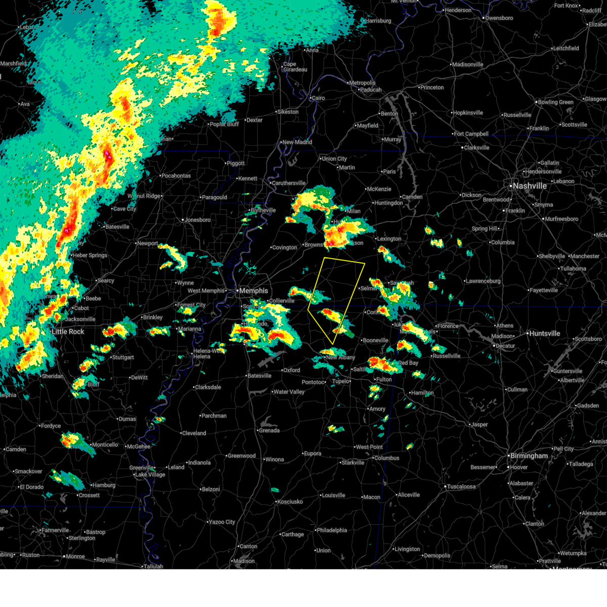 At 441 pm cdt, a severe thunderstorm was located 8 miles east of canaan, or 13 miles north of ripley, moving northeast at 70 mph (radar indicated). Hazards include 60 mph wind gusts and quarter size hail. Hail damage to vehicles is expected. expect wind damage to roofs, siding, and trees. Locations impacted include, chalybeate, murry, brody, pine top, masseyville, new canaan, uptonville, silerton, hickory corners, tiplersville, rogers springs, hornsby, lisbon, woodville, essary springs, brownfield, deanburg, montezuma, robertson, and toone. At 441 pm cdt, a severe thunderstorm was located 8 miles east of canaan, or 13 miles north of ripley, moving northeast at 70 mph (radar indicated). Hazards include 60 mph wind gusts and quarter size hail. Hail damage to vehicles is expected. expect wind damage to roofs, siding, and trees. Locations impacted include, chalybeate, murry, brody, pine top, masseyville, new canaan, uptonville, silerton, hickory corners, tiplersville, rogers springs, hornsby, lisbon, woodville, essary springs, brownfield, deanburg, montezuma, robertson, and toone.
|
| 4/2/2025 4:32 PM CDT |
 Svrmeg the national weather service in memphis has issued a * severe thunderstorm warning for, tippah county in northeastern mississippi, central benton county in northeastern mississippi, northwestern alcorn county in northeastern mississippi, hardeman county in west tennessee, western mcnairy county in west tennessee, south central madison county in west tennessee, southwestern chester county in west tennessee, * until 530 pm cdt. * at 432 pm cdt, a severe thunderstorm was located over gravestown, or 8 miles northwest of ripley, moving north at 65 mph (radar indicated). Hazards include 60 mph wind gusts and quarter size hail. Hail damage to vehicles is expected. Expect wind damage to roofs, siding, and trees. Svrmeg the national weather service in memphis has issued a * severe thunderstorm warning for, tippah county in northeastern mississippi, central benton county in northeastern mississippi, northwestern alcorn county in northeastern mississippi, hardeman county in west tennessee, western mcnairy county in west tennessee, south central madison county in west tennessee, southwestern chester county in west tennessee, * until 530 pm cdt. * at 432 pm cdt, a severe thunderstorm was located over gravestown, or 8 miles northwest of ripley, moving north at 65 mph (radar indicated). Hazards include 60 mph wind gusts and quarter size hail. Hail damage to vehicles is expected. Expect wind damage to roofs, siding, and trees.
|
| 3/31/2025 12:31 AM CDT |
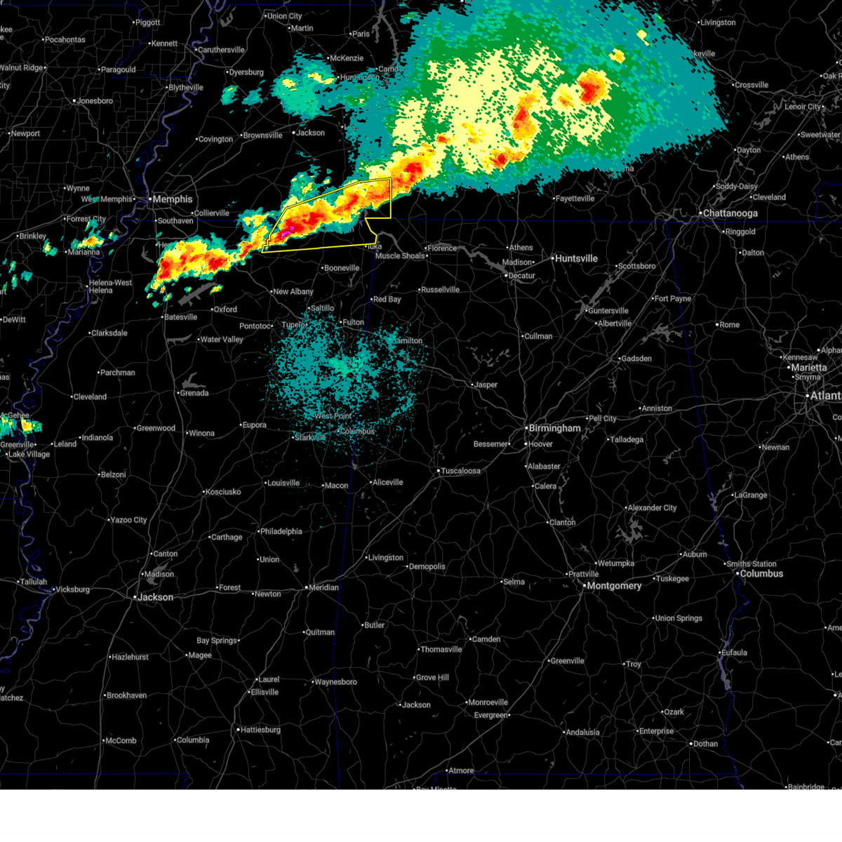 Svrmeg the national weather service in memphis has issued a * severe thunderstorm warning for, northern tippah county in northeastern mississippi, northern tishomingo county in northeastern mississippi, alcorn county in northeastern mississippi, southeastern hardeman county in west tennessee, southern mcnairy county in west tennessee, hardin county in west tennessee, * until 115 am cdt. * at 1231 am cdt, severe thunderstorms were located along a line extending from near waynesboro to near ripley, moving east at 45 mph (radar indicated). Hazards include 60 mph wind gusts and half dollar size hail. Hail damage to vehicles is expected. Expect wind damage to roofs, siding, and trees. Svrmeg the national weather service in memphis has issued a * severe thunderstorm warning for, northern tippah county in northeastern mississippi, northern tishomingo county in northeastern mississippi, alcorn county in northeastern mississippi, southeastern hardeman county in west tennessee, southern mcnairy county in west tennessee, hardin county in west tennessee, * until 115 am cdt. * at 1231 am cdt, severe thunderstorms were located along a line extending from near waynesboro to near ripley, moving east at 45 mph (radar indicated). Hazards include 60 mph wind gusts and half dollar size hail. Hail damage to vehicles is expected. Expect wind damage to roofs, siding, and trees.
|
| 3/31/2025 12:15 AM CDT |
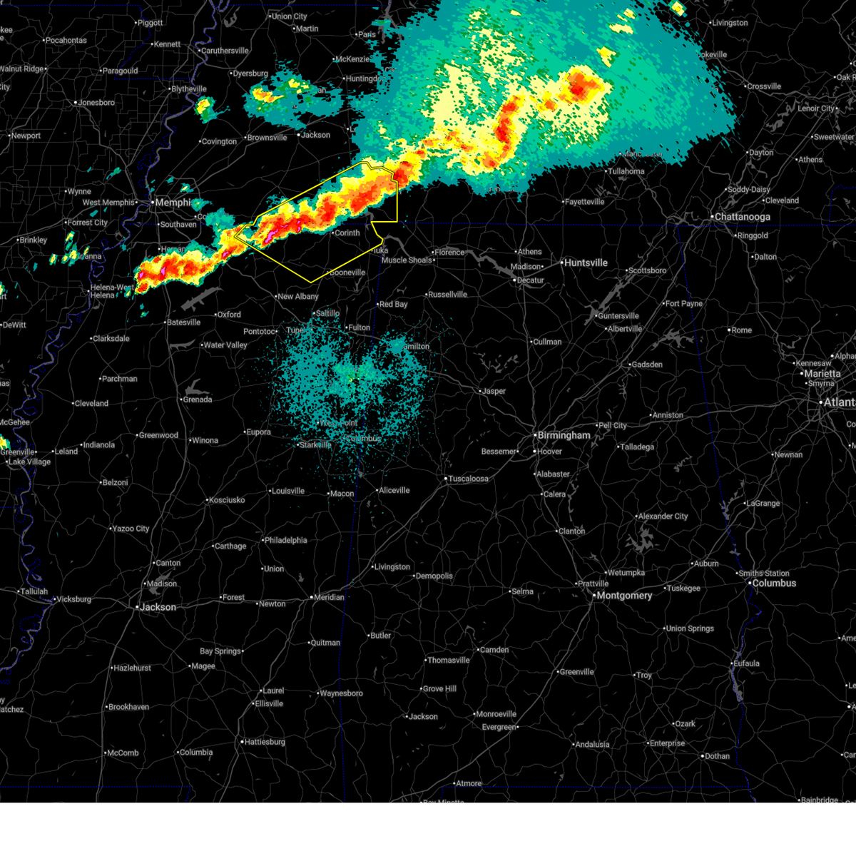 At 1215 am cdt, severe thunderstorms were located along a line extending from 6 miles southeast of olive hill to near pineflat to 6 miles north of ripley, moving southeast at 45 mph (public). Hazards include 60 mph wind gusts and quarter size hail. Hail damage to vehicles is expected. expect wind damage to roofs, siding, and trees. Locations impacted include, murry, brody, selmer, pickwick dam, crump, bruton branch, pickwick landing state park, acton, theo, walkertown, cerro gordo, rogers springs, kossuth, hightown, new lawton, martin camp, savannah, lisbon, caffey, and crumtown. At 1215 am cdt, severe thunderstorms were located along a line extending from 6 miles southeast of olive hill to near pineflat to 6 miles north of ripley, moving southeast at 45 mph (public). Hazards include 60 mph wind gusts and quarter size hail. Hail damage to vehicles is expected. expect wind damage to roofs, siding, and trees. Locations impacted include, murry, brody, selmer, pickwick dam, crump, bruton branch, pickwick landing state park, acton, theo, walkertown, cerro gordo, rogers springs, kossuth, hightown, new lawton, martin camp, savannah, lisbon, caffey, and crumtown.
|
| 3/30/2025 11:58 PM CDT |
 At 1157 pm cdt, severe thunderstorms were located along a line extending from 6 miles northeast of savannah to 7 miles south of selmer to near canaan, moving east at 30 mph (radar indicated). Hazards include 60 mph wind gusts and half dollar size hail. Hail damage to vehicles is expected. expect wind damage to roofs, siding, and trees. Locations impacted include, murry, brody, selmer, pickwick dam, crump, bruton branch, pickwick landing state park, acton, theo, walkertown, cerro gordo, rogers springs, kossuth, hightown, new lawton, martin camp, savannah, lisbon, caffey, and crumtown. At 1157 pm cdt, severe thunderstorms were located along a line extending from 6 miles northeast of savannah to 7 miles south of selmer to near canaan, moving east at 30 mph (radar indicated). Hazards include 60 mph wind gusts and half dollar size hail. Hail damage to vehicles is expected. expect wind damage to roofs, siding, and trees. Locations impacted include, murry, brody, selmer, pickwick dam, crump, bruton branch, pickwick landing state park, acton, theo, walkertown, cerro gordo, rogers springs, kossuth, hightown, new lawton, martin camp, savannah, lisbon, caffey, and crumtown.
|
| 3/30/2025 11:58 PM CDT |
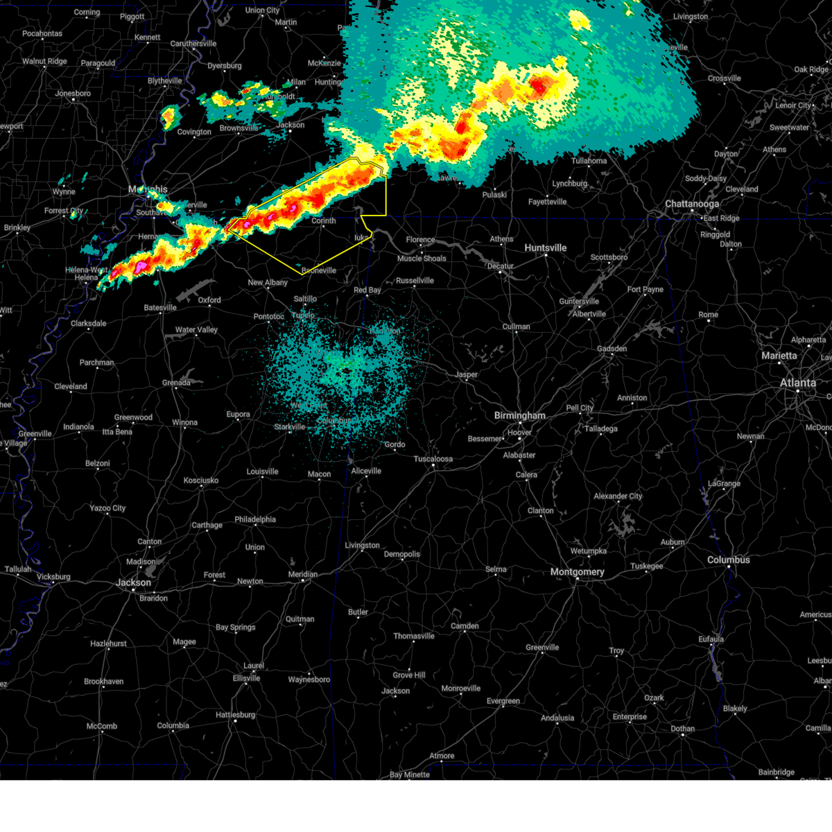 the severe thunderstorm warning has been cancelled and is no longer in effect the severe thunderstorm warning has been cancelled and is no longer in effect
|
| 3/30/2025 11:46 PM CDT |
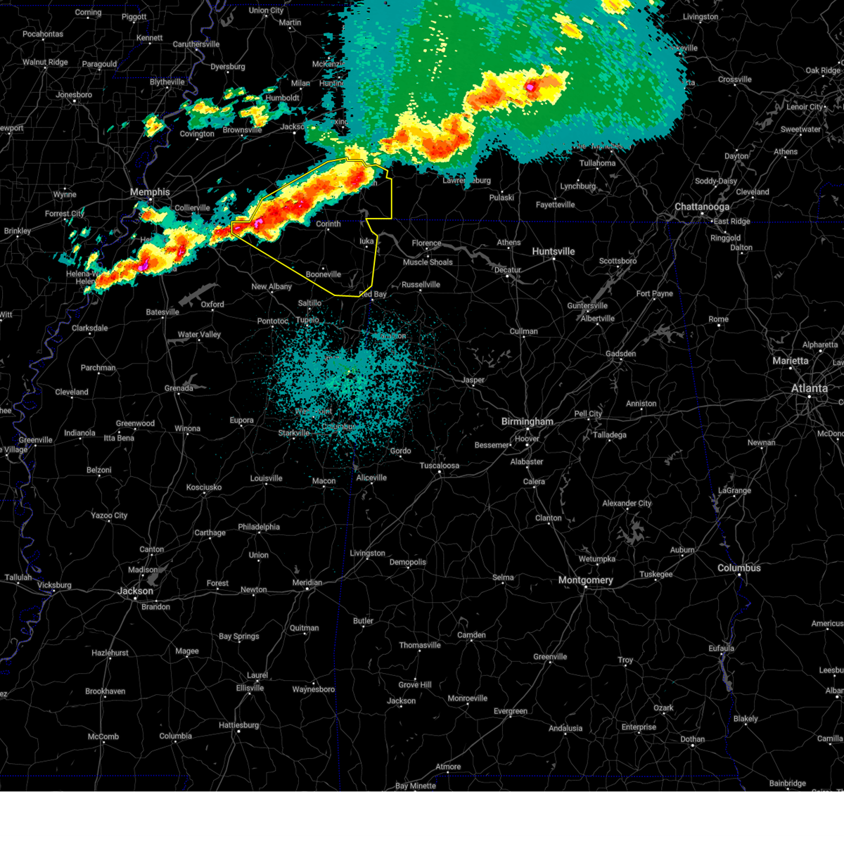 At 1146 pm cdt, severe thunderstorms were located along a line extending from near olive hill to near corinth to near ripley, moving southeast at 45 mph (radar indicated). Hazards include 60 mph wind gusts and half dollar size hail. Hail damage to vehicles is expected. expect wind damage to roofs, siding, and trees. Locations impacted include, murry, brody, selmer, pickwick dam, belmont, masseyville, blythe crossing, crump, bruton branch, pickwick landing state park, acton, theo, walkertown, petertown, cerro gordo, neil, rogers springs, kossuth, hightown, and hornsby. At 1146 pm cdt, severe thunderstorms were located along a line extending from near olive hill to near corinth to near ripley, moving southeast at 45 mph (radar indicated). Hazards include 60 mph wind gusts and half dollar size hail. Hail damage to vehicles is expected. expect wind damage to roofs, siding, and trees. Locations impacted include, murry, brody, selmer, pickwick dam, belmont, masseyville, blythe crossing, crump, bruton branch, pickwick landing state park, acton, theo, walkertown, petertown, cerro gordo, neil, rogers springs, kossuth, hightown, and hornsby.
|
| 3/30/2025 11:46 PM CDT |
 the severe thunderstorm warning has been cancelled and is no longer in effect the severe thunderstorm warning has been cancelled and is no longer in effect
|
| 3/30/2025 11:30 PM CDT |
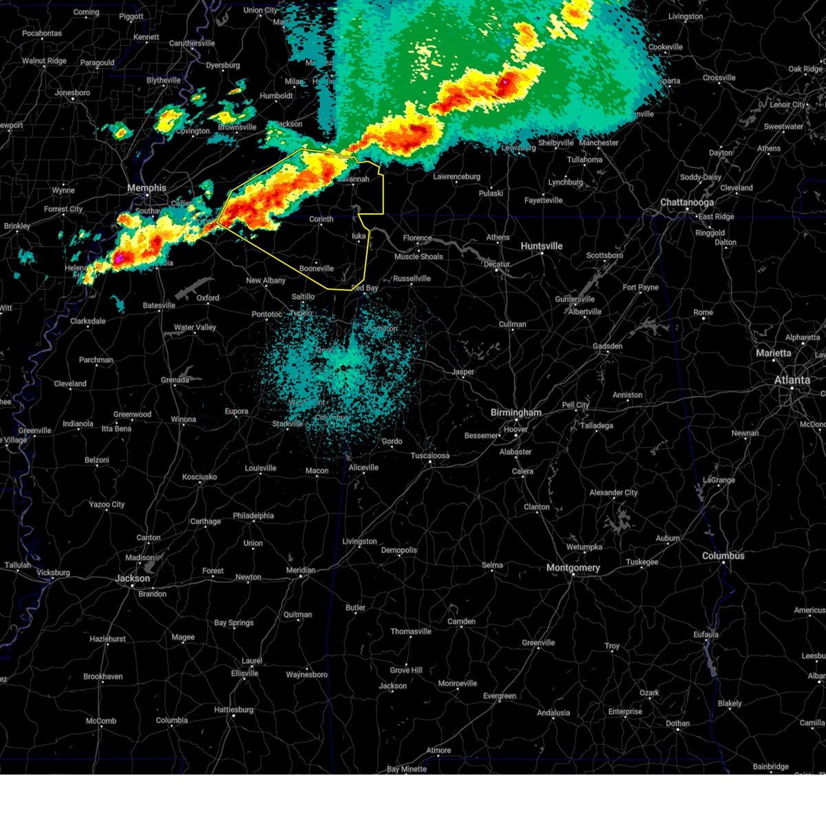 Svrmeg the national weather service in memphis has issued a * severe thunderstorm warning for, north central marshall county in northwestern mississippi, tippah county in northeastern mississippi, northern benton county in northeastern mississippi, tishomingo county in northeastern mississippi, prentiss county in northeastern mississippi, alcorn county in northeastern mississippi, southeastern fayette county in west tennessee, hardeman county in west tennessee, mcnairy county in west tennessee, hardin county in west tennessee, chester county in west tennessee, * until 1230 am cdt. * at 1130 pm cdt, severe thunderstorms were located along a line extending from near morris chapel to big hill pond state park to near gravestown, moving southeast at 45 mph (radar indicated). Hazards include 60 mph wind gusts and half dollar size hail. Hail damage to vehicles is expected. Expect wind damage to roofs, siding, and trees. Svrmeg the national weather service in memphis has issued a * severe thunderstorm warning for, north central marshall county in northwestern mississippi, tippah county in northeastern mississippi, northern benton county in northeastern mississippi, tishomingo county in northeastern mississippi, prentiss county in northeastern mississippi, alcorn county in northeastern mississippi, southeastern fayette county in west tennessee, hardeman county in west tennessee, mcnairy county in west tennessee, hardin county in west tennessee, chester county in west tennessee, * until 1230 am cdt. * at 1130 pm cdt, severe thunderstorms were located along a line extending from near morris chapel to big hill pond state park to near gravestown, moving southeast at 45 mph (radar indicated). Hazards include 60 mph wind gusts and half dollar size hail. Hail damage to vehicles is expected. Expect wind damage to roofs, siding, and trees.
|
| 3/30/2025 11:09 PM CDT |
 the severe thunderstorm warning has been cancelled and is no longer in effect the severe thunderstorm warning has been cancelled and is no longer in effect
|
| 3/30/2025 11:09 PM CDT |
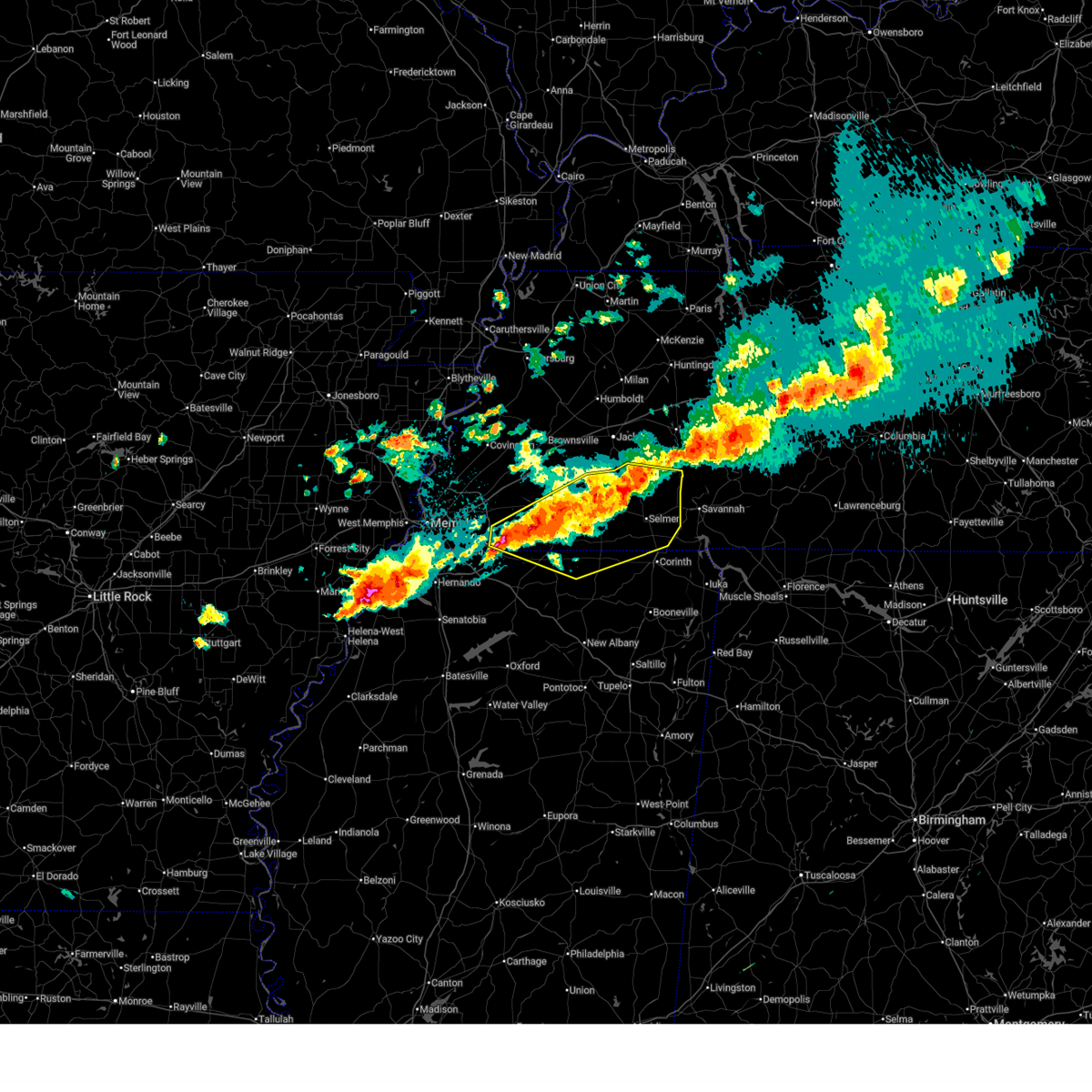 At 1108 pm cdt, severe thunderstorms were located along a line extending from near jacks creek to 6 miles northwest of pocahontas to near lamar, moving east at 45 mph (radar indicated). Hazards include 60 mph wind gusts and half dollar size hail. Hail damage to vehicles is expected. expect wind damage to roofs, siding, and trees. Locations impacted include, ghost river state natural area, chalybeate, brody, selmer, pine top, eastview, masseyville, adamsville, guys, new canaan, silerton, hickory corners, whiteville, kirk, ramer, rossville, tiplersville, rogers springs, mount vinson, and hornsby. At 1108 pm cdt, severe thunderstorms were located along a line extending from near jacks creek to 6 miles northwest of pocahontas to near lamar, moving east at 45 mph (radar indicated). Hazards include 60 mph wind gusts and half dollar size hail. Hail damage to vehicles is expected. expect wind damage to roofs, siding, and trees. Locations impacted include, ghost river state natural area, chalybeate, brody, selmer, pine top, eastview, masseyville, adamsville, guys, new canaan, silerton, hickory corners, whiteville, kirk, ramer, rossville, tiplersville, rogers springs, mount vinson, and hornsby.
|
| 3/30/2025 10:44 PM CDT |
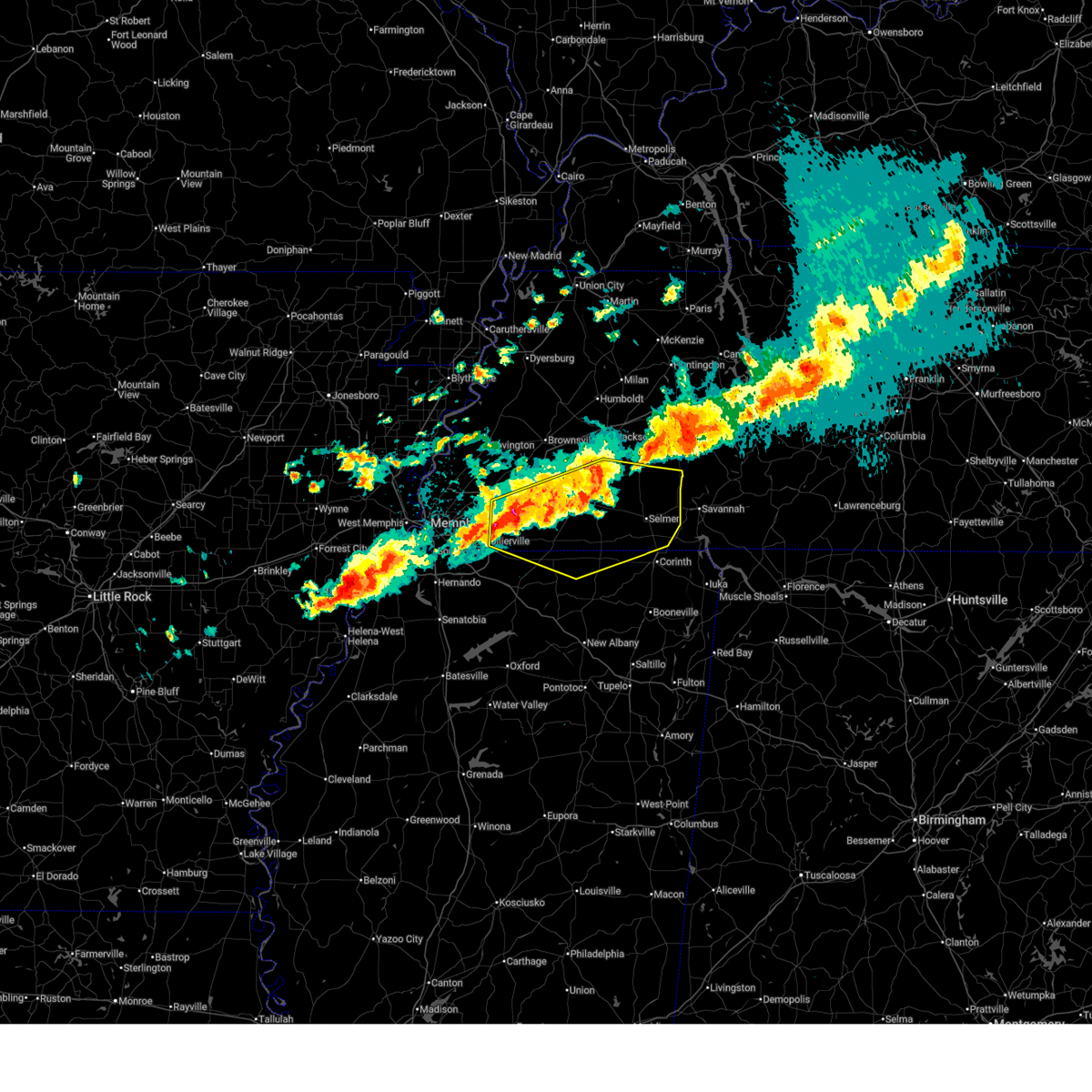 Svrmeg the national weather service in memphis has issued a * severe thunderstorm warning for, north central marshall county in northwestern mississippi, northwestern tippah county in northeastern mississippi, northern benton county in northeastern mississippi, northwestern alcorn county in northeastern mississippi, fayette county in west tennessee, hardeman county in west tennessee, mcnairy county in west tennessee, south central madison county in west tennessee, chester county in west tennessee, * until 1130 pm cdt. * at 1044 pm cdt, severe thunderstorms were located along a line extending from near chickasaw state park to 6 miles north of lagrange to near collierville, moving east at 45 mph (radar indicated). Hazards include 60 mph wind gusts and half dollar size hail. Hail damage to vehicles is expected. Expect wind damage to roofs, siding, and trees. Svrmeg the national weather service in memphis has issued a * severe thunderstorm warning for, north central marshall county in northwestern mississippi, northwestern tippah county in northeastern mississippi, northern benton county in northeastern mississippi, northwestern alcorn county in northeastern mississippi, fayette county in west tennessee, hardeman county in west tennessee, mcnairy county in west tennessee, south central madison county in west tennessee, chester county in west tennessee, * until 1130 pm cdt. * at 1044 pm cdt, severe thunderstorms were located along a line extending from near chickasaw state park to 6 miles north of lagrange to near collierville, moving east at 45 mph (radar indicated). Hazards include 60 mph wind gusts and half dollar size hail. Hail damage to vehicles is expected. Expect wind damage to roofs, siding, and trees.
|
| 3/15/2025 9:20 AM CDT |
 The storm which prompted the warning has weakened below severe limits, and has exited the warned area. therefore, the warning will be allowed to expire. however, small hail and gusty winds are still possible with this thunderstorm. a tornado watch remains in effect until 100 pm cdt for northeastern and northwestern mississippi, and west tennessee. The storm which prompted the warning has weakened below severe limits, and has exited the warned area. therefore, the warning will be allowed to expire. however, small hail and gusty winds are still possible with this thunderstorm. a tornado watch remains in effect until 100 pm cdt for northeastern and northwestern mississippi, and west tennessee.
|
| 3/15/2025 9:02 AM CDT |
 At 902 am cdt, a severe thunderstorm was located near arlington, or 10 miles northeast of bartlett, moving north at 50 mph (radar indicated). Hazards include 60 mph wind gusts and quarter size hail. Hail damage to vehicles is expected. expect wind damage to roofs, siding, and trees. Locations impacted include, ghost river state natural area, burlison, stanton, huntersville, masseyville, westover, covington, silerton, kirk, arlington, elmore park, laconia, lisbon, hudsonville, brims corner, sunnyhill, durhamville, montezuma, clopton, and lightfoot. At 902 am cdt, a severe thunderstorm was located near arlington, or 10 miles northeast of bartlett, moving north at 50 mph (radar indicated). Hazards include 60 mph wind gusts and quarter size hail. Hail damage to vehicles is expected. expect wind damage to roofs, siding, and trees. Locations impacted include, ghost river state natural area, burlison, stanton, huntersville, masseyville, westover, covington, silerton, kirk, arlington, elmore park, laconia, lisbon, hudsonville, brims corner, sunnyhill, durhamville, montezuma, clopton, and lightfoot.
|
| 3/15/2025 8:39 AM CDT |
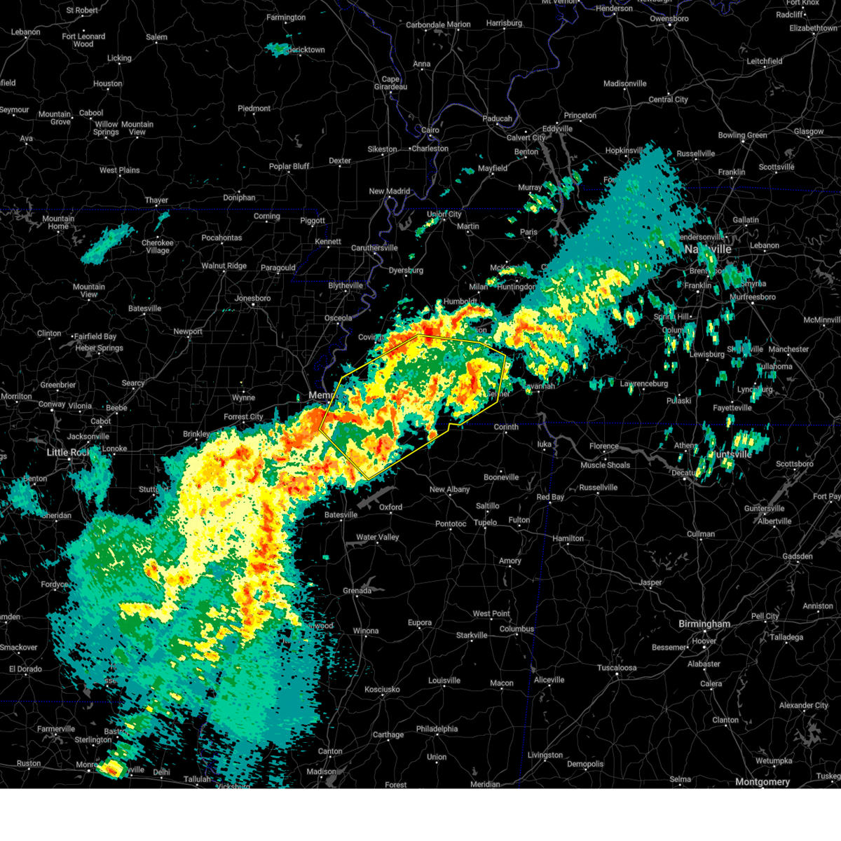 The severe thunderstorm which prompted the warning has moved out of the warned area. therefore, the warning will be allowed to expire. a tornado watch remains in effect until 100 pm cdt for northeastern and northwestern mississippi, and west tennessee. The severe thunderstorm which prompted the warning has moved out of the warned area. therefore, the warning will be allowed to expire. a tornado watch remains in effect until 100 pm cdt for northeastern and northwestern mississippi, and west tennessee.
|
| 3/15/2025 8:38 AM CDT |
 Svrmeg the national weather service in memphis has issued a * severe thunderstorm warning for, northeastern desoto county in northwestern mississippi, northern marshall county in northwestern mississippi, northern benton county in northeastern mississippi, fayette county in west tennessee, hardeman county in west tennessee, eastern lauderdale county in west tennessee, haywood county in west tennessee, madison county in west tennessee, shelby county in west tennessee, chester county in west tennessee, southern crockett county in west tennessee, tipton county in west tennessee, northwestern mcnairy county in west tennessee, * until 930 am cdt. * at 838 am cdt, a severe thunderstorm was located over germantown, moving northeast at 40 mph (radar indicated). Hazards include 60 mph wind gusts and quarter size hail. Hail damage to vehicles is expected. Expect wind damage to roofs, siding, and trees. Svrmeg the national weather service in memphis has issued a * severe thunderstorm warning for, northeastern desoto county in northwestern mississippi, northern marshall county in northwestern mississippi, northern benton county in northeastern mississippi, fayette county in west tennessee, hardeman county in west tennessee, eastern lauderdale county in west tennessee, haywood county in west tennessee, madison county in west tennessee, shelby county in west tennessee, chester county in west tennessee, southern crockett county in west tennessee, tipton county in west tennessee, northwestern mcnairy county in west tennessee, * until 930 am cdt. * at 838 am cdt, a severe thunderstorm was located over germantown, moving northeast at 40 mph (radar indicated). Hazards include 60 mph wind gusts and quarter size hail. Hail damage to vehicles is expected. Expect wind damage to roofs, siding, and trees.
|
| 3/15/2025 8:15 AM CDT |
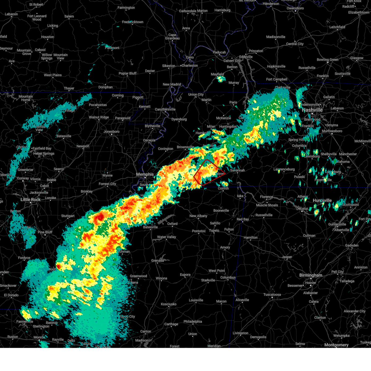 At 814 am cdt, a severe thunderstorm capable of producing a tornado was located 9 miles northwest of pocahontas, or 9 miles southeast of bolivar, moving northeast at 25 mph (radar indicated rotation). Hazards include tornado. Flying debris will be dangerous to those caught without shelter. mobile homes will be damaged or destroyed. damage to roofs, windows, and vehicles will occur. tree damage is likely. Locations impacted include, rogers springs, forty forks, hornsby, rose creek, selmer, pine top, bethel springs, lisbon, masseyville, woodville, chickasaw state forest, mcnairy, lacy, silerton, hickory corners, deanburg, hebron, robertson, middleton, and chickasaw state park. At 814 am cdt, a severe thunderstorm capable of producing a tornado was located 9 miles northwest of pocahontas, or 9 miles southeast of bolivar, moving northeast at 25 mph (radar indicated rotation). Hazards include tornado. Flying debris will be dangerous to those caught without shelter. mobile homes will be damaged or destroyed. damage to roofs, windows, and vehicles will occur. tree damage is likely. Locations impacted include, rogers springs, forty forks, hornsby, rose creek, selmer, pine top, bethel springs, lisbon, masseyville, woodville, chickasaw state forest, mcnairy, lacy, silerton, hickory corners, deanburg, hebron, robertson, middleton, and chickasaw state park.
|
| 3/15/2025 8:13 AM CDT |
 At 813 am cdt, a severe thunderstorm was located near dancyville, or 15 miles south of brownsville, moving northeast at 75 mph (radar indicated). Hazards include 60 mph wind gusts and quarter size hail. Hail damage to vehicles is expected. expect wind damage to roofs, siding, and trees. Locations impacted include, ghost river state natural area, neely, brody, yum yum, selmer, southwest memphis, stanton, horn lake, masseyville, belmont, madison hall, bright, uptonville, chulahoma, silerton, kirk, rossville, arlington, pinson mounds state archaeological park, and rogers springs. At 813 am cdt, a severe thunderstorm was located near dancyville, or 15 miles south of brownsville, moving northeast at 75 mph (radar indicated). Hazards include 60 mph wind gusts and quarter size hail. Hail damage to vehicles is expected. expect wind damage to roofs, siding, and trees. Locations impacted include, ghost river state natural area, neely, brody, yum yum, selmer, southwest memphis, stanton, horn lake, masseyville, belmont, madison hall, bright, uptonville, chulahoma, silerton, kirk, rossville, arlington, pinson mounds state archaeological park, and rogers springs.
|
| 3/15/2025 7:55 AM CDT |
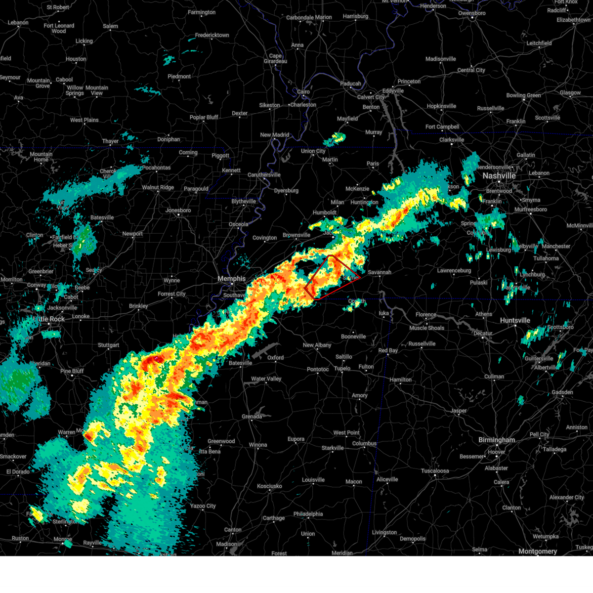 Tormeg the national weather service in memphis has issued a * tornado warning for, central hardeman county in west tennessee, northwestern mcnairy county in west tennessee, southwestern chester county in west tennessee, * until 845 am cdt. * at 754 am cdt, a severe thunderstorm capable of producing a tornado was located 11 miles west of pocahontas, or 12 miles south of bolivar, moving northeast at 30 mph (radar indicated rotation). Hazards include tornado. Flying debris will be dangerous to those caught without shelter. mobile homes will be damaged or destroyed. damage to roofs, windows, and vehicles will occur. Tree damage is likely. Tormeg the national weather service in memphis has issued a * tornado warning for, central hardeman county in west tennessee, northwestern mcnairy county in west tennessee, southwestern chester county in west tennessee, * until 845 am cdt. * at 754 am cdt, a severe thunderstorm capable of producing a tornado was located 11 miles west of pocahontas, or 12 miles south of bolivar, moving northeast at 30 mph (radar indicated rotation). Hazards include tornado. Flying debris will be dangerous to those caught without shelter. mobile homes will be damaged or destroyed. damage to roofs, windows, and vehicles will occur. Tree damage is likely.
|
| 3/15/2025 7:54 AM CDT |
 The storm which prompted the warning has moved out of the area. therefore, the warning will be allowed to expire. a tornado watch remains in effect until 100 pm cdt for northeastern and northwestern mississippi, and west tennessee. The storm which prompted the warning has moved out of the area. therefore, the warning will be allowed to expire. a tornado watch remains in effect until 100 pm cdt for northeastern and northwestern mississippi, and west tennessee.
|
| 3/15/2025 7:53 AM CDT |
 Svrmeg the national weather service in memphis has issued a * severe thunderstorm warning for, northeastern desoto county in northwestern mississippi, marshall county in northwestern mississippi, northeastern tate county in northwestern mississippi, northern benton county in northeastern mississippi, southeastern tipton county in west tennessee, fayette county in west tennessee, hardeman county in west tennessee, northwestern mcnairy county in west tennessee, southern haywood county in west tennessee, southern madison county in west tennessee, shelby county in west tennessee, chester county in west tennessee, * until 845 am cdt. * at 753 am cdt, a severe thunderstorm was located 9 miles west of lagrange, or 17 miles east of collierville, moving northeast at 50 mph (radar indicated). Hazards include 60 mph wind gusts and quarter size hail. Hail damage to vehicles is expected. Expect wind damage to roofs, siding, and trees. Svrmeg the national weather service in memphis has issued a * severe thunderstorm warning for, northeastern desoto county in northwestern mississippi, marshall county in northwestern mississippi, northeastern tate county in northwestern mississippi, northern benton county in northeastern mississippi, southeastern tipton county in west tennessee, fayette county in west tennessee, hardeman county in west tennessee, northwestern mcnairy county in west tennessee, southern haywood county in west tennessee, southern madison county in west tennessee, shelby county in west tennessee, chester county in west tennessee, * until 845 am cdt. * at 753 am cdt, a severe thunderstorm was located 9 miles west of lagrange, or 17 miles east of collierville, moving northeast at 50 mph (radar indicated). Hazards include 60 mph wind gusts and quarter size hail. Hail damage to vehicles is expected. Expect wind damage to roofs, siding, and trees.
|
| 3/15/2025 7:41 AM CDT |
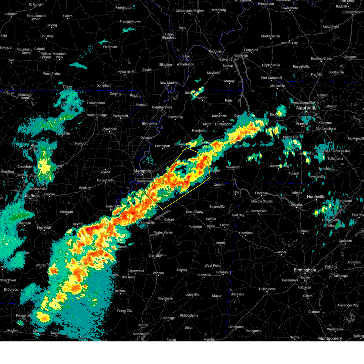 At 741 am cdt, a severe thunderstorm was located near canaan, or 18 miles south of bolivar, moving northeast at 45 mph (radar indicated). Hazards include 60 mph wind gusts and quarter size hail. Hail damage to vehicles is expected. expect wind damage to roofs, siding, and trees. Locations impacted include, ghost river state natural area, snow lake shores, brody, yum yum, bright, uptonville, chulahoma, silerton, kirk, rossville, rogers springs, hornsby, laconia, macon, lurline, lisbon, hillville, victoria, holly springs, and hudsonville. At 741 am cdt, a severe thunderstorm was located near canaan, or 18 miles south of bolivar, moving northeast at 45 mph (radar indicated). Hazards include 60 mph wind gusts and quarter size hail. Hail damage to vehicles is expected. expect wind damage to roofs, siding, and trees. Locations impacted include, ghost river state natural area, snow lake shores, brody, yum yum, bright, uptonville, chulahoma, silerton, kirk, rossville, rogers springs, hornsby, laconia, macon, lurline, lisbon, hillville, victoria, holly springs, and hudsonville.
|
| 3/15/2025 7:27 AM CDT | Winds lofted a carport in pocahonta in mcnairy county TN, 5.7 miles W of Middleton, TN |
| 3/15/2025 7:08 AM CDT |
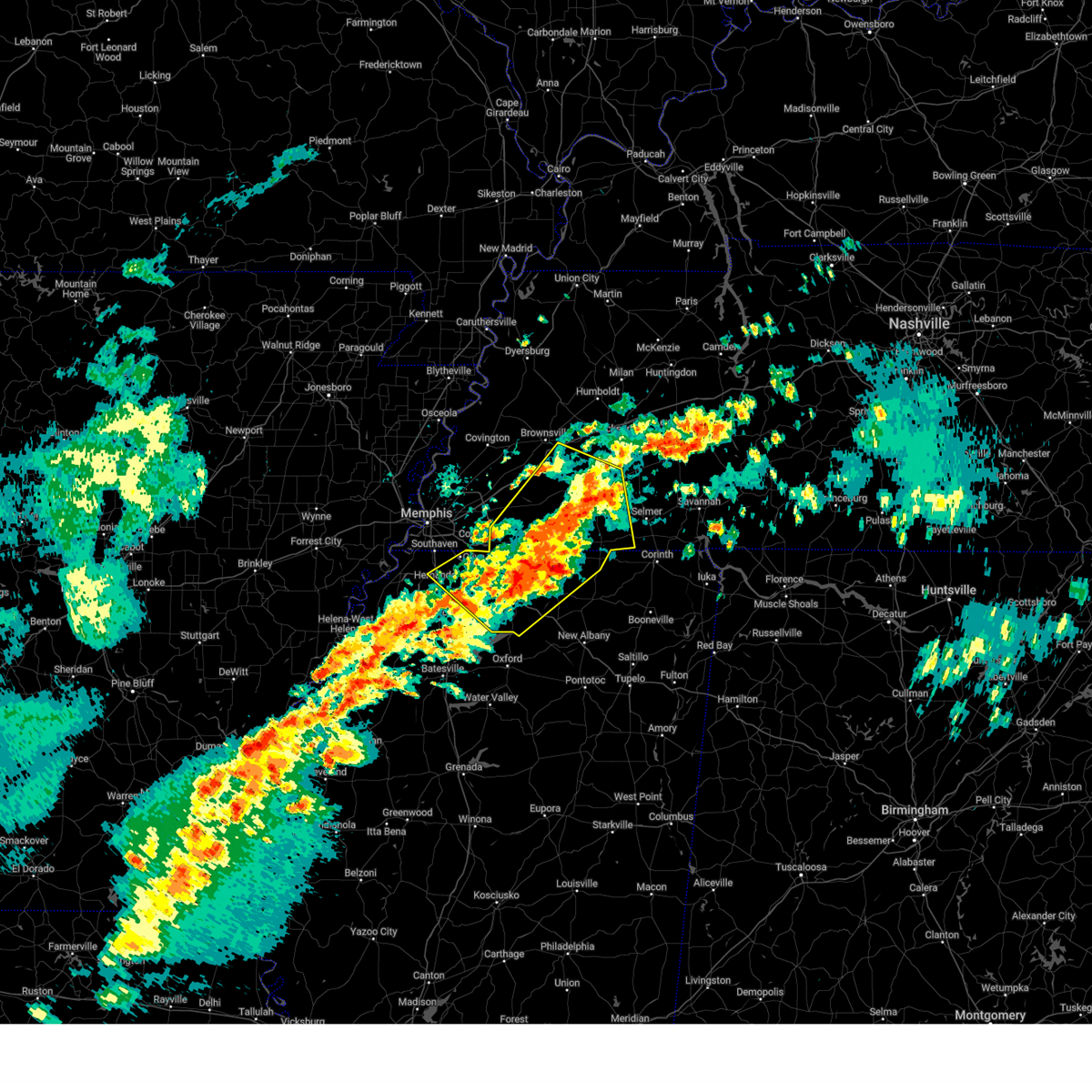 Svrmeg the national weather service in memphis has issued a * severe thunderstorm warning for, eastern desoto county in northwestern mississippi, marshall county in northwestern mississippi, northwestern tippah county in northeastern mississippi, northeastern tate county in northwestern mississippi, benton county in northeastern mississippi, fayette county in west tennessee, hardeman county in west tennessee, southwestern mcnairy county in west tennessee, southeastern haywood county in west tennessee, southwestern madison county in west tennessee, southwestern chester county in west tennessee, * until 800 am cdt. * at 708 am cdt, a severe thunderstorm was located over holly springs, moving northeast at 45 mph (radar indicated). Hazards include 60 mph wind gusts and quarter size hail. Hail damage to vehicles is expected. Expect wind damage to roofs, siding, and trees. Svrmeg the national weather service in memphis has issued a * severe thunderstorm warning for, eastern desoto county in northwestern mississippi, marshall county in northwestern mississippi, northwestern tippah county in northeastern mississippi, northeastern tate county in northwestern mississippi, benton county in northeastern mississippi, fayette county in west tennessee, hardeman county in west tennessee, southwestern mcnairy county in west tennessee, southeastern haywood county in west tennessee, southwestern madison county in west tennessee, southwestern chester county in west tennessee, * until 800 am cdt. * at 708 am cdt, a severe thunderstorm was located over holly springs, moving northeast at 45 mph (radar indicated). Hazards include 60 mph wind gusts and quarter size hail. Hail damage to vehicles is expected. Expect wind damage to roofs, siding, and trees.
|
| 5/27/2024 1:49 AM CDT |
 the severe thunderstorm warning has been cancelled and is no longer in effect the severe thunderstorm warning has been cancelled and is no longer in effect
|
| 5/27/2024 1:49 AM CDT |
 At 148 am cdt, a severe thunderstorm was located near pickwick landing state park, moving east at 80 mph (radar indicated). Hazards include 70 mph wind gusts and nickel size hail. Expect considerable tree damage. damage is likely to mobile homes, roofs, and outbuildings. Locations impacted include, corinth, booneville, savannah, selmer, iuka, pickwick landing state park, j p coleman state park, big hill pond state park, tishomingo state park, adamsville, belmont, burnsville, jumpertown, glen, sardis, tishomingo, pickwick dam, theo, pocahontas, and pineflat. At 148 am cdt, a severe thunderstorm was located near pickwick landing state park, moving east at 80 mph (radar indicated). Hazards include 70 mph wind gusts and nickel size hail. Expect considerable tree damage. damage is likely to mobile homes, roofs, and outbuildings. Locations impacted include, corinth, booneville, savannah, selmer, iuka, pickwick landing state park, j p coleman state park, big hill pond state park, tishomingo state park, adamsville, belmont, burnsville, jumpertown, glen, sardis, tishomingo, pickwick dam, theo, pocahontas, and pineflat.
|
| 5/27/2024 1:26 AM CDT |
 Svrmeg the national weather service in memphis has issued a * severe thunderstorm warning for, northern tippah county in northeastern mississippi, northeastern benton county in northeastern mississippi, tishomingo county in northeastern mississippi, northern prentiss county in northeastern mississippi, alcorn county in northeastern mississippi, southeastern henderson county in west tennessee, southeastern hardeman county in west tennessee, mcnairy county in west tennessee, hardin county in west tennessee, chester county in west tennessee, southern decatur county in west tennessee, * until 230 am cdt. * at 126 am cdt, a severe thunderstorm was located near selmer, moving east at 80 mph (radar indicated). Hazards include 70 mph wind gusts and nickel size hail. Expect considerable tree damage. Damage is likely to mobile homes, roofs, and outbuildings. Svrmeg the national weather service in memphis has issued a * severe thunderstorm warning for, northern tippah county in northeastern mississippi, northeastern benton county in northeastern mississippi, tishomingo county in northeastern mississippi, northern prentiss county in northeastern mississippi, alcorn county in northeastern mississippi, southeastern henderson county in west tennessee, southeastern hardeman county in west tennessee, mcnairy county in west tennessee, hardin county in west tennessee, chester county in west tennessee, southern decatur county in west tennessee, * until 230 am cdt. * at 126 am cdt, a severe thunderstorm was located near selmer, moving east at 80 mph (radar indicated). Hazards include 70 mph wind gusts and nickel size hail. Expect considerable tree damage. Damage is likely to mobile homes, roofs, and outbuildings.
|
| 5/27/2024 1:20 AM CDT |
 the severe thunderstorm warning has been cancelled and is no longer in effect the severe thunderstorm warning has been cancelled and is no longer in effect
|
| 5/27/2024 1:20 AM CDT |
 At 120 am cdt, a severe thunderstorm was located near masseyville, or near henderson, moving east at 50 mph (radar indicated). Hazards include 70 mph wind gusts and nickel size hail. Expect considerable tree damage. damage is likely to mobile homes, roofs, and outbuildings. Locations impacted include, henderson, bolivar, selmer, chickasaw state forest, big hill pond state park, chickasaw state park, adamsville, silerton, masseyville, theo, michigan city, canaan, pocahontas, lagrange, jacks creek, cloverport, robertson, mcnairy, walnut, and bethel springs. At 120 am cdt, a severe thunderstorm was located near masseyville, or near henderson, moving east at 50 mph (radar indicated). Hazards include 70 mph wind gusts and nickel size hail. Expect considerable tree damage. damage is likely to mobile homes, roofs, and outbuildings. Locations impacted include, henderson, bolivar, selmer, chickasaw state forest, big hill pond state park, chickasaw state park, adamsville, silerton, masseyville, theo, michigan city, canaan, pocahontas, lagrange, jacks creek, cloverport, robertson, mcnairy, walnut, and bethel springs.
|
| 5/27/2024 1:01 AM CDT |
 At 100 am cdt, a severe thunderstorm was located near bolivar, moving east at 55 mph (radar indicated). Hazards include 70 mph wind gusts and nickel size hail. Expect considerable tree damage. damage is likely to mobile homes, roofs, and outbuildings. Locations impacted include, henderson, bolivar, selmer, chickasaw state park, chickasaw state forest, big hill pond state park, whiteville, somerville, adamsville, silerton, masseyville, theo, hillville, canaan, pocahontas, lagrange, jacks creek, dancyville, cloverport, and mercer. At 100 am cdt, a severe thunderstorm was located near bolivar, moving east at 55 mph (radar indicated). Hazards include 70 mph wind gusts and nickel size hail. Expect considerable tree damage. damage is likely to mobile homes, roofs, and outbuildings. Locations impacted include, henderson, bolivar, selmer, chickasaw state park, chickasaw state forest, big hill pond state park, whiteville, somerville, adamsville, silerton, masseyville, theo, hillville, canaan, pocahontas, lagrange, jacks creek, dancyville, cloverport, and mercer.
|
| 5/27/2024 12:47 AM CDT |
 At 1247 am cdt, a severe thunderstorm was located near whiteville, or 9 miles west of bolivar, moving east at 55 mph (radar indicated). Hazards include 60 mph wind gusts and nickel size hail. Expect damage to roofs, siding, and trees. Locations impacted include, henderson, bolivar, selmer, chickasaw state park, chickasaw state forest, big hill pond state park, whiteville, somerville, adamsville, silerton, masseyville, theo, hillville, canaan, pocahontas, lagrange, jacks creek, dancyville, cloverport, and mercer. At 1247 am cdt, a severe thunderstorm was located near whiteville, or 9 miles west of bolivar, moving east at 55 mph (radar indicated). Hazards include 60 mph wind gusts and nickel size hail. Expect damage to roofs, siding, and trees. Locations impacted include, henderson, bolivar, selmer, chickasaw state park, chickasaw state forest, big hill pond state park, whiteville, somerville, adamsville, silerton, masseyville, theo, hillville, canaan, pocahontas, lagrange, jacks creek, dancyville, cloverport, and mercer.
|
| 5/27/2024 12:45 AM CDT |
 Svrmeg the national weather service in memphis has issued a * severe thunderstorm warning for, northern tippah county in northeastern mississippi, northern benton county in northeastern mississippi, western alcorn county in northeastern mississippi, fayette county in west tennessee, hardeman county in west tennessee, mcnairy county in west tennessee, southeastern haywood county in west tennessee, southern madison county in west tennessee, chester county in west tennessee, * until 130 am cdt. * at 1245 am cdt, a severe thunderstorm was located near whiteville, or 10 miles west of bolivar, moving east at 55 mph (radar indicated). Hazards include 60 mph wind gusts and nickel size hail. expect damage to roofs, siding, and trees Svrmeg the national weather service in memphis has issued a * severe thunderstorm warning for, northern tippah county in northeastern mississippi, northern benton county in northeastern mississippi, western alcorn county in northeastern mississippi, fayette county in west tennessee, hardeman county in west tennessee, mcnairy county in west tennessee, southeastern haywood county in west tennessee, southern madison county in west tennessee, chester county in west tennessee, * until 130 am cdt. * at 1245 am cdt, a severe thunderstorm was located near whiteville, or 10 miles west of bolivar, moving east at 55 mph (radar indicated). Hazards include 60 mph wind gusts and nickel size hail. expect damage to roofs, siding, and trees
|
| 5/14/2024 2:03 PM CDT |
 Svrmeg the national weather service in memphis has issued a * severe thunderstorm warning for, northern tippah county in northeastern mississippi, northwestern alcorn county in northeastern mississippi, southeastern hardeman county in west tennessee, southwestern mcnairy county in west tennessee, * until 245 pm cdt. * at 202 pm cdt, a severe thunderstorm was located 10 miles north of ripley, moving northeast at 30 mph (radar indicated). Hazards include 60 mph wind gusts and quarter size hail. Hail damage to vehicles is expected. Expect wind damage to roofs, siding, and trees. Svrmeg the national weather service in memphis has issued a * severe thunderstorm warning for, northern tippah county in northeastern mississippi, northwestern alcorn county in northeastern mississippi, southeastern hardeman county in west tennessee, southwestern mcnairy county in west tennessee, * until 245 pm cdt. * at 202 pm cdt, a severe thunderstorm was located 10 miles north of ripley, moving northeast at 30 mph (radar indicated). Hazards include 60 mph wind gusts and quarter size hail. Hail damage to vehicles is expected. Expect wind damage to roofs, siding, and trees.
|
| 9/6/2023 4:55 PM CDT |
 At 455 pm cdt, a severe thunderstorm was located near pocahontas, or near big hill pond state park, moving east at 25 mph (radar indicated). Hazards include 60 mph wind gusts and quarter size hail. Hail damage to vehicles is expected. expect wind damage to roofs, siding, and trees. locations impacted include, corinth, big hill pond state park, pocahontas, theo, walnut, middleton, eastview, guys, ramer, chalybeate, wenasoga, essary springs, brownfield, gift, lone pine, cypress, chewalla and tiplersville. hail threat, radar indicated max hail size, 1. 00 in wind threat, radar indicated max wind gust, 60 mph. At 455 pm cdt, a severe thunderstorm was located near pocahontas, or near big hill pond state park, moving east at 25 mph (radar indicated). Hazards include 60 mph wind gusts and quarter size hail. Hail damage to vehicles is expected. expect wind damage to roofs, siding, and trees. locations impacted include, corinth, big hill pond state park, pocahontas, theo, walnut, middleton, eastview, guys, ramer, chalybeate, wenasoga, essary springs, brownfield, gift, lone pine, cypress, chewalla and tiplersville. hail threat, radar indicated max hail size, 1. 00 in wind threat, radar indicated max wind gust, 60 mph.
|
| 9/6/2023 4:44 PM CDT |
 At 444 pm cdt, a severe thunderstorm was located near pocahontas, or 11 miles west of big hill pond state park, moving east at 25 mph (radar indicated). Hazards include 60 mph wind gusts and quarter size hail. Hail damage to vehicles is expected. Expect wind damage to roofs, siding, and trees. At 444 pm cdt, a severe thunderstorm was located near pocahontas, or 11 miles west of big hill pond state park, moving east at 25 mph (radar indicated). Hazards include 60 mph wind gusts and quarter size hail. Hail damage to vehicles is expected. Expect wind damage to roofs, siding, and trees.
|
| 8/9/2023 1:52 PM CDT |
 The severe thunderstorm warning for central tippah, northeastern benton, northwestern prentiss, alcorn, southeastern hardeman and southwestern mcnairy counties will expire at 200 pm cdt, the storm which prompted the warning has moved out of the area. therefore, the warning will be allowed to expire. a severe thunderstorm watch remains in effect until 800 pm cdt for northeastern mississippi. The severe thunderstorm warning for central tippah, northeastern benton, northwestern prentiss, alcorn, southeastern hardeman and southwestern mcnairy counties will expire at 200 pm cdt, the storm which prompted the warning has moved out of the area. therefore, the warning will be allowed to expire. a severe thunderstorm watch remains in effect until 800 pm cdt for northeastern mississippi.
|
| 8/9/2023 1:27 PM CDT |
 At 127 pm cdt, a severe thunderstorm was located 8 miles southwest of theo, or 11 miles northeast of ripley, moving southeast at 50 mph (radar indicated). Hazards include 60 mph wind gusts. Expect damage to roofs, siding, and trees. locations impacted include, corinth, booneville, big hill pond state park, jumpertown, glen, pocahontas, hinkle, theo, farmington, walnut, middleton, falkner, rienzi, kossuth, chalybeate, strickland, collinstown, wenasoga, biggersville and jobes. hail threat, radar indicated max hail size, <. 75 in wind threat, radar indicated max wind gust, 60 mph. At 127 pm cdt, a severe thunderstorm was located 8 miles southwest of theo, or 11 miles northeast of ripley, moving southeast at 50 mph (radar indicated). Hazards include 60 mph wind gusts. Expect damage to roofs, siding, and trees. locations impacted include, corinth, booneville, big hill pond state park, jumpertown, glen, pocahontas, hinkle, theo, farmington, walnut, middleton, falkner, rienzi, kossuth, chalybeate, strickland, collinstown, wenasoga, biggersville and jobes. hail threat, radar indicated max hail size, <. 75 in wind threat, radar indicated max wind gust, 60 mph.
|
| 8/9/2023 1:09 PM CDT |
 At 109 pm cdt, a severe thunderstorm was located near canaan, or 19 miles south of bolivar, moving southeast at 50 mph (radar indicated). Hazards include 60 mph wind gusts and nickel size hail. expect damage to roofs, siding, and trees At 109 pm cdt, a severe thunderstorm was located near canaan, or 19 miles south of bolivar, moving southeast at 50 mph (radar indicated). Hazards include 60 mph wind gusts and nickel size hail. expect damage to roofs, siding, and trees
|
| 8/7/2023 9:49 AM CDT |
 At 948 am cdt, a severe thunderstorm was located near lagrange, or 17 miles southwest of bolivar, moving east at 45 mph (radar indicated). Hazards include 60 mph wind gusts. Expect damage to roofs, siding, and trees. locations impacted include, canaan, pocahontas, michigan city, walnut, middleton, falkner, grand junction, saulsbury, rogers springs, chalybeate, brody, new canaan, essary springs, brownfield, hamilton, van buren and tiplersville. hail threat, radar indicated max hail size, <. 75 in wind threat, radar indicated max wind gust, 60 mph. At 948 am cdt, a severe thunderstorm was located near lagrange, or 17 miles southwest of bolivar, moving east at 45 mph (radar indicated). Hazards include 60 mph wind gusts. Expect damage to roofs, siding, and trees. locations impacted include, canaan, pocahontas, michigan city, walnut, middleton, falkner, grand junction, saulsbury, rogers springs, chalybeate, brody, new canaan, essary springs, brownfield, hamilton, van buren and tiplersville. hail threat, radar indicated max hail size, <. 75 in wind threat, radar indicated max wind gust, 60 mph.
|
| 8/7/2023 9:32 AM CDT |
 At 932 am cdt, a severe thunderstorm was located 9 miles south of somerville, or 18 miles east of collierville, moving east at 45 mph (radar indicated). Hazards include 60 mph wind gusts and penny size hail. expect damage to roofs, siding, and trees At 932 am cdt, a severe thunderstorm was located 9 miles south of somerville, or 18 miles east of collierville, moving east at 45 mph (radar indicated). Hazards include 60 mph wind gusts and penny size hail. expect damage to roofs, siding, and trees
|
| 8/5/2023 5:57 PM CDT |
 The severe thunderstorm warning for hardeman county will expire at 600 pm cdt, the storm which prompted the warning has moved out of the area. therefore, the warning will be allowed to expire. however small hail and gusty winds are still possible with this thunderstorm. a severe thunderstorm watch remains in effect until 900 pm cdt for west tennessee. remember, a severe thunderstorm warning still remains in effect for hardeman county until 600 pm. The severe thunderstorm warning for hardeman county will expire at 600 pm cdt, the storm which prompted the warning has moved out of the area. therefore, the warning will be allowed to expire. however small hail and gusty winds are still possible with this thunderstorm. a severe thunderstorm watch remains in effect until 900 pm cdt for west tennessee. remember, a severe thunderstorm warning still remains in effect for hardeman county until 600 pm.
|
| 8/5/2023 5:56 PM CDT |
 At 556 pm cdt, a severe thunderstorm was located 7 miles northwest of pocahontas, or 11 miles southeast of bolivar, moving east at 25 mph (radar indicated). Hazards include 60 mph wind gusts and quarter size hail. Hail damage to vehicles is expected. Expect wind damage to roofs, siding, and trees. At 556 pm cdt, a severe thunderstorm was located 7 miles northwest of pocahontas, or 11 miles southeast of bolivar, moving east at 25 mph (radar indicated). Hazards include 60 mph wind gusts and quarter size hail. Hail damage to vehicles is expected. Expect wind damage to roofs, siding, and trees.
|
| 8/5/2023 5:45 PM CDT |
 At 545 pm cdt, a severe thunderstorm was located 7 miles southeast of bolivar, moving east at 45 mph (radar indicated). Hazards include 60 mph wind gusts and quarter size hail. Hail damage to vehicles is expected. expect wind damage to roofs, siding, and trees. locations impacted include, bolivar, middleton, toone, grand junction, hornsby, hickory valley, saulsbury, rogers springs, lisbon, middleburg, hebron, van buren and shandy. hail threat, radar indicated max hail size, 1. 00 in wind threat, radar indicated max wind gust, 60 mph. At 545 pm cdt, a severe thunderstorm was located 7 miles southeast of bolivar, moving east at 45 mph (radar indicated). Hazards include 60 mph wind gusts and quarter size hail. Hail damage to vehicles is expected. expect wind damage to roofs, siding, and trees. locations impacted include, bolivar, middleton, toone, grand junction, hornsby, hickory valley, saulsbury, rogers springs, lisbon, middleburg, hebron, van buren and shandy. hail threat, radar indicated max hail size, 1. 00 in wind threat, radar indicated max wind gust, 60 mph.
|
| 8/5/2023 5:39 PM CDT |
 At 539 pm cdt, a severe thunderstorm was located over bolivar, moving east at 45 mph (radar indicated). Hazards include 60 mph wind gusts and quarter size hail. Hail damage to vehicles is expected. expect wind damage to roofs, siding, and trees. locations impacted include, bolivar, chickasaw state forest, whiteville, lagrange, cloverport, middleton, toone, grand junction, hornsby, la grange, hickory valley, saulsbury, rogers springs, fayette corners, laconia, lisbon, middleburg, teague, hebron and pattersonville. hail threat, radar indicated max hail size, 1. 00 in wind threat, radar indicated max wind gust, 60 mph. At 539 pm cdt, a severe thunderstorm was located over bolivar, moving east at 45 mph (radar indicated). Hazards include 60 mph wind gusts and quarter size hail. Hail damage to vehicles is expected. expect wind damage to roofs, siding, and trees. locations impacted include, bolivar, chickasaw state forest, whiteville, lagrange, cloverport, middleton, toone, grand junction, hornsby, la grange, hickory valley, saulsbury, rogers springs, fayette corners, laconia, lisbon, middleburg, teague, hebron and pattersonville. hail threat, radar indicated max hail size, 1. 00 in wind threat, radar indicated max wind gust, 60 mph.
|
| 8/5/2023 5:14 PM CDT |
 At 514 pm cdt, a severe thunderstorm was located over somerville, or 20 miles west of bolivar, moving east at 45 mph (radar indicated). Hazards include 60 mph wind gusts and quarter size hail. Hail damage to vehicles is expected. Expect wind damage to roofs, siding, and trees. At 514 pm cdt, a severe thunderstorm was located over somerville, or 20 miles west of bolivar, moving east at 45 mph (radar indicated). Hazards include 60 mph wind gusts and quarter size hail. Hail damage to vehicles is expected. Expect wind damage to roofs, siding, and trees.
|
| 7/21/2023 3:10 PM CDT |
 At 309 pm cdt, severe thunderstorms were located along a line extending from near bemis to near selmer to near theo, moving east at 50 mph (public). Hazards include 60 mph wind gusts. Expect damage to roofs, siding, and trees. locations impacted include, jackson, corinth, lexington, savannah, henderson, selmer, pickwick landing state park, j p coleman state park, chickasaw state park, chickasaw state forest, big hill pond state park, parsons, adamsville, decaturville, sardis, silerton, pickwick dam, masseyville, reagan and theo. hail threat, radar indicated max hail size, <. 75 in wind threat, radar indicated max wind gust, 60 mph. At 309 pm cdt, severe thunderstorms were located along a line extending from near bemis to near selmer to near theo, moving east at 50 mph (public). Hazards include 60 mph wind gusts. Expect damage to roofs, siding, and trees. locations impacted include, jackson, corinth, lexington, savannah, henderson, selmer, pickwick landing state park, j p coleman state park, chickasaw state park, chickasaw state forest, big hill pond state park, parsons, adamsville, decaturville, sardis, silerton, pickwick dam, masseyville, reagan and theo. hail threat, radar indicated max hail size, <. 75 in wind threat, radar indicated max wind gust, 60 mph.
|
| 7/21/2023 2:54 PM CDT |
 At 253 pm cdt, severe thunderstorms were located along a line extending from 7 miles north of mercer to 8 miles south of masseyville to 7 miles southwest of pocahontas, moving east at 50 mph (public). Hazards include 60 mph wind gusts and penny size hail. expect damage to roofs, siding, and trees At 253 pm cdt, severe thunderstorms were located along a line extending from 7 miles north of mercer to 8 miles south of masseyville to 7 miles southwest of pocahontas, moving east at 50 mph (public). Hazards include 60 mph wind gusts and penny size hail. expect damage to roofs, siding, and trees
|
| 7/21/2023 2:39 PM CDT |
 At 237 pm cdt, severe thunderstorms were located along a line extending from near brownsville to bolivar to near canaan, moving east at 50 mph (public). Hazards include 60 mph wind gusts. Expect damage to roofs, siding, and trees. locations impacted include, jackson, brownsville, henderson, bolivar, selmer, chickasaw state forest, big hill pond state park, chickasaw state park, whiteville, silerton, masseyville, hillville, michigan city, pocahontas, bemis, cloverport, mercer, robertson, mcnairy and bethel springs. hail threat, radar indicated max hail size, <. 75 in wind threat, radar indicated max wind gust, 60 mph. At 237 pm cdt, severe thunderstorms were located along a line extending from near brownsville to bolivar to near canaan, moving east at 50 mph (public). Hazards include 60 mph wind gusts. Expect damage to roofs, siding, and trees. locations impacted include, jackson, brownsville, henderson, bolivar, selmer, chickasaw state forest, big hill pond state park, chickasaw state park, whiteville, silerton, masseyville, hillville, michigan city, pocahontas, bemis, cloverport, mercer, robertson, mcnairy and bethel springs. hail threat, radar indicated max hail size, <. 75 in wind threat, radar indicated max wind gust, 60 mph.
|
| 7/21/2023 2:23 PM CDT |
 At 220 pm cdt, severe thunderstorms were located along a line extending from near nutbush to 6 miles east of somerville to near slayden, moving east at 50 mph (public). Hazards include 60 mph wind gusts. Expect damage to roofs, siding, and trees. locations impacted include, jackson, brownsville, henderson, bolivar, selmer, chickasaw state forest, big hill pond state park, chickasaw state park, whiteville, somerville, silerton, mt pleasant, masseyville, hillville, michigan city, pocahontas, bemis, lagrange, dancyville and cloverport. hail threat, radar indicated max hail size, <. 75 in wind threat, radar indicated max wind gust, 60 mph. At 220 pm cdt, severe thunderstorms were located along a line extending from near nutbush to 6 miles east of somerville to near slayden, moving east at 50 mph (public). Hazards include 60 mph wind gusts. Expect damage to roofs, siding, and trees. locations impacted include, jackson, brownsville, henderson, bolivar, selmer, chickasaw state forest, big hill pond state park, chickasaw state park, whiteville, somerville, silerton, mt pleasant, masseyville, hillville, michigan city, pocahontas, bemis, lagrange, dancyville and cloverport. hail threat, radar indicated max hail size, <. 75 in wind threat, radar indicated max wind gust, 60 mph.
|
| 7/21/2023 2:07 PM CDT |
 At 207 pm cdt, severe thunderstorms were located along a line extending from 6 miles southwest of ripley to near somerville to near mt pleasant, moving east at 65 mph (public). Hazards include 60 mph wind gusts and penny size hail. expect damage to roofs, siding, and trees At 207 pm cdt, severe thunderstorms were located along a line extending from 6 miles southwest of ripley to near somerville to near mt pleasant, moving east at 65 mph (public). Hazards include 60 mph wind gusts and penny size hail. expect damage to roofs, siding, and trees
|
| 7/18/2023 7:07 PM CDT |
 The severe thunderstorm warning for northwestern union, marshall, tippah, benton, western alcorn, southeastern fayette and southern hardeman counties will expire at 715 pm cdt, the storms which prompted the warning have moved out of the area. therefore, the warning will be allowed to expire. a severe thunderstorm watch remains in effect until midnight cdt for northeastern and northwestern mississippi, and west tennessee. The severe thunderstorm warning for northwestern union, marshall, tippah, benton, western alcorn, southeastern fayette and southern hardeman counties will expire at 715 pm cdt, the storms which prompted the warning have moved out of the area. therefore, the warning will be allowed to expire. a severe thunderstorm watch remains in effect until midnight cdt for northeastern and northwestern mississippi, and west tennessee.
|
| 7/18/2023 6:32 PM CDT |
 At 632 pm cdt, severe thunderstorms were located along a line extending from near whiteville to near byhalia, moving southeast at 60 mph (radar indicated). Hazards include 60 mph wind gusts and penny size hail. expect damage to roofs, siding, and trees At 632 pm cdt, severe thunderstorms were located along a line extending from near whiteville to near byhalia, moving southeast at 60 mph (radar indicated). Hazards include 60 mph wind gusts and penny size hail. expect damage to roofs, siding, and trees
|
| 6/25/2023 7:53 PM CDT |
 At 753 pm cdt, a severe thunderstorm was located near ripley, moving southeast at 65 mph (radar indicated). Hazards include 70 mph wind gusts. Expect considerable tree damage. Damage is likely to mobile homes, roofs, and outbuildings. At 753 pm cdt, a severe thunderstorm was located near ripley, moving southeast at 65 mph (radar indicated). Hazards include 70 mph wind gusts. Expect considerable tree damage. Damage is likely to mobile homes, roofs, and outbuildings.
|
| 6/25/2023 7:52 PM CDT | Trees and powerlines down on c allen lan in hardeman county TN, 2.9 miles ESE of Middleton, TN |
| 6/25/2023 7:20 PM CDT |
 At 719 pm cdt, a severe thunderstorm was located near lagrange, or 21 miles east of collierville, moving southeast at 75 mph (radar indicated). Hazards include 70 mph wind gusts. Expect considerable tree damage. Damage is likely to mobile homes, roofs, and outbuildings. At 719 pm cdt, a severe thunderstorm was located near lagrange, or 21 miles east of collierville, moving southeast at 75 mph (radar indicated). Hazards include 70 mph wind gusts. Expect considerable tree damage. Damage is likely to mobile homes, roofs, and outbuildings.
|
| 1/1/0001 12:00 AM | Trees uprooted and laid across road in pocahonta in hardeman county TN, 5.1 miles W of Middleton, TN |
| 1/1/0001 12:00 AM | Outbuilding destroye in hardeman county TN, 4.1 miles N of Middleton, TN |
| 4/13/2022 5:56 PM CDT |
 At 556 pm cdt, severe thunderstorms were located along a line extending from 8 miles southeast of milan to near chickasaw state park to near lagrange, moving east at 45 mph (radar indicated). Hazards include 60 mph wind gusts. expect damage to roofs, siding, and trees At 556 pm cdt, severe thunderstorms were located along a line extending from 8 miles southeast of milan to near chickasaw state park to near lagrange, moving east at 45 mph (radar indicated). Hazards include 60 mph wind gusts. expect damage to roofs, siding, and trees
|
| 3/30/2022 6:16 PM CDT |
 At 615 pm cdt, severe thunderstorms were located along a line extending from near silerton to near keownville, moving northeast at 55 mph (radar indicated). Hazards include 60 mph wind gusts. Expect damage to roofs, siding, and trees. Locations impacted include, corinth, booneville, new albany, henderson, bolivar, ripley, selmer, baldwyn, big hill pond state park, adamsville, blue mountain, jumpertown, glen, silerton, masseyville, theo, pocahontas, hinkle, wheeler and thrashers. At 615 pm cdt, severe thunderstorms were located along a line extending from near silerton to near keownville, moving northeast at 55 mph (radar indicated). Hazards include 60 mph wind gusts. Expect damage to roofs, siding, and trees. Locations impacted include, corinth, booneville, new albany, henderson, bolivar, ripley, selmer, baldwyn, big hill pond state park, adamsville, blue mountain, jumpertown, glen, silerton, masseyville, theo, pocahontas, hinkle, wheeler and thrashers.
|
| 3/30/2022 5:59 PM CDT |
 At 559 pm cdt, severe thunderstorms were located along a line extending from 8 miles south of bolivar to new albany, moving northeast at 55 mph (radar indicated). Hazards include 60 mph wind gusts. expect damage to roofs, siding, and trees At 559 pm cdt, severe thunderstorms were located along a line extending from 8 miles south of bolivar to new albany, moving northeast at 55 mph (radar indicated). Hazards include 60 mph wind gusts. expect damage to roofs, siding, and trees
|
| 3/30/2022 5:40 PM CDT |
 At 539 pm cdt, severe thunderstorms were located along a line extending from near dancyville to lagrange to gravestown, moving east at 55 mph (radar indicated). Hazards include 70 mph wind gusts. Expect considerable tree damage. damage is likely to mobile homes, roofs, and outbuildings. Locations impacted include, brownsville, holly springs, bolivar, ripley, lamar, lakeland, arlington, whiteville, somerville, blue mountain, jumpertown, snow lake shores, hillville, bethlehem, canaan, lagrange, eads, dancyville, slayden and michigan city. At 539 pm cdt, severe thunderstorms were located along a line extending from near dancyville to lagrange to gravestown, moving east at 55 mph (radar indicated). Hazards include 70 mph wind gusts. Expect considerable tree damage. damage is likely to mobile homes, roofs, and outbuildings. Locations impacted include, brownsville, holly springs, bolivar, ripley, lamar, lakeland, arlington, whiteville, somerville, blue mountain, jumpertown, snow lake shores, hillville, bethlehem, canaan, lagrange, eads, dancyville, slayden and michigan city.
|
| 3/30/2022 5:12 PM CDT |
 At 512 pm cdt, severe thunderstorms were located along a line extending from 7 miles south of munford to near byhalia to wall doxey state park, moving east at 55 mph (radar indicated). Hazards include 70 mph wind gusts. Expect considerable tree damage. Damage is likely to mobile homes, roofs, and outbuildings. At 512 pm cdt, severe thunderstorms were located along a line extending from 7 miles south of munford to near byhalia to wall doxey state park, moving east at 55 mph (radar indicated). Hazards include 70 mph wind gusts. Expect considerable tree damage. Damage is likely to mobile homes, roofs, and outbuildings.
|
| 5/4/2021 3:00 PM CDT |
 At 300 pm cdt, a severe thunderstorm was located over canaan, or 18 miles northwest of ripley, moving northeast at 20 mph (radar indicated). Hazards include quarter size hail. damage to vehicles is expected At 300 pm cdt, a severe thunderstorm was located over canaan, or 18 miles northwest of ripley, moving northeast at 20 mph (radar indicated). Hazards include quarter size hail. damage to vehicles is expected
|
| 3/27/2021 11:35 PM CDT |
 At 1135 pm cdt, severe thunderstorms were located along a line extending from near mercer to near keownville, moving east at 50 mph (radar indicated). Hazards include 70 mph wind gusts. Expect considerable tree damage. damage is likely to mobile homes, roofs, and outbuildings. Locations impacted include, henderson, selmer, chickasaw state forest, big hill pond state park, chickasaw state park, silerton, pocahontas, masseyville, jacks creek, robertson, mcnairy, bethel springs, middleton, eastview, guys, toone, ramer, hornsby, finger and forty forks. At 1135 pm cdt, severe thunderstorms were located along a line extending from near mercer to near keownville, moving east at 50 mph (radar indicated). Hazards include 70 mph wind gusts. Expect considerable tree damage. damage is likely to mobile homes, roofs, and outbuildings. Locations impacted include, henderson, selmer, chickasaw state forest, big hill pond state park, chickasaw state park, silerton, pocahontas, masseyville, jacks creek, robertson, mcnairy, bethel springs, middleton, eastview, guys, toone, ramer, hornsby, finger and forty forks.
|
| 3/27/2021 11:33 PM CDT |
 At 1133 pm cdt, doppler radar indicated a severe thunderstorm producing a tornado was located 8 miles northwest of pocahontas, or 9 miles southeast of bolivar, moving northeast at 55 mph (radar indicated rotation). Hazards include tornado. Flying debris will be dangerous to those caught without shelter. mobile homes will be damaged or destroyed. damage to roofs, windows, and vehicles will occur. tree damage is likely. Locations impacted include, selmer, masseyville, robertson, mcnairy, bethel springs, middleton, hornsby, finger, forty forks, rose creek, good hope, lisbon, woodville, lacy, hickory corners, hebron and purdy. At 1133 pm cdt, doppler radar indicated a severe thunderstorm producing a tornado was located 8 miles northwest of pocahontas, or 9 miles southeast of bolivar, moving northeast at 55 mph (radar indicated rotation). Hazards include tornado. Flying debris will be dangerous to those caught without shelter. mobile homes will be damaged or destroyed. damage to roofs, windows, and vehicles will occur. tree damage is likely. Locations impacted include, selmer, masseyville, robertson, mcnairy, bethel springs, middleton, hornsby, finger, forty forks, rose creek, good hope, lisbon, woodville, lacy, hickory corners, hebron and purdy.
|
| 3/27/2021 11:28 PM CDT |
 At 1128 pm cdt, severe thunderstorms were located along a line extending from near mercer to near blue mountain, moving east at 50 mph (radar indicated). Hazards include 70 mph wind gusts. Expect considerable tree damage. damage is likely to mobile homes, roofs, and outbuildings. Locations impacted include, corinth, henderson, bolivar, selmer, chickasaw state forest, big hill pond state park, chickasaw state park, lamar, whiteville, silerton, masseyville, theo, michigan city, canaan, pocahontas, jacks creek, cloverport, robertson, mcnairy and walnut. At 1128 pm cdt, severe thunderstorms were located along a line extending from near mercer to near blue mountain, moving east at 50 mph (radar indicated). Hazards include 70 mph wind gusts. Expect considerable tree damage. damage is likely to mobile homes, roofs, and outbuildings. Locations impacted include, corinth, henderson, bolivar, selmer, chickasaw state forest, big hill pond state park, chickasaw state park, lamar, whiteville, silerton, masseyville, theo, michigan city, canaan, pocahontas, jacks creek, cloverport, robertson, mcnairy and walnut.
|
| 3/27/2021 11:25 PM CDT |
 At 1125 pm cdt, doppler radar indicated a severe thunderstorm producing a tornado was located 10 miles south of bolivar, moving northeast at 55 mph (radar indicated rotation). Hazards include tornado. Flying debris will be dangerous to those caught without shelter. mobile homes will be damaged or destroyed. damage to roofs, windows, and vehicles will occur. Tree damage is likely. At 1125 pm cdt, doppler radar indicated a severe thunderstorm producing a tornado was located 10 miles south of bolivar, moving northeast at 55 mph (radar indicated rotation). Hazards include tornado. Flying debris will be dangerous to those caught without shelter. mobile homes will be damaged or destroyed. damage to roofs, windows, and vehicles will occur. Tree damage is likely.
|
| 3/27/2021 11:09 PM CDT |
 At 1108 pm cdt, severe thunderstorms were located along a line extending from 6 miles north of dancyville to near bethlehem, moving east at 50 mph (radar indicated). Hazards include 70 mph wind gusts. Expect considerable tree damage. Damage is likely to mobile homes, roofs, and outbuildings. At 1108 pm cdt, severe thunderstorms were located along a line extending from 6 miles north of dancyville to near bethlehem, moving east at 50 mph (radar indicated). Hazards include 70 mph wind gusts. Expect considerable tree damage. Damage is likely to mobile homes, roofs, and outbuildings.
|
| 3/25/2021 6:25 PM CDT |
 At 625 pm cdt, a severe thunderstorm was located near big hill pond state park, moving northeast at 55 mph (radar indicated). Hazards include 60 mph wind gusts and quarter size hail. Hail damage to vehicles is expected. expect wind damage to roofs, siding, and trees. Locations impacted include, selmer, big hill pond state park, pocahontas, walnut, middleton, eastview, guys, ramer, rogers springs, chalybeate, rose creek, wenasoga, essary springs, brownfield, lone pine, cypress and chewalla. At 625 pm cdt, a severe thunderstorm was located near big hill pond state park, moving northeast at 55 mph (radar indicated). Hazards include 60 mph wind gusts and quarter size hail. Hail damage to vehicles is expected. expect wind damage to roofs, siding, and trees. Locations impacted include, selmer, big hill pond state park, pocahontas, walnut, middleton, eastview, guys, ramer, rogers springs, chalybeate, rose creek, wenasoga, essary springs, brownfield, lone pine, cypress and chewalla.
|
| 3/25/2021 6:16 PM CDT |
 At 616 pm cdt, a severe thunderstorm was located over pocahontas, or near big hill pond state park, moving northeast at 60 mph (radar indicated). Hazards include 60 mph wind gusts and quarter size hail. Hail damage to vehicles is expected. expect wind damage to roofs, siding, and trees. Locations impacted include, selmer, big hill pond state park, canaan, pocahontas, theo, walnut, middleton, eastview, ashland, falkner, guys, ramer, hornsby, kossuth, saulsbury, chalybeate, brody, rose creek, wenasoga and new canaan. At 616 pm cdt, a severe thunderstorm was located over pocahontas, or near big hill pond state park, moving northeast at 60 mph (radar indicated). Hazards include 60 mph wind gusts and quarter size hail. Hail damage to vehicles is expected. expect wind damage to roofs, siding, and trees. Locations impacted include, selmer, big hill pond state park, canaan, pocahontas, theo, walnut, middleton, eastview, ashland, falkner, guys, ramer, hornsby, kossuth, saulsbury, chalybeate, brody, rose creek, wenasoga and new canaan.
|
| 3/25/2021 5:56 PM CDT |
 At 555 pm cdt, a severe thunderstorm was located near canaan, or 16 miles northwest of ripley, moving northeast at 55 mph (radar indicated). Hazards include 60 mph wind gusts and quarter size hail. Hail damage to vehicles is expected. Expect wind damage to roofs, siding, and trees. At 555 pm cdt, a severe thunderstorm was located near canaan, or 16 miles northwest of ripley, moving northeast at 55 mph (radar indicated). Hazards include 60 mph wind gusts and quarter size hail. Hail damage to vehicles is expected. Expect wind damage to roofs, siding, and trees.
|
| 8/28/2020 6:11 PM CDT |
 The severe thunderstorm warning for central tippah, northeastern benton, western alcorn and southeastern hardeman counties will expire at 615 pm cdt, the storm which prompted the warning has weakened below severe limits, and has exited the warned area. therefore, the warning will be allowed to expire. The severe thunderstorm warning for central tippah, northeastern benton, western alcorn and southeastern hardeman counties will expire at 615 pm cdt, the storm which prompted the warning has weakened below severe limits, and has exited the warned area. therefore, the warning will be allowed to expire.
|
| 8/28/2020 5:56 PM CDT |
 At 556 pm cdt, a severe thunderstorm was located near theo, or 10 miles southwest of big hill pond state park, moving east at 40 mph (radar indicated). Hazards include 60 mph wind gusts. Expect damage to roofs, siding, and trees. Locations impacted include, canaan, theo, walnut, middleton, falkner, chalybeate, brody, collinstown, crumtown, essary springs, brownfield, lone pine, hamilton, peoples, tiplersville and new canaan. At 556 pm cdt, a severe thunderstorm was located near theo, or 10 miles southwest of big hill pond state park, moving east at 40 mph (radar indicated). Hazards include 60 mph wind gusts. Expect damage to roofs, siding, and trees. Locations impacted include, canaan, theo, walnut, middleton, falkner, chalybeate, brody, collinstown, crumtown, essary springs, brownfield, lone pine, hamilton, peoples, tiplersville and new canaan.
|
| 8/28/2020 5:45 PM CDT |
 At 545 pm cdt, a severe thunderstorm was located 10 miles east of canaan, or 13 miles north of ripley, moving east at 40 mph (radar indicated). Hazards include 60 mph wind gusts. Expect damage to roofs, siding, and trees. Locations impacted include, canaan, theo, walnut, middleton, falkner, saulsbury, rogers springs, chalybeate, brody, collinstown, crumtown, new canaan, essary springs, brownfield, lone pine, hamilton, peoples and tiplersville. At 545 pm cdt, a severe thunderstorm was located 10 miles east of canaan, or 13 miles north of ripley, moving east at 40 mph (radar indicated). Hazards include 60 mph wind gusts. Expect damage to roofs, siding, and trees. Locations impacted include, canaan, theo, walnut, middleton, falkner, saulsbury, rogers springs, chalybeate, brody, collinstown, crumtown, new canaan, essary springs, brownfield, lone pine, hamilton, peoples and tiplersville.
|
| 8/28/2020 5:29 PM CDT |
 At 529 pm cdt, a severe thunderstorm was located over canaan, or 19 miles northwest of ripley, moving east at 40 mph (radar indicated). Hazards include 60 mph wind gusts. expect damage to roofs, siding, and trees At 529 pm cdt, a severe thunderstorm was located over canaan, or 19 miles northwest of ripley, moving east at 40 mph (radar indicated). Hazards include 60 mph wind gusts. expect damage to roofs, siding, and trees
|
| 8/28/2020 8:03 AM CDT |
 At 803 am cdt, doppler radar indicated a severe thunderstorm producing a tornado was located over pocahontas, or near big hill pond state park, moving northeast at 50 mph (radar indicated rotation). Hazards include tornado. Flying debris will be dangerous to those caught without shelter. mobile homes will be damaged or destroyed. damage to roofs, windows, and vehicles will occur. Tree damage is likely. At 803 am cdt, doppler radar indicated a severe thunderstorm producing a tornado was located over pocahontas, or near big hill pond state park, moving northeast at 50 mph (radar indicated rotation). Hazards include tornado. Flying debris will be dangerous to those caught without shelter. mobile homes will be damaged or destroyed. damage to roofs, windows, and vehicles will occur. Tree damage is likely.
|
| 8/28/2020 7:32 AM CDT |
 At 731 am cdt, doppler radar indicated a severe thunderstorm producing a tornado was located near canaan, or 14 miles north of ripley, moving northeast at 55 mph (radar indicated rotation). Hazards include tornado. Flying debris will be dangerous to those caught without shelter. mobile homes will be damaged or destroyed. damage to roofs, windows, and vehicles will occur. tree damage is likely. Locations impacted include, canaan, walnut, middleton, hornsby, rogers springs, brody, hebron, lisbon, hamilton, new canaan and lacy. At 731 am cdt, doppler radar indicated a severe thunderstorm producing a tornado was located near canaan, or 14 miles north of ripley, moving northeast at 55 mph (radar indicated rotation). Hazards include tornado. Flying debris will be dangerous to those caught without shelter. mobile homes will be damaged or destroyed. damage to roofs, windows, and vehicles will occur. tree damage is likely. Locations impacted include, canaan, walnut, middleton, hornsby, rogers springs, brody, hebron, lisbon, hamilton, new canaan and lacy.
|
| 8/28/2020 7:21 AM CDT |
 At 721 am cdt, doppler radar indicated a severe thunderstorm producing a tornado was located near snow lake shores, or 12 miles northwest of ripley, moving northeast at 55 mph (radar indicated rotation). Hazards include tornado. Flying debris will be dangerous to those caught without shelter. mobile homes will be damaged or destroyed. damage to roofs, windows, and vehicles will occur. Tree damage is likely. At 721 am cdt, doppler radar indicated a severe thunderstorm producing a tornado was located near snow lake shores, or 12 miles northwest of ripley, moving northeast at 55 mph (radar indicated rotation). Hazards include tornado. Flying debris will be dangerous to those caught without shelter. mobile homes will be damaged or destroyed. damage to roofs, windows, and vehicles will occur. Tree damage is likely.
|
| 4/12/2020 11:23 PM CDT |
 The severe thunderstorm warning for southeastern tipton, fayette, hardeman, southern haywood and southwestern madison counties will expire at 1130 pm cdt, the storms which prompted the warning have moved out of the area. therefore, the warning will be allowed to expire. a severe thunderstorm watch remains in effect until 100 am cdt for northeastern mississippi, and western tennessee. The severe thunderstorm warning for southeastern tipton, fayette, hardeman, southern haywood and southwestern madison counties will expire at 1130 pm cdt, the storms which prompted the warning have moved out of the area. therefore, the warning will be allowed to expire. a severe thunderstorm watch remains in effect until 100 am cdt for northeastern mississippi, and western tennessee.
|
| 4/12/2020 11:02 PM CDT |
 At 1101 pm cdt, severe thunderstorms were located along a line extending from 8 miles northeast of arlington to 9 miles east of somerville to 8 miles northeast of canaan, moving northeast at 70 mph (radar indicated). Hazards include 60 mph wind gusts. Expect damage to roofs, siding, and trees. Locations impacted include, brownsville, bolivar, whiteville, somerville, hillville, pocahontas, lagrange, dancyville, cloverport, mercer, warren, oakland, mason, middleton, gallaway, stanton, williston, toone, grand junction and hornsby. At 1101 pm cdt, severe thunderstorms were located along a line extending from 8 miles northeast of arlington to 9 miles east of somerville to 8 miles northeast of canaan, moving northeast at 70 mph (radar indicated). Hazards include 60 mph wind gusts. Expect damage to roofs, siding, and trees. Locations impacted include, brownsville, bolivar, whiteville, somerville, hillville, pocahontas, lagrange, dancyville, cloverport, mercer, warren, oakland, mason, middleton, gallaway, stanton, williston, toone, grand junction and hornsby.
|
| 4/12/2020 10:52 PM CDT |
 At 1051 pm cdt, severe thunderstorms were located along a line extending from near eads to 8 miles north of slayden to near snow lake shores, moving northeast at 65 mph (radar indicated). Hazards include 60 mph wind gusts. Expect damage to roofs, siding, and trees. Locations impacted include, brownsville, bolivar, whiteville, somerville, hillville, pocahontas, lagrange, dancyville, cloverport, mercer, warren, macon, oakland, mason, piperton, middleton, gallaway, rossville, moscow and stanton. At 1051 pm cdt, severe thunderstorms were located along a line extending from near eads to 8 miles north of slayden to near snow lake shores, moving northeast at 65 mph (radar indicated). Hazards include 60 mph wind gusts. Expect damage to roofs, siding, and trees. Locations impacted include, brownsville, bolivar, whiteville, somerville, hillville, pocahontas, lagrange, dancyville, cloverport, mercer, warren, macon, oakland, mason, piperton, middleton, gallaway, rossville, moscow and stanton.
|
| 4/12/2020 10:39 PM CDT |
 At 1039 pm cdt, severe thunderstorms were located along a line extending from near cordova to mt pleasant to near holly springs, moving northeast at 65 mph (radar indicated). Hazards include 60 mph wind gusts. expect damage to roofs, siding, and trees At 1039 pm cdt, severe thunderstorms were located along a line extending from near cordova to mt pleasant to near holly springs, moving northeast at 65 mph (radar indicated). Hazards include 60 mph wind gusts. expect damage to roofs, siding, and trees
|
| 4/8/2020 11:18 PM CDT |
 At 1118 pm cdt, a severe thunderstorm was located 10 miles southwest of theo, or 10 miles northeast of ripley, moving southeast at 45 mph (radar indicated). Hazards include 60 mph wind gusts and quarter size hail. Hail damage to vehicles is expected. expect wind damage to roofs, siding, and trees. Locations impacted include, canaan, michigan city, walnut, middleton, ashland, falkner, brownfield, chalybeate, brody, hamilton, new canaan and tiplersville. At 1118 pm cdt, a severe thunderstorm was located 10 miles southwest of theo, or 10 miles northeast of ripley, moving southeast at 45 mph (radar indicated). Hazards include 60 mph wind gusts and quarter size hail. Hail damage to vehicles is expected. expect wind damage to roofs, siding, and trees. Locations impacted include, canaan, michigan city, walnut, middleton, ashland, falkner, brownfield, chalybeate, brody, hamilton, new canaan and tiplersville.
|
| 4/8/2020 11:08 PM CDT |
 At 1108 pm cdt, a severe thunderstorm was located 9 miles east of canaan, or 14 miles north of ripley, moving southeast at 45 mph (radar indicated). Hazards include 60 mph wind gusts and quarter size hail. Hail damage to vehicles is expected. expect wind damage to roofs, siding, and trees. Locations impacted include, lamar, snow lake shores, canaan, lagrange, michigan city, walnut, middleton, ashland, moscow, falkner, grand junction, la grange, saulsbury, chalybeate, brody, new canaan, hamilton, tiplersville, rogers springs and hudsonville. At 1108 pm cdt, a severe thunderstorm was located 9 miles east of canaan, or 14 miles north of ripley, moving southeast at 45 mph (radar indicated). Hazards include 60 mph wind gusts and quarter size hail. Hail damage to vehicles is expected. expect wind damage to roofs, siding, and trees. Locations impacted include, lamar, snow lake shores, canaan, lagrange, michigan city, walnut, middleton, ashland, moscow, falkner, grand junction, la grange, saulsbury, chalybeate, brody, new canaan, hamilton, tiplersville, rogers springs and hudsonville.
|
| 4/8/2020 10:59 PM CDT |
 At 1059 pm cdt, a severe thunderstorm was located near canaan, or 19 miles south of bolivar, moving southeast at 45 mph (radar indicated). Hazards include 60 mph wind gusts and quarter size hail. Hail damage to vehicles is expected. expect wind damage to roofs, siding, and trees. Locations impacted include, lamar, snow lake shores, canaan, lagrange, michigan city, slayden, walnut, middleton, rossville, ashland, moscow, falkner, grand junction, la grange, saulsbury, chalybeate, brody, new canaan, hamilton and pattersonville. At 1059 pm cdt, a severe thunderstorm was located near canaan, or 19 miles south of bolivar, moving southeast at 45 mph (radar indicated). Hazards include 60 mph wind gusts and quarter size hail. Hail damage to vehicles is expected. expect wind damage to roofs, siding, and trees. Locations impacted include, lamar, snow lake shores, canaan, lagrange, michigan city, slayden, walnut, middleton, rossville, ashland, moscow, falkner, grand junction, la grange, saulsbury, chalybeate, brody, new canaan, hamilton and pattersonville.
|
| 4/8/2020 10:46 PM CDT |
 At 1045 pm cdt, a severe thunderstorm was located near michigan city, or 19 miles northeast of holly springs, moving southeast at 45 mph (radar indicated). Hazards include 60 mph wind gusts and quarter size hail. Hail damage to vehicles is expected. Expect wind damage to roofs, siding, and trees. At 1045 pm cdt, a severe thunderstorm was located near michigan city, or 19 miles northeast of holly springs, moving southeast at 45 mph (radar indicated). Hazards include 60 mph wind gusts and quarter size hail. Hail damage to vehicles is expected. Expect wind damage to roofs, siding, and trees.
|
| 3/28/2020 9:41 PM CDT |
 The severe thunderstorm warning for northwestern tippah, northeastern benton, northwestern alcorn, hardeman, western mcnairy and southwestern chester counties will expire at 945 pm cdt, the storms which prompted the warning have moved out of the area. therefore, the warning will be allowed to expire. a tornado watch remains in effect until 200 am cdt for northeastern mississippi, and western tennessee. The severe thunderstorm warning for northwestern tippah, northeastern benton, northwestern alcorn, hardeman, western mcnairy and southwestern chester counties will expire at 945 pm cdt, the storms which prompted the warning have moved out of the area. therefore, the warning will be allowed to expire. a tornado watch remains in effect until 200 am cdt for northeastern mississippi, and western tennessee.
|
| 3/28/2020 9:09 PM CDT |
 At 908 pm cdt, severe thunderstorms were located along a line extending from 6 miles east of mercer to 9 miles south of bolivar to near snow lake shores, moving east at 40 mph (radar indicated). Hazards include 60 mph wind gusts. Expect damage to roofs, siding, and trees. Locations impacted include, henderson, bolivar, chickasaw state forest, big hill pond state park, chickasaw state park, snow lake shores, silerton, canaan, pocahontas, masseyville, cloverport, robertson, mcnairy, walnut, bethel springs, middleton, ashland, falkner, toone and hornsby. At 908 pm cdt, severe thunderstorms were located along a line extending from 6 miles east of mercer to 9 miles south of bolivar to near snow lake shores, moving east at 40 mph (radar indicated). Hazards include 60 mph wind gusts. Expect damage to roofs, siding, and trees. Locations impacted include, henderson, bolivar, chickasaw state forest, big hill pond state park, chickasaw state park, snow lake shores, silerton, canaan, pocahontas, masseyville, cloverport, robertson, mcnairy, walnut, bethel springs, middleton, ashland, falkner, toone and hornsby.
|
| 3/28/2020 8:53 PM CDT |
 At 853 pm cdt, severe thunderstorms were located along a line extending from near cloverport to 6 miles northeast of lagrange to near snow lake shores, moving east at 40 mph (radar indicated). Hazards include 60 mph wind gusts. expect damage to roofs, siding, and trees At 853 pm cdt, severe thunderstorms were located along a line extending from near cloverport to 6 miles northeast of lagrange to near snow lake shores, moving east at 40 mph (radar indicated). Hazards include 60 mph wind gusts. expect damage to roofs, siding, and trees
|
| 1/11/2020 6:19 AM CST |
 At 619 am cst, a severe thunderstorm was located over pocahontas, or near big hill pond state park, moving northeast at 55 mph (radar indicated). Hazards include 60 mph wind gusts. expect damage to roofs, siding, and trees At 619 am cst, a severe thunderstorm was located over pocahontas, or near big hill pond state park, moving northeast at 55 mph (radar indicated). Hazards include 60 mph wind gusts. expect damage to roofs, siding, and trees
|
| 10/26/2019 12:55 PM CDT |
 At 1255 pm cdt, a severe thunderstorm was located near jacks creek, or near henderson, moving north at 60 mph (radar indicated). Hazards include 70 mph wind gusts. Expect considerable tree damage. Damage is likely to mobile homes, roofs, and outbuildings. At 1255 pm cdt, a severe thunderstorm was located near jacks creek, or near henderson, moving north at 60 mph (radar indicated). Hazards include 70 mph wind gusts. Expect considerable tree damage. Damage is likely to mobile homes, roofs, and outbuildings.
|
| 10/26/2019 12:28 PM CDT |
 At 1227 pm cdt, a severe thunderstorm was located near selmer, moving north at 50 mph (radar indicated). Hazards include 70 mph wind gusts. Expect considerable tree damage. Damage is likely to mobile homes, roofs, and outbuildings. At 1227 pm cdt, a severe thunderstorm was located near selmer, moving north at 50 mph (radar indicated). Hazards include 70 mph wind gusts. Expect considerable tree damage. Damage is likely to mobile homes, roofs, and outbuildings.
|
| 10/26/2019 11:45 AM CDT |
 At 1145 am cdt, a severe thunderstorm was located near keownville, or 9 miles southeast of ripley, moving north at 50 mph (radar indicated). Hazards include 60 mph wind gusts. expect damage to roofs, siding, and trees At 1145 am cdt, a severe thunderstorm was located near keownville, or 9 miles southeast of ripley, moving north at 50 mph (radar indicated). Hazards include 60 mph wind gusts. expect damage to roofs, siding, and trees
|
| 6/22/2019 5:27 PM CDT |
 The severe thunderstorm warning for northwestern tippah, northeastern benton and southern hardeman counties will expire at 530 pm cdt, the storm which prompted the warning has weakened below severe limits, and no longer poses an immediate threat to life or property. therefore, the warning will be allowed to expire. however gusty winds are still possible with this thunderstorm. The severe thunderstorm warning for northwestern tippah, northeastern benton and southern hardeman counties will expire at 530 pm cdt, the storm which prompted the warning has weakened below severe limits, and no longer poses an immediate threat to life or property. therefore, the warning will be allowed to expire. however gusty winds are still possible with this thunderstorm.
|
| 6/22/2019 5:02 PM CDT |
 At 502 pm cdt, a severe thunderstorm was located near lagrange, or 18 miles south of bolivar, moving southeast at 25 mph (radar indicated). Hazards include 60 mph wind gusts and penny size hail. Hail damage to vehicles is expected. expect wind damage to roofs, siding, and trees. Locations impacted include, walnut, middleton, grand junction, saulsbury, brownfield, rogers springs, brody, hamilton and new canaan. At 502 pm cdt, a severe thunderstorm was located near lagrange, or 18 miles south of bolivar, moving southeast at 25 mph (radar indicated). Hazards include 60 mph wind gusts and penny size hail. Hail damage to vehicles is expected. expect wind damage to roofs, siding, and trees. Locations impacted include, walnut, middleton, grand junction, saulsbury, brownfield, rogers springs, brody, hamilton and new canaan.
|
| 6/22/2019 4:50 PM CDT |
 At 450 pm cdt, a severe thunderstorm was located over lagrange, or 18 miles southwest of bolivar, moving southeast at 25 mph (radar indicated). Hazards include 60 mph wind gusts and nickel size hail. Hail damage to vehicles is expected. Expect wind damage to roofs, siding, and trees. At 450 pm cdt, a severe thunderstorm was located over lagrange, or 18 miles southwest of bolivar, moving southeast at 25 mph (radar indicated). Hazards include 60 mph wind gusts and nickel size hail. Hail damage to vehicles is expected. Expect wind damage to roofs, siding, and trees.
|
| 5/15/2019 5:42 PM CDT |
 At 542 pm cdt, a severe thunderstorm was located 7 miles south of bolivar, moving southeast at 15 mph (radar indicated). Hazards include 60 mph wind gusts and quarter size hail. Hail damage to vehicles is expected. expect wind damage to roofs, siding, and trees. Locations impacted include, middleton, hickory valley, saulsbury, rogers springs, lisbon, van buren and essary springs. At 542 pm cdt, a severe thunderstorm was located 7 miles south of bolivar, moving southeast at 15 mph (radar indicated). Hazards include 60 mph wind gusts and quarter size hail. Hail damage to vehicles is expected. expect wind damage to roofs, siding, and trees. Locations impacted include, middleton, hickory valley, saulsbury, rogers springs, lisbon, van buren and essary springs.
|
| 5/15/2019 5:29 PM CDT |
 At 529 pm cdt, a severe thunderstorm was located near bolivar, moving southeast at 15 mph (radar indicated). Hazards include 60 mph wind gusts and quarter size hail. Hail damage to vehicles is expected. Expect wind damage to roofs, siding, and trees. At 529 pm cdt, a severe thunderstorm was located near bolivar, moving southeast at 15 mph (radar indicated). Hazards include 60 mph wind gusts and quarter size hail. Hail damage to vehicles is expected. Expect wind damage to roofs, siding, and trees.
|
| 7/6/2018 2:08 PM CDT |
 At 208 pm cdt, a severe thunderstorm was located 8 miles southwest of masseyville, or 10 miles east of bolivar, moving south at 25 mph (radar indicated). Hazards include 60 mph wind gusts. Expect damage to roofs, siding, and trees. Locations impacted include, chickasaw state forest, chickasaw state park, silerton, pocahontas, masseyville, robertson, mcnairy, bethel springs, middleton, hornsby, finger, saulsbury, rogers springs, rose creek, pine top, lisbon, woodville, lacy, essary springs and hickory corners. At 208 pm cdt, a severe thunderstorm was located 8 miles southwest of masseyville, or 10 miles east of bolivar, moving south at 25 mph (radar indicated). Hazards include 60 mph wind gusts. Expect damage to roofs, siding, and trees. Locations impacted include, chickasaw state forest, chickasaw state park, silerton, pocahontas, masseyville, robertson, mcnairy, bethel springs, middleton, hornsby, finger, saulsbury, rogers springs, rose creek, pine top, lisbon, woodville, lacy, essary springs and hickory corners.
|
| 7/6/2018 2:07 PM CDT |
 At 207 pm cdt, a severe thunderstorm was located near masseyville, or 8 miles northwest of selmer, moving south at 10 mph (radar indicated). Hazards include 60 mph wind gusts. Expect damage to roofs, siding, and trees. Locations impacted include, chickasaw state forest, big hill pond state park, chickasaw state park, silerton, pocahontas, masseyville, robertson, mcnairy, middleton, hornsby, finger, saulsbury, rogers springs, rose creek, pine top, lisbon, woodville, lacy, essary springs and hickory corners. At 207 pm cdt, a severe thunderstorm was located near masseyville, or 8 miles northwest of selmer, moving south at 10 mph (radar indicated). Hazards include 60 mph wind gusts. Expect damage to roofs, siding, and trees. Locations impacted include, chickasaw state forest, big hill pond state park, chickasaw state park, silerton, pocahontas, masseyville, robertson, mcnairy, middleton, hornsby, finger, saulsbury, rogers springs, rose creek, pine top, lisbon, woodville, lacy, essary springs and hickory corners.
|
| 7/6/2018 1:40 PM CDT |
 At 139 pm cdt, a severe thunderstorm was located over chickasaw state forest, moving south at 25 mph (radar indicated). Hazards include 60 mph wind gusts. expect damage to roofs, siding, and trees At 139 pm cdt, a severe thunderstorm was located over chickasaw state forest, moving south at 25 mph (radar indicated). Hazards include 60 mph wind gusts. expect damage to roofs, siding, and trees
|
| 7/6/2018 1:40 PM CDT |
 At 139 pm cdt, a severe thunderstorm was located over chickasaw state forest, moving south at 20 mph (radar indicated). Hazards include 60 mph wind gusts. expect damage to roofs, siding, and trees At 139 pm cdt, a severe thunderstorm was located over chickasaw state forest, moving south at 20 mph (radar indicated). Hazards include 60 mph wind gusts. expect damage to roofs, siding, and trees
|
| 7/4/2018 10:02 PM CDT |
 At 1002 pm cdt, a severe thunderstorm was located near bolivar, moving west at 30 mph (radar indicated). Hazards include 60 mph wind gusts. expect damage to roofs, siding, and trees At 1002 pm cdt, a severe thunderstorm was located near bolivar, moving west at 30 mph (radar indicated). Hazards include 60 mph wind gusts. expect damage to roofs, siding, and trees
|
| 7/4/2018 9:16 PM CDT |
 At 916 pm cdt, a severe thunderstorm was located 7 miles southeast of selmer, moving west at 25 mph (radar indicated). Hazards include 60 mph wind gusts. expect damage to roofs, siding, and trees At 916 pm cdt, a severe thunderstorm was located 7 miles southeast of selmer, moving west at 25 mph (radar indicated). Hazards include 60 mph wind gusts. expect damage to roofs, siding, and trees
|
| 6/28/2018 4:57 PM CDT | Power lines and trees down on highway 57 between middleton and pocahonta in hardeman county TN, 0 miles SE of Middleton, TN |
| 6/28/2018 4:55 PM CDT | Strong winds took down swaths of trees along powell chapel road south through pocahonta in hardeman county TN, 4 miles W of Middleton, TN |
| 6/23/2018 9:28 AM CDT |
 At 928 am cdt, a severe thunderstorm was located 8 miles southwest of masseyville, or 10 miles north of big hill pond state park, moving east at 55 mph (radar indicated). Hazards include 60 mph wind gusts. Expect damage to roofs, siding, and trees. Locations impacted include, henderson, bolivar, selmer, chickasaw state forest, big hill pond state park, chickasaw state park, silerton, pocahontas, masseyville, cloverport, robertson, mcnairy, bethel springs, middleton, eastview, guys, toone, ramer, hornsby and finger. At 928 am cdt, a severe thunderstorm was located 8 miles southwest of masseyville, or 10 miles north of big hill pond state park, moving east at 55 mph (radar indicated). Hazards include 60 mph wind gusts. Expect damage to roofs, siding, and trees. Locations impacted include, henderson, bolivar, selmer, chickasaw state forest, big hill pond state park, chickasaw state park, silerton, pocahontas, masseyville, cloverport, robertson, mcnairy, bethel springs, middleton, eastview, guys, toone, ramer, hornsby and finger.
|
| 6/23/2018 8:58 AM CDT |
 At 857 am cdt, a severe thunderstorm was located 7 miles northwest of lagrange, or 17 miles southwest of bolivar, moving east at 55 mph (radar indicated). Hazards include 60 mph wind gusts. expect damage to roofs, siding, and trees At 857 am cdt, a severe thunderstorm was located 7 miles northwest of lagrange, or 17 miles southwest of bolivar, moving east at 55 mph (radar indicated). Hazards include 60 mph wind gusts. expect damage to roofs, siding, and trees
|
| 6/21/2018 6:36 PM CDT |
 At 635 pm cdt, a severe thunderstorm was located near canaan, or 17 miles north of ripley, moving east at 55 mph (radar indicated). Hazards include 60 mph wind gusts. Expect damage to roofs, siding, and trees. Locations impacted include, canaan, pocahontas, walnut, middleton, ashland, falkner, grand junction, saulsbury, rogers springs, chalybeate, brody, new canaan, essary springs, brownfield, hamilton, peoples and tiplersville. At 635 pm cdt, a severe thunderstorm was located near canaan, or 17 miles north of ripley, moving east at 55 mph (radar indicated). Hazards include 60 mph wind gusts. Expect damage to roofs, siding, and trees. Locations impacted include, canaan, pocahontas, walnut, middleton, ashland, falkner, grand junction, saulsbury, rogers springs, chalybeate, brody, new canaan, essary springs, brownfield, hamilton, peoples and tiplersville.
|
| 6/21/2018 6:26 PM CDT |
 At 625 pm cdt, a severe thunderstorm was located over michigan city, or 20 miles northeast of holly springs, moving east at 40 mph (radar indicated). Hazards include 60 mph wind gusts. Expect damage to roofs, siding, and trees. Locations impacted include, lamar, canaan, pocahontas, lagrange, michigan city, walnut, middleton, ashland, falkner, grand junction, la grange, saulsbury, rogers springs, chalybeate, brody, new canaan, essary springs, brownfield, hamilton and peoples. At 625 pm cdt, a severe thunderstorm was located over michigan city, or 20 miles northeast of holly springs, moving east at 40 mph (radar indicated). Hazards include 60 mph wind gusts. Expect damage to roofs, siding, and trees. Locations impacted include, lamar, canaan, pocahontas, lagrange, michigan city, walnut, middleton, ashland, falkner, grand junction, la grange, saulsbury, rogers springs, chalybeate, brody, new canaan, essary springs, brownfield, hamilton and peoples.
|
| 6/21/2018 6:11 PM CDT |
 At 611 pm cdt, a severe thunderstorm was located near michigan city, or 17 miles north of holly springs, moving east at 55 mph (radar indicated). Hazards include 60 mph wind gusts. expect damage to roofs, siding, and trees At 611 pm cdt, a severe thunderstorm was located near michigan city, or 17 miles north of holly springs, moving east at 55 mph (radar indicated). Hazards include 60 mph wind gusts. expect damage to roofs, siding, and trees
|
| 5/19/2018 3:20 PM CDT | Tree limbs and one small tree dow in hardeman county TN, 4 miles W of Middleton, TN |
| 5/19/2018 2:48 PM CDT |
 At 247 pm cdt, a severe thunderstorm was located 8 miles southwest of pocahontas, or 12 miles southwest of big hill pond state park, moving east at 25 mph (radar indicated). Hazards include 60 mph wind gusts and quarter size hail. Hail damage to vehicles is expected. Expect wind damage to roofs, siding, and trees. At 247 pm cdt, a severe thunderstorm was located 8 miles southwest of pocahontas, or 12 miles southwest of big hill pond state park, moving east at 25 mph (radar indicated). Hazards include 60 mph wind gusts and quarter size hail. Hail damage to vehicles is expected. Expect wind damage to roofs, siding, and trees.
|
| 5/16/2018 3:16 PM CDT |
 At 315 pm cdt, a severe thunderstorm was located near selmer, moving east at 30 mph (trained weather spotters). Hazards include 60 mph wind gusts and quarter size hail. Hail damage to vehicles is expected. expect wind damage to roofs, siding, and trees. Locations impacted include, selmer, big hill pond state park, adamsville, pocahontas, mcnairy, bethel springs, middleton, eastview, michie, guys, ramer, hornsby, stantonville, milledgeville, saulsbury, forty forks, rose creek, good hope, pebble hill and tulu. At 315 pm cdt, a severe thunderstorm was located near selmer, moving east at 30 mph (trained weather spotters). Hazards include 60 mph wind gusts and quarter size hail. Hail damage to vehicles is expected. expect wind damage to roofs, siding, and trees. Locations impacted include, selmer, big hill pond state park, adamsville, pocahontas, mcnairy, bethel springs, middleton, eastview, michie, guys, ramer, hornsby, stantonville, milledgeville, saulsbury, forty forks, rose creek, good hope, pebble hill and tulu.
|
| 5/16/2018 2:57 PM CDT |
 The national weather service in memphis has issued a * severe thunderstorm warning for. eastern hardeman county in southwestern tennessee. mcnairy county in southwestern tennessee. southern chester county in southwestern tennessee. Until 345 pm cdt. The national weather service in memphis has issued a * severe thunderstorm warning for. eastern hardeman county in southwestern tennessee. mcnairy county in southwestern tennessee. southern chester county in southwestern tennessee. Until 345 pm cdt.
|
| 4/14/2018 5:24 AM CDT |
 At 523 am cdt, a severe thunderstorm was located over masseyville, or 10 miles northwest of selmer, moving northeast at 55 mph (radar indicated). Hazards include 60 mph wind gusts. Expect damage to roofs, siding, and trees. locations impacted include, henderson, selmer, chickasaw state forest, big hill pond state park, silerton, pocahontas, masseyville, jacks creek, robertson, mcnairy, walnut, bethel springs, middleton, eastview, guys, ramer, hornsby, finger, forty forks and rose creek. A tornado watch remains in effect until 600 am cdt for northeastern mississippi, and southwestern tennessee. At 523 am cdt, a severe thunderstorm was located over masseyville, or 10 miles northwest of selmer, moving northeast at 55 mph (radar indicated). Hazards include 60 mph wind gusts. Expect damage to roofs, siding, and trees. locations impacted include, henderson, selmer, chickasaw state forest, big hill pond state park, silerton, pocahontas, masseyville, jacks creek, robertson, mcnairy, walnut, bethel springs, middleton, eastview, guys, ramer, hornsby, finger, forty forks and rose creek. A tornado watch remains in effect until 600 am cdt for northeastern mississippi, and southwestern tennessee.
|
| 4/14/2018 4:54 AM CDT |
 At 454 am cdt, a severe thunderstorm was located near lagrange, or 16 miles southwest of bolivar, moving northeast at 55 mph (radar indicated). Hazards include 60 mph wind gusts. expect damage to roofs, siding, and trees At 454 am cdt, a severe thunderstorm was located near lagrange, or 16 miles southwest of bolivar, moving northeast at 55 mph (radar indicated). Hazards include 60 mph wind gusts. expect damage to roofs, siding, and trees
|
| 11/18/2017 3:28 PM CST |
 At 328 pm cst, a severe thunderstorm was located 10 miles north of ripley, moving northeast at 60 mph (radar indicated). Hazards include 60 mph wind gusts. expect damage to roofs, siding, and trees At 328 pm cst, a severe thunderstorm was located 10 miles north of ripley, moving northeast at 60 mph (radar indicated). Hazards include 60 mph wind gusts. expect damage to roofs, siding, and trees
|
| 5/27/2017 11:48 PM CDT |
 At 1148 pm cdt, a severe thunderstorm was located near reagan, or 13 miles east of henderson, moving east at 65 mph (radar indicated). Hazards include 70 mph wind gusts and quarter size hail. Hail damage to vehicles is expected. expect considerable tree damage. wind damage is also likely to mobile homes, roofs, and outbuildings. locations impacted include, lexington, savannah, henderson, bolivar, selmer, pickwick landing state park, natchez trace state park, chickasaw state park, natchez trace state forest, chickasaw state forest, big hill pond state park, parsons, adamsville, decaturville, sardis, silerton, pickwick dam, masseyville, reagan and bargerton. A tornado watch remains in effect until 500 am cdt for western tennessee. At 1148 pm cdt, a severe thunderstorm was located near reagan, or 13 miles east of henderson, moving east at 65 mph (radar indicated). Hazards include 70 mph wind gusts and quarter size hail. Hail damage to vehicles is expected. expect considerable tree damage. wind damage is also likely to mobile homes, roofs, and outbuildings. locations impacted include, lexington, savannah, henderson, bolivar, selmer, pickwick landing state park, natchez trace state park, chickasaw state park, natchez trace state forest, chickasaw state forest, big hill pond state park, parsons, adamsville, decaturville, sardis, silerton, pickwick dam, masseyville, reagan and bargerton. A tornado watch remains in effect until 500 am cdt for western tennessee.
|
| 5/27/2017 11:23 PM CDT |
 At 1123 pm cdt, a severe thunderstorm was located over bemis, or near jackson, moving east at 65 mph (radar indicated). Hazards include quarter size hail. damage to vehicles is expected At 1123 pm cdt, a severe thunderstorm was located over bemis, or near jackson, moving east at 65 mph (radar indicated). Hazards include quarter size hail. damage to vehicles is expected
|
| 3/1/2017 7:06 AM CST |
 At 706 am cst, a severe thunderstorm was located 9 miles southwest of bolivar, moving east at 55 mph (radar indicated). Hazards include 60 mph wind gusts and quarter size hail. Hail damage to vehicles is expected. expect wind damage to roofs, siding, and trees. locations impacted include, bolivar, whiteville, middleton, toone, grand junction, hornsby, hickory valley, lisbon, middleburg, lacy, hebron, van buren and shandy. A tornado watch remains in effect until 800 am cst for western tennessee. At 706 am cst, a severe thunderstorm was located 9 miles southwest of bolivar, moving east at 55 mph (radar indicated). Hazards include 60 mph wind gusts and quarter size hail. Hail damage to vehicles is expected. expect wind damage to roofs, siding, and trees. locations impacted include, bolivar, whiteville, middleton, toone, grand junction, hornsby, hickory valley, lisbon, middleburg, lacy, hebron, van buren and shandy. A tornado watch remains in effect until 800 am cst for western tennessee.
|
| 3/1/2017 6:53 AM CST |
 At 653 am cst, a severe thunderstorm was located 7 miles south of somerville, or 20 miles southwest of bolivar, moving east at 55 mph (radar indicated). Hazards include 60 mph wind gusts and quarter size hail. Hail damage to vehicles is expected. Expect wind damage to roofs, siding, and trees. At 653 am cst, a severe thunderstorm was located 7 miles south of somerville, or 20 miles southwest of bolivar, moving east at 55 mph (radar indicated). Hazards include 60 mph wind gusts and quarter size hail. Hail damage to vehicles is expected. Expect wind damage to roofs, siding, and trees.
|
| 12/17/2016 9:38 PM CST |
 At 938 pm cst, a severe thunderstorm was located near holly springs, moving northeast at 60 mph (radar indicated). Hazards include 60 mph wind gusts. expect damage to roofs, siding, and trees At 938 pm cst, a severe thunderstorm was located near holly springs, moving northeast at 60 mph (radar indicated). Hazards include 60 mph wind gusts. expect damage to roofs, siding, and trees
|
| 5/25/2016 4:04 PM CDT |
 At 404 pm cdt, a severe thunderstorm was located near mt pleasant, or 11 miles northwest of holly springs, moving east at 20 mph (radar indicated). Hazards include 60 mph wind gusts and quarter size hail. Hail damage to vehicles is expected. Expect wind damage to roofs, siding, and trees. At 404 pm cdt, a severe thunderstorm was located near mt pleasant, or 11 miles northwest of holly springs, moving east at 20 mph (radar indicated). Hazards include 60 mph wind gusts and quarter size hail. Hail damage to vehicles is expected. Expect wind damage to roofs, siding, and trees.
|
| 3/31/2016 6:42 PM CDT |
 At 642 pm cdt, a severe thunderstorm was located 7 miles east of canaan, or 15 miles north of ripley, moving east at 50 mph (radar indicated). Hazards include 60 mph wind gusts and quarter size hail. Hail damage to vehicles is expected. Expect wind damage to roofs, siding, and trees. At 642 pm cdt, a severe thunderstorm was located 7 miles east of canaan, or 15 miles north of ripley, moving east at 50 mph (radar indicated). Hazards include 60 mph wind gusts and quarter size hail. Hail damage to vehicles is expected. Expect wind damage to roofs, siding, and trees.
|
| 3/31/2016 6:27 PM CDT |
 At 627 pm cdt, a severe thunderstorm was located near canaan, or 20 miles south of bolivar, moving east at 50 mph (radar indicated). Hazards include 60 mph wind gusts and half dollar size hail. Hail damage to vehicles is expected. expect wind damage to roofs, siding, and trees. locations impacted include, bolivar, lamar, canaan, michigan city, middleton, grand junction, hickory valley, saulsbury, middleburg, van buren, rogers springs, new canaan and brody. A tornado watch remains in effect until 1000 pm cdt for northern mississippi and western tennessee. At 627 pm cdt, a severe thunderstorm was located near canaan, or 20 miles south of bolivar, moving east at 50 mph (radar indicated). Hazards include 60 mph wind gusts and half dollar size hail. Hail damage to vehicles is expected. expect wind damage to roofs, siding, and trees. locations impacted include, bolivar, lamar, canaan, michigan city, middleton, grand junction, hickory valley, saulsbury, middleburg, van buren, rogers springs, new canaan and brody. A tornado watch remains in effect until 1000 pm cdt for northern mississippi and western tennessee.
|
| 3/31/2016 6:12 PM CDT |
 At 612 pm cdt, a severe thunderstorm was located over lamar, or 11 miles northeast of holly springs, moving east at 50 mph (radar indicated). Hazards include 60 mph wind gusts and half dollar size hail. Hail damage to vehicles is expected. Expect wind damage to roofs, siding, and trees. At 612 pm cdt, a severe thunderstorm was located over lamar, or 11 miles northeast of holly springs, moving east at 50 mph (radar indicated). Hazards include 60 mph wind gusts and half dollar size hail. Hail damage to vehicles is expected. Expect wind damage to roofs, siding, and trees.
|
| 3/31/2016 3:57 PM CDT |
 At 357 pm cdt, a severe thunderstorm was located near pocahontas, or 8 miles west of big hill pond state park, moving east at 25 mph (radar indicated). Hazards include 60 mph wind gusts and quarter size hail. Hail damage to vehicles is expected. expect wind damage to roofs, siding, and trees. locations impacted include, selmer, big hill pond state park, adamsville, pocahontas, masseyville, robertson, mcnairy, bethel springs, middleton, eastview, guys, ramer, hornsby, finger, cypress, forty forks, hebron, hickory flats, old lawton and new lawton. A tornado watch remains in effect until 1000 pm cdt for northeastern mississippi and western tennessee. At 357 pm cdt, a severe thunderstorm was located near pocahontas, or 8 miles west of big hill pond state park, moving east at 25 mph (radar indicated). Hazards include 60 mph wind gusts and quarter size hail. Hail damage to vehicles is expected. expect wind damage to roofs, siding, and trees. locations impacted include, selmer, big hill pond state park, adamsville, pocahontas, masseyville, robertson, mcnairy, bethel springs, middleton, eastview, guys, ramer, hornsby, finger, cypress, forty forks, hebron, hickory flats, old lawton and new lawton. A tornado watch remains in effect until 1000 pm cdt for northeastern mississippi and western tennessee.
|
| 3/31/2016 3:33 PM CDT |
 At 333 pm cdt, a severe thunderstorm was located 8 miles northwest of pocahontas, or 9 miles southeast of bolivar, moving east at 45 mph (radar indicated). Hazards include 60 mph wind gusts and quarter size hail. Hail damage to vehicles is expected. Expect wind damage to roofs, siding, and trees. At 333 pm cdt, a severe thunderstorm was located 8 miles northwest of pocahontas, or 9 miles southeast of bolivar, moving east at 45 mph (radar indicated). Hazards include 60 mph wind gusts and quarter size hail. Hail damage to vehicles is expected. Expect wind damage to roofs, siding, and trees.
|
| 1/9/2016 2:41 PM CST |
 The severe thunderstorm warning for northwestern alcorn, southwestern mcnairy and southeastern hardeman counties will expire at 245 pm cst, the storm which prompted the warning has weakened below severe limits, and no longer poses an immediate threat to life or property. therefore the warning will be allowed to expire. however small hail and gusty winds are still possible with this thunderstorm. The severe thunderstorm warning for northwestern alcorn, southwestern mcnairy and southeastern hardeman counties will expire at 245 pm cst, the storm which prompted the warning has weakened below severe limits, and no longer poses an immediate threat to life or property. therefore the warning will be allowed to expire. however small hail and gusty winds are still possible with this thunderstorm.
|
| 1/9/2016 2:26 PM CST |
 At 225 pm cst, a severe thunderstorm was located over big hill pond state park, moving northeast at 40 mph (radar indicated). Hazards include 60 mph wind gusts and pea sized hail. brief tornadoes can and do occur with severe thunderstorms. Expect damage to roofs. siding and trees. Locations impacted include, big hill pond state park, pocahontas, middleton, ramer, cypress, lone pine, essary springs and chewalla. At 225 pm cst, a severe thunderstorm was located over big hill pond state park, moving northeast at 40 mph (radar indicated). Hazards include 60 mph wind gusts and pea sized hail. brief tornadoes can and do occur with severe thunderstorms. Expect damage to roofs. siding and trees. Locations impacted include, big hill pond state park, pocahontas, middleton, ramer, cypress, lone pine, essary springs and chewalla.
|
| 1/9/2016 2:12 PM CST |
 At 211 pm cst, a severe thunderstorm was located near pocahontas, or 8 miles southwest of big hill pond state park, moving northeast at 40 mph (radar indicated). Hazards include 60 mph wind gusts with pea size hail possible. brief tornadoes can and do occur with severe thunderstorms. Expect damage to roofs. Siding and trees. At 211 pm cst, a severe thunderstorm was located near pocahontas, or 8 miles southwest of big hill pond state park, moving northeast at 40 mph (radar indicated). Hazards include 60 mph wind gusts with pea size hail possible. brief tornadoes can and do occur with severe thunderstorms. Expect damage to roofs. Siding and trees.
|
| 12/25/2015 3:35 AM CST |
 At 335 am cst, a severe thunderstorm was located near pocahontas, or 8 miles southwest of big hill pond state park, moving northeast at 55 mph (radar indicated). Hazards include 60 mph wind gusts and penny size hail. Expect damage to roofs. siding and trees. Locations impacted include, big hill pond state park, theo, pocahontas, gravestown, walnut, middleton, falkner, ramer, kossuth, cypress, tiplersville, chalybeate, gift, brownfield, rogers springs, crumtown, chewalla, lisbon, lone pine and whitten town. At 335 am cst, a severe thunderstorm was located near pocahontas, or 8 miles southwest of big hill pond state park, moving northeast at 55 mph (radar indicated). Hazards include 60 mph wind gusts and penny size hail. Expect damage to roofs. siding and trees. Locations impacted include, big hill pond state park, theo, pocahontas, gravestown, walnut, middleton, falkner, ramer, kossuth, cypress, tiplersville, chalybeate, gift, brownfield, rogers springs, crumtown, chewalla, lisbon, lone pine and whitten town.
|
| 12/25/2015 3:34 AM CST |
 At 333 am cst, a severe thunderstorm was located near pocahontas, or 8 miles northwest of big hill pond state park, moving northeast at 55 mph (radar indicated). Hazards include 60 mph wind gusts and penny size hail. Expect damage to roofs. Siding and trees. At 333 am cst, a severe thunderstorm was located near pocahontas, or 8 miles northwest of big hill pond state park, moving northeast at 55 mph (radar indicated). Hazards include 60 mph wind gusts and penny size hail. Expect damage to roofs. Siding and trees.
|
| 12/25/2015 3:21 AM CST |
 At 321 am cst, a severe thunderstorm was located near canaan, or 12 miles northwest of ripley, moving northeast at 55 mph (radar indicated). Hazards include 60 mph wind gusts and penny size hail. Expect damage to roofs. siding and trees. Locations impacted include, big hill pond state park, snow lake shores, canaan, theo, pocahontas, gravestown, walnut, middleton, ashland, falkner, ramer, kossuth, saulsbury, cypress, tiplersville, chalybeate, gift, brownfield, bethel and new canaan. At 321 am cst, a severe thunderstorm was located near canaan, or 12 miles northwest of ripley, moving northeast at 55 mph (radar indicated). Hazards include 60 mph wind gusts and penny size hail. Expect damage to roofs. siding and trees. Locations impacted include, big hill pond state park, snow lake shores, canaan, theo, pocahontas, gravestown, walnut, middleton, ashland, falkner, ramer, kossuth, saulsbury, cypress, tiplersville, chalybeate, gift, brownfield, bethel and new canaan.
|
| 12/25/2015 3:07 AM CST |
 At 307 am cst, a severe thunderstorm was located near snow lake shores, or 9 miles east of holly springs, moving northeast at 55 mph (radar indicated). Hazards include 60 mph wind gusts and penny size hail. Expect damage to roofs. Siding and trees. At 307 am cst, a severe thunderstorm was located near snow lake shores, or 9 miles east of holly springs, moving northeast at 55 mph (radar indicated). Hazards include 60 mph wind gusts and penny size hail. Expect damage to roofs. Siding and trees.
|
| 12/25/2015 3:07 AM CST |
 The national weather service in memphis has issued a * severe thunderstorm warning for. benton county in northeastern mississippi. northwestern alcorn county in northeastern mississippi. east central marshall county in northwestern mississippi. Northern tippah county in northeastern mississippi. The national weather service in memphis has issued a * severe thunderstorm warning for. benton county in northeastern mississippi. northwestern alcorn county in northeastern mississippi. east central marshall county in northwestern mississippi. Northern tippah county in northeastern mississippi.
|
| 12/23/2015 5:13 PM CST | Tornado emergency for northern tippah county, northeastbenton county, southern hardeman county, and mcnairy county. the national weather service in memphis has issued a * tornado warning for, northeastern benton county in northeastern mississippi, northwestern alcorn county in northeastern mississippi, northwestern tippah county in northeastern mississippi, mcnairy county in west tennessee, southeastern hardeman county in west tennessee, * until 545 pm cst * at 454 pm cst, a confirmed large and destructive tornado was observed near canaan, or 15 miles north of ripley, moving northeast at 65 mph. this is a tornado emergency for northern tippah county, northeast benton county, southern hardeman county, and mcnairy county. take cover now. this is a particularly dangerous situation (radar confirmed tornado). Hazards include deadly tornado. You are in a life threatening situation. flying debris may be deadly to those caught without shelter. mobile homes will be destroyed. considerable damage to homes, businesses and vehicles is likely and complete destruction is possible. the tornado will be near, big hill pond state park and pocahontas around 510 pm cst. selmer around 525 pm cst. Other locations impacted by this tornadic thunderstorm include cypress, chalybeate, bethel springs, caffey, forty forks, brownfield, old lawton, new canaan, ramer and brody. |
| 12/23/2015 4:56 PM CST | Tornado emergency for northern tippah county, northeastbenton county, southern hardeman county, and mcnairy county. the national weather service in memphis has issued a * tornado warning for, northeastern benton county in northeastern mississippi, northwestern alcorn county in northeastern mississippi, northwestern tippah county in northeastern mississippi, mcnairy county in west tennessee, southeastern hardeman county in west tennessee, * until 545 pm cst * at 454 pm cst, a confirmed large and destructive tornado was observed near canaan, or 15 miles north of ripley, moving northeast at 65 mph. this is a tornado emergency for northern tippah county, northeast benton county, southern hardeman county, and mcnairy county. take cover now. this is a particularly dangerous situation (radar confirmed tornado). Hazards include deadly tornado. You are in a life threatening situation. flying debris may be deadly to those caught without shelter. mobile homes will be destroyed. considerable damage to homes, businesses and vehicles is likely and complete destruction is possible. the tornado will be near, big hill pond state park and pocahontas around 510 pm cst. selmer around 525 pm cst. Other locations impacted by this tornadic thunderstorm include cypress, chalybeate, bethel springs, caffey, forty forks, brownfield, old lawton, new canaan, ramer and brody. |
| 12/23/2015 4:56 PM CST | Tornado emergency for northern tippah county, northeastbenton county, southern hardeman county, and mcnairy county. the national weather service in memphis has issued a * tornado warning for, northeastern benton county in northeastern mississippi, northwestern alcorn county in northeastern mississippi, northwestern tippah county in northeastern mississippi, mcnairy county in west tennessee, southeastern hardeman county in west tennessee, * until 545 pm cst * at 454 pm cst, a confirmed large and destructive tornado was observed near canaan, or 15 miles north of ripley, moving northeast at 65 mph. this is a tornado emergency for northern tippah county, northeast benton county, southern hardeman county, and mcnairy county. take cover now. this is a particularly dangerous situation (radar confirmed tornado). Hazards include deadly tornado. You are in a life threatening situation. flying debris may be deadly to those caught without shelter. mobile homes will be destroyed. considerable damage to homes, businesses and vehicles is likely and complete destruction is possible. the tornado will be near, big hill pond state park and pocahontas around 510 pm cst. selmer around 525 pm cst. Other locations impacted by this tornadic thunderstorm include cypress, chalybeate, bethel springs, caffey, forty forks, brownfield, old lawton, new canaan, ramer and brody. |
| 7/14/2015 5:30 PM CDT |
 At 529 pm cdt, severe thunderstorms were located along a line extending from near corinth to 7 miles southeast of ripley to near holly springs national forest, moving southeast at 50 mph (radar indicated). Hazards include 60 mph wind gusts. Expect damage to roofs. siding and trees. Locations impacted include, ripley, wall doxey state park, john w kyle state park, sardis, blue mountain, snow lake shores, pocahontas, harmontown, theo, bethlehem, laws hill, gravestown, walnut, middleton, hickory flat, ashland, potts camp, falkner, myrtle and dumas. At 529 pm cdt, severe thunderstorms were located along a line extending from near corinth to 7 miles southeast of ripley to near holly springs national forest, moving southeast at 50 mph (radar indicated). Hazards include 60 mph wind gusts. Expect damage to roofs. siding and trees. Locations impacted include, ripley, wall doxey state park, john w kyle state park, sardis, blue mountain, snow lake shores, pocahontas, harmontown, theo, bethlehem, laws hill, gravestown, walnut, middleton, hickory flat, ashland, potts camp, falkner, myrtle and dumas.
|
| 7/14/2015 5:07 PM CDT |
 At 506 pm cdt, severe thunderstorms were located along a line extending from near mifflin to near masseyville to 8 miles southwest of pocahontas, moving southeast at 55 mph (radar indicated). Hazards include 60 mph wind gusts. Expect damage to roofs. Siding and trees. At 506 pm cdt, severe thunderstorms were located along a line extending from near mifflin to near masseyville to 8 miles southwest of pocahontas, moving southeast at 55 mph (radar indicated). Hazards include 60 mph wind gusts. Expect damage to roofs. Siding and trees.
|
| 7/14/2015 5:01 PM CDT |
 At 501 pm cdt, severe thunderstorms were located along a line extending from 7 miles northwest of pocahontas to near snow lake shores to near senatobia, moving southeast at 50 mph (radar indicated). Hazards include 60 mph wind gusts. Expect damage to roofs. Siding and trees. At 501 pm cdt, severe thunderstorms were located along a line extending from 7 miles northwest of pocahontas to near snow lake shores to near senatobia, moving southeast at 50 mph (radar indicated). Hazards include 60 mph wind gusts. Expect damage to roofs. Siding and trees.
|
| 7/14/2015 4:29 PM CDT |
 At 429 pm cdt, a severe thunderstorm was located 7 miles west of lagrange, or 18 miles east of collierville, moving southeast at 75 mph (trained weather spotters). Hazards include 60 mph wind gusts. Expect damage to roofs. Siding and trees. At 429 pm cdt, a severe thunderstorm was located 7 miles west of lagrange, or 18 miles east of collierville, moving southeast at 75 mph (trained weather spotters). Hazards include 60 mph wind gusts. Expect damage to roofs. Siding and trees.
|
| 6/8/2015 9:09 PM CDT | The severe thunderstorm warning for southeastern fayette and southern hardeman counties will expire at 915 pm cdt, the storm which prompted the warning has weakened below severe limits, and no longer pose an immediate threat to life or property. therefore the warning will be allowed to expire. |
| 6/8/2015 8:43 PM CDT | At 843 pm cdt, a severe thunderstorm was located 7 miles southeast of somerville, or 14 miles southwest of bolivar, moving east at 25 mph (radar indicated). Hazards include 60 mph wind gusts and quarter size hail. Hail damage to vehicles is expected. Expect wind damage to roofs, siding and trees. |
| 6/8/2015 8:14 PM CDT | At 814 pm cdt, a severe thunderstorm was located 10 miles south of bolivar, moving southeast at 35 mph (radar indicated). Hazards include 60 mph wind gusts and quarter size hail. Hail damage to vehicles is expected. Expect wind damage to roofs, siding and trees. |
| 6/8/2015 7:59 PM CDT | At 759 pm cdt, a severe thunderstorm was located 8 miles northeast of lagrange, or 11 miles southwest of bolivar, moving southeast at 25 mph (radar indicated). Hazards include 60 mph wind gusts and quarter size hail. Hail damage to vehicles is expected. expect wind damage to roofs, siding and trees. Locations impacted include, bolivar, pocahontas, middleton, grand junction, hornsby, hickory valley, saulsbury, middleburg, hebron, van buren, rogers springs, lacy, lisbon and essary springs. |
| 6/8/2015 7:43 PM CDT | At 743 pm cdt, a severe thunderstorm was located 9 miles south of whiteville, or 9 miles southwest of bolivar, moving southeast at 25 mph (radar indicated). Hazards include 60 mph wind gusts and quarter size hail. Hail damage to vehicles is expected. Expect wind damage to roofs, siding and trees. |
| 3/2/2012 3:12 PM CST | Golf Ball sized hail reported 0 miles SE of Middleton, TN |
| 1/1/0001 12:00 AM | A couple of trees down across the southeastern portion of hardeman count in hardeman county TN, 4 miles W of Middleton, TN |
| 1/1/0001 12:00 AM | Quarter sized hail reported 7 miles S of Middleton, TN, quarter sized hail on peaviner rd between middleton and bolivar . |
Hail Maps for Middleton, TN
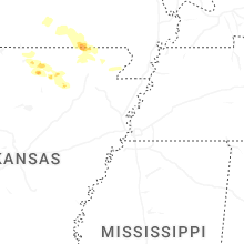
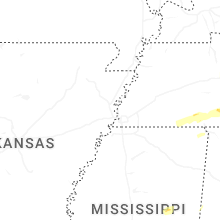
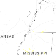


Connect with Interactive Hail Maps