

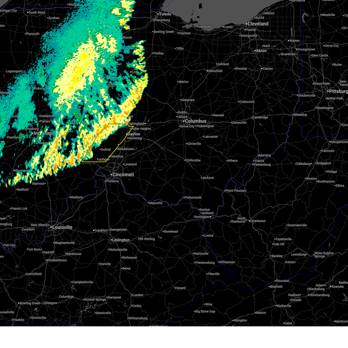
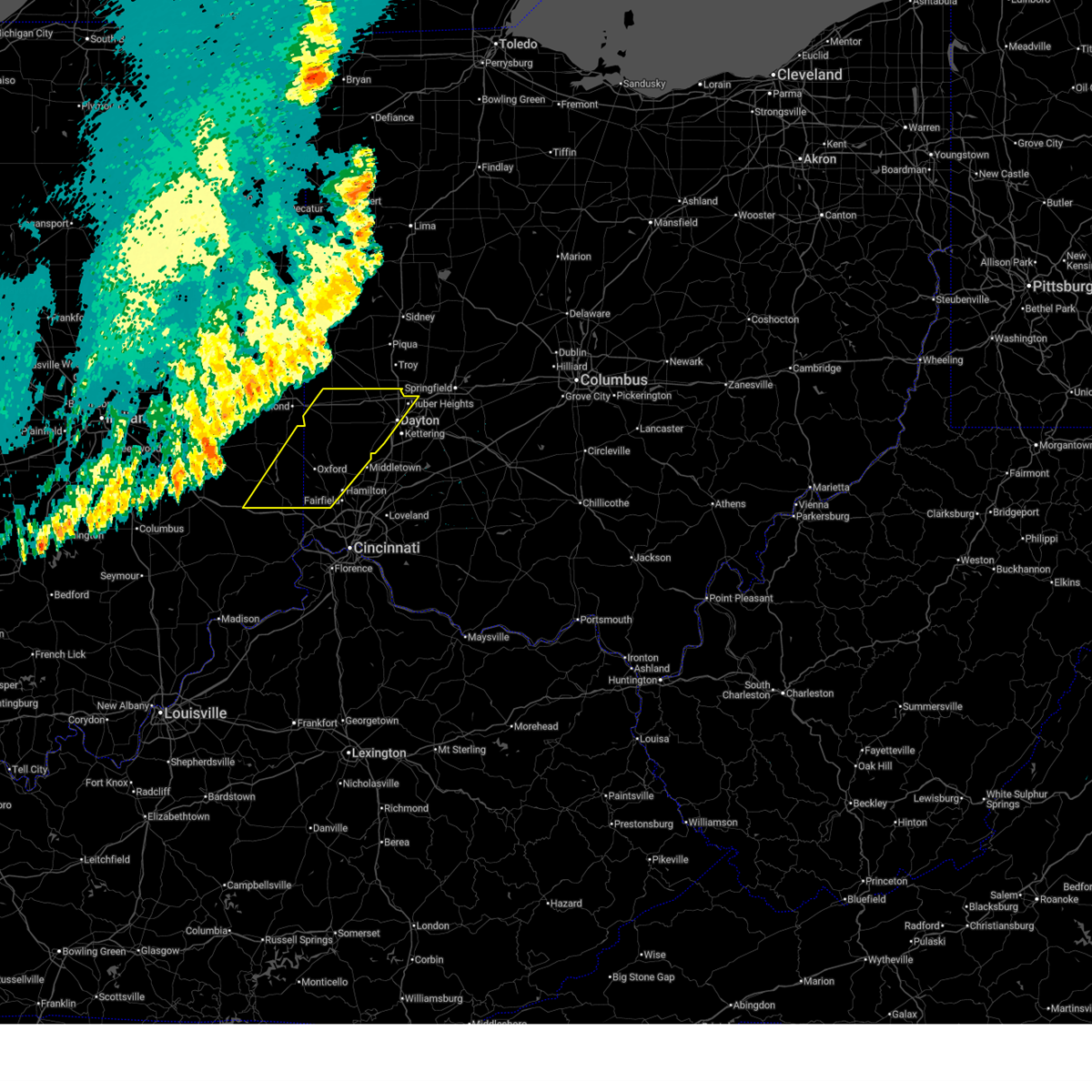
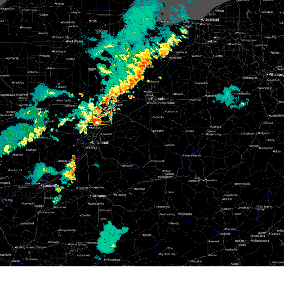
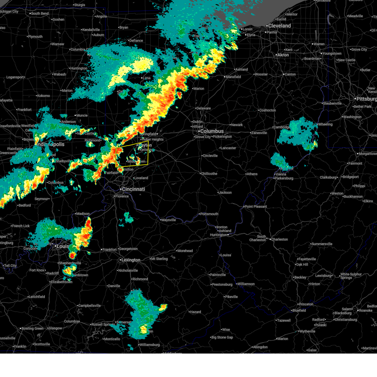
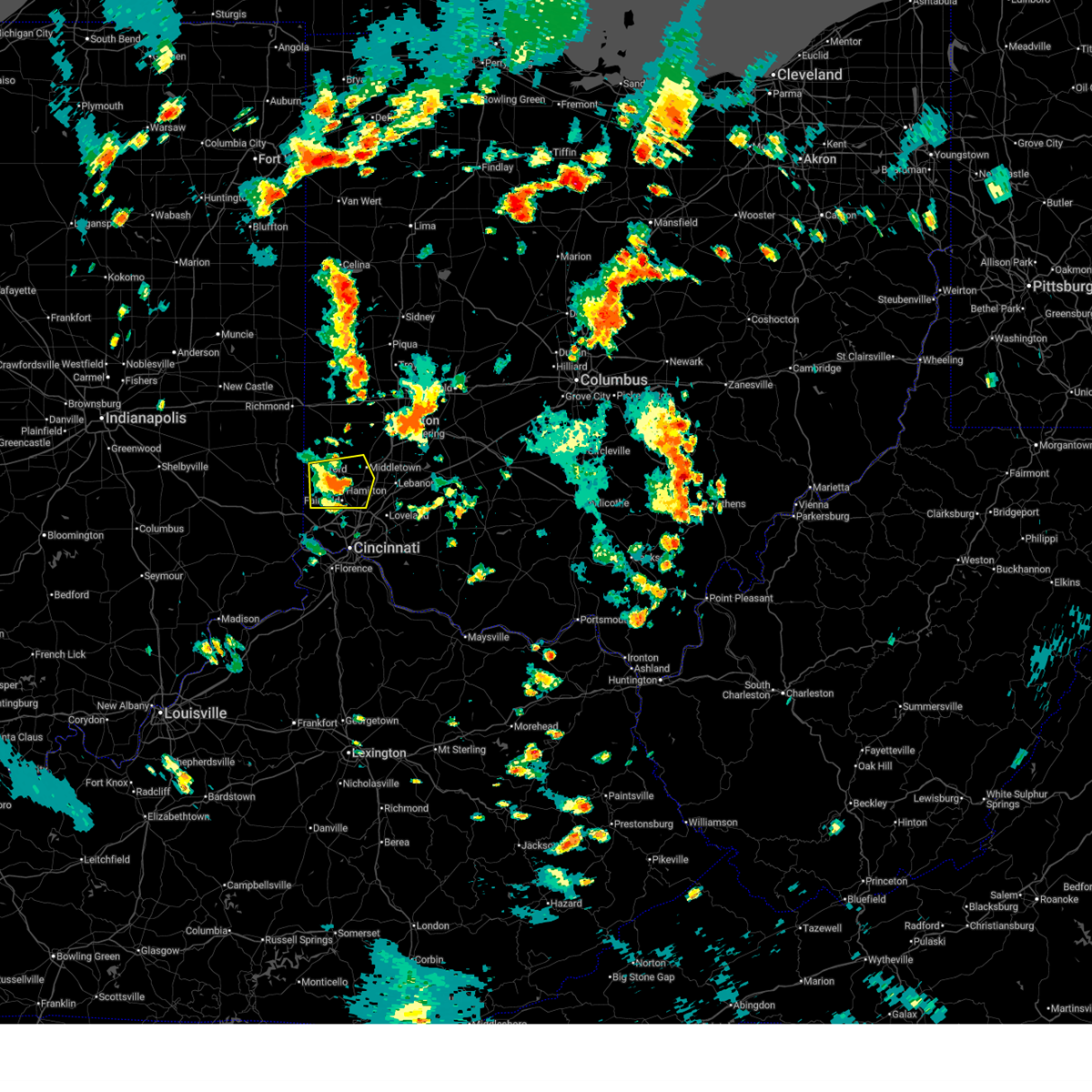
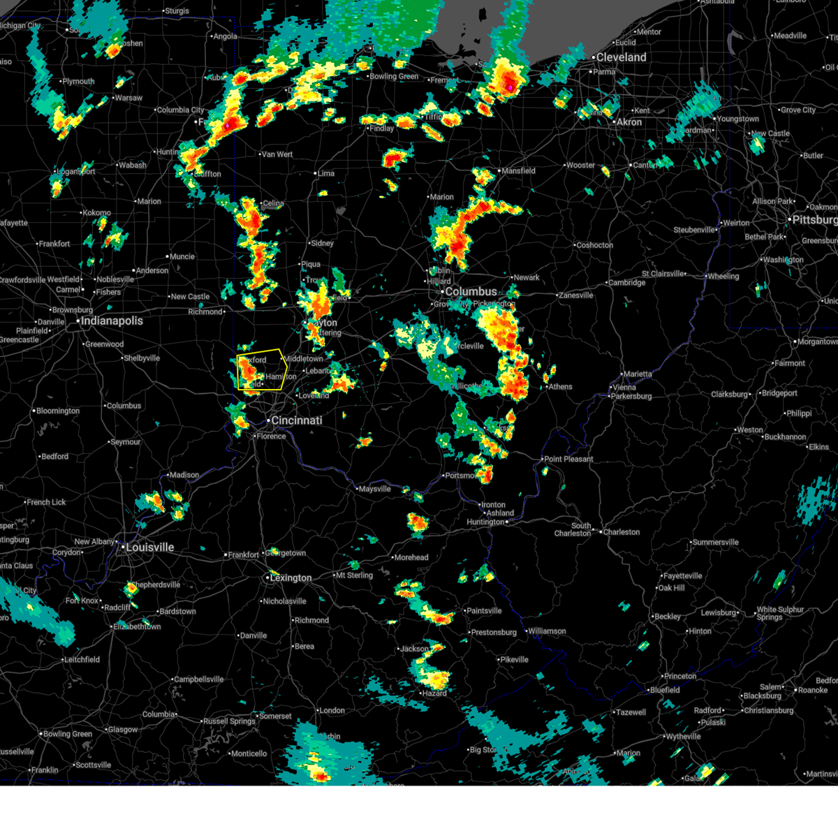
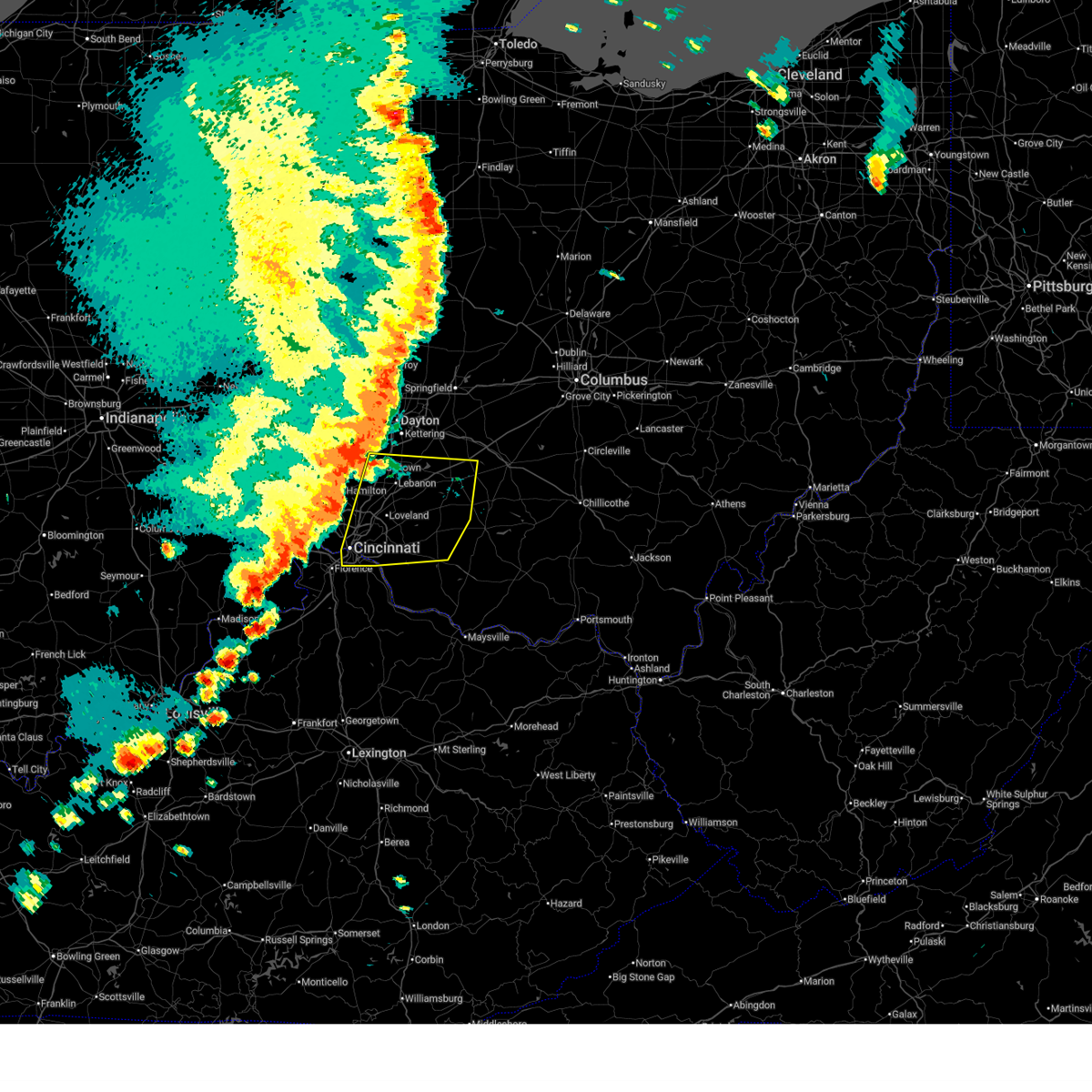
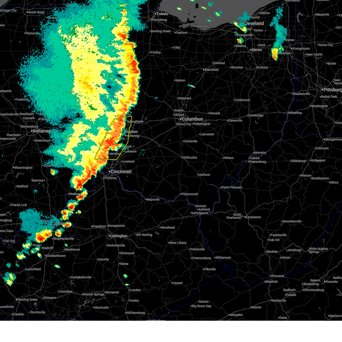
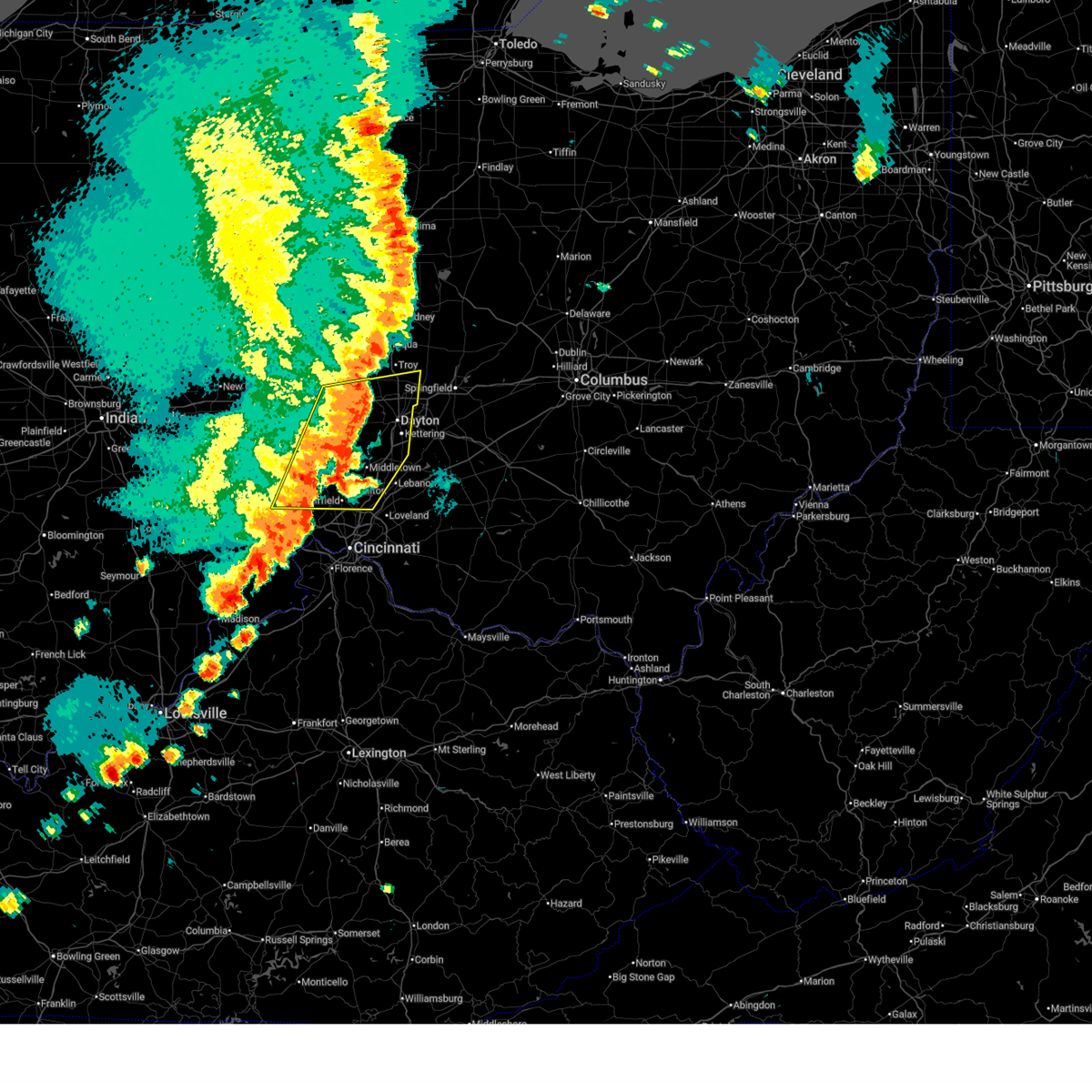
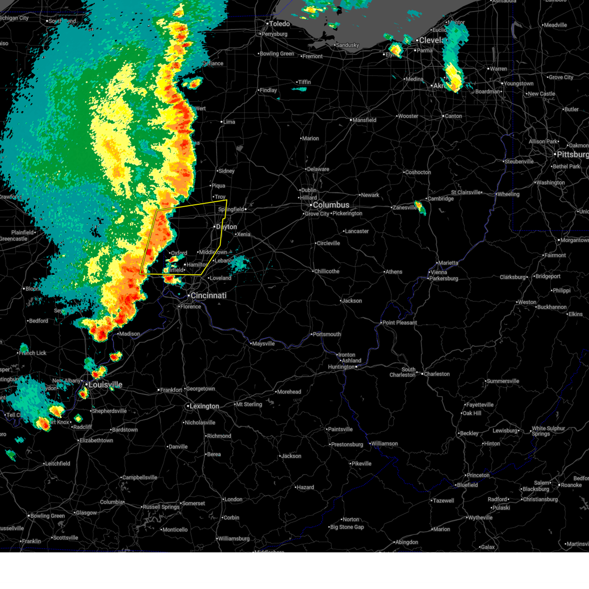
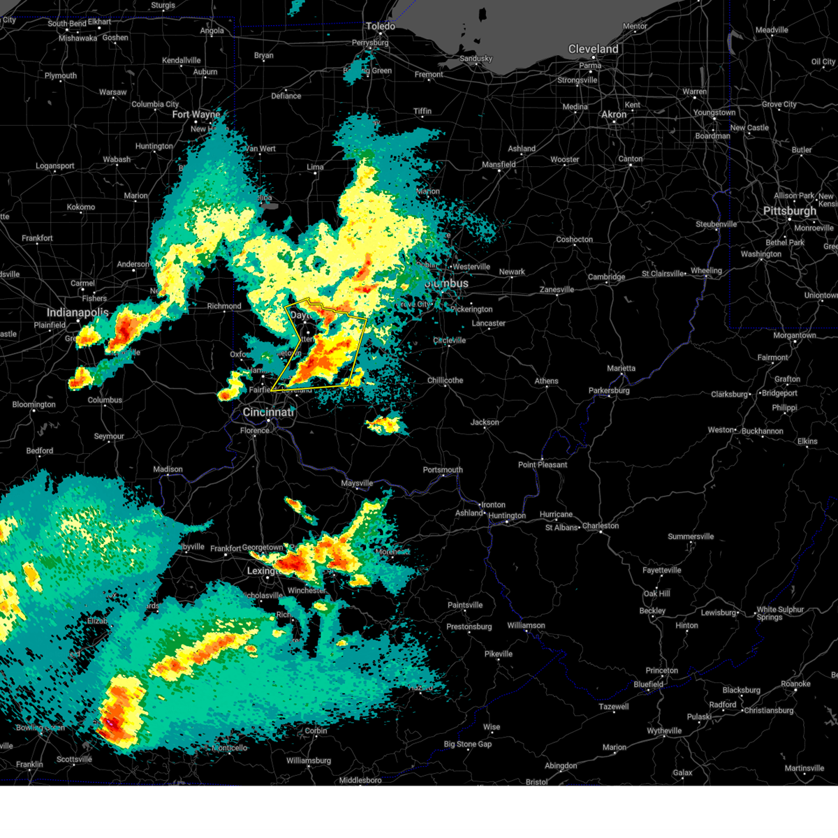
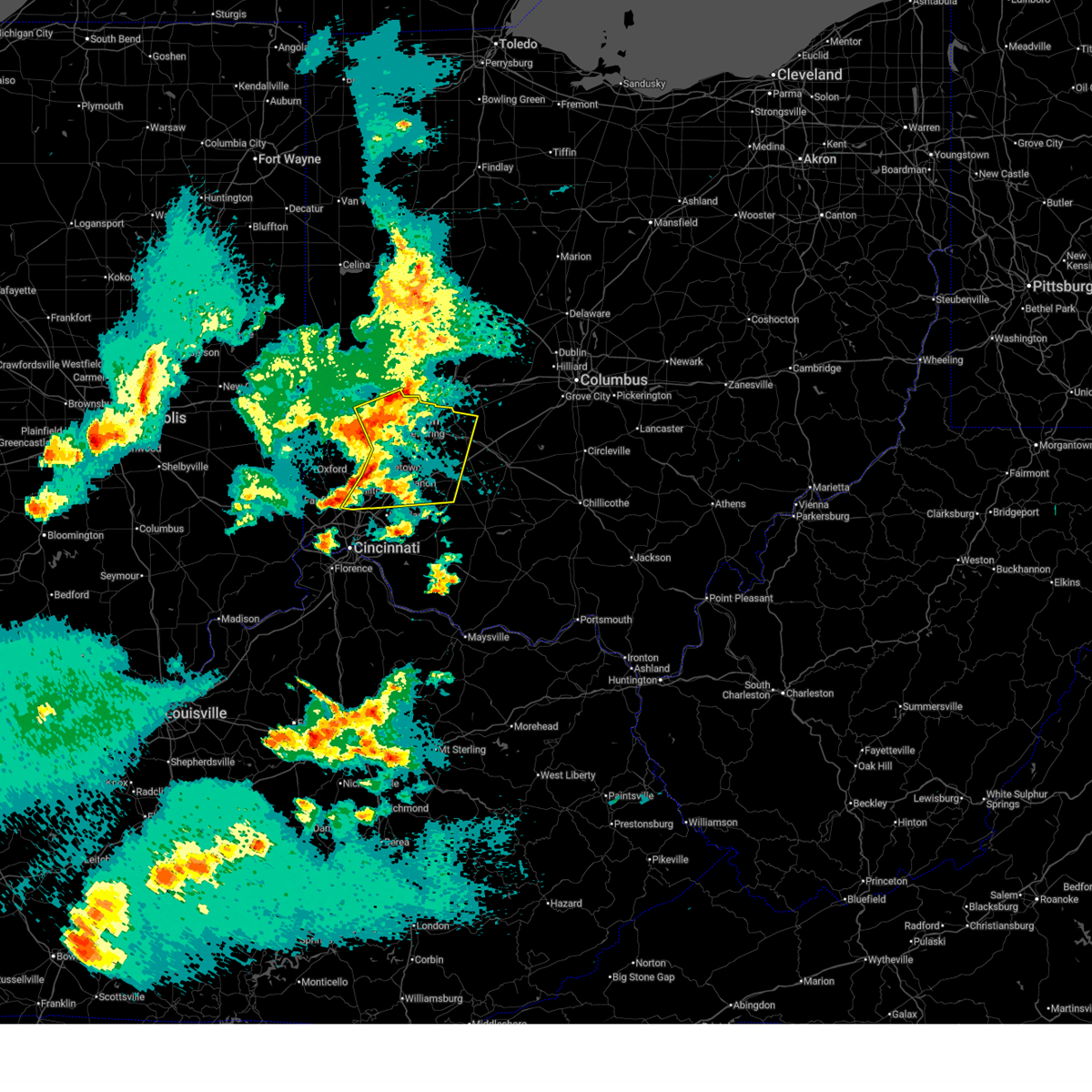
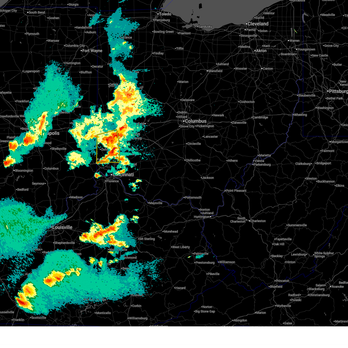
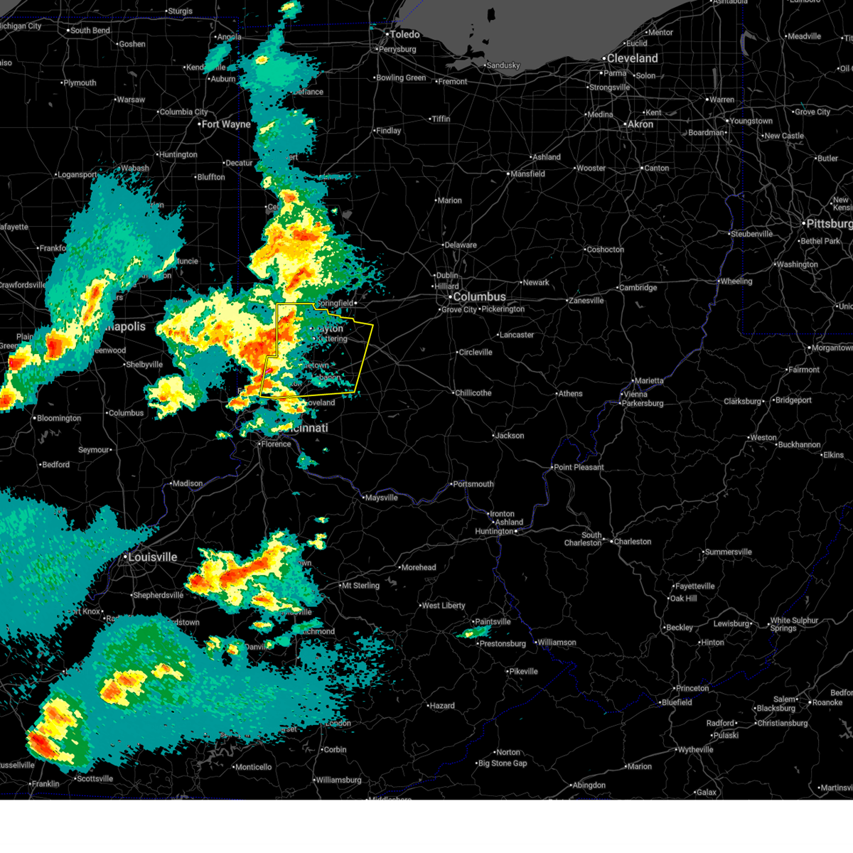
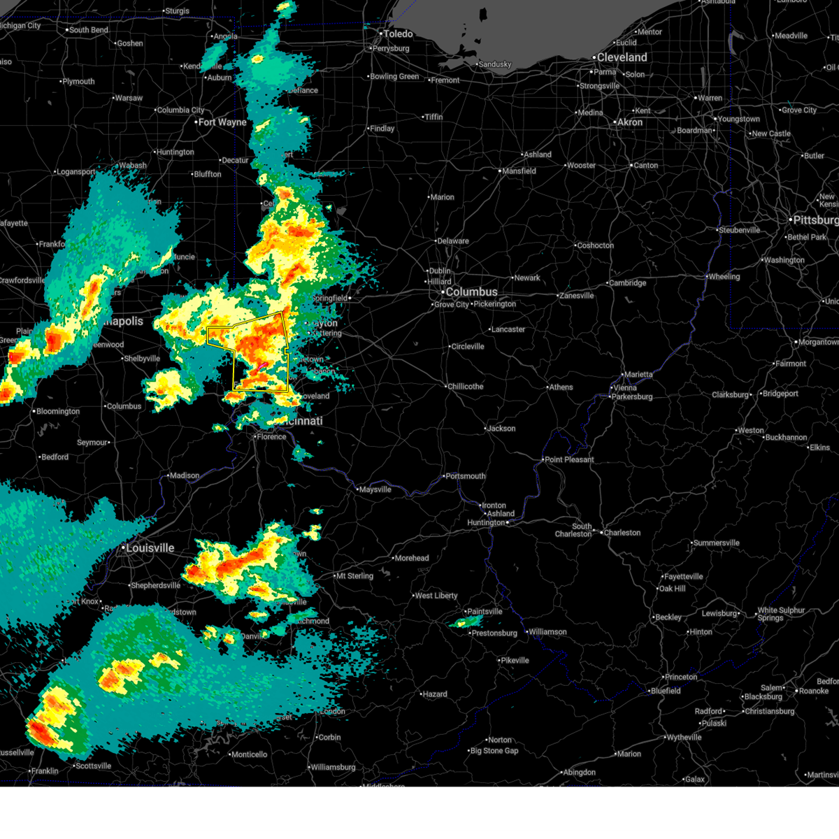
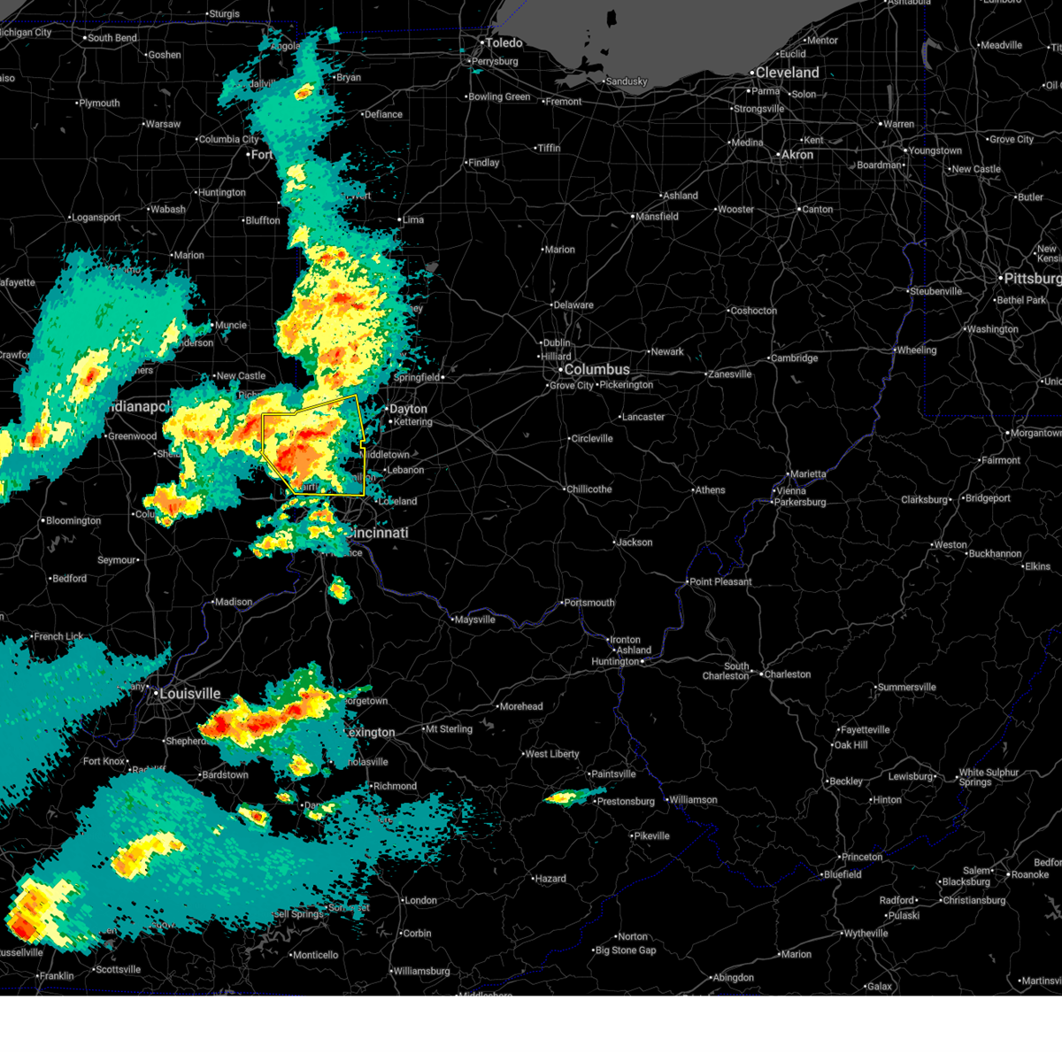
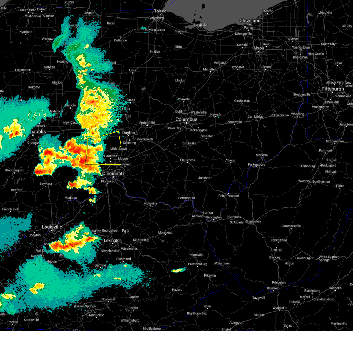
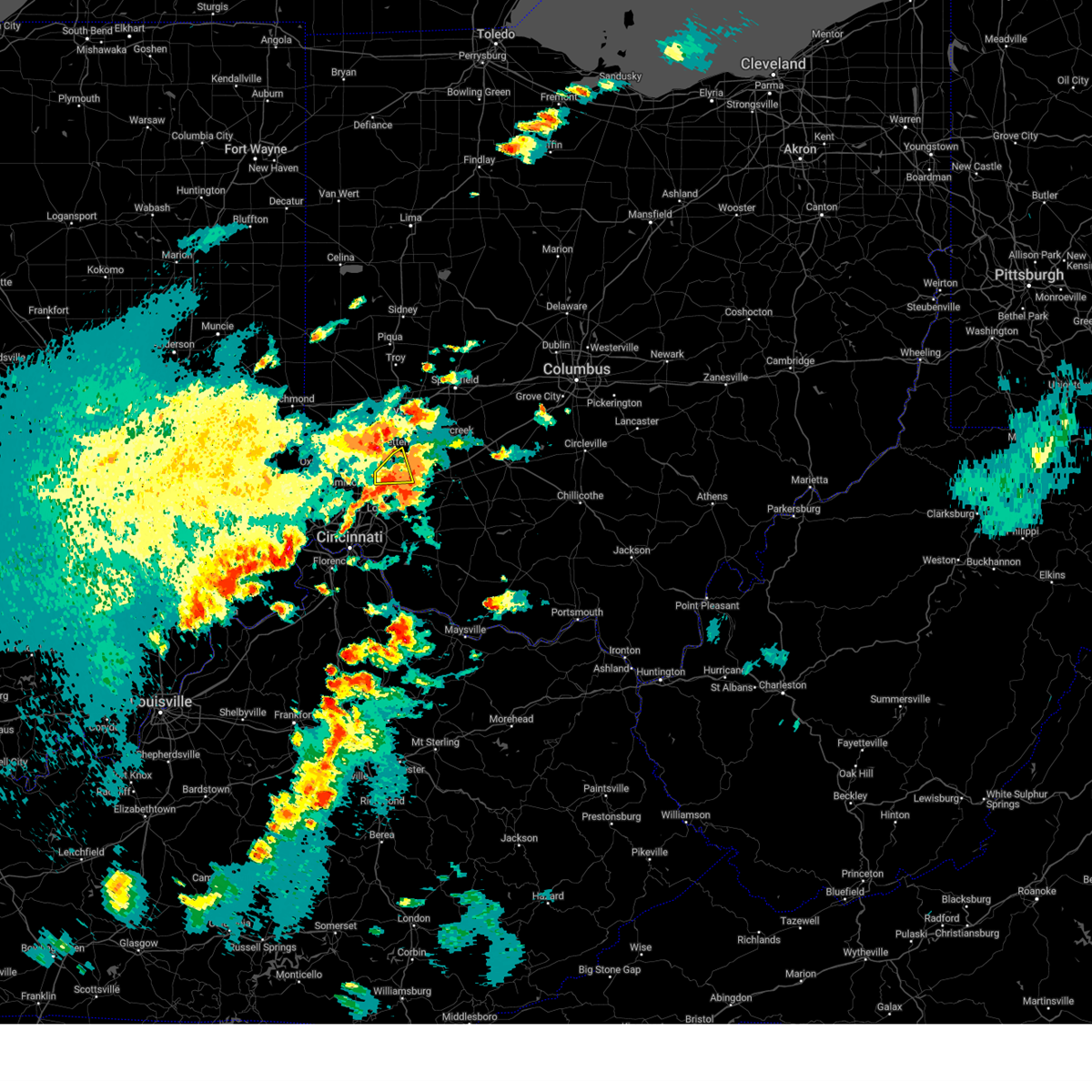
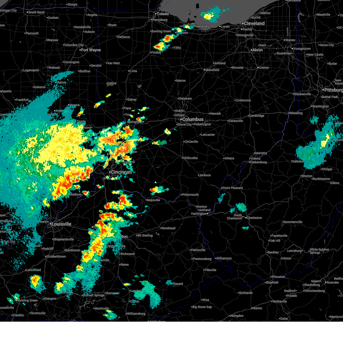
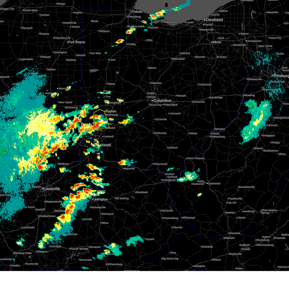
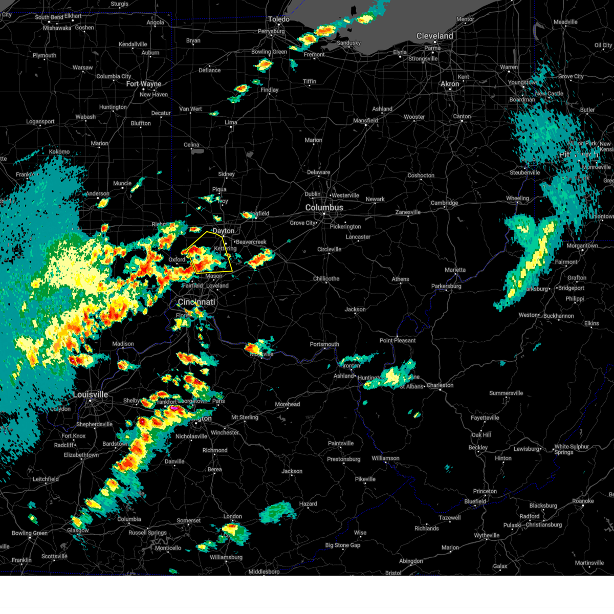
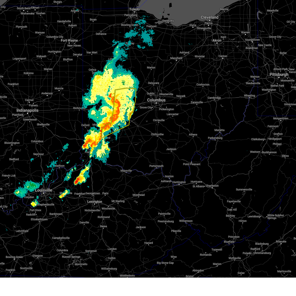
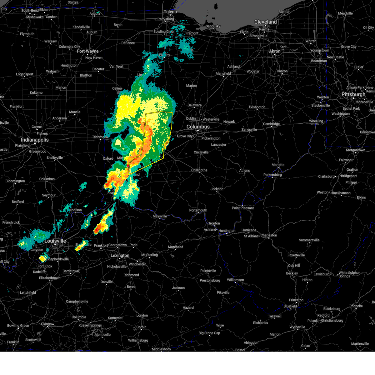
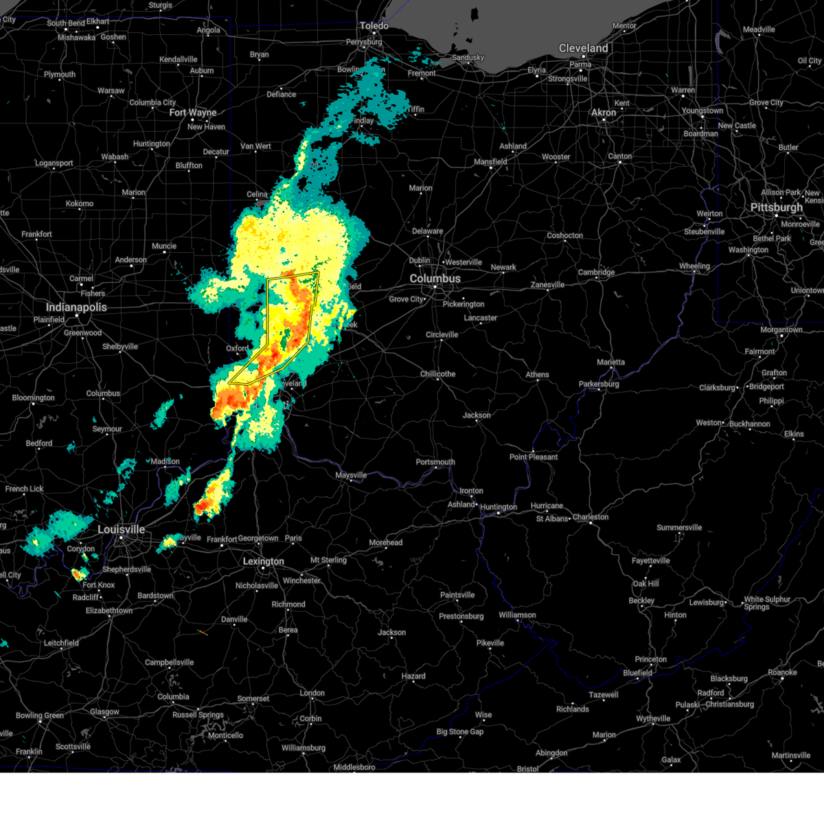
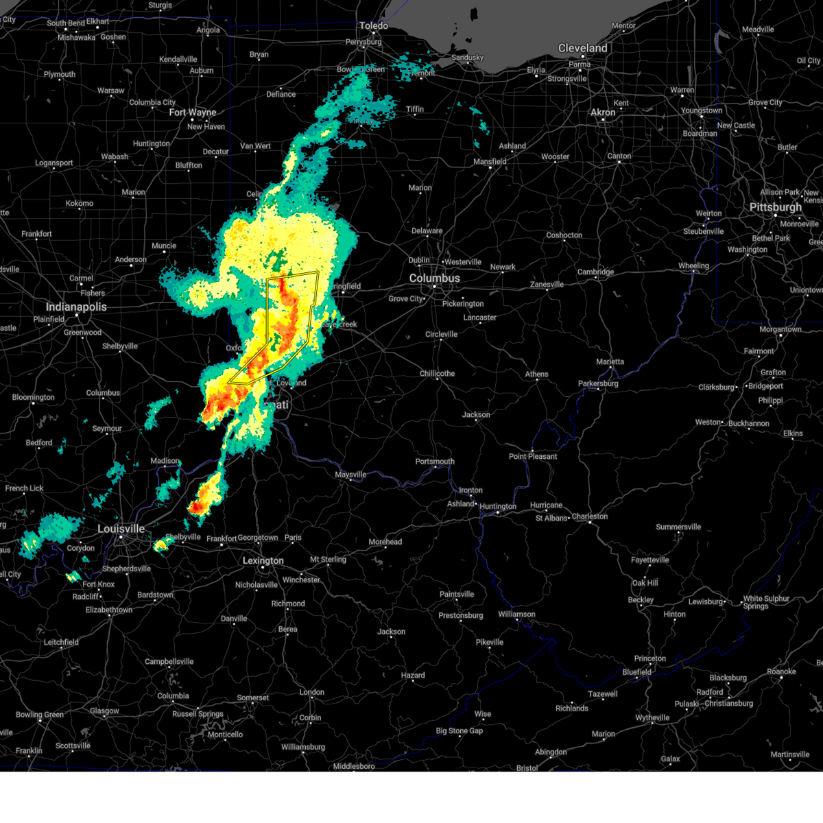
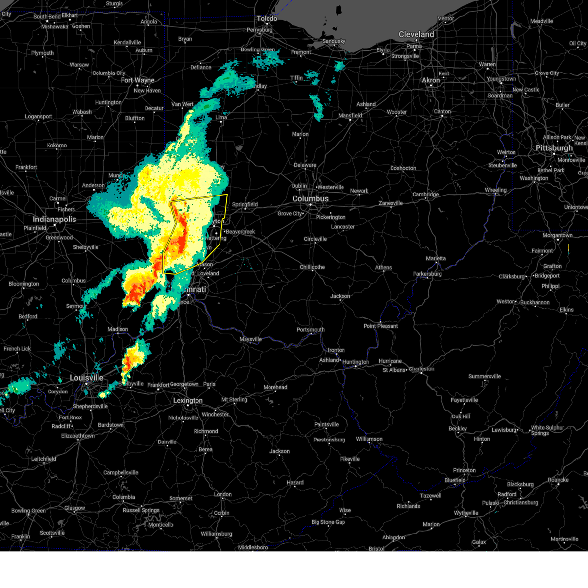
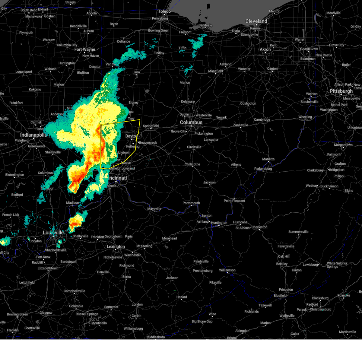
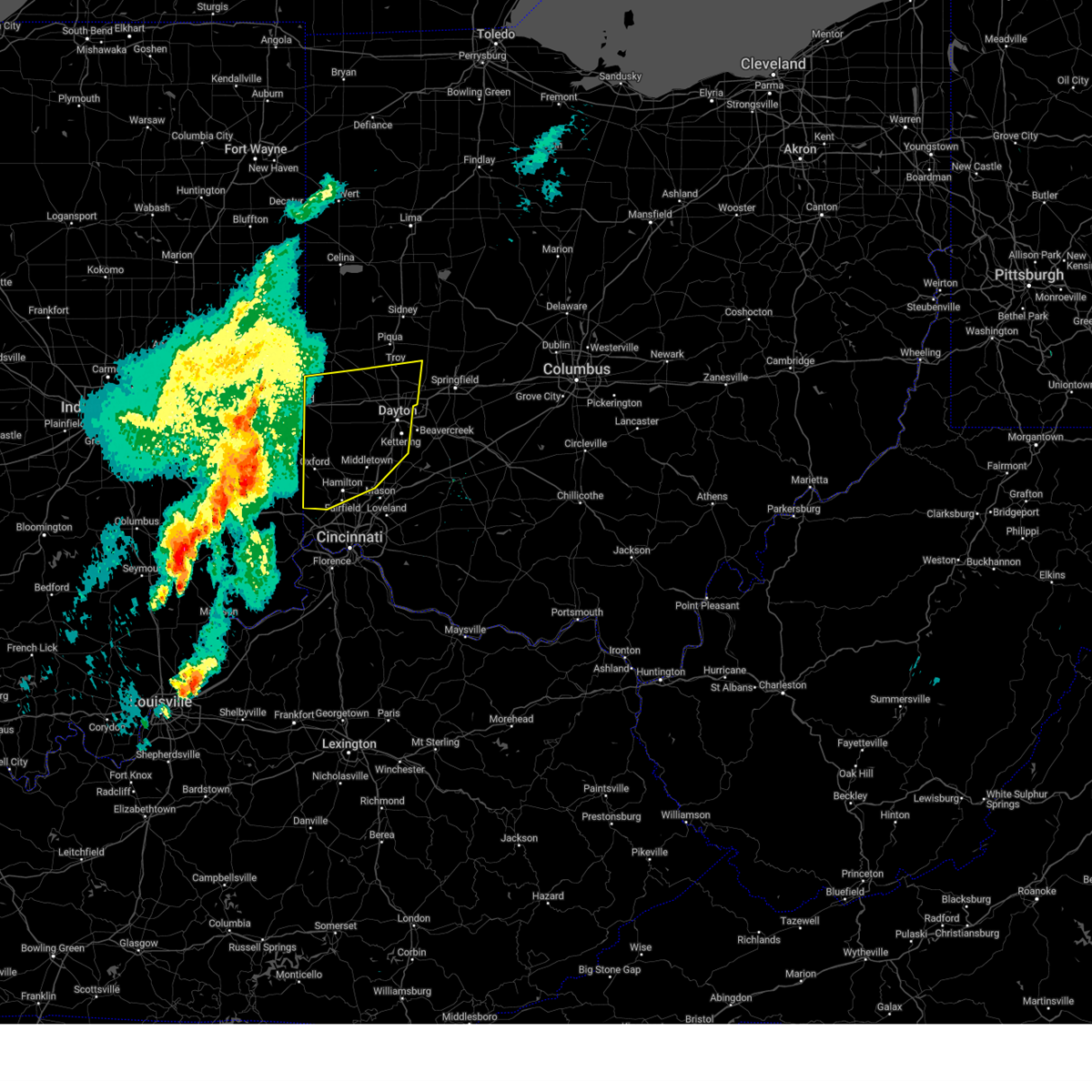
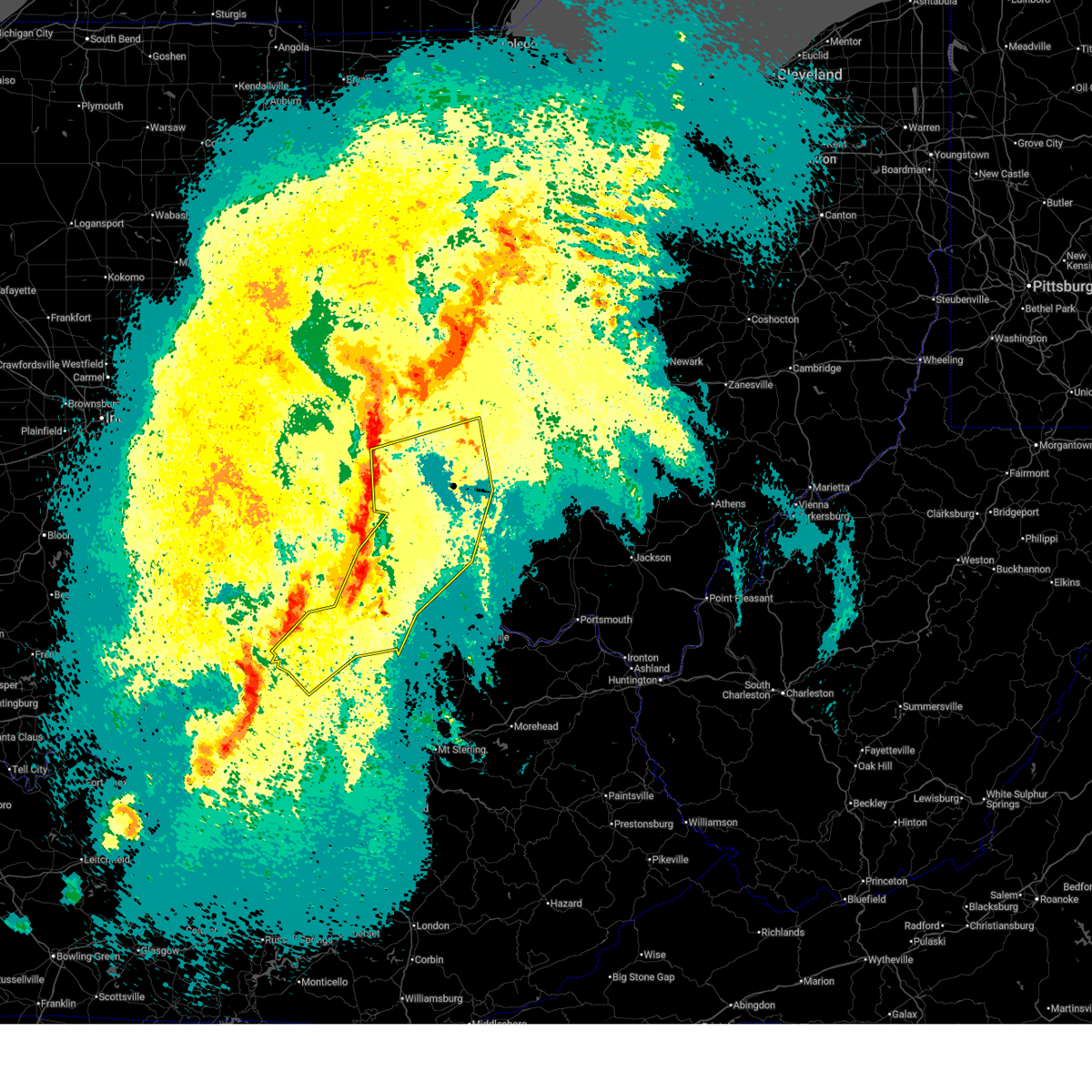
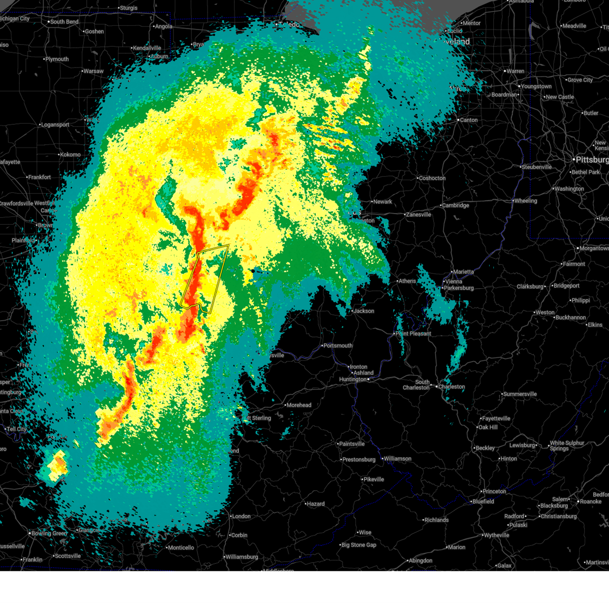
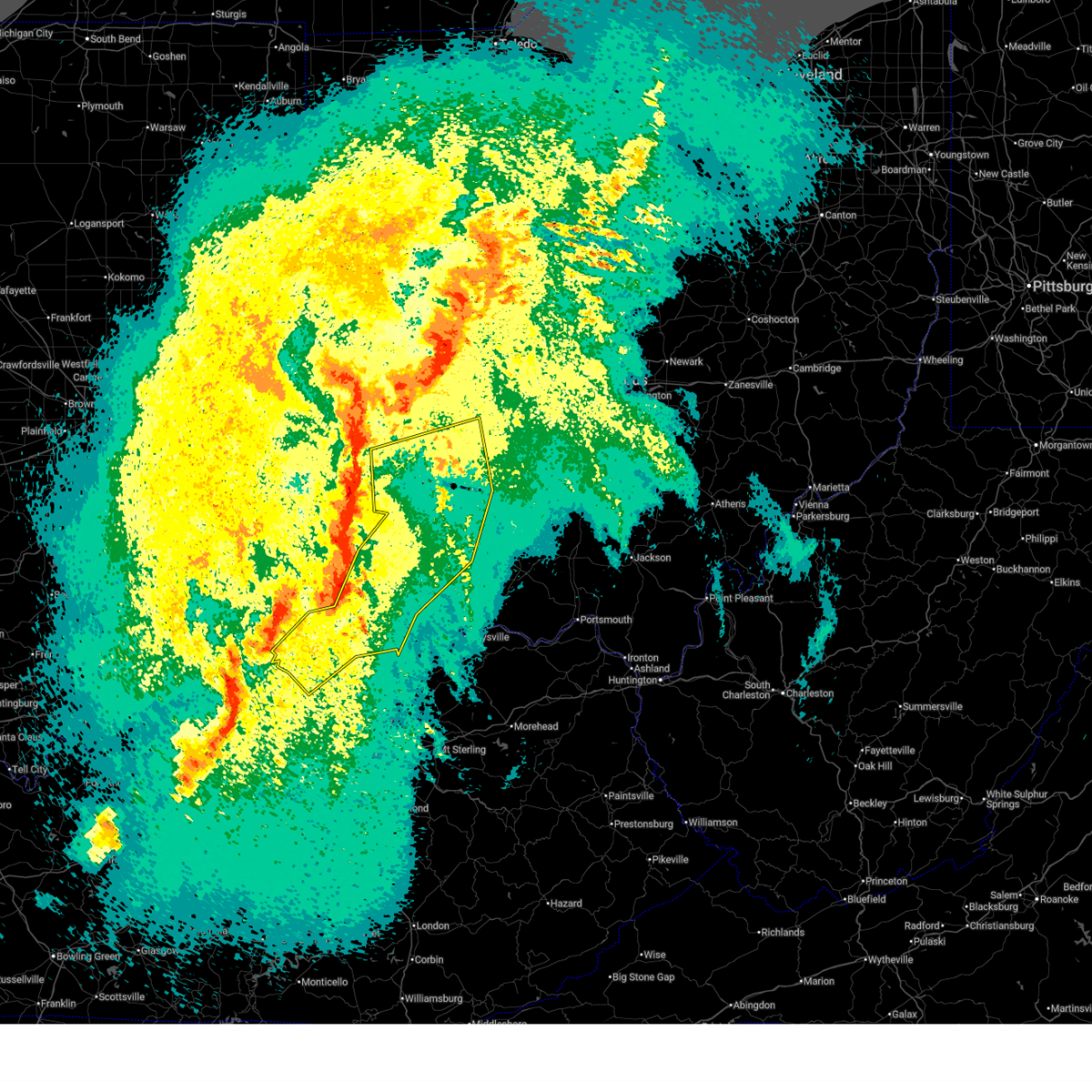
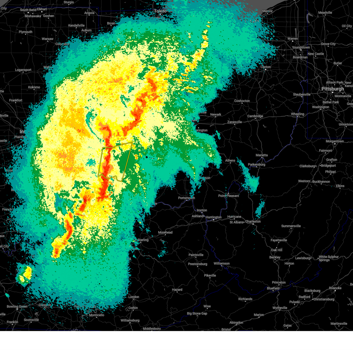
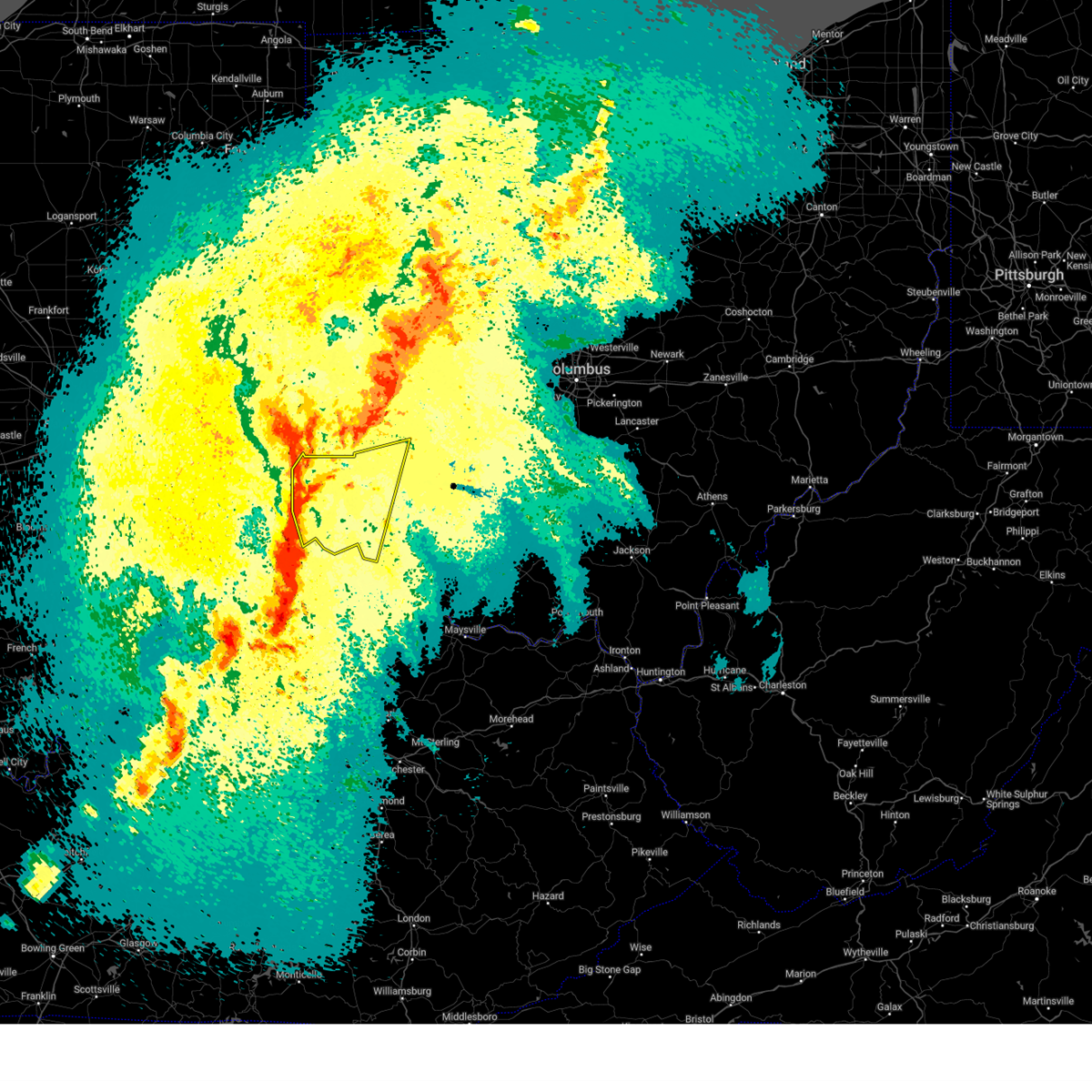
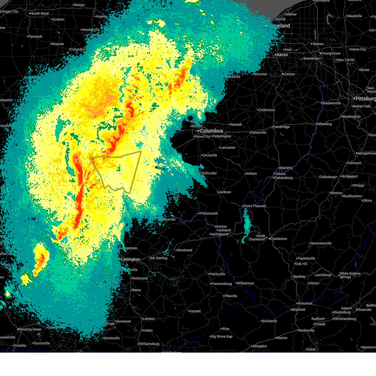
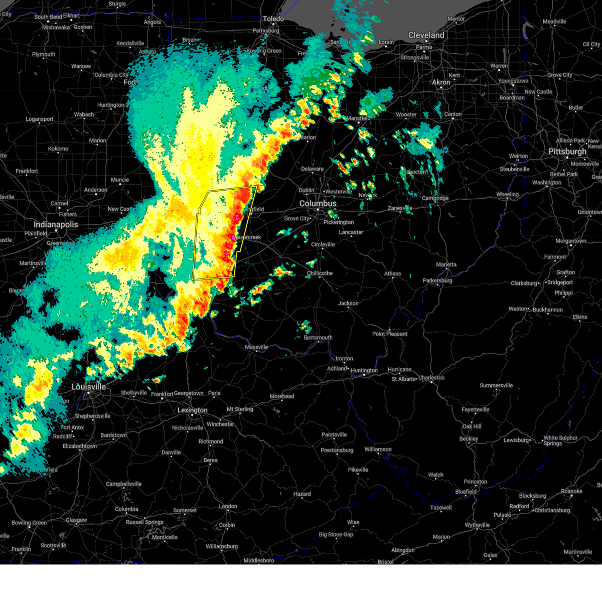
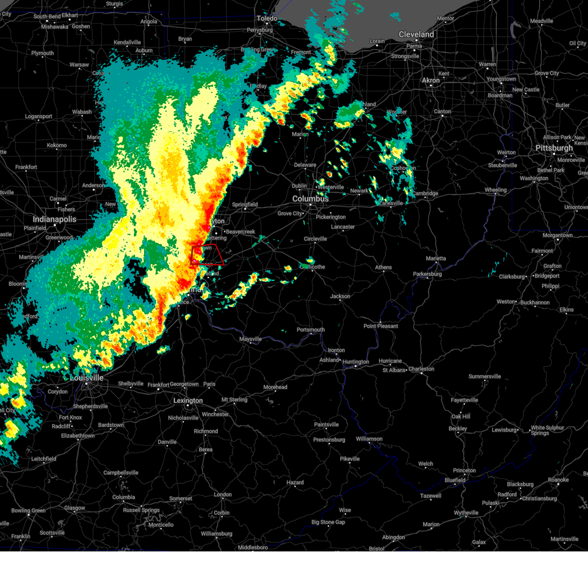
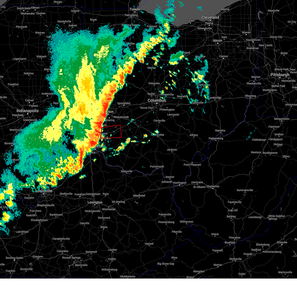
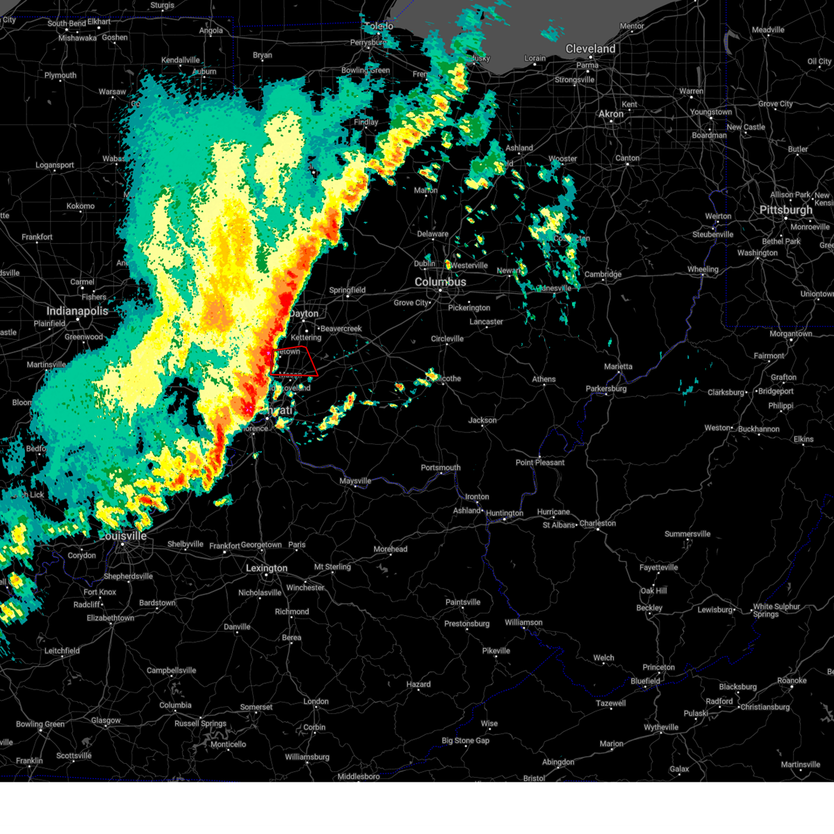
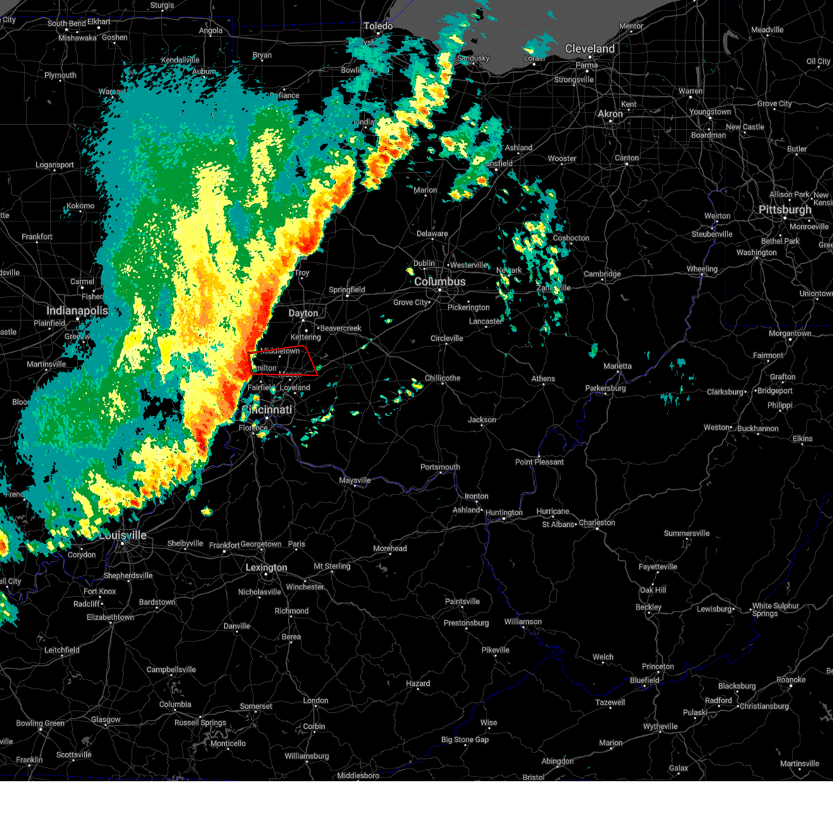
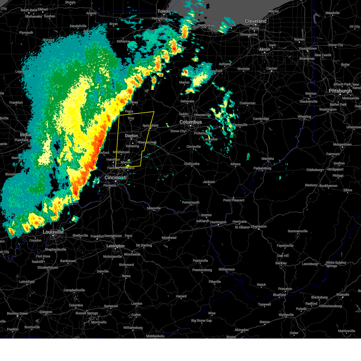
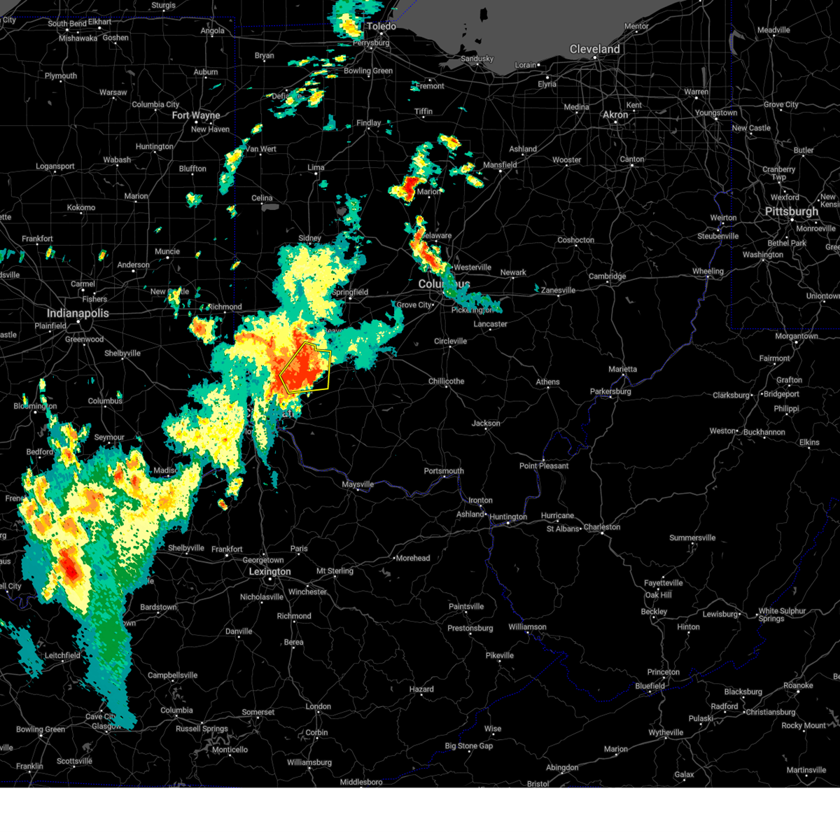
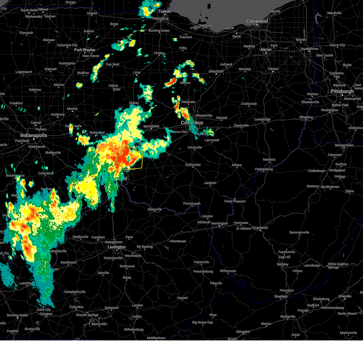
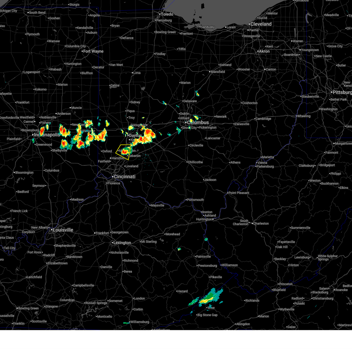
Hail Map for Middletown, OH
The Middletown, OH area has had 9 reports of on-the-ground hail by trained spotters, and has been under severe weather warnings 7 times during the past 12 months. Doppler radar has detected hail at or near Middletown, OH on 78 occasions, including 1 occasion during the past year.
| Name: | Middletown, OH |
| Where Located: | 28 miles NNE of Cincinnati, OH |
| Map: | Google Map for Middletown, OH |
| Population: | 48694 |
| Housing Units: | 23296 |
| More Info: | Search Google for Middletown, OH |
1
The Top Recent Hail Date for Middletown, OH is Thursday, February 19, 2026 (39th out of 78)
Hail and Wind Damage Spotted near Middletown, OH
| Date / Time | Report Details |
|---|---|
| 6/18/2026 12:08 AM EDT |
 At 1208 am edt, a severe thunderstorm capable of producing a tornado was located near seven mile, moving east at 50 mph (radar indicated rotation). Hazards include tornado. Flying debris will be dangerous to those caught without shelter. mobile homes will be damaged or destroyed. damage to roofs, windows, and vehicles will occur. tree damage is likely. locations impacted include, middletown, trenton, franklin, carlisle, gratis, seven mile, darrtown, germantown, farmersville, somerville, west elkton, jacksonburg, collinsville, and poast town heights. This includes i-75 in ohio near mile marker 35. At 1208 am edt, a severe thunderstorm capable of producing a tornado was located near seven mile, moving east at 50 mph (radar indicated rotation). Hazards include tornado. Flying debris will be dangerous to those caught without shelter. mobile homes will be damaged or destroyed. damage to roofs, windows, and vehicles will occur. tree damage is likely. locations impacted include, middletown, trenton, franklin, carlisle, gratis, seven mile, darrtown, germantown, farmersville, somerville, west elkton, jacksonburg, collinsville, and poast town heights. This includes i-75 in ohio near mile marker 35.
|
| 6/17/2026 11:59 PM EDT |
 Toriln the national weather service in wilmington has issued a * tornado warning for, southeastern preble county in west central ohio, northern butler county in southwestern ohio, northwestern warren county in southwestern ohio, southwestern montgomery county in west central ohio, * until 1230 am edt. * at 1159 pm edt, a severe thunderstorm capable of producing a tornado was located over oxford, moving east at 50 mph (radar indicated rotation). Hazards include tornado. Flying debris will be dangerous to those caught without shelter. mobile homes will be damaged or destroyed. damage to roofs, windows, and vehicles will occur. Tree damage is likely. Toriln the national weather service in wilmington has issued a * tornado warning for, southeastern preble county in west central ohio, northern butler county in southwestern ohio, northwestern warren county in southwestern ohio, southwestern montgomery county in west central ohio, * until 1230 am edt. * at 1159 pm edt, a severe thunderstorm capable of producing a tornado was located over oxford, moving east at 50 mph (radar indicated rotation). Hazards include tornado. Flying debris will be dangerous to those caught without shelter. mobile homes will be damaged or destroyed. damage to roofs, windows, and vehicles will occur. Tree damage is likely.
|
| 6/12/2026 12:33 AM EDT |
 At 1233 am edt, severe thunderstorms were located along a line extending from near new carlisle to 7 miles north of harrison, moving east at 55 mph (radar indicated). Hazards include 60 mph wind gusts. Expect damage to trees and power lines. locations impacted include, dayton, hamilton, middletown, huber heights, trotwood, oxford, miamisburg, vandalia, englewood, trenton, moraine, west carrollton, ross, camden, west alexandria, gratis, seven mile, darrtown, williamsdale, and riverside. this includes the following interstates, i-70 in ohio between mile markers 19 and 40. I-75 in ohio between mile markers 49 and 65. At 1233 am edt, severe thunderstorms were located along a line extending from near new carlisle to 7 miles north of harrison, moving east at 55 mph (radar indicated). Hazards include 60 mph wind gusts. Expect damage to trees and power lines. locations impacted include, dayton, hamilton, middletown, huber heights, trotwood, oxford, miamisburg, vandalia, englewood, trenton, moraine, west carrollton, ross, camden, west alexandria, gratis, seven mile, darrtown, williamsdale, and riverside. this includes the following interstates, i-70 in ohio between mile markers 19 and 40. I-75 in ohio between mile markers 49 and 65.
|
| 6/12/2026 12:21 AM EDT |
 At 1221 am edt, severe thunderstorms were located along a line extending from tipp city to near brookville, moving east at 55 mph (radar indicated). Hazards include 60 mph wind gusts. Expect damage to trees and power lines. locations impacted include, dayton, hamilton, middletown, huber heights, trotwood, oxford, miamisburg, vandalia, englewood, trenton, eaton, moraine, west carrollton, ross, camden, lewisburg, west alexandria, gratis, seven mile, and west college corner. this includes the following interstates, i-70 in ohio between mile markers 8 and 40. I-75 in ohio between mile markers 49 and 65. At 1221 am edt, severe thunderstorms were located along a line extending from tipp city to near brookville, moving east at 55 mph (radar indicated). Hazards include 60 mph wind gusts. Expect damage to trees and power lines. locations impacted include, dayton, hamilton, middletown, huber heights, trotwood, oxford, miamisburg, vandalia, englewood, trenton, eaton, moraine, west carrollton, ross, camden, lewisburg, west alexandria, gratis, seven mile, and west college corner. this includes the following interstates, i-70 in ohio between mile markers 8 and 40. I-75 in ohio between mile markers 49 and 65.
|
| 6/11/2026 11:50 PM EDT |
 Svriln the national weather service in wilmington has issued a * severe thunderstorm warning for, franklin county in southeastern indiana, union county in east central indiana, preble county in west central ohio, butler county in southwestern ohio, montgomery county in west central ohio, * until 1245 am edt. * at 1150 pm edt, severe thunderstorms were located along a line extending from near greenville to 8 miles northwest of lake santee, moving east at 55 mph (radar indicated). Hazards include 60 mph wind gusts. expect damage to trees and power lines Svriln the national weather service in wilmington has issued a * severe thunderstorm warning for, franklin county in southeastern indiana, union county in east central indiana, preble county in west central ohio, butler county in southwestern ohio, montgomery county in west central ohio, * until 1245 am edt. * at 1150 pm edt, severe thunderstorms were located along a line extending from near greenville to 8 miles northwest of lake santee, moving east at 55 mph (radar indicated). Hazards include 60 mph wind gusts. expect damage to trees and power lines
|
| 5/19/2026 8:00 PM EDT |
 At 800 pm edt, a severe thunderstorm was located over west carrollton, moving east at 40 mph (radar indicated). Hazards include 60 mph wind gusts. Expect damage to trees and power lines. locations impacted include, dayton, kettering, middletown, beavercreek, fairborn, xenia, trotwood, miamisburg, lebanon, springboro, monroe, trenton, franklin, bellbrook, moraine, carlisle, oakwood, south middletown, wright-patterson afb, and west carrollton. This includes i-75 in ohio between mile markers 30 and 55. At 800 pm edt, a severe thunderstorm was located over west carrollton, moving east at 40 mph (radar indicated). Hazards include 60 mph wind gusts. Expect damage to trees and power lines. locations impacted include, dayton, kettering, middletown, beavercreek, fairborn, xenia, trotwood, miamisburg, lebanon, springboro, monroe, trenton, franklin, bellbrook, moraine, carlisle, oakwood, south middletown, wright-patterson afb, and west carrollton. This includes i-75 in ohio between mile markers 30 and 55.
|
| 5/19/2026 7:39 PM EDT |
 Svriln the national weather service in wilmington has issued a * severe thunderstorm warning for, southeastern preble county in west central ohio, northeastern butler county in southwestern ohio, northern warren county in southwestern ohio, western greene county in west central ohio, southern montgomery county in west central ohio, * until 830 pm edt. * at 738 pm edt, a severe thunderstorm was located near gratis, moving east at 35 mph (radar indicated). Hazards include 60 mph wind gusts. expect damage to trees and power lines Svriln the national weather service in wilmington has issued a * severe thunderstorm warning for, southeastern preble county in west central ohio, northeastern butler county in southwestern ohio, northern warren county in southwestern ohio, western greene county in west central ohio, southern montgomery county in west central ohio, * until 830 pm edt. * at 738 pm edt, a severe thunderstorm was located near gratis, moving east at 35 mph (radar indicated). Hazards include 60 mph wind gusts. expect damage to trees and power lines
|
| 4/28/2026 1:15 AM EDT | Awos station kmwo middletown hook fiel in butler county OH, 3 miles SE of Middletown, OH |
| 6/26/2025 3:53 PM EDT |
 the severe thunderstorm warning has been cancelled and is no longer in effect the severe thunderstorm warning has been cancelled and is no longer in effect
|
| 6/26/2025 3:41 PM EDT |
 Svriln the national weather service in wilmington has issued a * severe thunderstorm warning for, butler county in southwestern ohio, * until 415 pm edt. * at 340 pm edt, a severe thunderstorm was located near darrtown, moving east at 15 mph (radar indicated). Hazards include 60 mph wind gusts and penny size hail. expect damage to trees and power lines Svriln the national weather service in wilmington has issued a * severe thunderstorm warning for, butler county in southwestern ohio, * until 415 pm edt. * at 340 pm edt, a severe thunderstorm was located near darrtown, moving east at 15 mph (radar indicated). Hazards include 60 mph wind gusts and penny size hail. expect damage to trees and power lines
|
| 6/18/2025 7:04 PM EDT |
 Svriln the national weather service in wilmington has issued a * severe thunderstorm warning for, north central kenton county in northern kentucky, northern campbell county in northern kentucky, eastern hamilton county in southwestern ohio, eastern butler county in southwestern ohio, northern clermont county in southwestern ohio, northwestern brown county in southwestern ohio, warren county in southwestern ohio, clinton county in southwestern ohio, northwestern highland county in south central ohio, * until 800 pm edt. * at 704 pm edt, severe thunderstorms were located along a line extending from middletown to burlington, moving northeast at 30 mph (radar indicated). Hazards include 60 mph wind gusts and penny size hail. expect damage to trees and power lines Svriln the national weather service in wilmington has issued a * severe thunderstorm warning for, north central kenton county in northern kentucky, northern campbell county in northern kentucky, eastern hamilton county in southwestern ohio, eastern butler county in southwestern ohio, northern clermont county in southwestern ohio, northwestern brown county in southwestern ohio, warren county in southwestern ohio, clinton county in southwestern ohio, northwestern highland county in south central ohio, * until 800 pm edt. * at 704 pm edt, severe thunderstorms were located along a line extending from middletown to burlington, moving northeast at 30 mph (radar indicated). Hazards include 60 mph wind gusts and penny size hail. expect damage to trees and power lines
|
| 6/18/2025 6:59 PM EDT |
 the severe thunderstorm warning has been cancelled and is no longer in effect the severe thunderstorm warning has been cancelled and is no longer in effect
|
| 6/18/2025 6:59 PM EDT |
 At 659 pm edt, severe thunderstorms were located along a line extending from 6 miles east of piqua to near middletown, moving northeast at 70 mph (radar indicated). Hazards include 70 mph wind gusts and quarter size hail. Minor hail damage to vehicles is possible. expect considerable tree damage. wind damage is also likely to mobile homes, roofs, and outbuildings. locations impacted include, dayton, hamilton, kettering, middletown, beavercreek, fairfield, huber heights, mason, trotwood, oxford, miamisburg, lebanon, springboro, vandalia, englewood, monroe, trenton, franklin, springdale, and tipp city. this includes the following interstates, i-70 in ohio between mile markers 17 and 40. I-75 in ohio between mile markers 18 and 70. At 659 pm edt, severe thunderstorms were located along a line extending from 6 miles east of piqua to near middletown, moving northeast at 70 mph (radar indicated). Hazards include 70 mph wind gusts and quarter size hail. Minor hail damage to vehicles is possible. expect considerable tree damage. wind damage is also likely to mobile homes, roofs, and outbuildings. locations impacted include, dayton, hamilton, kettering, middletown, beavercreek, fairfield, huber heights, mason, trotwood, oxford, miamisburg, lebanon, springboro, vandalia, englewood, monroe, trenton, franklin, springdale, and tipp city. this includes the following interstates, i-70 in ohio between mile markers 17 and 40. I-75 in ohio between mile markers 18 and 70.
|
| 6/18/2025 6:47 PM EDT |
 the severe thunderstorm warning has been cancelled and is no longer in effect the severe thunderstorm warning has been cancelled and is no longer in effect
|
| 6/18/2025 6:47 PM EDT |
 At 646 pm edt, severe thunderstorms were located along a line extending from pleasant hill to near darrtown, moving northeast at 60 mph (radar indicated). Hazards include 70 mph wind gusts and quarter size hail. Minor hail damage to vehicles is possible. expect considerable tree damage. wind damage is also likely to mobile homes, roofs, and outbuildings. locations impacted include, dayton, hamilton, kettering, middletown, beavercreek, fairfield, huber heights, mason, trotwood, oxford, miamisburg, lebanon, forest park, springboro, vandalia, englewood, monroe, trenton, franklin, and springdale. this includes the following interstates, i-70 in ohio between mile markers 4 and 40. I-75 in ohio between mile markers 18 and 70. At 646 pm edt, severe thunderstorms were located along a line extending from pleasant hill to near darrtown, moving northeast at 60 mph (radar indicated). Hazards include 70 mph wind gusts and quarter size hail. Minor hail damage to vehicles is possible. expect considerable tree damage. wind damage is also likely to mobile homes, roofs, and outbuildings. locations impacted include, dayton, hamilton, kettering, middletown, beavercreek, fairfield, huber heights, mason, trotwood, oxford, miamisburg, lebanon, forest park, springboro, vandalia, englewood, monroe, trenton, franklin, and springdale. this includes the following interstates, i-70 in ohio between mile markers 4 and 40. I-75 in ohio between mile markers 18 and 70.
|
| 6/18/2025 6:21 PM EDT |
 Svriln the national weather service in wilmington has issued a * severe thunderstorm warning for, eastern franklin county in southeastern indiana, southeastern wayne county in east central indiana, union county in east central indiana, preble county in west central ohio, butler county in southwestern ohio, northwestern warren county in southwestern ohio, southern darke county in west central ohio, montgomery county in west central ohio, southern miami county in west central ohio, * until 715 pm edt. * at 620 pm edt, severe thunderstorms were located along a line extending from near new madison to near brookville, moving northeast at 60 mph (radar indicated). Hazards include 70 mph wind gusts and quarter size hail. Minor hail damage to vehicles is possible. expect considerable tree damage. Wind damage is also likely to mobile homes, roofs, and outbuildings. Svriln the national weather service in wilmington has issued a * severe thunderstorm warning for, eastern franklin county in southeastern indiana, southeastern wayne county in east central indiana, union county in east central indiana, preble county in west central ohio, butler county in southwestern ohio, northwestern warren county in southwestern ohio, southern darke county in west central ohio, montgomery county in west central ohio, southern miami county in west central ohio, * until 715 pm edt. * at 620 pm edt, severe thunderstorms were located along a line extending from near new madison to near brookville, moving northeast at 60 mph (radar indicated). Hazards include 70 mph wind gusts and quarter size hail. Minor hail damage to vehicles is possible. expect considerable tree damage. Wind damage is also likely to mobile homes, roofs, and outbuildings.
|
| 5/16/2025 9:22 PM EDT |
 The severe thunderstorm which prompted the warning has been replaced with a new severe thunderstorm warning. a tornado watch remains in effect until 300 am edt for southwestern and west central ohio. please report previous wind damage or hail to the national weather service by going to our website at weather.gov/iln and submitting your report via social media. remember, a severe thunderstorm warning still remains in effect. The severe thunderstorm which prompted the warning has been replaced with a new severe thunderstorm warning. a tornado watch remains in effect until 300 am edt for southwestern and west central ohio. please report previous wind damage or hail to the national weather service by going to our website at weather.gov/iln and submitting your report via social media. remember, a severe thunderstorm warning still remains in effect.
|
| 5/16/2025 9:11 PM EDT |
 At 911 pm edt, a severe thunderstorm was located near springboro, moving northeast at 60 mph (radar indicated). Hazards include 60 mph wind gusts and half dollar size hail. Minor hail damage to vehicles is possible. expect wind damage to trees and power lines. locations impacted include, paintersville, vandalia, hughes, clarksville, englewood, state route 63 at state route 741, fort ancient, beckett ridge, lumberton, oakland, pekin, corwin, genntown, pisgah, wright-patterson afb, oldtown, gladstone, caesar creek state park, yellow springs, and dayton international airport. this includes the following interstates, i-70 in ohio between mile markers 25 and 41. i-71 in ohio between mile markers 22 and 56. I-75 in ohio between mile markers 18 and 33, between mile markers 37 and 44, and between mile markers 46 and 64. At 911 pm edt, a severe thunderstorm was located near springboro, moving northeast at 60 mph (radar indicated). Hazards include 60 mph wind gusts and half dollar size hail. Minor hail damage to vehicles is possible. expect wind damage to trees and power lines. locations impacted include, paintersville, vandalia, hughes, clarksville, englewood, state route 63 at state route 741, fort ancient, beckett ridge, lumberton, oakland, pekin, corwin, genntown, pisgah, wright-patterson afb, oldtown, gladstone, caesar creek state park, yellow springs, and dayton international airport. this includes the following interstates, i-70 in ohio between mile markers 25 and 41. i-71 in ohio between mile markers 22 and 56. I-75 in ohio between mile markers 18 and 33, between mile markers 37 and 44, and between mile markers 46 and 64.
|
| 5/16/2025 9:04 PM EDT |
 At 903 pm edt, a severe thunderstorm was located over hunter, moving east at 40 mph (radar indicated). Hazards include 60 mph wind gusts and half dollar size hail. Minor hail damage to vehicles is possible. expect wind damage to trees and power lines. locations impacted include, paintersville, franklin, clarksville, englewood, state route 63 at state route 741, fort ancient, beckett ridge, lumberton, pekin, corwin, south middletown, wright-patterson afb, oldtown, gladstone, caesar creek state park, yellow springs, cowan lake state park, hunter, roxanna, and brookville. this includes the following interstates, i-70 in ohio between mile markers 25 and 41. i-71 in ohio between mile markers 22 and 56. I-75 in ohio between mile markers 18 and 64. At 903 pm edt, a severe thunderstorm was located over hunter, moving east at 40 mph (radar indicated). Hazards include 60 mph wind gusts and half dollar size hail. Minor hail damage to vehicles is possible. expect wind damage to trees and power lines. locations impacted include, paintersville, franklin, clarksville, englewood, state route 63 at state route 741, fort ancient, beckett ridge, lumberton, pekin, corwin, south middletown, wright-patterson afb, oldtown, gladstone, caesar creek state park, yellow springs, cowan lake state park, hunter, roxanna, and brookville. this includes the following interstates, i-70 in ohio between mile markers 25 and 41. i-71 in ohio between mile markers 22 and 56. I-75 in ohio between mile markers 18 and 64.
|
| 5/16/2025 9:00 PM EDT | Quarter sized hail reported 1.3 miles ESE of Middletown, OH |
| 5/16/2025 8:58 PM EDT |
 At 858 pm edt, a severe thunderstorm was located over hunter, moving northeast at 60 mph (radar indicated). Hazards include 60 mph wind gusts and half dollar size hail. Minor hail damage to vehicles is possible. expect wind damage to trees and power lines. locations impacted include, paintersville, franklin, clarksville, englewood, state route 63 at state route 741, fort ancient, beckett ridge, lumberton, pekin, corwin, south middletown, wright-patterson afb, oldtown, gladstone, caesar creek state park, yellow springs, cowan lake state park, hunter, roxanna, and brookville. this includes the following interstates, i-70 in ohio between mile markers 25 and 41. i-71 in ohio between mile markers 22 and 56. I-75 in ohio between mile markers 18 and 64. At 858 pm edt, a severe thunderstorm was located over hunter, moving northeast at 60 mph (radar indicated). Hazards include 60 mph wind gusts and half dollar size hail. Minor hail damage to vehicles is possible. expect wind damage to trees and power lines. locations impacted include, paintersville, franklin, clarksville, englewood, state route 63 at state route 741, fort ancient, beckett ridge, lumberton, pekin, corwin, south middletown, wright-patterson afb, oldtown, gladstone, caesar creek state park, yellow springs, cowan lake state park, hunter, roxanna, and brookville. this includes the following interstates, i-70 in ohio between mile markers 25 and 41. i-71 in ohio between mile markers 22 and 56. I-75 in ohio between mile markers 18 and 64.
|
| 5/16/2025 8:48 PM EDT |
 At 848 pm edt, a severe thunderstorm was located near gratis, moving northeast at 60 mph (radar indicated). Hazards include 60 mph wind gusts and quarter size hail. Minor hail damage to vehicles is possible. expect wind damage to trees and power lines. locations impacted include, hughes, seven mile, west florence, collinsville, beckett ridge, morning sun, west alexandria, south middletown, wheatville, pisgah, muttonville, millville, layhigh, camden, fairhaven, okeana, reily, college corner, poast town heights, and gratis. This includes i-75 in ohio between mile markers 18 and 28. At 848 pm edt, a severe thunderstorm was located near gratis, moving northeast at 60 mph (radar indicated). Hazards include 60 mph wind gusts and quarter size hail. Minor hail damage to vehicles is possible. expect wind damage to trees and power lines. locations impacted include, hughes, seven mile, west florence, collinsville, beckett ridge, morning sun, west alexandria, south middletown, wheatville, pisgah, muttonville, millville, layhigh, camden, fairhaven, okeana, reily, college corner, poast town heights, and gratis. This includes i-75 in ohio between mile markers 18 and 28.
|
| 5/16/2025 8:48 PM EDT |
 the severe thunderstorm warning has been cancelled and is no longer in effect the severe thunderstorm warning has been cancelled and is no longer in effect
|
| 5/16/2025 8:46 PM EDT |
 Svriln the national weather service in wilmington has issued a * severe thunderstorm warning for, eastern butler county in southwestern ohio, warren county in southwestern ohio, northwestern clinton county in southwestern ohio, greene county in west central ohio, montgomery county in west central ohio, * until 930 pm edt. * at 846 pm edt, a severe thunderstorm was located over williamsdale, moving northeast at 60 mph (radar indicated). Hazards include 60 mph wind gusts and quarter size hail. Minor hail damage to vehicles is possible. Expect wind damage to trees and power lines. Svriln the national weather service in wilmington has issued a * severe thunderstorm warning for, eastern butler county in southwestern ohio, warren county in southwestern ohio, northwestern clinton county in southwestern ohio, greene county in west central ohio, montgomery county in west central ohio, * until 930 pm edt. * at 846 pm edt, a severe thunderstorm was located over williamsdale, moving northeast at 60 mph (radar indicated). Hazards include 60 mph wind gusts and quarter size hail. Minor hail damage to vehicles is possible. Expect wind damage to trees and power lines.
|
| 5/16/2025 8:41 PM EDT |
 At 841 pm edt, a severe thunderstorm was located near camden, moving northeast at 60 mph (radar indicated). Hazards include 60 mph wind gusts and quarter size hail. Minor hail damage to vehicles is possible. expect wind damage to trees and power lines. locations impacted include, hughes, seven mile, goodwins corner, west florence, collinsville, brownsville, beckett ridge, morning sun, west alexandria, south middletown, wheatville, pisgah, muttonville, millville, layhigh, camden, fairhaven, okeana, clifton, and reily. This includes i-75 in ohio between mile markers 18 and 27. At 841 pm edt, a severe thunderstorm was located near camden, moving northeast at 60 mph (radar indicated). Hazards include 60 mph wind gusts and quarter size hail. Minor hail damage to vehicles is possible. expect wind damage to trees and power lines. locations impacted include, hughes, seven mile, goodwins corner, west florence, collinsville, brownsville, beckett ridge, morning sun, west alexandria, south middletown, wheatville, pisgah, muttonville, millville, layhigh, camden, fairhaven, okeana, clifton, and reily. This includes i-75 in ohio between mile markers 18 and 27.
|
| 5/16/2025 8:41 PM EDT |
 the severe thunderstorm warning has been cancelled and is no longer in effect the severe thunderstorm warning has been cancelled and is no longer in effect
|
| 5/16/2025 8:31 PM EDT |
 At 831 pm edt, a severe thunderstorm was located over oxford, moving northeast at 40 mph (radar indicated). Hazards include 60 mph wind gusts and quarter size hail. Minor hail damage to vehicles is possible. expect wind damage to trees and power lines. locations impacted include, hughes, seven mile, goodwins corner, west florence, collinsville, brownsville, beckett ridge, morning sun, west alexandria, south middletown, wheatville, sharptown, pisgah, muttonville, millville, layhigh, camden, fairhaven, billingsville, and okeana. This includes i-75 in ohio between mile markers 18 and 28. At 831 pm edt, a severe thunderstorm was located over oxford, moving northeast at 40 mph (radar indicated). Hazards include 60 mph wind gusts and quarter size hail. Minor hail damage to vehicles is possible. expect wind damage to trees and power lines. locations impacted include, hughes, seven mile, goodwins corner, west florence, collinsville, brownsville, beckett ridge, morning sun, west alexandria, south middletown, wheatville, sharptown, pisgah, muttonville, millville, layhigh, camden, fairhaven, billingsville, and okeana. This includes i-75 in ohio between mile markers 18 and 28.
|
| 5/16/2025 8:08 PM EDT |
 Svriln the national weather service in wilmington has issued a * severe thunderstorm warning for, eastern franklin county in southeastern indiana, union county in east central indiana, butler county in southwestern ohio, southern preble county in west central ohio, southwestern montgomery county in west central ohio, * until 900 pm edt. * at 808 pm edt, a severe thunderstorm was located over brookville, moving northeast at 55 mph (radar indicated). Hazards include 60 mph wind gusts and quarter size hail. Minor hail damage to vehicles is possible. Expect wind damage to trees and power lines. Svriln the national weather service in wilmington has issued a * severe thunderstorm warning for, eastern franklin county in southeastern indiana, union county in east central indiana, butler county in southwestern ohio, southern preble county in west central ohio, southwestern montgomery county in west central ohio, * until 900 pm edt. * at 808 pm edt, a severe thunderstorm was located over brookville, moving northeast at 55 mph (radar indicated). Hazards include 60 mph wind gusts and quarter size hail. Minor hail damage to vehicles is possible. Expect wind damage to trees and power lines.
|
| 4/29/2025 6:43 PM EDT |
 The storm which prompted the warning has weakened below severe limits and no longer poses an immediate threat to life or property. therefore, the warning will be allowed to expire. however, small hail, gusty winds and heavy rain are still possible with this thunderstorm. a severe thunderstorm watch remains in effect until midnight edt for southwestern and west central ohio. please report previous wind damage or hail to the national weather service by going to our website at weather.gov/iln and submitting your report via social media. remember, a severe thunderstorm warning still remains in effect for central and eastern warren county!. The storm which prompted the warning has weakened below severe limits and no longer poses an immediate threat to life or property. therefore, the warning will be allowed to expire. however, small hail, gusty winds and heavy rain are still possible with this thunderstorm. a severe thunderstorm watch remains in effect until midnight edt for southwestern and west central ohio. please report previous wind damage or hail to the national weather service by going to our website at weather.gov/iln and submitting your report via social media. remember, a severe thunderstorm warning still remains in effect for central and eastern warren county!.
|
| 4/29/2025 6:37 PM EDT |
 the severe thunderstorm warning has been cancelled and is no longer in effect the severe thunderstorm warning has been cancelled and is no longer in effect
|
| 4/29/2025 6:37 PM EDT |
 At 637 pm edt, a severe thunderstorm was located near waynesville, moving east at 30 mph (radar indicated). Hazards include 60 mph wind gusts and quarter size hail. Minor hail damage to vehicles is possible. expect wind damage to trees and power lines. locations impacted include, oregonia, hunter, state route 63 at state route 741, pekin, state route 48 at state route 73, genntown, five points, springboro, lebanon, franklin, centerville, monroe, and middletown. This includes i-75 in ohio between mile markers 29 and 33. At 637 pm edt, a severe thunderstorm was located near waynesville, moving east at 30 mph (radar indicated). Hazards include 60 mph wind gusts and quarter size hail. Minor hail damage to vehicles is possible. expect wind damage to trees and power lines. locations impacted include, oregonia, hunter, state route 63 at state route 741, pekin, state route 48 at state route 73, genntown, five points, springboro, lebanon, franklin, centerville, monroe, and middletown. This includes i-75 in ohio between mile markers 29 and 33.
|
| 4/29/2025 6:10 PM EDT |
 the severe thunderstorm warning has been cancelled and is no longer in effect the severe thunderstorm warning has been cancelled and is no longer in effect
|
| 4/29/2025 6:10 PM EDT |
 At 610 pm edt, a severe thunderstorm was located near middletown, moving east at 30 mph (radar indicated). Hazards include 60 mph wind gusts and quarter size hail. Minor hail damage to vehicles is possible. expect wind damage to trees and power lines. locations impacted include, franklin, state route 63 at state route 741, carlisle, germantown, pekin, moraine, genntown, south middletown, middletown, farmersville, oregonia, hunter, monroe, miamisburg, state route 48 at state route 73, poast town heights, five points, springboro, new lebanon, and west carrollton. This includes i-75 in ohio between mile markers 29 and 51. At 610 pm edt, a severe thunderstorm was located near middletown, moving east at 30 mph (radar indicated). Hazards include 60 mph wind gusts and quarter size hail. Minor hail damage to vehicles is possible. expect wind damage to trees and power lines. locations impacted include, franklin, state route 63 at state route 741, carlisle, germantown, pekin, moraine, genntown, south middletown, middletown, farmersville, oregonia, hunter, monroe, miamisburg, state route 48 at state route 73, poast town heights, five points, springboro, new lebanon, and west carrollton. This includes i-75 in ohio between mile markers 29 and 51.
|
| 4/29/2025 5:59 PM EDT |
 Svriln the national weather service in wilmington has issued a * severe thunderstorm warning for, northeastern butler county in southwestern ohio, southeastern preble county in west central ohio, northwestern warren county in southwestern ohio, southwestern montgomery county in west central ohio, * until 645 pm edt. * at 558 pm edt, a severe thunderstorm was located near seven mile, moving east at 30 mph (radar indicated). Hazards include 60 mph wind gusts and quarter size hail. Minor hail damage to vehicles is possible. Expect wind damage to trees and power lines. Svriln the national weather service in wilmington has issued a * severe thunderstorm warning for, northeastern butler county in southwestern ohio, southeastern preble county in west central ohio, northwestern warren county in southwestern ohio, southwestern montgomery county in west central ohio, * until 645 pm edt. * at 558 pm edt, a severe thunderstorm was located near seven mile, moving east at 30 mph (radar indicated). Hazards include 60 mph wind gusts and quarter size hail. Minor hail damage to vehicles is possible. Expect wind damage to trees and power lines.
|
| 4/29/2025 2:03 PM EDT |
 the severe thunderstorm warning has been cancelled and is no longer in effect the severe thunderstorm warning has been cancelled and is no longer in effect
|
| 4/29/2025 2:03 PM EDT |
 At 202 pm edt, a severe thunderstorm was located near choctaw lake, moving east at 60 mph (radar indicated). Hazards include 60 mph wind gusts and penny size hail. Expect damage to trees and power lines. locations impacted include, paintersville, state route 63 at state route 741, fort ancient, rosemoor, lumberton, south vienna, pekin, corwin, kiser lake state park, wright-patterson afb, oldtown, gladstone, caesar creek state park, yellow springs, new carlisle, dialton, hunter, north lewisburg, harmony, and lisbon. this includes the following interstates, i-70 in ohio between mile markers 42 and 70. i-71 in ohio between mile markers 23 and 61. I-75 in ohio between mile markers 30 and 32. At 202 pm edt, a severe thunderstorm was located near choctaw lake, moving east at 60 mph (radar indicated). Hazards include 60 mph wind gusts and penny size hail. Expect damage to trees and power lines. locations impacted include, paintersville, state route 63 at state route 741, fort ancient, rosemoor, lumberton, south vienna, pekin, corwin, kiser lake state park, wright-patterson afb, oldtown, gladstone, caesar creek state park, yellow springs, new carlisle, dialton, hunter, north lewisburg, harmony, and lisbon. this includes the following interstates, i-70 in ohio between mile markers 42 and 70. i-71 in ohio between mile markers 23 and 61. I-75 in ohio between mile markers 30 and 32.
|
| 4/29/2025 1:56 PM EDT |
 At 156 pm edt, a severe thunderstorm was located over springfield, moving east at 60 mph (radar indicated). Hazards include 60 mph wind gusts and penny size hail. Expect damage to trees and power lines. locations impacted include, paintersville, franklin, casstown, state route 63 at state route 741, fort ancient, rosemoor, beckett ridge, lumberton, south vienna, pekin, corwin, kiser lake state park, wright-patterson afb, oldtown, gladstone, caesar creek state park, yellow springs, new carlisle, dialton, and hunter. this includes the following interstates, i-70 in ohio between mile markers 41 and 70. i-71 in ohio between mile markers 22 and 61. I-75 in ohio between mile markers 17 and 45. At 156 pm edt, a severe thunderstorm was located over springfield, moving east at 60 mph (radar indicated). Hazards include 60 mph wind gusts and penny size hail. Expect damage to trees and power lines. locations impacted include, paintersville, franklin, casstown, state route 63 at state route 741, fort ancient, rosemoor, beckett ridge, lumberton, south vienna, pekin, corwin, kiser lake state park, wright-patterson afb, oldtown, gladstone, caesar creek state park, yellow springs, new carlisle, dialton, and hunter. this includes the following interstates, i-70 in ohio between mile markers 41 and 70. i-71 in ohio between mile markers 22 and 61. I-75 in ohio between mile markers 17 and 45.
|
| 4/29/2025 1:44 PM EDT |
 The severe thunderstorm which prompted the warning has moved out of the warned area. therefore, the warning will be allowed to expire. however, gusty winds and heavy rain are still possible with this thunderstorm. a severe thunderstorm watch remains in effect until 700 pm edt for southeastern indiana, and southwestern and west central ohio. please report previous wind damage or hail to the national weather service by going to our website at weather.gov/iln and submitting your report via social media. remember, a severe thunderstorm warning still remains in effect for portions of miami, montgomery, butler, and warren counties. The severe thunderstorm which prompted the warning has moved out of the warned area. therefore, the warning will be allowed to expire. however, gusty winds and heavy rain are still possible with this thunderstorm. a severe thunderstorm watch remains in effect until 700 pm edt for southeastern indiana, and southwestern and west central ohio. please report previous wind damage or hail to the national weather service by going to our website at weather.gov/iln and submitting your report via social media. remember, a severe thunderstorm warning still remains in effect for portions of miami, montgomery, butler, and warren counties.
|
| 4/29/2025 1:37 PM EDT |
 At 136 pm edt, a severe thunderstorm was located over trotwood, moving east at 55 mph (radar indicated). Hazards include 70 mph wind gusts and quarter size hail. Minor hail damage to vehicles is possible. expect considerable tree damage. wind damage is also likely to mobile homes, roofs, and outbuildings. locations impacted include, franklin, ginghamsburg, vandalia, hughes, englewood, seven mile, potsdam, west milton, carlisle, south middletown, dayton international airport, millville, overlook-page mano, layhigh, hunter, okeana, clayton, centerville, poast town heights, and brookville. this includes the following interstates, i-70 in ohio between mile markers 18 and 40. I-75 in ohio between mile markers 27 and 74. At 136 pm edt, a severe thunderstorm was located over trotwood, moving east at 55 mph (radar indicated). Hazards include 70 mph wind gusts and quarter size hail. Minor hail damage to vehicles is possible. expect considerable tree damage. wind damage is also likely to mobile homes, roofs, and outbuildings. locations impacted include, franklin, ginghamsburg, vandalia, hughes, englewood, seven mile, potsdam, west milton, carlisle, south middletown, dayton international airport, millville, overlook-page mano, layhigh, hunter, okeana, clayton, centerville, poast town heights, and brookville. this includes the following interstates, i-70 in ohio between mile markers 18 and 40. I-75 in ohio between mile markers 27 and 74.
|
| 4/29/2025 1:37 PM EDT |
 the severe thunderstorm warning has been cancelled and is no longer in effect the severe thunderstorm warning has been cancelled and is no longer in effect
|
| 4/29/2025 1:33 PM EDT |
 Svriln the national weather service in wilmington has issued a * severe thunderstorm warning for, north central hamilton county in southwestern ohio, champaign county in west central ohio, eastern butler county in southwestern ohio, warren county in southwestern ohio, northwestern clinton county in southwestern ohio, greene county in west central ohio, clark county in west central ohio, eastern montgomery county in west central ohio, eastern miami county in west central ohio, * until 230 pm edt. * at 133 pm edt, a severe thunderstorm was located near trotwood, moving east at 60 mph (radar indicated). Hazards include 60 mph wind gusts and nickel size hail. expect damage to trees and power lines Svriln the national weather service in wilmington has issued a * severe thunderstorm warning for, north central hamilton county in southwestern ohio, champaign county in west central ohio, eastern butler county in southwestern ohio, warren county in southwestern ohio, northwestern clinton county in southwestern ohio, greene county in west central ohio, clark county in west central ohio, eastern montgomery county in west central ohio, eastern miami county in west central ohio, * until 230 pm edt. * at 133 pm edt, a severe thunderstorm was located near trotwood, moving east at 60 mph (radar indicated). Hazards include 60 mph wind gusts and nickel size hail. expect damage to trees and power lines
|
| 4/29/2025 1:25 PM EDT |
 At 125 pm edt, a severe thunderstorm was located near west alexandria, moving east at 55 mph (radar indicated). Hazards include 70 mph wind gusts and quarter size hail. Minor hail damage to vehicles is possible. expect considerable tree damage. wind damage is also likely to mobile homes, roofs, and outbuildings. locations impacted include, franklin, ginghamsburg, vandalia, hughes, englewood, seven mile, potsdam, collinsville, morning sun, west milton, carlisle, new madison, west alexandria, south middletown, wheatville, interstate 70 at us route 127, muttonville, dayton international airport, millville, and overlook-page mano. this includes the following interstates, i-70 in ohio between mile markers 8 and 40. I-75 in ohio between mile markers 27 and 74. At 125 pm edt, a severe thunderstorm was located near west alexandria, moving east at 55 mph (radar indicated). Hazards include 70 mph wind gusts and quarter size hail. Minor hail damage to vehicles is possible. expect considerable tree damage. wind damage is also likely to mobile homes, roofs, and outbuildings. locations impacted include, franklin, ginghamsburg, vandalia, hughes, englewood, seven mile, potsdam, collinsville, morning sun, west milton, carlisle, new madison, west alexandria, south middletown, wheatville, interstate 70 at us route 127, muttonville, dayton international airport, millville, and overlook-page mano. this includes the following interstates, i-70 in ohio between mile markers 8 and 40. I-75 in ohio between mile markers 27 and 74.
|
| 4/29/2025 1:08 PM EDT |
 At 107 pm edt, a severe thunderstorm was located near camden, moving east at 55 mph (radar indicated). Hazards include 70 mph wind gusts and quarter size hail. Minor hail damage to vehicles is possible. expect considerable tree damage. wind damage is also likely to mobile homes, roofs, and outbuildings. locations impacted include, franklin, englewood, potsdam, west florence, morning sun, west milton, new madison, south middletown, interstate 70 at us route 127, muttonville, camden, hunter, arcanum, new paris, clayton, reily, college corner, brookville, kettering, and drexel. this includes the following interstates, i-70 in ohio between mile markers 1 and 40. I-75 in ohio between mile markers 27 and 74. At 107 pm edt, a severe thunderstorm was located near camden, moving east at 55 mph (radar indicated). Hazards include 70 mph wind gusts and quarter size hail. Minor hail damage to vehicles is possible. expect considerable tree damage. wind damage is also likely to mobile homes, roofs, and outbuildings. locations impacted include, franklin, englewood, potsdam, west florence, morning sun, west milton, new madison, south middletown, interstate 70 at us route 127, muttonville, camden, hunter, arcanum, new paris, clayton, reily, college corner, brookville, kettering, and drexel. this includes the following interstates, i-70 in ohio between mile markers 1 and 40. I-75 in ohio between mile markers 27 and 74.
|
| 4/29/2025 12:50 PM EDT |
 Svriln the national weather service in wilmington has issued a * severe thunderstorm warning for, butler county in southwestern ohio, preble county in west central ohio, northwestern warren county in southwestern ohio, southern darke county in west central ohio, montgomery county in west central ohio, southern miami county in west central ohio, * until 145 pm edt. * at 1249 pm edt, a severe thunderstorm was located near connersville, moving east at 55 mph (radar indicated). Hazards include 70 mph wind gusts and quarter size hail. Minor hail damage to vehicles is possible. expect considerable tree damage. Wind damage is also likely to mobile homes, roofs, and outbuildings. Svriln the national weather service in wilmington has issued a * severe thunderstorm warning for, butler county in southwestern ohio, preble county in west central ohio, northwestern warren county in southwestern ohio, southern darke county in west central ohio, montgomery county in west central ohio, southern miami county in west central ohio, * until 145 pm edt. * at 1249 pm edt, a severe thunderstorm was located near connersville, moving east at 55 mph (radar indicated). Hazards include 70 mph wind gusts and quarter size hail. Minor hail damage to vehicles is possible. expect considerable tree damage. Wind damage is also likely to mobile homes, roofs, and outbuildings.
|
| 4/4/2025 11:33 PM EDT |
 At 1133 pm edt, a severe thunderstorm was located near xenia, moving northeast at 55 mph (radar indicated). Hazards include half dollar size hail. Minor damage to vehicles is possible. locations impacted include, paintersville, franklin, lytle, mount holly, lumberton, pekin, corwin, oldtown, caesar creek state park, greene county airport, xenia, hunter, new jasper, middleton corner, roxanna, waynesville, centerville, spring valley, wilberforce, and state route 48 at state route 73. This includes i-75 in ohio between mile markers 35 and 43. At 1133 pm edt, a severe thunderstorm was located near xenia, moving northeast at 55 mph (radar indicated). Hazards include half dollar size hail. Minor damage to vehicles is possible. locations impacted include, paintersville, franklin, lytle, mount holly, lumberton, pekin, corwin, oldtown, caesar creek state park, greene county airport, xenia, hunter, new jasper, middleton corner, roxanna, waynesville, centerville, spring valley, wilberforce, and state route 48 at state route 73. This includes i-75 in ohio between mile markers 35 and 43.
|
| 4/4/2025 11:28 PM EDT |
 Svriln the national weather service in wilmington has issued a * severe thunderstorm warning for, northern warren county in southwestern ohio, northwestern clinton county in southwestern ohio, southern greene county in west central ohio, southeastern montgomery county in west central ohio, * until midnight edt. * at 1128 pm edt, a severe thunderstorm was located near waynesville, moving northeast at 55 mph (radar indicated). Hazards include quarter size hail. minor damage to vehicles is possible Svriln the national weather service in wilmington has issued a * severe thunderstorm warning for, northern warren county in southwestern ohio, northwestern clinton county in southwestern ohio, southern greene county in west central ohio, southeastern montgomery county in west central ohio, * until midnight edt. * at 1128 pm edt, a severe thunderstorm was located near waynesville, moving northeast at 55 mph (radar indicated). Hazards include quarter size hail. minor damage to vehicles is possible
|
| 4/3/2025 12:59 AM EDT |
 The storm which prompted the warning has moved out of the area. therefore, the warning will be allowed to expire. however, gusty winds and heavy rain are still possible with this thunderstorm. a tornado watch remains in effect until 400 am edt for northern kentucky, and southwestern and west central ohio. please report previous wind damage or hail to the national weather service by going to our website at weather.gov/iln and submitting your report via social media. remember, a severe thunderstorm warning still remains in effect for parts of warren and clermont counties. The storm which prompted the warning has moved out of the area. therefore, the warning will be allowed to expire. however, gusty winds and heavy rain are still possible with this thunderstorm. a tornado watch remains in effect until 400 am edt for northern kentucky, and southwestern and west central ohio. please report previous wind damage or hail to the national weather service by going to our website at weather.gov/iln and submitting your report via social media. remember, a severe thunderstorm warning still remains in effect for parts of warren and clermont counties.
|
| 4/3/2025 12:53 AM EDT |
 At 1253 am edt, a severe thunderstorm was located over coldstream, moving northeast at 75 mph (radar indicated). Hazards include 70 mph wind gusts and penny size hail. Expect considerable tree damage. damage is likely to mobile homes, roofs, and outbuildings. locations impacted include, franklin, new richmond, atwood, bradford, lumberton, new palestine, bracht, pekin, corwin, morrisville, cowan lake state park, mulberry, hunter, woolcutt, clermont county airport, harmony, long ridge, california, lenoxburg, and knoxville. this includes the following interstates, i-71 in kentucky near mile marker 65. i-71 in ohio between mile markers 20 and 65. i-75 in kentucky between mile markers 143 and 167. I-75 in ohio between mile markers 27 and 44. At 1253 am edt, a severe thunderstorm was located over coldstream, moving northeast at 75 mph (radar indicated). Hazards include 70 mph wind gusts and penny size hail. Expect considerable tree damage. damage is likely to mobile homes, roofs, and outbuildings. locations impacted include, franklin, new richmond, atwood, bradford, lumberton, new palestine, bracht, pekin, corwin, morrisville, cowan lake state park, mulberry, hunter, woolcutt, clermont county airport, harmony, long ridge, california, lenoxburg, and knoxville. this includes the following interstates, i-71 in kentucky near mile marker 65. i-71 in ohio between mile markers 20 and 65. i-75 in kentucky between mile markers 143 and 167. I-75 in ohio between mile markers 27 and 44.
|
| 4/3/2025 12:50 AM EDT |
 At 1250 am edt, a severe thunderstorm was located over west chester, moving northeast at 65 mph (radar indicated). Hazards include 70 mph wind gusts and penny size hail. Expect considerable tree damage. damage is likely to mobile homes, roofs, and outbuildings. locations impacted include, franklin, state route 63 at state route 741, lockland, beckett ridge, cincinnati, pekin, glendale, south middletown, lincoln heights, mount healthy, highpoint, remington, plainville, hunter, montgomery, university of cincinnati, coldstream, fairfax, woodlawn, and miamiville. this includes the following interstates, i-71 in ohio between mile markers 2 and 29. i-74 in ohio between mile markers 13 and 19. I-75 in ohio between mile markers 1 and 44. At 1250 am edt, a severe thunderstorm was located over west chester, moving northeast at 65 mph (radar indicated). Hazards include 70 mph wind gusts and penny size hail. Expect considerable tree damage. damage is likely to mobile homes, roofs, and outbuildings. locations impacted include, franklin, state route 63 at state route 741, lockland, beckett ridge, cincinnati, pekin, glendale, south middletown, lincoln heights, mount healthy, highpoint, remington, plainville, hunter, montgomery, university of cincinnati, coldstream, fairfax, woodlawn, and miamiville. this includes the following interstates, i-71 in ohio between mile markers 2 and 29. i-74 in ohio between mile markers 13 and 19. I-75 in ohio between mile markers 1 and 44.
|
| 4/3/2025 12:47 AM EDT |
 Svriln the national weather service in wilmington has issued a * severe thunderstorm warning for, southern kenton county in northern kentucky, western bracken county in northern kentucky, campbell county in northern kentucky, grant county in northern kentucky, owen county in northern kentucky, pendleton county in northern kentucky, eastern gallatin county in northern kentucky, northeastern butler county in southwestern ohio, clermont county in southwestern ohio, western fayette county in central ohio, eastern hamilton county in southwestern ohio, northern brown county in southwestern ohio, warren county in southwestern ohio, clinton county in southwestern ohio, greene county in west central ohio, western highland county in south central ohio, southeastern montgomery county in west central ohio, * until 130 am edt. * at 1247 am edt, a severe thunderstorm was located over mariemont, moving east at 75 mph (radar indicated). Hazards include 60 mph wind gusts and penny size hail. expect damage to trees and power lines Svriln the national weather service in wilmington has issued a * severe thunderstorm warning for, southern kenton county in northern kentucky, western bracken county in northern kentucky, campbell county in northern kentucky, grant county in northern kentucky, owen county in northern kentucky, pendleton county in northern kentucky, eastern gallatin county in northern kentucky, northeastern butler county in southwestern ohio, clermont county in southwestern ohio, western fayette county in central ohio, eastern hamilton county in southwestern ohio, northern brown county in southwestern ohio, warren county in southwestern ohio, clinton county in southwestern ohio, greene county in west central ohio, western highland county in south central ohio, southeastern montgomery county in west central ohio, * until 130 am edt. * at 1247 am edt, a severe thunderstorm was located over mariemont, moving east at 75 mph (radar indicated). Hazards include 60 mph wind gusts and penny size hail. expect damage to trees and power lines
|
| 4/3/2025 12:38 AM EDT |
 the severe thunderstorm warning has been cancelled and is no longer in effect the severe thunderstorm warning has been cancelled and is no longer in effect
|
| 4/3/2025 12:38 AM EDT |
 At 1238 am edt, a severe thunderstorm was located over fairfield, moving east at 70 mph (radar indicated). Hazards include 70 mph wind gusts and penny size hail. Expect considerable tree damage. damage is likely to mobile homes, roofs, and outbuildings. locations impacted include, franklin, state route 63 at state route 741, lockland, dent, beckett ridge, cincinnati, pekin, glendale, south middletown, lincoln heights, miami heights, mount healthy, highpoint, remington, plainville, hunter, dry ridge, montgomery, blue jay, and university of cincinnati. this includes the following interstates, i-71 in ohio between mile markers 2 and 29. i-74 in ohio between mile markers 3 and 19. I-75 in ohio between mile markers 1 and 44. At 1238 am edt, a severe thunderstorm was located over fairfield, moving east at 70 mph (radar indicated). Hazards include 70 mph wind gusts and penny size hail. Expect considerable tree damage. damage is likely to mobile homes, roofs, and outbuildings. locations impacted include, franklin, state route 63 at state route 741, lockland, dent, beckett ridge, cincinnati, pekin, glendale, south middletown, lincoln heights, miami heights, mount healthy, highpoint, remington, plainville, hunter, dry ridge, montgomery, blue jay, and university of cincinnati. this includes the following interstates, i-71 in ohio between mile markers 2 and 29. i-74 in ohio between mile markers 3 and 19. I-75 in ohio between mile markers 1 and 44.
|
| 4/3/2025 12:29 AM EDT |
 At 1229 am edt, a severe thunderstorm was located over ross, moving east at 70 mph (radar indicated). Hazards include 70 mph wind gusts and penny size hail. Expect considerable tree damage. damage is likely to mobile homes, roofs, and outbuildings. locations impacted include, franklin, state route 63 at state route 741, lockland, dent, beckett ridge, cincinnati, bright, pekin, glendale, south middletown, lincoln heights, miami heights, mount healthy, highpoint, remington, plainville, hunter, dry ridge, montgomery, and blue jay. this includes the following interstates, i-71 in ohio between mile markers 2 and 29. i-74 in indiana between mile markers 168 and 171. i-74 in ohio between mile markers 0 and 19. I-75 in ohio between mile markers 1 and 44. At 1229 am edt, a severe thunderstorm was located over ross, moving east at 70 mph (radar indicated). Hazards include 70 mph wind gusts and penny size hail. Expect considerable tree damage. damage is likely to mobile homes, roofs, and outbuildings. locations impacted include, franklin, state route 63 at state route 741, lockland, dent, beckett ridge, cincinnati, bright, pekin, glendale, south middletown, lincoln heights, miami heights, mount healthy, highpoint, remington, plainville, hunter, dry ridge, montgomery, and blue jay. this includes the following interstates, i-71 in ohio between mile markers 2 and 29. i-74 in indiana between mile markers 168 and 171. i-74 in ohio between mile markers 0 and 19. I-75 in ohio between mile markers 1 and 44.
|
| 4/3/2025 12:29 AM EDT |
 the severe thunderstorm warning has been cancelled and is no longer in effect the severe thunderstorm warning has been cancelled and is no longer in effect
|
| 4/3/2025 12:12 AM EDT |
 Svriln the national weather service in wilmington has issued a * severe thunderstorm warning for, eastern franklin county in southeastern indiana, southern union county in east central indiana, northeastern dearborn county in southeastern indiana, southeastern fayette county in east central indiana, hamilton county in southwestern ohio, butler county in southwestern ohio, northwestern clermont county in southwestern ohio, western warren county in southwestern ohio, southern montgomery county in west central ohio, * until 100 am edt. * at 1211 am edt, a severe thunderstorm was located near milan, moving east at 70 mph (radar indicated). Hazards include 70 mph wind gusts and penny size hail. Expect considerable tree damage. Damage is likely to mobile homes, roofs, and outbuildings. Svriln the national weather service in wilmington has issued a * severe thunderstorm warning for, eastern franklin county in southeastern indiana, southern union county in east central indiana, northeastern dearborn county in southeastern indiana, southeastern fayette county in east central indiana, hamilton county in southwestern ohio, butler county in southwestern ohio, northwestern clermont county in southwestern ohio, western warren county in southwestern ohio, southern montgomery county in west central ohio, * until 100 am edt. * at 1211 am edt, a severe thunderstorm was located near milan, moving east at 70 mph (radar indicated). Hazards include 70 mph wind gusts and penny size hail. Expect considerable tree damage. Damage is likely to mobile homes, roofs, and outbuildings.
|
| 3/30/2025 9:11 PM EDT |
 The storms which prompted the warning have moved out of the area. therefore, the warning will be allowed to expire. a tornado watch remains in effect until 100 am edt for southwestern and west central ohio. a severe thunderstorm watch remains in effect until 1000 pm edt for west central ohio. please report previous wind damage or hail to the national weather service by going to our website at weather.gov/iln and submitting your report via social media. remember, a severe thunderstorm warning still remains in effect for southern champaign county, clark county, montgomery county, eastern warren county, and greene county! remember, a tornado warning still remains in effect for eastern warren county!. The storms which prompted the warning have moved out of the area. therefore, the warning will be allowed to expire. a tornado watch remains in effect until 100 am edt for southwestern and west central ohio. a severe thunderstorm watch remains in effect until 1000 pm edt for west central ohio. please report previous wind damage or hail to the national weather service by going to our website at weather.gov/iln and submitting your report via social media. remember, a severe thunderstorm warning still remains in effect for southern champaign county, clark county, montgomery county, eastern warren county, and greene county! remember, a tornado warning still remains in effect for eastern warren county!.
|
| 3/30/2025 8:59 PM EDT |
 The tornado warning that was previously in effect has been reissued for portions of butler, warren and clinton counties until 9:30 pm. please refer to that bulletin for the latest severe weather information. a tornado watch remains in effect until 100 am edt for southwestern and west central ohio. please report previous tornadoes, wind damage or hail to the national weather service by going to our website at weather.gov/iln and submitting your report via social media. remember, a tornado warning still remains in effect for portions of butler, warren and clinton counties until 9:30 pm. The tornado warning that was previously in effect has been reissued for portions of butler, warren and clinton counties until 9:30 pm. please refer to that bulletin for the latest severe weather information. a tornado watch remains in effect until 100 am edt for southwestern and west central ohio. please report previous tornadoes, wind damage or hail to the national weather service by going to our website at weather.gov/iln and submitting your report via social media. remember, a tornado warning still remains in effect for portions of butler, warren and clinton counties until 9:30 pm.
|
| 3/30/2025 8:57 PM EDT |
 Toriln the national weather service in wilmington has issued a * tornado warning for, southeastern butler county in southwestern ohio, warren county in southwestern ohio, northwestern clinton county in southwestern ohio, * until 930 pm edt. * at 856 pm edt, a severe thunderstorm capable of producing a tornado was located over mason, moving east at 50 mph (radar indicated rotation). Hazards include tornado and quarter size hail. Flying debris will be dangerous to those caught without shelter. mobile homes will be damaged or destroyed. damage to roofs, windows, and vehicles will occur. Tree damage is likely. Toriln the national weather service in wilmington has issued a * tornado warning for, southeastern butler county in southwestern ohio, warren county in southwestern ohio, northwestern clinton county in southwestern ohio, * until 930 pm edt. * at 856 pm edt, a severe thunderstorm capable of producing a tornado was located over mason, moving east at 50 mph (radar indicated rotation). Hazards include tornado and quarter size hail. Flying debris will be dangerous to those caught without shelter. mobile homes will be damaged or destroyed. damage to roofs, windows, and vehicles will occur. Tree damage is likely.
|
| 3/30/2025 8:49 PM EDT |
 At 849 pm edt, a severe thunderstorm capable of producing a tornado was located over south middletown, moving east at 45 mph (radar indicated rotation). Hazards include tornado and quarter size hail. Flying debris will be dangerous to those caught without shelter. mobile homes will be damaged or destroyed. damage to roofs, windows, and vehicles will occur. tree damage is likely. locations impacted include, franklin, hunter, state route 63 at state route 741, fort ancient, monroe, maustown, pekin, lebanon, state route 48 at state route 73, genntown, south middletown, five points, springboro, middletown, trenton, carlisle, and four bridges. this includes the following interstates, i-71 in ohio between mile markers 30 and 36. I-75 in ohio between mile markers 26 and 40. At 849 pm edt, a severe thunderstorm capable of producing a tornado was located over south middletown, moving east at 45 mph (radar indicated rotation). Hazards include tornado and quarter size hail. Flying debris will be dangerous to those caught without shelter. mobile homes will be damaged or destroyed. damage to roofs, windows, and vehicles will occur. tree damage is likely. locations impacted include, franklin, hunter, state route 63 at state route 741, fort ancient, monroe, maustown, pekin, lebanon, state route 48 at state route 73, genntown, south middletown, five points, springboro, middletown, trenton, carlisle, and four bridges. this includes the following interstates, i-71 in ohio between mile markers 30 and 36. I-75 in ohio between mile markers 26 and 40.
|
| 3/30/2025 8:45 PM EDT |
 At 844 pm edt, severe thunderstorms were located along a line extending from near piqua to near williamsdale, moving northeast at 70 mph (radar indicated). Hazards include 60 mph wind gusts and nickel size hail. Expect damage to trees and power lines. locations impacted include, franklin, englewood, casstown, state route 63 at state route 741, fort ancient, potsdam, beckett ridge, west milton, pekin, corwin, south middletown, wright-patterson afb, oldtown, caesar creek state park, yellow springs, new carlisle, dialton, hunter, roxanna, and clayton. this includes the following interstates, i-70 in ohio between mile markers 19 and 53. i-71 in ohio between mile markers 23 and 41. I-75 in ohio between mile markers 19 and 81. At 844 pm edt, severe thunderstorms were located along a line extending from near piqua to near williamsdale, moving northeast at 70 mph (radar indicated). Hazards include 60 mph wind gusts and nickel size hail. Expect damage to trees and power lines. locations impacted include, franklin, englewood, casstown, state route 63 at state route 741, fort ancient, potsdam, beckett ridge, west milton, pekin, corwin, south middletown, wright-patterson afb, oldtown, caesar creek state park, yellow springs, new carlisle, dialton, hunter, roxanna, and clayton. this includes the following interstates, i-70 in ohio between mile markers 19 and 53. i-71 in ohio between mile markers 23 and 41. I-75 in ohio between mile markers 19 and 81.
|
| 3/30/2025 8:45 PM EDT |
 the severe thunderstorm warning has been cancelled and is no longer in effect the severe thunderstorm warning has been cancelled and is no longer in effect
|
| 3/30/2025 8:36 PM EDT |
 Toriln the national weather service in wilmington has issued a * tornado warning for, northeastern butler county in southwestern ohio, northwestern warren county in southwestern ohio, * until 900 pm edt. * at 836 pm edt, a severe thunderstorm capable of producing a tornado was located over seven mile, moving east at 45 mph (radar indicated rotation). Hazards include tornado and quarter size hail. Flying debris will be dangerous to those caught without shelter. mobile homes will be damaged or destroyed. damage to roofs, windows, and vehicles will occur. Tree damage is likely. Toriln the national weather service in wilmington has issued a * tornado warning for, northeastern butler county in southwestern ohio, northwestern warren county in southwestern ohio, * until 900 pm edt. * at 836 pm edt, a severe thunderstorm capable of producing a tornado was located over seven mile, moving east at 45 mph (radar indicated rotation). Hazards include tornado and quarter size hail. Flying debris will be dangerous to those caught without shelter. mobile homes will be damaged or destroyed. damage to roofs, windows, and vehicles will occur. Tree damage is likely.
|
| 3/30/2025 8:22 PM EDT |
 Svriln the national weather service in wilmington has issued a * severe thunderstorm warning for, southwestern champaign county in west central ohio, eastern butler county in southwestern ohio, warren county in southwestern ohio, southeastern darke county in west central ohio, western greene county in west central ohio, western clark county in west central ohio, montgomery county in west central ohio, miami county in west central ohio, * until 915 pm edt. * at 821 pm edt, severe thunderstorms were located along a line extending from arcanum to near bright, moving northeast at 70 mph (radar indicated). Hazards include 60 mph wind gusts and quarter size hail. Minor hail damage to vehicles is possible. Expect wind damage to trees and power lines. Svriln the national weather service in wilmington has issued a * severe thunderstorm warning for, southwestern champaign county in west central ohio, eastern butler county in southwestern ohio, warren county in southwestern ohio, southeastern darke county in west central ohio, western greene county in west central ohio, western clark county in west central ohio, montgomery county in west central ohio, miami county in west central ohio, * until 915 pm edt. * at 821 pm edt, severe thunderstorms were located along a line extending from arcanum to near bright, moving northeast at 70 mph (radar indicated). Hazards include 60 mph wind gusts and quarter size hail. Minor hail damage to vehicles is possible. Expect wind damage to trees and power lines.
|
| 7/30/2024 1:34 AM EDT |
 At 133 am edt, severe thunderstorms were located along a line extending from waynesville to near kings island, moving east at 45 mph. a 48 mph wind gust was observed at warren county airport (radar indicated). Hazards include 60 mph wind gusts. Expect damage to trees and power lines. locations impacted include, middletown, mason, lebanon, springboro, monroe, franklin, waynesville, morrow, kings island, four bridges, hunter, wetherington, highpoint, south lebanon, maineville, harveysburg, corwin, centerville, state route 123 at state route 132, and state route 63 at state route 741. this includes the following interstates, i-71 in ohio between mile markers 20 and 42. I-75 in ohio between mile markers 23 and 33. At 133 am edt, severe thunderstorms were located along a line extending from waynesville to near kings island, moving east at 45 mph. a 48 mph wind gust was observed at warren county airport (radar indicated). Hazards include 60 mph wind gusts. Expect damage to trees and power lines. locations impacted include, middletown, mason, lebanon, springboro, monroe, franklin, waynesville, morrow, kings island, four bridges, hunter, wetherington, highpoint, south lebanon, maineville, harveysburg, corwin, centerville, state route 123 at state route 132, and state route 63 at state route 741. this includes the following interstates, i-71 in ohio between mile markers 20 and 42. I-75 in ohio between mile markers 23 and 33.
|
| 7/30/2024 1:19 AM EDT |
 Svriln the national weather service in wilmington has issued a * severe thunderstorm warning for, eastern butler county in southwestern ohio, warren county in southwestern ohio, south central montgomery county in west central ohio, * until 200 am edt. * at 119 am edt, severe thunderstorms were located along a line extending from near miamisburg to seven mile, moving southeast at 40 mph (radar indicated). Hazards include 60 mph wind gusts. expect damage to trees and power lines Svriln the national weather service in wilmington has issued a * severe thunderstorm warning for, eastern butler county in southwestern ohio, warren county in southwestern ohio, south central montgomery county in west central ohio, * until 200 am edt. * at 119 am edt, severe thunderstorms were located along a line extending from near miamisburg to seven mile, moving southeast at 40 mph (radar indicated). Hazards include 60 mph wind gusts. expect damage to trees and power lines
|
| 7/15/2024 3:56 PM EDT |
 The storm which prompted the warning has weakened below severe limits and no longer poses an immediate threat to life or property. therefore, the warning will be allowed to expire. however, small hail and gusty winds are still possible with this thunderstorm. please report previous wind damage or hail to the national weather service by going to our website at weather.gov/iln and submitting your report via social media. The storm which prompted the warning has weakened below severe limits and no longer poses an immediate threat to life or property. therefore, the warning will be allowed to expire. however, small hail and gusty winds are still possible with this thunderstorm. please report previous wind damage or hail to the national weather service by going to our website at weather.gov/iln and submitting your report via social media.
|
| 7/15/2024 3:40 PM EDT |
 At 340 pm edt, a severe thunderstorm was located over franklin, moving east at 25 mph (radar indicated). Hazards include 60 mph wind gusts and penny size hail. Expect damage to trees and power lines. locations impacted include, middletown, miamisburg, lebanon, springboro, monroe, trenton, franklin, carlisle, south middletown, hunter, south lebanon, centerville, state route 63 at state route 741, pekin, state route 48 at state route 73, five points, and genntown. this includes the following interstates, i-71 in ohio between mile markers 29 and 30. I-75 in ohio between mile markers 29 and 42. At 340 pm edt, a severe thunderstorm was located over franklin, moving east at 25 mph (radar indicated). Hazards include 60 mph wind gusts and penny size hail. Expect damage to trees and power lines. locations impacted include, middletown, miamisburg, lebanon, springboro, monroe, trenton, franklin, carlisle, south middletown, hunter, south lebanon, centerville, state route 63 at state route 741, pekin, state route 48 at state route 73, five points, and genntown. this includes the following interstates, i-71 in ohio between mile markers 29 and 30. I-75 in ohio between mile markers 29 and 42.
|
| 7/15/2024 3:30 PM EDT | Quarter sized hail reported 2.5 miles ESE of Middletown, OH, time estimated. |
| 7/15/2024 3:28 PM EDT | Tree branches down on wire in butler county OH, 2.5 miles ESE of Middletown, OH |
| 7/15/2024 3:22 PM EDT | One tree down on elk creek rd - time estimated from rada in butler county OH, 6.8 miles ESE of Middletown, OH |
| 7/15/2024 3:21 PM EDT |
 Svriln the national weather service in wilmington has issued a * severe thunderstorm warning for, northeastern butler county in southwestern ohio, northwestern warren county in southwestern ohio, southwestern montgomery county in west central ohio, * until 400 pm edt. * at 320 pm edt, a severe thunderstorm was located near middletown, moving east at 15 mph (radar indicated). Hazards include 60 mph wind gusts and penny size hail. expect damage to trees and power lines Svriln the national weather service in wilmington has issued a * severe thunderstorm warning for, northeastern butler county in southwestern ohio, northwestern warren county in southwestern ohio, southwestern montgomery county in west central ohio, * until 400 pm edt. * at 320 pm edt, a severe thunderstorm was located near middletown, moving east at 15 mph (radar indicated). Hazards include 60 mph wind gusts and penny size hail. expect damage to trees and power lines
|
| 7/9/2024 8:56 PM EDT |
 The storm which prompted the warning has weakened below severe limits and no longer appears capable of producing a tornado. therefore, the warning will be allowed to expire. a tornado watch remains in effect until midnight edt for southwestern ohio. please report previous tornadoes, wind damage or hail to the national weather service by going to our website at weather.gov/iln and submitting your report via social media. The storm which prompted the warning has weakened below severe limits and no longer appears capable of producing a tornado. therefore, the warning will be allowed to expire. a tornado watch remains in effect until midnight edt for southwestern ohio. please report previous tornadoes, wind damage or hail to the national weather service by going to our website at weather.gov/iln and submitting your report via social media.
|
| 7/9/2024 8:45 PM EDT |
 Toriln the national weather service in wilmington has issued a * tornado warning for, southeastern butler county in southwestern ohio, west central warren county in southwestern ohio, * until 900 pm edt. * at 845 pm edt, a severe thunderstorm capable of producing a tornado was located over olde west chester, moving north at 30 mph (radar indicated rotation). Hazards include tornado. Flying debris will be dangerous to those caught without shelter. mobile homes will be damaged or destroyed. damage to roofs, windows, and vehicles will occur. Tree damage is likely. Toriln the national weather service in wilmington has issued a * tornado warning for, southeastern butler county in southwestern ohio, west central warren county in southwestern ohio, * until 900 pm edt. * at 845 pm edt, a severe thunderstorm capable of producing a tornado was located over olde west chester, moving north at 30 mph (radar indicated rotation). Hazards include tornado. Flying debris will be dangerous to those caught without shelter. mobile homes will be damaged or destroyed. damage to roofs, windows, and vehicles will occur. Tree damage is likely.
|
| 6/29/2024 7:04 PM EDT |
 At 703 pm edt, severe thunderstorms were located along a line extending from near bellbrook to near waynesville to near kings island, moving east at 35 mph (radar indicated). Hazards include 60 mph wind gusts. Expect damage to trees and power lines. locations impacted include, middletown, mason, lebanon, springboro, monroe, loveland, franklin, carlisle, west chester, waynesville, morrow, kings island, olde west chester, four bridges, hunter, wetherington, south lebanon, maineville, harveysburg, and corwin. this includes the following interstates, i-71 in ohio between mile markers 21 and 41. I-75 in ohio between mile markers 19 and 40. At 703 pm edt, severe thunderstorms were located along a line extending from near bellbrook to near waynesville to near kings island, moving east at 35 mph (radar indicated). Hazards include 60 mph wind gusts. Expect damage to trees and power lines. locations impacted include, middletown, mason, lebanon, springboro, monroe, loveland, franklin, carlisle, west chester, waynesville, morrow, kings island, olde west chester, four bridges, hunter, wetherington, south lebanon, maineville, harveysburg, and corwin. this includes the following interstates, i-71 in ohio between mile markers 21 and 41. I-75 in ohio between mile markers 19 and 40.
|
| 6/29/2024 7:04 PM EDT |
 the severe thunderstorm warning has been cancelled and is no longer in effect the severe thunderstorm warning has been cancelled and is no longer in effect
|
| 6/29/2024 6:59 PM EDT |
 At 658 pm edt, severe thunderstorms were located along a line extending from near springboro to near lebanon to kings island, moving east at 35 mph (radar indicated). Hazards include 70 mph wind gusts. Expect considerable tree damage. damage is likely to mobile homes, roofs, and outbuildings. locations impacted include, middletown, fairfield, mason, miamisburg, lebanon, springboro, sharonville, monroe, loveland, franklin, bellbrook, carlisle, south middletown, west chester, waynesville, morrow, hunter, kings island, olde west chester, and four bridges. this includes the following interstates, i-71 in ohio between mile markers 21 and 42. I-75 in ohio between mile markers 18 and 44. At 658 pm edt, severe thunderstorms were located along a line extending from near springboro to near lebanon to kings island, moving east at 35 mph (radar indicated). Hazards include 70 mph wind gusts. Expect considerable tree damage. damage is likely to mobile homes, roofs, and outbuildings. locations impacted include, middletown, fairfield, mason, miamisburg, lebanon, springboro, sharonville, monroe, loveland, franklin, bellbrook, carlisle, south middletown, west chester, waynesville, morrow, hunter, kings island, olde west chester, and four bridges. this includes the following interstates, i-71 in ohio between mile markers 21 and 42. I-75 in ohio between mile markers 18 and 44.
|
| 6/29/2024 6:40 PM EDT |
 Svriln the national weather service in wilmington has issued a * severe thunderstorm warning for, eastern butler county in southwestern ohio, warren county in southwestern ohio, southwestern greene county in west central ohio, southern montgomery county in west central ohio, * until 715 pm edt. * at 640 pm edt, severe thunderstorms were located along a line extending from near carlisle to middletown to near springdale, moving east at 35 mph (radar indicated). Hazards include 70 mph wind gusts. Expect considerable tree damage. Damage is likely to mobile homes, roofs, and outbuildings. Svriln the national weather service in wilmington has issued a * severe thunderstorm warning for, eastern butler county in southwestern ohio, warren county in southwestern ohio, southwestern greene county in west central ohio, southern montgomery county in west central ohio, * until 715 pm edt. * at 640 pm edt, severe thunderstorms were located along a line extending from near carlisle to middletown to near springdale, moving east at 35 mph (radar indicated). Hazards include 70 mph wind gusts. Expect considerable tree damage. Damage is likely to mobile homes, roofs, and outbuildings.
|
| 6/29/2024 6:30 PM EDT |
 At 630 pm edt, severe thunderstorms were located along a line extending from near gratis to near ross, moving east at 45 mph (radar indicated). Hazards include 70 mph wind gusts. Expect considerable tree damage. damage is likely to mobile homes, roofs, and outbuildings. locations impacted include, hamilton, middletown, fairfield, monroe, trenton, springdale, south middletown, west chester, ross, camden, gratis, seven mile, williamsdale, olde west chester, wetherington, darrtown, four bridges, dunlap, germantown, and new miami. This includes i-75 in ohio between mile markers 18 and 22, and between mile markers 25 and 26. At 630 pm edt, severe thunderstorms were located along a line extending from near gratis to near ross, moving east at 45 mph (radar indicated). Hazards include 70 mph wind gusts. Expect considerable tree damage. damage is likely to mobile homes, roofs, and outbuildings. locations impacted include, hamilton, middletown, fairfield, monroe, trenton, springdale, south middletown, west chester, ross, camden, gratis, seven mile, williamsdale, olde west chester, wetherington, darrtown, four bridges, dunlap, germantown, and new miami. This includes i-75 in ohio between mile markers 18 and 22, and between mile markers 25 and 26.
|
| 6/29/2024 6:21 PM EDT |
 Svriln the national weather service in wilmington has issued a * severe thunderstorm warning for, southeastern preble county in west central ohio, butler county in southwestern ohio, southwestern montgomery county in west central ohio, * until 645 pm edt. * at 620 pm edt, severe thunderstorms were located along a line extending from near camden to near harrison, moving east at 45 mph (radar indicated). Hazards include 60 mph wind gusts. expect damage to trees and power lines Svriln the national weather service in wilmington has issued a * severe thunderstorm warning for, southeastern preble county in west central ohio, butler county in southwestern ohio, southwestern montgomery county in west central ohio, * until 645 pm edt. * at 620 pm edt, severe thunderstorms were located along a line extending from near camden to near harrison, moving east at 45 mph (radar indicated). Hazards include 60 mph wind gusts. expect damage to trees and power lines
|
| 5/26/2024 1:55 PM EDT |
 Svriln the national weather service in wilmington has issued a * severe thunderstorm warning for, northeastern hamilton county in southwestern ohio, eastern butler county in southwestern ohio, northern clermont county in southwestern ohio, central brown county in southwestern ohio, warren county in southwestern ohio, northern adams county in south central ohio, southwestern clinton county in southwestern ohio, west central pike county in south central ohio, highland county in south central ohio, south central montgomery county in west central ohio, * until 300 pm edt. * at 155 pm edt, severe thunderstorms were located along a line extending from bridgetown to near aberdeen, moving northeast at 55 mph (radar indicated). Hazards include 60 mph wind gusts. expect damage to trees and power lines Svriln the national weather service in wilmington has issued a * severe thunderstorm warning for, northeastern hamilton county in southwestern ohio, eastern butler county in southwestern ohio, northern clermont county in southwestern ohio, central brown county in southwestern ohio, warren county in southwestern ohio, northern adams county in south central ohio, southwestern clinton county in southwestern ohio, west central pike county in south central ohio, highland county in south central ohio, south central montgomery county in west central ohio, * until 300 pm edt. * at 155 pm edt, severe thunderstorms were located along a line extending from bridgetown to near aberdeen, moving northeast at 55 mph (radar indicated). Hazards include 60 mph wind gusts. expect damage to trees and power lines
|
| 5/7/2024 9:59 PM EDT |
 Svriln the national weather service in wilmington has issued a * severe thunderstorm warning for, southeastern butler county in southwestern ohio, warren county in southwestern ohio, clinton county in southwestern ohio, * until 1100 pm edt. * at 958 pm edt, a severe thunderstorm was located over monroe, moving east at 30 mph (radar indicated). Hazards include 60 mph wind gusts and penny size hail. expect damage to trees and power lines Svriln the national weather service in wilmington has issued a * severe thunderstorm warning for, southeastern butler county in southwestern ohio, warren county in southwestern ohio, clinton county in southwestern ohio, * until 1100 pm edt. * at 958 pm edt, a severe thunderstorm was located over monroe, moving east at 30 mph (radar indicated). Hazards include 60 mph wind gusts and penny size hail. expect damage to trees and power lines
|
| 5/7/2024 9:51 PM EDT |
 At 951 pm edt, a severe thunderstorm was located over south middletown, moving east at 30 mph (radar indicated). Hazards include 60 mph wind gusts and penny size hail. Expect damage to trees and power lines. locations impacted include, middletown, mason, lebanon, springboro, monroe, trenton, franklin, carlisle, south middletown, hunter, four bridges, south lebanon, hughes, hageman, state route 63 at state route 741, kings mills, maustown, and five points. this includes the following interstates, i-71 in ohio between mile markers 26 and 28. I-75 in ohio between mile markers 24 and 41. At 951 pm edt, a severe thunderstorm was located over south middletown, moving east at 30 mph (radar indicated). Hazards include 60 mph wind gusts and penny size hail. Expect damage to trees and power lines. locations impacted include, middletown, mason, lebanon, springboro, monroe, trenton, franklin, carlisle, south middletown, hunter, four bridges, south lebanon, hughes, hageman, state route 63 at state route 741, kings mills, maustown, and five points. this includes the following interstates, i-71 in ohio between mile markers 26 and 28. I-75 in ohio between mile markers 24 and 41.
|
| 5/7/2024 9:44 PM EDT |
 Svriln the national weather service in wilmington has issued a * severe thunderstorm warning for, northeastern butler county in southwestern ohio, northwestern warren county in southwestern ohio, * until 1015 pm edt. * at 942 pm edt, a severe thunderstorm was located over trenton, moving east at 35 mph (radar indicated). Hazards include 60 mph wind gusts and penny size hail. expect damage to trees and power lines Svriln the national weather service in wilmington has issued a * severe thunderstorm warning for, northeastern butler county in southwestern ohio, northwestern warren county in southwestern ohio, * until 1015 pm edt. * at 942 pm edt, a severe thunderstorm was located over trenton, moving east at 35 mph (radar indicated). Hazards include 60 mph wind gusts and penny size hail. expect damage to trees and power lines
|
| 4/2/2024 6:42 PM EDT |
 The storm which prompted the warning has weakened below severe limits and no longer poses an immediate threat to life or property. therefore, the warning will be allowed to expire. however, gusty winds are still possible with this thunderstorm. a tornado watch remains in effect until 1000 pm edt for central, southwestern and west central ohio. please report previous wind damage or hail to the national weather service by going to our website at weather.gov/iln and submitting your report via social media. The storm which prompted the warning has weakened below severe limits and no longer poses an immediate threat to life or property. therefore, the warning will be allowed to expire. however, gusty winds are still possible with this thunderstorm. a tornado watch remains in effect until 1000 pm edt for central, southwestern and west central ohio. please report previous wind damage or hail to the national weather service by going to our website at weather.gov/iln and submitting your report via social media.
|
| 4/2/2024 6:27 PM EDT |
 At 627 pm edt, a severe thunderstorm was located over lebanon, moving east at 60 mph (radar indicated). Hazards include 70 mph wind gusts and quarter size hail. Minor hail damage to vehicles is possible. expect considerable tree damage. wind damage is also likely to mobile homes, roofs, and outbuildings. locations impacted include, middletown, mason, xenia, lebanon, springboro, wilmington, monroe, franklin, waynesville, sabina, jamestown, morrow, hunter, kings island, highpoint, south lebanon, new jasper, maineville, clarksville, and harveysburg. this includes the following interstates, i-71 in ohio between mile markers 20 and 62. I-75 in ohio between mile markers 29 and 38. At 627 pm edt, a severe thunderstorm was located over lebanon, moving east at 60 mph (radar indicated). Hazards include 70 mph wind gusts and quarter size hail. Minor hail damage to vehicles is possible. expect considerable tree damage. wind damage is also likely to mobile homes, roofs, and outbuildings. locations impacted include, middletown, mason, xenia, lebanon, springboro, wilmington, monroe, franklin, waynesville, sabina, jamestown, morrow, hunter, kings island, highpoint, south lebanon, new jasper, maineville, clarksville, and harveysburg. this includes the following interstates, i-71 in ohio between mile markers 20 and 62. I-75 in ohio between mile markers 29 and 38.
|
| 4/2/2024 6:03 PM EDT |
 Svriln the national weather service in wilmington has issued a * severe thunderstorm warning for, warren county in southwestern ohio, western fayette county in central ohio, northern clinton county in southwestern ohio, southern greene county in west central ohio, southern montgomery county in west central ohio, * until 645 pm edt. * at 602 pm edt, a severe thunderstorm was located near lebanon, moving northeast at 50 mph (radar indicated). Hazards include 60 mph wind gusts and quarter size hail. Minor hail damage to vehicles is possible. Expect wind damage to trees and power lines. Svriln the national weather service in wilmington has issued a * severe thunderstorm warning for, warren county in southwestern ohio, western fayette county in central ohio, northern clinton county in southwestern ohio, southern greene county in west central ohio, southern montgomery county in west central ohio, * until 645 pm edt. * at 602 pm edt, a severe thunderstorm was located near lebanon, moving northeast at 50 mph (radar indicated). Hazards include 60 mph wind gusts and quarter size hail. Minor hail damage to vehicles is possible. Expect wind damage to trees and power lines.
|
| 4/2/2024 5:59 AM EDT |
 the severe thunderstorm warning has been cancelled and is no longer in effect the severe thunderstorm warning has been cancelled and is no longer in effect
|
| 4/2/2024 5:52 AM EDT |
 At 552 am edt, a severe thunderstorm was located over middletown, moving east at 50 mph (radar indicated). Hazards include 60 mph wind gusts and penny size hail. Expect damage to trees and power lines. locations impacted include, dayton, hamilton, middletown, mason, miamisburg, springboro, monroe, trenton, franklin, moraine, carlisle, south middletown, west carrollton, seven mile, williamsdale, four bridges, hunter, germantown, new miami, and farmersville. This includes i-75 in ohio between mile markers 25 and 39. At 552 am edt, a severe thunderstorm was located over middletown, moving east at 50 mph (radar indicated). Hazards include 60 mph wind gusts and penny size hail. Expect damage to trees and power lines. locations impacted include, dayton, hamilton, middletown, mason, miamisburg, springboro, monroe, trenton, franklin, moraine, carlisle, south middletown, west carrollton, seven mile, williamsdale, four bridges, hunter, germantown, new miami, and farmersville. This includes i-75 in ohio between mile markers 25 and 39.
|
| 4/2/2024 5:52 AM EDT |
 the severe thunderstorm warning has been cancelled and is no longer in effect the severe thunderstorm warning has been cancelled and is no longer in effect
|
| 4/2/2024 5:36 AM EDT |
 At 535 am edt, a severe thunderstorm was located near seven mile, moving east at 50 mph (radar indicated). Hazards include 60 mph wind gusts and penny size hail. Expect damage to trees and power lines. locations impacted include, dayton, hamilton, middletown, mason, oxford, miamisburg, springboro, monroe, trenton, franklin, moraine, carlisle, south middletown, west carrollton, camden, gratis, seven mile, williamsdale, four bridges, and hunter. This includes i-75 in ohio between mile markers 25 and 39. At 535 am edt, a severe thunderstorm was located near seven mile, moving east at 50 mph (radar indicated). Hazards include 60 mph wind gusts and penny size hail. Expect damage to trees and power lines. locations impacted include, dayton, hamilton, middletown, mason, oxford, miamisburg, springboro, monroe, trenton, franklin, moraine, carlisle, south middletown, west carrollton, camden, gratis, seven mile, williamsdale, four bridges, and hunter. This includes i-75 in ohio between mile markers 25 and 39.
|
| 4/2/2024 5:25 AM EDT |
 At 525 am edt, a severe thunderstorm was located near west college corner, moving east at 50 mph (radar indicated). Hazards include 60 mph wind gusts and quarter size hail. Minor hail damage to vehicles is possible. expect wind damage to trees and power lines. locations impacted include, dayton, hamilton, middletown, mason, oxford, miamisburg, springboro, monroe, trenton, franklin, moraine, carlisle, south middletown, west carrollton, camden, gratis, seven mile, williamsdale, four bridges, and hunter. This includes i-75 in ohio between mile markers 25 and 39. At 525 am edt, a severe thunderstorm was located near west college corner, moving east at 50 mph (radar indicated). Hazards include 60 mph wind gusts and quarter size hail. Minor hail damage to vehicles is possible. expect wind damage to trees and power lines. locations impacted include, dayton, hamilton, middletown, mason, oxford, miamisburg, springboro, monroe, trenton, franklin, moraine, carlisle, south middletown, west carrollton, camden, gratis, seven mile, williamsdale, four bridges, and hunter. This includes i-75 in ohio between mile markers 25 and 39.
|
| 4/2/2024 5:15 AM EDT |
 Svriln the national weather service in wilmington has issued a * severe thunderstorm warning for, southern preble county in west central ohio, butler county in southwestern ohio, northwestern warren county in southwestern ohio, southwestern montgomery county in west central ohio, * until 615 am edt. * at 515 am edt, a severe thunderstorm was located 7 miles north of brookville, moving east at 50 mph (radar indicated). Hazards include 60 mph wind gusts and quarter size hail. Minor hail damage to vehicles is possible. Expect wind damage to trees and power lines. Svriln the national weather service in wilmington has issued a * severe thunderstorm warning for, southern preble county in west central ohio, butler county in southwestern ohio, northwestern warren county in southwestern ohio, southwestern montgomery county in west central ohio, * until 615 am edt. * at 515 am edt, a severe thunderstorm was located 7 miles north of brookville, moving east at 50 mph (radar indicated). Hazards include 60 mph wind gusts and quarter size hail. Minor hail damage to vehicles is possible. Expect wind damage to trees and power lines.
|
| 7/29/2023 4:49 AM EDT |
 At 449 am edt, a severe thunderstorm was located near springboro, moving east at 45 mph (radar indicated). Hazards include 60 mph wind gusts. Expect damage to trees and power lines. locations impacted include, dayton, kettering, middletown, huber heights, trotwood, miamisburg, springboro, vandalia, englewood, monroe, trenton, franklin, moraine, carlisle, oakwood, south middletown, west carrollton, gratis, seven mile and hunter. this includes the following interstates, i-70 in ohio between mile markers 27 and 40. i-75 in ohio between mile markers 29 and 64. hail threat, radar indicated max hail size, <. 75 in wind threat, radar indicated max wind gust, 60 mph. At 449 am edt, a severe thunderstorm was located near springboro, moving east at 45 mph (radar indicated). Hazards include 60 mph wind gusts. Expect damage to trees and power lines. locations impacted include, dayton, kettering, middletown, huber heights, trotwood, miamisburg, springboro, vandalia, englewood, monroe, trenton, franklin, moraine, carlisle, oakwood, south middletown, west carrollton, gratis, seven mile and hunter. this includes the following interstates, i-70 in ohio between mile markers 27 and 40. i-75 in ohio between mile markers 29 and 64. hail threat, radar indicated max hail size, <. 75 in wind threat, radar indicated max wind gust, 60 mph.
|
| 7/29/2023 4:25 AM EDT |
 At 425 am edt, a severe thunderstorm was located over gratis, moving east at 45 mph (radar indicated). Hazards include 60 mph wind gusts. expect damage to trees and power lines At 425 am edt, a severe thunderstorm was located over gratis, moving east at 45 mph (radar indicated). Hazards include 60 mph wind gusts. expect damage to trees and power lines
|
| 7/18/2023 5:19 PM EDT |
 At 519 pm edt, a severe thunderstorm was located over highpoint, moving east at 25 mph (radar indicated). Hazards include 60 mph wind gusts and quarter size hail. Minor hail damage to vehicles is possible. Expect wind damage to trees and power lines. At 519 pm edt, a severe thunderstorm was located over highpoint, moving east at 25 mph (radar indicated). Hazards include 60 mph wind gusts and quarter size hail. Minor hail damage to vehicles is possible. Expect wind damage to trees and power lines.
|
| 7/17/2023 9:07 PM EDT |
 The severe thunderstorm warning for northeastern butler and northwestern warren counties will expire at 915 pm edt, the storm which prompted the warning has weakened below severe limits, and has exited the warned area. therefore, the warning will be allowed to expire. another severe thunderstorm warning remains in effect for portions of warren county. a severe thunderstorm watch remains in effect until midnight edt for southwestern and west central ohio. please report previous wind damage or hail to the national weather service by going to our website at weather.gov/iln and submitting your report via social media. The severe thunderstorm warning for northeastern butler and northwestern warren counties will expire at 915 pm edt, the storm which prompted the warning has weakened below severe limits, and has exited the warned area. therefore, the warning will be allowed to expire. another severe thunderstorm warning remains in effect for portions of warren county. a severe thunderstorm watch remains in effect until midnight edt for southwestern and west central ohio. please report previous wind damage or hail to the national weather service by going to our website at weather.gov/iln and submitting your report via social media.
|
| 7/17/2023 8:56 PM EDT |
 At 856 pm edt, a severe thunderstorm was located over middletown, moving east at 30 mph (radar indicated). Hazards include 60 mph wind gusts and quarter size hail. Minor hail damage to vehicles is possible. expect wind damage to trees and power lines. locations impacted include, middletown, mason, lebanon, springboro, monroe, franklin, carlisle, hunter, lytle, pekin and poast town heights. this includes i-75 in ohio between mile markers 30 and 41. hail threat, radar indicated max hail size, 1. 00 in wind threat, radar indicated max wind gust, 60 mph. At 856 pm edt, a severe thunderstorm was located over middletown, moving east at 30 mph (radar indicated). Hazards include 60 mph wind gusts and quarter size hail. Minor hail damage to vehicles is possible. expect wind damage to trees and power lines. locations impacted include, middletown, mason, lebanon, springboro, monroe, franklin, carlisle, hunter, lytle, pekin and poast town heights. this includes i-75 in ohio between mile markers 30 and 41. hail threat, radar indicated max hail size, 1. 00 in wind threat, radar indicated max wind gust, 60 mph.
|
| 7/17/2023 8:41 PM EDT |
 At 841 pm edt, a severe thunderstorm was located over middletown, moving southeast at 20 mph (radar indicated). Hazards include 60 mph wind gusts and quarter size hail. Minor hail damage to vehicles is possible. expect wind damage to trees and power lines. locations impacted include, middletown, mason, miamisburg, lebanon, springboro, monroe, franklin, carlisle, hunter, germantown, centerville, state route 63 at state route 741, lytle, pekin, state route 48 at state route 73 and poast town heights. this includes i-75 in ohio between mile markers 30 and 42. hail threat, radar indicated max hail size, 1. 00 in wind threat, radar indicated max wind gust, 60 mph. At 841 pm edt, a severe thunderstorm was located over middletown, moving southeast at 20 mph (radar indicated). Hazards include 60 mph wind gusts and quarter size hail. Minor hail damage to vehicles is possible. expect wind damage to trees and power lines. locations impacted include, middletown, mason, miamisburg, lebanon, springboro, monroe, franklin, carlisle, hunter, germantown, centerville, state route 63 at state route 741, lytle, pekin, state route 48 at state route 73 and poast town heights. this includes i-75 in ohio between mile markers 30 and 42. hail threat, radar indicated max hail size, 1. 00 in wind threat, radar indicated max wind gust, 60 mph.
|
| 7/17/2023 8:25 PM EDT |
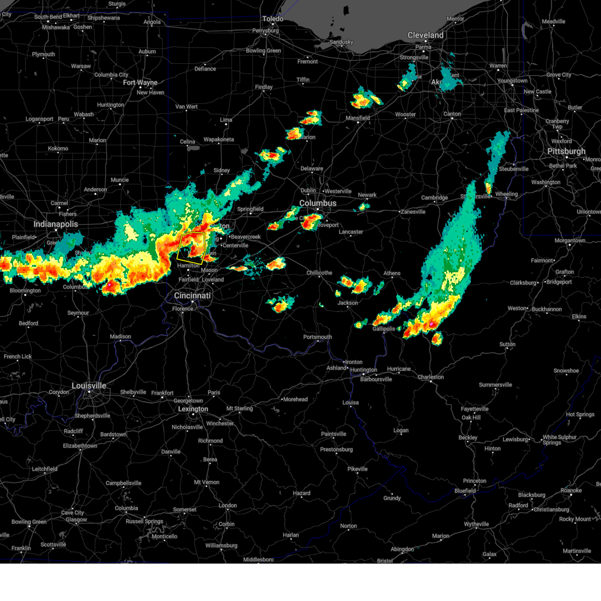 The severe thunderstorm warning for southeastern preble, northeastern butler and southwestern montgomery counties will expire at 830 pm edt, a new severe thunderstorm warning still remains in effect for southeastern preble, southwestern montgomery, and northeastern butler. a severe thunderstorm watch remains in effect until midnight edt for southwestern and west central ohio. please report previous wind damage or hail to the national weather service by going to our website at weather.gov/iln and submitting your report via social media. The severe thunderstorm warning for southeastern preble, northeastern butler and southwestern montgomery counties will expire at 830 pm edt, a new severe thunderstorm warning still remains in effect for southeastern preble, southwestern montgomery, and northeastern butler. a severe thunderstorm watch remains in effect until midnight edt for southwestern and west central ohio. please report previous wind damage or hail to the national weather service by going to our website at weather.gov/iln and submitting your report via social media.
|
| 7/17/2023 8:23 PM EDT |
 At 823 pm edt, a severe thunderstorm was located near gratis, moving southeast at 20 mph (radar indicated). Hazards include 60 mph wind gusts and quarter size hail. Minor hail damage to vehicles is possible. Expect wind damage to trees and power lines. At 823 pm edt, a severe thunderstorm was located near gratis, moving southeast at 20 mph (radar indicated). Hazards include 60 mph wind gusts and quarter size hail. Minor hail damage to vehicles is possible. Expect wind damage to trees and power lines.
|
| 7/17/2023 8:01 PM EDT |
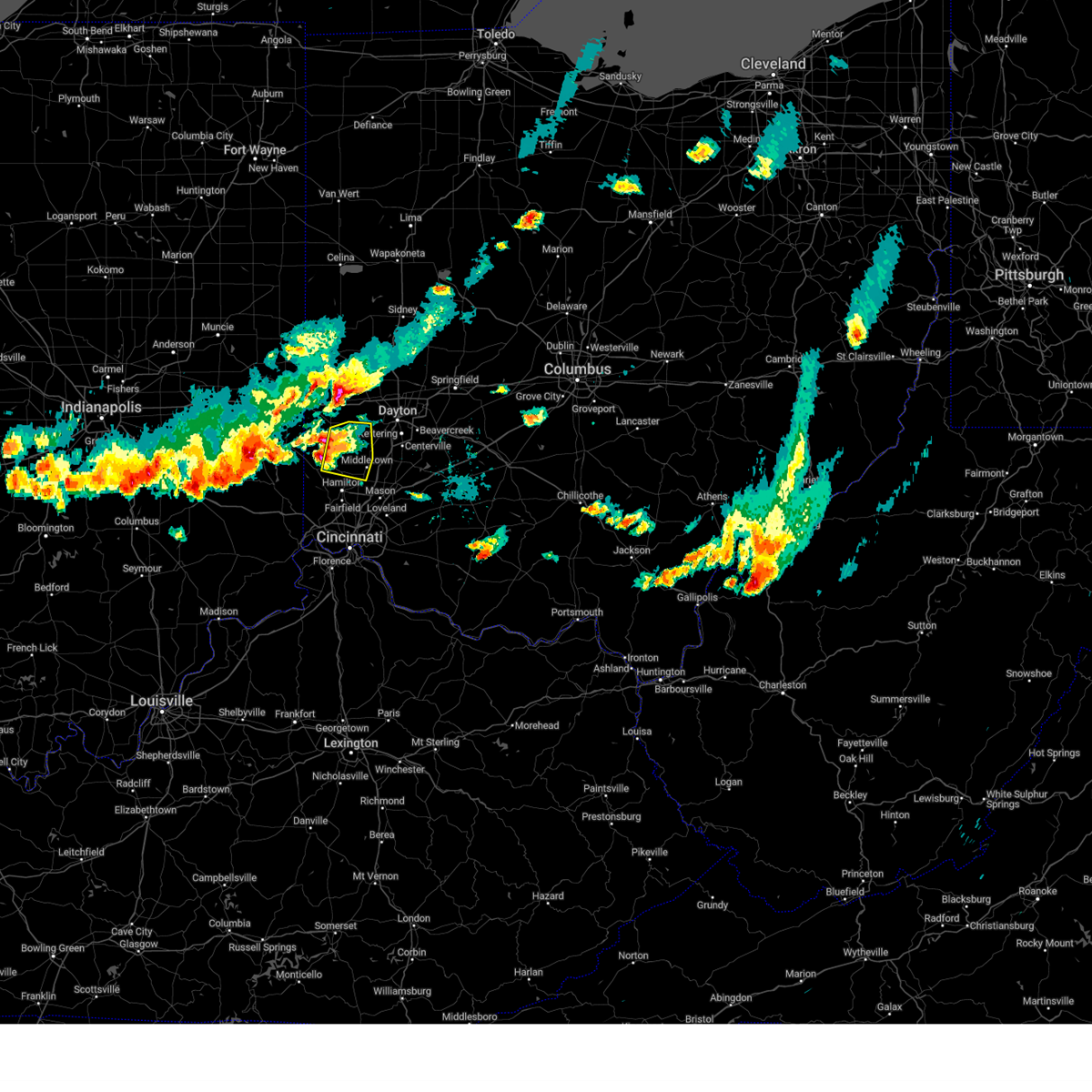 At 801 pm edt, a severe thunderstorm was located near camden, moving east at 10 mph (radar indicated). Hazards include 60 mph wind gusts and half dollar size hail. Minor hail damage to vehicles is possible. Expect wind damage to trees and power lines. At 801 pm edt, a severe thunderstorm was located near camden, moving east at 10 mph (radar indicated). Hazards include 60 mph wind gusts and half dollar size hail. Minor hail damage to vehicles is possible. Expect wind damage to trees and power lines.
|
| 7/15/2023 9:12 AM EDT |
 At 912 am edt, a severe thunderstorm was located over blue ash, moving east at 25 mph (radar indicated). Hazards include 60 mph wind gusts and quarter size hail. Minor hail damage to vehicles is possible. expect wind damage to trees and power lines. locations impacted include, middletown, mason, lebanon, norwood, sharonville, monroe, blue ash, loveland, springdale, reading, montgomery, madeira, wyoming, milford, deer park, west chester, waynesville, terrace park and morrow. this includes the following interstates, i-71 in ohio between mile markers 8 and 37. i-75 in ohio between mile markers 9 and 32. hail threat, radar indicated max hail size, 1. 00 in wind threat, radar indicated max wind gust, 60 mph. At 912 am edt, a severe thunderstorm was located over blue ash, moving east at 25 mph (radar indicated). Hazards include 60 mph wind gusts and quarter size hail. Minor hail damage to vehicles is possible. expect wind damage to trees and power lines. locations impacted include, middletown, mason, lebanon, norwood, sharonville, monroe, blue ash, loveland, springdale, reading, montgomery, madeira, wyoming, milford, deer park, west chester, waynesville, terrace park and morrow. this includes the following interstates, i-71 in ohio between mile markers 8 and 37. i-75 in ohio between mile markers 9 and 32. hail threat, radar indicated max hail size, 1. 00 in wind threat, radar indicated max wind gust, 60 mph.
|
| 7/15/2023 9:00 AM EDT |
 At 900 am edt, a severe thunderstorm was located over sharonville, moving east at 35 mph (radar indicated). Hazards include 60 mph wind gusts and quarter size hail. Minor hail damage to vehicles is possible. Expect wind damage to trees and power lines. At 900 am edt, a severe thunderstorm was located over sharonville, moving east at 35 mph (radar indicated). Hazards include 60 mph wind gusts and quarter size hail. Minor hail damage to vehicles is possible. Expect wind damage to trees and power lines.
|
| 7/1/2023 11:39 PM EDT | Several trees dow in butler county OH, 4 miles NNE of Middletown, OH |
| 2/27/2023 2:54 PM EST |
 At 254 pm est, a severe thunderstorm was located over lebanon, moving northeast at 55 mph (radar indicated). Hazards include 60 mph wind gusts and quarter size hail. Minor hail damage to vehicles is possible. Expect wind damage to trees and power lines. At 254 pm est, a severe thunderstorm was located over lebanon, moving northeast at 55 mph (radar indicated). Hazards include 60 mph wind gusts and quarter size hail. Minor hail damage to vehicles is possible. Expect wind damage to trees and power lines.
|
| 2/27/2023 2:44 PM EST |
 At 244 pm est, a confirmed tornado was located near carlisle, moving northeast at 45 mph (radar confirmed tornado. radar shows tornado debris in the air). Hazards include damaging tornado. Flying debris will be dangerous to those caught without shelter. mobile homes will be damaged or destroyed. damage to roofs, windows, and vehicles will occur. tree damage is likely. locations impacted include, dayton, kettering, miamisburg, springboro, franklin, bellbrook, moraine, carlisle, oakwood, west carrollton, riverside, germantown, centerville, poast town heights and woodbourne-hyde park. This includes i-75 in ohio between mile markers 40 and 52. At 244 pm est, a confirmed tornado was located near carlisle, moving northeast at 45 mph (radar confirmed tornado. radar shows tornado debris in the air). Hazards include damaging tornado. Flying debris will be dangerous to those caught without shelter. mobile homes will be damaged or destroyed. damage to roofs, windows, and vehicles will occur. tree damage is likely. locations impacted include, dayton, kettering, miamisburg, springboro, franklin, bellbrook, moraine, carlisle, oakwood, west carrollton, riverside, germantown, centerville, poast town heights and woodbourne-hyde park. This includes i-75 in ohio between mile markers 40 and 52.
|
| 2/27/2023 2:43 PM EST |
 At 242 pm est, a severe thunderstorm capable of producing a tornado was located near middletown, moving northeast at 45 mph (radar indicated rotation). Hazards include tornado. Flying debris will be dangerous to those caught without shelter. mobile homes will be damaged or destroyed. damage to roofs, windows, and vehicles will occur. Tree damage is likely. At 242 pm est, a severe thunderstorm capable of producing a tornado was located near middletown, moving northeast at 45 mph (radar indicated rotation). Hazards include tornado. Flying debris will be dangerous to those caught without shelter. mobile homes will be damaged or destroyed. damage to roofs, windows, and vehicles will occur. Tree damage is likely.
|
| 2/27/2023 2:40 PM EST |
 At 240 pm est, a severe thunderstorm was located over west chester, moving northeast at 55 mph (radar indicated). Hazards include 60 mph wind gusts and quarter size hail. Minor hail damage to vehicles is possible. expect wind damage to trees and power lines. locations impacted include, mason, lebanon, springboro, sharonville, monroe, blue ash, loveland, springdale, montgomery, west chester, waynesville, morrow, kings island, sixteen mile stand, olde west chester, four bridges, highpoint, wetherington, brecon and hunter. this includes the following interstates, i-71 in ohio between mile markers 17 and 41. I-75 in ohio between mile markers 15 and 30. At 240 pm est, a severe thunderstorm was located over west chester, moving northeast at 55 mph (radar indicated). Hazards include 60 mph wind gusts and quarter size hail. Minor hail damage to vehicles is possible. expect wind damage to trees and power lines. locations impacted include, mason, lebanon, springboro, sharonville, monroe, blue ash, loveland, springdale, montgomery, west chester, waynesville, morrow, kings island, sixteen mile stand, olde west chester, four bridges, highpoint, wetherington, brecon and hunter. this includes the following interstates, i-71 in ohio between mile markers 17 and 41. I-75 in ohio between mile markers 15 and 30.
|
| 2/27/2023 2:36 PM EST |
 At 236 pm est, a severe thunderstorm was located near gratis, moving northeast at 55 mph (radar indicated). Hazards include 60 mph wind gusts and quarter size hail. Minor hail damage to vehicles is possible. Expect wind damage to trees and power lines. At 236 pm est, a severe thunderstorm was located near gratis, moving northeast at 55 mph (radar indicated). Hazards include 60 mph wind gusts and quarter size hail. Minor hail damage to vehicles is possible. Expect wind damage to trees and power lines.
|
| 2/27/2023 2:31 PM EST |
 At 230 pm est, a severe thunderstorm was located over north college hill, moving northeast at 55 mph (radar indicated). Hazards include 60 mph wind gusts and quarter size hail. Minor hail damage to vehicles is possible. Expect wind damage to trees and power lines. At 230 pm est, a severe thunderstorm was located over north college hill, moving northeast at 55 mph (radar indicated). Hazards include 60 mph wind gusts and quarter size hail. Minor hail damage to vehicles is possible. Expect wind damage to trees and power lines.
|
| 2/27/2023 2:21 PM EST |
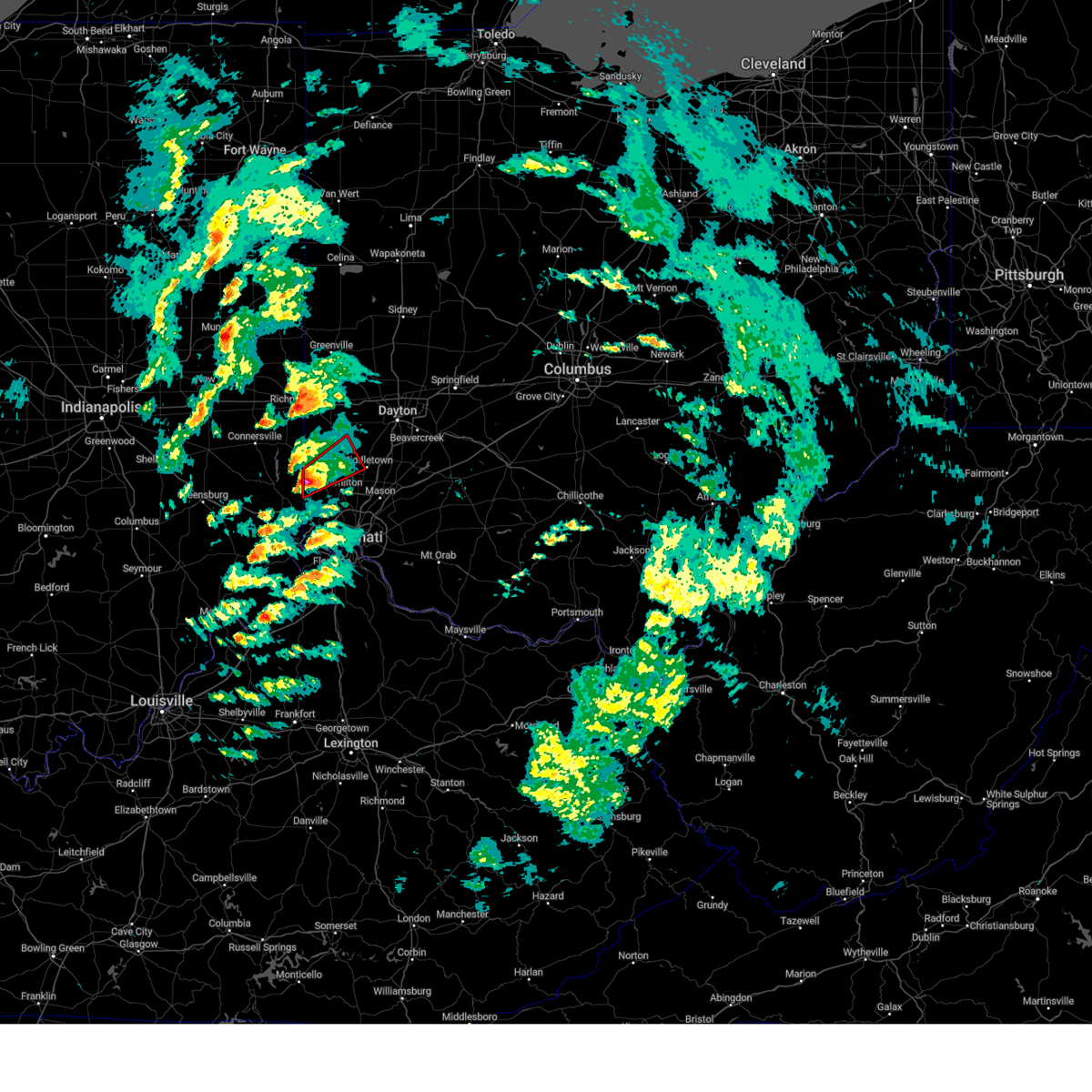 At 220 pm est, a severe thunderstorm capable of producing a tornado was located near oxford, moving northeast at 55 mph (radar indicated rotation). Hazards include tornado and quarter size hail. Flying debris will be dangerous to those caught without shelter. mobile homes will be damaged or destroyed. damage to roofs, windows, and vehicles will occur. tree damage is likely. locations impacted include, hamilton, oxford, trenton, gratis, seven mile, darrtown, reily, scipio, somerville, west elkton, jacksonburg, collinsville, mcgonigle and st. Charles. At 220 pm est, a severe thunderstorm capable of producing a tornado was located near oxford, moving northeast at 55 mph (radar indicated rotation). Hazards include tornado and quarter size hail. Flying debris will be dangerous to those caught without shelter. mobile homes will be damaged or destroyed. damage to roofs, windows, and vehicles will occur. tree damage is likely. locations impacted include, hamilton, oxford, trenton, gratis, seven mile, darrtown, reily, scipio, somerville, west elkton, jacksonburg, collinsville, mcgonigle and st. Charles.
|
| 2/27/2023 2:12 PM EST |
 At 212 pm est, a severe thunderstorm capable of producing a tornado was located near brookville, moving northeast at 55 mph (radar indicated rotation). Hazards include tornado and quarter size hail. Flying debris will be dangerous to those caught without shelter. mobile homes will be damaged or destroyed. damage to roofs, windows, and vehicles will occur. Tree damage is likely. At 212 pm est, a severe thunderstorm capable of producing a tornado was located near brookville, moving northeast at 55 mph (radar indicated rotation). Hazards include tornado and quarter size hail. Flying debris will be dangerous to those caught without shelter. mobile homes will be damaged or destroyed. damage to roofs, windows, and vehicles will occur. Tree damage is likely.
|
| 2/27/2023 2:12 PM EST |
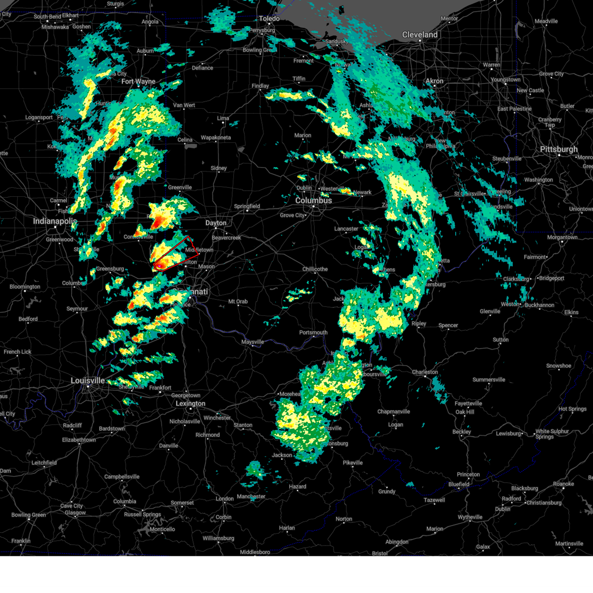 At 212 pm est, a severe thunderstorm capable of producing a tornado was located near brookville, moving northeast at 55 mph (radar indicated rotation). Hazards include tornado and quarter size hail. Flying debris will be dangerous to those caught without shelter. mobile homes will be damaged or destroyed. damage to roofs, windows, and vehicles will occur. Tree damage is likely. At 212 pm est, a severe thunderstorm capable of producing a tornado was located near brookville, moving northeast at 55 mph (radar indicated rotation). Hazards include tornado and quarter size hail. Flying debris will be dangerous to those caught without shelter. mobile homes will be damaged or destroyed. damage to roofs, windows, and vehicles will occur. Tree damage is likely.
|
| 8/21/2022 6:37 PM EDT |
 At 637 pm edt, a severe thunderstorm was located near lebanon, moving east at 20 mph (radar indicated). Hazards include 60 mph wind gusts and quarter size hail. Minor hail damage to vehicles is possible. expect wind damage to trees and power lines. locations impacted include, lebanon, waynesville, hunter, clarksville, harveysburg, corwin, oregonia, fort ancient, mount holly, roxanna, pekin, genntown, state route 350 at us route 22 and caesar creek state park. hail threat, radar indicated max hail size, 1. 00 in wind threat, radar indicated max wind gust, 60 mph. At 637 pm edt, a severe thunderstorm was located near lebanon, moving east at 20 mph (radar indicated). Hazards include 60 mph wind gusts and quarter size hail. Minor hail damage to vehicles is possible. expect wind damage to trees and power lines. locations impacted include, lebanon, waynesville, hunter, clarksville, harveysburg, corwin, oregonia, fort ancient, mount holly, roxanna, pekin, genntown, state route 350 at us route 22 and caesar creek state park. hail threat, radar indicated max hail size, 1. 00 in wind threat, radar indicated max wind gust, 60 mph.
|
| 8/21/2022 6:23 PM EDT |
 At 623 pm edt, a severe thunderstorm was located near springboro, moving east at 20 mph (radar indicated). Hazards include 60 mph wind gusts and quarter size hail. Minor hail damage to vehicles is possible. Expect wind damage to trees and power lines. At 623 pm edt, a severe thunderstorm was located near springboro, moving east at 20 mph (radar indicated). Hazards include 60 mph wind gusts and quarter size hail. Minor hail damage to vehicles is possible. Expect wind damage to trees and power lines.
|
| 7/6/2022 2:44 PM EDT |
 At 244 pm edt, a severe thunderstorm was located over four bridges, moving east at 30 mph (radar indicated). Hazards include 60 mph wind gusts. expect damage to trees and power lines At 244 pm edt, a severe thunderstorm was located over four bridges, moving east at 30 mph (radar indicated). Hazards include 60 mph wind gusts. expect damage to trees and power lines
|
| 7/6/2022 2:34 PM EDT |
 At 234 pm edt, a severe thunderstorm was located over williamsdale, moving east at 40 mph (radar indicated). Hazards include 60 mph wind gusts. Expect damage to trees and power lines. locations impacted include, hamilton, middletown, fairfield, monroe, trenton, gratis, seven mile, williamsdale, darrtown, germantown, new miami, millville, somerville, west elkton, jacksonburg, collinsville, maustown and poast town heights. hail threat, radar indicated max hail size, <. 75 in wind threat, radar indicated max wind gust, 60 mph. At 234 pm edt, a severe thunderstorm was located over williamsdale, moving east at 40 mph (radar indicated). Hazards include 60 mph wind gusts. Expect damage to trees and power lines. locations impacted include, hamilton, middletown, fairfield, monroe, trenton, gratis, seven mile, williamsdale, darrtown, germantown, new miami, millville, somerville, west elkton, jacksonburg, collinsville, maustown and poast town heights. hail threat, radar indicated max hail size, <. 75 in wind threat, radar indicated max wind gust, 60 mph.
|
| 7/6/2022 2:21 PM EDT |
 At 221 pm edt, a severe thunderstorm was located over darrtown, moving east at 40 mph (radar indicated). Hazards include 60 mph wind gusts. Expect damage to trees and power lines. locations impacted include, hamilton, middletown, fairfield, oxford, monroe, trenton, camden, gratis, seven mile, williamsdale, darrtown, germantown, reily, new miami, millville, college corner, somerville, west elkton, jacksonburg and collinsville. hail threat, radar indicated max hail size, <. 75 in wind threat, radar indicated max wind gust, 60 mph. At 221 pm edt, a severe thunderstorm was located over darrtown, moving east at 40 mph (radar indicated). Hazards include 60 mph wind gusts. Expect damage to trees and power lines. locations impacted include, hamilton, middletown, fairfield, oxford, monroe, trenton, camden, gratis, seven mile, williamsdale, darrtown, germantown, reily, new miami, millville, college corner, somerville, west elkton, jacksonburg and collinsville. hail threat, radar indicated max hail size, <. 75 in wind threat, radar indicated max wind gust, 60 mph.
|
| 7/6/2022 2:01 PM EDT |
 At 201 pm edt, a severe thunderstorm was located near liberty, moving southeast at 40 mph (radar indicated). Hazards include 60 mph wind gusts. expect damage to trees and power lines At 201 pm edt, a severe thunderstorm was located near liberty, moving southeast at 40 mph (radar indicated). Hazards include 60 mph wind gusts. expect damage to trees and power lines
|
| 6/22/2022 3:39 PM EDT |
 At 339 pm edt, a severe thunderstorm was located over trenton, moving southeast at 10 mph (radar indicated). Hazards include 60 mph wind gusts and quarter size hail. Minor hail damage to vehicles is possible. Expect wind damage to trees and power lines. At 339 pm edt, a severe thunderstorm was located over trenton, moving southeast at 10 mph (radar indicated). Hazards include 60 mph wind gusts and quarter size hail. Minor hail damage to vehicles is possible. Expect wind damage to trees and power lines.
|
| 6/13/2022 7:01 PM EDT | Tree fell into house on poplar stree in butler county OH, 3 miles ESE of Middletown, OH |
| 6/13/2022 6:04 PM EDT |
 At 604 pm edt, severe thunderstorms were located along a line extending from oakwood to near kings island, moving east at 25 mph (radar indicated). Hazards include 70 mph wind gusts and penny size hail. Expect considerable tree damage. damage is likely to mobile homes, roofs, and outbuildings. locations impacted include, dayton, hamilton, kettering, middletown, beavercreek, fairfield, huber heights, mason, trotwood, miamisburg, lebanon, springboro, vandalia, sharonville, englewood, monroe, loveland, trenton, franklin and springdale. this includes the following interstates, i-70 in ohio between mile markers 19 and 40. i-71 in ohio between mile markers 20 and 36. i-75 in ohio between mile markers 18 and 65. thunderstorm damage threat, considerable hail threat, radar indicated max hail size, 0. 75 in wind threat, radar indicated max wind gust, 70 mph. At 604 pm edt, severe thunderstorms were located along a line extending from oakwood to near kings island, moving east at 25 mph (radar indicated). Hazards include 70 mph wind gusts and penny size hail. Expect considerable tree damage. damage is likely to mobile homes, roofs, and outbuildings. locations impacted include, dayton, hamilton, kettering, middletown, beavercreek, fairfield, huber heights, mason, trotwood, miamisburg, lebanon, springboro, vandalia, sharonville, englewood, monroe, loveland, trenton, franklin and springdale. this includes the following interstates, i-70 in ohio between mile markers 19 and 40. i-71 in ohio between mile markers 20 and 36. i-75 in ohio between mile markers 18 and 65. thunderstorm damage threat, considerable hail threat, radar indicated max hail size, 0. 75 in wind threat, radar indicated max wind gust, 70 mph.
|
| 6/13/2022 5:56 PM EDT | Tree limbs down 2+ inches in diameter. time from radar in butler county OH, 2.4 miles SE of Middletown, OH |
| 6/13/2022 5:56 PM EDT | Large 12-13 inch tree limbs downed. time from radar in butler county OH, 2 miles ESE of Middletown, OH |
| 6/13/2022 5:55 PM EDT | Large trees snapped. time from radar in butler county OH, 4.7 miles NNE of Middletown, OH |
| 6/13/2022 5:50 PM EDT |
 At 550 pm edt, severe thunderstorms were located along a line extending from near moraine to near highpoint, moving east at 45 mph (radar indicated). Hazards include 70 mph wind gusts and penny size hail. Expect considerable tree damage. damage is likely to mobile homes, roofs, and outbuildings. locations impacted include, dayton, hamilton, kettering, middletown, beavercreek, fairfield, huber heights, mason, trotwood, miamisburg, lebanon, springboro, vandalia, sharonville, englewood, monroe, loveland, trenton, franklin and springdale. this includes the following interstates, i-70 in ohio between mile markers 17 and 40. i-71 in ohio between mile markers 20 and 36. i-75 in ohio between mile markers 18 and 65. thunderstorm damage threat, considerable hail threat, radar indicated max hail size, 0. 75 in wind threat, radar indicated max wind gust, 70 mph. At 550 pm edt, severe thunderstorms were located along a line extending from near moraine to near highpoint, moving east at 45 mph (radar indicated). Hazards include 70 mph wind gusts and penny size hail. Expect considerable tree damage. damage is likely to mobile homes, roofs, and outbuildings. locations impacted include, dayton, hamilton, kettering, middletown, beavercreek, fairfield, huber heights, mason, trotwood, miamisburg, lebanon, springboro, vandalia, sharonville, englewood, monroe, loveland, trenton, franklin and springdale. this includes the following interstates, i-70 in ohio between mile markers 17 and 40. i-71 in ohio between mile markers 20 and 36. i-75 in ohio between mile markers 18 and 65. thunderstorm damage threat, considerable hail threat, radar indicated max hail size, 0. 75 in wind threat, radar indicated max wind gust, 70 mph.
|
| 6/13/2022 5:40 PM EDT |
 At 540 pm edt, severe thunderstorms were located along a line extending from near lewisburg to forest park, moving east at 30 mph (radar indicated). Hazards include 70 mph wind gusts and quarter size hail. Minor hail damage to vehicles is possible. expect considerable tree damage. wind damage is also likely to mobile homes, roofs, and outbuildings. locations impacted include, dayton, hamilton, kettering, middletown, beavercreek, fairfield, huber heights, mason, trotwood, miamisburg, lebanon, springboro, vandalia, sharonville, englewood, monroe, loveland, trenton, franklin and springdale. this includes the following interstates, i-70 in ohio between mile markers 17 and 40. i-71 in ohio between mile markers 20 and 36. i-75 in ohio between mile markers 18 and 65. thunderstorm damage threat, considerable hail threat, radar indicated max hail size, 1. 00 in wind threat, radar indicated max wind gust, 70 mph. At 540 pm edt, severe thunderstorms were located along a line extending from near lewisburg to forest park, moving east at 30 mph (radar indicated). Hazards include 70 mph wind gusts and quarter size hail. Minor hail damage to vehicles is possible. expect considerable tree damage. wind damage is also likely to mobile homes, roofs, and outbuildings. locations impacted include, dayton, hamilton, kettering, middletown, beavercreek, fairfield, huber heights, mason, trotwood, miamisburg, lebanon, springboro, vandalia, sharonville, englewood, monroe, loveland, trenton, franklin and springdale. this includes the following interstates, i-70 in ohio between mile markers 17 and 40. i-71 in ohio between mile markers 20 and 36. i-75 in ohio between mile markers 18 and 65. thunderstorm damage threat, considerable hail threat, radar indicated max hail size, 1. 00 in wind threat, radar indicated max wind gust, 70 mph.
|
| 6/13/2022 5:25 PM EDT |
 At 524 pm edt, severe thunderstorms were located along a line extending from near lewisburg to ross, moving east at 25 mph (radar indicated). Hazards include 70 mph wind gusts and quarter size hail. Minor hail damage to vehicles is possible. expect considerable tree damage. Wind damage is also likely to mobile homes, roofs, and outbuildings. At 524 pm edt, severe thunderstorms were located along a line extending from near lewisburg to ross, moving east at 25 mph (radar indicated). Hazards include 70 mph wind gusts and quarter size hail. Minor hail damage to vehicles is possible. expect considerable tree damage. Wind damage is also likely to mobile homes, roofs, and outbuildings.
|
| 6/6/2022 4:40 PM EDT |
 The severe thunderstorm warning for northeastern hamilton, eastern butler, northwestern clermont and warren counties will expire at 445 pm edt, the storm which prompted the warning has weakened below severe limits, and no longer poses an immediate threat to life or property. therefore, the warning will be allowed to expire. however heavy rain is still possible with this thunderstorm. please report previous wind damage or hail to the national weather service by going to our website at weather.gov/iln and submitting your report via social media. The severe thunderstorm warning for northeastern hamilton, eastern butler, northwestern clermont and warren counties will expire at 445 pm edt, the storm which prompted the warning has weakened below severe limits, and no longer poses an immediate threat to life or property. therefore, the warning will be allowed to expire. however heavy rain is still possible with this thunderstorm. please report previous wind damage or hail to the national weather service by going to our website at weather.gov/iln and submitting your report via social media.
|
| 6/6/2022 4:32 PM EDT |
 At 432 pm edt, a severe thunderstorm was located over lebanon, moving northeast at 50 mph (radar indicated). Hazards include 60 mph wind gusts. Expect damage to trees and power lines. locations impacted include, middletown, mason, lebanon, springboro, sharonville, monroe, blue ash, loveland, trenton, franklin, montgomery, milford, carlisle, south middletown, west chester, morrow, seven mile, highpoint, remington and hunter. this includes the following interstates, i-71 in ohio between mile markers 17 and 37. i-75 in ohio between mile markers 20 and 39. hail threat, radar indicated max hail size, <. 75 in wind threat, radar indicated max wind gust, 60 mph. At 432 pm edt, a severe thunderstorm was located over lebanon, moving northeast at 50 mph (radar indicated). Hazards include 60 mph wind gusts. Expect damage to trees and power lines. locations impacted include, middletown, mason, lebanon, springboro, sharonville, monroe, blue ash, loveland, trenton, franklin, montgomery, milford, carlisle, south middletown, west chester, morrow, seven mile, highpoint, remington and hunter. this includes the following interstates, i-71 in ohio between mile markers 17 and 37. i-75 in ohio between mile markers 20 and 39. hail threat, radar indicated max hail size, <. 75 in wind threat, radar indicated max wind gust, 60 mph.
|
| 6/6/2022 4:23 PM EDT |
 At 423 pm edt, a severe thunderstorm was located over four bridges, moving northeast at 45 mph (radar indicated). Hazards include 60 mph wind gusts. Expect damage to trees and power lines. locations impacted include, hamilton, middletown, fairfield, mason, lebanon, springboro, sharonville, monroe, blue ash, loveland, trenton, franklin, springdale, montgomery, milford, carlisle, south middletown, west chester, terrace park and morrow. this includes the following interstates, i-71 in ohio between mile markers 14 and 37. i-75 in ohio between mile markers 17 and 39. hail threat, radar indicated max hail size, <. 75 in wind threat, radar indicated max wind gust, 60 mph. At 423 pm edt, a severe thunderstorm was located over four bridges, moving northeast at 45 mph (radar indicated). Hazards include 60 mph wind gusts. Expect damage to trees and power lines. locations impacted include, hamilton, middletown, fairfield, mason, lebanon, springboro, sharonville, monroe, blue ash, loveland, trenton, franklin, springdale, montgomery, milford, carlisle, south middletown, west chester, terrace park and morrow. this includes the following interstates, i-71 in ohio between mile markers 14 and 37. i-75 in ohio between mile markers 17 and 39. hail threat, radar indicated max hail size, <. 75 in wind threat, radar indicated max wind gust, 60 mph.
|
| 6/6/2022 4:09 PM EDT |
 At 409 pm edt, a severe thunderstorm was located over springdale, moving northeast at 50 mph (radar indicated). Hazards include 60 mph wind gusts. expect damage to trees and power lines At 409 pm edt, a severe thunderstorm was located over springdale, moving northeast at 50 mph (radar indicated). Hazards include 60 mph wind gusts. expect damage to trees and power lines
|
| 5/26/2022 2:17 PM EDT |
 At 216 pm edt, a severe thunderstorm was located near hamilton, moving northeast at 30 mph (radar indicated). Hazards include 60 mph wind gusts. Expect damage to trees and power lines. locations impacted include, hamilton, middletown, fairfield, miamisburg, springboro, monroe, trenton, franklin, carlisle, south middletown, gratis, seven mile, williamsdale, darrtown, hunter, germantown, new miami, farmersville, millville and west elkton. this includes i-75 in ohio between mile markers 32 and 40. this storm has weakened since the warning was issued, and if further weakening occurs, the warning will be cancelled early. hail threat, radar indicated max hail size, <. 75 in wind threat, radar indicated max wind gust, 60 mph. At 216 pm edt, a severe thunderstorm was located near hamilton, moving northeast at 30 mph (radar indicated). Hazards include 60 mph wind gusts. Expect damage to trees and power lines. locations impacted include, hamilton, middletown, fairfield, miamisburg, springboro, monroe, trenton, franklin, carlisle, south middletown, gratis, seven mile, williamsdale, darrtown, hunter, germantown, new miami, farmersville, millville and west elkton. this includes i-75 in ohio between mile markers 32 and 40. this storm has weakened since the warning was issued, and if further weakening occurs, the warning will be cancelled early. hail threat, radar indicated max hail size, <. 75 in wind threat, radar indicated max wind gust, 60 mph.
|
| 5/26/2022 2:04 PM EDT |
 At 204 pm edt, a severe thunderstorm was located near ross, moving northeast at 35 mph (radar indicated). Hazards include 60 mph wind gusts. expect damage to trees and power lines At 204 pm edt, a severe thunderstorm was located near ross, moving northeast at 35 mph (radar indicated). Hazards include 60 mph wind gusts. expect damage to trees and power lines
|
| 7/16/2021 2:30 PM EDT |
 At 230 pm edt, a severe thunderstorm was located over hunter, moving northeast at 35 mph (radar indicated). Hazards include 60 mph wind gusts. expect damage to trees and power lines At 230 pm edt, a severe thunderstorm was located over hunter, moving northeast at 35 mph (radar indicated). Hazards include 60 mph wind gusts. expect damage to trees and power lines
|
| 6/18/2021 9:08 PM EDT |
 The tornado warning for southeastern butler and west central warren counties will expire at 915 pm edt, the storm which prompted the warning has weakened below severe limits, and no longer appears capable of producing a tornado. therefore, the warning will be allowed to expire. however hail and gusty winds are still possible with this thunderstorm. a tornado watch remains in effect until 1100 pm edt for southwestern ohio. please report previous tornadoes, wind damage or hail to the national weather service by going to our website at weather.gov/iln and submitting your report via social media. The tornado warning for southeastern butler and west central warren counties will expire at 915 pm edt, the storm which prompted the warning has weakened below severe limits, and no longer appears capable of producing a tornado. therefore, the warning will be allowed to expire. however hail and gusty winds are still possible with this thunderstorm. a tornado watch remains in effect until 1100 pm edt for southwestern ohio. please report previous tornadoes, wind damage or hail to the national weather service by going to our website at weather.gov/iln and submitting your report via social media.
|
| 6/18/2021 8:58 PM EDT |
 At 858 pm edt, a severe thunderstorm capable of producing a tornado was located over monroe, moving southeast at 55 mph (radar indicated rotation). Hazards include tornado. Flying debris will be dangerous to those caught without shelter. mobile homes will be damaged or destroyed. damage to roofs, windows, and vehicles will occur. tree damage is likely. locations impacted include, middletown, mason, lebanon, monroe, four bridges, wetherington, olde west chester, hughes, hageman, state route 63 at state route 741 and maud. This includes i-75 in ohio between mile markers 21 and 31. At 858 pm edt, a severe thunderstorm capable of producing a tornado was located over monroe, moving southeast at 55 mph (radar indicated rotation). Hazards include tornado. Flying debris will be dangerous to those caught without shelter. mobile homes will be damaged or destroyed. damage to roofs, windows, and vehicles will occur. tree damage is likely. locations impacted include, middletown, mason, lebanon, monroe, four bridges, wetherington, olde west chester, hughes, hageman, state route 63 at state route 741 and maud. This includes i-75 in ohio between mile markers 21 and 31.
|
| 6/18/2021 8:52 PM EDT |
 At 852 pm edt, a severe thunderstorm capable of producing a tornado was located over middletown, moving southeast at 30 mph (radar indicated rotation). Hazards include tornado. Flying debris will be dangerous to those caught without shelter. mobile homes will be damaged or destroyed. damage to roofs, windows, and vehicles will occur. tree damage is likely. locations impacted include, middletown, mason, lebanon, monroe, trenton, south middletown, hunter, four bridges, wetherington, olde west chester, hughes, hageman, state route 63 at state route 741, maud and genntown. This includes i-75 in ohio between mile markers 21 and 34. At 852 pm edt, a severe thunderstorm capable of producing a tornado was located over middletown, moving southeast at 30 mph (radar indicated rotation). Hazards include tornado. Flying debris will be dangerous to those caught without shelter. mobile homes will be damaged or destroyed. damage to roofs, windows, and vehicles will occur. tree damage is likely. locations impacted include, middletown, mason, lebanon, monroe, trenton, south middletown, hunter, four bridges, wetherington, olde west chester, hughes, hageman, state route 63 at state route 741, maud and genntown. This includes i-75 in ohio between mile markers 21 and 34.
|
| 6/18/2021 8:46 PM EDT |
 At 845 pm edt, a tornado-producing storm was located near middletown, moving southeast at 30 mph (radar confirmed tornado. radar shows tornado debris in the air). Hazards include damaging tornado. Flying debris will be dangerous to those caught without shelter. mobile homes will be damaged or destroyed. damage to roofs, windows, and vehicles will occur. Tree damage is likely. At 845 pm edt, a tornado-producing storm was located near middletown, moving southeast at 30 mph (radar confirmed tornado. radar shows tornado debris in the air). Hazards include damaging tornado. Flying debris will be dangerous to those caught without shelter. mobile homes will be damaged or destroyed. damage to roofs, windows, and vehicles will occur. Tree damage is likely.
|
| 6/18/2021 8:39 PM EDT |
 At 839 pm edt, severe thunderstorms were located along a line extending from near camden to ross, moving east at 35 mph (radar indicated). Hazards include 60 mph wind gusts. expect damage to trees and power lines At 839 pm edt, severe thunderstorms were located along a line extending from near camden to ross, moving east at 35 mph (radar indicated). Hazards include 60 mph wind gusts. expect damage to trees and power lines
|
| 3/26/2021 12:39 AM EDT |
 The severe thunderstorm warning for northeastern hamilton and eastern butler counties will expire at 1245 am edt, the storms which prompted the warning have weakened below severe limits and are exiting the warned area. therefore, the warning will be allowed to expire. please report previous wind damage or hail to the national weather service by going to our website at weather.gov/iln and submitting your report via social media. The severe thunderstorm warning for northeastern hamilton and eastern butler counties will expire at 1245 am edt, the storms which prompted the warning have weakened below severe limits and are exiting the warned area. therefore, the warning will be allowed to expire. please report previous wind damage or hail to the national weather service by going to our website at weather.gov/iln and submitting your report via social media.
|
| 3/26/2021 12:26 AM EDT |
 At 1225 am edt, severe thunderstorms were located along a line extending from hamilton to forest park to cheviot, moving northeast at 60 mph (radar indicated). Hazards include 60 mph wind gusts. Expect damage to trees and power lines. locations impacted include, cincinnati, hamilton, middletown, fairfield, norwood, forest park, sharonville, monroe, blue ash, trenton, springdale, reading, north college hill, wyoming, cheviot, mount healthy, deer park, south middletown, finneytown and west chester. this includes the following interstates, i-71 in ohio between mile markers 8 and 9. i-74 in ohio between mile markers 13 and 19. I-75 in ohio between mile markers 3 and 28. At 1225 am edt, severe thunderstorms were located along a line extending from hamilton to forest park to cheviot, moving northeast at 60 mph (radar indicated). Hazards include 60 mph wind gusts. Expect damage to trees and power lines. locations impacted include, cincinnati, hamilton, middletown, fairfield, norwood, forest park, sharonville, monroe, blue ash, trenton, springdale, reading, north college hill, wyoming, cheviot, mount healthy, deer park, south middletown, finneytown and west chester. this includes the following interstates, i-71 in ohio between mile markers 8 and 9. i-74 in ohio between mile markers 13 and 19. I-75 in ohio between mile markers 3 and 28.
|
| 3/26/2021 12:17 AM EDT |
 At 1216 am edt, severe thunderstorms were located along a line extending from near ross to taylor creek to near burlington, moving northeast at 55 mph (radar indicated). Hazards include 60 mph wind gusts. Expect damage to trees and power lines. locations impacted include, cincinnati, hamilton, middletown, fairfield, norwood, forest park, sharonville, monroe, blue ash, trenton, springdale, reading, harrison, north college hill, wyoming, cheviot, mount healthy, deer park, south middletown and finneytown. this includes the following interstates, i-71 in ohio between mile markers 8 and 9. i-74 in ohio between mile markers 4 and 19. I-75 in ohio between mile markers 3 and 28. At 1216 am edt, severe thunderstorms were located along a line extending from near ross to taylor creek to near burlington, moving northeast at 55 mph (radar indicated). Hazards include 60 mph wind gusts. Expect damage to trees and power lines. locations impacted include, cincinnati, hamilton, middletown, fairfield, norwood, forest park, sharonville, monroe, blue ash, trenton, springdale, reading, harrison, north college hill, wyoming, cheviot, mount healthy, deer park, south middletown and finneytown. this includes the following interstates, i-71 in ohio between mile markers 8 and 9. i-74 in ohio between mile markers 4 and 19. I-75 in ohio between mile markers 3 and 28.
|
| 3/26/2021 12:11 AM EDT |
 At 1211 am edt, severe thunderstorms were located along a line extending from near harrison to blue jay to near lawrenceburg, moving northeast at 55 mph (radar indicated). Hazards include 60 mph wind gusts. expect damage to trees and power lines At 1211 am edt, severe thunderstorms were located along a line extending from near harrison to blue jay to near lawrenceburg, moving northeast at 55 mph (radar indicated). Hazards include 60 mph wind gusts. expect damage to trees and power lines
|
| 8/25/2020 4:40 PM EDT |
 At 439 pm edt, a severe thunderstorm was located near monroe, moving southeast at 10 mph. another storm was located between jacksonburg and trenton (radar indicated). Hazards include 60 mph wind gusts and quarter size hail. Minor hail damage to vehicles is possible. expect wind damage to trees and power lines. locations impacted include, middletown, mason, monroe, trenton, south middletown, seven mile, williamsdale, olde west chester, four bridges, wetherington, new miami, jacksonburg, hughes, maud, maustown, pisgah and beckett ridge. This includes i-75 in ohio between mile markers 21 and 28. At 439 pm edt, a severe thunderstorm was located near monroe, moving southeast at 10 mph. another storm was located between jacksonburg and trenton (radar indicated). Hazards include 60 mph wind gusts and quarter size hail. Minor hail damage to vehicles is possible. expect wind damage to trees and power lines. locations impacted include, middletown, mason, monroe, trenton, south middletown, seven mile, williamsdale, olde west chester, four bridges, wetherington, new miami, jacksonburg, hughes, maud, maustown, pisgah and beckett ridge. This includes i-75 in ohio between mile markers 21 and 28.
|
| 8/25/2020 4:23 PM EDT |
 At 423 pm edt, a severe thunderstorm was located near camden, moving southeast at 20 mph (radar indicated). Hazards include 60 mph wind gusts and quarter size hail. Minor hail damage to vehicles is possible. Expect wind damage to trees and power lines. At 423 pm edt, a severe thunderstorm was located near camden, moving southeast at 20 mph (radar indicated). Hazards include 60 mph wind gusts and quarter size hail. Minor hail damage to vehicles is possible. Expect wind damage to trees and power lines.
|
| 7/19/2020 5:36 PM EDT |
 The severe thunderstorm warning for east central butler, northern warren and southwestern greene counties will expire at 545 pm edt, the storm which prompted the warning has moved out of the area. therefore, the warning will be allowed to expire. please report previous wind damage or hail to the national weather service by going to our website at weather.gov/iln and submitting your report via social media. The severe thunderstorm warning for east central butler, northern warren and southwestern greene counties will expire at 545 pm edt, the storm which prompted the warning has moved out of the area. therefore, the warning will be allowed to expire. please report previous wind damage or hail to the national weather service by going to our website at weather.gov/iln and submitting your report via social media.
|
| 7/19/2020 5:24 PM EDT |
 At 524 pm edt, a severe thunderstorm was located near waynesville, moving east at 30 mph (trained weather spotters). Hazards include 60 mph wind gusts and penny size hail. Expect damage to trees and power lines. locations impacted include, middletown, lebanon, springboro, monroe, franklin, bellbrook, carlisle, south middletown, waynesville, hunter, harveysburg, spring valley, corwin, oregonia, state route 63 at state route 741, fort ancient, lytle, mount holly, roxanna and pekin. this includes the following interstates, i-71 in ohio between mile markers 31 and 41. I-75 in ohio between mile markers 28 and 40. At 524 pm edt, a severe thunderstorm was located near waynesville, moving east at 30 mph (trained weather spotters). Hazards include 60 mph wind gusts and penny size hail. Expect damage to trees and power lines. locations impacted include, middletown, lebanon, springboro, monroe, franklin, bellbrook, carlisle, south middletown, waynesville, hunter, harveysburg, spring valley, corwin, oregonia, state route 63 at state route 741, fort ancient, lytle, mount holly, roxanna and pekin. this includes the following interstates, i-71 in ohio between mile markers 31 and 41. I-75 in ohio between mile markers 28 and 40.
|
| 7/19/2020 5:20 PM EDT |
 At 519 pm edt, a severe thunderstorm was located near springboro, moving east at 30 mph (trained weather spotters). Hazards include 60 mph wind gusts and penny size hail. Expect damage to trees and power lines. locations impacted include, middletown, miamisburg, lebanon, springboro, monroe, trenton, franklin, bellbrook, carlisle, south middletown, waynesville, hunter, harveysburg, spring valley, corwin, centerville, state route 63 at state route 741, fort ancient, lytle and mount holly. this includes the following interstates, i-71 in ohio between mile markers 31 and 41. I-75 in ohio between mile markers 29 and 44. At 519 pm edt, a severe thunderstorm was located near springboro, moving east at 30 mph (trained weather spotters). Hazards include 60 mph wind gusts and penny size hail. Expect damage to trees and power lines. locations impacted include, middletown, miamisburg, lebanon, springboro, monroe, trenton, franklin, bellbrook, carlisle, south middletown, waynesville, hunter, harveysburg, spring valley, corwin, centerville, state route 63 at state route 741, fort ancient, lytle and mount holly. this includes the following interstates, i-71 in ohio between mile markers 31 and 41. I-75 in ohio between mile markers 29 and 44.
|
| 7/19/2020 5:03 PM EDT |
 At 456 pm edt, a severe thunderstorm was located near middletown, moving east at 30 mph (radar indicated). Hazards include 60 mph wind gusts and penny size hail. expect damage to trees and power lines At 456 pm edt, a severe thunderstorm was located near middletown, moving east at 30 mph (radar indicated). Hazards include 60 mph wind gusts and penny size hail. expect damage to trees and power lines
|
| 7/19/2020 4:56 PM EDT |
 At 456 pm edt, a severe thunderstorm was located near middletown, moving east at 30 mph (radar indicated). Hazards include 60 mph wind gusts and penny size hail. expect damage to trees and power lines At 456 pm edt, a severe thunderstorm was located near middletown, moving east at 30 mph (radar indicated). Hazards include 60 mph wind gusts and penny size hail. expect damage to trees and power lines
|
| 6/10/2020 4:38 PM EDT |
 At 437 pm edt, a severe thunderstorm was located over middletown, moving northeast at 35 mph (radar indicated). Hazards include 60 mph wind gusts. expect damage to trees and power lines At 437 pm edt, a severe thunderstorm was located over middletown, moving northeast at 35 mph (radar indicated). Hazards include 60 mph wind gusts. expect damage to trees and power lines
|
| 6/3/2020 9:43 PM EDT |
 At 941 pm edt, a severe thunderstorm was located over monroe, moving east at 30 mph (radar indicated). Hazards include 60 mph wind gusts. expect damage to trees and power lines At 941 pm edt, a severe thunderstorm was located over monroe, moving east at 30 mph (radar indicated). Hazards include 60 mph wind gusts. expect damage to trees and power lines
|
| 5/10/2020 3:25 PM EDT |
 At 325 pm edt, severe thunderstorms were located along a line extending from near trotwood to near hamilton, moving northeast at 40 mph (radar indicated). Hazards include 60 mph wind gusts and penny size hail. expect damage to trees and power lines At 325 pm edt, severe thunderstorms were located along a line extending from near trotwood to near hamilton, moving northeast at 40 mph (radar indicated). Hazards include 60 mph wind gusts and penny size hail. expect damage to trees and power lines
|
| 5/10/2020 3:20 PM EDT |
 At 320 pm edt, severe thunderstorms were located along a line extending from near pleasant hill to darrtown, moving northeast at 60 mph (radar indicated). Hazards include 60 mph wind gusts and penny size hail. Expect damage to trees and power lines. Locations impacted include, dayton, hamilton, trotwood, oxford, trenton, eaton, camden, west alexandria, gratis, seven mile, williamsdale, darrtown, germantown, new lebanon, new miami, farmersville, somerville, west elkton, jacksonburg and collinsville. At 320 pm edt, severe thunderstorms were located along a line extending from near pleasant hill to darrtown, moving northeast at 60 mph (radar indicated). Hazards include 60 mph wind gusts and penny size hail. Expect damage to trees and power lines. Locations impacted include, dayton, hamilton, trotwood, oxford, trenton, eaton, camden, west alexandria, gratis, seven mile, williamsdale, darrtown, germantown, new lebanon, new miami, farmersville, somerville, west elkton, jacksonburg and collinsville.
|
| 5/10/2020 3:08 PM EDT |
 At 307 pm edt, severe thunderstorms were located along a line extending from near arcanum to 7 miles southwest of oxford, moving northeast at 55 mph (radar indicated). Hazards include 60 mph wind gusts and penny size hail. Expect damage to trees and power lines. Locations impacted include, dayton, hamilton, trotwood, oxford, trenton, eaton, camden, west alexandria, gratis, seven mile, west college corner, williamsdale, darrtown, germantown, new lebanon, reily, new miami, farmersville, college corner and somerville. At 307 pm edt, severe thunderstorms were located along a line extending from near arcanum to 7 miles southwest of oxford, moving northeast at 55 mph (radar indicated). Hazards include 60 mph wind gusts and penny size hail. Expect damage to trees and power lines. Locations impacted include, dayton, hamilton, trotwood, oxford, trenton, eaton, camden, west alexandria, gratis, seven mile, west college corner, williamsdale, darrtown, germantown, new lebanon, reily, new miami, farmersville, college corner and somerville.
|
| 5/10/2020 2:52 PM EDT |
 At 251 pm edt, severe thunderstorms were located along a line extending from near richmond to near brookville, moving northeast at 60 mph (radar indicated). Hazards include 60 mph wind gusts and penny size hail. expect damage to trees and power lines At 251 pm edt, severe thunderstorms were located along a line extending from near richmond to near brookville, moving northeast at 60 mph (radar indicated). Hazards include 60 mph wind gusts and penny size hail. expect damage to trees and power lines
|
| 4/8/2020 10:54 PM EDT |
 The severe thunderstorm warning for southeastern butler and warren counties will expire at 1100 pm edt, the storm which prompted the warning has moved out of the area. therefore, the warning will be allowed to expire. a tornado watch remains in effect until 200 am edt for southwestern ohio. please report previous wind damage or hail to the national weather service by going to our website at weather.gov/iln and submitting your report via social media. The severe thunderstorm warning for southeastern butler and warren counties will expire at 1100 pm edt, the storm which prompted the warning has moved out of the area. therefore, the warning will be allowed to expire. a tornado watch remains in effect until 200 am edt for southwestern ohio. please report previous wind damage or hail to the national weather service by going to our website at weather.gov/iln and submitting your report via social media.
|
| 4/8/2020 10:39 PM EDT |
 At 1020 pm edt, a severe thunderstorm was located over lebanon, moving east at 35 mph (radar indicated). Hazards include 60 mph wind gusts and half dollar size hail. Minor hail damage to vehicles is possible. expect wind damage to trees and power lines. locations impacted include, middletown, mason, lebanon, springboro, sharonville, monroe, trenton, franklin, south middletown, west chester, waynesville, morrow, kings island, olde west chester, four bridges, hunter, wetherington, south lebanon, maineville and harveysburg. this includes the following interstates, i-71 in ohio between mile markers 20 and 42. i-75 in ohio between mile markers 18 and 35. A tornado watch remains in effect until 200 am edt for southwestern ohio. At 1020 pm edt, a severe thunderstorm was located over lebanon, moving east at 35 mph (radar indicated). Hazards include 60 mph wind gusts and half dollar size hail. Minor hail damage to vehicles is possible. expect wind damage to trees and power lines. locations impacted include, middletown, mason, lebanon, springboro, sharonville, monroe, trenton, franklin, south middletown, west chester, waynesville, morrow, kings island, olde west chester, four bridges, hunter, wetherington, south lebanon, maineville and harveysburg. this includes the following interstates, i-71 in ohio between mile markers 20 and 42. i-75 in ohio between mile markers 18 and 35. A tornado watch remains in effect until 200 am edt for southwestern ohio.
|
| 4/8/2020 10:38 PM EDT |
 At 1038 pm edt, a severe thunderstorm was located near springboro, moving east at 45 mph (radar indicated). Hazards include 60 mph wind gusts and penny size hail. Expect damage to trees and power lines. locations impacted include, dayton, kettering, middletown, beavercreek, fairborn, xenia, miamisburg, springboro, franklin, bellbrook, moraine, carlisle, oakwood, yellow springs, wright-patterson afb, west carrollton, waynesville, wilberforce, riverside and germantown. this includes i-75 in ohio between mile markers 36 and 57. A tornado watch remains in effect until 200 am edt for southwestern and west central ohio. At 1038 pm edt, a severe thunderstorm was located near springboro, moving east at 45 mph (radar indicated). Hazards include 60 mph wind gusts and penny size hail. Expect damage to trees and power lines. locations impacted include, dayton, kettering, middletown, beavercreek, fairborn, xenia, miamisburg, springboro, franklin, bellbrook, moraine, carlisle, oakwood, yellow springs, wright-patterson afb, west carrollton, waynesville, wilberforce, riverside and germantown. this includes i-75 in ohio between mile markers 36 and 57. A tornado watch remains in effect until 200 am edt for southwestern and west central ohio.
|
| 4/8/2020 10:20 PM EDT |
 At 1020 pm edt, a severe thunderstorm was located over lebanon, moving east at 35 mph (radar indicated). Hazards include 60 mph wind gusts and half dollar size hail. Minor hail damage to vehicles is possible. expect wind damage to trees and power lines. locations impacted include, middletown, mason, lebanon, springboro, sharonville, monroe, trenton, franklin, south middletown, west chester, waynesville, morrow, kings island, olde west chester, four bridges, hunter, wetherington, south lebanon, maineville and harveysburg. this includes the following interstates, i-71 in ohio between mile markers 20 and 42. i-75 in ohio between mile markers 18 and 35. A tornado watch remains in effect until 200 am edt for southwestern ohio. At 1020 pm edt, a severe thunderstorm was located over lebanon, moving east at 35 mph (radar indicated). Hazards include 60 mph wind gusts and half dollar size hail. Minor hail damage to vehicles is possible. expect wind damage to trees and power lines. locations impacted include, middletown, mason, lebanon, springboro, sharonville, monroe, trenton, franklin, south middletown, west chester, waynesville, morrow, kings island, olde west chester, four bridges, hunter, wetherington, south lebanon, maineville and harveysburg. this includes the following interstates, i-71 in ohio between mile markers 20 and 42. i-75 in ohio between mile markers 18 and 35. A tornado watch remains in effect until 200 am edt for southwestern ohio.
|
| 4/8/2020 10:18 PM EDT |
 At 1018 pm edt, a severe thunderstorm was located over williamsdale, moving east at 55 mph (radar indicated). Hazards include 70 mph wind gusts and quarter size hail. Minor hail damage to vehicles is possible. expect considerable tree damage. wind damage is also likely to mobile homes, roofs, and outbuildings. locations impacted include, hamilton, fairfield, trotwood, oxford, forest park, monroe, trenton, springdale, eaton, ross, camden, lewisburg, west alexandria, gratis, seven mile, darrtown, williamsdale, dunlap, clayton and union. this includes i-70 in ohio between mile markers 12 and 25. A tornado watch remains in effect until 200 am edt for southeastern indiana, and southwestern and west central ohio. At 1018 pm edt, a severe thunderstorm was located over williamsdale, moving east at 55 mph (radar indicated). Hazards include 70 mph wind gusts and quarter size hail. Minor hail damage to vehicles is possible. expect considerable tree damage. wind damage is also likely to mobile homes, roofs, and outbuildings. locations impacted include, hamilton, fairfield, trotwood, oxford, forest park, monroe, trenton, springdale, eaton, ross, camden, lewisburg, west alexandria, gratis, seven mile, darrtown, williamsdale, dunlap, clayton and union. this includes i-70 in ohio between mile markers 12 and 25. A tornado watch remains in effect until 200 am edt for southeastern indiana, and southwestern and west central ohio.
|
| 4/8/2020 10:17 PM EDT |
 At 1017 pm edt, a severe thunderstorm was located near gratis, moving east at 55 mph (radar indicated). Hazards include 60 mph wind gusts and quarter size hail. Minor hail damage to vehicles is possible. Expect wind damage to trees and power lines. At 1017 pm edt, a severe thunderstorm was located near gratis, moving east at 55 mph (radar indicated). Hazards include 60 mph wind gusts and quarter size hail. Minor hail damage to vehicles is possible. Expect wind damage to trees and power lines.
|
| 4/8/2020 10:08 PM EDT |
 At 1008 pm edt, a severe thunderstorm was located over mason, moving east at 45 mph (radar indicated). Hazards include ping pong ball size hail and 60 mph wind gusts. People and animals outdoors will be injured. expect hail damage to roofs, siding, windows, and vehicles. expect wind damage to trees and power lines. locations impacted include, middletown, mason, lebanon, springboro, sharonville, monroe, trenton, franklin, south middletown, west chester, waynesville, morrow, kings island, olde west chester, four bridges, hunter, wetherington, south lebanon, maineville and harveysburg. this includes the following interstates, i-71 in ohio between mile markers 20 and 42. i-75 in ohio between mile markers 18 and 35. A tornado watch remains in effect until 200 am edt for southwestern ohio. At 1008 pm edt, a severe thunderstorm was located over mason, moving east at 45 mph (radar indicated). Hazards include ping pong ball size hail and 60 mph wind gusts. People and animals outdoors will be injured. expect hail damage to roofs, siding, windows, and vehicles. expect wind damage to trees and power lines. locations impacted include, middletown, mason, lebanon, springboro, sharonville, monroe, trenton, franklin, south middletown, west chester, waynesville, morrow, kings island, olde west chester, four bridges, hunter, wetherington, south lebanon, maineville and harveysburg. this includes the following interstates, i-71 in ohio between mile markers 20 and 42. i-75 in ohio between mile markers 18 and 35. A tornado watch remains in effect until 200 am edt for southwestern ohio.
|
| 4/8/2020 10:04 PM EDT | Half Dollar sized hail reported 8 miles N of Middletown, OH, time estimated by radar. |
| 4/8/2020 10:03 PM EDT |
 At 1003 pm edt, a severe thunderstorm was located near camden, moving east at 55 mph (radar indicated). Hazards include 70 mph wind gusts and quarter size hail. Minor hail damage to vehicles is possible. expect considerable tree damage. wind damage is also likely to mobile homes, roofs, and outbuildings. locations impacted include, hamilton, fairfield, trotwood, oxford, forest park, monroe, trenton, springdale, eaton, ross, camden, lewisburg, new paris, west alexandria, gratis, seven mile, west college corner, darrtown, williamsdale and dunlap. this includes i-70 in ohio between mile markers 1 and 25. A tornado watch remains in effect until 200 am edt for southeastern and east central indiana, and southwestern and west central ohio. At 1003 pm edt, a severe thunderstorm was located near camden, moving east at 55 mph (radar indicated). Hazards include 70 mph wind gusts and quarter size hail. Minor hail damage to vehicles is possible. expect considerable tree damage. wind damage is also likely to mobile homes, roofs, and outbuildings. locations impacted include, hamilton, fairfield, trotwood, oxford, forest park, monroe, trenton, springdale, eaton, ross, camden, lewisburg, new paris, west alexandria, gratis, seven mile, west college corner, darrtown, williamsdale and dunlap. this includes i-70 in ohio between mile markers 1 and 25. A tornado watch remains in effect until 200 am edt for southeastern and east central indiana, and southwestern and west central ohio.
|
| 4/8/2020 10:02 PM EDT |
 At 1001 pm edt, a severe thunderstorm was located over wetherington, moving east at 45 mph (radar indicated). Hazards include 60 mph wind gusts and quarter size hail. Minor hail damage to vehicles is possible. Expect wind damage to trees and power lines. At 1001 pm edt, a severe thunderstorm was located over wetherington, moving east at 45 mph (radar indicated). Hazards include 60 mph wind gusts and quarter size hail. Minor hail damage to vehicles is possible. Expect wind damage to trees and power lines.
|
| 4/8/2020 9:42 PM EDT |
 At 942 pm edt, a severe thunderstorm was located near connersville, moving east at 50 mph (radar indicated). Hazards include 70 mph wind gusts and quarter size hail. Minor hail damage to vehicles is possible. expect considerable tree damage. Wind damage is also likely to mobile homes, roofs, and outbuildings. At 942 pm edt, a severe thunderstorm was located near connersville, moving east at 50 mph (radar indicated). Hazards include 70 mph wind gusts and quarter size hail. Minor hail damage to vehicles is possible. expect considerable tree damage. Wind damage is also likely to mobile homes, roofs, and outbuildings.
|
| 3/20/2020 3:55 AM EDT |
 At 354 am edt, a severe thunderstorm was located over miamisburg, moving east at 55 mph (radar indicated). Hazards include 60 mph wind gusts and half dollar size hail. Minor hail damage to vehicles is possible. expect wind damage to trees and power lines. locations impacted include, dayton, kettering, miamisburg, springboro, franklin, moraine, carlisle, oakwood, west carrollton, riverside, germantown, centerville, lytle, state route 48 at state route 73, woodbourne-hyde park and overlook-page mano. This includes i-75 in ohio between mile markers 38 and 51. At 354 am edt, a severe thunderstorm was located over miamisburg, moving east at 55 mph (radar indicated). Hazards include 60 mph wind gusts and half dollar size hail. Minor hail damage to vehicles is possible. expect wind damage to trees and power lines. locations impacted include, dayton, kettering, miamisburg, springboro, franklin, moraine, carlisle, oakwood, west carrollton, riverside, germantown, centerville, lytle, state route 48 at state route 73, woodbourne-hyde park and overlook-page mano. This includes i-75 in ohio between mile markers 38 and 51.
|
| 3/20/2020 3:38 AM EDT |
 At 338 am edt, a severe thunderstorm was located near gratis, moving east at 50 mph (radar indicated). Hazards include ping pong ball size hail and 60 mph wind gusts. People and animals outdoors will be injured. expect hail damage to roofs, siding, windows, and vehicles. Expect wind damage to trees and power lines. At 338 am edt, a severe thunderstorm was located near gratis, moving east at 50 mph (radar indicated). Hazards include ping pong ball size hail and 60 mph wind gusts. People and animals outdoors will be injured. expect hail damage to roofs, siding, windows, and vehicles. Expect wind damage to trees and power lines.
|
| 5/27/2019 5:18 PM EDT |
 At 518 pm edt, a severe thunderstorm was located near lebanon, moving east at 25 mph (radar indicated). Hazards include 70 mph wind gusts and quarter size hail. Minor hail damage to vehicles is possible. expect considerable tree damage. Wind damage is also likely to mobile homes, roofs, and outbuildings. At 518 pm edt, a severe thunderstorm was located near lebanon, moving east at 25 mph (radar indicated). Hazards include 70 mph wind gusts and quarter size hail. Minor hail damage to vehicles is possible. expect considerable tree damage. Wind damage is also likely to mobile homes, roofs, and outbuildings.
|
| 4/12/2019 8:00 AM EDT |
 At 800 am edt, a severe thunderstorm was located over miamisburg, moving northeast at 60 mph (radar indicated). Hazards include 60 mph wind gusts. Expect damage to trees and power lines. locations impacted include, dayton, kettering, middletown, miamisburg, springboro, franklin, moraine, carlisle, west carrollton, hunter, germantown, centerville, lytle, pekin, state route 48 at state route 73, poast town heights, woodbourne-hyde park and drexel. This includes i-75 in ohio between mile markers 33 and 49. At 800 am edt, a severe thunderstorm was located over miamisburg, moving northeast at 60 mph (radar indicated). Hazards include 60 mph wind gusts. Expect damage to trees and power lines. locations impacted include, dayton, kettering, middletown, miamisburg, springboro, franklin, moraine, carlisle, west carrollton, hunter, germantown, centerville, lytle, pekin, state route 48 at state route 73, poast town heights, woodbourne-hyde park and drexel. This includes i-75 in ohio between mile markers 33 and 49.
|
| 4/12/2019 7:48 AM EDT |
 At 748 am edt, a severe thunderstorm was located over south middletown, moving northeast at 60 mph (radar indicated). Hazards include 60 mph wind gusts. Expect damage to trees and power lines. locations impacted include, dayton, kettering, middletown, trotwood, miamisburg, springboro, monroe, trenton, franklin, moraine, carlisle, south middletown, west carrollton, seven mile, williamsdale, hunter, germantown, new miami, centerville and jacksonburg. This includes i-75 in ohio between mile markers 30 and 50. At 748 am edt, a severe thunderstorm was located over south middletown, moving northeast at 60 mph (radar indicated). Hazards include 60 mph wind gusts. Expect damage to trees and power lines. locations impacted include, dayton, kettering, middletown, trotwood, miamisburg, springboro, monroe, trenton, franklin, moraine, carlisle, south middletown, west carrollton, seven mile, williamsdale, hunter, germantown, new miami, centerville and jacksonburg. This includes i-75 in ohio between mile markers 30 and 50.
|
| 4/12/2019 7:38 AM EDT |
 At 737 am edt, a severe thunderstorm was located over hamilton, moving northeast at 60 mph (radar indicated). Hazards include 60 mph wind gusts and penny size hail. expect damage to trees and power lines At 737 am edt, a severe thunderstorm was located over hamilton, moving northeast at 60 mph (radar indicated). Hazards include 60 mph wind gusts and penny size hail. expect damage to trees and power lines
|
| 3/14/2019 6:16 PM EDT |
 At 616 pm edt, a severe thunderstorm was located over kings island, moving northeast at 55 mph (radar indicated). Hazards include 60 mph wind gusts and quarter size hail. Minor hail damage to vehicles is possible. expect wind damage to trees and power lines. locations impacted include, cincinnati, mason, lebanon, norwood, sharonville, monroe, blue ash, loveland, reading, montgomery, madeira, deer park, morrow, highpoint, remington, concorde hills, kings island, sixteen mile stand, four bridges and rossmoyne. this includes the following interstates, i-71 in ohio between mile markers 8 and 41. I-75 in ohio between mile markers 23 and 30. At 616 pm edt, a severe thunderstorm was located over kings island, moving northeast at 55 mph (radar indicated). Hazards include 60 mph wind gusts and quarter size hail. Minor hail damage to vehicles is possible. expect wind damage to trees and power lines. locations impacted include, cincinnati, mason, lebanon, norwood, sharonville, monroe, blue ash, loveland, reading, montgomery, madeira, deer park, morrow, highpoint, remington, concorde hills, kings island, sixteen mile stand, four bridges and rossmoyne. this includes the following interstates, i-71 in ohio between mile markers 8 and 41. I-75 in ohio between mile markers 23 and 30.
|
| 3/14/2019 6:04 PM EDT |
 At 604 pm edt, a severe thunderstorm was located over sharonville, moving northeast at 55 mph (radar indicated). Hazards include 60 mph wind gusts and penny size hail. expect damage to trees and power lines At 604 pm edt, a severe thunderstorm was located over sharonville, moving northeast at 55 mph (radar indicated). Hazards include 60 mph wind gusts and penny size hail. expect damage to trees and power lines
|
| 9/6/2018 2:36 PM EDT |
 At 236 pm edt, a severe thunderstorm was located over springboro, moving east at 15 mph (radar indicated). Hazards include 60 mph wind gusts and quarter size hail. Minor hail damage to vehicles is possible. expect wind damage to trees and power lines. locations impacted include, kettering, middletown, miamisburg, springboro, franklin, west carrollton, hunter, centerville, state route 48 at state route 73, lytle, woodbourne-hyde park and pekin. This includes i-75 in ohio between mile markers 36 and 46. At 236 pm edt, a severe thunderstorm was located over springboro, moving east at 15 mph (radar indicated). Hazards include 60 mph wind gusts and quarter size hail. Minor hail damage to vehicles is possible. expect wind damage to trees and power lines. locations impacted include, kettering, middletown, miamisburg, springboro, franklin, west carrollton, hunter, centerville, state route 48 at state route 73, lytle, woodbourne-hyde park and pekin. This includes i-75 in ohio between mile markers 36 and 46.
|
| 9/6/2018 2:27 PM EDT |
 The severe thunderstorm warning for northeastern butler, northwestern warren and southwestern montgomery counties will expire at 230 pm edt, the storm which prompted the warning was moving out of the initial warning area. therefore, this initial warning will be allowed to expire. a new severe thunderstorm warning has been issued for parts of butler and warren counties until 300 pm edt. please report previous wind damage or hail to the national weather service by going to our website at weather.gov/iln and submitting your report via social media. The severe thunderstorm warning for northeastern butler, northwestern warren and southwestern montgomery counties will expire at 230 pm edt, the storm which prompted the warning was moving out of the initial warning area. therefore, this initial warning will be allowed to expire. a new severe thunderstorm warning has been issued for parts of butler and warren counties until 300 pm edt. please report previous wind damage or hail to the national weather service by going to our website at weather.gov/iln and submitting your report via social media.
|
| 9/6/2018 2:24 PM EDT |
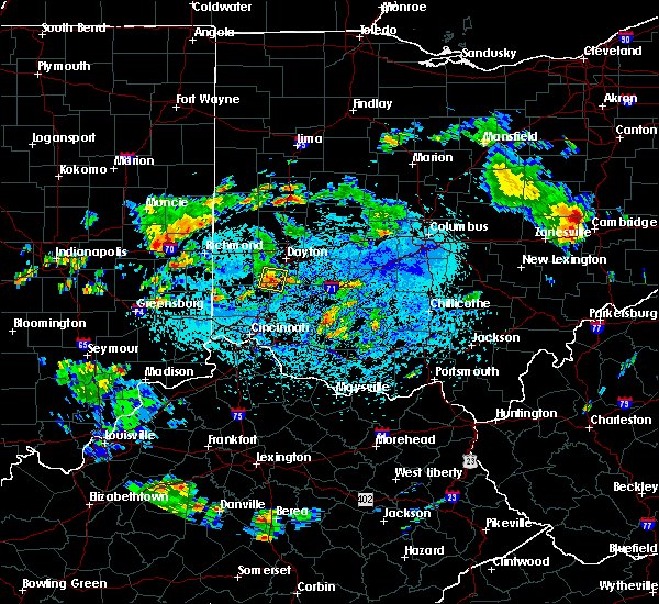 At 224 pm edt, a severe thunderstorm was located over springboro, moving east at 20 mph (radar indicated). Hazards include 60 mph wind gusts and quarter size hail. Minor hail damage to vehicles is possible. Expect wind damage to trees and power lines. At 224 pm edt, a severe thunderstorm was located over springboro, moving east at 20 mph (radar indicated). Hazards include 60 mph wind gusts and quarter size hail. Minor hail damage to vehicles is possible. Expect wind damage to trees and power lines.
|
| 9/6/2018 2:15 PM EDT |
 At 215 pm edt, a severe thunderstorm was located over carlisle, moving east at 15 mph (radar indicated). Hazards include 60 mph wind gusts and penny size hail. Expect damage to trees and power lines. locations impacted include, kettering, middletown, miamisburg, springboro, franklin, moraine, carlisle, west carrollton, germantown and poast town heights. This includes i-75 in ohio between mile markers 36 and 48. At 215 pm edt, a severe thunderstorm was located over carlisle, moving east at 15 mph (radar indicated). Hazards include 60 mph wind gusts and penny size hail. Expect damage to trees and power lines. locations impacted include, kettering, middletown, miamisburg, springboro, franklin, moraine, carlisle, west carrollton, germantown and poast town heights. This includes i-75 in ohio between mile markers 36 and 48.
|
| 9/6/2018 2:06 PM EDT |
 At 206 pm edt, a severe thunderstorm was located over carlisle, moving east at 15 mph (radar indicated). Hazards include 60 mph wind gusts and nickel size hail. expect damage to trees and power lines At 206 pm edt, a severe thunderstorm was located over carlisle, moving east at 15 mph (radar indicated). Hazards include 60 mph wind gusts and nickel size hail. expect damage to trees and power lines
|
| 9/5/2018 4:08 PM EDT |
 At 408 pm edt, a severe thunderstorm was located over hunter, moving northeast at 10 mph (radar indicated). Hazards include 60 mph wind gusts. Expect damage to trees and power lines. locations impacted include, middletown, lebanon, springboro, monroe, franklin, carlisle, waynesville, hunter, state route 63 at state route 741, lytle, pekin, state route 48 at state route 73 and genntown. This includes i-75 in ohio between mile markers 30 and 40. At 408 pm edt, a severe thunderstorm was located over hunter, moving northeast at 10 mph (radar indicated). Hazards include 60 mph wind gusts. Expect damage to trees and power lines. locations impacted include, middletown, lebanon, springboro, monroe, franklin, carlisle, waynesville, hunter, state route 63 at state route 741, lytle, pekin, state route 48 at state route 73 and genntown. This includes i-75 in ohio between mile markers 30 and 40.
|
| 9/5/2018 4:01 PM EDT | Tree down. time estimated from radar dat in warren county OH, 2.6 miles NW of Middletown, OH |
| 9/5/2018 3:56 PM EDT |
 At 356 pm edt, a severe thunderstorm was located over hunter, moving northeast at 15 mph (radar indicated). Hazards include 60 mph wind gusts and penny size hail. expect damage to trees and power lines At 356 pm edt, a severe thunderstorm was located over hunter, moving northeast at 15 mph (radar indicated). Hazards include 60 mph wind gusts and penny size hail. expect damage to trees and power lines
|
| 9/5/2018 1:45 PM EDT | Couple of trees reported down at kyles station road and yankee road. time estimated from rada in butler county OH, 6 miles NNE of Middletown, OH |
| 9/5/2018 1:40 PM EDT |
 At 140 pm edt, a severe thunderstorm was located over south middletown, moving northeast at 15 mph (radar indicated). Hazards include 60 mph wind gusts and penny size hail. Expect damage to trees and power lines. locations impacted include, middletown, mason, springboro, monroe, trenton, franklin, carlisle, south middletown, hunter, four bridges, state route 63 at state route 741, lytle, pekin, state route 48 at state route 73 and poast town heights. This includes i-75 in ohio between mile markers 25 and 40. At 140 pm edt, a severe thunderstorm was located over south middletown, moving northeast at 15 mph (radar indicated). Hazards include 60 mph wind gusts and penny size hail. Expect damage to trees and power lines. locations impacted include, middletown, mason, springboro, monroe, trenton, franklin, carlisle, south middletown, hunter, four bridges, state route 63 at state route 741, lytle, pekin, state route 48 at state route 73 and poast town heights. This includes i-75 in ohio between mile markers 25 and 40.
|
| 9/5/2018 1:31 PM EDT |
 At 131 pm edt, a severe thunderstorm was located over monroe, moving northeast at 15 mph (radar indicated). Hazards include 60 mph wind gusts and penny size hail. expect damage to trees and power lines At 131 pm edt, a severe thunderstorm was located over monroe, moving northeast at 15 mph (radar indicated). Hazards include 60 mph wind gusts and penny size hail. expect damage to trees and power lines
|
| 7/3/2018 4:57 PM EDT |
 At 457 pm edt, a severe thunderstorm was located over carlisle, moving north at 20 mph (radar indicated). Hazards include 60 mph wind gusts. expect damage to trees and power lines At 457 pm edt, a severe thunderstorm was located over carlisle, moving north at 20 mph (radar indicated). Hazards include 60 mph wind gusts. expect damage to trees and power lines
|
| 7/3/2018 4:33 PM EDT | Tree downed. time estimated via rada in butler county OH, 6.5 miles SE of Middletown, OH |
| 6/16/2018 5:11 PM EDT |
 The severe thunderstorm warning for northeastern butler, northwestern warren and south central montgomery counties will expire at 515 pm edt, the storm which prompted the warning has weakened below severe limits, and no longer poses an immediate threat to life or property. therefore, the warning will be allowed to expire. however gusty winds and heavy rain are still possible with this thunderstorm. please report previous wind damage or hail to the national weather service by going to our website at weather.gov/iln and submitting your report via social media. The severe thunderstorm warning for northeastern butler, northwestern warren and south central montgomery counties will expire at 515 pm edt, the storm which prompted the warning has weakened below severe limits, and no longer poses an immediate threat to life or property. therefore, the warning will be allowed to expire. however gusty winds and heavy rain are still possible with this thunderstorm. please report previous wind damage or hail to the national weather service by going to our website at weather.gov/iln and submitting your report via social media.
|
| 6/16/2018 4:49 PM EDT |
 At 449 pm edt, a severe thunderstorm was located near carlisle, moving east at 15 mph (radar indicated). Hazards include 60 mph wind gusts and penny size hail. expect damage to trees and power lines At 449 pm edt, a severe thunderstorm was located near carlisle, moving east at 15 mph (radar indicated). Hazards include 60 mph wind gusts and penny size hail. expect damage to trees and power lines
|
| 5/30/2018 3:18 PM EDT |
 At 317 pm edt, a severe thunderstorm was located near lebanon, moving northeast at 45 mph (radar indicated). Hazards include 60 mph wind gusts. expect damage to trees and power lines At 317 pm edt, a severe thunderstorm was located near lebanon, moving northeast at 45 mph (radar indicated). Hazards include 60 mph wind gusts. expect damage to trees and power lines
|
| 5/20/2018 6:46 PM EDT |
 At 646 pm edt, a severe thunderstorm was located over lebanon, moving southeast at 30 mph (radar indicated). Hazards include 60 mph wind gusts and quarter size hail. Minor hail damage to vehicles is possible. expect wind damage to trees and power lines. locations impacted include, mason, lebanon, springboro, monroe, morrow, kings island, hunter, four bridges, south lebanon, maineville, oregonia, state route 123 at state route 132, hageman, state route 63 at state route 741, fort ancient, kings mills, middleboro, pekin, socialville and landen. this includes the following interstates, i-71 in ohio between mile markers 21 and 39. I-75 in ohio between mile markers 29 and 31. At 646 pm edt, a severe thunderstorm was located over lebanon, moving southeast at 30 mph (radar indicated). Hazards include 60 mph wind gusts and quarter size hail. Minor hail damage to vehicles is possible. expect wind damage to trees and power lines. locations impacted include, mason, lebanon, springboro, monroe, morrow, kings island, hunter, four bridges, south lebanon, maineville, oregonia, state route 123 at state route 132, hageman, state route 63 at state route 741, fort ancient, kings mills, middleboro, pekin, socialville and landen. this includes the following interstates, i-71 in ohio between mile markers 21 and 39. I-75 in ohio between mile markers 29 and 31.
|
| 5/20/2018 6:29 PM EDT |
 At 629 pm edt, a severe thunderstorm was located over middletown, moving southeast at 30 mph (radar indicated). Hazards include 60 mph wind gusts and quarter size hail. Minor hail damage to vehicles is possible. Expect wind damage to trees and power lines. At 629 pm edt, a severe thunderstorm was located over middletown, moving southeast at 30 mph (radar indicated). Hazards include 60 mph wind gusts and quarter size hail. Minor hail damage to vehicles is possible. Expect wind damage to trees and power lines.
|
| 5/20/2018 6:22 PM EDT |
 At 622 pm edt, a severe thunderstorm was located over franklin, moving southeast at 30 mph (radar indicated). Hazards include 60 mph wind gusts and quarter size hail. Minor hail damage to vehicles is possible. expect wind damage to trees and power lines. locations impacted include, middletown, springboro, monroe, trenton, franklin, carlisle, south middletown, hunter, jacksonburg and poast town heights. This includes i-75 in ohio between mile markers 30 and 41. At 622 pm edt, a severe thunderstorm was located over franklin, moving southeast at 30 mph (radar indicated). Hazards include 60 mph wind gusts and quarter size hail. Minor hail damage to vehicles is possible. expect wind damage to trees and power lines. locations impacted include, middletown, springboro, monroe, trenton, franklin, carlisle, south middletown, hunter, jacksonburg and poast town heights. This includes i-75 in ohio between mile markers 30 and 41.
|
| 5/20/2018 6:14 PM EDT |
 At 614 pm edt, a severe thunderstorm was located over carlisle, moving southeast at 30 mph (radar indicated). Hazards include 60 mph wind gusts and quarter size hail. Minor hail damage to vehicles is possible. expect wind damage to trees and power lines. locations impacted include, middletown, miamisburg, springboro, monroe, trenton, franklin, moraine, carlisle, south middletown, west carrollton, hunter, germantown, farmersville, jacksonburg and poast town heights. This includes i-75 in ohio between mile markers 30 and 46. At 614 pm edt, a severe thunderstorm was located over carlisle, moving southeast at 30 mph (radar indicated). Hazards include 60 mph wind gusts and quarter size hail. Minor hail damage to vehicles is possible. expect wind damage to trees and power lines. locations impacted include, middletown, miamisburg, springboro, monroe, trenton, franklin, moraine, carlisle, south middletown, west carrollton, hunter, germantown, farmersville, jacksonburg and poast town heights. This includes i-75 in ohio between mile markers 30 and 46.
|
| 5/20/2018 6:10 PM EDT | A few trees downe in butler county OH, 9.3 miles ESE of Middletown, OH |
| 5/20/2018 5:43 PM EDT |
 At 543 pm edt, a severe thunderstorm was located over camden, moving southeast at 30 mph (radar indicated). Hazards include 60 mph wind gusts and quarter size hail. Minor hail damage to vehicles is possible. Expect wind damage to trees and power lines. At 543 pm edt, a severe thunderstorm was located over camden, moving southeast at 30 mph (radar indicated). Hazards include 60 mph wind gusts and quarter size hail. Minor hail damage to vehicles is possible. Expect wind damage to trees and power lines.
|
| 5/13/2018 9:54 PM EDT |
 At 954 pm edt, a severe thunderstorm was located over eaton, moving east at 25 mph (radar indicated). Hazards include 60 mph wind gusts and quarter size hail. Minor hail damage to vehicles is possible. Expect wind damage to trees and power lines. At 954 pm edt, a severe thunderstorm was located over eaton, moving east at 25 mph (radar indicated). Hazards include 60 mph wind gusts and quarter size hail. Minor hail damage to vehicles is possible. Expect wind damage to trees and power lines.
|
| 4/3/2018 3:45 PM EDT |
 At 345 pm edt, a severe thunderstorm was located near west college corner, moving northeast at 60 mph (radar indicated). Hazards include two inch hail and 60 mph wind gusts. People and animals outdoors will be injured. expect hail damage to roofs, siding, windows, and vehicles. Expect wind damage to trees and power lines. At 345 pm edt, a severe thunderstorm was located near west college corner, moving northeast at 60 mph (radar indicated). Hazards include two inch hail and 60 mph wind gusts. People and animals outdoors will be injured. expect hail damage to roofs, siding, windows, and vehicles. Expect wind damage to trees and power lines.
|
| 7/11/2017 3:18 PM EDT |
 At 314 pm edt, showers with embedded severe thunderstorms were located along a line extending from oakwood to near kings island, moving east at 20 mph (trained weather spotters). Hazards include 60 mph wind gusts. Expect damage to trees and power lines. locations impacted include, dayton, kettering, middletown, beavercreek, fairborn, mason, xenia, trotwood, miamisburg, lebanon, springboro, wilmington, monroe, loveland, franklin, bellbrook, moraine, carlisle, blanchester and oakwood. this includes the following interstates, i-71 in ohio between mile markers 21 and 53. I-75 in ohio between mile markers 19 and 58. At 314 pm edt, showers with embedded severe thunderstorms were located along a line extending from oakwood to near kings island, moving east at 20 mph (trained weather spotters). Hazards include 60 mph wind gusts. Expect damage to trees and power lines. locations impacted include, dayton, kettering, middletown, beavercreek, fairborn, mason, xenia, trotwood, miamisburg, lebanon, springboro, wilmington, monroe, loveland, franklin, bellbrook, moraine, carlisle, blanchester and oakwood. this includes the following interstates, i-71 in ohio between mile markers 21 and 53. I-75 in ohio between mile markers 19 and 58.
|
| 7/11/2017 2:49 PM EDT |
 At 249 pm edt, showers with embedded severe thunderstorms were located along a line extending from near englewood to monroe, moving east at 60 mph (radar indicated). Hazards include 70 mph wind gusts. Expect considerable tree damage. damage is likely to mobile homes, roofs, and outbuildings. locations impacted include, dayton, hamilton, middletown, fairfield, mason, troy, trotwood, miamisburg, lebanon, springboro, vandalia, englewood, monroe, trenton, franklin, tipp city, eaton, moraine, carlisle and west milton. this includes the following interstates, i-70 in ohio between mile markers 10 and 33. i-71 in ohio between mile markers 27 and 28. I-75 in ohio between mile markers 24 and 53, and between mile markers 70 and 76. At 249 pm edt, showers with embedded severe thunderstorms were located along a line extending from near englewood to monroe, moving east at 60 mph (radar indicated). Hazards include 70 mph wind gusts. Expect considerable tree damage. damage is likely to mobile homes, roofs, and outbuildings. locations impacted include, dayton, hamilton, middletown, fairfield, mason, troy, trotwood, miamisburg, lebanon, springboro, vandalia, englewood, monroe, trenton, franklin, tipp city, eaton, moraine, carlisle and west milton. this includes the following interstates, i-70 in ohio between mile markers 10 and 33. i-71 in ohio between mile markers 27 and 28. I-75 in ohio between mile markers 24 and 53, and between mile markers 70 and 76.
|
| 7/11/2017 2:41 PM EDT |
 At 240 pm edt, severe thunderstorms were located along a line extending from near trotwood to near trenton, moving east at 40 mph (trained weather spotters). Hazards include 70 mph wind gusts. Expect considerable tree damage. Damage is likely to mobile homes, roofs, and outbuildings. At 240 pm edt, severe thunderstorms were located along a line extending from near trotwood to near trenton, moving east at 40 mph (trained weather spotters). Hazards include 70 mph wind gusts. Expect considerable tree damage. Damage is likely to mobile homes, roofs, and outbuildings.
|
| 7/11/2017 2:28 PM EDT |
 At 227 pm edt, showers and embedded severe thunderstorms were located along a line extending from near new madison to near darrtown, moving east at 60 mph (radar indicated). Hazards include 60 mph wind gusts. expect damage to trees and power lines At 227 pm edt, showers and embedded severe thunderstorms were located along a line extending from near new madison to near darrtown, moving east at 60 mph (radar indicated). Hazards include 60 mph wind gusts. expect damage to trees and power lines
|
| 7/7/2017 5:38 PM EDT |
 At 538 pm edt, a severe thunderstorm was located near trenton, moving southeast at 30 mph (radar indicated). Hazards include 60 mph wind gusts and quarter size hail. Minor hail damage to vehicles is possible. Expect wind damage to trees and power lines. At 538 pm edt, a severe thunderstorm was located near trenton, moving southeast at 30 mph (radar indicated). Hazards include 60 mph wind gusts and quarter size hail. Minor hail damage to vehicles is possible. Expect wind damage to trees and power lines.
|
| 6/13/2017 1:09 PM EDT |
 The severe thunderstorm warning for central warren county will expire at 115 pm edt, the storm which prompted the warning has weakened below severe limits, and no longer poses an immediate threat to life or property. therefore, the warning will be allowed to expire. however small hail and gusty winds are still possible with this thunderstorm. please report previous wind damage or hail to the national weather service by going to our website at weather.gov/iln and submitting your report via social media. The severe thunderstorm warning for central warren county will expire at 115 pm edt, the storm which prompted the warning has weakened below severe limits, and no longer poses an immediate threat to life or property. therefore, the warning will be allowed to expire. however small hail and gusty winds are still possible with this thunderstorm. please report previous wind damage or hail to the national weather service by going to our website at weather.gov/iln and submitting your report via social media.
|
| 6/13/2017 12:58 PM EDT |
 At 1257 pm edt, a severe thunderstorm was located over hunter, moving east at 20 mph (radar indicated). Hazards include 60 mph wind gusts and quarter size hail. Hail damage to vehicles is expected. expect wind damage to roofs, siding, and trees. locations impacted include, middletown, lebanon, monroe, hunter, oregonia and pekin. This includes i-71 in ohio between mile markers 31 and 39. At 1257 pm edt, a severe thunderstorm was located over hunter, moving east at 20 mph (radar indicated). Hazards include 60 mph wind gusts and quarter size hail. Hail damage to vehicles is expected. expect wind damage to roofs, siding, and trees. locations impacted include, middletown, lebanon, monroe, hunter, oregonia and pekin. This includes i-71 in ohio between mile markers 31 and 39.
|
| 6/13/2017 12:44 PM EDT |
 At 1243 pm edt, a severe thunderstorm was located over monroe, moving east at 25 mph (radar indicated). Hazards include 60 mph wind gusts and quarter size hail. Hail damage to vehicles is expected. Expect wind damage to roofs, siding, and trees. At 1243 pm edt, a severe thunderstorm was located over monroe, moving east at 25 mph (radar indicated). Hazards include 60 mph wind gusts and quarter size hail. Hail damage to vehicles is expected. Expect wind damage to roofs, siding, and trees.
|
| 6/13/2017 12:34 PM EDT |
 At 1233 pm edt, a severe thunderstorm was located over middletown, moving east at 25 mph (radar indicated). Hazards include 60 mph wind gusts. Expect damage to roofs, siding, and trees. locations impacted include, middletown, lebanon, springboro, monroe, trenton, franklin, carlisle, south middletown, hunter, state route 63 at state route 741, lytle, pekin, state route 48 at state route 73, poast town heights and genntown. this includes the following interstates, i-71 in ohio between mile markers 32 and 33. I-75 in ohio between mile markers 28 and 41. At 1233 pm edt, a severe thunderstorm was located over middletown, moving east at 25 mph (radar indicated). Hazards include 60 mph wind gusts. Expect damage to roofs, siding, and trees. locations impacted include, middletown, lebanon, springboro, monroe, trenton, franklin, carlisle, south middletown, hunter, state route 63 at state route 741, lytle, pekin, state route 48 at state route 73, poast town heights and genntown. this includes the following interstates, i-71 in ohio between mile markers 32 and 33. I-75 in ohio between mile markers 28 and 41.
|
| 6/13/2017 12:19 PM EDT |
 At 1219 pm edt, a severe thunderstorm was located near trenton, moving east at 25 mph (radar indicated). Hazards include 60 mph wind gusts. expect damage to roofs, siding, and trees At 1219 pm edt, a severe thunderstorm was located near trenton, moving east at 25 mph (radar indicated). Hazards include 60 mph wind gusts. expect damage to roofs, siding, and trees
|
| 5/19/2017 4:36 PM EDT |
 At 435 pm edt, a severe thunderstorm was located over middletown, moving east at 40 mph (radar indicated). Hazards include 60 mph wind gusts. Expect damage to roofs, siding, and trees. locations impacted include, middletown, mason, lebanon, springboro, monroe, franklin, carlisle, south middletown, waynesville, hunter, four bridges, wetherington, south lebanon, oregonia, hageman, state route 63 at state route 741, fort ancient, lytle, pekin and state route 48 at state route 73. this includes the following interstates, i-71 in ohio between mile markers 26 and 35. I-75 in ohio between mile markers 24 and 40. At 435 pm edt, a severe thunderstorm was located over middletown, moving east at 40 mph (radar indicated). Hazards include 60 mph wind gusts. Expect damage to roofs, siding, and trees. locations impacted include, middletown, mason, lebanon, springboro, monroe, franklin, carlisle, south middletown, waynesville, hunter, four bridges, wetherington, south lebanon, oregonia, hageman, state route 63 at state route 741, fort ancient, lytle, pekin and state route 48 at state route 73. this includes the following interstates, i-71 in ohio between mile markers 26 and 35. I-75 in ohio between mile markers 24 and 40.
|
| 5/19/2017 4:25 PM EDT |
 At 424 pm edt, a severe thunderstorm was located over trenton, moving east at 40 mph (radar indicated). Hazards include 60 mph wind gusts. expect damage to roofs, siding, and trees At 424 pm edt, a severe thunderstorm was located over trenton, moving east at 40 mph (radar indicated). Hazards include 60 mph wind gusts. expect damage to roofs, siding, and trees
|
| 4/30/2017 1:46 AM EDT |
 At 141 am edt, a severe thunderstorm was located over hamilton, moving northeast at 50 mph (radar indicated). Hazards include 60 mph wind gusts. Expect damage to roofs, siding, and trees. locations impacted include, hamilton, middletown, fairfield, monroe, trenton, franklin, springdale, south middletown, ross, seven mile, williamsdale, hunter, darrtown, wetherington, four bridges, dunlap, new miami, millville, west elkton and jacksonburg. This includes i-75 in ohio between mile markers 25 and 36. At 141 am edt, a severe thunderstorm was located over hamilton, moving northeast at 50 mph (radar indicated). Hazards include 60 mph wind gusts. Expect damage to roofs, siding, and trees. locations impacted include, hamilton, middletown, fairfield, monroe, trenton, franklin, springdale, south middletown, ross, seven mile, williamsdale, hunter, darrtown, wetherington, four bridges, dunlap, new miami, millville, west elkton and jacksonburg. This includes i-75 in ohio between mile markers 25 and 36.
|
| 4/30/2017 1:30 AM EDT |
 At 130 am edt, a severe thunderstorm was located over dunlap, moving northeast at 50 mph (radar indicated). Hazards include 60 mph wind gusts and penny size hail. expect damage to roofs, siding, and trees At 130 am edt, a severe thunderstorm was located over dunlap, moving northeast at 50 mph (radar indicated). Hazards include 60 mph wind gusts and penny size hail. expect damage to roofs, siding, and trees
|
| 3/1/2017 6:52 AM EST |
 At 651 am est, severe thunderstorms were located along a line extending from near carlisle to monroe to near north college hill, moving east at 65 mph (radar indicated). Hazards include 60 mph wind gusts and half dollar size hail. Hail damage to vehicles is expected. expect wind damage to roofs, siding, and trees. locations impacted include, cincinnati, hamilton, middletown, fairfield, norwood, forest park, sharonville, monroe, blue ash, trenton, springdale, reading, montgomery, north college hill, madeira, wyoming, cheviot, mount healthy, deer park and dayton. this includes the following interstates, i-71 in ohio between mile markers 0 and 16. i-74 in ohio between mile markers 12 and 19. i-75 in ohio between mile markers 0 and 28. a tornado watch remains in effect until 700 am est for west central ohio. A tornado watch also remains in effect until 1100 am est for northern kentucky, and southwestern ohio. At 651 am est, severe thunderstorms were located along a line extending from near carlisle to monroe to near north college hill, moving east at 65 mph (radar indicated). Hazards include 60 mph wind gusts and half dollar size hail. Hail damage to vehicles is expected. expect wind damage to roofs, siding, and trees. locations impacted include, cincinnati, hamilton, middletown, fairfield, norwood, forest park, sharonville, monroe, blue ash, trenton, springdale, reading, montgomery, north college hill, madeira, wyoming, cheviot, mount healthy, deer park and dayton. this includes the following interstates, i-71 in ohio between mile markers 0 and 16. i-74 in ohio between mile markers 12 and 19. i-75 in ohio between mile markers 0 and 28. a tornado watch remains in effect until 700 am est for west central ohio. A tornado watch also remains in effect until 1100 am est for northern kentucky, and southwestern ohio.
|
| 3/1/2017 6:48 AM EST |
 At 647 am est, severe thunderstorms were located along a line extending from near middletown to olde west chester to near mack, moving east at 55 mph (radar indicated). Hazards include 60 mph wind gusts and half dollar size hail. Hail damage to vehicles is expected. Expect wind damage to roofs, siding, and trees. At 647 am est, severe thunderstorms were located along a line extending from near middletown to olde west chester to near mack, moving east at 55 mph (radar indicated). Hazards include 60 mph wind gusts and half dollar size hail. Hail damage to vehicles is expected. Expect wind damage to roofs, siding, and trees.
|
| 3/1/2017 6:43 AM EST |
 At 643 am est, severe thunderstorms were located along a line extending from near seven mile to hamilton to miami heights, moving east at 70 mph (radar indicated). Hazards include golf ball size hail and 60 mph wind gusts. People and animals outdoors will be injured. expect hail damage to roofs, siding, windows, and vehicles. expect wind damage to roofs, siding, and trees. locations impacted include, cincinnati, hamilton, middletown, fairfield, norwood, forest park, sharonville, monroe, blue ash, trenton, springdale, reading, montgomery, harrison, north college hill, madeira, wyoming, cheviot, mount healthy and deer park. this includes the following interstates, i-71 in ohio between mile markers 0 and 16. i-74 in ohio between mile markers 4 and 19. i-75 in ohio between mile markers 0 and 28. a tornado watch remains in effect until 700 am est for west central ohio. A tornado watch also remains in effect until 1100 am est for southeastern indiana, northern kentucky, and southwestern ohio. At 643 am est, severe thunderstorms were located along a line extending from near seven mile to hamilton to miami heights, moving east at 70 mph (radar indicated). Hazards include golf ball size hail and 60 mph wind gusts. People and animals outdoors will be injured. expect hail damage to roofs, siding, windows, and vehicles. expect wind damage to roofs, siding, and trees. locations impacted include, cincinnati, hamilton, middletown, fairfield, norwood, forest park, sharonville, monroe, blue ash, trenton, springdale, reading, montgomery, harrison, north college hill, madeira, wyoming, cheviot, mount healthy and deer park. this includes the following interstates, i-71 in ohio between mile markers 0 and 16. i-74 in ohio between mile markers 4 and 19. i-75 in ohio between mile markers 0 and 28. a tornado watch remains in effect until 700 am est for west central ohio. A tornado watch also remains in effect until 1100 am est for southeastern indiana, northern kentucky, and southwestern ohio.
|
| 3/1/2017 6:30 AM EST |
 At 629 am est, severe thunderstorms were located along a line extending from near oxford to near harrison to near moores hill, moving east at 65 mph (radar indicated). Hazards include 60 mph wind gusts and half dollar size hail. Hail damage to vehicles is expected. Expect wind damage to roofs, siding, and trees. At 629 am est, severe thunderstorms were located along a line extending from near oxford to near harrison to near moores hill, moving east at 65 mph (radar indicated). Hazards include 60 mph wind gusts and half dollar size hail. Hail damage to vehicles is expected. Expect wind damage to roofs, siding, and trees.
|
| 3/1/2017 1:38 AM EST |
 At 138 am est, a severe thunderstorm was located over monroe, moving northeast at 75 mph (radar indicated). Hazards include 60 mph wind gusts and penny size hail. Expect damage to roofs, siding, and trees. locations impacted include, hamilton, middletown, fairfield, mason, lebanon, springboro, sharonville, monroe, trenton, franklin, carlisle, south middletown, west chester, kings island, olde west chester, four bridges, hunter, wetherington, hughes and state route 63 at state route 741. this includes the following interstates, i-71 in ohio between mile markers 22 and 26. i-75 in ohio between mile markers 18 and 40. A tornado watch remains in effect until 700 am est for southwestern and west central ohio. At 138 am est, a severe thunderstorm was located over monroe, moving northeast at 75 mph (radar indicated). Hazards include 60 mph wind gusts and penny size hail. Expect damage to roofs, siding, and trees. locations impacted include, hamilton, middletown, fairfield, mason, lebanon, springboro, sharonville, monroe, trenton, franklin, carlisle, south middletown, west chester, kings island, olde west chester, four bridges, hunter, wetherington, hughes and state route 63 at state route 741. this includes the following interstates, i-71 in ohio between mile markers 22 and 26. i-75 in ohio between mile markers 18 and 40. A tornado watch remains in effect until 700 am est for southwestern and west central ohio.
|
| 3/1/2017 1:28 AM EST |
 At 127 am est, a severe thunderstorm was located over fairfield, moving northeast at 70 mph (radar indicated). Hazards include 60 mph wind gusts and quarter size hail. Hail damage to vehicles is expected. Expect wind damage to roofs, siding, and trees. At 127 am est, a severe thunderstorm was located over fairfield, moving northeast at 70 mph (radar indicated). Hazards include 60 mph wind gusts and quarter size hail. Hail damage to vehicles is expected. Expect wind damage to roofs, siding, and trees.
|
| 2/24/2017 7:24 PM EST |
 At 724 pm est, a severe thunderstorm was located over seven mile, moving northeast at 45 mph (radar indicated). Hazards include ping pong ball size hail. People and animals outdoors will be injured. expect damage to roofs, siding, windows, and vehicles. locations impacted include, middletown, miamisburg, springboro, monroe, trenton, franklin, moraine, carlisle, south middletown, seven mile, williamsdale, hunter, germantown, new miami, jacksonburg and poast town heights. This includes i-75 in ohio between mile markers 33 and 42. At 724 pm est, a severe thunderstorm was located over seven mile, moving northeast at 45 mph (radar indicated). Hazards include ping pong ball size hail. People and animals outdoors will be injured. expect damage to roofs, siding, windows, and vehicles. locations impacted include, middletown, miamisburg, springboro, monroe, trenton, franklin, moraine, carlisle, south middletown, seven mile, williamsdale, hunter, germantown, new miami, jacksonburg and poast town heights. This includes i-75 in ohio between mile markers 33 and 42.
|
| 2/24/2017 7:09 PM EST |
 At 709 pm est, a severe thunderstorm was located near ross, moving northeast at 55 mph (radar indicated). Hazards include ping pong ball size hail. People and animals outdoors will be injured. Expect damage to roofs, siding, windows, and vehicles. At 709 pm est, a severe thunderstorm was located near ross, moving northeast at 55 mph (radar indicated). Hazards include ping pong ball size hail. People and animals outdoors will be injured. Expect damage to roofs, siding, windows, and vehicles.
|
| 1/10/2017 9:34 PM EST |
 At 933 pm est, severe thunderstorms were located along a line extending from xenia to wetherington, moving east at 60 mph (radar indicated). Hazards include 60 mph wind gusts. Expect damage to roofs, siding, and trees. locations impacted include, dayton, hamilton, kettering, middletown, beavercreek, fairfield, huber heights, fairborn, mason, xenia, miamisburg, lebanon, forest park, springboro, sharonville, wilmington, monroe, loveland, trenton and franklin. this includes the following interstates, i-71 in ohio between mile markers 19 and 60. I-75 in ohio between mile markers 17 and 55. At 933 pm est, severe thunderstorms were located along a line extending from xenia to wetherington, moving east at 60 mph (radar indicated). Hazards include 60 mph wind gusts. Expect damage to roofs, siding, and trees. locations impacted include, dayton, hamilton, kettering, middletown, beavercreek, fairfield, huber heights, fairborn, mason, xenia, miamisburg, lebanon, forest park, springboro, sharonville, wilmington, monroe, loveland, trenton and franklin. this includes the following interstates, i-71 in ohio between mile markers 19 and 60. I-75 in ohio between mile markers 17 and 55.
|
| 1/10/2017 9:18 PM EST |
 At 918 pm est, severe thunderstorms were located along a line extending from near dayton to near hamilton, moving east at 65 mph (radar indicated). Hazards include 60 mph wind gusts. expect damage to roofs, siding, and trees At 918 pm est, severe thunderstorms were located along a line extending from near dayton to near hamilton, moving east at 65 mph (radar indicated). Hazards include 60 mph wind gusts. expect damage to roofs, siding, and trees
|
| 8/27/2016 2:57 PM EDT |
 The severe thunderstorm warning for southwestern montgomery, northwestern warren, southeastern preble and northeastern butler counties will expire at 300 pm edt, the storm which prompted the warning was moving out of the area. therefore the warning will be allowed to expire. however heavy rain is still possible through 330 pm. however, a severe thunderstorm warning is still in effect for parts of montgomery and preble counties until 315 pm. please report previous wind damage or hail to the national weather service by going to our website at weather.gov/iln and submitting your report via social media. The severe thunderstorm warning for southwestern montgomery, northwestern warren, southeastern preble and northeastern butler counties will expire at 300 pm edt, the storm which prompted the warning was moving out of the area. therefore the warning will be allowed to expire. however heavy rain is still possible through 330 pm. however, a severe thunderstorm warning is still in effect for parts of montgomery and preble counties until 315 pm. please report previous wind damage or hail to the national weather service by going to our website at weather.gov/iln and submitting your report via social media.
|
| 8/27/2016 2:45 PM EDT |
 At 245 pm edt, severe thunderstorms were located along a line extending from lewisburg to miamisburg to near kings island, moving northeast at 40 mph (radar indicated). Hazards include 60 mph wind gusts and penny size hail. Expect damage to roofs. siding. And trees. At 245 pm edt, severe thunderstorms were located along a line extending from lewisburg to miamisburg to near kings island, moving northeast at 40 mph (radar indicated). Hazards include 60 mph wind gusts and penny size hail. Expect damage to roofs. siding. And trees.
|
| 8/27/2016 2:37 PM EDT |
 At 236 pm edt, a severe thunderstorm was located near middletown, moving northeast at 30 mph (radar indicated). Hazards include 60 mph wind gusts. Expect damage to roofs. siding. and trees. Locations impacted include, middletown, miamisburg, springboro, monroe, trenton, franklin, carlisle, south middletown, gratis, hunter, germantown, farmersville, west elkton, jacksonburg, poast town heights and pekin. At 236 pm edt, a severe thunderstorm was located near middletown, moving northeast at 30 mph (radar indicated). Hazards include 60 mph wind gusts. Expect damage to roofs. siding. and trees. Locations impacted include, middletown, miamisburg, springboro, monroe, trenton, franklin, carlisle, south middletown, gratis, hunter, germantown, farmersville, west elkton, jacksonburg, poast town heights and pekin.
|
| 8/27/2016 2:15 PM EDT |
 At 215 pm edt, a severe thunderstorm was located near seven mile, moving northeast at 30 mph (radar indicated). Hazards include 60 mph wind gusts and penny size hail. Expect damage to roofs. siding. And trees. At 215 pm edt, a severe thunderstorm was located near seven mile, moving northeast at 30 mph (radar indicated). Hazards include 60 mph wind gusts and penny size hail. Expect damage to roofs. siding. And trees.
|
| 8/26/2016 8:25 PM EDT |
 At 825 pm edt, a severe thunderstorm was located over carlisle, and is nearly stationary (radar indicated). Hazards include 60 mph wind gusts. Expect damage to roofs. siding. and trees. Locations impacted include, dayton, kettering, middletown, miamisburg, springboro, franklin, moraine, carlisle, oakwood, west carrollton, germantown, farmersville, centerville, poast town heights and woodbourne-hyde park. At 825 pm edt, a severe thunderstorm was located over carlisle, and is nearly stationary (radar indicated). Hazards include 60 mph wind gusts. Expect damage to roofs. siding. and trees. Locations impacted include, dayton, kettering, middletown, miamisburg, springboro, franklin, moraine, carlisle, oakwood, west carrollton, germantown, farmersville, centerville, poast town heights and woodbourne-hyde park.
|
| 8/26/2016 8:13 PM EDT |
 At 813 pm edt, a severe thunderstorm was located over carlisle, moving north at 5 mph (radar indicated). Hazards include 60 mph wind gusts. Expect damage to roofs. siding. And trees. At 813 pm edt, a severe thunderstorm was located over carlisle, moving north at 5 mph (radar indicated). Hazards include 60 mph wind gusts. Expect damage to roofs. siding. And trees.
|
| 6/23/2016 3:40 AM EDT |
 The severe thunderstorm warning for northwestern ross, southern montgomery, fayette, warren, southwestern pickaway, clinton, southeastern butler, northern clermont, northeastern hamilton, southern greene, northwestern brown, northwestern highland and southwestern madison counties will expire at 345 am edt, the storms which prompted the warning have moved out of the area. therefore the warning will be allowed to expire. a tornado watch remains in effect until 500 am edt for west central, central and southwestern ohio. please report previous wind damage or hail to the national weather service by going to our website at weather.gov/iln and submitting your report via social media. The severe thunderstorm warning for northwestern ross, southern montgomery, fayette, warren, southwestern pickaway, clinton, southeastern butler, northern clermont, northeastern hamilton, southern greene, northwestern brown, northwestern highland and southwestern madison counties will expire at 345 am edt, the storms which prompted the warning have moved out of the area. therefore the warning will be allowed to expire. a tornado watch remains in effect until 500 am edt for west central, central and southwestern ohio. please report previous wind damage or hail to the national weather service by going to our website at weather.gov/iln and submitting your report via social media.
|
| 6/23/2016 2:56 AM EDT | The tornado warning for southwestern montgomery and northeastern butler counties will expire at 300 am edt, the tornado threat has diminished and the tornado warning has been cancelled. however, large hail and damaging winds remain likely and a severe thunderstorm warning remains in effect for the area. a tornado watch remains in effect until 500 am edt for west central and southwestern ohio. please report previous tornadoes, wind damage or hail to the national weather service by going to our website at weather.gov/iln and submitting your report via social media. |
| 6/23/2016 2:55 AM EDT |
 At 255 am edt, severe thunderstorms were located along a line extending from near cedarville to near hamilton, moving southeast at 55 mph (radar indicated). Hazards include 70 mph wind gusts. Expect considerable tree damage. Damage is likely to mobile homes, roofs, and outbuildings. At 255 am edt, severe thunderstorms were located along a line extending from near cedarville to near hamilton, moving southeast at 55 mph (radar indicated). Hazards include 70 mph wind gusts. Expect considerable tree damage. Damage is likely to mobile homes, roofs, and outbuildings.
|
| 6/23/2016 2:50 AM EDT |
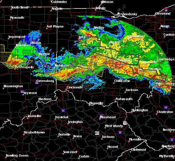 At 250 am edt, a severe thunderstorm capable of producing a tornado was located near gratis, moving southeast at 60 mph (radar indicated rotation). Hazards include tornado. Expect damage to mobile homes. roofs. And vehicles. At 250 am edt, a severe thunderstorm capable of producing a tornado was located near gratis, moving southeast at 60 mph (radar indicated rotation). Hazards include tornado. Expect damage to mobile homes. roofs. And vehicles.
|
| 6/23/2016 2:44 AM EDT |
 At 244 am edt, severe thunderstorms were located along a line extending from fairborn to near oxford, moving southeast at 60 mph (radar indicated). Hazards include 70 mph wind gusts and penny size hail. Expect considerable tree damage. damage is likely to mobile homes, roofs, and outbuildings. locations impacted include, dayton, hamilton, kettering, middletown, beavercreek, huber heights, richmond, fairborn, xenia, trotwood, oxford, miamisburg, springboro, vandalia, connersville, englewood, monroe, trenton, franklin and eaton. A tornado watch remains in effect until 500 am edt for southeastern and east central indiana, and west central and southwestern ohio. At 244 am edt, severe thunderstorms were located along a line extending from fairborn to near oxford, moving southeast at 60 mph (radar indicated). Hazards include 70 mph wind gusts and penny size hail. Expect considerable tree damage. damage is likely to mobile homes, roofs, and outbuildings. locations impacted include, dayton, hamilton, kettering, middletown, beavercreek, huber heights, richmond, fairborn, xenia, trotwood, oxford, miamisburg, springboro, vandalia, connersville, englewood, monroe, trenton, franklin and eaton. A tornado watch remains in effect until 500 am edt for southeastern and east central indiana, and west central and southwestern ohio.
|
| 6/23/2016 2:23 AM EDT |
 At 222 am edt, severe thunderstorms were located along a line extending from near west milton to near connersville, moving southeast at 60 mph (radar indicated). Hazards include 60 mph wind gusts and penny size hail. Expect damage to roofs. siding. And trees. At 222 am edt, severe thunderstorms were located along a line extending from near west milton to near connersville, moving southeast at 60 mph (radar indicated). Hazards include 60 mph wind gusts and penny size hail. Expect damage to roofs. siding. And trees.
|
| 6/15/2016 7:37 PM EDT |
 At 736 pm edt, a severe thunderstorm was located over morrow, moving east at 40 mph (radar indicated). Hazards include 60 mph wind gusts. Expect damage to roofs. siding. and trees. Locations impacted include, mason, lebanon, monroe, loveland, montgomery, blanchester, morrow, kings island, south lebanon, woodville, maineville, clarksville, harveysburg, goshen, newtonsville, midland, butlerville, pleasant plain, springvale and hageman. At 736 pm edt, a severe thunderstorm was located over morrow, moving east at 40 mph (radar indicated). Hazards include 60 mph wind gusts. Expect damage to roofs. siding. and trees. Locations impacted include, mason, lebanon, monroe, loveland, montgomery, blanchester, morrow, kings island, south lebanon, woodville, maineville, clarksville, harveysburg, goshen, newtonsville, midland, butlerville, pleasant plain, springvale and hageman.
|
| 6/15/2016 7:21 PM EDT |
 At 721 pm edt, a severe thunderstorm was located over mason, moving east at 40 mph (radar indicated). Hazards include 60 mph wind gusts. Expect damage to roofs. siding. And trees. At 721 pm edt, a severe thunderstorm was located over mason, moving east at 40 mph (radar indicated). Hazards include 60 mph wind gusts. Expect damage to roofs. siding. And trees.
|
| 4/26/2016 6:19 PM EDT |
 At 619 pm edt, severe thunderstorms were located along a line extending from eaton to 6 miles east of greensburg, moving east at 45 mph (radar indicated). Hazards include 60 mph wind gusts and quarter size hail. Hail damage to vehicles is expected. expect wind damage to roofs, siding, and trees. Locations impacted include, dayton, hamilton, kettering, trotwood, oxford, miamisburg, trenton, eaton, batesville, moraine, carlisle, oakwood, brookville, west carrollton, liberty, camden, west alexandria, gratis, seven mile and west college corner. At 619 pm edt, severe thunderstorms were located along a line extending from eaton to 6 miles east of greensburg, moving east at 45 mph (radar indicated). Hazards include 60 mph wind gusts and quarter size hail. Hail damage to vehicles is expected. expect wind damage to roofs, siding, and trees. Locations impacted include, dayton, hamilton, kettering, trotwood, oxford, miamisburg, trenton, eaton, batesville, moraine, carlisle, oakwood, brookville, west carrollton, liberty, camden, west alexandria, gratis, seven mile and west college corner.
|
| 4/26/2016 6:08 PM EDT |
 At 608 pm edt, severe thunderstorms were located along a line extending from near eaton to near greensburg, moving east at 50 mph (radar indicated). Hazards include 60 mph wind gusts and quarter size hail. Hail damage to vehicles is expected. Expect wind damage to roofs, siding, and trees. At 608 pm edt, severe thunderstorms were located along a line extending from near eaton to near greensburg, moving east at 50 mph (radar indicated). Hazards include 60 mph wind gusts and quarter size hail. Hail damage to vehicles is expected. Expect wind damage to roofs, siding, and trees.
|
| 12/23/2015 5:31 PM EST | At 531 pm est, radar indicated severe thunderstorms located along a line extending from near vandalia to near west chester, moving east at 50 mph. storm hazards include, winds to 60 mph, very heavy rain which may cause minor flooding,. |
| 12/23/2015 5:15 PM EST | At 515 pm est, radar indicated severe thunderstorms located along a line extending from near lewisburg to near gratis to near cleves, moving east at 55 mph. storm hazards include, winds to 60 mph, locations impacted include, cincinnati, dayton, hamilton, kettering, middletown, fairfield, covington, huber heights, mason, trotwood, miamisburg, lebanon, norwood, forest park, springboro, fort thomas, vandalia, sharonville, englewood and monroe. this includes the following interstates, i-70 in ohio between mile markers 13 and 36. i-71 in ohio between mile markers 0 and 29. i-74 in ohio between mile markers 6 and 19. i-75 in ohio between mile markers 0 and 64. |
| 12/23/2015 4:49 PM EST | At 449 pm est, radar indicated severe thunderstorms located along a line extending from richmond to near moores hill, moving east at 50 mph. storm hazards include, winds to 60 mph,. |
| 8/3/2015 7:58 PM EDT | Quarter sized hail reported 7.2 miles NNE of Middletown, OH |
| 8/3/2015 6:53 PM EDT |
 At 652 pm edt, radar indicated a severe thunderstorm located near trenton, moving southeast at 35 mph. storm hazards include, winds to 60 mph, quarter size hail,. At 652 pm edt, radar indicated a severe thunderstorm located near trenton, moving southeast at 35 mph. storm hazards include, winds to 60 mph, quarter size hail,.
|
| 8/3/2015 4:55 PM EDT |
 At 454 pm edt, radar indicated a severe thunderstorm located near gratis, moving southeast at 40 mph. storm hazards include, winds to 60 mph, quarter size hail, frequent cloud to ground lightning, locations impacted include, dayton, middletown, miamisburg, monroe, trenton, moraine, south middletown, camden, west alexandria, gratis, west carrollton city, germantown, new lebanon, farmersville, west elkton, jacksonburg, poast town heights, wheatville and drexel. At 454 pm edt, radar indicated a severe thunderstorm located near gratis, moving southeast at 40 mph. storm hazards include, winds to 60 mph, quarter size hail, frequent cloud to ground lightning, locations impacted include, dayton, middletown, miamisburg, monroe, trenton, moraine, south middletown, camden, west alexandria, gratis, west carrollton city, germantown, new lebanon, farmersville, west elkton, jacksonburg, poast town heights, wheatville and drexel.
|
| 8/3/2015 4:46 PM EDT |
 At 446 pm edt, radar indicated a severe thunderstorm located over gratis, moving southeast at 40 mph. storm hazards include, winds to 60 mph, ping pong ball size hail, frequent cloud to ground lightning, locations impacted include, dayton, middletown, miamisburg, monroe, trenton, eaton, moraine, south middletown, camden, west alexandria, gratis, west carrollton city, germantown, new lebanon, farmersville, west elkton, jacksonburg, poast town heights, wheatville and drexel. At 446 pm edt, radar indicated a severe thunderstorm located over gratis, moving southeast at 40 mph. storm hazards include, winds to 60 mph, ping pong ball size hail, frequent cloud to ground lightning, locations impacted include, dayton, middletown, miamisburg, monroe, trenton, eaton, moraine, south middletown, camden, west alexandria, gratis, west carrollton city, germantown, new lebanon, farmersville, west elkton, jacksonburg, poast town heights, wheatville and drexel.
|
| 8/3/2015 4:37 PM EDT |
 At 437 pm edt, radar indicated a severe thunderstorm located over eaton, moving southeast at 40 mph. storm hazards include, winds to 60 mph, quarter size hail,. At 437 pm edt, radar indicated a severe thunderstorm located over eaton, moving southeast at 40 mph. storm hazards include, winds to 60 mph, quarter size hail,.
|
| 7/14/2015 3:03 PM EDT | Large tree down near burbank ave in middletown area. time estimated by rada in butler county OH, 0.8 miles ESE of Middletown, OH |
| 7/14/2015 3:03 PM EDT | Numerous large trees downed on structures and across roads near middletow in butler county OH, 2.5 miles ESE of Middletown, OH |
| 7/13/2015 1:22 PM EDT |
 At 122 pm edt, radar indicated severe thunderstorms located along a line extending from near kings island to near washington court house, moving southeast at 40 mph. storm hazards include, winds to 60 mph, penny size hail, frequent cloud to ground lightning, very heavy rain which may cause minor flooding, locations impacted include, middletown, mason, lebanon, wilmington, monroe, loveland, blanchester, waynesville, sabina, jamestown, washington, morrow, wetherington, kings island, hunter, south lebanon, woodville, staunton, good hope and maineville. At 122 pm edt, radar indicated severe thunderstorms located along a line extending from near kings island to near washington court house, moving southeast at 40 mph. storm hazards include, winds to 60 mph, penny size hail, frequent cloud to ground lightning, very heavy rain which may cause minor flooding, locations impacted include, middletown, mason, lebanon, wilmington, monroe, loveland, blanchester, waynesville, sabina, jamestown, washington, morrow, wetherington, kings island, hunter, south lebanon, woodville, staunton, good hope and maineville.
|
| 7/13/2015 12:52 PM EDT |
 At 1252 pm edt, radar indicated severe thunderstorms located along a line extending from near trenton to near cedarville, moving southeast at 45 mph. storm hazards include, winds to 60 mph, frequent cloud to ground lightning, very heavy rain which may cause minor flooding,. At 1252 pm edt, radar indicated severe thunderstorms located along a line extending from near trenton to near cedarville, moving southeast at 45 mph. storm hazards include, winds to 60 mph, frequent cloud to ground lightning, very heavy rain which may cause minor flooding,.
|
| 6/26/2015 1:25 PM EDT | Several trees are down in a two mile path. in addition some trees have damaged trailers in a trailer par in butler county OH, 2.5 miles SSE of Middletown, OH |
| 6/18/2015 5:15 PM EDT | At 514 pm edt, radar indicated a severe thunderstorm located near miamisburg, moving east at 40 mph. storm hazards include, winds to 60 mph, quarter size hail,. |
| 6/12/2015 4:08 PM EDT |
 The severe thunderstorm warning for northern warren, southeastern montgomery and southwestern greene counties will expire at 415 pm edt, an additional severe thunderstorm warning remains in effect for portions of warren, montgomery and greene counties until 445 pm. please report previous wind damage or hail to the national weather service by going to our website at weather.gov/iln and submitting your report via social media. The severe thunderstorm warning for northern warren, southeastern montgomery and southwestern greene counties will expire at 415 pm edt, an additional severe thunderstorm warning remains in effect for portions of warren, montgomery and greene counties until 445 pm. please report previous wind damage or hail to the national weather service by going to our website at weather.gov/iln and submitting your report via social media.
|
| 6/12/2015 4:01 PM EDT |
 At 358 pm edt, radar continued to indicate severe thunderstorms located along a line extending from waynesville to south lebanon, moving east at 45 mph. storm hazards include, winds to 60 mph, these storms will affect mainly rural areas of northern warren, southeastern montgomery and southwestern greene counties, including oregonia and fort ancient. this includes the following interstate, i-71 between mile markers 27 and 37,. At 358 pm edt, radar continued to indicate severe thunderstorms located along a line extending from waynesville to south lebanon, moving east at 45 mph. storm hazards include, winds to 60 mph, these storms will affect mainly rural areas of northern warren, southeastern montgomery and southwestern greene counties, including oregonia and fort ancient. this includes the following interstate, i-71 between mile markers 27 and 37,.
|
| 6/12/2015 3:41 PM EDT |
 A severe thunderstorm warning remains in effect until 415 pm edt for northern warren. southern montgomery. southwestern greene and eastern butler counties. at 339 pm edt. radar continued to indicate severe thunderstorms located along a line extending from drexel to monroe. Moving east at 35 mph. A severe thunderstorm warning remains in effect until 415 pm edt for northern warren. southern montgomery. southwestern greene and eastern butler counties. at 339 pm edt. radar continued to indicate severe thunderstorms located along a line extending from drexel to monroe. Moving east at 35 mph.
|
| 6/12/2015 3:34 PM EDT | Tree down and powerpole damaged on highview road. time estimated from rada in butler county OH, 1.2 miles SE of Middletown, OH |
| 6/12/2015 3:30 PM EDT |
 At 326 pm edt, radar indicated severe thunderstorms located along a line extending from farmersville to new miami, moving east at 35 mph. storm hazards include, winds to 60 mph, penny size hail,. At 326 pm edt, radar indicated severe thunderstorms located along a line extending from farmersville to new miami, moving east at 35 mph. storm hazards include, winds to 60 mph, penny size hail,.
|
| 5/11/2015 2:56 PM EDT | The severe thunderstorm warning for preble, western montgomery and northern butler counties will expire at 300 pm edt, the storms have weakened below severe limits, therefore the severe thunderstorm warning will be allowed to expire. please report previous wind damage or hail to the national weather service by going to our website at weather.gov/iln and submitting your report via social media. |
| 5/11/2015 2:47 PM EDT | At 244 pm edt, radar continued to indicate severe thunderstorms located along a line extending from oklahoma to somerville, moving east at 45 mph. storm hazards include, winds to 60 mph, locations impacted include, lewisburg and trotwood. in addition, somerville, wheatville, west alexandria, gratis, pyrmont, jacksonburg, west elkton and brookville are near the path of these storms. this includes the following interstate, i-70 between mile markers 13 and 27, , <0.75in. |
| 5/11/2015 2:38 PM EDT | At 236 pm edt, radar continued to indicate severe thunderstorms located along a line extending from new hope to oxford, moving east at 45 mph. storm hazards include, winds to 60 mph, locations impacted include, eaton, camden, hamilton, lewisburg, trotwood, monroe and middletown. in addition, mcgonigle, oklahoma, millville, somerville, wheatville, collinsville, west alexandria and new miami are near the path of these storms. this includes the following interstate, i-70 between mile markers 9 and 27, , <0.75in. |
| 5/11/2015 2:31 PM EDT | At 230 pm edt, radar indicated severe thunderstorms located along a line extending from west florence to reily, moving east at 45 mph. storm hazards include, winds to 60 mph,. |
| 5/11/2015 2:31 PM EDT | At 230 pm edt, radar indicated severe thunderstorms located along a line extending from west florence to reily, moving east at 45 mph. storm hazards include, winds to 60 mph,. |
| 4/10/2015 3:16 AM EDT | A severe thunderstorm warning remains in effect until 345 am edt for northwestern clermont. western warren. eastern hamilton. eastern butler. campbell and kenton counties. at 314 am edt. radar continued to indicate severe thunderstorms located along a line extending from middletown to crestview. Moving east at 60 mph. |
| 4/10/2015 3:16 AM EDT | A severe thunderstorm warning remains in effect until 345 am edt for northwestern clermont. western warren. eastern hamilton. eastern butler. campbell and kenton counties. at 314 am edt. radar continued to indicate severe thunderstorms located along a line extending from middletown to crestview. Moving east at 60 mph. |
| 4/10/2015 2:59 AM EDT | The national weather service in wilmington has issued a * severe thunderstorm warning for. northwestern clermont county in southwest ohio. western warren county in southwest ohio. hamilton county in southwest ohio. Butler county in southwest ohio. |
| 4/10/2015 2:59 AM EDT | The national weather service in wilmington has issued a * severe thunderstorm warning for. northwestern clermont county in southwest ohio. western warren county in southwest ohio. hamilton county in southwest ohio. Butler county in southwest ohio. |
| 4/9/2015 6:29 PM EDT | A severe thunderstorm warning remains in effect until 700 pm edt for northwestern warren. southeastern preble. montgomery and northeastern butler counties. at 628 pm edt. radar continued to indicate a severe thunderstorm located near poast town heights. moving northeast at 50 mph. Storm hazards include. |
| 4/9/2015 6:27 PM EDT | The severe thunderstorm warning for hamilton. butler. campbell. boone and kenton counties will expire at 630 pm edt. additional severe thunderstorm warnings have been issued for parts of hamilton. campbell. and butler counties. please report previous wind damage or hail to the national weather service by going to our website at weather. Gov/iln and submitting. |
| 4/9/2015 6:27 PM EDT | The severe thunderstorm warning for hamilton. butler. campbell. boone and kenton counties will expire at 630 pm edt. additional severe thunderstorm warnings have been issued for parts of hamilton. campbell. and butler counties. please report previous wind damage or hail to the national weather service by going to our website at weather. Gov/iln and submitting. |
| 4/9/2015 6:23 PM EDT | The national weather service in wilmington has issued a * severe thunderstorm warning for. northwestern warren county in southwest ohio. southeastern preble county in west central ohio. montgomery county in west central ohio. Northeastern butler county in southwest ohio. |
| 4/9/2015 6:13 PM EDT | A severe thunderstorm warning remains in effect until 630 pm edt for hamilton. butler. campbell. boone and kenton counties. at 608 pm edt. radar continued to indicate a severe thunderstorm located 2 miles northeast of hebron. this storm remains capable of producing golf ball size hail and winds to 60 mph. this storm will affect southern hamilton county. Including downtown. |
| 4/9/2015 6:13 PM EDT | A severe thunderstorm warning remains in effect until 630 pm edt for hamilton. butler. campbell. boone and kenton counties. at 608 pm edt. radar continued to indicate a severe thunderstorm located 2 miles northeast of hebron. this storm remains capable of producing golf ball size hail and winds to 60 mph. this storm will affect southern hamilton county. Including downtown. |
| 4/9/2015 6:07 PM EDT | A severe thunderstorm warning remains in effect until 630 pm edt for hamilton. butler. campbell. boone and kenton counties. at 603 pm edt. radar continued to indicate a severe thunderstorm located near hebron. this storm has strengthened. and is now capable of producing golf ball size hail and 60 mph winds. another severe thunderstorm is located 6 miles west of hamilton. Capable of. |
| 4/9/2015 6:07 PM EDT | A severe thunderstorm warning remains in effect until 630 pm edt for hamilton. butler. campbell. boone and kenton counties. at 603 pm edt. radar continued to indicate a severe thunderstorm located near hebron. this storm has strengthened. and is now capable of producing golf ball size hail and 60 mph winds. another severe thunderstorm is located 6 miles west of hamilton. Capable of. |
| 4/9/2015 5:57 PM EDT | The national weather service in wilmington has issued a * severe thunderstorm warning for. hamilton county in southwest ohio. butler county in southwest ohio. campbell county in northern kentucky. Boone county in northern kentucky. |
| 4/9/2015 5:57 PM EDT | The national weather service in wilmington has issued a * severe thunderstorm warning for. hamilton county in southwest ohio. butler county in southwest ohio. campbell county in northern kentucky. Boone county in northern kentucky. |
| 4/9/2015 5:57 PM EDT | The national weather service in wilmington has issued a * severe thunderstorm warning for. hamilton county in southwest ohio. butler county in southwest ohio. campbell county in northern kentucky. Boone county in northern kentucky. |
| 4/8/2015 10:58 AM EDT | The severe thunderstorm warning for northern warren. southwestern greene and eastern butler counties will expire at 1100 am edt. the storm has moved out of the warned area. therefore this severe thunderstorm warning will be allowed to expire. however. Another severe thunderstorm warning has been issued downstream for northeast warren and much of greene county through 1015 am. |
| 4/8/2015 10:39 AM EDT | A severe thunderstorm warning remains in effect until 1100 am edt for northern warren. southwestern greene and eastern butler counties. at 1038 am edt. radar continued to indicate a severe thunderstorm located near pekin. moving east at 60 mph. Storm hazards include. |
| 4/8/2015 10:27 AM EDT | A severe thunderstorm warning remains in effect until 1100 am edt for northern warren. southwestern greene and northern butler counties. at 1025 am edt. radar continued to indicate a severe thunderstorm located near jacksonburg. moving east at 60 mph. Storm hazards include. |
| 4/8/2015 10:18 AM EDT | The national weather service in wilmington has issued a * severe thunderstorm warning for. northern warren county in southwest ohio. southwestern greene county in west central ohio. northern butler county in southwest ohio. Until 1100 am edt. |
| 10/6/2014 7:16 PM EDT | Quarter sized hail reported 1.2 miles SE of Middletown, OH |
| 10/6/2014 7:12 PM EDT | Quarter sized hail reported 0.4 miles SSE of Middletown, OH |
| 7/9/2013 6:50 PM EDT | One 15-inch diamter tree downed and sheet metal torn off a garage in warren county OH, 3.2 miles WSW of Middletown, OH |
| 7/9/2013 6:38 PM EDT | One tree was reported down on union roa in butler county OH, 0.5 miles NW of Middletown, OH |
| 7/9/2013 6:32 PM EDT | Several trees downed by high winds...including a few large trees. hail also occurred but the size was unknown. time of event estimated from rada in butler county OH, 5 miles NE of Middletown, OH |
| 6/28/2013 4:42 PM EDT | Small tree limbs down in butler county OH, 1.2 miles SE of Middletown, OH |
| 7/24/2012 11:33 AM EDT | Large branches broken off in butler county OH, 1.2 miles SE of Middletown, OH |
| 6/29/2012 4:46 PM EDT | Storm damage reported in butler county OH, 3.3 miles SE of Middletown, OH |
| 5/4/2012 4:57 PM EDT | Quarter sized hail reported 1.2 miles SE of Middletown, OH |
| 1/1/0001 12:00 AM | Tree limbs down. time estimated from rada in butler county OH, 1.2 miles SE of Middletown, OH |
| 1/1/0001 12:00 AM | A few trees damaged about 20 to 30 feet above the ground in the yar in butler county OH, 1.2 miles SE of Middletown, OH |
| 5/25/2011 6:51 PM EDT | Golf Ball sized hail reported 5.9 miles SSE of Middletown, OH |
| 1/1/0001 12:00 AM | Half Dollar sized hail reported 7.2 miles SE of Middletown, OH |
| 1/1/0001 12:00 AM | Tree downed in butler county OH, 1.2 miles SE of Middletown, OH |
| 1/1/0001 12:00 AM | 2 trees dow in butler county OH, 2.4 miles SE of Middletown, OH |
Hail Maps for Middletown, OH


Connect with Interactive Hail Maps