

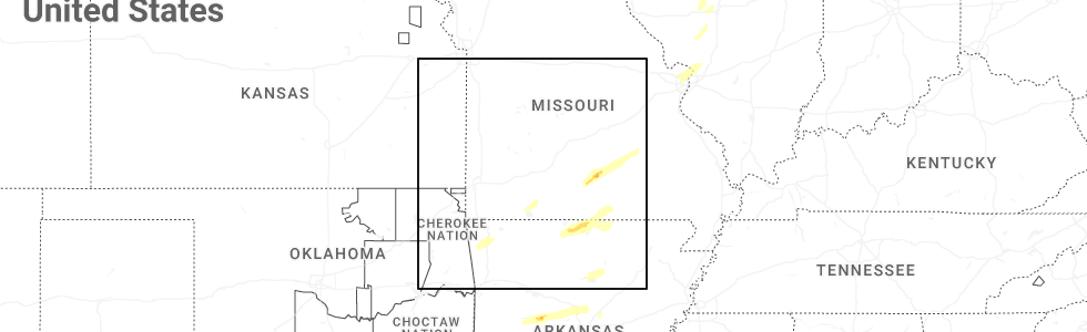
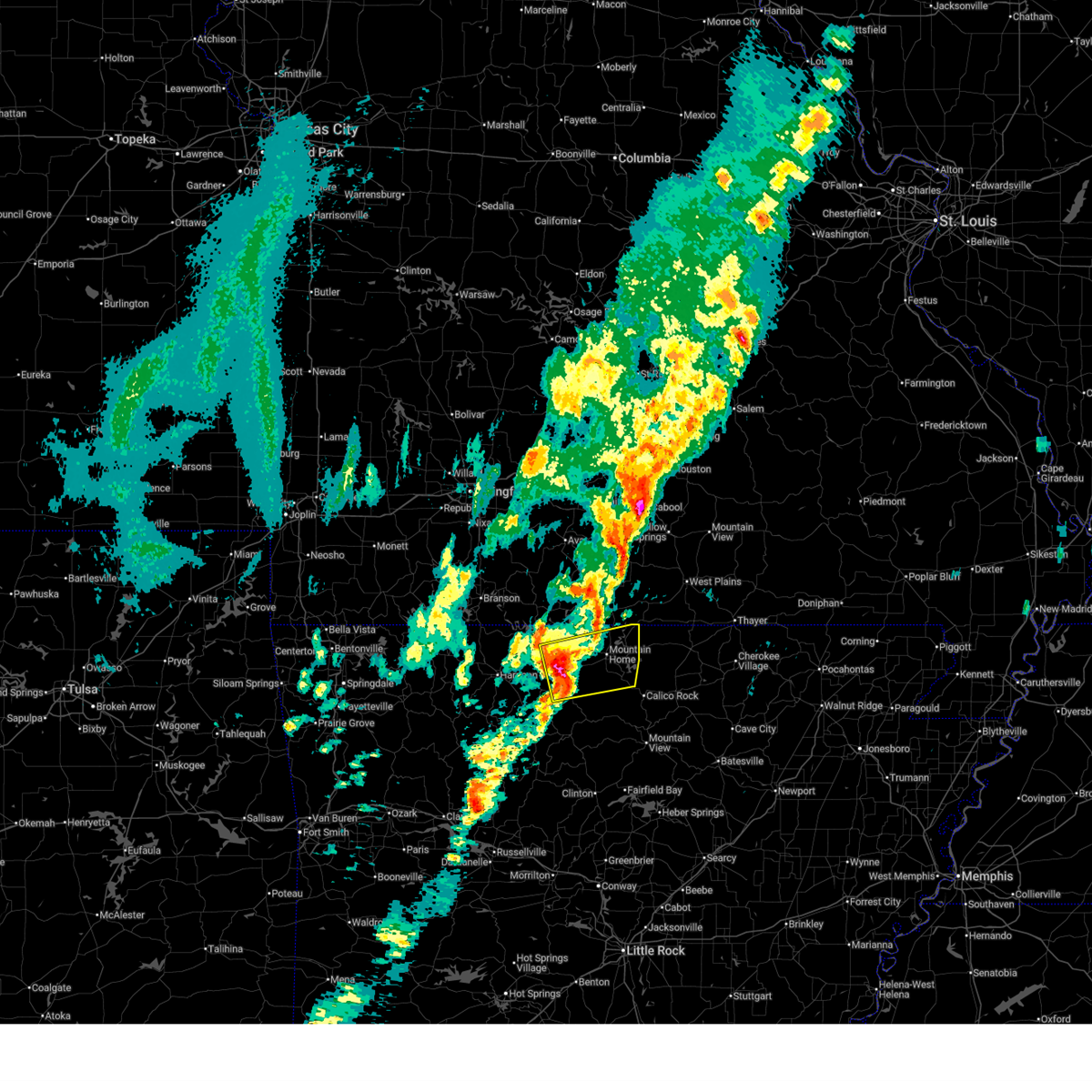
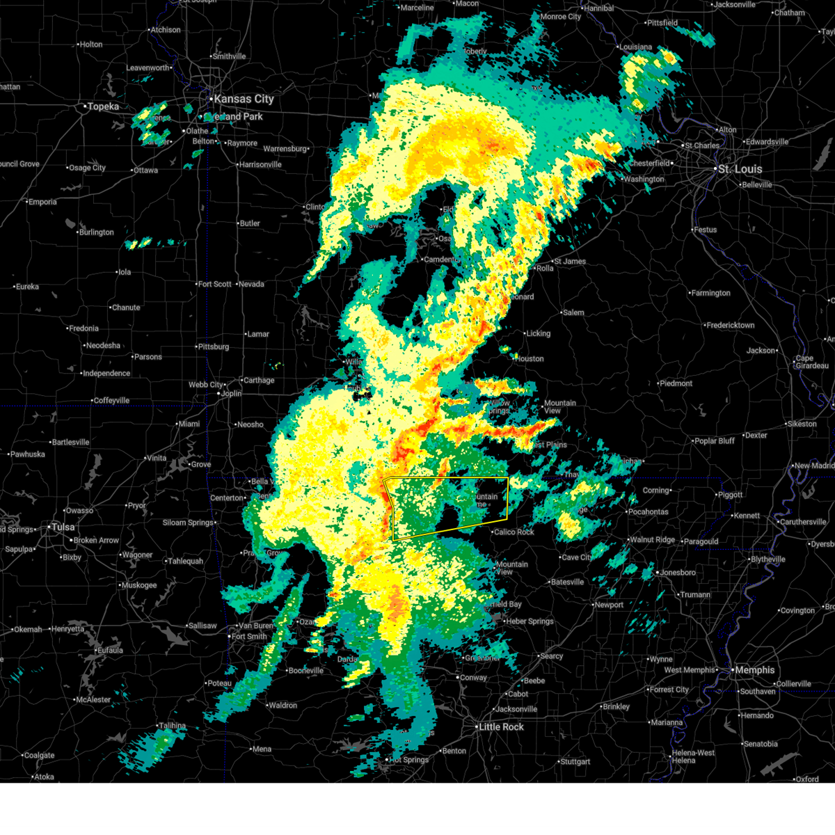
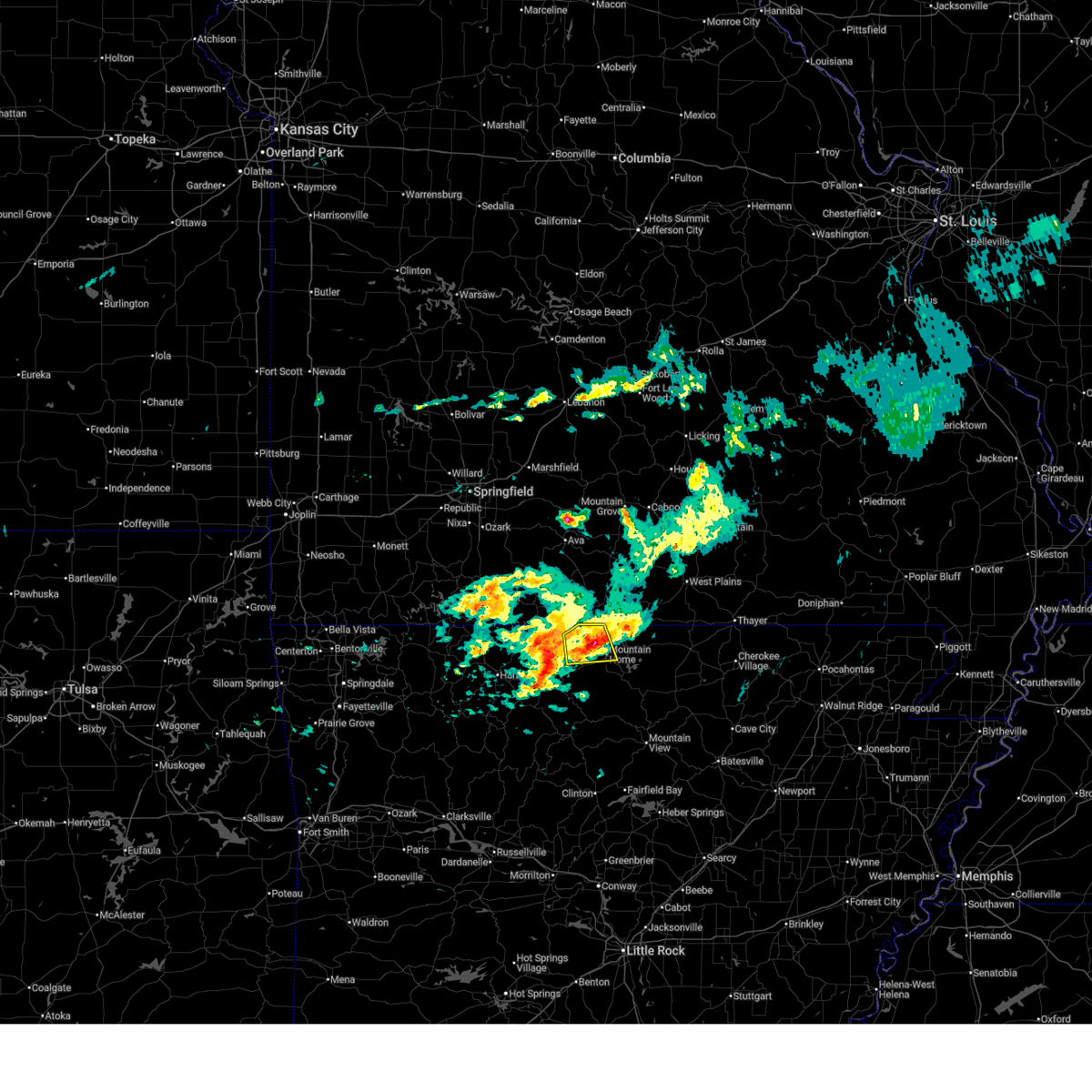
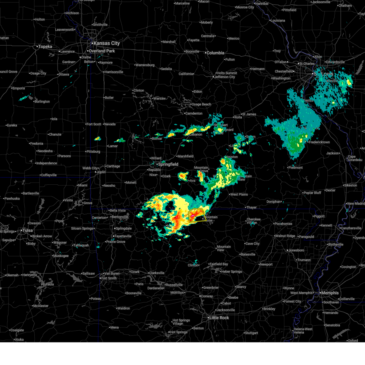
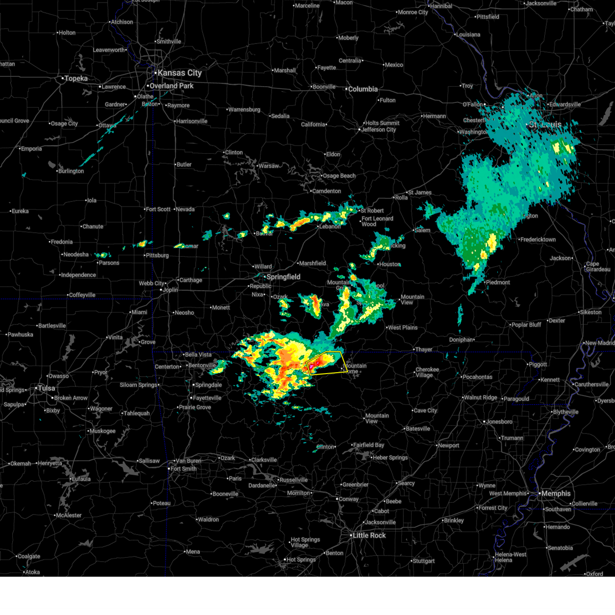
Hail Map for Midway, AR
The Midway, AR area has had 5 reports of on-the-ground hail by trained spotters, and has been under severe weather warnings 26 times during the past 12 months. Doppler radar has detected hail at or near Midway, AR on 149 occasions, including 7 occasions during the past year.
| Name: | Midway, AR |
| Where Located: | 72 miles SE of Springfield, MO |
| Map: | Google Map for Midway, AR |
| Population: | 1084 |
| Housing Units: | 589 |
| More Info: | Search Google for Midway, AR |
2
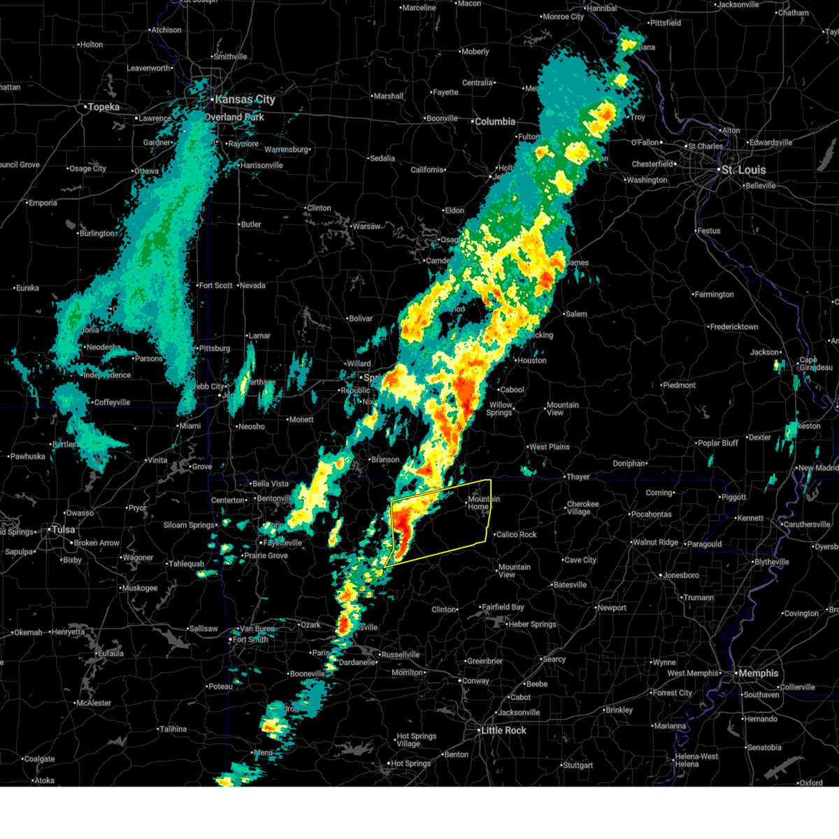
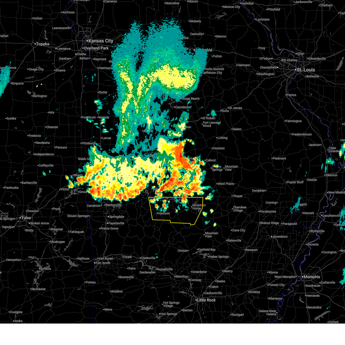
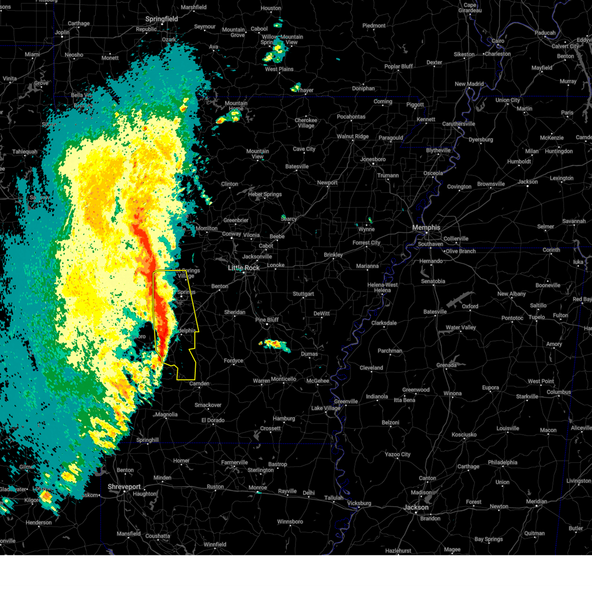
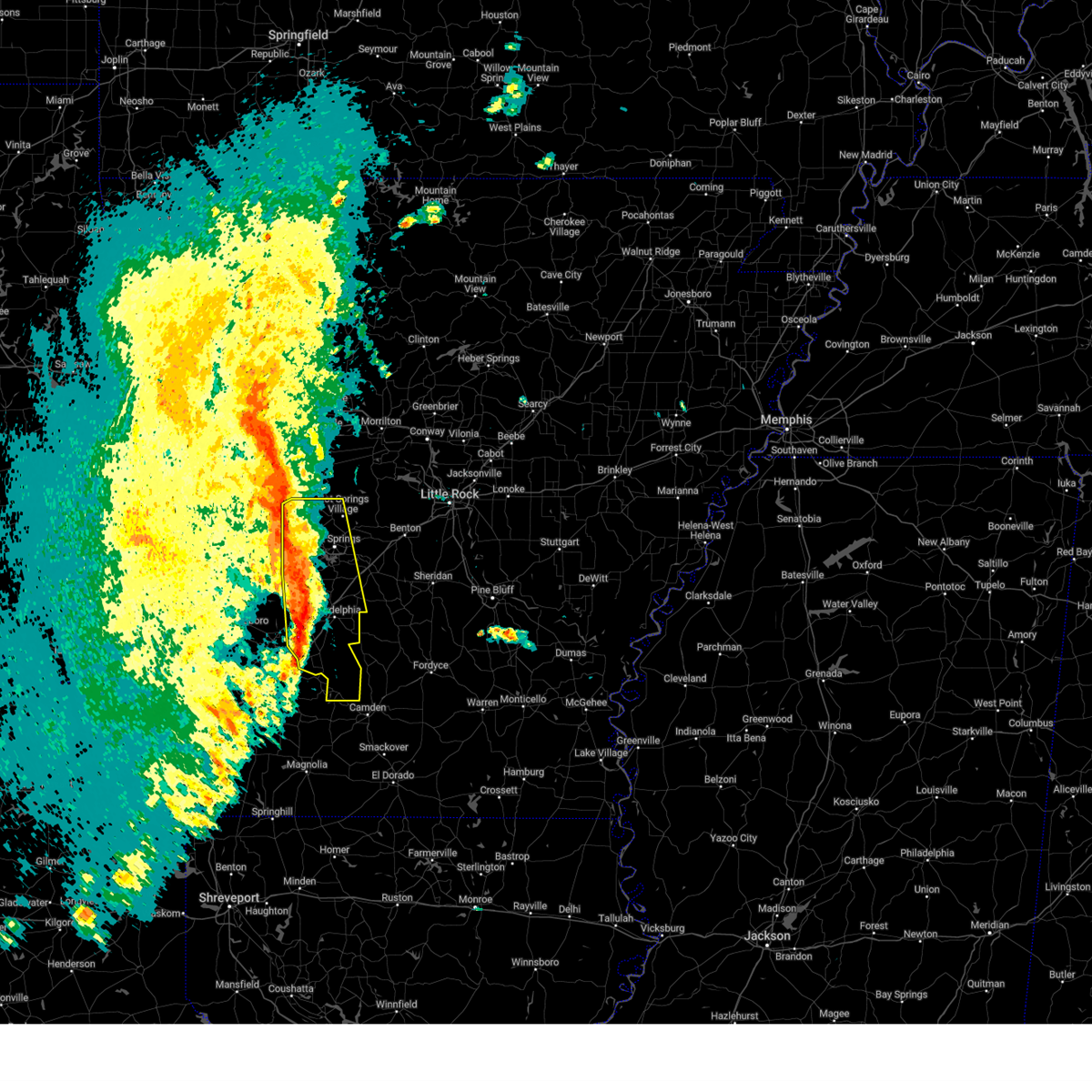
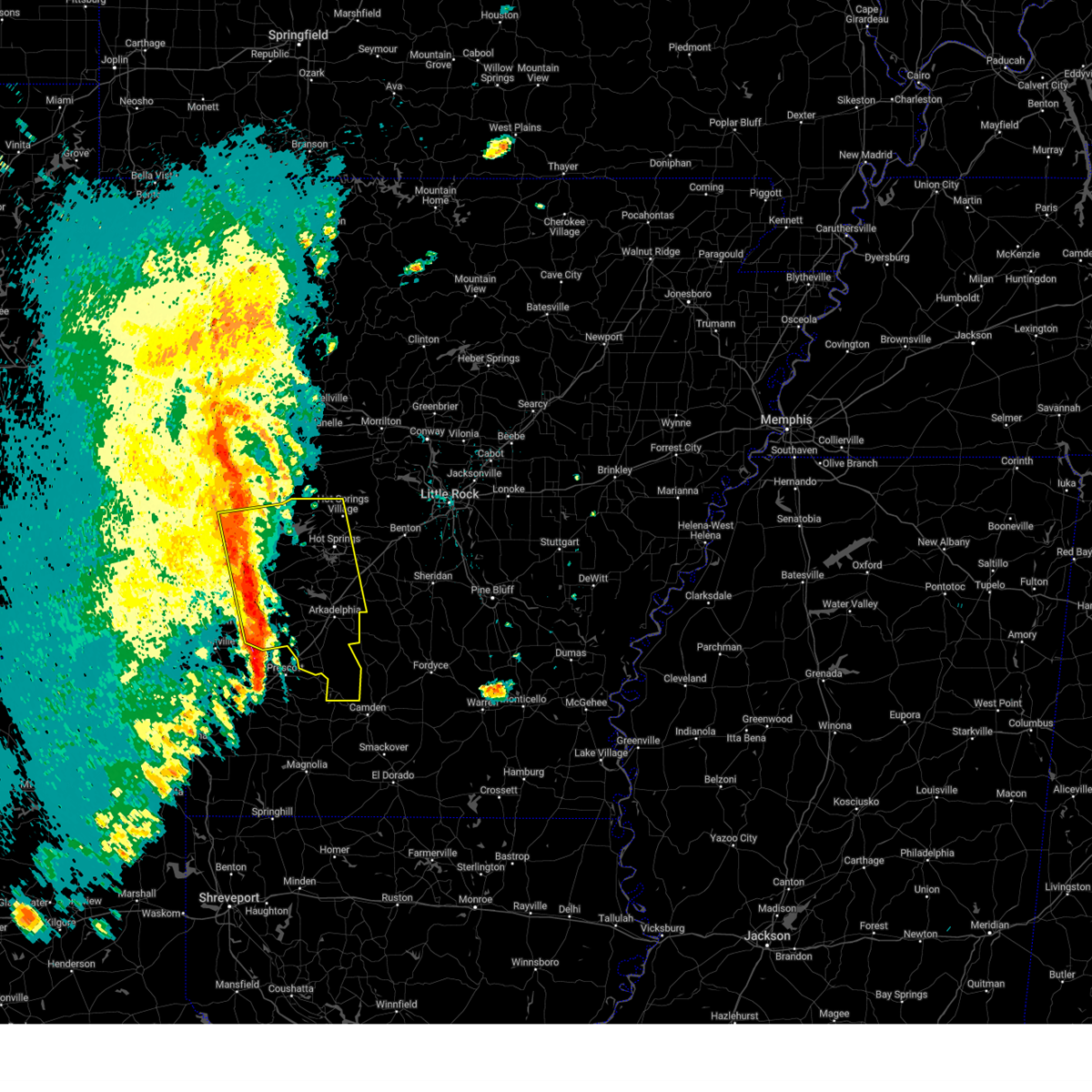
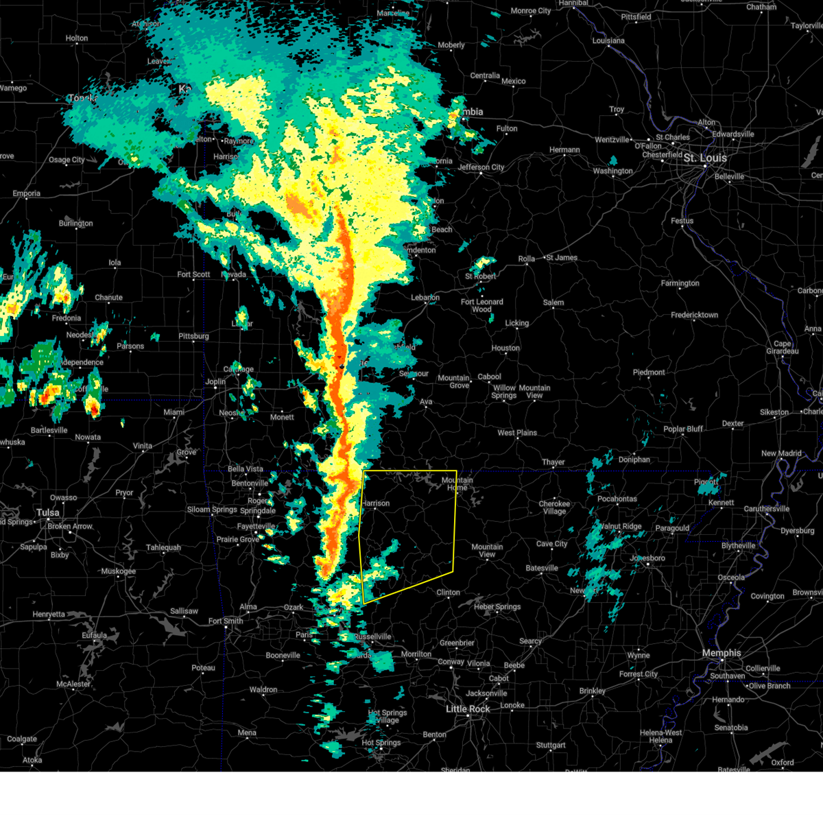
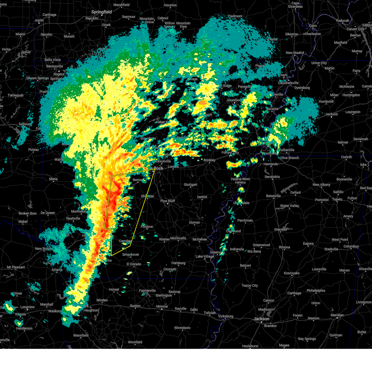
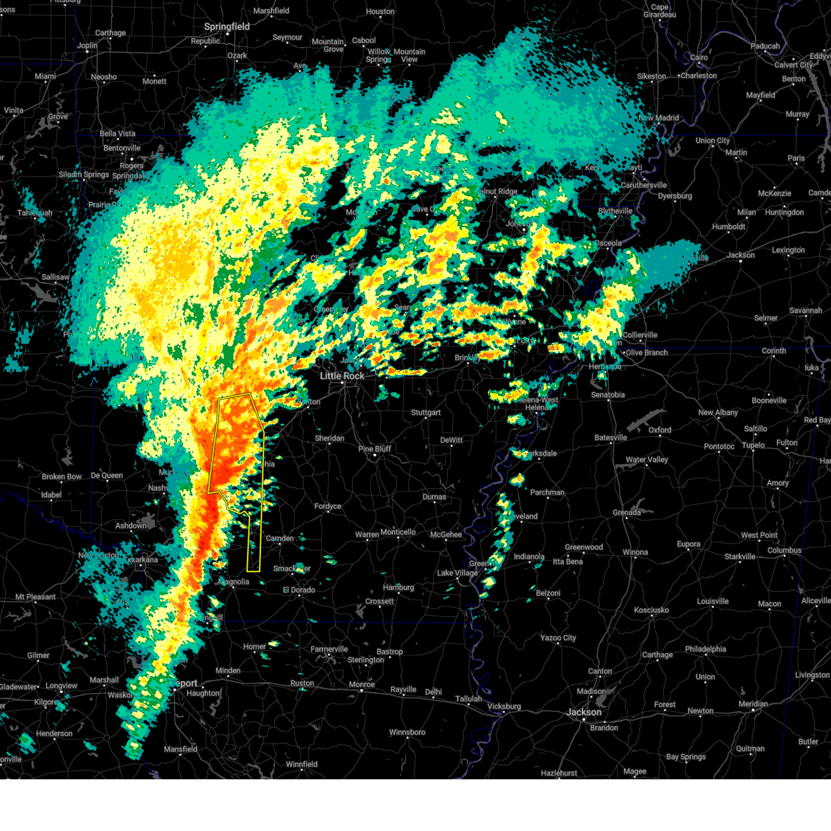
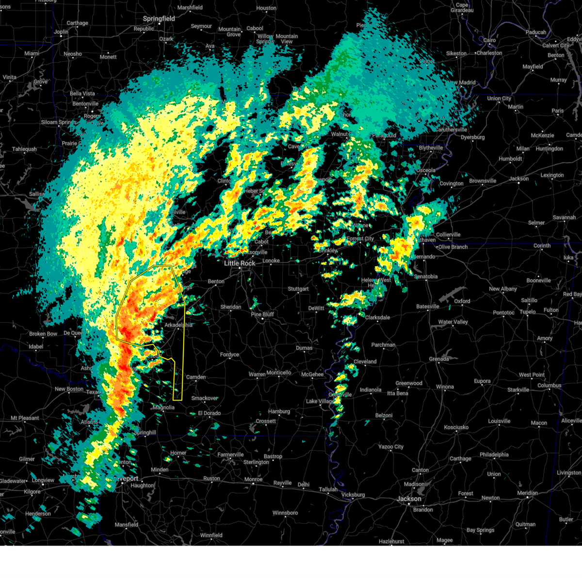
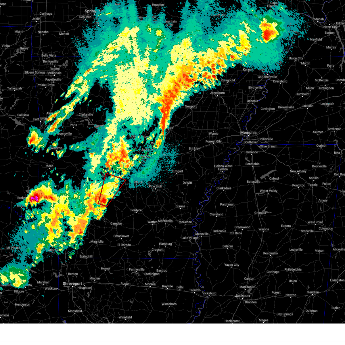
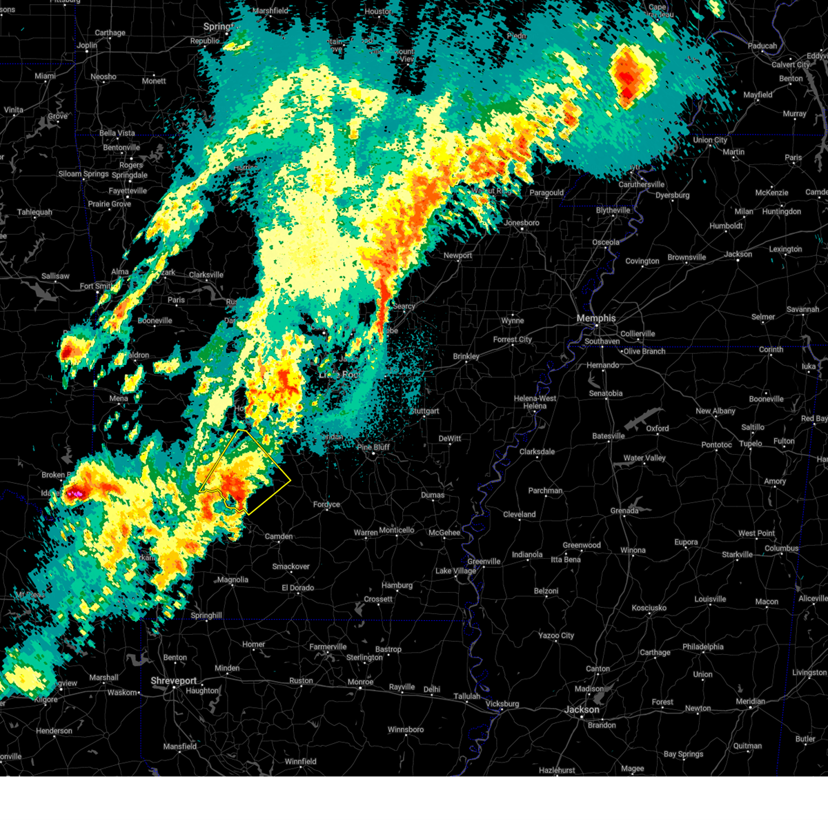
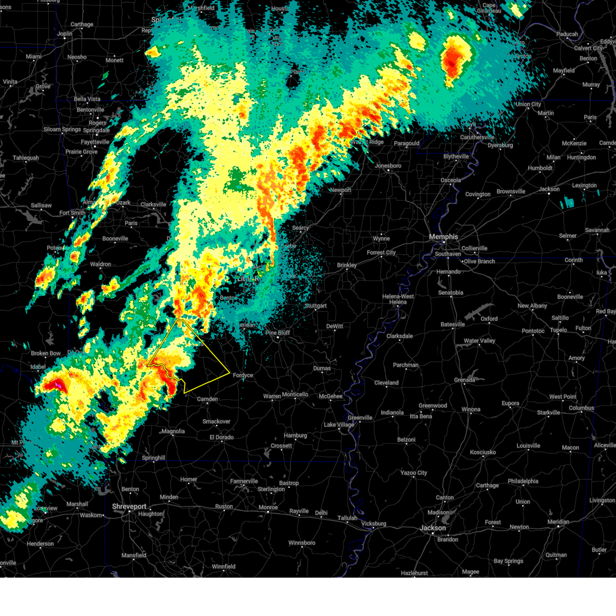
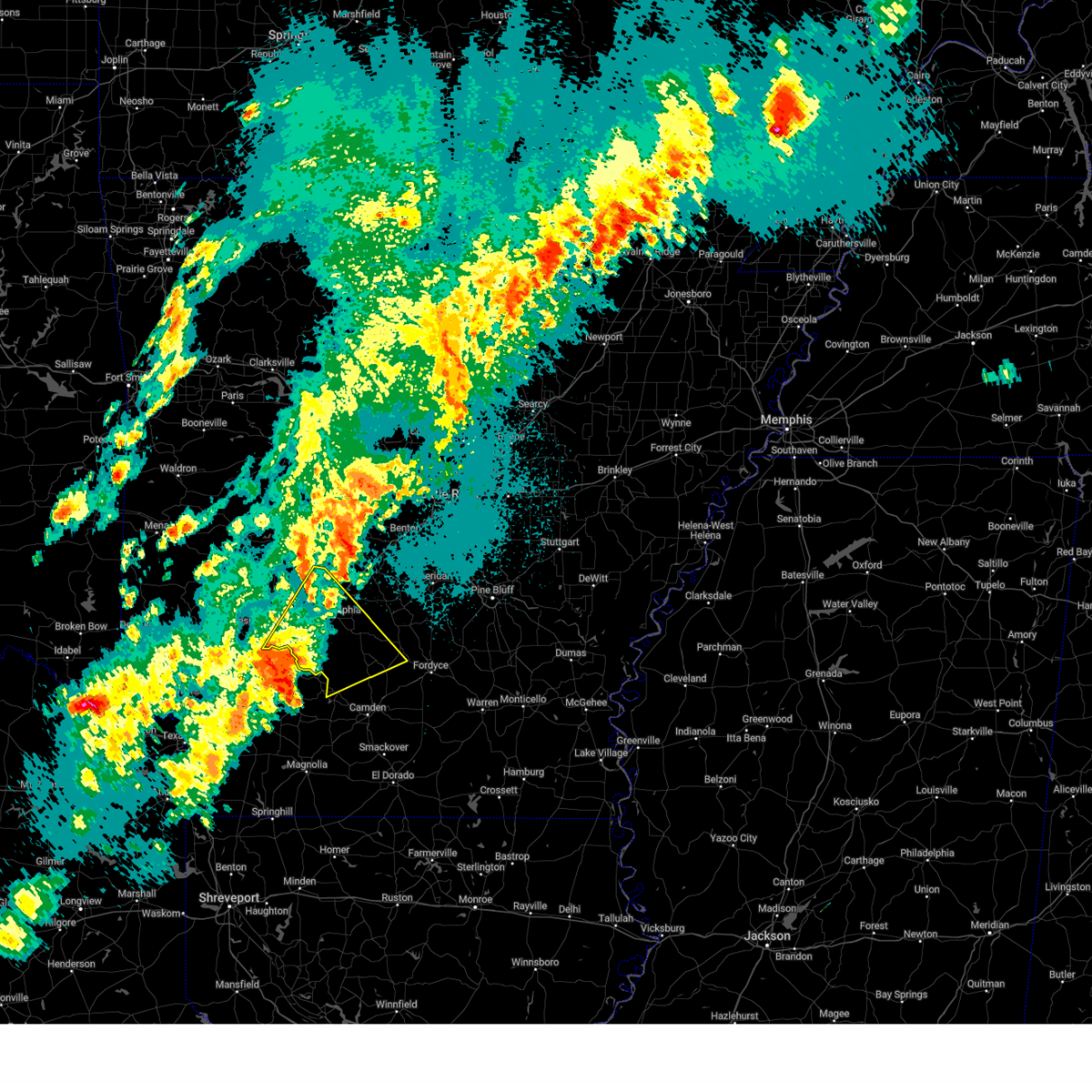
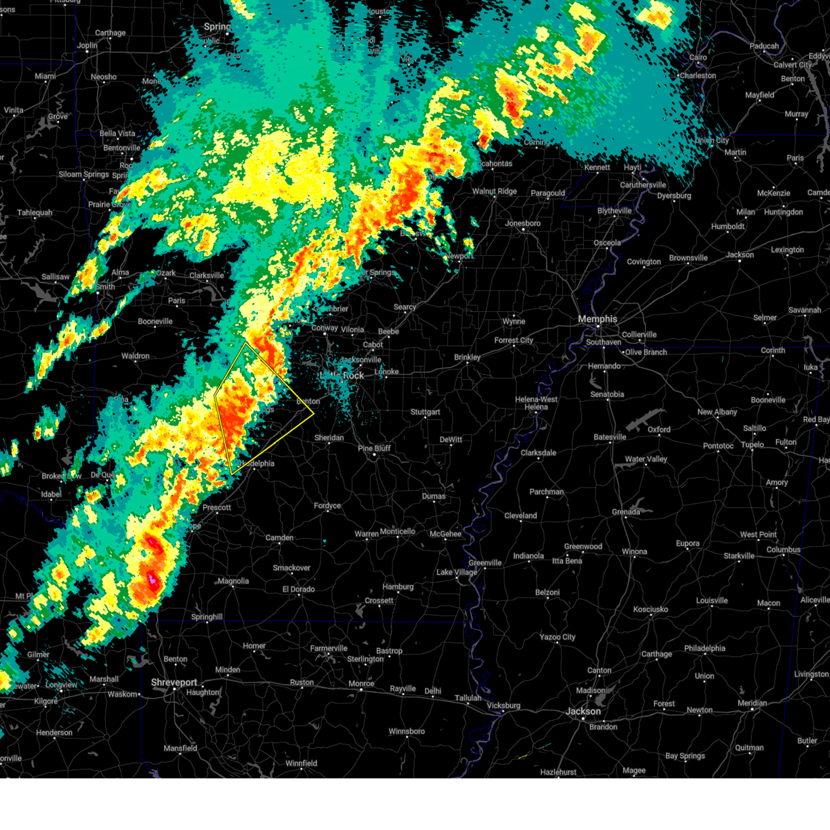
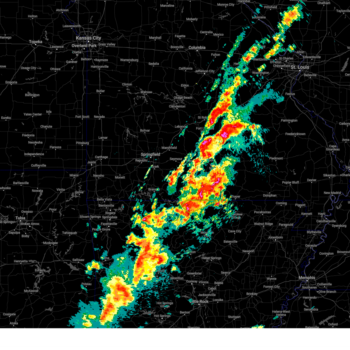
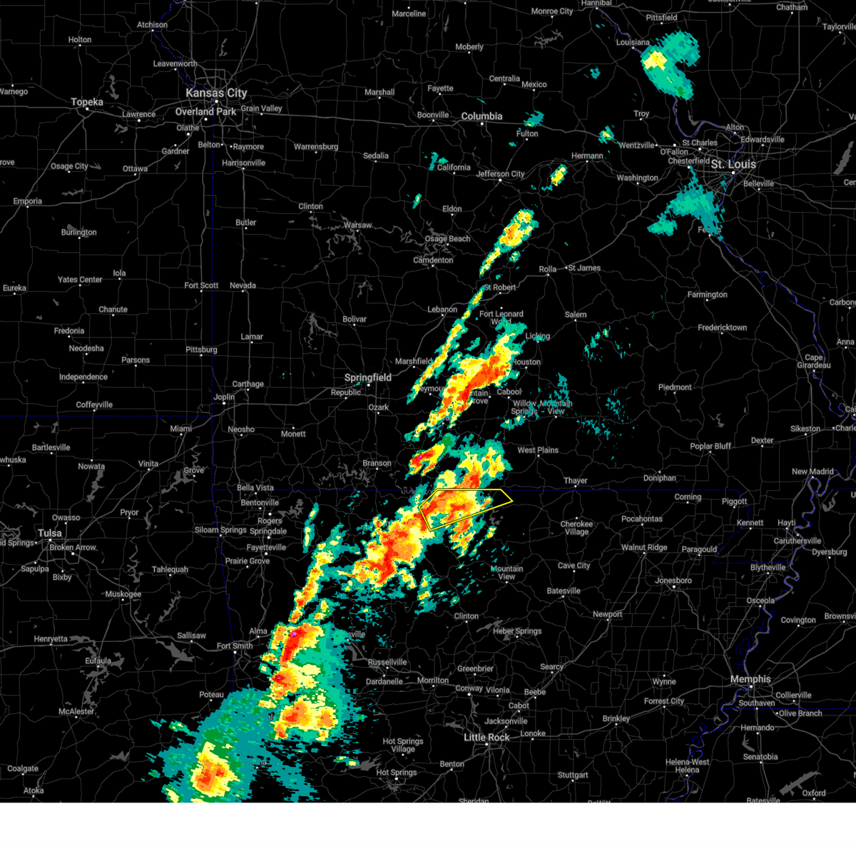
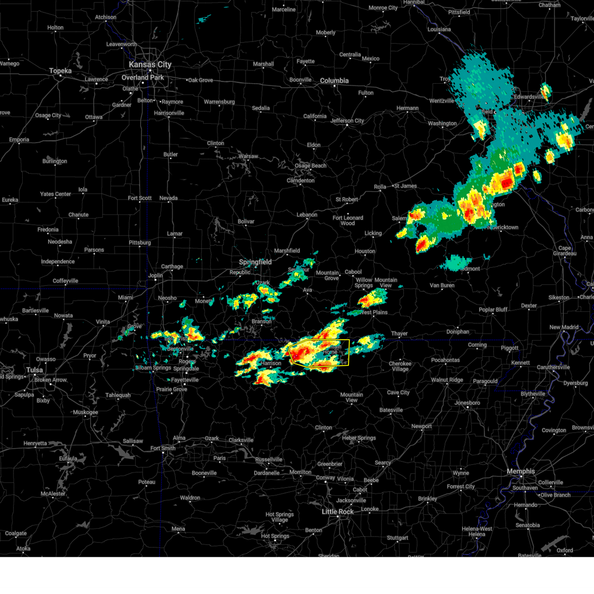
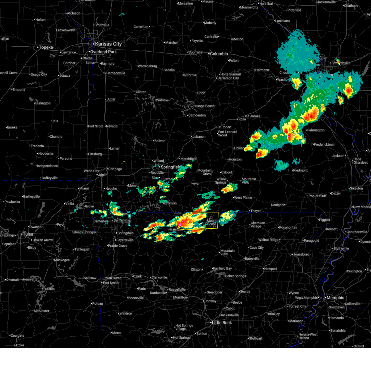
The Top Recent Hail Date for Midway, AR is Sunday, March 15, 2026 (20th out of 149)
Hail and Wind Damage Spotted near Midway, AR
| Date / Time | Report Details |
|---|---|
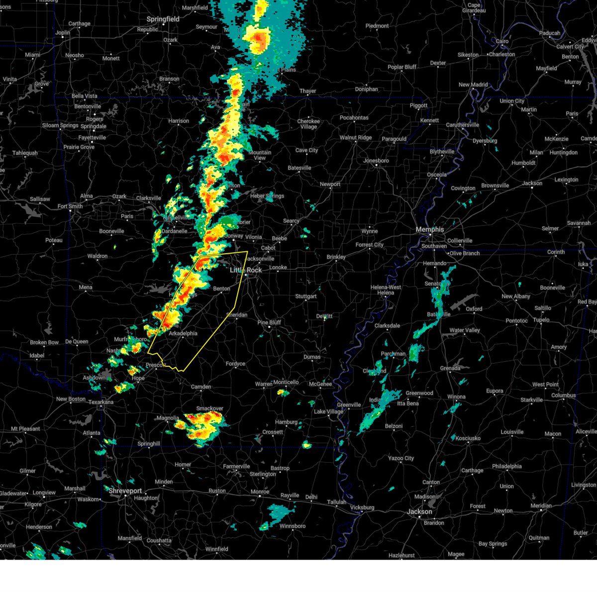
| 6/22/2026 7:00 AM CDT | Svrlzk the national weather service in little rock has issued a * severe thunderstorm warning for, southwestern lonoke county in central arkansas, grant county in central arkansas, northwestern jefferson county in southeastern arkansas, eastern garland county in central arkansas, saline county in central arkansas, northeastern hot spring county in southwestern arkansas, pulaski county in central arkansas, * until 745 am cdt. * at 700 am cdt, severe thunderstorms were located along a line extending from 6 miles northeast of hot springs village to near lonsdale to 9 miles southwest of malvern, moving east at 55 mph (radar indicated). Hazards include 60 mph wind gusts. expect damage to roofs, siding, and trees |
| 6/22/2026 6:40 AM CDT |
 At 639 am cdt, severe thunderstorms were located along a line extending from mosley to near hot springs village to near lofton, moving east at 50 mph (radar indicated). Hazards include 60 mph wind gusts. Expect damage to roofs, siding, and trees. Locations impacted include, hot springs, benton, russellville, bryant, hot springs village, arkadelphia, malvern, morrilton, perryville, dardanelle, haskell, atkins, pottsville, ola, oppelo, mountain pine, rockport, caddo valley, traskwood, perry,. At 639 am cdt, severe thunderstorms were located along a line extending from mosley to near hot springs village to near lofton, moving east at 50 mph (radar indicated). Hazards include 60 mph wind gusts. Expect damage to roofs, siding, and trees. Locations impacted include, hot springs, benton, russellville, bryant, hot springs village, arkadelphia, malvern, morrilton, perryville, dardanelle, haskell, atkins, pottsville, ola, oppelo, mountain pine, rockport, caddo valley, traskwood, perry,.
|
| 6/22/2026 6:20 AM CDT |
 Svrlzk the national weather service in little rock has issued a * severe thunderstorm warning for, northern clark county in southwestern arkansas, northeastern pike county in southwestern arkansas, northwestern grant county in central arkansas, yell county in central arkansas, southern pope county in central arkansas, east central logan county in western arkansas, perry county in central arkansas, southwestern conway county in central arkansas, garland county in central arkansas, saline county in central arkansas, hot spring county in southwestern arkansas, eastern montgomery county in western arkansas, northwestern pulaski county in central arkansas, * until 700 am cdt. * at 619 am cdt, severe thunderstorms were located along a line extending from 6 miles east of mount magazine to 8 miles west of lake ouachita state park to glenwood, moving east at 50 mph (radar indicated). Hazards include 60 mph wind gusts. expect damage to roofs, siding, and trees Svrlzk the national weather service in little rock has issued a * severe thunderstorm warning for, northern clark county in southwestern arkansas, northeastern pike county in southwestern arkansas, northwestern grant county in central arkansas, yell county in central arkansas, southern pope county in central arkansas, east central logan county in western arkansas, perry county in central arkansas, southwestern conway county in central arkansas, garland county in central arkansas, saline county in central arkansas, hot spring county in southwestern arkansas, eastern montgomery county in western arkansas, northwestern pulaski county in central arkansas, * until 700 am cdt. * at 619 am cdt, severe thunderstorms were located along a line extending from 6 miles east of mount magazine to 8 miles west of lake ouachita state park to glenwood, moving east at 50 mph (radar indicated). Hazards include 60 mph wind gusts. expect damage to roofs, siding, and trees
|
| 5/6/2026 2:34 AM CDT |
 Svrlzk the national weather service in little rock has issued a * severe thunderstorm warning for, northwestern clark county in southwestern arkansas, north central pike county in southwestern arkansas, southern garland county in central arkansas, western saline county in central arkansas, central hot spring county in southwestern arkansas, southeastern montgomery county in western arkansas, * until 315 am cdt. * at 234 am cdt, a severe thunderstorm was located near glenwood, or 10 miles southeast of mount ida, moving east at 50 mph (radar indicated). Hazards include quarter size hail. damage to vehicles is expected Svrlzk the national weather service in little rock has issued a * severe thunderstorm warning for, northwestern clark county in southwestern arkansas, north central pike county in southwestern arkansas, southern garland county in central arkansas, western saline county in central arkansas, central hot spring county in southwestern arkansas, southeastern montgomery county in western arkansas, * until 315 am cdt. * at 234 am cdt, a severe thunderstorm was located near glenwood, or 10 miles southeast of mount ida, moving east at 50 mph (radar indicated). Hazards include quarter size hail. damage to vehicles is expected
|
| 4/25/2026 10:51 PM CDT |
 The storm which prompted the warning has weakened below severe limits, and no longer poses an immediate threat to life or property. therefore, the warning will be allowed to expire. however small hail and gusty winds are still possible with this thunderstorm. a severe thunderstorm watch remains in effect until 600 am cdt for southwestern arkansas. remember, a severe thunderstorm warning still remains in effect for southwest clark county until 1115 pm cdt. The storm which prompted the warning has weakened below severe limits, and no longer poses an immediate threat to life or property. therefore, the warning will be allowed to expire. however small hail and gusty winds are still possible with this thunderstorm. a severe thunderstorm watch remains in effect until 600 am cdt for southwestern arkansas. remember, a severe thunderstorm warning still remains in effect for southwest clark county until 1115 pm cdt.
|
| 4/25/2026 10:25 PM CDT |
 Svrlzk the national weather service in little rock has issued a * severe thunderstorm warning for, northern clark county in southwestern arkansas, central hot spring county in southwestern arkansas, * until 1100 pm cdt. * at 1025 pm cdt, a severe thunderstorm was located 7 miles west of degray lake state park, or 13 miles northwest of arkadelphia, moving southeast at 5 mph (radar indicated). Hazards include 60 mph wind gusts and quarter size hail. Hail damage to vehicles is expected. Expect wind damage to roofs, siding, and trees. Svrlzk the national weather service in little rock has issued a * severe thunderstorm warning for, northern clark county in southwestern arkansas, central hot spring county in southwestern arkansas, * until 1100 pm cdt. * at 1025 pm cdt, a severe thunderstorm was located 7 miles west of degray lake state park, or 13 miles northwest of arkadelphia, moving southeast at 5 mph (radar indicated). Hazards include 60 mph wind gusts and quarter size hail. Hail damage to vehicles is expected. Expect wind damage to roofs, siding, and trees.
|
| 4/25/2026 9:49 PM CDT |
 Svrlzk the national weather service in little rock has issued a * severe thunderstorm warning for, clark county in southwestern arkansas, east central pike county in southwestern arkansas, northwestern dallas county in southwestern arkansas, southwestern garland county in central arkansas, southern hot spring county in southwestern arkansas, * until 1030 pm cdt. * at 949 pm cdt, a severe thunderstorm was located near degray lake state park, or 8 miles northwest of arkadelphia, moving southeast at 30 mph. this storm has had a history of producing hail up to baseball size (radar indicated). Hazards include two inch hail and 60 mph wind gusts. People and animals outdoors will be injured. expect hail damage to roofs, siding, windows, and vehicles. Expect wind damage to roofs, siding, and trees. Svrlzk the national weather service in little rock has issued a * severe thunderstorm warning for, clark county in southwestern arkansas, east central pike county in southwestern arkansas, northwestern dallas county in southwestern arkansas, southwestern garland county in central arkansas, southern hot spring county in southwestern arkansas, * until 1030 pm cdt. * at 949 pm cdt, a severe thunderstorm was located near degray lake state park, or 8 miles northwest of arkadelphia, moving southeast at 30 mph. this storm has had a history of producing hail up to baseball size (radar indicated). Hazards include two inch hail and 60 mph wind gusts. People and animals outdoors will be injured. expect hail damage to roofs, siding, windows, and vehicles. Expect wind damage to roofs, siding, and trees.
|
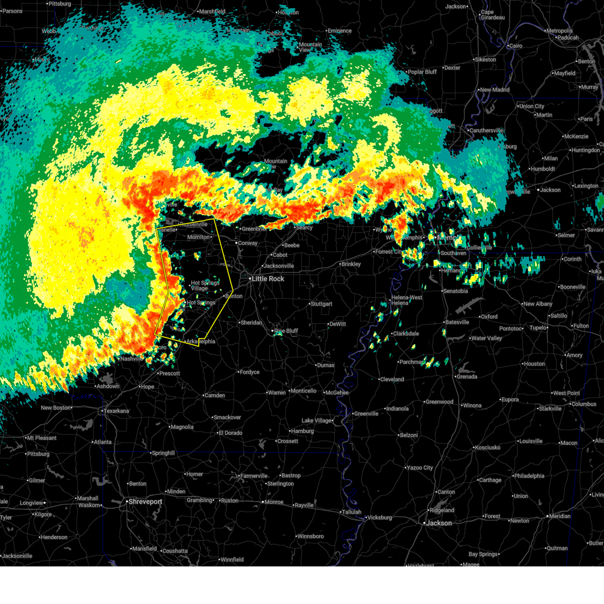
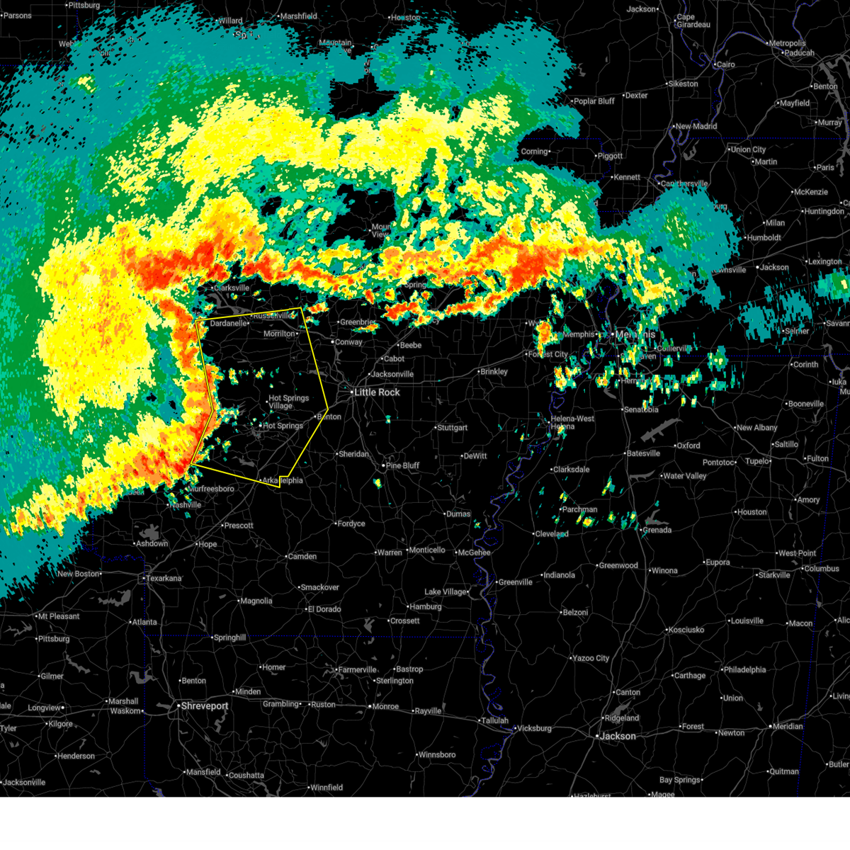
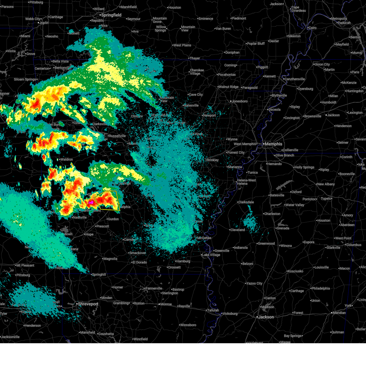
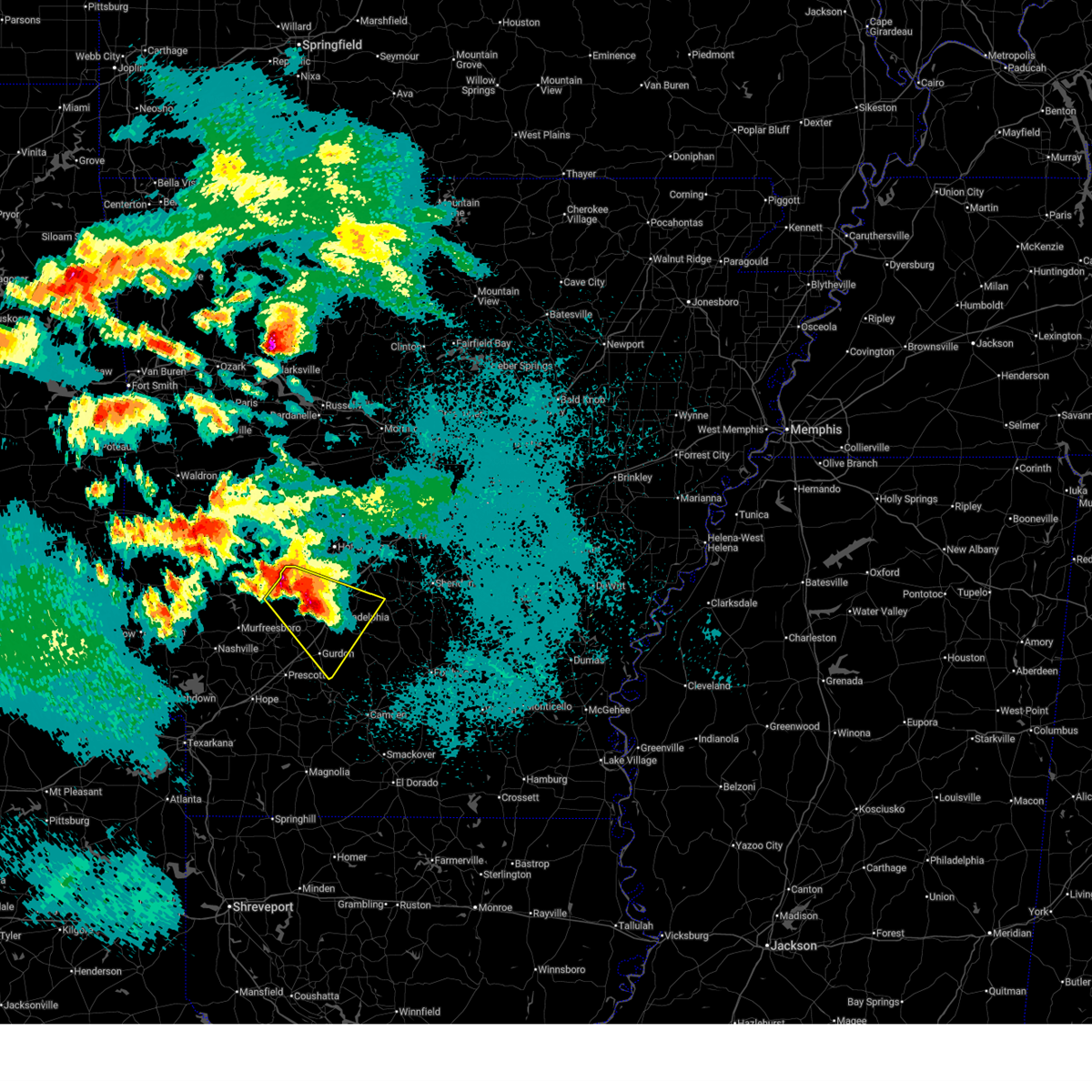
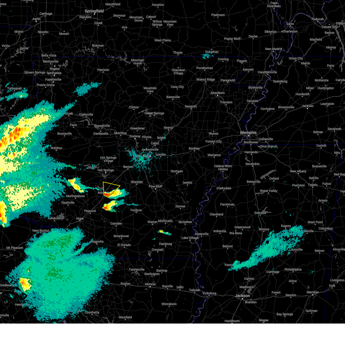
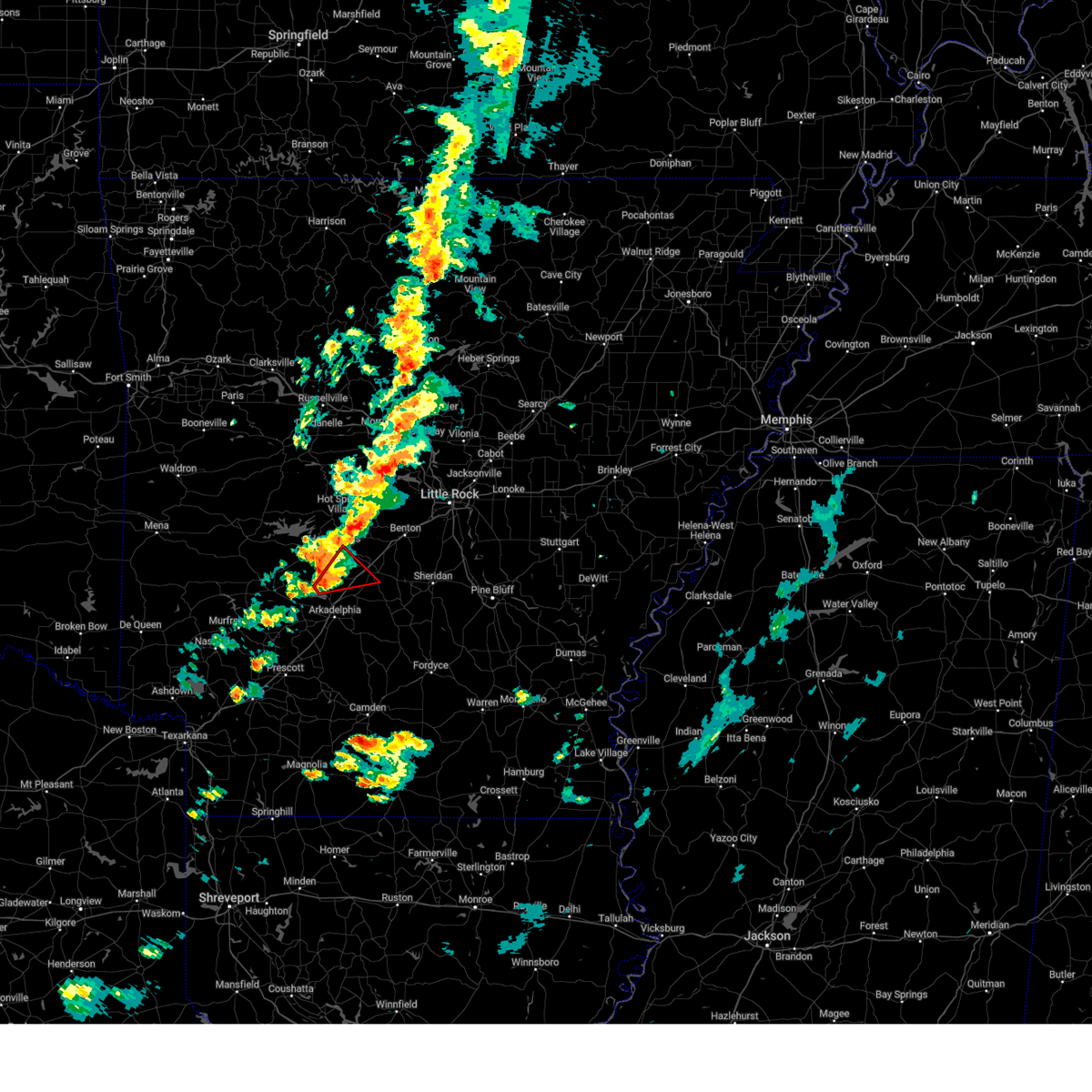
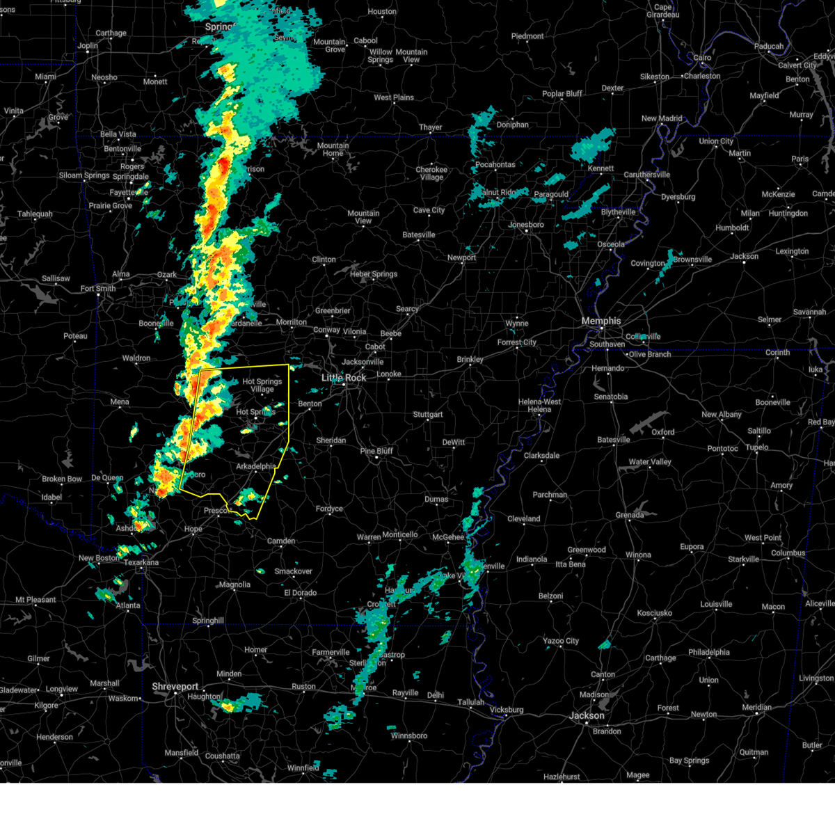
| 3/15/2026 5:12 PM CDT |
 A tornado watch remains in effect until 900 pm cdt for central and southwestern arkansas. remember, a severe thunderstorm warning still remains in effect for garland and hot spring counties until 6 pm cdt. A tornado watch remains in effect until 900 pm cdt for central and southwestern arkansas. remember, a severe thunderstorm warning still remains in effect for garland and hot spring counties until 6 pm cdt.
|
| 3/15/2026 5:10 PM CDT |
 Svrlzk the national weather service in little rock has issued a * severe thunderstorm warning for, northern grant county in central arkansas, southeastern garland county in central arkansas, southeastern saline county in central arkansas, northeastern hot spring county in southwestern arkansas, * until 600 pm cdt. * at 510 pm cdt, a severe thunderstorm was located near malvern, moving east at 50 mph (radar indicated). Hazards include 60 mph wind gusts and penny size hail. expect damage to roofs, siding, and trees Svrlzk the national weather service in little rock has issued a * severe thunderstorm warning for, northern grant county in central arkansas, southeastern garland county in central arkansas, southeastern saline county in central arkansas, northeastern hot spring county in southwestern arkansas, * until 600 pm cdt. * at 510 pm cdt, a severe thunderstorm was located near malvern, moving east at 50 mph (radar indicated). Hazards include 60 mph wind gusts and penny size hail. expect damage to roofs, siding, and trees
|
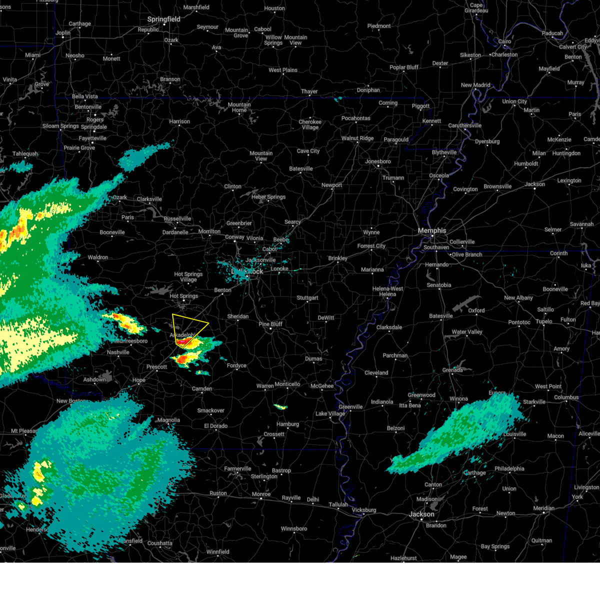
| 3/15/2026 4:53 PM CDT |
 At 453 pm cdt, severe thunderstorms were located along a line extending from hot springs national park to near rockwell to near degray lake state park, moving east at 50 mph (radar indicated). Hazards include 60 mph wind gusts and quarter size hail. Hail damage to vehicles is expected. expect wind damage to roofs, siding, and trees. Locations impacted include, hot springs, hot springs village, malvern, mountain pine, rockport, lonsdale, hot springs memorial field, lake ouachita state park, lofton, rockwell, degray lake state park, hot springs national park, donaldson, friendship, bismarck, magnet cove, oaklawn racetrack, de roche, gulpha gorge, hempwallace,. At 453 pm cdt, severe thunderstorms were located along a line extending from hot springs national park to near rockwell to near degray lake state park, moving east at 50 mph (radar indicated). Hazards include 60 mph wind gusts and quarter size hail. Hail damage to vehicles is expected. expect wind damage to roofs, siding, and trees. Locations impacted include, hot springs, hot springs village, malvern, mountain pine, rockport, lonsdale, hot springs memorial field, lake ouachita state park, lofton, rockwell, degray lake state park, hot springs national park, donaldson, friendship, bismarck, magnet cove, oaklawn racetrack, de roche, gulpha gorge, hempwallace,.
|
| 3/15/2026 4:53 PM CDT |
 the severe thunderstorm warning has been cancelled and is no longer in effect the severe thunderstorm warning has been cancelled and is no longer in effect
|
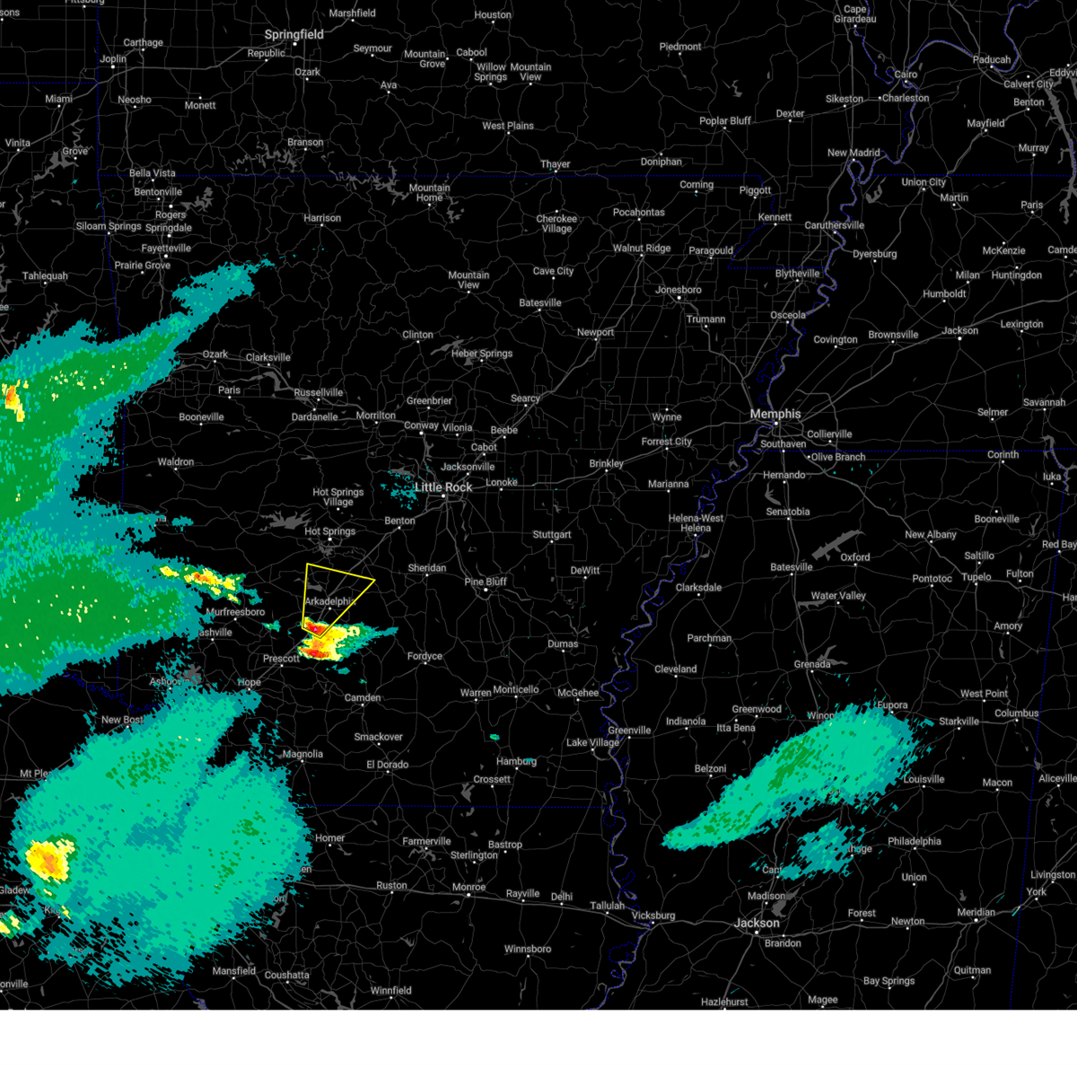
| 3/15/2026 4:37 PM CDT |
 At 437 pm cdt, severe thunderstorms were located along a line extending from 6 miles northeast of meyers to near lofton to 8 miles east of amity, moving east at 55 mph (radar indicated). Hazards include 60 mph wind gusts and quarter size hail. Hail damage to vehicles is expected. expect wind damage to roofs, siding, and trees. Locations impacted include, hot springs, hot springs village, malvern, mountain pine, rockport, amity, lonsdale, hot springs memorial field, meyers, lake ouachita state park, lofton, rockwell, degray lake state park, hot springs national park, donaldson, friendship, bismarck, magnet cove, oaklawn racetrack, bonnerdale,. At 437 pm cdt, severe thunderstorms were located along a line extending from 6 miles northeast of meyers to near lofton to 8 miles east of amity, moving east at 55 mph (radar indicated). Hazards include 60 mph wind gusts and quarter size hail. Hail damage to vehicles is expected. expect wind damage to roofs, siding, and trees. Locations impacted include, hot springs, hot springs village, malvern, mountain pine, rockport, amity, lonsdale, hot springs memorial field, meyers, lake ouachita state park, lofton, rockwell, degray lake state park, hot springs national park, donaldson, friendship, bismarck, magnet cove, oaklawn racetrack, bonnerdale,.
|
| 3/15/2026 4:37 PM CDT |
 the severe thunderstorm warning has been cancelled and is no longer in effect the severe thunderstorm warning has been cancelled and is no longer in effect
|
| 3/15/2026 4:28 PM CDT |
 Svrlzk the national weather service in little rock has issued a * severe thunderstorm warning for, northwestern clark county in southwestern arkansas, northeastern pike county in southwestern arkansas, garland county in central arkansas, central hot spring county in southwestern arkansas, southeastern montgomery county in western arkansas, * until 515 pm cdt. * at 427 pm cdt, severe thunderstorms were located along a line extending from 8 miles northwest of meyers to near glenwood, moving east at 55 mph (radar indicated). Hazards include 60 mph wind gusts and quarter size hail. Hail damage to vehicles is expected. Expect wind damage to roofs, siding, and trees. Svrlzk the national weather service in little rock has issued a * severe thunderstorm warning for, northwestern clark county in southwestern arkansas, northeastern pike county in southwestern arkansas, garland county in central arkansas, central hot spring county in southwestern arkansas, southeastern montgomery county in western arkansas, * until 515 pm cdt. * at 427 pm cdt, severe thunderstorms were located along a line extending from 8 miles northwest of meyers to near glenwood, moving east at 55 mph (radar indicated). Hazards include 60 mph wind gusts and quarter size hail. Hail damage to vehicles is expected. Expect wind damage to roofs, siding, and trees.
|
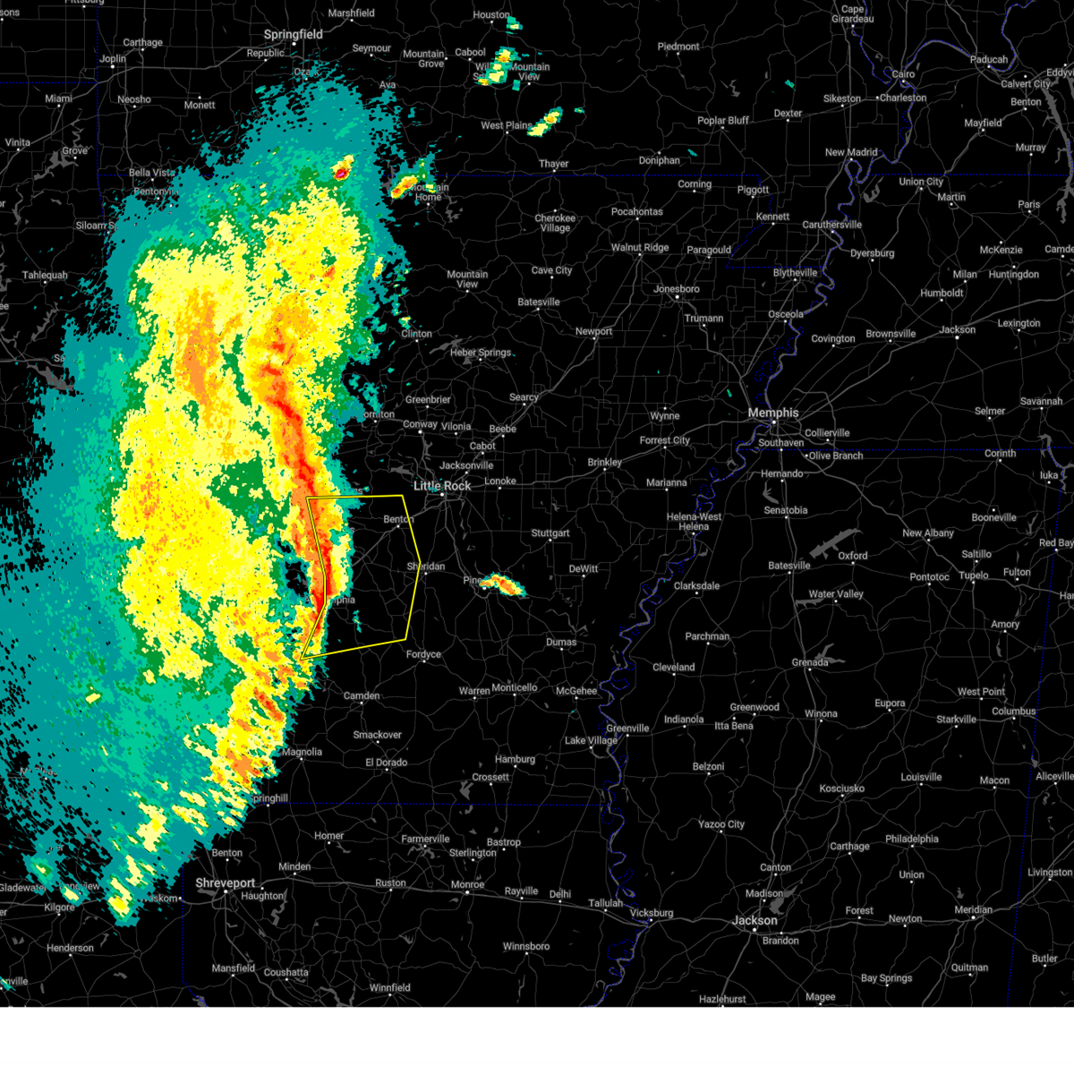
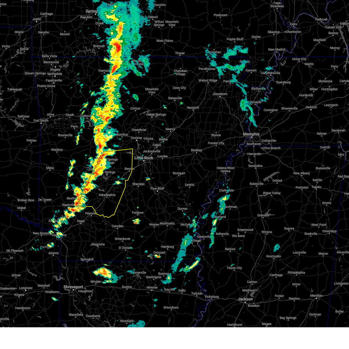
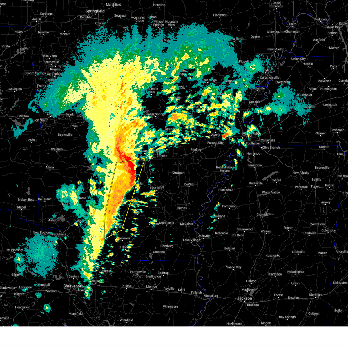
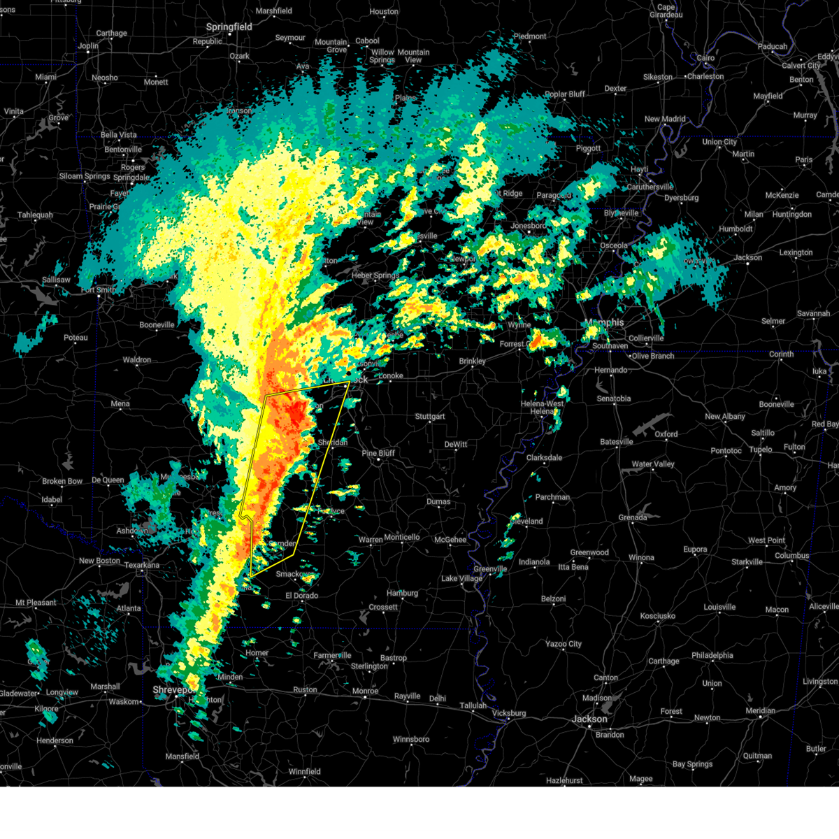
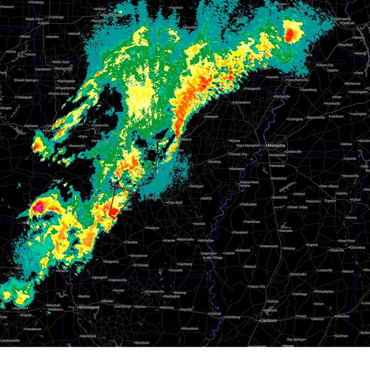
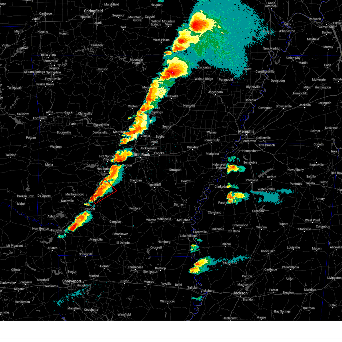
| 3/15/2026 3:50 PM CDT | Quarter sized hail reported 149.7 miles S of Midway, AR |
| 3/15/2026 3:43 PM CDT |
 the severe thunderstorm warning has been cancelled and is no longer in effect the severe thunderstorm warning has been cancelled and is no longer in effect
|
| 3/15/2026 3:43 PM CDT |
 At 342 pm cdt, severe thunderstorms were located along a line extending from bull shoals to near rush to near duff, moving northeast at 50 mph (radar indicated). Hazards include 60 mph wind gusts and quarter size hail. Hail damage to vehicles is expected. expect wind damage to roofs, siding, and trees. Locations impacted include, mountain home, bull shoals, yellville, gassville, flippin, lakeview in baxter county, norfork, salesville, briarcliff, arkawana, norfork dam, diamond bay, ozark regional airport, gamaliel landing, fawn park, lakeway, bull shoals state park, shipp, herron, colfax,. At 342 pm cdt, severe thunderstorms were located along a line extending from bull shoals to near rush to near duff, moving northeast at 50 mph (radar indicated). Hazards include 60 mph wind gusts and quarter size hail. Hail damage to vehicles is expected. expect wind damage to roofs, siding, and trees. Locations impacted include, mountain home, bull shoals, yellville, gassville, flippin, lakeview in baxter county, norfork, salesville, briarcliff, arkawana, norfork dam, diamond bay, ozark regional airport, gamaliel landing, fawn park, lakeway, bull shoals state park, shipp, herron, colfax,.
|
| 3/15/2026 3:24 PM CDT |
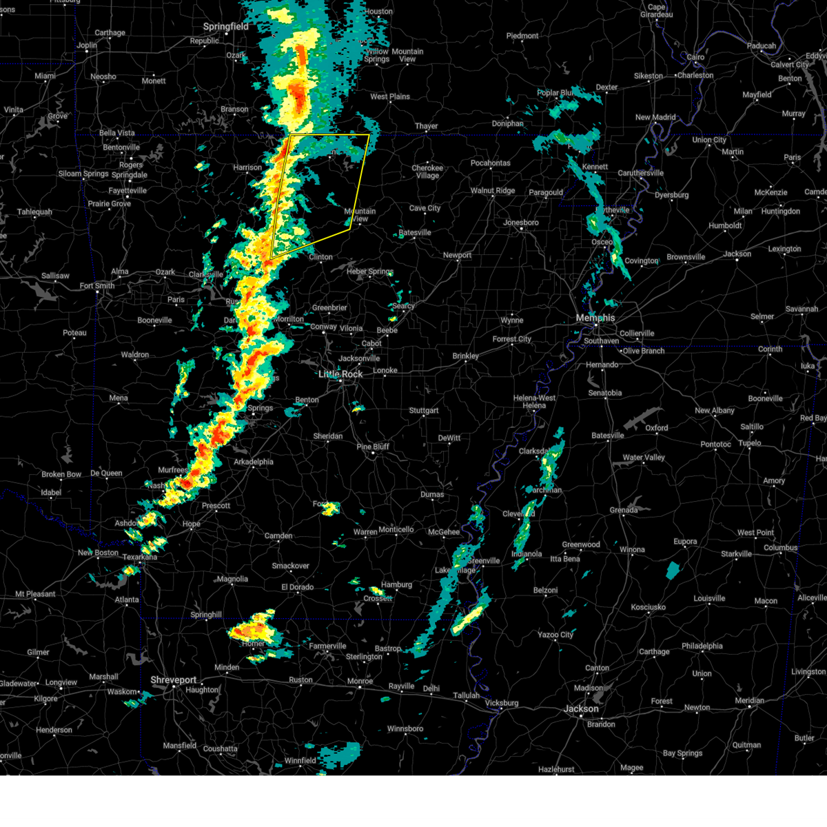
 Svrlzk the national weather service in little rock has issued a * severe thunderstorm warning for, northern searcy county in north central arkansas, northeastern newton county in north central arkansas, marion county in north central arkansas, southeastern boone county in north central arkansas, baxter county in north central arkansas, * until 415 pm cdt. * at 322 pm cdt, severe thunderstorms were located along a line extending from near pyatt to near dugger to near eula, moving northeast at 50 mph (radar indicated). Hazards include 60 mph wind gusts and penny size hail. expect damage to roofs, siding, and trees Svrlzk the national weather service in little rock has issued a * severe thunderstorm warning for, northern searcy county in north central arkansas, northeastern newton county in north central arkansas, marion county in north central arkansas, southeastern boone county in north central arkansas, baxter county in north central arkansas, * until 415 pm cdt. * at 322 pm cdt, severe thunderstorms were located along a line extending from near pyatt to near dugger to near eula, moving northeast at 50 mph (radar indicated). Hazards include 60 mph wind gusts and penny size hail. expect damage to roofs, siding, and trees
|
| 3/11/2026 3:28 AM CDT |
 the severe thunderstorm warning has been cancelled and is no longer in effect the severe thunderstorm warning has been cancelled and is no longer in effect
|
| 3/11/2026 3:18 AM CDT |
 the severe thunderstorm warning has been cancelled and is no longer in effect the severe thunderstorm warning has been cancelled and is no longer in effect
|
| 3/11/2026 3:18 AM CDT |
 At 317 am cdt, severe thunderstorms were located along a line extending from price place to near lakeview in baxter county to near yellville, moving east at 55 mph (radar indicated). Hazards include 60 mph wind gusts. Expect damage to roofs, siding, and trees. Locations impacted include, mountain home, bull shoals, yellville, gassville, flippin, lakeview in baxter county, norfork, salesville, briarcliff, arkawana, norfork dam, diamond bay, ott, ozark regional airport, gamaliel landing, ozark isle, fawn park, lakeway, bull shoals state park, shipp,. At 317 am cdt, severe thunderstorms were located along a line extending from price place to near lakeview in baxter county to near yellville, moving east at 55 mph (radar indicated). Hazards include 60 mph wind gusts. Expect damage to roofs, siding, and trees. Locations impacted include, mountain home, bull shoals, yellville, gassville, flippin, lakeview in baxter county, norfork, salesville, briarcliff, arkawana, norfork dam, diamond bay, ott, ozark regional airport, gamaliel landing, ozark isle, fawn park, lakeway, bull shoals state park, shipp,.
|
| 3/11/2026 2:54 AM CDT |
 Svrlzk the national weather service in little rock has issued a * severe thunderstorm warning for, northwestern searcy county in north central arkansas, northeastern newton county in north central arkansas, northwestern izard county in north central arkansas, marion county in north central arkansas, eastern boone county in north central arkansas, baxter county in north central arkansas, western fulton county in north central arkansas, * until 345 am cdt. * at 253 am cdt, severe thunderstorms were located along a line extending from near willis to near bergman to near valley springs, moving east at 60 mph (radar indicated). Hazards include 60 mph wind gusts. expect damage to roofs, siding, and trees Svrlzk the national weather service in little rock has issued a * severe thunderstorm warning for, northwestern searcy county in north central arkansas, northeastern newton county in north central arkansas, northwestern izard county in north central arkansas, marion county in north central arkansas, eastern boone county in north central arkansas, baxter county in north central arkansas, western fulton county in north central arkansas, * until 345 am cdt. * at 253 am cdt, severe thunderstorms were located along a line extending from near willis to near bergman to near valley springs, moving east at 60 mph (radar indicated). Hazards include 60 mph wind gusts. expect damage to roofs, siding, and trees
|
| 3/4/2026 2:34 PM CST |
 the severe thunderstorm warning has been cancelled and is no longer in effect the severe thunderstorm warning has been cancelled and is no longer in effect
|
| 3/4/2026 2:21 PM CST |
 At 220 pm cst, a severe thunderstorm was located over lakeview in baxter county, or near bull shoals, moving east at 30 mph (radar indicated). Hazards include 60 mph wind gusts and quarter size hail. Hail damage to vehicles is expected. expect wind damage to roofs, siding, and trees. Locations impacted include, mountain home, bull shoals, lakeview in baxter county, arkawana, ozark regional airport, ozark isle, fawn park, bull shoals state park, colfax, cotter, midway in baxter county, fairview in marion county, oakland, three brothers, bull shoals lake,. At 220 pm cst, a severe thunderstorm was located over lakeview in baxter county, or near bull shoals, moving east at 30 mph (radar indicated). Hazards include 60 mph wind gusts and quarter size hail. Hail damage to vehicles is expected. expect wind damage to roofs, siding, and trees. Locations impacted include, mountain home, bull shoals, lakeview in baxter county, arkawana, ozark regional airport, ozark isle, fawn park, bull shoals state park, colfax, cotter, midway in baxter county, fairview in marion county, oakland, three brothers, bull shoals lake,.
|
| 3/4/2026 2:03 PM CST |
 Svrlzk the national weather service in little rock has issued a * severe thunderstorm warning for, northwestern marion county in north central arkansas, northwestern baxter county in north central arkansas, * until 245 pm cst. * at 203 pm cst, a severe thunderstorm was located near lakeway, or near bull shoals, moving east at 30 mph (radar indicated). Hazards include 60 mph wind gusts and quarter size hail. Hail damage to vehicles is expected. Expect wind damage to roofs, siding, and trees. Svrlzk the national weather service in little rock has issued a * severe thunderstorm warning for, northwestern marion county in north central arkansas, northwestern baxter county in north central arkansas, * until 245 pm cst. * at 203 pm cst, a severe thunderstorm was located near lakeway, or near bull shoals, moving east at 30 mph (radar indicated). Hazards include 60 mph wind gusts and quarter size hail. Hail damage to vehicles is expected. Expect wind damage to roofs, siding, and trees.
|
| 8/19/2025 4:53 PM CDT |
 The storm which prompted the warning has weakened below severe limits, and no longer poses an immediate threat to life or property. therefore, the warning will be allowed to expire. however gusty winds are still possible with this thunderstorm. The storm which prompted the warning has weakened below severe limits, and no longer poses an immediate threat to life or property. therefore, the warning will be allowed to expire. however gusty winds are still possible with this thunderstorm.
|
| 8/19/2025 4:21 PM CDT |
 Svrlzk the national weather service in little rock has issued a * severe thunderstorm warning for, northwestern grant county in central arkansas, south central saline county in central arkansas, eastern hot spring county in southwestern arkansas, * until 500 pm cdt. * at 421 pm cdt, a severe thunderstorm was located over traskwood, or 7 miles northeast of malvern, moving southwest at 15 mph (radar indicated). Hazards include 60 mph wind gusts and quarter size hail. Hail damage to vehicles is expected. Expect wind damage to roofs, siding, and trees. Svrlzk the national weather service in little rock has issued a * severe thunderstorm warning for, northwestern grant county in central arkansas, south central saline county in central arkansas, eastern hot spring county in southwestern arkansas, * until 500 pm cdt. * at 421 pm cdt, a severe thunderstorm was located over traskwood, or 7 miles northeast of malvern, moving southwest at 15 mph (radar indicated). Hazards include 60 mph wind gusts and quarter size hail. Hail damage to vehicles is expected. Expect wind damage to roofs, siding, and trees.
|
| 7/12/2025 3:36 PM CDT |
 the severe thunderstorm warning has been cancelled and is no longer in effect the severe thunderstorm warning has been cancelled and is no longer in effect
|
| 7/12/2025 3:22 PM CDT |
 Svrlzk the national weather service in little rock has issued a * severe thunderstorm warning for, northwestern grant county in central arkansas, south central saline county in central arkansas, eastern hot spring county in southwestern arkansas, * until 400 pm cdt. * at 322 pm cdt, a severe thunderstorm was located near malvern, moving northeast at 30 mph (radar indicated). Hazards include 60 mph wind gusts and penny size hail. expect damage to roofs, siding, and trees Svrlzk the national weather service in little rock has issued a * severe thunderstorm warning for, northwestern grant county in central arkansas, south central saline county in central arkansas, eastern hot spring county in southwestern arkansas, * until 400 pm cdt. * at 322 pm cdt, a severe thunderstorm was located near malvern, moving northeast at 30 mph (radar indicated). Hazards include 60 mph wind gusts and penny size hail. expect damage to roofs, siding, and trees
|
| 6/29/2025 5:38 PM CDT |
 Svrlzk the national weather service in little rock has issued a * severe thunderstorm warning for, marion county in north central arkansas, boone county in north central arkansas, baxter county in north central arkansas, * until 630 pm cdt. * at 538 pm cdt, severe thunderstorms were located along a line extending from 15 miles east of taneyville to 6 miles northeast of omaha, moving southeast at 45 mph (radar indicated). Hazards include 60 mph wind gusts. expect damage to roofs, siding, and trees Svrlzk the national weather service in little rock has issued a * severe thunderstorm warning for, marion county in north central arkansas, boone county in north central arkansas, baxter county in north central arkansas, * until 630 pm cdt. * at 538 pm cdt, severe thunderstorms were located along a line extending from 15 miles east of taneyville to 6 miles northeast of omaha, moving southeast at 45 mph (radar indicated). Hazards include 60 mph wind gusts. expect damage to roofs, siding, and trees
|
| 5/17/2025 10:49 PM CDT |
 the severe thunderstorm warning has been cancelled and is no longer in effect the severe thunderstorm warning has been cancelled and is no longer in effect
|
| 5/17/2025 10:31 PM CDT |
 Svrlzk the national weather service in little rock has issued a * severe thunderstorm warning for, northwestern grant county in central arkansas, southeastern garland county in central arkansas, south central saline county in central arkansas, eastern hot spring county in southwestern arkansas, * until 1115 pm cdt. * at 1030 pm cdt, a severe thunderstorm was located 7 miles northeast of caddo valley, or 11 miles northeast of arkadelphia, moving northeast at 20 mph (radar indicated). Hazards include 60 mph wind gusts and quarter size hail. Hail damage to vehicles is expected. Expect wind damage to roofs, siding, and trees. Svrlzk the national weather service in little rock has issued a * severe thunderstorm warning for, northwestern grant county in central arkansas, southeastern garland county in central arkansas, south central saline county in central arkansas, eastern hot spring county in southwestern arkansas, * until 1115 pm cdt. * at 1030 pm cdt, a severe thunderstorm was located 7 miles northeast of caddo valley, or 11 miles northeast of arkadelphia, moving northeast at 20 mph (radar indicated). Hazards include 60 mph wind gusts and quarter size hail. Hail damage to vehicles is expected. Expect wind damage to roofs, siding, and trees.
|
| 5/17/2025 8:46 PM CDT |
 the severe thunderstorm warning has been cancelled and is no longer in effect the severe thunderstorm warning has been cancelled and is no longer in effect
|
| 5/17/2025 8:36 PM CDT |
 At 836 pm cdt, a severe thunderstorm was located over caddo valley, or near arkadelphia, moving northeast at 30 mph (radar indicated). Hazards include 60 mph wind gusts and quarter size hail. Hail damage to vehicles is expected. expect wind damage to roofs, siding, and trees. Locations impacted include, donaldson, friendship, de roche, caddo valley, midway in hot spring county, arkadelphia,. At 836 pm cdt, a severe thunderstorm was located over caddo valley, or near arkadelphia, moving northeast at 30 mph (radar indicated). Hazards include 60 mph wind gusts and quarter size hail. Hail damage to vehicles is expected. expect wind damage to roofs, siding, and trees. Locations impacted include, donaldson, friendship, de roche, caddo valley, midway in hot spring county, arkadelphia,.
|
| 5/17/2025 8:23 PM CDT |
 At 823 pm cdt, a severe thunderstorm was located over gum springs in clark county, or over arkadelphia, moving northeast at 30 mph (radar indicated). Hazards include 60 mph wind gusts and quarter size hail. Hail damage to vehicles is expected. expect wind damage to roofs, siding, and trees. Locations impacted include, friendship, lower lake recreation area, gum springs in clark county, de roche, arkadelphia, donaldson, caddo valley, midway in hot spring county, bismarck, degray lake state park, richwoods,. At 823 pm cdt, a severe thunderstorm was located over gum springs in clark county, or over arkadelphia, moving northeast at 30 mph (radar indicated). Hazards include 60 mph wind gusts and quarter size hail. Hail damage to vehicles is expected. expect wind damage to roofs, siding, and trees. Locations impacted include, friendship, lower lake recreation area, gum springs in clark county, de roche, arkadelphia, donaldson, caddo valley, midway in hot spring county, bismarck, degray lake state park, richwoods,.
|
| 5/17/2025 8:10 PM CDT |
 Svrlzk the national weather service in little rock has issued a * severe thunderstorm warning for, central clark county in southwestern arkansas, southeastern hot spring county in southwestern arkansas, * until 900 pm cdt. * at 810 pm cdt, a severe thunderstorm was located near richwoods, or 8 miles southwest of arkadelphia, moving northeast at 30 mph (radar indicated). Hazards include 60 mph wind gusts and quarter size hail. Hail damage to vehicles is expected. Expect wind damage to roofs, siding, and trees. Svrlzk the national weather service in little rock has issued a * severe thunderstorm warning for, central clark county in southwestern arkansas, southeastern hot spring county in southwestern arkansas, * until 900 pm cdt. * at 810 pm cdt, a severe thunderstorm was located near richwoods, or 8 miles southwest of arkadelphia, moving northeast at 30 mph (radar indicated). Hazards include 60 mph wind gusts and quarter size hail. Hail damage to vehicles is expected. Expect wind damage to roofs, siding, and trees.
|
| 4/30/2025 4:18 PM CDT |
 Svrlzk the national weather service in little rock has issued a * severe thunderstorm warning for, eastern clark county in southwestern arkansas, western grant county in central arkansas, northwestern dallas county in southwestern arkansas, central garland county in central arkansas, central saline county in central arkansas, hot spring county in southwestern arkansas, * until 515 pm cdt. * at 417 pm cdt, severe thunderstorms were located along a line extending from near jessieville to near hot springs to 9 miles northeast of degray lake state park to near caddo valley to gurdon, moving northeast at 35 mph (radar indicated). Hazards include 60 mph wind gusts. expect damage to roofs, siding, and trees Svrlzk the national weather service in little rock has issued a * severe thunderstorm warning for, eastern clark county in southwestern arkansas, western grant county in central arkansas, northwestern dallas county in southwestern arkansas, central garland county in central arkansas, central saline county in central arkansas, hot spring county in southwestern arkansas, * until 515 pm cdt. * at 417 pm cdt, severe thunderstorms were located along a line extending from near jessieville to near hot springs to 9 miles northeast of degray lake state park to near caddo valley to gurdon, moving northeast at 35 mph (radar indicated). Hazards include 60 mph wind gusts. expect damage to roofs, siding, and trees
|
| 4/30/2025 3:56 PM CDT |
 the severe thunderstorm warning has been cancelled and is no longer in effect the severe thunderstorm warning has been cancelled and is no longer in effect
|
| 4/30/2025 3:56 PM CDT |
 At 355 pm cdt, severe thunderstorms were located along a line extending from 7 miles northwest of lake ouachita state park to near arkadelphia to near whelen springs, moving east at 40 mph (radar indicated). Hazards include 60 mph wind gusts. Expect damage to roofs, siding, and trees. Locations impacted include, gum springs in clark county, oaklawn racetrack, curtis, bonnerdale, mt tabor, vaden, caddo valley, lena landing rec area, white oak lake state park, de roche, okolona, burtsell, red oak, crystal springs landing, jessieville, meyers, social hill, whelen springs, alpine, lake ouachita state park,. At 355 pm cdt, severe thunderstorms were located along a line extending from 7 miles northwest of lake ouachita state park to near arkadelphia to near whelen springs, moving east at 40 mph (radar indicated). Hazards include 60 mph wind gusts. Expect damage to roofs, siding, and trees. Locations impacted include, gum springs in clark county, oaklawn racetrack, curtis, bonnerdale, mt tabor, vaden, caddo valley, lena landing rec area, white oak lake state park, de roche, okolona, burtsell, red oak, crystal springs landing, jessieville, meyers, social hill, whelen springs, alpine, lake ouachita state park,.
|
| 4/30/2025 3:25 PM CDT |
 Svrlzk the national weather service in little rock has issued a * severe thunderstorm warning for, clark county in southwestern arkansas, pike county in southwestern arkansas, northwestern ouachita county in southwestern arkansas, garland county in central arkansas, central hot spring county in southwestern arkansas, montgomery county in western arkansas, * until 430 pm cdt. * at 324 pm cdt, severe thunderstorms were located along a line extending from near mauldin to 9 miles northeast of crater of diamonds state park to near perrytown, moving east at 40 mph (radar indicated). Hazards include 60 mph wind gusts and quarter size hail. Hail damage to vehicles is expected. Expect wind damage to roofs, siding, and trees. Svrlzk the national weather service in little rock has issued a * severe thunderstorm warning for, clark county in southwestern arkansas, pike county in southwestern arkansas, northwestern ouachita county in southwestern arkansas, garland county in central arkansas, central hot spring county in southwestern arkansas, montgomery county in western arkansas, * until 430 pm cdt. * at 324 pm cdt, severe thunderstorms were located along a line extending from near mauldin to 9 miles northeast of crater of diamonds state park to near perrytown, moving east at 40 mph (radar indicated). Hazards include 60 mph wind gusts and quarter size hail. Hail damage to vehicles is expected. Expect wind damage to roofs, siding, and trees.
|
| 4/20/2025 6:10 PM CDT |
 Svrlzk the national weather service in little rock has issued a * severe thunderstorm warning for, northeastern clark county in southwestern arkansas, southeastern perry county in central arkansas, northwestern lonoke county in central arkansas, grant county in central arkansas, south central faulkner county in central arkansas, north central dallas county in southwestern arkansas, southeastern garland county in central arkansas, saline county in central arkansas, hot spring county in southwestern arkansas, pulaski county in central arkansas, * until 700 pm cdt. * at 610 pm cdt, severe thunderstorms were located along a line extending from near pinnacle mountain state park to near malvern to near gurdon, moving northeast at 45 mph (radar indicated). Hazards include 60 mph wind gusts and penny size hail. expect damage to roofs, siding, and trees Svrlzk the national weather service in little rock has issued a * severe thunderstorm warning for, northeastern clark county in southwestern arkansas, southeastern perry county in central arkansas, northwestern lonoke county in central arkansas, grant county in central arkansas, south central faulkner county in central arkansas, north central dallas county in southwestern arkansas, southeastern garland county in central arkansas, saline county in central arkansas, hot spring county in southwestern arkansas, pulaski county in central arkansas, * until 700 pm cdt. * at 610 pm cdt, severe thunderstorms were located along a line extending from near pinnacle mountain state park to near malvern to near gurdon, moving northeast at 45 mph (radar indicated). Hazards include 60 mph wind gusts and penny size hail. expect damage to roofs, siding, and trees
|
| 4/20/2025 5:36 PM CDT |
 At 536 pm cdt, a severe thunderstorm capable of producing a tornado was located over degray lake state park, or 11 miles north of arkadelphia, moving northeast at 40 mph (radar indicated rotation). Hazards include tornado. Flying debris will be dangerous to those caught without shelter. mobile homes will be damaged or destroyed. damage to roofs, windows, and vehicles will occur. tree damage is likely. Locations impacted include, red oak, de roche, lake catherine state park, social hill, degray lake state park, bismarck, malvern, hot springs,. At 536 pm cdt, a severe thunderstorm capable of producing a tornado was located over degray lake state park, or 11 miles north of arkadelphia, moving northeast at 40 mph (radar indicated rotation). Hazards include tornado. Flying debris will be dangerous to those caught without shelter. mobile homes will be damaged or destroyed. damage to roofs, windows, and vehicles will occur. tree damage is likely. Locations impacted include, red oak, de roche, lake catherine state park, social hill, degray lake state park, bismarck, malvern, hot springs,.
|
| 4/20/2025 5:36 PM CDT |
 the tornado warning has been cancelled and is no longer in effect the tornado warning has been cancelled and is no longer in effect
|
| 4/20/2025 5:27 PM CDT |
 Svrlzk the national weather service in little rock has issued a * severe thunderstorm warning for, clark county in southwestern arkansas, southeastern perry county in central arkansas, southeastern pike county in southwestern arkansas, northwestern grant county in central arkansas, southwestern faulkner county in central arkansas, northwestern dallas county in southwestern arkansas, eastern garland county in central arkansas, saline county in central arkansas, hot spring county in southwestern arkansas, northwestern pulaski county in central arkansas, * until 615 pm cdt. * at 526 pm cdt, severe thunderstorms were located along a line extending from near wye mountain to near lonsdale to 6 miles northeast of halfway, moving northeast at 50 mph (radar indicated). Hazards include 60 mph wind gusts and penny size hail. expect damage to roofs, siding, and trees Svrlzk the national weather service in little rock has issued a * severe thunderstorm warning for, clark county in southwestern arkansas, southeastern perry county in central arkansas, southeastern pike county in southwestern arkansas, northwestern grant county in central arkansas, southwestern faulkner county in central arkansas, northwestern dallas county in southwestern arkansas, eastern garland county in central arkansas, saline county in central arkansas, hot spring county in southwestern arkansas, northwestern pulaski county in central arkansas, * until 615 pm cdt. * at 526 pm cdt, severe thunderstorms were located along a line extending from near wye mountain to near lonsdale to 6 miles northeast of halfway, moving northeast at 50 mph (radar indicated). Hazards include 60 mph wind gusts and penny size hail. expect damage to roofs, siding, and trees
|
| 4/20/2025 5:26 PM CDT |
 Torlzk the national weather service in little rock has issued a * tornado warning for, north central clark county in southwestern arkansas, south central garland county in central arkansas, central hot spring county in southwestern arkansas, * until 615 pm cdt. * at 526 pm cdt, a severe thunderstorm capable of producing a tornado was located near degray lake state park, or 12 miles northwest of arkadelphia, moving northeast at 40 mph (radar indicated rotation). Hazards include tornado. Flying debris will be dangerous to those caught without shelter. mobile homes will be damaged or destroyed. damage to roofs, windows, and vehicles will occur. Tree damage is likely. Torlzk the national weather service in little rock has issued a * tornado warning for, north central clark county in southwestern arkansas, south central garland county in central arkansas, central hot spring county in southwestern arkansas, * until 615 pm cdt. * at 526 pm cdt, a severe thunderstorm capable of producing a tornado was located near degray lake state park, or 12 miles northwest of arkadelphia, moving northeast at 40 mph (radar indicated rotation). Hazards include tornado. Flying debris will be dangerous to those caught without shelter. mobile homes will be damaged or destroyed. damage to roofs, windows, and vehicles will occur. Tree damage is likely.
|
| 4/20/2025 4:53 PM CDT |
 Svrlzk the national weather service in little rock has issued a * severe thunderstorm warning for, northwestern stone county in north central arkansas, searcy county in north central arkansas, northwestern izard county in north central arkansas, marion county in north central arkansas, northwestern van buren county in north central arkansas, baxter county in north central arkansas, western fulton county in north central arkansas, northeastern pope county in central arkansas, * until 545 pm cdt. * at 453 pm cdt, severe thunderstorms were located along a line extending from near price place to near maumee to near dabney, moving northeast at 50 mph (radar indicated). Hazards include 60 mph wind gusts and penny size hail. expect damage to roofs, siding, and trees Svrlzk the national weather service in little rock has issued a * severe thunderstorm warning for, northwestern stone county in north central arkansas, searcy county in north central arkansas, northwestern izard county in north central arkansas, marion county in north central arkansas, northwestern van buren county in north central arkansas, baxter county in north central arkansas, western fulton county in north central arkansas, northeastern pope county in central arkansas, * until 545 pm cdt. * at 453 pm cdt, severe thunderstorms were located along a line extending from near price place to near maumee to near dabney, moving northeast at 50 mph (radar indicated). Hazards include 60 mph wind gusts and penny size hail. expect damage to roofs, siding, and trees
|
| 4/20/2025 4:41 PM CDT |
 Svrlzk the national weather service in little rock has issued a * severe thunderstorm warning for, clark county in southwestern arkansas, southern perry county in central arkansas, eastern pike county in southwestern arkansas, northwestern dallas county in southwestern arkansas, garland county in central arkansas, saline county in central arkansas, hot spring county in southwestern arkansas, southeastern montgomery county in western arkansas, northwestern pulaski county in central arkansas, * until 530 pm cdt. * at 441 pm cdt, severe thunderstorms were located along a line extending from 11 miles north of jessieville to rockwell to near blevins, moving east at 55 mph (radar indicated). Hazards include 60 mph wind gusts and penny size hail. expect damage to roofs, siding, and trees Svrlzk the national weather service in little rock has issued a * severe thunderstorm warning for, clark county in southwestern arkansas, southern perry county in central arkansas, eastern pike county in southwestern arkansas, northwestern dallas county in southwestern arkansas, garland county in central arkansas, saline county in central arkansas, hot spring county in southwestern arkansas, southeastern montgomery county in western arkansas, northwestern pulaski county in central arkansas, * until 530 pm cdt. * at 441 pm cdt, severe thunderstorms were located along a line extending from 11 miles north of jessieville to rockwell to near blevins, moving east at 55 mph (radar indicated). Hazards include 60 mph wind gusts and penny size hail. expect damage to roofs, siding, and trees
|
| 4/20/2025 4:10 PM CDT |
 Svrlzk the national weather service in little rock has issued a * severe thunderstorm warning for, searcy county in north central arkansas, eastern newton county in north central arkansas, northeastern johnson county in western arkansas, marion county in north central arkansas, northwestern van buren county in north central arkansas, boone county in north central arkansas, western baxter county in north central arkansas, northern pope county in central arkansas, * until 500 pm cdt. * at 410 pm cdt, severe thunderstorms were located along a line extending from 9 miles northeast of omaha to near pruitt to near bertha, moving northeast at 85 mph (radar indicated). Hazards include 60 mph wind gusts and penny size hail. expect damage to roofs, siding, and trees Svrlzk the national weather service in little rock has issued a * severe thunderstorm warning for, searcy county in north central arkansas, eastern newton county in north central arkansas, northeastern johnson county in western arkansas, marion county in north central arkansas, northwestern van buren county in north central arkansas, boone county in north central arkansas, western baxter county in north central arkansas, northern pope county in central arkansas, * until 500 pm cdt. * at 410 pm cdt, severe thunderstorms were located along a line extending from 9 miles northeast of omaha to near pruitt to near bertha, moving northeast at 85 mph (radar indicated). Hazards include 60 mph wind gusts and penny size hail. expect damage to roofs, siding, and trees
|
| 4/20/2025 4:01 PM CDT |
 Svrlzk the national weather service in little rock has issued a * severe thunderstorm warning for, clark county in southwestern arkansas, southwestern perry county in central arkansas, eastern pike county in southwestern arkansas, garland county in central arkansas, western saline county in central arkansas, south central yell county in central arkansas, hot spring county in southwestern arkansas, eastern montgomery county in western arkansas, * until 445 pm cdt. * at 401 pm cdt, severe thunderstorms were located along a line extending from 9 miles southeast of fourche valley to near amity to near crater of diamonds state park, moving northeast at 65 mph (radar indicated). Hazards include 60 mph wind gusts and quarter size hail. Hail damage to vehicles is expected. Expect wind damage to roofs, siding, and trees. Svrlzk the national weather service in little rock has issued a * severe thunderstorm warning for, clark county in southwestern arkansas, southwestern perry county in central arkansas, eastern pike county in southwestern arkansas, garland county in central arkansas, western saline county in central arkansas, south central yell county in central arkansas, hot spring county in southwestern arkansas, eastern montgomery county in western arkansas, * until 445 pm cdt. * at 401 pm cdt, severe thunderstorms were located along a line extending from 9 miles southeast of fourche valley to near amity to near crater of diamonds state park, moving northeast at 65 mph (radar indicated). Hazards include 60 mph wind gusts and quarter size hail. Hail damage to vehicles is expected. Expect wind damage to roofs, siding, and trees.
|
| 4/5/2025 11:01 AM CDT |
 At 1101 am cdt, severe thunderstorms were located along a line extending from near otter creek to 9 miles north of camden, moving east at 45 mph (radar indicated). Hazards include 60 mph wind gusts and nickel size hail. Expect damage to roofs, siding, and trees. Locations impacted include, lono, otter creek, magnet cove, tulip, east camden, traskwood, harmony grove, ouachita, vaden, gifford, malvern, glen rose, carthage, white oak lake state park, bauxite, jenkins ferry state park, belfast, quapaw quarter, hillcrest neighborhood, dalark,. At 1101 am cdt, severe thunderstorms were located along a line extending from near otter creek to 9 miles north of camden, moving east at 45 mph (radar indicated). Hazards include 60 mph wind gusts and nickel size hail. Expect damage to roofs, siding, and trees. Locations impacted include, lono, otter creek, magnet cove, tulip, east camden, traskwood, harmony grove, ouachita, vaden, gifford, malvern, glen rose, carthage, white oak lake state park, bauxite, jenkins ferry state park, belfast, quapaw quarter, hillcrest neighborhood, dalark,.
|
| 4/5/2025 10:47 AM CDT |
 At 1047 am cdt, severe thunderstorms were located along a line extending from near salem in saline county to near poison springs state park, moving east at 45 mph (radar indicated). Hazards include 60 mph wind gusts and nickel size hail. Expect damage to roofs, siding, and trees. Locations impacted include, otter creek, traskwood, ouachita, jenkins ferry state park, de roche, quapaw quarter, hillcrest neighborhood, dalark, haskell, buena vista, bryant, camden, red oak, princeton, social hill, holly springs, whelen springs, baseline, congo, troy,. At 1047 am cdt, severe thunderstorms were located along a line extending from near salem in saline county to near poison springs state park, moving east at 45 mph (radar indicated). Hazards include 60 mph wind gusts and nickel size hail. Expect damage to roofs, siding, and trees. Locations impacted include, otter creek, traskwood, ouachita, jenkins ferry state park, de roche, quapaw quarter, hillcrest neighborhood, dalark, haskell, buena vista, bryant, camden, red oak, princeton, social hill, holly springs, whelen springs, baseline, congo, troy,.
|
| 4/5/2025 10:27 AM CDT |
 Svrlzk the national weather service in little rock has issued a * severe thunderstorm warning for, eastern clark county in southwestern arkansas, western grant county in central arkansas, western calhoun county in southwestern arkansas, dallas county in southwestern arkansas, ouachita county in southwestern arkansas, southeastern garland county in central arkansas, saline county in central arkansas, hot spring county in southwestern arkansas, central pulaski county in central arkansas, * until 1115 am cdt. * at 1026 am cdt, severe thunderstorms were located along a line extending from near lonsdale to rosston, moving east at 45 mph (radar indicated). Hazards include 60 mph wind gusts and nickel size hail. expect damage to roofs, siding, and trees Svrlzk the national weather service in little rock has issued a * severe thunderstorm warning for, eastern clark county in southwestern arkansas, western grant county in central arkansas, western calhoun county in southwestern arkansas, dallas county in southwestern arkansas, ouachita county in southwestern arkansas, southeastern garland county in central arkansas, saline county in central arkansas, hot spring county in southwestern arkansas, central pulaski county in central arkansas, * until 1115 am cdt. * at 1026 am cdt, severe thunderstorms were located along a line extending from near lonsdale to rosston, moving east at 45 mph (radar indicated). Hazards include 60 mph wind gusts and nickel size hail. expect damage to roofs, siding, and trees
|
| 4/5/2025 10:12 AM CDT |
 the severe thunderstorm warning has been cancelled and is no longer in effect the severe thunderstorm warning has been cancelled and is no longer in effect
|
| 4/5/2025 10:12 AM CDT |
 At 1011 am cdt, severe thunderstorms were located along a line extending from near lofton to near emmet, moving east at 45 mph (radar indicated). Hazards include 60 mph wind gusts and penny size hail. Expect damage to roofs, siding, and trees. Locations impacted include, hot springs memorial field, gum springs in clark county, poison springs state park, oaklawn racetrack, curtis, mountain pine, bonnerdale, reader, sunshine, caddo valley, royal, white oak lake state park, friendship, gurdon, de roche, point cedar, halfway, gulpha gorge, okolona, antoine,. At 1011 am cdt, severe thunderstorms were located along a line extending from near lofton to near emmet, moving east at 45 mph (radar indicated). Hazards include 60 mph wind gusts and penny size hail. Expect damage to roofs, siding, and trees. Locations impacted include, hot springs memorial field, gum springs in clark county, poison springs state park, oaklawn racetrack, curtis, mountain pine, bonnerdale, reader, sunshine, caddo valley, royal, white oak lake state park, friendship, gurdon, de roche, point cedar, halfway, gulpha gorge, okolona, antoine,.
|
| 4/5/2025 10:05 AM CDT |
 At 1005 am cdt, severe thunderstorms were located along a line extending from near lofton to near bodcaw, moving northeast at 50 mph (radar indicated). Hazards include 60 mph wind gusts and penny size hail. Expect damage to roofs, siding, and trees. Locations impacted include, gum springs in clark county, murfreesboro, oaklawn racetrack, curtis, bonnerdale, mt tabor, caddo valley, lena landing rec area, white oak lake state park, de roche, pisgah, okolona, antoine, daisy state park, crater of diamonds state park, bear creek public use area, burtsell, narrows dam, red oak, amity,. At 1005 am cdt, severe thunderstorms were located along a line extending from near lofton to near bodcaw, moving northeast at 50 mph (radar indicated). Hazards include 60 mph wind gusts and penny size hail. Expect damage to roofs, siding, and trees. Locations impacted include, gum springs in clark county, murfreesboro, oaklawn racetrack, curtis, bonnerdale, mt tabor, caddo valley, lena landing rec area, white oak lake state park, de roche, pisgah, okolona, antoine, daisy state park, crater of diamonds state park, bear creek public use area, burtsell, narrows dam, red oak, amity,.
|
| 4/5/2025 9:43 AM CDT |
 Svrlzk the national weather service in little rock has issued a * severe thunderstorm warning for, clark county in southwestern arkansas, pike county in southwestern arkansas, western ouachita county in southwestern arkansas, garland county in central arkansas, southwestern hot spring county in southwestern arkansas, eastern montgomery county in western arkansas, * until 1045 am cdt. * at 942 am cdt, severe thunderstorms were located along a line extending from 6 miles southeast of mount ida to near washington, moving northeast at 45 mph (radar indicated). Hazards include 60 mph wind gusts and quarter size hail. Hail damage to vehicles is expected. Expect wind damage to roofs, siding, and trees. Svrlzk the national weather service in little rock has issued a * severe thunderstorm warning for, clark county in southwestern arkansas, pike county in southwestern arkansas, western ouachita county in southwestern arkansas, garland county in central arkansas, southwestern hot spring county in southwestern arkansas, eastern montgomery county in western arkansas, * until 1045 am cdt. * at 942 am cdt, severe thunderstorms were located along a line extending from 6 miles southeast of mount ida to near washington, moving northeast at 45 mph (radar indicated). Hazards include 60 mph wind gusts and quarter size hail. Hail damage to vehicles is expected. Expect wind damage to roofs, siding, and trees.
|
| 4/4/2025 9:30 PM CDT |
 At 930 pm cdt, a severe thunderstorm capable of producing a tornado was located near richwoods, or near arkadelphia, moving northeast at 45 mph (radar indicated rotation). Hazards include tornado and quarter size hail. Flying debris will be dangerous to those caught without shelter. mobile homes will be damaged or destroyed. damage to roofs, windows, and vehicles will occur. tree damage is likely. Locations impacted include, gum springs in clark county, richwoods, red oak, perla, fenter, social hill, gifford, caddo valley, malvern, friendship, joan, lake catherine state park, arkadelphia, donaldson, griffithtown, rockport, midway in hot spring county, magnet cove, hot springs,. At 930 pm cdt, a severe thunderstorm capable of producing a tornado was located near richwoods, or near arkadelphia, moving northeast at 45 mph (radar indicated rotation). Hazards include tornado and quarter size hail. Flying debris will be dangerous to those caught without shelter. mobile homes will be damaged or destroyed. damage to roofs, windows, and vehicles will occur. tree damage is likely. Locations impacted include, gum springs in clark county, richwoods, red oak, perla, fenter, social hill, gifford, caddo valley, malvern, friendship, joan, lake catherine state park, arkadelphia, donaldson, griffithtown, rockport, midway in hot spring county, magnet cove, hot springs,.
|
| 4/4/2025 9:24 PM CDT |
 Torlzk the national weather service in little rock has issued a * tornado warning for, northeastern clark county in southwestern arkansas, west central grant county in central arkansas, northwestern dallas county in southwestern arkansas, south central garland county in central arkansas, eastern hot spring county in southwestern arkansas, * until 1000 pm cdt. * at 924 pm cdt, a severe thunderstorm capable of producing a tornado was located over richwoods, or 7 miles south of arkadelphia, moving northeast at 50 mph (radar indicated rotation). Hazards include tornado and quarter size hail. Flying debris will be dangerous to those caught without shelter. mobile homes will be damaged or destroyed. damage to roofs, windows, and vehicles will occur. Tree damage is likely. Torlzk the national weather service in little rock has issued a * tornado warning for, northeastern clark county in southwestern arkansas, west central grant county in central arkansas, northwestern dallas county in southwestern arkansas, south central garland county in central arkansas, eastern hot spring county in southwestern arkansas, * until 1000 pm cdt. * at 924 pm cdt, a severe thunderstorm capable of producing a tornado was located over richwoods, or 7 miles south of arkadelphia, moving northeast at 50 mph (radar indicated rotation). Hazards include tornado and quarter size hail. Flying debris will be dangerous to those caught without shelter. mobile homes will be damaged or destroyed. damage to roofs, windows, and vehicles will occur. Tree damage is likely.
|
| 4/4/2025 9:10 PM CDT |
 the severe thunderstorm warning has been cancelled and is no longer in effect the severe thunderstorm warning has been cancelled and is no longer in effect
|
| 4/4/2025 9:10 PM CDT |
 At 910 pm cdt, a severe thunderstorm was located over gurdon, or 16 miles east of prescott, moving northeast at 45 mph (radar indicated). Hazards include 60 mph wind gusts and quarter size hail. Hail damage to vehicles is expected. expect wind damage to roofs, siding, and trees. Locations impacted include, burtsell, lower lake recreation area, gum springs in clark county, richwoods, beirne, curtis, manning, whelen springs, caddo valley, degray lake state park, friendship, joan, hollywood, gurdon, de roche, halfway, arkadelphia, okolona, dalark, antoine,. At 910 pm cdt, a severe thunderstorm was located over gurdon, or 16 miles east of prescott, moving northeast at 45 mph (radar indicated). Hazards include 60 mph wind gusts and quarter size hail. Hail damage to vehicles is expected. expect wind damage to roofs, siding, and trees. Locations impacted include, burtsell, lower lake recreation area, gum springs in clark county, richwoods, beirne, curtis, manning, whelen springs, caddo valley, degray lake state park, friendship, joan, hollywood, gurdon, de roche, halfway, arkadelphia, okolona, dalark, antoine,.
|
| 4/4/2025 8:58 PM CDT |
 At 858 pm cdt, a severe thunderstorm was located 7 miles south of beirne, or 7 miles east of prescott, moving northeast at 40 mph (radar indicated). Hazards include 60 mph wind gusts and quarter size hail. Hail damage to vehicles is expected. expect wind damage to roofs, siding, and trees. Locations impacted include, gum springs in clark county, curtis, sparkman, ouachita, reader, vaden, caddo valley, white oak lake state park, friendship, gurdon, de roche, halfway, okolona, dalark, antoine, burtsell, lower lake recreation area, richwoods, beirne, manning,. At 858 pm cdt, a severe thunderstorm was located 7 miles south of beirne, or 7 miles east of prescott, moving northeast at 40 mph (radar indicated). Hazards include 60 mph wind gusts and quarter size hail. Hail damage to vehicles is expected. expect wind damage to roofs, siding, and trees. Locations impacted include, gum springs in clark county, curtis, sparkman, ouachita, reader, vaden, caddo valley, white oak lake state park, friendship, gurdon, de roche, halfway, okolona, dalark, antoine, burtsell, lower lake recreation area, richwoods, beirne, manning,.
|
| 4/4/2025 8:44 PM CDT |
 Svrlzk the national weather service in little rock has issued a * severe thunderstorm warning for, clark county in southwestern arkansas, southeastern pike county in southwestern arkansas, western dallas county in southwestern arkansas, northwestern ouachita county in southwestern arkansas, southwestern hot spring county in southwestern arkansas, * until 930 pm cdt. * at 844 pm cdt, a severe thunderstorm was located over prescott, moving northeast at 45 mph (radar indicated). Hazards include 60 mph wind gusts and quarter size hail. Hail damage to vehicles is expected. Expect wind damage to roofs, siding, and trees. Svrlzk the national weather service in little rock has issued a * severe thunderstorm warning for, clark county in southwestern arkansas, southeastern pike county in southwestern arkansas, western dallas county in southwestern arkansas, northwestern ouachita county in southwestern arkansas, southwestern hot spring county in southwestern arkansas, * until 930 pm cdt. * at 844 pm cdt, a severe thunderstorm was located over prescott, moving northeast at 45 mph (radar indicated). Hazards include 60 mph wind gusts and quarter size hail. Hail damage to vehicles is expected. Expect wind damage to roofs, siding, and trees.
|
| 4/4/2025 7:53 PM CDT |
 Svrlzk the national weather service in little rock has issued a * severe thunderstorm warning for, north central clark county in southwestern arkansas, southwestern perry county in central arkansas, garland county in central arkansas, western saline county in central arkansas, south central yell county in central arkansas, central hot spring county in southwestern arkansas, * until 845 pm cdt. * at 753 pm cdt, severe thunderstorms were located along a line extending from near lake ouachita state park to near degray lake state park, moving northeast at 40 mph (radar indicated). Hazards include 60 mph wind gusts and nickel size hail. expect damage to roofs, siding, and trees Svrlzk the national weather service in little rock has issued a * severe thunderstorm warning for, north central clark county in southwestern arkansas, southwestern perry county in central arkansas, garland county in central arkansas, western saline county in central arkansas, south central yell county in central arkansas, central hot spring county in southwestern arkansas, * until 845 pm cdt. * at 753 pm cdt, severe thunderstorms were located along a line extending from near lake ouachita state park to near degray lake state park, moving northeast at 40 mph (radar indicated). Hazards include 60 mph wind gusts and nickel size hail. expect damage to roofs, siding, and trees
|
| 4/3/2025 5:30 PM CDT |
 At 529 pm cdt, a severe thunderstorm was located over poison springs state park, or 11 miles northwest of camden, moving northeast at 55 mph (radar indicated). Hazards include 60 mph wind gusts and quarter size hail. Hail damage to vehicles is expected. expect wind damage to roofs, siding, and trees. Locations impacted include, gum springs in clark county, poison springs state park, cullendale, east camden, curtis, sparkman, harmony grove, ouachita, reader, vaden, frenchport, elliot, locust bayou, fairview in ouachita county, white oak lake state park, gurdon, warner, harlow, thornton, hopeville,. At 529 pm cdt, a severe thunderstorm was located over poison springs state park, or 11 miles northwest of camden, moving northeast at 55 mph (radar indicated). Hazards include 60 mph wind gusts and quarter size hail. Hail damage to vehicles is expected. expect wind damage to roofs, siding, and trees. Locations impacted include, gum springs in clark county, poison springs state park, cullendale, east camden, curtis, sparkman, harmony grove, ouachita, reader, vaden, frenchport, elliot, locust bayou, fairview in ouachita county, white oak lake state park, gurdon, warner, harlow, thornton, hopeville,.
|
| 4/3/2025 5:16 PM CDT |
 Svrlzk the national weather service in little rock has issued a * severe thunderstorm warning for, southeastern clark county in southwestern arkansas, northern calhoun county in southwestern arkansas, western dallas county in southwestern arkansas, ouachita county in southwestern arkansas, south central hot spring county in southwestern arkansas, * until 600 pm cdt. * at 515 pm cdt, a severe thunderstorm was located over rosston, or 16 miles north of waldo, moving northeast at 60 mph (radar indicated). Hazards include 60 mph wind gusts and quarter size hail. Hail damage to vehicles is expected. Expect wind damage to roofs, siding, and trees. Svrlzk the national weather service in little rock has issued a * severe thunderstorm warning for, southeastern clark county in southwestern arkansas, northern calhoun county in southwestern arkansas, western dallas county in southwestern arkansas, ouachita county in southwestern arkansas, south central hot spring county in southwestern arkansas, * until 600 pm cdt. * at 515 pm cdt, a severe thunderstorm was located over rosston, or 16 miles north of waldo, moving northeast at 60 mph (radar indicated). Hazards include 60 mph wind gusts and quarter size hail. Hail damage to vehicles is expected. Expect wind damage to roofs, siding, and trees.
|
| 4/2/2025 3:13 PM CDT |
 Svrlzk the national weather service in little rock has issued a * severe thunderstorm warning for, northeastern searcy county in north central arkansas, eastern marion county in north central arkansas, baxter county in north central arkansas, northwestern fulton county in north central arkansas, * until 345 pm cdt. * at 313 pm cdt, a severe thunderstorm was located near rush, or near yellville, moving northeast at 60 mph (radar indicated). Hazards include 60 mph wind gusts and quarter size hail. Hail damage to vehicles is expected. Expect wind damage to roofs, siding, and trees. Svrlzk the national weather service in little rock has issued a * severe thunderstorm warning for, northeastern searcy county in north central arkansas, eastern marion county in north central arkansas, baxter county in north central arkansas, northwestern fulton county in north central arkansas, * until 345 pm cdt. * at 313 pm cdt, a severe thunderstorm was located near rush, or near yellville, moving northeast at 60 mph (radar indicated). Hazards include 60 mph wind gusts and quarter size hail. Hail damage to vehicles is expected. Expect wind damage to roofs, siding, and trees.
|
| 4/2/2025 2:30 PM CDT |
 Svrlzk the national weather service in little rock has issued a * severe thunderstorm warning for, north central marion county in north central arkansas, northern baxter county in north central arkansas, northwestern fulton county in north central arkansas, * until 300 pm cdt. * at 230 pm cdt, a severe thunderstorm was located over ozark regional airport, or near mountain home, moving northeast at 55 mph (radar indicated). Hazards include 60 mph wind gusts and quarter size hail. Hail damage to vehicles is expected. Expect wind damage to roofs, siding, and trees. Svrlzk the national weather service in little rock has issued a * severe thunderstorm warning for, north central marion county in north central arkansas, northern baxter county in north central arkansas, northwestern fulton county in north central arkansas, * until 300 pm cdt. * at 230 pm cdt, a severe thunderstorm was located over ozark regional airport, or near mountain home, moving northeast at 55 mph (radar indicated). Hazards include 60 mph wind gusts and quarter size hail. Hail damage to vehicles is expected. Expect wind damage to roofs, siding, and trees.
|
| 4/2/2025 1:43 PM CDT |
 Svrlzk the national weather service in little rock has issued a * severe thunderstorm warning for, northwestern marion county in north central arkansas, northern baxter county in north central arkansas, west central fulton county in north central arkansas, * until 230 pm cdt. * at 143 pm cdt, a severe thunderstorm was located near lakeway, or near bull shoals, moving northeast at 50 mph (radar indicated). Hazards include golf ball size hail and 60 mph wind gusts. People and animals outdoors will be injured. expect hail damage to roofs, siding, windows, and vehicles. Expect wind damage to roofs, siding, and trees. Svrlzk the national weather service in little rock has issued a * severe thunderstorm warning for, northwestern marion county in north central arkansas, northern baxter county in north central arkansas, west central fulton county in north central arkansas, * until 230 pm cdt. * at 143 pm cdt, a severe thunderstorm was located near lakeway, or near bull shoals, moving northeast at 50 mph (radar indicated). Hazards include golf ball size hail and 60 mph wind gusts. People and animals outdoors will be injured. expect hail damage to roofs, siding, windows, and vehicles. Expect wind damage to roofs, siding, and trees.
|
| 3/30/2025 4:42 PM CDT |
 Svrlzk the national weather service in little rock has issued a * severe thunderstorm warning for, northern baxter county in north central arkansas, northwestern fulton county in north central arkansas, * until 545 pm cdt. * at 442 pm cdt, a severe thunderstorm was located over mountain home, moving east at 40 mph (radar indicated). Hazards include 60 mph wind gusts and quarter size hail. Hail damage to vehicles is expected. Expect wind damage to roofs, siding, and trees. Svrlzk the national weather service in little rock has issued a * severe thunderstorm warning for, northern baxter county in north central arkansas, northwestern fulton county in north central arkansas, * until 545 pm cdt. * at 442 pm cdt, a severe thunderstorm was located over mountain home, moving east at 40 mph (radar indicated). Hazards include 60 mph wind gusts and quarter size hail. Hail damage to vehicles is expected. Expect wind damage to roofs, siding, and trees.
|
| 3/30/2025 3:19 PM CDT |
 At 319 pm cdt, a severe thunderstorm was located over arkawana, or near mountain home, moving east at 40 mph (radar indicated). Hazards include 60 mph wind gusts and quarter size hail. Hail damage to vehicles is expected. expect wind damage to roofs, siding, and trees. Locations impacted include, clarkridge, gamaliel, ozark regional airport, gamaliel landing, mountain home, arkawana, fawn park, norfork lake, three brothers, midway in baxter county, robinson point landing, lakeview in baxter county, henderson, colfax, oakland, bull shoals state park, cotter, bull shoals,. At 319 pm cdt, a severe thunderstorm was located over arkawana, or near mountain home, moving east at 40 mph (radar indicated). Hazards include 60 mph wind gusts and quarter size hail. Hail damage to vehicles is expected. expect wind damage to roofs, siding, and trees. Locations impacted include, clarkridge, gamaliel, ozark regional airport, gamaliel landing, mountain home, arkawana, fawn park, norfork lake, three brothers, midway in baxter county, robinson point landing, lakeview in baxter county, henderson, colfax, oakland, bull shoals state park, cotter, bull shoals,.
|
| 3/30/2025 3:02 PM CDT |
 At 301 pm cdt, a severe thunderstorm was located near lakeway, or near bull shoals, moving east at 40 mph (radar indicated). Hazards include 60 mph wind gusts and quarter size hail. Hail damage to vehicles is expected. expect wind damage to roofs, siding, and trees. Locations impacted include, norfork dam, diamond bay, summit, gamaliel, oakland, ozark regional airport, gamaliel landing, ozark isle, fawn park, flippin, lakeway, norfork lake, bull shoals state park, briarcliff, peel, three brothers, midway in baxter county, clark hill, colfax, cotter,. At 301 pm cdt, a severe thunderstorm was located near lakeway, or near bull shoals, moving east at 40 mph (radar indicated). Hazards include 60 mph wind gusts and quarter size hail. Hail damage to vehicles is expected. expect wind damage to roofs, siding, and trees. Locations impacted include, norfork dam, diamond bay, summit, gamaliel, oakland, ozark regional airport, gamaliel landing, ozark isle, fawn park, flippin, lakeway, norfork lake, bull shoals state park, briarcliff, peel, three brothers, midway in baxter county, clark hill, colfax, cotter,.
|
| 3/30/2025 3:02 PM CDT |
 the severe thunderstorm warning has been cancelled and is no longer in effect the severe thunderstorm warning has been cancelled and is no longer in effect
|
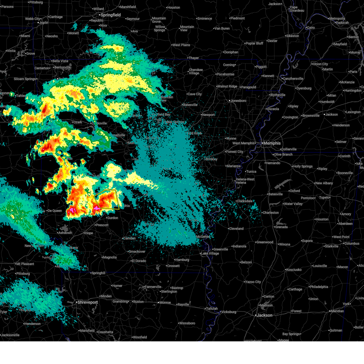
| 3/30/2025 3:00 PM CDT | Ping Pong Ball sized hail reported 9.2 miles SW of Midway, AR |
| 3/30/2025 2:50 PM CDT |
 Svrlzk the national weather service in little rock has issued a * severe thunderstorm warning for, northern marion county in north central arkansas, east central boone county in north central arkansas, baxter county in north central arkansas, * until 330 pm cdt. * at 250 pm cdt, a severe thunderstorm was located over clark hill, or 11 miles northwest of yellville, moving east at 40 mph (radar indicated). Hazards include 60 mph wind gusts and quarter size hail. Hail damage to vehicles is expected. Expect wind damage to roofs, siding, and trees. Svrlzk the national weather service in little rock has issued a * severe thunderstorm warning for, northern marion county in north central arkansas, east central boone county in north central arkansas, baxter county in north central arkansas, * until 330 pm cdt. * at 250 pm cdt, a severe thunderstorm was located over clark hill, or 11 miles northwest of yellville, moving east at 40 mph (radar indicated). Hazards include 60 mph wind gusts and quarter size hail. Hail damage to vehicles is expected. Expect wind damage to roofs, siding, and trees.
|
| 3/14/2025 10:35 PM CDT |
 The storm which prompted the warning has weakened below severe limits, and no longer appears capable of producing a tornado. therefore, the warning will be allowed to expire. a tornado watch remains in effect until 500 am cdt for southwestern arkansas. The storm which prompted the warning has weakened below severe limits, and no longer appears capable of producing a tornado. therefore, the warning will be allowed to expire. a tornado watch remains in effect until 500 am cdt for southwestern arkansas.
|
| 3/14/2025 10:19 PM CDT |
 At 1019 pm cdt, a severe thunderstorm capable of producing a tornado was located near arkadelphia, moving northeast at 45 mph (radar indicated rotation). Hazards include tornado and quarter size hail. Flying debris will be dangerous to those caught without shelter. mobile homes will be damaged or destroyed. damage to roofs, windows, and vehicles will occur. tree damage is likely. Locations impacted include, donaldson, friendship, joan, midway in hot spring county, arkadelphia,. At 1019 pm cdt, a severe thunderstorm capable of producing a tornado was located near arkadelphia, moving northeast at 45 mph (radar indicated rotation). Hazards include tornado and quarter size hail. Flying debris will be dangerous to those caught without shelter. mobile homes will be damaged or destroyed. damage to roofs, windows, and vehicles will occur. tree damage is likely. Locations impacted include, donaldson, friendship, joan, midway in hot spring county, arkadelphia,.
|
| 3/14/2025 9:59 PM CDT |
 Torlzk the national weather service in little rock has issued a * tornado warning for, central clark county in southwestern arkansas, northern dallas county in southwestern arkansas, south central hot spring county in southwestern arkansas, * until 1045 pm cdt. * at 959 pm cdt, a severe thunderstorm capable of producing a tornado was located near halfway, or 10 miles southwest of arkadelphia, moving northeast at 45 mph (radar indicated rotation). Hazards include tornado and quarter size hail. Flying debris will be dangerous to those caught without shelter. mobile homes will be damaged or destroyed. damage to roofs, windows, and vehicles will occur. Tree damage is likely. Torlzk the national weather service in little rock has issued a * tornado warning for, central clark county in southwestern arkansas, northern dallas county in southwestern arkansas, south central hot spring county in southwestern arkansas, * until 1045 pm cdt. * at 959 pm cdt, a severe thunderstorm capable of producing a tornado was located near halfway, or 10 miles southwest of arkadelphia, moving northeast at 45 mph (radar indicated rotation). Hazards include tornado and quarter size hail. Flying debris will be dangerous to those caught without shelter. mobile homes will be damaged or destroyed. damage to roofs, windows, and vehicles will occur. Tree damage is likely.
|
| 3/14/2025 9:54 PM CDT |
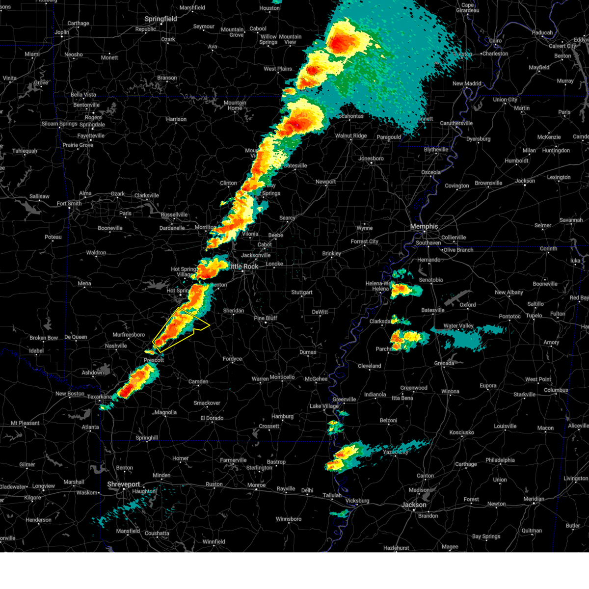 Svrlzk the national weather service in little rock has issued a * severe thunderstorm warning for, central clark county in southwestern arkansas, southeastern hot spring county in southwestern arkansas, * until 1045 pm cdt. * at 954 pm cdt, a severe thunderstorm was located over okolona, or 14 miles southwest of arkadelphia, moving northeast at 45 mph (radar indicated). Hazards include 60 mph wind gusts and quarter size hail. Hail damage to vehicles is expected. Expect wind damage to roofs, siding, and trees. Svrlzk the national weather service in little rock has issued a * severe thunderstorm warning for, central clark county in southwestern arkansas, southeastern hot spring county in southwestern arkansas, * until 1045 pm cdt. * at 954 pm cdt, a severe thunderstorm was located over okolona, or 14 miles southwest of arkadelphia, moving northeast at 45 mph (radar indicated). Hazards include 60 mph wind gusts and quarter size hail. Hail damage to vehicles is expected. Expect wind damage to roofs, siding, and trees.
|
| 3/14/2025 8:43 PM CDT |
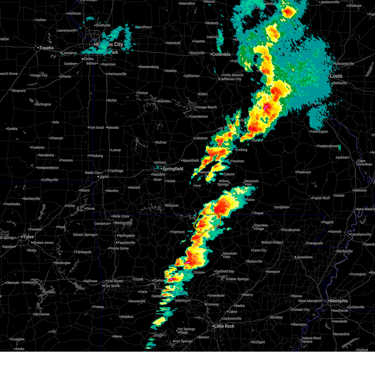 Therefore, the warning will be allowed to expire. however hail and damaging winds will still possible with this thunderstorm. remember, a new severe thunderstorm warning is now in effect for marion and baxter counties until 930 pm cdt. a tornado watch remains in effect until 1100 pm cdt for north central arkansas. Therefore, the warning will be allowed to expire. however hail and damaging winds will still possible with this thunderstorm. remember, a new severe thunderstorm warning is now in effect for marion and baxter counties until 930 pm cdt. a tornado watch remains in effect until 1100 pm cdt for north central arkansas.
|
| 3/14/2025 8:42 PM CDT |
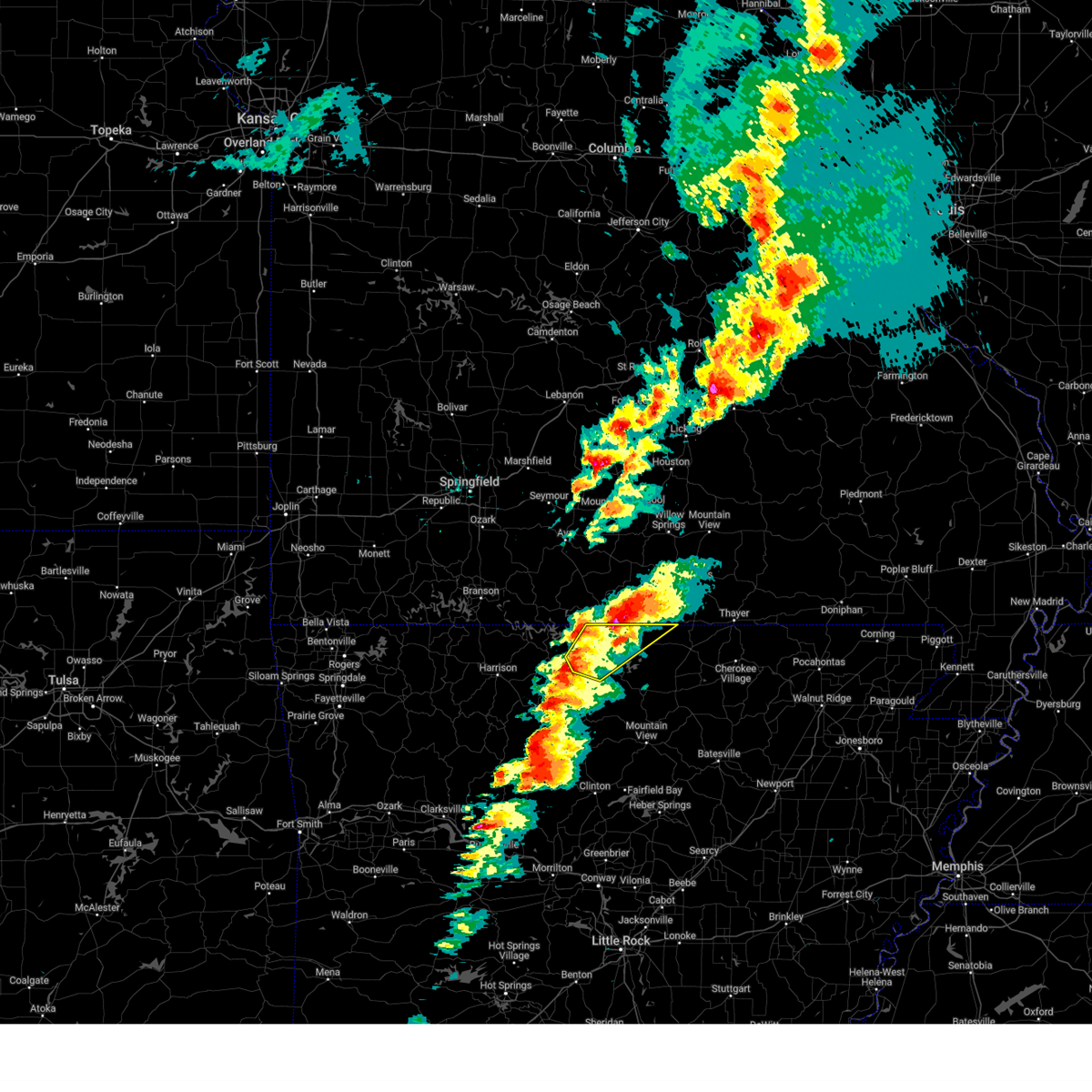 Svrlzk the national weather service in little rock has issued a * severe thunderstorm warning for, northeastern marion county in north central arkansas, northern baxter county in north central arkansas, northwestern fulton county in north central arkansas, * until 930 pm cdt. * at 841 pm cdt, a severe thunderstorm was located over gassville, or near bull shoals, moving northeast at 45 mph (radar indicated). Hazards include 60 mph wind gusts and quarter size hail. Hail damage to vehicles is expected. Expect wind damage to roofs, siding, and trees. Svrlzk the national weather service in little rock has issued a * severe thunderstorm warning for, northeastern marion county in north central arkansas, northern baxter county in north central arkansas, northwestern fulton county in north central arkansas, * until 930 pm cdt. * at 841 pm cdt, a severe thunderstorm was located over gassville, or near bull shoals, moving northeast at 45 mph (radar indicated). Hazards include 60 mph wind gusts and quarter size hail. Hail damage to vehicles is expected. Expect wind damage to roofs, siding, and trees.
|
| 3/14/2025 8:38 PM CDT |
 At 838 pm cdt, a severe thunderstorm was located over flippin, or near yellville, moving northeast at 45 mph (radar indicated). Hazards include 60 mph wind gusts and quarter size hail. Hail damage to vehicles is expected. expect wind damage to roofs, siding, and trees. Locations impacted include, bull shoals, clarkridge, fairview in marion county, gamaliel, oakland, ozark regional airport, buford, gamaliel landing, mountain home, arkawana, fawn park, flippin, norfork lake, bull shoals state park, three brothers, midway in baxter county, robinson point landing, lakeview in baxter county, colfax, henderson,. At 838 pm cdt, a severe thunderstorm was located over flippin, or near yellville, moving northeast at 45 mph (radar indicated). Hazards include 60 mph wind gusts and quarter size hail. Hail damage to vehicles is expected. expect wind damage to roofs, siding, and trees. Locations impacted include, bull shoals, clarkridge, fairview in marion county, gamaliel, oakland, ozark regional airport, buford, gamaliel landing, mountain home, arkawana, fawn park, flippin, norfork lake, bull shoals state park, three brothers, midway in baxter county, robinson point landing, lakeview in baxter county, colfax, henderson,.
|
| 3/14/2025 8:25 PM CDT |
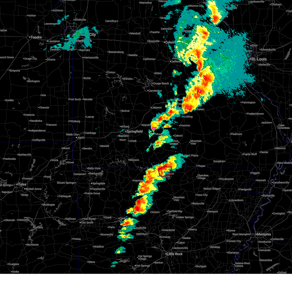 At 825 pm cdt, a severe thunderstorm capable of producing a tornado was located over fawn park, or near mountain home, moving northeast at 35 mph (radar indicated rotation). Hazards include tornado and quarter size hail. Flying debris will be dangerous to those caught without shelter. mobile homes will be damaged or destroyed. damage to roofs, windows, and vehicles will occur. tree damage is likely. Locations impacted include, mountain home, arkawana, fawn park, clarkridge, norfork lake, midway in baxter county, robinson point landing, gamaliel, henderson, gamaliel landing, ozark regional airport,. At 825 pm cdt, a severe thunderstorm capable of producing a tornado was located over fawn park, or near mountain home, moving northeast at 35 mph (radar indicated rotation). Hazards include tornado and quarter size hail. Flying debris will be dangerous to those caught without shelter. mobile homes will be damaged or destroyed. damage to roofs, windows, and vehicles will occur. tree damage is likely. Locations impacted include, mountain home, arkawana, fawn park, clarkridge, norfork lake, midway in baxter county, robinson point landing, gamaliel, henderson, gamaliel landing, ozark regional airport,.
|
| 3/14/2025 8:18 PM CDT |
 At 817 pm cdt, a severe thunderstorm capable of producing a tornado was located over ozark regional airport, or near mountain home, moving northeast at 40 mph (radar indicated rotation). Hazards include tornado and quarter size hail. Flying debris will be dangerous to those caught without shelter. mobile homes will be damaged or destroyed. damage to roofs, windows, and vehicles will occur. tree damage is likely. Locations impacted include, clarkridge, gamaliel, ozark regional airport, gamaliel landing, mountain home, arkawana, fawn park, norfork lake, midway in baxter county, robinson point landing, colfax, henderson, lakeview in baxter county,. At 817 pm cdt, a severe thunderstorm capable of producing a tornado was located over ozark regional airport, or near mountain home, moving northeast at 40 mph (radar indicated rotation). Hazards include tornado and quarter size hail. Flying debris will be dangerous to those caught without shelter. mobile homes will be damaged or destroyed. damage to roofs, windows, and vehicles will occur. tree damage is likely. Locations impacted include, clarkridge, gamaliel, ozark regional airport, gamaliel landing, mountain home, arkawana, fawn park, norfork lake, midway in baxter county, robinson point landing, colfax, henderson, lakeview in baxter county,.
|
| 3/14/2025 8:11 PM CDT |
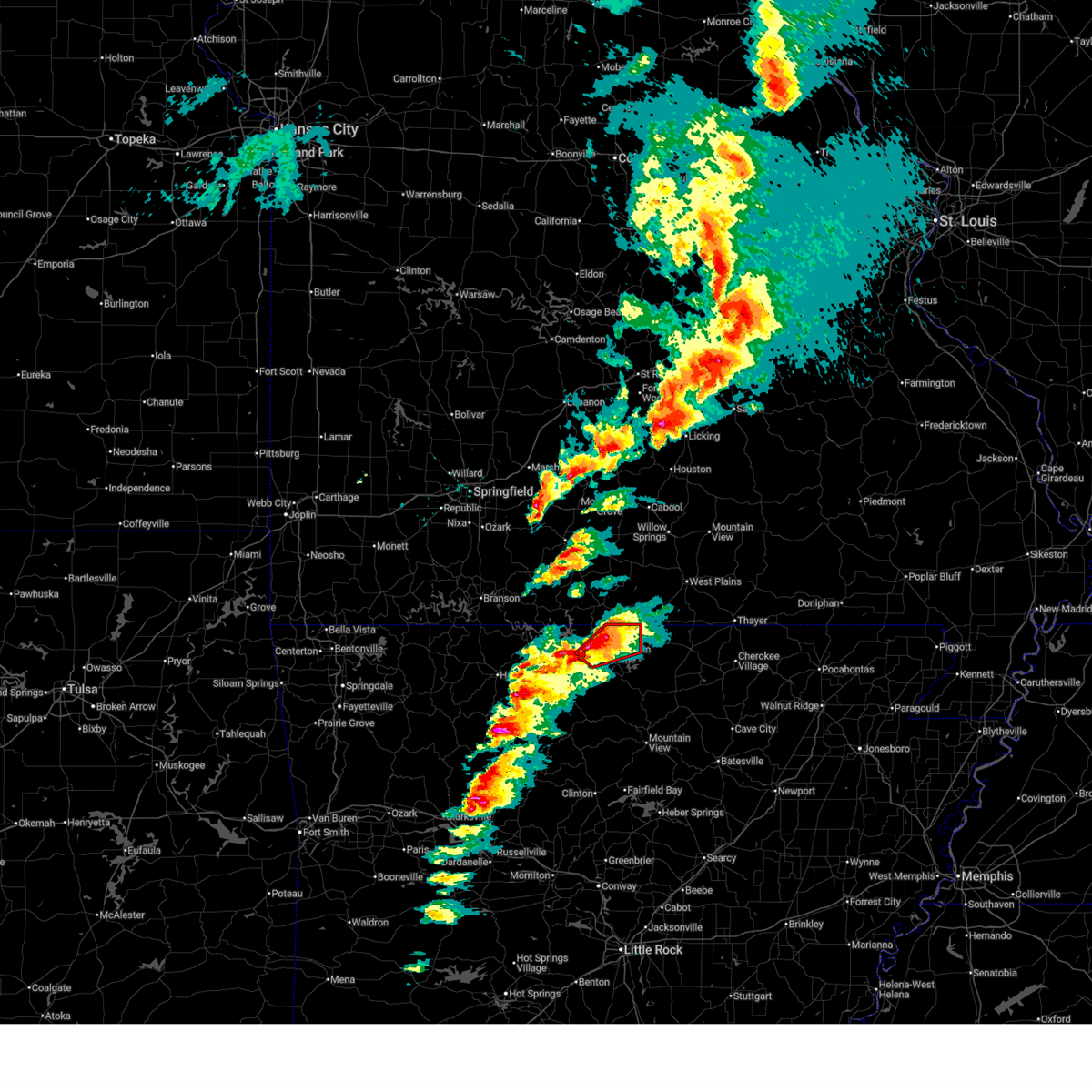 Torlzk the national weather service in little rock has issued a * tornado warning for, northern baxter county in north central arkansas, * until 900 pm cdt. * at 811 pm cdt, a severe thunderstorm capable of producing a tornado was located over gassville, or near bull shoals, moving northeast at 35 mph (radar indicated rotation). Hazards include tornado and quarter size hail. Flying debris will be dangerous to those caught without shelter. mobile homes will be damaged or destroyed. damage to roofs, windows, and vehicles will occur. Tree damage is likely. Torlzk the national weather service in little rock has issued a * tornado warning for, northern baxter county in north central arkansas, * until 900 pm cdt. * at 811 pm cdt, a severe thunderstorm capable of producing a tornado was located over gassville, or near bull shoals, moving northeast at 35 mph (radar indicated rotation). Hazards include tornado and quarter size hail. Flying debris will be dangerous to those caught without shelter. mobile homes will be damaged or destroyed. damage to roofs, windows, and vehicles will occur. Tree damage is likely.
|
| 3/14/2025 8:02 PM CDT |
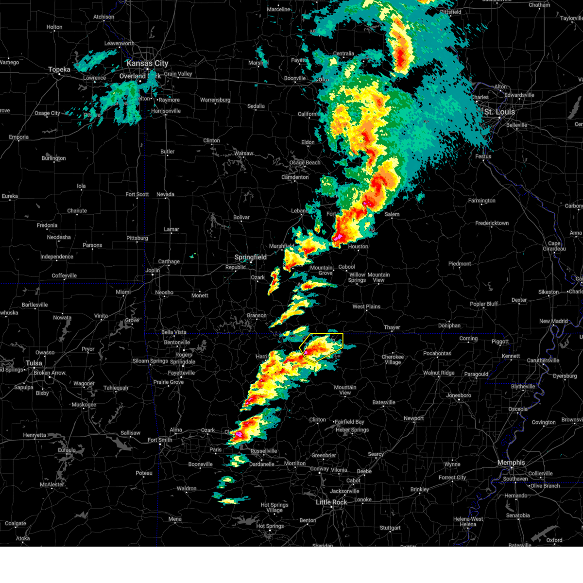 Svrlzk the national weather service in little rock has issued a * severe thunderstorm warning for, northeastern marion county in north central arkansas, northern baxter county in north central arkansas, * until 845 pm cdt. * at 801 pm cdt, a severe thunderstorm was located over bull shoals state park, or near bull shoals, moving northeast at 50 mph (radar indicated). Hazards include 60 mph wind gusts and quarter size hail. Hail damage to vehicles is expected. Expect wind damage to roofs, siding, and trees. Svrlzk the national weather service in little rock has issued a * severe thunderstorm warning for, northeastern marion county in north central arkansas, northern baxter county in north central arkansas, * until 845 pm cdt. * at 801 pm cdt, a severe thunderstorm was located over bull shoals state park, or near bull shoals, moving northeast at 50 mph (radar indicated). Hazards include 60 mph wind gusts and quarter size hail. Hail damage to vehicles is expected. Expect wind damage to roofs, siding, and trees.
|
| 12/16/2024 5:09 PM CST |
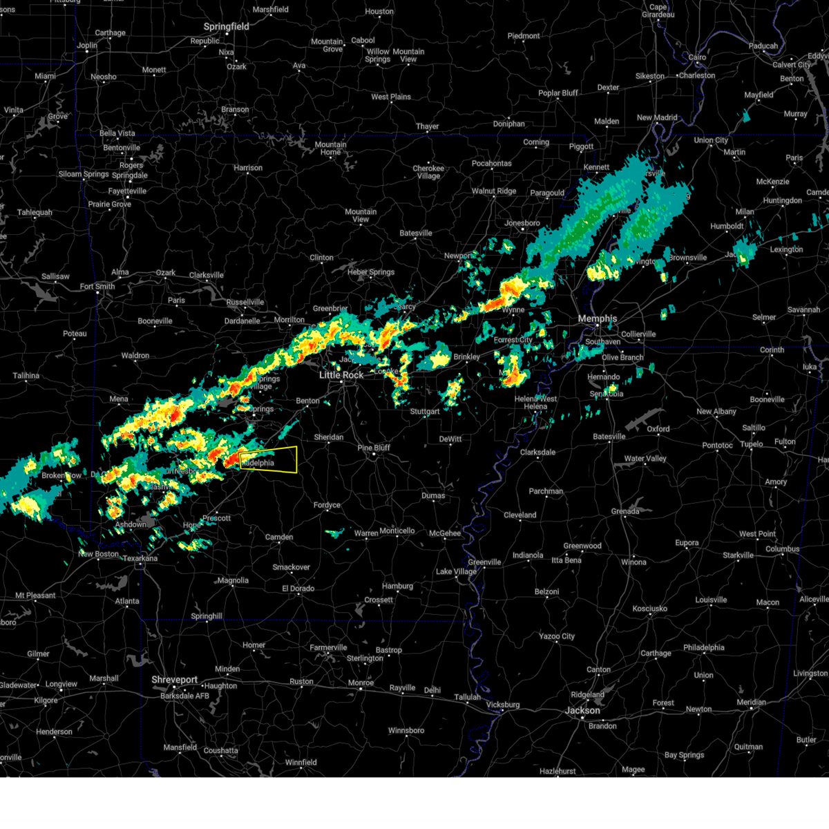 Svrlzk the national weather service in little rock has issued a * severe thunderstorm warning for, northeastern clark county in southwestern arkansas, northwestern dallas county in southwestern arkansas, southeastern hot spring county in southwestern arkansas, * until 545 pm cst. * at 508 pm cst, a severe thunderstorm was located over caddo valley, or 3 miles northweast of arkadelphia, moving east at 30 mph (radar indicated). Hazards include 60 mph wind gusts and quarter size hail. Hail damage to vehicles is expected. Expect wind damage to roofs, siding, and trees. Svrlzk the national weather service in little rock has issued a * severe thunderstorm warning for, northeastern clark county in southwestern arkansas, northwestern dallas county in southwestern arkansas, southeastern hot spring county in southwestern arkansas, * until 545 pm cst. * at 508 pm cst, a severe thunderstorm was located over caddo valley, or 3 miles northweast of arkadelphia, moving east at 30 mph (radar indicated). Hazards include 60 mph wind gusts and quarter size hail. Hail damage to vehicles is expected. Expect wind damage to roofs, siding, and trees.
|
| 8/18/2024 9:42 PM CDT |
 the severe thunderstorm warning has been cancelled and is no longer in effect the severe thunderstorm warning has been cancelled and is no longer in effect
|
| 8/18/2024 9:42 PM CDT |
 At 941 pm cdt, severe thunderstorms were located along a line extending from warbritton to near kedron to 9 miles northwest of fordyce to 6 miles east of whelen springs, moving southeast at 55 mph (radar indicated). Hazards include 70 mph wind gusts and nickel size hail. Expect considerable tree damage. damage is likely to mobile homes, roofs, and outbuildings. Locations impacted include, pine bluff, camden, arkadelphia, sheridan, fordyce, star city, rison, white hall, gurdon, redfield, altheimer, bearden, caddo valley, leola, grady, tull, kingsland, sparkman, thornton, carthage,. At 941 pm cdt, severe thunderstorms were located along a line extending from warbritton to near kedron to 9 miles northwest of fordyce to 6 miles east of whelen springs, moving southeast at 55 mph (radar indicated). Hazards include 70 mph wind gusts and nickel size hail. Expect considerable tree damage. damage is likely to mobile homes, roofs, and outbuildings. Locations impacted include, pine bluff, camden, arkadelphia, sheridan, fordyce, star city, rison, white hall, gurdon, redfield, altheimer, bearden, caddo valley, leola, grady, tull, kingsland, sparkman, thornton, carthage,.
|
| 8/18/2024 9:34 PM CDT |
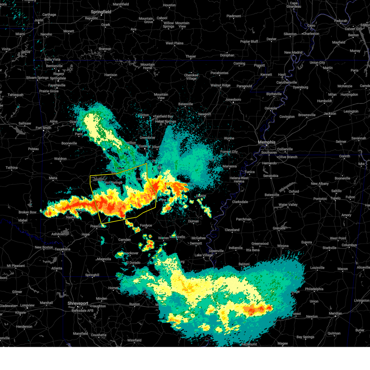 the severe thunderstorm warning has been cancelled and is no longer in effect the severe thunderstorm warning has been cancelled and is no longer in effect
|
| 8/18/2024 9:29 PM CDT |
 Svrlzk the national weather service in little rock has issued a * severe thunderstorm warning for, cleveland county in southeastern arkansas, clark county in southwestern arkansas, southwestern lonoke county in central arkansas, grant county in central arkansas, northern calhoun county in southwestern arkansas, dallas county in southwestern arkansas, northern ouachita county in southwestern arkansas, jefferson county in southeastern arkansas, southeastern saline county in central arkansas, northern lincoln county in southeastern arkansas, southern hot spring county in southwestern arkansas, southeastern pulaski county in central arkansas, * until 1015 pm cdt. * at 928 pm cdt, severe thunderstorms were located along a line extending from near hensley island to near redfield to near sheridan to near leola to near gum springs in clark county, moving southeast at 45 mph (radar indicated). Hazards include 60 mph wind gusts and nickel size hail. expect damage to roofs, siding, and trees Svrlzk the national weather service in little rock has issued a * severe thunderstorm warning for, cleveland county in southeastern arkansas, clark county in southwestern arkansas, southwestern lonoke county in central arkansas, grant county in central arkansas, northern calhoun county in southwestern arkansas, dallas county in southwestern arkansas, northern ouachita county in southwestern arkansas, jefferson county in southeastern arkansas, southeastern saline county in central arkansas, northern lincoln county in southeastern arkansas, southern hot spring county in southwestern arkansas, southeastern pulaski county in central arkansas, * until 1015 pm cdt. * at 928 pm cdt, severe thunderstorms were located along a line extending from near hensley island to near redfield to near sheridan to near leola to near gum springs in clark county, moving southeast at 45 mph (radar indicated). Hazards include 60 mph wind gusts and nickel size hail. expect damage to roofs, siding, and trees
|
| 8/18/2024 9:13 PM CDT |
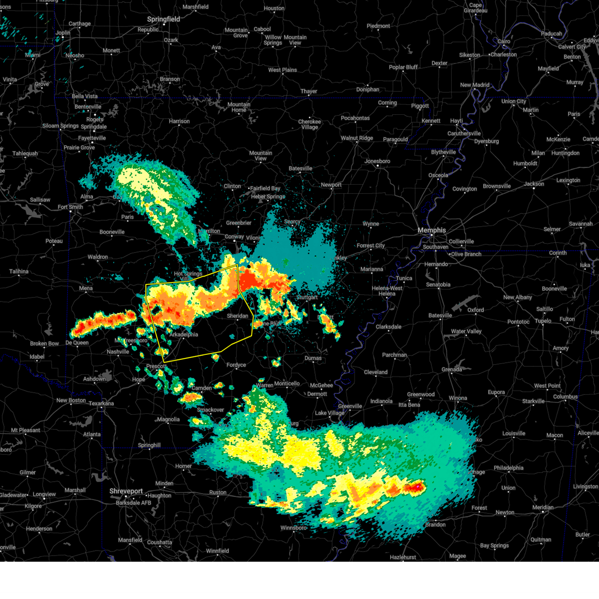 At 912 pm cdt, severe thunderstorms were located along a line extending from near cane creek to near perla to near degray lake state park, moving south at 55 mph (radar indicated). Hazards include 60 mph wind gusts and nickel size hail. Expect damage to roofs, siding, and trees. Locations impacted include, little rock, hot springs, benton, west little rock, maumelle, bryant, hot springs village, arkadelphia, malvern, sheridan, southwest little rock, haskell, shannon hills, gurdon, mountain pine, rockport, caddo valley, traskwood, leola, tull,. At 912 pm cdt, severe thunderstorms were located along a line extending from near cane creek to near perla to near degray lake state park, moving south at 55 mph (radar indicated). Hazards include 60 mph wind gusts and nickel size hail. Expect damage to roofs, siding, and trees. Locations impacted include, little rock, hot springs, benton, west little rock, maumelle, bryant, hot springs village, arkadelphia, malvern, sheridan, southwest little rock, haskell, shannon hills, gurdon, mountain pine, rockport, caddo valley, traskwood, leola, tull,.
|
| 8/18/2024 8:57 PM CDT |
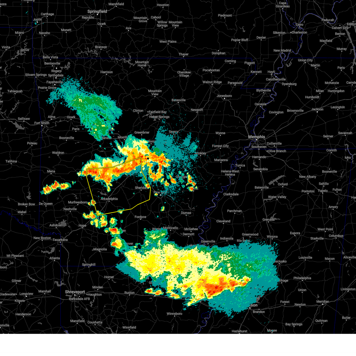 Svrlzk the national weather service in little rock has issued a * severe thunderstorm warning for, clark county in southwestern arkansas, grant county in central arkansas, northern dallas county in southwestern arkansas, garland county in central arkansas, saline county in central arkansas, hot spring county in southwestern arkansas, southeastern montgomery county in western arkansas, central pulaski county in central arkansas, * until 945 pm cdt. * at 856 pm cdt, severe thunderstorms were located along a line extending from near roland in pulaski county to near hot springs village to 7 miles west of lake ouachita state park, moving south at 50 mph (radar indicated). Hazards include 60 mph wind gusts and nickel size hail. expect damage to roofs, siding, and trees Svrlzk the national weather service in little rock has issued a * severe thunderstorm warning for, clark county in southwestern arkansas, grant county in central arkansas, northern dallas county in southwestern arkansas, garland county in central arkansas, saline county in central arkansas, hot spring county in southwestern arkansas, southeastern montgomery county in western arkansas, central pulaski county in central arkansas, * until 945 pm cdt. * at 856 pm cdt, severe thunderstorms were located along a line extending from near roland in pulaski county to near hot springs village to 7 miles west of lake ouachita state park, moving south at 50 mph (radar indicated). Hazards include 60 mph wind gusts and nickel size hail. expect damage to roofs, siding, and trees
|
| 8/18/2024 8:49 PM CDT |
 the severe thunderstorm warning has been cancelled and is no longer in effect the severe thunderstorm warning has been cancelled and is no longer in effect
|
| 8/18/2024 8:49 PM CDT |
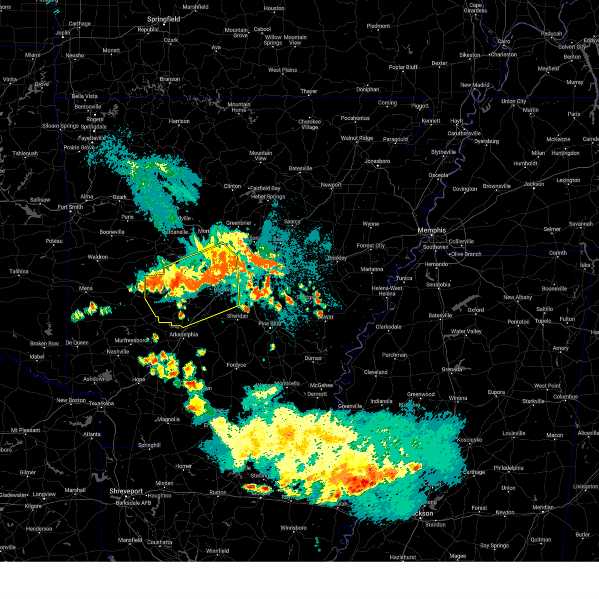 At 848 pm cdt, severe thunderstorms were located along a line extending from near salem in saline county to near hot springs national park to near meyers, moving south at 50 mph (radar indicated). Hazards include 60 mph wind gusts and nickel size hail. Expect damage to roofs, siding, and trees. Locations impacted include, little rock, hot springs, benton, west little rock, maumelle, bryant, hot springs village, malvern, perryville, southwest little rock, haskell, shannon hills, mayflower, mountain pine, rockport, traskwood, tull, perla, houston, lonsdale,. At 848 pm cdt, severe thunderstorms were located along a line extending from near salem in saline county to near hot springs national park to near meyers, moving south at 50 mph (radar indicated). Hazards include 60 mph wind gusts and nickel size hail. Expect damage to roofs, siding, and trees. Locations impacted include, little rock, hot springs, benton, west little rock, maumelle, bryant, hot springs village, malvern, perryville, southwest little rock, haskell, shannon hills, mayflower, mountain pine, rockport, traskwood, tull, perla, houston, lonsdale,.
|
| 8/18/2024 8:33 PM CDT |
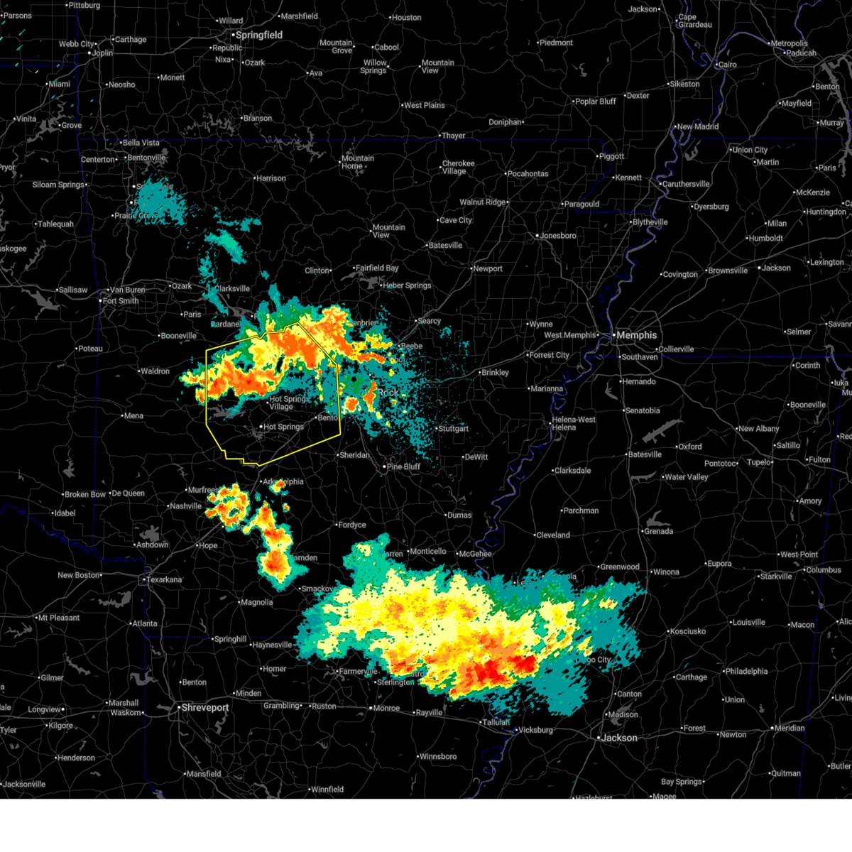 At 833 pm cdt, severe thunderstorms were located along a line extending from 7 miles southeast of williams junction to near jessieville to 6 miles west of lake ouachita state park, moving south at 55 mph (radar indicated). Hazards include 60 mph wind gusts and nickel size hail. Expect damage to roofs, siding, and trees. Locations impacted include, little rock, hot springs, benton, west little rock, maumelle, bryant, hot springs village, malvern, morrilton, danville, perryville, southwest little rock, haskell, shannon hills, mayflower, ola, oppelo, mountain pine, rockport, traskwood,. At 833 pm cdt, severe thunderstorms were located along a line extending from 7 miles southeast of williams junction to near jessieville to 6 miles west of lake ouachita state park, moving south at 55 mph (radar indicated). Hazards include 60 mph wind gusts and nickel size hail. Expect damage to roofs, siding, and trees. Locations impacted include, little rock, hot springs, benton, west little rock, maumelle, bryant, hot springs village, malvern, morrilton, danville, perryville, southwest little rock, haskell, shannon hills, mayflower, ola, oppelo, mountain pine, rockport, traskwood,.
|
| 8/18/2024 8:23 PM CDT |
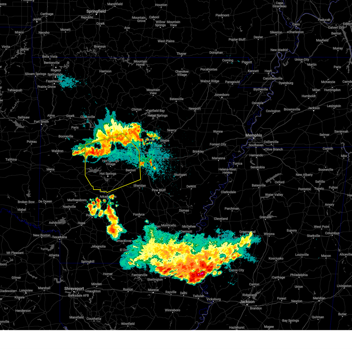 At 823 pm cdt, severe thunderstorms were located along a line extending from near wye mountain to 11 miles northwest of jessieville to 12 miles northwest of lake ouachita state park, moving south at 55 mph (radar indicated). Hazards include 70 mph wind gusts and nickel size hail. Expect considerable tree damage. damage is likely to mobile homes, roofs, and outbuildings. Locations impacted include, little rock, hot springs, benton, west little rock, maumelle, bryant, hot springs village, malvern, morrilton, danville, perryville, southwest little rock, haskell, shannon hills, mayflower, ola, oppelo, mountain pine, rockport, traskwood,. At 823 pm cdt, severe thunderstorms were located along a line extending from near wye mountain to 11 miles northwest of jessieville to 12 miles northwest of lake ouachita state park, moving south at 55 mph (radar indicated). Hazards include 70 mph wind gusts and nickel size hail. Expect considerable tree damage. damage is likely to mobile homes, roofs, and outbuildings. Locations impacted include, little rock, hot springs, benton, west little rock, maumelle, bryant, hot springs village, malvern, morrilton, danville, perryville, southwest little rock, haskell, shannon hills, mayflower, ola, oppelo, mountain pine, rockport, traskwood,.
|
| 8/18/2024 8:13 PM CDT |
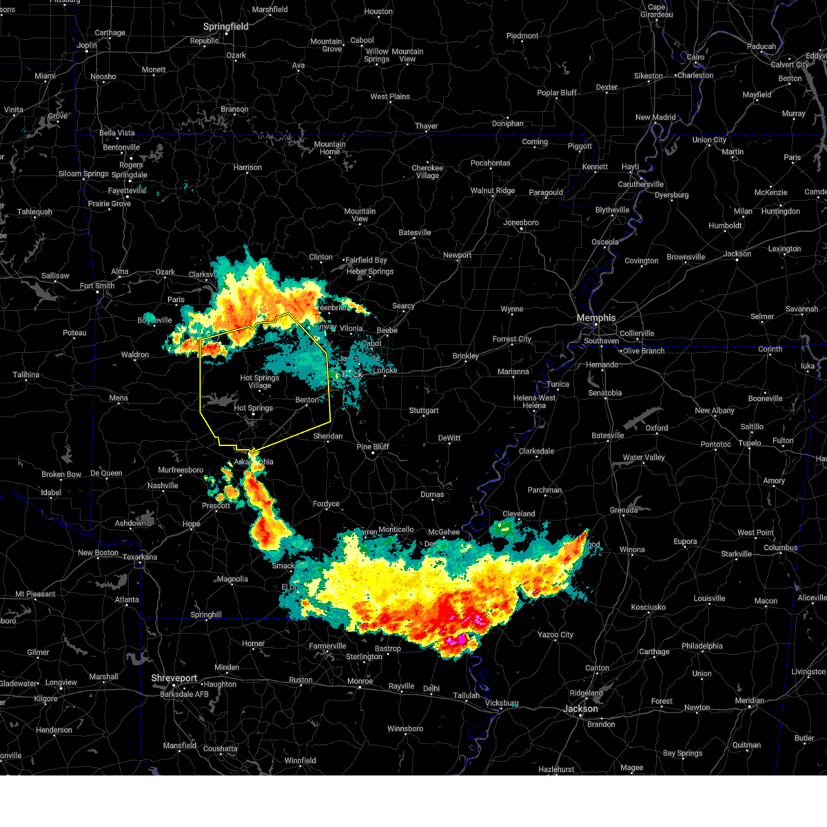 Svrlzk the national weather service in little rock has issued a * severe thunderstorm warning for, perry county in central arkansas, northwestern grant county in central arkansas, southwestern conway county in central arkansas, southwestern faulkner county in central arkansas, garland county in central arkansas, saline county in central arkansas, southeastern yell county in central arkansas, hot spring county in southwestern arkansas, northeastern montgomery county in western arkansas, northwestern pulaski county in central arkansas, * until 900 pm cdt. * at 812 pm cdt, severe thunderstorms were located along a line extending from perry to near ola to 8 miles east of fourche valley, moving south at 50 mph (radar indicated). Hazards include 70 mph wind gusts and nickel size hail. Expect considerable tree damage. Damage is likely to mobile homes, roofs, and outbuildings. Svrlzk the national weather service in little rock has issued a * severe thunderstorm warning for, perry county in central arkansas, northwestern grant county in central arkansas, southwestern conway county in central arkansas, southwestern faulkner county in central arkansas, garland county in central arkansas, saline county in central arkansas, southeastern yell county in central arkansas, hot spring county in southwestern arkansas, northeastern montgomery county in western arkansas, northwestern pulaski county in central arkansas, * until 900 pm cdt. * at 812 pm cdt, severe thunderstorms were located along a line extending from perry to near ola to 8 miles east of fourche valley, moving south at 50 mph (radar indicated). Hazards include 70 mph wind gusts and nickel size hail. Expect considerable tree damage. Damage is likely to mobile homes, roofs, and outbuildings.
|
| 8/18/2024 6:44 PM CDT |
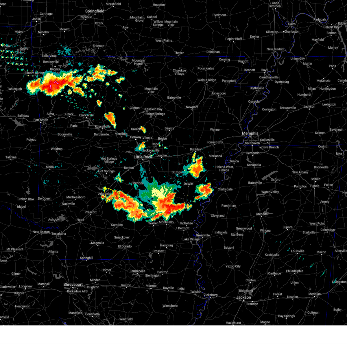 Svrlzk the national weather service in little rock has issued a * severe thunderstorm warning for, northeastern clark county in southwestern arkansas, northwestern dallas county in southwestern arkansas, south central hot spring county in southwestern arkansas, * until 730 pm cdt. * at 644 pm cdt, a severe thunderstorm was located over caddo valley, or near arkadelphia, moving southeast at 30 mph (radar indicated). Hazards include 60 mph wind gusts and quarter size hail. Hail damage to vehicles is expected. Expect wind damage to roofs, siding, and trees. Svrlzk the national weather service in little rock has issued a * severe thunderstorm warning for, northeastern clark county in southwestern arkansas, northwestern dallas county in southwestern arkansas, south central hot spring county in southwestern arkansas, * until 730 pm cdt. * at 644 pm cdt, a severe thunderstorm was located over caddo valley, or near arkadelphia, moving southeast at 30 mph (radar indicated). Hazards include 60 mph wind gusts and quarter size hail. Hail damage to vehicles is expected. Expect wind damage to roofs, siding, and trees.
|
| 8/17/2024 1:18 AM CDT |
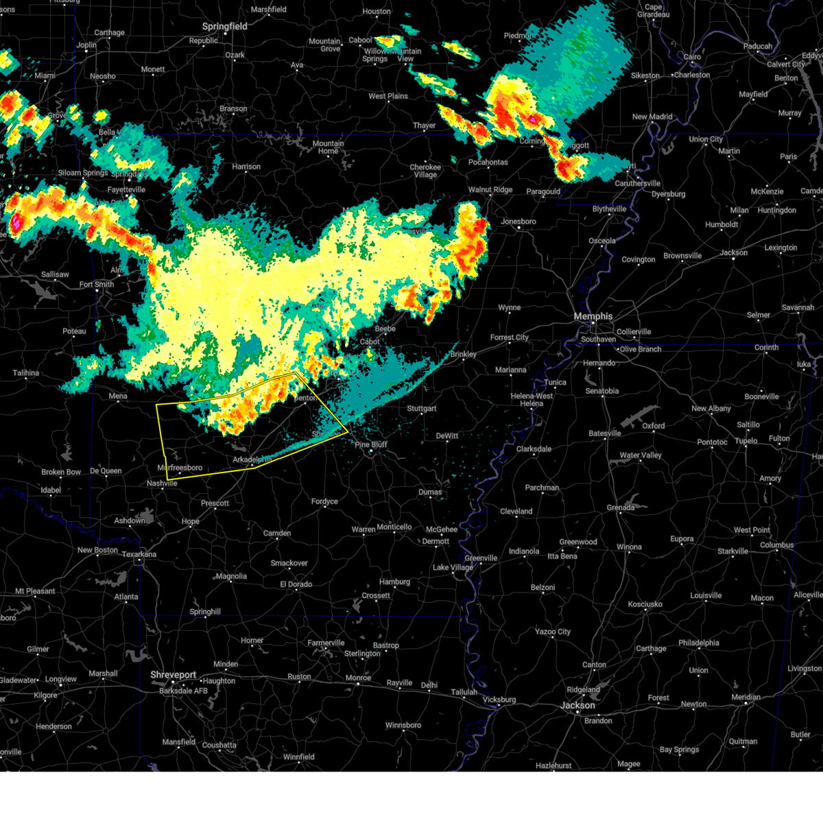 the severe thunderstorm warning has been cancelled and is no longer in effect the severe thunderstorm warning has been cancelled and is no longer in effect
|
| 8/17/2024 1:05 AM CDT |
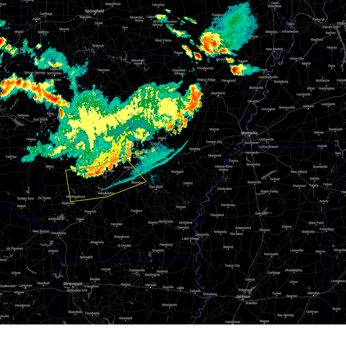 At 105 am cdt, severe thunderstorms were located along a line extending from near cane creek to near degray lake state park to near narrows dam, moving south at 45 mph (radar indicated). Hazards include 60 mph wind gusts. Expect damage to roofs, siding, and trees. Locations impacted include, hot springs, benton, bryant, hot springs village, arkadelphia, malvern, sheridan, murfreesboro, mount ida, haskell, glenwood, mountain pine, rockport, amity, caddo valley, traskwood, tull, norman, prattsville, poyen,. At 105 am cdt, severe thunderstorms were located along a line extending from near cane creek to near degray lake state park to near narrows dam, moving south at 45 mph (radar indicated). Hazards include 60 mph wind gusts. Expect damage to roofs, siding, and trees. Locations impacted include, hot springs, benton, bryant, hot springs village, arkadelphia, malvern, sheridan, murfreesboro, mount ida, haskell, glenwood, mountain pine, rockport, amity, caddo valley, traskwood, tull, norman, prattsville, poyen,.
|
| 8/17/2024 12:44 AM CDT |
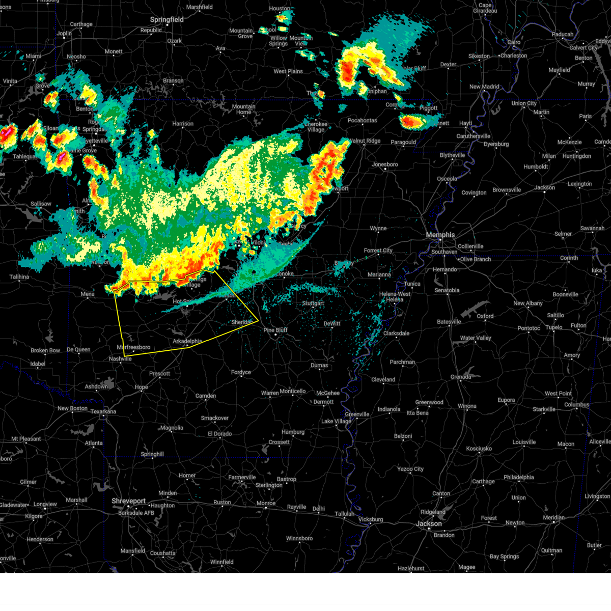 Svrlzk the national weather service in little rock has issued a * severe thunderstorm warning for, northern clark county in southwestern arkansas, pike county in southwestern arkansas, northern grant county in central arkansas, garland county in central arkansas, saline county in central arkansas, hot spring county in southwestern arkansas, montgomery county in western arkansas, * until 130 am cdt. * at 1244 am cdt, severe thunderstorms were located along a line extending from near benton to near lofton to near little missouri falls recreation area, moving southeast at 50 mph (radar indicated). Hazards include 60 mph wind gusts. expect damage to roofs, siding, and trees Svrlzk the national weather service in little rock has issued a * severe thunderstorm warning for, northern clark county in southwestern arkansas, pike county in southwestern arkansas, northern grant county in central arkansas, garland county in central arkansas, saline county in central arkansas, hot spring county in southwestern arkansas, montgomery county in western arkansas, * until 130 am cdt. * at 1244 am cdt, severe thunderstorms were located along a line extending from near benton to near lofton to near little missouri falls recreation area, moving southeast at 50 mph (radar indicated). Hazards include 60 mph wind gusts. expect damage to roofs, siding, and trees
|
| 7/8/2024 9:53 PM CDT |
 The storms which prompted the warning have weakened below severe limits, and no longer pose an immediate threat to life or property. therefore, the warning will be allowed to expire. a tornado watch remains in effect until midnight cdt for central and southwestern arkansas. remember, a tornado warning still remains in effect for portions of hot spring, dallas, and grand counties until 10:15 pm. The storms which prompted the warning have weakened below severe limits, and no longer pose an immediate threat to life or property. therefore, the warning will be allowed to expire. a tornado watch remains in effect until midnight cdt for central and southwestern arkansas. remember, a tornado warning still remains in effect for portions of hot spring, dallas, and grand counties until 10:15 pm.
|
| 7/8/2024 9:14 PM CDT |
 Svrlzk the national weather service in little rock has issued a * severe thunderstorm warning for, central clark county in southwestern arkansas, southwestern grant county in central arkansas, dallas county in southwestern arkansas, hot spring county in southwestern arkansas, * until 1000 pm cdt. * at 913 pm cdt, severe thunderstorms were located along a line extending from near gum springs in clark county to 9 miles east of sparkman, moving north at 30 mph (radar indicated). Hazards include 60 mph wind gusts. expect damage to roofs, siding, and trees Svrlzk the national weather service in little rock has issued a * severe thunderstorm warning for, central clark county in southwestern arkansas, southwestern grant county in central arkansas, dallas county in southwestern arkansas, hot spring county in southwestern arkansas, * until 1000 pm cdt. * at 913 pm cdt, severe thunderstorms were located along a line extending from near gum springs in clark county to 9 miles east of sparkman, moving north at 30 mph (radar indicated). Hazards include 60 mph wind gusts. expect damage to roofs, siding, and trees
|
| 7/8/2024 8:05 PM CDT |
 Torlzk the national weather service in little rock has issued a * tornado warning for, southeastern garland county in central arkansas, northeastern hot spring county in southwestern arkansas, * until 845 pm cdt. * at 805 pm cdt, a severe thunderstorm capable of producing a tornado was located near malvern or 5 miles south of magnet cove, moving north at 25 mph (radar indicated rotation). Hazards include tornado. Flying debris will be dangerous to those caught without shelter. mobile homes will be damaged or destroyed. damage to roofs, windows, and vehicles will occur. Tree damage is likely. Torlzk the national weather service in little rock has issued a * tornado warning for, southeastern garland county in central arkansas, northeastern hot spring county in southwestern arkansas, * until 845 pm cdt. * at 805 pm cdt, a severe thunderstorm capable of producing a tornado was located near malvern or 5 miles south of magnet cove, moving north at 25 mph (radar indicated rotation). Hazards include tornado. Flying debris will be dangerous to those caught without shelter. mobile homes will be damaged or destroyed. damage to roofs, windows, and vehicles will occur. Tree damage is likely.
|
| 7/8/2024 8:00 PM CDT |
 At 800 pm cdt, a severe thunderstorm capable of producing a tornado was located near malvern, moving north at 30 mph (radar indicated rotation). Hazards include tornado. Flying debris will be dangerous to those caught without shelter. mobile homes will be damaged or destroyed. damage to roofs, windows, and vehicles will occur. tree damage is likely. Locations impacted include, malvern, rockport, perla, donaldson, social hill, midway in hot spring county,. At 800 pm cdt, a severe thunderstorm capable of producing a tornado was located near malvern, moving north at 30 mph (radar indicated rotation). Hazards include tornado. Flying debris will be dangerous to those caught without shelter. mobile homes will be damaged or destroyed. damage to roofs, windows, and vehicles will occur. tree damage is likely. Locations impacted include, malvern, rockport, perla, donaldson, social hill, midway in hot spring county,.
|
| 7/8/2024 7:50 PM CDT |
 the tornado warning has been cancelled and is no longer in effect the tornado warning has been cancelled and is no longer in effect
|
| 7/8/2024 7:50 PM CDT |
 At 750 pm cdt, a severe thunderstorm capable of producing a tornado was located 9 miles south of malvern, moving north at 35 mph (radar indicated rotation). Hazards include tornado. Flying debris will be dangerous to those caught without shelter. mobile homes will be damaged or destroyed. damage to roofs, windows, and vehicles will occur. tree damage is likely. Locations impacted include, malvern, rockport, perla, donaldson, social hill, gifford, midway in hot spring county,. At 750 pm cdt, a severe thunderstorm capable of producing a tornado was located 9 miles south of malvern, moving north at 35 mph (radar indicated rotation). Hazards include tornado. Flying debris will be dangerous to those caught without shelter. mobile homes will be damaged or destroyed. damage to roofs, windows, and vehicles will occur. tree damage is likely. Locations impacted include, malvern, rockport, perla, donaldson, social hill, gifford, midway in hot spring county,.
|
| 7/8/2024 7:41 PM CDT |
 At 740 pm cdt, a severe thunderstorm was located 10 miles east of caddo valley, or 11 miles northeast of arkadelphia, moving north at 30 mph (radar indicated). Hazards include 60 mph wind gusts and quarter size hail. Hail damage to vehicles is expected. expect wind damage to roofs, siding, and trees. Locations impacted include, malvern, rockport, perla, donaldson, friendship, lono, joan, de roche, willow, social hill, gifford, midway in hot spring county,. At 740 pm cdt, a severe thunderstorm was located 10 miles east of caddo valley, or 11 miles northeast of arkadelphia, moving north at 30 mph (radar indicated). Hazards include 60 mph wind gusts and quarter size hail. Hail damage to vehicles is expected. expect wind damage to roofs, siding, and trees. Locations impacted include, malvern, rockport, perla, donaldson, friendship, lono, joan, de roche, willow, social hill, gifford, midway in hot spring county,.
|
| 7/8/2024 7:38 PM CDT |
 At 737 pm cdt, a severe thunderstorm capable of producing a tornado was located 13 miles west of leola, or 14 miles east of arkadelphia, moving north at 25 mph (radar indicated rotation). Hazards include tornado. Flying debris will be dangerous to those caught without shelter. mobile homes will be damaged or destroyed. damage to roofs, windows, and vehicles will occur. tree damage is likely. Locations impacted include, malvern, rockport, perla, donaldson, lono, joan, willow, social hill, gifford, midway in hot spring county,. At 737 pm cdt, a severe thunderstorm capable of producing a tornado was located 13 miles west of leola, or 14 miles east of arkadelphia, moving north at 25 mph (radar indicated rotation). Hazards include tornado. Flying debris will be dangerous to those caught without shelter. mobile homes will be damaged or destroyed. damage to roofs, windows, and vehicles will occur. tree damage is likely. Locations impacted include, malvern, rockport, perla, donaldson, lono, joan, willow, social hill, gifford, midway in hot spring county,.
|
| 7/8/2024 7:25 PM CDT |
 Torlzk the national weather service in little rock has issued a * tornado warning for, east central clark county in southwestern arkansas, northwestern dallas county in southwestern arkansas, southeastern hot spring county in southwestern arkansas, * until 815 pm cdt. * at 724 pm cdt, a severe thunderstorm capable of producing a tornado was located 10 miles north of sparkman, or 15 miles east of arkadelphia, moving north at 40 mph (radar indicated rotation). Hazards include tornado. Flying debris will be dangerous to those caught without shelter. mobile homes will be damaged or destroyed. damage to roofs, windows, and vehicles will occur. Tree damage is likely. Torlzk the national weather service in little rock has issued a * tornado warning for, east central clark county in southwestern arkansas, northwestern dallas county in southwestern arkansas, southeastern hot spring county in southwestern arkansas, * until 815 pm cdt. * at 724 pm cdt, a severe thunderstorm capable of producing a tornado was located 10 miles north of sparkman, or 15 miles east of arkadelphia, moving north at 40 mph (radar indicated rotation). Hazards include tornado. Flying debris will be dangerous to those caught without shelter. mobile homes will be damaged or destroyed. damage to roofs, windows, and vehicles will occur. Tree damage is likely.
|
| 7/8/2024 7:10 PM CDT |
 Svrlzk the national weather service in little rock has issued a * severe thunderstorm warning for, northeastern clark county in southwestern arkansas, northwestern dallas county in southwestern arkansas, southeastern hot spring county in southwestern arkansas, * until 800 pm cdt. * at 709 pm cdt, a severe thunderstorm was located near sparkman, or 5 miles south of manning, moving north at 35 mph (radar indicated). Hazards include 60 mph wind gusts and quarter size hail. Hail damage to vehicles is expected. Expect wind damage to roofs, siding, and trees. Svrlzk the national weather service in little rock has issued a * severe thunderstorm warning for, northeastern clark county in southwestern arkansas, northwestern dallas county in southwestern arkansas, southeastern hot spring county in southwestern arkansas, * until 800 pm cdt. * at 709 pm cdt, a severe thunderstorm was located near sparkman, or 5 miles south of manning, moving north at 35 mph (radar indicated). Hazards include 60 mph wind gusts and quarter size hail. Hail damage to vehicles is expected. Expect wind damage to roofs, siding, and trees.
|
| 6/9/2024 12:44 AM CDT |
 the severe thunderstorm warning has been cancelled and is no longer in effect the severe thunderstorm warning has been cancelled and is no longer in effect
|
| 6/9/2024 12:27 AM CDT |
 Svrlzk the national weather service in little rock has issued a * severe thunderstorm warning for, central marion county in north central arkansas, baxter county in north central arkansas, * until 115 am cdt. * at 1226 am cdt, a severe thunderstorm was located near gainesville, or 19 miles north of bull shoals, moving southeast at 35 mph (radar indicated). Hazards include 60 mph wind gusts. expect damage to roofs, siding, and trees Svrlzk the national weather service in little rock has issued a * severe thunderstorm warning for, central marion county in north central arkansas, baxter county in north central arkansas, * until 115 am cdt. * at 1226 am cdt, a severe thunderstorm was located near gainesville, or 19 miles north of bull shoals, moving southeast at 35 mph (radar indicated). Hazards include 60 mph wind gusts. expect damage to roofs, siding, and trees
|
| 5/26/2024 7:04 PM CDT |
 the severe thunderstorm warning has been cancelled and is no longer in effect the severe thunderstorm warning has been cancelled and is no longer in effect
|
| 5/26/2024 6:46 PM CDT |
 Svrlzk the national weather service in little rock has issued a * severe thunderstorm warning for, central marion county in north central arkansas, central baxter county in north central arkansas, * until 730 pm cdt. * at 646 pm cdt, a severe thunderstorm was located near dodd city, or near yellville, moving east at 45 mph (radar indicated). Hazards include 60 mph wind gusts and quarter size hail. Hail damage to vehicles is expected. Expect wind damage to roofs, siding, and trees. Svrlzk the national weather service in little rock has issued a * severe thunderstorm warning for, central marion county in north central arkansas, central baxter county in north central arkansas, * until 730 pm cdt. * at 646 pm cdt, a severe thunderstorm was located near dodd city, or near yellville, moving east at 45 mph (radar indicated). Hazards include 60 mph wind gusts and quarter size hail. Hail damage to vehicles is expected. Expect wind damage to roofs, siding, and trees.
|
| 5/26/2024 5:07 AM CDT |
 Svrlzk the national weather service in little rock has issued a * severe thunderstorm warning for, northern stone county in north central arkansas, northwestern izard county in north central arkansas, southern marion county in north central arkansas, western fulton county in north central arkansas, baxter county in north central arkansas, * until 545 am cdt. * at 507 am cdt, severe thunderstorms were located along a line extending from 9 miles northwest of gainesville to near bull shoals to near pyatt, moving east at 60 mph (radar indicated). Hazards include 60 mph wind gusts and quarter size hail. Hail damage to vehicles is expected. Expect wind damage to roofs, siding, and trees. Svrlzk the national weather service in little rock has issued a * severe thunderstorm warning for, northern stone county in north central arkansas, northwestern izard county in north central arkansas, southern marion county in north central arkansas, western fulton county in north central arkansas, baxter county in north central arkansas, * until 545 am cdt. * at 507 am cdt, severe thunderstorms were located along a line extending from 9 miles northwest of gainesville to near bull shoals to near pyatt, moving east at 60 mph (radar indicated). Hazards include 60 mph wind gusts and quarter size hail. Hail damage to vehicles is expected. Expect wind damage to roofs, siding, and trees.
|
| 5/26/2024 5:02 AM CDT |
 At 501 am cdt, severe thunderstorms were located along a line extending from near gainesville to near lakeview in baxter county to yellville, moving east at 60 mph (radar indicated). Hazards include 60 mph wind gusts and quarter size hail. Hail damage to vehicles is expected. expect wind damage to roofs, siding, and trees. Locations impacted include, mountain home, bull shoals, yellville, gassville, flippin, lakeview in baxter county, arkawana, ozark regional airport, fawn park, bull shoals state park, colfax, lion hill, price place, ozark isle, cotter, summit, midway in baxter county, fairview in marion county, oakland, rea valley,. At 501 am cdt, severe thunderstorms were located along a line extending from near gainesville to near lakeview in baxter county to yellville, moving east at 60 mph (radar indicated). Hazards include 60 mph wind gusts and quarter size hail. Hail damage to vehicles is expected. expect wind damage to roofs, siding, and trees. Locations impacted include, mountain home, bull shoals, yellville, gassville, flippin, lakeview in baxter county, arkawana, ozark regional airport, fawn park, bull shoals state park, colfax, lion hill, price place, ozark isle, cotter, summit, midway in baxter county, fairview in marion county, oakland, rea valley,.
|
| 5/26/2024 5:02 AM CDT |
 the severe thunderstorm warning has been cancelled and is no longer in effect the severe thunderstorm warning has been cancelled and is no longer in effect
|
| 5/26/2024 4:43 AM CDT |
 Svrlzk the national weather service in little rock has issued a * severe thunderstorm warning for, northern marion county in north central arkansas, east central boone county in north central arkansas, northwestern baxter county in north central arkansas, * until 515 am cdt. * at 443 am cdt, severe thunderstorms were located along a line extending from 12 miles northwest of price place to near lakeway to near bergman, moving east at 60 mph (radar indicated). Hazards include 60 mph wind gusts and quarter size hail. Hail damage to vehicles is expected. Expect wind damage to roofs, siding, and trees. Svrlzk the national weather service in little rock has issued a * severe thunderstorm warning for, northern marion county in north central arkansas, east central boone county in north central arkansas, northwestern baxter county in north central arkansas, * until 515 am cdt. * at 443 am cdt, severe thunderstorms were located along a line extending from 12 miles northwest of price place to near lakeway to near bergman, moving east at 60 mph (radar indicated). Hazards include 60 mph wind gusts and quarter size hail. Hail damage to vehicles is expected. Expect wind damage to roofs, siding, and trees.
|
| 5/26/2024 4:35 AM CDT |
 At 435 am cdt, a severe thunderstorm was located near diamond bay, or 11 miles east of mountain home, moving east at 60 mph (radar indicated). Hazards include 60 mph wind gusts and quarter size hail. Hail damage to vehicles is expected. expect wind damage to roofs, siding, and trees. Locations impacted include, mountain home, norfork, salesville, briarcliff, rodney, advance, norfork dam, cartney, diamond bay, fawn park, shipp, herron, colfax, gamaliel landing, buford, lone rock, robinson point landing, jordan, henderson, gamaliel,. At 435 am cdt, a severe thunderstorm was located near diamond bay, or 11 miles east of mountain home, moving east at 60 mph (radar indicated). Hazards include 60 mph wind gusts and quarter size hail. Hail damage to vehicles is expected. expect wind damage to roofs, siding, and trees. Locations impacted include, mountain home, norfork, salesville, briarcliff, rodney, advance, norfork dam, cartney, diamond bay, fawn park, shipp, herron, colfax, gamaliel landing, buford, lone rock, robinson point landing, jordan, henderson, gamaliel,.
|
| 5/26/2024 4:35 AM CDT |
 the severe thunderstorm warning has been cancelled and is no longer in effect the severe thunderstorm warning has been cancelled and is no longer in effect
|
| 5/26/2024 4:21 AM CDT |
 the severe thunderstorm warning has been cancelled and is no longer in effect the severe thunderstorm warning has been cancelled and is no longer in effect
|
| 5/26/2024 4:21 AM CDT |
 At 421 am cdt, a severe thunderstorm was located near gamaliel landing, or 11 miles northeast of mountain home, moving northeast at 50 mph (radar indicated). Hazards include 60 mph wind gusts and quarter size hail. Hail damage to vehicles is expected. expect wind damage to roofs, siding, and trees. Locations impacted include, mountain home, bull shoals, gassville, flippin, lakeview in baxter county, norfork, salesville, briarcliff, arkawana, norfork dam, diamond bay, ozark regional airport, fawn park, bull shoals state park, shipp, colfax, lion hill, rodney, cartney, gamaliel landing,. At 421 am cdt, a severe thunderstorm was located near gamaliel landing, or 11 miles northeast of mountain home, moving northeast at 50 mph (radar indicated). Hazards include 60 mph wind gusts and quarter size hail. Hail damage to vehicles is expected. expect wind damage to roofs, siding, and trees. Locations impacted include, mountain home, bull shoals, gassville, flippin, lakeview in baxter county, norfork, salesville, briarcliff, arkawana, norfork dam, diamond bay, ozark regional airport, fawn park, bull shoals state park, shipp, colfax, lion hill, rodney, cartney, gamaliel landing,.
|
| 5/26/2024 4:11 AM CDT |
 the tornado warning has been cancelled and is no longer in effect the tornado warning has been cancelled and is no longer in effect
|
| 5/26/2024 4:11 AM CDT |
 At 411 am cdt, a confirmed tornado was located near flippin, or 7 miles east of yellville, moving east at 40 mph (radar confirmed tornado). Hazards include damaging tornado and half dollar size hail. Flying debris will be dangerous to those caught without shelter. mobile homes will be damaged or destroyed. damage to roofs, windows, and vehicles will occur. tree damage is likely. Locations impacted include, mountain home, yellville, gassville, flippin, lakeview in baxter county, norfork, ozark regional airport, bull shoals state park, shipp, colfax, cotter, summit, midway in baxter county, fairview in marion county, ralph, buford, rea valley,. At 411 am cdt, a confirmed tornado was located near flippin, or 7 miles east of yellville, moving east at 40 mph (radar confirmed tornado). Hazards include damaging tornado and half dollar size hail. Flying debris will be dangerous to those caught without shelter. mobile homes will be damaged or destroyed. damage to roofs, windows, and vehicles will occur. tree damage is likely. Locations impacted include, mountain home, yellville, gassville, flippin, lakeview in baxter county, norfork, ozark regional airport, bull shoals state park, shipp, colfax, cotter, summit, midway in baxter county, fairview in marion county, ralph, buford, rea valley,.
|
| 5/26/2024 3:54 AM CDT |
 Svrlzk the national weather service in little rock has issued a * severe thunderstorm warning for, northwestern izard county in north central arkansas, marion county in north central arkansas, east central boone county in north central arkansas, baxter county in north central arkansas, * until 445 am cdt. * at 354 am cdt, a severe thunderstorm was located near lakeway, or near bull shoals, moving northeast at 50 mph (radar indicated). Hazards include 60 mph wind gusts and half dollar size hail. Hail damage to vehicles is expected. Expect wind damage to roofs, siding, and trees. Svrlzk the national weather service in little rock has issued a * severe thunderstorm warning for, northwestern izard county in north central arkansas, marion county in north central arkansas, east central boone county in north central arkansas, baxter county in north central arkansas, * until 445 am cdt. * at 354 am cdt, a severe thunderstorm was located near lakeway, or near bull shoals, moving northeast at 50 mph (radar indicated). Hazards include 60 mph wind gusts and half dollar size hail. Hail damage to vehicles is expected. Expect wind damage to roofs, siding, and trees.
|
| 5/26/2024 3:54 AM CDT |
 Torlzk the national weather service in little rock has issued a * tornado warning for, central marion county in north central arkansas, east central boone county in north central arkansas, northwestern baxter county in north central arkansas, * until 445 am cdt. * at 354 am cdt, a tornado producing storm was located over pyatt, or near yellville, moving east at 35 mph (radar confirmed tornado). Hazards include damaging tornado and half dollar size hail. Flying debris will be dangerous to those caught without shelter. mobile homes will be damaged or destroyed. damage to roofs, windows, and vehicles will occur. Tree damage is likely. Torlzk the national weather service in little rock has issued a * tornado warning for, central marion county in north central arkansas, east central boone county in north central arkansas, northwestern baxter county in north central arkansas, * until 445 am cdt. * at 354 am cdt, a tornado producing storm was located over pyatt, or near yellville, moving east at 35 mph (radar confirmed tornado). Hazards include damaging tornado and half dollar size hail. Flying debris will be dangerous to those caught without shelter. mobile homes will be damaged or destroyed. damage to roofs, windows, and vehicles will occur. Tree damage is likely.
|
| 5/24/2024 9:28 PM CDT |
 the severe thunderstorm warning has been cancelled and is no longer in effect the severe thunderstorm warning has been cancelled and is no longer in effect
|
| 5/24/2024 9:28 PM CDT |
 At 928 pm cdt, severe thunderstorms were located along a line extending from near jessieville to lonsdale to perla, moving northeast at 60 mph (radar indicated). Hazards include 60 mph wind gusts and nickel size hail. Expect damage to roofs, siding, and trees. Locations impacted include, little rock, hot springs, benton, west little rock, bryant, hot springs village, malvern, sheridan, perryville, southwest little rock, haskell, shannon hills, mountain pine, rockport, traskwood, tull, prattsville, poyen, perla, lonsdale,. At 928 pm cdt, severe thunderstorms were located along a line extending from near jessieville to lonsdale to perla, moving northeast at 60 mph (radar indicated). Hazards include 60 mph wind gusts and nickel size hail. Expect damage to roofs, siding, and trees. Locations impacted include, little rock, hot springs, benton, west little rock, bryant, hot springs village, malvern, sheridan, perryville, southwest little rock, haskell, shannon hills, mountain pine, rockport, traskwood, tull, prattsville, poyen, perla, lonsdale,.
|
| 5/24/2024 9:11 PM CDT |
 Svrlzk the national weather service in little rock has issued a * severe thunderstorm warning for, northeastern clark county in southwestern arkansas, central perry county in central arkansas, northwestern grant county in central arkansas, garland county in central arkansas, saline county in central arkansas, hot spring county in southwestern arkansas, west central pulaski county in central arkansas, * until 1000 pm cdt. * at 911 pm cdt, severe thunderstorms were located along a line extending from near lake ouachita state park to 6 miles southeast of hot springs to near caddo valley, moving northeast at 60 mph (radar indicated). Hazards include 60 mph wind gusts and nickel size hail. expect damage to roofs, siding, and trees Svrlzk the national weather service in little rock has issued a * severe thunderstorm warning for, northeastern clark county in southwestern arkansas, central perry county in central arkansas, northwestern grant county in central arkansas, garland county in central arkansas, saline county in central arkansas, hot spring county in southwestern arkansas, west central pulaski county in central arkansas, * until 1000 pm cdt. * at 911 pm cdt, severe thunderstorms were located along a line extending from near lake ouachita state park to 6 miles southeast of hot springs to near caddo valley, moving northeast at 60 mph (radar indicated). Hazards include 60 mph wind gusts and nickel size hail. expect damage to roofs, siding, and trees
|
| 5/24/2024 8:43 PM CDT |
 At 843 pm cdt, a severe thunderstorm was located near degray lake state park, or 14 miles northwest of arkadelphia, moving northeast at 35 mph (radar indicated). Hazards include 60 mph wind gusts and quarter size hail. Hail damage to vehicles is expected. expect wind damage to roofs, siding, and trees. Locations impacted include, hot springs, hot springs village, arkadelphia, malvern, mountain pine, rockport, caddo valley, perla, hot springs memorial field, lofton, rockwell, degray lake state park, hot springs national park, donaldson, friendship, bismarck, alpine, magnet cove, lono, oaklawn racetrack,. At 843 pm cdt, a severe thunderstorm was located near degray lake state park, or 14 miles northwest of arkadelphia, moving northeast at 35 mph (radar indicated). Hazards include 60 mph wind gusts and quarter size hail. Hail damage to vehicles is expected. expect wind damage to roofs, siding, and trees. Locations impacted include, hot springs, hot springs village, arkadelphia, malvern, mountain pine, rockport, caddo valley, perla, hot springs memorial field, lofton, rockwell, degray lake state park, hot springs national park, donaldson, friendship, bismarck, alpine, magnet cove, lono, oaklawn racetrack,.
|
| 5/24/2024 8:34 PM CDT |
 At 833 pm cdt, a severe thunderstorm was located 8 miles west of degray lake state park, or 16 miles northwest of arkadelphia, moving northeast at 35 mph. this storm has a history of producing two inch hail most recently in amity (radar indicated). Hazards include two inch hail and 60 mph wind gusts. People and animals outdoors will be injured. expect hail damage to roofs, siding, windows, and vehicles. expect wind damage to roofs, siding, and trees. Locations impacted include, hot springs, hot springs village, arkadelphia, malvern, mountain pine, rockport, amity, caddo valley, perla, hot springs memorial field, lofton, rockwell, degray lake state park, hot springs national park, donaldson, friendship, bismarck, alpine, magnet cove, lono,. At 833 pm cdt, a severe thunderstorm was located 8 miles west of degray lake state park, or 16 miles northwest of arkadelphia, moving northeast at 35 mph. this storm has a history of producing two inch hail most recently in amity (radar indicated). Hazards include two inch hail and 60 mph wind gusts. People and animals outdoors will be injured. expect hail damage to roofs, siding, windows, and vehicles. expect wind damage to roofs, siding, and trees. Locations impacted include, hot springs, hot springs village, arkadelphia, malvern, mountain pine, rockport, amity, caddo valley, perla, hot springs memorial field, lofton, rockwell, degray lake state park, hot springs national park, donaldson, friendship, bismarck, alpine, magnet cove, lono,.
|
| 5/24/2024 8:27 PM CDT |
 Svrlzk the national weather service in little rock has issued a * severe thunderstorm warning for, northern clark county in southwestern arkansas, southeastern garland county in central arkansas, hot spring county in southwestern arkansas, * until 915 pm cdt. * at 827 pm cdt, a severe thunderstorm was located near amity, or 18 miles northwest of arkadelphia, moving northeast at 35 mph (radar indicated). Hazards include 60 mph wind gusts and quarter size hail. Hail damage to vehicles is expected. Expect wind damage to roofs, siding, and trees. Svrlzk the national weather service in little rock has issued a * severe thunderstorm warning for, northern clark county in southwestern arkansas, southeastern garland county in central arkansas, hot spring county in southwestern arkansas, * until 915 pm cdt. * at 827 pm cdt, a severe thunderstorm was located near amity, or 18 miles northwest of arkadelphia, moving northeast at 35 mph (radar indicated). Hazards include 60 mph wind gusts and quarter size hail. Hail damage to vehicles is expected. Expect wind damage to roofs, siding, and trees.
|
| 5/24/2024 4:39 AM CDT |
 Svrlzk the national weather service in little rock has issued a * severe thunderstorm warning for, northwestern grant county in central arkansas, southeastern garland county in central arkansas, central saline county in central arkansas, eastern hot spring county in southwestern arkansas, * until 515 am cdt. * at 439 am cdt, a severe thunderstorm was located near rockport, or 7 miles northwest of malvern, moving northeast at 50 mph (radar indicated). Hazards include 60 mph wind gusts and quarter size hail. Hail damage to vehicles is expected. Expect wind damage to roofs, siding, and trees. Svrlzk the national weather service in little rock has issued a * severe thunderstorm warning for, northwestern grant county in central arkansas, southeastern garland county in central arkansas, central saline county in central arkansas, eastern hot spring county in southwestern arkansas, * until 515 am cdt. * at 439 am cdt, a severe thunderstorm was located near rockport, or 7 miles northwest of malvern, moving northeast at 50 mph (radar indicated). Hazards include 60 mph wind gusts and quarter size hail. Hail damage to vehicles is expected. Expect wind damage to roofs, siding, and trees.
|
| 5/24/2024 4:24 AM CDT |
 the severe thunderstorm warning has been cancelled and is no longer in effect the severe thunderstorm warning has been cancelled and is no longer in effect
|
| 5/24/2024 4:24 AM CDT |
 At 423 am cdt, a severe thunderstorm was located near degray lake state park, or 15 miles northwest of arkadelphia, moving northeast at 50 mph (radar indicated). Hazards include 60 mph wind gusts and quarter size hail. Hail damage to vehicles is expected. expect wind damage to roofs, siding, and trees. Locations impacted include, caddo valley, lofton, degray lake state park, rockwell, bismarck, alpine, sunshine, royal, de roche, point cedar, pettyview, hempwallace, pearcy, midway in hot spring county, bonnerdale,. At 423 am cdt, a severe thunderstorm was located near degray lake state park, or 15 miles northwest of arkadelphia, moving northeast at 50 mph (radar indicated). Hazards include 60 mph wind gusts and quarter size hail. Hail damage to vehicles is expected. expect wind damage to roofs, siding, and trees. Locations impacted include, caddo valley, lofton, degray lake state park, rockwell, bismarck, alpine, sunshine, royal, de roche, point cedar, pettyview, hempwallace, pearcy, midway in hot spring county, bonnerdale,.
|
| 5/24/2024 4:06 AM CDT |
 Svrlzk the national weather service in little rock has issued a * severe thunderstorm warning for, northwestern clark county in southwestern arkansas, northeastern pike county in southwestern arkansas, southwestern garland county in central arkansas, southwestern hot spring county in southwestern arkansas, southeastern montgomery county in western arkansas, * until 445 am cdt. * at 406 am cdt, a severe thunderstorm was located over amity, or 18 miles northeast of murfreesboro, moving northeast at 30 mph (radar indicated). Hazards include 60 mph wind gusts and quarter size hail. Hail damage to vehicles is expected. Expect wind damage to roofs, siding, and trees. Svrlzk the national weather service in little rock has issued a * severe thunderstorm warning for, northwestern clark county in southwestern arkansas, northeastern pike county in southwestern arkansas, southwestern garland county in central arkansas, southwestern hot spring county in southwestern arkansas, southeastern montgomery county in western arkansas, * until 445 am cdt. * at 406 am cdt, a severe thunderstorm was located over amity, or 18 miles northeast of murfreesboro, moving northeast at 30 mph (radar indicated). Hazards include 60 mph wind gusts and quarter size hail. Hail damage to vehicles is expected. Expect wind damage to roofs, siding, and trees.
|
| 5/8/2024 8:55 PM CDT |
 the severe thunderstorm warning has been cancelled and is no longer in effect the severe thunderstorm warning has been cancelled and is no longer in effect
|
| 5/8/2024 8:45 PM CDT |
 At 845 pm cdt, a severe thunderstorm was located over lakeway, or 9 miles northwest of yellville, moving east at 35 mph (radar indicated). Hazards include 60 mph wind gusts and quarter size hail. Hail damage to vehicles is expected. expect wind damage to roofs, siding, and trees. Locations impacted include, mountain home, bull shoals, gassville, lakeview in baxter county, briarcliff, arkawana, dodd city, ozark regional airport, ozark isle, fawn park, lakeway, bull shoals state park, colfax, cotter, midway in baxter county, fairview in marion county, clarkridge, oakland, three brothers, monarch,. At 845 pm cdt, a severe thunderstorm was located over lakeway, or 9 miles northwest of yellville, moving east at 35 mph (radar indicated). Hazards include 60 mph wind gusts and quarter size hail. Hail damage to vehicles is expected. expect wind damage to roofs, siding, and trees. Locations impacted include, mountain home, bull shoals, gassville, lakeview in baxter county, briarcliff, arkawana, dodd city, ozark regional airport, ozark isle, fawn park, lakeway, bull shoals state park, colfax, cotter, midway in baxter county, fairview in marion county, clarkridge, oakland, three brothers, monarch,.
|
| 5/8/2024 8:45 PM CDT |
 the severe thunderstorm warning has been cancelled and is no longer in effect the severe thunderstorm warning has been cancelled and is no longer in effect
|
| 5/8/2024 8:37 PM CDT |
 Svrlzk the national weather service in little rock has issued a * severe thunderstorm warning for, northern marion county in north central arkansas, east central boone county in north central arkansas, northwestern baxter county in north central arkansas, * until 915 pm cdt. * at 837 pm cdt, a severe thunderstorm was located over clark hill, or 12 miles northwest of yellville, moving east at 35 mph (radar indicated). Hazards include 60 mph wind gusts and quarter size hail. Hail damage to vehicles is expected. Expect wind damage to roofs, siding, and trees. Svrlzk the national weather service in little rock has issued a * severe thunderstorm warning for, northern marion county in north central arkansas, east central boone county in north central arkansas, northwestern baxter county in north central arkansas, * until 915 pm cdt. * at 837 pm cdt, a severe thunderstorm was located over clark hill, or 12 miles northwest of yellville, moving east at 35 mph (radar indicated). Hazards include 60 mph wind gusts and quarter size hail. Hail damage to vehicles is expected. Expect wind damage to roofs, siding, and trees.
|
| 5/7/2024 4:48 AM CDT |
 At 448 am cdt, a severe thunderstorm was located near rush, or near yellville, moving east at 55 mph (radar indicated). Hazards include 60 mph wind gusts and quarter size hail. Hail damage to vehicles is expected. expect wind damage to roofs, siding, and trees. Locations impacted include, mountain home, yellville, gassville, flippin, advance, cartney, ozark regional airport, fawn park, shipp, colfax, rush, lion hill, cotter, summit, fairview in marion county, buffalo city, ralph, mull, buford, lone rock,. At 448 am cdt, a severe thunderstorm was located near rush, or near yellville, moving east at 55 mph (radar indicated). Hazards include 60 mph wind gusts and quarter size hail. Hail damage to vehicles is expected. expect wind damage to roofs, siding, and trees. Locations impacted include, mountain home, yellville, gassville, flippin, advance, cartney, ozark regional airport, fawn park, shipp, colfax, rush, lion hill, cotter, summit, fairview in marion county, buffalo city, ralph, mull, buford, lone rock,.
|
| 5/7/2024 4:48 AM CDT |
 the severe thunderstorm warning has been cancelled and is no longer in effect the severe thunderstorm warning has been cancelled and is no longer in effect
|
| 5/7/2024 4:34 AM CDT |
 Svrlzk the national weather service in little rock has issued a * severe thunderstorm warning for, northern searcy county in north central arkansas, marion county in north central arkansas, southeastern boone county in north central arkansas, central baxter county in north central arkansas, * until 515 am cdt. * at 434 am cdt, a severe thunderstorm was located near crawford, or 8 miles southwest of yellville, moving east at 55 mph (radar indicated). Hazards include 60 mph wind gusts and quarter size hail. Hail damage to vehicles is expected. Expect wind damage to roofs, siding, and trees. Svrlzk the national weather service in little rock has issued a * severe thunderstorm warning for, northern searcy county in north central arkansas, marion county in north central arkansas, southeastern boone county in north central arkansas, central baxter county in north central arkansas, * until 515 am cdt. * at 434 am cdt, a severe thunderstorm was located near crawford, or 8 miles southwest of yellville, moving east at 55 mph (radar indicated). Hazards include 60 mph wind gusts and quarter size hail. Hail damage to vehicles is expected. Expect wind damage to roofs, siding, and trees.
|
| 5/3/2024 6:14 AM CDT |
 the severe thunderstorm warning has been cancelled and is no longer in effect the severe thunderstorm warning has been cancelled and is no longer in effect
|
| 5/3/2024 6:09 AM CDT |
 At 608 am cdt, a severe thunderstorm was located 9 miles west of malvern, moving east at 40 mph (radar indicated). Hazards include 60 mph wind gusts and quarter size hail. Hail damage to vehicles is expected. expect wind damage to roofs, siding, and trees. Locations impacted include, malvern, social hill,. At 608 am cdt, a severe thunderstorm was located 9 miles west of malvern, moving east at 40 mph (radar indicated). Hazards include 60 mph wind gusts and quarter size hail. Hail damage to vehicles is expected. expect wind damage to roofs, siding, and trees. Locations impacted include, malvern, social hill,.
|
| 5/3/2024 6:09 AM CDT |
 the severe thunderstorm warning has been cancelled and is no longer in effect the severe thunderstorm warning has been cancelled and is no longer in effect
|
| 5/3/2024 6:01 AM CDT |
 At 601 am cdt, a severe thunderstorm was located near rockwell, or 8 miles south of hot springs, moving southeast at 30 mph (radar indicated). Hazards include 60 mph wind gusts and quarter size hail. Hail damage to vehicles is expected. expect wind damage to roofs, siding, and trees. Locations impacted include, hot springs, malvern, rockport, perla, rockwell, magnet cove, red oak, de roche, lake catherine state park, social hill,. At 601 am cdt, a severe thunderstorm was located near rockwell, or 8 miles south of hot springs, moving southeast at 30 mph (radar indicated). Hazards include 60 mph wind gusts and quarter size hail. Hail damage to vehicles is expected. expect wind damage to roofs, siding, and trees. Locations impacted include, hot springs, malvern, rockport, perla, rockwell, magnet cove, red oak, de roche, lake catherine state park, social hill,.
|
| 5/3/2024 5:46 AM CDT |
 Svrlzk the national weather service in little rock has issued a * severe thunderstorm warning for, south central garland county in central arkansas, central hot spring county in southwestern arkansas, * until 630 am cdt. * at 546 am cdt, a severe thunderstorm was located over lofton, or 11 miles southwest of hot springs, moving southeast at 35 mph (radar indicated). Hazards include 60 mph wind gusts and quarter size hail. Hail damage to vehicles is expected. Expect wind damage to roofs, siding, and trees. Svrlzk the national weather service in little rock has issued a * severe thunderstorm warning for, south central garland county in central arkansas, central hot spring county in southwestern arkansas, * until 630 am cdt. * at 546 am cdt, a severe thunderstorm was located over lofton, or 11 miles southwest of hot springs, moving southeast at 35 mph (radar indicated). Hazards include 60 mph wind gusts and quarter size hail. Hail damage to vehicles is expected. Expect wind damage to roofs, siding, and trees.
|
| 4/26/2024 6:22 PM CDT |
 At 622 pm cdt, severe thunderstorms were located along a line extending from near degray lake state park to near gurdon, moving east at 45 mph (radar indicated). Hazards include 60 mph wind gusts and quarter size hail. Hail damage to vehicles is expected. expect wind damage to roofs, siding, and trees. Locations impacted include, arkadelphia, malvern, gurdon, rockport, caddo valley, sparkman, perla, whelen springs, beirne, gum springs in clark county, richwoods, degray lake state park, donaldson, friendship, bismarck, magnet cove, curtis, ouachita, vaden, gifford,. At 622 pm cdt, severe thunderstorms were located along a line extending from near degray lake state park to near gurdon, moving east at 45 mph (radar indicated). Hazards include 60 mph wind gusts and quarter size hail. Hail damage to vehicles is expected. expect wind damage to roofs, siding, and trees. Locations impacted include, arkadelphia, malvern, gurdon, rockport, caddo valley, sparkman, perla, whelen springs, beirne, gum springs in clark county, richwoods, degray lake state park, donaldson, friendship, bismarck, magnet cove, curtis, ouachita, vaden, gifford,.
|
| 4/26/2024 6:10 PM CDT |
 the severe thunderstorm warning has been cancelled and is no longer in effect the severe thunderstorm warning has been cancelled and is no longer in effect
|
| 4/26/2024 6:10 PM CDT |
 At 609 pm cdt, severe thunderstorms were located along a line extending from near degray lake state park to near beirne, moving northeast at 55 mph (radar indicated). Hazards include 60 mph wind gusts and quarter size hail. Hail damage to vehicles is expected. expect wind damage to roofs, siding, and trees. Locations impacted include, arkadelphia, malvern, gurdon, rockport, caddo valley, sparkman, perla, okolona, whelen springs, beirne, gum springs in clark county, halfway, richwoods, degray lake state park, donaldson, friendship, bismarck, alpine, magnet cove, curtis,. At 609 pm cdt, severe thunderstorms were located along a line extending from near degray lake state park to near beirne, moving northeast at 55 mph (radar indicated). Hazards include 60 mph wind gusts and quarter size hail. Hail damage to vehicles is expected. expect wind damage to roofs, siding, and trees. Locations impacted include, arkadelphia, malvern, gurdon, rockport, caddo valley, sparkman, perla, okolona, whelen springs, beirne, gum springs in clark county, halfway, richwoods, degray lake state park, donaldson, friendship, bismarck, alpine, magnet cove, curtis,.
|
| 4/26/2024 5:53 PM CDT |
 Svrlzk the national weather service in little rock has issued a * severe thunderstorm warning for, clark county in southwestern arkansas, eastern pike county in southwestern arkansas, western dallas county in southwestern arkansas, northwestern ouachita county in southwestern arkansas, hot spring county in southwestern arkansas, * until 645 pm cdt. * at 553 pm cdt, severe thunderstorms were located along a line extending from 6 miles northwest of halfway to near prescott, moving northeast at 55 mph (radar indicated). Hazards include 60 mph wind gusts and nickel size hail. expect damage to roofs, siding, and trees Svrlzk the national weather service in little rock has issued a * severe thunderstorm warning for, clark county in southwestern arkansas, eastern pike county in southwestern arkansas, western dallas county in southwestern arkansas, northwestern ouachita county in southwestern arkansas, hot spring county in southwestern arkansas, * until 645 pm cdt. * at 553 pm cdt, severe thunderstorms were located along a line extending from 6 miles northwest of halfway to near prescott, moving northeast at 55 mph (radar indicated). Hazards include 60 mph wind gusts and nickel size hail. expect damage to roofs, siding, and trees
|
| 3/14/2024 5:22 PM CDT |
 At 520 pm cdt, severe thunderstorms were located along a line extending from mountain home to 7 miles northwest of big flat to 5 miles west of marshall, moving east at 35 mph (radar indicated). Hazards include 60 mph wind gusts and quarter size hail. Hail damage to vehicles is expected. expect wind damage to roofs, siding, and trees. Locations impacted include, mountain home, marshall, gassville, norfork, salesville, briarcliff, arkawana, marsena, duff, point peter, herron, colfax, maumee, advance, bohannon, cartney, elberta, watts, thola, norfork dam,. At 520 pm cdt, severe thunderstorms were located along a line extending from mountain home to 7 miles northwest of big flat to 5 miles west of marshall, moving east at 35 mph (radar indicated). Hazards include 60 mph wind gusts and quarter size hail. Hail damage to vehicles is expected. expect wind damage to roofs, siding, and trees. Locations impacted include, mountain home, marshall, gassville, norfork, salesville, briarcliff, arkawana, marsena, duff, point peter, herron, colfax, maumee, advance, bohannon, cartney, elberta, watts, thola, norfork dam,.
|
| 3/14/2024 5:04 PM CDT |
 At 504 pm cdt, severe thunderstorms were located along a line extending from lakeview in baxter county to near rush to near eula, moving east at 40 mph (radar indicated). Hazards include 60 mph wind gusts and quarter size hail. Hail damage to vehicles is expected. expect wind damage to roofs, siding, and trees. Locations impacted include, mountain home, bull shoals, marshall, yellville, gassville, flippin, lakeview in baxter county, norfork, salesville, briarcliff, arkawana, marsena, duff, bull shoals state park, point peter, herron, colfax, maumee, advance, bohannon,. At 504 pm cdt, severe thunderstorms were located along a line extending from lakeview in baxter county to near rush to near eula, moving east at 40 mph (radar indicated). Hazards include 60 mph wind gusts and quarter size hail. Hail damage to vehicles is expected. expect wind damage to roofs, siding, and trees. Locations impacted include, mountain home, bull shoals, marshall, yellville, gassville, flippin, lakeview in baxter county, norfork, salesville, briarcliff, arkawana, marsena, duff, bull shoals state park, point peter, herron, colfax, maumee, advance, bohannon,.
|
| 3/14/2024 4:48 PM CDT |
 Svrlzk the national weather service in little rock has issued a * severe thunderstorm warning for, searcy county in north central arkansas, southeastern newton county in north central arkansas, marion county in north central arkansas, baxter county in north central arkansas, * until 545 pm cdt. * at 447 pm cdt, severe thunderstorms were located along a line extending from near lakeway to 6 miles east of dugger to 7 miles northwest of moore, moving east at 40 mph (radar indicated). Hazards include 60 mph wind gusts and quarter size hail. Hail damage to vehicles is expected. Expect wind damage to roofs, siding, and trees. Svrlzk the national weather service in little rock has issued a * severe thunderstorm warning for, searcy county in north central arkansas, southeastern newton county in north central arkansas, marion county in north central arkansas, baxter county in north central arkansas, * until 545 pm cdt. * at 447 pm cdt, severe thunderstorms were located along a line extending from near lakeway to 6 miles east of dugger to 7 miles northwest of moore, moving east at 40 mph (radar indicated). Hazards include 60 mph wind gusts and quarter size hail. Hail damage to vehicles is expected. Expect wind damage to roofs, siding, and trees.
|
| 8/9/2023 7:40 PM CDT |
 At 738 pm cdt, a severe thunderstorm was located in southern missouri near the arkansas border. strong and damaging winds were surging southward well in advance of the storm into portions of northeast marion and northern baxter county (radar indicated). Hazards include 70 mph wind gusts and quarter size hail. Wind damage is likely to trees, mobile homes, roofs, and outbuildings. locations impacted include, mountain home, bull shoals, gassville, lakeview in baxter county, norfork, salesville, briarcliff, arkawana, norfork dam, diamond bay, ozark regional airport, gamaliel landing, ozark isle, fawn park, bull shoals state park, shipp, herron, colfax, price place, cotter, thunderstorm damage threat, considerable hail threat, radar indicated max hail size, 1. 00 in wind threat, radar indicated max wind gust, 70 mph. At 738 pm cdt, a severe thunderstorm was located in southern missouri near the arkansas border. strong and damaging winds were surging southward well in advance of the storm into portions of northeast marion and northern baxter county (radar indicated). Hazards include 70 mph wind gusts and quarter size hail. Wind damage is likely to trees, mobile homes, roofs, and outbuildings. locations impacted include, mountain home, bull shoals, gassville, lakeview in baxter county, norfork, salesville, briarcliff, arkawana, norfork dam, diamond bay, ozark regional airport, gamaliel landing, ozark isle, fawn park, bull shoals state park, shipp, herron, colfax, price place, cotter, thunderstorm damage threat, considerable hail threat, radar indicated max hail size, 1. 00 in wind threat, radar indicated max wind gust, 70 mph.
|
| 8/9/2023 7:26 PM CDT |
 At 725 pm cdt, a severe thunderstorm was located near price place, or 13 miles north of bull shoals, moving southeast at 35 mph (radar indicated). Hazards include 70 mph wind gusts and quarter size hail. Hail damage to vehicles is expected. expect considerable tree damage. Wind damage is also likely to mobile homes, roofs, and outbuildings. At 725 pm cdt, a severe thunderstorm was located near price place, or 13 miles north of bull shoals, moving southeast at 35 mph (radar indicated). Hazards include 70 mph wind gusts and quarter size hail. Hail damage to vehicles is expected. expect considerable tree damage. Wind damage is also likely to mobile homes, roofs, and outbuildings.
|
| 7/31/2023 12:26 AM CDT |
 At 1226 am cdt, severe thunderstorms were located along a line extending from near pyatt to 7 miles east of upper buffalo wilderness area, moving southeast at 55 mph (radar indicated). Hazards include 70 mph wind gusts. Expect considerable tree damage. damage is likely to mobile homes, roofs, and outbuildings. locations impacted include, harrison, mountain home, bull shoals, marshall, yellville, jasper, gassville, flippin, lakeview in baxter county, diamond city, norfork, salesville, bergman, western grove, lead hill, briarcliff, pyatt, valley springs, arkawana, dugger, thunderstorm damage threat, considerable hail threat, radar indicated max hail size, <. 75 in wind threat, radar indicated max wind gust, 70 mph. At 1226 am cdt, severe thunderstorms were located along a line extending from near pyatt to 7 miles east of upper buffalo wilderness area, moving southeast at 55 mph (radar indicated). Hazards include 70 mph wind gusts. Expect considerable tree damage. damage is likely to mobile homes, roofs, and outbuildings. locations impacted include, harrison, mountain home, bull shoals, marshall, yellville, jasper, gassville, flippin, lakeview in baxter county, diamond city, norfork, salesville, bergman, western grove, lead hill, briarcliff, pyatt, valley springs, arkawana, dugger, thunderstorm damage threat, considerable hail threat, radar indicated max hail size, <. 75 in wind threat, radar indicated max wind gust, 70 mph.
|
| 7/31/2023 12:08 AM CDT |
 At 1206 am cdt, severe thunderstorms were located along a line extending from near diamond city to near kingston, moving southeast at 55 mph. these are destructive storms for harrison in boone county and jasper in newton county (radar indicated). Hazards include 80 mph wind gusts. Flying debris will be dangerous to those caught without shelter. mobile homes will be heavily damaged. expect considerable damage to roofs, windows, and vehicles. Extensive tree damage and power outages are likely. At 1206 am cdt, severe thunderstorms were located along a line extending from near diamond city to near kingston, moving southeast at 55 mph. these are destructive storms for harrison in boone county and jasper in newton county (radar indicated). Hazards include 80 mph wind gusts. Flying debris will be dangerous to those caught without shelter. mobile homes will be heavily damaged. expect considerable damage to roofs, windows, and vehicles. Extensive tree damage and power outages are likely.
|
| 7/29/2023 8:38 PM CDT |
 At 838 pm cdt, a severe thunderstorm was located near viola, or 11 miles west of salem in fulton county, moving southeast at 30 mph (radar indicated). Hazards include 60 mph wind gusts. Expect damage to roofs, siding, and trees. locations impacted include, mountain home, salem in fulton county, horseshoe bend, calico rock, oxford, norfork, salesville, viola, pineville, briarcliff, franklin, arkawana, bexar, flint springs, ott, sturkie, wideman, herron, byron, rodney, hail threat, radar indicated max hail size, <. 75 in wind threat, radar indicated max wind gust, 60 mph. At 838 pm cdt, a severe thunderstorm was located near viola, or 11 miles west of salem in fulton county, moving southeast at 30 mph (radar indicated). Hazards include 60 mph wind gusts. Expect damage to roofs, siding, and trees. locations impacted include, mountain home, salem in fulton county, horseshoe bend, calico rock, oxford, norfork, salesville, viola, pineville, briarcliff, franklin, arkawana, bexar, flint springs, ott, sturkie, wideman, herron, byron, rodney, hail threat, radar indicated max hail size, <. 75 in wind threat, radar indicated max wind gust, 60 mph.
|
| 7/29/2023 8:04 PM CDT |
 At 803 pm cdt, a severe thunderstorm was located 7 miles west of bakersfield, or 16 miles north of mountain home, moving southeast at 30 mph (radar indicated). Hazards include 60 mph wind gusts. expect damage to roofs, siding, and trees At 803 pm cdt, a severe thunderstorm was located 7 miles west of bakersfield, or 16 miles north of mountain home, moving southeast at 30 mph (radar indicated). Hazards include 60 mph wind gusts. expect damage to roofs, siding, and trees
|
| 7/17/2023 8:48 PM CDT |
 At 848 pm cdt, a severe thunderstorm was located over flippin, or near bull shoals, moving southeast at 45 mph (radar indicated). Hazards include 60 mph wind gusts and half dollar size hail. Hail damage to vehicles is expected. expect wind damage to roofs, siding, and trees. locations impacted include, mountain home, bull shoals, yellville, gassville, flippin, lakeview in baxter county, norfork, salesville, briarcliff, ozark regional airport, bull shoals state park, shipp, herron, colfax, rush, lion hill, advance, cartney, cotter, summit, hail threat, radar indicated max hail size, 1. 25 in wind threat, radar indicated max wind gust, 60 mph. At 848 pm cdt, a severe thunderstorm was located over flippin, or near bull shoals, moving southeast at 45 mph (radar indicated). Hazards include 60 mph wind gusts and half dollar size hail. Hail damage to vehicles is expected. expect wind damage to roofs, siding, and trees. locations impacted include, mountain home, bull shoals, yellville, gassville, flippin, lakeview in baxter county, norfork, salesville, briarcliff, ozark regional airport, bull shoals state park, shipp, herron, colfax, rush, lion hill, advance, cartney, cotter, summit, hail threat, radar indicated max hail size, 1. 25 in wind threat, radar indicated max wind gust, 60 mph.
|
| 7/17/2023 8:41 PM CDT |
 At 841 pm cdt, a severe thunderstorm was located near flippin, or near bull shoals, moving southeast at 50 mph (radar indicated). Hazards include 60 mph wind gusts and quarter size hail. Hail damage to vehicles is expected. expect wind damage to roofs, siding, and trees. locations impacted include, mountain home, bull shoals, yellville, gassville, flippin, lakeview in baxter county, norfork, salesville, briarcliff, pyatt, ozark regional airport, lakeway, bull shoals state park, shipp, clark hill, herron, colfax, rush, lion hill, advance, hail threat, radar indicated max hail size, 1. 00 in wind threat, radar indicated max wind gust, 60 mph. At 841 pm cdt, a severe thunderstorm was located near flippin, or near bull shoals, moving southeast at 50 mph (radar indicated). Hazards include 60 mph wind gusts and quarter size hail. Hail damage to vehicles is expected. expect wind damage to roofs, siding, and trees. locations impacted include, mountain home, bull shoals, yellville, gassville, flippin, lakeview in baxter county, norfork, salesville, briarcliff, pyatt, ozark regional airport, lakeway, bull shoals state park, shipp, clark hill, herron, colfax, rush, lion hill, advance, hail threat, radar indicated max hail size, 1. 00 in wind threat, radar indicated max wind gust, 60 mph.
|
| 7/17/2023 8:29 PM CDT |
 At 829 pm cdt, a severe thunderstorm was located near lakeway, or 10 miles west of bull shoals, moving southeast at 50 mph (radar indicated). Hazards include 60 mph wind gusts and quarter size hail. Hail damage to vehicles is expected. Expect wind damage to roofs, siding, and trees. At 829 pm cdt, a severe thunderstorm was located near lakeway, or 10 miles west of bull shoals, moving southeast at 50 mph (radar indicated). Hazards include 60 mph wind gusts and quarter size hail. Hail damage to vehicles is expected. Expect wind damage to roofs, siding, and trees.
|
| 7/17/2023 5:55 PM CDT |
 At 555 pm cdt, severe thunderstorms were located along a line extending from yellville to cartney to near fawn park, moving southeast at 45 mph (radar indicated). Hazards include 70 mph wind gusts and half dollar size hail. Hail damage to vehicles is expected. expect considerable tree damage. Wind damage is also likely to mobile homes, roofs, and outbuildings. At 555 pm cdt, severe thunderstorms were located along a line extending from yellville to cartney to near fawn park, moving southeast at 45 mph (radar indicated). Hazards include 70 mph wind gusts and half dollar size hail. Hail damage to vehicles is expected. expect considerable tree damage. Wind damage is also likely to mobile homes, roofs, and outbuildings.
|
| 7/17/2023 5:27 PM CDT |
 At 527 pm cdt, severe thunderstorms were located along a line extending from 6 miles west of ozark isle to 7 miles northwest of gamaliel landing, moving southeast at 40 mph (radar indicated). Hazards include 70 mph wind gusts and quarter size hail. Hail damage to vehicles is expected. expect considerable tree damage. wind damage is also likely to mobile homes, roofs, and outbuildings. locations impacted include, mountain home, bull shoals, yellville, gassville, flippin, lakeview in baxter county, norfork, pyatt, arkawana, ozark regional airport, ozark isle, fawn park, lakeway, bull shoals state park, shipp, herron, colfax, rush, lion hill, advance, thunderstorm damage threat, considerable hail threat, radar indicated max hail size, 1. 00 in wind threat, radar indicated max wind gust, 70 mph. At 527 pm cdt, severe thunderstorms were located along a line extending from 6 miles west of ozark isle to 7 miles northwest of gamaliel landing, moving southeast at 40 mph (radar indicated). Hazards include 70 mph wind gusts and quarter size hail. Hail damage to vehicles is expected. expect considerable tree damage. wind damage is also likely to mobile homes, roofs, and outbuildings. locations impacted include, mountain home, bull shoals, yellville, gassville, flippin, lakeview in baxter county, norfork, pyatt, arkawana, ozark regional airport, ozark isle, fawn park, lakeway, bull shoals state park, shipp, herron, colfax, rush, lion hill, advance, thunderstorm damage threat, considerable hail threat, radar indicated max hail size, 1. 00 in wind threat, radar indicated max wind gust, 70 mph.
|
| 7/17/2023 5:12 PM CDT |
 At 511 pm cdt, severe thunderstorms were located along a line extending from 8 miles southeast of taneyville to near gainesville, moving south at 25 mph (radar indicated). Hazards include 70 mph wind gusts and quarter size hail. Hail damage to vehicles is expected. expect considerable tree damage. wind damage is also likely to mobile homes, roofs, and outbuildings. locations impacted include, mountain home, bull shoals, yellville, gassville, flippin, lakeview in baxter county, diamond city, norfork, bergman, lead hill, pyatt, arkawana, lakeway, bull shoals state park, winington, clark hill, herron, colfax, advance, cartney, thunderstorm damage threat, considerable hail threat, radar indicated max hail size, 1. 00 in wind threat, radar indicated max wind gust, 70 mph. At 511 pm cdt, severe thunderstorms were located along a line extending from 8 miles southeast of taneyville to near gainesville, moving south at 25 mph (radar indicated). Hazards include 70 mph wind gusts and quarter size hail. Hail damage to vehicles is expected. expect considerable tree damage. wind damage is also likely to mobile homes, roofs, and outbuildings. locations impacted include, mountain home, bull shoals, yellville, gassville, flippin, lakeview in baxter county, diamond city, norfork, bergman, lead hill, pyatt, arkawana, lakeway, bull shoals state park, winington, clark hill, herron, colfax, advance, cartney, thunderstorm damage threat, considerable hail threat, radar indicated max hail size, 1. 00 in wind threat, radar indicated max wind gust, 70 mph.
|
| 7/17/2023 4:58 PM CDT |
 At 458 pm cdt, severe thunderstorms were located along a line extending from near taneyville to near gainesville, moving south at 25 mph (radar indicated). Hazards include 60 mph wind gusts and quarter size hail. Hail damage to vehicles is expected. Expect wind damage to roofs, siding, and trees. At 458 pm cdt, severe thunderstorms were located along a line extending from near taneyville to near gainesville, moving south at 25 mph (radar indicated). Hazards include 60 mph wind gusts and quarter size hail. Hail damage to vehicles is expected. Expect wind damage to roofs, siding, and trees.
|
| 7/14/2023 10:08 PM CDT |
 The severe thunderstorm warning for northwestern stone, northwestern izard, southeastern marion, western fulton and baxter counties will expire at 1015 pm cdt, the storms which prompted the warning have weakened below severe limits, and no longer pose an immediate threat to life or property. therefore, the warning will be allowed to expire. however gusty winds are still possible with these thunderstorms. a severe thunderstorm watch remains in effect until 200 am cdt for north central arkansas. The severe thunderstorm warning for northwestern stone, northwestern izard, southeastern marion, western fulton and baxter counties will expire at 1015 pm cdt, the storms which prompted the warning have weakened below severe limits, and no longer pose an immediate threat to life or property. therefore, the warning will be allowed to expire. however gusty winds are still possible with these thunderstorms. a severe thunderstorm watch remains in effect until 200 am cdt for north central arkansas.
|
| 7/14/2023 9:54 PM CDT |
 At 954 pm cdt, severe thunderstorms were located along a line extending from near gainesville to diamond bay to near advance, moving east at 40 mph (radar indicated). Hazards include 60 mph wind gusts and penny size hail. Expect damage to roofs, siding, and trees. locations impacted include, mountain home, calico rock, oxford, norfork, salesville, viola, pineville, briarcliff, arkawana, bexar, norfork dam, diamond bay, ott, gamaliel landing, fawn park, shipp, wideman, gorby, herron, colfax, hail threat, radar indicated max hail size, 0. 75 in wind threat, radar indicated max wind gust, 60 mph. At 954 pm cdt, severe thunderstorms were located along a line extending from near gainesville to diamond bay to near advance, moving east at 40 mph (radar indicated). Hazards include 60 mph wind gusts and penny size hail. Expect damage to roofs, siding, and trees. locations impacted include, mountain home, calico rock, oxford, norfork, salesville, viola, pineville, briarcliff, arkawana, bexar, norfork dam, diamond bay, ott, gamaliel landing, fawn park, shipp, wideman, gorby, herron, colfax, hail threat, radar indicated max hail size, 0. 75 in wind threat, radar indicated max wind gust, 60 mph.
|
| 7/14/2023 9:38 PM CDT |
 At 938 pm cdt, severe thunderstorms were located along a line extending from 6 miles west of gainesville to near mountain home to maumee, moving east at 45 mph (radar indicated). Hazards include 60 mph wind gusts and penny size hail. Expect damage to roofs, siding, and trees. locations impacted include, mountain home, bull shoals, gassville, lakeview in baxter county, arkawana, advance, cartney, price place, ozark regional airport, fawn park, shipp, colfax, rush, lion hill, cotter, midway in baxter county, buffalo city, oakland, buford, lone rock, hail threat, radar indicated max hail size, 0. 75 in wind threat, radar indicated max wind gust, 60 mph. At 938 pm cdt, severe thunderstorms were located along a line extending from 6 miles west of gainesville to near mountain home to maumee, moving east at 45 mph (radar indicated). Hazards include 60 mph wind gusts and penny size hail. Expect damage to roofs, siding, and trees. locations impacted include, mountain home, bull shoals, gassville, lakeview in baxter county, arkawana, advance, cartney, price place, ozark regional airport, fawn park, shipp, colfax, rush, lion hill, cotter, midway in baxter county, buffalo city, oakland, buford, lone rock, hail threat, radar indicated max hail size, 0. 75 in wind threat, radar indicated max wind gust, 60 mph.
|
| 7/14/2023 9:35 PM CDT |
 At 935 pm cdt, severe thunderstorms were located along a line extending from 11 miles north of price place to mountain home to near rush, moving east at 40 mph (radar indicated). Hazards include 60 mph wind gusts and penny size hail. expect damage to roofs, siding, and trees At 935 pm cdt, severe thunderstorms were located along a line extending from 11 miles north of price place to mountain home to near rush, moving east at 40 mph (radar indicated). Hazards include 60 mph wind gusts and penny size hail. expect damage to roofs, siding, and trees
|
| 7/14/2023 9:15 PM CDT |
 At 915 pm cdt, severe thunderstorms were located along a line extending from 13 miles north of price place to near rush to near carver, moving southeast at 50 mph (radar indicated). Hazards include 60 mph wind gusts and penny size hail. Expect damage to roofs, siding, and trees. locations impacted include, mountain home, bull shoals, yellville, gassville, flippin, lakeview in baxter county, arkawana, ozark regional airport, ozark isle, fawn park, lakeway, bull shoals state park, shipp, colfax, rush, lion hill, advance, cartney, dodd city, price place, hail threat, radar indicated max hail size, 0. 75 in wind threat, radar indicated max wind gust, 60 mph. At 915 pm cdt, severe thunderstorms were located along a line extending from 13 miles north of price place to near rush to near carver, moving southeast at 50 mph (radar indicated). Hazards include 60 mph wind gusts and penny size hail. Expect damage to roofs, siding, and trees. locations impacted include, mountain home, bull shoals, yellville, gassville, flippin, lakeview in baxter county, arkawana, ozark regional airport, ozark isle, fawn park, lakeway, bull shoals state park, shipp, colfax, rush, lion hill, advance, cartney, dodd city, price place, hail threat, radar indicated max hail size, 0. 75 in wind threat, radar indicated max wind gust, 60 mph.
|
| 7/14/2023 8:54 PM CDT |
 At 853 pm cdt, severe thunderstorms were located along a line extending from near taneyville to near pyatt to erbie, moving southeast at 50 mph (radar indicated). Hazards include 60 mph wind gusts and penny size hail. expect damage to roofs, siding, and trees At 853 pm cdt, severe thunderstorms were located along a line extending from near taneyville to near pyatt to erbie, moving southeast at 50 mph (radar indicated). Hazards include 60 mph wind gusts and penny size hail. expect damage to roofs, siding, and trees
|
| 7/1/2023 3:26 PM CDT |
 The severe thunderstorm warning for north central marion and northwestern baxter counties will expire at 330 pm cdt, the storm which prompted the warning has weakened below severe limits, and no longer poses an immediate threat to life or property. therefore, the warning will be allowed to expire. a severe thunderstorm watch remains in effect until 900 pm cdt for north central arkansas. The severe thunderstorm warning for north central marion and northwestern baxter counties will expire at 330 pm cdt, the storm which prompted the warning has weakened below severe limits, and no longer poses an immediate threat to life or property. therefore, the warning will be allowed to expire. a severe thunderstorm watch remains in effect until 900 pm cdt for north central arkansas.
|
| 7/1/2023 3:01 PM CDT |
 At 301 pm cdt, a severe thunderstorm was located near arkawana, or 8 miles northeast of bull shoals, moving northeast at 25 mph (radar indicated). Hazards include 60 mph wind gusts and quarter size hail. Hail damage to vehicles is expected. expect wind damage to roofs, siding, and trees. locations impacted include, price place, three brothers, oakland, clarkridge, norfork lake, hail threat, radar indicated max hail size, 1. 00 in wind threat, radar indicated max wind gust, 60 mph. At 301 pm cdt, a severe thunderstorm was located near arkawana, or 8 miles northeast of bull shoals, moving northeast at 25 mph (radar indicated). Hazards include 60 mph wind gusts and quarter size hail. Hail damage to vehicles is expected. expect wind damage to roofs, siding, and trees. locations impacted include, price place, three brothers, oakland, clarkridge, norfork lake, hail threat, radar indicated max hail size, 1. 00 in wind threat, radar indicated max wind gust, 60 mph.
|
| 7/1/2023 2:50 PM CDT |
 At 249 pm cdt, a severe thunderstorm was located over ozark isle, or over bull shoals, moving northeast at 25 mph (radar indicated). Hazards include 60 mph wind gusts and quarter size hail. Hail damage to vehicles is expected. Expect wind damage to roofs, siding, and trees. At 249 pm cdt, a severe thunderstorm was located over ozark isle, or over bull shoals, moving northeast at 25 mph (radar indicated). Hazards include 60 mph wind gusts and quarter size hail. Hail damage to vehicles is expected. Expect wind damage to roofs, siding, and trees.
|
| 6/26/2023 12:18 AM CDT |
 At 1217 am cdt, a severe thunderstorm was located near degray lake state park, or 8 miles north of arkadelphia, moving southeast at 30 mph (radar indicated). Hazards include 60 mph wind gusts and quarter size hail. Hail damage to vehicles is expected. expect wind damage to roofs, siding, and trees. locations impacted include, arkadelphia, caddo valley, sparkman, carthage, degray lake state park, donaldson, friendship, bismarck, lower lake recreation area, tulip, manning, joan, de roche, willow, dalark, griffithtown, midway in hot spring county, hail threat, radar indicated max hail size, 1. 00 in wind threat, radar indicated max wind gust, 60 mph. At 1217 am cdt, a severe thunderstorm was located near degray lake state park, or 8 miles north of arkadelphia, moving southeast at 30 mph (radar indicated). Hazards include 60 mph wind gusts and quarter size hail. Hail damage to vehicles is expected. expect wind damage to roofs, siding, and trees. locations impacted include, arkadelphia, caddo valley, sparkman, carthage, degray lake state park, donaldson, friendship, bismarck, lower lake recreation area, tulip, manning, joan, de roche, willow, dalark, griffithtown, midway in hot spring county, hail threat, radar indicated max hail size, 1. 00 in wind threat, radar indicated max wind gust, 60 mph.
|
| 6/26/2023 12:07 AM CDT |
 At 1207 am cdt, a severe thunderstorm was located over degray lake state park, or 12 miles north of arkadelphia, moving southeast at 30 mph (radar indicated). Hazards include 60 mph wind gusts and quarter size hail. Hail damage to vehicles is expected. expect wind damage to roofs, siding, and trees. locations impacted include, arkadelphia, caddo valley, sparkman, carthage, degray lake state park, donaldson, friendship, bismarck, lower lake recreation area, tulip, manning, joan, de roche, willow, dalark, griffithtown, midway in hot spring county, hail threat, radar indicated max hail size, 1. 00 in wind threat, radar indicated max wind gust, 60 mph. At 1207 am cdt, a severe thunderstorm was located over degray lake state park, or 12 miles north of arkadelphia, moving southeast at 30 mph (radar indicated). Hazards include 60 mph wind gusts and quarter size hail. Hail damage to vehicles is expected. expect wind damage to roofs, siding, and trees. locations impacted include, arkadelphia, caddo valley, sparkman, carthage, degray lake state park, donaldson, friendship, bismarck, lower lake recreation area, tulip, manning, joan, de roche, willow, dalark, griffithtown, midway in hot spring county, hail threat, radar indicated max hail size, 1. 00 in wind threat, radar indicated max wind gust, 60 mph.
|
| 6/25/2023 11:53 PM CDT |
 At 1153 pm cdt, a severe thunderstorm was located over lofton, or 12 miles southwest of hot springs, moving southeast at 20 mph (radar indicated). Hazards include 60 mph wind gusts and quarter size hail. Hail damage to vehicles is expected. expect wind damage to roofs, siding, and trees. locations impacted include, arkadelphia, caddo valley, sparkman, carthage, lofton, degray lake state park, donaldson, friendship, bismarck, lower lake recreation area, tulip, manning, joan, de roche, point cedar, willow, pettyview, dalark, griffithtown, hempwallace, hail threat, radar indicated max hail size, 1. 00 in wind threat, radar indicated max wind gust, 60 mph. At 1153 pm cdt, a severe thunderstorm was located over lofton, or 12 miles southwest of hot springs, moving southeast at 20 mph (radar indicated). Hazards include 60 mph wind gusts and quarter size hail. Hail damage to vehicles is expected. expect wind damage to roofs, siding, and trees. locations impacted include, arkadelphia, caddo valley, sparkman, carthage, lofton, degray lake state park, donaldson, friendship, bismarck, lower lake recreation area, tulip, manning, joan, de roche, point cedar, willow, pettyview, dalark, griffithtown, hempwallace, hail threat, radar indicated max hail size, 1. 00 in wind threat, radar indicated max wind gust, 60 mph.
|
| 6/25/2023 11:40 PM CDT |
 At 1139 pm cdt, a severe thunderstorm was located 8 miles northeast of caddo valley, or 11 miles southwest of malvern, moving southeast at 30 mph (radar indicated). Hazards include 60 mph wind gusts and quarter size hail. Hail damage to vehicles is expected. Expect wind damage to roofs, siding, and trees. At 1139 pm cdt, a severe thunderstorm was located 8 miles northeast of caddo valley, or 11 miles southwest of malvern, moving southeast at 30 mph (radar indicated). Hazards include 60 mph wind gusts and quarter size hail. Hail damage to vehicles is expected. Expect wind damage to roofs, siding, and trees.
|
| 6/25/2023 10:42 PM CDT |
 At 1042 pm cdt, a severe thunderstorm was located near rockport, or near malvern, moving southeast at 25 mph (radar indicated). Hazards include 60 mph wind gusts and quarter size hail. Hail damage to vehicles is expected. Expect wind damage to roofs, siding, and trees. At 1042 pm cdt, a severe thunderstorm was located near rockport, or near malvern, moving southeast at 25 mph (radar indicated). Hazards include 60 mph wind gusts and quarter size hail. Hail damage to vehicles is expected. Expect wind damage to roofs, siding, and trees.
|
| 6/25/2023 7:04 PM CDT |
 At 704 pm cdt, severe thunderstorms were located along a line extending from near east end to tull to near hot springs village, moving southeast at 35 mph (radar indicated). Hazards include ping pong ball size hail and 60 mph wind gusts. People and animals outdoors will be injured. expect hail damage to roofs, siding, windows, and vehicles. expect wind damage to roofs, siding, and trees. locations impacted include, little rock, pine bluff, hot springs, benton, west little rock, maumelle, bryant, hot springs village, malvern, sheridan, southwest little rock, white hall, haskell, shannon hills, redfield, mountain pine, rockport, traskwood, leola, tull, hail threat, radar indicated max hail size, 1. 50 in wind threat, radar indicated max wind gust, 60 mph. At 704 pm cdt, severe thunderstorms were located along a line extending from near east end to tull to near hot springs village, moving southeast at 35 mph (radar indicated). Hazards include ping pong ball size hail and 60 mph wind gusts. People and animals outdoors will be injured. expect hail damage to roofs, siding, windows, and vehicles. expect wind damage to roofs, siding, and trees. locations impacted include, little rock, pine bluff, hot springs, benton, west little rock, maumelle, bryant, hot springs village, malvern, sheridan, southwest little rock, white hall, haskell, shannon hills, redfield, mountain pine, rockport, traskwood, leola, tull, hail threat, radar indicated max hail size, 1. 50 in wind threat, radar indicated max wind gust, 60 mph.
|
| 6/25/2023 6:41 PM CDT |
 At 640 pm cdt, severe thunderstorms were located along a line extending from near otter creek to near salem in saline county to 7 miles northeast of jessieville, moving southeast at 35 mph (radar indicated). Hazards include 60 mph wind gusts and penny size hail. expect damage to roofs, siding, and trees At 640 pm cdt, severe thunderstorms were located along a line extending from near otter creek to near salem in saline county to 7 miles northeast of jessieville, moving southeast at 35 mph (radar indicated). Hazards include 60 mph wind gusts and penny size hail. expect damage to roofs, siding, and trees
|
| 6/18/2023 1:22 AM CDT |
 At 121 am cdt, severe thunderstorms were located along a line extending from 9 miles north of jessieville to near hot springs village to lonsdale to 7 miles south of malvern, moving northeast at 40 mph (radar indicated). Hazards include 60 mph wind gusts and penny size hail. expect damage to roofs, siding, and trees At 121 am cdt, severe thunderstorms were located along a line extending from 9 miles north of jessieville to near hot springs village to lonsdale to 7 miles south of malvern, moving northeast at 40 mph (radar indicated). Hazards include 60 mph wind gusts and penny size hail. expect damage to roofs, siding, and trees
|
| 6/14/2023 9:25 PM CDT |
 At 925 pm cdt, a severe thunderstorm was located over caddo valley, or over arkadelphia, moving east at 35 mph (radar indicated). Hazards include 60 mph wind gusts and quarter size hail. Hail damage to vehicles is expected. expect wind damage to roofs, siding, and trees. locations impacted include, arkadelphia, caddo valley, leola, sparkman, gum springs in clark county, richwoods, jenkins ferry state park, donaldson, friendship, lono, lower lake recreation area, tulip, manning, joan, willow, pine grove, brush creek, dalark, griffithtown, midway in hot spring county, hail threat, radar indicated max hail size, 1. 00 in wind threat, radar indicated max wind gust, 60 mph. At 925 pm cdt, a severe thunderstorm was located over caddo valley, or over arkadelphia, moving east at 35 mph (radar indicated). Hazards include 60 mph wind gusts and quarter size hail. Hail damage to vehicles is expected. expect wind damage to roofs, siding, and trees. locations impacted include, arkadelphia, caddo valley, leola, sparkman, gum springs in clark county, richwoods, jenkins ferry state park, donaldson, friendship, lono, lower lake recreation area, tulip, manning, joan, willow, pine grove, brush creek, dalark, griffithtown, midway in hot spring county, hail threat, radar indicated max hail size, 1. 00 in wind threat, radar indicated max wind gust, 60 mph.
|
| 6/14/2023 9:08 PM CDT |
 At 908 pm cdt, a severe thunderstorm was located near degray lake state park, or 9 miles northwest of arkadelphia, moving southeast at 40 mph (radar indicated). Hazards include 60 mph wind gusts and half dollar size hail. Hail damage to vehicles is expected. Expect wind damage to roofs, siding, and trees. At 908 pm cdt, a severe thunderstorm was located near degray lake state park, or 9 miles northwest of arkadelphia, moving southeast at 40 mph (radar indicated). Hazards include 60 mph wind gusts and half dollar size hail. Hail damage to vehicles is expected. Expect wind damage to roofs, siding, and trees.
|
| 6/14/2023 6:27 PM CDT |
 At 625 pm cdt, a severe thunderstorm was located over rockport, or over malvern, moving east at 40 mph. this is a destructive storm for the locations within the warning polygon, falling hail can be deadly; take cover now! this storm has a history of baseball size hail and 70 mph winds! (radar indicated). Hazards include baseball size hail and 70 mph wind gusts. People and animals outdoors will be severely injured. Expect shattered windows, extensive damage to roofs, siding, and vehicles. At 625 pm cdt, a severe thunderstorm was located over rockport, or over malvern, moving east at 40 mph. this is a destructive storm for the locations within the warning polygon, falling hail can be deadly; take cover now! this storm has a history of baseball size hail and 70 mph winds! (radar indicated). Hazards include baseball size hail and 70 mph wind gusts. People and animals outdoors will be severely injured. Expect shattered windows, extensive damage to roofs, siding, and vehicles.
|
| 6/14/2023 6:19 PM CDT |
 At 617 pm cdt, a severe thunderstorm was located near poyen, or 8 miles southeast of malvern, moving southeast at 55 mph. this is a destructive storm for locations within the warning polygon and the community of malvern. take cover now, large hail falling can be deadly! (radar indicated). Hazards include baseball size hail and 70 mph wind gusts. People and animals outdoors will be severely injured. expect shattered windows, extensive damage to roofs, siding, and vehicles. locations impacted include, hot springs, hot springs village, malvern, haskell, rockport, traskwood, perla, lonsdale, donaldson, friendship, magnet cove, red oak, nance, social hill, gifford, glen rose, de roche, lake catherine state park, willow, midway in hot spring county, thunderstorm damage threat, destructive hail threat, observed max hail size, 2. 75 in wind threat, radar indicated max wind gust, 70 mph. At 617 pm cdt, a severe thunderstorm was located near poyen, or 8 miles southeast of malvern, moving southeast at 55 mph. this is a destructive storm for locations within the warning polygon and the community of malvern. take cover now, large hail falling can be deadly! (radar indicated). Hazards include baseball size hail and 70 mph wind gusts. People and animals outdoors will be severely injured. expect shattered windows, extensive damage to roofs, siding, and vehicles. locations impacted include, hot springs, hot springs village, malvern, haskell, rockport, traskwood, perla, lonsdale, donaldson, friendship, magnet cove, red oak, nance, social hill, gifford, glen rose, de roche, lake catherine state park, willow, midway in hot spring county, thunderstorm damage threat, destructive hail threat, observed max hail size, 2. 75 in wind threat, radar indicated max wind gust, 70 mph.
|
| 6/14/2023 6:11 PM CDT |
 At 611 pm cdt, a severe thunderstorm was located near malvern, moving southeast at 55 mph (radar indicated). Hazards include baseball size hail and 70 mph wind gusts. People and animals outdoors will be severely injured. expect shattered windows, extensive damage to roofs, siding, and vehicles. locations impacted include, hot springs, hot springs village, malvern, haskell, rockport, traskwood, perla, lonsdale, hot springs memorial field, hot springs national park, rockwell, donaldson, friendship, magnet cove, oaklawn racetrack, gifford, glen rose, de roche, gulpha gorge, midway in hot spring county, thunderstorm damage threat, destructive hail threat, observed max hail size, 2. 75 in wind threat, radar indicated max wind gust, 70 mph. At 611 pm cdt, a severe thunderstorm was located near malvern, moving southeast at 55 mph (radar indicated). Hazards include baseball size hail and 70 mph wind gusts. People and animals outdoors will be severely injured. expect shattered windows, extensive damage to roofs, siding, and vehicles. locations impacted include, hot springs, hot springs village, malvern, haskell, rockport, traskwood, perla, lonsdale, hot springs memorial field, hot springs national park, rockwell, donaldson, friendship, magnet cove, oaklawn racetrack, gifford, glen rose, de roche, gulpha gorge, midway in hot spring county, thunderstorm damage threat, destructive hail threat, observed max hail size, 2. 75 in wind threat, radar indicated max wind gust, 70 mph.
|
| 6/14/2023 6:00 PM CDT |
 At 558 pm cdt, a severe thunderstorm was located near hot springs, moving southeast at 55 mph. this is a destructive storm for locations within the warning polygon and the city of hot springs. take cover now! large falling hail can be deadly! (radar indicated). Hazards include baseball size hail and 70 mph wind gusts. People and animals outdoors will be severely injured. expect shattered windows, extensive damage to roofs, siding, and vehicles. locations impacted include, hot springs, hot springs village, malvern, haskell, mountain pine, rockport, traskwood, perla, lonsdale, hot springs memorial field, lake ouachita state park, lofton, rockwell, hot springs national park, donaldson, friendship, bismarck, magnet cove, oaklawn racetrack, sunshine, thunderstorm damage threat, destructive hail threat, observed max hail size, 2. 75 in wind threat, radar indicated max wind gust, 70 mph. At 558 pm cdt, a severe thunderstorm was located near hot springs, moving southeast at 55 mph. this is a destructive storm for locations within the warning polygon and the city of hot springs. take cover now! large falling hail can be deadly! (radar indicated). Hazards include baseball size hail and 70 mph wind gusts. People and animals outdoors will be severely injured. expect shattered windows, extensive damage to roofs, siding, and vehicles. locations impacted include, hot springs, hot springs village, malvern, haskell, mountain pine, rockport, traskwood, perla, lonsdale, hot springs memorial field, lake ouachita state park, lofton, rockwell, hot springs national park, donaldson, friendship, bismarck, magnet cove, oaklawn racetrack, sunshine, thunderstorm damage threat, destructive hail threat, observed max hail size, 2. 75 in wind threat, radar indicated max wind gust, 70 mph.
|
| 6/14/2023 5:51 PM CDT |
 At 550 pm cdt, a severe thunderstorm was located over rockwell, or near hot springs, moving southeast at 55 mph. this is a destructive storm for the city of hot springs and surrounding communities, take cover now, large hail can be deadly! (radar indicated). Hazards include baseball size hail and 60 mph wind gusts. People and animals outdoors will be severely injured. expect shattered windows, extensive damage to roofs, siding, and vehicles. locations impacted include, hot springs, hot springs village, malvern, haskell, mountain pine, rockport, traskwood, perla, lonsdale, hot springs memorial field, meyers, lake ouachita state park, lofton, rockwell, hot springs national park, donaldson, friendship, bismarck, magnet cove, oaklawn racetrack, thunderstorm damage threat, destructive hail threat, observed max hail size, 2. 75 in wind threat, radar indicated max wind gust, 60 mph. At 550 pm cdt, a severe thunderstorm was located over rockwell, or near hot springs, moving southeast at 55 mph. this is a destructive storm for the city of hot springs and surrounding communities, take cover now, large hail can be deadly! (radar indicated). Hazards include baseball size hail and 60 mph wind gusts. People and animals outdoors will be severely injured. expect shattered windows, extensive damage to roofs, siding, and vehicles. locations impacted include, hot springs, hot springs village, malvern, haskell, mountain pine, rockport, traskwood, perla, lonsdale, hot springs memorial field, meyers, lake ouachita state park, lofton, rockwell, hot springs national park, donaldson, friendship, bismarck, magnet cove, oaklawn racetrack, thunderstorm damage threat, destructive hail threat, observed max hail size, 2. 75 in wind threat, radar indicated max wind gust, 60 mph.
|
| 6/14/2023 5:42 PM CDT |
 At 542 pm cdt, a severe thunderstorm was located near mountain pine, or 11 miles west of hot springs, moving southeast at 50 mph (radar indicated). Hazards include two inch hail and 60 mph wind gusts. People and animals outdoors will be injured. expect hail damage to roofs, siding, windows, and vehicles. Expect wind damage to roofs, siding, and trees. At 542 pm cdt, a severe thunderstorm was located near mountain pine, or 11 miles west of hot springs, moving southeast at 50 mph (radar indicated). Hazards include two inch hail and 60 mph wind gusts. People and animals outdoors will be injured. expect hail damage to roofs, siding, windows, and vehicles. Expect wind damage to roofs, siding, and trees.
|
| 4/5/2023 8:59 AM CDT |
 At 858 am cdt, a severe thunderstorm was located near maumee, or 8 miles south of yellville, moving east at 40 mph (radar indicated). Hazards include 60 mph wind gusts and quarter size hail. Hail damage to vehicles is expected. Expect wind damage to roofs, siding, and trees. At 858 am cdt, a severe thunderstorm was located near maumee, or 8 miles south of yellville, moving east at 40 mph (radar indicated). Hazards include 60 mph wind gusts and quarter size hail. Hail damage to vehicles is expected. Expect wind damage to roofs, siding, and trees.
|
| 4/5/2023 8:23 AM CDT |
 At 823 am cdt, severe thunderstorms were located along a line extending from near lakeway to 8 miles northeast of walnut, moving east at 50 mph (radar indicated). Hazards include 60 mph wind gusts and quarter size hail. Hail damage to vehicles is expected. Expect wind damage to roofs, siding, and trees. At 823 am cdt, severe thunderstorms were located along a line extending from near lakeway to 8 miles northeast of walnut, moving east at 50 mph (radar indicated). Hazards include 60 mph wind gusts and quarter size hail. Hail damage to vehicles is expected. Expect wind damage to roofs, siding, and trees.
|
| 3/24/2023 4:41 PM CDT |
 At 441 pm cdt, severe thunderstorms were located along a line extending from near hot springs to 7 miles southwest of rockport to arkadelphia, moving northeast at 55 mph (radar indicated). Hazards include 60 mph wind gusts and penny size hail. Expect damage to roofs, siding, and trees. locations impacted include, hot springs, benton, hot springs village, arkadelphia, malvern, haskell, rockport, caddo valley, traskwood, leola, tull, prattsville, poyen, perla, lonsdale, jenkins ferry state park, thiel, hot springs national park, donaldson, friendship, hail threat, radar indicated max hail size, 0. 75 in wind threat, radar indicated max wind gust, 60 mph. At 441 pm cdt, severe thunderstorms were located along a line extending from near hot springs to 7 miles southwest of rockport to arkadelphia, moving northeast at 55 mph (radar indicated). Hazards include 60 mph wind gusts and penny size hail. Expect damage to roofs, siding, and trees. locations impacted include, hot springs, benton, hot springs village, arkadelphia, malvern, haskell, rockport, caddo valley, traskwood, leola, tull, prattsville, poyen, perla, lonsdale, jenkins ferry state park, thiel, hot springs national park, donaldson, friendship, hail threat, radar indicated max hail size, 0. 75 in wind threat, radar indicated max wind gust, 60 mph.
|
| 3/24/2023 4:28 PM CDT |
 At 428 pm cdt, severe thunderstorms were located along a line extending from rockwell to near gum springs in clark county, moving northeast at 50 mph (radar indicated). Hazards include 60 mph wind gusts and penny size hail. expect damage to roofs, siding, and trees At 428 pm cdt, severe thunderstorms were located along a line extending from rockwell to near gum springs in clark county, moving northeast at 50 mph (radar indicated). Hazards include 60 mph wind gusts and penny size hail. expect damage to roofs, siding, and trees
|
| 3/24/2023 4:13 PM CDT |
 At 412 pm cdt, severe thunderstorms were located along a line extending from near lofton to near halfway, moving east at 45 mph (radar indicated). Hazards include 60 mph wind gusts and quarter size hail. Hail damage to vehicles is expected. Expect wind damage to roofs, siding, and trees. At 412 pm cdt, severe thunderstorms were located along a line extending from near lofton to near halfway, moving east at 45 mph (radar indicated). Hazards include 60 mph wind gusts and quarter size hail. Hail damage to vehicles is expected. Expect wind damage to roofs, siding, and trees.
|
| 3/11/2023 11:25 PM CDT |
 At 1025 pm cst, severe thunderstorms were located along a line extending from 6 miles west of leola to near gurdon, moving east at 55 mph (radar indicated). Hazards include 60 mph wind gusts and quarter size hail. Hail damage to vehicles is expected. expect wind damage to roofs, siding, and trees. locations impacted include, arkadelphia, gurdon, leola, sparkman, carthage, chidester, whelen springs, beirne, gum springs in clark county, richwoods, jenkins ferry state park, donaldson, friendship, lono, tulip, curtis, ouachita, reader, vaden, dalark, hail threat, radar indicated max hail size, 1. 00 in wind threat, radar indicated max wind gust, 60 mph. At 1025 pm cst, severe thunderstorms were located along a line extending from 6 miles west of leola to near gurdon, moving east at 55 mph (radar indicated). Hazards include 60 mph wind gusts and quarter size hail. Hail damage to vehicles is expected. expect wind damage to roofs, siding, and trees. locations impacted include, arkadelphia, gurdon, leola, sparkman, carthage, chidester, whelen springs, beirne, gum springs in clark county, richwoods, jenkins ferry state park, donaldson, friendship, lono, tulip, curtis, ouachita, reader, vaden, dalark, hail threat, radar indicated max hail size, 1. 00 in wind threat, radar indicated max wind gust, 60 mph.
|
| 3/11/2023 11:11 PM CDT |
 At 1011 pm cst, a severe thunderstorm was located over malvern, moving east at 20 mph (radar indicated). Hazards include golf ball size hail. People and animals outdoors will be injured. expect damage to roofs, siding, windows, and vehicles. locations impacted include, malvern, rockport, perla, magnet cove, lake catherine state park, social hill, gifford, midway in hot spring county, thunderstorm damage threat, considerable hail threat, radar indicated max hail size, 1. 75 in wind threat, radar indicated max wind gust, <50 mph. At 1011 pm cst, a severe thunderstorm was located over malvern, moving east at 20 mph (radar indicated). Hazards include golf ball size hail. People and animals outdoors will be injured. expect damage to roofs, siding, windows, and vehicles. locations impacted include, malvern, rockport, perla, magnet cove, lake catherine state park, social hill, gifford, midway in hot spring county, thunderstorm damage threat, considerable hail threat, radar indicated max hail size, 1. 75 in wind threat, radar indicated max wind gust, <50 mph.
|
| 3/11/2023 11:03 PM CDT |
 At 1002 pm cst, a severe thunderstorm was located near malvern, moving east at 25 mph (radar indicated). Hazards include golf ball size hail. People and animals outdoors will be injured. expect damage to roofs, siding, windows, and vehicles. locations impacted include, hot springs, malvern, rockport, perla, magnet cove, red oak, de roche, lake catherine state park, social hill, gifford, thunderstorm damage threat, considerable hail threat, radar indicated max hail size, 1. 75 in wind threat, radar indicated max wind gust, <50 mph. At 1002 pm cst, a severe thunderstorm was located near malvern, moving east at 25 mph (radar indicated). Hazards include golf ball size hail. People and animals outdoors will be injured. expect damage to roofs, siding, windows, and vehicles. locations impacted include, hot springs, malvern, rockport, perla, magnet cove, red oak, de roche, lake catherine state park, social hill, gifford, thunderstorm damage threat, considerable hail threat, radar indicated max hail size, 1. 75 in wind threat, radar indicated max wind gust, <50 mph.
|
| 3/11/2023 11:01 PM CDT |
 At 1001 pm cst, severe thunderstorms were located along a line extending from near degray lake state park to 7 miles west of okolona, moving east at 60 mph (radar indicated). Hazards include 60 mph wind gusts and quarter size hail. Hail damage to vehicles is expected. Expect wind damage to roofs, siding, and trees. At 1001 pm cst, severe thunderstorms were located along a line extending from near degray lake state park to 7 miles west of okolona, moving east at 60 mph (radar indicated). Hazards include 60 mph wind gusts and quarter size hail. Hail damage to vehicles is expected. Expect wind damage to roofs, siding, and trees.
|
| 3/11/2023 10:50 PM CDT |
 At 949 pm cst, a severe thunderstorm was located 8 miles southeast of hot springs memorial field, or 9 miles south of hot springs, moving east at 20 mph (radar indicated). Hazards include half dollar size hail. damage to vehicles is expected At 949 pm cst, a severe thunderstorm was located 8 miles southeast of hot springs memorial field, or 9 miles south of hot springs, moving east at 20 mph (radar indicated). Hazards include half dollar size hail. damage to vehicles is expected
|
| 3/2/2023 11:58 PM CST |
 The tornado warning for southeastern garland and central hot spring counties will expire at midnight cst, the tornadic thunderstorm which prompted the warning has weakened. therefore, the warning will be allowed to expire. a tornado watch remains in effect until 800 am cst for southwestern arkansas. &&. The tornado warning for southeastern garland and central hot spring counties will expire at midnight cst, the tornadic thunderstorm which prompted the warning has weakened. therefore, the warning will be allowed to expire. a tornado watch remains in effect until 800 am cst for southwestern arkansas. &&.
|
| 3/2/2023 11:43 PM CST |
 At 1141 pm cst, severe thunderstorms were located along a line extending from near hot springs national park to near caddo valley to rosston, moving east at 40 mph (radar indicated). Hazards include 60 mph wind gusts and penny size hail. expect damage to roofs, siding, and trees At 1141 pm cst, severe thunderstorms were located along a line extending from near hot springs national park to near caddo valley to rosston, moving east at 40 mph (radar indicated). Hazards include 60 mph wind gusts and penny size hail. expect damage to roofs, siding, and trees
|
| 3/2/2023 11:37 PM CST |
 At 1136 pm cst, a severe thunderstorm capable of producing a tornado was located over degray lake state park, or 9 miles north of arkadelphia, moving northeast at 45 mph (radar indicated rotation). Hazards include tornado. Flying debris will be dangerous to those caught without shelter. mobile homes will be damaged or destroyed. damage to roofs, windows, and vehicles will occur. Tree damage is likely. At 1136 pm cst, a severe thunderstorm capable of producing a tornado was located over degray lake state park, or 9 miles north of arkadelphia, moving northeast at 45 mph (radar indicated rotation). Hazards include tornado. Flying debris will be dangerous to those caught without shelter. mobile homes will be damaged or destroyed. damage to roofs, windows, and vehicles will occur. Tree damage is likely.
|
| 3/1/2023 7:06 PM CST |
 At 705 pm cst, a severe thunderstorm was located 8 miles east of caddo valley, or 9 miles east of arkadelphia, moving east at 65 mph (radar indicated). Hazards include 60 mph wind gusts and quarter size hail. Hail damage to vehicles is expected. expect wind damage to roofs, siding, and trees. locations impacted include, arkadelphia, malvern, caddo valley, perla, gum springs in clark county, richwoods, donaldson, friendship, lono, lower lake recreation area, manning, social hill, gifford, joan, willow, dalark, griffithtown, midway in hot spring county, hail threat, radar indicated max hail size, 1. 00 in wind threat, radar indicated max wind gust, 60 mph. At 705 pm cst, a severe thunderstorm was located 8 miles east of caddo valley, or 9 miles east of arkadelphia, moving east at 65 mph (radar indicated). Hazards include 60 mph wind gusts and quarter size hail. Hail damage to vehicles is expected. expect wind damage to roofs, siding, and trees. locations impacted include, arkadelphia, malvern, caddo valley, perla, gum springs in clark county, richwoods, donaldson, friendship, lono, lower lake recreation area, manning, social hill, gifford, joan, willow, dalark, griffithtown, midway in hot spring county, hail threat, radar indicated max hail size, 1. 00 in wind threat, radar indicated max wind gust, 60 mph.
|
| 3/1/2023 6:50 PM CST |
 At 650 pm cst, a severe thunderstorm was located near halfway, or 8 miles west of arkadelphia, moving east at 65 mph (radar indicated). Hazards include 60 mph wind gusts and half dollar size hail. Hail damage to vehicles is expected. Expect wind damage to roofs, siding, and trees. At 650 pm cst, a severe thunderstorm was located near halfway, or 8 miles west of arkadelphia, moving east at 65 mph (radar indicated). Hazards include 60 mph wind gusts and half dollar size hail. Hail damage to vehicles is expected. Expect wind damage to roofs, siding, and trees.
|
| 11/4/2022 10:23 PM CDT |
 At 1023 pm cdt, a severe thunderstorm was located 12 miles west of leola, or 15 miles east of arkadelphia, moving northeast at 65 mph (radar indicated). Hazards include 60 mph wind gusts and nickel size hail. expect damage to roofs, siding, and trees At 1023 pm cdt, a severe thunderstorm was located 12 miles west of leola, or 15 miles east of arkadelphia, moving northeast at 65 mph (radar indicated). Hazards include 60 mph wind gusts and nickel size hail. expect damage to roofs, siding, and trees
|
| 11/4/2022 9:44 PM CDT |
 At 943 pm cdt, severe thunderstorms were located along a line extending from mountain home to near norfork dam to 7 miles northeast of thola, moving northeast at 60 mph (radar indicated). Hazards include 60 mph wind gusts. Expect damage to roofs, siding, and trees. locations impacted include, mountain home, gassville, lakeview in baxter county, norfork, salesville, briarcliff, arkawana, norfork dam, diamond bay, ozark regional airport, fawn park, shipp, herron, colfax, rodney, advance, cartney, culp, bull shoals state park, cotter, hail threat, radar indicated max hail size, <. 75 in wind threat, radar indicated max wind gust, 60 mph. At 943 pm cdt, severe thunderstorms were located along a line extending from mountain home to near norfork dam to 7 miles northeast of thola, moving northeast at 60 mph (radar indicated). Hazards include 60 mph wind gusts. Expect damage to roofs, siding, and trees. locations impacted include, mountain home, gassville, lakeview in baxter county, norfork, salesville, briarcliff, arkawana, norfork dam, diamond bay, ozark regional airport, fawn park, shipp, herron, colfax, rodney, advance, cartney, culp, bull shoals state park, cotter, hail threat, radar indicated max hail size, <. 75 in wind threat, radar indicated max wind gust, 60 mph.
|
| 11/4/2022 9:40 PM CDT |
 At 940 pm cdt, a severe thunderstorm was located over emmet, or 8 miles south of prescott, moving northeast at 60 mph (radar indicated). Hazards include 60 mph wind gusts and nickel size hail. expect damage to roofs, siding, and trees At 940 pm cdt, a severe thunderstorm was located over emmet, or 8 miles south of prescott, moving northeast at 60 mph (radar indicated). Hazards include 60 mph wind gusts and nickel size hail. expect damage to roofs, siding, and trees
|
| 11/4/2022 9:29 PM CDT |
 At 928 pm cdt, a severe thunderstorm capable of producing a tornado was located 8 miles east of narrows dam, or 10 miles northeast of murfreesboro, moving northeast at 60 mph (radar indicated rotation). Hazards include tornado. Flying debris will be dangerous to those caught without shelter. mobile homes will be damaged or destroyed. damage to roofs, windows, and vehicles will occur. tree damage is likely. Locations impacted include, hot springs, hot springs memorial field, lofton, rockwell, degray lake state park, hot springs national park, bismarck, alpine, red oak, oaklawn racetrack, bonnerdale, sunshine, welsh, de roche, point cedar, pettyview, hempwallace, pearcy, midway in hot spring county,. At 928 pm cdt, a severe thunderstorm capable of producing a tornado was located 8 miles east of narrows dam, or 10 miles northeast of murfreesboro, moving northeast at 60 mph (radar indicated rotation). Hazards include tornado. Flying debris will be dangerous to those caught without shelter. mobile homes will be damaged or destroyed. damage to roofs, windows, and vehicles will occur. tree damage is likely. Locations impacted include, hot springs, hot springs memorial field, lofton, rockwell, degray lake state park, hot springs national park, bismarck, alpine, red oak, oaklawn racetrack, bonnerdale, sunshine, welsh, de roche, point cedar, pettyview, hempwallace, pearcy, midway in hot spring county,.
|
| 11/4/2022 9:28 PM CDT |
 At 927 pm cdt, severe thunderstorms were located along a line extending from near rush to 8 miles southwest of advance to near watts, moving northeast at 55 mph (radar indicated). Hazards include 60 mph wind gusts. Expect damage to roofs, siding, and trees. locations impacted include, mountain home, marshall, yellville, gassville, flippin, lakeview in baxter county, norfork, salesville, briarcliff, arkawana, rocky hill, herron, colfax, maumee, rodney, advance, cartney, imo, culp, elberta, hail threat, radar indicated max hail size, <. 75 in wind threat, radar indicated max wind gust, 60 mph. At 927 pm cdt, severe thunderstorms were located along a line extending from near rush to 8 miles southwest of advance to near watts, moving northeast at 55 mph (radar indicated). Hazards include 60 mph wind gusts. Expect damage to roofs, siding, and trees. locations impacted include, mountain home, marshall, yellville, gassville, flippin, lakeview in baxter county, norfork, salesville, briarcliff, arkawana, rocky hill, herron, colfax, maumee, rodney, advance, cartney, imo, culp, elberta, hail threat, radar indicated max hail size, <. 75 in wind threat, radar indicated max wind gust, 60 mph.
|
| 11/4/2022 9:08 PM CDT |
 At 907 pm cdt, severe thunderstorms were located along a line extending from 9 miles southwest of piercetown to moore to near broomfield, moving northeast at 60 mph (radar indicated). Hazards include 60 mph wind gusts. expect damage to roofs, siding, and trees At 907 pm cdt, severe thunderstorms were located along a line extending from 9 miles southwest of piercetown to moore to near broomfield, moving northeast at 60 mph (radar indicated). Hazards include 60 mph wind gusts. expect damage to roofs, siding, and trees
|
| 11/4/2022 9:02 PM CDT |
 At 902 pm cdt, a severe thunderstorm capable of producing a tornado was located over center point, or 7 miles southeast of dierks, moving northeast at 60 mph (radar indicated rotation). Hazards include tornado. Flying debris will be dangerous to those caught without shelter. mobile homes will be damaged or destroyed. damage to roofs, windows, and vehicles will occur. Tree damage is likely. At 902 pm cdt, a severe thunderstorm capable of producing a tornado was located over center point, or 7 miles southeast of dierks, moving northeast at 60 mph (radar indicated rotation). Hazards include tornado. Flying debris will be dangerous to those caught without shelter. mobile homes will be damaged or destroyed. damage to roofs, windows, and vehicles will occur. Tree damage is likely.
|
| 10/15/2022 10:09 PM CDT |
 At 1008 pm cdt, a severe thunderstorm was located over arkawana, or near mountain home, moving east at 30 mph (radar indicated). Hazards include quarter size hail. damage to vehicles is expected At 1008 pm cdt, a severe thunderstorm was located over arkawana, or near mountain home, moving east at 30 mph (radar indicated). Hazards include quarter size hail. damage to vehicles is expected
|
| 8/16/2022 2:07 PM CDT |
 At 207 pm cdt, a severe thunderstorm was located 9 miles southwest of malvern, moving southeast at 15 mph (radar indicated). Hazards include 60 mph wind gusts and penny size hail. expect damage to roofs, siding, and trees At 207 pm cdt, a severe thunderstorm was located 9 miles southwest of malvern, moving southeast at 15 mph (radar indicated). Hazards include 60 mph wind gusts and penny size hail. expect damage to roofs, siding, and trees
|
| 7/29/2022 1:35 PM CDT |
 At 135 pm cdt, a severe thunderstorm was located 7 miles southwest of degray lake state park, or 10 miles west of arkadelphia, moving northeast at 15 mph (radar indicated). Hazards include 60 mph wind gusts and quarter size hail. Hail damage to vehicles is expected. Expect wind damage to roofs, siding, and trees. At 135 pm cdt, a severe thunderstorm was located 7 miles southwest of degray lake state park, or 10 miles west of arkadelphia, moving northeast at 15 mph (radar indicated). Hazards include 60 mph wind gusts and quarter size hail. Hail damage to vehicles is expected. Expect wind damage to roofs, siding, and trees.
|
| 7/28/2022 3:24 PM CDT |
 At 323 pm cdt, a severe thunderstorm was located near degray lake state park, or 12 miles south of hot springs, moving east at 10 mph (radar indicated). Hazards include 60 mph wind gusts and quarter size hail. Hail damage to vehicles is expected. expect wind damage to roofs, siding, and trees. locations impacted include, caddo valley, lofton, degray lake state park, donaldson, friendship, bismarck, red oak, de roche, lake catherine state park, pettyview, midway in hot spring county, social hill, this includes interstate 30 between mile markers 80 and 91. hail threat, radar indicated max hail size, 1. 00 in wind threat, radar indicated max wind gust, 60 mph. At 323 pm cdt, a severe thunderstorm was located near degray lake state park, or 12 miles south of hot springs, moving east at 10 mph (radar indicated). Hazards include 60 mph wind gusts and quarter size hail. Hail damage to vehicles is expected. expect wind damage to roofs, siding, and trees. locations impacted include, caddo valley, lofton, degray lake state park, donaldson, friendship, bismarck, red oak, de roche, lake catherine state park, pettyview, midway in hot spring county, social hill, this includes interstate 30 between mile markers 80 and 91. hail threat, radar indicated max hail size, 1. 00 in wind threat, radar indicated max wind gust, 60 mph.
|
| 7/28/2022 3:09 PM CDT |
 At 309 pm cdt, a severe thunderstorm was located near degray lake state park, or 13 miles southwest of hot springs, moving east at 10 mph (radar indicated). Hazards include 60 mph wind gusts and quarter size hail. Hail damage to vehicles is expected. Expect wind damage to roofs, siding, and trees. At 309 pm cdt, a severe thunderstorm was located near degray lake state park, or 13 miles southwest of hot springs, moving east at 10 mph (radar indicated). Hazards include 60 mph wind gusts and quarter size hail. Hail damage to vehicles is expected. Expect wind damage to roofs, siding, and trees.
|
| 6/10/2022 7:20 AM CDT |
 At 720 am cdt, severe thunderstorms were located along a line extending from meyers to 7 miles west of degray lake state park to 7 miles south of amity, moving southeast at 60 mph (radar indicated). Hazards include 60 mph wind gusts. Expect damage to roofs, siding, and trees. locations impacted include, hot springs, arkadelphia, mount ida, glenwood, mountain pine, amity, caddo valley, okolona, daisy, gum springs in clark county, daisy state park, narrows dam, meyers, lofton, rockwell, degray lake state park, hot springs memorial field, halfway, hot springs national park, friendship, this includes interstate 30 between mile markers 63 and 87. hail threat, radar indicated max hail size, <. 75 in wind threat, radar indicated max wind gust, 60 mph. At 720 am cdt, severe thunderstorms were located along a line extending from meyers to 7 miles west of degray lake state park to 7 miles south of amity, moving southeast at 60 mph (radar indicated). Hazards include 60 mph wind gusts. Expect damage to roofs, siding, and trees. locations impacted include, hot springs, arkadelphia, mount ida, glenwood, mountain pine, amity, caddo valley, okolona, daisy, gum springs in clark county, daisy state park, narrows dam, meyers, lofton, rockwell, degray lake state park, hot springs memorial field, halfway, hot springs national park, friendship, this includes interstate 30 between mile markers 63 and 87. hail threat, radar indicated max hail size, <. 75 in wind threat, radar indicated max wind gust, 60 mph.
|
| 6/10/2022 6:54 AM CDT |
 At 652 am cdt, severe thunderstorms were located along a line extending from near oden to near norman to near albert pike recreation area, moving southeast at 60 mph (radar indicated). Hazards include 60 mph wind gusts. expect damage to roofs, siding, and trees At 652 am cdt, severe thunderstorms were located along a line extending from near oden to near norman to near albert pike recreation area, moving southeast at 60 mph (radar indicated). Hazards include 60 mph wind gusts. expect damage to roofs, siding, and trees
|
| 5/21/2022 9:29 PM CDT |
 At 928 pm cdt, severe thunderstorms were located along a line extending from near perla to near okolona, moving southeast at 45 mph (radar indicated). Hazards include 60 mph wind gusts and quarter size hail. Hail damage to vehicles is expected. Expect wind damage to roofs, siding, and trees. At 928 pm cdt, severe thunderstorms were located along a line extending from near perla to near okolona, moving southeast at 45 mph (radar indicated). Hazards include 60 mph wind gusts and quarter size hail. Hail damage to vehicles is expected. Expect wind damage to roofs, siding, and trees.
|
| 5/21/2022 8:15 PM CDT |
 At 814 pm cdt, severe thunderstorms were located along a line extending from pinnacle mountain state park to near hot springs village to near lofton, moving east at 55 mph (radar indicated). Hazards include 60 mph wind gusts and quarter size hail. Hail damage to vehicles is expected. Expect wind damage to roofs, siding, and trees. At 814 pm cdt, severe thunderstorms were located along a line extending from pinnacle mountain state park to near hot springs village to near lofton, moving east at 55 mph (radar indicated). Hazards include 60 mph wind gusts and quarter size hail. Hail damage to vehicles is expected. Expect wind damage to roofs, siding, and trees.
|
| 5/15/2022 4:53 PM CDT |
 At 452 pm cdt, severe thunderstorms were located along a line extending from 6 miles west of cane creek to near poyen to 9 miles northeast of caddo valley, moving southeast at 40 mph (radar indicated). Hazards include 60 mph wind gusts and quarter size hail. Hail damage to vehicles is expected. expect wind damage to roofs, siding, and trees. locations impacted include, benton, arkadelphia, malvern, sheridan, haskell, rockport, caddo valley, traskwood, leola, tull, carthage, prattsville, poyen, perla, jenkins ferry state park, thiel, dogwood, degray lake state park, donaldson, friendship, this includes interstate 30 between mile markers 74 and 108. hail threat, radar indicated max hail size, 1. 00 in wind threat, radar indicated max wind gust, 60 mph. At 452 pm cdt, severe thunderstorms were located along a line extending from 6 miles west of cane creek to near poyen to 9 miles northeast of caddo valley, moving southeast at 40 mph (radar indicated). Hazards include 60 mph wind gusts and quarter size hail. Hail damage to vehicles is expected. expect wind damage to roofs, siding, and trees. locations impacted include, benton, arkadelphia, malvern, sheridan, haskell, rockport, caddo valley, traskwood, leola, tull, carthage, prattsville, poyen, perla, jenkins ferry state park, thiel, dogwood, degray lake state park, donaldson, friendship, this includes interstate 30 between mile markers 74 and 108. hail threat, radar indicated max hail size, 1. 00 in wind threat, radar indicated max wind gust, 60 mph.
|
| 5/15/2022 4:30 PM CDT |
 At 430 pm cdt, severe thunderstorms were located along a line extending from near benton to near hot springs to near meyers, moving southeast at 35 mph (radar indicated). Hazards include 60 mph wind gusts and quarter size hail. Hail damage to vehicles is expected. Expect wind damage to roofs, siding, and trees. At 430 pm cdt, severe thunderstorms were located along a line extending from near benton to near hot springs to near meyers, moving southeast at 35 mph (radar indicated). Hazards include 60 mph wind gusts and quarter size hail. Hail damage to vehicles is expected. Expect wind damage to roofs, siding, and trees.
|
| 5/5/2022 3:29 AM CDT |
 At 329 am cdt, a severe thunderstorm was located over fawn park, or over mountain home, moving northeast at 60 mph (radar indicated). Hazards include 60 mph wind gusts and quarter size hail. Hail damage to vehicles is expected. Expect wind damage to roofs, siding, and trees. At 329 am cdt, a severe thunderstorm was located over fawn park, or over mountain home, moving northeast at 60 mph (radar indicated). Hazards include 60 mph wind gusts and quarter size hail. Hail damage to vehicles is expected. Expect wind damage to roofs, siding, and trees.
|
| 5/3/2022 12:36 AM CDT |
 At 1236 am cdt, severe thunderstorms were located along a line extending from near gamaliel landing to near rodney to near blanchard springs campground, moving east at 50 mph (radar indicated). Hazards include 60 mph wind gusts. Expect damage to roofs, siding, and trees. locations impacted include, mountain home, bull shoals, melbourne, horseshoe bend, gassville, calico rock, lakeview in baxter county, oxford, norfork, salesville, viola, pineville, briarcliff, franklin, arkawana, bexar, flint springs, ott, bull shoals state park, lone star, hail threat, radar indicated max hail size, <. 75 in wind threat, radar indicated max wind gust, 60 mph. At 1236 am cdt, severe thunderstorms were located along a line extending from near gamaliel landing to near rodney to near blanchard springs campground, moving east at 50 mph (radar indicated). Hazards include 60 mph wind gusts. Expect damage to roofs, siding, and trees. locations impacted include, mountain home, bull shoals, melbourne, horseshoe bend, gassville, calico rock, lakeview in baxter county, oxford, norfork, salesville, viola, pineville, briarcliff, franklin, arkawana, bexar, flint springs, ott, bull shoals state park, lone star, hail threat, radar indicated max hail size, <. 75 in wind threat, radar indicated max wind gust, 60 mph.
|
| 5/3/2022 12:15 AM CDT |
 At 1215 am cdt, severe thunderstorms were located along a line extending from near lakeway to near rush to near marshall, moving east at 50 mph (radar indicated). Hazards include 60 mph wind gusts. expect damage to roofs, siding, and trees At 1215 am cdt, severe thunderstorms were located along a line extending from near lakeway to near rush to near marshall, moving east at 50 mph (radar indicated). Hazards include 60 mph wind gusts. expect damage to roofs, siding, and trees
|
| 4/16/2022 7:06 AM CDT |
 At 706 am cdt, a severe thunderstorm was located 13 miles west of leola, or 13 miles east of arkadelphia, moving southeast at 30 mph (radar indicated). Hazards include golf ball size hail and 60 mph wind gusts. People and animals outdoors will be injured. expect hail damage to roofs, siding, windows, and vehicles. expect wind damage to roofs, siding, and trees. locations impacted include, arkadelphia, malvern, caddo valley, gum springs in clark county, donaldson, friendship, joan, dalark, social hill, griffithtown, midway in hot spring county, this includes interstate 30 between mile markers 80 and 95. thunderstorm damage threat, considerable hail threat, radar indicated max hail size, 1. 75 in wind threat, radar indicated max wind gust, 60 mph. At 706 am cdt, a severe thunderstorm was located 13 miles west of leola, or 13 miles east of arkadelphia, moving southeast at 30 mph (radar indicated). Hazards include golf ball size hail and 60 mph wind gusts. People and animals outdoors will be injured. expect hail damage to roofs, siding, windows, and vehicles. expect wind damage to roofs, siding, and trees. locations impacted include, arkadelphia, malvern, caddo valley, gum springs in clark county, donaldson, friendship, joan, dalark, social hill, griffithtown, midway in hot spring county, this includes interstate 30 between mile markers 80 and 95. thunderstorm damage threat, considerable hail threat, radar indicated max hail size, 1. 75 in wind threat, radar indicated max wind gust, 60 mph.
|
| 4/16/2022 7:06 AM CDT |
 At 705 am cdt, severe thunderstorms were located along a line extending from near rockport to 12 miles north of sparkman to near richwoods, moving southeast at 30 mph (radar indicated). Hazards include golf ball size hail and 60 mph wind gusts. People and animals outdoors will be injured. expect hail damage to roofs, siding, windows, and vehicles. Expect wind damage to roofs, siding, and trees. At 705 am cdt, severe thunderstorms were located along a line extending from near rockport to 12 miles north of sparkman to near richwoods, moving southeast at 30 mph (radar indicated). Hazards include golf ball size hail and 60 mph wind gusts. People and animals outdoors will be injured. expect hail damage to roofs, siding, windows, and vehicles. Expect wind damage to roofs, siding, and trees.
|
| 4/16/2022 6:56 AM CDT |
 At 655 am cdt, a severe thunderstorm was located 10 miles east of caddo valley, or 11 miles east of arkadelphia, moving east at 35 mph (radar indicated). Hazards include golf ball size hail and 60 mph wind gusts. People and animals outdoors will be injured. expect hail damage to roofs, siding, windows, and vehicles. expect wind damage to roofs, siding, and trees. locations impacted include, arkadelphia, malvern, caddo valley, gum springs in clark county, degray lake state park, donaldson, friendship, lower lake recreation area, social hill, joan, de roche, dalark, griffithtown, midway in hot spring county, this includes interstate 30 between mile markers 70 and 95. thunderstorm damage threat, considerable hail threat, radar indicated max hail size, 1. 75 in wind threat, radar indicated max wind gust, 60 mph. At 655 am cdt, a severe thunderstorm was located 10 miles east of caddo valley, or 11 miles east of arkadelphia, moving east at 35 mph (radar indicated). Hazards include golf ball size hail and 60 mph wind gusts. People and animals outdoors will be injured. expect hail damage to roofs, siding, windows, and vehicles. expect wind damage to roofs, siding, and trees. locations impacted include, arkadelphia, malvern, caddo valley, gum springs in clark county, degray lake state park, donaldson, friendship, lower lake recreation area, social hill, joan, de roche, dalark, griffithtown, midway in hot spring county, this includes interstate 30 between mile markers 70 and 95. thunderstorm damage threat, considerable hail threat, radar indicated max hail size, 1. 75 in wind threat, radar indicated max wind gust, 60 mph.
|
| 4/16/2022 6:48 AM CDT |
 At 647 am cdt, a severe thunderstorm was located 7 miles east of caddo valley, or 7 miles east of arkadelphia, moving east at 35 mph. this is a destructive storm! (radar indicated). Hazards include baseball size hail and 60 mph wind gusts. People and animals outdoors will be severely injured. expect shattered windows, extensive damage to roofs, siding, and vehicles. locations impacted include, arkadelphia, malvern, caddo valley, gum springs in clark county, degray lake state park, donaldson, friendship, bismarck, lower lake recreation area, social hill, joan, de roche, dalark, griffithtown, midway in hot spring county, this includes interstate 30 between mile markers 69 and 95. thunderstorm damage threat, destructive hail threat, radar indicated max hail size, 2. 75 in wind threat, radar indicated max wind gust, 60 mph. At 647 am cdt, a severe thunderstorm was located 7 miles east of caddo valley, or 7 miles east of arkadelphia, moving east at 35 mph. this is a destructive storm! (radar indicated). Hazards include baseball size hail and 60 mph wind gusts. People and animals outdoors will be severely injured. expect shattered windows, extensive damage to roofs, siding, and vehicles. locations impacted include, arkadelphia, malvern, caddo valley, gum springs in clark county, degray lake state park, donaldson, friendship, bismarck, lower lake recreation area, social hill, joan, de roche, dalark, griffithtown, midway in hot spring county, this includes interstate 30 between mile markers 69 and 95. thunderstorm damage threat, destructive hail threat, radar indicated max hail size, 2. 75 in wind threat, radar indicated max wind gust, 60 mph.
|
| 4/16/2022 6:25 AM CDT |
 At 624 am cdt, a severe thunderstorm was located near degray lake state park, or 9 miles north of arkadelphia, moving east at 40 mph. this is a destructive storm! (radar indicated). Hazards include three inch hail and 60 mph wind gusts. People and animals outdoors will be severely injured. Expect shattered windows, extensive damage to roofs, siding, and vehicles. At 624 am cdt, a severe thunderstorm was located near degray lake state park, or 9 miles north of arkadelphia, moving east at 40 mph. this is a destructive storm! (radar indicated). Hazards include three inch hail and 60 mph wind gusts. People and animals outdoors will be severely injured. Expect shattered windows, extensive damage to roofs, siding, and vehicles.
|
| 4/16/2022 6:18 AM CDT |
 At 618 am cdt, severe thunderstorms were located along a line extending from near mountain pine to rockwell to 6 miles southeast of lofton to near degray lake state park to amity, moving east at 40 mph (radar indicated). Hazards include golf ball size hail and 60 mph wind gusts. People and animals outdoors will be injured. expect hail damage to roofs, siding, windows, and vehicles. expect wind damage to roofs, siding, and trees. locations impacted include, hot springs, hot springs village, arkadelphia, malvern, glenwood, mountain pine, rockport, amity, caddo valley, perla, lonsdale, gum springs in clark county, meyers, lake ouachita state park, lofton, rockwell, degray lake state park, hot springs memorial field, halfway, richwoods, this includes interstate 30 between mile markers 62 and 106. thunderstorm damage threat, considerable hail threat, radar indicated max hail size, 1. 75 in wind threat, radar indicated max wind gust, 60 mph. At 618 am cdt, severe thunderstorms were located along a line extending from near mountain pine to rockwell to 6 miles southeast of lofton to near degray lake state park to amity, moving east at 40 mph (radar indicated). Hazards include golf ball size hail and 60 mph wind gusts. People and animals outdoors will be injured. expect hail damage to roofs, siding, windows, and vehicles. expect wind damage to roofs, siding, and trees. locations impacted include, hot springs, hot springs village, arkadelphia, malvern, glenwood, mountain pine, rockport, amity, caddo valley, perla, lonsdale, gum springs in clark county, meyers, lake ouachita state park, lofton, rockwell, degray lake state park, hot springs memorial field, halfway, richwoods, this includes interstate 30 between mile markers 62 and 106. thunderstorm damage threat, considerable hail threat, radar indicated max hail size, 1. 75 in wind threat, radar indicated max wind gust, 60 mph.
|
| 4/16/2022 6:14 AM CDT |
 At 611 am cdt, severe thunderstorms were located along a line extending from lake ouachita state park to piney in garland county to near lofton to 8 miles northwest of degray lake state park to near amity, moving southeast at 25 mph (radar indicated). Hazards include ping pong ball size hail and 60 mph wind gusts. People and animals outdoors will be injured. expect hail damage to roofs, siding, windows, and vehicles. expect wind damage to roofs, siding, and trees. locations impacted include, hot springs, hot springs village, arkadelphia, malvern, glenwood, mountain pine, rockport, amity, caddo valley, perla, lonsdale, gum springs in clark county, meyers, jessieville, lake ouachita state park, lofton, rockwell, degray lake state park, hot springs memorial field, halfway, this includes interstate 30 between mile markers 62 and 106. hail threat, radar indicated max hail size, 1. 50 in wind threat, radar indicated max wind gust, 60 mph. At 611 am cdt, severe thunderstorms were located along a line extending from lake ouachita state park to piney in garland county to near lofton to 8 miles northwest of degray lake state park to near amity, moving southeast at 25 mph (radar indicated). Hazards include ping pong ball size hail and 60 mph wind gusts. People and animals outdoors will be injured. expect hail damage to roofs, siding, windows, and vehicles. expect wind damage to roofs, siding, and trees. locations impacted include, hot springs, hot springs village, arkadelphia, malvern, glenwood, mountain pine, rockport, amity, caddo valley, perla, lonsdale, gum springs in clark county, meyers, jessieville, lake ouachita state park, lofton, rockwell, degray lake state park, hot springs memorial field, halfway, this includes interstate 30 between mile markers 62 and 106. hail threat, radar indicated max hail size, 1. 50 in wind threat, radar indicated max wind gust, 60 mph.
|
| 4/16/2022 5:58 AM CDT |
 At 558 am cdt, severe thunderstorms were located along a line extending from near lake ouachita state park to near piney in garland county to lofton to 7 miles southeast of meyers to near glenwood, moving southeast at 35 mph (radar indicated). Hazards include 60 mph wind gusts and quarter size hail. Hail damage to vehicles is expected. expect wind damage to roofs, siding, and trees. locations impacted include, hot springs, hot springs village, arkadelphia, malvern, glenwood, mountain pine, rockport, amity, caddo valley, norman, perla, lonsdale, gum springs in clark county, meyers, jessieville, lake ouachita state park, lofton, rockwell, degray lake state park, hot springs memorial field, this includes interstate 30 between mile markers 62 and 106. hail threat, radar indicated max hail size, 1. 00 in wind threat, radar indicated max wind gust, 60 mph. At 558 am cdt, severe thunderstorms were located along a line extending from near lake ouachita state park to near piney in garland county to lofton to 7 miles southeast of meyers to near glenwood, moving southeast at 35 mph (radar indicated). Hazards include 60 mph wind gusts and quarter size hail. Hail damage to vehicles is expected. expect wind damage to roofs, siding, and trees. locations impacted include, hot springs, hot springs village, arkadelphia, malvern, glenwood, mountain pine, rockport, amity, caddo valley, norman, perla, lonsdale, gum springs in clark county, meyers, jessieville, lake ouachita state park, lofton, rockwell, degray lake state park, hot springs memorial field, this includes interstate 30 between mile markers 62 and 106. hail threat, radar indicated max hail size, 1. 00 in wind threat, radar indicated max wind gust, 60 mph.
|
| 4/16/2022 5:40 AM CDT |
 At 539 am cdt, severe thunderstorms were located along a line extending from 13 miles northwest of mountain pine to near lake ouachita state park to near meyers to 9 miles west of lofton to near glenwood, moving southeast at 40 mph (radar indicated). Hazards include 60 mph wind gusts and half dollar size hail. Hail damage to vehicles is expected. Expect wind damage to roofs, siding, and trees. At 539 am cdt, severe thunderstorms were located along a line extending from 13 miles northwest of mountain pine to near lake ouachita state park to near meyers to 9 miles west of lofton to near glenwood, moving southeast at 40 mph (radar indicated). Hazards include 60 mph wind gusts and half dollar size hail. Hail damage to vehicles is expected. Expect wind damage to roofs, siding, and trees.
|
| 4/15/2022 6:37 PM CDT |
 At 636 pm cdt, a severe thunderstorm was located near fawn park, or 8 miles north of mountain home, moving east at 50 mph (radar indicated). Hazards include 60 mph wind gusts and half dollar size hail. Hail damage to vehicles is expected. expect wind damage to roofs, siding, and trees. locations impacted include, mountain home, cherokee village, bull shoals, salem in fulton county, ash flat, horseshoe bend, mammoth spring, lakeview in baxter county, oxford, viola, franklin, ballard, arkawana, bexar, flint springs, ott, sturkie, byron, diamond bay, ozark regional airport, hail threat, radar indicated max hail size, 1. 25 in wind threat, radar indicated max wind gust, 60 mph. At 636 pm cdt, a severe thunderstorm was located near fawn park, or 8 miles north of mountain home, moving east at 50 mph (radar indicated). Hazards include 60 mph wind gusts and half dollar size hail. Hail damage to vehicles is expected. expect wind damage to roofs, siding, and trees. locations impacted include, mountain home, cherokee village, bull shoals, salem in fulton county, ash flat, horseshoe bend, mammoth spring, lakeview in baxter county, oxford, viola, franklin, ballard, arkawana, bexar, flint springs, ott, sturkie, byron, diamond bay, ozark regional airport, hail threat, radar indicated max hail size, 1. 25 in wind threat, radar indicated max wind gust, 60 mph.
|
| 4/15/2022 6:25 PM CDT |
 At 624 pm cdt, a severe thunderstorm was located near arkawana, or 9 miles north of mountain home, moving east at 60 mph (radar indicated). Hazards include 60 mph wind gusts and quarter size hail. Hail damage to vehicles is expected. Expect wind damage to roofs, siding, and trees. At 624 pm cdt, a severe thunderstorm was located near arkawana, or 9 miles north of mountain home, moving east at 60 mph (radar indicated). Hazards include 60 mph wind gusts and quarter size hail. Hail damage to vehicles is expected. Expect wind damage to roofs, siding, and trees.
|
| 4/13/2022 12:31 PM CDT |
 At 1231 pm cdt, a severe thunderstorm was located near arkadelphia, moving northeast at 65 mph (radar indicated). Hazards include 60 mph wind gusts and nickel size hail. expect damage to roofs, siding, and trees At 1231 pm cdt, a severe thunderstorm was located near arkadelphia, moving northeast at 65 mph (radar indicated). Hazards include 60 mph wind gusts and nickel size hail. expect damage to roofs, siding, and trees
|
| 4/13/2022 12:12 PM CDT |
 At 1211 pm cdt, severe thunderstorms were located along a line extending from 10 miles southwest of adona to 6 miles south of hot springs village to near gum springs in clark county, moving northeast at 60 mph (radar indicated). Hazards include 60 mph wind gusts and nickel size hail. Expect damage to roofs, siding, and trees. Locations impacted include, hot springs, hot springs village, arkadelphia, malvern, mountain pine, rockport, caddo valley, okolona, lonsdale, hot springs memorial field, gum springs in clark county, richwoods, jessieville, rockwell, degray lake state park, hot springs national park, lake ouachita state park, donaldson, friendship, bismarck, this includes interstate 30 between mile markers 62 and 99. At 1211 pm cdt, severe thunderstorms were located along a line extending from 10 miles southwest of adona to 6 miles south of hot springs village to near gum springs in clark county, moving northeast at 60 mph (radar indicated). Hazards include 60 mph wind gusts and nickel size hail. Expect damage to roofs, siding, and trees. Locations impacted include, hot springs, hot springs village, arkadelphia, malvern, mountain pine, rockport, caddo valley, okolona, lonsdale, hot springs memorial field, gum springs in clark county, richwoods, jessieville, rockwell, degray lake state park, hot springs national park, lake ouachita state park, donaldson, friendship, bismarck, this includes interstate 30 between mile markers 62 and 99.
|
| 4/13/2022 11:56 AM CDT |
 At 1155 am cdt, severe thunderstorms were located along a line extending from hollis to near piney to okolona, moving northeast at 60 mph (radar indicated). Hazards include 60 mph wind gusts and nickel size hail. Expect damage to roofs, siding, and trees. Locations impacted include, hot springs, hot springs village, arkadelphia, malvern, mountain pine, rockport, caddo valley, okolona, lonsdale, gum springs in clark county, meyers, jessieville, lake ouachita state park, lofton, rockwell, degray lake state park, hot springs memorial field, halfway, richwoods, hot springs national park, this includes interstate 30 between mile markers 62 and 99. At 1155 am cdt, severe thunderstorms were located along a line extending from hollis to near piney to okolona, moving northeast at 60 mph (radar indicated). Hazards include 60 mph wind gusts and nickel size hail. Expect damage to roofs, siding, and trees. Locations impacted include, hot springs, hot springs village, arkadelphia, malvern, mountain pine, rockport, caddo valley, okolona, lonsdale, gum springs in clark county, meyers, jessieville, lake ouachita state park, lofton, rockwell, degray lake state park, hot springs memorial field, halfway, richwoods, hot springs national park, this includes interstate 30 between mile markers 62 and 99.
|
| 4/13/2022 11:41 AM CDT |
 At 1140 am cdt, severe thunderstorms were located along a line extending from 5 mile northeast of mount ida to near meyers to 8 miles east of crater of diamonds state park, moving northeast at 65 mph (radar indicated). Hazards include 60 mph wind gusts and nickel size hail. expect damage to roofs, siding, and trees At 1140 am cdt, severe thunderstorms were located along a line extending from 5 mile northeast of mount ida to near meyers to 8 miles east of crater of diamonds state park, moving northeast at 65 mph (radar indicated). Hazards include 60 mph wind gusts and nickel size hail. expect damage to roofs, siding, and trees
|
| 4/12/2022 11:15 PM CDT |
 At 1115 pm cdt, a severe thunderstorm was located near richwoods, or 10 miles southwest of arkadelphia, moving northeast at 25 mph (radar indicated). Hazards include 60 mph wind gusts and penny size hail. Expect damage to roofs, siding, and trees. Locations impacted include, arkadelphia, gurdon, caddo valley, okolona, beirne, gum springs in clark county, richwoods, degray lake state park, halfway, friendship, bismarck, burtsell, lower lake recreation area, curtis, joan, hollywood, willow, dalark, griffithtown, this includes interstate 30 between mile markers 53 and 83. At 1115 pm cdt, a severe thunderstorm was located near richwoods, or 10 miles southwest of arkadelphia, moving northeast at 25 mph (radar indicated). Hazards include 60 mph wind gusts and penny size hail. Expect damage to roofs, siding, and trees. Locations impacted include, arkadelphia, gurdon, caddo valley, okolona, beirne, gum springs in clark county, richwoods, degray lake state park, halfway, friendship, bismarck, burtsell, lower lake recreation area, curtis, joan, hollywood, willow, dalark, griffithtown, this includes interstate 30 between mile markers 53 and 83.
|
| 4/12/2022 11:00 PM CDT |
 At 1100 pm cdt, a severe thunderstorm was located over beirne, or 12 miles northeast of prescott, moving northeast at 30 mph (radar indicated). Hazards include 60 mph wind gusts and quarter size hail. Hail damage to vehicles is expected. Expect wind damage to roofs, siding, and trees. At 1100 pm cdt, a severe thunderstorm was located over beirne, or 12 miles northeast of prescott, moving northeast at 30 mph (radar indicated). Hazards include 60 mph wind gusts and quarter size hail. Hail damage to vehicles is expected. Expect wind damage to roofs, siding, and trees.
|
| 3/30/2022 9:55 AM CDT |
 The severe thunderstorm warning for central marion, northern baxter and northwestern fulton counties will expire at 1000 am cdt, the storm which prompted the warning has moved out of the area. therefore, the warning will be allowed to expire. a tornado watch remains in effect until 100 pm cdt for north central arkansas. The severe thunderstorm warning for central marion, northern baxter and northwestern fulton counties will expire at 1000 am cdt, the storm which prompted the warning has moved out of the area. therefore, the warning will be allowed to expire. a tornado watch remains in effect until 100 pm cdt for north central arkansas.
|
| 3/30/2022 9:41 AM CDT |
 At 941 am cdt, a severe thunderstorm was located near arkawana, or 10 miles northeast of bull shoals, moving northeast at 65 mph (radar indicated). Hazards include 60 mph wind gusts. Expect damage to roofs, siding, and trees. locations impacted include, mountain home, bull shoals, yellville, gassville, flippin, lakeview in baxter county, briarcliff, arkawana, ott, ozark regional airport, gamaliel landing, ozark isle, lakeway, fawn park, bull shoals state park, colfax, dodd city, price place, diamond bay, cotter, hail threat, radar indicated max hail size, <. 75 in wind threat, radar indicated max wind gust, 60 mph. At 941 am cdt, a severe thunderstorm was located near arkawana, or 10 miles northeast of bull shoals, moving northeast at 65 mph (radar indicated). Hazards include 60 mph wind gusts. Expect damage to roofs, siding, and trees. locations impacted include, mountain home, bull shoals, yellville, gassville, flippin, lakeview in baxter county, briarcliff, arkawana, ott, ozark regional airport, gamaliel landing, ozark isle, lakeway, fawn park, bull shoals state park, colfax, dodd city, price place, diamond bay, cotter, hail threat, radar indicated max hail size, <. 75 in wind threat, radar indicated max wind gust, 60 mph.
|
| 3/30/2022 9:11 AM CDT |
 At 911 am cdt, a severe thunderstorm was located over dugger, or 12 miles southwest of yellville, moving northeast at 65 mph (radar indicated). Hazards include 60 mph wind gusts. expect damage to roofs, siding, and trees At 911 am cdt, a severe thunderstorm was located over dugger, or 12 miles southwest of yellville, moving northeast at 65 mph (radar indicated). Hazards include 60 mph wind gusts. expect damage to roofs, siding, and trees
|
| 3/30/2022 8:31 AM CDT |
 At 831 am cdt, severe thunderstorms were located along a line extending from near pruitt to near piercetown to 6 miles south of carver, moving northeast at 55 mph (radar indicated). Hazards include 60 mph wind gusts and penny size hail. expect damage to roofs, siding, and trees At 831 am cdt, severe thunderstorms were located along a line extending from near pruitt to near piercetown to 6 miles south of carver, moving northeast at 55 mph (radar indicated). Hazards include 60 mph wind gusts and penny size hail. expect damage to roofs, siding, and trees
|
| 3/6/2022 9:51 PM CST |
 At 950 pm cst, a severe thunderstorm capable of producing a tornado was located over bull shoals, moving northeast at 60 mph (radar indicated rotation). Hazards include tornado. Flying debris will be dangerous to those caught without shelter. mobile homes will be damaged or destroyed. damage to roofs, windows, and vehicles will occur. Tree damage is likely. At 950 pm cst, a severe thunderstorm capable of producing a tornado was located over bull shoals, moving northeast at 60 mph (radar indicated rotation). Hazards include tornado. Flying debris will be dangerous to those caught without shelter. mobile homes will be damaged or destroyed. damage to roofs, windows, and vehicles will occur. Tree damage is likely.
|
| 12/10/2021 8:43 PM CST |
 At 842 pm cst, a severe thunderstorm was located over caddo valley, or near arkadelphia, moving northeast at 50 mph (radar indicated). Hazards include 60 mph wind gusts and half dollar size hail. Hail damage to vehicles is expected. Expect wind damage to roofs, siding, and trees. At 842 pm cst, a severe thunderstorm was located over caddo valley, or near arkadelphia, moving northeast at 50 mph (radar indicated). Hazards include 60 mph wind gusts and half dollar size hail. Hail damage to vehicles is expected. Expect wind damage to roofs, siding, and trees.
|
| 12/10/2021 8:19 PM CST |
 At 819 pm cst, a severe thunderstorm was located near halfway, or 12 miles west of arkadelphia, moving northeast at 60 mph (radar indicated). Hazards include 60 mph wind gusts and quarter size hail. Hail damage to vehicles is expected. expect wind damage to roofs, siding, and trees. locations impacted include, arkadelphia, caddo valley, okolona, gum springs in clark county, degray lake state park, halfway, lofton, donaldson, delight, friendship, bismarck, antoine, billstown, alpine, lower lake recreation area, shawmut, joan, hollywood, de roche, pisgah, this includes interstate 30 between mile markers 67 and 86. hail threat, radar indicated max hail size, 1. 00 in wind threat, radar indicated max wind gust, 60 mph. At 819 pm cst, a severe thunderstorm was located near halfway, or 12 miles west of arkadelphia, moving northeast at 60 mph (radar indicated). Hazards include 60 mph wind gusts and quarter size hail. Hail damage to vehicles is expected. expect wind damage to roofs, siding, and trees. locations impacted include, arkadelphia, caddo valley, okolona, gum springs in clark county, degray lake state park, halfway, lofton, donaldson, delight, friendship, bismarck, antoine, billstown, alpine, lower lake recreation area, shawmut, joan, hollywood, de roche, pisgah, this includes interstate 30 between mile markers 67 and 86. hail threat, radar indicated max hail size, 1. 00 in wind threat, radar indicated max wind gust, 60 mph.
|
| 12/10/2021 8:08 PM CST |
 At 807 pm cst, a severe thunderstorm was located 10 miles northeast of crater of diamonds state park, or 10 miles east of murfreesboro, moving east at 60 mph (radar indicated). Hazards include 60 mph wind gusts and quarter size hail. Hail damage to vehicles is expected. expect wind damage to roofs, siding, and trees. locations impacted include, arkadelphia, murfreesboro, amity, caddo valley, okolona, gum springs in clark county, halfway, crater of diamonds state park, narrows dam, richwoods, lofton, degray lake state park, donaldson, delight, friendship, bismarck, antoine, billstown, alpine, curtis, this includes interstate 30 between mile markers 61 and 87. hail threat, radar indicated max hail size, 1. 00 in wind threat, radar indicated max wind gust, 60 mph. At 807 pm cst, a severe thunderstorm was located 10 miles northeast of crater of diamonds state park, or 10 miles east of murfreesboro, moving east at 60 mph (radar indicated). Hazards include 60 mph wind gusts and quarter size hail. Hail damage to vehicles is expected. expect wind damage to roofs, siding, and trees. locations impacted include, arkadelphia, murfreesboro, amity, caddo valley, okolona, gum springs in clark county, halfway, crater of diamonds state park, narrows dam, richwoods, lofton, degray lake state park, donaldson, delight, friendship, bismarck, antoine, billstown, alpine, curtis, this includes interstate 30 between mile markers 61 and 87. hail threat, radar indicated max hail size, 1. 00 in wind threat, radar indicated max wind gust, 60 mph.
|
| 12/10/2021 7:49 PM CST |
 At 749 pm cst, a severe thunderstorm was located over ben lomond, or 10 miles west of mineral springs, moving northeast at 60 mph (radar indicated). Hazards include 60 mph wind gusts and quarter size hail. Hail damage to vehicles is expected. Expect wind damage to roofs, siding, and trees. At 749 pm cst, a severe thunderstorm was located over ben lomond, or 10 miles west of mineral springs, moving northeast at 60 mph (radar indicated). Hazards include 60 mph wind gusts and quarter size hail. Hail damage to vehicles is expected. Expect wind damage to roofs, siding, and trees.
|
| 10/24/2021 9:38 PM CDT |
 The severe thunderstorm warning for northern baxter county will expire at 945 pm cdt, the storm which prompted the warning has moved out of the area. therefore, the warning will be allowed to expire. a tornado watch remains in effect until 1100 pm cdt for north central arkansas. The severe thunderstorm warning for northern baxter county will expire at 945 pm cdt, the storm which prompted the warning has moved out of the area. therefore, the warning will be allowed to expire. a tornado watch remains in effect until 1100 pm cdt for north central arkansas.
|
| 10/24/2021 9:29 PM CDT |
 At 928 pm cdt, a severe thunderstorm was located near arkawana, or 10 miles north of mountain home, moving east at 40 mph (radar indicated). Hazards include 60 mph wind gusts and half dollar size hail. Hail damage to vehicles is expected. expect wind damage to roofs, siding, and trees. Locations impacted include, arkawana, gamaliel landing, clarkridge, three brothers, gamaliel, henderson, norfork lake,. At 928 pm cdt, a severe thunderstorm was located near arkawana, or 10 miles north of mountain home, moving east at 40 mph (radar indicated). Hazards include 60 mph wind gusts and half dollar size hail. Hail damage to vehicles is expected. expect wind damage to roofs, siding, and trees. Locations impacted include, arkawana, gamaliel landing, clarkridge, three brothers, gamaliel, henderson, norfork lake,.
|
| 10/24/2021 9:15 PM CDT |
 At 915 pm cdt, a severe thunderstorm was located near price place, or 7 miles north of bull shoals, moving east at 40 mph (radar indicated). Hazards include 60 mph wind gusts and quarter size hail. Hail damage to vehicles is expected. expect wind damage to roofs, siding, and trees. Locations impacted include, arkawana, price place, gamaliel landing, ozark isle, clarkridge, three brothers, gamaliel, oakland, henderson, norfork lake, bull shoals lake,. At 915 pm cdt, a severe thunderstorm was located near price place, or 7 miles north of bull shoals, moving east at 40 mph (radar indicated). Hazards include 60 mph wind gusts and quarter size hail. Hail damage to vehicles is expected. expect wind damage to roofs, siding, and trees. Locations impacted include, arkawana, price place, gamaliel landing, ozark isle, clarkridge, three brothers, gamaliel, oakland, henderson, norfork lake, bull shoals lake,.
|
| 10/24/2021 8:52 PM CDT |
 At 852 pm cdt, a severe thunderstorm was located near diamond city, or 14 miles northwest of bull shoals, moving east at 45 mph (radar indicated). Hazards include 60 mph wind gusts and quarter size hail. Hail damage to vehicles is expected. Expect wind damage to roofs, siding, and trees. At 852 pm cdt, a severe thunderstorm was located near diamond city, or 14 miles northwest of bull shoals, moving east at 45 mph (radar indicated). Hazards include 60 mph wind gusts and quarter size hail. Hail damage to vehicles is expected. Expect wind damage to roofs, siding, and trees.
|
| 10/23/2021 3:27 PM CDT |
 At 327 pm cdt, a severe thunderstorm was located over fawn park, or near mountain home, moving southeast at 40 mph (radar indicated). Hazards include 60 mph wind gusts and quarter size hail. Hail damage to vehicles is expected. Expect wind damage to roofs, siding, and trees. At 327 pm cdt, a severe thunderstorm was located over fawn park, or near mountain home, moving southeast at 40 mph (radar indicated). Hazards include 60 mph wind gusts and quarter size hail. Hail damage to vehicles is expected. Expect wind damage to roofs, siding, and trees.
|
| 10/23/2021 3:11 PM CDT |
 At 310 pm cdt, severe thunderstorms were located along a line extending from near gainesville to near arkawana to near ozark isle, moving east at 40 mph (radar indicated). Hazards include 60 mph wind gusts and quarter size hail. Hail damage to vehicles is expected. expect wind damage to roofs, siding, and trees. locations impacted include, mountain home, bull shoals, gassville, flippin, lakeview in baxter county, norfork, salesville, briarcliff, arkawana, norfork dam, diamond bay, ozark regional airport, gamaliel landing, ozark isle, fawn park, bull shoals state park, shipp, colfax, advance, cartney, hail threat, radar indicated max hail size, 1. 00 in wind threat, radar indicated max wind gust, 60 mph. At 310 pm cdt, severe thunderstorms were located along a line extending from near gainesville to near arkawana to near ozark isle, moving east at 40 mph (radar indicated). Hazards include 60 mph wind gusts and quarter size hail. Hail damage to vehicles is expected. expect wind damage to roofs, siding, and trees. locations impacted include, mountain home, bull shoals, gassville, flippin, lakeview in baxter county, norfork, salesville, briarcliff, arkawana, norfork dam, diamond bay, ozark regional airport, gamaliel landing, ozark isle, fawn park, bull shoals state park, shipp, colfax, advance, cartney, hail threat, radar indicated max hail size, 1. 00 in wind threat, radar indicated max wind gust, 60 mph.
|
| 10/23/2021 2:44 PM CDT |
 At 243 pm cdt, severe thunderstorms were located along a line extending from 12 miles north of ozark isle to 7 miles northwest of price place to near diamond city, moving southeast at 40 mph (radar indicated). Hazards include 60 mph wind gusts and quarter size hail. Hail damage to vehicles is expected. Expect wind damage to roofs, siding, and trees. At 243 pm cdt, severe thunderstorms were located along a line extending from 12 miles north of ozark isle to 7 miles northwest of price place to near diamond city, moving southeast at 40 mph (radar indicated). Hazards include 60 mph wind gusts and quarter size hail. Hail damage to vehicles is expected. Expect wind damage to roofs, siding, and trees.
|
| 8/13/2021 7:27 PM CDT |
 At 726 pm cdt, severe thunderstorms were located along a line extending from near ozark isle to near maumee to marsena, moving southeast at 15 mph (radar indicated). Hazards include 60 mph wind gusts and quarter size hail. Hail damage to vehicles is expected. expect wind damage to roofs, siding, and trees. locations impacted include, mountain home, bull shoals, marshall, yellville, gassville, flippin, lakeview in baxter county, pyatt, arkawana, marsena, duff, lakeway, bull shoals state park, clark hill, point peter, maumee, colfax, advance, cartney, bohannon, hail threat, radar indicated max hail size, 1. 00 in wind threat, radar indicated max wind gust, 60 mph. At 726 pm cdt, severe thunderstorms were located along a line extending from near ozark isle to near maumee to marsena, moving southeast at 15 mph (radar indicated). Hazards include 60 mph wind gusts and quarter size hail. Hail damage to vehicles is expected. expect wind damage to roofs, siding, and trees. locations impacted include, mountain home, bull shoals, marshall, yellville, gassville, flippin, lakeview in baxter county, pyatt, arkawana, marsena, duff, lakeway, bull shoals state park, clark hill, point peter, maumee, colfax, advance, cartney, bohannon, hail threat, radar indicated max hail size, 1. 00 in wind threat, radar indicated max wind gust, 60 mph.
|
| 8/13/2021 7:05 PM CDT |
 At 704 pm cdt, severe thunderstorms were located along a line extending from near lakeway to near maumee to 6 miles west of duff, moving east at 10 mph (radar indicated). Hazards include 60 mph wind gusts and quarter size hail. Hail damage to vehicles is expected. Expect wind damage to roofs, siding, and trees. At 704 pm cdt, severe thunderstorms were located along a line extending from near lakeway to near maumee to 6 miles west of duff, moving east at 10 mph (radar indicated). Hazards include 60 mph wind gusts and quarter size hail. Hail damage to vehicles is expected. Expect wind damage to roofs, siding, and trees.
|
| 6/11/2021 9:23 PM CDT |
 At 923 pm cdt, severe thunderstorms were located along a line extending from ozark isle to near arkawana to near gamaliel landing, moving southeast at 30 mph (radar indicated). Hazards include 60 mph wind gusts and penny size hail. Expect damage to roofs, siding, and trees. Locations impacted include, mountain home, bull shoals, gassville, flippin, lakeview in baxter county, salesville, briarcliff, arkawana, diamond bay, ozark regional airport, gamaliel landing, ozark isle, fawn park, bull shoals state park, shipp, colfax, cartney, price place, cotter, midway in baxter county,. At 923 pm cdt, severe thunderstorms were located along a line extending from ozark isle to near arkawana to near gamaliel landing, moving southeast at 30 mph (radar indicated). Hazards include 60 mph wind gusts and penny size hail. Expect damage to roofs, siding, and trees. Locations impacted include, mountain home, bull shoals, gassville, flippin, lakeview in baxter county, salesville, briarcliff, arkawana, diamond bay, ozark regional airport, gamaliel landing, ozark isle, fawn park, bull shoals state park, shipp, colfax, cartney, price place, cotter, midway in baxter county,.
|
| 6/11/2021 8:59 PM CDT |
 At 858 pm cdt, severe thunderstorms were located along a line extending from 14 miles northwest of ozark isle to 6 miles north of price place to gainesville, moving south at 30 mph (radar indicated). Hazards include 60 mph wind gusts and nickel size hail. expect damage to roofs, siding, and trees At 858 pm cdt, severe thunderstorms were located along a line extending from 14 miles northwest of ozark isle to 6 miles north of price place to gainesville, moving south at 30 mph (radar indicated). Hazards include 60 mph wind gusts and nickel size hail. expect damage to roofs, siding, and trees
|
| 6/7/2021 5:25 PM CDT |
 At 524 pm cdt, severe thunderstorms were located along a line extending from 7 miles southwest of malvern to near perla to near poyen to jenkins ferry state park to near dogwood, moving northeast at 25 mph (radar indicated). Hazards include 60 mph wind gusts. Expect damage to roofs, siding, and trees. Locations impacted include, benton, bryant, malvern, haskell, rockport, traskwood, leola, tull, prattsville, poyen, perla, lonsdale, jenkins ferry state park, thiel, salem in saline county, dogwood, bauxite, donaldson, belfast, magnet cove, this includes interstate 30 between mile markers 87 and 121. At 524 pm cdt, severe thunderstorms were located along a line extending from 7 miles southwest of malvern to near perla to near poyen to jenkins ferry state park to near dogwood, moving northeast at 25 mph (radar indicated). Hazards include 60 mph wind gusts. Expect damage to roofs, siding, and trees. Locations impacted include, benton, bryant, malvern, haskell, rockport, traskwood, leola, tull, prattsville, poyen, perla, lonsdale, jenkins ferry state park, thiel, salem in saline county, dogwood, bauxite, donaldson, belfast, magnet cove, this includes interstate 30 between mile markers 87 and 121.
|
| 6/7/2021 4:56 PM CDT |
 The national weather service in little rock has issued a * severe thunderstorm warning for. northeastern clark county in southwestern arkansas. western grant county in central arkansas. northwestern dallas county in southwestern arkansas. Southeastern garland county in central arkansas. The national weather service in little rock has issued a * severe thunderstorm warning for. northeastern clark county in southwestern arkansas. western grant county in central arkansas. northwestern dallas county in southwestern arkansas. Southeastern garland county in central arkansas.
|
| 6/7/2021 4:21 PM CDT |
 At 421 pm cdt, a severe thunderstorm capable of producing a tornado was located over caddo valley, or near arkadelphia, moving northeast at 15 mph (radar indicated rotation). Hazards include tornado. Flying debris will be dangerous to those caught without shelter. mobile homes will be damaged or destroyed. damage to roofs, windows, and vehicles will occur. tree damage is likely. Locations impacted include, caddo valley, this includes interstate 30 between mile markers 84 and 85. At 421 pm cdt, a severe thunderstorm capable of producing a tornado was located over caddo valley, or near arkadelphia, moving northeast at 15 mph (radar indicated rotation). Hazards include tornado. Flying debris will be dangerous to those caught without shelter. mobile homes will be damaged or destroyed. damage to roofs, windows, and vehicles will occur. tree damage is likely. Locations impacted include, caddo valley, this includes interstate 30 between mile markers 84 and 85.
|
| 6/7/2021 4:06 PM CDT |
 At 406 pm cdt, a severe thunderstorm capable of producing a tornado was located over caddo valley, or near arkadelphia, moving northeast at 15 mph (radar indicated rotation). Hazards include tornado. Flying debris will be dangerous to those caught without shelter. mobile homes will be damaged or destroyed. damage to roofs, windows, and vehicles will occur. tree damage is likely. Locations impacted include, caddo valley, degray lake state park, friendship, lower lake recreation area, midway in hot spring county, this includes interstate 30 between mile markers 76 and 85. At 406 pm cdt, a severe thunderstorm capable of producing a tornado was located over caddo valley, or near arkadelphia, moving northeast at 15 mph (radar indicated rotation). Hazards include tornado. Flying debris will be dangerous to those caught without shelter. mobile homes will be damaged or destroyed. damage to roofs, windows, and vehicles will occur. tree damage is likely. Locations impacted include, caddo valley, degray lake state park, friendship, lower lake recreation area, midway in hot spring county, this includes interstate 30 between mile markers 76 and 85.
|
| 6/7/2021 3:57 PM CDT |
 The national weather service in little rock has issued a * tornado warning for. north central clark county in southwestern arkansas. south central hot spring county in southwestern arkansas. until 445 pm cdt. At 356 pm cdt, a severe thunderstorm capable of producing a tornado. The national weather service in little rock has issued a * tornado warning for. north central clark county in southwestern arkansas. south central hot spring county in southwestern arkansas. until 445 pm cdt. At 356 pm cdt, a severe thunderstorm capable of producing a tornado.
|
| 6/7/2021 3:38 PM CDT |
 At 337 pm cdt, a severe thunderstorm capable of producing a tornado was located 8 miles northeast of caddo valley, or 10 miles southwest of malvern, moving northeast at 10 mph (radar indicated rotation). Hazards include tornado. Flying debris will be dangerous to those caught without shelter. mobile homes will be damaged or destroyed. damage to roofs, windows, and vehicles will occur. tree damage is likely. Locations impacted include, donaldson, social hill, midway in hot spring county, lake catherine state park, this includes interstate 30 between mile markers 84 and 95. At 337 pm cdt, a severe thunderstorm capable of producing a tornado was located 8 miles northeast of caddo valley, or 10 miles southwest of malvern, moving northeast at 10 mph (radar indicated rotation). Hazards include tornado. Flying debris will be dangerous to those caught without shelter. mobile homes will be damaged or destroyed. damage to roofs, windows, and vehicles will occur. tree damage is likely. Locations impacted include, donaldson, social hill, midway in hot spring county, lake catherine state park, this includes interstate 30 between mile markers 84 and 95.
|
| 6/7/2021 3:22 PM CDT |
 At 322 pm cdt, a severe thunderstorm capable of producing a tornado was located near caddo valley, or 8 miles northeast of arkadelphia, moving northeast at 15 mph (radar indicated rotation). Hazards include tornado. Flying debris will be dangerous to those caught without shelter. mobile homes will be damaged or destroyed. damage to roofs, windows, and vehicles will occur. tree damage is likely. Locations impacted include, donaldson, friendship, social hill, midway in hot spring county, lake catherine state park, this includes interstate 30 between mile markers 82 and 95. At 322 pm cdt, a severe thunderstorm capable of producing a tornado was located near caddo valley, or 8 miles northeast of arkadelphia, moving northeast at 15 mph (radar indicated rotation). Hazards include tornado. Flying debris will be dangerous to those caught without shelter. mobile homes will be damaged or destroyed. damage to roofs, windows, and vehicles will occur. tree damage is likely. Locations impacted include, donaldson, friendship, social hill, midway in hot spring county, lake catherine state park, this includes interstate 30 between mile markers 82 and 95.
|
| 6/7/2021 3:13 PM CDT |
 At 313 pm cdt, a severe thunderstorm capable of producing a tornado was located near caddo valley, or near arkadelphia, moving northeast at 10 mph (radar indicated rotation). Hazards include tornado. Flying debris will be dangerous to those caught without shelter. mobile homes will be damaged or destroyed. damage to roofs, windows, and vehicles will occur. Tree damage is likely. At 313 pm cdt, a severe thunderstorm capable of producing a tornado was located near caddo valley, or near arkadelphia, moving northeast at 10 mph (radar indicated rotation). Hazards include tornado. Flying debris will be dangerous to those caught without shelter. mobile homes will be damaged or destroyed. damage to roofs, windows, and vehicles will occur. Tree damage is likely.
|
| 6/7/2021 3:00 PM CDT |
 At 250 pm cdt, a severe thunderstorm capable of producing a tornado was located over arkadelphia, moving northeast at 15 mph (radar indicated rotation). Hazards include tornado. Flying debris will be dangerous to those caught without shelter. mobile homes will be damaged or destroyed. damage to roofs, windows, and vehicles will occur. tree damage is likely. Locations impacted include, arkadelphia, caddo valley, donaldson, friendship, lower lake recreation area, de roche, social hill, midway in hot spring county, this includes interstate 30 between mile markers 74 and 91. At 250 pm cdt, a severe thunderstorm capable of producing a tornado was located over arkadelphia, moving northeast at 15 mph (radar indicated rotation). Hazards include tornado. Flying debris will be dangerous to those caught without shelter. mobile homes will be damaged or destroyed. damage to roofs, windows, and vehicles will occur. tree damage is likely. Locations impacted include, arkadelphia, caddo valley, donaldson, friendship, lower lake recreation area, de roche, social hill, midway in hot spring county, this includes interstate 30 between mile markers 74 and 91.
|
| 6/7/2021 2:51 PM CDT |
 At 250 pm cdt, a severe thunderstorm capable of producing a tornado was located over arkadelphia, moving northeast at 15 mph (radar indicated rotation). Hazards include tornado. Flying debris will be dangerous to those caught without shelter. mobile homes will be damaged or destroyed. damage to roofs, windows, and vehicles will occur. tree damage is likely. Locations impacted include, arkadelphia, caddo valley, donaldson, friendship, lower lake recreation area, de roche, social hill, midway in hot spring county, this includes interstate 30 between mile markers 74 and 91. At 250 pm cdt, a severe thunderstorm capable of producing a tornado was located over arkadelphia, moving northeast at 15 mph (radar indicated rotation). Hazards include tornado. Flying debris will be dangerous to those caught without shelter. mobile homes will be damaged or destroyed. damage to roofs, windows, and vehicles will occur. tree damage is likely. Locations impacted include, arkadelphia, caddo valley, donaldson, friendship, lower lake recreation area, de roche, social hill, midway in hot spring county, this includes interstate 30 between mile markers 74 and 91.
|
| 6/7/2021 2:41 PM CDT |
 At 240 pm cdt, a severe thunderstorm capable of producing a tornado was located over arkadelphia, moving northeast at 20 mph. law enforcement reported a funnel cloud near gum springs at 235 pm cdt (radar indicated rotation). Hazards include tornado. Flying debris will be dangerous to those caught without shelter. mobile homes will be damaged or destroyed. damage to roofs, windows, and vehicles will occur. tree damage is likely. Locations impacted include, arkadelphia, caddo valley, donaldson, friendship, lower lake recreation area, de roche, social hill, midway in hot spring county, joan, this includes interstate 30 between mile markers 70 and 91. At 240 pm cdt, a severe thunderstorm capable of producing a tornado was located over arkadelphia, moving northeast at 20 mph. law enforcement reported a funnel cloud near gum springs at 235 pm cdt (radar indicated rotation). Hazards include tornado. Flying debris will be dangerous to those caught without shelter. mobile homes will be damaged or destroyed. damage to roofs, windows, and vehicles will occur. tree damage is likely. Locations impacted include, arkadelphia, caddo valley, donaldson, friendship, lower lake recreation area, de roche, social hill, midway in hot spring county, joan, this includes interstate 30 between mile markers 70 and 91.
|
| 6/7/2021 2:32 PM CDT |
 At 231 pm cdt, a severe thunderstorm capable of producing a tornado was located over gum springs in clark county, or near arkadelphia, moving northeast at 20 mph (radar indicated rotation). Hazards include tornado. Flying debris will be dangerous to those caught without shelter. mobile homes will be damaged or destroyed. damage to roofs, windows, and vehicles will occur. Tree damage is likely. At 231 pm cdt, a severe thunderstorm capable of producing a tornado was located over gum springs in clark county, or near arkadelphia, moving northeast at 20 mph (radar indicated rotation). Hazards include tornado. Flying debris will be dangerous to those caught without shelter. mobile homes will be damaged or destroyed. damage to roofs, windows, and vehicles will occur. Tree damage is likely.
|
| 5/4/2021 12:26 AM CDT |
 At 1226 am cdt, severe thunderstorms were located along a line extending from near gassville to near culp to near blanchard springs campground to mountain view, moving northeast at 40 mph (radar indicated). Hazards include 60 mph wind gusts and quarter size hail. Hail damage to vehicles is expected. expect wind damage to roofs, siding, and trees. Locations impacted include, mountain home, mountain view, bull shoals, melbourne, gassville, calico rock, flippin, lakeview in baxter county, oxford, norfork, salesville, pineville, briarcliff, arkawana, bull shoals state park, lone star, wideman, herron, colfax, gid,. At 1226 am cdt, severe thunderstorms were located along a line extending from near gassville to near culp to near blanchard springs campground to mountain view, moving northeast at 40 mph (radar indicated). Hazards include 60 mph wind gusts and quarter size hail. Hail damage to vehicles is expected. expect wind damage to roofs, siding, and trees. Locations impacted include, mountain home, mountain view, bull shoals, melbourne, gassville, calico rock, flippin, lakeview in baxter county, oxford, norfork, salesville, pineville, briarcliff, arkawana, bull shoals state park, lone star, wideman, herron, colfax, gid,.
|
| 5/4/2021 12:10 AM CDT |
 At 1210 am cdt, severe thunderstorms were located along a line extending from near rush to 9 miles southwest of culp to 7 miles southwest of blanchard springs campground to 8 miles east of elba, moving northeast at 45 mph (radar indicated). Hazards include 60 mph wind gusts and quarter size hail. Hail damage to vehicles is expected. Expect wind damage to roofs, siding, and trees. At 1210 am cdt, severe thunderstorms were located along a line extending from near rush to 9 miles southwest of culp to 7 miles southwest of blanchard springs campground to 8 miles east of elba, moving northeast at 45 mph (radar indicated). Hazards include 60 mph wind gusts and quarter size hail. Hail damage to vehicles is expected. Expect wind damage to roofs, siding, and trees.
|
| 5/3/2021 11:48 PM CDT |
 At 1123 pm cdt, severe thunderstorms were located along a line extending from near osage to near pruitt to piercetown to near moore to near smyrna, moving northeast at 50 mph (radar indicated). Hazards include 60 mph wind gusts and penny size hail. expect damage to roofs, siding, and trees At 1123 pm cdt, severe thunderstorms were located along a line extending from near osage to near pruitt to piercetown to near moore to near smyrna, moving northeast at 50 mph (radar indicated). Hazards include 60 mph wind gusts and penny size hail. expect damage to roofs, siding, and trees
|
| 5/3/2021 11:24 PM CDT |
 The national weather service in little rock has issued a * severe thunderstorm warning for. stone county in north central arkansas. searcy county in north central arkansas. eastern newton county in north central arkansas. Marion county in north central arkansas. The national weather service in little rock has issued a * severe thunderstorm warning for. stone county in north central arkansas. searcy county in north central arkansas. eastern newton county in north central arkansas. Marion county in north central arkansas.
|
| 4/10/2021 12:42 AM CDT |
 At 1242 am cdt, a severe thunderstorm was located near malvern, moving east at 50 mph (radar indicated). Hazards include 60 mph wind gusts and quarter size hail. Hail damage to vehicles is expected. Expect wind damage to roofs, siding, and trees. At 1242 am cdt, a severe thunderstorm was located near malvern, moving east at 50 mph (radar indicated). Hazards include 60 mph wind gusts and quarter size hail. Hail damage to vehicles is expected. Expect wind damage to roofs, siding, and trees.
|
| 4/9/2021 3:31 PM CDT |
 At 331 pm cdt, severe thunderstorms were located along a line extending from near arkawana to near bexar, moving northeast at 60 mph (radar indicated). Hazards include 60 mph wind gusts and half dollar size hail. Hail damage to vehicles is expected. expect wind damage to roofs, siding, and trees. Locations impacted include, mountain home, bull shoals, lakeview in baxter county, viola, arkawana, bexar, diamond bay, flint springs, ott, ozark regional airport, gamaliel landing, fawn park, sturkie, byron, ozark isle, midway in baxter county, moko, gamaliel, oakland, mitchell,. At 331 pm cdt, severe thunderstorms were located along a line extending from near arkawana to near bexar, moving northeast at 60 mph (radar indicated). Hazards include 60 mph wind gusts and half dollar size hail. Hail damage to vehicles is expected. expect wind damage to roofs, siding, and trees. Locations impacted include, mountain home, bull shoals, lakeview in baxter county, viola, arkawana, bexar, diamond bay, flint springs, ott, ozark regional airport, gamaliel landing, fawn park, sturkie, byron, ozark isle, midway in baxter county, moko, gamaliel, oakland, mitchell,.
|
| 4/9/2021 3:14 PM CDT |
 At 313 pm cdt, severe thunderstorms were located along a line extending from near bull shoals state park to near rodney, moving northeast at 65 mph (radar indicated). Hazards include 60 mph wind gusts and half dollar size hail. Hail damage to vehicles is expected. Expect wind damage to roofs, siding, and trees. At 313 pm cdt, severe thunderstorms were located along a line extending from near bull shoals state park to near rodney, moving northeast at 65 mph (radar indicated). Hazards include 60 mph wind gusts and half dollar size hail. Hail damage to vehicles is expected. Expect wind damage to roofs, siding, and trees.
|
| 3/25/2021 12:16 AM CDT |
 At 1216 am cdt, a severe thunderstorm was located 9 miles east of arkadelphia, moving northeast at 45 mph (radar indicated). Hazards include 60 mph wind gusts and half dollar size hail. Hail damage to vehicles is expected. Expect wind damage to roofs, siding, and trees. At 1216 am cdt, a severe thunderstorm was located 9 miles east of arkadelphia, moving northeast at 45 mph (radar indicated). Hazards include 60 mph wind gusts and half dollar size hail. Hail damage to vehicles is expected. Expect wind damage to roofs, siding, and trees.
|
| 2/28/2021 4:48 PM CST |
 At 447 pm cst, a severe thunderstorm was located 9 miles east of caddo valley, or 9 miles east of arkadelphia, moving east at 45 mph (radar indicated). Hazards include 60 mph wind gusts and quarter size hail. Hail damage to vehicles is expected. Expect wind damage to roofs, siding, and trees. At 447 pm cst, a severe thunderstorm was located 9 miles east of caddo valley, or 9 miles east of arkadelphia, moving east at 45 mph (radar indicated). Hazards include 60 mph wind gusts and quarter size hail. Hail damage to vehicles is expected. Expect wind damage to roofs, siding, and trees.
|
| 2/28/2021 4:36 PM CST |
 At 435 pm cst, a severe thunderstorm capable of producing a tornado was located over arkadelphia, moving east at 45 mph (radar indicated rotation). Hazards include tornado. Flying debris will be dangerous to those caught without shelter. mobile homes will be damaged or destroyed. damage to roofs, windows, and vehicles will occur. tree damage is likely. Locations impacted include, arkadelphia, caddo valley, gum springs in clark county, richwoods, friendship, joan, lower lake recreation area, griffithtown, midway in hot spring county, this includes interstate 30 between mile markers 68 and 88. At 435 pm cst, a severe thunderstorm capable of producing a tornado was located over arkadelphia, moving east at 45 mph (radar indicated rotation). Hazards include tornado. Flying debris will be dangerous to those caught without shelter. mobile homes will be damaged or destroyed. damage to roofs, windows, and vehicles will occur. tree damage is likely. Locations impacted include, arkadelphia, caddo valley, gum springs in clark county, richwoods, friendship, joan, lower lake recreation area, griffithtown, midway in hot spring county, this includes interstate 30 between mile markers 68 and 88.
|
| 2/28/2021 4:26 PM CST |
 At 426 pm cst, a severe thunderstorm capable of producing a tornado was located near gum springs in clark county, or near arkadelphia, moving northeast at 45 mph (radar indicated rotation). Hazards include tornado. Flying debris will be dangerous to those caught without shelter. mobile homes will be damaged or destroyed. damage to roofs, windows, and vehicles will occur. Tree damage is likely. At 426 pm cst, a severe thunderstorm capable of producing a tornado was located near gum springs in clark county, or near arkadelphia, moving northeast at 45 mph (radar indicated rotation). Hazards include tornado. Flying debris will be dangerous to those caught without shelter. mobile homes will be damaged or destroyed. damage to roofs, windows, and vehicles will occur. Tree damage is likely.
|
| 8/14/2020 6:27 AM CDT |
 At 627 am cdt, severe thunderstorms were located along a line extending from near rockport to near caddo valley, moving east at 25 mph (radar indicated). Hazards include 60 mph wind gusts. expect damage to roofs, siding, and trees At 627 am cdt, severe thunderstorms were located along a line extending from near rockport to near caddo valley, moving east at 25 mph (radar indicated). Hazards include 60 mph wind gusts. expect damage to roofs, siding, and trees
|
| 8/14/2020 6:13 AM CDT |
 At 613 am cdt, severe thunderstorms were located along a line extending from near hot springs to near degray lake state park to 8 miles south of amity, moving southeast at 35 mph (radar indicated). Hazards include 60 mph wind gusts. Expect damage to roofs, siding, and trees. Locations impacted include, hot springs, hot springs village, arkadelphia, malvern, murfreesboro, glenwood, gurdon, mountain pine, rockport, amity, caddo valley, perla, okolona, daisy, lonsdale, whelen springs, beirne, gum springs in clark county, daisy state park, crater of diamonds state park, this includes interstate 30 between mile markers 53 and 106. At 613 am cdt, severe thunderstorms were located along a line extending from near hot springs to near degray lake state park to 8 miles south of amity, moving southeast at 35 mph (radar indicated). Hazards include 60 mph wind gusts. Expect damage to roofs, siding, and trees. Locations impacted include, hot springs, hot springs village, arkadelphia, malvern, murfreesboro, glenwood, gurdon, mountain pine, rockport, amity, caddo valley, perla, okolona, daisy, lonsdale, whelen springs, beirne, gum springs in clark county, daisy state park, crater of diamonds state park, this includes interstate 30 between mile markers 53 and 106.
|
| 8/14/2020 5:57 AM CDT |
 A severe thunderstorm warning remains in effect until 630 am cdt for clark. pike. northwestern dallas. garland. southwestern saline. hot spring and montgomery counties. At 556 am cdt, severe thunderstorms were located along a line extending from near piney in garland county to near lofton to near glenwood, moving south at 35 mph. A severe thunderstorm warning remains in effect until 630 am cdt for clark. pike. northwestern dallas. garland. southwestern saline. hot spring and montgomery counties. At 556 am cdt, severe thunderstorms were located along a line extending from near piney in garland county to near lofton to near glenwood, moving south at 35 mph.
|
| 8/14/2020 5:29 AM CDT |
 At 528 am cdt, severe thunderstorms were located along a line extending from 9 miles northwest of lake ouachita state park to 9 miles northwest of meyers to near norman, moving south at 35 mph (radar indicated). Hazards include 60 mph wind gusts. expect damage to roofs, siding, and trees At 528 am cdt, severe thunderstorms were located along a line extending from 9 miles northwest of lake ouachita state park to 9 miles northwest of meyers to near norman, moving south at 35 mph (radar indicated). Hazards include 60 mph wind gusts. expect damage to roofs, siding, and trees
|
| 7/1/2020 11:51 AM CDT |
 At 1150 am cdt, severe thunderstorms were located along a line extending from near diamond city to 6 miles northwest of bakersfield, moving southeast at 25 mph (radar indicated). Hazards include 60 mph wind gusts and quarter size hail. Hail damage to vehicles is expected. Expect wind damage to roofs, siding, and trees. At 1150 am cdt, severe thunderstorms were located along a line extending from near diamond city to 6 miles northwest of bakersfield, moving southeast at 25 mph (radar indicated). Hazards include 60 mph wind gusts and quarter size hail. Hail damage to vehicles is expected. Expect wind damage to roofs, siding, and trees.
|
| 6/29/2020 3:42 PM CDT |
 At 341 pm cdt, a severe thunderstorm was located near perla, or near malvern, moving east at 25 mph (radar indicated). Hazards include 60 mph wind gusts and quarter size hail. Hail damage to vehicles is expected. expect wind damage to roofs, siding, and trees. Locations impacted include, benton, malvern, sheridan, haskell, rockport, traskwood, tull, prattsville, poyen, perla, jenkins ferry state park, thiel, dogwood, donaldson, belfast, magnet cove, gifford, shaw, glen rose, buie, this includes interstate 30 between mile markers 85 and 118. At 341 pm cdt, a severe thunderstorm was located near perla, or near malvern, moving east at 25 mph (radar indicated). Hazards include 60 mph wind gusts and quarter size hail. Hail damage to vehicles is expected. expect wind damage to roofs, siding, and trees. Locations impacted include, benton, malvern, sheridan, haskell, rockport, traskwood, tull, prattsville, poyen, perla, jenkins ferry state park, thiel, dogwood, donaldson, belfast, magnet cove, gifford, shaw, glen rose, buie, this includes interstate 30 between mile markers 85 and 118.
|
| 6/29/2020 3:28 PM CDT |
 At 328 pm cdt, a severe thunderstorm was located near malvern, moving northeast at 25 mph (radar indicated). Hazards include 60 mph wind gusts and quarter size hail. Hail damage to vehicles is expected. expect wind damage to roofs, siding, and trees. Locations impacted include, benton, malvern, sheridan, haskell, rockport, traskwood, tull, prattsville, poyen, perla, jenkins ferry state park, thiel, dogwood, donaldson, belfast, magnet cove, gifford, shaw, glen rose, buie, this includes interstate 30 between mile markers 85 and 118. At 328 pm cdt, a severe thunderstorm was located near malvern, moving northeast at 25 mph (radar indicated). Hazards include 60 mph wind gusts and quarter size hail. Hail damage to vehicles is expected. expect wind damage to roofs, siding, and trees. Locations impacted include, benton, malvern, sheridan, haskell, rockport, traskwood, tull, prattsville, poyen, perla, jenkins ferry state park, thiel, dogwood, donaldson, belfast, magnet cove, gifford, shaw, glen rose, buie, this includes interstate 30 between mile markers 85 and 118.
|
| 6/29/2020 3:15 PM CDT |
 At 315 pm cdt, a severe thunderstorm was located 9 miles southwest of malvern, moving northeast at 20 mph (radar indicated). Hazards include 60 mph wind gusts and quarter size hail. Hail damage to vehicles is expected. Expect wind damage to roofs, siding, and trees. At 315 pm cdt, a severe thunderstorm was located 9 miles southwest of malvern, moving northeast at 20 mph (radar indicated). Hazards include 60 mph wind gusts and quarter size hail. Hail damage to vehicles is expected. Expect wind damage to roofs, siding, and trees.
|
| 6/29/2020 2:49 PM CDT |
 At 249 pm cdt, a severe thunderstorm capable of producing a tornado was located near malvern, moving northeast at 20 mph (radar indicated rotation). Hazards include tornado and half dollar size hail. Flying debris will be dangerous to those caught without shelter. mobile homes will be damaged or destroyed. damage to roofs, windows, and vehicles will occur. tree damage is likely. Locations impacted include, malvern, rockport, perla, magnet cove, social hill, gifford, glen rose, lake catherine state park, this includes interstate 30 between mile markers 88 and 105. At 249 pm cdt, a severe thunderstorm capable of producing a tornado was located near malvern, moving northeast at 20 mph (radar indicated rotation). Hazards include tornado and half dollar size hail. Flying debris will be dangerous to those caught without shelter. mobile homes will be damaged or destroyed. damage to roofs, windows, and vehicles will occur. tree damage is likely. Locations impacted include, malvern, rockport, perla, magnet cove, social hill, gifford, glen rose, lake catherine state park, this includes interstate 30 between mile markers 88 and 105.
|
| 6/29/2020 2:41 PM CDT |
 At 240 pm cdt, a severe thunderstorm capable of producing a tornado was located 8 miles southwest of malvern, moving northeast at 20 mph (radar indicated rotation). Hazards include tornado. Flying debris will be dangerous to those caught without shelter. mobile homes will be damaged or destroyed. damage to roofs, windows, and vehicles will occur. Tree damage is likely. At 240 pm cdt, a severe thunderstorm capable of producing a tornado was located 8 miles southwest of malvern, moving northeast at 20 mph (radar indicated rotation). Hazards include tornado. Flying debris will be dangerous to those caught without shelter. mobile homes will be damaged or destroyed. damage to roofs, windows, and vehicles will occur. Tree damage is likely.
|
| 6/23/2020 11:18 AM CDT |
 At 1118 am cdt, severe thunderstorms were located along a line extending from meyers to near malvern to 10 miles south of perla, moving northeast at 30 mph (radar indicated). Hazards include 60 mph wind gusts and quarter size hail. Hail damage to vehicles is expected. expect wind damage to roofs, siding, and trees. Locations impacted include, hot springs, malvern, haskell, mountain pine, rockport, traskwood, tull, prattsville, poyen, perla, lonsdale, hot springs memorial field, jenkins ferry state park, meyers, lake ouachita state park, thiel, lofton, rockwell, hot springs national park, dogwood, this includes interstate 30 between mile markers 86 and 110. At 1118 am cdt, severe thunderstorms were located along a line extending from meyers to near malvern to 10 miles south of perla, moving northeast at 30 mph (radar indicated). Hazards include 60 mph wind gusts and quarter size hail. Hail damage to vehicles is expected. expect wind damage to roofs, siding, and trees. Locations impacted include, hot springs, malvern, haskell, mountain pine, rockport, traskwood, tull, prattsville, poyen, perla, lonsdale, hot springs memorial field, jenkins ferry state park, meyers, lake ouachita state park, thiel, lofton, rockwell, hot springs national park, dogwood, this includes interstate 30 between mile markers 86 and 110.
|
| 6/23/2020 11:06 AM CDT |
 At 1105 am cdt, severe thunderstorms were located along a line extending from 6 miles southwest of meyers to 8 miles southwest of malvern to 10 miles east of caddo valley, moving northeast at 35 mph (radar indicated). Hazards include 60 mph wind gusts and quarter size hail. Hail damage to vehicles is expected. Expect wind damage to roofs, siding, and trees. At 1105 am cdt, severe thunderstorms were located along a line extending from 6 miles southwest of meyers to 8 miles southwest of malvern to 10 miles east of caddo valley, moving northeast at 35 mph (radar indicated). Hazards include 60 mph wind gusts and quarter size hail. Hail damage to vehicles is expected. Expect wind damage to roofs, siding, and trees.
|
| 6/4/2020 6:01 AM CDT |
 At 601 am cdt, severe thunderstorms were located along a line extending from 10 miles southeast of ava to near diamond city, moving southeast at 55 mph (radar indicated). Hazards include 60 mph wind gusts and penny size hail. expect damage to roofs, siding, and trees At 601 am cdt, severe thunderstorms were located along a line extending from 10 miles southeast of ava to near diamond city, moving southeast at 55 mph (radar indicated). Hazards include 60 mph wind gusts and penny size hail. expect damage to roofs, siding, and trees
|
| 5/25/2020 10:42 PM CDT |
 At 1042 pm cdt, severe thunderstorms were located along a line extending from near culp to advance to 7 miles northwest of maumee, moving northwest at 55 mph (radar indicated). Hazards include 60 mph wind gusts. expect damage to roofs, siding, and trees At 1042 pm cdt, severe thunderstorms were located along a line extending from near culp to advance to 7 miles northwest of maumee, moving northwest at 55 mph (radar indicated). Hazards include 60 mph wind gusts. expect damage to roofs, siding, and trees
|
| 5/16/2020 7:55 PM CDT |
 At 754 pm cdt, severe thunderstorms were located along a line extending from near norman to 8 miles southeast of mount ida to near gum springs in clark county, moving north at 30 mph (radar indicated). Hazards include 60 mph wind gusts and penny size hail. Expect damage to roofs, siding, and trees. Locations impacted include, arkadelphia, mount ida, glenwood, amity, caddo valley, meyers, lofton, degray lake state park, friendship, bismarck, alpine, bonnerdale, sunshine, royal, de roche, point cedar, hempwallace, midway in hot spring county, lower lake recreation area, salem in pike county, this includes interstate 30 between mile markers 71 and 87. At 754 pm cdt, severe thunderstorms were located along a line extending from near norman to 8 miles southeast of mount ida to near gum springs in clark county, moving north at 30 mph (radar indicated). Hazards include 60 mph wind gusts and penny size hail. Expect damage to roofs, siding, and trees. Locations impacted include, arkadelphia, mount ida, glenwood, amity, caddo valley, meyers, lofton, degray lake state park, friendship, bismarck, alpine, bonnerdale, sunshine, royal, de roche, point cedar, hempwallace, midway in hot spring county, lower lake recreation area, salem in pike county, this includes interstate 30 between mile markers 71 and 87.
|
| 5/16/2020 7:30 PM CDT |
 The national weather service in little rock has issued a * severe thunderstorm warning for. northern clark county in southwestern arkansas. northeastern pike county in southwestern arkansas. southwestern garland county in central arkansas. Southwestern hot spring county in southwestern arkansas. The national weather service in little rock has issued a * severe thunderstorm warning for. northern clark county in southwestern arkansas. northeastern pike county in southwestern arkansas. southwestern garland county in central arkansas. Southwestern hot spring county in southwestern arkansas.
|
| 5/8/2020 5:50 AM CDT |
 The severe thunderstorm warning for clark, west central grant, western dallas, northwestern ouachita and hot spring counties will expire at 600 am cdt, the storms which prompted the warning have weakened below severe limits, and no longer pose an immediate threat to life or property. therefore, the warning will be allowed to expire. however gusty winds are still possible with these thunderstorms. a severe thunderstorm watch remains in effect until 1000 am cdt for southwestern arkansas. The severe thunderstorm warning for clark, west central grant, western dallas, northwestern ouachita and hot spring counties will expire at 600 am cdt, the storms which prompted the warning have weakened below severe limits, and no longer pose an immediate threat to life or property. therefore, the warning will be allowed to expire. however gusty winds are still possible with these thunderstorms. a severe thunderstorm watch remains in effect until 1000 am cdt for southwestern arkansas.
|
| 5/8/2020 5:40 AM CDT |
 At 540 am cdt, severe thunderstorms were located along a line extending from degray lake state park to near halfway to 6 miles southwest of okolona, moving southeast at 40 mph (radar indicated). Hazards include 60 mph wind gusts. Expect damage to roofs, siding, and trees. Locations impacted include, arkadelphia, malvern, gurdon, caddo valley, sparkman, prattsville, poyen, chidester, perla, okolona, whelen springs, beirne, gum springs in clark county, poison springs state park, jenkins ferry state park, halfway, richwoods, thiel, degray lake state park, white oak lake state park, this includes interstate 30 between mile markers 54 and 95. At 540 am cdt, severe thunderstorms were located along a line extending from degray lake state park to near halfway to 6 miles southwest of okolona, moving southeast at 40 mph (radar indicated). Hazards include 60 mph wind gusts. Expect damage to roofs, siding, and trees. Locations impacted include, arkadelphia, malvern, gurdon, caddo valley, sparkman, prattsville, poyen, chidester, perla, okolona, whelen springs, beirne, gum springs in clark county, poison springs state park, jenkins ferry state park, halfway, richwoods, thiel, degray lake state park, white oak lake state park, this includes interstate 30 between mile markers 54 and 95.
|
| 5/8/2020 5:27 AM CDT |
 At 527 am cdt, severe thunderstorms were located along a line extending from near lofton to near halfway to 6 miles east of crater of diamonds state park, moving southeast at 45 mph (radar indicated). Hazards include 60 mph wind gusts. Expect damage to roofs, siding, and trees. Locations impacted include, arkadelphia, malvern, murfreesboro, gurdon, rockport, amity, caddo valley, sparkman, prattsville, poyen, chidester, perla, okolona, whelen springs, beirne, gum springs in clark county, white oak lake state park, jenkins ferry state park, crater of diamonds state park, lofton, this includes interstate 30 between mile markers 53 and 96. At 527 am cdt, severe thunderstorms were located along a line extending from near lofton to near halfway to 6 miles east of crater of diamonds state park, moving southeast at 45 mph (radar indicated). Hazards include 60 mph wind gusts. Expect damage to roofs, siding, and trees. Locations impacted include, arkadelphia, malvern, murfreesboro, gurdon, rockport, amity, caddo valley, sparkman, prattsville, poyen, chidester, perla, okolona, whelen springs, beirne, gum springs in clark county, white oak lake state park, jenkins ferry state park, crater of diamonds state park, lofton, this includes interstate 30 between mile markers 53 and 96.
|
| 5/8/2020 5:12 AM CDT |
 At 511 am cdt, severe thunderstorms were located along a line extending from 9 miles northeast of mount ida to 6 miles northwest of meyers to near glenwood to narrows dam, moving southeast at 65 mph (radar indicated). Hazards include 60 mph wind gusts. expect damage to roofs, siding, and trees At 511 am cdt, severe thunderstorms were located along a line extending from 9 miles northeast of mount ida to 6 miles northwest of meyers to near glenwood to narrows dam, moving southeast at 65 mph (radar indicated). Hazards include 60 mph wind gusts. expect damage to roofs, siding, and trees
|
| 5/8/2020 4:54 AM CDT |
 At 454 am cdt, severe thunderstorms were located along a line extending from near glenwood to murfreesboro to washington, moving east at 65 mph (radar indicated). Hazards include 60 mph wind gusts. Expect damage to roofs, siding, and trees. Locations impacted include, arkadelphia, murfreesboro, glenwood, gurdon, amity, caddo valley, okolona, daisy, whelen springs, beirne, gum springs in clark county, halfway, daisy state park, crater of diamonds state park, narrows dam, richwoods, degray lake state park, lofton, delight, friendship, this includes interstate 30 between mile markers 53 and 86. At 454 am cdt, severe thunderstorms were located along a line extending from near glenwood to murfreesboro to washington, moving east at 65 mph (radar indicated). Hazards include 60 mph wind gusts. Expect damage to roofs, siding, and trees. Locations impacted include, arkadelphia, murfreesboro, glenwood, gurdon, amity, caddo valley, okolona, daisy, whelen springs, beirne, gum springs in clark county, halfway, daisy state park, crater of diamonds state park, narrows dam, richwoods, degray lake state park, lofton, delight, friendship, this includes interstate 30 between mile markers 53 and 86.
|
| 5/8/2020 4:33 AM CDT |
 At 433 am cdt, severe thunderstorms were located along a line extending from near athens to near dierks to near ben lomond, moving east at 65 mph (radar indicated). Hazards include 60 mph wind gusts. expect damage to roofs, siding, and trees At 433 am cdt, severe thunderstorms were located along a line extending from near athens to near dierks to near ben lomond, moving east at 65 mph (radar indicated). Hazards include 60 mph wind gusts. expect damage to roofs, siding, and trees
|
| 5/3/2020 12:13 PM CDT |
 At 1212 pm cdt, a severe thunderstorm was located over diamond bay, or 10 miles east of mountain home, moving east at 40 mph. another line of severe thunderstorms was also located in eastern marion county and moving into baxter county at 45 mph (radar indicated). Hazards include 70 mph wind gusts and quarter size hail. Hail damage to vehicles is expected. expect considerable tree damage. wind damage is also likely to mobile homes, roofs, and outbuildings. Locations impacted include, mountain home, bull shoals, gassville, lakeview in baxter county, oxford, norfork, salesville, viola, pineville, briarcliff, arkawana, bexar, norfork dam, diamond bay, flint springs, ott, ozark regional airport, gamaliel landing, fawn park, bull shoals state park,. At 1212 pm cdt, a severe thunderstorm was located over diamond bay, or 10 miles east of mountain home, moving east at 40 mph. another line of severe thunderstorms was also located in eastern marion county and moving into baxter county at 45 mph (radar indicated). Hazards include 70 mph wind gusts and quarter size hail. Hail damage to vehicles is expected. expect considerable tree damage. wind damage is also likely to mobile homes, roofs, and outbuildings. Locations impacted include, mountain home, bull shoals, gassville, lakeview in baxter county, oxford, norfork, salesville, viola, pineville, briarcliff, arkawana, bexar, norfork dam, diamond bay, flint springs, ott, ozark regional airport, gamaliel landing, fawn park, bull shoals state park,.
|
| 5/3/2020 11:54 AM CDT | Golf Ball sized hail reported 149.7 miles S of Midway, AR, public report of golf ball sized hail in midway. |
| 5/3/2020 11:44 AM CDT |
 At 1143 am cdt, a severe thunderstorm was located over lakeview in baxter county, or over bull shoals, moving east at 40 mph (radar indicated). Hazards include 60 mph wind gusts and quarter size hail. Hail damage to vehicles is expected. expect considerable tree damage. Wind damage is also likely to mobile homes, roofs, and outbuildings. At 1143 am cdt, a severe thunderstorm was located over lakeview in baxter county, or over bull shoals, moving east at 40 mph (radar indicated). Hazards include 60 mph wind gusts and quarter size hail. Hail damage to vehicles is expected. expect considerable tree damage. Wind damage is also likely to mobile homes, roofs, and outbuildings.
|
| 5/3/2020 11:28 AM CDT |
 At 1127 am cdt, a severe thunderstorm was located over ozark isle, or 7 miles northwest of bull shoals, moving east at 40 mph (radar indicated). Hazards include 60 mph wind gusts and quarter size hail. Hail damage to vehicles is expected. expect wind damage to roofs, siding, and trees. Locations impacted include, bull shoals, gassville, lakeview in baxter county, arkawana, price place, ozark regional airport, ozark isle, bull shoals state park, cotter, midway in baxter county, fairview in marion county, oakland, peel, three brothers, bull shoals lake,. At 1127 am cdt, a severe thunderstorm was located over ozark isle, or 7 miles northwest of bull shoals, moving east at 40 mph (radar indicated). Hazards include 60 mph wind gusts and quarter size hail. Hail damage to vehicles is expected. expect wind damage to roofs, siding, and trees. Locations impacted include, bull shoals, gassville, lakeview in baxter county, arkawana, price place, ozark regional airport, ozark isle, bull shoals state park, cotter, midway in baxter county, fairview in marion county, oakland, peel, three brothers, bull shoals lake,.
|
| 5/3/2020 11:03 AM CDT |
 At 1102 am cdt, a severe thunderstorm was located near diamond city, or 15 miles southeast of forsyth, moving east at 40 mph (radar indicated). Hazards include 60 mph wind gusts and quarter size hail. Hail damage to vehicles is expected. Expect wind damage to roofs, siding, and trees. At 1102 am cdt, a severe thunderstorm was located near diamond city, or 15 miles southeast of forsyth, moving east at 40 mph (radar indicated). Hazards include 60 mph wind gusts and quarter size hail. Hail damage to vehicles is expected. Expect wind damage to roofs, siding, and trees.
|
| 4/28/2020 11:35 PM CDT |
 At 1134 pm cdt, severe thunderstorms were located along a line extending from near prattsville to 11 miles west of leola to near richwoods to 6 miles northwest of okolona, moving southeast at 35 mph (radar indicated). Hazards include 60 mph wind gusts and quarter size hail. Hail damage to vehicles is expected. expect wind damage to roofs, siding, and trees. locations impacted include, arkadelphia, sheridan, murfreesboro, white hall, gurdon, caddo valley, leola, sparkman, carthage, prattsville, poyen, okolona, whelen springs, beirne, gum springs in clark county, jenkins ferry state park, crater of diamonds state park, dogwood, lamont, halfway, this includes the following highways, interstate 30 between mile markers 53 and 83. Interstate 530 near mile marker 35. At 1134 pm cdt, severe thunderstorms were located along a line extending from near prattsville to 11 miles west of leola to near richwoods to 6 miles northwest of okolona, moving southeast at 35 mph (radar indicated). Hazards include 60 mph wind gusts and quarter size hail. Hail damage to vehicles is expected. expect wind damage to roofs, siding, and trees. locations impacted include, arkadelphia, sheridan, murfreesboro, white hall, gurdon, caddo valley, leola, sparkman, carthage, prattsville, poyen, okolona, whelen springs, beirne, gum springs in clark county, jenkins ferry state park, crater of diamonds state park, dogwood, lamont, halfway, this includes the following highways, interstate 30 between mile markers 53 and 83. Interstate 530 near mile marker 35.
|
| 4/28/2020 11:14 PM CDT |
 At 1114 pm cdt, severe thunderstorms were located along a line extending from near perla to 10 miles northeast of arkadelphia to near caddo valley to 7 miles east of narrows dam, moving southeast at 35 mph (radar indicated). Hazards include 60 mph wind gusts and quarter size hail. Hail damage to vehicles is expected. Expect wind damage to roofs, siding, and trees. At 1114 pm cdt, severe thunderstorms were located along a line extending from near perla to 10 miles northeast of arkadelphia to near caddo valley to 7 miles east of narrows dam, moving southeast at 35 mph (radar indicated). Hazards include 60 mph wind gusts and quarter size hail. Hail damage to vehicles is expected. Expect wind damage to roofs, siding, and trees.
|
| 4/28/2020 10:32 PM CDT |
 At 1031 pm cdt, severe thunderstorms were located along a line extending from near jessieville to meyers to near norman, moving southeast at 40 mph (radar indicated). Hazards include 60 mph wind gusts and quarter size hail. Hail damage to vehicles is expected. Expect wind damage to roofs, siding, and trees. At 1031 pm cdt, severe thunderstorms were located along a line extending from near jessieville to meyers to near norman, moving southeast at 40 mph (radar indicated). Hazards include 60 mph wind gusts and quarter size hail. Hail damage to vehicles is expected. Expect wind damage to roofs, siding, and trees.
|
| 4/28/2020 9:27 PM CDT |
 The severe thunderstorm warning for northern searcy, northeastern newton, southeastern marion, baxter and western fulton counties will expire at 930 pm cdt, the storms which prompted the warning have moved out of the area. therefore, the warning will be allowed to expire. however gusty winds and heavy rain are still possible with these thunderstorms. a severe thunderstorm watch remains in effect until 300 am cdt for north central arkansas. The severe thunderstorm warning for northern searcy, northeastern newton, southeastern marion, baxter and western fulton counties will expire at 930 pm cdt, the storms which prompted the warning have moved out of the area. therefore, the warning will be allowed to expire. however gusty winds and heavy rain are still possible with these thunderstorms. a severe thunderstorm watch remains in effect until 300 am cdt for north central arkansas.
|
| 4/28/2020 9:10 PM CDT |
 At 909 pm cdt, severe thunderstorms were located along a line extending from shipp to near rush to duff, moving east at 55 mph (radar indicated). Hazards include 60 mph wind gusts and quarter size hail. Hail damage to vehicles is expected. expect wind damage to roofs, siding, and trees. Locations impacted include, mountain home, bull shoals, yellville, jasper, gassville, flippin, lakeview in baxter county, norfork, salesville, western grove, viola, briarcliff, valley springs, arkawana, dugger, ott, carver, duff, bull shoals state park, herron,. At 909 pm cdt, severe thunderstorms were located along a line extending from shipp to near rush to duff, moving east at 55 mph (radar indicated). Hazards include 60 mph wind gusts and quarter size hail. Hail damage to vehicles is expected. expect wind damage to roofs, siding, and trees. Locations impacted include, mountain home, bull shoals, yellville, jasper, gassville, flippin, lakeview in baxter county, norfork, salesville, western grove, viola, briarcliff, valley springs, arkawana, dugger, ott, carver, duff, bull shoals state park, herron,.
|
| 4/28/2020 8:42 PM CDT |
 At 841 pm cdt, severe thunderstorms were located along a line extending from near clark hill to crawford to jasper, moving east at 50 mph (radar indicated). Hazards include 60 mph wind gusts and quarter size hail. Hail damage to vehicles is expected. Expect wind damage to roofs, siding, and trees. At 841 pm cdt, severe thunderstorms were located along a line extending from near clark hill to crawford to jasper, moving east at 50 mph (radar indicated). Hazards include 60 mph wind gusts and quarter size hail. Hail damage to vehicles is expected. Expect wind damage to roofs, siding, and trees.
|
| 4/12/2020 7:37 PM CDT |
 At 737 pm cdt, severe thunderstorms were located along a line extending from 6 miles east of hot springs village to near rockport to 8 miles south of perla to 13 miles east of arkadelphia to near sparkman, moving east at 80 mph (radar indicated). Hazards include 60 mph wind gusts and quarter size hail. Hail damage to vehicles is expected. expect wind damage to roofs, siding, and trees. Locations impacted include, hot springs, benton, hot springs village, arkadelphia, malvern, haskell, gurdon, rockport, caddo valley, traskwood, tull, sparkman, prattsville, poyen, perla, lonsdale, gum springs in clark county, jenkins ferry state park, richwoods, thiel, this includes interstate 30 between mile markers 68 and 117. At 737 pm cdt, severe thunderstorms were located along a line extending from 6 miles east of hot springs village to near rockport to 8 miles south of perla to 13 miles east of arkadelphia to near sparkman, moving east at 80 mph (radar indicated). Hazards include 60 mph wind gusts and quarter size hail. Hail damage to vehicles is expected. expect wind damage to roofs, siding, and trees. Locations impacted include, hot springs, benton, hot springs village, arkadelphia, malvern, haskell, gurdon, rockport, caddo valley, traskwood, tull, sparkman, prattsville, poyen, perla, lonsdale, gum springs in clark county, jenkins ferry state park, richwoods, thiel, this includes interstate 30 between mile markers 68 and 117.
|
| 4/12/2020 7:28 PM CDT |
 At 728 pm cdt, severe thunderstorms were located along a line extending from near hot springs village to 7 miles southeast of hot springs to near caddo valley to gum springs in clark county to near gurdon, moving east at 70 mph (radar indicated). Hazards include 60 mph wind gusts and quarter size hail. Hail damage to vehicles is expected. expect wind damage to roofs, siding, and trees. Locations impacted include, hot springs, benton, hot springs village, arkadelphia, malvern, haskell, gurdon, mountain pine, rockport, caddo valley, traskwood, tull, sparkman, prattsville, poyen, perla, okolona, lonsdale, gum springs in clark county, jenkins ferry state park, this includes interstate 30 between mile markers 55 and 117. At 728 pm cdt, severe thunderstorms were located along a line extending from near hot springs village to 7 miles southeast of hot springs to near caddo valley to gum springs in clark county to near gurdon, moving east at 70 mph (radar indicated). Hazards include 60 mph wind gusts and quarter size hail. Hail damage to vehicles is expected. expect wind damage to roofs, siding, and trees. Locations impacted include, hot springs, benton, hot springs village, arkadelphia, malvern, haskell, gurdon, mountain pine, rockport, caddo valley, traskwood, tull, sparkman, prattsville, poyen, perla, okolona, lonsdale, gum springs in clark county, jenkins ferry state park, this includes interstate 30 between mile markers 55 and 117.
|
| 4/12/2020 7:10 PM CDT |
 At 710 pm cdt, severe thunderstorms were located along a line extending from near lake ouachita state park to near lofton to near amity to 8 miles west of halfway to near crater of diamonds state park, moving east at 70 mph (radar indicated). Hazards include 60 mph wind gusts and quarter size hail. Hail damage to vehicles is expected. Expect wind damage to roofs, siding, and trees. At 710 pm cdt, severe thunderstorms were located along a line extending from near lake ouachita state park to near lofton to near amity to 8 miles west of halfway to near crater of diamonds state park, moving east at 70 mph (radar indicated). Hazards include 60 mph wind gusts and quarter size hail. Hail damage to vehicles is expected. Expect wind damage to roofs, siding, and trees.
|
| 4/8/2020 4:46 PM CDT |
 At 446 pm cdt, a severe thunderstorm was located over ozark regional airport, or near mountain home, moving east at 35 mph (radar indicated). Hazards include 60 mph wind gusts and quarter size hail. Hail damage to vehicles is expected. Expect wind damage to roofs, siding, and trees. At 446 pm cdt, a severe thunderstorm was located over ozark regional airport, or near mountain home, moving east at 35 mph (radar indicated). Hazards include 60 mph wind gusts and quarter size hail. Hail damage to vehicles is expected. Expect wind damage to roofs, siding, and trees.
|
| 3/19/2020 7:49 PM CDT |
 At 749 pm cdt, a confirmed tornado was located near fawn park, or 7 miles northeast of mountain home, moving northeast at 40 mph (public confirmed tornado). Hazards include damaging tornado. Flying debris will be dangerous to those caught without shelter. mobile homes will be damaged or destroyed. damage to roofs, windows, and vehicles will occur. tree damage is likely. Locations impacted include, mountain home, arkawana, fawn park, gamaliel landing, midway in baxter county, clarkridge, robinson point landing, gamaliel, henderson, norfork lake,. At 749 pm cdt, a confirmed tornado was located near fawn park, or 7 miles northeast of mountain home, moving northeast at 40 mph (public confirmed tornado). Hazards include damaging tornado. Flying debris will be dangerous to those caught without shelter. mobile homes will be damaged or destroyed. damage to roofs, windows, and vehicles will occur. tree damage is likely. Locations impacted include, mountain home, arkawana, fawn park, gamaliel landing, midway in baxter county, clarkridge, robinson point landing, gamaliel, henderson, norfork lake,.
|
| 3/19/2020 7:46 PM CDT |
 At 745 pm cdt, a severe thunderstorm capable of producing a tornado was located over fawn park, or near mountain home, moving northeast at 45 mph (radar indicated rotation). Hazards include tornado and quarter size hail. Flying debris will be dangerous to those caught without shelter. mobile homes will be damaged or destroyed. damage to roofs, windows, and vehicles will occur. tree damage is likely. Locations impacted include, mountain home, arkawana, fawn park, gamaliel landing, midway in baxter county, clarkridge, robinson point landing, gamaliel, henderson, norfork lake,. At 745 pm cdt, a severe thunderstorm capable of producing a tornado was located over fawn park, or near mountain home, moving northeast at 45 mph (radar indicated rotation). Hazards include tornado and quarter size hail. Flying debris will be dangerous to those caught without shelter. mobile homes will be damaged or destroyed. damage to roofs, windows, and vehicles will occur. tree damage is likely. Locations impacted include, mountain home, arkawana, fawn park, gamaliel landing, midway in baxter county, clarkridge, robinson point landing, gamaliel, henderson, norfork lake,.
|
| 3/19/2020 7:34 PM CDT |
 At 733 pm cdt, a severe thunderstorm capable of producing a tornado was located over ozark regional airport, or near bull shoals, moving northeast at 35 mph (radar indicated rotation). Hazards include tornado and quarter size hail. Flying debris will be dangerous to those caught without shelter. mobile homes will be damaged or destroyed. damage to roofs, windows, and vehicles will occur. tree damage is likely. Locations impacted include, mountain home, bull shoals, gassville, lakeview in baxter county, arkawana, ozark regional airport, gamaliel landing, fawn park, bull shoals state park, colfax, cotter, midway in baxter county, fairview in marion county, clarkridge, gamaliel, oakland, three brothers, robinson point landing, henderson, norfork lake,. At 733 pm cdt, a severe thunderstorm capable of producing a tornado was located over ozark regional airport, or near bull shoals, moving northeast at 35 mph (radar indicated rotation). Hazards include tornado and quarter size hail. Flying debris will be dangerous to those caught without shelter. mobile homes will be damaged or destroyed. damage to roofs, windows, and vehicles will occur. tree damage is likely. Locations impacted include, mountain home, bull shoals, gassville, lakeview in baxter county, arkawana, ozark regional airport, gamaliel landing, fawn park, bull shoals state park, colfax, cotter, midway in baxter county, fairview in marion county, clarkridge, gamaliel, oakland, three brothers, robinson point landing, henderson, norfork lake,.
|
| 3/19/2020 7:23 PM CDT |
 At 723 pm cdt, a severe thunderstorm capable of producing a tornado was located near flippin, or near bull shoals, moving northeast at 45 mph (radar indicated rotation). Hazards include tornado and quarter size hail. Flying debris will be dangerous to those caught without shelter. mobile homes will be damaged or destroyed. damage to roofs, windows, and vehicles will occur. tree damage is likely. Locations impacted include, mountain home, bull shoals, gassville, flippin, lakeview in baxter county, arkawana, ozark regional airport, gamaliel landing, fawn park, bull shoals state park, colfax, cotter, summit, midway in baxter county, fairview in marion county, clarkridge, gamaliel, oakland, three brothers, robinson point landing,. At 723 pm cdt, a severe thunderstorm capable of producing a tornado was located near flippin, or near bull shoals, moving northeast at 45 mph (radar indicated rotation). Hazards include tornado and quarter size hail. Flying debris will be dangerous to those caught without shelter. mobile homes will be damaged or destroyed. damage to roofs, windows, and vehicles will occur. tree damage is likely. Locations impacted include, mountain home, bull shoals, gassville, flippin, lakeview in baxter county, arkawana, ozark regional airport, gamaliel landing, fawn park, bull shoals state park, colfax, cotter, summit, midway in baxter county, fairview in marion county, clarkridge, gamaliel, oakland, three brothers, robinson point landing,.
|
| 3/19/2020 7:10 PM CDT |
 At 710 pm cdt, a severe thunderstorm capable of producing a tornado was located near pyatt, or near yellville, moving northeast at 45 mph (radar indicated rotation). Hazards include tornado and quarter size hail. Flying debris will be dangerous to those caught without shelter. mobile homes will be damaged or destroyed. damage to roofs, windows, and vehicles will occur. Tree damage is likely. At 710 pm cdt, a severe thunderstorm capable of producing a tornado was located near pyatt, or near yellville, moving northeast at 45 mph (radar indicated rotation). Hazards include tornado and quarter size hail. Flying debris will be dangerous to those caught without shelter. mobile homes will be damaged or destroyed. damage to roofs, windows, and vehicles will occur. Tree damage is likely.
|
| 3/12/2020 8:43 PM CDT |
 At 842 pm cdt, a severe thunderstorm was located 8 miles southwest of malvern, moving east at 35 mph (radar indicated). Hazards include 60 mph wind gusts and quarter size hail. Hail damage to vehicles is expected. Expect wind damage to roofs, siding, and trees. At 842 pm cdt, a severe thunderstorm was located 8 miles southwest of malvern, moving east at 35 mph (radar indicated). Hazards include 60 mph wind gusts and quarter size hail. Hail damage to vehicles is expected. Expect wind damage to roofs, siding, and trees.
|
| 3/12/2020 8:23 PM CDT |
 At 822 pm cdt, a severe thunderstorm was located near bismarck, or 12 miles north of arkadelphia, moving southeast at 35 mph (radar indicated). Hazards include 60 mph wind gusts and half dollar size hail. Hail damage to vehicles is expected. expect wind damage to roofs, siding, and trees. Locations impacted include, caddo valley, degray lake state park, donaldson, friendship, bismarck, de roche, social hill, midway in hot spring county, this includes interstate 30 between mile markers 79 and 93. At 822 pm cdt, a severe thunderstorm was located near bismarck, or 12 miles north of arkadelphia, moving southeast at 35 mph (radar indicated). Hazards include 60 mph wind gusts and half dollar size hail. Hail damage to vehicles is expected. expect wind damage to roofs, siding, and trees. Locations impacted include, caddo valley, degray lake state park, donaldson, friendship, bismarck, de roche, social hill, midway in hot spring county, this includes interstate 30 between mile markers 79 and 93.
|
| 3/12/2020 8:12 PM CDT |
 At 811 pm cdt, a severe thunderstorm was located near lofton, or 13 miles southwest of hot springs, moving southeast at 35 mph (radar indicated). Hazards include ping pong ball size hail and 60 mph wind gusts. People and animals outdoors will be injured. expect hail damage to roofs, siding, windows, and vehicles. expect wind damage to roofs, siding, and trees. Locations impacted include, malvern, caddo valley, lofton, degray lake state park, donaldson, friendship, bismarck, social hill, de roche, point cedar, pettyview, hempwallace, pearcy, midway in hot spring county, this includes interstate 30 between mile markers 78 and 96. At 811 pm cdt, a severe thunderstorm was located near lofton, or 13 miles southwest of hot springs, moving southeast at 35 mph (radar indicated). Hazards include ping pong ball size hail and 60 mph wind gusts. People and animals outdoors will be injured. expect hail damage to roofs, siding, windows, and vehicles. expect wind damage to roofs, siding, and trees. Locations impacted include, malvern, caddo valley, lofton, degray lake state park, donaldson, friendship, bismarck, social hill, de roche, point cedar, pettyview, hempwallace, pearcy, midway in hot spring county, this includes interstate 30 between mile markers 78 and 96.
|
| 3/12/2020 7:53 PM CDT |
 At 752 pm cdt, a severe thunderstorm was located near meyers, or 17 miles southeast of mount ida, moving southeast at 35 mph (radar indicated). Hazards include ping pong ball size hail and 60 mph wind gusts. People and animals outdoors will be injured. expect hail damage to roofs, siding, windows, and vehicles. Expect wind damage to roofs, siding, and trees. At 752 pm cdt, a severe thunderstorm was located near meyers, or 17 miles southeast of mount ida, moving southeast at 35 mph (radar indicated). Hazards include ping pong ball size hail and 60 mph wind gusts. People and animals outdoors will be injured. expect hail damage to roofs, siding, windows, and vehicles. Expect wind damage to roofs, siding, and trees.
|
| 3/12/2020 4:07 PM CDT |
 At 407 pm cdt, a severe thunderstorm was located over fawn park, or near mountain home, moving east at 45 mph (radar indicated). Hazards include ping pong ball size hail and 60 mph wind gusts. People and animals outdoors will be injured. expect hail damage to roofs, siding, windows, and vehicles. Expect wind damage to roofs, siding, and trees. At 407 pm cdt, a severe thunderstorm was located over fawn park, or near mountain home, moving east at 45 mph (radar indicated). Hazards include ping pong ball size hail and 60 mph wind gusts. People and animals outdoors will be injured. expect hail damage to roofs, siding, windows, and vehicles. Expect wind damage to roofs, siding, and trees.
|
| 3/12/2020 3:59 PM CDT |
 At 348 pm cdt, a severe thunderstorm was located over price place, or near bull shoals, moving east at 50 mph (radar indicated). Hazards include 60 mph wind gusts and quarter size hail. Hail damage to vehicles is expected. Expect wind damage to roofs, siding, and trees. At 348 pm cdt, a severe thunderstorm was located over price place, or near bull shoals, moving east at 50 mph (radar indicated). Hazards include 60 mph wind gusts and quarter size hail. Hail damage to vehicles is expected. Expect wind damage to roofs, siding, and trees.
|
| 3/12/2020 3:48 PM CDT |
 At 348 pm cdt, a severe thunderstorm was located over price place, or near bull shoals, moving east at 50 mph (radar indicated). Hazards include 60 mph wind gusts and quarter size hail. Hail damage to vehicles is expected. Expect wind damage to roofs, siding, and trees. At 348 pm cdt, a severe thunderstorm was located over price place, or near bull shoals, moving east at 50 mph (radar indicated). Hazards include 60 mph wind gusts and quarter size hail. Hail damage to vehicles is expected. Expect wind damage to roofs, siding, and trees.
|
| 1/10/2020 11:03 PM CST |
 At 1102 pm cst, severe thunderstorms were located along a line extending from near degray lake state park to near halfway to 7 miles west of prescott, moving east at 35 mph (radar indicated). Hazards include 60 mph wind gusts. expect damage to roofs, siding, and trees At 1102 pm cst, severe thunderstorms were located along a line extending from near degray lake state park to near halfway to 7 miles west of prescott, moving east at 35 mph (radar indicated). Hazards include 60 mph wind gusts. expect damage to roofs, siding, and trees
|
| 1/10/2020 10:05 PM CST |
 At 1003 pm cst, severe thunderstorms were located along a line extending from near gamaliel to 10 miles west of mountain view to 5 miles southwest of clinton, moving northeast at 40 mph (radar indicated). Hazards include 60 mph wind gusts. Expect damage to roofs, siding, and trees. Locations impacted include, mountain home, mountain view, clinton, fairfield bay, melbourne, salem in fulton county, horseshoe bend, calico rock, greers ferry, oxford, norfork, salesville, viola, shirley, pineville, briarcliff, franklin, higden, arkawana, bexar,. At 1003 pm cst, severe thunderstorms were located along a line extending from near gamaliel to 10 miles west of mountain view to 5 miles southwest of clinton, moving northeast at 40 mph (radar indicated). Hazards include 60 mph wind gusts. Expect damage to roofs, siding, and trees. Locations impacted include, mountain home, mountain view, clinton, fairfield bay, melbourne, salem in fulton county, horseshoe bend, calico rock, greers ferry, oxford, norfork, salesville, viola, shirley, pineville, briarcliff, franklin, higden, arkawana, bexar,.
|
| 1/10/2020 9:44 PM CST |
 At 944 pm cst, severe thunderstorms were located along a line extending from near ozark regional airport to 8 miles northwest of thola to near elba to near cleveland, moving east at 45 mph (radar indicated). Hazards include 60 mph wind gusts. expect damage to roofs, siding, and trees At 944 pm cst, severe thunderstorms were located along a line extending from near ozark regional airport to 8 miles northwest of thola to near elba to near cleveland, moving east at 45 mph (radar indicated). Hazards include 60 mph wind gusts. expect damage to roofs, siding, and trees
|
| 1/10/2020 9:40 PM CST |
 At 938 pm cst, severe thunderstorms were located along a line extending from near flippin to near marshall to near watts to near cleveland, moving east at 35 mph (radar indicated). Hazards include 70 mph wind gusts and quarter size hail. Hail damage to vehicles is expected. expect considerable tree damage. wind damage is also likely to mobile homes, roofs, and outbuildings. Locations impacted include, mountain home, clinton, bull shoals, marshall, yellville, gassville, flippin, lakeview in baxter county, norfork, salesville, shirley, briarcliff, arkawana, rocky hill, bull shoals state park, maumee, colfax, advance, cartney, imo,. At 938 pm cst, severe thunderstorms were located along a line extending from near flippin to near marshall to near watts to near cleveland, moving east at 35 mph (radar indicated). Hazards include 70 mph wind gusts and quarter size hail. Hail damage to vehicles is expected. expect considerable tree damage. wind damage is also likely to mobile homes, roofs, and outbuildings. Locations impacted include, mountain home, clinton, bull shoals, marshall, yellville, gassville, flippin, lakeview in baxter county, norfork, salesville, shirley, briarcliff, arkawana, rocky hill, bull shoals state park, maumee, colfax, advance, cartney, imo,.
|
| 1/10/2020 8:46 PM CST |
 At 846 pm cst, severe thunderstorms were located along a line extending from near pruitt to near piercetown to near bertha to near broomfield to near dover, moving northeast at 45 mph (radar indicated). Hazards include 60 mph wind gusts and quarter size hail. Hail damage to vehicles is expected. Expect wind damage to roofs, siding, and trees. At 846 pm cst, severe thunderstorms were located along a line extending from near pruitt to near piercetown to near bertha to near broomfield to near dover, moving northeast at 45 mph (radar indicated). Hazards include 60 mph wind gusts and quarter size hail. Hail damage to vehicles is expected. Expect wind damage to roofs, siding, and trees.
|
| 10/21/2019 3:50 AM CDT |
 The severe thunderstorm warning for clark, central garland, central saline and hot spring counties will expire at 400 am cdt, the storms which prompted the warning have weakened below severe limits, and no longer pose an immediate threat to life or property. therefore, the warning will be allowed to expire. however gusty winds and heavy rain are still possible with these thunderstorms. a tornado watch remains in effect until 600 am cdt for central and southwestern arkansas. The severe thunderstorm warning for clark, central garland, central saline and hot spring counties will expire at 400 am cdt, the storms which prompted the warning have weakened below severe limits, and no longer pose an immediate threat to life or property. therefore, the warning will be allowed to expire. however gusty winds and heavy rain are still possible with these thunderstorms. a tornado watch remains in effect until 600 am cdt for central and southwestern arkansas.
|
| 10/21/2019 3:33 AM CDT |
 At 333 am cdt, severe thunderstorms were located along a line extending from 7 miles east of hot springs village to halfway, moving east at 65 mph (radar indicated). Hazards include 60 mph wind gusts. Expect damage to roofs, siding, and trees. Locations impacted include, hot springs, benton, hot springs village, arkadelphia, malvern, haskell, gurdon, mountain pine, rockport, caddo valley, traskwood, perla, okolona, lonsdale, beirne, gum springs in clark county, jessieville, lofton, rockwell, degray lake state park, this includes interstate 30 between mile markers 53 and 114. At 333 am cdt, severe thunderstorms were located along a line extending from 7 miles east of hot springs village to halfway, moving east at 65 mph (radar indicated). Hazards include 60 mph wind gusts. Expect damage to roofs, siding, and trees. Locations impacted include, hot springs, benton, hot springs village, arkadelphia, malvern, haskell, gurdon, mountain pine, rockport, caddo valley, traskwood, perla, okolona, lonsdale, beirne, gum springs in clark county, jessieville, lofton, rockwell, degray lake state park, this includes interstate 30 between mile markers 53 and 114.
|
| 10/21/2019 3:08 AM CDT |
 At 308 am cdt, severe thunderstorms were located along a line extending from near mountain pine to 6 miles southwest of crater of diamonds state park, moving east at 65 mph (radar indicated). Hazards include 60 mph wind gusts and quarter size hail. Hail damage to vehicles is expected. Expect wind damage to roofs, siding, and trees. At 308 am cdt, severe thunderstorms were located along a line extending from near mountain pine to 6 miles southwest of crater of diamonds state park, moving east at 65 mph (radar indicated). Hazards include 60 mph wind gusts and quarter size hail. Hail damage to vehicles is expected. Expect wind damage to roofs, siding, and trees.
|
| 10/21/2019 1:47 AM CDT |
 At 147 am cdt, severe thunderstorms were located along a line extending from 8 miles west of price place to near woodland, moving east at 55 mph (radar indicated). Hazards include 60 mph wind gusts and quarter size hail. Hail damage to vehicles is expected. Expect wind damage to roofs, siding, and trees. At 147 am cdt, severe thunderstorms were located along a line extending from 8 miles west of price place to near woodland, moving east at 55 mph (radar indicated). Hazards include 60 mph wind gusts and quarter size hail. Hail damage to vehicles is expected. Expect wind damage to roofs, siding, and trees.
|
| 10/21/2019 1:44 AM CDT |
 At 144 am cdt, severe thunderstorms were located along a line extending from near toad suck to near pinnacle mountain state park to haskell, moving east at 55 mph (radar indicated). Hazards include 60 mph wind gusts and quarter size hail. Hail damage to vehicles is expected. expect wind damage to roofs, siding, and trees. locations impacted include, little rock, conway, hot springs, benton, west little rock, maumelle, bryant, hot springs village, malvern, haskell, rockport, traskwood, tull, menifee, perla, houston, lonsdale, little italy, roland in pulaski county, toad suck, this includes the following highways, interstate 30 between mile markers 87 and 125. Interstate 40 between mile markers 115 and 118. At 144 am cdt, severe thunderstorms were located along a line extending from near toad suck to near pinnacle mountain state park to haskell, moving east at 55 mph (radar indicated). Hazards include 60 mph wind gusts and quarter size hail. Hail damage to vehicles is expected. expect wind damage to roofs, siding, and trees. locations impacted include, little rock, conway, hot springs, benton, west little rock, maumelle, bryant, hot springs village, malvern, haskell, rockport, traskwood, tull, menifee, perla, houston, lonsdale, little italy, roland in pulaski county, toad suck, this includes the following highways, interstate 30 between mile markers 87 and 125. Interstate 40 between mile markers 115 and 118.
|
| 10/21/2019 1:42 AM CDT |
 At 142 am cdt, a severe thunderstorm was located near amity, or 21 miles northwest of arkadelphia, moving east at 65 mph (radar indicated). Hazards include 60 mph wind gusts and quarter size hail. Hail damage to vehicles is expected. expect wind damage to roofs, siding, and trees. Locations impacted include, hot springs, arkadelphia, malvern, glenwood, amity, caddo valley, traskwood, tull, perla, hot springs memorial field, lofton, rockwell, degray lake state park, hot springs national park, donaldson, friendship, bismarck, alpine, oaklawn racetrack, bonnerdale, this includes interstate 30 between mile markers 75 and 90. At 142 am cdt, a severe thunderstorm was located near amity, or 21 miles northwest of arkadelphia, moving east at 65 mph (radar indicated). Hazards include 60 mph wind gusts and quarter size hail. Hail damage to vehicles is expected. expect wind damage to roofs, siding, and trees. Locations impacted include, hot springs, arkadelphia, malvern, glenwood, amity, caddo valley, traskwood, tull, perla, hot springs memorial field, lofton, rockwell, degray lake state park, hot springs national park, donaldson, friendship, bismarck, alpine, oaklawn racetrack, bonnerdale, this includes interstate 30 between mile markers 75 and 90.
|
| 10/21/2019 1:30 AM CDT |
 At 130 am cdt, a severe thunderstorm was located 7 miles east of daisy state park, or 12 miles north of murfreesboro, moving east at 65 mph (radar indicated). Hazards include 60 mph wind gusts and quarter size hail. Hail damage to vehicles is expected. Expect wind damage to roofs, siding, and trees. At 130 am cdt, a severe thunderstorm was located 7 miles east of daisy state park, or 12 miles north of murfreesboro, moving east at 65 mph (radar indicated). Hazards include 60 mph wind gusts and quarter size hail. Hail damage to vehicles is expected. Expect wind damage to roofs, siding, and trees.
|
| 10/21/2019 1:11 AM CDT |
 At 111 am cdt, severe thunderstorms were located along a line extending from 9 miles southeast of ola to near hot springs village to near degray lake state park, moving east at 55 mph (radar indicated). Hazards include 60 mph wind gusts and quarter size hail. Hail damage to vehicles is expected. Expect wind damage to roofs, siding, and trees. At 111 am cdt, severe thunderstorms were located along a line extending from 9 miles southeast of ola to near hot springs village to near degray lake state park, moving east at 55 mph (radar indicated). Hazards include 60 mph wind gusts and quarter size hail. Hail damage to vehicles is expected. Expect wind damage to roofs, siding, and trees.
|
| 8/21/2019 3:45 PM CDT |
 At 344 pm cdt, a severe thunderstorm was located over mountain home, moving northeast at 5 mph (radar indicated). Hazards include 60 mph wind gusts and quarter size hail. Hail damage to vehicles is expected. Expect wind damage to roofs, siding, and trees. At 344 pm cdt, a severe thunderstorm was located over mountain home, moving northeast at 5 mph (radar indicated). Hazards include 60 mph wind gusts and quarter size hail. Hail damage to vehicles is expected. Expect wind damage to roofs, siding, and trees.
|
| 8/21/2019 1:55 PM CDT |
 At 154 pm cdt, a severe thunderstorm was located over dodd city, or 11 miles northwest of yellville, moving northeast at 10 mph (radar indicated). Hazards include 60 mph wind gusts and quarter size hail. Hail damage to vehicles is expected. Expect wind damage to roofs, siding, and trees. At 154 pm cdt, a severe thunderstorm was located over dodd city, or 11 miles northwest of yellville, moving northeast at 10 mph (radar indicated). Hazards include 60 mph wind gusts and quarter size hail. Hail damage to vehicles is expected. Expect wind damage to roofs, siding, and trees.
|
| 7/10/2019 1:15 PM CDT |
 At 113 pm cdt, severe thunderstorms were located near oakland, to lakeway, to near yellville, moving southeast at 15 mph (radar indicated). Hazards include 60 mph wind gusts. Expect damage to roofs, siding, and trees. Locations impacted include, mountain home, bull shoals, yellville, gassville, flippin, lakeview in baxter county, pyatt, arkawana, ozark regional airport, ozark isle, lakeway, fawn park, bull shoals state park, clark hill, colfax, dodd city, cotter, summit, midway in baxter county, fairview in marion county,. At 113 pm cdt, severe thunderstorms were located near oakland, to lakeway, to near yellville, moving southeast at 15 mph (radar indicated). Hazards include 60 mph wind gusts. Expect damage to roofs, siding, and trees. Locations impacted include, mountain home, bull shoals, yellville, gassville, flippin, lakeview in baxter county, pyatt, arkawana, ozark regional airport, ozark isle, lakeway, fawn park, bull shoals state park, clark hill, colfax, dodd city, cotter, summit, midway in baxter county, fairview in marion county,.
|
| 7/10/2019 12:58 PM CDT |
 At 1257 pm cdt, a severe thunderstorm was located near lakeway, or 10 miles west of bull shoals, moving southeast at 15 mph (radar indicated). Hazards include 60 mph wind gusts and quarter size hail. Hail damage to vehicles is expected. Expect wind damage to roofs, siding, and trees. At 1257 pm cdt, a severe thunderstorm was located near lakeway, or 10 miles west of bull shoals, moving southeast at 15 mph (radar indicated). Hazards include 60 mph wind gusts and quarter size hail. Hail damage to vehicles is expected. Expect wind damage to roofs, siding, and trees.
|
| 6/23/2019 3:29 PM CDT |
 At 329 pm cdt, severe thunderstorms were located along a line extending from meto to benton to mountain pine, moving south at 35 mph (radar indicated). Hazards include 60 mph wind gusts and penny size hail. expect damage to roofs, siding, and trees At 329 pm cdt, severe thunderstorms were located along a line extending from meto to benton to mountain pine, moving south at 35 mph (radar indicated). Hazards include 60 mph wind gusts and penny size hail. expect damage to roofs, siding, and trees
|
| 5/21/2019 3:17 PM CDT |
 At 316 pm cdt, severe thunderstorms were located along a line extending from 8 miles northwest of price place to near gassville to near rush, moving northeast at 60 mph (radar indicated). Hazards include 60 mph wind gusts and quarter size hail. Hail damage to vehicles is expected. expect wind damage to roofs, siding, and trees. Locations impacted include, mountain home, bull shoals, marshall, yellville, gassville, flippin, lakeview in baxter county, norfork, salesville, briarcliff, arkawana, bull shoals state park, herron, maumee, colfax, advance, cartney, culp, elberta, watts, a tornado watch remains in effect until 700 pm cdt for north central arkansas. At 316 pm cdt, severe thunderstorms were located along a line extending from 8 miles northwest of price place to near gassville to near rush, moving northeast at 60 mph (radar indicated). Hazards include 60 mph wind gusts and quarter size hail. Hail damage to vehicles is expected. expect wind damage to roofs, siding, and trees. Locations impacted include, mountain home, bull shoals, marshall, yellville, gassville, flippin, lakeview in baxter county, norfork, salesville, briarcliff, arkawana, bull shoals state park, herron, maumee, colfax, advance, cartney, culp, elberta, watts, a tornado watch remains in effect until 700 pm cdt for north central arkansas.
|
| 5/21/2019 3:06 PM CDT |
 At 306 pm cdt, severe thunderstorms were located along a line extending from 7 miles east of diamond city to near yellville to near maumee, moving northeast at 55 mph (radar indicated). Hazards include 60 mph wind gusts and quarter size hail. Hail damage to vehicles is expected. expect wind damage to roofs, siding, and trees. Locations impacted include, mountain home, bull shoals, marshall, yellville, gassville, flippin, lakeview in baxter county, diamond city, norfork, salesville, lead hill, briarcliff, pyatt, arkawana, marsena, duff, lakeway, bull shoals state park, clark hill, herron, a tornado watch remains in effect until 700 pm cdt for north central arkansas. At 306 pm cdt, severe thunderstorms were located along a line extending from 7 miles east of diamond city to near yellville to near maumee, moving northeast at 55 mph (radar indicated). Hazards include 60 mph wind gusts and quarter size hail. Hail damage to vehicles is expected. expect wind damage to roofs, siding, and trees. Locations impacted include, mountain home, bull shoals, marshall, yellville, gassville, flippin, lakeview in baxter county, diamond city, norfork, salesville, lead hill, briarcliff, pyatt, arkawana, marsena, duff, lakeway, bull shoals state park, clark hill, herron, a tornado watch remains in effect until 700 pm cdt for north central arkansas.
|
| 5/21/2019 2:40 PM CDT |
 At 240 pm cdt, severe thunderstorms were located along a line extending from bergman to point peter to near smyrna, moving northeast at 60 mph (radar indicated). Hazards include 60 mph wind gusts and quarter size hail. Hail damage to vehicles is expected. Expect wind damage to roofs, siding, and trees. At 240 pm cdt, severe thunderstorms were located along a line extending from bergman to point peter to near smyrna, moving northeast at 60 mph (radar indicated). Hazards include 60 mph wind gusts and quarter size hail. Hail damage to vehicles is expected. Expect wind damage to roofs, siding, and trees.
|
| 5/18/2019 4:21 PM CDT |
 At 420 pm cdt, severe thunderstorms were located along a line extending from 9 miles southwest of malvern to near richwoods to near bluff city, moving east at 40 mph (radar indicated). Hazards include 60 mph wind gusts and nickel size hail. expect damage to roofs, siding, and trees At 420 pm cdt, severe thunderstorms were located along a line extending from 9 miles southwest of malvern to near richwoods to near bluff city, moving east at 40 mph (radar indicated). Hazards include 60 mph wind gusts and nickel size hail. expect damage to roofs, siding, and trees
|
| 5/18/2019 4:05 PM CDT |
 At 405 pm cdt, a severe thunderstorm was located over degray lake state park, or 10 miles north of arkadelphia, moving northeast at 30 mph (radar indicated). Hazards include 60 mph wind gusts and quarter size hail. Hail damage to vehicles is expected. Expect wind damage to roofs, siding, and trees. At 405 pm cdt, a severe thunderstorm was located over degray lake state park, or 10 miles north of arkadelphia, moving northeast at 30 mph (radar indicated). Hazards include 60 mph wind gusts and quarter size hail. Hail damage to vehicles is expected. Expect wind damage to roofs, siding, and trees.
|
| 4/6/2019 1:51 PM CDT |
 At 151 pm cdt, a severe thunderstorm was located near degray lake state park, or near arkadelphia, moving northeast at 45 mph (radar indicated). Hazards include 60 mph wind gusts and quarter size hail. Hail damage to vehicles is expected. Expect wind damage to roofs, siding, and trees. At 151 pm cdt, a severe thunderstorm was located near degray lake state park, or near arkadelphia, moving northeast at 45 mph (radar indicated). Hazards include 60 mph wind gusts and quarter size hail. Hail damage to vehicles is expected. Expect wind damage to roofs, siding, and trees.
|
| 3/9/2019 9:40 AM CST |
 At 939 am cst, a severe thunderstorm was located near perla, or near malvern, moving east at 60 mph (radar indicated). Hazards include 60 mph wind gusts and quarter size hail. Hail damage to vehicles is expected. Expect wind damage to roofs, siding, and trees. At 939 am cst, a severe thunderstorm was located near perla, or near malvern, moving east at 60 mph (radar indicated). Hazards include 60 mph wind gusts and quarter size hail. Hail damage to vehicles is expected. Expect wind damage to roofs, siding, and trees.
|
| 3/9/2019 9:01 AM CST |
 At 901 am cst, a severe thunderstorm was located near amity, or 21 miles northwest of arkadelphia, moving east at 50 mph (radar indicated). Hazards include 60 mph wind gusts and quarter size hail. Hail damage to vehicles is expected. Expect wind damage to roofs, siding, and trees. At 901 am cst, a severe thunderstorm was located near amity, or 21 miles northwest of arkadelphia, moving east at 50 mph (radar indicated). Hazards include 60 mph wind gusts and quarter size hail. Hail damage to vehicles is expected. Expect wind damage to roofs, siding, and trees.
|
| 2/7/2019 4:41 AM CST |
 At 440 am cst, a severe thunderstorm capable of producing a tornado was located 1 mile south of gassville, moving northeast at 55 mph (radar indicated rotation). Hazards include tornado. Flying debris will be dangerous to those caught without shelter. mobile homes will be damaged or destroyed. damage to roofs, windows, and vehicles will occur. tree damage is likely. Locations impacted include, mountain home, gassville, flippin, norfork, salesville, briarcliff, norfork dam, cartney, diamond bay, gamaliel landing, fawn park, shipp, colfax, lion hill, cotter, buffalo city, gamaliel, buford, lone rock, rea valley,. At 440 am cst, a severe thunderstorm capable of producing a tornado was located 1 mile south of gassville, moving northeast at 55 mph (radar indicated rotation). Hazards include tornado. Flying debris will be dangerous to those caught without shelter. mobile homes will be damaged or destroyed. damage to roofs, windows, and vehicles will occur. tree damage is likely. Locations impacted include, mountain home, gassville, flippin, norfork, salesville, briarcliff, norfork dam, cartney, diamond bay, gamaliel landing, fawn park, shipp, colfax, lion hill, cotter, buffalo city, gamaliel, buford, lone rock, rea valley,.
|
| 2/7/2019 4:35 AM CST |
 At 434 am cst, a severe thunderstorm was located 3 miles southeast of yellville, moving northeast at 55 mph (radar indicated). Hazards include 60 mph wind gusts and quarter size hail. Hail damage to vehicles is expected. expect wind damage to roofs, siding, and trees. Locations impacted include, mountain home, bull shoals, yellville, gassville, flippin, lakeview in baxter county, norfork, salesville, briarcliff, arkawana, ozark regional airport, bull shoals state park, shipp, colfax, rush, lion hill, cartney, cotter, summit, midway in baxter county,. At 434 am cst, a severe thunderstorm was located 3 miles southeast of yellville, moving northeast at 55 mph (radar indicated). Hazards include 60 mph wind gusts and quarter size hail. Hail damage to vehicles is expected. expect wind damage to roofs, siding, and trees. Locations impacted include, mountain home, bull shoals, yellville, gassville, flippin, lakeview in baxter county, norfork, salesville, briarcliff, arkawana, ozark regional airport, bull shoals state park, shipp, colfax, rush, lion hill, cartney, cotter, summit, midway in baxter county,.
|
| 2/7/2019 4:32 AM CST |
 At 431 am cst, a severe thunderstorm capable of producing a tornado was located 2 miles south of yellville, moving northeast at 55 mph (radar indicated rotation). Hazards include tornado. Flying debris will be dangerous to those caught without shelter. mobile homes will be damaged or destroyed. damage to roofs, windows, and vehicles will occur. tree damage is likely. Locations impacted include, mountain home, yellville, gassville, flippin, norfork, salesville, briarcliff, norfork dam, diamond bay, ozark regional airport, gamaliel landing, fawn park, shipp, colfax, rush, lion hill, cartney, cotter, summit, midway in baxter county,. At 431 am cst, a severe thunderstorm capable of producing a tornado was located 2 miles south of yellville, moving northeast at 55 mph (radar indicated rotation). Hazards include tornado. Flying debris will be dangerous to those caught without shelter. mobile homes will be damaged or destroyed. damage to roofs, windows, and vehicles will occur. tree damage is likely. Locations impacted include, mountain home, yellville, gassville, flippin, norfork, salesville, briarcliff, norfork dam, diamond bay, ozark regional airport, gamaliel landing, fawn park, shipp, colfax, rush, lion hill, cartney, cotter, summit, midway in baxter county,.
|
| 2/7/2019 4:23 AM CST |
 At 420 am cst, a severe thunderstorm was located 4 miles southwest of yellville, moving northeast at 60 mph (radar indicated). Hazards include 60 mph wind gusts and quarter size hail. Hail damage to vehicles is expected. expect wind damage to roofs, siding, and trees. Locations impacted include, mountain home, bull shoals, yellville, gassville, flippin, lakeview in baxter county, norfork, salesville, briarcliff, pyatt, valley springs, arkawana, dugger, olvey, ozark regional airport, ozark isle, lakeway, bull shoals state park, shipp, colfax,. At 420 am cst, a severe thunderstorm was located 4 miles southwest of yellville, moving northeast at 60 mph (radar indicated). Hazards include 60 mph wind gusts and quarter size hail. Hail damage to vehicles is expected. expect wind damage to roofs, siding, and trees. Locations impacted include, mountain home, bull shoals, yellville, gassville, flippin, lakeview in baxter county, norfork, salesville, briarcliff, pyatt, valley springs, arkawana, dugger, olvey, ozark regional airport, ozark isle, lakeway, bull shoals state park, shipp, colfax,.
|
| 2/7/2019 4:23 AM CST |
 At 423 am cst, a severe thunderstorm capable of producing a tornado was located 7 miles northwest of maumee, or 5 miles southwest of yellville, moving northeast at 55 mph (radar indicated rotation). Hazards include tornado. Flying debris will be dangerous to those caught without shelter. mobile homes will be damaged or destroyed. damage to roofs, windows, and vehicles will occur. Tree damage is likely. At 423 am cst, a severe thunderstorm capable of producing a tornado was located 7 miles northwest of maumee, or 5 miles southwest of yellville, moving northeast at 55 mph (radar indicated rotation). Hazards include tornado. Flying debris will be dangerous to those caught without shelter. mobile homes will be damaged or destroyed. damage to roofs, windows, and vehicles will occur. Tree damage is likely.
|
| 2/7/2019 3:58 AM CST |
 At 357 am cst, a severe thunderstorm was located near pruitt, or 5 miles northeast of jasper, moving northeast at 55 mph (radar indicated). Hazards include 60 mph wind gusts and quarter size hail. Hail damage to vehicles is expected. Expect wind damage to roofs, siding, and trees. At 357 am cst, a severe thunderstorm was located near pruitt, or 5 miles northeast of jasper, moving northeast at 55 mph (radar indicated). Hazards include 60 mph wind gusts and quarter size hail. Hail damage to vehicles is expected. Expect wind damage to roofs, siding, and trees.
|
| 12/1/2018 1:56 AM CST |
 At 155 am cst, severe thunderstorms were located along a line extending from halfway to near gurdon to near whelen springs, moving northeast at 70 mph (radar indicated). Hazards include 70 mph wind gusts. Expect considerable tree damage. damage is likely to mobile homes, roofs, and outbuildings. Locations impacted include, hot springs, arkadelphia, malvern, gurdon, amity, caddo valley, leola, sparkman, carthage, okolona, whelen springs, beirne, gum springs in clark county, halfway, richwoods, degray lake state park, donaldson, friendship, bismarck, antoine, this includes interstate 30 between mile markers 53 and 96. At 155 am cst, severe thunderstorms were located along a line extending from halfway to near gurdon to near whelen springs, moving northeast at 70 mph (radar indicated). Hazards include 70 mph wind gusts. Expect considerable tree damage. damage is likely to mobile homes, roofs, and outbuildings. Locations impacted include, hot springs, arkadelphia, malvern, gurdon, amity, caddo valley, leola, sparkman, carthage, okolona, whelen springs, beirne, gum springs in clark county, halfway, richwoods, degray lake state park, donaldson, friendship, bismarck, antoine, this includes interstate 30 between mile markers 53 and 96.
|
| 12/1/2018 1:31 AM CST |
 At 131 am cst, severe thunderstorms were located along a line extending from near nashville to near blevins to emmet, moving northeast at 65 mph (radar indicated). Hazards include 60 mph wind gusts. expect damage to roofs, siding, and trees At 131 am cst, severe thunderstorms were located along a line extending from near nashville to near blevins to emmet, moving northeast at 65 mph (radar indicated). Hazards include 60 mph wind gusts. expect damage to roofs, siding, and trees
|
| 12/1/2018 1:13 AM CST |
 At 112 am cst, severe thunderstorms were located along a line extending from near arkawana to colfax to near herron, moving northeast at 60 mph (radar indicated). Hazards include 60 mph wind gusts. Expect damage to roofs, siding, and trees. Locations impacted include, mountain home, bull shoals, salem in fulton county, gassville, calico rock, lakeview in baxter county, oxford, norfork, salesville, viola, pineville, briarcliff, arkawana, bexar, flint springs, sturkie, bull shoals state park, wideman, herron, colfax, a tornado watch remains in effect until 200 am cst for north central arkansas. At 112 am cst, severe thunderstorms were located along a line extending from near arkawana to colfax to near herron, moving northeast at 60 mph (radar indicated). Hazards include 60 mph wind gusts. Expect damage to roofs, siding, and trees. Locations impacted include, mountain home, bull shoals, salem in fulton county, gassville, calico rock, lakeview in baxter county, oxford, norfork, salesville, viola, pineville, briarcliff, arkawana, bexar, flint springs, sturkie, bull shoals state park, wideman, herron, colfax, a tornado watch remains in effect until 200 am cst for north central arkansas.
|
| 12/1/2018 12:52 AM CST |
 At 1251 am cst, severe thunderstorms were located along a line extending from near lead hill to near yellville to maumee to near marshall, moving northeast at 70 mph (radar indicated). Hazards include 70 mph wind gusts. Expect considerable tree damage. Damage is likely to mobile homes, roofs, and outbuildings. At 1251 am cst, severe thunderstorms were located along a line extending from near lead hill to near yellville to maumee to near marshall, moving northeast at 70 mph (radar indicated). Hazards include 70 mph wind gusts. Expect considerable tree damage. Damage is likely to mobile homes, roofs, and outbuildings.
|
| 11/30/2018 7:40 PM CST |
 At 739 pm cst, a severe thunderstorm was located near yellville, moving north at 40 mph (radar indicated). Hazards include ping pong ball size hail and 60 mph wind gusts. People and animals outdoors will be injured. expect hail damage to roofs, siding, windows, and vehicles. expect wind damage to roofs, siding, and trees. Locations impacted include, bull shoals, yellville, flippin, lakeview in baxter county, pyatt, dodd city, price place, ozark isle, lakeway, bull shoals state park, clark hill, cotter, summit, fairview in marion county, monarch, oakland, peel, three brothers, bull shoals lake, a tornado watch remains in effect until 200 am cst for north central arkansas. At 739 pm cst, a severe thunderstorm was located near yellville, moving north at 40 mph (radar indicated). Hazards include ping pong ball size hail and 60 mph wind gusts. People and animals outdoors will be injured. expect hail damage to roofs, siding, windows, and vehicles. expect wind damage to roofs, siding, and trees. Locations impacted include, bull shoals, yellville, flippin, lakeview in baxter county, pyatt, dodd city, price place, ozark isle, lakeway, bull shoals state park, clark hill, cotter, summit, fairview in marion county, monarch, oakland, peel, three brothers, bull shoals lake, a tornado watch remains in effect until 200 am cst for north central arkansas.
|
| 11/30/2018 7:16 PM CST |
 At 715 pm cst, a severe thunderstorm was located near duff, or 9 miles northwest of marshall, moving north at 40 mph (radar indicated). Hazards include ping pong ball size hail and 60 mph wind gusts. People and animals outdoors will be injured. expect hail damage to roofs, siding, windows, and vehicles. Expect wind damage to roofs, siding, and trees. At 715 pm cst, a severe thunderstorm was located near duff, or 9 miles northwest of marshall, moving north at 40 mph (radar indicated). Hazards include ping pong ball size hail and 60 mph wind gusts. People and animals outdoors will be injured. expect hail damage to roofs, siding, windows, and vehicles. Expect wind damage to roofs, siding, and trees.
|
| 8/19/2018 9:06 PM CDT |
 At 906 pm cdt, severe thunderstorms were located along a line extending from 15 miles southeast of ola to near jessieville to near perla to 7 miles southwest of leola to near sparkman, moving east at 40 mph (radar indicated). Hazards include 60 mph wind gusts and nickel size hail. Expect damage to roofs, siding, and trees. Locations impacted include, hot springs, hot springs village, malvern, haskell, rockport, traskwood, leola, tull, sparkman, carthage, prattsville, poyen, perla, lonsdale, jenkins ferry state park, jessieville, thiel, hot springs national park, hot springs memorial field, lake ouachita state park,. At 906 pm cdt, severe thunderstorms were located along a line extending from 15 miles southeast of ola to near jessieville to near perla to 7 miles southwest of leola to near sparkman, moving east at 40 mph (radar indicated). Hazards include 60 mph wind gusts and nickel size hail. Expect damage to roofs, siding, and trees. Locations impacted include, hot springs, hot springs village, malvern, haskell, rockport, traskwood, leola, tull, sparkman, carthage, prattsville, poyen, perla, lonsdale, jenkins ferry state park, jessieville, thiel, hot springs national park, hot springs memorial field, lake ouachita state park,.
|
| 8/19/2018 8:55 PM CDT |
 At 855 pm cdt, severe thunderstorms were located along a line extending from 12 miles south of plainview in yell county to near jessieville to near rockport to 14 miles west of leola to near sparkman, moving east at 40 mph (radar indicated). Hazards include 60 mph wind gusts and nickel size hail. Expect damage to roofs, siding, and trees. Locations impacted include, hot springs, hot springs village, arkadelphia, malvern, haskell, mountain pine, rockport, caddo valley, traskwood, leola, tull, sparkman, carthage, prattsville, poyen, perla, lonsdale, gum springs in clark county, jenkins ferry state park, jessieville,. At 855 pm cdt, severe thunderstorms were located along a line extending from 12 miles south of plainview in yell county to near jessieville to near rockport to 14 miles west of leola to near sparkman, moving east at 40 mph (radar indicated). Hazards include 60 mph wind gusts and nickel size hail. Expect damage to roofs, siding, and trees. Locations impacted include, hot springs, hot springs village, arkadelphia, malvern, haskell, mountain pine, rockport, caddo valley, traskwood, leola, tull, sparkman, carthage, prattsville, poyen, perla, lonsdale, gum springs in clark county, jenkins ferry state park, jessieville,.
|
| 8/19/2018 8:46 PM CDT |
 At 845 pm cdt, severe thunderstorms were located along a line extending from 12 miles south of plainview in yell county to 6 miles north of lake ouachita state park to 8 miles southeast of hot springs memorial field to 8 miles east of arkadelphia to 7 miles east of gurdon, moving east at 40 mph (radar indicated). Hazards include 60 mph wind gusts and nickel size hail. expect damage to roofs, siding, and trees At 845 pm cdt, severe thunderstorms were located along a line extending from 12 miles south of plainview in yell county to 6 miles north of lake ouachita state park to 8 miles southeast of hot springs memorial field to 8 miles east of arkadelphia to 7 miles east of gurdon, moving east at 40 mph (radar indicated). Hazards include 60 mph wind gusts and nickel size hail. expect damage to roofs, siding, and trees
|
| 8/7/2018 1:19 PM CDT |
 At 119 pm cdt, severe thunderstorms were located along a line extending from mountain home to near yellville to near pindall, moving east at 25 mph (radar indicated). Hazards include 60 mph wind gusts and penny size hail. Expect damage to roofs, siding, and trees. locations impacted include, mountain home, yellville, gassville, flippin, salesville, briarcliff, ozark regional airport, fawn park, shipp, maumee, colfax, lion hill, rush, advance, cartney, bull shoals state park, cotter, summit, st. Joe, pindall,. At 119 pm cdt, severe thunderstorms were located along a line extending from mountain home to near yellville to near pindall, moving east at 25 mph (radar indicated). Hazards include 60 mph wind gusts and penny size hail. Expect damage to roofs, siding, and trees. locations impacted include, mountain home, yellville, gassville, flippin, salesville, briarcliff, ozark regional airport, fawn park, shipp, maumee, colfax, lion hill, rush, advance, cartney, bull shoals state park, cotter, summit, st. Joe, pindall,.
|
| 8/7/2018 1:02 PM CDT |
 At 102 pm cdt, severe thunderstorms were located along a line extending from near bull shoals state park to near dugger, moving east at 25 mph (radar indicated). Hazards include 60 mph wind gusts and penny size hail. expect damage to roofs, siding, and trees At 102 pm cdt, severe thunderstorms were located along a line extending from near bull shoals state park to near dugger, moving east at 25 mph (radar indicated). Hazards include 60 mph wind gusts and penny size hail. expect damage to roofs, siding, and trees
|
| 7/20/2018 7:49 AM CDT |
 The national weather service in little rock has issued a * severe thunderstorm warning for. northeastern izard county in north central arkansas. north central marion county in north central arkansas. northern baxter county in north central arkansas. Southern fulton county in north central arkansas. The national weather service in little rock has issued a * severe thunderstorm warning for. northeastern izard county in north central arkansas. north central marion county in north central arkansas. northern baxter county in north central arkansas. Southern fulton county in north central arkansas.
|
| 7/3/2018 1:58 PM CDT |
 The national weather service in little rock has issued a * severe thunderstorm warning for. northeastern clark county in southwestern arkansas. south central hot spring county in southwestern arkansas. until 230 pm cdt. At 158 pm cdt, a severe thunderstorm was located near caddo valley,. The national weather service in little rock has issued a * severe thunderstorm warning for. northeastern clark county in southwestern arkansas. south central hot spring county in southwestern arkansas. until 230 pm cdt. At 158 pm cdt, a severe thunderstorm was located near caddo valley,.
|
| 7/2/2018 4:26 PM CDT |
 At 426 pm cdt, a severe thunderstorm was located over degray lake state park, or 10 miles north of arkadelphia, moving southeast at 5 mph (radar indicated). Hazards include ping pong ball size hail and 60 mph wind gusts. People and animals outdoors will be injured. expect hail damage to roofs, siding, windows, and vehicles. Expect wind damage to roofs, siding, and trees. At 426 pm cdt, a severe thunderstorm was located over degray lake state park, or 10 miles north of arkadelphia, moving southeast at 5 mph (radar indicated). Hazards include ping pong ball size hail and 60 mph wind gusts. People and animals outdoors will be injured. expect hail damage to roofs, siding, windows, and vehicles. Expect wind damage to roofs, siding, and trees.
|
| 6/25/2018 10:59 PM CDT |
 At 1058 pm cdt, a severe thunderstorm was located over fawn park, or near mountain home, moving east at 20 mph (radar indicated). Hazards include 60 mph wind gusts and quarter size hail. Hail damage to vehicles is expected. expect wind damage to roofs, siding, and trees. Locations impacted include, mountain home, fawn park, ott, gamaliel landing, vidette, clarkridge, gamaliel, henderson, norfork lake,. At 1058 pm cdt, a severe thunderstorm was located over fawn park, or near mountain home, moving east at 20 mph (radar indicated). Hazards include 60 mph wind gusts and quarter size hail. Hail damage to vehicles is expected. expect wind damage to roofs, siding, and trees. Locations impacted include, mountain home, fawn park, ott, gamaliel landing, vidette, clarkridge, gamaliel, henderson, norfork lake,.
|
| 6/25/2018 10:45 PM CDT |
 The national weather service in little rock has issued a * severe thunderstorm warning for. north central marion county in north central arkansas. northern baxter county in north central arkansas. northwestern fulton county in north central arkansas. Until 1130 pm cdt. The national weather service in little rock has issued a * severe thunderstorm warning for. north central marion county in north central arkansas. northern baxter county in north central arkansas. northwestern fulton county in north central arkansas. Until 1130 pm cdt.
|
| 6/25/2018 10:35 PM CDT |
 At 1035 pm cdt, a severe thunderstorm was located over arkawana, or 7 miles northwest of mountain home, moving northeast at 15 mph (radar indicated). Hazards include 60 mph wind gusts and quarter size hail. Hail damage to vehicles is expected. expect wind damage to roofs, siding, and trees. Locations impacted include, bull shoals, lakeview in baxter county, arkawana, gamaliel landing, fawn park, bull shoals state park, ozark regional airport, midway in baxter county, clarkridge, gamaliel, oakland, three brothers, norfork lake,. At 1035 pm cdt, a severe thunderstorm was located over arkawana, or 7 miles northwest of mountain home, moving northeast at 15 mph (radar indicated). Hazards include 60 mph wind gusts and quarter size hail. Hail damage to vehicles is expected. expect wind damage to roofs, siding, and trees. Locations impacted include, bull shoals, lakeview in baxter county, arkawana, gamaliel landing, fawn park, bull shoals state park, ozark regional airport, midway in baxter county, clarkridge, gamaliel, oakland, three brothers, norfork lake,.
|
| 6/25/2018 10:05 PM CDT |
 At 1005 pm cdt, a severe thunderstorm was located near price place, or near bull shoals, moving east at 20 mph (radar indicated). Hazards include 60 mph wind gusts and quarter size hail. Hail damage to vehicles is expected. Expect wind damage to roofs, siding, and trees. At 1005 pm cdt, a severe thunderstorm was located near price place, or near bull shoals, moving east at 20 mph (radar indicated). Hazards include 60 mph wind gusts and quarter size hail. Hail damage to vehicles is expected. Expect wind damage to roofs, siding, and trees.
|
| 6/24/2018 8:50 AM CDT |
 At 850 am cdt, a line of severe thunderstorms were located over kay, or 7 miles southwest of marshall, moving northeast at 50 mph (radar indicated). Hazards include 60 mph wind gusts. expect damage to roofs, siding, and trees At 850 am cdt, a line of severe thunderstorms were located over kay, or 7 miles southwest of marshall, moving northeast at 50 mph (radar indicated). Hazards include 60 mph wind gusts. expect damage to roofs, siding, and trees
|
| 6/13/2018 5:25 PM CDT |
 The severe thunderstorm warning for east central clark, northwestern dallas and southeastern hot spring counties will expire at 530 pm cdt, the storm which prompted the warning has moved out of the area. therefore, the warning will be allowed to expire. however gusty winds are still possible with this thunderstorm. The severe thunderstorm warning for east central clark, northwestern dallas and southeastern hot spring counties will expire at 530 pm cdt, the storm which prompted the warning has moved out of the area. therefore, the warning will be allowed to expire. however gusty winds are still possible with this thunderstorm.
|
| 6/13/2018 4:42 PM CDT |
 At 441 pm cdt, a severe thunderstorm was located near caddo valley, or 7 miles northeast of arkadelphia, moving east at 10 mph (radar indicated). Hazards include 60 mph wind gusts and quarter size hail. Hail damage to vehicles is expected. Expect wind damage to roofs, siding, and trees. At 441 pm cdt, a severe thunderstorm was located near caddo valley, or 7 miles northeast of arkadelphia, moving east at 10 mph (radar indicated). Hazards include 60 mph wind gusts and quarter size hail. Hail damage to vehicles is expected. Expect wind damage to roofs, siding, and trees.
|
| 6/2/2018 8:00 PM CDT |
 At 800 pm cdt, a severe thunderstorm was located over colfax, or near mountain home, moving southeast at 25 mph (radar indicated). Hazards include 60 mph wind gusts and quarter size hail. Hail damage to vehicles is expected. expect wind damage to roofs, siding, and trees. Locations impacted include, mountain home, gassville, flippin, norfork, salesville, briarcliff, norfork dam, advance, cartney, diamond bay, ozark regional airport, shipp, colfax, lion hill, fawn park, cotter, buffalo city, buford, lone rock, rea valley,. At 800 pm cdt, a severe thunderstorm was located over colfax, or near mountain home, moving southeast at 25 mph (radar indicated). Hazards include 60 mph wind gusts and quarter size hail. Hail damage to vehicles is expected. expect wind damage to roofs, siding, and trees. Locations impacted include, mountain home, gassville, flippin, norfork, salesville, briarcliff, norfork dam, advance, cartney, diamond bay, ozark regional airport, shipp, colfax, lion hill, fawn park, cotter, buffalo city, buford, lone rock, rea valley,.
|
| 6/2/2018 7:51 PM CDT |
 At 751 pm cdt, a severe thunderstorm was located over colfax, or near mountain home, moving southeast at 30 mph (radar indicated). Hazards include 60 mph wind gusts and quarter size hail. Hail damage to vehicles is expected. expect wind damage to roofs, siding, and trees. Locations impacted include, mountain home, bull shoals, gassville, flippin, lakeview in baxter county, norfork, salesville, briarcliff, arkawana, norfork dam, diamond bay, ozark regional airport, fawn park, bull shoals state park, shipp, colfax, lion hill, advance, cartney, cotter,. At 751 pm cdt, a severe thunderstorm was located over colfax, or near mountain home, moving southeast at 30 mph (radar indicated). Hazards include 60 mph wind gusts and quarter size hail. Hail damage to vehicles is expected. expect wind damage to roofs, siding, and trees. Locations impacted include, mountain home, bull shoals, gassville, flippin, lakeview in baxter county, norfork, salesville, briarcliff, arkawana, norfork dam, diamond bay, ozark regional airport, fawn park, bull shoals state park, shipp, colfax, lion hill, advance, cartney, cotter,.
|
| 6/2/2018 7:33 PM CDT |
 At 732 pm cdt, a severe thunderstorm was located near arkawana, or 7 miles northeast of bull shoals, moving southeast at 25 mph (radar indicated). Hazards include 60 mph wind gusts and quarter size hail. Hail damage to vehicles is expected. Expect wind damage to roofs, siding, and trees. At 732 pm cdt, a severe thunderstorm was located near arkawana, or 7 miles northeast of bull shoals, moving southeast at 25 mph (radar indicated). Hazards include 60 mph wind gusts and quarter size hail. Hail damage to vehicles is expected. Expect wind damage to roofs, siding, and trees.
|
| 4/13/2018 9:56 PM CDT |
 At 956 pm cdt, severe thunderstorms were located along a line extending from near maumelle to near chenal valley to near lonsdale to 8 miles west of degray lake state park, moving east at 35 mph (radar indicated). Hazards include 60 mph wind gusts and penny size hail. Expect damage to roofs, siding, and trees. Locations impacted include, little rock, north little rock, conway, hot springs, west little rock, maumelle, hot springs village, arkadelphia, malvern, murfreesboro, greenbrier, vilonia, mayflower, wooster, mountain pine, quitman, rockport, amity, guy, caddo valley, a tornado watch remains in effect until 600 am cdt for central, southwestern and north central arkansas. At 956 pm cdt, severe thunderstorms were located along a line extending from near maumelle to near chenal valley to near lonsdale to 8 miles west of degray lake state park, moving east at 35 mph (radar indicated). Hazards include 60 mph wind gusts and penny size hail. Expect damage to roofs, siding, and trees. Locations impacted include, little rock, north little rock, conway, hot springs, west little rock, maumelle, hot springs village, arkadelphia, malvern, murfreesboro, greenbrier, vilonia, mayflower, wooster, mountain pine, quitman, rockport, amity, guy, caddo valley, a tornado watch remains in effect until 600 am cdt for central, southwestern and north central arkansas.
|
| 4/13/2018 9:13 PM CDT |
 At 912 pm cdt, severe thunderstorms were located along a line extending from near hattieville to 6 miles southwest of perryville to 7 miles north of meyers to narrows dam, moving east at 45 mph (radar indicated). Hazards include 60 mph wind gusts and penny size hail. expect damage to roofs, siding, and trees At 912 pm cdt, severe thunderstorms were located along a line extending from near hattieville to 6 miles southwest of perryville to 7 miles north of meyers to narrows dam, moving east at 45 mph (radar indicated). Hazards include 60 mph wind gusts and penny size hail. expect damage to roofs, siding, and trees
|
| 4/13/2018 8:44 PM CDT |
 The national weather service in little rock has issued a * severe thunderstorm warning for. stone county in north central arkansas. izard county in north central arkansas. eastern searcy county in north central arkansas. Eastern marion county in north central arkansas. The national weather service in little rock has issued a * severe thunderstorm warning for. stone county in north central arkansas. izard county in north central arkansas. eastern searcy county in north central arkansas. Eastern marion county in north central arkansas.
|
| 4/13/2018 8:44 PM CDT |
 At 844 pm cdt, severe thunderstorms were located along a line extending from 6 miles northwest of gamaliel landing to diamond bay to 8 miles south of advance to near rocky hill to near jerusalem, moving northeast at 40 mph (radar indicated). Hazards include 60 mph wind gusts and penny size hail. expect damage to roofs, siding, and trees At 844 pm cdt, severe thunderstorms were located along a line extending from 6 miles northwest of gamaliel landing to diamond bay to 8 miles south of advance to near rocky hill to near jerusalem, moving northeast at 40 mph (radar indicated). Hazards include 60 mph wind gusts and penny size hail. expect damage to roofs, siding, and trees
|
| 4/13/2018 8:37 PM CDT |
 At 837 pm cdt, severe thunderstorms were located along a line extending from fawn park to briarcliff to 7 miles north of thola to near kay to 6 miles southeast of dabney, moving northeast at 40 mph (radar indicated). Hazards include 60 mph wind gusts and nickel size hail. Expect damage to roofs, siding, and trees. Locations impacted include, russellville, mountain home, clinton, bull shoals, marshall, yellville, gassville, calico rock, dover, flippin, london, lakeview in baxter county, norfork, hector, salesville, viola, pineville, briarcliff, arkawana, witts spring, a tornado watch remains in effect until 1000 pm cdt for central, western and north central arkansas. At 837 pm cdt, severe thunderstorms were located along a line extending from fawn park to briarcliff to 7 miles north of thola to near kay to 6 miles southeast of dabney, moving northeast at 40 mph (radar indicated). Hazards include 60 mph wind gusts and nickel size hail. Expect damage to roofs, siding, and trees. Locations impacted include, russellville, mountain home, clinton, bull shoals, marshall, yellville, gassville, calico rock, dover, flippin, london, lakeview in baxter county, norfork, hector, salesville, viola, pineville, briarcliff, arkawana, witts spring, a tornado watch remains in effect until 1000 pm cdt for central, western and north central arkansas.
|
| 4/13/2018 8:31 PM CDT |
 At 830 pm cdt, a severe thunderstorm capable of producing a tornado was located over colfax, or 3 miles southwest of mountain home, moving northeast at 50 mph (radar indicated rotation). Hazards include tornado. Flying debris will be dangerous to those caught without shelter. mobile homes will be damaged or destroyed. damage to roofs, windows, and vehicles will occur. Tree damage is likely. At 830 pm cdt, a severe thunderstorm capable of producing a tornado was located over colfax, or 3 miles southwest of mountain home, moving northeast at 50 mph (radar indicated rotation). Hazards include tornado. Flying debris will be dangerous to those caught without shelter. mobile homes will be damaged or destroyed. damage to roofs, windows, and vehicles will occur. Tree damage is likely.
|
| 4/13/2018 8:05 PM CDT |
 At 805 pm cdt, severe thunderstorms were located along a line extending from yellville to near rush to bohannon to near solo to near dover, moving northeast at 40 mph (radar indicated). Hazards include 60 mph wind gusts and penny size hail. expect damage to roofs, siding, and trees At 805 pm cdt, severe thunderstorms were located along a line extending from yellville to near rush to bohannon to near solo to near dover, moving northeast at 40 mph (radar indicated). Hazards include 60 mph wind gusts and penny size hail. expect damage to roofs, siding, and trees
|
| 4/13/2018 7:50 PM CDT |
 At 750 pm cdt, severe thunderstorms were located along a line extending from near crawford to near duff to near eula to 7 miles northwest of broomfield, moving northeast at 40 mph (radar indicated). Hazards include 60 mph wind gusts and penny size hail. Expect damage to roofs, siding, and trees. Locations impacted include, mountain home, bull shoals, marshall, yellville, gassville, flippin, lakeview in baxter county, western grove, pyatt, valley springs, arkawana, dugger, marsena, olvey, witts spring, moore, duff, lakeway, dabney, bull shoals state park, a tornado watch remains in effect until 1000 pm cdt for western, central and north central arkansas. At 750 pm cdt, severe thunderstorms were located along a line extending from near crawford to near duff to near eula to 7 miles northwest of broomfield, moving northeast at 40 mph (radar indicated). Hazards include 60 mph wind gusts and penny size hail. Expect damage to roofs, siding, and trees. Locations impacted include, mountain home, bull shoals, marshall, yellville, gassville, flippin, lakeview in baxter county, western grove, pyatt, valley springs, arkawana, dugger, marsena, olvey, witts spring, moore, duff, lakeway, dabney, bull shoals state park, a tornado watch remains in effect until 1000 pm cdt for western, central and north central arkansas.
|
| 4/13/2018 7:26 PM CDT |
 At 726 pm cdt, severe thunderstorms were located along a line extending from near western grove to near carver to near moore to holman, moving northeast at 50 mph (radar indicated). Hazards include 60 mph wind gusts and nickel size hail. expect damage to roofs, siding, and trees At 726 pm cdt, severe thunderstorms were located along a line extending from near western grove to near carver to near moore to holman, moving northeast at 50 mph (radar indicated). Hazards include 60 mph wind gusts and nickel size hail. expect damage to roofs, siding, and trees
|
| 3/19/2018 6:09 AM CDT |
 A severe thunderstorm warning remains in effect until 630 am cdt for southwestern grant. north central dallas. south central saline and eastern hot spring counties. At 609 am cdt, a severe thunderstorm was located 9 miles east of caddo valley, or 11 miles southwest of malvern, moving east at 50 mph. A severe thunderstorm warning remains in effect until 630 am cdt for southwestern grant. north central dallas. south central saline and eastern hot spring counties. At 609 am cdt, a severe thunderstorm was located 9 miles east of caddo valley, or 11 miles southwest of malvern, moving east at 50 mph.
|
| 3/19/2018 5:58 AM CDT |
 At 558 am cdt, a severe thunderstorm was located over caddo valley, or near arkadelphia, moving east at 50 mph (radar indicated). Hazards include quarter size hail. damage to vehicles is expected At 558 am cdt, a severe thunderstorm was located over caddo valley, or near arkadelphia, moving east at 50 mph (radar indicated). Hazards include quarter size hail. damage to vehicles is expected
|
| 2/24/2018 3:33 PM CST |
 At 333 pm cst, a severe thunderstorm was located over arkadelphia, moving east at 45 mph (radar indicated). Hazards include 60 mph wind gusts. expect damage to roofs, siding, and trees At 333 pm cst, a severe thunderstorm was located over arkadelphia, moving east at 45 mph (radar indicated). Hazards include 60 mph wind gusts. expect damage to roofs, siding, and trees
|
| 2/24/2018 3:11 PM CST |
 At 311 pm cst, severe thunderstorms were located along a line extending from near wye mountain to near malvern to 6 miles west of richwoods, moving east at 50 mph (radar indicated). Hazards include 60 mph wind gusts. Expect damage to roofs, siding, and trees. locations impacted include, little rock, north little rock, conway, hot springs, benton, west little rock, maumelle, bryant, hot springs village, arkadelphia, malvern, perryville, southwest little rock, haskell, shannon hills, mayflower, gurdon, rockport, caddo valley, traskwood, this includes the following highways, interstate 30 between mile markers 55 and 129. interstate 40 between mile markers 127 and 142. interstate 430 between mile markers 1 and 5, and near mile marker 9. A tornado watch remains in effect until 600 pm cst for central and southwestern arkansas. At 311 pm cst, severe thunderstorms were located along a line extending from near wye mountain to near malvern to 6 miles west of richwoods, moving east at 50 mph (radar indicated). Hazards include 60 mph wind gusts. Expect damage to roofs, siding, and trees. locations impacted include, little rock, north little rock, conway, hot springs, benton, west little rock, maumelle, bryant, hot springs village, arkadelphia, malvern, perryville, southwest little rock, haskell, shannon hills, mayflower, gurdon, rockport, caddo valley, traskwood, this includes the following highways, interstate 30 between mile markers 55 and 129. interstate 40 between mile markers 127 and 142. interstate 430 between mile markers 1 and 5, and near mile marker 9. A tornado watch remains in effect until 600 pm cst for central and southwestern arkansas.
|
| 2/24/2018 2:52 PM CST |
 At 251 pm cst, severe thunderstorms were located along a line extending from 7 miles southwest of adona to near rockwell to 9 miles west of halfway, moving east at 50 mph (radar indicated). Hazards include 60 mph wind gusts. Expect damage to roofs, siding, and trees. locations impacted include, little rock, north little rock, conway, hot springs, benton, west little rock, maumelle, bryant, hot springs village, arkadelphia, malvern, perryville, southwest little rock, haskell, shannon hills, mayflower, gurdon, mountain pine, rockport, amity, this includes the following highways, interstate 30 between mile markers 55 and 129. interstate 40 between mile markers 127 and 142. interstate 430 between mile markers 1 and 5, and near mile marker 9. A tornado watch remains in effect until 600 pm cst for central and southwestern arkansas. At 251 pm cst, severe thunderstorms were located along a line extending from 7 miles southwest of adona to near rockwell to 9 miles west of halfway, moving east at 50 mph (radar indicated). Hazards include 60 mph wind gusts. Expect damage to roofs, siding, and trees. locations impacted include, little rock, north little rock, conway, hot springs, benton, west little rock, maumelle, bryant, hot springs village, arkadelphia, malvern, perryville, southwest little rock, haskell, shannon hills, mayflower, gurdon, mountain pine, rockport, amity, this includes the following highways, interstate 30 between mile markers 55 and 129. interstate 40 between mile markers 127 and 142. interstate 430 between mile markers 1 and 5, and near mile marker 9. A tornado watch remains in effect until 600 pm cst for central and southwestern arkansas.
|
| 2/24/2018 2:42 PM CST |
 At 242 pm cst, severe thunderstorms were located along a line extending from 7 miles southeast of ola to lofton to near crater of diamonds state park, moving east at 50 mph (radar indicated). Hazards include 60 mph wind gusts. expect damage to roofs, siding, and trees At 242 pm cst, severe thunderstorms were located along a line extending from 7 miles southeast of ola to lofton to near crater of diamonds state park, moving east at 50 mph (radar indicated). Hazards include 60 mph wind gusts. expect damage to roofs, siding, and trees
|
| 2/24/2018 2:37 PM CST |
 At 236 pm cst, severe thunderstorms were located along a line extending from ozark regional airport to near mountain home to advance, moving northeast at 80 mph (radar indicated). Hazards include 60 mph wind gusts. expect damage to roofs, siding, and trees At 236 pm cst, severe thunderstorms were located along a line extending from ozark regional airport to near mountain home to advance, moving northeast at 80 mph (radar indicated). Hazards include 60 mph wind gusts. expect damage to roofs, siding, and trees
|
| 7/1/2017 5:07 PM CDT |
 At 507 pm cdt, severe thunderstorms were located along a line extending from 7 miles northeast of halfway to near caddo valley to 6 miles northeast of sparkman, moving northeast at 40 mph (radar indicated). Hazards include 60 mph wind gusts and nickel size hail. expect damage to roofs, siding, and trees At 507 pm cdt, severe thunderstorms were located along a line extending from 7 miles northeast of halfway to near caddo valley to 6 miles northeast of sparkman, moving northeast at 40 mph (radar indicated). Hazards include 60 mph wind gusts and nickel size hail. expect damage to roofs, siding, and trees
|
| 6/23/2017 5:04 PM CDT |
 The national weather service in little rock has issued a * severe thunderstorm warning for. garland county in central arkansas. northwestern saline county in central arkansas. hot spring county in southwestern arkansas. Until 545 pm cdt. The national weather service in little rock has issued a * severe thunderstorm warning for. garland county in central arkansas. northwestern saline county in central arkansas. hot spring county in southwestern arkansas. Until 545 pm cdt.
|
| 6/23/2017 2:27 PM CDT |
 At 227 pm cdt, a severe thunderstorm continues and was located over colfax, or over mountain home, moving southeast at 25 mph (radar indicated). Hazards include 60 mph wind gusts and quarter size hail. Hail damage to vehicles is expected. expect wind damage to roofs, siding, and trees. Locations impacted include, mountain home, gassville, norfork, salesville, briarcliff, norfork dam, diamond bay, fawn park, shipp, herron, colfax, lion hill, rodney, advance, cartney, culp, ozark regional airport, cotter, rea valley, jordan,. At 227 pm cdt, a severe thunderstorm continues and was located over colfax, or over mountain home, moving southeast at 25 mph (radar indicated). Hazards include 60 mph wind gusts and quarter size hail. Hail damage to vehicles is expected. expect wind damage to roofs, siding, and trees. Locations impacted include, mountain home, gassville, norfork, salesville, briarcliff, norfork dam, diamond bay, fawn park, shipp, herron, colfax, lion hill, rodney, advance, cartney, culp, ozark regional airport, cotter, rea valley, jordan,.
|
| 6/23/2017 2:16 PM CDT |
 At 216 pm cdt, a severe thunderstorm was located over ozark regional airport, or near mountain home, moving southeast at 20 mph (radar indicated). Hazards include 60 mph wind gusts and quarter size hail. Hail damage to vehicles is expected. Expect wind damage to roofs, siding, and trees. At 216 pm cdt, a severe thunderstorm was located over ozark regional airport, or near mountain home, moving southeast at 20 mph (radar indicated). Hazards include 60 mph wind gusts and quarter size hail. Hail damage to vehicles is expected. Expect wind damage to roofs, siding, and trees.
|
| 6/23/2017 2:07 PM CDT |
 At 206 pm cdt, a severe thunderstorm was located over ozark isle, or near bull shoals, moving southeast at 25 mph (radar indicated). Hazards include 60 mph wind gusts and quarter size hail. Hail damage to vehicles is expected. expect wind damage to roofs, siding, and trees. Locations impacted include, mountain home, bull shoals, yellville, gassville, flippin, lakeview in baxter county, arkawana, dodd city, price place, ozark regional airport, ozark isle, fawn park, lakeway, bull shoals state park, clark hill, colfax, cotter, summit, midway in baxter county, fairview in marion county,. At 206 pm cdt, a severe thunderstorm was located over ozark isle, or near bull shoals, moving southeast at 25 mph (radar indicated). Hazards include 60 mph wind gusts and quarter size hail. Hail damage to vehicles is expected. expect wind damage to roofs, siding, and trees. Locations impacted include, mountain home, bull shoals, yellville, gassville, flippin, lakeview in baxter county, arkawana, dodd city, price place, ozark regional airport, ozark isle, fawn park, lakeway, bull shoals state park, clark hill, colfax, cotter, summit, midway in baxter county, fairview in marion county,.
|
| 6/23/2017 2:00 PM CDT |
 At 159 pm cdt, a severe thunderstorm continued to be located over ozark isle, or 7 miles northwest of bull shoals, moving southeast at 25 mph (radar indicated). Hazards include 60 mph wind gusts and quarter size hail. Hail damage to vehicles is expected. expect wind damage to roofs, siding, and trees. Locations impacted include, mountain home, bull shoals, yellville, gassville, flippin, lakeview in baxter county, diamond city, lead hill, arkawana, ozark regional airport, ozark isle, fawn park, lakeway, bull shoals state park, winington, clark hill, colfax, dodd city, price place, cotter,. At 159 pm cdt, a severe thunderstorm continued to be located over ozark isle, or 7 miles northwest of bull shoals, moving southeast at 25 mph (radar indicated). Hazards include 60 mph wind gusts and quarter size hail. Hail damage to vehicles is expected. expect wind damage to roofs, siding, and trees. Locations impacted include, mountain home, bull shoals, yellville, gassville, flippin, lakeview in baxter county, diamond city, lead hill, arkawana, ozark regional airport, ozark isle, fawn park, lakeway, bull shoals state park, winington, clark hill, colfax, dodd city, price place, cotter,.
|
| 6/23/2017 1:46 PM CDT |
 At 145 pm cdt, a severe thunderstorm was located near ozark isle, or 11 miles northwest of bull shoals, moving southeast at 25 mph (radar indicated). Hazards include 60 mph wind gusts and quarter size hail. Hail damage to vehicles is expected. Expect wind damage to roofs, siding, and trees. At 145 pm cdt, a severe thunderstorm was located near ozark isle, or 11 miles northwest of bull shoals, moving southeast at 25 mph (radar indicated). Hazards include 60 mph wind gusts and quarter size hail. Hail damage to vehicles is expected. Expect wind damage to roofs, siding, and trees.
|
| 5/28/2017 2:48 AM CDT |
 At 248 am cdt, severe thunderstorms were located along a line extending from 6 miles southwest of lonsdale to near caddo valley to beirne, moving east at 45 mph (radar indicated). Hazards include 60 mph wind gusts and nickel size hail. expect damage to roofs, siding, and trees At 248 am cdt, severe thunderstorms were located along a line extending from 6 miles southwest of lonsdale to near caddo valley to beirne, moving east at 45 mph (radar indicated). Hazards include 60 mph wind gusts and nickel size hail. expect damage to roofs, siding, and trees
|
| 5/27/2017 9:44 PM CDT |
 At 944 pm cdt, a severe thunderstorm was located near ozark isle, or 7 miles northwest of bull shoals, moving northeast at 35 mph (radar indicated). Hazards include 60 mph wind gusts and quarter size hail. Hail damage to vehicles is expected. expect wind damage to roofs, siding, and trees. Locations impacted include, bull shoals, lakeview in baxter county, arkawana, price place, ozark isle, clarkridge, peel, three brothers, oakland, a tornado watch remains in effect until 200 am cdt for north central arkansas. At 944 pm cdt, a severe thunderstorm was located near ozark isle, or 7 miles northwest of bull shoals, moving northeast at 35 mph (radar indicated). Hazards include 60 mph wind gusts and quarter size hail. Hail damage to vehicles is expected. expect wind damage to roofs, siding, and trees. Locations impacted include, bull shoals, lakeview in baxter county, arkawana, price place, ozark isle, clarkridge, peel, three brothers, oakland, a tornado watch remains in effect until 200 am cdt for north central arkansas.
|
| 5/27/2017 9:34 PM CDT |
 At 934 pm cdt, a severe thunderstorm was located near lakeway, or 12 miles west of bull shoals, moving northeast at 40 mph (radar indicated). Hazards include 60 mph wind gusts and half dollar size hail. Hail damage to vehicles is expected. Expect wind damage to roofs, siding, and trees. At 934 pm cdt, a severe thunderstorm was located near lakeway, or 12 miles west of bull shoals, moving northeast at 40 mph (radar indicated). Hazards include 60 mph wind gusts and half dollar size hail. Hail damage to vehicles is expected. Expect wind damage to roofs, siding, and trees.
|
| 5/27/2017 8:09 PM CDT |
 At 809 pm cdt, severe thunderstorms were located along a line extending from 6 miles east of price place to bakersfield to 8 miles north of sturkie, moving southeast at 35 mph (radar indicated). Hazards include 60 mph wind gusts and quarter size hail. Hail damage to vehicles is expected. Expect wind damage to roofs, siding, and trees. At 809 pm cdt, severe thunderstorms were located along a line extending from 6 miles east of price place to bakersfield to 8 miles north of sturkie, moving southeast at 35 mph (radar indicated). Hazards include 60 mph wind gusts and quarter size hail. Hail damage to vehicles is expected. Expect wind damage to roofs, siding, and trees.
|
| 5/27/2017 3:07 AM CDT |
 At 306 am cdt, severe thunderstorms were located along a line extending from near viola to near diamond bay to near flippin, moving east at 40 mph (radar indicated). Hazards include ping pong ball size hail and 60 mph wind gusts. People and animals outdoors will be injured. expect hail damage to roofs, siding, windows, and vehicles. Expect wind damage to roofs, siding, and trees. At 306 am cdt, severe thunderstorms were located along a line extending from near viola to near diamond bay to near flippin, moving east at 40 mph (radar indicated). Hazards include ping pong ball size hail and 60 mph wind gusts. People and animals outdoors will be injured. expect hail damage to roofs, siding, windows, and vehicles. Expect wind damage to roofs, siding, and trees.
|
| 5/27/2017 2:55 AM CDT |
 At 255 am cdt, severe thunderstorms were located along a line extending from near gamaliel landing to near diamond bay to near mountain home to near lakeway, moving east at 45 mph (radar indicated). Hazards include 60 mph wind gusts and half dollar size hail. Hail damage to vehicles is expected. expect wind damage to roofs, siding, and trees. Locations impacted include, mountain home, bull shoals, yellville, gassville, flippin, lakeview in baxter county, oxford, norfork, salesville, viola, briarcliff, arkawana, bexar, flint springs, ott, lakeway, sturkie, bull shoals state park, herron, colfax,. At 255 am cdt, severe thunderstorms were located along a line extending from near gamaliel landing to near diamond bay to near mountain home to near lakeway, moving east at 45 mph (radar indicated). Hazards include 60 mph wind gusts and half dollar size hail. Hail damage to vehicles is expected. expect wind damage to roofs, siding, and trees. Locations impacted include, mountain home, bull shoals, yellville, gassville, flippin, lakeview in baxter county, oxford, norfork, salesville, viola, briarcliff, arkawana, bexar, flint springs, ott, lakeway, sturkie, bull shoals state park, herron, colfax,.
|
| 5/27/2017 2:38 AM CDT |
 At 237 am cdt, severe thunderstorms were located along a line extending from 7 miles northeast of arkawana to near fawn park to near ozark regional airport to near bull shoals state park, moving east at 40 mph (radar indicated). Hazards include 60 mph wind gusts and quarter size hail. Hail damage to vehicles is expected. expect wind damage to roofs, siding, and trees. Locations impacted include, mountain home, bull shoals, yellville, gassville, flippin, lakeview in baxter county, oxford, norfork, salesville, viola, briarcliff, arkawana, bexar, flint springs, ott, lakeway, sturkie, bull shoals state park, herron, colfax,. At 237 am cdt, severe thunderstorms were located along a line extending from 7 miles northeast of arkawana to near fawn park to near ozark regional airport to near bull shoals state park, moving east at 40 mph (radar indicated). Hazards include 60 mph wind gusts and quarter size hail. Hail damage to vehicles is expected. expect wind damage to roofs, siding, and trees. Locations impacted include, mountain home, bull shoals, yellville, gassville, flippin, lakeview in baxter county, oxford, norfork, salesville, viola, briarcliff, arkawana, bexar, flint springs, ott, lakeway, sturkie, bull shoals state park, herron, colfax,.
|
| 5/27/2017 2:27 AM CDT |
 At 227 am cdt, a severe thunderstorm was located over clark hill, or 12 miles northwest of yellville, moving east at 30 mph (radar indicated). Hazards include 60 mph wind gusts and half dollar size hail. Hail damage to vehicles is expected. expect wind damage to roofs, siding, and trees. Locations impacted include, harrison, bull shoals, yellville, gassville, flippin, lakeview in baxter county, diamond city, bergman, lead hill, pyatt, myrtle, ozark isle, lakeway, bull shoals state park, winington, clark hill, rush, dodd city, price place, willis,. At 227 am cdt, a severe thunderstorm was located over clark hill, or 12 miles northwest of yellville, moving east at 30 mph (radar indicated). Hazards include 60 mph wind gusts and half dollar size hail. Hail damage to vehicles is expected. expect wind damage to roofs, siding, and trees. Locations impacted include, harrison, bull shoals, yellville, gassville, flippin, lakeview in baxter county, diamond city, bergman, lead hill, pyatt, myrtle, ozark isle, lakeway, bull shoals state park, winington, clark hill, rush, dodd city, price place, willis,.
|
| 5/27/2017 2:25 AM CDT |
 At 224 am cdt, severe thunderstorms were located along a line extending from near price place to near bull shoals to near bull shoals state park to near lakeway, moving east at 40 mph (radar indicated). Hazards include 60 mph wind gusts and quarter size hail. Hail damage to vehicles is expected. Expect wind damage to roofs, siding, and trees. At 224 am cdt, severe thunderstorms were located along a line extending from near price place to near bull shoals to near bull shoals state park to near lakeway, moving east at 40 mph (radar indicated). Hazards include 60 mph wind gusts and quarter size hail. Hail damage to vehicles is expected. Expect wind damage to roofs, siding, and trees.
|
| 5/27/2017 2:11 AM CDT |
 At 211 am cdt, a severe thunderstorm was located over willis, or 13 miles northeast of harrison, moving east at 30 mph (radar indicated). Hazards include ping pong ball size hail and 60 mph wind gusts. People and animals outdoors will be injured. expect hail damage to roofs, siding, windows, and vehicles. Expect wind damage to roofs, siding, and trees. At 211 am cdt, a severe thunderstorm was located over willis, or 13 miles northeast of harrison, moving east at 30 mph (radar indicated). Hazards include ping pong ball size hail and 60 mph wind gusts. People and animals outdoors will be injured. expect hail damage to roofs, siding, windows, and vehicles. Expect wind damage to roofs, siding, and trees.
|
| 5/19/2017 2:25 AM CDT |
 At 225 am cdt, severe thunderstorms were located along a line extending from 6 miles northeast of arkawana to near mountain home to near advance, moving east at 45 mph (radar indicated). Hazards include 60 mph wind gusts and penny size hail. Expect damage to roofs, siding, and trees. Locations impacted include, mountain home, bull shoals, gassville, calico rock, lakeview in baxter county, norfork, salesville, viola, pineville, briarcliff, arkawana, bexar, evening star, bull shoals state park, wideman, herron, colfax, rodney, advance, cartney, a tornado watch remains in effect until 600 am cdt for north central arkansas. At 225 am cdt, severe thunderstorms were located along a line extending from 6 miles northeast of arkawana to near mountain home to near advance, moving east at 45 mph (radar indicated). Hazards include 60 mph wind gusts and penny size hail. Expect damage to roofs, siding, and trees. Locations impacted include, mountain home, bull shoals, gassville, calico rock, lakeview in baxter county, norfork, salesville, viola, pineville, briarcliff, arkawana, bexar, evening star, bull shoals state park, wideman, herron, colfax, rodney, advance, cartney, a tornado watch remains in effect until 600 am cdt for north central arkansas.
|
| 5/19/2017 2:10 AM CDT |
 At 210 am cdt, severe thunderstorms were located along a line extending from near price place to near lion hill to near kay, moving east at 40 mph (radar indicated). Hazards include 60 mph wind gusts and penny size hail. expect damage to roofs, siding, and trees At 210 am cdt, severe thunderstorms were located along a line extending from near price place to near lion hill to near kay, moving east at 40 mph (radar indicated). Hazards include 60 mph wind gusts and penny size hail. expect damage to roofs, siding, and trees
|
| 5/11/2017 5:10 PM CDT |
 The severe thunderstorm warning for northern baxter county will expire at 515 pm cdt, the storm which prompted the warning has weakened below severe limits, and no longer poses an immediate threat to life or property. therefore, the warning will be allowed to expire. however gusty winds and heavy rain are still possible with this thunderstorm. a severe thunderstorm watch remains in effect until 1000 pm cdt for north central arkansas. The severe thunderstorm warning for northern baxter county will expire at 515 pm cdt, the storm which prompted the warning has weakened below severe limits, and no longer poses an immediate threat to life or property. therefore, the warning will be allowed to expire. however gusty winds and heavy rain are still possible with this thunderstorm. a severe thunderstorm watch remains in effect until 1000 pm cdt for north central arkansas.
|
| 5/11/2017 4:55 PM CDT |
 At 455 pm cdt, a severe thunderstorm was located over fawn park, or near mountain home, moving east at 30 mph (radar indicated). Hazards include golf ball size hail and 60 mph wind gusts. People and animals outdoors will be injured. expect hail damage to roofs, siding, windows, and vehicles. expect wind damage to roofs, siding, and trees. Locations impacted include, mountain home, arkawana, fawn park, ozark regional airport, gamaliel landing, midway in baxter county, clarkridge, robinson point landing, gamaliel, henderson, three brothers,. At 455 pm cdt, a severe thunderstorm was located over fawn park, or near mountain home, moving east at 30 mph (radar indicated). Hazards include golf ball size hail and 60 mph wind gusts. People and animals outdoors will be injured. expect hail damage to roofs, siding, windows, and vehicles. expect wind damage to roofs, siding, and trees. Locations impacted include, mountain home, arkawana, fawn park, ozark regional airport, gamaliel landing, midway in baxter county, clarkridge, robinson point landing, gamaliel, henderson, three brothers,.
|
| 5/11/2017 4:36 PM CDT |
 At 436 pm cdt, a severe thunderstorm was located over bull shoals, moving northeast at 25 mph (radar indicated). Hazards include golf ball size hail and 60 mph wind gusts. People and animals outdoors will be injured. expect hail damage to roofs, siding, windows, and vehicles. Expect wind damage to roofs, siding, and trees. At 436 pm cdt, a severe thunderstorm was located over bull shoals, moving northeast at 25 mph (radar indicated). Hazards include golf ball size hail and 60 mph wind gusts. People and animals outdoors will be injured. expect hail damage to roofs, siding, windows, and vehicles. Expect wind damage to roofs, siding, and trees.
|
| 5/11/2017 4:25 PM CDT |
 At 425 pm cdt, a severe thunderstorm capable of producing a tornado was located near bull shoals state park, or near bull shoals, moving east at 30 mph (radar indicated rotation). Hazards include tornado and golf ball size hail. Flying debris will be dangerous to those caught without shelter. mobile homes will be damaged or destroyed. damage to roofs, windows, and vehicles will occur. tree damage is likely. Locations impacted include, bull shoals, lakeview in baxter county, bull shoals state park, ozark regional airport, fairview in marion county,. At 425 pm cdt, a severe thunderstorm capable of producing a tornado was located near bull shoals state park, or near bull shoals, moving east at 30 mph (radar indicated rotation). Hazards include tornado and golf ball size hail. Flying debris will be dangerous to those caught without shelter. mobile homes will be damaged or destroyed. damage to roofs, windows, and vehicles will occur. tree damage is likely. Locations impacted include, bull shoals, lakeview in baxter county, bull shoals state park, ozark regional airport, fairview in marion county,.
|
| 5/11/2017 4:15 PM CDT |
 At 414 pm cdt, a severe thunderstorm capable of producing a tornado was located over lakeway, or 7 miles northwest of yellville, moving east at 30 mph (radar indicated rotation). Hazards include tornado and tennis ball size hail. Flying debris will be dangerous to those caught without shelter. mobile homes will be damaged or destroyed. damage to roofs, windows, and vehicles will occur. Tree damage is likely. At 414 pm cdt, a severe thunderstorm capable of producing a tornado was located over lakeway, or 7 miles northwest of yellville, moving east at 30 mph (radar indicated rotation). Hazards include tornado and tennis ball size hail. Flying debris will be dangerous to those caught without shelter. mobile homes will be damaged or destroyed. damage to roofs, windows, and vehicles will occur. Tree damage is likely.
|
| 4/29/2017 11:17 PM CDT |
 At 1116 pm cdt, severe thunderstorms were located along a line extending from 5 miles south of lofton to near 3 miles west of arkadelphia to near okolona, moving northeast at 45 mph (radar indicated). Hazards include 60 mph wind gusts and penny size hail. Expect damage to roofs, siding, and trees. Locations impacted include, arkadelphia, malvern, gurdon, rockport, caddo valley, sparkman, okolona, beirne, gum springs in clark county, halfway, richwoods, degray lake state park, donaldson, friendship, bismarck, magnet cove, curtis, central, de roche, dalark, this includes interstate 30 between mile markers 54 and 99. At 1116 pm cdt, severe thunderstorms were located along a line extending from 5 miles south of lofton to near 3 miles west of arkadelphia to near okolona, moving northeast at 45 mph (radar indicated). Hazards include 60 mph wind gusts and penny size hail. Expect damage to roofs, siding, and trees. Locations impacted include, arkadelphia, malvern, gurdon, rockport, caddo valley, sparkman, okolona, beirne, gum springs in clark county, halfway, richwoods, degray lake state park, donaldson, friendship, bismarck, magnet cove, curtis, central, de roche, dalark, this includes interstate 30 between mile markers 54 and 99.
|
| 4/29/2017 11:05 PM CDT |
 At 1105 pm cdt, severe thunderstorms were located along a line extending from near amity to halfway to 7 miles north of prescott, moving northeast at 50 mph (radar indicated). Hazards include 60 mph wind gusts and penny size hail. expect damage to roofs, siding, and trees At 1105 pm cdt, severe thunderstorms were located along a line extending from near amity to halfway to 7 miles north of prescott, moving northeast at 50 mph (radar indicated). Hazards include 60 mph wind gusts and penny size hail. expect damage to roofs, siding, and trees
|
| 4/29/2017 6:23 PM CDT |
 At 622 pm cdt, a severe thunderstorm was located over marshall, moving north at 40 mph (radar indicated). Hazards include 60 mph wind gusts and quarter size hail. Hail damage to vehicles is expected. Expect wind damage to roofs, siding, and trees. At 622 pm cdt, a severe thunderstorm was located over marshall, moving north at 40 mph (radar indicated). Hazards include 60 mph wind gusts and quarter size hail. Hail damage to vehicles is expected. Expect wind damage to roofs, siding, and trees.
|
| 4/29/2017 5:39 PM CDT |
 At 538 pm cdt, severe thunderstorms were located along a line extending from lakeview in baxter county to near lakeway to near crawford, moving northeast at 45 mph (radar indicated). Hazards include 60 mph wind gusts. Expect damage to roofs, siding, and trees. Locations impacted include, mountain home, bull shoals, yellville, gassville, flippin, lakeview in baxter county, western grove, pyatt, valley springs, arkawana, dugger, olvey, ozark regional airport, ozark isle, fawn park, lakeway, bull shoals state park, winington, clark hill, colfax,. At 538 pm cdt, severe thunderstorms were located along a line extending from lakeview in baxter county to near lakeway to near crawford, moving northeast at 45 mph (radar indicated). Hazards include 60 mph wind gusts. Expect damage to roofs, siding, and trees. Locations impacted include, mountain home, bull shoals, yellville, gassville, flippin, lakeview in baxter county, western grove, pyatt, valley springs, arkawana, dugger, olvey, ozark regional airport, ozark isle, fawn park, lakeway, bull shoals state park, winington, clark hill, colfax,.
|
| 4/29/2017 5:13 PM CDT |
 At 513 pm cdt, severe thunderstorms were located along a line extending from near ozark isle to dodd city to western grove, moving northeast at 40 mph (radar indicated). Hazards include 60 mph wind gusts and penny size hail. expect damage to roofs, siding, and trees At 513 pm cdt, severe thunderstorms were located along a line extending from near ozark isle to dodd city to western grove, moving northeast at 40 mph (radar indicated). Hazards include 60 mph wind gusts and penny size hail. expect damage to roofs, siding, and trees
|
| 4/26/2017 9:01 AM CDT |
 At 900 am cdt, a severe thunderstorm was located over bull shoals state park, or over bull shoals, moving northeast at 50 mph (radar indicated). Hazards include quarter size hail. damage to vehicles is expected At 900 am cdt, a severe thunderstorm was located over bull shoals state park, or over bull shoals, moving northeast at 50 mph (radar indicated). Hazards include quarter size hail. damage to vehicles is expected
|
| 4/26/2017 2:52 AM CDT |
 The severe thunderstorm warning for northern baxter county will expire at 300 am cdt, the storms which prompted the warning have weakened below severe limits, and no longer pose an immediate threat to life or property. therefore, the warning will be allowed to expire. however gusty winds and heavy rain are still possible with these thunderstorms. The severe thunderstorm warning for northern baxter county will expire at 300 am cdt, the storms which prompted the warning have weakened below severe limits, and no longer pose an immediate threat to life or property. therefore, the warning will be allowed to expire. however gusty winds and heavy rain are still possible with these thunderstorms.
|
| 4/26/2017 2:47 AM CDT |
 At 246 am cdt, severe thunderstorms were located along a line extending from near gainesville to near arkawana to near lakeview in baxter county, moving east at 60 mph (radar indicated). Hazards include 60 mph wind gusts. Expect damage to roofs, siding, and trees. Locations impacted include, mountain home, gassville, lakeview in baxter county, briarcliff, arkawana, diamond bay, ozark regional airport, gamaliel landing, fawn park, bull shoals state park, colfax, cotter, midway in baxter county, clarkridge, gamaliel, buford, three brothers, robinson point landing, henderson,. At 246 am cdt, severe thunderstorms were located along a line extending from near gainesville to near arkawana to near lakeview in baxter county, moving east at 60 mph (radar indicated). Hazards include 60 mph wind gusts. Expect damage to roofs, siding, and trees. Locations impacted include, mountain home, gassville, lakeview in baxter county, briarcliff, arkawana, diamond bay, ozark regional airport, gamaliel landing, fawn park, bull shoals state park, colfax, cotter, midway in baxter county, clarkridge, gamaliel, buford, three brothers, robinson point landing, henderson,.
|
| 4/26/2017 2:30 AM CDT |
 At 229 am cdt, severe thunderstorms were located along a line extending from near price place to near ozark isle to near pyatt, moving east at 60 mph (radar indicated). Hazards include 60 mph wind gusts. expect damage to roofs, siding, and trees At 229 am cdt, severe thunderstorms were located along a line extending from near price place to near ozark isle to near pyatt, moving east at 60 mph (radar indicated). Hazards include 60 mph wind gusts. expect damage to roofs, siding, and trees
|
| 4/4/2017 11:05 PM CDT |
 At 1105 pm cdt, severe thunderstorms were located along a line extending from near lakeview in baxter county to near gassville to near lion hill to near evening star, moving northeast at 45 mph (radar indicated). Hazards include 60 mph wind gusts and quarter size hail. Hail damage to vehicles is expected. expect wind damage to roofs, siding, and trees. Locations impacted include, mountain home, bull shoals, gassville, flippin, lakeview in baxter county, arkawana, advance, cartney, ozark regional airport, bull shoals state park, shipp, colfax, rush, lion hill, fawn park, cotter, midway in baxter county, fairview in marion county, buffalo city, cozahome,. At 1105 pm cdt, severe thunderstorms were located along a line extending from near lakeview in baxter county to near gassville to near lion hill to near evening star, moving northeast at 45 mph (radar indicated). Hazards include 60 mph wind gusts and quarter size hail. Hail damage to vehicles is expected. expect wind damage to roofs, siding, and trees. Locations impacted include, mountain home, bull shoals, gassville, flippin, lakeview in baxter county, arkawana, advance, cartney, ozark regional airport, bull shoals state park, shipp, colfax, rush, lion hill, fawn park, cotter, midway in baxter county, fairview in marion county, buffalo city, cozahome,.
|
| 4/4/2017 10:44 PM CDT |
 At 1044 pm cdt, severe thunderstorms were located along a line extending from near yellville to 6 miles west of rush to near maumee to near duff, moving northeast at 45 mph (radar indicated). Hazards include 60 mph wind gusts and quarter size hail. Hail damage to vehicles is expected. Expect wind damage to roofs, siding, and trees. At 1044 pm cdt, severe thunderstorms were located along a line extending from near yellville to 6 miles west of rush to near maumee to near duff, moving northeast at 45 mph (radar indicated). Hazards include 60 mph wind gusts and quarter size hail. Hail damage to vehicles is expected. Expect wind damage to roofs, siding, and trees.
|
| 3/29/2017 8:34 PM CDT |
 At 833 pm cdt, a severe thunderstorm was located near arkawana, or 3 miles north of lakeview, moving northeast at 45 mph (radar indicated). Hazards include 60 mph wind gusts and quarter size hail. Hail damage to vehicles is expected. expect wind damage to roofs, siding, and trees. Locations impacted include, bull shoals, lakeview in baxter county, arkawana, bull shoals state park, three brothers, oakland, clarkridge, a tornado watch remains in effect until midnight cdt for north central arkansas. At 833 pm cdt, a severe thunderstorm was located near arkawana, or 3 miles north of lakeview, moving northeast at 45 mph (radar indicated). Hazards include 60 mph wind gusts and quarter size hail. Hail damage to vehicles is expected. expect wind damage to roofs, siding, and trees. Locations impacted include, bull shoals, lakeview in baxter county, arkawana, bull shoals state park, three brothers, oakland, clarkridge, a tornado watch remains in effect until midnight cdt for north central arkansas.
|
| 3/29/2017 8:24 PM CDT |
 At 824 pm cdt, a severe thunderstorm was located over bull shoals, moving northeast at 45 mph (radar indicated). Hazards include 60 mph wind gusts and quarter size hail. Hail damage to vehicles is expected. Expect wind damage to roofs, siding, and trees. At 824 pm cdt, a severe thunderstorm was located over bull shoals, moving northeast at 45 mph (radar indicated). Hazards include 60 mph wind gusts and quarter size hail. Hail damage to vehicles is expected. Expect wind damage to roofs, siding, and trees.
|
| 3/9/2017 8:14 PM CST |
 At 814 pm cst, a severe thunderstorm capable of producing a tornado was located over bull shoals, moving southeast at 25 mph (radar indicated rotation). Hazards include tornado and quarter size hail. Flying debris will be dangerous to those caught without shelter. mobile homes will be damaged or destroyed. damage to roofs, windows, and vehicles will occur. tree damage is likely. Locations impacted include, mountain home, bull shoals, gassville, flippin, lakeview in baxter county, arkawana, ozark regional airport, ozark isle, fawn park, bull shoals state park, colfax, lion hill, lakeway, cotter, midway in baxter county, fairview in marion county, buffalo city, oakland, buford, rea valley,. At 814 pm cst, a severe thunderstorm capable of producing a tornado was located over bull shoals, moving southeast at 25 mph (radar indicated rotation). Hazards include tornado and quarter size hail. Flying debris will be dangerous to those caught without shelter. mobile homes will be damaged or destroyed. damage to roofs, windows, and vehicles will occur. tree damage is likely. Locations impacted include, mountain home, bull shoals, gassville, flippin, lakeview in baxter county, arkawana, ozark regional airport, ozark isle, fawn park, bull shoals state park, colfax, lion hill, lakeway, cotter, midway in baxter county, fairview in marion county, buffalo city, oakland, buford, rea valley,.
|
| 3/9/2017 8:02 PM CST |
 At 800 pm cst, a severe thunderstorm was located over ozark isle, or near bull shoals, moving southeast at 35 mph (public). Hazards include golf ball size hail and 60 mph wind gusts. this will be primarily for areas near omaha in boone county and near peel in baxter county. People and animals outdoors will be injured. expect hail damage to roofs, siding, windows, and vehicles. expect wind damage to roofs, siding, and trees. Locations impacted include, harrison, mountain home, bull shoals, gassville, flippin, lakeview in baxter county, diamond city, bergman, lead hill, briarcliff, pyatt, omaha, arkawana, myrtle, roberson hollow, self, ozark regional airport, ozark isle, fawn park, lakeway,. At 800 pm cst, a severe thunderstorm was located over ozark isle, or near bull shoals, moving southeast at 35 mph (public). Hazards include golf ball size hail and 60 mph wind gusts. this will be primarily for areas near omaha in boone county and near peel in baxter county. People and animals outdoors will be injured. expect hail damage to roofs, siding, windows, and vehicles. expect wind damage to roofs, siding, and trees. Locations impacted include, harrison, mountain home, bull shoals, gassville, flippin, lakeview in baxter county, diamond city, bergman, lead hill, briarcliff, pyatt, omaha, arkawana, myrtle, roberson hollow, self, ozark regional airport, ozark isle, fawn park, lakeway,.
|
| 3/9/2017 7:56 PM CST |
 At 755 pm cst, a severe thunderstorm capable of producing a tornado was located near ozark isle, or 8 miles northwest of bull shoals, moving southeast at 25 mph (radar indicated rotation). Hazards include tornado and ping pong ball size hail. Flying debris will be dangerous to those caught without shelter. mobile homes will be damaged or destroyed. damage to roofs, windows, and vehicles will occur. Tree damage is likely. At 755 pm cst, a severe thunderstorm capable of producing a tornado was located near ozark isle, or 8 miles northwest of bull shoals, moving southeast at 25 mph (radar indicated rotation). Hazards include tornado and ping pong ball size hail. Flying debris will be dangerous to those caught without shelter. mobile homes will be damaged or destroyed. damage to roofs, windows, and vehicles will occur. Tree damage is likely.
|
| 3/9/2017 7:18 PM CST |
 At 717 pm cst, a severe thunderstorm was located 7 miles southeast of forsyth, moving southeast at 35 mph (public). Hazards include golf ball size hail and 60 mph wind gusts. People and animals outdoors will be injured. expect hail damage to roofs, siding, windows, and vehicles. Expect wind damage to roofs, siding, and trees. At 717 pm cst, a severe thunderstorm was located 7 miles southeast of forsyth, moving southeast at 35 mph (public). Hazards include golf ball size hail and 60 mph wind gusts. People and animals outdoors will be injured. expect hail damage to roofs, siding, windows, and vehicles. Expect wind damage to roofs, siding, and trees.
|
| 3/7/2017 1:02 AM CST |
 At 101 am cst, severe thunderstorms were located along a line extending from 7 miles northwest of gamaliel landing to near maumee, moving east at 60 mph (radar indicated). Hazards include 60 mph wind gusts and penny size hail. Expect damage to roofs, siding, and trees. Locations impacted include, harrison, mountain home, bull shoals, salem in fulton county, yellville, gassville, flippin, lakeview in baxter county, norfork, salesville, bergman, western grove, viola, briarcliff, pyatt, valley springs, arkawana, bexar, dugger, olvey, a tornado watch remains in effect until 500 am cst for north central arkansas. At 101 am cst, severe thunderstorms were located along a line extending from 7 miles northwest of gamaliel landing to near maumee, moving east at 60 mph (radar indicated). Hazards include 60 mph wind gusts and penny size hail. Expect damage to roofs, siding, and trees. Locations impacted include, harrison, mountain home, bull shoals, salem in fulton county, yellville, gassville, flippin, lakeview in baxter county, norfork, salesville, bergman, western grove, viola, briarcliff, pyatt, valley springs, arkawana, bexar, dugger, olvey, a tornado watch remains in effect until 500 am cst for north central arkansas.
|
| 3/7/2017 12:36 AM CST |
 At 1236 am cst, severe thunderstorms were located along a line extending from 7 miles northwest of ozark isle to near pruitt, moving east at 60 mph (radar indicated). Hazards include 60 mph wind gusts and penny size hail. expect damage to roofs, siding, and trees At 1236 am cst, severe thunderstorms were located along a line extending from 7 miles northwest of ozark isle to near pruitt, moving east at 60 mph (radar indicated). Hazards include 60 mph wind gusts and penny size hail. expect damage to roofs, siding, and trees
|
| 3/7/2017 12:18 AM CST |
 At 1217 am cst, severe thunderstorms were located along a line extending from 9 miles north of diamond city to near omaha to near carrollton to near marble, moving east at 30 mph (radar indicated). Hazards include 60 mph wind gusts and nickel size hail. Expect damage to roofs, siding, and trees. Locations impacted include, harrison, bull shoals, yellville, jasper, flippin, lakeview in baxter county, diamond city, bergman, western grove, lead hill, pyatt, valley springs, omaha, arkawana, dugger, olvey, roberson hollow, carver, erbie, lakeway, a tornado watch remains in effect until 500 am cst for north central arkansas. At 1217 am cst, severe thunderstorms were located along a line extending from 9 miles north of diamond city to near omaha to near carrollton to near marble, moving east at 30 mph (radar indicated). Hazards include 60 mph wind gusts and nickel size hail. Expect damage to roofs, siding, and trees. Locations impacted include, harrison, bull shoals, yellville, jasper, flippin, lakeview in baxter county, diamond city, bergman, western grove, lead hill, pyatt, valley springs, omaha, arkawana, dugger, olvey, roberson hollow, carver, erbie, lakeway, a tornado watch remains in effect until 500 am cst for north central arkansas.
|
| 3/6/2017 11:55 PM CST |
 At 1154 pm cst, severe thunderstorms were located along a line extending from near forsyth to near urbanette to near berryville to hindsville, moving east at 55 mph (radar indicated). Hazards include 60 mph wind gusts and nickel size hail. expect damage to roofs, siding, and trees At 1154 pm cst, severe thunderstorms were located along a line extending from near forsyth to near urbanette to near berryville to hindsville, moving east at 55 mph (radar indicated). Hazards include 60 mph wind gusts and nickel size hail. expect damage to roofs, siding, and trees
|
| 3/1/2017 2:43 AM CST |
 At 243 am cst, severe thunderstorms were located along a line extending from near bakersfield to rodney, moving east at 65 mph (radar indicated). Hazards include 60 mph wind gusts. expect damage to roofs, siding, and trees At 243 am cst, severe thunderstorms were located along a line extending from near bakersfield to rodney, moving east at 65 mph (radar indicated). Hazards include 60 mph wind gusts. expect damage to roofs, siding, and trees
|
| 7/30/2016 3:56 PM CDT |
 At 356 pm cdt, a severe thunderstorm was located 8 miles northeast of degray lake state park, or 10 miles south of hot springs, moving east at 10 mph (radar indicated). Hazards include 60 mph wind gusts and penny size hail. Expect damage to roofs. siding. And trees. At 356 pm cdt, a severe thunderstorm was located 8 miles northeast of degray lake state park, or 10 miles south of hot springs, moving east at 10 mph (radar indicated). Hazards include 60 mph wind gusts and penny size hail. Expect damage to roofs. siding. And trees.
|
| 7/14/2016 4:59 PM CDT |
 At 458 pm cdt, severe thunderstorms were located along a line extending from near lake ouachita state park to 7 miles southwest of meyers to near umpire, moving east at 45 mph (radar indicated). Hazards include 60 mph wind gusts and quarter size hail. Hail damage to vehicles is expected. Expect wind damage to roofs, siding, and trees. At 458 pm cdt, severe thunderstorms were located along a line extending from near lake ouachita state park to 7 miles southwest of meyers to near umpire, moving east at 45 mph (radar indicated). Hazards include 60 mph wind gusts and quarter size hail. Hail damage to vehicles is expected. Expect wind damage to roofs, siding, and trees.
|
| 7/6/2016 10:27 AM CDT |
 At 1027 am cdt, a severe thunderstorm was located over mountain home, moving east at 45 mph (radar indicated). Hazards include 60 mph wind gusts and quarter size hail. Hail damage to vehicles is expected. Expect wind damage to roofs, siding, and trees. At 1027 am cdt, a severe thunderstorm was located over mountain home, moving east at 45 mph (radar indicated). Hazards include 60 mph wind gusts and quarter size hail. Hail damage to vehicles is expected. Expect wind damage to roofs, siding, and trees.
|
| 6/17/2016 6:07 PM CDT |
 At 607 pm cdt, a severe thunderstorm was located 8 miles south of hot springs, and is nearly stationary (radar indicated). Hazards include 60 mph wind gusts and quarter size hail. Hail damage to vehicles is expected. expect wind damage to roofs, siding, and trees. Locations impacted include, donaldson, social hill, red oak, de roche, midway in hot spring county, lake catherine state park,. At 607 pm cdt, a severe thunderstorm was located 8 miles south of hot springs, and is nearly stationary (radar indicated). Hazards include 60 mph wind gusts and quarter size hail. Hail damage to vehicles is expected. expect wind damage to roofs, siding, and trees. Locations impacted include, donaldson, social hill, red oak, de roche, midway in hot spring county, lake catherine state park,.
|
| 6/17/2016 5:47 PM CDT |
 At 546 pm cdt, a severe thunderstorm was located 7 miles southeast of hot springs, moving south at 5 mph (radar indicated). Hazards include 60 mph wind gusts and quarter size hail. Hail damage to vehicles is expected. Expect wind damage to roofs, siding, and trees. At 546 pm cdt, a severe thunderstorm was located 7 miles southeast of hot springs, moving south at 5 mph (radar indicated). Hazards include 60 mph wind gusts and quarter size hail. Hail damage to vehicles is expected. Expect wind damage to roofs, siding, and trees.
|
| 5/9/2016 10:26 PM CDT |
 At 1026 pm cdt, a severe thunderstorm was located 9 miles south of amity, or 12 miles east of murfreesboro, moving east at 35 mph (radar indicated). Hazards include 60 mph wind gusts and quarter size hail. Hail damage to vehicles is expected. Expect wind damage to roofs, siding, and trees. At 1026 pm cdt, a severe thunderstorm was located 9 miles south of amity, or 12 miles east of murfreesboro, moving east at 35 mph (radar indicated). Hazards include 60 mph wind gusts and quarter size hail. Hail damage to vehicles is expected. Expect wind damage to roofs, siding, and trees.
|
| 4/30/2016 9:19 PM CDT |
 At 918 pm cdt, a severe thunderstorm was located near gamaliel landing, or 7 miles northeast of mountain home, moving northeast at 30 mph (radar indicated). Hazards include quarter size hail. Damage to vehicles is expected. Locations impacted include, mountain home, arkawana, ott, gamaliel landing, fawn park, vidette, robinson point landi, clarkridge, henderson, gamaliel, three brothers, gepp,. At 918 pm cdt, a severe thunderstorm was located near gamaliel landing, or 7 miles northeast of mountain home, moving northeast at 30 mph (radar indicated). Hazards include quarter size hail. Damage to vehicles is expected. Locations impacted include, mountain home, arkawana, ott, gamaliel landing, fawn park, vidette, robinson point landi, clarkridge, henderson, gamaliel, three brothers, gepp,.
|
| 4/30/2016 9:02 PM CDT |
 At 902 pm cdt, a severe thunderstorm was located over mountain home, moving northeast at 30 mph (radar indicated). Hazards include 60 mph wind gusts and half dollar size hail. Hail damage to vehicles is expected. Expect wind damage to roofs, siding, and trees. At 902 pm cdt, a severe thunderstorm was located over mountain home, moving northeast at 30 mph (radar indicated). Hazards include 60 mph wind gusts and half dollar size hail. Hail damage to vehicles is expected. Expect wind damage to roofs, siding, and trees.
|
| 4/30/2016 6:26 PM CDT |
 The severe thunderstorm warning for north central marion and northwestern baxter counties will expire at 630 pm cdt, the storm which prompted the warning has moved out of the area. therefore the warning will be allowed to expire. a severe thunderstorm watch remains in effect until 900 pm cdt for north central arkansas. The severe thunderstorm warning for north central marion and northwestern baxter counties will expire at 630 pm cdt, the storm which prompted the warning has moved out of the area. therefore the warning will be allowed to expire. a severe thunderstorm watch remains in effect until 900 pm cdt for north central arkansas.
|
| 4/30/2016 6:01 PM CDT |
 At 601 pm cdt, a severe thunderstorm was located over bull shoals, moving northeast at 15 mph (radar indicated). Hazards include 60 mph wind gusts and quarter size hail. Hail damage to vehicles is expected. Expect wind damage to roofs, siding, and trees. At 601 pm cdt, a severe thunderstorm was located over bull shoals, moving northeast at 15 mph (radar indicated). Hazards include 60 mph wind gusts and quarter size hail. Hail damage to vehicles is expected. Expect wind damage to roofs, siding, and trees.
|
| 4/30/2016 5:05 PM CDT |
 At 505 pm cdt, a severe thunderstorm was located over yellville, moving northeast at 10 mph (radar indicated). Hazards include 60 mph wind gusts and quarter size hail. Hail damage to vehicles is expected. expect wind damage to roofs, siding, and trees. Locations impacted include, mountain home, bull shoals, yellville, gassville, flippin, lakeview in baxter c, norfork, salesville, briarcliff, pyatt, arkawana, shipp, ozark regional airpo, norfork dam, diamond bay, colfax, bull shoals state pa, lion hill, cartney, fawn park,. At 505 pm cdt, a severe thunderstorm was located over yellville, moving northeast at 10 mph (radar indicated). Hazards include 60 mph wind gusts and quarter size hail. Hail damage to vehicles is expected. expect wind damage to roofs, siding, and trees. Locations impacted include, mountain home, bull shoals, yellville, gassville, flippin, lakeview in baxter c, norfork, salesville, briarcliff, pyatt, arkawana, shipp, ozark regional airpo, norfork dam, diamond bay, colfax, bull shoals state pa, lion hill, cartney, fawn park,.
|
| 4/30/2016 4:45 PM CDT |
 At 444 pm cdt, a severe thunderstorm was located near flippin, or near yellville, moving northeast at 40 mph (radar indicated). Hazards include 60 mph wind gusts and quarter size hail. Hail damage to vehicles is expected. Expect wind damage to roofs, siding, and trees. At 444 pm cdt, a severe thunderstorm was located near flippin, or near yellville, moving northeast at 40 mph (radar indicated). Hazards include 60 mph wind gusts and quarter size hail. Hail damage to vehicles is expected. Expect wind damage to roofs, siding, and trees.
|
| 4/29/2016 11:07 AM CDT |
 At 1107 am cdt, a severe thunderstorm was located 8 miles west of malvern, moving east at 40 mph (trained weather spotters). Hazards include 60 mph wind gusts. Expect damage to roofs. siding. and trees. Locations impacted include, malvern, rockport, traskwood, perla, donaldson, friendship, magnet cove, central, red oak, glen rose, social hill, lake catherine state, lono, gifford, midway in hot spring,. At 1107 am cdt, a severe thunderstorm was located 8 miles west of malvern, moving east at 40 mph (trained weather spotters). Hazards include 60 mph wind gusts. Expect damage to roofs. siding. and trees. Locations impacted include, malvern, rockport, traskwood, perla, donaldson, friendship, magnet cove, central, red oak, glen rose, social hill, lake catherine state, lono, gifford, midway in hot spring,.
|
| 4/29/2016 10:46 AM CDT |
 At 1046 am cdt, a severe thunderstorm was located near degray lake state park, or 14 miles northwest of arkadelphia, moving east at 35 mph (radar indicated). Hazards include ping pong ball size hail and 60 mph wind gusts. People and animals outdoors will be injured. expect hail damage to roofs, siding, windows, and vehicles. Expect wind damage to roofs, siding, and trees. At 1046 am cdt, a severe thunderstorm was located near degray lake state park, or 14 miles northwest of arkadelphia, moving east at 35 mph (radar indicated). Hazards include ping pong ball size hail and 60 mph wind gusts. People and animals outdoors will be injured. expect hail damage to roofs, siding, windows, and vehicles. Expect wind damage to roofs, siding, and trees.
|
| 4/29/2016 6:41 AM CDT |
 At 640 am cdt, a severe thunderstorm was located near gum springs in clark county, or near arkadelphia, moving northeast at 45 mph (radar indicated). Hazards include quarter size hail. damage to vehicles is expected At 640 am cdt, a severe thunderstorm was located near gum springs in clark county, or near arkadelphia, moving northeast at 45 mph (radar indicated). Hazards include quarter size hail. damage to vehicles is expected
|
| 4/11/2016 11:09 AM CDT |
 At 1109 am cdt, a severe thunderstorm was located 7 miles southwest of malvern, moving east at 40 mph (radar indicated). Hazards include 60 mph wind gusts and nickel size hail. Expect damage to roofs. siding. And trees. At 1109 am cdt, a severe thunderstorm was located 7 miles southwest of malvern, moving east at 40 mph (radar indicated). Hazards include 60 mph wind gusts and nickel size hail. Expect damage to roofs. siding. And trees.
|
| 3/30/2016 5:34 PM CDT |
 At 533 pm cdt, a severe thunderstorm was located near sparkman, or 17 miles south of arkadelphia, moving northeast at 55 mph (radar indicated). Hazards include 60 mph wind gusts and quarter size hail. Hail damage to vehicles is expected. Expect wind damage to roofs, siding, and trees. At 533 pm cdt, a severe thunderstorm was located near sparkman, or 17 miles south of arkadelphia, moving northeast at 55 mph (radar indicated). Hazards include 60 mph wind gusts and quarter size hail. Hail damage to vehicles is expected. Expect wind damage to roofs, siding, and trees.
|
| 3/30/2016 5:20 PM CDT |
 At 520 pm cdt, a severe thunderstorm was located 8 miles west of degray lake state park, or 14 miles northwest of arkadelphia, moving northeast at 65 mph (radar indicated). Hazards include 60 mph wind gusts. Expect damage to roofs. siding. And trees. At 520 pm cdt, a severe thunderstorm was located 8 miles west of degray lake state park, or 14 miles northwest of arkadelphia, moving northeast at 65 mph (radar indicated). Hazards include 60 mph wind gusts. Expect damage to roofs. siding. And trees.
|
| 3/13/2016 8:09 PM CDT |
 The severe thunderstorm warning for northeastern pike, northern clark, south central garland and southwestern hot spring counties will expire at 815 pm cdt, the storm which prompted the warning has weakened below severe limits, and will be allowed to expire. however hail, gusty winds and heavy rain are still possible with this thunderstorm. a tornado watch remains in effect until 200 am cdt for southwestern arkansas. The severe thunderstorm warning for northeastern pike, northern clark, south central garland and southwestern hot spring counties will expire at 815 pm cdt, the storm which prompted the warning has weakened below severe limits, and will be allowed to expire. however hail, gusty winds and heavy rain are still possible with this thunderstorm. a tornado watch remains in effect until 200 am cdt for southwestern arkansas.
|
| 3/13/2016 7:16 PM CDT |
 At 716 pm cdt, a severe thunderstorm was located near amity, or 14 miles northeast of murfreesboro, moving east at 35 mph (radar indicated). Hazards include 60 mph wind gusts and quarter size hail. Hail damage to vehicles is expected. Expect wind damage to roofs, siding, and trees. At 716 pm cdt, a severe thunderstorm was located near amity, or 14 miles northeast of murfreesboro, moving east at 35 mph (radar indicated). Hazards include 60 mph wind gusts and quarter size hail. Hail damage to vehicles is expected. Expect wind damage to roofs, siding, and trees.
|
| 3/13/2016 4:41 PM CDT |
 At 440 pm cdt, a severe thunderstorm was located over malvern, moving northeast at 45 mph. this is a very dangerous storm (radar indicated). Hazards include 80 mph wind gusts and tennis ball size hail. Flying debris will be dangerous to those caught without shelter. mobile homes will be heavily damaged. expect considerable damage to roofs, windows, and vehicles. Extensive tree damage and power outages are likely. At 440 pm cdt, a severe thunderstorm was located over malvern, moving northeast at 45 mph. this is a very dangerous storm (radar indicated). Hazards include 80 mph wind gusts and tennis ball size hail. Flying debris will be dangerous to those caught without shelter. mobile homes will be heavily damaged. expect considerable damage to roofs, windows, and vehicles. Extensive tree damage and power outages are likely.
|
| 3/13/2016 4:30 PM CDT |
 At 429 pm cdt, a severe thunderstorm was located near caddo valley, or 7 miles northeast of arkadelphia, moving northeast at 30 mph. this is a very dangerous storm (radar indicated). Hazards include baseball size hail and 70 mph wind gusts. People and animals outdoors will be severely injured. expect shattered windows, extensive damage to roofs, siding, and vehicles. locations impacted include, malvern, rockport, degray lake state park, donaldson, friendship, social hill, central, lake catherine state park, midway in hot spring county and lono. A tornado watch remains in effect until 800 pm cdt for southwestern arkansas. At 429 pm cdt, a severe thunderstorm was located near caddo valley, or 7 miles northeast of arkadelphia, moving northeast at 30 mph. this is a very dangerous storm (radar indicated). Hazards include baseball size hail and 70 mph wind gusts. People and animals outdoors will be severely injured. expect shattered windows, extensive damage to roofs, siding, and vehicles. locations impacted include, malvern, rockport, degray lake state park, donaldson, friendship, social hill, central, lake catherine state park, midway in hot spring county and lono. A tornado watch remains in effect until 800 pm cdt for southwestern arkansas.
|
| 3/13/2016 4:10 PM CDT |
 At 410 pm cdt, a severe thunderstorm was located over arkadelphia, moving northeast at 45 mph (radar indicated). Hazards include 70 mph wind gusts and quarter size hail. Hail damage to vehicles is expected. expect considerable tree damage. Wind damage is also likely to mobile homes, roofs, and outbuildings. At 410 pm cdt, a severe thunderstorm was located over arkadelphia, moving northeast at 45 mph (radar indicated). Hazards include 70 mph wind gusts and quarter size hail. Hail damage to vehicles is expected. expect considerable tree damage. Wind damage is also likely to mobile homes, roofs, and outbuildings.
|
| 11/17/2015 11:55 AM CST |
 The severe thunderstorm warning for northwestern dallas, eastern clark and south central hot spring counties will expire at 1200 pm cst, the storm which prompted the warning has weakened below severe limits, and no longer pose an immediate threat to life or property. therefore the warning will be allowed to expire. however gusty winds are still possible with this thunderstorm. a tornado watch remains in effect until 600 pm cst for southwestern arkansas. The severe thunderstorm warning for northwestern dallas, eastern clark and south central hot spring counties will expire at 1200 pm cst, the storm which prompted the warning has weakened below severe limits, and no longer pose an immediate threat to life or property. therefore the warning will be allowed to expire. however gusty winds are still possible with this thunderstorm. a tornado watch remains in effect until 600 pm cst for southwestern arkansas.
|
| 11/17/2015 11:34 AM CST |
 At 1134 am cst, a severe thunderstorm was located over beirne, or 13 miles northeast of prescott, moving northeast at 60 mph (radar indicated). Hazards include 60 mph wind gusts. Expect damage to roofs. Siding and trees. At 1134 am cst, a severe thunderstorm was located over beirne, or 13 miles northeast of prescott, moving northeast at 60 mph (radar indicated). Hazards include 60 mph wind gusts. Expect damage to roofs. Siding and trees.
|
| 7/24/2015 9:28 PM CDT |
 At 927 pm cdt, severe thunderstorms were located along a line extending from near price place to mountain home to near diamond bay, moving south at 30 mph (radar indicated). Hazards include 60 mph wind gusts. Expect damage to roofs. siding and trees. Locations impacted include, mountain home, bull shoals, gassville, flippin, lakeview in baxter county, norfork, salesville, briarcliff, arkawana, shipp, gamaliel landing, ozark regional airport, norfork dam, diamond bay, colfax, bull shoals state park, cartney, fawn park, cotter and midway in baxter county. At 927 pm cdt, severe thunderstorms were located along a line extending from near price place to mountain home to near diamond bay, moving south at 30 mph (radar indicated). Hazards include 60 mph wind gusts. Expect damage to roofs. siding and trees. Locations impacted include, mountain home, bull shoals, gassville, flippin, lakeview in baxter county, norfork, salesville, briarcliff, arkawana, shipp, gamaliel landing, ozark regional airport, norfork dam, diamond bay, colfax, bull shoals state park, cartney, fawn park, cotter and midway in baxter county.
|
| 7/24/2015 9:00 PM CDT |
 At 859 pm cdt, severe thunderstorms were located along a line extending from near gainesville to 7 miles north of fawn park to near gamaliel landing, moving south at 30 mph (radar indicated). Hazards include 60 mph wind gusts. Expect damage to roofs. Siding and trees. At 859 pm cdt, severe thunderstorms were located along a line extending from near gainesville to 7 miles north of fawn park to near gamaliel landing, moving south at 30 mph (radar indicated). Hazards include 60 mph wind gusts. Expect damage to roofs. Siding and trees.
|
| 7/15/2015 5:29 PM CDT |
 At 529 pm cdt, severe thunderstorms were located along a line extending from near lion hill to near rodney, moving south at 10 mph (radar indicated). Hazards include 60 mph wind gusts. Expect damage to roofs. siding and trees. Locations impacted include, mountain home, bull shoals, gassville, calico rock, flippin, lakeview in baxter county, norfork, salesville, pineville, briarcliff, arkawana, rodney, rush, shipp, gamaliel landing, ozark regional airport, norfork dam, diamond bay, advance and herron. At 529 pm cdt, severe thunderstorms were located along a line extending from near lion hill to near rodney, moving south at 10 mph (radar indicated). Hazards include 60 mph wind gusts. Expect damage to roofs. siding and trees. Locations impacted include, mountain home, bull shoals, gassville, calico rock, flippin, lakeview in baxter county, norfork, salesville, pineville, briarcliff, arkawana, rodney, rush, shipp, gamaliel landing, ozark regional airport, norfork dam, diamond bay, advance and herron.
|
| 7/15/2015 5:01 PM CDT |
 At 501 pm cdt, severe thunderstorms were located along a line extending from near arkawana to near gamaliel landing, moving south at 15 mph (radar indicated). Hazards include 60 mph wind gusts. Expect damage to roofs. Siding and trees. At 501 pm cdt, severe thunderstorms were located along a line extending from near arkawana to near gamaliel landing, moving south at 15 mph (radar indicated). Hazards include 60 mph wind gusts. Expect damage to roofs. Siding and trees.
|
| 6/18/2015 4:57 PM CDT | At 455 pm cdt, a severe thunderstorm capable of producing a tornado was located 6 miles east of caddo valley, and moving northeast at 35 mph (radar indicated rotation). Hazards include tornado. Flying debris will be dangerous to those caught without shelter. mobile homes will be damaged or destroyed. damage to roofs, windows and vehicles will occur. Tree damage is likely. |
| 6/18/2015 4:49 PM CDT | At 447 pm cdt, a severe thunderstorm capable of producing a tornado was located near caddo valley, and moving northeast at 35 mph (radar indicated rotation). Hazards include tornado. Flying debris will be dangerous to those caught without shelter. mobile homes will be damaged or destroyed. damage to roofs, windows and vehicles will occur. tree damage is likely. Locations in the path of this dangerous storm include, caddo valley, midway, friendship, donaldson, central, this includes interstate 30 between mile markers 77 and 94. |
| 6/17/2015 4:15 PM CDT |
 At 414 pm cdt, severe thunderstorms were located along a line extending from 6 miles west of halfway to halfway to 5 miles east of halfway to richwoods, and moving north at 45 mph (radar indicated). Hazards include 60 mph wind gusts. Expect damage to roofs. Siding and trees. At 414 pm cdt, severe thunderstorms were located along a line extending from 6 miles west of halfway to halfway to 5 miles east of halfway to richwoods, and moving north at 45 mph (radar indicated). Hazards include 60 mph wind gusts. Expect damage to roofs. Siding and trees.
|
| 5/29/2015 6:59 PM CDT | At 655 pm cdt, a severe thunderstorm was located 7 miles east of arkadelphia, and moving northeast at 50 mph (radar indicated). Hazards include 60 mph wind gusts and quarter size hail. Hail damage to vehicles is expected. Expect wind damage to roofs, siding and trees. |
| 5/29/2015 6:17 PM CDT | At 615 pm cdt, severe thunderstorms were located along a line extending from 6 miles southwest of degray lake to arkadelphia to 8 miles east of richwoods, and moving northeast at 40 mph (radar indicated). Hazards include 60 mph wind gusts and quarter size hail. Hail damage to vehicles is expected. Expect wind damage to roofs, siding and trees. |
| 5/29/2015 6:17 PM CDT | At 615 pm cdt, severe thunderstorms were located along a line extending from 6 miles southwest of degray lake to arkadelphia to 8 miles east of richwoods, and moving northeast at 40 mph (radar indicated). Hazards include 60 mph wind gusts and quarter size hail. Hail damage to vehicles is expected. Expect wind damage to roofs, siding and trees. |
| 5/25/2015 7:54 PM CDT | At 752 pm cdt, a severe thunderstorm was located near gassville, and moving north at 35 mph (radar indicated). Hazards include 60 mph wind gusts and quarter size hail. Hail damage to vehicles is expected. Expect wind damage to roofs, siding and trees. |
| 5/25/2015 7:37 PM CDT | At 736 pm cdt, severe thunderstorms were located along a line extending from lena lndg rec area to hot springs to caddo valley to whelen springs, and moving east at 50 mph (radar indicated). Hazards include 70 mph wind gusts and nickel size hail. Expect considerable tree damage. Damage is likely to mobile homes, roofs and outbuildings. |
| 5/25/2015 7:36 PM CDT | At 733 pm cdt, a severe thunderstorm was located near rush, and moving north at 35 mph (radar indicated). Hazards include 60 mph wind gusts and quarter size hail. Hail damage to vehicles is expected. Expect wind damage to roofs, siding and trees. |
| 5/25/2015 7:23 PM CDT | At 720 pm cdt, severe thunderstorms were located along a line extending from 6 miles northwest of lena lndg rec area to degray lake sp to 7 miles west of beirne, and moving east at 45 mph (radar indicated). Hazards include 70 mph wind gusts and nickel size hail. Expect considerable tree damage. Damage is likely to mobile homes, roofs and outbuildings. |
| 5/25/2015 6:50 PM CDT | At 648 pm cdt, severe thunderstorms were located along a line extending from sims to glenwood to 5 miles west of blevins, and moving east at 50 mph (radar indicated). Hazards include 70 mph wind gusts and nickel size hail. Expect considerable tree damage. Damage is likely to mobile homes, roofs and outbuildings. |
| 5/24/2015 5:42 PM CDT | At 541 pm cdt, severe thunderstorms were located along a line extending from mountain home to pineville to lone star, and moving north at 55 mph (radar indicated). Hazards include 60 mph wind gusts. Expect damage to roofs. Siding and trees. |
| 5/24/2015 5:20 PM CDT | At 517 pm cdt, severe thunderstorms were located along a line extending from 5 miles east of evening star to 5 miles south of fifty six to 11 miles northeast of greers ferry, and moving northeast at 50 mph (radar indicated). Hazards include 60 mph wind gusts. Expect damage to roofs. Siding and trees. |
| 5/24/2015 3:56 PM CDT | At 355 pm cdt, a severe thunderstorm was located near mountain home, and moving north at 45 mph (radar indicated). Hazards include 60 mph wind gusts. Expect damage to roofs. Siding and trees. |
| 5/24/2015 3:14 PM CDT | At 313 pm cdt, severe thunderstorms were located along a line extending from piney to 13 miles east of caddo valley, and moving north at 50 mph (radar indicated). Hazards include 60 mph wind gusts. Expect damage to roofs. Siding and trees. |
| 5/24/2015 2:51 PM CDT | At 249 pm cdt, severe thunderstorms were located along a line extending from degray lake to 6 miles southwest of sparkman, and moving north at 50 mph (radar indicated). Hazards include 60 mph wind gusts. Expect damage to roofs. Siding and trees. |
| 4/19/2015 5:49 PM CDT | At 546 pm cdt, a severe thunderstorm was located near lake catherine, and moving east at 35 mph. another storm was located 5 miles southwest of malvern, and may become severe (radar indicated). Hazards include golf ball size hail and 60 mph wind gusts. People and animals outdoors will be injured. expect hail damage to roofs, siding, windows and vehicles. Expect wind damage to roofs, siding and trees. |
| 4/19/2015 5:36 PM CDT | At 532 pm cdt, a severe thunderstorm was located near hot springs, and moving east at 35 mph. other storms were developing farther south toward midway and donaldson, and may become severe (radar indicated). Hazards include tennis ball size hail and 60 mph wind gusts. People and animals outdoors will be injured. expect hail damage to roofs, siding, windows and vehicles. Expect wind damage to roofs, siding and trees. |
| 4/19/2015 5:16 PM CDT | A severe thunderstorm warning remains in effect for central saline. hot spring. northwestern grant and southeastern garland counties until 600 pm cdt. at 514 pm cdt. a severe thunderstorm was located near pettyview. and moving northeast at 35 mph. hazard. Ping pong ball to tennis ball size hail and 60 mph wind. |
| 4/19/2015 5:04 PM CDT | At 501 pm cdt, a severe thunderstorm was located near bonnerdale, and moving east at 35 mph. other storms were popping up in the warning area, and may become severe (radar indicated). Hazards include half dollar size hail. damage to vehicles is expected |
| 4/3/2015 5:12 AM CDT | The national weather service in little rock has issued a * severe thunderstorm warning for. northern baxter county in north central arkansas. north central marion county in north central arkansas. until 600 am cdt * at 510 am cdt. A severe thunderstorm was located near price. |
| 4/3/2015 1:09 AM CDT | The national weather service in little rock has issued a * severe thunderstorm warning for. baxter county in north central arkansas. east central boone county in north central arkansas. marion county in north central arkansas. Until 200 am cdt. |
| 4/1/2015 7:35 PM CDT | The national weather service in little rock has issued a * severe thunderstorm warning for. southeastern garland county in central arkansas. northeastern hot spring county in southwest arkansas. central saline county in central arkansas. Until 815 pm cdt. |
| 3/25/2015 9:23 PM CDT | The national weather service in little rock has issued a * severe thunderstorm warning for. northern baxter county in north central arkansas. northern marion county in north central arkansas. until 1015 pm cdt * at 920 pm cdt. National weather service doppler radar indicated a. |
| 3/25/2015 7:54 PM CDT | A severe thunderstorm warning remains in effect for northern baxter county until 800 pm cdt. at 752 pm cdt. national weather service doppler radar continued to indicate a severe thunderstorm capable of producing ping pong ball size hail. and damaging winds in excess of 60 mph. this storm was located 4 miles north of gamaliel landing. Or 14 miles northeast of. |
| 3/25/2015 7:44 PM CDT | The national weather service in little rock has issued a * severe thunderstorm warning for. northern baxter county in north central arkansas. until 800 pm cdt * at 742 pm cdt. National weather service doppler radar indicated a severe thunderstorm capable of producing ping pong ball size. |
| 3/24/2015 7:38 PM CDT | The severe thunderstorm warning for northern marion and northern baxter counties will expire at 745 pm cdt. the storm which prompted the warning has weakened below severe limits. and no longer poses an immediate threat to life or property. additional strong thunderstorms are still possible. And a severe thunderstorm watch remains in effect until 10 pm. |
| 3/24/2015 7:14 PM CDT | The national weather service in little rock has issued a * severe thunderstorm warning for. northern baxter county in north central arkansas. northern marion county in north central arkansas. until 745 pm cdt * at 713 pm cdt. National weather service doppler radar indicated a. |
| 10/2/2014 7:25 PM CDT | A tree was blown down on interstate 30 southwest of social hil in hot spring county AR, 4.1 miles SW of Midway, AR |
| 6/5/2014 11:10 AM CDT | Tree and powerlines down at the intersection of highway 126 and highway in baxter county AR, 2.1 miles WNW of Midway, AR |
| 8/5/2013 8:31 PM CDT | Tree fell an a car and trees down in the are in baxter county AR, 1 miles SSW of Midway, AR |
| 9/7/2012 2:45 PM CDT | Quarter sized hail reported 149.7 miles S of Midway, AR |
| 7/26/2012 5:07 PM CDT | A tree fell on a power lin in baxter county AR, 1.2 miles NNW of Midway, AR |
| 7/19/2012 4:30 PM CDT | A downburst downed numerous trees along with power lines along highway 5 south of gainesville. the downed power lines caused a fire which destroyed two homes. time was in ozark county MO, 7.6 miles SSW of Midway, AR |
| 3/20/2012 6:07 PM CDT | Nws storm survey team found straight line winds to be the cause of the damage at the mobile home park in midway with winds estimated at 75 mp in baxter county AR, 1.2 miles NNW of Midway, AR |
| 3/20/2012 6:07 PM CDT | Two to three mobile homes collapased with people trapped inside. no reports of injuries at this tim in baxter county AR, 1.2 miles NNW of Midway, AR |
| 3/20/2012 6:07 PM CDT | Trees down and siding ripped off of a home in baxter county AR, 3.7 miles S of Midway, AR |
| 1/1/0001 12:00 AM | Quarter sized hail reported 7.2 miles SE of Midway, AR, this hail occurred at deroche. |
Hail Maps for Midway, AR
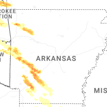
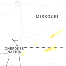
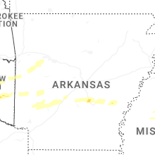
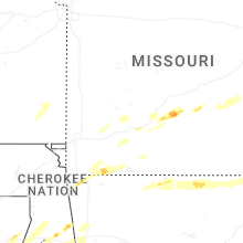
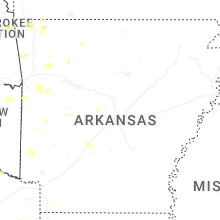
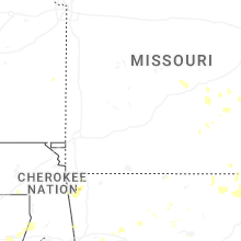
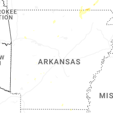
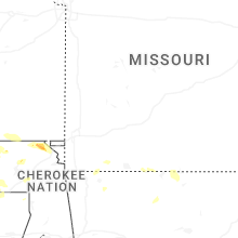
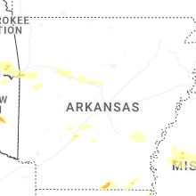


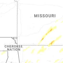
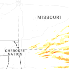


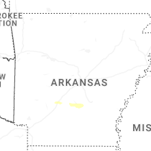


Connect with Interactive Hail Maps