

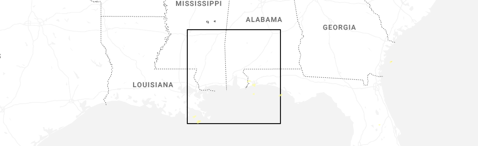
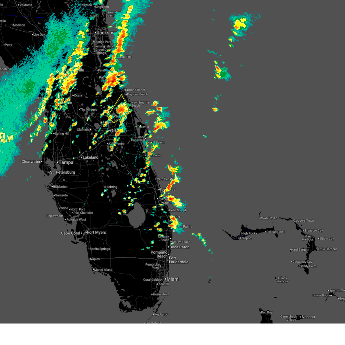
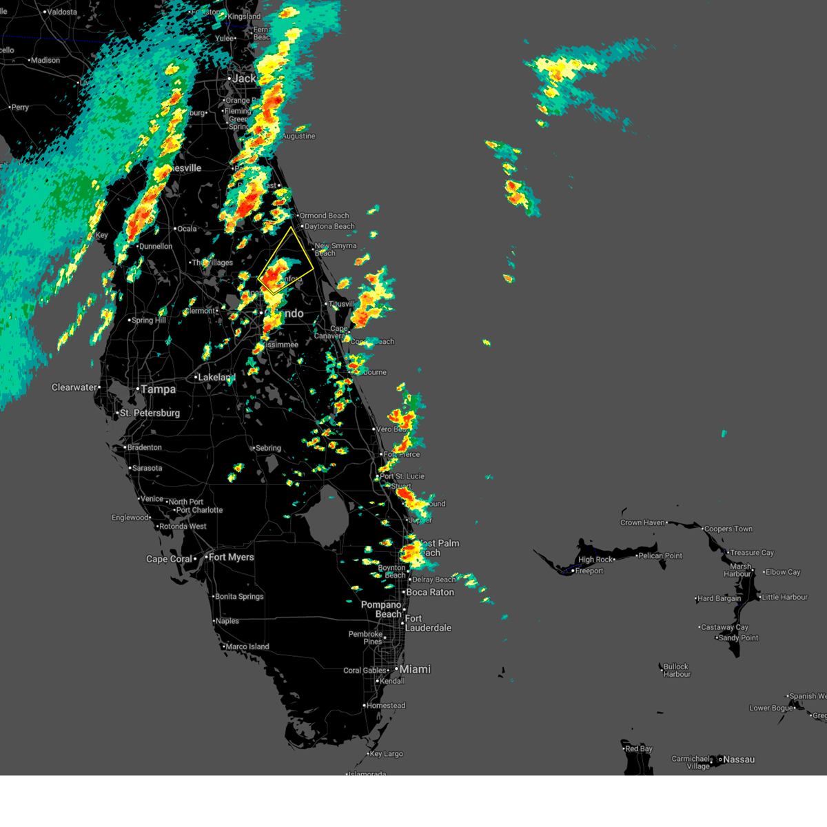
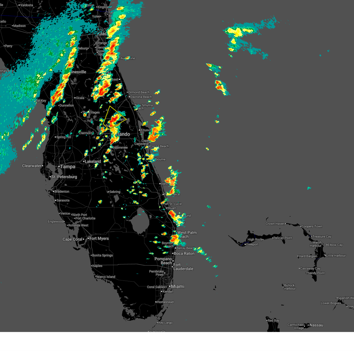
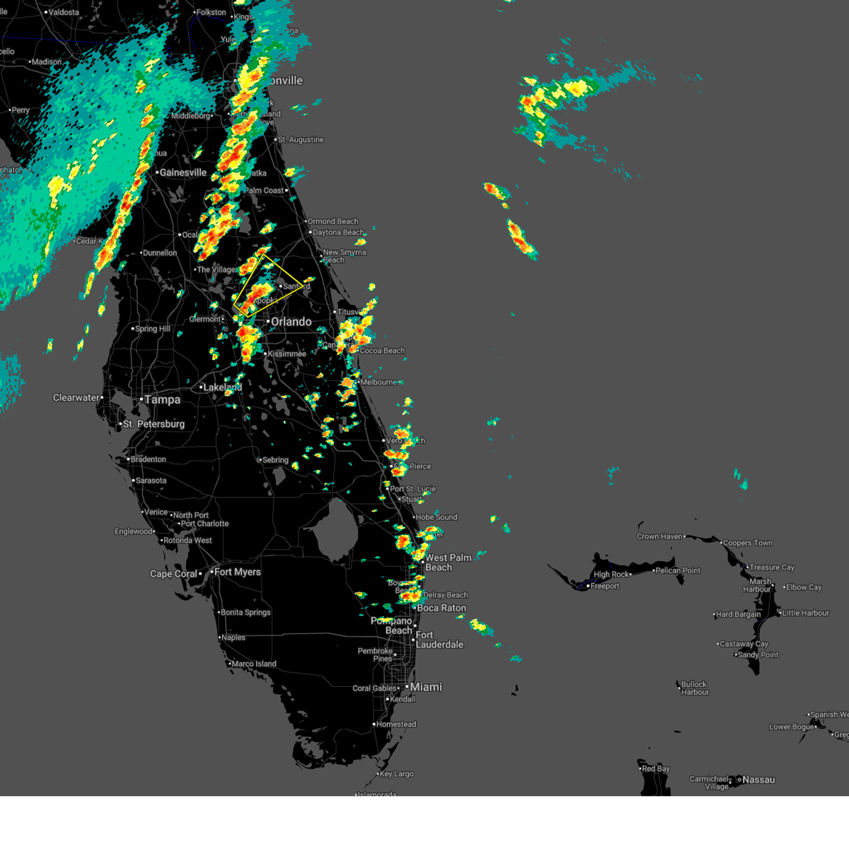
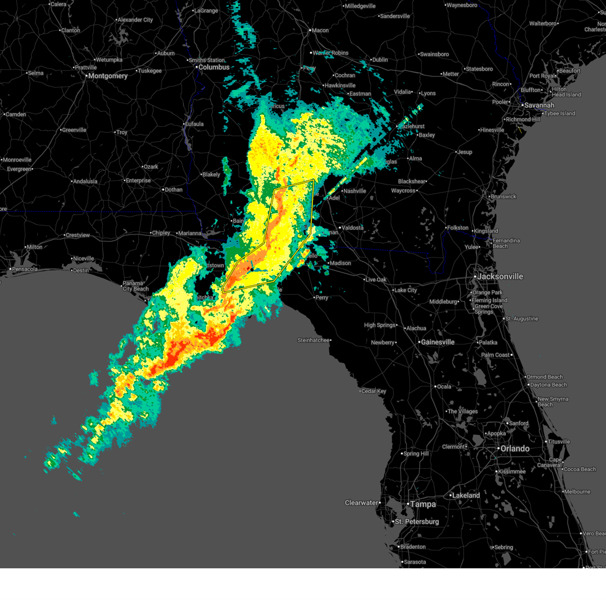
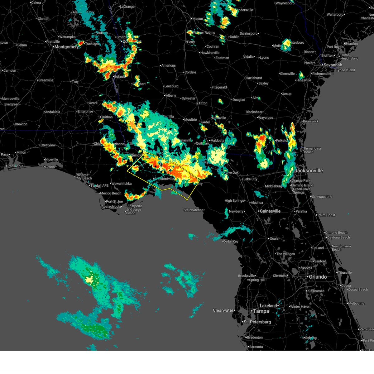
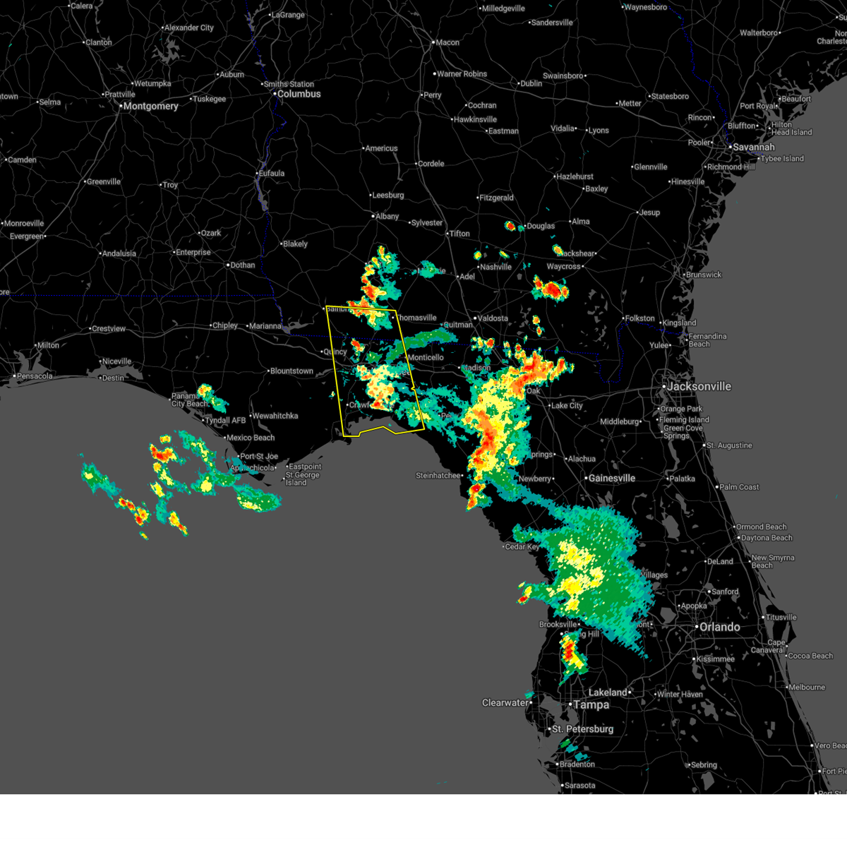
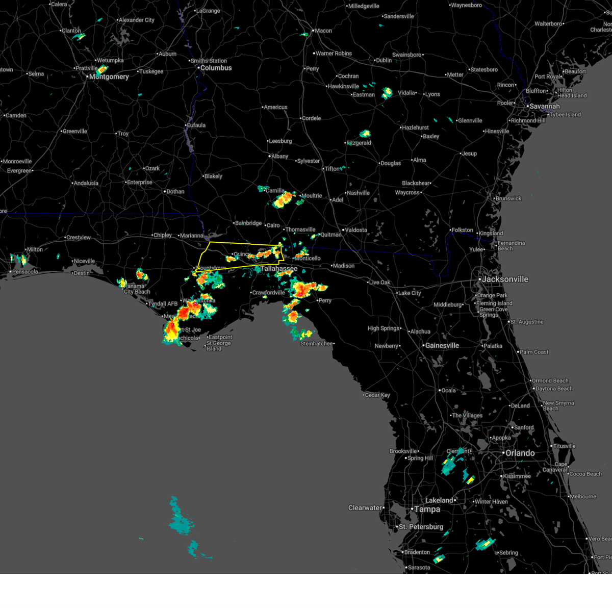
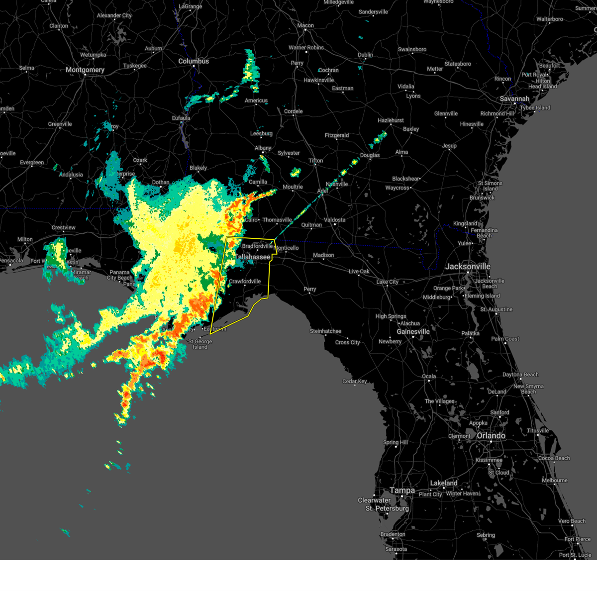
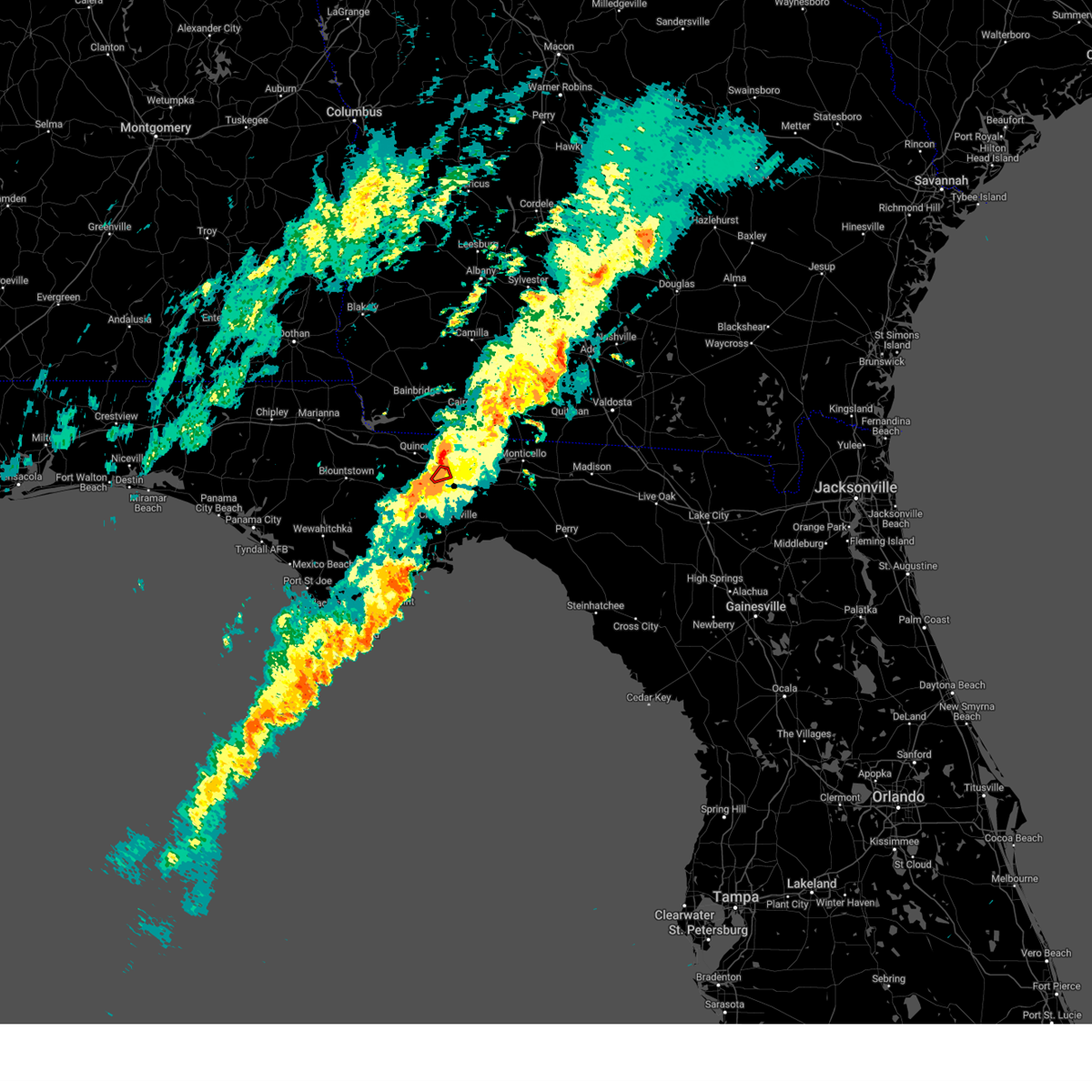
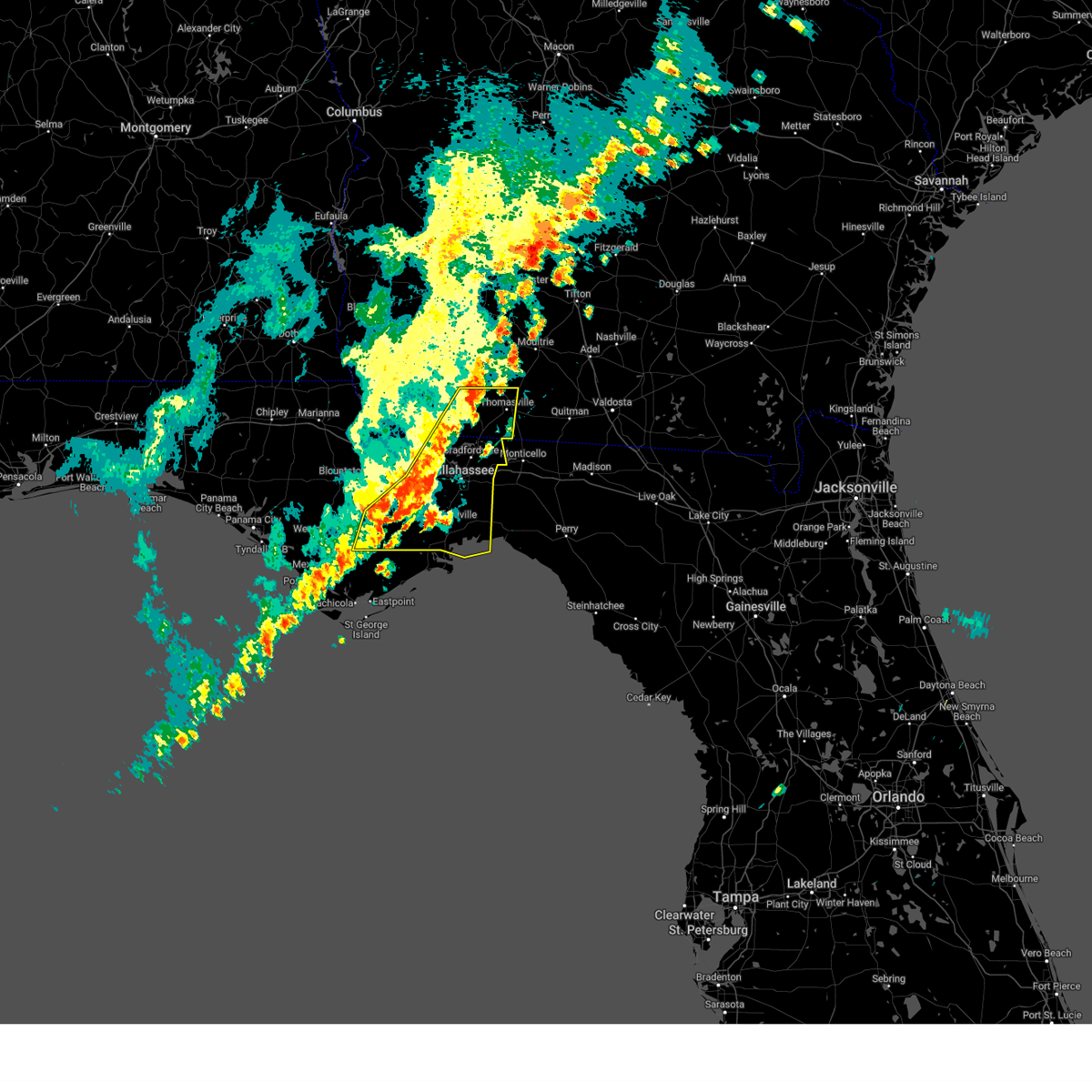
Hail Map for Midway, FL
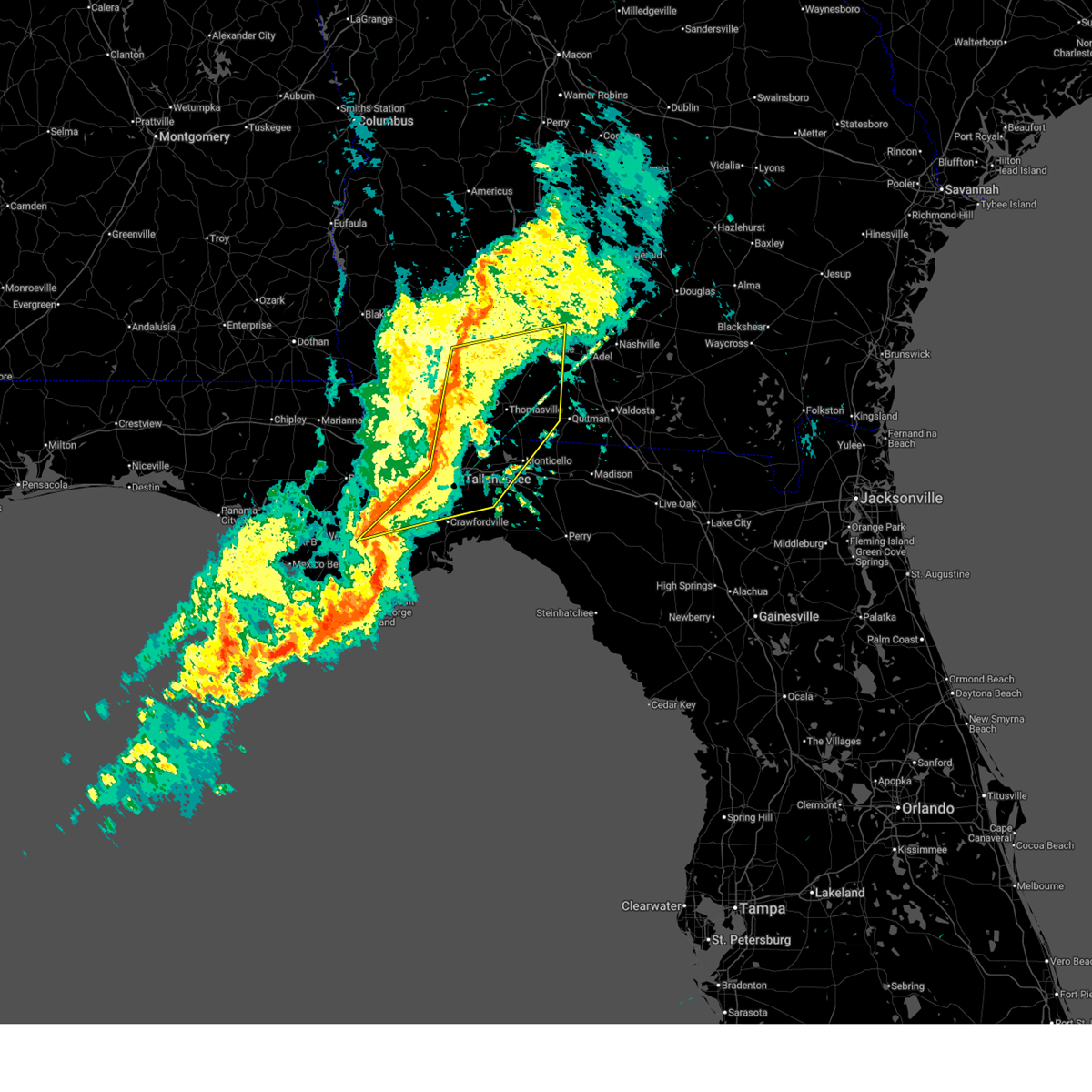
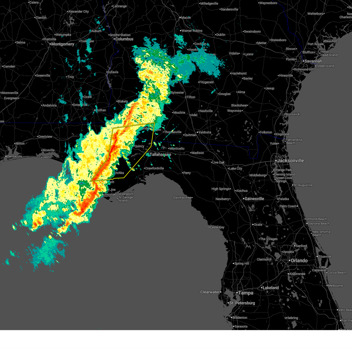
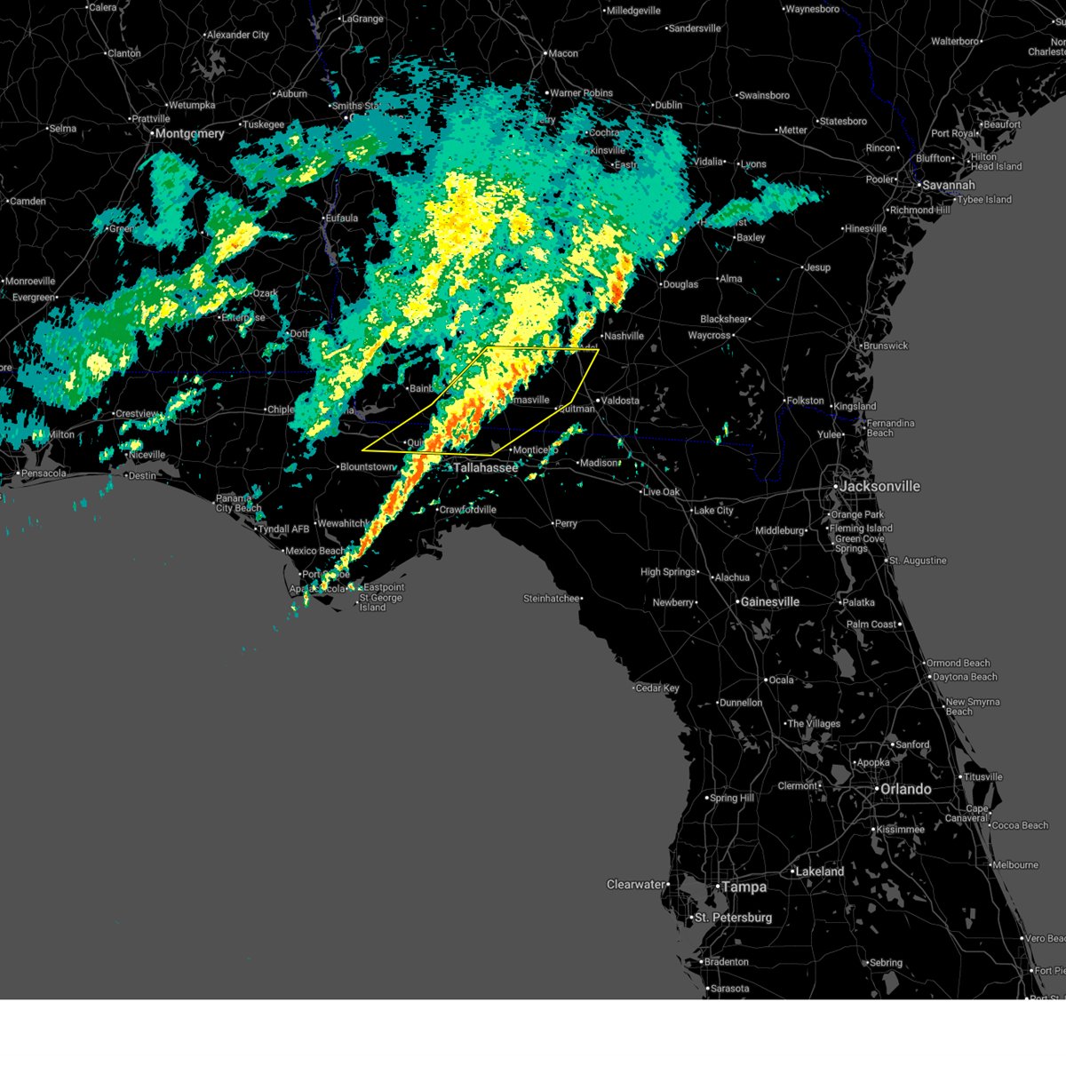
The Midway, FL area has had 1 report of on-the-ground hail by trained spotters, and has been under severe weather warnings 59 times during the past 12 months. Doppler radar has detected hail at or near Midway, FL on 170 occasions, including 11 occasions during the past year.
| Name: | Midway, FL |
| Where Located: | 40.6 miles W of Miramar Beach, FL |
| Map: | Google Map for Midway, FL |
| Population: | 16115 |
| Housing Units: | 7342 |
| More Info: | Search Google for Midway, FL |
1
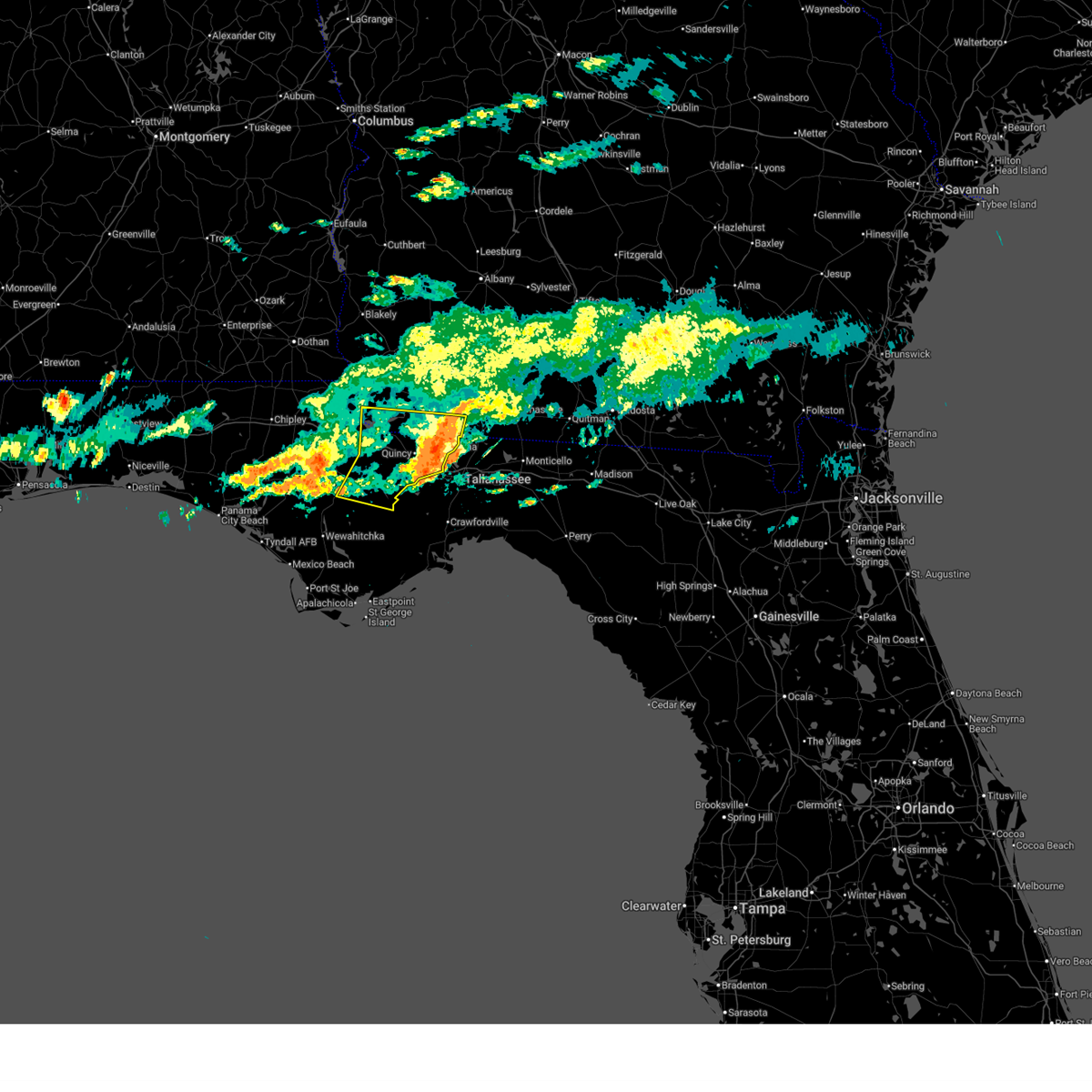
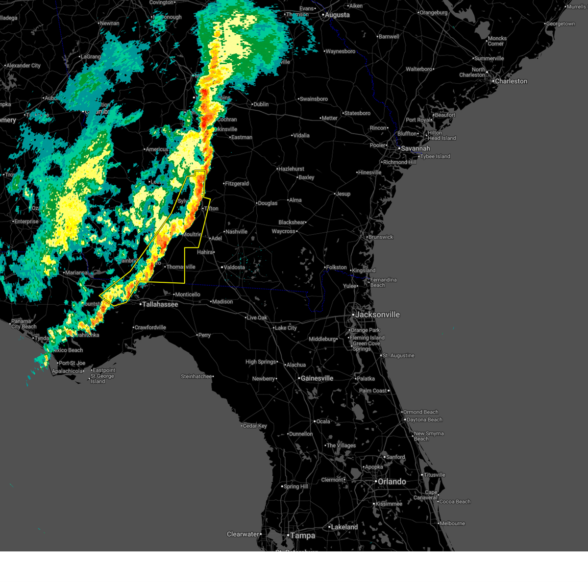
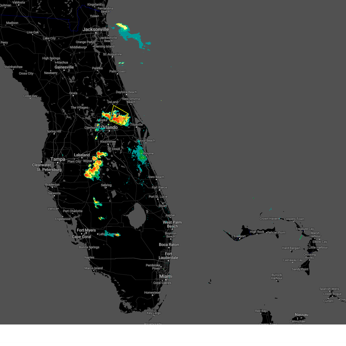
The Top Recent Hail Date for Midway, FL is Sunday, October 26, 2025 (15th out of 170)
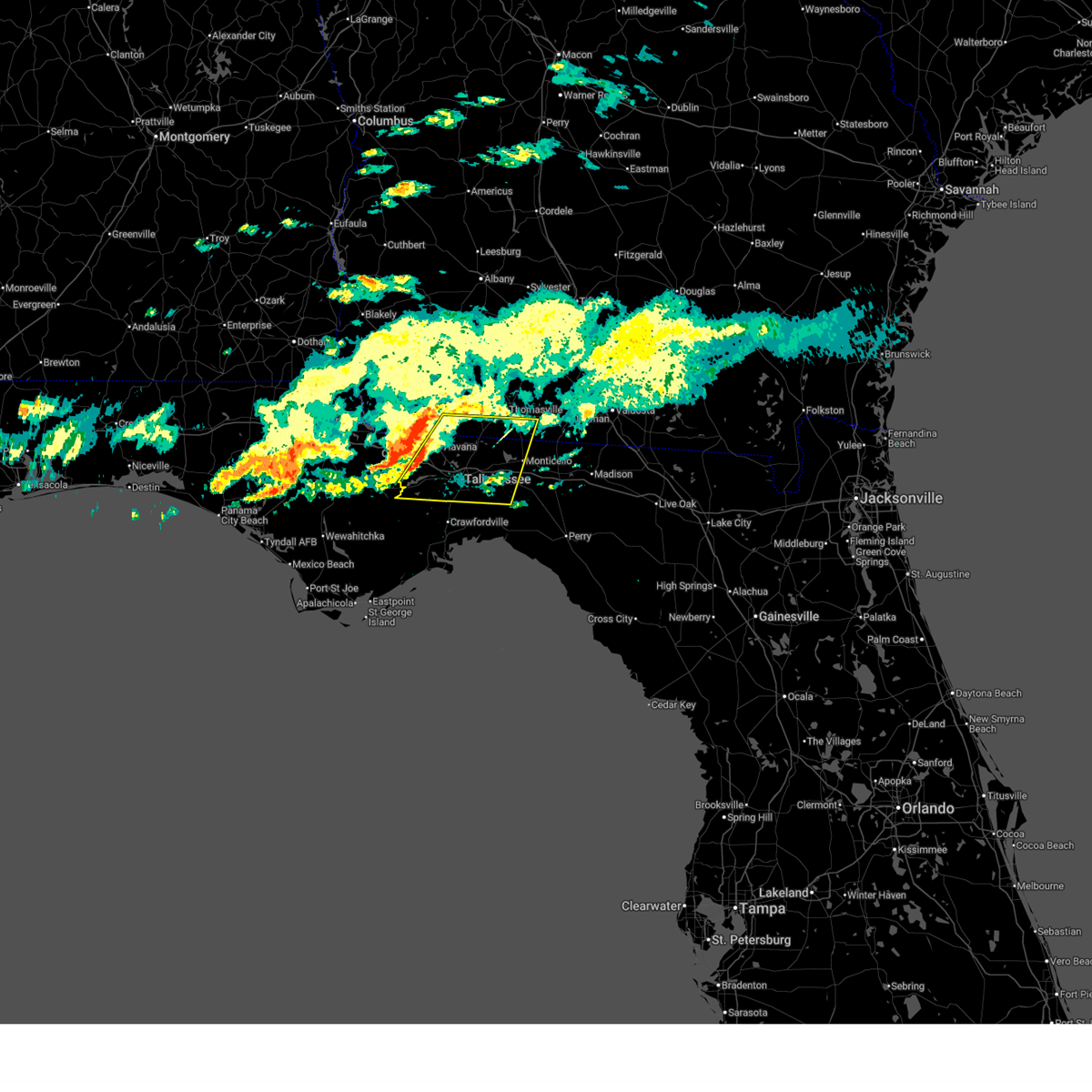
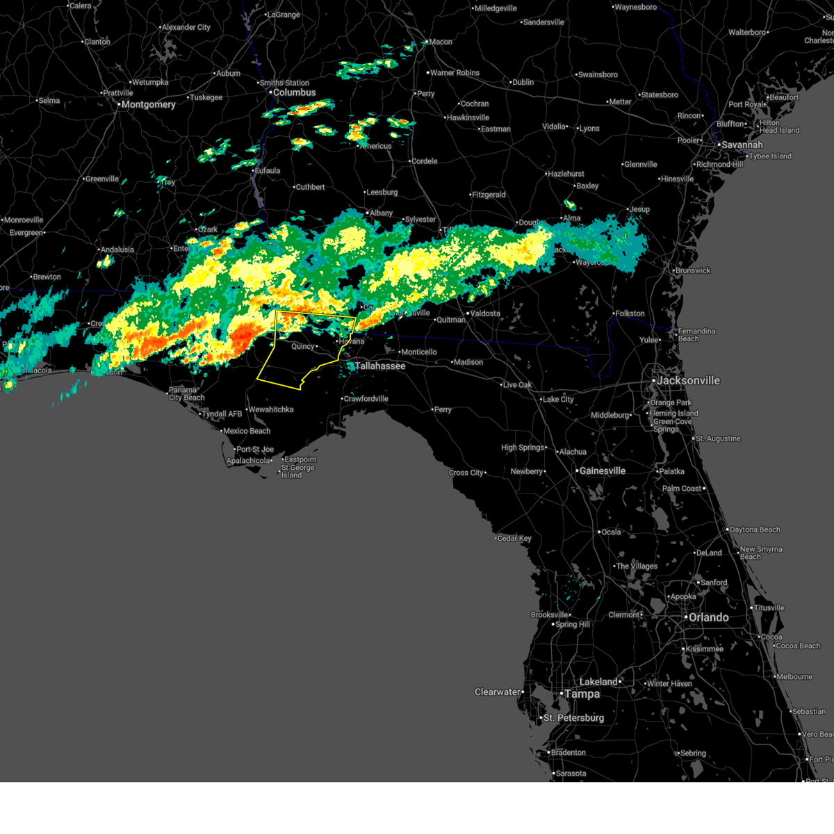
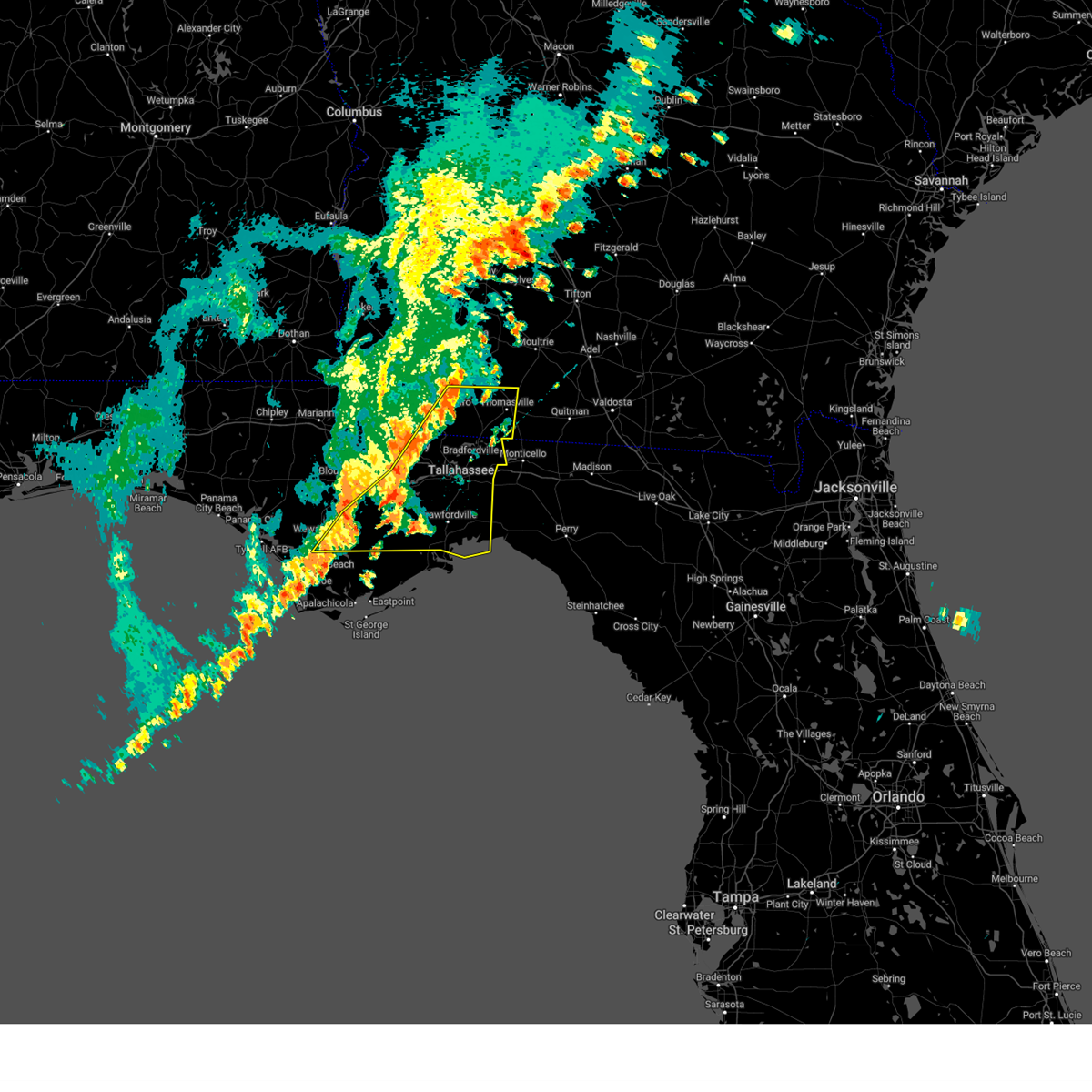
Hail and Wind Damage Spotted near Midway, FL
| Date / Time | Report Details |
|---|---|
| 5/12/2026 11:45 AM EDT |
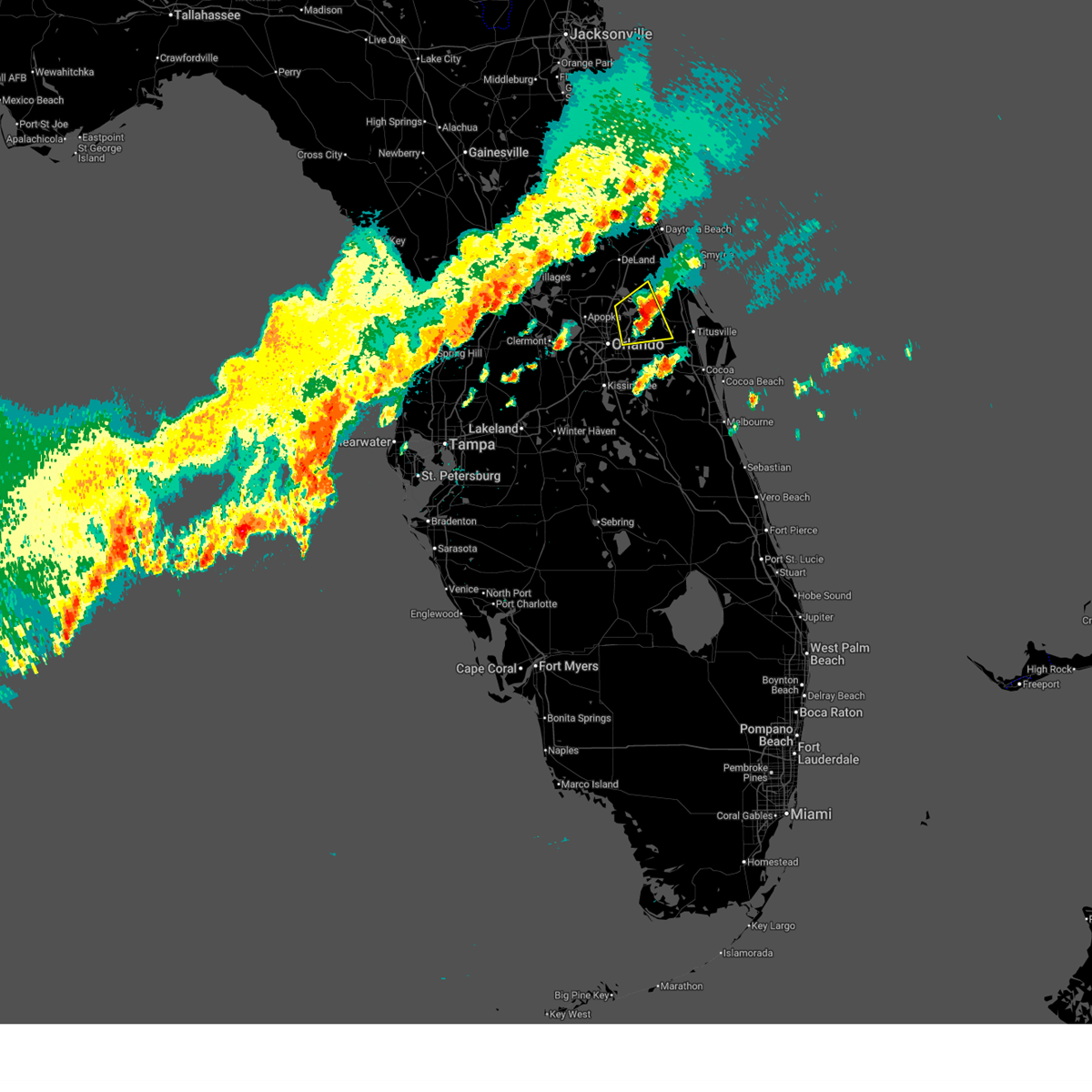
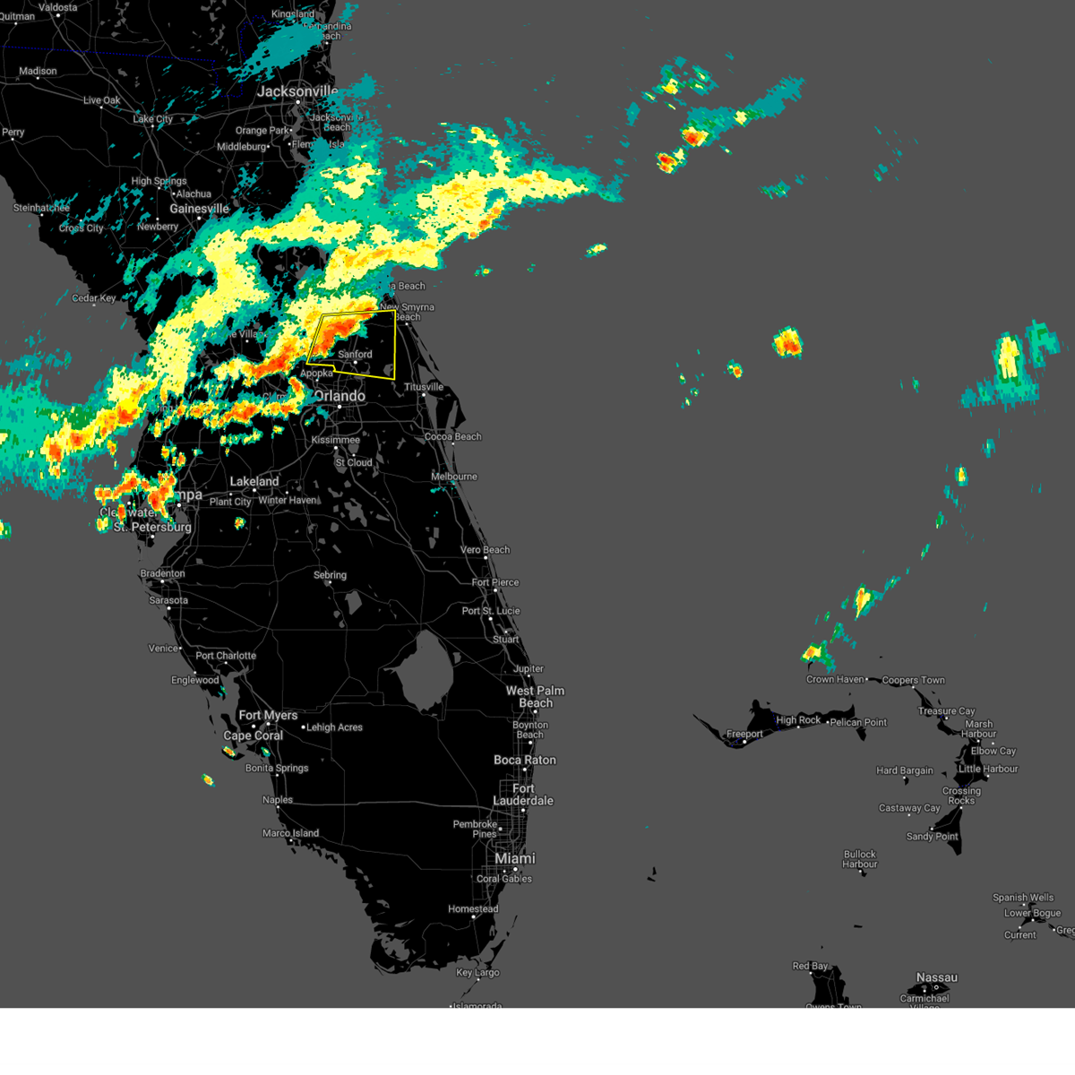
 At 1145 am edt, a severe thunderstorm was located over winter springs, moving east-southeast at 15 mph (radar indicated). Hazards include 60 mph wind gusts and quarter size hail. Hail damage to vehicles is expected. expect wind damage to roofs, siding, and trees. Locations impacted include, sanford, oviedo, winter springs, casselberry, and lake mary. At 1145 am edt, a severe thunderstorm was located over winter springs, moving east-southeast at 15 mph (radar indicated). Hazards include 60 mph wind gusts and quarter size hail. Hail damage to vehicles is expected. expect wind damage to roofs, siding, and trees. Locations impacted include, sanford, oviedo, winter springs, casselberry, and lake mary.
|
| 5/12/2026 11:26 AM EDT |
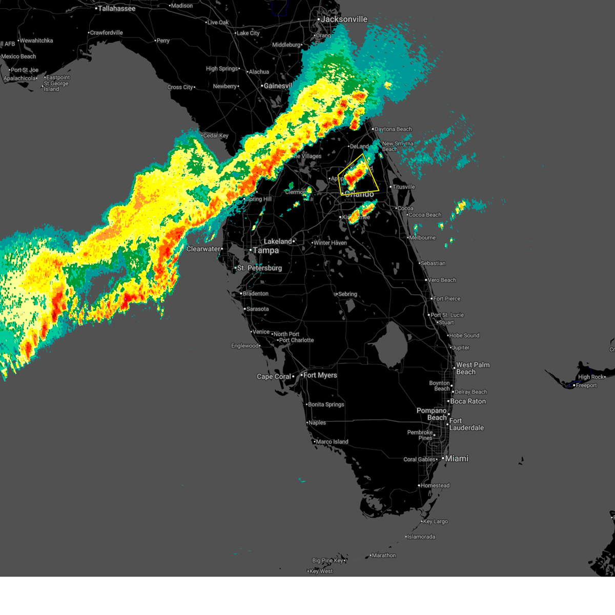
 Svrmlb the national weather service in melbourne has issued a * severe thunderstorm warning for, western seminole county in east central florida, * until noon edt. * at 1125 am edt, a severe thunderstorm was located over lake mary, moving east at 10 mph (radar indicated). Hazards include 60 mph wind gusts and quarter size hail. Hail damage to vehicles is expected. Expect wind damage to roofs, siding, and trees. Svrmlb the national weather service in melbourne has issued a * severe thunderstorm warning for, western seminole county in east central florida, * until noon edt. * at 1125 am edt, a severe thunderstorm was located over lake mary, moving east at 10 mph (radar indicated). Hazards include 60 mph wind gusts and quarter size hail. Hail damage to vehicles is expected. Expect wind damage to roofs, siding, and trees.
|
| 5/7/2026 1:18 PM EDT |
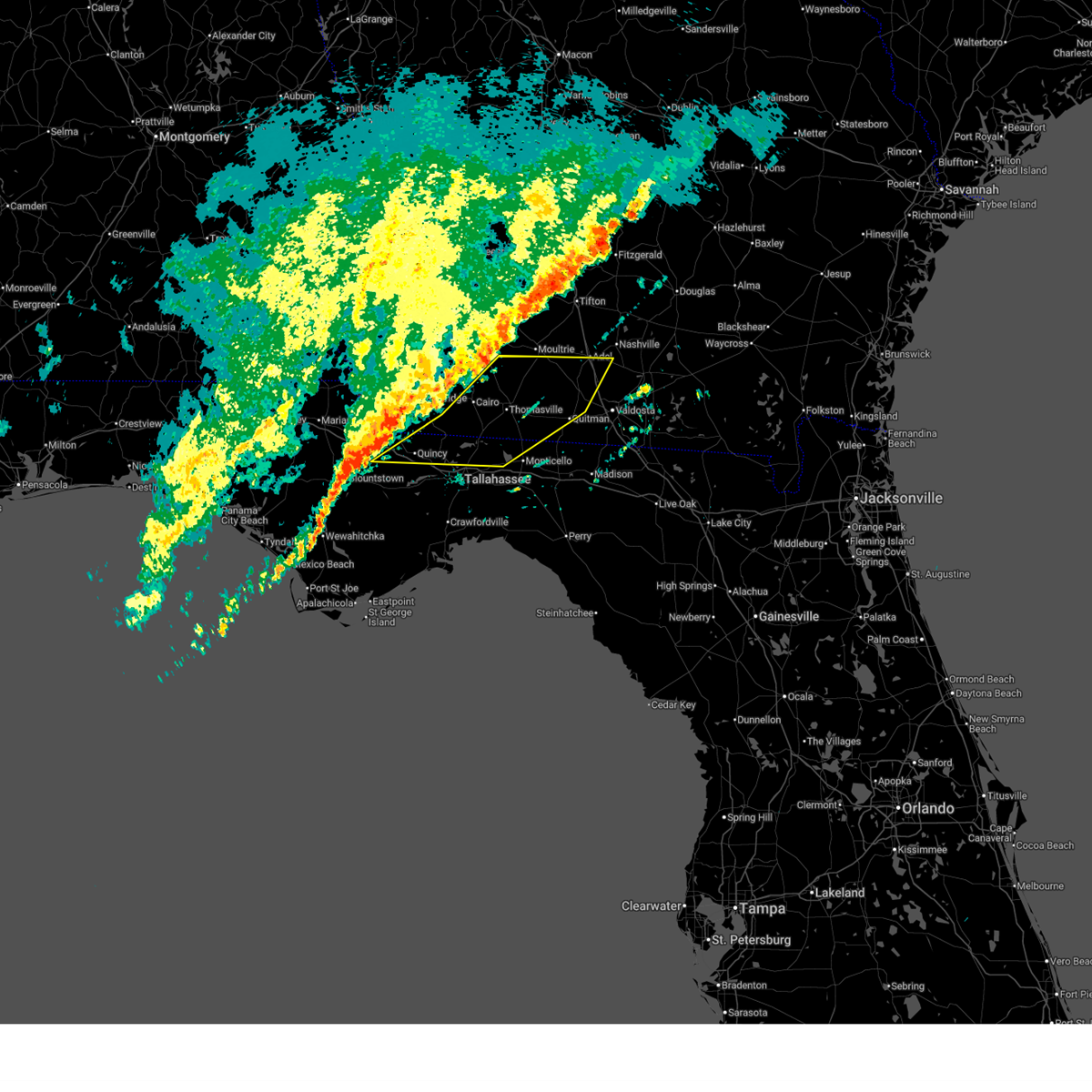
 Tortae the national weather service in tallahassee has issued a * tornado warning for, east central gadsden county in big bend florida, northeastern leon county in big bend florida, * until 145 pm edt. * at 118 pm edt, severe thunderstorms capable of producing both tornadoes and extensive straight line wind damage were located near tallahassee, moving east at 45 mph (radar indicated rotation). Hazards include tornado and quarter size hail. Flying debris will be dangerous to those caught without shelter. mobile homes will be damaged or destroyed. damage to roofs, windows, and vehicles will occur. tree damage is likely. these dangerous storms will be near, tallahassee around 125 pm edt. Other locations impacted by this tornadic thunderstorm include macon community park, miccosukee road greenway, tallahassee memorial hosp, miccosukee, griffin heights, fred george park, killearn estates, chaires, lake ella, and forest meadows park. Tortae the national weather service in tallahassee has issued a * tornado warning for, east central gadsden county in big bend florida, northeastern leon county in big bend florida, * until 145 pm edt. * at 118 pm edt, severe thunderstorms capable of producing both tornadoes and extensive straight line wind damage were located near tallahassee, moving east at 45 mph (radar indicated rotation). Hazards include tornado and quarter size hail. Flying debris will be dangerous to those caught without shelter. mobile homes will be damaged or destroyed. damage to roofs, windows, and vehicles will occur. tree damage is likely. these dangerous storms will be near, tallahassee around 125 pm edt. Other locations impacted by this tornadic thunderstorm include macon community park, miccosukee road greenway, tallahassee memorial hosp, miccosukee, griffin heights, fred george park, killearn estates, chaires, lake ella, and forest meadows park.
|
| 5/7/2026 1:10 PM EDT |
 The storm which prompted the warning has moved out of the area. therefore, the warning will be allowed to expire. a tornado watch remains in effect until 200 pm edt/100 pm cdt/ for big bend and the panhandle of florida, and southwestern georgia. remember, a severe thunderstorm warning still remains in effect for gasdsen county, fl and decatur county, ga. The storm which prompted the warning has moved out of the area. therefore, the warning will be allowed to expire. a tornado watch remains in effect until 200 pm edt/100 pm cdt/ for big bend and the panhandle of florida, and southwestern georgia. remember, a severe thunderstorm warning still remains in effect for gasdsen county, fl and decatur county, ga.
|
| 5/7/2026 12:54 PM EDT |
 Svrtae the national weather service in tallahassee has issued a * severe thunderstorm warning for, eastern gadsden county in big bend florida, northwestern jefferson county in big bend florida, leon county in big bend florida, southeastern decatur county in southwestern georgia, southern grady county in southwestern georgia, southern thomas county in south central georgia, * until 200 pm edt. * at 1254 pm edt, severe thunderstorms were located along a line extending from 10 miles north of havana to 8 miles southeast of greensboro, moving east at 50 mph (radar indicated). Hazards include 60 mph wind gusts and quarter size hail. Hail damage to vehicles is expected. Expect wind damage to roofs, siding, and trees. Svrtae the national weather service in tallahassee has issued a * severe thunderstorm warning for, eastern gadsden county in big bend florida, northwestern jefferson county in big bend florida, leon county in big bend florida, southeastern decatur county in southwestern georgia, southern grady county in southwestern georgia, southern thomas county in south central georgia, * until 200 pm edt. * at 1254 pm edt, severe thunderstorms were located along a line extending from 10 miles north of havana to 8 miles southeast of greensboro, moving east at 50 mph (radar indicated). Hazards include 60 mph wind gusts and quarter size hail. Hail damage to vehicles is expected. Expect wind damage to roofs, siding, and trees.
|
| 5/7/2026 12:11 PM EDT |
 Svrtae the national weather service in tallahassee has issued a * severe thunderstorm warning for, southeastern jackson county in the panhandle of florida, northeastern calhoun county in the panhandle of florida, gadsden county in big bend florida, northern liberty county in big bend florida, southern decatur county in southwestern georgia, southwestern grady county in southwestern georgia, southeastern seminole county in southwestern georgia, * until 115 pm edt/1215 pm cdt/. * at 1210 pm edt/1110 am cdt/, a severe thunderstorm was located 12 miles south of marianna, moving east at 50 mph (radar indicated). Hazards include 60 mph wind gusts and quarter size hail. Hail damage to vehicles is expected. Expect wind damage to roofs, siding, and trees. Svrtae the national weather service in tallahassee has issued a * severe thunderstorm warning for, southeastern jackson county in the panhandle of florida, northeastern calhoun county in the panhandle of florida, gadsden county in big bend florida, northern liberty county in big bend florida, southern decatur county in southwestern georgia, southwestern grady county in southwestern georgia, southeastern seminole county in southwestern georgia, * until 115 pm edt/1215 pm cdt/. * at 1210 pm edt/1110 am cdt/, a severe thunderstorm was located 12 miles south of marianna, moving east at 50 mph (radar indicated). Hazards include 60 mph wind gusts and quarter size hail. Hail damage to vehicles is expected. Expect wind damage to roofs, siding, and trees.
|
| 5/7/2026 10:19 AM CDT |
 the severe thunderstorm warning has been cancelled and is no longer in effect the severe thunderstorm warning has been cancelled and is no longer in effect
|
| 5/7/2026 10:19 AM CDT |
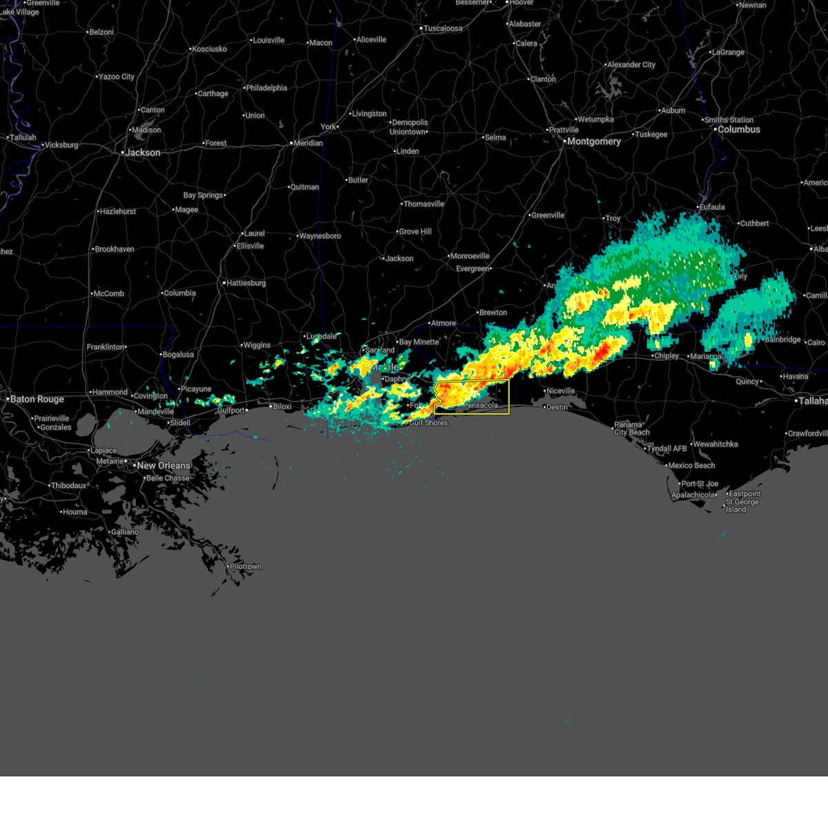 At 1018 am cdt, a severe thunderstorm was located over west pensacola, moving east at 50 mph (radar indicated). Hazards include 60 mph wind gusts and penny size hail. Expect damage to roofs, siding, and trees. Locations impacted include, pensacola, ferry pass, brent, west pensacola, ensley, warrington, gonzalez, gulf breeze, goulding, lillian, myrtle grove, oriole beach, navarre, navarre beach, and floridatown. At 1018 am cdt, a severe thunderstorm was located over west pensacola, moving east at 50 mph (radar indicated). Hazards include 60 mph wind gusts and penny size hail. Expect damage to roofs, siding, and trees. Locations impacted include, pensacola, ferry pass, brent, west pensacola, ensley, warrington, gonzalez, gulf breeze, goulding, lillian, myrtle grove, oriole beach, navarre, navarre beach, and floridatown.
|
| 5/7/2026 9:56 AM CDT |
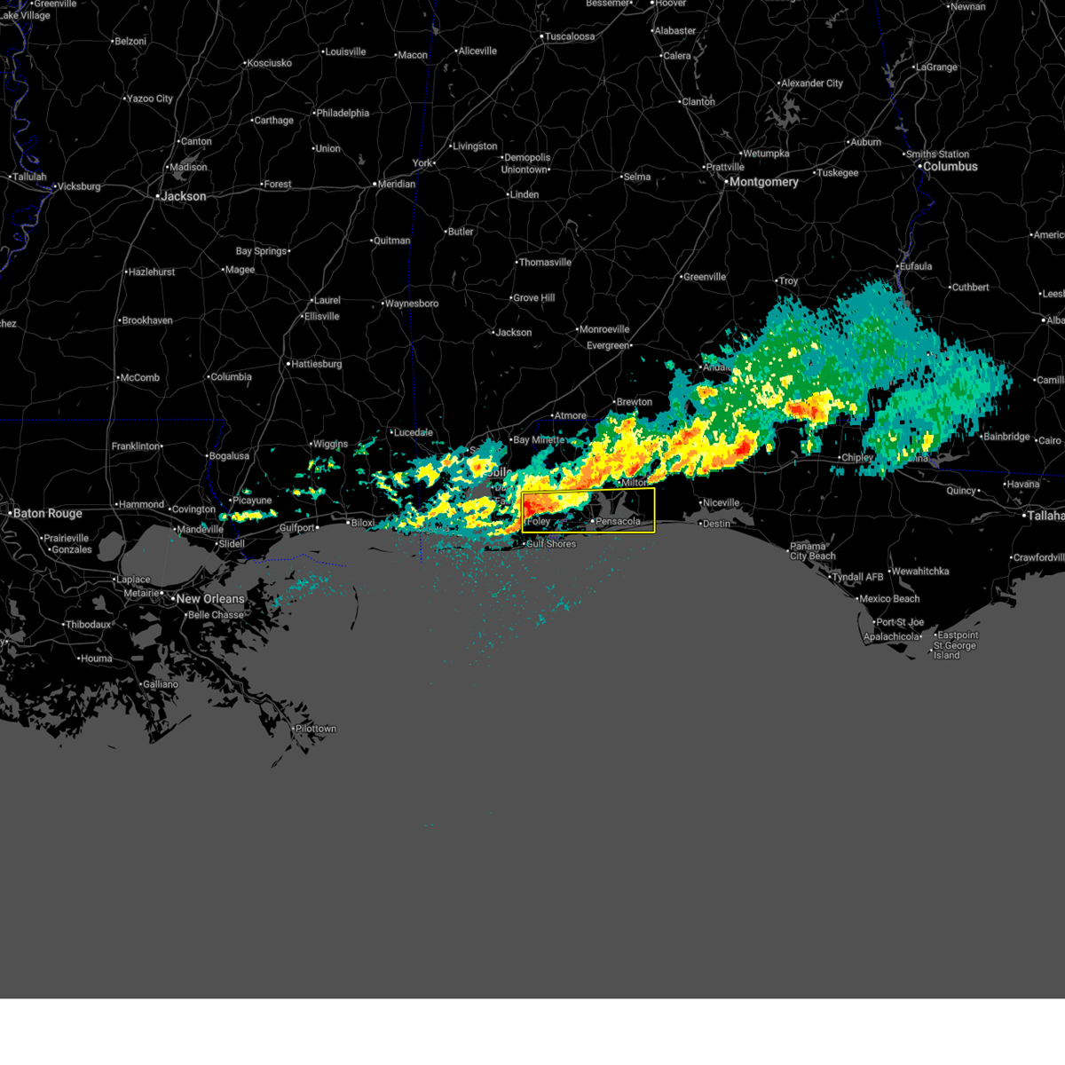 Svrmob the national weather service in mobile has issued a * severe thunderstorm warning for, southeastern baldwin county in southwestern alabama, southern santa rosa county in northwestern florida, southeastern escambia county in northwestern florida, * until 1045 am cdt. * at 956 am cdt, a severe thunderstorm was located over elberta, or 5 miles northeast of foley, moving east at 50 mph (radar indicated). Hazards include 60 mph wind gusts and quarter size hail. Hail damage to vehicles is expected. Expect wind damage to roofs, siding, and trees. Svrmob the national weather service in mobile has issued a * severe thunderstorm warning for, southeastern baldwin county in southwestern alabama, southern santa rosa county in northwestern florida, southeastern escambia county in northwestern florida, * until 1045 am cdt. * at 956 am cdt, a severe thunderstorm was located over elberta, or 5 miles northeast of foley, moving east at 50 mph (radar indicated). Hazards include 60 mph wind gusts and quarter size hail. Hail damage to vehicles is expected. Expect wind damage to roofs, siding, and trees.
|
| 5/2/2026 2:29 PM EDT |
 The storm which prompted the warning has moved out of the area. therefore, the warning will be allowed to expire. a tornado watch remains in effect until 600 pm edt for east central florida. The storm which prompted the warning has moved out of the area. therefore, the warning will be allowed to expire. a tornado watch remains in effect until 600 pm edt for east central florida.
|
| 5/2/2026 2:06 PM EDT |
 At 206 pm edt, a severe thunderstorm was located over geneva, moving east at 30 mph (radar indicated). Hazards include 60 mph wind gusts and quarter size hail. Hail damage to vehicles is expected. expect wind damage to roofs, siding, and trees. Locations impacted include, sanford, oviedo, winter springs, casselberry, and lake mary. At 206 pm edt, a severe thunderstorm was located over geneva, moving east at 30 mph (radar indicated). Hazards include 60 mph wind gusts and quarter size hail. Hail damage to vehicles is expected. expect wind damage to roofs, siding, and trees. Locations impacted include, sanford, oviedo, winter springs, casselberry, and lake mary.
|
| 5/2/2026 1:56 PM EDT |
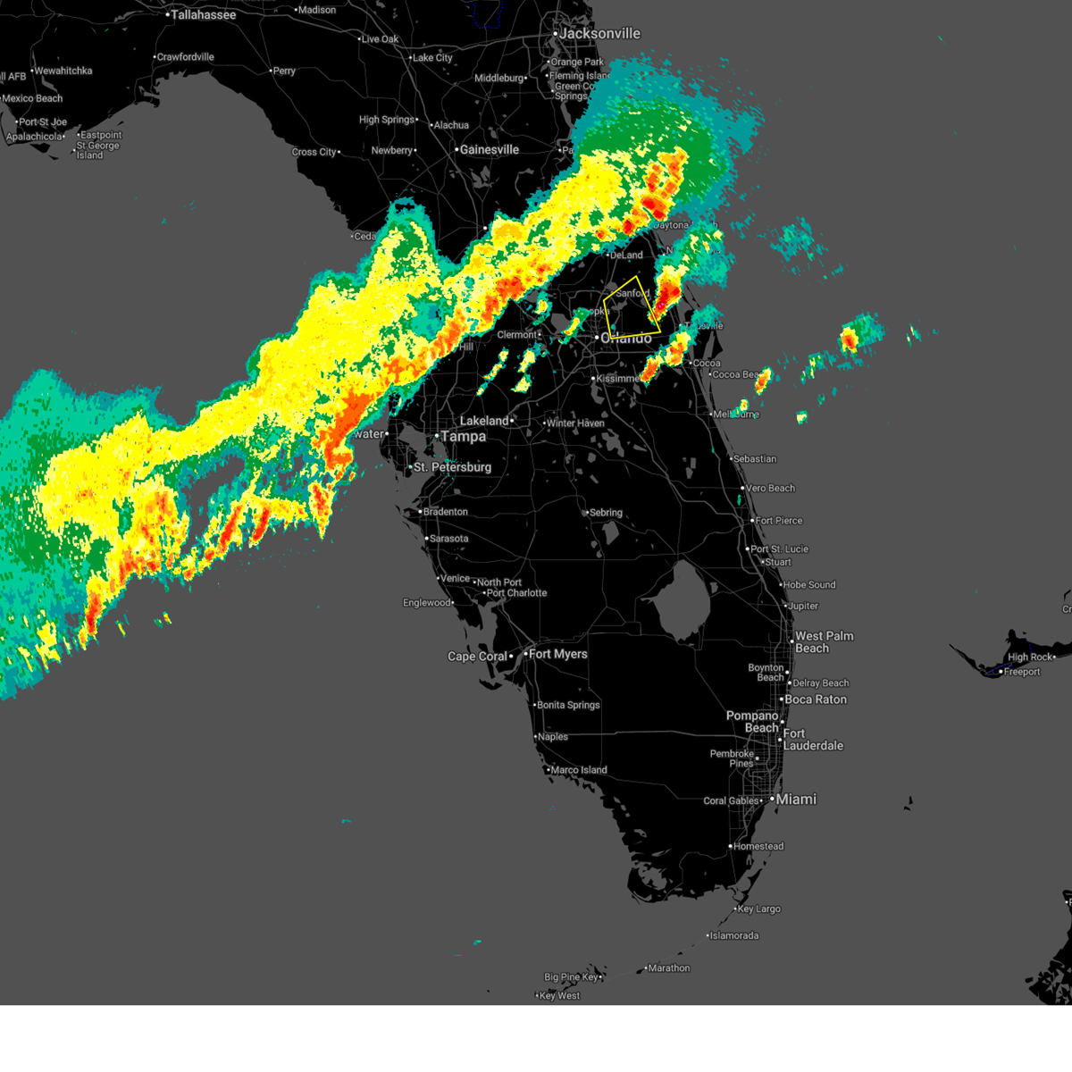
 Svrmlb the national weather service in melbourne has issued a * severe thunderstorm warning for, seminole county in east central florida, central orange county in east central florida, south central volusia county in east central florida, * until 230 pm edt. * at 156 pm edt, a severe thunderstorm was located over winter springs, moving east at 25 mph (radar indicated). Hazards include 60 mph wind gusts and quarter size hail. Hail damage to vehicles is expected. Expect wind damage to roofs, siding, and trees. Svrmlb the national weather service in melbourne has issued a * severe thunderstorm warning for, seminole county in east central florida, central orange county in east central florida, south central volusia county in east central florida, * until 230 pm edt. * at 156 pm edt, a severe thunderstorm was located over winter springs, moving east at 25 mph (radar indicated). Hazards include 60 mph wind gusts and quarter size hail. Hail damage to vehicles is expected. Expect wind damage to roofs, siding, and trees.
|
| 3/16/2026 2:40 PM EDT |
 the severe thunderstorm warning has been cancelled and is no longer in effect the severe thunderstorm warning has been cancelled and is no longer in effect
|
| 3/16/2026 2:24 PM EDT |
 Svrmlb the national weather service in melbourne has issued a * severe thunderstorm warning for, central seminole county in east central florida, central volusia county in east central florida, * until 300 pm edt. * at 223 pm edt, a severe thunderstorm was located over sanford, moving northeast at 45 mph (radar indicated). Hazards include 60 mph wind gusts and quarter size hail. Hail damage to vehicles is expected. Expect wind damage to roofs, siding, and trees. Svrmlb the national weather service in melbourne has issued a * severe thunderstorm warning for, central seminole county in east central florida, central volusia county in east central florida, * until 300 pm edt. * at 223 pm edt, a severe thunderstorm was located over sanford, moving northeast at 45 mph (radar indicated). Hazards include 60 mph wind gusts and quarter size hail. Hail damage to vehicles is expected. Expect wind damage to roofs, siding, and trees.
|
| 3/16/2026 2:18 PM EDT |
 At 217 pm edt, a severe thunderstorm was located near wekiva springs, or near lake mary, moving northeast at 40 mph (radar indicated). Hazards include 60 mph wind gusts and quarter size hail. Hail damage to vehicles is expected. expect wind damage to roofs, siding, and trees. Locations impacted include, deltona, sanford, apopka, altamonte springs, and winter springs. At 217 pm edt, a severe thunderstorm was located near wekiva springs, or near lake mary, moving northeast at 40 mph (radar indicated). Hazards include 60 mph wind gusts and quarter size hail. Hail damage to vehicles is expected. expect wind damage to roofs, siding, and trees. Locations impacted include, deltona, sanford, apopka, altamonte springs, and winter springs.
|
| 3/16/2026 2:01 PM EDT |
 Svrmlb the national weather service in melbourne has issued a * severe thunderstorm warning for, northwestern seminole county in east central florida, east central lake county in east central florida, northwestern orange county in east central florida, south central volusia county in east central florida, * until 230 pm edt. * at 200 pm edt, a severe thunderstorm was located over wekiwa springs state park, or near apopka, moving northeast at 30 mph (radar indicated). Hazards include 60 mph wind gusts and quarter size hail. Hail damage to vehicles is expected. Expect wind damage to roofs, siding, and trees. Svrmlb the national weather service in melbourne has issued a * severe thunderstorm warning for, northwestern seminole county in east central florida, east central lake county in east central florida, northwestern orange county in east central florida, south central volusia county in east central florida, * until 230 pm edt. * at 200 pm edt, a severe thunderstorm was located over wekiwa springs state park, or near apopka, moving northeast at 30 mph (radar indicated). Hazards include 60 mph wind gusts and quarter size hail. Hail damage to vehicles is expected. Expect wind damage to roofs, siding, and trees.
|
| 3/16/2026 10:59 AM EDT |
 the severe thunderstorm warning has been cancelled and is no longer in effect the severe thunderstorm warning has been cancelled and is no longer in effect
|
| 3/16/2026 10:59 AM EDT |
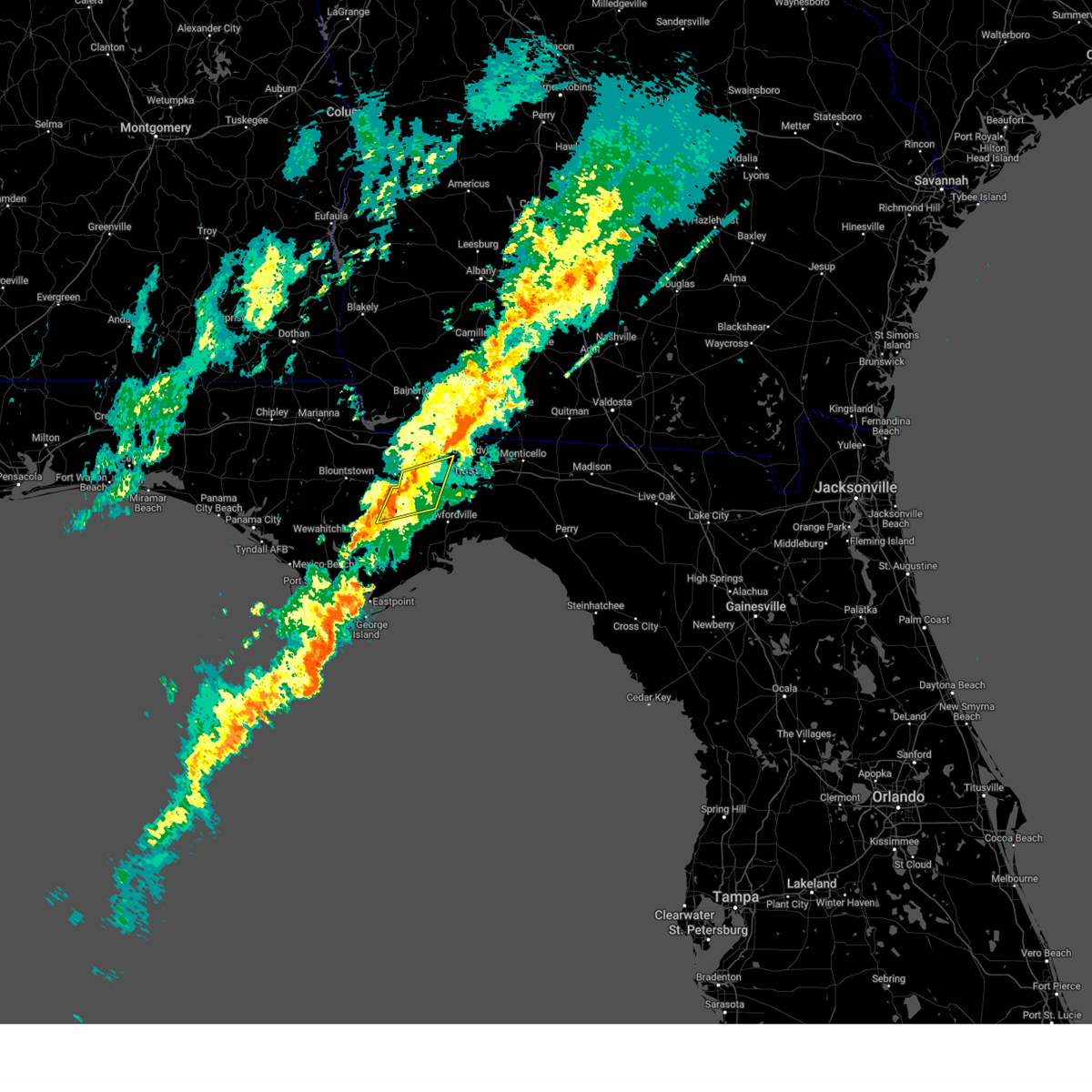
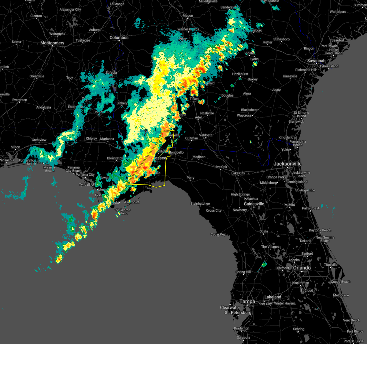
 At 1059 am edt/959 am cdt/, severe thunderstorms were located along a line extending from near greensboro to near port st. joe, moving east at 55 mph (radar indicated). Hazards include 60 mph wind gusts. Expect damage to roofs, siding, and trees. locations impacted include, midway, quincy, havana, port st. Joe, greensboro, stonemill creek, white city, chattahoochee, orange, wewahitchka, gretna, bristol, rock bluff, honeyville, juniper, douglas city, vilas, florence, chipola cutoff, and jamieson. At 1059 am edt/959 am cdt/, severe thunderstorms were located along a line extending from near greensboro to near port st. joe, moving east at 55 mph (radar indicated). Hazards include 60 mph wind gusts. Expect damage to roofs, siding, and trees. locations impacted include, midway, quincy, havana, port st. Joe, greensboro, stonemill creek, white city, chattahoochee, orange, wewahitchka, gretna, bristol, rock bluff, honeyville, juniper, douglas city, vilas, florence, chipola cutoff, and jamieson.
|
| 3/16/2026 10:30 AM EDT |
 Svrtae the national weather service in tallahassee has issued a * severe thunderstorm warning for, southeastern jackson county in the panhandle of florida, gulf county in the panhandle of florida, southeastern bay county in the panhandle of florida, calhoun county in the panhandle of florida, gadsden county in big bend florida, liberty county in big bend florida, * until 1130 am edt/1030 am cdt/. * at 1030 am edt/930 am cdt/, severe thunderstorms were located along a line extending from 7 miles northwest of blountstown to 23 miles southwest of tyndall air force base, moving east at 45 mph (radar indicated). Hazards include 60 mph wind gusts. expect damage to roofs, siding, and trees Svrtae the national weather service in tallahassee has issued a * severe thunderstorm warning for, southeastern jackson county in the panhandle of florida, gulf county in the panhandle of florida, southeastern bay county in the panhandle of florida, calhoun county in the panhandle of florida, gadsden county in big bend florida, liberty county in big bend florida, * until 1130 am edt/1030 am cdt/. * at 1030 am edt/930 am cdt/, severe thunderstorms were located along a line extending from 7 miles northwest of blountstown to 23 miles southwest of tyndall air force base, moving east at 45 mph (radar indicated). Hazards include 60 mph wind gusts. expect damage to roofs, siding, and trees
|
| 3/16/2026 6:38 AM CDT |
 the severe thunderstorm warning has been cancelled and is no longer in effect the severe thunderstorm warning has been cancelled and is no longer in effect
|
| 3/16/2026 6:24 AM CDT |
 the severe thunderstorm warning has been cancelled and is no longer in effect the severe thunderstorm warning has been cancelled and is no longer in effect
|
| 3/16/2026 6:24 AM CDT |
 At 624 am cdt, a severe thunderstorm was located over lillian, or 9 miles northeast of orange beach, moving east at 45 mph (radar indicated). Hazards include 60 mph wind gusts and quarter size hail. Hail damage to vehicles is expected. expect wind damage to roofs, siding, and trees. Locations impacted include, pensacola, ferry pass, brent, west pensacola, ensley, warrington, gulf breeze, goulding, myrtle grove, and perdido beach. At 624 am cdt, a severe thunderstorm was located over lillian, or 9 miles northeast of orange beach, moving east at 45 mph (radar indicated). Hazards include 60 mph wind gusts and quarter size hail. Hail damage to vehicles is expected. expect wind damage to roofs, siding, and trees. Locations impacted include, pensacola, ferry pass, brent, west pensacola, ensley, warrington, gulf breeze, goulding, myrtle grove, and perdido beach.
|
| 3/16/2026 6:13 AM CDT |
 Svrmob the national weather service in mobile has issued a * severe thunderstorm warning for, southeastern baldwin county in southwestern alabama, south central escambia county in northwestern florida, * until 700 am cdt. * at 612 am cdt, a severe thunderstorm was located 4 miles south of elberta, or 4 miles northwest of orange beach, moving east at 45 mph (radar indicated). Hazards include 60 mph wind gusts and quarter size hail. Hail damage to vehicles is expected. Expect wind damage to roofs, siding, and trees. Svrmob the national weather service in mobile has issued a * severe thunderstorm warning for, southeastern baldwin county in southwestern alabama, south central escambia county in northwestern florida, * until 700 am cdt. * at 612 am cdt, a severe thunderstorm was located 4 miles south of elberta, or 4 miles northwest of orange beach, moving east at 45 mph (radar indicated). Hazards include 60 mph wind gusts and quarter size hail. Hail damage to vehicles is expected. Expect wind damage to roofs, siding, and trees.
|
| 3/15/2026 6:07 PM EDT |
 The storm which prompted the warning has weakened below severe limits, and no longer poses an immediate threat to life or property. therefore, the warning will be allowed to expire. however small hail and gusty winds are still possible with this thunderstorm. The storm which prompted the warning has weakened below severe limits, and no longer poses an immediate threat to life or property. therefore, the warning will be allowed to expire. however small hail and gusty winds are still possible with this thunderstorm.
|
| 3/15/2026 6:00 PM EDT |
 the tornado warning has been cancelled and is no longer in effect the tornado warning has been cancelled and is no longer in effect
|
| 3/15/2026 5:51 PM EDT |
 At 550 pm edt, a severe thunderstorm was located over sanford, moving northeast at 20 mph (radar indicated). Hazards include 60 mph wind gusts and quarter size hail. Hail damage to vehicles is expected. expect wind damage to roofs, siding, and trees. Locations impacted include, deltona, sanford, altamonte springs, winter springs, and deland. At 550 pm edt, a severe thunderstorm was located over sanford, moving northeast at 20 mph (radar indicated). Hazards include 60 mph wind gusts and quarter size hail. Hail damage to vehicles is expected. expect wind damage to roofs, siding, and trees. Locations impacted include, deltona, sanford, altamonte springs, winter springs, and deland.
|
| 3/15/2026 5:49 PM EDT |
 Tormlb the national weather service in melbourne has issued a * tornado warning for, central seminole county in east central florida, * until 615 pm edt. * at 549 pm edt, a severe thunderstorm capable of producing a tornado was located over sanford, moving northeast at 15 mph (radar indicated rotation). Hazards include tornado and quarter size hail. Flying debris will be dangerous to those caught without shelter. mobile homes will be damaged or destroyed. damage to roofs, windows, and vehicles will occur. tree damage is likely. this dangerous storm will be near, sanford around 550 pm edt. Other locations impacted by this tornadic thunderstorm include sanford airport. Tormlb the national weather service in melbourne has issued a * tornado warning for, central seminole county in east central florida, * until 615 pm edt. * at 549 pm edt, a severe thunderstorm capable of producing a tornado was located over sanford, moving northeast at 15 mph (radar indicated rotation). Hazards include tornado and quarter size hail. Flying debris will be dangerous to those caught without shelter. mobile homes will be damaged or destroyed. damage to roofs, windows, and vehicles will occur. tree damage is likely. this dangerous storm will be near, sanford around 550 pm edt. Other locations impacted by this tornadic thunderstorm include sanford airport.
|
| 3/15/2026 5:35 PM EDT |
 Svrmlb the national weather service in melbourne has issued a * severe thunderstorm warning for, seminole county in east central florida, south central volusia county in east central florida, * until 615 pm edt. * at 535 pm edt, a severe thunderstorm was located over lake mary, moving northeast at 20 mph (radar indicated). Hazards include 60 mph wind gusts and quarter size hail. Hail damage to vehicles is expected. Expect wind damage to roofs, siding, and trees. Svrmlb the national weather service in melbourne has issued a * severe thunderstorm warning for, seminole county in east central florida, south central volusia county in east central florida, * until 615 pm edt. * at 535 pm edt, a severe thunderstorm was located over lake mary, moving northeast at 20 mph (radar indicated). Hazards include 60 mph wind gusts and quarter size hail. Hail damage to vehicles is expected. Expect wind damage to roofs, siding, and trees.
|
| 3/12/2026 7:30 AM EDT |
 The storms which prompted the warning have moved out of the area. therefore, the warning will be allowed to expire. a tornado watch remains in effect until 900 am edt for big bend florida, and south central and southwestern georgia. to report severe weather, contact your nearest law enforcement agency. they will relay your report to the national weather service tallahassee. remember, a severe thunderstorm warning still remains in effect for thomas, colquitt, and tift counties. The storms which prompted the warning have moved out of the area. therefore, the warning will be allowed to expire. a tornado watch remains in effect until 900 am edt for big bend florida, and south central and southwestern georgia. to report severe weather, contact your nearest law enforcement agency. they will relay your report to the national weather service tallahassee. remember, a severe thunderstorm warning still remains in effect for thomas, colquitt, and tift counties.
|
| 3/12/2026 7:17 AM EDT |
 At 717 am edt, severe thunderstorms were located along a line extending from 8 miles east of ashburn to moultrie to near tallahassee, moving east at 45 mph (radar indicated). Hazards include 60 mph wind gusts. Expect damage to roofs, siding, and trees. Locations impacted include, tifton, moultrie, thomasville, quincy, havana, midway, ashburn, sylvester, cairo, boston, omega, norman park, poulan, doerun, ty ty, ochlocknee, pavo, coolidge, whigham, and phillipsburg. At 717 am edt, severe thunderstorms were located along a line extending from 8 miles east of ashburn to moultrie to near tallahassee, moving east at 45 mph (radar indicated). Hazards include 60 mph wind gusts. Expect damage to roofs, siding, and trees. Locations impacted include, tifton, moultrie, thomasville, quincy, havana, midway, ashburn, sylvester, cairo, boston, omega, norman park, poulan, doerun, ty ty, ochlocknee, pavo, coolidge, whigham, and phillipsburg.
|
| 3/12/2026 7:17 AM EDT |
 the severe thunderstorm warning has been cancelled and is no longer in effect the severe thunderstorm warning has been cancelled and is no longer in effect
|
| 3/12/2026 7:11 AM EDT |
 Svrtae the national weather service in tallahassee has issued a * severe thunderstorm warning for, wakulla county in big bend florida, southern gadsden county in big bend florida, central liberty county in big bend florida, jefferson county in big bend florida, leon county in big bend florida, * until 845 am edt. * at 711 am edt, severe thunderstorms were located along a line extending from 10 miles northeast of havana to 15 miles southeast of blountstown, moving east at 55 mph (radar indicated). Hazards include 60 mph wind gusts and penny size hail. expect damage to roofs, siding, and trees Svrtae the national weather service in tallahassee has issued a * severe thunderstorm warning for, wakulla county in big bend florida, southern gadsden county in big bend florida, central liberty county in big bend florida, jefferson county in big bend florida, leon county in big bend florida, * until 845 am edt. * at 711 am edt, severe thunderstorms were located along a line extending from 10 miles northeast of havana to 15 miles southeast of blountstown, moving east at 55 mph (radar indicated). Hazards include 60 mph wind gusts and penny size hail. expect damage to roofs, siding, and trees
|
| 3/12/2026 6:30 AM EDT |
 Svrtae the national weather service in tallahassee has issued a * severe thunderstorm warning for, east central jackson county in the panhandle of florida, gadsden county in big bend florida, mitchell county in southwestern georgia, southeastern lee county in southwestern georgia, southeastern seminole county in southwestern georgia, colquitt county in south central georgia, tift county in south central georgia, worth county in south central georgia, decatur county in southwestern georgia, grady county in southwestern georgia, turner county in south central georgia, eastern dougherty county in southwestern georgia, central baker county in southwestern georgia, thomas county in south central georgia, * until 730 am edt/630 am cdt/. * at 630 am edt/530 am cdt/, severe thunderstorms were located along a line extending from near de soto to near newton to chattahoochee, moving east at 45 mph (radar indicated). Hazards include 60 mph wind gusts. expect damage to roofs, siding, and trees Svrtae the national weather service in tallahassee has issued a * severe thunderstorm warning for, east central jackson county in the panhandle of florida, gadsden county in big bend florida, mitchell county in southwestern georgia, southeastern lee county in southwestern georgia, southeastern seminole county in southwestern georgia, colquitt county in south central georgia, tift county in south central georgia, worth county in south central georgia, decatur county in southwestern georgia, grady county in southwestern georgia, turner county in south central georgia, eastern dougherty county in southwestern georgia, central baker county in southwestern georgia, thomas county in south central georgia, * until 730 am edt/630 am cdt/. * at 630 am edt/530 am cdt/, severe thunderstorms were located along a line extending from near de soto to near newton to chattahoochee, moving east at 45 mph (radar indicated). Hazards include 60 mph wind gusts. expect damage to roofs, siding, and trees
|
| 2/15/2026 12:41 PM EST |
 The storms which prompted the warning have weakened below severe limits, and no longer pose an immediate threat to life or property. therefore, the warning will be allowed to expire. however, gusty winds and heavy rain are still possible with these thunderstorms. a tornado watch remains in effect until 400 pm est for big bend florida, and south central and southwestern georgia. The storms which prompted the warning have weakened below severe limits, and no longer pose an immediate threat to life or property. therefore, the warning will be allowed to expire. however, gusty winds and heavy rain are still possible with these thunderstorms. a tornado watch remains in effect until 400 pm est for big bend florida, and south central and southwestern georgia.
|
| 2/15/2026 12:12 PM EST |
 the severe thunderstorm warning has been cancelled and is no longer in effect the severe thunderstorm warning has been cancelled and is no longer in effect
|
| 2/15/2026 12:12 PM EST |
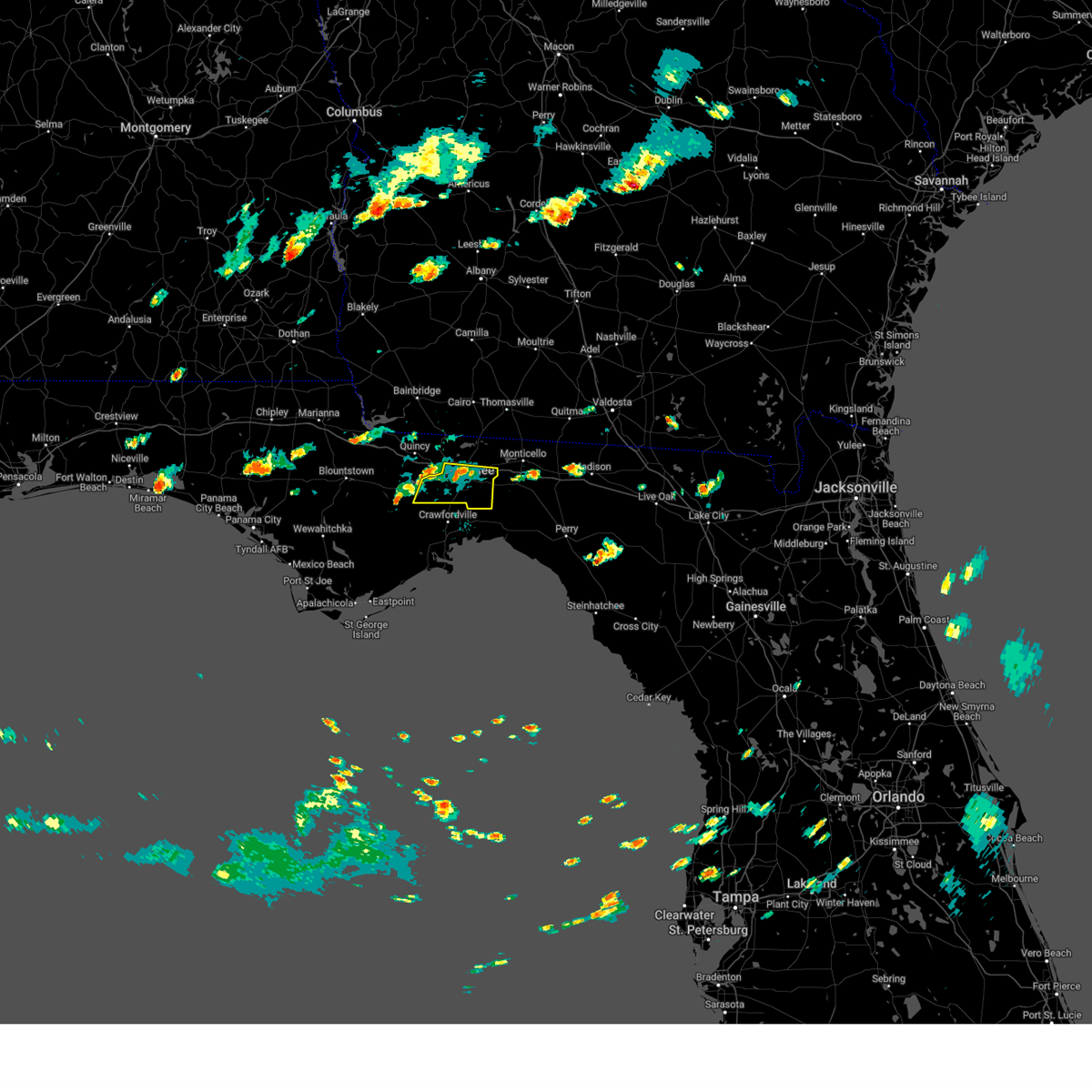
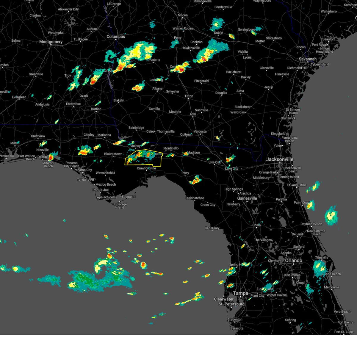
 At 1211 pm est, severe thunderstorms were located along a line extending from 8 miles south of doerun to 13 miles northeast of tallahassee to 11 miles west of crawfordville, moving east at 40 mph (radar indicated). Hazards include 60 mph wind gusts. Expect damage to roofs, siding, and trees. Locations impacted include, tallahassee, woodville, monticello, tallahassee state college, florida state university, moultrie, thomasville, midway, florida a and m, boston, norman park, ochlocknee, pavo, coolidge, doak campbell stadium, riverside, schley, berlin, funston, and barwick. At 1211 pm est, severe thunderstorms were located along a line extending from 8 miles south of doerun to 13 miles northeast of tallahassee to 11 miles west of crawfordville, moving east at 40 mph (radar indicated). Hazards include 60 mph wind gusts. Expect damage to roofs, siding, and trees. Locations impacted include, tallahassee, woodville, monticello, tallahassee state college, florida state university, moultrie, thomasville, midway, florida a and m, boston, norman park, ochlocknee, pavo, coolidge, doak campbell stadium, riverside, schley, berlin, funston, and barwick.
|
| 2/15/2026 11:42 AM EST |
 Svrtae the national weather service in tallahassee has issued a * severe thunderstorm warning for, northern wakulla county in big bend florida, eastern gadsden county in big bend florida, southeastern liberty county in big bend florida, northwestern jefferson county in big bend florida, leon county in big bend florida, southeastern decatur county in southwestern georgia, grady county in southwestern georgia, southeastern mitchell county in southwestern georgia, thomas county in south central georgia, northwestern brooks county in south central georgia, colquitt county in south central georgia, * until 1245 pm est. * at 1142 am est, severe thunderstorms were located along a line extending from 6 miles west of pelham to near midway to 19 miles northwest of carrabelle, moving east at 40 mph (radar indicated). Hazards include 60 mph wind gusts. expect damage to roofs, siding, and trees Svrtae the national weather service in tallahassee has issued a * severe thunderstorm warning for, northern wakulla county in big bend florida, eastern gadsden county in big bend florida, southeastern liberty county in big bend florida, northwestern jefferson county in big bend florida, leon county in big bend florida, southeastern decatur county in southwestern georgia, grady county in southwestern georgia, southeastern mitchell county in southwestern georgia, thomas county in south central georgia, northwestern brooks county in south central georgia, colquitt county in south central georgia, * until 1245 pm est. * at 1142 am est, severe thunderstorms were located along a line extending from 6 miles west of pelham to near midway to 19 miles northwest of carrabelle, moving east at 40 mph (radar indicated). Hazards include 60 mph wind gusts. expect damage to roofs, siding, and trees
|
| 2/15/2026 11:40 AM EST | A tree on a line resulted in a power outage for the brickyard substation via talqui in gadsden county FL, 227.3 miles ESE of Midway, FL |
| 2/15/2026 10:55 AM EST |
 Svrtae the national weather service in tallahassee has issued a * severe thunderstorm warning for, southeastern jackson county in the panhandle of florida, northern gulf county in the panhandle of florida, southeastern bay county in the panhandle of florida, eastern calhoun county in the panhandle of florida, northwestern wakulla county in big bend florida, gadsden county in big bend florida, liberty county in big bend florida, central leon county in big bend florida, decatur county in southwestern georgia, western grady county in southwestern georgia, southeastern seminole county in southwestern georgia, * until noon est/1100 am cst/. * at 1055 am est/955 am cst/, severe thunderstorms were located along a line extending from near chattahoochee to 7 miles southeast of blountstown to 6 miles northeast of mexico beach, moving east at 50 mph (radar indicated). Hazards include 60 mph wind gusts. expect damage to roofs, siding, and trees Svrtae the national weather service in tallahassee has issued a * severe thunderstorm warning for, southeastern jackson county in the panhandle of florida, northern gulf county in the panhandle of florida, southeastern bay county in the panhandle of florida, eastern calhoun county in the panhandle of florida, northwestern wakulla county in big bend florida, gadsden county in big bend florida, liberty county in big bend florida, central leon county in big bend florida, decatur county in southwestern georgia, western grady county in southwestern georgia, southeastern seminole county in southwestern georgia, * until noon est/1100 am cst/. * at 1055 am est/955 am cst/, severe thunderstorms were located along a line extending from near chattahoochee to 7 miles southeast of blountstown to 6 miles northeast of mexico beach, moving east at 50 mph (radar indicated). Hazards include 60 mph wind gusts. expect damage to roofs, siding, and trees
|
| 1/25/2026 5:53 PM EST |
 The storms which prompted the warning have weakened below severe limits, and no longer pose an immediate threat to life or property. therefore, the warning will be allowed to expire. however, gusty winds and heavy rain are still possible with these thunderstorms. a tornado watch remains in effect until 700 pm est for south central and southwestern georgia. The storms which prompted the warning have weakened below severe limits, and no longer pose an immediate threat to life or property. therefore, the warning will be allowed to expire. however, gusty winds and heavy rain are still possible with these thunderstorms. a tornado watch remains in effect until 700 pm est for south central and southwestern georgia.
|
| 1/25/2026 4:55 PM EST |
 Svrtae the national weather service in tallahassee has issued a * severe thunderstorm warning for, northern gadsden county in big bend florida, northwestern jefferson county in big bend florida, northeastern leon county in big bend florida, southern cook county in south central georgia, southeastern decatur county in southwestern georgia, grady county in southwestern georgia, south central berrien county in south central georgia, southeastern mitchell county in southwestern georgia, northwestern lowndes county in south central georgia, thomas county in south central georgia, brooks county in south central georgia, southern colquitt county in south central georgia, * until 600 pm est. * at 455 pm est, severe thunderstorms were located along a line extending from 9 miles east of pelham to near whigham to near greensboro, moving east at 50 mph (radar indicated). Hazards include 60 mph wind gusts. expect damage to roofs, siding, and trees Svrtae the national weather service in tallahassee has issued a * severe thunderstorm warning for, northern gadsden county in big bend florida, northwestern jefferson county in big bend florida, northeastern leon county in big bend florida, southern cook county in south central georgia, southeastern decatur county in southwestern georgia, grady county in southwestern georgia, south central berrien county in south central georgia, southeastern mitchell county in southwestern georgia, northwestern lowndes county in south central georgia, thomas county in south central georgia, brooks county in south central georgia, southern colquitt county in south central georgia, * until 600 pm est. * at 455 pm est, severe thunderstorms were located along a line extending from 9 miles east of pelham to near whigham to near greensboro, moving east at 50 mph (radar indicated). Hazards include 60 mph wind gusts. expect damage to roofs, siding, and trees
|
| 8/20/2025 5:43 PM EDT |
 The storm which prompted the warning has weakened below severe limits, and no longer poses an immediate threat to life or property. therefore, the warning will be allowed to expire. however, gusty winds are still possible with this thunderstorm. The storm which prompted the warning has weakened below severe limits, and no longer poses an immediate threat to life or property. therefore, the warning will be allowed to expire. however, gusty winds are still possible with this thunderstorm.
|
| 8/20/2025 5:09 PM EDT |
 Svrtae the national weather service in tallahassee has issued a * severe thunderstorm warning for, eastern gadsden county in big bend florida, central leon county in big bend florida, southeastern decatur county in southwestern georgia, * until 545 pm edt. * at 509 pm edt, a severe thunderstorm was located over havana, moving south at 5 mph (radar indicated). Hazards include 60 mph wind gusts and penny size hail. expect damage to roofs, siding, and trees Svrtae the national weather service in tallahassee has issued a * severe thunderstorm warning for, eastern gadsden county in big bend florida, central leon county in big bend florida, southeastern decatur county in southwestern georgia, * until 545 pm edt. * at 509 pm edt, a severe thunderstorm was located over havana, moving south at 5 mph (radar indicated). Hazards include 60 mph wind gusts and penny size hail. expect damage to roofs, siding, and trees
|
| 8/5/2025 7:34 PM EDT |
 Svrmlb the national weather service in melbourne has issued a * severe thunderstorm warning for, eastern seminole county in east central florida, southeastern orange county in east central florida, south central volusia county in east central florida, * until 800 pm edt. * at 734 pm edt, severe thunderstorms were located along a line extending from near osteen to near lake hart, moving east at 10 mph (radar indicated). Hazards include 60 mph wind gusts and penny size hail. expect damage to roofs, siding, and trees Svrmlb the national weather service in melbourne has issued a * severe thunderstorm warning for, eastern seminole county in east central florida, southeastern orange county in east central florida, south central volusia county in east central florida, * until 800 pm edt. * at 734 pm edt, severe thunderstorms were located along a line extending from near osteen to near lake hart, moving east at 10 mph (radar indicated). Hazards include 60 mph wind gusts and penny size hail. expect damage to roofs, siding, and trees
|
| 7/22/2025 3:34 PM EDT |
 Svrtae the national weather service in tallahassee has issued a * severe thunderstorm warning for, wakulla county in big bend florida, central gadsden county in big bend florida, east central liberty county in big bend florida, southwestern jefferson county in big bend florida, northwestern taylor county in big bend florida, leon county in big bend florida, southwestern madison county in big bend florida, * until 415 pm edt. * at 334 pm edt, severe thunderstorms were located along a line extending from near midway to 7 miles west of perry, moving southwest at 15 mph (radar indicated). Hazards include 60 mph wind gusts. expect damage to roofs, siding, and trees Svrtae the national weather service in tallahassee has issued a * severe thunderstorm warning for, wakulla county in big bend florida, central gadsden county in big bend florida, east central liberty county in big bend florida, southwestern jefferson county in big bend florida, northwestern taylor county in big bend florida, leon county in big bend florida, southwestern madison county in big bend florida, * until 415 pm edt. * at 334 pm edt, severe thunderstorms were located along a line extending from near midway to 7 miles west of perry, moving southwest at 15 mph (radar indicated). Hazards include 60 mph wind gusts. expect damage to roofs, siding, and trees
|
| 7/14/2025 12:05 AM EDT |
 The storm which prompted the warning has weakened below severe limits, and no longer poses an immediate threat to life or property. therefore, the warning will be allowed to expire. however gusty winds and heavy rain are still possible with this thunderstorm. The storm which prompted the warning has weakened below severe limits, and no longer poses an immediate threat to life or property. therefore, the warning will be allowed to expire. however gusty winds and heavy rain are still possible with this thunderstorm.
|
| 7/13/2025 11:46 PM EDT |
 At 1146 pm edt, a severe thunderstorm was located over oviedo, moving southeast at 25 mph (radar indicated). Hazards include 60 mph wind gusts. Expect damage to roofs, siding, and trees. Locations impacted include, deltona, sanford, altamonte springs, oviedo, and winter springs. At 1146 pm edt, a severe thunderstorm was located over oviedo, moving southeast at 25 mph (radar indicated). Hazards include 60 mph wind gusts. Expect damage to roofs, siding, and trees. Locations impacted include, deltona, sanford, altamonte springs, oviedo, and winter springs.
|
| 7/13/2025 11:34 PM EDT |
 Svrmlb the national weather service in melbourne has issued a * severe thunderstorm warning for, seminole county in east central florida, south central volusia county in east central florida, * until 1215 am edt. * at 1133 pm edt, a severe thunderstorm was located over sanford, moving southeast at 15 mph (radar indicated). Hazards include 60 mph wind gusts. expect damage to roofs, siding, and trees Svrmlb the national weather service in melbourne has issued a * severe thunderstorm warning for, seminole county in east central florida, south central volusia county in east central florida, * until 1215 am edt. * at 1133 pm edt, a severe thunderstorm was located over sanford, moving southeast at 15 mph (radar indicated). Hazards include 60 mph wind gusts. expect damage to roofs, siding, and trees
|
| 7/13/2025 2:35 PM EDT |
 the severe thunderstorm warning has been cancelled and is no longer in effect the severe thunderstorm warning has been cancelled and is no longer in effect
|
| 7/13/2025 2:25 PM EDT |
 At 224 pm edt, a severe thunderstorm was located over lake jesup, moving east at 20 mph (radar indicated). Hazards include 60 mph wind gusts. Expect damage to roofs, siding, and trees. Locations impacted include, sanford, oviedo, winter springs, geneva, and lake jesup. At 224 pm edt, a severe thunderstorm was located over lake jesup, moving east at 20 mph (radar indicated). Hazards include 60 mph wind gusts. Expect damage to roofs, siding, and trees. Locations impacted include, sanford, oviedo, winter springs, geneva, and lake jesup.
|
| 7/13/2025 2:15 PM EDT |
 Svrmlb the national weather service in melbourne has issued a * severe thunderstorm warning for, central seminole county in east central florida, * until 245 pm edt. * at 214 pm edt, a severe thunderstorm was located over lake jesup, moving east at 20 mph (radar indicated). Hazards include 60 mph wind gusts. expect damage to roofs, siding, and trees Svrmlb the national weather service in melbourne has issued a * severe thunderstorm warning for, central seminole county in east central florida, * until 245 pm edt. * at 214 pm edt, a severe thunderstorm was located over lake jesup, moving east at 20 mph (radar indicated). Hazards include 60 mph wind gusts. expect damage to roofs, siding, and trees
|
| 7/11/2025 12:45 PM EDT |
 Svrtae the national weather service in tallahassee has issued a * severe thunderstorm warning for, southeastern gadsden county in big bend florida, southwestern leon county in big bend florida, * until 115 pm edt. * at 1245 pm edt, a severe thunderstorm was located 12 miles southwest of midway, moving east at 35 mph (radar indicated). Hazards include 60 mph wind gusts. expect damage to roofs, siding, and trees Svrtae the national weather service in tallahassee has issued a * severe thunderstorm warning for, southeastern gadsden county in big bend florida, southwestern leon county in big bend florida, * until 115 pm edt. * at 1245 pm edt, a severe thunderstorm was located 12 miles southwest of midway, moving east at 35 mph (radar indicated). Hazards include 60 mph wind gusts. expect damage to roofs, siding, and trees
|
| 6/27/2025 5:26 PM EDT |
 the severe thunderstorm warning has been cancelled and is no longer in effect the severe thunderstorm warning has been cancelled and is no longer in effect
|
| 6/27/2025 5:13 PM EDT |
 Svrmlb the national weather service in melbourne has issued a * severe thunderstorm warning for, central seminole county in east central florida, south central volusia county in east central florida, * until 600 pm edt. * at 513 pm edt, a severe thunderstorm was located near sanford, moving northeast at 20 mph (radar indicated). Hazards include 60 mph wind gusts and penny size hail. expect damage to roofs, siding, and trees Svrmlb the national weather service in melbourne has issued a * severe thunderstorm warning for, central seminole county in east central florida, south central volusia county in east central florida, * until 600 pm edt. * at 513 pm edt, a severe thunderstorm was located near sanford, moving northeast at 20 mph (radar indicated). Hazards include 60 mph wind gusts and penny size hail. expect damage to roofs, siding, and trees
|
| 6/26/2025 7:05 PM EDT |
 the severe thunderstorm warning has been cancelled and is no longer in effect the severe thunderstorm warning has been cancelled and is no longer in effect
|
| 6/26/2025 6:19 PM EDT |
 the severe thunderstorm warning has been cancelled and is no longer in effect the severe thunderstorm warning has been cancelled and is no longer in effect
|
| 6/26/2025 6:19 PM EDT |
 At 619 pm edt, severe thunderstorms were located along a line extending from 6 miles southeast of cairo to 16 miles west of perry, moving west at 25 mph (radar indicated). Hazards include 60 mph wind gusts. Expect damage to roofs, siding, and trees. locations impacted include, tallahassee, woodville, monticello, tallahassee state college, florida state university, thomasville, havana, st. Marks, midway, crawfordville, florida a and m, cairo, bainbridge, whigham, doak campbell stadium, wakulla, attapulgus, climax, lake bradford, and alma. At 619 pm edt, severe thunderstorms were located along a line extending from 6 miles southeast of cairo to 16 miles west of perry, moving west at 25 mph (radar indicated). Hazards include 60 mph wind gusts. Expect damage to roofs, siding, and trees. locations impacted include, tallahassee, woodville, monticello, tallahassee state college, florida state university, thomasville, havana, st. Marks, midway, crawfordville, florida a and m, cairo, bainbridge, whigham, doak campbell stadium, wakulla, attapulgus, climax, lake bradford, and alma.
|
| 6/26/2025 5:52 PM EDT |
 Svrtae the national weather service in tallahassee has issued a * severe thunderstorm warning for, eastern wakulla county in big bend florida, eastern gadsden county in big bend florida, jefferson county in big bend florida, northwestern taylor county in big bend florida, leon county in big bend florida, southwestern madison county in big bend florida, southeastern decatur county in southwestern georgia, southern grady county in southwestern georgia, southwestern thomas county in south central georgia, * until 730 pm edt. * at 552 pm edt, severe thunderstorms were located along a line extending from 6 miles south of thomasville to near perry, moving west at 30 mph (radar indicated). Hazards include 60 mph wind gusts. expect damage to roofs, siding, and trees Svrtae the national weather service in tallahassee has issued a * severe thunderstorm warning for, eastern wakulla county in big bend florida, eastern gadsden county in big bend florida, jefferson county in big bend florida, northwestern taylor county in big bend florida, leon county in big bend florida, southwestern madison county in big bend florida, southeastern decatur county in southwestern georgia, southern grady county in southwestern georgia, southwestern thomas county in south central georgia, * until 730 pm edt. * at 552 pm edt, severe thunderstorms were located along a line extending from 6 miles south of thomasville to near perry, moving west at 30 mph (radar indicated). Hazards include 60 mph wind gusts. expect damage to roofs, siding, and trees
|
| 6/25/2025 4:56 PM EDT |
 Svrtae the national weather service in tallahassee has issued a * severe thunderstorm warning for, gadsden county in big bend florida, northern liberty county in big bend florida, northern leon county in big bend florida, * until 600 pm edt. * at 456 pm edt, a severe thunderstorm was located near midway, moving west at 40 mph (radar indicated). Hazards include 60 mph wind gusts and quarter size hail. Hail damage to vehicles is expected. Expect wind damage to roofs, siding, and trees. Svrtae the national weather service in tallahassee has issued a * severe thunderstorm warning for, gadsden county in big bend florida, northern liberty county in big bend florida, northern leon county in big bend florida, * until 600 pm edt. * at 456 pm edt, a severe thunderstorm was located near midway, moving west at 40 mph (radar indicated). Hazards include 60 mph wind gusts and quarter size hail. Hail damage to vehicles is expected. Expect wind damage to roofs, siding, and trees.
|
| 6/25/2025 3:36 PM EDT |
 Svrtae the national weather service in tallahassee has issued a * severe thunderstorm warning for, gadsden county in big bend florida, northwestern liberty county in big bend florida, northeastern leon county in big bend florida, * until 500 pm edt. * at 336 pm edt, a severe thunderstorm was located 9 miles northeast of tallahassee, moving west at 25 mph (radar indicated). Hazards include 60 mph wind gusts and quarter size hail. Hail damage to vehicles is expected. Expect wind damage to roofs, siding, and trees. Svrtae the national weather service in tallahassee has issued a * severe thunderstorm warning for, gadsden county in big bend florida, northwestern liberty county in big bend florida, northeastern leon county in big bend florida, * until 500 pm edt. * at 336 pm edt, a severe thunderstorm was located 9 miles northeast of tallahassee, moving west at 25 mph (radar indicated). Hazards include 60 mph wind gusts and quarter size hail. Hail damage to vehicles is expected. Expect wind damage to roofs, siding, and trees.
|
| 6/10/2025 3:48 AM EDT |
 Svrtae the national weather service in tallahassee has issued a * severe thunderstorm warning for, wakulla county in big bend florida, eastern gadsden county in big bend florida, southeastern liberty county in big bend florida, leon county in big bend florida, northeastern franklin county in big bend florida, * until 515 am edt. * at 348 am edt, severe thunderstorms were located along a line extending from 6 miles northwest of havana to near carrabelle, moving east at 30 mph (radar indicated). Hazards include 60 mph wind gusts. expect damage to roofs, siding, and trees Svrtae the national weather service in tallahassee has issued a * severe thunderstorm warning for, wakulla county in big bend florida, eastern gadsden county in big bend florida, southeastern liberty county in big bend florida, leon county in big bend florida, northeastern franklin county in big bend florida, * until 515 am edt. * at 348 am edt, severe thunderstorms were located along a line extending from 6 miles northwest of havana to near carrabelle, moving east at 30 mph (radar indicated). Hazards include 60 mph wind gusts. expect damage to roofs, siding, and trees
|
| 5/31/2025 6:13 AM EDT |
 The storm which prompted the warning has weakened below severe limits, and no longer poses an immediate threat to life or property. therefore, the warning will be allowed to expire. however gusty winds are still possible with this thunderstorm. to report severe weather, contact your nearest law enforcement agency. they will relay your report to the national weather service melbourne. The storm which prompted the warning has weakened below severe limits, and no longer poses an immediate threat to life or property. therefore, the warning will be allowed to expire. however gusty winds are still possible with this thunderstorm. to report severe weather, contact your nearest law enforcement agency. they will relay your report to the national weather service melbourne.
|
| 5/31/2025 5:52 AM EDT |
 At 552 am edt, a severe thunderstorm was located over debary, moving east at 40 mph (radar indicated). Hazards include 60 mph wind gusts. Expect damage to roofs, siding, and trees. Locations impacted include, deltona, port orange, sanford, deland, and new smyrna beach. At 552 am edt, a severe thunderstorm was located over debary, moving east at 40 mph (radar indicated). Hazards include 60 mph wind gusts. Expect damage to roofs, siding, and trees. Locations impacted include, deltona, port orange, sanford, deland, and new smyrna beach.
|
| 5/31/2025 5:39 AM EDT |
 Svrmlb the national weather service in melbourne has issued a * severe thunderstorm warning for, central seminole county in east central florida, northeastern lake county in east central florida, central volusia county in east central florida, * until 615 am edt. * at 539 am edt, a severe thunderstorm was located over cassia, moving east at 40 mph (radar indicated). Hazards include 60 mph wind gusts. expect damage to roofs, siding, and trees Svrmlb the national weather service in melbourne has issued a * severe thunderstorm warning for, central seminole county in east central florida, northeastern lake county in east central florida, central volusia county in east central florida, * until 615 am edt. * at 539 am edt, a severe thunderstorm was located over cassia, moving east at 40 mph (radar indicated). Hazards include 60 mph wind gusts. expect damage to roofs, siding, and trees
|
| 5/30/2025 5:03 PM EDT |
 the severe thunderstorm warning has been cancelled and is no longer in effect the severe thunderstorm warning has been cancelled and is no longer in effect
|
| 5/30/2025 5:03 PM EDT |
 At 503 pm edt, a severe thunderstorm was located near florida state university, moving east at 20 mph (radar indicated). Hazards include 60 mph wind gusts. Expect damage to roofs, siding, and trees. Locations impacted include, tallahassee, woodville, tallahassee state college, florida state university, florida a and m, doak campbell stadium, lake bradford, leon sinks, gaither community center, tallahassee memorial hosp, walker ford community center, south city, eight mile pond, griffin heights, tallahassee regional a/p, governors square mall, natural bridge, midtown, apalachee ridge estates, and levy park. At 503 pm edt, a severe thunderstorm was located near florida state university, moving east at 20 mph (radar indicated). Hazards include 60 mph wind gusts. Expect damage to roofs, siding, and trees. Locations impacted include, tallahassee, woodville, tallahassee state college, florida state university, florida a and m, doak campbell stadium, lake bradford, leon sinks, gaither community center, tallahassee memorial hosp, walker ford community center, south city, eight mile pond, griffin heights, tallahassee regional a/p, governors square mall, natural bridge, midtown, apalachee ridge estates, and levy park.
|
| 5/30/2025 4:50 PM EDT |
 Svrtae the national weather service in tallahassee has issued a * severe thunderstorm warning for, southeastern gadsden county in big bend florida, east central liberty county in big bend florida, leon county in big bend florida, * until 545 pm edt. * at 450 pm edt, a severe thunderstorm was located over tallahassee state college, moving east at 20 mph (radar indicated). Hazards include 60 mph wind gusts. expect damage to roofs, siding, and trees Svrtae the national weather service in tallahassee has issued a * severe thunderstorm warning for, southeastern gadsden county in big bend florida, east central liberty county in big bend florida, leon county in big bend florida, * until 545 pm edt. * at 450 pm edt, a severe thunderstorm was located over tallahassee state college, moving east at 20 mph (radar indicated). Hazards include 60 mph wind gusts. expect damage to roofs, siding, and trees
|
| 5/29/2025 11:05 AM CDT |
 At 1105 am cdt, severe thunderstorms were located along a line extending from 7 miles southeast of jay to 6 miles east of roeville to navarre, moving east at 45 mph (radar indicated). Hazards include 60 mph wind gusts. Expect damage to roofs, siding, and trees. Locations impacted include, cinco bayou, ocean city, mary esther, fort walton beach, shalimar, crestview, wright, lake lorraine, navarre beach, baker, roeville, eglin afb, and navarre. At 1105 am cdt, severe thunderstorms were located along a line extending from 7 miles southeast of jay to 6 miles east of roeville to navarre, moving east at 45 mph (radar indicated). Hazards include 60 mph wind gusts. Expect damage to roofs, siding, and trees. Locations impacted include, cinco bayou, ocean city, mary esther, fort walton beach, shalimar, crestview, wright, lake lorraine, navarre beach, baker, roeville, eglin afb, and navarre.
|
| 5/29/2025 10:53 AM CDT |
 the severe thunderstorm warning has been cancelled and is no longer in effect the severe thunderstorm warning has been cancelled and is no longer in effect
|
| 5/29/2025 10:53 AM CDT |
 At 1052 am cdt, severe thunderstorms were located along a line extending from 8 miles southwest of jay to point baker to near oriole beach, moving east at 45 mph (radar indicated). Hazards include 60 mph wind gusts. Expect damage to roofs, siding, and trees. Locations impacted include, cinco bayou, ocean city, mary esther, fort walton beach, shalimar, crestview, wright, point baker, lake lorraine, oriole beach, navarre beach, pea ridge, pace, baker, roeville, bagdad, floridatown, eglin afb, milton, and navarre. At 1052 am cdt, severe thunderstorms were located along a line extending from 8 miles southwest of jay to point baker to near oriole beach, moving east at 45 mph (radar indicated). Hazards include 60 mph wind gusts. Expect damage to roofs, siding, and trees. Locations impacted include, cinco bayou, ocean city, mary esther, fort walton beach, shalimar, crestview, wright, point baker, lake lorraine, oriole beach, navarre beach, pea ridge, pace, baker, roeville, bagdad, floridatown, eglin afb, milton, and navarre.
|
| 5/29/2025 10:40 AM CDT |
 The storms which prompted the warning have moved out of the warned area. therefore, the warning will be allowed to expire. however, gusty winds are still possible with these thunderstorms. remember, a severe thunderstorm warning still remains in effect for escambia county, florida until 1115 am cdt. The storms which prompted the warning have moved out of the warned area. therefore, the warning will be allowed to expire. however, gusty winds are still possible with these thunderstorms. remember, a severe thunderstorm warning still remains in effect for escambia county, florida until 1115 am cdt.
|
| 5/29/2025 10:37 AM CDT |
 Svrmob the national weather service in mobile has issued a * severe thunderstorm warning for, western okaloosa county in northwestern florida, santa rosa county in northwestern florida, central escambia county in northwestern florida, * until 1115 am cdt. * at 1037 am cdt, severe thunderstorms were located along a line extending from 8 miles northwest of molino to 4 miles northwest of pace to 3 miles southeast of warrington, moving east at 45 mph (radar indicated). Hazards include 60 mph wind gusts. expect damage to roofs, siding, and trees Svrmob the national weather service in mobile has issued a * severe thunderstorm warning for, western okaloosa county in northwestern florida, santa rosa county in northwestern florida, central escambia county in northwestern florida, * until 1115 am cdt. * at 1037 am cdt, severe thunderstorms were located along a line extending from 8 miles northwest of molino to 4 miles northwest of pace to 3 miles southeast of warrington, moving east at 45 mph (radar indicated). Hazards include 60 mph wind gusts. expect damage to roofs, siding, and trees
|
| 5/29/2025 10:32 AM CDT |
 At 1032 am cdt, severe thunderstorms were located along a line extending from 9 miles south of bratt to 5 miles northeast of gonzalez to warrington, moving east at 45 mph (radar indicated). Hazards include 60 mph wind gusts. Expect damage to roofs, siding, and trees. Locations impacted include, west pensacola, warrington, gulf breeze, pensacola, pensacola beach, brent, oriole beach, myrtle grove, goulding, pea ridge, ferry pass, ensley, molino, gonzalez, pace, and floridatown. At 1032 am cdt, severe thunderstorms were located along a line extending from 9 miles south of bratt to 5 miles northeast of gonzalez to warrington, moving east at 45 mph (radar indicated). Hazards include 60 mph wind gusts. Expect damage to roofs, siding, and trees. Locations impacted include, west pensacola, warrington, gulf breeze, pensacola, pensacola beach, brent, oriole beach, myrtle grove, goulding, pea ridge, ferry pass, ensley, molino, gonzalez, pace, and floridatown.
|
| 5/29/2025 9:59 AM CDT |
 Svrmob the national weather service in mobile has issued a * severe thunderstorm warning for, southeastern baldwin county in southwestern alabama, southwestern santa rosa county in northwestern florida, escambia county in northwestern florida, * until 1045 am cdt. * at 959 am cdt, severe thunderstorms were located along a line extending from near loxley to 5 miles east of robertsdale to 4 miles north of elberta, moving east at 40 mph (radar indicated). Hazards include 60 mph wind gusts. expect damage to roofs, siding, and trees Svrmob the national weather service in mobile has issued a * severe thunderstorm warning for, southeastern baldwin county in southwestern alabama, southwestern santa rosa county in northwestern florida, escambia county in northwestern florida, * until 1045 am cdt. * at 959 am cdt, severe thunderstorms were located along a line extending from near loxley to 5 miles east of robertsdale to 4 miles north of elberta, moving east at 40 mph (radar indicated). Hazards include 60 mph wind gusts. expect damage to roofs, siding, and trees
|
| 5/21/2025 1:24 PM EDT |
 The storms which prompted the warning have weakened below severe limits, and no longer pose an immediate threat to life or property. therefore, the warning will be allowed to expire. however, small hail and gusty winds are still possible with these thunderstorms. The storms which prompted the warning have weakened below severe limits, and no longer pose an immediate threat to life or property. therefore, the warning will be allowed to expire. however, small hail and gusty winds are still possible with these thunderstorms.
|
| 5/21/2025 1:10 PM EDT |
 the severe thunderstorm warning has been cancelled and is no longer in effect the severe thunderstorm warning has been cancelled and is no longer in effect
|
| 5/21/2025 1:10 PM EDT |
 At 110 pm edt, severe thunderstorms were located along a line extending from 12 miles northwest of monticello to 9 miles north of tallahassee to near havana, moving east at 35 mph (radar indicated). Hazards include 60 mph wind gusts and penny size hail. Expect damage to roofs, siding, and trees. Locations impacted include, tallahassee, monticello, havana, alma, freemont, dills, macon community park, littman, miccosukee road greenway, darsey, florence, scotland, jamieson, rocky hill, miccosukee, drifton, fred george park, killearn estates, shady rest, and casa blanco. At 110 pm edt, severe thunderstorms were located along a line extending from 12 miles northwest of monticello to 9 miles north of tallahassee to near havana, moving east at 35 mph (radar indicated). Hazards include 60 mph wind gusts and penny size hail. Expect damage to roofs, siding, and trees. Locations impacted include, tallahassee, monticello, havana, alma, freemont, dills, macon community park, littman, miccosukee road greenway, darsey, florence, scotland, jamieson, rocky hill, miccosukee, drifton, fred george park, killearn estates, shady rest, and casa blanco.
|
| 5/21/2025 12:48 PM EDT |
 Svrtae the national weather service in tallahassee has issued a * severe thunderstorm warning for, northeastern gadsden county in big bend florida, northwestern jefferson county in big bend florida, northeastern leon county in big bend florida, southeastern decatur county in southwestern georgia, southern grady county in southwestern georgia, southwestern thomas county in south central georgia, * until 130 pm edt. * at 1248 pm edt, severe thunderstorms were located along a line extending from 10 miles south of cairo to near havana to near quincy, moving east at 30 mph (radar indicated). Hazards include 60 mph wind gusts and quarter size hail. Hail damage to vehicles is expected. Expect wind damage to roofs, siding, and trees. Svrtae the national weather service in tallahassee has issued a * severe thunderstorm warning for, northeastern gadsden county in big bend florida, northwestern jefferson county in big bend florida, northeastern leon county in big bend florida, southeastern decatur county in southwestern georgia, southern grady county in southwestern georgia, southwestern thomas county in south central georgia, * until 130 pm edt. * at 1248 pm edt, severe thunderstorms were located along a line extending from 10 miles south of cairo to near havana to near quincy, moving east at 30 mph (radar indicated). Hazards include 60 mph wind gusts and quarter size hail. Hail damage to vehicles is expected. Expect wind damage to roofs, siding, and trees.
|
| 4/7/2025 12:05 PM EDT |
 the tornado warning has been cancelled and is no longer in effect the tornado warning has been cancelled and is no longer in effect
|
| 4/7/2025 11:51 AM EDT |
 Tortae the national weather service in tallahassee has issued a * tornado warning for, southeastern gadsden county in big bend florida, central leon county in big bend florida, * until 1215 pm edt. * at 1151 am edt, a tornado producing storm was located near midway, moving northeast at 35 mph (radar confirmed tornado). Hazards include damaging tornado. Flying debris will be dangerous to those caught without shelter. mobile homes will be damaged or destroyed. damage to roofs, windows, and vehicles will occur. tree damage is likely. This tornadic storm will be near, midway and tallahassee around 1155 am edt. Tortae the national weather service in tallahassee has issued a * tornado warning for, southeastern gadsden county in big bend florida, central leon county in big bend florida, * until 1215 pm edt. * at 1151 am edt, a tornado producing storm was located near midway, moving northeast at 35 mph (radar confirmed tornado). Hazards include damaging tornado. Flying debris will be dangerous to those caught without shelter. mobile homes will be damaged or destroyed. damage to roofs, windows, and vehicles will occur. tree damage is likely. This tornadic storm will be near, midway and tallahassee around 1155 am edt.
|
| 4/7/2025 11:10 AM EDT |
 Svrtae the national weather service in tallahassee has issued a * severe thunderstorm warning for, northwestern wakulla county in big bend florida, southeastern gadsden county in big bend florida, east central liberty county in big bend florida, southwestern leon county in big bend florida, * until noon edt. * at 1110 am edt, severe thunderstorms were located along a line extending from 11 miles southwest of midway to 22 miles east of stonemill creek, moving northeast at 35 mph (radar indicated). Hazards include 60 mph wind gusts. expect damage to roofs, siding, and trees Svrtae the national weather service in tallahassee has issued a * severe thunderstorm warning for, northwestern wakulla county in big bend florida, southeastern gadsden county in big bend florida, east central liberty county in big bend florida, southwestern leon county in big bend florida, * until noon edt. * at 1110 am edt, severe thunderstorms were located along a line extending from 11 miles southwest of midway to 22 miles east of stonemill creek, moving northeast at 35 mph (radar indicated). Hazards include 60 mph wind gusts. expect damage to roofs, siding, and trees
|
| 4/1/2025 8:29 PM EDT |
 The storm which prompted the warning has weakened below severe limits, and no longer poses an immediate threat to life or property. therefore, the warning will be allowed to expire. however gusty winds are still possible with this thunderstorm. to report severe weather, contact your nearest law enforcement agency. they will relay your report to the national weather service melbourne. The storm which prompted the warning has weakened below severe limits, and no longer poses an immediate threat to life or property. therefore, the warning will be allowed to expire. however gusty winds are still possible with this thunderstorm. to report severe weather, contact your nearest law enforcement agency. they will relay your report to the national weather service melbourne.
|
| 4/1/2025 8:08 PM EDT |
 At 808 pm edt, a severe thunderstorm was located over sanford, moving northeast at 15 mph (radar indicated). Hazards include 60 mph wind gusts and quarter size hail. Hail damage to vehicles is expected. expect wind damage to roofs, siding, and trees. Locations impacted include, lake harney, osteen, orange city, farmton, and geneva. At 808 pm edt, a severe thunderstorm was located over sanford, moving northeast at 15 mph (radar indicated). Hazards include 60 mph wind gusts and quarter size hail. Hail damage to vehicles is expected. expect wind damage to roofs, siding, and trees. Locations impacted include, lake harney, osteen, orange city, farmton, and geneva.
|
| 4/1/2025 7:58 PM EDT |
 Svrmlb the national weather service in melbourne has issued a * severe thunderstorm warning for, seminole county in east central florida, south central volusia county in east central florida, * until 830 pm edt. * at 758 pm edt, a severe thunderstorm was located over sanford, moving northeast at 20 mph (radar indicated). Hazards include 60 mph wind gusts and quarter size hail. Hail damage to vehicles is expected. Expect wind damage to roofs, siding, and trees. Svrmlb the national weather service in melbourne has issued a * severe thunderstorm warning for, seminole county in east central florida, south central volusia county in east central florida, * until 830 pm edt. * at 758 pm edt, a severe thunderstorm was located over sanford, moving northeast at 20 mph (radar indicated). Hazards include 60 mph wind gusts and quarter size hail. Hail damage to vehicles is expected. Expect wind damage to roofs, siding, and trees.
|
| 4/1/2025 7:50 PM EDT |
 At 749 pm edt, a severe thunderstorm was located over lake jesup, moving northeast at 15 mph (radar indicated). Hazards include 60 mph wind gusts and nickel size hail. Expect damage to roofs, siding, and trees. Locations impacted include, lake harney, chuluota, osteen, geneva, and longwood. At 749 pm edt, a severe thunderstorm was located over lake jesup, moving northeast at 15 mph (radar indicated). Hazards include 60 mph wind gusts and nickel size hail. Expect damage to roofs, siding, and trees. Locations impacted include, lake harney, chuluota, osteen, geneva, and longwood.
|
| 4/1/2025 7:35 PM EDT |
 Svrmlb the national weather service in melbourne has issued a * severe thunderstorm warning for, seminole county in east central florida, south central volusia county in east central florida, * until 800 pm edt. * at 734 pm edt, a severe thunderstorm was located over winter springs, moving northeast at 15 mph (radar indicated). Hazards include 60 mph wind gusts and nickel size hail. expect damage to roofs, siding, and trees Svrmlb the national weather service in melbourne has issued a * severe thunderstorm warning for, seminole county in east central florida, south central volusia county in east central florida, * until 800 pm edt. * at 734 pm edt, a severe thunderstorm was located over winter springs, moving northeast at 15 mph (radar indicated). Hazards include 60 mph wind gusts and nickel size hail. expect damage to roofs, siding, and trees
|
| 3/31/2025 3:35 PM EDT |
 the severe thunderstorm warning has been cancelled and is no longer in effect the severe thunderstorm warning has been cancelled and is no longer in effect
|
| 3/31/2025 3:35 PM EDT |
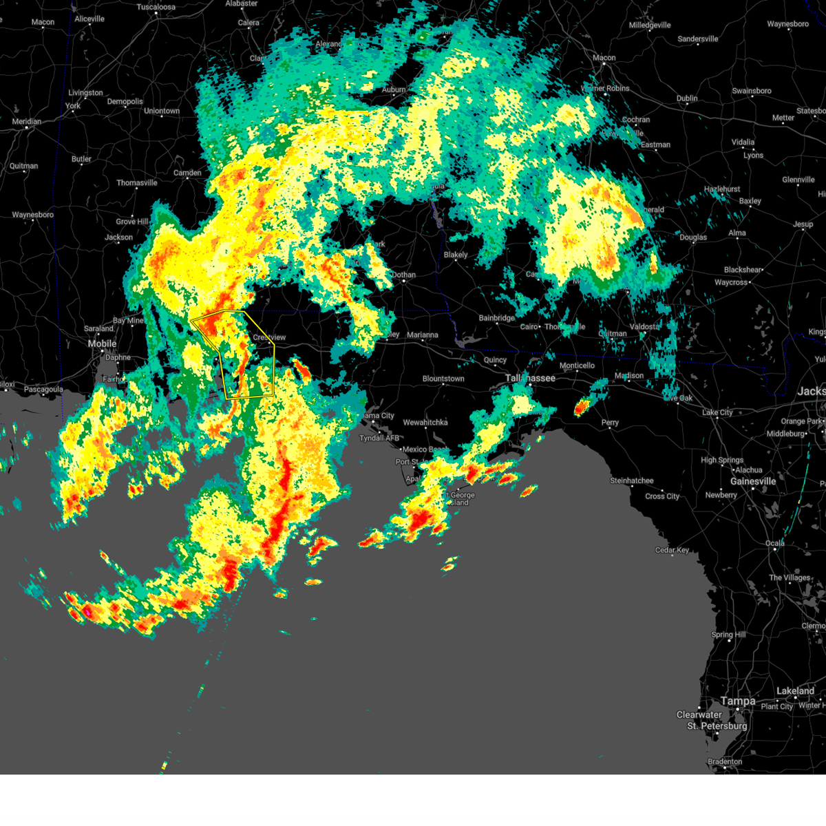
 At 334 pm edt, severe thunderstorms were located along a line extending from near thomasville to doak campbell stadium to 8 miles northwest of crawfordville to 14 miles north of carrabelle, moving east at 65 mph (radar indicated. at the national weather service office on florida state university, a gust of 51 mph was repoprted at 3:32 pm et). Hazards include 60 mph wind gusts and quarter size hail. Hail damage to vehicles is expected. expect wind damage to roofs, siding, and trees. locations impacted include, lake bradford, tallahassee state college, wakulla springs, florida state university, south city, medart, tallahassee regional a/p, natural bridge, liveoak island, apalachee ridge estates, levy park, indian head acres, hyde park, baum, orchard pond, plum orchard, st. Marks headwaters greenway, shell point, port leon, and southwood. At 334 pm edt, severe thunderstorms were located along a line extending from near thomasville to doak campbell stadium to 8 miles northwest of crawfordville to 14 miles north of carrabelle, moving east at 65 mph (radar indicated. at the national weather service office on florida state university, a gust of 51 mph was repoprted at 3:32 pm et). Hazards include 60 mph wind gusts and quarter size hail. Hail damage to vehicles is expected. expect wind damage to roofs, siding, and trees. locations impacted include, lake bradford, tallahassee state college, wakulla springs, florida state university, south city, medart, tallahassee regional a/p, natural bridge, liveoak island, apalachee ridge estates, levy park, indian head acres, hyde park, baum, orchard pond, plum orchard, st. Marks headwaters greenway, shell point, port leon, and southwood.
|
| 3/31/2025 3:20 PM EDT |
 the severe thunderstorm warning has been cancelled and is no longer in effect the severe thunderstorm warning has been cancelled and is no longer in effect
|
| 3/31/2025 3:20 PM EDT |
 At 319 pm edt, severe thunderstorms were located along a line extending from near cairo to near midway to 16 miles east of stonemill creek to 10 miles northeast of port st. joe, moving east at 35 mph (radar indicated). Hazards include 60 mph wind gusts and quarter size hail. Hail damage to vehicles is expected. expect wind damage to roofs, siding, and trees. Locations impacted include, lake bradford, tallahassee state college, jewel fire tower, wakulla springs, vilas, florence, florida state university, south city, calvary, medart, nixon garden, bloxham, nickleville, tallahassee regional a/p, natural bridge, liveoak island, apalachee ridge estates, levy park, indian head acres, and hyde park. At 319 pm edt, severe thunderstorms were located along a line extending from near cairo to near midway to 16 miles east of stonemill creek to 10 miles northeast of port st. joe, moving east at 35 mph (radar indicated). Hazards include 60 mph wind gusts and quarter size hail. Hail damage to vehicles is expected. expect wind damage to roofs, siding, and trees. Locations impacted include, lake bradford, tallahassee state college, jewel fire tower, wakulla springs, vilas, florence, florida state university, south city, calvary, medart, nixon garden, bloxham, nickleville, tallahassee regional a/p, natural bridge, liveoak island, apalachee ridge estates, levy park, indian head acres, and hyde park.
|
| 3/31/2025 3:08 PM EDT |
 the severe thunderstorm warning has been cancelled and is no longer in effect the severe thunderstorm warning has been cancelled and is no longer in effect
|
| 3/31/2025 3:08 PM EDT |
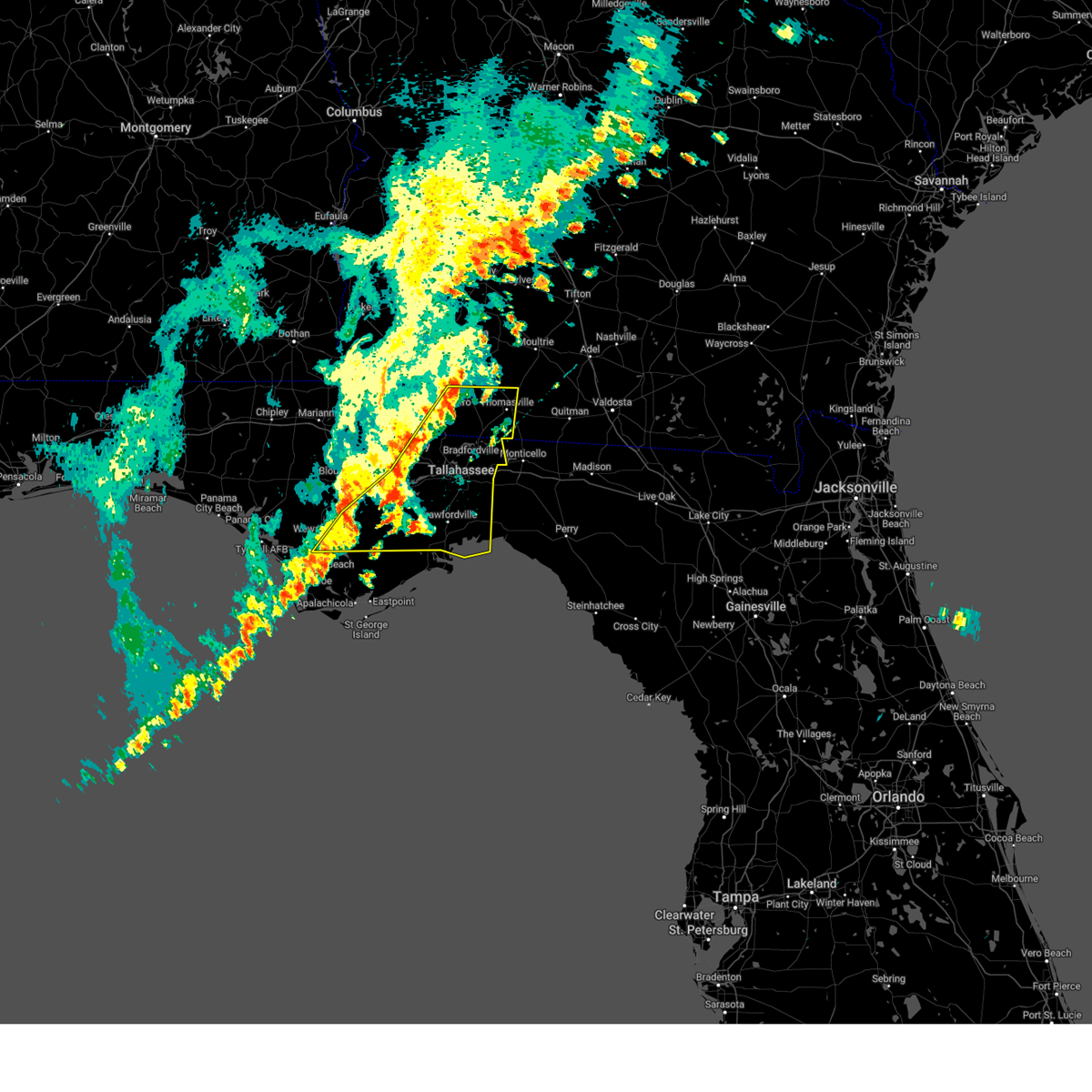 At 308 pm edt/208 pm cdt/, severe thunderstorms were located along a line extending from near whigham to 7 miles southwest of quincy to 11 miles east of stonemill creek to 6 miles northeast of port st. joe, moving east at 35 mph (radar indicated). Hazards include 60 mph wind gusts and quarter size hail. Hail damage to vehicles is expected. expect wind damage to roofs, siding, and trees. Locations impacted include, lake bradford, tallahassee state college, honeyville, jewel fire tower, wakulla springs, vilas, florence, chipola cutoff, florida state university, orange, south city, laingkat, calvary, climax, medart, kern, quincy airport, lowry, nixon garden, and bloxham. At 308 pm edt/208 pm cdt/, severe thunderstorms were located along a line extending from near whigham to 7 miles southwest of quincy to 11 miles east of stonemill creek to 6 miles northeast of port st. joe, moving east at 35 mph (radar indicated). Hazards include 60 mph wind gusts and quarter size hail. Hail damage to vehicles is expected. expect wind damage to roofs, siding, and trees. Locations impacted include, lake bradford, tallahassee state college, honeyville, jewel fire tower, wakulla springs, vilas, florence, chipola cutoff, florida state university, orange, south city, laingkat, calvary, climax, medart, kern, quincy airport, lowry, nixon garden, and bloxham.
|
| 3/31/2025 2:54 PM EDT |
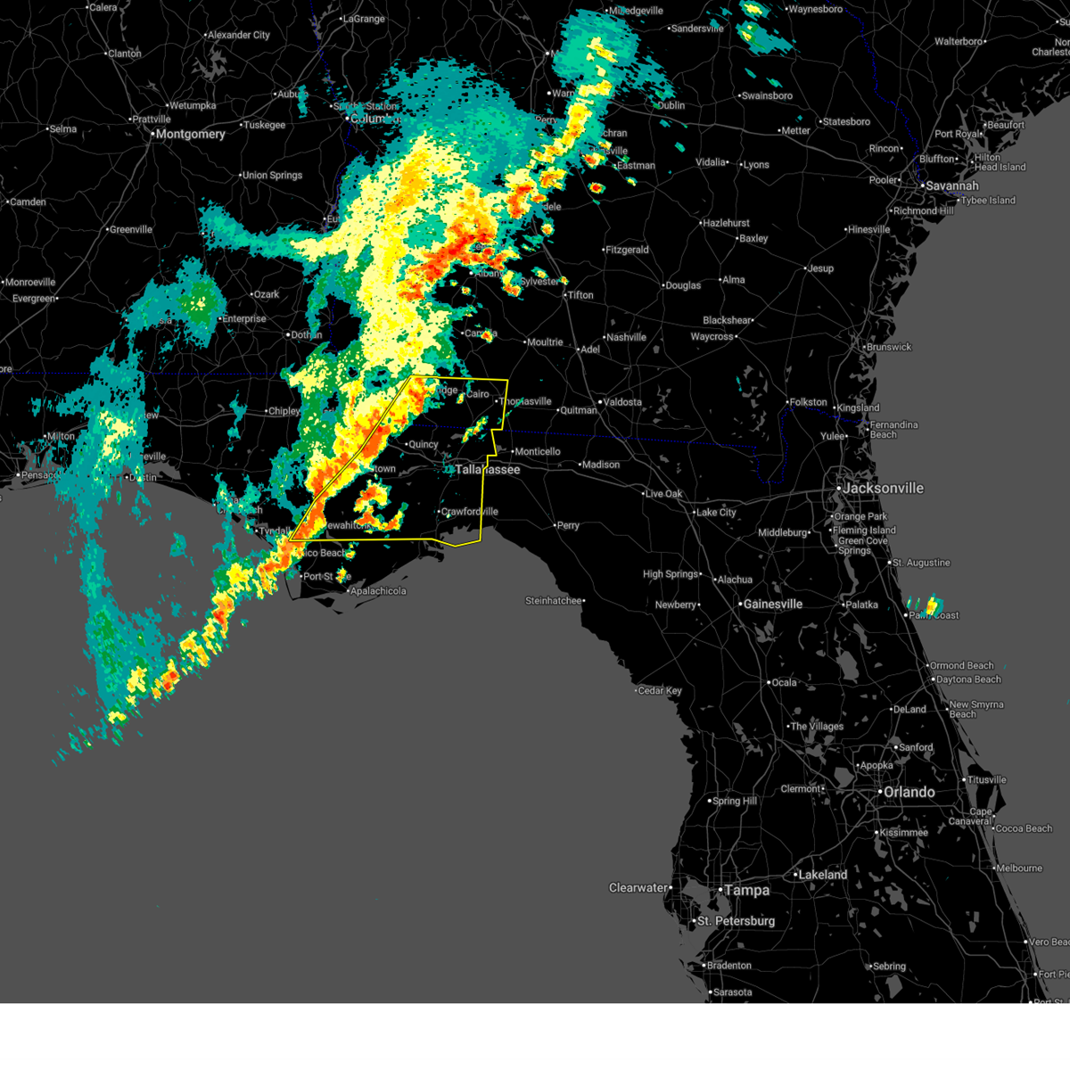 Svrtae the national weather service in tallahassee has issued a * severe thunderstorm warning for, northwestern gulf county in the panhandle of florida, southeastern calhoun county in the panhandle of florida, wakulla county in big bend florida, gadsden county in big bend florida, liberty county in big bend florida, leon county in big bend florida, southeastern decatur county in southwestern georgia, grady county in southwestern georgia, southwestern thomas county in south central georgia, * until 400 pm edt/300 pm cdt/. * at 254 pm edt/154 pm cdt/, severe thunderstorms were located along a line extending from near whigham to 6 miles south of greensboro to near wewahitchka to near mexico beach, moving east at 35 mph (radar indicated). Hazards include 60 mph wind gusts. expect damage to roofs, siding, and trees Svrtae the national weather service in tallahassee has issued a * severe thunderstorm warning for, northwestern gulf county in the panhandle of florida, southeastern calhoun county in the panhandle of florida, wakulla county in big bend florida, gadsden county in big bend florida, liberty county in big bend florida, leon county in big bend florida, southeastern decatur county in southwestern georgia, grady county in southwestern georgia, southwestern thomas county in south central georgia, * until 400 pm edt/300 pm cdt/. * at 254 pm edt/154 pm cdt/, severe thunderstorms were located along a line extending from near whigham to 6 miles south of greensboro to near wewahitchka to near mexico beach, moving east at 35 mph (radar indicated). Hazards include 60 mph wind gusts. expect damage to roofs, siding, and trees
|
| 3/16/2025 6:44 AM EDT |
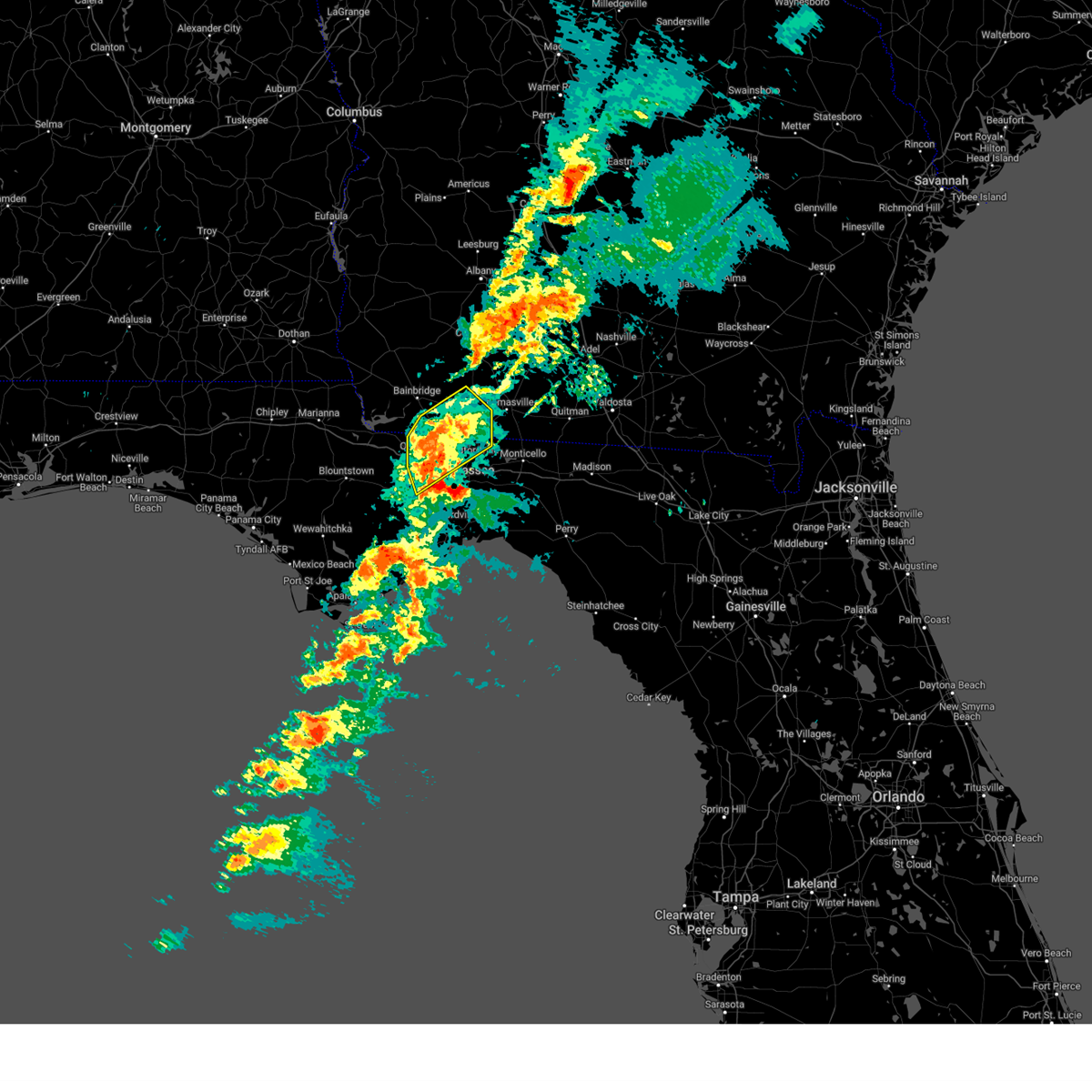 At 644 am edt, a severe thunderstorm was located near havana, moving northeast at 45 mph (radar indicated). Hazards include 60 mph wind gusts and quarter size hail. Hail damage to vehicles is expected. expect wind damage to roofs, siding, and trees. Locations impacted include, freemont, littman, darsey, quincy, florence, scotland, jamieson, whigham, rocky hill, fred george park, laingkat, calvary, santa clara, shady rest, princes still, amsterdam, quincy airport, wetumpka, branchville, and nickleville. At 644 am edt, a severe thunderstorm was located near havana, moving northeast at 45 mph (radar indicated). Hazards include 60 mph wind gusts and quarter size hail. Hail damage to vehicles is expected. expect wind damage to roofs, siding, and trees. Locations impacted include, freemont, littman, darsey, quincy, florence, scotland, jamieson, whigham, rocky hill, fred george park, laingkat, calvary, santa clara, shady rest, princes still, amsterdam, quincy airport, wetumpka, branchville, and nickleville.
|
| 3/16/2025 6:44 AM EDT |
 the severe thunderstorm warning has been cancelled and is no longer in effect the severe thunderstorm warning has been cancelled and is no longer in effect
|
| 3/16/2025 6:20 AM EDT |
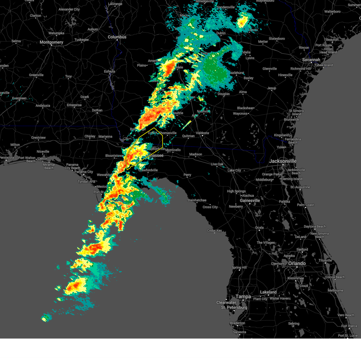 Svrtae the national weather service in tallahassee has issued a * severe thunderstorm warning for, gadsden county in big bend florida, northeastern liberty county in big bend florida, central leon county in big bend florida, southeastern decatur county in southwestern georgia, grady county in southwestern georgia, * until 715 am edt. * at 620 am edt, a severe thunderstorm was located 11 miles south of greensboro, or 14 miles southwest of quincy, moving northeast at 45 mph (radar indicated). Hazards include 60 mph wind gusts and quarter size hail. Hail damage to vehicles is expected. Expect wind damage to roofs, siding, and trees. Svrtae the national weather service in tallahassee has issued a * severe thunderstorm warning for, gadsden county in big bend florida, northeastern liberty county in big bend florida, central leon county in big bend florida, southeastern decatur county in southwestern georgia, grady county in southwestern georgia, * until 715 am edt. * at 620 am edt, a severe thunderstorm was located 11 miles south of greensboro, or 14 miles southwest of quincy, moving northeast at 45 mph (radar indicated). Hazards include 60 mph wind gusts and quarter size hail. Hail damage to vehicles is expected. Expect wind damage to roofs, siding, and trees.
|
| 3/10/2025 9:57 AM EDT |
 Tormlb the national weather service in melbourne has issued a * tornado warning for, northeastern seminole county in east central florida, southeastern volusia county in east central florida, * until 1045 am edt. * at 955 am edt, a severe thunderstorm capable of producing a tornado was located over osteen, or near deltona, moving northeast at 30 mph (radar indicated rotation). Hazards include tornado. Flying debris will be dangerous to those caught without shelter. mobile homes will be damaged or destroyed. damage to roofs, windows, and vehicles will occur. tree damage is likely. this dangerous storm will be near, deltona and osteen around 1000 am edt. new smyrna beach around 1010 am edt. port orange and edgewater around 1030 am edt. Other locations impacted by this tornadic thunderstorm include new smyrna beach airport, lake ashby and farmton. Tormlb the national weather service in melbourne has issued a * tornado warning for, northeastern seminole county in east central florida, southeastern volusia county in east central florida, * until 1045 am edt. * at 955 am edt, a severe thunderstorm capable of producing a tornado was located over osteen, or near deltona, moving northeast at 30 mph (radar indicated rotation). Hazards include tornado. Flying debris will be dangerous to those caught without shelter. mobile homes will be damaged or destroyed. damage to roofs, windows, and vehicles will occur. tree damage is likely. this dangerous storm will be near, deltona and osteen around 1000 am edt. new smyrna beach around 1010 am edt. port orange and edgewater around 1030 am edt. Other locations impacted by this tornadic thunderstorm include new smyrna beach airport, lake ashby and farmton.
|
| 3/10/2025 9:50 AM EDT |
 At 950 am edt, a confirmed tornado was located over sanford, moving northeast at 45 mph (radar confirmed tornado). Hazards include damaging tornado. Flying debris will be dangerous to those caught without shelter. mobile homes will be damaged or destroyed. damage to roofs, windows, and vehicles will occur. tree damage is likely. this tornado will be near, deltona, geneva, and osteen around 1000 am edt. Other locations impacted by this tornadic thunderstorm include sanford and heathrow. At 950 am edt, a confirmed tornado was located over sanford, moving northeast at 45 mph (radar confirmed tornado). Hazards include damaging tornado. Flying debris will be dangerous to those caught without shelter. mobile homes will be damaged or destroyed. damage to roofs, windows, and vehicles will occur. tree damage is likely. this tornado will be near, deltona, geneva, and osteen around 1000 am edt. Other locations impacted by this tornadic thunderstorm include sanford and heathrow.
|
| 3/10/2025 9:42 AM EDT |
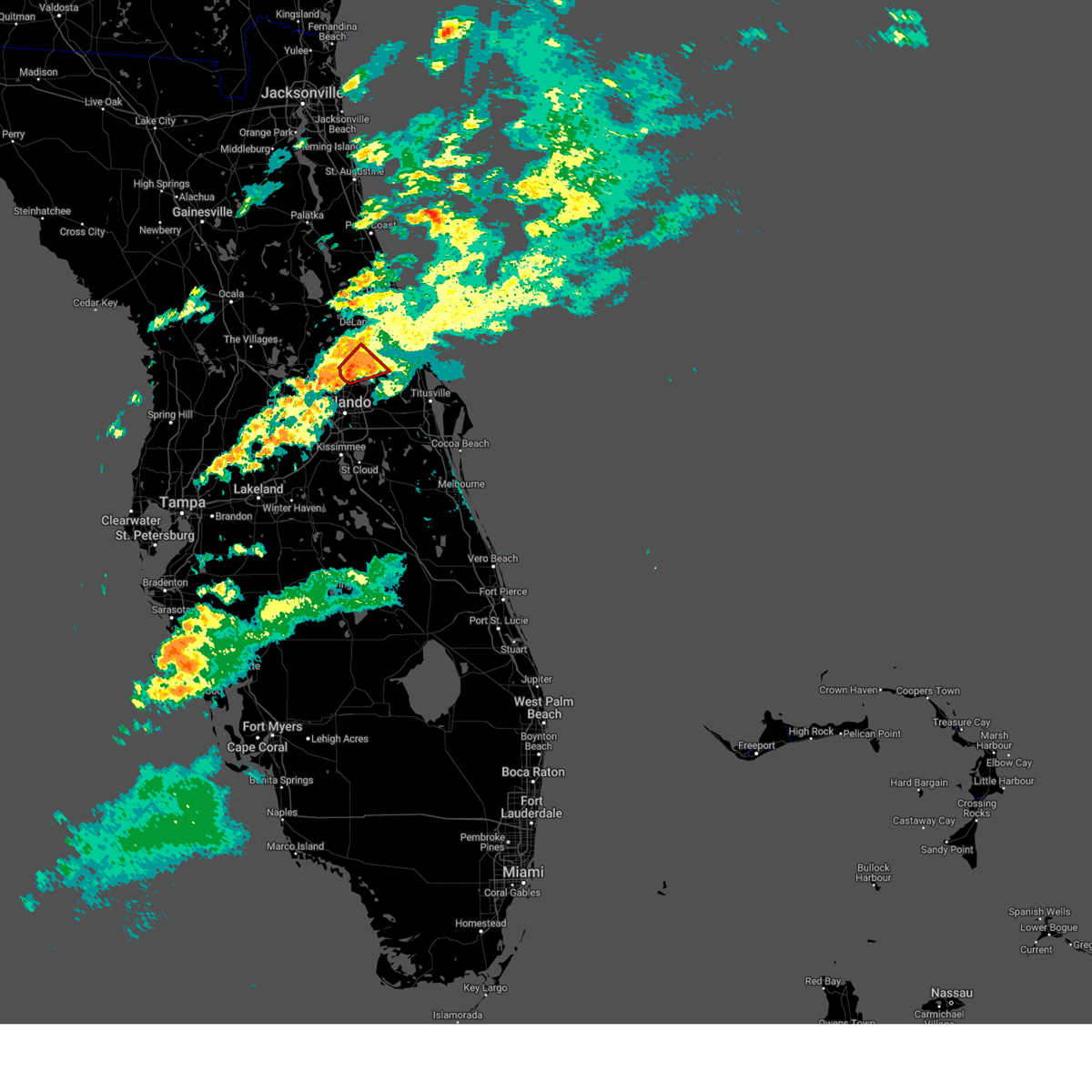 At 942 am edt, a confirmed tornado was located over lake mary, moving northeast at 30 mph (emergency management confirmed tornado). Hazards include damaging tornado. Flying debris will be dangerous to those caught without shelter. mobile homes will be damaged or destroyed. damage to roofs, windows, and vehicles will occur. tree damage is likely. this tornado will be near, lake mary, deltona, and debary around 950 am edt. osteen around 1000 am edt. Other locations impacted by this tornadic thunderstorm include heathrow. At 942 am edt, a confirmed tornado was located over lake mary, moving northeast at 30 mph (emergency management confirmed tornado). Hazards include damaging tornado. Flying debris will be dangerous to those caught without shelter. mobile homes will be damaged or destroyed. damage to roofs, windows, and vehicles will occur. tree damage is likely. this tornado will be near, lake mary, deltona, and debary around 950 am edt. osteen around 1000 am edt. Other locations impacted by this tornadic thunderstorm include heathrow.
|
| 3/10/2025 9:41 AM EDT |
 At 940 am edt, a severe thunderstorm capable of producing a tornado was located over lake mary, moving northeast at 30 mph (radar indicated rotation). Hazards include tornado. Flying debris will be dangerous to those caught without shelter. mobile homes will be damaged or destroyed. damage to roofs, windows, and vehicles will occur. tree damage is likely. this dangerous storm will be near, lake mary, debary, and sanford around 950 am edt. Other locations impacted by this tornadic thunderstorm include heathrow. At 940 am edt, a severe thunderstorm capable of producing a tornado was located over lake mary, moving northeast at 30 mph (radar indicated rotation). Hazards include tornado. Flying debris will be dangerous to those caught without shelter. mobile homes will be damaged or destroyed. damage to roofs, windows, and vehicles will occur. tree damage is likely. this dangerous storm will be near, lake mary, debary, and sanford around 950 am edt. Other locations impacted by this tornadic thunderstorm include heathrow.
|
| 3/10/2025 9:41 AM EDT |
 the tornado warning has been cancelled and is no longer in effect the tornado warning has been cancelled and is no longer in effect
|
| 3/10/2025 9:34 AM EDT |
 Tormlb the national weather service in melbourne has issued a * tornado warning for, northern seminole county in east central florida, north central orange county in east central florida, south central volusia county in east central florida, * until 1000 am edt. * at 933 am edt, a severe thunderstorm capable of producing a tornado was located over wekiwa springs state park, or near altamonte springs, moving northeast at 35 mph (radar indicated rotation). Hazards include tornado. Flying debris will be dangerous to those caught without shelter. mobile homes will be damaged or destroyed. damage to roofs, windows, and vehicles will occur. tree damage is likely. this dangerous storm will be near, altamonte springs, lake mary, and longwood around 940 am edt. deltona and orange city around 950 am edt. Other locations impacted by this tornadic thunderstorm include heathrow. Tormlb the national weather service in melbourne has issued a * tornado warning for, northern seminole county in east central florida, north central orange county in east central florida, south central volusia county in east central florida, * until 1000 am edt. * at 933 am edt, a severe thunderstorm capable of producing a tornado was located over wekiwa springs state park, or near altamonte springs, moving northeast at 35 mph (radar indicated rotation). Hazards include tornado. Flying debris will be dangerous to those caught without shelter. mobile homes will be damaged or destroyed. damage to roofs, windows, and vehicles will occur. tree damage is likely. this dangerous storm will be near, altamonte springs, lake mary, and longwood around 940 am edt. deltona and orange city around 950 am edt. Other locations impacted by this tornadic thunderstorm include heathrow.
|
| 3/10/2025 9:32 AM EDT |
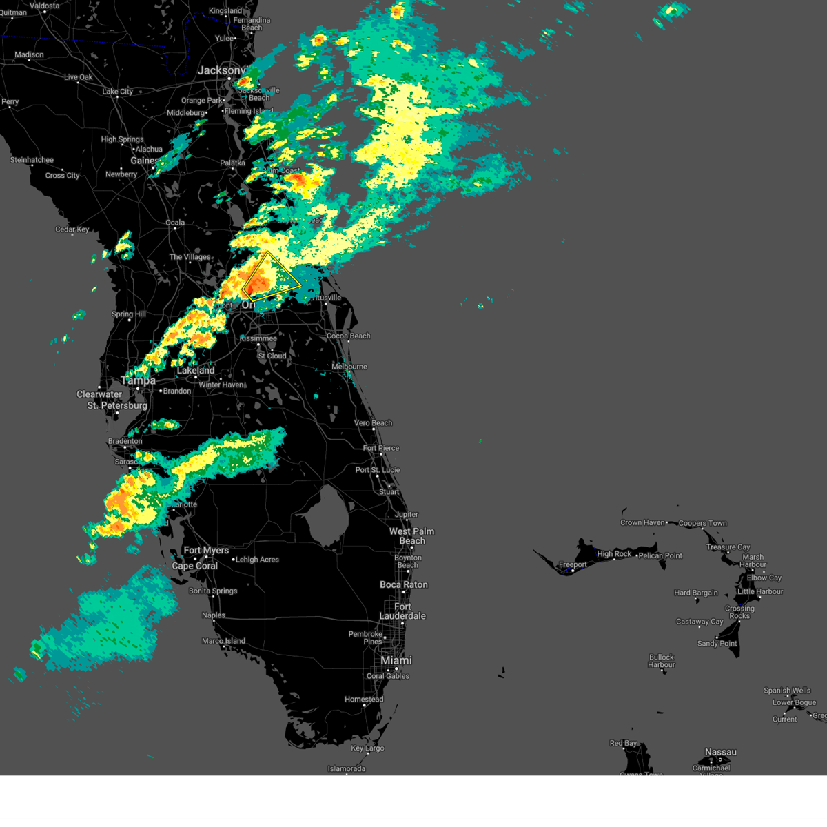 Svrmlb the national weather service in melbourne has issued a * severe thunderstorm warning for, seminole county in east central florida, east central lake county in east central florida, northwestern orange county in east central florida, south central volusia county in east central florida, * until 1000 am edt. * at 932 am edt, a severe thunderstorm was located over wekiva springs, or near altamonte springs, moving northeast at 35 mph (radar indicated). Hazards include 60 mph wind gusts. expect damage to roofs, siding, and trees Svrmlb the national weather service in melbourne has issued a * severe thunderstorm warning for, seminole county in east central florida, east central lake county in east central florida, northwestern orange county in east central florida, south central volusia county in east central florida, * until 1000 am edt. * at 932 am edt, a severe thunderstorm was located over wekiva springs, or near altamonte springs, moving northeast at 35 mph (radar indicated). Hazards include 60 mph wind gusts. expect damage to roofs, siding, and trees
|
| 3/9/2025 10:39 AM EDT |
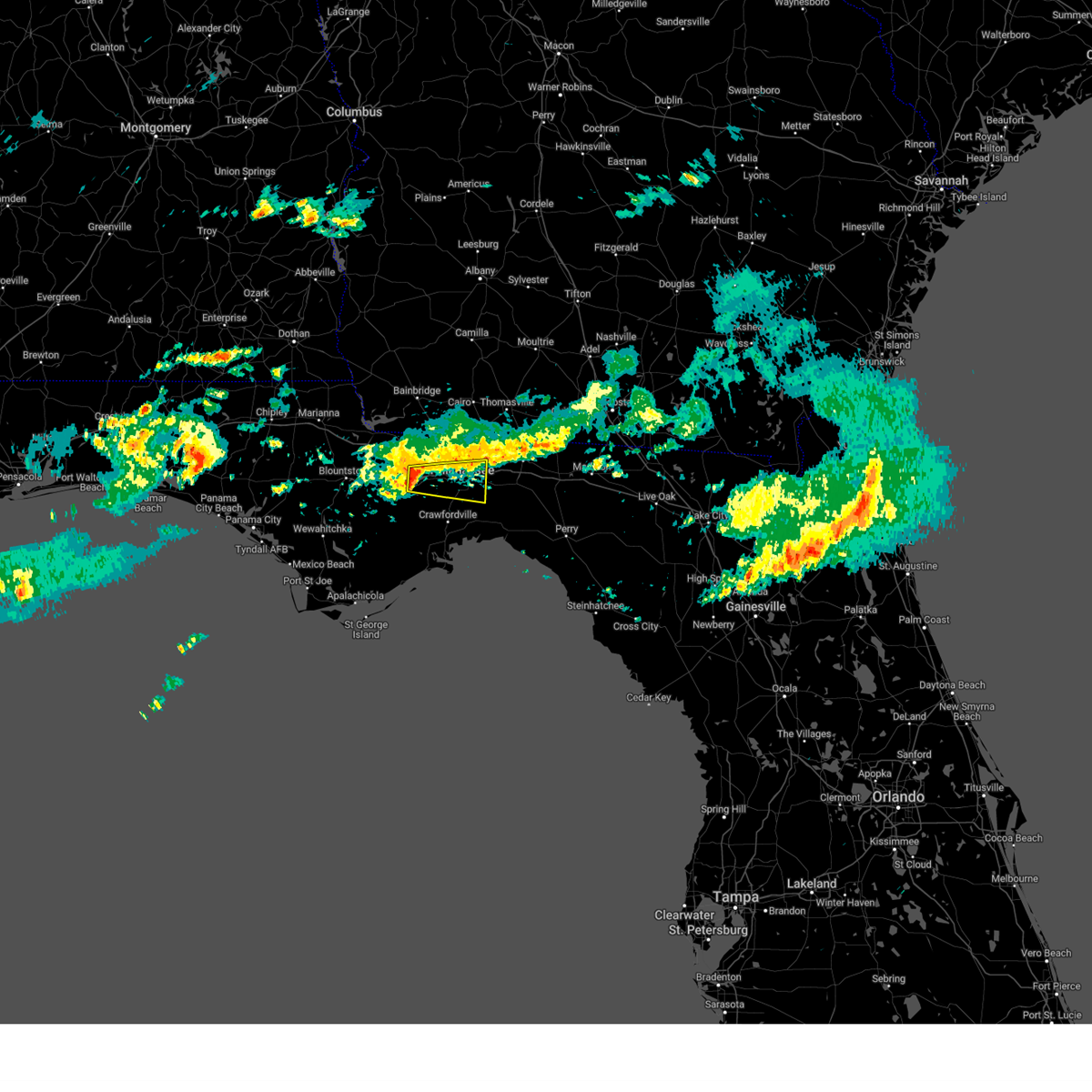 Svrtae the national weather service in tallahassee has issued a * severe thunderstorm warning for, southeastern gadsden county in big bend florida, southern leon county in big bend florida, * until 1130 am edt. * at 1039 am edt, a severe thunderstorm was located 7 miles southwest of midway, moving east at 35 mph (radar indicated). Hazards include 60 mph wind gusts. expect damage to roofs, siding, and trees Svrtae the national weather service in tallahassee has issued a * severe thunderstorm warning for, southeastern gadsden county in big bend florida, southern leon county in big bend florida, * until 1130 am edt. * at 1039 am edt, a severe thunderstorm was located 7 miles southwest of midway, moving east at 35 mph (radar indicated). Hazards include 60 mph wind gusts. expect damage to roofs, siding, and trees
|
| 3/5/2025 4:56 AM EST |
 At 455 am est, severe thunderstorms were located along a line extending from 12 miles northwest of monticello to 12 miles south of apalachicola, moving east at 35 mph (radar indicated). Hazards include 60 mph wind gusts. Expect damage to roofs, siding, and trees. Locations impacted include, lake bradford, franklin, tallahassee state college, wakulla springs, florida state university, st george island st pk, south city, eastpoint, medart, tallahassee regional a/p, apalachicola, natural bridge, liveoak island, curtis mill, apalachee ridge estates, levy park, indian head acres, bald point, hyde park, and high bluff. At 455 am est, severe thunderstorms were located along a line extending from 12 miles northwest of monticello to 12 miles south of apalachicola, moving east at 35 mph (radar indicated). Hazards include 60 mph wind gusts. Expect damage to roofs, siding, and trees. Locations impacted include, lake bradford, franklin, tallahassee state college, wakulla springs, florida state university, st george island st pk, south city, eastpoint, medart, tallahassee regional a/p, apalachicola, natural bridge, liveoak island, curtis mill, apalachee ridge estates, levy park, indian head acres, bald point, hyde park, and high bluff.
|
| 3/5/2025 4:56 AM EST |
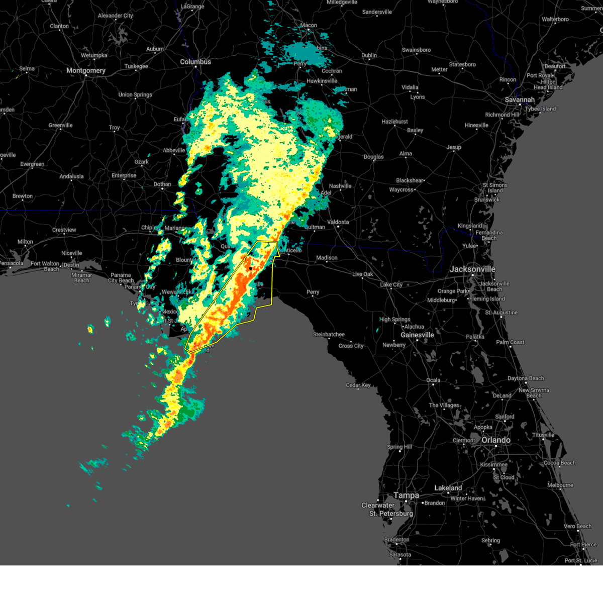 the severe thunderstorm warning has been cancelled and is no longer in effect the severe thunderstorm warning has been cancelled and is no longer in effect
|
| 3/5/2025 4:24 AM EST |
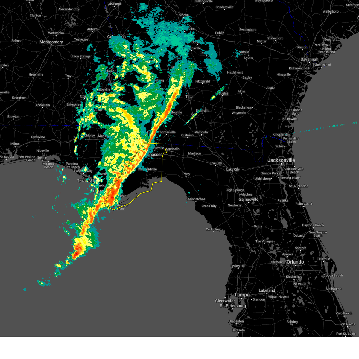 At 424 am est/324 am cst/, severe thunderstorms were located along a line extending from 9 miles east of havana to 28 miles south of port st. joe, moving east at 35 mph (radar indicated). Hazards include 60 mph wind gusts. Expect damage to roofs, siding, and trees. Locations impacted include, lake bradford, franklin, tallahassee state college, jewel fire tower, wakulla springs, florence, florida state university, st george island st pk, south city, eastpoint, medart, bloxham, tallahassee regional a/p, apalachicola, natural bridge, liveoak island, curtis mill, apalachee ridge estates, levy park, and indian head acres. At 424 am est/324 am cst/, severe thunderstorms were located along a line extending from 9 miles east of havana to 28 miles south of port st. joe, moving east at 35 mph (radar indicated). Hazards include 60 mph wind gusts. Expect damage to roofs, siding, and trees. Locations impacted include, lake bradford, franklin, tallahassee state college, jewel fire tower, wakulla springs, florence, florida state university, st george island st pk, south city, eastpoint, medart, bloxham, tallahassee regional a/p, apalachicola, natural bridge, liveoak island, curtis mill, apalachee ridge estates, levy park, and indian head acres.
|
| 3/5/2025 3:46 AM EST |
 Svrtae the national weather service in tallahassee has issued a * severe thunderstorm warning for, gulf county in the panhandle of florida, wakulla county in big bend florida, gadsden county in big bend florida, liberty county in big bend florida, leon county in big bend florida, franklin county in big bend florida, * until 515 am est/415 am cst/. * at 346 am est/246 am cst/, severe thunderstorms were located along a line extending from 7 miles north of quincy to 34 miles southwest of port st. joe, moving east at 35 mph (radar indicated). Hazards include 60 mph wind gusts. expect damage to roofs, siding, and trees Svrtae the national weather service in tallahassee has issued a * severe thunderstorm warning for, gulf county in the panhandle of florida, wakulla county in big bend florida, gadsden county in big bend florida, liberty county in big bend florida, leon county in big bend florida, franklin county in big bend florida, * until 515 am est/415 am cst/. * at 346 am est/246 am cst/, severe thunderstorms were located along a line extending from 7 miles north of quincy to 34 miles southwest of port st. joe, moving east at 35 mph (radar indicated). Hazards include 60 mph wind gusts. expect damage to roofs, siding, and trees
|
| 3/4/2025 11:09 PM CST |
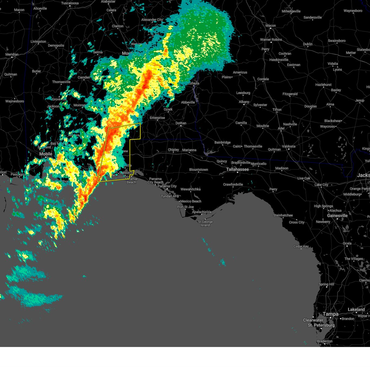 Svrmob the national weather service in mobile has issued a * severe thunderstorm warning for, southeastern escambia county in south central alabama, southern covington county in south central alabama, okaloosa county in northwestern florida, eastern santa rosa county in northwestern florida, * until 1215 am cst. * at 1109 pm cst, severe thunderstorms were located along a line extending from 11 miles southwest of andalusia to near navarre, moving east at 55 mph (radar indicated). Hazards include 70 mph wind gusts. Expect considerable tree damage. Damage is likely to mobile homes, roofs, and outbuildings. Svrmob the national weather service in mobile has issued a * severe thunderstorm warning for, southeastern escambia county in south central alabama, southern covington county in south central alabama, okaloosa county in northwestern florida, eastern santa rosa county in northwestern florida, * until 1215 am cst. * at 1109 pm cst, severe thunderstorms were located along a line extending from 11 miles southwest of andalusia to near navarre, moving east at 55 mph (radar indicated). Hazards include 70 mph wind gusts. Expect considerable tree damage. Damage is likely to mobile homes, roofs, and outbuildings.
|
| 3/4/2025 11:04 PM CST |
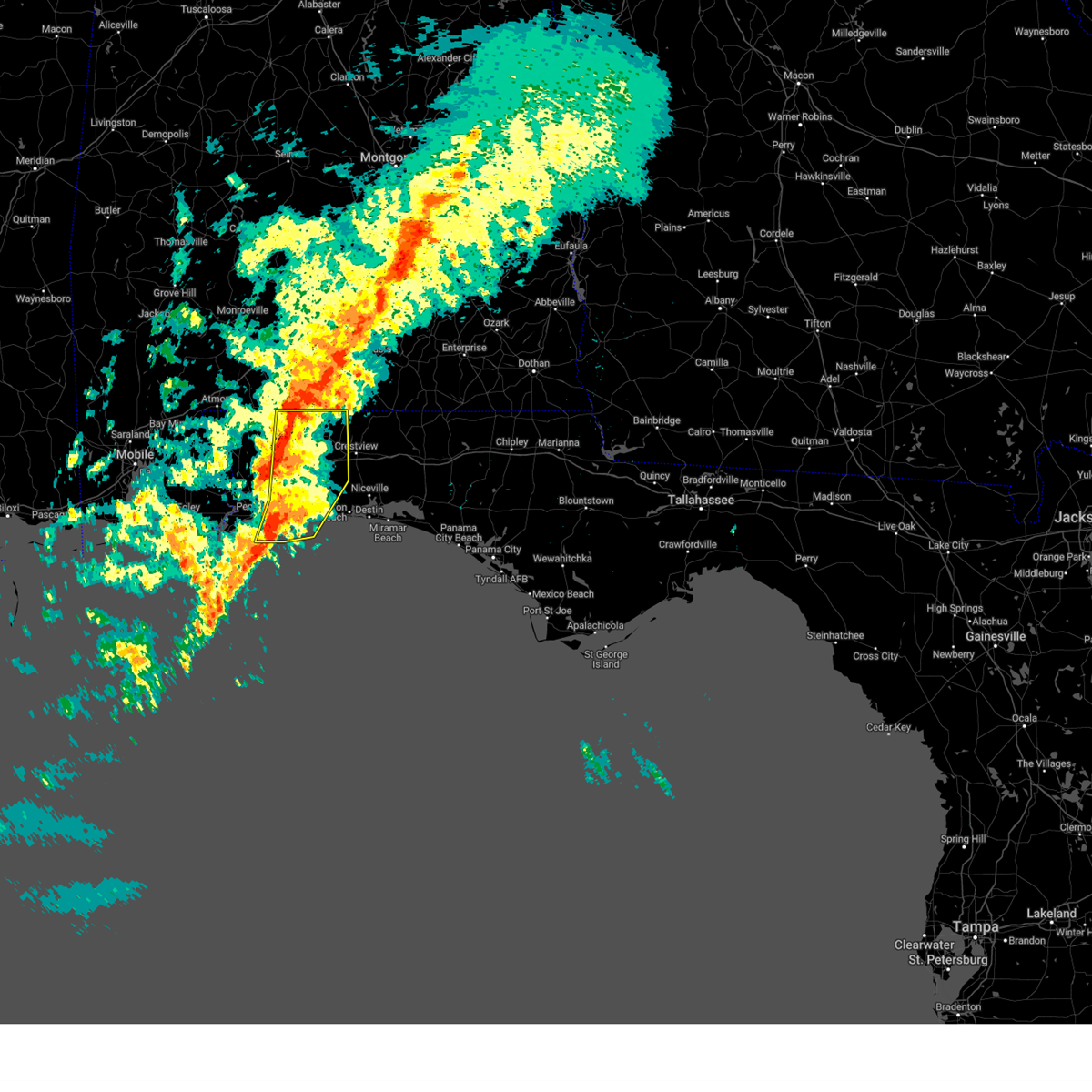 the severe thunderstorm warning has been cancelled and is no longer in effect the severe thunderstorm warning has been cancelled and is no longer in effect
|
| 3/4/2025 11:04 PM CST |
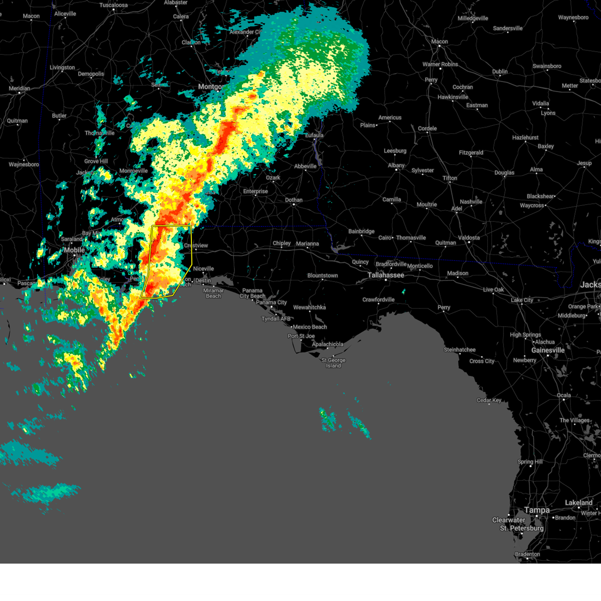 At 1103 pm cst, severe thunderstorms were located along a line extending from 12 miles east of riverview to 6 miles northeast of roeville to navarre to 10 miles south of pensacola beach, moving east at 65 mph (radar indicated). Hazards include 70 mph wind gusts. Expect considerable tree damage. damage is likely to mobile homes, roofs, and outbuildings. Locations impacted include, oriole beach, gulf breeze, navarre beach, pea ridge, pensacola beach, baker, roeville, bagdad, point baker, milton, and navarre. At 1103 pm cst, severe thunderstorms were located along a line extending from 12 miles east of riverview to 6 miles northeast of roeville to navarre to 10 miles south of pensacola beach, moving east at 65 mph (radar indicated). Hazards include 70 mph wind gusts. Expect considerable tree damage. damage is likely to mobile homes, roofs, and outbuildings. Locations impacted include, oriole beach, gulf breeze, navarre beach, pea ridge, pensacola beach, baker, roeville, bagdad, point baker, milton, and navarre.
|
| 3/4/2025 10:54 PM CST |
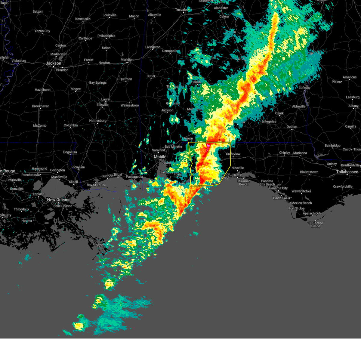 At 1053 pm cst, severe thunderstorms were located along a line extending from 5 miles southeast of riverview to point baker to near oriole beach to 16 miles southwest of pensacola beach, moving east at 50 mph (observed. a 70 mph gust was just reported at pensacola nas). Hazards include 70 mph wind gusts. Expect considerable tree damage. damage is likely to mobile homes, roofs, and outbuildings. Locations impacted include, west pensacola, warrington, pensacola, jay, pensacola beach, point baker, myrtle grove, goulding, pea ridge, ferry pass, ensley, gonzalez, baker, pace, roeville, floridatown, flomaton, gulf breeze, bratt, and century. At 1053 pm cst, severe thunderstorms were located along a line extending from 5 miles southeast of riverview to point baker to near oriole beach to 16 miles southwest of pensacola beach, moving east at 50 mph (observed. a 70 mph gust was just reported at pensacola nas). Hazards include 70 mph wind gusts. Expect considerable tree damage. damage is likely to mobile homes, roofs, and outbuildings. Locations impacted include, west pensacola, warrington, pensacola, jay, pensacola beach, point baker, myrtle grove, goulding, pea ridge, ferry pass, ensley, gonzalez, baker, pace, roeville, floridatown, flomaton, gulf breeze, bratt, and century.
|
| 3/4/2025 10:24 PM CST |
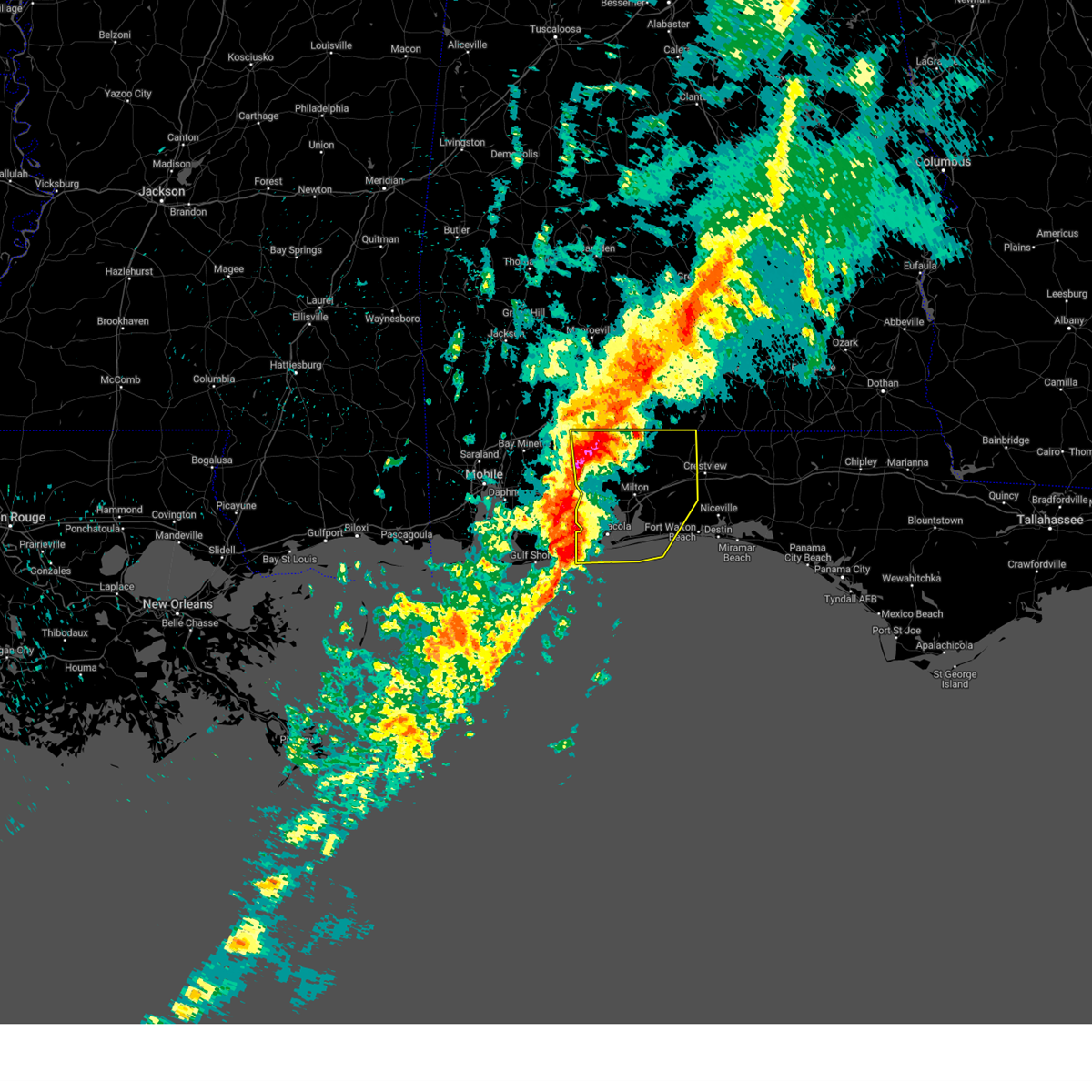 Svrmob the national weather service in mobile has issued a * severe thunderstorm warning for, western okaloosa county in northwestern florida, santa rosa county in northwestern florida, escambia county in northwestern florida, * until 1115 pm cst. * at 1024 pm cst, severe thunderstorms were located along a line extending from 8 miles southeast of bratt to 7 miles west of gonzalez to near myrtle grove to 18 miles south of gulf shores, moving east at 65 mph (radar indicated). Hazards include 60 mph wind gusts. expect damage to roofs, siding, and trees Svrmob the national weather service in mobile has issued a * severe thunderstorm warning for, western okaloosa county in northwestern florida, santa rosa county in northwestern florida, escambia county in northwestern florida, * until 1115 pm cst. * at 1024 pm cst, severe thunderstorms were located along a line extending from 8 miles southeast of bratt to 7 miles west of gonzalez to near myrtle grove to 18 miles south of gulf shores, moving east at 65 mph (radar indicated). Hazards include 60 mph wind gusts. expect damage to roofs, siding, and trees
|
| 2/16/2025 8:23 AM EST |
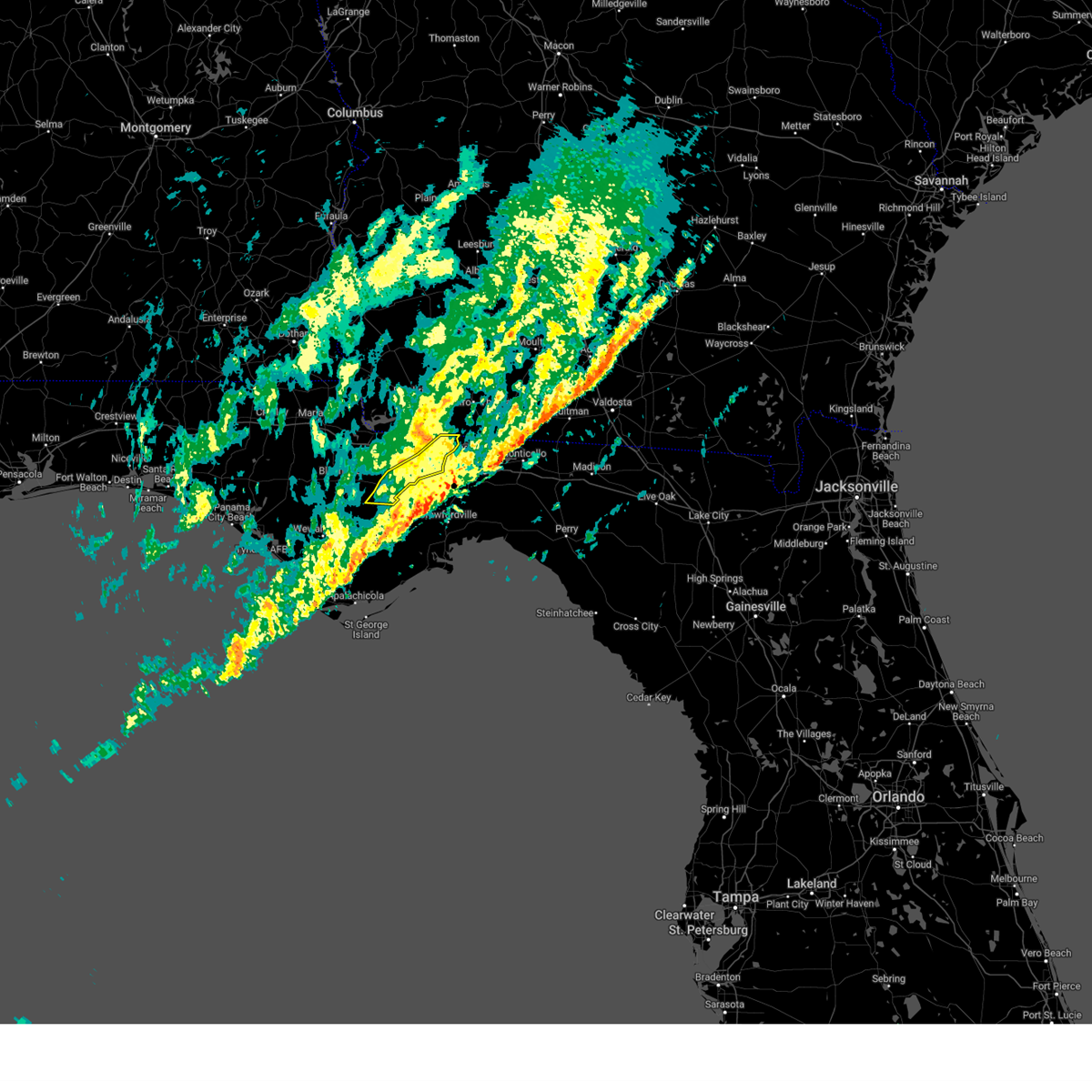 The storms which prompted the warning have moved out of the area. therefore, the warning will be allowed to expire. a tornado watch remains in effect until 1000 am est for big bend florida, and southwestern georgia. to report severe weather, contact your nearest law enforcement agency. they will relay your report to the national weather service tallahassee. The storms which prompted the warning have moved out of the area. therefore, the warning will be allowed to expire. a tornado watch remains in effect until 1000 am est for big bend florida, and southwestern georgia. to report severe weather, contact your nearest law enforcement agency. they will relay your report to the national weather service tallahassee.
|
| 2/16/2025 8:02 AM EST |
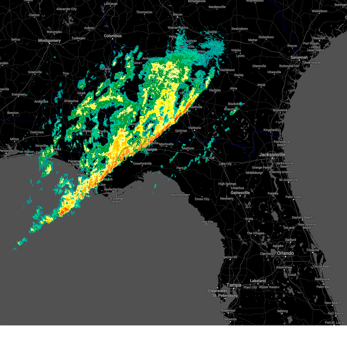 At 802 am est, severe thunderstorms were located along a line extending from near havana to 15 miles southeast of blountstown, moving east at 50 mph (radar indicated). Hazards include 60 mph wind gusts. Expect damage to roofs, siding, and trees. Locations impacted include, midway, havana, quincy, freemont, telogia, littman, darsey, florence, concord, hosford, scotland, jamieson, gibson, clio, santa clara, shady rest, lowry, wetumpka, hinson, and lake talquin. At 802 am est, severe thunderstorms were located along a line extending from near havana to 15 miles southeast of blountstown, moving east at 50 mph (radar indicated). Hazards include 60 mph wind gusts. Expect damage to roofs, siding, and trees. Locations impacted include, midway, havana, quincy, freemont, telogia, littman, darsey, florence, concord, hosford, scotland, jamieson, gibson, clio, santa clara, shady rest, lowry, wetumpka, hinson, and lake talquin.
|
| 2/16/2025 7:38 AM EST |
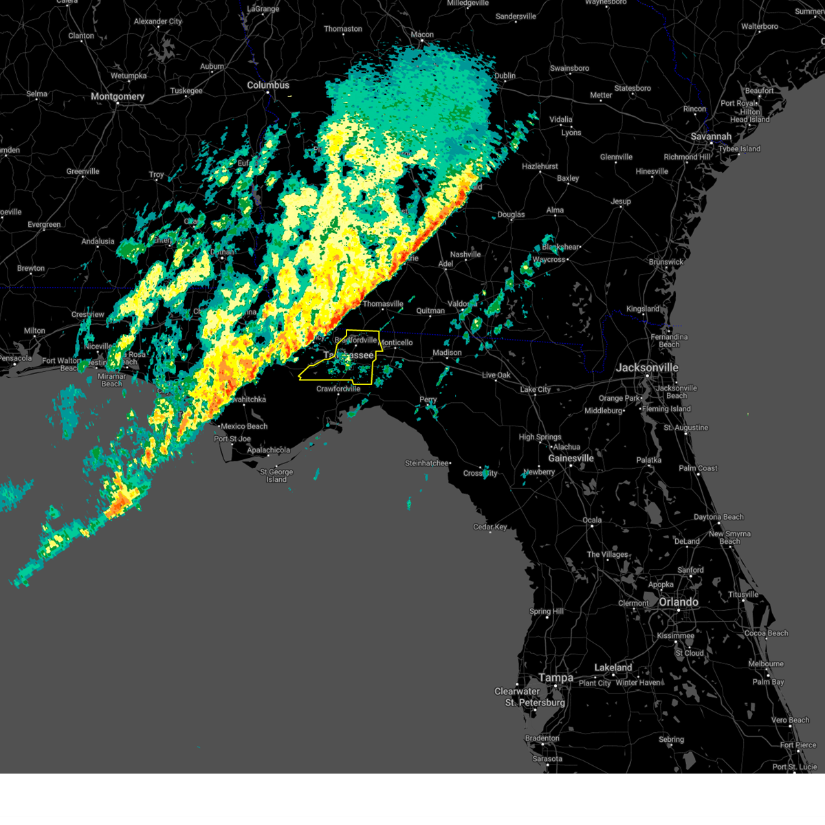 Svrtae the national weather service in tallahassee has issued a * severe thunderstorm warning for, leon county in big bend florida, * until 915 am est. * at 738 am est, severe thunderstorms were located along a line extending from near havana to 10 miles south of blountstown, moving east at 40 mph (radar indicated). Hazards include 60 mph wind gusts. expect damage to roofs, siding, and trees Svrtae the national weather service in tallahassee has issued a * severe thunderstorm warning for, leon county in big bend florida, * until 915 am est. * at 738 am est, severe thunderstorms were located along a line extending from near havana to 10 miles south of blountstown, moving east at 40 mph (radar indicated). Hazards include 60 mph wind gusts. expect damage to roofs, siding, and trees
|
| 2/16/2025 7:07 AM EST |
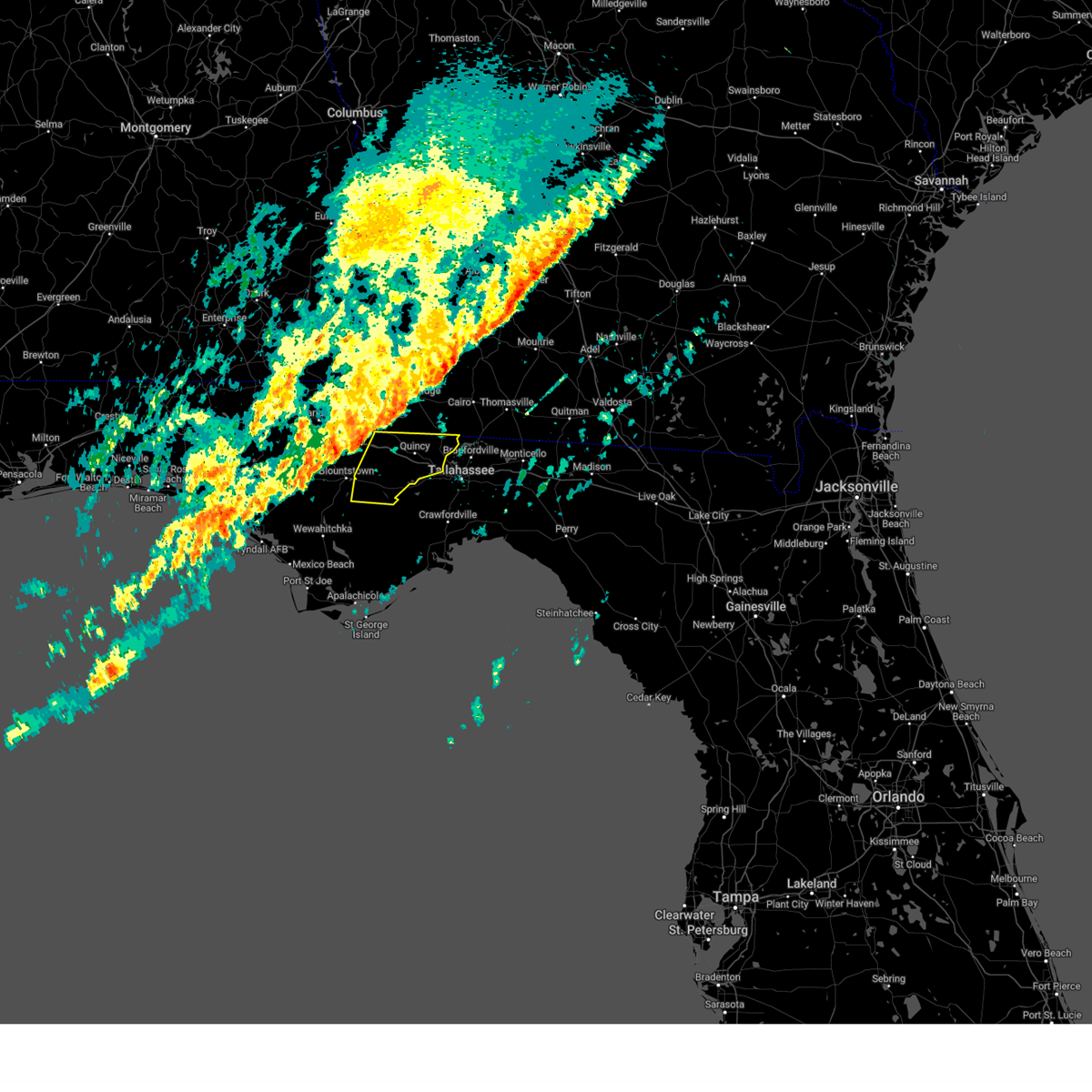 Svrtae the national weather service in tallahassee has issued a * severe thunderstorm warning for, gadsden county in big bend florida, northeastern liberty county in big bend florida, * until 830 am est. * at 707 am est, severe thunderstorms were located along a line extending from 10 miles northeast of chattahoochee to 15 miles west of blountstown, moving east at 50 mph (radar indicated). Hazards include 60 mph wind gusts. expect damage to roofs, siding, and trees Svrtae the national weather service in tallahassee has issued a * severe thunderstorm warning for, gadsden county in big bend florida, northeastern liberty county in big bend florida, * until 830 am est. * at 707 am est, severe thunderstorms were located along a line extending from 10 miles northeast of chattahoochee to 15 miles west of blountstown, moving east at 50 mph (radar indicated). Hazards include 60 mph wind gusts. expect damage to roofs, siding, and trees
|
| 2/16/2025 3:59 AM CST |
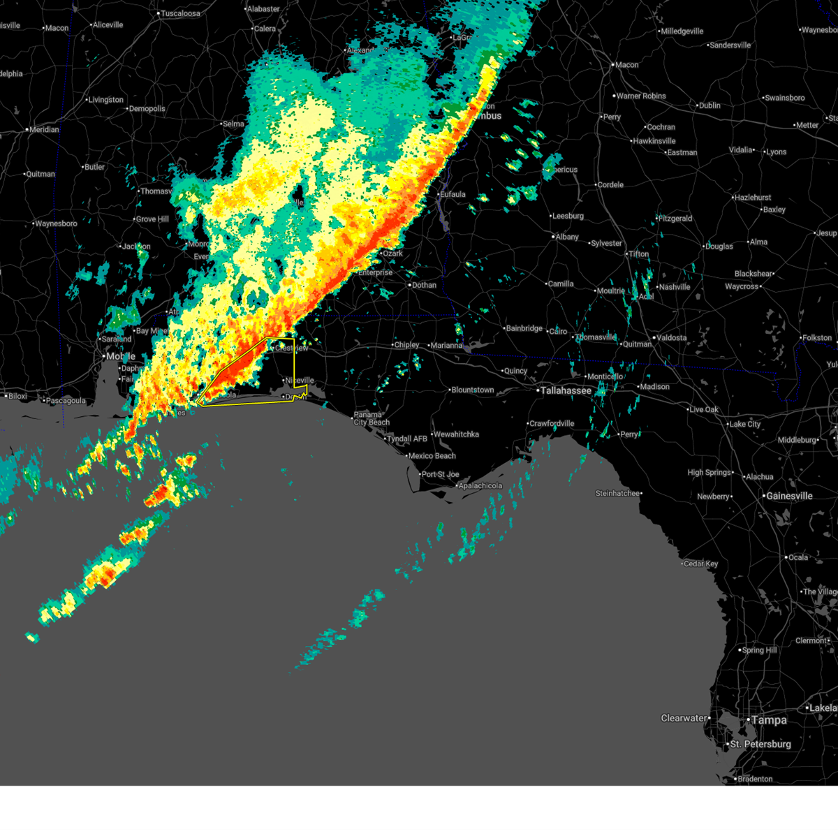 Svrmob the national weather service in mobile has issued a * severe thunderstorm warning for, okaloosa county in northwestern florida, southeastern santa rosa county in northwestern florida, southeastern escambia county in northwestern florida, * until 445 am cst. * at 359 am cst, severe thunderstorms were located along a line extending from 3 miles south of baker to 11 miles southeast of roeville to oriole beach, moving east at 45 mph (radar indicated). Hazards include 60 mph wind gusts. expect damage to roofs, siding, and trees Svrmob the national weather service in mobile has issued a * severe thunderstorm warning for, okaloosa county in northwestern florida, southeastern santa rosa county in northwestern florida, southeastern escambia county in northwestern florida, * until 445 am cst. * at 359 am cst, severe thunderstorms were located along a line extending from 3 miles south of baker to 11 miles southeast of roeville to oriole beach, moving east at 45 mph (radar indicated). Hazards include 60 mph wind gusts. expect damage to roofs, siding, and trees
|
| 12/29/2024 8:18 AM EST |
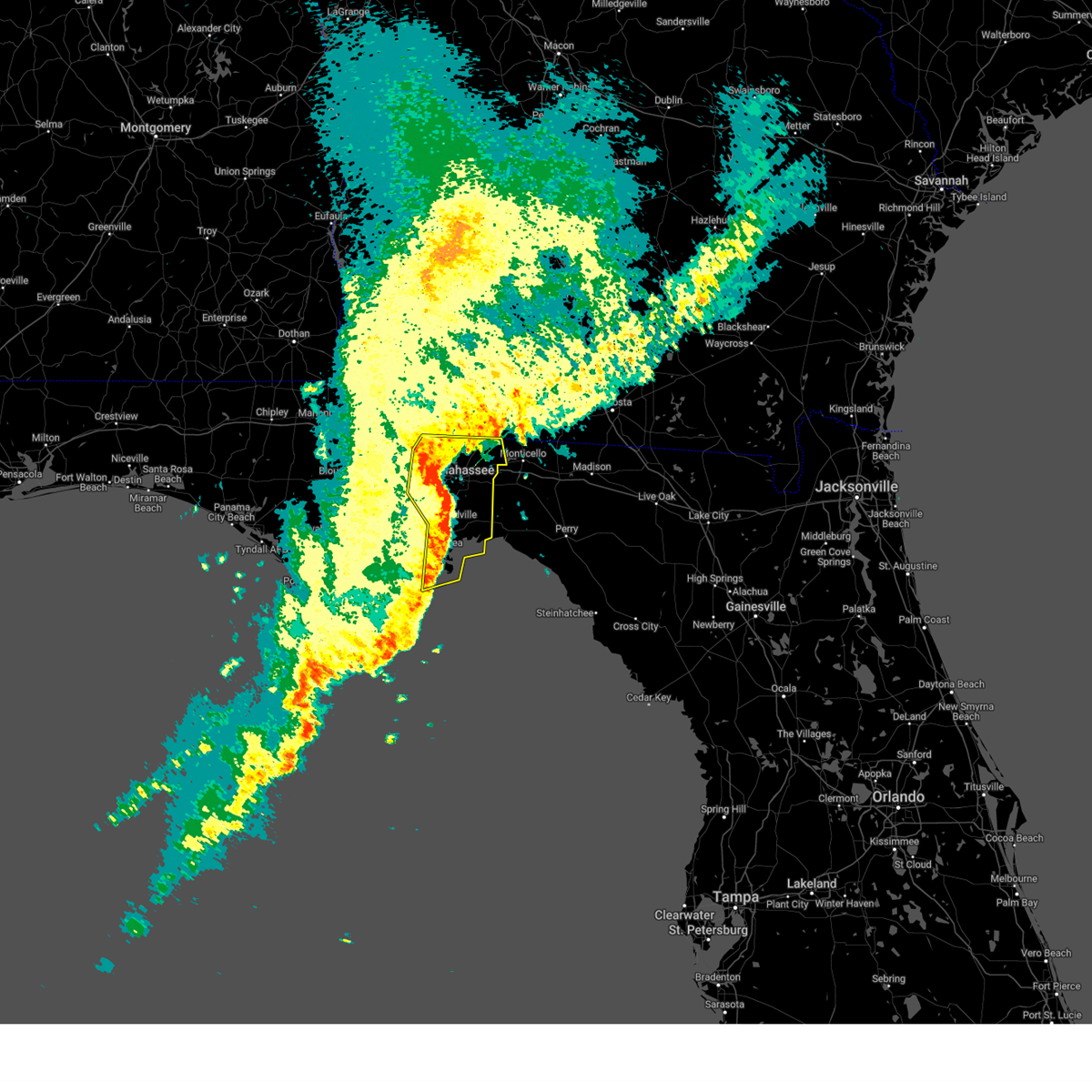 the severe thunderstorm warning has been cancelled and is no longer in effect the severe thunderstorm warning has been cancelled and is no longer in effect
|
| 12/29/2024 8:18 AM EST |
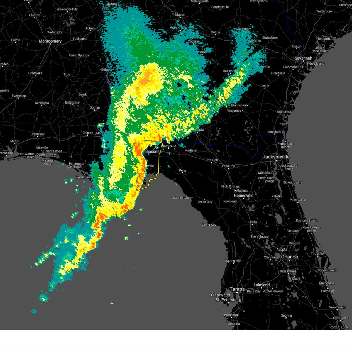 At 818 am est, severe thunderstorms were located along a line extending from 12 miles east of havana to near tallahassee state college to near crawfordville to 12 miles southeast of carrabelle, moving east at 40 mph (radar indicated). Hazards include 60 mph wind gusts and penny size hail. Expect damage to roofs, siding, and trees. locations impacted include, tallahassee, woodville, tallahassee state college, florida state university, quincy, havana, st. Marks, midway, crawfordville, florida a and m, doak campbell stadium, wakulla, sopchoppy, lake bradford, wakulla springs, florence, south city, medart, quincy airport, and bloxham. At 818 am est, severe thunderstorms were located along a line extending from 12 miles east of havana to near tallahassee state college to near crawfordville to 12 miles southeast of carrabelle, moving east at 40 mph (radar indicated). Hazards include 60 mph wind gusts and penny size hail. Expect damage to roofs, siding, and trees. locations impacted include, tallahassee, woodville, tallahassee state college, florida state university, quincy, havana, st. Marks, midway, crawfordville, florida a and m, doak campbell stadium, wakulla, sopchoppy, lake bradford, wakulla springs, florence, south city, medart, quincy airport, and bloxham.
|
| 12/29/2024 7:42 AM EST |
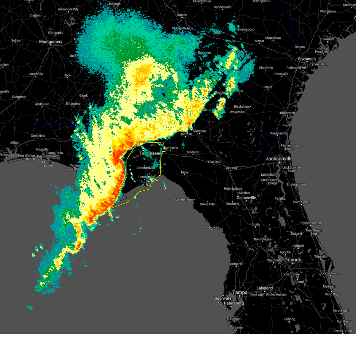 Svrtae the national weather service in tallahassee has issued a * severe thunderstorm warning for, wakulla county in big bend florida, eastern gadsden county in big bend florida, southeastern liberty county in big bend florida, leon county in big bend florida, eastern franklin county in big bend florida, * until 900 am est. * at 741 am est, severe thunderstorms were located along a line extending from near quincy to 12 miles south of greensboro to 18 miles north of carrabelle to eastpoint, moving east at 40 mph (radar indicated). Hazards include 60 mph wind gusts and penny size hail. expect damage to roofs, siding, and trees Svrtae the national weather service in tallahassee has issued a * severe thunderstorm warning for, wakulla county in big bend florida, eastern gadsden county in big bend florida, southeastern liberty county in big bend florida, leon county in big bend florida, eastern franklin county in big bend florida, * until 900 am est. * at 741 am est, severe thunderstorms were located along a line extending from near quincy to 12 miles south of greensboro to 18 miles north of carrabelle to eastpoint, moving east at 40 mph (radar indicated). Hazards include 60 mph wind gusts and penny size hail. expect damage to roofs, siding, and trees
|
| 12/29/2024 2:38 AM CST |
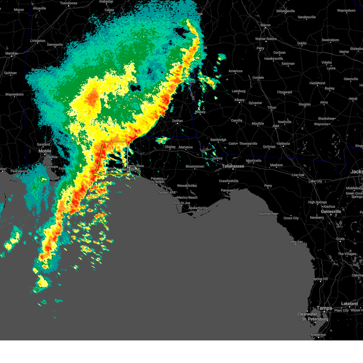 Svrmob the national weather service in mobile has issued a * severe thunderstorm warning for, okaloosa county in northwestern florida, southeastern santa rosa county in northwestern florida, * until 400 am cst. * at 237 am cst, severe thunderstorms were located along a line extending from 10 miles northeast of point baker to near roeville to 6 miles north of oriole beach to 8 miles south of pensacola beach, moving east at 40 mph (radar indicated). Hazards include 60 mph wind gusts. expect damage to roofs, siding, and trees Svrmob the national weather service in mobile has issued a * severe thunderstorm warning for, okaloosa county in northwestern florida, southeastern santa rosa county in northwestern florida, * until 400 am cst. * at 237 am cst, severe thunderstorms were located along a line extending from 10 miles northeast of point baker to near roeville to 6 miles north of oriole beach to 8 miles south of pensacola beach, moving east at 40 mph (radar indicated). Hazards include 60 mph wind gusts. expect damage to roofs, siding, and trees
|
| 12/18/2024 8:07 PM EST |
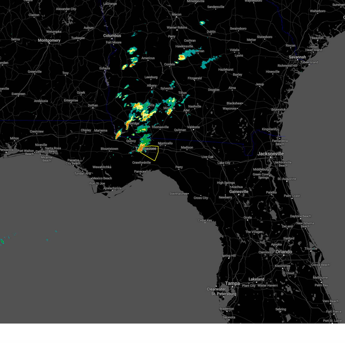 Svrtae the national weather service in tallahassee has issued a * severe thunderstorm warning for, west central jefferson county in big bend florida, southeastern leon county in big bend florida, * until 845 pm est. * at 806 pm est, a severe thunderstorm was located over tallahassee state college, moving east at 25 mph (radar indicated). Hazards include quarter size hail and gusts to 50 mph. damage to vehicles is expected Svrtae the national weather service in tallahassee has issued a * severe thunderstorm warning for, west central jefferson county in big bend florida, southeastern leon county in big bend florida, * until 845 pm est. * at 806 pm est, a severe thunderstorm was located over tallahassee state college, moving east at 25 mph (radar indicated). Hazards include quarter size hail and gusts to 50 mph. damage to vehicles is expected
|
| 8/19/2024 3:05 AM CDT |
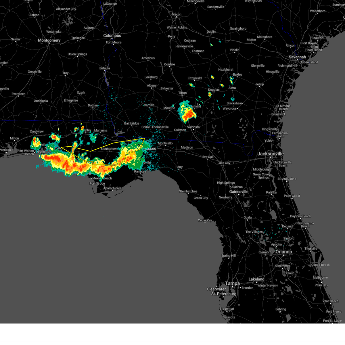 The storms which prompted the warning have moved out of the area. therefore, the warning will be allowed to expire. to report severe weather, contact your nearest law enforcement agency. they will relay your report to the national weather service tallahassee. The storms which prompted the warning have moved out of the area. therefore, the warning will be allowed to expire. to report severe weather, contact your nearest law enforcement agency. they will relay your report to the national weather service tallahassee.
|
| 8/19/2024 2:30 AM CDT |
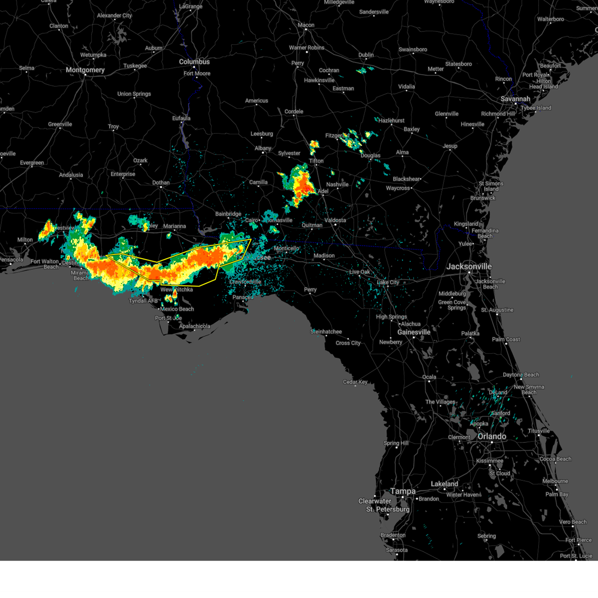 the severe thunderstorm warning has been cancelled and is no longer in effect the severe thunderstorm warning has been cancelled and is no longer in effect
|
| 8/19/2024 2:30 AM CDT |
 At 330 am edt/230 am cdt/, severe thunderstorms were located along a line extending from near greensboro to 11 miles east of lynn haven, moving southeast at 35 mph (radar indicated). Hazards include 60 mph wind gusts. Expect damage to roofs, siding, and trees. Locations impacted include, midway, quincy, havana, blountstown, greensboro, orange, gretna, bristol, ebro, rock bluff, clarksville, juniper, douglas city, selman, abe springs, vilas, florence, chipola, scotts ferry, and kennys mill. At 330 am edt/230 am cdt/, severe thunderstorms were located along a line extending from near greensboro to 11 miles east of lynn haven, moving southeast at 35 mph (radar indicated). Hazards include 60 mph wind gusts. Expect damage to roofs, siding, and trees. Locations impacted include, midway, quincy, havana, blountstown, greensboro, orange, gretna, bristol, ebro, rock bluff, clarksville, juniper, douglas city, selman, abe springs, vilas, florence, chipola, scotts ferry, and kennys mill.
|
| 8/19/2024 3:09 AM EDT |
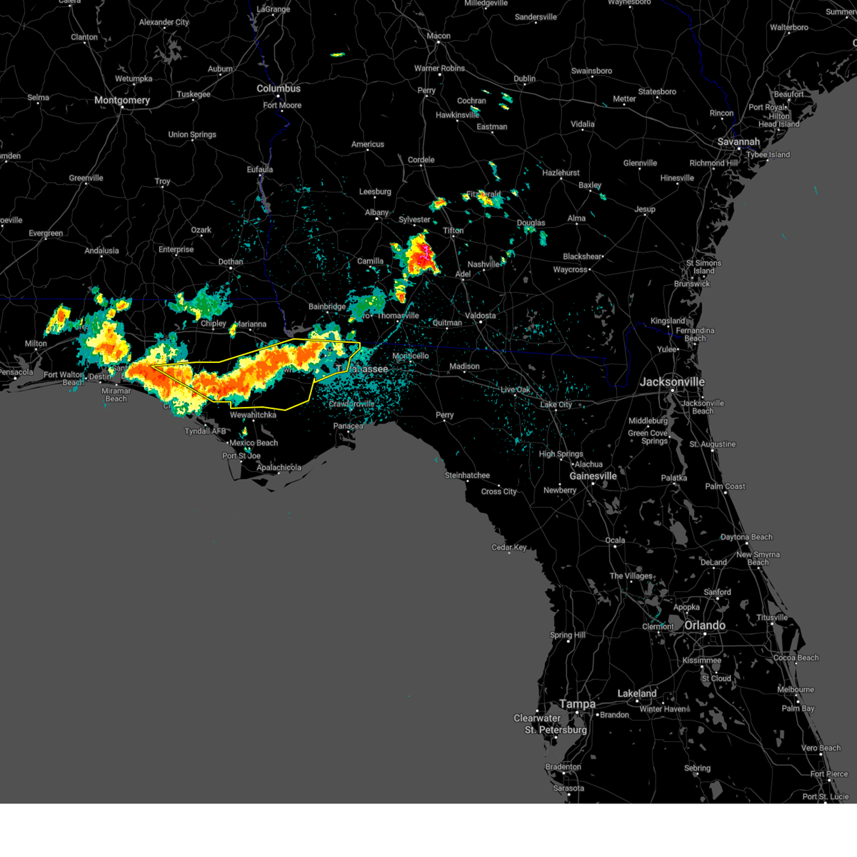 At 309 am edt/209 am cdt/, severe thunderstorms were located along a line extending from near greensboro to 8 miles north of lynn haven, moving southeast at 35 mph (radar indicated). Hazards include 60 mph wind gusts. Expect damage to roofs, siding, and trees. Locations impacted include, quincy, havana, blountstown, midway, chattahoochee, greensboro, orange, gretna, bristol, altha, ebro, rock bluff, clarksville, vilas, florence, quincy airport, lowry, nixon garden, sawdust, and red oak. At 309 am edt/209 am cdt/, severe thunderstorms were located along a line extending from near greensboro to 8 miles north of lynn haven, moving southeast at 35 mph (radar indicated). Hazards include 60 mph wind gusts. Expect damage to roofs, siding, and trees. Locations impacted include, quincy, havana, blountstown, midway, chattahoochee, greensboro, orange, gretna, bristol, altha, ebro, rock bluff, clarksville, vilas, florence, quincy airport, lowry, nixon garden, sawdust, and red oak.
|
| 8/19/2024 2:39 AM EDT |
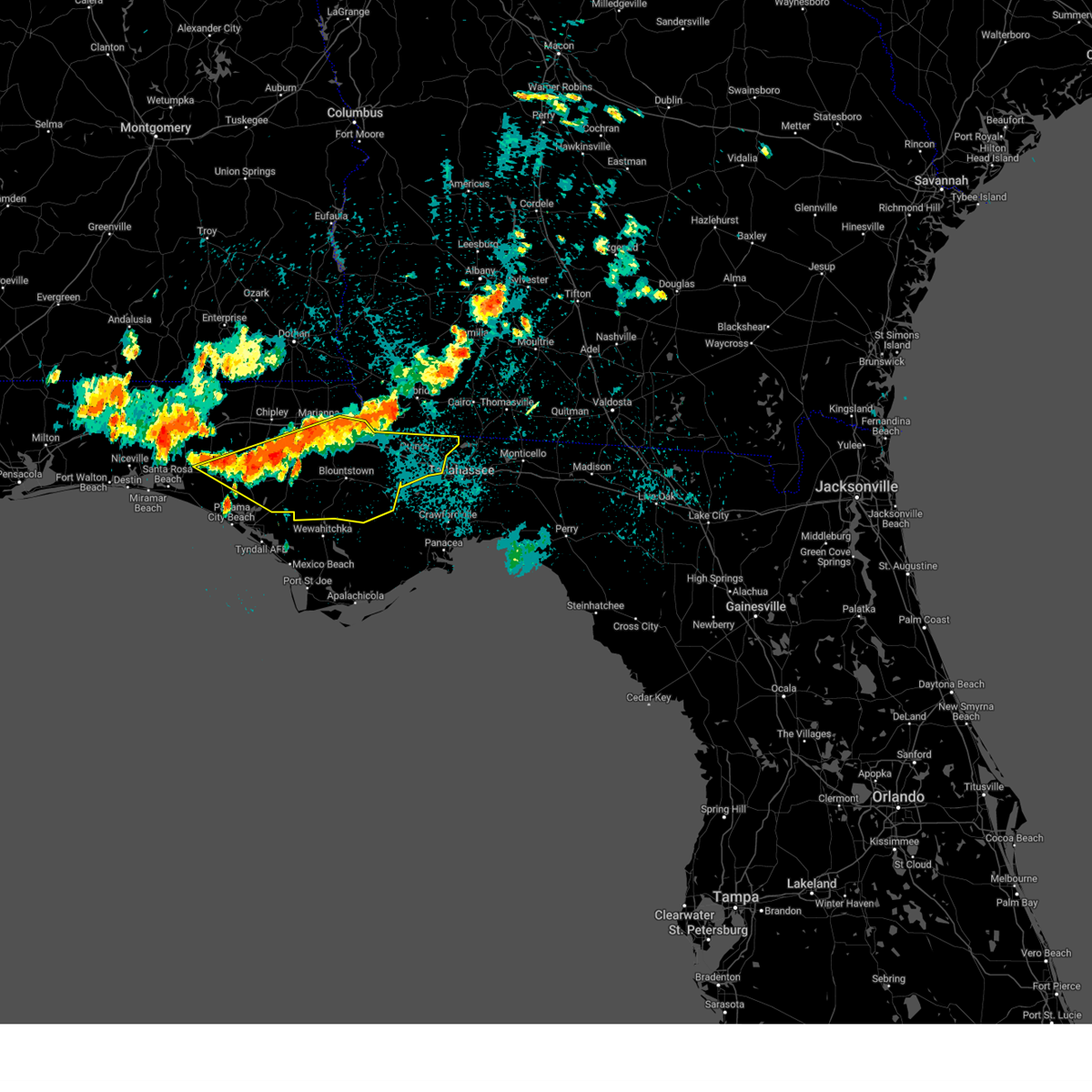 Svrtae the national weather service in tallahassee has issued a * severe thunderstorm warning for, southern jackson county in the panhandle of florida, northern bay county in the panhandle of florida, calhoun county in the panhandle of florida, gadsden county in big bend florida, east central walton county in the panhandle of florida, central liberty county in big bend florida, southern washington county in the panhandle of florida, * until 415 am edt/315 am cdt/. * at 239 am edt/139 am cdt/, severe thunderstorms were located along a line extending from 6 miles east of marianna to 15 miles southwest of vernon, moving southeast at 35 mph (radar indicated). Hazards include 60 mph wind gusts. expect damage to roofs, siding, and trees Svrtae the national weather service in tallahassee has issued a * severe thunderstorm warning for, southern jackson county in the panhandle of florida, northern bay county in the panhandle of florida, calhoun county in the panhandle of florida, gadsden county in big bend florida, east central walton county in the panhandle of florida, central liberty county in big bend florida, southern washington county in the panhandle of florida, * until 415 am edt/315 am cdt/. * at 239 am edt/139 am cdt/, severe thunderstorms were located along a line extending from 6 miles east of marianna to 15 miles southwest of vernon, moving southeast at 35 mph (radar indicated). Hazards include 60 mph wind gusts. expect damage to roofs, siding, and trees
|
| 8/4/2024 2:28 PM EDT |
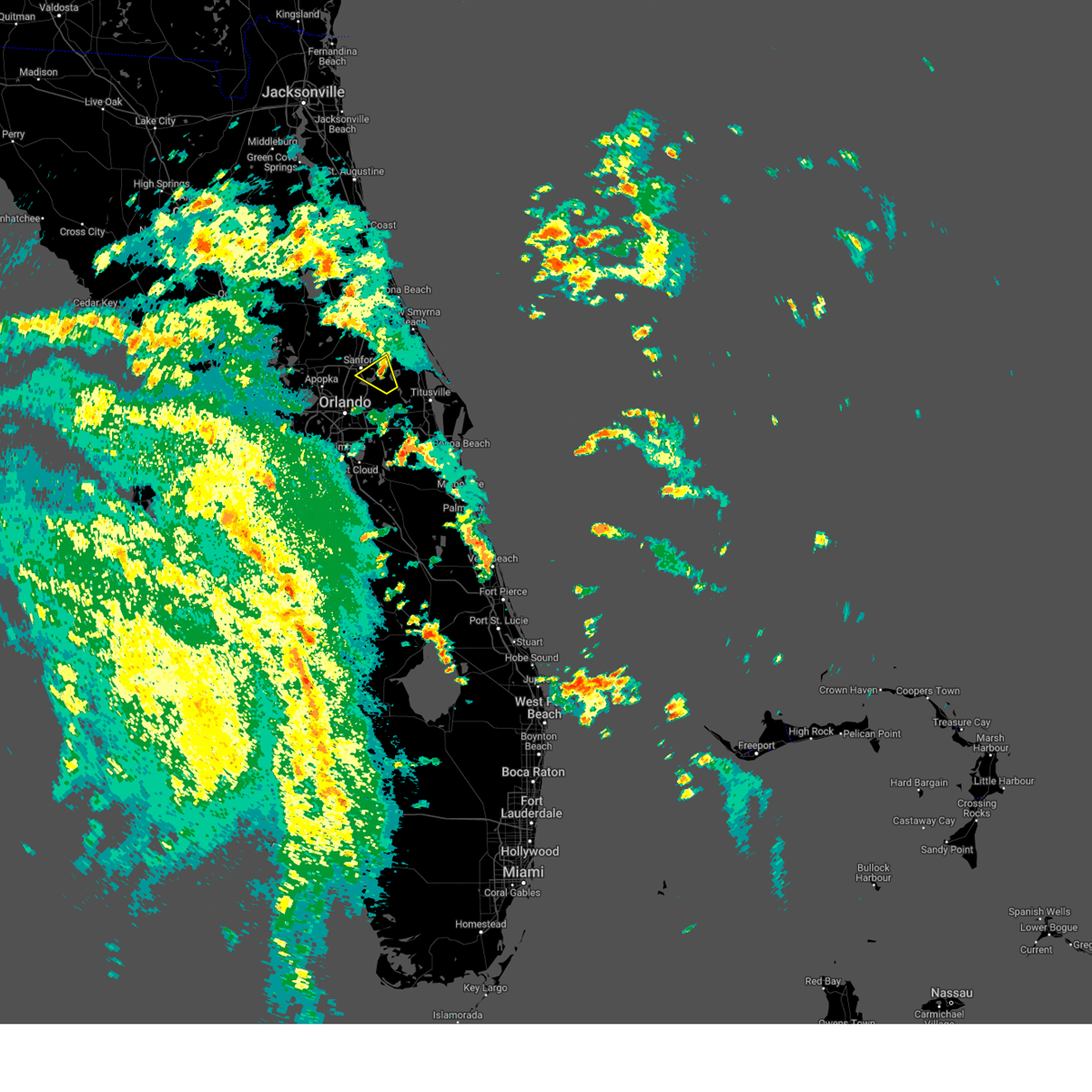 The storm which prompted the warning has weakened below severe limits, and no longer poses an immediate threat to life or property. therefore, the warning will be allowed to expire. however gusty winds are still possible with this thunderstorm. a tornado watch remains in effect until 800 pm edt for east central florida. The storm which prompted the warning has weakened below severe limits, and no longer poses an immediate threat to life or property. therefore, the warning will be allowed to expire. however gusty winds are still possible with this thunderstorm. a tornado watch remains in effect until 800 pm edt for east central florida.
|
| 8/4/2024 2:19 PM EDT |
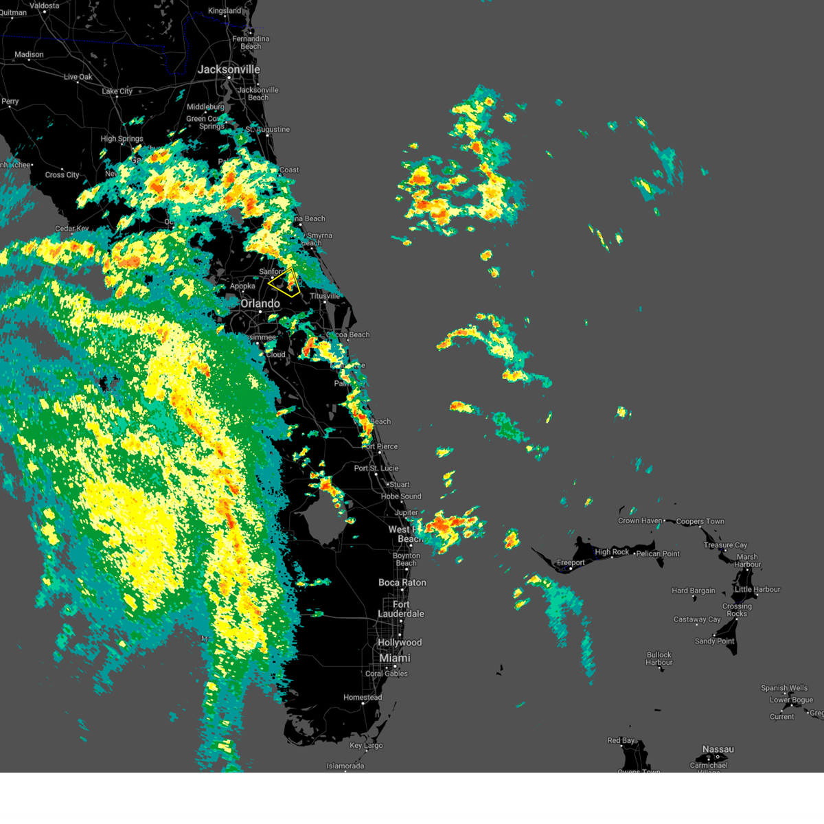 Svrmlb the national weather service in melbourne has issued a * severe thunderstorm warning for, eastern seminole county in east central florida, southern volusia county in east central florida, * until 230 pm edt. * at 219 pm edt, a severe thunderstorm was located over geneva, moving northwest at 35 mph (radar indicated). Hazards include 60 mph wind gusts. expect damage to roofs, siding, and trees Svrmlb the national weather service in melbourne has issued a * severe thunderstorm warning for, eastern seminole county in east central florida, southern volusia county in east central florida, * until 230 pm edt. * at 219 pm edt, a severe thunderstorm was located over geneva, moving northwest at 35 mph (radar indicated). Hazards include 60 mph wind gusts. expect damage to roofs, siding, and trees
|
| 7/29/2024 6:30 PM EDT |
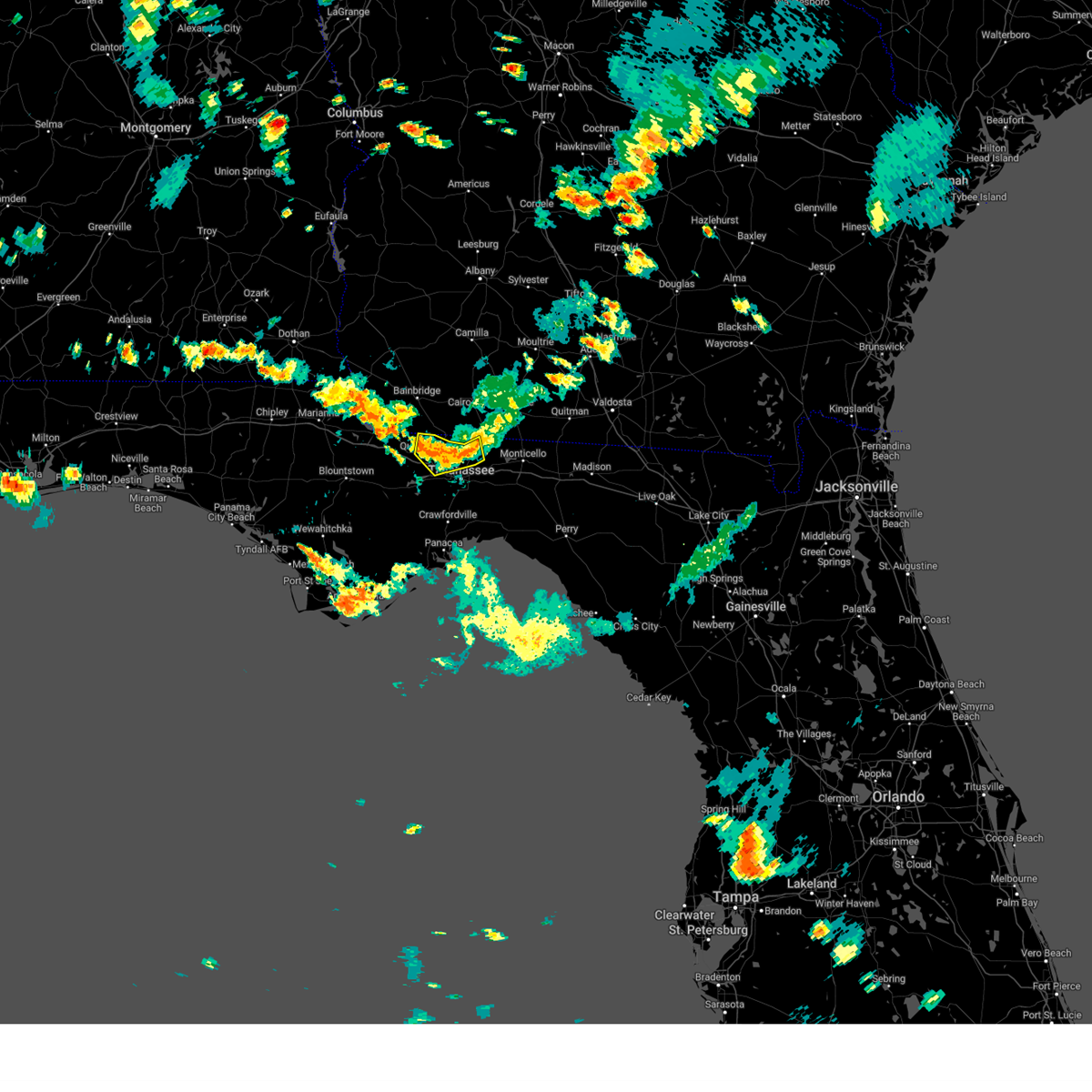 the severe thunderstorm warning has been cancelled and is no longer in effect the severe thunderstorm warning has been cancelled and is no longer in effect
|
| 7/29/2024 6:30 PM EDT |
 At 629 pm edt, a severe thunderstorm was located 7 miles north of tallahassee, moving south at 20 mph (radar indicated). Hazards include 60 mph wind gusts and penny size hail. Expect damage to roofs, siding, and trees. Locations impacted include, tallahassee, quincy, midway, havana, freemont, littman, florence, scotland, jamieson, fred george park, santa clara, killearn estates, shady rest, quincy airport, branchville, hinson, dogtown, forest meadows park, pisgah church, and lake iamonia. At 629 pm edt, a severe thunderstorm was located 7 miles north of tallahassee, moving south at 20 mph (radar indicated). Hazards include 60 mph wind gusts and penny size hail. Expect damage to roofs, siding, and trees. Locations impacted include, tallahassee, quincy, midway, havana, freemont, littman, florence, scotland, jamieson, fred george park, santa clara, killearn estates, shady rest, quincy airport, branchville, hinson, dogtown, forest meadows park, pisgah church, and lake iamonia.
|
| 7/29/2024 6:01 PM EDT |
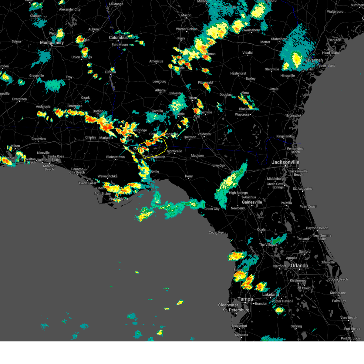 Svrtae the national weather service in tallahassee has issued a * severe thunderstorm warning for, northeastern gadsden county in big bend florida, northeastern leon county in big bend florida, southeastern decatur county in southwestern georgia, southern grady county in southwestern georgia, southwestern thomas county in south central georgia, * until 645 pm edt. * at 600 pm edt, a severe thunderstorm was located 9 miles northeast of havana, moving south at 20 mph (radar indicated). Hazards include 60 mph wind gusts and quarter size hail. Hail damage to vehicles is expected. Expect wind damage to roofs, siding, and trees. Svrtae the national weather service in tallahassee has issued a * severe thunderstorm warning for, northeastern gadsden county in big bend florida, northeastern leon county in big bend florida, southeastern decatur county in southwestern georgia, southern grady county in southwestern georgia, southwestern thomas county in south central georgia, * until 645 pm edt. * at 600 pm edt, a severe thunderstorm was located 9 miles northeast of havana, moving south at 20 mph (radar indicated). Hazards include 60 mph wind gusts and quarter size hail. Hail damage to vehicles is expected. Expect wind damage to roofs, siding, and trees.
|
| 7/20/2024 3:03 PM EDT |
 Svrtae the national weather service in tallahassee has issued a * severe thunderstorm warning for, northeastern gadsden county in big bend florida, northwestern jefferson county in big bend florida, eastern leon county in big bend florida, grady county in southwestern georgia, western thomas county in south central georgia, * until 400 pm edt. * at 303 pm edt, a severe thunderstorm was located near tallahassee community college, moving northeast at 20 mph (radar indicated). Hazards include 60 mph wind gusts. expect damage to roofs, siding, and trees Svrtae the national weather service in tallahassee has issued a * severe thunderstorm warning for, northeastern gadsden county in big bend florida, northwestern jefferson county in big bend florida, eastern leon county in big bend florida, grady county in southwestern georgia, western thomas county in south central georgia, * until 400 pm edt. * at 303 pm edt, a severe thunderstorm was located near tallahassee community college, moving northeast at 20 mph (radar indicated). Hazards include 60 mph wind gusts. expect damage to roofs, siding, and trees
|
| 6/26/2024 12:05 PM EDT |
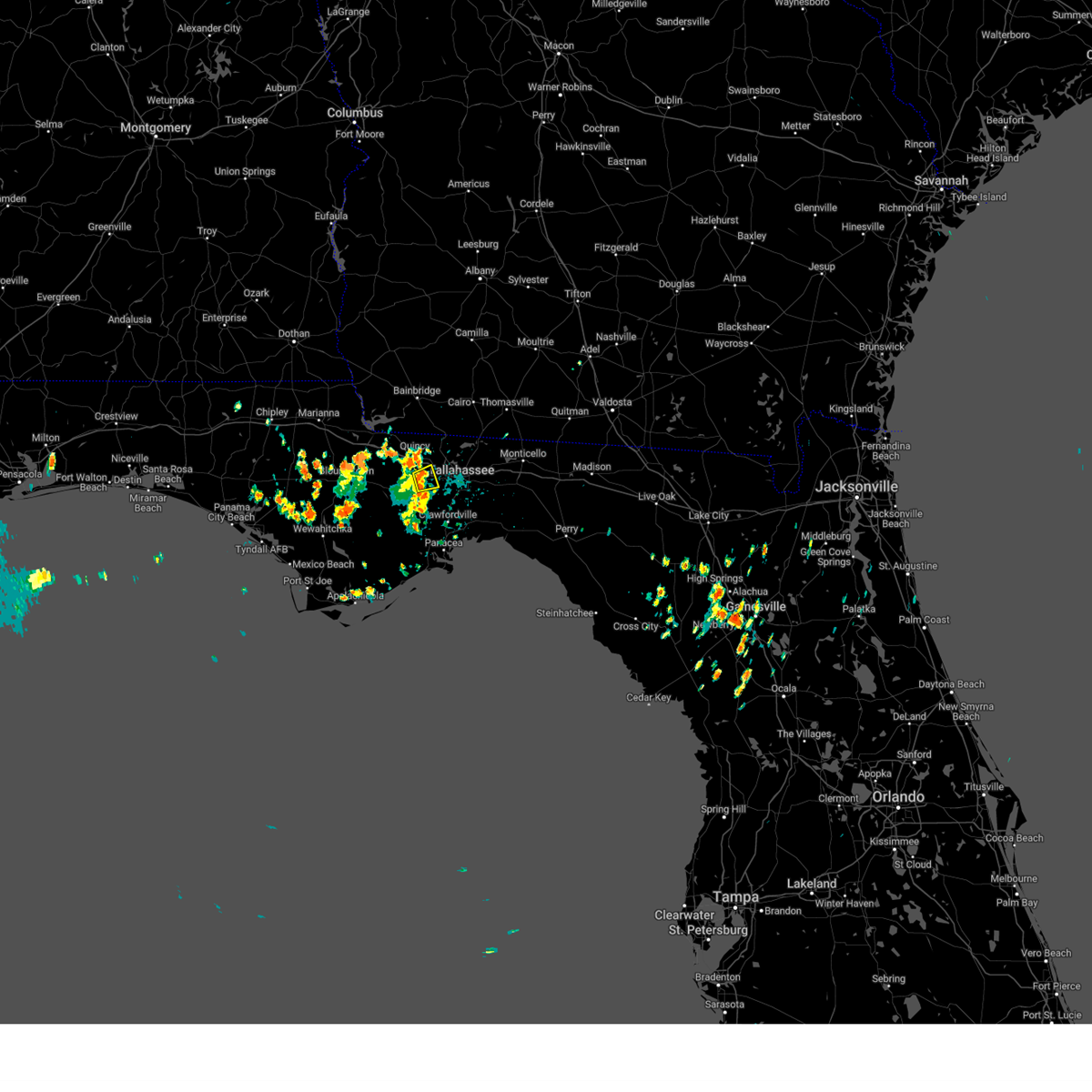 At 1205 pm edt, a severe thunderstorm was located 7 miles south of quincy, moving east at 15 mph (radar indicated). Hazards include 60 mph wind gusts and penny size hail. Expect damage to roofs, siding, and trees. Locations impacted include, midway, lake talquin, and fort braden. At 1205 pm edt, a severe thunderstorm was located 7 miles south of quincy, moving east at 15 mph (radar indicated). Hazards include 60 mph wind gusts and penny size hail. Expect damage to roofs, siding, and trees. Locations impacted include, midway, lake talquin, and fort braden.
|
| 6/26/2024 12:05 PM EDT |
 the severe thunderstorm warning has been cancelled and is no longer in effect the severe thunderstorm warning has been cancelled and is no longer in effect
|
| 6/26/2024 11:45 AM EDT |
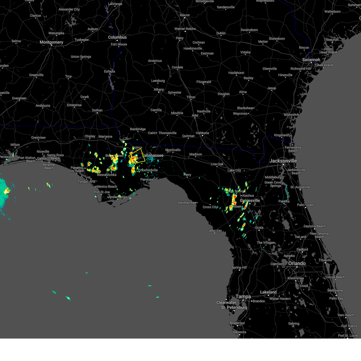 Svrtae the national weather service in tallahassee has issued a * severe thunderstorm warning for, south central gadsden county in big bend florida, east central liberty county in big bend florida, west central leon county in big bend florida, * until 1230 pm edt. * at 1144 am edt, a severe thunderstorm was located 10 miles southeast of greensboro, or 10 miles southwest of quincy, moving east at 10 mph (radar indicated). Hazards include 60 mph wind gusts and penny size hail. expect damage to roofs, siding, and trees Svrtae the national weather service in tallahassee has issued a * severe thunderstorm warning for, south central gadsden county in big bend florida, east central liberty county in big bend florida, west central leon county in big bend florida, * until 1230 pm edt. * at 1144 am edt, a severe thunderstorm was located 10 miles southeast of greensboro, or 10 miles southwest of quincy, moving east at 10 mph (radar indicated). Hazards include 60 mph wind gusts and penny size hail. expect damage to roofs, siding, and trees
|
| 6/6/2024 7:31 PM EDT |
 At 730 pm edt, severe thunderstorms were located along a line extending from wekiva springs to near lake jessup to near christmas, moving northeast at 25 mph (radar indicated). Hazards include 60 mph wind gusts and quarter size hail. Hail damage to vehicles is expected. expect wind damage to roofs, siding, and trees. Locations impacted include, orlando, deltona, sanford, apopka, and altamonte springs. At 730 pm edt, severe thunderstorms were located along a line extending from wekiva springs to near lake jessup to near christmas, moving northeast at 25 mph (radar indicated). Hazards include 60 mph wind gusts and quarter size hail. Hail damage to vehicles is expected. expect wind damage to roofs, siding, and trees. Locations impacted include, orlando, deltona, sanford, apopka, and altamonte springs.
|
| 6/6/2024 7:26 PM EDT |
 Svrmlb the national weather service in melbourne has issued a * severe thunderstorm warning for, seminole county in east central florida, east central lake county in east central florida, central orange county in east central florida, south central volusia county in east central florida, * until 800 pm edt. * at 725 pm edt, severe thunderstorms were located along a line extending from wekiva springs to near oviedo to near christmas, moving northeast at 25 mph (radar indicated). Hazards include 60 mph wind gusts and quarter size hail. Hail damage to vehicles is expected. Expect wind damage to roofs, siding, and trees. Svrmlb the national weather service in melbourne has issued a * severe thunderstorm warning for, seminole county in east central florida, east central lake county in east central florida, central orange county in east central florida, south central volusia county in east central florida, * until 800 pm edt. * at 725 pm edt, severe thunderstorms were located along a line extending from wekiva springs to near oviedo to near christmas, moving northeast at 25 mph (radar indicated). Hazards include 60 mph wind gusts and quarter size hail. Hail damage to vehicles is expected. Expect wind damage to roofs, siding, and trees.
|
| 6/6/2024 7:04 PM EDT |
 At 704 pm edt, severe thunderstorms were located along a line extending from pine hills to union park to near wedgefield, moving north at 35 mph (radar indicated). Hazards include 60 mph wind gusts and half dollar size hail. Hail damage to vehicles is expected. expect wind damage to roofs, siding, and trees. Locations impacted include, orlando, sanford, apopka, altamonte springs, and oviedo. At 704 pm edt, severe thunderstorms were located along a line extending from pine hills to union park to near wedgefield, moving north at 35 mph (radar indicated). Hazards include 60 mph wind gusts and half dollar size hail. Hail damage to vehicles is expected. expect wind damage to roofs, siding, and trees. Locations impacted include, orlando, sanford, apopka, altamonte springs, and oviedo.
|
| 6/6/2024 7:04 PM EDT |
 the severe thunderstorm warning has been cancelled and is no longer in effect the severe thunderstorm warning has been cancelled and is no longer in effect
|
| 6/6/2024 6:59 PM EDT |
 Svrmlb the national weather service in melbourne has issued a * severe thunderstorm warning for, seminole county in east central florida, northwestern brevard county in east central florida, orange county in east central florida, north central osceola county in east central florida, * until 730 pm edt. * at 658 pm edt, severe thunderstorms were located along a line extending from oak ridge to near lake nona to 7 miles west of lone cabbage fish camp, moving north at 35 mph (radar indicated. a wind gust to 58 mph recently occurred at orlando international airport with this storm!). Hazards include 60 mph wind gusts and half dollar size hail. Hail damage to vehicles is expected. Expect wind damage to roofs, siding, and trees. Svrmlb the national weather service in melbourne has issued a * severe thunderstorm warning for, seminole county in east central florida, northwestern brevard county in east central florida, orange county in east central florida, north central osceola county in east central florida, * until 730 pm edt. * at 658 pm edt, severe thunderstorms were located along a line extending from oak ridge to near lake nona to 7 miles west of lone cabbage fish camp, moving north at 35 mph (radar indicated. a wind gust to 58 mph recently occurred at orlando international airport with this storm!). Hazards include 60 mph wind gusts and half dollar size hail. Hail damage to vehicles is expected. Expect wind damage to roofs, siding, and trees.
|
| 5/28/2024 2:28 AM EDT |
 The storm which prompted the warning has moved out of the area. therefore, the warning will be allowed to expire. however, gusty winds are still possible with this thunderstorm. remember, a severe thunderstorm warning still remains in effect for leon county until 2 am edt. The storm which prompted the warning has moved out of the area. therefore, the warning will be allowed to expire. however, gusty winds are still possible with this thunderstorm. remember, a severe thunderstorm warning still remains in effect for leon county until 2 am edt.
|
| 5/28/2024 2:01 AM EDT |
 At 200 am edt, a severe thunderstorm was located near tallahassee, moving southeast at 15 mph (radar indicated). Hazards include 60 mph wind gusts and quarter size hail. Hail damage to vehicles is expected. expect wind damage to roofs, siding, and trees. Locations impacted include, tallahassee, florida state university, tallahassee community college, florida a and m, midway, doak campbell stadium, lake bradford, gaither community center, tallahassee memorial hosp, walker ford community center, south city, griffin heights, tallahassee regional a/p, governors square mall, midtown, apalachee ridge estates, levy park, indian head acres, orchard pond, and maclay state gardens. At 200 am edt, a severe thunderstorm was located near tallahassee, moving southeast at 15 mph (radar indicated). Hazards include 60 mph wind gusts and quarter size hail. Hail damage to vehicles is expected. expect wind damage to roofs, siding, and trees. Locations impacted include, tallahassee, florida state university, tallahassee community college, florida a and m, midway, doak campbell stadium, lake bradford, gaither community center, tallahassee memorial hosp, walker ford community center, south city, griffin heights, tallahassee regional a/p, governors square mall, midtown, apalachee ridge estates, levy park, indian head acres, orchard pond, and maclay state gardens.
|
| 5/28/2024 1:49 AM EDT |
 Svrtae the national weather service in tallahassee has issued a * severe thunderstorm warning for, northeastern gadsden county in big bend florida, central leon county in big bend florida, * until 230 am edt. * at 148 am edt, a severe thunderstorm was located near havana, moving southeast at 20 mph (radar indicated). Hazards include 60 mph wind gusts. expect damage to roofs, siding, and trees Svrtae the national weather service in tallahassee has issued a * severe thunderstorm warning for, northeastern gadsden county in big bend florida, central leon county in big bend florida, * until 230 am edt. * at 148 am edt, a severe thunderstorm was located near havana, moving southeast at 20 mph (radar indicated). Hazards include 60 mph wind gusts. expect damage to roofs, siding, and trees
|
| 5/17/2024 10:10 PM EDT |
 The storms which prompted the warning have weakened below severe limits, and no longer pose an immediate threat to life or property. therefore, the warning will be allowed to expire. however, gusty winds and heavy rain are still possible with these thunderstorms. a tornado watch remains in effect until 100 am edt for big bend florida. to report severe weather, contact your nearest law enforcement agency. they will relay your report to the national weather service tallahassee. The storms which prompted the warning have weakened below severe limits, and no longer pose an immediate threat to life or property. therefore, the warning will be allowed to expire. however, gusty winds and heavy rain are still possible with these thunderstorms. a tornado watch remains in effect until 100 am edt for big bend florida. to report severe weather, contact your nearest law enforcement agency. they will relay your report to the national weather service tallahassee.
|
| 5/17/2024 9:53 PM EDT |
 the severe thunderstorm warning has been cancelled and is no longer in effect the severe thunderstorm warning has been cancelled and is no longer in effect
|
| 5/17/2024 9:53 PM EDT |
 At 953 pm edt, severe thunderstorms were located along a line extending from 7 miles northeast of tallahassee to florida a and m to 10 miles southwest of tallahassee community college, moving southeast at 20 mph (radar indicated). Hazards include 60 mph wind gusts and quarter size hail. Hail damage to vehicles is expected. expect wind damage to roofs, siding, and trees. these severe storms will be near, tallahassee and woodville around 1000 pm edt. Other locations impacted by these severe thunderstorms include lake bradford, gaither community center, tallahassee memorial hosp, walker ford community center, south city, eight mile pond, griffin heights, tallahassee regional a/p, governors square mall, and midtown. At 953 pm edt, severe thunderstorms were located along a line extending from 7 miles northeast of tallahassee to florida a and m to 10 miles southwest of tallahassee community college, moving southeast at 20 mph (radar indicated). Hazards include 60 mph wind gusts and quarter size hail. Hail damage to vehicles is expected. expect wind damage to roofs, siding, and trees. these severe storms will be near, tallahassee and woodville around 1000 pm edt. Other locations impacted by these severe thunderstorms include lake bradford, gaither community center, tallahassee memorial hosp, walker ford community center, south city, eight mile pond, griffin heights, tallahassee regional a/p, governors square mall, and midtown.
|
| 5/17/2024 9:44 PM EDT |
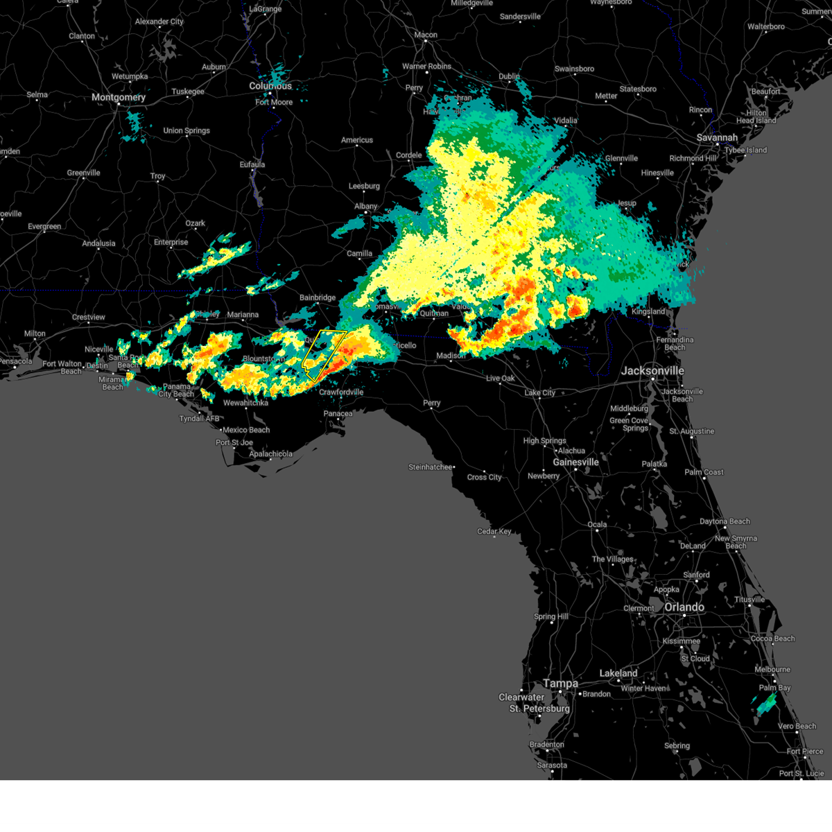 The storms which prompted the warning have moved out of the area. therefore, the warning will be allowed to expire. a tornado watch remains in effect until 100 am edt for big bend florida. to report severe weather, contact your nearest law enforcement agency. they will relay your report to the national weather service tallahassee. The storms which prompted the warning have moved out of the area. therefore, the warning will be allowed to expire. a tornado watch remains in effect until 100 am edt for big bend florida. to report severe weather, contact your nearest law enforcement agency. they will relay your report to the national weather service tallahassee.
|
| 5/17/2024 9:17 PM EDT |
 At 916 pm edt, severe thunderstorms were located along a line extending from near havana to 12 miles south of greensboro, moving east at 25 mph (radar indicated). Hazards include 60 mph wind gusts and quarter size hail. Hail damage to vehicles is expected. expect wind damage to roofs, siding, and trees. these severe storms will be near, tallahassee and midway around 920 pm edt. tallahassee community college around 935 pm edt. doak campbell stadium around 940 pm edt. florida state university and florida a and m around 945 pm edt. woodville around 1005 pm edt. Other locations impacted by these severe thunderstorms include lake bradford, gaither community center, tallahassee memorial hosp, walker ford community center, miccosukee, south city, eight mile pond, griffin heights, tallahassee regional a/p, and governors square mall. At 916 pm edt, severe thunderstorms were located along a line extending from near havana to 12 miles south of greensboro, moving east at 25 mph (radar indicated). Hazards include 60 mph wind gusts and quarter size hail. Hail damage to vehicles is expected. expect wind damage to roofs, siding, and trees. these severe storms will be near, tallahassee and midway around 920 pm edt. tallahassee community college around 935 pm edt. doak campbell stadium around 940 pm edt. florida state university and florida a and m around 945 pm edt. woodville around 1005 pm edt. Other locations impacted by these severe thunderstorms include lake bradford, gaither community center, tallahassee memorial hosp, walker ford community center, miccosukee, south city, eight mile pond, griffin heights, tallahassee regional a/p, and governors square mall.
|
| 5/17/2024 9:15 PM EDT |
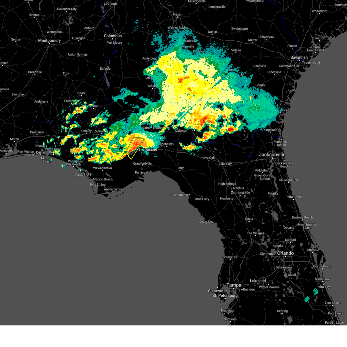 the severe thunderstorm warning has been cancelled and is no longer in effect the severe thunderstorm warning has been cancelled and is no longer in effect
|
| 5/17/2024 9:15 PM EDT |
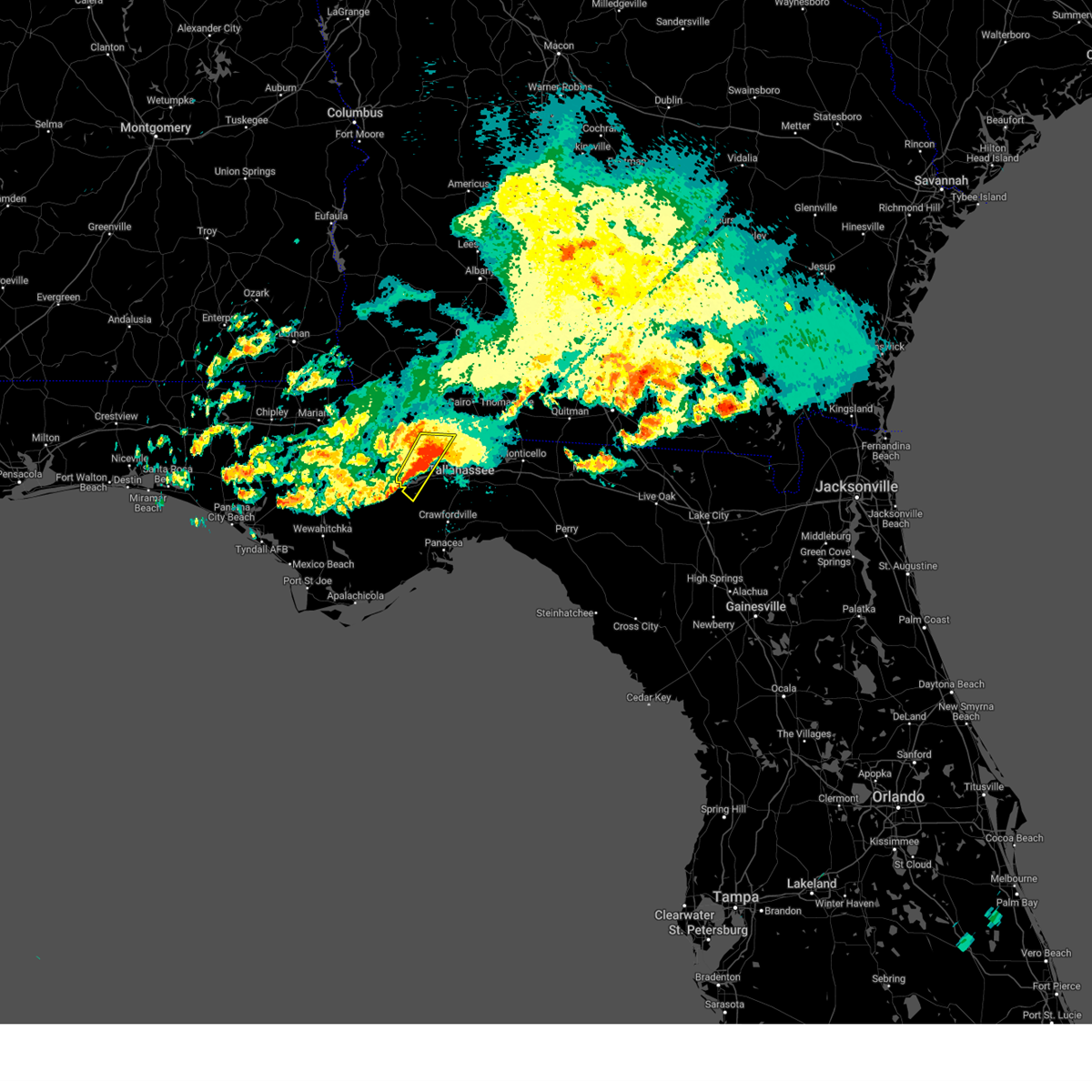 At 914 pm edt, severe thunderstorms were located along a line extending from near havana to 13 miles south of greensboro, moving southeast at 25 mph (radar indicated). Hazards include 60 mph wind gusts and quarter size hail. Hail damage to vehicles is expected. expect wind damage to roofs, siding, and trees. Locations impacted include, quincy, havana, midway, freemont, lake talquin, littman, darsey, florence, concord, scotland, jamieson, fort braden, santa clara, shady rest, quincy airport, wetumpka, branchville, bloxham, hinson, and dogtown. At 914 pm edt, severe thunderstorms were located along a line extending from near havana to 13 miles south of greensboro, moving southeast at 25 mph (radar indicated). Hazards include 60 mph wind gusts and quarter size hail. Hail damage to vehicles is expected. expect wind damage to roofs, siding, and trees. Locations impacted include, quincy, havana, midway, freemont, lake talquin, littman, darsey, florence, concord, scotland, jamieson, fort braden, santa clara, shady rest, quincy airport, wetumpka, branchville, bloxham, hinson, and dogtown.
|
| 5/17/2024 8:54 PM EDT |
 At 854 pm edt, severe thunderstorms were located along a line extending from 6 miles north of quincy to 9 miles south of greensboro, moving east at 30 mph (radar indicated). Hazards include 60 mph wind gusts and quarter size hail. Hail damage to vehicles is expected. expect wind damage to roofs, siding, and trees. Locations impacted include, quincy, havana, midway, greensboro, gretna, attapulgus, freemont, littman, juniper, douglas city, darsey, florence, hosford, scotland, jamieson, laingkat, calvary, santa clara, shady rest, and amsterdam. At 854 pm edt, severe thunderstorms were located along a line extending from 6 miles north of quincy to 9 miles south of greensboro, moving east at 30 mph (radar indicated). Hazards include 60 mph wind gusts and quarter size hail. Hail damage to vehicles is expected. expect wind damage to roofs, siding, and trees. Locations impacted include, quincy, havana, midway, greensboro, gretna, attapulgus, freemont, littman, juniper, douglas city, darsey, florence, hosford, scotland, jamieson, laingkat, calvary, santa clara, shady rest, and amsterdam.
|
| 5/17/2024 8:48 PM EDT |
 Svrtae the national weather service in tallahassee has issued a * severe thunderstorm warning for, southeastern gadsden county in big bend florida, northwestern jefferson county in big bend florida, leon county in big bend florida, * until 1015 pm edt. * at 848 pm edt, severe thunderstorms were located along a line extending from 6 miles northeast of quincy to 11 miles east of blountstown, moving east at 25 mph (radar indicated). Hazards include 60 mph wind gusts and quarter size hail. Hail damage to vehicles is expected. Expect wind damage to roofs, siding, and trees. Svrtae the national weather service in tallahassee has issued a * severe thunderstorm warning for, southeastern gadsden county in big bend florida, northwestern jefferson county in big bend florida, leon county in big bend florida, * until 1015 pm edt. * at 848 pm edt, severe thunderstorms were located along a line extending from 6 miles northeast of quincy to 11 miles east of blountstown, moving east at 25 mph (radar indicated). Hazards include 60 mph wind gusts and quarter size hail. Hail damage to vehicles is expected. Expect wind damage to roofs, siding, and trees.
|
| 5/17/2024 8:24 PM EDT |
 Svrtae the national weather service in tallahassee has issued a * severe thunderstorm warning for, gadsden county in big bend florida, northeastern liberty county in big bend florida, southwestern leon county in big bend florida, southern decatur county in southwestern georgia, southwestern grady county in southwestern georgia, * until 945 pm edt. * at 824 pm edt, severe thunderstorms were located along a line extending from near chattahoochee to near blountstown, moving southeast at 20 mph (radar indicated). Hazards include 60 mph wind gusts and quarter size hail. Hail damage to vehicles is expected. Expect wind damage to roofs, siding, and trees. Svrtae the national weather service in tallahassee has issued a * severe thunderstorm warning for, gadsden county in big bend florida, northeastern liberty county in big bend florida, southwestern leon county in big bend florida, southern decatur county in southwestern georgia, southwestern grady county in southwestern georgia, * until 945 pm edt. * at 824 pm edt, severe thunderstorms were located along a line extending from near chattahoochee to near blountstown, moving southeast at 20 mph (radar indicated). Hazards include 60 mph wind gusts and quarter size hail. Hail damage to vehicles is expected. Expect wind damage to roofs, siding, and trees.
|
| 5/17/2024 3:26 AM CDT |
 The storms which prompted the warning have weakened below severe limits, and no longer pose an immediate threat to life or property. therefore, the warning will be allowed to expire. The storms which prompted the warning have weakened below severe limits, and no longer pose an immediate threat to life or property. therefore, the warning will be allowed to expire.
|
| 5/17/2024 3:15 AM CDT |
 At 314 am cdt, severe thunderstorms were located along a line extending from 3 miles east of ferry pass to 6 miles southeast of pensacola beach, moving east at 45 mph (radar indicated). Hazards include 60 mph wind gusts. Expect damage to roofs, siding, and trees. Locations impacted include, bagdad, oriole beach, navarre, floridatown, navarre beach, and pensacola beach. At 314 am cdt, severe thunderstorms were located along a line extending from 3 miles east of ferry pass to 6 miles southeast of pensacola beach, moving east at 45 mph (radar indicated). Hazards include 60 mph wind gusts. Expect damage to roofs, siding, and trees. Locations impacted include, bagdad, oriole beach, navarre, floridatown, navarre beach, and pensacola beach.
|
| 5/17/2024 2:41 AM CDT |
 Svrmob the national weather service in mobile has issued a * severe thunderstorm warning for, southern santa rosa county in northwestern florida, southeastern escambia county in northwestern florida, * until 330 am cdt. * at 241 am cdt, severe thunderstorms were located along a line extending from 4 miles north of elberta to 7 miles southeast of orange beach, moving east at 50 mph (radar indicated). Hazards include 60 mph wind gusts. expect damage to roofs, siding, and trees Svrmob the national weather service in mobile has issued a * severe thunderstorm warning for, southern santa rosa county in northwestern florida, southeastern escambia county in northwestern florida, * until 330 am cdt. * at 241 am cdt, severe thunderstorms were located along a line extending from 4 miles north of elberta to 7 miles southeast of orange beach, moving east at 50 mph (radar indicated). Hazards include 60 mph wind gusts. expect damage to roofs, siding, and trees
|
| 5/13/2024 11:18 AM CDT |
 Svrmob the national weather service in mobile has issued a * severe thunderstorm warning for, okaloosa county in northwestern florida, southeastern santa rosa county in northwestern florida, southeastern escambia county in northwestern florida, * until noon cdt. * at 1117 am cdt, severe thunderstorms were located along a line extending from 9 miles north of niceville to near eglin afb to mary esther to 9 miles southeast of oriole beach, moving east at 40 mph (radar indicated). Hazards include 70 mph wind gusts. Expect considerable tree damage. Damage is likely to mobile homes, roofs, and outbuildings. Svrmob the national weather service in mobile has issued a * severe thunderstorm warning for, okaloosa county in northwestern florida, southeastern santa rosa county in northwestern florida, southeastern escambia county in northwestern florida, * until noon cdt. * at 1117 am cdt, severe thunderstorms were located along a line extending from 9 miles north of niceville to near eglin afb to mary esther to 9 miles southeast of oriole beach, moving east at 40 mph (radar indicated). Hazards include 70 mph wind gusts. Expect considerable tree damage. Damage is likely to mobile homes, roofs, and outbuildings.
|
| 5/13/2024 10:38 AM CDT |
 Svrmob the national weather service in mobile has issued a * severe thunderstorm warning for, okaloosa county in northwestern florida, southeastern santa rosa county in northwestern florida, southeastern escambia county in northwestern florida, * until 1115 am cdt. * at 1036 am cdt, severe thunderstorms were located along a line extending from 13 miles west of laurel hill to 8 miles southwest of baker to 3 miles southwest of warrington, moving southeast at 30 mph. these are destructive storms for much of okaloosa county and portions of southeastern santa rosa and escambia counties, including crestview and portions of interstate 10 (radar indicated). Hazards include 80 mph wind gusts. Flying debris will be dangerous to those caught without shelter. mobile homes will be heavily damaged. expect considerable damage to roofs, windows, and vehicles. Extensive tree damage and power outages are likely. Svrmob the national weather service in mobile has issued a * severe thunderstorm warning for, okaloosa county in northwestern florida, southeastern santa rosa county in northwestern florida, southeastern escambia county in northwestern florida, * until 1115 am cdt. * at 1036 am cdt, severe thunderstorms were located along a line extending from 13 miles west of laurel hill to 8 miles southwest of baker to 3 miles southwest of warrington, moving southeast at 30 mph. these are destructive storms for much of okaloosa county and portions of southeastern santa rosa and escambia counties, including crestview and portions of interstate 10 (radar indicated). Hazards include 80 mph wind gusts. Flying debris will be dangerous to those caught without shelter. mobile homes will be heavily damaged. expect considerable damage to roofs, windows, and vehicles. Extensive tree damage and power outages are likely.
|
| 5/13/2024 10:24 AM CDT |
 At 1023 am cdt, severe thunderstorms were located along a line extending from 4 miles north of roeville to 4 miles south of floridatown to 5 miles southwest of bon secour, moving southeast at 40 mph. these are destructive storms for locations near whiting field, allentown, baker (radar indicated). Hazards include 80 mph wind gusts. Flying debris will be dangerous to those caught without shelter. mobile homes will be heavily damaged. expect considerable damage to roofs, windows, and vehicles. extensive tree damage and power outages are likely. Locations impacted include, pensacola, ferry pass, brent, west pensacola, wright, fort walton beach, ensley, warrington, gonzalez, gulf shores, foley, pace, milton, gulf breeze, orange beach, goulding, mary esther, robertsdale, bagdad, and ocean city. At 1023 am cdt, severe thunderstorms were located along a line extending from 4 miles north of roeville to 4 miles south of floridatown to 5 miles southwest of bon secour, moving southeast at 40 mph. these are destructive storms for locations near whiting field, allentown, baker (radar indicated). Hazards include 80 mph wind gusts. Flying debris will be dangerous to those caught without shelter. mobile homes will be heavily damaged. expect considerable damage to roofs, windows, and vehicles. extensive tree damage and power outages are likely. Locations impacted include, pensacola, ferry pass, brent, west pensacola, wright, fort walton beach, ensley, warrington, gonzalez, gulf shores, foley, pace, milton, gulf breeze, orange beach, goulding, mary esther, robertsdale, bagdad, and ocean city.
|
| 5/13/2024 10:14 AM CDT |
 Svrmob the national weather service in mobile has issued a * severe thunderstorm warning for, southeastern baldwin county in southwestern alabama, western okaloosa county in northwestern florida, santa rosa county in northwestern florida, escambia county in northwestern florida, * until 1100 am cdt. * at 1014 am cdt, severe thunderstorms were located along a line extending from 9 miles north of point baker to 3 miles southwest of floridatown to 7 miles west of bon secour, moving southeast at 40 mph (radar indicated). Hazards include 70 mph wind gusts. Expect considerable tree damage. Damage is likely to mobile homes, roofs, and outbuildings. Svrmob the national weather service in mobile has issued a * severe thunderstorm warning for, southeastern baldwin county in southwestern alabama, western okaloosa county in northwestern florida, santa rosa county in northwestern florida, escambia county in northwestern florida, * until 1100 am cdt. * at 1014 am cdt, severe thunderstorms were located along a line extending from 9 miles north of point baker to 3 miles southwest of floridatown to 7 miles west of bon secour, moving southeast at 40 mph (radar indicated). Hazards include 70 mph wind gusts. Expect considerable tree damage. Damage is likely to mobile homes, roofs, and outbuildings.
|
| 5/10/2024 7:25 AM EDT |
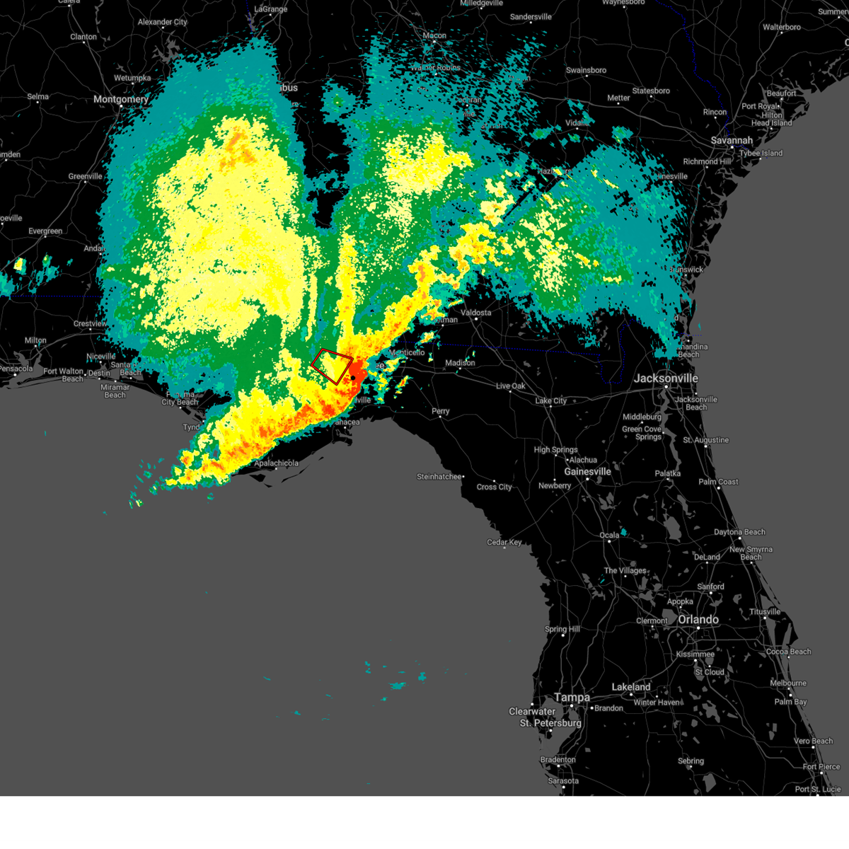 The storm which prompted the warning has moved out of the area. therefore, the warning will be allowed to expire. a severe thunderstorm watch remains in effect until 1100 am edt for big bend florida. to report severe weather, contact your nearest law enforcement agency. they will relay your report to the national weather service tallahassee. The storm which prompted the warning has moved out of the area. therefore, the warning will be allowed to expire. a severe thunderstorm watch remains in effect until 1100 am edt for big bend florida. to report severe weather, contact your nearest law enforcement agency. they will relay your report to the national weather service tallahassee.
|
| 5/10/2024 7:25 AM EDT |
 The storms which prompted the warning have moved out of the area. therefore, the warning will be allowed to expire. a severe thunderstorm watch remains in effect until 1100 am edt for big bend florida. to report severe weather, contact your nearest law enforcement agency. they will relay your report to the national weather service tallahassee. The storms which prompted the warning have moved out of the area. therefore, the warning will be allowed to expire. a severe thunderstorm watch remains in effect until 1100 am edt for big bend florida. to report severe weather, contact your nearest law enforcement agency. they will relay your report to the national weather service tallahassee.
|
| 5/10/2024 6:54 AM EDT |
 the severe thunderstorm warning has been cancelled and is no longer in effect the severe thunderstorm warning has been cancelled and is no longer in effect
|
| 5/10/2024 6:54 AM EDT |
 At 654 am edt/554 am cdt/, severe thunderstorms were located along a line extending from near tallahassee to 18 miles west of crawfordville to 11 miles northeast of port st. joe, moving east at 70 mph (radar indicated). Hazards include 70 mph wind gusts and penny size hail. Expect considerable tree damage. damage is likely to mobile homes, roofs, and outbuildings. locations impacted include, tallahassee, woodville, carrabelle, monticello, havana, perry, midway, florida state university, eastpoint, apalachicola, tallahassee community college, st. marks, madison, crawfordville, florida a and m, st george island, port st. Joe, mexico beach, doak campbell stadium, and wewahitchka. At 654 am edt/554 am cdt/, severe thunderstorms were located along a line extending from near tallahassee to 18 miles west of crawfordville to 11 miles northeast of port st. joe, moving east at 70 mph (radar indicated). Hazards include 70 mph wind gusts and penny size hail. Expect considerable tree damage. damage is likely to mobile homes, roofs, and outbuildings. locations impacted include, tallahassee, woodville, carrabelle, monticello, havana, perry, midway, florida state university, eastpoint, apalachicola, tallahassee community college, st. marks, madison, crawfordville, florida a and m, st george island, port st. Joe, mexico beach, doak campbell stadium, and wewahitchka.
|
| 5/10/2024 6:50 AM EDT |
 Tortae the national weather service in tallahassee has issued a * tornado warning for, northeastern wakulla county in big bend florida, leon county in big bend florida, * until 730 am edt. * at 650 am edt, tornado producing storms were located along a line extending from near midway to 14 miles southwest of tallahassee community college, moving east at 45 mph (radar confirmed tornado). Hazards include damaging tornado. Flying debris will be dangerous to those caught without shelter. mobile homes will be damaged or destroyed. damage to roofs, windows, and vehicles will occur. tree damage is likely. these tornadic storms will be near, tallahassee around 655 am edt. florida state university, tallahassee community college, and doak campbell stadium around 700 am edt. florida a and m around 705 am edt. woodville around 710 am edt. Other locations impacted by these tornadic storms include lake bradford, leon sinks, gaither community center, wakulla springs, tallahassee memorial hosp, walker ford community center, south city, eight mile pond, griffin heights, and bethel. Tortae the national weather service in tallahassee has issued a * tornado warning for, northeastern wakulla county in big bend florida, leon county in big bend florida, * until 730 am edt. * at 650 am edt, tornado producing storms were located along a line extending from near midway to 14 miles southwest of tallahassee community college, moving east at 45 mph (radar confirmed tornado). Hazards include damaging tornado. Flying debris will be dangerous to those caught without shelter. mobile homes will be damaged or destroyed. damage to roofs, windows, and vehicles will occur. tree damage is likely. these tornadic storms will be near, tallahassee around 655 am edt. florida state university, tallahassee community college, and doak campbell stadium around 700 am edt. florida a and m around 705 am edt. woodville around 710 am edt. Other locations impacted by these tornadic storms include lake bradford, leon sinks, gaither community center, wakulla springs, tallahassee memorial hosp, walker ford community center, south city, eight mile pond, griffin heights, and bethel.
|
| 5/10/2024 6:39 AM EDT |
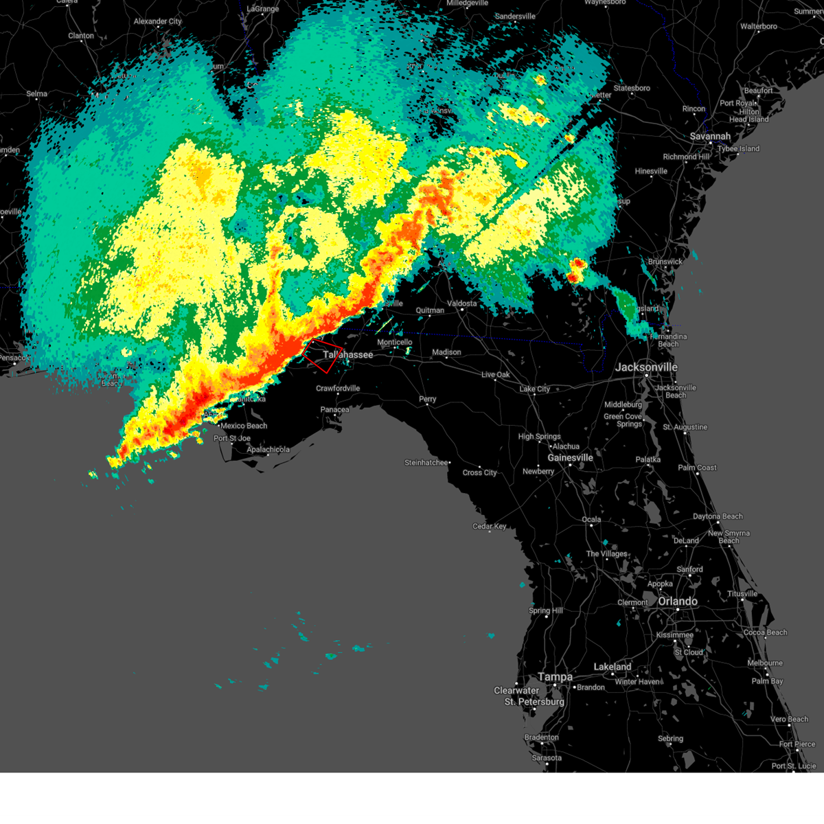 Tortae the national weather service in tallahassee has issued a * tornado warning for, central gadsden county in big bend florida, southwestern leon county in big bend florida, * until 730 am edt. * at 639 am edt, a tornado producing storm was located near quincy, moving southeast at 30 mph (radar confirmed tornado). Hazards include damaging tornado. Flying debris will be dangerous to those caught without shelter. mobile homes will be damaged or destroyed. damage to roofs, windows, and vehicles will occur. tree damage is likely. this tornadic storm will be near, quincy around 645 am edt. midway around 650 am edt. Other locations impacted by this tornadic thunderstorm include quincy airport, santa clara, wetumpka, lake talquin, fort braden, and littman. Tortae the national weather service in tallahassee has issued a * tornado warning for, central gadsden county in big bend florida, southwestern leon county in big bend florida, * until 730 am edt. * at 639 am edt, a tornado producing storm was located near quincy, moving southeast at 30 mph (radar confirmed tornado). Hazards include damaging tornado. Flying debris will be dangerous to those caught without shelter. mobile homes will be damaged or destroyed. damage to roofs, windows, and vehicles will occur. tree damage is likely. this tornadic storm will be near, quincy around 645 am edt. midway around 650 am edt. Other locations impacted by this tornadic thunderstorm include quincy airport, santa clara, wetumpka, lake talquin, fort braden, and littman.
|
| 5/10/2024 6:21 AM EDT |
 Svrtae the national weather service in tallahassee has issued a * severe thunderstorm warning for, southeastern jackson county in the panhandle of florida, gulf county in the panhandle of florida, southeastern bay county in the panhandle of florida, calhoun county in the panhandle of florida, wakulla county in big bend florida, gadsden county in big bend florida, liberty county in big bend florida, taylor county in big bend florida, jefferson county in big bend florida, leon county in big bend florida, franklin county in big bend florida, madison county in big bend florida, * until 745 am edt/645 am cdt/. * at 620 am edt/520 am cdt/, severe thunderstorms were located along a line extending from chattahoochee to 14 miles northwest of stonemill creek to 9 miles southwest of panama city, moving east at 70 mph (radar indicated). Hazards include 70 mph wind gusts. Expect considerable tree damage. Damage is likely to mobile homes, roofs, and outbuildings. Svrtae the national weather service in tallahassee has issued a * severe thunderstorm warning for, southeastern jackson county in the panhandle of florida, gulf county in the panhandle of florida, southeastern bay county in the panhandle of florida, calhoun county in the panhandle of florida, wakulla county in big bend florida, gadsden county in big bend florida, liberty county in big bend florida, taylor county in big bend florida, jefferson county in big bend florida, leon county in big bend florida, franklin county in big bend florida, madison county in big bend florida, * until 745 am edt/645 am cdt/. * at 620 am edt/520 am cdt/, severe thunderstorms were located along a line extending from chattahoochee to 14 miles northwest of stonemill creek to 9 miles southwest of panama city, moving east at 70 mph (radar indicated). Hazards include 70 mph wind gusts. Expect considerable tree damage. Damage is likely to mobile homes, roofs, and outbuildings.
|
| 5/10/2024 4:29 AM CDT |
 The storms which prompted the warning have moved out of the area. therefore, the warning will be allowed to expire. however, gusty winds are still possible with these thunderstorms. a severe thunderstorm watch remains in effect until 700 am cdt for northwestern florida. The storms which prompted the warning have moved out of the area. therefore, the warning will be allowed to expire. however, gusty winds are still possible with these thunderstorms. a severe thunderstorm watch remains in effect until 700 am cdt for northwestern florida.
|
| 5/10/2024 4:27 AM CDT |
 the severe thunderstorm warning has been cancelled and is no longer in effect the severe thunderstorm warning has been cancelled and is no longer in effect
|
| 5/10/2024 4:27 AM CDT |
 At 427 am cdt, severe thunderstorms were located along a line extending from 4 miles north of lockhart to 8 miles southeast of laurel hill to valparaiso to 7 miles southwest of mary esther, moving east at 60 mph (radar indicated). Hazards include 70 mph wind gusts. Expect considerable tree damage. damage is likely to mobile homes, roofs, and outbuildings. Locations impacted include, wright, fort walton beach, crestview, niceville, destin, eglin afb, valparaiso, mary esther, florala, ocean city, lake lorraine, navarre, shalimar, lockhart, cinco bayou, and navarre beach. At 427 am cdt, severe thunderstorms were located along a line extending from 4 miles north of lockhart to 8 miles southeast of laurel hill to valparaiso to 7 miles southwest of mary esther, moving east at 60 mph (radar indicated). Hazards include 70 mph wind gusts. Expect considerable tree damage. damage is likely to mobile homes, roofs, and outbuildings. Locations impacted include, wright, fort walton beach, crestview, niceville, destin, eglin afb, valparaiso, mary esther, florala, ocean city, lake lorraine, navarre, shalimar, lockhart, cinco bayou, and navarre beach.
|
| 5/10/2024 4:17 AM CDT |
 At 417 am cdt, severe thunderstorms were located along a line extending from 5 miles west of wright to 5 miles southwest of navarre to 11 miles south of pensacola beach to 18 miles southeast of perdido beach, moving east at 60 mph (radar indicated). Hazards include 60 mph wind gusts. Expect damage to roofs, siding, and trees. Locations impacted include, pensacola, brent, west pensacola, warrington, gulf breeze, orange beach, goulding, myrtle grove, oriole beach, navarre, navarre beach, and pensacola beach. At 417 am cdt, severe thunderstorms were located along a line extending from 5 miles west of wright to 5 miles southwest of navarre to 11 miles south of pensacola beach to 18 miles southeast of perdido beach, moving east at 60 mph (radar indicated). Hazards include 60 mph wind gusts. Expect damage to roofs, siding, and trees. Locations impacted include, pensacola, brent, west pensacola, warrington, gulf breeze, orange beach, goulding, myrtle grove, oriole beach, navarre, navarre beach, and pensacola beach.
|
| 5/10/2024 4:05 AM CDT |
 Svrmob the national weather service in mobile has issued a * severe thunderstorm warning for, southeastern escambia county in south central alabama, southern covington county in south central alabama, okaloosa county in northwestern florida, southeastern santa rosa county in northwestern florida, southeastern escambia county in northwestern florida, * until 445 am cdt. * at 405 am cdt, severe thunderstorms were located along a line extending from 15 miles southwest of river falls to 11 miles north of baker to 9 miles southeast of roeville to near oriole beach, moving east at 60 mph (radar indicated). Hazards include 70 mph wind gusts. Expect considerable tree damage. Damage is likely to mobile homes, roofs, and outbuildings. Svrmob the national weather service in mobile has issued a * severe thunderstorm warning for, southeastern escambia county in south central alabama, southern covington county in south central alabama, okaloosa county in northwestern florida, southeastern santa rosa county in northwestern florida, southeastern escambia county in northwestern florida, * until 445 am cdt. * at 405 am cdt, severe thunderstorms were located along a line extending from 15 miles southwest of river falls to 11 miles north of baker to 9 miles southeast of roeville to near oriole beach, moving east at 60 mph (radar indicated). Hazards include 70 mph wind gusts. Expect considerable tree damage. Damage is likely to mobile homes, roofs, and outbuildings.
|
| 5/10/2024 3:39 AM CDT |
 Svrmob the national weather service in mobile has issued a * severe thunderstorm warning for, southern baldwin county in southwestern alabama, southwestern okaloosa county in northwestern florida, central santa rosa county in northwestern florida, southeastern escambia county in northwestern florida, * until 430 am cdt. * at 338 am cdt, severe thunderstorms were located along a line extending from 3 miles south of molino to 8 miles northeast of elberta to near foley to 7 miles northeast of fort morgan, moving east at 60 mph (radar indicated). Hazards include 60 mph wind gusts. expect damage to roofs, siding, and trees Svrmob the national weather service in mobile has issued a * severe thunderstorm warning for, southern baldwin county in southwestern alabama, southwestern okaloosa county in northwestern florida, central santa rosa county in northwestern florida, southeastern escambia county in northwestern florida, * until 430 am cdt. * at 338 am cdt, severe thunderstorms were located along a line extending from 3 miles south of molino to 8 miles northeast of elberta to near foley to 7 miles northeast of fort morgan, moving east at 60 mph (radar indicated). Hazards include 60 mph wind gusts. expect damage to roofs, siding, and trees
|
| 5/6/2024 4:54 PM EDT |
 the severe thunderstorm warning has been cancelled and is no longer in effect the severe thunderstorm warning has been cancelled and is no longer in effect
|
| 5/6/2024 4:37 PM EDT |
 At 436 pm edt, a severe thunderstorm was located over tallahassee comm college, and is nearly stationary (radar indicated). Hazards include 60 mph wind gusts and quarter size hail. Hail damage to vehicles is expected. expect wind damage to roofs, siding, and trees. Locations impacted include, tallahassee comm college, florida state university, tallahassee, doak campbell stadium, macon community park, levy park, andrew, maclay state gardens, lake ella, lake jackson, tallahassee mall, innovation park, forest meadows park, mission san luis, lake bradford, and tallahassee regional a/p. At 436 pm edt, a severe thunderstorm was located over tallahassee comm college, and is nearly stationary (radar indicated). Hazards include 60 mph wind gusts and quarter size hail. Hail damage to vehicles is expected. expect wind damage to roofs, siding, and trees. Locations impacted include, tallahassee comm college, florida state university, tallahassee, doak campbell stadium, macon community park, levy park, andrew, maclay state gardens, lake ella, lake jackson, tallahassee mall, innovation park, forest meadows park, mission san luis, lake bradford, and tallahassee regional a/p.
|
| 5/6/2024 4:23 PM EDT |
 Svrtae the national weather service in tallahassee has issued a * severe thunderstorm warning for, central leon county in big bend florida, * until 515 pm edt. * at 422 pm edt, a severe thunderstorm was located over tallahassee comm college, and is nearly stationary (radar indicated). Hazards include 60 mph wind gusts and penny size hail. expect damage to roofs, siding, and trees Svrtae the national weather service in tallahassee has issued a * severe thunderstorm warning for, central leon county in big bend florida, * until 515 pm edt. * at 422 pm edt, a severe thunderstorm was located over tallahassee comm college, and is nearly stationary (radar indicated). Hazards include 60 mph wind gusts and penny size hail. expect damage to roofs, siding, and trees
|
| 5/4/2024 9:22 PM EDT |
 The storm which prompted the warning has weakened below severe limits, and no longer poses an immediate threat to life or property. therefore, the warning will be allowed to expire. however, gusty winds and heavy rain are still possible with this thunderstorm. The storm which prompted the warning has weakened below severe limits, and no longer poses an immediate threat to life or property. therefore, the warning will be allowed to expire. however, gusty winds and heavy rain are still possible with this thunderstorm.
|
| 5/4/2024 8:56 PM EDT |
 Svrtae the national weather service in tallahassee has issued a * severe thunderstorm warning for, central gadsden county in big bend florida, * until 930 pm edt. * at 856 pm edt, a severe thunderstorm was located over quincy, moving southeast at 25 mph (radar indicated). Hazards include 60 mph wind gusts and quarter size hail. Hail damage to vehicles is expected. Expect wind damage to roofs, siding, and trees. Svrtae the national weather service in tallahassee has issued a * severe thunderstorm warning for, central gadsden county in big bend florida, * until 930 pm edt. * at 856 pm edt, a severe thunderstorm was located over quincy, moving southeast at 25 mph (radar indicated). Hazards include 60 mph wind gusts and quarter size hail. Hail damage to vehicles is expected. Expect wind damage to roofs, siding, and trees.
|
| 4/30/2024 2:54 PM CDT |
 the severe thunderstorm warning has been cancelled and is no longer in effect the severe thunderstorm warning has been cancelled and is no longer in effect
|
| 4/30/2024 2:30 PM CDT |
 Svrmob the national weather service in mobile has issued a * severe thunderstorm warning for, southern okaloosa county in northwestern florida, southeastern santa rosa county in northwestern florida, southeastern escambia county in northwestern florida, * until 315 pm cdt. * at 230 pm cdt, a severe thunderstorm was located over destin, moving southeast at 10 mph (radar indicated). Hazards include 60 mph wind gusts. expect damage to roofs, siding, and trees Svrmob the national weather service in mobile has issued a * severe thunderstorm warning for, southern okaloosa county in northwestern florida, southeastern santa rosa county in northwestern florida, southeastern escambia county in northwestern florida, * until 315 pm cdt. * at 230 pm cdt, a severe thunderstorm was located over destin, moving southeast at 10 mph (radar indicated). Hazards include 60 mph wind gusts. expect damage to roofs, siding, and trees
|
| 4/11/2024 12:47 AM EDT |
 Svrtae the national weather service in tallahassee has issued a * severe thunderstorm warning for, gulf county in the panhandle of florida, calhoun county in the panhandle of florida, wakulla county in big bend florida, gadsden county in big bend florida, liberty county in big bend florida, leon county in big bend florida, franklin county in big bend florida, * until 215 am edt/115 am cdt/. * at 1247 am edt/1147 pm cdt/, severe thunderstorms were located along a line extending from 13 miles northwest of stonemill creek to near port st. joe, moving northeast at 55 mph (radar indicated). Hazards include 60 mph wind gusts. expect damage to roofs, siding, and trees Svrtae the national weather service in tallahassee has issued a * severe thunderstorm warning for, gulf county in the panhandle of florida, calhoun county in the panhandle of florida, wakulla county in big bend florida, gadsden county in big bend florida, liberty county in big bend florida, leon county in big bend florida, franklin county in big bend florida, * until 215 am edt/115 am cdt/. * at 1247 am edt/1147 pm cdt/, severe thunderstorms were located along a line extending from 13 miles northwest of stonemill creek to near port st. joe, moving northeast at 55 mph (radar indicated). Hazards include 60 mph wind gusts. expect damage to roofs, siding, and trees
|
| 4/10/2024 2:01 PM CDT |
 At 201 pm cdt, severe thunderstorms were located along a line extending from 8 miles southeast of riverview to 12 miles northeast of roeville to 6 miles south of bagdad to 4 miles south of pensacola beach, moving east at 45 mph (radar indicated). Hazards include 60 mph wind gusts and penny size hail. Expect damage to roofs, siding, and trees. Locations impacted include, wright, crestview, milton, gulf breeze, mary esther, bagdad, baker, oriole beach, navarre, riverview, pensacola beach, point baker, navarre beach, pea ridge, and roeville. At 201 pm cdt, severe thunderstorms were located along a line extending from 8 miles southeast of riverview to 12 miles northeast of roeville to 6 miles south of bagdad to 4 miles south of pensacola beach, moving east at 45 mph (radar indicated). Hazards include 60 mph wind gusts and penny size hail. Expect damage to roofs, siding, and trees. Locations impacted include, wright, crestview, milton, gulf breeze, mary esther, bagdad, baker, oriole beach, navarre, riverview, pensacola beach, point baker, navarre beach, pea ridge, and roeville.
|
| 4/10/2024 1:55 PM CDT |
 The tornado threat has diminished and the tornado warning has been expired. however, large hail and damaging winds remain likely and a severe thunderstorm warning remains in effect for the area. however, gusty winds are still possible with this thunderstorm. a tornado watch remains in effect until 500 pm cdt for northwestern florida. remember, a severe thunderstorm warning still remains in effect for escambia and santa rosa counties until 230 pm cdt. The tornado threat has diminished and the tornado warning has been expired. however, large hail and damaging winds remain likely and a severe thunderstorm warning remains in effect for the area. however, gusty winds are still possible with this thunderstorm. a tornado watch remains in effect until 500 pm cdt for northwestern florida. remember, a severe thunderstorm warning still remains in effect for escambia and santa rosa counties until 230 pm cdt.
|
| 4/10/2024 1:43 PM CDT |
 At 143 pm cdt, a severe thunderstorm capable of producing a tornado was located over ferry pass, moving east at 45 mph (radar indicated rotation). Hazards include tornado. Flying debris will be dangerous to those caught without shelter. mobile homes will be damaged or destroyed. damage to roofs, windows, and vehicles will occur. tree damage is likely. This dangerous storm will be near, bagdad and pea ridge around 150 pm cdt. At 143 pm cdt, a severe thunderstorm capable of producing a tornado was located over ferry pass, moving east at 45 mph (radar indicated rotation). Hazards include tornado. Flying debris will be dangerous to those caught without shelter. mobile homes will be damaged or destroyed. damage to roofs, windows, and vehicles will occur. tree damage is likely. This dangerous storm will be near, bagdad and pea ridge around 150 pm cdt.
|
| 4/10/2024 1:36 PM CDT |
 Svrmob the national weather service in mobile has issued a * severe thunderstorm warning for, southeastern escambia county in south central alabama, southwestern covington county in south central alabama, okaloosa county in northwestern florida, santa rosa county in northwestern florida, eastern escambia county in northwestern florida, * until 230 pm cdt. * at 136 pm cdt, severe thunderstorms were located along a line extending from 3 miles east of flomaton to 10 miles northeast of molino to near brent to 9 miles southeast of perdido beach, moving east at 45 mph (radar indicated). Hazards include 60 mph wind gusts and penny size hail. expect damage to roofs, siding, and trees Svrmob the national weather service in mobile has issued a * severe thunderstorm warning for, southeastern escambia county in south central alabama, southwestern covington county in south central alabama, okaloosa county in northwestern florida, santa rosa county in northwestern florida, eastern escambia county in northwestern florida, * until 230 pm cdt. * at 136 pm cdt, severe thunderstorms were located along a line extending from 3 miles east of flomaton to 10 miles northeast of molino to near brent to 9 miles southeast of perdido beach, moving east at 45 mph (radar indicated). Hazards include 60 mph wind gusts and penny size hail. expect damage to roofs, siding, and trees
|
| 4/10/2024 1:34 PM CDT |
 At 134 pm cdt, severe thunderstorms were located along a line extending from 3 miles east of century to 9 miles northwest of point baker to 3 miles southwest of ensley to 8 miles southeast of perdido beach, moving east at 45 mph (radar indicated). Hazards include 60 mph wind gusts and penny size hail. Expect damage to roofs, siding, and trees. Locations impacted include, pensacola, ferry pass, brent, west pensacola, ensley, warrington, gonzalez, pace, milton, gulf breeze, goulding, century, flomaton, bagdad, myrtle grove, molino, jay, point baker, pea ridge, and roeville. At 134 pm cdt, severe thunderstorms were located along a line extending from 3 miles east of century to 9 miles northwest of point baker to 3 miles southwest of ensley to 8 miles southeast of perdido beach, moving east at 45 mph (radar indicated). Hazards include 60 mph wind gusts and penny size hail. Expect damage to roofs, siding, and trees. Locations impacted include, pensacola, ferry pass, brent, west pensacola, ensley, warrington, gonzalez, pace, milton, gulf breeze, goulding, century, flomaton, bagdad, myrtle grove, molino, jay, point baker, pea ridge, and roeville.
|
| 4/10/2024 1:34 PM CDT |
 the severe thunderstorm warning has been cancelled and is no longer in effect the severe thunderstorm warning has been cancelled and is no longer in effect
|
| 4/10/2024 1:33 PM CDT |
 Tormob the national weather service in mobile has issued a * tornado warning for, southwestern santa rosa county in northwestern florida, south central escambia county in northwestern florida, * until 200 pm cdt. * at 133 pm cdt, a severe thunderstorm capable of producing a tornado was located near ensley, moving east at 45 mph (radar indicated rotation). Hazards include tornado. Flying debris will be dangerous to those caught without shelter. mobile homes will be damaged or destroyed. damage to roofs, windows, and vehicles will occur. tree damage is likely. this dangerous storm will be near, ferry pass, brent, and goulding around 140 pm cdt. floridatown around 145 pm cdt. Bagdad and pea ridge around 150 pm cdt. Tormob the national weather service in mobile has issued a * tornado warning for, southwestern santa rosa county in northwestern florida, south central escambia county in northwestern florida, * until 200 pm cdt. * at 133 pm cdt, a severe thunderstorm capable of producing a tornado was located near ensley, moving east at 45 mph (radar indicated rotation). Hazards include tornado. Flying debris will be dangerous to those caught without shelter. mobile homes will be damaged or destroyed. damage to roofs, windows, and vehicles will occur. tree damage is likely. this dangerous storm will be near, ferry pass, brent, and goulding around 140 pm cdt. floridatown around 145 pm cdt. Bagdad and pea ridge around 150 pm cdt.
|
| 4/10/2024 1:03 PM CDT |
 At 103 pm cdt, severe thunderstorms were located along a line extending from 6 miles southwest of atmore to 12 miles west of gonzalez to 6 miles west of gulf shores, moving east at 40 mph (radar indicated). Hazards include 60 mph wind gusts and penny size hail. Expect damage to roofs, siding, and trees. Locations impacted include, pensacola, ferry pass, brent, west pensacola, ensley, warrington, gonzalez, gulf shores, foley, pace, milton, gulf breeze, orange beach, goulding, robertsdale, century, bagdad, lillian, myrtle grove, and magnolia springs. At 103 pm cdt, severe thunderstorms were located along a line extending from 6 miles southwest of atmore to 12 miles west of gonzalez to 6 miles west of gulf shores, moving east at 40 mph (radar indicated). Hazards include 60 mph wind gusts and penny size hail. Expect damage to roofs, siding, and trees. Locations impacted include, pensacola, ferry pass, brent, west pensacola, ensley, warrington, gonzalez, gulf shores, foley, pace, milton, gulf breeze, orange beach, goulding, robertsdale, century, bagdad, lillian, myrtle grove, and magnolia springs.
|
| 4/10/2024 12:54 PM CDT |
 Svrmob the national weather service in mobile has issued a * severe thunderstorm warning for, southeastern baldwin county in southwestern alabama, western santa rosa county in northwestern florida, escambia county in northwestern florida, * until 145 pm cdt. * at 1254 pm cdt, severe thunderstorms were located along a line extending from 8 miles northeast of bay minette to 7 miles northeast of robertsdale to 7 miles east of fort morgan, moving east at 40 mph (radar indicated). Hazards include 60 mph wind gusts and penny size hail. expect damage to roofs, siding, and trees Svrmob the national weather service in mobile has issued a * severe thunderstorm warning for, southeastern baldwin county in southwestern alabama, western santa rosa county in northwestern florida, escambia county in northwestern florida, * until 145 pm cdt. * at 1254 pm cdt, severe thunderstorms were located along a line extending from 8 miles northeast of bay minette to 7 miles northeast of robertsdale to 7 miles east of fort morgan, moving east at 40 mph (radar indicated). Hazards include 60 mph wind gusts and penny size hail. expect damage to roofs, siding, and trees
|
| 3/27/2024 8:37 AM EDT |
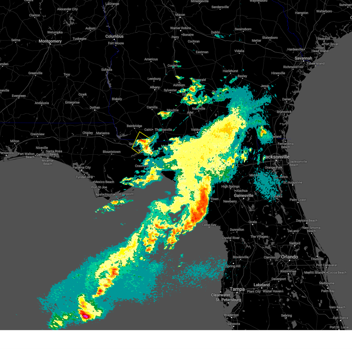 The storm which prompted the warning has weakened below severe limits, and no longer poses an immediate threat to life or property. therefore, the warning will be allowed to expire. however, small hail is still possible with this thunderstorm. The storm which prompted the warning has weakened below severe limits, and no longer poses an immediate threat to life or property. therefore, the warning will be allowed to expire. however, small hail is still possible with this thunderstorm.
|
| 3/27/2024 8:21 AM EDT |
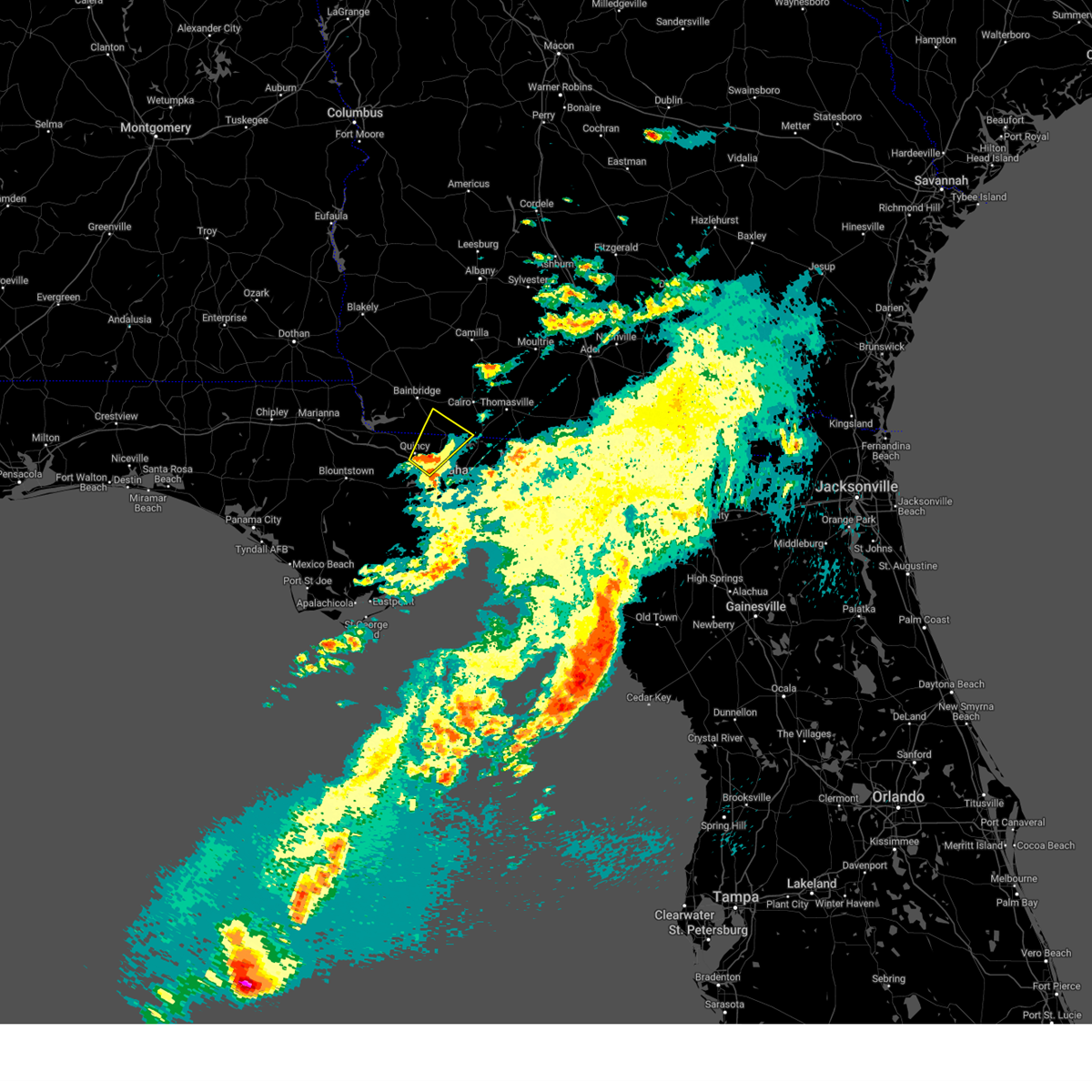 At 820 am edt, a severe thunderstorm was located near havana, moving northeast at 40 mph (radar indicated). Hazards include quarter size hail. Damage to vehicles is expected. Locations impacted include, quincy, midway, havana, attapulgus, freemont, littman, darsey, florence, concord, scotland, orchard pond, jamieson, gibson, laingkat, calvary, santa clara, shady rest, amsterdam, quincy airport, and branchville. At 820 am edt, a severe thunderstorm was located near havana, moving northeast at 40 mph (radar indicated). Hazards include quarter size hail. Damage to vehicles is expected. Locations impacted include, quincy, midway, havana, attapulgus, freemont, littman, darsey, florence, concord, scotland, orchard pond, jamieson, gibson, laingkat, calvary, santa clara, shady rest, amsterdam, quincy airport, and branchville.
|
| 3/27/2024 8:06 AM EDT |
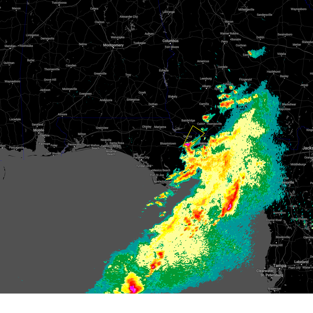 Svrtae the national weather service in tallahassee has issued a * severe thunderstorm warning for, eastern gadsden county in big bend florida, central leon county in big bend florida, southeastern decatur county in southwestern georgia, southwestern grady county in southwestern georgia, * until 845 am edt. * at 805 am edt, a severe thunderstorm was located 7 miles south of quincy, moving northeast at 40 mph (radar indicated). Hazards include half dollar size hail. damage to vehicles is expected Svrtae the national weather service in tallahassee has issued a * severe thunderstorm warning for, eastern gadsden county in big bend florida, central leon county in big bend florida, southeastern decatur county in southwestern georgia, southwestern grady county in southwestern georgia, * until 845 am edt. * at 805 am edt, a severe thunderstorm was located 7 miles south of quincy, moving northeast at 40 mph (radar indicated). Hazards include half dollar size hail. damage to vehicles is expected
|
| 3/27/2024 3:06 AM EDT |
 the severe thunderstorm warning has been cancelled and is no longer in effect the severe thunderstorm warning has been cancelled and is no longer in effect
|
| 3/27/2024 2:46 AM EDT |
 the severe thunderstorm warning has been cancelled and is no longer in effect the severe thunderstorm warning has been cancelled and is no longer in effect
|
| 3/27/2024 2:46 AM EDT |
 At 246 am edt, a severe thunderstorm was located over midway, moving east at 55 mph (radar indicated). Hazards include quarter size hail. Damage to vehicles is expected. Locations impacted include, tallahassee, quincy, midway, havana, freemont, littman, florence, scotland, jamieson, fred george park, santa clara, shady rest, quincy airport, wetumpka, branchville, hinson, forest meadows park, lake talquin, lake iamonia, and concord. At 246 am edt, a severe thunderstorm was located over midway, moving east at 55 mph (radar indicated). Hazards include quarter size hail. Damage to vehicles is expected. Locations impacted include, tallahassee, quincy, midway, havana, freemont, littman, florence, scotland, jamieson, fred george park, santa clara, shady rest, quincy airport, wetumpka, branchville, hinson, forest meadows park, lake talquin, lake iamonia, and concord.
|
| 3/27/2024 2:30 AM EDT |
 Svrtae the national weather service in tallahassee has issued a * severe thunderstorm warning for, eastern gadsden county in big bend florida, east central liberty county in big bend florida, central leon county in big bend florida, * until 330 am edt. * at 230 am edt, a severe thunderstorm was located 13 miles south of greensboro, or 14 miles southwest of quincy, moving northeast at 55 mph (radar indicated). Hazards include golf ball size hail. People and animals outdoors will be injured. Expect damage to roofs, siding, windows, and vehicles. Svrtae the national weather service in tallahassee has issued a * severe thunderstorm warning for, eastern gadsden county in big bend florida, east central liberty county in big bend florida, central leon county in big bend florida, * until 330 am edt. * at 230 am edt, a severe thunderstorm was located 13 miles south of greensboro, or 14 miles southwest of quincy, moving northeast at 55 mph (radar indicated). Hazards include golf ball size hail. People and animals outdoors will be injured. Expect damage to roofs, siding, windows, and vehicles.
|
| 3/27/2024 12:05 AM EDT |
 The storm which prompted the warning has weakened below severe limits, and no longer poses an immediate threat to life or property. therefore, the warning will be allowed to expire. however, small hail is still possible with this thunderstorm. to report severe weather, contact your nearest law enforcement agency. they will relay your report to the national weather service tallahassee. The storm which prompted the warning has weakened below severe limits, and no longer poses an immediate threat to life or property. therefore, the warning will be allowed to expire. however, small hail is still possible with this thunderstorm. to report severe weather, contact your nearest law enforcement agency. they will relay your report to the national weather service tallahassee.
|
| 3/26/2024 11:50 PM EDT |
 At 1150 pm edt, a severe thunderstorm was located near midway, moving east at 40 mph (radar indicated). Hazards include quarter size hail. Damage to vehicles is expected. Locations impacted include, tallahassee, florida state university, midway, tallahassee community college, florida a and m, doak campbell stadium, lake bradford, gaither community center, tallahassee memorial hosp, walker ford community center, south city, griffin heights, tallahassee regional a/p, governors square mall, midtown, apalachee ridge estates, lake talquin, levy park, indian head acres, and orchard pond. At 1150 pm edt, a severe thunderstorm was located near midway, moving east at 40 mph (radar indicated). Hazards include quarter size hail. Damage to vehicles is expected. Locations impacted include, tallahassee, florida state university, midway, tallahassee community college, florida a and m, doak campbell stadium, lake bradford, gaither community center, tallahassee memorial hosp, walker ford community center, south city, griffin heights, tallahassee regional a/p, governors square mall, midtown, apalachee ridge estates, lake talquin, levy park, indian head acres, and orchard pond.
|
| 3/26/2024 11:34 PM EDT |
 At 1134 pm edt, a severe thunderstorm was located near midway, moving northeast at 35 mph (radar indicated). Hazards include quarter size hail. Damage to vehicles is expected. Locations impacted include, tallahassee, florida state university, midway, tallahassee community college, florida a and m, doak campbell stadium, lake bradford, gaither community center, tallahassee memorial hosp, walker ford community center, south city, griffin heights, bloxham, tallahassee regional a/p, governors square mall, midtown, apalachee ridge estates, lake talquin, levy park, and indian head acres. At 1134 pm edt, a severe thunderstorm was located near midway, moving northeast at 35 mph (radar indicated). Hazards include quarter size hail. Damage to vehicles is expected. Locations impacted include, tallahassee, florida state university, midway, tallahassee community college, florida a and m, doak campbell stadium, lake bradford, gaither community center, tallahassee memorial hosp, walker ford community center, south city, griffin heights, bloxham, tallahassee regional a/p, governors square mall, midtown, apalachee ridge estates, lake talquin, levy park, and indian head acres.
|
| 3/26/2024 11:34 PM EDT |
 the severe thunderstorm warning has been cancelled and is no longer in effect the severe thunderstorm warning has been cancelled and is no longer in effect
|
| 3/26/2024 11:13 PM EDT |
 Svrtae the national weather service in tallahassee has issued a * severe thunderstorm warning for, southeastern gadsden county in big bend florida, northeastern liberty county in big bend florida, leon county in big bend florida, * until 1215 am edt. * at 1113 pm edt, a severe thunderstorm was located 14 miles south of greensboro, or 15 miles southwest of quincy, moving east at 40 mph (radar indicated). Hazards include quarter size hail. damage to vehicles is expected Svrtae the national weather service in tallahassee has issued a * severe thunderstorm warning for, southeastern gadsden county in big bend florida, northeastern liberty county in big bend florida, leon county in big bend florida, * until 1215 am edt. * at 1113 pm edt, a severe thunderstorm was located 14 miles south of greensboro, or 15 miles southwest of quincy, moving east at 40 mph (radar indicated). Hazards include quarter size hail. damage to vehicles is expected
|
| 3/26/2024 10:45 PM EDT |
 Svrtae the national weather service in tallahassee has issued a * severe thunderstorm warning for, northeastern gadsden county in big bend florida, northeastern leon county in big bend florida, * until 1130 pm edt. * at 1045 pm edt, a severe thunderstorm was located near havana, moving east at 40 mph (radar indicated). Hazards include quarter size hail. damage to vehicles is expected Svrtae the national weather service in tallahassee has issued a * severe thunderstorm warning for, northeastern gadsden county in big bend florida, northeastern leon county in big bend florida, * until 1130 pm edt. * at 1045 pm edt, a severe thunderstorm was located near havana, moving east at 40 mph (radar indicated). Hazards include quarter size hail. damage to vehicles is expected
|
| 3/9/2024 2:49 AM CST |
 the severe thunderstorm warning has been cancelled and is no longer in effect the severe thunderstorm warning has been cancelled and is no longer in effect
|
| 3/9/2024 2:38 AM CST |
 At 238 am cst, a severe thunderstorm was located over bagdad, moving east at 70 mph (radar indicated). Hazards include 60 mph wind gusts and quarter size hail. Hail damage to vehicles is expected. expect wind damage to roofs, siding, and trees. Locations impacted include, ferry pass, brent, ensley, gonzalez, pace, milton, goulding, bagdad, pea ridge, roeville, floridatown, and point baker. At 238 am cst, a severe thunderstorm was located over bagdad, moving east at 70 mph (radar indicated). Hazards include 60 mph wind gusts and quarter size hail. Hail damage to vehicles is expected. expect wind damage to roofs, siding, and trees. Locations impacted include, ferry pass, brent, ensley, gonzalez, pace, milton, goulding, bagdad, pea ridge, roeville, floridatown, and point baker.
|
| 3/9/2024 2:38 AM CST |
 the severe thunderstorm warning has been cancelled and is no longer in effect the severe thunderstorm warning has been cancelled and is no longer in effect
|
| 3/9/2024 2:25 AM CST |
 At 225 am cst, a severe thunderstorm was located 4 miles west of ensley, moving east at 65 mph (radar indicated). Hazards include golf ball size hail and 60 mph wind gusts. People and animals outdoors will be injured. expect hail damage to roofs, siding, windows, and vehicles. expect wind damage to roofs, siding, and trees. Locations impacted include, pensacola, ferry pass, brent, west pensacola, ensley, warrington, gonzalez, pace, milton, goulding, bagdad, lillian, myrtle grove, perdido beach, elberta, point baker, pea ridge, roeville, and floridatown. At 225 am cst, a severe thunderstorm was located 4 miles west of ensley, moving east at 65 mph (radar indicated). Hazards include golf ball size hail and 60 mph wind gusts. People and animals outdoors will be injured. expect hail damage to roofs, siding, windows, and vehicles. expect wind damage to roofs, siding, and trees. Locations impacted include, pensacola, ferry pass, brent, west pensacola, ensley, warrington, gonzalez, pace, milton, goulding, bagdad, lillian, myrtle grove, perdido beach, elberta, point baker, pea ridge, roeville, and floridatown.
|
| 3/9/2024 2:17 AM CST |
 Svrmob the national weather service in mobile has issued a * severe thunderstorm warning for, southeastern baldwin county in southwestern alabama, central santa rosa county in northwestern florida, south central escambia county in northwestern florida, * until 300 am cst. * at 217 am cst, a severe thunderstorm was located 4 miles northwest of lillian, or 11 miles east of foley, moving east at 65 mph (radar indicated). Hazards include 60 mph wind gusts and quarter size hail. Hail damage to vehicles is expected. Expect wind damage to roofs, siding, and trees. Svrmob the national weather service in mobile has issued a * severe thunderstorm warning for, southeastern baldwin county in southwestern alabama, central santa rosa county in northwestern florida, south central escambia county in northwestern florida, * until 300 am cst. * at 217 am cst, a severe thunderstorm was located 4 miles northwest of lillian, or 11 miles east of foley, moving east at 65 mph (radar indicated). Hazards include 60 mph wind gusts and quarter size hail. Hail damage to vehicles is expected. Expect wind damage to roofs, siding, and trees.
|
| 1/9/2024 6:08 PM EST |
 At 607 pm est, a severe thunderstorm capable of producing a tornado was located over oviedo, moving northeast at 75 mph (radar indicated rotation). Hazards include tornado. Flying debris will be dangerous to those caught without shelter. mobile homes will be damaged or destroyed. damage to roofs, windows, and vehicles will occur. tree damage is likely. this dangerous storm will be near, oviedo, winter springs, and bithlo around 610 pm est. scottsmoor and mims around 620 pm est. haulover canal around 630 pm est. Other locations impacted by this tornadic thunderstorm include turnbull. At 607 pm est, a severe thunderstorm capable of producing a tornado was located over oviedo, moving northeast at 75 mph (radar indicated rotation). Hazards include tornado. Flying debris will be dangerous to those caught without shelter. mobile homes will be damaged or destroyed. damage to roofs, windows, and vehicles will occur. tree damage is likely. this dangerous storm will be near, oviedo, winter springs, and bithlo around 610 pm est. scottsmoor and mims around 620 pm est. haulover canal around 630 pm est. Other locations impacted by this tornadic thunderstorm include turnbull.
|
| 1/9/2024 6:08 PM EST |
 At 607 pm est, severe thunderstorms were located along a line extending from near daytona beach shores to near geneva to near orlando international airport, moving northeast at 65 mph (radar indicated). Hazards include 60 mph wind gusts and nickel size hail. Expect damage to roofs, siding, and trees. Locations impacted include, orlando, deltona, kissimmee, port orange, and sanford. At 607 pm est, severe thunderstorms were located along a line extending from near daytona beach shores to near geneva to near orlando international airport, moving northeast at 65 mph (radar indicated). Hazards include 60 mph wind gusts and nickel size hail. Expect damage to roofs, siding, and trees. Locations impacted include, orlando, deltona, kissimmee, port orange, and sanford.
|
| 1/9/2024 5:55 PM EST |
 The national weather service in melbourne has issued a * severe thunderstorm warning for. seminole county in east central florida. orange county in east central florida. central volusia county in east central florida. northwestern osceola county in east central florida. Until 645 pm est. The national weather service in melbourne has issued a * severe thunderstorm warning for. seminole county in east central florida. orange county in east central florida. central volusia county in east central florida. northwestern osceola county in east central florida. Until 645 pm est.
|
| 1/9/2024 5:44 PM EST |
 At 543 pm est, severe thunderstorms were located along a line extending from near flagler beach to orange city to ocoee, moving northeast at 70 mph (radar indicated). Hazards include 60 mph wind gusts. Expect damage to roofs, siding, and trees. Locations impacted include, orlando, deltona, daytona beach, kissimmee, and port orange. At 543 pm est, severe thunderstorms were located along a line extending from near flagler beach to orange city to ocoee, moving northeast at 70 mph (radar indicated). Hazards include 60 mph wind gusts. Expect damage to roofs, siding, and trees. Locations impacted include, orlando, deltona, daytona beach, kissimmee, and port orange.
|
| 1/9/2024 5:21 PM EST |
 The national weather service in melbourne has issued a * severe thunderstorm warning for. seminole county in east central florida. central lake county in east central florida. orange county in east central florida. Volusia county in east central florida. The national weather service in melbourne has issued a * severe thunderstorm warning for. seminole county in east central florida. central lake county in east central florida. orange county in east central florida. Volusia county in east central florida.
|
| 1/9/2024 10:43 AM EST |
 The national weather service in tallahassee has issued a * tornado warning for. southeastern gadsden county in big bend florida. leon county in big bend florida. southeastern grady county in southwestern georgia. Southwestern thomas county in south central georgia. The national weather service in tallahassee has issued a * tornado warning for. southeastern gadsden county in big bend florida. leon county in big bend florida. southeastern grady county in southwestern georgia. Southwestern thomas county in south central georgia.
|
| 1/9/2024 10:43 AM EST |
 At 1043 am est, a severe thunderstorm capable of producing a tornado was located over midway, moving northeast at 55 mph (radar indicated rotation). Hazards include tornado and quarter size hail. Flying debris will be dangerous to those caught without shelter. mobile homes will be damaged or destroyed. damage to roofs, windows, and vehicles will occur. tree damage is likely. this dangerous storm will be near, tallahassee and tallahassee community college around 1050 am est. Other locations impacted by this tornadic thunderstorm include lake bradford, gaither community center, tallahassee memorial hosp, walker ford community center, rocky hill, miccosukee, south city, griffin heights, tallahassee regional a/p, and governors square mall. At 1043 am est, a severe thunderstorm capable of producing a tornado was located over midway, moving northeast at 55 mph (radar indicated rotation). Hazards include tornado and quarter size hail. Flying debris will be dangerous to those caught without shelter. mobile homes will be damaged or destroyed. damage to roofs, windows, and vehicles will occur. tree damage is likely. this dangerous storm will be near, tallahassee and tallahassee community college around 1050 am est. Other locations impacted by this tornadic thunderstorm include lake bradford, gaither community center, tallahassee memorial hosp, walker ford community center, rocky hill, miccosukee, south city, griffin heights, tallahassee regional a/p, and governors square mall.
|
| 1/9/2024 10:36 AM EST |
 At 1036 am est, a confirmed tornado was located 10 miles southwest of midway, moving northeast at 50 mph (radar confirmed tornado). Hazards include damaging tornado and quarter size hail. Flying debris will be dangerous to those caught without shelter. mobile homes will be damaged or destroyed. damage to roofs, windows, and vehicles will occur. tree damage is likely. this tornado will be near, midway around 1040 am est. havana around 1055 am est. Other locations impacted by this tornadic thunderstorm include freemont, shady rest, lake talquin, littman, silver lake rec area, florence, scotland, wetumpka, branchville, and jamieson. At 1036 am est, a confirmed tornado was located 10 miles southwest of midway, moving northeast at 50 mph (radar confirmed tornado). Hazards include damaging tornado and quarter size hail. Flying debris will be dangerous to those caught without shelter. mobile homes will be damaged or destroyed. damage to roofs, windows, and vehicles will occur. tree damage is likely. this tornado will be near, midway around 1040 am est. havana around 1055 am est. Other locations impacted by this tornadic thunderstorm include freemont, shady rest, lake talquin, littman, silver lake rec area, florence, scotland, wetumpka, branchville, and jamieson.
|
| 1/9/2024 10:22 AM EST |
 At 1022 am est, severe thunderstorms capable of producing both tornadoes and extensive straight line wind damage were located 16 miles south of greensboro, or 18 miles southeast of blountstown, moving northeast at 50 mph (radar indicated rotation). Hazards include tornado and quarter size hail. Flying debris will be dangerous to those caught without shelter. mobile homes will be damaged or destroyed. damage to roofs, windows, and vehicles will occur. tree damage is likely. these dangerous storms will be near, midway around 1040 am est. Other locations impacted by this tornadic thunderstorm include freemont, lake talquin, littman, florence, scotland, jamieson, fort braden, santa clara, shady rest, and silver lake rec area. At 1022 am est, severe thunderstorms capable of producing both tornadoes and extensive straight line wind damage were located 16 miles south of greensboro, or 18 miles southeast of blountstown, moving northeast at 50 mph (radar indicated rotation). Hazards include tornado and quarter size hail. Flying debris will be dangerous to those caught without shelter. mobile homes will be damaged or destroyed. damage to roofs, windows, and vehicles will occur. tree damage is likely. these dangerous storms will be near, midway around 1040 am est. Other locations impacted by this tornadic thunderstorm include freemont, lake talquin, littman, florence, scotland, jamieson, fort braden, santa clara, shady rest, and silver lake rec area.
|
| 1/9/2024 9:53 AM EST |
 At 953 am est, severe thunderstorms were located along a line extending from 8 miles west of west bainbridge to 12 miles south of port st. joe, moving northeast at 50 mph (radar indicated). Hazards include 70 mph wind gusts and quarter size hail. Hail damage to vehicles is expected. expect considerable tree damage. Wind damage is also likely to mobile homes, roofs, and outbuildings. At 953 am est, severe thunderstorms were located along a line extending from 8 miles west of west bainbridge to 12 miles south of port st. joe, moving northeast at 50 mph (radar indicated). Hazards include 70 mph wind gusts and quarter size hail. Hail damage to vehicles is expected. expect considerable tree damage. Wind damage is also likely to mobile homes, roofs, and outbuildings.
|
| 1/9/2024 6:17 AM CST |
 At 617 am cst, severe thunderstorms were located along a line extending from 14 miles northwest of laurel hill to 5 miles south of navarre beach, moving northeast at 40 mph (radar indicated). Hazards include 60 mph wind gusts. Expect damage to roofs, siding, and trees. Locations impacted include, wright, fort walton beach, crestview, niceville, destin, eglin afb, opp, valparaiso, mary esther, florala, ocean city, lake lorraine, baker, navarre, shalimar, laurel hill, lockhart, cinco bayou, and navarre beach. At 617 am cst, severe thunderstorms were located along a line extending from 14 miles northwest of laurel hill to 5 miles south of navarre beach, moving northeast at 40 mph (radar indicated). Hazards include 60 mph wind gusts. Expect damage to roofs, siding, and trees. Locations impacted include, wright, fort walton beach, crestview, niceville, destin, eglin afb, opp, valparaiso, mary esther, florala, ocean city, lake lorraine, baker, navarre, shalimar, laurel hill, lockhart, cinco bayou, and navarre beach.
|
| 1/9/2024 6:08 AM CST |
 At 607 am cst, severe thunderstorms were located along a line extending from 5 miles southwest of andalusia to navarre, moving east at 50 mph (radar indicated). Hazards include 60 mph wind gusts. Expect damage to roofs, siding, and trees. Locations impacted include, milton, bagdad, baker, oriole beach, navarre, navarre beach, and roeville. At 607 am cst, severe thunderstorms were located along a line extending from 5 miles southwest of andalusia to navarre, moving east at 50 mph (radar indicated). Hazards include 60 mph wind gusts. Expect damage to roofs, siding, and trees. Locations impacted include, milton, bagdad, baker, oriole beach, navarre, navarre beach, and roeville.
|
| 1/9/2024 6:01 AM CST | At 601 am cst, severe thunderstorms were located along a line extending from 14 miles southeast of riverview to 9 miles southeast of pensacola beach, moving northeast at 40 mph (radar indicated). Hazards include 60 mph wind gusts. expect damage to roofs, siding, and trees |
| 1/9/2024 6:01 AM CST | At 601 am cst, severe thunderstorms were located along a line extending from 14 miles southeast of riverview to 9 miles southeast of pensacola beach, moving northeast at 40 mph (radar indicated). Hazards include 60 mph wind gusts. expect damage to roofs, siding, and trees |
| 1/9/2024 5:26 AM CST |
 The national weather service in mobile has issued a * severe thunderstorm warning for. eastern escambia county in south central alabama. southeastern conecuh county in south central alabama. southern covington county in south central alabama. Western okaloosa county in northwestern florida. The national weather service in mobile has issued a * severe thunderstorm warning for. eastern escambia county in south central alabama. southeastern conecuh county in south central alabama. southern covington county in south central alabama. Western okaloosa county in northwestern florida.
|
| 1/9/2024 5:26 AM CST |
 At 525 am cst, severe thunderstorms were located along a line extending from 4 miles south of castleberry to 4 miles east of perdido beach, moving east at 40 mph (radar indicated). Hazards include 60 mph wind gusts. expect damage to roofs, siding, and trees At 525 am cst, severe thunderstorms were located along a line extending from 4 miles south of castleberry to 4 miles east of perdido beach, moving east at 40 mph (radar indicated). Hazards include 60 mph wind gusts. expect damage to roofs, siding, and trees
|
| 1/9/2024 4:48 AM CST |
 At 447 am cst, severe thunderstorms were located along a line extending from near mccullough to 5 miles south of point clear, moving east at 40 mph (radar indicated). Hazards include 70 mph wind gusts. Expect considerable tree damage. Damage is likely to mobile homes, roofs, and outbuildings. At 447 am cst, severe thunderstorms were located along a line extending from near mccullough to 5 miles south of point clear, moving east at 40 mph (radar indicated). Hazards include 70 mph wind gusts. Expect considerable tree damage. Damage is likely to mobile homes, roofs, and outbuildings.
|
| 1/9/2024 2:33 AM CST |
 At 232 am cst, a severe thunderstorm capable of producing a tornado was located 6 miles north of oriole beach, or 9 miles south of bagdad, moving northeast at 65 mph (radar indicated rotation). Hazards include tornado. Flying debris will be dangerous to those caught without shelter. mobile homes will be damaged or destroyed. damage to roofs, windows, and vehicles will occur. tree damage is likely. This tornadic thunderstorm will remain over mainly rural areas of northern okaloosa and southeastern santa rosa counties. At 232 am cst, a severe thunderstorm capable of producing a tornado was located 6 miles north of oriole beach, or 9 miles south of bagdad, moving northeast at 65 mph (radar indicated rotation). Hazards include tornado. Flying debris will be dangerous to those caught without shelter. mobile homes will be damaged or destroyed. damage to roofs, windows, and vehicles will occur. tree damage is likely. This tornadic thunderstorm will remain over mainly rural areas of northern okaloosa and southeastern santa rosa counties.
|
| 1/9/2024 2:26 AM CST |
 At 226 am cst, a severe thunderstorm was located 5 miles southwest of bagdad, moving northeast at 65 mph (radar indicated). Hazards include 70 mph wind gusts. Expect considerable tree damage. damage is likely to mobile homes, roofs, and outbuildings. Locations impacted include, pensacola, ferry pass, brent, pace, milton, goulding, bagdad, baker, oriole beach, laurel hill, point baker, pea ridge, roeville, and floridatown. At 226 am cst, a severe thunderstorm was located 5 miles southwest of bagdad, moving northeast at 65 mph (radar indicated). Hazards include 70 mph wind gusts. Expect considerable tree damage. damage is likely to mobile homes, roofs, and outbuildings. Locations impacted include, pensacola, ferry pass, brent, pace, milton, goulding, bagdad, baker, oriole beach, laurel hill, point baker, pea ridge, roeville, and floridatown.
|
| 1/9/2024 2:22 AM CST |
 At 222 am cst, a severe thunderstorm was located 6 miles southeast of ferry pass, moving northeast at 65 mph (radar indicated). Hazards include 60 mph wind gusts. expect damage to roofs, siding, and trees At 222 am cst, a severe thunderstorm was located 6 miles southeast of ferry pass, moving northeast at 65 mph (radar indicated). Hazards include 60 mph wind gusts. expect damage to roofs, siding, and trees
|
| 12/10/2023 9:00 AM EST |
 At 900 am est, severe thunderstorms were located along a line extending from 7 miles northwest of havana to 16 miles northwest of carrabelle, moving east at 25 mph (radar indicated). Hazards include 60 mph wind gusts. expect damage to roofs, siding, and trees At 900 am est, severe thunderstorms were located along a line extending from 7 miles northwest of havana to 16 miles northwest of carrabelle, moving east at 25 mph (radar indicated). Hazards include 60 mph wind gusts. expect damage to roofs, siding, and trees
|
| 12/10/2023 8:54 AM EST |
 At 854 am est/754 am cst/, severe thunderstorms were located along a line extending from 7 miles north of quincy to 18 miles south of port st. joe, moving east at 25 mph (radar indicated). Hazards include 60 mph wind gusts. Expect damage to roofs, siding, and trees. locations impacted include, tallahassee, carrabelle, eastpoint, midway, apalachicola, quincy, havana, st george island, port st. Joe, greensboro, franklin, gretna, sopchoppy, honeyville, jewel fire tower, juniper, douglas city, royal bluff, vilas, and florence. At 854 am est/754 am cst/, severe thunderstorms were located along a line extending from 7 miles north of quincy to 18 miles south of port st. joe, moving east at 25 mph (radar indicated). Hazards include 60 mph wind gusts. Expect damage to roofs, siding, and trees. locations impacted include, tallahassee, carrabelle, eastpoint, midway, apalachicola, quincy, havana, st george island, port st. Joe, greensboro, franklin, gretna, sopchoppy, honeyville, jewel fire tower, juniper, douglas city, royal bluff, vilas, and florence.
|
| 12/10/2023 8:38 AM EST |
 At 838 am est/738 am cst/, severe thunderstorms were located along a line extending from 6 miles northeast of chattahoochee to 17 miles south of port st. joe, moving east at 20 mph (radar indicated). Hazards include 60 mph wind gusts. Expect damage to roofs, siding, and trees. locations impacted include, tallahassee, carrabelle, eastpoint, apalachicola, quincy, havana, midway, st george island, port st. Joe, mexico beach, stonemill creek, chattahoochee, greensboro, orange, franklin, wewahitchka, gretna, bristol, sopchoppy, and rock bluff. At 838 am est/738 am cst/, severe thunderstorms were located along a line extending from 6 miles northeast of chattahoochee to 17 miles south of port st. joe, moving east at 20 mph (radar indicated). Hazards include 60 mph wind gusts. Expect damage to roofs, siding, and trees. locations impacted include, tallahassee, carrabelle, eastpoint, apalachicola, quincy, havana, midway, st george island, port st. Joe, mexico beach, stonemill creek, chattahoochee, greensboro, orange, franklin, wewahitchka, gretna, bristol, sopchoppy, and rock bluff.
|
| 12/10/2023 8:12 AM EST |
 At 812 am est/712 am cst/, severe thunderstorms were located along a line extending from near chattahoochee to near mexico beach, moving east at 15 mph (radar indicated). Hazards include 60 mph wind gusts. expect damage to roofs, siding, and trees At 812 am est/712 am cst/, severe thunderstorms were located along a line extending from near chattahoochee to near mexico beach, moving east at 15 mph (radar indicated). Hazards include 60 mph wind gusts. expect damage to roofs, siding, and trees
|
| 12/10/2023 3:38 AM CST |
 At 336 am cst, severe thunderstorms were located along a line extending from 3 miles northeast of navarre to 4 miles southeast of navarre beach to 17 miles southeast of pensacola beach, moving northeast at 40 mph (radar indicated). Hazards include 60 mph wind gusts and penny size hail. expect damage to roofs, siding, and trees At 336 am cst, severe thunderstorms were located along a line extending from 3 miles northeast of navarre to 4 miles southeast of navarre beach to 17 miles southeast of pensacola beach, moving northeast at 40 mph (radar indicated). Hazards include 60 mph wind gusts and penny size hail. expect damage to roofs, siding, and trees
|
| 9/26/2023 8:11 PM EDT |
 The severe thunderstorm warning for central seminole and south central volusia counties will expire at 815 pm edt, the storm which prompted the warning has weakened below severe limits, and no longer poses an immediate threat to life or property. therefore, the warning will be allowed to expire. however gusty winds and heavy rain are still possible with this thunderstorm. to report severe weather, contact your nearest law enforcement agency. they will relay your report to the national weather service melbourne. The severe thunderstorm warning for central seminole and south central volusia counties will expire at 815 pm edt, the storm which prompted the warning has weakened below severe limits, and no longer poses an immediate threat to life or property. therefore, the warning will be allowed to expire. however gusty winds and heavy rain are still possible with this thunderstorm. to report severe weather, contact your nearest law enforcement agency. they will relay your report to the national weather service melbourne.
|
| 9/26/2023 7:57 PM EDT |
 At 756 pm edt, a severe thunderstorm was located over osteen, or near geneva, moving east at 20 mph (radar indicated). Hazards include 60 mph wind gusts. Expect damage to roofs, siding, and trees. Locations impacted include, deltona, sanford, oviedo, winter springs, and geneva. At 756 pm edt, a severe thunderstorm was located over osteen, or near geneva, moving east at 20 mph (radar indicated). Hazards include 60 mph wind gusts. Expect damage to roofs, siding, and trees. Locations impacted include, deltona, sanford, oviedo, winter springs, and geneva.
|
| 9/26/2023 7:43 PM EDT |
 At 742 pm edt, a severe thunderstorm capable of producing a tornado was located near osteen, or near sanford, moving northeast at 25 mph. continuous cloud to ground lightning is also occurring with this storm! (radar indicated rotation). Hazards include tornado. Flying debris will be dangerous to those caught without shelter. mobile homes will be damaged or destroyed. damage to roofs, windows, and vehicles will occur. tree damage is likely. this dangerous storm will be near, deltona, geneva, and osteen around 750 pm edt. Other locations impacted by this tornadic thunderstorm include mullet lake park. At 742 pm edt, a severe thunderstorm capable of producing a tornado was located near osteen, or near sanford, moving northeast at 25 mph. continuous cloud to ground lightning is also occurring with this storm! (radar indicated rotation). Hazards include tornado. Flying debris will be dangerous to those caught without shelter. mobile homes will be damaged or destroyed. damage to roofs, windows, and vehicles will occur. tree damage is likely. this dangerous storm will be near, deltona, geneva, and osteen around 750 pm edt. Other locations impacted by this tornadic thunderstorm include mullet lake park.
|
| 9/26/2023 7:40 PM EDT |
 At 739 pm edt, a severe thunderstorm was located over sanford, moving northeast at 15 mph (radar indicated). Hazards include 60 mph wind gusts. expect damage to roofs, siding, and trees At 739 pm edt, a severe thunderstorm was located over sanford, moving northeast at 15 mph (radar indicated). Hazards include 60 mph wind gusts. expect damage to roofs, siding, and trees
|
| 9/26/2023 7:31 PM EDT |
 At 731 pm edt, a severe thunderstorm capable of producing a tornado was located near sanford, moving east at 10 mph (radar indicated rotation). Hazards include tornado. Flying debris will be dangerous to those caught without shelter. mobile homes will be damaged or destroyed. damage to roofs, windows, and vehicles will occur. tree damage is likely. this dangerous storm will be near, deltona, sanford, and debary around 740 pm edt. Other locations impacted by this tornadic thunderstorm include enterprise. At 731 pm edt, a severe thunderstorm capable of producing a tornado was located near sanford, moving east at 10 mph (radar indicated rotation). Hazards include tornado. Flying debris will be dangerous to those caught without shelter. mobile homes will be damaged or destroyed. damage to roofs, windows, and vehicles will occur. tree damage is likely. this dangerous storm will be near, deltona, sanford, and debary around 740 pm edt. Other locations impacted by this tornadic thunderstorm include enterprise.
|
| 9/26/2023 7:23 PM EDT |
 At 722 pm edt, a severe thunderstorm capable of producing a tornado was located over sanford, moving northeast at 15 mph (radar indicated rotation). Hazards include tornado. Flying debris will be dangerous to those caught without shelter. mobile homes will be damaged or destroyed. damage to roofs, windows, and vehicles will occur. tree damage is likely. this dangerous storm will be near, deltona, sanford, and debary around 730 pm edt. osteen around 740 pm edt. Other locations impacted by this tornadic thunderstorm include valdez. At 722 pm edt, a severe thunderstorm capable of producing a tornado was located over sanford, moving northeast at 15 mph (radar indicated rotation). Hazards include tornado. Flying debris will be dangerous to those caught without shelter. mobile homes will be damaged or destroyed. damage to roofs, windows, and vehicles will occur. tree damage is likely. this dangerous storm will be near, deltona, sanford, and debary around 730 pm edt. osteen around 740 pm edt. Other locations impacted by this tornadic thunderstorm include valdez.
|
| 9/11/2023 8:10 PM EDT |
 At 809 pm edt, a severe thunderstorm was located over debary, moving southeast at 15 mph (radar indicated). Hazards include 60 mph wind gusts and nickel size hail. expect damage to roofs, siding, and trees At 809 pm edt, a severe thunderstorm was located over debary, moving southeast at 15 mph (radar indicated). Hazards include 60 mph wind gusts and nickel size hail. expect damage to roofs, siding, and trees
|
| 9/7/2023 7:39 PM EDT |
 At 737 pm edt, severe thunderstorms were located along a line extending from tallahassee to near midway to near quincy, moving southwest at 20 mph (radar indicated). Hazards include 60 mph wind gusts and penny size hail. expect damage to roofs, siding, and trees At 737 pm edt, severe thunderstorms were located along a line extending from tallahassee to near midway to near quincy, moving southwest at 20 mph (radar indicated). Hazards include 60 mph wind gusts and penny size hail. expect damage to roofs, siding, and trees
|
| 9/7/2023 7:05 PM EDT |
 At 705 pm edt, severe thunderstorms were located along a line extending from 10 miles northwest of monticello to 8 miles north of tallahassee to 6 miles northwest of havana, moving southeast at 20 mph (radar indicated). Hazards include 60 mph wind gusts and penny size hail. Expect damage to roofs, siding, and trees. locations impacted include, tallahassee, florida state university, midway, tallahassee community college, havana, florida a and m, quincy, doak campbell stadium, lake bradford, gaither community center, tallahassee memorial hosp, florence, walker ford community center, miccosukee, south city, griffin heights, quincy airport, governors square mall, midtown, and apalachee ridge estates. hail threat, radar indicated max hail size, 0. 75 in wind threat, radar indicated max wind gust, 60 mph. At 705 pm edt, severe thunderstorms were located along a line extending from 10 miles northwest of monticello to 8 miles north of tallahassee to 6 miles northwest of havana, moving southeast at 20 mph (radar indicated). Hazards include 60 mph wind gusts and penny size hail. Expect damage to roofs, siding, and trees. locations impacted include, tallahassee, florida state university, midway, tallahassee community college, havana, florida a and m, quincy, doak campbell stadium, lake bradford, gaither community center, tallahassee memorial hosp, florence, walker ford community center, miccosukee, south city, griffin heights, quincy airport, governors square mall, midtown, and apalachee ridge estates. hail threat, radar indicated max hail size, 0. 75 in wind threat, radar indicated max wind gust, 60 mph.
|
| 9/7/2023 6:54 PM EDT |
 At 654 pm edt, severe thunderstorms were located along a line extending from 11 miles south of thomasville to 6 miles east of havana to 8 miles north of quincy, moving southeast at 20 mph (radar indicated). Hazards include 60 mph wind gusts. expect damage to roofs, siding, and trees At 654 pm edt, severe thunderstorms were located along a line extending from 11 miles south of thomasville to 6 miles east of havana to 8 miles north of quincy, moving southeast at 20 mph (radar indicated). Hazards include 60 mph wind gusts. expect damage to roofs, siding, and trees
|
| 8/5/2023 7:13 PM EDT |
 The severe thunderstorm warning for northern wakulla, southeastern gadsden and southwestern leon counties will expire at 715 pm edt, the storm which prompted the warning has weakened below severe limits, and no longer poses an immediate threat to life or property. therefore, the warning will be allowed to expire. however gusty winds are still possible with this thunderstorm. The severe thunderstorm warning for northern wakulla, southeastern gadsden and southwestern leon counties will expire at 715 pm edt, the storm which prompted the warning has weakened below severe limits, and no longer poses an immediate threat to life or property. therefore, the warning will be allowed to expire. however gusty winds are still possible with this thunderstorm.
|
| 8/5/2023 6:24 PM EDT |
 At 624 pm edt, a severe thunderstorm was located over midway, moving south at 20 mph (radar indicated). Hazards include 60 mph wind gusts. expect damage to roofs, siding, and trees At 624 pm edt, a severe thunderstorm was located over midway, moving south at 20 mph (radar indicated). Hazards include 60 mph wind gusts. expect damage to roofs, siding, and trees
|
| 8/5/2023 5:38 PM EDT |
 At 537 pm edt, a severe thunderstorm was located 7 miles northwest of havana, moving south at 20 mph (radar indicated). Hazards include 60 mph wind gusts. expect damage to roofs, siding, and trees At 537 pm edt, a severe thunderstorm was located 7 miles northwest of havana, moving south at 20 mph (radar indicated). Hazards include 60 mph wind gusts. expect damage to roofs, siding, and trees
|
| 8/5/2023 3:57 PM CDT |
 The severe thunderstorm warning for southwestern okaloosa and southeastern santa rosa counties will expire at 400 pm cdt, the storm which prompted the warning has moved out of the area. therefore, the warning will be allowed to expire. The severe thunderstorm warning for southwestern okaloosa and southeastern santa rosa counties will expire at 400 pm cdt, the storm which prompted the warning has moved out of the area. therefore, the warning will be allowed to expire.
|
| 8/5/2023 3:14 PM CDT |
 At 314 pm cdt, a severe thunderstorm was located 7 miles southeast of bagdad, moving southeast at 15 mph (radar indicated). Hazards include 60 mph wind gusts. expect damage to roofs, siding, and trees At 314 pm cdt, a severe thunderstorm was located 7 miles southeast of bagdad, moving southeast at 15 mph (radar indicated). Hazards include 60 mph wind gusts. expect damage to roofs, siding, and trees
|
| 8/4/2023 9:55 PM EDT |
 At 955 pm edt, severe thunderstorms were located along a line extending from 6 miles southeast of havana to 9 miles northwest of carrabelle, moving east at 30 mph (radar indicated). Hazards include 60 mph wind gusts. Expect damage to roofs, siding, and trees. locations impacted include, tallahassee, woodville, carrabelle, florida state university, tallahassee community college, st. marks, midway, crawfordville, florida a and m, doak campbell stadium, wakulla, sopchoppy, lake bradford, jewel fire tower, wakulla springs, south city, medart, bloxham, tallahassee regional a/p and natural bridge. hail threat, radar indicated max hail size, <. 75 in wind threat, radar indicated max wind gust, 60 mph. At 955 pm edt, severe thunderstorms were located along a line extending from 6 miles southeast of havana to 9 miles northwest of carrabelle, moving east at 30 mph (radar indicated). Hazards include 60 mph wind gusts. Expect damage to roofs, siding, and trees. locations impacted include, tallahassee, woodville, carrabelle, florida state university, tallahassee community college, st. marks, midway, crawfordville, florida a and m, doak campbell stadium, wakulla, sopchoppy, lake bradford, jewel fire tower, wakulla springs, south city, medart, bloxham, tallahassee regional a/p and natural bridge. hail threat, radar indicated max hail size, <. 75 in wind threat, radar indicated max wind gust, 60 mph.
|
| 8/4/2023 9:44 PM EDT |
 At 944 pm edt, severe thunderstorms were located along a line extending from havana to 10 miles northwest of carrabelle, moving southeast at 30 mph (radar indicated). Hazards include 60 mph wind gusts. Expect damage to roofs, siding, and trees. locations impacted include, tallahassee, woodville, carrabelle, florida state university, tallahassee community college, quincy, havana, st. marks, midway, crawfordville, florida a and m, doak campbell stadium, wakulla, sopchoppy, lake bradford, jewel fire tower, wakulla springs, florence, south city and medart. hail threat, radar indicated max hail size, <. 75 in wind threat, radar indicated max wind gust, 60 mph. At 944 pm edt, severe thunderstorms were located along a line extending from havana to 10 miles northwest of carrabelle, moving southeast at 30 mph (radar indicated). Hazards include 60 mph wind gusts. Expect damage to roofs, siding, and trees. locations impacted include, tallahassee, woodville, carrabelle, florida state university, tallahassee community college, quincy, havana, st. marks, midway, crawfordville, florida a and m, doak campbell stadium, wakulla, sopchoppy, lake bradford, jewel fire tower, wakulla springs, florence, south city and medart. hail threat, radar indicated max hail size, <. 75 in wind threat, radar indicated max wind gust, 60 mph.
|
| 8/4/2023 9:23 PM EDT |
 At 922 pm edt, severe thunderstorms were located along a line extending from 8 miles north of quincy to 14 miles southeast of blountstown, moving east at 30 mph (radar indicated). Hazards include 60 mph wind gusts. expect damage to roofs, siding, and trees At 922 pm edt, severe thunderstorms were located along a line extending from 8 miles north of quincy to 14 miles southeast of blountstown, moving east at 30 mph (radar indicated). Hazards include 60 mph wind gusts. expect damage to roofs, siding, and trees
|
| 8/4/2023 6:55 PM EDT |
 At 654 pm edt, a severe thunderstorm was located near tallahassee, moving southeast at 25 mph (radar indicated). Hazards include 60 mph wind gusts. Expect damage to roofs, siding, and trees. locations impacted include, tallahassee, woodville, florida state university, tallahassee community college, florida a and m, doak campbell stadium, lake bradford, cody, gaither community center, tallahassee memorial hosp, walker ford community center, south city, griffin heights, tallahassee regional a/p, governors square mall, natural bridge, midtown, apalachee ridge estates, iddo and levy park. hail threat, radar indicated max hail size, <. 75 in wind threat, radar indicated max wind gust, 60 mph. At 654 pm edt, a severe thunderstorm was located near tallahassee, moving southeast at 25 mph (radar indicated). Hazards include 60 mph wind gusts. Expect damage to roofs, siding, and trees. locations impacted include, tallahassee, woodville, florida state university, tallahassee community college, florida a and m, doak campbell stadium, lake bradford, cody, gaither community center, tallahassee memorial hosp, walker ford community center, south city, griffin heights, tallahassee regional a/p, governors square mall, natural bridge, midtown, apalachee ridge estates, iddo and levy park. hail threat, radar indicated max hail size, <. 75 in wind threat, radar indicated max wind gust, 60 mph.
|
| 8/4/2023 6:34 PM EDT |
 At 634 pm edt, a severe thunderstorm was located near tallahassee, moving southeast at 25 mph (radar indicated). Hazards include 60 mph wind gusts. expect damage to roofs, siding, and trees At 634 pm edt, a severe thunderstorm was located near tallahassee, moving southeast at 25 mph (radar indicated). Hazards include 60 mph wind gusts. expect damage to roofs, siding, and trees
|
| 7/30/2023 5:44 PM EDT |
 At 544 pm edt, severe thunderstorms were located along a line extending from near midway to near tallahassee to 8 miles east of florida a and m, moving northeast at 10 mph (radar indicated). Hazards include 60 mph wind gusts. expect damage to roofs, siding, and trees At 544 pm edt, severe thunderstorms were located along a line extending from near midway to near tallahassee to 8 miles east of florida a and m, moving northeast at 10 mph (radar indicated). Hazards include 60 mph wind gusts. expect damage to roofs, siding, and trees
|
| 7/16/2023 4:06 PM EDT |
 The severe thunderstorm warning for eastern gadsden, leon, southeastern decatur and grady counties will expire at 415 pm edt, the storms which prompted the warning have moved out of the area. therefore, the warning will be allowed to expire. to report severe weather, contact your nearest law enforcement agency. they will relay your report to the national weather service tallahassee. The severe thunderstorm warning for eastern gadsden, leon, southeastern decatur and grady counties will expire at 415 pm edt, the storms which prompted the warning have moved out of the area. therefore, the warning will be allowed to expire. to report severe weather, contact your nearest law enforcement agency. they will relay your report to the national weather service tallahassee.
|
| 7/16/2023 3:48 PM EDT |
 At 348 pm edt, severe thunderstorms were located along a line extending from near whigham to 9 miles southwest of tallahassee community college, moving east at 30 mph (radar indicated). Hazards include 60 mph wind gusts. Expect damage to roofs, siding, and trees. locations impacted include, tallahassee, woodville, florida state university, midway, tallahassee community college, havana, florida a and m, cairo, whigham, doak campbell stadium, attapulgus, climax, lake bradford, leon sinks, gaither community center, tallahassee memorial hosp, florence, walker ford community center, jamieson and rocky hill. hail threat, radar indicated max hail size, <. 75 in wind threat, radar indicated max wind gust, 60 mph. At 348 pm edt, severe thunderstorms were located along a line extending from near whigham to 9 miles southwest of tallahassee community college, moving east at 30 mph (radar indicated). Hazards include 60 mph wind gusts. Expect damage to roofs, siding, and trees. locations impacted include, tallahassee, woodville, florida state university, midway, tallahassee community college, havana, florida a and m, cairo, whigham, doak campbell stadium, attapulgus, climax, lake bradford, leon sinks, gaither community center, tallahassee memorial hosp, florence, walker ford community center, jamieson and rocky hill. hail threat, radar indicated max hail size, <. 75 in wind threat, radar indicated max wind gust, 60 mph.
|
| 7/16/2023 3:25 PM EDT |
 At 324 pm edt, severe thunderstorms were located along a line extending from bainbridge to 14 miles south of greensboro, moving east at 25 mph (radar indicated). Hazards include 60 mph wind gusts. Expect damage to roofs, siding, and trees. locations impacted include, tallahassee, woodville, florida state university, tallahassee community college, quincy, havana, bainbridge, midway, florida a and m, cairo, whigham, doak campbell stadium, greensboro, west bainbridge, gretna, attapulgus, climax, lake bradford, florence and south city. hail threat, radar indicated max hail size, <. 75 in wind threat, radar indicated max wind gust, 60 mph. At 324 pm edt, severe thunderstorms were located along a line extending from bainbridge to 14 miles south of greensboro, moving east at 25 mph (radar indicated). Hazards include 60 mph wind gusts. Expect damage to roofs, siding, and trees. locations impacted include, tallahassee, woodville, florida state university, tallahassee community college, quincy, havana, bainbridge, midway, florida a and m, cairo, whigham, doak campbell stadium, greensboro, west bainbridge, gretna, attapulgus, climax, lake bradford, florence and south city. hail threat, radar indicated max hail size, <. 75 in wind threat, radar indicated max wind gust, 60 mph.
|
| 7/16/2023 3:12 PM EDT |
 At 312 pm edt/212 pm cdt/, a severe thunderstorm was located over greensboro, or 7 miles west of quincy, moving east at 30 mph (radar indicated). Hazards include 60 mph wind gusts. Expect damage to roofs, siding, and trees. locations impacted include, tallahassee, woodville, florida state university, tallahassee community college, quincy, havana, bainbridge, midway, florida a and m, cairo, whigham, doak campbell stadium, chattahoochee, greensboro, west bainbridge, gretna, bristol, attapulgus, climax and lake bradford. hail threat, radar indicated max hail size, <. 75 in wind threat, radar indicated max wind gust, 60 mph. At 312 pm edt/212 pm cdt/, a severe thunderstorm was located over greensboro, or 7 miles west of quincy, moving east at 30 mph (radar indicated). Hazards include 60 mph wind gusts. Expect damage to roofs, siding, and trees. locations impacted include, tallahassee, woodville, florida state university, tallahassee community college, quincy, havana, bainbridge, midway, florida a and m, cairo, whigham, doak campbell stadium, chattahoochee, greensboro, west bainbridge, gretna, bristol, attapulgus, climax and lake bradford. hail threat, radar indicated max hail size, <. 75 in wind threat, radar indicated max wind gust, 60 mph.
|
| 7/16/2023 2:37 PM EDT |
 At 237 pm edt/137 pm cdt/, a severe thunderstorm was located 11 miles north of blountstown, moving east at 25 mph (radar indicated). Hazards include 60 mph wind gusts. expect damage to roofs, siding, and trees At 237 pm edt/137 pm cdt/, a severe thunderstorm was located 11 miles north of blountstown, moving east at 25 mph (radar indicated). Hazards include 60 mph wind gusts. expect damage to roofs, siding, and trees
|
| 7/10/2023 8:27 AM EDT |
 At 827 am edt, a severe thunderstorm was located near midway, moving east at 35 mph (radar indicated). Hazards include 60 mph wind gusts. Expect damage to roofs, siding, and trees. locations impacted include, tallahassee, woodville, florida state university, midway, tallahassee community college, florida a and m, doak campbell stadium, lake bradford, leon sinks, gaither community center, tallahassee memorial hosp, walker ford community center, miccosukee, south city, eight mile pond, griffin heights, bloxham, tallahassee regional a/p, governors square mall and natural bridge. hail threat, radar indicated max hail size, <. 75 in wind threat, radar indicated max wind gust, 60 mph. At 827 am edt, a severe thunderstorm was located near midway, moving east at 35 mph (radar indicated). Hazards include 60 mph wind gusts. Expect damage to roofs, siding, and trees. locations impacted include, tallahassee, woodville, florida state university, midway, tallahassee community college, florida a and m, doak campbell stadium, lake bradford, leon sinks, gaither community center, tallahassee memorial hosp, walker ford community center, miccosukee, south city, eight mile pond, griffin heights, bloxham, tallahassee regional a/p, governors square mall and natural bridge. hail threat, radar indicated max hail size, <. 75 in wind threat, radar indicated max wind gust, 60 mph.
|
| 7/10/2023 8:10 AM EDT |
 At 810 am edt, a severe thunderstorm was located 10 miles south of quincy, moving east at 40 mph (radar indicated). Hazards include 60 mph wind gusts. Expect damage to roofs, siding, and trees. locations impacted include, tallahassee, woodville, florida state university, midway, tallahassee community college, quincy, havana, florida a and m, doak campbell stadium, greensboro, lake bradford, leon sinks, juniper, gaither community center, tallahassee memorial hosp, florence, walker ford community center, miccosukee, south city and eight mile pond. hail threat, radar indicated max hail size, <. 75 in wind threat, radar indicated max wind gust, 60 mph. At 810 am edt, a severe thunderstorm was located 10 miles south of quincy, moving east at 40 mph (radar indicated). Hazards include 60 mph wind gusts. Expect damage to roofs, siding, and trees. locations impacted include, tallahassee, woodville, florida state university, midway, tallahassee community college, quincy, havana, florida a and m, doak campbell stadium, greensboro, lake bradford, leon sinks, juniper, gaither community center, tallahassee memorial hosp, florence, walker ford community center, miccosukee, south city and eight mile pond. hail threat, radar indicated max hail size, <. 75 in wind threat, radar indicated max wind gust, 60 mph.
|
| 7/10/2023 7:55 AM EDT |
 At 755 am edt, a severe thunderstorm was located 13 miles east of blountstown, moving east at 40 mph (radar indicated). Hazards include 60 mph wind gusts. expect damage to roofs, siding, and trees At 755 am edt, a severe thunderstorm was located 13 miles east of blountstown, moving east at 40 mph (radar indicated). Hazards include 60 mph wind gusts. expect damage to roofs, siding, and trees
|
| 7/9/2023 2:54 PM EDT |
 At 253 pm edt, a severe thunderstorm was located over tallahassee community college, moving east at 30 mph (radar indicated). Hazards include 60 mph wind gusts. expect damage to roofs, siding, and trees At 253 pm edt, a severe thunderstorm was located over tallahassee community college, moving east at 30 mph (radar indicated). Hazards include 60 mph wind gusts. expect damage to roofs, siding, and trees
|
| 7/9/2023 2:45 PM EDT |
 At 245 pm edt, severe thunderstorms were located along a line extending from 6 miles northwest of whigham to 9 miles southwest of cairo to 7 miles northwest of woodville, moving east at 40 mph (radar indicated). Hazards include 60 mph wind gusts. Expect damage to roofs, siding, and trees. locations impacted include, tallahassee, florida state university, midway, tallahassee community college, havana, florida a and m, bainbridge, whigham, doak campbell stadium, attapulgus, climax, lake bradford, leon sinks, gaither community center, tallahassee memorial hosp, florence, walker ford community center, jamieson, south city and eight mile pond. hail threat, radar indicated max hail size, <. 75 in wind threat, radar indicated max wind gust, 60 mph. At 245 pm edt, severe thunderstorms were located along a line extending from 6 miles northwest of whigham to 9 miles southwest of cairo to 7 miles northwest of woodville, moving east at 40 mph (radar indicated). Hazards include 60 mph wind gusts. Expect damage to roofs, siding, and trees. locations impacted include, tallahassee, florida state university, midway, tallahassee community college, havana, florida a and m, bainbridge, whigham, doak campbell stadium, attapulgus, climax, lake bradford, leon sinks, gaither community center, tallahassee memorial hosp, florence, walker ford community center, jamieson, south city and eight mile pond. hail threat, radar indicated max hail size, <. 75 in wind threat, radar indicated max wind gust, 60 mph.
|
| 7/9/2023 2:32 PM EDT |
 At 231 pm edt, severe thunderstorms were located along a line extending from bainbridge to 10 miles north of havana to 10 miles southwest of tallahassee community college, moving east at 40 mph (radar indicated). Hazards include 60 mph wind gusts. Expect damage to roofs, siding, and trees. locations impacted include, tallahassee, florida state university, bainbridge, midway, tallahassee community college, quincy, havana, florida a and m, whigham, west bainbridge, doak campbell stadium, gretna, attapulgus, climax, lake bradford, leon sinks, douglas city, gaither community center, tallahassee memorial hosp and florence. hail threat, radar indicated max hail size, <. 75 in wind threat, radar indicated max wind gust, 60 mph. At 231 pm edt, severe thunderstorms were located along a line extending from bainbridge to 10 miles north of havana to 10 miles southwest of tallahassee community college, moving east at 40 mph (radar indicated). Hazards include 60 mph wind gusts. Expect damage to roofs, siding, and trees. locations impacted include, tallahassee, florida state university, bainbridge, midway, tallahassee community college, quincy, havana, florida a and m, whigham, west bainbridge, doak campbell stadium, gretna, attapulgus, climax, lake bradford, leon sinks, douglas city, gaither community center, tallahassee memorial hosp and florence. hail threat, radar indicated max hail size, <. 75 in wind threat, radar indicated max wind gust, 60 mph.
|
| 7/9/2023 2:05 PM EDT |
 At 204 pm edt, severe thunderstorms were located along a line extending from 7 miles south of donalsonville to 8 miles northeast of chattahoochee to 17 miles south of greensboro, moving east at 40 mph (radar indicated). Hazards include 60 mph wind gusts. expect damage to roofs, siding, and trees At 204 pm edt, severe thunderstorms were located along a line extending from 7 miles south of donalsonville to 8 miles northeast of chattahoochee to 17 miles south of greensboro, moving east at 40 mph (radar indicated). Hazards include 60 mph wind gusts. expect damage to roofs, siding, and trees
|
| 7/8/2023 8:39 PM EDT |
 The severe thunderstorm warning for eastern gadsden and central leon counties will expire at 845 pm edt, the storms which prompted the warning have weakened below severe limits, and no longer pose an immediate threat to life or property. therefore, the warning will be allowed to expire. however gusty winds are still possible with these thunderstorms. The severe thunderstorm warning for eastern gadsden and central leon counties will expire at 845 pm edt, the storms which prompted the warning have weakened below severe limits, and no longer pose an immediate threat to life or property. therefore, the warning will be allowed to expire. however gusty winds are still possible with these thunderstorms.
|
| 7/8/2023 8:29 PM EDT |
 At 828 pm edt, severe thunderstorms were located along a line extending from whigham to near tallahassee to 8 miles northwest of crawfordville, moving east at 25 mph (radar indicated). Hazards include 60 mph wind gusts. Expect damage to roofs, siding, and trees. locations impacted include, tallahassee, midway, havana, tallahassee community college, quincy, lake bradford, freemont, macon community park, littman, florence, scotland, jamieson, griffin heights, fred george park, shady rest, branchville, tallahassee regional a/p, hinson, forest meadows park and lake talquin. hail threat, radar indicated max hail size, <. 75 in wind threat, radar indicated max wind gust, 60 mph. At 828 pm edt, severe thunderstorms were located along a line extending from whigham to near tallahassee to 8 miles northwest of crawfordville, moving east at 25 mph (radar indicated). Hazards include 60 mph wind gusts. Expect damage to roofs, siding, and trees. locations impacted include, tallahassee, midway, havana, tallahassee community college, quincy, lake bradford, freemont, macon community park, littman, florence, scotland, jamieson, griffin heights, fred george park, shady rest, branchville, tallahassee regional a/p, hinson, forest meadows park and lake talquin. hail threat, radar indicated max hail size, <. 75 in wind threat, radar indicated max wind gust, 60 mph.
|
| 7/8/2023 8:11 PM EDT |
 At 809 pm edt, severe thunderstorms were located along a line extending from near bainbridge to near havana to 14 miles southwest of midway, moving east at 25 mph (radar indicated). Hazards include 60 mph wind gusts. Expect damage to roofs, siding, and trees. locations impacted include, tallahassee, quincy, midway, havana, tallahassee community college, gretna, attapulgus, lake bradford, freemont, macon community park, littman, douglas city, darsey, florence, scotland, jamieson, griffin heights, fred george park, laingkat and calvary. hail threat, radar indicated max hail size, <. 75 in wind threat, radar indicated max wind gust, 60 mph. At 809 pm edt, severe thunderstorms were located along a line extending from near bainbridge to near havana to 14 miles southwest of midway, moving east at 25 mph (radar indicated). Hazards include 60 mph wind gusts. Expect damage to roofs, siding, and trees. locations impacted include, tallahassee, quincy, midway, havana, tallahassee community college, gretna, attapulgus, lake bradford, freemont, macon community park, littman, douglas city, darsey, florence, scotland, jamieson, griffin heights, fred george park, laingkat and calvary. hail threat, radar indicated max hail size, <. 75 in wind threat, radar indicated max wind gust, 60 mph.
|
| 7/8/2023 7:47 PM EDT |
 At 747 pm edt, severe thunderstorms were located along a line extending from west bainbridge to quincy to 16 miles south of greensboro, moving east at 25 mph (radar indicated). Hazards include 60 mph wind gusts. expect damage to roofs, siding, and trees At 747 pm edt, severe thunderstorms were located along a line extending from west bainbridge to quincy to 16 miles south of greensboro, moving east at 25 mph (radar indicated). Hazards include 60 mph wind gusts. expect damage to roofs, siding, and trees
|
| 7/8/2023 2:23 PM CDT |
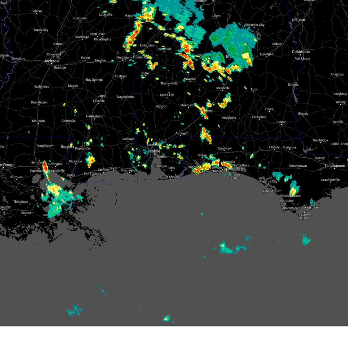 At 223 pm cdt, a severe thunderstorm was located over oriole beach, or 4 miles northeast of gulf breeze, moving southeast at 10 mph (radar indicated). Hazards include 60 mph wind gusts and penny size hail. expect damage to roofs, siding, and trees At 223 pm cdt, a severe thunderstorm was located over oriole beach, or 4 miles northeast of gulf breeze, moving southeast at 10 mph (radar indicated). Hazards include 60 mph wind gusts and penny size hail. expect damage to roofs, siding, and trees
|
| 6/26/2023 4:18 AM CDT |
 At 417 am cdt, severe thunderstorms were located along a line extending from 13 miles southeast of laurel hill to 3 miles southwest of crestview to 10 miles northeast of navarre to 6 miles south of navarre beach, moving southeast at 40 mph (radar indicated). Hazards include 60 mph wind gusts. Expect damage to roofs, siding, and trees. locations impacted include, wright, fort walton beach, crestview, niceville, destin, eglin afb, valparaiso, mary esther, ocean city, lake lorraine, baker, navarre, shalimar, cinco bayou and navarre beach. hail threat, radar indicated max hail size, <. 75 in wind threat, radar indicated max wind gust, 60 mph. At 417 am cdt, severe thunderstorms were located along a line extending from 13 miles southeast of laurel hill to 3 miles southwest of crestview to 10 miles northeast of navarre to 6 miles south of navarre beach, moving southeast at 40 mph (radar indicated). Hazards include 60 mph wind gusts. Expect damage to roofs, siding, and trees. locations impacted include, wright, fort walton beach, crestview, niceville, destin, eglin afb, valparaiso, mary esther, ocean city, lake lorraine, baker, navarre, shalimar, cinco bayou and navarre beach. hail threat, radar indicated max hail size, <. 75 in wind threat, radar indicated max wind gust, 60 mph.
|
| 6/26/2023 3:56 AM CDT |
 At 356 am cdt, severe thunderstorms were located along a line extending from 3 miles west of laurel hill to 7 miles northwest of baker to roeville to 5 miles northeast of oriole beach, moving southeast at 40 mph (radar indicated). Hazards include 60 mph wind gusts. expect damage to roofs, siding, and trees At 356 am cdt, severe thunderstorms were located along a line extending from 3 miles west of laurel hill to 7 miles northwest of baker to roeville to 5 miles northeast of oriole beach, moving southeast at 40 mph (radar indicated). Hazards include 60 mph wind gusts. expect damage to roofs, siding, and trees
|
| 6/26/2023 3:37 AM CDT |
 The severe thunderstorm warning for southern baldwin, southern santa rosa and southwestern escambia counties will expire at 345 am cdt, the storms which prompted the warning have weakened below severe limits. therefore, the warning will be allowed to expire. however gusty winds are still possible with these thunderstorms. a severe thunderstorm watch remains in effect until 500 am cdt for southwestern alabama. The severe thunderstorm warning for southern baldwin, southern santa rosa and southwestern escambia counties will expire at 345 am cdt, the storms which prompted the warning have weakened below severe limits. therefore, the warning will be allowed to expire. however gusty winds are still possible with these thunderstorms. a severe thunderstorm watch remains in effect until 500 am cdt for southwestern alabama.
|
| 6/26/2023 3:00 AM CDT |
 At 259 am cdt, severe thunderstorms were located along a line extending from 13 miles southwest of bratt to 3 miles east of loxley to 5 miles east of alabama port to 9 miles west of dauphin island, moving southeast at 50 mph (radar indicated). Hazards include 60 mph wind gusts. expect damage to roofs, siding, and trees At 259 am cdt, severe thunderstorms were located along a line extending from 13 miles southwest of bratt to 3 miles east of loxley to 5 miles east of alabama port to 9 miles west of dauphin island, moving southeast at 50 mph (radar indicated). Hazards include 60 mph wind gusts. expect damage to roofs, siding, and trees
|
| 6/22/2023 3:52 PM EDT |
 The severe thunderstorm warning for seminole, northwestern brevard, southeastern orange and south central volusia counties will expire at 400 pm edt, the storm which prompted the warning has moved out of the area. therefore, the warning will be allowed to expire. however heavy rain is still possible with this thunderstorm. remember, a severe thunderstorm warning still remains in effect for extreme northern brevard and southern volusia counties until 415 pm. The severe thunderstorm warning for seminole, northwestern brevard, southeastern orange and south central volusia counties will expire at 400 pm edt, the storm which prompted the warning has moved out of the area. therefore, the warning will be allowed to expire. however heavy rain is still possible with this thunderstorm. remember, a severe thunderstorm warning still remains in effect for extreme northern brevard and southern volusia counties until 415 pm.
|
| 6/22/2023 3:19 PM EDT |
 At 319 pm edt, a severe thunderstorm was located over chuluota, moving northeast at 35 mph. the storm earlier produced a gust of 58 mph at orlando executive airport (radar indicated). Hazards include 60 mph wind gusts. Expect damage to roofs, siding, and trees. locations impacted include, deltona, sanford, altamonte springs, oviedo and winter springs. hail threat, radar indicated max hail size, <. 75 in wind threat, observed max wind gust, 60 mph. At 319 pm edt, a severe thunderstorm was located over chuluota, moving northeast at 35 mph. the storm earlier produced a gust of 58 mph at orlando executive airport (radar indicated). Hazards include 60 mph wind gusts. Expect damage to roofs, siding, and trees. locations impacted include, deltona, sanford, altamonte springs, oviedo and winter springs. hail threat, radar indicated max hail size, <. 75 in wind threat, observed max wind gust, 60 mph.
|
| 6/22/2023 3:09 PM EDT |
 At 309 pm edt, a severe thunderstorm was located over union park, or over university of central florida, moving northeast at 35 mph (radar indicated). Hazards include 60 mph wind gusts. expect damage to roofs, siding, and trees At 309 pm edt, a severe thunderstorm was located over union park, or over university of central florida, moving northeast at 35 mph (radar indicated). Hazards include 60 mph wind gusts. expect damage to roofs, siding, and trees
|
| 6/21/2023 9:30 AM EDT |
 At 930 am edt, severe thunderstorms were located along a line extending from near midway to 8 miles southwest of tallahassee community college, moving northeast at 20 mph (radar indicated). Hazards include 60 mph wind gusts. expect damage to roofs, siding, and trees At 930 am edt, severe thunderstorms were located along a line extending from near midway to 8 miles southwest of tallahassee community college, moving northeast at 20 mph (radar indicated). Hazards include 60 mph wind gusts. expect damage to roofs, siding, and trees
|
| 6/21/2023 8:57 AM EDT |
 At 857 am edt, severe thunderstorms were located along a line extending from tallahassee to near midway, moving east at 25 mph (radar indicated). Hazards include 60 mph wind gusts. expect damage to roofs, siding, and trees At 857 am edt, severe thunderstorms were located along a line extending from tallahassee to near midway, moving east at 25 mph (radar indicated). Hazards include 60 mph wind gusts. expect damage to roofs, siding, and trees
|
| 6/19/2023 9:40 AM EDT |
 At 940 am edt, severe thunderstorms were located along a line extending from 8 miles north of tallahassee to 12 miles southwest of midway, moving east at 45 mph (radar indicated). Hazards include 70 mph wind gusts. Expect considerable tree damage. damage is likely to mobile homes, roofs, and outbuildings. locations impacted include, tallahassee, woodville, monticello, florida state university, tallahassee community college, florida a and m, doak campbell stadium, wakulla, alma, lake bradford, cody, leon sinks, gaither community center, wakulla springs, tallahassee memorial hosp, walker ford community center, miccosukee, south city, eight mile pond and griffin heights. thunderstorm damage threat, considerable hail threat, radar indicated max hail size, <. 75 in wind threat, radar indicated max wind gust, 70 mph. At 940 am edt, severe thunderstorms were located along a line extending from 8 miles north of tallahassee to 12 miles southwest of midway, moving east at 45 mph (radar indicated). Hazards include 70 mph wind gusts. Expect considerable tree damage. damage is likely to mobile homes, roofs, and outbuildings. locations impacted include, tallahassee, woodville, monticello, florida state university, tallahassee community college, florida a and m, doak campbell stadium, wakulla, alma, lake bradford, cody, leon sinks, gaither community center, wakulla springs, tallahassee memorial hosp, walker ford community center, miccosukee, south city, eight mile pond and griffin heights. thunderstorm damage threat, considerable hail threat, radar indicated max hail size, <. 75 in wind threat, radar indicated max wind gust, 70 mph.
|
| 6/19/2023 9:19 AM EDT |
 At 919 am edt, severe thunderstorms were located along a line extending from near havana to 12 miles south of greensboro, moving east at 45 mph (radar indicated). Hazards include 70 mph wind gusts. Expect considerable tree damage. damage is likely to mobile homes, roofs, and outbuildings. locations impacted include, tallahassee, woodville, monticello, florida state university, tallahassee community college, quincy, havana, midway, florida a and m, st. marks, crawfordville, doak campbell stadium, greensboro, wakulla, gretna, alma, lake bradford, cody, wakulla springs and florence. thunderstorm damage threat, considerable hail threat, radar indicated max hail size, <. 75 in wind threat, radar indicated max wind gust, 70 mph. At 919 am edt, severe thunderstorms were located along a line extending from near havana to 12 miles south of greensboro, moving east at 45 mph (radar indicated). Hazards include 70 mph wind gusts. Expect considerable tree damage. damage is likely to mobile homes, roofs, and outbuildings. locations impacted include, tallahassee, woodville, monticello, florida state university, tallahassee community college, quincy, havana, midway, florida a and m, st. marks, crawfordville, doak campbell stadium, greensboro, wakulla, gretna, alma, lake bradford, cody, wakulla springs and florence. thunderstorm damage threat, considerable hail threat, radar indicated max hail size, <. 75 in wind threat, radar indicated max wind gust, 70 mph.
|
| 6/19/2023 9:02 AM EDT |
 At 902 am edt, severe thunderstorms were located along a line extending from 8 miles northwest of quincy to near blountstown, moving east at 45 mph (radar indicated). Hazards include 60 mph wind gusts. expect damage to roofs, siding, and trees At 902 am edt, severe thunderstorms were located along a line extending from 8 miles northwest of quincy to near blountstown, moving east at 45 mph (radar indicated). Hazards include 60 mph wind gusts. expect damage to roofs, siding, and trees
|
| 6/18/2023 5:05 PM EDT |
 At 505 pm edt, severe thunderstorms were located along a line extending from near west bainbridge to 8 miles northwest of quincy to near greensboro, moving east at 45 mph (radar indicated). Hazards include 60 mph wind gusts. Expect damage to roofs, siding, and trees. locations impacted include, quincy, bainbridge, midway, havana, greensboro, west bainbridge, chattahoochee, gretna, attapulgus, climax, freemont, littman, douglas city, darsey, florence, scotland, rosedale, jamieson, recovery and laingkat. hail threat, radar indicated max hail size, <. 75 in wind threat, radar indicated max wind gust, 60 mph. At 505 pm edt, severe thunderstorms were located along a line extending from near west bainbridge to 8 miles northwest of quincy to near greensboro, moving east at 45 mph (radar indicated). Hazards include 60 mph wind gusts. Expect damage to roofs, siding, and trees. locations impacted include, quincy, bainbridge, midway, havana, greensboro, west bainbridge, chattahoochee, gretna, attapulgus, climax, freemont, littman, douglas city, darsey, florence, scotland, rosedale, jamieson, recovery and laingkat. hail threat, radar indicated max hail size, <. 75 in wind threat, radar indicated max wind gust, 60 mph.
|
| 6/18/2023 4:50 PM EDT |
 At 450 pm edt/350 pm cdt/, severe thunderstorms were located along a line extending from 8 miles south of donalsonville to near chattahoochee to 12 miles west of greensboro, moving east at 45 mph (radar indicated). Hazards include 60 mph wind gusts. Expect damage to roofs, siding, and trees. locations impacted include, bainbridge, midway, quincy, havana, greensboro, west bainbridge, chattahoochee, sneads, gretna, grand ridge, attapulgus, climax, juniper, douglas city, florence, jamieson, recovery, laingkat, quincy airport and sawdust. hail threat, radar indicated max hail size, <. 75 in wind threat, radar indicated max wind gust, 60 mph. At 450 pm edt/350 pm cdt/, severe thunderstorms were located along a line extending from 8 miles south of donalsonville to near chattahoochee to 12 miles west of greensboro, moving east at 45 mph (radar indicated). Hazards include 60 mph wind gusts. Expect damage to roofs, siding, and trees. locations impacted include, bainbridge, midway, quincy, havana, greensboro, west bainbridge, chattahoochee, sneads, gretna, grand ridge, attapulgus, climax, juniper, douglas city, florence, jamieson, recovery, laingkat, quincy airport and sawdust. hail threat, radar indicated max hail size, <. 75 in wind threat, radar indicated max wind gust, 60 mph.
|
| 6/18/2023 4:24 PM EDT |
 At 423 pm edt/323 pm cdt/, severe thunderstorms were located along a line extending from 10 miles east of cottonwood to near marianna, moving east at 45 mph (radar indicated. at 421 pm cdt, the marianna municipal airport weatherstem gusted to 56 mph). Hazards include 60 mph wind gusts. expect damage to roofs, siding, and trees At 423 pm edt/323 pm cdt/, severe thunderstorms were located along a line extending from 10 miles east of cottonwood to near marianna, moving east at 45 mph (radar indicated. at 421 pm cdt, the marianna municipal airport weatherstem gusted to 56 mph). Hazards include 60 mph wind gusts. expect damage to roofs, siding, and trees
|
| 6/18/2023 11:28 AM CDT |
 At 1127 am cdt, severe thunderstorms were located along a line extending from 10 miles northeast of roeville to 7 miles north of navarre, moving east at 55 mph. these are destructive storms for holt, niceville, eglin afb, and fort walton beach! (radar indicated). Hazards include 80 mph wind gusts. Flying debris will be dangerous to those caught without shelter. mobile homes will be heavily damaged. expect considerable damage to roofs, windows, and vehicles. Extensive tree damage and power outages are likely. At 1127 am cdt, severe thunderstorms were located along a line extending from 10 miles northeast of roeville to 7 miles north of navarre, moving east at 55 mph. these are destructive storms for holt, niceville, eglin afb, and fort walton beach! (radar indicated). Hazards include 80 mph wind gusts. Flying debris will be dangerous to those caught without shelter. mobile homes will be heavily damaged. expect considerable damage to roofs, windows, and vehicles. Extensive tree damage and power outages are likely.
|
| 6/17/2023 6:02 PM EDT |
 At 602 pm edt, a severe thunderstorm was located 8 miles northeast of tallahassee, moving southeast at 35 mph (radar indicated). Hazards include 60 mph wind gusts and quarter size hail. Hail damage to vehicles is expected. expect wind damage to roofs, siding, and trees. locations impacted include, tallahassee, ralford greenway, macon community park, miccosukee road greenway, tallahassee memorial hosp, miccosukee, fred george park, killearn estates, chaires, lake ella, forest meadows park, midtown, pisgah church, levy park, lake iamonia, baum, orchard pond, maclay state gardens, killearn lakes and capitola. hail threat, radar indicated max hail size, 1. 00 in wind threat, radar indicated max wind gust, 60 mph. At 602 pm edt, a severe thunderstorm was located 8 miles northeast of tallahassee, moving southeast at 35 mph (radar indicated). Hazards include 60 mph wind gusts and quarter size hail. Hail damage to vehicles is expected. expect wind damage to roofs, siding, and trees. locations impacted include, tallahassee, ralford greenway, macon community park, miccosukee road greenway, tallahassee memorial hosp, miccosukee, fred george park, killearn estates, chaires, lake ella, forest meadows park, midtown, pisgah church, levy park, lake iamonia, baum, orchard pond, maclay state gardens, killearn lakes and capitola. hail threat, radar indicated max hail size, 1. 00 in wind threat, radar indicated max wind gust, 60 mph.
|
| 6/17/2023 5:34 PM EDT |
 At 534 pm edt, a severe thunderstorm was located over quincy, moving east at 35 mph (radar indicated). Hazards include 60 mph wind gusts and quarter size hail. Hail damage to vehicles is expected. expect wind damage to roofs, siding, and trees. locations impacted include, tallahassee, quincy, midway, havana, ralford greenway, freemont, macon community park, littman, miccosukee road greenway, darsey, tallahassee memorial hosp, florence, scotland, jamieson, miccosukee, fred george park, santa clara, killearn estates, shady rest and chaires. hail threat, radar indicated max hail size, 1. 00 in wind threat, radar indicated max wind gust, 60 mph. At 534 pm edt, a severe thunderstorm was located over quincy, moving east at 35 mph (radar indicated). Hazards include 60 mph wind gusts and quarter size hail. Hail damage to vehicles is expected. expect wind damage to roofs, siding, and trees. locations impacted include, tallahassee, quincy, midway, havana, ralford greenway, freemont, macon community park, littman, miccosukee road greenway, darsey, tallahassee memorial hosp, florence, scotland, jamieson, miccosukee, fred george park, santa clara, killearn estates, shady rest and chaires. hail threat, radar indicated max hail size, 1. 00 in wind threat, radar indicated max wind gust, 60 mph.
|
| 6/17/2023 5:16 PM EDT |
 At 515 pm edt, a severe thunderstorm was located near quincy, moving east at 40 mph (radar indicated). Hazards include 60 mph wind gusts and quarter size hail. Hail damage to vehicles is expected. Expect wind damage to roofs, siding, and trees. At 515 pm edt, a severe thunderstorm was located near quincy, moving east at 40 mph (radar indicated). Hazards include 60 mph wind gusts and quarter size hail. Hail damage to vehicles is expected. Expect wind damage to roofs, siding, and trees.
|
| 6/16/2023 12:25 PM EDT |
 At 1224 pm edt, severe thunderstorms were located along a line extending from doak campbell stadium to 7 miles southwest of st. marks to 13 miles east of carrabelle to 7 miles south of st george island, moving east at 40 mph (radar indicated). Hazards include 60 mph wind gusts. expect damage to roofs, siding, and trees At 1224 pm edt, severe thunderstorms were located along a line extending from doak campbell stadium to 7 miles southwest of st. marks to 13 miles east of carrabelle to 7 miles south of st george island, moving east at 40 mph (radar indicated). Hazards include 60 mph wind gusts. expect damage to roofs, siding, and trees
|
| 6/16/2023 12:11 PM EDT |
 At 1211 pm edt/1111 am cdt/, severe thunderstorms were located along a line extending from 9 miles northeast of havana to near crawfordville to 10 miles northeast of carrabelle to near st george island, moving east at 65 mph (radar indicated). Hazards include 60 mph wind gusts. Expect damage to roofs, siding, and trees. locations impacted include, tallahassee, woodville, carrabelle, quincy, havana, midway, florida state university, eastpoint, apalachicola, tallahassee community college, st. marks, crawfordville, florida a and m, st george island, port st. joe, mexico beach, stonemill creek, doak campbell stadium, chattahoochee and greensboro. hail threat, radar indicated max hail size, <. 75 in wind threat, observed max wind gust, 60 mph. At 1211 pm edt/1111 am cdt/, severe thunderstorms were located along a line extending from 9 miles northeast of havana to near crawfordville to 10 miles northeast of carrabelle to near st george island, moving east at 65 mph (radar indicated). Hazards include 60 mph wind gusts. Expect damage to roofs, siding, and trees. locations impacted include, tallahassee, woodville, carrabelle, quincy, havana, midway, florida state university, eastpoint, apalachicola, tallahassee community college, st. marks, crawfordville, florida a and m, st george island, port st. joe, mexico beach, stonemill creek, doak campbell stadium, chattahoochee and greensboro. hail threat, radar indicated max hail size, <. 75 in wind threat, observed max wind gust, 60 mph.
|
| 6/16/2023 11:24 AM EDT |
 At 1122 am edt/1022 am cdt/, severe thunderstorms were located along a line extending from 11 miles west of donalsonville to near blountstown to 6 miles northwest of stonemill creek to 7 miles south of tyndall air force base, moving east at 65 mph (radar indicated). Hazards include 70 mph wind gusts. Expect considerable tree damage. Damage is likely to mobile homes, roofs, and outbuildings. At 1122 am edt/1022 am cdt/, severe thunderstorms were located along a line extending from 11 miles west of donalsonville to near blountstown to 6 miles northwest of stonemill creek to 7 miles south of tyndall air force base, moving east at 65 mph (radar indicated). Hazards include 70 mph wind gusts. Expect considerable tree damage. Damage is likely to mobile homes, roofs, and outbuildings.
|
| 6/16/2023 9:41 AM CDT |
 At 939 am cdt, severe thunderstorms were located along a line extending from 4 miles southwest of eglin air force base to 4 miles east of destin to 10 miles south of mary esther, moving southeast at 50 mph (radar indicated). Hazards include 60 mph wind gusts. Expect damage to roofs, siding, and trees. locations impacted include, wright, fort walton beach, crestview, niceville, destin, eglin afb, milton, valparaiso, gulf breeze, mary esther, bagdad, ocean city, lake lorraine, oriole beach, navarre, shalimar, cinco bayou, pensacola beach, navarre beach and roeville. hail threat, radar indicated max hail size, <. 75 in wind threat, radar indicated max wind gust, 60 mph. At 939 am cdt, severe thunderstorms were located along a line extending from 4 miles southwest of eglin air force base to 4 miles east of destin to 10 miles south of mary esther, moving southeast at 50 mph (radar indicated). Hazards include 60 mph wind gusts. Expect damage to roofs, siding, and trees. locations impacted include, wright, fort walton beach, crestview, niceville, destin, eglin afb, milton, valparaiso, gulf breeze, mary esther, bagdad, ocean city, lake lorraine, oriole beach, navarre, shalimar, cinco bayou, pensacola beach, navarre beach and roeville. hail threat, radar indicated max hail size, <. 75 in wind threat, radar indicated max wind gust, 60 mph.
|
| 6/16/2023 8:59 AM CDT |
 At 859 am cdt, severe thunderstorms were located along a line extending from 8 miles west of baker to 4 miles east of roeville to ferry pass, moving southeast at 60 mph (radar indicated). Hazards include 70 mph wind gusts and penny size hail. Expect considerable tree damage. Damage is likely to mobile homes, roofs, and outbuildings. At 859 am cdt, severe thunderstorms were located along a line extending from 8 miles west of baker to 4 miles east of roeville to ferry pass, moving southeast at 60 mph (radar indicated). Hazards include 70 mph wind gusts and penny size hail. Expect considerable tree damage. Damage is likely to mobile homes, roofs, and outbuildings.
|
| 6/15/2023 8:58 PM CDT |
 At 857 pm cdt, a confirmed large and extremely dangerous tornado was located over gulf breeze, moving southeast at 15 mph. this is a particularly dangerous situation. take cover now! (law enforcement confirmed tornado). Hazards include damaging tornado. You are in a life-threatening situation. flying debris may be deadly to those caught without shelter. mobile homes will be destroyed. considerable damage to homes, businesses, and vehicles is likely and complete destruction is possible. The tornado will be near, pensacola beach around 910 pm cdt. At 857 pm cdt, a confirmed large and extremely dangerous tornado was located over gulf breeze, moving southeast at 15 mph. this is a particularly dangerous situation. take cover now! (law enforcement confirmed tornado). Hazards include damaging tornado. You are in a life-threatening situation. flying debris may be deadly to those caught without shelter. mobile homes will be destroyed. considerable damage to homes, businesses, and vehicles is likely and complete destruction is possible. The tornado will be near, pensacola beach around 910 pm cdt.
|
| 6/15/2023 8:52 PM CDT |
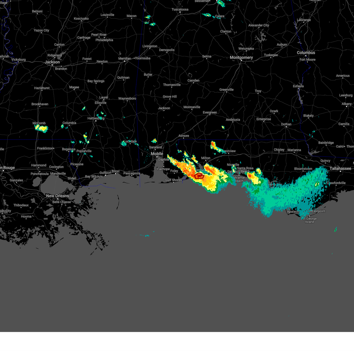 At 851 pm cdt, a confirmed tornado was located over pensacola bay moving towards fort pickens and pensacola beach, moving southeast at 15 mph. 911 center reporting damage (law enforcement confirmed tornado). Hazards include damaging tornado. Flying debris will be dangerous to those caught without shelter. mobile homes will be damaged or destroyed. damage to roofs, windows, and vehicles will occur. tree damage is likely. This tornado will be near, pensacola beach around 905 pm cdt. At 851 pm cdt, a confirmed tornado was located over pensacola bay moving towards fort pickens and pensacola beach, moving southeast at 15 mph. 911 center reporting damage (law enforcement confirmed tornado). Hazards include damaging tornado. Flying debris will be dangerous to those caught without shelter. mobile homes will be damaged or destroyed. damage to roofs, windows, and vehicles will occur. tree damage is likely. This tornado will be near, pensacola beach around 905 pm cdt.
|
| 6/15/2023 8:49 PM CDT |
 At 848 pm cdt, a severe thunderstorm capable of producing a tornado was located near gulf breeze, moving southeast at 15 mph (radar indicated rotation). Hazards include tornado. Flying debris will be dangerous to those caught without shelter. mobile homes will be damaged or destroyed. damage to roofs, windows, and vehicles will occur. tree damage is likely. This dangerous storm will be near, pensacola beach around 905 pm cdt. At 848 pm cdt, a severe thunderstorm capable of producing a tornado was located near gulf breeze, moving southeast at 15 mph (radar indicated rotation). Hazards include tornado. Flying debris will be dangerous to those caught without shelter. mobile homes will be damaged or destroyed. damage to roofs, windows, and vehicles will occur. tree damage is likely. This dangerous storm will be near, pensacola beach around 905 pm cdt.
|
| 6/15/2023 8:35 PM CDT |
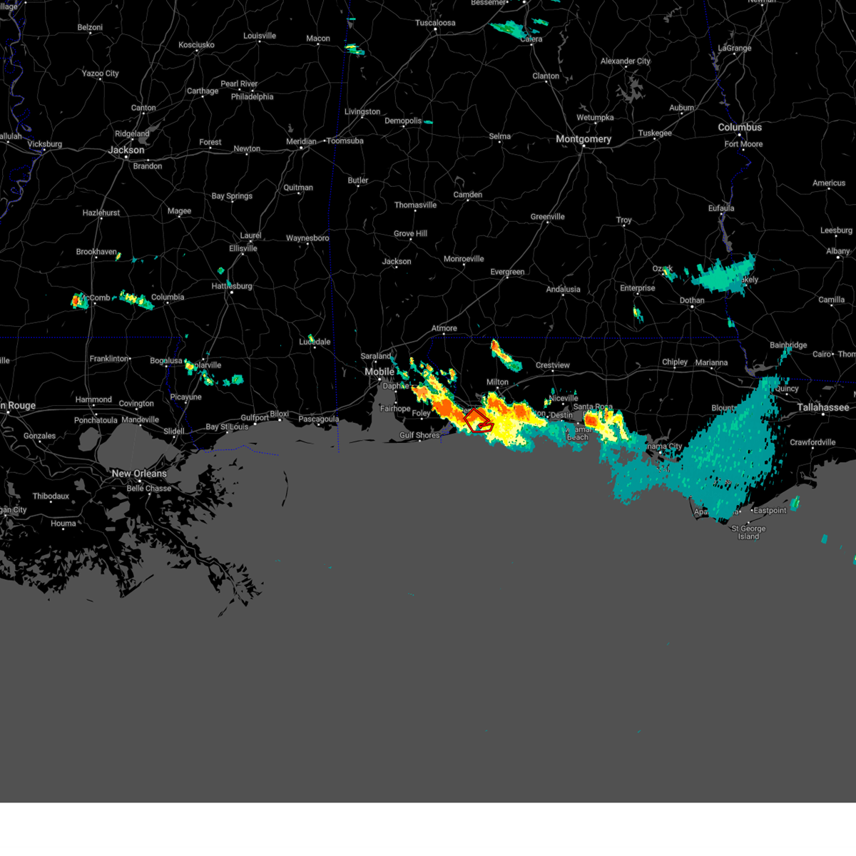 At 835 pm cdt, a severe thunderstorm capable of producing a tornado was located over west pensacola, moving southeast at 15 mph (radar indicated rotation). Hazards include tornado. Flying debris will be dangerous to those caught without shelter. mobile homes will be damaged or destroyed. damage to roofs, windows, and vehicles will occur. tree damage is likely. this dangerous storm will be near, pensacola around 840 pm cdt. Pensacola beach around 915 pm cdt. At 835 pm cdt, a severe thunderstorm capable of producing a tornado was located over west pensacola, moving southeast at 15 mph (radar indicated rotation). Hazards include tornado. Flying debris will be dangerous to those caught without shelter. mobile homes will be damaged or destroyed. damage to roofs, windows, and vehicles will occur. tree damage is likely. this dangerous storm will be near, pensacola around 840 pm cdt. Pensacola beach around 915 pm cdt.
|
| 6/15/2023 12:48 AM EDT |
 At 1247 am edt, severe thunderstorms were located along a line extending from 11 miles east of chattahoochee to near quincy to 13 miles southeast of blountstown, moving east at 40 mph (radar indicated). Hazards include 60 mph wind gusts. expect damage to roofs, siding, and trees At 1247 am edt, severe thunderstorms were located along a line extending from 11 miles east of chattahoochee to near quincy to 13 miles southeast of blountstown, moving east at 40 mph (radar indicated). Hazards include 60 mph wind gusts. expect damage to roofs, siding, and trees
|
| 6/14/2023 8:53 PM EDT |
 At 853 pm edt, severe thunderstorms were located along a line extending from 6 miles north of cairo to 9 miles north of havana to near quincy to near greensboro to 10 miles north of blountstown, moving southeast at 55 mph (radar indicated). Hazards include 60 mph wind gusts and penny size hail. expect damage to roofs, siding, and trees At 853 pm edt, severe thunderstorms were located along a line extending from 6 miles north of cairo to 9 miles north of havana to near quincy to near greensboro to 10 miles north of blountstown, moving southeast at 55 mph (radar indicated). Hazards include 60 mph wind gusts and penny size hail. expect damage to roofs, siding, and trees
|
| 6/12/2023 4:01 PM EDT |
 At 401 pm edt/301 pm cdt/, severe thunderstorms were located along a line extending from 12 miles north of chattahoochee to near greensboro, moving east at 30 mph (radar indicated). Hazards include 60 mph wind gusts. Expect damage to roofs, siding, and trees. locations impacted include, quincy, bainbridge, greensboro, west bainbridge, chattahoochee, gretna, attapulgus, brinson, hanover, ausmac, littman, reynoldsville, juniper, douglas city, florence, rosedale, recovery, decatur co a/p, laingkat and santa clara. hail threat, radar indicated max hail size, <. 75 in wind threat, radar indicated max wind gust, 60 mph. At 401 pm edt/301 pm cdt/, severe thunderstorms were located along a line extending from 12 miles north of chattahoochee to near greensboro, moving east at 30 mph (radar indicated). Hazards include 60 mph wind gusts. Expect damage to roofs, siding, and trees. locations impacted include, quincy, bainbridge, greensboro, west bainbridge, chattahoochee, gretna, attapulgus, brinson, hanover, ausmac, littman, reynoldsville, juniper, douglas city, florence, rosedale, recovery, decatur co a/p, laingkat and santa clara. hail threat, radar indicated max hail size, <. 75 in wind threat, radar indicated max wind gust, 60 mph.
|
| 6/12/2023 3:43 PM EDT |
 At 343 pm edt/243 pm cdt/, severe thunderstorms were located along a line extending from 14 miles south of donalsonville to 10 miles southwest of chattahoochee, moving east at 35 mph (radar indicated). Hazards include 60 mph wind gusts and penny size hail. Expect damage to roofs, siding, and trees. locations impacted include, bainbridge, quincy, greensboro, west bainbridge, chattahoochee, sneads, gretna, grand ridge, attapulgus, brinson, rock bluff, ocheesee, juniper, douglas city, selman, florence, recovery, laingkat, quincy airport and sawdust. hail threat, radar indicated max hail size, 0. 75 in wind threat, radar indicated max wind gust, 60 mph. At 343 pm edt/243 pm cdt/, severe thunderstorms were located along a line extending from 14 miles south of donalsonville to 10 miles southwest of chattahoochee, moving east at 35 mph (radar indicated). Hazards include 60 mph wind gusts and penny size hail. Expect damage to roofs, siding, and trees. locations impacted include, bainbridge, quincy, greensboro, west bainbridge, chattahoochee, sneads, gretna, grand ridge, attapulgus, brinson, rock bluff, ocheesee, juniper, douglas city, selman, florence, recovery, laingkat, quincy airport and sawdust. hail threat, radar indicated max hail size, 0. 75 in wind threat, radar indicated max wind gust, 60 mph.
|
| 6/12/2023 3:33 PM EDT |
 At 333 pm edt/233 pm cdt/, severe thunderstorms were located along a line extending from 11 miles northeast of marianna to 11 miles north of blountstown, moving east at 35 mph (radar indicated). Hazards include 60 mph wind gusts and penny size hail. expect damage to roofs, siding, and trees At 333 pm edt/233 pm cdt/, severe thunderstorms were located along a line extending from 11 miles northeast of marianna to 11 miles north of blountstown, moving east at 35 mph (radar indicated). Hazards include 60 mph wind gusts and penny size hail. expect damage to roofs, siding, and trees
|
| 5/17/2023 12:33 PM EDT |
 At 1233 pm edt, a severe thunderstorm was located near quincy, moving east at 25 mph (radar indicated). Hazards include 60 mph wind gusts and penny size hail. Expect damage to roofs, siding, and trees. locations impacted include, quincy, havana, gretna, attapulgus, freemont, littman, douglas city, mount pleasant, florence, scotland, jamieson, gibson, laingkat, santa clara, shady rest, amsterdam, quincy airport, branchville, sawdust and hinson. hail threat, radar indicated max hail size, 0. 75 in wind threat, radar indicated max wind gust, 60 mph. At 1233 pm edt, a severe thunderstorm was located near quincy, moving east at 25 mph (radar indicated). Hazards include 60 mph wind gusts and penny size hail. Expect damage to roofs, siding, and trees. locations impacted include, quincy, havana, gretna, attapulgus, freemont, littman, douglas city, mount pleasant, florence, scotland, jamieson, gibson, laingkat, santa clara, shady rest, amsterdam, quincy airport, branchville, sawdust and hinson. hail threat, radar indicated max hail size, 0. 75 in wind threat, radar indicated max wind gust, 60 mph.
|
| 5/17/2023 12:33 PM EDT |
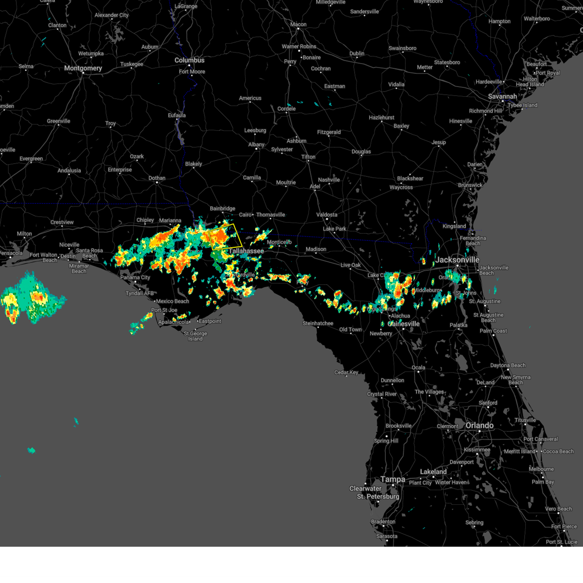 At 1233 pm edt, a severe thunderstorm was located near quincy, moving east at 25 mph (radar indicated). Hazards include 60 mph wind gusts and penny size hail. Expect damage to roofs, siding, and trees. locations impacted include, quincy, havana, gretna, attapulgus, freemont, littman, douglas city, mount pleasant, florence, scotland, jamieson, gibson, laingkat, santa clara, shady rest, amsterdam, quincy airport, branchville, sawdust and hinson. hail threat, radar indicated max hail size, 0. 75 in wind threat, radar indicated max wind gust, 60 mph. At 1233 pm edt, a severe thunderstorm was located near quincy, moving east at 25 mph (radar indicated). Hazards include 60 mph wind gusts and penny size hail. Expect damage to roofs, siding, and trees. locations impacted include, quincy, havana, gretna, attapulgus, freemont, littman, douglas city, mount pleasant, florence, scotland, jamieson, gibson, laingkat, santa clara, shady rest, amsterdam, quincy airport, branchville, sawdust and hinson. hail threat, radar indicated max hail size, 0. 75 in wind threat, radar indicated max wind gust, 60 mph.
|
| 5/17/2023 12:12 PM EDT |
 At 1212 pm edt, a severe thunderstorm was located over greensboro, or 10 miles west of quincy, moving east at 25 mph (radar indicated). Hazards include 60 mph wind gusts and penny size hail. expect damage to roofs, siding, and trees At 1212 pm edt, a severe thunderstorm was located over greensboro, or 10 miles west of quincy, moving east at 25 mph (radar indicated). Hazards include 60 mph wind gusts and penny size hail. expect damage to roofs, siding, and trees
|
| 4/30/2023 7:07 AM EDT |
 At 707 am edt, a severe thunderstorm was located over deltona, moving northeast at 45 mph (radar indicated). Hazards include 60 mph wind gusts. expect damage to roofs, siding, and trees At 707 am edt, a severe thunderstorm was located over deltona, moving northeast at 45 mph (radar indicated). Hazards include 60 mph wind gusts. expect damage to roofs, siding, and trees
|
| 4/27/2023 5:59 PM EDT |
 At 559 pm edt, a severe thunderstorm capable of producing a tornado was located over quincy, moving northeast at 40 mph (radar indicated rotation). Hazards include tornado. Flying debris will be dangerous to those caught without shelter. mobile homes will be damaged or destroyed. damage to roofs, windows, and vehicles will occur. tree damage is likely. this dangerous storm will be near, havana around 610 pm edt. Other locations impacted by this tornadic thunderstorm include freemont, littman, douglas city, darsey, florence, concord, scotland, jamieson, gibson and santa clara. At 559 pm edt, a severe thunderstorm capable of producing a tornado was located over quincy, moving northeast at 40 mph (radar indicated rotation). Hazards include tornado. Flying debris will be dangerous to those caught without shelter. mobile homes will be damaged or destroyed. damage to roofs, windows, and vehicles will occur. tree damage is likely. this dangerous storm will be near, havana around 610 pm edt. Other locations impacted by this tornadic thunderstorm include freemont, littman, douglas city, darsey, florence, concord, scotland, jamieson, gibson and santa clara.
|
| 4/27/2023 5:47 PM EDT |
 At 547 pm edt, severe thunderstorms were located along a line extending from 10 miles north of quincy to 6 miles east of carrabelle, moving east at 25 mph (radar indicated). Hazards include 60 mph wind gusts. expect damage to roofs, siding, and trees At 547 pm edt, severe thunderstorms were located along a line extending from 10 miles north of quincy to 6 miles east of carrabelle, moving east at 25 mph (radar indicated). Hazards include 60 mph wind gusts. expect damage to roofs, siding, and trees
|
| 4/27/2023 5:45 PM EDT |
 At 545 pm edt, a severe thunderstorm capable of producing a tornado was located near greensboro, or 10 miles southwest of quincy, moving east at 25 mph (radar indicated rotation). Hazards include tornado. Flying debris will be dangerous to those caught without shelter. mobile homes will be damaged or destroyed. damage to roofs, windows, and vehicles will occur. tree damage is likely. this dangerous storm will be near, quincy around 610 pm edt. midway around 620 pm edt. Other locations impacted by this tornadic thunderstorm include freemont, lake talquin, littman, juniper, douglas city, darsey, mount pleasant, florence, concord and scotland. At 545 pm edt, a severe thunderstorm capable of producing a tornado was located near greensboro, or 10 miles southwest of quincy, moving east at 25 mph (radar indicated rotation). Hazards include tornado. Flying debris will be dangerous to those caught without shelter. mobile homes will be damaged or destroyed. damage to roofs, windows, and vehicles will occur. tree damage is likely. this dangerous storm will be near, quincy around 610 pm edt. midway around 620 pm edt. Other locations impacted by this tornadic thunderstorm include freemont, lake talquin, littman, juniper, douglas city, darsey, mount pleasant, florence, concord and scotland.
|
| 4/27/2023 4:51 PM EDT |
 At 451 pm edt/351 pm cdt/, severe thunderstorms were located along a line extending from 11 miles north of blountstown to 8 miles north of apalachicola, moving east at 30 mph (radar indicated). Hazards include 60 mph wind gusts. expect damage to roofs, siding, and trees At 451 pm edt/351 pm cdt/, severe thunderstorms were located along a line extending from 11 miles north of blountstown to 8 miles north of apalachicola, moving east at 30 mph (radar indicated). Hazards include 60 mph wind gusts. expect damage to roofs, siding, and trees
|
| 4/27/2023 3:38 PM EDT |
 At 338 pm edt/238 pm cdt/, a severe thunderstorm was located 9 miles southeast of blountstown, moving east at 30 mph (radar indicated). Hazards include 60 mph wind gusts and quarter size hail. Hail damage to vehicles is expected. Expect wind damage to roofs, siding, and trees. At 338 pm edt/238 pm cdt/, a severe thunderstorm was located 9 miles southeast of blountstown, moving east at 30 mph (radar indicated). Hazards include 60 mph wind gusts and quarter size hail. Hail damage to vehicles is expected. Expect wind damage to roofs, siding, and trees.
|
| 4/27/2023 12:55 PM CDT |
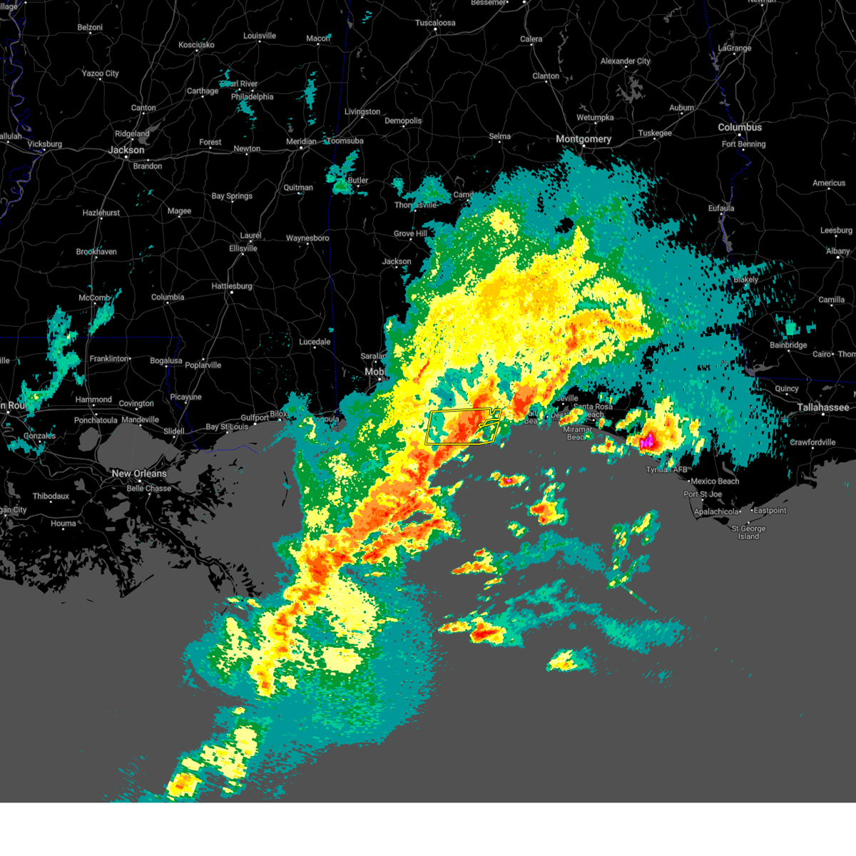 The severe thunderstorm warning for southeastern baldwin and south central escambia counties will expire at 100 pm cdt, the storms which prompted the warning have weakened below severe limits, and have exited the warned area. therefore, the warning will be allowed to expire. however small hail, gusty winds and heavy rain are still possible with these thunderstorms. a severe thunderstorm watch remains in effect until 200 pm cdt for southwestern alabama, and northwestern florida. The severe thunderstorm warning for southeastern baldwin and south central escambia counties will expire at 100 pm cdt, the storms which prompted the warning have weakened below severe limits, and have exited the warned area. therefore, the warning will be allowed to expire. however small hail, gusty winds and heavy rain are still possible with these thunderstorms. a severe thunderstorm watch remains in effect until 200 pm cdt for southwestern alabama, and northwestern florida.
|
| 4/27/2023 12:29 PM CDT |
 At 1229 pm cdt, a severe thunderstorm was located 6 miles northwest of navarre, or 8 miles southeast of bagdad, moving east at 30 mph (radar indicated). Hazards include 60 mph wind gusts and quarter size hail. Hail damage to vehicles is expected. Expect wind damage to roofs, siding, and trees. At 1229 pm cdt, a severe thunderstorm was located 6 miles northwest of navarre, or 8 miles southeast of bagdad, moving east at 30 mph (radar indicated). Hazards include 60 mph wind gusts and quarter size hail. Hail damage to vehicles is expected. Expect wind damage to roofs, siding, and trees.
|
| 4/27/2023 12:27 PM CDT |
 At 1226 pm cdt, severe thunderstorms were located along a line extending from 3 miles west of perdido beach to 4 miles south of orange beach, moving east at 40 mph (radar indicated). Hazards include 60 mph wind gusts. expect damage to roofs, siding, and trees At 1226 pm cdt, severe thunderstorms were located along a line extending from 3 miles west of perdido beach to 4 miles south of orange beach, moving east at 40 mph (radar indicated). Hazards include 60 mph wind gusts. expect damage to roofs, siding, and trees
|
| 4/27/2023 12:27 PM CDT |
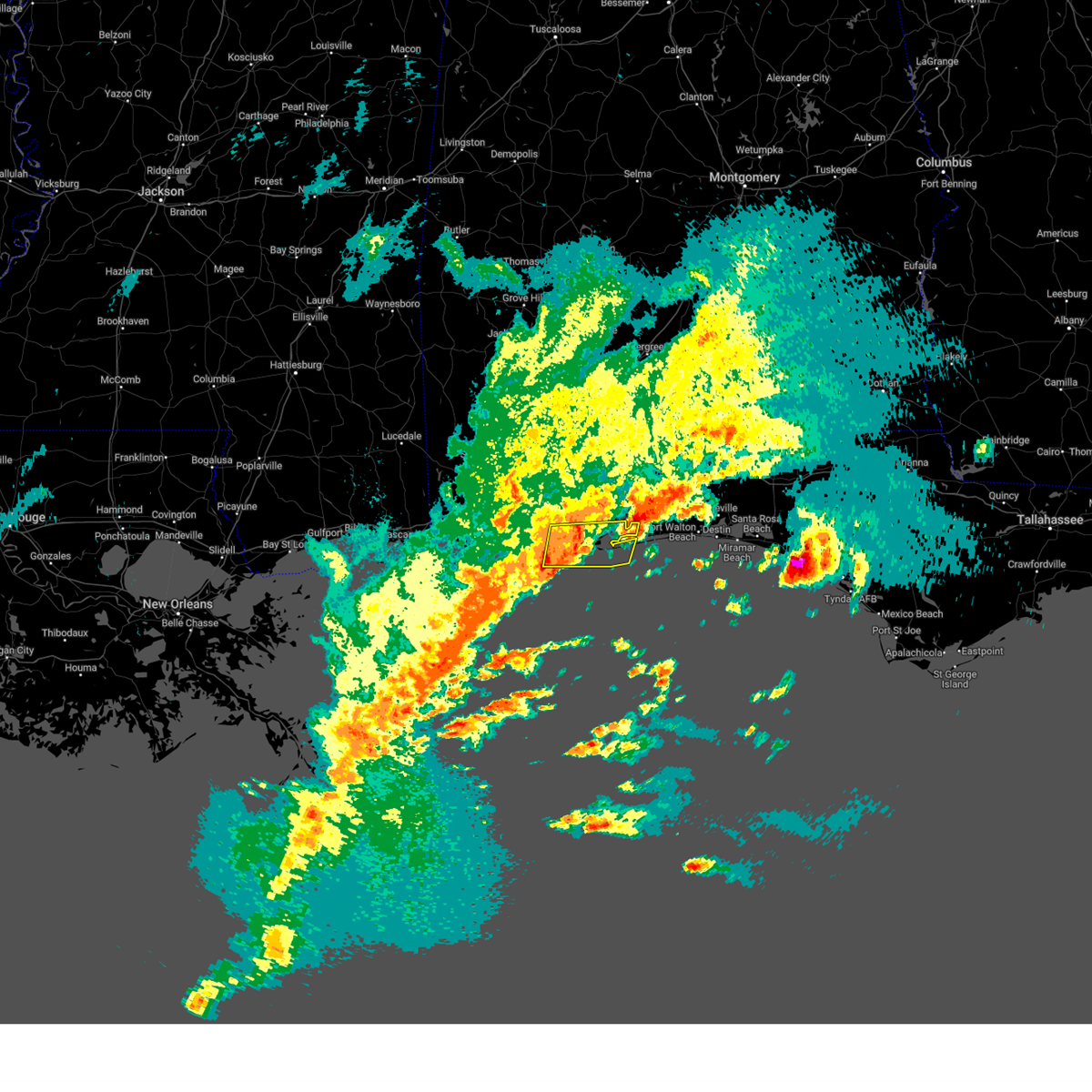 At 1226 pm cdt, severe thunderstorms were located along a line extending from 3 miles west of perdido beach to 4 miles south of orange beach, moving east at 40 mph (radar indicated). Hazards include 60 mph wind gusts. expect damage to roofs, siding, and trees At 1226 pm cdt, severe thunderstorms were located along a line extending from 3 miles west of perdido beach to 4 miles south of orange beach, moving east at 40 mph (radar indicated). Hazards include 60 mph wind gusts. expect damage to roofs, siding, and trees
|
| 4/27/2023 12:04 PM CDT |
 At 1203 pm cdt, a severe thunderstorm was located near ferry pass, moving northeast at 25 mph (radar indicated). Hazards include 60 mph wind gusts and half dollar size hail. Hail damage to vehicles is expected. expect wind damage to roofs, siding, and trees. locations impacted include, pensacola, ferry pass, brent, ensley, gulf breeze, goulding, oriole beach, pea ridge and floridatown. hail threat, radar indicated max hail size, 1. 25 in wind threat, radar indicated max wind gust, 60 mph. At 1203 pm cdt, a severe thunderstorm was located near ferry pass, moving northeast at 25 mph (radar indicated). Hazards include 60 mph wind gusts and half dollar size hail. Hail damage to vehicles is expected. expect wind damage to roofs, siding, and trees. locations impacted include, pensacola, ferry pass, brent, ensley, gulf breeze, goulding, oriole beach, pea ridge and floridatown. hail threat, radar indicated max hail size, 1. 25 in wind threat, radar indicated max wind gust, 60 mph.
|
| 4/27/2023 11:38 AM CDT |
 At 1138 am cdt, a severe thunderstorm was located over myrtle grove, or over west pensacola, moving northeast at 25 mph (radar indicated). Hazards include 60 mph wind gusts and quarter size hail. Hail damage to vehicles is expected. Expect wind damage to roofs, siding, and trees. At 1138 am cdt, a severe thunderstorm was located over myrtle grove, or over west pensacola, moving northeast at 25 mph (radar indicated). Hazards include 60 mph wind gusts and quarter size hail. Hail damage to vehicles is expected. Expect wind damage to roofs, siding, and trees.
|
| 4/26/2023 4:22 PM EDT |
 At 422 pm edt, a severe thunderstorm was located over sanford, moving southeast at 25 mph (radar indicated). Hazards include 60 mph wind gusts and quarter size hail. Hail damage to vehicles is expected. expect wind damage to roofs, siding, and trees. Locations impacted include, deltona, sanford, winter springs, lake mary and lake jessup. At 422 pm edt, a severe thunderstorm was located over sanford, moving southeast at 25 mph (radar indicated). Hazards include 60 mph wind gusts and quarter size hail. Hail damage to vehicles is expected. expect wind damage to roofs, siding, and trees. Locations impacted include, deltona, sanford, winter springs, lake mary and lake jessup.
|
| 4/26/2023 4:14 PM EDT |
 At 413 pm edt, a severe thunderstorm was located near debary, moving southeast at 25 mph (radar indicated). Hazards include 60 mph wind gusts and quarter size hail. Hail damage to vehicles is expected. expect wind damage to roofs, siding, and trees. locations impacted include, deltona, sanford, winter springs, lake mary and orange city. hail threat, radar indicated max hail size, 1. 00 in wind threat, radar indicated max wind gust, 60 mph. At 413 pm edt, a severe thunderstorm was located near debary, moving southeast at 25 mph (radar indicated). Hazards include 60 mph wind gusts and quarter size hail. Hail damage to vehicles is expected. expect wind damage to roofs, siding, and trees. locations impacted include, deltona, sanford, winter springs, lake mary and orange city. hail threat, radar indicated max hail size, 1. 00 in wind threat, radar indicated max wind gust, 60 mph.
|
| 4/26/2023 3:53 PM EDT |
 At 353 pm edt, a severe thunderstorm was located near cassia, moving southeast at 25 mph (radar indicated). Hazards include 60 mph wind gusts and quarter size hail. Hail damage to vehicles is expected. Expect wind damage to roofs, siding, and trees. At 353 pm edt, a severe thunderstorm was located near cassia, moving southeast at 25 mph (radar indicated). Hazards include 60 mph wind gusts and quarter size hail. Hail damage to vehicles is expected. Expect wind damage to roofs, siding, and trees.
|
| 4/15/2023 8:34 PM EDT |
 At 834 pm edt, severe thunderstorms were located along a line extending from 6 miles southeast of bainbridge to near doak campbell stadium to 14 miles northeast of carrabelle, moving east at 40 mph (radar indicated). Hazards include 60 mph wind gusts. Expect damage to roofs, siding, and trees. locations impacted include, tallahassee, woodville, florida state university, tallahassee community college, crawfordville, florida a and m, st. marks, whigham, doak campbell stadium, wakulla, sopchoppy, lake bradford, shadeville, leon sinks, gaither community center, wakulla springs, tallahassee memorial hosp, walker ford community center, rocky hill and south city. hail threat, radar indicated max hail size, <. 75 in wind threat, radar indicated max wind gust, 60 mph. At 834 pm edt, severe thunderstorms were located along a line extending from 6 miles southeast of bainbridge to near doak campbell stadium to 14 miles northeast of carrabelle, moving east at 40 mph (radar indicated). Hazards include 60 mph wind gusts. Expect damage to roofs, siding, and trees. locations impacted include, tallahassee, woodville, florida state university, tallahassee community college, crawfordville, florida a and m, st. marks, whigham, doak campbell stadium, wakulla, sopchoppy, lake bradford, shadeville, leon sinks, gaither community center, wakulla springs, tallahassee memorial hosp, walker ford community center, rocky hill and south city. hail threat, radar indicated max hail size, <. 75 in wind threat, radar indicated max wind gust, 60 mph.
|
| 4/15/2023 8:32 PM EDT |
 At 832 pm edt, severe thunderstorms were located along a line extending from 7 miles southeast of colquitt to near bainbridge to 8 miles southeast of west bainbridge to near midway to 12 miles southwest of tallahassee community college, moving east at 40 mph (radar indicated). Hazards include 60 mph wind gusts. Expect damage to roofs, siding, and trees. locations impacted include, tallahassee, quincy, bainbridge, midway, havana, donalsonville, west bainbridge, gretna, attapulgus, iron city, climax, brinson, hanover, freemont, ausmac, littman, reynoldsville, douglas city, darsey and florence. hail threat, radar indicated max hail size, <. 75 in wind threat, radar indicated max wind gust, 60 mph. At 832 pm edt, severe thunderstorms were located along a line extending from 7 miles southeast of colquitt to near bainbridge to 8 miles southeast of west bainbridge to near midway to 12 miles southwest of tallahassee community college, moving east at 40 mph (radar indicated). Hazards include 60 mph wind gusts. Expect damage to roofs, siding, and trees. locations impacted include, tallahassee, quincy, bainbridge, midway, havana, donalsonville, west bainbridge, gretna, attapulgus, iron city, climax, brinson, hanover, freemont, ausmac, littman, reynoldsville, douglas city, darsey and florence. hail threat, radar indicated max hail size, <. 75 in wind threat, radar indicated max wind gust, 60 mph.
|
| 4/15/2023 7:52 PM EDT |
 At 752 pm edt, severe thunderstorms were located along a line extending from 12 miles south of donalsonville to 10 miles south of greensboro to 16 miles southeast of wewahitchka, moving east at 40 mph (radar indicated). Hazards include 60 mph wind gusts. expect damage to roofs, siding, and trees At 752 pm edt, severe thunderstorms were located along a line extending from 12 miles south of donalsonville to 10 miles south of greensboro to 16 miles southeast of wewahitchka, moving east at 40 mph (radar indicated). Hazards include 60 mph wind gusts. expect damage to roofs, siding, and trees
|
| 4/15/2023 7:40 PM EDT |
 At 740 pm edt, severe thunderstorms were located along a line extending from 6 miles southeast of cottonwood to 11 miles east of marianna to 11 miles west of chattahoochee to near blountstown to 10 miles northeast of stonemill creek, moving east at 40 mph (radar indicated). Hazards include 60 mph wind gusts. expect damage to roofs, siding, and trees At 740 pm edt, severe thunderstorms were located along a line extending from 6 miles southeast of cottonwood to 11 miles east of marianna to 11 miles west of chattahoochee to near blountstown to 10 miles northeast of stonemill creek, moving east at 40 mph (radar indicated). Hazards include 60 mph wind gusts. expect damage to roofs, siding, and trees
|
| 4/15/2023 4:09 PM CDT |
 At 408 pm cdt, severe thunderstorms were located along a line extending from 12 miles southeast of jay to 7 miles east of bagdad to 10 miles southeast of pensacola beach, moving east at 50 mph (public. at 403 pm public reported wind gusts of 55 to 60 mph in bagdad). Hazards include 70 mph wind gusts and penny size hail. Expect considerable tree damage. damage is likely to mobile homes, roofs, and outbuildings. locations impacted include, wright, fort walton beach, crestview, niceville, destin, eglin afb, milton, valparaiso, gulf breeze, mary esther, bagdad, ocean city, lake lorraine, baker, oriole beach, navarre, shalimar, cinco bayou, point baker and navarre beach. thunderstorm damage threat, considerable hail threat, radar indicated max hail size, 0. 75 in wind threat, observed max wind gust, 70 mph. At 408 pm cdt, severe thunderstorms were located along a line extending from 12 miles southeast of jay to 7 miles east of bagdad to 10 miles southeast of pensacola beach, moving east at 50 mph (public. at 403 pm public reported wind gusts of 55 to 60 mph in bagdad). Hazards include 70 mph wind gusts and penny size hail. Expect considerable tree damage. damage is likely to mobile homes, roofs, and outbuildings. locations impacted include, wright, fort walton beach, crestview, niceville, destin, eglin afb, milton, valparaiso, gulf breeze, mary esther, bagdad, ocean city, lake lorraine, baker, oriole beach, navarre, shalimar, cinco bayou, point baker and navarre beach. thunderstorm damage threat, considerable hail threat, radar indicated max hail size, 0. 75 in wind threat, observed max wind gust, 70 mph.
|
| 4/15/2023 4:02 PM CDT |
 At 401 pm cdt, severe thunderstorms were located along a line extending from 10 miles southeast of jay to roeville to 5 miles northeast of oriole beach to 9 miles south of pensacola beach, moving northeast at 65 mph (trained weather spotters). Hazards include 70 mph wind gusts and penny size hail. Expect considerable tree damage. damage is likely to mobile homes, roofs, and outbuildings. locations impacted include, pensacola, ferry pass, brent, west pensacola, ensley, warrington, pace, milton, gulf breeze, goulding, bagdad, oriole beach, navarre, pensacola beach, point baker, pea ridge, roeville and floridatown. thunderstorm damage threat, considerable hail threat, radar indicated max hail size, 0. 75 in wind threat, observed max wind gust, 70 mph. At 401 pm cdt, severe thunderstorms were located along a line extending from 10 miles southeast of jay to roeville to 5 miles northeast of oriole beach to 9 miles south of pensacola beach, moving northeast at 65 mph (trained weather spotters). Hazards include 70 mph wind gusts and penny size hail. Expect considerable tree damage. damage is likely to mobile homes, roofs, and outbuildings. locations impacted include, pensacola, ferry pass, brent, west pensacola, ensley, warrington, pace, milton, gulf breeze, goulding, bagdad, oriole beach, navarre, pensacola beach, point baker, pea ridge, roeville and floridatown. thunderstorm damage threat, considerable hail threat, radar indicated max hail size, 0. 75 in wind threat, observed max wind gust, 70 mph.
|
| 4/15/2023 3:59 PM CDT |
 At 358 pm cdt, severe thunderstorms were located along a line extending from 6 miles southeast of jay to bagdad to 8 miles south of pensacola beach, moving east at 50 mph (radar indicated). Hazards include 70 mph wind gusts and penny size hail. Expect considerable tree damage. Damage is likely to mobile homes, roofs, and outbuildings. At 358 pm cdt, severe thunderstorms were located along a line extending from 6 miles southeast of jay to bagdad to 8 miles south of pensacola beach, moving east at 50 mph (radar indicated). Hazards include 70 mph wind gusts and penny size hail. Expect considerable tree damage. Damage is likely to mobile homes, roofs, and outbuildings.
|
| 4/15/2023 3:32 PM CDT |
 At 330 pm cdt, severe thunderstorms were located along a line extending from 9 miles west of molino to 11 miles north of lillian to elberta to 4 miles west of bon secour, moving east at 60 mph (trained weather spotters. at 315 pm trained spotter reports winds gusting to 60 to 70 mph near loxley. a mesonet site near loxley also reported a 58 mph gust). Hazards include 70 mph wind gusts and penny size hail. Expect considerable tree damage. damage is likely to mobile homes, roofs, and outbuildings. locations impacted include, pensacola, ferry pass, brent, west pensacola, ensley, warrington, gonzalez, gulf shores, foley, pace, milton, gulf breeze, orange beach, goulding, bagdad, lillian, myrtle grove, oriole beach, bon secour and navarre. thunderstorm damage threat, considerable hail threat, radar indicated max hail size, 0. 75 in wind threat, observed max wind gust, 70 mph. At 330 pm cdt, severe thunderstorms were located along a line extending from 9 miles west of molino to 11 miles north of lillian to elberta to 4 miles west of bon secour, moving east at 60 mph (trained weather spotters. at 315 pm trained spotter reports winds gusting to 60 to 70 mph near loxley. a mesonet site near loxley also reported a 58 mph gust). Hazards include 70 mph wind gusts and penny size hail. Expect considerable tree damage. damage is likely to mobile homes, roofs, and outbuildings. locations impacted include, pensacola, ferry pass, brent, west pensacola, ensley, warrington, gonzalez, gulf shores, foley, pace, milton, gulf breeze, orange beach, goulding, bagdad, lillian, myrtle grove, oriole beach, bon secour and navarre. thunderstorm damage threat, considerable hail threat, radar indicated max hail size, 0. 75 in wind threat, observed max wind gust, 70 mph.
|
| 4/15/2023 3:16 PM CDT |
 At 314 pm cdt, severe thunderstorms were located along a line extending from 5 miles southeast of bay minette to 4 miles northeast of loxley to near silverhill to 8 miles south of point clear, moving southeast at 55 mph (radar indicated). Hazards include 70 mph wind gusts and penny size hail. Expect considerable tree damage. Damage is likely to mobile homes, roofs, and outbuildings. At 314 pm cdt, severe thunderstorms were located along a line extending from 5 miles southeast of bay minette to 4 miles northeast of loxley to near silverhill to 8 miles south of point clear, moving southeast at 55 mph (radar indicated). Hazards include 70 mph wind gusts and penny size hail. Expect considerable tree damage. Damage is likely to mobile homes, roofs, and outbuildings.
|
| 3/12/2023 4:51 PM EDT |
 At 451 pm edt, a severe thunderstorm was located 15 miles southwest of midway, moving east at 35 mph (radar indicated). Hazards include 60 mph wind gusts and quarter size hail. Hail damage to vehicles is expected. expect wind damage to roofs, siding, and trees. locations impacted include, tallahassee, bloxham, hilliardville, silver lake rec area and fort braden. hail threat, radar indicated max hail size, 1. 00 in wind threat, radar indicated max wind gust, 60 mph. At 451 pm edt, a severe thunderstorm was located 15 miles southwest of midway, moving east at 35 mph (radar indicated). Hazards include 60 mph wind gusts and quarter size hail. Hail damage to vehicles is expected. expect wind damage to roofs, siding, and trees. locations impacted include, tallahassee, bloxham, hilliardville, silver lake rec area and fort braden. hail threat, radar indicated max hail size, 1. 00 in wind threat, radar indicated max wind gust, 60 mph.
|
| 3/12/2023 4:18 PM EDT |
 At 418 pm edt, doppler radar indicated a severe thunderstorm capable of producing quarter size hail and damaging winds in excess of 60 mph. this storm was located 8 miles southeast of blountstown, and moving east at 40 mph. At 418 pm edt, doppler radar indicated a severe thunderstorm capable of producing quarter size hail and damaging winds in excess of 60 mph. this storm was located 8 miles southeast of blountstown, and moving east at 40 mph.
|
| 3/10/2023 2:42 PM EST |
 At 241 pm est, severe thunderstorms were located along a line extending from 7 miles west of monticello to 7 miles east of tallahassee to midway, moving east at 25 mph (radar indicated). Hazards include ping pong ball size hail and 60 mph wind gusts. People and animals outdoors will be injured. expect hail damage to roofs, siding, windows, and vehicles. expect wind damage to roofs, siding, and trees. locations impacted include, tallahassee, woodville, monticello, florida state university, midway, tallahassee community college, florida a and m, doak campbell stadium, alma, lake bradford, cody, leon sinks, gaither community center, tallahassee memorial hosp, walker ford community center, miccosukee, south city, eight mile pond, griffin heights and drifton. hail threat, radar indicated max hail size, 1. 50 in wind threat, radar indicated max wind gust, 60 mph. At 241 pm est, severe thunderstorms were located along a line extending from 7 miles west of monticello to 7 miles east of tallahassee to midway, moving east at 25 mph (radar indicated). Hazards include ping pong ball size hail and 60 mph wind gusts. People and animals outdoors will be injured. expect hail damage to roofs, siding, windows, and vehicles. expect wind damage to roofs, siding, and trees. locations impacted include, tallahassee, woodville, monticello, florida state university, midway, tallahassee community college, florida a and m, doak campbell stadium, alma, lake bradford, cody, leon sinks, gaither community center, tallahassee memorial hosp, walker ford community center, miccosukee, south city, eight mile pond, griffin heights and drifton. hail threat, radar indicated max hail size, 1. 50 in wind threat, radar indicated max wind gust, 60 mph.
|
| 3/10/2023 2:37 PM EST |
 At 236 pm est, severe thunderstorms were located along a line extending from 13 miles west of monticello to near tallahassee to near midway, moving southeast at 20 mph (radar indicated). Hazards include 60 mph wind gusts and quarter size hail. Hail damage to vehicles is expected. Expect wind damage to roofs, siding, and trees. At 236 pm est, severe thunderstorms were located along a line extending from 13 miles west of monticello to near tallahassee to near midway, moving southeast at 20 mph (radar indicated). Hazards include 60 mph wind gusts and quarter size hail. Hail damage to vehicles is expected. Expect wind damage to roofs, siding, and trees.
|
| 1/25/2023 9:35 AM EST |
 At 934 am est, severe thunderstorms were located along a line extending from 7 miles southwest of pelham to 19 miles north of carrabelle, moving east at 20 mph (radar indicated). Hazards include 60 mph wind gusts. Expect damage to roofs, siding, and trees. Locations impacted include, midway, quincy, tallahassee, havana, cairo, bainbridge, ochlocknee, whigham, florida state university, florida a and m, tallahassee comm college, doak campbell stadium, attapulgus, climax, lake bradford, jewel fire tower, douglas city, capel, gaither community center and tallahassee memorial hosp. At 934 am est, severe thunderstorms were located along a line extending from 7 miles southwest of pelham to 19 miles north of carrabelle, moving east at 20 mph (radar indicated). Hazards include 60 mph wind gusts. Expect damage to roofs, siding, and trees. Locations impacted include, midway, quincy, tallahassee, havana, cairo, bainbridge, ochlocknee, whigham, florida state university, florida a and m, tallahassee comm college, doak campbell stadium, attapulgus, climax, lake bradford, jewel fire tower, douglas city, capel, gaither community center and tallahassee memorial hosp.
|
| 1/25/2023 8:46 AM EST |
 At 845 am est, severe thunderstorms were located along a line extending from 9 miles north of west bainbridge to 10 miles east of stonemill creek, moving east at 20 mph (radar indicated). Hazards include 60 mph wind gusts. expect damage to roofs, siding, and trees At 845 am est, severe thunderstorms were located along a line extending from 9 miles north of west bainbridge to 10 miles east of stonemill creek, moving east at 20 mph (radar indicated). Hazards include 60 mph wind gusts. expect damage to roofs, siding, and trees
|
| 1/25/2023 8:46 AM EST |
 The national weather service in tallahassee has issued a * severe thunderstorm warning for. northwestern wakulla county in big bend of florida. gadsden county in big bend of florida. central liberty county in big bend of florida. Leon county in big bend of florida. The national weather service in tallahassee has issued a * severe thunderstorm warning for. northwestern wakulla county in big bend of florida. gadsden county in big bend of florida. central liberty county in big bend of florida. Leon county in big bend of florida.
|
| 1/25/2023 3:29 AM CST |
 At 328 am cst, a severe thunderstorm was located over navarre beach, or 11 miles west of mary esther, moving northeast at 50 mph (radar indicated). Hazards include 60 mph wind gusts. expect damage to roofs, siding, and trees At 328 am cst, a severe thunderstorm was located over navarre beach, or 11 miles west of mary esther, moving northeast at 50 mph (radar indicated). Hazards include 60 mph wind gusts. expect damage to roofs, siding, and trees
|
| 1/22/2023 4:41 PM EST |
 At 440 pm est, severe thunderstorms were located along a line extending from 11 miles northeast of havana to 13 miles north of carrabelle, moving east at 35 mph (radar indicated). Hazards include 60 mph wind gusts. Expect damage to roofs, siding, and trees. locations impacted include, st. Marks, midway, woodville, tallahassee, crawfordville, havana, florida state university, florida a and m, tallahassee comm college, doak campbell stadium, wakulla, sopchoppy, lake bradford, shadeville, leon sinks, gaither community center, wakulla springs, tallahassee memorial hosp, miccosukee and iamonia. At 440 pm est, severe thunderstorms were located along a line extending from 11 miles northeast of havana to 13 miles north of carrabelle, moving east at 35 mph (radar indicated). Hazards include 60 mph wind gusts. Expect damage to roofs, siding, and trees. locations impacted include, st. Marks, midway, woodville, tallahassee, crawfordville, havana, florida state university, florida a and m, tallahassee comm college, doak campbell stadium, wakulla, sopchoppy, lake bradford, shadeville, leon sinks, gaither community center, wakulla springs, tallahassee memorial hosp, miccosukee and iamonia.
|
| 1/22/2023 4:22 PM EST |
 At 422 pm est, severe thunderstorms were located along a line extending from 6 miles north of havana to 18 miles northwest of carrabelle, moving northeast at 45 mph (radar indicated). Hazards include 60 mph wind gusts. expect damage to roofs, siding, and trees At 422 pm est, severe thunderstorms were located along a line extending from 6 miles north of havana to 18 miles northwest of carrabelle, moving northeast at 45 mph (radar indicated). Hazards include 60 mph wind gusts. expect damage to roofs, siding, and trees
|
| 1/4/2023 9:50 AM EST |
 At 949 am est, severe thunderstorms were located along a line extending from 7 miles south of bainbridge to 8 miles south of greensboro to 20 miles east of stonemill creek to 11 miles east of port st. joe, moving northeast at 70 mph (radar indicated). Hazards include 60 mph wind gusts. expect damage to roofs, siding, and trees At 949 am est, severe thunderstorms were located along a line extending from 7 miles south of bainbridge to 8 miles south of greensboro to 20 miles east of stonemill creek to 11 miles east of port st. joe, moving northeast at 70 mph (radar indicated). Hazards include 60 mph wind gusts. expect damage to roofs, siding, and trees
|
| 1/4/2023 9:45 AM EST |
 At 944 am est, severe thunderstorms were located along a line extending from 9 miles northwest of west bainbridge to 11 miles southwest of bainbridge to 8 miles south of greensboro, moving east at 25 mph (radar indicated). Hazards include 60 mph wind gusts. Expect damage to roofs, siding, and trees. locations impacted include, bainbridge, midway, quincy, havana, greensboro, west bainbridge, chattahoochee, gretna, bristol, attapulgus, climax, brinson, rock bluff, juniper, douglas city, florence, jamieson, recovery, laingkat and quincy airport. hail threat, radar indicated max hail size, <. 75 in wind threat, radar indicated max wind gust, 60 mph. At 944 am est, severe thunderstorms were located along a line extending from 9 miles northwest of west bainbridge to 11 miles southwest of bainbridge to 8 miles south of greensboro, moving east at 25 mph (radar indicated). Hazards include 60 mph wind gusts. Expect damage to roofs, siding, and trees. locations impacted include, bainbridge, midway, quincy, havana, greensboro, west bainbridge, chattahoochee, gretna, bristol, attapulgus, climax, brinson, rock bluff, juniper, douglas city, florence, jamieson, recovery, laingkat and quincy airport. hail threat, radar indicated max hail size, <. 75 in wind threat, radar indicated max wind gust, 60 mph.
|
| 1/4/2023 9:07 AM EST |
 At 907 am est/807 am cst/, severe thunderstorms were located along a line extending from near donalsonville to near chattahoochee to near blountstown, moving east at 25 mph (radar indicated). Hazards include 60 mph wind gusts. expect damage to roofs, siding, and trees At 907 am est/807 am cst/, severe thunderstorms were located along a line extending from near donalsonville to near chattahoochee to near blountstown, moving east at 25 mph (radar indicated). Hazards include 60 mph wind gusts. expect damage to roofs, siding, and trees
|
| 12/30/2022 1:57 PM CST |
 At 155 pm cst, severe thunderstorms were located along a line extending from 3 miles south of riverview to 6 miles north of point baker to brent, moving east at 25 mph (radar indicated). Hazards include 60 mph wind gusts. Expect damage to roofs, siding, and trees. locations impacted include, pensacola, ferry pass, brent, west pensacola, ensley, warrington, pace, milton, goulding, bagdad, navarre, jay, pollard, point baker, pea ridge, roeville and floridatown. hail threat, radar indicated max hail size, <. 75 in wind threat, radar indicated max wind gust, 60 mph. At 155 pm cst, severe thunderstorms were located along a line extending from 3 miles south of riverview to 6 miles north of point baker to brent, moving east at 25 mph (radar indicated). Hazards include 60 mph wind gusts. Expect damage to roofs, siding, and trees. locations impacted include, pensacola, ferry pass, brent, west pensacola, ensley, warrington, pace, milton, goulding, bagdad, navarre, jay, pollard, point baker, pea ridge, roeville and floridatown. hail threat, radar indicated max hail size, <. 75 in wind threat, radar indicated max wind gust, 60 mph.
|
| 12/30/2022 1:28 PM CST |
 At 127 pm cst, severe thunderstorms were located along a line extending from 4 miles north of i65 and al 21 to 6 miles south of century to 3 miles southwest of gonzalez to gulf shores, moving east at 30 mph (radar indicated). Hazards include 60 mph wind gusts. expect damage to roofs, siding, and trees At 127 pm cst, severe thunderstorms were located along a line extending from 4 miles north of i65 and al 21 to 6 miles south of century to 3 miles southwest of gonzalez to gulf shores, moving east at 30 mph (radar indicated). Hazards include 60 mph wind gusts. expect damage to roofs, siding, and trees
|
| 11/30/2022 10:27 AM EST |
 At 1026 am est/926 am cst/, severe thunderstorms were located along a line extending from near tallahassee to near tallahassee comm college to 17 miles south of greensboro to 11 miles south of blountstown to near mexico beach, moving southeast at 30 mph (radar indicated). Hazards include 60 mph wind gusts. Expect damage to roofs, siding, and trees. locations impacted include, tallahassee, st. marks, woodville, crawfordville, port st. Joe, midway, mexico beach, florida state university, tallahassee comm college, doak campbell stadium, florida a and m, wakulla, sopchoppy, lake bradford, honeyville, jewel fire tower, wakulla springs, vilas, cape san blas and medart. At 1026 am est/926 am cst/, severe thunderstorms were located along a line extending from near tallahassee to near tallahassee comm college to 17 miles south of greensboro to 11 miles south of blountstown to near mexico beach, moving southeast at 30 mph (radar indicated). Hazards include 60 mph wind gusts. Expect damage to roofs, siding, and trees. locations impacted include, tallahassee, st. marks, woodville, crawfordville, port st. Joe, midway, mexico beach, florida state university, tallahassee comm college, doak campbell stadium, florida a and m, wakulla, sopchoppy, lake bradford, honeyville, jewel fire tower, wakulla springs, vilas, cape san blas and medart.
|
| 11/30/2022 9:21 AM EST |
 At 921 am est/821 am cst/, severe thunderstorms were located along a line extending from 9 miles east of chattahoochee to near greensboro to 16 miles west of blountstown to 6 miles north of lynn haven to 8 miles southwest of panama city beach, moving southeast at 30 mph (radar indicated). Hazards include 60 mph wind gusts. expect damage to roofs, siding, and trees At 921 am est/821 am cst/, severe thunderstorms were located along a line extending from 9 miles east of chattahoochee to near greensboro to 16 miles west of blountstown to 6 miles north of lynn haven to 8 miles southwest of panama city beach, moving southeast at 30 mph (radar indicated). Hazards include 60 mph wind gusts. expect damage to roofs, siding, and trees
|
| 11/30/2022 6:32 AM CST |
 At 631 am cst, severe thunderstorms were located along a line extending from 3 miles northeast of bagdad to 7 miles southeast of pea ridge to 3 miles east of pensacola to warrington, moving east at 45 mph (radar indicated). Hazards include 60 mph wind gusts. expect damage to roofs, siding, and trees At 631 am cst, severe thunderstorms were located along a line extending from 3 miles northeast of bagdad to 7 miles southeast of pea ridge to 3 miles east of pensacola to warrington, moving east at 45 mph (radar indicated). Hazards include 60 mph wind gusts. expect damage to roofs, siding, and trees
|
| 11/30/2022 5:38 AM CST |
 At 537 am cst, severe thunderstorms were located along a line extending from 3 miles east of loxley to near silverhill to fairhope to 7 miles west of point clear, moving east at 55 mph (radar indicated). Hazards include 60 mph wind gusts. expect damage to roofs, siding, and trees At 537 am cst, severe thunderstorms were located along a line extending from 3 miles east of loxley to near silverhill to fairhope to 7 miles west of point clear, moving east at 55 mph (radar indicated). Hazards include 60 mph wind gusts. expect damage to roofs, siding, and trees
|
| 9/11/2022 2:11 PM EDT |
 The severe thunderstorm warning for eastern gadsden, northwestern jefferson, leon and southwestern grady counties will expire at 215 pm edt, the storms which prompted the warning have weakened below severe limits, and no longer pose an immediate threat to life or property. therefore, the warning will be allowed to expire. however gusty winds in excess of 40 mph and torrential rainfall are likely with these thunderstorms. The severe thunderstorm warning for eastern gadsden, northwestern jefferson, leon and southwestern grady counties will expire at 215 pm edt, the storms which prompted the warning have weakened below severe limits, and no longer pose an immediate threat to life or property. therefore, the warning will be allowed to expire. however gusty winds in excess of 40 mph and torrential rainfall are likely with these thunderstorms.
|
| 9/11/2022 1:50 PM EDT |
 At 149 pm edt, severe thunderstorms were located along a line extending from near havana to 6 miles northeast of tallahassee to 13 miles east of florida a and m, moving east at 45 mph. a wind gust to 59 mph was recently measured in northeast tallahassee (radar indicated). Hazards include 60 mph wind gusts. Expect damage to roofs, siding, and trees. locations impacted include, monticello, midway, tallahassee, havana, quincy, florida state university, florida a and m, tallahassee comm college, doak campbell stadium, lake bradford, cody, gaither community center, tallahassee memorial hosp, florence, rocky hill, miccosukee, iamonia, drifton, tallahassee mall and tallahassee regional a/p. hail threat, radar indicated max hail size, <. 75 in wind threat, radar indicated max wind gust, 60 mph. At 149 pm edt, severe thunderstorms were located along a line extending from near havana to 6 miles northeast of tallahassee to 13 miles east of florida a and m, moving east at 45 mph. a wind gust to 59 mph was recently measured in northeast tallahassee (radar indicated). Hazards include 60 mph wind gusts. Expect damage to roofs, siding, and trees. locations impacted include, monticello, midway, tallahassee, havana, quincy, florida state university, florida a and m, tallahassee comm college, doak campbell stadium, lake bradford, cody, gaither community center, tallahassee memorial hosp, florence, rocky hill, miccosukee, iamonia, drifton, tallahassee mall and tallahassee regional a/p. hail threat, radar indicated max hail size, <. 75 in wind threat, radar indicated max wind gust, 60 mph.
|
| 9/11/2022 1:33 PM EDT |
 At 132 pm edt, severe thunderstorms were located along a line extending from near midway to doak campbell stadium to near woodville, moving northeast at 40 mph (radar indicated). Hazards include 60 mph wind gusts. expect damage to roofs, siding, and trees At 132 pm edt, severe thunderstorms were located along a line extending from near midway to doak campbell stadium to near woodville, moving northeast at 40 mph (radar indicated). Hazards include 60 mph wind gusts. expect damage to roofs, siding, and trees
|
| 8/8/2022 3:35 PM EDT |
 The severe thunderstorm warning for central leon county will expire at 345 pm edt, the storm which prompted the warning has weakened below severe limits, and no longer poses an immediate threat to life or property. therefore, the warning will be allowed to expire. however gusty winds are still possible with this thunderstorm. The severe thunderstorm warning for central leon county will expire at 345 pm edt, the storm which prompted the warning has weakened below severe limits, and no longer poses an immediate threat to life or property. therefore, the warning will be allowed to expire. however gusty winds are still possible with this thunderstorm.
|
| 8/8/2022 3:19 PM EDT |
 At 319 pm edt, a severe thunderstorm was located over tallahassee comm college, or near tallahassee, moving northeast at 5 mph (radar indicated). Hazards include 60 mph wind gusts. expect damage to roofs, siding, and trees At 319 pm edt, a severe thunderstorm was located over tallahassee comm college, or near tallahassee, moving northeast at 5 mph (radar indicated). Hazards include 60 mph wind gusts. expect damage to roofs, siding, and trees
|
| 7/15/2022 5:12 PM CDT |
 At 512 pm cdt, a severe thunderstorm was located 6 miles north of oriole beach, or 8 miles east of ferry pass, moving southwest at 10 mph (radar indicated). Hazards include 60 mph wind gusts and penny size hail. expect damage to roofs, siding, and trees At 512 pm cdt, a severe thunderstorm was located 6 miles north of oriole beach, or 8 miles east of ferry pass, moving southwest at 10 mph (radar indicated). Hazards include 60 mph wind gusts and penny size hail. expect damage to roofs, siding, and trees
|
| 7/14/2022 2:41 PM EDT |
 The severe thunderstorm warning for central gadsden, northeastern liberty and western leon counties will expire at 245 pm edt, the storm which prompted the warning has weakened below severe limits, and no longer poses an immediate threat to life or property. therefore, the warning will be allowed to expire. The severe thunderstorm warning for central gadsden, northeastern liberty and western leon counties will expire at 245 pm edt, the storm which prompted the warning has weakened below severe limits, and no longer poses an immediate threat to life or property. therefore, the warning will be allowed to expire.
|
| 7/14/2022 2:20 PM EDT |
 At 219 pm edt, a severe thunderstorm was located near quincy, moving east at 20 mph (radar indicated). Hazards include 60 mph wind gusts. Expect damage to roofs, siding, and trees. locations impacted include, quincy, midway, greensboro, gretna, lake talquin, littman, juniper, douglas city, mount pleasant, santa clara, shady rest, hardaway, quincy airport, wetumpka, sawdust and dogtown. hail threat, radar indicated max hail size, <. 75 in wind threat, radar indicated max wind gust, 60 mph. At 219 pm edt, a severe thunderstorm was located near quincy, moving east at 20 mph (radar indicated). Hazards include 60 mph wind gusts. Expect damage to roofs, siding, and trees. locations impacted include, quincy, midway, greensboro, gretna, lake talquin, littman, juniper, douglas city, mount pleasant, santa clara, shady rest, hardaway, quincy airport, wetumpka, sawdust and dogtown. hail threat, radar indicated max hail size, <. 75 in wind threat, radar indicated max wind gust, 60 mph.
|
| 7/14/2022 2:03 PM EDT |
 At 202 pm edt, a severe thunderstorm was located over greensboro, or 10 miles west of quincy, moving east at 20 mph (radar indicated). Hazards include 60 mph wind gusts. Expect damage to roofs, siding, and trees. locations impacted include, quincy, midway, greensboro, gretna, lake talquin, littman, juniper, douglas city, mount pleasant, santa clara, shady rest, hardaway, sycamore, quincy airport, wetumpka, sawdust, dogtown and rosedale. hail threat, radar indicated max hail size, <. 75 in wind threat, radar indicated max wind gust, 60 mph. At 202 pm edt, a severe thunderstorm was located over greensboro, or 10 miles west of quincy, moving east at 20 mph (radar indicated). Hazards include 60 mph wind gusts. Expect damage to roofs, siding, and trees. locations impacted include, quincy, midway, greensboro, gretna, lake talquin, littman, juniper, douglas city, mount pleasant, santa clara, shady rest, hardaway, sycamore, quincy airport, wetumpka, sawdust, dogtown and rosedale. hail threat, radar indicated max hail size, <. 75 in wind threat, radar indicated max wind gust, 60 mph.
|
| 7/14/2022 1:54 PM EDT |
 At 154 pm edt/1254 pm cdt/, a severe thunderstorm was located 8 miles west of greensboro, or 12 miles northeast of blountstown, moving east at 20 mph (radar indicated). Hazards include 60 mph wind gusts. expect damage to roofs, siding, and trees At 154 pm edt/1254 pm cdt/, a severe thunderstorm was located 8 miles west of greensboro, or 12 miles northeast of blountstown, moving east at 20 mph (radar indicated). Hazards include 60 mph wind gusts. expect damage to roofs, siding, and trees
|
| 6/29/2022 3:35 PM EDT |
 The severe thunderstorm warning for central leon county will expire at 345 pm edt, the storm which prompted the warning has weakened below severe limits, and no longer poses an immediate threat to life or property. therefore, the warning will be allowed to expire. to report severe weather, contact your nearest law enforcement agency. they will relay your report to the national weather service tallahassee. The severe thunderstorm warning for central leon county will expire at 345 pm edt, the storm which prompted the warning has weakened below severe limits, and no longer poses an immediate threat to life or property. therefore, the warning will be allowed to expire. to report severe weather, contact your nearest law enforcement agency. they will relay your report to the national weather service tallahassee.
|
| 6/29/2022 2:53 PM EDT |
 At 253 pm edt, a severe thunderstorm was located near tallahassee comm college, or near tallahassee, moving east at 10 mph (radar indicated). Hazards include 60 mph wind gusts. expect damage to roofs, siding, and trees At 253 pm edt, a severe thunderstorm was located near tallahassee comm college, or near tallahassee, moving east at 10 mph (radar indicated). Hazards include 60 mph wind gusts. expect damage to roofs, siding, and trees
|
| 6/24/2022 6:19 PM EDT |
 At 619 pm edt, a severe thunderstorm was located over quincy, moving southeast at 5 mph (radar indicated). Hazards include 60 mph wind gusts. expect damage to roofs, siding, and trees At 619 pm edt, a severe thunderstorm was located over quincy, moving southeast at 5 mph (radar indicated). Hazards include 60 mph wind gusts. expect damage to roofs, siding, and trees
|
| 6/24/2022 5:51 PM EDT |
 At 551 pm edt, a severe thunderstorm was located near tallahassee, moving south at 15 mph (radar indicated). Hazards include 60 mph wind gusts. expect damage to roofs, siding, and trees At 551 pm edt, a severe thunderstorm was located near tallahassee, moving south at 15 mph (radar indicated). Hazards include 60 mph wind gusts. expect damage to roofs, siding, and trees
|
| 6/14/2022 6:24 PM EDT |
 The severe thunderstorm warning for eastern gadsden and leon counties will expire at 630 pm edt, the storm which prompted the warning has moved out of the area. therefore, the warning will be allowed to expire. The severe thunderstorm warning for eastern gadsden and leon counties will expire at 630 pm edt, the storm which prompted the warning has moved out of the area. therefore, the warning will be allowed to expire.
|
| 6/14/2022 5:41 PM EDT |
 At 541 pm edt, a severe thunderstorm was located 9 miles north of tallahassee, moving southwest at 30 mph (radar indicated). Hazards include 60 mph wind gusts. expect damage to roofs, siding, and trees At 541 pm edt, a severe thunderstorm was located 9 miles north of tallahassee, moving southwest at 30 mph (radar indicated). Hazards include 60 mph wind gusts. expect damage to roofs, siding, and trees
|
| 6/10/2022 5:42 PM CDT |
 The severe thunderstorm warning for southeastern baldwin, west central okaloosa, central santa rosa and south central escambia counties will expire at 545 pm cdt, the storms which prompted the warning have moved out of the area. therefore, the warning will be allowed to expire. a severe thunderstorm watch remains in effect until 800 pm cdt for southwestern alabama, and northwestern florida. remember, a severe thunderstorm warning still remains in effect for southeastern santa rosa county and northwestern okaloosa county until 630 pm cdt. The severe thunderstorm warning for southeastern baldwin, west central okaloosa, central santa rosa and south central escambia counties will expire at 545 pm cdt, the storms which prompted the warning have moved out of the area. therefore, the warning will be allowed to expire. a severe thunderstorm watch remains in effect until 800 pm cdt for southwestern alabama, and northwestern florida. remember, a severe thunderstorm warning still remains in effect for southeastern santa rosa county and northwestern okaloosa county until 630 pm cdt.
|
| 6/10/2022 5:36 PM CDT |
 At 535 pm cdt, severe thunderstorms were located along a line extending from 8 miles east of roeville to pensacola beach, moving east at 25 mph (radar indicated). Hazards include 60 mph wind gusts and penny size hail. expect damage to roofs, siding, and trees At 535 pm cdt, severe thunderstorms were located along a line extending from 8 miles east of roeville to pensacola beach, moving east at 25 mph (radar indicated). Hazards include 60 mph wind gusts and penny size hail. expect damage to roofs, siding, and trees
|
| 6/10/2022 5:21 PM CDT |
 At 520 pm cdt, severe thunderstorms were located along a line extending from pea ridge to perdido beach, moving east at 20 mph (radar indicated. at 509 pm a wind gust to 59 mph was reported at the pensacola airport). Hazards include 60 mph wind gusts and quarter size hail. Hail damage to vehicles is expected. expect wind damage to roofs, siding, and trees. locations impacted include, pensacola, ferry pass, brent, west pensacola, ensley, warrington, gonzalez, pace, milton, gulf breeze, orange beach, goulding, bagdad, lillian, myrtle grove, oriole beach, perdido beach, pensacola beach, point baker and pea ridge. hail threat, radar indicated max hail size, 1. 00 in wind threat, observed max wind gust, 60 mph. At 520 pm cdt, severe thunderstorms were located along a line extending from pea ridge to perdido beach, moving east at 20 mph (radar indicated. at 509 pm a wind gust to 59 mph was reported at the pensacola airport). Hazards include 60 mph wind gusts and quarter size hail. Hail damage to vehicles is expected. expect wind damage to roofs, siding, and trees. locations impacted include, pensacola, ferry pass, brent, west pensacola, ensley, warrington, gonzalez, pace, milton, gulf breeze, orange beach, goulding, bagdad, lillian, myrtle grove, oriole beach, perdido beach, pensacola beach, point baker and pea ridge. hail threat, radar indicated max hail size, 1. 00 in wind threat, observed max wind gust, 60 mph.
|
| 6/10/2022 5:05 PM CDT |
 At 504 pm cdt, severe thunderstorms were located along a line extending from near pace to 3 miles west of perdido beach, moving east at 20 mph (radar indicated). Hazards include 60 mph wind gusts and quarter size hail. Hail damage to vehicles is expected. Expect wind damage to roofs, siding, and trees. At 504 pm cdt, severe thunderstorms were located along a line extending from near pace to 3 miles west of perdido beach, moving east at 20 mph (radar indicated). Hazards include 60 mph wind gusts and quarter size hail. Hail damage to vehicles is expected. Expect wind damage to roofs, siding, and trees.
|
| 6/8/2022 3:48 PM EDT |
 At 347 pm edt, a severe thunderstorm capable of producing a tornado was located over winter springs, moving northeast at 15 mph (radar indicated rotation). Hazards include tornado. Flying debris will be dangerous to those caught without shelter. mobile homes will be damaged or destroyed. damage to roofs, windows, and vehicles will occur. tree damage is likely. this dangerous storm will be near, oviedo and lake jessup around 400 pm edt. geneva around 410 pm edt. Other locations impacted by this tornadic thunderstorm include mullet lake park. At 347 pm edt, a severe thunderstorm capable of producing a tornado was located over winter springs, moving northeast at 15 mph (radar indicated rotation). Hazards include tornado. Flying debris will be dangerous to those caught without shelter. mobile homes will be damaged or destroyed. damage to roofs, windows, and vehicles will occur. tree damage is likely. this dangerous storm will be near, oviedo and lake jessup around 400 pm edt. geneva around 410 pm edt. Other locations impacted by this tornadic thunderstorm include mullet lake park.
|
| 6/6/2022 3:40 PM EDT |
 At 340 pm edt, a severe thunderstorm was located over lake jessup, moving southeast at 15 mph (radar indicated). Hazards include 60 mph wind gusts and quarter size hail. Hail damage to vehicles is expected. Expect wind damage to roofs, siding, and trees. At 340 pm edt, a severe thunderstorm was located over lake jessup, moving southeast at 15 mph (radar indicated). Hazards include 60 mph wind gusts and quarter size hail. Hail damage to vehicles is expected. Expect wind damage to roofs, siding, and trees.
|
| 6/3/2022 8:04 PM EDT |
 At 804 pm edt, a severe thunderstorm was located near havana, moving south at 5 mph (radar indicated). Hazards include 60 mph wind gusts and penny size hail. expect damage to roofs, siding, and trees At 804 pm edt, a severe thunderstorm was located near havana, moving south at 5 mph (radar indicated). Hazards include 60 mph wind gusts and penny size hail. expect damage to roofs, siding, and trees
|
| 6/3/2022 8:04 PM EDT |
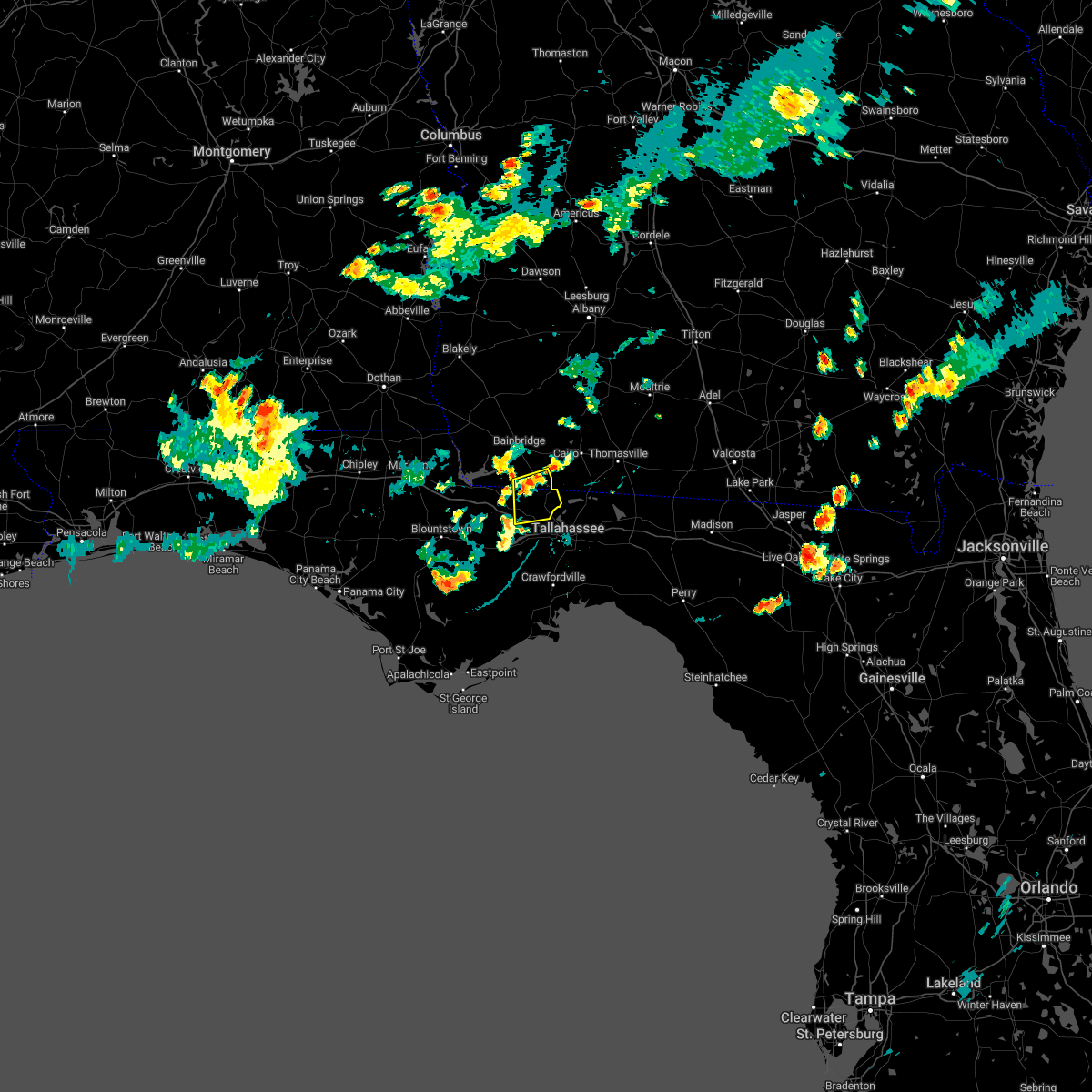 At 804 pm edt, a severe thunderstorm was located near havana, moving south at 5 mph (radar indicated). Hazards include 60 mph wind gusts and penny size hail. expect damage to roofs, siding, and trees At 804 pm edt, a severe thunderstorm was located near havana, moving south at 5 mph (radar indicated). Hazards include 60 mph wind gusts and penny size hail. expect damage to roofs, siding, and trees
|
| 5/30/2022 9:08 PM EDT |
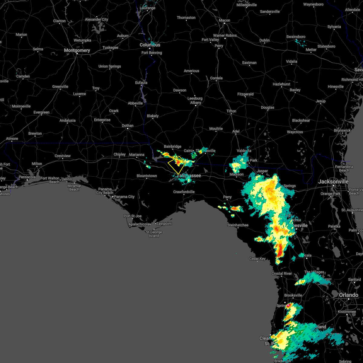 At 908 pm edt, a severe thunderstorm was located near havana, and is nearly stationary (radar indicated). Hazards include 60 mph wind gusts and penny size hail. expect damage to roofs, siding, and trees At 908 pm edt, a severe thunderstorm was located near havana, and is nearly stationary (radar indicated). Hazards include 60 mph wind gusts and penny size hail. expect damage to roofs, siding, and trees
|
| 5/30/2022 9:08 PM EDT |
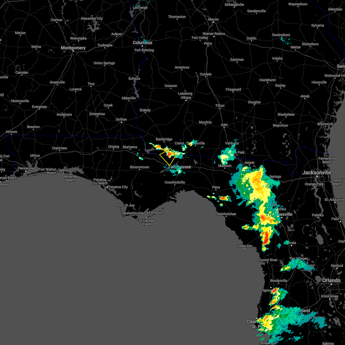 At 908 pm edt, a severe thunderstorm was located near havana, and is nearly stationary (radar indicated). Hazards include 60 mph wind gusts and penny size hail. expect damage to roofs, siding, and trees At 908 pm edt, a severe thunderstorm was located near havana, and is nearly stationary (radar indicated). Hazards include 60 mph wind gusts and penny size hail. expect damage to roofs, siding, and trees
|
| 5/23/2022 3:13 PM EDT |
 At 312 pm edt, a severe thunderstorm was located 11 miles southwest of midway, moving northeast at 35 mph (radar indicated). Hazards include 60 mph wind gusts. expect damage to roofs, siding, and trees At 312 pm edt, a severe thunderstorm was located 11 miles southwest of midway, moving northeast at 35 mph (radar indicated). Hazards include 60 mph wind gusts. expect damage to roofs, siding, and trees
|
| 5/21/2022 6:39 PM EDT |
 At 639 pm edt, a severe thunderstorm was located over deltona, moving north at 30 mph (radar indicated). Hazards include 60 mph wind gusts and quarter size hail. Hail damage to vehicles is expected. expect wind damage to roofs, siding, and trees. locations impacted include, deltona, sanford, deland, lake mary and orange city. hail threat, radar indicated max hail size, 1. 00 in wind threat, radar indicated max wind gust, 60 mph. At 639 pm edt, a severe thunderstorm was located over deltona, moving north at 30 mph (radar indicated). Hazards include 60 mph wind gusts and quarter size hail. Hail damage to vehicles is expected. expect wind damage to roofs, siding, and trees. locations impacted include, deltona, sanford, deland, lake mary and orange city. hail threat, radar indicated max hail size, 1. 00 in wind threat, radar indicated max wind gust, 60 mph.
|
| 5/21/2022 6:13 PM EDT |
 At 612 pm edt, a severe thunderstorm was located over lake jessup, moving north at 30 mph (radar indicated). Hazards include 60 mph wind gusts and quarter size hail. Hail damage to vehicles is expected. Expect wind damage to roofs, siding, and trees. At 612 pm edt, a severe thunderstorm was located over lake jessup, moving north at 30 mph (radar indicated). Hazards include 60 mph wind gusts and quarter size hail. Hail damage to vehicles is expected. Expect wind damage to roofs, siding, and trees.
|
| 5/15/2022 4:43 PM CDT |
 At 442 pm cdt, a cluster of severe thunderstorms was located 6 miles southeast of pea ridge, or 6 miles southwest of bagdad, moving southwest at 10 mph (radar indicated). Hazards include 60 mph wind gusts and quarter size hail. Hail damage to vehicles is expected. expect wind damage to roofs, siding, and trees. Locations impacted include, pensacola, ferry pass, brent, west pensacola, ensley, warrington, gonzalez, pace, milton, gulf breeze, goulding, bagdad, lillian, myrtle grove, oriole beach, navarre, pensacola beach, point baker, navarre beach and pea ridge. At 442 pm cdt, a cluster of severe thunderstorms was located 6 miles southeast of pea ridge, or 6 miles southwest of bagdad, moving southwest at 10 mph (radar indicated). Hazards include 60 mph wind gusts and quarter size hail. Hail damage to vehicles is expected. expect wind damage to roofs, siding, and trees. Locations impacted include, pensacola, ferry pass, brent, west pensacola, ensley, warrington, gonzalez, pace, milton, gulf breeze, goulding, bagdad, lillian, myrtle grove, oriole beach, navarre, pensacola beach, point baker, navarre beach and pea ridge.
|
| 5/15/2022 4:20 PM CDT |
 At 420 pm cdt, a severe thunderstorm was located 7 miles south of bagdad, moving southwest at 15 mph (radar indicated). Hazards include golf ball size hail and 60 mph wind gusts. People and animals outdoors will be injured. expect hail damage to roofs, siding, windows, and vehicles. expect wind damage to roofs, siding, and trees. Locations impacted include, pensacola, ferry pass, brent, west pensacola, ensley, warrington, gonzalez, pace, milton, gulf breeze, goulding, bagdad, lillian, myrtle grove, oriole beach, navarre, pensacola beach, point baker, navarre beach and pea ridge. At 420 pm cdt, a severe thunderstorm was located 7 miles south of bagdad, moving southwest at 15 mph (radar indicated). Hazards include golf ball size hail and 60 mph wind gusts. People and animals outdoors will be injured. expect hail damage to roofs, siding, windows, and vehicles. expect wind damage to roofs, siding, and trees. Locations impacted include, pensacola, ferry pass, brent, west pensacola, ensley, warrington, gonzalez, pace, milton, gulf breeze, goulding, bagdad, lillian, myrtle grove, oriole beach, navarre, pensacola beach, point baker, navarre beach and pea ridge.
|
| 5/15/2022 4:12 PM CDT |
 At 411 pm cdt, a cluster of severe thunderstorms was located 5 miles south of bagdad, moving southwest at 10 mph (radar indicated). Hazards include 60 mph wind gusts and quarter size hail. Hail damage to vehicles is expected. Expect wind damage to roofs, siding, and trees. At 411 pm cdt, a cluster of severe thunderstorms was located 5 miles south of bagdad, moving southwest at 10 mph (radar indicated). Hazards include 60 mph wind gusts and quarter size hail. Hail damage to vehicles is expected. Expect wind damage to roofs, siding, and trees.
|
| 5/15/2022 3:51 PM CDT |
 At 350 pm cdt, severe thunderstorms were located along a line extending from 9 miles east of roeville to 5 miles northeast of navarre beach, moving west at 10 mph (radar indicated). Hazards include 60 mph wind gusts and quarter size hail. Hail damage to vehicles is expected. expect wind damage to roofs, siding, and trees. locations impacted include, milton, bagdad, navarre, point baker, navarre beach and roeville. hail threat, radar indicated max hail size, 1. 00 in wind threat, radar indicated max wind gust, 60 mph. At 350 pm cdt, severe thunderstorms were located along a line extending from 9 miles east of roeville to 5 miles northeast of navarre beach, moving west at 10 mph (radar indicated). Hazards include 60 mph wind gusts and quarter size hail. Hail damage to vehicles is expected. expect wind damage to roofs, siding, and trees. locations impacted include, milton, bagdad, navarre, point baker, navarre beach and roeville. hail threat, radar indicated max hail size, 1. 00 in wind threat, radar indicated max wind gust, 60 mph.
|
| 5/15/2022 3:27 PM CDT |
 At 326 pm cdt, severe thunderstorms were located along a line extending from 8 miles southwest of baker to 5 miles northwest of mary esther, and are moving west at 10 mph (radar indicated). Hazards include 60 mph wind gusts and quarter size hail. Hail damage to vehicles is expected. Expect wind damage to roofs, siding, and trees. At 326 pm cdt, severe thunderstorms were located along a line extending from 8 miles southwest of baker to 5 miles northwest of mary esther, and are moving west at 10 mph (radar indicated). Hazards include 60 mph wind gusts and quarter size hail. Hail damage to vehicles is expected. Expect wind damage to roofs, siding, and trees.
|
| 5/6/2022 4:48 PM EDT |
 At 447 pm edt, a severe thunderstorm was located near tallahassee comm college, or near midway, moving east at 60 mph (radar indicated). Hazards include 60 mph wind gusts. Expect damage to roofs, siding, and trees. locations impacted include, midway, havana, tallahassee, lake talquin, scotland, bloxham, gibson, fort braden and tallahassee coml airport. hail threat, radar indicated max hail size, <. 75 in wind threat, radar indicated max wind gust, 60 mph. At 447 pm edt, a severe thunderstorm was located near tallahassee comm college, or near midway, moving east at 60 mph (radar indicated). Hazards include 60 mph wind gusts. Expect damage to roofs, siding, and trees. locations impacted include, midway, havana, tallahassee, lake talquin, scotland, bloxham, gibson, fort braden and tallahassee coml airport. hail threat, radar indicated max hail size, <. 75 in wind threat, radar indicated max wind gust, 60 mph.
|
| 5/6/2022 4:40 PM EDT |
 At 440 pm edt, a severe thunderstorm was located 8 miles southwest of midway, moving east at 35 mph (radar indicated). Hazards include 60 mph wind gusts and nickel size hail. expect damage to roofs, siding, and trees At 440 pm edt, a severe thunderstorm was located 8 miles southwest of midway, moving east at 35 mph (radar indicated). Hazards include 60 mph wind gusts and nickel size hail. expect damage to roofs, siding, and trees
|
| 5/6/2022 4:23 PM EDT |
 At 423 pm edt, a severe thunderstorm was located 11 miles south of greensboro, or 15 miles east of blountstown, moving east at 55 mph (radar indicated). Hazards include 60 mph wind gusts. expect damage to roofs, siding, and trees At 423 pm edt, a severe thunderstorm was located 11 miles south of greensboro, or 15 miles east of blountstown, moving east at 55 mph (radar indicated). Hazards include 60 mph wind gusts. expect damage to roofs, siding, and trees
|
| 5/6/2022 2:58 PM EDT |
 At 257 pm edt, a severe thunderstorm was located 7 miles south of greensboro, or 12 miles southwest of quincy, moving northeast at 25 mph (radar indicated). Hazards include 60 mph wind gusts and quarter size hail. Hail damage to vehicles is expected. Expect wind damage to roofs, siding, and trees. At 257 pm edt, a severe thunderstorm was located 7 miles south of greensboro, or 12 miles southwest of quincy, moving northeast at 25 mph (radar indicated). Hazards include 60 mph wind gusts and quarter size hail. Hail damage to vehicles is expected. Expect wind damage to roofs, siding, and trees.
|
| 5/6/2022 4:59 AM CDT |
 At 457 am cdt, severe thunderstorms were located along a line extending from 8 miles north of roeville to 6 miles north of oriole beach to 15 miles southwest of pensacola beach, moving east at 50 mph (radar indicated). Hazards include 60 mph wind gusts. expect damage to roofs, siding, and trees At 457 am cdt, severe thunderstorms were located along a line extending from 8 miles north of roeville to 6 miles north of oriole beach to 15 miles southwest of pensacola beach, moving east at 50 mph (radar indicated). Hazards include 60 mph wind gusts. expect damage to roofs, siding, and trees
|
| 5/6/2022 4:40 AM CDT |
 At 440 am cdt, severe thunderstorms were located along a line extending from east brewton to 7 miles southeast of jay to 4 miles southwest of point baker to warrington, moving east at 55 mph (radar indicated). Hazards include 70 mph wind gusts. Expect considerable tree damage. damage is likely to mobile homes, roofs, and outbuildings. Locations impacted include, pensacola, ferry pass, brent, west pensacola, ensley, warrington, gonzalez, pace, milton, gulf breeze, brewton, goulding, century, flomaton, bagdad, myrtle grove, oriole beach, navarre, east brewton and molino. At 440 am cdt, severe thunderstorms were located along a line extending from east brewton to 7 miles southeast of jay to 4 miles southwest of point baker to warrington, moving east at 55 mph (radar indicated). Hazards include 70 mph wind gusts. Expect considerable tree damage. damage is likely to mobile homes, roofs, and outbuildings. Locations impacted include, pensacola, ferry pass, brent, west pensacola, ensley, warrington, gonzalez, pace, milton, gulf breeze, brewton, goulding, century, flomaton, bagdad, myrtle grove, oriole beach, navarre, east brewton and molino.
|
| 5/6/2022 4:26 AM CDT |
 At 426 am cdt, severe thunderstorms were located along a line extending from 3 miles north of flomaton to 6 miles north of molino to 4 miles northwest of gonzalez to perdido beach, moving east at 55 mph (radar indicated). Hazards include 70 mph wind gusts. Expect considerable tree damage. damage is likely to mobile homes, roofs, and outbuildings. Locations impacted include, pensacola, ferry pass, brent, west pensacola, ensley, warrington, gonzalez, pace, milton, gulf breeze, brewton, orange beach, goulding, century, flomaton, bagdad, lillian, myrtle grove, oriole beach and navarre. At 426 am cdt, severe thunderstorms were located along a line extending from 3 miles north of flomaton to 6 miles north of molino to 4 miles northwest of gonzalez to perdido beach, moving east at 55 mph (radar indicated). Hazards include 70 mph wind gusts. Expect considerable tree damage. damage is likely to mobile homes, roofs, and outbuildings. Locations impacted include, pensacola, ferry pass, brent, west pensacola, ensley, warrington, gonzalez, pace, milton, gulf breeze, brewton, orange beach, goulding, century, flomaton, bagdad, lillian, myrtle grove, oriole beach and navarre.
|
| 5/6/2022 4:12 AM CDT |
 At 412 am cdt, severe thunderstorms were located along a line extending from atmore to 12 miles west of molino to 10 miles east of robertsdale to bon secour, moving east at 55 mph (radar indicated). Hazards include 60 mph wind gusts. expect damage to roofs, siding, and trees At 412 am cdt, severe thunderstorms were located along a line extending from atmore to 12 miles west of molino to 10 miles east of robertsdale to bon secour, moving east at 55 mph (radar indicated). Hazards include 60 mph wind gusts. expect damage to roofs, siding, and trees
|
| 5/3/2022 4:00 PM EDT |
 At 359 pm edt, a severe thunderstorm was located near midway, moving southwest at 10 mph (radar indicated). Hazards include 60 mph wind gusts and quarter size hail. Hail damage to vehicles is expected. Expect wind damage to roofs, siding, and trees. At 359 pm edt, a severe thunderstorm was located near midway, moving southwest at 10 mph (radar indicated). Hazards include 60 mph wind gusts and quarter size hail. Hail damage to vehicles is expected. Expect wind damage to roofs, siding, and trees.
|
| 5/3/2022 3:28 PM EDT |
 At 328 pm edt, a severe thunderstorm was located near tallahassee comm college, or near tallahassee, and is nearly stationary (radar indicated). Hazards include 60 mph wind gusts and quarter size hail. Hail damage to vehicles is expected. Expect wind damage to roofs, siding, and trees. At 328 pm edt, a severe thunderstorm was located near tallahassee comm college, or near tallahassee, and is nearly stationary (radar indicated). Hazards include 60 mph wind gusts and quarter size hail. Hail damage to vehicles is expected. Expect wind damage to roofs, siding, and trees.
|
| 4/17/2022 11:32 PM CDT |
 At 1132 pm cdt, a severe thunderstorm capable of producing a tornado was located over milton, moving east at 40 mph (radar indicated rotation). Hazards include tornado. Flying debris will be dangerous to those caught without shelter. mobile homes will be damaged or destroyed. damage to roofs, windows, and vehicles will occur. tree damage is likely. This tornadic thunderstorm will remain over mainly rural areas of central santa rosa county. At 1132 pm cdt, a severe thunderstorm capable of producing a tornado was located over milton, moving east at 40 mph (radar indicated rotation). Hazards include tornado. Flying debris will be dangerous to those caught without shelter. mobile homes will be damaged or destroyed. damage to roofs, windows, and vehicles will occur. tree damage is likely. This tornadic thunderstorm will remain over mainly rural areas of central santa rosa county.
|
| 4/17/2022 11:27 PM CDT |
 At 1125 pm cdt, severe thunderstorms were located along a line extending from 9 miles north of point baker to near bagdad to gulf breeze, moving east at 45 mph. these are destructive storms for south-central santa rosa and south-central okaloosa counties in florida (radar indicated). Hazards include 80 mph wind gusts and penny size hail. Flying debris will be dangerous to those caught without shelter. mobile homes will be heavily damaged. expect considerable damage to roofs, windows, and vehicles. Extensive tree damage and power outages are likely. At 1125 pm cdt, severe thunderstorms were located along a line extending from 9 miles north of point baker to near bagdad to gulf breeze, moving east at 45 mph. these are destructive storms for south-central santa rosa and south-central okaloosa counties in florida (radar indicated). Hazards include 80 mph wind gusts and penny size hail. Flying debris will be dangerous to those caught without shelter. mobile homes will be heavily damaged. expect considerable damage to roofs, windows, and vehicles. Extensive tree damage and power outages are likely.
|
| 4/17/2022 11:04 PM CDT |
 At 1103 pm cdt, a severe thunderstorm capable of producing a tornado was located 4 miles west of ensley, moving east at 40 mph. another severe thunderstorm capable of producing a tornado was located over quintette, moving east at 40 mph (radar indicated rotation). Hazards include tornado. Flying debris will be dangerous to those caught without shelter. mobile homes will be damaged or destroyed. damage to roofs, windows, and vehicles will occur. tree damage is likely. this dangerous storm will be near, ferry pass and brent around 1115 pm cdt. pace, floridatown and pea ridge around 1120 pm cdt. Bagdad around 1130 pm cdt. At 1103 pm cdt, a severe thunderstorm capable of producing a tornado was located 4 miles west of ensley, moving east at 40 mph. another severe thunderstorm capable of producing a tornado was located over quintette, moving east at 40 mph (radar indicated rotation). Hazards include tornado. Flying debris will be dangerous to those caught without shelter. mobile homes will be damaged or destroyed. damage to roofs, windows, and vehicles will occur. tree damage is likely. this dangerous storm will be near, ferry pass and brent around 1115 pm cdt. pace, floridatown and pea ridge around 1120 pm cdt. Bagdad around 1130 pm cdt.
|
| 4/17/2022 10:34 PM CDT |
 At 1032 pm cdt, severe thunderstorms were located along a line extending from 11 miles southeast of bay minette to 5 miles southeast of alabama port, moving southeast at 45 mph (radar indicated). Hazards include 70 mph wind gusts and penny size hail. Expect considerable tree damage. Damage is likely to mobile homes, roofs, and outbuildings. At 1032 pm cdt, severe thunderstorms were located along a line extending from 11 miles southeast of bay minette to 5 miles southeast of alabama port, moving southeast at 45 mph (radar indicated). Hazards include 70 mph wind gusts and penny size hail. Expect considerable tree damage. Damage is likely to mobile homes, roofs, and outbuildings.
|
| 4/17/2022 10:34 PM CDT |
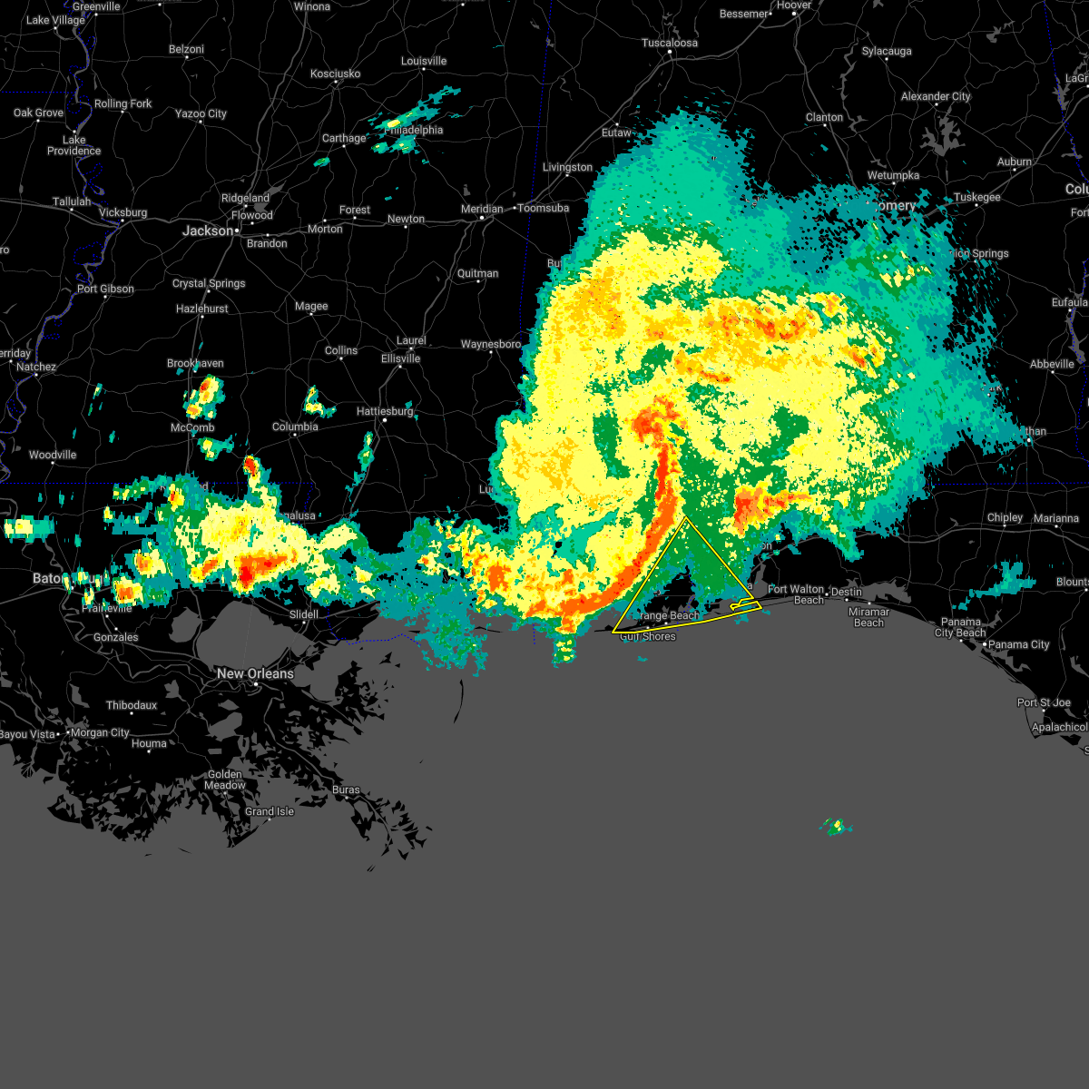 At 1032 pm cdt, severe thunderstorms were located along a line extending from 11 miles southeast of bay minette to 5 miles southeast of alabama port, moving southeast at 45 mph (radar indicated). Hazards include 70 mph wind gusts and penny size hail. Expect considerable tree damage. Damage is likely to mobile homes, roofs, and outbuildings. At 1032 pm cdt, severe thunderstorms were located along a line extending from 11 miles southeast of bay minette to 5 miles southeast of alabama port, moving southeast at 45 mph (radar indicated). Hazards include 70 mph wind gusts and penny size hail. Expect considerable tree damage. Damage is likely to mobile homes, roofs, and outbuildings.
|
| 4/17/2022 7:27 PM EDT |
 At 727 pm edt, severe thunderstorms were located along a line extending from 7 miles north of tallahassee to near crawfordville, moving east at 20 mph (radar indicated). Hazards include 60 mph wind gusts. expect damage to roofs, siding, and trees At 727 pm edt, severe thunderstorms were located along a line extending from 7 miles north of tallahassee to near crawfordville, moving east at 20 mph (radar indicated). Hazards include 60 mph wind gusts. expect damage to roofs, siding, and trees
|
| 4/17/2022 7:10 PM EDT |
 At 710 pm edt, severe thunderstorms were located along a line extending from near havana to 11 miles northwest of crawfordville, moving east at 25 mph (radar indicated). Hazards include 60 mph wind gusts. Expect damage to roofs, siding, and trees. locations impacted include, quincy, midway, havana, tallahassee, freemont, littman, darsey, florence, scotland, jamieson, santa clara, shady rest, quincy airport, wetumpka, branchville, bloxham, hinson, dogtown, lake talquin and andrew. hail threat, radar indicated max hail size, <. 75 in wind threat, radar indicated max wind gust, 60 mph. At 710 pm edt, severe thunderstorms were located along a line extending from near havana to 11 miles northwest of crawfordville, moving east at 25 mph (radar indicated). Hazards include 60 mph wind gusts. Expect damage to roofs, siding, and trees. locations impacted include, quincy, midway, havana, tallahassee, freemont, littman, darsey, florence, scotland, jamieson, santa clara, shady rest, quincy airport, wetumpka, branchville, bloxham, hinson, dogtown, lake talquin and andrew. hail threat, radar indicated max hail size, <. 75 in wind threat, radar indicated max wind gust, 60 mph.
|
| 4/17/2022 6:55 PM EDT |
 At 655 pm edt, severe thunderstorms were located along a line extending from 10 miles east of chattahoochee to 13 miles northwest of crawfordville, moving east at 25 mph (radar indicated). Hazards include 60 mph wind gusts. Expect damage to roofs, siding, and trees. locations impacted include, quincy, midway, havana, tallahassee, greensboro, gretna, attapulgus, freemont, littman, douglas city, darsey, florence, scotland, jamieson, laingkat, calvary, santa clara, shady rest, princes still and amsterdam. hail threat, radar indicated max hail size, <. 75 in wind threat, radar indicated max wind gust, 60 mph. At 655 pm edt, severe thunderstorms were located along a line extending from 10 miles east of chattahoochee to 13 miles northwest of crawfordville, moving east at 25 mph (radar indicated). Hazards include 60 mph wind gusts. Expect damage to roofs, siding, and trees. locations impacted include, quincy, midway, havana, tallahassee, greensboro, gretna, attapulgus, freemont, littman, douglas city, darsey, florence, scotland, jamieson, laingkat, calvary, santa clara, shady rest, princes still and amsterdam. hail threat, radar indicated max hail size, <. 75 in wind threat, radar indicated max wind gust, 60 mph.
|
| 4/17/2022 6:38 PM EDT |
 At 638 pm edt, severe thunderstorms were located along a line extending from near chattahoochee to 14 miles southwest of midway, moving east at 25 mph (radar indicated). Hazards include 60 mph wind gusts and quarter size hail. Hail damage to vehicles is expected. expect wind damage to roofs, siding, and trees. locations impacted include, quincy, midway, havana, tallahassee, greensboro, chattahoochee, gretna, attapulgus, freemont, littman, juniper, douglas city, darsey, florence, scotland, rosedale, jamieson, recovery, laingkat and calvary. hail threat, radar indicated max hail size, 1. 00 in wind threat, radar indicated max wind gust, 60 mph. At 638 pm edt, severe thunderstorms were located along a line extending from near chattahoochee to 14 miles southwest of midway, moving east at 25 mph (radar indicated). Hazards include 60 mph wind gusts and quarter size hail. Hail damage to vehicles is expected. expect wind damage to roofs, siding, and trees. locations impacted include, quincy, midway, havana, tallahassee, greensboro, chattahoochee, gretna, attapulgus, freemont, littman, juniper, douglas city, darsey, florence, scotland, rosedale, jamieson, recovery, laingkat and calvary. hail threat, radar indicated max hail size, 1. 00 in wind threat, radar indicated max wind gust, 60 mph.
|
| 4/17/2022 6:21 PM EDT |
 At 621 pm edt/521 pm cdt/, severe thunderstorms were located along a line extending from near chattahoochee to 15 miles south of greensboro, moving east at 25 mph (radar indicated). Hazards include 60 mph wind gusts and quarter size hail. Hail damage to vehicles is expected. Expect wind damage to roofs, siding, and trees. At 621 pm edt/521 pm cdt/, severe thunderstorms were located along a line extending from near chattahoochee to 15 miles south of greensboro, moving east at 25 mph (radar indicated). Hazards include 60 mph wind gusts and quarter size hail. Hail damage to vehicles is expected. Expect wind damage to roofs, siding, and trees.
|
| 4/7/2022 12:42 PM EDT |
 The severe thunderstorm warning for seminole, western orange and northwestern osceola counties will expire at 1245 pm edt, the storms which prompted the warning have weakened below severe limits, and no longer pose an immediate threat to life or property. therefore, the warning will be allowed to expire. however gusty winds are still possible with these thunderstorms. The severe thunderstorm warning for seminole, western orange and northwestern osceola counties will expire at 1245 pm edt, the storms which prompted the warning have weakened below severe limits, and no longer pose an immediate threat to life or property. therefore, the warning will be allowed to expire. however gusty winds are still possible with these thunderstorms.
|
| 4/7/2022 12:30 PM EDT |
 At 1230 pm edt, severe thunderstorms were located along a line extending from apopka to lockhart to orlovista to near bay lake to 9 miles north of auburndale, moving east at 45 mph (radar indicated). Hazards include 60 mph wind gusts and penny size hail. Expect damage to roofs, siding, and trees. locations impacted include, orlando, kissimmee, sanford, apopka and altamonte springs. hail threat, radar indicated max hail size, 0. 75 in wind threat, radar indicated max wind gust, 60 mph. At 1230 pm edt, severe thunderstorms were located along a line extending from apopka to lockhart to orlovista to near bay lake to 9 miles north of auburndale, moving east at 45 mph (radar indicated). Hazards include 60 mph wind gusts and penny size hail. Expect damage to roofs, siding, and trees. locations impacted include, orlando, kissimmee, sanford, apopka and altamonte springs. hail threat, radar indicated max hail size, 0. 75 in wind threat, radar indicated max wind gust, 60 mph.
|
| 4/7/2022 12:22 PM EDT |
 At 1222 pm edt, severe thunderstorms were located along a line extending from near zellwood to near winter garden to ocoee to near bay lake to 9 miles north of combee settlement, moving east at 45 mph (radar indicated). Hazards include 60 mph wind gusts and penny size hail. Expect damage to roofs, siding, and trees. locations impacted include, orlando, kissimmee, sanford, apopka and altamonte springs. hail threat, radar indicated max hail size, 0. 75 in wind threat, radar indicated max wind gust, 60 mph. At 1222 pm edt, severe thunderstorms were located along a line extending from near zellwood to near winter garden to ocoee to near bay lake to 9 miles north of combee settlement, moving east at 45 mph (radar indicated). Hazards include 60 mph wind gusts and penny size hail. Expect damage to roofs, siding, and trees. locations impacted include, orlando, kissimmee, sanford, apopka and altamonte springs. hail threat, radar indicated max hail size, 0. 75 in wind threat, radar indicated max wind gust, 60 mph.
|
| 4/7/2022 12:13 PM EDT |
 At 1212 pm edt, severe thunderstorms were located along a line extending from near ferndale to near lake apopka to near oakland to near four corners to 9 miles northwest of combee settlement, moving east at 45 mph (radar indicated). Hazards include 60 mph wind gusts and penny size hail. expect damage to roofs, siding, and trees At 1212 pm edt, severe thunderstorms were located along a line extending from near ferndale to near lake apopka to near oakland to near four corners to 9 miles northwest of combee settlement, moving east at 45 mph (radar indicated). Hazards include 60 mph wind gusts and penny size hail. expect damage to roofs, siding, and trees
|
| 4/6/2022 4:44 PM EDT |
 At 444 pm edt, doppler radar indicated a severe thunderstorm capable of producing quarter size hail and damaging winds in excess of 60 mph. this storm was located near midway, and moving northeast at 30 mph. At 444 pm edt, doppler radar indicated a severe thunderstorm capable of producing quarter size hail and damaging winds in excess of 60 mph. this storm was located near midway, and moving northeast at 30 mph.
|
| 4/5/2022 4:35 PM EDT |
 At 435 pm edt, severe thunderstorms were located along a line extending from 7 miles southeast of pelham to 8 miles southwest of whigham to 6 miles southwest of greensboro, moving east at 50 mph (radar indicated). Hazards include 60 mph wind gusts and penny size hail. expect damage to roofs, siding, and trees At 435 pm edt, severe thunderstorms were located along a line extending from 7 miles southeast of pelham to 8 miles southwest of whigham to 6 miles southwest of greensboro, moving east at 50 mph (radar indicated). Hazards include 60 mph wind gusts and penny size hail. expect damage to roofs, siding, and trees
|
| 3/31/2022 9:52 AM EDT |
 At 952 am edt, severe thunderstorms were located along a line extending from 13 miles northeast of tallahassee to near st george island, moving east at 20 mph (radar indicated). Hazards include 60 mph wind gusts. Expect damage to roofs, siding, and trees. locations impacted include, carrabelle, eastpoint, apalachicola, tallahassee, st. Marks, woodville, crawfordville, st george island, midway, florida state university, tallahassee comm college, doak campbell stadium, florida a and m, wakulla, franklin, sopchoppy, lake bradford, wakulla springs, st george island st pk and medart. At 952 am edt, severe thunderstorms were located along a line extending from 13 miles northeast of tallahassee to near st george island, moving east at 20 mph (radar indicated). Hazards include 60 mph wind gusts. Expect damage to roofs, siding, and trees. locations impacted include, carrabelle, eastpoint, apalachicola, tallahassee, st. Marks, woodville, crawfordville, st george island, midway, florida state university, tallahassee comm college, doak campbell stadium, florida a and m, wakulla, franklin, sopchoppy, lake bradford, wakulla springs, st george island st pk and medart.
|
| 3/31/2022 8:54 AM EDT |
 At 853 am edt, severe thunderstorms were located along a line extending from 7 miles northwest of havana to 14 miles southwest of apalachicola, moving east at 20 mph (radar indicated). Hazards include 60 mph wind gusts. expect damage to roofs, siding, and trees At 853 am edt, severe thunderstorms were located along a line extending from 7 miles northwest of havana to 14 miles southwest of apalachicola, moving east at 20 mph (radar indicated). Hazards include 60 mph wind gusts. expect damage to roofs, siding, and trees
|
| 3/31/2022 7:35 AM CDT |
 At 835 am edt/735 am cdt/, severe thunderstorms were located along a line extending from near quincy to 11 miles southeast of port st. joe, moving east at 20 mph (radar indicated). Hazards include 60 mph wind gusts. Expect damage to roofs, siding, and trees. Locations impacted include, eastpoint, apalachicola, midway, quincy, havana, st george island, greensboro, franklin, gretna, jewel fire tower, juniper, douglas city, vilas, florence, jamieson, central city, cape san blas, beverly, poplar camp and kern. At 835 am edt/735 am cdt/, severe thunderstorms were located along a line extending from near quincy to 11 miles southeast of port st. joe, moving east at 20 mph (radar indicated). Hazards include 60 mph wind gusts. Expect damage to roofs, siding, and trees. Locations impacted include, eastpoint, apalachicola, midway, quincy, havana, st george island, greensboro, franklin, gretna, jewel fire tower, juniper, douglas city, vilas, florence, jamieson, central city, cape san blas, beverly, poplar camp and kern.
|
| 3/31/2022 6:42 AM CDT |
 At 742 am edt/642 am cdt/, severe thunderstorms were located along a line extending from chattahoochee to 13 miles southwest of port st. joe, moving east at 20 mph (radar indicated). Hazards include 60 mph wind gusts. expect damage to roofs, siding, and trees At 742 am edt/642 am cdt/, severe thunderstorms were located along a line extending from chattahoochee to 13 miles southwest of port st. joe, moving east at 20 mph (radar indicated). Hazards include 60 mph wind gusts. expect damage to roofs, siding, and trees
|
| 3/31/2022 1:52 AM CDT |
 At 152 am cdt, severe thunderstorms were located along a line extending from 11 miles southeast of laurel hill to 9 miles south of crestview to 4 miles southwest of navarre beach, moving northeast at 55 mph (radar indicated). Hazards include 70 mph wind gusts and quarter size hail. Hail damage to vehicles is expected. expect considerable tree damage. wind damage is also likely to mobile homes, roofs, and outbuildings. Locations impacted include, wright, fort walton beach, crestview, niceville, destin, eglin afb, valparaiso, mary esther, ocean city, lake lorraine, navarre, shalimar, laurel hill, cinco bayou and navarre beach. At 152 am cdt, severe thunderstorms were located along a line extending from 11 miles southeast of laurel hill to 9 miles south of crestview to 4 miles southwest of navarre beach, moving northeast at 55 mph (radar indicated). Hazards include 70 mph wind gusts and quarter size hail. Hail damage to vehicles is expected. expect considerable tree damage. wind damage is also likely to mobile homes, roofs, and outbuildings. Locations impacted include, wright, fort walton beach, crestview, niceville, destin, eglin afb, valparaiso, mary esther, ocean city, lake lorraine, navarre, shalimar, laurel hill, cinco bayou and navarre beach.
|
| 3/31/2022 1:15 AM CDT |
 At 114 am cdt, severe thunderstorms were located along a line extending from 17 miles east of riverview to 6 miles south of baker to pensacola beach, moving east at 35 mph (radar indicated). Hazards include 70 mph wind gusts and quarter size hail. Hail damage to vehicles is expected. expect considerable tree damage. Wind damage is also likely to mobile homes, roofs, and outbuildings. At 114 am cdt, severe thunderstorms were located along a line extending from 17 miles east of riverview to 6 miles south of baker to pensacola beach, moving east at 35 mph (radar indicated). Hazards include 70 mph wind gusts and quarter size hail. Hail damage to vehicles is expected. expect considerable tree damage. Wind damage is also likely to mobile homes, roofs, and outbuildings.
|
| 3/31/2022 1:03 AM CDT |
 At 103 am cdt, severe thunderstorms were located along a line extending from 9 miles southeast of riverview to 8 miles east of roeville to 11 miles southeast of perdido beach, moving east at 40 mph (radar indicated). Hazards include 70 mph wind gusts and ping pong ball size hail. People and animals outdoors will be injured. expect hail damage to roofs, siding, windows, and vehicles. expect considerable tree damage. wind damage is also likely to mobile homes, roofs, and outbuildings. Locations impacted include, pensacola, ferry pass, brent, west pensacola, warrington, crestview, pace, milton, gulf breeze, goulding, bagdad, myrtle grove, baker, oriole beach, navarre, laurel hill, pensacola beach, point baker, pea ridge and roeville. At 103 am cdt, severe thunderstorms were located along a line extending from 9 miles southeast of riverview to 8 miles east of roeville to 11 miles southeast of perdido beach, moving east at 40 mph (radar indicated). Hazards include 70 mph wind gusts and ping pong ball size hail. People and animals outdoors will be injured. expect hail damage to roofs, siding, windows, and vehicles. expect considerable tree damage. wind damage is also likely to mobile homes, roofs, and outbuildings. Locations impacted include, pensacola, ferry pass, brent, west pensacola, warrington, crestview, pace, milton, gulf breeze, goulding, bagdad, myrtle grove, baker, oriole beach, navarre, laurel hill, pensacola beach, point baker, pea ridge and roeville.
|
| 3/31/2022 12:20 AM CDT |
 At 1219 am cdt, a severe thunderstorm was located over beulah and gonzalez, moving northeast at 60 mph (radar indicated). Hazards include 70 mph wind gusts and ping pong ball size hail. People and animals outdoors will be injured. expect hail damage to roofs, siding, windows, and vehicles. expect considerable tree damage. wind damage is also likely to mobile homes, roofs, and outbuildings. Locations impacted include, pensacola, ferry pass, brent, west pensacola, ensley, warrington, crestview, gonzalez, gulf shores, foley, pace, milton, gulf breeze, orange beach, goulding, century, bagdad, lillian, myrtle grove and baker. At 1219 am cdt, a severe thunderstorm was located over beulah and gonzalez, moving northeast at 60 mph (radar indicated). Hazards include 70 mph wind gusts and ping pong ball size hail. People and animals outdoors will be injured. expect hail damage to roofs, siding, windows, and vehicles. expect considerable tree damage. wind damage is also likely to mobile homes, roofs, and outbuildings. Locations impacted include, pensacola, ferry pass, brent, west pensacola, ensley, warrington, crestview, gonzalez, gulf shores, foley, pace, milton, gulf breeze, orange beach, goulding, century, bagdad, lillian, myrtle grove and baker.
|
| 3/31/2022 12:16 AM CDT |
 At 1215 am cdt, severe thunderstorms were located along a line extending from century to 3 miles west of ensley to 12 miles southeast of fort morgan, moving northeast at 70 mph (radar indicated). Hazards include 70 mph wind gusts. Expect considerable tree damage. Damage is likely to mobile homes, roofs, and outbuildings. At 1215 am cdt, severe thunderstorms were located along a line extending from century to 3 miles west of ensley to 12 miles southeast of fort morgan, moving northeast at 70 mph (radar indicated). Hazards include 70 mph wind gusts. Expect considerable tree damage. Damage is likely to mobile homes, roofs, and outbuildings.
|
| 3/23/2022 12:34 AM CDT |
 At 1233 am cdt, severe thunderstorms were located along a line extending from 6 miles southeast of bay minette to 5 miles southwest of bon secour, moving east at 40 mph (radar indicated). Hazards include 60 mph wind gusts. expect damage to roofs, siding, and trees At 1233 am cdt, severe thunderstorms were located along a line extending from 6 miles southeast of bay minette to 5 miles southwest of bon secour, moving east at 40 mph (radar indicated). Hazards include 60 mph wind gusts. expect damage to roofs, siding, and trees
|
| 3/18/2022 11:54 AM CDT |
 At 1153 am cdt, severe thunderstorms were located along a line extending from 12 miles east of riverview to near foley, moving east at 30 mph (radar indicated). Hazards include 60 mph wind gusts and quarter size hail. Hail damage to vehicles is expected. Expect wind damage to roofs, siding, and trees. At 1153 am cdt, severe thunderstorms were located along a line extending from 12 miles east of riverview to near foley, moving east at 30 mph (radar indicated). Hazards include 60 mph wind gusts and quarter size hail. Hail damage to vehicles is expected. Expect wind damage to roofs, siding, and trees.
|
| 3/18/2022 11:19 AM CDT |
 At 1118 am cdt, severe thunderstorms were located along a line extending from 12 miles southwest of river falls to 3 miles south of elberta, moving southeast at 35 mph (radar indicated). Hazards include 70 mph wind gusts and quarter size hail. Hail damage to vehicles is expected. expect considerable tree damage. wind damage is also likely to mobile homes, roofs, and outbuildings. locations impacted include, pensacola, ferry pass, brent, west pensacola, ensley, warrington, gonzalez, gulf shores, foley, pace, milton, gulf breeze, brewton, orange beach, goulding, robertsdale, point clear, century, flomaton and bagdad. thunderstorm damage threat, considerable hail threat, radar indicated max hail size, 1. 00 in wind threat, radar indicated max wind gust, 70 mph. At 1118 am cdt, severe thunderstorms were located along a line extending from 12 miles southwest of river falls to 3 miles south of elberta, moving southeast at 35 mph (radar indicated). Hazards include 70 mph wind gusts and quarter size hail. Hail damage to vehicles is expected. expect considerable tree damage. wind damage is also likely to mobile homes, roofs, and outbuildings. locations impacted include, pensacola, ferry pass, brent, west pensacola, ensley, warrington, gonzalez, gulf shores, foley, pace, milton, gulf breeze, brewton, orange beach, goulding, robertsdale, point clear, century, flomaton and bagdad. thunderstorm damage threat, considerable hail threat, radar indicated max hail size, 1. 00 in wind threat, radar indicated max wind gust, 70 mph.
|
| 3/18/2022 11:07 AM CDT |
 At 1107 am cdt, severe thunderstorms were located along a line extending from 13 miles southwest of red level to near foley, moving southeast at 20 mph (radar indicated). Hazards include 60 mph wind gusts and quarter size hail. Hail damage to vehicles is expected. Expect wind damage to roofs, siding, and trees. At 1107 am cdt, severe thunderstorms were located along a line extending from 13 miles southwest of red level to near foley, moving southeast at 20 mph (radar indicated). Hazards include 60 mph wind gusts and quarter size hail. Hail damage to vehicles is expected. Expect wind damage to roofs, siding, and trees.
|
| 3/16/2022 6:41 PM EDT |
 At 640 pm edt, a severe thunderstorm was located over osteen, or near geneva, moving northeast at 40 mph (radar indicated). Hazards include 60 mph wind gusts and half dollar size hail. Hail damage to vehicles is expected. Expect wind damage to roofs, siding, and trees. At 640 pm edt, a severe thunderstorm was located over osteen, or near geneva, moving northeast at 40 mph (radar indicated). Hazards include 60 mph wind gusts and half dollar size hail. Hail damage to vehicles is expected. Expect wind damage to roofs, siding, and trees.
|
| 3/16/2022 6:36 PM EDT |
 At 636 pm edt, a severe thunderstorm was located over osteen, or near deltona, moving northeast at 40 mph (radar indicated). Hazards include 60 mph wind gusts and half dollar size hail. Hail damage to vehicles is expected. expect wind damage to roofs, siding, and trees. locations impacted include, deltona, sanford, oviedo, winter springs and casselberry. hail threat, observed max hail size, 1. 25 in wind threat, radar indicated max wind gust, 60 mph. At 636 pm edt, a severe thunderstorm was located over osteen, or near deltona, moving northeast at 40 mph (radar indicated). Hazards include 60 mph wind gusts and half dollar size hail. Hail damage to vehicles is expected. expect wind damage to roofs, siding, and trees. locations impacted include, deltona, sanford, oviedo, winter springs and casselberry. hail threat, observed max hail size, 1. 25 in wind threat, radar indicated max wind gust, 60 mph.
|
| 3/16/2022 6:17 PM EDT |
 At 616 pm edt, a severe thunderstorm was located over lake mary, moving northeast at 40 mph. this is a destructive storm for lake mary and sanford (radar indicated). Hazards include baseball size hail and 60 mph wind gusts. People and animals outdoors will be severely injured. expect shattered windows, extensive damage to roofs, siding, and vehicles. locations impacted include, deltona, sanford, altamonte springs, oviedo and winter springs. thunderstorm damage threat, destructive hail threat, radar indicated max hail size, 2. 75 in wind threat, radar indicated max wind gust, 60 mph. At 616 pm edt, a severe thunderstorm was located over lake mary, moving northeast at 40 mph. this is a destructive storm for lake mary and sanford (radar indicated). Hazards include baseball size hail and 60 mph wind gusts. People and animals outdoors will be severely injured. expect shattered windows, extensive damage to roofs, siding, and vehicles. locations impacted include, deltona, sanford, altamonte springs, oviedo and winter springs. thunderstorm damage threat, destructive hail threat, radar indicated max hail size, 2. 75 in wind threat, radar indicated max wind gust, 60 mph.
|
| 3/16/2022 6:08 PM EDT |
 At 607 pm edt, a severe thunderstorm was located over wekiwa springs state park, or over apopka, moving northeast at 35 mph (radar indicated). Hazards include golf ball size hail and 60 mph wind gusts. People and animals outdoors may be injured. expect hail damage to roofs, siding, windows, and vehicles. expect wind damage to roofs, siding, and trees. locations impacted include, orlando, deltona, sanford, apopka and altamonte springs. thunderstorm damage threat, considerable hail threat, radar indicated max hail size, 1. 75 in wind threat, radar indicated max wind gust, 60 mph. At 607 pm edt, a severe thunderstorm was located over wekiwa springs state park, or over apopka, moving northeast at 35 mph (radar indicated). Hazards include golf ball size hail and 60 mph wind gusts. People and animals outdoors may be injured. expect hail damage to roofs, siding, windows, and vehicles. expect wind damage to roofs, siding, and trees. locations impacted include, orlando, deltona, sanford, apopka and altamonte springs. thunderstorm damage threat, considerable hail threat, radar indicated max hail size, 1. 75 in wind threat, radar indicated max wind gust, 60 mph.
|
| 3/16/2022 6:00 PM EDT |
 At 559 pm edt, a severe thunderstorm was located over apopka, moving northeast at 40 mph (radar indicated). Hazards include 60 mph wind gusts and quarter size hail. Hail damage to vehicles is expected. Expect wind damage to roofs, siding, and trees. At 559 pm edt, a severe thunderstorm was located over apopka, moving northeast at 40 mph (radar indicated). Hazards include 60 mph wind gusts and quarter size hail. Hail damage to vehicles is expected. Expect wind damage to roofs, siding, and trees.
|
| 3/12/2022 9:49 AM EST |
 At 948 am est, severe thunderstorms were located along a line extending from near ormond beach to altamonte springs to near lake louisa, moving east at 35 mph (radar indicated). Hazards include 60 mph wind gusts and penny size hail. Expect damage to roofs, siding, and trees. Locations impacted include, orlando, deltona, daytona beach, port orange and sanford. At 948 am est, severe thunderstorms were located along a line extending from near ormond beach to altamonte springs to near lake louisa, moving east at 35 mph (radar indicated). Hazards include 60 mph wind gusts and penny size hail. Expect damage to roofs, siding, and trees. Locations impacted include, orlando, deltona, daytona beach, port orange and sanford.
|
| 3/12/2022 9:30 AM EST |
 At 930 am est, severe thunderstorms were located along a line extending from 6 miles northeast of ormond-by-the-sea to near ocoee to 9 miles southwest of lake louisa, moving east at 60 mph (radar indicated). Hazards include 60 mph wind gusts and penny size hail. expect damage to roofs, siding, and trees At 930 am est, severe thunderstorms were located along a line extending from 6 miles northeast of ormond-by-the-sea to near ocoee to 9 miles southwest of lake louisa, moving east at 60 mph (radar indicated). Hazards include 60 mph wind gusts and penny size hail. expect damage to roofs, siding, and trees
|
| 3/12/2022 8:43 AM EST |
 At 842 am est, severe thunderstorms were located along a line extending from near lake george to near lady lake and into sumter county, moving east at 55 mph (radar indicated). Hazards include 60 mph wind gusts and penny size hail. expect damage to roofs, siding, and trees At 842 am est, severe thunderstorms were located along a line extending from near lake george to near lady lake and into sumter county, moving east at 55 mph (radar indicated). Hazards include 60 mph wind gusts and penny size hail. expect damage to roofs, siding, and trees
|
| 3/12/2022 4:48 AM EST |
 At 448 am est, severe thunderstorms were located along a line extending from near pelham to 12 miles southeast of blountstown, moving east at 45 mph (radar indicated). Hazards include 60 mph wind gusts. expect damage to roofs, siding, and trees At 448 am est, severe thunderstorms were located along a line extending from near pelham to 12 miles southeast of blountstown, moving east at 45 mph (radar indicated). Hazards include 60 mph wind gusts. expect damage to roofs, siding, and trees
|
| 1/2/2022 9:19 PM EST |
 At 919 pm est, severe thunderstorms were located along a line extending from 13 miles south of cairo to 9 miles south of st george island, moving east at 20 mph (radar indicated). Hazards include 60 mph wind gusts. Expect damage to roofs, siding, and trees. locations impacted include, carrabelle, eastpoint, tallahassee, st. marks, woodville, crawfordville, st george island, florida state university, tallahassee comm college, doak campbell stadium, florida a and m, wakulla, franklin, sopchoppy, lake bradford, wakulla springs, st george island st pk, medart, tallahassee mall and tallahassee regional a/p. hail threat, radar indicated max hail size, <. 75 in wind threat, radar indicated max wind gust, 60 mph. At 919 pm est, severe thunderstorms were located along a line extending from 13 miles south of cairo to 9 miles south of st george island, moving east at 20 mph (radar indicated). Hazards include 60 mph wind gusts. Expect damage to roofs, siding, and trees. locations impacted include, carrabelle, eastpoint, tallahassee, st. marks, woodville, crawfordville, st george island, florida state university, tallahassee comm college, doak campbell stadium, florida a and m, wakulla, franklin, sopchoppy, lake bradford, wakulla springs, st george island st pk, medart, tallahassee mall and tallahassee regional a/p. hail threat, radar indicated max hail size, <. 75 in wind threat, radar indicated max wind gust, 60 mph.
|
| 1/2/2022 8:13 PM EST |
 At 812 pm est/712 pm cst/, severe thunderstorms were located along a line extending from 9 miles north of havana to 8 miles southwest of port st. joe, moving east at 25 mph (radar indicated). Hazards include 60 mph wind gusts. Expect damage to roofs, siding, and trees. locations impacted include, midway, quincy, havana, port st. joe, greensboro, wewahitchka, orange, gretna, bristol, honeyville, juniper, douglas city, vilas, florence, chipola cutoff, jamieson, central city, cape san blas, kern and quincy airport. hail threat, radar indicated max hail size, <. 75 in wind threat, radar indicated max wind gust, 60 mph. At 812 pm est/712 pm cst/, severe thunderstorms were located along a line extending from 9 miles north of havana to 8 miles southwest of port st. joe, moving east at 25 mph (radar indicated). Hazards include 60 mph wind gusts. Expect damage to roofs, siding, and trees. locations impacted include, midway, quincy, havana, port st. joe, greensboro, wewahitchka, orange, gretna, bristol, honeyville, juniper, douglas city, vilas, florence, chipola cutoff, jamieson, central city, cape san blas, kern and quincy airport. hail threat, radar indicated max hail size, <. 75 in wind threat, radar indicated max wind gust, 60 mph.
|
| 1/2/2022 8:10 PM EST |
 At 810 pm est/710 pm cst/, severe thunderstorms were located along a line extending from 8 miles north of quincy to 7 miles southwest of port st. joe, moving east at 30 mph (radar indicated). Hazards include 60 mph wind gusts. expect damage to roofs, siding, and trees At 810 pm est/710 pm cst/, severe thunderstorms were located along a line extending from 8 miles north of quincy to 7 miles southwest of port st. joe, moving east at 30 mph (radar indicated). Hazards include 60 mph wind gusts. expect damage to roofs, siding, and trees
|
| 1/2/2022 7:38 PM EST |
 At 738 pm est/638 pm cst/, severe thunderstorms were located along a line extending from 7 miles east of chattahoochee to near mexico beach, moving east at 30 mph (radar indicated). Hazards include 60 mph wind gusts. expect damage to roofs, siding, and trees At 738 pm est/638 pm cst/, severe thunderstorms were located along a line extending from 7 miles east of chattahoochee to near mexico beach, moving east at 30 mph (radar indicated). Hazards include 60 mph wind gusts. expect damage to roofs, siding, and trees
|
| 8/31/2021 2:20 PM EDT |
 At 220 pm edt, severe thunderstorms were located along a line extending from near havana to 8 miles south of midway to near crawfordville, moving east at 35 mph (radar indicated). Hazards include 60 mph wind gusts. Expect damage to roofs, siding, and trees. locations impacted include, havana, midway, tallahassee, freemont, shady rest, florence, scotland, gibson, hinson and tallahassee coml airport. hail threat, radar indicated max hail size, <. 75 in wind threat, radar indicated max wind gust, 60 mph. At 220 pm edt, severe thunderstorms were located along a line extending from near havana to 8 miles south of midway to near crawfordville, moving east at 35 mph (radar indicated). Hazards include 60 mph wind gusts. Expect damage to roofs, siding, and trees. locations impacted include, havana, midway, tallahassee, freemont, shady rest, florence, scotland, gibson, hinson and tallahassee coml airport. hail threat, radar indicated max hail size, <. 75 in wind threat, radar indicated max wind gust, 60 mph.
|
| 8/31/2021 2:06 PM EDT |
 At 206 pm edt, severe thunderstorms were located along a line extending from near quincy to 12 miles southwest of midway to 9 miles west of crawfordville, moving east at 40 mph (radar indicated). Hazards include 60 mph wind gusts. Expect damage to roofs, siding, and trees. locations impacted include, quincy, midway, havana, crawfordville, tallahassee, greensboro, tallahassee comm college, sopchoppy, lake bradford, freemont, shadeville, littman, brown house, leon sinks, juniper, douglas city, wakulla springs, florence, scotland and panacea. hail threat, radar indicated max hail size, <. 75 in wind threat, radar indicated max wind gust, 60 mph. At 206 pm edt, severe thunderstorms were located along a line extending from near quincy to 12 miles southwest of midway to 9 miles west of crawfordville, moving east at 40 mph (radar indicated). Hazards include 60 mph wind gusts. Expect damage to roofs, siding, and trees. locations impacted include, quincy, midway, havana, crawfordville, tallahassee, greensboro, tallahassee comm college, sopchoppy, lake bradford, freemont, shadeville, littman, brown house, leon sinks, juniper, douglas city, wakulla springs, florence, scotland and panacea. hail threat, radar indicated max hail size, <. 75 in wind threat, radar indicated max wind gust, 60 mph.
|
| 8/31/2021 1:24 PM EDT |
 At 124 pm edt, severe thunderstorms were located along a line extending from 9 miles east of blountstown to 14 miles northeast of stonemill creek to 19 miles east of wewahitchka, moving east at 35 mph (radar indicated). Hazards include 60 mph wind gusts. expect damage to roofs, siding, and trees At 124 pm edt, severe thunderstorms were located along a line extending from 9 miles east of blountstown to 14 miles northeast of stonemill creek to 19 miles east of wewahitchka, moving east at 35 mph (radar indicated). Hazards include 60 mph wind gusts. expect damage to roofs, siding, and trees
|
| 8/27/2021 6:41 PM EDT |
 At 641 pm edt, severe thunderstorms were located along a line extending from near monticello to 16 miles east of tallahassee to 9 miles east of woodville to 11 miles east of st. marks to 18 miles west of perry, moving northwest at 30 mph (radar indicated). Hazards include 60 mph wind gusts. expect damage to roofs, siding, and trees At 641 pm edt, severe thunderstorms were located along a line extending from near monticello to 16 miles east of tallahassee to 9 miles east of woodville to 11 miles east of st. marks to 18 miles west of perry, moving northwest at 30 mph (radar indicated). Hazards include 60 mph wind gusts. expect damage to roofs, siding, and trees
|
| 6/24/2021 2:05 PM CDT |
 At 205 pm cdt, a severe thunderstorm was located 4 miles south of bagdad, moving west at 15 mph (radar indicated). Hazards include 60 mph wind gusts and penny size hail. Expect damage to roofs, siding, and trees. Locations impacted include, bagdad. At 205 pm cdt, a severe thunderstorm was located 4 miles south of bagdad, moving west at 15 mph (radar indicated). Hazards include 60 mph wind gusts and penny size hail. Expect damage to roofs, siding, and trees. Locations impacted include, bagdad.
|
| 6/24/2021 1:46 PM CDT |
 At 145 pm cdt, a severe thunderstorm was located 5 miles southeast of bagdad, moving west at 10 mph (radar indicated). Hazards include 60 mph wind gusts and penny size hail. Expect damage to roofs, siding, and trees. Locations impacted include, gulf breeze, bagdad, oriole beach, navarre, navarre beach and pensacola beach. At 145 pm cdt, a severe thunderstorm was located 5 miles southeast of bagdad, moving west at 10 mph (radar indicated). Hazards include 60 mph wind gusts and penny size hail. Expect damage to roofs, siding, and trees. Locations impacted include, gulf breeze, bagdad, oriole beach, navarre, navarre beach and pensacola beach.
|
| 6/24/2021 1:35 PM CDT |
 At 135 pm cdt, a severe thunderstorm was located 7 miles southeast of bagdad, moving southwest at 10 mph (radar indicated). Hazards include 60 mph wind gusts. expect damage to roofs, siding, and trees At 135 pm cdt, a severe thunderstorm was located 7 miles southeast of bagdad, moving southwest at 10 mph (radar indicated). Hazards include 60 mph wind gusts. expect damage to roofs, siding, and trees
|
| 6/22/2021 4:09 PM EDT |
 At 408 pm edt, a severe thunderstorm was located over sanford, moving northeast at 15 mph (radar indicated). Hazards include 60 mph wind gusts and nickel size hail. expect damage to roofs, siding, and trees At 408 pm edt, a severe thunderstorm was located over sanford, moving northeast at 15 mph (radar indicated). Hazards include 60 mph wind gusts and nickel size hail. expect damage to roofs, siding, and trees
|
| 6/12/2021 4:25 PM EDT |
 The severe thunderstorm warning for northwestern wakulla, southwestern gadsden, northeastern liberty and southwestern leon counties will expire at 430 pm edt, the storm which prompted the warning has weakened below severe limits, and no longer poses an immediate threat to life or property. therefore, the warning will be allowed to expire. however gusty winds are still possible with this thunderstorm. The severe thunderstorm warning for northwestern wakulla, southwestern gadsden, northeastern liberty and southwestern leon counties will expire at 430 pm edt, the storm which prompted the warning has weakened below severe limits, and no longer poses an immediate threat to life or property. therefore, the warning will be allowed to expire. however gusty winds are still possible with this thunderstorm.
|
| 6/12/2021 3:50 PM EDT |
 At 350 pm edt, a severe thunderstorm was located 9 miles south of quincy, moving southeast at 15 mph (radar indicated). Hazards include 60 mph wind gusts and penny size hail. expect damage to roofs, siding, and trees At 350 pm edt, a severe thunderstorm was located 9 miles south of quincy, moving southeast at 15 mph (radar indicated). Hazards include 60 mph wind gusts and penny size hail. expect damage to roofs, siding, and trees
|
| 5/12/2021 7:23 AM CDT |
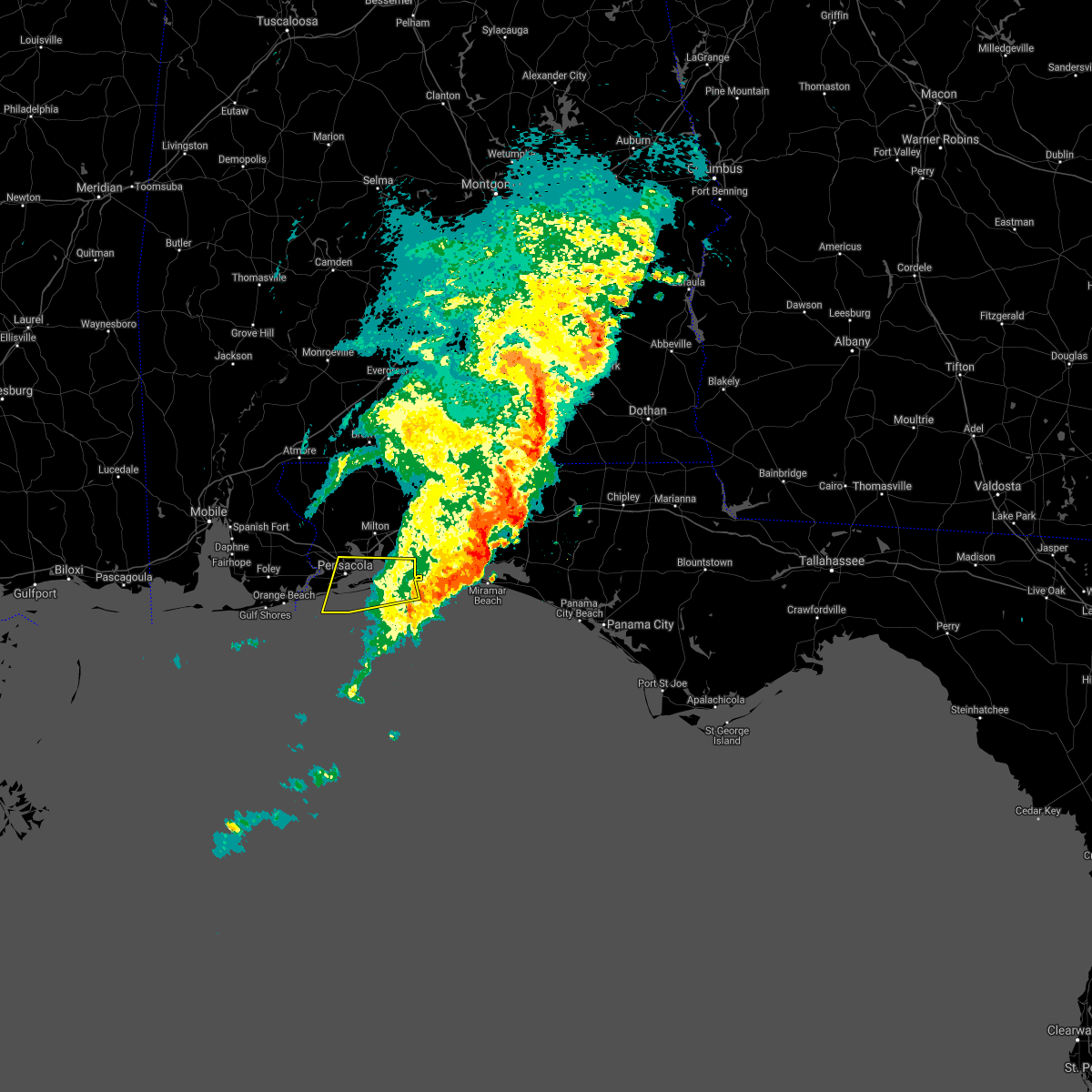 The severe thunderstorm warning for southeastern santa rosa and southeastern escambia counties will expire at 730 am cdt, the storms which prompted the warning have moved out of the area. therefore, the warning will be allowed to expire. however heavy rain is still possible with these thunderstorms. The severe thunderstorm warning for southeastern santa rosa and southeastern escambia counties will expire at 730 am cdt, the storms which prompted the warning have moved out of the area. therefore, the warning will be allowed to expire. however heavy rain is still possible with these thunderstorms.
|
| 5/12/2021 6:21 AM CDT |
 At 621 am cdt, severe thunderstorms were located along a line extending from 3 miles east of pensacola to 11 miles southwest of pensacola beach, moving east at 45 mph (radar indicated). Hazards include 60 mph wind gusts. expect damage to roofs, siding, and trees At 621 am cdt, severe thunderstorms were located along a line extending from 3 miles east of pensacola to 11 miles southwest of pensacola beach, moving east at 45 mph (radar indicated). Hazards include 60 mph wind gusts. expect damage to roofs, siding, and trees
|
| 4/25/2021 9:44 AM EDT |
 At 943 am edt, a severe thunderstorm was located near osteen, or near geneva, moving east at 25 mph (radar indicated). Hazards include 60 mph wind gusts and quarter size hail. Hail damage to vehicles is expected. Expect wind damage to roofs, siding, and trees. At 943 am edt, a severe thunderstorm was located near osteen, or near geneva, moving east at 25 mph (radar indicated). Hazards include 60 mph wind gusts and quarter size hail. Hail damage to vehicles is expected. Expect wind damage to roofs, siding, and trees.
|
| 4/11/2021 10:56 AM EDT |
 At 1056 am edt, a severe thunderstorm was located over oviedo, moving northeast at 45 mph (emergency management). Hazards include golf ball size hail and 60 mph wind gusts. People and animals outdoors will be injured. expect hail damage to roofs, siding, windows, and vehicles. Expect wind damage to roofs, siding, and trees. At 1056 am edt, a severe thunderstorm was located over oviedo, moving northeast at 45 mph (emergency management). Hazards include golf ball size hail and 60 mph wind gusts. People and animals outdoors will be injured. expect hail damage to roofs, siding, windows, and vehicles. Expect wind damage to roofs, siding, and trees.
|
| 4/10/2021 10:56 AM EDT |
 At 1055 am edt, severe thunderstorms were located along a line extending from chattahoochee to 10 miles west of apalachicola, moving east at 40 mph (radar indicated). Hazards include 60 mph wind gusts. expect damage to roofs, siding, and trees At 1055 am edt, severe thunderstorms were located along a line extending from chattahoochee to 10 miles west of apalachicola, moving east at 40 mph (radar indicated). Hazards include 60 mph wind gusts. expect damage to roofs, siding, and trees
|
| 4/10/2021 7:35 AM CDT |
 At 733 am cdt, severe thunderstorms were located along a line extending from 7 miles east of roeville to 3 miles southeast of pensacola beach, moving east at 50 mph (radar indicated). Hazards include 70 mph wind gusts and quarter size hail. Hail damage to vehicles is expected. expect considerable tree damage. Wind damage is also likely to mobile homes, roofs, and outbuildings. At 733 am cdt, severe thunderstorms were located along a line extending from 7 miles east of roeville to 3 miles southeast of pensacola beach, moving east at 50 mph (radar indicated). Hazards include 70 mph wind gusts and quarter size hail. Hail damage to vehicles is expected. expect considerable tree damage. Wind damage is also likely to mobile homes, roofs, and outbuildings.
|
| 4/10/2021 7:21 AM CDT |
 At 720 am cdt, severe thunderstorms were located along a line extending from near bagdad to 17 miles southeast of orange beach, moving east at 60 mph (radar indicated). Hazards include 70 mph wind gusts and quarter size hail. Hail damage to vehicles is expected. expect considerable tree damage. wind damage is also likely to mobile homes, roofs, and outbuildings. Locations impacted include, pensacola, ferry pass, brent, west pensacola, wright, ensley, warrington, pace, gulf breeze, goulding, mary esther, bagdad, myrtle grove, oriole beach, navarre, pensacola beach, navarre beach, pea ridge and floridatown. At 720 am cdt, severe thunderstorms were located along a line extending from near bagdad to 17 miles southeast of orange beach, moving east at 60 mph (radar indicated). Hazards include 70 mph wind gusts and quarter size hail. Hail damage to vehicles is expected. expect considerable tree damage. wind damage is also likely to mobile homes, roofs, and outbuildings. Locations impacted include, pensacola, ferry pass, brent, west pensacola, wright, ensley, warrington, pace, gulf breeze, goulding, mary esther, bagdad, myrtle grove, oriole beach, navarre, pensacola beach, navarre beach, pea ridge and floridatown.
|
| 4/10/2021 6:52 AM CDT |
 At 652 am cdt, severe thunderstorms were located along a line extending from 10 miles southwest of molino to 9 miles southwest of gulf shores, moving east at 50 mph (radar indicated). Hazards include 60 mph wind gusts and quarter size hail. Hail damage to vehicles is expected. Expect wind damage to roofs, siding, and trees. At 652 am cdt, severe thunderstorms were located along a line extending from 10 miles southwest of molino to 9 miles southwest of gulf shores, moving east at 50 mph (radar indicated). Hazards include 60 mph wind gusts and quarter size hail. Hail damage to vehicles is expected. Expect wind damage to roofs, siding, and trees.
|
| 4/10/2021 5:44 AM CDT |
 At 543 am cdt, severe thunderstorms were located along a line extending from 8 miles northwest of laurel hill to 8 miles north of navarre to 7 miles south of gulf shores, moving east at 45 mph (radar indicated). Hazards include 60 mph wind gusts and penny size hail. expect damage to roofs, siding, and trees At 543 am cdt, severe thunderstorms were located along a line extending from 8 miles northwest of laurel hill to 8 miles north of navarre to 7 miles south of gulf shores, moving east at 45 mph (radar indicated). Hazards include 60 mph wind gusts and penny size hail. expect damage to roofs, siding, and trees
|
| 4/10/2021 4:53 AM CDT |
 At 452 am cdt, severe thunderstorms were located along a line extending from near pollard to 4 miles north of molino to 7 miles west of bon secour to 13 miles southeast of petit bois island, moving east at 60 mph (radar indicated). Hazards include 60 mph wind gusts and penny size hail. expect damage to roofs, siding, and trees At 452 am cdt, severe thunderstorms were located along a line extending from near pollard to 4 miles north of molino to 7 miles west of bon secour to 13 miles southeast of petit bois island, moving east at 60 mph (radar indicated). Hazards include 60 mph wind gusts and penny size hail. expect damage to roofs, siding, and trees
|
| 4/10/2021 3:53 AM CDT |
 At 353 am cdt, severe thunderstorms were located along a line extending from 7 miles southwest of belknap to flomaton to midtown mobile to 4 miles northeast of gulf park estates, moving east at 40 mph (radar indicated). Hazards include 60 mph wind gusts and quarter size hail. Hail damage to vehicles is expected. Expect wind damage to roofs, siding, and trees. At 353 am cdt, severe thunderstorms were located along a line extending from 7 miles southwest of belknap to flomaton to midtown mobile to 4 miles northeast of gulf park estates, moving east at 40 mph (radar indicated). Hazards include 60 mph wind gusts and quarter size hail. Hail damage to vehicles is expected. Expect wind damage to roofs, siding, and trees.
|
| 3/18/2021 10:08 AM EDT |
 The severe thunderstorm warning for wakulla, northeastern gadsden, southeastern liberty, western jefferson, leon and northeastern franklin counties will expire at 1015 am edt, the storms which prompted the warning have weakened below severe limits, and no longer pose an immediate threat to life or property. therefore, the warning will be allowed to expire. however gusty winds are still possible with these thunderstorms. a tornado watch remains in effect until 100 pm edt for big bend of florida, and southwestern georgia. The severe thunderstorm warning for wakulla, northeastern gadsden, southeastern liberty, western jefferson, leon and northeastern franklin counties will expire at 1015 am edt, the storms which prompted the warning have weakened below severe limits, and no longer pose an immediate threat to life or property. therefore, the warning will be allowed to expire. however gusty winds are still possible with these thunderstorms. a tornado watch remains in effect until 100 pm edt for big bend of florida, and southwestern georgia.
|
| 3/18/2021 9:53 AM EDT |
 At 953 am edt, severe thunderstorms were located along a line extending from 11 miles southwest of thomasville to 7 miles southeast of st george island, moving east at 40 mph (radar indicated). Hazards include 60 mph wind gusts. Expect damage to roofs, siding, and trees. locations impacted include, carrabelle, monticello, tallahassee, st. Marks, woodville, crawfordville, florida state university, tallahassee comm college, doak campbell stadium, florida a and m, wakulla, sopchoppy, lake bradford, alma, cody, wakulla springs, st george island st pk, medart, tallahassee mall and tallahassee regional a/p. At 953 am edt, severe thunderstorms were located along a line extending from 11 miles southwest of thomasville to 7 miles southeast of st george island, moving east at 40 mph (radar indicated). Hazards include 60 mph wind gusts. Expect damage to roofs, siding, and trees. locations impacted include, carrabelle, monticello, tallahassee, st. Marks, woodville, crawfordville, florida state university, tallahassee comm college, doak campbell stadium, florida a and m, wakulla, sopchoppy, lake bradford, alma, cody, wakulla springs, st george island st pk, medart, tallahassee mall and tallahassee regional a/p.
|
| 3/18/2021 9:11 AM EDT |
 At 911 am edt/811 am cdt/, severe thunderstorms were located along a line extending from 9 miles north of quincy to 18 miles south of port st. joe, moving northeast at 40 mph (radar indicated). Hazards include 60 mph wind gusts. expect damage to roofs, siding, and trees At 911 am edt/811 am cdt/, severe thunderstorms were located along a line extending from 9 miles north of quincy to 18 miles south of port st. joe, moving northeast at 40 mph (radar indicated). Hazards include 60 mph wind gusts. expect damage to roofs, siding, and trees
|
| 3/18/2021 8:19 AM EDT |
 At 818 am edt/718 am cdt/, severe thunderstorms were located along a line extending from 7 miles southwest of donalsonville to near chattahoochee to 14 miles northeast of stonemill creek to 19 miles south of port st. joe, moving northeast at 45 mph (radar indicated). Hazards include 60 mph wind gusts. expect damage to roofs, siding, and trees At 818 am edt/718 am cdt/, severe thunderstorms were located along a line extending from 7 miles southwest of donalsonville to near chattahoochee to 14 miles northeast of stonemill creek to 19 miles south of port st. joe, moving northeast at 45 mph (radar indicated). Hazards include 60 mph wind gusts. expect damage to roofs, siding, and trees
|
| 2/18/2021 2:06 AM CST |
 At 205 am cst, severe thunderstorms were located along a line extending from 8 miles southeast of roeville to 5 miles east of oriole beach, moving northeast at 35 mph (radar indicated). Hazards include 60 mph wind gusts and penny size hail. Expect damage to roofs, siding, and trees. Locations impacted include, wright, fort walton beach, niceville, destin, eglin afb, valparaiso, mary esther, ocean city, lake lorraine, navarre, shalimar, cinco bayou and navarre beach. At 205 am cst, severe thunderstorms were located along a line extending from 8 miles southeast of roeville to 5 miles east of oriole beach, moving northeast at 35 mph (radar indicated). Hazards include 60 mph wind gusts and penny size hail. Expect damage to roofs, siding, and trees. Locations impacted include, wright, fort walton beach, niceville, destin, eglin afb, valparaiso, mary esther, ocean city, lake lorraine, navarre, shalimar, cinco bayou and navarre beach.
|
| 2/18/2021 1:49 AM CST |
 At 148 am cst, severe thunderstorms were located along a line extending from 3 miles southeast of pea ridge to near oriole beach to 6 miles south of pensacola beach, moving east at 45 mph (radar indicated). Hazards include 60 mph wind gusts and penny size hail. expect damage to roofs, siding, and trees At 148 am cst, severe thunderstorms were located along a line extending from 3 miles southeast of pea ridge to near oriole beach to 6 miles south of pensacola beach, moving east at 45 mph (radar indicated). Hazards include 60 mph wind gusts and penny size hail. expect damage to roofs, siding, and trees
|
| 2/15/2021 4:03 PM EST |
 At 403 pm est/303 pm cst/, severe thunderstorms were located along a line extending from 10 miles southeast of cottonwood to 8 miles southwest of blountstown, moving northeast at 35 mph (radar indicated). Hazards include 60 mph wind gusts and quarter size hail. Hail damage to vehicles is expected. Expect wind damage to roofs, siding, and trees. At 403 pm est/303 pm cst/, severe thunderstorms were located along a line extending from 10 miles southeast of cottonwood to 8 miles southwest of blountstown, moving northeast at 35 mph (radar indicated). Hazards include 60 mph wind gusts and quarter size hail. Hail damage to vehicles is expected. Expect wind damage to roofs, siding, and trees.
|
| 1/27/2021 11:34 AM EST |
 At 1134 am est, a severe thunderstorm capable of producing a tornado was located near midway, moving east at 55 mph (radar indicated rotation). Hazards include tornado. Flying debris will be dangerous to those caught without shelter. mobile homes will be damaged or destroyed. damage to roofs, windows, and vehicles will occur. tree damage is likely. this dangerous storm will be near, doak campbell stadium around 1140 am est. florida a and m and florida state university around 1145 am est. tallahassee around 1150 am est. Other locations impacted by this tornadic thunderstorm include lake bradford, ralford greenway, cody, macon community park, gaither community center, lake munson, tallahassee memorial hosp, eight mile pond, thomas city and killearn estates. At 1134 am est, a severe thunderstorm capable of producing a tornado was located near midway, moving east at 55 mph (radar indicated rotation). Hazards include tornado. Flying debris will be dangerous to those caught without shelter. mobile homes will be damaged or destroyed. damage to roofs, windows, and vehicles will occur. tree damage is likely. this dangerous storm will be near, doak campbell stadium around 1140 am est. florida a and m and florida state university around 1145 am est. tallahassee around 1150 am est. Other locations impacted by this tornadic thunderstorm include lake bradford, ralford greenway, cody, macon community park, gaither community center, lake munson, tallahassee memorial hosp, eight mile pond, thomas city and killearn estates.
|
| 1/27/2021 11:20 AM EST |
 At 1119 am est, a severe thunderstorm capable of producing a tornado was located 7 miles southwest of midway, moving east at 30 mph (radar indicated rotation). Hazards include tornado. Flying debris will be dangerous to those caught without shelter. mobile homes will be damaged or destroyed. damage to roofs, windows, and vehicles will occur. tree damage is likely. this dangerous storm will be near, midway around 1135 am est. Other locations impacted by this tornadic thunderstorm include lake talquin, tallahassee regional a/p, andrew and fort braden. At 1119 am est, a severe thunderstorm capable of producing a tornado was located 7 miles southwest of midway, moving east at 30 mph (radar indicated rotation). Hazards include tornado. Flying debris will be dangerous to those caught without shelter. mobile homes will be damaged or destroyed. damage to roofs, windows, and vehicles will occur. tree damage is likely. this dangerous storm will be near, midway around 1135 am est. Other locations impacted by this tornadic thunderstorm include lake talquin, tallahassee regional a/p, andrew and fort braden.
|
| 1/27/2021 11:16 AM EST |
 At 1116 am est, a severe thunderstorm was located 7 miles southwest of midway, moving east at 30 mph (radar indicated). Hazards include 60 mph wind gusts. Expect damage to roofs, siding, and trees. Locations impacted include, midway, quincy, tallahassee, lake talquin, andrew, wetumpka, bloxham, tallahassee regional a/p, gibson, fort braden and tallahassee coml airport. At 1116 am est, a severe thunderstorm was located 7 miles southwest of midway, moving east at 30 mph (radar indicated). Hazards include 60 mph wind gusts. Expect damage to roofs, siding, and trees. Locations impacted include, midway, quincy, tallahassee, lake talquin, andrew, wetumpka, bloxham, tallahassee regional a/p, gibson, fort braden and tallahassee coml airport.
|
| 12/24/2020 2:08 PM EST |
 At 208 pm est, severe thunderstorms were located along a line extending from 12 miles south of cairo to 12 miles southwest of crawfordville, moving east at 30 mph (radar indicated). Hazards include 60 mph wind gusts. Expect damage to roofs, siding, and trees. locations impacted include, monticello, tallahassee, st. Marks, woodville, crawfordville, florida state university, tallahassee comm college, doak campbell stadium, florida a and m, wakulla, sopchoppy, lake bradford, alma, cody, wakulla springs, medart, tallahassee mall, tallahassee regional a/p, natural bridge and liveoak island. At 208 pm est, severe thunderstorms were located along a line extending from 12 miles south of cairo to 12 miles southwest of crawfordville, moving east at 30 mph (radar indicated). Hazards include 60 mph wind gusts. Expect damage to roofs, siding, and trees. locations impacted include, monticello, tallahassee, st. Marks, woodville, crawfordville, florida state university, tallahassee comm college, doak campbell stadium, florida a and m, wakulla, sopchoppy, lake bradford, alma, cody, wakulla springs, medart, tallahassee mall, tallahassee regional a/p, natural bridge and liveoak island.
|
| 12/24/2020 1:58 PM EST |
 At 158 pm est, severe thunderstorms were located along a line extending from 9 miles south of whigham to 7 miles northwest of crawfordville, moving northeast at 35 mph (radar indicated). Hazards include 60 mph wind gusts. Expect damage to roofs, siding, and trees. Locations impacted include, midway, tallahassee, brown house, concord, orchard pond, gibson and tallahassee coml airport. At 158 pm est, severe thunderstorms were located along a line extending from 9 miles south of whigham to 7 miles northwest of crawfordville, moving northeast at 35 mph (radar indicated). Hazards include 60 mph wind gusts. Expect damage to roofs, siding, and trees. Locations impacted include, midway, tallahassee, brown house, concord, orchard pond, gibson and tallahassee coml airport.
|
| 12/24/2020 1:31 PM EST |
 At 130 pm est, severe thunderstorms were located along a line extending from 8 miles north of quincy to 21 miles west of crawfordville, moving northeast at 45 mph (radar indicated). Hazards include 60 mph wind gusts. Expect damage to roofs, siding, and trees. Locations impacted include, quincy, midway, havana, tallahassee, gretna, freemont, jewel fire tower, littman, brown house, douglas city, darsey, florence, scotland, jamieson, santa clara, shady rest, quincy airport, wetumpka, branchville and bloxham. At 130 pm est, severe thunderstorms were located along a line extending from 8 miles north of quincy to 21 miles west of crawfordville, moving northeast at 45 mph (radar indicated). Hazards include 60 mph wind gusts. Expect damage to roofs, siding, and trees. Locations impacted include, quincy, midway, havana, tallahassee, gretna, freemont, jewel fire tower, littman, brown house, douglas city, darsey, florence, scotland, jamieson, santa clara, shady rest, quincy airport, wetumpka, branchville and bloxham.
|
| 12/24/2020 1:29 PM EST |
 At 129 pm est, severe thunderstorms were located along a line extending from 7 miles northwest of havana to 22 miles southeast of blountstown, moving east at 30 mph (radar indicated). Hazards include 60 mph wind gusts. expect damage to roofs, siding, and trees At 129 pm est, severe thunderstorms were located along a line extending from 7 miles northwest of havana to 22 miles southeast of blountstown, moving east at 30 mph (radar indicated). Hazards include 60 mph wind gusts. expect damage to roofs, siding, and trees
|
| 12/24/2020 1:09 PM EST |
 At 109 pm est, severe thunderstorms were located along a line extending from near greensboro to 15 miles southeast of blountstown, moving northeast at 50 mph (radar indicated). Hazards include 60 mph wind gusts. expect damage to roofs, siding, and trees At 109 pm est, severe thunderstorms were located along a line extending from near greensboro to 15 miles southeast of blountstown, moving northeast at 50 mph (radar indicated). Hazards include 60 mph wind gusts. expect damage to roofs, siding, and trees
|
| 10/28/2020 6:32 PM CDT |
 At 630 pm cdt, a severe thunderstorm capable of producing a tornado was located over oriole beach, or 6 miles east of gulf breeze, moving north at 40 mph (radar indicated rotation). Hazards include tornado. Flying debris will be dangerous to those caught without shelter. mobile homes will be damaged or destroyed. damage to roofs, windows, and vehicles will occur. tree damage is likely. this dangerous storm will be near, pea ridge and floridatown around 650 pm cdt. Pace around 655 pm cdt. At 630 pm cdt, a severe thunderstorm capable of producing a tornado was located over oriole beach, or 6 miles east of gulf breeze, moving north at 40 mph (radar indicated rotation). Hazards include tornado. Flying debris will be dangerous to those caught without shelter. mobile homes will be damaged or destroyed. damage to roofs, windows, and vehicles will occur. tree damage is likely. this dangerous storm will be near, pea ridge and floridatown around 650 pm cdt. Pace around 655 pm cdt.
|
| 10/28/2020 6:21 PM CDT |
 At 619 pm cdt, a severe thunderstorm capable of producing a tornado was located 7 miles southeast of pensacola beach, or 9 miles southeast of gulf breeze, moving north at 45 mph (radar indicated rotation). Hazards include tornado. Flying debris will be dangerous to those caught without shelter. mobile homes will be damaged or destroyed. damage to roofs, windows, and vehicles will occur. tree damage is likely. this dangerous storm will be near, oriole beach around 630 pm cdt. Ferry pass, pace, floridatown and pea ridge around 645 pm cdt. At 619 pm cdt, a severe thunderstorm capable of producing a tornado was located 7 miles southeast of pensacola beach, or 9 miles southeast of gulf breeze, moving north at 45 mph (radar indicated rotation). Hazards include tornado. Flying debris will be dangerous to those caught without shelter. mobile homes will be damaged or destroyed. damage to roofs, windows, and vehicles will occur. tree damage is likely. this dangerous storm will be near, oriole beach around 630 pm cdt. Ferry pass, pace, floridatown and pea ridge around 645 pm cdt.
|
| 10/10/2020 2:19 AM CDT |
 At 219 am cdt, a severe thunderstorm capable of producing a tornado was located 5 miles north of oriole beach, or 8 miles northeast of gulf breeze, moving north at 30 mph (radar indicated rotation). Hazards include tornado. Flying debris will be dangerous to those caught without shelter. mobile homes will be damaged or destroyed. damage to roofs, windows, and vehicles will occur. tree damage is likely. this dangerous storm will be near, bagdad and floridatown around 235 am cdt. pace, milton and pea ridge around 240 am cdt. Point baker around 250 am cdt. At 219 am cdt, a severe thunderstorm capable of producing a tornado was located 5 miles north of oriole beach, or 8 miles northeast of gulf breeze, moving north at 30 mph (radar indicated rotation). Hazards include tornado. Flying debris will be dangerous to those caught without shelter. mobile homes will be damaged or destroyed. damage to roofs, windows, and vehicles will occur. tree damage is likely. this dangerous storm will be near, bagdad and floridatown around 235 am cdt. pace, milton and pea ridge around 240 am cdt. Point baker around 250 am cdt.
|
| 9/16/2020 12:25 PM EDT |
 At 1225 pm edt, severe thunderstorms were located along a line extending from 9 miles southwest of bainbridge to 16 miles south of crawfordville, moving east at 25 mph (radar indicated). Hazards include 60 mph wind gusts. expect damage to roofs, siding, and trees At 1225 pm edt, severe thunderstorms were located along a line extending from 9 miles southwest of bainbridge to 16 miles south of crawfordville, moving east at 25 mph (radar indicated). Hazards include 60 mph wind gusts. expect damage to roofs, siding, and trees
|
| 9/15/2020 11:36 PM CDT |
 At 1136 pm cdt, a severe thunderstorm capable of producing a tornado was located 4 miles southwest of navarre beach, or 15 miles west of mary esther, moving northwest at 55 mph (radar indicated rotation). Hazards include tornado. Flying debris will be dangerous to those caught without shelter. mobile homes will be damaged or destroyed. damage to roofs, windows, and vehicles will occur. tree damage is likely. this dangerous storm will be near, navarre around 1140 pm cdt. oriole beach around 1145 pm cdt. ferry pass, brent, pace, floridatown and pea ridge around 1200 am cdt. Ensley and gonzalez around 1205 am cdt. At 1136 pm cdt, a severe thunderstorm capable of producing a tornado was located 4 miles southwest of navarre beach, or 15 miles west of mary esther, moving northwest at 55 mph (radar indicated rotation). Hazards include tornado. Flying debris will be dangerous to those caught without shelter. mobile homes will be damaged or destroyed. damage to roofs, windows, and vehicles will occur. tree damage is likely. this dangerous storm will be near, navarre around 1140 pm cdt. oriole beach around 1145 pm cdt. ferry pass, brent, pace, floridatown and pea ridge around 1200 am cdt. Ensley and gonzalez around 1205 am cdt.
|
| 9/12/2020 4:28 PM EDT |
 At 428 pm edt, a severe thunderstorm was located over florida a and m, or near tallahassee, moving west at 30 mph (radar indicated). Hazards include 60 mph wind gusts. expect damage to roofs, siding, and trees At 428 pm edt, a severe thunderstorm was located over florida a and m, or near tallahassee, moving west at 30 mph (radar indicated). Hazards include 60 mph wind gusts. expect damage to roofs, siding, and trees
|
| 8/21/2020 4:16 PM EDT |
 At 415 pm edt, a severe thunderstorm was located over sanford, moving northeast at 20 mph. a 58 mph wind gust was measured at the sanford airport (radar indicated). Hazards include 60 mph wind gusts and nickel size hail. Expect damage to roofs, siding, and trees. Locations impacted include, deltona, sanford, altamonte springs, oviedo and winter springs. At 415 pm edt, a severe thunderstorm was located over sanford, moving northeast at 20 mph. a 58 mph wind gust was measured at the sanford airport (radar indicated). Hazards include 60 mph wind gusts and nickel size hail. Expect damage to roofs, siding, and trees. Locations impacted include, deltona, sanford, altamonte springs, oviedo and winter springs.
|
| 8/21/2020 4:09 PM EDT |
 At 408 pm edt, a severe thunderstorm was located over lake mary, moving northeast at 25 mph. at 408 pm a wind gust of 56 mph was measured at the sanford airport (radar indicated). Hazards include 60 mph wind gusts and nickel size hail. Expect damage to roofs, siding, and trees. Locations impacted include, deltona, sanford, apopka, altamonte springs and oviedo. At 408 pm edt, a severe thunderstorm was located over lake mary, moving northeast at 25 mph. at 408 pm a wind gust of 56 mph was measured at the sanford airport (radar indicated). Hazards include 60 mph wind gusts and nickel size hail. Expect damage to roofs, siding, and trees. Locations impacted include, deltona, sanford, apopka, altamonte springs and oviedo.
|
| 8/21/2020 3:57 PM EDT |
 At 357 pm edt, a severe thunderstorm was located near lake mary, moving northeast at 20 mph (radar indicated). Hazards include 60 mph wind gusts and nickel size hail. expect damage to roofs, siding, and trees At 357 pm edt, a severe thunderstorm was located near lake mary, moving northeast at 20 mph (radar indicated). Hazards include 60 mph wind gusts and nickel size hail. expect damage to roofs, siding, and trees
|
| 8/11/2020 2:11 PM EDT |
 The severe thunderstorm warning for southeastern jackson and northeastern calhoun counties in the panhandle of florida, north central wakulla, gadsden, northeastern liberty and southwestern leon counties in big bend of florida will expire at 215 pm edt/115 pm cdt/, the storms which prompted the warning have weakened below severe limits, and no longer pose an immediate threat to life or property. therefore, the warning will be allowed to expire. to report severe weather, contact your nearest law enforcement agency. they will relay your report to the national weather service tallahassee. The severe thunderstorm warning for southeastern jackson and northeastern calhoun counties in the panhandle of florida, north central wakulla, gadsden, northeastern liberty and southwestern leon counties in big bend of florida will expire at 215 pm edt/115 pm cdt/, the storms which prompted the warning have weakened below severe limits, and no longer pose an immediate threat to life or property. therefore, the warning will be allowed to expire. to report severe weather, contact your nearest law enforcement agency. they will relay your report to the national weather service tallahassee.
|
| 8/11/2020 1:36 PM EDT |
 At 136 pm edt/1236 pm cdt/, severe thunderstorms were located along a line extending from near chattahoochee to near tallahassee comm college, and are nearly stationary (radar indicated). Hazards include 60 mph wind gusts. expect damage to roofs, siding, and trees At 136 pm edt/1236 pm cdt/, severe thunderstorms were located along a line extending from near chattahoochee to near tallahassee comm college, and are nearly stationary (radar indicated). Hazards include 60 mph wind gusts. expect damage to roofs, siding, and trees
|
| 8/7/2020 6:25 PM EDT |
 The severe thunderstorm warning for northeastern seminole and south central volusia counties will expire at 630 pm edt, the storm which prompted the warning has weakened below severe limits, and no longer poses an immediate threat to life or property. therefore, the warning will be allowed to expire. however gusty winds and heavy rain are still possible with these thunderstorms. The severe thunderstorm warning for northeastern seminole and south central volusia counties will expire at 630 pm edt, the storm which prompted the warning has weakened below severe limits, and no longer poses an immediate threat to life or property. therefore, the warning will be allowed to expire. however gusty winds and heavy rain are still possible with these thunderstorms.
|
| 8/7/2020 5:48 PM EDT |
 At 547 pm edt, a severe thunderstorm was located over osteen, or near deltona, moving east at 5 mph (radar indicated). Hazards include 60 mph wind gusts and penny size hail. expect damage to roofs, siding, and trees At 547 pm edt, a severe thunderstorm was located over osteen, or near deltona, moving east at 5 mph (radar indicated). Hazards include 60 mph wind gusts and penny size hail. expect damage to roofs, siding, and trees
|
| 7/22/2020 5:14 PM EDT |
 At 514 pm edt, severe thunderstorms were located along a line extending from havana to 14 miles north of carrabelle, moving west at 30 mph (radar indicated). Hazards include 60 mph wind gusts. Expect damage to roofs, siding, and trees. Locations impacted include, carrabelle, midway, havana, crawfordville, quincy, sopchoppy, freemont, east camp, jewel fire tower, littman, brown house, florence, scotland, panacea, shady rest, poplar camp, smith creek, medart, buckhorn and wetumpka. At 514 pm edt, severe thunderstorms were located along a line extending from havana to 14 miles north of carrabelle, moving west at 30 mph (radar indicated). Hazards include 60 mph wind gusts. Expect damage to roofs, siding, and trees. Locations impacted include, carrabelle, midway, havana, crawfordville, quincy, sopchoppy, freemont, east camp, jewel fire tower, littman, brown house, florence, scotland, panacea, shady rest, poplar camp, smith creek, medart, buckhorn and wetumpka.
|
| 7/22/2020 5:10 PM EDT |
 The national weather service in tallahassee has issued a * severe thunderstorm warning for. eastern jackson county in the panhandle of florida. northern gulf county in the panhandle of florida. calhoun county in the panhandle of florida. Western wakulla county in big bend of florida. The national weather service in tallahassee has issued a * severe thunderstorm warning for. eastern jackson county in the panhandle of florida. northern gulf county in the panhandle of florida. calhoun county in the panhandle of florida. Western wakulla county in big bend of florida.
|
| 7/22/2020 4:53 PM EDT |
 At 453 pm edt, severe thunderstorms were located along a line extending from 6 miles north of tallahassee to 13 miles south of crawfordville, moving west at 35 mph (radar indicated). Hazards include 60 mph wind gusts. Expect damage to roofs, siding, and trees. locations impacted include, carrabelle, tallahassee, st. Marks, midway, woodville, crawfordville, havana, quincy, florida state university, tallahassee comm college, doak campbell stadium, florida a and m, wakulla, sopchoppy, lake bradford, jewel fire tower, wakulla springs, florence, medart and tallahassee mall. At 453 pm edt, severe thunderstorms were located along a line extending from 6 miles north of tallahassee to 13 miles south of crawfordville, moving west at 35 mph (radar indicated). Hazards include 60 mph wind gusts. Expect damage to roofs, siding, and trees. locations impacted include, carrabelle, tallahassee, st. Marks, midway, woodville, crawfordville, havana, quincy, florida state university, tallahassee comm college, doak campbell stadium, florida a and m, wakulla, sopchoppy, lake bradford, jewel fire tower, wakulla springs, florence, medart and tallahassee mall.
|
| 7/22/2020 4:23 PM EDT |
 At 423 pm edt, severe thunderstorms were located along a line extending from 6 miles south of monticello to 10 miles southeast of st. marks, moving northwest at 30 mph (radar indicated). Hazards include 60 mph wind gusts. Expect damage to roofs, siding, and trees. locations impacted include, carrabelle, monticello, tallahassee, st. Marks, midway, woodville, crawfordville, havana, quincy, florida state university, tallahassee comm college, doak campbell stadium, florida a and m, wakulla, sopchoppy, lake bradford, cody, jewel fire tower, wakulla springs and florence. At 423 pm edt, severe thunderstorms were located along a line extending from 6 miles south of monticello to 10 miles southeast of st. marks, moving northwest at 30 mph (radar indicated). Hazards include 60 mph wind gusts. Expect damage to roofs, siding, and trees. locations impacted include, carrabelle, monticello, tallahassee, st. Marks, midway, woodville, crawfordville, havana, quincy, florida state university, tallahassee comm college, doak campbell stadium, florida a and m, wakulla, sopchoppy, lake bradford, cody, jewel fire tower, wakulla springs and florence.
|
| 7/22/2020 3:57 PM EDT |
 At 357 pm edt, severe thunderstorms were located along a line extending from 16 miles southeast of monticello to 17 miles southwest of perry, moving west at 20 mph (radar indicated). Hazards include 60 mph wind gusts. expect damage to roofs, siding, and trees At 357 pm edt, severe thunderstorms were located along a line extending from 16 miles southeast of monticello to 17 miles southwest of perry, moving west at 20 mph (radar indicated). Hazards include 60 mph wind gusts. expect damage to roofs, siding, and trees
|
| 7/21/2020 7:55 PM EDT |
 The severe thunderstorm warning for wakulla, west central jefferson, leon and northeastern franklin counties will expire at 800 pm edt, the storms which prompted the warning have weakened below severe limits, and no longer pose an immediate threat to life or property. therefore, the warning will be allowed to expire. to report severe weather, contact your nearest law enforcement agency. they will relay your report to the national weather service tallahassee. The severe thunderstorm warning for wakulla, west central jefferson, leon and northeastern franklin counties will expire at 800 pm edt, the storms which prompted the warning have weakened below severe limits, and no longer pose an immediate threat to life or property. therefore, the warning will be allowed to expire. to report severe weather, contact your nearest law enforcement agency. they will relay your report to the national weather service tallahassee.
|
| 7/21/2020 7:30 PM EDT |
 At 730 pm edt, severe thunderstorms were located along a line extending from 13 miles southwest of crawfordville to 14 miles southwest of thomasville, moving northwest at 25 mph (radar indicated). Hazards include 60 mph wind gusts. Expect damage to roofs, siding, and trees. locations impacted include, st. Marks, woodville, tallahassee, crawfordville, florida state university, florida a and m, tallahassee comm college, doak campbell stadium, wakulla, sopchoppy, lake bradford, cody, shadeville, leon sinks, gaither community center, wakulla springs, tallahassee memorial hosp, eight mile pond, panacea and medart. At 730 pm edt, severe thunderstorms were located along a line extending from 13 miles southwest of crawfordville to 14 miles southwest of thomasville, moving northwest at 25 mph (radar indicated). Hazards include 60 mph wind gusts. Expect damage to roofs, siding, and trees. locations impacted include, st. Marks, woodville, tallahassee, crawfordville, florida state university, florida a and m, tallahassee comm college, doak campbell stadium, wakulla, sopchoppy, lake bradford, cody, shadeville, leon sinks, gaither community center, wakulla springs, tallahassee memorial hosp, eight mile pond, panacea and medart.
|
| 7/21/2020 6:48 PM EDT |
 The national weather service in tallahassee has issued a * severe thunderstorm warning for. wakulla county in big bend of florida. northwestern taylor county in big bend of florida. jefferson county in big bend of florida. Leon county in big bend of florida. The national weather service in tallahassee has issued a * severe thunderstorm warning for. wakulla county in big bend of florida. northwestern taylor county in big bend of florida. jefferson county in big bend of florida. Leon county in big bend of florida.
|
| 7/12/2020 6:45 PM CDT |
 At 645 pm cdt, a severe thunderstorm was located 6 miles south of mary esther, moving southeast at 50 mph (radar indicated). Hazards include 60 mph wind gusts. Expect damage to roofs, siding, and trees. Locations impacted include, mary esther, oriole beach, navarre and navarre beach. At 645 pm cdt, a severe thunderstorm was located 6 miles south of mary esther, moving southeast at 50 mph (radar indicated). Hazards include 60 mph wind gusts. Expect damage to roofs, siding, and trees. Locations impacted include, mary esther, oriole beach, navarre and navarre beach.
|
| 7/12/2020 6:16 PM CDT |
 At 615 pm cdt, a severe thunderstorm was located 4 miles south of bagdad, moving southeast at 50 mph (radar indicated). Hazards include 60 mph wind gusts. expect damage to roofs, siding, and trees At 615 pm cdt, a severe thunderstorm was located 4 miles south of bagdad, moving southeast at 50 mph (radar indicated). Hazards include 60 mph wind gusts. expect damage to roofs, siding, and trees
|
| 7/10/2020 6:54 PM EDT |
 At 654 pm edt, a severe thunderstorm was located over midway, moving southeast at 15 mph (radar indicated). Hazards include 60 mph wind gusts. expect damage to roofs, siding, and trees At 654 pm edt, a severe thunderstorm was located over midway, moving southeast at 15 mph (radar indicated). Hazards include 60 mph wind gusts. expect damage to roofs, siding, and trees
|
| 6/24/2020 9:41 PM EDT |
 At 844 pm edt, a severe thunderstorm was located over lake jessup, moving northeast at 10 mph (radar indicated). Hazards include 60 mph wind gusts and quarter size hail. Hail damage to vehicles is expected. Expect wind damage to roofs, siding, and trees. At 844 pm edt, a severe thunderstorm was located over lake jessup, moving northeast at 10 mph (radar indicated). Hazards include 60 mph wind gusts and quarter size hail. Hail damage to vehicles is expected. Expect wind damage to roofs, siding, and trees.
|
| 6/24/2020 8:44 PM EDT |
 At 844 pm edt, a severe thunderstorm was located over lake jessup, moving northeast at 10 mph (radar indicated). Hazards include 60 mph wind gusts and quarter size hail. Hail damage to vehicles is expected. Expect wind damage to roofs, siding, and trees. At 844 pm edt, a severe thunderstorm was located over lake jessup, moving northeast at 10 mph (radar indicated). Hazards include 60 mph wind gusts and quarter size hail. Hail damage to vehicles is expected. Expect wind damage to roofs, siding, and trees.
|
| 6/24/2020 8:13 PM EDT |
 At 811 pm edt, a severe thunderstorm was located over lake jessup, moving east at 10 mph. the orlando sanford international airport recently reported a gust of 60 mph with this storm (radar indicated). Hazards include 60 mph wind gusts and quarter size hail. Hail damage to vehicles is expected. expect wind damage to roofs, siding, and trees. Locations impacted include, sanford, oviedo, winter springs, lake jessup and geneva. At 811 pm edt, a severe thunderstorm was located over lake jessup, moving east at 10 mph. the orlando sanford international airport recently reported a gust of 60 mph with this storm (radar indicated). Hazards include 60 mph wind gusts and quarter size hail. Hail damage to vehicles is expected. expect wind damage to roofs, siding, and trees. Locations impacted include, sanford, oviedo, winter springs, lake jessup and geneva.
|
| 6/24/2020 8:02 PM EDT |
 At 802 pm edt, a severe thunderstorm was located over lake jessup, moving east at 10 mph (radar indicated). Hazards include 60 mph wind gusts and quarter size hail. Hail damage to vehicles is expected. Expect wind damage to roofs, siding, and trees. At 802 pm edt, a severe thunderstorm was located over lake jessup, moving east at 10 mph (radar indicated). Hazards include 60 mph wind gusts and quarter size hail. Hail damage to vehicles is expected. Expect wind damage to roofs, siding, and trees.
|
| 6/24/2020 5:22 PM CDT |
 The severe thunderstorm warning for southern okaloosa and southeastern santa rosa counties will expire at 530 pm cdt, the storm which prompted the warning has weakened below severe limits. therefore, the warning will be allowed to expire. a severe thunderstorm watch remains in effect until 900 pm cdt for northwestern florida. The severe thunderstorm warning for southern okaloosa and southeastern santa rosa counties will expire at 530 pm cdt, the storm which prompted the warning has weakened below severe limits. therefore, the warning will be allowed to expire. a severe thunderstorm watch remains in effect until 900 pm cdt for northwestern florida.
|
| 6/24/2020 5:16 PM CDT |
 At 516 pm cdt, a severe thunderstorm was located 9 miles northeast of navarre, or 12 miles west of wright, moving east at 20 mph (radar indicated). Hazards include 60 mph wind gusts. Expect damage to roofs, siding, and trees. Locations impacted include, wright, fort walton beach, niceville, destin, eglin afb, valparaiso, mary esther, ocean city, lake lorraine, navarre, shalimar, cinco bayou and navarre beach. At 516 pm cdt, a severe thunderstorm was located 9 miles northeast of navarre, or 12 miles west of wright, moving east at 20 mph (radar indicated). Hazards include 60 mph wind gusts. Expect damage to roofs, siding, and trees. Locations impacted include, wright, fort walton beach, niceville, destin, eglin afb, valparaiso, mary esther, ocean city, lake lorraine, navarre, shalimar, cinco bayou and navarre beach.
|
| 6/24/2020 4:27 PM CDT |
 At 427 pm cdt, a severe thunderstorm was located 6 miles northeast of oriole beach, or 9 miles south of bagdad, moving east at 30 mph (radar indicated). Hazards include 60 mph wind gusts. expect damage to roofs, siding, and trees At 427 pm cdt, a severe thunderstorm was located 6 miles northeast of oriole beach, or 9 miles south of bagdad, moving east at 30 mph (radar indicated). Hazards include 60 mph wind gusts. expect damage to roofs, siding, and trees
|
| 6/24/2020 3:46 PM CDT |
 At 346 pm cdt, a severe thunderstorm was located over ensley, moving northeast at 25 mph (radar indicated). Hazards include 60 mph wind gusts. expect damage to roofs, siding, and trees At 346 pm cdt, a severe thunderstorm was located over ensley, moving northeast at 25 mph (radar indicated). Hazards include 60 mph wind gusts. expect damage to roofs, siding, and trees
|
| 6/23/2020 1:03 PM EDT |
 At 103 pm edt, severe thunderstorms were located along a line extending from 8 miles northeast of chattahoochee to near quincy to near tallahassee comm college, moving east at 35 mph (radar indicated). Hazards include 60 mph wind gusts. Expect damage to roofs, siding, and trees. Locations impacted include, midway, woodville, tallahassee, florida state university, florida a and m, tallahassee comm college, doak campbell stadium, wakulla, lake bradford, cody, leon sinks, gaither community center, wakulla springs, tallahassee memorial hosp, eight mile pond, tallahassee mall, bloxham, bethel, tallahassee regional a/p and governors square mall. At 103 pm edt, severe thunderstorms were located along a line extending from 8 miles northeast of chattahoochee to near quincy to near tallahassee comm college, moving east at 35 mph (radar indicated). Hazards include 60 mph wind gusts. Expect damage to roofs, siding, and trees. Locations impacted include, midway, woodville, tallahassee, florida state university, florida a and m, tallahassee comm college, doak campbell stadium, wakulla, lake bradford, cody, leon sinks, gaither community center, wakulla springs, tallahassee memorial hosp, eight mile pond, tallahassee mall, bloxham, bethel, tallahassee regional a/p and governors square mall.
|
| 6/23/2020 12:29 PM EDT |
 At 1229 pm edt, severe thunderstorms were located along a line extending from 11 miles southeast of marianna to 7 miles west of greensboro to 17 miles southwest of midway, moving east at 35 mph (radar indicated). Hazards include 60 mph wind gusts. expect damage to roofs, siding, and trees At 1229 pm edt, severe thunderstorms were located along a line extending from 11 miles southeast of marianna to 7 miles west of greensboro to 17 miles southwest of midway, moving east at 35 mph (radar indicated). Hazards include 60 mph wind gusts. expect damage to roofs, siding, and trees
|
| 6/23/2020 12:15 PM EDT |
 At 1215 pm edt/1115 am cdt/, severe thunderstorms were located along a line extending from 6 miles west of chattahoochee to near greensboro to 9 miles southwest of midway, moving east at 25 mph (radar indicated). Hazards include 60 mph wind gusts. Expect damage to roofs, siding, and trees. Locations impacted include, midway, quincy, tallahassee, havana, greensboro, florida state university, florida a and m, tallahassee comm college, doak campbell stadium, chattahoochee, sneads, gretna, grand ridge, lake bradford, juniper, douglas city, gaither community center, tallahassee memorial hosp, florence and jamieson. At 1215 pm edt/1115 am cdt/, severe thunderstorms were located along a line extending from 6 miles west of chattahoochee to near greensboro to 9 miles southwest of midway, moving east at 25 mph (radar indicated). Hazards include 60 mph wind gusts. Expect damage to roofs, siding, and trees. Locations impacted include, midway, quincy, tallahassee, havana, greensboro, florida state university, florida a and m, tallahassee comm college, doak campbell stadium, chattahoochee, sneads, gretna, grand ridge, lake bradford, juniper, douglas city, gaither community center, tallahassee memorial hosp, florence and jamieson.
|
| 6/23/2020 12:00 PM EDT |
 At 1200 pm edt/1100 am cdt/, severe thunderstorms were located along a line extending from 11 miles west of chattahoochee to near greensboro to 13 miles southwest of midway, moving east at 25 mph (radar indicated). Hazards include 60 mph wind gusts. expect damage to roofs, siding, and trees At 1200 pm edt/1100 am cdt/, severe thunderstorms were located along a line extending from 11 miles west of chattahoochee to near greensboro to 13 miles southwest of midway, moving east at 25 mph (radar indicated). Hazards include 60 mph wind gusts. expect damage to roofs, siding, and trees
|
| 6/6/2020 8:25 PM EDT |
 At 824 pm edt, a severe thunderstorm capable of producing a tornado was located over lake monroe, moving north at 15 mph. the storm will move north into the debary and deltona areas shortly (radar indicated rotation). Hazards include tornado. Flying debris will be dangerous to those caught without shelter. mobile homes will be damaged or destroyed. damage to roofs, windows, and vehicles will occur. tree damage is likely. Locations impacted include, deltona, sanford, lake mary, orange city and lake helen. At 824 pm edt, a severe thunderstorm capable of producing a tornado was located over lake monroe, moving north at 15 mph. the storm will move north into the debary and deltona areas shortly (radar indicated rotation). Hazards include tornado. Flying debris will be dangerous to those caught without shelter. mobile homes will be damaged or destroyed. damage to roofs, windows, and vehicles will occur. tree damage is likely. Locations impacted include, deltona, sanford, lake mary, orange city and lake helen.
|
| 6/6/2020 8:14 PM EDT |
 At 813 pm edt, a severe thunderstorm capable of producing a tornado was located over sanford, moving north at 15 mph. this storm has a history of producing a tornado (radar indicated rotation). Hazards include tornado. Flying debris will be dangerous to those caught without shelter. mobile homes will be damaged or destroyed. damage to roofs, windows, and vehicles will occur. Tree damage is likely. At 813 pm edt, a severe thunderstorm capable of producing a tornado was located over sanford, moving north at 15 mph. this storm has a history of producing a tornado (radar indicated rotation). Hazards include tornado. Flying debris will be dangerous to those caught without shelter. mobile homes will be damaged or destroyed. damage to roofs, windows, and vehicles will occur. Tree damage is likely.
|
| 6/6/2020 8:09 PM EDT |
 At 808 pm edt, a severe thunderstorm capable of producing a tornado was located over lake mary, moving north at 20 mph. this storm has a history of producing a tornado, and a funnel cloud was recently reported near longwood (radar indicated rotation). Hazards include tornado. Flying debris will be dangerous to those caught without shelter. mobile homes will be damaged or destroyed. damage to roofs, windows, and vehicles will occur. tree damage is likely. Locations impacted include, sanford, winter springs, casselberry, lake mary and longwood. At 808 pm edt, a severe thunderstorm capable of producing a tornado was located over lake mary, moving north at 20 mph. this storm has a history of producing a tornado, and a funnel cloud was recently reported near longwood (radar indicated rotation). Hazards include tornado. Flying debris will be dangerous to those caught without shelter. mobile homes will be damaged or destroyed. damage to roofs, windows, and vehicles will occur. tree damage is likely. Locations impacted include, sanford, winter springs, casselberry, lake mary and longwood.
|
| 6/6/2020 8:00 PM EDT |
 At 759 pm edt, a severe thunderstorm capable of producing a tornado was located over longwood, moving north at 15 mph (weather spotters reported a funnel cloud near interstate 4 and state road 434). Hazards include tornado. Flying debris will be dangerous to those caught without shelter. mobile homes will be damaged or destroyed. damage to roofs, windows, and vehicles will occur. tree damage is likely. Locations impacted include, sanford, altamonte springs, winter springs, casselberry and lake mary. At 759 pm edt, a severe thunderstorm capable of producing a tornado was located over longwood, moving north at 15 mph (weather spotters reported a funnel cloud near interstate 4 and state road 434). Hazards include tornado. Flying debris will be dangerous to those caught without shelter. mobile homes will be damaged or destroyed. damage to roofs, windows, and vehicles will occur. tree damage is likely. Locations impacted include, sanford, altamonte springs, winter springs, casselberry and lake mary.
|
| 6/6/2020 7:57 PM EDT |
 At 756 pm edt, a severe thunderstorm capable of producing a tornado was located over longwood, moving north at 20 mph. this storm has a history of producing a damaging tornado (radar indicated rotation). Hazards include tornado. Flying debris will be dangerous to those caught without shelter. mobile homes will be damaged or destroyed. damage to roofs, windows, and vehicles will occur. tree damage is likely. Locations impacted include, sanford, altamonte springs, winter springs, casselberry and lake mary. At 756 pm edt, a severe thunderstorm capable of producing a tornado was located over longwood, moving north at 20 mph. this storm has a history of producing a damaging tornado (radar indicated rotation). Hazards include tornado. Flying debris will be dangerous to those caught without shelter. mobile homes will be damaged or destroyed. damage to roofs, windows, and vehicles will occur. tree damage is likely. Locations impacted include, sanford, altamonte springs, winter springs, casselberry and lake mary.
|
| 6/6/2020 7:49 PM EDT |
 At 748 pm edt, a severe thunderstorm capable of producing a tornado was located over fern park, or over maitland, moving north at 15 mph (radar indicated rotation). Hazards include tornado. Flying debris will be dangerous to those caught without shelter. mobile homes will be damaged or destroyed. damage to roofs, windows, and vehicles will occur. Tree damage is likely. At 748 pm edt, a severe thunderstorm capable of producing a tornado was located over fern park, or over maitland, moving north at 15 mph (radar indicated rotation). Hazards include tornado. Flying debris will be dangerous to those caught without shelter. mobile homes will be damaged or destroyed. damage to roofs, windows, and vehicles will occur. Tree damage is likely.
|
| 5/28/2020 5:21 PM EDT |
 The severe thunderstorm warning for northeastern seminole and south central volusia counties will expire at 530 pm edt, the storm which prompted the warning has weakened below severe limits, and has exited the warned area. therefore, the warning will be allowed to expire. however gusty winds are still possible with this thunderstorm. The severe thunderstorm warning for northeastern seminole and south central volusia counties will expire at 530 pm edt, the storm which prompted the warning has weakened below severe limits, and has exited the warned area. therefore, the warning will be allowed to expire. however gusty winds are still possible with this thunderstorm.
|
| 5/28/2020 5:12 PM EDT |
 At 512 pm edt, a severe thunderstorm was located near lake helen, moving west at 5 mph (radar indicated). Hazards include 60 mph wind gusts. Expect damage to roofs, siding, and trees. Locations impacted include, deltona, sanford, deland, orange city and lake helen. At 512 pm edt, a severe thunderstorm was located near lake helen, moving west at 5 mph (radar indicated). Hazards include 60 mph wind gusts. Expect damage to roofs, siding, and trees. Locations impacted include, deltona, sanford, deland, orange city and lake helen.
|
| 5/28/2020 4:56 PM EDT |
 At 455 pm edt, a severe thunderstorm was located near deltona, moving west at 5 mph (radar indicated). Hazards include 60 mph wind gusts. expect damage to roofs, siding, and trees At 455 pm edt, a severe thunderstorm was located near deltona, moving west at 5 mph (radar indicated). Hazards include 60 mph wind gusts. expect damage to roofs, siding, and trees
|
| 5/21/2020 8:20 PM EDT |
 The severe thunderstorm warning for north central seminole and south central volusia counties will expire at 830 pm edt, the storm which prompted the warning has weakened below severe limits, and has exited the warned area. therefore, the warning will be allowed to expire. however frequent lightning, gusty winds, and heavy rain are still possible with this thunderstorm. The severe thunderstorm warning for north central seminole and south central volusia counties will expire at 830 pm edt, the storm which prompted the warning has weakened below severe limits, and has exited the warned area. therefore, the warning will be allowed to expire. however frequent lightning, gusty winds, and heavy rain are still possible with this thunderstorm.
|
| 5/21/2020 8:00 PM EDT |
 At 800 pm edt, a severe thunderstorm was located over sanford, and is nearly stationary (radar indicated). Hazards include 60 mph wind gusts and quarter size hail. Hail damage to vehicles is expected. Expect wind damage to roofs, siding, and trees. At 800 pm edt, a severe thunderstorm was located over sanford, and is nearly stationary (radar indicated). Hazards include 60 mph wind gusts and quarter size hail. Hail damage to vehicles is expected. Expect wind damage to roofs, siding, and trees.
|
| 5/21/2020 7:48 PM EDT |
 At 748 pm edt, a severe thunderstorm was located over sanford, moving northeast at 5 mph. hail to the size of golf balls has been reported with this storm (public). Hazards include golf ball size hail and 60 mph wind gusts. People and animals outdoors will be injured. expect hail damage to roofs, siding, windows, and vehicles. expect wind damage to roofs, siding, and trees. Locations impacted include, sanford, oviedo, winter springs, casselberry and lake mary. At 748 pm edt, a severe thunderstorm was located over sanford, moving northeast at 5 mph. hail to the size of golf balls has been reported with this storm (public). Hazards include golf ball size hail and 60 mph wind gusts. People and animals outdoors will be injured. expect hail damage to roofs, siding, windows, and vehicles. expect wind damage to roofs, siding, and trees. Locations impacted include, sanford, oviedo, winter springs, casselberry and lake mary.
|
| 5/21/2020 7:41 PM EDT |
 At 741 pm edt, a severe thunderstorm was located over lake mary, moving north at 5 mph. hail to the size of quarters was reported in lake mary (public). Hazards include 60 mph wind gusts and half dollar size hail. Hail damage to vehicles is expected. expect wind damage to roofs, siding, and trees. Locations impacted include, sanford, altamonte springs, oviedo, winter springs and casselberry. At 741 pm edt, a severe thunderstorm was located over lake mary, moving north at 5 mph. hail to the size of quarters was reported in lake mary (public). Hazards include 60 mph wind gusts and half dollar size hail. Hail damage to vehicles is expected. expect wind damage to roofs, siding, and trees. Locations impacted include, sanford, altamonte springs, oviedo, winter springs and casselberry.
|
| 5/21/2020 7:31 PM EDT |
 At 731 pm edt, a severe thunderstorm was located over lake mary, and is nearly stationary (radar indicated). Hazards include 60 mph wind gusts and half dollar size hail. Hail damage to vehicles is expected. Expect wind damage to roofs, siding, and trees. At 731 pm edt, a severe thunderstorm was located over lake mary, and is nearly stationary (radar indicated). Hazards include 60 mph wind gusts and half dollar size hail. Hail damage to vehicles is expected. Expect wind damage to roofs, siding, and trees.
|
| 4/23/2020 5:59 PM EDT |
 A severe thunderstorm warning remains in effect until 645 pm edt/545 pm cdt/ for gulf and southeastern calhoun counties in the panhandle of florida. wakulla. gadsden. liberty. leon and franklin counties in big bend of florida. decatur and grady counties in southwestern georgia. At 558 pm edt/458 pm cdt/, severe thunderstorms were located along a. A severe thunderstorm warning remains in effect until 645 pm edt/545 pm cdt/ for gulf and southeastern calhoun counties in the panhandle of florida. wakulla. gadsden. liberty. leon and franklin counties in big bend of florida. decatur and grady counties in southwestern georgia. At 558 pm edt/458 pm cdt/, severe thunderstorms were located along a.
|
| 4/23/2020 5:44 PM EDT |
 At 543 pm edt/443 pm cdt/, severe thunderstorms were located along a line extending from 12 miles northwest of whigham to 6 miles northwest of quincy to near blountstown to port st. joe, moving east at 50 mph (radar indicated). Hazards include 60 mph wind gusts. expect damage to roofs, siding, and trees At 543 pm edt/443 pm cdt/, severe thunderstorms were located along a line extending from 12 miles northwest of whigham to 6 miles northwest of quincy to near blountstown to port st. joe, moving east at 50 mph (radar indicated). Hazards include 60 mph wind gusts. expect damage to roofs, siding, and trees
|
| 4/23/2020 2:28 PM CDT |
 At 228 pm cdt, severe thunderstorms were located along a line extending from 11 miles southeast of jay to 6 miles southeast of roeville to 18 miles southeast of pensacola beach, moving east at 60 mph (radar indicated). Hazards include 60 mph wind gusts and quarter size hail. Hail damage to vehicles is expected. Expect wind damage to roofs, siding, and trees. At 228 pm cdt, severe thunderstorms were located along a line extending from 11 miles southeast of jay to 6 miles southeast of roeville to 18 miles southeast of pensacola beach, moving east at 60 mph (radar indicated). Hazards include 60 mph wind gusts and quarter size hail. Hail damage to vehicles is expected. Expect wind damage to roofs, siding, and trees.
|
| 4/23/2020 2:13 PM CDT |
 At 213 pm cdt, a severe thunderstorm was located 4 miles northeast of oriole beach, or 8 miles northeast of gulf breeze, moving east at 60 mph (radar indicated). Hazards include 60 mph wind gusts and quarter size hail. Hail damage to vehicles is expected. Expect wind damage to roofs, siding, and trees. At 213 pm cdt, a severe thunderstorm was located 4 miles northeast of oriole beach, or 8 miles northeast of gulf breeze, moving east at 60 mph (radar indicated). Hazards include 60 mph wind gusts and quarter size hail. Hail damage to vehicles is expected. Expect wind damage to roofs, siding, and trees.
|
| 4/23/2020 1:47 PM CDT |
 At 146 pm cdt, a severe thunderstorm was located 5 miles east of perdido beach, or 9 miles southwest of warrington, moving east at 60 mph (radar indicated). Hazards include 60 mph wind gusts and quarter size hail. Hail damage to vehicles is expected. expect wind damage to roofs, siding, and trees. Locations impacted include, pensacola, ferry pass, brent, west pensacola, warrington, gulf breeze, goulding, myrtle grove, perdido beach and pensacola beach. At 146 pm cdt, a severe thunderstorm was located 5 miles east of perdido beach, or 9 miles southwest of warrington, moving east at 60 mph (radar indicated). Hazards include 60 mph wind gusts and quarter size hail. Hail damage to vehicles is expected. expect wind damage to roofs, siding, and trees. Locations impacted include, pensacola, ferry pass, brent, west pensacola, warrington, gulf breeze, goulding, myrtle grove, perdido beach and pensacola beach.
|
| 4/23/2020 1:29 PM CDT |
 At 129 pm cdt, a severe thunderstorm was located over orange beach, moving east at 50 mph (radar indicated). Hazards include 60 mph wind gusts and quarter size hail. Hail damage to vehicles is expected. Expect wind damage to roofs, siding, and trees. At 129 pm cdt, a severe thunderstorm was located over orange beach, moving east at 50 mph (radar indicated). Hazards include 60 mph wind gusts and quarter size hail. Hail damage to vehicles is expected. Expect wind damage to roofs, siding, and trees.
|
| 4/23/2020 12:18 PM CDT |
 At 1217 pm cdt, a severe thunderstorm was located 6 miles north of navarre, or 8 miles southeast of bagdad, moving northeast at 55 mph (radar indicated). Hazards include 60 mph wind gusts and quarter size hail. Hail damage to vehicles is expected. expect wind damage to roofs, siding, and trees. This severe thunderstorm will remain over mainly rural areas of southeastern santa rosa county. At 1217 pm cdt, a severe thunderstorm was located 6 miles north of navarre, or 8 miles southeast of bagdad, moving northeast at 55 mph (radar indicated). Hazards include 60 mph wind gusts and quarter size hail. Hail damage to vehicles is expected. expect wind damage to roofs, siding, and trees. This severe thunderstorm will remain over mainly rural areas of southeastern santa rosa county.
|
| 4/23/2020 12:11 PM CDT |
 At 1211 pm cdt, a severe thunderstorm was located 4 miles northwest of navarre, or 10 miles south of bagdad, moving northeast at 70 mph (radar indicated). Hazards include 60 mph wind gusts and quarter size hail. Hail damage to vehicles is expected. expect wind damage to roofs, siding, and trees. Locations impacted include, pensacola, brent, west pensacola, warrington, gulf breeze, goulding, myrtle grove, oriole beach, navarre, navarre beach and pensacola beach. At 1211 pm cdt, a severe thunderstorm was located 4 miles northwest of navarre, or 10 miles south of bagdad, moving northeast at 70 mph (radar indicated). Hazards include 60 mph wind gusts and quarter size hail. Hail damage to vehicles is expected. expect wind damage to roofs, siding, and trees. Locations impacted include, pensacola, brent, west pensacola, warrington, gulf breeze, goulding, myrtle grove, oriole beach, navarre, navarre beach and pensacola beach.
|
| 4/23/2020 11:57 AM CDT |
 The national weather service in mobile has issued a * severe thunderstorm warning for. southeastern santa rosa county in northwestern florida. southeastern escambia county in northwestern florida. until 1245 pm cdt. At 1157 am cdt, a severe thunderstorm was located over warrington,. The national weather service in mobile has issued a * severe thunderstorm warning for. southeastern santa rosa county in northwestern florida. southeastern escambia county in northwestern florida. until 1245 pm cdt. At 1157 am cdt, a severe thunderstorm was located over warrington,.
|
| 4/20/2020 11:48 AM EDT |
 At 1147 am edt, a tornado producing storm was located over lake jessup, moving east at 40 mph (radar confirmed tornado). Hazards include damaging tornado. Flying debris will be dangerous to those caught without shelter. mobile homes will be damaged or destroyed. damage to roofs, windows, and vehicles will occur. tree damage is likely. this tornadic storm will be near, geneva around 1150 am edt. maytown around 1210 pm edt. scottsmoor and mims around 1220 pm edt. Other locations impacted by this tornadic thunderstorm include lake harney. At 1147 am edt, a tornado producing storm was located over lake jessup, moving east at 40 mph (radar confirmed tornado). Hazards include damaging tornado. Flying debris will be dangerous to those caught without shelter. mobile homes will be damaged or destroyed. damage to roofs, windows, and vehicles will occur. tree damage is likely. this tornadic storm will be near, geneva around 1150 am edt. maytown around 1210 pm edt. scottsmoor and mims around 1220 pm edt. Other locations impacted by this tornadic thunderstorm include lake harney.
|
| 4/20/2020 11:44 AM EDT |
 At 1144 am edt, a severe thunderstorm was located near geneva, moving east at 45 to 50 mph (radar indicated). Hazards include 60 mph wind gusts and nickel size hail. expect damage to roofs, siding, and trees At 1144 am edt, a severe thunderstorm was located near geneva, moving east at 45 to 50 mph (radar indicated). Hazards include 60 mph wind gusts and nickel size hail. expect damage to roofs, siding, and trees
|
| 4/20/2020 11:38 AM EDT |
 At 1137 am edt, a severe thunderstorm likely producing a tornado was located over lake mary, moving east at 40 to 45 mph (radar indicated rotation). Hazards include tornado. Flying debris will be dangerous to those caught without shelter. mobile homes will be damaged or destroyed. damage to roofs, windows, and vehicles will occur. tree damage is likely. this dangerous storm will be near, sanford around 1140 am edt. lake jessup around 1150 am edt. Other locations impacted by this tornadic thunderstorm include heathrow. At 1137 am edt, a severe thunderstorm likely producing a tornado was located over lake mary, moving east at 40 to 45 mph (radar indicated rotation). Hazards include tornado. Flying debris will be dangerous to those caught without shelter. mobile homes will be damaged or destroyed. damage to roofs, windows, and vehicles will occur. tree damage is likely. this dangerous storm will be near, sanford around 1140 am edt. lake jessup around 1150 am edt. Other locations impacted by this tornadic thunderstorm include heathrow.
|
| 4/20/2020 11:28 AM EDT |
 At 1128 am edt, a severe thunderstorm capable of producing a tornado was located over wekiwa springs state park, or near apopka, moving east or east-southeast at 40 mph (radar indicated rotation). Hazards include tornado. Flying debris will be dangerous to those caught without shelter. mobile homes will be damaged or destroyed. damage to roofs, windows, and vehicles will occur. tree damage is likely. this dangerous storm will be near, wekiva springs around 1130 am edt. sanford, casselberry and lake mary around 1140 am edt. lake jessup around 1150 am edt. Other locations impacted by this tornadic thunderstorm include rock springs. At 1128 am edt, a severe thunderstorm capable of producing a tornado was located over wekiwa springs state park, or near apopka, moving east or east-southeast at 40 mph (radar indicated rotation). Hazards include tornado. Flying debris will be dangerous to those caught without shelter. mobile homes will be damaged or destroyed. damage to roofs, windows, and vehicles will occur. tree damage is likely. this dangerous storm will be near, wekiva springs around 1130 am edt. sanford, casselberry and lake mary around 1140 am edt. lake jessup around 1150 am edt. Other locations impacted by this tornadic thunderstorm include rock springs.
|
| 4/20/2020 11:10 AM EDT |
 At 1109 am edt, a severe thunderstorm was located over lake helen, moving east-southeast at 45 mph (radar indicated). Hazards include 60 mph wind gusts and nickel size hail. expect damage to roofs, siding, and trees At 1109 am edt, a severe thunderstorm was located over lake helen, moving east-southeast at 45 mph (radar indicated). Hazards include 60 mph wind gusts and nickel size hail. expect damage to roofs, siding, and trees
|
| 4/20/2020 10:42 AM EDT |
 At 1041 am edt, a severe thunderstorm was located 8 miles northeast of bushnell, moving east at 45 to 50 mph (radar indicated). Hazards include 60 mph wind gusts and quarter size hail. Hail damage to vehicles is expected. Expect wind damage to roofs, siding, and trees. At 1041 am edt, a severe thunderstorm was located 8 miles northeast of bushnell, moving east at 45 to 50 mph (radar indicated). Hazards include 60 mph wind gusts and quarter size hail. Hail damage to vehicles is expected. Expect wind damage to roofs, siding, and trees.
|
| 4/20/2020 1:17 AM CDT |
 At 115 am cdt, severe thunderstorms were located along a line extending from 3 miles north of wright to elberta, moving east at 75 mph (radar indicated). Hazards include 60 mph wind gusts and penny size hail. Expect damage to roofs, siding, and trees. Locations impacted include, pensacola, ferry pass, brent, west pensacola, wright, fort walton beach, ensley, warrington, niceville, gonzalez, destin, eglin afb, pace, milton, valparaiso, gulf breeze, goulding, mary esther, bagdad and ocean city. At 115 am cdt, severe thunderstorms were located along a line extending from 3 miles north of wright to elberta, moving east at 75 mph (radar indicated). Hazards include 60 mph wind gusts and penny size hail. Expect damage to roofs, siding, and trees. Locations impacted include, pensacola, ferry pass, brent, west pensacola, wright, fort walton beach, ensley, warrington, niceville, gonzalez, destin, eglin afb, pace, milton, valparaiso, gulf breeze, goulding, mary esther, bagdad and ocean city.
|
| 4/20/2020 12:54 AM CDT |
 At 1254 am cdt, severe thunderstorms were located along a line extending from 7 miles north of oriole beach to 3 miles east of alabama port, moving east at 75 mph (radar indicated). Hazards include 60 mph wind gusts and penny size hail. expect damage to roofs, siding, and trees At 1254 am cdt, severe thunderstorms were located along a line extending from 7 miles north of oriole beach to 3 miles east of alabama port, moving east at 75 mph (radar indicated). Hazards include 60 mph wind gusts and penny size hail. expect damage to roofs, siding, and trees
|
| 4/20/2020 12:36 AM CDT |
 At 1236 am cdt, severe thunderstorms were located along a line extending from 4 miles southwest of baker to 8 miles northeast of navarre to 5 miles southwest of warrington, moving east at 60 mph (radar indicated). Hazards include 70 mph wind gusts. Expect considerable tree damage. damage is likely to mobile homes, roofs, and outbuildings. Locations impacted include, pensacola, ferry pass, brent, west pensacola, wright, fort walton beach, ensley, warrington, crestview, niceville, gonzalez, destin, gulf shores, eglin afb, foley, pace, milton, valparaiso, gulf breeze and orange beach. At 1236 am cdt, severe thunderstorms were located along a line extending from 4 miles southwest of baker to 8 miles northeast of navarre to 5 miles southwest of warrington, moving east at 60 mph (radar indicated). Hazards include 70 mph wind gusts. Expect considerable tree damage. damage is likely to mobile homes, roofs, and outbuildings. Locations impacted include, pensacola, ferry pass, brent, west pensacola, wright, fort walton beach, ensley, warrington, crestview, niceville, gonzalez, destin, gulf shores, eglin afb, foley, pace, milton, valparaiso, gulf breeze and orange beach.
|
| 4/20/2020 12:10 AM CDT |
 At 1209 am cdt, severe thunderstorms were located along a line extending from 7 miles east of molino to ensley to 3 miles northwest of bon secour, moving east at 60 mph (radar indicated). Hazards include 70 mph wind gusts. Expect considerable tree damage. Damage is likely to mobile homes, roofs, and outbuildings. At 1209 am cdt, severe thunderstorms were located along a line extending from 7 miles east of molino to ensley to 3 miles northwest of bon secour, moving east at 60 mph (radar indicated). Hazards include 70 mph wind gusts. Expect considerable tree damage. Damage is likely to mobile homes, roofs, and outbuildings.
|
| 4/13/2020 7:25 AM EDT |
 At 724 am edt/624 am cdt/, doppler radar indicated a line of severe thunderstorms capable of producing damaging winds in excess of 60 mph. these storms were located along a line extending from 6 miles northwest of monticello to 16 miles southwest of apalachicola, and moving east at 30 mph. At 724 am edt/624 am cdt/, doppler radar indicated a line of severe thunderstorms capable of producing damaging winds in excess of 60 mph. these storms were located along a line extending from 6 miles northwest of monticello to 16 miles southwest of apalachicola, and moving east at 30 mph.
|
| 4/13/2020 6:35 AM EDT |
 At 635 am edt/535 am cdt/, doppler radar indicated a line of severe thunderstorms capable of producing damaging winds in excess of 60 mph. these storms were located along a line extending from 9 miles northeast of havana to near wewahitchka, and moving east at 45 mph. At 635 am edt/535 am cdt/, doppler radar indicated a line of severe thunderstorms capable of producing damaging winds in excess of 60 mph. these storms were located along a line extending from 9 miles northeast of havana to near wewahitchka, and moving east at 45 mph.
|
| 4/13/2020 6:27 AM EDT |
 At 627 am edt/527 am cdt/, severe thunderstorms were located along a line extending from near norman park to 13 miles northeast of stonemill creek, moving east at 50 mph (radar indicated). Hazards include 70 mph wind gusts and penny size hail. Expect considerable tree damage. damage is likely to mobile homes, roofs, and outbuildings. locations impacted include, quincy, blountstown, havana, midway, cairo, port st. Joe, tallahassee, mexico beach, ochlocknee, coolidge, whigham, stonemill creek, greensboro, tyndall air force base, orange, wewahitchka, gretna, bristol, attapulgus and climax. At 627 am edt/527 am cdt/, severe thunderstorms were located along a line extending from near norman park to 13 miles northeast of stonemill creek, moving east at 50 mph (radar indicated). Hazards include 70 mph wind gusts and penny size hail. Expect considerable tree damage. damage is likely to mobile homes, roofs, and outbuildings. locations impacted include, quincy, blountstown, havana, midway, cairo, port st. Joe, tallahassee, mexico beach, ochlocknee, coolidge, whigham, stonemill creek, greensboro, tyndall air force base, orange, wewahitchka, gretna, bristol, attapulgus and climax.
|
| 4/13/2020 5:52 AM EDT |
 At 551 am edt/451 am cdt/, severe thunderstorms were located along a line extending from near pelham to 7 miles northeast of tyndall air force base, moving east at 50 mph (radar indicated). Hazards include 70 mph wind gusts and penny size hail. Expect considerable tree damage. Damage is likely to mobile homes, roofs, and outbuildings. At 551 am edt/451 am cdt/, severe thunderstorms were located along a line extending from near pelham to 7 miles northeast of tyndall air force base, moving east at 50 mph (radar indicated). Hazards include 70 mph wind gusts and penny size hail. Expect considerable tree damage. Damage is likely to mobile homes, roofs, and outbuildings.
|
| 4/13/2020 1:11 AM CDT |
 At 111 am cdt, a severe thunderstorm was located 5 miles southwest of pensacola beach, or 5 miles southwest of gulf breeze, moving northeast at 60 mph (radar indicated). Hazards include 60 mph wind gusts and penny size hail. Expect damage to roofs, siding, and trees. Locations impacted include, gulf breeze, oriole beach, navarre, navarre beach and pensacola beach. At 111 am cdt, a severe thunderstorm was located 5 miles southwest of pensacola beach, or 5 miles southwest of gulf breeze, moving northeast at 60 mph (radar indicated). Hazards include 60 mph wind gusts and penny size hail. Expect damage to roofs, siding, and trees. Locations impacted include, gulf breeze, oriole beach, navarre, navarre beach and pensacola beach.
|
| 4/13/2020 12:57 AM CDT |
 At 1257 am cdt, a severe thunderstorm was located 6 miles southwest of gulf breeze, moving northeast at 55 mph (radar indicated). Hazards include 60 mph wind gusts and quarter size hail. Hail damage to vehicles is expected. Expect wind damage to roofs, siding, and trees. At 1257 am cdt, a severe thunderstorm was located 6 miles southwest of gulf breeze, moving northeast at 55 mph (radar indicated). Hazards include 60 mph wind gusts and quarter size hail. Hail damage to vehicles is expected. Expect wind damage to roofs, siding, and trees.
|
| 3/31/2020 2:08 PM CDT |
 The severe thunderstorm warning for southeastern jackson, northern gulf, bay, calhoun and southern walton counties in the panhandle of florida, gadsden and liberty counties in big bend of florida, southwestern decatur and southern seminole counties in southwestern georgia will expire at 315 pm edt/215 pm cdt/, the storms which prompted the warning have weakened below severe limits, and no longer pose an immediate threat to life or property. therefore, the warning will be allowed to expire. however gusty winds and heavy rain are still possible with these thunderstorms. a tornado watch remains in effect until 400 pm edt/300 pm cdt/ for big bend of and the panhandle of florida, and southwestern georgia. a tornado watch also remains in effect until 900 pm edt/800 pm cdt/ for big bend of and the panhandle of florida. The severe thunderstorm warning for southeastern jackson, northern gulf, bay, calhoun and southern walton counties in the panhandle of florida, gadsden and liberty counties in big bend of florida, southwestern decatur and southern seminole counties in southwestern georgia will expire at 315 pm edt/215 pm cdt/, the storms which prompted the warning have weakened below severe limits, and no longer pose an immediate threat to life or property. therefore, the warning will be allowed to expire. however gusty winds and heavy rain are still possible with these thunderstorms. a tornado watch remains in effect until 400 pm edt/300 pm cdt/ for big bend of and the panhandle of florida, and southwestern georgia. a tornado watch also remains in effect until 900 pm edt/800 pm cdt/ for big bend of and the panhandle of florida.
|
| 3/31/2020 1:50 PM CDT |
 At 249 pm edt/149 pm cdt/, severe thunderstorms were located along a line extending from near cairo to near callaway, moving east at 45 mph (radar indicated). Hazards include 60 mph wind gusts. Expect damage to roofs, siding, and trees. Locations impacted include, panama city, lynn haven, panama city beach, callaway, santa rosa beach, quincy, blountstown, havana, midway, springfield, hiland park, stonemill creek, chattahoochee, greensboro, tyndall air force base, orange, parker, wewahitchka, sneads and gretna. At 249 pm edt/149 pm cdt/, severe thunderstorms were located along a line extending from near cairo to near callaway, moving east at 45 mph (radar indicated). Hazards include 60 mph wind gusts. Expect damage to roofs, siding, and trees. Locations impacted include, panama city, lynn haven, panama city beach, callaway, santa rosa beach, quincy, blountstown, havana, midway, springfield, hiland park, stonemill creek, chattahoochee, greensboro, tyndall air force base, orange, parker, wewahitchka, sneads and gretna.
|
| 3/31/2020 1:12 PM CDT |
 At 212 pm edt/112 pm cdt/, severe thunderstorms were located along a line extending from 8 miles northwest of west bainbridge to 13 miles west of panama city beach, moving east at 45 mph (radar indicated). Hazards include 60 mph wind gusts. expect damage to roofs, siding, and trees At 212 pm edt/112 pm cdt/, severe thunderstorms were located along a line extending from 8 miles northwest of west bainbridge to 13 miles west of panama city beach, moving east at 45 mph (radar indicated). Hazards include 60 mph wind gusts. expect damage to roofs, siding, and trees
|
| 3/31/2020 12:50 PM CDT |
 At 1249 pm cdt, severe thunderstorms were located along a line extending from 5 miles south of de funiak springs to 7 miles north of santa rosa beach to destin, moving east at 55 mph (radar indicated). Hazards include 60 mph wind gusts. Expect damage to roofs, siding, and trees. Locations impacted include, wright, fort walton beach, niceville, destin, eglin afb, valparaiso, mary esther, ocean city, lake lorraine, navarre, shalimar, cinco bayou and navarre beach. At 1249 pm cdt, severe thunderstorms were located along a line extending from 5 miles south of de funiak springs to 7 miles north of santa rosa beach to destin, moving east at 55 mph (radar indicated). Hazards include 60 mph wind gusts. Expect damage to roofs, siding, and trees. Locations impacted include, wright, fort walton beach, niceville, destin, eglin afb, valparaiso, mary esther, ocean city, lake lorraine, navarre, shalimar, cinco bayou and navarre beach.
|
| 3/31/2020 12:33 PM CDT |
 At 1233 pm cdt, severe thunderstorms were located along a line extending from 6 miles northwest of eglin air force base to niceville to 4 miles west of mary esther, moving east at 40 mph (radar indicated). Hazards include 60 mph wind gusts. Expect damage to roofs, siding, and trees. Locations impacted include, wright, fort walton beach, niceville, destin, eglin afb, valparaiso, mary esther, ocean city, lake lorraine, navarre, shalimar, cinco bayou and navarre beach. At 1233 pm cdt, severe thunderstorms were located along a line extending from 6 miles northwest of eglin air force base to niceville to 4 miles west of mary esther, moving east at 40 mph (radar indicated). Hazards include 60 mph wind gusts. Expect damage to roofs, siding, and trees. Locations impacted include, wright, fort walton beach, niceville, destin, eglin afb, valparaiso, mary esther, ocean city, lake lorraine, navarre, shalimar, cinco bayou and navarre beach.
|
| 3/31/2020 12:11 PM CDT |
 At 1211 pm cdt, severe thunderstorms were located along a line extending from crestview to 9 miles northwest of wright to 6 miles northwest of navarre, moving east at 55 mph (radar indicated). Hazards include 60 mph wind gusts. expect damage to roofs, siding, and trees At 1211 pm cdt, severe thunderstorms were located along a line extending from crestview to 9 miles northwest of wright to 6 miles northwest of navarre, moving east at 55 mph (radar indicated). Hazards include 60 mph wind gusts. expect damage to roofs, siding, and trees
|
| 3/31/2020 12:09 PM CDT |
 At 1209 pm cdt, severe thunderstorms were located along a line extending from near eglin afb to 3 miles northeast of navarre beach to near gulf breeze, moving east at 60 mph (radar indicated). Hazards include 60 mph wind gusts. Expect damage to roofs, siding, and trees. Locations impacted include, pace, milton, bagdad, oriole beach, navarre, pea ridge and floridatown. At 1209 pm cdt, severe thunderstorms were located along a line extending from near eglin afb to 3 miles northeast of navarre beach to near gulf breeze, moving east at 60 mph (radar indicated). Hazards include 60 mph wind gusts. Expect damage to roofs, siding, and trees. Locations impacted include, pace, milton, bagdad, oriole beach, navarre, pea ridge and floridatown.
|
| 3/31/2020 11:54 AM CDT |
 At 1153 am cdt, severe thunderstorms were located along a line extending from 12 miles northeast of navarre to 7 miles north of oriole beach to 3 miles northeast of lillian, moving east at 60 mph (radar indicated). Hazards include 60 mph wind gusts. Expect damage to roofs, siding, and trees. Locations impacted include, pensacola, ferry pass, brent, west pensacola, ensley, warrington, gonzalez, pace, milton, goulding, bagdad, myrtle grove, navarre, pea ridge and floridatown. At 1153 am cdt, severe thunderstorms were located along a line extending from 12 miles northeast of navarre to 7 miles north of oriole beach to 3 miles northeast of lillian, moving east at 60 mph (radar indicated). Hazards include 60 mph wind gusts. Expect damage to roofs, siding, and trees. Locations impacted include, pensacola, ferry pass, brent, west pensacola, ensley, warrington, gonzalez, pace, milton, goulding, bagdad, myrtle grove, navarre, pea ridge and floridatown.
|
| 3/31/2020 11:34 AM CDT |
 At 1134 am cdt, severe thunderstorms were located along a line extending from 3 miles north of pea ridge to 3 miles west of gonzalez to robertsdale, moving east at 60 mph (radar indicated). Hazards include 60 mph wind gusts. expect damage to roofs, siding, and trees At 1134 am cdt, severe thunderstorms were located along a line extending from 3 miles north of pea ridge to 3 miles west of gonzalez to robertsdale, moving east at 60 mph (radar indicated). Hazards include 60 mph wind gusts. expect damage to roofs, siding, and trees
|
| 2/7/2020 12:07 AM EST |
 At 1206 am est, severe thunderstorms were located along a line extending from 10 miles east of daytona beach shores to near lone cabbage fish camp, moving east at 50 mph (radar indicated). Hazards include 60 mph wind gusts. expect damage to roofs, siding, and trees At 1206 am est, severe thunderstorms were located along a line extending from 10 miles east of daytona beach shores to near lone cabbage fish camp, moving east at 50 mph (radar indicated). Hazards include 60 mph wind gusts. expect damage to roofs, siding, and trees
|
| 2/7/2020 12:00 AM EST |
 At 1157 pm est, severe thunderstorms were located along a line extending from 9 miles northeast of deleon springs to near debary to near lake apopka to near four corners, moving east at 55 mph. severe storms will cross the attractions area shortly, and are expected to produce damaging wind gusts!! take shelter in a sturdy building now!! (radar indicated). Hazards include 70 mph wind gusts. Expect considerable tree damage. damage is likely to mobile homes, roofs, and outbuildings. Locations impacted include, orlando, deltona, daytona beach, sanford and apopka. At 1157 pm est, severe thunderstorms were located along a line extending from 9 miles northeast of deleon springs to near debary to near lake apopka to near four corners, moving east at 55 mph. severe storms will cross the attractions area shortly, and are expected to produce damaging wind gusts!! take shelter in a sturdy building now!! (radar indicated). Hazards include 70 mph wind gusts. Expect considerable tree damage. damage is likely to mobile homes, roofs, and outbuildings. Locations impacted include, orlando, deltona, daytona beach, sanford and apopka.
|
| 2/6/2020 11:46 PM EST |
 At 1146 pm est, severe thunderstorms were located along a line extending from 6 miles northeast of barberville to 10 miles southwest of lake louisa, moving east at 50 mph (radar indicated). Hazards include 70 mph wind gusts. Expect considerable tree damage. damage is likely to mobile homes, roofs, and outbuildings. Locations impacted include, orlando, deltona, daytona beach, sanford and apopka. At 1146 pm est, severe thunderstorms were located along a line extending from 6 miles northeast of barberville to 10 miles southwest of lake louisa, moving east at 50 mph (radar indicated). Hazards include 70 mph wind gusts. Expect considerable tree damage. damage is likely to mobile homes, roofs, and outbuildings. Locations impacted include, orlando, deltona, daytona beach, sanford and apopka.
|
| 2/6/2020 11:18 PM EST |
 At 1117 pm est, severe thunderstorms were located along a line extending from near pierson to 9 miles west of four corners, moving east at 50 mph (radar indicated). Hazards include 70 mph wind gusts. Expect considerable tree damage. Damage is likely to mobile homes, roofs, and outbuildings. At 1117 pm est, severe thunderstorms were located along a line extending from near pierson to 9 miles west of four corners, moving east at 50 mph (radar indicated). Hazards include 70 mph wind gusts. Expect considerable tree damage. Damage is likely to mobile homes, roofs, and outbuildings.
|
| 2/6/2020 5:34 PM EST |
 At 534 pm est, severe thunderstorms were located along a line extending from 6 miles southeast of cairo to 14 miles southeast of st george island, moving east at 25 mph (radar indicated). Hazards include 70 mph wind gusts. Expect considerable tree damage. damage is likely to mobile homes, roofs, and outbuildings. locations impacted include, thomasville, tallahassee, havana, st. Marks, midway, woodville, crawfordville, florida state university, tallahassee comm college, doak campbell stadium, florida a and m, wakulla, sopchoppy, lake bradford, wakulla springs, calvary, medart, tallahassee mall, nickleville and tallahassee regional a/p. At 534 pm est, severe thunderstorms were located along a line extending from 6 miles southeast of cairo to 14 miles southeast of st george island, moving east at 25 mph (radar indicated). Hazards include 70 mph wind gusts. Expect considerable tree damage. damage is likely to mobile homes, roofs, and outbuildings. locations impacted include, thomasville, tallahassee, havana, st. Marks, midway, woodville, crawfordville, florida state university, tallahassee comm college, doak campbell stadium, florida a and m, wakulla, sopchoppy, lake bradford, wakulla springs, calvary, medart, tallahassee mall, nickleville and tallahassee regional a/p.
|
| 2/6/2020 4:47 PM EST |
 At 446 pm est, severe thunderstorms were located along a line extending from near whigham to 16 miles southwest of st george island, moving east at 30 mph (radar indicated). Hazards include 70 mph wind gusts. Expect considerable tree damage. Damage is likely to mobile homes, roofs, and outbuildings. At 446 pm est, severe thunderstorms were located along a line extending from near whigham to 16 miles southwest of st george island, moving east at 30 mph (radar indicated). Hazards include 70 mph wind gusts. Expect considerable tree damage. Damage is likely to mobile homes, roofs, and outbuildings.
|
| 2/6/2020 4:32 PM EST |
 At 431 pm est/331 pm cst/, severe thunderstorms were located along a line extending from 9 miles north of quincy to 15 miles southeast of port st. joe, moving east at 35 mph (radar indicated). Hazards include 70 mph wind gusts. Expect considerable tree damage. damage is likely to mobile homes, roofs, and outbuildings. locations impacted include, eastpoint, apalachicola, quincy, havana, midway, st george island, port st. Joe, stonemill creek, chattahoochee, greensboro, orange, franklin, wewahitchka, gretna, bristol, attapulgus, rock bluff, honeyville, jewel fire tower and vilas. At 431 pm est/331 pm cst/, severe thunderstorms were located along a line extending from 9 miles north of quincy to 15 miles southeast of port st. joe, moving east at 35 mph (radar indicated). Hazards include 70 mph wind gusts. Expect considerable tree damage. damage is likely to mobile homes, roofs, and outbuildings. locations impacted include, eastpoint, apalachicola, quincy, havana, midway, st george island, port st. Joe, stonemill creek, chattahoochee, greensboro, orange, franklin, wewahitchka, gretna, bristol, attapulgus, rock bluff, honeyville, jewel fire tower and vilas.
|
| 2/6/2020 3:02 PM CST |
 At 401 pm est/301 pm cst/, severe thunderstorms were located along a line extending from 9 miles west of greensboro to 25 miles south of port st. joe, moving northeast at 60 mph (radar indicated). Hazards include 60 mph wind gusts. expect damage to roofs, siding, and trees At 401 pm est/301 pm cst/, severe thunderstorms were located along a line extending from 9 miles west of greensboro to 25 miles south of port st. joe, moving northeast at 60 mph (radar indicated). Hazards include 60 mph wind gusts. expect damage to roofs, siding, and trees
|
| 1/11/2020 2:59 PM CST |
 At 259 pm cst, severe thunderstorms were located along a line extending from 3 miles southeast of andalusia to near navarre beach, moving east at 35 mph (radar indicated). Hazards include 60 mph wind gusts. Expect damage to roofs, siding, and trees. Locations impacted include, wright, crestview, mary esther, baker, navarre, laurel hill, lockhart and navarre beach. At 259 pm cst, severe thunderstorms were located along a line extending from 3 miles southeast of andalusia to near navarre beach, moving east at 35 mph (radar indicated). Hazards include 60 mph wind gusts. Expect damage to roofs, siding, and trees. Locations impacted include, wright, crestview, mary esther, baker, navarre, laurel hill, lockhart and navarre beach.
|
| 1/11/2020 2:55 PM CST |
 At 255 pm cst, severe thunderstorms were located along a line extending from 3 miles southwest of andalusia to 4 miles southwest of navarre, moving east at 15 mph (radar indicated). Hazards include 60 mph wind gusts. expect damage to roofs, siding, and trees At 255 pm cst, severe thunderstorms were located along a line extending from 3 miles southwest of andalusia to 4 miles southwest of navarre, moving east at 15 mph (radar indicated). Hazards include 60 mph wind gusts. expect damage to roofs, siding, and trees
|
| 1/11/2020 2:29 PM CST |
 At 229 pm cst, severe thunderstorms were located along a line extending from 17 miles southwest of river falls to gulf breeze, moving east at 40 mph (radar indicated). Hazards include 60 mph wind gusts. expect damage to roofs, siding, and trees At 229 pm cst, severe thunderstorms were located along a line extending from 17 miles southwest of river falls to gulf breeze, moving east at 40 mph (radar indicated). Hazards include 60 mph wind gusts. expect damage to roofs, siding, and trees
|
| 1/11/2020 2:14 PM CST |
 At 213 pm cst, severe thunderstorms were located along a line extending from 6 miles southeast of castleberry to 6 miles south of warrington, moving east at 40 mph (radar indicated). Hazards include 60 mph wind gusts. Expect damage to roofs, siding, and trees. Locations impacted include, pensacola, ferry pass, brent, west pensacola, ensley, warrington, gonzalez, pace, milton, gulf breeze, brewton, goulding, bagdad, myrtle grove, oriole beach, east brewton, jay, pollard, riverview and pensacola beach. At 213 pm cst, severe thunderstorms were located along a line extending from 6 miles southeast of castleberry to 6 miles south of warrington, moving east at 40 mph (radar indicated). Hazards include 60 mph wind gusts. Expect damage to roofs, siding, and trees. Locations impacted include, pensacola, ferry pass, brent, west pensacola, ensley, warrington, gonzalez, pace, milton, gulf breeze, brewton, goulding, bagdad, myrtle grove, oriole beach, east brewton, jay, pollard, riverview and pensacola beach.
|
| 1/11/2020 1:47 PM CST |
 At 147 pm cst, severe thunderstorms were located along a line extending from 9 miles east of i65 and al 113 to 3 miles east of orange beach, moving east at 45 mph (radar indicated). Hazards include 60 mph wind gusts. expect damage to roofs, siding, and trees At 147 pm cst, severe thunderstorms were located along a line extending from 9 miles east of i65 and al 113 to 3 miles east of orange beach, moving east at 45 mph (radar indicated). Hazards include 60 mph wind gusts. expect damage to roofs, siding, and trees
|
| 12/17/2019 3:47 PM EST |
 At 347 pm est, a severe thunderstorm was located over altamonte springs, moving northeast at 25 mph (radar indicated). Hazards include 60 mph wind gusts and penny size hail. expect damage to roofs, siding, and trees At 347 pm est, a severe thunderstorm was located over altamonte springs, moving northeast at 25 mph (radar indicated). Hazards include 60 mph wind gusts and penny size hail. expect damage to roofs, siding, and trees
|
| 12/17/2019 1:15 AM CST |
 At 115 am cst, a severe thunderstorm capable of producing a tornado was located over gulf breeze, moving northeast at 25 mph (radar indicated rotation). Hazards include tornado. Flying debris will be dangerous to those caught without shelter. mobile homes will be damaged or destroyed. damage to roofs, windows, and vehicles will occur. tree damage is likely. this dangerous storm will be near, gulf breeze and pensacola beach around 120 am cst. Oriole beach around 130 am cst. At 115 am cst, a severe thunderstorm capable of producing a tornado was located over gulf breeze, moving northeast at 25 mph (radar indicated rotation). Hazards include tornado. Flying debris will be dangerous to those caught without shelter. mobile homes will be damaged or destroyed. damage to roofs, windows, and vehicles will occur. tree damage is likely. this dangerous storm will be near, gulf breeze and pensacola beach around 120 am cst. Oriole beach around 130 am cst.
|
| 10/30/2019 3:06 PM CDT |
 At 305 pm cdt, a confirmed tornado was located 4 miles northwest of navarre, or 11 miles south of bagdad, moving north at 25 mph (public confirmed tornado). Hazards include damaging tornado. Flying debris will be dangerous to those caught without shelter. mobile homes will be damaged or destroyed. damage to roofs, windows, and vehicles will occur. tree damage is likely. This tornadic thunderstorm will remain over mainly rural areas of southeastern santa rosa county. At 305 pm cdt, a confirmed tornado was located 4 miles northwest of navarre, or 11 miles south of bagdad, moving north at 25 mph (public confirmed tornado). Hazards include damaging tornado. Flying debris will be dangerous to those caught without shelter. mobile homes will be damaged or destroyed. damage to roofs, windows, and vehicles will occur. tree damage is likely. This tornadic thunderstorm will remain over mainly rural areas of southeastern santa rosa county.
|
| 10/30/2019 2:55 PM CDT |
 At 253 pm cdt, a confirmed tornado was located 4 miles southwest of navarre, or 11 miles east of gulf breeze, moving northeast at 15 mph. the public sent a video of the tornado as it was moving ashore just south of woodlawn beach. take cover now! (public confirmed tornado). Hazards include damaging tornado. Flying debris will be dangerous to those caught without shelter. mobile homes will be damaged or destroyed. damage to roofs, windows, and vehicles will occur. tree damage is likely. This tornado will be near, navarre and navarre beach around 305 pm cdt. At 253 pm cdt, a confirmed tornado was located 4 miles southwest of navarre, or 11 miles east of gulf breeze, moving northeast at 15 mph. the public sent a video of the tornado as it was moving ashore just south of woodlawn beach. take cover now! (public confirmed tornado). Hazards include damaging tornado. Flying debris will be dangerous to those caught without shelter. mobile homes will be damaged or destroyed. damage to roofs, windows, and vehicles will occur. tree damage is likely. This tornado will be near, navarre and navarre beach around 305 pm cdt.
|
| 10/30/2019 2:52 PM CDT |
 At 250 pm cdt, a severe thunderstorm capable of producing a tornado was located 5 miles southwest of navarre, or 10 miles east of gulf breeze, moving northeast at 20 mph. there is another possible tornado approaching woodlawn beach (radar indicated rotation). Hazards include tornado. Flying debris will be dangerous to those caught without shelter. mobile homes will be damaged or destroyed. damage to roofs, windows, and vehicles will occur. tree damage is likely. This dangerous storm will be near, navarre and navarre beach around 305 pm cdt. At 250 pm cdt, a severe thunderstorm capable of producing a tornado was located 5 miles southwest of navarre, or 10 miles east of gulf breeze, moving northeast at 20 mph. there is another possible tornado approaching woodlawn beach (radar indicated rotation). Hazards include tornado. Flying debris will be dangerous to those caught without shelter. mobile homes will be damaged or destroyed. damage to roofs, windows, and vehicles will occur. tree damage is likely. This dangerous storm will be near, navarre and navarre beach around 305 pm cdt.
|
| 10/30/2019 2:38 PM CDT |
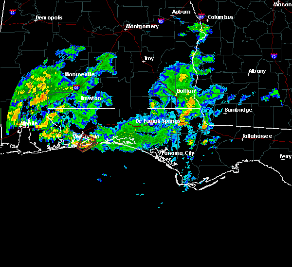 At 234 pm cdt, a severe thunderstorm capable of producing a tornado was located 4 miles southeast of oriole beach, or 6 miles east of gulf breeze, moving northeast at 20 mph. this possible tornado is about to come onshore approximately 5 miles east of pensacola beach or just southwest of woodlawn beach (radar indicated rotation). Hazards include tornado. Flying debris will be dangerous to those caught without shelter. mobile homes will be damaged or destroyed. damage to roofs, windows, and vehicles will occur. tree damage is likely. This dangerous storm will be near, navarre around 300 pm cdt. At 234 pm cdt, a severe thunderstorm capable of producing a tornado was located 4 miles southeast of oriole beach, or 6 miles east of gulf breeze, moving northeast at 20 mph. this possible tornado is about to come onshore approximately 5 miles east of pensacola beach or just southwest of woodlawn beach (radar indicated rotation). Hazards include tornado. Flying debris will be dangerous to those caught without shelter. mobile homes will be damaged or destroyed. damage to roofs, windows, and vehicles will occur. tree damage is likely. This dangerous storm will be near, navarre around 300 pm cdt.
|
| 10/30/2019 2:25 PM CDT |
 At 225 pm cdt, a severe thunderstorm capable of producing a tornado was located 4 miles southeast of pensacola beach, or 7 miles southeast of gulf breeze, moving northeast at 25 mph (radar indicated rotation). Hazards include tornado. Flying debris will be dangerous to those caught without shelter. mobile homes will be damaged or destroyed. damage to roofs, windows, and vehicles will occur. tree damage is likely. This dangerous storm will be near, navarre and navarre beach around 305 pm cdt. At 225 pm cdt, a severe thunderstorm capable of producing a tornado was located 4 miles southeast of pensacola beach, or 7 miles southeast of gulf breeze, moving northeast at 25 mph (radar indicated rotation). Hazards include tornado. Flying debris will be dangerous to those caught without shelter. mobile homes will be damaged or destroyed. damage to roofs, windows, and vehicles will occur. tree damage is likely. This dangerous storm will be near, navarre and navarre beach around 305 pm cdt.
|
| 7/12/2019 7:37 PM EDT |
 At 737 pm edt, a severe thunderstorm was located over oviedo, moving northeast at 20 mph (radar indicated). Hazards include 60 mph wind gusts. expect damage to roofs, siding, and trees At 737 pm edt, a severe thunderstorm was located over oviedo, moving northeast at 20 mph (radar indicated). Hazards include 60 mph wind gusts. expect damage to roofs, siding, and trees
|
| 7/7/2019 9:21 PM EDT |
 At 920 pm edt, a severe thunderstorm was located 18 miles southeast of blountstown, moving east at 20 mph (radar indicated). Hazards include 60 mph wind gusts. Expect damage to roofs, siding, and trees. Locations impacted include, telogia, east camp, jewel fire tower, vilas, hosford, jensen place, central city, clio, owens bridge, kern, wilma, lowry, wetumpka, nixon garden, bloxham and twin pole. At 920 pm edt, a severe thunderstorm was located 18 miles southeast of blountstown, moving east at 20 mph (radar indicated). Hazards include 60 mph wind gusts. Expect damage to roofs, siding, and trees. Locations impacted include, telogia, east camp, jewel fire tower, vilas, hosford, jensen place, central city, clio, owens bridge, kern, wilma, lowry, wetumpka, nixon garden, bloxham and twin pole.
|
| 7/7/2019 8:55 PM EDT |
 The national weather service in tallahassee has issued a * severe thunderstorm warning for. north central gulf county in the panhandle of florida. southeastern calhoun county in the panhandle of florida. northwestern wakulla county in big bend of florida. Southwestern gadsden county in big bend of florida. The national weather service in tallahassee has issued a * severe thunderstorm warning for. north central gulf county in the panhandle of florida. southeastern calhoun county in the panhandle of florida. northwestern wakulla county in big bend of florida. Southwestern gadsden county in big bend of florida.
|
| 7/5/2019 5:47 PM CDT |
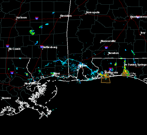 At 547 pm cdt, a severe thunderstorm was located over gulf breeze, moving south at 5 mph (radar indicated). Hazards include 60 mph wind gusts. expect damage to roofs, siding, and trees At 547 pm cdt, a severe thunderstorm was located over gulf breeze, moving south at 5 mph (radar indicated). Hazards include 60 mph wind gusts. expect damage to roofs, siding, and trees
|
| 6/25/2019 6:56 PM EDT |
 At 655 pm edt, a severe thunderstorm was located over lake jessup, moving southeast at 10 mph. storm activity was diminishing over the sanford area, but was building south toward goldenrod and the university of central florida (radar indicated). Hazards include 60 mph wind gusts. Expect damage to roofs, siding, and trees. Locations impacted include, orlando, sanford, altamonte springs, oviedo and winter springs. At 655 pm edt, a severe thunderstorm was located over lake jessup, moving southeast at 10 mph. storm activity was diminishing over the sanford area, but was building south toward goldenrod and the university of central florida (radar indicated). Hazards include 60 mph wind gusts. Expect damage to roofs, siding, and trees. Locations impacted include, orlando, sanford, altamonte springs, oviedo and winter springs.
|
| 6/25/2019 6:34 PM EDT |
 At 633 pm edt, a severe thunderstorm was located over sanford, moving southeast at 15 mph. a wind gust to 59 mph was recorded at the sanford airport at 631 pm (radar indicated). Hazards include 60 mph wind gusts. expect damage to roofs, siding, and trees At 633 pm edt, a severe thunderstorm was located over sanford, moving southeast at 15 mph. a wind gust to 59 mph was recorded at the sanford airport at 631 pm (radar indicated). Hazards include 60 mph wind gusts. expect damage to roofs, siding, and trees
|
| 5/13/2019 3:35 AM CDT |
 At 334 am cdt, a severe thunderstorm was located 7 miles northwest of navarre, or 7 miles southeast of bagdad, moving east at 55 mph (radar indicated). Hazards include 60 mph wind gusts and penny size hail. Expect damage to roofs, siding, and trees. Locations impacted include, bagdad. At 334 am cdt, a severe thunderstorm was located 7 miles northwest of navarre, or 7 miles southeast of bagdad, moving east at 55 mph (radar indicated). Hazards include 60 mph wind gusts and penny size hail. Expect damage to roofs, siding, and trees. Locations impacted include, bagdad.
|
| 5/13/2019 3:07 AM CDT |
 The national weather service in mobile has issued a * severe thunderstorm warning for. southwestern santa rosa county in northwestern florida. central escambia county in northwestern florida. until 345 am cdt. At 306 am cdt, a severe thunderstorm was located over ensley,. The national weather service in mobile has issued a * severe thunderstorm warning for. southwestern santa rosa county in northwestern florida. central escambia county in northwestern florida. until 345 am cdt. At 306 am cdt, a severe thunderstorm was located over ensley,.
|
| 5/12/2019 11:23 AM CDT |
 At 1223 pm edt/1123 am cdt/, severe thunderstorms were located along a line extending from 7 miles west of chattahoochee to 9 miles north of blountstown to 10 miles northeast of callaway, moving east at 40 mph (radar indicated). Hazards include 60 mph wind gusts. expect damage to roofs, siding, and trees At 1223 pm edt/1123 am cdt/, severe thunderstorms were located along a line extending from 7 miles west of chattahoochee to 9 miles north of blountstown to 10 miles northeast of callaway, moving east at 40 mph (radar indicated). Hazards include 60 mph wind gusts. expect damage to roofs, siding, and trees
|
| 5/12/2019 9:09 AM CDT |
 The national weather service in mobile has issued a * severe thunderstorm warning for. southern okaloosa county in northwestern florida. southeastern santa rosa county in northwestern florida. until 1015 am cdt. At 909 am cdt, severe thunderstorms were located along a line. The national weather service in mobile has issued a * severe thunderstorm warning for. southern okaloosa county in northwestern florida. southeastern santa rosa county in northwestern florida. until 1015 am cdt. At 909 am cdt, severe thunderstorms were located along a line.
|
| 5/12/2019 8:39 AM CDT |
 The national weather service in mobile has issued a * severe thunderstorm warning for. southern santa rosa county in northwestern florida. southeastern escambia county in northwestern florida. until 915 am cdt. At 838 am cdt, severe thunderstorms were located along a line. The national weather service in mobile has issued a * severe thunderstorm warning for. southern santa rosa county in northwestern florida. southeastern escambia county in northwestern florida. until 915 am cdt. At 838 am cdt, severe thunderstorms were located along a line.
|
| 5/5/2019 2:33 PM EDT |
 At 232 pm edt, a line of severe thunderstorm was located from lake george south to sanford, also near deltona, moving northeast at 50 mph (radar indicated). Hazards include 60 mph wind gusts and nickel size hail. expect damage to roofs, siding, and trees At 232 pm edt, a line of severe thunderstorm was located from lake george south to sanford, also near deltona, moving northeast at 50 mph (radar indicated). Hazards include 60 mph wind gusts and nickel size hail. expect damage to roofs, siding, and trees
|
| 5/5/2019 2:24 PM EDT |
 At 224 pm edt, a severe thunderstorm was located over oviedo, moving northeast at 40 mph (radar indicated). Hazards include 70 mph wind gusts and nickel size hail. Expect considerable tree damage. damage is likely to mobile homes, roofs, and outbuildings. Locations impacted include, sanford, altamonte springs, oviedo, winter springs and winter park. At 224 pm edt, a severe thunderstorm was located over oviedo, moving northeast at 40 mph (radar indicated). Hazards include 70 mph wind gusts and nickel size hail. Expect considerable tree damage. damage is likely to mobile homes, roofs, and outbuildings. Locations impacted include, sanford, altamonte springs, oviedo, winter springs and winter park.
|
| 5/5/2019 2:17 PM EDT |
 At 217 pm edt, a severe thunderstorm was located over azalea park, moving northeast at 30 mph (radar indicated). Hazards include 70 mph wind gusts and nickel size hail. Expect considerable tree damage. damage is likely to mobile homes, roofs, and outbuildings. Locations impacted include, orlando, sanford, apopka, altamonte springs and oviedo. At 217 pm edt, a severe thunderstorm was located over azalea park, moving northeast at 30 mph (radar indicated). Hazards include 70 mph wind gusts and nickel size hail. Expect considerable tree damage. damage is likely to mobile homes, roofs, and outbuildings. Locations impacted include, orlando, sanford, apopka, altamonte springs and oviedo.
|
| 5/5/2019 2:14 PM EDT |
 At 213 pm edt, severe thunderstorms were located along a line extending from near zellwood to near winter haven, moving east at 50 mph (radar indicated). Hazards include 60 mph wind gusts and nickel size hail. expect damage to roofs, siding, and trees At 213 pm edt, severe thunderstorms were located along a line extending from near zellwood to near winter haven, moving east at 50 mph (radar indicated). Hazards include 60 mph wind gusts and nickel size hail. expect damage to roofs, siding, and trees
|
| 5/5/2019 2:05 PM EDT |
 At 205 pm edt, a severe thunderstorm was located over college park, moving northeast at 30 mph (radar indicated). Hazards include 60 mph wind gusts and nickel size hail. Expect damage to roofs, siding, and trees. Locations impacted include, orlando, sanford, apopka, altamonte springs and ocoee. At 205 pm edt, a severe thunderstorm was located over college park, moving northeast at 30 mph (radar indicated). Hazards include 60 mph wind gusts and nickel size hail. Expect damage to roofs, siding, and trees. Locations impacted include, orlando, sanford, apopka, altamonte springs and ocoee.
|
| 5/5/2019 2:00 PM EDT |
 At 200 pm edt, a severe thunderstorm was located over orlovista, or near orlando, moving northeast at 30 mph (radar indicated). Hazards include 60 mph wind gusts and nickel size hail. expect damage to roofs, siding, and trees At 200 pm edt, a severe thunderstorm was located over orlovista, or near orlando, moving northeast at 30 mph (radar indicated). Hazards include 60 mph wind gusts and nickel size hail. expect damage to roofs, siding, and trees
|
| 5/4/2019 3:24 PM EDT |
 At 324 pm edt, a severe thunderstorm was located near lake mary, moving northeast at 10 mph (radar indicated). Hazards include 60 mph wind gusts and quarter size hail. Hail damage to vehicles is expected. Expect wind damage to roofs, siding, and trees. At 324 pm edt, a severe thunderstorm was located near lake mary, moving northeast at 10 mph (radar indicated). Hazards include 60 mph wind gusts and quarter size hail. Hail damage to vehicles is expected. Expect wind damage to roofs, siding, and trees.
|
| 4/19/2019 8:50 AM EDT |
 At 850 am edt, severe thunderstorms were located along a line extending from 9 miles north of west bainbridge to 6 miles northeast of quincy, moving northeast at 60 mph (radar indicated). Hazards include 60 mph wind gusts. Expect damage to roofs, siding, and trees. locations impacted include, bainbridge, midway, quincy, havana, tallahassee, florida state university, tallahassee comm college, west bainbridge, doak campbell stadium, gretna, attapulgus, lake bradford, leon sinks, douglas city, gaither community center, florence, jamieson, recovery, eight mile pond and laingkat. A tornado watch remains in effect until 1100 am edt for big bend of florida, and southwestern georgia. At 850 am edt, severe thunderstorms were located along a line extending from 9 miles north of west bainbridge to 6 miles northeast of quincy, moving northeast at 60 mph (radar indicated). Hazards include 60 mph wind gusts. Expect damage to roofs, siding, and trees. locations impacted include, bainbridge, midway, quincy, havana, tallahassee, florida state university, tallahassee comm college, west bainbridge, doak campbell stadium, gretna, attapulgus, lake bradford, leon sinks, douglas city, gaither community center, florence, jamieson, recovery, eight mile pond and laingkat. A tornado watch remains in effect until 1100 am edt for big bend of florida, and southwestern georgia.
|
| 4/19/2019 8:49 AM EDT |
 At 849 am edt, doppler radar indicated a line of severe thunderstorms capable of producing damaging winds in excess of 60 mph. these storms were located along a line extending from near bainbridge to 11 miles northwest of crawfordville, and moving northeast at 70 mph. At 849 am edt, doppler radar indicated a line of severe thunderstorms capable of producing damaging winds in excess of 60 mph. these storms were located along a line extending from near bainbridge to 11 miles northwest of crawfordville, and moving northeast at 70 mph.
|
| 4/19/2019 8:42 AM EDT |
 At 842 am edt, severe thunderstorms were located along a line extending from near west bainbridge to quincy, moving northeast at 60 mph (radar indicated). Hazards include 60 mph wind gusts. Expect damage to roofs, siding, and trees. locations impacted include, bainbridge, midway, quincy, havana, tallahassee, greensboro, florida state university, tallahassee comm college, west bainbridge, doak campbell stadium, chattahoochee, gretna, attapulgus, brinson, lake bradford, leon sinks, juniper, douglas city, gaither community center and florence. A tornado watch remains in effect until 1100 am edt for big bend of florida, and southwestern georgia. At 842 am edt, severe thunderstorms were located along a line extending from near west bainbridge to quincy, moving northeast at 60 mph (radar indicated). Hazards include 60 mph wind gusts. Expect damage to roofs, siding, and trees. locations impacted include, bainbridge, midway, quincy, havana, tallahassee, greensboro, florida state university, tallahassee comm college, west bainbridge, doak campbell stadium, chattahoochee, gretna, attapulgus, brinson, lake bradford, leon sinks, juniper, douglas city, gaither community center and florence. A tornado watch remains in effect until 1100 am edt for big bend of florida, and southwestern georgia.
|
| 4/19/2019 8:11 AM EDT |
 At 811 am edt/711 am cdt/, severe thunderstorms were located along a line extending from near chattahoochee to 16 miles southeast of blountstown, moving northeast at 60 mph (radar indicated). Hazards include 60 mph wind gusts. expect damage to roofs, siding, and trees At 811 am edt/711 am cdt/, severe thunderstorms were located along a line extending from near chattahoochee to 16 miles southeast of blountstown, moving northeast at 60 mph (radar indicated). Hazards include 60 mph wind gusts. expect damage to roofs, siding, and trees
|
| 4/14/2019 2:19 PM EDT |
 At 218 pm edt, a severe thunderstorm was located near tallahassee, moving northeast at 45 mph (radar indicated). Hazards include 60 mph wind gusts. Expect damage to roofs, siding, and trees. locations impacted include, tallahassee, havana, florida state university, florida a and m, tallahassee comm college, doak campbell stadium, lake bradford, gaither community center, tallahassee memorial hosp, rocky hill, miccosukee, iamonia, calvary, tallahassee mall, tallahassee regional a/p, governors square mall, belair, levy park, indian head acres and baum. A tornado watch remains in effect until 400 pm edt for big bend of florida, and south central and southwestern georgia. At 218 pm edt, a severe thunderstorm was located near tallahassee, moving northeast at 45 mph (radar indicated). Hazards include 60 mph wind gusts. Expect damage to roofs, siding, and trees. locations impacted include, tallahassee, havana, florida state university, florida a and m, tallahassee comm college, doak campbell stadium, lake bradford, gaither community center, tallahassee memorial hosp, rocky hill, miccosukee, iamonia, calvary, tallahassee mall, tallahassee regional a/p, governors square mall, belair, levy park, indian head acres and baum. A tornado watch remains in effect until 400 pm edt for big bend of florida, and south central and southwestern georgia.
|
| 4/14/2019 2:01 PM EDT |
 At 200 pm edt, a severe thunderstorm was located near midway, moving northeast at 50 mph (radar indicated). Hazards include 60 mph wind gusts. expect damage to roofs, siding, and trees At 200 pm edt, a severe thunderstorm was located near midway, moving northeast at 50 mph (radar indicated). Hazards include 60 mph wind gusts. expect damage to roofs, siding, and trees
|
| 4/14/2019 1:43 PM EDT |
 At 143 pm edt, severe thunderstorms were located along a line extending from 21 miles south of greensboro to 21 miles west of crawfordville to 15 miles northwest of carrabelle, moving northeast at 50 mph (radar indicated). Hazards include 60 mph wind gusts. expect damage to roofs, siding, and trees At 143 pm edt, severe thunderstorms were located along a line extending from 21 miles south of greensboro to 21 miles west of crawfordville to 15 miles northwest of carrabelle, moving northeast at 50 mph (radar indicated). Hazards include 60 mph wind gusts. expect damage to roofs, siding, and trees
|
| 4/14/2019 12:41 PM EDT |
 The severe thunderstorm warning for east central jackson, northeastern gulf and south central calhoun counties in the panhandle of florida, northwestern wakulla, gadsden, liberty and southwestern leon counties in big bend of florida, southeastern decatur and southeastern seminole counties in southwestern georgia will expire at 1245 pm edt/1145 am cdt/, the storms which prompted the warning have weakened below severe limits, and no longer pose an immediate threat to life or property. therefore, the warning will be allowed to expire. however gusty winds to 40 mph are still possible with these thunderstorms. a tornado watch remains in effect until 400 pm edt/300 pm cdt/ for big bend of and the panhandle of florida, and southwestern georgia. The severe thunderstorm warning for east central jackson, northeastern gulf and south central calhoun counties in the panhandle of florida, northwestern wakulla, gadsden, liberty and southwestern leon counties in big bend of florida, southeastern decatur and southeastern seminole counties in southwestern georgia will expire at 1245 pm edt/1145 am cdt/, the storms which prompted the warning have weakened below severe limits, and no longer pose an immediate threat to life or property. therefore, the warning will be allowed to expire. however gusty winds to 40 mph are still possible with these thunderstorms. a tornado watch remains in effect until 400 pm edt/300 pm cdt/ for big bend of and the panhandle of florida, and southwestern georgia.
|
| 4/14/2019 12:33 PM EDT |
 At 1232 pm edt/1132 am cdt/, severe thunderstorms were located along a line extending from near chattahoochee to 9 miles south of greensboro to 15 miles southeast of blountstown, moving east at 55 mph (radar indicated). Hazards include 60 mph wind gusts. Expect damage to roofs, siding, and trees. locations impacted include, bainbridge, quincy, greensboro, stonemill creek, west bainbridge, chattahoochee, orange, wewahitchka, sneads, gretna, bristol, attapulgus, rock bluff, honeyville, jewel fire tower, juniper, douglas city, vilas, florence and chipola cutoff. A tornado watch remains in effect until 400 pm edt/300 pm cdt/ for big bend of and the panhandle of florida, and southwestern georgia. At 1232 pm edt/1132 am cdt/, severe thunderstorms were located along a line extending from near chattahoochee to 9 miles south of greensboro to 15 miles southeast of blountstown, moving east at 55 mph (radar indicated). Hazards include 60 mph wind gusts. Expect damage to roofs, siding, and trees. locations impacted include, bainbridge, quincy, greensboro, stonemill creek, west bainbridge, chattahoochee, orange, wewahitchka, sneads, gretna, bristol, attapulgus, rock bluff, honeyville, jewel fire tower, juniper, douglas city, vilas, florence and chipola cutoff. A tornado watch remains in effect until 400 pm edt/300 pm cdt/ for big bend of and the panhandle of florida, and southwestern georgia.
|
| 4/14/2019 12:06 PM EDT |
 At 1205 pm edt/1105 am cdt/, severe thunderstorms were located along a line extending from near blountstown to 8 miles northeast of stonemill creek to near wewahitchka, moving northeast at 55 mph (radar indicated). Hazards include 60 mph wind gusts. expect damage to roofs, siding, and trees At 1205 pm edt/1105 am cdt/, severe thunderstorms were located along a line extending from near blountstown to 8 miles northeast of stonemill creek to near wewahitchka, moving northeast at 55 mph (radar indicated). Hazards include 60 mph wind gusts. expect damage to roofs, siding, and trees
|
| 4/9/2019 3:33 PM EDT |
 At 333 pm edt, a severe thunderstorm was located near geneva, moving northeast at 30 mph (radar indicated). Hazards include 60 mph wind gusts and quarter size hail. Hail damage to vehicles is expected. Expect wind damage to roofs, siding, and trees. At 333 pm edt, a severe thunderstorm was located near geneva, moving northeast at 30 mph (radar indicated). Hazards include 60 mph wind gusts and quarter size hail. Hail damage to vehicles is expected. Expect wind damage to roofs, siding, and trees.
|
| 4/6/2019 8:52 PM EDT |
 At 852 pm edt, a severe thunderstorm was located near osteen, or near deltona, moving southeast at 15 mph (radar indicated). Hazards include 60 mph wind gusts and quarter size hail. Hail damage to vehicles is expected. Expect wind damage to roofs, siding, and trees. At 852 pm edt, a severe thunderstorm was located near osteen, or near deltona, moving southeast at 15 mph (radar indicated). Hazards include 60 mph wind gusts and quarter size hail. Hail damage to vehicles is expected. Expect wind damage to roofs, siding, and trees.
|
| 4/6/2019 8:09 PM EDT |
 At 809 pm edt, a severe thunderstorm was located over debary, moving southeast at 10 mph (radar indicated). Hazards include 60 mph wind gusts and nickel size hail. expect damage to roofs, siding, and trees At 809 pm edt, a severe thunderstorm was located over debary, moving southeast at 10 mph (radar indicated). Hazards include 60 mph wind gusts and nickel size hail. expect damage to roofs, siding, and trees
|
| 3/3/2019 7:58 PM EST |
 At 758 pm est, a confirmed tornado was located near midway, moving east at 45 mph (radar confirmed tornado). Hazards include damaging tornado. Flying debris will be dangerous to those caught without shelter. mobile homes will be damaged or destroyed. damage to roofs, windows, and vehicles will occur. tree damage is likely. this tornado will be near, tallahassee comm college around 805 pm est. florida state university, doak campbell stadium and florida a and m around 810 pm est. tallahassee around 815 pm est. Other locations impacted by this tornadic thunderstorm include macon community park, gaither community center, tallahassee memorial hosp, scotland, killearn estates, lake ella, tallahassee mall, state capital complex, governors square mall and forest meadows park. At 758 pm est, a confirmed tornado was located near midway, moving east at 45 mph (radar confirmed tornado). Hazards include damaging tornado. Flying debris will be dangerous to those caught without shelter. mobile homes will be damaged or destroyed. damage to roofs, windows, and vehicles will occur. tree damage is likely. this tornado will be near, tallahassee comm college around 805 pm est. florida state university, doak campbell stadium and florida a and m around 810 pm est. tallahassee around 815 pm est. Other locations impacted by this tornadic thunderstorm include macon community park, gaither community center, tallahassee memorial hosp, scotland, killearn estates, lake ella, tallahassee mall, state capital complex, governors square mall and forest meadows park.
|
| 3/3/2019 7:50 PM EST |
 At 750 pm est, a confirmed tornado was located near midway, moving east at 45 mph (radar confirmed tornado). Hazards include damaging tornado. Flying debris will be dangerous to those caught without shelter. mobile homes will be damaged or destroyed. damage to roofs, windows, and vehicles will occur. tree damage is likely. this tornado will be near, midway around 755 pm est. tallahassee comm college around 805 pm est. florida state university, doak campbell stadium and florida a and m around 810 pm est. tallahassee around 815 pm est. Other locations impacted by this tornadic thunderstorm include macon community park, littman, gaither community center, tallahassee memorial hosp, florence, scotland, santa clara, killearn estates, shady rest and lake ella. At 750 pm est, a confirmed tornado was located near midway, moving east at 45 mph (radar confirmed tornado). Hazards include damaging tornado. Flying debris will be dangerous to those caught without shelter. mobile homes will be damaged or destroyed. damage to roofs, windows, and vehicles will occur. tree damage is likely. this tornado will be near, midway around 755 pm est. tallahassee comm college around 805 pm est. florida state university, doak campbell stadium and florida a and m around 810 pm est. tallahassee around 815 pm est. Other locations impacted by this tornadic thunderstorm include macon community park, littman, gaither community center, tallahassee memorial hosp, florence, scotland, santa clara, killearn estates, shady rest and lake ella.
|
| 3/3/2019 7:44 PM EST |
 At 743 pm est, a severe thunderstorm capable of producing a tornado was located over quincy, moving southeast at 50 mph (radar indicated rotation). Hazards include tornado. Flying debris will be dangerous to those caught without shelter. mobile homes will be damaged or destroyed. damage to roofs, windows, and vehicles will occur. tree damage is likely. this dangerous storm will be near, midway around 755 pm est. florida state university, doak campbell stadium, florida a and m and tallahassee comm college around 805 pm est. tallahassee around 815 pm est. Other locations impacted by this tornadic thunderstorm include lake bradford, freemont, macon community park, littman, douglas city, gaither community center, tallahassee memorial hosp, florence, scotland and santa clara. At 743 pm est, a severe thunderstorm capable of producing a tornado was located over quincy, moving southeast at 50 mph (radar indicated rotation). Hazards include tornado. Flying debris will be dangerous to those caught without shelter. mobile homes will be damaged or destroyed. damage to roofs, windows, and vehicles will occur. tree damage is likely. this dangerous storm will be near, midway around 755 pm est. florida state university, doak campbell stadium, florida a and m and tallahassee comm college around 805 pm est. tallahassee around 815 pm est. Other locations impacted by this tornadic thunderstorm include lake bradford, freemont, macon community park, littman, douglas city, gaither community center, tallahassee memorial hosp, florence, scotland and santa clara.
|
| 3/3/2019 7:31 PM EST |
 At 731 pm est/631 pm cst/, severe thunderstorms were located along a line extending from 6 miles north of quincy to 15 miles southeast of blountstown to near tyndall air force base, moving southeast at 35 mph (radar indicated). Hazards include 60 mph wind gusts. expect damage to roofs, siding, and trees At 731 pm est/631 pm cst/, severe thunderstorms were located along a line extending from 6 miles north of quincy to 15 miles southeast of blountstown to near tyndall air force base, moving southeast at 35 mph (radar indicated). Hazards include 60 mph wind gusts. expect damage to roofs, siding, and trees
|
| 3/3/2019 5:24 PM CST |
 At 624 pm est/524 pm cst/, severe thunderstorms were located along a line extending from 13 miles northeast of marianna to 11 miles west of panama city beach, moving east at 50 mph (radar indicated). Hazards include 60 mph wind gusts. expect damage to roofs, siding, and trees At 624 pm est/524 pm cst/, severe thunderstorms were located along a line extending from 13 miles northeast of marianna to 11 miles west of panama city beach, moving east at 50 mph (radar indicated). Hazards include 60 mph wind gusts. expect damage to roofs, siding, and trees
|
| 3/3/2019 4:38 PM CST |
 At 438 pm cst, severe thunderstorms were located along a line extending from 6 miles southwest of eglin air force base to lake lorraine to 3 miles southwest of navarre, moving southeast at 20 mph (radar indicated). Hazards include 60 mph wind gusts. Expect damage to roofs, siding, and trees. locations impacted include, wright, fort walton beach, niceville, destin, eglin afb, valparaiso, mary esther, ocean city, lake lorraine, navarre, shalimar, cinco bayou and navarre beach. A tornado watch remains in effect until 600 pm cst for northwestern florida. At 438 pm cst, severe thunderstorms were located along a line extending from 6 miles southwest of eglin air force base to lake lorraine to 3 miles southwest of navarre, moving southeast at 20 mph (radar indicated). Hazards include 60 mph wind gusts. Expect damage to roofs, siding, and trees. locations impacted include, wright, fort walton beach, niceville, destin, eglin afb, valparaiso, mary esther, ocean city, lake lorraine, navarre, shalimar, cinco bayou and navarre beach. A tornado watch remains in effect until 600 pm cst for northwestern florida.
|
| 3/3/2019 4:23 PM CST |
 At 423 pm cst, severe thunderstorms were located along a line extending from 6 miles west of eglin air force base to near shalimar to 3 miles west of navarre, moving south at 15 mph (radar indicated). Hazards include 60 mph wind gusts. expect damage to roofs, siding, and trees At 423 pm cst, severe thunderstorms were located along a line extending from 6 miles west of eglin air force base to near shalimar to 3 miles west of navarre, moving south at 15 mph (radar indicated). Hazards include 60 mph wind gusts. expect damage to roofs, siding, and trees
|
| 3/3/2019 3:51 PM CST |
 At 351 pm cst, a severe thunderstorm was located 10 miles north of wright, moving east at 45 mph (radar indicated). Hazards include 60 mph wind gusts and penny size hail. expect damage to roofs, siding, and trees At 351 pm cst, a severe thunderstorm was located 10 miles north of wright, moving east at 45 mph (radar indicated). Hazards include 60 mph wind gusts and penny size hail. expect damage to roofs, siding, and trees
|
| 1/23/2019 11:29 PM EST |
 At 1129 pm est, severe thunderstorms were located along a line extending from 6 miles northwest of havana to near eastpoint, moving east at 30 mph (radar indicated). Hazards include 60 mph wind gusts. Expect damage to roofs, siding, and trees. Locations impacted include, carrabelle, eastpoint, quincy, tallahassee, havana, midway, woodville, crawfordville, st george island, florida state university, tallahassee comm college, doak campbell stadium, florida a and m, wakulla, franklin, sopchoppy, lake bradford, jewel fire tower, wakulla springs and florence. At 1129 pm est, severe thunderstorms were located along a line extending from 6 miles northwest of havana to near eastpoint, moving east at 30 mph (radar indicated). Hazards include 60 mph wind gusts. Expect damage to roofs, siding, and trees. Locations impacted include, carrabelle, eastpoint, quincy, tallahassee, havana, midway, woodville, crawfordville, st george island, florida state university, tallahassee comm college, doak campbell stadium, florida a and m, wakulla, franklin, sopchoppy, lake bradford, jewel fire tower, wakulla springs and florence.
|
| 1/23/2019 11:02 PM EST |
 At 1102 pm est, severe thunderstorms were located along a line extending from 8 miles east of chattahoochee to 9 miles west of apalachicola, moving east at 30 mph (radar indicated). Hazards include 60 mph wind gusts. expect damage to roofs, siding, and trees At 1102 pm est, severe thunderstorms were located along a line extending from 8 miles east of chattahoochee to 9 miles west of apalachicola, moving east at 30 mph (radar indicated). Hazards include 60 mph wind gusts. expect damage to roofs, siding, and trees
|
| 12/3/2018 1:49 PM EST |
 At 149 pm est, a severe thunderstorm was located over sanford, moving east at 35 mph (radar indicated). Hazards include 60 mph wind gusts. expect damage to roofs, siding, and trees At 149 pm est, a severe thunderstorm was located over sanford, moving east at 35 mph (radar indicated). Hazards include 60 mph wind gusts. expect damage to roofs, siding, and trees
|
| 12/2/2018 2:57 AM CST |
 The severe thunderstorm warning for central santa rosa and south central escambia counties will expire at 300 am cst, the storm which prompted the warning has weakened below severe limits. therefore, the warning will be allowed to expire. gusty winds are still possible with this thunderstorm. The severe thunderstorm warning for central santa rosa and south central escambia counties will expire at 300 am cst, the storm which prompted the warning has weakened below severe limits. therefore, the warning will be allowed to expire. gusty winds are still possible with this thunderstorm.
|
| 12/2/2018 2:13 AM CST |
 At 213 am cst, a severe thunderstorm was located over myrtle grove, or 4 miles west of west pensacola, moving east at 40 mph (radar indicated). Hazards include 60 mph wind gusts. expect damage to roofs, siding, and trees At 213 am cst, a severe thunderstorm was located over myrtle grove, or 4 miles west of west pensacola, moving east at 40 mph (radar indicated). Hazards include 60 mph wind gusts. expect damage to roofs, siding, and trees
|
| 11/12/2018 11:51 AM CST |
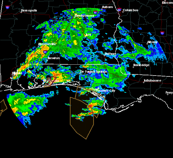 At 1151 am cst, a severe thunderstorm capable of producing a tornado was located near navarre, or 10 miles southeast of bagdad, moving northeast at 30 mph (radar indicated rotation). Hazards include tornado. Flying debris will be dangerous to those caught without shelter. mobile homes will be damaged or destroyed. damage to roofs, windows, and vehicles will occur. tree damage is likely. This tornadic thunderstorm will remain over mainly rural areas of southeastern santa rosa county. At 1151 am cst, a severe thunderstorm capable of producing a tornado was located near navarre, or 10 miles southeast of bagdad, moving northeast at 30 mph (radar indicated rotation). Hazards include tornado. Flying debris will be dangerous to those caught without shelter. mobile homes will be damaged or destroyed. damage to roofs, windows, and vehicles will occur. tree damage is likely. This tornadic thunderstorm will remain over mainly rural areas of southeastern santa rosa county.
|
| 11/12/2018 11:42 AM CST |
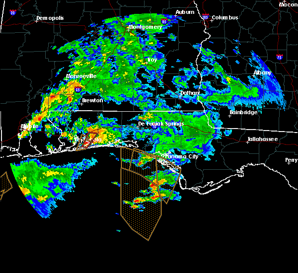 At 1141 am cst, a severe thunderstorm capable of producing a tornado was located 4 miles west of navarre, or 11 miles east of gulf breeze, moving northeast at 25 mph (radar indicated rotation). Hazards include tornado. Flying debris will be dangerous to those caught without shelter. mobile homes will be damaged or destroyed. damage to roofs, windows, and vehicles will occur. tree damage is likely. This tornadic thunderstorm will remain over mainly rural areas of southeastern santa rosa county. At 1141 am cst, a severe thunderstorm capable of producing a tornado was located 4 miles west of navarre, or 11 miles east of gulf breeze, moving northeast at 25 mph (radar indicated rotation). Hazards include tornado. Flying debris will be dangerous to those caught without shelter. mobile homes will be damaged or destroyed. damage to roofs, windows, and vehicles will occur. tree damage is likely. This tornadic thunderstorm will remain over mainly rural areas of southeastern santa rosa county.
|
| 11/12/2018 11:25 AM CST |
 At 1124 am cst, a severe thunderstorm capable of producing a tornado was located over oriole beach, or 6 miles east of gulf breeze, moving northeast at 30 mph (radar indicated rotation). Hazards include tornado. Flying debris will be dangerous to those caught without shelter. mobile homes will be damaged or destroyed. damage to roofs, windows, and vehicles will occur. tree damage is likely. This tornadic thunderstorm will remain over mainly rural areas of southeastern santa rosa and southeastern escambia counties. At 1124 am cst, a severe thunderstorm capable of producing a tornado was located over oriole beach, or 6 miles east of gulf breeze, moving northeast at 30 mph (radar indicated rotation). Hazards include tornado. Flying debris will be dangerous to those caught without shelter. mobile homes will be damaged or destroyed. damage to roofs, windows, and vehicles will occur. tree damage is likely. This tornadic thunderstorm will remain over mainly rural areas of southeastern santa rosa and southeastern escambia counties.
|
| 11/12/2018 11:15 AM CST |
 At 1115 am cst, a severe thunderstorm capable of producing a tornado was located over pensacola beach, or 4 miles southeast of gulf breeze, moving northeast at 30 mph (radar indicated rotation). Hazards include tornado. Flying debris will be dangerous to those caught without shelter. mobile homes will be damaged or destroyed. damage to roofs, windows, and vehicles will occur. tree damage is likely. this dangerous storm will be near, oriole beach around 1125 am cst. Milton and bagdad around 1200 pm cst. At 1115 am cst, a severe thunderstorm capable of producing a tornado was located over pensacola beach, or 4 miles southeast of gulf breeze, moving northeast at 30 mph (radar indicated rotation). Hazards include tornado. Flying debris will be dangerous to those caught without shelter. mobile homes will be damaged or destroyed. damage to roofs, windows, and vehicles will occur. tree damage is likely. this dangerous storm will be near, oriole beach around 1125 am cst. Milton and bagdad around 1200 pm cst.
|
| 11/12/2018 9:07 AM CST |
 At 907 am cst, a severe thunderstorm capable of producing a tornado was located over gulf breeze, moving northeast at 20 mph (radar indicated rotation). Hazards include tornado and quarter size hail. Flying debris will be dangerous to those caught without shelter. mobile homes will be damaged or destroyed. damage to roofs, windows, and vehicles will occur. tree damage is likely. this dangerous storm will be near, pensacola beach around 910 am cst. gulf breeze around 915 am cst. Oriole beach around 920 am cst. At 907 am cst, a severe thunderstorm capable of producing a tornado was located over gulf breeze, moving northeast at 20 mph (radar indicated rotation). Hazards include tornado and quarter size hail. Flying debris will be dangerous to those caught without shelter. mobile homes will be damaged or destroyed. damage to roofs, windows, and vehicles will occur. tree damage is likely. this dangerous storm will be near, pensacola beach around 910 am cst. gulf breeze around 915 am cst. Oriole beach around 920 am cst.
|
| 11/12/2018 8:59 AM CST |
 At 859 am cst, a severe thunderstorm capable of producing a tornado was located 4 miles southwest of pensacola beach, or 5 miles south of gulf breeze, moving northeast at 25 mph (radar indicated rotation). Hazards include tornado and quarter size hail. Flying debris will be dangerous to those caught without shelter. mobile homes will be damaged or destroyed. damage to roofs, windows, and vehicles will occur. tree damage is likely. this dangerous storm will be near, gulf breeze and pensacola beach around 910 am cst. Oriole beach around 920 am cst. At 859 am cst, a severe thunderstorm capable of producing a tornado was located 4 miles southwest of pensacola beach, or 5 miles south of gulf breeze, moving northeast at 25 mph (radar indicated rotation). Hazards include tornado and quarter size hail. Flying debris will be dangerous to those caught without shelter. mobile homes will be damaged or destroyed. damage to roofs, windows, and vehicles will occur. tree damage is likely. this dangerous storm will be near, gulf breeze and pensacola beach around 910 am cst. Oriole beach around 920 am cst.
|
| 11/12/2018 8:56 AM CST |
 At 854 am cst, a severe thunderstorm was located 6 miles southwest of pensacola beach, or 7 miles south of gulf breeze, moving northeast at 25 mph. a tornado could form with little or no advanced warning (radar indicated). Hazards include 60 mph wind gusts and penny size hail. expect damage to roofs, siding, and trees At 854 am cst, a severe thunderstorm was located 6 miles southwest of pensacola beach, or 7 miles south of gulf breeze, moving northeast at 25 mph. a tornado could form with little or no advanced warning (radar indicated). Hazards include 60 mph wind gusts and penny size hail. expect damage to roofs, siding, and trees
|
| 11/2/2018 5:33 PM EDT |
 At 533 pm edt, a line of severe thunderstorms was located from deland, to deltona, to east of sanford, to christmas, to northeastern osceola county, moving northeast at 45 mph (radar indicated). Hazards include 60 mph wind gusts. expect damage to roofs, siding, and trees At 533 pm edt, a line of severe thunderstorms was located from deland, to deltona, to east of sanford, to christmas, to northeastern osceola county, moving northeast at 45 mph (radar indicated). Hazards include 60 mph wind gusts. expect damage to roofs, siding, and trees
|
| 11/1/2018 10:43 AM CDT |
 At 1042 am cdt, severe thunderstorms were located along a line extending from 3 miles northeast of navarre beach to 9 miles south of navarre to 18 miles southeast of oriole beach, moving east at 35 mph (radar indicated). Hazards include 60 to 70 mph wind gusts. the line of storms appears to be accelerating. Expect considerable tree damage. Damage is likely to mobile homes, roofs, and outbuildings. At 1042 am cdt, severe thunderstorms were located along a line extending from 3 miles northeast of navarre beach to 9 miles south of navarre to 18 miles southeast of oriole beach, moving east at 35 mph (radar indicated). Hazards include 60 to 70 mph wind gusts. the line of storms appears to be accelerating. Expect considerable tree damage. Damage is likely to mobile homes, roofs, and outbuildings.
|
| 11/1/2018 10:40 AM CDT |
 At 1040 am cdt, severe thunderstorms were located along a line extending from 3 miles northwest of navarre to 5 miles southwest of navarre beach, moving east at 45 mph (radar indicated). Hazards include 60 to 70 mph wind gusts. Expect considerable tree damage. damage is likely to mobile homes, roofs, and outbuildings. locations impacted include, oriole beach, navarre and navarre beach. A tornado watch remains in effect until 100 pm cdt for northwestern florida. At 1040 am cdt, severe thunderstorms were located along a line extending from 3 miles northwest of navarre to 5 miles southwest of navarre beach, moving east at 45 mph (radar indicated). Hazards include 60 to 70 mph wind gusts. Expect considerable tree damage. damage is likely to mobile homes, roofs, and outbuildings. locations impacted include, oriole beach, navarre and navarre beach. A tornado watch remains in effect until 100 pm cdt for northwestern florida.
|
| 11/1/2018 10:18 AM CDT |
 At 1017 am cdt, severe thunderstorms were located along a line extending from 4 miles south of warrington to 9 miles south of pensacola beach, moving northeast at 45 mph (radar indicated). Hazards include 60 to 70 mph wind gusts. Expect considerable tree damage. Damage is likely to mobile homes, roofs, and outbuildings. At 1017 am cdt, severe thunderstorms were located along a line extending from 4 miles south of warrington to 9 miles south of pensacola beach, moving northeast at 45 mph (radar indicated). Hazards include 60 to 70 mph wind gusts. Expect considerable tree damage. Damage is likely to mobile homes, roofs, and outbuildings.
|
| 9/17/2018 2:38 PM EDT |
 At 237 pm edt, a severe thunderstorm was located near midway, moving east at 5 mph (radar indicated). Hazards include 60 mph wind gusts. expect damage to roofs, siding, and trees At 237 pm edt, a severe thunderstorm was located near midway, moving east at 5 mph (radar indicated). Hazards include 60 mph wind gusts. expect damage to roofs, siding, and trees
|
| 9/4/2018 9:29 PM CDT |
 At 928 pm cdt, a severe thunderstorm capable of producing a tornado was located 7 miles northwest of navarre, or 7 miles south of bagdad, moving northwest at 55 mph (radar indicated rotation). Hazards include tornado. Flying debris will be dangerous to those caught without shelter. mobile homes will be damaged or destroyed. damage to roofs, windows, and vehicles will occur. tree damage is likely. this dangerous storm will be near, bagdad around 935 pm cdt. pace, milton, pea ridge and floridatown around 940 pm cdt. point baker around 945 pm cdt. Molino around 955 pm cdt. At 928 pm cdt, a severe thunderstorm capable of producing a tornado was located 7 miles northwest of navarre, or 7 miles south of bagdad, moving northwest at 55 mph (radar indicated rotation). Hazards include tornado. Flying debris will be dangerous to those caught without shelter. mobile homes will be damaged or destroyed. damage to roofs, windows, and vehicles will occur. tree damage is likely. this dangerous storm will be near, bagdad around 935 pm cdt. pace, milton, pea ridge and floridatown around 940 pm cdt. point baker around 945 pm cdt. Molino around 955 pm cdt.
|
| 9/3/2018 4:00 PM EDT |
 At 400 pm edt, a severe thunderstorm was located near florida a and m, or near tallahassee, moving west at 35 mph (radar indicated). Hazards include 60 mph wind gusts. Expect damage to roofs, siding, and trees. Locations impacted include, woodville, tallahassee, florida state university, florida a and m, tallahassee comm college, doak campbell stadium, wakulla, lake bradford, leon sinks, gaither community center, wakulla springs, tallahassee memorial hosp, eight mile pond, tallahassee mall, bethel, tallahassee regional a/p, governors square mall, natural bridge, belair and levy park. At 400 pm edt, a severe thunderstorm was located near florida a and m, or near tallahassee, moving west at 35 mph (radar indicated). Hazards include 60 mph wind gusts. Expect damage to roofs, siding, and trees. Locations impacted include, woodville, tallahassee, florida state university, florida a and m, tallahassee comm college, doak campbell stadium, wakulla, lake bradford, leon sinks, gaither community center, wakulla springs, tallahassee memorial hosp, eight mile pond, tallahassee mall, bethel, tallahassee regional a/p, governors square mall, natural bridge, belair and levy park.
|
| 9/3/2018 3:40 PM EDT |
 At 340 pm edt, doppler radar indicated a severe thunderstorm capable of producing damaging winds in excess of 60 mph. this storm was located 11 miles northeast of woodville, and moving west at 35 mph. At 340 pm edt, doppler radar indicated a severe thunderstorm capable of producing damaging winds in excess of 60 mph. this storm was located 11 miles northeast of woodville, and moving west at 35 mph.
|
| 9/2/2018 6:19 PM EDT |
 A severe thunderstorm warning remains in effect until 630 pm edt for southern gadsden and central liberty counties. at 619 pm edt, a severe thunderstorm was located 12 miles south of greensboro, or 15 miles southwest of quincy, moving west at 20 mph. hazard. 60 mph wind gusts. source. Radar indicated. A severe thunderstorm warning remains in effect until 630 pm edt for southern gadsden and central liberty counties. at 619 pm edt, a severe thunderstorm was located 12 miles south of greensboro, or 15 miles southwest of quincy, moving west at 20 mph. hazard. 60 mph wind gusts. source. Radar indicated.
|
| 9/2/2018 5:48 PM EDT |
 At 548 pm edt, a severe thunderstorm was located 9 miles southwest of midway, moving west at 20 mph (radar indicated). Hazards include 60 mph wind gusts. expect damage to roofs, siding, and trees At 548 pm edt, a severe thunderstorm was located 9 miles southwest of midway, moving west at 20 mph (radar indicated). Hazards include 60 mph wind gusts. expect damage to roofs, siding, and trees
|
| 8/31/2018 4:24 PM EDT |
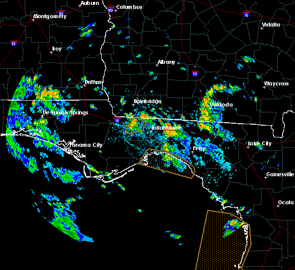 The severe thunderstorm warning for central gadsden county will expire at 430 pm edt, the storm which prompted the warning has weakened below severe limits, and no longer poses an immediate threat to life or property. therefore, the warning will be allowed to expire. to report severe weather, contact your nearest law enforcement agency. they will relay your report to the national weather service tallahassee. The severe thunderstorm warning for central gadsden county will expire at 430 pm edt, the storm which prompted the warning has weakened below severe limits, and no longer poses an immediate threat to life or property. therefore, the warning will be allowed to expire. to report severe weather, contact your nearest law enforcement agency. they will relay your report to the national weather service tallahassee.
|
| 8/31/2018 4:03 PM EDT |
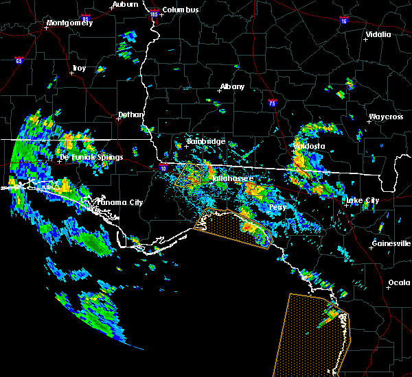 At 402 pm edt, a severe thunderstorm was located over midway, moving northwest at 25 mph (radar indicated). Hazards include 60 mph wind gusts. Expect damage to roofs, siding, and trees. Locations impacted include, quincy, midway, havana, freemont, lake talquin, littman, florence, scotland, jamieson, gibson, santa clara, shady rest, quincy airport, wetumpka, branchville and dogtown. At 402 pm edt, a severe thunderstorm was located over midway, moving northwest at 25 mph (radar indicated). Hazards include 60 mph wind gusts. Expect damage to roofs, siding, and trees. Locations impacted include, quincy, midway, havana, freemont, lake talquin, littman, florence, scotland, jamieson, gibson, santa clara, shady rest, quincy airport, wetumpka, branchville and dogtown.
|
| 8/31/2018 3:48 PM EDT |
 At 348 pm edt, a severe thunderstorm was located over tallahassee comm college, or near midway, moving northwest at 25 mph (radar indicated). Hazards include 60 mph wind gusts. expect damage to roofs, siding, and trees At 348 pm edt, a severe thunderstorm was located over tallahassee comm college, or near midway, moving northwest at 25 mph (radar indicated). Hazards include 60 mph wind gusts. expect damage to roofs, siding, and trees
|
| 8/13/2018 6:31 PM EDT |
 At 631 pm edt, a severe thunderstorm was located over sanford, moving northeast at 15 mph (radar indicated). Hazards include 60 mph wind gusts. Expect damage to roofs, siding, and trees. Locations impacted include, deltona, sanford, deland, orange city and lake helen. At 631 pm edt, a severe thunderstorm was located over sanford, moving northeast at 15 mph (radar indicated). Hazards include 60 mph wind gusts. Expect damage to roofs, siding, and trees. Locations impacted include, deltona, sanford, deland, orange city and lake helen.
|
| 8/13/2018 6:18 PM EDT |
 At 618 pm edt, a severe thunderstorm was located over sanford, moving north at 15 mph (radar indicated). Hazards include 60 mph wind gusts. expect damage to roofs, siding, and trees At 618 pm edt, a severe thunderstorm was located over sanford, moving north at 15 mph (radar indicated). Hazards include 60 mph wind gusts. expect damage to roofs, siding, and trees
|
| 7/22/2018 6:50 PM CDT |
 At 650 pm cdt, a severe thunderstorm was located near bagdad, moving south at 20 mph (radar indicated). Hazards include 60 mph wind gusts and quarter size hail. Hail damage to vehicles is expected. Expect wind damage to roofs, siding, and trees. At 650 pm cdt, a severe thunderstorm was located near bagdad, moving south at 20 mph (radar indicated). Hazards include 60 mph wind gusts and quarter size hail. Hail damage to vehicles is expected. Expect wind damage to roofs, siding, and trees.
|
| 7/21/2018 11:31 PM EDT |
 At 1130 pm edt, severe thunderstorms were located along a line extending from 7 miles northwest of havana to 13 miles south of cairo, moving southeast at 20 mph (radar indicated). Hazards include 60 mph wind gusts. expect damage to roofs, siding, and trees At 1130 pm edt, severe thunderstorms were located along a line extending from 7 miles northwest of havana to 13 miles south of cairo, moving southeast at 20 mph (radar indicated). Hazards include 60 mph wind gusts. expect damage to roofs, siding, and trees
|
| 7/21/2018 11:25 PM EDT |
 At 1125 pm edt, a severe thunderstorm was located 9 miles northeast of havana, moving south at 35 mph (radar indicated). Hazards include 60 mph wind gusts. Expect damage to roofs, siding, and trees. Locations impacted include, quincy, havana, cairo, tallahassee, attapulgus, freemont, littman, darsey, florence, scotland, jamieson, rocky hill, iamonia, laingkat, calvary, santa clara, shady rest, princes still, amsterdam and quincy airport. At 1125 pm edt, a severe thunderstorm was located 9 miles northeast of havana, moving south at 35 mph (radar indicated). Hazards include 60 mph wind gusts. Expect damage to roofs, siding, and trees. Locations impacted include, quincy, havana, cairo, tallahassee, attapulgus, freemont, littman, darsey, florence, scotland, jamieson, rocky hill, iamonia, laingkat, calvary, santa clara, shady rest, princes still, amsterdam and quincy airport.
|
| 7/21/2018 11:15 PM EDT |
 At 1115 pm edt, a severe thunderstorm was located near whigham, or 8 miles southwest of cairo, moving south at 35 mph (radar indicated). Hazards include 70 mph wind gusts. Expect considerable tree damage. damage is likely to mobile homes, roofs, and outbuildings. Locations impacted include, quincy, havana, cairo, thomasville, bainbridge, tallahassee, whigham, attapulgus, climax, alma, florence, jamieson, rocky hill, miccosukee, iamonia, laingkat, calvary, princes still, quincy airport and nickleville. At 1115 pm edt, a severe thunderstorm was located near whigham, or 8 miles southwest of cairo, moving south at 35 mph (radar indicated). Hazards include 70 mph wind gusts. Expect considerable tree damage. damage is likely to mobile homes, roofs, and outbuildings. Locations impacted include, quincy, havana, cairo, thomasville, bainbridge, tallahassee, whigham, attapulgus, climax, alma, florence, jamieson, rocky hill, miccosukee, iamonia, laingkat, calvary, princes still, quincy airport and nickleville.
|
| 7/21/2018 10:49 PM EDT |
 At 1048 pm edt, a severe thunderstorm was located 10 miles northwest of whigham, or 12 miles northeast of bainbridge, moving south at 35 mph (radar indicated). Hazards include 70 mph wind gusts. Expect considerable tree damage. Damage is likely to mobile homes, roofs, and outbuildings. At 1048 pm edt, a severe thunderstorm was located 10 miles northwest of whigham, or 12 miles northeast of bainbridge, moving south at 35 mph (radar indicated). Hazards include 70 mph wind gusts. Expect considerable tree damage. Damage is likely to mobile homes, roofs, and outbuildings.
|
| 7/21/2018 1:40 PM EDT |
 At 139 pm edt, a severe thunderstorm was located near woodville, moving southeast at 45 mph (radar indicated). Hazards include 60 mph wind gusts and nickel size hail. expect damage to roofs, siding, and trees At 139 pm edt, a severe thunderstorm was located near woodville, moving southeast at 45 mph (radar indicated). Hazards include 60 mph wind gusts and nickel size hail. expect damage to roofs, siding, and trees
|
| 7/21/2018 1:16 PM EDT |
 At 116 pm edt, severe thunderstorms were located along a line extending from 7 miles north of monticello to 15 miles northeast of tallahassee to 6 miles southwest of tallahassee comm college, moving southeast at 50 mph (radar indicated). Hazards include 60 mph wind gusts and quarter size hail. Hail damage to vehicles is expected. expect wind damage to roofs, siding, and trees. locations impacted include, monticello, thomasville, quincy, tallahassee, havana, midway, woodville, crawfordville, cairo, st. Marks, boston, florida state university, tallahassee comm college, doak campbell stadium, florida a and m, wakulla, greenville, lake bradford, alma and cody. At 116 pm edt, severe thunderstorms were located along a line extending from 7 miles north of monticello to 15 miles northeast of tallahassee to 6 miles southwest of tallahassee comm college, moving southeast at 50 mph (radar indicated). Hazards include 60 mph wind gusts and quarter size hail. Hail damage to vehicles is expected. expect wind damage to roofs, siding, and trees. locations impacted include, monticello, thomasville, quincy, tallahassee, havana, midway, woodville, crawfordville, cairo, st. Marks, boston, florida state university, tallahassee comm college, doak campbell stadium, florida a and m, wakulla, greenville, lake bradford, alma and cody.
|
| 7/21/2018 1:15 PM EDT |
 At 115 pm edt/1215 pm cdt/, severe thunderstorms were located along a line extending from 7 miles southwest of midway to near wewahitchka, moving east at 25 mph (radar indicated). Hazards include 60 mph wind gusts and quarter size hail. Hail damage to vehicles is expected. expect wind damage to roofs, siding, and trees. Locations impacted include, quincy, midway, tallahassee, stonemill creek, orange, wewahitchka, honeyville, jewel fire tower, brown house, douglas city, vilas, chipola cutoff, hosford, jensen place, central city, red hill, clio, santa clara, estiffanulga and kern. At 115 pm edt/1215 pm cdt/, severe thunderstorms were located along a line extending from 7 miles southwest of midway to near wewahitchka, moving east at 25 mph (radar indicated). Hazards include 60 mph wind gusts and quarter size hail. Hail damage to vehicles is expected. expect wind damage to roofs, siding, and trees. Locations impacted include, quincy, midway, tallahassee, stonemill creek, orange, wewahitchka, honeyville, jewel fire tower, brown house, douglas city, vilas, chipola cutoff, hosford, jensen place, central city, red hill, clio, santa clara, estiffanulga and kern.
|
| 7/21/2018 12:54 PM EDT |
 At 1254 pm edt, severe thunderstorms were located along a line extending from thomasville to near cairo to quincy, moving southeast at 50 mph (radar indicated). Hazards include 60 mph wind gusts and quarter size hail. Hail damage to vehicles is expected. Expect wind damage to roofs, siding, and trees. At 1254 pm edt, severe thunderstorms were located along a line extending from thomasville to near cairo to quincy, moving southeast at 50 mph (radar indicated). Hazards include 60 mph wind gusts and quarter size hail. Hail damage to vehicles is expected. Expect wind damage to roofs, siding, and trees.
|
| 7/21/2018 12:48 PM EDT |
 At 1248 pm edt/1148 am cdt/, severe thunderstorms were located along a line extending from near quincy to 9 miles northwest of stonemill creek, moving southeast at 25 mph (radar indicated). Hazards include 60 mph wind gusts and quarter size hail. Hail damage to vehicles is expected. Expect wind damage to roofs, siding, and trees. At 1248 pm edt/1148 am cdt/, severe thunderstorms were located along a line extending from near quincy to 9 miles northwest of stonemill creek, moving southeast at 25 mph (radar indicated). Hazards include 60 mph wind gusts and quarter size hail. Hail damage to vehicles is expected. Expect wind damage to roofs, siding, and trees.
|
| 7/3/2018 9:18 PM EDT |
 At 918 pm edt, a severe thunderstorm was located over havana, moving southwest at 20 mph (radar indicated). Hazards include 60 mph wind gusts. expect damage to roofs, siding, and trees At 918 pm edt, a severe thunderstorm was located over havana, moving southwest at 20 mph (radar indicated). Hazards include 60 mph wind gusts. expect damage to roofs, siding, and trees
|
| 6/28/2018 8:40 PM EDT |
 At 840 pm edt/740 pm cdt/, severe thunderstorms were located along a line extending from chattahoochee to near blountstown to 16 miles northeast of lynn haven, moving southeast at 40 mph (radar indicated). Hazards include 60 mph wind gusts. expect damage to roofs, siding, and trees At 840 pm edt/740 pm cdt/, severe thunderstorms were located along a line extending from chattahoochee to near blountstown to 16 miles northeast of lynn haven, moving southeast at 40 mph (radar indicated). Hazards include 60 mph wind gusts. expect damage to roofs, siding, and trees
|
| 6/28/2018 7:34 PM CDT |
 At 734 pm cdt, severe thunderstorms were located along a line extending from 3 miles south of bay minette to 3 miles west of pace to 4 miles west of santa rosa beach, moving southeast at 55 mph (radar indicated). Hazards include 60 mph wind gusts. expect damage to roofs, siding, and trees At 734 pm cdt, severe thunderstorms were located along a line extending from 3 miles south of bay minette to 3 miles west of pace to 4 miles west of santa rosa beach, moving southeast at 55 mph (radar indicated). Hazards include 60 mph wind gusts. expect damage to roofs, siding, and trees
|
| 6/28/2018 7:41 PM EDT |
 At 741 pm edt, doppler radar indicated a severe thunderstorm capable of producing damaging winds in excess of 60 mph. this storm was located over tallahassee comm college, or near tallahassee, and moving south at 15 mph. At 741 pm edt, doppler radar indicated a severe thunderstorm capable of producing damaging winds in excess of 60 mph. this storm was located over tallahassee comm college, or near tallahassee, and moving south at 15 mph.
|
| 6/28/2018 7:20 PM EDT |
 At 719 pm edt, a severe thunderstorm was located 9 miles northeast of tallahassee, moving southeast at 5 mph (radar indicated). Hazards include 60 mph wind gusts. expect damage to roofs, siding, and trees At 719 pm edt, a severe thunderstorm was located 9 miles northeast of tallahassee, moving southeast at 5 mph (radar indicated). Hazards include 60 mph wind gusts. expect damage to roofs, siding, and trees
|
| 6/16/2018 4:59 PM EDT |
 At 453 pm edt, severe thunderstorms were located from geneva to near chuluota, moving southeast at 5 to 10 mph. a brief funnel cloud was reported by a seminole county sheriff`s deputy near chuluota at 447 pm. persons driving on state road 46 westward from the volusia- seminole county line, and on seminole county road 426 near geneva should use extreme caution in these areas!! excessive lightning and torrential rainfall are occurring with these storms. in addition, significant ponding and temporary inundation on local roadways is expected (radar indicated). Hazards include 60 mph wind gusts and quarter size hail. Hail damage to vehicles is expected. expect wind damage to roofs, siding, and trees. Locations impacted include, deltona, sanford, oviedo, winter springs and wedgefield. At 453 pm edt, severe thunderstorms were located from geneva to near chuluota, moving southeast at 5 to 10 mph. a brief funnel cloud was reported by a seminole county sheriff`s deputy near chuluota at 447 pm. persons driving on state road 46 westward from the volusia- seminole county line, and on seminole county road 426 near geneva should use extreme caution in these areas!! excessive lightning and torrential rainfall are occurring with these storms. in addition, significant ponding and temporary inundation on local roadways is expected (radar indicated). Hazards include 60 mph wind gusts and quarter size hail. Hail damage to vehicles is expected. expect wind damage to roofs, siding, and trees. Locations impacted include, deltona, sanford, oviedo, winter springs and wedgefield.
|
| 6/16/2018 4:41 PM EDT |
 At 440 pm edt, a severe thunderstorm was located over geneva, moving southeast at 5 to 10 mph. another strong storm was near chuluota, and also has the potential to become severe (radar indicated). Hazards include 60 mph wind gusts and quarter size hail. Hail damage to vehicles is expected. Expect wind damage to roofs, siding, and trees. At 440 pm edt, a severe thunderstorm was located over geneva, moving southeast at 5 to 10 mph. another strong storm was near chuluota, and also has the potential to become severe (radar indicated). Hazards include 60 mph wind gusts and quarter size hail. Hail damage to vehicles is expected. Expect wind damage to roofs, siding, and trees.
|
| 6/14/2018 7:30 PM EDT |
 At 729 pm edt, a severe thunderstorm was located over osteen, or near deltona, and is nearly stationary (radar indicated). Hazards include 60 mph wind gusts and quarter size hail. Hail damage to vehicles is expected. Expect wind damage to roofs, siding, and trees. At 729 pm edt, a severe thunderstorm was located over osteen, or near deltona, and is nearly stationary (radar indicated). Hazards include 60 mph wind gusts and quarter size hail. Hail damage to vehicles is expected. Expect wind damage to roofs, siding, and trees.
|
| 6/10/2018 3:41 PM CDT |
 The severe thunderstorm warning for southeastern santa rosa county will expire at 345 pm cdt, the storm which prompted the warning has weakened below severe limits. therefore, the warning will be allowed to expire. however heavy rain and frequent lightning can be expected with this thunderstorm. The severe thunderstorm warning for southeastern santa rosa county will expire at 345 pm cdt, the storm which prompted the warning has weakened below severe limits. therefore, the warning will be allowed to expire. however heavy rain and frequent lightning can be expected with this thunderstorm.
|
| 6/10/2018 3:22 PM CDT |
 At 321 pm cdt, a severe thunderstorm was located 5 miles southeast of pea ridge, or 5 miles southwest of bagdad, moving southeast at 15 mph (radar indicated). Hazards include 60 mph wind gusts and penny size hail. Expect damage to roofs, siding, and trees. Locations impacted include, bagdad and pea ridge. At 321 pm cdt, a severe thunderstorm was located 5 miles southeast of pea ridge, or 5 miles southwest of bagdad, moving southeast at 15 mph (radar indicated). Hazards include 60 mph wind gusts and penny size hail. Expect damage to roofs, siding, and trees. Locations impacted include, bagdad and pea ridge.
|
| 6/10/2018 3:05 PM CDT |
 At 305 pm cdt, a severe thunderstorm was located over floridatown, or near pace, moving southeast at 15 mph (radar indicated). Hazards include 60 mph wind gusts and quarter size hail. Hail damage to vehicles is expected. Expect wind damage to roofs, siding, and trees. At 305 pm cdt, a severe thunderstorm was located over floridatown, or near pace, moving southeast at 15 mph (radar indicated). Hazards include 60 mph wind gusts and quarter size hail. Hail damage to vehicles is expected. Expect wind damage to roofs, siding, and trees.
|
| 6/8/2018 7:07 PM EDT |
 At 707 pm edt, a severe thunderstorm was located near tallahassee, moving southwest at 10 mph (radar indicated). Hazards include 60 mph wind gusts. expect damage to roofs, siding, and trees At 707 pm edt, a severe thunderstorm was located near tallahassee, moving southwest at 10 mph (radar indicated). Hazards include 60 mph wind gusts. expect damage to roofs, siding, and trees
|
| 6/2/2018 6:53 PM EDT |
 At 653 pm edt, a severe thunderstorm was located 9 miles south of bainbridge, moving southeast at 55 mph (radar indicated). Hazards include 60 mph wind gusts. expect damage to roofs, siding, and trees At 653 pm edt, a severe thunderstorm was located 9 miles south of bainbridge, moving southeast at 55 mph (radar indicated). Hazards include 60 mph wind gusts. expect damage to roofs, siding, and trees
|
| 6/2/2018 5:26 PM CDT |
 At 459 pm cdt, a severe thunderstorm was located near ferry pass, moving southeast at 20 mph (radar indicated). Hazards include 60 mph wind gusts and penny size hail. expect damage to roofs, siding, and trees At 459 pm cdt, a severe thunderstorm was located near ferry pass, moving southeast at 20 mph (radar indicated). Hazards include 60 mph wind gusts and penny size hail. expect damage to roofs, siding, and trees
|
| 6/2/2018 5:00 PM CDT |
 At 459 pm cdt, a severe thunderstorm was located near ferry pass, moving southeast at 20 mph (radar indicated). Hazards include 60 mph wind gusts and penny size hail. expect damage to roofs, siding, and trees At 459 pm cdt, a severe thunderstorm was located near ferry pass, moving southeast at 20 mph (radar indicated). Hazards include 60 mph wind gusts and penny size hail. expect damage to roofs, siding, and trees
|
| 6/2/2018 2:51 PM EDT |
 At 250 pm edt, a severe thunderstorm was located near tallahassee comm college, or near midway, moving southeast at 30 mph (radar indicated). Hazards include 60 mph wind gusts. expect damage to roofs, siding, and trees At 250 pm edt, a severe thunderstorm was located near tallahassee comm college, or near midway, moving southeast at 30 mph (radar indicated). Hazards include 60 mph wind gusts. expect damage to roofs, siding, and trees
|
| 5/15/2018 5:07 PM EDT |
 The severe thunderstorm warning for central seminole and central volusia counties will expire at 515 pm edt, the storm which prompted the warning has weakened below severe limits, and has exited the warned area. therefore, the warning will be allowed to expire. to report severe weather, contact your nearest law enforcement agency. they will relay your report to the national weather service melbourne. The severe thunderstorm warning for central seminole and central volusia counties will expire at 515 pm edt, the storm which prompted the warning has weakened below severe limits, and has exited the warned area. therefore, the warning will be allowed to expire. to report severe weather, contact your nearest law enforcement agency. they will relay your report to the national weather service melbourne.
|
| 5/15/2018 4:48 PM EDT |
 At 447 pm edt, a severe thunderstorm was located over osteen, just southwest of near deltona, moving north at 20 mph (radar indicated). Hazards include 60 mph wind gusts and quarter size hail. Hail damage to vehicles is expected. expect wind damage to roofs, siding, and trees. Locations impacted include, deltona, sanford, oviedo, winter springs and deland. At 447 pm edt, a severe thunderstorm was located over osteen, just southwest of near deltona, moving north at 20 mph (radar indicated). Hazards include 60 mph wind gusts and quarter size hail. Hail damage to vehicles is expected. expect wind damage to roofs, siding, and trees. Locations impacted include, deltona, sanford, oviedo, winter springs and deland.
|
| 5/15/2018 4:33 PM EDT |
 At 433 pm edt, a severe thunderstorm was located over sanford, moving north at 20 mph (radar indicated). Hazards include 60 mph wind gusts and quarter size hail. Hail damage to vehicles is expected. Expect wind damage to roofs, siding, and trees. At 433 pm edt, a severe thunderstorm was located over sanford, moving north at 20 mph (radar indicated). Hazards include 60 mph wind gusts and quarter size hail. Hail damage to vehicles is expected. Expect wind damage to roofs, siding, and trees.
|
| 4/15/2018 3:48 PM EDT |
 At 347 pm edt, severe thunderstorms were located along a line extending from lake helen to near geneva, moving north-northeast at 50 mph. these are very dangerous storms (radar indicated). Hazards include 70 to 80 mph wind gusts. Flying debris will be dangerous to those caught without shelter. mobile homes will be heavily damaged. expect considerable damage to roofs, windows, and vehicles. extensive tree damage and power outages are likely. Locations impacted include, deltona, daytona beach, port orange, sanford and oviedo. At 347 pm edt, severe thunderstorms were located along a line extending from lake helen to near geneva, moving north-northeast at 50 mph. these are very dangerous storms (radar indicated). Hazards include 70 to 80 mph wind gusts. Flying debris will be dangerous to those caught without shelter. mobile homes will be heavily damaged. expect considerable damage to roofs, windows, and vehicles. extensive tree damage and power outages are likely. Locations impacted include, deltona, daytona beach, port orange, sanford and oviedo.
|
| 4/15/2018 3:41 PM EDT |
 At 341 pm edt, severe thunderstorms were located along a line extending from near orange city to lake jessup, moving north at 65 mph (radar indicated). Hazards include 70 mph wind gusts. Expect considerable tree damage. Damage is likely to mobile homes, roofs, and outbuildings. At 341 pm edt, severe thunderstorms were located along a line extending from near orange city to lake jessup, moving north at 65 mph (radar indicated). Hazards include 70 mph wind gusts. Expect considerable tree damage. Damage is likely to mobile homes, roofs, and outbuildings.
|
| 4/15/2018 3:38 PM EDT |
 At 337 pm edt, severe thunderstorms were located along a line extending from winter springs to near oviedo, moving north-northeast 45 mph (radar indicated). Hazards include 70 mph wind gusts. Expect considerable tree damage. damage is likely to mobile homes, roofs, and outbuildings. Locations impacted include, orlando, sanford, altamonte springs, oviedo and winter springs. At 337 pm edt, severe thunderstorms were located along a line extending from winter springs to near oviedo, moving north-northeast 45 mph (radar indicated). Hazards include 70 mph wind gusts. Expect considerable tree damage. damage is likely to mobile homes, roofs, and outbuildings. Locations impacted include, orlando, sanford, altamonte springs, oviedo and winter springs.
|
| 4/15/2018 3:18 PM EDT |
 At 317 pm edt, a couple of severe thunderstorms were located near lockhart and the orlando international airport, moving north- northeast at 5 mph (radar indicated). Hazards include 60 mph wind gusts. expect damage to roofs, siding, and trees At 317 pm edt, a couple of severe thunderstorms were located near lockhart and the orlando international airport, moving north- northeast at 5 mph (radar indicated). Hazards include 60 mph wind gusts. expect damage to roofs, siding, and trees
|
| 4/15/2018 8:16 AM EDT |
 At 816 am edt, a severe thunderstorm was located 12 miles northwest of crawfordville, moving northeast at 55 mph (radar indicated). Hazards include 60 mph wind gusts. expect damage to roofs, siding, and trees At 816 am edt, a severe thunderstorm was located 12 miles northwest of crawfordville, moving northeast at 55 mph (radar indicated). Hazards include 60 mph wind gusts. expect damage to roofs, siding, and trees
|
| 3/19/2018 4:22 AM EDT |
 At 422 am edt, a severe thunderstorm was located over midway, moving east at 50 mph (radar indicated). Hazards include 60 mph wind gusts. expect damage to roofs, siding, and trees At 422 am edt, a severe thunderstorm was located over midway, moving east at 50 mph (radar indicated). Hazards include 60 mph wind gusts. expect damage to roofs, siding, and trees
|
| 3/19/2018 4:09 AM EDT |
 At 408 am edt/308 am cdt/, a severe thunderstorm was located near greensboro, or near quincy, moving southeast at 50 mph (radar indicated). Hazards include 60 mph wind gusts. Expect damage to roofs, siding, and trees. Locations impacted include, quincy, blountstown, havana, greensboro, chattahoochee, sneads, gretna, bristol, altha, rock bluff, ocheesee, juniper, douglas city, selman, florence, jamieson, recovery, chipola, laingkat and kennys mill. At 408 am edt/308 am cdt/, a severe thunderstorm was located near greensboro, or near quincy, moving southeast at 50 mph (radar indicated). Hazards include 60 mph wind gusts. Expect damage to roofs, siding, and trees. Locations impacted include, quincy, blountstown, havana, greensboro, chattahoochee, sneads, gretna, bristol, altha, rock bluff, ocheesee, juniper, douglas city, selman, florence, jamieson, recovery, chipola, laingkat and kennys mill.
|
| 3/19/2018 3:41 AM EDT |
 At 341 am edt/241 am cdt/, a severe thunderstorm was located 10 miles west of chattahoochee, or 15 miles southeast of marianna, moving southeast at 50 mph (radar indicated). Hazards include 60 mph wind gusts and quarter size hail. Hail damage to vehicles is expected. Expect wind damage to roofs, siding, and trees. At 341 am edt/241 am cdt/, a severe thunderstorm was located 10 miles west of chattahoochee, or 15 miles southeast of marianna, moving southeast at 50 mph (radar indicated). Hazards include 60 mph wind gusts and quarter size hail. Hail damage to vehicles is expected. Expect wind damage to roofs, siding, and trees.
|
| 2/7/2018 11:05 AM CST |
 The severe thunderstorm warning for southeastern baldwin, southern santa rosa and southeastern escambia counties will expire at 1115 am cst, the storm which prompted the warning has weakened below severe limits, and no longer poses an immediate threat to life or property. therefore the warning will be allowed to expire. however heavy rain is still possible with this thunderstorm. The severe thunderstorm warning for southeastern baldwin, southern santa rosa and southeastern escambia counties will expire at 1115 am cst, the storm which prompted the warning has weakened below severe limits, and no longer poses an immediate threat to life or property. therefore the warning will be allowed to expire. however heavy rain is still possible with this thunderstorm.
|
| 2/7/2018 10:45 AM CST |
 At 1044 am cst, a severe thunderstorm was located over myrtle grove, or over west pensacola, moving east at 35 mph (radar indicated). Hazards include 60 mph wind gusts and quarter size hail. Hail damage to vehicles is expected. expect wind damage to roofs, siding, and trees. Locations impacted include, pensacola, ferry pass, brent, west pensacola, ensley, warrington, gulf breeze, orange beach, goulding, lillian, myrtle grove, oriole beach, navarre, perdido beach, elberta, pensacola beach and navarre beach. At 1044 am cst, a severe thunderstorm was located over myrtle grove, or over west pensacola, moving east at 35 mph (radar indicated). Hazards include 60 mph wind gusts and quarter size hail. Hail damage to vehicles is expected. expect wind damage to roofs, siding, and trees. Locations impacted include, pensacola, ferry pass, brent, west pensacola, ensley, warrington, gulf breeze, orange beach, goulding, lillian, myrtle grove, oriole beach, navarre, perdido beach, elberta, pensacola beach and navarre beach.
|
| 2/7/2018 10:25 AM CST |
 At 1025 am cst, a severe thunderstorm was located near perdido beach, or 8 miles north of orange beach, moving east at 45 mph (radar indicated). Hazards include 60 mph wind gusts and quarter size hail. Hail damage to vehicles is expected. Expect wind damage to roofs, siding, and trees. At 1025 am cst, a severe thunderstorm was located near perdido beach, or 8 miles north of orange beach, moving east at 45 mph (radar indicated). Hazards include 60 mph wind gusts and quarter size hail. Hail damage to vehicles is expected. Expect wind damage to roofs, siding, and trees.
|
| 9/10/2017 8:51 PM EDT |
 At 851 pm edt, a severe thunderstorm capable of producing a tornado was located over maytown, or near scottsmoor, moving west at 75 mph (radar indicated rotation). Hazards include tornado. Flying debris will be dangerous to those caught without shelter. mobile homes will be damaged or destroyed. damage to roofs, windows, and vehicles will occur. Tree damage is likely. At 851 pm edt, a severe thunderstorm capable of producing a tornado was located over maytown, or near scottsmoor, moving west at 75 mph (radar indicated rotation). Hazards include tornado. Flying debris will be dangerous to those caught without shelter. mobile homes will be damaged or destroyed. damage to roofs, windows, and vehicles will occur. Tree damage is likely.
|
| 9/10/2017 6:42 PM EDT |
 The tornado warning for central seminole, northeastern lake and central volusia counties will expire at 645 pm edt, the storm which prompted the warning has moved out of the area. therefore the warning will be allowed to expire. a tornado watch remains in effect until midnight edt for east central florida. The tornado warning for central seminole, northeastern lake and central volusia counties will expire at 645 pm edt, the storm which prompted the warning has moved out of the area. therefore the warning will be allowed to expire. a tornado watch remains in effect until midnight edt for east central florida.
|
| 9/10/2017 6:15 PM EDT |
 At 614 pm edt, a new severe thunderstorm capable of producing a tornado was located near osteen, or near geneva, moving northwest at 55 mph (radar indicated rotation). Hazards include tornado. Flying debris will be dangerous to those caught without shelter. mobile homes will be damaged or destroyed. damage to roofs, windows, and vehicles will occur. Tree damage is likely. At 614 pm edt, a new severe thunderstorm capable of producing a tornado was located near osteen, or near geneva, moving northwest at 55 mph (radar indicated rotation). Hazards include tornado. Flying debris will be dangerous to those caught without shelter. mobile homes will be damaged or destroyed. damage to roofs, windows, and vehicles will occur. Tree damage is likely.
|
| 9/10/2017 6:07 PM EDT |
 The tornado warning for northern seminole and south central volusia counties will expire at 615 pm edt, the storm which prompted the warning has weakened below severe limits, and has exited the warned area. therefore, the warning will be allowed to expire. however gusty winds and heavy rain are still possible with this thunderstorm. a tornado watch remains in effect until midnight edt for east central florida. The tornado warning for northern seminole and south central volusia counties will expire at 615 pm edt, the storm which prompted the warning has weakened below severe limits, and has exited the warned area. therefore, the warning will be allowed to expire. however gusty winds and heavy rain are still possible with this thunderstorm. a tornado watch remains in effect until midnight edt for east central florida.
|
| 9/10/2017 5:43 PM EDT |
 At 543 pm edt, a severe thunderstorm capable of producing a tornado was located over osteen, or near sanford, moving west at 30 mph (radar indicated rotation). Hazards include tornado. Flying debris will be dangerous to those caught without shelter. mobile homes will be damaged or destroyed. damage to roofs, windows, and vehicles will occur. tree damage is likely. this dangerous storm will be near, sanford and lake mary around 600 pm edt. Other locations impacted by this tornadic thunderstorm include heathrow. At 543 pm edt, a severe thunderstorm capable of producing a tornado was located over osteen, or near sanford, moving west at 30 mph (radar indicated rotation). Hazards include tornado. Flying debris will be dangerous to those caught without shelter. mobile homes will be damaged or destroyed. damage to roofs, windows, and vehicles will occur. tree damage is likely. this dangerous storm will be near, sanford and lake mary around 600 pm edt. Other locations impacted by this tornadic thunderstorm include heathrow.
|
| 9/10/2017 4:42 PM EDT |
 At 441 pm edt, a severe thunderstorm capable of producing a tornado was located near mims, moving west at 50 mph (radar indicated rotation). Hazards include tornado. Flying debris will be dangerous to those caught without shelter. mobile homes will be damaged or destroyed. damage to roofs, windows, and vehicles will occur. Tree damage is likely. At 441 pm edt, a severe thunderstorm capable of producing a tornado was located near mims, moving west at 50 mph (radar indicated rotation). Hazards include tornado. Flying debris will be dangerous to those caught without shelter. mobile homes will be damaged or destroyed. damage to roofs, windows, and vehicles will occur. Tree damage is likely.
|
| 8/30/2017 4:31 PM EDT |
 At 431 pm edt, a severe thunderstorm was located near quincy, moving east at 10 mph (radar indicated). Hazards include 60 mph wind gusts. expect damage to roofs, siding, and trees At 431 pm edt, a severe thunderstorm was located near quincy, moving east at 10 mph (radar indicated). Hazards include 60 mph wind gusts. expect damage to roofs, siding, and trees
|
| 8/30/2017 1:51 PM EDT |
 At 151 pm edt, a severe thunderstorm was located over midway, moving northeast at 25 mph (radar indicated). Hazards include 60 mph wind gusts. expect damage to roofs, siding, and trees At 151 pm edt, a severe thunderstorm was located over midway, moving northeast at 25 mph (radar indicated). Hazards include 60 mph wind gusts. expect damage to roofs, siding, and trees
|
| 8/20/2017 10:37 PM EDT |
 At 1037 pm edt, a severe thunderstorm was located near midway, moving southwest at 20 mph (radar indicated). Hazards include 60 mph wind gusts. expect damage to roofs, siding, and trees At 1037 pm edt, a severe thunderstorm was located near midway, moving southwest at 20 mph (radar indicated). Hazards include 60 mph wind gusts. expect damage to roofs, siding, and trees
|
| 7/27/2017 6:39 PM CDT |
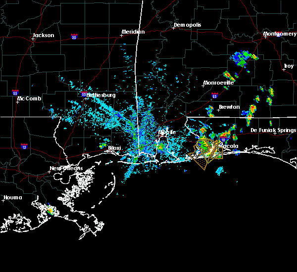 At 638 pm cdt, severe thunderstorms were located along a line extending from ensley to oriole beach, moving southwest at 10 mph (radar indicated). Hazards include 60 mph wind gusts. Expect damage to roofs, siding, and trees. Locations impacted include, pensacola, ferry pass, brent, west pensacola, ensley, warrington, gonzalez, gulf breeze, goulding, myrtle grove, oriole beach and pensacola beach. At 638 pm cdt, severe thunderstorms were located along a line extending from ensley to oriole beach, moving southwest at 10 mph (radar indicated). Hazards include 60 mph wind gusts. Expect damage to roofs, siding, and trees. Locations impacted include, pensacola, ferry pass, brent, west pensacola, ensley, warrington, gonzalez, gulf breeze, goulding, myrtle grove, oriole beach and pensacola beach.
|
| 7/27/2017 6:14 PM CDT |
 At 614 pm cdt, severe thunderstorms were located along a line extending from near pace to near oriole beach, moving southwest at 10 mph (radar indicated). Hazards include 60 mph wind gusts. expect damage to roofs, siding, and trees At 614 pm cdt, severe thunderstorms were located along a line extending from near pace to near oriole beach, moving southwest at 10 mph (radar indicated). Hazards include 60 mph wind gusts. expect damage to roofs, siding, and trees
|
| 7/21/2017 3:50 PM EDT |
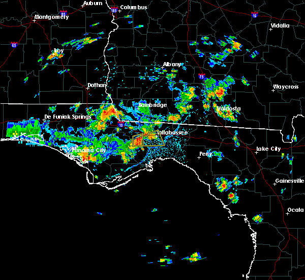 At 349 pm edt, a severe thunderstorm was located 7 miles southwest of midway or near fort braden, and is nearly stationary (radar indicated). Hazards include 60 mph wind gusts and quarter size hail. Hail damage to vehicles is expected. Expect wind damage to roofs, siding, and trees. At 349 pm edt, a severe thunderstorm was located 7 miles southwest of midway or near fort braden, and is nearly stationary (radar indicated). Hazards include 60 mph wind gusts and quarter size hail. Hail damage to vehicles is expected. Expect wind damage to roofs, siding, and trees.
|
| 7/21/2017 3:31 PM EDT |
 At 331 pm edt, a severe thunderstorm was located over tallahassee, moving south at 15 mph (radar indicated). Hazards include 60 mph wind gusts. expect damage to roofs, siding, and trees At 331 pm edt, a severe thunderstorm was located over tallahassee, moving south at 15 mph (radar indicated). Hazards include 60 mph wind gusts. expect damage to roofs, siding, and trees
|
| 7/21/2017 3:10 PM EDT |
 At 308 pm edt, a severe thunderstorm was located near havana, moving south at 15 mph (radar indicated). Hazards include 60 mph wind gusts. expect damage to roofs, siding, and trees At 308 pm edt, a severe thunderstorm was located near havana, moving south at 15 mph (radar indicated). Hazards include 60 mph wind gusts. expect damage to roofs, siding, and trees
|
| 7/13/2017 6:34 PM EDT |
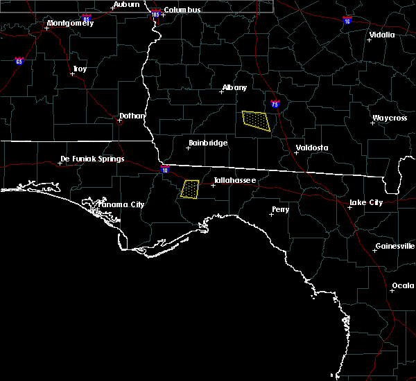 At 632 pm edt, severe thunderstorms were located along a line extending from near midway to 13 miles northwest of crawfordville, moving southwest at 20 mph (radar indicated). Hazards include 60 mph wind gusts. expect damage to roofs, siding, and trees At 632 pm edt, severe thunderstorms were located along a line extending from near midway to 13 miles northwest of crawfordville, moving southwest at 20 mph (radar indicated). Hazards include 60 mph wind gusts. expect damage to roofs, siding, and trees
|
| 7/5/2017 5:49 PM EDT |
 At 549 pm edt, a severe thunderstorm was located near florida a and m, or near woodville, moving northeast at 15 mph (radar indicated). Hazards include 60 mph wind gusts. Expect damage to roofs, siding, and trees. Locations impacted include, tallahassee, woodville, florida state university, florida a and m, tallahassee comm college, doak campbell stadium, lake bradford, leon sinks, gaither community center, tallahassee memorial hosp, eight mile pond, tallahassee mall, tallahassee regional a/p, governors square mall, natural bridge, belair, levy park, indian head acres, chaires crossroads and baum. At 549 pm edt, a severe thunderstorm was located near florida a and m, or near woodville, moving northeast at 15 mph (radar indicated). Hazards include 60 mph wind gusts. Expect damage to roofs, siding, and trees. Locations impacted include, tallahassee, woodville, florida state university, florida a and m, tallahassee comm college, doak campbell stadium, lake bradford, leon sinks, gaither community center, tallahassee memorial hosp, eight mile pond, tallahassee mall, tallahassee regional a/p, governors square mall, natural bridge, belair, levy park, indian head acres, chaires crossroads and baum.
|
| 7/5/2017 5:34 PM EDT |
 At 534 pm edt, a severe thunderstorm was located near tallahassee comm college, or 8 miles southwest of tallahassee, moving northeast at 15 mph (radar indicated). Hazards include 60 mph wind gusts. expect damage to roofs, siding, and trees At 534 pm edt, a severe thunderstorm was located near tallahassee comm college, or 8 miles southwest of tallahassee, moving northeast at 15 mph (radar indicated). Hazards include 60 mph wind gusts. expect damage to roofs, siding, and trees
|
| 7/2/2017 8:40 PM EDT |
 The severe thunderstorm warning for south central seminole county will expire at 845 pm edt, the storm which prompted the warning has weakened below severe limits, and no longer poses an immediate threat to life or property. therefore the warning will be allowed to expire. however frequent lightning and heavy rain are still possible with this thunderstorm. The severe thunderstorm warning for south central seminole county will expire at 845 pm edt, the storm which prompted the warning has weakened below severe limits, and no longer poses an immediate threat to life or property. therefore the warning will be allowed to expire. however frequent lightning and heavy rain are still possible with this thunderstorm.
|
| 7/2/2017 8:14 PM EDT |
 At 813 pm edt, a severe thunderstorm was located over lake jessup, moving southeast at 10 mph (radar indicated). Hazards include 60 mph wind gusts and penny size hail. expect damage to roofs, siding, and trees At 813 pm edt, a severe thunderstorm was located over lake jessup, moving southeast at 10 mph (radar indicated). Hazards include 60 mph wind gusts and penny size hail. expect damage to roofs, siding, and trees
|
| 5/24/2017 4:12 PM EDT |
 At 410 pm edt, severe thunderstorms were located along a line extending from near cassia to oviedo to near lake hart, moving northeast at 45 mph. other strong to severe storms were moving into saint cloud and southern orange county near orlando international airport (radar indicated). Hazards include 60 mph wind gusts. Expect damage to roofs, siding, and trees. Locations impacted include, orlando, deltona, saint cloud and sanford. At 410 pm edt, severe thunderstorms were located along a line extending from near cassia to oviedo to near lake hart, moving northeast at 45 mph. other strong to severe storms were moving into saint cloud and southern orange county near orlando international airport (radar indicated). Hazards include 60 mph wind gusts. Expect damage to roofs, siding, and trees. Locations impacted include, orlando, deltona, saint cloud and sanford.
|
| 5/24/2017 3:48 PM EDT |
 At 347 pm edt, severe thunderstorms were located along a line extending from near lake apopka to near oak ridge to near west lake toho, moving northeast at 45 mph (radar indicated). Hazards include 60 mph wind gusts. expect damage to roofs, siding, and trees At 347 pm edt, severe thunderstorms were located along a line extending from near lake apopka to near oak ridge to near west lake toho, moving northeast at 45 mph (radar indicated). Hazards include 60 mph wind gusts. expect damage to roofs, siding, and trees
|
| 5/12/2017 8:01 PM EDT |
 At 800 pm edt, a severe thunderstorm was located near tallahassee, moving east at 45 mph (radar indicated). Hazards include 60 mph wind gusts. Expect damage to roofs, siding, and trees. Locations impacted include, midway, tallahassee, woodville, florida state university, florida a and m, tallahassee comm college, doak campbell stadium, lake bradford, gaither community center, tallahassee memorial hosp, eight mile pond, tallahassee mall, tallahassee regional a/p, governors square mall, belair, levy park, indian head acres, andrew, chaires crossroads and baum. At 800 pm edt, a severe thunderstorm was located near tallahassee, moving east at 45 mph (radar indicated). Hazards include 60 mph wind gusts. Expect damage to roofs, siding, and trees. Locations impacted include, midway, tallahassee, woodville, florida state university, florida a and m, tallahassee comm college, doak campbell stadium, lake bradford, gaither community center, tallahassee memorial hosp, eight mile pond, tallahassee mall, tallahassee regional a/p, governors square mall, belair, levy park, indian head acres, andrew, chaires crossroads and baum.
|
| 5/12/2017 7:39 PM EDT |
 At 739 pm edt, a severe thunderstorm was located 7 miles west of midway, moving east at 45 mph (radar indicated). Hazards include 60 mph wind gusts. expect damage to roofs, siding, and trees At 739 pm edt, a severe thunderstorm was located 7 miles west of midway, moving east at 45 mph (radar indicated). Hazards include 60 mph wind gusts. expect damage to roofs, siding, and trees
|
| 5/12/2017 2:35 PM CDT |
 At 235 pm cdt, severe thunderstorms were located along a line extending from 6 miles east of molino to gonzalez to near lillian, moving east at 40 mph (radar indicated). Hazards include 60 mph wind gusts. expect damage to roofs, siding, and trees At 235 pm cdt, severe thunderstorms were located along a line extending from 6 miles east of molino to gonzalez to near lillian, moving east at 40 mph (radar indicated). Hazards include 60 mph wind gusts. expect damage to roofs, siding, and trees
|
| 4/4/2017 2:49 PM EDT |
 At 247 pm edt, a severe thunderstorm was located over lake jessup, moving east at 15 to 20 mph. this storm continues to exhibit mid level rotation (radar indicated). Hazards include 60 mph wind gusts and quarter size hail. Hail damage to vehicles is expected. Expect wind damage to roofs, siding, and trees. At 247 pm edt, a severe thunderstorm was located over lake jessup, moving east at 15 to 20 mph. this storm continues to exhibit mid level rotation (radar indicated). Hazards include 60 mph wind gusts and quarter size hail. Hail damage to vehicles is expected. Expect wind damage to roofs, siding, and trees.
|
| 4/3/2017 3:42 PM EDT |
 At 342 pm edt, a severe thunderstorm was located over midway, moving east at 45 mph (radar indicated). Hazards include 60 mph wind gusts and quarter size hail. Hail damage to vehicles is expected. Expect wind damage to roofs, siding, and trees. At 342 pm edt, a severe thunderstorm was located over midway, moving east at 45 mph (radar indicated). Hazards include 60 mph wind gusts and quarter size hail. Hail damage to vehicles is expected. Expect wind damage to roofs, siding, and trees.
|
| 4/3/2017 11:10 AM CDT |
 At 1109 am cdt, severe thunderstorms were located along a line extending from 6 miles east of ferry pass to 16 miles south of pensacola beach, moving east at 40 mph (radar indicated). Hazards include 60 mph wind gusts and quarter size hail. Hail damage to vehicles is expected. expect wind damage to roofs, siding, and trees. locations impacted include, pensacola, ferry pass, brent, west pensacola, warrington, pace, milton, gulf breeze, goulding, bagdad, myrtle grove, oriole beach, navarre, pensacola beach, navarre beach, pea ridge and floridatown. A tornado watch remains in effect until 100 pm cdt for northwestern florida. At 1109 am cdt, severe thunderstorms were located along a line extending from 6 miles east of ferry pass to 16 miles south of pensacola beach, moving east at 40 mph (radar indicated). Hazards include 60 mph wind gusts and quarter size hail. Hail damage to vehicles is expected. expect wind damage to roofs, siding, and trees. locations impacted include, pensacola, ferry pass, brent, west pensacola, warrington, pace, milton, gulf breeze, goulding, bagdad, myrtle grove, oriole beach, navarre, pensacola beach, navarre beach, pea ridge and floridatown. A tornado watch remains in effect until 100 pm cdt for northwestern florida.
|
| 4/3/2017 10:46 AM CDT |
 At 1046 am cdt, severe thunderstorms were located along a line extending from near lillian to 13 miles south of warrington, moving east at 30 mph (radar indicated). Hazards include 60 mph wind gusts and quarter size hail. Hail damage to vehicles is expected. Expect wind damage to roofs, siding, and trees. At 1046 am cdt, severe thunderstorms were located along a line extending from near lillian to 13 miles south of warrington, moving east at 30 mph (radar indicated). Hazards include 60 mph wind gusts and quarter size hail. Hail damage to vehicles is expected. Expect wind damage to roofs, siding, and trees.
|
| 4/3/2017 10:34 AM CDT |
 At 1033 am cdt, severe thunderstorms were located along a line extending from near ensley to 20 miles south of gulf shores to 38 miles south of fort morgan, moving east at 35 mph. the severe thunderstorm line is organizing along the coast and a new warning will likely be needed to replace the eastern portion of this warning by 1045 am cdt (radar indicated). Hazards include 60 mph wind gusts and quarter size hail. Hail damage to vehicles is expected. expect wind damage to roofs, siding, and trees. locations impacted include, pensacola, ferry pass, brent, west pensacola, ensley, warrington, gonzalez, gulf shores, foley, pace, milton, gulf breeze, orange beach, goulding, robertsdale, bagdad, lillian, myrtle grove, oriole beach and bon secour. a tornado watch remains in effect until 1100 am cdt for southwestern alabama. A tornado watch also remains in effect until 100 pm cdt for northwestern florida. At 1033 am cdt, severe thunderstorms were located along a line extending from near ensley to 20 miles south of gulf shores to 38 miles south of fort morgan, moving east at 35 mph. the severe thunderstorm line is organizing along the coast and a new warning will likely be needed to replace the eastern portion of this warning by 1045 am cdt (radar indicated). Hazards include 60 mph wind gusts and quarter size hail. Hail damage to vehicles is expected. expect wind damage to roofs, siding, and trees. locations impacted include, pensacola, ferry pass, brent, west pensacola, ensley, warrington, gonzalez, gulf shores, foley, pace, milton, gulf breeze, orange beach, goulding, robertsdale, bagdad, lillian, myrtle grove, oriole beach and bon secour. a tornado watch remains in effect until 1100 am cdt for southwestern alabama. A tornado watch also remains in effect until 100 pm cdt for northwestern florida.
|
| 4/3/2017 9:43 AM CDT |
 At 942 am cdt, severe thunderstorms were located along a line extending from near elberta to 23 miles south of orange beach, moving northeast at 35 mph (radar indicated). Hazards include 60 mph wind gusts and quarter size hail. Hail damage to vehicles is expected. Expect wind damage to roofs, siding, and trees. At 942 am cdt, severe thunderstorms were located along a line extending from near elberta to 23 miles south of orange beach, moving northeast at 35 mph (radar indicated). Hazards include 60 mph wind gusts and quarter size hail. Hail damage to vehicles is expected. Expect wind damage to roofs, siding, and trees.
|
| 3/30/2017 5:04 PM CDT |
 At 503 pm cdt, severe thunderstorms were located along a line extending from near navarre to 13 miles south of mary esther to 29 miles south of navarre beach, moving northeast at 65 mph (radar indicated). Hazards include 60 mph wind gusts. expect damage to roofs, siding, and trees At 503 pm cdt, severe thunderstorms were located along a line extending from near navarre to 13 miles south of mary esther to 29 miles south of navarre beach, moving northeast at 65 mph (radar indicated). Hazards include 60 mph wind gusts. expect damage to roofs, siding, and trees
|
| 2/7/2017 6:57 PM EST |
 At 656 pm est, a severe thunderstorm was located 13 miles south of cairo, moving east at 50 mph (radar indicated). Hazards include 60 mph wind gusts. Expect damage to roofs, siding, and trees. Locations impacted include, carrabelle, midway, tallahassee, tallahassee coml airport, buck siding, lake jackson, yent place, morgan place, brown house, concord, gibson, carrabelle beach, andrew, sanborn and orchard pond. At 656 pm est, a severe thunderstorm was located 13 miles south of cairo, moving east at 50 mph (radar indicated). Hazards include 60 mph wind gusts. Expect damage to roofs, siding, and trees. Locations impacted include, carrabelle, midway, tallahassee, tallahassee coml airport, buck siding, lake jackson, yent place, morgan place, brown house, concord, gibson, carrabelle beach, andrew, sanborn and orchard pond.
|
| 2/7/2017 6:43 PM EST |
 At 643 pm est/543 pm cst/, a severe thunderstorm was located near havana, moving east at 50 mph (radar indicated). Hazards include 70 mph wind gusts. Expect considerable tree damage. damage is likely to mobile homes, roofs, and outbuildings. Locations impacted include, carrabelle, midway, quincy, havana, tallahassee, jewel fire tower, quincy airport, lake talquin, jamieson, branchville, buck siding, lake jackson, east camp, concord, florence, howard creek, bloxham, andrew, orchard pond and santa clara. At 643 pm est/543 pm cst/, a severe thunderstorm was located near havana, moving east at 50 mph (radar indicated). Hazards include 70 mph wind gusts. Expect considerable tree damage. damage is likely to mobile homes, roofs, and outbuildings. Locations impacted include, carrabelle, midway, quincy, havana, tallahassee, jewel fire tower, quincy airport, lake talquin, jamieson, branchville, buck siding, lake jackson, east camp, concord, florence, howard creek, bloxham, andrew, orchard pond and santa clara.
|
| 2/7/2017 6:08 PM EST |
 At 607 pm est/507 pm cst/, a severe thunderstorm was located 7 miles west of greensboro, or 15 miles northeast of blountstown, moving east at 50 mph (radar indicated). Hazards include 70 mph wind gusts. Expect considerable tree damage. Damage is likely to mobile homes, roofs, and outbuildings. At 607 pm est/507 pm cst/, a severe thunderstorm was located 7 miles west of greensboro, or 15 miles northeast of blountstown, moving east at 50 mph (radar indicated). Hazards include 70 mph wind gusts. Expect considerable tree damage. Damage is likely to mobile homes, roofs, and outbuildings.
|
| 2/7/2017 4:04 PM CST |
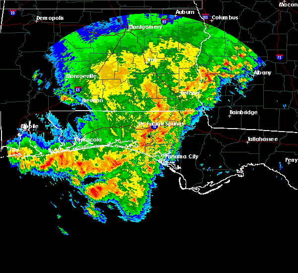 At 404 pm cst, a severe thunderstorm was located near perdido beach, or 9 miles southwest of warrington, moving east at 60 mph (radar indicated). Hazards include 60 mph wind gusts. expect damage to roofs, siding, and trees At 404 pm cst, a severe thunderstorm was located near perdido beach, or 9 miles southwest of warrington, moving east at 60 mph (radar indicated). Hazards include 60 mph wind gusts. expect damage to roofs, siding, and trees
|
| 2/7/2017 4:04 PM CST |
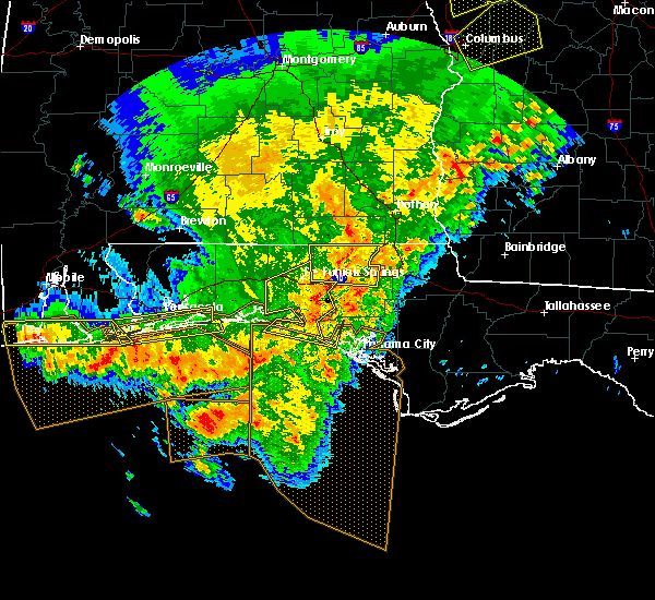 At 404 pm cst, a severe thunderstorm was located near perdido beach, or 9 miles southwest of warrington, moving east at 60 mph (radar indicated). Hazards include 60 mph wind gusts. expect damage to roofs, siding, and trees At 404 pm cst, a severe thunderstorm was located near perdido beach, or 9 miles southwest of warrington, moving east at 60 mph (radar indicated). Hazards include 60 mph wind gusts. expect damage to roofs, siding, and trees
|
| 2/7/2017 3:35 PM CST |
 At 334 pm cst, severe thunderstorms were located along a line extending from 9 miles northwest of eglin air force base to near navarre beach to gulf shores, moving east at 65 mph (radar indicated). Hazards include 70 mph wind gusts and quarter size hail. Hail damage to vehicles is expected. expect considerable tree damage. wind damage is also likely to mobile homes, roofs, and outbuildings. locations impacted include, pensacola, brent, west pensacola, wright, fort walton beach, warrington, niceville, destin, gulf shores, eglin afb, foley, valparaiso, gulf breeze, orange beach, goulding, mary esther, ocean city, lake lorraine, lillian and myrtle grove. A tornado watch remains in effect until 600 pm cst for southwestern alabama, and northwestern florida. At 334 pm cst, severe thunderstorms were located along a line extending from 9 miles northwest of eglin air force base to near navarre beach to gulf shores, moving east at 65 mph (radar indicated). Hazards include 70 mph wind gusts and quarter size hail. Hail damage to vehicles is expected. expect considerable tree damage. wind damage is also likely to mobile homes, roofs, and outbuildings. locations impacted include, pensacola, brent, west pensacola, wright, fort walton beach, warrington, niceville, destin, gulf shores, eglin afb, foley, valparaiso, gulf breeze, orange beach, goulding, mary esther, ocean city, lake lorraine, lillian and myrtle grove. A tornado watch remains in effect until 600 pm cst for southwestern alabama, and northwestern florida.
|
| 2/7/2017 3:01 PM CST |
 At 301 pm cst, severe thunderstorms were located along a line extending from roeville to near warrington to near orange beach, moving east at 60 mph (radar indicated). Hazards include 70 mph wind gusts and half dollar size hail. Hail damage to vehicles is expected. expect considerable tree damage. Wind damage is also likely to mobile homes, roofs, and outbuildings. At 301 pm cst, severe thunderstorms were located along a line extending from roeville to near warrington to near orange beach, moving east at 60 mph (radar indicated). Hazards include 70 mph wind gusts and half dollar size hail. Hail damage to vehicles is expected. expect considerable tree damage. Wind damage is also likely to mobile homes, roofs, and outbuildings.
|
| 1/22/2017 7:53 PM EST |
 At 752 pm est, a line of severe thunderstorms was located from pierson to eustis, moving northeast at 65 mph (radar indicated). Hazards include 60 mph wind gusts and quarter size hail. Hail damage to vehicles is expected. Expect wind damage to roofs, siding, and trees. At 752 pm est, a line of severe thunderstorms was located from pierson to eustis, moving northeast at 65 mph (radar indicated). Hazards include 60 mph wind gusts and quarter size hail. Hail damage to vehicles is expected. Expect wind damage to roofs, siding, and trees.
|
| 1/22/2017 7:19 PM EST |
 At 718 pm est, severe thunderstorms capable of producing a tornado was located over winter park and near sanford, moving northeast at 55 mph (radar indicated rotation). Hazards include tornado and quarter size hail. Flying debris will be dangerous to those caught without shelter. mobile homes will be damaged or destroyed. damage to roofs, windows, and vehicles will occur. tree damage is likely. these dangerous storms will be near, goldenrod, azalea park and fern park around 720 pm est. oviedo, winter springs and lake jessup around 730 pm est. maytown around 750 pm est. oak hill and apollo beach around 800 pm est. Other locations impacted by this tornadic thunderstorm include spruce creek. At 718 pm est, severe thunderstorms capable of producing a tornado was located over winter park and near sanford, moving northeast at 55 mph (radar indicated rotation). Hazards include tornado and quarter size hail. Flying debris will be dangerous to those caught without shelter. mobile homes will be damaged or destroyed. damage to roofs, windows, and vehicles will occur. tree damage is likely. these dangerous storms will be near, goldenrod, azalea park and fern park around 720 pm est. oviedo, winter springs and lake jessup around 730 pm est. maytown around 750 pm est. oak hill and apollo beach around 800 pm est. Other locations impacted by this tornadic thunderstorm include spruce creek.
|
| 1/22/2017 7:00 PM EST |
 At 658 pm est, severe thunderstorms were located over bay hill, near bay lake, and near maitland, moving east at 55 mph (radar indicated). Hazards include 70 mph wind gusts and quarter size hail. Hail damage to vehicles is expected. expect considerable tree damage. Wind damage is also likely to mobile homes, roofs, and outbuildings. At 658 pm est, severe thunderstorms were located over bay hill, near bay lake, and near maitland, moving east at 55 mph (radar indicated). Hazards include 70 mph wind gusts and quarter size hail. Hail damage to vehicles is expected. expect considerable tree damage. Wind damage is also likely to mobile homes, roofs, and outbuildings.
|
| 1/22/2017 6:39 PM EST |
 At 637 pm est, severe thunderstorms were located near cassia, mount dora, and mount plymouth, moving northeast at 40 to 50 mph (radar indicated). Hazards include 70 mph wind gusts and quarter size hail. Hail damage to vehicles is expected. expect considerable tree damage. Wind damage is also likely to mobile homes, roofs, and outbuildings. At 637 pm est, severe thunderstorms were located near cassia, mount dora, and mount plymouth, moving northeast at 40 to 50 mph (radar indicated). Hazards include 70 mph wind gusts and quarter size hail. Hail damage to vehicles is expected. expect considerable tree damage. Wind damage is also likely to mobile homes, roofs, and outbuildings.
|
| 1/22/2017 2:35 PM EST |
 At 235 pm est/135 pm cst/, a severe thunderstorm capable of producing a tornado was located over blountstown, moving northeast at 65 mph (radar indicated rotation). Hazards include tornado and quarter size hail. Flying debris will be dangerous to those caught without shelter. mobile homes will be damaged or destroyed. damage to roofs, windows, and vehicles will occur. tree damage is likely. this dangerous storm will be near, greensboro around 255 pm est. quincy around 300 pm est. Other locations impacted by this tornadic thunderstorm include quincy airport, durham, rock bluff, woods, river junction, nettle ridge, branchville, hardin heights, sycamore and juniper. At 235 pm est/135 pm cst/, a severe thunderstorm capable of producing a tornado was located over blountstown, moving northeast at 65 mph (radar indicated rotation). Hazards include tornado and quarter size hail. Flying debris will be dangerous to those caught without shelter. mobile homes will be damaged or destroyed. damage to roofs, windows, and vehicles will occur. tree damage is likely. this dangerous storm will be near, greensboro around 255 pm est. quincy around 300 pm est. Other locations impacted by this tornadic thunderstorm include quincy airport, durham, rock bluff, woods, river junction, nettle ridge, branchville, hardin heights, sycamore and juniper.
|
| 1/22/2017 11:02 AM CST |
 At 1102 am cst, severe thunderstorms were located along a line extending from 7 miles west of laurel hill to near oriole beach, moving east at 40 mph (radar indicated). Hazards include 60 mph wind gusts. expect damage to roofs, siding, and trees At 1102 am cst, severe thunderstorms were located along a line extending from 7 miles west of laurel hill to near oriole beach, moving east at 40 mph (radar indicated). Hazards include 60 mph wind gusts. expect damage to roofs, siding, and trees
|
| 1/22/2017 10:46 AM CST |
 At 1046 am cst, a severe thunderstorm was located near bagdad, moving northeast at 50 mph (radar indicated). Hazards include 60 mph wind gusts. Expect damage to roofs, siding, and trees. locations impacted include, pensacola, milton, gulf breeze, bagdad, oriole beach, perdido beach, pea ridge and floridatown. A tornado watch remains in effect until 200 pm cst for southwestern alabama, and northwestern florida. At 1046 am cst, a severe thunderstorm was located near bagdad, moving northeast at 50 mph (radar indicated). Hazards include 60 mph wind gusts. Expect damage to roofs, siding, and trees. locations impacted include, pensacola, milton, gulf breeze, bagdad, oriole beach, perdido beach, pea ridge and floridatown. A tornado watch remains in effect until 200 pm cst for southwestern alabama, and northwestern florida.
|
| 1/22/2017 10:38 AM EST |
 At 1038 am est, a severe thunderstorm capable of producing a tornado was located near quincy, moving northeast at 65 mph (radar indicated rotation). Hazards include tornado. Flying debris will be dangerous to those caught without shelter. mobile homes will be damaged or destroyed. damage to roofs, windows, and vehicles will occur. tree damage is likely. this dangerous storm will be near, havana around 1050 am est. Other locations impacted by this tornadic thunderstorm include lake iamonia, iamonia, quincy airport, princes still, shady rest, moncrief, tallahassee coml airport, jamieson, branchville and littman. At 1038 am est, a severe thunderstorm capable of producing a tornado was located near quincy, moving northeast at 65 mph (radar indicated rotation). Hazards include tornado. Flying debris will be dangerous to those caught without shelter. mobile homes will be damaged or destroyed. damage to roofs, windows, and vehicles will occur. tree damage is likely. this dangerous storm will be near, havana around 1050 am est. Other locations impacted by this tornadic thunderstorm include lake iamonia, iamonia, quincy airport, princes still, shady rest, moncrief, tallahassee coml airport, jamieson, branchville and littman.
|
| 1/22/2017 8:44 AM EST |
 At 843 am est, a severe thunderstorm capable of producing a tornado was located near havana, moving east at 55 mph (radar indicated rotation). Hazards include tornado. Flying debris will be dangerous to those caught without shelter. mobile homes will be damaged or destroyed. damage to roofs, windows, and vehicles will occur. tree damage is likely. This tornadic thunderstorm will remain over mainly rural areas of northeastern gadsden, northeastern leon, southwestern thomas and southeastern grady counties, including the following locations: lake iamonia, iamonia, forest meadows park, shady rest, moncrief, tallahassee coml airport, moccasin gap, pisgah church, lake jackson and littman. At 843 am est, a severe thunderstorm capable of producing a tornado was located near havana, moving east at 55 mph (radar indicated rotation). Hazards include tornado. Flying debris will be dangerous to those caught without shelter. mobile homes will be damaged or destroyed. damage to roofs, windows, and vehicles will occur. tree damage is likely. This tornadic thunderstorm will remain over mainly rural areas of northeastern gadsden, northeastern leon, southwestern thomas and southeastern grady counties, including the following locations: lake iamonia, iamonia, forest meadows park, shady rest, moncrief, tallahassee coml airport, moccasin gap, pisgah church, lake jackson and littman.
|
| 1/22/2017 8:37 AM EST |
 At 837 am est, a severe thunderstorm was located near quincy, moving northeast at 55 mph (radar indicated). Hazards include 60 mph wind gusts and nickel size hail. expect damage to roofs, siding, and trees At 837 am est, a severe thunderstorm was located near quincy, moving northeast at 55 mph (radar indicated). Hazards include 60 mph wind gusts and nickel size hail. expect damage to roofs, siding, and trees
|
| 1/22/2017 7:09 AM EST |
 At 708 am est, a severe thunderstorm was located near midway, moving northeast at 55 mph (radar indicated). Hazards include 60 mph wind gusts and quarter size hail. Hail damage to vehicles is expected. Expect wind damage to roofs, siding, and trees. At 708 am est, a severe thunderstorm was located near midway, moving northeast at 55 mph (radar indicated). Hazards include 60 mph wind gusts and quarter size hail. Hail damage to vehicles is expected. Expect wind damage to roofs, siding, and trees.
|
| 1/22/2017 6:51 AM EST |
 At 651 am est/551 am cst/, a severe thunderstorm was located near midway, moving northeast at 60 mph (radar indicated). Hazards include 60 mph wind gusts and nickel size hail. Expect damage to roofs, siding, and trees. locations impacted include, havana, midway, tallahassee, quincy, blountstown, greensboro, tallahassee comm college, gretna, bristol, quincy airport, forest meadows park, branchville, tallahassee mall, juniper, clio, bloxham, calvary, santa clara, hosford and killearn estates. A tornado watch remains in effect until 1000 am est/900 am cst/ for big bend of florida, and southwestern georgia. At 651 am est/551 am cst/, a severe thunderstorm was located near midway, moving northeast at 60 mph (radar indicated). Hazards include 60 mph wind gusts and nickel size hail. Expect damage to roofs, siding, and trees. locations impacted include, havana, midway, tallahassee, quincy, blountstown, greensboro, tallahassee comm college, gretna, bristol, quincy airport, forest meadows park, branchville, tallahassee mall, juniper, clio, bloxham, calvary, santa clara, hosford and killearn estates. A tornado watch remains in effect until 1000 am est/900 am cst/ for big bend of florida, and southwestern georgia.
|
| 1/22/2017 6:33 AM EST |
 At 633 am est/533 am cst/, a severe thunderstorm was located 13 miles south of greensboro, or 15 miles east of blountstown, moving northeast at 60 mph (radar indicated). Hazards include 60 mph wind gusts and penny size hail. expect damage to roofs, siding, and trees At 633 am est/533 am cst/, a severe thunderstorm was located 13 miles south of greensboro, or 15 miles east of blountstown, moving northeast at 60 mph (radar indicated). Hazards include 60 mph wind gusts and penny size hail. expect damage to roofs, siding, and trees
|
| 1/22/2017 5:34 AM EST |
 At 534 am est, a severe thunderstorm was located near greensboro, or near quincy, moving northeast at 55 mph (radar indicated). Hazards include 60 mph wind gusts and quarter size hail. Hail damage to vehicles is expected. Expect wind damage to roofs, siding, and trees. At 534 am est, a severe thunderstorm was located near greensboro, or near quincy, moving northeast at 55 mph (radar indicated). Hazards include 60 mph wind gusts and quarter size hail. Hail damage to vehicles is expected. Expect wind damage to roofs, siding, and trees.
|
| 1/21/2017 9:37 PM CST |
 At 936 pm cst, a severe thunderstorm was located near oriole beach, or 9 miles east of gulf breeze, moving northeast at 45 mph (radar indicated). Hazards include 60 mph wind gusts and quarter size hail. Hail damage to vehicles is expected. Expect wind damage to roofs, siding, and trees. At 936 pm cst, a severe thunderstorm was located near oriole beach, or 9 miles east of gulf breeze, moving northeast at 45 mph (radar indicated). Hazards include 60 mph wind gusts and quarter size hail. Hail damage to vehicles is expected. Expect wind damage to roofs, siding, and trees.
|
| 1/2/2017 9:45 PM EST |
 At 944 pm est, severe thunderstorms were located along a line extending from 8 miles south of bainbridge to 6 miles east of blountstown, moving east at 35 mph (radar indicated). Hazards include 60 mph wind gusts. expect damage to roofs, siding, and trees At 944 pm est, severe thunderstorms were located along a line extending from 8 miles south of bainbridge to 6 miles east of blountstown, moving east at 35 mph (radar indicated). Hazards include 60 mph wind gusts. expect damage to roofs, siding, and trees
|
| 1/2/2017 8:32 PM CST |
 At 831 pm cst, severe thunderstorms were located along a line extending from 6 miles northwest of pace, to pea ridge, to near oriole beach, to near perdido beach, moving east at 55 mph (radar indicated). Hazards include 60 mph wind gusts and penny size hail. Expect damage to roofs, siding, and trees. Locations impacted include, pensacola, ferry pass, brent, west pensacola, ensley, warrington, gonzalez, pace, milton, gulf breeze, goulding, bagdad, myrtle grove, oriole beach, navarre, perdido beach, navarre beach, pea ridge, floridatown and pensacola beach. At 831 pm cst, severe thunderstorms were located along a line extending from 6 miles northwest of pace, to pea ridge, to near oriole beach, to near perdido beach, moving east at 55 mph (radar indicated). Hazards include 60 mph wind gusts and penny size hail. Expect damage to roofs, siding, and trees. Locations impacted include, pensacola, ferry pass, brent, west pensacola, ensley, warrington, gonzalez, pace, milton, gulf breeze, goulding, bagdad, myrtle grove, oriole beach, navarre, perdido beach, navarre beach, pea ridge, floridatown and pensacola beach.
|
| 1/2/2017 8:20 PM CST |
 At 819 pm cst, severe thunderstorms were located along a line extending from 6 miles southwest of molino, to gonzalez, to myrtle grove, to orange beach, moving northeast at 60 mph (radar indicated). Hazards include 60 mph wind gusts and quarter size hail. Hail damage to vehicles is expected. expect wind damage to roofs, siding, and trees. Locations impacted include, pensacola, ferry pass, brent, west pensacola, ensley, warrington, gonzalez, foley, pace, milton, gulf breeze, orange beach, goulding, bagdad, lillian, myrtle grove, oriole beach, navarre, molino and perdido beach. At 819 pm cst, severe thunderstorms were located along a line extending from 6 miles southwest of molino, to gonzalez, to myrtle grove, to orange beach, moving northeast at 60 mph (radar indicated). Hazards include 60 mph wind gusts and quarter size hail. Hail damage to vehicles is expected. expect wind damage to roofs, siding, and trees. Locations impacted include, pensacola, ferry pass, brent, west pensacola, ensley, warrington, gonzalez, foley, pace, milton, gulf breeze, orange beach, goulding, bagdad, lillian, myrtle grove, oriole beach, navarre, molino and perdido beach.
|
| 1/2/2017 8:00 PM CST |
 At 800 pm cst, severe thunderstorms were located along a line extending from near robertsdale to near elberta to near perdido beach to near gulf shores, moving east at 60 mph (radar indicated). Hazards include 60 mph wind gusts and quarter size hail. Hail damage to vehicles is expected. Expect wind damage to roofs, siding, and trees. At 800 pm cst, severe thunderstorms were located along a line extending from near robertsdale to near elberta to near perdido beach to near gulf shores, moving east at 60 mph (radar indicated). Hazards include 60 mph wind gusts and quarter size hail. Hail damage to vehicles is expected. Expect wind damage to roofs, siding, and trees.
|
| 1/2/2017 7:01 PM CST |
 At 700 pm cst, severe thunderstorms were located along a line extending from near new brockton, to 8 miles southwest of geneva, to 11 miles northeast of de funiak springs, to near eglin air force base, to destin, moving east at 65 mph (radar indicated). Hazards include 60 mph wind gusts and nickel size hail. Expect damage to roofs, siding, and trees. locations impacted include, wright, fort walton beach, crestview, niceville, destin, eglin afb, valparaiso, mary esther, ocean city, lake lorraine, navarre, shalimar, cinco bayou, navarre beach and eglin air force base. A tornado watch remains in effect until 800 pm cst for northwestern florida. At 700 pm cst, severe thunderstorms were located along a line extending from near new brockton, to 8 miles southwest of geneva, to 11 miles northeast of de funiak springs, to near eglin air force base, to destin, moving east at 65 mph (radar indicated). Hazards include 60 mph wind gusts and nickel size hail. Expect damage to roofs, siding, and trees. locations impacted include, wright, fort walton beach, crestview, niceville, destin, eglin afb, valparaiso, mary esther, ocean city, lake lorraine, navarre, shalimar, cinco bayou, navarre beach and eglin air force base. A tornado watch remains in effect until 800 pm cst for northwestern florida.
|
| 1/2/2017 6:44 PM CST |
 At 643 pm cst, severe thunderstorms were located along a line extending from opp, to 6 miles southeast of florala, to near niceville, to 7 miles southwest of mary esther, moving east at 60 mph (radar indicated). Hazards include 60 mph wind gusts and nickel size hail. expect damage to roofs, siding, and trees At 643 pm cst, severe thunderstorms were located along a line extending from opp, to 6 miles southeast of florala, to near niceville, to 7 miles southwest of mary esther, moving east at 60 mph (radar indicated). Hazards include 60 mph wind gusts and nickel size hail. expect damage to roofs, siding, and trees
|
| 1/2/2017 6:29 PM CST |
 At 628 pm cst, severe thunderstorms were located along a line extending from red level, to 7 miles south of andalusia, to near laurel hill, to near crestview, to near pensacola beach, moving east at 45 mph (radar indicated). Hazards include 60 mph wind gusts and nickel size hail. Expect damage to roofs, siding, and trees. locations impacted include, pensacola, ferry pass, brent, west pensacola, wright, fort walton beach, ensley, warrington, crestview, niceville, gonzalez, destin, gulf shores, andalusia, eglin afb, foley, pace, milton, opp and valparaiso. A tornado watch remains in effect until 800 pm cst for south central and southwestern alabama, and northwestern florida. At 628 pm cst, severe thunderstorms were located along a line extending from red level, to 7 miles south of andalusia, to near laurel hill, to near crestview, to near pensacola beach, moving east at 45 mph (radar indicated). Hazards include 60 mph wind gusts and nickel size hail. Expect damage to roofs, siding, and trees. locations impacted include, pensacola, ferry pass, brent, west pensacola, wright, fort walton beach, ensley, warrington, crestview, niceville, gonzalez, destin, gulf shores, andalusia, eglin afb, foley, pace, milton, opp and valparaiso. A tornado watch remains in effect until 800 pm cst for south central and southwestern alabama, and northwestern florida.
|
| 1/2/2017 6:13 PM CST |
 At 612 pm cst, severe thunderstorms were located along a line extending from 8 miles east of evergreen, to 13 miles southwest of river falls, to 10 miles north of baker, to 9 miles east of roeville, to 9 miles south of warrington, moving east at 45 mph (radar indicated). Hazards include 60 mph wind gusts and nickel size hail. Expect damage to roofs, siding, and trees. locations impacted include, pensacola, ferry pass, brent, west pensacola, wright, fort walton beach, ensley, warrington, crestview, niceville, gonzalez, destin, gulf shores, andalusia, eglin afb, foley, pace, milton, opp and valparaiso. A tornado watch remains in effect until 800 pm cst for south central and southwestern alabama, and northwestern florida. At 612 pm cst, severe thunderstorms were located along a line extending from 8 miles east of evergreen, to 13 miles southwest of river falls, to 10 miles north of baker, to 9 miles east of roeville, to 9 miles south of warrington, moving east at 45 mph (radar indicated). Hazards include 60 mph wind gusts and nickel size hail. Expect damage to roofs, siding, and trees. locations impacted include, pensacola, ferry pass, brent, west pensacola, wright, fort walton beach, ensley, warrington, crestview, niceville, gonzalez, destin, gulf shores, andalusia, eglin afb, foley, pace, milton, opp and valparaiso. A tornado watch remains in effect until 800 pm cst for south central and southwestern alabama, and northwestern florida.
|
| 1/2/2017 5:47 PM CST |
 At 546 pm cst, severe thunderstorms were located along a line extending from 13 miles southeast of beatrice to 7 miles northwest of brewton to near century to near magnolia springs to near fort morgan, moving east at 35 mph (radar indicated). Hazards include 60 mph wind gusts and quarter size hail. Hail damage to vehicles is expected. expect wind damage to roofs, siding, and trees. locations impacted include, downtown mobile, pensacola, ferry pass, brent, west pensacola, ensley, daphne, warrington, fairhope, gonzalez, gulf shores, foley, pace, gulf breeze, brewton, orange beach, spanish fort, goulding, robertsdale and evergreen. A tornado watch remains in effect until 800 pm cst for south central and southwestern alabama, and northwestern florida. At 546 pm cst, severe thunderstorms were located along a line extending from 13 miles southeast of beatrice to 7 miles northwest of brewton to near century to near magnolia springs to near fort morgan, moving east at 35 mph (radar indicated). Hazards include 60 mph wind gusts and quarter size hail. Hail damage to vehicles is expected. expect wind damage to roofs, siding, and trees. locations impacted include, downtown mobile, pensacola, ferry pass, brent, west pensacola, ensley, daphne, warrington, fairhope, gonzalez, gulf shores, foley, pace, gulf breeze, brewton, orange beach, spanish fort, goulding, robertsdale and evergreen. A tornado watch remains in effect until 800 pm cst for south central and southwestern alabama, and northwestern florida.
|
| 1/2/2017 5:42 PM CST |
 At 541 pm cst, severe thunderstorms were located along a line extending from near repton to near brewton to 8 miles east of jay to gulf shores, moving east at 45 mph (radar indicated). Hazards include 60 mph wind gusts and up to quarter size hail. expect damage to roofs, siding, and trees At 541 pm cst, severe thunderstorms were located along a line extending from near repton to near brewton to 8 miles east of jay to gulf shores, moving east at 45 mph (radar indicated). Hazards include 60 mph wind gusts and up to quarter size hail. expect damage to roofs, siding, and trees
|
| 1/2/2017 5:30 PM CST |
 At 528 pm cst, severe thunderstorms were located along a line extending from near beatrice, to near i65 and al 113, to near bratt, to near i10 and i65, to near alabama port, moving east at 45 mph (radar indicated). Hazards include 60 mph wind gusts and quarter size hail. Hail damage to vehicles is expected. expect wind damage to roofs, siding, and trees. locations impacted include, downtown mobile, midtown mobile, pensacola, prichard, ferry pass, brent, west pensacola, ensley, daphne, tillmans corner, warrington, fairhope, gonzalez, gulf shores, bay minette, atmore, foley, pace, monroeville and theodore. A tornado watch remains in effect until 800 pm cst for south central and southwestern alabama, and northwestern florida. At 528 pm cst, severe thunderstorms were located along a line extending from near beatrice, to near i65 and al 113, to near bratt, to near i10 and i65, to near alabama port, moving east at 45 mph (radar indicated). Hazards include 60 mph wind gusts and quarter size hail. Hail damage to vehicles is expected. expect wind damage to roofs, siding, and trees. locations impacted include, downtown mobile, midtown mobile, pensacola, prichard, ferry pass, brent, west pensacola, ensley, daphne, tillmans corner, warrington, fairhope, gonzalez, gulf shores, bay minette, atmore, foley, pace, monroeville and theodore. A tornado watch remains in effect until 800 pm cst for south central and southwestern alabama, and northwestern florida.
|
| 1/2/2017 5:15 PM CST |
 At 513 pm cst, severe thunderstorms were located along a line extending from near beatrice to near uriah to near poarch creek reservation to daphne to near alabama port, moving east at 35 mph (radar indicated). Hazards include 60 mph wind gusts and quarter size hail. Hail damage to vehicles is expected. expect wind damage to roofs, siding, and trees. locations impacted include, downtown mobile, midtown mobile, pensacola, prichard, ferry pass, brent, west pensacola, ensley, daphne, tillmans corner, warrington, fairhope, gonzalez, gulf shores, bay minette, atmore, foley, pace, monroeville and theodore. A tornado watch remains in effect until 800 pm cst for south central and southwestern alabama, and northwestern florida. At 513 pm cst, severe thunderstorms were located along a line extending from near beatrice to near uriah to near poarch creek reservation to daphne to near alabama port, moving east at 35 mph (radar indicated). Hazards include 60 mph wind gusts and quarter size hail. Hail damage to vehicles is expected. expect wind damage to roofs, siding, and trees. locations impacted include, downtown mobile, midtown mobile, pensacola, prichard, ferry pass, brent, west pensacola, ensley, daphne, tillmans corner, warrington, fairhope, gonzalez, gulf shores, bay minette, atmore, foley, pace, monroeville and theodore. A tornado watch remains in effect until 800 pm cst for south central and southwestern alabama, and northwestern florida.
|
| 1/2/2017 4:55 PM CST |
 At 454 pm cst, severe thunderstorms were located along a line extending from 7 miles west of vredenburgh to 13 miles southeast of jackson to 8 miles northeast of stockton to near i10 and i65 to near grand bay, moving east at 35 mph (radar indicated). Hazards include 60 mph wind gusts and quarter size hail. Hail damage to vehicles is expected. Expect wind damage to roofs, siding, and trees. At 454 pm cst, severe thunderstorms were located along a line extending from 7 miles west of vredenburgh to 13 miles southeast of jackson to 8 miles northeast of stockton to near i10 and i65 to near grand bay, moving east at 35 mph (radar indicated). Hazards include 60 mph wind gusts and quarter size hail. Hail damage to vehicles is expected. Expect wind damage to roofs, siding, and trees.
|
| 1/2/2017 4:45 PM CST |
 At 445 pm cst, a severe thunderstorm was located near navarre, or 12 miles southeast of bagdad, moving northeast at 35 mph (radar indicated). Hazards include 60 mph wind gusts. Expect damage to roofs, siding, and trees. locations impacted include, wright, fort walton beach, mary esther, navarre and navarre beach. A tornado watch remains in effect until 800 pm cst for northwestern florida. At 445 pm cst, a severe thunderstorm was located near navarre, or 12 miles southeast of bagdad, moving northeast at 35 mph (radar indicated). Hazards include 60 mph wind gusts. Expect damage to roofs, siding, and trees. locations impacted include, wright, fort walton beach, mary esther, navarre and navarre beach. A tornado watch remains in effect until 800 pm cst for northwestern florida.
|
| 1/2/2017 4:30 PM CST |
 At 429 pm cst, a severe thunderstorm was located near oriole beach, or 9 miles northeast of gulf breeze, moving northeast at 35 mph (radar indicated). Hazards include 60 mph wind gusts. Expect damage to roofs, siding, and trees. locations impacted include, wright, fort walton beach, gulf breeze, mary esther, oriole beach, navarre and navarre beach. A tornado watch remains in effect until 800 pm cst for northwestern florida. At 429 pm cst, a severe thunderstorm was located near oriole beach, or 9 miles northeast of gulf breeze, moving northeast at 35 mph (radar indicated). Hazards include 60 mph wind gusts. Expect damage to roofs, siding, and trees. locations impacted include, wright, fort walton beach, gulf breeze, mary esther, oriole beach, navarre and navarre beach. A tornado watch remains in effect until 800 pm cst for northwestern florida.
|
| 1/2/2017 4:15 PM CST |
 At 415 pm cst, a severe thunderstorm was located over gulf breeze, moving northeast at 35 mph (radar indicated). Hazards include 60 mph wind gusts. expect damage to roofs, siding, and trees At 415 pm cst, a severe thunderstorm was located over gulf breeze, moving northeast at 35 mph (radar indicated). Hazards include 60 mph wind gusts. expect damage to roofs, siding, and trees
|
| 1/2/2017 4:04 PM CST |
 At 403 pm cst, an area of severe thunderstorms was generally located along a line extending from near pace to near goulding to 10 miles south of warrington, moving northeast at 30 mph (radar indicated). Hazards include 60 mph wind gusts. Expect damage to roofs, siding, and trees. locations impacted include, pensacola, ferry pass, brent, west pensacola, wright, fort walton beach, ensley, warrington, crestview, niceville, gonzalez, destin, eglin afb, pace, milton, valparaiso, gulf breeze, goulding, mary esther and bagdad. A tornado watch remains in effect until 800 pm cst for northwestern florida. At 403 pm cst, an area of severe thunderstorms was generally located along a line extending from near pace to near goulding to 10 miles south of warrington, moving northeast at 30 mph (radar indicated). Hazards include 60 mph wind gusts. Expect damage to roofs, siding, and trees. locations impacted include, pensacola, ferry pass, brent, west pensacola, wright, fort walton beach, ensley, warrington, crestview, niceville, gonzalez, destin, eglin afb, pace, milton, valparaiso, gulf breeze, goulding, mary esther and bagdad. A tornado watch remains in effect until 800 pm cst for northwestern florida.
|
| 1/2/2017 3:17 PM CST |
 At 317 pm cst, severe thunderstorms were located along a line extending from near gonzalez to myrtle grove to 10 miles southeast of perdido beach, moving east at 45 mph (radar indicated). Hazards include 70 mph wind gusts and quarter size hail. Hail damage to vehicles is expected. expect considerable tree damage. Wind damage is also likely to mobile homes, roofs, and outbuildings. At 317 pm cst, severe thunderstorms were located along a line extending from near gonzalez to myrtle grove to 10 miles southeast of perdido beach, moving east at 45 mph (radar indicated). Hazards include 70 mph wind gusts and quarter size hail. Hail damage to vehicles is expected. expect considerable tree damage. Wind damage is also likely to mobile homes, roofs, and outbuildings.
|
| 9/25/2016 2:37 PM CDT |
 At 237 pm cdt, a severe thunderstorm was located over milton, moving south at 20 mph (radar indicated). Hazards include 60 mph wind gusts. Expect damage to roofs. siding. And trees. At 237 pm cdt, a severe thunderstorm was located over milton, moving south at 20 mph (radar indicated). Hazards include 60 mph wind gusts. Expect damage to roofs. siding. And trees.
|
| 9/24/2016 4:24 PM CDT |
 At 424 pm cdt, a severe thunderstorm was located near navarre, or 11 miles east of gulf breeze, moving southwest at 15 mph (radar indicated). Hazards include 60 mph wind gusts and quarter size hail. Hail damage to vehicles is expected. Expect wind damage to roofs, siding, and trees. At 424 pm cdt, a severe thunderstorm was located near navarre, or 11 miles east of gulf breeze, moving southwest at 15 mph (radar indicated). Hazards include 60 mph wind gusts and quarter size hail. Hail damage to vehicles is expected. Expect wind damage to roofs, siding, and trees.
|
| 9/24/2016 3:26 PM CDT |
 At 326 pm cdt, a severe thunderstorm was located over navarre beach, or 10 miles west of mary esther, moving southwest at 10 mph (radar indicated). Hazards include 60 mph wind gusts. Expect damage to roofs. siding. And trees. At 326 pm cdt, a severe thunderstorm was located over navarre beach, or 10 miles west of mary esther, moving southwest at 10 mph (radar indicated). Hazards include 60 mph wind gusts. Expect damage to roofs. siding. And trees.
|
| 7/15/2016 2:50 PM EDT |
 At 249 pm edt, the national weather service has detected a severe thunderstorm capable of producing damaging winds in excess of 60 mph. this storm was located near midway. this storm was nearly stationary. At 249 pm edt, the national weather service has detected a severe thunderstorm capable of producing damaging winds in excess of 60 mph. this storm was located near midway. this storm was nearly stationary.
|
| 7/9/2016 6:45 PM EDT |
 At 645 pm edt, a severe thunderstorm was located over lake mary, moving northeast at 5 mph (radar indicated). Hazards include 60 mph wind gusts and quarter size hail. Hail damage to vehicles is expected. expect wind damage to roofs, siding, and trees. Locations impacted include, sanford, winter springs, casselberry, lake mary and longwood. At 645 pm edt, a severe thunderstorm was located over lake mary, moving northeast at 5 mph (radar indicated). Hazards include 60 mph wind gusts and quarter size hail. Hail damage to vehicles is expected. expect wind damage to roofs, siding, and trees. Locations impacted include, sanford, winter springs, casselberry, lake mary and longwood.
|
| 7/9/2016 6:24 PM EDT |
 At 624 pm edt, a severe thunderstorm was located over longwood, moving north at 5 mph (radar indicated). Hazards include 60 mph wind gusts and quarter size hail. Hail damage to vehicles is expected. Expect wind damage to roofs, siding, and trees. At 624 pm edt, a severe thunderstorm was located over longwood, moving north at 5 mph (radar indicated). Hazards include 60 mph wind gusts and quarter size hail. Hail damage to vehicles is expected. Expect wind damage to roofs, siding, and trees.
|
| 6/17/2016 8:12 PM CDT | The severe thunderstorm warning for southern baldwin, southwestern mobile, southeastern escambia, southern santa rosa and southern okaloosa counties will expire at 815 pm cdt, the storms which prompted the warning have moved out of the area. therefore the warning will be allowed to expire. |
| 6/17/2016 8:12 PM CDT | The severe thunderstorm warning for southern baldwin, southwestern mobile, southeastern escambia, southern santa rosa and southern okaloosa counties will expire at 815 pm cdt, the storms which prompted the warning have moved out of the area. therefore the warning will be allowed to expire. |
| 6/17/2016 7:53 PM CDT |
 At 752 pm cdt, severe thunderstorms were located along a line extending from 6 miles southeast of gautier to near fort gaines to near perdido beach to navarre to 7 miles north of santa rosa beach, moving southeast at 55 mph. wind damage will likely occur along a gust front ahead of the rain and lightning and will continue with the thunderstorms that follow (trained weather spotters). Hazards include 60 mph wind gusts. Expect damage to roofs. siding. and trees. Locations impacted include, pensacola, ferry pass, brent, west pensacola, wright, fort walton beach, ensley, daphne, tillmans corner, warrington, fairhope, niceville, gonzalez, destin, gulf shores, eglin afb, foley, pace, milton and theodore. At 752 pm cdt, severe thunderstorms were located along a line extending from 6 miles southeast of gautier to near fort gaines to near perdido beach to navarre to 7 miles north of santa rosa beach, moving southeast at 55 mph. wind damage will likely occur along a gust front ahead of the rain and lightning and will continue with the thunderstorms that follow (trained weather spotters). Hazards include 60 mph wind gusts. Expect damage to roofs. siding. and trees. Locations impacted include, pensacola, ferry pass, brent, west pensacola, wright, fort walton beach, ensley, daphne, tillmans corner, warrington, fairhope, niceville, gonzalez, destin, gulf shores, eglin afb, foley, pace, milton and theodore.
|
| 6/17/2016 7:20 PM CDT |
 At 719 pm cdt, severe thunderstorms were located along a line extending from 6 miles northwest of vancleave to near tillmans corner to 8 miles east of robertsdale to near point baker to 12 miles north of eglin air force base, moving southeast at 45 mph. wind damage will likely occur along a gust front ahead of the rain and lightning and will continue with the thunderstorms that follow (trained weather spotters. numerous reports of wind damage and measured gusts to 60 mph have been received). Hazards include 60 mph wind gusts and penny size hail. Expect damage to roofs. siding. And trees. At 719 pm cdt, severe thunderstorms were located along a line extending from 6 miles northwest of vancleave to near tillmans corner to 8 miles east of robertsdale to near point baker to 12 miles north of eglin air force base, moving southeast at 45 mph. wind damage will likely occur along a gust front ahead of the rain and lightning and will continue with the thunderstorms that follow (trained weather spotters. numerous reports of wind damage and measured gusts to 60 mph have been received). Hazards include 60 mph wind gusts and penny size hail. Expect damage to roofs. siding. And trees.
|
| 6/16/2016 5:39 PM CDT |
 The severe thunderstorm warning for southeastern santa rosa county will expire at 545 pm cdt, the storm which prompted the warning has weakened below severe limits, and no longer pose an immediate threat to life or property. therefore the warning will be allowed to expire. The severe thunderstorm warning for southeastern santa rosa county will expire at 545 pm cdt, the storm which prompted the warning has weakened below severe limits, and no longer pose an immediate threat to life or property. therefore the warning will be allowed to expire.
|
| 6/16/2016 5:10 PM CDT |
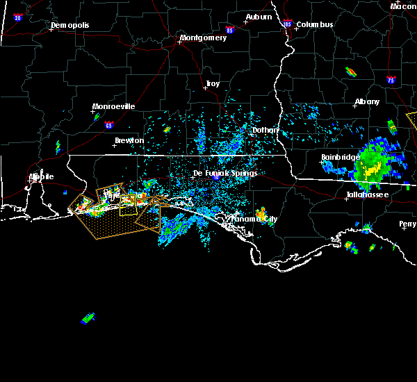 At 510 pm cdt, a severe thunderstorm was located near navarre, or 13 miles southeast of bagdad, moving south at 15 mph (radar indicated). Hazards include 60 mph wind gusts and quarter size hail. Hail damage to vehicles is expected. Expect wind damage to roofs, siding, and trees. At 510 pm cdt, a severe thunderstorm was located near navarre, or 13 miles southeast of bagdad, moving south at 15 mph (radar indicated). Hazards include 60 mph wind gusts and quarter size hail. Hail damage to vehicles is expected. Expect wind damage to roofs, siding, and trees.
|
| 5/20/2016 8:18 AM EDT | A severe thunderstorm warning remains in effect until 845 am edt for wakulla. franklin. leon. southern grady and southwestern thomas counties. at 817 am edt. severe thunderstorms were located along a line extending from cairo to 15 miles southeast of carrabelle. Moving east at 35 mph. |
| 5/20/2016 8:18 AM EDT | A severe thunderstorm warning remains in effect until 845 am edt for wakulla. franklin. leon. southern grady and southwestern thomas counties. at 817 am edt. severe thunderstorms were located along a line extending from cairo to 15 miles southeast of carrabelle. Moving east at 35 mph. |
| 5/3/2016 7:12 PM EDT | The severe thunderstorm warning for southeastern gadsden. northeastern leon and south central grady counties will expire at 715 pm edt. the storm which prompted the warning has weakened below severe limits. and no longer pose an immediate threat to life or property. Therefore the warning will be allowed to expire. |
| 5/3/2016 7:12 PM EDT | The severe thunderstorm warning for southeastern gadsden. northeastern leon and south central grady counties will expire at 715 pm edt. the storm which prompted the warning has weakened below severe limits. and no longer pose an immediate threat to life or property. Therefore the warning will be allowed to expire. |
| 5/3/2016 6:45 PM EDT |
 At 645 pm edt, a severe thunderstorm was located near midway, moving east at 40 mph (radar indicated). Hazards include 60 mph wind gusts and quarter size hail. Hail damage to vehicles is expected. Expect wind damage to roofs, siding, and trees. At 645 pm edt, a severe thunderstorm was located near midway, moving east at 40 mph (radar indicated). Hazards include 60 mph wind gusts and quarter size hail. Hail damage to vehicles is expected. Expect wind damage to roofs, siding, and trees.
|
| 3/26/2016 7:57 PM EDT | The severe thunderstorm warning for east central lake, northwestern seminole and south central volusia counties will expire at 800 pm edt, the storm which prompted the warning has weakened just below severe limits and will be allowed to expire. however, small hail, gusty winds and heavy rain are still possible with this thunderstorm. |
| 3/26/2016 7:28 PM EDT |
 At 727 pm edt, a severe thunderstorm was located near mount plymouth, moving east at 15 mph (radar indicated). Hazards include 60 mph wind gusts and quarter size hail. Hail damage to vehicles is expected. expect wind damage to roofs, siding, and trees. Locations impacted include, deltona, sanford, deland, eustis and mount dora. At 727 pm edt, a severe thunderstorm was located near mount plymouth, moving east at 15 mph (radar indicated). Hazards include 60 mph wind gusts and quarter size hail. Hail damage to vehicles is expected. expect wind damage to roofs, siding, and trees. Locations impacted include, deltona, sanford, deland, eustis and mount dora.
|
| 3/26/2016 6:59 PM EDT |
 At 658 pm edt, a severe thunderstorm was located near sorrento, or near mount plymouth, moving east-northeast at 25 mph (radar indicated). Hazards include 60 mph wind gusts and quarter size hail. Hail damage to vehicles is expected. Expect wind damage to roofs, siding, and trees. At 658 pm edt, a severe thunderstorm was located near sorrento, or near mount plymouth, moving east-northeast at 25 mph (radar indicated). Hazards include 60 mph wind gusts and quarter size hail. Hail damage to vehicles is expected. Expect wind damage to roofs, siding, and trees.
|
| 3/24/2016 3:16 PM CDT |
 At 316 pm cdt, severe thunderstorms were located along a line extending from near florala to near navarre beach to 16 miles south of gulf breeze, moving east at 45 mph (radar indicated). Hazards include 60 mph wind gusts and nickel size hail. Expect damage to roofs. siding. and trees. locations impacted include, pensacola, crestview, fort walton beach, niceville, destin, milton, valparaiso, mary esther, bagdad, lake lorraine, wright, ocean city, eglin afb, baker, midway, shalimar, laurel hill, cinco bayou, navarre and postil. A tornado watch remains in effect until 700 pm cdt for northwestern florida. At 316 pm cdt, severe thunderstorms were located along a line extending from near florala to near navarre beach to 16 miles south of gulf breeze, moving east at 45 mph (radar indicated). Hazards include 60 mph wind gusts and nickel size hail. Expect damage to roofs. siding. and trees. locations impacted include, pensacola, crestview, fort walton beach, niceville, destin, milton, valparaiso, mary esther, bagdad, lake lorraine, wright, ocean city, eglin afb, baker, midway, shalimar, laurel hill, cinco bayou, navarre and postil. A tornado watch remains in effect until 700 pm cdt for northwestern florida.
|
| 3/24/2016 2:41 PM CDT |
 At 241 pm cdt, severe thunderstorms were located along a line extending from 12 miles north of baker to pensacola to 12 miles south of orange beach, moving east at 50 mph (radar indicated). Hazards include 60 mph wind gusts and nickel size hail. Expect damage to roofs. siding. And trees. At 241 pm cdt, severe thunderstorms were located along a line extending from 12 miles north of baker to pensacola to 12 miles south of orange beach, moving east at 50 mph (radar indicated). Hazards include 60 mph wind gusts and nickel size hail. Expect damage to roofs. siding. And trees.
|
| 3/18/2016 1:56 AM EDT |
 At 156 am edt, a severe thunderstorm was located near midway, moving east at 45 mph (radar indicated). Hazards include 60 mph wind gusts. Expect damage to roofs. siding. and trees. Locations impacted include, midway, tallahassee, quincy, florida a and m, doak campbell stadium, florida state university, tallahassee comm college, innovation park, lake talquin, state capital complex, tallahassee mall, lake jackson, macon community park, leon county civic center, mission san luis, winthrop park, lake bradford, andrew, maclay state gardens and lake ella. At 156 am edt, a severe thunderstorm was located near midway, moving east at 45 mph (radar indicated). Hazards include 60 mph wind gusts. Expect damage to roofs. siding. and trees. Locations impacted include, midway, tallahassee, quincy, florida a and m, doak campbell stadium, florida state university, tallahassee comm college, innovation park, lake talquin, state capital complex, tallahassee mall, lake jackson, macon community park, leon county civic center, mission san luis, winthrop park, lake bradford, andrew, maclay state gardens and lake ella.
|
| 3/18/2016 1:43 AM EDT |
 At 143 am edt, a severe thunderstorm was located near quincy, moving east at 45 mph (radar indicated). Hazards include 60 mph wind gusts. Expect damage to roofs. siding. and trees. Locations impacted include, midway, tallahassee, quincy, florida a and m, doak campbell stadium, florida state university, tallahassee comm college, innovation park, lake talquin, state capital complex, tallahassee mall, lake jackson, macon community park, leon county civic center, bloxham, mission san luis, winthrop park, lake bradford, andrew and maclay state gardens. At 143 am edt, a severe thunderstorm was located near quincy, moving east at 45 mph (radar indicated). Hazards include 60 mph wind gusts. Expect damage to roofs. siding. and trees. Locations impacted include, midway, tallahassee, quincy, florida a and m, doak campbell stadium, florida state university, tallahassee comm college, innovation park, lake talquin, state capital complex, tallahassee mall, lake jackson, macon community park, leon county civic center, bloxham, mission san luis, winthrop park, lake bradford, andrew and maclay state gardens.
|
| 3/18/2016 1:26 AM EDT |
 At 125 am edt, a severe thunderstorm was located near greensboro, or 13 miles west of quincy, moving east at 45 mph (radar indicated). Hazards include 60 mph wind gusts. Expect damage to roofs. siding. And trees. At 125 am edt, a severe thunderstorm was located near greensboro, or 13 miles west of quincy, moving east at 45 mph (radar indicated). Hazards include 60 mph wind gusts. Expect damage to roofs. siding. And trees.
|
| 3/18/2016 12:09 AM CDT |
 At 108 am edt/1208 am cdt/, severe thunderstorms were located along a line extending from 9 miles northeast of blountstown to 12 miles northwest of stonemill creek, moving east at 45 mph (radar indicated). Hazards include 60 mph wind gusts and quarter size hail. Hail damage to vehicles is expected. expect wind damage to roofs, siding, and trees. Locations impacted include, blountstown, quincy, greensboro, stonemill creek, orange, wewahitchka, bristol, altha, scotts ferry, white pond, red oak, chason, rock bluff, nettle ridge, blountstown airport, red hill, sycamore, juniper, selman and clio. At 108 am edt/1208 am cdt/, severe thunderstorms were located along a line extending from 9 miles northeast of blountstown to 12 miles northwest of stonemill creek, moving east at 45 mph (radar indicated). Hazards include 60 mph wind gusts and quarter size hail. Hail damage to vehicles is expected. expect wind damage to roofs, siding, and trees. Locations impacted include, blountstown, quincy, greensboro, stonemill creek, orange, wewahitchka, bristol, altha, scotts ferry, white pond, red oak, chason, rock bluff, nettle ridge, blountstown airport, red hill, sycamore, juniper, selman and clio.
|
| 3/17/2016 11:42 PM CDT |
 At 1242 am edt/1142 pm cdt/, severe thunderstorms were located along a line extending from 11 miles south of marianna to near lynn haven, moving east at 45 mph (radar indicated). Hazards include 60 mph wind gusts and quarter size hail. Hail damage to vehicles is expected. Expect wind damage to roofs, siding, and trees. At 1242 am edt/1142 pm cdt/, severe thunderstorms were located along a line extending from 11 miles south of marianna to near lynn haven, moving east at 45 mph (radar indicated). Hazards include 60 mph wind gusts and quarter size hail. Hail damage to vehicles is expected. Expect wind damage to roofs, siding, and trees.
|
| 3/17/2016 10:14 PM CDT |
 At 1013 pm cdt, severe thunderstorms were located along a line extending from midway to 13 miles southeast of johnsons beach, moving southeast at 35 mph (radar indicated). Hazards include 60 mph wind gusts and quarter size hail. Hail damage to vehicles is expected. expect wind damage to roofs, siding, and trees. Locations impacted include, pensacola, fort walton beach, mary esther, wright, ocean city, bagdad, cinco bayou, navarre, tiger point, woodlawn beach, holley, oriole beach and fort walton beach--navarre--wright. At 1013 pm cdt, severe thunderstorms were located along a line extending from midway to 13 miles southeast of johnsons beach, moving southeast at 35 mph (radar indicated). Hazards include 60 mph wind gusts and quarter size hail. Hail damage to vehicles is expected. expect wind damage to roofs, siding, and trees. Locations impacted include, pensacola, fort walton beach, mary esther, wright, ocean city, bagdad, cinco bayou, navarre, tiger point, woodlawn beach, holley, oriole beach and fort walton beach--navarre--wright.
|
| 3/17/2016 9:50 PM CDT |
 At 949 pm cdt, severe thunderstorms were located along a line extending from near ferry pass to near johnsons beach, moving southeast at 35 mph (radar indicated). Hazards include 60 mph wind gusts and quarter size hail. Hail damage to vehicles is expected. Expect wind damage to roofs, siding, and trees. At 949 pm cdt, severe thunderstorms were located along a line extending from near ferry pass to near johnsons beach, moving southeast at 35 mph (radar indicated). Hazards include 60 mph wind gusts and quarter size hail. Hail damage to vehicles is expected. Expect wind damage to roofs, siding, and trees.
|
| 3/17/2016 12:11 PM EDT |
 At 1211 pm edt, a severe thunderstorm was located near tallahassee comm college, or 8 miles southwest of tallahassee, moving southeast at 50 mph (radar indicated). Hazards include 60 mph wind gusts. Expect damage to roofs. siding. And trees. At 1211 pm edt, a severe thunderstorm was located near tallahassee comm college, or 8 miles southwest of tallahassee, moving southeast at 50 mph (radar indicated). Hazards include 60 mph wind gusts. Expect damage to roofs. siding. And trees.
|
| 3/3/2016 10:35 PM EST |
 At 1035 pm est/935 pm cst/, severe thunderstorms were located along a line extending from near thomasville to 9 miles southeast of blountstown, moving east at 60 mph (radar indicated). Hazards include 60 mph wind gusts. Expect damage to roofs. siding. and trees. Locations impacted include, thomasville, midway, quincy, havana, tallahassee, cairo, greensboro, bristol, quincy airport, lake talquin, forest meadows park, jamieson, branchville, moccasin gap, pisgah church, pine park, lake jackson, juniper, macon community park and beachton. At 1035 pm est/935 pm cst/, severe thunderstorms were located along a line extending from near thomasville to 9 miles southeast of blountstown, moving east at 60 mph (radar indicated). Hazards include 60 mph wind gusts. Expect damage to roofs. siding. and trees. Locations impacted include, thomasville, midway, quincy, havana, tallahassee, cairo, greensboro, bristol, quincy airport, lake talquin, forest meadows park, jamieson, branchville, moccasin gap, pisgah church, pine park, lake jackson, juniper, macon community park and beachton.
|
| 3/3/2016 10:27 PM EST |
 At 1027 pm est/927 pm cst/, severe thunderstorms were located along a line extending from near thomasville to 7 miles east of blountstown, moving east at 70 mph (radar indicated). Hazards include 60 mph wind gusts. Expect damage to roofs. siding. and trees. Locations impacted include, blountstown, thomasville, havana, cairo, midway, quincy, tallahassee, greensboro, gretna, bristol, attapulgus, red oak, quincy airport, forest meadows park, rock bluff, nettle ridge, branchville, blountstown airport, pine park and amsterdam. At 1027 pm est/927 pm cst/, severe thunderstorms were located along a line extending from near thomasville to 7 miles east of blountstown, moving east at 70 mph (radar indicated). Hazards include 60 mph wind gusts. Expect damage to roofs. siding. and trees. Locations impacted include, blountstown, thomasville, havana, cairo, midway, quincy, tallahassee, greensboro, gretna, bristol, attapulgus, red oak, quincy airport, forest meadows park, rock bluff, nettle ridge, branchville, blountstown airport, pine park and amsterdam.
|
| 3/3/2016 10:08 PM EST |
 At 1007 pm est/907 pm cst/, severe thunderstorms were located along a line extending from near whigham to 14 miles west of blountstown, moving east at 70 mph (radar indicated). Hazards include 60 mph wind gusts. Expect damage to roofs. siding. And trees. At 1007 pm est/907 pm cst/, severe thunderstorms were located along a line extending from near whigham to 14 miles west of blountstown, moving east at 70 mph (radar indicated). Hazards include 60 mph wind gusts. Expect damage to roofs. siding. And trees.
|
| 2/24/2016 3:05 AM EST |
 At 305 am est, severe thunderstorms were located along a line extending from near havana to 9 miles northwest of carrabelle, moving east at 50 mph (radar indicated). Hazards include 60 mph wind gusts. Expect damage to roofs. Siding and trees. At 305 am est, severe thunderstorms were located along a line extending from near havana to 9 miles northwest of carrabelle, moving east at 50 mph (radar indicated). Hazards include 60 mph wind gusts. Expect damage to roofs. Siding and trees.
|
| 2/24/2016 2:53 AM EST |
 At 252 am est /152 am cst/, severe thunderstorms were located along a line extending from whigham to 12 miles southeast of port st. joe, moving east at 30 mph (radar indicated). Hazards include 60 mph wind gusts. Expect damage to roofs. siding and trees. locations impacted include, havana, bainbridge, apalachicola, midway, quincy, eastpoint, whigham, greensboro, west bainbridge, franklin, gretna, attapulgus, climax, jewel fire tower, odena, quincy airport, apalachicola airport, branchville, buck siding and central city. A tornado watch remains in effect until 600 am est/500 am cst/ for northwest florida and southwestern georgia. At 252 am est /152 am cst/, severe thunderstorms were located along a line extending from whigham to 12 miles southeast of port st. joe, moving east at 30 mph (radar indicated). Hazards include 60 mph wind gusts. Expect damage to roofs. siding and trees. locations impacted include, havana, bainbridge, apalachicola, midway, quincy, eastpoint, whigham, greensboro, west bainbridge, franklin, gretna, attapulgus, climax, jewel fire tower, odena, quincy airport, apalachicola airport, branchville, buck siding and central city. A tornado watch remains in effect until 600 am est/500 am cst/ for northwest florida and southwestern georgia.
|
| 2/24/2016 1:32 AM CST |
 At 232 am est /132 am cst/, severe thunderstorms were located along a line extending from 7 miles northwest of whigham to near port st. joe, moving east at 60 mph (radar indicated). Hazards include 60 mph wind gusts. Expect damage to roofs. siding and trees. locations impacted include, port st. joe, havana, bainbridge, apalachicola, midway, quincy, eastpoint, whigham, west bainbridge, chattahoochee, greensboro, wewahitchka, orange, franklin, gretna, bristol, attapulgus, climax, brinson and apalachicola airport. A tornado watch remains in effect until 600 am est/500 am cst/ for northwest florida and southwestern georgia. At 232 am est /132 am cst/, severe thunderstorms were located along a line extending from 7 miles northwest of whigham to near port st. joe, moving east at 60 mph (radar indicated). Hazards include 60 mph wind gusts. Expect damage to roofs. siding and trees. locations impacted include, port st. joe, havana, bainbridge, apalachicola, midway, quincy, eastpoint, whigham, west bainbridge, chattahoochee, greensboro, wewahitchka, orange, franklin, gretna, bristol, attapulgus, climax, brinson and apalachicola airport. A tornado watch remains in effect until 600 am est/500 am cst/ for northwest florida and southwestern georgia.
|
| 2/24/2016 12:49 AM CST |
 At 148 am est /1248 am cst/, severe thunderstorms were located along a line extending from 8 miles southeast of donalsonville to 8 miles south of tyndall air force base, moving northeast at 55 mph (radar indicated). Hazards include 60 mph wind gusts. Expect damage to roofs. Siding and trees. At 148 am est /1248 am cst/, severe thunderstorms were located along a line extending from 8 miles southeast of donalsonville to 8 miles south of tyndall air force base, moving northeast at 55 mph (radar indicated). Hazards include 60 mph wind gusts. Expect damage to roofs. Siding and trees.
|
| 2/23/2016 7:23 PM CST |
 At 722 pm cst, severe thunderstorms were located along a line extending from midway to 19 miles south of destin, moving northeast at 55 mph (radar indicated). Hazards include 70 mph wind gusts and quarter size hail. Hail damage to vehicles is expected. expect considerable tree damage. Wind damage is also likely to mobile homes, roofs, and outbuildings. At 722 pm cst, severe thunderstorms were located along a line extending from midway to 19 miles south of destin, moving northeast at 55 mph (radar indicated). Hazards include 70 mph wind gusts and quarter size hail. Hail damage to vehicles is expected. expect considerable tree damage. Wind damage is also likely to mobile homes, roofs, and outbuildings.
|
| 2/15/2016 10:45 PM EST |
 At 1044 pm est, severe thunderstorms were located along a line extending from near quincy to near st george island, moving east at 40 mph (radar indicated). Hazards include 60 mph wind gusts and penny size hail. Expect damage to roofs. Siding and trees. At 1044 pm est, severe thunderstorms were located along a line extending from near quincy to near st george island, moving east at 40 mph (radar indicated). Hazards include 60 mph wind gusts and penny size hail. Expect damage to roofs. Siding and trees.
|
| 2/15/2016 6:25 PM CST | At 624 pm cst, severe thunderstorms were located along a line extending from near laurel hill to near crestview to near fort walton beach--navarre--wright to 8 miles south of oriole beach, moving east at 50 mph (radar indicated). Hazards include 70 mph wind gusts and quarter size hail. Hail damage to vehicles is expected. expect considerable tree damage. wind damage is also likely to mobile homes, roofs, and outbuildings. locations impacted include, crestview, fort walton beach, niceville, destin, valparaiso, mary esther, florala, wright, ocean city, eglin afb, lake lorraine and baker. A tornado watch remains in effect until 900 pm cst for south central alabama and northwestern florida. |
| 2/15/2016 6:25 PM CST | At 624 pm cst, severe thunderstorms were located along a line extending from near laurel hill to near crestview to near fort walton beach--navarre--wright to 8 miles south of oriole beach, moving east at 50 mph (radar indicated). Hazards include 70 mph wind gusts and quarter size hail. Hail damage to vehicles is expected. expect considerable tree damage. wind damage is also likely to mobile homes, roofs, and outbuildings. locations impacted include, crestview, fort walton beach, niceville, destin, valparaiso, mary esther, florala, wright, ocean city, eglin afb, lake lorraine and baker. A tornado watch remains in effect until 900 pm cst for south central alabama and northwestern florida. |
| 2/15/2016 5:59 PM CST |
 At 559 pm cst, severe thunderstorms were located along a line extending from 12 miles northwest of baker to 8 miles northeast of roeville to near oriole beach to near johnsons beach, moving east at 60 mph (radar indicated). Hazards include 70 mph wind gusts and quarter size hail. Hail damage to vehicles is expected. expect considerable tree damage. Wind damage is also likely to mobile homes, roofs, and outbuildings. At 559 pm cst, severe thunderstorms were located along a line extending from 12 miles northwest of baker to 8 miles northeast of roeville to near oriole beach to near johnsons beach, moving east at 60 mph (radar indicated). Hazards include 70 mph wind gusts and quarter size hail. Hail damage to vehicles is expected. expect considerable tree damage. Wind damage is also likely to mobile homes, roofs, and outbuildings.
|
| 1/22/2016 6:24 AM EST | The severe thunderstorm warning for southeastern liberty, eastern gadsden, western wakulla, southwestern leon and north central franklin counties will expire at 630 am est, the storms which prompted the warning have weakened below severe limits, and no longer pose an immediate threat to life or property. therefore the warning will be allowed to expire. a separate tornado warning remains in effect for franklin county until 645 am est. |
| 1/22/2016 6:15 AM EST | At 615 am est, severe thunderstorms were located along a line extending from near havana to 7 miles east of eastpoint, moving east at 35 mph (radar indicated). Hazards include 60 mph wind gusts. Expect damage to roofs. siding and trees. Locations impacted include, carrabelle, midway, havana, eastpoint, quincy, franklin, quincy airport, lake talquin, jamieson, branchville, east camp, concord, florence, bloxham, high bluff, santa clara, smith creek, shady rest, poplar camp and littman. |
| 1/22/2016 5:50 AM EST | At 549 am est, severe thunderstorms were located along a line extending from near greensboro to 10 miles west of st george island, moving east at 35 mph (radar indicated). Hazards include 60 mph wind gusts. Expect damage to roofs. siding and trees. locations impacted include, carrabelle, havana, midway, quincy, eastpoint, apalachicola, greensboro, franklin, gretna, jewel fire tower, quincy airport, apalachicola airport, branchville, buck siding, central city, juniper, clio, bloxham, vilas and high bluff. A tornado watch remains in effect until 600 am est for northwest florida and southwestern georgia. |
| 1/22/2016 5:36 AM EST | At 535 am est /435 am cst/, severe thunderstorms were located along a line extending from near chattahoochee to 17 miles south of port st. joe, moving east at 25 mph (radar indicated). Hazards include 60 mph wind gusts. Expect damage to roofs. siding and trees. locations impacted include, carrabelle, havana, midway, quincy, eastpoint, apalachicola, greensboro, chattahoochee, orange, franklin, gretna, bristol, jewel fire tower, odena, quincy airport, apalachicola airport, rock bluff, branchville, hardin heights and buck siding. A tornado watch remains in effect until 600 am est/500 am cst/ for northwest florida and southwestern georgia. |
| 1/22/2016 4:17 AM CST | The national weather service in tallahassee has issued a * severe thunderstorm warning for. liberty county in the big bend of florida. southwestern franklin county in the big bend of florida. gadsden county in the big bend of florida. Gulf county in the panhandle of florida. |
| 1/22/2016 12:47 AM CST | At 1246 am cst, severe thunderstorms were located along a line extending from 10 miles northeast of whiting field to near navarre beach, moving northeast at 55 mph (radar indicated). Hazards include 70 mph wind gusts. Expect considerable tree damage. damage is likely to mobile homes, roofs and outbuildings. locations impacted include, pensacola, crestview, fort walton beach, niceville, destin, milton, valparaiso, mary esther, wright, ocean city, bagdad and eglin afb. A tornado watch remains in effect until 500 am cst for northwestern florida. |
| 1/22/2016 12:11 AM CST | The national weather service in mobile has issued a * severe thunderstorm warning for. south central escambia county in northwestern florida. southern santa rosa county in northwestern florida. okaloosa county in northwestern florida. Until 115 am cst. |
| 1/15/2016 11:52 AM EST |
 The severe thunderstorm warning for orange, seminole and northwestern osceola counties will expire at 1200 pm est, the storm which prompted the warning has moved out of the area. therefore the warning will be allowed to expire. however gusty winds are still possible this afternoon. to report severe weather, contact your nearest law enforcement agency. they will relay your report to the national weather service melbourne. The severe thunderstorm warning for orange, seminole and northwestern osceola counties will expire at 1200 pm est, the storm which prompted the warning has moved out of the area. therefore the warning will be allowed to expire. however gusty winds are still possible this afternoon. to report severe weather, contact your nearest law enforcement agency. they will relay your report to the national weather service melbourne.
|
| 1/15/2016 10:54 AM EST |
 At 1053 am est, a severe thunderstorm was located near horizon west, moving east at 30 mph (radar indicated). Hazards include 60 mph wind gusts. Expect damage to roofs. Siding and trees. At 1053 am est, a severe thunderstorm was located near horizon west, moving east at 30 mph (radar indicated). Hazards include 60 mph wind gusts. Expect damage to roofs. Siding and trees.
|
| 11/18/2015 5:31 PM EST |
 At 530 pm est, a severe thunderstorm was located 9 miles south of greensboro, or 15 miles southwest of quincy, moving northeast at 25 mph (radar indicated). Hazards include 60 mph wind gusts. Expect damage to roofs. Siding and trees. At 530 pm est, a severe thunderstorm was located 9 miles south of greensboro, or 15 miles southwest of quincy, moving northeast at 25 mph (radar indicated). Hazards include 60 mph wind gusts. Expect damage to roofs. Siding and trees.
|
| 11/18/2015 1:36 AM CST |
 At 135 am cst, a severe thunderstorm was located near gulf breeze, moving north at 30 mph (radar indicated). Hazards include 60 mph wind gusts. Expect damage to roofs. Siding and trees. At 135 am cst, a severe thunderstorm was located near gulf breeze, moving north at 30 mph (radar indicated). Hazards include 60 mph wind gusts. Expect damage to roofs. Siding and trees.
|
| 9/5/2015 7:43 PM EDT |
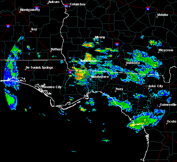 At 743 pm edt, doppler radar indicated a severe thunderstorm capable of producing damaging winds in excess of 60 mph. this storm was located over quincy, moving west at 15 mph. locations impacted include, midway, quincy, gretna, florence, quincy airport, shady rest, freemont, branchville, douglas city, santa clara, littman and dogtown. At 743 pm edt, doppler radar indicated a severe thunderstorm capable of producing damaging winds in excess of 60 mph. this storm was located over quincy, moving west at 15 mph. locations impacted include, midway, quincy, gretna, florence, quincy airport, shady rest, freemont, branchville, douglas city, santa clara, littman and dogtown.
|
| 9/5/2015 7:17 PM EDT |
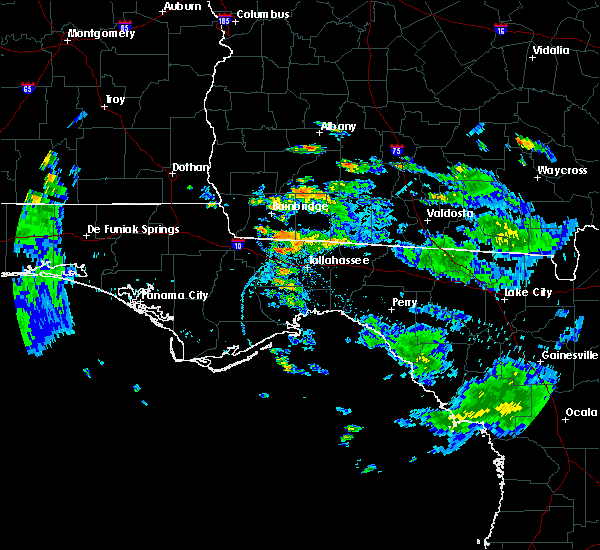 At 717 pm edt, the national weather service has detected a severe thunderstorm capable of producing quarter size hail and damaging winds in excess of 60 mph. this storm was located near havana, and moving northwest at 15 mph. At 717 pm edt, the national weather service has detected a severe thunderstorm capable of producing quarter size hail and damaging winds in excess of 60 mph. this storm was located near havana, and moving northwest at 15 mph.
|
| 8/14/2015 4:35 PM EDT |
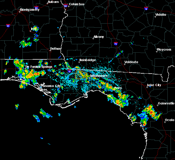 The severe thunderstorm warning for central gadsden county will expire at 445 pm edt, the storm which prompted the warning has weakened below severe limits, and no longer poses an immediate threat to life or property. therefore the warning will be allowed to expire. to report severe weather, contact your nearest law enforcement agency. they will relay your report to the national weather service tallahassee. The severe thunderstorm warning for central gadsden county will expire at 445 pm edt, the storm which prompted the warning has weakened below severe limits, and no longer poses an immediate threat to life or property. therefore the warning will be allowed to expire. to report severe weather, contact your nearest law enforcement agency. they will relay your report to the national weather service tallahassee.
|
| 8/14/2015 4:17 PM EDT |
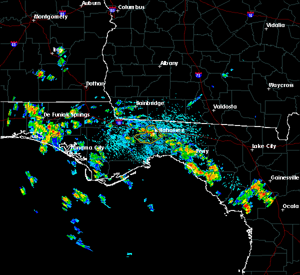 At 417 pm edt, the national weather service has detected a severe thunderstorm capable of producing damaging winds in excess of 60 mph. this storm was located over midway, and moving west at 15 mph. At 417 pm edt, the national weather service has detected a severe thunderstorm capable of producing damaging winds in excess of 60 mph. this storm was located over midway, and moving west at 15 mph.
|
| 8/14/2015 4:14 PM EDT |
 At 414 pm edt, the national weather service has detected a severe thunderstorm capable of producing damaging winds in excess of 60 mph. this storm was located near tallahassee, and moving southwest at 20 mph. At 414 pm edt, the national weather service has detected a severe thunderstorm capable of producing damaging winds in excess of 60 mph. this storm was located near tallahassee, and moving southwest at 20 mph.
|
| 8/7/2015 6:38 PM EDT |
 At 638 pm edt, doppler radar indicated a severe thunderstorm capable of producing damaging winds in excess of 60 mph. this storm was located 11 miles northwest of crawfordville, and moving southeast at 40 mph. At 638 pm edt, doppler radar indicated a severe thunderstorm capable of producing damaging winds in excess of 60 mph. this storm was located 11 miles northwest of crawfordville, and moving southeast at 40 mph.
|
| 8/7/2015 6:28 PM EDT |
 At 628 pm edt, doppler radar indicated a severe thunderstorm capable of producing damaging winds in excess of 60 mph. this storm was located 11 miles northwest of crawfordville, moving southeast at 25 mph. locations impacted include, woodville, midway, crawfordville, tallahassee, wakulla, innovation park, lake talquin, bethel, eight mile pond, hilliardville, bloxham, lake bradford, andrew, lutterloh, lake munson, arran, smith creek, leon sinks, helen and springsax park. At 628 pm edt, doppler radar indicated a severe thunderstorm capable of producing damaging winds in excess of 60 mph. this storm was located 11 miles northwest of crawfordville, moving southeast at 25 mph. locations impacted include, woodville, midway, crawfordville, tallahassee, wakulla, innovation park, lake talquin, bethel, eight mile pond, hilliardville, bloxham, lake bradford, andrew, lutterloh, lake munson, arran, smith creek, leon sinks, helen and springsax park.
|
| 8/7/2015 5:58 PM EDT |
 At 557 pm edt, the national weather service has detected a severe thunderstorm capable of producing damaging winds in excess of 60 mph. this storm was located 8 miles west of midway, and moving southeast at 25 mph. At 557 pm edt, the national weather service has detected a severe thunderstorm capable of producing damaging winds in excess of 60 mph. this storm was located 8 miles west of midway, and moving southeast at 25 mph.
|
| 7/30/2015 7:37 PM CDT |
 At 736 pm cdt, the storm that prompted the warning for southeastern escambia and southern santa rosa counties has weakened below severe limits thus the severe thunderstorm warning will be allowed to expire at 745 pm cdt. At 736 pm cdt, the storm that prompted the warning for southeastern escambia and southern santa rosa counties has weakened below severe limits thus the severe thunderstorm warning will be allowed to expire at 745 pm cdt.
|
| 7/30/2015 7:18 PM CDT |
 At 717 pm cdt, a line of severe thunderstorms capable of producing damaging winds over 60 mph were located along a line extending from milton to near woodlawn beach, moving west at 25 mph. At 717 pm cdt, a line of severe thunderstorms capable of producing damaging winds over 60 mph were located along a line extending from milton to near woodlawn beach, moving west at 25 mph.
|
| 7/30/2015 6:42 PM CDT |
 At 642 pm cdt, a line of severe thunderstorms capable of producing damaging winds over 60 mph was located along a line extending from 11 miles east of roeville to near navarre beach, and moving west at 25 mph. At 642 pm cdt, a line of severe thunderstorms capable of producing damaging winds over 60 mph was located along a line extending from 11 miles east of roeville to near navarre beach, and moving west at 25 mph.
|
| 7/29/2015 2:54 PM CDT |
 At 253 pm cdt, a severe thunderstorm capable of producing damaging winds over 60 mph was located near mulat, or near pensacola international airport, moving south at 15 mph. At 253 pm cdt, a severe thunderstorm capable of producing damaging winds over 60 mph was located near mulat, or near pensacola international airport, moving south at 15 mph.
|
| 7/29/2015 2:32 PM CDT |
 At 231 pm cdt, a severe thunderstorm capable of producing damaging winds over 60 mph was located over mulat, or near pace, and moving south at 15 mph. At 231 pm cdt, a severe thunderstorm capable of producing damaging winds over 60 mph was located over mulat, or near pace, and moving south at 15 mph.
|
| 7/24/2015 6:41 PM EDT |
 At 639 pm edt, the national weather service continued to track a severe thunderstorm producing damaging winds near 60 mph. this storm was located 10 miles northeast of havana, and moving south at 20 mph. there have been several reports of trees down with this storm. At 639 pm edt, the national weather service continued to track a severe thunderstorm producing damaging winds near 60 mph. this storm was located 10 miles northeast of havana, and moving south at 20 mph. there have been several reports of trees down with this storm.
|
| 7/24/2015 6:37 PM EDT |
 At 635 pm edt, the public reported a severe thunderstorm producing damaging winds of 60 mph. this storm was located 7 miles northeast of tallahassee, moving southeast at 45 mph. several trees have been blown down with this storm. locations impacted include, havana, tallahassee, woodville, , chaires, calvary, lake bradford, chaires crossroads, miccosukee. At 635 pm edt, the public reported a severe thunderstorm producing damaging winds of 60 mph. this storm was located 7 miles northeast of tallahassee, moving southeast at 45 mph. several trees have been blown down with this storm. locations impacted include, havana, tallahassee, woodville, , chaires, calvary, lake bradford, chaires crossroads, miccosukee.
|
| 7/24/2015 6:21 PM EDT |
 At 620 pm edt, the national weather service has detected a severe thunderstorm capable of producing damaging winds in excess of 60 mph. this storm was located 10 miles south of whigham, or 10 miles northeast of havana, and moving southeast at 45 mph. At 620 pm edt, the national weather service has detected a severe thunderstorm capable of producing damaging winds in excess of 60 mph. this storm was located 10 miles south of whigham, or 10 miles northeast of havana, and moving southeast at 45 mph.
|
| 7/23/2015 3:49 PM EDT |
 At 349 pm edt, the national weather service has detected a severe thunderstorm capable of producing damaging winds in excess of 60 mph. this storm was located over tallahassee, and moving northeast at 30 mph. At 349 pm edt, the national weather service has detected a severe thunderstorm capable of producing damaging winds in excess of 60 mph. this storm was located over tallahassee, and moving northeast at 30 mph.
|
| 7/22/2015 7:45 PM EDT |
 At 744 pm edt, national weather service doppler radar indicated a line of severe thunderstorms capable of producing damaging winds in excess of 60 mph. these storms were located along a line extending from near coolidge to near tallahassee, moving east at 15 mph. locations impacted include, havana, beachton, wetumpka, concord, hinson, darsey and rocky hill. At 744 pm edt, national weather service doppler radar indicated a line of severe thunderstorms capable of producing damaging winds in excess of 60 mph. these storms were located along a line extending from near coolidge to near tallahassee, moving east at 15 mph. locations impacted include, havana, beachton, wetumpka, concord, hinson, darsey and rocky hill.
|
| 7/22/2015 6:56 PM EDT |
 At 656 pm edt, the national weather service has detected a line of severe thunderstorms capable of producing quarter size hail and damaging winds in excess of 60 mph. these storms were located along a line extending from near ochlocknee to near midway, and moving east at 15 mph. At 656 pm edt, the national weather service has detected a line of severe thunderstorms capable of producing quarter size hail and damaging winds in excess of 60 mph. these storms were located along a line extending from near ochlocknee to near midway, and moving east at 15 mph.
|
| 7/21/2015 7:23 PM EDT |
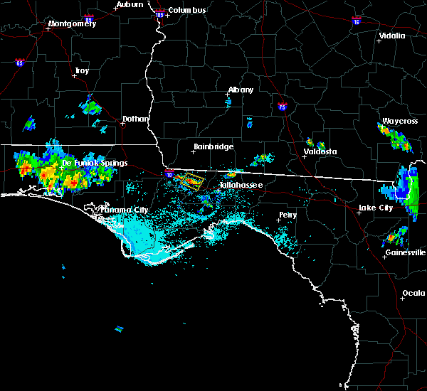 At 723 pm edt, the national weather service has detected a severe thunderstorm capable of producing damaging winds in excess of 60 mph. this storm was located over quincy, and moving northwest at 5 mph. At 723 pm edt, the national weather service has detected a severe thunderstorm capable of producing damaging winds in excess of 60 mph. this storm was located over quincy, and moving northwest at 5 mph.
|
| 7/21/2015 6:40 PM EDT | Some power outages caused by trees down on power lines in the lake talquin area in gadsden county FL, 6.8 miles NE of Midway, FL |
| 7/15/2015 7:40 PM EDT |
 At 740 pm edt, the national weather service has detected a line of severe thunderstorms capable of producing damaging winds in excess of 60 mph. these storms were located along a line extending from 7 miles southeast of bainbridge to near thomasville, and moving southwest at 30 mph. At 740 pm edt, the national weather service has detected a line of severe thunderstorms capable of producing damaging winds in excess of 60 mph. these storms were located along a line extending from 7 miles southeast of bainbridge to near thomasville, and moving southwest at 30 mph.
|
| 7/5/2015 4:48 PM EDT |
 At 446 pm edt, doppler radar continued to indicate a severe thunderstorm capable of producing quarter size hail and damaging winds in excess of 60 mph. this storm was located just east of sanford, developing southward at 10 mph. locations impacted include, deltona, sanford, winter springs, lake mary and geneva. At 446 pm edt, doppler radar continued to indicate a severe thunderstorm capable of producing quarter size hail and damaging winds in excess of 60 mph. this storm was located just east of sanford, developing southward at 10 mph. locations impacted include, deltona, sanford, winter springs, lake mary and geneva.
|
| 7/5/2015 4:12 PM EDT |
 At 411 pm edt, doppler radar indicated a severe thunderstorm capable of producing quarter size hail and damaging winds in excess of 60 mph. this storm was located near lake helen, and moving south at 10 mph. At 411 pm edt, doppler radar indicated a severe thunderstorm capable of producing quarter size hail and damaging winds in excess of 60 mph. this storm was located near lake helen, and moving south at 10 mph.
|
| 7/5/2015 12:56 PM EDT |
 At 1256 pm edt /1156 am cdt/, doppler radar indicated a line of severe thunderstorms capable of producing damaging winds in excess of 60 mph. these storms were located along a line extending from near wewahitchka to 7 miles south of tallahassee, moving east at 40 mph. locations impacted include, woodville, crawfordville, tallahassee, st. marks, havana, midway, quincy, stonemill creek, orange, wakulla, wewahitchka, sopchoppy, bethel, state capital complex, eight mile pond, tallahassee mall, clio, newport, lake bradford and chaires crossroads. At 1256 pm edt /1156 am cdt/, doppler radar indicated a line of severe thunderstorms capable of producing damaging winds in excess of 60 mph. these storms were located along a line extending from near wewahitchka to 7 miles south of tallahassee, moving east at 40 mph. locations impacted include, woodville, crawfordville, tallahassee, st. marks, havana, midway, quincy, stonemill creek, orange, wakulla, wewahitchka, sopchoppy, bethel, state capital complex, eight mile pond, tallahassee mall, clio, newport, lake bradford and chaires crossroads.
|
| 7/5/2015 12:28 PM EDT |
 At 1228 pm edt /1128 am cdt/, the national weather service has detected a line of severe thunderstorm capable of producing damaging winds in excess of 60 mph. these storms were located near stonemill creek, or 15 miles southwest of blountstown, and moving northeast at 45 mph. At 1228 pm edt /1128 am cdt/, the national weather service has detected a line of severe thunderstorm capable of producing damaging winds in excess of 60 mph. these storms were located near stonemill creek, or 15 miles southwest of blountstown, and moving northeast at 45 mph.
|
| 6/30/2015 5:38 PM EDT |
 At 537 pm edt, the national weather service has detected a line of severe thunderstorms capable of producing destructive winds in excess of 70 mph. these storms were located along a line extending from 6 miles southwest of west bainbridge to near stonemill creek, and moving southeast at 45 mph. these storms have a history of producing significant wind damage. At 537 pm edt, the national weather service has detected a line of severe thunderstorms capable of producing destructive winds in excess of 70 mph. these storms were located along a line extending from 6 miles southwest of west bainbridge to near stonemill creek, and moving southeast at 45 mph. these storms have a history of producing significant wind damage.
|
| 6/30/2015 1:58 PM EDT |
 At 157 pm edt, the national weather service has detected a severe thunderstorm capable of producing damaging winds in excess of 60 mph. this storm was located 9 miles southwest of midway, and moving east at 35 mph. At 157 pm edt, the national weather service has detected a severe thunderstorm capable of producing damaging winds in excess of 60 mph. this storm was located 9 miles southwest of midway, and moving east at 35 mph.
|
| 6/30/2015 1:45 PM EDT |
 At 145 pm edt, the national weather service has detected a severe thunderstorm capable of producing damaging winds in excess of 60 mph. this storm was located 7 miles north of quincy, and moving east at 40 mph. At 145 pm edt, the national weather service has detected a severe thunderstorm capable of producing damaging winds in excess of 60 mph. this storm was located 7 miles north of quincy, and moving east at 40 mph.
|
| 6/24/2015 7:35 PM EDT |
 A severe thunderstorm warning remains in effect until 815 pm edt for south central volusia and northwestern seminole counties. at 732 pm edt. doppler radar indicated a severe thunderstorm capable of producing damaging winds in excess of 60 mph. this storm was located over lake helen. moving northeast at 35 mph. Locations impacted include. A severe thunderstorm warning remains in effect until 815 pm edt for south central volusia and northwestern seminole counties. at 732 pm edt. doppler radar indicated a severe thunderstorm capable of producing damaging winds in excess of 60 mph. this storm was located over lake helen. moving northeast at 35 mph. Locations impacted include.
|
| 6/24/2015 7:13 PM EDT |
 At 713 pm edt, doppler radar indicated a severe thunderstorm capable of producing damaging winds in excess of 60 mph. this storm was located near sanford, and moving northeast at 35 mph. At 713 pm edt, doppler radar indicated a severe thunderstorm capable of producing damaging winds in excess of 60 mph. this storm was located near sanford, and moving northeast at 35 mph.
|
| 6/19/2015 6:41 PM EDT |
 The severe thunderstorm warning for south central volusia and central seminole counties will expire at 645 pm edt, the storm which prompted the warning has weakened below severe limits. therefore the warning will be allowed to expire. however gusty winds and heavy rain will continue through 715 pm with this thunderstorm. The severe thunderstorm warning for south central volusia and central seminole counties will expire at 645 pm edt, the storm which prompted the warning has weakened below severe limits. therefore the warning will be allowed to expire. however gusty winds and heavy rain will continue through 715 pm with this thunderstorm.
|
| 6/19/2015 6:01 PM EDT |
 At 600 pm edt, doppler radar indicated a severe thunderstorm capable of producing damaging winds in excess of 60 mph. this storm was located over osteen, or near deltona, and moving south at 10 mph. nickel size hail may also accompany the damaging winds. At 600 pm edt, doppler radar indicated a severe thunderstorm capable of producing damaging winds in excess of 60 mph. this storm was located over osteen, or near deltona, and moving south at 10 mph. nickel size hail may also accompany the damaging winds.
|
| 6/1/2015 3:57 PM EDT | At 355 pm edt, doppler radar indicated a severe thunderstorm producing quarter size hail and damaging winds in excess of 60 mph. this storm was located from deltona to lake mary. several reports of penny to nickel size hail have been received. a report of quarter size hail was received near interstate 4 and state route 46. the storm was moving to the south at 10 mph. locations impacted include, deltona, sanford, altamonte springs, oviedo and winter springs. |
| 6/1/2015 3:28 PM EDT | At 327 pm edt, doppler radar indicated a severe thunderstorm capable of producing quarter size hail and damaging winds in excess of 60 mph. this storm was located over debary, and moving south at 5 to 10 mph. |
| 5/31/2015 1:40 PM EDT | The severe thunderstorm warning for northeastern gadsden and central leon counties will expire at 145 pm edt, the storm which prompted the warning has weakened below severe limits, and no longer poses an immediate threat to life or property. therefore the warning will be allowed to expire. to report severe weather, contact your nearest law enforcement agency. they will relay your report to the national weather service tallahassee. |
| 5/31/2015 1:19 PM EDT | At 119 pm edt, the national weather service has detected a severe thunderstorm capable of producing damaging winds in excess of 60 mph. this storm was located near midway, and moving north at 15 mph. |
| 5/20/2015 6:07 PM EDT | At 605 pm edt, doppler radar indicated a severe thunderstorm capable of producing quarter size hail and damaging winds in excess of 60 mph. this storm was located over chuluota, and moving east at 10 mph. |
| 4/25/2015 3:26 PM CDT | At 326 pm cdt, a line of severe thunderstorms capable of producing damaging winds over 60 mph was located along a line extending from near bay minette to near magnolia springs to 10 miles southeast of sand island, and moving east at 60 mph. |
| 4/25/2015 3:26 PM CDT | At 326 pm cdt, a line of severe thunderstorms capable of producing damaging winds over 60 mph was located along a line extending from near bay minette to near magnolia springs to 10 miles southeast of sand island, and moving east at 60 mph. |
| 4/25/2015 10:11 AM EDT | The severe thunderstorm warning for northeastern calhoun county in the panhandle of florida, northeastern liberty, gadsden counties in the big bend of florida and southern decatur counties in southwestern georgia will expire at 1015 am edt, the storms which prompted the warning have weakened below severe limits, and no longer poses an immediate threat to life or property. therefore the warning will be allowed to expire. a tornado warning remains in effect until 4 pm edt or 3 pm cdt for these counties. |
| 4/25/2015 10:11 AM EDT | The severe thunderstorm warning for northeastern calhoun county in the panhandle of florida, northeastern liberty, gadsden counties in the big bend of florida and southern decatur counties in southwestern georgia will expire at 1015 am edt, the storms which prompted the warning have weakened below severe limits, and no longer poses an immediate threat to life or property. therefore the warning will be allowed to expire. a tornado warning remains in effect until 4 pm edt or 3 pm cdt for these counties. |
| 4/25/2015 9:56 AM EDT | At 954 am edt /854 am cdt/, doppler radar indicated a line of severe thunderstorms capable of producing damaging winds in excess of 60 mph. these storms were located along a line extending from near bainbridge to near greensboro to near blountstown, moving east at 50 mph. locations impacted include, havana, midway, quincy, blountstown, greensboro, chattahoochee, gretna, bristol, attapulgus, climax, quincy airport, rock bluff, nettle ridge, branchville, hardin heights, amsterdam, sycamore, juniper and selman. a tornado watch remains in effect until 400 pm edt/300 pm cdt/ for the eastern florida panhandle and big bend, and southwestern georgia. |
| 4/25/2015 9:56 AM EDT | At 954 am edt /854 am cdt/, doppler radar indicated a line of severe thunderstorms capable of producing damaging winds in excess of 60 mph. these storms were located along a line extending from near bainbridge to near greensboro to near blountstown, moving east at 50 mph. locations impacted include, havana, midway, quincy, blountstown, greensboro, chattahoochee, gretna, bristol, attapulgus, climax, quincy airport, rock bluff, nettle ridge, branchville, hardin heights, amsterdam, sycamore, juniper and selman. a tornado watch remains in effect until 400 pm edt/300 pm cdt/ for the eastern florida panhandle and big bend, and southwestern georgia. |
| 4/25/2015 9:46 AM EDT | At 944 am edt /844 am cdt/, local law enforcement reported a line of severe thunderstorms producing damaging winds in excess of 60 mph. these storms were located along a line extending from 11 miles west of west bainbridge to 10 miles northeast of blountstown to 20 miles north of stonemill creek, moving east at 45 mph. trees have been blown down with this line of storms in washington and jackson counties. locations impacted include, blountstown, havana, midway, quincy, greensboro, chattahoochee, sneads, gretna, bristol, grand ridge, altha, attapulgus, climax, cypress, moose pond, white pond, red oak, chason and rock bluff. a tornado watch remains in effect until 100 pm edt/noon cdt/ for the western florida panhandle. a tornado watch also remains in effect until 400 pm edt/300 pm cdt/ for the eastern florida panhandle and big bend, and southwestern georgia. |
| 4/25/2015 9:46 AM EDT | At 944 am edt /844 am cdt/, local law enforcement reported a line of severe thunderstorms producing damaging winds in excess of 60 mph. these storms were located along a line extending from 11 miles west of west bainbridge to 10 miles northeast of blountstown to 20 miles north of stonemill creek, moving east at 45 mph. trees have been blown down with this line of storms in washington and jackson counties. locations impacted include, blountstown, havana, midway, quincy, greensboro, chattahoochee, sneads, gretna, bristol, grand ridge, altha, attapulgus, climax, cypress, moose pond, white pond, red oak, chason and rock bluff. a tornado watch remains in effect until 100 pm edt/noon cdt/ for the western florida panhandle. a tornado watch also remains in effect until 400 pm edt/300 pm cdt/ for the eastern florida panhandle and big bend, and southwestern georgia. |
| 4/25/2015 9:20 AM EDT | At 919 am edt /819 am cdt/, local law enforcement reported a line of severe thunderstorms producing damaging winds in excess of 60 mph. these storms were located along a line extending from 11 miles southwest of donalsonville to 12 miles south of marianna to 10 miles southeast of vernon, and moving east at 45 mph. |
| 4/25/2015 9:20 AM EDT | At 919 am edt /819 am cdt/, local law enforcement reported a line of severe thunderstorms producing damaging winds in excess of 60 mph. these storms were located along a line extending from 11 miles southwest of donalsonville to 12 miles south of marianna to 10 miles southeast of vernon, and moving east at 45 mph. |
| 4/20/2015 10:36 AM EDT | At 1036 am edt, doppler radar indicated a line of severe thunderstorms capable of producing damaging winds in excess of 60 mph. these storms were located along a line extending from 6 miles east of havana to 6 miles northeast of tallahassee to near st. marks, moving east at 50 mph. locations impacted include, woodville, crawfordville, havana, tallahassee, wakulla, hyde park, forest meadows park, fallschase, bethel, state capital complex, eight mile pond, belair, tallahassee mall, chaires, newport, baum, lake bradford, chaires crossroads, lake munson and doak campbell stadium. |
| 4/20/2015 10:25 AM EDT | Trees down on bill mcgill road in gadsden county FL, 2.1 miles S of Midway, FL |
| 4/20/2015 10:24 AM EDT | Trees down along dupont road in gadsden county FL, 1.7 miles W of Midway, FL |
| 4/20/2015 10:17 AM EDT | Trees down on dante ct in gadsden county FL, 5.5 miles E of Midway, FL |
| 4/20/2015 10:16 AM EDT | At 1015 am edt, the national weather service has detected a line of severe thunderstorms capable of producing damaging winds in excess of 60 mph. these storms were located along a line extending from near quincy to near midway to 8 miles southwest of crawfordville, and moving east at 50 mph. |
| 4/20/2015 10:15 AM EDT | Trees down near talquin ave in gadsden county FL, 10.2 miles ENE of Midway, FL |
| 4/20/2015 9:53 AM EDT | At 953 am edt, the national weather service has detected a line of severe thunderstorms capable of producing damaging winds in excess of 60 mph. these storms were located along a line extending from near blountstown to 16 miles south of greensboro to 22 miles west of crawfordville, and moving northeast at 45 mph. |
| 7/15/2014 12:00 PM EDT | Tree down on mccall bridge road south of gainey road in gadsden county FL, 8.3 miles ENE of Midway, FL |
| 7/23/2013 8:33 PM EDT | Trees down around lake talquin in gadsden county FL, 6.8 miles NE of Midway, FL |
| 6/28/2013 6:48 PM EDT | Tree down on starhill roa in leon county FL, 7.3 miles NE of Midway, FL |
| 3/24/2013 7:20 AM EDT | Tree blocking bloxham cutoff. time estimated by rada in leon county FL, 11.3 miles NE of Midway, FL |
| 5/6/2012 5:30 PM EDT | Tree down on power lines caused a fir in gadsden county FL, 4.2 miles SE of Midway, FL |
| 1/1/0001 12:00 AM | Quarter sized hail reported 226.8 miles ESE of Midway, FL, quarter to ping pong size hail reported. |
Hail Maps for Midway, FL
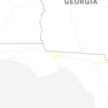
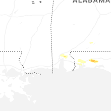
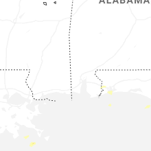
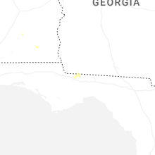
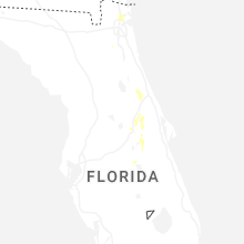
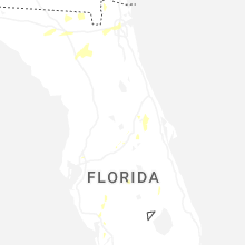

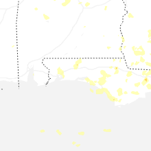
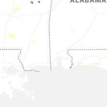
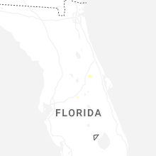
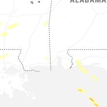
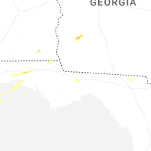


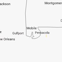


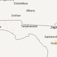

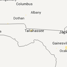


Connect with Interactive Hail Maps