

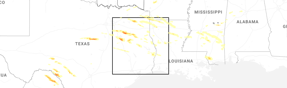
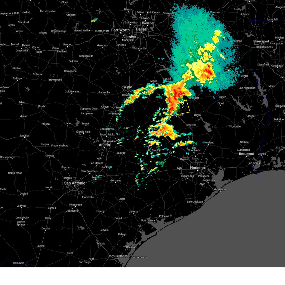
Hail Map for Midway, TX
The Midway, TX area has had 3 reports of on-the-ground hail by trained spotters, and has been under severe weather warnings 11 times during the past 12 months. Doppler radar has detected hail at or near Midway, TX on 51 occasions, including 3 occasions during the past year.
| Name: | Midway, TX |
| Where Located: | 65.1 miles WSW of Lufkin, TX |
| Map: | Google Map for Midway, TX |
| Population: | 228 |
| Housing Units: | 123 |
| More Info: | Search Google for Midway, TX |
4
The Top Recent Hail Date for Midway, TX is Wednesday, April 29, 2026 (7th out of 51)
Hail and Wind Damage Spotted near Midway, TX
| Date / Time | Report Details |
|---|---|
| 6/2/2026 5:54 PM CDT |
 At 554 pm cdt, a severe thunderstorm was located 14 miles east of madisonville, moving southwest at 40 mph (radar indicated). Hazards include 60 mph wind gusts and quarter size hail. Hail damage to vehicles is expected. expect wind damage to roofs, siding, and trees. Locations impacted include, huntsville, madisonville, trinity, riverside, crabbs prairie, and oakhurst. At 554 pm cdt, a severe thunderstorm was located 14 miles east of madisonville, moving southwest at 40 mph (radar indicated). Hazards include 60 mph wind gusts and quarter size hail. Hail damage to vehicles is expected. expect wind damage to roofs, siding, and trees. Locations impacted include, huntsville, madisonville, trinity, riverside, crabbs prairie, and oakhurst.
|
| 6/2/2026 5:41 PM CDT |
 Svrhgx the national weather service in league city has issued a * severe thunderstorm warning for, southwestern trinity county in southeastern texas, northeastern grimes county in southeastern texas, northwestern san jacinto county in southeastern texas, southwestern houston county in southeastern texas, central madison county in southeastern texas, walker county in southeastern texas, * until 615 pm cdt. * at 540 pm cdt, a severe thunderstorm was located 9 miles southwest of lovelady, or 11 miles southeast of austonio, moving southwest at 40 mph (radar indicated). Hazards include 60 mph wind gusts and quarter size hail. Hail damage to vehicles is expected. Expect wind damage to roofs, siding, and trees. Svrhgx the national weather service in league city has issued a * severe thunderstorm warning for, southwestern trinity county in southeastern texas, northeastern grimes county in southeastern texas, northwestern san jacinto county in southeastern texas, southwestern houston county in southeastern texas, central madison county in southeastern texas, walker county in southeastern texas, * until 615 pm cdt. * at 540 pm cdt, a severe thunderstorm was located 9 miles southwest of lovelady, or 11 miles southeast of austonio, moving southwest at 40 mph (radar indicated). Hazards include 60 mph wind gusts and quarter size hail. Hail damage to vehicles is expected. Expect wind damage to roofs, siding, and trees.
|
| 6/2/2026 4:45 PM CDT |
 Svrhgx the national weather service in league city has issued a * severe thunderstorm warning for, central trinity county in southeastern texas, houston county in southeastern texas, northeastern madison county in southeastern texas, northern polk county in southeastern texas, north central walker county in southeastern texas, * until 545 pm cdt. * at 445 pm cdt, severe thunderstorms were located along a line extending from 6 miles southeast of kennard to 7 miles north of austonio, moving south at 20 mph (radar indicated). Hazards include 60 mph wind gusts and quarter size hail. Hail damage to vehicles is expected. Expect wind damage to roofs, siding, and trees. Svrhgx the national weather service in league city has issued a * severe thunderstorm warning for, central trinity county in southeastern texas, houston county in southeastern texas, northeastern madison county in southeastern texas, northern polk county in southeastern texas, north central walker county in southeastern texas, * until 545 pm cdt. * at 445 pm cdt, severe thunderstorms were located along a line extending from 6 miles southeast of kennard to 7 miles north of austonio, moving south at 20 mph (radar indicated). Hazards include 60 mph wind gusts and quarter size hail. Hail damage to vehicles is expected. Expect wind damage to roofs, siding, and trees.
|
| 5/27/2026 2:44 AM CDT |
 Svrhgx the national weather service in league city has issued a * severe thunderstorm warning for, southwestern trinity county in southeastern texas, northeastern grimes county in southeastern texas, northwestern san jacinto county in southeastern texas, southwestern houston county in southeastern texas, eastern madison county in southeastern texas, west central polk county in southeastern texas, walker county in southeastern texas, * until 315 am cdt. * at 243 am cdt, a severe thunderstorm was located near huntsville, moving northeast at 45 mph (radar indicated). Hazards include 60 mph wind gusts. expect damage to roofs, siding, and trees Svrhgx the national weather service in league city has issued a * severe thunderstorm warning for, southwestern trinity county in southeastern texas, northeastern grimes county in southeastern texas, northwestern san jacinto county in southeastern texas, southwestern houston county in southeastern texas, eastern madison county in southeastern texas, west central polk county in southeastern texas, walker county in southeastern texas, * until 315 am cdt. * at 243 am cdt, a severe thunderstorm was located near huntsville, moving northeast at 45 mph (radar indicated). Hazards include 60 mph wind gusts. expect damage to roofs, siding, and trees
|
| 5/10/2026 9:14 PM CDT |
 Svrhgx the national weather service in league city has issued a * severe thunderstorm warning for, northeastern madison county in southeastern texas, * until 945 pm cdt. * at 914 pm cdt, a severe thunderstorm was located near madisonville, moving north at 10 mph (radar indicated). Hazards include two inch hail and 70 mph wind gusts. People and animals outdoors will be injured. expect hail damage to roofs, siding, windows, and vehicles. expect considerable tree damage. Wind damage is also likely to mobile homes, roofs, and outbuildings. Svrhgx the national weather service in league city has issued a * severe thunderstorm warning for, northeastern madison county in southeastern texas, * until 945 pm cdt. * at 914 pm cdt, a severe thunderstorm was located near madisonville, moving north at 10 mph (radar indicated). Hazards include two inch hail and 70 mph wind gusts. People and animals outdoors will be injured. expect hail damage to roofs, siding, windows, and vehicles. expect considerable tree damage. Wind damage is also likely to mobile homes, roofs, and outbuildings.
|
| 5/10/2026 8:55 PM CDT |
 At 855 pm cdt, a severe thunderstorm was located 7 miles east of madisonville, moving north at 15 mph (radar indicated). Hazards include tennis ball size hail and 70 mph wind gusts. People and animals outdoors will be injured. expect hail damage to roofs, siding, windows, and vehicles. expect considerable tree damage. wind damage is also likely to mobile homes, roofs, and outbuildings. Locations impacted include, madisonville. At 855 pm cdt, a severe thunderstorm was located 7 miles east of madisonville, moving north at 15 mph (radar indicated). Hazards include tennis ball size hail and 70 mph wind gusts. People and animals outdoors will be injured. expect hail damage to roofs, siding, windows, and vehicles. expect considerable tree damage. wind damage is also likely to mobile homes, roofs, and outbuildings. Locations impacted include, madisonville.
|
| 5/10/2026 8:49 PM CDT |
 Svrhgx the national weather service in league city has issued a * severe thunderstorm warning for, northeastern grimes county in southeastern texas, southwestern houston county in southeastern texas, eastern madison county in southeastern texas, west central walker county in southeastern texas, * until 915 pm cdt. * at 848 pm cdt, a severe thunderstorm was located 8 miles southeast of madisonville, moving north at 15 mph (radar indicated). Hazards include ping pong ball size hail and 60 mph wind gusts. People and animals outdoors will be injured. expect hail damage to roofs, siding, windows, and vehicles. Expect wind damage to roofs, siding, and trees. Svrhgx the national weather service in league city has issued a * severe thunderstorm warning for, northeastern grimes county in southeastern texas, southwestern houston county in southeastern texas, eastern madison county in southeastern texas, west central walker county in southeastern texas, * until 915 pm cdt. * at 848 pm cdt, a severe thunderstorm was located 8 miles southeast of madisonville, moving north at 15 mph (radar indicated). Hazards include ping pong ball size hail and 60 mph wind gusts. People and animals outdoors will be injured. expect hail damage to roofs, siding, windows, and vehicles. Expect wind damage to roofs, siding, and trees.
|
| 4/29/2026 8:57 PM CDT | Quarter sized hail reported 1.9 miles ENE of Midway, TX |
| 4/29/2026 8:42 PM CDT |
 Svrhgx the national weather service in league city has issued a * severe thunderstorm warning for, southwestern houston county in southeastern texas, northeastern madison county in southeastern texas, * until 915 pm cdt. * at 841 pm cdt, a severe thunderstorm was located near madisonville, moving east at 40 mph (radar indicated). Hazards include quarter size hail. damage to vehicles is expected Svrhgx the national weather service in league city has issued a * severe thunderstorm warning for, southwestern houston county in southeastern texas, northeastern madison county in southeastern texas, * until 915 pm cdt. * at 841 pm cdt, a severe thunderstorm was located near madisonville, moving east at 40 mph (radar indicated). Hazards include quarter size hail. damage to vehicles is expected
|
| 10/25/2025 3:15 AM CDT | the tornado warning has been cancelled and is no longer in effect |
| 10/25/2025 3:11 AM CDT | Svrhgx the national weather service in league city has issued a * severe thunderstorm warning for, trinity county in southeastern texas, eastern grimes county in southeastern texas, montgomery county in southeastern texas, san jacinto county in southeastern texas, houston county in southeastern texas, eastern madison county in southeastern texas, northwestern liberty county in southeastern texas, northeastern waller county in southeastern texas, polk county in southeastern texas, walker county in southeastern texas, northwestern harris county in southeastern texas, * until 400 am cdt. * at 311 am cdt, severe thunderstorms were located along a line extending from 13 miles northeast of centerville to new waverly to the woodlands pavillion, moving east at 55 mph (radar indicated). Hazards include 60 mph wind gusts. expect damage to roofs, siding, and trees |
| 10/25/2025 2:56 AM CDT | Torhgx the national weather service in league city has issued a * tornado warning for, north central grimes county in southeastern texas, southwestern houston county in southeastern texas, eastern madison county in southeastern texas, west central walker county in southeastern texas, * until 330 am cdt. * at 256 am cdt, a severe thunderstorm capable of producing a tornado was located near madisonville, moving northeast at 25 mph (radar indicated rotation). Hazards include tornado. Flying debris will be dangerous to those caught without shelter. mobile homes will be damaged or destroyed. damage to roofs, windows, and vehicles will occur. tree damage is likely. This dangerous storm will be near, madisonville around 300 am cdt. |
| 5/6/2025 2:41 PM CDT |
 Svrhgx the national weather service in league city has issued a * severe thunderstorm warning for, west central trinity county in southeastern texas, southwestern houston county in southeastern texas, northeastern madison county in southeastern texas, * until 315 pm cdt. * at 241 pm cdt, a severe thunderstorm was located 7 miles southwest of austonio, moving east at 60 mph (radar indicated). Hazards include 60 mph wind gusts and penny size hail. expect damage to roofs, siding, and trees Svrhgx the national weather service in league city has issued a * severe thunderstorm warning for, west central trinity county in southeastern texas, southwestern houston county in southeastern texas, northeastern madison county in southeastern texas, * until 315 pm cdt. * at 241 pm cdt, a severe thunderstorm was located 7 miles southwest of austonio, moving east at 60 mph (radar indicated). Hazards include 60 mph wind gusts and penny size hail. expect damage to roofs, siding, and trees
|
| 5/6/2025 1:44 PM CDT |
 Svrhgx the national weather service in league city has issued a * severe thunderstorm warning for, northeastern brazos county in southeastern texas, houston county in southeastern texas, madison county in southeastern texas, northwestern walker county in southeastern texas, * until 230 pm cdt. * at 144 pm cdt, severe thunderstorms were located along a line extending from 15 miles southwest of elkhart to near fort boggy state park to 11 miles northeast of kurten, moving east at 35 mph (radar indicated). Hazards include 60 mph wind gusts and penny size hail. expect damage to roofs, siding, and trees Svrhgx the national weather service in league city has issued a * severe thunderstorm warning for, northeastern brazos county in southeastern texas, houston county in southeastern texas, madison county in southeastern texas, northwestern walker county in southeastern texas, * until 230 pm cdt. * at 144 pm cdt, severe thunderstorms were located along a line extending from 15 miles southwest of elkhart to near fort boggy state park to 11 miles northeast of kurten, moving east at 35 mph (radar indicated). Hazards include 60 mph wind gusts and penny size hail. expect damage to roofs, siding, and trees
|
| 5/2/2025 4:42 PM CDT |
 Svrhgx the national weather service in league city has issued a * severe thunderstorm warning for, northern grimes county in southeastern texas, northeastern brazos county in southeastern texas, western houston county in southeastern texas, madison county in southeastern texas, northwestern walker county in southeastern texas, * until 530 pm cdt. * at 442 pm cdt, severe thunderstorms were located along a line extending from 6 miles southeast of fairfield lake state park to near buffalo to 10 miles southwest of fort boggy state park to 10 miles southeast of camp creek lake to 6 miles north of kurten, moving southeast at 30 mph (radar indicated). Hazards include 60 mph wind gusts and half dollar size hail. Hail damage to vehicles is expected. Expect wind damage to roofs, siding, and trees. Svrhgx the national weather service in league city has issued a * severe thunderstorm warning for, northern grimes county in southeastern texas, northeastern brazos county in southeastern texas, western houston county in southeastern texas, madison county in southeastern texas, northwestern walker county in southeastern texas, * until 530 pm cdt. * at 442 pm cdt, severe thunderstorms were located along a line extending from 6 miles southeast of fairfield lake state park to near buffalo to 10 miles southwest of fort boggy state park to 10 miles southeast of camp creek lake to 6 miles north of kurten, moving southeast at 30 mph (radar indicated). Hazards include 60 mph wind gusts and half dollar size hail. Hail damage to vehicles is expected. Expect wind damage to roofs, siding, and trees.
|
| 4/30/2025 10:39 PM CDT |
 At 1038 pm cdt, a severe thunderstorm was located 8 miles northeast of madisonville, moving east at 45 mph (radar indicated). Hazards include 60 mph wind gusts and quarter size hail. Hail damage to vehicles is expected. expect wind damage to roofs, siding, and trees. Locations impacted include, madisonville. At 1038 pm cdt, a severe thunderstorm was located 8 miles northeast of madisonville, moving east at 45 mph (radar indicated). Hazards include 60 mph wind gusts and quarter size hail. Hail damage to vehicles is expected. expect wind damage to roofs, siding, and trees. Locations impacted include, madisonville.
|
| 4/30/2025 10:39 PM CDT |
 the severe thunderstorm warning has been cancelled and is no longer in effect the severe thunderstorm warning has been cancelled and is no longer in effect
|
| 4/30/2025 10:36 PM CDT |
 Svrhgx the national weather service in league city has issued a * severe thunderstorm warning for, west central trinity county in southeastern texas, southwestern houston county in southeastern texas, northeastern madison county in southeastern texas, northeastern walker county in southeastern texas, * until 1115 pm cdt. * at 1035 pm cdt, a severe thunderstorm was located near madisonville, moving east at 40 mph (radar indicated). Hazards include 60 mph wind gusts and quarter size hail. Hail damage to vehicles is expected. Expect wind damage to roofs, siding, and trees. Svrhgx the national weather service in league city has issued a * severe thunderstorm warning for, west central trinity county in southeastern texas, southwestern houston county in southeastern texas, northeastern madison county in southeastern texas, northeastern walker county in southeastern texas, * until 1115 pm cdt. * at 1035 pm cdt, a severe thunderstorm was located near madisonville, moving east at 40 mph (radar indicated). Hazards include 60 mph wind gusts and quarter size hail. Hail damage to vehicles is expected. Expect wind damage to roofs, siding, and trees.
|
| 4/30/2025 10:14 PM CDT |
 Svrhgx the national weather service in league city has issued a * severe thunderstorm warning for, northeastern brazos county in southeastern texas, madison county in southeastern texas, northwestern walker county in southeastern texas, * until 1045 pm cdt. * at 1014 pm cdt, a severe thunderstorm was located 10 miles west of madisonville, moving east at 45 mph (radar indicated). Hazards include 60 mph wind gusts and nickel size hail. expect damage to roofs, siding, and trees Svrhgx the national weather service in league city has issued a * severe thunderstorm warning for, northeastern brazos county in southeastern texas, madison county in southeastern texas, northwestern walker county in southeastern texas, * until 1045 pm cdt. * at 1014 pm cdt, a severe thunderstorm was located 10 miles west of madisonville, moving east at 45 mph (radar indicated). Hazards include 60 mph wind gusts and nickel size hail. expect damage to roofs, siding, and trees
|
| 3/15/2025 3:57 AM CDT |
 At 357 am cdt, a severe thunderstorm was located near madisonville, moving northeast at around 40 mph (radar indicated). Hazards include half dollar size hail. Damage to vehicles is expected. Locations impacted include, madisonville. At 357 am cdt, a severe thunderstorm was located near madisonville, moving northeast at around 40 mph (radar indicated). Hazards include half dollar size hail. Damage to vehicles is expected. Locations impacted include, madisonville.
|
| 3/15/2025 3:57 AM CDT |
 the severe thunderstorm warning has been cancelled and is no longer in effect the severe thunderstorm warning has been cancelled and is no longer in effect
|
| 3/15/2025 3:40 AM CDT |
 Svrhgx the national weather service in league city has issued a * severe thunderstorm warning for, north central grimes county in southeastern texas, central madison county in southeastern texas, west central walker county in southeastern texas, * until 415 am cdt. * at 340 am cdt, a severe thunderstorm was located 7 miles northwest of bedias, or 8 miles southwest of madisonville, moving northeast at around 40 mph (radar indicated). Hazards include half dollar size hail. damage to vehicles is expected Svrhgx the national weather service in league city has issued a * severe thunderstorm warning for, north central grimes county in southeastern texas, central madison county in southeastern texas, west central walker county in southeastern texas, * until 415 am cdt. * at 340 am cdt, a severe thunderstorm was located 7 miles northwest of bedias, or 8 miles southwest of madisonville, moving northeast at around 40 mph (radar indicated). Hazards include half dollar size hail. damage to vehicles is expected
|
| 5/31/2024 6:14 AM CDT |
 At 613 am cdt, severe thunderstorms were located along a line extending from 7 miles northeast of huntsville to 7 miles southeast of columbus, moving southeast at 40 mph (radar indicated). Hazards include 60 mph wind gusts and penny size hail. Expect damage to roofs, siding, and trees. Locations impacted include, huntsville, brenham, tomball, navasota, crockett, sealy, hempstead, prairie view, bellville, columbus, pinehurst, austonio, washington, shelby, hockley, trinity, waller, grapeland, magnolia, and new waverly. At 613 am cdt, severe thunderstorms were located along a line extending from 7 miles northeast of huntsville to 7 miles southeast of columbus, moving southeast at 40 mph (radar indicated). Hazards include 60 mph wind gusts and penny size hail. Expect damage to roofs, siding, and trees. Locations impacted include, huntsville, brenham, tomball, navasota, crockett, sealy, hempstead, prairie view, bellville, columbus, pinehurst, austonio, washington, shelby, hockley, trinity, waller, grapeland, magnolia, and new waverly.
|
| 5/31/2024 5:58 AM CDT |
 Svrhgx the national weather service in league city has issued a * severe thunderstorm warning for, southwestern trinity county in southeastern texas, northeastern colorado county in southeastern texas, austin county in southeastern texas, grimes county in southeastern texas, southeastern brazos county in southeastern texas, washington county in southeastern texas, western montgomery county in southeastern texas, houston county in southeastern texas, eastern madison county in southeastern texas, waller county in southeastern texas, walker county in southeastern texas, northwestern harris county in southeastern texas, * until 645 am cdt. * at 557 am cdt, severe thunderstorms were located along a line extending from 7 miles west of riverside to 6 miles north of columbus, moving southeast at around 40 mph (radar indicated). Hazards include 60 mph wind gusts and penny size hail. expect damage to roofs, siding, and trees Svrhgx the national weather service in league city has issued a * severe thunderstorm warning for, southwestern trinity county in southeastern texas, northeastern colorado county in southeastern texas, austin county in southeastern texas, grimes county in southeastern texas, southeastern brazos county in southeastern texas, washington county in southeastern texas, western montgomery county in southeastern texas, houston county in southeastern texas, eastern madison county in southeastern texas, waller county in southeastern texas, walker county in southeastern texas, northwestern harris county in southeastern texas, * until 645 am cdt. * at 557 am cdt, severe thunderstorms were located along a line extending from 7 miles west of riverside to 6 miles north of columbus, moving southeast at around 40 mph (radar indicated). Hazards include 60 mph wind gusts and penny size hail. expect damage to roofs, siding, and trees
|
| 5/31/2024 5:36 AM CDT |
 Svrhgx the national weather service in league city has issued a * severe thunderstorm warning for, grimes county in southeastern texas, southeastern brazos county in southeastern texas, northwestern montgomery county in southeastern texas, western houston county in southeastern texas, madison county in southeastern texas, western walker county in southeastern texas, * until 600 am cdt. * at 535 am cdt, severe thunderstorms were located along a line extending from 8 miles southwest of elkhart to near navasota, moving east at 40 mph (radar indicated). Hazards include 60 mph wind gusts and penny size hail. expect damage to roofs, siding, and trees Svrhgx the national weather service in league city has issued a * severe thunderstorm warning for, grimes county in southeastern texas, southeastern brazos county in southeastern texas, northwestern montgomery county in southeastern texas, western houston county in southeastern texas, madison county in southeastern texas, western walker county in southeastern texas, * until 600 am cdt. * at 535 am cdt, severe thunderstorms were located along a line extending from 8 miles southwest of elkhart to near navasota, moving east at 40 mph (radar indicated). Hazards include 60 mph wind gusts and penny size hail. expect damage to roofs, siding, and trees
|
| 5/31/2024 5:03 AM CDT |
 At 501 am cdt, severe thunderstorms were located along a line extending from 10 miles southeast of fort boggy state park to 8 miles north of lake somerville state park & trailway, moving southeast at around 45 mph (radar indicated). Hazards include 60 mph wind gusts and penny size hail. Expect damage to roofs, siding, and trees. Locations impacted include, college station, bryan, huntsville, brenham, navasota, madisonville, caldwell, austonio, washington, trinity, somerville, lovelady, snook, riverside, bedias, kurten, burton, wixon valley, millican, and anderson. At 501 am cdt, severe thunderstorms were located along a line extending from 10 miles southeast of fort boggy state park to 8 miles north of lake somerville state park & trailway, moving southeast at around 45 mph (radar indicated). Hazards include 60 mph wind gusts and penny size hail. Expect damage to roofs, siding, and trees. Locations impacted include, college station, bryan, huntsville, brenham, navasota, madisonville, caldwell, austonio, washington, trinity, somerville, lovelady, snook, riverside, bedias, kurten, burton, wixon valley, millican, and anderson.
|
| 5/31/2024 4:36 AM CDT |
 Svrhgx the national weather service in league city has issued a * severe thunderstorm warning for, west central trinity county in southeastern texas, grimes county in southeastern texas, burleson county in southeastern texas, brazos county in southeastern texas, washington county in southeastern texas, northwestern montgomery county in southeastern texas, southwestern houston county in southeastern texas, madison county in southeastern texas, walker county in southeastern texas, * until 530 am cdt. * at 435 am cdt, severe thunderstorms were located along a line extending from 9 miles west of fort boggy state park to near tanglewood, moving southeast at around 50 mph (radar indicated). Hazards include 60 mph wind gusts and penny size hail. expect damage to roofs, siding, and trees Svrhgx the national weather service in league city has issued a * severe thunderstorm warning for, west central trinity county in southeastern texas, grimes county in southeastern texas, burleson county in southeastern texas, brazos county in southeastern texas, washington county in southeastern texas, northwestern montgomery county in southeastern texas, southwestern houston county in southeastern texas, madison county in southeastern texas, walker county in southeastern texas, * until 530 am cdt. * at 435 am cdt, severe thunderstorms were located along a line extending from 9 miles west of fort boggy state park to near tanglewood, moving southeast at around 50 mph (radar indicated). Hazards include 60 mph wind gusts and penny size hail. expect damage to roofs, siding, and trees
|
| 5/30/2024 6:23 PM CDT |
 Svrhgx the national weather service in league city has issued a * severe thunderstorm warning for, north central grimes county in southeastern texas, northeastern brazos county in southeastern texas, southwestern houston county in southeastern texas, madison county in southeastern texas, * until 700 pm cdt. * at 623 pm cdt, severe thunderstorms were located along a line extending from 9 miles southeast of fort boggy state park to 11 miles northwest of madisonville to 10 miles northwest of kurten, moving east at 30 mph (radar indicated). Hazards include 60 mph wind gusts. expect damage to roofs, siding, and trees Svrhgx the national weather service in league city has issued a * severe thunderstorm warning for, north central grimes county in southeastern texas, northeastern brazos county in southeastern texas, southwestern houston county in southeastern texas, madison county in southeastern texas, * until 700 pm cdt. * at 623 pm cdt, severe thunderstorms were located along a line extending from 9 miles southeast of fort boggy state park to 11 miles northwest of madisonville to 10 miles northwest of kurten, moving east at 30 mph (radar indicated). Hazards include 60 mph wind gusts. expect damage to roofs, siding, and trees
|
| 5/28/2024 11:52 AM CDT |
 The storms which prompted the warning have weakened below severe limits, and have exited the warned area. therefore, the warning will be allowed to expire. however, small hail is still possible with these thunderstorms. a severe thunderstorm watch remains in effect until 600 pm cdt for southeastern texas. remember, a severe thunderstorm warning still remains in effect for eastern madison and southwestern houston counties. The storms which prompted the warning have weakened below severe limits, and have exited the warned area. therefore, the warning will be allowed to expire. however, small hail is still possible with these thunderstorms. a severe thunderstorm watch remains in effect until 600 pm cdt for southeastern texas. remember, a severe thunderstorm warning still remains in effect for eastern madison and southwestern houston counties.
|
| 5/28/2024 11:43 AM CDT |
 Svrhgx the national weather service in league city has issued a * severe thunderstorm warning for, southwestern trinity county in southeastern texas, northwestern san jacinto county in southeastern texas, southwestern houston county in southeastern texas, eastern madison county in southeastern texas, west central polk county in southeastern texas, walker county in southeastern texas, * until 1215 pm cdt. * at 1143 am cdt, a severe thunderstorm was located 11 miles east of madisonville, moving southeast at 30 mph (radar indicated). Hazards include 60 mph wind gusts and half dollar size hail. Hail damage to vehicles is expected. Expect wind damage to roofs, siding, and trees. Svrhgx the national weather service in league city has issued a * severe thunderstorm warning for, southwestern trinity county in southeastern texas, northwestern san jacinto county in southeastern texas, southwestern houston county in southeastern texas, eastern madison county in southeastern texas, west central polk county in southeastern texas, walker county in southeastern texas, * until 1215 pm cdt. * at 1143 am cdt, a severe thunderstorm was located 11 miles east of madisonville, moving southeast at 30 mph (radar indicated). Hazards include 60 mph wind gusts and half dollar size hail. Hail damage to vehicles is expected. Expect wind damage to roofs, siding, and trees.
|
| 5/28/2024 10:57 AM CDT |
 Svrhgx the national weather service in league city has issued a * severe thunderstorm warning for, houston county in southeastern texas, northeastern madison county in southeastern texas, * until noon cdt. * at 1057 am cdt, a cluster of severe thunderstorms were located along a line extending from near palestine to near buffalo, moving southeast at 35 mph (radar indicated). Hazards include 60 mph wind gusts and quarter size hail. Hail damage to vehicles is expected. Expect wind damage to roofs, siding, and trees. Svrhgx the national weather service in league city has issued a * severe thunderstorm warning for, houston county in southeastern texas, northeastern madison county in southeastern texas, * until noon cdt. * at 1057 am cdt, a cluster of severe thunderstorms were located along a line extending from near palestine to near buffalo, moving southeast at 35 mph (radar indicated). Hazards include 60 mph wind gusts and quarter size hail. Hail damage to vehicles is expected. Expect wind damage to roofs, siding, and trees.
|
| 5/26/2024 1:51 PM CDT |
 The storm which prompted the warning has weakened below severe limits. therefore, the warning will be allowed to expire. however, small hail and gusty winds are still possible with this thunderstorm. The storm which prompted the warning has weakened below severe limits. therefore, the warning will be allowed to expire. however, small hail and gusty winds are still possible with this thunderstorm.
|
| 5/26/2024 1:44 PM CDT |
 At 144 pm cdt, a severe thunderstorm was located near madisonville, moving east at 25 mph (radar indicated). Hazards include 60 mph wind gusts and nickel size hail. Expect damage to roofs, siding, and trees. Locations impacted include, madisonville. At 144 pm cdt, a severe thunderstorm was located near madisonville, moving east at 25 mph (radar indicated). Hazards include 60 mph wind gusts and nickel size hail. Expect damage to roofs, siding, and trees. Locations impacted include, madisonville.
|
| 5/26/2024 1:31 PM CDT |
 Svrhgx the national weather service in league city has issued a * severe thunderstorm warning for, central madison county in southeastern texas, * until 200 pm cdt. * at 131 pm cdt, a severe thunderstorm was located near madisonville, moving east at 25 mph (radar indicated). Hazards include 60 mph wind gusts and nickel size hail. expect damage to roofs, siding, and trees Svrhgx the national weather service in league city has issued a * severe thunderstorm warning for, central madison county in southeastern texas, * until 200 pm cdt. * at 131 pm cdt, a severe thunderstorm was located near madisonville, moving east at 25 mph (radar indicated). Hazards include 60 mph wind gusts and nickel size hail. expect damage to roofs, siding, and trees
|
| 5/22/2024 9:35 PM CDT |
 The storms which prompted the warning have weakened below severe limits, and no longer pose an immediate threat to life or property. therefore, the warning will be allowed to expire. however, gusty winds are still possible with these thunderstorms. a tornado watch remains in effect until midnight cdt for southeastern texas. to report severe weather, contact your nearest law enforcement agency. they will relay your report to the national weather service league city. The storms which prompted the warning have weakened below severe limits, and no longer pose an immediate threat to life or property. therefore, the warning will be allowed to expire. however, gusty winds are still possible with these thunderstorms. a tornado watch remains in effect until midnight cdt for southeastern texas. to report severe weather, contact your nearest law enforcement agency. they will relay your report to the national weather service league city.
|
| 5/22/2024 8:57 PM CDT |
 Svrhgx the national weather service in league city has issued a * severe thunderstorm warning for, trinity county in southeastern texas, houston county in southeastern texas, northeastern madison county in southeastern texas, northeastern walker county in southeastern texas, * until 945 pm cdt. * at 856 pm cdt, severe thunderstorms were located along a line extending from 11 miles south of maydelle to 8 miles northwest of huntsville, moving east at 45 mph (radar indicated). Hazards include 60 mph wind gusts and quarter size hail. Hail damage to vehicles is expected. Expect wind damage to roofs, siding, and trees. Svrhgx the national weather service in league city has issued a * severe thunderstorm warning for, trinity county in southeastern texas, houston county in southeastern texas, northeastern madison county in southeastern texas, northeastern walker county in southeastern texas, * until 945 pm cdt. * at 856 pm cdt, severe thunderstorms were located along a line extending from 11 miles south of maydelle to 8 miles northwest of huntsville, moving east at 45 mph (radar indicated). Hazards include 60 mph wind gusts and quarter size hail. Hail damage to vehicles is expected. Expect wind damage to roofs, siding, and trees.
|
| 5/22/2024 8:31 PM CDT | County dispatch reports of trees down due to thunderstorms near the town of midwa in madison county TX, 0.9 miles WSW of Midway, TX |
| 5/22/2024 8:30 PM CDT |
 At 829 pm cdt, severe thunderstorms were located along a line extending from 8 miles southwest of palestine to 9 miles southeast of madisonville, moving east at 45 mph (radar indicated). Hazards include 70 mph wind gusts and quarter size hail. Hail damage to vehicles is expected. expect considerable tree damage. wind damage is also likely to mobile homes, roofs, and outbuildings. Locations impacted include, northern huntsville, crockett, madisonville, austonio, trinity, grapeland, lovelady, riverside, bedias, latexo, normangee, iola, crabbs prairie, north zulch, and mound city. At 829 pm cdt, severe thunderstorms were located along a line extending from 8 miles southwest of palestine to 9 miles southeast of madisonville, moving east at 45 mph (radar indicated). Hazards include 70 mph wind gusts and quarter size hail. Hail damage to vehicles is expected. expect considerable tree damage. wind damage is also likely to mobile homes, roofs, and outbuildings. Locations impacted include, northern huntsville, crockett, madisonville, austonio, trinity, grapeland, lovelady, riverside, bedias, latexo, normangee, iola, crabbs prairie, north zulch, and mound city.
|
| 5/22/2024 8:30 PM CDT |
 the severe thunderstorm warning has been cancelled and is no longer in effect the severe thunderstorm warning has been cancelled and is no longer in effect
|
| 5/22/2024 7:58 PM CDT |
 Svrhgx the national weather service in league city has issued a * severe thunderstorm warning for, southwestern trinity county in southeastern texas, northern grimes county in southeastern texas, northeastern brazos county in southeastern texas, houston county in southeastern texas, madison county in southeastern texas, central walker county in southeastern texas, * until 900 pm cdt. * at 756 pm cdt, severe thunderstorms were located along a line extending from near fairfield to 6 miles northeast of kurten, moving east at 45 mph (radar indicated). Hazards include 70 mph wind gusts and quarter size hail. Hail damage to vehicles is expected. expect considerable tree damage. Wind damage is also likely to mobile homes, roofs, and outbuildings. Svrhgx the national weather service in league city has issued a * severe thunderstorm warning for, southwestern trinity county in southeastern texas, northern grimes county in southeastern texas, northeastern brazos county in southeastern texas, houston county in southeastern texas, madison county in southeastern texas, central walker county in southeastern texas, * until 900 pm cdt. * at 756 pm cdt, severe thunderstorms were located along a line extending from near fairfield to 6 miles northeast of kurten, moving east at 45 mph (radar indicated). Hazards include 70 mph wind gusts and quarter size hail. Hail damage to vehicles is expected. expect considerable tree damage. Wind damage is also likely to mobile homes, roofs, and outbuildings.
|
| 5/12/2024 11:31 AM CDT |
 the severe thunderstorm warning has been cancelled and is no longer in effect the severe thunderstorm warning has been cancelled and is no longer in effect
|
| 5/12/2024 11:13 AM CDT |
 Svrhgx the national weather service in league city has issued a * severe thunderstorm warning for, southwestern trinity county in southeastern texas, southwestern houston county in southeastern texas, eastern madison county in southeastern texas, northern walker county in southeastern texas, * until 1145 am cdt. * at 1111 am cdt, a severe thunderstorm was located 9 miles east of madisonville, moving east around 50 mph (radar indicated). Hazards include 60 mph wind gusts and quarter size hail. Hail damage to vehicles is expected. Expect wind damage to roofs, siding, and trees. Svrhgx the national weather service in league city has issued a * severe thunderstorm warning for, southwestern trinity county in southeastern texas, southwestern houston county in southeastern texas, eastern madison county in southeastern texas, northern walker county in southeastern texas, * until 1145 am cdt. * at 1111 am cdt, a severe thunderstorm was located 9 miles east of madisonville, moving east around 50 mph (radar indicated). Hazards include 60 mph wind gusts and quarter size hail. Hail damage to vehicles is expected. Expect wind damage to roofs, siding, and trees.
|
| 5/12/2024 10:49 AM CDT |
 the severe thunderstorm warning has been cancelled and is no longer in effect the severe thunderstorm warning has been cancelled and is no longer in effect
|
| 5/12/2024 10:49 AM CDT |
 At 1048 am cdt, a severe thunderstorm was located 12 miles west of madisonville, moving east at around 50 mph (radar indicated). Hazards include ping pong ball size hail and 60 mph wind gusts. People and animals outdoors will be injured. expect hail damage to roofs, siding, windows, and vehicles. expect wind damage to roofs, siding, and trees. Locations impacted include, madisonville, normangee, and north zulch. At 1048 am cdt, a severe thunderstorm was located 12 miles west of madisonville, moving east at around 50 mph (radar indicated). Hazards include ping pong ball size hail and 60 mph wind gusts. People and animals outdoors will be injured. expect hail damage to roofs, siding, windows, and vehicles. expect wind damage to roofs, siding, and trees. Locations impacted include, madisonville, normangee, and north zulch.
|
| 5/12/2024 10:27 AM CDT |
 Svrhgx the national weather service in league city has issued a * severe thunderstorm warning for, northern grimes county in southeastern texas, northeastern brazos county in southeastern texas, northwestern montgomery county in southeastern texas, madison county in southeastern texas, southwestern walker county in southeastern texas, * until 1115 am cdt. * at 1026 am cdt, a severe thunderstorm was located 10 miles southeast of franklin, or 12 miles east of hearne, moving east southeast at around 40 mph (radar indicated). Hazards include ping pong ball size hail and 60 mph wind gusts. People and animals outdoors will be injured. expect hail damage to roofs, siding, windows, and vehicles. Expect wind damage to roofs, siding, and trees. Svrhgx the national weather service in league city has issued a * severe thunderstorm warning for, northern grimes county in southeastern texas, northeastern brazos county in southeastern texas, northwestern montgomery county in southeastern texas, madison county in southeastern texas, southwestern walker county in southeastern texas, * until 1115 am cdt. * at 1026 am cdt, a severe thunderstorm was located 10 miles southeast of franklin, or 12 miles east of hearne, moving east southeast at around 40 mph (radar indicated). Hazards include ping pong ball size hail and 60 mph wind gusts. People and animals outdoors will be injured. expect hail damage to roofs, siding, windows, and vehicles. Expect wind damage to roofs, siding, and trees.
|
| 5/9/2024 8:51 PM CDT |
 Svrhgx the national weather service in league city has issued a * severe thunderstorm warning for, southwestern trinity county in southeastern texas, northwestern san jacinto county in southeastern texas, southwestern houston county in southeastern texas, northeastern madison county in southeastern texas, northeastern walker county in southeastern texas, * until 915 pm cdt. * at 851 pm cdt, a severe thunderstorm was located 10 miles southwest of lovelady, or 12 miles south of austonio, moving southeast at 30 mph (radar indicated). Hazards include 60 mph wind gusts and quarter size hail. Hail damage to vehicles is expected. Expect wind damage to roofs, siding, and trees. Svrhgx the national weather service in league city has issued a * severe thunderstorm warning for, southwestern trinity county in southeastern texas, northwestern san jacinto county in southeastern texas, southwestern houston county in southeastern texas, northeastern madison county in southeastern texas, northeastern walker county in southeastern texas, * until 915 pm cdt. * at 851 pm cdt, a severe thunderstorm was located 10 miles southwest of lovelady, or 12 miles south of austonio, moving southeast at 30 mph (radar indicated). Hazards include 60 mph wind gusts and quarter size hail. Hail damage to vehicles is expected. Expect wind damage to roofs, siding, and trees.
|
| 5/9/2024 8:32 PM CDT |
 the severe thunderstorm warning has been cancelled and is no longer in effect the severe thunderstorm warning has been cancelled and is no longer in effect
|
| 5/9/2024 8:32 PM CDT |
 At 832 pm cdt, a severe thunderstorm was located 8 miles south of austonio, moving southeast at 50 mph (radar indicated). Hazards include 60 mph wind gusts and half dollar size hail. Hail damage to vehicles is expected. expect wind damage to roofs, siding, and trees. Locations impacted include, austonio and lovelady. At 832 pm cdt, a severe thunderstorm was located 8 miles south of austonio, moving southeast at 50 mph (radar indicated). Hazards include 60 mph wind gusts and half dollar size hail. Hail damage to vehicles is expected. expect wind damage to roofs, siding, and trees. Locations impacted include, austonio and lovelady.
|
| 5/9/2024 8:09 PM CDT |
 Svrhgx the national weather service in league city has issued a * severe thunderstorm warning for, north central grimes county in southeastern texas, southwestern houston county in southeastern texas, madison county in southeastern texas, west central walker county in southeastern texas, * until 900 pm cdt. * at 809 pm cdt, a severe thunderstorm was located near fort boggy state park, or 11 miles northwest of madisonville, moving southeast at 35 mph (radar indicated). Hazards include two inch hail and 60 mph wind gusts. People and animals outdoors will be injured. expect hail damage to roofs, siding, windows, and vehicles. Expect wind damage to roofs, siding, and trees. Svrhgx the national weather service in league city has issued a * severe thunderstorm warning for, north central grimes county in southeastern texas, southwestern houston county in southeastern texas, madison county in southeastern texas, west central walker county in southeastern texas, * until 900 pm cdt. * at 809 pm cdt, a severe thunderstorm was located near fort boggy state park, or 11 miles northwest of madisonville, moving southeast at 35 mph (radar indicated). Hazards include two inch hail and 60 mph wind gusts. People and animals outdoors will be injured. expect hail damage to roofs, siding, windows, and vehicles. Expect wind damage to roofs, siding, and trees.
|
| 5/3/2024 3:52 AM CDT |
 Svrhgx the national weather service in league city has issued a * severe thunderstorm warning for, trinity county in southeastern texas, northwestern san jacinto county in southeastern texas, houston county in southeastern texas, northeastern madison county in southeastern texas, northwestern polk county in southeastern texas, northern walker county in southeastern texas, * until 430 am cdt. * at 352 am cdt, severe thunderstorms were located along a line extending from 8 miles northeast of grapeland to 13 miles west of riverside, moving east at 30 mph (radar indicated). Hazards include 60 mph wind gusts and quarter size hail. Hail damage to vehicles is expected. Expect wind damage to roofs, siding, and trees. Svrhgx the national weather service in league city has issued a * severe thunderstorm warning for, trinity county in southeastern texas, northwestern san jacinto county in southeastern texas, houston county in southeastern texas, northeastern madison county in southeastern texas, northwestern polk county in southeastern texas, northern walker county in southeastern texas, * until 430 am cdt. * at 352 am cdt, severe thunderstorms were located along a line extending from 8 miles northeast of grapeland to 13 miles west of riverside, moving east at 30 mph (radar indicated). Hazards include 60 mph wind gusts and quarter size hail. Hail damage to vehicles is expected. Expect wind damage to roofs, siding, and trees.
|
| 5/3/2024 3:15 AM CDT |
 Svrhgx the national weather service in league city has issued a * severe thunderstorm warning for, west central trinity county in southeastern texas, houston county in southeastern texas, madison county in southeastern texas, northern walker county in southeastern texas, * until 400 am cdt. * at 314 am cdt, severe thunderstorms were located along a line extending from 8 miles west of elkhart to near madisonville, moving east at 35 mph (radar indicated). Hazards include 60 mph wind gusts and quarter size hail. Hail damage to vehicles is expected. Expect wind damage to roofs, siding, and trees. Svrhgx the national weather service in league city has issued a * severe thunderstorm warning for, west central trinity county in southeastern texas, houston county in southeastern texas, madison county in southeastern texas, northern walker county in southeastern texas, * until 400 am cdt. * at 314 am cdt, severe thunderstorms were located along a line extending from 8 miles west of elkhart to near madisonville, moving east at 35 mph (radar indicated). Hazards include 60 mph wind gusts and quarter size hail. Hail damage to vehicles is expected. Expect wind damage to roofs, siding, and trees.
|
| 5/1/2024 11:21 PM CDT |
 Svrhgx the national weather service in league city has issued a * severe thunderstorm warning for, west central trinity county in southeastern texas, northeastern grimes county in southeastern texas, northwestern montgomery county in southeastern texas, southwestern houston county in southeastern texas, eastern madison county in southeastern texas, central walker county in southeastern texas, * until midnight cdt. * at 1121 pm cdt, severe thunderstorms were located along a line extending from 8 miles east of bedias to 15 miles northwest of huntsville state park to huntsville, moving northeast at 30 mph (radar indicated). Hazards include quarter size hail. damage to vehicles is expected Svrhgx the national weather service in league city has issued a * severe thunderstorm warning for, west central trinity county in southeastern texas, northeastern grimes county in southeastern texas, northwestern montgomery county in southeastern texas, southwestern houston county in southeastern texas, eastern madison county in southeastern texas, central walker county in southeastern texas, * until midnight cdt. * at 1121 pm cdt, severe thunderstorms were located along a line extending from 8 miles east of bedias to 15 miles northwest of huntsville state park to huntsville, moving northeast at 30 mph (radar indicated). Hazards include quarter size hail. damage to vehicles is expected
|
| 5/1/2024 7:44 PM CDT |
 the severe thunderstorm warning has been cancelled and is no longer in effect the severe thunderstorm warning has been cancelled and is no longer in effect
|
| 5/1/2024 7:24 PM CDT |
 Svrhgx the national weather service in league city has issued a * severe thunderstorm warning for, southwestern trinity county in southeastern texas, southwestern houston county in southeastern texas, northeastern madison county in southeastern texas, northern walker county in southeastern texas, * until 815 pm cdt. * at 723 pm cdt, a severe thunderstorm was located 13 miles east of madisonville, moving northeast at 30 mph (radar indicated). Hazards include quarter size hail. damage to vehicles is expected Svrhgx the national weather service in league city has issued a * severe thunderstorm warning for, southwestern trinity county in southeastern texas, southwestern houston county in southeastern texas, northeastern madison county in southeastern texas, northern walker county in southeastern texas, * until 815 pm cdt. * at 723 pm cdt, a severe thunderstorm was located 13 miles east of madisonville, moving northeast at 30 mph (radar indicated). Hazards include quarter size hail. damage to vehicles is expected
|
| 4/28/2024 9:06 PM CDT |
 the severe thunderstorm warning has been cancelled and is no longer in effect the severe thunderstorm warning has been cancelled and is no longer in effect
|
| 4/28/2024 9:06 PM CDT |
 At 904 pm cdt, a severe thunderstorm was located 8 miles northeast of madisonville, moving northeast at 30 mph (radar indicated). Hazards include 60 mph wind gusts and quarter size hail. Hail damage to vehicles is expected. expect wind damage to roofs, siding, and trees. Locations impacted include, madisonville and iola. At 904 pm cdt, a severe thunderstorm was located 8 miles northeast of madisonville, moving northeast at 30 mph (radar indicated). Hazards include 60 mph wind gusts and quarter size hail. Hail damage to vehicles is expected. expect wind damage to roofs, siding, and trees. Locations impacted include, madisonville and iola.
|
| 4/28/2024 8:30 PM CDT |
 Svrhgx the national weather service in league city has issued a * severe thunderstorm warning for, northwestern grimes county in southeastern texas, east central brazos county in southeastern texas, madison county in southeastern texas, west central walker county in southeastern texas, * until 915 pm cdt. * at 829 pm cdt, a severe thunderstorm was located 7 miles northwest of bedias, or 8 miles southwest of madisonville, moving northeast at 30 mph (radar indicated). Hazards include 60 mph wind gusts and quarter size hail. Hail damage to vehicles is expected. Expect wind damage to roofs, siding, and trees. Svrhgx the national weather service in league city has issued a * severe thunderstorm warning for, northwestern grimes county in southeastern texas, east central brazos county in southeastern texas, madison county in southeastern texas, west central walker county in southeastern texas, * until 915 pm cdt. * at 829 pm cdt, a severe thunderstorm was located 7 miles northwest of bedias, or 8 miles southwest of madisonville, moving northeast at 30 mph (radar indicated). Hazards include 60 mph wind gusts and quarter size hail. Hail damage to vehicles is expected. Expect wind damage to roofs, siding, and trees.
|
| 4/28/2024 7:37 PM CDT |
 The storm which prompted the warning has weakened below severe limits, and no longer appears capable of producing a tornado. therefore, the warning will be allowed to expire. however, small hail, gusty winds and heavy rain are still possible with this thunderstorm. a tornado watch remains in effect until 900 pm cdt for southeastern texas. The storm which prompted the warning has weakened below severe limits, and no longer appears capable of producing a tornado. therefore, the warning will be allowed to expire. however, small hail, gusty winds and heavy rain are still possible with this thunderstorm. a tornado watch remains in effect until 900 pm cdt for southeastern texas.
|
| 4/28/2024 7:25 PM CDT |
 At 725 pm cdt, a severe thunderstorm capable of producing a tornado was located near madisonville, moving northeast at 20 mph (radar indicated rotation). Hazards include tornado and quarter size hail. Flying debris will be dangerous to those caught without shelter. mobile homes will be damaged or destroyed. damage to roofs, windows, and vehicles will occur. tree damage is likely. This tornadic thunderstorm will remain over mainly rural areas of southwestern houston and northeastern madison counties. At 725 pm cdt, a severe thunderstorm capable of producing a tornado was located near madisonville, moving northeast at 20 mph (radar indicated rotation). Hazards include tornado and quarter size hail. Flying debris will be dangerous to those caught without shelter. mobile homes will be damaged or destroyed. damage to roofs, windows, and vehicles will occur. tree damage is likely. This tornadic thunderstorm will remain over mainly rural areas of southwestern houston and northeastern madison counties.
|
| 4/28/2024 7:14 PM CDT |
 Torhgx the national weather service in league city has issued a * tornado warning for, southwestern houston county in southeastern texas, eastern madison county in southeastern texas, * until 745 pm cdt. * at 713 pm cdt, a severe thunderstorm capable of producing a tornado was located over madisonville, moving northeast at 20 mph (radar indicated rotation). Hazards include tornado and quarter size hail. Flying debris will be dangerous to those caught without shelter. mobile homes will be damaged or destroyed. damage to roofs, windows, and vehicles will occur. tree damage is likely. This dangerous storm will be near, madisonville around 720 pm cdt. Torhgx the national weather service in league city has issued a * tornado warning for, southwestern houston county in southeastern texas, eastern madison county in southeastern texas, * until 745 pm cdt. * at 713 pm cdt, a severe thunderstorm capable of producing a tornado was located over madisonville, moving northeast at 20 mph (radar indicated rotation). Hazards include tornado and quarter size hail. Flying debris will be dangerous to those caught without shelter. mobile homes will be damaged or destroyed. damage to roofs, windows, and vehicles will occur. tree damage is likely. This dangerous storm will be near, madisonville around 720 pm cdt.
|
| 4/28/2024 7:03 PM CDT |
 At 703 pm cdt, a severe thunderstorm capable of producing a tornado was located near madisonville, moving northeast at 25 mph (radar indicated rotation). Hazards include tornado and quarter size hail. Flying debris will be dangerous to those caught without shelter. mobile homes will be damaged or destroyed. damage to roofs, windows, and vehicles will occur. tree damage is likely. This tornadic thunderstorm will remain over mainly rural areas of northeastern madison county. At 703 pm cdt, a severe thunderstorm capable of producing a tornado was located near madisonville, moving northeast at 25 mph (radar indicated rotation). Hazards include tornado and quarter size hail. Flying debris will be dangerous to those caught without shelter. mobile homes will be damaged or destroyed. damage to roofs, windows, and vehicles will occur. tree damage is likely. This tornadic thunderstorm will remain over mainly rural areas of northeastern madison county.
|
| 4/28/2024 6:43 PM CDT |
 Torhgx the national weather service in league city has issued a * tornado warning for, eastern madison county in southeastern texas, * until 715 pm cdt. * at 642 pm cdt, a severe thunderstorm capable of producing a tornado was located near madisonville, moving northeast at 25 mph (radar indicated rotation). Hazards include tornado and quarter size hail. Flying debris will be dangerous to those caught without shelter. mobile homes will be damaged or destroyed. damage to roofs, windows, and vehicles will occur. tree damage is likely. This dangerous storm will be near, madisonville around 650 pm cdt. Torhgx the national weather service in league city has issued a * tornado warning for, eastern madison county in southeastern texas, * until 715 pm cdt. * at 642 pm cdt, a severe thunderstorm capable of producing a tornado was located near madisonville, moving northeast at 25 mph (radar indicated rotation). Hazards include tornado and quarter size hail. Flying debris will be dangerous to those caught without shelter. mobile homes will be damaged or destroyed. damage to roofs, windows, and vehicles will occur. tree damage is likely. This dangerous storm will be near, madisonville around 650 pm cdt.
|
| 4/28/2024 5:58 PM CDT |
 At 557 pm cdt, a severe thunderstorm was located 8 miles southeast of fort boggy state park, or 10 miles north of madisonville, moving east at 30 mph (radar indicated). Hazards include 60 mph wind gusts and half dollar size hail. Hail damage to vehicles is expected. expect wind damage to roofs, siding, and trees. Locations impacted include, austonio. At 557 pm cdt, a severe thunderstorm was located 8 miles southeast of fort boggy state park, or 10 miles north of madisonville, moving east at 30 mph (radar indicated). Hazards include 60 mph wind gusts and half dollar size hail. Hail damage to vehicles is expected. expect wind damage to roofs, siding, and trees. Locations impacted include, austonio.
|
| 4/28/2024 5:42 PM CDT |
 Svrhgx the national weather service in league city has issued a * severe thunderstorm warning for, southwestern houston county in southeastern texas, northern madison county in southeastern texas, * until 630 pm cdt. * at 542 pm cdt, a severe thunderstorm was located 9 miles northwest of madisonville, moving east at 30 mph (radar indicated). Hazards include 60 mph wind gusts and half dollar size hail. Hail damage to vehicles is expected. Expect wind damage to roofs, siding, and trees. Svrhgx the national weather service in league city has issued a * severe thunderstorm warning for, southwestern houston county in southeastern texas, northern madison county in southeastern texas, * until 630 pm cdt. * at 542 pm cdt, a severe thunderstorm was located 9 miles northwest of madisonville, moving east at 30 mph (radar indicated). Hazards include 60 mph wind gusts and half dollar size hail. Hail damage to vehicles is expected. Expect wind damage to roofs, siding, and trees.
|
| 6/21/2023 7:23 PM CDT |
 The severe thunderstorm warning for southwestern houston and madison counties will expire at 730 pm cdt, the storm which prompted the warning is expected to exit the warned area at 730 pm cdt. therefore, the warning will be allowed to expire. however gusty winds are still possible with this thunderstorm. a severe thunderstorm watch remains in effect until 1100 pm cdt for southeastern texas. to report severe weather, contact your nearest law enforcement agency. they will relay your report to the national weather service league city. The severe thunderstorm warning for southwestern houston and madison counties will expire at 730 pm cdt, the storm which prompted the warning is expected to exit the warned area at 730 pm cdt. therefore, the warning will be allowed to expire. however gusty winds are still possible with this thunderstorm. a severe thunderstorm watch remains in effect until 1100 pm cdt for southeastern texas. to report severe weather, contact your nearest law enforcement agency. they will relay your report to the national weather service league city.
|
| 6/21/2023 6:51 PM CDT |
 At 650 pm cdt, a severe thunderstorm was located over austonio, moving southeast at 45 mph (radar indicated). Hazards include 60 mph wind gusts and quarter size hail. Hail damage to vehicles is expected. Expect wind damage to roofs, siding, and trees. At 650 pm cdt, a severe thunderstorm was located over austonio, moving southeast at 45 mph (radar indicated). Hazards include 60 mph wind gusts and quarter size hail. Hail damage to vehicles is expected. Expect wind damage to roofs, siding, and trees.
|
| 6/10/2023 10:00 PM CDT |
 At 1000 pm cdt, severe thunderstorms were located along a line extending from near madisonville to near college station to near tanglewood, moving east at 45 mph (radar indicated). Hazards include 60 mph wind gusts and quarter size hail. Hail damage to vehicles is expected. Expect wind damage to roofs, siding, and trees. At 1000 pm cdt, severe thunderstorms were located along a line extending from near madisonville to near college station to near tanglewood, moving east at 45 mph (radar indicated). Hazards include 60 mph wind gusts and quarter size hail. Hail damage to vehicles is expected. Expect wind damage to roofs, siding, and trees.
|
| 6/10/2023 5:01 PM CDT |
 At 500 pm cdt, a severe thunderstorm was located 9 miles south of austonio, moving northeast at 20 mph (radar indicated). Hazards include 60 mph wind gusts and quarter size hail. Hail damage to vehicles is expected. Expect wind damage to roofs, siding, and trees. At 500 pm cdt, a severe thunderstorm was located 9 miles south of austonio, moving northeast at 20 mph (radar indicated). Hazards include 60 mph wind gusts and quarter size hail. Hail damage to vehicles is expected. Expect wind damage to roofs, siding, and trees.
|
| 4/26/2023 10:01 PM CDT |
 At 1000 pm cdt, a severe thunderstorm was located near austonio, moving east at 45 mph (radar indicated. at 950 pm cdt, quarter sized hail was reported five miles east northeast of madisonville). Hazards include ping pong ball size hail and 60 mph wind gusts. People and animals outdoors will be injured. expect hail damage to roofs, siding, windows, and vehicles. expect wind damage to roofs, siding, and trees. locations impacted include, crockett, austonio and lovelady. hail threat, radar indicated max hail size, 1. 50 in wind threat, radar indicated max wind gust, 60 mph. At 1000 pm cdt, a severe thunderstorm was located near austonio, moving east at 45 mph (radar indicated. at 950 pm cdt, quarter sized hail was reported five miles east northeast of madisonville). Hazards include ping pong ball size hail and 60 mph wind gusts. People and animals outdoors will be injured. expect hail damage to roofs, siding, windows, and vehicles. expect wind damage to roofs, siding, and trees. locations impacted include, crockett, austonio and lovelady. hail threat, radar indicated max hail size, 1. 50 in wind threat, radar indicated max wind gust, 60 mph.
|
| 4/26/2023 9:57 PM CDT | Half Dollar sized hail reported 0.5 miles SSW of Midway, TX |
| 4/26/2023 9:47 PM CDT |
 At 946 pm cdt, a severe thunderstorm was located 10 miles northeast of madisonville, moving east at 40 mph (radar indicated). Hazards include 60 mph wind gusts and quarter size hail. Hail damage to vehicles is expected. Expect wind damage to roofs, siding, and trees. At 946 pm cdt, a severe thunderstorm was located 10 miles northeast of madisonville, moving east at 40 mph (radar indicated). Hazards include 60 mph wind gusts and quarter size hail. Hail damage to vehicles is expected. Expect wind damage to roofs, siding, and trees.
|
| 3/2/2023 10:11 PM CST |
 The severe thunderstorm warning for western trinity, houston and madison counties will expire at 1015 pm cst, the storms which prompted the warning have moved out of portions of the area. therefore, the warning will be allowed to expire. however gusty winds are still possible with these thunderstorms. a severe thunderstorm watch remains in effect until midnight cst for southeastern texas. remember, a severe thunderstorm warning still remains in effect for portions of madison, walker, northwestern san jacinto, houston and trinity counties. The severe thunderstorm warning for western trinity, houston and madison counties will expire at 1015 pm cst, the storms which prompted the warning have moved out of portions of the area. therefore, the warning will be allowed to expire. however gusty winds are still possible with these thunderstorms. a severe thunderstorm watch remains in effect until midnight cst for southeastern texas. remember, a severe thunderstorm warning still remains in effect for portions of madison, walker, northwestern san jacinto, houston and trinity counties.
|
| 3/2/2023 10:04 PM CST |
 At 1003 pm cst, severe thunderstorms were located along a line extending from 10 miles south of maydelle to 8 miles east of latexo to 15 miles east of madisonville, moving northeast at 45 mph (radar indicated). Hazards include 60 mph wind gusts and penny size hail. expect damage to roofs, siding, and trees At 1003 pm cst, severe thunderstorms were located along a line extending from 10 miles south of maydelle to 8 miles east of latexo to 15 miles east of madisonville, moving northeast at 45 mph (radar indicated). Hazards include 60 mph wind gusts and penny size hail. expect damage to roofs, siding, and trees
|
| 3/2/2023 9:25 PM CST |
 At 924 pm cst, severe thunderstorms were located along a line extending from 10 miles southeast of fairfield to 10 miles northeast of centerville to 10 miles northwest of bedias, moving northeast at 55 mph (radar indicated). Hazards include 60 mph wind gusts. expect damage to roofs, siding, and trees At 924 pm cst, severe thunderstorms were located along a line extending from 10 miles southeast of fairfield to 10 miles northeast of centerville to 10 miles northwest of bedias, moving northeast at 55 mph (radar indicated). Hazards include 60 mph wind gusts. expect damage to roofs, siding, and trees
|
| 5/25/2022 1:29 AM CDT |
 At 127 am cdt, severe thunderstorms were located along a line extending from 10 miles southwest of centerville to near bedias to near navasota to 9 miles north of bellville to sublime, moving southeast at 50 mph (radar indicated). Hazards include 60 mph wind gusts. expect damage to roofs, siding, and trees At 127 am cdt, severe thunderstorms were located along a line extending from 10 miles southwest of centerville to near bedias to near navasota to 9 miles north of bellville to sublime, moving southeast at 50 mph (radar indicated). Hazards include 60 mph wind gusts. expect damage to roofs, siding, and trees
|
| 5/5/2022 3:19 PM CDT |
 At 319 pm cdt, a severe thunderstorm was located near madisonville, moving east at 45 mph (radar indicated). Hazards include 60 mph wind gusts and quarter size hail. Hail damage to vehicles is expected. Expect wind damage to roofs, siding, and trees. At 319 pm cdt, a severe thunderstorm was located near madisonville, moving east at 45 mph (radar indicated). Hazards include 60 mph wind gusts and quarter size hail. Hail damage to vehicles is expected. Expect wind damage to roofs, siding, and trees.
|
| 4/30/2022 8:13 PM CDT |
 At 813 pm cdt, severe thunderstorms were located along a line extending from 15 miles northeast of kurten to near madisonville, moving southeast at 10 mph (radar indicated). Hazards include 60 mph wind gusts and quarter size hail. Hail damage to vehicles is expected. Expect wind damage to roofs, siding, and trees. At 813 pm cdt, severe thunderstorms were located along a line extending from 15 miles northeast of kurten to near madisonville, moving southeast at 10 mph (radar indicated). Hazards include 60 mph wind gusts and quarter size hail. Hail damage to vehicles is expected. Expect wind damage to roofs, siding, and trees.
|
| 4/30/2022 7:40 PM CDT |
 At 739 pm cdt, a severe thunderstorm was located near madisonville, moving east at 20 mph (radar indicated). Hazards include golf ball size hail and 60 mph wind gusts. People and animals outdoors will be injured. expect hail damage to roofs, siding, windows, and vehicles. expect wind damage to roofs, siding, and trees. locations impacted include, madisonville. thunderstorm damage threat, considerable hail threat, observed max hail size, 1. 75 in wind threat, radar indicated max wind gust, 60 mph. At 739 pm cdt, a severe thunderstorm was located near madisonville, moving east at 20 mph (radar indicated). Hazards include golf ball size hail and 60 mph wind gusts. People and animals outdoors will be injured. expect hail damage to roofs, siding, windows, and vehicles. expect wind damage to roofs, siding, and trees. locations impacted include, madisonville. thunderstorm damage threat, considerable hail threat, observed max hail size, 1. 75 in wind threat, radar indicated max wind gust, 60 mph.
|
| 4/30/2022 7:28 PM CDT |
 At 727 pm cdt, a severe thunderstorm was located 8 miles northwest of madisonville, moving east at 20 mph (radar indicated). Hazards include 60 mph wind gusts and half dollar size hail. Hail damage to vehicles is expected. Expect wind damage to roofs, siding, and trees. At 727 pm cdt, a severe thunderstorm was located 8 miles northwest of madisonville, moving east at 20 mph (radar indicated). Hazards include 60 mph wind gusts and half dollar size hail. Hail damage to vehicles is expected. Expect wind damage to roofs, siding, and trees.
|
| 4/30/2022 7:14 PM CDT |
 At 713 pm cdt, a severe thunderstorm was located 10 miles northwest of madisonville, moving east at 20 mph (radar indicated). Hazards include quarter size hail. damage to vehicles is expected At 713 pm cdt, a severe thunderstorm was located 10 miles northwest of madisonville, moving east at 20 mph (radar indicated). Hazards include quarter size hail. damage to vehicles is expected
|
| 4/12/2022 10:09 PM CDT |
 The tornado warning for northeastern madison county will expire at 1015 pm cdt, the storm which prompted the warning has weakened below severe limits, and has exited the warned area. therefore, the warning will be allowed to expire. however small hail and gusty winds are still possible with this thunderstorm. a tornado watch remains in effect until 200 am cdt for southeastern texas. The tornado warning for northeastern madison county will expire at 1015 pm cdt, the storm which prompted the warning has weakened below severe limits, and has exited the warned area. therefore, the warning will be allowed to expire. however small hail and gusty winds are still possible with this thunderstorm. a tornado watch remains in effect until 200 am cdt for southeastern texas.
|
| 4/12/2022 10:09 PM CDT |
 At 1009 pm cdt, a severe thunderstorm was located near austonio, moving east at 40 mph (radar indicated). Hazards include 60 mph wind gusts and quarter size hail. Hail damage to vehicles is expected. Expect wind damage to roofs, siding, and trees. At 1009 pm cdt, a severe thunderstorm was located near austonio, moving east at 40 mph (radar indicated). Hazards include 60 mph wind gusts and quarter size hail. Hail damage to vehicles is expected. Expect wind damage to roofs, siding, and trees.
|
| 4/12/2022 9:54 PM CDT |
 At 954 pm cdt, a severe thunderstorm capable of producing a tornado was located 7 miles north of madisonville, moving east at 35 mph (radar indicated rotation. a trained spotter has also reported a funnel cloud associated with this storm). Hazards include tornado and half dollar size hail. Flying debris will be dangerous to those caught without shelter. mobile homes will be damaged or destroyed. damage to roofs, windows, and vehicles will occur. tree damage is likely. This tornadic thunderstorm will remain over mainly rural areas of northeastern madison county. At 954 pm cdt, a severe thunderstorm capable of producing a tornado was located 7 miles north of madisonville, moving east at 35 mph (radar indicated rotation. a trained spotter has also reported a funnel cloud associated with this storm). Hazards include tornado and half dollar size hail. Flying debris will be dangerous to those caught without shelter. mobile homes will be damaged or destroyed. damage to roofs, windows, and vehicles will occur. tree damage is likely. This tornadic thunderstorm will remain over mainly rural areas of northeastern madison county.
|
| 4/12/2022 9:43 PM CDT |
 At 942 pm cdt, a severe thunderstorm capable of producing a tornado was located 7 miles northwest of madisonville, moving east at 35 mph (radar indicated rotation). Hazards include tornado and half dollar size hail. Flying debris will be dangerous to those caught without shelter. mobile homes will be damaged or destroyed. damage to roofs, windows, and vehicles will occur. tree damage is likely. This dangerous storm will be near, madisonville around 955 pm cdt. At 942 pm cdt, a severe thunderstorm capable of producing a tornado was located 7 miles northwest of madisonville, moving east at 35 mph (radar indicated rotation). Hazards include tornado and half dollar size hail. Flying debris will be dangerous to those caught without shelter. mobile homes will be damaged or destroyed. damage to roofs, windows, and vehicles will occur. tree damage is likely. This dangerous storm will be near, madisonville around 955 pm cdt.
|
| 3/21/2022 9:45 PM CDT |
 At 943 pm cdt, a confirmed tornado was located near madisonville, moving northeast at 40 mph (weather spotters confirmed tornado. at 939 pm cdt, a tornado was reported in madisonville). Hazards include damaging tornado and quarter size hail. Flying debris will be dangerous to those caught without shelter. mobile homes will be damaged or destroyed. damage to roofs, windows, and vehicles will occur. tree damage is likely. This tornado will be near, austonio around 1015 pm cdt. At 943 pm cdt, a confirmed tornado was located near madisonville, moving northeast at 40 mph (weather spotters confirmed tornado. at 939 pm cdt, a tornado was reported in madisonville). Hazards include damaging tornado and quarter size hail. Flying debris will be dangerous to those caught without shelter. mobile homes will be damaged or destroyed. damage to roofs, windows, and vehicles will occur. tree damage is likely. This tornado will be near, austonio around 1015 pm cdt.
|
| 3/21/2022 9:40 PM CDT |
 At 939 pm cdt, a severe thunderstorm capable of producing a tornado was located over madisonville, moving northeast at 40 mph (radar indicated rotation). Hazards include tornado and quarter size hail. this tornadic thunderstorm has a history of producing a tornado. Flying debris will be dangerous to those caught without shelter. mobile homes will be damaged or destroyed. damage to roofs, windows, and vehicles will occur. tree damage is likely. This dangerous storm will be near, austonio around 1015 pm cdt. At 939 pm cdt, a severe thunderstorm capable of producing a tornado was located over madisonville, moving northeast at 40 mph (radar indicated rotation). Hazards include tornado and quarter size hail. this tornadic thunderstorm has a history of producing a tornado. Flying debris will be dangerous to those caught without shelter. mobile homes will be damaged or destroyed. damage to roofs, windows, and vehicles will occur. tree damage is likely. This dangerous storm will be near, austonio around 1015 pm cdt.
|
| 8/18/2021 3:15 PM CDT |
 At 315 pm cdt, a severe thunderstorm was located near lovelady, or 9 miles southeast of austonio, moving northeast at 30 mph (radar indicated). Hazards include 60 mph wind gusts. Expect damage to roofs, siding, and trees. Locations impacted include, austonio and lovelady. At 315 pm cdt, a severe thunderstorm was located near lovelady, or 9 miles southeast of austonio, moving northeast at 30 mph (radar indicated). Hazards include 60 mph wind gusts. Expect damage to roofs, siding, and trees. Locations impacted include, austonio and lovelady.
|
| 8/18/2021 2:54 PM CDT |
 At 254 pm cdt, a severe thunderstorm was located 14 miles west of trinity, or 16 miles south of austonio, moving northeast at 30 mph (radar indicated). Hazards include 60 mph wind gusts and penny size hail. expect damage to roofs, siding, and trees At 254 pm cdt, a severe thunderstorm was located 14 miles west of trinity, or 16 miles south of austonio, moving northeast at 30 mph (radar indicated). Hazards include 60 mph wind gusts and penny size hail. expect damage to roofs, siding, and trees
|
| 5/11/2021 1:57 PM CDT |
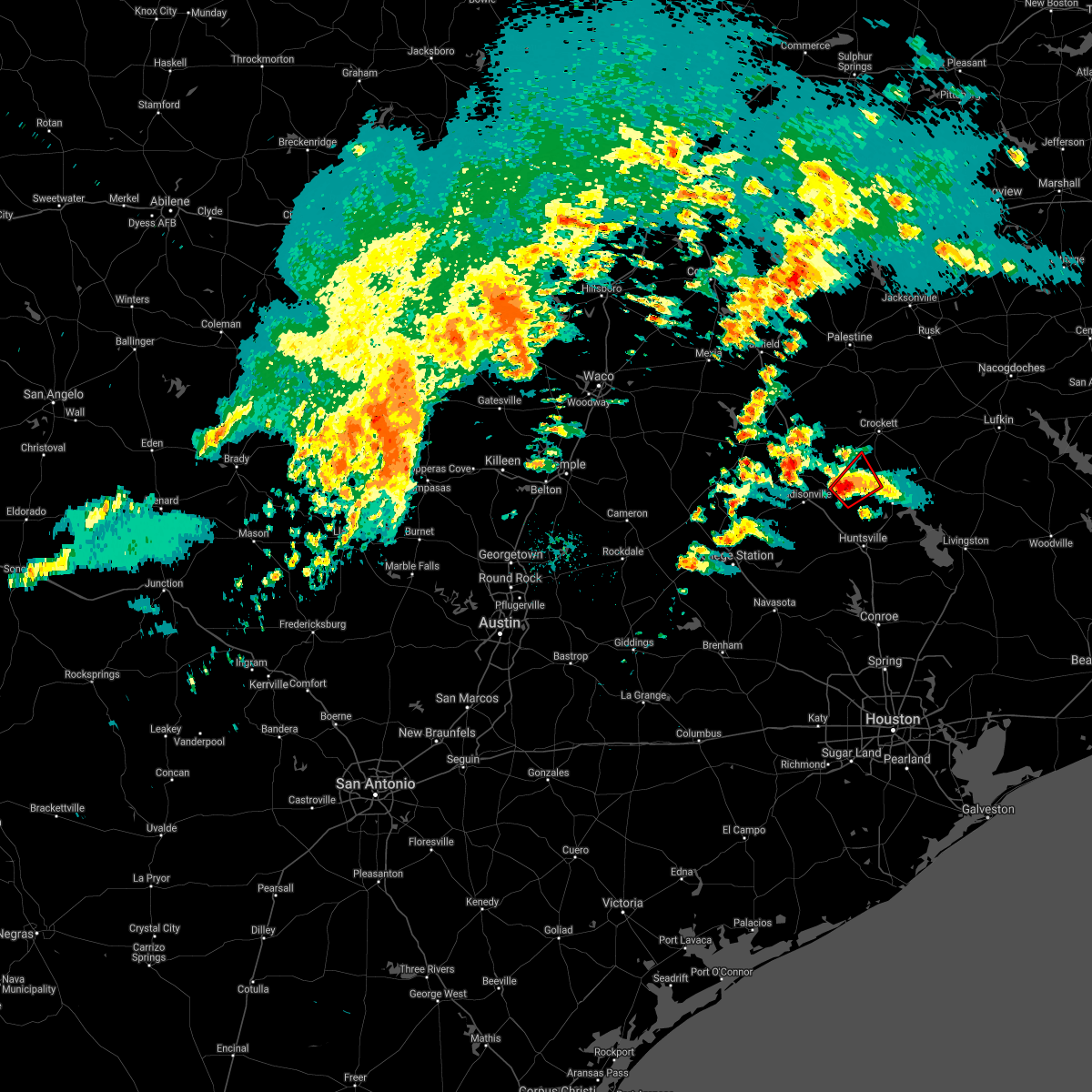 The national weather service in league city has issued a * tornado warning for. southwestern houston county in southeastern texas. northeastern madison county in southeastern texas. north central walker county in southeastern texas. Until 215 pm cdt. The national weather service in league city has issued a * tornado warning for. southwestern houston county in southeastern texas. northeastern madison county in southeastern texas. north central walker county in southeastern texas. Until 215 pm cdt.
|
| 5/11/2021 1:47 PM CDT |
 At 146 pm cdt, a severe thunderstorm capable of producing a tornado was located 11 miles southwest of austonio, moving north at 20 mph (radar indicated rotation). Hazards include tornado. Flying debris will be dangerous to those caught without shelter. mobile homes will be damaged or destroyed. damage to roofs, windows, and vehicles will occur. tree damage is likely. This tornadic thunderstorm will remain over mainly rural areas of southwestern houston and northeastern madison counties. At 146 pm cdt, a severe thunderstorm capable of producing a tornado was located 11 miles southwest of austonio, moving north at 20 mph (radar indicated rotation). Hazards include tornado. Flying debris will be dangerous to those caught without shelter. mobile homes will be damaged or destroyed. damage to roofs, windows, and vehicles will occur. tree damage is likely. This tornadic thunderstorm will remain over mainly rural areas of southwestern houston and northeastern madison counties.
|
| 5/11/2021 1:28 PM CDT |
 At 128 pm cdt, a severe thunderstorm capable of producing a tornado was located 8 miles east of madisonville, moving north at 20 mph (radar indicated rotation). Hazards include tornado. Flying debris will be dangerous to those caught without shelter. mobile homes will be damaged or destroyed. damage to roofs, windows, and vehicles will occur. tree damage is likely. This tornadic thunderstorm will remain over mainly rural areas of southwestern houston, eastern madison and west central walker counties. At 128 pm cdt, a severe thunderstorm capable of producing a tornado was located 8 miles east of madisonville, moving north at 20 mph (radar indicated rotation). Hazards include tornado. Flying debris will be dangerous to those caught without shelter. mobile homes will be damaged or destroyed. damage to roofs, windows, and vehicles will occur. tree damage is likely. This tornadic thunderstorm will remain over mainly rural areas of southwestern houston, eastern madison and west central walker counties.
|
| 3/23/2021 1:34 AM CDT |
 At 133 am cdt, a severe thunderstorm was located 10 miles east of madisonville, moving northeast at 45 mph (radar indicated). Hazards include 60 mph wind gusts and quarter size hail. Hail damage to vehicles is expected. expect wind damage to roofs, siding, and trees. Locations impacted include, trinity and lovelady. At 133 am cdt, a severe thunderstorm was located 10 miles east of madisonville, moving northeast at 45 mph (radar indicated). Hazards include 60 mph wind gusts and quarter size hail. Hail damage to vehicles is expected. expect wind damage to roofs, siding, and trees. Locations impacted include, trinity and lovelady.
|
| 3/23/2021 1:19 AM CDT |
 At 118 am cdt, a severe thunderstorm was located near madisonville, moving northeast at 45 mph (radar indicated). Hazards include ping pong ball size hail and 60 mph wind gusts. People and animals outdoors will be injured. expect hail damage to roofs, siding, windows, and vehicles. Expect wind damage to roofs, siding, and trees. At 118 am cdt, a severe thunderstorm was located near madisonville, moving northeast at 45 mph (radar indicated). Hazards include ping pong ball size hail and 60 mph wind gusts. People and animals outdoors will be injured. expect hail damage to roofs, siding, windows, and vehicles. Expect wind damage to roofs, siding, and trees.
|
| 1/6/2021 1:51 PM CST |
 At 150 pm cst, a severe thunderstorm was located 7 miles southwest of austonio, moving east at 30 to 40 mph. winds in excess of 40 mph will also be possible with this storm (radar indicated). Hazards include quarter to half dollar size hail. damage to vehicles is expected At 150 pm cst, a severe thunderstorm was located 7 miles southwest of austonio, moving east at 30 to 40 mph. winds in excess of 40 mph will also be possible with this storm (radar indicated). Hazards include quarter to half dollar size hail. damage to vehicles is expected
|
| 1/6/2021 1:14 PM CST |
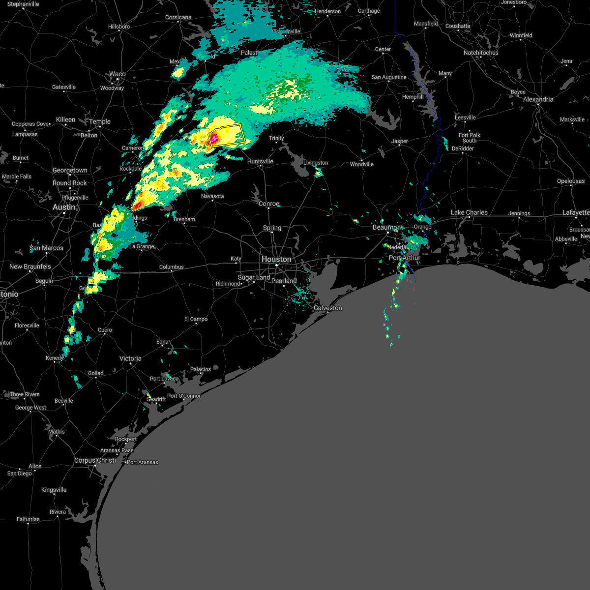 At 113 pm cst, a severe thunderstorm was located 10 miles west of madisonville, moving east at 30 to 40 mph. winds in excess of 40 mph will also be possible with this storm (radar indicated). Hazards include quarter to ping pong ball size hail. People and animals outdoors will be injured. Expect damage to roofs, siding, windows, and vehicles. At 113 pm cst, a severe thunderstorm was located 10 miles west of madisonville, moving east at 30 to 40 mph. winds in excess of 40 mph will also be possible with this storm (radar indicated). Hazards include quarter to ping pong ball size hail. People and animals outdoors will be injured. Expect damage to roofs, siding, windows, and vehicles.
|
| 4/29/2020 2:50 AM CDT |
 At 249 am cdt, severe thunderstorms were located along a line extending from near lufkin to near trinity to 13 miles northwest of riverside to 9 miles northwest of madisonville to 9 miles north of franklin, moving south at 45 mph (radar indicated). Hazards include 60 mph wind gusts and quarter size hail. Hail damage to vehicles is expected. Expect wind damage to roofs, siding, and trees. At 249 am cdt, severe thunderstorms were located along a line extending from near lufkin to near trinity to 13 miles northwest of riverside to 9 miles northwest of madisonville to 9 miles north of franklin, moving south at 45 mph (radar indicated). Hazards include 60 mph wind gusts and quarter size hail. Hail damage to vehicles is expected. Expect wind damage to roofs, siding, and trees.
|
| 4/29/2020 2:28 AM CDT |
 At 227 am cdt, severe thunderstorms were located along a line extending from 7 miles south of buffalo to near lovelady to wells, moving south at 25 mph (radar indicated). Hazards include 60 mph wind gusts and quarter size hail. Hail damage to vehicles is expected. Expect wind damage to roofs, siding, and trees. At 227 am cdt, severe thunderstorms were located along a line extending from 7 miles south of buffalo to near lovelady to wells, moving south at 25 mph (radar indicated). Hazards include 60 mph wind gusts and quarter size hail. Hail damage to vehicles is expected. Expect wind damage to roofs, siding, and trees.
|
| 1/10/2020 10:57 PM CST |
 The severe thunderstorm warning for northeastern grimes, northwestern montgomery, southwestern houston, madison and walker counties will expire at 1100 pm cst, the storms which prompted the warning have weakened below severe limits, and no longer pose an immediate threat to life or property. therefore, the warning will be allowed to expire. however gusty winds are still possible with these thunderstorms. a tornado watch remains in effect until 400 am cst for southeastern texas. The severe thunderstorm warning for northeastern grimes, northwestern montgomery, southwestern houston, madison and walker counties will expire at 1100 pm cst, the storms which prompted the warning have weakened below severe limits, and no longer pose an immediate threat to life or property. therefore, the warning will be allowed to expire. however gusty winds are still possible with these thunderstorms. a tornado watch remains in effect until 400 am cst for southeastern texas.
|
| 1/10/2020 10:49 PM CST |
 At 1049 pm cst, severe thunderstorms were located along a line extending from 9 miles west of austonio to 11 miles east of bedias to near anderson, moving northeast at 60 mph (radar indicated). Hazards include 60 mph wind gusts. Expect damage to roofs, siding, and trees. these severe storms will be near, huntsville, new waverly and huntsville state park around 1115 pm cst. Other locations impacted by these severe thunderstorms include richards, crabbs prairie, roans prairie and dacus. At 1049 pm cst, severe thunderstorms were located along a line extending from 9 miles west of austonio to 11 miles east of bedias to near anderson, moving northeast at 60 mph (radar indicated). Hazards include 60 mph wind gusts. Expect damage to roofs, siding, and trees. these severe storms will be near, huntsville, new waverly and huntsville state park around 1115 pm cst. Other locations impacted by these severe thunderstorms include richards, crabbs prairie, roans prairie and dacus.
|
| 1/10/2020 10:32 PM CST |
 At 1031 pm cst, severe thunderstorms were located along a line extending from 11 miles south of centerville to near bedias to near washington, moving northeast at 55 mph (radar indicated). Hazards include 60 mph wind gusts. Expect damage to roofs, siding, and trees. these severe storms will be near, bedias around 1035 pm cst. anderson around 1045 pm cst. Other locations impacted by these severe thunderstorms include crabbs prairie, roans prairie, iola, richards, north zulch, carlos, dacus and normangee. At 1031 pm cst, severe thunderstorms were located along a line extending from 11 miles south of centerville to near bedias to near washington, moving northeast at 55 mph (radar indicated). Hazards include 60 mph wind gusts. Expect damage to roofs, siding, and trees. these severe storms will be near, bedias around 1035 pm cst. anderson around 1045 pm cst. Other locations impacted by these severe thunderstorms include crabbs prairie, roans prairie, iola, richards, north zulch, carlos, dacus and normangee.
|
| 1/10/2020 10:15 PM CST |
 At 1014 pm cst, severe thunderstorms were located along a line extending from 14 miles north of kurten to 7 miles east of college station to 8 miles northeast of brenham, moving northeast at 55 mph (radar indicated). Hazards include 60 mph wind gusts. Expect damage to roofs, siding, and trees. severe thunderstorms will be near, navasota around 1030 pm cst. bedias around 1035 pm cst. anderson around 1040 pm cst. Other locations impacted by these severe thunderstorms include wellborn, crabbs prairie, roans prairie, independence, iola, richards, north zulch, carlos, dacus and normangee. At 1014 pm cst, severe thunderstorms were located along a line extending from 14 miles north of kurten to 7 miles east of college station to 8 miles northeast of brenham, moving northeast at 55 mph (radar indicated). Hazards include 60 mph wind gusts. Expect damage to roofs, siding, and trees. severe thunderstorms will be near, navasota around 1030 pm cst. bedias around 1035 pm cst. anderson around 1040 pm cst. Other locations impacted by these severe thunderstorms include wellborn, crabbs prairie, roans prairie, independence, iola, richards, north zulch, carlos, dacus and normangee.
|
| 6/20/2019 6:05 AM CDT |
 At 605 am cdt, a severe thunderstorm was located near madisonville, moving east at 50 mph (radar indicated). Hazards include quarter size hail. Damage to vehicles is expected. This severe thunderstorm will remain over mainly rural areas of southwestern houston and northeastern madison counties. At 605 am cdt, a severe thunderstorm was located near madisonville, moving east at 50 mph (radar indicated). Hazards include quarter size hail. Damage to vehicles is expected. This severe thunderstorm will remain over mainly rural areas of southwestern houston and northeastern madison counties.
|
| 6/20/2019 5:56 AM CDT |
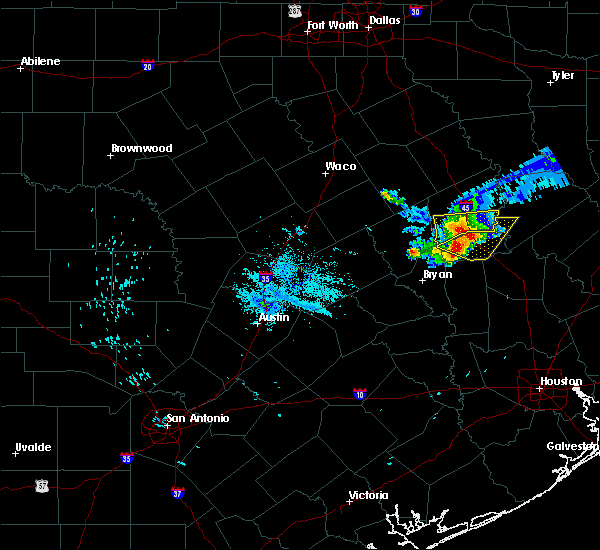 At 556 am cdt, a severe thunderstorm was located 10 miles west of madisonville, moving southeast at 30 mph (radar indicated). Hazards include half dollar size hail. Damage to vehicles is expected. Locations impacted include, madisonville, austonio, normangee and north zulch. At 556 am cdt, a severe thunderstorm was located 10 miles west of madisonville, moving southeast at 30 mph (radar indicated). Hazards include half dollar size hail. Damage to vehicles is expected. Locations impacted include, madisonville, austonio, normangee and north zulch.
|
| 6/20/2019 5:36 AM CDT |
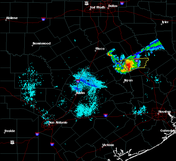 At 535 am cdt, a severe thunderstorm was located 15 miles east of franklin, or 21 miles northwest of madisonville, moving east at 35 mph. this storm has a history of producing hail of half-dollar size and gusts greater than 35 mph (radar indicated). Hazards include half dollar size hail. damage to vehicles is expected At 535 am cdt, a severe thunderstorm was located 15 miles east of franklin, or 21 miles northwest of madisonville, moving east at 35 mph. this storm has a history of producing hail of half-dollar size and gusts greater than 35 mph (radar indicated). Hazards include half dollar size hail. damage to vehicles is expected
|
| 5/8/2019 2:08 PM CDT |
 At 207 pm cdt, a line of severe thunderstorms was centered 11 miles northeast of kurten, or 12 miles southwest of madisonville, moving east at 55 mph (radar indicated). Hazards include 60 mph wind gusts. Expect damage to roofs, siding, and trees. the line has a history of downing trees. Locations impacted include, college station, bryan, madisonville, kurten, wixon valley, kyle field, iola and north zulch. At 207 pm cdt, a line of severe thunderstorms was centered 11 miles northeast of kurten, or 12 miles southwest of madisonville, moving east at 55 mph (radar indicated). Hazards include 60 mph wind gusts. Expect damage to roofs, siding, and trees. the line has a history of downing trees. Locations impacted include, college station, bryan, madisonville, kurten, wixon valley, kyle field, iola and north zulch.
|
| 5/8/2019 1:41 PM CDT |
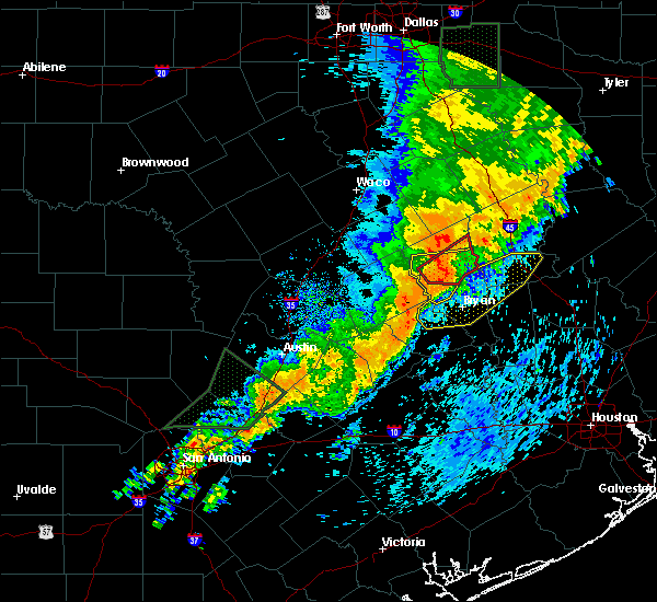 At 140 pm cdt, a line of severe thunderstorms was located near franklin, or 10 miles northeast of hearne, moving east at 45 mph (radar indicated). Hazards include 60 mph wind gusts. expect damage to roofs, siding, and trees At 140 pm cdt, a line of severe thunderstorms was located near franklin, or 10 miles northeast of hearne, moving east at 45 mph (radar indicated). Hazards include 60 mph wind gusts. expect damage to roofs, siding, and trees
|
| 4/24/2019 7:28 PM CDT |
 The severe thunderstorm warning for northeastern grimes, southeastern madison and west central walker counties will expire at 730 pm cdt, the storm which prompted the warning has weakened below severe limits, and no longer poses an immediate threat to life or property. therefore, the warning will be allowed to expire. however gusty winds and heavy rain are still possible with this thunderstorm. a severe thunderstorm watch remains in effect until 1000 pm cdt for southeastern texas. The severe thunderstorm warning for northeastern grimes, southeastern madison and west central walker counties will expire at 730 pm cdt, the storm which prompted the warning has weakened below severe limits, and no longer poses an immediate threat to life or property. therefore, the warning will be allowed to expire. however gusty winds and heavy rain are still possible with this thunderstorm. a severe thunderstorm watch remains in effect until 1000 pm cdt for southeastern texas.
|
| 4/24/2019 7:05 PM CDT |
 At 704 pm cdt, a severe thunderstorm was located over bedias, or 12 miles south of madisonville, moving northeast at 35 mph (radar indicated). Hazards include 60 mph wind gusts and quarter size hail. Hail damage to vehicles is expected. expect wind damage to roofs, siding, and trees. Locations impacted include, bedias. At 704 pm cdt, a severe thunderstorm was located over bedias, or 12 miles south of madisonville, moving northeast at 35 mph (radar indicated). Hazards include 60 mph wind gusts and quarter size hail. Hail damage to vehicles is expected. expect wind damage to roofs, siding, and trees. Locations impacted include, bedias.
|
| 4/24/2019 6:53 PM CDT |
 At 652 pm cdt, a severe thunderstorm was located near bedias, or 18 miles south of madisonville, moving northeast at 35 mph (radar indicated). Hazards include 60 mph wind gusts and quarter size hail. Hail damage to vehicles is expected. Expect wind damage to roofs, siding, and trees. At 652 pm cdt, a severe thunderstorm was located near bedias, or 18 miles south of madisonville, moving northeast at 35 mph (radar indicated). Hazards include 60 mph wind gusts and quarter size hail. Hail damage to vehicles is expected. Expect wind damage to roofs, siding, and trees.
|
| 4/24/2019 6:28 PM CDT |
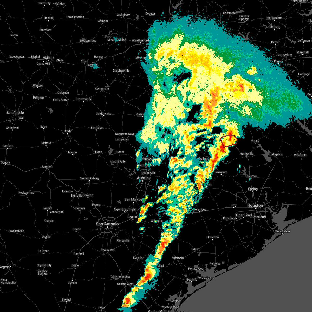 The tornado warning for central madison county will expire at 630 pm cdt, the storm which prompted the warning no longer appears capable of producing a tornado. therefore, the warning will be allowed to expire. strong winds and small hail are still a possibility. a severe thunderstorm watch remains in effect until 1000 pm cdt for southeastern texas. The tornado warning for central madison county will expire at 630 pm cdt, the storm which prompted the warning no longer appears capable of producing a tornado. therefore, the warning will be allowed to expire. strong winds and small hail are still a possibility. a severe thunderstorm watch remains in effect until 1000 pm cdt for southeastern texas.
|
| 4/24/2019 6:09 PM CDT |
 At 608 pm cdt, a severe thunderstorm capable of producing a tornado was located 5 miles west of madisonville, moving northeast at 30 mph (radar indicated rotation). Hazards include tornado and quarter size hail. Flying debris will be dangerous to those caught without shelter. mobile homes will be damaged or destroyed. damage to roofs, windows, and vehicles will occur. tree damage is likely. This dangerous storm will be near, madisonville around 620 pm cdt. At 608 pm cdt, a severe thunderstorm capable of producing a tornado was located 5 miles west of madisonville, moving northeast at 30 mph (radar indicated rotation). Hazards include tornado and quarter size hail. Flying debris will be dangerous to those caught without shelter. mobile homes will be damaged or destroyed. damage to roofs, windows, and vehicles will occur. tree damage is likely. This dangerous storm will be near, madisonville around 620 pm cdt.
|
| 4/24/2019 6:05 PM CDT |
 At 604 pm cdt, a severe thunderstorm was located 7 miles west of madisonville, moving northeast at 35 mph (radar indicated). Hazards include 60 mph wind gusts and quarter size hail. Hail damage to vehicles is expected. expect wind damage to roofs, siding, and trees. Locations impacted include, madisonville, bedias, normangee, iola and north zulch. At 604 pm cdt, a severe thunderstorm was located 7 miles west of madisonville, moving northeast at 35 mph (radar indicated). Hazards include 60 mph wind gusts and quarter size hail. Hail damage to vehicles is expected. expect wind damage to roofs, siding, and trees. Locations impacted include, madisonville, bedias, normangee, iola and north zulch.
|
| 4/24/2019 5:51 PM CDT |
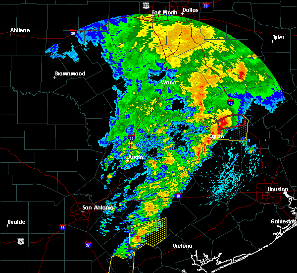 At 551 pm cdt, a severe thunderstorm capable of producing a tornado was located 10 miles northeast of kurten, or 14 miles west of madisonville, moving east at 35 mph (radar indicated rotation). Hazards include tornado and golf ball size hail. Flying debris will be dangerous to those caught without shelter. mobile homes will be damaged or destroyed. damage to roofs, windows, and vehicles will occur. tree damage is likely. this dangerous storm will be near, madisonville around 620 pm cdt. Other locations impacted by this tornadic thunderstorm include north zulch and normangee. At 551 pm cdt, a severe thunderstorm capable of producing a tornado was located 10 miles northeast of kurten, or 14 miles west of madisonville, moving east at 35 mph (radar indicated rotation). Hazards include tornado and golf ball size hail. Flying debris will be dangerous to those caught without shelter. mobile homes will be damaged or destroyed. damage to roofs, windows, and vehicles will occur. tree damage is likely. this dangerous storm will be near, madisonville around 620 pm cdt. Other locations impacted by this tornadic thunderstorm include north zulch and normangee.
|
| 4/24/2019 5:41 PM CDT |
 At 541 pm cdt, a severe thunderstorm was located near kurten, or 13 miles northeast of bryan, moving northeast at 40 mph (radar indicated). Hazards include golf ball size hail and 70 mph wind gusts. People and animals outdoors will be injured. expect hail damage to roofs, siding, windows, and vehicles. expect considerable tree damage. Wind damage is also likely to mobile homes, roofs, and outbuildings. At 541 pm cdt, a severe thunderstorm was located near kurten, or 13 miles northeast of bryan, moving northeast at 40 mph (radar indicated). Hazards include golf ball size hail and 70 mph wind gusts. People and animals outdoors will be injured. expect hail damage to roofs, siding, windows, and vehicles. expect considerable tree damage. Wind damage is also likely to mobile homes, roofs, and outbuildings.
|
| 4/18/2019 3:19 AM CDT |
 At 319 am cdt, severe thunderstorms were located along a line extending from near lovelady to near huntsville, moving east at 40 mph (radar indicated). Hazards include 60 mph wind gusts. Expect damage to roofs, siding, and trees. Locations impacted include, huntsville, trinity, riverside and crabbs prairie. At 319 am cdt, severe thunderstorms were located along a line extending from near lovelady to near huntsville, moving east at 40 mph (radar indicated). Hazards include 60 mph wind gusts. Expect damage to roofs, siding, and trees. Locations impacted include, huntsville, trinity, riverside and crabbs prairie.
|
| 4/18/2019 2:56 AM CDT |
 At 256 am cdt, severe thunderstorms were located along a line extending from 6 miles southwest of austonio to 12 miles southeast of bedias, moving east at 30 mph (radar indicated). Hazards include 60 mph wind gusts. expect damage to roofs, siding, and trees At 256 am cdt, severe thunderstorms were located along a line extending from 6 miles southwest of austonio to 12 miles southeast of bedias, moving east at 30 mph (radar indicated). Hazards include 60 mph wind gusts. expect damage to roofs, siding, and trees
|
| 4/18/2019 2:17 AM CDT |
 At 217 am cdt, severe thunderstorms were located along a line extending from 9 miles north of madisonville to 11 miles northwest of anderson, moving northeast at 40 mph (radar indicated). Hazards include 60 mph wind gusts. expect damage to roofs, siding, and trees At 217 am cdt, severe thunderstorms were located along a line extending from 9 miles north of madisonville to 11 miles northwest of anderson, moving northeast at 40 mph (radar indicated). Hazards include 60 mph wind gusts. expect damage to roofs, siding, and trees
|
| 4/13/2019 12:52 PM CDT |
 At 1252 pm cdt, a severe thunderstorm capable of producing a tornado was located near madisonville, moving northeast at 45 mph (radar indicated rotation). Hazards include tornado and quarter size hail. Flying debris will be dangerous to those caught without shelter. mobile homes will be damaged or destroyed. damage to roofs, windows, and vehicles will occur. tree damage is likely. This dangerous storm will be near, austonio around 120 pm cdt. At 1252 pm cdt, a severe thunderstorm capable of producing a tornado was located near madisonville, moving northeast at 45 mph (radar indicated rotation). Hazards include tornado and quarter size hail. Flying debris will be dangerous to those caught without shelter. mobile homes will be damaged or destroyed. damage to roofs, windows, and vehicles will occur. tree damage is likely. This dangerous storm will be near, austonio around 120 pm cdt.
|
| 4/13/2019 12:51 PM CDT |
 At 1251 pm cdt, a severe thunderstorm capable of producing a tornado was located near madisonville, moving northeast at 45 mph (radar indicated rotation). Hazards include tornado and quarter size hail. Flying debris will be dangerous to those caught without shelter. mobile homes will be damaged or destroyed. damage to roofs, windows, and vehicles will occur. tree damage is likely. This tornadic thunderstorm will remain over mainly rural areas of southwestern houston and northeastern madison counties. At 1251 pm cdt, a severe thunderstorm capable of producing a tornado was located near madisonville, moving northeast at 45 mph (radar indicated rotation). Hazards include tornado and quarter size hail. Flying debris will be dangerous to those caught without shelter. mobile homes will be damaged or destroyed. damage to roofs, windows, and vehicles will occur. tree damage is likely. This tornadic thunderstorm will remain over mainly rural areas of southwestern houston and northeastern madison counties.
|
| 4/13/2019 12:37 PM CDT |
 At 1237 pm cdt, a severe thunderstorm capable of producing a tornado was located 10 miles northwest of bedias, or 10 miles southwest of madisonville, moving northeast at 40 mph (radar indicated rotation). Hazards include tornado and quarter size hail. Flying debris will be dangerous to those caught without shelter. mobile homes will be damaged or destroyed. damage to roofs, windows, and vehicles will occur. tree damage is likely. This dangerous storm will be near, madisonville around 1255 pm cdt. At 1237 pm cdt, a severe thunderstorm capable of producing a tornado was located 10 miles northwest of bedias, or 10 miles southwest of madisonville, moving northeast at 40 mph (radar indicated rotation). Hazards include tornado and quarter size hail. Flying debris will be dangerous to those caught without shelter. mobile homes will be damaged or destroyed. damage to roofs, windows, and vehicles will occur. tree damage is likely. This dangerous storm will be near, madisonville around 1255 pm cdt.
|
| 4/13/2019 12:12 PM CDT |
 At 1212 pm cdt, a severe thunderstorm capable of producing a tornado was located 9 miles south of austonio, moving northeast at 35 mph (radar indicated rotation). Hazards include tornado and quarter size hail. Flying debris will be dangerous to those caught without shelter. mobile homes will be damaged or destroyed. damage to roofs, windows, and vehicles will occur. tree damage is likely. this dangerous storm will be near, austonio around 1225 pm cdt. lovelady around 1230 pm cdt. crockett around 1250 pm cdt. Latexo around 1255 pm cdt. At 1212 pm cdt, a severe thunderstorm capable of producing a tornado was located 9 miles south of austonio, moving northeast at 35 mph (radar indicated rotation). Hazards include tornado and quarter size hail. Flying debris will be dangerous to those caught without shelter. mobile homes will be damaged or destroyed. damage to roofs, windows, and vehicles will occur. tree damage is likely. this dangerous storm will be near, austonio around 1225 pm cdt. lovelady around 1230 pm cdt. crockett around 1250 pm cdt. Latexo around 1255 pm cdt.
|
| 4/13/2019 12:07 PM CDT |
 At 1207 pm cdt, a severe thunderstorm capable of producing a tornado was located 10 miles south of austonio, moving northeast at 40 mph (radar indicated rotation). Hazards include tornado and quarter size hail. Flying debris will be dangerous to those caught without shelter. mobile homes will be damaged or destroyed. damage to roofs, windows, and vehicles will occur. tree damage is likely. This tornadic thunderstorm will remain over mainly rural areas of southwestern houston, eastern madison and west central walker counties. At 1207 pm cdt, a severe thunderstorm capable of producing a tornado was located 10 miles south of austonio, moving northeast at 40 mph (radar indicated rotation). Hazards include tornado and quarter size hail. Flying debris will be dangerous to those caught without shelter. mobile homes will be damaged or destroyed. damage to roofs, windows, and vehicles will occur. tree damage is likely. This tornadic thunderstorm will remain over mainly rural areas of southwestern houston, eastern madison and west central walker counties.
|
| 4/13/2019 11:50 AM CDT |
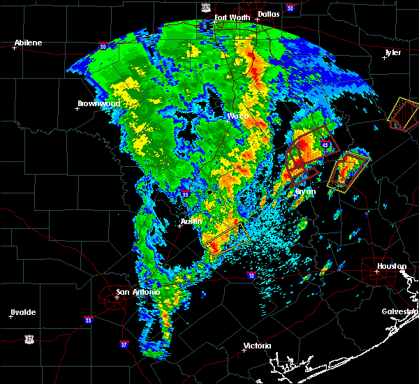 At 1150 am cdt, a severe thunderstorm capable of producing a tornado was located 8 miles southeast of madisonville, moving northeast at 35 mph (radar indicated rotation). Hazards include tornado and quarter size hail. Flying debris will be dangerous to those caught without shelter. mobile homes will be damaged or destroyed. damage to roofs, windows, and vehicles will occur. tree damage is likely. This tornadic thunderstorm will remain over mainly rural areas of northern grimes, southwestern houston, eastern madison and west central walker counties. At 1150 am cdt, a severe thunderstorm capable of producing a tornado was located 8 miles southeast of madisonville, moving northeast at 35 mph (radar indicated rotation). Hazards include tornado and quarter size hail. Flying debris will be dangerous to those caught without shelter. mobile homes will be damaged or destroyed. damage to roofs, windows, and vehicles will occur. tree damage is likely. This tornadic thunderstorm will remain over mainly rural areas of northern grimes, southwestern houston, eastern madison and west central walker counties.
|
| 4/13/2019 11:48 AM CDT |
 At 1147 am cdt, a severe thunderstorm was located 8 miles southeast of madisonville, moving north at 35 mph (radar indicated). Hazards include 60 mph wind gusts and quarter size hail. Hail damage to vehicles is expected. Expect wind damage to roofs, siding, and trees. At 1147 am cdt, a severe thunderstorm was located 8 miles southeast of madisonville, moving north at 35 mph (radar indicated). Hazards include 60 mph wind gusts and quarter size hail. Hail damage to vehicles is expected. Expect wind damage to roofs, siding, and trees.
|
| 4/6/2019 6:59 PM CDT |
 At 658 pm cdt, two severe thunderstorms were located over or just to the west of austonio, both moving northeast at 35 mph. these are very dangerous storms (radar indicated). Hazards include hail up to baseball size. People and animals outdoors will be severely injured. Expect shattered windows, extensive damage to roofs, siding, and vehicles. At 658 pm cdt, two severe thunderstorms were located over or just to the west of austonio, both moving northeast at 35 mph. these are very dangerous storms (radar indicated). Hazards include hail up to baseball size. People and animals outdoors will be severely injured. Expect shattered windows, extensive damage to roofs, siding, and vehicles.
|
| 4/6/2019 6:44 PM CDT |
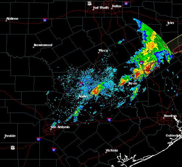 At 643 pm cdt, a severe thunderstorm capable of producing a tornado was located near austonio, moving northeast at 45 mph (radar indicated rotation). Hazards include tornado and two inch hail. Flying debris will be dangerous to those caught without shelter. mobile homes will be damaged or destroyed. damage to roofs, windows, and vehicles will occur. tree damage is likely. This dangerous storm will be near, austonio around 650 pm cdt. At 643 pm cdt, a severe thunderstorm capable of producing a tornado was located near austonio, moving northeast at 45 mph (radar indicated rotation). Hazards include tornado and two inch hail. Flying debris will be dangerous to those caught without shelter. mobile homes will be damaged or destroyed. damage to roofs, windows, and vehicles will occur. tree damage is likely. This dangerous storm will be near, austonio around 650 pm cdt.
|
| 4/6/2019 6:28 PM CDT |
 At 628 pm cdt, a severe thunderstorm capable of producing a tornado was located 8 miles north of madisonville, moving east at 45 mph (radar indicated rotation). Hazards include tornado and hail up to two inches in diameter. Flying debris will be dangerous to those caught without shelter. mobile homes will be damaged or destroyed. damage to roofs, windows, and vehicles will occur. tree damage is likely. this dangerous storm will be near, austonio around 650 pm cdt. Lovelady around 700 pm cdt. At 628 pm cdt, a severe thunderstorm capable of producing a tornado was located 8 miles north of madisonville, moving east at 45 mph (radar indicated rotation). Hazards include tornado and hail up to two inches in diameter. Flying debris will be dangerous to those caught without shelter. mobile homes will be damaged or destroyed. damage to roofs, windows, and vehicles will occur. tree damage is likely. this dangerous storm will be near, austonio around 650 pm cdt. Lovelady around 700 pm cdt.
|
| 12/27/2018 1:10 AM CST |
 At 109 am cst, a severe thunderstorm was located over austonio, moving northeast at 55 mph (law enforcement in madison county had received multiple reports of trees down in the county. law enforcement in brazos county has also reported trees down in this storm`s history). Hazards include 60 mph wind gusts and penny size hail. Expect damage to roofs, siding, and trees. locations impacted include, austonio and lovelady. A tornado watch remains in effect until 400 am cst for southeastern texas. At 109 am cst, a severe thunderstorm was located over austonio, moving northeast at 55 mph (law enforcement in madison county had received multiple reports of trees down in the county. law enforcement in brazos county has also reported trees down in this storm`s history). Hazards include 60 mph wind gusts and penny size hail. Expect damage to roofs, siding, and trees. locations impacted include, austonio and lovelady. A tornado watch remains in effect until 400 am cst for southeastern texas.
|
| 12/27/2018 1:00 AM CST | Multiple reports trees down madison county including hwy 21w near midwa in madison county TX, 0.5 miles SSW of Midway, TX |
| 12/27/2018 12:49 AM CST |
 At 1248 am cst, a severe thunderstorm was located near madisonville, moving northeast at 55 mph (radar indicated. this storm also has a history of producing wind damage in brazos county). Hazards include 60 mph wind gusts and nickel size hail. Expect damage to roofs, siding, and trees. locations impacted include, madisonville, austonio, lovelady and north zulch. A tornado watch remains in effect until 400 am cst for southeastern texas. At 1248 am cst, a severe thunderstorm was located near madisonville, moving northeast at 55 mph (radar indicated. this storm also has a history of producing wind damage in brazos county). Hazards include 60 mph wind gusts and nickel size hail. Expect damage to roofs, siding, and trees. locations impacted include, madisonville, austonio, lovelady and north zulch. A tornado watch remains in effect until 400 am cst for southeastern texas.
|
| 12/27/2018 12:38 AM CST |
 At 1237 am cst, a severe thunderstorm was located 9 miles southwest of madisonville, moving northeast at 55 mph (radar indicated). Hazards include 60 mph wind gusts and nickel size hail. expect damage to roofs, siding, and trees At 1237 am cst, a severe thunderstorm was located 9 miles southwest of madisonville, moving northeast at 55 mph (radar indicated). Hazards include 60 mph wind gusts and nickel size hail. expect damage to roofs, siding, and trees
|
| 12/27/2018 12:31 AM CST |
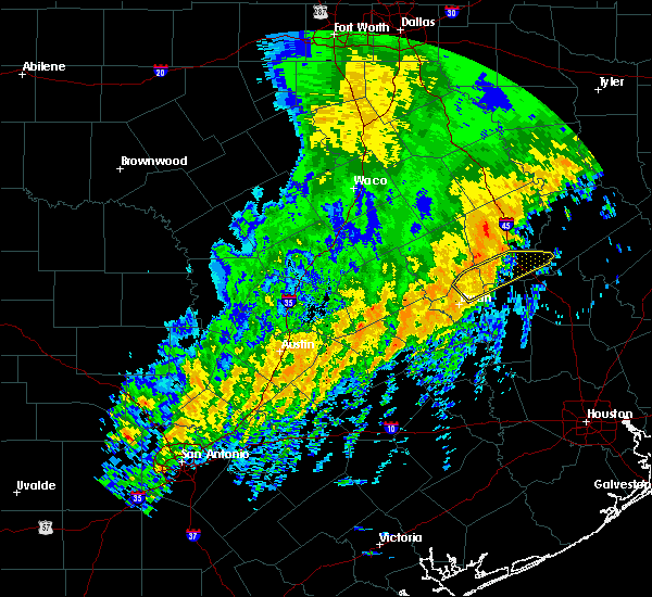 At 1230 am cst, a severe thunderstorm was located 12 miles west of madisonville, moving northeast at 65 mph (radar indicated). Hazards include 60 mph wind gusts and nickel size hail. Expect damage to roofs, siding, and trees. locations impacted include, madisonville, kurten, wixon valley and north zulch. A tornado watch remains in effect until 400 am cst for southeastern texas. At 1230 am cst, a severe thunderstorm was located 12 miles west of madisonville, moving northeast at 65 mph (radar indicated). Hazards include 60 mph wind gusts and nickel size hail. Expect damage to roofs, siding, and trees. locations impacted include, madisonville, kurten, wixon valley and north zulch. A tornado watch remains in effect until 400 am cst for southeastern texas.
|
| 12/27/2018 12:18 AM CST |
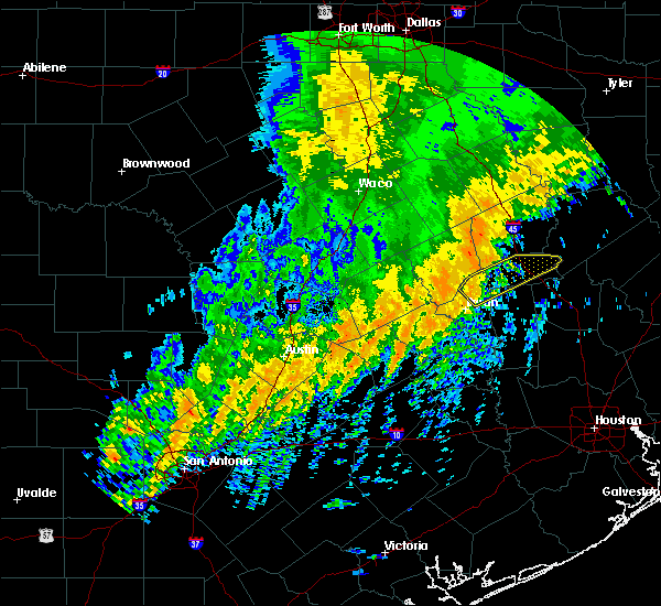 At 1218 am cst, a severe thunderstorm was located near kurten, or 12 miles northeast of bryan, moving northeast at 65 mph (radar indicated). Hazards include 70 mph wind gusts and quarter size hail. Hail damage to vehicles is expected. expect considerable tree damage. Wind damage is also likely to mobile homes, roofs, and outbuildings. At 1218 am cst, a severe thunderstorm was located near kurten, or 12 miles northeast of bryan, moving northeast at 65 mph (radar indicated). Hazards include 70 mph wind gusts and quarter size hail. Hail damage to vehicles is expected. expect considerable tree damage. Wind damage is also likely to mobile homes, roofs, and outbuildings.
|
| 7/5/2018 8:20 PM CDT |
 The severe thunderstorm warning for southwestern trinity, northeastern grimes, northwestern montgomery, northwestern san jacinto, southern houston, eastern madison and walker counties will expire at 830 pm cdt, the storms which prompted the warning have weakened below severe limits, and no longer pose an immediate threat to life or property. therefore, the warning will be allowed to expire. however gusty winds are still possible with these thunderstorms. The severe thunderstorm warning for southwestern trinity, northeastern grimes, northwestern montgomery, northwestern san jacinto, southern houston, eastern madison and walker counties will expire at 830 pm cdt, the storms which prompted the warning have weakened below severe limits, and no longer pose an immediate threat to life or property. therefore, the warning will be allowed to expire. however gusty winds are still possible with these thunderstorms.
|
| 7/5/2018 8:10 PM CDT |
 At 810 pm cdt, severe thunderstorms were located along a line extending from 10 miles southeast of madisonville to 9 miles northwest of huntsville to near riverside, moving southwest at 25 mph (radar indicated). Hazards include 60 mph wind gusts. Expect damage to roofs, siding, and trees. Locations impacted include, huntsville, new waverly, riverside, bedias, huntsville state park, crabbs prairie and oakhurst. At 810 pm cdt, severe thunderstorms were located along a line extending from 10 miles southeast of madisonville to 9 miles northwest of huntsville to near riverside, moving southwest at 25 mph (radar indicated). Hazards include 60 mph wind gusts. Expect damage to roofs, siding, and trees. Locations impacted include, huntsville, new waverly, riverside, bedias, huntsville state park, crabbs prairie and oakhurst.
|
| 7/5/2018 7:52 PM CDT |
 At 752 pm cdt, severe thunderstorms were located along a line extending from 9 miles east of madisonville to 6 miles northwest of riverside to near sebastopol, moving south at 25 mph (radar indicated). Hazards include 60 mph wind gusts. expect damage to roofs, siding, and trees At 752 pm cdt, severe thunderstorms were located along a line extending from 9 miles east of madisonville to 6 miles northwest of riverside to near sebastopol, moving south at 25 mph (radar indicated). Hazards include 60 mph wind gusts. expect damage to roofs, siding, and trees
|
| 3/18/2018 6:21 PM CDT |
 At 621 pm cdt, a severe thunderstorm was located 11 miles northwest of riverside, or 15 miles north of huntsville, moving east at 45 mph. this is a very dangerous storm (radar indicated). Hazards include baseball size hail and 60 mph wind gusts. People and animals outdoors will be severely injured. expect shattered windows, extensive damage to roofs, siding, and vehicles. Locations impacted include, northern huntsville, madisonville, bedias and crabbs prairie. At 621 pm cdt, a severe thunderstorm was located 11 miles northwest of riverside, or 15 miles north of huntsville, moving east at 45 mph. this is a very dangerous storm (radar indicated). Hazards include baseball size hail and 60 mph wind gusts. People and animals outdoors will be severely injured. expect shattered windows, extensive damage to roofs, siding, and vehicles. Locations impacted include, northern huntsville, madisonville, bedias and crabbs prairie.
|
| 3/18/2018 6:06 PM CDT |
 At 606 pm cdt, a severe thunderstorm was located 10 miles southeast of madisonville, moving east at 45 mph (radar indicated). Hazards include tennis ball size hail and 60 mph wind gusts. People and animals outdoors will be injured. expect hail damage to roofs, siding, windows, and vehicles. expect wind damage to roofs, siding, and trees. Locations impacted include, northern huntsville, madisonville, bedias and crabbs prairie. At 606 pm cdt, a severe thunderstorm was located 10 miles southeast of madisonville, moving east at 45 mph (radar indicated). Hazards include tennis ball size hail and 60 mph wind gusts. People and animals outdoors will be injured. expect hail damage to roofs, siding, windows, and vehicles. expect wind damage to roofs, siding, and trees. Locations impacted include, northern huntsville, madisonville, bedias and crabbs prairie.
|
| 3/18/2018 5:46 PM CDT |
 At 546 pm cdt, a severe thunderstorm was located near bedias, or 9 miles southwest of madisonville, moving east at 45 mph (radar indicated). Hazards include tennis ball size hail and 60 mph wind gusts. People and animals outdoors will be injured. expect hail damage to roofs, siding, windows, and vehicles. Expect wind damage to roofs, siding, and trees. At 546 pm cdt, a severe thunderstorm was located near bedias, or 9 miles southwest of madisonville, moving east at 45 mph (radar indicated). Hazards include tennis ball size hail and 60 mph wind gusts. People and animals outdoors will be injured. expect hail damage to roofs, siding, windows, and vehicles. Expect wind damage to roofs, siding, and trees.
|
| 3/17/2018 9:06 PM CDT |
 At 905 pm cdt, a severe thunderstorm was located 7 miles southwest of austonio, moving east at 35 mph (public reported 1 inch hail with this storm in leon county). Hazards include 60 mph wind gusts and quarter size hail. Hail damage to vehicles is expected. Expect wind damage to roofs, siding, and trees. At 905 pm cdt, a severe thunderstorm was located 7 miles southwest of austonio, moving east at 35 mph (public reported 1 inch hail with this storm in leon county). Hazards include 60 mph wind gusts and quarter size hail. Hail damage to vehicles is expected. Expect wind damage to roofs, siding, and trees.
|
| 3/17/2018 9:00 PM CDT | Quarter sized hail reported 3.5 miles SSW of Midway, TX, public report of quarter-sized hail was sent to kbtx. |
| 3/17/2018 8:48 PM CDT |
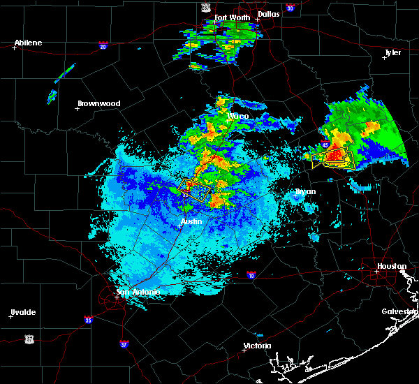 At 847 pm cdt, a severe thunderstorm was located 9 miles north of madisonville, moving east at 30 mph (public report 1 inch hail near i-45 and osr). Hazards include 60 mph wind gusts and quarter size hail. Hail damage to vehicles is expected. expect wind damage to roofs, siding, and trees. This severe thunderstorm will remain over mainly rural areas of southwestern houston and northeastern madison counties. At 847 pm cdt, a severe thunderstorm was located 9 miles north of madisonville, moving east at 30 mph (public report 1 inch hail near i-45 and osr). Hazards include 60 mph wind gusts and quarter size hail. Hail damage to vehicles is expected. expect wind damage to roofs, siding, and trees. This severe thunderstorm will remain over mainly rural areas of southwestern houston and northeastern madison counties.
|
| 3/17/2018 8:29 PM CDT |
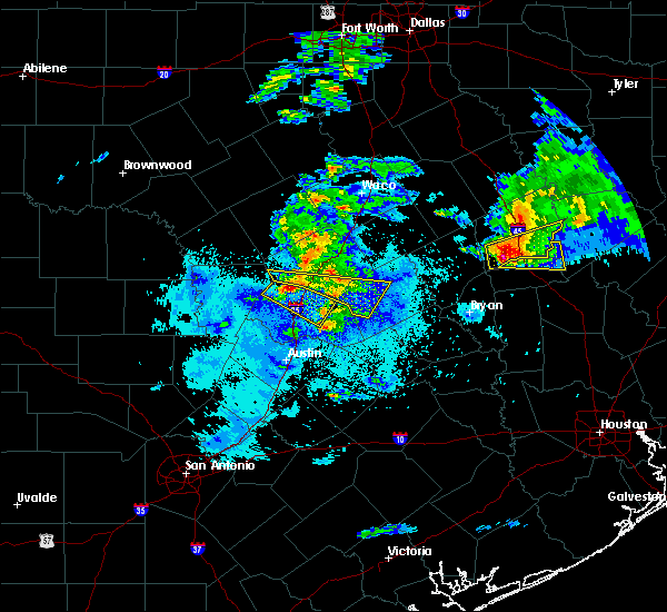 At 829 pm cdt, a severe thunderstorm was located 13 miles southwest of centerville, or 14 miles northwest of madisonville, moving east at 30 mph (radar indicated). Hazards include 60 mph wind gusts and quarter size hail. Hail damage to vehicles is expected. expect wind damage to roofs, siding, and trees. This severe thunderstorm will remain over mainly rural areas of southwestern houston and northern madison counties. At 829 pm cdt, a severe thunderstorm was located 13 miles southwest of centerville, or 14 miles northwest of madisonville, moving east at 30 mph (radar indicated). Hazards include 60 mph wind gusts and quarter size hail. Hail damage to vehicles is expected. expect wind damage to roofs, siding, and trees. This severe thunderstorm will remain over mainly rural areas of southwestern houston and northern madison counties.
|
| 5/28/2017 9:58 PM CDT |
 The severe thunderstorm warning for southwestern trinity, eastern grimes, northwestern montgomery, southwestern houston, eastern madison and walker counties will expire at 1000 pm cdt, the storms which prompted the warning have weakened below severe limits, and no longer pose an immediate threat to life or property. therefore the warning will be allowed to expire. however strong winds mph or greater are still possible with these thunderstorms. a severe thunderstorm watch remains in effect until 1100 pm cdt for southeastern texas. The severe thunderstorm warning for southwestern trinity, eastern grimes, northwestern montgomery, southwestern houston, eastern madison and walker counties will expire at 1000 pm cdt, the storms which prompted the warning have weakened below severe limits, and no longer pose an immediate threat to life or property. therefore the warning will be allowed to expire. however strong winds mph or greater are still possible with these thunderstorms. a severe thunderstorm watch remains in effect until 1100 pm cdt for southeastern texas.
|
| 5/28/2017 9:09 PM CDT |
 At 908 pm cdt, severe thunderstorms were located along a line extending from 9 miles southwest of austonio to near navasota, moving east at 30 mph (radar indicated). Hazards include 60 mph wind gusts and penny size hail. expect damage to roofs, siding, and trees At 908 pm cdt, severe thunderstorms were located along a line extending from 9 miles southwest of austonio to near navasota, moving east at 30 mph (radar indicated). Hazards include 60 mph wind gusts and penny size hail. expect damage to roofs, siding, and trees
|
| 5/28/2017 8:52 PM CDT |
 At 851 pm cdt, severe thunderstorms were located along a line extending from 7 miles northeast of madisonville to 9 miles southeast of bedias, moving east at 25 mph (radar indicated). Hazards include 60 mph wind gusts and penny size hail. Expect damage to roofs, siding, and trees. Locations impacted include, northwestern huntsville, madisonville, bedias and crabbs prairie. At 851 pm cdt, severe thunderstorms were located along a line extending from 7 miles northeast of madisonville to 9 miles southeast of bedias, moving east at 25 mph (radar indicated). Hazards include 60 mph wind gusts and penny size hail. Expect damage to roofs, siding, and trees. Locations impacted include, northwestern huntsville, madisonville, bedias and crabbs prairie.
|
| 5/28/2017 8:33 PM CDT |
 At 832 pm cdt, severe thunderstorms were located along a line extending from 9 miles northwest of madisonville to 9 miles southwest of bedias, moving east at 30 mph (radar indicated). Hazards include 60 mph wind gusts and penny size hail. expect damage to roofs, siding, and trees At 832 pm cdt, severe thunderstorms were located along a line extending from 9 miles northwest of madisonville to 9 miles southwest of bedias, moving east at 30 mph (radar indicated). Hazards include 60 mph wind gusts and penny size hail. expect damage to roofs, siding, and trees
|
| 5/21/2017 4:51 AM CDT |
 At 451 am cdt, a severe thunderstorm was located 12 miles east of madisonville, moving east at 20 mph (radar indicated). Hazards include quarter size hail. Damage to vehicles is expected. Locations impacted include, austonio. At 451 am cdt, a severe thunderstorm was located 12 miles east of madisonville, moving east at 20 mph (radar indicated). Hazards include quarter size hail. Damage to vehicles is expected. Locations impacted include, austonio.
|
| 5/21/2017 4:14 AM CDT |
 At 413 am cdt, a severe thunderstorm was located 2 miles west northwest of madisonville, moving east at 20 mph (radar indicated). Hazards include half dollar size hail. damage to vehicles is expected At 413 am cdt, a severe thunderstorm was located 2 miles west northwest of madisonville, moving east at 20 mph (radar indicated). Hazards include half dollar size hail. damage to vehicles is expected
|
| 5/3/2017 5:43 PM CDT |
 At 543 pm cdt, a severe thunderstorm was located near madisonville, moving east at 40 mph (radar indicated). Hazards include ping pong ball size hail and 60 mph wind gusts. People and animals outdoors will be injured. expect hail damage to roofs, siding, windows, and vehicles. Expect wind damage to roofs, siding, and trees. At 543 pm cdt, a severe thunderstorm was located near madisonville, moving east at 40 mph (radar indicated). Hazards include ping pong ball size hail and 60 mph wind gusts. People and animals outdoors will be injured. expect hail damage to roofs, siding, windows, and vehicles. Expect wind damage to roofs, siding, and trees.
|
| 5/3/2017 5:32 PM CDT |
 At 532 pm cdt, a severe thunderstorm was located over madisonville, moving east at 45 mph (radar indicated). Hazards include golf ball size hail and 60 mph wind gusts. People and animals outdoors will be injured. expect hail damage to roofs, siding, windows, and vehicles. expect wind damage to roofs, siding, and trees. Locations impacted include, madisonville and lovelady. At 532 pm cdt, a severe thunderstorm was located over madisonville, moving east at 45 mph (radar indicated). Hazards include golf ball size hail and 60 mph wind gusts. People and animals outdoors will be injured. expect hail damage to roofs, siding, windows, and vehicles. expect wind damage to roofs, siding, and trees. Locations impacted include, madisonville and lovelady.
|
| 5/3/2017 5:13 PM CDT |
 At 512 pm cdt, a severe thunderstorm was located 9 miles northwest of madisonville, moving east at 35 mph (radar indicated). Hazards include 60 mph wind gusts and quarter size hail. Hail damage to vehicles is expected. Expect wind damage to roofs, siding, and trees. At 512 pm cdt, a severe thunderstorm was located 9 miles northwest of madisonville, moving east at 35 mph (radar indicated). Hazards include 60 mph wind gusts and quarter size hail. Hail damage to vehicles is expected. Expect wind damage to roofs, siding, and trees.
|
| 4/2/2017 7:10 AM CDT |
 At 709 am cdt, a severe thunderstorm was located over madisonville, moving north at 55 mph (radar indicated). Hazards include 60 mph wind gusts and quarter size hail. Hail damage to vehicles is expected. Expect wind damage to roofs, siding, and trees. At 709 am cdt, a severe thunderstorm was located over madisonville, moving north at 55 mph (radar indicated). Hazards include 60 mph wind gusts and quarter size hail. Hail damage to vehicles is expected. Expect wind damage to roofs, siding, and trees.
|
| 2/20/2017 2:17 AM CST |
 At 216 am cst, severe thunderstorms were located along a line extending from near madisonville to near bedias to near anderson, moving east at 45 mph (radar indicated). Hazards include 60 mph wind gusts. Expect damage to roofs, siding, and trees. Locations impacted include, madisonville, bedias, kurten, iola and north zulch. At 216 am cst, severe thunderstorms were located along a line extending from near madisonville to near bedias to near anderson, moving east at 45 mph (radar indicated). Hazards include 60 mph wind gusts. Expect damage to roofs, siding, and trees. Locations impacted include, madisonville, bedias, kurten, iola and north zulch.
|
| 2/20/2017 1:28 AM CST |
 At 127 am cst, severe thunderstorms were located along a line extending from near hearne to near bryan to near snook, moving east at 45 mph (radar indicated). Hazards include 70 mph wind gusts. Expect considerable tree damage. Damage is likely to mobile homes, roofs, and outbuildings. At 127 am cst, severe thunderstorms were located along a line extending from near hearne to near bryan to near snook, moving east at 45 mph (radar indicated). Hazards include 70 mph wind gusts. Expect considerable tree damage. Damage is likely to mobile homes, roofs, and outbuildings.
|
| 4/27/2016 4:26 AM CDT |
 At 425 am cdt, severe thunderstorms were located along a line extending from 8 miles northeast of madisonville to 9 miles west of huntsville to 12 miles west of huntsville state park, moving northeast at 45 mph (radar indicated). Hazards include 60 mph wind gusts. Expect damage to roofs. siding. And trees. At 425 am cdt, severe thunderstorms were located along a line extending from 8 miles northeast of madisonville to 9 miles west of huntsville to 12 miles west of huntsville state park, moving northeast at 45 mph (radar indicated). Hazards include 60 mph wind gusts. Expect damage to roofs. siding. And trees.
|
| 4/27/2016 4:05 AM CDT |
 At 405 am cdt, severe thunderstorms were located along a line extending from 10 miles southwest of centerville to near bedias to near anderson, moving northeast at 60 mph (radar indicated). Hazards include 60 mph wind gusts. Expect damage to roofs. siding. and trees. Locations impacted include, northwestern huntsville, madisonville, austonio, bedias, iola, crabbs prairie, north zulch and carlos. At 405 am cdt, severe thunderstorms were located along a line extending from 10 miles southwest of centerville to near bedias to near anderson, moving northeast at 60 mph (radar indicated). Hazards include 60 mph wind gusts. Expect damage to roofs. siding. and trees. Locations impacted include, northwestern huntsville, madisonville, austonio, bedias, iola, crabbs prairie, north zulch and carlos.
|
| 4/27/2016 3:51 AM CDT |
 At 350 am cdt, severe thunderstorms were located along a line extending from 12 miles east of franklin to near kurten to near millican, moving northeast at 60 mph (radar indicated). Hazards include 60 mph wind gusts. Expect damage to roofs. siding. And trees. At 350 am cdt, severe thunderstorms were located along a line extending from 12 miles east of franklin to near kurten to near millican, moving northeast at 60 mph (radar indicated). Hazards include 60 mph wind gusts. Expect damage to roofs. siding. And trees.
|
| 5/25/2015 6:20 PM CDT | At 620 pm cdt, doppler radar indicated a severe thunderstorm capable of producing damaging winds in excess of 60 mph. this storm was located 7 miles southeast of madisonville, moving east at 40 mph. locations impacted include, madisonville, bedias, midway, iola, richards, north zulch, carlos and roans prairie. a tornado watch remains in effect until 1000 pm cdt for southeastern texas. |
| 5/25/2015 5:57 PM CDT | At 555 pm cdt, doppler radar indicated a severe thunderstorm capable of producing damaging winds in excess of 60 mph. this storm was located 8 miles west of bedias, or 16 miles southwest of madisonville, and moving east at 50 mph. |
| 5/25/2015 5:11 PM CDT | At 510 pm cdt, doppler radar indicated a line of severe thunderstorms capable of producing damaging winds in excess of 60 mph. these storms were located along a line extending from 12 miles southwest of buffalo to 10 miles southwest of centerville, moving northeast at 55 mph. locations impacted include, crockett, madisonville, austonio, grapeland, lovelady, kennard, latexo, midway, normangee, weches, and houston county lake. a tornado watch remains in effect until 1000 pm cdt for southeastern texas. |
| 5/25/2015 4:51 PM CDT | At 450 pm cdt, doppler radar indicated a line of severe thunderstorms capable of producing damaging winds in excess of 60 mph. these storms were located along a line extending from 15 miles east of bremond to 8 miles east of franklin, and moving northeast at 55 mph. |
| 5/14/2015 4:13 PM CDT | At 412 pm cdt, doppler radar indicated a severe thunderstorm capable of producing quarter size hail and damaging winds in excess of 60 mph. this storm was located near midway, or 14 miles east of madisonville, and moving north at 20 mph. |
| 4/24/2015 5:15 PM CDT | At 514 pm cdt, doppler radar indicated a severe thunderstorm capable of producing a tornado. this dangerous storm was located near midway, or 7 miles east of madisonville, and moving northeast at 25 mph. |
| 4/24/2015 5:03 PM CDT | At 503 pm cdt, doppler radar indicated a severe thunderstorm capable of producing quarter size hail. this storm was located over madisonville, and moving northeast at 35 mph. |
| 4/19/2015 4:52 PM CDT | At 451 pm cdt, doppler radar indicated a severe thunderstorm capable of producing quarter size hail. this storm was located near midway, or 9 miles east of madisonville, moving northeast at 45 mph. a storm spotter reported nickle size hail at 445 pm 3 miles east of madisonville. locations impacted include, midway. |
| 4/19/2015 4:39 PM CDT | At 439 pm cdt, doppler radar indicated a severe thunderstorm capable of producing quarter size hail. this storm was located over madisonville, and moving northeast at 40 mph. |
Hail Maps for Midway, TX


Connect with Interactive Hail Maps