

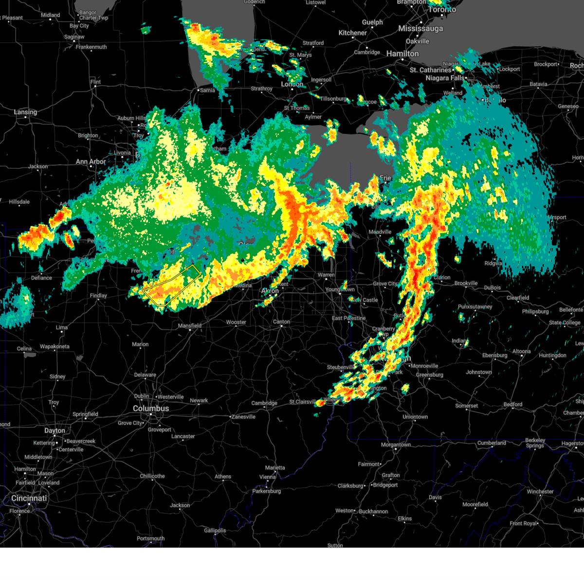
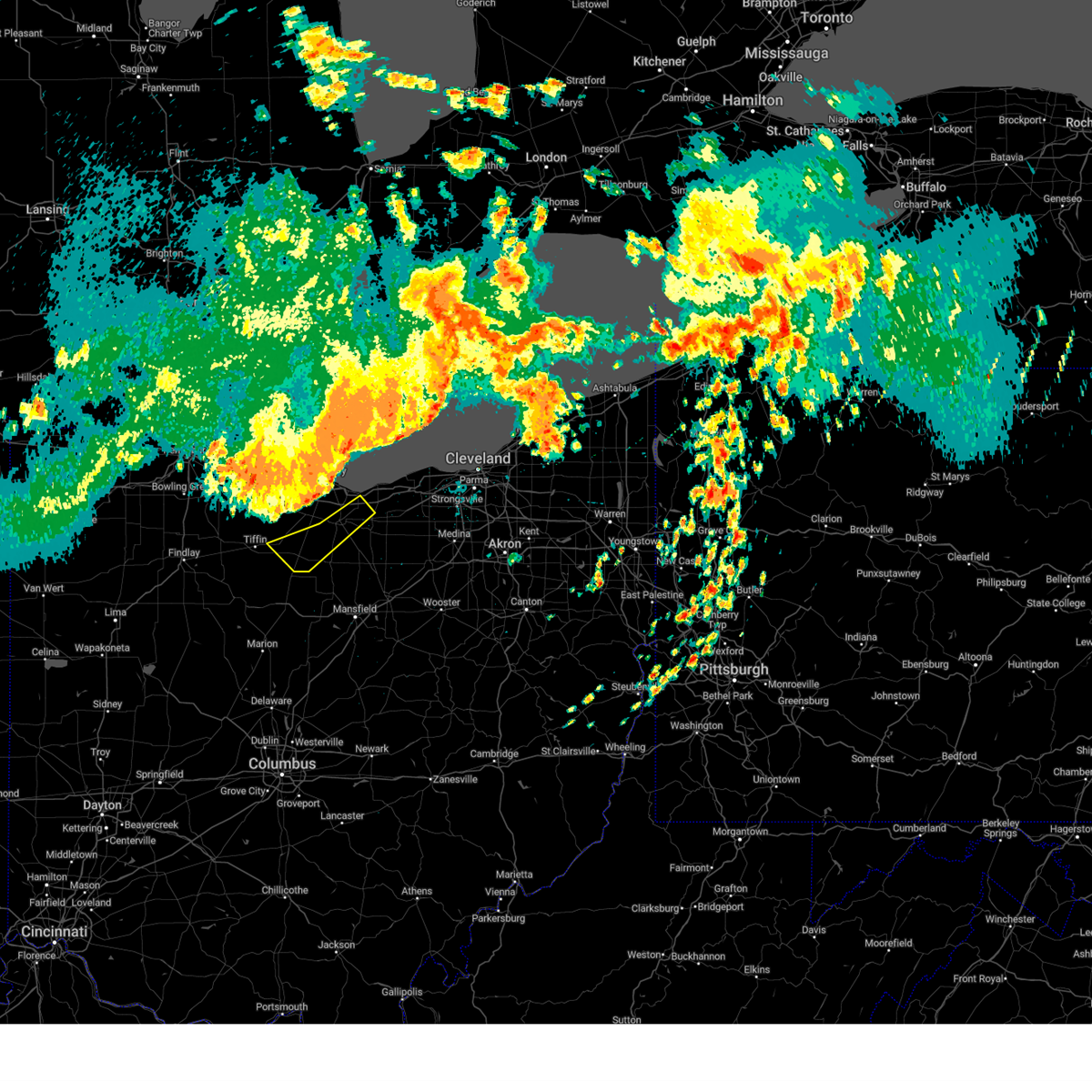
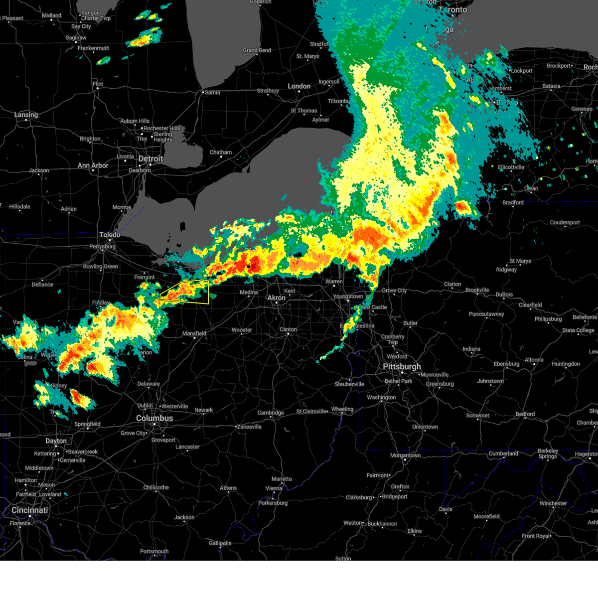
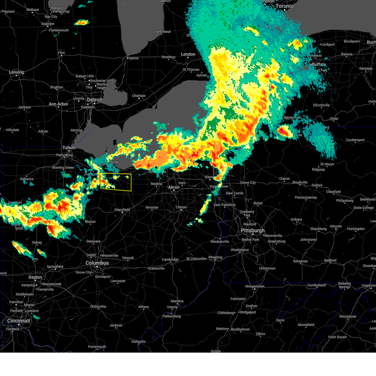
Hail Map for Milan, OH
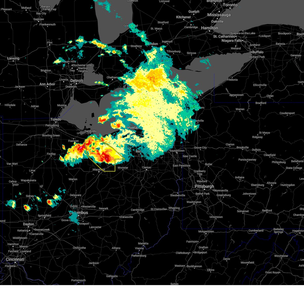
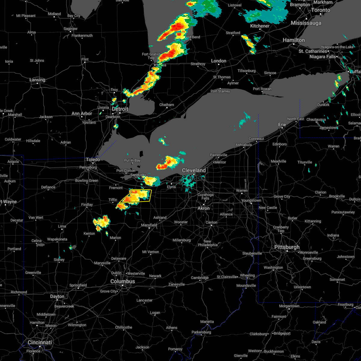
The Milan, OH area has had 3 reports of on-the-ground hail by trained spotters, and has been under severe weather warnings 29 times during the past 12 months. Doppler radar has detected hail at or near Milan, OH on 27 occasions, including 3 occasions during the past year.
| Name: | Milan, OH |
| Where Located: | 49.5 miles WSW of Cleveland, OH |
| Map: | Google Map for Milan, OH |
| Population: | 1367 |
| Housing Units: | 551 |
| More Info: | Search Google for Milan, OH |
3
The Top Recent Hail Date for Milan, OH is Thursday, June 15, 2023 (3rd out of 27)

Hail and Wind Damage Spotted near Milan, OH
| Date / Time | Report Details |
|---|---|
| 8/25/2023 12:13 AM EDT |
 The severe thunderstorm warning for western huron, southeastern seneca and erie counties will expire at 1215 am edt, the storms which prompted the warning have moved out of the warned area. therefore, the warning will be allowed to expire. a severe thunderstorm watch remains in effect until 300 am edt for north central and northwestern ohio. The severe thunderstorm warning for western huron, southeastern seneca and erie counties will expire at 1215 am edt, the storms which prompted the warning have moved out of the warned area. therefore, the warning will be allowed to expire. a severe thunderstorm watch remains in effect until 300 am edt for north central and northwestern ohio.
|
| 8/24/2023 11:47 PM EDT |
 At 1146 pm edt, severe thunderstorms were located along a line extending from near wakeman to near bloomville, moving southeast at 65 mph (radar indicated). Hazards include 60 mph wind gusts. expect damage to trees and power lines At 1146 pm edt, severe thunderstorms were located along a line extending from near wakeman to near bloomville, moving southeast at 65 mph (radar indicated). Hazards include 60 mph wind gusts. expect damage to trees and power lines
|
| 8/24/2023 11:12 PM EDT |
 At 1112 pm edt, severe thunderstorms were located along a line extending from 7 miles northeast of put-in-bay to near gibsonburg, moving southeast at 60 mph (radar indicated). Hazards include 70 mph wind gusts. Expect considerable tree damage. damage is likely to mobile homes, roofs, and outbuildings. Locations impacted include, sandusky, tiffin, norwalk, fremont, western vermilion, bellevue, clyde, willard, gibsonburg, green springs, northern milan, milan, wakeman, bloomville, castalia, ballville, monroeville, marblehead, attica and berlin heights. At 1112 pm edt, severe thunderstorms were located along a line extending from 7 miles northeast of put-in-bay to near gibsonburg, moving southeast at 60 mph (radar indicated). Hazards include 70 mph wind gusts. Expect considerable tree damage. damage is likely to mobile homes, roofs, and outbuildings. Locations impacted include, sandusky, tiffin, norwalk, fremont, western vermilion, bellevue, clyde, willard, gibsonburg, green springs, northern milan, milan, wakeman, bloomville, castalia, ballville, monroeville, marblehead, attica and berlin heights.
|
| 8/24/2023 11:03 PM EDT |
 At 1102 pm edt, severe thunderstorms were located along a line extending from 12 miles north of put-in-bay to 7 miles west of woodville, moving southeast at 60 mph (radar indicated). Hazards include 70 mph wind gusts. Expect considerable tree damage. Damage is likely to mobile homes, roofs, and outbuildings. At 1102 pm edt, severe thunderstorms were located along a line extending from 12 miles north of put-in-bay to 7 miles west of woodville, moving southeast at 60 mph (radar indicated). Hazards include 70 mph wind gusts. Expect considerable tree damage. Damage is likely to mobile homes, roofs, and outbuildings.
|
| 8/24/2023 12:13 AM EDT |
 At 1213 am edt, a severe thunderstorm was located near castalia, or near sandusky, moving south at 20 mph. a second severe thunderstorm was located near norwalk (radar indicated). Hazards include 60 mph wind gusts. expect damage to trees and power lines At 1213 am edt, a severe thunderstorm was located near castalia, or near sandusky, moving south at 20 mph. a second severe thunderstorm was located near norwalk (radar indicated). Hazards include 60 mph wind gusts. expect damage to trees and power lines
|
| 8/23/2023 11:52 PM EDT |
 At 1152 pm edt, severe thunderstorms were located along a line extending from near bellevue to near shelby, moving south at 25 mph (radar indicated). Hazards include 60 mph wind gusts. Expect damage to trees and power lines. locations impacted include, mansfield, sandusky, ashland, norwalk, shelby, bellevue, clyde, willard, ontario, new london, plymouth, northern milan, milan, castalia, savannah, greenwich, monroeville, attica, bay view and north fairfield. hail threat, radar indicated max hail size, <. 75 in wind threat, radar indicated max wind gust, 60 mph. At 1152 pm edt, severe thunderstorms were located along a line extending from near bellevue to near shelby, moving south at 25 mph (radar indicated). Hazards include 60 mph wind gusts. Expect damage to trees and power lines. locations impacted include, mansfield, sandusky, ashland, norwalk, shelby, bellevue, clyde, willard, ontario, new london, plymouth, northern milan, milan, castalia, savannah, greenwich, monroeville, attica, bay view and north fairfield. hail threat, radar indicated max hail size, <. 75 in wind threat, radar indicated max wind gust, 60 mph.
|
| 8/23/2023 11:15 PM EDT |
 At 1115 pm edt, severe thunderstorms were located along a line extending from near sandusky to 7 miles west of savannah, moving southwest at 25 mph (radar indicated). Hazards include 60 mph wind gusts and quarter size hail. Minor damage to vehicles is possible. Expect damage to trees and power lines. At 1115 pm edt, severe thunderstorms were located along a line extending from near sandusky to 7 miles west of savannah, moving southwest at 25 mph (radar indicated). Hazards include 60 mph wind gusts and quarter size hail. Minor damage to vehicles is possible. Expect damage to trees and power lines.
|
| 8/23/2023 10:55 PM EDT |
 At 1054 pm edt, severe thunderstorms were located along a line extending from sandusky to near wakeman, moving southwest at 20 mph (emergency management. there have been several reports of tree damage in sandusky). Hazards include 70 mph wind gusts and quarter size hail. Minor damage to vehicles is possible. expect considerable tree damage. wind damage is also likely to mobile homes, roofs, and outbuildings. locations impacted include, sandusky, norwalk, western vermilion, vermilion, port clinton, kelleys island, put-in-bay, bellevue, wellington, northern milan, milan, wakeman, castalia, oberlin, catawba island, pittsfield, monroeville, marblehead, berlin heights and bay view. thunderstorm damage threat, considerable hail threat, radar indicated max hail size, 1. 00 in wind threat, observed max wind gust, 70 mph. At 1054 pm edt, severe thunderstorms were located along a line extending from sandusky to near wakeman, moving southwest at 20 mph (emergency management. there have been several reports of tree damage in sandusky). Hazards include 70 mph wind gusts and quarter size hail. Minor damage to vehicles is possible. expect considerable tree damage. wind damage is also likely to mobile homes, roofs, and outbuildings. locations impacted include, sandusky, norwalk, western vermilion, vermilion, port clinton, kelleys island, put-in-bay, bellevue, wellington, northern milan, milan, wakeman, castalia, oberlin, catawba island, pittsfield, monroeville, marblehead, berlin heights and bay view. thunderstorm damage threat, considerable hail threat, radar indicated max hail size, 1. 00 in wind threat, observed max wind gust, 70 mph.
|
| 8/23/2023 10:42 PM EDT |
 At 1042 pm edt, severe thunderstorms were located along a line extending from near sandusky to near wakeman, moving south at 30 mph (emergency management. large tree limbs have been blown down in the city of sandusky). Hazards include 60 mph wind gusts and quarter size hail. Minor damage to vehicles is possible. expect damage to trees and power lines. locations impacted include, lorain, elyria, sandusky, norwalk, western vermilion, vermilion, port clinton, kelleys island, put-in-bay, north ridgeville, amherst, bellevue, grafton, wellington, northern milan, milan, wakeman, castalia, avon and sheffield lake. hail threat, radar indicated max hail size, 1. 00 in wind threat, observed max wind gust, 60 mph. At 1042 pm edt, severe thunderstorms were located along a line extending from near sandusky to near wakeman, moving south at 30 mph (emergency management. large tree limbs have been blown down in the city of sandusky). Hazards include 60 mph wind gusts and quarter size hail. Minor damage to vehicles is possible. expect damage to trees and power lines. locations impacted include, lorain, elyria, sandusky, norwalk, western vermilion, vermilion, port clinton, kelleys island, put-in-bay, north ridgeville, amherst, bellevue, grafton, wellington, northern milan, milan, wakeman, castalia, avon and sheffield lake. hail threat, radar indicated max hail size, 1. 00 in wind threat, observed max wind gust, 60 mph.
|
| 8/23/2023 10:29 PM EDT |
 At 1028 pm edt, severe thunderstorms were located along a line extending from near kelleys island to vermilion, moving southwest at 15 mph (radar indicated). Hazards include 60 mph wind gusts and quarter size hail. Minor damage to vehicles is possible. Expect damage to trees and power lines. At 1028 pm edt, severe thunderstorms were located along a line extending from near kelleys island to vermilion, moving southwest at 15 mph (radar indicated). Hazards include 60 mph wind gusts and quarter size hail. Minor damage to vehicles is possible. Expect damage to trees and power lines.
|
| 8/12/2023 2:12 PM EDT |
 The severe thunderstorm warning for northeastern huron, erie and northwestern lorain counties will expire at 215 pm edt, the storms which prompted the warning have moved out of the area. therefore, the warning will be allowed to expire. however heavy rain is still possible with these thunderstorms. a tornado watch remains in effect until 900 pm edt for north central and northwestern ohio. The severe thunderstorm warning for northeastern huron, erie and northwestern lorain counties will expire at 215 pm edt, the storms which prompted the warning have moved out of the area. therefore, the warning will be allowed to expire. however heavy rain is still possible with these thunderstorms. a tornado watch remains in effect until 900 pm edt for north central and northwestern ohio.
|
| 8/12/2023 2:03 PM EDT |
 At 203 pm edt, severe thunderstorms were located along a line extending from 10 miles north of western vermilion to near vermilion to 6 miles northwest of new london, moving east at 50 mph (radar indicated). Hazards include 60 mph wind gusts and quarter size hail. Minor damage to vehicles is possible. expect damage to trees and power lines. locations impacted include, lorain, sandusky, norwalk, western vermilion, vermilion, amherst, milan, wakeman, south amherst, marblehead, berlin heights, kipton, sandusky south, birmingham and fairview lanes. hail threat, radar indicated max hail size, 1. 00 in wind threat, radar indicated max wind gust, 60 mph. At 203 pm edt, severe thunderstorms were located along a line extending from 10 miles north of western vermilion to near vermilion to 6 miles northwest of new london, moving east at 50 mph (radar indicated). Hazards include 60 mph wind gusts and quarter size hail. Minor damage to vehicles is possible. expect damage to trees and power lines. locations impacted include, lorain, sandusky, norwalk, western vermilion, vermilion, amherst, milan, wakeman, south amherst, marblehead, berlin heights, kipton, sandusky south, birmingham and fairview lanes. hail threat, radar indicated max hail size, 1. 00 in wind threat, radar indicated max wind gust, 60 mph.
|
| 7/29/2023 4:52 AM EDT |
 At 452 am edt, severe thunderstorms were located along a line extending from near castalia to 6 miles northwest of willard, moving east at 55 mph (radar indicated). Hazards include 60 mph wind gusts. Expect damage to trees and power lines. locations impacted include, lorain, elyria, sandusky, norwalk, western vermilion, vermilion, amherst, bellevue, willard, wellington, new london, plymouth, northern milan, milan, wakeman, castalia, oberlin, south amherst, pittsfield and greenwich. hail threat, radar indicated max hail size, <. 75 in wind threat, radar indicated max wind gust, 60 mph. At 452 am edt, severe thunderstorms were located along a line extending from near castalia to 6 miles northwest of willard, moving east at 55 mph (radar indicated). Hazards include 60 mph wind gusts. Expect damage to trees and power lines. locations impacted include, lorain, elyria, sandusky, norwalk, western vermilion, vermilion, amherst, bellevue, willard, wellington, new london, plymouth, northern milan, milan, wakeman, castalia, oberlin, south amherst, pittsfield and greenwich. hail threat, radar indicated max hail size, <. 75 in wind threat, radar indicated max wind gust, 60 mph.
|
| 7/29/2023 4:28 AM EDT |
 At 428 am edt, severe thunderstorms were located along a line extending from near oak harbor to near tiffin, moving east at 60 mph (radar indicated). Hazards include 60 mph wind gusts. expect damage to trees and power lines At 428 am edt, severe thunderstorms were located along a line extending from near oak harbor to near tiffin, moving east at 60 mph (radar indicated). Hazards include 60 mph wind gusts. expect damage to trees and power lines
|
| 7/26/2023 5:19 PM EDT |
 At 518 pm edt, severe thunderstorms were located along a line extending from 25 miles north of avon lake to near western vermilion to 7 miles northeast of willard, moving east at 35 mph (radar indicated). Hazards include 60 mph wind gusts and nickel size hail. Expect damage to trees and power lines. locations impacted include, norwalk, western vermilion, willard, new london, plymouth, milan, northern milan, wakeman, greenwich, berlin heights, north fairfield and birmingham. hail threat, radar indicated max hail size, 0. 88 in wind threat, radar indicated max wind gust, 60 mph. At 518 pm edt, severe thunderstorms were located along a line extending from 25 miles north of avon lake to near western vermilion to 7 miles northeast of willard, moving east at 35 mph (radar indicated). Hazards include 60 mph wind gusts and nickel size hail. Expect damage to trees and power lines. locations impacted include, norwalk, western vermilion, willard, new london, plymouth, milan, northern milan, wakeman, greenwich, berlin heights, north fairfield and birmingham. hail threat, radar indicated max hail size, 0. 88 in wind threat, radar indicated max wind gust, 60 mph.
|
| 7/26/2023 4:57 PM EDT |
 At 457 pm edt, severe thunderstorms were located along a line extending from 26 miles northwest of avon lake to 6 miles east of sandusky to near willard, moving east at 35 mph (radar indicated). Hazards include 60 mph wind gusts and nickel size hail. Expect damage to trees and power lines. locations impacted include, sandusky, norwalk, western vermilion, bellevue, willard, new london, plymouth, northern milan, milan, wakeman, greenwich, monroeville, marblehead, berlin heights, north fairfield, bloomingville, sandusky south, birmingham and fairview lanes. hail threat, radar indicated max hail size, 0. 88 in wind threat, radar indicated max wind gust, 60 mph. At 457 pm edt, severe thunderstorms were located along a line extending from 26 miles northwest of avon lake to 6 miles east of sandusky to near willard, moving east at 35 mph (radar indicated). Hazards include 60 mph wind gusts and nickel size hail. Expect damage to trees and power lines. locations impacted include, sandusky, norwalk, western vermilion, bellevue, willard, new london, plymouth, northern milan, milan, wakeman, greenwich, monroeville, marblehead, berlin heights, north fairfield, bloomingville, sandusky south, birmingham and fairview lanes. hail threat, radar indicated max hail size, 0. 88 in wind threat, radar indicated max wind gust, 60 mph.
|
| 7/26/2023 4:23 PM EDT |
 At 422 pm edt, severe thunderstorms were located along a line extending from 15 miles northeast of put-in-bay to near port clinton to near tiffin, moving east at 35 mph (radar indicated). Hazards include 60 mph wind gusts and nickel size hail. expect damage to trees and power lines At 422 pm edt, severe thunderstorms were located along a line extending from 15 miles northeast of put-in-bay to near port clinton to near tiffin, moving east at 35 mph (radar indicated). Hazards include 60 mph wind gusts and nickel size hail. expect damage to trees and power lines
|
| 7/20/2023 7:19 PM EDT |
 At 718 pm edt, a severe thunderstorm was located over norwalk, moving east at 40 mph (radar indicated). Hazards include 60 mph wind gusts and quarter size hail. Minor damage to vehicles is possible. expect damage to trees and power lines. locations impacted include, norwalk, new london, milan, wakeman, monroeville and north fairfield. hail threat, radar indicated max hail size, 1. 00 in wind threat, radar indicated max wind gust, 60 mph. At 718 pm edt, a severe thunderstorm was located over norwalk, moving east at 40 mph (radar indicated). Hazards include 60 mph wind gusts and quarter size hail. Minor damage to vehicles is possible. expect damage to trees and power lines. locations impacted include, norwalk, new london, milan, wakeman, monroeville and north fairfield. hail threat, radar indicated max hail size, 1. 00 in wind threat, radar indicated max wind gust, 60 mph.
|
| 7/20/2023 7:01 PM EDT |
 At 700 pm edt, a severe thunderstorm was located near bellevue, or 11 miles west of norwalk, moving east at 40 mph (radar indicated). Hazards include 60 mph wind gusts and quarter size hail. Minor damage to vehicles is possible. Expect damage to trees and power lines. At 700 pm edt, a severe thunderstorm was located near bellevue, or 11 miles west of norwalk, moving east at 40 mph (radar indicated). Hazards include 60 mph wind gusts and quarter size hail. Minor damage to vehicles is possible. Expect damage to trees and power lines.
|
| 6/25/2023 7:29 PM EDT |
 The severe thunderstorm warning for ottawa, erie and southeastern sandusky counties will expire at 730 pm edt, the storm which prompted the warning has weakened below severe limits, and no longer poses an immediate threat to life or property. therefore, the warning will be allowed to expire. however gusty winds and heavy rain are still possible with this thunderstorm. a tornado watch remains in effect until 1100 pm edt for north central and northwestern ohio. The severe thunderstorm warning for ottawa, erie and southeastern sandusky counties will expire at 730 pm edt, the storm which prompted the warning has weakened below severe limits, and no longer poses an immediate threat to life or property. therefore, the warning will be allowed to expire. however gusty winds and heavy rain are still possible with this thunderstorm. a tornado watch remains in effect until 1100 pm edt for north central and northwestern ohio.
|
| 6/25/2023 7:20 PM EDT |
 At 720 pm edt, a severe thunderstorm was located near sandusky, moving east at 50 mph (radar indicated). Hazards include 60 mph wind gusts. Expect damage to trees and power lines. locations impacted include, sandusky, fremont, port clinton, clyde, northern milan, castalia, ballville, marblehead, bay view, bloomingville, sandusky south, stony prairie, fairview lanes, whites landing and vickery. hail threat, radar indicated max hail size, <. 75 in wind threat, radar indicated max wind gust, 60 mph. At 720 pm edt, a severe thunderstorm was located near sandusky, moving east at 50 mph (radar indicated). Hazards include 60 mph wind gusts. Expect damage to trees and power lines. locations impacted include, sandusky, fremont, port clinton, clyde, northern milan, castalia, ballville, marblehead, bay view, bloomingville, sandusky south, stony prairie, fairview lanes, whites landing and vickery. hail threat, radar indicated max hail size, <. 75 in wind threat, radar indicated max wind gust, 60 mph.
|
| 6/25/2023 7:00 PM EDT |
 At 700 pm edt, a severe thunderstorm was located near oak harbor, or 8 miles west of port clinton, moving east at 50 mph (radar indicated). Hazards include 60 mph wind gusts and quarter size hail. Minor damage to vehicles is possible. expect damage to trees and power lines. locations impacted include, sandusky, fremont, port clinton, clyde, oak harbor, gibsonburg, elmore, northern milan, castalia, ballville, marblehead, bay view, lindsey, rocky ridge, helena, bloomingville, sandusky south, stony prairie, fairview lanes and whites landing. hail threat, radar indicated max hail size, 1. 00 in wind threat, radar indicated max wind gust, 60 mph. At 700 pm edt, a severe thunderstorm was located near oak harbor, or 8 miles west of port clinton, moving east at 50 mph (radar indicated). Hazards include 60 mph wind gusts and quarter size hail. Minor damage to vehicles is possible. expect damage to trees and power lines. locations impacted include, sandusky, fremont, port clinton, clyde, oak harbor, gibsonburg, elmore, northern milan, castalia, ballville, marblehead, bay view, lindsey, rocky ridge, helena, bloomingville, sandusky south, stony prairie, fairview lanes and whites landing. hail threat, radar indicated max hail size, 1. 00 in wind threat, radar indicated max wind gust, 60 mph.
|
| 6/25/2023 6:36 PM EDT |
 At 636 pm edt, a severe thunderstorm was located near woodville, or 9 miles east of bowling green, moving east at 50 mph (radar indicated). Hazards include 60 mph wind gusts and quarter size hail. Minor damage to vehicles is possible. Expect damage to trees and power lines. At 636 pm edt, a severe thunderstorm was located near woodville, or 9 miles east of bowling green, moving east at 50 mph (radar indicated). Hazards include 60 mph wind gusts and quarter size hail. Minor damage to vehicles is possible. Expect damage to trees and power lines.
|
| 6/15/2023 8:35 PM EDT |
 At 834 pm edt, a severe thunderstorm was located 7 miles north of polk, or 12 miles north of ashland, moving southeast at 40 mph (law enforcement. golf ball sized hail was recently reported in savanna in northern ashland county). Hazards include golf ball size hail and 60 mph wind gusts. People and animals outdoors will be injured. expect hail damage to roofs, siding, windows, and vehicles. expect damage to trees and power lines. Locations impacted include, ashland, norwalk, bellevue, willard, wellington, lodi, new london, plymouth, northern milan, milan, wakeman, hayesville, savannah, polk, sullivan, greenwich, monroeville, spencer, berlin heights and jeromesville. At 834 pm edt, a severe thunderstorm was located 7 miles north of polk, or 12 miles north of ashland, moving southeast at 40 mph (law enforcement. golf ball sized hail was recently reported in savanna in northern ashland county). Hazards include golf ball size hail and 60 mph wind gusts. People and animals outdoors will be injured. expect hail damage to roofs, siding, windows, and vehicles. expect damage to trees and power lines. Locations impacted include, ashland, norwalk, bellevue, willard, wellington, lodi, new london, plymouth, northern milan, milan, wakeman, hayesville, savannah, polk, sullivan, greenwich, monroeville, spencer, berlin heights and jeromesville.
|
| 6/15/2023 8:09 PM EDT |
 At 809 pm edt, a severe thunderstorm was located near norwalk, moving southeast at 40 mph (trained spotters reported. golf ball sized hail was reported in norwalk with this storm). Hazards include golf ball size hail and 60 mph wind gusts. People and animals outdoors will be injured. expect hail damage to roofs, siding, windows, and vehicles. Expect damage to trees and power lines. At 809 pm edt, a severe thunderstorm was located near norwalk, moving southeast at 40 mph (trained spotters reported. golf ball sized hail was reported in norwalk with this storm). Hazards include golf ball size hail and 60 mph wind gusts. People and animals outdoors will be injured. expect hail damage to roofs, siding, windows, and vehicles. Expect damage to trees and power lines.
|
| 6/15/2023 7:43 PM EDT |
 At 743 pm edt, a severe thunderstorm was located near northern milan, or near norwalk, moving east at 35 mph (radar indicated). Hazards include ping pong ball size hail and 60 mph wind gusts. People and animals outdoors will be injured. expect hail damage to roofs, siding, windows, and vehicles. expect damage to trees and power lines. Locations impacted include, sandusky, norwalk, fremont, western vermilion, vermilion, port clinton, bellevue, clyde, oak harbor, elmore, green springs, northern milan, milan, wakeman, castalia, ballville, monroeville, marblehead, berlin heights and bay view. At 743 pm edt, a severe thunderstorm was located near northern milan, or near norwalk, moving east at 35 mph (radar indicated). Hazards include ping pong ball size hail and 60 mph wind gusts. People and animals outdoors will be injured. expect hail damage to roofs, siding, windows, and vehicles. expect damage to trees and power lines. Locations impacted include, sandusky, norwalk, fremont, western vermilion, vermilion, port clinton, bellevue, clyde, oak harbor, elmore, green springs, northern milan, milan, wakeman, castalia, ballville, monroeville, marblehead, berlin heights and bay view.
|
| 6/15/2023 7:28 PM EDT |
 At 727 pm edt, a severe thunderstorm capable of producing a tornado was located near castalia, or 3 miles east of vickery and 9 miles southwest of sandusky, moving southeast at 40 mph (radar indicated rotation). Hazards include tornado and golf ball size hail. Flying debris will be dangerous to those caught without shelter. mobile homes will be damaged or destroyed. damage to roofs, windows, and vehicles will occur. tree damage is likely. Locations impacted include, sandusky, northern milan, castalia, bloomingville, sandusky south and vickery. At 727 pm edt, a severe thunderstorm capable of producing a tornado was located near castalia, or 3 miles east of vickery and 9 miles southwest of sandusky, moving southeast at 40 mph (radar indicated rotation). Hazards include tornado and golf ball size hail. Flying debris will be dangerous to those caught without shelter. mobile homes will be damaged or destroyed. damage to roofs, windows, and vehicles will occur. tree damage is likely. Locations impacted include, sandusky, northern milan, castalia, bloomingville, sandusky south and vickery.
|
| 6/15/2023 7:24 PM EDT |
 At 722 pm edt, a severe thunderstorm was located over castalia, or near sandusky, moving east at 40 mph. additional storms are developing near freemont and bellevue (trained weather spotters. there have been numerous reports of large hail and wind damage with this thunderstorms over parts of ottawa and sandusky counties). Hazards include golf ball size hail and 60 mph wind gusts. People and animals outdoors will be injured. expect hail damage to roofs, siding, windows, and vehicles. Expect damage to trees and power lines. At 722 pm edt, a severe thunderstorm was located over castalia, or near sandusky, moving east at 40 mph. additional storms are developing near freemont and bellevue (trained weather spotters. there have been numerous reports of large hail and wind damage with this thunderstorms over parts of ottawa and sandusky counties). Hazards include golf ball size hail and 60 mph wind gusts. People and animals outdoors will be injured. expect hail damage to roofs, siding, windows, and vehicles. Expect damage to trees and power lines.
|
| 6/15/2023 7:12 PM EDT |
 At 711 pm edt, a severe thunderstorm capable of producing a tornado was located near port clinton and vickery, moving east at 45 mph (radar indicated rotation. this storm has a history of producing funnel clouds and potential tornado damage). Hazards include tornado and golf ball size hail. Flying debris will be dangerous to those caught without shelter. mobile homes will be damaged or destroyed. damage to roofs, windows, and vehicles will occur. Tree damage is likely. At 711 pm edt, a severe thunderstorm capable of producing a tornado was located near port clinton and vickery, moving east at 45 mph (radar indicated rotation. this storm has a history of producing funnel clouds and potential tornado damage). Hazards include tornado and golf ball size hail. Flying debris will be dangerous to those caught without shelter. mobile homes will be damaged or destroyed. damage to roofs, windows, and vehicles will occur. Tree damage is likely.
|
| 4/1/2023 12:11 PM EDT |
 The severe thunderstorm warning for huron and erie counties will expire at 1215 pm edt, the storms which prompted the warning have moved out of the area. therefore, the warning will be allowed to expire. wind gusts to 50 mph will continue for the next several hours and a wind advisory remains in effect until 800 pm edt. a severe thunderstorm watch remains in effect until 600 pm edt for north central ohio. The severe thunderstorm warning for huron and erie counties will expire at 1215 pm edt, the storms which prompted the warning have moved out of the area. therefore, the warning will be allowed to expire. wind gusts to 50 mph will continue for the next several hours and a wind advisory remains in effect until 800 pm edt. a severe thunderstorm watch remains in effect until 600 pm edt for north central ohio.
|
| 4/1/2023 11:50 AM EDT |
 At 1150 am edt, severe thunderstorms were located along a line extending from 7 miles east of sandusky to 6 miles northeast of northern milan to 7 miles south of norwalk, moving east at 65 mph. strong wind gusts in excess of 50 mph are continuing even after the rain exits (radar indicated). Hazards include 60 mph wind gusts. Expect damage to trees and power lines. locations impacted include, sandusky, norwalk, western vermilion, bellevue, willard, new london, plymouth, northern milan, milan, wakeman, castalia, greenwich, monroeville, marblehead, berlin heights, bay view, north fairfield, bloomingville, sandusky south and birmingham. hail threat, radar indicated max hail size, <. 75 in wind threat, radar indicated max wind gust, 60 mph. At 1150 am edt, severe thunderstorms were located along a line extending from 7 miles east of sandusky to 6 miles northeast of northern milan to 7 miles south of norwalk, moving east at 65 mph. strong wind gusts in excess of 50 mph are continuing even after the rain exits (radar indicated). Hazards include 60 mph wind gusts. Expect damage to trees and power lines. locations impacted include, sandusky, norwalk, western vermilion, bellevue, willard, new london, plymouth, northern milan, milan, wakeman, castalia, greenwich, monroeville, marblehead, berlin heights, bay view, north fairfield, bloomingville, sandusky south and birmingham. hail threat, radar indicated max hail size, <. 75 in wind threat, radar indicated max wind gust, 60 mph.
|
| 4/1/2023 11:22 AM EDT |
 At 1121 am edt, severe thunderstorms were located along a line extending from near oak harbor to near bloomville, moving east at 65 mph (radar indicated). Hazards include 60 mph wind gusts. expect damage to trees and power lines At 1121 am edt, severe thunderstorms were located along a line extending from near oak harbor to near bloomville, moving east at 65 mph (radar indicated). Hazards include 60 mph wind gusts. expect damage to trees and power lines
|
| 1/19/2023 5:50 PM EST |
 At 550 pm est, a severe thunderstorm was located near northern milan, or 7 miles northwest of norwalk, moving northeast at 50 mph (radar indicated). Hazards include 60 mph wind gusts. Expect damage to trees and power lines. locations impacted include, sandusky, norwalk, western vermilion, bellevue, clyde, northern milan, milan, wakeman, castalia, monroeville, berlin heights, north fairfield, flat rock, bloomingville, sandusky south, birmingham and fairview lanes. hail threat, radar indicated max hail size, <. 75 in wind threat, radar indicated max wind gust, 60 mph. At 550 pm est, a severe thunderstorm was located near northern milan, or 7 miles northwest of norwalk, moving northeast at 50 mph (radar indicated). Hazards include 60 mph wind gusts. Expect damage to trees and power lines. locations impacted include, sandusky, norwalk, western vermilion, bellevue, clyde, northern milan, milan, wakeman, castalia, monroeville, berlin heights, north fairfield, flat rock, bloomingville, sandusky south, birmingham and fairview lanes. hail threat, radar indicated max hail size, <. 75 in wind threat, radar indicated max wind gust, 60 mph.
|
| 1/19/2023 5:26 PM EST |
 At 526 pm est, a severe thunderstorm was located near green springs, or 10 miles northeast of tiffin, moving northeast at 50 mph (radar indicated). Hazards include 60 mph wind gusts and penny size hail. expect damage to trees and power lines At 526 pm est, a severe thunderstorm was located near green springs, or 10 miles northeast of tiffin, moving northeast at 50 mph (radar indicated). Hazards include 60 mph wind gusts and penny size hail. expect damage to trees and power lines
|
| 8/29/2022 7:30 PM EDT |
 At 730 pm edt, severe thunderstorms were located along a line extending from 12 miles east of kelleys island to near bloomville, moving east at 50 mph (radar indicated). Hazards include 60 mph wind gusts. Expect damage to trees and power lines. locations impacted include, sandusky, norwalk, western vermilion, vermilion, kelleys island, bellevue, willard, new london, plymouth, northern milan, milan, wakeman, castalia, greenwich, monroeville, marblehead, berlin heights, north fairfield, bloomingville and sandusky south. hail threat, radar indicated max hail size, <. 75 in wind threat, radar indicated max wind gust, 60 mph. At 730 pm edt, severe thunderstorms were located along a line extending from 12 miles east of kelleys island to near bloomville, moving east at 50 mph (radar indicated). Hazards include 60 mph wind gusts. Expect damage to trees and power lines. locations impacted include, sandusky, norwalk, western vermilion, vermilion, kelleys island, bellevue, willard, new london, plymouth, northern milan, milan, wakeman, castalia, greenwich, monroeville, marblehead, berlin heights, north fairfield, bloomingville and sandusky south. hail threat, radar indicated max hail size, <. 75 in wind threat, radar indicated max wind gust, 60 mph.
|
| 8/29/2022 7:08 PM EDT |
 At 708 pm edt, severe thunderstorms were located along a line extending from kelleys island to near new riegel, moving east at 45 mph (trained weather spotters. these thunderstorms have a history of producing wind damage across northwest ohio). Hazards include 60 mph wind gusts and penny size hail. expect damage to trees and power lines At 708 pm edt, severe thunderstorms were located along a line extending from kelleys island to near new riegel, moving east at 45 mph (trained weather spotters. these thunderstorms have a history of producing wind damage across northwest ohio). Hazards include 60 mph wind gusts and penny size hail. expect damage to trees and power lines
|
| 8/8/2022 7:25 PM EDT |
 At 725 pm edt, severe thunderstorms were located along a line extending from 16 miles northwest of timberlake to 6 miles northwest of euclid to 6 miles northeast of milan, moving southeast at 35 mph (radar indicated). Hazards include 60 mph wind gusts. expect damage to trees and power lines At 725 pm edt, severe thunderstorms were located along a line extending from 16 miles northwest of timberlake to 6 miles northwest of euclid to 6 miles northeast of milan, moving southeast at 35 mph (radar indicated). Hazards include 60 mph wind gusts. expect damage to trees and power lines
|
| 7/24/2022 10:56 PM EDT |
 At 1056 pm edt, severe thunderstorms were located along a line extending from near lorain to 6 miles north of willard, moving east at 55 mph (radar indicated). Hazards include 60 mph wind gusts. expect damage to trees and power lines At 1056 pm edt, severe thunderstorms were located along a line extending from near lorain to 6 miles north of willard, moving east at 55 mph (radar indicated). Hazards include 60 mph wind gusts. expect damage to trees and power lines
|
| 7/20/2022 6:18 PM EDT |
 At 618 pm edt, a severe thunderstorm was located over bellevue, or 12 miles west of norwalk, moving east at 20 mph (radar indicated). Hazards include 60 mph wind gusts and penny size hail. Expect damage to trees and power lines. locations impacted include, norwalk, bellevue, milan, northern milan, monroeville, republic and flat rock. hail threat, radar indicated max hail size, 0. 75 in wind threat, radar indicated max wind gust, 60 mph. At 618 pm edt, a severe thunderstorm was located over bellevue, or 12 miles west of norwalk, moving east at 20 mph (radar indicated). Hazards include 60 mph wind gusts and penny size hail. Expect damage to trees and power lines. locations impacted include, norwalk, bellevue, milan, northern milan, monroeville, republic and flat rock. hail threat, radar indicated max hail size, 0. 75 in wind threat, radar indicated max wind gust, 60 mph.
|
| 7/20/2022 5:58 PM EDT |
 At 558 pm edt, a severe thunderstorm was located near green springs, or 11 miles southeast of fremont, moving east at 20 mph (radar indicated). Hazards include 60 mph wind gusts and penny size hail. expect damage to trees and power lines At 558 pm edt, a severe thunderstorm was located near green springs, or 11 miles southeast of fremont, moving east at 20 mph (radar indicated). Hazards include 60 mph wind gusts and penny size hail. expect damage to trees and power lines
|
| 7/1/2022 6:17 PM EDT |
 At 616 pm edt, severe thunderstorms were located along a line extending from near oak harbor to near port clinton to near northern milan, moving east at 45 mph (trained weather spotters reported branches and power lines down in fremont). Hazards include 60 mph wind gusts. Expect damage to trees and power lines. locations impacted include, sandusky, fremont, port clinton, kelleys island, put-in-bay, clyde, oak harbor, northern milan, castalia, catawba island, marblehead, bay view, bloomingville, sandusky south, fairview lanes, whites landing, vickery and stony prairie. hail threat, radar indicated max hail size, <. 75 in wind threat, radar indicated max wind gust, 60 mph. At 616 pm edt, severe thunderstorms were located along a line extending from near oak harbor to near port clinton to near northern milan, moving east at 45 mph (trained weather spotters reported branches and power lines down in fremont). Hazards include 60 mph wind gusts. Expect damage to trees and power lines. locations impacted include, sandusky, fremont, port clinton, kelleys island, put-in-bay, clyde, oak harbor, northern milan, castalia, catawba island, marblehead, bay view, bloomingville, sandusky south, fairview lanes, whites landing, vickery and stony prairie. hail threat, radar indicated max hail size, <. 75 in wind threat, radar indicated max wind gust, 60 mph.
|
| 7/1/2022 6:00 PM EDT |
 At 559 pm edt, severe thunderstorms were located along a line extending from 6 miles northeast of genoa to near gibsonburg to near fremont, moving east at 35 mph (radar indicated). Hazards include 60 mph wind gusts. expect damage to trees and power lines At 559 pm edt, severe thunderstorms were located along a line extending from 6 miles northeast of genoa to near gibsonburg to near fremont, moving east at 35 mph (radar indicated). Hazards include 60 mph wind gusts. expect damage to trees and power lines
|
| 6/13/2022 11:13 PM EDT |
 The severe thunderstorm warning for northwestern huron and erie counties will expire at 1115 pm edt, the storms which prompted the warning have moved out of the warned area. therefore, the warning will be allowed to expire. however heavy rain is still possible with these thunderstorms. a severe thunderstorm watch remains in effect until 300 am edt for north central and northwestern ohio. The severe thunderstorm warning for northwestern huron and erie counties will expire at 1115 pm edt, the storms which prompted the warning have moved out of the warned area. therefore, the warning will be allowed to expire. however heavy rain is still possible with these thunderstorms. a severe thunderstorm watch remains in effect until 300 am edt for north central and northwestern ohio.
|
| 6/13/2022 11:05 PM EDT |
 At 1105 pm edt, severe thunderstorms were located along a line extending from near bellevue to near new washington to near sycamore, moving east at 40 mph (radar indicated). Hazards include 70 mph wind gusts and penny size hail. Expect considerable tree damage. damage is likely to mobile homes, roofs, and outbuildings. locations impacted include, norwalk, milan, northern milan and monroeville. thunderstorm damage threat, considerable hail threat, radar indicated max hail size, 0. 75 in wind threat, radar indicated max wind gust, 70 mph. At 1105 pm edt, severe thunderstorms were located along a line extending from near bellevue to near new washington to near sycamore, moving east at 40 mph (radar indicated). Hazards include 70 mph wind gusts and penny size hail. Expect considerable tree damage. damage is likely to mobile homes, roofs, and outbuildings. locations impacted include, norwalk, milan, northern milan and monroeville. thunderstorm damage threat, considerable hail threat, radar indicated max hail size, 0. 75 in wind threat, radar indicated max wind gust, 70 mph.
|
| 6/13/2022 10:50 PM EDT | 2 foot diameter tree snapped in hal in erie county OH, 4.1 miles S of Milan, OH |
| 6/13/2022 10:48 PM EDT |
 At 1048 pm edt, severe thunderstorms were located along a line extending from near clyde to near bloomville to new riegel, moving southeast at 40 mph (radar indicated). Hazards include 70 mph wind gusts and penny size hail. Expect considerable tree damage. damage is likely to mobile homes, roofs, and outbuildings. locations impacted include, sandusky, norwalk, bellevue, northern milan, milan, castalia, monroeville, marblehead, republic, flat rock, bloomingville, sandusky south and fairview lanes. thunderstorm damage threat, considerable hail threat, radar indicated max hail size, 0. 75 in wind threat, radar indicated max wind gust, 70 mph. At 1048 pm edt, severe thunderstorms were located along a line extending from near clyde to near bloomville to new riegel, moving southeast at 40 mph (radar indicated). Hazards include 70 mph wind gusts and penny size hail. Expect considerable tree damage. damage is likely to mobile homes, roofs, and outbuildings. locations impacted include, sandusky, norwalk, bellevue, northern milan, milan, castalia, monroeville, marblehead, republic, flat rock, bloomingville, sandusky south and fairview lanes. thunderstorm damage threat, considerable hail threat, radar indicated max hail size, 0. 75 in wind threat, radar indicated max wind gust, 70 mph.
|
| 6/13/2022 10:37 PM EDT |
 At 1037 pm edt, severe thunderstorms were located along a line extending from near fremont to near tiffin to near fostoria, moving southeast at 40 mph (radar indicated). Hazards include 70 mph wind gusts and penny size hail. Expect considerable tree damage. damage is likely to mobile homes, roofs, and outbuildings. locations impacted include, sandusky, tiffin, norwalk, fremont, fostoria, port clinton, bellevue, clyde, green springs, northern milan, milan, castalia, ballville, monroeville, marblehead, attica, bettsville, bay view, risingsun and republic. thunderstorm damage threat, considerable hail threat, radar indicated max hail size, 0. 75 in wind threat, radar indicated max wind gust, 70 mph. At 1037 pm edt, severe thunderstorms were located along a line extending from near fremont to near tiffin to near fostoria, moving southeast at 40 mph (radar indicated). Hazards include 70 mph wind gusts and penny size hail. Expect considerable tree damage. damage is likely to mobile homes, roofs, and outbuildings. locations impacted include, sandusky, tiffin, norwalk, fremont, fostoria, port clinton, bellevue, clyde, green springs, northern milan, milan, castalia, ballville, monroeville, marblehead, attica, bettsville, bay view, risingsun and republic. thunderstorm damage threat, considerable hail threat, radar indicated max hail size, 0. 75 in wind threat, radar indicated max wind gust, 70 mph.
|
| 6/13/2022 10:21 PM EDT |
 At 1021 pm edt, severe thunderstorms were located along a line extending from near elmore to 7 miles south of gibsonburg to near north baltimore, moving southeast at 40 mph (radar indicated). Hazards include 70 mph wind gusts and penny size hail. Expect considerable tree damage. damage is likely to mobile homes, roofs, and outbuildings. locations impacted include, sandusky, tiffin, norwalk, fremont, fostoria, port clinton, bellevue, clyde, oak harbor, green springs, northern milan, milan, castalia, ballville, monroeville, marblehead, attica, bettsville, bay view and risingsun. thunderstorm damage threat, considerable hail threat, radar indicated max hail size, 0. 75 in wind threat, radar indicated max wind gust, 70 mph. At 1021 pm edt, severe thunderstorms were located along a line extending from near elmore to 7 miles south of gibsonburg to near north baltimore, moving southeast at 40 mph (radar indicated). Hazards include 70 mph wind gusts and penny size hail. Expect considerable tree damage. damage is likely to mobile homes, roofs, and outbuildings. locations impacted include, sandusky, tiffin, norwalk, fremont, fostoria, port clinton, bellevue, clyde, oak harbor, green springs, northern milan, milan, castalia, ballville, monroeville, marblehead, attica, bettsville, bay view and risingsun. thunderstorm damage threat, considerable hail threat, radar indicated max hail size, 0. 75 in wind threat, radar indicated max wind gust, 70 mph.
|
| 6/13/2022 10:16 PM EDT |
 At 1016 pm edt, severe thunderstorms were located along a line extending from near elmore to 6 miles south of gibsonburg to near north baltimore, moving southeast at 40 mph (radar indicated). Hazards include 60 mph wind gusts and penny size hail. expect damage to trees and power lines At 1016 pm edt, severe thunderstorms were located along a line extending from near elmore to 6 miles south of gibsonburg to near north baltimore, moving southeast at 40 mph (radar indicated). Hazards include 60 mph wind gusts and penny size hail. expect damage to trees and power lines
|
| 5/3/2022 7:11 PM EDT |
 At 711 pm edt, severe thunderstorms were located along a line extending from near vermilion to 6 miles south of amherst to near new london, moving northeast at 55 mph (radar indicated). Hazards include 70 mph wind gusts and quarter size hail. Minor damage to vehicles is possible. expect considerable tree damage. wind damage is also likely to mobile homes, roofs, and outbuildings. locations impacted include, cleveland, lorain, elyria, medina, sandusky, norwalk, vermilion, western vermilion, strongsville, brunswick, westlake, north ridgeville, avon lake, amherst, grafton, rittman, wellington, lodi, new london and creston. thunderstorm damage threat, considerable hail threat, radar indicated max hail size, 1. 00 in wind threat, radar indicated max wind gust, 70 mph. At 711 pm edt, severe thunderstorms were located along a line extending from near vermilion to 6 miles south of amherst to near new london, moving northeast at 55 mph (radar indicated). Hazards include 70 mph wind gusts and quarter size hail. Minor damage to vehicles is possible. expect considerable tree damage. wind damage is also likely to mobile homes, roofs, and outbuildings. locations impacted include, cleveland, lorain, elyria, medina, sandusky, norwalk, vermilion, western vermilion, strongsville, brunswick, westlake, north ridgeville, avon lake, amherst, grafton, rittman, wellington, lodi, new london and creston. thunderstorm damage threat, considerable hail threat, radar indicated max hail size, 1. 00 in wind threat, radar indicated max wind gust, 70 mph.
|
| 5/3/2022 6:49 PM EDT |
 At 649 pm edt, severe thunderstorms were located along a line extending from near northern milan to near norwalk to near willard, moving northeast at 55 mph (radar indicated). Hazards include 70 mph wind gusts and quarter size hail. Minor damage to vehicles is possible. expect considerable tree damage. Wind damage is also likely to mobile homes, roofs, and outbuildings. At 649 pm edt, severe thunderstorms were located along a line extending from near northern milan to near norwalk to near willard, moving northeast at 55 mph (radar indicated). Hazards include 70 mph wind gusts and quarter size hail. Minor damage to vehicles is possible. expect considerable tree damage. Wind damage is also likely to mobile homes, roofs, and outbuildings.
|
| 5/3/2022 6:46 PM EDT |
 At 646 pm edt, severe thunderstorms were located along a line extending from near sandusky to near willard, moving east at 55 mph (trained weather spotters). Hazards include 70 mph wind gusts and half dollar size hail. People and animals outdoors will be injured. expect hail damage to roofs, siding, windows, and vehicles. expect considerable tree damage. wind damage is also likely to mobile homes, roofs, and outbuildings. locations impacted include, sandusky, norwalk, bellevue, clyde, willard, plymouth, northern milan, milan, castalia, greenwich, monroeville, attica, berlin heights, north fairfield, flat rock, bloomingville, sandusky south, fairview lanes and vickery. thunderstorm damage threat, considerable hail threat, radar indicated max hail size, 1. 25 in wind threat, radar indicated max wind gust, 70 mph. At 646 pm edt, severe thunderstorms were located along a line extending from near sandusky to near willard, moving east at 55 mph (trained weather spotters). Hazards include 70 mph wind gusts and half dollar size hail. People and animals outdoors will be injured. expect hail damage to roofs, siding, windows, and vehicles. expect considerable tree damage. wind damage is also likely to mobile homes, roofs, and outbuildings. locations impacted include, sandusky, norwalk, bellevue, clyde, willard, plymouth, northern milan, milan, castalia, greenwich, monroeville, attica, berlin heights, north fairfield, flat rock, bloomingville, sandusky south, fairview lanes and vickery. thunderstorm damage threat, considerable hail threat, radar indicated max hail size, 1. 25 in wind threat, radar indicated max wind gust, 70 mph.
|
| 5/3/2022 6:41 PM EDT |
 At 641 pm edt, severe thunderstorms were located along a line extending from near castalia to near willard, moving east at 55 mph (trained weather spotters). Hazards include 70 mph wind gusts and half dollar size hail. People and animals outdoors will be injured. expect hail damage to roofs, siding, windows, and vehicles. expect considerable tree damage. wind damage is also likely to mobile homes, roofs, and outbuildings. locations impacted include, sandusky, norwalk, bellevue, clyde, willard, plymouth, northern milan, milan, new washington, bloomville, castalia, chatfield, greenwich, monroeville, attica, berlin heights, north fairfield, republic, flat rock and bloomingville. thunderstorm damage threat, considerable hail threat, radar indicated max hail size, 1. 25 in wind threat, radar indicated max wind gust, 70 mph. At 641 pm edt, severe thunderstorms were located along a line extending from near castalia to near willard, moving east at 55 mph (trained weather spotters). Hazards include 70 mph wind gusts and half dollar size hail. People and animals outdoors will be injured. expect hail damage to roofs, siding, windows, and vehicles. expect considerable tree damage. wind damage is also likely to mobile homes, roofs, and outbuildings. locations impacted include, sandusky, norwalk, bellevue, clyde, willard, plymouth, northern milan, milan, new washington, bloomville, castalia, chatfield, greenwich, monroeville, attica, berlin heights, north fairfield, republic, flat rock and bloomingville. thunderstorm damage threat, considerable hail threat, radar indicated max hail size, 1. 25 in wind threat, radar indicated max wind gust, 70 mph.
|
| 5/3/2022 6:27 PM EDT |
 At 627 pm edt, severe thunderstorms were located along a line extending from near clyde to chatfield, moving east at 55 mph (trained weather spotters). Hazards include 70 mph wind gusts and ping pong ball size hail. People and animals outdoors will be injured. expect hail damage to roofs, siding, windows, and vehicles. expect considerable tree damage. wind damage is also likely to mobile homes, roofs, and outbuildings. locations impacted include, sandusky, norwalk, bucyrus, shelby, bellevue, clyde, willard, plymouth, northern milan, milan, new washington, bloomville, castalia, chatfield, greenwich, monroeville, attica, berlin heights, north fairfield and republic. thunderstorm damage threat, considerable hail threat, radar indicated max hail size, 1. 50 in wind threat, radar indicated max wind gust, 70 mph. At 627 pm edt, severe thunderstorms were located along a line extending from near clyde to chatfield, moving east at 55 mph (trained weather spotters). Hazards include 70 mph wind gusts and ping pong ball size hail. People and animals outdoors will be injured. expect hail damage to roofs, siding, windows, and vehicles. expect considerable tree damage. wind damage is also likely to mobile homes, roofs, and outbuildings. locations impacted include, sandusky, norwalk, bucyrus, shelby, bellevue, clyde, willard, plymouth, northern milan, milan, new washington, bloomville, castalia, chatfield, greenwich, monroeville, attica, berlin heights, north fairfield and republic. thunderstorm damage threat, considerable hail threat, radar indicated max hail size, 1. 50 in wind threat, radar indicated max wind gust, 70 mph.
|
| 5/3/2022 6:22 PM EDT |
 At 621 pm edt, severe thunderstorms were located along a line extending from clyde to near chatfield, moving east at 55 mph (radar indicated). Hazards include 70 mph wind gusts and quarter size hail. Minor damage to vehicles is possible. expect considerable tree damage. Wind damage is also likely to mobile homes, roofs, and outbuildings. At 621 pm edt, severe thunderstorms were located along a line extending from clyde to near chatfield, moving east at 55 mph (radar indicated). Hazards include 70 mph wind gusts and quarter size hail. Minor damage to vehicles is possible. expect considerable tree damage. Wind damage is also likely to mobile homes, roofs, and outbuildings.
|
| 8/11/2021 4:14 PM EDT |
 At 414 pm edt, severe thunderstorms were located along a line extending from near clyde to 7 miles northeast of bloomville to near upper sandusky, moving east at 30 mph (radar indicated). Hazards include 70 mph wind gusts and penny size hail. Expect considerable tree damage. Damage is likely to mobile homes, roofs, and outbuildings. At 414 pm edt, severe thunderstorms were located along a line extending from near clyde to 7 miles northeast of bloomville to near upper sandusky, moving east at 30 mph (radar indicated). Hazards include 70 mph wind gusts and penny size hail. Expect considerable tree damage. Damage is likely to mobile homes, roofs, and outbuildings.
|
| 8/11/2021 9:14 AM EDT |
 At 913 am edt, a severe thunderstorm was located over northern milan, or near norwalk, moving east at 35 mph (radar indicated). Hazards include 60 mph wind gusts and nickel size hail. expect damage to trees and power lines At 913 am edt, a severe thunderstorm was located over northern milan, or near norwalk, moving east at 35 mph (radar indicated). Hazards include 60 mph wind gusts and nickel size hail. expect damage to trees and power lines
|
| 7/25/2021 12:02 AM EDT |
 At 1201 am edt, a severe thunderstorm was located near wakeman, or 7 miles northeast of norwalk, moving east at 60 mph (radar indicated). Hazards include 60 mph wind gusts. Expect damage to trees and power lines. this severe storm will be near, wakeman around 1205 am edt. Other locations impacted by this severe thunderstorm include bloomingville, monroeville, sandusky south, berlin heights, birmingham and fairview lanes. At 1201 am edt, a severe thunderstorm was located near wakeman, or 7 miles northeast of norwalk, moving east at 60 mph (radar indicated). Hazards include 60 mph wind gusts. Expect damage to trees and power lines. this severe storm will be near, wakeman around 1205 am edt. Other locations impacted by this severe thunderstorm include bloomingville, monroeville, sandusky south, berlin heights, birmingham and fairview lanes.
|
| 7/24/2021 11:36 PM EDT |
 At 1135 pm edt, a severe thunderstorm was located near clyde, or 7 miles east of fremont, moving east at 60 mph (radar indicated). Hazards include 60 mph wind gusts. Expect damage to trees and power lines. this severe thunderstorm will be near, bellevue around 1140 pm edt. castalia around 1145 pm edt. sandusky, northern milan and milan around 1155 pm edt. norwalk around 1200 am edt. wakeman around 1205 am edt. Other locations impacted by this severe thunderstorm include whites landing, ballville, bloomingville, monroeville, sandusky south, vickery, berlin heights, birmingham and fairview lanes. At 1135 pm edt, a severe thunderstorm was located near clyde, or 7 miles east of fremont, moving east at 60 mph (radar indicated). Hazards include 60 mph wind gusts. Expect damage to trees and power lines. this severe thunderstorm will be near, bellevue around 1140 pm edt. castalia around 1145 pm edt. sandusky, northern milan and milan around 1155 pm edt. norwalk around 1200 am edt. wakeman around 1205 am edt. Other locations impacted by this severe thunderstorm include whites landing, ballville, bloomingville, monroeville, sandusky south, vickery, berlin heights, birmingham and fairview lanes.
|
| 6/21/2021 5:45 AM EDT |
 At 544 am edt, severe thunderstorms were located along a line extending from near lorain to near wakeman to near willard, moving east at 50 mph (radar indicated). Hazards include 60 mph wind gusts. Expect damage to trees and power lines. Locations impacted include, norwalk, western vermilion, willard, new london, plymouth, milan, northern milan, wakeman, greenwich, berlin heights, north fairfield and birmingham. At 544 am edt, severe thunderstorms were located along a line extending from near lorain to near wakeman to near willard, moving east at 50 mph (radar indicated). Hazards include 60 mph wind gusts. Expect damage to trees and power lines. Locations impacted include, norwalk, western vermilion, willard, new london, plymouth, milan, northern milan, wakeman, greenwich, berlin heights, north fairfield and birmingham.
|
| 6/21/2021 5:17 AM EDT |
 At 517 am edt, severe thunderstorms were located along a line extending from 6 miles southeast of kelleys island to bellevue to near bloomville, moving east at 50 mph (radar indicated). Hazards include 60 mph wind gusts. expect damage to trees and power lines At 517 am edt, severe thunderstorms were located along a line extending from 6 miles southeast of kelleys island to bellevue to near bloomville, moving east at 50 mph (radar indicated). Hazards include 60 mph wind gusts. expect damage to trees and power lines
|
| 11/15/2020 12:23 PM EST |
 At 1223 pm est, severe thunderstorms were located along a line extending from 6 miles west of northern milan to near bucyrus, moving east at 55 mph (radar indicated). Hazards include 60 mph wind gusts. Expect damage to trees and power lines. Locations impacted include, mansfield, norwalk, western vermilion, shelby, ontario, lexington, crestline, new london, milan, wakeman, greenwich, berlin heights, north fairfield, birmingham and shenandoah. At 1223 pm est, severe thunderstorms were located along a line extending from 6 miles west of northern milan to near bucyrus, moving east at 55 mph (radar indicated). Hazards include 60 mph wind gusts. Expect damage to trees and power lines. Locations impacted include, mansfield, norwalk, western vermilion, shelby, ontario, lexington, crestline, new london, milan, wakeman, greenwich, berlin heights, north fairfield, birmingham and shenandoah.
|
| 11/15/2020 12:08 PM EST |
 At 1208 pm est, severe thunderstorms were located along a line extending from near bellevue to near bucyrus, moving east at 55 mph (radar indicated). Hazards include 70 mph wind gusts. Expect considerable tree damage. damage is likely to mobile homes, roofs, and outbuildings. Locations impacted include, mansfield, sandusky, norwalk, western vermilion, mount gilead, galion, shelby, willard, ontario, lexington, crestline, new london, cardington, plymouth, northern milan, milan, ashley, wakeman, new washington and chesterville. At 1208 pm est, severe thunderstorms were located along a line extending from near bellevue to near bucyrus, moving east at 55 mph (radar indicated). Hazards include 70 mph wind gusts. Expect considerable tree damage. damage is likely to mobile homes, roofs, and outbuildings. Locations impacted include, mansfield, sandusky, norwalk, western vermilion, mount gilead, galion, shelby, willard, ontario, lexington, crestline, new london, cardington, plymouth, northern milan, milan, ashley, wakeman, new washington and chesterville.
|
| 11/15/2020 11:55 AM EST |
 At 1154 am est, severe thunderstorms were located along a line extending from near green springs to morral, moving northeast at 55 mph (radar indicated). Hazards include 70 mph wind gusts. Expect considerable tree damage. damage is likely to mobile homes, roofs, and outbuildings. Locations impacted include, mansfield, marion, sandusky, norwalk, bucyrus, western vermilion, mount gilead, kelleys island, put-in-bay, galion, shelby, bellevue, willard, ontario, lexington, crestline, new london, cardington, plymouth and northern milan. At 1154 am est, severe thunderstorms were located along a line extending from near green springs to morral, moving northeast at 55 mph (radar indicated). Hazards include 70 mph wind gusts. Expect considerable tree damage. damage is likely to mobile homes, roofs, and outbuildings. Locations impacted include, mansfield, marion, sandusky, norwalk, bucyrus, western vermilion, mount gilead, kelleys island, put-in-bay, galion, shelby, bellevue, willard, ontario, lexington, crestline, new london, cardington, plymouth and northern milan.
|
| 11/15/2020 11:38 AM EST |
 At 1138 am est, severe thunderstorms were located along a line extending from near tiffin to near la rue, moving northeast at 55 mph (radar indicated). Hazards include 70 mph wind gusts. Expect considerable tree damage. Damage is likely to mobile homes, roofs, and outbuildings. At 1138 am est, severe thunderstorms were located along a line extending from near tiffin to near la rue, moving northeast at 55 mph (radar indicated). Hazards include 70 mph wind gusts. Expect considerable tree damage. Damage is likely to mobile homes, roofs, and outbuildings.
|
| 10/23/2020 6:42 PM EDT |
 At 641 pm edt, severe thunderstorms were located along a line extending from 8 miles northeast of sandusky to 7 miles west of vermilion to near wakeman to willard, moving east at 55 mph (radar indicated). Hazards include 70 mph wind gusts and penny size hail. Expect considerable tree damage. Damage is likely to mobile homes, roofs, and outbuildings. At 641 pm edt, severe thunderstorms were located along a line extending from 8 miles northeast of sandusky to 7 miles west of vermilion to near wakeman to willard, moving east at 55 mph (radar indicated). Hazards include 70 mph wind gusts and penny size hail. Expect considerable tree damage. Damage is likely to mobile homes, roofs, and outbuildings.
|
| 10/23/2020 6:34 PM EDT |
 At 633 pm edt, severe thunderstorms were located along a line extending from near sandusky to near northern milan to near willard, moving northeast at 50 mph (radar indicated). Hazards include 70 mph wind gusts and penny size hail. Expect considerable tree damage. damage is likely to mobile homes, roofs, and outbuildings. Locations impacted include, sandusky, norwalk, western vermilion, kelleys island, bellevue, willard, new london, plymouth, northern milan, milan, wakeman, castalia, greenwich, monroeville, marblehead, berlin heights, north fairfield, bloomingville, sandusky south and birmingham. At 633 pm edt, severe thunderstorms were located along a line extending from near sandusky to near northern milan to near willard, moving northeast at 50 mph (radar indicated). Hazards include 70 mph wind gusts and penny size hail. Expect considerable tree damage. damage is likely to mobile homes, roofs, and outbuildings. Locations impacted include, sandusky, norwalk, western vermilion, kelleys island, bellevue, willard, new london, plymouth, northern milan, milan, wakeman, castalia, greenwich, monroeville, marblehead, berlin heights, north fairfield, bloomingville, sandusky south and birmingham.
|
| 10/23/2020 6:14 PM EDT |
 At 613 pm edt, severe thunderstorms were located along a line extending from 7 miles north of clyde to near bellevue to near bloomville, moving east at 50 mph. another severe storm was located over kelleys island and moving east-northeast at 50 mph (radar indicated). Hazards include 70 mph wind gusts and penny size hail. Expect considerable tree damage. damage is likely to mobile homes, roofs, and outbuildings. Locations impacted include, sandusky, norwalk, fremont, western vermilion, port clinton, kelleys island, bellevue, clyde, willard, new london, plymouth, green springs, northern milan, milan, wakeman, bloomville, castalia, greenwich, monroeville and marblehead. At 613 pm edt, severe thunderstorms were located along a line extending from 7 miles north of clyde to near bellevue to near bloomville, moving east at 50 mph. another severe storm was located over kelleys island and moving east-northeast at 50 mph (radar indicated). Hazards include 70 mph wind gusts and penny size hail. Expect considerable tree damage. damage is likely to mobile homes, roofs, and outbuildings. Locations impacted include, sandusky, norwalk, fremont, western vermilion, port clinton, kelleys island, bellevue, clyde, willard, new london, plymouth, green springs, northern milan, milan, wakeman, bloomville, castalia, greenwich, monroeville and marblehead.
|
| 10/23/2020 5:52 PM EDT |
 At 552 pm edt, severe thunderstorms were located along a line extending from near oak harbor to new riegel, moving east at 50 mph (radar indicated). Hazards include 70 mph wind gusts and penny size hail. Expect considerable tree damage. Damage is likely to mobile homes, roofs, and outbuildings. At 552 pm edt, severe thunderstorms were located along a line extending from near oak harbor to new riegel, moving east at 50 mph (radar indicated). Hazards include 70 mph wind gusts and penny size hail. Expect considerable tree damage. Damage is likely to mobile homes, roofs, and outbuildings.
|
| 10/23/2020 3:28 PM EDT |
 At 328 pm edt, a severe thunderstorm was located near milan, or near norwalk, moving northeast at 35 mph (radar indicated). Hazards include 60 mph wind gusts and quarter size hail. Minor damage to vehicles is possible. Expect damage to trees and power lines. At 328 pm edt, a severe thunderstorm was located near milan, or near norwalk, moving northeast at 35 mph (radar indicated). Hazards include 60 mph wind gusts and quarter size hail. Minor damage to vehicles is possible. Expect damage to trees and power lines.
|
| 7/19/2020 4:28 PM EDT |
 At 428 pm edt, a severe thunderstorm was located near bellevue, or 7 miles west of norwalk, moving east at 40 mph (radar indicated). Hazards include 60 mph wind gusts and penny size hail. expect damage to trees and power lines At 428 pm edt, a severe thunderstorm was located near bellevue, or 7 miles west of norwalk, moving east at 40 mph (radar indicated). Hazards include 60 mph wind gusts and penny size hail. expect damage to trees and power lines
|
| 7/10/2020 2:36 PM EDT |
 At 236 pm edt, severe thunderstorms were located along a line extending from near port clinton to near bellevue to 8 miles southwest of norwalk, moving northeast at 30 mph (radar indicated). Hazards include 60 mph wind gusts. Expect damage to trees and power lines. Locations impacted include, sandusky, norwalk, kelleys island, bellevue, northern milan, milan, castalia, monroeville, marblehead, berlin heights, bay view, bloomingville, sandusky south and fairview lanes. At 236 pm edt, severe thunderstorms were located along a line extending from near port clinton to near bellevue to 8 miles southwest of norwalk, moving northeast at 30 mph (radar indicated). Hazards include 60 mph wind gusts. Expect damage to trees and power lines. Locations impacted include, sandusky, norwalk, kelleys island, bellevue, northern milan, milan, castalia, monroeville, marblehead, berlin heights, bay view, bloomingville, sandusky south and fairview lanes.
|
| 7/10/2020 2:02 PM EDT |
 At 202 pm edt, severe thunderstorms were located along a line extending from green springs to 6 miles northeast of bloomville to near chatfield, moving northeast at 30 mph (radar indicated). Hazards include 60 mph wind gusts and penny size hail. expect damage to trees and power lines At 202 pm edt, severe thunderstorms were located along a line extending from green springs to 6 miles northeast of bloomville to near chatfield, moving northeast at 30 mph (radar indicated). Hazards include 60 mph wind gusts and penny size hail. expect damage to trees and power lines
|
| 6/21/2020 8:17 PM EDT |
 At 817 pm edt, severe thunderstorms were located along a line extending from near northern milan to near milan to near new london, moving northeast at 25 mph (radar indicated). Hazards include 60 mph wind gusts. Expect damage to trees and power lines. Locations impacted include, norwalk, western vermilion, new london, milan, northern milan, wakeman, monroeville, berlin heights and birmingham. At 817 pm edt, severe thunderstorms were located along a line extending from near northern milan to near milan to near new london, moving northeast at 25 mph (radar indicated). Hazards include 60 mph wind gusts. Expect damage to trees and power lines. Locations impacted include, norwalk, western vermilion, new london, milan, northern milan, wakeman, monroeville, berlin heights and birmingham.
|
| 6/21/2020 8:00 PM EDT |
 At 759 pm edt, severe thunderstorms were located along a line extending from bellevue to near norwalk to 7 miles northeast of willard to 6 miles southwest of new london, moving northeast at 25 mph (radar indicated). Hazards include 60 mph wind gusts. Expect damage to trees and power lines. Locations impacted include, sandusky, norwalk, western vermilion, bellevue, willard, new london, plymouth, northern milan, milan, wakeman, castalia, greenwich, monroeville, berlin heights, north fairfield, bloomingville, sandusky south, birmingham and fairview lanes. At 759 pm edt, severe thunderstorms were located along a line extending from bellevue to near norwalk to 7 miles northeast of willard to 6 miles southwest of new london, moving northeast at 25 mph (radar indicated). Hazards include 60 mph wind gusts. Expect damage to trees and power lines. Locations impacted include, sandusky, norwalk, western vermilion, bellevue, willard, new london, plymouth, northern milan, milan, wakeman, castalia, greenwich, monroeville, berlin heights, north fairfield, bloomingville, sandusky south, birmingham and fairview lanes.
|
| 6/21/2020 7:39 PM EDT |
 At 739 pm edt, severe thunderstorms were located along a line extending from 6 miles southeast of green springs to near bellevue to 9 miles northwest of plymouth to near willard, moving northeast at 65 mph (radar indicated). Hazards include 60 mph wind gusts. expect damage to trees and power lines At 739 pm edt, severe thunderstorms were located along a line extending from 6 miles southeast of green springs to near bellevue to 9 miles northwest of plymouth to near willard, moving northeast at 65 mph (radar indicated). Hazards include 60 mph wind gusts. expect damage to trees and power lines
|
| 6/10/2020 6:59 PM EDT |
 The national weather service in cleveland has issued a * severe thunderstorm warning for. eastern huron county in north central ohio. erie county in north central ohio. until 745 pm edt. At 659 pm edt, severe thunderstorms were located along a line. The national weather service in cleveland has issued a * severe thunderstorm warning for. eastern huron county in north central ohio. erie county in north central ohio. until 745 pm edt. At 659 pm edt, severe thunderstorms were located along a line.
|
| 6/10/2020 6:39 PM EDT |
 At 638 pm edt, severe thunderstorms were located along a line extending from 8 miles east of sandusky to 8 miles northeast of northern milan to near plymouth, moving northeast at 45 mph (radar indicated). Hazards include 70 mph wind gusts and quarter size hail. Minor damage to vehicles is possible. expect considerable tree damage. wind damage is also likely to mobile homes, roofs, and outbuildings. Locations impacted include, sandusky, norwalk, western vermilion, vermilion, kelleys island, bellevue, willard, plymouth, northern milan, milan, wakeman, castalia, greenwich, monroeville, marblehead, berlin heights, bay view, north fairfield, bloomingville and sandusky south. At 638 pm edt, severe thunderstorms were located along a line extending from 8 miles east of sandusky to 8 miles northeast of northern milan to near plymouth, moving northeast at 45 mph (radar indicated). Hazards include 70 mph wind gusts and quarter size hail. Minor damage to vehicles is possible. expect considerable tree damage. wind damage is also likely to mobile homes, roofs, and outbuildings. Locations impacted include, sandusky, norwalk, western vermilion, vermilion, kelleys island, bellevue, willard, plymouth, northern milan, milan, wakeman, castalia, greenwich, monroeville, marblehead, berlin heights, bay view, north fairfield, bloomingville and sandusky south.
|
| 6/10/2020 6:11 PM EDT |
 At 611 pm edt, severe thunderstorms were located along a line extending from near clyde to near bellevue to near bloomville, moving northeast at 60 mph (radar indicated). Hazards include 70 mph wind gusts and quarter size hail. Minor damage to vehicles is possible. expect considerable tree damage. Wind damage is also likely to mobile homes, roofs, and outbuildings. At 611 pm edt, severe thunderstorms were located along a line extending from near clyde to near bellevue to near bloomville, moving northeast at 60 mph (radar indicated). Hazards include 70 mph wind gusts and quarter size hail. Minor damage to vehicles is possible. expect considerable tree damage. Wind damage is also likely to mobile homes, roofs, and outbuildings.
|
| 5/14/2020 5:40 PM EDT |
 At 540 pm edt, severe thunderstorms were located along a line extending from 8 miles west of western vermilion to near new london, moving east at 55 mph (radar indicated). Hazards include 60 mph wind gusts. Expect damage to trees and power lines. Locations impacted include, sandusky, norwalk, western vermilion, shelby, willard, new london, plymouth, northern milan, milan, wakeman, greenwich, berlin heights, north fairfield, tiro, sandusky south, birmingham, fairview lanes, shenandoah and olivesburg. At 540 pm edt, severe thunderstorms were located along a line extending from 8 miles west of western vermilion to near new london, moving east at 55 mph (radar indicated). Hazards include 60 mph wind gusts. Expect damage to trees and power lines. Locations impacted include, sandusky, norwalk, western vermilion, shelby, willard, new london, plymouth, northern milan, milan, wakeman, greenwich, berlin heights, north fairfield, tiro, sandusky south, birmingham, fairview lanes, shenandoah and olivesburg.
|
| 5/14/2020 5:20 PM EDT |
 At 520 pm edt, severe thunderstorms were located along a line extending from near bellevue to new washington, moving east at 65 mph (radar indicated). Hazards include 60 mph wind gusts. expect damage to trees and power lines At 520 pm edt, severe thunderstorms were located along a line extending from near bellevue to new washington, moving east at 65 mph (radar indicated). Hazards include 60 mph wind gusts. expect damage to trees and power lines
|
| 5/10/2020 4:58 PM EDT |
 At 458 pm edt, severe thunderstorms were located along a line extending from near sandusky to near new london, moving east at 40 mph (radar indicated). Hazards include 60 mph wind gusts. expect damage to trees and power lines At 458 pm edt, severe thunderstorms were located along a line extending from near sandusky to near new london, moving east at 40 mph (radar indicated). Hazards include 60 mph wind gusts. expect damage to trees and power lines
|
| 5/10/2020 4:49 PM EDT |
 At 448 pm edt, severe thunderstorms were located along a line extending from near kelleys island to 8 miles south of norwalk, moving northeast at 45 mph (radar indicated). Hazards include 60 mph wind gusts. Expect damage to trees and power lines. Locations impacted include, sandusky, norwalk, port clinton, bellevue, willard, oak harbor, plymouth, northern milan, milan, castalia, catawba island, greenwich, monroeville, marblehead, bay view, north fairfield, bloomingville, sandusky south, fairview lanes and whites landing. At 448 pm edt, severe thunderstorms were located along a line extending from near kelleys island to 8 miles south of norwalk, moving northeast at 45 mph (radar indicated). Hazards include 60 mph wind gusts. Expect damage to trees and power lines. Locations impacted include, sandusky, norwalk, port clinton, bellevue, willard, oak harbor, plymouth, northern milan, milan, castalia, catawba island, greenwich, monroeville, marblehead, bay view, north fairfield, bloomingville, sandusky south, fairview lanes and whites landing.
|
| 5/10/2020 4:14 PM EDT |
 At 413 pm edt, severe thunderstorms were located along a line extending from near oak harbor to near bloomville, moving east at 40 mph (radar indicated). Hazards include 60 mph wind gusts. expect damage to trees and power lines At 413 pm edt, severe thunderstorms were located along a line extending from near oak harbor to near bloomville, moving east at 40 mph (radar indicated). Hazards include 60 mph wind gusts. expect damage to trees and power lines
|
| 4/7/2020 11:34 PM EDT |
 At 1134 pm edt, severe thunderstorms were located along a line extending from highland hills to 7 miles west of medina to 6 miles southwest of wakeman, moving southeast at 70 mph (radar indicated). Hazards include 70 mph wind gusts and quarter size hail. Minor damage to vehicles is possible. expect considerable tree damage. wind damage is also likely to mobile homes, roofs, and outbuildings. Locations impacted include, cleveland, akron, lorain, elyria, medina, ravenna, vermilion, parma, lakewood, cuyahoga falls, euclid, cleveland heights, strongsville, brunswick, westlake, north royalton, north ridgeville, kent, barberton and solon. At 1134 pm edt, severe thunderstorms were located along a line extending from highland hills to 7 miles west of medina to 6 miles southwest of wakeman, moving southeast at 70 mph (radar indicated). Hazards include 70 mph wind gusts and quarter size hail. Minor damage to vehicles is possible. expect considerable tree damage. wind damage is also likely to mobile homes, roofs, and outbuildings. Locations impacted include, cleveland, akron, lorain, elyria, medina, ravenna, vermilion, parma, lakewood, cuyahoga falls, euclid, cleveland heights, strongsville, brunswick, westlake, north royalton, north ridgeville, kent, barberton and solon.
|
| 4/7/2020 11:17 PM EDT |
 At 1117 pm edt, severe thunderstorms were located along a line extending from 6 miles north of cleveland to 6 miles south of amherst to near northern milan, moving south at 50 mph (trained weather spotters reported half dollar size hail in avon recently). Hazards include 70 mph wind gusts and half dollar size hail. People and animals outdoors will be injured. expect hail damage to roofs, siding, windows, and vehicles. expect considerable tree damage. wind damage is also likely to mobile homes, roofs, and outbuildings. Locations impacted include, cleveland, akron, lorain, elyria, medina, sandusky, ravenna, western vermilion, vermilion, parma, lakewood, cuyahoga falls, euclid, cleveland heights, strongsville, brunswick, westlake, north royalton, north ridgeville and kent. At 1117 pm edt, severe thunderstorms were located along a line extending from 6 miles north of cleveland to 6 miles south of amherst to near northern milan, moving south at 50 mph (trained weather spotters reported half dollar size hail in avon recently). Hazards include 70 mph wind gusts and half dollar size hail. People and animals outdoors will be injured. expect hail damage to roofs, siding, windows, and vehicles. expect considerable tree damage. wind damage is also likely to mobile homes, roofs, and outbuildings. Locations impacted include, cleveland, akron, lorain, elyria, medina, sandusky, ravenna, western vermilion, vermilion, parma, lakewood, cuyahoga falls, euclid, cleveland heights, strongsville, brunswick, westlake, north royalton, north ridgeville and kent.
|
| 4/7/2020 11:01 PM EDT |
 At 1100 pm edt, severe thunderstorms were located along a line extending from 16 miles northwest of lakeline to near lorain to 7 miles east of sandusky, moving southeast at 55 mph (radar indicated). Hazards include 60 mph wind gusts and quarter size hail. Minor damage to vehicles is possible. Expect damage to trees and power lines. At 1100 pm edt, severe thunderstorms were located along a line extending from 16 miles northwest of lakeline to near lorain to 7 miles east of sandusky, moving southeast at 55 mph (radar indicated). Hazards include 60 mph wind gusts and quarter size hail. Minor damage to vehicles is possible. Expect damage to trees and power lines.
|
| 3/28/2020 11:46 AM EDT |
 At 1145 am edt, a severe thunderstorm was located near norwalk, moving east at 65 mph (trained weather spotters). Hazards include quarter size hail. minor damage to vehicles is possible At 1145 am edt, a severe thunderstorm was located near norwalk, moving east at 65 mph (trained weather spotters). Hazards include quarter size hail. minor damage to vehicles is possible
|
| 8/18/2019 5:13 AM EDT |
 At 435 am edt, severe thunderstorms were located along a line extending from fremont to 7 miles northeast of bloomville, moving northeast at 50 mph (radar indicated). Hazards include 60 mph wind gusts. expect damage to trees and power lines At 435 am edt, severe thunderstorms were located along a line extending from fremont to 7 miles northeast of bloomville, moving northeast at 50 mph (radar indicated). Hazards include 60 mph wind gusts. expect damage to trees and power lines
|
| 8/18/2019 5:00 AM EDT |
 At 459 am edt, severe thunderstorms were located along a line extending from near sandusky to norwalk, moving northeast at 45 mph (radar indicated). Hazards include 60 mph wind gusts. Expect damage to trees and power lines. Locations impacted include, sandusky, norwalk, fremont, western vermilion, port clinton, bellevue, clyde, willard, oak harbor, northern milan, milan, wakeman, castalia, ballville, catawba island, monroeville, marblehead, berlin heights, bay view and north fairfield. At 459 am edt, severe thunderstorms were located along a line extending from near sandusky to norwalk, moving northeast at 45 mph (radar indicated). Hazards include 60 mph wind gusts. Expect damage to trees and power lines. Locations impacted include, sandusky, norwalk, fremont, western vermilion, port clinton, bellevue, clyde, willard, oak harbor, northern milan, milan, wakeman, castalia, ballville, catawba island, monroeville, marblehead, berlin heights, bay view and north fairfield.
|
| 8/18/2019 4:37 AM EDT |
 At 435 am edt, severe thunderstorms were located along a line extending from fremont to 7 miles northeast of bloomville, moving northeast at 50 mph (radar indicated). Hazards include 60 mph wind gusts. expect damage to trees and power lines At 435 am edt, severe thunderstorms were located along a line extending from fremont to 7 miles northeast of bloomville, moving northeast at 50 mph (radar indicated). Hazards include 60 mph wind gusts. expect damage to trees and power lines
|
| 8/6/2019 2:06 PM EDT |
 At 204 pm edt, severe thunderstorms were located along a line extending from near milan to plymouth, moving northeast at 25 mph (radar indicated). Hazards include 60 mph wind gusts. expect damage to trees and power lines At 204 pm edt, severe thunderstorms were located along a line extending from near milan to plymouth, moving northeast at 25 mph (radar indicated). Hazards include 60 mph wind gusts. expect damage to trees and power lines
|
| 7/16/2019 7:00 PM EDT |
 At 659 pm edt, a severe thunderstorm was located over norwalk, moving northeast at 40 mph (radar indicated). Hazards include 60 mph wind gusts. Expect damage to trees and power lines. Locations impacted include, norwalk, western vermilion, vermilion, milan, northern milan, wakeman, monroeville, berlin heights and birmingham. At 659 pm edt, a severe thunderstorm was located over norwalk, moving northeast at 40 mph (radar indicated). Hazards include 60 mph wind gusts. Expect damage to trees and power lines. Locations impacted include, norwalk, western vermilion, vermilion, milan, northern milan, wakeman, monroeville, berlin heights and birmingham.
|
| 7/16/2019 6:42 PM EDT |
 At 641 pm edt, severe thunderstorms were located along a line extending from near bellevue to new washington to near galion, moving northeast at 35 mph (radar indicated). Hazards include 60 mph wind gusts. Expect damage to trees and power lines. Locations impacted include, mansfield, sandusky, norwalk, western vermilion, vermilion, galion, shelby, bellevue, willard, ontario, crestline, new london, plymouth, northern milan, milan, wakeman, new washington, chatfield, greenwich and monroeville. At 641 pm edt, severe thunderstorms were located along a line extending from near bellevue to new washington to near galion, moving northeast at 35 mph (radar indicated). Hazards include 60 mph wind gusts. Expect damage to trees and power lines. Locations impacted include, mansfield, sandusky, norwalk, western vermilion, vermilion, galion, shelby, bellevue, willard, ontario, crestline, new london, plymouth, northern milan, milan, wakeman, new washington, chatfield, greenwich and monroeville.
|
| 7/16/2019 6:21 PM EDT |
 At 621 pm edt, severe thunderstorms were located along a line extending from near bloomville to 6 miles northwest of cardington, moving northeast at 35 mph (radar indicated). Hazards include 60 mph wind gusts. expect damage to trees and power lines At 621 pm edt, severe thunderstorms were located along a line extending from near bloomville to 6 miles northwest of cardington, moving northeast at 35 mph (radar indicated). Hazards include 60 mph wind gusts. expect damage to trees and power lines
|
| 7/6/2019 4:21 PM EDT |
 At 412 pm edt, a severe thunderstorm was located over milan, or near norwalk, moving east at 25 mph (radar indicated). Hazards include 60 mph wind gusts. Expect damage to trees and power lines. Locations impacted include, sandusky, norwalk, milan, northern milan, wakeman, berlin heights, sandusky south, birmingham and fairview lanes. At 412 pm edt, a severe thunderstorm was located over milan, or near norwalk, moving east at 25 mph (radar indicated). Hazards include 60 mph wind gusts. Expect damage to trees and power lines. Locations impacted include, sandusky, norwalk, milan, northern milan, wakeman, berlin heights, sandusky south, birmingham and fairview lanes.
|
| 7/6/2019 4:13 PM EDT |
 At 412 pm edt, a severe thunderstorm was located over milan, or near norwalk, moving east at 25 mph (radar indicated). Hazards include 60 mph wind gusts. Expect damage to trees and power lines. Locations impacted include, sandusky, norwalk, milan, northern milan, wakeman, berlin heights, sandusky south, birmingham and fairview lanes. At 412 pm edt, a severe thunderstorm was located over milan, or near norwalk, moving east at 25 mph (radar indicated). Hazards include 60 mph wind gusts. Expect damage to trees and power lines. Locations impacted include, sandusky, norwalk, milan, northern milan, wakeman, berlin heights, sandusky south, birmingham and fairview lanes.
|
| 7/6/2019 3:48 PM EDT |
 At 347 pm edt, a severe thunderstorm was located near bellevue, or 9 miles south of sandusky, moving east at 25 mph (radar indicated). Hazards include 60 mph wind gusts. expect damage to trees and power lines At 347 pm edt, a severe thunderstorm was located near bellevue, or 9 miles south of sandusky, moving east at 25 mph (radar indicated). Hazards include 60 mph wind gusts. expect damage to trees and power lines
|
| 7/2/2019 4:12 PM EDT | Large tree down across sr 1 in erie county OH, 0.8 miles SE of Milan, OH |
| 7/2/2019 4:10 PM EDT |
 At 410 pm edt, severe thunderstorms were located along a line extending from 10 miles northwest of vermilion to 6 miles northeast of willard, moving east at 35 mph (radar indicated). Hazards include 70 mph wind gusts and quarter size hail. Minor damage to vehicles is possible. expect considerable tree damage. Wind damage is also likely to mobile homes, roofs, and outbuildings. At 410 pm edt, severe thunderstorms were located along a line extending from 10 miles northwest of vermilion to 6 miles northeast of willard, moving east at 35 mph (radar indicated). Hazards include 70 mph wind gusts and quarter size hail. Minor damage to vehicles is possible. expect considerable tree damage. Wind damage is also likely to mobile homes, roofs, and outbuildings.
|
| 7/2/2019 4:03 PM EDT | Corrects previous non-tstm wnd dmg report from milan. numerous trees down/snapped halfway up. power lines down across center stree in erie county OH, 0 miles N of Milan, OH |
| 7/2/2019 4:03 PM EDT |
 At 403 pm edt, severe thunderstorms were located along a line extending from 10 miles east of kelleys island to near willard, moving east at 35 mph (radar indicated). Hazards include 60 mph wind gusts and quarter size hail. Minor damage to vehicles is possible. expect damage to trees and power lines. Locations impacted include, sandusky, norwalk, western vermilion, bellevue, willard, new london, plymouth, northern milan, milan, wakeman, greenwich, monroeville, berlin heights, north fairfield, bloomingville, sandusky south, birmingham and fairview lanes. At 403 pm edt, severe thunderstorms were located along a line extending from 10 miles east of kelleys island to near willard, moving east at 35 mph (radar indicated). Hazards include 60 mph wind gusts and quarter size hail. Minor damage to vehicles is possible. expect damage to trees and power lines. Locations impacted include, sandusky, norwalk, western vermilion, bellevue, willard, new london, plymouth, northern milan, milan, wakeman, greenwich, monroeville, berlin heights, north fairfield, bloomingville, sandusky south, birmingham and fairview lanes.
|
| 7/2/2019 4:02 PM EDT | Several building in the downtown area lost roofs or had significant roof damage. picture sent in on faceboo in erie county OH, 0.6 miles S of Milan, OH |
| 7/2/2019 3:49 PM EDT |
 At 349 pm edt, severe thunderstorms were located along a line extending from near kelleys island to 8 miles northwest of willard, moving east at 35 mph (radar indicated). Hazards include 60 mph wind gusts and quarter size hail. Minor damage to vehicles is possible. expect damage to trees and power lines. Locations impacted include, sandusky, norwalk, western vermilion, bellevue, clyde, willard, new london, plymouth, northern milan, milan, wakeman, bloomville, castalia, greenwich, monroeville, marblehead, attica, berlin heights, bay view and north fairfield. At 349 pm edt, severe thunderstorms were located along a line extending from near kelleys island to 8 miles northwest of willard, moving east at 35 mph (radar indicated). Hazards include 60 mph wind gusts and quarter size hail. Minor damage to vehicles is possible. expect damage to trees and power lines. Locations impacted include, sandusky, norwalk, western vermilion, bellevue, clyde, willard, new london, plymouth, northern milan, milan, wakeman, bloomville, castalia, greenwich, monroeville, marblehead, attica, berlin heights, bay view and north fairfield.
|
| 7/2/2019 3:20 PM EDT |
 At 320 pm edt, severe thunderstorms were located along a line extending from 7 miles north of port clinton to near tiffin, moving east at 35 mph (radar indicated). Hazards include 60 mph wind gusts and quarter size hail. Minor damage to vehicles is possible. Expect damage to trees and power lines. At 320 pm edt, severe thunderstorms were located along a line extending from 7 miles north of port clinton to near tiffin, moving east at 35 mph (radar indicated). Hazards include 60 mph wind gusts and quarter size hail. Minor damage to vehicles is possible. Expect damage to trees and power lines.
|
| 6/5/2019 3:55 PM EDT |
 At 355 pm edt, severe thunderstorms were located along a line extending from sandusky to near bellevue, moving east at 40 mph (radar indicated). Hazards include 60 mph wind gusts and penny size hail. Expect damage to trees and power lines. Locations impacted include, sandusky, port clinton, bellevue, clyde, northern milan, castalia, marblehead, bay view, bloomingville, sandusky south, fairview lanes, whites landing and vickery. At 355 pm edt, severe thunderstorms were located along a line extending from sandusky to near bellevue, moving east at 40 mph (radar indicated). Hazards include 60 mph wind gusts and penny size hail. Expect damage to trees and power lines. Locations impacted include, sandusky, port clinton, bellevue, clyde, northern milan, castalia, marblehead, bay view, bloomingville, sandusky south, fairview lanes, whites landing and vickery.
|
| 6/5/2019 3:30 PM EDT |
 At 330 pm edt, severe thunderstorms were located along a line extending from near port clinton to fremont, moving east at 40 mph (radar indicated). Hazards include 60 mph wind gusts and penny size hail. expect damage to trees and power lines At 330 pm edt, severe thunderstorms were located along a line extending from near port clinton to fremont, moving east at 40 mph (radar indicated). Hazards include 60 mph wind gusts and penny size hail. expect damage to trees and power lines
|
| 6/1/2019 5:27 PM EDT |
 At 526 pm edt, severe thunderstorms were located along a line extending from near sandusky to near milan, moving east at 40 mph (radar indicated). Hazards include 60 mph wind gusts and quarter size hail. Minor damage to vehicles is possible. expect damage to trees and power lines. Locations impacted include, lorain, elyria, sandusky, norwalk, western vermilion, vermilion, westlake, north ridgeville, avon lake, amherst, bellevue, grafton, northern milan, milan, wakeman, avon, bay village, eaton, oberlin and sheffield. At 526 pm edt, severe thunderstorms were located along a line extending from near sandusky to near milan, moving east at 40 mph (radar indicated). Hazards include 60 mph wind gusts and quarter size hail. Minor damage to vehicles is possible. expect damage to trees and power lines. Locations impacted include, lorain, elyria, sandusky, norwalk, western vermilion, vermilion, westlake, north ridgeville, avon lake, amherst, bellevue, grafton, northern milan, milan, wakeman, avon, bay village, eaton, oberlin and sheffield.
|
| 6/1/2019 5:01 PM EDT |
 At 459 pm edt, severe thunderstorms were located along a line extending from near sandusky to near clyde, moving east at 55 mph (radar indicated). Hazards include 60 mph wind gusts and quarter size hail. Minor damage to vehicles is possible. expect damage to trees and power lines. Locations impacted include, lorain, elyria, sandusky, norwalk, fremont, western vermilion, vermilion, port clinton, westlake, north ridgeville, avon lake, amherst, bellevue, grafton, clyde, gibsonburg, woodville, elmore, northern milan and milan. At 459 pm edt, severe thunderstorms were located along a line extending from near sandusky to near clyde, moving east at 55 mph (radar indicated). Hazards include 60 mph wind gusts and quarter size hail. Minor damage to vehicles is possible. expect damage to trees and power lines. Locations impacted include, lorain, elyria, sandusky, norwalk, fremont, western vermilion, vermilion, port clinton, westlake, north ridgeville, avon lake, amherst, bellevue, grafton, clyde, gibsonburg, woodville, elmore, northern milan and milan.
|
| 6/1/2019 4:42 PM EDT |
 At 441 pm edt, severe thunderstorms were located along a line extending from near port clinton to near fremont, moving east at 45 mph (radar indicated). Hazards include 60 mph wind gusts and quarter size hail. Minor damage to vehicles is possible. Expect damage to trees and power lines. At 441 pm edt, severe thunderstorms were located along a line extending from near port clinton to near fremont, moving east at 45 mph (radar indicated). Hazards include 60 mph wind gusts and quarter size hail. Minor damage to vehicles is possible. Expect damage to trees and power lines.
|
| 5/23/2019 7:39 AM EDT | Tree down across road in aver in erie county OH, 3.1 miles SSE of Milan, OH |
| 5/23/2019 7:35 AM EDT |
 At 735 am edt, severe thunderstorms were located along a line extending from near sandusky to near bellevue, moving east at 50 mph (radar indicated). Hazards include 70 mph wind gusts. Expect considerable tree damage. damage is likely to mobile homes, roofs, and outbuildings. Locations impacted include, sandusky, western vermilion, northern milan, castalia, berlin heights, bloomingville, sandusky south, birmingham and fairview lanes. At 735 am edt, severe thunderstorms were located along a line extending from near sandusky to near bellevue, moving east at 50 mph (radar indicated). Hazards include 70 mph wind gusts. Expect considerable tree damage. damage is likely to mobile homes, roofs, and outbuildings. Locations impacted include, sandusky, western vermilion, northern milan, castalia, berlin heights, bloomingville, sandusky south, birmingham and fairview lanes.
|
| 5/23/2019 7:33 AM EDT |
 At 732 am edt, severe thunderstorms were located along a line extending from 6 miles southeast of sandusky to near prospect, moving east at 60 mph (radar indicated). Hazards include 70 mph wind gusts. Expect considerable tree damage. Damage is likely to mobile homes, roofs, and outbuildings. At 732 am edt, severe thunderstorms were located along a line extending from 6 miles southeast of sandusky to near prospect, moving east at 60 mph (radar indicated). Hazards include 70 mph wind gusts. Expect considerable tree damage. Damage is likely to mobile homes, roofs, and outbuildings.
|
| 5/23/2019 6:58 AM EDT |
 At 658 am edt, severe thunderstorms were located along a line extending from 7 miles northeast of genoa to 7 miles north of fostoria, moving east at 60 mph (radar indicated). Hazards include 60 mph wind gusts. expect damage to trees and power lines At 658 am edt, severe thunderstorms were located along a line extending from 7 miles northeast of genoa to 7 miles north of fostoria, moving east at 60 mph (radar indicated). Hazards include 60 mph wind gusts. expect damage to trees and power lines
|
| 4/12/2019 9:35 AM EDT |
 At 935 am edt, a severe thunderstorm was located 7 miles northeast of milan, or 9 miles northeast of norwalk, moving northeast at 50 mph (radar indicated). Hazards include 60 mph wind gusts. expect damage to trees and power lines At 935 am edt, a severe thunderstorm was located 7 miles northeast of milan, or 9 miles northeast of norwalk, moving northeast at 50 mph (radar indicated). Hazards include 60 mph wind gusts. expect damage to trees and power lines
|
| 1/8/2019 3:07 PM EST |
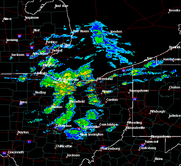 At 306 pm est, a severe thunderstorm was located near norwalk, moving east at 45 mph (radar indicated). Hazards include 60 mph wind gusts and penny size hail. Expect damage to trees and power lines. Locations impacted include, norwalk, milan, monroeville and bloomingville. At 306 pm est, a severe thunderstorm was located near norwalk, moving east at 45 mph (radar indicated). Hazards include 60 mph wind gusts and penny size hail. Expect damage to trees and power lines. Locations impacted include, norwalk, milan, monroeville and bloomingville.
|
| 1/8/2019 2:48 PM EST |
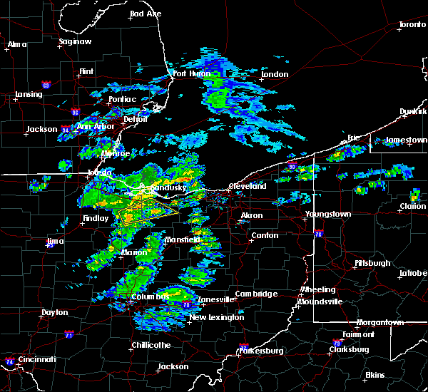 At 247 pm est, a severe thunderstorm was located 7 miles south of green springs, or 8 miles east of tiffin, moving east at 45 mph (radar indicated). Hazards include 60 mph wind gusts and penny size hail. expect damage to trees and power lines At 247 pm est, a severe thunderstorm was located 7 miles south of green springs, or 8 miles east of tiffin, moving east at 45 mph (radar indicated). Hazards include 60 mph wind gusts and penny size hail. expect damage to trees and power lines
|
| 10/6/2018 9:04 PM EDT |
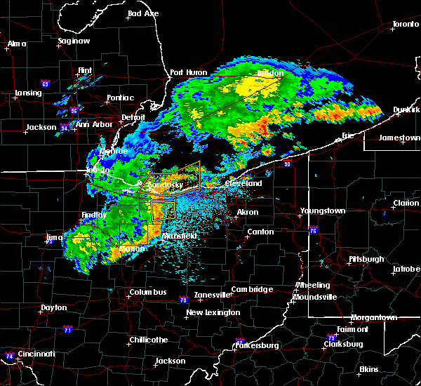 At 904 pm edt, severe thunderstorms were located along a line extending from near milan to 7 miles southeast of norwalk to 6 miles west of new london, moving east at 40 mph (radar indicated). Hazards include 60 mph wind gusts. Expect damage to trees and power lines. Locations impacted include, norwalk, new london, milan, northern milan, wakeman and north fairfield. At 904 pm edt, severe thunderstorms were located along a line extending from near milan to 7 miles southeast of norwalk to 6 miles west of new london, moving east at 40 mph (radar indicated). Hazards include 60 mph wind gusts. Expect damage to trees and power lines. Locations impacted include, norwalk, new london, milan, northern milan, wakeman and north fairfield.
|
| 10/6/2018 8:44 PM EDT |
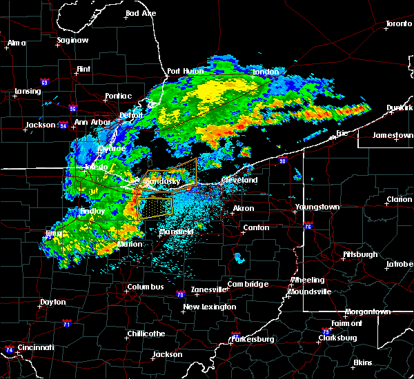 At 844 pm edt, a severe thunderstorm was located near willard, or 12 miles southwest of norwalk, moving east at 45 mph (radar indicated). Hazards include 60 mph wind gusts. expect damage to trees and power lines At 844 pm edt, a severe thunderstorm was located near willard, or 12 miles southwest of norwalk, moving east at 45 mph (radar indicated). Hazards include 60 mph wind gusts. expect damage to trees and power lines
|
| 8/6/2018 10:57 PM EDT |
 The severe thunderstorm warning for erie county will expire at 1100 pm edt, the severe thunderstorm which prompted the warning has weakened. therefore, the warning will be allowed to expire. The severe thunderstorm warning for erie county will expire at 1100 pm edt, the severe thunderstorm which prompted the warning has weakened. therefore, the warning will be allowed to expire.
|
| 8/6/2018 10:30 PM EDT |
 At 1029 pm edt, a severe thunderstorm was located near milan, or 7 miles north of norwalk, moving southeast at 30 mph (radar indicated). Hazards include 60 mph wind gusts and quarter size hail. Minor damage to vehicles is possible. expect damage to trees and power lines. Locations impacted include, sandusky, western vermilion, northern milan, castalia, berlin heights, bloomingville, sandusky south, birmingham and fairview lanes. At 1029 pm edt, a severe thunderstorm was located near milan, or 7 miles north of norwalk, moving southeast at 30 mph (radar indicated). Hazards include 60 mph wind gusts and quarter size hail. Minor damage to vehicles is possible. expect damage to trees and power lines. Locations impacted include, sandusky, western vermilion, northern milan, castalia, berlin heights, bloomingville, sandusky south, birmingham and fairview lanes.
|
| 8/6/2018 10:13 PM EDT |
 The national weather service in cleveland has issued a * severe thunderstorm warning for. erie county in north central ohio. east central sandusky county in northwestern ohio. until 1100 pm edt. At 1012 pm edt, a severe thunderstorm was located near castalia, or. The national weather service in cleveland has issued a * severe thunderstorm warning for. erie county in north central ohio. east central sandusky county in northwestern ohio. until 1100 pm edt. At 1012 pm edt, a severe thunderstorm was located near castalia, or.
|
| 7/26/2018 9:22 PM EDT |
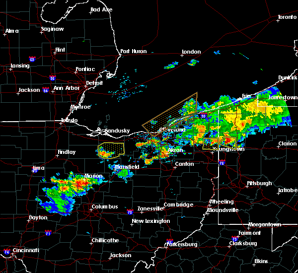 At 921 pm edt, a severe thunderstorm was located near willard, or 12 miles southwest of norwalk, moving east at 35 mph (radar indicated). Hazards include 60 mph wind gusts and quarter size hail. Minor damage to vehicles is possible. expect damage to trees and power lines. Locations impacted include, norwalk, willard, new london, plymouth, milan, northern milan, wakeman, greenwich, monroeville and north fairfield. At 921 pm edt, a severe thunderstorm was located near willard, or 12 miles southwest of norwalk, moving east at 35 mph (radar indicated). Hazards include 60 mph wind gusts and quarter size hail. Minor damage to vehicles is possible. expect damage to trees and power lines. Locations impacted include, norwalk, willard, new london, plymouth, milan, northern milan, wakeman, greenwich, monroeville and north fairfield.
|
| 7/26/2018 9:02 PM EDT |
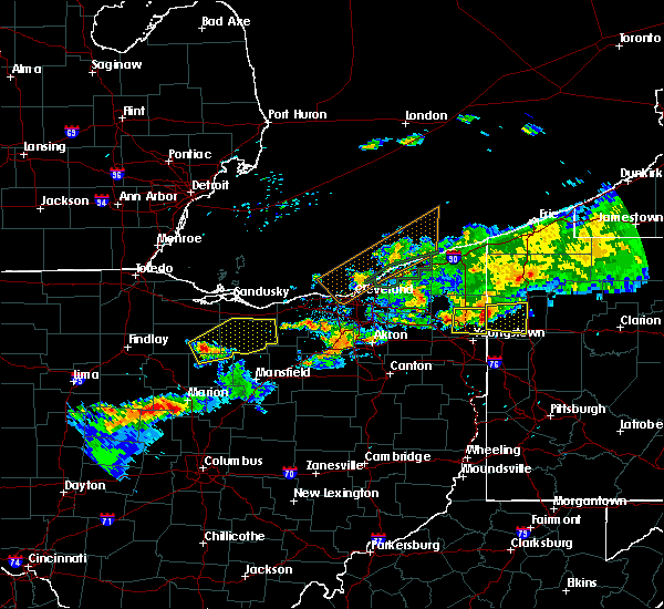 At 902 pm edt, a severe thunderstorm was located near bloomville, or 13 miles southeast of tiffin, moving east at 35 mph (radar indicated). Hazards include 60 mph wind gusts and quarter size hail. Minor damage to vehicles is possible. Expect damage to trees and power lines. At 902 pm edt, a severe thunderstorm was located near bloomville, or 13 miles southeast of tiffin, moving east at 35 mph (radar indicated). Hazards include 60 mph wind gusts and quarter size hail. Minor damage to vehicles is possible. Expect damage to trees and power lines.
|
| 7/26/2018 7:43 PM EDT |
 At 743 pm edt, a severe thunderstorm was located near wakeman, or 11 miles east of norwalk, moving east at 55 mph (radar indicated). Hazards include 60 mph wind gusts and quarter size hail. Minor damage to vehicles is possible. Expect damage to trees and power lines. At 743 pm edt, a severe thunderstorm was located near wakeman, or 11 miles east of norwalk, moving east at 55 mph (radar indicated). Hazards include 60 mph wind gusts and quarter size hail. Minor damage to vehicles is possible. Expect damage to trees and power lines.
|
| 7/26/2018 7:29 PM EDT |
 At 728 pm edt, a severe thunderstorm was located near wakeman, or near norwalk, moving east at 35 mph (radar indicated). Hazards include 60 mph wind gusts and quarter size hail. Minor damage to vehicles is possible. expect damage to trees and power lines. Locations impacted include, lorain, elyria, norwalk, western vermilion, vermilion, north ridgeville, avon lake, amherst, grafton, wellington, milan, wakeman, avon, sheffield lake, eaton, oberlin, sheffield, lagrange, penfield and south amherst. At 728 pm edt, a severe thunderstorm was located near wakeman, or near norwalk, moving east at 35 mph (radar indicated). Hazards include 60 mph wind gusts and quarter size hail. Minor damage to vehicles is possible. expect damage to trees and power lines. Locations impacted include, lorain, elyria, norwalk, western vermilion, vermilion, north ridgeville, avon lake, amherst, grafton, wellington, milan, wakeman, avon, sheffield lake, eaton, oberlin, sheffield, lagrange, penfield and south amherst.
|
| 7/26/2018 7:11 PM EDT |
 At 711 pm edt, a severe thunderstorm was located near norwalk, moving east at 40 mph (radar indicated). Hazards include 60 mph wind gusts and quarter size hail. Minor damage to vehicles is possible. expect damage to trees and power lines. Locations impacted include, lorain, elyria, sandusky, norwalk, western vermilion, vermilion, north ridgeville, avon lake, amherst, grafton, wellington, northern milan, milan, wakeman, avon, sheffield lake, eaton, oberlin, sheffield and lagrange. At 711 pm edt, a severe thunderstorm was located near norwalk, moving east at 40 mph (radar indicated). Hazards include 60 mph wind gusts and quarter size hail. Minor damage to vehicles is possible. expect damage to trees and power lines. Locations impacted include, lorain, elyria, sandusky, norwalk, western vermilion, vermilion, north ridgeville, avon lake, amherst, grafton, wellington, northern milan, milan, wakeman, avon, sheffield lake, eaton, oberlin, sheffield and lagrange.
|
| 7/26/2018 6:20 PM EDT |
 At 620 pm edt, a severe thunderstorm was located near bellevue, or 11 miles east of fremont, moving east at 25 mph (radar indicated). Hazards include 60 mph wind gusts and quarter size hail. Minor damage to vehicles is possible. Expect damage to trees and power lines. At 620 pm edt, a severe thunderstorm was located near bellevue, or 11 miles east of fremont, moving east at 25 mph (radar indicated). Hazards include 60 mph wind gusts and quarter size hail. Minor damage to vehicles is possible. Expect damage to trees and power lines.
|
| 7/5/2018 3:34 PM EDT |
 At 333 pm edt, a severe thunderstorm was located near norwalk, moving east at 30 mph (radar indicated). Hazards include 60 mph wind gusts. expect damage to trees and power lines At 333 pm edt, a severe thunderstorm was located near norwalk, moving east at 30 mph (radar indicated). Hazards include 60 mph wind gusts. expect damage to trees and power lines
|
| 11/5/2017 6:20 PM EDT |
 At 519 pm est, severe thunderstorms were located along a line extending from near sandusky to near savannah, moving east at 50 mph (radar indicated). Hazards include 70 mph wind gusts. Expect considerable tree damage. damage is likely to mobile homes, roofs, and outbuildings. locations impacted include, lorain, sandusky, norwalk, western vermilion, vermilion, amherst, wellington, new london, northern milan, milan, wakeman, oberlin, south amherst, pittsfield, berlin heights, kipton, rochester, birmingham, fairview lanes and sandusky south. A tornado watch remains in effect until 700 pm est for north central and northeastern ohio. At 519 pm est, severe thunderstorms were located along a line extending from near sandusky to near savannah, moving east at 50 mph (radar indicated). Hazards include 70 mph wind gusts. Expect considerable tree damage. damage is likely to mobile homes, roofs, and outbuildings. locations impacted include, lorain, sandusky, norwalk, western vermilion, vermilion, amherst, wellington, new london, northern milan, milan, wakeman, oberlin, south amherst, pittsfield, berlin heights, kipton, rochester, birmingham, fairview lanes and sandusky south. A tornado watch remains in effect until 700 pm est for north central and northeastern ohio.
|
| 11/5/2017 6:12 PM EDT |
 At 512 pm est, a severe thunderstorm capable of producing a tornado was located near norwalk, moving east at 65 mph (weather spotters reported a funnel cloud). Hazards include tornado. Flying debris will be dangerous to those caught without shelter. mobile homes will be damaged or destroyed. damage to roofs, windows, and vehicles will occur. tree damage is likely. this dangerous storm will be near, new london and wakeman around 520 pm est. Other locations impacted by this tornadic thunderstorm include north fairfield and monroeville. At 512 pm est, a severe thunderstorm capable of producing a tornado was located near norwalk, moving east at 65 mph (weather spotters reported a funnel cloud). Hazards include tornado. Flying debris will be dangerous to those caught without shelter. mobile homes will be damaged or destroyed. damage to roofs, windows, and vehicles will occur. tree damage is likely. this dangerous storm will be near, new london and wakeman around 520 pm est. Other locations impacted by this tornadic thunderstorm include north fairfield and monroeville.
|
| 11/5/2017 5:58 PM EDT |
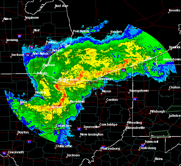 At 458 pm est, a severe thunderstorm capable of producing a tornado was located 7 miles south of bellevue, or 13 miles west of norwalk, moving east at 65 mph (radar indicated rotation). Hazards include tornado and quarter size hail. Flying debris will be dangerous to those caught without shelter. mobile homes will be damaged or destroyed. damage to roofs, windows, and vehicles will occur. tree damage is likely. this dangerous storm will be near, norwalk and milan around 510 pm est. new london and wakeman around 520 pm est. Other locations impacted by this tornadic thunderstorm include flat rock, north fairfield, monroeville and attica. At 458 pm est, a severe thunderstorm capable of producing a tornado was located 7 miles south of bellevue, or 13 miles west of norwalk, moving east at 65 mph (radar indicated rotation). Hazards include tornado and quarter size hail. Flying debris will be dangerous to those caught without shelter. mobile homes will be damaged or destroyed. damage to roofs, windows, and vehicles will occur. tree damage is likely. this dangerous storm will be near, norwalk and milan around 510 pm est. new london and wakeman around 520 pm est. Other locations impacted by this tornadic thunderstorm include flat rock, north fairfield, monroeville and attica.
|
| 11/5/2017 5:51 PM EDT |
 At 451 pm est, severe thunderstorms were located along a line extending from fremont to near chatfield, moving east at 60 mph (radar indicated). Hazards include 70 mph wind gusts. Expect considerable tree damage. Damage is likely to mobile homes, roofs, and outbuildings. At 451 pm est, severe thunderstorms were located along a line extending from fremont to near chatfield, moving east at 60 mph (radar indicated). Hazards include 70 mph wind gusts. Expect considerable tree damage. Damage is likely to mobile homes, roofs, and outbuildings.
|
| 11/5/2017 3:42 PM EDT |
 At 242 pm est, a severe thunderstorm capable of producing a tornado was located near milan, or 7 miles south of sandusky, moving east at 35 mph (radar indicated rotation). Hazards include tornado and quarter size hail. Flying debris will be dangerous to those caught without shelter. mobile homes will be damaged or destroyed. damage to roofs, windows, and vehicles will occur. tree damage is likely. this dangerous storm will be near, western vermilion around 310 pm est. amherst around 315 pm est. Other locations impacted by this tornadic thunderstorm include bloomingville, sandusky south, berlin heights, birmingham, fairview lanes and south amherst. At 242 pm est, a severe thunderstorm capable of producing a tornado was located near milan, or 7 miles south of sandusky, moving east at 35 mph (radar indicated rotation). Hazards include tornado and quarter size hail. Flying debris will be dangerous to those caught without shelter. mobile homes will be damaged or destroyed. damage to roofs, windows, and vehicles will occur. tree damage is likely. this dangerous storm will be near, western vermilion around 310 pm est. amherst around 315 pm est. Other locations impacted by this tornadic thunderstorm include bloomingville, sandusky south, berlin heights, birmingham, fairview lanes and south amherst.
|
| 8/21/2017 4:28 PM EDT |
 The severe thunderstorm warning for northwestern huron, erie, northeastern seneca and southeastern sandusky counties will expire at 430 pm edt, the storms which prompted the warning have weakened below severe limits, and have exited the warned area. therefore, the warning will be allowed to expire. The severe thunderstorm warning for northwestern huron, erie, northeastern seneca and southeastern sandusky counties will expire at 430 pm edt, the storms which prompted the warning have weakened below severe limits, and have exited the warned area. therefore, the warning will be allowed to expire.
|
| 8/21/2017 4:15 PM EDT |
 At 414 pm edt, a cluster of severe thunderstorms were located from near sandusky to northeast seneca county, moving northeast at 30 mph (radar indicated). Hazards include 60 mph wind gusts and quarter size hail. Minor damage to vehicles is possible. expect damage to trees and power lines. Locations impacted include, sandusky, norwalk, bellevue, clyde, milan, northern milan, castalia, monroeville, flat rock, bloomingville, sandusky south and fairview lanes. At 414 pm edt, a cluster of severe thunderstorms were located from near sandusky to northeast seneca county, moving northeast at 30 mph (radar indicated). Hazards include 60 mph wind gusts and quarter size hail. Minor damage to vehicles is possible. expect damage to trees and power lines. Locations impacted include, sandusky, norwalk, bellevue, clyde, milan, northern milan, castalia, monroeville, flat rock, bloomingville, sandusky south and fairview lanes.
|
| 8/21/2017 3:55 PM EDT |
 At 354 pm edt, a severe thunderstorm was located near clyde, or 9 miles southeast of fremont, moving northeast at 30 mph (trained weather spotters). Hazards include 60 mph wind gusts and quarter size hail. Minor damage to vehicles is possible. expect damage to trees and power lines. Locations impacted include, sandusky, tiffin, norwalk, bellevue, clyde, green springs, northern milan, milan, bloomville, castalia, monroeville, republic, flat rock, bloomingville, sandusky south and fairview lanes. At 354 pm edt, a severe thunderstorm was located near clyde, or 9 miles southeast of fremont, moving northeast at 30 mph (trained weather spotters). Hazards include 60 mph wind gusts and quarter size hail. Minor damage to vehicles is possible. expect damage to trees and power lines. Locations impacted include, sandusky, tiffin, norwalk, bellevue, clyde, green springs, northern milan, milan, bloomville, castalia, monroeville, republic, flat rock, bloomingville, sandusky south and fairview lanes.
|
| 8/21/2017 3:35 PM EDT |
 At 335 pm edt, a cluster of severe thunderstorms were located near green springs, or 7 miles north of tiffin, moving northeast at 30 mph (radar indicated). Hazards include 60 mph wind gusts and quarter size hail. Minor damage to vehicles is possible. Expect damage to trees and power lines. At 335 pm edt, a cluster of severe thunderstorms were located near green springs, or 7 miles north of tiffin, moving northeast at 30 mph (radar indicated). Hazards include 60 mph wind gusts and quarter size hail. Minor damage to vehicles is possible. Expect damage to trees and power lines.
|
| 7/16/2017 6:44 PM EDT |
 At 644 pm edt, a severe thunderstorm was located near milan, or 7 miles north of norwalk, moving southeast at 20 mph (radar indicated). Hazards include 60 mph wind gusts and quarter size hail. Minor damage to vehicles is possible. expect damage to trees and power lines. Locations impacted include, sandusky, norwalk, western vermilion, bellevue, northern milan, milan, wakeman, castalia, monroeville, berlin heights, north fairfield, bloomingville, birmingham and sandusky south. At 644 pm edt, a severe thunderstorm was located near milan, or 7 miles north of norwalk, moving southeast at 20 mph (radar indicated). Hazards include 60 mph wind gusts and quarter size hail. Minor damage to vehicles is possible. expect damage to trees and power lines. Locations impacted include, sandusky, norwalk, western vermilion, bellevue, northern milan, milan, wakeman, castalia, monroeville, berlin heights, north fairfield, bloomingville, birmingham and sandusky south.
|
| 7/16/2017 6:28 PM EDT |
 At 628 pm edt, a severe thunderstorm was located over castalia, or near sandusky, moving southeast at 20 mph (radar indicated). Hazards include 60 mph wind gusts and quarter size hail. Minor damage to vehicles is possible. Expect damage to trees and power lines. At 628 pm edt, a severe thunderstorm was located over castalia, or near sandusky, moving southeast at 20 mph (radar indicated). Hazards include 60 mph wind gusts and quarter size hail. Minor damage to vehicles is possible. Expect damage to trees and power lines.
|
| 7/16/2017 6:13 PM EDT |
 At 612 pm edt, a severe thunderstorm was located near sandusky, moving southeast at 20 mph (radar indicated). Hazards include 60 mph wind gusts and quarter size hail. Minor damage to vehicles is possible. expect damage to trees and power lines. Locations impacted include, sandusky, western vermilion, port clinton, northern milan, castalia, marblehead, berlin heights, bay view, bloomingville, sandusky south, birmingham and fairview lanes. At 612 pm edt, a severe thunderstorm was located near sandusky, moving southeast at 20 mph (radar indicated). Hazards include 60 mph wind gusts and quarter size hail. Minor damage to vehicles is possible. expect damage to trees and power lines. Locations impacted include, sandusky, western vermilion, port clinton, northern milan, castalia, marblehead, berlin heights, bay view, bloomingville, sandusky south, birmingham and fairview lanes.
|
| 7/16/2017 5:53 PM EDT |
 At 552 pm edt, a severe thunderstorm was located over sandusky, moving southeast at 20 mph. quarter sized hail was reported with this storm in bay view at 5:40 pm (radar indicated). Hazards include 60 mph wind gusts and quarter size hail. Minor damage to vehicles is possible. expect damage to trees and power lines. Locations impacted include, sandusky, western vermilion, port clinton, northern milan, castalia, marblehead, berlin heights, bay view, bloomingville, sandusky south, birmingham and fairview lanes. At 552 pm edt, a severe thunderstorm was located over sandusky, moving southeast at 20 mph. quarter sized hail was reported with this storm in bay view at 5:40 pm (radar indicated). Hazards include 60 mph wind gusts and quarter size hail. Minor damage to vehicles is possible. expect damage to trees and power lines. Locations impacted include, sandusky, western vermilion, port clinton, northern milan, castalia, marblehead, berlin heights, bay view, bloomingville, sandusky south, birmingham and fairview lanes.
|
| 7/16/2017 5:29 PM EDT |
 At 529 pm edt, a severe thunderstorm was located near port clinton, moving southeast at 20 mph (radar indicated). Hazards include 60 mph wind gusts and quarter size hail. Minor damage to vehicles is possible. Expect damage to trees and power lines. At 529 pm edt, a severe thunderstorm was located near port clinton, moving southeast at 20 mph (radar indicated). Hazards include 60 mph wind gusts and quarter size hail. Minor damage to vehicles is possible. Expect damage to trees and power lines.
|
| 3/1/2017 4:56 AM EST |
 At 455 am est, severe thunderstorms were located along a line extending from 14 miles north of avon lake to 6 miles northeast of northern milan, moving east at 50 mph (radar indicated). Hazards include 60 mph wind gusts and quarter size hail. Hail damage to vehicles is expected. expect wind damage to roofs, siding, and trees. Locations impacted include, lorain, elyria, western vermilion, vermilion, strongsville, westlake, north ridgeville, avon lake, amherst, grafton, north olmsted, avon, bay village, sheffield lake, eaton, oberlin, sheffield, south amherst, berlin heights and birmingham. At 455 am est, severe thunderstorms were located along a line extending from 14 miles north of avon lake to 6 miles northeast of northern milan, moving east at 50 mph (radar indicated). Hazards include 60 mph wind gusts and quarter size hail. Hail damage to vehicles is expected. expect wind damage to roofs, siding, and trees. Locations impacted include, lorain, elyria, western vermilion, vermilion, strongsville, westlake, north ridgeville, avon lake, amherst, grafton, north olmsted, avon, bay village, sheffield lake, eaton, oberlin, sheffield, south amherst, berlin heights and birmingham.
|
| 3/1/2017 4:31 AM EST |
 At 430 am est, a severe thunderstorm was located near sandusky, moving east at 70 mph (radar indicated). Hazards include 60 mph wind gusts and quarter size hail. Hail damage to vehicles is expected. Expect wind damage to roofs, siding, and trees. At 430 am est, a severe thunderstorm was located near sandusky, moving east at 70 mph (radar indicated). Hazards include 60 mph wind gusts and quarter size hail. Hail damage to vehicles is expected. Expect wind damage to roofs, siding, and trees.
|
| 3/1/2017 12:55 AM EST |
 At 1254 am est, severe thunderstorms were located along a line extending from near fostoria to 6 miles northwest of crestline to near chesterville, moving northeast at 85 mph (radar indicated). Hazards include 60 mph wind gusts and quarter size hail. Hail damage to vehicles is expected. Expect wind damage to roofs, siding, and trees. At 1254 am est, severe thunderstorms were located along a line extending from near fostoria to 6 miles northwest of crestline to near chesterville, moving northeast at 85 mph (radar indicated). Hazards include 60 mph wind gusts and quarter size hail. Hail damage to vehicles is expected. Expect wind damage to roofs, siding, and trees.
|
| 2/24/2017 8:41 PM EST |
 At 841 pm est, a severe thunderstorm was located near norwalk, moving northeast at 50 mph (radar indicated). Hazards include 60 mph wind gusts. Expect damage to roofs, siding, and trees. Locations impacted include, norwalk, milan, northern milan, wakeman, berlin heights and birmingham. At 841 pm est, a severe thunderstorm was located near norwalk, moving northeast at 50 mph (radar indicated). Hazards include 60 mph wind gusts. Expect damage to roofs, siding, and trees. Locations impacted include, norwalk, milan, northern milan, wakeman, berlin heights and birmingham.
|
| 2/24/2017 8:30 PM EST |
 At 829 pm est, a severe thunderstorm was located near willard, or 15 miles southwest of norwalk, moving northeast at 50 mph (radar indicated). Hazards include 60 mph wind gusts. expect damage to roofs, siding, and trees At 829 pm est, a severe thunderstorm was located near willard, or 15 miles southwest of norwalk, moving northeast at 50 mph (radar indicated). Hazards include 60 mph wind gusts. expect damage to roofs, siding, and trees
|
| 2/24/2017 7:55 PM EST |
 The severe thunderstorm warning for northwestern huron, ottawa and erie counties will expire at 800 pm est, the storms which prompted the warning have weakened below severe limits, and have exited the warned area. therefore the warning will be allowed to expire. however gusty winds and heavy rain are still possible with these thunderstorms. a severe thunderstorm watch remains in effect until 200 am est for north central and northwestern ohio. The severe thunderstorm warning for northwestern huron, ottawa and erie counties will expire at 800 pm est, the storms which prompted the warning have weakened below severe limits, and have exited the warned area. therefore the warning will be allowed to expire. however gusty winds and heavy rain are still possible with these thunderstorms. a severe thunderstorm watch remains in effect until 200 am est for north central and northwestern ohio.
|
| 2/24/2017 7:46 PM EST |
 At 745 pm est, severe thunderstorms were located along a line extending from 7 miles east of kelleys island to near bellevue, moving east at 45 mph (trained weather spotters reported quarter sized hail 1 mile east of bellevue). Hazards include 60 mph wind gusts and quarter size hail. Hail damage to vehicles is expected. expect wind damage to roofs, siding, and trees. Locations impacted include, sandusky, norwalk, bellevue, northern milan, milan, castalia, monroeville, marblehead, berlin heights, bloomingville, sandusky south and fairview lanes. At 745 pm est, severe thunderstorms were located along a line extending from 7 miles east of kelleys island to near bellevue, moving east at 45 mph (trained weather spotters reported quarter sized hail 1 mile east of bellevue). Hazards include 60 mph wind gusts and quarter size hail. Hail damage to vehicles is expected. expect wind damage to roofs, siding, and trees. Locations impacted include, sandusky, norwalk, bellevue, northern milan, milan, castalia, monroeville, marblehead, berlin heights, bloomingville, sandusky south and fairview lanes.
|
| 2/24/2017 7:32 PM EST |
 At 731 pm est, severe thunderstorms were located along a line extending from near kelleys island to 8 miles northeast of bloomville, moving northeast at 45 mph (radar indicated). Hazards include 60 mph wind gusts and quarter size hail. Hail damage to vehicles is expected. Expect wind damage to roofs, siding, and trees. At 731 pm est, severe thunderstorms were located along a line extending from near kelleys island to 8 miles northeast of bloomville, moving northeast at 45 mph (radar indicated). Hazards include 60 mph wind gusts and quarter size hail. Hail damage to vehicles is expected. Expect wind damage to roofs, siding, and trees.
|
| 7/18/2016 5:04 AM EDT |
 At 503 am edt, a severe thunderstorm was located near sandusky, moving east at 40 mph (radar indicated). Hazards include 60 mph wind gusts. Expect damage to roofs. Siding and trees. At 503 am edt, a severe thunderstorm was located near sandusky, moving east at 40 mph (radar indicated). Hazards include 60 mph wind gusts. Expect damage to roofs. Siding and trees.
|
| 7/13/2016 8:59 PM EDT |
 At 858 pm edt, severe thunderstorms were located along a line extending from near sandusky to near new london, moving northeast at 40 mph (trained weather spotters). Hazards include 60 mph wind gusts and penny size hail. this storm has a history of producing wind damage. Expect damage to roofs. siding and trees. Locations impacted include, sandusky, norwalk, western vermilion, vermilion, new london, plymouth, milan, northern milan, wakeman, greenwich, monroeville, berlin heights, north fairfield, bloomingville, sandusky south, fairview lanes and birmingham. At 858 pm edt, severe thunderstorms were located along a line extending from near sandusky to near new london, moving northeast at 40 mph (trained weather spotters). Hazards include 60 mph wind gusts and penny size hail. this storm has a history of producing wind damage. Expect damage to roofs. siding and trees. Locations impacted include, sandusky, norwalk, western vermilion, vermilion, new london, plymouth, milan, northern milan, wakeman, greenwich, monroeville, berlin heights, north fairfield, bloomingville, sandusky south, fairview lanes and birmingham.
|
| 7/13/2016 8:41 PM EDT |
 At 839 pm edt, severe thunderstorms were located along a line extending from near bellevue to plymouth, moving northeast at 40 mph (radar indicated). Hazards include 60 mph wind gusts and penny size hail. Expect damage to roofs. Siding and trees. At 839 pm edt, severe thunderstorms were located along a line extending from near bellevue to plymouth, moving northeast at 40 mph (radar indicated). Hazards include 60 mph wind gusts and penny size hail. Expect damage to roofs. Siding and trees.
|
| 6/5/2016 2:54 PM EDT |
 At 254 pm edt, a severe thunderstorm was located near northern milan, or 7 miles north of norwalk, moving east at 50 mph (trained weather spotters). Hazards include 60 mph wind gusts and quarter size hail. Hail damage to vehicles is expected. expect wind damage to roofs, siding and trees. Locations impacted include, lorain, sandusky, norwalk, western vermilion, vermilion, amherst, milan, northern milan, oberlin, south amherst, monroeville, berlin heights, kipton, bloomingville, sandusky south, fairview lanes and birmingham. At 254 pm edt, a severe thunderstorm was located near northern milan, or 7 miles north of norwalk, moving east at 50 mph (trained weather spotters). Hazards include 60 mph wind gusts and quarter size hail. Hail damage to vehicles is expected. expect wind damage to roofs, siding and trees. Locations impacted include, lorain, sandusky, norwalk, western vermilion, vermilion, amherst, milan, northern milan, oberlin, south amherst, monroeville, berlin heights, kipton, bloomingville, sandusky south, fairview lanes and birmingham.
|
| 6/5/2016 2:47 PM EDT |
 At 246 pm edt, a severe thunderstorm was located near bloomville, or 8 miles southeast of tiffin, moving east at 30 mph. other strong storms were in northern wyandot county (radar indicated). Hazards include 60 mph wind gusts and quarter size hail. Hail damage to vehicles is expected. expect wind damage to roofs, siding and trees. Locations impacted include, norwalk, bucyrus, upper sandusky, galion, bellevue, willard, crestline, new london, plymouth, milan, wakeman, new washington, bloomville, sycamore, morral, chatfield, marseilles, greenwich, monroeville and attica. At 246 pm edt, a severe thunderstorm was located near bloomville, or 8 miles southeast of tiffin, moving east at 30 mph. other strong storms were in northern wyandot county (radar indicated). Hazards include 60 mph wind gusts and quarter size hail. Hail damage to vehicles is expected. expect wind damage to roofs, siding and trees. Locations impacted include, norwalk, bucyrus, upper sandusky, galion, bellevue, willard, crestline, new london, plymouth, milan, wakeman, new washington, bloomville, sycamore, morral, chatfield, marseilles, greenwich, monroeville and attica.
|
| 6/5/2016 2:42 PM EDT |
 At 241 pm edt, a severe thunderstorm was located over bellevue, or 11 miles southwest of sandusky, moving east at 55 mph. quarter size hail was reported in clyde with this storm (trained weather spotters). Hazards include 60 mph wind gusts and quarter size hail. Hail damage to vehicles is expected. Expect wind damage to roofs, siding and trees. At 241 pm edt, a severe thunderstorm was located over bellevue, or 11 miles southwest of sandusky, moving east at 55 mph. quarter size hail was reported in clyde with this storm (trained weather spotters). Hazards include 60 mph wind gusts and quarter size hail. Hail damage to vehicles is expected. Expect wind damage to roofs, siding and trees.
|
| 6/5/2016 2:38 PM EDT |
 At 237 pm edt, severe thunderstorms were located along a line extending from near sandusky to near clyde, moving east at 55 mph. trained weather spotters reported quarter sized hail near clyde with these storms (trained weather spotters). Hazards include 60 mph wind gusts and quarter size hail. Hail damage to vehicles is expected. expect wind damage to roofs, siding and trees. Locations impacted include, sandusky, western vermilion, vermilion, kelleys island, bellevue, clyde, northern milan, castalia, marblehead, berlin heights, bay view, vickery, bloomingville, sandusky south, whites landing, fairview lanes and birmingham. At 237 pm edt, severe thunderstorms were located along a line extending from near sandusky to near clyde, moving east at 55 mph. trained weather spotters reported quarter sized hail near clyde with these storms (trained weather spotters). Hazards include 60 mph wind gusts and quarter size hail. Hail damage to vehicles is expected. expect wind damage to roofs, siding and trees. Locations impacted include, sandusky, western vermilion, vermilion, kelleys island, bellevue, clyde, northern milan, castalia, marblehead, berlin heights, bay view, vickery, bloomingville, sandusky south, whites landing, fairview lanes and birmingham.
|
| 6/5/2016 2:32 PM EDT |
 At 232 pm edt, severe thunderstorms were located along a line extending from near kelleys island to near green springs, moving east at 50 mph (radar indicated). Hazards include 60 mph wind gusts and quarter size hail. Hail damage to vehicles is expected. expect wind damage to roofs, siding and trees. Locations impacted include, sandusky, western vermilion, vermilion, port clinton, kelleys island, bellevue, clyde, northern milan, castalia, catawba island, marblehead, berlin heights, bay view, vickery, bloomingville, sandusky south, whites landing, fairview lanes and birmingham. At 232 pm edt, severe thunderstorms were located along a line extending from near kelleys island to near green springs, moving east at 50 mph (radar indicated). Hazards include 60 mph wind gusts and quarter size hail. Hail damage to vehicles is expected. expect wind damage to roofs, siding and trees. Locations impacted include, sandusky, western vermilion, vermilion, port clinton, kelleys island, bellevue, clyde, northern milan, castalia, catawba island, marblehead, berlin heights, bay view, vickery, bloomingville, sandusky south, whites landing, fairview lanes and birmingham.
|
| 6/5/2016 2:20 PM EDT |
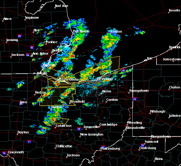 At 218 pm edt, a severe thunderstorm was located over new riegel, or 9 miles southwest of tiffin, moving east at 30 mph. other storms were over seneca crawford and huron counties (radar indicated). Hazards include 60 mph wind gusts and quarter size hail. Hail damage to vehicles is expected. Expect wind damage to roofs, siding and trees. At 218 pm edt, a severe thunderstorm was located over new riegel, or 9 miles southwest of tiffin, moving east at 30 mph. other storms were over seneca crawford and huron counties (radar indicated). Hazards include 60 mph wind gusts and quarter size hail. Hail damage to vehicles is expected. Expect wind damage to roofs, siding and trees.
|
| 6/5/2016 2:11 PM EDT |
 At 211 pm edt, a severe thunderstorm was located near clyde, or near fremont, moving east at 60 mph (radar indicated). Hazards include 60 mph wind gusts and quarter size hail. Hail damage to vehicles is expected. Expect wind damage to roofs, siding and trees. At 211 pm edt, a severe thunderstorm was located near clyde, or near fremont, moving east at 60 mph (radar indicated). Hazards include 60 mph wind gusts and quarter size hail. Hail damage to vehicles is expected. Expect wind damage to roofs, siding and trees.
|
| 9/4/2015 5:19 PM EDT |
 At 519 pm edt, severe thunderstorms were located along a line extending from near milan to near northern milan to near norwalk to 6 miles northeast of willard, moving east at 10 mph (radar indicated). Hazards include 60 mph wind gusts and penny size hail. Expect damage to roofs. siding and trees. Locations impacted include, norwalk, milan, northern milan, monroeville and berlin heights. At 519 pm edt, severe thunderstorms were located along a line extending from near milan to near northern milan to near norwalk to 6 miles northeast of willard, moving east at 10 mph (radar indicated). Hazards include 60 mph wind gusts and penny size hail. Expect damage to roofs. siding and trees. Locations impacted include, norwalk, milan, northern milan, monroeville and berlin heights.
|
| 9/4/2015 5:04 PM EDT |
 At 503 pm edt, severe thunderstorms were located along a line extending from milan to 8 miles southeast of bellevue to near willard, moving east at 15 mph (radar indicated). Hazards include 60 mph wind gusts and quarter size hail. Hail damage to vehicles is expected. expect wind damage to roofs, siding and trees. Locations impacted include, sandusky, norwalk, bellevue, milan, northern milan, monroeville, berlin heights, bloomingville, sandusky south and fairview lanes. At 503 pm edt, severe thunderstorms were located along a line extending from milan to 8 miles southeast of bellevue to near willard, moving east at 15 mph (radar indicated). Hazards include 60 mph wind gusts and quarter size hail. Hail damage to vehicles is expected. expect wind damage to roofs, siding and trees. Locations impacted include, sandusky, norwalk, bellevue, milan, northern milan, monroeville, berlin heights, bloomingville, sandusky south and fairview lanes.
|
| 9/4/2015 4:28 PM EDT |
 At 428 pm edt, a severe thunderstorm was located near clyde, or 10 miles east of fremont, moving east at 10 mph (radar indicated). Hazards include 60 mph wind gusts and quarter size hail. Hail damage to vehicles is expected. Expect wind damage to roofs, siding and trees. At 428 pm edt, a severe thunderstorm was located near clyde, or 10 miles east of fremont, moving east at 10 mph (radar indicated). Hazards include 60 mph wind gusts and quarter size hail. Hail damage to vehicles is expected. Expect wind damage to roofs, siding and trees.
|
| 9/3/2015 7:54 PM EDT |
 At 754 pm edt, a severe thunderstorm was located near northern milan, or 7 miles north of norwalk, moving east at 20 mph (radar indicated). Hazards include 60 mph wind gusts and penny size hail. Possible damage to roofs. siding and trees. Locations impacted include, norwalk, western vermilion, vermilion, milan, northern milan, wakeman, monroeville, berlin heights and birmingham. At 754 pm edt, a severe thunderstorm was located near northern milan, or 7 miles north of norwalk, moving east at 20 mph (radar indicated). Hazards include 60 mph wind gusts and penny size hail. Possible damage to roofs. siding and trees. Locations impacted include, norwalk, western vermilion, vermilion, milan, northern milan, wakeman, monroeville, berlin heights and birmingham.
|
| 9/3/2015 7:28 PM EDT |
 At 727 pm edt, a severe thunderstorm was located near bellevue, or 8 miles northwest of norwalk, moving east at 15 mph (radar indicated). Hazards include 60 mph wind gusts and quarter size hail. Hail damage to vehicles is expected. Expect wind damage to roofs, siding and trees. At 727 pm edt, a severe thunderstorm was located near bellevue, or 8 miles northwest of norwalk, moving east at 15 mph (radar indicated). Hazards include 60 mph wind gusts and quarter size hail. Hail damage to vehicles is expected. Expect wind damage to roofs, siding and trees.
|
| 6/22/2015 5:20 PM EDT |
 At 517 pm edt, a severe thunderstorm was located between sandusky and huron, moving northeast at 20 mph. hail one inch in diameter was reported near huron (radar indicated). Hazards include 60 mph wind gusts and quarter size hail. Hail damage to vehicles is expected. expect wind damage to roofs, siding and trees. Locations impacted include, sandusky, huron, port clinton, bellevue, berlin heights, marblehead, bay view, castalia, whites landing and vickery. At 517 pm edt, a severe thunderstorm was located between sandusky and huron, moving northeast at 20 mph. hail one inch in diameter was reported near huron (radar indicated). Hazards include 60 mph wind gusts and quarter size hail. Hail damage to vehicles is expected. expect wind damage to roofs, siding and trees. Locations impacted include, sandusky, huron, port clinton, bellevue, berlin heights, marblehead, bay view, castalia, whites landing and vickery.
|
| 6/22/2015 4:32 PM EDT |
 At 431 pm edt, a severe thunderstorm was located near clyde, or 7 miles east of fremont, moving northeast at 20 mph (radar indicated). Hazards include 60 mph wind gusts and quarter size hail. Hail damage to vehicles is expected. Expect wind damage to roofs, siding and trees. At 431 pm edt, a severe thunderstorm was located near clyde, or 7 miles east of fremont, moving northeast at 20 mph (radar indicated). Hazards include 60 mph wind gusts and quarter size hail. Hail damage to vehicles is expected. Expect wind damage to roofs, siding and trees.
|
| 6/12/2015 2:58 PM EDT |
 At 258 pm edt, a severe thunderstorm was located over norwalk, moving east at 40 mph (radar indicated). Hazards include 60 mph wind gusts. Expect damage to roofs. siding and trees. Locations impacted include, norwalk, willard, new london, milan, wakeman, berlin heights, monroeville and north fairfield. At 258 pm edt, a severe thunderstorm was located over norwalk, moving east at 40 mph (radar indicated). Hazards include 60 mph wind gusts. Expect damage to roofs. siding and trees. Locations impacted include, norwalk, willard, new london, milan, wakeman, berlin heights, monroeville and north fairfield.
|
| 6/12/2015 2:38 PM EDT |
 The national weather service in cleveland has issued a * severe thunderstorm warning for. huron county in north central ohio. southern erie county in north central ohio. until 330 pm edt * at 238 pm edt. A severe thunderstorm was located near bellevue. The national weather service in cleveland has issued a * severe thunderstorm warning for. huron county in north central ohio. southern erie county in north central ohio. until 330 pm edt * at 238 pm edt. A severe thunderstorm was located near bellevue.
|
| 5/30/2015 8:05 PM EDT | The severe thunderstorm warning for huron county will expire at 815 pm edt, the storm which prompted the warning has weakened below severe limits and exited the warned area. therefore the warning will be allowed to expire. |
| 5/30/2015 7:46 PM EDT | At 745 pm edt, a severe thunderstorm was located near norwalk, moving northeast at 40 mph (trained weather spotters). Hazards include 60 mph wind gusts and penny size hail. Expect damage to roofs. siding and trees. Locations impacted include, norwalk, bellevue, new london, milan, wakeman, greenwich, monroeville and north fairfield. |
| 5/30/2015 7:29 PM EDT | At 729 pm edt, a severe thunderstorm was located near willard, or 8 miles southwest of norwalk, moving northeast at 40 mph (trained weather spotters). Hazards include 60 mph wind gusts and penny size hail. Expect damage to roofs. Siding and trees. |
| 5/27/2015 5:10 PM EDT | At 509 pm edt, a severe thunderstorm was located 7 miles northeast of milan, or 10 miles northeast of norwalk, moving east at 55 mph (radar indicated). Hazards include 70 mph wind gusts. Expect considerable tree damage. damage is likely to mobile homes, roofs and outbuildings. Locations impacted include, sandusky. |
| 5/27/2015 4:45 PM EDT | At 445 pm edt, a severe thunderstorm was located 8 miles southeast of port clinton, moving east at 60 mph (radar indicated). Hazards include 70 mph wind gusts. Expect considerable tree damage. Damage is likely to mobile homes, roofs and outbuildings. |
| 7/10/2013 2:30 PM EDT | Quarter sized hail reported 0 miles N of Milan, OH |
| 6/13/2013 1:16 AM EDT | Trees down and blocking roads in erie county OH, 0 miles N of Milan, OH |
| 4/8/2013 10:10 PM EDT | Quarter sized hail reported 0 miles N of Milan, OH |
| 1/1/0001 12:00 AM | Ping Pong Ball sized hail reported 2.7 miles S of Milan, OH |
Hail Maps for Milan, OH


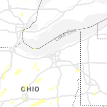


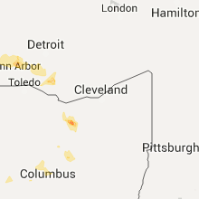


Connect with Interactive Hail Maps