

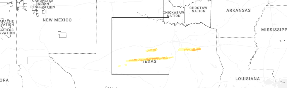
Hail Map for Miles, TX
The Miles, TX area has had 21 reports of on-the-ground hail by trained spotters, and has been under severe weather warnings 19 times during the past 12 months. Doppler radar has detected hail at or near Miles, TX on 88 occasions, including 5 occasions during the past year.
| Name: | Miles, TX |
| Where Located: | 64 miles SSW of Abilene, TX |
| Map: | Google Map for Miles, TX |
| Population: | 829 |
| Housing Units: | 343 |
| More Info: | Search Google for Miles, TX |
3
The Top Recent Hail Date for Miles, TX is Saturday, April 18, 2026 (3rd out of 88)
Hail and Wind Damage Spotted near Miles, TX
| Date / Time | Report Details |
|---|---|
| 7/5/2026 8:03 PM CDT |
 Svrsjt the national weather service in san angelo has issued a * severe thunderstorm warning for, southwestern coleman county in west central texas, northwestern mcculloch county in west central texas, tom green county in west central texas, southern runnels county in west central texas, concho county in west central texas, eastern irion county in west central texas, * until 900 pm cdt. * at 759 pm cdt, a gust front producing strong to severe wind gusts was located along a line extending from near valera to near water valley, moving south at 40 mph (radar indicated). Hazards include 60 mph wind gusts. Expect damage to roofs, siding, and trees. severe thunderstorms will be near, san angelo, paint rock, miles, voss, stacy, arden, lowake, carlsbad, veribest, and mereta around 805 pm cdt. eola, millersview, and goodfellow air force base around 810 pm cdt. doole, tankersley, wall, lake nasworthy, and twin buttes reservoir around 815 pm cdt. vancourt around 820 pm cdt. mertzon, salt gap, sherwood, and knickerbocker around 825 pm cdt. christoval and eden around 830 pm cdt. Other locations impacted by these severe thunderstorms include the intersection of us- 87 and ranch road 2134, the intersection of ranch road 1929 and ranch road 2134, vick, the intersection of us- 83 and ranch road 765, the intersection of us- 83 and ranch road 1929, live oak, us-67 near the irion- tom green county line, us-83 near the concho- runnels county line, harriet, and the intersection of ranch road 380 and ranch road 381. Svrsjt the national weather service in san angelo has issued a * severe thunderstorm warning for, southwestern coleman county in west central texas, northwestern mcculloch county in west central texas, tom green county in west central texas, southern runnels county in west central texas, concho county in west central texas, eastern irion county in west central texas, * until 900 pm cdt. * at 759 pm cdt, a gust front producing strong to severe wind gusts was located along a line extending from near valera to near water valley, moving south at 40 mph (radar indicated). Hazards include 60 mph wind gusts. Expect damage to roofs, siding, and trees. severe thunderstorms will be near, san angelo, paint rock, miles, voss, stacy, arden, lowake, carlsbad, veribest, and mereta around 805 pm cdt. eola, millersview, and goodfellow air force base around 810 pm cdt. doole, tankersley, wall, lake nasworthy, and twin buttes reservoir around 815 pm cdt. vancourt around 820 pm cdt. mertzon, salt gap, sherwood, and knickerbocker around 825 pm cdt. christoval and eden around 830 pm cdt. Other locations impacted by these severe thunderstorms include the intersection of us- 87 and ranch road 2134, the intersection of ranch road 1929 and ranch road 2134, vick, the intersection of us- 83 and ranch road 765, the intersection of us- 83 and ranch road 1929, live oak, us-67 near the irion- tom green county line, us-83 near the concho- runnels county line, harriet, and the intersection of ranch road 380 and ranch road 381.
|
| 7/5/2026 7:19 PM CDT |
 Svrsjt the national weather service in san angelo has issued a * severe thunderstorm warning for, coke county in west central texas, brown county in west central texas, coleman county in west central texas, northeastern tom green county in west central texas, runnels county in west central texas, * until 815 pm cdt. * at 719 pm cdt, severe thunderstorms were located along a line extending from scranton to near blackwell, moving south at 40 mph (radar indicated). Hazards include 60 mph wind gusts and penny size hail. Expect damage to roofs, siding, and trees. severe thunderstorms will be near, winters, blackwell, novice, fort chadbourne, and wingate around 725 pm cdt. bronte, cross cut, silver valley, burkett, and crews around 730 pm cdt. maverick and norton around 735 pm cdt. robert lee, glen cove, and hatchel around 740 pm cdt. coleman, ballinger, tennyson, grosvenor, byrds, and benoit around 745 pm cdt. talpa, lake brownwood near thrifty, lake brownwood state park, and lake brownwood around 750 pm cdt. valera around 755 pm cdt. Other locations impacted by these severe thunderstorms include echo, wilmeth, lake coleman, drasco, owens, pumphrey, the intersection of highway 208 and ranch road 2662, goldsboro, the intersection of highway 158 and ranch road 2059, and lake winters lake. Svrsjt the national weather service in san angelo has issued a * severe thunderstorm warning for, coke county in west central texas, brown county in west central texas, coleman county in west central texas, northeastern tom green county in west central texas, runnels county in west central texas, * until 815 pm cdt. * at 719 pm cdt, severe thunderstorms were located along a line extending from scranton to near blackwell, moving south at 40 mph (radar indicated). Hazards include 60 mph wind gusts and penny size hail. Expect damage to roofs, siding, and trees. severe thunderstorms will be near, winters, blackwell, novice, fort chadbourne, and wingate around 725 pm cdt. bronte, cross cut, silver valley, burkett, and crews around 730 pm cdt. maverick and norton around 735 pm cdt. robert lee, glen cove, and hatchel around 740 pm cdt. coleman, ballinger, tennyson, grosvenor, byrds, and benoit around 745 pm cdt. talpa, lake brownwood near thrifty, lake brownwood state park, and lake brownwood around 750 pm cdt. valera around 755 pm cdt. Other locations impacted by these severe thunderstorms include echo, wilmeth, lake coleman, drasco, owens, pumphrey, the intersection of highway 208 and ranch road 2662, goldsboro, the intersection of highway 158 and ranch road 2059, and lake winters lake.
|
| 5/22/2026 8:25 PM CDT |
 Svrsjt the national weather service in san angelo has issued a * severe thunderstorm warning for, southeastern coke county in west central texas, northeastern tom green county in west central texas, central runnels county in west central texas, * until 930 pm cdt. * at 825 pm cdt, a severe thunderstorm was located near tennyson, moving east at 30 mph (radar indicated). Hazards include 60 mph wind gusts and quarter size hail. Hail damage to vehicles is expected. expect wind damage to roofs, siding, and trees. this severe thunderstorm will be near, maverick and miles around 830 pm cdt. ballinger and norton around 845 pm cdt. hatchel around 855 pm cdt. benoit around 905 pm cdt. winters around 915 pm cdt. Other locations impacted by this severe thunderstorm include lake winters lake and ballinger lake. Svrsjt the national weather service in san angelo has issued a * severe thunderstorm warning for, southeastern coke county in west central texas, northeastern tom green county in west central texas, central runnels county in west central texas, * until 930 pm cdt. * at 825 pm cdt, a severe thunderstorm was located near tennyson, moving east at 30 mph (radar indicated). Hazards include 60 mph wind gusts and quarter size hail. Hail damage to vehicles is expected. expect wind damage to roofs, siding, and trees. this severe thunderstorm will be near, maverick and miles around 830 pm cdt. ballinger and norton around 845 pm cdt. hatchel around 855 pm cdt. benoit around 905 pm cdt. winters around 915 pm cdt. Other locations impacted by this severe thunderstorm include lake winters lake and ballinger lake.
|
| 5/19/2026 1:52 PM CDT |
 At 152 pm cdt, a severe thunderstorm was located near rowena, moving northeast at 25 mph (radar indicated). Hazards include 60 mph wind gusts and quarter size hail. Hail damage to vehicles is expected. expect wind damage to roofs, siding, and trees. this severe storm will be near, rowena around 155 pm cdt. Other locations impacted by this severe thunderstorm include ballinger lake. At 152 pm cdt, a severe thunderstorm was located near rowena, moving northeast at 25 mph (radar indicated). Hazards include 60 mph wind gusts and quarter size hail. Hail damage to vehicles is expected. expect wind damage to roofs, siding, and trees. this severe storm will be near, rowena around 155 pm cdt. Other locations impacted by this severe thunderstorm include ballinger lake.
|
| 5/19/2026 1:50 PM CDT |
 Svrsjt the national weather service in san angelo has issued a * severe thunderstorm warning for, east central tom green county in west central texas, southern runnels county in west central texas, northwestern concho county in west central texas, * until 245 pm cdt. * at 150 pm cdt, a severe thunderstorm was located near veribest, moving northeast at 20 mph (radar indicated). Hazards include 60 mph wind gusts and quarter size hail. Hail damage to vehicles is expected. expect wind damage to roofs, siding, and trees. this severe thunderstorm will be near, miles, lowake, and mereta around 155 pm cdt. rowena around 210 pm cdt. paint rock around 220 pm cdt. Other locations impacted by this severe thunderstorm include ballinger lake, us-83 near the concho- runnels county line, the intersection of us- 83 and ranch road 1929, and the intersection of ranch road 380 and ranch road 381. Svrsjt the national weather service in san angelo has issued a * severe thunderstorm warning for, east central tom green county in west central texas, southern runnels county in west central texas, northwestern concho county in west central texas, * until 245 pm cdt. * at 150 pm cdt, a severe thunderstorm was located near veribest, moving northeast at 20 mph (radar indicated). Hazards include 60 mph wind gusts and quarter size hail. Hail damage to vehicles is expected. expect wind damage to roofs, siding, and trees. this severe thunderstorm will be near, miles, lowake, and mereta around 155 pm cdt. rowena around 210 pm cdt. paint rock around 220 pm cdt. Other locations impacted by this severe thunderstorm include ballinger lake, us-83 near the concho- runnels county line, the intersection of us- 83 and ranch road 1929, and the intersection of ranch road 380 and ranch road 381.
|
| 5/19/2026 1:22 PM CDT |
 Svrsjt the national weather service in san angelo has issued a * severe thunderstorm warning for, southeastern coke county in west central texas, northeastern tom green county in west central texas, southwestern runnels county in west central texas, * until 215 pm cdt. * at 121 pm cdt, a severe thunderstorm was located over rowena, moving north at 15 mph (radar indicated). Hazards include 60 mph wind gusts and quarter size hail. Hail damage to vehicles is expected. expect wind damage to roofs, siding, and trees. this severe thunderstorm will be near, rowena around 125 pm cdt. Other locations impacted by this severe thunderstorm include ballinger lake. Svrsjt the national weather service in san angelo has issued a * severe thunderstorm warning for, southeastern coke county in west central texas, northeastern tom green county in west central texas, southwestern runnels county in west central texas, * until 215 pm cdt. * at 121 pm cdt, a severe thunderstorm was located over rowena, moving north at 15 mph (radar indicated). Hazards include 60 mph wind gusts and quarter size hail. Hail damage to vehicles is expected. expect wind damage to roofs, siding, and trees. this severe thunderstorm will be near, rowena around 125 pm cdt. Other locations impacted by this severe thunderstorm include ballinger lake.
|
| 5/19/2026 1:02 PM CDT |
 At 102 pm cdt, a severe thunderstorm was located near rowena, moving north at 20 mph (radar indicated). Hazards include golf ball size hail and 60 mph wind gusts. People and animals outdoors will be injured. expect hail damage to roofs, siding, windows, and vehicles. expect wind damage to roofs, siding, and trees. this severe storm will be near, maverick around 110 pm cdt. norton around 115 pm cdt. Other locations impacted by this severe thunderstorm include the intersection of highway 208 and ranch road 2662 and ballinger lake. At 102 pm cdt, a severe thunderstorm was located near rowena, moving north at 20 mph (radar indicated). Hazards include golf ball size hail and 60 mph wind gusts. People and animals outdoors will be injured. expect hail damage to roofs, siding, windows, and vehicles. expect wind damage to roofs, siding, and trees. this severe storm will be near, maverick around 110 pm cdt. norton around 115 pm cdt. Other locations impacted by this severe thunderstorm include the intersection of highway 208 and ranch road 2662 and ballinger lake.
|
| 5/19/2026 1:00 PM CDT | Golf Ball sized hail reported 6.4 miles WSW of Miles, TX |
| 5/19/2026 12:50 PM CDT | Half Dollar sized hail reported 0.2 miles W of Miles, TX |
| 5/19/2026 12:48 PM CDT |
 At 1248 pm cdt, a severe thunderstorm was located near miles, moving north at 20 mph (radar indicated). Hazards include ping pong ball size hail and 60 mph wind gusts. People and animals outdoors will be injured. expect hail damage to roofs, siding, windows, and vehicles. expect wind damage to roofs, siding, and trees. this severe storm will be near, rowena around 1255 pm cdt. maverick around 110 pm cdt. norton around 115 pm cdt. Other locations impacted by this severe thunderstorm include the intersection of highway 208 and ranch road 2662 and ballinger lake. At 1248 pm cdt, a severe thunderstorm was located near miles, moving north at 20 mph (radar indicated). Hazards include ping pong ball size hail and 60 mph wind gusts. People and animals outdoors will be injured. expect hail damage to roofs, siding, windows, and vehicles. expect wind damage to roofs, siding, and trees. this severe storm will be near, rowena around 1255 pm cdt. maverick around 110 pm cdt. norton around 115 pm cdt. Other locations impacted by this severe thunderstorm include the intersection of highway 208 and ranch road 2662 and ballinger lake.
|
| 5/19/2026 12:26 PM CDT |
 Svrsjt the national weather service in san angelo has issued a * severe thunderstorm warning for, southeastern coke county in west central texas, northeastern tom green county in west central texas, southwestern runnels county in west central texas, * until 130 pm cdt. * at 1226 pm cdt, a severe thunderstorm was located near grape creek, moving northeast at 15 mph (radar indicated). Hazards include 60 mph wind gusts and quarter size hail. Hail damage to vehicles is expected. expect wind damage to roofs, siding, and trees. this severe thunderstorm will be near, orient around 1235 pm cdt. tennyson around 1255 pm cdt. Other locations impacted by this severe thunderstorm include the intersection of highway 208 and ranch road 2662 and ballinger lake. Svrsjt the national weather service in san angelo has issued a * severe thunderstorm warning for, southeastern coke county in west central texas, northeastern tom green county in west central texas, southwestern runnels county in west central texas, * until 130 pm cdt. * at 1226 pm cdt, a severe thunderstorm was located near grape creek, moving northeast at 15 mph (radar indicated). Hazards include 60 mph wind gusts and quarter size hail. Hail damage to vehicles is expected. expect wind damage to roofs, siding, and trees. this severe thunderstorm will be near, orient around 1235 pm cdt. tennyson around 1255 pm cdt. Other locations impacted by this severe thunderstorm include the intersection of highway 208 and ranch road 2662 and ballinger lake.
|
| 5/10/2026 5:32 PM CDT |
 the severe thunderstorm warning has been cancelled and is no longer in effect the severe thunderstorm warning has been cancelled and is no longer in effect
|
| 5/10/2026 5:32 PM CDT |
 At 531 pm cdt, a severe thunderstorm was located just north of ballinger, moving southeast at 25 mph (radar indicated). Hazards include two inch hail and 60 mph wind gusts. People and animals outdoors will be injured. expect hail damage to roofs, siding, windows, and vehicles. expect wind damage to roofs, siding, and trees. this severe storm will be near, ballinger and benoit around 535 pm cdt. Other locations impacted by this severe thunderstorm include wilmeth, lake winters lake, and ballinger lake. At 531 pm cdt, a severe thunderstorm was located just north of ballinger, moving southeast at 25 mph (radar indicated). Hazards include two inch hail and 60 mph wind gusts. People and animals outdoors will be injured. expect hail damage to roofs, siding, windows, and vehicles. expect wind damage to roofs, siding, and trees. this severe storm will be near, ballinger and benoit around 535 pm cdt. Other locations impacted by this severe thunderstorm include wilmeth, lake winters lake, and ballinger lake.
|
| 5/10/2026 5:10 PM CDT |
 Svrsjt the national weather service in san angelo has issued a * severe thunderstorm warning for, southeastern coke county in west central texas, runnels county in west central texas, * until 615 pm cdt. * at 509 pm cdt, a severe thunderstorm was located near hatchel, moving southeast at 30 mph. this is a destructive storm for for hatchel and ballinger (radar indicated). Hazards include baseball size hail and 60 mph wind gusts. People and animals outdoors will be severely injured. expect shattered windows, extensive damage to roofs, siding, and vehicles. this severe thunderstorm will be near, ballinger and hatchel around 515 pm cdt. benoit around 520 pm cdt. Other locations impacted by this severe thunderstorm include the intersection of highway 208 and ranch road 2662, wilmeth, lake winters lake, ballinger lake, us-87 near the coke- tom green county line, and pumphrey. Svrsjt the national weather service in san angelo has issued a * severe thunderstorm warning for, southeastern coke county in west central texas, runnels county in west central texas, * until 615 pm cdt. * at 509 pm cdt, a severe thunderstorm was located near hatchel, moving southeast at 30 mph. this is a destructive storm for for hatchel and ballinger (radar indicated). Hazards include baseball size hail and 60 mph wind gusts. People and animals outdoors will be severely injured. expect shattered windows, extensive damage to roofs, siding, and vehicles. this severe thunderstorm will be near, ballinger and hatchel around 515 pm cdt. benoit around 520 pm cdt. Other locations impacted by this severe thunderstorm include the intersection of highway 208 and ranch road 2662, wilmeth, lake winters lake, ballinger lake, us-87 near the coke- tom green county line, and pumphrey.
|
| 5/10/2026 4:45 PM CDT |
 At 444 pm cdt, a severe thunderstorm was located near wilmeth, or near norton, moving southeast at 30 mph. this is a destructive storm for runnels and coke counties (radar indicated). Hazards include baseball size hail and 70 mph wind gusts. People and animals outdoors will be severely injured. expect shattered windows, extensive damage to roofs, siding, and vehicles. this severe storm will be near, winters and hatchel around 450 pm cdt. benoit around 505 pm cdt. crews around 510 pm cdt. Other locations impacted by this severe thunderstorm include drasco, pumphrey, shep, the intersection of highway 208 and ranch road 2662, the intersection of highway 158 and ranch road 2059, wilmeth, lake winters lake, ballinger lake, us-87 near the coke- tom green county line, and oak creek reservoir. At 444 pm cdt, a severe thunderstorm was located near wilmeth, or near norton, moving southeast at 30 mph. this is a destructive storm for runnels and coke counties (radar indicated). Hazards include baseball size hail and 70 mph wind gusts. People and animals outdoors will be severely injured. expect shattered windows, extensive damage to roofs, siding, and vehicles. this severe storm will be near, winters and hatchel around 450 pm cdt. benoit around 505 pm cdt. crews around 510 pm cdt. Other locations impacted by this severe thunderstorm include drasco, pumphrey, shep, the intersection of highway 208 and ranch road 2662, the intersection of highway 158 and ranch road 2059, wilmeth, lake winters lake, ballinger lake, us-87 near the coke- tom green county line, and oak creek reservoir.
|
| 5/10/2026 4:15 PM CDT |
 Svrsjt the national weather service in san angelo has issued a * severe thunderstorm warning for, coke county in west central texas, southeastern nolan county in west central texas, southern taylor county in west central texas, runnels county in west central texas, * until 515 pm cdt. * at 415 pm cdt, a severe thunderstorm was located over oak creek reservoir, or over fort chadbourne, moving southeast at 30 mph (radar indicated). Hazards include tennis ball size hail and 70 mph wind gusts. People and animals outdoors will be injured. expect hail damage to roofs, siding, windows, and vehicles. expect considerable tree damage. wind damage is also likely to mobile homes, roofs, and outbuildings. this severe thunderstorm will be near, hylton, fort chadbourne, and wingate around 420 pm cdt. norton around 435 pm cdt. winters around 440 pm cdt. hatchel around 450 pm cdt. ballinger around 505 pm cdt. Other locations impacted by this severe thunderstorm include drasco, pumphrey, shep, the intersection of highway 208 and ranch road 2662, the intersection of highway 158 and ranch road 2059, wilmeth, lake winters lake, ballinger lake, us-87 near the coke- tom green county line, and oak creek reservoir. Svrsjt the national weather service in san angelo has issued a * severe thunderstorm warning for, coke county in west central texas, southeastern nolan county in west central texas, southern taylor county in west central texas, runnels county in west central texas, * until 515 pm cdt. * at 415 pm cdt, a severe thunderstorm was located over oak creek reservoir, or over fort chadbourne, moving southeast at 30 mph (radar indicated). Hazards include tennis ball size hail and 70 mph wind gusts. People and animals outdoors will be injured. expect hail damage to roofs, siding, windows, and vehicles. expect considerable tree damage. wind damage is also likely to mobile homes, roofs, and outbuildings. this severe thunderstorm will be near, hylton, fort chadbourne, and wingate around 420 pm cdt. norton around 435 pm cdt. winters around 440 pm cdt. hatchel around 450 pm cdt. ballinger around 505 pm cdt. Other locations impacted by this severe thunderstorm include drasco, pumphrey, shep, the intersection of highway 208 and ranch road 2662, the intersection of highway 158 and ranch road 2059, wilmeth, lake winters lake, ballinger lake, us-87 near the coke- tom green county line, and oak creek reservoir.
|
| 4/18/2026 7:40 AM CDT |
 Svrsjt the national weather service in san angelo has issued a * severe thunderstorm warning for, southwestern coleman county in west central texas, northeastern tom green county in west central texas, southern runnels county in west central texas, northern concho county in west central texas, * until 830 am cdt. * at 740 am cdt, a severe thunderstorm was located near harriet, or near miles, moving east at 50 mph (radar indicated). Hazards include 60 mph wind gusts and quarter size hail. Hail damage to vehicles is expected. expect wind damage to roofs, siding, and trees. this severe thunderstorm will be near, miles, lowake, and rowena around 745 am cdt. paint rock around 755 am cdt. ballinger around 800 am cdt. ivie reservoir near concho park marina around 810 am cdt. leaday around 815 am cdt. Other locations impacted by this severe thunderstorm include ballinger lake, the intersection of ranch road 1929 and ranch road 2134, us-83 near the concho- runnels county line, harriet, the intersection of us- 83 and ranch road 1929, and the intersection of ranch road 380 and ranch road 381. Svrsjt the national weather service in san angelo has issued a * severe thunderstorm warning for, southwestern coleman county in west central texas, northeastern tom green county in west central texas, southern runnels county in west central texas, northern concho county in west central texas, * until 830 am cdt. * at 740 am cdt, a severe thunderstorm was located near harriet, or near miles, moving east at 50 mph (radar indicated). Hazards include 60 mph wind gusts and quarter size hail. Hail damage to vehicles is expected. expect wind damage to roofs, siding, and trees. this severe thunderstorm will be near, miles, lowake, and rowena around 745 am cdt. paint rock around 755 am cdt. ballinger around 800 am cdt. ivie reservoir near concho park marina around 810 am cdt. leaday around 815 am cdt. Other locations impacted by this severe thunderstorm include ballinger lake, the intersection of ranch road 1929 and ranch road 2134, us-83 near the concho- runnels county line, harriet, the intersection of us- 83 and ranch road 1929, and the intersection of ranch road 380 and ranch road 381.
|
| 4/15/2026 7:04 PM CDT | Quarter sized hail reported 7 miles WNW of Miles, TX, time estimated via radar. |
| 4/15/2026 6:53 PM CDT |
 Svrsjt the national weather service in san angelo has issued a * severe thunderstorm warning for, southwestern coleman county in west central texas, northeastern tom green county in west central texas, southern runnels county in west central texas, northern concho county in west central texas, * until 800 pm cdt. * at 653 pm cdt, a severe thunderstorm was located near lowake, moving east at 30 mph (radar indicated). Hazards include ping pong ball size hail and 60 mph wind gusts. People and animals outdoors will be injured. expect hail damage to roofs, siding, windows, and vehicles. expect wind damage to roofs, siding, and trees. this severe thunderstorm will be near, lowake and rowena around 700 pm cdt. ballinger around 705 pm cdt. paint rock around 710 pm cdt. talpa and benoit around 735 pm cdt. Other locations impacted by this severe thunderstorm include us- 83 near the concho-runnels county line, the intersection of us- 83 and ranch road 1929, and the intersection of ranch road 1929 and ranch road 2134. Svrsjt the national weather service in san angelo has issued a * severe thunderstorm warning for, southwestern coleman county in west central texas, northeastern tom green county in west central texas, southern runnels county in west central texas, northern concho county in west central texas, * until 800 pm cdt. * at 653 pm cdt, a severe thunderstorm was located near lowake, moving east at 30 mph (radar indicated). Hazards include ping pong ball size hail and 60 mph wind gusts. People and animals outdoors will be injured. expect hail damage to roofs, siding, windows, and vehicles. expect wind damage to roofs, siding, and trees. this severe thunderstorm will be near, lowake and rowena around 700 pm cdt. ballinger around 705 pm cdt. paint rock around 710 pm cdt. talpa and benoit around 735 pm cdt. Other locations impacted by this severe thunderstorm include us- 83 near the concho-runnels county line, the intersection of us- 83 and ranch road 1929, and the intersection of ranch road 1929 and ranch road 2134.
|
| 4/15/2026 6:50 PM CDT | Golf Ball sized hail reported 0.2 miles W of Miles, TX |
| 4/15/2026 6:38 PM CDT |
 At 638 pm cdt, a severe thunderstorm was located near miles, moving east at 30 mph (radar indicated). Hazards include 60 mph wind gusts and half dollar size hail. Hail damage to vehicles is expected. expect wind damage to roofs, siding, and trees. this severe storm will be near, miles and lowake around 645 pm cdt. Other locations impacted by this severe thunderstorm include harriet. At 638 pm cdt, a severe thunderstorm was located near miles, moving east at 30 mph (radar indicated). Hazards include 60 mph wind gusts and half dollar size hail. Hail damage to vehicles is expected. expect wind damage to roofs, siding, and trees. this severe storm will be near, miles and lowake around 645 pm cdt. Other locations impacted by this severe thunderstorm include harriet.
|
| 4/15/2026 6:18 PM CDT |
 Svrsjt the national weather service in san angelo has issued a * severe thunderstorm warning for, southeastern coke county in west central texas, northeastern tom green county in west central texas, southwestern runnels county in west central texas, northwestern concho county in west central texas, * until 700 pm cdt. * at 617 pm cdt, a severe thunderstorm was located near harriet, or near goodfellow air force base, moving northeast at 30 mph (radar indicated). Hazards include 60 mph wind gusts and half dollar size hail. Hail damage to vehicles is expected. expect wind damage to roofs, siding, and trees. this severe thunderstorm will be near, orient and veribest around 625 pm cdt. miles around 630 pm cdt. lowake around 645 pm cdt. Other locations impacted by this severe thunderstorm include harriet. Svrsjt the national weather service in san angelo has issued a * severe thunderstorm warning for, southeastern coke county in west central texas, northeastern tom green county in west central texas, southwestern runnels county in west central texas, northwestern concho county in west central texas, * until 700 pm cdt. * at 617 pm cdt, a severe thunderstorm was located near harriet, or near goodfellow air force base, moving northeast at 30 mph (radar indicated). Hazards include 60 mph wind gusts and half dollar size hail. Hail damage to vehicles is expected. expect wind damage to roofs, siding, and trees. this severe thunderstorm will be near, orient and veribest around 625 pm cdt. miles around 630 pm cdt. lowake around 645 pm cdt. Other locations impacted by this severe thunderstorm include harriet.
|
| 3/10/2026 5:33 PM CDT |
 Svrsjt the national weather service in san angelo has issued a * severe thunderstorm warning for, southeastern coke county in west central texas, northeastern tom green county in west central texas, southwestern runnels county in west central texas, * until 630 pm cdt. * at 533 pm cdt, a severe thunderstorm was located near o.c. fisher reservoir, moving northeast at 60 mph (radar indicated). Hazards include 60 mph wind gusts and quarter size hail. Hail damage to vehicles is expected. expect wind damage to roofs, siding, and trees. this severe thunderstorm will be near, tennyson and orient around 540 pm cdt. maverick around 550 pm cdt. Other locations impacted by this severe thunderstorm include harriet and ballinger lake. Svrsjt the national weather service in san angelo has issued a * severe thunderstorm warning for, southeastern coke county in west central texas, northeastern tom green county in west central texas, southwestern runnels county in west central texas, * until 630 pm cdt. * at 533 pm cdt, a severe thunderstorm was located near o.c. fisher reservoir, moving northeast at 60 mph (radar indicated). Hazards include 60 mph wind gusts and quarter size hail. Hail damage to vehicles is expected. expect wind damage to roofs, siding, and trees. this severe thunderstorm will be near, tennyson and orient around 540 pm cdt. maverick around 550 pm cdt. Other locations impacted by this severe thunderstorm include harriet and ballinger lake.
|
| 6/15/2025 12:21 PM CDT |
 At 1220 pm cdt, severe thunderstorms were located along a line extending from ballinger lake to near santa anna, moving south at 35 mph (radar indicated). Hazards include 60 mph wind gusts. Expect damage to roofs, siding, and trees. these severe storms will be near, ballinger, miles, rowena, trickham, and voss around 1225 pm cdt. Other locations impacted by these severe thunderstorms include echo, mozelle, wilmeth, lake coleman, drasco, pumphrey, goldsboro, lake winters lake, fisk, and ballinger lake. At 1220 pm cdt, severe thunderstorms were located along a line extending from ballinger lake to near santa anna, moving south at 35 mph (radar indicated). Hazards include 60 mph wind gusts. Expect damage to roofs, siding, and trees. these severe storms will be near, ballinger, miles, rowena, trickham, and voss around 1225 pm cdt. Other locations impacted by these severe thunderstorms include echo, mozelle, wilmeth, lake coleman, drasco, pumphrey, goldsboro, lake winters lake, fisk, and ballinger lake.
|
| 6/15/2025 11:37 AM CDT |
 Svrsjt the national weather service in san angelo has issued a * severe thunderstorm warning for, coleman county in west central texas, runnels county in west central texas, * until 1230 pm cdt. * at 1137 am cdt, severe thunderstorms were located along a line extending from drasco to near burkett, moving south at 40 mph (radar indicated). Hazards include 60 mph wind gusts and penny size hail. Expect damage to roofs, siding, and trees. severe thunderstorms will be near, coleman, winters, novice, hatchel, burkett, silver valley, glen cove, and crews around 1145 am cdt. benoit, norton, and talpa around 1150 am cdt. ballinger, santa anna, and valera around 1155 am cdt. Other locations impacted by these severe thunderstorms include echo, mozelle, wilmeth, lake coleman, drasco, pumphrey, goldsboro, lake winters lake, fisk, and ballinger lake. Svrsjt the national weather service in san angelo has issued a * severe thunderstorm warning for, coleman county in west central texas, runnels county in west central texas, * until 1230 pm cdt. * at 1137 am cdt, severe thunderstorms were located along a line extending from drasco to near burkett, moving south at 40 mph (radar indicated). Hazards include 60 mph wind gusts and penny size hail. Expect damage to roofs, siding, and trees. severe thunderstorms will be near, coleman, winters, novice, hatchel, burkett, silver valley, glen cove, and crews around 1145 am cdt. benoit, norton, and talpa around 1150 am cdt. ballinger, santa anna, and valera around 1155 am cdt. Other locations impacted by these severe thunderstorms include echo, mozelle, wilmeth, lake coleman, drasco, pumphrey, goldsboro, lake winters lake, fisk, and ballinger lake.
|
| 6/10/2025 4:45 AM CDT |
 Svrsjt the national weather service in san angelo has issued a * severe thunderstorm warning for, eastern coke county in west central texas, tom green county in west central texas, runnels county in west central texas, northwestern concho county in west central texas, southeastern irion county in west central texas, * until 530 am cdt. * at 444 am cdt, severe thunderstorms were located along a line extending from near pumphrey to near san angelo to near us-67 near the irion-tom green county line, moving east at 35 mph (radar indicated). Hazards include 60 mph wind gusts. Expect damage to roofs, siding, and trees. severe thunderstorms will be near, san angelo, ballinger, winters, christoval, miles, lowake, wall, veribest, mereta, and knickerbocker around 450 am cdt. paint rock, eola, vancourt, crews, and benoit around 455 am cdt. Other locations impacted by these severe thunderstorms include wilmeth, the intersection of ranch road 380 and ranch road 381, drasco, vick, pumphrey, the intersection of us- 83 and ranch road 1929, the intersection of highway 208 and ranch road 2662, lake winters lake, ballinger lake, and us- 67 near the irion-tom green county line. Svrsjt the national weather service in san angelo has issued a * severe thunderstorm warning for, eastern coke county in west central texas, tom green county in west central texas, runnels county in west central texas, northwestern concho county in west central texas, southeastern irion county in west central texas, * until 530 am cdt. * at 444 am cdt, severe thunderstorms were located along a line extending from near pumphrey to near san angelo to near us-67 near the irion-tom green county line, moving east at 35 mph (radar indicated). Hazards include 60 mph wind gusts. Expect damage to roofs, siding, and trees. severe thunderstorms will be near, san angelo, ballinger, winters, christoval, miles, lowake, wall, veribest, mereta, and knickerbocker around 450 am cdt. paint rock, eola, vancourt, crews, and benoit around 455 am cdt. Other locations impacted by these severe thunderstorms include wilmeth, the intersection of ranch road 380 and ranch road 381, drasco, vick, pumphrey, the intersection of us- 83 and ranch road 1929, the intersection of highway 208 and ranch road 2662, lake winters lake, ballinger lake, and us- 67 near the irion-tom green county line.
|
| 6/10/2025 4:35 AM CDT |
 At 434 am cdt, a severe thunderstorm was located over grape creek, moving southeast at 40 mph (radar indicated). Hazards include 70 mph wind gusts. Expect considerable tree damage. damage is likely to mobile homes, roofs, and outbuildings. this severe storm will be near, san angelo, o. c. fisher reservoir, and san angelo state park around 440 am cdt. goodfellow air force base around 445 am cdt. veribest around 450 am cdt. Other locations impacted by this severe thunderstorm include the intersection of highway 208 and ranch road 2662, the intersection of highway 158 and ranch road 2059, wilmeth, us-87 near the coke- tom green county line, harriet, and oak creek reservoir. At 434 am cdt, a severe thunderstorm was located over grape creek, moving southeast at 40 mph (radar indicated). Hazards include 70 mph wind gusts. Expect considerable tree damage. damage is likely to mobile homes, roofs, and outbuildings. this severe storm will be near, san angelo, o. c. fisher reservoir, and san angelo state park around 440 am cdt. goodfellow air force base around 445 am cdt. veribest around 450 am cdt. Other locations impacted by this severe thunderstorm include the intersection of highway 208 and ranch road 2662, the intersection of highway 158 and ranch road 2059, wilmeth, us-87 near the coke- tom green county line, harriet, and oak creek reservoir.
|
| 6/10/2025 4:04 AM CDT |
 Svrsjt the national weather service in san angelo has issued a * severe thunderstorm warning for, coke county in west central texas, southeastern sterling county in west central texas, northeastern tom green county in west central texas, western runnels county in west central texas, northeastern irion county in west central texas, * until 445 am cdt. * at 403 am cdt, a cluster of severe thunderstorms w located near water valley, moving southeast at 40 mph (radar indicated). Hazards include 60 mph wind gusts. Expect damage to roofs, siding, and trees. this severe thunderstorm will be near, carlsbad and grape creek around 410 am cdt. san angelo around 415 am cdt. o. c. fisher reservoir and san angelo state park around 420 am cdt. goodfellow air force base around 425 am cdt. veribest around 430 am cdt. Other locations impacted by this severe thunderstorm include the intersection of highway 208 and ranch road 2662, the intersection of highway 158 and ranch road 2059, wilmeth, us-87 near the coke- tom green county line, harriet, and oak creek reservoir. Svrsjt the national weather service in san angelo has issued a * severe thunderstorm warning for, coke county in west central texas, southeastern sterling county in west central texas, northeastern tom green county in west central texas, western runnels county in west central texas, northeastern irion county in west central texas, * until 445 am cdt. * at 403 am cdt, a cluster of severe thunderstorms w located near water valley, moving southeast at 40 mph (radar indicated). Hazards include 60 mph wind gusts. Expect damage to roofs, siding, and trees. this severe thunderstorm will be near, carlsbad and grape creek around 410 am cdt. san angelo around 415 am cdt. o. c. fisher reservoir and san angelo state park around 420 am cdt. goodfellow air force base around 425 am cdt. veribest around 430 am cdt. Other locations impacted by this severe thunderstorm include the intersection of highway 208 and ranch road 2662, the intersection of highway 158 and ranch road 2059, wilmeth, us-87 near the coke- tom green county line, harriet, and oak creek reservoir.
|
| 5/29/2025 10:40 PM CDT |
 At 1039 pm cdt, a line of severe thunderstorms were located from harriet to san angelo to mertzon, moving southeast at 30 mph (radar indicated). Hazards include 60 mph wind gusts. Expect damage to roofs, siding, and trees. this severe storm will be near, southeastern san angelo and wall around 1045 pm cdt. Other locations impacted by this severe thunderstorm include the intersection of highway 208 and ranch road 2662, harriet, and us- 67 near the irion-tom green county line. At 1039 pm cdt, a line of severe thunderstorms were located from harriet to san angelo to mertzon, moving southeast at 30 mph (radar indicated). Hazards include 60 mph wind gusts. Expect damage to roofs, siding, and trees. this severe storm will be near, southeastern san angelo and wall around 1045 pm cdt. Other locations impacted by this severe thunderstorm include the intersection of highway 208 and ranch road 2662, harriet, and us- 67 near the irion-tom green county line.
|
| 5/29/2025 10:24 PM CDT |
 At 1021 pm cdt, a line of severe severe thunderstorms were located from grape creek to arden to mertzon, moving southeast at 30 mph (radar indicated). Hazards include 60 mph wind gusts. Hail damage to vehicles is expected. expect wind damage to roofs, siding, and trees. this severe storm will be near, san angelo, o. c. fisher reservoir, and san angelo state park around 1025 pm cdt. goodfellow air force base around 1030 pm cdt. veribest around 1035 pm cdt. wall around 1040 pm cdt. mereta around 1055 pm cdt. Other locations impacted by this severe thunderstorm include the intersection of highway 208 and ranch road 2662, harriet, and us- 67 near the irion-tom green county line. At 1021 pm cdt, a line of severe severe thunderstorms were located from grape creek to arden to mertzon, moving southeast at 30 mph (radar indicated). Hazards include 60 mph wind gusts. Hail damage to vehicles is expected. expect wind damage to roofs, siding, and trees. this severe storm will be near, san angelo, o. c. fisher reservoir, and san angelo state park around 1025 pm cdt. goodfellow air force base around 1030 pm cdt. veribest around 1035 pm cdt. wall around 1040 pm cdt. mereta around 1055 pm cdt. Other locations impacted by this severe thunderstorm include the intersection of highway 208 and ranch road 2662, harriet, and us- 67 near the irion-tom green county line.
|
| 5/29/2025 10:24 PM CDT |
 the severe thunderstorm warning has been cancelled and is no longer in effect the severe thunderstorm warning has been cancelled and is no longer in effect
|
| 5/29/2025 10:01 PM CDT |
 Svrsjt the national weather service in san angelo has issued a * severe thunderstorm warning for, southwestern coke county in west central texas, southeastern sterling county in west central texas, tom green county in west central texas, southwestern runnels county in west central texas, northern irion county in west central texas, * until 1100 pm cdt. * at 958 pm cdt, a line of severe thunderstorms across near robert lee to water valley to mertzon, moving southeast at 30 mph (radar indicated). Hazards include 70 mph wind gusts and quarter size hail. Hail damage to vehicles is expected. expect considerable tree damage. wind damage is also likely to mobile homes, roofs, and outbuildings. these severe thunderstorms will be near, carlsbad and grape creek around 1005 pm cdt. san angelo and san angelo state park around 1010 pm cdt. o. c. fisher reservoir around 1015 pm cdt. goodfellow air force base around 1030 pm cdt. veribest around 1035 pm cdt. wall around 1040 pm cdt. Other locations impacted by this severe thunderstorm include the intersection of highway 208 and ranch road 2662, us-87 near the coke- tom green county line, us-67 near the irion- tom green county line, and harriet. Svrsjt the national weather service in san angelo has issued a * severe thunderstorm warning for, southwestern coke county in west central texas, southeastern sterling county in west central texas, tom green county in west central texas, southwestern runnels county in west central texas, northern irion county in west central texas, * until 1100 pm cdt. * at 958 pm cdt, a line of severe thunderstorms across near robert lee to water valley to mertzon, moving southeast at 30 mph (radar indicated). Hazards include 70 mph wind gusts and quarter size hail. Hail damage to vehicles is expected. expect considerable tree damage. wind damage is also likely to mobile homes, roofs, and outbuildings. these severe thunderstorms will be near, carlsbad and grape creek around 1005 pm cdt. san angelo and san angelo state park around 1010 pm cdt. o. c. fisher reservoir around 1015 pm cdt. goodfellow air force base around 1030 pm cdt. veribest around 1035 pm cdt. wall around 1040 pm cdt. Other locations impacted by this severe thunderstorm include the intersection of highway 208 and ranch road 2662, us-87 near the coke- tom green county line, us-67 near the irion- tom green county line, and harriet.
|
| 5/27/2025 11:43 PM CDT |
 Svrsjt the national weather service in san angelo has issued a * severe thunderstorm warning for, northeastern schleicher county in west central texas, southeastern tom green county in west central texas, northwestern menard county in west central texas, southwestern runnels county in west central texas, western concho county in west central texas, * until 1245 am cdt. * at 1142 pm cdt, a severe thunderstorm was located 7 miles northeast of christoval, moving east at 25 mph (radar indicated). Hazards include 70 mph wind gusts and quarter size hail. Hail damage to vehicles is expected. expect considerable tree damage. wind damage is also likely to mobile homes, roofs, and outbuildings. this severe thunderstorm will be near, wall around 1150 pm cdt. vancourt around 1155 pm cdt. eola around 1210 am cdt. mereta around 1225 am cdt. Other locations impacted by this severe thunderstorm include vick, the intersection of us- 190 and ranch road 2084, adams, and the intersection of ranch road 380 and ranch road 381. Svrsjt the national weather service in san angelo has issued a * severe thunderstorm warning for, northeastern schleicher county in west central texas, southeastern tom green county in west central texas, northwestern menard county in west central texas, southwestern runnels county in west central texas, western concho county in west central texas, * until 1245 am cdt. * at 1142 pm cdt, a severe thunderstorm was located 7 miles northeast of christoval, moving east at 25 mph (radar indicated). Hazards include 70 mph wind gusts and quarter size hail. Hail damage to vehicles is expected. expect considerable tree damage. wind damage is also likely to mobile homes, roofs, and outbuildings. this severe thunderstorm will be near, wall around 1150 pm cdt. vancourt around 1155 pm cdt. eola around 1210 am cdt. mereta around 1225 am cdt. Other locations impacted by this severe thunderstorm include vick, the intersection of us- 190 and ranch road 2084, adams, and the intersection of ranch road 380 and ranch road 381.
|
| 5/22/2025 9:40 PM CDT |
 At 939 pm cdt, a severe thunderstorm was located over gouldbusk, moving southeast at 30 mph (radar indicated). Hazards include 60 mph wind gusts and penny size hail. Expect damage to roofs, siding, and trees. this severe storm will be near, rockwood and waldrip around 945 pm cdt. lohn around 955 pm cdt. Other locations impacted by this severe thunderstorm include the intersection of us- 87 and ranch road 2134, the intersection of ranch road 1929 and ranch road 2134, fife, mozelle, us-283 near the mcculloch- coleman county line, milburn, the intersection of us- 83 and ranch road 765, the intersection of us- 83 and ranch road 1929, whon, and fisk. At 939 pm cdt, a severe thunderstorm was located over gouldbusk, moving southeast at 30 mph (radar indicated). Hazards include 60 mph wind gusts and penny size hail. Expect damage to roofs, siding, and trees. this severe storm will be near, rockwood and waldrip around 945 pm cdt. lohn around 955 pm cdt. Other locations impacted by this severe thunderstorm include the intersection of us- 87 and ranch road 2134, the intersection of ranch road 1929 and ranch road 2134, fife, mozelle, us-283 near the mcculloch- coleman county line, milburn, the intersection of us- 83 and ranch road 765, the intersection of us- 83 and ranch road 1929, whon, and fisk.
|
| 5/22/2025 9:25 PM CDT |
 At 925 pm cdt, a severe thunderstorm was located over voss, moving southeast at 30 mph (radar indicated). Hazards include 60 mph wind gusts and penny size hail. Expect damage to roofs, siding, and trees. this severe storm will be near, gouldbusk and stacy around 930 pm cdt. rockwood and waldrip around 935 pm cdt. lohn around 955 pm cdt. Other locations impacted by this severe thunderstorm include the intersection of us- 87 and ranch road 2134, the intersection of ranch road 1929 and ranch road 2134, fife, mozelle, us-283 near the mcculloch- coleman county line, milburn, the intersection of us- 83 and ranch road 765, the intersection of us- 83 and ranch road 1929, goldsboro, and whon. At 925 pm cdt, a severe thunderstorm was located over voss, moving southeast at 30 mph (radar indicated). Hazards include 60 mph wind gusts and penny size hail. Expect damage to roofs, siding, and trees. this severe storm will be near, gouldbusk and stacy around 930 pm cdt. rockwood and waldrip around 935 pm cdt. lohn around 955 pm cdt. Other locations impacted by this severe thunderstorm include the intersection of us- 87 and ranch road 2134, the intersection of ranch road 1929 and ranch road 2134, fife, mozelle, us-283 near the mcculloch- coleman county line, milburn, the intersection of us- 83 and ranch road 765, the intersection of us- 83 and ranch road 1929, goldsboro, and whon.
|
| 5/22/2025 9:25 PM CDT |
 the severe thunderstorm warning has been cancelled and is no longer in effect the severe thunderstorm warning has been cancelled and is no longer in effect
|
| 5/22/2025 9:16 PM CDT |
 Svrsjt the national weather service in san angelo has issued a * severe thunderstorm warning for, tom green county in west central texas, southwestern runnels county in west central texas, southwestern concho county in west central texas, * until 1000 pm cdt. * at 913 pm cdt, 60 mph winds associated with a thunderstorm staying north of san angelo will continue to produce strong winds across the city and south into southern tom green county through 10 pm. the winds are spreading southeast at 40 mph (trained spotters). Hazards include 60 mph wind gusts. Expect damage to roofs, siding, and trees. this severe thunderstorm will be near, wall around 920 pm cdt. Other locations impacted by this severe thunderstorm include vick, us-67 near the irion- tom green county line, harriet, live oak, and us-83 near the menard- concho county line. Svrsjt the national weather service in san angelo has issued a * severe thunderstorm warning for, tom green county in west central texas, southwestern runnels county in west central texas, southwestern concho county in west central texas, * until 1000 pm cdt. * at 913 pm cdt, 60 mph winds associated with a thunderstorm staying north of san angelo will continue to produce strong winds across the city and south into southern tom green county through 10 pm. the winds are spreading southeast at 40 mph (trained spotters). Hazards include 60 mph wind gusts. Expect damage to roofs, siding, and trees. this severe thunderstorm will be near, wall around 920 pm cdt. Other locations impacted by this severe thunderstorm include vick, us-67 near the irion- tom green county line, harriet, live oak, and us-83 near the menard- concho county line.
|
| 5/22/2025 9:13 PM CDT |
 At 913 pm cdt, a severe thunderstorm was located near voss, moving southeast at 30 mph (radar indicated). Hazards include 60 mph wind gusts and penny size hail. Expect damage to roofs, siding, and trees. this severe storm will be near, voss, gouldbusk, and leaday around 920 pm cdt. stacy around 930 pm cdt. rockwood and waldrip around 935 pm cdt. lohn around 955 pm cdt. Other locations impacted by this severe thunderstorm include the intersection of us- 87 and ranch road 2134, the intersection of ranch road 1929 and ranch road 2134, fife, mozelle, us-283 near the mcculloch- coleman county line, milburn, the intersection of us- 83 and ranch road 765, the intersection of us- 83 and ranch road 1929, goldsboro, and whon. At 913 pm cdt, a severe thunderstorm was located near voss, moving southeast at 30 mph (radar indicated). Hazards include 60 mph wind gusts and penny size hail. Expect damage to roofs, siding, and trees. this severe storm will be near, voss, gouldbusk, and leaday around 920 pm cdt. stacy around 930 pm cdt. rockwood and waldrip around 935 pm cdt. lohn around 955 pm cdt. Other locations impacted by this severe thunderstorm include the intersection of us- 87 and ranch road 2134, the intersection of ranch road 1929 and ranch road 2134, fife, mozelle, us-283 near the mcculloch- coleman county line, milburn, the intersection of us- 83 and ranch road 765, the intersection of us- 83 and ranch road 1929, goldsboro, and whon.
|
| 5/22/2025 8:59 PM CDT |
 Svrsjt the national weather service in san angelo has issued a * severe thunderstorm warning for, southeastern coke county in west central texas, southwestern brown county in west central texas, coleman county in west central texas, northern mcculloch county in west central texas, runnels county in west central texas, central concho county in west central texas, * until 1000 pm cdt. * at 857 pm cdt, a severe thunderstorm was located over talpa, moving southeast at 30 mph (radar indicated). Hazards include 60 mph wind gusts and penny size hail. Expect damage to roofs, siding, and trees. this severe thunderstorm will be near, valera around 905 pm cdt. voss around 910 pm cdt. leaday around 915 pm cdt. gouldbusk around 920 pm cdt. stacy around 930 pm cdt. rockwood around 935 pm cdt. waldrip around 940 pm cdt. Other locations impacted by this severe thunderstorm include the intersection of us- 87 and ranch road 2134, the intersection of ranch road 1929 and ranch road 2134, fife, mozelle, us-283 near the mcculloch- coleman county line, milburn, the intersection of us- 83 and ranch road 765, the intersection of us- 83 and ranch road 1929, goldsboro, and whon. Svrsjt the national weather service in san angelo has issued a * severe thunderstorm warning for, southeastern coke county in west central texas, southwestern brown county in west central texas, coleman county in west central texas, northern mcculloch county in west central texas, runnels county in west central texas, central concho county in west central texas, * until 1000 pm cdt. * at 857 pm cdt, a severe thunderstorm was located over talpa, moving southeast at 30 mph (radar indicated). Hazards include 60 mph wind gusts and penny size hail. Expect damage to roofs, siding, and trees. this severe thunderstorm will be near, valera around 905 pm cdt. voss around 910 pm cdt. leaday around 915 pm cdt. gouldbusk around 920 pm cdt. stacy around 930 pm cdt. rockwood around 935 pm cdt. waldrip around 940 pm cdt. Other locations impacted by this severe thunderstorm include the intersection of us- 87 and ranch road 2134, the intersection of ranch road 1929 and ranch road 2134, fife, mozelle, us-283 near the mcculloch- coleman county line, milburn, the intersection of us- 83 and ranch road 765, the intersection of us- 83 and ranch road 1929, goldsboro, and whon.
|
| 5/22/2025 8:49 PM CDT |
 At 847 pm cdt, 60 mph thunderstorm winds were spreading south from water valley to grape creek to the north side of san angelo, moving southeast at 30 mph (radar indicated). Hazards include 60 mph wind gusts. Expect damage to roofs, siding, and trees. this severe storm will be near, san angelo, o. c. fisher reservoir, san angelo state park, lake nasworthy, and goodfellow air force base around 850 pm cdt. twin buttes reservoir around 855 pm cdt. wall around 905 pm cdt. Other locations impacted by this severe thunderstorm include the intersection of highway 208 and ranch road 2662, us-87 near the coke- tom green county line, us-67 near the irion- tom green county line, and harriet. At 847 pm cdt, 60 mph thunderstorm winds were spreading south from water valley to grape creek to the north side of san angelo, moving southeast at 30 mph (radar indicated). Hazards include 60 mph wind gusts. Expect damage to roofs, siding, and trees. this severe storm will be near, san angelo, o. c. fisher reservoir, san angelo state park, lake nasworthy, and goodfellow air force base around 850 pm cdt. twin buttes reservoir around 855 pm cdt. wall around 905 pm cdt. Other locations impacted by this severe thunderstorm include the intersection of highway 208 and ranch road 2662, us-87 near the coke- tom green county line, us-67 near the irion- tom green county line, and harriet.
|
| 5/22/2025 8:33 PM CDT |
 At 830 pm cdt, the leading edge of 60 to 65 mph thunderstorm winds were moving into carlsbad, moving southeast at 30 mph. these winds are now racing out ahead of the actual thunderstorms (radar indicated). Hazards include 60 to 65 mph wind gusts and nickel size hail. Expect damage to roofs, siding, and trees. this severe storm will be near, san angelo, o. c. fisher reservoir, san angelo state park, and grape creek around 835 pm cdt. twin buttes reservoir, lake nasworthy, and goodfellow air force base around 850 pm cdt. wall around 905 pm cdt. Other locations impacted by this severe thunderstorm include the intersection of highway 208 and ranch road 2662, us-87 near the coke- tom green county line, us-67 near the irion-tom green county line, and harriet. At 830 pm cdt, the leading edge of 60 to 65 mph thunderstorm winds were moving into carlsbad, moving southeast at 30 mph. these winds are now racing out ahead of the actual thunderstorms (radar indicated). Hazards include 60 to 65 mph wind gusts and nickel size hail. Expect damage to roofs, siding, and trees. this severe storm will be near, san angelo, o. c. fisher reservoir, san angelo state park, and grape creek around 835 pm cdt. twin buttes reservoir, lake nasworthy, and goodfellow air force base around 850 pm cdt. wall around 905 pm cdt. Other locations impacted by this severe thunderstorm include the intersection of highway 208 and ranch road 2662, us-87 near the coke- tom green county line, us-67 near the irion-tom green county line, and harriet.
|
| 5/22/2025 8:17 PM CDT |
 Svrsjt the national weather service in san angelo has issued a * severe thunderstorm warning for, southern coke county in west central texas, tom green county in west central texas, southwestern runnels county in west central texas, northeastern irion county in west central texas, * until 915 pm cdt. * at 817 pm cdt, a severe thunderstorm was located near us-87 near the coke-tom green county line, or near water valley, moving southeast at 30 mph (radar indicated). Hazards include 70 mph wind gusts and quarter size hail. Hail damage to vehicles is expected. expect considerable tree damage. wind damage is also likely to mobile homes, roofs, and outbuildings. this severe thunderstorm will be near, water valley around 820 pm cdt. carlsbad and grape creek around 825 pm cdt. san angelo, o. c. fisher reservoir, and san angelo state park around 840 pm cdt. goodfellow air force base around 855 pm cdt. lake nasworthy around 900 pm cdt. Other locations impacted by this severe thunderstorm include the intersection of highway 208 and ranch road 2662, us-87 near the coke- tom green county line, us-67 near the irion- tom green county line, and harriet. Svrsjt the national weather service in san angelo has issued a * severe thunderstorm warning for, southern coke county in west central texas, tom green county in west central texas, southwestern runnels county in west central texas, northeastern irion county in west central texas, * until 915 pm cdt. * at 817 pm cdt, a severe thunderstorm was located near us-87 near the coke-tom green county line, or near water valley, moving southeast at 30 mph (radar indicated). Hazards include 70 mph wind gusts and quarter size hail. Hail damage to vehicles is expected. expect considerable tree damage. wind damage is also likely to mobile homes, roofs, and outbuildings. this severe thunderstorm will be near, water valley around 820 pm cdt. carlsbad and grape creek around 825 pm cdt. san angelo, o. c. fisher reservoir, and san angelo state park around 840 pm cdt. goodfellow air force base around 855 pm cdt. lake nasworthy around 900 pm cdt. Other locations impacted by this severe thunderstorm include the intersection of highway 208 and ranch road 2662, us-87 near the coke- tom green county line, us-67 near the irion- tom green county line, and harriet.
|
| 5/6/2025 5:01 AM CDT |
 At 500 am cdt, a severe thunderstorm was located near grape creek, moving east at 40 mph (radar indicated). Hazards include 60 mph wind gusts and quarter size hail. Hail damage to vehicles is expected. expect wind damage to roofs, siding, and trees. this severe storm will be near, orient around 505 am cdt. tennyson and miles around 515 am cdt. Other locations impacted by this severe thunderstorm include harriet. At 500 am cdt, a severe thunderstorm was located near grape creek, moving east at 40 mph (radar indicated). Hazards include 60 mph wind gusts and quarter size hail. Hail damage to vehicles is expected. expect wind damage to roofs, siding, and trees. this severe storm will be near, orient around 505 am cdt. tennyson and miles around 515 am cdt. Other locations impacted by this severe thunderstorm include harriet.
|
| 5/6/2025 4:43 AM CDT |
 Svrsjt the national weather service in san angelo has issued a * severe thunderstorm warning for, southern coke county in west central texas, northeastern tom green county in west central texas, southwestern runnels county in west central texas, * until 545 am cdt. * at 443 am cdt, a severe thunderstorm was located near carlsbad, moving east at 40 mph (radar indicated). Hazards include 60 mph wind gusts and quarter size hail. Hail damage to vehicles is expected. expect wind damage to roofs, siding, and trees. this severe thunderstorm will be near, carlsbad, grape creek, and san angelo around 450 am cdt. orient around 505 am cdt. tennyson and miles around 515 am cdt. Other locations impacted by this severe thunderstorm include harriet and us-87 near the coke-tom green county line. Svrsjt the national weather service in san angelo has issued a * severe thunderstorm warning for, southern coke county in west central texas, northeastern tom green county in west central texas, southwestern runnels county in west central texas, * until 545 am cdt. * at 443 am cdt, a severe thunderstorm was located near carlsbad, moving east at 40 mph (radar indicated). Hazards include 60 mph wind gusts and quarter size hail. Hail damage to vehicles is expected. expect wind damage to roofs, siding, and trees. this severe thunderstorm will be near, carlsbad, grape creek, and san angelo around 450 am cdt. orient around 505 am cdt. tennyson and miles around 515 am cdt. Other locations impacted by this severe thunderstorm include harriet and us-87 near the coke-tom green county line.
|
| 4/20/2025 12:19 AM CDT |
 At 1217 am cdt, severe thunderstorms were located along a line extending from near miles to near wall to 8 miles southeast of christoval, moving east at 55 mph (trained weather spotters). Hazards include 61 mph wind gust was reported 6 miles southeast of san angelo. nickel size hail. Expect damage to roofs, siding, and trees. these severe storms will be near, lowake, eola, vancourt, mereta, and paint rock around 1225 am cdt. eden around 1235 am cdt. Other locations impacted by these severe thunderstorms include vick, the intersection of us-83 and ranch road 765, the intersection of us- 83 and ranch road 1929, live oak, us-83 near the menard- concho county line, us-83 near the concho- runnels county line, harriet, and the intersection of ranch road 380 and ranch road 381. At 1217 am cdt, severe thunderstorms were located along a line extending from near miles to near wall to 8 miles southeast of christoval, moving east at 55 mph (trained weather spotters). Hazards include 61 mph wind gust was reported 6 miles southeast of san angelo. nickel size hail. Expect damage to roofs, siding, and trees. these severe storms will be near, lowake, eola, vancourt, mereta, and paint rock around 1225 am cdt. eden around 1235 am cdt. Other locations impacted by these severe thunderstorms include vick, the intersection of us-83 and ranch road 765, the intersection of us- 83 and ranch road 1929, live oak, us-83 near the menard- concho county line, us-83 near the concho- runnels county line, harriet, and the intersection of ranch road 380 and ranch road 381.
|
| 4/20/2025 12:19 AM CDT |
 the severe thunderstorm warning has been cancelled and is no longer in effect the severe thunderstorm warning has been cancelled and is no longer in effect
|
| 4/19/2025 11:53 PM CDT |
 Svrsjt the national weather service in san angelo has issued a * severe thunderstorm warning for, northeastern schleicher county in west central texas, tom green county in west central texas, northwestern menard county in west central texas, southwestern runnels county in west central texas, concho county in west central texas, southeastern irion county in west central texas, * until 1245 am cdt. * at 1152 pm cdt, severe thunderstorms were located along a line extending from carlsbad to near twin buttes reservoir to 9 miles south of knickerbocker, moving east at 50 mph (radar indicated). Hazards include 60 mph wind gusts and nickel size hail. Expect damage to roofs, siding, and trees. severe thunderstorms will be near, wall, carlsbad, san angelo state park, o. c. fisher reservoir, twin buttes reservoir, lake nasworthy, goodfellow air force base, christoval, grape creek, and san angelo around 1155 pm cdt. veribest around 1200 am cdt. vancourt around 1205 am cdt. eola, mereta, and miles around 1210 am cdt. lowake around 1215 am cdt. eden and paint rock around 1225 am cdt. Other locations impacted by these severe thunderstorms include vick, the intersection of us-83 and ranch road 765, the intersection of us- 83 and ranch road 1929, live oak, us-83 near the menard- concho county line, us-67 near the irion-tom green county line, us- 83 near the concho- runnels county line, harriet, and the intersection of ranch road 380 and ranch road 381. Svrsjt the national weather service in san angelo has issued a * severe thunderstorm warning for, northeastern schleicher county in west central texas, tom green county in west central texas, northwestern menard county in west central texas, southwestern runnels county in west central texas, concho county in west central texas, southeastern irion county in west central texas, * until 1245 am cdt. * at 1152 pm cdt, severe thunderstorms were located along a line extending from carlsbad to near twin buttes reservoir to 9 miles south of knickerbocker, moving east at 50 mph (radar indicated). Hazards include 60 mph wind gusts and nickel size hail. Expect damage to roofs, siding, and trees. severe thunderstorms will be near, wall, carlsbad, san angelo state park, o. c. fisher reservoir, twin buttes reservoir, lake nasworthy, goodfellow air force base, christoval, grape creek, and san angelo around 1155 pm cdt. veribest around 1200 am cdt. vancourt around 1205 am cdt. eola, mereta, and miles around 1210 am cdt. lowake around 1215 am cdt. eden and paint rock around 1225 am cdt. Other locations impacted by these severe thunderstorms include vick, the intersection of us-83 and ranch road 765, the intersection of us- 83 and ranch road 1929, live oak, us-83 near the menard- concho county line, us-67 near the irion-tom green county line, us- 83 near the concho- runnels county line, harriet, and the intersection of ranch road 380 and ranch road 381.
|
| 4/19/2025 9:54 PM CDT |
 Svrsjt the national weather service in san angelo has issued a * severe thunderstorm warning for, southeastern coke county in west central texas, northeastern tom green county in west central texas, southwestern runnels county in west central texas, * until 1100 pm cdt. * at 953 pm cdt, a severe thunderstorm was located near orient, moving east at 30 mph (radar indicated). Hazards include golf ball size hail and 70 mph wind gusts. People and animals outdoors will be injured. expect hail damage to roofs, siding, windows, and vehicles. expect considerable tree damage. wind damage is also likely to mobile homes, roofs, and outbuildings. this severe thunderstorm will be near, orient and tennyson around 1000 pm cdt. maverick around 1010 pm cdt. rowena and ballinger around 1025 pm cdt. hatchel around 1035 pm cdt. Other locations impacted by this severe thunderstorm include us- 83 near the concho- runnels county line, the intersection of highway 208 and ranch road 2662, and ballinger lake. Svrsjt the national weather service in san angelo has issued a * severe thunderstorm warning for, southeastern coke county in west central texas, northeastern tom green county in west central texas, southwestern runnels county in west central texas, * until 1100 pm cdt. * at 953 pm cdt, a severe thunderstorm was located near orient, moving east at 30 mph (radar indicated). Hazards include golf ball size hail and 70 mph wind gusts. People and animals outdoors will be injured. expect hail damage to roofs, siding, windows, and vehicles. expect considerable tree damage. wind damage is also likely to mobile homes, roofs, and outbuildings. this severe thunderstorm will be near, orient and tennyson around 1000 pm cdt. maverick around 1010 pm cdt. rowena and ballinger around 1025 pm cdt. hatchel around 1035 pm cdt. Other locations impacted by this severe thunderstorm include us- 83 near the concho- runnels county line, the intersection of highway 208 and ranch road 2662, and ballinger lake.
|
| 3/4/2025 2:51 AM CST |
 The severe thunderstorm which prompted the warning has moved out of the warned area. therefore, the warning has been cancelled. a tornado watch remains in effect until 500 am cst for west central texas. The severe thunderstorm which prompted the warning has moved out of the warned area. therefore, the warning has been cancelled. a tornado watch remains in effect until 500 am cst for west central texas.
|
| 3/4/2025 2:51 AM CST |
 At 250 am cst, a severe thunderstorm was located over wall, moving east at 45 mph (radar indicated). Hazards include 70 mph wind gusts and nickel size hail. Expect considerable tree damage. damage is likely to mobile homes, roofs, and outbuildings. this severe storm will be near, vancourt around 255 am cst. eola and mereta around 300 am cst. Other locations impacted by this severe thunderstorm include the intersection of ranch road 1929 and ranch road 2134, vick, the intersection of us-83 and ranch road 765, the intersection of us- 83 and ranch road 1929, ballinger lake, us-83 near the concho- runnels county line, harriet, and the intersection of ranch road 380 and ranch road 381. At 250 am cst, a severe thunderstorm was located over wall, moving east at 45 mph (radar indicated). Hazards include 70 mph wind gusts and nickel size hail. Expect considerable tree damage. damage is likely to mobile homes, roofs, and outbuildings. this severe storm will be near, vancourt around 255 am cst. eola and mereta around 300 am cst. Other locations impacted by this severe thunderstorm include the intersection of ranch road 1929 and ranch road 2134, vick, the intersection of us-83 and ranch road 765, the intersection of us- 83 and ranch road 1929, ballinger lake, us-83 near the concho- runnels county line, harriet, and the intersection of ranch road 380 and ranch road 381.
|
| 3/4/2025 2:46 AM CST |
 the severe thunderstorm warning has been cancelled and is no longer in effect the severe thunderstorm warning has been cancelled and is no longer in effect
|
| 3/4/2025 2:46 AM CST |
 At 245 am cst, a severe thunderstorm was located near harriet, or 7 miles northeast of o.c. fisher reservoir, moving east at 40 mph (radar indicated). Hazards include 60 mph wind gusts and quarter size hail. Hail damage to vehicles is expected. expect wind damage to roofs, siding, and trees. this severe storm will be near, veribest, orient, and san angelo around 250 am cst. miles around 255 am cst. mereta around 300 am cst. lowake around 305 am cst. rowena and paint rock around 315 am cst. Other locations impacted by this severe thunderstorm include the intersection of ranch road 1929 and ranch road 2134, vick, the intersection of us-83 and ranch road 765, the intersection of us- 83 and ranch road 1929, ballinger lake, us-83 near the concho- runnels county line, harriet, and the intersection of ranch road 380 and ranch road 381. At 245 am cst, a severe thunderstorm was located near harriet, or 7 miles northeast of o.c. fisher reservoir, moving east at 40 mph (radar indicated). Hazards include 60 mph wind gusts and quarter size hail. Hail damage to vehicles is expected. expect wind damage to roofs, siding, and trees. this severe storm will be near, veribest, orient, and san angelo around 250 am cst. miles around 255 am cst. mereta around 300 am cst. lowake around 305 am cst. rowena and paint rock around 315 am cst. Other locations impacted by this severe thunderstorm include the intersection of ranch road 1929 and ranch road 2134, vick, the intersection of us-83 and ranch road 765, the intersection of us- 83 and ranch road 1929, ballinger lake, us-83 near the concho- runnels county line, harriet, and the intersection of ranch road 380 and ranch road 381.
|
| 3/4/2025 2:18 AM CST | Svrsjt the national weather service in san angelo has issued a * severe thunderstorm warning for, southern coke county in west central texas, northeastern tom green county in west central texas, southern runnels county in west central texas, northwestern concho county in west central texas, northeastern irion county in west central texas, * until 315 am cst. * at 217 am cst, a severe thunderstorm was located 7 miles southwest of water valley, moving east at 40 mph (radar indicated). Hazards include 60 mph wind gusts and quarter size hail. Hail damage to vehicles is expected. expect wind damage to roofs, siding, and trees. this severe thunderstorm will be near, carlsbad and water valley around 225 am cst. grape creek around 230 am cst. san angelo state park around 240 am cst. o. c. fisher reservoir and san angelo around 245 am cst. goodfellow air force base around 310 am cst. Other locations impacted by this severe thunderstorm include the intersection of ranch road 1929 and ranch road 2134, vick, the intersection of us-83 and ranch road 765, the intersection of us- 83 and ranch road 1929, ballinger lake, us-87 near the coke- tom green county line, us-67 near the irion- tom green county line, us-83 near the concho- runnels county line, harriet, and the intersection of ranch road 380 and ranch road 381. |
| 11/7/2024 6:20 PM CST |
 Svrsjt the national weather service in san angelo has issued a * severe thunderstorm warning for, southeastern coke county in west central texas, northeastern tom green county in west central texas, runnels county in west central texas, northwestern concho county in west central texas, * until 700 pm cst. * at 619 pm cst, a severe thunderstorm was located 7 miles north of miles, moving northeast at 20 mph (radar indicated). Hazards include 60 mph wind gusts and half dollar size hail. Hail damage to vehicles is expected. expect wind damage to roofs, siding, and trees. this severe thunderstorm will be near, rowena around 625 pm cst. ballinger around 630 pm cst. Other locations impacted by this severe thunderstorm include lake winters lake, ballinger lake, us-83 near the concho- runnels county line, and the intersection of us- 83 and ranch road 1929. Svrsjt the national weather service in san angelo has issued a * severe thunderstorm warning for, southeastern coke county in west central texas, northeastern tom green county in west central texas, runnels county in west central texas, northwestern concho county in west central texas, * until 700 pm cst. * at 619 pm cst, a severe thunderstorm was located 7 miles north of miles, moving northeast at 20 mph (radar indicated). Hazards include 60 mph wind gusts and half dollar size hail. Hail damage to vehicles is expected. expect wind damage to roofs, siding, and trees. this severe thunderstorm will be near, rowena around 625 pm cst. ballinger around 630 pm cst. Other locations impacted by this severe thunderstorm include lake winters lake, ballinger lake, us-83 near the concho- runnels county line, and the intersection of us- 83 and ranch road 1929.
|
| 8/3/2024 4:22 PM CDT |
 Svrsjt the national weather service in san angelo has issued a * severe thunderstorm warning for, northeastern tom green county in west central texas, southwestern runnels county in west central texas, northwestern concho county in west central texas, * until 445 pm cdt. * at 421 pm cdt, a cluster of severethunderstorms was located over southwest runnels county just north of miles and rowena, and moving south at 20 mph (radar indicated). Hazards include 60 mph wind gusts. Expect damage to roofs, siding, and trees. this severe thunderstorm will be near, miles and lowake around 425 pm cdt. Other locations impacted by this severe thunderstorm include the intersection of ranch road 380 and ranch road 381. Svrsjt the national weather service in san angelo has issued a * severe thunderstorm warning for, northeastern tom green county in west central texas, southwestern runnels county in west central texas, northwestern concho county in west central texas, * until 445 pm cdt. * at 421 pm cdt, a cluster of severethunderstorms was located over southwest runnels county just north of miles and rowena, and moving south at 20 mph (radar indicated). Hazards include 60 mph wind gusts. Expect damage to roofs, siding, and trees. this severe thunderstorm will be near, miles and lowake around 425 pm cdt. Other locations impacted by this severe thunderstorm include the intersection of ranch road 380 and ranch road 381.
|
| 5/31/2024 12:45 AM CDT |
 the severe thunderstorm warning has been cancelled and is no longer in effect the severe thunderstorm warning has been cancelled and is no longer in effect
|
| 5/31/2024 12:45 AM CDT |
 At 1244 am cdt, severe thunderstorms were located along a line extending from near goldsboro to near us-83 near the concho- runnels county line to the intersection of ranch road 380 and ranch road 381, moving southeast at 50 mph (radar indicated). Hazards include 60 mph wind gusts and quarter size hail. Hail damage to vehicles is expected. expect wind damage to roofs, siding, and trees. these severe storms will be near, paint rock, novice, talpa, ivie reservoir near concho park marina, voss, millersview, silver valley, valera, leaday, and glen cove around 1250 am cdt. coleman around 1255 am cdt. santa anna around 105 am cdt. Other locations impacted by these severe thunderstorms include the intersection of ranch road 1929 and ranch road 2134, echo, mozelle, wilmeth, lake coleman, the intersection of ranch road 380 and ranch road 381, drasco, vick, the intersection of us- 83 and ranch road 765, and pumphrey. At 1244 am cdt, severe thunderstorms were located along a line extending from near goldsboro to near us-83 near the concho- runnels county line to the intersection of ranch road 380 and ranch road 381, moving southeast at 50 mph (radar indicated). Hazards include 60 mph wind gusts and quarter size hail. Hail damage to vehicles is expected. expect wind damage to roofs, siding, and trees. these severe storms will be near, paint rock, novice, talpa, ivie reservoir near concho park marina, voss, millersview, silver valley, valera, leaday, and glen cove around 1250 am cdt. coleman around 1255 am cdt. santa anna around 105 am cdt. Other locations impacted by these severe thunderstorms include the intersection of ranch road 1929 and ranch road 2134, echo, mozelle, wilmeth, lake coleman, the intersection of ranch road 380 and ranch road 381, drasco, vick, the intersection of us- 83 and ranch road 765, and pumphrey.
|
| 5/31/2024 12:11 AM CDT |
 Svrsjt the national weather service in san angelo has issued a * severe thunderstorm warning for, coke county in west central texas, west central brown county in west central texas, coleman county in west central texas, northeastern tom green county in west central texas, southern taylor county in west central texas, runnels county in west central texas, northern concho county in west central texas, * until 115 am cdt. * at 1209 am cdt, severe thunderstorms were located along a line extending from bradshaw to near maverick to 9 miles northeast of water valley, moving southeast at 35 mph (radar indicated). Hazards include 60 mph wind gusts and quarter size hail. Hail damage to vehicles is expected. expect wind damage to roofs, siding, and trees. severe thunderstorms will be near, ballinger, winters, maverick, lawn, norton, orient, crews, hatchel, tennyson, and grape creek around 1215 am cdt. northeastern san angelo, miles, novice, rowena, and benoit around 1220 am cdt. glen cove around 1225 am cdt. talpa, lowake, and silver valley around 1230 am cdt. veribest around 1235 am cdt. coleman, paint rock, and mereta around 1240 am cdt. valera around 1245 am cdt. eola, ivie reservoir near concho park marina, and leaday around 1250 am cdt. Other locations impacted by these severe thunderstorms include the intersection of ranch road 1929 and ranch road 2134, echo, mozelle, wilmeth, lake coleman, the intersection of ranch road 380 and ranch road 381, drasco, vick, the intersection of us- 83 and ranch road 765, and pumphrey. Svrsjt the national weather service in san angelo has issued a * severe thunderstorm warning for, coke county in west central texas, west central brown county in west central texas, coleman county in west central texas, northeastern tom green county in west central texas, southern taylor county in west central texas, runnels county in west central texas, northern concho county in west central texas, * until 115 am cdt. * at 1209 am cdt, severe thunderstorms were located along a line extending from bradshaw to near maverick to 9 miles northeast of water valley, moving southeast at 35 mph (radar indicated). Hazards include 60 mph wind gusts and quarter size hail. Hail damage to vehicles is expected. expect wind damage to roofs, siding, and trees. severe thunderstorms will be near, ballinger, winters, maverick, lawn, norton, orient, crews, hatchel, tennyson, and grape creek around 1215 am cdt. northeastern san angelo, miles, novice, rowena, and benoit around 1220 am cdt. glen cove around 1225 am cdt. talpa, lowake, and silver valley around 1230 am cdt. veribest around 1235 am cdt. coleman, paint rock, and mereta around 1240 am cdt. valera around 1245 am cdt. eola, ivie reservoir near concho park marina, and leaday around 1250 am cdt. Other locations impacted by these severe thunderstorms include the intersection of ranch road 1929 and ranch road 2134, echo, mozelle, wilmeth, lake coleman, the intersection of ranch road 380 and ranch road 381, drasco, vick, the intersection of us- 83 and ranch road 765, and pumphrey.
|
| 5/26/2024 2:10 AM CDT |
 Svrsjt the national weather service in san angelo has issued a * severe thunderstorm warning for, southeastern coke county in west central texas, northeastern tom green county in west central texas, runnels county in west central texas, northwestern concho county in west central texas, * until 300 am cdt. * at 209 am cdt, a severe thunderstorm was located over orient, moving east at 35 mph (radar indicated). Hazards include 60 mph wind gusts and quarter size hail. Hail damage to vehicles is expected. expect wind damage to roofs, siding, and trees. this severe thunderstorm will be near, miles and tennyson around 215 am cdt. rowena around 225 am cdt. ballinger around 230 am cdt. hatchel around 245 am cdt. Other locations impacted by this severe thunderstorm include lake winters lake, ballinger lake, us-83 near the concho- runnels county line, harriet, and the intersection of us- 83 and ranch road 1929. Svrsjt the national weather service in san angelo has issued a * severe thunderstorm warning for, southeastern coke county in west central texas, northeastern tom green county in west central texas, runnels county in west central texas, northwestern concho county in west central texas, * until 300 am cdt. * at 209 am cdt, a severe thunderstorm was located over orient, moving east at 35 mph (radar indicated). Hazards include 60 mph wind gusts and quarter size hail. Hail damage to vehicles is expected. expect wind damage to roofs, siding, and trees. this severe thunderstorm will be near, miles and tennyson around 215 am cdt. rowena around 225 am cdt. ballinger around 230 am cdt. hatchel around 245 am cdt. Other locations impacted by this severe thunderstorm include lake winters lake, ballinger lake, us-83 near the concho- runnels county line, harriet, and the intersection of us- 83 and ranch road 1929.
|
| 5/23/2024 8:58 AM CDT |
 At 857 am cdt, a severe thunderstorm was located near orient, moving east at 35 mph (radar indicated). Hazards include quarter size hail. Damage to vehicles is expected. this severe storm will be near, orient around 900 am cdt. miles and tennyson around 905 am cdt. rowena around 920 am cdt. Other locations impacted by this severe thunderstorm include harriet. At 857 am cdt, a severe thunderstorm was located near orient, moving east at 35 mph (radar indicated). Hazards include quarter size hail. Damage to vehicles is expected. this severe storm will be near, orient around 900 am cdt. miles and tennyson around 905 am cdt. rowena around 920 am cdt. Other locations impacted by this severe thunderstorm include harriet.
|
| 5/23/2024 8:46 AM CDT |
 Svrsjt the national weather service in san angelo has issued a * severe thunderstorm warning for, southeastern coke county in west central texas, northeastern tom green county in west central texas, southwestern runnels county in west central texas, * until 930 am cdt. * at 845 am cdt, a severe thunderstorm was located near grape creek, moving east at 35 mph (radar indicated). Hazards include half dollar size hail. Damage to vehicles is expected. this severe thunderstorm will be near, northeastern san angelo and orient around 850 am cdt. miles around 900 am cdt. tennyson around 905 am cdt. Other locations impacted by this severe thunderstorm include harriet. Svrsjt the national weather service in san angelo has issued a * severe thunderstorm warning for, southeastern coke county in west central texas, northeastern tom green county in west central texas, southwestern runnels county in west central texas, * until 930 am cdt. * at 845 am cdt, a severe thunderstorm was located near grape creek, moving east at 35 mph (radar indicated). Hazards include half dollar size hail. Damage to vehicles is expected. this severe thunderstorm will be near, northeastern san angelo and orient around 850 am cdt. miles around 900 am cdt. tennyson around 905 am cdt. Other locations impacted by this severe thunderstorm include harriet.
|
| 5/16/2024 8:06 PM CDT |
 At 805 pm cdt, a severe thunderstorm was located 8 miles northeast of water valley, moving east at 45 mph (radar indicated). Hazards include 60 mph wind gusts and nickel size hail. Expect damage to roofs, siding, and trees. this severe storm will be near, orient and tennyson around 820 pm cdt. maverick around 830 pm cdt. Other locations impacted by this severe thunderstorm include the intersection of highway 208 and ranch road 2662 and us- 87 near the coke-tom green county line. At 805 pm cdt, a severe thunderstorm was located 8 miles northeast of water valley, moving east at 45 mph (radar indicated). Hazards include 60 mph wind gusts and nickel size hail. Expect damage to roofs, siding, and trees. this severe storm will be near, orient and tennyson around 820 pm cdt. maverick around 830 pm cdt. Other locations impacted by this severe thunderstorm include the intersection of highway 208 and ranch road 2662 and us- 87 near the coke-tom green county line.
|
| 5/16/2024 7:46 PM CDT |
 Svrsjt the national weather service in san angelo has issued a * severe thunderstorm warning for, southern coke county in west central texas, southeastern sterling county in west central texas, northeastern tom green county in west central texas, southwestern runnels county in west central texas, * until 845 pm cdt. * at 746 pm cdt, a severe thunderstorm was located over broome, moving east at 45 mph (radar indicated). Hazards include 70 mph wind gusts. Expect considerable tree damage. damage is likely to mobile homes, roofs, and outbuildings. this severe thunderstorm will be near, water valley around 750 pm cdt. grape creek around 805 pm cdt. orient around 815 pm cdt. tennyson around 820 pm cdt. maverick around 830 pm cdt. miles around 835 pm cdt. Other locations impacted by this severe thunderstorm include the intersection of highway 208 and ranch road 2662 and us- 87 near the coke-tom green county line. Svrsjt the national weather service in san angelo has issued a * severe thunderstorm warning for, southern coke county in west central texas, southeastern sterling county in west central texas, northeastern tom green county in west central texas, southwestern runnels county in west central texas, * until 845 pm cdt. * at 746 pm cdt, a severe thunderstorm was located over broome, moving east at 45 mph (radar indicated). Hazards include 70 mph wind gusts. Expect considerable tree damage. damage is likely to mobile homes, roofs, and outbuildings. this severe thunderstorm will be near, water valley around 750 pm cdt. grape creek around 805 pm cdt. orient around 815 pm cdt. tennyson around 820 pm cdt. maverick around 830 pm cdt. miles around 835 pm cdt. Other locations impacted by this severe thunderstorm include the intersection of highway 208 and ranch road 2662 and us- 87 near the coke-tom green county line.
|
| 5/11/2024 3:24 PM CDT |
 Svrsjt the national weather service in san angelo has issued a * severe thunderstorm warning for, southeastern coke county in west central texas, northeastern tom green county in west central texas, southwestern runnels county in west central texas, * until 415 pm cdt. * at 323 pm cdt, a severe thunderstorm was located over the intersection of highway 208 and ranch road 2662, or 7 miles south of robert lee, moving east at 40 mph (radar indicated). Hazards include two inch hail and 60 mph wind gusts. People and animals outdoors will be injured. expect hail damage to roofs, siding, windows, and vehicles. expect wind damage to roofs, siding, and trees. this severe thunderstorm will be near, bronte and tennyson around 330 pm cdt. maverick and orient around 335 pm cdt. ballinger and rowena around 355 pm cdt. Other locations impacted by this severe thunderstorm include the intersection of highway 208 and ranch road 2662 and ballinger lake. Svrsjt the national weather service in san angelo has issued a * severe thunderstorm warning for, southeastern coke county in west central texas, northeastern tom green county in west central texas, southwestern runnels county in west central texas, * until 415 pm cdt. * at 323 pm cdt, a severe thunderstorm was located over the intersection of highway 208 and ranch road 2662, or 7 miles south of robert lee, moving east at 40 mph (radar indicated). Hazards include two inch hail and 60 mph wind gusts. People and animals outdoors will be injured. expect hail damage to roofs, siding, windows, and vehicles. expect wind damage to roofs, siding, and trees. this severe thunderstorm will be near, bronte and tennyson around 330 pm cdt. maverick and orient around 335 pm cdt. ballinger and rowena around 355 pm cdt. Other locations impacted by this severe thunderstorm include the intersection of highway 208 and ranch road 2662 and ballinger lake.
|
| 5/9/2024 3:17 PM CDT |
 At 315 pm cdt, a severe thunderstorm was located near miles, moving east at 25 mph (at 3:10 pm, the public reported ping pong ball sized hail on the douglas loop ). Hazards include 60 mph wind gusts and quarter size hail. Hail damage to vehicles is expected. expect wind damage to roofs, siding, and trees. this severe storm will be near, mereta and lowake around 320 pm cdt. Other locations impacted by this severe thunderstorm include the intersection of ranch road 380 and ranch road 381. At 315 pm cdt, a severe thunderstorm was located near miles, moving east at 25 mph (at 3:10 pm, the public reported ping pong ball sized hail on the douglas loop ). Hazards include 60 mph wind gusts and quarter size hail. Hail damage to vehicles is expected. expect wind damage to roofs, siding, and trees. this severe storm will be near, mereta and lowake around 320 pm cdt. Other locations impacted by this severe thunderstorm include the intersection of ranch road 380 and ranch road 381.
|
| 5/9/2024 3:10 PM CDT | Ping Pong Ball sized hail reported 4.4 miles NE of Miles, TX, public reported wide range of hail from dime to ping pong ball size. |
| 5/9/2024 3:05 PM CDT |
 At 304 pm cdt, a severe thunderstorm was located near harriet, or near veribest, moving east at 20 mph (radar indicated). Hazards include 60 mph wind gusts and half dollar size hail. Hail damage to vehicles is expected. expect wind damage to roofs, siding, and trees. this severe storm will be near, miles, mereta, and veribest around 310 pm cdt. lowake around 315 pm cdt. eola around 330 pm cdt. Other locations impacted by this severe thunderstorm include harriet and the intersection of ranch road 380 and ranch road 381. At 304 pm cdt, a severe thunderstorm was located near harriet, or near veribest, moving east at 20 mph (radar indicated). Hazards include 60 mph wind gusts and half dollar size hail. Hail damage to vehicles is expected. expect wind damage to roofs, siding, and trees. this severe storm will be near, miles, mereta, and veribest around 310 pm cdt. lowake around 315 pm cdt. eola around 330 pm cdt. Other locations impacted by this severe thunderstorm include harriet and the intersection of ranch road 380 and ranch road 381.
|
| 5/9/2024 2:48 PM CDT |
 Svrsjt the national weather service in san angelo has issued a * severe thunderstorm warning for, northeastern tom green county in west central texas, southwestern runnels county in west central texas, northwestern concho county in west central texas, * until 330 pm cdt. * at 247 pm cdt, a severe thunderstorm was located over harriet, or near orient, moving east at 20 mph (radar indicated). Hazards include 60 mph wind gusts and quarter size hail. Hail damage to vehicles is expected. expect wind damage to roofs, siding, and trees. this severe thunderstorm will be near, miles and veribest around 255 pm cdt. mereta around 305 pm cdt. Other locations impacted by this severe thunderstorm include harriet and the intersection of ranch road 380 and ranch road 381. Svrsjt the national weather service in san angelo has issued a * severe thunderstorm warning for, northeastern tom green county in west central texas, southwestern runnels county in west central texas, northwestern concho county in west central texas, * until 330 pm cdt. * at 247 pm cdt, a severe thunderstorm was located over harriet, or near orient, moving east at 20 mph (radar indicated). Hazards include 60 mph wind gusts and quarter size hail. Hail damage to vehicles is expected. expect wind damage to roofs, siding, and trees. this severe thunderstorm will be near, miles and veribest around 255 pm cdt. mereta around 305 pm cdt. Other locations impacted by this severe thunderstorm include harriet and the intersection of ranch road 380 and ranch road 381.
|
| 5/3/2024 6:09 PM CDT |
 At 608 pm cdt, a severe thunderstorm was located near wall, moving southeast at 15 mph. this is a destructive storm for 5 miles east of san angelo (trained weather spotters). Hazards include baseball size hail and 70 mph wind gusts. People and animals outdoors will be severely injured. expect shattered windows, extensive damage to roofs, siding, and vehicles. this severe storm will be near, wall around 615 pm cdt. vancourt around 620 pm cdt. Other locations impacted by this severe thunderstorm include vick, the intersection of us- 83 and ranch road 765, harriet, and the intersection of ranch road 380 and ranch road 381. At 608 pm cdt, a severe thunderstorm was located near wall, moving southeast at 15 mph. this is a destructive storm for 5 miles east of san angelo (trained weather spotters). Hazards include baseball size hail and 70 mph wind gusts. People and animals outdoors will be severely injured. expect shattered windows, extensive damage to roofs, siding, and vehicles. this severe storm will be near, wall around 615 pm cdt. vancourt around 620 pm cdt. Other locations impacted by this severe thunderstorm include vick, the intersection of us- 83 and ranch road 765, harriet, and the intersection of ranch road 380 and ranch road 381.
|
| 5/3/2024 5:58 PM CDT |
 At 557 pm cdt, a severe thunderstorm was located near goodfellow air force base, moving southeast at 15 mph (radar indicated). Hazards include tennis ball size hail and 70 mph wind gusts. People and animals outdoors will be injured. expect hail damage to roofs, siding, windows, and vehicles. expect considerable tree damage. wind damage is also likely to mobile homes, roofs, and outbuildings. this severe storm will be near, southeastern san angelo, veribest, wall, and goodfellow air force base around 605 pm cdt. vancourt around 625 pm cdt. Other locations impacted by this severe thunderstorm include vick, the intersection of us- 83 and ranch road 765, harriet, and the intersection of ranch road 380 and ranch road 381. At 557 pm cdt, a severe thunderstorm was located near goodfellow air force base, moving southeast at 15 mph (radar indicated). Hazards include tennis ball size hail and 70 mph wind gusts. People and animals outdoors will be injured. expect hail damage to roofs, siding, windows, and vehicles. expect considerable tree damage. wind damage is also likely to mobile homes, roofs, and outbuildings. this severe storm will be near, southeastern san angelo, veribest, wall, and goodfellow air force base around 605 pm cdt. vancourt around 625 pm cdt. Other locations impacted by this severe thunderstorm include vick, the intersection of us- 83 and ranch road 765, harriet, and the intersection of ranch road 380 and ranch road 381.
|
| 5/3/2024 5:52 PM CDT |
 At 551 pm cdt, a severe thunderstorm was located near harriet, or near goodfellow air force base, moving southeast at 10 mph (radar indicated). Hazards include 70 mph wind gusts and quarter size hail. Hail damage to vehicles is expected. expect considerable tree damage. wind damage is also likely to mobile homes, roofs, and outbuildings. this severe storm will be near, san angelo, veribest, and goodfellow air force base around 555 pm cdt. wall around 610 pm cdt. Other locations impacted by this severe thunderstorm include vick, the intersection of us- 83 and ranch road 765, harriet, and the intersection of ranch road 380 and ranch road 381. At 551 pm cdt, a severe thunderstorm was located near harriet, or near goodfellow air force base, moving southeast at 10 mph (radar indicated). Hazards include 70 mph wind gusts and quarter size hail. Hail damage to vehicles is expected. expect considerable tree damage. wind damage is also likely to mobile homes, roofs, and outbuildings. this severe storm will be near, san angelo, veribest, and goodfellow air force base around 555 pm cdt. wall around 610 pm cdt. Other locations impacted by this severe thunderstorm include vick, the intersection of us- 83 and ranch road 765, harriet, and the intersection of ranch road 380 and ranch road 381.
|
| 5/3/2024 5:43 PM CDT |
 Svrsjt the national weather service in san angelo has issued a * severe thunderstorm warning for, northeastern schleicher county in west central texas, eastern tom green county in west central texas, southwestern runnels county in west central texas, western concho county in west central texas, * until 645 pm cdt. * at 543 pm cdt, a severe thunderstorm was located over harriet, or near veribest, moving southeast at 20 mph (radar indicated). Hazards include 60 mph wind gusts and quarter size hail. Hail damage to vehicles is expected. expect wind damage to roofs, siding, and trees. this severe thunderstorm will be near, miles and veribest around 550 pm cdt. mereta around 555 pm cdt. vancourt and eola around 610 pm cdt. Other locations impacted by this severe thunderstorm include vick, the intersection of us- 83 and ranch road 765, harriet, and the intersection of ranch road 380 and ranch road 381. Svrsjt the national weather service in san angelo has issued a * severe thunderstorm warning for, northeastern schleicher county in west central texas, eastern tom green county in west central texas, southwestern runnels county in west central texas, western concho county in west central texas, * until 645 pm cdt. * at 543 pm cdt, a severe thunderstorm was located over harriet, or near veribest, moving southeast at 20 mph (radar indicated). Hazards include 60 mph wind gusts and quarter size hail. Hail damage to vehicles is expected. expect wind damage to roofs, siding, and trees. this severe thunderstorm will be near, miles and veribest around 550 pm cdt. mereta around 555 pm cdt. vancourt and eola around 610 pm cdt. Other locations impacted by this severe thunderstorm include vick, the intersection of us- 83 and ranch road 765, harriet, and the intersection of ranch road 380 and ranch road 381.
|
| 5/3/2024 5:24 PM CDT | Golf Ball sized hail reported 12.4 miles SE of Miles, TX |
| 5/3/2024 5:22 PM CDT |
 At 521 pm cdt, a severe thunderstorm was located over mereta, moving east at 15 mph (radar indicated). Hazards include 60 mph wind gusts and quarter size hail. Hail damage to vehicles is expected. expect wind damage to roofs, siding, and trees. this severe storm will be near, eola around 525 pm cdt. paint rock around 540 pm cdt. Other locations impacted by this severe thunderstorm include the intersection of ranch road 1929 and ranch road 2134, vick, the intersection of us-83 and ranch road 765, us-83 near the concho- runnels county line, the intersection of us- 83 and ranch road 1929, and the intersection of ranch road 380 and ranch road 381. At 521 pm cdt, a severe thunderstorm was located over mereta, moving east at 15 mph (radar indicated). Hazards include 60 mph wind gusts and quarter size hail. Hail damage to vehicles is expected. expect wind damage to roofs, siding, and trees. this severe storm will be near, eola around 525 pm cdt. paint rock around 540 pm cdt. Other locations impacted by this severe thunderstorm include the intersection of ranch road 1929 and ranch road 2134, vick, the intersection of us-83 and ranch road 765, us-83 near the concho- runnels county line, the intersection of us- 83 and ranch road 1929, and the intersection of ranch road 380 and ranch road 381.
|
| 5/3/2024 5:16 PM CDT |
 Svrsjt the national weather service in san angelo has issued a * severe thunderstorm warning for, southwestern coleman county in west central texas, east central tom green county in west central texas, southern runnels county in west central texas, central concho county in west central texas, * until 600 pm cdt. * at 515 pm cdt, a severe thunderstorm was located over the intersection of ranch road 380 and ranch road 381, or near mereta, moving east at 25 mph (radar indicated). Hazards include 60 mph wind gusts and quarter size hail. Hail damage to vehicles is expected. expect wind damage to roofs, siding, and trees. this severe thunderstorm will be near, paint rock around 520 pm cdt. millersview around 535 pm cdt. Other locations impacted by this severe thunderstorm include the intersection of ranch road 1929 and ranch road 2134, vick, the intersection of us-83 and ranch road 765, us-83 near the concho- runnels county line, the intersection of us- 83 and ranch road 1929, and the intersection of ranch road 380 and ranch road 381. Svrsjt the national weather service in san angelo has issued a * severe thunderstorm warning for, southwestern coleman county in west central texas, east central tom green county in west central texas, southern runnels county in west central texas, central concho county in west central texas, * until 600 pm cdt. * at 515 pm cdt, a severe thunderstorm was located over the intersection of ranch road 380 and ranch road 381, or near mereta, moving east at 25 mph (radar indicated). Hazards include 60 mph wind gusts and quarter size hail. Hail damage to vehicles is expected. expect wind damage to roofs, siding, and trees. this severe thunderstorm will be near, paint rock around 520 pm cdt. millersview around 535 pm cdt. Other locations impacted by this severe thunderstorm include the intersection of ranch road 1929 and ranch road 2134, vick, the intersection of us-83 and ranch road 765, us-83 near the concho- runnels county line, the intersection of us- 83 and ranch road 1929, and the intersection of ranch road 380 and ranch road 381.
|
| 5/3/2024 3:53 PM CDT |
 At 352 pm cdt, a severe thunderstorm was located near harriet, or near miles, moving northeast at 20 mph (radar indicated). Hazards include 60 mph wind gusts and quarter size hail. Hail damage to vehicles is expected. expect wind damage to roofs, siding, and trees. this severe storm will be near, miles around 400 pm cdt. lowake around 405 pm cdt. Other locations impacted by this severe thunderstorm include harriet and the intersection of ranch road 380 and ranch road 381. At 352 pm cdt, a severe thunderstorm was located near harriet, or near miles, moving northeast at 20 mph (radar indicated). Hazards include 60 mph wind gusts and quarter size hail. Hail damage to vehicles is expected. expect wind damage to roofs, siding, and trees. this severe storm will be near, miles around 400 pm cdt. lowake around 405 pm cdt. Other locations impacted by this severe thunderstorm include harriet and the intersection of ranch road 380 and ranch road 381.
|
| 5/3/2024 3:38 PM CDT |
 Svrsjt the national weather service in san angelo has issued a * severe thunderstorm warning for, northeastern tom green county in west central texas, southwestern runnels county in west central texas, northwestern concho county in west central texas, * until 430 pm cdt. * at 337 pm cdt, a severe thunderstorm was located over veribest, moving northeast at 25 mph (radar indicated). Hazards include 60 mph wind gusts and quarter size hail. Hail damage to vehicles is expected. expect wind damage to roofs, siding, and trees. this severe thunderstorm will be near, miles, lowake, and mereta around 345 pm cdt. rowena around 355 pm cdt. Other locations impacted by this severe thunderstorm include harriet and the intersection of ranch road 380 and ranch road 381. Svrsjt the national weather service in san angelo has issued a * severe thunderstorm warning for, northeastern tom green county in west central texas, southwestern runnels county in west central texas, northwestern concho county in west central texas, * until 430 pm cdt. * at 337 pm cdt, a severe thunderstorm was located over veribest, moving northeast at 25 mph (radar indicated). Hazards include 60 mph wind gusts and quarter size hail. Hail damage to vehicles is expected. expect wind damage to roofs, siding, and trees. this severe thunderstorm will be near, miles, lowake, and mereta around 345 pm cdt. rowena around 355 pm cdt. Other locations impacted by this severe thunderstorm include harriet and the intersection of ranch road 380 and ranch road 381.
|
| 4/1/2024 5:25 PM CDT |
 The storm which prompted the warning has weakened below severe limits, and no longer poses an immediate threat to life or property. therefore, the warning will be allowed to expire. a severe thunderstorm watch remains in effect until 900 pm cdt for west central texas. The storm which prompted the warning has weakened below severe limits, and no longer poses an immediate threat to life or property. therefore, the warning will be allowed to expire. a severe thunderstorm watch remains in effect until 900 pm cdt for west central texas.
|
| 4/1/2024 4:50 PM CDT |
 Svrsjt the national weather service in san angelo has issued a * severe thunderstorm warning for, eastern tom green county in west central texas, southern runnels county in west central texas, northwestern concho county in west central texas, * until 530 pm cdt. * at 450 pm cdt, a severe thunderstorm was located over southwestern san angelo, moving northeast at 55 mph (radar indicated). Hazards include 60 mph wind gusts and nickel size hail. Expect damage to roofs, siding, and trees. this severe thunderstorm will be near, san angelo, wall, and goodfellow air force base around 455 pm cdt. veribest around 500 pm cdt. mereta around 505 pm cdt. miles around 510 pm cdt. lowake around 515 pm cdt. paint rock and rowena around 520 pm cdt. Other locations impacted by this severe thunderstorm include ballinger lake, us-83 near the concho- runnels county line, harriet, the intersection of us- 83 and ranch road 1929, and the intersection of ranch road 380 and ranch road 381. Svrsjt the national weather service in san angelo has issued a * severe thunderstorm warning for, eastern tom green county in west central texas, southern runnels county in west central texas, northwestern concho county in west central texas, * until 530 pm cdt. * at 450 pm cdt, a severe thunderstorm was located over southwestern san angelo, moving northeast at 55 mph (radar indicated). Hazards include 60 mph wind gusts and nickel size hail. Expect damage to roofs, siding, and trees. this severe thunderstorm will be near, san angelo, wall, and goodfellow air force base around 455 pm cdt. veribest around 500 pm cdt. mereta around 505 pm cdt. miles around 510 pm cdt. lowake around 515 pm cdt. paint rock and rowena around 520 pm cdt. Other locations impacted by this severe thunderstorm include ballinger lake, us-83 near the concho- runnels county line, harriet, the intersection of us- 83 and ranch road 1929, and the intersection of ranch road 380 and ranch road 381.
|
| 1/26/2024 5:45 PM CST |
 At 545 pm cst, a severe thunderstorm was located over tennyson, moving southeast at 25 mph (radar indicated). Hazards include 60 mph wind gusts and half dollar size hail. Hail damage to vehicles is expected. expect wind damage to roofs, siding, and trees. this severe thunderstorm will be near, miles around 550 pm cst. rowena around 600 pm cst. other locations impacted by this severe thunderstorm include us- 83 near the concho-runnels county line. hail threat, radar indicated max hail size, 1. 25 in wind threat, radar indicated max wind gust, 60 mph. At 545 pm cst, a severe thunderstorm was located over tennyson, moving southeast at 25 mph (radar indicated). Hazards include 60 mph wind gusts and half dollar size hail. Hail damage to vehicles is expected. expect wind damage to roofs, siding, and trees. this severe thunderstorm will be near, miles around 550 pm cst. rowena around 600 pm cst. other locations impacted by this severe thunderstorm include us- 83 near the concho-runnels county line. hail threat, radar indicated max hail size, 1. 25 in wind threat, radar indicated max wind gust, 60 mph.
|
| 5/23/2023 11:31 PM CDT |
 At 1131 pm cdt, a severe thunderstorm was located over us- 83 near the concho- runnels county line, or near paint rock, moving east at 35 mph (radar indicated). Hazards include 60 mph wind gusts and quarter size hail. Hail damage to vehicles is expected. expect wind damage to roofs, siding, and trees. this severe storm will be near, ivie reservoir near concho park marina around 1155 pm cdt. leaday around 1200 am cdt. voss around 1210 am cdt. other locations impacted by this severe thunderstorm include the intersection of ranch road 1929 and ranch road 2134, the intersection of us-87 and ranch road 2134, the intersection of us- 83 and ranch road 765, the intersection of us- 83 and ranch road 1929, fisk, us-83 near the concho- runnels county line and the intersection of ranch road 380 and ranch road 381. hail threat, radar indicated max hail size, 1. 00 in wind threat, radar indicated max wind gust, 60 mph. At 1131 pm cdt, a severe thunderstorm was located over us- 83 near the concho- runnels county line, or near paint rock, moving east at 35 mph (radar indicated). Hazards include 60 mph wind gusts and quarter size hail. Hail damage to vehicles is expected. expect wind damage to roofs, siding, and trees. this severe storm will be near, ivie reservoir near concho park marina around 1155 pm cdt. leaday around 1200 am cdt. voss around 1210 am cdt. other locations impacted by this severe thunderstorm include the intersection of ranch road 1929 and ranch road 2134, the intersection of us-87 and ranch road 2134, the intersection of us- 83 and ranch road 765, the intersection of us- 83 and ranch road 1929, fisk, us-83 near the concho- runnels county line and the intersection of ranch road 380 and ranch road 381. hail threat, radar indicated max hail size, 1. 00 in wind threat, radar indicated max wind gust, 60 mph.
|
| 5/23/2023 11:20 PM CDT |
 At 1119 pm cdt, a severe thunderstorm was located over lowake, moving east at 35 mph (radar indicated. at 1118 pm golf ball sized hail was reported in miles). Hazards include two inch hail and 60 mph wind gusts. People and animals outdoors will be injured. expect hail damage to roofs, siding, windows, and vehicles. expect wind damage to roofs, siding, and trees. this severe storm will be near, paint rock around 1135 pm cdt. ivie reservoir near concho park marina and millersview around 1155 pm cdt. leaday around 1200 am cdt. other locations impacted by this severe thunderstorm include the intersection of ranch road 1929 and ranch road 2134, the intersection of us-87 and ranch road 2134, the intersection of us- 83 and ranch road 765, the intersection of us- 83 and ranch road 1929, fisk, ballinger lake, us-83 near the concho- runnels county line, harriet and the intersection of ranch road 380 and ranch road 381. thunderstorm damage threat, considerable hail threat, observed max hail size, 2. 00 in wind threat, radar indicated max wind gust, 60 mph. At 1119 pm cdt, a severe thunderstorm was located over lowake, moving east at 35 mph (radar indicated. at 1118 pm golf ball sized hail was reported in miles). Hazards include two inch hail and 60 mph wind gusts. People and animals outdoors will be injured. expect hail damage to roofs, siding, windows, and vehicles. expect wind damage to roofs, siding, and trees. this severe storm will be near, paint rock around 1135 pm cdt. ivie reservoir near concho park marina and millersview around 1155 pm cdt. leaday around 1200 am cdt. other locations impacted by this severe thunderstorm include the intersection of ranch road 1929 and ranch road 2134, the intersection of us-87 and ranch road 2134, the intersection of us- 83 and ranch road 765, the intersection of us- 83 and ranch road 1929, fisk, ballinger lake, us-83 near the concho- runnels county line, harriet and the intersection of ranch road 380 and ranch road 381. thunderstorm damage threat, considerable hail threat, observed max hail size, 2. 00 in wind threat, radar indicated max wind gust, 60 mph.
|
| 5/23/2023 11:18 PM CDT | Golf Ball sized hail reported 0.2 miles W of Miles, TX |
| 5/23/2023 11:15 PM CDT |
 At 1115 pm cdt, a severe thunderstorm was located over lowake, moving east at 35 mph (radar indicated). Hazards include 60 mph wind gusts and half dollar size hail. Hail damage to vehicles is expected. expect wind damage to roofs, siding, and trees. this severe thunderstorm will be near, paint rock around 1130 pm cdt. ivie reservoir near concho park marina around 1150 pm cdt. leaday around 1155 pm cdt. other locations impacted by this severe thunderstorm include the intersection of ranch road 1929 and ranch road 2134, the intersection of us-87 and ranch road 2134, the intersection of us- 83 and ranch road 765, the intersection of us- 83 and ranch road 1929, fisk, ballinger lake, us-83 near the concho- runnels county line, harriet and the intersection of ranch road 380 and ranch road 381. hail threat, radar indicated max hail size, 1. 25 in wind threat, radar indicated max wind gust, 60 mph. At 1115 pm cdt, a severe thunderstorm was located over lowake, moving east at 35 mph (radar indicated). Hazards include 60 mph wind gusts and half dollar size hail. Hail damage to vehicles is expected. expect wind damage to roofs, siding, and trees. this severe thunderstorm will be near, paint rock around 1130 pm cdt. ivie reservoir near concho park marina around 1150 pm cdt. leaday around 1155 pm cdt. other locations impacted by this severe thunderstorm include the intersection of ranch road 1929 and ranch road 2134, the intersection of us-87 and ranch road 2134, the intersection of us- 83 and ranch road 765, the intersection of us- 83 and ranch road 1929, fisk, ballinger lake, us-83 near the concho- runnels county line, harriet and the intersection of ranch road 380 and ranch road 381. hail threat, radar indicated max hail size, 1. 25 in wind threat, radar indicated max wind gust, 60 mph.
|
| 5/23/2023 11:14 PM CDT | Quarter sized hail reported 0.2 miles W of Miles, TX |
| 5/23/2023 10:10 PM CDT |
 At 1009 pm cdt, a severe thunderstorm was located over the intersection of highway 208 and ranch road 2662, or 9 miles west of tennyson, moving south at 20 mph (radar indicated). Hazards include 60 mph wind gusts and half dollar size hail. Hail damage to vehicles is expected. expect wind damage to roofs, siding, and trees. this severe thunderstorm will be near, orient around 1035 pm cdt. grape creek around 1040 pm cdt. san angelo around 1100 pm cdt. other locations impacted by this severe thunderstorm include the intersection of highway 208 and ranch road 2662 and harriet. hail threat, radar indicated max hail size, 1. 25 in wind threat, radar indicated max wind gust, 60 mph. At 1009 pm cdt, a severe thunderstorm was located over the intersection of highway 208 and ranch road 2662, or 9 miles west of tennyson, moving south at 20 mph (radar indicated). Hazards include 60 mph wind gusts and half dollar size hail. Hail damage to vehicles is expected. expect wind damage to roofs, siding, and trees. this severe thunderstorm will be near, orient around 1035 pm cdt. grape creek around 1040 pm cdt. san angelo around 1100 pm cdt. other locations impacted by this severe thunderstorm include the intersection of highway 208 and ranch road 2662 and harriet. hail threat, radar indicated max hail size, 1. 25 in wind threat, radar indicated max wind gust, 60 mph.
|
| 5/7/2023 7:15 PM CDT | Power poles down at intersection of fm 1692 and broom roa in tom green county TX, 4.2 miles N of Miles, TX |
| 5/7/2023 7:13 PM CDT | Tea Cup sized hail reported 2.1 miles N of Miles, TX |
| 5/7/2023 7:12 PM CDT |
 At 712 pm cdt, a severe thunderstorm was located over lowake, moving northeast at 10 mph (radar indicated). Hazards include tennis ball size hail and 60 mph wind gusts. People and animals outdoors will be injured. expect hail damage to roofs, siding, windows, and vehicles. expect wind damage to roofs, siding, and trees. this severe thunderstorm will be near, lowake around 725 pm cdt. rowena around 745 pm cdt. other locations impacted by this severe thunderstorm include us- 83 near the concho-runnels county line, the intersection of us- 83 and ranch road 1929 and the intersection of ranch road 380 and ranch road 381. thunderstorm damage threat, considerable hail threat, radar indicated max hail size, 2. 50 in wind threat, radar indicated max wind gust, 60 mph. At 712 pm cdt, a severe thunderstorm was located over lowake, moving northeast at 10 mph (radar indicated). Hazards include tennis ball size hail and 60 mph wind gusts. People and animals outdoors will be injured. expect hail damage to roofs, siding, windows, and vehicles. expect wind damage to roofs, siding, and trees. this severe thunderstorm will be near, lowake around 725 pm cdt. rowena around 745 pm cdt. other locations impacted by this severe thunderstorm include us- 83 near the concho-runnels county line, the intersection of us- 83 and ranch road 1929 and the intersection of ranch road 380 and ranch road 381. thunderstorm damage threat, considerable hail threat, radar indicated max hail size, 2. 50 in wind threat, radar indicated max wind gust, 60 mph.
|
| 5/7/2023 7:10 PM CDT | Golf Ball sized hail reported 6.3 miles N of Miles, TX |
| 5/7/2023 7:01 PM CDT |
 At 700 pm cdt, a severe thunderstorm was located near miles, moving northeast at 15 mph (radar indicated). Hazards include two inch hail and 60 mph wind gusts. People and animals outdoors will be injured. expect hail damage to roofs, siding, windows, and vehicles. expect wind damage to roofs, siding, and trees. this severe storm will be near, rowena around 735 pm cdt. other locations impacted by this severe thunderstorm include ballinger lake. thunderstorm damage threat, considerable hail threat, radar indicated max hail size, 2. 00 in wind threat, radar indicated max wind gust, 60 mph. At 700 pm cdt, a severe thunderstorm was located near miles, moving northeast at 15 mph (radar indicated). Hazards include two inch hail and 60 mph wind gusts. People and animals outdoors will be injured. expect hail damage to roofs, siding, windows, and vehicles. expect wind damage to roofs, siding, and trees. this severe storm will be near, rowena around 735 pm cdt. other locations impacted by this severe thunderstorm include ballinger lake. thunderstorm damage threat, considerable hail threat, radar indicated max hail size, 2. 00 in wind threat, radar indicated max wind gust, 60 mph.
|
| 5/7/2023 6:41 PM CDT |
 At 640 pm cdt, a severe thunderstorm was located near miles, moving north at 15 mph (radar indicated). Hazards include ping pong ball size hail and 60 mph wind gusts. People and animals outdoors will be injured. expect hail damage to roofs, siding, windows, and vehicles. expect wind damage to roofs, siding, and trees. this severe thunderstorm will be near, miles around 655 pm cdt. tennyson around 725 pm cdt. other locations impacted by this severe thunderstorm include harriet and ballinger lake. hail threat, radar indicated max hail size, 1. 50 in wind threat, radar indicated max wind gust, 60 mph. At 640 pm cdt, a severe thunderstorm was located near miles, moving north at 15 mph (radar indicated). Hazards include ping pong ball size hail and 60 mph wind gusts. People and animals outdoors will be injured. expect hail damage to roofs, siding, windows, and vehicles. expect wind damage to roofs, siding, and trees. this severe thunderstorm will be near, miles around 655 pm cdt. tennyson around 725 pm cdt. other locations impacted by this severe thunderstorm include harriet and ballinger lake. hail threat, radar indicated max hail size, 1. 50 in wind threat, radar indicated max wind gust, 60 mph.
|
| 5/7/2023 6:09 PM CDT |
 At 608 pm cdt, a severe thunderstorm was located over lowake, moving northeast at 35 mph (radar indicated). Hazards include ping pong ball size hail and 60 mph wind gusts. People and animals outdoors will be injured. expect hail damage to roofs, siding, windows, and vehicles. expect wind damage to roofs, siding, and trees. this severe storm will be near, rowena around 620 pm cdt. other locations impacted by this severe thunderstorm include the intersection of ranch road 380 and ranch road 381. hail threat, radar indicated max hail size, 1. 50 in wind threat, radar indicated max wind gust, 60 mph. At 608 pm cdt, a severe thunderstorm was located over lowake, moving northeast at 35 mph (radar indicated). Hazards include ping pong ball size hail and 60 mph wind gusts. People and animals outdoors will be injured. expect hail damage to roofs, siding, windows, and vehicles. expect wind damage to roofs, siding, and trees. this severe storm will be near, rowena around 620 pm cdt. other locations impacted by this severe thunderstorm include the intersection of ranch road 380 and ranch road 381. hail threat, radar indicated max hail size, 1. 50 in wind threat, radar indicated max wind gust, 60 mph.
|
| 5/7/2023 5:42 PM CDT |
 At 542 pm cdt, a severe thunderstorm was located near mereta, moving northeast at 20 mph (radar indicated). Hazards include ping pong ball size hail and 60 mph wind gusts. People and animals outdoors will be injured. expect hail damage to roofs, siding, windows, and vehicles. expect wind damage to roofs, siding, and trees. this severe thunderstorm will be near, eola around 545 pm cdt. veribest around 550 pm cdt. mereta around 555 pm cdt. miles and lowake around 615 pm cdt. rowena around 635 pm cdt. other locations impacted by this severe thunderstorm include the intersection of ranch road 380 and ranch road 381. hail threat, radar indicated max hail size, 1. 50 in wind threat, radar indicated max wind gust, 60 mph. At 542 pm cdt, a severe thunderstorm was located near mereta, moving northeast at 20 mph (radar indicated). Hazards include ping pong ball size hail and 60 mph wind gusts. People and animals outdoors will be injured. expect hail damage to roofs, siding, windows, and vehicles. expect wind damage to roofs, siding, and trees. this severe thunderstorm will be near, eola around 545 pm cdt. veribest around 550 pm cdt. mereta around 555 pm cdt. miles and lowake around 615 pm cdt. rowena around 635 pm cdt. other locations impacted by this severe thunderstorm include the intersection of ranch road 380 and ranch road 381. hail threat, radar indicated max hail size, 1. 50 in wind threat, radar indicated max wind gust, 60 mph.
|
| 5/7/2023 4:18 PM CDT |
 At 418 pm cdt, a severe thunderstorm was located near the intersection of ranch road 380 and ranch road 381, or near lowake, moving northeast at 15 mph (radar indicated). Hazards include 60 mph wind gusts and half dollar size hail. Hail damage to vehicles is expected. expect wind damage to roofs, siding, and trees. this severe storm will be near, miles around 430 pm cdt. lowake around 435 pm cdt. other locations impacted by this severe thunderstorm include the intersection of ranch road 380 and ranch road 381. hail threat, radar indicated max hail size, 1. 25 in wind threat, radar indicated max wind gust, 60 mph. At 418 pm cdt, a severe thunderstorm was located near the intersection of ranch road 380 and ranch road 381, or near lowake, moving northeast at 15 mph (radar indicated). Hazards include 60 mph wind gusts and half dollar size hail. Hail damage to vehicles is expected. expect wind damage to roofs, siding, and trees. this severe storm will be near, miles around 430 pm cdt. lowake around 435 pm cdt. other locations impacted by this severe thunderstorm include the intersection of ranch road 380 and ranch road 381. hail threat, radar indicated max hail size, 1. 25 in wind threat, radar indicated max wind gust, 60 mph.
|
| 5/7/2023 4:06 PM CDT |
 At 405 pm cdt, a severe thunderstorm was located near mereta, moving northeast at 10 mph (radar indicated). Hazards include two inch hail and 60 mph wind gusts. People and animals outdoors will be injured. expect hail damage to roofs, siding, windows, and vehicles. expect wind damage to roofs, siding, and trees. this severe storm will be near, miles around 445 pm cdt. lowake around 500 pm cdt. other locations impacted by this severe thunderstorm include the intersection of ranch road 380 and ranch road 381. thunderstorm damage threat, considerable hail threat, radar indicated max hail size, 2. 00 in wind threat, radar indicated max wind gust, 60 mph. At 405 pm cdt, a severe thunderstorm was located near mereta, moving northeast at 10 mph (radar indicated). Hazards include two inch hail and 60 mph wind gusts. People and animals outdoors will be injured. expect hail damage to roofs, siding, windows, and vehicles. expect wind damage to roofs, siding, and trees. this severe storm will be near, miles around 445 pm cdt. lowake around 500 pm cdt. other locations impacted by this severe thunderstorm include the intersection of ranch road 380 and ranch road 381. thunderstorm damage threat, considerable hail threat, radar indicated max hail size, 2. 00 in wind threat, radar indicated max wind gust, 60 mph.
|
| 5/7/2023 3:54 PM CDT |
 At 352 pm cdt, a severe thunderstorm was located near mereta, moving northeast at 20 mph (radar indicated). Hazards include 60 mph wind gusts and half dollar size hail. Hail damage to vehicles is expected. expect wind damage to roofs, siding, and trees. this severe thunderstorm will be near, miles around 420 pm cdt. lowake around 425 pm cdt. other locations impacted by this severe thunderstorm include the intersection of ranch road 380 and ranch road 381. hail threat, radar indicated max hail size, 1. 25 in wind threat, radar indicated max wind gust, 60 mph. At 352 pm cdt, a severe thunderstorm was located near mereta, moving northeast at 20 mph (radar indicated). Hazards include 60 mph wind gusts and half dollar size hail. Hail damage to vehicles is expected. expect wind damage to roofs, siding, and trees. this severe thunderstorm will be near, miles around 420 pm cdt. lowake around 425 pm cdt. other locations impacted by this severe thunderstorm include the intersection of ranch road 380 and ranch road 381. hail threat, radar indicated max hail size, 1. 25 in wind threat, radar indicated max wind gust, 60 mph.
|
| 3/24/2023 2:05 AM CDT |
 At 204 am cdt, a severe thunderstorm was located over maverick, moving northeast at 50 mph (radar indicated). Hazards include tennis ball size hail and 60 mph wind gusts. People and animals outdoors will be injured. expect hail damage to roofs, siding, windows, and vehicles. expect wind damage to roofs, siding, and trees. this severe storm will be near, norton around 210 am cdt. hatchel around 220 am cdt. winters around 225 am cdt. crews around 235 am cdt. other locations impacted by this severe thunderstorm include lake abilene, drasco, camp tonkawa, pumphrey, shep, wilmeth, lake winters lake, ballinger lake, oak creek reservoir and ovalo. thunderstorm damage threat, considerable hail threat, radar indicated max hail size, 2. 50 in wind threat, radar indicated max wind gust, 60 mph. At 204 am cdt, a severe thunderstorm was located over maverick, moving northeast at 50 mph (radar indicated). Hazards include tennis ball size hail and 60 mph wind gusts. People and animals outdoors will be injured. expect hail damage to roofs, siding, windows, and vehicles. expect wind damage to roofs, siding, and trees. this severe storm will be near, norton around 210 am cdt. hatchel around 220 am cdt. winters around 225 am cdt. crews around 235 am cdt. other locations impacted by this severe thunderstorm include lake abilene, drasco, camp tonkawa, pumphrey, shep, wilmeth, lake winters lake, ballinger lake, oak creek reservoir and ovalo. thunderstorm damage threat, considerable hail threat, radar indicated max hail size, 2. 50 in wind threat, radar indicated max wind gust, 60 mph.
|
| 3/24/2023 1:57 AM CDT |
 At 156 am cdt, a severe thunderstorm was located over tennyson, moving northeast at 50 mph (radar indicated). Hazards include golf ball size hail and 60 mph wind gusts. People and animals outdoors will be injured. expect hail damage to roofs, siding, windows, and vehicles. expect wind damage to roofs, siding, and trees. this severe thunderstorm will be near, maverick around 205 am cdt. norton around 210 am cdt. hatchel around 220 am cdt. winters around 225 am cdt. crews around 235 am cdt. other locations impacted by this severe thunderstorm include lake abilene, drasco, camp tonkawa, pumphrey, shep, the intersection of highway 208 and ranch road 2662, wilmeth, lake winters lake, ballinger lake and harriet. thunderstorm damage threat, considerable hail threat, radar indicated max hail size, 1. 75 in wind threat, radar indicated max wind gust, 60 mph. At 156 am cdt, a severe thunderstorm was located over tennyson, moving northeast at 50 mph (radar indicated). Hazards include golf ball size hail and 60 mph wind gusts. People and animals outdoors will be injured. expect hail damage to roofs, siding, windows, and vehicles. expect wind damage to roofs, siding, and trees. this severe thunderstorm will be near, maverick around 205 am cdt. norton around 210 am cdt. hatchel around 220 am cdt. winters around 225 am cdt. crews around 235 am cdt. other locations impacted by this severe thunderstorm include lake abilene, drasco, camp tonkawa, pumphrey, shep, the intersection of highway 208 and ranch road 2662, wilmeth, lake winters lake, ballinger lake and harriet. thunderstorm damage threat, considerable hail threat, radar indicated max hail size, 1. 75 in wind threat, radar indicated max wind gust, 60 mph.
|
| 3/24/2023 1:48 AM CDT |
 At 147 am cdt, a severe thunderstorm was located near the intersection of highway 208 and ranch road 2662, or 7 miles west of tennyson, moving northeast at 50 mph (radar indicated). Hazards include ping pong ball size hail and 60 mph wind gusts. People and animals outdoors will be injured. expect hail damage to roofs, siding, windows, and vehicles. expect wind damage to roofs, siding, and trees. this severe storm will be near, tennyson around 155 am cdt. bronte around 200 am cdt. other locations impacted by this severe thunderstorm include the intersection of highway 208 and ranch road 2662, harriet and oak creek reservoir. hail threat, radar indicated max hail size, 1. 50 in wind threat, radar indicated max wind gust, 60 mph. At 147 am cdt, a severe thunderstorm was located near the intersection of highway 208 and ranch road 2662, or 7 miles west of tennyson, moving northeast at 50 mph (radar indicated). Hazards include ping pong ball size hail and 60 mph wind gusts. People and animals outdoors will be injured. expect hail damage to roofs, siding, windows, and vehicles. expect wind damage to roofs, siding, and trees. this severe storm will be near, tennyson around 155 am cdt. bronte around 200 am cdt. other locations impacted by this severe thunderstorm include the intersection of highway 208 and ranch road 2662, harriet and oak creek reservoir. hail threat, radar indicated max hail size, 1. 50 in wind threat, radar indicated max wind gust, 60 mph.
|
| 3/24/2023 1:38 AM CDT |
 At 137 am cdt, a severe thunderstorm was located 7 miles north of grape creek, moving northeast at 50 mph (radar indicated). Hazards include 60 mph wind gusts and half dollar size hail. Hail damage to vehicles is expected. expect wind damage to roofs, siding, and trees. this severe storm will be near, tennyson around 155 am cdt. bronte around 200 am cdt. other locations impacted by this severe thunderstorm include the intersection of highway 208 and ranch road 2662, us-87 near the coke- tom green county line, harriet and oak creek reservoir. hail threat, radar indicated max hail size, 1. 25 in wind threat, radar indicated max wind gust, 60 mph. At 137 am cdt, a severe thunderstorm was located 7 miles north of grape creek, moving northeast at 50 mph (radar indicated). Hazards include 60 mph wind gusts and half dollar size hail. Hail damage to vehicles is expected. expect wind damage to roofs, siding, and trees. this severe storm will be near, tennyson around 155 am cdt. bronte around 200 am cdt. other locations impacted by this severe thunderstorm include the intersection of highway 208 and ranch road 2662, us-87 near the coke- tom green county line, harriet and oak creek reservoir. hail threat, radar indicated max hail size, 1. 25 in wind threat, radar indicated max wind gust, 60 mph.
|
| 3/24/2023 1:20 AM CDT |
 At 119 am cdt, a severe thunderstorm was located 7 miles southwest of water valley, moving northeast at 50 mph (radar indicated). Hazards include 60 mph wind gusts and quarter size hail. Hail damage to vehicles is expected. expect wind damage to roofs, siding, and trees. this severe thunderstorm will be near, water valley around 125 am cdt. carlsbad around 130 am cdt. grape creek around 135 am cdt. orient around 150 am cdt. tennyson around 155 am cdt. bronte around 200 am cdt. other locations impacted by this severe thunderstorm include the intersection of highway 208 and ranch road 2662, us-87 near the coke- tom green county line, harriet and oak creek reservoir. hail threat, radar indicated max hail size, 1. 00 in wind threat, radar indicated max wind gust, 60 mph. At 119 am cdt, a severe thunderstorm was located 7 miles southwest of water valley, moving northeast at 50 mph (radar indicated). Hazards include 60 mph wind gusts and quarter size hail. Hail damage to vehicles is expected. expect wind damage to roofs, siding, and trees. this severe thunderstorm will be near, water valley around 125 am cdt. carlsbad around 130 am cdt. grape creek around 135 am cdt. orient around 150 am cdt. tennyson around 155 am cdt. bronte around 200 am cdt. other locations impacted by this severe thunderstorm include the intersection of highway 208 and ranch road 2662, us-87 near the coke- tom green county line, harriet and oak creek reservoir. hail threat, radar indicated max hail size, 1. 00 in wind threat, radar indicated max wind gust, 60 mph.
|
| 7/9/2022 7:27 PM CDT | Quarter sized hail reported 4.2 miles SW of Miles, TX, nickel to quarter size hail was reported. |
| 5/24/2022 8:14 PM CDT |
 At 814 pm cdt, a severe thunderstorm was located near miles, moving east at 35 mph (radar indicated). Hazards include 60 mph wind gusts and nickel size hail. Expect damage to roofs, siding, and trees. this severe storm will be near, miles around 820 pm cdt. other locations impacted by this severe thunderstorm include pumphrey and wilmeth. hail threat, radar indicated max hail size, 0. 88 in wind threat, radar indicated max wind gust, 60 mph. At 814 pm cdt, a severe thunderstorm was located near miles, moving east at 35 mph (radar indicated). Hazards include 60 mph wind gusts and nickel size hail. Expect damage to roofs, siding, and trees. this severe storm will be near, miles around 820 pm cdt. other locations impacted by this severe thunderstorm include pumphrey and wilmeth. hail threat, radar indicated max hail size, 0. 88 in wind threat, radar indicated max wind gust, 60 mph.
|
| 5/24/2022 8:02 PM CDT |
 At 801 pm cdt, a severe thunderstorm was located over orient, moving east at 40 mph (radar indicated). Hazards include 60 mph wind gusts and quarter size hail. Hail damage to vehicles is expected. expect wind damage to roofs, siding, and trees. this severe storm will be near, tennyson around 805 pm cdt. miles around 820 pm cdt. other locations impacted by this severe thunderstorm include pumphrey, wilmeth and the intersection of highway 208 and ranch road 2662. hail threat, radar indicated max hail size, 1. 00 in wind threat, radar indicated max wind gust, 60 mph. At 801 pm cdt, a severe thunderstorm was located over orient, moving east at 40 mph (radar indicated). Hazards include 60 mph wind gusts and quarter size hail. Hail damage to vehicles is expected. expect wind damage to roofs, siding, and trees. this severe storm will be near, tennyson around 805 pm cdt. miles around 820 pm cdt. other locations impacted by this severe thunderstorm include pumphrey, wilmeth and the intersection of highway 208 and ranch road 2662. hail threat, radar indicated max hail size, 1. 00 in wind threat, radar indicated max wind gust, 60 mph.
|
| 5/24/2022 7:40 PM CDT |
 At 739 pm cdt, a severe thunderstorm was located 9 miles northeast of carlsbad, moving east at 40 mph (radar indicated). Hazards include 70 mph wind gusts and quarter size hail. Hail damage to vehicles is expected. expect considerable tree damage. wind damage is also likely to mobile homes, roofs, and outbuildings. this severe thunderstorm will be near, grape creek around 750 pm cdt. orient and tennyson around 805 pm cdt. harriet around 810 pm cdt. miles around 820 pm cdt. mereta around 830 pm cdt. other locations impacted by this severe thunderstorm include wilmeth, pumphrey, the intersection of highway 208 and ranch road 2662 and the intersection of highway 158 and ranch road 2059. thunderstorm damage threat, considerable hail threat, radar indicated max hail size, 1. 00 in wind threat, radar indicated max wind gust, 70 mph. At 739 pm cdt, a severe thunderstorm was located 9 miles northeast of carlsbad, moving east at 40 mph (radar indicated). Hazards include 70 mph wind gusts and quarter size hail. Hail damage to vehicles is expected. expect considerable tree damage. wind damage is also likely to mobile homes, roofs, and outbuildings. this severe thunderstorm will be near, grape creek around 750 pm cdt. orient and tennyson around 805 pm cdt. harriet around 810 pm cdt. miles around 820 pm cdt. mereta around 830 pm cdt. other locations impacted by this severe thunderstorm include wilmeth, pumphrey, the intersection of highway 208 and ranch road 2662 and the intersection of highway 158 and ranch road 2059. thunderstorm damage threat, considerable hail threat, radar indicated max hail size, 1. 00 in wind threat, radar indicated max wind gust, 70 mph.
|
| 3/29/2022 11:11 PM CDT |
 At 1110 pm cdt, a severe thunderstorm was located near vancourt, moving northeast at 30 mph (radar indicated). Hazards include 60 mph wind gusts and quarter size hail. Hail damage to vehicles is expected. expect wind damage to roofs, siding, and trees. this severe thunderstorm will be near, mereta and eola around 1120 pm cdt. lowake around 1135 pm cdt. paint rock around 1145 pm cdt. ivie reservoir near concho park marina around 1210 am cdt. other locations impacted by this severe thunderstorm include vick, ballinger lake, the intersection of ranch road 1929 and ranch road 2134, the intersection of us- 83 and ranch road 765, the intersection of us- 83 and ranch road 1929, us-83 near the concho- runnels county line and the intersection of ranch road 380 and ranch road 381. hail threat, radar indicated max hail size, 1. 00 in wind threat, radar indicated max wind gust, 60 mph. At 1110 pm cdt, a severe thunderstorm was located near vancourt, moving northeast at 30 mph (radar indicated). Hazards include 60 mph wind gusts and quarter size hail. Hail damage to vehicles is expected. expect wind damage to roofs, siding, and trees. this severe thunderstorm will be near, mereta and eola around 1120 pm cdt. lowake around 1135 pm cdt. paint rock around 1145 pm cdt. ivie reservoir near concho park marina around 1210 am cdt. other locations impacted by this severe thunderstorm include vick, ballinger lake, the intersection of ranch road 1929 and ranch road 2134, the intersection of us- 83 and ranch road 765, the intersection of us- 83 and ranch road 1929, us-83 near the concho- runnels county line and the intersection of ranch road 380 and ranch road 381. hail threat, radar indicated max hail size, 1. 00 in wind threat, radar indicated max wind gust, 60 mph.
|
| 10/26/2021 11:50 PM CDT |
 At 1149 pm cdt, severe thunderstorms were located along a line extending from lake abilene to near pumphrey to near miles, moving east at 40 mph (radar indicated). Hazards include 60 mph wind gusts and penny size hail. expect damage to roofs, siding, and trees At 1149 pm cdt, severe thunderstorms were located along a line extending from lake abilene to near pumphrey to near miles, moving east at 40 mph (radar indicated). Hazards include 60 mph wind gusts and penny size hail. expect damage to roofs, siding, and trees
|
| 6/14/2021 7:50 AM CDT |
 At 748 am cdt, a severe thunderstorm was located near goodfellow air force base, moving southwest at 45 mph (radar indicated). Hazards include 60 mph wind gusts. Expect damage to roofs, siding, and trees. this severe storm will be near, san angelo state park around 755 am cdt. lake nasworthy around 800 am cdt. twin buttes reservoir around 805 am cdt. tankersley around 810 am cdt. Other locations impacted by this severe thunderstorm include us- 67 near the irion-tom green county line. At 748 am cdt, a severe thunderstorm was located near goodfellow air force base, moving southwest at 45 mph (radar indicated). Hazards include 60 mph wind gusts. Expect damage to roofs, siding, and trees. this severe storm will be near, san angelo state park around 755 am cdt. lake nasworthy around 800 am cdt. twin buttes reservoir around 805 am cdt. tankersley around 810 am cdt. Other locations impacted by this severe thunderstorm include us- 67 near the irion-tom green county line.
|
| 6/14/2021 7:40 AM CDT |
 At 740 am cdt, a severe thunderstorm was located near harriet, moving southwest at 45 mph (radar indicated). Hazards include 60 mph wind gusts. Expect damage to roofs, siding, and trees. this severe storm will be near, san angelo around 745 am cdt. goodfellow air force base, o. c. fisher reservoir and san angelo state park around 750 am cdt. lake nasworthy around 755 am cdt. twin buttes reservoir around 800 am cdt. tankersley around 805 am cdt. Other locations impacted by this severe thunderstorm include us- 67 near the irion-tom green county line. At 740 am cdt, a severe thunderstorm was located near harriet, moving southwest at 45 mph (radar indicated). Hazards include 60 mph wind gusts. Expect damage to roofs, siding, and trees. this severe storm will be near, san angelo around 745 am cdt. goodfellow air force base, o. c. fisher reservoir and san angelo state park around 750 am cdt. lake nasworthy around 755 am cdt. twin buttes reservoir around 800 am cdt. tankersley around 805 am cdt. Other locations impacted by this severe thunderstorm include us- 67 near the irion-tom green county line.
|
| 6/14/2021 7:31 AM CDT |
 At 731 am cdt, a severe thunderstorm was located near harriet, moving southwest at 45 mph (radar indicated). Hazards include 60 mph wind gusts. Expect damage to roofs, siding, and trees. this severe thunderstorm will be near, harriet around 735 am cdt. veribest around 740 am cdt. san angelo around 745 am cdt. goodfellow air force base, o. c. fisher reservoir and san angelo state park around 750 am cdt. lake nasworthy around 755 am cdt. twin buttes reservoir around 800 am cdt. tankersley around 805 am cdt. Other locations impacted by this severe thunderstorm include us- 67 near the irion-tom green county line. At 731 am cdt, a severe thunderstorm was located near harriet, moving southwest at 45 mph (radar indicated). Hazards include 60 mph wind gusts. Expect damage to roofs, siding, and trees. this severe thunderstorm will be near, harriet around 735 am cdt. veribest around 740 am cdt. san angelo around 745 am cdt. goodfellow air force base, o. c. fisher reservoir and san angelo state park around 750 am cdt. lake nasworthy around 755 am cdt. twin buttes reservoir around 800 am cdt. tankersley around 805 am cdt. Other locations impacted by this severe thunderstorm include us- 67 near the irion-tom green county line.
|
| 6/2/2021 5:10 PM CDT |
 At 510 pm cdt, a severe thunderstorm was located over miles, moving southeast at 10 mph (radar indicated). Hazards include quarter size hail. Damage to vehicles is expected. this severe storm will be near, lowake around 530 pm cdt. mereta around 540 pm cdt. Other locations impacted by this severe thunderstorm include the intersection of ranch road 380 and ranch road 381. At 510 pm cdt, a severe thunderstorm was located over miles, moving southeast at 10 mph (radar indicated). Hazards include quarter size hail. Damage to vehicles is expected. this severe storm will be near, lowake around 530 pm cdt. mereta around 540 pm cdt. Other locations impacted by this severe thunderstorm include the intersection of ranch road 380 and ranch road 381.
|
| 6/2/2021 4:56 PM CDT |
 At 456 pm cdt, a severe thunderstorm was located over miles, moving southeast at 10 mph (radar indicated). Hazards include quarter size hail. Damage to vehicles is expected. this severe thunderstorm will be near, lowake around 530 pm cdt. mereta around 540 pm cdt. Other locations impacted by this severe thunderstorm include the intersection of ranch road 380 and ranch road 381. At 456 pm cdt, a severe thunderstorm was located over miles, moving southeast at 10 mph (radar indicated). Hazards include quarter size hail. Damage to vehicles is expected. this severe thunderstorm will be near, lowake around 530 pm cdt. mereta around 540 pm cdt. Other locations impacted by this severe thunderstorm include the intersection of ranch road 380 and ranch road 381.
|
| 5/29/2021 1:32 AM CDT |
 At 131 am cdt, a severe thunderstorm was located near grape creek, moving southeast at 40 mph (radar indicated). Hazards include 60 mph wind gusts. Expect damage to roofs, siding, and trees. this severe storm will be near, grape creek around 135 am cdt. orient around 150 am cdt. harriet around 155 am cdt. mereta around 210 am cdt. Other locations impacted by this severe thunderstorm include drasco, pumphrey, wilmeth, ballinger lake, oak creek reservoir, the intersection of highway 208 and ranch road 2662, the intersection of highway 158 and ranch road 2059 and us-87 near the coke- tom green county line. At 131 am cdt, a severe thunderstorm was located near grape creek, moving southeast at 40 mph (radar indicated). Hazards include 60 mph wind gusts. Expect damage to roofs, siding, and trees. this severe storm will be near, grape creek around 135 am cdt. orient around 150 am cdt. harriet around 155 am cdt. mereta around 210 am cdt. Other locations impacted by this severe thunderstorm include drasco, pumphrey, wilmeth, ballinger lake, oak creek reservoir, the intersection of highway 208 and ranch road 2662, the intersection of highway 158 and ranch road 2059 and us-87 near the coke- tom green county line.
|
| 5/29/2021 1:15 AM CDT |
 At 114 am cdt, a severe thunderstorm was located near broome, moving southeast at 40 mph (radar indicated). Hazards include 70 mph wind gusts and penny size hail. Expect considerable tree damage. damage is likely to mobile homes, roofs, and outbuildings. this severe thunderstorm will be near, water valley around 125 am cdt. grape creek around 140 am cdt. orient around 155 am cdt. harriet around 205 am cdt. miles around 210 am cdt. mereta around 215 am cdt. Other locations impacted by this severe thunderstorm include drasco, pumphrey, wilmeth, ballinger lake, oak creek reservoir, the intersection of highway 208 and ranch road 2662, the intersection of highway 158 and ranch road 2059 and us-87 near the coke- tom green county line. At 114 am cdt, a severe thunderstorm was located near broome, moving southeast at 40 mph (radar indicated). Hazards include 70 mph wind gusts and penny size hail. Expect considerable tree damage. damage is likely to mobile homes, roofs, and outbuildings. this severe thunderstorm will be near, water valley around 125 am cdt. grape creek around 140 am cdt. orient around 155 am cdt. harriet around 205 am cdt. miles around 210 am cdt. mereta around 215 am cdt. Other locations impacted by this severe thunderstorm include drasco, pumphrey, wilmeth, ballinger lake, oak creek reservoir, the intersection of highway 208 and ranch road 2662, the intersection of highway 158 and ranch road 2059 and us-87 near the coke- tom green county line.
|
| 5/27/2021 9:15 PM CDT | Storm damage reported in runnels county TX, 7.7 miles WSW of Miles, TX |
| 5/27/2021 9:03 PM CDT |
 At 902 pm cdt, a severe thunderstorm was located near lowake, moving east at 35 mph (radar indicated). Hazards include 60 mph wind gusts and half dollar size hail. Hail damage to vehicles is expected. expect wind damage to roofs, siding, and trees. This severe thunderstorm will remain over mainly rural areas of southern runnels county, including the following locations, ballinger lake and us-83 near the concho-runnels county line. At 902 pm cdt, a severe thunderstorm was located near lowake, moving east at 35 mph (radar indicated). Hazards include 60 mph wind gusts and half dollar size hail. Hail damage to vehicles is expected. expect wind damage to roofs, siding, and trees. This severe thunderstorm will remain over mainly rural areas of southern runnels county, including the following locations, ballinger lake and us-83 near the concho-runnels county line.
|
| 5/27/2021 8:39 PM CDT |
 The national weather service in san angelo has issued a * severe thunderstorm warning for. northeastern tom green county in west central texas. southern runnels county in west central texas. until 945 pm cdt. At 839 pm cdt, a severe thunderstorm was located over harriet,. The national weather service in san angelo has issued a * severe thunderstorm warning for. northeastern tom green county in west central texas. southern runnels county in west central texas. until 945 pm cdt. At 839 pm cdt, a severe thunderstorm was located over harriet,.
|
| 5/25/2021 11:04 PM CDT |
 At 1104 pm cdt, a severe thunderstorm was located near benoit, moving east at 25 mph (radar indicated). Hazards include 60 mph wind gusts and quarter size hail. Hail damage to vehicles is expected. expect wind damage to roofs, siding, and trees. this severe thunderstorm will be near, ivie reservoir near concho park marina around 1130 pm cdt. Other locations impacted by this severe thunderstorm include us- 83 near the concho-runnels county line, the intersection of us- 83 and ranch road 1929 and the intersection of ranch road 1929 and ranch road 2134. At 1104 pm cdt, a severe thunderstorm was located near benoit, moving east at 25 mph (radar indicated). Hazards include 60 mph wind gusts and quarter size hail. Hail damage to vehicles is expected. expect wind damage to roofs, siding, and trees. this severe thunderstorm will be near, ivie reservoir near concho park marina around 1130 pm cdt. Other locations impacted by this severe thunderstorm include us- 83 near the concho-runnels county line, the intersection of us- 83 and ranch road 1929 and the intersection of ranch road 1929 and ranch road 2134.
|
| 5/25/2021 10:06 PM CDT |
 At 1006 pm cdt, a severe thunderstorm was located near hatchel, moving southeast at 15 mph (radar indicated). Hazards include 60 mph wind gusts and half dollar size hail. Hail damage to vehicles is expected. expect wind damage to roofs, siding, and trees. this severe thunderstorm will be near, hatchel around 1025 pm cdt. ballinger around 1030 pm cdt. benoit around 1050 pm cdt. Other locations impacted by this severe thunderstorm include drasco, pumphrey, wilmeth, lake winters lake, ballinger lake, ovalo and us- 83 near the concho-runnels county line. At 1006 pm cdt, a severe thunderstorm was located near hatchel, moving southeast at 15 mph (radar indicated). Hazards include 60 mph wind gusts and half dollar size hail. Hail damage to vehicles is expected. expect wind damage to roofs, siding, and trees. this severe thunderstorm will be near, hatchel around 1025 pm cdt. ballinger around 1030 pm cdt. benoit around 1050 pm cdt. Other locations impacted by this severe thunderstorm include drasco, pumphrey, wilmeth, lake winters lake, ballinger lake, ovalo and us- 83 near the concho-runnels county line.
|
| 3/17/2021 1:28 AM CDT |
 At 125 am cdt, severe thunderstorms were located along a line extending from ballinger to 6 miles southwest of paint rock to near eola, moving east at 50 mph (radar indicated). Hazards include 70 mph wind gusts and quarter size hail. Hail damage to vehicles is expected. expect considerable tree damage. wind damage is also likely to mobile homes, roofs, and outbuildings. these severe storms will be near, ballinger and paint rock around 130 am cdt. benoit around 135 am cdt. talpa and millersview around 145 am cdt. ivie reservoir near concho park marina and leaday around 150 am cdt. valera around 155 am cdt. Other locations impacted by these severe thunderstorms include the intersection of ranch road 1929 and ranch road 2134, vick, the intersection of us-83 and ranch road 765, the intersection of us- 83 and ranch road 1929, ballinger lake, us-83 near the concho- runnels county line, the intersection of ranch road 380 and ranch road 381 and hords creek reservoir. At 125 am cdt, severe thunderstorms were located along a line extending from ballinger to 6 miles southwest of paint rock to near eola, moving east at 50 mph (radar indicated). Hazards include 70 mph wind gusts and quarter size hail. Hail damage to vehicles is expected. expect considerable tree damage. wind damage is also likely to mobile homes, roofs, and outbuildings. these severe storms will be near, ballinger and paint rock around 130 am cdt. benoit around 135 am cdt. talpa and millersview around 145 am cdt. ivie reservoir near concho park marina and leaday around 150 am cdt. valera around 155 am cdt. Other locations impacted by these severe thunderstorms include the intersection of ranch road 1929 and ranch road 2134, vick, the intersection of us-83 and ranch road 765, the intersection of us- 83 and ranch road 1929, ballinger lake, us-83 near the concho- runnels county line, the intersection of ranch road 380 and ranch road 381 and hords creek reservoir.
|
| 3/17/2021 1:13 AM CDT |
 At 112 am cdt, severe thunderstorms were located along a line extending from 7 miles northwest of rowena to mereta to near vancourt, moving east at 50 mph (radar indicated). Hazards include 60 mph wind gusts and quarter size hail. Hail damage to vehicles is expected. expect wind damage to roofs, siding, and trees. severe thunderstorms will be near, eola around 115 am cdt. rowena around 120 am cdt. ballinger around 125 am cdt. paint rock around 130 am cdt. benoit around 135 am cdt. millersview around 140 am cdt. talpa and ivie reservoir near concho park marina around 145 am cdt. leaday around 150 am cdt. Other locations impacted by these severe thunderstorms include the intersection of ranch road 1929 and ranch road 2134, vick, the intersection of us-83 and ranch road 765, the intersection of us- 83 and ranch road 1929, ballinger lake, us-83 near the concho- runnels county line, the intersection of ranch road 380 and ranch road 381 and hords creek reservoir. At 112 am cdt, severe thunderstorms were located along a line extending from 7 miles northwest of rowena to mereta to near vancourt, moving east at 50 mph (radar indicated). Hazards include 60 mph wind gusts and quarter size hail. Hail damage to vehicles is expected. expect wind damage to roofs, siding, and trees. severe thunderstorms will be near, eola around 115 am cdt. rowena around 120 am cdt. ballinger around 125 am cdt. paint rock around 130 am cdt. benoit around 135 am cdt. millersview around 140 am cdt. talpa and ivie reservoir near concho park marina around 145 am cdt. leaday around 150 am cdt. Other locations impacted by these severe thunderstorms include the intersection of ranch road 1929 and ranch road 2134, vick, the intersection of us-83 and ranch road 765, the intersection of us- 83 and ranch road 1929, ballinger lake, us-83 near the concho- runnels county line, the intersection of ranch road 380 and ranch road 381 and hords creek reservoir.
|
| 8/22/2020 1:24 AM CDT |
 At 123 am cdt, a severe thunderstorm was located near orient, or 9 miles northeast of san angelo, moving southwest at 20 mph (radar indicated). Hazards include 60 mph wind gusts and quarter size hail. Hail damage to vehicles is expected. expect wind damage to roofs, siding, and trees. this severe thunderstorm will be near, san angelo around 140 am cdt. goodfellow air force base, o. c. fisher reservoir and san angelo state park around 150 am cdt. lake nasworthy around 205 am cdt. twin buttes reservoir around 215 am cdt. tankersley around 225 am cdt. knickerbocker around 230 am cdt. Other locations impacted by this severe thunderstorm include harriet. At 123 am cdt, a severe thunderstorm was located near orient, or 9 miles northeast of san angelo, moving southwest at 20 mph (radar indicated). Hazards include 60 mph wind gusts and quarter size hail. Hail damage to vehicles is expected. expect wind damage to roofs, siding, and trees. this severe thunderstorm will be near, san angelo around 140 am cdt. goodfellow air force base, o. c. fisher reservoir and san angelo state park around 150 am cdt. lake nasworthy around 205 am cdt. twin buttes reservoir around 215 am cdt. tankersley around 225 am cdt. knickerbocker around 230 am cdt. Other locations impacted by this severe thunderstorm include harriet.
|
| 6/18/2020 8:40 PM CDT |
 At 839 pm cdt, a severe thunderstorm was located over orient, or 15 miles northeast of san angelo, moving south at 5 mph (radar indicated). Hazards include 60 mph wind gusts and quarter size hail. Hail damage to vehicles is expected. expect wind damage to roofs, siding, and trees. This severe thunderstorm will remain over mainly rural areas of southeastern coke, northeastern tom green and southwestern runnels counties between harriet, orient, and miles. At 839 pm cdt, a severe thunderstorm was located over orient, or 15 miles northeast of san angelo, moving south at 5 mph (radar indicated). Hazards include 60 mph wind gusts and quarter size hail. Hail damage to vehicles is expected. expect wind damage to roofs, siding, and trees. This severe thunderstorm will remain over mainly rural areas of southeastern coke, northeastern tom green and southwestern runnels counties between harriet, orient, and miles.
|
| 6/18/2020 8:28 PM CDT |
 At 827 pm cdt, a severe thunderstorm was located over orient, or 16 miles northeast of san angelo, moving south at 5 mph (radar indicated). Hazards include golf ball size hail and 60 mph wind gusts. People and animals outdoors will be injured. expect hail damage to roofs, siding, windows, and vehicles. Expect wind damage to roofs, siding, and trees. At 827 pm cdt, a severe thunderstorm was located over orient, or 16 miles northeast of san angelo, moving south at 5 mph (radar indicated). Hazards include golf ball size hail and 60 mph wind gusts. People and animals outdoors will be injured. expect hail damage to roofs, siding, windows, and vehicles. Expect wind damage to roofs, siding, and trees.
|
| 6/18/2020 8:12 PM CDT |
 At 811 pm cdt, a severe thunderstorm was located along us-277 along the tom green and runnels county line, moving south at 10 mph (radar indicated). Hazards include ping pong ball size hail and 60 mph wind gusts. People and animals outdoors will be injured. expect hail damage to roofs, siding, windows, and vehicles. expect wind damage to roofs, siding, and trees. this severe storm will be near, orient around 825 pm cdt. Miles around 900 pm cdt. At 811 pm cdt, a severe thunderstorm was located along us-277 along the tom green and runnels county line, moving south at 10 mph (radar indicated). Hazards include ping pong ball size hail and 60 mph wind gusts. People and animals outdoors will be injured. expect hail damage to roofs, siding, windows, and vehicles. expect wind damage to roofs, siding, and trees. this severe storm will be near, orient around 825 pm cdt. Miles around 900 pm cdt.
|
| 6/18/2020 7:58 PM CDT |
 At 758 pm cdt, a severe thunderstorm was located over tennyson, or 16 miles southeast of robert lee, moving south at 10 mph (radar indicated). Hazards include ping pong ball size hail and 60 mph wind gusts. People and animals outdoors will be injured. expect hail damage to roofs, siding, windows, and vehicles. expect wind damage to roofs, siding, and trees. this severe thunderstorm will be near, orient around 820 pm cdt. Miles around 845 pm cdt. At 758 pm cdt, a severe thunderstorm was located over tennyson, or 16 miles southeast of robert lee, moving south at 10 mph (radar indicated). Hazards include ping pong ball size hail and 60 mph wind gusts. People and animals outdoors will be injured. expect hail damage to roofs, siding, windows, and vehicles. expect wind damage to roofs, siding, and trees. this severe thunderstorm will be near, orient around 820 pm cdt. Miles around 845 pm cdt.
|
| 5/28/2020 1:17 PM CDT |
 At 117 pm cdt, a severe thunderstorm was located over eola, or 12 miles southwest of paint rock, moving south at 25 mph (radar indicated). Hazards include ping pong ball size hail and 60 mph wind gusts. People and animals outdoors will be injured. expect hail damage to roofs, siding, windows, and vehicles. expect wind damage to roofs, siding, and trees. this severe storm will be near, vancourt around 125 pm cdt. Other locations impacted by this severe thunderstorm include the intersection of us- 87 and ranch road 2134, vick, the intersection of us- 83 and ranch road 765, us-83 near the concho- runnels county line, the intersection of us- 83 and ranch road 1929 and the intersection of ranch road 380 and ranch road 381. At 117 pm cdt, a severe thunderstorm was located over eola, or 12 miles southwest of paint rock, moving south at 25 mph (radar indicated). Hazards include ping pong ball size hail and 60 mph wind gusts. People and animals outdoors will be injured. expect hail damage to roofs, siding, windows, and vehicles. expect wind damage to roofs, siding, and trees. this severe storm will be near, vancourt around 125 pm cdt. Other locations impacted by this severe thunderstorm include the intersection of us- 87 and ranch road 2134, vick, the intersection of us- 83 and ranch road 765, us-83 near the concho- runnels county line, the intersection of us- 83 and ranch road 1929 and the intersection of ranch road 380 and ranch road 381.
|
| 5/28/2020 1:07 PM CDT |
 At 107 pm cdt, a severe thunderstorm was located over mereta, or 10 miles west of paint rock, moving south at 25 mph (radar indicated). Hazards include 60 mph wind gusts and half dollar size hail. Hail damage to vehicles is expected. expect wind damage to roofs, siding, and trees. this severe storm will be near, eola around 120 pm cdt. vancourt around 125 pm cdt. Other locations impacted by this severe thunderstorm include the intersection of us- 87 and ranch road 2134, vick, the intersection of us- 83 and ranch road 765, us-83 near the concho- runnels county line, the intersection of us- 83 and ranch road 1929 and the intersection of ranch road 380 and ranch road 381. At 107 pm cdt, a severe thunderstorm was located over mereta, or 10 miles west of paint rock, moving south at 25 mph (radar indicated). Hazards include 60 mph wind gusts and half dollar size hail. Hail damage to vehicles is expected. expect wind damage to roofs, siding, and trees. this severe storm will be near, eola around 120 pm cdt. vancourt around 125 pm cdt. Other locations impacted by this severe thunderstorm include the intersection of us- 87 and ranch road 2134, vick, the intersection of us- 83 and ranch road 765, us-83 near the concho- runnels county line, the intersection of us- 83 and ranch road 1929 and the intersection of ranch road 380 and ranch road 381.
|
| 5/28/2020 12:56 PM CDT |
 At 1255 pm cdt, a severe thunderstorm was located over lowake, or 10 miles west of paint rock, moving south at 25 mph (radar indicated). Hazards include 60 mph wind gusts and quarter size hail. Hail damage to vehicles is expected. expect wind damage to roofs, siding, and trees. this severe thunderstorm will be near, mereta around 110 pm cdt. eola around 120 pm cdt. vancourt around 130 pm cdt. Other locations impacted by this severe thunderstorm include the intersection of us- 87 and ranch road 2134, vick, the intersection of us- 83 and ranch road 765, us-83 near the concho- runnels county line, the intersection of us- 83 and ranch road 1929 and the intersection of ranch road 380 and ranch road 381. At 1255 pm cdt, a severe thunderstorm was located over lowake, or 10 miles west of paint rock, moving south at 25 mph (radar indicated). Hazards include 60 mph wind gusts and quarter size hail. Hail damage to vehicles is expected. expect wind damage to roofs, siding, and trees. this severe thunderstorm will be near, mereta around 110 pm cdt. eola around 120 pm cdt. vancourt around 130 pm cdt. Other locations impacted by this severe thunderstorm include the intersection of us- 87 and ranch road 2134, vick, the intersection of us- 83 and ranch road 765, us-83 near the concho- runnels county line, the intersection of us- 83 and ranch road 1929 and the intersection of ranch road 380 and ranch road 381.
|
| 5/24/2020 7:24 PM CDT |
 At 720 pm cdt, severe thunderstorms were located from bronte to ballinger to rowena to veribest, lowake and eola to paint rock, moving northeast 45 mph (radar indicated). Hazards include 70 mph wind gusts and penny size hail. Expect considerable tree damage. damage is likely to mobile homes, roofs, and outbuildings. this severe storm will be near, hatchel around 730 pm cdt. benoit around 735 pm cdt. crews around 740 pm cdt. Other locations impacted by this severe thunderstorm include the intersection of ranch road 1929 and ranch road 2134, the intersection of us-87 and ranch road 2134, vick, the intersection of us- 83 and ranch road 765, the intersection of us- 83 and ranch road 1929, live oak, ballinger lake, us- 83 near the concho- runnels county line, harriet and the intersection of ranch road 380 and ranch road 381. At 720 pm cdt, severe thunderstorms were located from bronte to ballinger to rowena to veribest, lowake and eola to paint rock, moving northeast 45 mph (radar indicated). Hazards include 70 mph wind gusts and penny size hail. Expect considerable tree damage. damage is likely to mobile homes, roofs, and outbuildings. this severe storm will be near, hatchel around 730 pm cdt. benoit around 735 pm cdt. crews around 740 pm cdt. Other locations impacted by this severe thunderstorm include the intersection of ranch road 1929 and ranch road 2134, the intersection of us-87 and ranch road 2134, vick, the intersection of us- 83 and ranch road 765, the intersection of us- 83 and ranch road 1929, live oak, ballinger lake, us- 83 near the concho- runnels county line, harriet and the intersection of ranch road 380 and ranch road 381.
|
| 5/24/2020 6:56 PM CDT |
 At 653 pm cdt, a severe thunderstorm was located over veribest, or to san angelo, moving northeast at 50 mph. a line of damaging winds of 60 mph also extended from miles to eolat to vancourt (radar indicated). Hazards include 60 mph wind gusts. Expect damage to roofs, siding, and trees. this severe thunderstorm will be near, mereta around 700 pm cdt. miles around 700 pm cdt. lowake around 710 pm cdt. rowena around 710 pm cdt. ballinger and benoit around 730 pm cdt. Other locations impacted by this severe thunderstorm include the intersection of ranch road 1929 and ranch road 2134, the intersection of us-87 and ranch road 2134, vick, the intersection of us- 83 and ranch road 765, the intersection of us- 83 and ranch road 1929, live oak, ballinger lake, us- 83 near the concho- runnels county line, harriet and the intersection of ranch road 380 and ranch road 381. At 653 pm cdt, a severe thunderstorm was located over veribest, or to san angelo, moving northeast at 50 mph. a line of damaging winds of 60 mph also extended from miles to eolat to vancourt (radar indicated). Hazards include 60 mph wind gusts. Expect damage to roofs, siding, and trees. this severe thunderstorm will be near, mereta around 700 pm cdt. miles around 700 pm cdt. lowake around 710 pm cdt. rowena around 710 pm cdt. ballinger and benoit around 730 pm cdt. Other locations impacted by this severe thunderstorm include the intersection of ranch road 1929 and ranch road 2134, the intersection of us-87 and ranch road 2134, vick, the intersection of us- 83 and ranch road 765, the intersection of us- 83 and ranch road 1929, live oak, ballinger lake, us- 83 near the concho- runnels county line, harriet and the intersection of ranch road 380 and ranch road 381.
|
| 5/21/2020 9:29 PM CDT |
 At 928 pm cdt, a severe thunderstorm was located over veribest, or 10 miles northeast of san angelo, moving east at 15 mph. this is a very dangerous storm (radar indicated). Hazards include three inch hail and 60 mph wind gusts. People and animals outdoors will be severely injured. expect shattered windows, extensive damage to roofs, siding, and vehicles. this severe storm will be near, miles around 955 pm cdt. mereta around 1005 pm cdt. Other locations impacted by this severe thunderstorm include harriet, vick and the intersection of ranch road 380 and ranch road 381. At 928 pm cdt, a severe thunderstorm was located over veribest, or 10 miles northeast of san angelo, moving east at 15 mph. this is a very dangerous storm (radar indicated). Hazards include three inch hail and 60 mph wind gusts. People and animals outdoors will be severely injured. expect shattered windows, extensive damage to roofs, siding, and vehicles. this severe storm will be near, miles around 955 pm cdt. mereta around 1005 pm cdt. Other locations impacted by this severe thunderstorm include harriet, vick and the intersection of ranch road 380 and ranch road 381.
|
| 5/21/2020 9:14 PM CDT |
 At 914 pm cdt, a severe thunderstorm was located near veribest, or 7 miles northeast of san angelo, and is nearly stationary (radar indicated). Hazards include tennis ball size hail and 60 mph wind gusts. People and animals outdoors will be injured. expect hail damage to roofs, siding, windows, and vehicles. expect wind damage to roofs, siding, and trees. this severe storm will be near, goodfellow air force base around 935 pm cdt. veribest and wall around 1015 pm cdt. Other locations impacted by this severe thunderstorm include harriet, vick and the intersection of ranch road 380 and ranch road 381. At 914 pm cdt, a severe thunderstorm was located near veribest, or 7 miles northeast of san angelo, and is nearly stationary (radar indicated). Hazards include tennis ball size hail and 60 mph wind gusts. People and animals outdoors will be injured. expect hail damage to roofs, siding, windows, and vehicles. expect wind damage to roofs, siding, and trees. this severe storm will be near, goodfellow air force base around 935 pm cdt. veribest and wall around 1015 pm cdt. Other locations impacted by this severe thunderstorm include harriet, vick and the intersection of ranch road 380 and ranch road 381.
|
| 5/21/2020 8:53 PM CDT |
 At 853 pm cdt, a severe thunderstorm was located over veribest, or 10 miles east of san angelo, moving east at 15 mph. this is a very dangerous storm (radar indicated). Hazards include baseball size hail and 60 mph wind gusts. People and animals outdoors will be severely injured. expect shattered windows, extensive damage to roofs, siding, and vehicles. this severe storm will be near, vancourt around 920 pm cdt. mereta around 930 pm cdt. eola around 940 pm cdt. Other locations impacted by this severe thunderstorm include harriet, vick and the intersection of ranch road 380 and ranch road 381. At 853 pm cdt, a severe thunderstorm was located over veribest, or 10 miles east of san angelo, moving east at 15 mph. this is a very dangerous storm (radar indicated). Hazards include baseball size hail and 60 mph wind gusts. People and animals outdoors will be severely injured. expect shattered windows, extensive damage to roofs, siding, and vehicles. this severe storm will be near, vancourt around 920 pm cdt. mereta around 930 pm cdt. eola around 940 pm cdt. Other locations impacted by this severe thunderstorm include harriet, vick and the intersection of ranch road 380 and ranch road 381.
|
| 5/21/2020 8:38 PM CDT |
 At 838 pm cdt, a severe thunderstorm was located near goodfellow air force base, or near san angelo, moving east at 15 mph. this is a very dangerous storm (radar indicated). Hazards include three inch hail and 60 mph wind gusts. People and animals outdoors will be severely injured. expect shattered windows, extensive damage to roofs, siding, and vehicles. this severe thunderstorm will be near, wall around 845 pm cdt. veribest around 855 pm cdt. vancourt around 915 pm cdt. mereta around 925 pm cdt. eola around 940 pm cdt. Other locations impacted by this severe thunderstorm include harriet, vick and the intersection of ranch road 380 and ranch road 381. At 838 pm cdt, a severe thunderstorm was located near goodfellow air force base, or near san angelo, moving east at 15 mph. this is a very dangerous storm (radar indicated). Hazards include three inch hail and 60 mph wind gusts. People and animals outdoors will be severely injured. expect shattered windows, extensive damage to roofs, siding, and vehicles. this severe thunderstorm will be near, wall around 845 pm cdt. veribest around 855 pm cdt. vancourt around 915 pm cdt. mereta around 925 pm cdt. eola around 940 pm cdt. Other locations impacted by this severe thunderstorm include harriet, vick and the intersection of ranch road 380 and ranch road 381.
|
| 5/21/2020 7:31 PM CDT |
 At 730 pm cdt, a severe thunderstorm was located over o.c. fisher reservoir, or over san angelo, moving northeast at 20 mph (radar indicated). Hazards include golf ball size hail and 60 mph wind gusts. People and animals outdoors will be injured. expect hail damage to roofs, siding, windows, and vehicles. expect wind damage to roofs, siding, and trees. this severe storm will be near, grape creek around 750 pm cdt. orient and tennyson around 815 pm cdt. Other locations impacted by this severe thunderstorm include harriet. At 730 pm cdt, a severe thunderstorm was located over o.c. fisher reservoir, or over san angelo, moving northeast at 20 mph (radar indicated). Hazards include golf ball size hail and 60 mph wind gusts. People and animals outdoors will be injured. expect hail damage to roofs, siding, windows, and vehicles. expect wind damage to roofs, siding, and trees. this severe storm will be near, grape creek around 750 pm cdt. orient and tennyson around 815 pm cdt. Other locations impacted by this severe thunderstorm include harriet.
|
| 5/21/2020 7:26 PM CDT |
 At 725 pm cdt, a severe thunderstorm was located over o.c. fisher reservoir, or over san angelo, moving northeast at 10 mph (radar indicated). Hazards include ping pong ball size hail and 60 mph wind gusts. People and animals outdoors will be injured. expect hail damage to roofs, siding, windows, and vehicles. expect wind damage to roofs, siding, and trees. this severe storm will be near, goodfellow air force base around 730 pm cdt. san angelo state park around 735 pm cdt. o. c. fisher reservoir around 740 pm cdt. san angelo around 800 pm cdt. grape creek around 815 pm cdt. Other locations impacted by this severe thunderstorm include harriet. At 725 pm cdt, a severe thunderstorm was located over o.c. fisher reservoir, or over san angelo, moving northeast at 10 mph (radar indicated). Hazards include ping pong ball size hail and 60 mph wind gusts. People and animals outdoors will be injured. expect hail damage to roofs, siding, windows, and vehicles. expect wind damage to roofs, siding, and trees. this severe storm will be near, goodfellow air force base around 730 pm cdt. san angelo state park around 735 pm cdt. o. c. fisher reservoir around 740 pm cdt. san angelo around 800 pm cdt. grape creek around 815 pm cdt. Other locations impacted by this severe thunderstorm include harriet.
|
| 5/21/2020 7:12 PM CDT |
 At 712 pm cdt, a severe thunderstorm was located near san angelo, moving northeast at 25 mph (radar indicated). Hazards include 60 mph wind gusts and quarter size hail. Hail damage to vehicles is expected. expect wind damage to roofs, siding, and trees. this severe storm will be near, orient around 740 pm cdt. tennyson around 755 pm cdt. Other locations impacted by this severe thunderstorm include harriet. At 712 pm cdt, a severe thunderstorm was located near san angelo, moving northeast at 25 mph (radar indicated). Hazards include 60 mph wind gusts and quarter size hail. Hail damage to vehicles is expected. expect wind damage to roofs, siding, and trees. this severe storm will be near, orient around 740 pm cdt. tennyson around 755 pm cdt. Other locations impacted by this severe thunderstorm include harriet.
|
| 5/21/2020 7:02 PM CDT |
 At 702 pm cdt, a severe thunderstorm was located over san angelo, moving northeast at 25 mph (radar indicated). Hazards include 60 mph wind gusts and quarter size hail. Hail damage to vehicles is expected. expect wind damage to roofs, siding, and trees. this severe thunderstorm will be near, veribest around 720 pm cdt. orient around 740 pm cdt. tennyson around 745 pm cdt. Other locations impacted by this severe thunderstorm include harriet. At 702 pm cdt, a severe thunderstorm was located over san angelo, moving northeast at 25 mph (radar indicated). Hazards include 60 mph wind gusts and quarter size hail. Hail damage to vehicles is expected. expect wind damage to roofs, siding, and trees. this severe thunderstorm will be near, veribest around 720 pm cdt. orient around 740 pm cdt. tennyson around 745 pm cdt. Other locations impacted by this severe thunderstorm include harriet.
|
| 5/15/2020 8:19 PM CDT |
 At 818 pm cdt, a severe thunderstorm was located 7 miles northwest of ivie reservoir near concho park marina, or 10 miles northeast of paint rock, moving east at 55 mph (radar indicated). Hazards include 60 mph wind gusts and quarter size hail. Hail damage to vehicles is expected. expect wind damage to roofs, siding, and trees. This severe thunderstorm will remain over mainly rural areas of runnels and concho counties, including the following locations, the intersection of ranch road 1929 and ranch road 2134, the intersection of us- 87 and ranch road 2134, vick, the intersection of us- 83 and ranch road 765, the intersection of us- 83 and ranch road 1929, live oak, lake winters lake, ballinger lake, us-83 near the concho- runnels county line and the intersection of ranch road 380 and ranch road 381. At 818 pm cdt, a severe thunderstorm was located 7 miles northwest of ivie reservoir near concho park marina, or 10 miles northeast of paint rock, moving east at 55 mph (radar indicated). Hazards include 60 mph wind gusts and quarter size hail. Hail damage to vehicles is expected. expect wind damage to roofs, siding, and trees. This severe thunderstorm will remain over mainly rural areas of runnels and concho counties, including the following locations, the intersection of ranch road 1929 and ranch road 2134, the intersection of us- 87 and ranch road 2134, vick, the intersection of us- 83 and ranch road 765, the intersection of us- 83 and ranch road 1929, live oak, lake winters lake, ballinger lake, us-83 near the concho- runnels county line and the intersection of ranch road 380 and ranch road 381.
|
| 5/15/2020 7:55 PM CDT |
 The national weather service in san angelo has issued a * severe thunderstorm warning for. eastern coke county in west central texas. eastern tom green county in west central texas. runnels county in west central texas. Concho county in west central texas. The national weather service in san angelo has issued a * severe thunderstorm warning for. eastern coke county in west central texas. eastern tom green county in west central texas. runnels county in west central texas. Concho county in west central texas.
|
| 5/15/2020 7:34 PM CDT |
 At 733 pm cdt, a severe thunderstorm was located near orient, or 15 miles north of san angelo, moving southeast at 20 mph (radar indicated). Hazards include 60 mph wind gusts. Expect damage to roofs, siding, and trees. locations impacted include, san angelo, ballinger, winters, robert lee, maverick, bronte, miles, lowake, wall, e. v. Spence reservoir near paint creek recreation area, grape creek, goodfellow air force base, hatchel, veribest, vancourt, lake nasworthy, eola, rowena, orient and san angelo state park. At 733 pm cdt, a severe thunderstorm was located near orient, or 15 miles north of san angelo, moving southeast at 20 mph (radar indicated). Hazards include 60 mph wind gusts. Expect damage to roofs, siding, and trees. locations impacted include, san angelo, ballinger, winters, robert lee, maverick, bronte, miles, lowake, wall, e. v. Spence reservoir near paint creek recreation area, grape creek, goodfellow air force base, hatchel, veribest, vancourt, lake nasworthy, eola, rowena, orient and san angelo state park.
|
| 5/15/2020 7:02 PM CDT |
 At 700 pm cdt, a severe thunderstorm was located 9 miles southwest of robert lee, moving southeast at 20 mph (radar indicated). Hazards include 60 mph wind gusts. Expect damage to roofs, siding, and trees. this severe thunderstorm will be near, grape creek around 715 pm cdt. orient around 720 pm cdt. san angelo around 730 pm cdt. Other locations impacted by this severe thunderstorm include vick, pumphrey, the intersection of highway 208 and ranch road 2662, the intersection of highway 158 and ranch road 2059, wilmeth, lake winters lake, ballinger lake, us-87 near the coke- tom green county line, harriet and oak creek reservoir. At 700 pm cdt, a severe thunderstorm was located 9 miles southwest of robert lee, moving southeast at 20 mph (radar indicated). Hazards include 60 mph wind gusts. Expect damage to roofs, siding, and trees. this severe thunderstorm will be near, grape creek around 715 pm cdt. orient around 720 pm cdt. san angelo around 730 pm cdt. Other locations impacted by this severe thunderstorm include vick, pumphrey, the intersection of highway 208 and ranch road 2662, the intersection of highway 158 and ranch road 2059, wilmeth, lake winters lake, ballinger lake, us-87 near the coke- tom green county line, harriet and oak creek reservoir.
|
| 4/12/2020 3:41 AM CDT |
 At 341 am cdt, severe thunderstorms were located along a line extending from near grape creek to 14 miles southeast of barnhart, moving east at 40 mph (radar indicated). Hazards include 60 mph wind gusts and quarter size hail. Hail damage to vehicles is expected. expect wind damage to roofs, siding, and trees. these severe storms will be near, grape creek around 345 am cdt. san angelo around 350 am cdt. orient around 400 am cdt. miles around 415 am cdt. Other locations impacted by these severe thunderstorms include harriet. At 341 am cdt, severe thunderstorms were located along a line extending from near grape creek to 14 miles southeast of barnhart, moving east at 40 mph (radar indicated). Hazards include 60 mph wind gusts and quarter size hail. Hail damage to vehicles is expected. expect wind damage to roofs, siding, and trees. these severe storms will be near, grape creek around 345 am cdt. san angelo around 350 am cdt. orient around 400 am cdt. miles around 415 am cdt. Other locations impacted by these severe thunderstorms include harriet.
|
| 4/12/2020 3:10 AM CDT |
 At 310 am cdt, severe thunderstorms were located along a line extending from 9 miles southwest of water valley to 17 miles southwest of barnhart, moving east at 40 mph (radar indicated). Hazards include 60 mph wind gusts and quarter size hail. Hail damage to vehicles is expected. expect wind damage to roofs, siding, and trees. these severe storms will be near, water valley around 325 am cdt. carlsbad around 330 am cdt. grape creek around 340 am cdt. san angelo around 345 am cdt. orient around 400 am cdt. tennyson around 405 am cdt. miles around 415 am cdt. Other locations impacted by these severe thunderstorms include the intersection of us- 190 and ranch road 1828, the intersection of us 190 and highway 163, us-87 near the coke-tom green county line, us-67 near the irion- tom green county line, us-190 near the crockett- sutton county line and harriet. At 310 am cdt, severe thunderstorms were located along a line extending from 9 miles southwest of water valley to 17 miles southwest of barnhart, moving east at 40 mph (radar indicated). Hazards include 60 mph wind gusts and quarter size hail. Hail damage to vehicles is expected. expect wind damage to roofs, siding, and trees. these severe storms will be near, water valley around 325 am cdt. carlsbad around 330 am cdt. grape creek around 340 am cdt. san angelo around 345 am cdt. orient around 400 am cdt. tennyson around 405 am cdt. miles around 415 am cdt. Other locations impacted by these severe thunderstorms include the intersection of us- 190 and ranch road 1828, the intersection of us 190 and highway 163, us-87 near the coke-tom green county line, us-67 near the irion- tom green county line, us-190 near the crockett- sutton county line and harriet.
|
| 4/12/2020 3:01 AM CDT |
 At 301 am cdt, severe thunderstorms were located along a line extending from 12 miles southwest of broome to 18 miles south of big lake, moving east at 40 mph (radar indicated). Hazards include 60 mph wind gusts and penny size hail. Expect damage to roofs, siding, and trees. severe thunderstorms will be near, water valley around 320 am cdt. carlsbad around 330 am cdt. grape creek around 340 am cdt. san angelo around 345 am cdt. orient around 355 am cdt. miles around 400 am cdt. Other locations impacted by these severe thunderstorms include the intersection of us- 190 and ranch road 1828, the intersection of us 190 and highway 163, us-87 near the coke-tom green county line, us-67 near the irion- tom green county line, us-190 near the crockett- sutton county line and harriet. At 301 am cdt, severe thunderstorms were located along a line extending from 12 miles southwest of broome to 18 miles south of big lake, moving east at 40 mph (radar indicated). Hazards include 60 mph wind gusts and penny size hail. Expect damage to roofs, siding, and trees. severe thunderstorms will be near, water valley around 320 am cdt. carlsbad around 330 am cdt. grape creek around 340 am cdt. san angelo around 345 am cdt. orient around 355 am cdt. miles around 400 am cdt. Other locations impacted by these severe thunderstorms include the intersection of us- 190 and ranch road 1828, the intersection of us 190 and highway 163, us-87 near the coke-tom green county line, us-67 near the irion- tom green county line, us-190 near the crockett- sutton county line and harriet.
|
| 4/11/2020 6:19 PM CDT |
 At 619 pm cdt, a severe thunderstorm was located over mereta, or 11 miles west of paint rock, moving east at 40 mph (radar indicated). Hazards include 60 mph wind gusts and quarter size hail. Hail damage to vehicles is expected. expect wind damage to roofs, siding, and trees. This severe thunderstorm will remain over mainly rural areas of east central tom green, south central runnels and northwestern concho counties, including the following locations, the intersection of ranch road 380 and ranch road 381. At 619 pm cdt, a severe thunderstorm was located over mereta, or 11 miles west of paint rock, moving east at 40 mph (radar indicated). Hazards include 60 mph wind gusts and quarter size hail. Hail damage to vehicles is expected. expect wind damage to roofs, siding, and trees. This severe thunderstorm will remain over mainly rural areas of east central tom green, south central runnels and northwestern concho counties, including the following locations, the intersection of ranch road 380 and ranch road 381.
|
| 4/11/2020 6:06 PM CDT |
 At 606 pm cdt, a severe thunderstorm was located over veribest, or 10 miles east of san angelo, moving east at 40 mph (radar indicated). Hazards include 60 mph wind gusts and quarter size hail. Hail damage to vehicles is expected. expect wind damage to roofs, siding, and trees. this severe thunderstorm will be near, mereta around 615 pm cdt. eola around 620 pm cdt. lowake around 625 pm cdt. Other locations impacted by this severe thunderstorm include harriet and the intersection of ranch road 380 and ranch road 381. At 606 pm cdt, a severe thunderstorm was located over veribest, or 10 miles east of san angelo, moving east at 40 mph (radar indicated). Hazards include 60 mph wind gusts and quarter size hail. Hail damage to vehicles is expected. expect wind damage to roofs, siding, and trees. this severe thunderstorm will be near, mereta around 615 pm cdt. eola around 620 pm cdt. lowake around 625 pm cdt. Other locations impacted by this severe thunderstorm include harriet and the intersection of ranch road 380 and ranch road 381.
|
| 6/24/2019 7:28 PM CDT |
 At 728 pm cdt, a severe thunderstorm was located over miles, or 14 miles west of paint rock, moving southeast at 10 mph (radar indicated). Hazards include 60 mph wind gusts and quarter size hail. Hail damage to vehicles is expected. expect wind damage to roofs, siding, and trees. this severe thunderstorm will be near, lowake around 750 pm cdt. mereta around 805 pm cdt. paint rock and eola around 815 pm cdt. Other locations impacted by this severe thunderstorm include the intersection of us- 83 and ranch road 1929 and the intersection of ranch road 380 and ranch road 381. At 728 pm cdt, a severe thunderstorm was located over miles, or 14 miles west of paint rock, moving southeast at 10 mph (radar indicated). Hazards include 60 mph wind gusts and quarter size hail. Hail damage to vehicles is expected. expect wind damage to roofs, siding, and trees. this severe thunderstorm will be near, lowake around 750 pm cdt. mereta around 805 pm cdt. paint rock and eola around 815 pm cdt. Other locations impacted by this severe thunderstorm include the intersection of us- 83 and ranch road 1929 and the intersection of ranch road 380 and ranch road 381.
|
| 6/24/2019 4:22 PM CDT |
 At 421 pm cdt, a severe thunderstorm was located over mereta, or 11 miles west of paint rock, moving south at 15 mph (radar indicated). Hazards include 60 mph wind gusts and quarter size hail. Hail damage to vehicles is expected. expect wind damage to roofs, siding, and trees. this severe thunderstorm will be near, mereta around 435 pm cdt. eola and vancourt around 500 pm cdt. Other locations impacted by this severe thunderstorm include the intersection of us-83 and ranch road 765, us-83 near the concho- runnels county line, the intersection of us- 83 and ranch road 1929 and the intersection of ranch road 380 and ranch road 381. At 421 pm cdt, a severe thunderstorm was located over mereta, or 11 miles west of paint rock, moving south at 15 mph (radar indicated). Hazards include 60 mph wind gusts and quarter size hail. Hail damage to vehicles is expected. expect wind damage to roofs, siding, and trees. this severe thunderstorm will be near, mereta around 435 pm cdt. eola and vancourt around 500 pm cdt. Other locations impacted by this severe thunderstorm include the intersection of us-83 and ranch road 765, us-83 near the concho- runnels county line, the intersection of us- 83 and ranch road 1929 and the intersection of ranch road 380 and ranch road 381.
|
| 6/24/2019 3:56 PM CDT |
 At 356 pm cdt, a severe thunderstorm was located near miles, or 13 miles west of paint rock, moving east at 15 mph (radar indicated). Hazards include 60 mph wind gusts and quarter size hail. Hail damage to vehicles is expected. expect wind damage to roofs, siding, and trees. this severe storm will be near, lowake around 420 pm cdt. rowena around 425 pm cdt. paint rock around 430 pm cdt. Other locations impacted by this severe thunderstorm include ballinger lake, us-83 near the concho- runnels county line, the intersection of us- 83 and ranch road 1929 and the intersection of ranch road 380 and ranch road 381. At 356 pm cdt, a severe thunderstorm was located near miles, or 13 miles west of paint rock, moving east at 15 mph (radar indicated). Hazards include 60 mph wind gusts and quarter size hail. Hail damage to vehicles is expected. expect wind damage to roofs, siding, and trees. this severe storm will be near, lowake around 420 pm cdt. rowena around 425 pm cdt. paint rock around 430 pm cdt. Other locations impacted by this severe thunderstorm include ballinger lake, us-83 near the concho- runnels county line, the intersection of us- 83 and ranch road 1929 and the intersection of ranch road 380 and ranch road 381.
|
| 6/24/2019 3:39 PM CDT |
 The national weather service in san angelo has issued a * severe thunderstorm warning for. northeastern tom green county in west central texas. southwestern runnels county in west central texas. northwestern concho county in west central texas. Until 430 pm cdt. The national weather service in san angelo has issued a * severe thunderstorm warning for. northeastern tom green county in west central texas. southwestern runnels county in west central texas. northwestern concho county in west central texas. Until 430 pm cdt.
|
| 5/18/2019 7:26 AM CDT |
 At 725 am cdt, a severe thunderstorm was located 7 miles south of benoit, or 7 miles southeast of ballinger, moving northeast at 35 mph (radar indicated). Hazards include 60 mph wind gusts and quarter size hail. Hail damage to vehicles is expected. expect wind damage to roofs, siding, and trees. Locations impacted include, maverick, miles, rowena and us-83 near the concho- runnels county line. At 725 am cdt, a severe thunderstorm was located 7 miles south of benoit, or 7 miles southeast of ballinger, moving northeast at 35 mph (radar indicated). Hazards include 60 mph wind gusts and quarter size hail. Hail damage to vehicles is expected. expect wind damage to roofs, siding, and trees. Locations impacted include, maverick, miles, rowena and us-83 near the concho- runnels county line.
|
| 5/18/2019 6:42 AM CDT |
 At 641 am cdt, a severe thunderstorm was located near veribest, or 14 miles east of san angelo, moving northeast at 35 mph (radar indicated). Hazards include 60 mph wind gusts and quarter size hail. Hail damage to vehicles is expected. Expect wind damage to roofs, siding, and trees. At 641 am cdt, a severe thunderstorm was located near veribest, or 14 miles east of san angelo, moving northeast at 35 mph (radar indicated). Hazards include 60 mph wind gusts and quarter size hail. Hail damage to vehicles is expected. Expect wind damage to roofs, siding, and trees.
|
| 5/18/2019 5:58 AM CDT |
 At 558 am cdt, a severe thunderstorm was located near orient, or 14 miles northeast of san angelo, moving northeast at 45 mph (radar indicated). Hazards include 60 mph wind gusts and quarter size hail. Hail damage to vehicles is expected. expect wind damage to roofs, siding, and trees. this severe thunderstorm will be near, miles around 605 am cdt. rowena around 620 am cdt. Other locations impacted by this severe thunderstorm include harriet. At 558 am cdt, a severe thunderstorm was located near orient, or 14 miles northeast of san angelo, moving northeast at 45 mph (radar indicated). Hazards include 60 mph wind gusts and quarter size hail. Hail damage to vehicles is expected. expect wind damage to roofs, siding, and trees. this severe thunderstorm will be near, miles around 605 am cdt. rowena around 620 am cdt. Other locations impacted by this severe thunderstorm include harriet.
|
| 5/18/2019 5:48 AM CDT |
 At 547 am cdt, a severe thunderstorm was located near miles, or 13 miles west of ballinger, moving northeast at 45 mph (radar indicated). Hazards include 60 mph wind gusts and half dollar size hail. Hail damage to vehicles is expected. expect wind damage to roofs, siding, and trees. locations impacted include, san angelo, miles, orient, o. c. fisher reservoir, tennyson, grape creek and harriet. At 547 am cdt, a severe thunderstorm was located near miles, or 13 miles west of ballinger, moving northeast at 45 mph (radar indicated). Hazards include 60 mph wind gusts and half dollar size hail. Hail damage to vehicles is expected. expect wind damage to roofs, siding, and trees. locations impacted include, san angelo, miles, orient, o. c. fisher reservoir, tennyson, grape creek and harriet.
|
| 5/18/2019 5:15 AM CDT |
 At 515 am cdt, a severe thunderstorm was located over san angelo state park, or near san angelo, moving northeast at 45 mph (radar indicated). Hazards include 60 mph wind gusts and half dollar size hail. Hail damage to vehicles is expected. Expect wind damage to roofs, siding, and trees. At 515 am cdt, a severe thunderstorm was located over san angelo state park, or near san angelo, moving northeast at 45 mph (radar indicated). Hazards include 60 mph wind gusts and half dollar size hail. Hail damage to vehicles is expected. Expect wind damage to roofs, siding, and trees.
|
| 4/24/2019 8:12 AM CDT |
 At 811 am cdt, a severe thunderstorm was located over christoval, moving northeast at 35 mph (radar indicated). Hazards include 60 mph wind gusts and quarter size hail. Hail damage to vehicles is expected. expect wind damage to roofs, siding, and trees. this severe thunderstorm will be near, wall around 835 am cdt. vancourt, mereta, eola and veribest around 845 am cdt. Other locations impacted by this severe thunderstorm include vick, harriet, the intersection of ranch road 380 and ranch road 381 and us-67 near the irion-tom green county line. At 811 am cdt, a severe thunderstorm was located over christoval, moving northeast at 35 mph (radar indicated). Hazards include 60 mph wind gusts and quarter size hail. Hail damage to vehicles is expected. expect wind damage to roofs, siding, and trees. this severe thunderstorm will be near, wall around 835 am cdt. vancourt, mereta, eola and veribest around 845 am cdt. Other locations impacted by this severe thunderstorm include vick, harriet, the intersection of ranch road 380 and ranch road 381 and us-67 near the irion-tom green county line.
|
| 3/13/2019 1:47 AM CDT |
 At 146 am cdt, severe thunderstorms were located along a line extending from wingate to near veribest to near christoval, moving east at 40 mph (radar indicated). Hazards include 60 mph wind gusts. Expect damage to roofs, siding, and trees. these severe storms will be near, wingate around 150 am cdt. lowake and rowena around 200 am cdt. other locations impacted by these severe thunderstorms include wilmeth, ballinger lake, vick, pumphrey, harriet and the intersection of ranch road 380 and ranch road 381. A tornado watch remains in effect until 500 am cdt for west central texas. At 146 am cdt, severe thunderstorms were located along a line extending from wingate to near veribest to near christoval, moving east at 40 mph (radar indicated). Hazards include 60 mph wind gusts. Expect damage to roofs, siding, and trees. these severe storms will be near, wingate around 150 am cdt. lowake and rowena around 200 am cdt. other locations impacted by these severe thunderstorms include wilmeth, ballinger lake, vick, pumphrey, harriet and the intersection of ranch road 380 and ranch road 381. A tornado watch remains in effect until 500 am cdt for west central texas.
|
| 3/13/2019 1:29 AM CDT |
 At 127 am cdt, severe thunderstorms were located along a line extending from fort chadbourne to near goodfellow air force base to 6 miles southwest of christoval, moving northeast at 40 mph (radar indicated). Hazards include 60 mph wind gusts. Expect damage to roofs, siding, and trees. these severe storms will be near, blackwell and fort chadbourne around 130 am cdt. veribest around 135 am cdt. wingate around 140 am cdt. mereta around 145 am cdt. miles around 150 am cdt. lowake and rowena around 200 am cdt. other locations impacted by these severe thunderstorms include vick, pumphrey, the intersection of highway 208 and ranch road 2662, the intersection of highway 158 and ranch road 2059, wilmeth, ballinger lake, us-87 near the coke-tom green county line, us- 67 near the irion- tom green county line, harriet and oak creek reservoir. A tornado watch remains in effect until 500 am cdt for west central texas. At 127 am cdt, severe thunderstorms were located along a line extending from fort chadbourne to near goodfellow air force base to 6 miles southwest of christoval, moving northeast at 40 mph (radar indicated). Hazards include 60 mph wind gusts. Expect damage to roofs, siding, and trees. these severe storms will be near, blackwell and fort chadbourne around 130 am cdt. veribest around 135 am cdt. wingate around 140 am cdt. mereta around 145 am cdt. miles around 150 am cdt. lowake and rowena around 200 am cdt. other locations impacted by these severe thunderstorms include vick, pumphrey, the intersection of highway 208 and ranch road 2662, the intersection of highway 158 and ranch road 2059, wilmeth, ballinger lake, us-87 near the coke-tom green county line, us- 67 near the irion- tom green county line, harriet and oak creek reservoir. A tornado watch remains in effect until 500 am cdt for west central texas.
|
| 3/13/2019 1:16 AM CDT |
 At 114 am cdt, severe thunderstorms were located along a line extending from 7 miles northwest of bronte to san angelo to 11 miles southwest of knickerbocker, moving northeast at 40 mph (radar indicated). Hazards include 60 mph wind gusts. Expect damage to roofs, siding, and trees. severe thunderstorms will be near, blackwell and bronte around 120 am cdt. fort chadbourne and wall around 125 am cdt. veribest around 135 am cdt. christoval and wingate around 140 am cdt. miles and mereta around 145 am cdt. lowake around 155 am cdt. rowena around 200 am cdt. other locations impacted by these severe thunderstorms include vick, pumphrey, the intersection of highway 208 and ranch road 2662, the intersection of highway 158 and ranch road 2059, wilmeth, ballinger lake, us-87 near the coke-tom green county line, us- 67 near the irion- tom green county line, harriet and oak creek reservoir. A tornado watch remains in effect until 500 am cdt for west central texas. At 114 am cdt, severe thunderstorms were located along a line extending from 7 miles northwest of bronte to san angelo to 11 miles southwest of knickerbocker, moving northeast at 40 mph (radar indicated). Hazards include 60 mph wind gusts. Expect damage to roofs, siding, and trees. severe thunderstorms will be near, blackwell and bronte around 120 am cdt. fort chadbourne and wall around 125 am cdt. veribest around 135 am cdt. christoval and wingate around 140 am cdt. miles and mereta around 145 am cdt. lowake around 155 am cdt. rowena around 200 am cdt. other locations impacted by these severe thunderstorms include vick, pumphrey, the intersection of highway 208 and ranch road 2662, the intersection of highway 158 and ranch road 2059, wilmeth, ballinger lake, us-87 near the coke-tom green county line, us- 67 near the irion- tom green county line, harriet and oak creek reservoir. A tornado watch remains in effect until 500 am cdt for west central texas.
|
| 6/23/2018 9:05 PM CDT |
 At 902 pm cdt, severe thunderstorms were located along a line extending from near lowake to wall to near tankersley, moving southeast at 40 mph. wind gusts of 60 to 65 mph are expected in san angelo (radar indicated). Hazards include 70 mph wind gusts and quarter size hail. at 855 pm a wind gust of 72 mph was reported 7 miles northwest of san angelo, at a mesonet observation site. Hail damage to vehicles is expected. expect considerable tree damage. wind damage is also likely to mobile homes, roofs, and outbuildings. these severe storms will be near, vancourt around 910 pm cdt. eola around 915 pm cdt. christoval around 925 pm cdt. Other locations impacted by these severe thunderstorms include vick, the intersection of us-83 and ranch road 765, us-67 near the irion- tom green county line, harriet, the intersection of us- 83 and ranch road 1929 and the intersection of ranch road 380 and ranch road 381. At 902 pm cdt, severe thunderstorms were located along a line extending from near lowake to wall to near tankersley, moving southeast at 40 mph. wind gusts of 60 to 65 mph are expected in san angelo (radar indicated). Hazards include 70 mph wind gusts and quarter size hail. at 855 pm a wind gust of 72 mph was reported 7 miles northwest of san angelo, at a mesonet observation site. Hail damage to vehicles is expected. expect considerable tree damage. wind damage is also likely to mobile homes, roofs, and outbuildings. these severe storms will be near, vancourt around 910 pm cdt. eola around 915 pm cdt. christoval around 925 pm cdt. Other locations impacted by these severe thunderstorms include vick, the intersection of us-83 and ranch road 765, us-67 near the irion- tom green county line, harriet, the intersection of us- 83 and ranch road 1929 and the intersection of ranch road 380 and ranch road 381.
|
| 6/23/2018 8:55 PM CDT |
 At 854 pm cdt, severe thunderstorms were located along a line extending from miles to goodfellow air force base to near arden, moving southeast at 50 mph. also wind gusts of 60 to 70 mph are expected in san angelo. take cover now! (radar indicated). Hazards include 70 mph wind gusts and quarter size hail. Hail damage to vehicles is expected. expect considerable tree damage. wind damage is also likely to mobile homes, roofs, and outbuildings. these severe storms will be near, wall and lowake around 900 pm cdt. mereta around 905 pm cdt. twin buttes reservoir and vancourt around 910 pm cdt. knickerbocker and eola around 915 pm cdt. christoval around 920 pm cdt. Other locations impacted by these severe thunderstorms include vick, the intersection of us-83 and ranch road 765, us-67 near the irion- tom green county line, harriet, the intersection of us- 83 and ranch road 1929 and the intersection of ranch road 380 and ranch road 381. At 854 pm cdt, severe thunderstorms were located along a line extending from miles to goodfellow air force base to near arden, moving southeast at 50 mph. also wind gusts of 60 to 70 mph are expected in san angelo. take cover now! (radar indicated). Hazards include 70 mph wind gusts and quarter size hail. Hail damage to vehicles is expected. expect considerable tree damage. wind damage is also likely to mobile homes, roofs, and outbuildings. these severe storms will be near, wall and lowake around 900 pm cdt. mereta around 905 pm cdt. twin buttes reservoir and vancourt around 910 pm cdt. knickerbocker and eola around 915 pm cdt. christoval around 920 pm cdt. Other locations impacted by these severe thunderstorms include vick, the intersection of us-83 and ranch road 765, us-67 near the irion- tom green county line, harriet, the intersection of us- 83 and ranch road 1929 and the intersection of ranch road 380 and ranch road 381.
|
| 6/23/2018 8:47 PM CDT |
 At 846 pm cdt, severe thunderstorms were located along a line extending from near tennyson to near san angelo to near water valley, moving southeast at 40 mph. these are very dangerous storms (radar indicated). Hazards include 80 to 85 mph wind gusts and quarter size hail. Flying debris will be dangerous to those caught without shelter. mobile homes will be heavily damaged. expect considerable damage to roofs, windows, and vehicles. extensive tree damage and power outages are likely. these severe storms will be near, san angelo and o. c. fisher reservoir around 850 pm cdt. miles, goodfellow air force base, rowena and veribest around 855 pm cdt. wall, lowake and arden around 900 pm cdt. mereta and vancourt around 905 pm cdt. tankersley, twin buttes reservoir and lake nasworthy around 910 pm cdt. knickerbocker and eola around 915 pm cdt. christoval around 925 pm cdt. Other locations impacted by these severe thunderstorms include vick, the intersection of us-83 and ranch road 765, the intersection of us- 83 and ranch road 1929, the intersection of highway 208 and ranch road 2662, us-87 near the coke-tom green county line, us- 67 near the irion- tom green county line, harriet and the intersection of ranch road 380 and ranch road 381. At 846 pm cdt, severe thunderstorms were located along a line extending from near tennyson to near san angelo to near water valley, moving southeast at 40 mph. these are very dangerous storms (radar indicated). Hazards include 80 to 85 mph wind gusts and quarter size hail. Flying debris will be dangerous to those caught without shelter. mobile homes will be heavily damaged. expect considerable damage to roofs, windows, and vehicles. extensive tree damage and power outages are likely. these severe storms will be near, san angelo and o. c. fisher reservoir around 850 pm cdt. miles, goodfellow air force base, rowena and veribest around 855 pm cdt. wall, lowake and arden around 900 pm cdt. mereta and vancourt around 905 pm cdt. tankersley, twin buttes reservoir and lake nasworthy around 910 pm cdt. knickerbocker and eola around 915 pm cdt. christoval around 925 pm cdt. Other locations impacted by these severe thunderstorms include vick, the intersection of us-83 and ranch road 765, the intersection of us- 83 and ranch road 1929, the intersection of highway 208 and ranch road 2662, us-87 near the coke-tom green county line, us- 67 near the irion- tom green county line, harriet and the intersection of ranch road 380 and ranch road 381.
|
| 6/23/2018 8:41 PM CDT |
 The national weather service in san angelo has issued a * severe thunderstorm warning for. southeastern coke county in west central texas. tom green county in west central texas. southwestern runnels county in west central texas. Northern concho county in west central texas. The national weather service in san angelo has issued a * severe thunderstorm warning for. southeastern coke county in west central texas. tom green county in west central texas. southwestern runnels county in west central texas. Northern concho county in west central texas.
|
| 6/23/2018 8:31 PM CDT |
 At 830 pm cdt, severe thunderstorms were located along a line extending from tennyson to 6 miles northeast of grape creek to near water valley, moving southeast at 35 mph (radar indicated). Hazards include 70 mph wind gusts and quarter size hail. Hail damage to vehicles is expected. expect considerable tree damage. wind damage is also likely to mobile homes, roofs, and outbuildings. these severe storms will be near, tennyson and orient around 835 pm cdt. san angelo around 840 pm cdt. miles around 850 pm cdt. san angelo state park around 855 pm cdt. o. c. fisher reservoir around 900 pm cdt. Other locations impacted by these severe thunderstorms include the intersection of highway 208 and ranch road 2662, harriet and us- 87 near the coke-tom green county line. At 830 pm cdt, severe thunderstorms were located along a line extending from tennyson to 6 miles northeast of grape creek to near water valley, moving southeast at 35 mph (radar indicated). Hazards include 70 mph wind gusts and quarter size hail. Hail damage to vehicles is expected. expect considerable tree damage. wind damage is also likely to mobile homes, roofs, and outbuildings. these severe storms will be near, tennyson and orient around 835 pm cdt. san angelo around 840 pm cdt. miles around 850 pm cdt. san angelo state park around 855 pm cdt. o. c. fisher reservoir around 900 pm cdt. Other locations impacted by these severe thunderstorms include the intersection of highway 208 and ranch road 2662, harriet and us- 87 near the coke-tom green county line.
|
| 6/23/2018 8:25 PM CDT |
 At 824 pm cdt, severe thunderstorms were located along a line extending from near tennyson to 8 miles north of grape creek to near water valley, moving southeast at 30 mph (radar indicated). Hazards include 70 mph wind gusts and quarter size hail. Hail damage to vehicles is expected. expect considerable tree damage. wind damage is also likely to mobile homes, roofs, and outbuildings. severe thunderstorms will be near, grape creek around 830 pm cdt. tennyson around 835 pm cdt. san angelo, carlsbad and orient around 845 pm cdt. miles around 855 pm cdt. san angelo state park and o. c. fisher reservoir around 905 pm cdt. Other locations impacted by these severe thunderstorms include the intersection of highway 208 and ranch road 2662, harriet and us- 87 near the coke-tom green county line. At 824 pm cdt, severe thunderstorms were located along a line extending from near tennyson to 8 miles north of grape creek to near water valley, moving southeast at 30 mph (radar indicated). Hazards include 70 mph wind gusts and quarter size hail. Hail damage to vehicles is expected. expect considerable tree damage. wind damage is also likely to mobile homes, roofs, and outbuildings. severe thunderstorms will be near, grape creek around 830 pm cdt. tennyson around 835 pm cdt. san angelo, carlsbad and orient around 845 pm cdt. miles around 855 pm cdt. san angelo state park and o. c. fisher reservoir around 905 pm cdt. Other locations impacted by these severe thunderstorms include the intersection of highway 208 and ranch road 2662, harriet and us- 87 near the coke-tom green county line.
|
| 6/6/2018 2:15 AM CDT |
 At 214 am cdt, a severe thunderstorm was located 10 miles south of vancourt, or 20 miles east of christoval, moving south at 30 mph (radar indicated). Hazards include 70 mph wind gusts and quarter size hail. Hail damage to vehicles is expected. expect considerable tree damage. wind damage is also likely to mobile homes, roofs, and outbuildings. This severe thunderstorm will remain over mainly rural areas of northeastern schleicher, tom green, northwestern menard, southwestern runnels and western concho counties, including the following locations, the intersection of ranch road 1828 and ranch road 915, vick, harriet, adams, live oak and the intersection of ranch road 380 and ranch road 381. At 214 am cdt, a severe thunderstorm was located 10 miles south of vancourt, or 20 miles east of christoval, moving south at 30 mph (radar indicated). Hazards include 70 mph wind gusts and quarter size hail. Hail damage to vehicles is expected. expect considerable tree damage. wind damage is also likely to mobile homes, roofs, and outbuildings. This severe thunderstorm will remain over mainly rural areas of northeastern schleicher, tom green, northwestern menard, southwestern runnels and western concho counties, including the following locations, the intersection of ranch road 1828 and ranch road 915, vick, harriet, adams, live oak and the intersection of ranch road 380 and ranch road 381.
|
| 6/6/2018 1:59 AM CDT |
 At 157 am cdt, a severe thunderstorm was located over veribest, or 10 miles east of san angelo, moving south at 25 mph (radar indicated). Hazards include 70 mph wind gusts and half dollar size hail. Hail damage to vehicles is expected. expect considerable tree damage. wind damage is also likely to mobile homes, roofs, and outbuildings. this severe storm will be near, goodfellow air force base around 205 am cdt. wall and vancourt around 215 am cdt. san angelo around 205 am cdt. Other locations impacted by this severe thunderstorm include harriet. At 157 am cdt, a severe thunderstorm was located over veribest, or 10 miles east of san angelo, moving south at 25 mph (radar indicated). Hazards include 70 mph wind gusts and half dollar size hail. Hail damage to vehicles is expected. expect considerable tree damage. wind damage is also likely to mobile homes, roofs, and outbuildings. this severe storm will be near, goodfellow air force base around 205 am cdt. wall and vancourt around 215 am cdt. san angelo around 205 am cdt. Other locations impacted by this severe thunderstorm include harriet.
|
| 6/6/2018 1:55 AM CDT | Ping Pong Ball sized hail reported 0.2 miles W of Miles, TX, media reports 1.5 inch hail on highway 67 near miles. |
| 6/6/2018 1:29 AM CDT |
 At 126 am cdt, a severe thunderstorm was located over orient, or 17 miles southeast of robert lee, moving south at 25 mph (radar indicated). Hazards include ping pong ball size hail and 60 mph wind gusts. People and animals outdoors will be injured. expect hail damage to roofs, siding, windows, and vehicles. expect wind damage to roofs, siding, and trees. this severe thunderstorm will be near, orient around 130 am cdt. miles around 140 am cdt. veribest around 200 am cdt. goodfellow air force base around 205 am cdt. wall and vancourt around 215 am cdt. San angelo at approximately 2 am cdt. At 126 am cdt, a severe thunderstorm was located over orient, or 17 miles southeast of robert lee, moving south at 25 mph (radar indicated). Hazards include ping pong ball size hail and 60 mph wind gusts. People and animals outdoors will be injured. expect hail damage to roofs, siding, windows, and vehicles. expect wind damage to roofs, siding, and trees. this severe thunderstorm will be near, orient around 130 am cdt. miles around 140 am cdt. veribest around 200 am cdt. goodfellow air force base around 205 am cdt. wall and vancourt around 215 am cdt. San angelo at approximately 2 am cdt.
|
| 6/4/2018 3:56 AM CDT |
 At 354 am cdt, a severe thunderstorm was located near eola, or 7 miles southwest of paint rock, moving northwest at 35 mph (radar indicated). Hazards include 60 mph wind gusts. Expect damage to roofs, siding, and trees. Locations impacted include, paint rock, miles, mereta, and us-83 near the concho- runnels county line. At 354 am cdt, a severe thunderstorm was located near eola, or 7 miles southwest of paint rock, moving northwest at 35 mph (radar indicated). Hazards include 60 mph wind gusts. Expect damage to roofs, siding, and trees. Locations impacted include, paint rock, miles, mereta, and us-83 near the concho- runnels county line.
|
| 6/4/2018 3:29 AM CDT |
 At 327 am cdt, a severe thunderstorm was located near eola, or 15 miles southwest of paint rock, moving east at 40 mph (radar indicated). Hazards include 70 mph wind gusts. Expect considerable tree damage. damage is likely to mobile homes, roofs, and outbuildings. This severe thunderstorm will remain over mainly rural areas of eastern tom green, southwestern runnels and western concho counties, including the following locations, vick, us-83 near the concho- runnels county line, harriet, the intersection of us- 83 and ranch road 1929, live oak and the intersection of ranch road 380 and ranch road 381. At 327 am cdt, a severe thunderstorm was located near eola, or 15 miles southwest of paint rock, moving east at 40 mph (radar indicated). Hazards include 70 mph wind gusts. Expect considerable tree damage. damage is likely to mobile homes, roofs, and outbuildings. This severe thunderstorm will remain over mainly rural areas of eastern tom green, southwestern runnels and western concho counties, including the following locations, vick, us-83 near the concho- runnels county line, harriet, the intersection of us- 83 and ranch road 1929, live oak and the intersection of ranch road 380 and ranch road 381.
|
| 6/4/2018 3:11 AM CDT |
 At 310 am cdt, a severe thunderstorm was located near veribest, or 9 miles northeast of san angelo, moving east at 35 mph (radar indicated). Hazards include 60 mph wind gusts. Expect damage to roofs, siding, and trees. this severe thunderstorm will be near, veribest around 315 am cdt. miles around 325 am cdt. lowake and rowena around 340 am cdt. paint rock around 355 am cdt. Other locations impacted by this severe thunderstorm include vick, harriet, live oak and eola. At 310 am cdt, a severe thunderstorm was located near veribest, or 9 miles northeast of san angelo, moving east at 35 mph (radar indicated). Hazards include 60 mph wind gusts. Expect damage to roofs, siding, and trees. this severe thunderstorm will be near, veribest around 315 am cdt. miles around 325 am cdt. lowake and rowena around 340 am cdt. paint rock around 355 am cdt. Other locations impacted by this severe thunderstorm include vick, harriet, live oak and eola.
|
| 5/15/2018 7:09 PM CDT |
 At 707 pm cdt, a severe thunderstorm was located near miles, or 14 miles northeast of san angelo, moving northeast at 20 mph (radar indicated). Hazards include 70 mph wind gusts. Expect considerable tree damage. damage is likely to mobile homes, roofs, and outbuildings. this severe thunderstorm will be near, miles around 720 pm cdt. lowake around 735 pm cdt. rowena around 745 pm cdt. ballinger around 800 pm cdt. Other locations impacted by this severe thunderstorm include ballinger lake, us-83 near the concho- runnels county line, harriet and the intersection of us- 83 and ranch road 1929. At 707 pm cdt, a severe thunderstorm was located near miles, or 14 miles northeast of san angelo, moving northeast at 20 mph (radar indicated). Hazards include 70 mph wind gusts. Expect considerable tree damage. damage is likely to mobile homes, roofs, and outbuildings. this severe thunderstorm will be near, miles around 720 pm cdt. lowake around 735 pm cdt. rowena around 745 pm cdt. ballinger around 800 pm cdt. Other locations impacted by this severe thunderstorm include ballinger lake, us-83 near the concho- runnels county line, harriet and the intersection of us- 83 and ranch road 1929.
|
| 5/14/2018 8:19 PM CDT |
 The national weather service in san angelo has issued a * severe thunderstorm warning for. southeastern tom green county in west central texas. southwestern runnels county in west central texas. northwestern concho county in west central texas. Until 900 pm cdt. The national weather service in san angelo has issued a * severe thunderstorm warning for. southeastern tom green county in west central texas. southwestern runnels county in west central texas. northwestern concho county in west central texas. Until 900 pm cdt.
|
| 4/24/2018 8:18 PM CDT |
 At 817 pm cdt, a severe thunderstorm was located near tennyson, or 16 miles west of ballinger, moving southeast at 25 mph (radar indicated). Hazards include 60 mph wind gusts and penny size hail. Expect damage to roofs, siding, and trees. This severe thunderstorm will be near, miles and rowena around 845 pm cdt. At 817 pm cdt, a severe thunderstorm was located near tennyson, or 16 miles west of ballinger, moving southeast at 25 mph (radar indicated). Hazards include 60 mph wind gusts and penny size hail. Expect damage to roofs, siding, and trees. This severe thunderstorm will be near, miles and rowena around 845 pm cdt.
|
| 7/4/2017 7:19 PM CDT |
 At 718 pm cdt, severe thunderstorms were located along a line extending from near paint rock to 11 miles west of eden to 10 miles south of knickerbocker, moving southeast at 45 mph (radar indicated). Hazards include 60 mph wind gusts. Expect damage to roofs, siding, and trees. these severe storms will be near, eden and millersview around 730 pm cdt. Other locations impacted by these severe thunderstorms include vick, us-67 near the irion-tom green county line, the intersection of us- 83 and ranch road 1929, us-83 near the concho- runnels county line, the intersection of us- 83 and ranch road 765, harriet, the intersection of ranch road 380 and ranch road 381 and the intersection of us-87 and ranch road 2134. At 718 pm cdt, severe thunderstorms were located along a line extending from near paint rock to 11 miles west of eden to 10 miles south of knickerbocker, moving southeast at 45 mph (radar indicated). Hazards include 60 mph wind gusts. Expect damage to roofs, siding, and trees. these severe storms will be near, eden and millersview around 730 pm cdt. Other locations impacted by these severe thunderstorms include vick, us-67 near the irion-tom green county line, the intersection of us- 83 and ranch road 1929, us-83 near the concho- runnels county line, the intersection of us- 83 and ranch road 765, harriet, the intersection of ranch road 380 and ranch road 381 and the intersection of us-87 and ranch road 2134.
|
| 7/4/2017 6:55 PM CDT |
 At 654 pm cdt, severe thunderstorms were located along a line extending from near ivie reservoir near concho park marina to near wall to near mertzon, moving southeast at 40 mph. wind gusts to 60 mph are still likely in san angelo (radar indicated). Hazards include 60 to 65 mph wind gusts. Expect damage to roofs, siding, and trees. severe thunderstorms will be near, vancourt and eola around 705 pm cdt. eden around 735 pm cdt. Other locations impacted by these severe thunderstorms include vick, us-67 near the irion-tom green county line, the intersection of us- 83 and ranch road 1929, us-83 near the concho- runnels county line, the intersection of us- 83 and ranch road 765, harriet, the intersection of ranch road 380 and ranch road 381 and the intersection of us-87 and ranch road 2134. At 654 pm cdt, severe thunderstorms were located along a line extending from near ivie reservoir near concho park marina to near wall to near mertzon, moving southeast at 40 mph. wind gusts to 60 mph are still likely in san angelo (radar indicated). Hazards include 60 to 65 mph wind gusts. Expect damage to roofs, siding, and trees. severe thunderstorms will be near, vancourt and eola around 705 pm cdt. eden around 735 pm cdt. Other locations impacted by these severe thunderstorms include vick, us-67 near the irion-tom green county line, the intersection of us- 83 and ranch road 1929, us-83 near the concho- runnels county line, the intersection of us- 83 and ranch road 765, harriet, the intersection of ranch road 380 and ranch road 381 and the intersection of us-87 and ranch road 2134.
|
| 6/23/2017 8:28 PM CDT |
 At 827 pm cdt, severe thunderstorms were located along a line extending from 6 miles north of rowena to near san angelo to 17 miles north of barnhart, moving south at 25 mph (radar indicated). Hazards include 70 mph wind gusts and penny size hail. Expect considerable tree damage. damage is likely to mobile homes, roofs, and outbuildings. severe thunderstorms will be near, lowake around 855 pm cdt. Other locations impacted by these severe thunderstorms include us- 83 near the concho-runnels county line, ballinger lake, us- 277 near the tom green-coke county line, harriet, us- 67 near the irion- tom green county line and the intersection of ranch road 380 and ranch road 381. At 827 pm cdt, severe thunderstorms were located along a line extending from 6 miles north of rowena to near san angelo to 17 miles north of barnhart, moving south at 25 mph (radar indicated). Hazards include 70 mph wind gusts and penny size hail. Expect considerable tree damage. damage is likely to mobile homes, roofs, and outbuildings. severe thunderstorms will be near, lowake around 855 pm cdt. Other locations impacted by these severe thunderstorms include us- 83 near the concho-runnels county line, ballinger lake, us- 277 near the tom green-coke county line, harriet, us- 67 near the irion- tom green county line and the intersection of ranch road 380 and ranch road 381.
|
| 6/23/2017 8:21 PM CDT |
 At 820 pm cdt, severe thunderstorms were located along a line extending from near rowena to near san angelo to 9 miles west of mertzon, moving south at 20 mph. these are very dangerous storms (radar indicated). Hazards include 80 mph wind gusts and penny size hail. Flying debris will be dangerous to those caught without shelter. mobile homes will be heavily damaged. expect considerable damage to roofs, windows, and vehicles. extensive tree damage and power outages are likely. these severe storms will remain over the san angelo metro area through 9 pm cdt. Other locations impacted by these severe thunderstorms include us- 277 near the tom green-coke county line, harriet and us- 67 near the irion-tom green county line. At 820 pm cdt, severe thunderstorms were located along a line extending from near rowena to near san angelo to 9 miles west of mertzon, moving south at 20 mph. these are very dangerous storms (radar indicated). Hazards include 80 mph wind gusts and penny size hail. Flying debris will be dangerous to those caught without shelter. mobile homes will be heavily damaged. expect considerable damage to roofs, windows, and vehicles. extensive tree damage and power outages are likely. these severe storms will remain over the san angelo metro area through 9 pm cdt. Other locations impacted by these severe thunderstorms include us- 277 near the tom green-coke county line, harriet and us- 67 near the irion-tom green county line.
|
| 6/23/2017 8:07 PM CDT |
 At 806 pm cdt, severe thunderstorms were located along a line extending from near rowena to near san angelo to 9 miles west of mertzon, moving southeast at 30 mph. these are very dangerous storms (radar indicated). Hazards include 90 mph wind gusts and penny size hail. You are in a life-threatening situation. flying debris may be deadly to those caught without shelter. mobile homes will be heavily damaged or destroyed. homes and businesses will have substantial roof and window damage. expect extensive tree damage and power outages. these severe storms will be near, miles around 810 pm cdt. rowena and veribest around 815 pm cdt. wall and sherwood around 820 pm cdt. Other locations impacted by these severe thunderstorms include us- 277 near the tom green-coke county line, harriet and us- 67 near the irion-tom green county line. At 806 pm cdt, severe thunderstorms were located along a line extending from near rowena to near san angelo to 9 miles west of mertzon, moving southeast at 30 mph. these are very dangerous storms (radar indicated). Hazards include 90 mph wind gusts and penny size hail. You are in a life-threatening situation. flying debris may be deadly to those caught without shelter. mobile homes will be heavily damaged or destroyed. homes and businesses will have substantial roof and window damage. expect extensive tree damage and power outages. these severe storms will be near, miles around 810 pm cdt. rowena and veribest around 815 pm cdt. wall and sherwood around 820 pm cdt. Other locations impacted by these severe thunderstorms include us- 277 near the tom green-coke county line, harriet and us- 67 near the irion-tom green county line.
|
| 6/23/2017 7:59 PM CDT |
 At 758 pm cdt, severe thunderstorms were located along a line extending from 7 miles southeast of maverick to 3 miles northeast of san angelo to 12 miles northwest of mertzon, moving south at 25 mph. these are very dangerous storms (radar indicated). Hazards include 80 mph wind gusts and nickel size hail. Flying debris will be dangerous to those caught without shelter. mobile homes will be heavily damaged. expect considerable damage to roofs, windows, and vehicles. extensive tree damage and power outages are likely. these severe storms will be near, san angelo around 805 pm cdt. veribest around 815 pm cdt. miles around 820 pm cdt. mertzon around 825 pm cdt. wall around 830 pm cdt. Other locations impacted by these severe thunderstorms include us- 277 near the tom green-coke county line, harriet and us- 67 near the irion-tom green county line. At 758 pm cdt, severe thunderstorms were located along a line extending from 7 miles southeast of maverick to 3 miles northeast of san angelo to 12 miles northwest of mertzon, moving south at 25 mph. these are very dangerous storms (radar indicated). Hazards include 80 mph wind gusts and nickel size hail. Flying debris will be dangerous to those caught without shelter. mobile homes will be heavily damaged. expect considerable damage to roofs, windows, and vehicles. extensive tree damage and power outages are likely. these severe storms will be near, san angelo around 805 pm cdt. veribest around 815 pm cdt. miles around 820 pm cdt. mertzon around 825 pm cdt. wall around 830 pm cdt. Other locations impacted by these severe thunderstorms include us- 277 near the tom green-coke county line, harriet and us- 67 near the irion-tom green county line.
|
| 6/23/2017 7:49 PM CDT |
 At 749 pm cdt, severe thunderstorms were located along a line extending from near maverick to 7 miles east of grape creek to 14 miles northwest of mertzon, moving south at 25 mph (radar indicated). Hazards include 70 mph wind gusts and nickel size hail. Expect considerable tree damage. damage is likely to mobile homes, roofs, and outbuildings. these severe storms will be near, san angelo around 755 pm cdt. veribest around 810 pm cdt. rowena around 820 pm cdt. miles and wall around 825 pm cdt. Other locations impacted by these severe thunderstorms include us- 277 near the tom green-coke county line, harriet and us- 67 near the irion-tom green county line. At 749 pm cdt, severe thunderstorms were located along a line extending from near maverick to 7 miles east of grape creek to 14 miles northwest of mertzon, moving south at 25 mph (radar indicated). Hazards include 70 mph wind gusts and nickel size hail. Expect considerable tree damage. damage is likely to mobile homes, roofs, and outbuildings. these severe storms will be near, san angelo around 755 pm cdt. veribest around 810 pm cdt. rowena around 820 pm cdt. miles and wall around 825 pm cdt. Other locations impacted by these severe thunderstorms include us- 277 near the tom green-coke county line, harriet and us- 67 near the irion-tom green county line.
|
| 6/23/2017 7:44 PM CDT |
 At 744 pm cdt, severe thunderstorms were located along a line extending from near maverick to 6 miles east of grape creek to 14 miles west of arden, moving south at 25 mph (radar indicated). Hazards include 60 mph wind gusts and nickel size hail. Expect damage to roofs, siding, and trees. severe thunderstorms will be near, san angelo around 750 pm cdt. veribest around 810 pm cdt. mertzon, miles and rowena around 820 pm cdt. wall around 825 pm cdt. Other locations impacted by these severe thunderstorms include us- 277 near the tom green-coke county line, harriet and us- 67 near the irion-tom green county line. At 744 pm cdt, severe thunderstorms were located along a line extending from near maverick to 6 miles east of grape creek to 14 miles west of arden, moving south at 25 mph (radar indicated). Hazards include 60 mph wind gusts and nickel size hail. Expect damage to roofs, siding, and trees. severe thunderstorms will be near, san angelo around 750 pm cdt. veribest around 810 pm cdt. mertzon, miles and rowena around 820 pm cdt. wall around 825 pm cdt. Other locations impacted by these severe thunderstorms include us- 277 near the tom green-coke county line, harriet and us- 67 near the irion-tom green county line.
|
| 5/19/2017 7:32 PM CDT | Half Dollar sized hail reported 9.3 miles NNW of Miles, TX, half dollar reported in mareta. |
| 5/19/2017 5:04 PM CDT |
 At 504 pm cdt, a severe thunderstorm was located near rowena, or 8 miles northwest of paint rock, moving northeast at 25 mph. this is a very dangerous storm (radar indicated). Hazards include baseball size hail and 60 mph wind gusts. People and animals outdoors will be severely injured. expect shattered windows, extensive damage to roofs, siding, and vehicles. this severe storm will be near, ballinger around 525 pm cdt. benoit around 540 pm cdt. other locations impacted by this severe thunderstorm include us- 83 near the concho-runnels county line, the intersection of us- 83 and ranch road 1929 and the intersection of ranch road 380 and ranch road 381. A tornado watch remains in effect until 800 pm cdt for west central texas. At 504 pm cdt, a severe thunderstorm was located near rowena, or 8 miles northwest of paint rock, moving northeast at 25 mph. this is a very dangerous storm (radar indicated). Hazards include baseball size hail and 60 mph wind gusts. People and animals outdoors will be severely injured. expect shattered windows, extensive damage to roofs, siding, and vehicles. this severe storm will be near, ballinger around 525 pm cdt. benoit around 540 pm cdt. other locations impacted by this severe thunderstorm include us- 83 near the concho-runnels county line, the intersection of us- 83 and ranch road 1929 and the intersection of ranch road 380 and ranch road 381. A tornado watch remains in effect until 800 pm cdt for west central texas.
|
| 5/19/2017 4:57 PM CDT |
 At 457 pm cdt, a severe thunderstorm was located over lowake, or 8 miles northwest of paint rock, moving northeast at 25 mph (radar indicated). Hazards include ping pong ball size hail and 60 mph wind gusts. People and animals outdoors will be injured. expect hail damage to roofs, siding, windows, and vehicles. expect wind damage to roofs, siding, and trees. this severe thunderstorm will be near, rowena around 505 pm cdt. ballinger around 525 pm cdt. benoit around 540 pm cdt. other locations impacted by this severe thunderstorm include us- 83 near the concho-runnels county line, the intersection of us- 83 and ranch road 1929 and the intersection of ranch road 380 and ranch road 381. A tornado watch remains in effect until 800 pm cdt for west central texas. At 457 pm cdt, a severe thunderstorm was located over lowake, or 8 miles northwest of paint rock, moving northeast at 25 mph (radar indicated). Hazards include ping pong ball size hail and 60 mph wind gusts. People and animals outdoors will be injured. expect hail damage to roofs, siding, windows, and vehicles. expect wind damage to roofs, siding, and trees. this severe thunderstorm will be near, rowena around 505 pm cdt. ballinger around 525 pm cdt. benoit around 540 pm cdt. other locations impacted by this severe thunderstorm include us- 83 near the concho-runnels county line, the intersection of us- 83 and ranch road 1929 and the intersection of ranch road 380 and ranch road 381. A tornado watch remains in effect until 800 pm cdt for west central texas.
|
| 5/19/2017 3:55 PM CDT |
 At 354 pm cdt, severe thunderstorms were located along a line extending from near bradshaw to near tennyson, moving southeast at 15 mph (radar indicated). Hazards include ping pong ball size hail and 60 mph wind gusts. People and animals outdoors will be injured. expect hail damage to roofs, siding, windows, and vehicles. expect wind damage to roofs, siding, and trees. severe thunderstorms will be near, rowena and crews around 445 pm cdt. other locations impacted by these severe thunderstorms include drasco, wilmeth, ballinger lake, winters little elm lake and pumphrey. A tornado watch remains in effect until 800 pm cdt for west central texas. At 354 pm cdt, severe thunderstorms were located along a line extending from near bradshaw to near tennyson, moving southeast at 15 mph (radar indicated). Hazards include ping pong ball size hail and 60 mph wind gusts. People and animals outdoors will be injured. expect hail damage to roofs, siding, windows, and vehicles. expect wind damage to roofs, siding, and trees. severe thunderstorms will be near, rowena and crews around 445 pm cdt. other locations impacted by these severe thunderstorms include drasco, wilmeth, ballinger lake, winters little elm lake and pumphrey. A tornado watch remains in effect until 800 pm cdt for west central texas.
|
| 4/1/2017 8:43 PM CDT |
 At 842 pm cdt, a severe thunderstorm was located 7 miles northwest of veribest, or 8 miles northeast of san angelo, moving northeast at 15 mph (radar indicated). Hazards include 60 mph wind gusts and quarter size hail. Hail damage to vehicles is expected. expect wind damage to roofs, siding, and trees. this severe storm will be near, orient around 905 pm cdt. miles and tennyson around 915 pm cdt. Other locations impacted by this severe thunderstorm include harriet and us-277 near the tom green-coke county line. At 842 pm cdt, a severe thunderstorm was located 7 miles northwest of veribest, or 8 miles northeast of san angelo, moving northeast at 15 mph (radar indicated). Hazards include 60 mph wind gusts and quarter size hail. Hail damage to vehicles is expected. expect wind damage to roofs, siding, and trees. this severe storm will be near, orient around 905 pm cdt. miles and tennyson around 915 pm cdt. Other locations impacted by this severe thunderstorm include harriet and us-277 near the tom green-coke county line.
|
| 4/1/2017 8:30 PM CDT |
 At 829 pm cdt, a severe thunderstorm was located near san angelo, moving northeast at 25 mph (radar indicated). Hazards include 60 mph wind gusts and quarter size hail. Hail damage to vehicles is expected. expect wind damage to roofs, siding, and trees. this severe thunderstorm will be near, veribest around 840 pm cdt. orient around 855 pm cdt. miles around 905 pm cdt. tennyson around 910 pm cdt. Other locations impacted by this severe thunderstorm include harriet and us-277 near the tom green-coke county line. At 829 pm cdt, a severe thunderstorm was located near san angelo, moving northeast at 25 mph (radar indicated). Hazards include 60 mph wind gusts and quarter size hail. Hail damage to vehicles is expected. expect wind damage to roofs, siding, and trees. this severe thunderstorm will be near, veribest around 840 pm cdt. orient around 855 pm cdt. miles around 905 pm cdt. tennyson around 910 pm cdt. Other locations impacted by this severe thunderstorm include harriet and us-277 near the tom green-coke county line.
|
| 4/1/2017 6:08 PM CDT |
 At 607 pm cdt, a severe thunderstorm was located near rowena, or 11 miles west of ballinger, moving northeast at 5 mph (radar indicated). Hazards include ping pong ball size hail and 60 mph wind gusts. People and animals outdoors will be injured. expect hail damage to roofs, siding, windows, and vehicles. expect wind damage to roofs, siding, and trees. this severe storm will be near, rowena around 620 pm cdt. ballinger around 645 pm cdt. Other locations impacted by this severe thunderstorm include ballinger lake. At 607 pm cdt, a severe thunderstorm was located near rowena, or 11 miles west of ballinger, moving northeast at 5 mph (radar indicated). Hazards include ping pong ball size hail and 60 mph wind gusts. People and animals outdoors will be injured. expect hail damage to roofs, siding, windows, and vehicles. expect wind damage to roofs, siding, and trees. this severe storm will be near, rowena around 620 pm cdt. ballinger around 645 pm cdt. Other locations impacted by this severe thunderstorm include ballinger lake.
|
| 4/1/2017 5:56 PM CDT |
 At 556 pm cdt, a severe thunderstorm was located near rowena, or 10 miles west of ballinger, moving northeast at 15 mph (radar indicated). Hazards include 60 mph wind gusts and quarter size hail. Hail damage to vehicles is expected. expect wind damage to roofs, siding, and trees. this severe thunderstorm will be near, ballinger around 625 pm cdt. Other locations impacted by this severe thunderstorm include ballinger lake. At 556 pm cdt, a severe thunderstorm was located near rowena, or 10 miles west of ballinger, moving northeast at 15 mph (radar indicated). Hazards include 60 mph wind gusts and quarter size hail. Hail damage to vehicles is expected. expect wind damage to roofs, siding, and trees. this severe thunderstorm will be near, ballinger around 625 pm cdt. Other locations impacted by this severe thunderstorm include ballinger lake.
|
| 3/28/2017 9:41 PM CDT |
 At 940 pm cdt, severe thunderstorms were located along a line extending from near happy valley to norton to miles, moving east at 45 mph (radar indicated). Hazards include 60 mph wind gusts and quarter size hail. Hail damage to vehicles is expected. expect wind damage to roofs, siding, and trees. severe thunderstorms will be near, rowena around 950 pm cdt. winters and hatchel around 955 pm cdt. crews around 1010 pm cdt. Other locations impacted by these severe thunderstorms include drasco, wilmeth, ballinger lake, winters little elm lake and pumphrey. At 940 pm cdt, severe thunderstorms were located along a line extending from near happy valley to norton to miles, moving east at 45 mph (radar indicated). Hazards include 60 mph wind gusts and quarter size hail. Hail damage to vehicles is expected. expect wind damage to roofs, siding, and trees. severe thunderstorms will be near, rowena around 950 pm cdt. winters and hatchel around 955 pm cdt. crews around 1010 pm cdt. Other locations impacted by these severe thunderstorms include drasco, wilmeth, ballinger lake, winters little elm lake and pumphrey.
|
| 3/28/2017 9:27 PM CDT |
 At 926 pm cdt, severe thunderstorms were located along a line extending from 6 miles west of wingate to miles to 12 miles southeast of christoval, moving east at 50 mph. at 924 pm the san angelo airport recorded a gust of 63 mph (trained weather spotters). Hazards include 70 mph wind gusts and quarter size hail. Hail damage to vehicles is expected. expect considerable tree damage. wind damage is also likely to mobile homes, roofs, and outbuildings. A tornado watch remains in effect until 1100 pm cdt for west central texas. At 926 pm cdt, severe thunderstorms were located along a line extending from 6 miles west of wingate to miles to 12 miles southeast of christoval, moving east at 50 mph. at 924 pm the san angelo airport recorded a gust of 63 mph (trained weather spotters). Hazards include 70 mph wind gusts and quarter size hail. Hail damage to vehicles is expected. expect considerable tree damage. wind damage is also likely to mobile homes, roofs, and outbuildings. A tornado watch remains in effect until 1100 pm cdt for west central texas.
|
| 3/28/2017 9:07 PM CDT |
 At 906 pm cdt, severe thunderstorms were located along a line extending from sanco to near grape creek to 8 miles southwest of christoval, moving east at 50 mph (radar indicated). Hazards include 70 mph wind gusts and quarter size hail. Hail damage to vehicles is expected. expect considerable tree damage. wind damage is also likely to mobile homes, roofs, and outbuildings. severe thunderstorms will be near, san angelo around 910 pm cdt. christoval and orient around 915 pm cdt. blackwell around 920 pm cdt. miles around 930 pm cdt. wingate, lowake and rowena around 935 pm cdt. winters and paint rock around 945 pm cdt. A tornado watch remains in effect until 1100 pm cdt for west central texas. At 906 pm cdt, severe thunderstorms were located along a line extending from sanco to near grape creek to 8 miles southwest of christoval, moving east at 50 mph (radar indicated). Hazards include 70 mph wind gusts and quarter size hail. Hail damage to vehicles is expected. expect considerable tree damage. wind damage is also likely to mobile homes, roofs, and outbuildings. severe thunderstorms will be near, san angelo around 910 pm cdt. christoval and orient around 915 pm cdt. blackwell around 920 pm cdt. miles around 930 pm cdt. wingate, lowake and rowena around 935 pm cdt. winters and paint rock around 945 pm cdt. A tornado watch remains in effect until 1100 pm cdt for west central texas.
|
| 5/26/2016 7:25 PM CDT | Eight power poles down. some structural damage at the lowake steak hous in concho county TX, 7.5 miles WNW of Miles, TX |
| 5/26/2016 6:44 PM CDT |
 At 644 pm cdt, a severe thunderstorm was located over wall, or 10 miles southeast of san angelo, moving northeast at 25 mph (radar indicated). Hazards include 60 mph wind gusts and quarter size hail. Hail damage to vehicles is expected. expect wind damage to roofs, siding, and trees. this severe thunderstorm will be near, vancourt around 655 pm cdt. veribest around 700 pm cdt. mereta and eola around 710 pm cdt. miles around 725 pm cdt. lowake and rowena around 730 pm cdt. Other locations impacted by this severe thunderstorm include the intersection of us-83 and ranch road 1929, vick, us- 83 near the concho- runnels county line and the intersection of ranch road 380 and ranch road 381. At 644 pm cdt, a severe thunderstorm was located over wall, or 10 miles southeast of san angelo, moving northeast at 25 mph (radar indicated). Hazards include 60 mph wind gusts and quarter size hail. Hail damage to vehicles is expected. expect wind damage to roofs, siding, and trees. this severe thunderstorm will be near, vancourt around 655 pm cdt. veribest around 700 pm cdt. mereta and eola around 710 pm cdt. miles around 725 pm cdt. lowake and rowena around 730 pm cdt. Other locations impacted by this severe thunderstorm include the intersection of us-83 and ranch road 1929, vick, us- 83 near the concho- runnels county line and the intersection of ranch road 380 and ranch road 381.
|
| 5/26/2016 3:42 AM CDT |
 At 341 am cdt, a severe thunderstorm with near hurricane force winds was located near eola, moving east at 50 mph. other severe storms capable of producing 60 mph winds and quarter size hail were developing near rowena (radar indicated). Hazards include 70 mph wind gusts and quarter size hail. Hail damage to vehicles is expected. expect considerable tree damage. wind damage is also likely to mobile homes, roofs, and outbuildings. this severe storm will be near, paint rock around 345 am cdt. Millersview around 355 am cdt. At 341 am cdt, a severe thunderstorm with near hurricane force winds was located near eola, moving east at 50 mph. other severe storms capable of producing 60 mph winds and quarter size hail were developing near rowena (radar indicated). Hazards include 70 mph wind gusts and quarter size hail. Hail damage to vehicles is expected. expect considerable tree damage. wind damage is also likely to mobile homes, roofs, and outbuildings. this severe storm will be near, paint rock around 345 am cdt. Millersview around 355 am cdt.
|
| 5/26/2016 3:31 AM CDT |
 At 329 am cdt, a severe thunderstorm was located near veribest, or 13 miles east of san angelo, moving east at 30 mph (radar indicated). Hazards include 70 mph wind gusts. Expect considerable tree damage. damage is likely to mobile homes, roofs, and outbuildings. this severe storm will be near, mereta around 340 am cdt. eola around 345 am cdt. lowake around 350 am cdt. Paint rock around 400 am cdt. At 329 am cdt, a severe thunderstorm was located near veribest, or 13 miles east of san angelo, moving east at 30 mph (radar indicated). Hazards include 70 mph wind gusts. Expect considerable tree damage. damage is likely to mobile homes, roofs, and outbuildings. this severe storm will be near, mereta around 340 am cdt. eola around 345 am cdt. lowake around 350 am cdt. Paint rock around 400 am cdt.
|
| 5/26/2016 3:20 AM CDT |
 At 318 am cdt, a severe thunderstorm was located near veribest, or 13 miles east of san angelo, moving east at 45 mph. this storm produced 66 mph winds in san angelo (radar indicated). Hazards include 60 to 70 mph wind gusts. Expect damage to roofs. siding. and trees. this severe thunderstorm will be near, mereta around 325 am cdt. eola around 330 am cdt. lowake around 335 am cdt. Paint rock around 350 am cdt. At 318 am cdt, a severe thunderstorm was located near veribest, or 13 miles east of san angelo, moving east at 45 mph. this storm produced 66 mph winds in san angelo (radar indicated). Hazards include 60 to 70 mph wind gusts. Expect damage to roofs. siding. and trees. this severe thunderstorm will be near, mereta around 325 am cdt. eola around 330 am cdt. lowake around 335 am cdt. Paint rock around 350 am cdt.
|
| 5/10/2016 5:50 PM CDT |
 At 550 pm cdt, severe thunderstorms were located along a line extending from 6 miles west of ivie reservoir near concho park marina to 6 miles south of vancourt, moving northeast at 30 mph (radar indicated). Hazards include 60 mph wind gusts and quarter size hail. Hail damage to vehicles is expected. expect wind damage to roofs, siding, and trees. severe thunderstorms will be near, ivie reservoir near concho park marina around 605 pm cdt. eola around 615 pm cdt. paint rock around 630 pm cdt. Other locations impacted by these severe thunderstorms include the intersection of ranch road 1929 and ranch road 2134, the intersection of us-83 and ranch road 1929, the intersection of us- 83 and ranch road 765, vick, us-83 near the concho- runnels county line and the intersection of ranch road 380 and ranch road 381. At 550 pm cdt, severe thunderstorms were located along a line extending from 6 miles west of ivie reservoir near concho park marina to 6 miles south of vancourt, moving northeast at 30 mph (radar indicated). Hazards include 60 mph wind gusts and quarter size hail. Hail damage to vehicles is expected. expect wind damage to roofs, siding, and trees. severe thunderstorms will be near, ivie reservoir near concho park marina around 605 pm cdt. eola around 615 pm cdt. paint rock around 630 pm cdt. Other locations impacted by these severe thunderstorms include the intersection of ranch road 1929 and ranch road 2134, the intersection of us-83 and ranch road 1929, the intersection of us- 83 and ranch road 765, vick, us-83 near the concho- runnels county line and the intersection of ranch road 380 and ranch road 381.
|
| 5/30/2015 2:04 AM CDT | At 159 am cdt, severe thunderstorms were located along a line extending from clyde to 7 miles northwest of rowena, and moving east at 35 mph (radar indicated). Hazards include 60 mph wind gusts. Expect damage to roofs. siding and trees. severe thunderstorms will be near, rowena and ballinger around 210 am cdt. crews and baird around 215 am cdt. oplin and benoit around 220 am cdt. novice around 225 am cdt. glen cove and rowden around 230 am cdt. other locations in the warning include goldsboro, lake coleman, us-283 near the coleman-callahan county line and hords creek reservoir. This includes interstate 20 between mile markers 259 and 307. |
| 5/30/2015 1:42 AM CDT | At 139 am cdt, severe thunderstorms were located along a line extending from abilene to tennyson, moving east at 35 mph (radar indicated). Hazards include 60 mph wind gusts. Expect damage to roofs. siding and trees. severe thunderstorms will be near, norton and bradshaw around 150 am cdt. winters and tuscola around 155 am cdt. lawn around 200 am cdt. hatchel and eula around 205 am cdt. rowena and ballinger around 210 am cdt. crews and baird around 215 am cdt. other locations in the warning include ovalo, ballinger lake, lake winters lake, goldsboro, lake coleman, us-283 near the coleman-callahan county line and hords creek reservoir. This includes interstate 20 between mile markers 252 and 307. |
| 5/28/2015 8:02 PM CDT | At 801 pm cdt, a severe thunderstorm was located near ballinger, and moving northeast at 20 mph (radar indicated). Hazards include 60 mph wind gusts and quarter size hail. Hail damage to vehicles is expected. expect wind damage to roofs, siding and trees. the severe thunderstorm will be near, hatchel around 820 pm cdt. Benoit around 825 pm cdt. |
| 5/28/2015 7:52 PM CDT | At 750 pm cdt, a severe thunderstorm was located near ballinger, moving northeast at 20 mph. the line of storms is propagating south (radar indicated). Hazards include 60 mph wind gusts and quarter size hail. Hail damage to vehicles is expected. expect wind damage to roofs, siding and trees. the severe thunderstorm will be near, ballinger around 800 pm cdt. hatchel around 820 pm cdt. Benoit around 825 pm cdt. |
| 5/27/2015 7:25 PM CDT | At 722 pm cdt, a severe thunderstorm was located 6 miles north of miles, moving north at 20 mph (radar indicated). Hazards include 60 mph wind gusts and quarter size hail. Hail damage to vehicles is expected. expect wind damage to roofs, siding and trees. the severe thunderstorm will be near, tennyson around 735 pm cdt. maverick around 750 pm cdt. norton around 755 pm cdt. Bronte around 800 pm cdt. |
| 5/27/2015 7:15 PM CDT | At 710 pm cdt, a severe thunderstorm was located near miles, and moving north at 15 mph (radar indicated). Hazards include 60 mph wind gusts and quarter size hail. Hail damage to vehicles is expected. expect wind damage to roofs, siding and trees. The severe thunderstorm will affect mainly rural areas of northeastern tom green, southeastern coke and southwestern runnels counties. |
| 5/27/2015 7:02 PM CDT | At 700 pm cdt, a severe thunderstorm was located near miles, moving north at 15 mph (radar indicated). Hazards include 60 mph wind gusts and quarter size hail. Hail damage to vehicles is expected. expect wind damage to roofs, siding and trees. The severe thunderstorm will be near, miles around 710 pm cdt. |
| 5/26/2015 7:57 PM CDT | At 754 pm cdt, a severe thunderstorm was located 6 miles northwest of rowena, and was nearly stationary (radar indicated). Hazards include golf ball size hail and 60 mph wind gusts. People and pets outdoors will be injured. expect hail damage to roofs, siding, windows and vehicles. expect wind damage to roofs, siding and trees. The severe thunderstorm will affect mainly rural areas of southern runnels county. |
| 5/26/2015 7:10 PM CDT | At 707 pm cdt, a severe thunderstorm was located near rowena, moving northeast at 10 mph (radar indicated). Hazards include hen egg size hail and 60 mph wind gusts. People and pets outdoors will be injured. expect hail damage to roofs, siding, windows and vehicles. expect wind damage to roofs, siding and trees. the severe thunderstorm will be near, rowena around 720 pm cdt. ballinger around 800 pm cdt. Other locations in the warning include ballinger lake. |
| 5/26/2015 6:39 PM CDT | At 636 pm cdt, a severe thunderstorm was located near lowake, and moving east at 15 mph (trained weather spotters. baseball size hail was reported in miles). Hazards include hen egg size hail and 60 mph wind gusts. People and pets outdoors will be injured. expect hail damage to roofs, siding, windows and vehicles. expect wind damage to roofs, siding and trees. the severe thunderstorm will be near, lowake around 645 pm cdt. rowena around 650 pm cdt. Other locations in the warning include us-83 near the concho-runnels county line and the intersection of us-83 and ranch road 1929. |
| 5/26/2015 6:38 PM CDT | Baseball sized hail reported 0.2 miles W of Miles, TX |
| 5/26/2015 6:32 PM CDT | Ping Pong Ball sized hail reported 0.2 miles W of Miles, TX |
| 5/26/2015 6:27 PM CDT | At 626 pm cdt, a severe thunderstorm was located near miles, moving east at 20 mph (radar indicated). Hazards include hen egg size hail and 60 mph wind gusts. People and pets outdoors will be injured. expect hail damage to roofs, siding, windows and vehicles. expect wind damage to roofs, siding and trees. the severe thunderstorm will be near, lowake around 645 pm cdt. rowena around 650 pm cdt. Other locations in the warning include the intersection of us-83 and ranch road 1929 and us-83 near the concho-runnels county line. |
| 5/26/2015 6:08 PM CDT | At 607 pm cdt, a severe thunderstorm was located near lowake, and moving east at 25 mph (trained weather spotters. golf ball size hail was reported in miles). Hazards include golf ball size hail and 60 mph wind gusts. People and pets outdoors will be injured. expect hail damage to roofs, siding, windows and vehicles. expect wind damage to roofs, siding and trees. The severe thunderstorm will affect mainly rural areas of northeastern tom green, northern concho and southern runnels counties, including the following locations, the intersection of us-83 and ranch road 1929 and us-83 near the concho-runnels county line. |
| 5/26/2015 6:06 PM CDT | Golf Ball sized hail reported 0.2 miles W of Miles, TX, quarter to golf ball size hail covering the ground |
| 5/26/2015 6:02 PM CDT | At 559 pm cdt, a severe thunderstorm was located near lowake, and moving east at 25 mph (radar indicated). Hazards include ping pong ball size hail and 60 mph wind gusts. People and pets outdoors will be injured. expect hail damage to roofs, siding, windows and vehicles. expect wind damage to roofs, siding and trees. the severe thunderstorm will be near, rowena around 610 pm cdt. Other locations in the warning include the intersection of us-83 and ranch road 1929 and us-83 near the concho-runnels county line. |
| 5/26/2015 5:43 PM CDT | At 540 pm cdt, a severe thunderstorm was located 5 miles southwest of miles, moving east at 25 mph (radar indicated). Hazards include ping pong ball size hail and 60 mph wind gusts. People and pets outdoors will be injured. expect hail damage to roofs, siding, windows and vehicles. expect wind damage to roofs, siding and trees. the severe thunderstorm will be near, miles around 550 pm cdt. lowake around 605 pm cdt. rowena around 610 pm cdt. Other locations in the warning include the intersection of us-83 and ranch road 1929 and us-83 near the concho-runnels county line. |
| 5/19/2015 12:14 AM CDT | At 1212 am cdt, a severe thunderstorm was located near goodfellow air force base, moving north at 20 mph (radar indicated). Hazards include 60 mph wind gusts. Expect damage to roofs. siding and trees. the severe thunderstorm will be near, orient around 1250 am cdt. other locations in the warning include harriet. 75in. |
| 5/10/2015 2:16 AM CDT | At 214 am cdt, a line of severe thunderstorms were located from grape creek, to san angelo, to sheffield, and were moving east at 40 mph. at 210 am cdt trained weather spotters reported a 60 mph wind gust 4 miles north of knickerbocker (trained weather spotters). Hazards include 60 mph wind gusts and half dollar size hail. Hail damage to vehicles is expected. expect wind damage to roofs, siding and trees. the severe thunderstorm will be near, twin buttes reservoir around 220 am cdt. o. c. fisher reservoir and san angelo state park around 225 am cdt. san angelo and goodfellow air force base around 230 am cdt. veribest around 245 am cdt. other locations in the warning include harriet. this includes interstate 10 between mile markers 325 and 341. 1. 25in. |
| 5/10/2015 1:56 AM CDT | At 155 am cdt, a line of severe thunderstorms were located along a line from water valley, to mertzon, to sheffield, and were moving east at 40 mph (radar indicated). Hazards include 60 mph wind gusts and half dollar size hail. Hail damage to vehicles is expected. expect wind damage to roofs, siding and trees. the severe thunderstorm will be near, arden around 205 am cdt. tankersley around 210 am cdt. o. c. fisher reservoir and san angelo state park around 225 am cdt. san angelo and goodfellow air force base around 230 am cdt. veribest around 245 am cdt. other locations in the warning include us-67 near the irion-tom green county line and harriet. this includes interstate 10 between mile markers 325 and 341. 1. 25in. |
| 5/10/2015 1:50 AM CDT | At 147 am cdt, a severe thunderstorm was located 8 miles northwest of mertzon, moving east at 40 mph (radar indicated). Hazards include 60 mph wind gusts and half dollar size hail. Hail damage to vehicles is expected. expect wind damage to roofs, siding and trees. the severe thunderstorm will be near, arden around 205 am cdt. tankersley around 210 am cdt. twin buttes reservoir around 215 am cdt. o. c. fisher reservoir and san angelo state park around 225 am cdt. san angelo and goodfellow air force base around 230 am cdt. veribest around 240 am cdt. other locations in the warning include us-67 near the irion-tom green county line and harriet. this also includes interstate 10 between mile markers 325 and 341. 1. 25in. |
| 5/10/2015 1:26 AM CDT | At 123 am cdt, a line of severe thunderstorms was located from near robert lee, to near barnhart, and were moving northeast at 30 mph (radar indicated). Hazards include half dollar size hail. Damage to vehicles is expected. the severe thunderstorm will be near, fort chadbourne around 140 am cdt. other locations in the warning include wilmeth. 1. 25in. |
| 5/10/2015 1:16 AM CDT | At 113 am cdt, a line of severe thunderstorms was located from near robert lee, to near mertzon, and were moving northeast at 30 mph (radar indicated). Hazards include golf ball size hail. People and pets outdoors will be injured. expect damage to roofs, siding, windows and vehicles. the severe thunderstorm will be near, bronte around 125 am cdt. fort chadbourne around 140 am cdt. other locations in the warning include wilmeth. 1. 75in. |
| 5/10/2015 12:52 AM CDT | At 1248 am cdt, a line of severe thunderstorms was located from near robert lee, to near mertzon, and were moving northeast at 30 mph (radar indicated). Hazards include tennis ball size hail. People and pets outdoors will be injured. expect damage to roofs, siding, windows and vehicles. the severe thunderstorm will be near, robert lee around 105 am cdt. bronte around 125 am cdt. fort chadbourne around 140 am cdt. other locations in the warning include the intersection of highway 208 and ranch road 2662 and wilmeth. 2. 50in. |
| 5/10/2015 12:40 AM CDT | At 1238 am cdt, a severe thunderstorm was located near water valley, moving northeast at 30 mph (radar indicated). Hazards include golf ball size hail. People and pets outdoors will be injured. expect damage to roofs, siding, windows and vehicles. the severe thunderstorm will be near, robert lee around 105 am cdt. bronte around 125 am cdt. fort chadbourne around 140 am cdt. wingate around 145 am cdt. other locations in the warning include the intersection of highway 208 and ranch road 2662 and wilmeth. 1. 75in. |
| 4/24/2015 4:51 PM CDT | At 449 pm cdt, a severe thunderstorm was located 9 miles southwest of talpa, and moving northeast at 55 mph. additional thunderstorms are developing south of san angelo, moving northeast at 50 mph (radar indicated). Hazards include 60 mph wind gusts and quarter size hail. Hail damage to vehicles is expected. expect wind damage to roofs, siding and trees. the severe thunderstorm will be near, valera around 505 pm cdt. other locations in the warning include hords creek reservoir. 1. 00in. |
| 4/24/2015 4:34 PM CDT | Quarter sized hail reported 6.4 miles WNW of Miles, TX |
| 4/24/2015 4:25 PM CDT | At 422 pm cdt, a severe thunderstorm was located near veribest, moving northeast at 55 mph (radar indicated). Hazards include 60 mph wind gusts and quarter size hail. Hail damage to vehicles is expected. expect wind damage to roofs, siding and trees. the severe thunderstorm will be near, lowake around 430 pm cdt. rowena around 435 pm cdt. talpa around 455 pm cdt. valera around 505 pm cdt. other locations in the warning include the intersection of us-83 and ranch road 1929, us-83 near the concho-runnels county line and hords creek reservoir. 1. 00in. |
| 4/24/2015 4:18 PM CDT | Quarter sized hail reported 0.2 miles W of Miles, TX |
| 4/16/2015 5:28 PM CDT | At 527 pm cdt, a severe thunderstorm was located 6 miles south of vancourt, and moving north at 10 mph. the public reported quarter size hail in lowake at 522 pm cdt (radar indicated). Hazards include 60 mph wind gusts and quarter size hail. Hail damage to vehicles is expected. expect wind damage to roofs, siding and trees. the severe thunderstorm will be near, vancourt around 555 pm cdt. eola around 600 pm cdt. other locations in the warning include vice. 1. 00in. |
| 4/16/2015 5:28 PM CDT | At 527 pm cdt, a severe thunderstorm was located 6 miles south of vancourt, and moving north at 10 mph. the public reported quarter size hail in lowake at 522 pm cdt (radar indicated). Hazards include 60 mph wind gusts and quarter size hail. Hail damage to vehicles is expected. expect wind damage to roofs, siding and trees. the severe thunderstorm will be near, vancourt around 555 pm cdt. eola around 600 pm cdt. other locations in the warning include vice. 1. 00in. |
| 4/16/2015 5:22 PM CDT | Quarter sized hail reported 7.5 miles WNW of Miles, TX |
| 4/16/2015 5:11 PM CDT | At 509 pm cdt, a severe thunderstorm was located 9 miles south of vancourt, moving north at 10 mph. this storm has the potential to produce large hail. and damaging winds (radar indicated). Hazards include ping pong ball size hail and 60 mph wind gusts. People and pets outdoors will be injured. expect hail damage to roofs, siding, windows and vehicles. expect wind damage to roofs, siding and trees. the severe thunderstorm will be near, vancourt around 550 pm cdt. eola around 600 pm cdt. other locations in the warning include vick. Possible. |
| 4/16/2015 5:11 PM CDT | At 509 pm cdt, a severe thunderstorm was located 9 miles south of vancourt, moving north at 10 mph. this storm has the potential to produce large hail. and damaging winds (radar indicated). Hazards include ping pong ball size hail and 60 mph wind gusts. People and pets outdoors will be injured. expect hail damage to roofs, siding, windows and vehicles. expect wind damage to roofs, siding and trees. the severe thunderstorm will be near, vancourt around 550 pm cdt. eola around 600 pm cdt. other locations in the warning include vick. Possible. |
| 6/13/2013 6:10 PM CDT | Large limbs down. some trees uproote in runnels county TX, 0.2 miles W of Miles, TX |
| 5/10/2013 3:14 PM CDT | Ping Pong Ball sized hail reported 5.1 miles WSW of Miles, TX |
| 8/12/2012 10:23 PM CDT | Public reported 60 mph in mile in runnels county TX, 0.2 miles W of Miles, TX |
| 11/8/2011 4:17 AM CST | Quarter sized hail reported 6.4 miles WNW of Miles, TX |
Hail Maps for Miles, TX
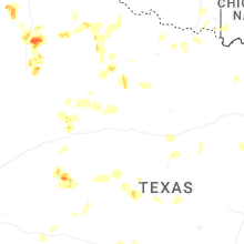
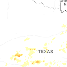
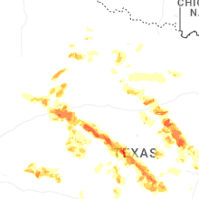
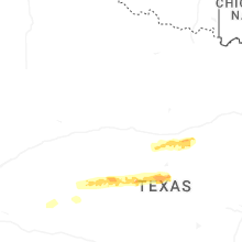
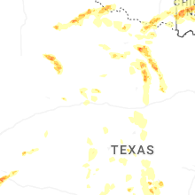


Connect with Interactive Hail Maps