

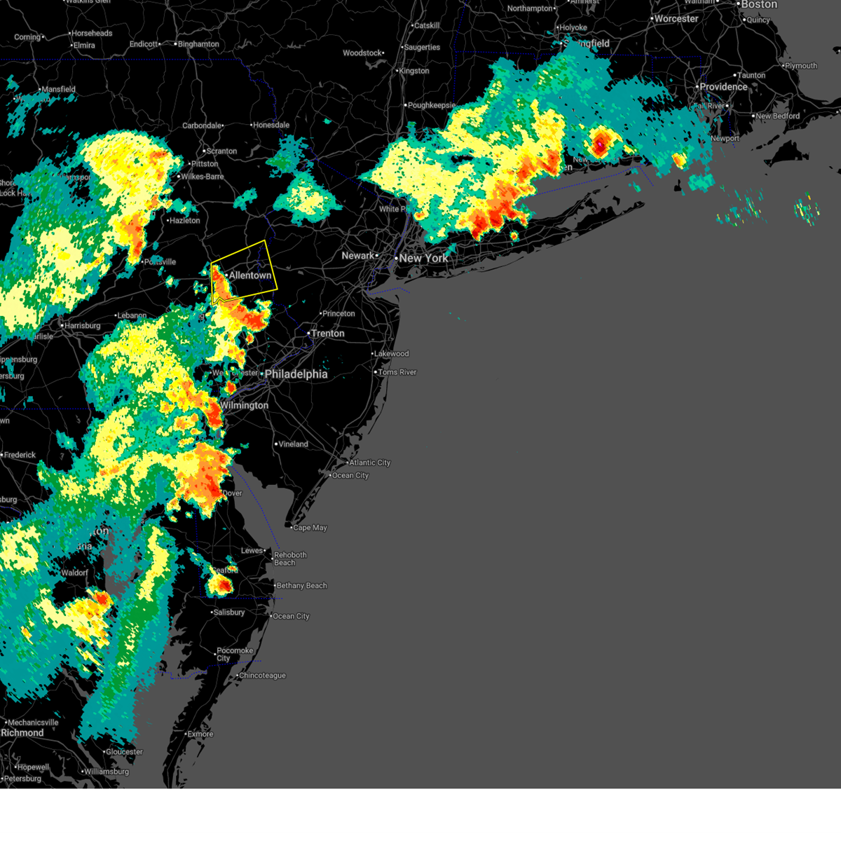
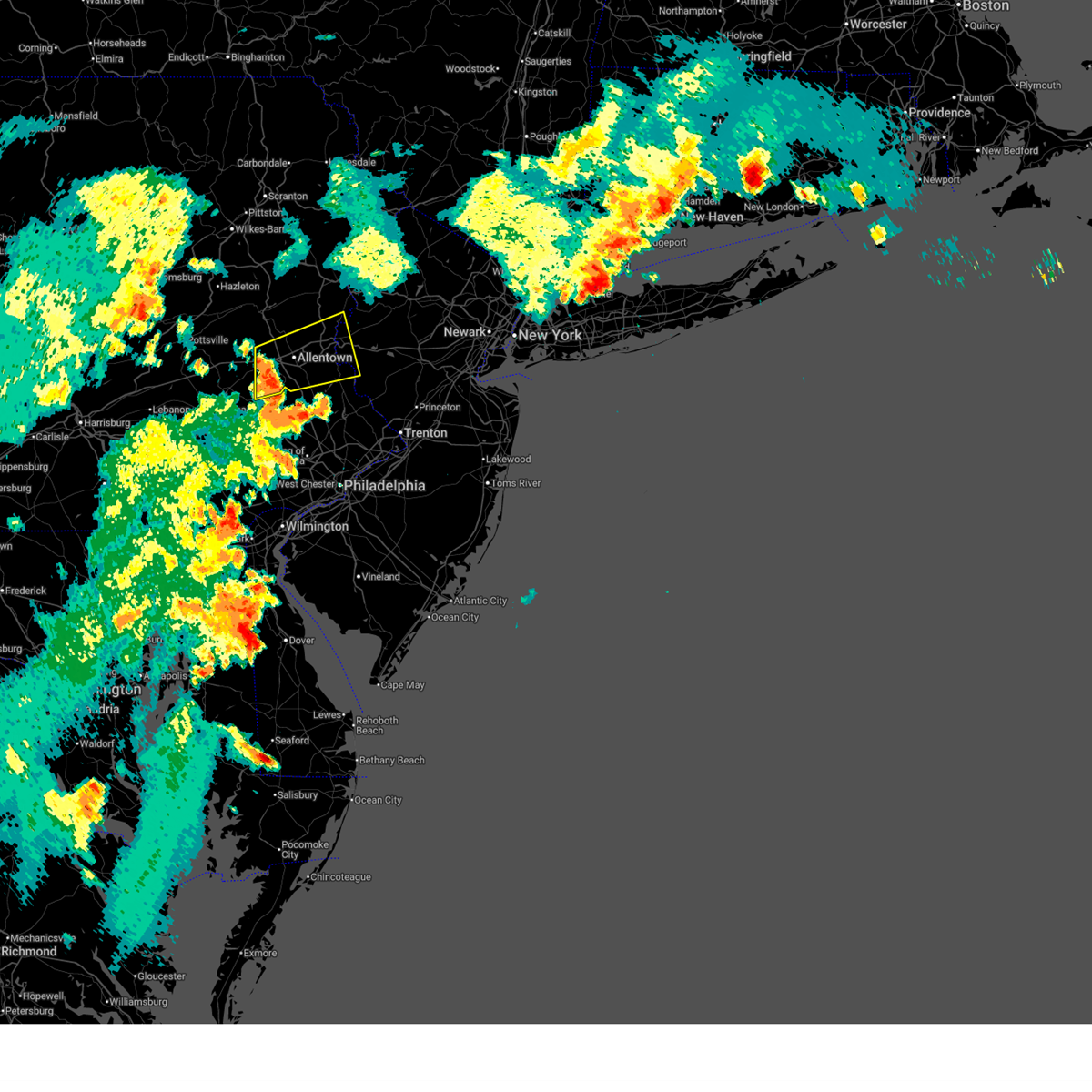
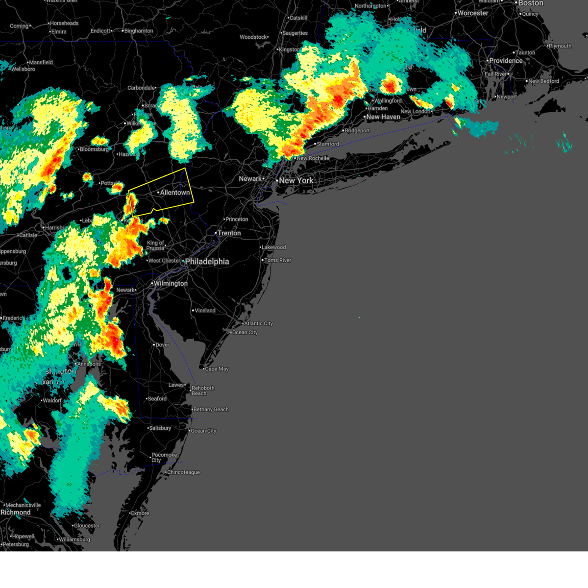
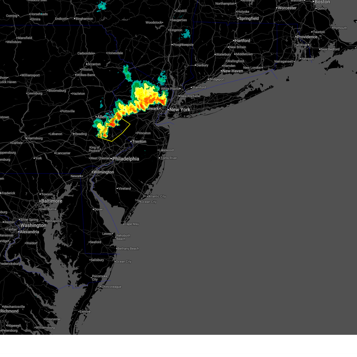
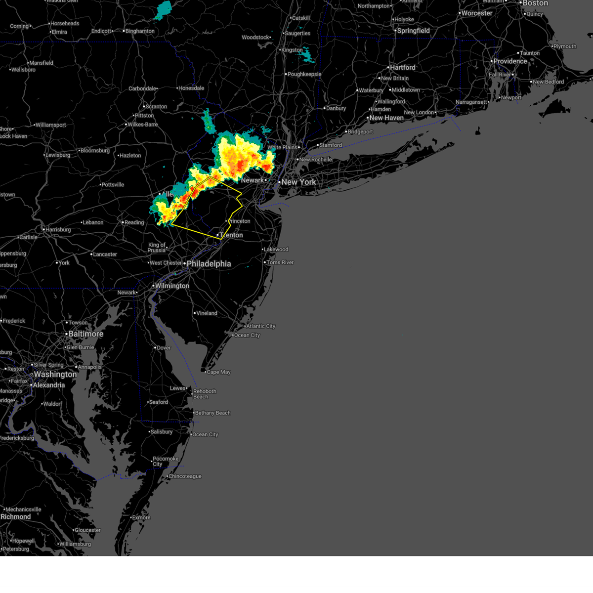
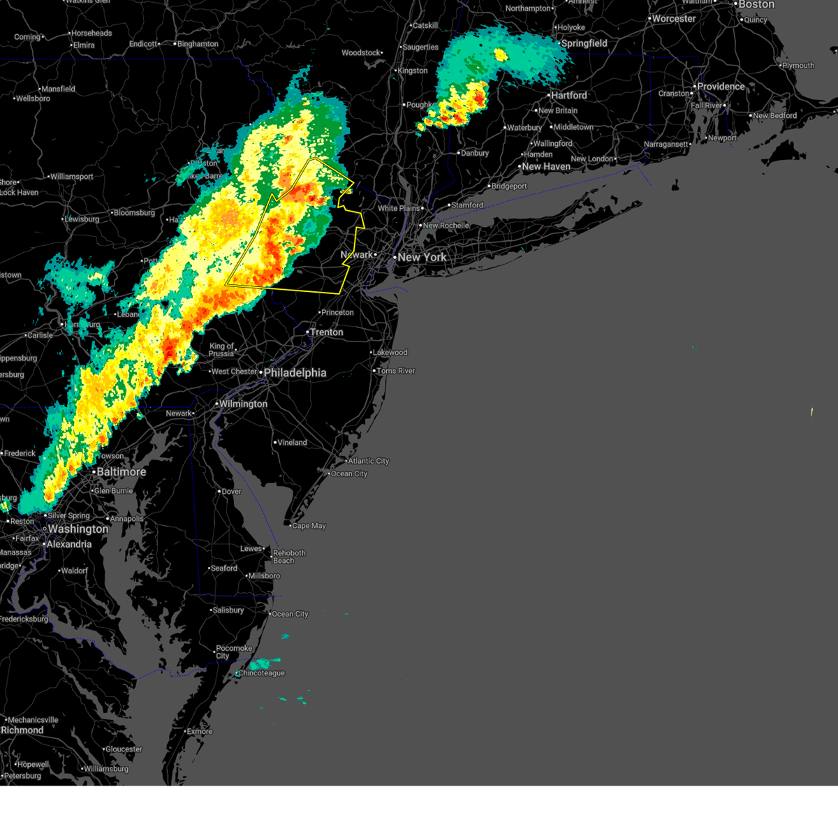
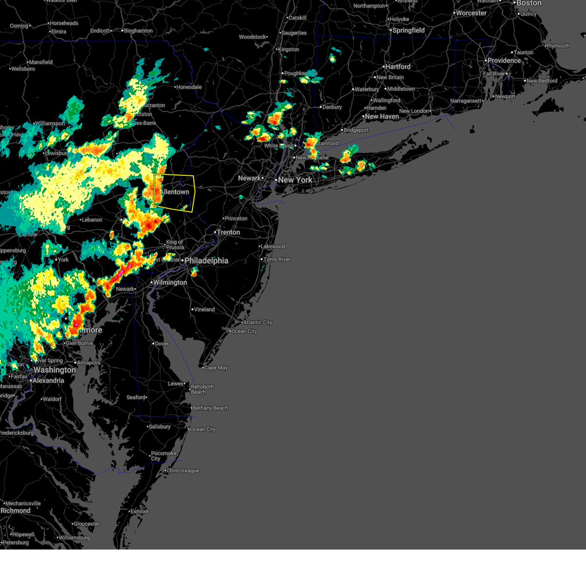
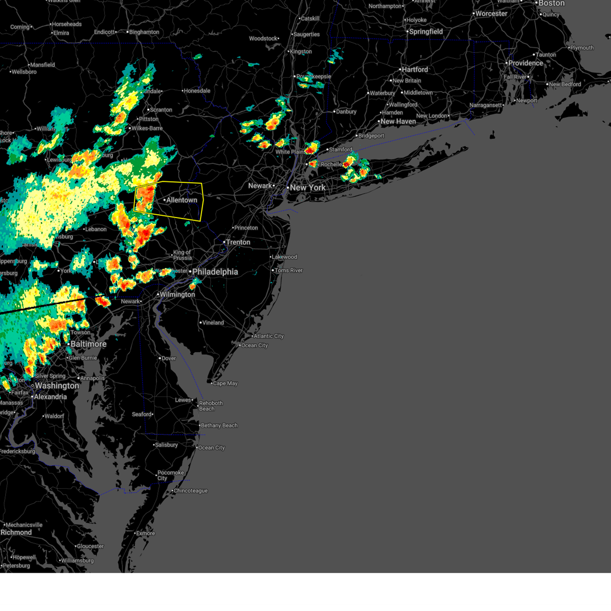
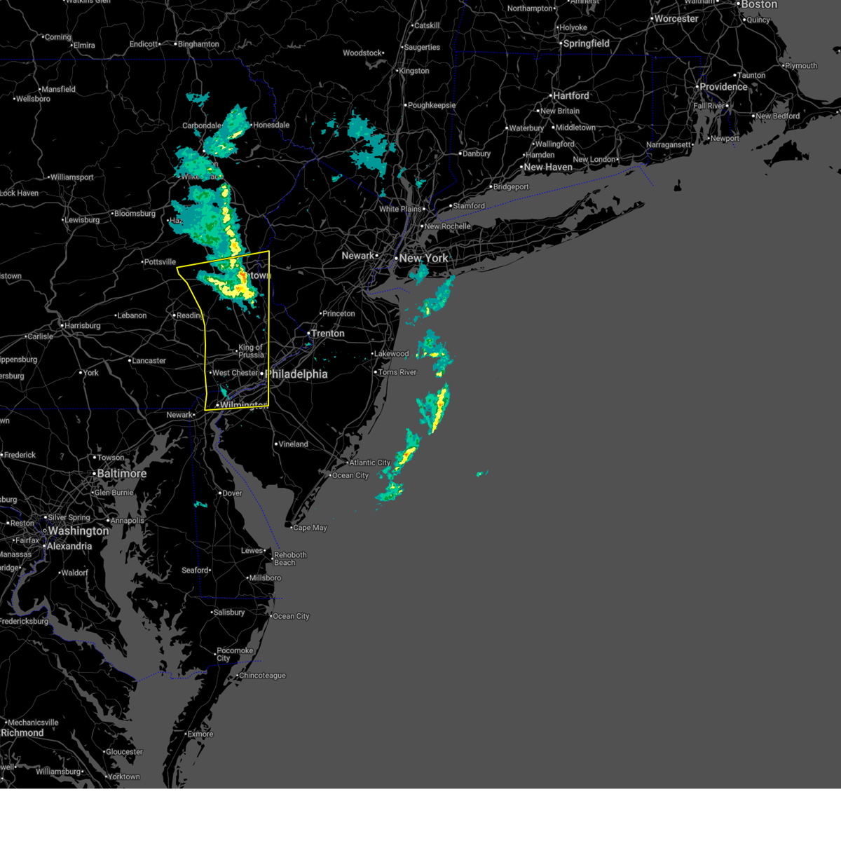
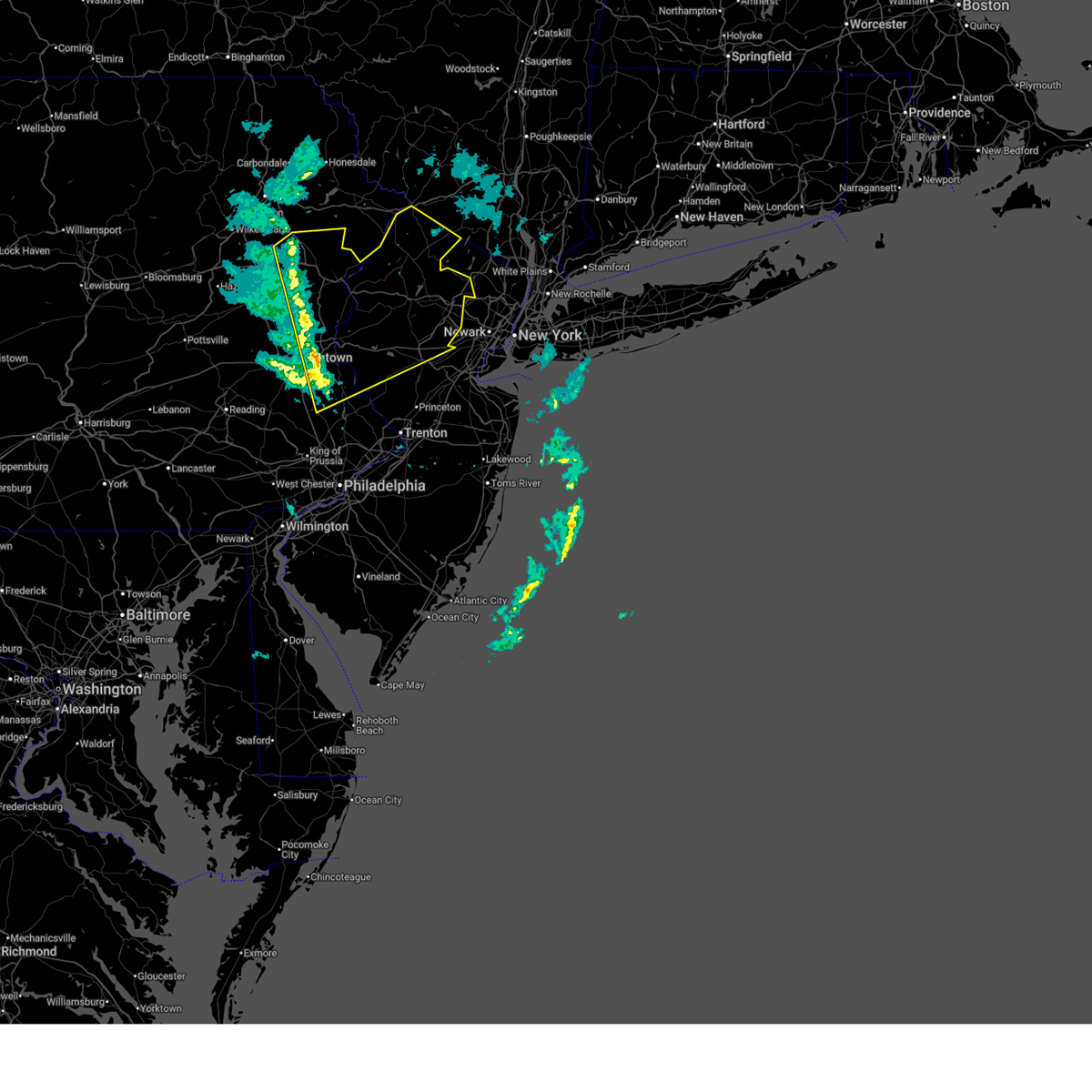
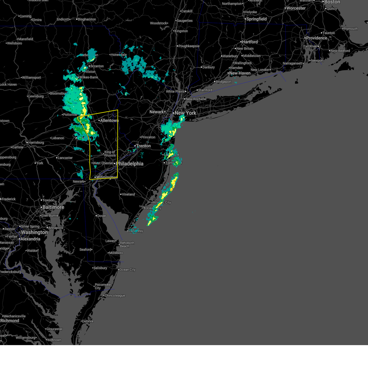
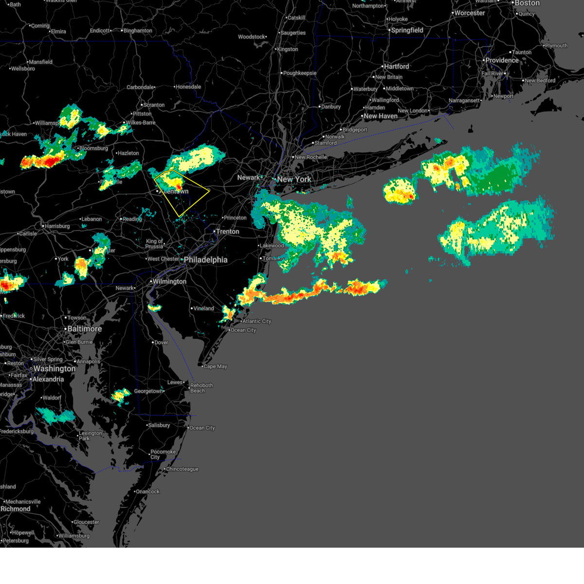
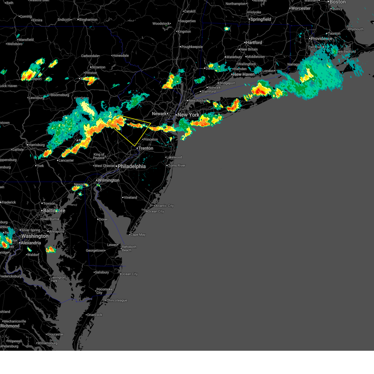
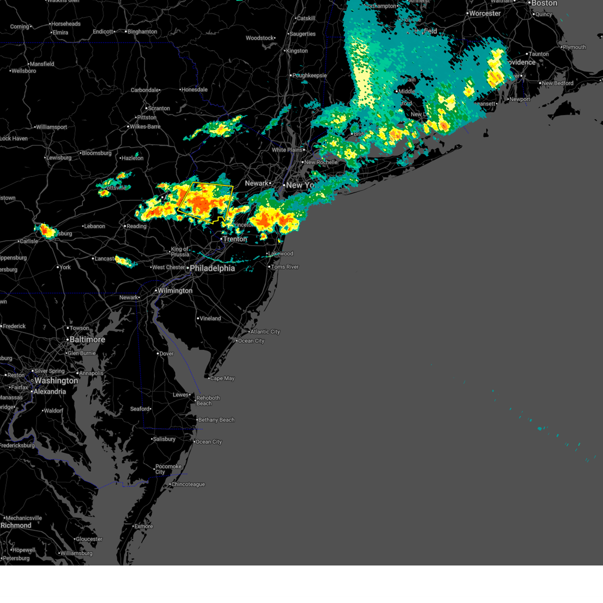
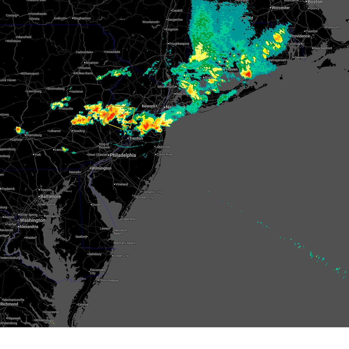
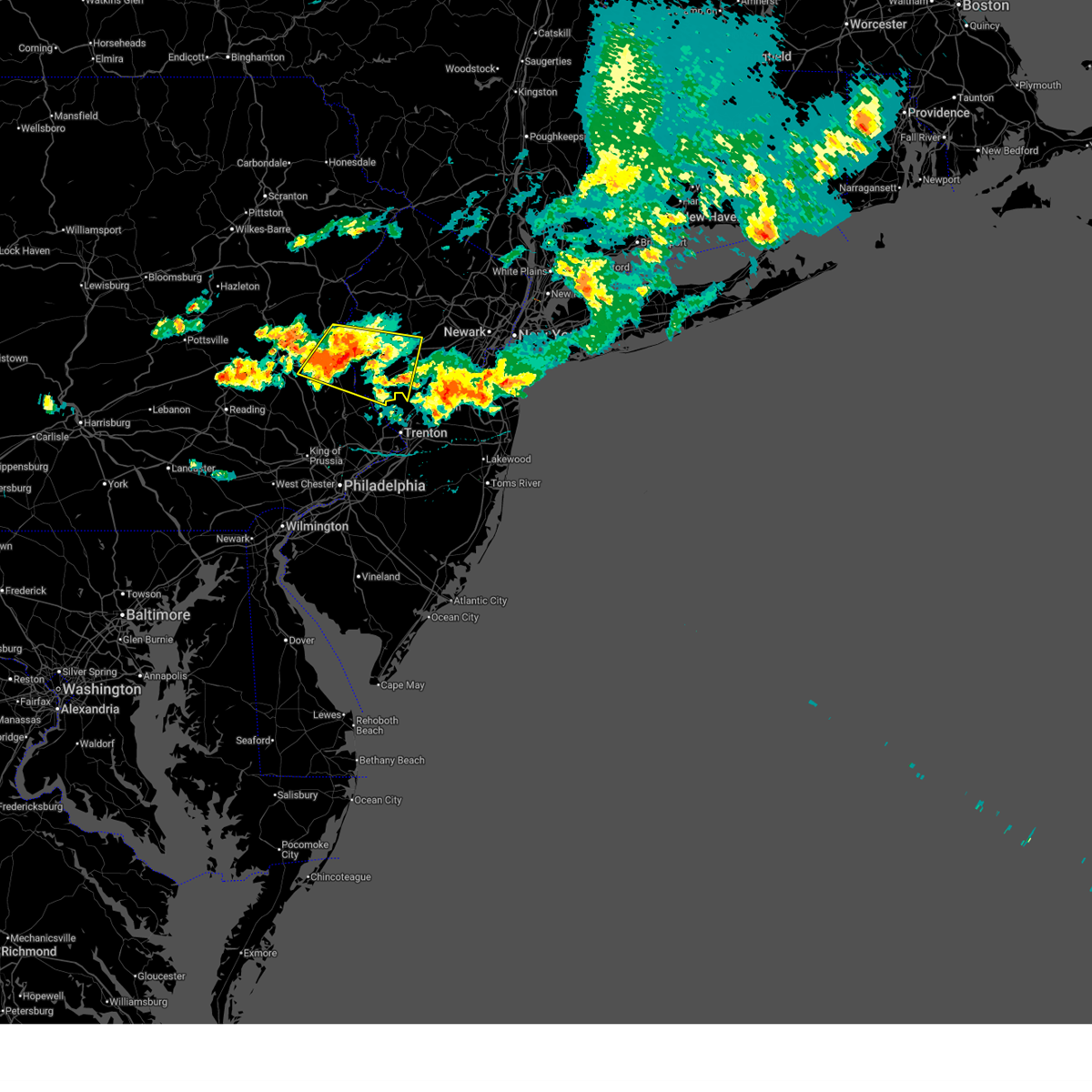
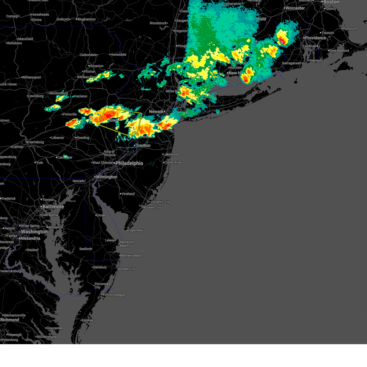
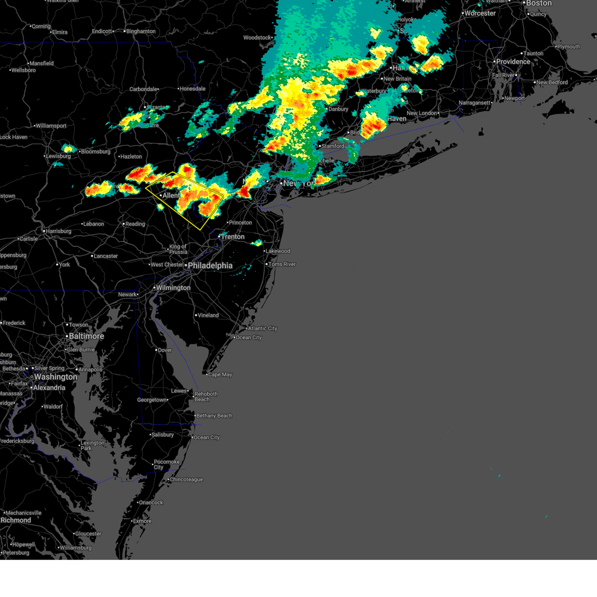
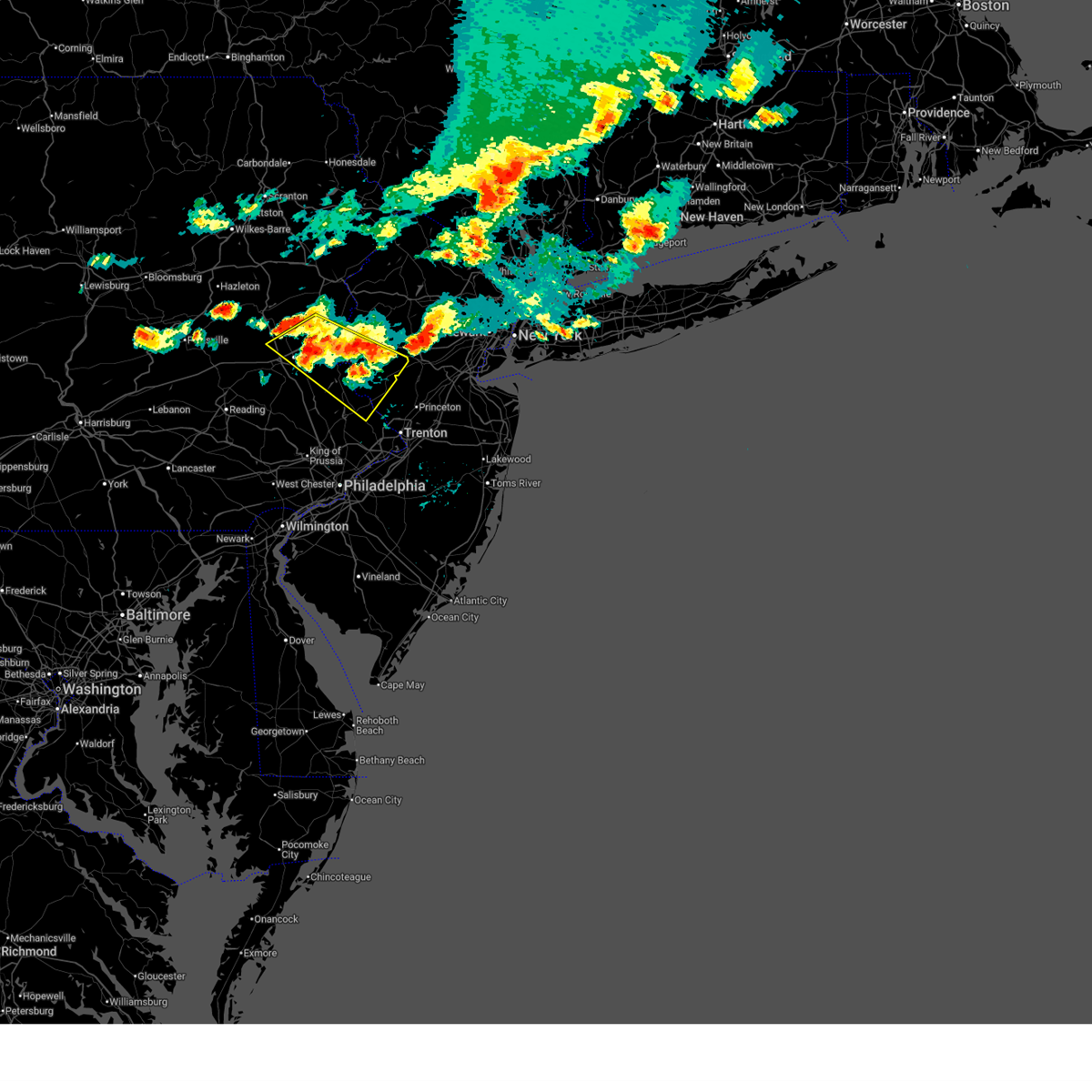
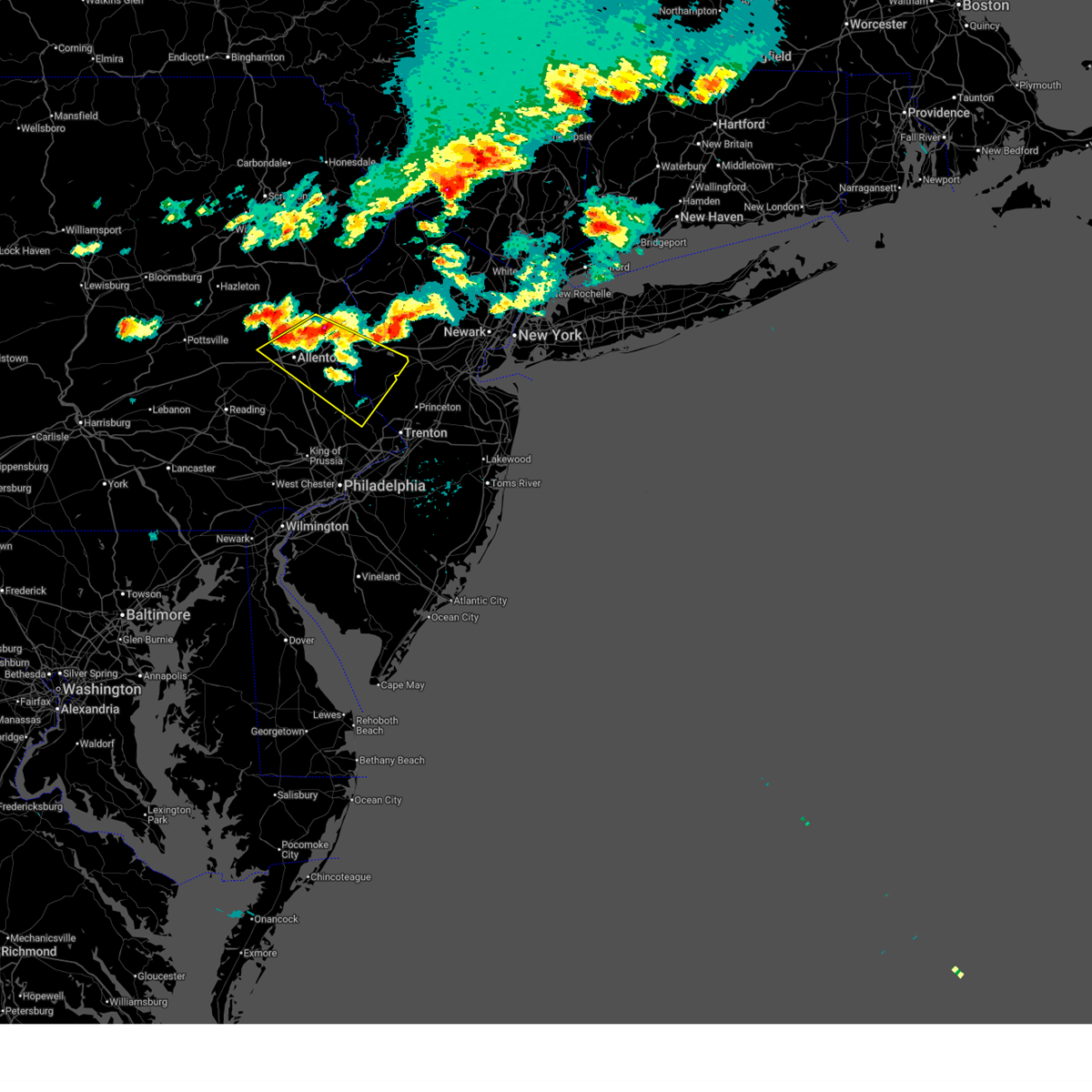
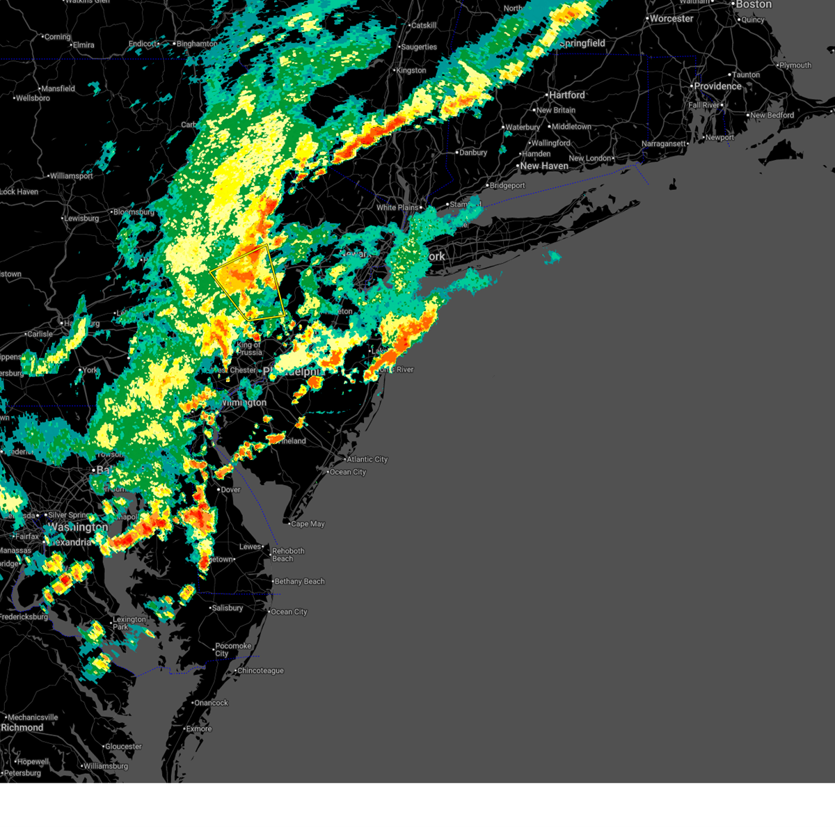
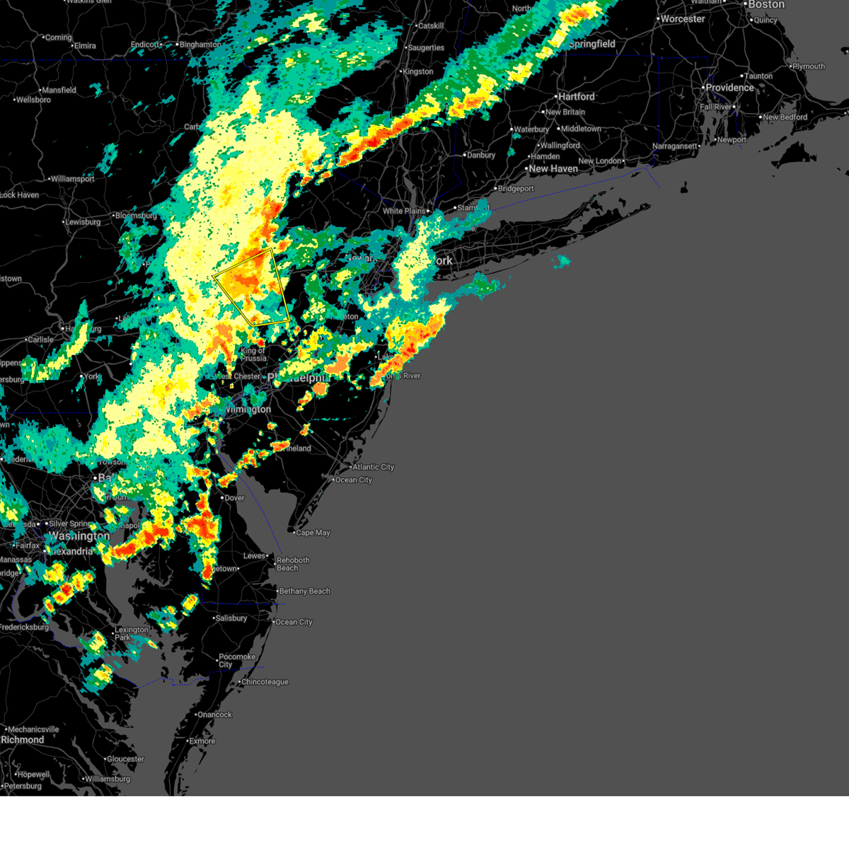
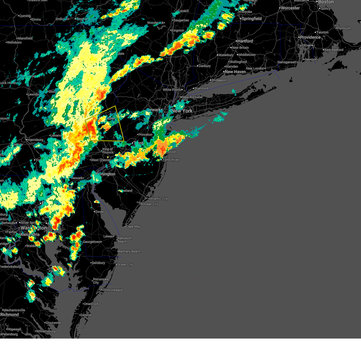
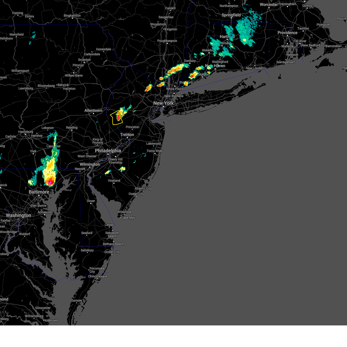
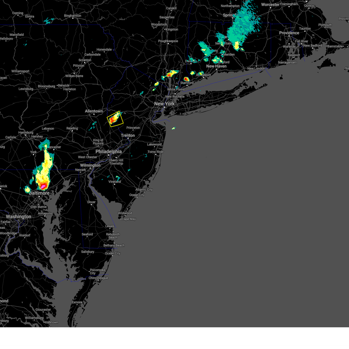
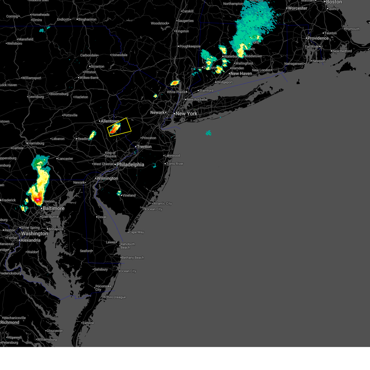
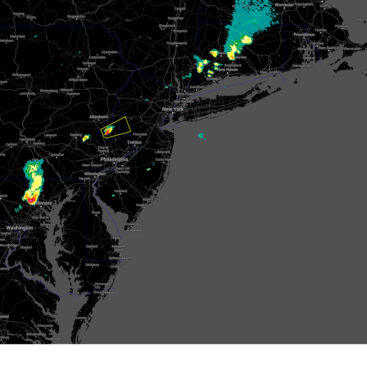
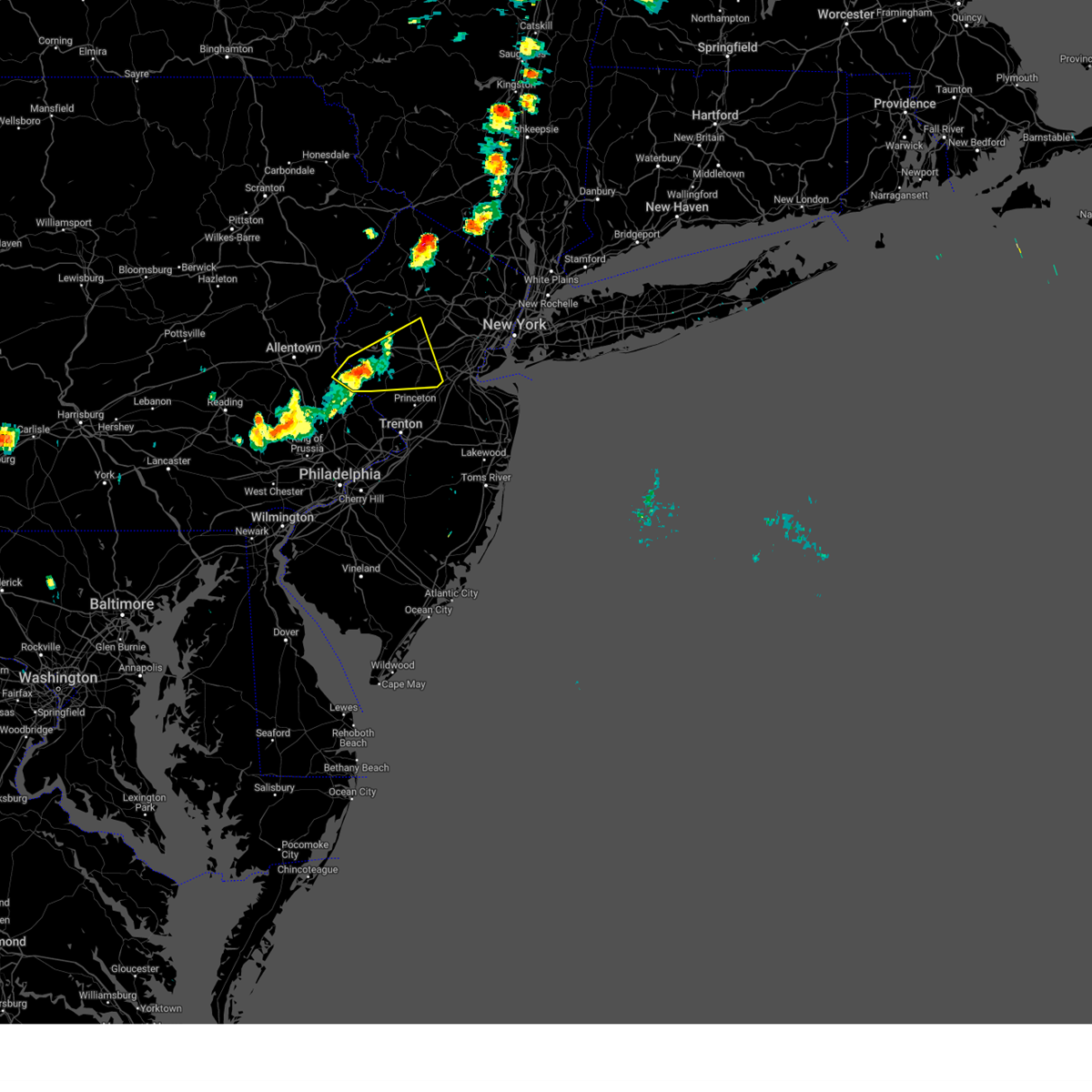
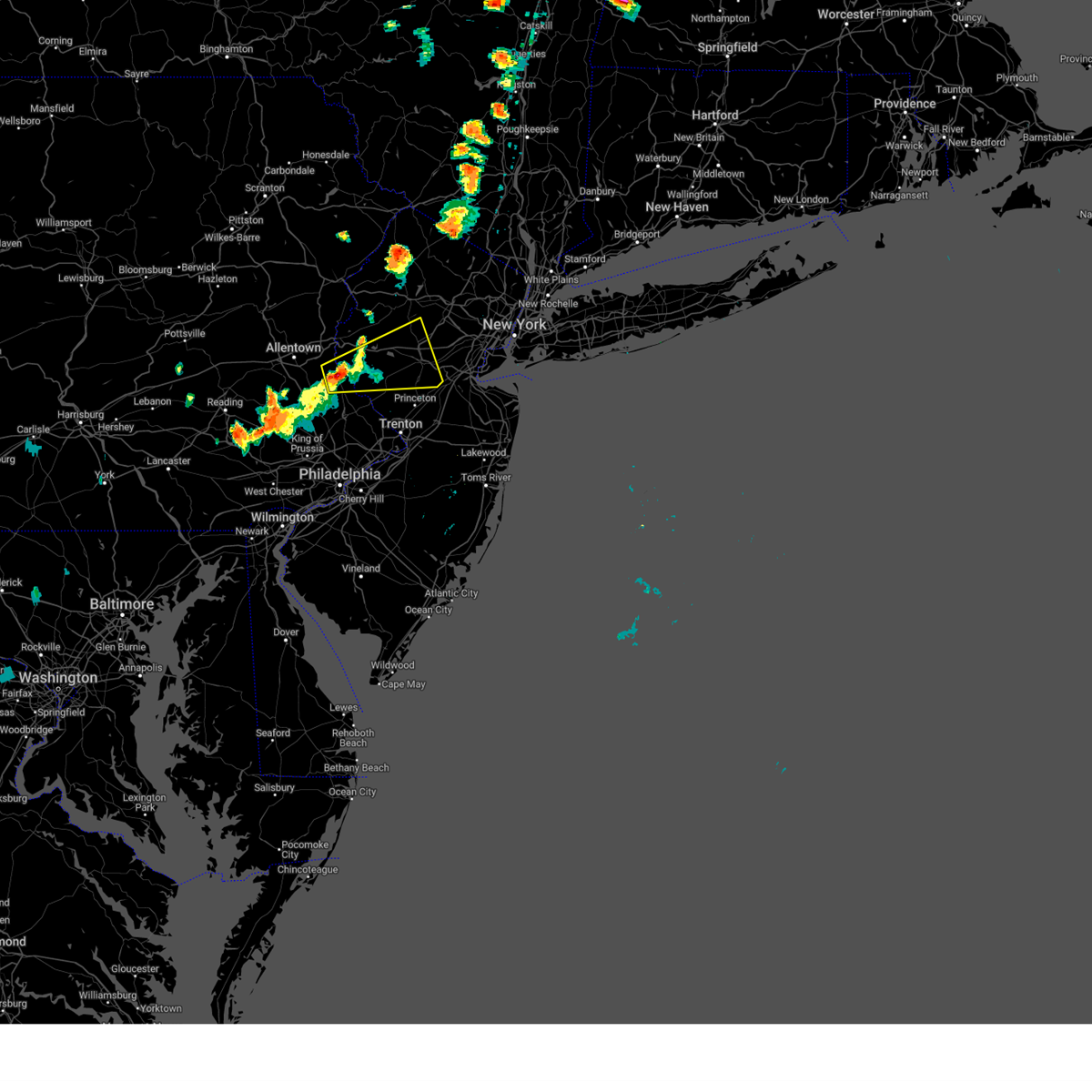
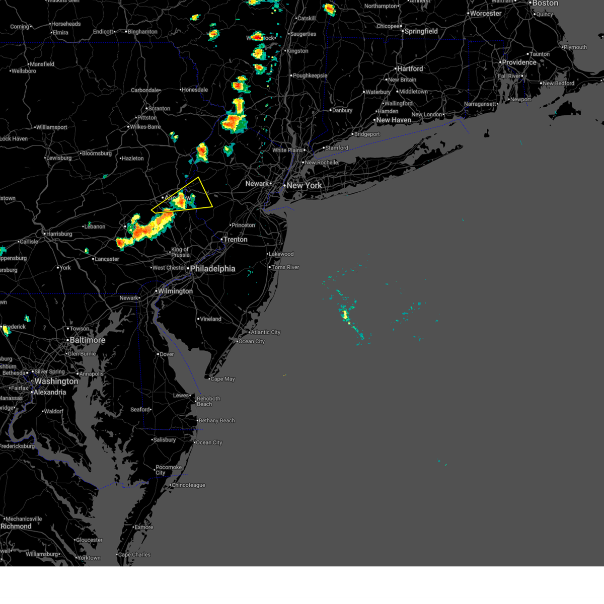
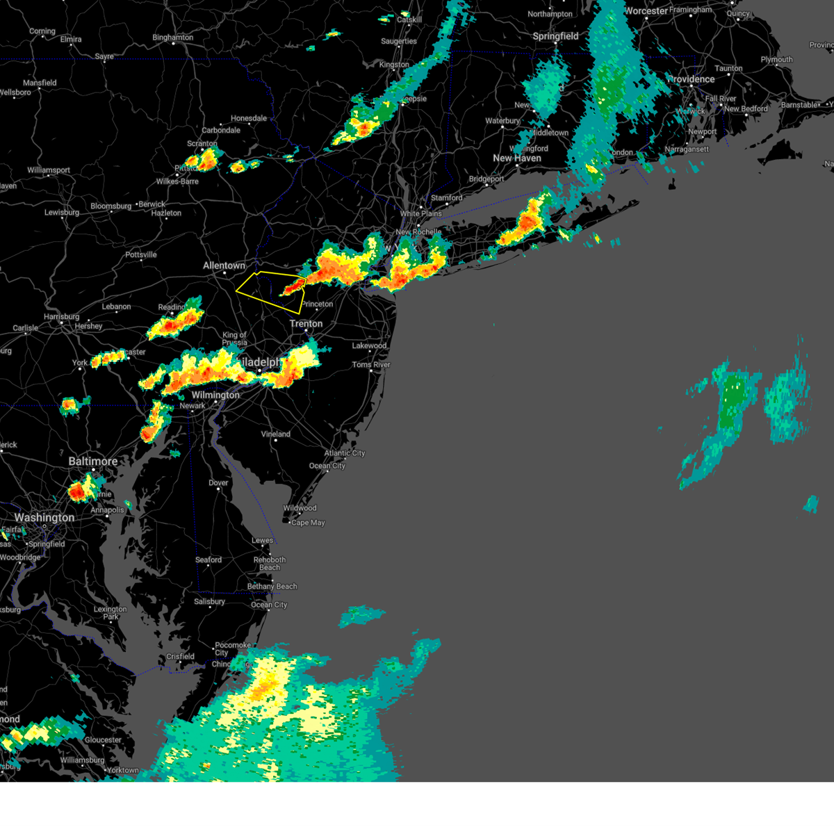
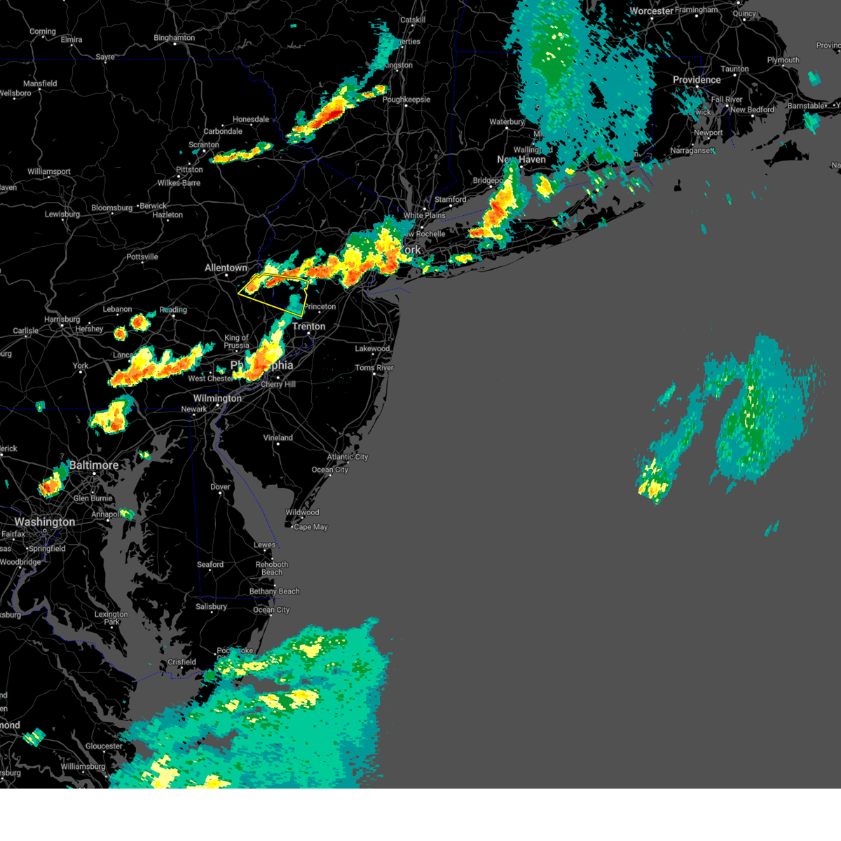
Hail Map for Milford, NJ
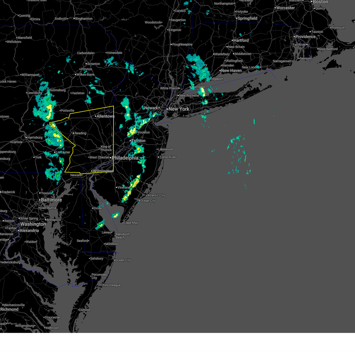
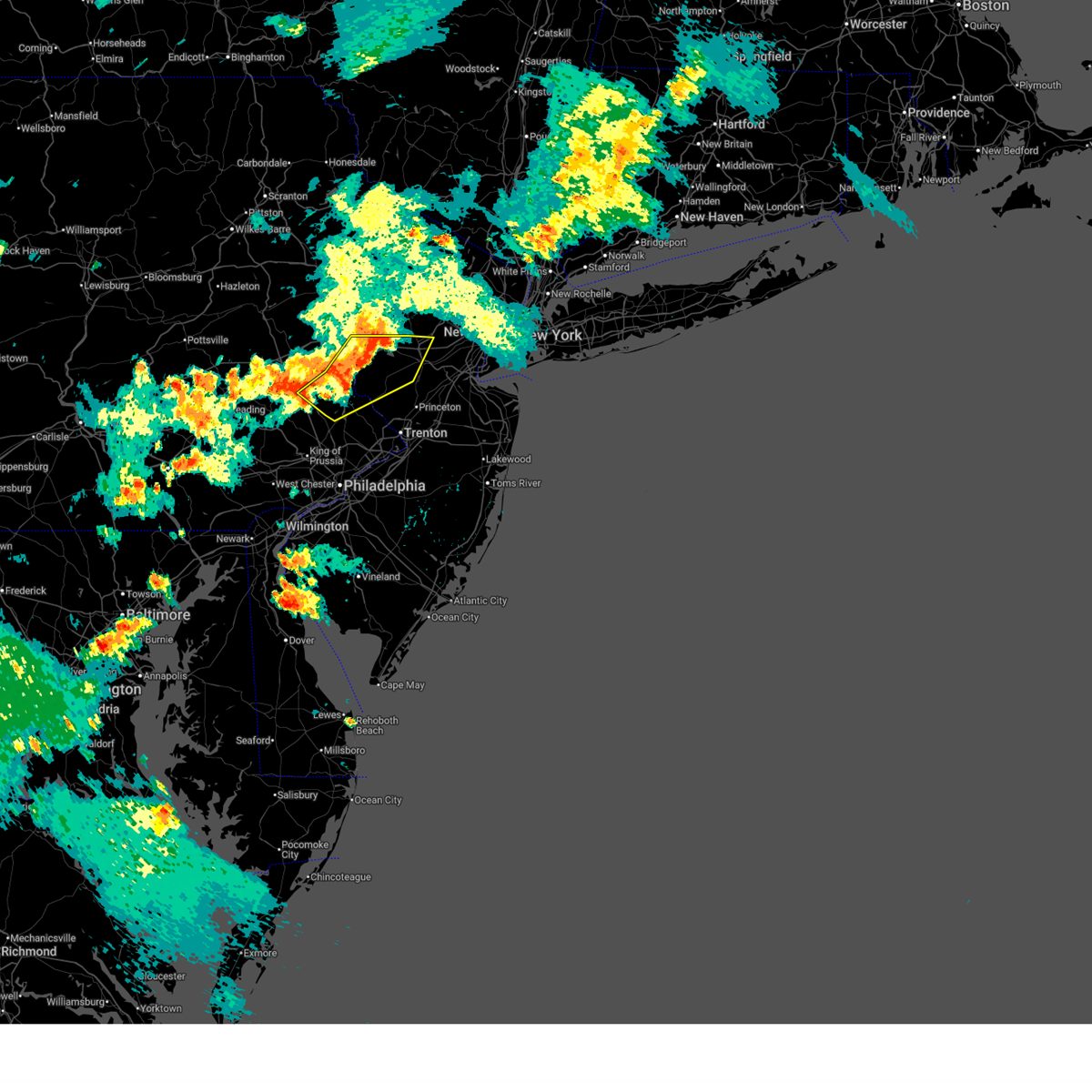
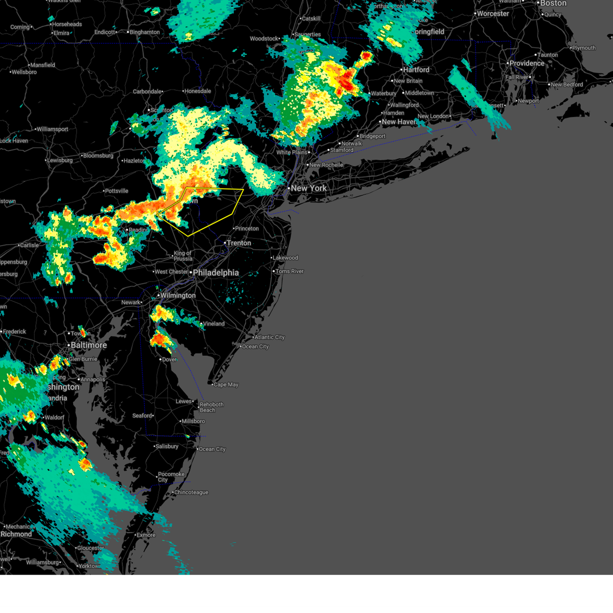
The Milford, NJ area has had 1 report of on-the-ground hail by trained spotters, and has been under severe weather warnings 31 times during the past 12 months. Doppler radar has detected hail at or near Milford, NJ on 19 occasions, including 1 occasion during the past year.
| Name: | Milford, NJ |
| Where Located: | 58.6 miles W of Brooklyn, NY |
| Map: | Google Map for Milford, NJ |
| Population: | 1233 |
| Housing Units: | 552 |
| More Info: | Search Google for Milford, NJ |
0
The Top Recent Hail Date for Milford, NJ is Friday, July 3, 2026 (17th out of 19)

Hail and Wind Damage Spotted near Milford, NJ
| Date / Time | Report Details |
|---|---|
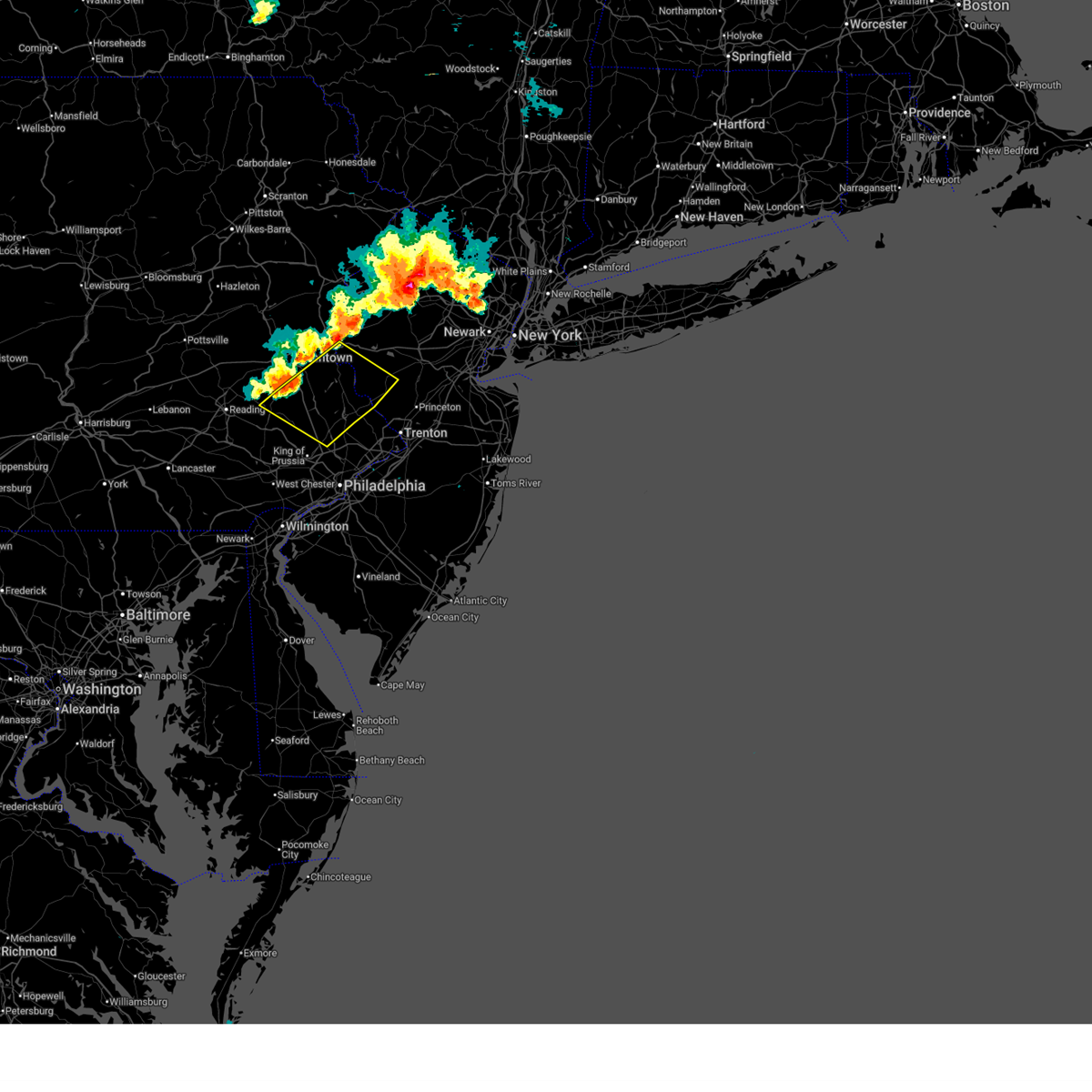
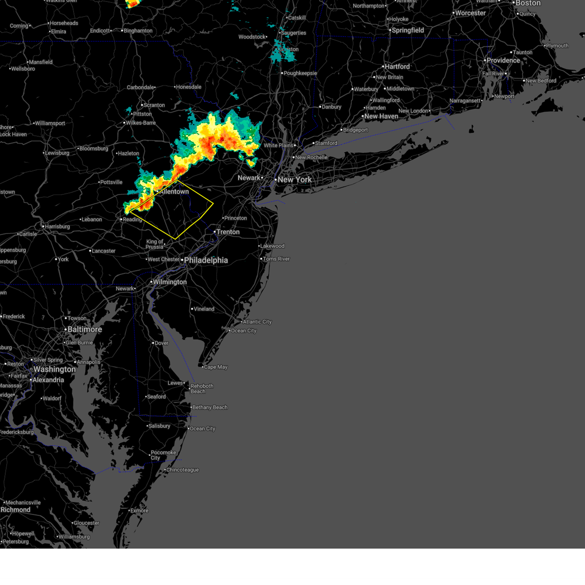
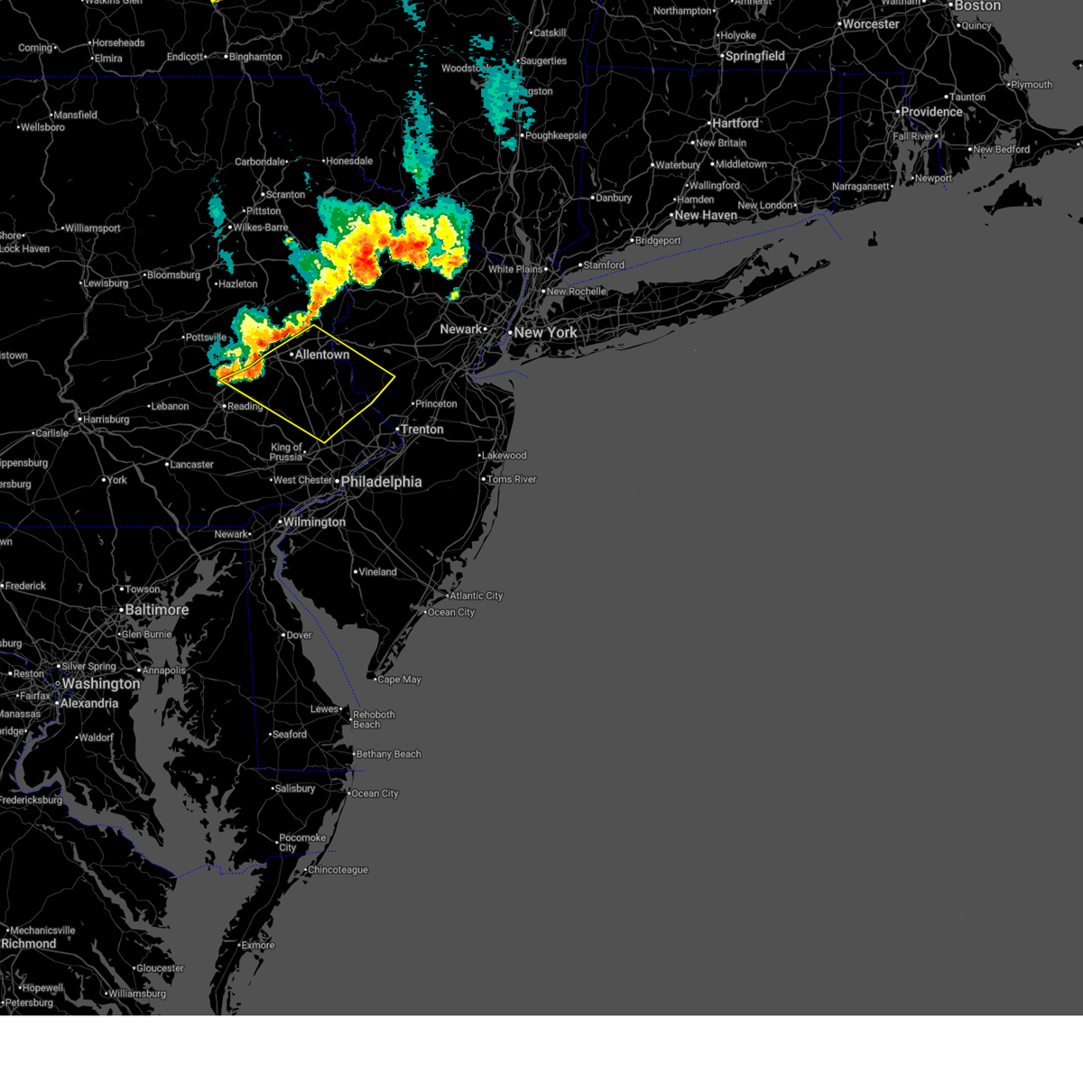
| 7/4/2026 9:01 PM EDT |
 At 901 pm edt, a severe thunderstorm was located over allentown, moving east at 30 mph (radar indicated). Hazards include 60 mph wind gusts. Damage to roofs, siding, trees, and power lines is possible. locations impacted include, allentown, easton, bethlehem, forks, emmaus, northampton, wilson, hellertown, nazareth, bath, harmony, alpha, ferndale, belfast, frenchtown, west easton, milford, tatamy, bloomsbury, and riegelsville. this includes the following highways, northeast extension between mile markers 45 and 63. interstate 78 in pennsylvania between mile markers 53 and 76. Interstate 78 in new jersey between mile markers 0 and 6. At 901 pm edt, a severe thunderstorm was located over allentown, moving east at 30 mph (radar indicated). Hazards include 60 mph wind gusts. Damage to roofs, siding, trees, and power lines is possible. locations impacted include, allentown, easton, bethlehem, forks, emmaus, northampton, wilson, hellertown, nazareth, bath, harmony, alpha, ferndale, belfast, frenchtown, west easton, milford, tatamy, bloomsbury, and riegelsville. this includes the following highways, northeast extension between mile markers 45 and 63. interstate 78 in pennsylvania between mile markers 53 and 76. Interstate 78 in new jersey between mile markers 0 and 6.
|
| 7/4/2026 8:47 PM EDT |
 At 847 pm edt, a severe thunderstorm was located over ancient oaks, or near allentown, moving east at 30 mph (radar indicated). Hazards include 60 mph wind gusts. Damage to roofs, siding, trees, and power lines is possible. locations impacted include, allentown, easton, bethlehem, forks, emmaus, northampton, wilson, hellertown, nazareth, bath, harmony, alpha, topton, ferndale, belfast, frenchtown, west easton, milford, tatamy, and bloomsbury. this includes the following highways, northeast extension between mile markers 45 and 64. interstate 78 in pennsylvania between mile markers 46 and 76. Interstate 78 in new jersey between mile markers 0 and 6. At 847 pm edt, a severe thunderstorm was located over ancient oaks, or near allentown, moving east at 30 mph (radar indicated). Hazards include 60 mph wind gusts. Damage to roofs, siding, trees, and power lines is possible. locations impacted include, allentown, easton, bethlehem, forks, emmaus, northampton, wilson, hellertown, nazareth, bath, harmony, alpha, topton, ferndale, belfast, frenchtown, west easton, milford, tatamy, and bloomsbury. this includes the following highways, northeast extension between mile markers 45 and 64. interstate 78 in pennsylvania between mile markers 46 and 76. Interstate 78 in new jersey between mile markers 0 and 6.
|
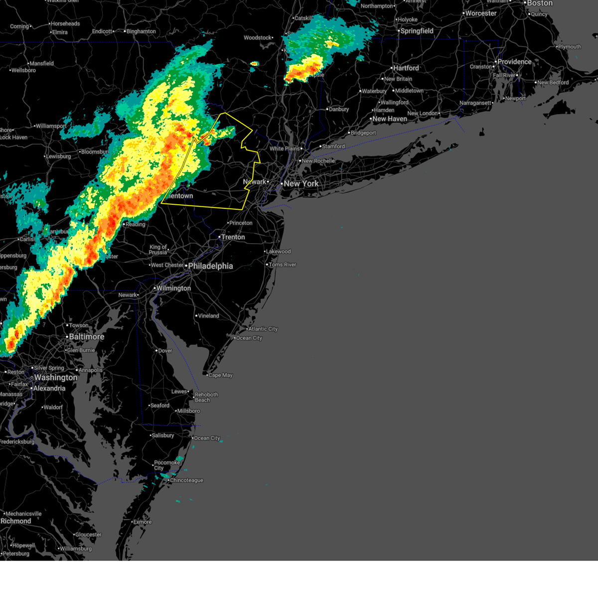
| 7/4/2026 8:28 PM EDT |
 Svrphi the national weather service in mount holly nj has issued a * severe thunderstorm warning for, west central hunterdon county in northwestern new jersey, southwestern warren county in northwestern new jersey, northeastern berks county in eastern pennsylvania, lehigh county in eastern pennsylvania, northwestern bucks county in southeastern pennsylvania, southern northampton county in eastern pennsylvania, * until 930 pm edt. * at 828 pm edt, a severe thunderstorm was located over topton, or 14 miles southwest of allentown, moving east at 35 mph (radar indicated). Hazards include 60 mph wind gusts. damage to roofs, siding, trees, and power lines is possible Svrphi the national weather service in mount holly nj has issued a * severe thunderstorm warning for, west central hunterdon county in northwestern new jersey, southwestern warren county in northwestern new jersey, northeastern berks county in eastern pennsylvania, lehigh county in eastern pennsylvania, northwestern bucks county in southeastern pennsylvania, southern northampton county in eastern pennsylvania, * until 930 pm edt. * at 828 pm edt, a severe thunderstorm was located over topton, or 14 miles southwest of allentown, moving east at 35 mph (radar indicated). Hazards include 60 mph wind gusts. damage to roofs, siding, trees, and power lines is possible
|
| 7/3/2026 7:46 PM EDT |
 At 746 pm edt, severe thunderstorms were located along a line extending from near flemington to bedminster to fricks to spring mount, moving southeast at 45 mph (radar indicated). Hazards include 60 mph wind gusts. Damage to roofs, siding, trees, and power lines is possible. locations impacted include, lansdale, perkasie, doylestown, byram, souderton, bedminster, flemington, chalfont, tinicum, hatfield, new hope, dublin, frenchtown, milford, stockton, fricks, revere, lumberville, ottsville, and sergeantsville. People at the new hope america 250 celebration should seek safe shelter immediately! this includes northeast extension between mile markers 32 and 36. At 746 pm edt, severe thunderstorms were located along a line extending from near flemington to bedminster to fricks to spring mount, moving southeast at 45 mph (radar indicated). Hazards include 60 mph wind gusts. Damage to roofs, siding, trees, and power lines is possible. locations impacted include, lansdale, perkasie, doylestown, byram, souderton, bedminster, flemington, chalfont, tinicum, hatfield, new hope, dublin, frenchtown, milford, stockton, fricks, revere, lumberville, ottsville, and sergeantsville. People at the new hope america 250 celebration should seek safe shelter immediately! this includes northeast extension between mile markers 32 and 36.
|
| 7/3/2026 7:45 PM EDT |
 Svrphi the national weather service in mount holly nj has issued a * severe thunderstorm warning for, hunterdon county in northwestern new jersey, mercer county in central new jersey, somerset county in northern new jersey, central bucks county in southeastern pennsylvania, * until 830 pm edt. * at 744 pm edt, severe thunderstorms were located along a line extending from near califon to near clinton to ottsville to near souderton, moving east at 55 mph (radar indicated). Hazards include 70 mph wind gusts. Expect considerable tree damage. Damage is likely to mobile homes, roofs, and outbuildings. Svrphi the national weather service in mount holly nj has issued a * severe thunderstorm warning for, hunterdon county in northwestern new jersey, mercer county in central new jersey, somerset county in northern new jersey, central bucks county in southeastern pennsylvania, * until 830 pm edt. * at 744 pm edt, severe thunderstorms were located along a line extending from near califon to near clinton to ottsville to near souderton, moving east at 55 mph (radar indicated). Hazards include 70 mph wind gusts. Expect considerable tree damage. Damage is likely to mobile homes, roofs, and outbuildings.
|
| 7/3/2026 7:33 PM EDT | Trained spotter measured gusts over 60 mph in holland townsihp. time estimate in hunterdon county NJ, 2.8 miles SSE of Milford, NJ |
| 7/3/2026 7:31 PM EDT |
 At 730 pm edt, severe thunderstorms were located along a line extending from bloomsbury to near hellertown to near geryville to bally, moving southeast at 45 mph (radar indicated). Hazards include 70 mph wind gusts. strong winds may occur ahead of any rain. Expect considerable tree damage. damage is likely to mobile homes, roofs, and outbuildings. locations impacted include, lansdale, quakertown, perkasie, doylestown, byram, souderton, bedminster, hellertown, flemington, chalfont, tinicum, hatfield, east greenville, new hope, alpha, dublin, ferndale, schwenksville, frenchtown, and milford. people at the new hope america 250 celebration should seek safe shelter immediately! this includes the following highways, northeast extension between mile markers 25 and 48. Interstate 78 in new jersey between mile markers 0 and 3. At 730 pm edt, severe thunderstorms were located along a line extending from bloomsbury to near hellertown to near geryville to bally, moving southeast at 45 mph (radar indicated). Hazards include 70 mph wind gusts. strong winds may occur ahead of any rain. Expect considerable tree damage. damage is likely to mobile homes, roofs, and outbuildings. locations impacted include, lansdale, quakertown, perkasie, doylestown, byram, souderton, bedminster, hellertown, flemington, chalfont, tinicum, hatfield, east greenville, new hope, alpha, dublin, ferndale, schwenksville, frenchtown, and milford. people at the new hope america 250 celebration should seek safe shelter immediately! this includes the following highways, northeast extension between mile markers 25 and 48. Interstate 78 in new jersey between mile markers 0 and 3.
|
| 7/3/2026 7:22 PM EDT |
 At 721 pm edt, severe thunderstorms were located along a line extending from near easton to near allentown to zionsville to near topton, moving east at 45 mph (radar indicated). Hazards include 70 mph wind gusts. these storms have a history or producing wind damage. Expect considerable tree damage. damage is likely to mobile homes, roofs, and outbuildings. locations impacted include, allentown, easton, bethlehem, lansdale, forks, emmaus, quakertown, perkasie, doylestown, byram, wilson, souderton, bedminster, hellertown, flemington, chalfont, tinicum, hatfield, east greenville, and new hope. people at the new hope america 250 celebration should seek safe shelter immediately! this includes the following highways, northeast extension between mile markers 25 and 53. interstate 78 in pennsylvania between mile markers 58 and 76. Interstate 78 in new jersey between mile markers 0 and 3. At 721 pm edt, severe thunderstorms were located along a line extending from near easton to near allentown to zionsville to near topton, moving east at 45 mph (radar indicated). Hazards include 70 mph wind gusts. these storms have a history or producing wind damage. Expect considerable tree damage. damage is likely to mobile homes, roofs, and outbuildings. locations impacted include, allentown, easton, bethlehem, lansdale, forks, emmaus, quakertown, perkasie, doylestown, byram, wilson, souderton, bedminster, hellertown, flemington, chalfont, tinicum, hatfield, east greenville, and new hope. people at the new hope america 250 celebration should seek safe shelter immediately! this includes the following highways, northeast extension between mile markers 25 and 53. interstate 78 in pennsylvania between mile markers 58 and 76. Interstate 78 in new jersey between mile markers 0 and 3.
|
| 7/3/2026 7:05 PM EDT |
 Svrphi the national weather service in mount holly nj has issued a * severe thunderstorm warning for, southern hunterdon county in northwestern new jersey, southwestern warren county in northwestern new jersey, east central berks county in eastern pennsylvania, northern montgomery county in southeastern pennsylvania, southeastern lehigh county in eastern pennsylvania, bucks county in southeastern pennsylvania, southern northampton county in eastern pennsylvania, * until 800 pm edt. * at 705 pm edt, severe thunderstorms were located along a line extending from nazareth to near claussville to topton to near lenhartsville, moving southeast at 45 mph (radar indicated). Hazards include 60 mph wind gusts. damage to roofs, siding, trees, and power lines is possible Svrphi the national weather service in mount holly nj has issued a * severe thunderstorm warning for, southern hunterdon county in northwestern new jersey, southwestern warren county in northwestern new jersey, east central berks county in eastern pennsylvania, northern montgomery county in southeastern pennsylvania, southeastern lehigh county in eastern pennsylvania, bucks county in southeastern pennsylvania, southern northampton county in eastern pennsylvania, * until 800 pm edt. * at 705 pm edt, severe thunderstorms were located along a line extending from nazareth to near claussville to topton to near lenhartsville, moving southeast at 45 mph (radar indicated). Hazards include 60 mph wind gusts. damage to roofs, siding, trees, and power lines is possible
|
| 6/6/2026 6:39 PM EDT |
 At 639 pm edt, severe thunderstorms were located along a line extending from near pellettown to allamuchy-panther valley to near clinton, moving east at 55 mph (trained weather spotters. at 615 pm, tree damage was reported near easton pa). Hazards include 60 mph wind gusts. Damage to roofs, siding, trees, and power lines is possible. Locations impacted include, easton, morristown, somerville, newton, somerset, bethlehem, bridgewater, dover, madison, hopatcong, forks, middlesex, florham park, east hanover, lincoln park, bound brook, manville, kinnelon, hackettstown, and chatham. At 639 pm edt, severe thunderstorms were located along a line extending from near pellettown to allamuchy-panther valley to near clinton, moving east at 55 mph (trained weather spotters. at 615 pm, tree damage was reported near easton pa). Hazards include 60 mph wind gusts. Damage to roofs, siding, trees, and power lines is possible. Locations impacted include, easton, morristown, somerville, newton, somerset, bethlehem, bridgewater, dover, madison, hopatcong, forks, middlesex, florham park, east hanover, lincoln park, bound brook, manville, kinnelon, hackettstown, and chatham.
|
| 6/6/2026 6:13 PM EDT |
 Svrphi the national weather service in mount holly nj has issued a * severe thunderstorm warning for, hunterdon county in northwestern new jersey, morris county in northern new jersey, sussex county in northwestern new jersey, warren county in northwestern new jersey, somerset county in northern new jersey, north central middlesex county in northern new jersey, east central lehigh county in eastern pennsylvania, north central bucks county in southeastern pennsylvania, east central monroe county in northeastern pennsylvania, eastern northampton county in eastern pennsylvania, * until 700 pm edt. * at 613 pm edt, severe thunderstorms were located along a line extending from near skytop to pen argyl to near lehigh university, moving east at 55 mph (radar indicated). Hazards include 60 mph wind gusts. damage to roofs, siding, trees, and power lines is possible Svrphi the national weather service in mount holly nj has issued a * severe thunderstorm warning for, hunterdon county in northwestern new jersey, morris county in northern new jersey, sussex county in northwestern new jersey, warren county in northwestern new jersey, somerset county in northern new jersey, north central middlesex county in northern new jersey, east central lehigh county in eastern pennsylvania, north central bucks county in southeastern pennsylvania, east central monroe county in northeastern pennsylvania, eastern northampton county in eastern pennsylvania, * until 700 pm edt. * at 613 pm edt, severe thunderstorms were located along a line extending from near skytop to pen argyl to near lehigh university, moving east at 55 mph (radar indicated). Hazards include 60 mph wind gusts. damage to roofs, siding, trees, and power lines is possible
|
| 5/20/2026 5:24 PM EDT |
 Svrphi the national weather service in mount holly nj has issued a * severe thunderstorm warning for, hunterdon county in northwestern new jersey, southwestern morris county in northern new jersey, southwestern warren county in northwestern new jersey, somerset county in northern new jersey, northwestern middlesex county in northern new jersey, northwestern bucks county in southeastern pennsylvania, southeastern northampton county in eastern pennsylvania, * until 615 pm edt. * at 523 pm edt, a severe thunderstorm was located over milford, or 11 miles southeast of easton, moving east at 35 mph (radar indicated). Hazards include 60 mph wind gusts. damage to roofs, siding, trees, and power lines is possible Svrphi the national weather service in mount holly nj has issued a * severe thunderstorm warning for, hunterdon county in northwestern new jersey, southwestern morris county in northern new jersey, southwestern warren county in northwestern new jersey, somerset county in northern new jersey, northwestern middlesex county in northern new jersey, northwestern bucks county in southeastern pennsylvania, southeastern northampton county in eastern pennsylvania, * until 615 pm edt. * at 523 pm edt, a severe thunderstorm was located over milford, or 11 miles southeast of easton, moving east at 35 mph (radar indicated). Hazards include 60 mph wind gusts. damage to roofs, siding, trees, and power lines is possible
|
| 5/20/2026 5:01 PM EDT |
 the severe thunderstorm warning has been cancelled and is no longer in effect the severe thunderstorm warning has been cancelled and is no longer in effect
|
| 5/20/2026 5:01 PM EDT |
 At 500 pm edt, a severe thunderstorm was located over lehigh university, or near allentown, moving east at 35 mph (radar indicated). Hazards include 70 mph wind gusts. Expect considerable tree damage. damage is likely to mobile homes, roofs, and outbuildings. Locations impacted include, allentown, easton, bethlehem, forks, emmaus, northampton, quakertown, byram, wilson, bedminster, hellertown, nazareth, tinicum, bath, harmony, alpha, ferndale, frenchtown, west easton, and milford. At 500 pm edt, a severe thunderstorm was located over lehigh university, or near allentown, moving east at 35 mph (radar indicated). Hazards include 70 mph wind gusts. Expect considerable tree damage. damage is likely to mobile homes, roofs, and outbuildings. Locations impacted include, allentown, easton, bethlehem, forks, emmaus, northampton, quakertown, byram, wilson, bedminster, hellertown, nazareth, tinicum, bath, harmony, alpha, ferndale, frenchtown, west easton, and milford.
|
| 5/20/2026 4:43 PM EDT |
 Svrphi the national weather service in mount holly nj has issued a * severe thunderstorm warning for, western hunterdon county in northwestern new jersey, southwestern warren county in northwestern new jersey, northeastern berks county in eastern pennsylvania, lehigh county in eastern pennsylvania, northwestern bucks county in southeastern pennsylvania, southern northampton county in eastern pennsylvania, * until 530 pm edt. * at 442 pm edt, a severe thunderstorm was located over coffeetown, or 7 miles west of allentown, moving east at 35 mph (radar indicated). Hazards include 60 mph wind gusts. damage to roofs, siding, trees, and power lines is possible Svrphi the national weather service in mount holly nj has issued a * severe thunderstorm warning for, western hunterdon county in northwestern new jersey, southwestern warren county in northwestern new jersey, northeastern berks county in eastern pennsylvania, lehigh county in eastern pennsylvania, northwestern bucks county in southeastern pennsylvania, southern northampton county in eastern pennsylvania, * until 530 pm edt. * at 442 pm edt, a severe thunderstorm was located over coffeetown, or 7 miles west of allentown, moving east at 35 mph (radar indicated). Hazards include 60 mph wind gusts. damage to roofs, siding, trees, and power lines is possible
|
| 12/19/2025 2:42 PM EST |
 The storms which prompted the warning have moved out of the area. therefore, the warning will be allowed to expire. The storms which prompted the warning have moved out of the area. therefore, the warning will be allowed to expire.
|
| 12/19/2025 2:41 PM EST |
 Svrphi the national weather service in mount holly nj has issued a * severe thunderstorm warning for, morris county in northern new jersey, hunterdon county in northwestern new jersey, sussex county in northwestern new jersey, warren county in northwestern new jersey, northern somerset county in northern new jersey, east central lehigh county in eastern pennsylvania, east central carbon county in northeastern pennsylvania, northwestern bucks county in southeastern pennsylvania, monroe county in northeastern pennsylvania, northampton county in eastern pennsylvania, * until 345 pm est. * at 241 pm est, showers with damaging winds were located along a line extending from near blakeslee to near quakertown, moving northeast at 50 mph (trained weather spotters). Hazards include 60 mph wind gusts. damage to roofs, siding, trees, and power lines is possible Svrphi the national weather service in mount holly nj has issued a * severe thunderstorm warning for, morris county in northern new jersey, hunterdon county in northwestern new jersey, sussex county in northwestern new jersey, warren county in northwestern new jersey, northern somerset county in northern new jersey, east central lehigh county in eastern pennsylvania, east central carbon county in northeastern pennsylvania, northwestern bucks county in southeastern pennsylvania, monroe county in northeastern pennsylvania, northampton county in eastern pennsylvania, * until 345 pm est. * at 241 pm est, showers with damaging winds were located along a line extending from near blakeslee to near quakertown, moving northeast at 50 mph (trained weather spotters). Hazards include 60 mph wind gusts. damage to roofs, siding, trees, and power lines is possible
|
| 12/19/2025 2:21 PM EST |
 At 220 pm est, showers with damaging winds were located along a line extending from near ancient oaks to wilmington manor, moving east at 55 mph (radar indicated). Hazards include 60 mph wind gusts. Damage to roofs, siding, trees, and power lines is possible. Locations impacted include, philadelphia, allentown, camden, wilmington, easton, west chester, gloucester city, bethlehem, norristown, chester, deptford, pottstown, west deptford, phoenixville, lansdale, west norriton, forks, east norriton, bellmawr, and yeadon. At 220 pm est, showers with damaging winds were located along a line extending from near ancient oaks to wilmington manor, moving east at 55 mph (radar indicated). Hazards include 60 mph wind gusts. Damage to roofs, siding, trees, and power lines is possible. Locations impacted include, philadelphia, allentown, camden, wilmington, easton, west chester, gloucester city, bethlehem, norristown, chester, deptford, pottstown, west deptford, phoenixville, lansdale, west norriton, forks, east norriton, bellmawr, and yeadon.
|
| 12/19/2025 1:40 PM EST |
 Svrphi the national weather service in mount holly nj has issued a * severe thunderstorm warning for, northern new castle county in northern delaware, western camden county in southern new jersey, southwestern warren county in northwestern new jersey, northwestern salem county in southern new jersey, western hunterdon county in northwestern new jersey, northwestern gloucester county in southern new jersey, montgomery county in southeastern pennsylvania, berks county in eastern pennsylvania, lehigh county in eastern pennsylvania, northwestern bucks county in southeastern pennsylvania, chester county in southeastern pennsylvania, philadelphia county in southeastern pennsylvania, southern northampton county in eastern pennsylvania, delaware county in southeastern pennsylvania, * until 245 pm est. * at 139 pm est, showers with damaging winds were located along a line extending from near strausstown to 6 miles northwest of aberdeen, moving east at 55 mph (radar indicated). Hazards include 60 mph wind gusts. damage to roofs, siding, trees, and power lines is possible Svrphi the national weather service in mount holly nj has issued a * severe thunderstorm warning for, northern new castle county in northern delaware, western camden county in southern new jersey, southwestern warren county in northwestern new jersey, northwestern salem county in southern new jersey, western hunterdon county in northwestern new jersey, northwestern gloucester county in southern new jersey, montgomery county in southeastern pennsylvania, berks county in eastern pennsylvania, lehigh county in eastern pennsylvania, northwestern bucks county in southeastern pennsylvania, chester county in southeastern pennsylvania, philadelphia county in southeastern pennsylvania, southern northampton county in eastern pennsylvania, delaware county in southeastern pennsylvania, * until 245 pm est. * at 139 pm est, showers with damaging winds were located along a line extending from near strausstown to 6 miles northwest of aberdeen, moving east at 55 mph (radar indicated). Hazards include 60 mph wind gusts. damage to roofs, siding, trees, and power lines is possible
|
| 11/5/2025 10:42 PM EST | The storms which prompted the warning have weakened below severe limits, and have exited the warned area. therefore, the warning will be allowed to expire. |
| 11/5/2025 10:25 PM EST | At 1024 pm est, a line of gusty showers was located along a line extending from milford to near glenmoore, moving southeast at 55 mph (automated weather station). Hazards include 60 mph wind gusts. Damage to roofs, siding, trees, and power lines is possible. Locations impacted include, philadelphia, west chester, norristown, chester, pottstown, phoenixville, lansdale, west norriton, east norriton, yeadon, westtown, quakertown, perkasie, doylestown, byram, downingtown, conshohocken, hatboro, souderton, and folcroft. |
| 11/5/2025 10:25 PM EST | the severe thunderstorm warning has been cancelled and is no longer in effect |
| 11/5/2025 10:05 PM EST | Svrphi the national weather service in mount holly nj has issued a * severe thunderstorm warning for, hunterdon county in northwestern new jersey, southwestern warren county in northwestern new jersey, southeastern berks county in eastern pennsylvania, southeastern lehigh county in eastern pennsylvania, montgomery county in southeastern pennsylvania, bucks county in southeastern pennsylvania, northeastern chester county in southeastern pennsylvania, northwestern philadelphia county in southeastern pennsylvania, southern northampton county in eastern pennsylvania, delaware county in southeastern pennsylvania, * until 1045 pm est. * at 1005 pm est, severe thunderstorms were located along a line extending from steuben to near new morgan, moving southeast at 55 mph (automated weather station). Hazards include 60 mph wind gusts. damage to roofs, siding, trees, and power lines is possible |
| 8/13/2025 5:07 PM EDT |
 At 507 pm edt, severe thunderstorms were located along a line extending from clinton to near frenchtown to ottsville, moving east at 35 mph (radar indicated). Hazards include 60 mph wind gusts. Damage to roofs, siding, trees, and power lines is possible. Locations impacted include, somerville, bridgewater, quakertown, perkasie, doylestown, byram, bedminster, flemington, chalfont, tinicum, high bridge, clinton, peapack and gladstone, new hope, dublin, glen gardner, ferndale, hampton, frenchtown, and lebanon. At 507 pm edt, severe thunderstorms were located along a line extending from clinton to near frenchtown to ottsville, moving east at 35 mph (radar indicated). Hazards include 60 mph wind gusts. Damage to roofs, siding, trees, and power lines is possible. Locations impacted include, somerville, bridgewater, quakertown, perkasie, doylestown, byram, bedminster, flemington, chalfont, tinicum, high bridge, clinton, peapack and gladstone, new hope, dublin, glen gardner, ferndale, hampton, frenchtown, and lebanon.
|
| 8/13/2025 5:07 PM EDT |
 the severe thunderstorm warning has been cancelled and is no longer in effect the severe thunderstorm warning has been cancelled and is no longer in effect
|
| 8/13/2025 4:49 PM EDT |
 Svrphi the national weather service in mount holly nj has issued a * severe thunderstorm warning for, hunterdon county in northwestern new jersey, southwestern warren county in northwestern new jersey, northwestern somerset county in northern new jersey, southeastern lehigh county in eastern pennsylvania, northwestern bucks county in southeastern pennsylvania, southeastern northampton county in eastern pennsylvania, * until 530 pm edt. * at 449 pm edt, severe thunderstorms were located along a line extending from near bloomsbury to near milford to near pleasant valley, moving east at 30 mph (radar indicated). Hazards include 60 mph wind gusts. damage to roofs, siding, trees, and power lines is possible Svrphi the national weather service in mount holly nj has issued a * severe thunderstorm warning for, hunterdon county in northwestern new jersey, southwestern warren county in northwestern new jersey, northwestern somerset county in northern new jersey, southeastern lehigh county in eastern pennsylvania, northwestern bucks county in southeastern pennsylvania, southeastern northampton county in eastern pennsylvania, * until 530 pm edt. * at 449 pm edt, severe thunderstorms were located along a line extending from near bloomsbury to near milford to near pleasant valley, moving east at 30 mph (radar indicated). Hazards include 60 mph wind gusts. damage to roofs, siding, trees, and power lines is possible
|
| 7/25/2025 7:13 PM EDT |
 the severe thunderstorm warning has been cancelled and is no longer in effect the severe thunderstorm warning has been cancelled and is no longer in effect
|
| 7/25/2025 6:58 PM EDT |
 At 658 pm edt, a severe thunderstorm was located over steuben, or near easton, moving southeast at 35 mph (radar indicated). Hazards include 60 mph wind gusts. Damage to roofs, siding, trees, and power lines is possible. Locations impacted include, allentown, easton, bethlehem, forks, northampton, wilson, bedminster, hellertown, nazareth, tinicum, clinton, bath, alpha, dublin, ferndale, belfast, frenchtown, west easton, milford, and tatamy. At 658 pm edt, a severe thunderstorm was located over steuben, or near easton, moving southeast at 35 mph (radar indicated). Hazards include 60 mph wind gusts. Damage to roofs, siding, trees, and power lines is possible. Locations impacted include, allentown, easton, bethlehem, forks, northampton, wilson, bedminster, hellertown, nazareth, tinicum, clinton, bath, alpha, dublin, ferndale, belfast, frenchtown, west easton, milford, and tatamy.
|
| 7/25/2025 6:46 PM EDT |
 Svrphi the national weather service in mount holly nj has issued a * severe thunderstorm warning for, central hunterdon county in northwestern new jersey, southwestern warren county in northwestern new jersey, northeastern lehigh county in eastern pennsylvania, northwestern bucks county in southeastern pennsylvania, northampton county in eastern pennsylvania, * until 730 pm edt. * at 646 pm edt, a severe thunderstorm was located over beersville, or 10 miles north of allentown, moving southeast at 35 mph (radar indicated). Hazards include 60 mph wind gusts. damage to roofs, siding, trees, and power lines is possible Svrphi the national weather service in mount holly nj has issued a * severe thunderstorm warning for, central hunterdon county in northwestern new jersey, southwestern warren county in northwestern new jersey, northeastern lehigh county in eastern pennsylvania, northwestern bucks county in southeastern pennsylvania, northampton county in eastern pennsylvania, * until 730 pm edt. * at 646 pm edt, a severe thunderstorm was located over beersville, or 10 miles north of allentown, moving southeast at 35 mph (radar indicated). Hazards include 60 mph wind gusts. damage to roofs, siding, trees, and power lines is possible
|
| 7/25/2025 4:46 PM EDT |
 the severe thunderstorm warning has been cancelled and is no longer in effect the severe thunderstorm warning has been cancelled and is no longer in effect
|
| 7/25/2025 4:46 PM EDT |
 At 445 pm edt, a severe thunderstorm was located over frenchtown, or 14 miles southeast of easton, moving east at 45 mph (radar indicated). Hazards include 60 mph wind gusts. Damage to roofs, siding, trees, and power lines is possible. Locations impacted include, somerville, bridgewater, ewing, middlesex, bound brook, manville, byram, flemington, tinicum, clinton, pennington, new hope, hopewell, ferndale, frenchtown, lebanon, milford, stockton, millstone, and washington crossing. At 445 pm edt, a severe thunderstorm was located over frenchtown, or 14 miles southeast of easton, moving east at 45 mph (radar indicated). Hazards include 60 mph wind gusts. Damage to roofs, siding, trees, and power lines is possible. Locations impacted include, somerville, bridgewater, ewing, middlesex, bound brook, manville, byram, flemington, tinicum, clinton, pennington, new hope, hopewell, ferndale, frenchtown, lebanon, milford, stockton, millstone, and washington crossing.
|
| 7/25/2025 4:37 PM EDT | Trees and wires down with debris in the road way on alfalfa hill road. time estimated from rada in hunterdon county NJ, 4 miles ESE of Milford, NJ |
| 7/25/2025 4:33 PM EDT |
 Svrphi the national weather service in mount holly nj has issued a * severe thunderstorm warning for, hunterdon county in northwestern new jersey, southwestern warren county in northwestern new jersey, northwestern mercer county in central new jersey, southwestern somerset county in northern new jersey, northeastern bucks county in southeastern pennsylvania, southeastern northampton county in eastern pennsylvania, * until 515 pm edt. * at 432 pm edt, a severe thunderstorm was located over riegelsville, or 8 miles south of easton, moving east at 40 mph. some additional thunderstorms are occurring ahead of this one (radar indicated). Hazards include 60 mph wind gusts. damage to roofs, siding, trees, and power lines is possible Svrphi the national weather service in mount holly nj has issued a * severe thunderstorm warning for, hunterdon county in northwestern new jersey, southwestern warren county in northwestern new jersey, northwestern mercer county in central new jersey, southwestern somerset county in northern new jersey, northeastern bucks county in southeastern pennsylvania, southeastern northampton county in eastern pennsylvania, * until 515 pm edt. * at 432 pm edt, a severe thunderstorm was located over riegelsville, or 8 miles south of easton, moving east at 40 mph. some additional thunderstorms are occurring ahead of this one (radar indicated). Hazards include 60 mph wind gusts. damage to roofs, siding, trees, and power lines is possible
|
| 7/3/2025 7:13 PM EDT |
 the severe thunderstorm warning has been cancelled and is no longer in effect the severe thunderstorm warning has been cancelled and is no longer in effect
|
| 7/3/2025 6:59 PM EDT |
 At 659 pm edt, a severe thunderstorm was located over frenchtown, or 13 miles southeast of easton, moving east at 45 mph (radar indicated). Hazards include 60 mph wind gusts. Damage to roofs, siding, trees, and power lines is possible. Locations impacted include, byram, flemington, tinicum, high bridge, clinton, peapack and gladstone, alpha, glen gardner, ferndale, hampton, frenchtown, lebanon, milford, califon, far hills, bloomsbury, riegelsville, stockton, skillman, and flagtown. At 659 pm edt, a severe thunderstorm was located over frenchtown, or 13 miles southeast of easton, moving east at 45 mph (radar indicated). Hazards include 60 mph wind gusts. Damage to roofs, siding, trees, and power lines is possible. Locations impacted include, byram, flemington, tinicum, high bridge, clinton, peapack and gladstone, alpha, glen gardner, ferndale, hampton, frenchtown, lebanon, milford, califon, far hills, bloomsbury, riegelsville, stockton, skillman, and flagtown.
|
| 7/3/2025 6:59 PM EDT |
 the severe thunderstorm warning has been cancelled and is no longer in effect the severe thunderstorm warning has been cancelled and is no longer in effect
|
| 7/3/2025 6:52 PM EDT |
 At 652 pm edt, a severe thunderstorm was located over milford, or 9 miles southeast of easton, moving east at 45 mph (radar indicated). Hazards include 60 mph wind gusts. Damage to roofs, siding, trees, and power lines is possible. Locations impacted include, easton, bethlehem, forks, byram, wilson, hellertown, flemington, tinicum, high bridge, clinton, harmony, peapack and gladstone, alpha, glen gardner, ferndale, hampton, frenchtown, lebanon, west easton, and milford. At 652 pm edt, a severe thunderstorm was located over milford, or 9 miles southeast of easton, moving east at 45 mph (radar indicated). Hazards include 60 mph wind gusts. Damage to roofs, siding, trees, and power lines is possible. Locations impacted include, easton, bethlehem, forks, byram, wilson, hellertown, flemington, tinicum, high bridge, clinton, harmony, peapack and gladstone, alpha, glen gardner, ferndale, hampton, frenchtown, lebanon, west easton, and milford.
|
| 7/3/2025 6:39 PM EDT |
 Svrphi the national weather service in mount holly nj has issued a * severe thunderstorm warning for, hunterdon county in northwestern new jersey, southwestern warren county in northwestern new jersey, western somerset county in northern new jersey, east central lehigh county in eastern pennsylvania, northwestern bucks county in southeastern pennsylvania, southeastern northampton county in eastern pennsylvania, * until 730 pm edt. * at 638 pm edt, a severe thunderstorm was located over glendon, or near easton, moving east at 45 mph (radar indicated). Hazards include 60 mph wind gusts. damage to roofs, siding, trees, and power lines is possible Svrphi the national weather service in mount holly nj has issued a * severe thunderstorm warning for, hunterdon county in northwestern new jersey, southwestern warren county in northwestern new jersey, western somerset county in northern new jersey, east central lehigh county in eastern pennsylvania, northwestern bucks county in southeastern pennsylvania, southeastern northampton county in eastern pennsylvania, * until 730 pm edt. * at 638 pm edt, a severe thunderstorm was located over glendon, or near easton, moving east at 45 mph (radar indicated). Hazards include 60 mph wind gusts. damage to roofs, siding, trees, and power lines is possible
|
| 7/3/2025 6:06 PM EDT |
 The storm which prompted the warning has weakened below severe limits, and no longer poses an immediate threat to life or property. therefore, the warning will be allowed to expire. however, additional storms may intensify and may result in another warning. a severe thunderstorm watch remains in effect until 1000 pm edt for central, northern and northwestern new jersey, and eastern and southeastern pennsylvania. The storm which prompted the warning has weakened below severe limits, and no longer poses an immediate threat to life or property. therefore, the warning will be allowed to expire. however, additional storms may intensify and may result in another warning. a severe thunderstorm watch remains in effect until 1000 pm edt for central, northern and northwestern new jersey, and eastern and southeastern pennsylvania.
|
| 7/3/2025 5:43 PM EDT |
 At 542 pm edt, a severe thunderstorm was located over milford, or 8 miles southeast of easton, moving east at 35 mph. some additional severe thunderstorms are located to the northwest (radar indicated). Hazards include 60 mph wind gusts and quarter size hail. Minor damage to vehicles is possible. wind damage to roofs, siding, trees, and power lines is possible. Locations impacted include, allentown, easton, bethlehem, forks, northampton, byram, wilson, bedminster, hellertown, nazareth, flemington, tinicum, high bridge, clinton, bath, harmony, new hope, alpha, ferndale, and belfast. At 542 pm edt, a severe thunderstorm was located over milford, or 8 miles southeast of easton, moving east at 35 mph. some additional severe thunderstorms are located to the northwest (radar indicated). Hazards include 60 mph wind gusts and quarter size hail. Minor damage to vehicles is possible. wind damage to roofs, siding, trees, and power lines is possible. Locations impacted include, allentown, easton, bethlehem, forks, northampton, byram, wilson, bedminster, hellertown, nazareth, flemington, tinicum, high bridge, clinton, bath, harmony, new hope, alpha, ferndale, and belfast.
|
| 7/3/2025 5:27 PM EDT |
 Svrphi the national weather service in mount holly nj has issued a * severe thunderstorm warning for, hunterdon county in northwestern new jersey, southwestern warren county in northwestern new jersey, eastern lehigh county in eastern pennsylvania, northwestern bucks county in southeastern pennsylvania, southern northampton county in eastern pennsylvania, * until 615 pm edt. * at 526 pm edt, a severe thunderstorm was located over steuben, or near easton, moving southeast at 35 mph (radar indicated). Hazards include 60 mph wind gusts and quarter size hail. Minor damage to vehicles is possible. Wind damage to roofs, siding, trees, and power lines is possible. Svrphi the national weather service in mount holly nj has issued a * severe thunderstorm warning for, hunterdon county in northwestern new jersey, southwestern warren county in northwestern new jersey, eastern lehigh county in eastern pennsylvania, northwestern bucks county in southeastern pennsylvania, southern northampton county in eastern pennsylvania, * until 615 pm edt. * at 526 pm edt, a severe thunderstorm was located over steuben, or near easton, moving southeast at 35 mph (radar indicated). Hazards include 60 mph wind gusts and quarter size hail. Minor damage to vehicles is possible. Wind damage to roofs, siding, trees, and power lines is possible.
|
| 7/1/2025 5:36 PM EDT |
 At 536 pm edt, severe thunderstorms were located along a line extending from west easton to near dublin, moving east at 40 mph (radar indicated). Hazards include 60 mph wind gusts. Damage to roofs, siding, trees, and power lines is possible. Locations impacted include, allentown, easton, bethlehem, forks, emmaus, quakertown, perkasie, doylestown, byram, wilson, bedminster, hellertown, chalfont, tinicum, harmony, new hope, alpha, dublin, ferndale, and frenchtown. At 536 pm edt, severe thunderstorms were located along a line extending from west easton to near dublin, moving east at 40 mph (radar indicated). Hazards include 60 mph wind gusts. Damage to roofs, siding, trees, and power lines is possible. Locations impacted include, allentown, easton, bethlehem, forks, emmaus, quakertown, perkasie, doylestown, byram, wilson, bedminster, hellertown, chalfont, tinicum, harmony, new hope, alpha, dublin, ferndale, and frenchtown.
|
| 7/1/2025 5:36 PM EDT |
 the severe thunderstorm warning has been cancelled and is no longer in effect the severe thunderstorm warning has been cancelled and is no longer in effect
|
| 7/1/2025 5:07 PM EDT |
 Svrphi the national weather service in mount holly nj has issued a * severe thunderstorm warning for, southwestern hunterdon county in northwestern new jersey, southwestern warren county in northwestern new jersey, east central berks county in eastern pennsylvania, southeastern lehigh county in eastern pennsylvania, northwestern montgomery county in southeastern pennsylvania, bucks county in southeastern pennsylvania, southeastern northampton county in eastern pennsylvania, * until 545 pm edt. * at 506 pm edt, severe thunderstorms were located along a line extending from ancient oaks to near green lane, moving east at 40 mph (radar indicated). Hazards include 60 mph wind gusts and quarter size hail. Minor damage to vehicles is possible. Wind damage to roofs, siding, trees, and power lines is possible. Svrphi the national weather service in mount holly nj has issued a * severe thunderstorm warning for, southwestern hunterdon county in northwestern new jersey, southwestern warren county in northwestern new jersey, east central berks county in eastern pennsylvania, southeastern lehigh county in eastern pennsylvania, northwestern montgomery county in southeastern pennsylvania, bucks county in southeastern pennsylvania, southeastern northampton county in eastern pennsylvania, * until 545 pm edt. * at 506 pm edt, severe thunderstorms were located along a line extending from ancient oaks to near green lane, moving east at 40 mph (radar indicated). Hazards include 60 mph wind gusts and quarter size hail. Minor damage to vehicles is possible. Wind damage to roofs, siding, trees, and power lines is possible.
|
| 5/3/2025 5:26 PM EDT |
 The storm which prompted the warning has moved out of the area. therefore, the warning will be allowed to expire. to report severe weather, contact your nearest law enforcement agency. they will relay your report to the national weather service mount holly nj. remember, a severe thunderstorm warning still remains in effect for part of northeastern hunterdon county until 600 pm edt. The storm which prompted the warning has moved out of the area. therefore, the warning will be allowed to expire. to report severe weather, contact your nearest law enforcement agency. they will relay your report to the national weather service mount holly nj. remember, a severe thunderstorm warning still remains in effect for part of northeastern hunterdon county until 600 pm edt.
|
| 5/3/2025 5:12 PM EDT |
 the severe thunderstorm warning has been cancelled and is no longer in effect the severe thunderstorm warning has been cancelled and is no longer in effect
|
| 5/3/2025 5:12 PM EDT |
 At 512 pm edt, a severe thunderstorm was located over erwinna, or 15 miles southeast of easton, moving northeast at 25 mph (radar indicated). Hazards include 60 mph wind gusts and quarter size hail. Minor damage to vehicles is possible. wind damage to roofs, siding, trees, and power lines is possible. locations impacted include, sergeantsville, milford, byram, frenchtown, and sand brook. This includes interstate 78 in new jersey between mile markers 13 and 14. At 512 pm edt, a severe thunderstorm was located over erwinna, or 15 miles southeast of easton, moving northeast at 25 mph (radar indicated). Hazards include 60 mph wind gusts and quarter size hail. Minor damage to vehicles is possible. wind damage to roofs, siding, trees, and power lines is possible. locations impacted include, sergeantsville, milford, byram, frenchtown, and sand brook. This includes interstate 78 in new jersey between mile markers 13 and 14.
|
| 5/3/2025 5:06 PM EDT |
 At 506 pm edt, a severe thunderstorm was located over erwinna, or 14 miles southeast of easton, moving northeast at 25 mph (radar indicated). Hazards include 60 mph wind gusts and quarter size hail. Minor damage to vehicles is possible. wind damage to roofs, siding, trees, and power lines is possible. locations impacted include, milford, erwinna, revere, sergeantsville, ferndale, tinicum, byram, frenchtown, and sand brook. This includes interstate 78 in new jersey between mile markers 13 and 14. At 506 pm edt, a severe thunderstorm was located over erwinna, or 14 miles southeast of easton, moving northeast at 25 mph (radar indicated). Hazards include 60 mph wind gusts and quarter size hail. Minor damage to vehicles is possible. wind damage to roofs, siding, trees, and power lines is possible. locations impacted include, milford, erwinna, revere, sergeantsville, ferndale, tinicum, byram, frenchtown, and sand brook. This includes interstate 78 in new jersey between mile markers 13 and 14.
|
| 5/3/2025 4:50 PM EDT |
 At 450 pm edt, a severe thunderstorm was located over bedminster, or 17 miles south of easton, moving east at 25 mph (radar indicated). Hazards include 60 mph wind gusts and quarter size hail. Minor damage to vehicles is possible. wind damage to roofs, siding, trees, and power lines is possible. locations impacted include, pipersville, bedminster, milford, erwinna, revere, ottsville, sergeantsville, ferndale, tinicum, byram, frenchtown, and sand brook. This includes interstate 78 in new jersey between mile markers 13 and 14. At 450 pm edt, a severe thunderstorm was located over bedminster, or 17 miles south of easton, moving east at 25 mph (radar indicated). Hazards include 60 mph wind gusts and quarter size hail. Minor damage to vehicles is possible. wind damage to roofs, siding, trees, and power lines is possible. locations impacted include, pipersville, bedminster, milford, erwinna, revere, ottsville, sergeantsville, ferndale, tinicum, byram, frenchtown, and sand brook. This includes interstate 78 in new jersey between mile markers 13 and 14.
|
| 5/3/2025 4:38 PM EDT |
 Svrphi the national weather service in mount holly nj has issued a * severe thunderstorm warning for, central hunterdon county in northwestern new jersey, northwestern bucks county in southeastern pennsylvania, * until 530 pm edt. * at 437 pm edt, a severe thunderstorm was located over perkasie, or 15 miles southeast of allentown, moving east at 25 mph (radar indicated). Hazards include 60 mph wind gusts and quarter size hail. Minor damage to vehicles is possible. Wind damage to roofs, siding, trees, and power lines is possible. Svrphi the national weather service in mount holly nj has issued a * severe thunderstorm warning for, central hunterdon county in northwestern new jersey, northwestern bucks county in southeastern pennsylvania, * until 530 pm edt. * at 437 pm edt, a severe thunderstorm was located over perkasie, or 15 miles southeast of allentown, moving east at 25 mph (radar indicated). Hazards include 60 mph wind gusts and quarter size hail. Minor damage to vehicles is possible. Wind damage to roofs, siding, trees, and power lines is possible.
|
| 7/17/2024 7:50 PM EDT |
 The storms which prompted the warning have weakened below severe limits, and no longer pose an immediate threat to life or property. therefore, the warning will be allowed to expire. however gusty winds and heavy rain are still possible with these thunderstorms. a severe thunderstorm watch remains in effect until 1000 pm edt for northwestern new jersey, and eastern and southeastern pennsylvania. to report severe weather, contact your nearest law enforcement agency. they will relay your report to the national weather service mount holly nj. The storms which prompted the warning have weakened below severe limits, and no longer pose an immediate threat to life or property. therefore, the warning will be allowed to expire. however gusty winds and heavy rain are still possible with these thunderstorms. a severe thunderstorm watch remains in effect until 1000 pm edt for northwestern new jersey, and eastern and southeastern pennsylvania. to report severe weather, contact your nearest law enforcement agency. they will relay your report to the national weather service mount holly nj.
|
| 7/17/2024 7:32 PM EDT |
 At 732 pm edt, severe thunderstorms were located along a line extending from old orchard to zionsville to near cedarville, moving east at 40 mph (radar indicated). Hazards include 60 mph wind gusts. Damage to roofs, siding, trees, and power lines is possible. locations impacted include, allentown, easton, bethlehem, pottstown, forks, emmaus, northampton, quakertown, perkasie, wilson, washington, hellertown, birdsboro, east greenville, harmony, alpha, topton, ferndale, hampton, and schwenksville. this includes the following highways, pennsylvania turnpike between mile markers 296 and 304. northeast extension between mile markers 35 and 63. interstate 78 in pennsylvania between mile markers 49 and 76. interstate 78 in new jersey between mile markers 0 and 11. Interstate 176 in pennsylvania between mile markers 1 and 11. At 732 pm edt, severe thunderstorms were located along a line extending from old orchard to zionsville to near cedarville, moving east at 40 mph (radar indicated). Hazards include 60 mph wind gusts. Damage to roofs, siding, trees, and power lines is possible. locations impacted include, allentown, easton, bethlehem, pottstown, forks, emmaus, northampton, quakertown, perkasie, wilson, washington, hellertown, birdsboro, east greenville, harmony, alpha, topton, ferndale, hampton, and schwenksville. this includes the following highways, pennsylvania turnpike between mile markers 296 and 304. northeast extension between mile markers 35 and 63. interstate 78 in pennsylvania between mile markers 49 and 76. interstate 78 in new jersey between mile markers 0 and 11. Interstate 176 in pennsylvania between mile markers 1 and 11.
|
| 7/17/2024 7:06 PM EDT |
 Svrphi the national weather service in mount holly nj has issued a * severe thunderstorm warning for, northwestern hunterdon county in northwestern new jersey, southwestern warren county in northwestern new jersey, berks county in eastern pennsylvania, lehigh county in eastern pennsylvania, northwestern montgomery county in southeastern pennsylvania, northwestern bucks county in southeastern pennsylvania, north central chester county in southeastern pennsylvania, southern northampton county in eastern pennsylvania, * until 800 pm edt. * at 706 pm edt, severe thunderstorms were located along a line extending from near claussville to near fleetwood to adamstown, moving east at 40 mph (radar indicated). Hazards include 60 mph wind gusts. damage to roofs, siding, trees, and power lines is possible Svrphi the national weather service in mount holly nj has issued a * severe thunderstorm warning for, northwestern hunterdon county in northwestern new jersey, southwestern warren county in northwestern new jersey, berks county in eastern pennsylvania, lehigh county in eastern pennsylvania, northwestern montgomery county in southeastern pennsylvania, northwestern bucks county in southeastern pennsylvania, north central chester county in southeastern pennsylvania, southern northampton county in eastern pennsylvania, * until 800 pm edt. * at 706 pm edt, severe thunderstorms were located along a line extending from near claussville to near fleetwood to adamstown, moving east at 40 mph (radar indicated). Hazards include 60 mph wind gusts. damage to roofs, siding, trees, and power lines is possible
|
| 7/16/2024 7:51 PM EDT |
 The storm which prompted the warning has weakened below severe limits, and has exited the warned area. therefore, the warning will be allowed to expire. a severe thunderstorm watch remains in effect until 1000 pm edt for northwestern new jersey, and eastern and southeastern pennsylvania. to report severe weather, contact your nearest law enforcement agency. they will relay your report to the national weather service mount holly nj. remember, a severe thunderstorm warning still remains in effect for a portion of northwestern upper bucks county and southern lehigh county until 8:15 pm edt. The storm which prompted the warning has weakened below severe limits, and has exited the warned area. therefore, the warning will be allowed to expire. a severe thunderstorm watch remains in effect until 1000 pm edt for northwestern new jersey, and eastern and southeastern pennsylvania. to report severe weather, contact your nearest law enforcement agency. they will relay your report to the national weather service mount holly nj. remember, a severe thunderstorm warning still remains in effect for a portion of northwestern upper bucks county and southern lehigh county until 8:15 pm edt.
|
| 7/16/2024 7:25 PM EDT |
 At 725 pm edt, a severe thunderstorm was located over springtown, or 8 miles southwest of easton, moving east at 35 mph (radar indicated). Hazards include 60 mph wind gusts and quarter size hail. Minor damage to vehicles is possible. wind damage to roofs, siding, trees, and power lines is possible. locations impacted include, allentown, bethlehem, emmaus, quakertown, byram, bedminster, hellertown, tinicum, alpha, ferndale, frenchtown, milford, bloomsbury, riegelsville, pleasant valley, revere, zionsville, lehigh university, ottsville, and pipersville. this includes the following highways, northeast extension between mile markers 46 and 51. interstate 78 in pennsylvania between mile markers 60 and 72. Interstate 78 in new jersey between mile markers 2 and 3, and between mile markers 7 and 11. At 725 pm edt, a severe thunderstorm was located over springtown, or 8 miles southwest of easton, moving east at 35 mph (radar indicated). Hazards include 60 mph wind gusts and quarter size hail. Minor damage to vehicles is possible. wind damage to roofs, siding, trees, and power lines is possible. locations impacted include, allentown, bethlehem, emmaus, quakertown, byram, bedminster, hellertown, tinicum, alpha, ferndale, frenchtown, milford, bloomsbury, riegelsville, pleasant valley, revere, zionsville, lehigh university, ottsville, and pipersville. this includes the following highways, northeast extension between mile markers 46 and 51. interstate 78 in pennsylvania between mile markers 60 and 72. Interstate 78 in new jersey between mile markers 2 and 3, and between mile markers 7 and 11.
|
| 7/16/2024 7:11 PM EDT |
 Svrphi the national weather service in mount holly nj has issued a * severe thunderstorm warning for, southwestern hunterdon county in northwestern new jersey, southwestern warren county in northwestern new jersey, southeastern lehigh county in eastern pennsylvania, northwestern bucks county in southeastern pennsylvania, south central northampton county in eastern pennsylvania, * until 800 pm edt. * at 711 pm edt, a severe thunderstorm was located over emmaus, or near allentown, moving east at 30 mph (radar indicated). Hazards include 60 mph wind gusts and quarter size hail. Minor damage to vehicles is possible. Wind damage to roofs, siding, trees, and power lines is possible. Svrphi the national weather service in mount holly nj has issued a * severe thunderstorm warning for, southwestern hunterdon county in northwestern new jersey, southwestern warren county in northwestern new jersey, southeastern lehigh county in eastern pennsylvania, northwestern bucks county in southeastern pennsylvania, south central northampton county in eastern pennsylvania, * until 800 pm edt. * at 711 pm edt, a severe thunderstorm was located over emmaus, or near allentown, moving east at 30 mph (radar indicated). Hazards include 60 mph wind gusts and quarter size hail. Minor damage to vehicles is possible. Wind damage to roofs, siding, trees, and power lines is possible.
|
| 7/16/2024 5:56 PM EDT |
 At 556 pm edt, a severe thunderstorm was located near frenchtown, or 16 miles southeast of easton, moving east at 45 mph (radar indicated). Hazards include 70 mph wind gusts and quarter size hail. Minor damage to vehicles is possible. expect considerable tree damage. wind damage is also likely to mobile homes, roofs, and outbuildings. locations impacted include, new brunswick, somerville, somerset, bridgewater, middlesex, bound brook, manville, mendham, flemington, tinicum, high bridge, clinton, peapack and gladstone, ferndale, frenchtown, lebanon, milford, califon, far hills, and millstone. this includes the following highways, interstate 78 in new jersey between mile markers 12 and 35. Interstate 287 in new jersey between mile markers 11 and 26. At 556 pm edt, a severe thunderstorm was located near frenchtown, or 16 miles southeast of easton, moving east at 45 mph (radar indicated). Hazards include 70 mph wind gusts and quarter size hail. Minor damage to vehicles is possible. expect considerable tree damage. wind damage is also likely to mobile homes, roofs, and outbuildings. locations impacted include, new brunswick, somerville, somerset, bridgewater, middlesex, bound brook, manville, mendham, flemington, tinicum, high bridge, clinton, peapack and gladstone, ferndale, frenchtown, lebanon, milford, califon, far hills, and millstone. this includes the following highways, interstate 78 in new jersey between mile markers 12 and 35. Interstate 287 in new jersey between mile markers 11 and 26.
|
| 7/16/2024 5:43 PM EDT |
 Svrphi the national weather service in mount holly nj has issued a * severe thunderstorm warning for, hunterdon county in northwestern new jersey, southwestern morris county in northern new jersey, somerset county in northern new jersey, north central bucks county in southeastern pennsylvania, * until 630 pm edt. * at 542 pm edt, a severe thunderstorm was located over revere, or 12 miles south of easton, moving east at 45 mph (radar indicated). Hazards include 70 mph wind gusts and quarter size hail. Minor damage to vehicles is possible. expect considerable tree damage. Wind damage is also likely to mobile homes, roofs, and outbuildings. Svrphi the national weather service in mount holly nj has issued a * severe thunderstorm warning for, hunterdon county in northwestern new jersey, southwestern morris county in northern new jersey, somerset county in northern new jersey, north central bucks county in southeastern pennsylvania, * until 630 pm edt. * at 542 pm edt, a severe thunderstorm was located over revere, or 12 miles south of easton, moving east at 45 mph (radar indicated). Hazards include 70 mph wind gusts and quarter size hail. Minor damage to vehicles is possible. expect considerable tree damage. Wind damage is also likely to mobile homes, roofs, and outbuildings.
|
| 7/16/2024 5:24 PM EDT |
 At 524 pm edt, a severe thunderstorm was located over riegelsville, or 7 miles south of easton, moving east at 45 mph (radar indicated). Hazards include 60 mph wind gusts. Damage to roofs, siding, trees, and power lines is possible. locations impacted include, allentown, easton, bethlehem, emmaus, wilson, hellertown, alpha, ferndale, frenchtown, west easton, milford, bloomsbury, riegelsville, glendon, pleasant valley, revere, zionsville, lehigh university, springtown, and old orchard. this includes the following highways, northeast extension between mile markers 47 and 52. interstate 78 in pennsylvania between mile markers 60 and 76. Interstate 78 in new jersey between mile markers 0 and 14. At 524 pm edt, a severe thunderstorm was located over riegelsville, or 7 miles south of easton, moving east at 45 mph (radar indicated). Hazards include 60 mph wind gusts. Damage to roofs, siding, trees, and power lines is possible. locations impacted include, allentown, easton, bethlehem, emmaus, wilson, hellertown, alpha, ferndale, frenchtown, west easton, milford, bloomsbury, riegelsville, glendon, pleasant valley, revere, zionsville, lehigh university, springtown, and old orchard. this includes the following highways, northeast extension between mile markers 47 and 52. interstate 78 in pennsylvania between mile markers 60 and 76. Interstate 78 in new jersey between mile markers 0 and 14.
|
| 7/16/2024 5:11 PM EDT |
 At 511 pm edt, a severe thunderstorm was located over lehigh university, or near allentown, moving east at 40 mph (radar indicated). Hazards include 60 mph wind gusts and penny size hail. Damage to roofs, siding, trees, and power lines is possible. locations impacted include, allentown, easton, bethlehem, forks, emmaus, wilson, hellertown, nazareth, belvidere, harmony, alpha, ferndale, belfast, frenchtown, west easton, milford, tatamy, bloomsbury, riegelsville, and steuben. this includes the following highways, northeast extension between mile markers 47 and 58. interstate 78 in pennsylvania between mile markers 51 and 76. Interstate 78 in new jersey between mile markers 0 and 14. At 511 pm edt, a severe thunderstorm was located over lehigh university, or near allentown, moving east at 40 mph (radar indicated). Hazards include 60 mph wind gusts and penny size hail. Damage to roofs, siding, trees, and power lines is possible. locations impacted include, allentown, easton, bethlehem, forks, emmaus, wilson, hellertown, nazareth, belvidere, harmony, alpha, ferndale, belfast, frenchtown, west easton, milford, tatamy, bloomsbury, riegelsville, and steuben. this includes the following highways, northeast extension between mile markers 47 and 58. interstate 78 in pennsylvania between mile markers 51 and 76. Interstate 78 in new jersey between mile markers 0 and 14.
|
| 7/16/2024 5:01 PM EDT |
 Svrphi the national weather service in mount holly nj has issued a * severe thunderstorm warning for, northwestern hunterdon county in northwestern new jersey, southwestern warren county in northwestern new jersey, southeastern lehigh county in eastern pennsylvania, northwestern bucks county in southeastern pennsylvania, southern northampton county in eastern pennsylvania, * until 545 pm edt. * at 501 pm edt, a severe thunderstorm was located near ancient oaks, or near allentown, moving east at 40 mph (radar indicated). Hazards include 60 mph wind gusts and penny size hail. damage to roofs, siding, trees, and power lines is possible Svrphi the national weather service in mount holly nj has issued a * severe thunderstorm warning for, northwestern hunterdon county in northwestern new jersey, southwestern warren county in northwestern new jersey, southeastern lehigh county in eastern pennsylvania, northwestern bucks county in southeastern pennsylvania, southern northampton county in eastern pennsylvania, * until 545 pm edt. * at 501 pm edt, a severe thunderstorm was located near ancient oaks, or near allentown, moving east at 40 mph (radar indicated). Hazards include 60 mph wind gusts and penny size hail. damage to roofs, siding, trees, and power lines is possible
|
| 6/30/2024 5:27 PM EDT |
 The storm which prompted the warning has moved out of the area. therefore, the warning will be allowed to expire. a severe thunderstorm watch remains in effect until 700 pm edt for central, northern and northwestern new jersey, and southeastern pennsylvania. The storm which prompted the warning has moved out of the area. therefore, the warning will be allowed to expire. a severe thunderstorm watch remains in effect until 700 pm edt for central, northern and northwestern new jersey, and southeastern pennsylvania.
|
| 6/30/2024 4:53 PM EDT |
 the severe thunderstorm warning has been cancelled and is no longer in effect the severe thunderstorm warning has been cancelled and is no longer in effect
|
| 6/30/2024 4:53 PM EDT |
 At 453 pm edt, a severe thunderstorm was located over revere, or 12 miles south of easton, moving east at 30 mph (radar indicated). Hazards include 60 mph wind gusts and penny size hail. Damage to roofs, siding, trees, and power lines is possible. Locations impacted include, byram, flemington, tinicum, new hope, ferndale, frenchtown, milford, riegelsville, stockton, pleasant valley, revere, ottsville, sergeantsville, pipersville, erwinna, lumberville, sand brook, lambertville, and richlandtown. At 453 pm edt, a severe thunderstorm was located over revere, or 12 miles south of easton, moving east at 30 mph (radar indicated). Hazards include 60 mph wind gusts and penny size hail. Damage to roofs, siding, trees, and power lines is possible. Locations impacted include, byram, flemington, tinicum, new hope, ferndale, frenchtown, milford, riegelsville, stockton, pleasant valley, revere, ottsville, sergeantsville, pipersville, erwinna, lumberville, sand brook, lambertville, and richlandtown.
|
| 6/30/2024 4:37 PM EDT |
 Svrphi the national weather service in mount holly nj has issued a * severe thunderstorm warning for, southern hunterdon county in northwestern new jersey, northwestern mercer county in central new jersey, southeastern lehigh county in eastern pennsylvania, northern bucks county in southeastern pennsylvania, south central northampton county in eastern pennsylvania, * until 530 pm edt. * at 437 pm edt, a severe thunderstorm was located over hellertown, or 7 miles southeast of allentown, moving east at 25 mph (radar indicated). Hazards include 60 mph wind gusts and penny size hail. damage to roofs, siding, trees, and power lines is possible Svrphi the national weather service in mount holly nj has issued a * severe thunderstorm warning for, southern hunterdon county in northwestern new jersey, northwestern mercer county in central new jersey, southeastern lehigh county in eastern pennsylvania, northern bucks county in southeastern pennsylvania, south central northampton county in eastern pennsylvania, * until 530 pm edt. * at 437 pm edt, a severe thunderstorm was located over hellertown, or 7 miles southeast of allentown, moving east at 25 mph (radar indicated). Hazards include 60 mph wind gusts and penny size hail. damage to roofs, siding, trees, and power lines is possible
|
| 6/29/2024 7:36 PM EDT |
 The storms which prompted the warning have weakened below severe limits, and no longer pose an immediate threat to life or property. therefore, the warning will be allowed to expire. however gusty winds are still possible with these thunderstorms. a severe thunderstorm watch remains in effect until 1100 pm edt for northwestern new jersey, and eastern and southeastern pennsylvania. to report severe weather, contact your nearest law enforcement agency. they will relay your report to the national weather service mount holly nj. The storms which prompted the warning have weakened below severe limits, and no longer pose an immediate threat to life or property. therefore, the warning will be allowed to expire. however gusty winds are still possible with these thunderstorms. a severe thunderstorm watch remains in effect until 1100 pm edt for northwestern new jersey, and eastern and southeastern pennsylvania. to report severe weather, contact your nearest law enforcement agency. they will relay your report to the national weather service mount holly nj.
|
| 6/29/2024 7:34 PM EDT |
 At 733 pm edt, severe thunderstorms were located along a line extending from beersville to lehigh university to near zionsville to near bechtelsville, moving east at 40 mph (radar indicated). Hazards include 60 mph wind gusts. Damage to roofs, siding, trees, and power lines is possible. locations impacted include, allentown, easton, bethlehem, forks, emmaus, northampton, quakertown, wilson, hellertown, nazareth, east greenville, bath, ferndale, west easton, tatamy, bally, riegelsville, steuben, glendon, and pleasant valley. this includes the following highways, northeast extension between mile markers 40 and 58. Interstate 78 in pennsylvania between mile markers 53 and 76. At 733 pm edt, severe thunderstorms were located along a line extending from beersville to lehigh university to near zionsville to near bechtelsville, moving east at 40 mph (radar indicated). Hazards include 60 mph wind gusts. Damage to roofs, siding, trees, and power lines is possible. locations impacted include, allentown, easton, bethlehem, forks, emmaus, northampton, quakertown, wilson, hellertown, nazareth, east greenville, bath, ferndale, west easton, tatamy, bally, riegelsville, steuben, glendon, and pleasant valley. this includes the following highways, northeast extension between mile markers 40 and 58. Interstate 78 in pennsylvania between mile markers 53 and 76.
|
| 6/29/2024 7:13 PM EDT |
 the severe thunderstorm warning has been cancelled and is no longer in effect the severe thunderstorm warning has been cancelled and is no longer in effect
|
| 6/29/2024 7:13 PM EDT |
 At 713 pm edt, severe thunderstorms were located along a line extending from near jordan valley to near coffeetown to topton to near leesport, moving east at 40 mph (radar indicated). Hazards include 60 mph wind gusts. Damage to roofs, siding, trees, and power lines is possible. locations impacted include, allentown, easton, bethlehem, forks, emmaus, northampton, quakertown, wilson, hellertown, nazareth, slatington, fleetwood, east greenville, bath, walnutport, topton, leesport, ferndale, west easton, and tatamy. this includes the following highways, northeast extension between mile markers 40 and 71. Interstate 78 in pennsylvania between mile markers 46 and 76. At 713 pm edt, severe thunderstorms were located along a line extending from near jordan valley to near coffeetown to topton to near leesport, moving east at 40 mph (radar indicated). Hazards include 60 mph wind gusts. Damage to roofs, siding, trees, and power lines is possible. locations impacted include, allentown, easton, bethlehem, forks, emmaus, northampton, quakertown, wilson, hellertown, nazareth, slatington, fleetwood, east greenville, bath, walnutport, topton, leesport, ferndale, west easton, and tatamy. this includes the following highways, northeast extension between mile markers 40 and 71. Interstate 78 in pennsylvania between mile markers 46 and 76.
|
| 6/29/2024 6:54 PM EDT |
 Svrphi the national weather service in mount holly nj has issued a * severe thunderstorm warning for, northeastern berks county in eastern pennsylvania, lehigh county in eastern pennsylvania, northwestern montgomery county in southeastern pennsylvania, south central carbon county in northeastern pennsylvania, northwestern bucks county in southeastern pennsylvania, southwestern northampton county in eastern pennsylvania, * until 745 pm edt. * at 654 pm edt, severe thunderstorms were located along a line extending from near tamaqua to wanamakers to near shoemakersville to bernville, moving east at 40 mph (radar indicated). Hazards include 60 mph wind gusts. damage to roofs, siding, trees, and power lines is possible Svrphi the national weather service in mount holly nj has issued a * severe thunderstorm warning for, northeastern berks county in eastern pennsylvania, lehigh county in eastern pennsylvania, northwestern montgomery county in southeastern pennsylvania, south central carbon county in northeastern pennsylvania, northwestern bucks county in southeastern pennsylvania, southwestern northampton county in eastern pennsylvania, * until 745 pm edt. * at 654 pm edt, severe thunderstorms were located along a line extending from near tamaqua to wanamakers to near shoemakersville to bernville, moving east at 40 mph (radar indicated). Hazards include 60 mph wind gusts. damage to roofs, siding, trees, and power lines is possible
|
| 6/26/2024 7:31 PM EDT |
 At 731 pm edt, severe thunderstorms were located along a line extending from columbia to near riegelsville, moving northeast at 50 mph (trained weather spotters). Hazards include 60 mph wind gusts. Damage to roofs, siding, trees, and power lines is possible. locations impacted include, easton, newton, forks, hackettstown, wilson, washington, blairstown, bangor, high bridge, clinton, belvidere, harmony, oxford, alpha, hope, glen gardner, hampton, west easton, milford, and east bangor. this includes the following highways, interstate 78 in pennsylvania between mile markers 74 and 76. interstate 78 in new jersey between mile markers 0 and 18. Interstate 80 in new jersey between mile markers 2 and 24. At 731 pm edt, severe thunderstorms were located along a line extending from columbia to near riegelsville, moving northeast at 50 mph (trained weather spotters). Hazards include 60 mph wind gusts. Damage to roofs, siding, trees, and power lines is possible. locations impacted include, easton, newton, forks, hackettstown, wilson, washington, blairstown, bangor, high bridge, clinton, belvidere, harmony, oxford, alpha, hope, glen gardner, hampton, west easton, milford, and east bangor. this includes the following highways, interstate 78 in pennsylvania between mile markers 74 and 76. interstate 78 in new jersey between mile markers 0 and 18. Interstate 80 in new jersey between mile markers 2 and 24.
|
| 6/26/2024 7:31 PM EDT |
 the severe thunderstorm warning has been cancelled and is no longer in effect the severe thunderstorm warning has been cancelled and is no longer in effect
|
| 6/26/2024 7:28 PM EDT |
 Svrphi the national weather service in mount holly nj has issued a * severe thunderstorm warning for, hunterdon county in northwestern new jersey, south central morris county in northern new jersey, somerset county in northern new jersey, north central middlesex county in northern new jersey, north central bucks county in southeastern pennsylvania, * until 815 pm edt. * at 728 pm edt, a severe thunderstorm was located over erwinna, or 16 miles southeast of easton, moving east at 40 mph (radar indicated). Hazards include 60 mph wind gusts and quarter size hail. Minor damage to vehicles is possible. Wind damage to roofs, siding, trees, and power lines is possible. Svrphi the national weather service in mount holly nj has issued a * severe thunderstorm warning for, hunterdon county in northwestern new jersey, south central morris county in northern new jersey, somerset county in northern new jersey, north central middlesex county in northern new jersey, north central bucks county in southeastern pennsylvania, * until 815 pm edt. * at 728 pm edt, a severe thunderstorm was located over erwinna, or 16 miles southeast of easton, moving east at 40 mph (radar indicated). Hazards include 60 mph wind gusts and quarter size hail. Minor damage to vehicles is possible. Wind damage to roofs, siding, trees, and power lines is possible.
|
| 6/26/2024 7:13 PM EDT |
 At 712 pm edt, severe thunderstorms were located along a line extending from near wind gap to emmaus, moving northeast at 50 mph (trained weather spotters). Hazards include 60 mph wind gusts. Damage to roofs, siding, trees, and power lines is possible. locations impacted include, allentown, easton, newton, bethlehem, forks, emmaus, hackettstown, wilson, washington, blairstown, hellertown, nazareth, bangor, high bridge, pen argyl, wind gap, clinton, bath, belvidere, and harmony. this includes the following highways, northeast extension between mile markers 47 and 50. interstate 78 in pennsylvania between mile markers 59 and 76. interstate 78 in new jersey between mile markers 0 and 18. Interstate 80 in new jersey between mile markers 1 and 24. At 712 pm edt, severe thunderstorms were located along a line extending from near wind gap to emmaus, moving northeast at 50 mph (trained weather spotters). Hazards include 60 mph wind gusts. Damage to roofs, siding, trees, and power lines is possible. locations impacted include, allentown, easton, newton, bethlehem, forks, emmaus, hackettstown, wilson, washington, blairstown, hellertown, nazareth, bangor, high bridge, pen argyl, wind gap, clinton, bath, belvidere, and harmony. this includes the following highways, northeast extension between mile markers 47 and 50. interstate 78 in pennsylvania between mile markers 59 and 76. interstate 78 in new jersey between mile markers 0 and 18. Interstate 80 in new jersey between mile markers 1 and 24.
|
| 6/26/2024 7:13 PM EDT |
 the severe thunderstorm warning has been cancelled and is no longer in effect the severe thunderstorm warning has been cancelled and is no longer in effect
|
| 6/26/2024 6:58 PM EDT |
 Svrphi the national weather service in mount holly nj has issued a * severe thunderstorm warning for, northwestern hunterdon county in northwestern new jersey, west central morris county in northern new jersey, southwestern sussex county in northwestern new jersey, warren county in northwestern new jersey, east central berks county in eastern pennsylvania, eastern lehigh county in eastern pennsylvania, northwestern bucks county in southeastern pennsylvania, south central monroe county in northeastern pennsylvania, northampton county in eastern pennsylvania, * until 745 pm edt. * at 658 pm edt, severe thunderstorms were located along a line extending from danielsville to near topton, moving northeast at 50 mph (radar indicated). Hazards include 60 mph wind gusts. damage to roofs, siding, trees, and power lines is possible Svrphi the national weather service in mount holly nj has issued a * severe thunderstorm warning for, northwestern hunterdon county in northwestern new jersey, west central morris county in northern new jersey, southwestern sussex county in northwestern new jersey, warren county in northwestern new jersey, east central berks county in eastern pennsylvania, eastern lehigh county in eastern pennsylvania, northwestern bucks county in southeastern pennsylvania, south central monroe county in northeastern pennsylvania, northampton county in eastern pennsylvania, * until 745 pm edt. * at 658 pm edt, severe thunderstorms were located along a line extending from danielsville to near topton, moving northeast at 50 mph (radar indicated). Hazards include 60 mph wind gusts. damage to roofs, siding, trees, and power lines is possible
|
| 6/14/2024 5:24 PM EDT |
 The storm which prompted the warning has moved out of the area. therefore, the warning will be allowed to expire. however gusty winds are still possible with this thunderstorm. a severe thunderstorm watch remains in effect until 900 pm edt for northwestern new jersey, and southeastern pennsylvania. a new severe thunderstorm warning was issued for portions of warren and hunterdon county. The storm which prompted the warning has moved out of the area. therefore, the warning will be allowed to expire. however gusty winds are still possible with this thunderstorm. a severe thunderstorm watch remains in effect until 900 pm edt for northwestern new jersey, and southeastern pennsylvania. a new severe thunderstorm warning was issued for portions of warren and hunterdon county.
|
| 6/14/2024 5:23 PM EDT |
 Svrphi the national weather service in mount holly nj has issued a * severe thunderstorm warning for, hunterdon county in northwestern new jersey, southern morris county in northern new jersey, south central warren county in northwestern new jersey, somerset county in northern new jersey, middlesex county in northern new jersey, north central bucks county in southeastern pennsylvania, * until 615 pm edt. * at 523 pm edt, severe thunderstorms were located along a line extending from near washington to near erwinna, moving east at 50 mph (radar indicated). Hazards include 60 mph wind gusts. damage to roofs, siding, trees, and power lines is possible Svrphi the national weather service in mount holly nj has issued a * severe thunderstorm warning for, hunterdon county in northwestern new jersey, southern morris county in northern new jersey, south central warren county in northwestern new jersey, somerset county in northern new jersey, middlesex county in northern new jersey, north central bucks county in southeastern pennsylvania, * until 615 pm edt. * at 523 pm edt, severe thunderstorms were located along a line extending from near washington to near erwinna, moving east at 50 mph (radar indicated). Hazards include 60 mph wind gusts. damage to roofs, siding, trees, and power lines is possible
|
| 6/14/2024 5:07 PM EDT |
 At 506 pm edt, a severe thunderstorm was located over old orchard, or near easton, moving east at 35 mph (radar indicated). Hazards include 60 mph wind gusts. Damage to roofs, siding, trees, and power lines is possible. locations impacted include, allentown, easton, bethlehem, forks, wilson, hellertown, nazareth, bath, alpha, ferndale, west easton, milford, tatamy, bloomsbury, riegelsville, steuben, glendon, revere, lehigh university, and springtown. this includes the following highways, interstate 78 in pennsylvania between mile markers 62 and 76. Interstate 78 in new jersey between mile markers 0 and 8. At 506 pm edt, a severe thunderstorm was located over old orchard, or near easton, moving east at 35 mph (radar indicated). Hazards include 60 mph wind gusts. Damage to roofs, siding, trees, and power lines is possible. locations impacted include, allentown, easton, bethlehem, forks, wilson, hellertown, nazareth, bath, alpha, ferndale, west easton, milford, tatamy, bloomsbury, riegelsville, steuben, glendon, revere, lehigh university, and springtown. this includes the following highways, interstate 78 in pennsylvania between mile markers 62 and 76. Interstate 78 in new jersey between mile markers 0 and 8.
|
| 6/14/2024 4:40 PM EDT |
 Svrphi the national weather service in mount holly nj has issued a * severe thunderstorm warning for, west central hunterdon county in northwestern new jersey, southwestern warren county in northwestern new jersey, lehigh county in eastern pennsylvania, northwestern bucks county in southeastern pennsylvania, southern northampton county in eastern pennsylvania, * until 530 pm edt. * at 440 pm edt, a severe thunderstorm was located over neffs, or 9 miles northwest of allentown, moving east at 30 mph (radar indicated). Hazards include 60 mph wind gusts. damage to roofs, siding, trees, and power lines is possible Svrphi the national weather service in mount holly nj has issued a * severe thunderstorm warning for, west central hunterdon county in northwestern new jersey, southwestern warren county in northwestern new jersey, lehigh county in eastern pennsylvania, northwestern bucks county in southeastern pennsylvania, southern northampton county in eastern pennsylvania, * until 530 pm edt. * at 440 pm edt, a severe thunderstorm was located over neffs, or 9 miles northwest of allentown, moving east at 30 mph (radar indicated). Hazards include 60 mph wind gusts. damage to roofs, siding, trees, and power lines is possible
|
| 5/23/2024 9:01 AM EDT |
 The storm which prompted the warning has moved out of the area. therefore, the warning has been allowed to expire. The storm which prompted the warning has moved out of the area. therefore, the warning has been allowed to expire.
|
| 5/23/2024 8:46 AM EDT |
 the severe thunderstorm warning has been cancelled and is no longer in effect the severe thunderstorm warning has been cancelled and is no longer in effect
|
| 5/23/2024 8:46 AM EDT |
 At 845 am edt, a severe thunderstorm was located over bloomsbury, or 7 miles east of easton, moving east at 55 mph (radar indicated). Hazards include 60 mph wind gusts and penny size hail. Damage to roofs, siding, trees, and power lines is possible. locations impacted include, easton, forks, wilson, washington, bangor, flemington, high bridge, pen argyl, clinton, belvidere, harmony, oxford, alpha, glen gardner, ferndale, belfast, hampton, frenchtown, lebanon, and west easton. this includes the following highways, interstate 78 in pennsylvania between mile markers 71 and 76. Interstate 78 in new jersey between mile markers 0 and 20. At 845 am edt, a severe thunderstorm was located over bloomsbury, or 7 miles east of easton, moving east at 55 mph (radar indicated). Hazards include 60 mph wind gusts and penny size hail. Damage to roofs, siding, trees, and power lines is possible. locations impacted include, easton, forks, wilson, washington, bangor, flemington, high bridge, pen argyl, clinton, belvidere, harmony, oxford, alpha, glen gardner, ferndale, belfast, hampton, frenchtown, lebanon, and west easton. this includes the following highways, interstate 78 in pennsylvania between mile markers 71 and 76. Interstate 78 in new jersey between mile markers 0 and 20.
|
| 5/23/2024 8:34 AM EDT |
 At 834 am edt, a severe thunderstorm was located over old orchard, or near easton, moving east at 55 mph (radar indicated). Hazards include 60 mph wind gusts and penny size hail. Damage to roofs, siding, trees, and power lines is possible. locations impacted include, allentown, easton, bethlehem, forks, northampton, wilson, washington, hellertown, nazareth, bangor, flemington, high bridge, pen argyl, wind gap, clinton, bath, belvidere, harmony, oxford, and alpha. this includes the following highways, interstate 78 in pennsylvania between mile markers 60 and 76. Interstate 78 in new jersey between mile markers 0 and 20. At 834 am edt, a severe thunderstorm was located over old orchard, or near easton, moving east at 55 mph (radar indicated). Hazards include 60 mph wind gusts and penny size hail. Damage to roofs, siding, trees, and power lines is possible. locations impacted include, allentown, easton, bethlehem, forks, northampton, wilson, washington, hellertown, nazareth, bangor, flemington, high bridge, pen argyl, wind gap, clinton, bath, belvidere, harmony, oxford, and alpha. this includes the following highways, interstate 78 in pennsylvania between mile markers 60 and 76. Interstate 78 in new jersey between mile markers 0 and 20.
|
| 5/23/2024 8:34 AM EDT |
 the severe thunderstorm warning has been cancelled and is no longer in effect the severe thunderstorm warning has been cancelled and is no longer in effect
|
| 5/23/2024 8:21 AM EDT |
 Svrphi the national weather service in mount holly nj has issued a * severe thunderstorm warning for, central hunterdon county in northwestern new jersey, southwestern warren county in northwestern new jersey, lehigh county in eastern pennsylvania, southeastern carbon county in northeastern pennsylvania, northwestern bucks county in southeastern pennsylvania, south central monroe county in northeastern pennsylvania, northampton county in eastern pennsylvania, * until 900 am edt. * at 820 am edt, a severe thunderstorm was located over coffeetown, or near allentown, moving east at 55 mph (radar indicated). Hazards include 60 mph wind gusts and penny size hail. damage to roofs, siding, trees, and power lines is possible Svrphi the national weather service in mount holly nj has issued a * severe thunderstorm warning for, central hunterdon county in northwestern new jersey, southwestern warren county in northwestern new jersey, lehigh county in eastern pennsylvania, southeastern carbon county in northeastern pennsylvania, northwestern bucks county in southeastern pennsylvania, south central monroe county in northeastern pennsylvania, northampton county in eastern pennsylvania, * until 900 am edt. * at 820 am edt, a severe thunderstorm was located over coffeetown, or near allentown, moving east at 55 mph (radar indicated). Hazards include 60 mph wind gusts and penny size hail. damage to roofs, siding, trees, and power lines is possible
|
| 4/30/2024 8:57 PM EDT |
 The storms which prompted the warning have weakened below severe limits, and no longer pose an immediate threat to life or property. therefore, the warning will be allowed to expire. however small hail, gusty winds, and heavy rain are still possible with these thunderstorms. to report severe weather, contact your nearest law enforcement agency. they will relay your report to the national weather service mount holly nj. The storms which prompted the warning have weakened below severe limits, and no longer pose an immediate threat to life or property. therefore, the warning will be allowed to expire. however small hail, gusty winds, and heavy rain are still possible with these thunderstorms. to report severe weather, contact your nearest law enforcement agency. they will relay your report to the national weather service mount holly nj.
|
| 4/30/2024 8:47 PM EDT |
 At 846 pm edt, severe thunderstorms were located along a line extending from near chester to milford to quakertown, moving east at 25 mph. this storm has a history of producing quarter sized hail in the lehigh valley (radar indicated). Hazards include 60 mph wind gusts and quarter size hail. Minor damage to vehicles is possible. wind damage to roofs, siding, trees, and power lines is possible. locations impacted include, dover, hackettstown, quakertown, perkasie, byram, bedminster, wharton, washington, rockaway, mendham, flemington, tinicum, high bridge, clinton, peapack and gladstone, oxford, alpha, dublin, glen gardner, and chester. this includes the following highways, northeast extension between mile markers 42 and 47. Interstate 78 in new jersey between mile markers 0 and 25. At 846 pm edt, severe thunderstorms were located along a line extending from near chester to milford to quakertown, moving east at 25 mph. this storm has a history of producing quarter sized hail in the lehigh valley (radar indicated). Hazards include 60 mph wind gusts and quarter size hail. Minor damage to vehicles is possible. wind damage to roofs, siding, trees, and power lines is possible. locations impacted include, dover, hackettstown, quakertown, perkasie, byram, bedminster, wharton, washington, rockaway, mendham, flemington, tinicum, high bridge, clinton, peapack and gladstone, oxford, alpha, dublin, glen gardner, and chester. this includes the following highways, northeast extension between mile markers 42 and 47. Interstate 78 in new jersey between mile markers 0 and 25.
|
| 4/30/2024 8:35 PM EDT |
 At 835 pm edt, severe thunderstorms were located along a line extending from near long valley to riegelsville to near quakertown, moving east at 25 mph. this storm has a history of producing quarter sized to half dollar sized hail in the lehigh valley (trained weather spotters. at 755 pm edt, half dollar sized hail was reported in whitehall township, pa). Hazards include 60 mph wind gusts and quarter size hail. Minor damage to vehicles is possible. wind damage to roofs, siding, trees, and power lines is possible. locations impacted include, allentown, easton, bethlehem, dover, forks, emmaus, hackettstown, quakertown, perkasie, byram, wilson, bedminster, wharton, washington, rockaway, hellertown, mendham, flemington, tinicum, and high bridge. this includes the following highways, northeast extension between mile markers 42 and 52. interstate 78 in pennsylvania between mile markers 59 and 76. Interstate 78 in new jersey between mile markers 0 and 25. At 835 pm edt, severe thunderstorms were located along a line extending from near long valley to riegelsville to near quakertown, moving east at 25 mph. this storm has a history of producing quarter sized to half dollar sized hail in the lehigh valley (trained weather spotters. at 755 pm edt, half dollar sized hail was reported in whitehall township, pa). Hazards include 60 mph wind gusts and quarter size hail. Minor damage to vehicles is possible. wind damage to roofs, siding, trees, and power lines is possible. locations impacted include, allentown, easton, bethlehem, dover, forks, emmaus, hackettstown, quakertown, perkasie, byram, wilson, bedminster, wharton, washington, rockaway, hellertown, mendham, flemington, tinicum, and high bridge. this includes the following highways, northeast extension between mile markers 42 and 52. interstate 78 in pennsylvania between mile markers 59 and 76. Interstate 78 in new jersey between mile markers 0 and 25.
|
| 4/30/2024 8:14 PM EDT |
 Svrphi the national weather service in mount holly nj has issued a * severe thunderstorm warning for, hunterdon county in northwestern new jersey, southwestern morris county in northern new jersey, southern warren county in northwestern new jersey, northwestern somerset county in northern new jersey, southeastern lehigh county in eastern pennsylvania, northwestern bucks county in southeastern pennsylvania, central northampton county in eastern pennsylvania, * until 900 pm edt. * at 813 pm edt, severe thunderstorms were located along a line extending from roxburg to near bethlehem to near emmaus, moving east at 25 mph. this storm has a history of producing quarter sized to half dollar sized hail in the lehigh valley (public. at 755 pm edt, half dollar sized hail was reported in whitehall township, pa). Hazards include 60 mph wind gusts and quarter size hail. Minor damage to vehicles is possible. Wind damage to roofs, siding, trees, and power lines is possible. Svrphi the national weather service in mount holly nj has issued a * severe thunderstorm warning for, hunterdon county in northwestern new jersey, southwestern morris county in northern new jersey, southern warren county in northwestern new jersey, northwestern somerset county in northern new jersey, southeastern lehigh county in eastern pennsylvania, northwestern bucks county in southeastern pennsylvania, central northampton county in eastern pennsylvania, * until 900 pm edt. * at 813 pm edt, severe thunderstorms were located along a line extending from roxburg to near bethlehem to near emmaus, moving east at 25 mph. this storm has a history of producing quarter sized to half dollar sized hail in the lehigh valley (public. at 755 pm edt, half dollar sized hail was reported in whitehall township, pa). Hazards include 60 mph wind gusts and quarter size hail. Minor damage to vehicles is possible. Wind damage to roofs, siding, trees, and power lines is possible.
|
| 9/8/2023 5:51 PM EDT |
 The severe thunderstorm warning for southwestern hunterdon, northeastern montgomery and central bucks counties will expire at 600 pm edt, the storm which prompted the warning has weakened below severe limits, and no longer poses an immediate threat to life or property. therefore, the warning will be allowed to expire. however small hail, gusty winds, and heavy rain are still possible with this thunderstorm. a severe thunderstorm watch remains in effect until 1100 pm edt for northwestern new jersey, and southeastern pennsylvania. to report severe weather, contact your nearest law enforcement agency. they will relay your report to the national weather service mount holly nj. The severe thunderstorm warning for southwestern hunterdon, northeastern montgomery and central bucks counties will expire at 600 pm edt, the storm which prompted the warning has weakened below severe limits, and no longer poses an immediate threat to life or property. therefore, the warning will be allowed to expire. however small hail, gusty winds, and heavy rain are still possible with this thunderstorm. a severe thunderstorm watch remains in effect until 1100 pm edt for northwestern new jersey, and southeastern pennsylvania. to report severe weather, contact your nearest law enforcement agency. they will relay your report to the national weather service mount holly nj.
|
| 9/8/2023 5:35 PM EDT |
 At 535 pm edt, a severe thunderstorm was located over doylestown, or 22 miles west of trenton, moving northeast at 15 mph (radar indicated). Hazards include 60 mph wind gusts and quarter size hail. Minor damage to vehicles is possible. wind damage to roofs, siding, trees, and power lines is possible. locations impacted include, lansdale, perkasie, doylestown, byram, souderton, bedminster, chalfont, tinicum, hatfield, new hope, dublin, frenchtown, milford, stockton, fricks, revere, lumberville, ottsville, sergeantsville and pipersville. this includes northeast extension between mile markers 31 and 32. hail threat, radar indicated max hail size, 1. 00 in wind threat, radar indicated max wind gust, 60 mph. At 535 pm edt, a severe thunderstorm was located over doylestown, or 22 miles west of trenton, moving northeast at 15 mph (radar indicated). Hazards include 60 mph wind gusts and quarter size hail. Minor damage to vehicles is possible. wind damage to roofs, siding, trees, and power lines is possible. locations impacted include, lansdale, perkasie, doylestown, byram, souderton, bedminster, chalfont, tinicum, hatfield, new hope, dublin, frenchtown, milford, stockton, fricks, revere, lumberville, ottsville, sergeantsville and pipersville. this includes northeast extension between mile markers 31 and 32. hail threat, radar indicated max hail size, 1. 00 in wind threat, radar indicated max wind gust, 60 mph.
|
| 9/8/2023 5:14 PM EDT |
 At 514 pm edt, a severe thunderstorm was located over chalfont, or 19 miles north of philadelphia, moving northeast at 10 mph (radar indicated). Hazards include 60 mph wind gusts and quarter size hail. Minor damage to vehicles is possible. Wind damage to roofs, siding, trees, and power lines is possible. At 514 pm edt, a severe thunderstorm was located over chalfont, or 19 miles north of philadelphia, moving northeast at 10 mph (radar indicated). Hazards include 60 mph wind gusts and quarter size hail. Minor damage to vehicles is possible. Wind damage to roofs, siding, trees, and power lines is possible.
|
| 9/8/2023 4:48 PM EDT |
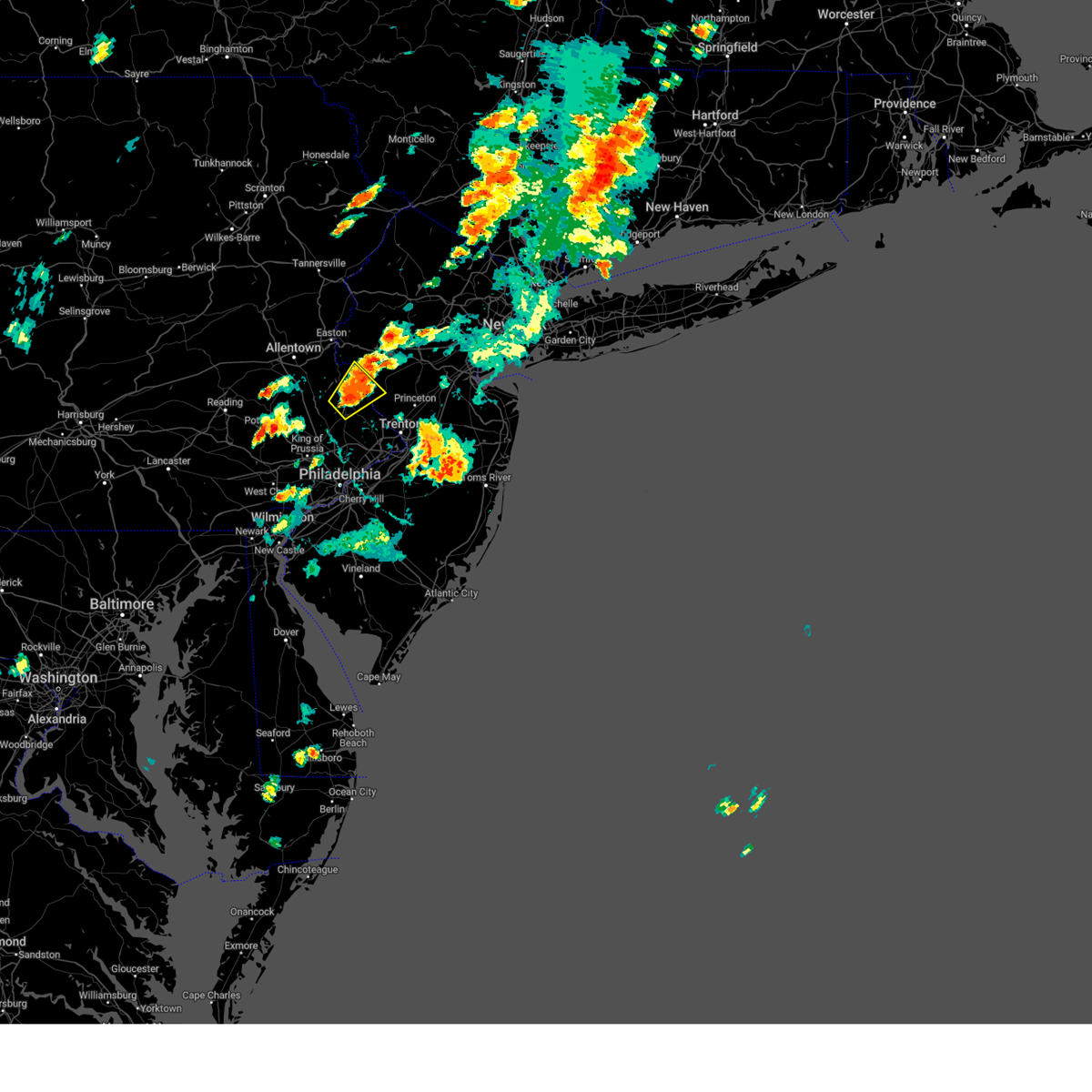 At 447 pm edt, a severe thunderstorm was located over byram, or 20 miles south of easton, moving northeast at 10 mph (radar indicated). Hazards include 60 mph wind gusts and quarter size hail. Minor damage to vehicles is possible. wind damage to roofs, siding, trees, and power lines is possible. locations impacted include, doylestown, byram, bedminster, tinicum, new hope, dublin, frenchtown, milford, stockton, sergeantsville, pipersville, erwinna, gardenville, lumberville, ottsville and lambertville. hail threat, radar indicated max hail size, 1. 00 in wind threat, radar indicated max wind gust, 60 mph. At 447 pm edt, a severe thunderstorm was located over byram, or 20 miles south of easton, moving northeast at 10 mph (radar indicated). Hazards include 60 mph wind gusts and quarter size hail. Minor damage to vehicles is possible. wind damage to roofs, siding, trees, and power lines is possible. locations impacted include, doylestown, byram, bedminster, tinicum, new hope, dublin, frenchtown, milford, stockton, sergeantsville, pipersville, erwinna, gardenville, lumberville, ottsville and lambertville. hail threat, radar indicated max hail size, 1. 00 in wind threat, radar indicated max wind gust, 60 mph.
|
| 9/8/2023 4:24 PM EDT |
 At 423 pm edt, a severe thunderstorm was located over gardenville, or 22 miles northwest of trenton, moving northeast at 10 mph (radar indicated). Hazards include 60 mph wind gusts and quarter size hail. Minor damage to vehicles is possible. Wind damage to roofs, siding, trees, and power lines is possible. At 423 pm edt, a severe thunderstorm was located over gardenville, or 22 miles northwest of trenton, moving northeast at 10 mph (radar indicated). Hazards include 60 mph wind gusts and quarter size hail. Minor damage to vehicles is possible. Wind damage to roofs, siding, trees, and power lines is possible.
|
| 9/8/2023 4:24 PM EDT |
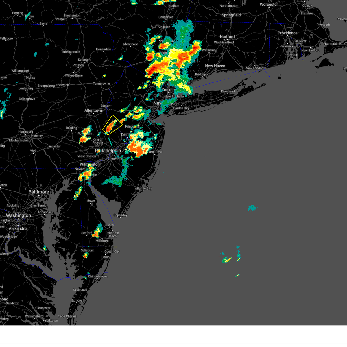 At 423 pm edt, a severe thunderstorm was located over gardenville, or 22 miles northwest of trenton, moving northeast at 10 mph (radar indicated). Hazards include 60 mph wind gusts and quarter size hail. Minor damage to vehicles is possible. Wind damage to roofs, siding, trees, and power lines is possible. At 423 pm edt, a severe thunderstorm was located over gardenville, or 22 miles northwest of trenton, moving northeast at 10 mph (radar indicated). Hazards include 60 mph wind gusts and quarter size hail. Minor damage to vehicles is possible. Wind damage to roofs, siding, trees, and power lines is possible.
|
| 8/15/2023 5:20 PM EDT |
 At 520 pm edt, a severe thunderstorm was located over springtown, or 8 miles south of easton, moving east at 40 mph (radar indicated). Hazards include 60 mph wind gusts. Damage to roofs, siding, trees, and power lines is possible. locations impacted include, allentown, easton, bethlehem, forks, quakertown, wilson, hellertown, alpha, ferndale, frenchtown, west easton, milford, bloomsbury, riegelsville, glendon, pleasant valley, revere, lehigh university, ottsville and springtown. this includes the following highways, northeast extension between mile markers 44 and 46. interstate 78 in pennsylvania between mile markers 60 and 76. interstate 78 in new jersey between mile markers 0 and 10. hail threat, radar indicated max hail size, <. 75 in wind threat, radar indicated max wind gust, 60 mph. At 520 pm edt, a severe thunderstorm was located over springtown, or 8 miles south of easton, moving east at 40 mph (radar indicated). Hazards include 60 mph wind gusts. Damage to roofs, siding, trees, and power lines is possible. locations impacted include, allentown, easton, bethlehem, forks, quakertown, wilson, hellertown, alpha, ferndale, frenchtown, west easton, milford, bloomsbury, riegelsville, glendon, pleasant valley, revere, lehigh university, ottsville and springtown. this includes the following highways, northeast extension between mile markers 44 and 46. interstate 78 in pennsylvania between mile markers 60 and 76. interstate 78 in new jersey between mile markers 0 and 10. hail threat, radar indicated max hail size, <. 75 in wind threat, radar indicated max wind gust, 60 mph.
|
| 8/15/2023 5:10 PM EDT |
 At 510 pm edt, a severe thunderstorm was located over hellertown, or near allentown, moving east at 40 mph (radar indicated). Hazards include 60 mph wind gusts. Damage to roofs, siding, trees, and power lines is possible. locations impacted include, allentown, easton, bethlehem, forks, emmaus, quakertown, wilson, bedminster, hellertown, tinicum, harmony, alpha, ferndale, frenchtown, west easton, milford, bloomsbury, riegelsville, glendon and pleasant valley. this includes the following highways, northeast extension between mile markers 43 and 59. interstate 78 in pennsylvania between mile markers 55 and 76. interstate 78 in new jersey between mile markers 0 and 10. hail threat, radar indicated max hail size, <. 75 in wind threat, radar indicated max wind gust, 60 mph. At 510 pm edt, a severe thunderstorm was located over hellertown, or near allentown, moving east at 40 mph (radar indicated). Hazards include 60 mph wind gusts. Damage to roofs, siding, trees, and power lines is possible. locations impacted include, allentown, easton, bethlehem, forks, emmaus, quakertown, wilson, bedminster, hellertown, tinicum, harmony, alpha, ferndale, frenchtown, west easton, milford, bloomsbury, riegelsville, glendon and pleasant valley. this includes the following highways, northeast extension between mile markers 43 and 59. interstate 78 in pennsylvania between mile markers 55 and 76. interstate 78 in new jersey between mile markers 0 and 10. hail threat, radar indicated max hail size, <. 75 in wind threat, radar indicated max wind gust, 60 mph.
|
| 8/15/2023 4:57 PM EDT |
 At 457 pm edt, a severe thunderstorm was located over emmaus, or near allentown, moving east at 40 mph (radar indicated). Hazards include 60 mph wind gusts and penny size hail. damage to roofs, siding, trees, and power lines is possible At 457 pm edt, a severe thunderstorm was located over emmaus, or near allentown, moving east at 40 mph (radar indicated). Hazards include 60 mph wind gusts and penny size hail. damage to roofs, siding, trees, and power lines is possible
|
| 8/13/2023 1:28 AM EDT |
 At 128 am edt, severe thunderstorms were located along a line extending from near riegelsville to near flemington to near new hope to newtown, moving east at 40 mph (radar indicated). Hazards include 60 mph wind gusts. Damage to roofs, siding, trees, and power lines is possible. locations impacted include, new brunswick, somerville, somerset, old bridge, east brunswick, bridgewater, south brunswick, north brunswick, ewing, middlesex, princeton, bound brook, manville, jamesburg, hightstown, flemington, cranbury, pennington, new hope and hopewell. this includes the following highways, new jersey turnpike between exits 8a and 10. interstate 295 in new jersey between mile markers 66 and 75. interstate 287 in new jersey between mile markers 5 and 18. hail threat, radar indicated max hail size, <. 75 in wind threat, radar indicated max wind gust, 60 mph. At 128 am edt, severe thunderstorms were located along a line extending from near riegelsville to near flemington to near new hope to newtown, moving east at 40 mph (radar indicated). Hazards include 60 mph wind gusts. Damage to roofs, siding, trees, and power lines is possible. locations impacted include, new brunswick, somerville, somerset, old bridge, east brunswick, bridgewater, south brunswick, north brunswick, ewing, middlesex, princeton, bound brook, manville, jamesburg, hightstown, flemington, cranbury, pennington, new hope and hopewell. this includes the following highways, new jersey turnpike between exits 8a and 10. interstate 295 in new jersey between mile markers 66 and 75. interstate 287 in new jersey between mile markers 5 and 18. hail threat, radar indicated max hail size, <. 75 in wind threat, radar indicated max wind gust, 60 mph.
|
| 8/13/2023 1:16 AM EDT | Multiple trees down in milford. time estimated from rada in hunterdon county NJ, 0.3 miles SSW of Milford, NJ |
| 8/13/2023 1:10 AM EDT |
 At 110 am edt, severe thunderstorms were located along a line extending from near hellertown to revere to near gardenville to hatboro, moving east at 40 mph (radar indicated). Hazards include 60 mph wind gusts. damage to roofs, siding, trees, and power lines is possible At 110 am edt, severe thunderstorms were located along a line extending from near hellertown to revere to near gardenville to hatboro, moving east at 40 mph (radar indicated). Hazards include 60 mph wind gusts. damage to roofs, siding, trees, and power lines is possible
|
| 8/7/2023 7:40 PM EDT | Emergency manager reports extensive tree damage in holland twp near bloomsbury. time estimated via rada in hunterdon county NJ, 3.1 miles SE of Milford, NJ |
| 4/22/2023 4:52 PM EDT |
 At 452 pm edt, a severe thunderstorm was located over riegelsville, or near easton, moving north at 45 mph (radar indicated). Hazards include 60 mph wind gusts and quarter size hail. Minor damage to vehicles is possible. Wind damage to roofs, siding, trees, and power lines is possible. At 452 pm edt, a severe thunderstorm was located over riegelsville, or near easton, moving north at 45 mph (radar indicated). Hazards include 60 mph wind gusts and quarter size hail. Minor damage to vehicles is possible. Wind damage to roofs, siding, trees, and power lines is possible.
|
| 4/1/2023 6:54 PM EDT |
 The severe thunderstorm warning for hunterdon, southwestern morris, southern warren, southeastern berks, southeastern lehigh, montgomery, northwestern bucks, northeastern chester and south central northampton counties will expire at 700 pm edt, the storms which prompted the warning have moved out of the area. therefore, the warning will be allowed to expire. however gusty winds are still possible through this evening. a tornado watch remains in effect until 1000 pm edt for northern and northwestern new jersey, and southeastern pennsylvania. a severe thunderstorm watch remains in effect until 800 pm edt for eastern pennsylvania. The severe thunderstorm warning for hunterdon, southwestern morris, southern warren, southeastern berks, southeastern lehigh, montgomery, northwestern bucks, northeastern chester and south central northampton counties will expire at 700 pm edt, the storms which prompted the warning have moved out of the area. therefore, the warning will be allowed to expire. however gusty winds are still possible through this evening. a tornado watch remains in effect until 1000 pm edt for northern and northwestern new jersey, and southeastern pennsylvania. a severe thunderstorm watch remains in effect until 800 pm edt for eastern pennsylvania.
|
| 4/1/2023 6:27 PM EDT |
 At 627 pm edt, severe thunderstorms were located along a line extending from long valley to frenchtown to near phoenixville, moving east at 50 mph (radar indicated). Hazards include 60 mph wind gusts and penny size hail. Damage to roofs, siding, trees, and power lines is possible. locations impacted include, norristown, pottstown, phoenixville, lansdale, west norriton, east norriton, quakertown, perkasie, doylestown, byram, souderton, bedminster, washington, birdsboro, collegeville, royersford, flemington, chalfont, tinicum and high bridge. this includes the following highways, pennsylvania turnpike between mile markers 296 and 303, and between mile markers 326 and 328. northeast extension between mile markers 23 and 46. interstate 76 in pennsylvania near mile marker 327. interstate 78 in new jersey between mile markers 1 and 26. interstate 176 in pennsylvania between mile markers 1 and 3. hail threat, radar indicated max hail size, 0. 75 in wind threat, radar indicated max wind gust, 60 mph. At 627 pm edt, severe thunderstorms were located along a line extending from long valley to frenchtown to near phoenixville, moving east at 50 mph (radar indicated). Hazards include 60 mph wind gusts and penny size hail. Damage to roofs, siding, trees, and power lines is possible. locations impacted include, norristown, pottstown, phoenixville, lansdale, west norriton, east norriton, quakertown, perkasie, doylestown, byram, souderton, bedminster, washington, birdsboro, collegeville, royersford, flemington, chalfont, tinicum and high bridge. this includes the following highways, pennsylvania turnpike between mile markers 296 and 303, and between mile markers 326 and 328. northeast extension between mile markers 23 and 46. interstate 76 in pennsylvania near mile marker 327. interstate 78 in new jersey between mile markers 1 and 26. interstate 176 in pennsylvania between mile markers 1 and 3. hail threat, radar indicated max hail size, 0. 75 in wind threat, radar indicated max wind gust, 60 mph.
|
| 4/1/2023 6:08 PM EDT |
 At 608 pm edt, severe thunderstorms were located along a line extending from pleasant valley to near cedarville, moving east at 45 mph (radar indicated). Hazards include 60 mph wind gusts and penny size hail. Damage to roofs, siding, trees, and power lines is possible. locations impacted include, allentown, easton, bethlehem, norristown, pottstown, phoenixville, lansdale, west norriton, forks, east norriton, emmaus, hackettstown, quakertown, perkasie, doylestown, byram, wilson, souderton, bedminster and washington. this includes the following highways, pennsylvania turnpike between mile markers 296 and 303, and between mile markers 326 and 328. northeast extension between mile markers 23 and 54. interstate 76 in pennsylvania near mile marker 327. interstate 78 in pennsylvania between mile markers 57 and 76. interstate 78 in new jersey between mile markers 0 and 26. interstate 176 in pennsylvania between mile markers 1 and 10. hail threat, radar indicated max hail size, 0. 75 in wind threat, radar indicated max wind gust, 60 mph. At 608 pm edt, severe thunderstorms were located along a line extending from pleasant valley to near cedarville, moving east at 45 mph (radar indicated). Hazards include 60 mph wind gusts and penny size hail. Damage to roofs, siding, trees, and power lines is possible. locations impacted include, allentown, easton, bethlehem, norristown, pottstown, phoenixville, lansdale, west norriton, forks, east norriton, emmaus, hackettstown, quakertown, perkasie, doylestown, byram, wilson, souderton, bedminster and washington. this includes the following highways, pennsylvania turnpike between mile markers 296 and 303, and between mile markers 326 and 328. northeast extension between mile markers 23 and 54. interstate 76 in pennsylvania near mile marker 327. interstate 78 in pennsylvania between mile markers 57 and 76. interstate 78 in new jersey between mile markers 0 and 26. interstate 176 in pennsylvania between mile markers 1 and 10. hail threat, radar indicated max hail size, 0. 75 in wind threat, radar indicated max wind gust, 60 mph.
|
| 4/1/2023 5:53 PM EDT |
 At 552 pm edt, severe thunderstorms were located along a line extending from tatamy to near emmaus to birdsboro, moving east at 50 mph (radar indicated). Hazards include 60 mph wind gusts and penny size hail. damage to roofs, siding, trees, and power lines is possible At 552 pm edt, severe thunderstorms were located along a line extending from tatamy to near emmaus to birdsboro, moving east at 50 mph (radar indicated). Hazards include 60 mph wind gusts and penny size hail. damage to roofs, siding, trees, and power lines is possible
|
| 5/22/2022 6:03 PM EDT |
 At 602 pm edt, a severe thunderstorm was located over gardenville, or 19 miles northwest of trenton, moving east at 35 mph (radar indicated). Hazards include 60 mph wind gusts. Damage to roofs, siding, trees, and power lines is possible. locations impacted include, trenton, ewing, doylestown, byram, hatboro, bedminster, flemington, chalfont, tinicum, clinton, pennington, new hope, yardley, newtown, dublin, langhorne, frenchtown, milford, ivyland and stockton. this includes the following highways, interstate 78 in new jersey between mile markers 16 and 17. interstate 295 in new jersey between mile markers 72 and 76. hail threat, radar indicated max hail size, <. 75 in wind threat, radar indicated max wind gust, 60 mph. At 602 pm edt, a severe thunderstorm was located over gardenville, or 19 miles northwest of trenton, moving east at 35 mph (radar indicated). Hazards include 60 mph wind gusts. Damage to roofs, siding, trees, and power lines is possible. locations impacted include, trenton, ewing, doylestown, byram, hatboro, bedminster, flemington, chalfont, tinicum, clinton, pennington, new hope, yardley, newtown, dublin, langhorne, frenchtown, milford, ivyland and stockton. this includes the following highways, interstate 78 in new jersey between mile markers 16 and 17. interstate 295 in new jersey between mile markers 72 and 76. hail threat, radar indicated max hail size, <. 75 in wind threat, radar indicated max wind gust, 60 mph.
|
| 5/22/2022 5:46 PM EDT |
 At 545 pm edt, severe thunderstorms were located along a line extending from near pleasant valley to perkasie to near lansdale, moving east at 35 mph (radar indicated). Hazards include 60 mph wind gusts and penny size hail. damage to roofs, siding, trees, and power lines is possible At 545 pm edt, severe thunderstorms were located along a line extending from near pleasant valley to perkasie to near lansdale, moving east at 35 mph (radar indicated). Hazards include 60 mph wind gusts and penny size hail. damage to roofs, siding, trees, and power lines is possible
|
| 5/20/2022 4:20 PM EDT |
 At 419 pm edt, severe thunderstorms were located along a line extending from near flemington to near hopewell to near newtown, moving east at 45 mph (radar indicated). Hazards include 60 mph wind gusts and quarter size hail. Minor damage to vehicles is possible. wind damage to roofs, siding, trees, and power lines is possible. locations impacted include, trenton, ewing, princeton, flemington, high bridge, clinton, pennington, new hope, yardley, hopewell, frenchtown, lebanon, milford, rocky hill, stockton, washington crossing, skillman, lumberville, woodside and sergeantsville. this includes the following highways, interstate 78 in new jersey between mile markers 15 and 25. interstate 295 in new jersey between mile markers 64 and 76. hail threat, radar indicated max hail size, 1. 00 in wind threat, radar indicated max wind gust, 60 mph. At 419 pm edt, severe thunderstorms were located along a line extending from near flemington to near hopewell to near newtown, moving east at 45 mph (radar indicated). Hazards include 60 mph wind gusts and quarter size hail. Minor damage to vehicles is possible. wind damage to roofs, siding, trees, and power lines is possible. locations impacted include, trenton, ewing, princeton, flemington, high bridge, clinton, pennington, new hope, yardley, hopewell, frenchtown, lebanon, milford, rocky hill, stockton, washington crossing, skillman, lumberville, woodside and sergeantsville. this includes the following highways, interstate 78 in new jersey between mile markers 15 and 25. interstate 295 in new jersey between mile markers 64 and 76. hail threat, radar indicated max hail size, 1. 00 in wind threat, radar indicated max wind gust, 60 mph.
|
| 5/20/2022 4:06 PM EDT |
 At 406 pm edt, severe thunderstorms were located along a line extending from frenchtown to near new hope to near ivyland, moving east at 50 mph (radar indicated). Hazards include 60 mph wind gusts and quarter size hail. Minor damage to vehicles is possible. wind damage to roofs, siding, trees, and power lines is possible. locations impacted include, trenton, ewing, lansdale, princeton, doylestown, byram, bedminster, flemington, chalfont, tinicum, high bridge, clinton, pennington, new hope, yardley, newtown, dublin, hopewell, ferndale and frenchtown. this includes the following highways, interstate 78 in new jersey between mile markers 12 and 25. interstate 295 in new jersey between mile markers 64 and 76. hail threat, radar indicated max hail size, 1. 00 in wind threat, radar indicated max wind gust, 60 mph. At 406 pm edt, severe thunderstorms were located along a line extending from frenchtown to near new hope to near ivyland, moving east at 50 mph (radar indicated). Hazards include 60 mph wind gusts and quarter size hail. Minor damage to vehicles is possible. wind damage to roofs, siding, trees, and power lines is possible. locations impacted include, trenton, ewing, lansdale, princeton, doylestown, byram, bedminster, flemington, chalfont, tinicum, high bridge, clinton, pennington, new hope, yardley, newtown, dublin, hopewell, ferndale and frenchtown. this includes the following highways, interstate 78 in new jersey between mile markers 12 and 25. interstate 295 in new jersey between mile markers 64 and 76. hail threat, radar indicated max hail size, 1. 00 in wind threat, radar indicated max wind gust, 60 mph.
|
| 5/20/2022 3:41 PM EDT |
 At 340 pm edt, severe thunderstorms were located along a line extending from near emmaus to near green lane to trappe, moving east at 50 mph (radar indicated). Hazards include 70 mph wind gusts and quarter size hail. Minor damage to vehicles is possible. expect considerable tree damage. Wind damage is also likely to mobile homes, roofs, and outbuildings. At 340 pm edt, severe thunderstorms were located along a line extending from near emmaus to near green lane to trappe, moving east at 50 mph (radar indicated). Hazards include 70 mph wind gusts and quarter size hail. Minor damage to vehicles is possible. expect considerable tree damage. Wind damage is also likely to mobile homes, roofs, and outbuildings.
|
| 3/31/2022 10:03 PM EDT |
 At 1003 pm edt, severe thunderstorms were located along a line extending from near califon to stockton to east norriton to kennett square, moving northeast at 45 mph (radar indicated). Hazards include 60 mph wind gusts and penny size hail. Damage to roofs, siding, trees, and power lines is possible. locations impacted include, philadelphia, trenton, camden, west chester, bensalem, bridgewater, ewing, norristown, dover, phoenixville, lansdale, west norriton, east norriton, yeadon, westtown, perkasie, doylestown, byram, downingtown and conshohocken. this includes the following highways, pennsylvania turnpike between mile markers 312 and 354. northeast extension between mile markers 21 and 33. interstate 95 in pennsylvania between mile markers 2 and 14, and between mile markers 21 and 28. interstate 76 in pennsylvania between mile markers 327 and 349. interstate 78 in new jersey between mile markers 7 and 32. interstate 295 in new jersey between mile markers 71 and 76. interstate 287 in new jersey between mile markers 19 and 24. interstate 676 in pennsylvania between mile markers 0 and 1. interstate 476 in pennsylvania between mile markers 0 and 19. hail threat, radar indicated max hail size, 0. 75 in wind threat, radar indicated max wind gust, 60 mph. At 1003 pm edt, severe thunderstorms were located along a line extending from near califon to stockton to east norriton to kennett square, moving northeast at 45 mph (radar indicated). Hazards include 60 mph wind gusts and penny size hail. Damage to roofs, siding, trees, and power lines is possible. locations impacted include, philadelphia, trenton, camden, west chester, bensalem, bridgewater, ewing, norristown, dover, phoenixville, lansdale, west norriton, east norriton, yeadon, westtown, perkasie, doylestown, byram, downingtown and conshohocken. this includes the following highways, pennsylvania turnpike between mile markers 312 and 354. northeast extension between mile markers 21 and 33. interstate 95 in pennsylvania between mile markers 2 and 14, and between mile markers 21 and 28. interstate 76 in pennsylvania between mile markers 327 and 349. interstate 78 in new jersey between mile markers 7 and 32. interstate 295 in new jersey between mile markers 71 and 76. interstate 287 in new jersey between mile markers 19 and 24. interstate 676 in pennsylvania between mile markers 0 and 1. interstate 476 in pennsylvania between mile markers 0 and 19. hail threat, radar indicated max hail size, 0. 75 in wind threat, radar indicated max wind gust, 60 mph.
|
| 3/31/2022 9:57 PM EDT |
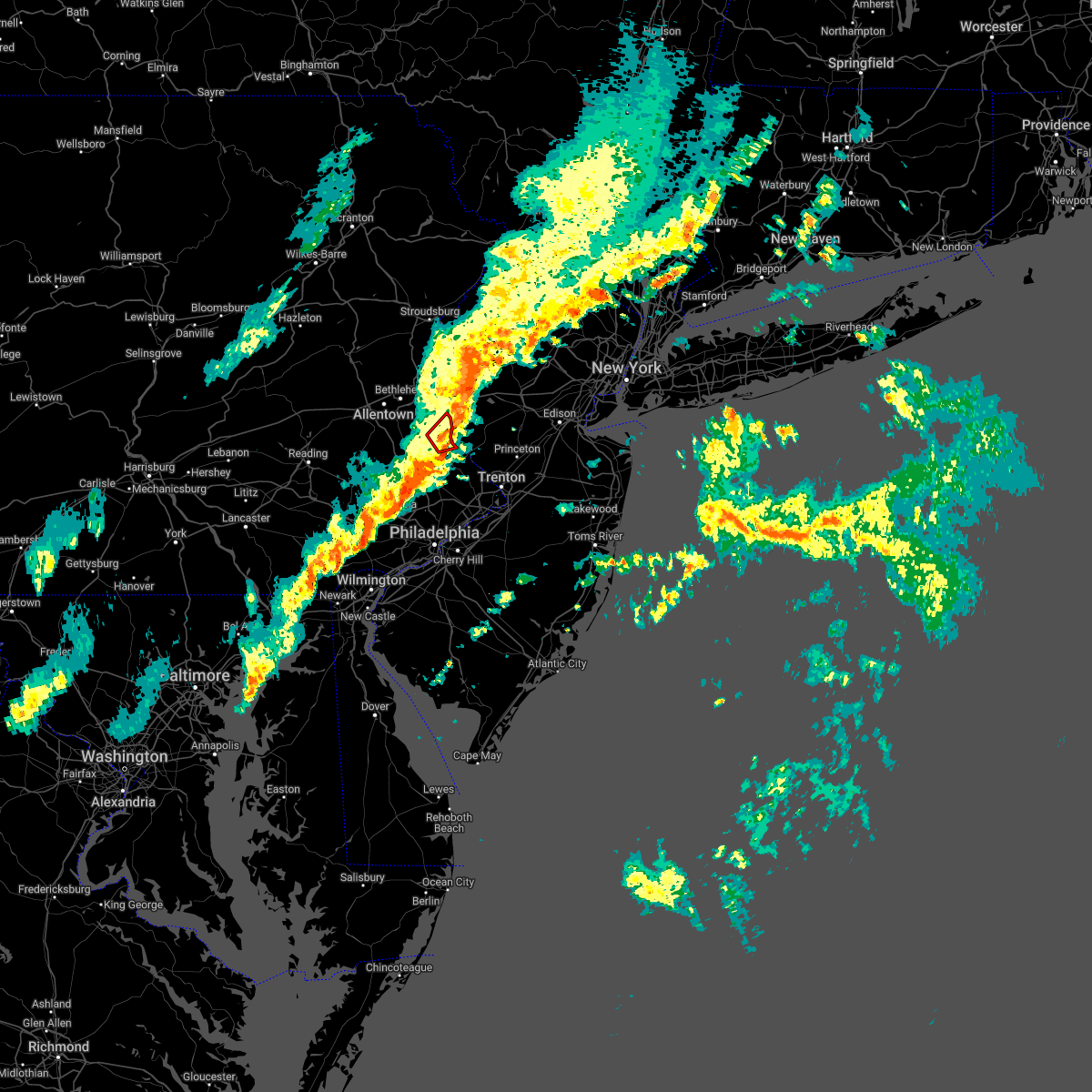 At 957 pm edt, a severe thunderstorm capable of producing a tornado was located over tinicum, or 17 miles south of easton, moving northeast at 45 mph. this storm may be cycling (radar indicated rotation. radar indicated earlier that a debris signature was evident). Hazards include tornado. Flying debris will be dangerous to those caught without shelter. mobile homes will be damaged or destroyed. damage to roofs, windows, and vehicles will occur. tree damage is likely. Locations impacted include, bedminster, tinicum, ottsville, pipersville, erwinna and lumberville. At 957 pm edt, a severe thunderstorm capable of producing a tornado was located over tinicum, or 17 miles south of easton, moving northeast at 45 mph. this storm may be cycling (radar indicated rotation. radar indicated earlier that a debris signature was evident). Hazards include tornado. Flying debris will be dangerous to those caught without shelter. mobile homes will be damaged or destroyed. damage to roofs, windows, and vehicles will occur. tree damage is likely. Locations impacted include, bedminster, tinicum, ottsville, pipersville, erwinna and lumberville.
|
| 3/31/2022 9:49 PM EDT |
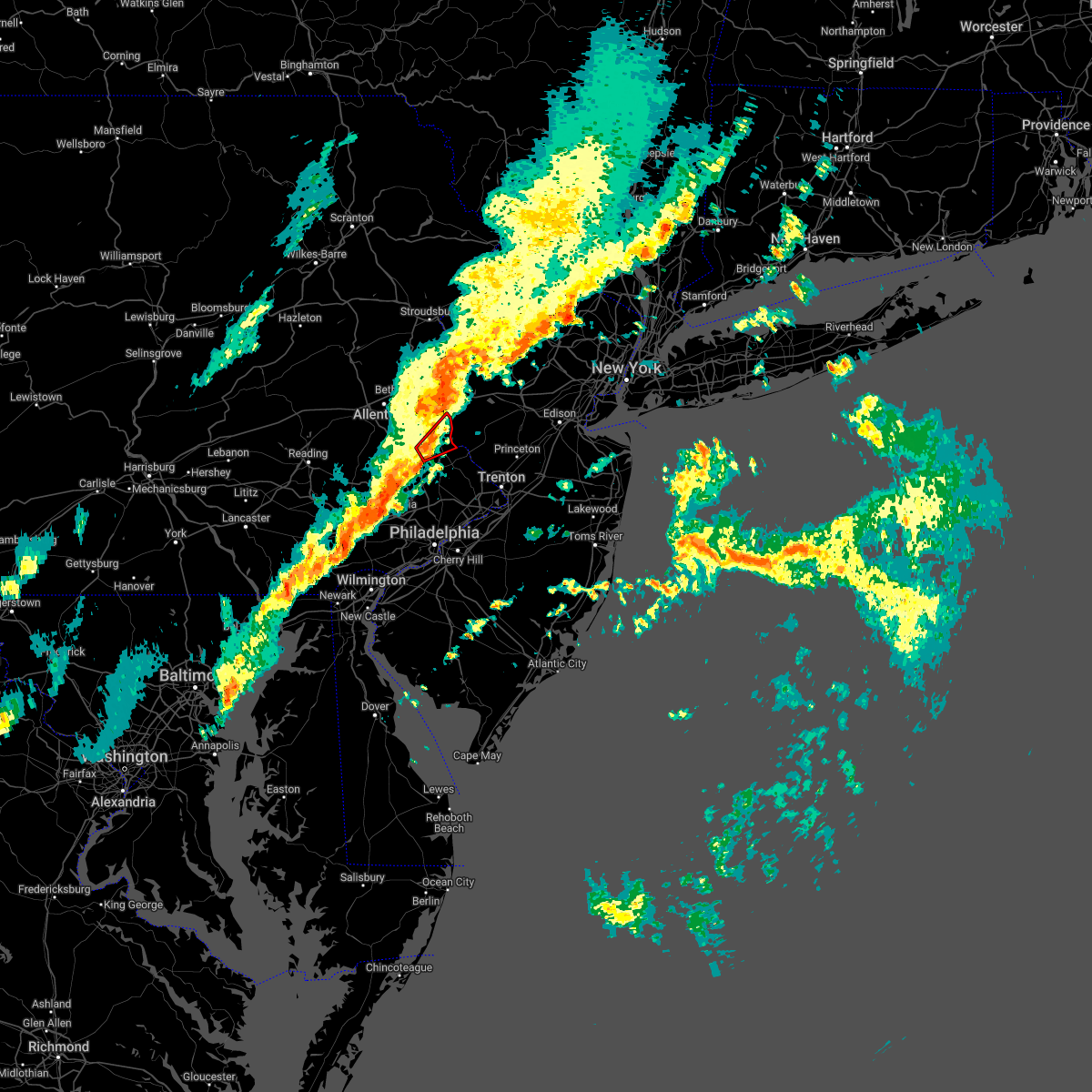 At 949 pm edt, a severe thunderstorm capable of producing a tornado was located over dublin, or 19 miles southeast of allentown, moving northeast at 50 mph (radar indicated rotation). Hazards include tornado. Flying debris will be dangerous to those caught without shelter. mobile homes will be damaged or destroyed. damage to roofs, windows, and vehicles will occur. Tree damage is likely. At 949 pm edt, a severe thunderstorm capable of producing a tornado was located over dublin, or 19 miles southeast of allentown, moving northeast at 50 mph (radar indicated rotation). Hazards include tornado. Flying debris will be dangerous to those caught without shelter. mobile homes will be damaged or destroyed. damage to roofs, windows, and vehicles will occur. Tree damage is likely.
|
| 3/31/2022 9:36 PM EDT |
 At 935 pm edt, severe thunderstorms were located along a line extending from old orchard to souderton to near lionville-marchwood to near oxford, moving east at 45 mph (radar indicated). Hazards include 60 mph wind gusts and penny size hail. damage to roofs, siding, trees, and power lines is possible At 935 pm edt, severe thunderstorms were located along a line extending from old orchard to souderton to near lionville-marchwood to near oxford, moving east at 45 mph (radar indicated). Hazards include 60 mph wind gusts and penny size hail. damage to roofs, siding, trees, and power lines is possible
|
| 3/31/2022 9:23 PM EDT |
 The severe thunderstorm warning for central morris, hunterdon, central sussex, warren, north central bucks and southeastern northampton counties will expire at 930 pm edt, the storms which prompted the warning have weakened below severe limits, and no longer pose an immediate threat to life or property. therefore, the warning will be allowed to expire. however, gusty winds are still possible with these thunderstorms. a severe thunderstorm watch remains in effect until midnight edt for northern and northwestern new jersey, and eastern and southeastern pennsylvania. The severe thunderstorm warning for central morris, hunterdon, central sussex, warren, north central bucks and southeastern northampton counties will expire at 930 pm edt, the storms which prompted the warning have weakened below severe limits, and no longer pose an immediate threat to life or property. therefore, the warning will be allowed to expire. however, gusty winds are still possible with these thunderstorms. a severe thunderstorm watch remains in effect until midnight edt for northern and northwestern new jersey, and eastern and southeastern pennsylvania.
|
| 3/31/2022 9:11 PM EDT |
 At 910 pm edt, severe thunderstorms were located along a line extending from fishkill to near succasunna, moving east at 60 mph (radar indicated). Hazards include 60 mph wind gusts and penny size hail. Damage to roofs, siding, trees, and power lines is possible. locations impacted include, easton, newton, bethlehem, dover, hopatcong, forks, hackettstown, wilson, wharton, washington, rockaway, hellertown, mount arlington, franklin, mendham, high bridge, stanhope, hamburg, netcong and clinton. this includes the following highways, interstate 78 in pennsylvania between mile markers 65 and 76. interstate 78 in new jersey between mile markers 0 and 25. interstate 80 in new jersey between mile markers 11 and 38. hail threat, radar indicated max hail size, 0. 75 in wind threat, radar indicated max wind gust, 60 mph. At 910 pm edt, severe thunderstorms were located along a line extending from fishkill to near succasunna, moving east at 60 mph (radar indicated). Hazards include 60 mph wind gusts and penny size hail. Damage to roofs, siding, trees, and power lines is possible. locations impacted include, easton, newton, bethlehem, dover, hopatcong, forks, hackettstown, wilson, wharton, washington, rockaway, hellertown, mount arlington, franklin, mendham, high bridge, stanhope, hamburg, netcong and clinton. this includes the following highways, interstate 78 in pennsylvania between mile markers 65 and 76. interstate 78 in new jersey between mile markers 0 and 25. interstate 80 in new jersey between mile markers 11 and 38. hail threat, radar indicated max hail size, 0. 75 in wind threat, radar indicated max wind gust, 60 mph.
|
| 3/31/2022 8:40 PM EDT |
 At 839 pm edt, severe thunderstorms were located along a line extending from near unionville to near old orchard, moving east at 60 mph (radar indicated). Hazards include 60 mph wind gusts and penny size hail. damage to roofs, siding, trees, and power lines is possible At 839 pm edt, severe thunderstorms were located along a line extending from near unionville to near old orchard, moving east at 60 mph (radar indicated). Hazards include 60 mph wind gusts and penny size hail. damage to roofs, siding, trees, and power lines is possible
|
| 3/7/2022 8:46 PM EST |
 At 844 pm est, severe showers and embedded thunderstorms were located along a line extending from near vernon valley to near clinton to royersford, moving east at 50 mph. this line has a history of producing areas of wind damage (trained weather spotters). Hazards include 70 mph wind gusts. Expect considerable tree damage. damage is likely to mobile homes, roofs, and outbuildings. locations impacted include, easton, morristown, somerville, newton, bridgewater, pottstown, dover, lansdale, madison, hopatcong, florham park, east hanover, lincoln park, kinnelon, hackettstown, quakertown, perkasie, doylestown, byram and boonton. this includes the following highways, northeast extension between mile markers 25 and 45. interstate 78 in new jersey between mile markers 0 and 37. interstate 80 in new jersey between mile markers 12 and 47. interstate 287 in new jersey between mile markers 16 and 54. thunderstorm damage threat, considerable hail threat, radar indicated max hail size, <. 75 in wind threat, radar indicated max wind gust, 70 mph. At 844 pm est, severe showers and embedded thunderstorms were located along a line extending from near vernon valley to near clinton to royersford, moving east at 50 mph. this line has a history of producing areas of wind damage (trained weather spotters). Hazards include 70 mph wind gusts. Expect considerable tree damage. damage is likely to mobile homes, roofs, and outbuildings. locations impacted include, easton, morristown, somerville, newton, bridgewater, pottstown, dover, lansdale, madison, hopatcong, florham park, east hanover, lincoln park, kinnelon, hackettstown, quakertown, perkasie, doylestown, byram and boonton. this includes the following highways, northeast extension between mile markers 25 and 45. interstate 78 in new jersey between mile markers 0 and 37. interstate 80 in new jersey between mile markers 12 and 47. interstate 287 in new jersey between mile markers 16 and 54. thunderstorm damage threat, considerable hail threat, radar indicated max hail size, <. 75 in wind threat, radar indicated max wind gust, 70 mph.
|
| 3/7/2022 8:29 PM EST |
 At 826 pm est, severe showers and embedded thunderstorms were located along a line extending from near milford to alpha to near new morgan, moving east at 55 mph. this line has had a history of producing areas of wind damage (trained weather spotters. a 66 mph wind gust was measured in forks township in northampton county). Hazards include 70 mph wind gusts. Expect considerable tree damage. damage is likely to mobile homes, roofs, and outbuildings. locations impacted include, allentown, reading, easton, morristown, somerville, newton, montague, bethlehem, bridgewater, pottstown, dover, lansdale, madison, hopatcong, forks, florham park, emmaus, east hanover, lincoln park and wyomissing. this includes the following highways, pennsylvania turnpike between mile markers 295 and 303. northeast extension between mile markers 26 and 57. interstate 78 in pennsylvania between mile markers 54 and 76. interstate 78 in new jersey between mile markers 0 and 37. interstate 80 in pennsylvania between mile markers 310 and 314. interstate 80 in new jersey between mile markers 0 and 47. interstate 287 in new jersey between mile markers 16 and 54. interstate 176 in pennsylvania between mile markers 1 and 11. thunderstorm damage threat, considerable hail threat, radar indicated max hail size, <. 75 in wind threat, radar indicated max wind gust, 70 mph. At 826 pm est, severe showers and embedded thunderstorms were located along a line extending from near milford to alpha to near new morgan, moving east at 55 mph. this line has had a history of producing areas of wind damage (trained weather spotters. a 66 mph wind gust was measured in forks township in northampton county). Hazards include 70 mph wind gusts. Expect considerable tree damage. damage is likely to mobile homes, roofs, and outbuildings. locations impacted include, allentown, reading, easton, morristown, somerville, newton, montague, bethlehem, bridgewater, pottstown, dover, lansdale, madison, hopatcong, forks, florham park, emmaus, east hanover, lincoln park and wyomissing. this includes the following highways, pennsylvania turnpike between mile markers 295 and 303. northeast extension between mile markers 26 and 57. interstate 78 in pennsylvania between mile markers 54 and 76. interstate 78 in new jersey between mile markers 0 and 37. interstate 80 in pennsylvania between mile markers 310 and 314. interstate 80 in new jersey between mile markers 0 and 47. interstate 287 in new jersey between mile markers 16 and 54. interstate 176 in pennsylvania between mile markers 1 and 11. thunderstorm damage threat, considerable hail threat, radar indicated max hail size, <. 75 in wind threat, radar indicated max wind gust, 70 mph.
|
| 3/7/2022 8:11 PM EST |
 At 810 pm est, severe showers and embedded thunderstorms were located along a line extending from blooming grove to near northampton to near denver, moving east at 55 mph (public). Hazards include 60 mph wind gusts. a 59 mph wind gust was reported in lehighton pennsylvania. Damage to roofs, siding, trees, and power lines is possible. locations impacted include, allentown, reading, easton, morristown, somerville, newton, montague, bethlehem, bridgewater, pottstown, dover, lansdale, madison, hopatcong, forks, florham park, emmaus, east hanover, lincoln park and wyomissing. this includes the following highways, pennsylvania turnpike between mile markers 295 and 303. northeast extension between mile markers 26 and 57. interstate 78 in pennsylvania between mile markers 54 and 76. interstate 78 in new jersey between mile markers 0 and 37. interstate 80 in pennsylvania between mile markers 308 and 314. interstate 80 in new jersey between mile markers 0 and 47. interstate 287 in new jersey between mile markers 16 and 54. interstate 176 in pennsylvania between mile markers 1 and 11. hail threat, radar indicated max hail size, <. 75 in wind threat, radar indicated max wind gust, 60 mph. At 810 pm est, severe showers and embedded thunderstorms were located along a line extending from blooming grove to near northampton to near denver, moving east at 55 mph (public). Hazards include 60 mph wind gusts. a 59 mph wind gust was reported in lehighton pennsylvania. Damage to roofs, siding, trees, and power lines is possible. locations impacted include, allentown, reading, easton, morristown, somerville, newton, montague, bethlehem, bridgewater, pottstown, dover, lansdale, madison, hopatcong, forks, florham park, emmaus, east hanover, lincoln park and wyomissing. this includes the following highways, pennsylvania turnpike between mile markers 295 and 303. northeast extension between mile markers 26 and 57. interstate 78 in pennsylvania between mile markers 54 and 76. interstate 78 in new jersey between mile markers 0 and 37. interstate 80 in pennsylvania between mile markers 308 and 314. interstate 80 in new jersey between mile markers 0 and 47. interstate 287 in new jersey between mile markers 16 and 54. interstate 176 in pennsylvania between mile markers 1 and 11. hail threat, radar indicated max hail size, <. 75 in wind threat, radar indicated max wind gust, 60 mph.
|
| 3/7/2022 8:05 PM EST |
 At 803 pm est, severe showers and embedded thunderstorms were located along a line extending from near hawley to kunkletown to wernersville, moving east at 50 mph. this line has had a history of producing areas of wind damage (radar indicated). Hazards include 60 mph wind gusts. damage to roofs, siding, trees, and power lines is possible At 803 pm est, severe showers and embedded thunderstorms were located along a line extending from near hawley to kunkletown to wernersville, moving east at 50 mph. this line has had a history of producing areas of wind damage (radar indicated). Hazards include 60 mph wind gusts. damage to roofs, siding, trees, and power lines is possible
|
| 9/13/2021 9:21 PM EDT |
 At 920 pm edt, severe thunderstorms were located along a line extending from high bridge to near milford to near hellertown to zionsville, moving southeast at 45 mph (radar indicated). Hazards include 60 mph wind gusts and nickel size hail. damage to roofs, siding, trees, and power lines is possible At 920 pm edt, severe thunderstorms were located along a line extending from high bridge to near milford to near hellertown to zionsville, moving southeast at 45 mph (radar indicated). Hazards include 60 mph wind gusts and nickel size hail. damage to roofs, siding, trees, and power lines is possible
|
| 9/9/2021 12:06 AM EDT |
 The severe thunderstorm warning for northwestern hunterdon, southwestern warren, northwestern bucks and southeastern northampton counties will expire at 1215 am edt, the storms which prompted the warning have weakened below severe limits, and no longer pose an immediate threat to life or property. therefore, the warning will be allowed to expire. however gusty winds are still possible with these thunderstorms. The severe thunderstorm warning for northwestern hunterdon, southwestern warren, northwestern bucks and southeastern northampton counties will expire at 1215 am edt, the storms which prompted the warning have weakened below severe limits, and no longer pose an immediate threat to life or property. therefore, the warning will be allowed to expire. however gusty winds are still possible with these thunderstorms.
|
| 9/8/2021 11:50 PM EDT |
 At 1150 pm edt, severe thunderstorms were located along a line extending from near harmony to near pleasant valley, moving northeast at 35 mph (radar indicated). Hazards include 60 mph wind gusts and penny size hail. Damage to roofs, siding, trees, and power lines is possible. locations impacted include, easton, forks, wilson, hellertown, nazareth, harmony, oxford, alpha, ferndale, belfast, frenchtown, west easton, milford, tatamy, bloomsbury, riegelsville, glendon, brass castle, revere and pleasant valley. this includes the following highways, interstate 78 in pennsylvania between mile markers 70 and 76. interstate 78 in new jersey between mile markers 0 and 10. hail threat, radar indicated max hail size, 0. 75 in wind threat, radar indicated max wind gust, 60 mph. At 1150 pm edt, severe thunderstorms were located along a line extending from near harmony to near pleasant valley, moving northeast at 35 mph (radar indicated). Hazards include 60 mph wind gusts and penny size hail. Damage to roofs, siding, trees, and power lines is possible. locations impacted include, easton, forks, wilson, hellertown, nazareth, harmony, oxford, alpha, ferndale, belfast, frenchtown, west easton, milford, tatamy, bloomsbury, riegelsville, glendon, brass castle, revere and pleasant valley. this includes the following highways, interstate 78 in pennsylvania between mile markers 70 and 76. interstate 78 in new jersey between mile markers 0 and 10. hail threat, radar indicated max hail size, 0. 75 in wind threat, radar indicated max wind gust, 60 mph.
|
| 9/8/2021 11:27 PM EDT |
 At 1127 pm edt, severe thunderstorms were located along a line extending from near bath to near zionsville, moving northeast at 35 mph (radar indicated). Hazards include 60 mph wind gusts and penny size hail. damage to roofs, siding, trees, and power lines is possible At 1127 pm edt, severe thunderstorms were located along a line extending from near bath to near zionsville, moving northeast at 35 mph (radar indicated). Hazards include 60 mph wind gusts and penny size hail. damage to roofs, siding, trees, and power lines is possible
|
| 8/19/2021 1:02 AM EDT |
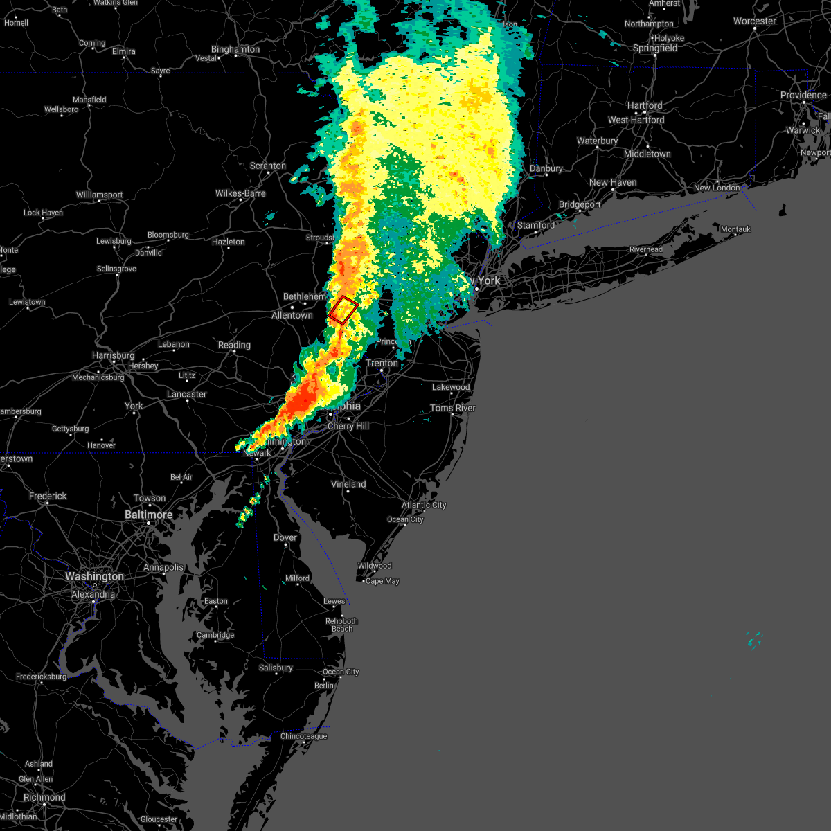 At 102 am edt, a severe thunderstorm capable of producing a tornado was located over milford, or 11 miles southeast of easton, moving northeast at 35 mph (radar indicated rotation). Hazards include tornado. Flying debris will be dangerous to those caught without shelter. mobile homes will be damaged or destroyed. damage to roofs, windows, and vehicles will occur. tree damage is likely. locations impacted include, frenchtown, milford, bloomsbury and erwinna. This includes interstate 78 in new jersey mile marker 8 and near mile marker 10. At 102 am edt, a severe thunderstorm capable of producing a tornado was located over milford, or 11 miles southeast of easton, moving northeast at 35 mph (radar indicated rotation). Hazards include tornado. Flying debris will be dangerous to those caught without shelter. mobile homes will be damaged or destroyed. damage to roofs, windows, and vehicles will occur. tree damage is likely. locations impacted include, frenchtown, milford, bloomsbury and erwinna. This includes interstate 78 in new jersey mile marker 8 and near mile marker 10.
|
| 8/19/2021 12:48 AM EDT |
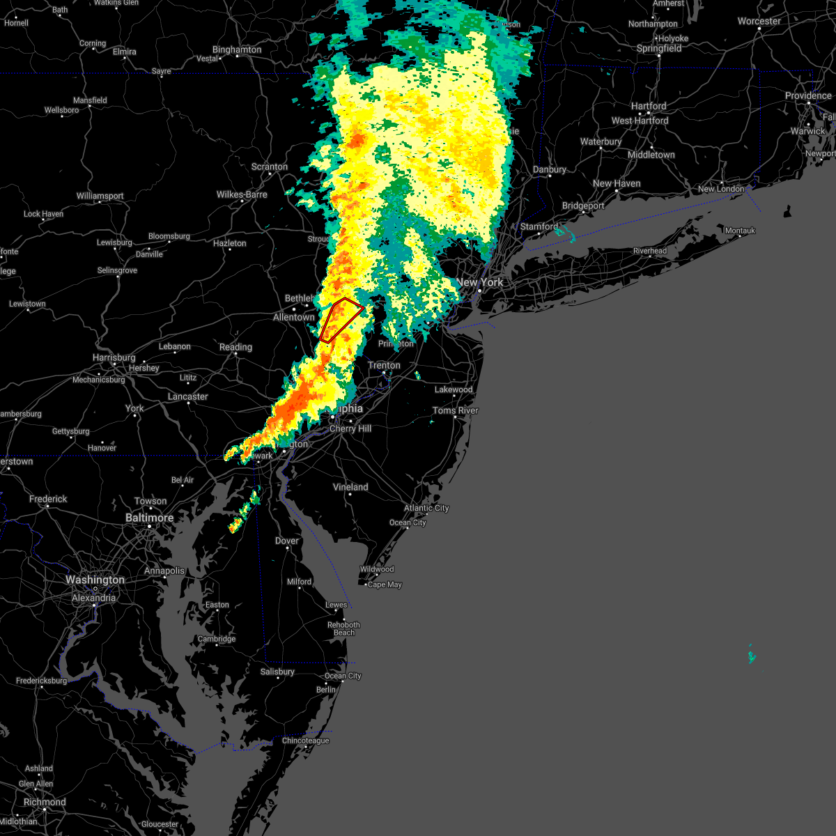 At 1247 am edt, a severe thunderstorm capable of producing a tornado was located over bedminster, or 17 miles south of easton, moving northeast at 35 mph (radar indicated rotation). Hazards include tornado. Flying debris will be dangerous to those caught without shelter. mobile homes will be damaged or destroyed. damage to roofs, windows, and vehicles will occur. Tree damage is likely. At 1247 am edt, a severe thunderstorm capable of producing a tornado was located over bedminster, or 17 miles south of easton, moving northeast at 35 mph (radar indicated rotation). Hazards include tornado. Flying debris will be dangerous to those caught without shelter. mobile homes will be damaged or destroyed. damage to roofs, windows, and vehicles will occur. Tree damage is likely.
|
| 8/19/2021 12:48 AM EDT |
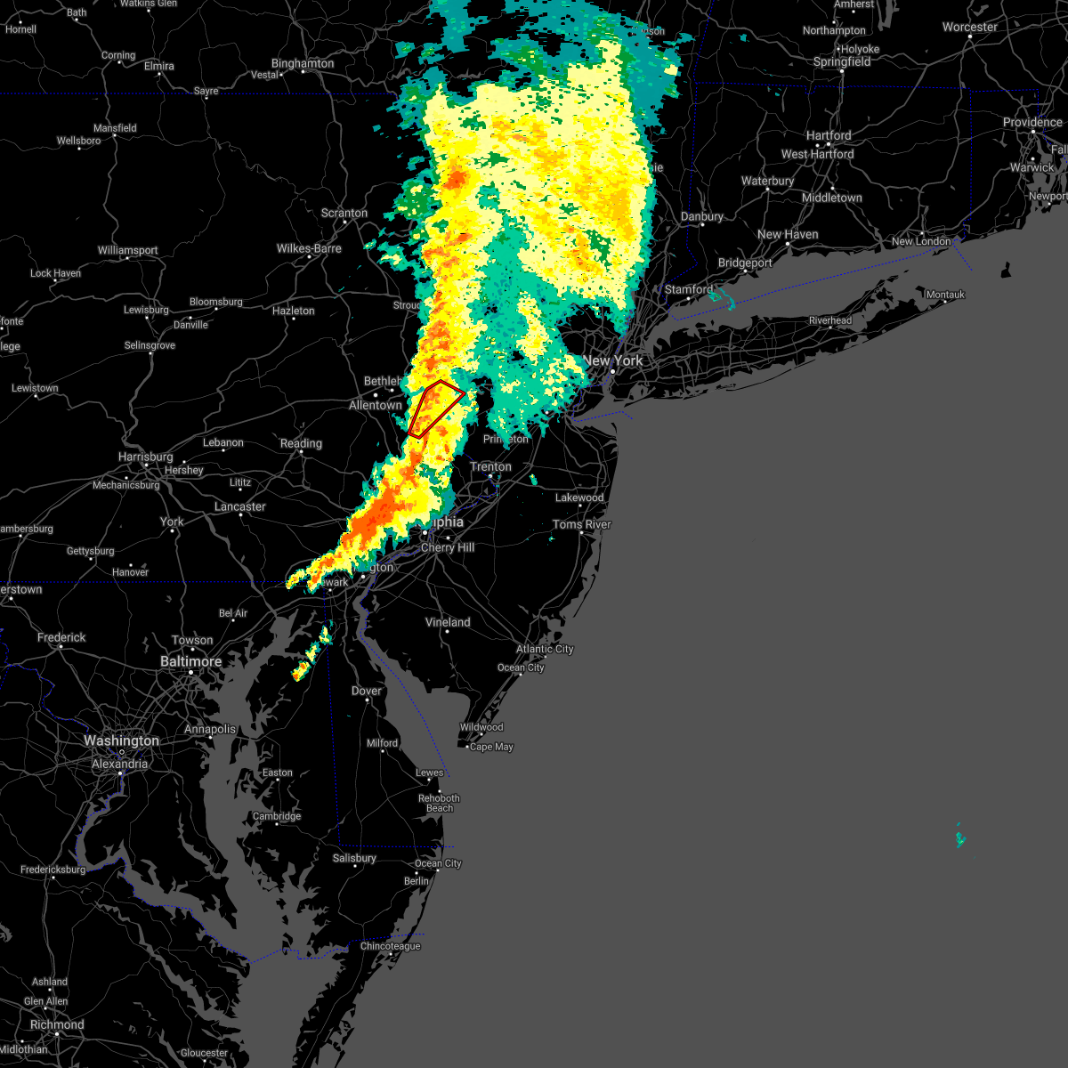 At 1247 am edt, a severe thunderstorm capable of producing a tornado was located over bedminster, or 17 miles south of easton, moving northeast at 35 mph (radar indicated rotation). Hazards include tornado. Flying debris will be dangerous to those caught without shelter. mobile homes will be damaged or destroyed. damage to roofs, windows, and vehicles will occur. Tree damage is likely. At 1247 am edt, a severe thunderstorm capable of producing a tornado was located over bedminster, or 17 miles south of easton, moving northeast at 35 mph (radar indicated rotation). Hazards include tornado. Flying debris will be dangerous to those caught without shelter. mobile homes will be damaged or destroyed. damage to roofs, windows, and vehicles will occur. Tree damage is likely.
|
| 8/10/2021 5:26 PM EDT |
 At 526 pm edt, severe thunderstorms were located along a line extending from near frenchtown to near ivyland, moving southeast at 30 mph (radar indicated). Hazards include 60 mph wind gusts. Damage to roofs, siding, trees, and power lines is possible. locations impacted include, philadelphia, trenton, somerville, bensalem, ewing, lansdale, manville, burlington, bristol, doylestown, byram, riverside, hatboro, bedminster, flemington, chalfont, tinicum, hatfield, pennington and beverly. this includes the following highways, pennsylvania turnpike between mile markers 340 and 358. interstate 95 in pennsylvania between mile markers 32 and 40. interstate 295 in new jersey between mile markers 70 and 76. interstate 287 in new jersey between mile markers 15 and 16. hail threat, radar indicated max hail size, <. 75 in wind threat, radar indicated max wind gust, 60 mph. At 526 pm edt, severe thunderstorms were located along a line extending from near frenchtown to near ivyland, moving southeast at 30 mph (radar indicated). Hazards include 60 mph wind gusts. Damage to roofs, siding, trees, and power lines is possible. locations impacted include, philadelphia, trenton, somerville, bensalem, ewing, lansdale, manville, burlington, bristol, doylestown, byram, riverside, hatboro, bedminster, flemington, chalfont, tinicum, hatfield, pennington and beverly. this includes the following highways, pennsylvania turnpike between mile markers 340 and 358. interstate 95 in pennsylvania between mile markers 32 and 40. interstate 295 in new jersey between mile markers 70 and 76. interstate 287 in new jersey between mile markers 15 and 16. hail threat, radar indicated max hail size, <. 75 in wind threat, radar indicated max wind gust, 60 mph.
|
| 8/10/2021 5:09 PM EDT |
 At 509 pm edt, severe thunderstorms were located along a line extending from near riegelsville to fricks, moving southeast at 25 mph (radar indicated). Hazards include 60 mph wind gusts. damage to roofs, siding, trees, and power lines is possible At 509 pm edt, severe thunderstorms were located along a line extending from near riegelsville to fricks, moving southeast at 25 mph (radar indicated). Hazards include 60 mph wind gusts. damage to roofs, siding, trees, and power lines is possible
|
| 7/29/2021 5:24 PM EDT |
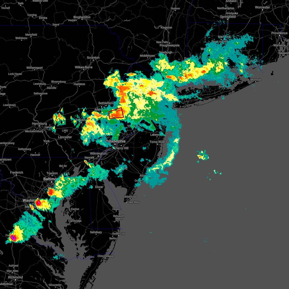 At 523 pm edt, a severe thunderstorm capable of producing a tornado was located near bedminster, or 16 miles southeast of allentown, moving east at 25 mph (radar indicated rotation). Hazards include tornado and quarter size hail. Flying debris will be dangerous to those caught without shelter. mobile homes will be damaged or destroyed. damage to roofs, windows, and vehicles will occur. tree damage is likely. Locations impacted include, byram, bedminster, tinicum, ferndale, frenchtown, milford, pleasant valley, pipersville, erwinna, revere and ottsville. At 523 pm edt, a severe thunderstorm capable of producing a tornado was located near bedminster, or 16 miles southeast of allentown, moving east at 25 mph (radar indicated rotation). Hazards include tornado and quarter size hail. Flying debris will be dangerous to those caught without shelter. mobile homes will be damaged or destroyed. damage to roofs, windows, and vehicles will occur. tree damage is likely. Locations impacted include, byram, bedminster, tinicum, ferndale, frenchtown, milford, pleasant valley, pipersville, erwinna, revere and ottsville.
|
| 7/29/2021 5:20 PM EDT |
 At 519 pm edt, severe thunderstorms were located along a line extending from columbia to erwinna, moving east at 30 mph (radar indicated). Hazards include 60 mph wind gusts. Damage to roofs, siding, trees, and power lines is possible. locations impacted include, easton, newton, bethlehem, forks, hackettstown, quakertown, wilson, washington, blairstown, bangor, flemington, tinicum, high bridge, stanhope, netcong, clinton, belvidere, harmony, oxford and alpha. this includes the following highways, interstate 78 in pennsylvania between mile markers 69 and 76. interstate 78 in new jersey between mile markers 0 and 29. Interstate 80 in new jersey between mile markers 2 and 27. At 519 pm edt, severe thunderstorms were located along a line extending from columbia to erwinna, moving east at 30 mph (radar indicated). Hazards include 60 mph wind gusts. Damage to roofs, siding, trees, and power lines is possible. locations impacted include, easton, newton, bethlehem, forks, hackettstown, quakertown, wilson, washington, blairstown, bangor, flemington, tinicum, high bridge, stanhope, netcong, clinton, belvidere, harmony, oxford and alpha. this includes the following highways, interstate 78 in pennsylvania between mile markers 69 and 76. interstate 78 in new jersey between mile markers 0 and 29. Interstate 80 in new jersey between mile markers 2 and 27.
|
| 7/29/2021 5:08 PM EDT |
 At 508 pm edt, a severe thunderstorm capable of producing a tornado was located over quakertown, or 12 miles southeast of allentown, moving east at 35 mph (radar indicated rotation). Hazards include tornado and quarter size hail. Flying debris will be dangerous to those caught without shelter. mobile homes will be damaged or destroyed. damage to roofs, windows, and vehicles will occur. Tree damage is likely. At 508 pm edt, a severe thunderstorm capable of producing a tornado was located over quakertown, or 12 miles southeast of allentown, moving east at 35 mph (radar indicated rotation). Hazards include tornado and quarter size hail. Flying debris will be dangerous to those caught without shelter. mobile homes will be damaged or destroyed. damage to roofs, windows, and vehicles will occur. Tree damage is likely.
|
| 7/29/2021 5:03 PM EDT |
 At 502 pm edt, severe thunderstorms were located along a line extending from near stormville to near pleasant valley, moving east at 30 mph (radar indicated). Hazards include 60 mph wind gusts. damage to roofs, siding, trees, and power lines is possible At 502 pm edt, severe thunderstorms were located along a line extending from near stormville to near pleasant valley, moving east at 30 mph (radar indicated). Hazards include 60 mph wind gusts. damage to roofs, siding, trees, and power lines is possible
|
| 7/17/2021 5:39 PM EDT |
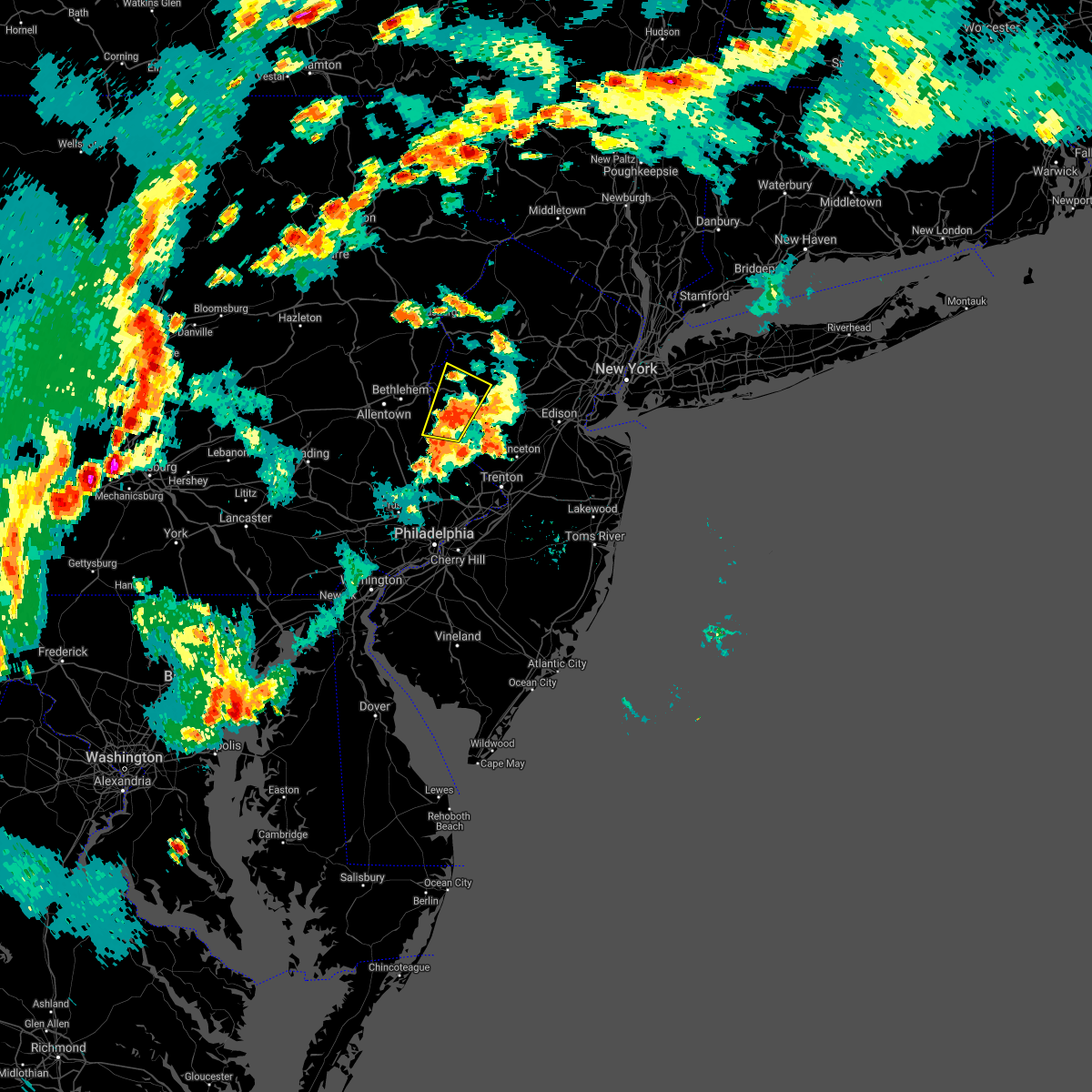 At 538 pm edt, a severe thunderstorm was located near milford, or 12 miles southeast of easton, moving northeast at 40 mph (radar indicated). Hazards include 60 mph wind gusts and quarter size hail. Minor damage to vehicles is possible. wind damage to roofs, siding, trees, and power lines is possible. locations impacted include, washington, tinicum, high bridge, clinton, alpha, glen gardner, ferndale, hampton, frenchtown, milford, bloomsbury, pleasant valley, revere, ottsville, erwinna, annandale and brass castle. This includes interstate 78 in new jersey between mile markers 3 and 19. At 538 pm edt, a severe thunderstorm was located near milford, or 12 miles southeast of easton, moving northeast at 40 mph (radar indicated). Hazards include 60 mph wind gusts and quarter size hail. Minor damage to vehicles is possible. wind damage to roofs, siding, trees, and power lines is possible. locations impacted include, washington, tinicum, high bridge, clinton, alpha, glen gardner, ferndale, hampton, frenchtown, milford, bloomsbury, pleasant valley, revere, ottsville, erwinna, annandale and brass castle. This includes interstate 78 in new jersey between mile markers 3 and 19.
|
| 7/17/2021 5:30 PM EDT |
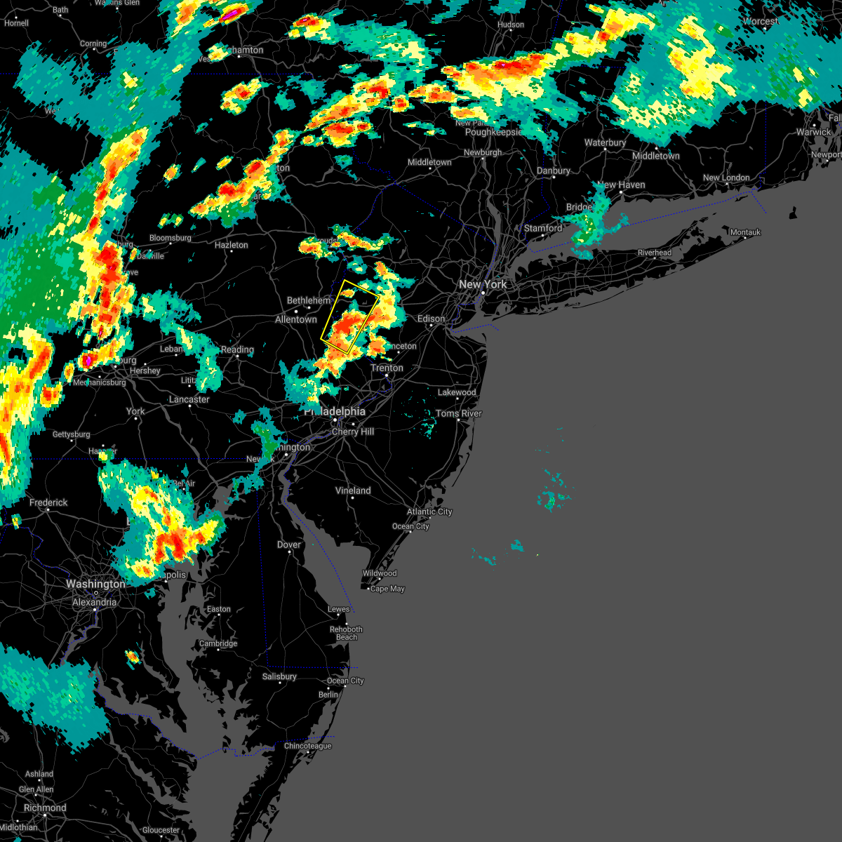 At 529 pm edt, a severe thunderstorm was located over erwinna, or 14 miles southeast of easton, moving northeast at 40 mph (radar indicated). Hazards include 60 mph wind gusts and quarter size hail. Minor damage to vehicles is possible. Wind damage to roofs, siding, trees, and power lines is possible. At 529 pm edt, a severe thunderstorm was located over erwinna, or 14 miles southeast of easton, moving northeast at 40 mph (radar indicated). Hazards include 60 mph wind gusts and quarter size hail. Minor damage to vehicles is possible. Wind damage to roofs, siding, trees, and power lines is possible.
|
| 7/17/2021 1:56 PM EDT |
 At 155 pm edt, a severe thunderstorm was located over clinton, or 15 miles west of somerville, moving northeast at 20 mph (trained weather spotters. downed trees and power outages were reported with this cell over eastern pennsylvania). Hazards include 60 mph wind gusts and quarter size hail. Minor damage to vehicles is possible. Wind damage to roofs, siding, trees, and power lines is possible. At 155 pm edt, a severe thunderstorm was located over clinton, or 15 miles west of somerville, moving northeast at 20 mph (trained weather spotters. downed trees and power outages were reported with this cell over eastern pennsylvania). Hazards include 60 mph wind gusts and quarter size hail. Minor damage to vehicles is possible. Wind damage to roofs, siding, trees, and power lines is possible.
|
| 7/8/2021 6:40 PM EDT |
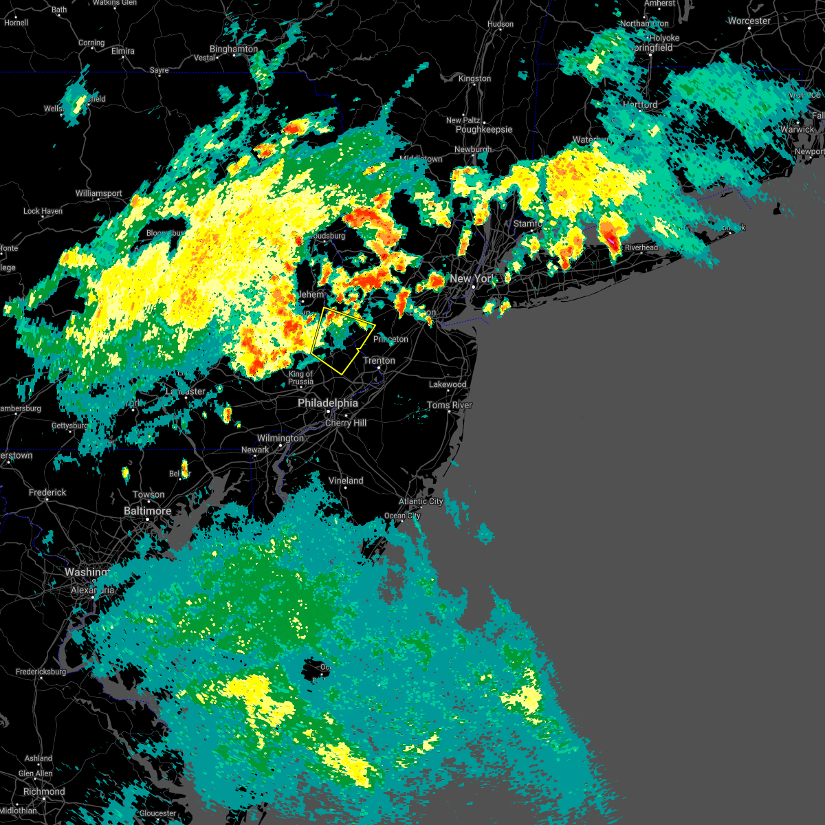 The severe thunderstorm warning for southern hunterdon and central bucks counties will expire at 645 pm edt, the storm which prompted the warning has weakened below severe limits, and no longer poses an immediate threat to life or property. therefore, the warning will be allowed to expire. however gusty winds are still possible with this thunderstorm. a severe thunderstorm watch remains in effect until 900 pm edt for central and northwestern new jersey, and southeastern pennsylvania. The severe thunderstorm warning for southern hunterdon and central bucks counties will expire at 645 pm edt, the storm which prompted the warning has weakened below severe limits, and no longer poses an immediate threat to life or property. therefore, the warning will be allowed to expire. however gusty winds are still possible with this thunderstorm. a severe thunderstorm watch remains in effect until 900 pm edt for central and northwestern new jersey, and southeastern pennsylvania.
|
| 7/8/2021 6:30 PM EDT | Trees and wires were downed in holland twp. time estimated from radar and dispatch repor in hunterdon county NJ, 3.1 miles SE of Milford, NJ |
| 7/8/2021 6:19 PM EDT |
 At 618 pm edt, a severe thunderstorm was located over doylestown, or 21 miles west of trenton, moving north at 40 mph (law enforcement. there have been numerous reports of downed trees and wires with these storms). Hazards include 60 mph wind gusts. Damage to roofs, siding, trees, and power lines is possible. Locations impacted include, perkasie, doylestown, byram, bedminster, chalfont, tinicum, new hope, dublin, ferndale, frenchtown, milford, ivyland, riegelsville, stockton, fricks, revere, lumberville, ottsville, sergeantsville and pipersville. At 618 pm edt, a severe thunderstorm was located over doylestown, or 21 miles west of trenton, moving north at 40 mph (law enforcement. there have been numerous reports of downed trees and wires with these storms). Hazards include 60 mph wind gusts. Damage to roofs, siding, trees, and power lines is possible. Locations impacted include, perkasie, doylestown, byram, bedminster, chalfont, tinicum, new hope, dublin, ferndale, frenchtown, milford, ivyland, riegelsville, stockton, fricks, revere, lumberville, ottsville, sergeantsville and pipersville.
|
| 7/8/2021 6:06 PM EDT |
 At 606 pm edt, a severe thunderstorm was located near ambler, or 15 miles north of philadelphia, moving northeast at 40 mph (radar indicated). Hazards include 60 mph wind gusts. damage to roofs, siding, trees, and power lines is possible At 606 pm edt, a severe thunderstorm was located near ambler, or 15 miles north of philadelphia, moving northeast at 40 mph (radar indicated). Hazards include 60 mph wind gusts. damage to roofs, siding, trees, and power lines is possible
|
| 7/8/2021 3:08 PM EDT |
 The severe thunderstorm warning for hunterdon, southwestern morris, central warren and northwestern somerset counties will expire at 315 pm edt, the storm which prompted the warning has moved out of the area. therefore, the warning will be allowed to expire. a severe thunderstorm watch remains in effect until 900 pm edt for northern and northwestern new jersey, and eastern and southeastern pennsylvania. to report severe weather, contact your nearest law enforcement agency. they will relay your report to the national weather service mount holly nj. The severe thunderstorm warning for hunterdon, southwestern morris, central warren and northwestern somerset counties will expire at 315 pm edt, the storm which prompted the warning has moved out of the area. therefore, the warning will be allowed to expire. a severe thunderstorm watch remains in effect until 900 pm edt for northern and northwestern new jersey, and eastern and southeastern pennsylvania. to report severe weather, contact your nearest law enforcement agency. they will relay your report to the national weather service mount holly nj.
|
| 7/8/2021 2:29 PM EDT |
 At 229 pm edt, a severe thunderstorm was located near bloomsbury, or 11 miles east of easton, moving northeast at 25 mph (radar indicated). Hazards include 60 mph wind gusts and quarter size hail. Minor damage to vehicles is possible. Wind damage to roofs, siding, trees, and power lines is possible. At 229 pm edt, a severe thunderstorm was located near bloomsbury, or 11 miles east of easton, moving northeast at 25 mph (radar indicated). Hazards include 60 mph wind gusts and quarter size hail. Minor damage to vehicles is possible. Wind damage to roofs, siding, trees, and power lines is possible.
|
| 7/8/2021 2:13 PM EDT |
 At 213 pm edt, a severe thunderstorm was located near frenchtown, or 14 miles southeast of easton, moving northeast at 25 mph (radar indicated). Hazards include 60 mph wind gusts and quarter size hail. Minor damage to vehicles is possible. wind damage to roofs, siding, trees, and power lines is possible. locations impacted include, byram, flemington, tinicum, high bridge, clinton, glen gardner, ferndale, hampton, frenchtown, lebanon, milford, califon, bloomsbury, riegelsville, stockton, flagtown, revere, belle mead, ottsville and sergeantsville. This includes interstate 78 in new jersey between mile markers 7 and 27. At 213 pm edt, a severe thunderstorm was located near frenchtown, or 14 miles southeast of easton, moving northeast at 25 mph (radar indicated). Hazards include 60 mph wind gusts and quarter size hail. Minor damage to vehicles is possible. wind damage to roofs, siding, trees, and power lines is possible. locations impacted include, byram, flemington, tinicum, high bridge, clinton, glen gardner, ferndale, hampton, frenchtown, lebanon, milford, califon, bloomsbury, riegelsville, stockton, flagtown, revere, belle mead, ottsville and sergeantsville. This includes interstate 78 in new jersey between mile markers 7 and 27.
|
| 7/8/2021 1:49 PM EDT |
 At 149 pm edt, a severe thunderstorm was located over ottsville, or 14 miles south of easton, moving northeast at 25 mph (radar indicated). Hazards include 60 mph wind gusts and quarter size hail. Minor damage to vehicles is possible. Wind damage to roofs, siding, trees, and power lines is possible. At 149 pm edt, a severe thunderstorm was located over ottsville, or 14 miles south of easton, moving northeast at 25 mph (radar indicated). Hazards include 60 mph wind gusts and quarter size hail. Minor damage to vehicles is possible. Wind damage to roofs, siding, trees, and power lines is possible.
|
| 7/6/2021 8:59 PM EDT |
 At 859 pm edt, a severe thunderstorm was located over frenchtown, or 14 miles southeast of easton, moving southeast at 35 mph (trained weather spotters). Hazards include 70 mph wind gusts and quarter size hail. Minor damage to vehicles is possible. expect considerable tree damage. wind damage is also likely to mobile homes, roofs, and outbuildings. Locations impacted include, ferndale, frenchtown, milford, erwinna and revere. At 859 pm edt, a severe thunderstorm was located over frenchtown, or 14 miles southeast of easton, moving southeast at 35 mph (trained weather spotters). Hazards include 70 mph wind gusts and quarter size hail. Minor damage to vehicles is possible. expect considerable tree damage. wind damage is also likely to mobile homes, roofs, and outbuildings. Locations impacted include, ferndale, frenchtown, milford, erwinna and revere.
|
| 7/6/2021 8:56 PM EDT | A large tree fell and other branches and limbs are down in the area from what appears to have been a downburst. time estimated from rada in bucks county PA, 0.5 miles SE of Milford, NJ |
| 7/6/2021 8:45 PM EDT |
 At 844 pm edt, a severe thunderstorm was located over ferndale, or 9 miles south of easton, moving southeast at 35 mph. this storm has a history of producing 60 mph wind gusts (trained weather spotters). Hazards include 60 mph wind gusts and quarter size hail. Minor damage to vehicles is possible. wind damage to roofs, siding, trees, and power lines is possible. locations impacted include, easton, bethlehem, perkasie, doylestown, byram, bedminster, hellertown, chalfont, tinicum, dublin, ferndale, frenchtown, milford, riegelsville, pleasant valley, revere, ottsville, pipersville, springtown and erwinna. This includes interstate 78 in pennsylvania between mile markers 68 and 73. At 844 pm edt, a severe thunderstorm was located over ferndale, or 9 miles south of easton, moving southeast at 35 mph. this storm has a history of producing 60 mph wind gusts (trained weather spotters). Hazards include 60 mph wind gusts and quarter size hail. Minor damage to vehicles is possible. wind damage to roofs, siding, trees, and power lines is possible. locations impacted include, easton, bethlehem, perkasie, doylestown, byram, bedminster, hellertown, chalfont, tinicum, dublin, ferndale, frenchtown, milford, riegelsville, pleasant valley, revere, ottsville, pipersville, springtown and erwinna. This includes interstate 78 in pennsylvania between mile markers 68 and 73.
|
| 7/6/2021 8:29 PM EDT |
 At 829 pm edt, a severe thunderstorm was located over allentown, moving southeast at 35 mph (radar indicated). Hazards include 60 mph wind gusts and quarter size hail. Minor damage to vehicles is possible. Wind damage to roofs, siding, trees, and power lines is possible. At 829 pm edt, a severe thunderstorm was located over allentown, moving southeast at 35 mph (radar indicated). Hazards include 60 mph wind gusts and quarter size hail. Minor damage to vehicles is possible. Wind damage to roofs, siding, trees, and power lines is possible.
|
| 7/6/2021 6:53 PM EDT |
 At 653 pm edt, severe thunderstorms were located along a line extending from flagtown to near clinton to milford, moving east at 30 mph. this storm has a history of producing wind damage (public). Hazards include 70 mph wind gusts and quarter size hail. Minor damage to vehicles is possible. expect considerable tree damage. wind damage is also likely to mobile homes, roofs, and outbuildings. locations impacted include, somerville, bridgewater, bound brook, manville, byram, washington, flemington, tinicum, high bridge, clinton, harmony, oxford, alpha, glen gardner, hampton, frenchtown, lebanon, milford, califon and bloomsbury. this includes the following highways, interstate 78 in new jersey between mile markers 0 and 30. Interstate 287 in new jersey between mile markers 14 and 20. At 653 pm edt, severe thunderstorms were located along a line extending from flagtown to near clinton to milford, moving east at 30 mph. this storm has a history of producing wind damage (public). Hazards include 70 mph wind gusts and quarter size hail. Minor damage to vehicles is possible. expect considerable tree damage. wind damage is also likely to mobile homes, roofs, and outbuildings. locations impacted include, somerville, bridgewater, bound brook, manville, byram, washington, flemington, tinicum, high bridge, clinton, harmony, oxford, alpha, glen gardner, hampton, frenchtown, lebanon, milford, califon and bloomsbury. this includes the following highways, interstate 78 in new jersey between mile markers 0 and 30. Interstate 287 in new jersey between mile markers 14 and 20.
|
| 7/6/2021 6:43 PM EDT |
 At 643 pm edt, severe thunderstorms were located along a line extending from peapack and gladstone to white house station to alpha, moving east at 35 mph (radar indicated). Hazards include 70 mph wind gusts and quarter size hail. Minor damage to vehicles is possible. expect considerable tree damage. wind damage is also likely to mobile homes, roofs, and outbuildings. locations impacted include, easton, somerville, bethlehem, bridgewater, forks, bound brook, manville, byram, wilson, washington, nazareth, flemington, tinicum, high bridge, clinton, belvidere, harmony, oxford, alpha and glen gardner. this includes the following highways, interstate 78 in pennsylvania between mile markers 70 and 76. interstate 78 in new jersey between mile markers 0 and 30. Interstate 287 in new jersey between mile markers 14 and 20. At 643 pm edt, severe thunderstorms were located along a line extending from peapack and gladstone to white house station to alpha, moving east at 35 mph (radar indicated). Hazards include 70 mph wind gusts and quarter size hail. Minor damage to vehicles is possible. expect considerable tree damage. wind damage is also likely to mobile homes, roofs, and outbuildings. locations impacted include, easton, somerville, bethlehem, bridgewater, forks, bound brook, manville, byram, wilson, washington, nazareth, flemington, tinicum, high bridge, clinton, belvidere, harmony, oxford, alpha and glen gardner. this includes the following highways, interstate 78 in pennsylvania between mile markers 70 and 76. interstate 78 in new jersey between mile markers 0 and 30. Interstate 287 in new jersey between mile markers 14 and 20.
|
| 7/6/2021 6:41 PM EDT |
 At 641 pm edt, severe thunderstorms were located along a line extending from near bridgewater to riegelsville, moving east at 40 mph (radar indicated). Hazards include 60 mph wind gusts and quarter size hail. Minor damage to vehicles is possible. Wind damage to roofs, siding, trees, and power lines is possible. At 641 pm edt, severe thunderstorms were located along a line extending from near bridgewater to riegelsville, moving east at 40 mph (radar indicated). Hazards include 60 mph wind gusts and quarter size hail. Minor damage to vehicles is possible. Wind damage to roofs, siding, trees, and power lines is possible.
|
| 7/6/2021 6:26 PM EDT |
 At 625 pm edt, severe thunderstorms were located along a line extending from near long valley to clinton to near bethlehem, moving east at 40 mph (radar indicated). Hazards include 70 mph wind gusts and quarter size hail. Minor damage to vehicles is possible. expect considerable tree damage. wind damage is also likely to mobile homes, roofs, and outbuildings. locations impacted include, allentown, easton, somerville, bethlehem, bridgewater, forks, bound brook, manville, northampton, byram, wilson, washington, hellertown, nazareth, bangor, flemington, tinicum, high bridge, pen argyl and wind gap. this includes the following highways, northeast extension between mile markers 62 and 66. interstate 78 in pennsylvania between mile markers 63 and 76. interstate 78 in new jersey between mile markers 0 and 30. Interstate 287 in new jersey between mile markers 14 and 20. At 625 pm edt, severe thunderstorms were located along a line extending from near long valley to clinton to near bethlehem, moving east at 40 mph (radar indicated). Hazards include 70 mph wind gusts and quarter size hail. Minor damage to vehicles is possible. expect considerable tree damage. wind damage is also likely to mobile homes, roofs, and outbuildings. locations impacted include, allentown, easton, somerville, bethlehem, bridgewater, forks, bound brook, manville, northampton, byram, wilson, washington, hellertown, nazareth, bangor, flemington, tinicum, high bridge, pen argyl and wind gap. this includes the following highways, northeast extension between mile markers 62 and 66. interstate 78 in pennsylvania between mile markers 63 and 76. interstate 78 in new jersey between mile markers 0 and 30. Interstate 287 in new jersey between mile markers 14 and 20.
|
| 7/6/2021 6:07 PM EDT |
 At 605 pm edt, severe thunderstorms were located along a line extending from near oxford to belfast to near northampton, moving east at 35 mph. this storm has a history of producing quarter sized hail in northampton county (trained weather spotters). Hazards include 60 mph wind gusts and quarter size hail. Minor damage to vehicles is possible. wind damage to roofs, siding, trees, and power lines is possible. locations impacted include, allentown, easton, somerville, bethlehem, bridgewater, forks, bound brook, manville, northampton, byram, wilson, washington, hellertown, nazareth, bangor, flemington, tinicum, high bridge, pen argyl and wind gap. this includes the following highways, northeast extension between mile markers 62 and 66. interstate 78 in pennsylvania between mile markers 63 and 76. interstate 78 in new jersey between mile markers 0 and 30. Interstate 287 in new jersey between mile markers 14 and 20. At 605 pm edt, severe thunderstorms were located along a line extending from near oxford to belfast to near northampton, moving east at 35 mph. this storm has a history of producing quarter sized hail in northampton county (trained weather spotters). Hazards include 60 mph wind gusts and quarter size hail. Minor damage to vehicles is possible. wind damage to roofs, siding, trees, and power lines is possible. locations impacted include, allentown, easton, somerville, bethlehem, bridgewater, forks, bound brook, manville, northampton, byram, wilson, washington, hellertown, nazareth, bangor, flemington, tinicum, high bridge, pen argyl and wind gap. this includes the following highways, northeast extension between mile markers 62 and 66. interstate 78 in pennsylvania between mile markers 63 and 76. interstate 78 in new jersey between mile markers 0 and 30. Interstate 287 in new jersey between mile markers 14 and 20.
|
| 7/6/2021 5:55 PM EDT |
 At 555 pm edt, severe thunderstorms were located along a line extending from near hope to near belfast to coffeetown, moving east at 35 mph (radar indicated). Hazards include 60 mph wind gusts and quarter size hail. Minor damage to vehicles is possible. Wind damage to roofs, siding, trees, and power lines is possible. At 555 pm edt, severe thunderstorms were located along a line extending from near hope to near belfast to coffeetown, moving east at 35 mph (radar indicated). Hazards include 60 mph wind gusts and quarter size hail. Minor damage to vehicles is possible. Wind damage to roofs, siding, trees, and power lines is possible.
|
| 5/26/2021 5:34 PM EDT |
 At 534 pm edt, severe thunderstorms were located along a line extending from near belvidere to near milford, moving east at 30 mph (radar indicated). Hazards include 60 mph wind gusts and penny size hail. damage to roofs, siding, trees, and power lines is possible At 534 pm edt, severe thunderstorms were located along a line extending from near belvidere to near milford, moving east at 30 mph (radar indicated). Hazards include 60 mph wind gusts and penny size hail. damage to roofs, siding, trees, and power lines is possible
|
| 5/26/2021 5:27 PM EDT |
 At 527 pm edt, severe thunderstorms were located along a line extending from milford to dublin to glenmoore, moving east at 30 mph (radar indicated). Hazards include 70 mph wind gusts and penny size hail. Expect considerable tree damage. Damage is likely to mobile homes, roofs, and outbuildings. At 527 pm edt, severe thunderstorms were located along a line extending from milford to dublin to glenmoore, moving east at 30 mph (radar indicated). Hazards include 70 mph wind gusts and penny size hail. Expect considerable tree damage. Damage is likely to mobile homes, roofs, and outbuildings.
|
| 4/21/2021 1:15 PM EDT |
 At 114 pm edt, severe thunderstorms were located along a line extending from near hampton to near chalfont, moving east at 35 mph (radar indicated). Hazards include 60 mph wind gusts and quarter size hail. Minor damage to vehicles is possible. wind damage to roofs, siding, trees, and power lines is possible. locations impacted include, doylestown, byram, bedminster, flemington, tinicum, high bridge, clinton, new hope, dublin, glen gardner, ferndale, hampton, frenchtown, lebanon, milford, califon, bloomsbury, stockton, revere and lumberville. This includes interstate 78 in new jersey between mile markers 5 and 23. At 114 pm edt, severe thunderstorms were located along a line extending from near hampton to near chalfont, moving east at 35 mph (radar indicated). Hazards include 60 mph wind gusts and quarter size hail. Minor damage to vehicles is possible. wind damage to roofs, siding, trees, and power lines is possible. locations impacted include, doylestown, byram, bedminster, flemington, tinicum, high bridge, clinton, new hope, dublin, glen gardner, ferndale, hampton, frenchtown, lebanon, milford, califon, bloomsbury, stockton, revere and lumberville. This includes interstate 78 in new jersey between mile markers 5 and 23.
|
| 4/21/2021 1:10 PM EDT | Tree down on wires on rick rd. time estimated from rada in hunterdon county NJ, 4.9 miles SW of Milford, NJ |
| 4/21/2021 1:05 PM EDT | Large tree dow in bucks county PA, 0.5 miles SE of Milford, NJ |
| 4/21/2021 12:55 PM EDT |
 At 1255 pm edt, severe thunderstorms were located along a line extending from near glendon to near trappe, moving east at 35 mph (radar indicated). Hazards include 60 mph wind gusts and quarter size hail. Minor damage to vehicles is possible. Wind damage to roofs, siding, trees, and power lines is possible. At 1255 pm edt, severe thunderstorms were located along a line extending from near glendon to near trappe, moving east at 35 mph (radar indicated). Hazards include 60 mph wind gusts and quarter size hail. Minor damage to vehicles is possible. Wind damage to roofs, siding, trees, and power lines is possible.
|
| 3/28/2021 6:43 PM EDT |
 At 642 pm edt, severe thunderstorms were located along a line extending from near beatyestown to near lansdale, moving east at 40 mph (radar indicated). Hazards include 60 mph wind gusts. damage to roofs, siding, trees, and power lines is possible At 642 pm edt, severe thunderstorms were located along a line extending from near beatyestown to near lansdale, moving east at 40 mph (radar indicated). Hazards include 60 mph wind gusts. damage to roofs, siding, trees, and power lines is possible
|
| 11/30/2020 4:23 PM EST |
 The severe thunderstorm warning for hunterdon, southwestern warren, east central lehigh, southeastern montgomery, central bucks, northwestern philadelphia and northampton counties will expire at 430 pm est, the storms which prompted the warning have weakened below severe limits, and no longer pose an immediate threat to life or property. therefore, the warning will be allowed to expire. however gusty winds are still possible with these thunderstorms. a tornado watch remains in effect until 700 pm est for northwestern new jersey, and southeastern pennsylvania. The severe thunderstorm warning for hunterdon, southwestern warren, east central lehigh, southeastern montgomery, central bucks, northwestern philadelphia and northampton counties will expire at 430 pm est, the storms which prompted the warning have weakened below severe limits, and no longer pose an immediate threat to life or property. therefore, the warning will be allowed to expire. however gusty winds are still possible with these thunderstorms. a tornado watch remains in effect until 700 pm est for northwestern new jersey, and southeastern pennsylvania.
|
| 11/30/2020 4:08 PM EST |
 At 408 pm est, severe thunderstorms were located along a line extending from rossland to milford, moving north at 70 mph (radar indicated). Hazards include 60 mph wind gusts. Damage to roofs, siding, trees, and power lines is possible. locations impacted include, philadelphia, allentown, easton, bethlehem, forks, perkasie, doylestown, byram, wilson, hatboro, bedminster, washington, ambler, hellertown, nazareth, bangor, chalfont, tinicum, high bridge and pen argyl. this includes the following highways, pennsylvania turnpike between mile markers 337 and 342. interstate 78 in pennsylvania between mile markers 63 and 76. Interstate 78 in new jersey between mile markers 0 and 23. At 408 pm est, severe thunderstorms were located along a line extending from rossland to milford, moving north at 70 mph (radar indicated). Hazards include 60 mph wind gusts. Damage to roofs, siding, trees, and power lines is possible. locations impacted include, philadelphia, allentown, easton, bethlehem, forks, perkasie, doylestown, byram, wilson, hatboro, bedminster, washington, ambler, hellertown, nazareth, bangor, chalfont, tinicum, high bridge and pen argyl. this includes the following highways, pennsylvania turnpike between mile markers 337 and 342. interstate 78 in pennsylvania between mile markers 63 and 76. Interstate 78 in new jersey between mile markers 0 and 23.
|
| 11/30/2020 3:43 PM EST |
 The national weather service in mount holly nj has issued a * severe thunderstorm warning for. hunterdon county in northwestern new jersey. southwestern warren county in northwestern new jersey. eastern berks county in eastern pennsylvania. Southeastern lehigh county in eastern pennsylvania. The national weather service in mount holly nj has issued a * severe thunderstorm warning for. hunterdon county in northwestern new jersey. southwestern warren county in northwestern new jersey. eastern berks county in eastern pennsylvania. Southeastern lehigh county in eastern pennsylvania.
|
| 11/15/2020 7:20 PM EST |
 At 718 pm est, intense showers and embedded severe thunderstorms were located along a line extending from near dingmans ferry to harmony to near ottsville to near pottstown, moving east at 60 mph. this line may contain little or no lightning. do not wait until you hear thunder before taking cover (radar indicated). Hazards include 60 mph wind gusts. Damage to roofs, siding, trees, and power lines is possible. locations impacted include, easton, newton, montague, bethlehem, pottstown, dover, phoenixville, lansdale, west norriton, hopatcong, forks, east norriton, east stroudsburg, hackettstown, quakertown, perkasie, doylestown, byram, wilson and hatboro. this includes the following highways, pennsylvania turnpike between mile markers 342 and 347. northeast extension between mile markers 23 and 48. interstate 78 in pennsylvania between mile markers 62 and 76. interstate 78 in new jersey between mile markers 0 and 25. interstate 80 in pennsylvania between mile markers 309 and 314. Interstate 80 in new jersey between mile markers 0 and 38. At 718 pm est, intense showers and embedded severe thunderstorms were located along a line extending from near dingmans ferry to harmony to near ottsville to near pottstown, moving east at 60 mph. this line may contain little or no lightning. do not wait until you hear thunder before taking cover (radar indicated). Hazards include 60 mph wind gusts. Damage to roofs, siding, trees, and power lines is possible. locations impacted include, easton, newton, montague, bethlehem, pottstown, dover, phoenixville, lansdale, west norriton, hopatcong, forks, east norriton, east stroudsburg, hackettstown, quakertown, perkasie, doylestown, byram, wilson and hatboro. this includes the following highways, pennsylvania turnpike between mile markers 342 and 347. northeast extension between mile markers 23 and 48. interstate 78 in pennsylvania between mile markers 62 and 76. interstate 78 in new jersey between mile markers 0 and 25. interstate 80 in pennsylvania between mile markers 309 and 314. Interstate 80 in new jersey between mile markers 0 and 38.
|
| 11/15/2020 6:44 PM EST |
 At 643 pm est, intense showers and some embedded severe thunderstorms were located along a line extending from near sterling to near jordan valley to near fleetwood to near terre hill, moving northeast at 70 mph. this line may contain little or no lightning. do not wait until you hear thunder before taking cover (radar indicated). Hazards include 60 mph wind gusts. damage to roofs, siding, trees, and power lines is possible At 643 pm est, intense showers and some embedded severe thunderstorms were located along a line extending from near sterling to near jordan valley to near fleetwood to near terre hill, moving northeast at 70 mph. this line may contain little or no lightning. do not wait until you hear thunder before taking cover (radar indicated). Hazards include 60 mph wind gusts. damage to roofs, siding, trees, and power lines is possible
|
| 8/29/2020 7:49 PM EDT |
 At 749 pm edt, severe thunderstorms were located along a line extending from near clinton to royersford, moving southeast at 30 mph (radar indicated). Hazards include 60 mph wind gusts and penny size hail. Damage to roofs, siding, trees, and power lines is possible. locations impacted include, norristown, pottstown, phoenixville, lansdale, west norriton, east norriton, quakertown, perkasie, doylestown, byram, souderton, bedminster, collegeville, royersford, flemington, chalfont, tinicum, trappe, hatfield and clinton. this includes the following highways, pennsylvania turnpike between mile markers 326 and 328. northeast extension between mile markers 22 and 44. interstate 76 in pennsylvania near mile marker 327. Interstate 78 in new jersey between mile markers 8 and 18. At 749 pm edt, severe thunderstorms were located along a line extending from near clinton to royersford, moving southeast at 30 mph (radar indicated). Hazards include 60 mph wind gusts and penny size hail. Damage to roofs, siding, trees, and power lines is possible. locations impacted include, norristown, pottstown, phoenixville, lansdale, west norriton, east norriton, quakertown, perkasie, doylestown, byram, souderton, bedminster, collegeville, royersford, flemington, chalfont, tinicum, trappe, hatfield and clinton. this includes the following highways, pennsylvania turnpike between mile markers 326 and 328. northeast extension between mile markers 22 and 44. interstate 76 in pennsylvania near mile marker 327. Interstate 78 in new jersey between mile markers 8 and 18.
|
| 8/29/2020 7:16 PM EDT |
 At 716 pm edt, severe thunderstorms were located along a line extending from harmony to near birdsboro, moving southeast at 35 mph (radar indicated). Hazards include 60 mph wind gusts and quarter size hail. Minor damage to vehicles is possible. Wind damage to roofs, siding, trees, and power lines is possible. At 716 pm edt, severe thunderstorms were located along a line extending from harmony to near birdsboro, moving southeast at 35 mph (radar indicated). Hazards include 60 mph wind gusts and quarter size hail. Minor damage to vehicles is possible. Wind damage to roofs, siding, trees, and power lines is possible.
|
| 8/27/2020 8:54 PM EDT |
 The severe thunderstorm warning for hunterdon, southwestern warren, west central somerset, east central lehigh, north central bucks and southeastern northampton counties will expire at 900 pm edt, the storm which prompted the warning has weakened below severe limits, and no longer poses an immediate threat to life or property. therefore, the warning will be allowed to expire. however gusty winds are still possible with this thunderstorm. The severe thunderstorm warning for hunterdon, southwestern warren, west central somerset, east central lehigh, north central bucks and southeastern northampton counties will expire at 900 pm edt, the storm which prompted the warning has weakened below severe limits, and no longer poses an immediate threat to life or property. therefore, the warning will be allowed to expire. however gusty winds are still possible with this thunderstorm.
|
| 8/27/2020 8:32 PM EDT |
 At 831 pm edt, a severe thunderstorm was located over milford, or 12 miles southeast of easton, moving southeast at 45 mph. another cluster of severe thunderstorms is now entering the warned area near and north of allentown. a 57 mph wind gust was just reported at lehigh valley international airport (radar indicated). Hazards include 60 mph wind gusts and penny size hail. Damage to roofs, siding, trees, and power lines is possible. locations impacted include, allentown, easton, bethlehem, forks, byram, wilson, hellertown, nazareth, flemington, tinicum, high bridge, clinton, harmony, new hope, alpha, glen gardner, ferndale, hampton, frenchtown and lebanon. this includes the following highways, interstate 78 in pennsylvania between mile markers 63 and 76. Interstate 78 in new jersey between mile markers 0 and 22. At 831 pm edt, a severe thunderstorm was located over milford, or 12 miles southeast of easton, moving southeast at 45 mph. another cluster of severe thunderstorms is now entering the warned area near and north of allentown. a 57 mph wind gust was just reported at lehigh valley international airport (radar indicated). Hazards include 60 mph wind gusts and penny size hail. Damage to roofs, siding, trees, and power lines is possible. locations impacted include, allentown, easton, bethlehem, forks, byram, wilson, hellertown, nazareth, flemington, tinicum, high bridge, clinton, harmony, new hope, alpha, glen gardner, ferndale, hampton, frenchtown and lebanon. this includes the following highways, interstate 78 in pennsylvania between mile markers 63 and 76. Interstate 78 in new jersey between mile markers 0 and 22.
|
| 8/27/2020 8:13 PM EDT |
 At 813 pm edt, a severe thunderstorm was located over old orchard, or near easton, moving southeast at 45 mph (radar indicated). Hazards include 60 mph wind gusts and penny size hail. damage to roofs, siding, trees, and power lines is possible At 813 pm edt, a severe thunderstorm was located over old orchard, or near easton, moving southeast at 45 mph (radar indicated). Hazards include 60 mph wind gusts and penny size hail. damage to roofs, siding, trees, and power lines is possible
|
| 8/24/2020 6:27 PM EDT |
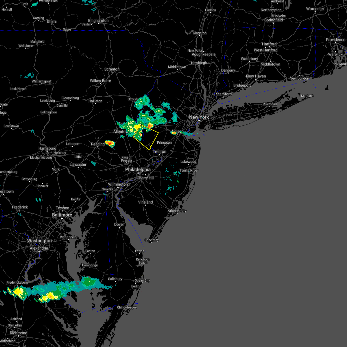 At 627 pm edt, a severe thunderstorm was located over revere, or 11 miles southeast of easton, moving southeast at 30 mph (radar indicated). Hazards include 60 mph wind gusts. Damage to roofs, siding, trees, and power lines is possible. Locations impacted include, byram, flemington, tinicum, new hope, ferndale, frenchtown, milford, bloomsbury, stockton, revere, ottsville, sergeantsville, pipersville, erwinna, lumberville, sand brook and lambertville. At 627 pm edt, a severe thunderstorm was located over revere, or 11 miles southeast of easton, moving southeast at 30 mph (radar indicated). Hazards include 60 mph wind gusts. Damage to roofs, siding, trees, and power lines is possible. Locations impacted include, byram, flemington, tinicum, new hope, ferndale, frenchtown, milford, bloomsbury, stockton, revere, ottsville, sergeantsville, pipersville, erwinna, lumberville, sand brook and lambertville.
|
| 8/24/2020 6:14 PM EDT |
 At 614 pm edt, a severe thunderstorm was located over springtown, or 7 miles south of easton, moving southeast at 30 mph (radar indicated). Hazards include 60 mph wind gusts. damage to roofs, siding, trees, and power lines is possible At 614 pm edt, a severe thunderstorm was located over springtown, or 7 miles south of easton, moving southeast at 30 mph (radar indicated). Hazards include 60 mph wind gusts. damage to roofs, siding, trees, and power lines is possible
|
| 8/18/2020 1:38 AM EDT |
 At 137 am edt, severe thunderstorms were located along a line extending from branchville to beatyestown to ferndale, moving east at 30 mph (radar indicated). Hazards include 60 mph wind gusts. damage to roofs, siding, trees, and power lines is possible At 137 am edt, severe thunderstorms were located along a line extending from branchville to beatyestown to ferndale, moving east at 30 mph (radar indicated). Hazards include 60 mph wind gusts. damage to roofs, siding, trees, and power lines is possible
|
| 7/31/2020 12:38 AM EDT |
 The severe thunderstorm warning for hunterdon, northwestern mercer, southwestern somerset, southeastern berks, southeastern lehigh, northwestern montgomery and northwestern bucks counties will expire at 1245 am edt, the storms which prompted the warning have moved out of the area. therefore, the warning will be allowed to expire. The severe thunderstorm warning for hunterdon, northwestern mercer, southwestern somerset, southeastern berks, southeastern lehigh, northwestern montgomery and northwestern bucks counties will expire at 1245 am edt, the storms which prompted the warning have moved out of the area. therefore, the warning will be allowed to expire.
|
| 7/31/2020 12:12 AM EDT |
 At 1212 am edt, severe thunderstorms were located along a line extending from near chester to near bally, moving northeast at 45 mph (radar indicated). Hazards include 60 mph wind gusts. Damage to roofs, siding, trees, and power lines is possible. locations impacted include, pottstown, manville, quakertown, perkasie, doylestown, byram, souderton, bedminster, flemington, tinicum, high bridge, east greenville, clinton, new hope, dublin, hopewell, glen gardner, ferndale, hampton and schwenksville. this includes the following highways, northeast extension between mile markers 33 and 48. Interstate 78 in new jersey between mile markers 8 and 25. At 1212 am edt, severe thunderstorms were located along a line extending from near chester to near bally, moving northeast at 45 mph (radar indicated). Hazards include 60 mph wind gusts. Damage to roofs, siding, trees, and power lines is possible. locations impacted include, pottstown, manville, quakertown, perkasie, doylestown, byram, souderton, bedminster, flemington, tinicum, high bridge, east greenville, clinton, new hope, dublin, hopewell, glen gardner, ferndale, hampton and schwenksville. this includes the following highways, northeast extension between mile markers 33 and 48. Interstate 78 in new jersey between mile markers 8 and 25.
|
| 7/30/2020 11:51 PM EDT |
 At 1151 pm edt, severe thunderstorms were located along a line extending from lebanon to near birdsboro, moving northeast at 45 mph (radar indicated). Hazards include 60 mph wind gusts. damage to roofs, siding, trees, and power lines is possible At 1151 pm edt, severe thunderstorms were located along a line extending from lebanon to near birdsboro, moving northeast at 45 mph (radar indicated). Hazards include 60 mph wind gusts. damage to roofs, siding, trees, and power lines is possible
|
| 7/22/2020 6:06 PM EDT |
 The severe thunderstorm warning for west central morris, northwestern hunterdon, southwestern sussex, warren, north central bucks, east central monroe and eastern northampton counties will expire at 615 pm edt, the storm which prompted the warning has weakened below severe limits, and has exited the warned area. therefore, the warning will be allowed to expire. however gusty winds and heavy rain are still possible with this thunderstorm. a severe thunderstorm watch remains in effect until 1000 pm edt for northern and northwestern new jersey, and eastern, southeastern and northeastern pennsylvania. The severe thunderstorm warning for west central morris, northwestern hunterdon, southwestern sussex, warren, north central bucks, east central monroe and eastern northampton counties will expire at 615 pm edt, the storm which prompted the warning has weakened below severe limits, and has exited the warned area. therefore, the warning will be allowed to expire. however gusty winds and heavy rain are still possible with this thunderstorm. a severe thunderstorm watch remains in effect until 1000 pm edt for northern and northwestern new jersey, and eastern, southeastern and northeastern pennsylvania.
|
| 7/22/2020 5:16 PM EDT |
 At 515 pm edt, a severe thunderstorm was located near oxford, or 17 miles southwest of newton, moving northeast at 15 mph (radar indicated). Hazards include 70 mph wind gusts and penny size hail. Expect considerable tree damage. Damage is likely to mobile homes, roofs, and outbuildings. At 515 pm edt, a severe thunderstorm was located near oxford, or 17 miles southwest of newton, moving northeast at 15 mph (radar indicated). Hazards include 70 mph wind gusts and penny size hail. Expect considerable tree damage. Damage is likely to mobile homes, roofs, and outbuildings.
|
| 7/6/2020 3:32 PM EDT |
 At 332 pm edt, severe thunderstorms were located along a line extending from pleasant valley to tinicum, and are nearly stationary (radar indicated). Hazards include 60 mph wind gusts and quarter size hail. Minor damage to vehicles is possible. wind damage to roofs, siding, trees, and power lines is possible. locations impacted include, bethlehem, hellertown, alpha, ferndale, frenchtown, milford, bloomsbury, riegelsville, pleasant valley, revere, ottsville, springtown, erwinna and freemansburg. this includes the following highways, interstate 78 in pennsylvania between mile markers 68 and 72. Interstate 78 in new jersey between mile markers 10 and 15. At 332 pm edt, severe thunderstorms were located along a line extending from pleasant valley to tinicum, and are nearly stationary (radar indicated). Hazards include 60 mph wind gusts and quarter size hail. Minor damage to vehicles is possible. wind damage to roofs, siding, trees, and power lines is possible. locations impacted include, bethlehem, hellertown, alpha, ferndale, frenchtown, milford, bloomsbury, riegelsville, pleasant valley, revere, ottsville, springtown, erwinna and freemansburg. this includes the following highways, interstate 78 in pennsylvania between mile markers 68 and 72. Interstate 78 in new jersey between mile markers 10 and 15.
|
| 7/6/2020 3:00 PM EDT |
 At 259 pm edt, severe thunderstorms were located along a line extending from near ottsville to near erwinna, moving northeast at 10 mph (radar indicated). Hazards include 60 mph wind gusts and quarter size hail. Minor damage to vehicles is possible. Wind damage to roofs, siding, trees, and power lines is possible. At 259 pm edt, severe thunderstorms were located along a line extending from near ottsville to near erwinna, moving northeast at 10 mph (radar indicated). Hazards include 60 mph wind gusts and quarter size hail. Minor damage to vehicles is possible. Wind damage to roofs, siding, trees, and power lines is possible.
|
| 6/27/2020 3:47 PM EDT |
 At 347 pm edt, severe thunderstorms were located along a line extending from cloverhill to near pleasant valley, moving east at 50 mph (law enforcement. tree damage and power outages have been reported near allentown). Hazards include 70 mph wind gusts and penny size hail. Expect considerable tree damage. damage is likely to mobile homes, roofs, and outbuildings. locations impacted include, allentown, bethlehem, old bridge, east brunswick, south brunswick, north brunswick, ewing, princeton, byram, bedminster, jamesburg, hellertown, flemington, tinicum, cranbury, clinton, pennington, new hope, hopewell and ferndale. this includes the following highways, new jersey turnpike near exit 9. interstate 78 in pennsylvania between mile markers 61 and 70. interstate 78 in new jersey between mile markers 13 and 18. Interstate 295 in new jersey between mile markers 71 and 74. At 347 pm edt, severe thunderstorms were located along a line extending from cloverhill to near pleasant valley, moving east at 50 mph (law enforcement. tree damage and power outages have been reported near allentown). Hazards include 70 mph wind gusts and penny size hail. Expect considerable tree damage. damage is likely to mobile homes, roofs, and outbuildings. locations impacted include, allentown, bethlehem, old bridge, east brunswick, south brunswick, north brunswick, ewing, princeton, byram, bedminster, jamesburg, hellertown, flemington, tinicum, cranbury, clinton, pennington, new hope, hopewell and ferndale. this includes the following highways, new jersey turnpike near exit 9. interstate 78 in pennsylvania between mile markers 61 and 70. interstate 78 in new jersey between mile markers 13 and 18. Interstate 295 in new jersey between mile markers 71 and 74.
|
| 6/27/2020 3:47 PM EDT |
 At 337 pm edt, severe thunderstorms were located along a line extending from near flemington to near hellertown, moving southeast at 50 mph (radar indicated). Hazards include 70 mph wind gusts and penny size hail. Expect considerable tree damage. Damage is likely to mobile homes, roofs, and outbuildings. At 337 pm edt, severe thunderstorms were located along a line extending from near flemington to near hellertown, moving southeast at 50 mph (radar indicated). Hazards include 70 mph wind gusts and penny size hail. Expect considerable tree damage. Damage is likely to mobile homes, roofs, and outbuildings.
|
| 6/27/2020 3:43 PM EDT |
 The severe thunderstorm warning for west central morris, northwestern hunterdon, southwestern warren, southeastern lehigh, northwestern bucks and southern northampton counties will expire at 345 pm edt, the storm which prompted the warning has partially moved out of the warned area. therefore, the warning will be allowed to expire, but a new warning has been issued which includes eastern portions of the prior warning. a severe thunderstorm watch remains in effect until 800 pm edt for northwestern new jersey, and southeastern pennsylvania. The severe thunderstorm warning for west central morris, northwestern hunterdon, southwestern warren, southeastern lehigh, northwestern bucks and southern northampton counties will expire at 345 pm edt, the storm which prompted the warning has partially moved out of the warned area. therefore, the warning will be allowed to expire, but a new warning has been issued which includes eastern portions of the prior warning. a severe thunderstorm watch remains in effect until 800 pm edt for northwestern new jersey, and southeastern pennsylvania.
|
| 6/27/2020 3:37 PM EDT |
 At 337 pm edt, severe thunderstorms were located along a line extending from near flemington to near hellertown, moving southeast at 50 mph (radar indicated). Hazards include 70 mph wind gusts and penny size hail. Expect considerable tree damage. Damage is likely to mobile homes, roofs, and outbuildings. At 337 pm edt, severe thunderstorms were located along a line extending from near flemington to near hellertown, moving southeast at 50 mph (radar indicated). Hazards include 70 mph wind gusts and penny size hail. Expect considerable tree damage. Damage is likely to mobile homes, roofs, and outbuildings.
|
| 6/27/2020 3:18 PM EDT |
 At 317 pm edt, a severe thunderstorm was located over lehigh university, or near allentown, moving southeast at 40 mph (radar indicated). Hazards include 60 mph wind gusts and penny size hail. Damage to roofs, siding, trees, and power lines is possible. locations impacted include, allentown, easton, bethlehem, forks, emmaus, northampton, quakertown, perkasie, wilson, bedminster, washington, hellertown, nazareth, tinicum, high bridge, clinton, bath, harmony, alpha and dublin. this includes the following highways, northeast extension between mile markers 43 and 63. interstate 78 in pennsylvania between mile markers 48 and 76. Interstate 78 in new jersey between mile markers 0 and 16. At 317 pm edt, a severe thunderstorm was located over lehigh university, or near allentown, moving southeast at 40 mph (radar indicated). Hazards include 60 mph wind gusts and penny size hail. Damage to roofs, siding, trees, and power lines is possible. locations impacted include, allentown, easton, bethlehem, forks, emmaus, northampton, quakertown, perkasie, wilson, bedminster, washington, hellertown, nazareth, tinicum, high bridge, clinton, bath, harmony, alpha and dublin. this includes the following highways, northeast extension between mile markers 43 and 63. interstate 78 in pennsylvania between mile markers 48 and 76. Interstate 78 in new jersey between mile markers 0 and 16.
|
| 6/27/2020 3:01 PM EDT |
 The national weather service in mount holly nj has issued a * severe thunderstorm warning for. west central morris county in northern new jersey. northwestern hunterdon county in northwestern new jersey. southern warren county in northwestern new jersey. Lehigh county in eastern pennsylvania. The national weather service in mount holly nj has issued a * severe thunderstorm warning for. west central morris county in northern new jersey. northwestern hunterdon county in northwestern new jersey. southern warren county in northwestern new jersey. Lehigh county in eastern pennsylvania.
|
| 6/3/2020 12:41 PM EDT |
 The severe thunderstorm warning for southern hunterdon, northwestern camden, mercer, northwestern burlington, southern somerset, southwestern monmouth, middlesex, southeastern montgomery, eastern bucks, east central chester, philadelphia and central delaware counties will expire at 1245 pm edt, the storms which prompted the warning have moved out of the area. therefore, the warning will be allowed to expire. a severe thunderstorm watch remains in effect until 300 pm edt for southern, central, northern and northwestern new jersey, and southeastern pennsylvania. The severe thunderstorm warning for southern hunterdon, northwestern camden, mercer, northwestern burlington, southern somerset, southwestern monmouth, middlesex, southeastern montgomery, eastern bucks, east central chester, philadelphia and central delaware counties will expire at 1245 pm edt, the storms which prompted the warning have moved out of the area. therefore, the warning will be allowed to expire. a severe thunderstorm watch remains in effect until 300 pm edt for southern, central, northern and northwestern new jersey, and southeastern pennsylvania.
|
| 6/3/2020 12:21 PM EDT |
 At 1220 pm edt, severe thunderstorms were located along a line extending from near kendall park to levittown to near morris park, moving east at 90 mph. these are very dangerous storms (radar indicated). Hazards include 80 mph wind gusts. widespread wind damage is occurring with these storms. Flying debris will be dangerous to those caught without shelter. mobile homes will be heavily damaged. expect considerable damage to roofs, windows, and vehicles. extensive tree damage and power outages are likely. locations impacted include, philadelphia, trenton, camden, new brunswick, west chester, gloucester city, somerset, cherry hill, old bridge, bensalem, east brunswick, evesham, south brunswick, sayreville, mount laurel, north brunswick, ewing, norristown, willingboro and medford. this includes the following highways, garden state parkway between mile markers 123 and 126. interstate 195 in new jersey between mile markers 0 and 14. interstate 295 in new jersey between mile markers 32 and 76. interstate 95 in pennsylvania between mile markers 16 and 40. new jersey turnpike between exits 4 and 10. interstate 476 in pennsylvania between mile markers 4 and 19. pennsylvania turnpike between exits 333 and 353. northeast extension near exit a20. interstate 676 in new jersey between mile markers 0 and 4. interstate 676 in pennsylvania between mile markers 0 and 1. interstate 76 in new jersey between mile markers 1 and 3. Interstate 76 in pennsylvania between mile markers 327 and 351. At 1220 pm edt, severe thunderstorms were located along a line extending from near kendall park to levittown to near morris park, moving east at 90 mph. these are very dangerous storms (radar indicated). Hazards include 80 mph wind gusts. widespread wind damage is occurring with these storms. Flying debris will be dangerous to those caught without shelter. mobile homes will be heavily damaged. expect considerable damage to roofs, windows, and vehicles. extensive tree damage and power outages are likely. locations impacted include, philadelphia, trenton, camden, new brunswick, west chester, gloucester city, somerset, cherry hill, old bridge, bensalem, east brunswick, evesham, south brunswick, sayreville, mount laurel, north brunswick, ewing, norristown, willingboro and medford. this includes the following highways, garden state parkway between mile markers 123 and 126. interstate 195 in new jersey between mile markers 0 and 14. interstate 295 in new jersey between mile markers 32 and 76. interstate 95 in pennsylvania between mile markers 16 and 40. new jersey turnpike between exits 4 and 10. interstate 476 in pennsylvania between mile markers 4 and 19. pennsylvania turnpike between exits 333 and 353. northeast extension near exit a20. interstate 676 in new jersey between mile markers 0 and 4. interstate 676 in pennsylvania between mile markers 0 and 1. interstate 76 in new jersey between mile markers 1 and 3. Interstate 76 in pennsylvania between mile markers 327 and 351.
|
| 6/3/2020 12:02 PM EDT |
 At 1200 pm edt, severe thunderstorms were located along a line extending from near springtown to near souderton to royersford, moving east at 70 mph. these are very dangerous storms (radar indicated). Hazards include 80 mph wind gusts and penny size hail. Flying debris will be dangerous to those caught without shelter. mobile homes will be heavily damaged. expect considerable damage to roofs, windows, and vehicles. extensive tree damage and power outages are likely. locations impacted include, allentown, reading, pottstown, lansdale, east norriton, emmaus, quakertown, perkasie, doylestown, byram, souderton, bedminster, hellertown, birdsboro, collegeville, royersford, flemington, chalfont, tinicum and trappe. this includes the following highways, interstate 78 in pennsylvania between mile markers 51 and 64. northeast extension between exits a31 and a56. Interstate 176 in pennsylvania between mile markers 6 and 11. At 1200 pm edt, severe thunderstorms were located along a line extending from near springtown to near souderton to royersford, moving east at 70 mph. these are very dangerous storms (radar indicated). Hazards include 80 mph wind gusts and penny size hail. Flying debris will be dangerous to those caught without shelter. mobile homes will be heavily damaged. expect considerable damage to roofs, windows, and vehicles. extensive tree damage and power outages are likely. locations impacted include, allentown, reading, pottstown, lansdale, east norriton, emmaus, quakertown, perkasie, doylestown, byram, souderton, bedminster, hellertown, birdsboro, collegeville, royersford, flemington, chalfont, tinicum and trappe. this includes the following highways, interstate 78 in pennsylvania between mile markers 51 and 64. northeast extension between exits a31 and a56. Interstate 176 in pennsylvania between mile markers 6 and 11.
|
| 6/3/2020 11:59 AM EDT |
 At 1157 am edt, severe thunderstorms were located along a line extending from near ferndale to near trappe to near honey brook, moving east at 90 mph. these are very dangerous storms (radar indicated). Hazards include 80 mph wind gusts. reading airport measured an earlier wind gust of 83 mph with these storms. numerous reports of wind damage have been received. Flying debris will be dangerous to those caught without shelter. mobile homes will be heavily damaged. expect considerable damage to roofs, windows, and vehicles. Extensive tree damage and power outages are likely. At 1157 am edt, severe thunderstorms were located along a line extending from near ferndale to near trappe to near honey brook, moving east at 90 mph. these are very dangerous storms (radar indicated). Hazards include 80 mph wind gusts. reading airport measured an earlier wind gust of 83 mph with these storms. numerous reports of wind damage have been received. Flying debris will be dangerous to those caught without shelter. mobile homes will be heavily damaged. expect considerable damage to roofs, windows, and vehicles. Extensive tree damage and power outages are likely.
|
| 6/3/2020 11:40 AM EDT |
 The severe thunderstorm warning for northwestern hunterdon, southwestern warren, berks, lehigh, northwestern montgomery, southern carbon, northwestern bucks and northampton counties will expire at 1145 am edt, the storms which prompted the warning have moved out of the area. therefore, the warning will be allowed to expire. a new warning has been issued for portions of the area. a severe thunderstorm watch remains in effect until 300 pm edt for northwestern new jersey, and eastern, southeastern and northeastern pennsylvania. The severe thunderstorm warning for northwestern hunterdon, southwestern warren, berks, lehigh, northwestern montgomery, southern carbon, northwestern bucks and northampton counties will expire at 1145 am edt, the storms which prompted the warning have moved out of the area. therefore, the warning will be allowed to expire. a new warning has been issued for portions of the area. a severe thunderstorm watch remains in effect until 300 pm edt for northwestern new jersey, and eastern, southeastern and northeastern pennsylvania.
|
| 6/3/2020 11:38 AM EDT |
 At 1137 am edt, severe thunderstorms were located along a line extending from ancient oaks to fleetwood to near kleinfeltersville, moving east at 75 mph. these are very dangerous storms (radar indicated). Hazards include 80 mph wind gusts and penny size hail. a wind gust of 83 mph was recently measured at reading airport. Flying debris will be dangerous to those caught without shelter. mobile homes will be heavily damaged. expect considerable damage to roofs, windows, and vehicles. Extensive tree damage and power outages are likely. At 1137 am edt, severe thunderstorms were located along a line extending from ancient oaks to fleetwood to near kleinfeltersville, moving east at 75 mph. these are very dangerous storms (radar indicated). Hazards include 80 mph wind gusts and penny size hail. a wind gust of 83 mph was recently measured at reading airport. Flying debris will be dangerous to those caught without shelter. mobile homes will be heavily damaged. expect considerable damage to roofs, windows, and vehicles. Extensive tree damage and power outages are likely.
|
| 6/3/2020 11:23 AM EDT |
 At 1122 am edt, severe thunderstorms were located along a line extending from jim thorpe to lenhartsville to near bernville, moving east at 75 mph (radar indicated). Hazards include 60 mph wind gusts and penny size hail. Damage to roofs, siding, trees, and power lines is possible. locations impacted include, allentown, reading, easton, lehighton, bethlehem, pottstown, forks, emmaus, wyomissing, northampton, quakertown, perkasie, wilson, souderton, bedminster, washington, hellertown, nazareth, palmerton and birdsboro. this includes the following highways, interstate 78 in new jersey between mile markers 0 and 12. interstate 78 in pennsylvania between mile markers 10 and 76. northeast extension between exits a44 and a56. Interstate 176 in pennsylvania between mile markers 10 and 11. At 1122 am edt, severe thunderstorms were located along a line extending from jim thorpe to lenhartsville to near bernville, moving east at 75 mph (radar indicated). Hazards include 60 mph wind gusts and penny size hail. Damage to roofs, siding, trees, and power lines is possible. locations impacted include, allentown, reading, easton, lehighton, bethlehem, pottstown, forks, emmaus, wyomissing, northampton, quakertown, perkasie, wilson, souderton, bedminster, washington, hellertown, nazareth, palmerton and birdsboro. this includes the following highways, interstate 78 in new jersey between mile markers 0 and 12. interstate 78 in pennsylvania between mile markers 10 and 76. northeast extension between exits a44 and a56. Interstate 176 in pennsylvania between mile markers 10 and 11.
|
| 6/3/2020 11:04 AM EDT |
 At 1103 am edt, severe thunderstorms were located along a line extending from nuremburg to near friedensburg to fort indiantown gap, moving east at 75 mph (radar indicated). Hazards include 60 mph wind gusts and penny size hail. damage to roofs, siding, trees, and power lines is possible At 1103 am edt, severe thunderstorms were located along a line extending from nuremburg to near friedensburg to fort indiantown gap, moving east at 75 mph (radar indicated). Hazards include 60 mph wind gusts and penny size hail. damage to roofs, siding, trees, and power lines is possible
|
| 4/21/2020 1:17 PM EDT |
 At 116 pm edt, severe thunderstorms were located along a line extending from near glen gardner to souderton to near downingtown, moving east at 40 mph. the strongest winds with the storm are in montgomery and bucks counties (radar indicated). Hazards include 60 mph wind gusts. Damage to roofs, siding, trees, and power lines is possible. locations impacted include, philadelphia, west chester, norristown, pottstown, phoenixville, lansdale, west norriton, east norriton, coatesville, westtown, quakertown, perkasie, doylestown, byram, downingtown, conshohocken, hatboro, souderton, bedminster and washington. this includes the following highways, interstate 78 in new jersey between mile markers 1 and 27. interstate 476 in pennsylvania between mile markers 9 and 19. pennsylvania turnpike between exits 312 and 343. northeast extension between exits a20 and a31. Interstate 76 in pennsylvania between mile markers 327 and 336. At 116 pm edt, severe thunderstorms were located along a line extending from near glen gardner to souderton to near downingtown, moving east at 40 mph. the strongest winds with the storm are in montgomery and bucks counties (radar indicated). Hazards include 60 mph wind gusts. Damage to roofs, siding, trees, and power lines is possible. locations impacted include, philadelphia, west chester, norristown, pottstown, phoenixville, lansdale, west norriton, east norriton, coatesville, westtown, quakertown, perkasie, doylestown, byram, downingtown, conshohocken, hatboro, souderton, bedminster and washington. this includes the following highways, interstate 78 in new jersey between mile markers 1 and 27. interstate 476 in pennsylvania between mile markers 9 and 19. pennsylvania turnpike between exits 312 and 343. northeast extension between exits a20 and a31. Interstate 76 in pennsylvania between mile markers 327 and 336.
|
| 4/21/2020 1:04 PM EDT |
 At 103 pm edt, severe thunderstorms were located along a line extending from pleasant valley to near green lane to near parkesburg, moving east at 40 mph (radar indicated). Hazards include 60 mph wind gusts. damage to roofs, siding, trees, and power lines is possible At 103 pm edt, severe thunderstorms were located along a line extending from pleasant valley to near green lane to near parkesburg, moving east at 40 mph (radar indicated). Hazards include 60 mph wind gusts. damage to roofs, siding, trees, and power lines is possible
|
| 4/9/2020 1:00 PM EDT |
 At 100 pm edt, severe thunderstorms were located along a line extending from near bloomsbury to near fricks to marshallton, moving east at 45 mph (radar indicated). Hazards include 60 mph wind gusts and penny size hail. damage to roofs, siding, trees, and power lines is possible At 100 pm edt, severe thunderstorms were located along a line extending from near bloomsbury to near fricks to marshallton, moving east at 45 mph (radar indicated). Hazards include 60 mph wind gusts and penny size hail. damage to roofs, siding, trees, and power lines is possible
|
| 3/3/2020 9:09 PM EST |
 At 908 pm est, severe thunderstorms were located along a line extending from great meadows-vienna to chalfont to fair hill, moving southeast at 40 mph (radar indicated). Hazards include 60 mph wind gusts. damage to roofs, siding, trees, and power lines is possible At 908 pm est, severe thunderstorms were located along a line extending from great meadows-vienna to chalfont to fair hill, moving southeast at 40 mph (radar indicated). Hazards include 60 mph wind gusts. damage to roofs, siding, trees, and power lines is possible
|
| 2/7/2020 10:31 AM EST |
 At 1030 am est, severe thunderstorms were located along a line extending from roxburg to doylestown, moving northeast at 45 mph (radar indicated). Hazards include 70 mph wind gusts and penny size hail. Expect considerable tree damage. damage is likely to mobile homes, roofs, and outbuildings. locations impacted include, lansdale, east norriton, quakertown, perkasie, doylestown, byram, souderton, bedminster, flemington, chalfont, tinicum, high bridge, hatfield, clinton, new hope, dublin, glen gardner, ferndale, hampton and frenchtown. this includes the following highways, interstate 78 in new jersey between mile markers 7 and 17. Northeast extension between exits a31 and a44. At 1030 am est, severe thunderstorms were located along a line extending from roxburg to doylestown, moving northeast at 45 mph (radar indicated). Hazards include 70 mph wind gusts and penny size hail. Expect considerable tree damage. damage is likely to mobile homes, roofs, and outbuildings. locations impacted include, lansdale, east norriton, quakertown, perkasie, doylestown, byram, souderton, bedminster, flemington, chalfont, tinicum, high bridge, hatfield, clinton, new hope, dublin, glen gardner, ferndale, hampton and frenchtown. this includes the following highways, interstate 78 in new jersey between mile markers 7 and 17. Northeast extension between exits a31 and a44.
|
| 2/7/2020 10:14 AM EST |
 At 1014 am est, severe thunderstorms were located along a line extending from old orchard to lansdale, moving northeast at 45 mph (radar indicated). Hazards include 70 mph wind gusts and penny size hail. Expect considerable tree damage. damage is likely to mobile homes, roofs, and outbuildings. locations impacted include, easton, bethlehem, lansdale, forks, east norriton, northampton, quakertown, perkasie, doylestown, byram, wilson, souderton, bedminster, washington, hellertown, nazareth, bangor, flemington, chalfont and tinicum. this includes the following highways, interstate 78 in new jersey between mile markers 0 and 17. interstate 80 in new jersey between mile markers 2 and 4. interstate 78 in pennsylvania between mile markers 65 and 76. Northeast extension between exits a31 and a44. At 1014 am est, severe thunderstorms were located along a line extending from old orchard to lansdale, moving northeast at 45 mph (radar indicated). Hazards include 70 mph wind gusts and penny size hail. Expect considerable tree damage. damage is likely to mobile homes, roofs, and outbuildings. locations impacted include, easton, bethlehem, lansdale, forks, east norriton, northampton, quakertown, perkasie, doylestown, byram, wilson, souderton, bedminster, washington, hellertown, nazareth, bangor, flemington, chalfont and tinicum. this includes the following highways, interstate 78 in new jersey between mile markers 0 and 17. interstate 80 in new jersey between mile markers 2 and 4. interstate 78 in pennsylvania between mile markers 65 and 76. Northeast extension between exits a31 and a44.
|
| 2/7/2020 9:43 AM EST |
 At 942 am est, severe thunderstorms were located along a line extending from near bally to near lionville-marchwood, moving northeast at 45 mph (radar indicated). Hazards include 70 mph wind gusts and penny size hail. Expect considerable tree damage. Damage is likely to mobile homes, roofs, and outbuildings. At 942 am est, severe thunderstorms were located along a line extending from near bally to near lionville-marchwood, moving northeast at 45 mph (radar indicated). Hazards include 70 mph wind gusts and penny size hail. Expect considerable tree damage. Damage is likely to mobile homes, roofs, and outbuildings.
|
| 10/31/2019 11:24 PM EDT |
 At 1123 pm edt, severe thunderstorms were located along a line extending from near hope to fricks, moving northeast at 65 mph (radar indicated). Hazards include 60 mph wind gusts. damage to roofs, siding, trees, and power lines is possible At 1123 pm edt, severe thunderstorms were located along a line extending from near hope to fricks, moving northeast at 65 mph (radar indicated). Hazards include 60 mph wind gusts. damage to roofs, siding, trees, and power lines is possible
|
| 8/18/2019 6:12 PM EDT |
 At 536 pm edt, a severe thunderstorm was located near frenchtown, or 16 miles southeast of easton, moving northeast at 10 mph (radar indicated). Hazards include 60 mph wind gusts and quarter size hail. Minor damage to vehicles is possible. Wind damage to roofs, siding, trees, and power lines is possible. At 536 pm edt, a severe thunderstorm was located near frenchtown, or 16 miles southeast of easton, moving northeast at 10 mph (radar indicated). Hazards include 60 mph wind gusts and quarter size hail. Minor damage to vehicles is possible. Wind damage to roofs, siding, trees, and power lines is possible.
|
| 8/18/2019 6:12 PM EDT |
 The severe thunderstorm warning for central hunterdon and north central bucks counties will expire at 615 pm edt, the storm which prompted the warning has weakened below severe limits, and no longer poses an immediate threat to life or property. therefore, the warning will be allowed to expire. however small hail, gusty winds, and heavy rain are still possible with this thunderstorm. The severe thunderstorm warning for central hunterdon and north central bucks counties will expire at 615 pm edt, the storm which prompted the warning has weakened below severe limits, and no longer poses an immediate threat to life or property. therefore, the warning will be allowed to expire. however small hail, gusty winds, and heavy rain are still possible with this thunderstorm.
|
| 8/18/2019 6:00 PM EDT |
 A severe thunderstorm warning remains in effect until 615 pm edt for central hunterdon and north central bucks counties. at 600 pm edt, a severe thunderstorm was located near frenchtown, or 15 miles southeast of easton, and is nearly stationary. hazard. 60 mph wind gusts and quarter size hail. source. Radar indicated. A severe thunderstorm warning remains in effect until 615 pm edt for central hunterdon and north central bucks counties. at 600 pm edt, a severe thunderstorm was located near frenchtown, or 15 miles southeast of easton, and is nearly stationary. hazard. 60 mph wind gusts and quarter size hail. source. Radar indicated.
|
| 8/18/2019 6:00 PM EDT |
 At 600 pm edt, a severe thunderstorm was located near frenchtown, or 15 miles southeast of easton, and is nearly stationary (radar indicated). Hazards include 60 mph wind gusts and quarter size hail. Minor damage to vehicles is possible. wind damage to roofs, siding, trees, and power lines is possible. locations impacted include, flemington, clinton, frenchtown, lebanon, milford, erwinna, annandale and white house station. This includes interstate 78 in new jersey between mile markers 16 and 24. At 600 pm edt, a severe thunderstorm was located near frenchtown, or 15 miles southeast of easton, and is nearly stationary (radar indicated). Hazards include 60 mph wind gusts and quarter size hail. Minor damage to vehicles is possible. wind damage to roofs, siding, trees, and power lines is possible. locations impacted include, flemington, clinton, frenchtown, lebanon, milford, erwinna, annandale and white house station. This includes interstate 78 in new jersey between mile markers 16 and 24.
|
| 8/18/2019 5:36 PM EDT |
 At 536 pm edt, a severe thunderstorm was located near frenchtown, or 16 miles southeast of easton, moving northeast at 10 mph (radar indicated). Hazards include 60 mph wind gusts and quarter size hail. Minor damage to vehicles is possible. Wind damage to roofs, siding, trees, and power lines is possible. At 536 pm edt, a severe thunderstorm was located near frenchtown, or 16 miles southeast of easton, moving northeast at 10 mph (radar indicated). Hazards include 60 mph wind gusts and quarter size hail. Minor damage to vehicles is possible. Wind damage to roofs, siding, trees, and power lines is possible.
|
| 8/7/2019 4:17 PM EDT |
 At 417 pm edt, severe thunderstorms were located along a line extending from near clinton to near springtown, moving north at 15 mph (radar indicated). Hazards include 60 mph wind gusts and penny size hail. Damage to roofs, siding, trees, and power lines is possible. Locations impacted include, easton, washington, high bridge, clinton, alpha, glen gardner, ferndale, hampton, milford, califon, bloomsbury, riegelsville, glendon, pleasant valley, springtown, annandale, brass castle, beatyestown and phillipsburg. At 417 pm edt, severe thunderstorms were located along a line extending from near clinton to near springtown, moving north at 15 mph (radar indicated). Hazards include 60 mph wind gusts and penny size hail. Damage to roofs, siding, trees, and power lines is possible. Locations impacted include, easton, washington, high bridge, clinton, alpha, glen gardner, ferndale, hampton, milford, califon, bloomsbury, riegelsville, glendon, pleasant valley, springtown, annandale, brass castle, beatyestown and phillipsburg.
|
| 8/7/2019 4:14 PM EDT |
 At 413 pm edt, severe thunderstorms were located along a line extending from near pen argyl to near bloomsbury, moving northeast at 30 mph (radar indicated). Hazards include 60 mph wind gusts and penny size hail. damage to roofs, siding, trees, and power lines is possible At 413 pm edt, severe thunderstorms were located along a line extending from near pen argyl to near bloomsbury, moving northeast at 30 mph (radar indicated). Hazards include 60 mph wind gusts and penny size hail. damage to roofs, siding, trees, and power lines is possible
|
| 8/7/2019 3:54 PM EDT |
 At 354 pm edt, severe thunderstorms were located along a line extending from near frenchtown to near pleasant valley, moving north at 15 mph (radar indicated). Hazards include 60 mph wind gusts and penny size hail. damage to roofs, siding, trees, and power lines is possible At 354 pm edt, severe thunderstorms were located along a line extending from near frenchtown to near pleasant valley, moving north at 15 mph (radar indicated). Hazards include 60 mph wind gusts and penny size hail. damage to roofs, siding, trees, and power lines is possible
|
| 8/7/2019 3:38 PM EDT |
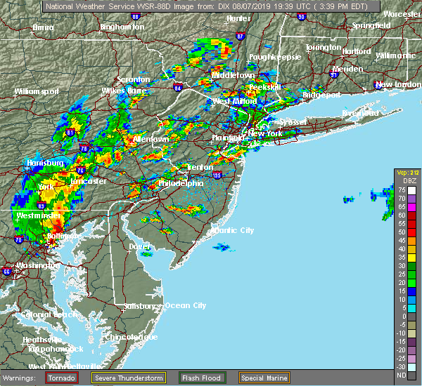 At 338 pm edt, a severe thunderstorm was located over ottsville, or 14 miles south of easton, moving northeast at 35 mph (radar indicated). Hazards include 60 mph wind gusts and quarter size hail. Minor damage to vehicles is possible. wind damage to roofs, siding, trees, and power lines is possible. Locations impacted include, bedminster, tinicum, ferndale, frenchtown, milford, riegelsville, pipersville, erwinna, revere and ottsville. At 338 pm edt, a severe thunderstorm was located over ottsville, or 14 miles south of easton, moving northeast at 35 mph (radar indicated). Hazards include 60 mph wind gusts and quarter size hail. Minor damage to vehicles is possible. wind damage to roofs, siding, trees, and power lines is possible. Locations impacted include, bedminster, tinicum, ferndale, frenchtown, milford, riegelsville, pipersville, erwinna, revere and ottsville.
|
| 8/7/2019 3:38 PM EDT |
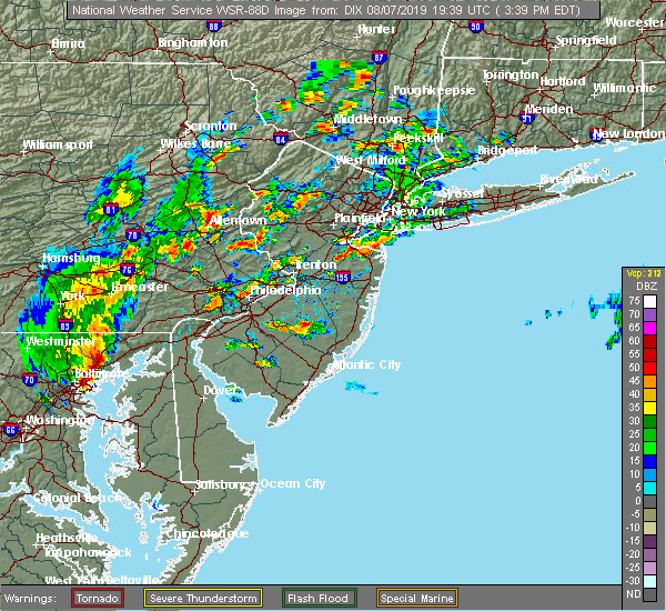 At 338 pm edt, a severe thunderstorm was located over ottsville, or 14 miles south of easton, moving northeast at 35 mph (radar indicated). Hazards include 60 mph wind gusts and quarter size hail. Minor damage to vehicles is possible. wind damage to roofs, siding, trees, and power lines is possible. Locations impacted include, bedminster, tinicum, ferndale, frenchtown, milford, riegelsville, pipersville, erwinna, revere and ottsville. At 338 pm edt, a severe thunderstorm was located over ottsville, or 14 miles south of easton, moving northeast at 35 mph (radar indicated). Hazards include 60 mph wind gusts and quarter size hail. Minor damage to vehicles is possible. wind damage to roofs, siding, trees, and power lines is possible. Locations impacted include, bedminster, tinicum, ferndale, frenchtown, milford, riegelsville, pipersville, erwinna, revere and ottsville.
|
| 8/7/2019 3:18 PM EDT |
 At 318 pm edt, a severe thunderstorm was located over fricks, or 21 miles southeast of allentown, moving northeast at 35 mph (radar indicated). Hazards include 60 mph wind gusts and quarter size hail. Minor damage to vehicles is possible. Wind damage to roofs, siding, trees, and power lines is possible. At 318 pm edt, a severe thunderstorm was located over fricks, or 21 miles southeast of allentown, moving northeast at 35 mph (radar indicated). Hazards include 60 mph wind gusts and quarter size hail. Minor damage to vehicles is possible. Wind damage to roofs, siding, trees, and power lines is possible.
|
| 8/7/2019 3:18 PM EDT |
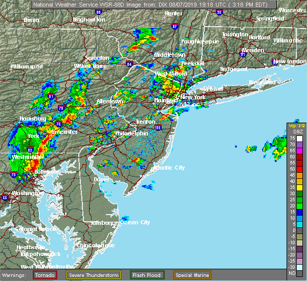 At 318 pm edt, a severe thunderstorm was located over fricks, or 21 miles southeast of allentown, moving northeast at 35 mph (radar indicated). Hazards include 60 mph wind gusts and quarter size hail. Minor damage to vehicles is possible. Wind damage to roofs, siding, trees, and power lines is possible. At 318 pm edt, a severe thunderstorm was located over fricks, or 21 miles southeast of allentown, moving northeast at 35 mph (radar indicated). Hazards include 60 mph wind gusts and quarter size hail. Minor damage to vehicles is possible. Wind damage to roofs, siding, trees, and power lines is possible.
|
| 8/7/2019 1:30 PM EDT |
 At 129 pm edt, severe thunderstorms were located along a line extending from near long valley to frenchtown, moving northeast at 20 mph (radar indicated). Hazards include 60 mph wind gusts and half dollar size hail. Minor damage to vehicles is possible. wind damage to roofs, siding, trees, and power lines is possible. Locations impacted include, dover, wharton, mount arlington, mendham, high bridge, stanhope, netcong, clinton, peapack and gladstone, glen gardner, chester, victory gardens, hampton, frenchtown, lebanon, milford, califon, bloomsbury, long valley and succasunna. At 129 pm edt, severe thunderstorms were located along a line extending from near long valley to frenchtown, moving northeast at 20 mph (radar indicated). Hazards include 60 mph wind gusts and half dollar size hail. Minor damage to vehicles is possible. wind damage to roofs, siding, trees, and power lines is possible. Locations impacted include, dover, wharton, mount arlington, mendham, high bridge, stanhope, netcong, clinton, peapack and gladstone, glen gardner, chester, victory gardens, hampton, frenchtown, lebanon, milford, califon, bloomsbury, long valley and succasunna.
|
| 8/7/2019 1:22 PM EDT |
 At 121 pm edt, severe thunderstorms were located along a line extending from near califon to frenchtown, moving northeast at 20 mph (radar indicated). Hazards include 60 mph wind gusts and penny size hail. damage to roofs, siding, trees, and power lines is possible At 121 pm edt, severe thunderstorms were located along a line extending from near califon to frenchtown, moving northeast at 20 mph (radar indicated). Hazards include 60 mph wind gusts and penny size hail. damage to roofs, siding, trees, and power lines is possible
|
| 7/31/2019 3:30 PM EDT | Tree dow in hunterdon county NJ, 3.1 miles SE of Milford, NJ |
| 7/22/2019 6:08 PM EDT |
 At 607 pm edt, severe thunderstorms were located along a line extending from wharton to near perkasie, moving northeast at 30 mph (law enforcement. widespread wind damage has been reported in warren, lehigh, and northampton counties with these storms). Hazards include 70 mph wind gusts and quarter size hail. Minor damage to vehicles is possible. expect considerable tree damage. wind damage is also likely to mobile homes, roofs, and outbuildings. Locations impacted include, morristown, dover, hackettstown, quakertown, perkasie, byram, bedminster, washington, morris plains, mendham, flemington, mountain lakes, tinicum, high bridge, clinton, peapack and gladstone, new hope, oxford, dublin and glen gardner. At 607 pm edt, severe thunderstorms were located along a line extending from wharton to near perkasie, moving northeast at 30 mph (law enforcement. widespread wind damage has been reported in warren, lehigh, and northampton counties with these storms). Hazards include 70 mph wind gusts and quarter size hail. Minor damage to vehicles is possible. expect considerable tree damage. wind damage is also likely to mobile homes, roofs, and outbuildings. Locations impacted include, morristown, dover, hackettstown, quakertown, perkasie, byram, bedminster, washington, morris plains, mendham, flemington, mountain lakes, tinicum, high bridge, clinton, peapack and gladstone, new hope, oxford, dublin and glen gardner.
|
| 7/22/2019 5:55 PM EDT |
 At 554 pm edt, severe thunderstorms were located along a line extending from succasunna to near perkasie, moving east at 25 mph (law enforcement. widespread wind damage has been reported with these storms). Hazards include 70 mph wind gusts. Expect considerable tree damage. damage is likely to mobile homes, roofs, and outbuildings. Locations impacted include, easton, morristown, bethlehem, dover, forks, hackettstown, quakertown, perkasie, byram, wilson, bedminster, washington, hellertown, morris plains, mendham, flemington, mountain lakes, tinicum, high bridge and east greenville. At 554 pm edt, severe thunderstorms were located along a line extending from succasunna to near perkasie, moving east at 25 mph (law enforcement. widespread wind damage has been reported with these storms). Hazards include 70 mph wind gusts. Expect considerable tree damage. damage is likely to mobile homes, roofs, and outbuildings. Locations impacted include, easton, morristown, bethlehem, dover, forks, hackettstown, quakertown, perkasie, byram, wilson, bedminster, washington, hellertown, morris plains, mendham, flemington, mountain lakes, tinicum, high bridge and east greenville.
|
| 7/22/2019 5:17 PM EDT |
 At 517 pm edt, several severe thunderstorms were located along a line extending from washington to near bally, moving east at 30 mph (law enforcement. numerous reports of wind damage have been received from lehigh and warren counties with these storms). Hazards include 70 mph wind gusts. Expect considerable tree damage. Damage is likely to mobile homes, roofs, and outbuildings. At 517 pm edt, several severe thunderstorms were located along a line extending from washington to near bally, moving east at 30 mph (law enforcement. numerous reports of wind damage have been received from lehigh and warren counties with these storms). Hazards include 70 mph wind gusts. Expect considerable tree damage. Damage is likely to mobile homes, roofs, and outbuildings.
|
| 7/22/2019 12:09 AM EDT |
 At 1209 am edt, severe thunderstorms were located along a line extending from near kunkletown to near yardley, moving east at 30 mph (radar indicated). Hazards include 60 mph wind gusts and quarter size hail. Minor damage to vehicles is possible. wind damage to roofs, siding, trees, and power lines is possible. Locations impacted include, allentown, trenton, easton, lehighton, bethlehem, ewing, forks, northampton, doylestown, byram, wilson, bedminster, hellertown, nazareth, palmerton, bangor, slatington, tinicum, pen argyl and wind gap. At 1209 am edt, severe thunderstorms were located along a line extending from near kunkletown to near yardley, moving east at 30 mph (radar indicated). Hazards include 60 mph wind gusts and quarter size hail. Minor damage to vehicles is possible. wind damage to roofs, siding, trees, and power lines is possible. Locations impacted include, allentown, trenton, easton, lehighton, bethlehem, ewing, forks, northampton, doylestown, byram, wilson, bedminster, hellertown, nazareth, palmerton, bangor, slatington, tinicum, pen argyl and wind gap.
|
| 7/21/2019 11:40 PM EDT |
 At 1140 pm edt, severe thunderstorms were located along a line extending from near beltzville state park to near chalfont, moving northeast at 30 mph (radar indicated). Hazards include 60 mph wind gusts and quarter size hail. Minor damage to vehicles is possible. Wind damage to roofs, siding, trees, and power lines is possible. At 1140 pm edt, severe thunderstorms were located along a line extending from near beltzville state park to near chalfont, moving northeast at 30 mph (radar indicated). Hazards include 60 mph wind gusts and quarter size hail. Minor damage to vehicles is possible. Wind damage to roofs, siding, trees, and power lines is possible.
|
| 7/21/2019 9:49 PM EDT |
 At 948 pm edt, severe thunderstorms were located along a line extending from near victory gardens to glen gardner to ferndale to near geryville, moving east at 35 mph (radar indicated). Hazards include 60 mph wind gusts and quarter size hail. Minor damage to vehicles is possible. wind damage to roofs, siding, trees, and power lines is possible. Locations impacted include, allentown, easton, morristown, somerville, bethlehem, bridgewater, dover, madison, middlesex, florham park, emmaus, east hanover, bound brook, manville, hackettstown, quakertown, chatham, perkasie, byram and bedminster. At 948 pm edt, severe thunderstorms were located along a line extending from near victory gardens to glen gardner to ferndale to near geryville, moving east at 35 mph (radar indicated). Hazards include 60 mph wind gusts and quarter size hail. Minor damage to vehicles is possible. wind damage to roofs, siding, trees, and power lines is possible. Locations impacted include, allentown, easton, morristown, somerville, bethlehem, bridgewater, dover, madison, middlesex, florham park, emmaus, east hanover, bound brook, manville, hackettstown, quakertown, chatham, perkasie, byram and bedminster.
|
| 7/21/2019 9:24 PM EDT |
 At 922 pm edt, severe thunderstorms were located along a line extending from netcong to harmony to hellertown to near topton, moving east at 35 mph (radar indicated). Hazards include 60 mph wind gusts and quarter size hail. Minor damage to vehicles is possible. Wind damage to roofs, siding, trees, and power lines is possible. At 922 pm edt, severe thunderstorms were located along a line extending from netcong to harmony to hellertown to near topton, moving east at 35 mph (radar indicated). Hazards include 60 mph wind gusts and quarter size hail. Minor damage to vehicles is possible. Wind damage to roofs, siding, trees, and power lines is possible.
|
| 7/6/2019 7:57 PM EDT |
 The severe thunderstorm warning for northwestern hunterdon, southern warren, southeastern berks, northwestern montgomery, southeastern lehigh, northwestern bucks, north central chester and south central northampton counties will expire at 800 pm edt, the storms which prompted the warning have moved out of the area. therefore, the warning will be allowed to expire. to report severe weather, contact your nearest law enforcement agency. they will relay your report to the national weather service mount holly nj. The severe thunderstorm warning for northwestern hunterdon, southern warren, southeastern berks, northwestern montgomery, southeastern lehigh, northwestern bucks, north central chester and south central northampton counties will expire at 800 pm edt, the storms which prompted the warning have moved out of the area. therefore, the warning will be allowed to expire. to report severe weather, contact your nearest law enforcement agency. they will relay your report to the national weather service mount holly nj.
|
| 7/6/2019 7:47 PM EDT |
 At 747 pm edt, severe thunderstorms were located along a line extending from beatyestown to near pleasant valley to near cedarville, moving southeast at 25 mph (radar indicated). Hazards include 60 mph wind gusts. Damage to roofs, siding, trees, and power lines is possible. Locations impacted include, pottstown, quakertown, washington, high bridge, east greenville, clinton, oxford, alpha, glen gardner, ferndale, hampton, frenchtown, lebanon, milford, elverson, califon, bechtelsville, bloomsbury, riegelsville and green lane. At 747 pm edt, severe thunderstorms were located along a line extending from beatyestown to near pleasant valley to near cedarville, moving southeast at 25 mph (radar indicated). Hazards include 60 mph wind gusts. Damage to roofs, siding, trees, and power lines is possible. Locations impacted include, pottstown, quakertown, washington, high bridge, east greenville, clinton, oxford, alpha, glen gardner, ferndale, hampton, frenchtown, lebanon, milford, elverson, califon, bechtelsville, bloomsbury, riegelsville and green lane.
|
| 7/6/2019 7:31 PM EDT |
 At 730 pm edt, severe thunderstorms were located along a line extending from near oxford to near emmaus to near birdsboro, moving south at 30 mph (radar indicated). Hazards include 60 mph wind gusts. Damage to roofs, siding, trees, and power lines is possible. Locations impacted include, allentown, easton, bethlehem, pottstown, forks, emmaus, quakertown, wilson, washington, hellertown, birdsboro, high bridge, east greenville, clinton, belvidere, harmony, oxford, alpha, honey brook and glen gardner. At 730 pm edt, severe thunderstorms were located along a line extending from near oxford to near emmaus to near birdsboro, moving south at 30 mph (radar indicated). Hazards include 60 mph wind gusts. Damage to roofs, siding, trees, and power lines is possible. Locations impacted include, allentown, easton, bethlehem, pottstown, forks, emmaus, quakertown, wilson, washington, hellertown, birdsboro, high bridge, east greenville, clinton, belvidere, harmony, oxford, alpha, honey brook and glen gardner.
|
| 7/6/2019 7:13 PM EDT |
 At 713 pm edt, severe thunderstorms were located along a line extending from near greendell to tatamy to adamstown, moving southeast at 25 mph (radar indicated). Hazards include 60 mph wind gusts. Damage to roofs, siding, trees, and power lines is possible. Locations impacted include, allentown, reading, easton, bethlehem, pottstown, dover, hopatcong, forks, emmaus, wyomissing, hackettstown, quakertown, wilson, wharton, washington, rockaway, blairstown, hellertown, nazareth and morris plains. At 713 pm edt, severe thunderstorms were located along a line extending from near greendell to tatamy to adamstown, moving southeast at 25 mph (radar indicated). Hazards include 60 mph wind gusts. Damage to roofs, siding, trees, and power lines is possible. Locations impacted include, allentown, reading, easton, bethlehem, pottstown, dover, hopatcong, forks, emmaus, wyomissing, hackettstown, quakertown, wilson, wharton, washington, rockaway, blairstown, hellertown, nazareth and morris plains.
|
| 7/6/2019 6:53 PM EDT |
 At 653 pm edt, severe thunderstorms were located along a line extending from near unionville to near nazareth to near cornwall, moving southeast at 25 mph (radar indicated). Hazards include 60 mph wind gusts. damage to roofs, siding, trees, and power lines is possible At 653 pm edt, severe thunderstorms were located along a line extending from near unionville to near nazareth to near cornwall, moving southeast at 25 mph (radar indicated). Hazards include 60 mph wind gusts. damage to roofs, siding, trees, and power lines is possible
|
| 7/6/2019 4:28 PM EDT |
 At 427 pm edt, a severe thunderstorm was located near frenchtown, or 13 miles southeast of easton, moving southeast at 15 mph (radar indicated). Hazards include 70 mph wind gusts and penny size hail. Expect considerable tree damage. Damage is likely to mobile homes, roofs, and outbuildings. At 427 pm edt, a severe thunderstorm was located near frenchtown, or 13 miles southeast of easton, moving southeast at 15 mph (radar indicated). Hazards include 70 mph wind gusts and penny size hail. Expect considerable tree damage. Damage is likely to mobile homes, roofs, and outbuildings.
|
| 7/6/2019 4:08 PM EDT |
 At 408 pm edt, a severe thunderstorm capable of producing a tornado was located over bloomsbury, or 9 miles east of easton, moving east at 20 mph (radar indicated rotation). Hazards include tornado. Flying debris will be dangerous to those caught without shelter. mobile homes will be damaged or destroyed. damage to roofs, windows, and vehicles will occur. Tree damage is likely. At 408 pm edt, a severe thunderstorm capable of producing a tornado was located over bloomsbury, or 9 miles east of easton, moving east at 20 mph (radar indicated rotation). Hazards include tornado. Flying debris will be dangerous to those caught without shelter. mobile homes will be damaged or destroyed. damage to roofs, windows, and vehicles will occur. Tree damage is likely.
|
| 7/6/2019 4:04 PM EDT |
 At 403 pm edt, a severe thunderstorm was located over bloomsbury, or 8 miles east of easton, moving east at 20 mph (radar indicated. this storm is showing rotation and could produce a tornado). Hazards include 70 mph wind gusts and quarter size hail. Minor damage to vehicles is possible. expect considerable tree damage. wind damage is also likely to mobile homes, roofs, and outbuildings. Locations impacted include, easton, washington, flemington, high bridge, clinton, harmony, alpha, glen gardner, hampton, lebanon, milford, califon, bloomsbury, riegelsville, brass castle, pleasant valley, annandale and phillipsburg. At 403 pm edt, a severe thunderstorm was located over bloomsbury, or 8 miles east of easton, moving east at 20 mph (radar indicated. this storm is showing rotation and could produce a tornado). Hazards include 70 mph wind gusts and quarter size hail. Minor damage to vehicles is possible. expect considerable tree damage. wind damage is also likely to mobile homes, roofs, and outbuildings. Locations impacted include, easton, washington, flemington, high bridge, clinton, harmony, alpha, glen gardner, hampton, lebanon, milford, califon, bloomsbury, riegelsville, brass castle, pleasant valley, annandale and phillipsburg.
|
| 7/6/2019 3:43 PM EDT |
 At 342 pm edt, a severe thunderstorm was located over easton, moving east at 20 mph (radar indicated). Hazards include 60 mph wind gusts and quarter size hail. Minor damage to vehicles is possible. Wind damage to roofs, siding, trees, and power lines is possible. At 342 pm edt, a severe thunderstorm was located over easton, moving east at 20 mph (radar indicated). Hazards include 60 mph wind gusts and quarter size hail. Minor damage to vehicles is possible. Wind damage to roofs, siding, trees, and power lines is possible.
|
| 6/29/2019 4:36 PM EDT |
 The severe thunderstorm warning for hunterdon, southern warren, east central montgomery and central bucks counties will expire at 445 pm edt, the storms which prompted the warning have weakened below severe limits, and have exited the warned area. therefore, the warning will be allowed to expire. a severe thunderstorm watch remains in effect until 700 pm edt for northern and northwestern new jersey, and eastern and southeastern pennsylvania. to report severe weather, contact your nearest law enforcement agency. they will relay your report to the national weather service mount holly nj. The severe thunderstorm warning for hunterdon, southern warren, east central montgomery and central bucks counties will expire at 445 pm edt, the storms which prompted the warning have weakened below severe limits, and have exited the warned area. therefore, the warning will be allowed to expire. a severe thunderstorm watch remains in effect until 700 pm edt for northern and northwestern new jersey, and eastern and southeastern pennsylvania. to report severe weather, contact your nearest law enforcement agency. they will relay your report to the national weather service mount holly nj.
|
| 6/29/2019 4:20 PM EDT |
 At 420 pm edt, severe thunderstorms were located along a line extending from hampton to fricks, moving southeast at 25 mph (public. these storms produced widespread wind damage in lehigh and northampton counties). Hazards include 60 mph wind gusts and penny size hail. Damage to roofs, siding, trees, and power lines is possible. Locations impacted include, perkasie, doylestown, byram, souderton, bedminster, washington, chalfont, tinicum, high bridge, clinton, oxford, alpha, dublin, glen gardner, ferndale, hampton, frenchtown, lebanon, milford and califon. At 420 pm edt, severe thunderstorms were located along a line extending from hampton to fricks, moving southeast at 25 mph (public. these storms produced widespread wind damage in lehigh and northampton counties). Hazards include 60 mph wind gusts and penny size hail. Damage to roofs, siding, trees, and power lines is possible. Locations impacted include, perkasie, doylestown, byram, souderton, bedminster, washington, chalfont, tinicum, high bridge, clinton, oxford, alpha, dublin, glen gardner, ferndale, hampton, frenchtown, lebanon, milford and califon.
|
| 6/29/2019 3:56 PM EDT |
 At 355 pm edt, severe thunderstorms were located along a line extending from near roxburg to near geryville, moving southeast at 25 mph (radar indicated). Hazards include 60 mph wind gusts and penny size hail. damage to roofs, siding, trees, and power lines is possible At 355 pm edt, severe thunderstorms were located along a line extending from near roxburg to near geryville, moving southeast at 25 mph (radar indicated). Hazards include 60 mph wind gusts and penny size hail. damage to roofs, siding, trees, and power lines is possible
|
| 6/28/2019 6:07 PM EDT |
 The severe thunderstorm warning for west central hunterdon, southwestern warren, eastern berks, north central montgomery, southeastern lehigh, northwestern bucks and south central northampton counties will expire at 615 pm edt, the storms which prompted the warning have weakened below severe limits. therefore, the warning will be allowed to expire. however gusty winds and heavy rain are still possible with these thunderstorms. The severe thunderstorm warning for west central hunterdon, southwestern warren, eastern berks, north central montgomery, southeastern lehigh, northwestern bucks and south central northampton counties will expire at 615 pm edt, the storms which prompted the warning have weakened below severe limits. therefore, the warning will be allowed to expire. however gusty winds and heavy rain are still possible with these thunderstorms.
|
| 6/28/2019 5:55 PM EDT |
 At 555 pm edt, severe thunderstorms were located along a line extending from near riegelsville to near pleasant valley to near geryville, moving southeast at 20 mph (radar indicated). Hazards include 60 mph wind gusts and nickel size hail. Damage to roofs, siding, trees, and power lines is possible. Locations impacted include, allentown, easton, bethlehem, emmaus, quakertown, hellertown, east greenville, alpha, ferndale, frenchtown, milford, riegelsville, green lane, glendon, pleasant valley, revere, zionsville, geryville, springtown and fountain hill. At 555 pm edt, severe thunderstorms were located along a line extending from near riegelsville to near pleasant valley to near geryville, moving southeast at 20 mph (radar indicated). Hazards include 60 mph wind gusts and nickel size hail. Damage to roofs, siding, trees, and power lines is possible. Locations impacted include, allentown, easton, bethlehem, emmaus, quakertown, hellertown, east greenville, alpha, ferndale, frenchtown, milford, riegelsville, green lane, glendon, pleasant valley, revere, zionsville, geryville, springtown and fountain hill.
|
| 6/28/2019 5:46 PM EDT |
 At 546 pm edt, severe thunderstorms were located along a line extending from riegelsville to near hellertown to geryville, moving southeast at 20 mph. there are strong indications of severe wind gusts with this storm (radar indicated). Hazards include 60 mph wind gusts and nickel size hail. Damage to roofs, siding, trees, and power lines is possible. Locations impacted include, allentown, easton, bethlehem, emmaus, quakertown, wilson, hellertown, east greenville, alpha, ferndale, frenchtown, west easton, milford, bally, riegelsville, green lane, glendon, pleasant valley, revere and zionsville. At 546 pm edt, severe thunderstorms were located along a line extending from riegelsville to near hellertown to geryville, moving southeast at 20 mph. there are strong indications of severe wind gusts with this storm (radar indicated). Hazards include 60 mph wind gusts and nickel size hail. Damage to roofs, siding, trees, and power lines is possible. Locations impacted include, allentown, easton, bethlehem, emmaus, quakertown, wilson, hellertown, east greenville, alpha, ferndale, frenchtown, west easton, milford, bally, riegelsville, green lane, glendon, pleasant valley, revere and zionsville.
|
| 6/28/2019 5:27 PM EDT |
 At 526 pm edt, severe thunderstorms were located along a line extending from old orchard to allentown to near ancient oaks, moving southeast at 20 mph (allentown international airport reported a wind gust to 58 mph at 517 pm). Hazards include 60 mph wind gusts and quarter size hail. Minor damage to vehicles is possible. Wind damage to roofs, siding, trees, and power lines is possible. At 526 pm edt, severe thunderstorms were located along a line extending from old orchard to allentown to near ancient oaks, moving southeast at 20 mph (allentown international airport reported a wind gust to 58 mph at 517 pm). Hazards include 60 mph wind gusts and quarter size hail. Minor damage to vehicles is possible. Wind damage to roofs, siding, trees, and power lines is possible.
|
| 5/30/2019 5:24 PM EDT |
 At 524 pm edt, a severe thunderstorm was located over clinton, or 15 miles west of somerville, moving east at 30 mph (radar indicated). Hazards include 60 mph wind gusts and nickel size hail. Damage to roofs, siding, trees, and power lines is possible. Locations impacted include, flemington, clinton, frenchtown, lebanon, milford, sand brook, annandale and white house station. At 524 pm edt, a severe thunderstorm was located over clinton, or 15 miles west of somerville, moving east at 30 mph (radar indicated). Hazards include 60 mph wind gusts and nickel size hail. Damage to roofs, siding, trees, and power lines is possible. Locations impacted include, flemington, clinton, frenchtown, lebanon, milford, sand brook, annandale and white house station.
|
| 5/30/2019 5:20 PM EDT |
 At 519 pm edt, severe thunderstorms were located along a line extending from long valley to milford, moving east at 25 mph (radar indicated). Hazards include 60 mph wind gusts and penny size hail. damage to roofs, siding, trees, and power lines is possible At 519 pm edt, severe thunderstorms were located along a line extending from long valley to milford, moving east at 25 mph (radar indicated). Hazards include 60 mph wind gusts and penny size hail. damage to roofs, siding, trees, and power lines is possible
|
| 5/30/2019 5:20 PM EDT |
 The national weather service in mount holly nj has issued a * severe thunderstorm warning for. morris county in northern new jersey. hunterdon county in northwestern new jersey. southeastern warren county in northwestern new jersey. Somerset county in northern new jersey. The national weather service in mount holly nj has issued a * severe thunderstorm warning for. morris county in northern new jersey. hunterdon county in northwestern new jersey. southeastern warren county in northwestern new jersey. Somerset county in northern new jersey.
|
| 5/30/2019 5:00 PM EDT |
 At 459 pm edt, a severe thunderstorm was located over riegelsville, or near easton, moving east at 30 mph (radar indicated). Hazards include 60 mph wind gusts and nickel size hail. Damage to roofs, siding, trees, and power lines is possible. Locations impacted include, easton, flemington, clinton, alpha, ferndale, frenchtown, lebanon, milford, bloomsbury, riegelsville, glendon, revere, erwinna, old orchard, sand brook, annandale and white house station. At 459 pm edt, a severe thunderstorm was located over riegelsville, or near easton, moving east at 30 mph (radar indicated). Hazards include 60 mph wind gusts and nickel size hail. Damage to roofs, siding, trees, and power lines is possible. Locations impacted include, easton, flemington, clinton, alpha, ferndale, frenchtown, lebanon, milford, bloomsbury, riegelsville, glendon, revere, erwinna, old orchard, sand brook, annandale and white house station.
|
| 5/30/2019 4:48 PM EDT |
 At 448 pm edt, a severe thunderstorm was located near riegelsville, or near easton, moving east at 30 mph (radar indicated). Hazards include 60 mph wind gusts and nickel size hail. damage to roofs, siding, trees, and power lines is possible At 448 pm edt, a severe thunderstorm was located near riegelsville, or near easton, moving east at 30 mph (radar indicated). Hazards include 60 mph wind gusts and nickel size hail. damage to roofs, siding, trees, and power lines is possible
|
| 5/29/2019 5:23 PM EDT |
 At 522 pm edt, severe thunderstorms were located along a line extending from near greendell to near birdsboro, moving east at 90 mph (radar indicated). Hazards include 60 mph wind gusts and quarter size hail. Minor damage to vehicles is possible. Wind damage to roofs, siding, trees, and power lines is possible. At 522 pm edt, severe thunderstorms were located along a line extending from near greendell to near birdsboro, moving east at 90 mph (radar indicated). Hazards include 60 mph wind gusts and quarter size hail. Minor damage to vehicles is possible. Wind damage to roofs, siding, trees, and power lines is possible.
|
| 5/29/2019 4:53 PM EDT |
 The severe thunderstorm warning for central hunterdon, southwestern warren, north central bucks and southeastern northampton counties will expire at 500 pm edt, the storm which prompted the warning has weakened below severe limits, and no longer poses an immediate threat to life or property. therefore, the warning will be allowed to expire. however gusty winds and heavy rain are still possible with this thunderstorm. a tornado watch remains in effect until 800 pm edt for northwestern new jersey, and eastern and southeastern pennsylvania. The severe thunderstorm warning for central hunterdon, southwestern warren, north central bucks and southeastern northampton counties will expire at 500 pm edt, the storm which prompted the warning has weakened below severe limits, and no longer poses an immediate threat to life or property. therefore, the warning will be allowed to expire. however gusty winds and heavy rain are still possible with this thunderstorm. a tornado watch remains in effect until 800 pm edt for northwestern new jersey, and eastern and southeastern pennsylvania.
|
| 5/29/2019 4:34 PM EDT |
 At 433 pm edt, a severe thunderstorm was located over wilson, or over easton, moving east at 30 mph (radar indicated). Hazards include 60 mph wind gusts and quarter size hail. Minor damage to vehicles is possible. wind damage to roofs, siding, trees, and power lines is possible. Locations impacted include, easton, bethlehem, forks, wilson, washington, nazareth, high bridge, clinton, bath, harmony, alpha, glen gardner, belfast, hampton, frenchtown, west easton, milford, tatamy, bloomsbury and riegelsville. At 433 pm edt, a severe thunderstorm was located over wilson, or over easton, moving east at 30 mph (radar indicated). Hazards include 60 mph wind gusts and quarter size hail. Minor damage to vehicles is possible. wind damage to roofs, siding, trees, and power lines is possible. Locations impacted include, easton, bethlehem, forks, wilson, washington, nazareth, high bridge, clinton, bath, harmony, alpha, glen gardner, belfast, hampton, frenchtown, west easton, milford, tatamy, bloomsbury and riegelsville.
|
| 5/29/2019 4:13 PM EDT |
 At 412 pm edt, a severe thunderstorm was located over beersville, or 8 miles north of allentown, moving east at 30 mph (radar indicated). Hazards include 60 mph wind gusts and quarter size hail. Minor damage to vehicles is possible. Wind damage to roofs, siding, trees, and power lines is possible. At 412 pm edt, a severe thunderstorm was located over beersville, or 8 miles north of allentown, moving east at 30 mph (radar indicated). Hazards include 60 mph wind gusts and quarter size hail. Minor damage to vehicles is possible. Wind damage to roofs, siding, trees, and power lines is possible.
|
| 5/29/2019 3:33 PM EDT |
 At 332 pm edt, a severe thunderstorm was located near pleasant valley, or 14 miles southeast of allentown, moving east at 35 mph (radar indicated). Hazards include two inch hail and 70 mph wind gusts. People and animals outdoors will be injured. expect hail damage to roofs, siding, windows, and vehicles. expect considerable tree damage. wind damage is also likely to mobile homes, roofs, and outbuildings. Locations impacted include, quakertown, perkasie, doylestown, byram, bedminster, flemington, tinicum, new hope, dublin, ferndale, frenchtown, milford, stockton, pleasant valley, revere, lumberville, ottsville, sergeantsville, pipersville and springtown. At 332 pm edt, a severe thunderstorm was located near pleasant valley, or 14 miles southeast of allentown, moving east at 35 mph (radar indicated). Hazards include two inch hail and 70 mph wind gusts. People and animals outdoors will be injured. expect hail damage to roofs, siding, windows, and vehicles. expect considerable tree damage. wind damage is also likely to mobile homes, roofs, and outbuildings. Locations impacted include, quakertown, perkasie, doylestown, byram, bedminster, flemington, tinicum, new hope, dublin, ferndale, frenchtown, milford, stockton, pleasant valley, revere, lumberville, ottsville, sergeantsville, pipersville and springtown.
|
| 5/29/2019 3:10 PM EDT |
 At 310 pm edt, a severe thunderstorm was located over emmaus, or near allentown, moving east at 35 mph (radar indicated). Hazards include 70 mph wind gusts and ping pong ball size hail. People and animals outdoors will be injured. expect hail damage to roofs, siding, windows, and vehicles. expect considerable tree damage. Wind damage is also likely to mobile homes, roofs, and outbuildings. At 310 pm edt, a severe thunderstorm was located over emmaus, or near allentown, moving east at 35 mph (radar indicated). Hazards include 70 mph wind gusts and ping pong ball size hail. People and animals outdoors will be injured. expect hail damage to roofs, siding, windows, and vehicles. expect considerable tree damage. Wind damage is also likely to mobile homes, roofs, and outbuildings.
|
| 5/19/2019 10:08 PM EDT |
 At 1008 pm edt, severe thunderstorms were located along a line extending from glen gardner to near gardenville to near royersford, moving east at 40 mph (radar indicated). Hazards include 60 mph wind gusts and quarter size hail. Minor damage to vehicles is possible. wind damage to roofs, siding, trees, and power lines is possible. Locations impacted include, bridgewater, ewing, lansdale, quakertown, perkasie, doylestown, byram, souderton, bedminster, washington, mendham, flemington, chalfont, tinicum, high bridge, hatfield, clinton, pennington, peapack and gladstone and new hope. At 1008 pm edt, severe thunderstorms were located along a line extending from glen gardner to near gardenville to near royersford, moving east at 40 mph (radar indicated). Hazards include 60 mph wind gusts and quarter size hail. Minor damage to vehicles is possible. wind damage to roofs, siding, trees, and power lines is possible. Locations impacted include, bridgewater, ewing, lansdale, quakertown, perkasie, doylestown, byram, souderton, bedminster, washington, mendham, flemington, chalfont, tinicum, high bridge, hatfield, clinton, pennington, peapack and gladstone and new hope.
|
| 5/19/2019 9:46 PM EDT |
 At 946 pm edt, severe thunderstorms were located along a line extending from alpha to hatfield to near elverson, moving east at 40 mph (radar indicated). Hazards include 60 mph wind gusts and quarter size hail. Minor damage to vehicles is possible. Wind damage to roofs, siding, trees, and power lines is possible. At 946 pm edt, severe thunderstorms were located along a line extending from alpha to hatfield to near elverson, moving east at 40 mph (radar indicated). Hazards include 60 mph wind gusts and quarter size hail. Minor damage to vehicles is possible. Wind damage to roofs, siding, trees, and power lines is possible.
|
| 4/26/2019 6:16 PM EDT |
 At 615 pm edt, severe thunderstorms were located along a line extending from near milford to near wading river, moving east at 20 mph (radar indicated). Hazards include 60 mph wind gusts. Damage to roofs, siding, trees, and power lines is possible. locations impacted include, trenton, ewing, lumberton, princeton, florence, burlington, bristol, mount holly, tabernacle, hightstown, flemington, bordentown, high bridge, presidential lakes estates, clinton, pennington, yardley, hopewell, tullytown and glen gardner. A tornado watch remains in effect until 900 pm edt for southern, central and northwestern new jersey, and southeastern pennsylvania. At 615 pm edt, severe thunderstorms were located along a line extending from near milford to near wading river, moving east at 20 mph (radar indicated). Hazards include 60 mph wind gusts. Damage to roofs, siding, trees, and power lines is possible. locations impacted include, trenton, ewing, lumberton, princeton, florence, burlington, bristol, mount holly, tabernacle, hightstown, flemington, bordentown, high bridge, presidential lakes estates, clinton, pennington, yardley, hopewell, tullytown and glen gardner. A tornado watch remains in effect until 900 pm edt for southern, central and northwestern new jersey, and southeastern pennsylvania.
|
| 4/26/2019 5:44 PM EDT |
 At 544 pm edt, severe thunderstorms were located along a line extending from pleasant valley to near monroe township, moving east at 45 mph (radar indicated). Hazards include 60 mph wind gusts. damage to roofs, siding, trees, and power lines is possible At 544 pm edt, severe thunderstorms were located along a line extending from pleasant valley to near monroe township, moving east at 45 mph (radar indicated). Hazards include 60 mph wind gusts. damage to roofs, siding, trees, and power lines is possible
|
| 4/15/2019 3:03 AM EDT |
 At 302 am edt, severe thunderstorms were located along a line extending from old orchard to near quakertown, moving east at 45 mph (radar indicated). Hazards include 60 mph wind gusts and penny size hail. damage to roofs, siding, trees, and power lines is possible At 302 am edt, severe thunderstorms were located along a line extending from old orchard to near quakertown, moving east at 45 mph (radar indicated). Hazards include 60 mph wind gusts and penny size hail. damage to roofs, siding, trees, and power lines is possible
|
| 3/15/2019 7:37 PM EDT |
 At 736 pm edt, a severe thunderstorm was located over milford, or 12 miles southeast of easton, moving east at 45 mph (radar indicated). Hazards include 60 mph wind gusts and nickel size hail. Damage to roofs, siding, trees, and power lines is possible. Locations impacted include, flemington, high bridge, clinton, glen gardner, frenchtown, lebanon, milford, califon, erwinna, annandale and white house station. At 736 pm edt, a severe thunderstorm was located over milford, or 12 miles southeast of easton, moving east at 45 mph (radar indicated). Hazards include 60 mph wind gusts and nickel size hail. Damage to roofs, siding, trees, and power lines is possible. Locations impacted include, flemington, high bridge, clinton, glen gardner, frenchtown, lebanon, milford, califon, erwinna, annandale and white house station.
|
| 3/15/2019 7:23 PM EDT |
 At 723 pm edt, a severe thunderstorm was located over pleasant valley, or 11 miles south of easton, moving east at 45 mph (radar indicated). Hazards include 60 mph wind gusts and nickel size hail. damage to roofs, siding, trees, and power lines is possible At 723 pm edt, a severe thunderstorm was located over pleasant valley, or 11 miles south of easton, moving east at 45 mph (radar indicated). Hazards include 60 mph wind gusts and nickel size hail. damage to roofs, siding, trees, and power lines is possible
|
| 11/2/2018 11:51 PM EDT |
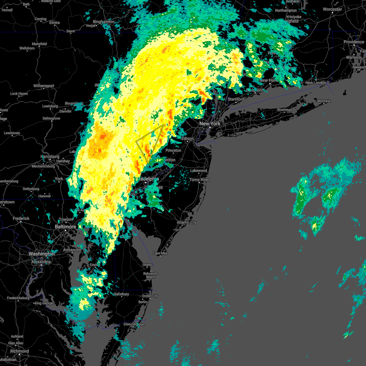 At 1151 pm edt, severe thunderstorms were located along a line extending from frenchtown to near broomall, moving northeast at 35 mph (radar indicated). Hazards include 60 mph wind gusts and penny size hail. Damage to roofs, siding, trees, and power lines is possible. Locations impacted include, doylestown, byram, bedminster, tinicum, high bridge, clinton, dublin, glen gardner, ferndale, frenchtown, milford, riegelsville, pleasant valley, revere, ottsville, pipersville, erwinna, gardenville, lumberville and annandale. At 1151 pm edt, severe thunderstorms were located along a line extending from frenchtown to near broomall, moving northeast at 35 mph (radar indicated). Hazards include 60 mph wind gusts and penny size hail. Damage to roofs, siding, trees, and power lines is possible. Locations impacted include, doylestown, byram, bedminster, tinicum, high bridge, clinton, dublin, glen gardner, ferndale, frenchtown, milford, riegelsville, pleasant valley, revere, ottsville, pipersville, erwinna, gardenville, lumberville and annandale.
|
| 11/2/2018 11:14 PM EDT |
 At 1114 pm edt, severe thunderstorms were located along a line extending from near green lane to north star, moving northeast at 35 mph (radar indicated). Hazards include 60 mph wind gusts and penny size hail. Damage to roofs, siding, trees, and power lines is possible. Locations impacted include, philadelphia, wilmington, newark, west chester, norristown, chester, pottstown, phoenixville, lansdale, west norriton, east norriton, yeadon, westtown, quakertown, perkasie, doylestown, byram, downingtown, conshohocken and souderton. At 1114 pm edt, severe thunderstorms were located along a line extending from near green lane to north star, moving northeast at 35 mph (radar indicated). Hazards include 60 mph wind gusts and penny size hail. Damage to roofs, siding, trees, and power lines is possible. Locations impacted include, philadelphia, wilmington, newark, west chester, norristown, chester, pottstown, phoenixville, lansdale, west norriton, east norriton, yeadon, westtown, quakertown, perkasie, doylestown, byram, downingtown, conshohocken and souderton.
|
| 11/2/2018 10:53 PM EDT |
 At 1052 pm edt, severe thunderstorms were located along a line extending from near pottstown to pleasant hill, moving northeast at 35 mph (radar indicated). Hazards include 60 mph wind gusts and penny size hail. damage to roofs, siding, trees, and power lines is possible At 1052 pm edt, severe thunderstorms were located along a line extending from near pottstown to pleasant hill, moving northeast at 35 mph (radar indicated). Hazards include 60 mph wind gusts and penny size hail. damage to roofs, siding, trees, and power lines is possible
|
| 8/17/2018 8:35 PM EDT |
 At 835 pm edt, severe thunderstorms were located along a line extending from near newton to succasunna-kenvil to near byram, moving northeast at 40 mph (radar indicated). Hazards include 70 mph wind gusts. Expect considerable tree damage. damage is likely to mobile homes, roofs, and outbuildings. Locations impacted include, morristown, somerville, newton, bridgewater, dover, hopatcong, manville, hackettstown, wharton, washington, rockaway, morris plains, mount arlington, franklin, mendham, flemington, mountain lakes, tinicum, high bridge and stanhope. At 835 pm edt, severe thunderstorms were located along a line extending from near newton to succasunna-kenvil to near byram, moving northeast at 40 mph (radar indicated). Hazards include 70 mph wind gusts. Expect considerable tree damage. damage is likely to mobile homes, roofs, and outbuildings. Locations impacted include, morristown, somerville, newton, bridgewater, dover, hopatcong, manville, hackettstown, wharton, washington, rockaway, morris plains, mount arlington, franklin, mendham, flemington, mountain lakes, tinicum, high bridge and stanhope.
|
| 8/17/2018 8:17 PM EDT |
 At 816 pm edt, severe thunderstorms were located along a line extending from blairstown to beatyestown to milford, moving northeast at 40 mph (radar indicated). Hazards include 60 mph wind gusts. damage to roofs, siding, trees, and power lines is possible At 816 pm edt, severe thunderstorms were located along a line extending from blairstown to beatyestown to milford, moving northeast at 40 mph (radar indicated). Hazards include 60 mph wind gusts. damage to roofs, siding, trees, and power lines is possible
|
| 8/13/2018 9:55 PM EDT |
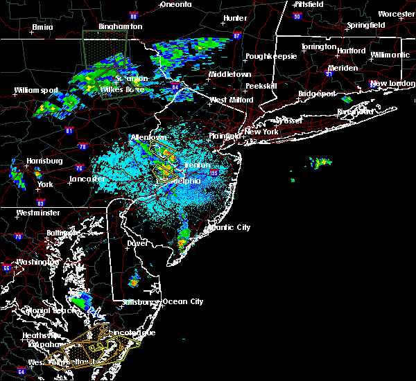 The severe thunderstorm warning for southwestern hunterdon and north central bucks counties will expire at 1000 pm edt, the storm which prompted the warning is weakening. therefore, the warning will be allowed to expire. however locally gusty winds and heavy rain are still possible with this thunderstorm. The severe thunderstorm warning for southwestern hunterdon and north central bucks counties will expire at 1000 pm edt, the storm which prompted the warning is weakening. therefore, the warning will be allowed to expire. however locally gusty winds and heavy rain are still possible with this thunderstorm.
|
| 8/13/2018 9:45 PM EDT |
 At 945 pm edt, a severe thunderstorm was located over byram, or 19 miles southeast of easton, moving northeast at 20 mph. it will not take as much wind to down some trees due to the saturated ground (radar indicated). Hazards include 60 mph wind gusts. Damage to roofs, siding, trees, and power lines is possible. Locations impacted include, byram, tinicum, ferndale, frenchtown, milford, riegelsville, stockton, revere, ottsville, sergeantsville, erwinna, lumberville and sand brook. At 945 pm edt, a severe thunderstorm was located over byram, or 19 miles southeast of easton, moving northeast at 20 mph. it will not take as much wind to down some trees due to the saturated ground (radar indicated). Hazards include 60 mph wind gusts. Damage to roofs, siding, trees, and power lines is possible. Locations impacted include, byram, tinicum, ferndale, frenchtown, milford, riegelsville, stockton, revere, ottsville, sergeantsville, erwinna, lumberville and sand brook.
|
| 8/13/2018 9:16 PM EDT |
 At 916 pm edt, a severe thunderstorm was located over dublin, or 22 miles southeast of allentown, moving northeast at 20 mph. it will not take as much wind to down some trees due to the saturated ground (radar indicated). Hazards include 60 mph wind gusts. damage to roofs, siding, trees, and power lines is possible At 916 pm edt, a severe thunderstorm was located over dublin, or 22 miles southeast of allentown, moving northeast at 20 mph. it will not take as much wind to down some trees due to the saturated ground (radar indicated). Hazards include 60 mph wind gusts. damage to roofs, siding, trees, and power lines is possible
|
| 8/13/2018 9:16 PM EDT |
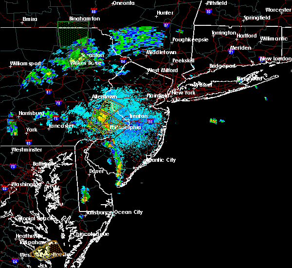 At 916 pm edt, a severe thunderstorm was located over dublin, or 22 miles southeast of allentown, moving northeast at 20 mph. it will not take as much wind to down some trees due to the saturated ground (radar indicated). Hazards include 60 mph wind gusts. damage to roofs, siding, trees, and power lines is possible At 916 pm edt, a severe thunderstorm was located over dublin, or 22 miles southeast of allentown, moving northeast at 20 mph. it will not take as much wind to down some trees due to the saturated ground (radar indicated). Hazards include 60 mph wind gusts. damage to roofs, siding, trees, and power lines is possible
|
| 8/1/2018 11:03 PM EDT |
 At 1102 pm edt, severe thunderstorms were located along a line extending from near harmony to riegelsville to perkasie, moving east at 40 mph (radar indicated). Hazards include 60 mph wind gusts. Damage to roofs, siding, trees, and power lines is possible. Locations impacted include, easton, bethlehem, forks, quakertown, perkasie, byram, wilson, bedminster, washington, hellertown, nazareth, tinicum, high bridge, clinton, harmony, oxford, alpha, dublin, glen gardner and ferndale. At 1102 pm edt, severe thunderstorms were located along a line extending from near harmony to riegelsville to perkasie, moving east at 40 mph (radar indicated). Hazards include 60 mph wind gusts. Damage to roofs, siding, trees, and power lines is possible. Locations impacted include, easton, bethlehem, forks, quakertown, perkasie, byram, wilson, bedminster, washington, hellertown, nazareth, tinicum, high bridge, clinton, harmony, oxford, alpha, dublin, glen gardner and ferndale.
|
| 8/1/2018 10:40 PM EDT |
 At 1039 pm edt, severe thunderstorms were located along a line extending from kunkletown to allentown to near bally, moving east at 40 mph (radar indicated). Hazards include 60 mph wind gusts. damage to roofs, siding, trees, and power lines is possible At 1039 pm edt, severe thunderstorms were located along a line extending from kunkletown to allentown to near bally, moving east at 40 mph (radar indicated). Hazards include 60 mph wind gusts. damage to roofs, siding, trees, and power lines is possible
|
| 6/18/2018 8:15 PM EDT |
 At 813 pm edt, severe thunderstorms were located along a line extending from near morristown to near flemington, moving east at 40 mph (radar indicated). Hazards include 60 mph wind gusts. Damage to roofs, siding, trees, and power lines is possible. Locations impacted include, morristown, somerville, bridgewater, madison, middlesex, florham park, east hanover, bound brook, manville, chatham, morris plains, mendham, flemington, high bridge, clinton, peapack and gladstone, frenchtown, lebanon, milford and far hills. At 813 pm edt, severe thunderstorms were located along a line extending from near morristown to near flemington, moving east at 40 mph (radar indicated). Hazards include 60 mph wind gusts. Damage to roofs, siding, trees, and power lines is possible. Locations impacted include, morristown, somerville, bridgewater, madison, middlesex, florham park, east hanover, bound brook, manville, chatham, morris plains, mendham, flemington, high bridge, clinton, peapack and gladstone, frenchtown, lebanon, milford and far hills.
|
| 6/18/2018 7:30 PM EDT |
 At 729 pm edt, severe thunderstorms were located along a line extending from near ogdensburg in new jersey to near allentown in pennsylvania, moving east at 40 mph (radar indicated). Hazards include 60 mph wind gusts. damage to roofs, siding, trees, and power lines is possible At 729 pm edt, severe thunderstorms were located along a line extending from near ogdensburg in new jersey to near allentown in pennsylvania, moving east at 40 mph (radar indicated). Hazards include 60 mph wind gusts. damage to roofs, siding, trees, and power lines is possible
|
| 5/15/2018 5:10 PM EDT |
 At 510 pm edt, severe thunderstorms were located along a line extending from new york to near glenmoore, moving southeast at 25 mph (radar indicated). Hazards include 70 mph wind gusts and quarter size hail. Minor damage to vehicles is possible. expect considerable tree damage. wind damage is also likely to mobile homes, roofs, and outbuildings. Locations impacted include, allentown, reading, new brunswick, perth amboy, morristown, somerville, somerset, edison, bethlehem, east brunswick, bridgewater, south brunswick, sayreville, north brunswick, ewing, norristown, carteret, pottstown, dover and phoenixville. At 510 pm edt, severe thunderstorms were located along a line extending from new york to near glenmoore, moving southeast at 25 mph (radar indicated). Hazards include 70 mph wind gusts and quarter size hail. Minor damage to vehicles is possible. expect considerable tree damage. wind damage is also likely to mobile homes, roofs, and outbuildings. Locations impacted include, allentown, reading, new brunswick, perth amboy, morristown, somerville, somerset, edison, bethlehem, east brunswick, bridgewater, south brunswick, sayreville, north brunswick, ewing, norristown, carteret, pottstown, dover and phoenixville.
|
| 5/15/2018 4:41 PM EDT |
 At 441 pm edt, severe thunderstorms were located along a line extending from near hawthorne to spring ridge, moving east at 55 mph (radar indicated). Hazards include 70 mph wind gusts and quarter size hail. Minor damage to vehicles is possible. expect considerable tree damage. Wind damage is also likely to mobile homes, roofs, and outbuildings. At 441 pm edt, severe thunderstorms were located along a line extending from near hawthorne to spring ridge, moving east at 55 mph (radar indicated). Hazards include 70 mph wind gusts and quarter size hail. Minor damage to vehicles is possible. expect considerable tree damage. Wind damage is also likely to mobile homes, roofs, and outbuildings.
|
| 9/5/2017 6:26 PM EDT |
 At 625 pm edt, severe thunderstorms were located along a line extending from pen argyl to springtown to perkasie, moving east at 45 mph (doppler radar and trained weather spotters. these storms have produced wind damage across berks and upper portions of montgomery county). Hazards include 60 mph wind gusts and penny size hail. Expect damage to trees and power lines. severe thunderstorms will be near, bangor, pen argyl, wind gap, belfast and east bangor around 630 pm edt. ferndale, riegelsville, glendon and revere around 635 pm edt. tinicum, belvidere, alpha, milford, pipersville, columbia, ottsville and gardenville around 640 pm edt. byram, oxford, frenchtown, bloomsbury, lumberville and erwinna around 645 pm edt. hope, stockton, sergeantsville and great meadows-vienna around 650 pm edt. hackettstown, clinton, glen gardner, hampton, sand brook, annandale and allamuchy-panther valley around 655 pm edt. flemington, high bridge, lebanon and greendell around 700 pm edt. stanhope, netcong, califon, andover, cloverhill, white house station and budd lake around 705 pm edt. Other locations impacted by these severe thunderstorms include coopersburg, portland, sellersville, raritan, beattyestown, bernardsville, richlandtown, stockertown, silverdale and eastlawn gardens. At 625 pm edt, severe thunderstorms were located along a line extending from pen argyl to springtown to perkasie, moving east at 45 mph (doppler radar and trained weather spotters. these storms have produced wind damage across berks and upper portions of montgomery county). Hazards include 60 mph wind gusts and penny size hail. Expect damage to trees and power lines. severe thunderstorms will be near, bangor, pen argyl, wind gap, belfast and east bangor around 630 pm edt. ferndale, riegelsville, glendon and revere around 635 pm edt. tinicum, belvidere, alpha, milford, pipersville, columbia, ottsville and gardenville around 640 pm edt. byram, oxford, frenchtown, bloomsbury, lumberville and erwinna around 645 pm edt. hope, stockton, sergeantsville and great meadows-vienna around 650 pm edt. hackettstown, clinton, glen gardner, hampton, sand brook, annandale and allamuchy-panther valley around 655 pm edt. flemington, high bridge, lebanon and greendell around 700 pm edt. stanhope, netcong, califon, andover, cloverhill, white house station and budd lake around 705 pm edt. Other locations impacted by these severe thunderstorms include coopersburg, portland, sellersville, raritan, beattyestown, bernardsville, richlandtown, stockertown, silverdale and eastlawn gardens.
|
| 8/22/2017 9:45 PM EDT | Trees down and wires sparking on milford warren glen road. times estimated from rada in hunterdon county NJ, 3.1 miles SE of Milford, NJ |
| 8/22/2017 9:42 PM EDT |
 At 941 pm edt, severe thunderstorms were located along a line extending from beatyestown to near erwinna to near green lane, moving east at 40 mph. this line of storms has a history of producing wind damage in much of eastern pennsylvania (radar indicated). Hazards include 70 mph wind gusts and penny size hail. Expect considerable tree damage. Damage is likely to mobile homes, roofs, and outbuildings. At 941 pm edt, severe thunderstorms were located along a line extending from beatyestown to near erwinna to near green lane, moving east at 40 mph. this line of storms has a history of producing wind damage in much of eastern pennsylvania (radar indicated). Hazards include 70 mph wind gusts and penny size hail. Expect considerable tree damage. Damage is likely to mobile homes, roofs, and outbuildings.
|
| 8/22/2017 9:35 PM EDT | Tree and wires down and on fire. times estimated from rada in hunterdon county NJ, 3.7 miles WSW of Milford, NJ |
| 8/22/2017 9:34 PM EDT |
 At 933 pm edt, severe thunderstorms were located along a line extending from washington to ottsville to near bally, moving east at 50 mph. trees have been reported down in several locations in northampton county (radar indicated). Hazards include 70 mph wind gusts and quarter size hail. Minor damage to vehicles is possible. expect considerable tree damage. wind damage is also likely to mobile homes, roofs, and outbuildings. Locations impacted include, reading, easton, bethlehem, norristown, pottstown, phoenixville, lansdale, west norriton, east norriton, wyomissing, quakertown, perkasie, doylestown, byram, wilson, souderton, bedminster, washington, hellertown and birdsboro. At 933 pm edt, severe thunderstorms were located along a line extending from washington to ottsville to near bally, moving east at 50 mph. trees have been reported down in several locations in northampton county (radar indicated). Hazards include 70 mph wind gusts and quarter size hail. Minor damage to vehicles is possible. expect considerable tree damage. wind damage is also likely to mobile homes, roofs, and outbuildings. Locations impacted include, reading, easton, bethlehem, norristown, pottstown, phoenixville, lansdale, west norriton, east norriton, wyomissing, quakertown, perkasie, doylestown, byram, wilson, souderton, bedminster, washington, hellertown and birdsboro.
|
| 8/22/2017 9:12 PM EDT |
 At 912 pm edt, severe thunderstorms were located along a line extending from near belvidere to bechtelsville, moving east at 55 mph (radar indicated). Hazards include 70 mph wind gusts and quarter size hail. Minor damage to vehicles is possible. expect considerable tree damage. wind damage is also likely to mobile homes, roofs, and outbuildings. Locations impacted include, allentown, reading, easton, bethlehem, norristown, pottstown, phoenixville, lansdale, west norriton, forks, east norriton, emmaus, wyomissing, northampton, quakertown, perkasie, doylestown, byram, wilson and souderton. At 912 pm edt, severe thunderstorms were located along a line extending from near belvidere to bechtelsville, moving east at 55 mph (radar indicated). Hazards include 70 mph wind gusts and quarter size hail. Minor damage to vehicles is possible. expect considerable tree damage. wind damage is also likely to mobile homes, roofs, and outbuildings. Locations impacted include, allentown, reading, easton, bethlehem, norristown, pottstown, phoenixville, lansdale, west norriton, forks, east norriton, emmaus, wyomissing, northampton, quakertown, perkasie, doylestown, byram, wilson and souderton.
|
| 8/22/2017 8:58 PM EDT |
 At 845 pm edt, severe thunderstorms were located along a line extending from kunkletown to near spring ridge, moving east at 55 mph (radar indicated). Hazards include golf ball size hail and 70 mph wind gusts. People and animals outdoors will be injured. expect hail damage to roofs, siding, windows, and vehicles. expect considerable tree damage. Wind damage is also likely to mobile homes, roofs, and outbuildings. At 845 pm edt, severe thunderstorms were located along a line extending from kunkletown to near spring ridge, moving east at 55 mph (radar indicated). Hazards include golf ball size hail and 70 mph wind gusts. People and animals outdoors will be injured. expect hail damage to roofs, siding, windows, and vehicles. expect considerable tree damage. Wind damage is also likely to mobile homes, roofs, and outbuildings.
|
| 8/22/2017 8:58 PM EDT |
 At 856 pm edt, severe thunderstorms were located along a line extending from pen argyl to near laureldale, moving east at 55 mph (radar indicated. a report from social media showed dime size hail in kutztown). Hazards include 70 mph wind gusts and ping pong ball size hail. People and animals outdoors will be injured. expect hail damage to roofs, siding, windows, and vehicles. expect considerable tree damage. wind damage is also likely to mobile homes, roofs, and outbuildings. Locations impacted include, allentown, reading, easton, bethlehem, norristown, pottstown, phoenixville, lansdale, west norriton, forks, east norriton, emmaus, wyomissing, northampton, quakertown, perkasie, doylestown, byram, wilson and souderton. At 856 pm edt, severe thunderstorms were located along a line extending from pen argyl to near laureldale, moving east at 55 mph (radar indicated. a report from social media showed dime size hail in kutztown). Hazards include 70 mph wind gusts and ping pong ball size hail. People and animals outdoors will be injured. expect hail damage to roofs, siding, windows, and vehicles. expect considerable tree damage. wind damage is also likely to mobile homes, roofs, and outbuildings. Locations impacted include, allentown, reading, easton, bethlehem, norristown, pottstown, phoenixville, lansdale, west norriton, forks, east norriton, emmaus, wyomissing, northampton, quakertown, perkasie, doylestown, byram, wilson and souderton.
|
| 8/22/2017 8:45 PM EDT |
 At 845 pm edt, severe thunderstorms were located along a line extending from kunkletown to near spring ridge, moving east at 55 mph (radar indicated). Hazards include golf ball size hail and 70 mph wind gusts. People and animals outdoors will be injured. expect hail damage to roofs, siding, windows, and vehicles. expect considerable tree damage. Wind damage is also likely to mobile homes, roofs, and outbuildings. At 845 pm edt, severe thunderstorms were located along a line extending from kunkletown to near spring ridge, moving east at 55 mph (radar indicated). Hazards include golf ball size hail and 70 mph wind gusts. People and animals outdoors will be injured. expect hail damage to roofs, siding, windows, and vehicles. expect considerable tree damage. Wind damage is also likely to mobile homes, roofs, and outbuildings.
|
| 8/2/2017 2:04 PM EDT |
 At 204 pm edt, a severe thunderstorm was located over revere, or 12 miles south of easton, moving east at 10 mph (radar indicated). Hazards include 60 mph wind gusts and quarter size hail. Minor damage to vehicles is possible. Expect damage to trees and power lines. At 204 pm edt, a severe thunderstorm was located over revere, or 12 miles south of easton, moving east at 10 mph (radar indicated). Hazards include 60 mph wind gusts and quarter size hail. Minor damage to vehicles is possible. Expect damage to trees and power lines.
|
| 7/20/2017 7:24 PM EDT |
 At 722 pm edt, a severe thunderstorm was located over milford, or 11 miles southeast of easton, moving southeast at 35 mph (radar indicated). Hazards include 60 mph wind gusts. Expect damage to trees and power lines. this severe storm will be near, byram around 735 pm edt. flemington, stockton, sergeantsville, sand brook and lumberville around 740 pm edt. new hope around 750 pm edt. ewing, pennington, yardley, hopewell, washington crossing, washington crossing, woodside and skillman around 800 pm edt. Other locations impacted by this severe thunderstorm include churchville, hulmeville, sellersville, raritan, fountain hill, richlandtown, silverdale, lambertville, woodbourne and village shires. At 722 pm edt, a severe thunderstorm was located over milford, or 11 miles southeast of easton, moving southeast at 35 mph (radar indicated). Hazards include 60 mph wind gusts. Expect damage to trees and power lines. this severe storm will be near, byram around 735 pm edt. flemington, stockton, sergeantsville, sand brook and lumberville around 740 pm edt. new hope around 750 pm edt. ewing, pennington, yardley, hopewell, washington crossing, washington crossing, woodside and skillman around 800 pm edt. Other locations impacted by this severe thunderstorm include churchville, hulmeville, sellersville, raritan, fountain hill, richlandtown, silverdale, lambertville, woodbourne and village shires.
|
| 7/20/2017 7:00 PM EDT |
 At 700 pm edt, severe thunderstorms were located along a line extending from near belfast to bethlehem to new mahoning, moving southeast at 35 mph (radar indicated). Hazards include 60 mph wind gusts. Expect damage to trees and power lines. severe thunderstorms will be near, bethlehem, hellertown, nazareth, bangor, pen argyl, wind gap, belfast, tatamy, east bangor and steuben around 705 pm edt. easton, forks, wilson, harmony, west easton and roxburg around 710 pm edt. riegelsville, glendon, pleasant valley, springtown and emerald around 715 pm edt. alpha, ferndale and pleasant valley around 720 pm edt. glen gardner, hampton, bloomsbury, claussville, revere, schnecksville and neffs around 725 pm edt. bedminster, milford, ottsville, coffeetown and erwinna around 730 pm edt. allentown, tinicum, clinton, dublin, frenchtown, pipersville and annandale around 735 pm edt. emmaus, byram, ancient oaks, gardenville and lumberville around 740 pm edt. Other locations impacted by these severe thunderstorms include churchville, hulmeville, hokendauqua, stockertown, eastlawn gardens, north catasauqua, village shires, freemansburg, new britain and roseto. At 700 pm edt, severe thunderstorms were located along a line extending from near belfast to bethlehem to new mahoning, moving southeast at 35 mph (radar indicated). Hazards include 60 mph wind gusts. Expect damage to trees and power lines. severe thunderstorms will be near, bethlehem, hellertown, nazareth, bangor, pen argyl, wind gap, belfast, tatamy, east bangor and steuben around 705 pm edt. easton, forks, wilson, harmony, west easton and roxburg around 710 pm edt. riegelsville, glendon, pleasant valley, springtown and emerald around 715 pm edt. alpha, ferndale and pleasant valley around 720 pm edt. glen gardner, hampton, bloomsbury, claussville, revere, schnecksville and neffs around 725 pm edt. bedminster, milford, ottsville, coffeetown and erwinna around 730 pm edt. allentown, tinicum, clinton, dublin, frenchtown, pipersville and annandale around 735 pm edt. emmaus, byram, ancient oaks, gardenville and lumberville around 740 pm edt. Other locations impacted by these severe thunderstorms include churchville, hulmeville, hokendauqua, stockertown, eastlawn gardens, north catasauqua, village shires, freemansburg, new britain and roseto.
|
| 7/1/2017 5:32 PM EDT |
 At 531 pm edt, severe thunderstorms were located along a line extending from washington to robesonia, moving east at 35 mph (radar indicated). Hazards include 60 mph wind gusts and penny size hail. Expect damage to trees and power lines. Locations impacted include, easton, bridgewater, ewing, dover, forks, hackettstown, perkasie, doylestown, byram, wilson, bedminster, wharton, washington, rockaway, mount arlington, mendham, flemington, tinicum, high bridge and stanhope. At 531 pm edt, severe thunderstorms were located along a line extending from washington to robesonia, moving east at 35 mph (radar indicated). Hazards include 60 mph wind gusts and penny size hail. Expect damage to trees and power lines. Locations impacted include, easton, bridgewater, ewing, dover, forks, hackettstown, perkasie, doylestown, byram, wilson, bedminster, wharton, washington, rockaway, mount arlington, mendham, flemington, tinicum, high bridge and stanhope.
|
| 7/1/2017 5:08 PM EDT |
 At 507 pm edt, severe thunderstorms were located along a line extending from near belfast to near perkasie, moving east at 40 mph (radar indicated). Hazards include 60 mph wind gusts and quarter size hail. Minor damage to vehicles is possible. Expect damage to trees and power lines. At 507 pm edt, severe thunderstorms were located along a line extending from near belfast to near perkasie, moving east at 40 mph (radar indicated). Hazards include 60 mph wind gusts and quarter size hail. Minor damage to vehicles is possible. Expect damage to trees and power lines.
|
| 7/1/2017 4:57 PM EDT |
 At 456 pm edt, severe thunderstorms were located along a line extending from bloomsbury to springtown to near marshallton, moving east at 40 mph (trained weather spotters). Hazards include 65 mph wind gusts and quarter size hail. Minor damage to vehicles is possible. expect damage to trees and power lines. Locations impacted include, allentown, easton, west chester, bethlehem, norristown, pottstown, phoenixville, lansdale, west norriton, forks, east norriton, coatesville, emmaus, westtown, northampton, quakertown, perkasie, doylestown, byram and wilson. At 456 pm edt, severe thunderstorms were located along a line extending from bloomsbury to springtown to near marshallton, moving east at 40 mph (trained weather spotters). Hazards include 65 mph wind gusts and quarter size hail. Minor damage to vehicles is possible. expect damage to trees and power lines. Locations impacted include, allentown, easton, west chester, bethlehem, norristown, pottstown, phoenixville, lansdale, west norriton, forks, east norriton, coatesville, emmaus, westtown, northampton, quakertown, perkasie, doylestown, byram and wilson.
|
| 7/1/2017 4:41 PM EDT |
 At 441 pm edt, severe thunderstorms were located along a line extending from old orchard to emmaus to cochranville, moving east at 40 mph (radar indicated). Hazards include 60 mph wind gusts and quarter size hail. Minor damage to vehicles is possible. expect damage to trees and power lines. Locations impacted include, allentown, easton, west chester, bethlehem, norristown, pottstown, phoenixville, lansdale, west norriton, forks, east norriton, coatesville, emmaus, westtown, northampton, quakertown, perkasie, doylestown, byram and wilson. At 441 pm edt, severe thunderstorms were located along a line extending from old orchard to emmaus to cochranville, moving east at 40 mph (radar indicated). Hazards include 60 mph wind gusts and quarter size hail. Minor damage to vehicles is possible. expect damage to trees and power lines. Locations impacted include, allentown, easton, west chester, bethlehem, norristown, pottstown, phoenixville, lansdale, west norriton, forks, east norriton, coatesville, emmaus, westtown, northampton, quakertown, perkasie, doylestown, byram and wilson.
|
| 7/1/2017 4:24 PM EDT |
 At 423 pm edt, severe thunderstorms were located along a line extending from near allentown to topton to near quarryville, moving east at 40 mph (radar indicated). Hazards include 60 mph wind gusts and quarter size hail. Minor damage to vehicles is possible. Expect damage to trees and power lines. At 423 pm edt, severe thunderstorms were located along a line extending from near allentown to topton to near quarryville, moving east at 40 mph (radar indicated). Hazards include 60 mph wind gusts and quarter size hail. Minor damage to vehicles is possible. Expect damage to trees and power lines.
|
| 6/19/2017 4:16 PM EDT |
 At 416 pm edt, severe thunderstorms were located along a line extending from pleasant valley to near bloomsbury to gardenville, moving northeast at 35 mph (radar indicated). Hazards include 60 mph wind gusts. Expect damage to trees and power lines. these severe storms will be near, washington, glen gardner, hampton, brass castle and pleasant valley around 420 pm edt. clinton and annandale around 425 pm edt. high bridge, frenchtown and lebanon around 430 pm edt. califon, beatyestown and white house station around 435 pm edt. sand brook and long valley around 440 pm edt. mendham, flemington, peapack and gladstone, chester, far hills, succasunna and succasunna-kenvil around 445 pm edt. Other locations impacted by these severe thunderstorms include raritan and bernardsville. At 416 pm edt, severe thunderstorms were located along a line extending from pleasant valley to near bloomsbury to gardenville, moving northeast at 35 mph (radar indicated). Hazards include 60 mph wind gusts. Expect damage to trees and power lines. these severe storms will be near, washington, glen gardner, hampton, brass castle and pleasant valley around 420 pm edt. clinton and annandale around 425 pm edt. high bridge, frenchtown and lebanon around 430 pm edt. califon, beatyestown and white house station around 435 pm edt. sand brook and long valley around 440 pm edt. mendham, flemington, peapack and gladstone, chester, far hills, succasunna and succasunna-kenvil around 445 pm edt. Other locations impacted by these severe thunderstorms include raritan and bernardsville.
|
| 6/19/2017 3:56 PM EDT |
 At 356 pm edt, severe thunderstorms were located along a line extending from near harmony to riegelsville to perkasie, moving northeast at 50 mph (radar indicated). Hazards include 60 mph wind gusts. Expect damage to trees and power lines. severe thunderstorms will be near, easton, alpha and milford around 400 pm edt. washington, bloomsbury, pleasant valley and brass castle around 405 pm edt. byram, tinicum, clinton, hampton and ottsville around 410 pm edt. high bridge, glen gardner, frenchtown, lebanon, annandale and erwinna around 415 pm edt. califon, sand brook, long valley and sergeantsville around 420 pm edt. flemington around 425 pm edt. peapack and gladstone, chester, succasunna-kenvil and succasunna around 430 pm edt. dover, wharton, mendham and white house station around 435 pm edt. Other locations impacted by these severe thunderstorms include telford, sellersville, raritan, bernardsville, richlandtown, phillipsburg and silverdale. At 356 pm edt, severe thunderstorms were located along a line extending from near harmony to riegelsville to perkasie, moving northeast at 50 mph (radar indicated). Hazards include 60 mph wind gusts. Expect damage to trees and power lines. severe thunderstorms will be near, easton, alpha and milford around 400 pm edt. washington, bloomsbury, pleasant valley and brass castle around 405 pm edt. byram, tinicum, clinton, hampton and ottsville around 410 pm edt. high bridge, glen gardner, frenchtown, lebanon, annandale and erwinna around 415 pm edt. califon, sand brook, long valley and sergeantsville around 420 pm edt. flemington around 425 pm edt. peapack and gladstone, chester, succasunna-kenvil and succasunna around 430 pm edt. dover, wharton, mendham and white house station around 435 pm edt. Other locations impacted by these severe thunderstorms include telford, sellersville, raritan, bernardsville, richlandtown, phillipsburg and silverdale.
|
| 2/25/2017 4:54 PM EST |
 At 453 pm est, severe thunderstorms were located along a line extending from near werry lake to millbrook to pleasant valley to alpha to ottsville, moving northeast at 80 mph (radar indicated). Hazards include 60 mph wind gusts and penny size hail. Expect damage to roofs, siding, and trees. severe thunderstorms will be near, crandon lakes, five points, flatbrookville and millbrook around 500 pm est. hackettstown, clinton, branchville, annandale, hainesville and pellettown around 505 pm est. montague, high bridge, stanhope, netcong, sussex, lebanon, allamuchy-panther valley, beatyestown, great meadows-vienna and high point around 510 pm est. port jervis, hopatcong, peapack and gladstone, far hills, lake mohawk, long valley and greendell around 515 pm est. newton, mendham, chester, andover and succasunna around 520 pm est. dover, wharton, rockaway, morris plains, mount arlington, ogdensburg, victory gardens, highland lake and succasunna-kenvil around 525 pm est. boonton, franklin, mountain lakes, hamburg, lake telemark, upper greenwood lake, green pond and parsippany around 530 pm est. kinnelon, butler, riverdale, vernon valley and pequannock township around 535 pm est. Other locations impacted by these severe thunderstorms include white meadow lake, hidden lake, beattyestown and bernardsville. At 453 pm est, severe thunderstorms were located along a line extending from near werry lake to millbrook to pleasant valley to alpha to ottsville, moving northeast at 80 mph (radar indicated). Hazards include 60 mph wind gusts and penny size hail. Expect damage to roofs, siding, and trees. severe thunderstorms will be near, crandon lakes, five points, flatbrookville and millbrook around 500 pm est. hackettstown, clinton, branchville, annandale, hainesville and pellettown around 505 pm est. montague, high bridge, stanhope, netcong, sussex, lebanon, allamuchy-panther valley, beatyestown, great meadows-vienna and high point around 510 pm est. port jervis, hopatcong, peapack and gladstone, far hills, lake mohawk, long valley and greendell around 515 pm est. newton, mendham, chester, andover and succasunna around 520 pm est. dover, wharton, rockaway, morris plains, mount arlington, ogdensburg, victory gardens, highland lake and succasunna-kenvil around 525 pm est. boonton, franklin, mountain lakes, hamburg, lake telemark, upper greenwood lake, green pond and parsippany around 530 pm est. kinnelon, butler, riverdale, vernon valley and pequannock township around 535 pm est. Other locations impacted by these severe thunderstorms include white meadow lake, hidden lake, beattyestown and bernardsville.
|
| 2/25/2017 4:41 PM EST |
 At 441 pm est, severe thunderstorms were located along a line extending from near stormville to near belfast to pleasant valley to paoli, moving northeast at 70 mph (radar indicated). Hazards include 60 mph wind gusts and nickel size hail. Expect damage to roofs, siding, and trees. these severe storms will be near, hellertown, bangor, pen argyl, wind gap, ferndale, belfast, tatamy, east bangor, riegelsville and springtown around 445 pm est. easton, forks, east norriton, wilson, collegeville, trappe, belvidere, alpha, west easton and milford around 450 pm est. lansdale, ambler, blairstown, harmony, hope, bloomsbury and great meadows-vienna around 455 pm est. doylestown, souderton, washington, chalfont, hatfield, oxford, dublin, glen gardner, hampton and brass castle around 500 pm est. Other locations impacted by these severe thunderstorms include churchville, stockertown, evansburg, malvern, west goshen, fort washington, bridgeport, blue bell, maple glen and eagleville. At 441 pm est, severe thunderstorms were located along a line extending from near stormville to near belfast to pleasant valley to paoli, moving northeast at 70 mph (radar indicated). Hazards include 60 mph wind gusts and nickel size hail. Expect damage to roofs, siding, and trees. these severe storms will be near, hellertown, bangor, pen argyl, wind gap, ferndale, belfast, tatamy, east bangor, riegelsville and springtown around 445 pm est. easton, forks, east norriton, wilson, collegeville, trappe, belvidere, alpha, west easton and milford around 450 pm est. lansdale, ambler, blairstown, harmony, hope, bloomsbury and great meadows-vienna around 455 pm est. doylestown, souderton, washington, chalfont, hatfield, oxford, dublin, glen gardner, hampton and brass castle around 500 pm est. Other locations impacted by these severe thunderstorms include churchville, stockertown, evansburg, malvern, west goshen, fort washington, bridgeport, blue bell, maple glen and eagleville.
|
| 2/25/2017 4:17 PM EST |
 At 416 pm est, severe thunderstorms were located along a line extending from claussville to near topton to pottstown to near kennett square, moving northeast at 55 mph (radar indicated). Hazards include 60 mph wind gusts and nickel size hail. Expect damage to roofs, siding, and trees. severe thunderstorms will be near, royersford, trappe, topton, bally, bechtelsville, ancient oaks, claussville, coffeetown, gilbertsville and schnecksville around 420 pm est. allentown, emmaus, east greenville, schwenksville, green lane, spring mount and lionville around 425 pm est. westtown, northampton, souderton, hatfield, lehigh university, beersville, cheyney, gradyville, geryville and lionville-marchwood around 430 pm est. bethlehem, quakertown, perkasie, hellertown, bath, steuben, paoli, newtown square, valley forge and springtown around 435 pm est. west norriton, forks, wilson, bedminster, nazareth, dublin, belfast, west easton, tatamy and riegelsville around 440 pm est. easton, norristown, east norriton, conshohocken, narberth, tinicum, pen argyl, wind gap, alpha and ferndale around 445 pm est. byram, ambler, bangor, harmony, frenchtown, milford, east bangor, bloomsbury, stockton and erwinna around 450 pm est. washington, jenkintown, high bridge, belvidere, rockledge, oxford, abington, glen gardner, hampton and brass castle around 455 pm est. Other locations impacted by these severe thunderstorms include boyertown, churchville, pottsgrove, hokendauqua, thorndale, stockertown, evansburg, malvern, west goshen and fort washington. At 416 pm est, severe thunderstorms were located along a line extending from claussville to near topton to pottstown to near kennett square, moving northeast at 55 mph (radar indicated). Hazards include 60 mph wind gusts and nickel size hail. Expect damage to roofs, siding, and trees. severe thunderstorms will be near, royersford, trappe, topton, bally, bechtelsville, ancient oaks, claussville, coffeetown, gilbertsville and schnecksville around 420 pm est. allentown, emmaus, east greenville, schwenksville, green lane, spring mount and lionville around 425 pm est. westtown, northampton, souderton, hatfield, lehigh university, beersville, cheyney, gradyville, geryville and lionville-marchwood around 430 pm est. bethlehem, quakertown, perkasie, hellertown, bath, steuben, paoli, newtown square, valley forge and springtown around 435 pm est. west norriton, forks, wilson, bedminster, nazareth, dublin, belfast, west easton, tatamy and riegelsville around 440 pm est. easton, norristown, east norriton, conshohocken, narberth, tinicum, pen argyl, wind gap, alpha and ferndale around 445 pm est. byram, ambler, bangor, harmony, frenchtown, milford, east bangor, bloomsbury, stockton and erwinna around 450 pm est. washington, jenkintown, high bridge, belvidere, rockledge, oxford, abington, glen gardner, hampton and brass castle around 455 pm est. Other locations impacted by these severe thunderstorms include boyertown, churchville, pottsgrove, hokendauqua, thorndale, stockertown, evansburg, malvern, west goshen and fort washington.
|
| 8/6/2016 5:20 PM EDT |
 At 520 pm edt, severe thunderstorms were located along a line extending from riegelsville to near emmaus, moving southeast at 30 mph (radar indicated). Hazards include 60 mph wind gusts and penny size hail. Expect damage to roofs. siding. and trees. Locations impacted include, allentown, bethlehem, emmaus, quakertown, hellertown, ferndale, riegelsville, pleasant valley, springtown, zionsville, revere, ottsville, lehigh university, erwinna, ancient oaks, catasauqua, fountain hill, macungie, north catasauqua and freemansburg. At 520 pm edt, severe thunderstorms were located along a line extending from riegelsville to near emmaus, moving southeast at 30 mph (radar indicated). Hazards include 60 mph wind gusts and penny size hail. Expect damage to roofs. siding. and trees. Locations impacted include, allentown, bethlehem, emmaus, quakertown, hellertown, ferndale, riegelsville, pleasant valley, springtown, zionsville, revere, ottsville, lehigh university, erwinna, ancient oaks, catasauqua, fountain hill, macungie, north catasauqua and freemansburg.
|
| 8/6/2016 4:59 PM EDT |
 At 459 pm edt, severe thunderstorms were located along a line extending from bethlehem to near claussville, moving east at 25 mph (radar indicated). Hazards include 60 mph wind gusts and penny size hail. Expect damage to roofs. siding. And trees. At 459 pm edt, severe thunderstorms were located along a line extending from bethlehem to near claussville, moving east at 25 mph (radar indicated). Hazards include 60 mph wind gusts and penny size hail. Expect damage to roofs. siding. And trees.
|
| 7/25/2016 6:21 PM EDT |
 At 620 pm edt, a severe thunderstorm was located over milford, or 11 miles southeast of easton, moving east at 50 mph (radar indicated). Hazards include 60 mph wind gusts and penny size hail. Expect damage to roofs. siding. and trees. Locations impacted include, easton, byram, bedminster, washington, flemington, tinicum, high bridge, clinton, harmony, new hope, alpha, glen gardner, ferndale, hampton, frenchtown, lebanon, west easton, milford, califon and bloomsbury. At 620 pm edt, a severe thunderstorm was located over milford, or 11 miles southeast of easton, moving east at 50 mph (radar indicated). Hazards include 60 mph wind gusts and penny size hail. Expect damage to roofs. siding. and trees. Locations impacted include, easton, byram, bedminster, washington, flemington, tinicum, high bridge, clinton, harmony, new hope, alpha, glen gardner, ferndale, hampton, frenchtown, lebanon, west easton, milford, califon and bloomsbury.
|
| 7/25/2016 5:57 PM EDT |
 At 557 pm edt, a severe thunderstorm was located over bethlehem, or near allentown, moving east at 45 mph (radar indicated). Hazards include 70 mph wind gusts and penny size hail. Expect considerable tree damage. Damage is likely to mobile homes, roofs, and outbuildings. At 557 pm edt, a severe thunderstorm was located over bethlehem, or near allentown, moving east at 45 mph (radar indicated). Hazards include 70 mph wind gusts and penny size hail. Expect considerable tree damage. Damage is likely to mobile homes, roofs, and outbuildings.
|
| 7/25/2016 5:06 PM EDT |
 At 506 pm edt, a severe thunderstorm was located near flemington, or 15 miles west of somerville, moving east at 35 mph (radar indicated). Hazards include 60 mph wind gusts and nickel size hail. frequent cloud to ground lightning is occurring. Expect damage to roofs. siding. and trees. Locations impacted include, easton, somerville, bridgewater, dover, hopatcong, manville, hackettstown, wharton, washington, rockaway, hellertown, mount arlington, mendham, flemington, high bridge, stanhope, netcong, clinton, belvidere and harmony. At 506 pm edt, a severe thunderstorm was located near flemington, or 15 miles west of somerville, moving east at 35 mph (radar indicated). Hazards include 60 mph wind gusts and nickel size hail. frequent cloud to ground lightning is occurring. Expect damage to roofs. siding. and trees. Locations impacted include, easton, somerville, bridgewater, dover, hopatcong, manville, hackettstown, wharton, washington, rockaway, hellertown, mount arlington, mendham, flemington, high bridge, stanhope, netcong, clinton, belvidere and harmony.
|
| 7/25/2016 4:55 PM EDT | County communications noted numerous tree damage across the county along with downed pole in hunterdon county NJ, 0.3 miles SSW of Milford, NJ |
| 7/25/2016 4:34 PM EDT |
 At 433 pm edt, severe thunderstorms were located along a line extending from bangor to springtown to near bechtelsville, moving east at 35 mph (radar indicated). Hazards include 60 mph wind gusts and quarter size hail. frequent lightning is occurring. Hail damage to vehicles is expected. Expect wind damage to roofs, siding, and trees. At 433 pm edt, severe thunderstorms were located along a line extending from bangor to springtown to near bechtelsville, moving east at 35 mph (radar indicated). Hazards include 60 mph wind gusts and quarter size hail. frequent lightning is occurring. Hail damage to vehicles is expected. Expect wind damage to roofs, siding, and trees.
|
| 7/18/2016 3:59 PM EDT |
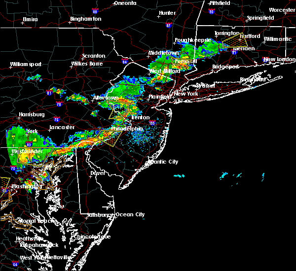 At 358 pm edt, a severe thunderstorm was located over sand brook, or 15 miles southwest of somerville, moving east at 30 mph (radar indicated). Hazards include 60 mph wind gusts and penny size hail. Expect damage to roofs. siding. and trees. Locations impacted include, byram, flemington, frenchtown, milford, stockton, lumberville, sand brook, sergeantsville and lambertville. At 358 pm edt, a severe thunderstorm was located over sand brook, or 15 miles southwest of somerville, moving east at 30 mph (radar indicated). Hazards include 60 mph wind gusts and penny size hail. Expect damage to roofs. siding. and trees. Locations impacted include, byram, flemington, frenchtown, milford, stockton, lumberville, sand brook, sergeantsville and lambertville.
|
| 7/18/2016 3:43 PM EDT |
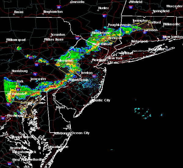 At 343 pm edt, a severe thunderstorm was located over erwinna, or 16 miles southeast of easton, moving east at 40 mph (radar indicated). Hazards include 60 mph wind gusts and penny size hail. Expect damage to roofs. siding. and trees. Locations impacted include, doylestown, byram, flemington, new hope, frenchtown, milford, riegelsville, stockton, lumberville, erwinna, sand brook, gardenville, sergeantsville and lambertville. At 343 pm edt, a severe thunderstorm was located over erwinna, or 16 miles southeast of easton, moving east at 40 mph (radar indicated). Hazards include 60 mph wind gusts and penny size hail. Expect damage to roofs. siding. and trees. Locations impacted include, doylestown, byram, flemington, new hope, frenchtown, milford, riegelsville, stockton, lumberville, erwinna, sand brook, gardenville, sergeantsville and lambertville.
|
| 7/18/2016 3:25 PM EDT |
 At 325 pm edt, a severe thunderstorm was located over pleasant valley, or 12 miles southeast of allentown, moving east at 30 mph (radar indicated). Hazards include 60 mph wind gusts and penny size hail. Expect damage to roofs. siding. And trees. At 325 pm edt, a severe thunderstorm was located over pleasant valley, or 12 miles southeast of allentown, moving east at 30 mph (radar indicated). Hazards include 60 mph wind gusts and penny size hail. Expect damage to roofs. siding. And trees.
|
| 7/18/2016 2:51 PM EDT |
 At 250 pm edt, a severe thunderstorm was located near ancient oaks, or near allentown, moving southeast at 50 mph (radar indicated). Hazards include 60 mph wind gusts and nickel size hail. Expect damage to roofs. siding. And trees. At 250 pm edt, a severe thunderstorm was located near ancient oaks, or near allentown, moving southeast at 50 mph (radar indicated). Hazards include 60 mph wind gusts and nickel size hail. Expect damage to roofs. siding. And trees.
|
| 7/18/2016 2:51 PM EDT |
 The national weather service in mount holly nj has issued a * severe thunderstorm warning for. southwestern hunterdon county in northwestern new jersey. southwestern northampton county in eastern pennsylvania. eastern lehigh county in eastern pennsylvania. Northeastern berks county in eastern pennsylvania. The national weather service in mount holly nj has issued a * severe thunderstorm warning for. southwestern hunterdon county in northwestern new jersey. southwestern northampton county in eastern pennsylvania. eastern lehigh county in eastern pennsylvania. Northeastern berks county in eastern pennsylvania.
|
| 7/9/2016 8:53 PM EDT |
 At 852 pm edt, severe thunderstorms were located along a line extending from milford to quakertown, moving east at 25 mph (radar indicated). Hazards include 60 mph wind gusts. Expect damage to roofs. siding. and trees. Locations impacted include, quakertown, perkasie, doylestown, byram, bedminster, flemington, chalfont, tinicum, new hope, dublin, ferndale, frenchtown, milford, stockton, fricks, sand brook, gardenville, sergeantsville, revere and ottsville. At 852 pm edt, severe thunderstorms were located along a line extending from milford to quakertown, moving east at 25 mph (radar indicated). Hazards include 60 mph wind gusts. Expect damage to roofs. siding. and trees. Locations impacted include, quakertown, perkasie, doylestown, byram, bedminster, flemington, chalfont, tinicum, new hope, dublin, ferndale, frenchtown, milford, stockton, fricks, sand brook, gardenville, sergeantsville, revere and ottsville.
|
| 7/9/2016 8:37 PM EDT |
 At 836 pm edt, severe thunderstorms were located along a line extending from ferndale to geryville, moving east at 30 mph (radar indicated). Hazards include 60 mph wind gusts. Expect damage to roofs. siding. and trees. Locations impacted include, easton, bethlehem, lansdale, quakertown, perkasie, doylestown, byram, souderton, bedminster, hellertown, flemington, chalfont, tinicum, hatfield, east greenville, clinton, new hope, dublin, ferndale and frenchtown. At 836 pm edt, severe thunderstorms were located along a line extending from ferndale to geryville, moving east at 30 mph (radar indicated). Hazards include 60 mph wind gusts. Expect damage to roofs. siding. and trees. Locations impacted include, easton, bethlehem, lansdale, quakertown, perkasie, doylestown, byram, souderton, bedminster, hellertown, flemington, chalfont, tinicum, hatfield, east greenville, clinton, new hope, dublin, ferndale and frenchtown.
|
| 7/9/2016 8:14 PM EDT |
 At 814 pm edt, severe thunderstorms were located along a line extending from bethlehem to near bechtelsville, moving east at 30 mph (radar indicated). Hazards include 60 mph wind gusts. Expect damage to roofs. siding. And trees. At 814 pm edt, severe thunderstorms were located along a line extending from bethlehem to near bechtelsville, moving east at 30 mph (radar indicated). Hazards include 60 mph wind gusts. Expect damage to roofs. siding. And trees.
|
| 6/8/2016 11:52 AM EDT |
 At 1151 am edt, a severe thunderstorm was located over new hope, or 11 miles northwest of trenton, moving east at 45 mph (radar indicated). Hazards include 60 mph wind gusts. Expect damage to roofs. siding. and trees. Locations impacted include, trenton, new brunswick, somerville, somerset, east brunswick, bridgewater, south brunswick, north brunswick, ewing, lansdale, middlesex, princeton, bound brook, manville, doylestown, byram, bedminster, hightstown, flemington and chalfont. At 1151 am edt, a severe thunderstorm was located over new hope, or 11 miles northwest of trenton, moving east at 45 mph (radar indicated). Hazards include 60 mph wind gusts. Expect damage to roofs. siding. and trees. Locations impacted include, trenton, new brunswick, somerville, somerset, east brunswick, bridgewater, south brunswick, north brunswick, ewing, lansdale, middlesex, princeton, bound brook, manville, doylestown, byram, bedminster, hightstown, flemington and chalfont.
|
| 6/8/2016 11:33 AM EDT |
 At 1132 am edt, a severe thunderstorm was located over robesonia, or 22 miles south of easton, moving east at 45 mph (radar indicated). Hazards include 60 mph wind gusts. Expect damage to roofs. siding. And trees. At 1132 am edt, a severe thunderstorm was located over robesonia, or 22 miles south of easton, moving east at 45 mph (radar indicated). Hazards include 60 mph wind gusts. Expect damage to roofs. siding. And trees.
|
| 4/1/2016 5:59 PM EDT |
 At 557 pm edt, doppler radar indicated a severe thunderstorm capable of producing quarter size hail and damaging winds in excess of 60 mph. this storm was located over tinicum, or 17 miles south of easton, moving northeast at 50 mph. locations impacted include, quakertown, perkasie, byram, bedminster, flemington, tinicum, clinton, new hope, dublin, ferndale, frenchtown, milford, stockton, fricks, sand brook, gardenville, sergeantsville, revere, ottsville and lumberville. At 557 pm edt, doppler radar indicated a severe thunderstorm capable of producing quarter size hail and damaging winds in excess of 60 mph. this storm was located over tinicum, or 17 miles south of easton, moving northeast at 50 mph. locations impacted include, quakertown, perkasie, byram, bedminster, flemington, tinicum, clinton, new hope, dublin, ferndale, frenchtown, milford, stockton, fricks, sand brook, gardenville, sergeantsville, revere, ottsville and lumberville.
|
| 4/1/2016 5:45 PM EDT |
 At 544 pm edt, doppler radar indicated a severe thunderstorm capable of producing quarter size hail and damaging winds in excess of 60 mph. this storm was located over green lane, or 17 miles south of allentown, and moving northeast at 50 mph. At 544 pm edt, doppler radar indicated a severe thunderstorm capable of producing quarter size hail and damaging winds in excess of 60 mph. this storm was located over green lane, or 17 miles south of allentown, and moving northeast at 50 mph.
|
| 2/16/2016 12:48 PM EST |
 At 1245 pm est, doppler radar indicated a line of severe thunderstorms capable of producing destructive winds in excess of 70 mph. these storms were located along a line extending from near souderton to ben franklin bridge to near monroe township, moving north at 75 mph. the strongest segment within the line of storm is currently moving through western camden and philadelphia. locations impacted include, philadelphia, trenton, camden, vineland, gloucester city, cherry hill, bensalem, evesham, mount laurel, ewing, willingboro, deptford, voorhees, medford, glassboro, lindenwold, lansdale, hammonton, east norriton and lumberton. At 1245 pm est, doppler radar indicated a line of severe thunderstorms capable of producing destructive winds in excess of 70 mph. these storms were located along a line extending from near souderton to ben franklin bridge to near monroe township, moving north at 75 mph. the strongest segment within the line of storm is currently moving through western camden and philadelphia. locations impacted include, philadelphia, trenton, camden, vineland, gloucester city, cherry hill, bensalem, evesham, mount laurel, ewing, willingboro, deptford, voorhees, medford, glassboro, lindenwold, lansdale, hammonton, east norriton and lumberton.
|
| 2/16/2016 12:29 PM EST |
 At 1228 pm est, doppler radar indicated a line of severe thunderstorms capable of producing damaging winds in excess of 60 mph. these storms were located along a line extending from royersford to elmer to near laurel lake, and moving north at 75 mph. At 1228 pm est, doppler radar indicated a line of severe thunderstorms capable of producing damaging winds in excess of 60 mph. these storms were located along a line extending from royersford to elmer to near laurel lake, and moving north at 75 mph.
|
| 7/9/2015 7:54 PM EDT |
 At 753 pm edt, doppler radar indicated a severe thunderstorm capable of producing damaging winds in excess of 60 mph. this storm was located over alpha, or near easton, moving east at 45 mph. locations impacted include, allentown, easton, bethlehem, forks, emmaus, northampton, wilson, washington, hellertown, nazareth, bangor, high bridge, pen argyl, wind gap, clinton, bath, belvidere, harmony, oxford and alpha. At 753 pm edt, doppler radar indicated a severe thunderstorm capable of producing damaging winds in excess of 60 mph. this storm was located over alpha, or near easton, moving east at 45 mph. locations impacted include, allentown, easton, bethlehem, forks, emmaus, northampton, wilson, washington, hellertown, nazareth, bangor, high bridge, pen argyl, wind gap, clinton, bath, belvidere, harmony, oxford and alpha.
|
| 7/9/2015 7:12 PM EDT |
 At 711 pm edt, doppler radar indicated a line of severe thunderstorms capable of producing damaging winds in excess of 60 mph. these storms were located over new tripoli, or 12 miles south of lehighton, and moving east at 50 mph. At 711 pm edt, doppler radar indicated a line of severe thunderstorms capable of producing damaging winds in excess of 60 mph. these storms were located over new tripoli, or 12 miles south of lehighton, and moving east at 50 mph.
|
| 6/8/2015 6:55 PM EDT | At 653 pm edt, doppler radar indicated a severe thunderstorm capable of producing half dollar size hail and destructive winds in excess of 70 mph. this storm was located over milford, or 11 miles southeast of easton, moving east at 40 mph. locations impacted include, easton, bethlehem, quakertown, perkasie, byram, wilson, bedminster, hellertown, flemington, tinicum, high bridge, clinton, new hope, alpha, dublin, glen gardner, ferndale, hampton, frenchtown and lebanon. a tornado watch remains in effect until 1000 pm edt for northwestern new jersey and southeastern pennsylvania. |
| 6/8/2015 6:55 PM EDT | At 653 pm edt, doppler radar indicated a severe thunderstorm capable of producing half dollar size hail and destructive winds in excess of 70 mph. this storm was located over milford, or 11 miles southeast of easton, moving east at 40 mph. locations impacted include, easton, bethlehem, quakertown, perkasie, byram, wilson, bedminster, hellertown, flemington, tinicum, high bridge, clinton, new hope, alpha, dublin, glen gardner, ferndale, hampton, frenchtown and lebanon. a tornado watch remains in effect until 1000 pm edt for northwestern new jersey and southeastern pennsylvania. |
| 6/8/2015 6:16 PM EDT | At 616 pm edt, doppler radar indicated a severe thunderstorm capable of producing half dollar size hail and destructive winds in excess of 70 mph. this storm was located over ancient oaks, or 7 miles southwest of allentown, and moving east at 40 mph. |
| 6/8/2015 6:16 PM EDT | At 616 pm edt, doppler radar indicated a severe thunderstorm capable of producing half dollar size hail and destructive winds in excess of 70 mph. this storm was located over ancient oaks, or 7 miles southwest of allentown, and moving east at 40 mph. |
| 5/16/2015 7:19 PM EDT | At 718 pm edt, trained weather spotters reported a severe thunderstorm producing damaging winds in excess of 60 mph. this storm was located near perkasie, or 16 miles southeast of allentown, moving northeast at 35 mph. nickel size hail may also accompany the damaging winds. locations impacted include, easton, bethlehem, lansdale, forks, emmaus, quakertown, perkasie, doylestown, byram, wilson, souderton, bedminster, hellertown, chalfont, tinicum, hatfield, new hope, alpha, dublin and ferndale. |
| 5/16/2015 7:19 PM EDT | At 718 pm edt, trained weather spotters reported a severe thunderstorm producing damaging winds in excess of 60 mph. this storm was located near perkasie, or 16 miles southeast of allentown, moving northeast at 35 mph. nickel size hail may also accompany the damaging winds. locations impacted include, easton, bethlehem, lansdale, forks, emmaus, quakertown, perkasie, doylestown, byram, wilson, souderton, bedminster, hellertown, chalfont, tinicum, hatfield, new hope, alpha, dublin and ferndale. |
| 5/16/2015 7:04 PM EDT | At 703 pm edt, trained weather spotters reported a severe thunderstorm producing quarter size hail and damaging winds in excess of 60 mph. this storm was located over green lane, or 16 miles south of allentown, and moving northeast at 35 mph. |
| 5/16/2015 7:04 PM EDT | At 703 pm edt, trained weather spotters reported a severe thunderstorm producing quarter size hail and damaging winds in excess of 60 mph. this storm was located over green lane, or 16 miles south of allentown, and moving northeast at 35 mph. |
| 5/26/2011 9:21 PM EDT | Ping Pong Ball sized hail reported 0.3 miles SSW of Milford, NJ |
| 1/1/0001 12:00 AM | Trees and power lines dow in hunterdon county NJ, 3.7 miles WSW of Milford, NJ |
Hail Maps for Milford, NJ
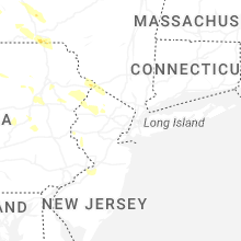


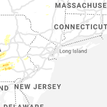

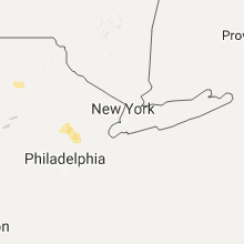


Connect with Interactive Hail Maps